|
More Stuff About this Stuff |
|
Introduction Most of the photos of people, places and events in my web pages should be able to stand on their own (a thousand words per picture, remember?) However, a few additional comments are sometimes useful. A friend complimented me on my pictures and said he hoped to reach that level with his new digital camera. I explained that one of my secrets is to show only one of every ten or twenty photos taken. Sometimes it may be one of nine or even eight, because the purpose of the photo goes beyond what appears in the frame. For example, a bunch of trees in Ohio looks much like a bunch of trees in Illinois or Michigan, but I took some of those pictures to show people back home in California what it was like in the area where I spent much of the summer of 2002. In other cases, an area or situation is interesting enough to deserve a longer explanation than my brief captions (for example, numerous books have been written about the national parks shown here). In these cases, the caption will be a link which will bring you to the expanded comments which appear below. And in a few cases, this page will be used to provide a long list of names in a group photo. --Dick Estel |
|
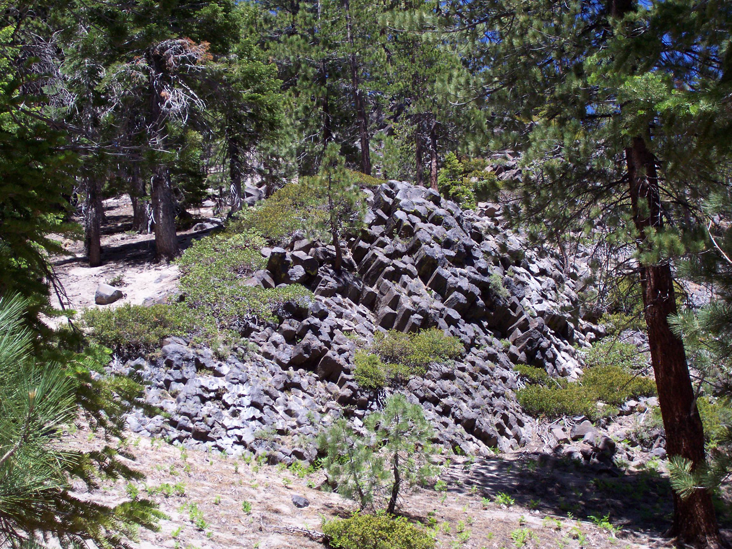
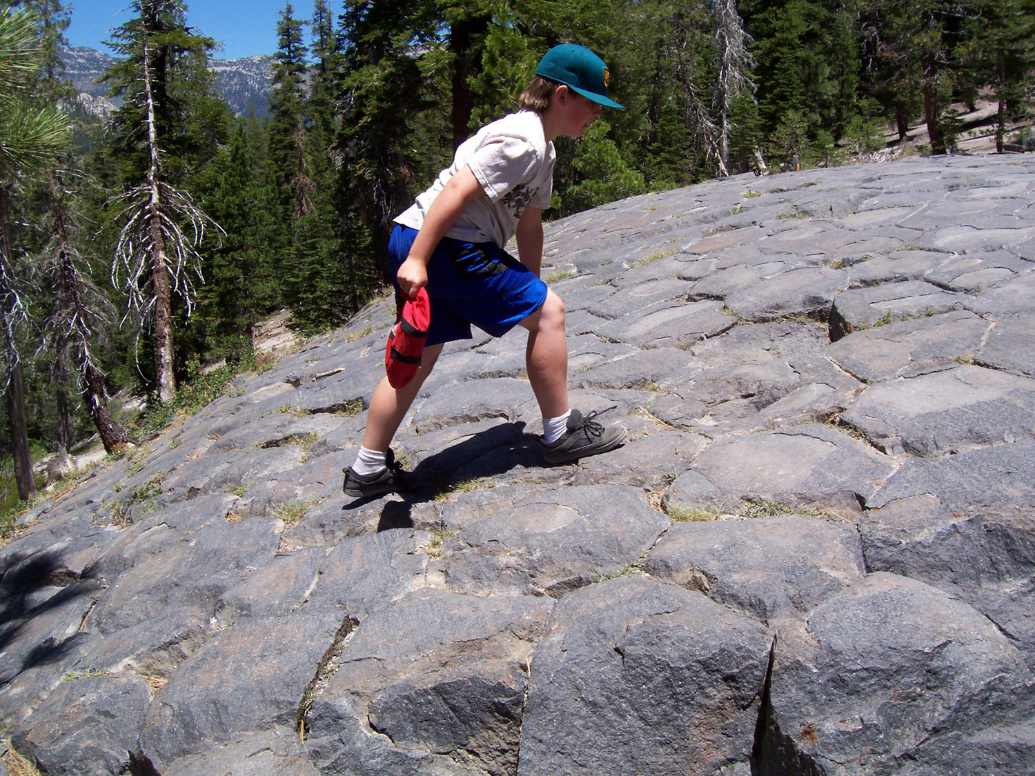
The Devil's Postpile is in fact an act of nature. Following a lava flow 900,000 years ago, the molten rock cooled around variable centers and cracked to form basalt columns 40 to 60 feet high and a foot in diameter. Other basalt formations are seen in the photo of the river and Rainbow Falls. There are similar, smaller postpile formations in the area. This photo was taken on top of the postpile. Top Back to Kings & San Joaquin River Page Photo Album List Home |
|
Dinner time on the trail from Granite Creek Campground to Devil's Postpile National Monument. Your web host made this 30 mile round trip hike in 1980, descending into the canyon of the North Fork of the San Joaquin, over the divide, and into the Middle Fork, where the Postpile and Rainbow Falls are located. |
|
A vacation on the southern Oregon coast in July 1999 revealed numerous rocky coves, most accessible only by trail through heavily wooded spruce forest. |
|
The notation on the back of this photo reads, "When Joel went out west in
1891." The photo is from a studio in Puyallup and Sumner Washington. Joel Richardson is the brother of your webmaster's great grandmother, Tillie Richardson Watkins. Photographer unknown. |
|
I photographed this barn in 1966, near the corner of Shaw and Cedar, across from Cal State University Fresno. It's just about my favorite barn photo, but the building is long gone and the area is filed with restaurants and office buildings. |
|
Abandoned lumber mill site at Dinkey Creek, Sierra National Forest. There are 100 or more buildings and worker cabins in various states of disrepair. Photos taken in 1998 and 2001. Receipts found in the old store building indicate the mill last operated in the 1970s. 2008 Update: The mill was known as the Pine Logging Company, and originated in Mariposa County. In the 1930s it moved to the location near Dinkey Creek in Fresno County. In the last few years, a historical organization has started restoration of the site, removing old junky appliances and buildings in the worst condition; and restoring some cabins, a dorm room, the store, the school, and office. Top Back to Central Sierra Page Back to Artifacts Page Photo Album List Home |
|
Polished granite strewn with boulders gives testimony to the power of glacial action in the Sierra (near Courtright Lake, Sierra National Forest, 1966). Rocks and boulders are carried by the glacier as it moves, and dropped at random when it melts. |
|
The Mariposa Mine operated as recently as the late 1950s, but has been shut down since then. The actual mine (a hole in the ground) is not accessible, but what is there and of interest is the equipment used to crush the ore and remove the gold. Rock was brought out in small ore cars that ran on a rail, and dumped into a hopper, eventually landing at the bottom of a stamp mill. This consists of very heavy iron shafts, with larger cylinders at the bottom (as shown here). They are raised by a camshaft, and allowed to drop onto the rock. The crushed rock is then washed down a trough with a screen in the bottom, which traps the heavier gold particles. The mine is built on the side of a hill, and is probably 150 feet or so from top to bottom. It was operated by electricity, and there are giant motors, huge pulleys, and other equipment still there. There are stairs you can climb, catwalks across from one side to another, and a ladder that leads up to the very highest point of the structure. Several years ago my Grandson Johnny and I went to explore the area. Inside the building we found a number of 3" diameter iron balls, which I later learned were used in the stamp mill to help crush the rock. The roof of the mine is aluminum and slopes down, paralleling the hill and the different levels of the mine. Johnny got the idea of going up in the top part and dropping a ball out the window onto the roof. I was standing to the side, watching. What I expected would be a rather unspectacular event instead was an amazing sight. The ball rolled down very fast, flew over a section where the roof is gone, hit another section of roof about five feet lower, and bounced 10 feet into the air and down into a ravine. Regrettably we can't usually duplicate the leap, but at least we get to see the ball roll down the roof very fast. Sadly, in 2002 some teenagers set a fire in the mine, apparently to keep warm while they partied. Of course, a fire built on a wooden platform has a predicable result, and half the building was destroyed. Most of the big timbers are there, charred and tumbled together, and of course the metal equipment was still intact. Most of the lower half of the mine, which was the most damaged by age and elements, was spared from the fire, but the days of the annual ball roll are over. Update: A visit in the spring of 2007 revealed that more of the remaining wood structure had collapsed, and the site is now very dangerous and lacks the elements that made it a special place to visit. |
|
1916 Merced Field Day Motorcycle Group - Main Street, Mariposa |
|
This "artifact" is actually a collaboration between nature and man. The rocky rodent stood guard along California Highway 41 north of Fresno for a while back in the 1970s. CalTrans later blasted it apart to widen the road. |
|
Arches and Canyonlands National Parks Arches haunts me. I don’t mean that in any mystical or religious way, but I found it to be a very special place – one where we are reminded dramatically of the powerful forces of nature, and that the earth is not a finished product. If there were no arches at all, the park would still be worth seeing – fascinating rock shapes, twisted juniper trees, and sheer walls of sandstone. Then there are the arches – over 2,000 of them, although the typical visitor sees fewer than 100. Some are close to the main road; some of the most dramatic require an investment of time and effort to walk a mile or more in an area that is hot in summer, snowy in winter, and close to perfect in October. Not far away is Canyonlands National Park – but much of Utah is canyon lands – the Colorado Plateau, a high desert cut by canyons and gorges, some accessible only at great effort on foot, bike or four-wheel drive vehicle. The Green River joins the Colorado in the middle of the park, dividing it into three sections that are isolated from each other – a trip by road from one section to another requires a drive of nearly 100 miles. The Island in the Sky district stands at 6,000 feet, and from its edge you look down a thousand feet on the White Rim plateau. The plateau is cut by gorges and canyons large and small, including the dramatic Monument Basin. Another thousand feet below White Rim are the rivers. In the distance you can see the Needles district. The Maze, a nearly impenetrable tangle of canyons and rock formations, makes up the third part of the park. Top Back to Arches/Canyonlands Page Photo Album List Home Arches National Park Official Site Canyonlands National Park Official Site |
|
Kaibab Plateau and Grand Canyon North Rim The Kaibab Plateau rises from the high desert in northern Arizona. Traveling generally south from St. George UT, the visitor goes through desert scrub, pinyon and juniper forest, a zone of nearly pure ponderosa pine, and finally into spruce and fir near the border of Grand Canyon National Park. The Grand Canyon's north rim is about a thousand feet higher than the south rim, and draws far smaller crowds, while offering dramatic views and a fantastic vacation experience. Facilities in the park and on the upper plateau close around October 15, in anticipation of an average ten feet of snow. |
|
The Sonoran Desert is an arid region covering 120,000 square miles in southwestern Arizona and southeastern California, as well as most of Baja California and the western half of the state of Sonora, Mexico. Subdivisions of this hot, dry region include the Colorado and Yuma deserts. Irrigation has produced many fertile agricultural areas, including the Coachella and Imperial valleys of California. Warm winters attract tourists to Sonoran Desert resorts in Palm Springs, California, and Tucson and Phoenix, Arizona. The photos here were taken in the Superstition Mountain area, northeast of the Phoenix metro area. |
|
This load of old Studebakers was on its way to Texas. A man there was buying about 100 of them, in order to create three or four restored models. |
|
This deer and four of his buddies (all bucks) regularly visited my mother's yard, as well as those of at least two neighbors, during the summer of 2006. Next door neighbor Ludie even came up with names for them. The yards in question are all on the very edge of Mariposa, a small town in the Sierra Nevada foothills. |
|
Lizard Banished from the House My parents lived in a house right on the edge of the Sierra foothill town of Mariposa. Unwelcome visitors over the years included tarantulas, crickets, bugs of all sorts, and lizards, including this one. Mother would get the broom and unceremoniously sweep the hapless reptile out onto the lawn. |
|
These photos were all taken at the Butterfly House in Whitehouse, Ohio. Read more about this in Road Trip 2004. |
|
This lady lived in my back yard for an entire summer in the 1970s, and my friends and I enjoyed going out with a flashlight to check on her every few nights. The web was built against a concrete block fence, and anchored to the lawn. Later that fall there were five or six spiders building webs in the same area, and they had to be terminated with extreme prejudice. |
|
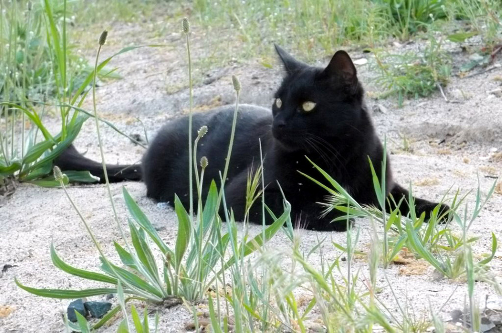
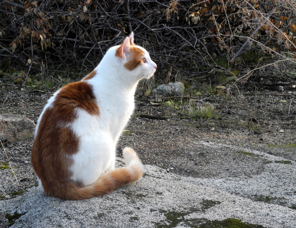
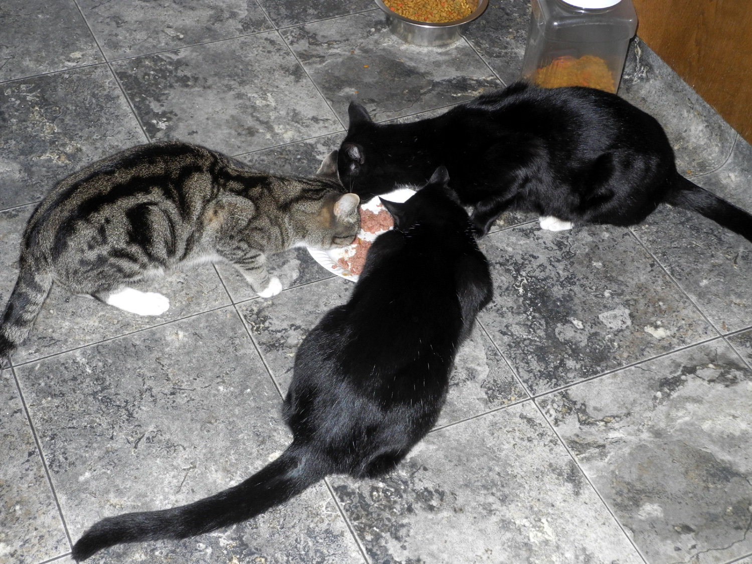
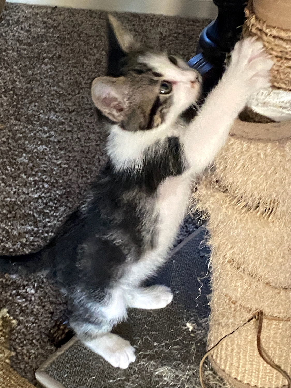
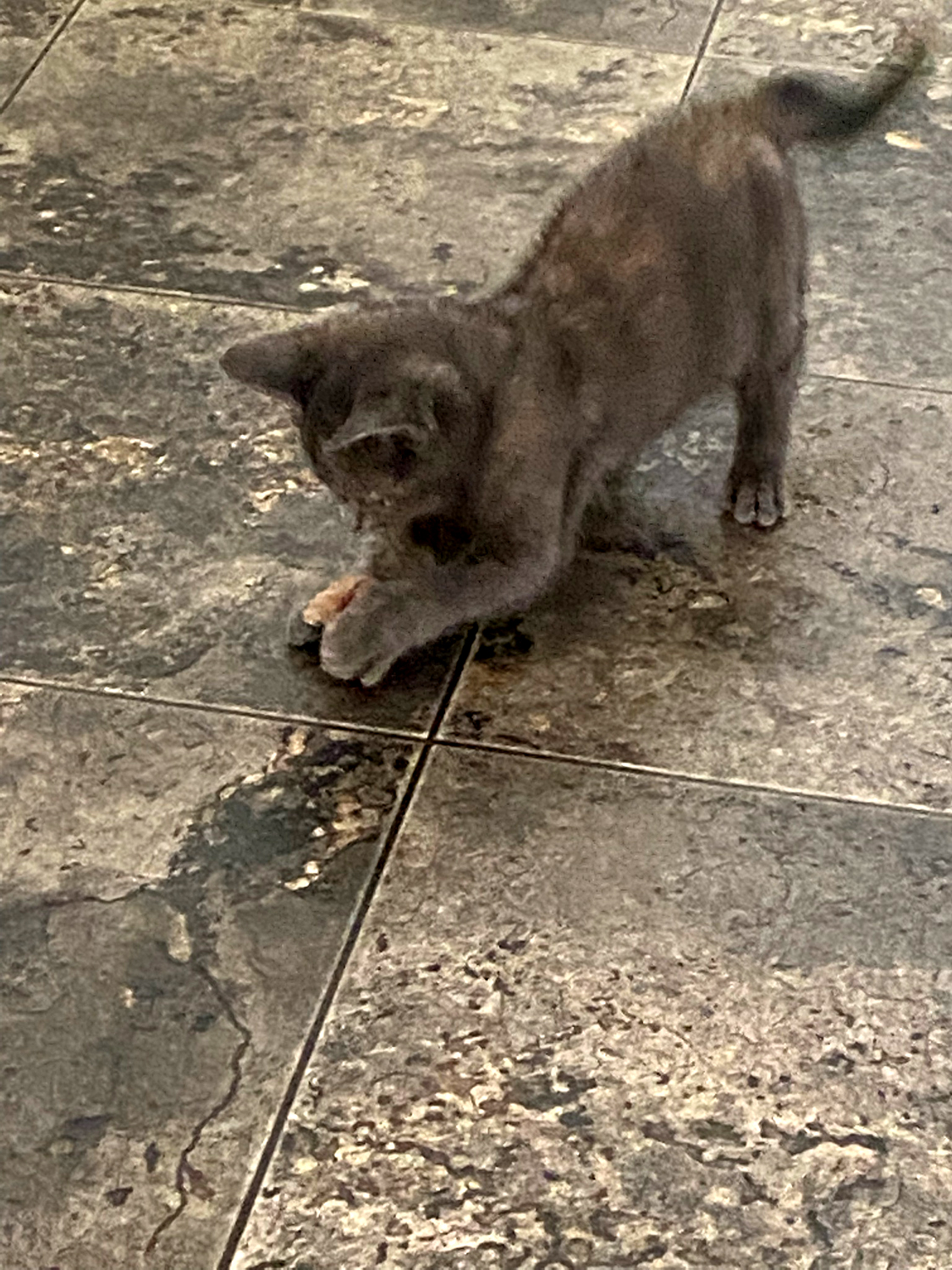
My daughter and son-in-law, Jennifer and Rod Neely, have always had three or four cats in the family. Starting with Noodles about 2002, and continuing through Buster (AKA Buster Brown) and Stickers in the next two or three years, they found themselves with the Tiger Trio, three cats who were all gray tiger stripe. Stickers arrived unexpectedly, wandering up from the drainage that runs through their property, abandoned and covered with stickers. Sausage broke the "color barrier" in 2006. Stickers proved to be a rare "snow cat," frolicking in the snow and even burrowing into it. A 2012 update: The count has risen to five (a couple of rescues), and of course, some of the gang has moved on. The Neely cat "kids" these days are Noodles, Buster Brown, Gizmo, Nibbles, and Li'l Hombre (also known as Boo-boo). Hombre and Gizmo both like playing in the snow. Nibbles disappeared in the summer of 2012, and about a year later, Gizmo disappeared, sadly not an unusual occurrence in territory occupied by coyotes. Newest addition to the family is a not quite black kitten named Sputnik. 2015 Update: Age and the dangers of country living caught up with Buster early this year; a couple of others came and went quickly due to other issues. The cat community at the Neely place is down to a special three - Senior Cat Noodles (around 12 years old), Hombre (not so little anymore), and Muffin, newly arrived in late 2014. 2017 Update: Hombre is now the Senior Cat; others are Pebbles and Bam Bam who've been around close to two years, and Miss Bojangles (Bo), who arrived in the summer of 2017. 2020 Update: Pebbles and Bam Bam are still going strong; their newest companion is Mister Bibs (back to camera as they enjoy Thanksgiving dinner 2019). 2021 Update: We are mourning the disappearance of Bam Bam. Pebbles is now Senior Cat, and pretty ignores the two new kittens, Newton and Peanut. |
|
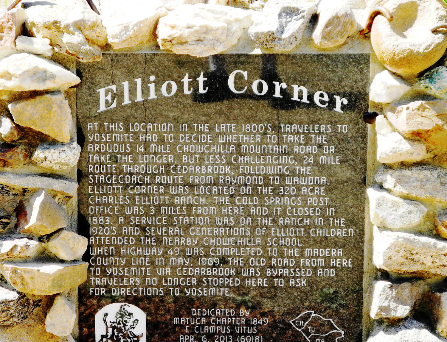
William (Bill) Elliott, who died at age 97 in 2014, grew up on the property where this barn is located, and provided the following information in May 2005: Here is a brief description of the barn. The picture you have is what we called the "back horse barn" with the tack room at the right end. If you take a picture of the front here is the general layout. On the left is the "front horse barn" which has a covered access to that tack room. The center, high part, of the barn is the hay and feed section with access to both horse barns. To the right of the hay barn was sort of a buggy and repair shop barn but we used it as a garage. A lot of those old barns were built pretty much the same. In 2013 a historical marker commemorating Elliott Corner was placed in the area. |
|
Barn at Highway 49 and Pegleg Road The house I grew up in is about 100 yards behind this barn, so I saw it many times, walked by it, but never went inside. As far as I know, it was not in use back then (1945-1957) and does not appear to be now. You can see a corner of our garage through the trees near the lower left of the photo. |
|
Opened in 1894, the Bootjack Dance Hall stood about a half mile from the Bootjack store, where today's Highway 49 meets Darrah Road. The hall was home to dances featuring local fiddlers, school events put on by nearby Sebastopol School, and from 1948 until it was torn down, the Bootjack Stompers Square Dance Club. Although the building was supplanted by a new hall next to the store, the old hall remained in use until it was razed in the late 1960s to make room for a realignment of the Bootjack Road, which had now become an extension of the Mother Load Highway, California 49. Visible in the distance is a building even older and of more historic importance than the dance hall. It's a former inn, a stop on the old stage road to Yosemite via Wawona. It was part of the McNally family homestead, and in my earliest days, was occupied by Spencer and Minnie McNally Pierce. She was a member of the second generation of McNallys in Mariposa County. When the Pierce's moved, the building went into non-McNally family hands for the first time since it was established. Like the hall, it was torn down to make room for the new highway alignment. |
|
In the late 1800s this gold mining town located at 8,000 feet in the mountains of eastern California, boasted a population of 10,000. The town had a wild and wooly reputation, boosted by the tale of a young girl whose family was moving there. As they packed their belongings, she wrote in her diary, "Goodbye, God; I'm going to Bodie." Residents of the town took issue with this story - what she really wrote, they said, was "Good, by God! I'm going to Bodie!" Click here for more Bodie photos. |
|
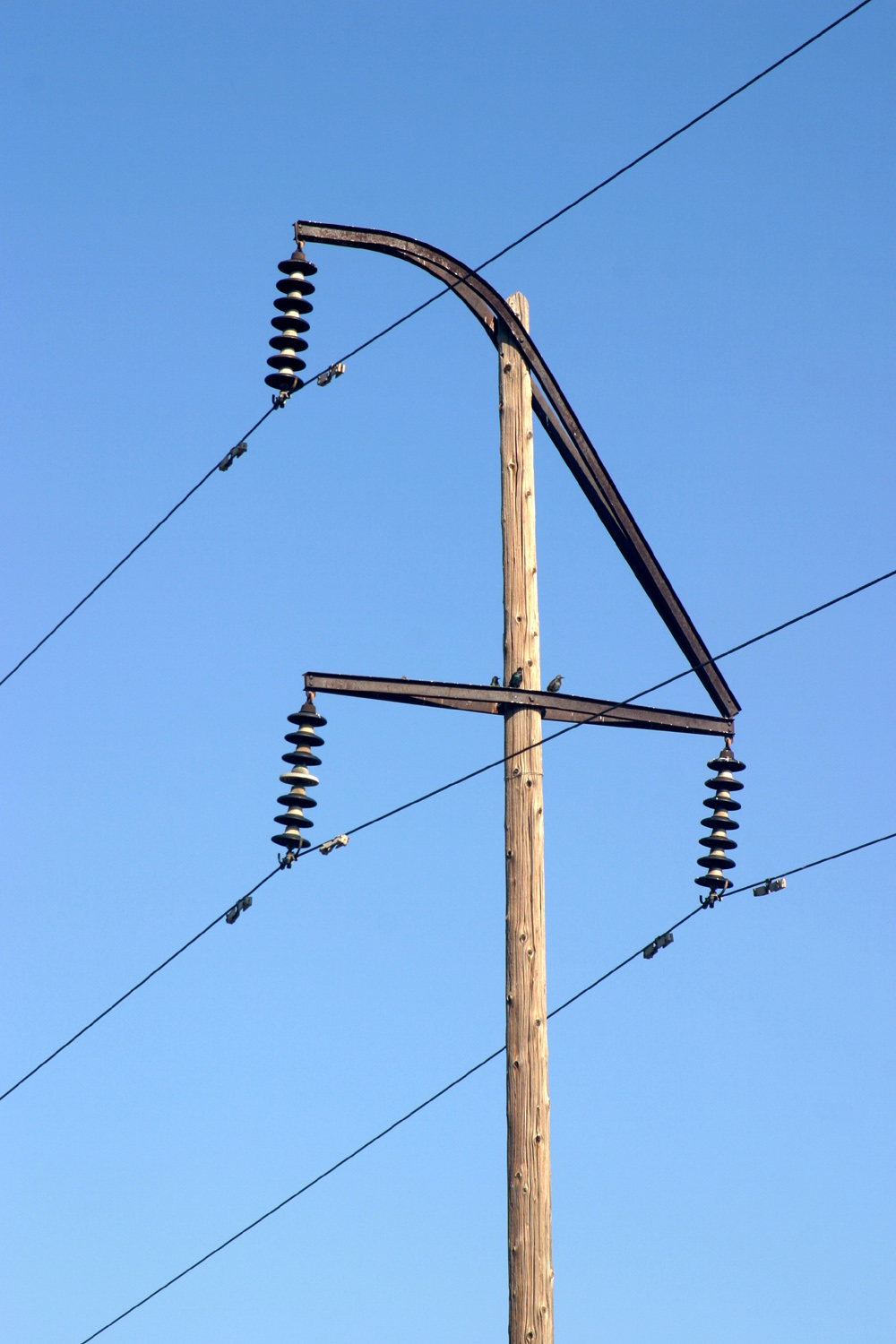
Cunningham Road between State Highway 140 and the village of Le Grand was lined with these poles when I was a kid (shortly after electricity was invented), and they always fascinated me. As the poles wear out, they are being replaced with modern poles with the insulators at the top and sides, and there are probably less than a dozen of the old poles left. I've seen them in a couple of other places, and to me they have more character than any other design. |
|
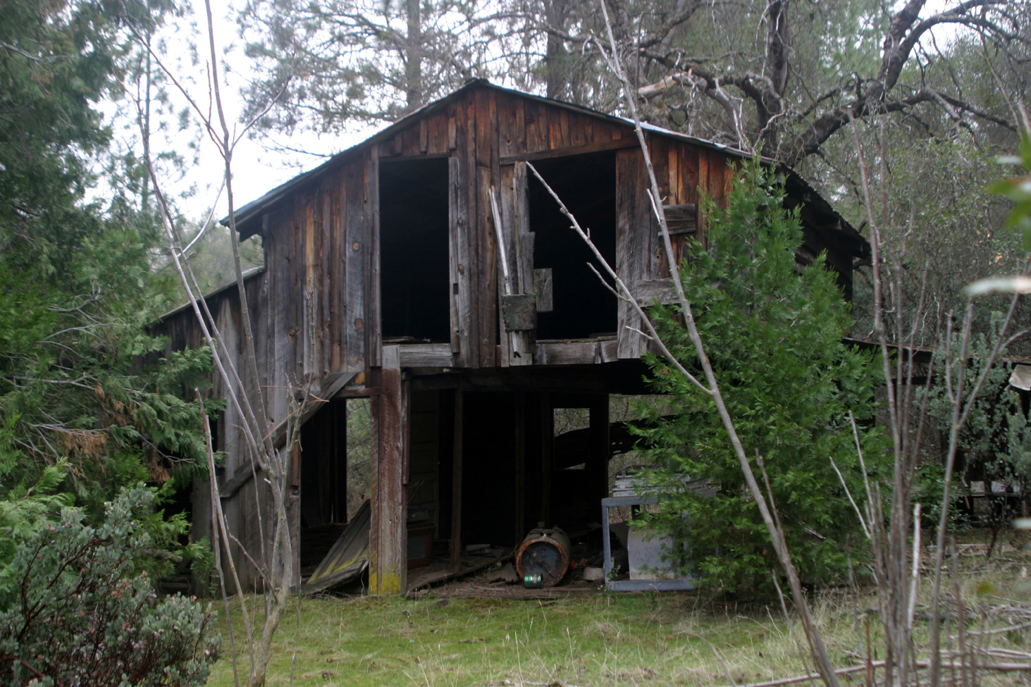
This building has seen better days, but unlike every other barn pictured, until August of 2014 it was MINE (well, mine and my sister's). Our ownership was temporary, by inheritance, lasting seven years, but this will almost surely be the only barn I ever owned. |
|
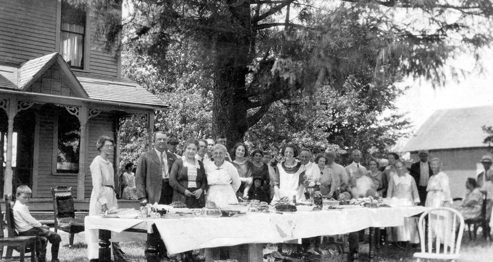
This photo was found in my mother's things after she passed away. It is not identified, and no one recognizes anyone in it; most likely it was in with something she bought at an action, and they are not relatives. It's typical of family reunion photos from the turn of the century. Note the priceless expression on the boy seated at left. |
|
This Colorado state park is surrounded by Pleistocene deposits (young glacial drift of the Bull Lake and Pinedale glaciations) on the southwest, Pennsylvanian/Permian Maroon Formation (maroon and grayish-red sandstones, conglomerates and mudstones) on the east and the Permian/Triassic State Bridge Formation (orange-red to red-brown siltstones and sandstones) on the north. |
| Barns in San
Martin & Gilroy
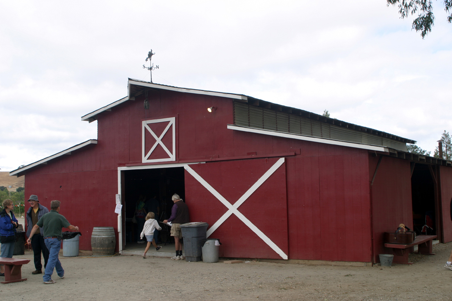
Both these barns are located at sites that were used for the Brown Barn Bluegrass Festival. The red barn in San Martin was the location for the first five years. The festival promoter, the late Jake Quesenberry, was color blind, and really thought the barn was brown. |
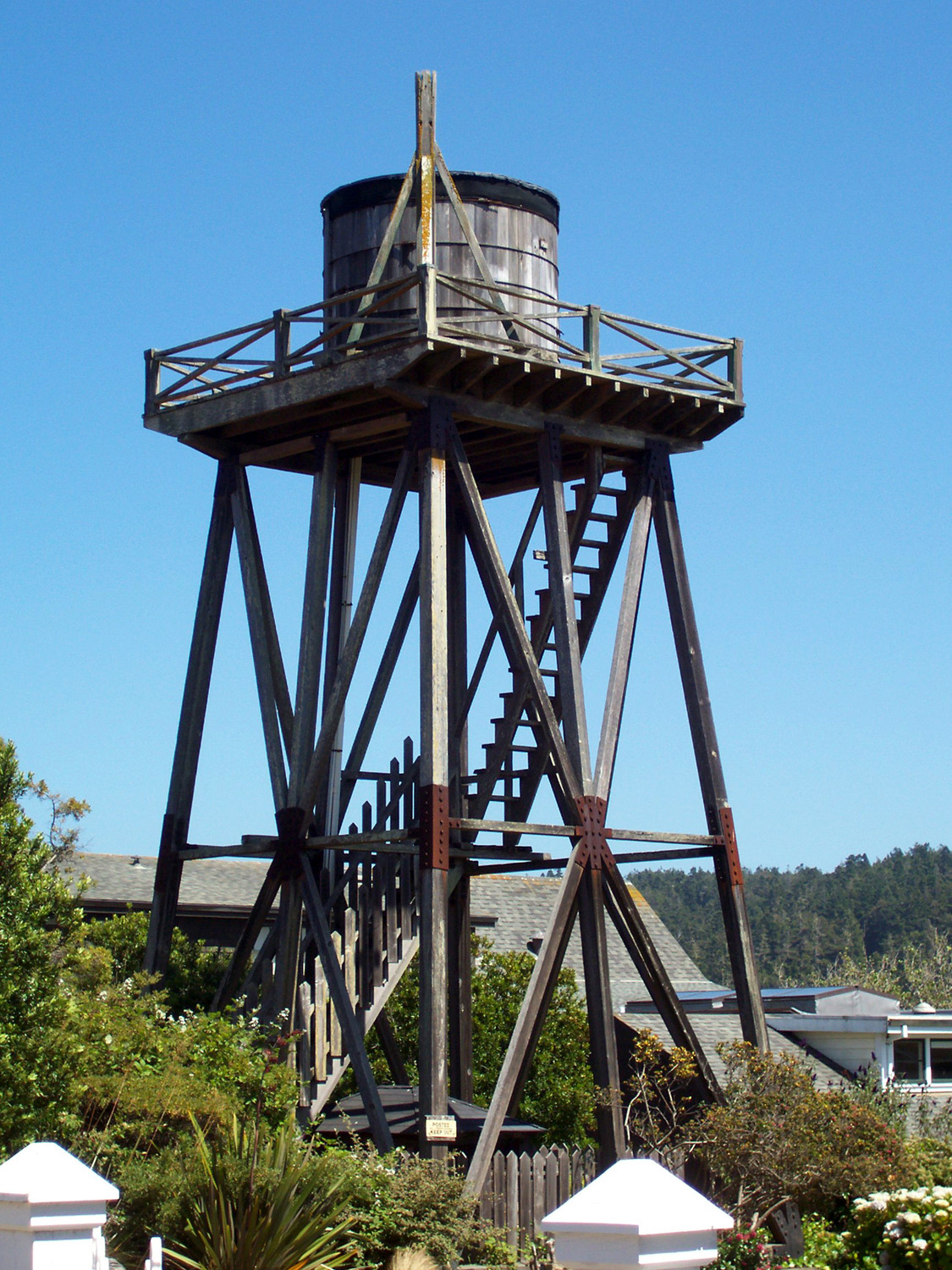
| Water
Towers in Mendocino
For more than a century, Mendocino water towers and accompanying windmills have captured the attention of visitors. In 1892, one reporter observed during her stay, “an individuality about the water works of this town not found in any other place.”
Early settlers were blessed with plentiful water supplies from nearby creeks and rivers, which facilitated the luxury of
water piped into the house. All one needed was a windmill tall enough to catch coastal breezes to power the pumps, and a tank positioned high enough to provide adequate water pressure. |
| Pride of
Madeira
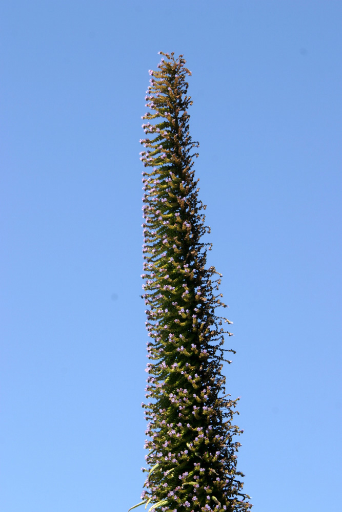
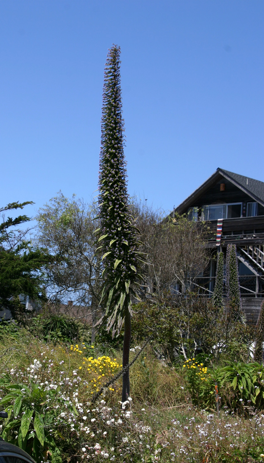
During my visit to Mendocino in 2011, I noticed a number of tall, spiky plants with tiny flowers, growing to 15 feet or more. My internet research showed they are called echium, but I was sure this was a scientific name and there should be a common name. This year we asked someone in a store and were told that they are called Pride of Madeira, being native to that Portuguese island. They grow in warm areas with poor soil and require little water or care. There are a lot of them along the coast north of San Francisco, but they are reported to do well in many other locations. They are technically considered biennial, but often live many years. |
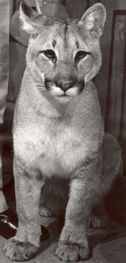
| Condor
Condor is obviously a mountain lion, also called a cougar or puma. Along with his trainer he appeared on the Jimmy Weldon Show on Fresno's Channel 47 (KEJO at that time) in the late 1960s or early '70s. |
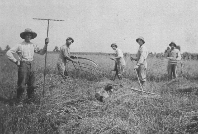
| Thrashing grain by hand
About 1916, the fields of Fulton County, OH, were so wet they could not harvest with regular equipment, so they used scythes, cradles and rakes. Pictured: Jake Kimmel (KK’s cousin), KK Watkins and sons Ross, Dorr, and Orra (KK was my great grandfather). |
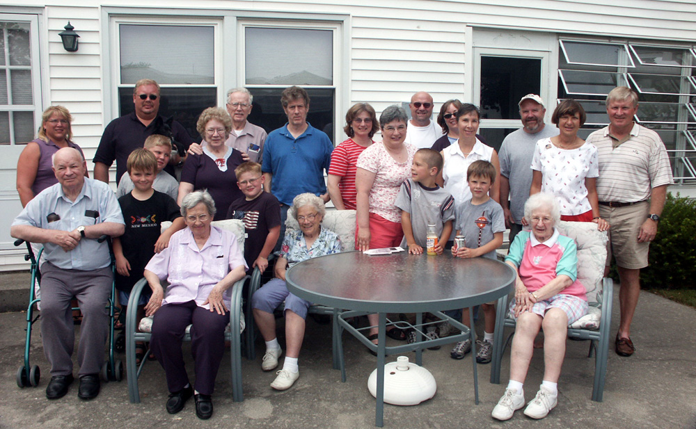
| Watkins Reunion
in Bryan OH 2004
Back:
Greg & Tami Nott, Graham in front of Greg, Meredyth and |
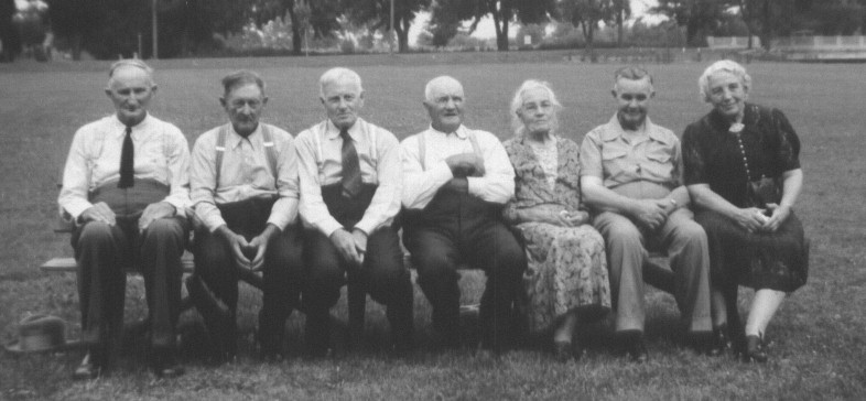
| Richardson
Siblings and Spouses
My great grandmother Tillie Richardson Watkins and her siblings and their spouses: Charles Blake, Clarence Arnold, Jesse Richardson, K.K. Watkins, Tillie Richardson Watkins, Ben Fowler, Laura Richardson Fowler |
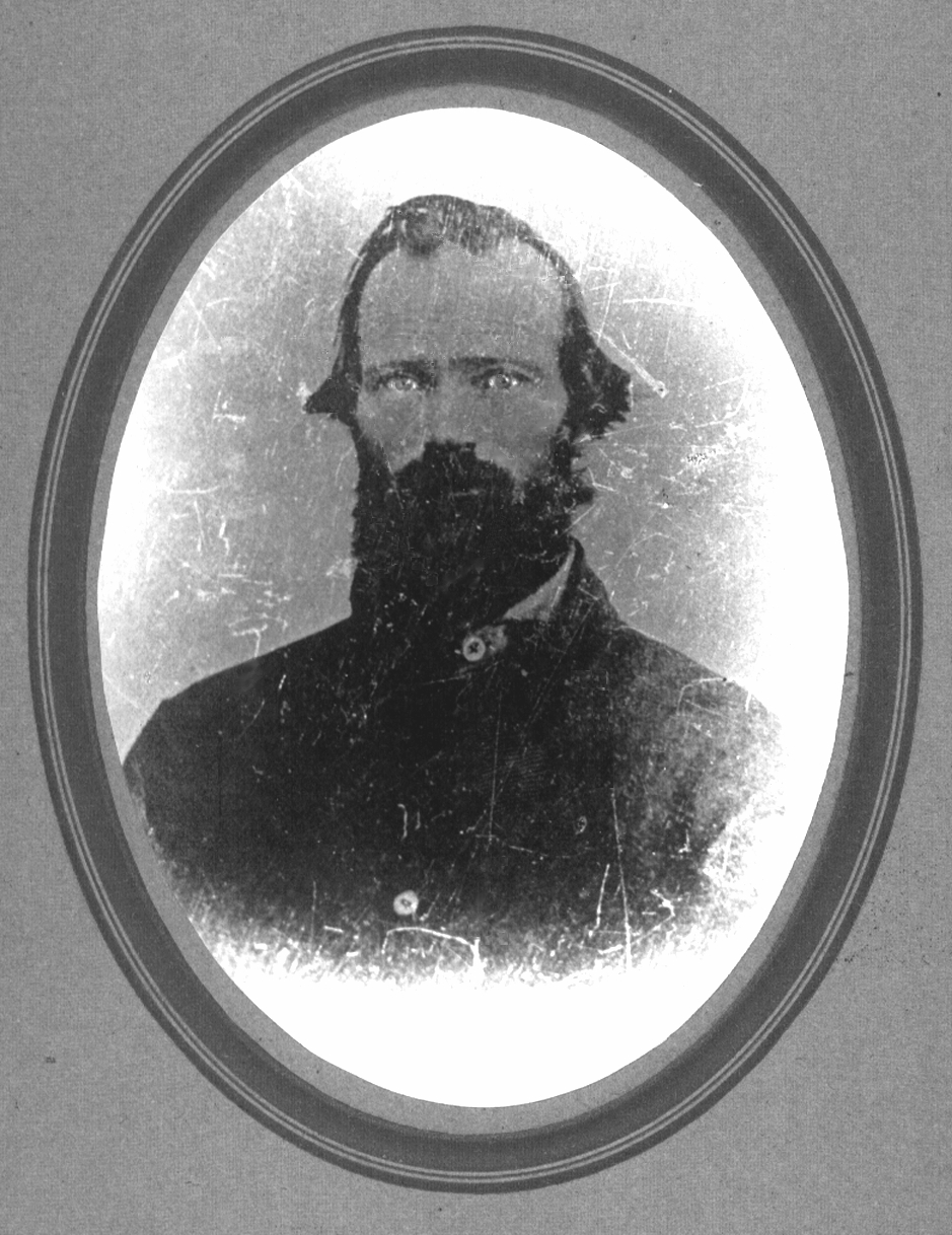
| James Holliday
Watkins
The only known photo of K.K.'s father; we are indebted to the late Ron Watkins for providing a scan of this photo, which we have touched up |
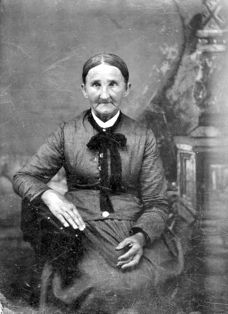
| Nancy Kimmel
Daughter of Jacob Michael Kimmel and Elizabeth Maurer, wife of James H. Watkins (the younger), mother of Kimmel Kyper Watkins |
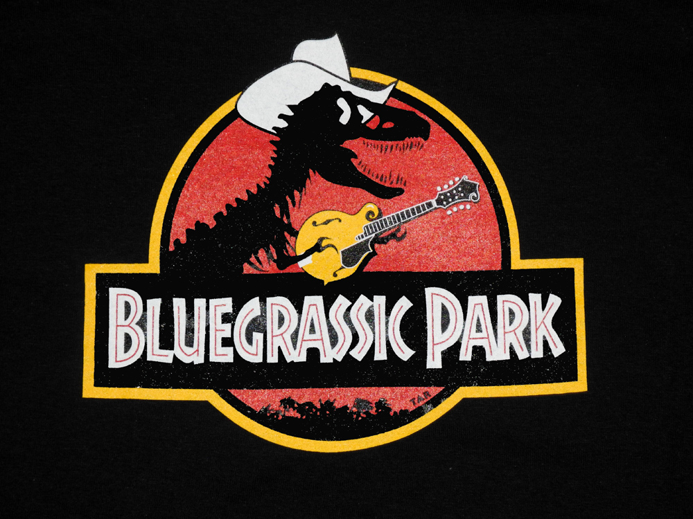
| Bluegrassic
Park
The Bluegrassic Park T-Shirt was designed by Tom Rozum, singer and mandolin player with Laurie Lewis & the Right Hands. |
| Clovis
Flume
A relative from Ohio emailed me "What's a flume?" It had not occurred to me that people living in flat states might not be aware of this technology, which depends on hills and gravity. From Wikipedia: "A log flume is a flume specifically constructed to transport lumber and logs down mountainous terrain to a sawmill [or lumber yard] by using flowing water. These watertight trough-like channels could be built to span a long distance across chasms and down steep mountain slopes. The use of log flumes facilitated the quick and cheap transportation of logs and thereby eliminated the need for horse- or oxen-drawn carriages on dangerous mountain trails."
Most of them had a narrow walkway along the side, and workers walked along
them, checking for jams and loosening them. There were flume boats,
usually a dugout canoe or a simple wood box made to fit the flume, that were used sometimes by workers, and an occasional weekend outing by families. They traveled up to 60 MPH, and had no brakes so you hoped you didn't come
upon a log jam. There are a bunch of flume pictures here. Top Back to 2014 Hikes Page Back to Artifacts Page Photo Album List Home |
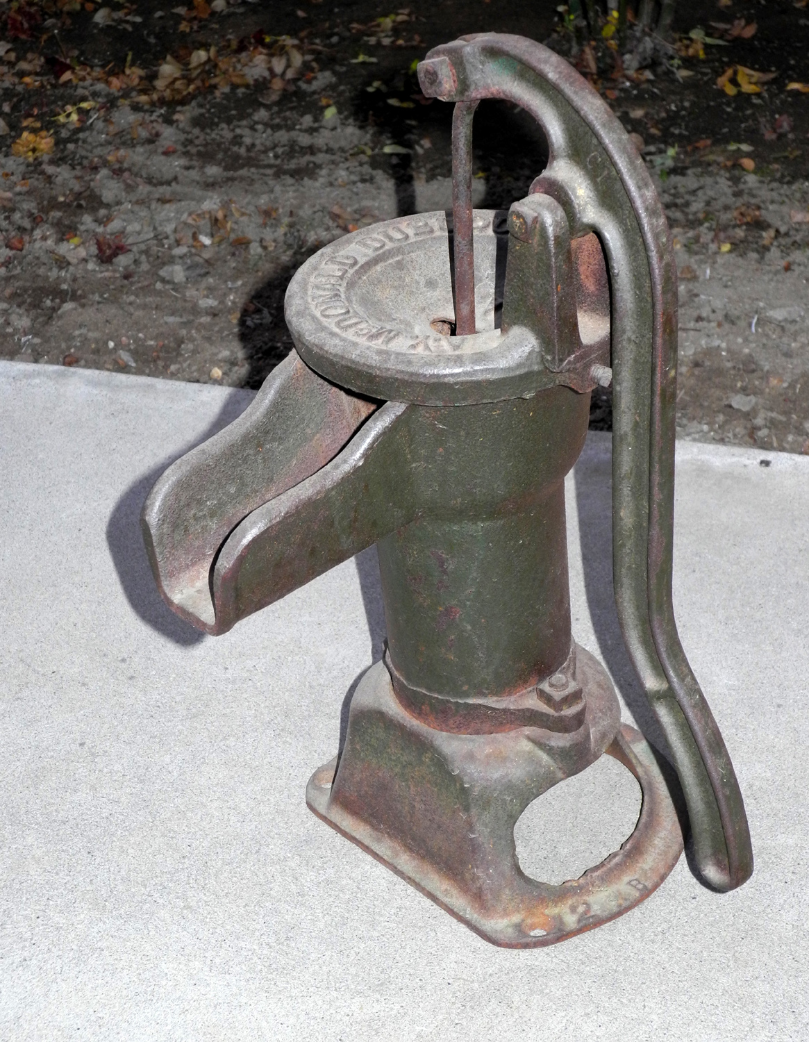
| Grandma's
Pump
This old hand pump was used inside the home of my maternal grandmother, Opal Mason, in the small village of Metamora OH |
| William
Sell Bridge
From Shelley Law, lifelong Mariposa County resident: Bridge 40-048, at the east fork of the Chowchilla River in Mariposa county, is named the "William M. Sell Memorial Bridge". It was
dedicated in 1972, and was named by Assembly Concurrent Resolution 22, Chapter 46, the same year. William Martin Sell, Jr., (1882-1971), a lifetime resident of the Sierra and hostler, served on the Madera County Board of Supervisors. |
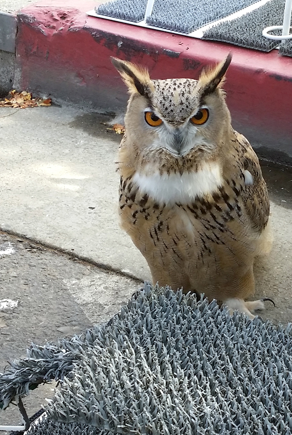
| Eurasian Owl
This was one of three owls smuggled into the U.S. as eggs. Due to concerns over disease, they cannot be released or returned. Two are in zoos; this one is in the care of a wild bird rescue group in the Fresno CA area. The smuggler was arrested. |
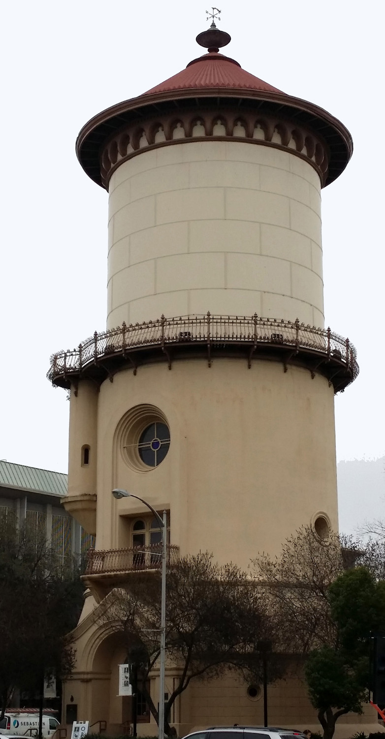
| Fresno
Water Tower
Completed in 1894, the iconic Fresno Water Tower was in constant use until 1963, when the pumping machinery was no longer adequate. It now houses a gift shop and visitor center, staffed by volunteers who are well versed in the history of the tower and Fresno in general. See more details here and here. |
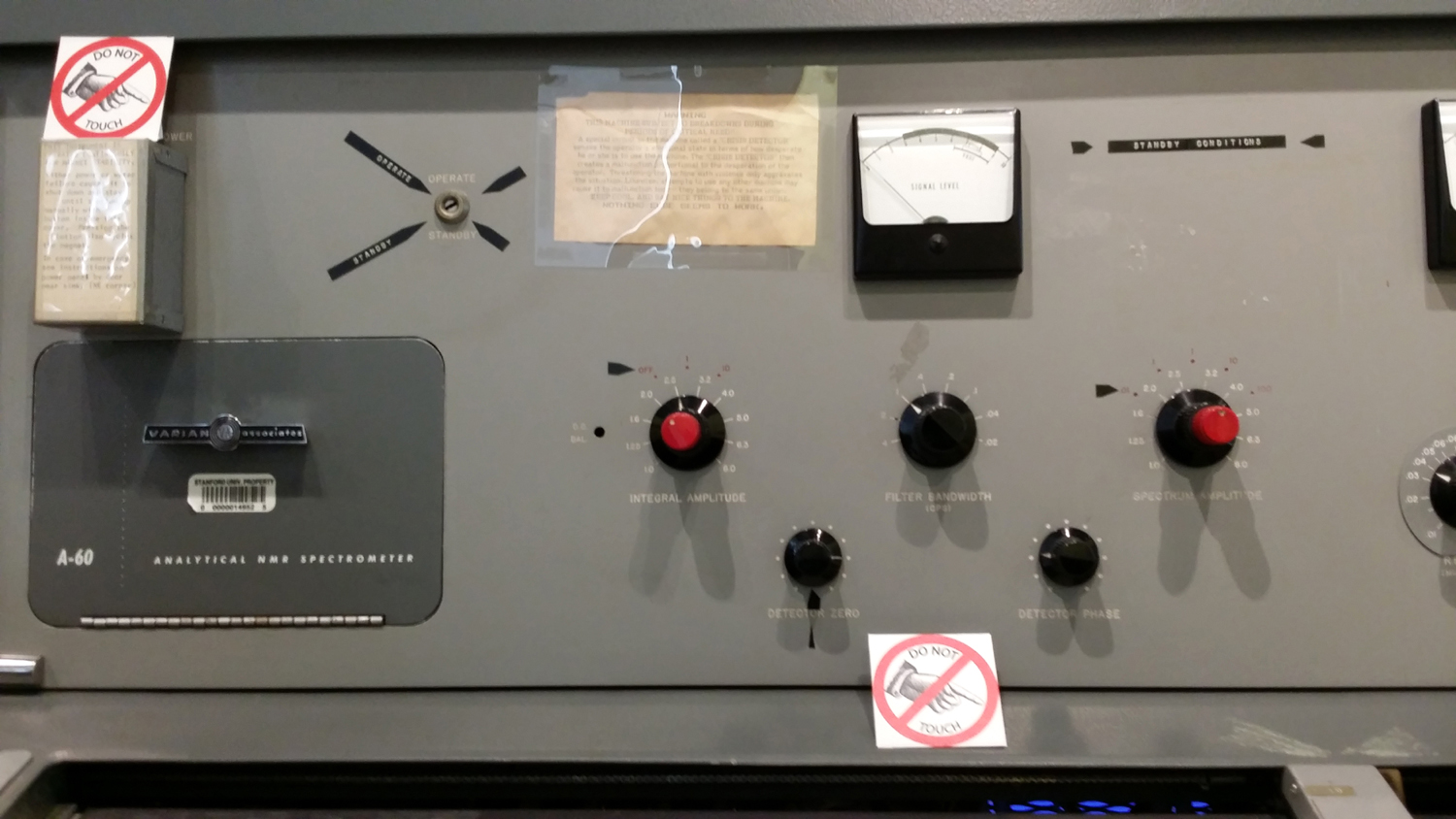
| Varian
Associates Device
Each May I spend several pleasant days at Parkfield, CA, listening to bluegrass music. The town and a large tract of ranch land nearby is owned by Jack Varian and his children. Jack's father and uncle invented the Klystron tube, which was critical in the development of radar. They developed the technology into equipment that is still used in the treatment of cancer. It was a strange but interesting experience to find their name on a piece of equipment displayed in a museum in Philadelphia. Top Back to Pennsylvania Adventure Page Photo Album List Home |
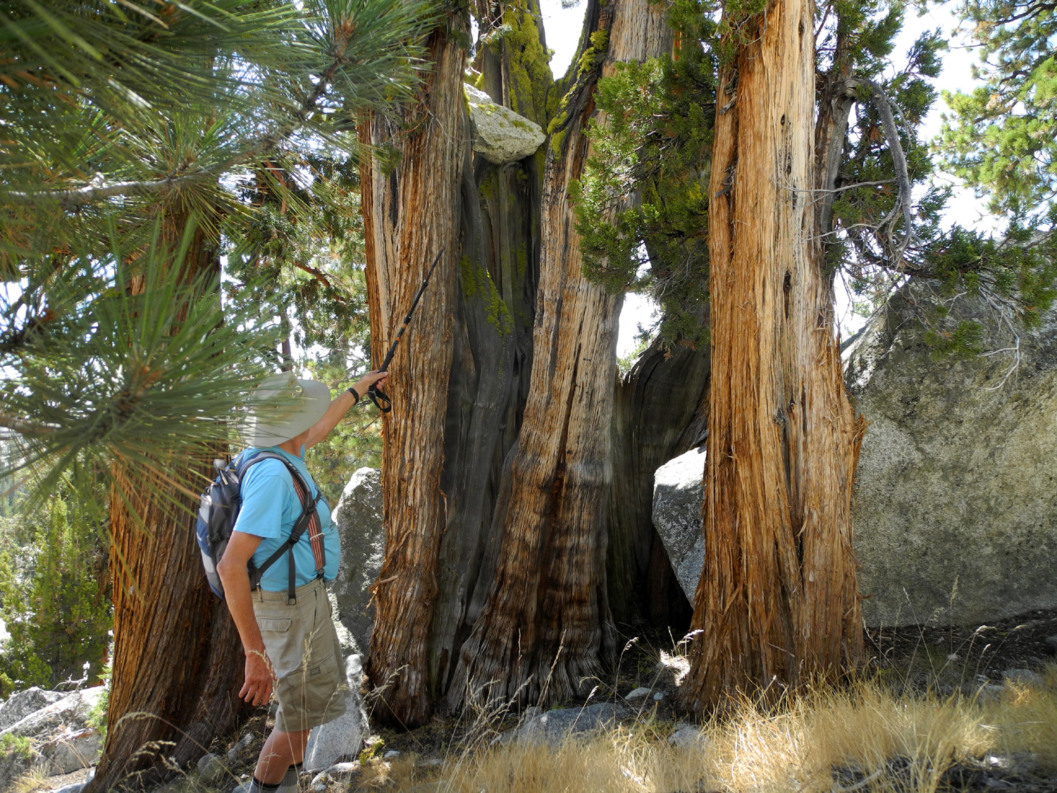
| Rock
in the Juniper Tree I came up with three possible theories on how this rock got up in the tree: 1. Someone put it there - unlikely considering the weight of the rock, the distance from the ground, and the overall effort involved; 2. It was pushed up as the tree grew - again unlikely considering these trees start out as small, limber seedlings and become small limber saplings; 3. The rock fell from above and landed in the tree - requiring a very precise coincidence, but still the most likely as far as I could figure. |
| Old
Fresno County Courthouse
The classic Fresno County Courthouse, built in 1875, was demolished in 1966 amid great public controversy. When the cupola was removed, it was purchased by Leonard Kavoian, whe kept it safely stored for decades. In 1997 the family donated it to the Fresno Historical Society, and it is now on loan for display at the Fresno Fairgrounds, where this photo was taken in October 2017. |
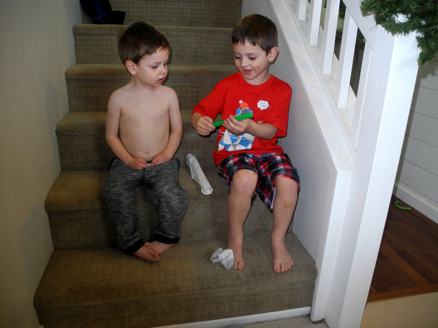
| Whimsical
Christmas Gift
In 2017 Jack and Colton discovered the joy of Great Grandpa Dick's made-from-scratch cocoa. The best way to drink it was through a straw. On Christmas morning I took gifts and a jug of freshly-made hot cocoa to their house. Knowing they had no straws, I wrapped a couple in a paper towel with a rubber band, and had them open it before breakfast. I assumed the reaction would be "meh," but to my delight Colton opened it and exclaimed, "Two green straws!" |
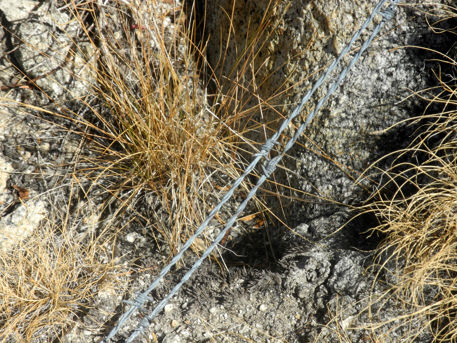
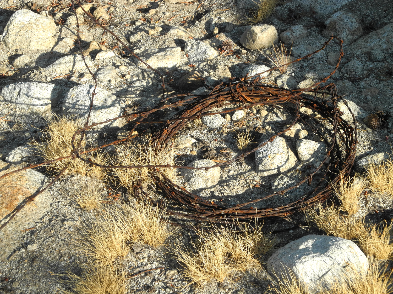
| Barbed
wire at Courtright
We have observed barbed wire in a number of places in the rock slopes and ridges east of Courtright Reservoir. This section here was part of a long run of wire, maybe 100 feet or more, on the slope below Double Dome, east of the Dusy-Ershim Trail. It ended near a small cliff, and I speculated that it might have been part of a corral with the cliff forming one side of the enclosure. Usually we just see short pieces. However, once we saw this roll on the slope west of where we camp near the trailhead. |
| Wildlife
Guzzler
This artifact is a device designed to direct rainwater into a shallow holding basin, usually concrete-lined, to provide water for wild animals during dry spells. We've seen them in a number of locations, including the San Joaquin Gorge and Edison Point near Pine Flat. The Internet tells you how to build your own, mainly for people who own country acreage. |
Updated July 7, 2025