
Adventures of 2015 - June to December |
||
Adventures of 2015 - January to May Lewis Creek Trail Kaiser Pass Hike Kaiser Pass 2 Taft Point Kings River Bluegrass Shaver Lake Logging Road San Joaquin River Trail (Finegold) Lewis Eaton Trail (update) San Joaquin River Gorge Thanksgiving at the Gorge |
||
|
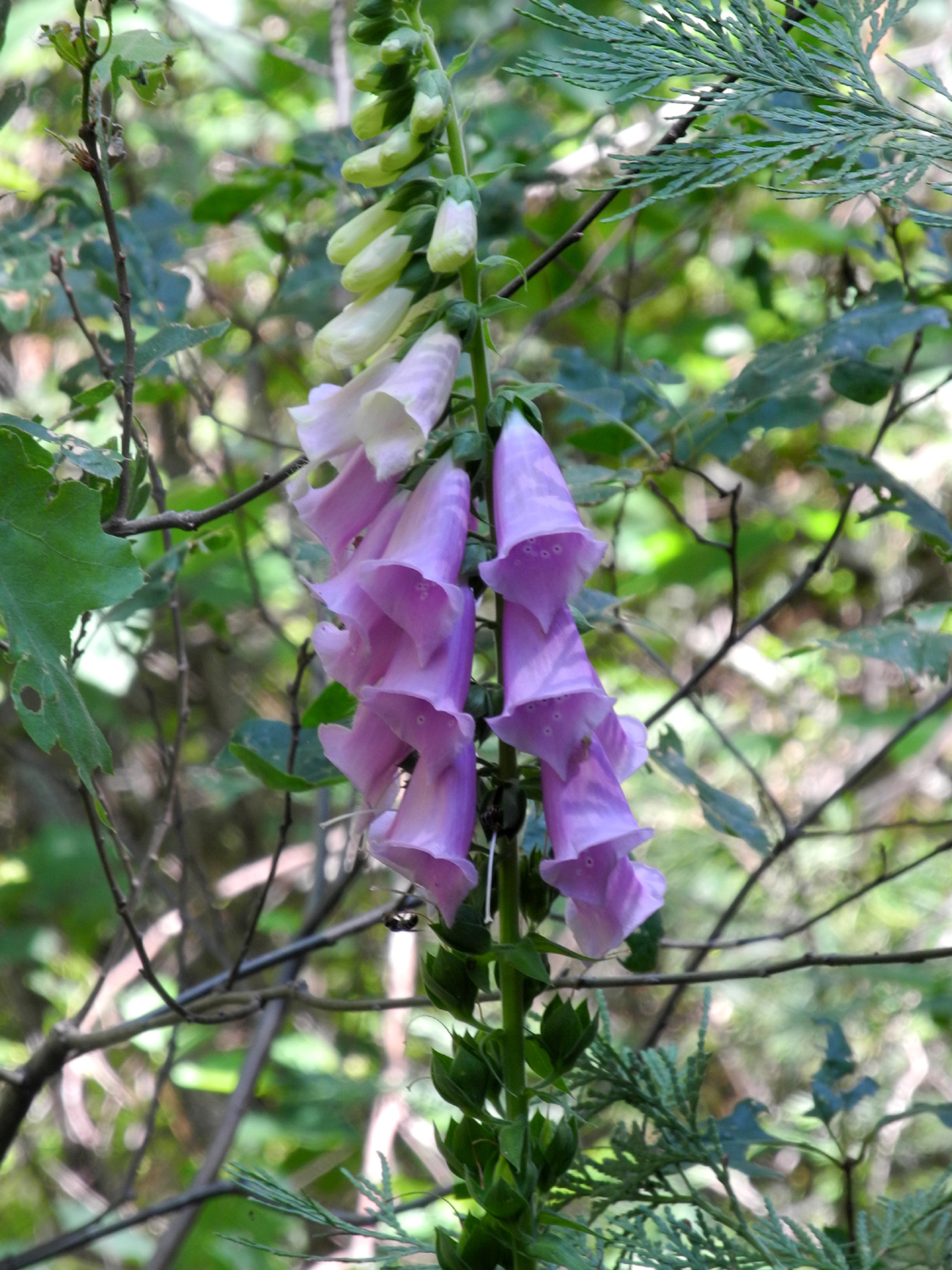
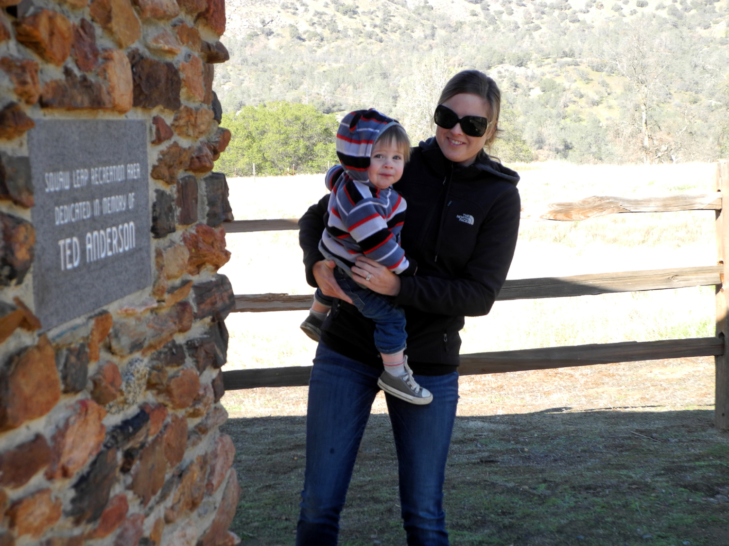
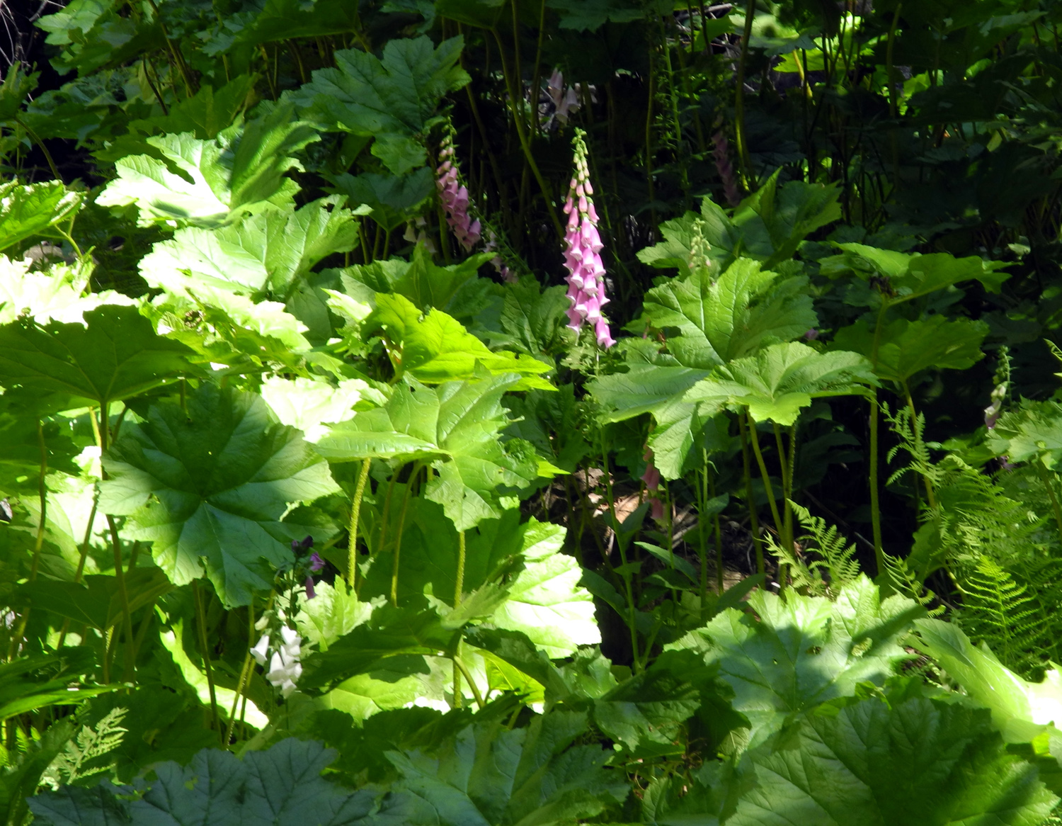
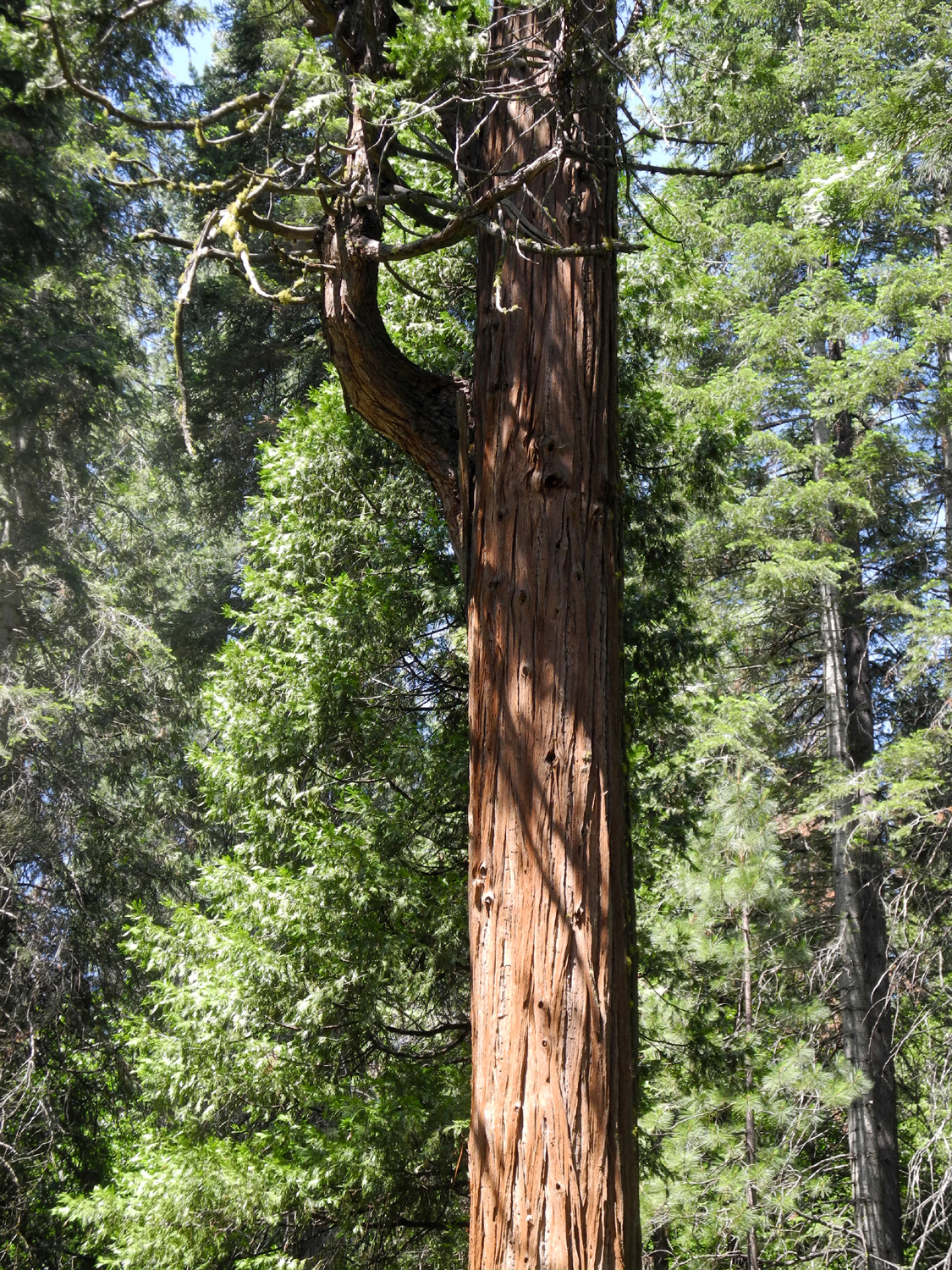
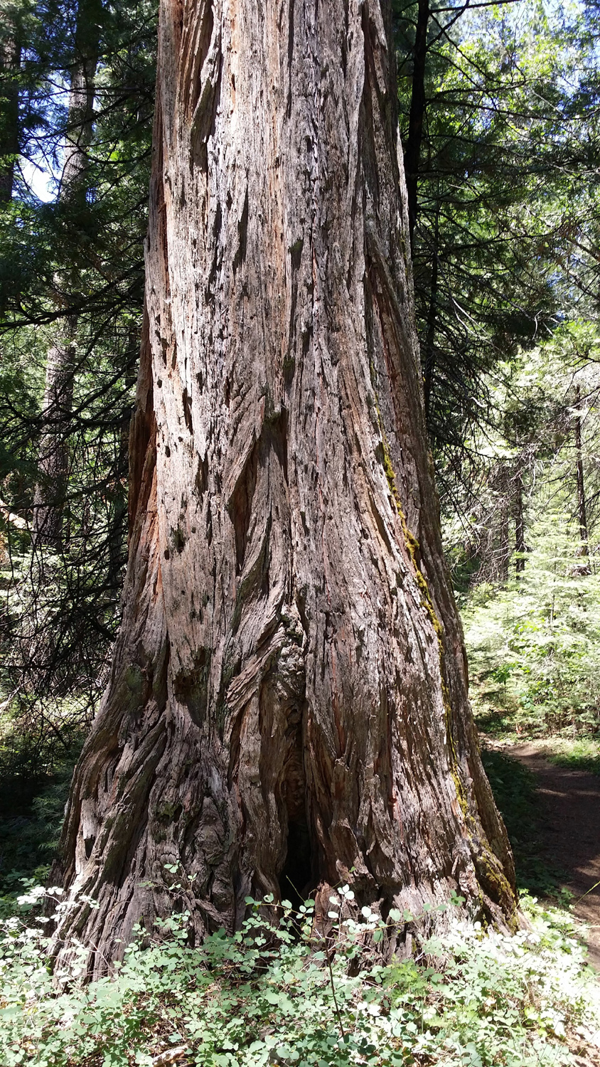
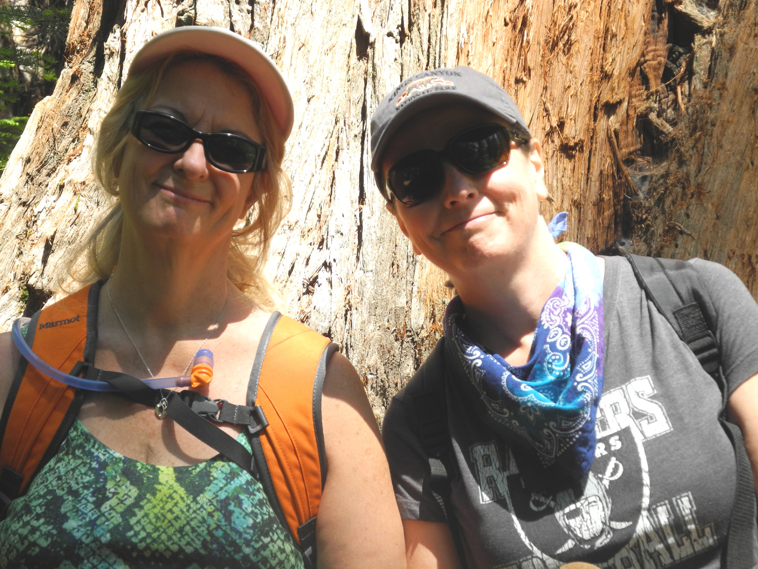
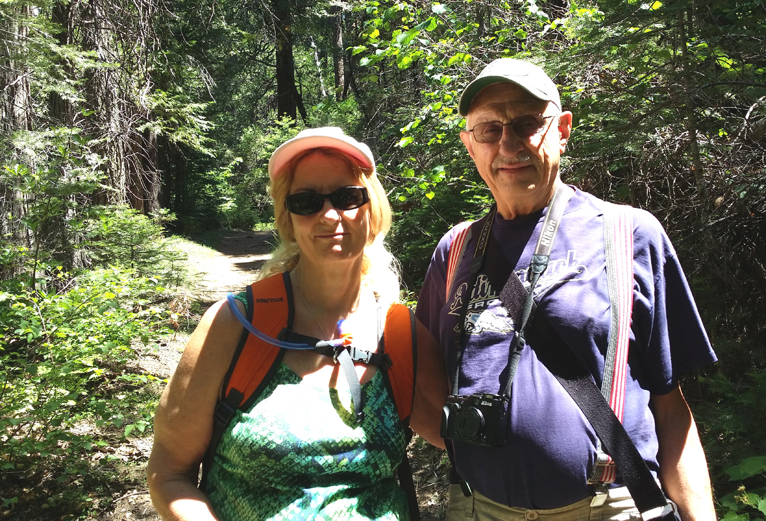
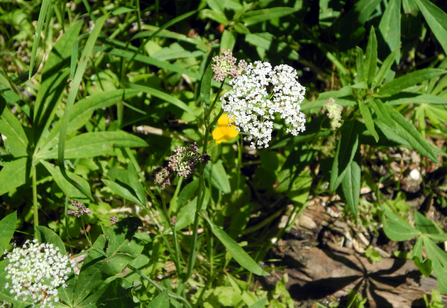
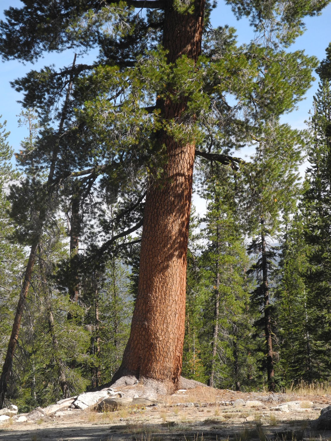
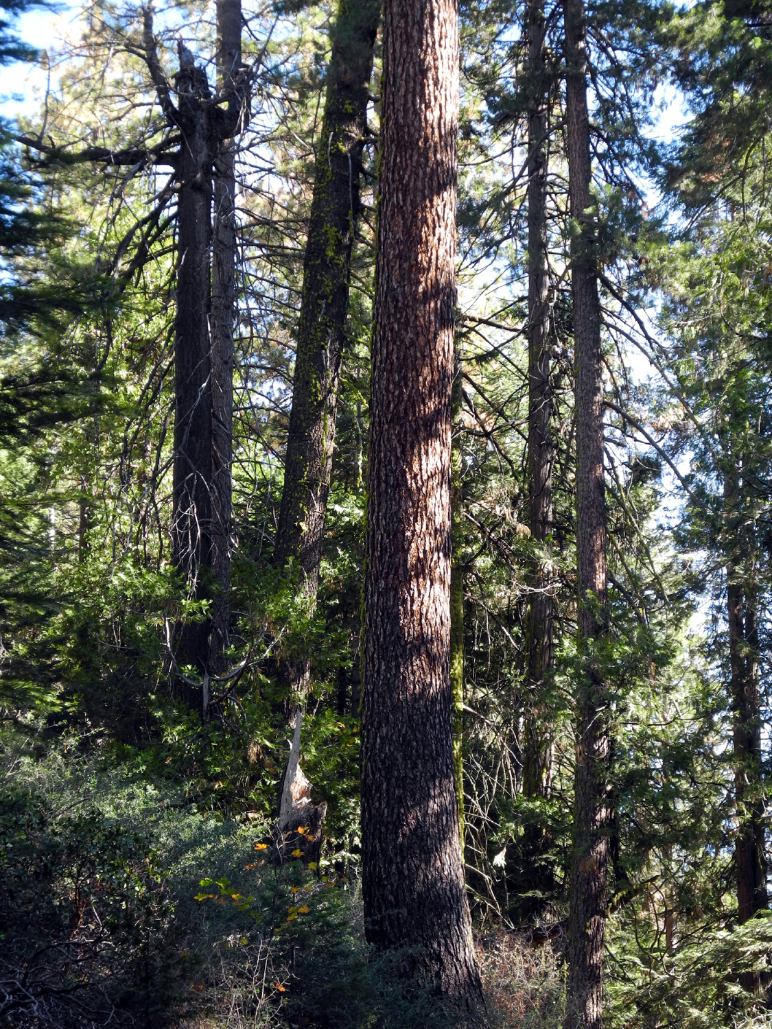
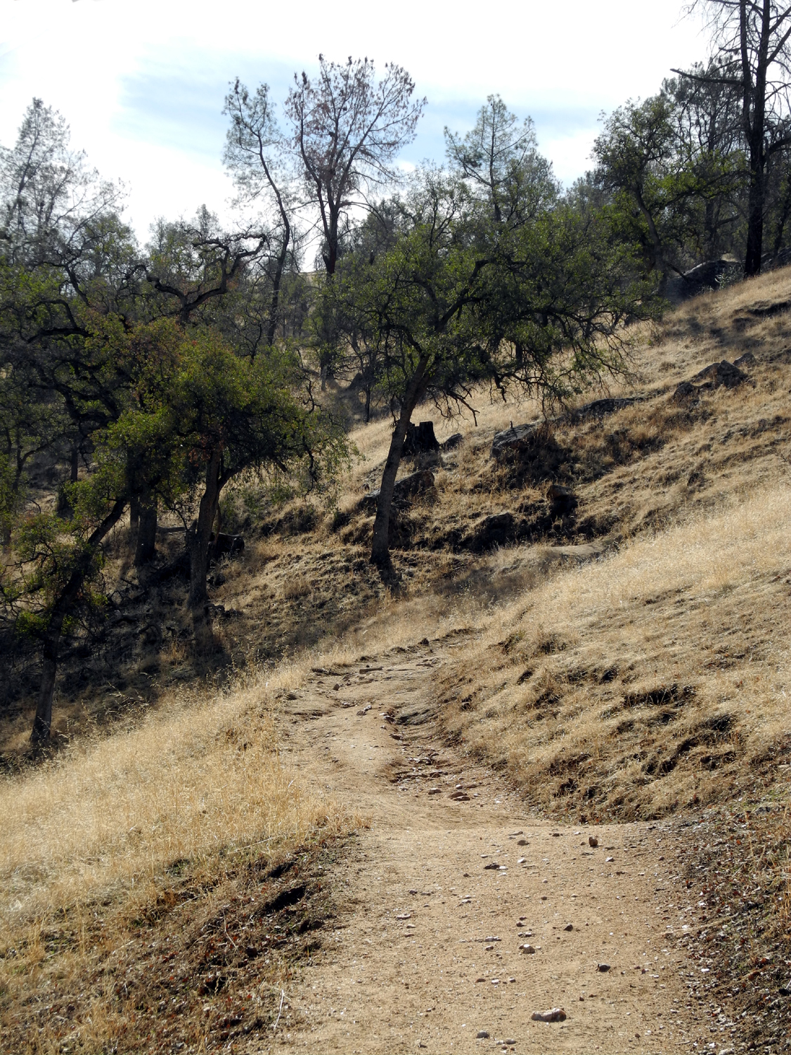
Lewis Creek Trail This was a Father's Day hike, June 21, 2015, and a very special one - I got to go hiking with both my daughters, Teri Liddle and Jennifer Neely. With busy work schedules, families, and living an hour apart, it's hard to get everyone together for any purpose, and we haven't camped or hiked together for several years. Teri picked me up about 9 a.m. and we went up Highway 41, through Oakhurst, to the Neely property, five acres in the hills above town. Jennifer was ready to go, and we went back to 41 and north a few more miles to the Lewis Creek Trailhead. It was Teri's first time on this trail; I had hiked the southern section to Corlieu Falls several times, with friends and with Jennifer. Neither of them had gone the northern route. This section goes to Red Rock Falls and on through the small community of Sugar Pine, site of a logging operation in the early part of the 20th century. I had taken this trail with the Ramblers in May, but had not made it all the way to the falls. It was a fairly warm day, but the trail is mostly shaded by pines, firs and cedars, and runs near Lewis Creek, so it was a comfortable hike. The huge blossoms of Indian rhubarb that we saw in May are gone, but the plants have now gone into their next stage, producing big sprays of huge leaves. The dogwood blossoms of May were also done, but we saw a few azaleas in bloom. In addition, we saw a dozen or more species of wildflowers that come along in the later part of the season. Considering the mileage we recorded on the Ramblers' hike and the distance to the falls, I was pretty sure we had come very close, so Teri, Jennifer and I kept going past my previous turning-back point. As I suspected, it was not long before we came to a sign directing us down a steep trail to the creek. The falls proved to be notably unspectacular, although at high water it would surely be more impressive. From where the trail ended, we were near the top of the falls, and could not really see the entire drop, but it's a short fall. Above it are some nice pools, as well as azaleas in bloom, and we all agreed that the hike was well worth while. After
a rest and a snack, we started back down the trail, and back to the
Neely's. We changed out of our boots, and went in to Oakhurst for
dinner at El
Cid Restaurant, joined by Jennifer's husband Rod. They brought their own car, so
after eating we said our goodbyes, and Teri and I headed back down
the mountain to Fresno and the valley, hoping to do some more hikes
in the future. --Dick Estel, July 2015 |
||
|
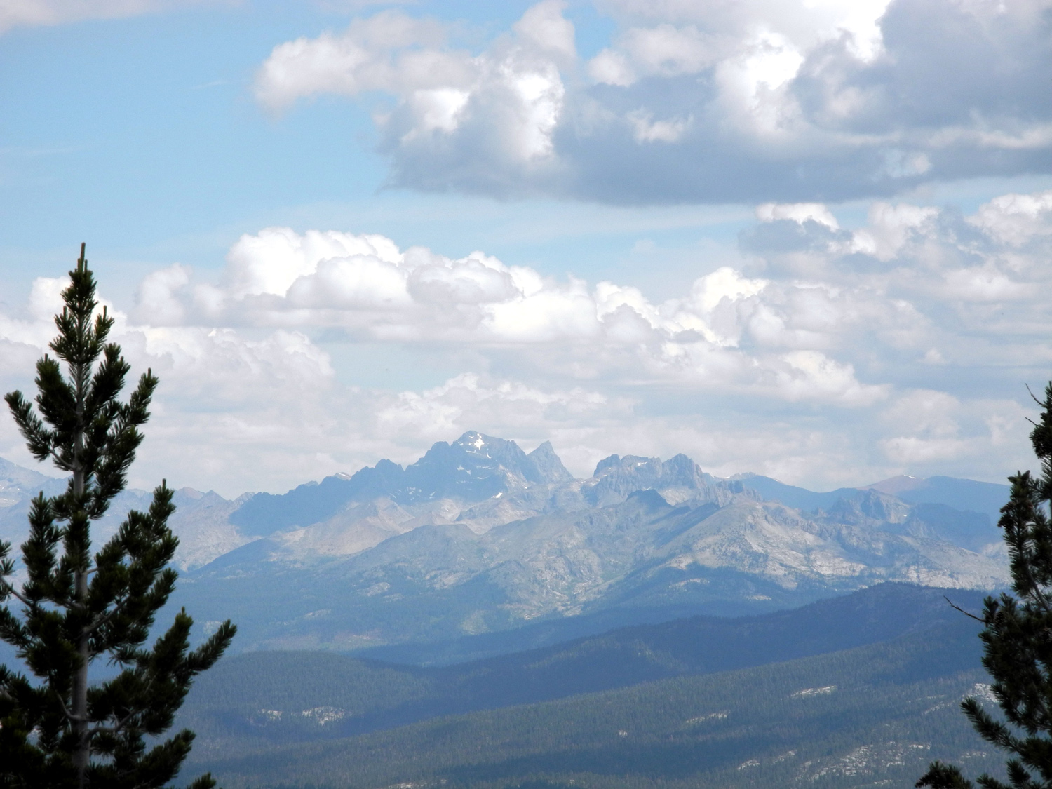
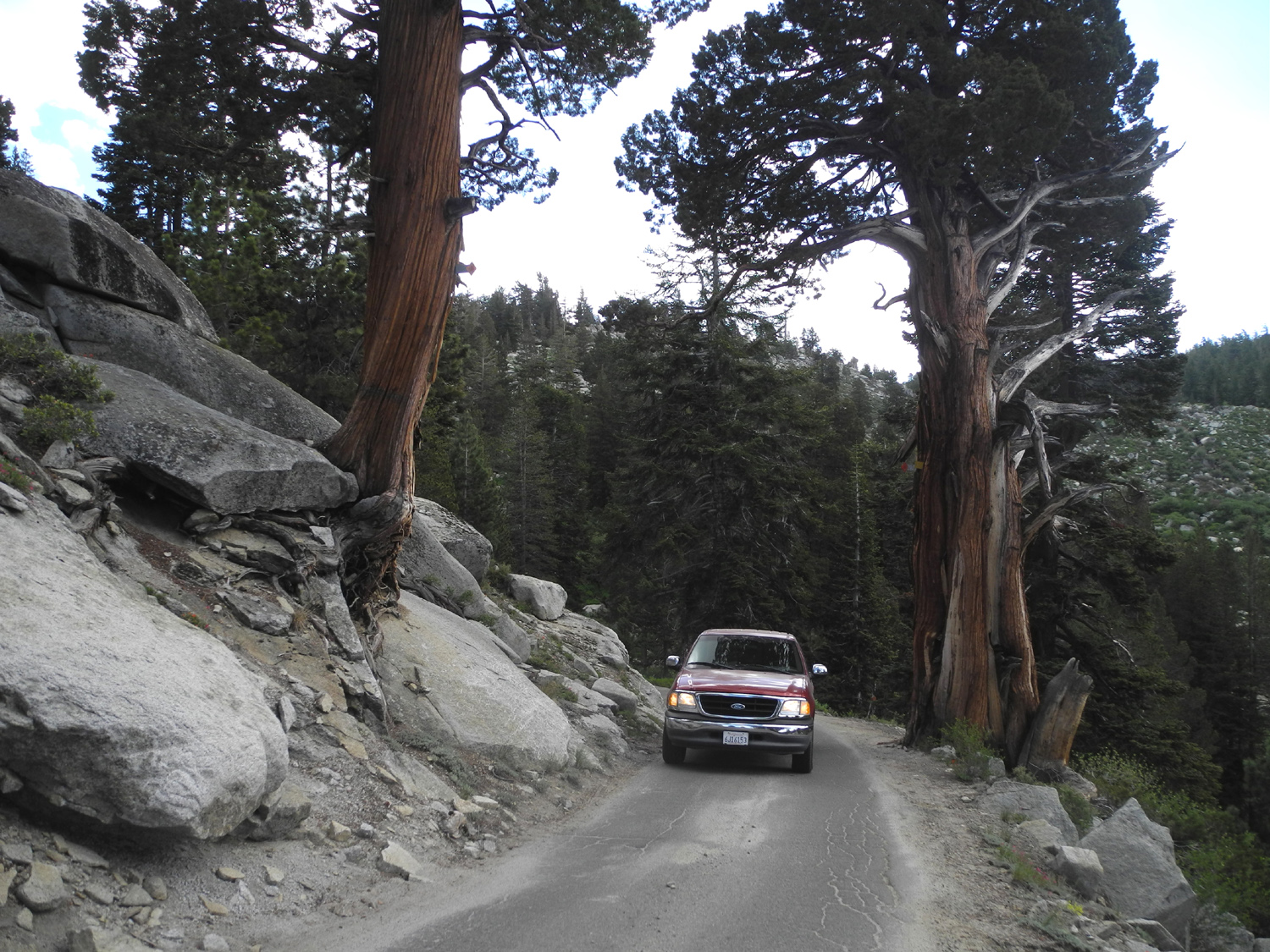
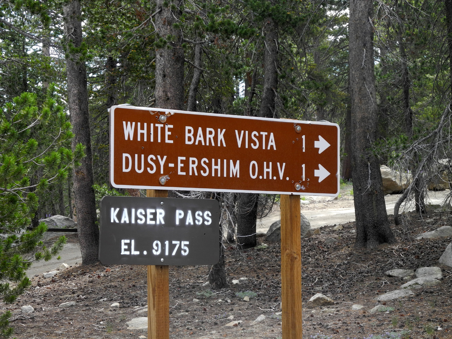
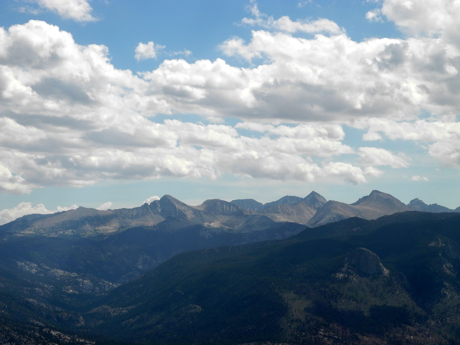
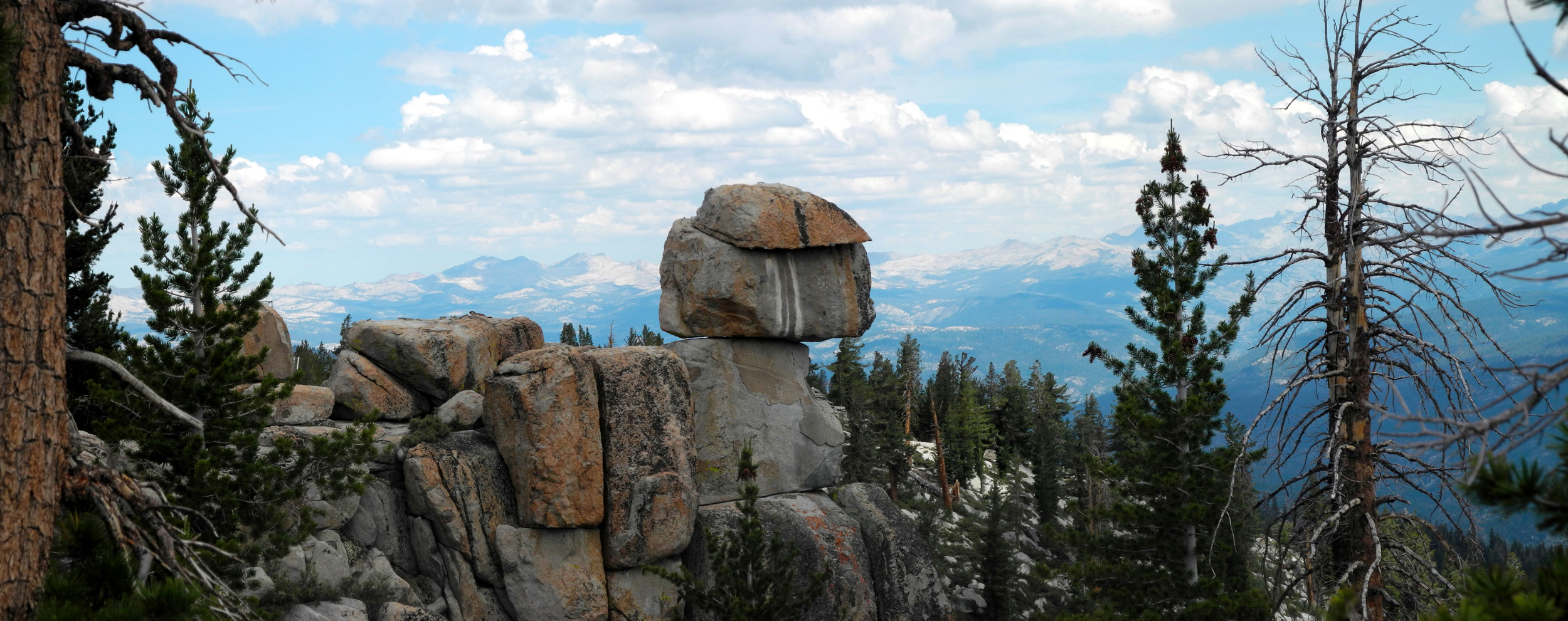
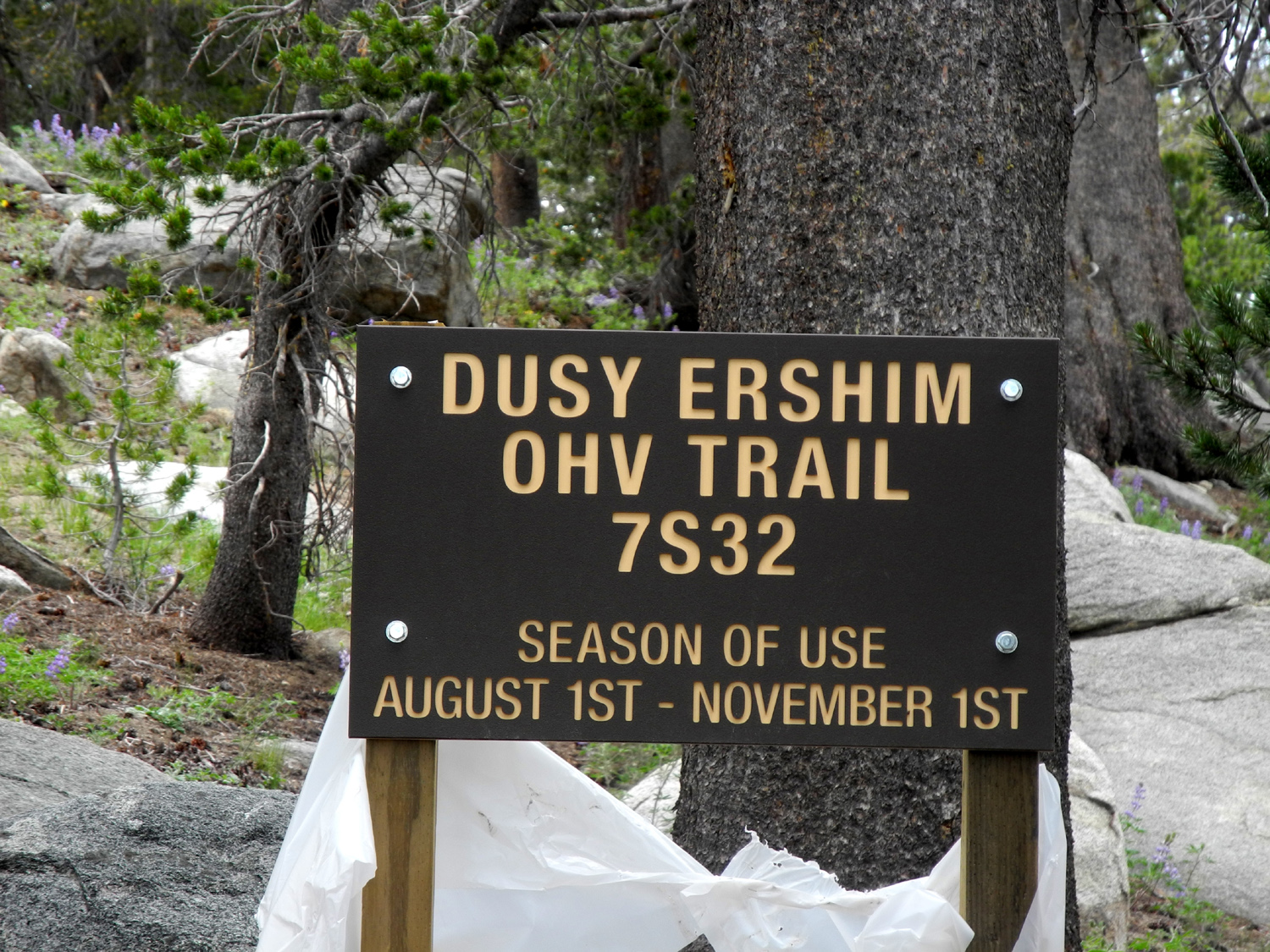
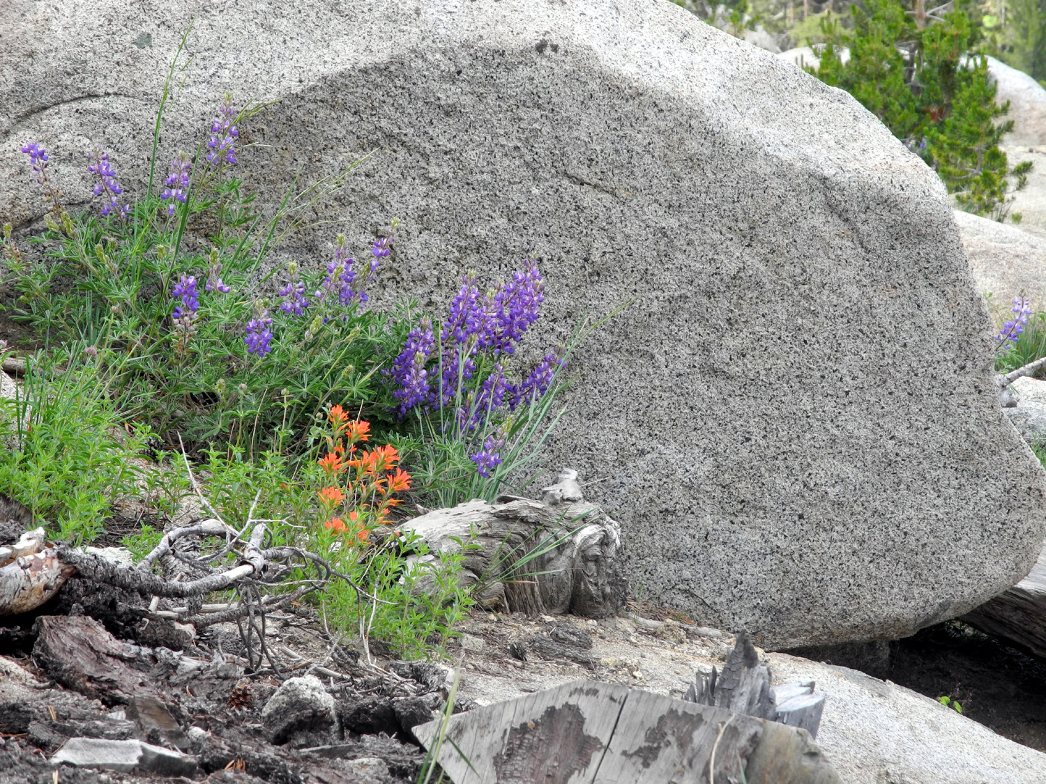
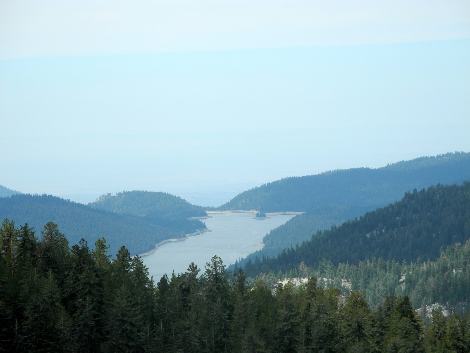
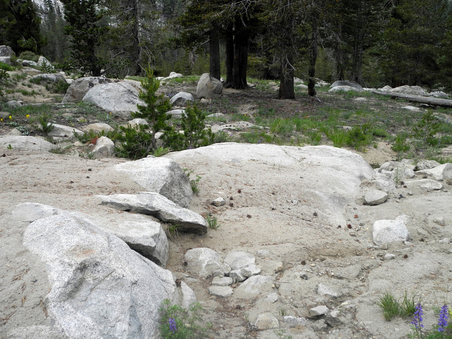
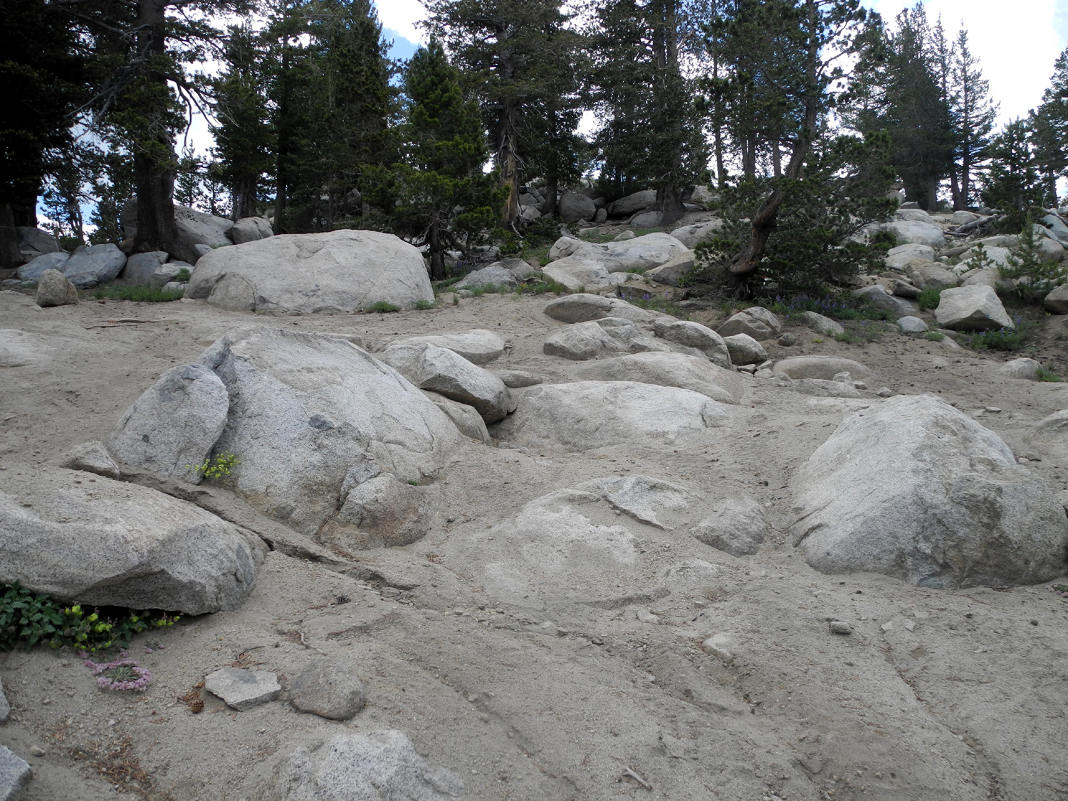
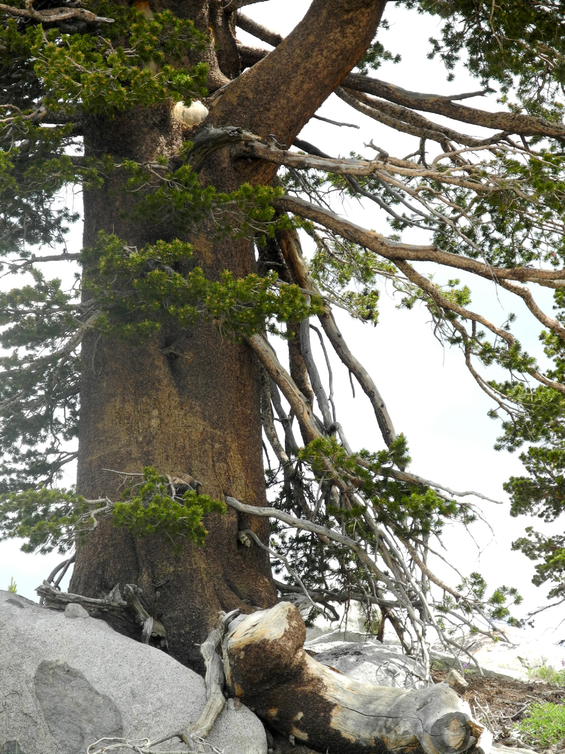
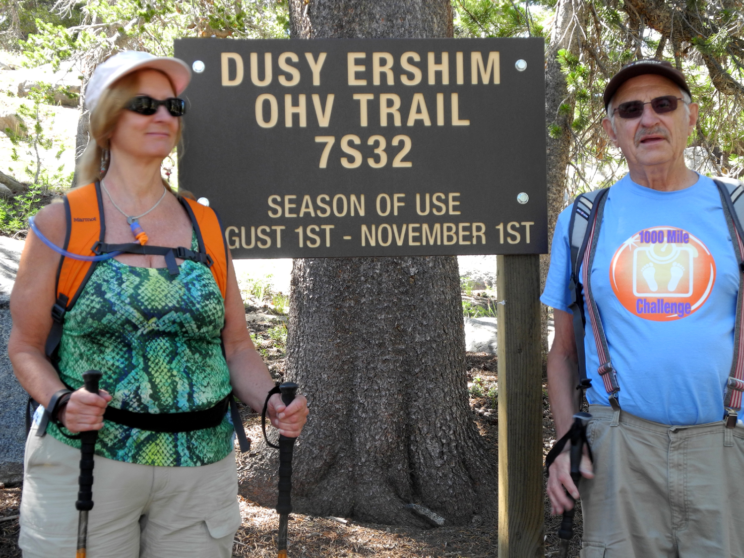
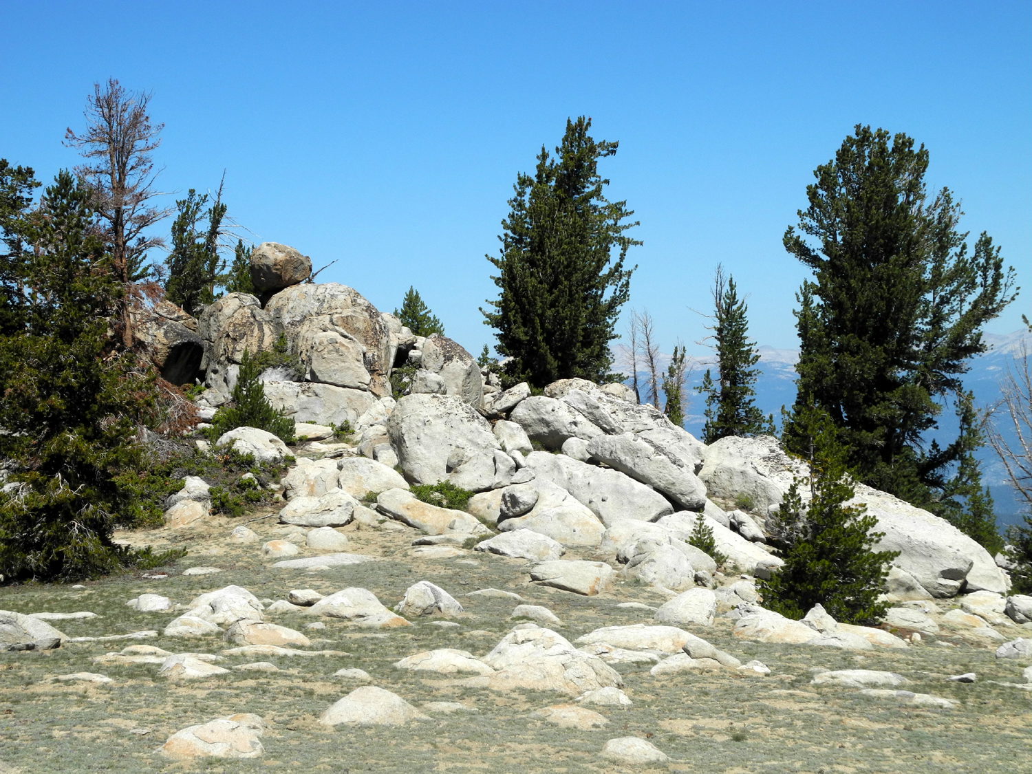
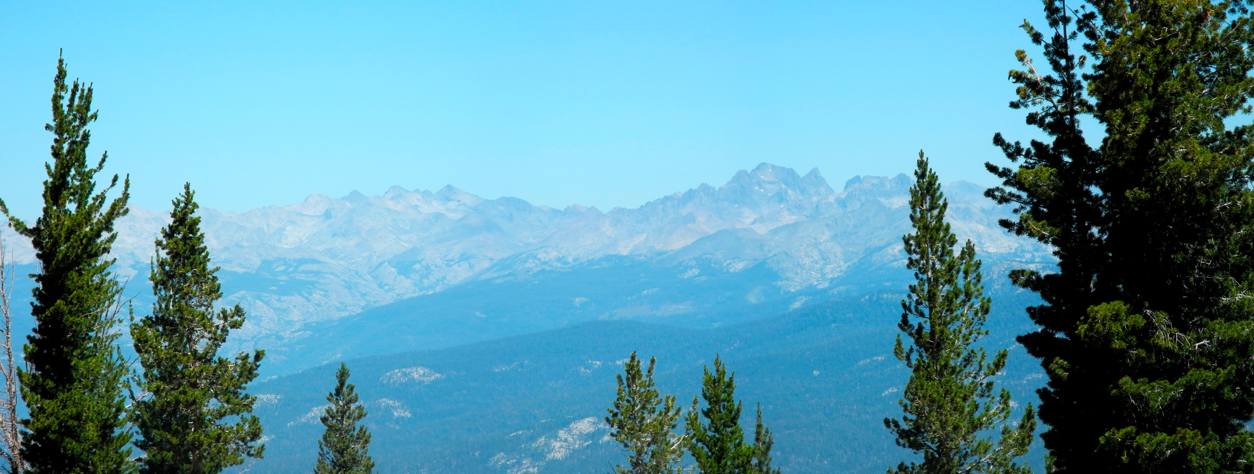
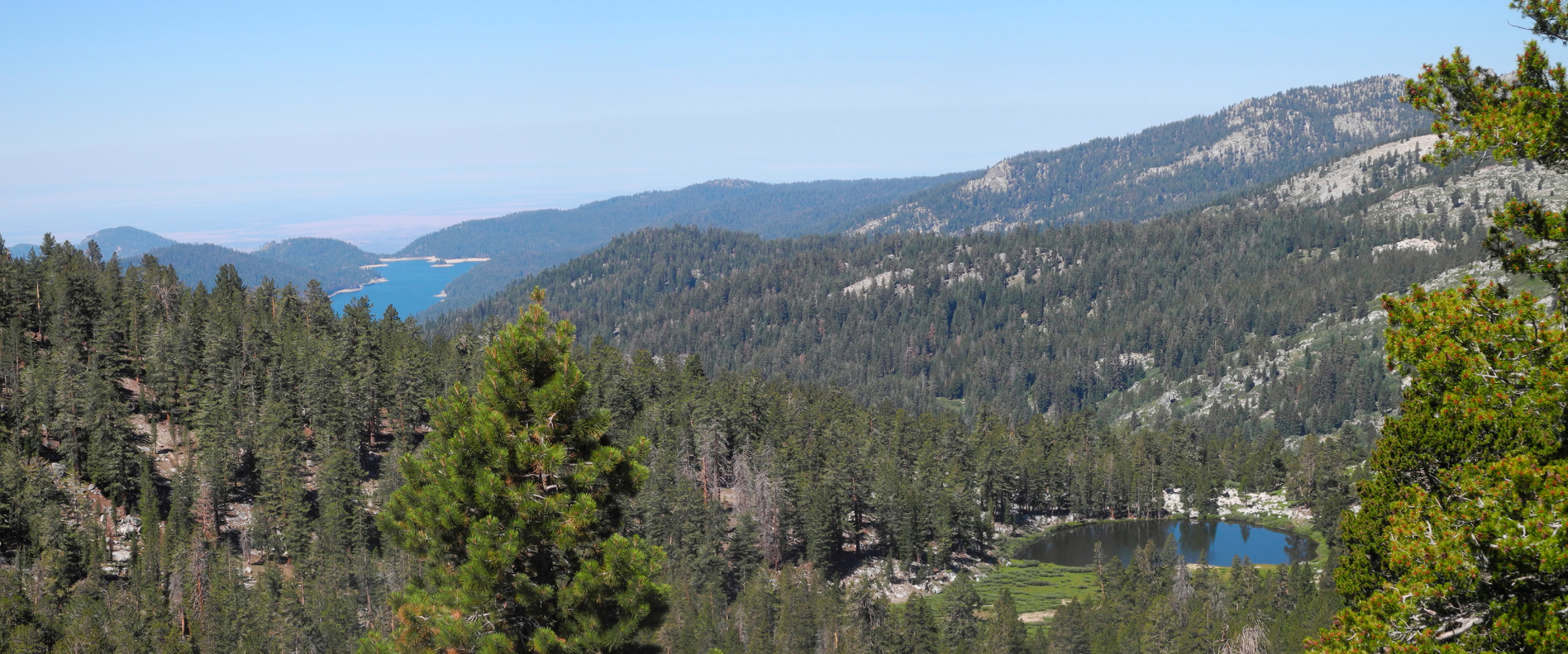
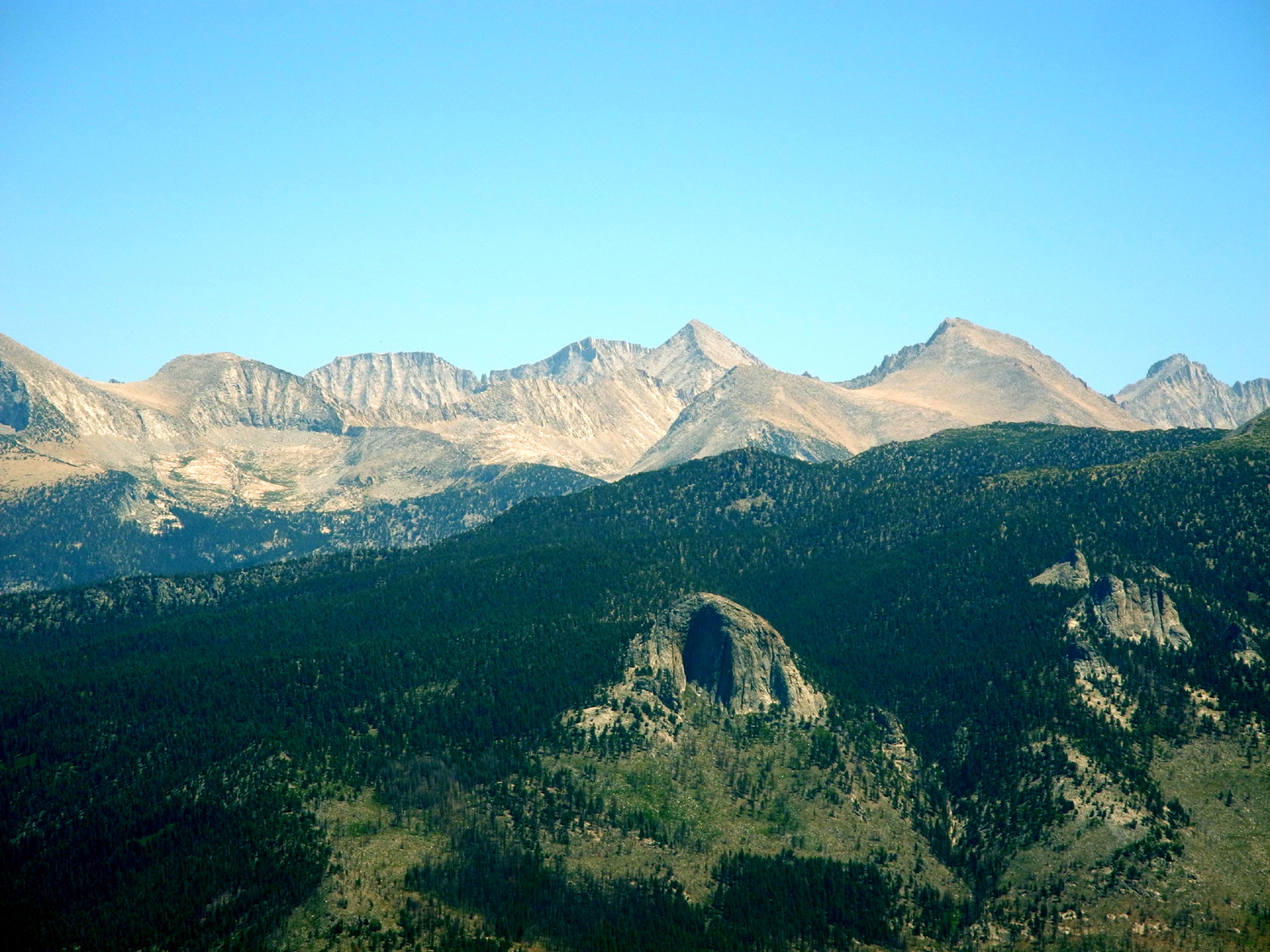
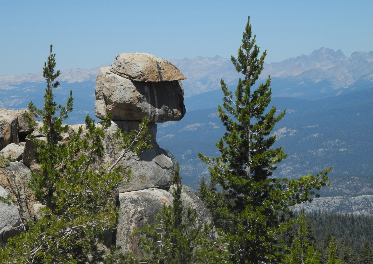
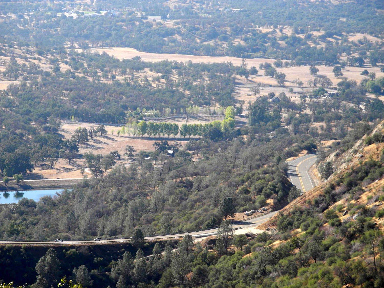
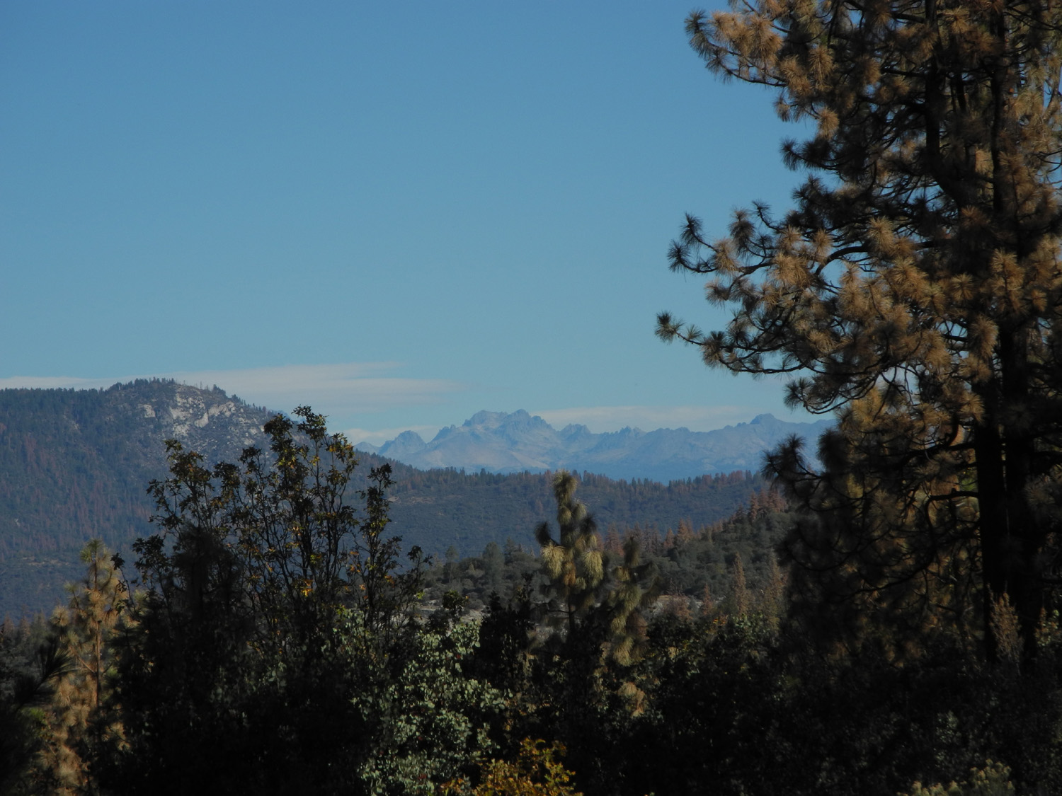
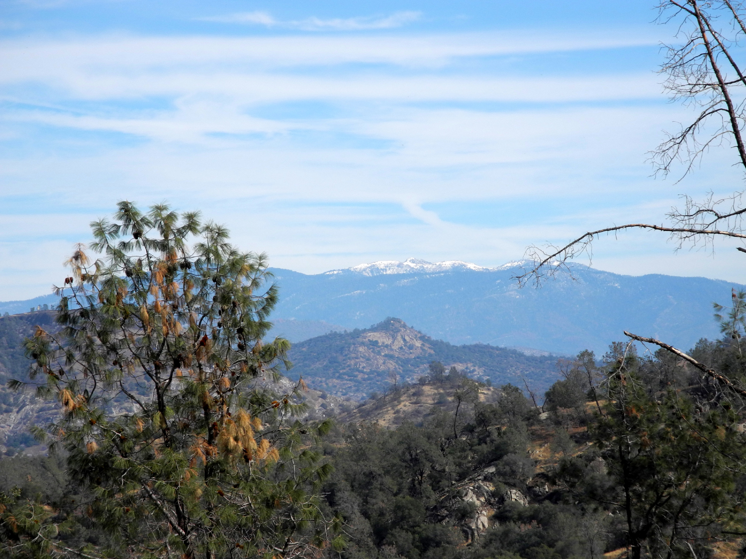
Kaiser Pass Hike I was about to say it's been hot as hell in the San Joaquin Valley recently, but I realized that would be inappropriate. It's been HOTTER than hell. When I go out on my morning walks, it's usually already 80 degrees - and this is getting out the door by 7:30. By noon it's over 100. With this in mind, I decided to find a day when I could drive to a location that would be lots cooler, and do my walking there. On June 30 I got up at 6:30 a.m., ate breakfast, loaded my hiking gear and a lunch into my pickup, and was on the road at 7:30, headed for the White Bark Vista Point. This is a place one mile up a dirt road from Kaiser Pass where you have a panoramic view of a long stretch of the high Sierra.. At just above 9,000 feet, the pass is located about six miles above Huntington Lake on the Kaiser Pass Road. This road continues on to some of the more remote vehicle-accessible recreation areas in the Sierra National Forest - Mono Hot Springs, Lake Edison, and Florence Lake. Huntington Lake is about 70 miles from Fresno on CA 168, at 7,000 feet, and is a beautiful and popular recreation spot for campers and boaters. The road up from Huntington to the pass is mostly a smooth, two-lane road with lots of curves, but nothing difficult or scary. The last mile or so is a whole different matter. This stretch is rough, very winding, and there is room for only one vehicle much of the way. Meeting and passing another car requires one of them to pull off to the side into a narrow dirt shoulder (when one is available), often after backing up a ways first. The road beyond Kaiser Pass is even worse. The dirt road up from the pass is only slightly better than 4-wheel drive quality, with rocks and ruts most of the way. Top speed except for a few very brief stretches is 5 MPH. I have been to this location many times, but only hiked out from the vista point once. The trail from the top is actually a 4-wheel drive route, the Dusy-Ershim trail that runs 33 miles to Courtright Reservoir. It's considered one of the most challenging 4-wheel drive trails in the nation, a fact underscored by the fact that normal travel time to complete the 33 miles is two and a half DAYS. Bring food and water and extra gas. Heed this warning: "Recommended for advanced drivers. A route requiring a high degree of skill and challenge to travel. Not recommended for full-sized pickups, long wheel base vehicles or for traveling alone." Throughout the days leading up to this hike, I was checking the weather, which consistently called for 20% or more chance of scattered thunderstorms. The fact that these tend to occur in the afternoon dictated my early start, but to hedge my bets, I made a quick stop at Orchard Hardware to get a new poncho. I had a pleasant drive up through the foothills and into forested land from around the 4,000 foot level all the way to my destination. I'm not sure of the altitude at White Bark, but it's mostly uphill from the pass, so it has to be at least 9,500. Before starting my hike, I set up my tripod and took a number of photos, including some panoramic views, of the Sierra peaks that are visible from this spot. To the south you can see Mt. Ritter and the Minarets; and to the northeast, the0 Silver Divide. There are other named mountains visible, but I don't know all the names. Close by are Kaiser Peak and Mt. Givens. The vista point lies along a ridge, which drops off sharply to the east, where you can see Lake Edison, Portal Forebay, and the canyon of the San Joaquin River in the forested country below the mountain crest. Weather conditions resulted in a lot of moisture in the air, so the view was slightly hazy. However, the mountains were not blocked by clouds and I managed to get some fairly decent shots. I had parked just past where the road tops out on the ridge and the mountains come into view. I knew that it was about a quarter mile to the start of the trail, and I had driven past this point in the past. I took a look at the road, and it started off with a steep, rocky section that was beyond my truck's capability (or mine at least). Then I noticed another route that bypassed the steep spot. I checked it out, and it looked passable, so I drove up that way. The last 50 feet or so were fairly steep and slightly rocky, but I made it up with a little careful maneuvering. I walked back to take a look at this road and spotted a boulder in the middle of the road, about two feet by three and a foot high. There was no room on either side for a vehicle to fit through, so apparently I had not seen this "obstacle" due to the limited visibility past the high front of my truck, and had driven over it. With considerable difficulty I managed to muscle it to the side of the road, but later discovered a slightly easier route back down, so I did not have to worry about that stretch when I left. I took some more pictures from this second parking spot, including some of a dramatic rock formation topped by a big square boulder that seems to hang out over the edge. After that I put on my pack and set out on the actual hike. It had been over 40 years since I hiked out on this trail, but I remembered my first impression from then, and had the same thought this time - how on earth could anyone drive ANY kind of vehicle over this rock pile. There are places where the rocks that must be traversed are 18 inches high, and having gone on some 4-wheel rides on much less challenging roads, I can appreciate the skill and equipment it takes to navigate this route. My photos just don't capture the reality of how rugged the road is, but they will give you some idea. (There's a video showing much of the route; it's a little fuzzy at first, but the last half is decent quality.) Fortunately, walking it was fairly easy. The section I walked was mostly uphill, but not particularly steep, and getting around the big rocks was simple for a person on foot. I suspect that a good hiker could travel faster than a vehicle over many parts of this route. There is a locked gate across the start of trail, since it's not open to 4-wheelers until August 1, so I didn't have to worry about vehicle traffic and had the road all to myself. About two hundred feet from the trailhead Huntington Lake comes into view, and could be seen from various angles for a quarter mile or so. In this area I could also see Kaiser Peak, a large mountain to the north and slightly west. Just like all my other hikes, I saw a lot of different kinds of wildflowers. The most notable were the western wall flowers. In lower elevations they have an orange tint, but these were bright yellow. I also kept an eye on the sky, since there were dark clouds not too far off. The trail continues along the ridge, but some distance back from the edge. I was hoping the route would take me out to the edge where I could get some different views of the mountains, but it looked to be curving around the opposite way, and staying below the top of the ridge. Therefore, when I could see that it was not far to the top of the ridge, I set off cross-country. Most of my walk here was through endless fields of small blue lupines, which formed a ground cover barely an inch tall. At this high elevation there are few trees and you don't have the typical forest floor found down lower, with tangled limbs, fallen logs, and thickets of small trees, so it was fairly easy walking. I soon reached a place where the mountains came into view, and found a place rest a while. I started my return trip staying near the edge, first having to go around a large rock formation. Most of the way back to the trail I was following what appeared to be cow trails. I came to another place where I could get near the edge, and thought maybe I could see back to the trail head if I walked out next to another large rock formation. As soon as I could see past the rocks, I spotted my pickup, looking very small and far away. From here, it was not long before I got back to the real trail and retraced my steps back to where I was parked. Just as I arrived a few drops of rain fell. I was ready to eat the lunch I had brought, but wanted to sit outside and read while I ate. As I got my pack off and in the truck, the rain seemed to diminish, but there was still a light mist - not harmful to me, but not good for my reading matter. I decided to drive down the dirt road to the pass. By the time I got there, I was out of the rain. I always have a lawn chair in the trunk of my car, but I didn't think to move one to my truck. I managed to find a fairly flat rock to sit on. A cushion that I keep in the truck made it fairly comfortable. At 1:40, just as I was getting ready to leave, there was some thunder, and the sky up where I had been looked very dark, but I did not have any more rain, there or elsewhere on the return trip. I made it back down the bad part of the paved road without incident, although as usual I had to pull over a couple of times to let oncoming cars pass. As I went down in elevation the temperature went up as follows: 69 at Kaiser Pass at 9,000 feet; 80 at Shaver Lake at 5,000 feet, 100 at Prather at about 2,000 feet, and 107 in Clovis at 300 feet. My round trip mileage was just over 142 miles. With a lot of clouds, the
next two days were under 100, but now four days later it's back up
to 105. I'm ready to go back to the high country again as soon as
possible. --Dick Estel, July 2015 |
||
|
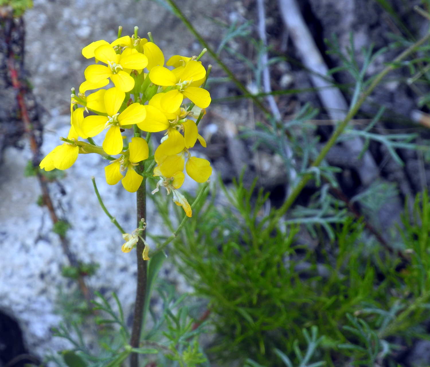
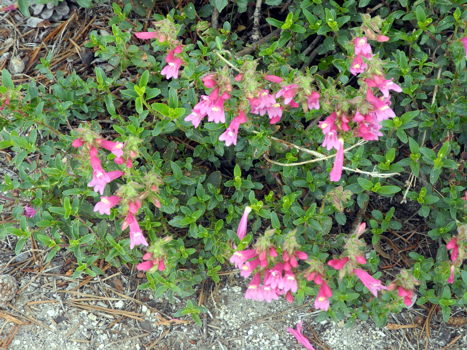
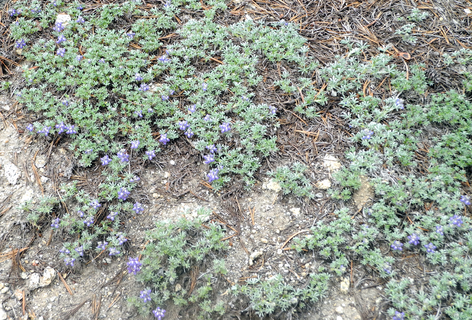
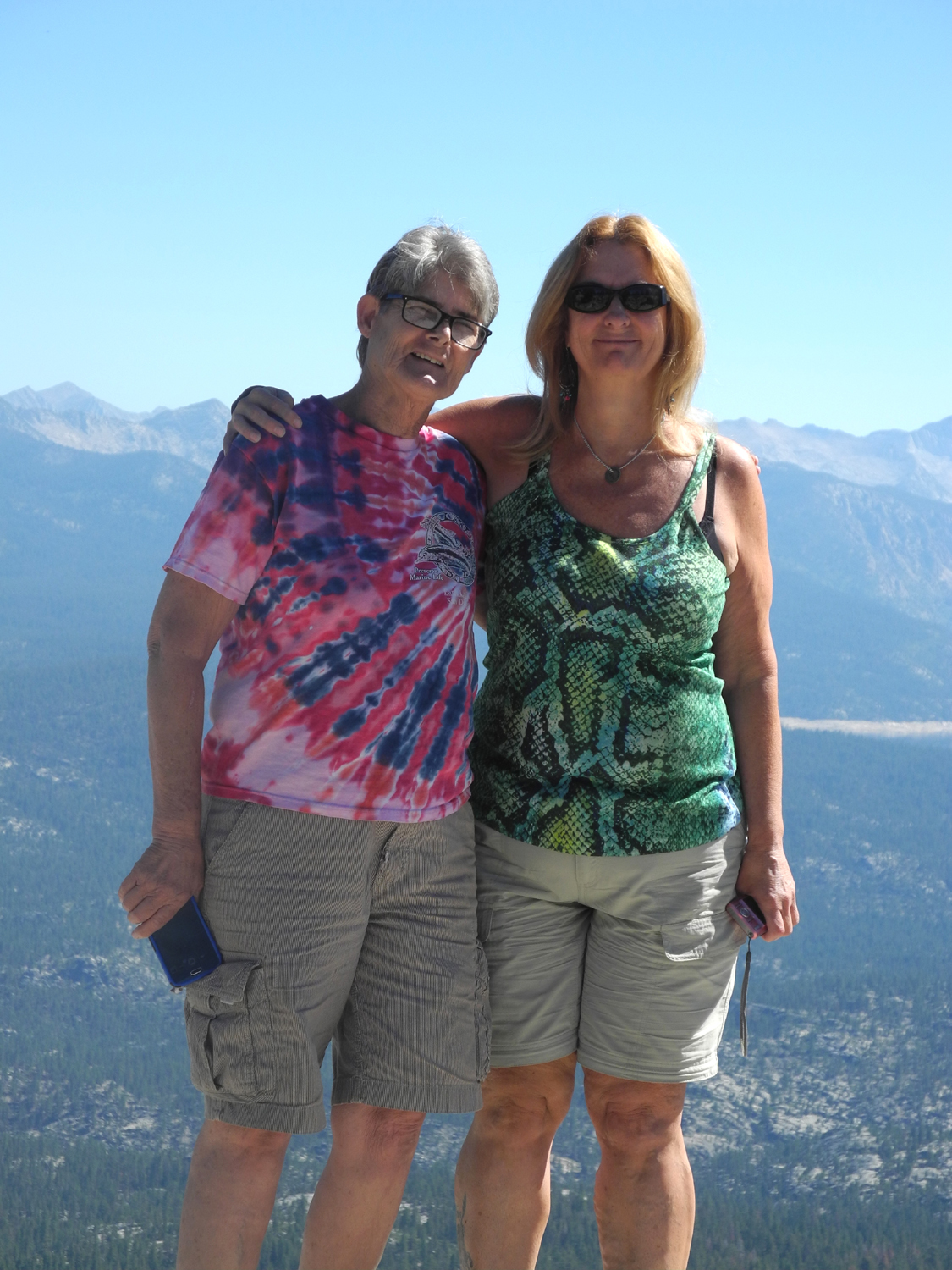
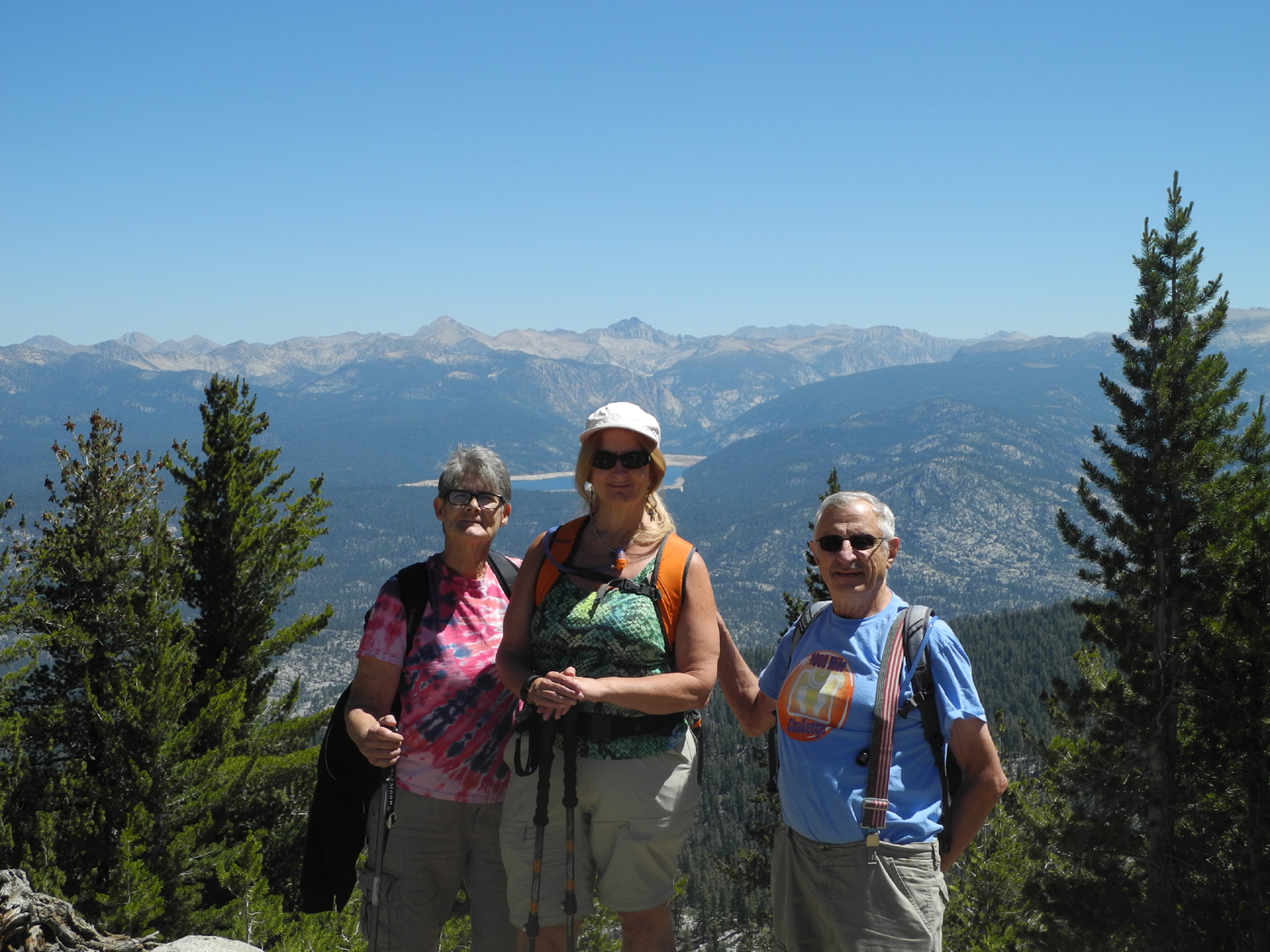
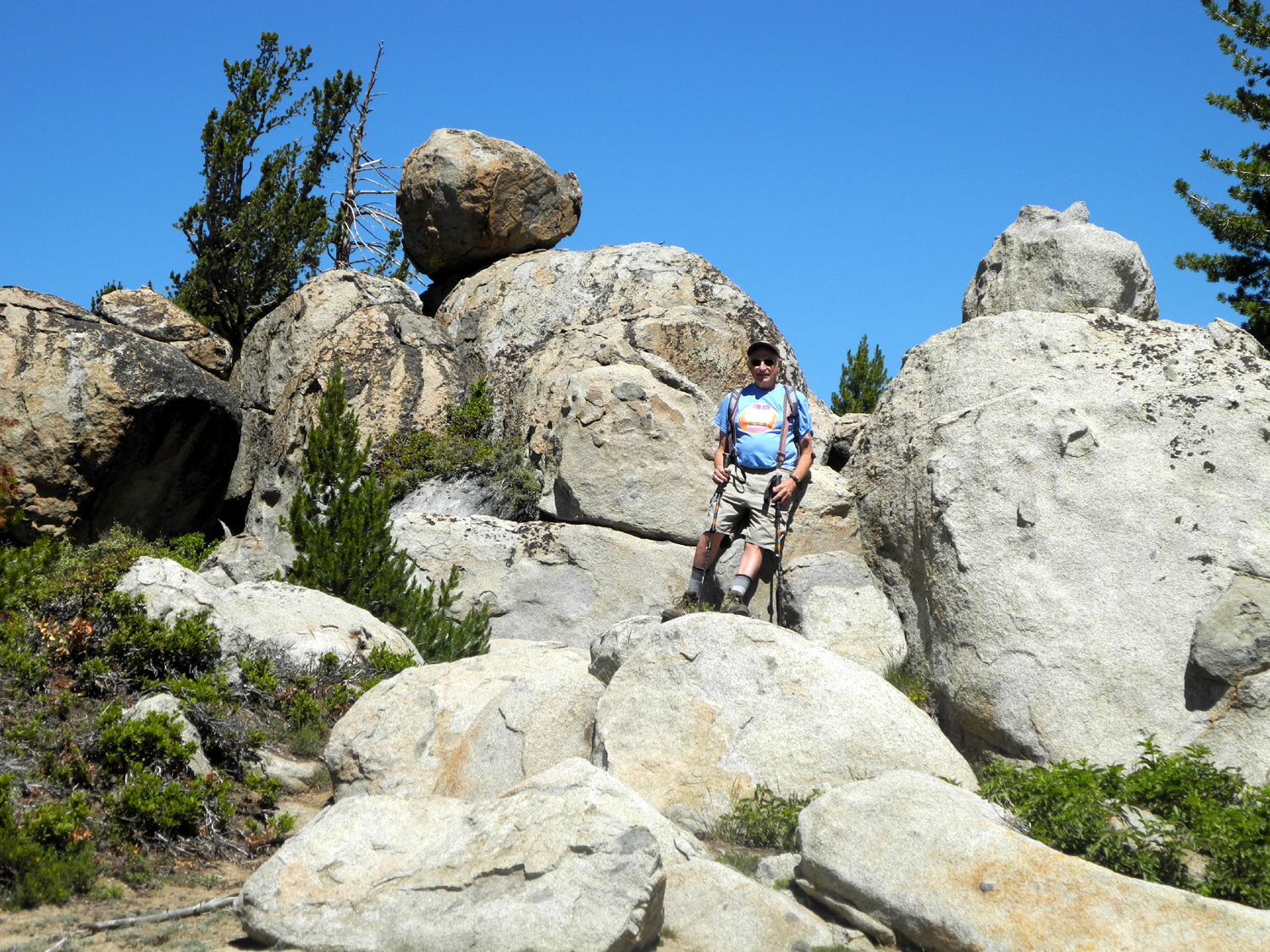
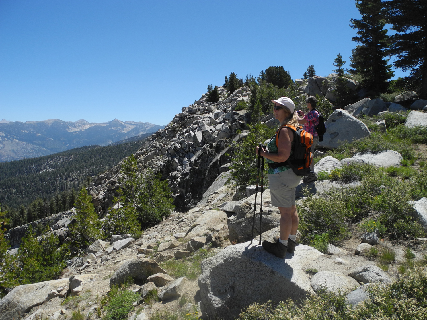
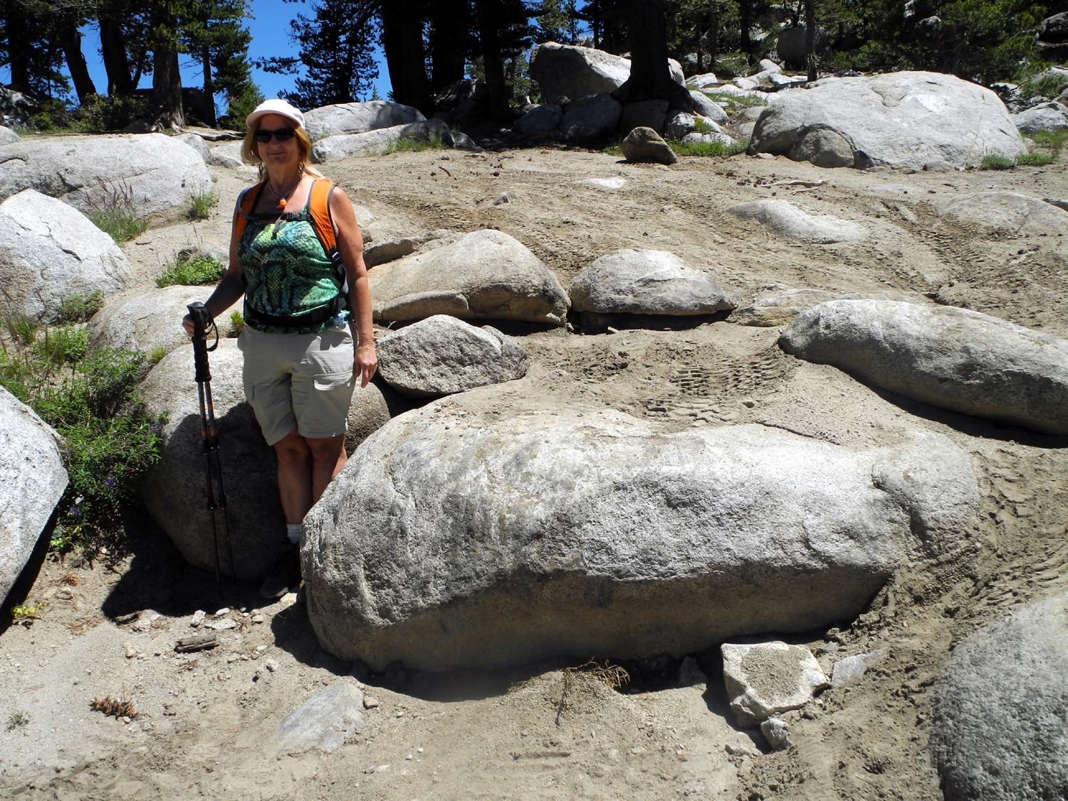
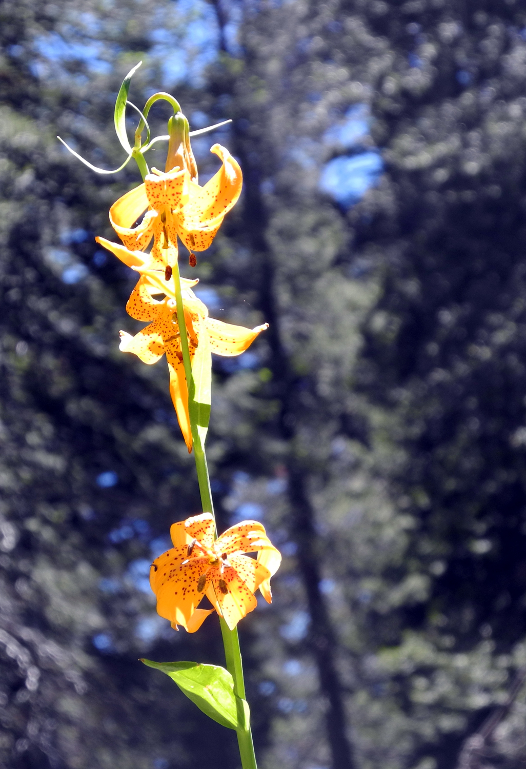
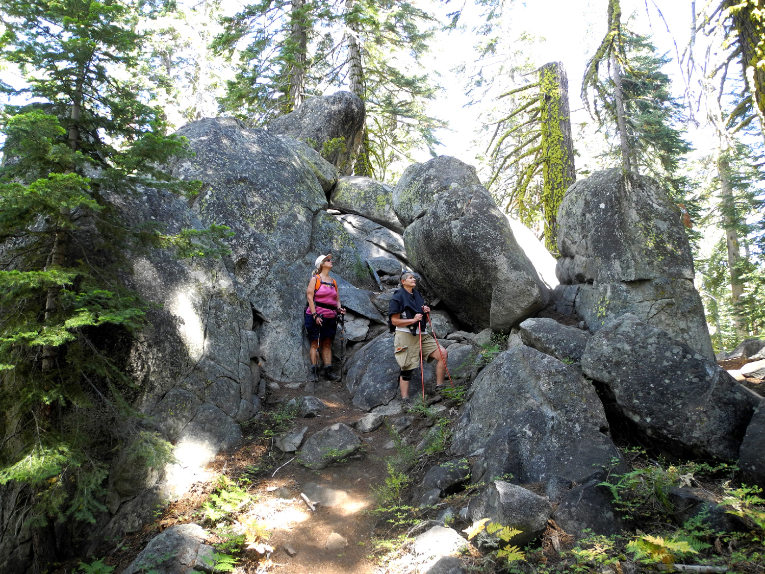
Kaiser Pass Hike 2 When I went hiking above Kaiser Pass on June 30, it had been about 15 years since I was at White Bark Vista, and I vowed I would not wait so long for the next visit. In fact, I was back there less than a month later, on July 25 with my daughter Teri Liddle and her friend Sandra Ward. Teri had not been there since the time I visited 15 years earlier, and it was Sandy's first time ever. Like my visit in June, we enjoyed cool weather, but unlike the last time, the sky was 100% blue except for a tiny, wispy cloud we saw at the end of our hike. There was a good breeze much of the time, and it was a bit cool to sit still. But we did not do much sitting still until lunch time. We got an early start from Fresno, again taking my pickup because of the rough "last mile," the rocky dirt road from Kaiser Pass to White Bark. I believe this road is in much worse condition than it was years ago, when I drove it in my Volkswagen, and also part way up it in a motor home (!). We agreed that none of us would want to take our passenger cars on it. We parked where the view first comes in sight, instead of trying the last few hundred yards, which are a bit more difficult than I like to drive on. This gave us a few hundred extra yards of hiking, which is a good thing. Before we started our walk, we took pictures of the incredible view - the Ritter Range and Minarets to the south, high peaks above Lake Edison to the east, and a bit north of that, the Silver Divide. With other photographers present, I was able to get the "Dick on the Rock" photo that eluded me last time (I can't get from the camera to the top of a rock in ten seconds anymore). When we got to the start of the trail, we saw a pickup with a flat bed trailer, which we had seen on the main road, hauling a Jeep. The gate to the 33-mile Dusy-Ershim Trail was locked as before, but tire tracks showed that a vehicle or two had gone in. We speculated that it was someone with a key who was doing a maintenance run, removing fallen trees from the road and checking for storm damage. Most of the wildflowers I saw the last day of June were still in evidence, and of course, the views of Huntington Lake, the trees and mountains, and a small pond not far below us, were as amazing as ever. We also pondered the difficult challenge of driving over this rocky route, and observed places where the Jeep had left tread on the rocks or skidded sideways in a particularly difficult spot. We hiked out the road about as far as I went last month, then cut over to the east toward a big rock formation, where the ridge drops off into the San Joaquin River drainage. The views along here are similar to what we see from the parking area, but from a slightly different angle. In one place, we had a 180 degree view of mountains, including the Minarets, which could not be seen very well from the trailhead. This time I remembered to check the altimeter app on my phone, with these findings: Kaiser Pass 9,100 (there's a sign); White Bark Vista 9,500; the highest point on our hike, 9,800. We made our way around the big rock formation, and back out to the edge again. We spent more time at these areas than I had on my previous hike, because each person would spot a place that needed to be explored, then the others would follow to check out the view. As we made our way back along the ridge we were following cow trails, with no cows visible, and all agreed that this was easier walking than the 4-wheel drive trail. Throughout this area the ground is covered with low-growing lupines, which form sort of a ground cover. There were still flowers, but they are starting to go to seed, and there were not as many as before. As we arrived back at the trailhead, we met a man and his dog walking in, and saw another car, which stopped briefly then left. There were also two pickups parked at the trailhead, no doubt belonging to those who had gone through the gate. This was in contrast to last month when there was no one else there the whole time I was hiking and looking - the difference between Tuesday and Saturday. Although it was clear and sunny, there was a strong breeze, and we decided to drive down the road a ways to have lunch. At the bottom of the steepest part of the paved road, maybe a quarter mile from where the rough one lane road reverts to a smooth two-lane route, there is a big flat area to one side where people have camped (including my grandson Johnny and me many years ago). We set up my card table and folding chairs and made ham and cheese sandwiches. We also enjoyed fruit and other healthy snacks that Teri and Sandy had brought. It was still quite cool at this location, so we moved our chairs into the sun where we could look out over a small creek that ran below the flat area. We were also entertained by a group of chipmunks that were chasing each other up and down the bank between us and the road. After eating, we explored the creek. It had a small amount of water, but it divides into several overflow channels, and there were signs that these had all had water flowing heavily in them during a big rain that hit the mountains and foothills earlier in July. There were also some nice flowers in this area, including an unusual bright orange blossom that I had seen previously during the Ramblers' Courtright Hike. I later identified these as Kelley's Lilly. Too soon it
was time to head back down the hill, to warmer weather and flatter
territory - but we plan to return to the mountains for another hike
soon. --Dick Estel, July 2015 |
||
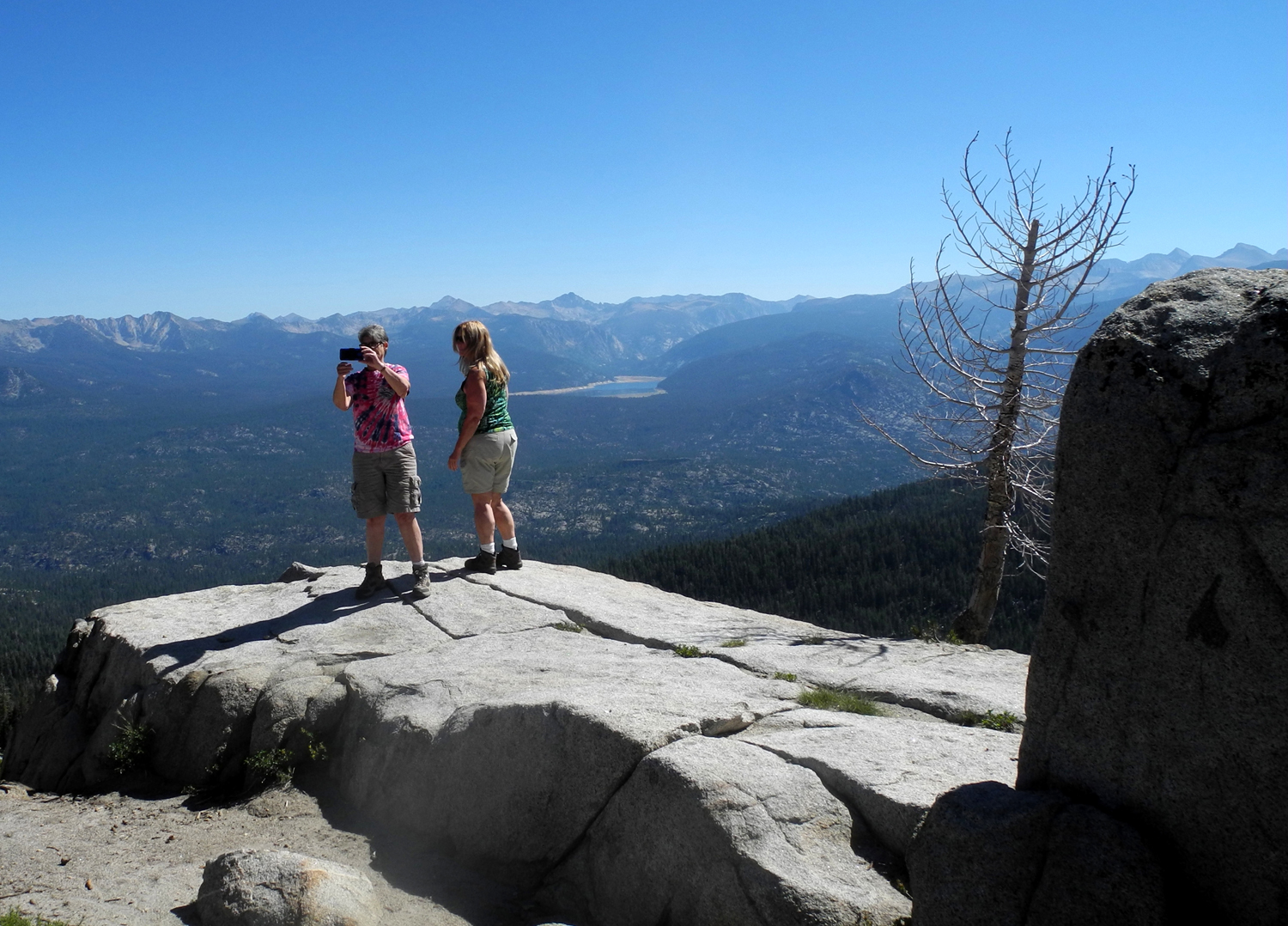
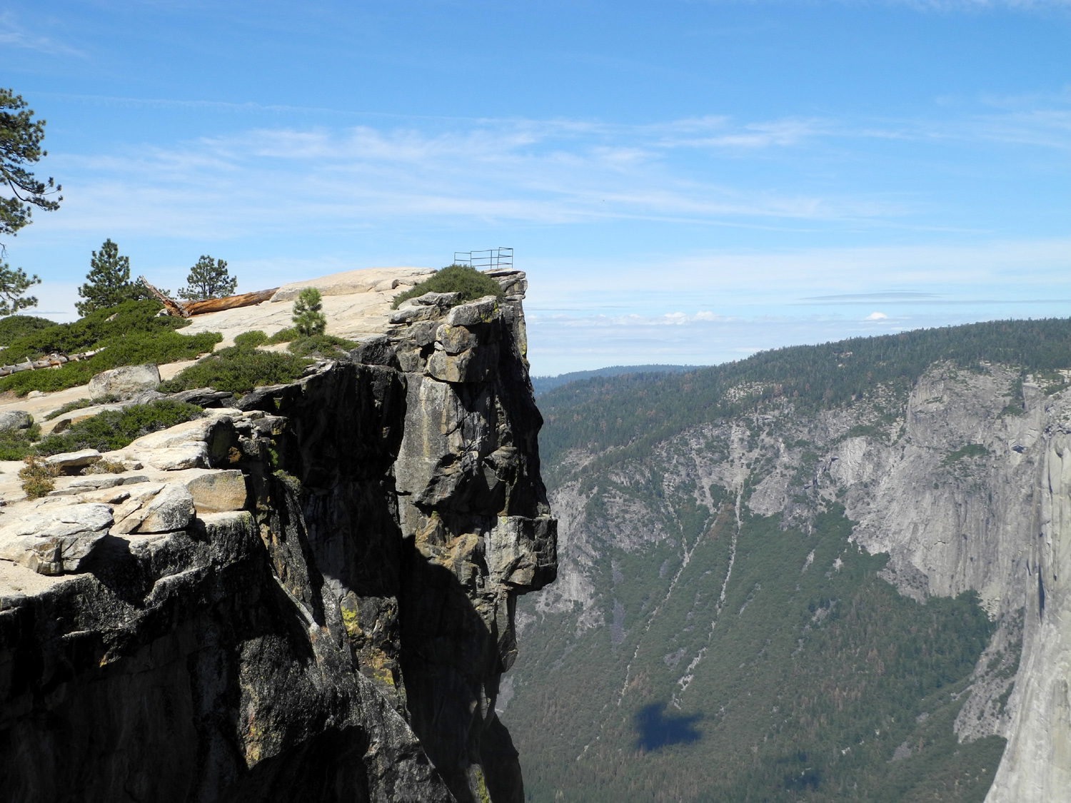
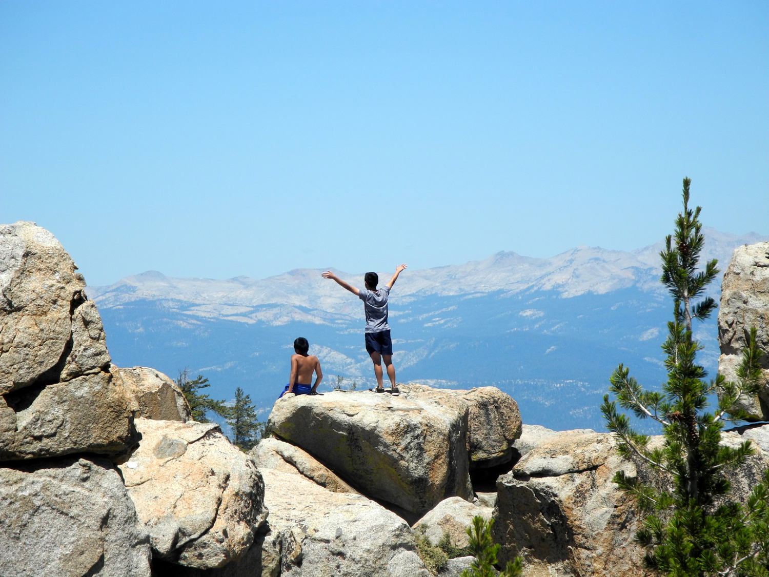
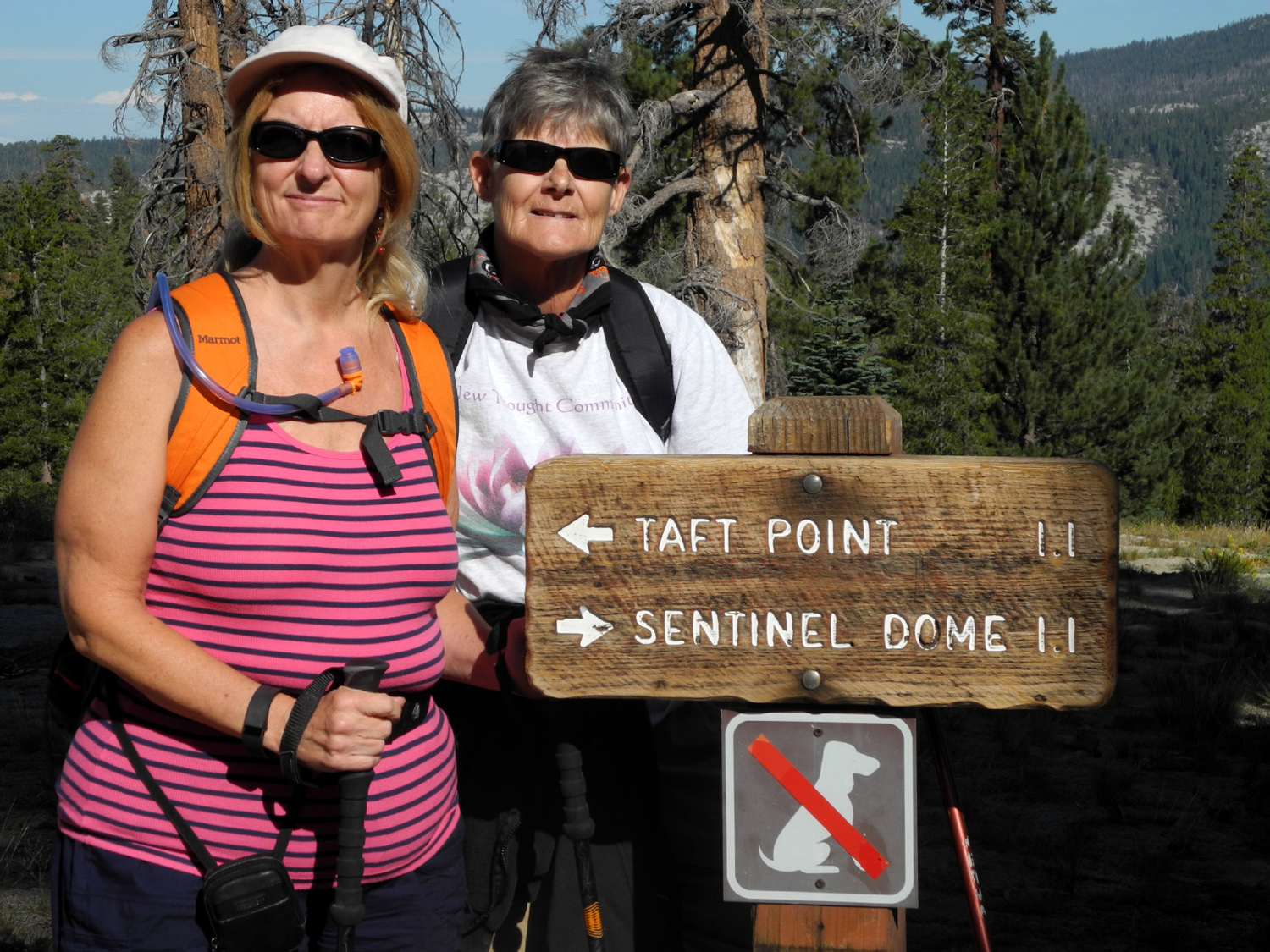
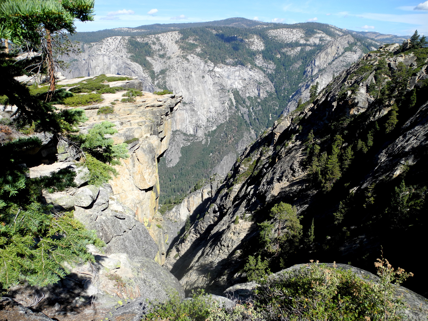
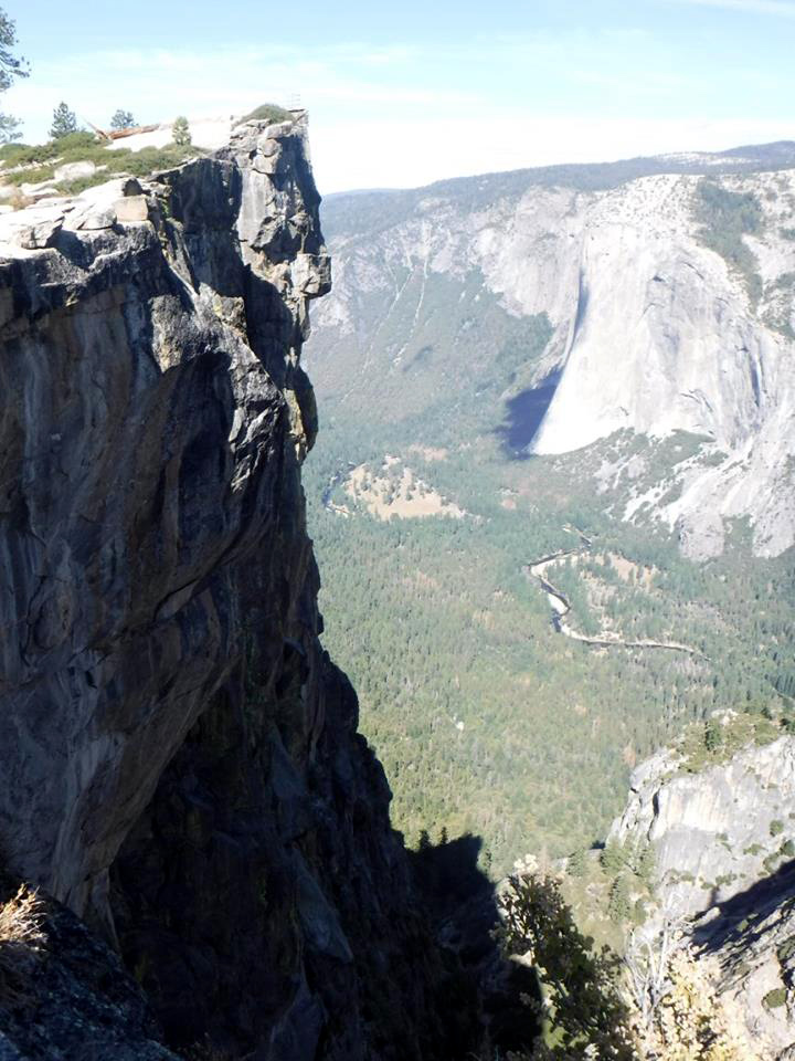
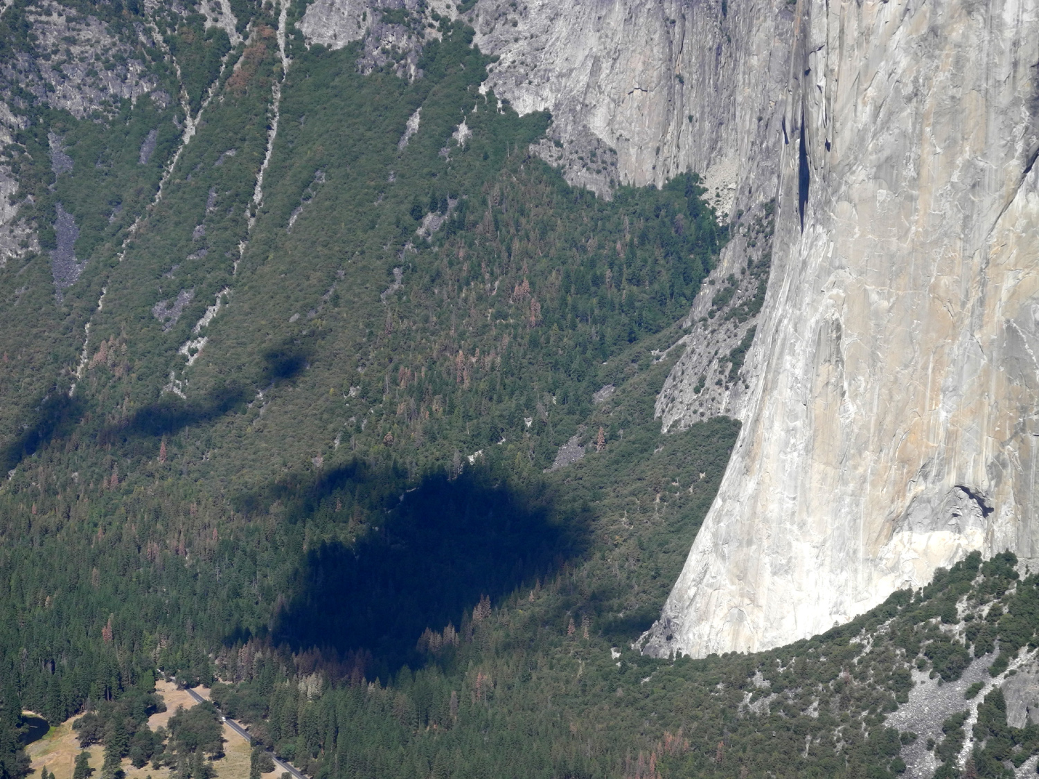
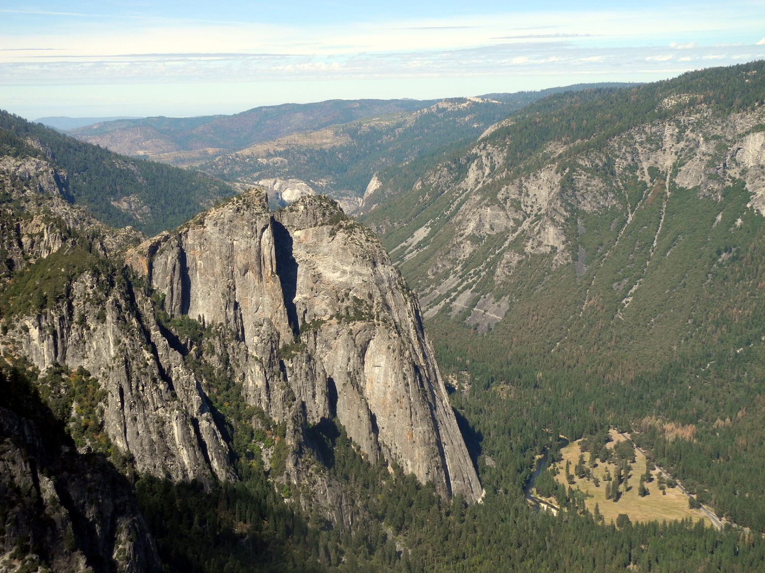
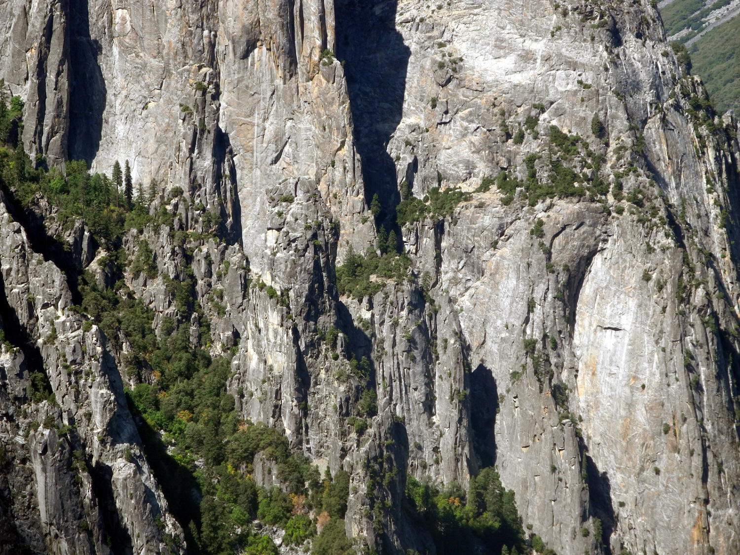
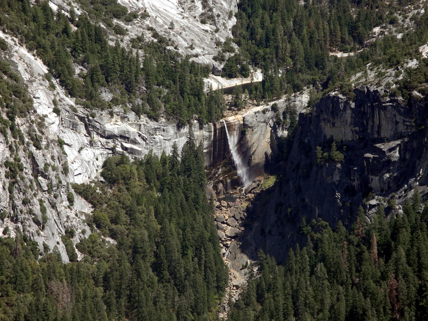
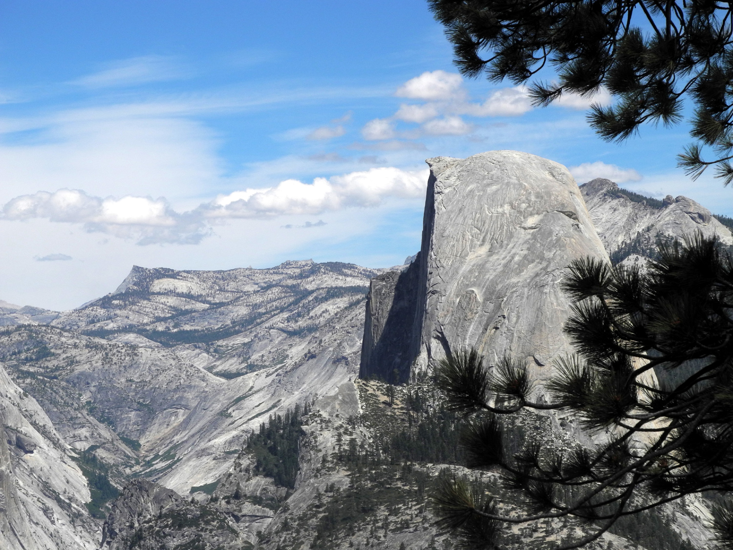
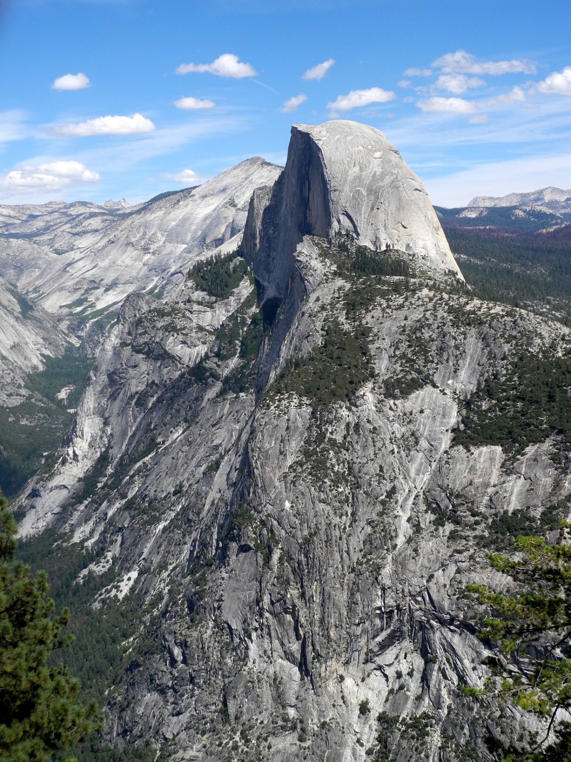
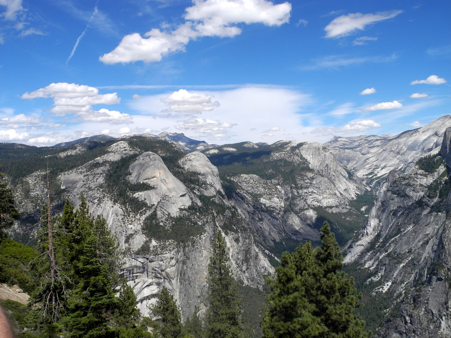
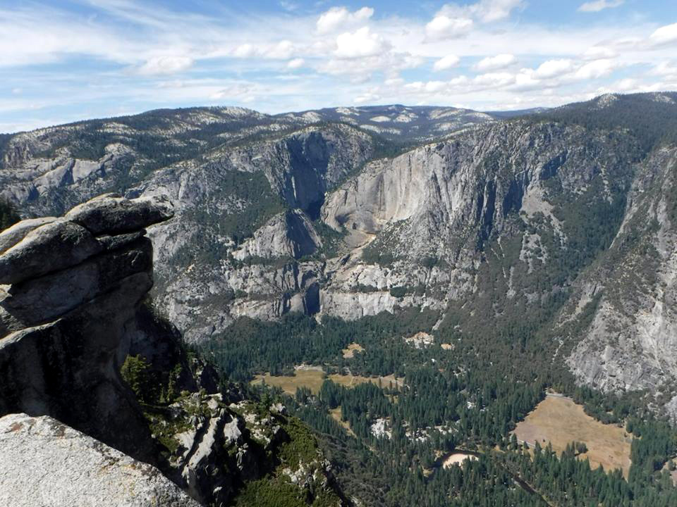
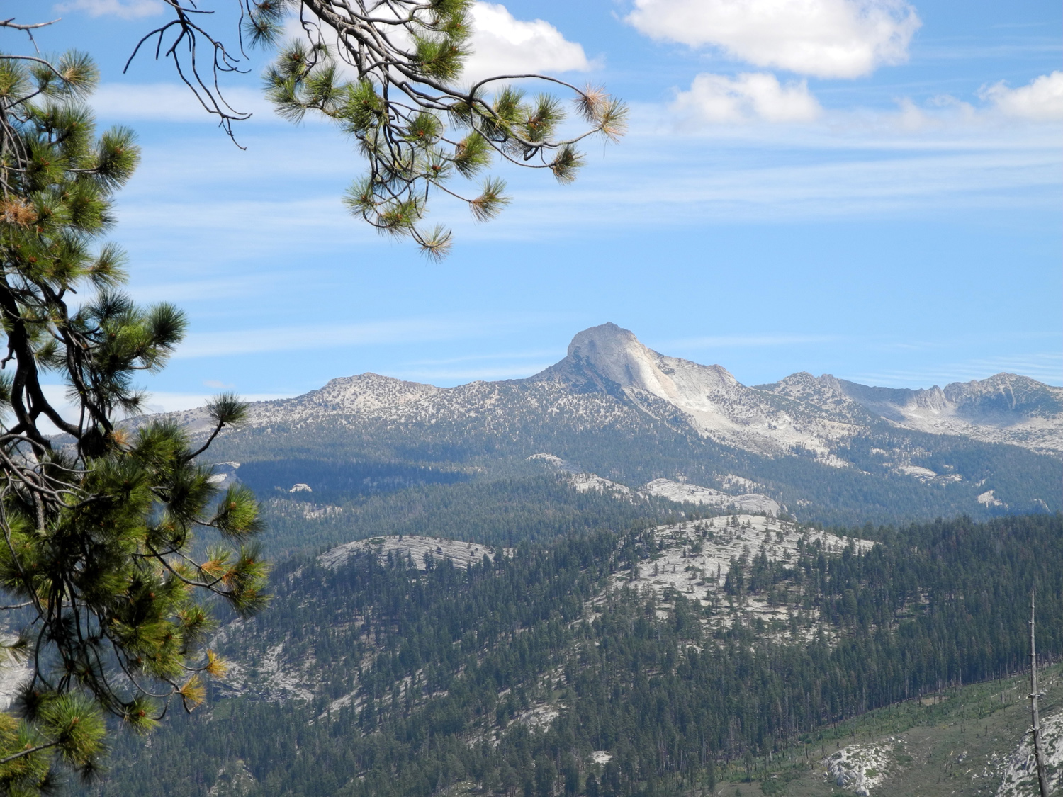
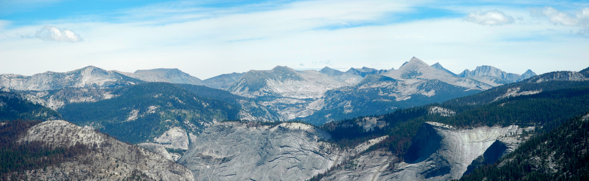
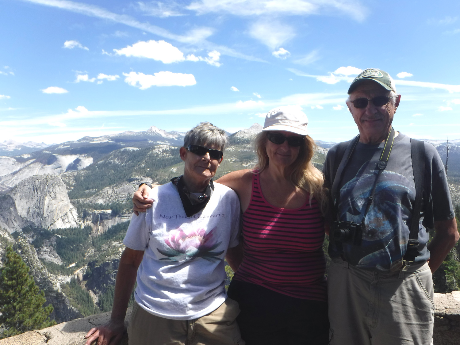
Taft Point & Glacier Point This hike was supposed to be a return to Courtright Reservoir, where I hiked with the Ramblers in July. However, the Rough Fire is sending smoke throughout the Kings and San Joaquin River drainages, and we decided on Taft Point as a backup. I hiked there with the Ramblers earlier in August. Actually it was just two Ramblers, Wes and I, with my daughter Jennifer. Julie is out till October, and Carolyn had some bad pain in her arm. Therefore she was looking forward to being included in this return trip. Alas, it was not to be - the universe apparently does not want her to go to Taft Point, since she came down with pneumonia a few days before our trip. So it was my other daughter, Teri, her friend Sandy, and myself, heading north on Highway 41 shortly after 7 a.m. on August 29. Although we got to the trailhead fairly early in the day, it was still a summer Saturday in Yosemite, and we got the last "real" parking space, one with painted lines on both sides. There was still room for three other vehicles to squeeze in next to us, and as on our previous visits, cars were parked along the road in both directions for a half mile when we returned from our hike. Walking this trail for the second time in three weeks I was reminded what a great hike it is. There is some open area, sunny but not too hot at 7,000 feet; then the trail goes through shady red fir forests for two different stretches. Along the way there are some nice rock formations, a creek crossing (dry this year), a few wildflowers, and many other species of trees and shrubs. Along the trail we saw many chipmunks, including one which came up to my feet in the process of moving away from Teri. We also saw lizards, and one deer. The last few hundred feet of the trail is fairly steep and rocky, as it descends from the more or less level forest to the open, rocky approach to the rim of Yosemite Valley. I described this location in my previous report, so I'll just say that Teri and Sandy were greatly impressed with their first visit to this amazing and little known part of our most famous national park. Teri got to see the narrow ledge where her husband, Tim, and his friend Scott crawled out many years ago when they were foolish 18-year olds. Looking at it today, you would not think anyone would venture out there. We spent a little under an hour at the Point, enjoying the thrill of looking over the edge into the fissures, seeing various classic Yosemite views from a different angle, and eating a much needed snack. By wandering around the Fissures and walking to various places "out on the edge," we made this a 2.5 mile hike instead of the 2.2 the sign says it should be. It was still early when we got back to the trailhead, so we decided to drive to Glacier Point, another two miles or so up the road. But first we stopped at Washburn Point, less than a mile before you reach Glacier Point and a bit higher in elevation. It offers views similar to those seen at Glacier Point, but Half Dome is seen almost in profile instead of the wider view of the face visible from Glacier, and you are slightly closer to Vernal and Nevada Falls in the Merced River below. Glacier Point offers one of the most spectacular views I have seen anywhere, and I've heard people who've traveled all over the world say the same thing. There's a 270 degree panorama of the high Sierra peaks, plus the famous Yosemite Valley features - Half Dome, North Dome, Basket Dome, Cloud's Rest, Yosemite Falls, Vernal Falls and Nevada Falls. If Taft Point is virtually unknown, Glacier Point is the exact opposite. Despite the huge parking lot, it's often hard to find a space at the peak of summer. We came along just as someone was pulling out very close to the path to the point, so we didn't get as much extra walking as we might have, but it's still a good little hike from the parking area out to the farthest part of the point. It's an easy, accessible, paved trail. Just a short distance on the trail you get your first look at Half Dome, and the way runs along the rim with views into the Merced canyon and Illilouette Falls. The trail winds around to the north, bringing you to a spectacular view of Yosemite Valley, with Camp Curry directly below and the the famed Ahwahnee Hotel just across the valley. At the edge you can lean over the railing and look almost straight down 3,000 feet, with the curved, slightly sloping base of the cliff to the east. Yosemite Fall is virtually dry (you can detect a little trickle), and Vernal and Nevada are historically low, but the reduced flow offers an effect usually seen at Bridalveil Falls in late summer - the falling water being blown to one side by the wind. In the latter part of the 19th and early 20th centuries, various overnight accommodations were built in the Yosemite Valley area, most notably the Glacier Point Hotel, which opened in 1917. Closed by heavy snow damage in the winter of 1968-69, the building burned to the ground in July of 1969. After that, temporary buildings housed a snack bar, and eventually a new building was built, with gift shop and quick meal options. There are no longer any overnight facilities. Despite the smoke elsewhere in the Sierra, our views in Yosemite, especially at Glacier Point, were as clear and free of haze as I have seen it in many visits the last few years. But one of the best parts of being there was that Sandy had never been to this location, and of course, she was duly impressed. Teri and I have been here many times, and we are also always duly impressed. Driving back down the 16 mile road from Glacier to the main highway, we stopped at one overlook where we had a view down the Merced River canyon below the valley into El Portal, just outside the park boundary. This was once the terminus of the Yosemite Valley Railroad; now it serves primarily as a location for park and concession employee housing. Our long outing in the mountain air gave us a good appetite, which we appeased at Pete's Place, an excellent restaurant in Oakhurst.
|
||
|
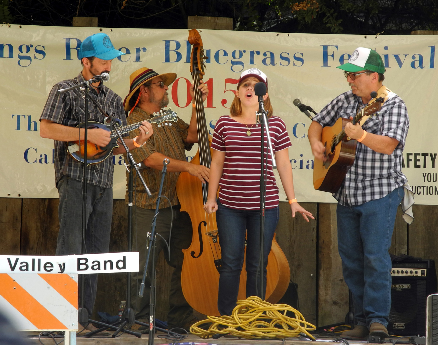
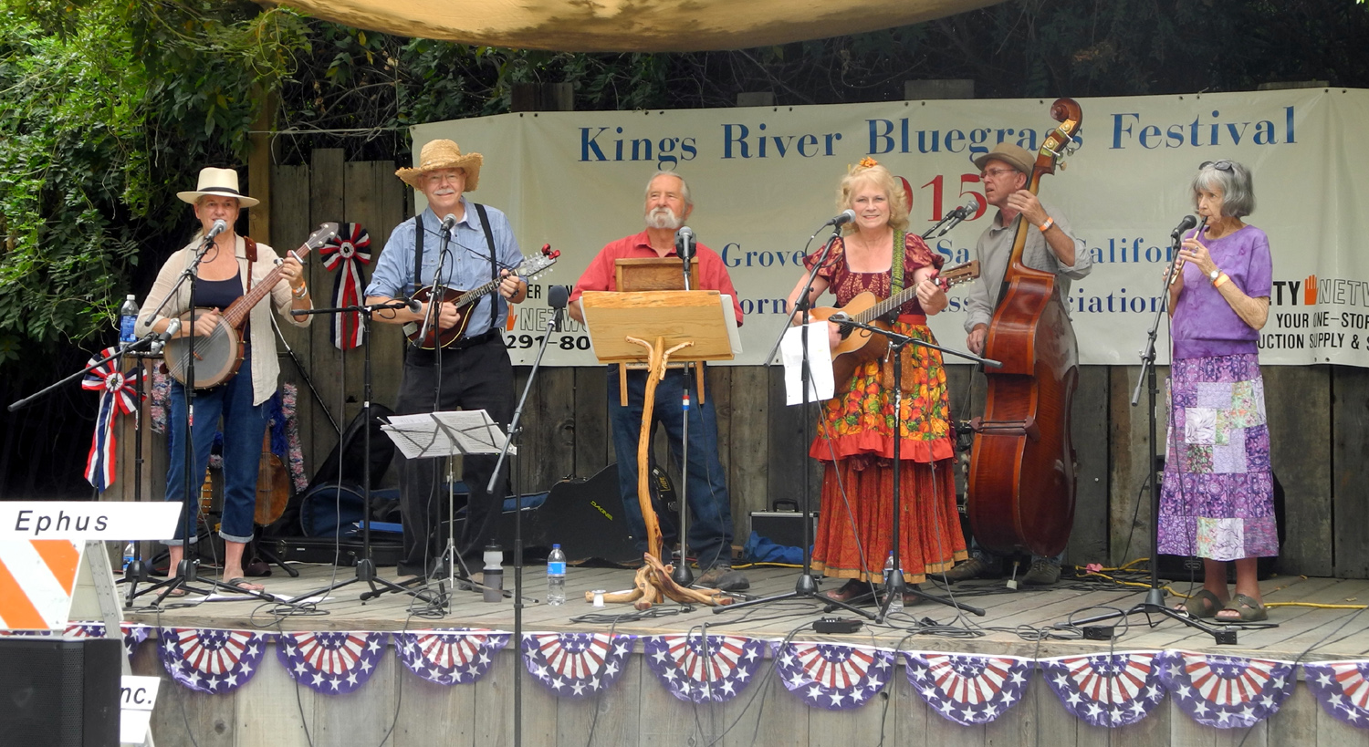
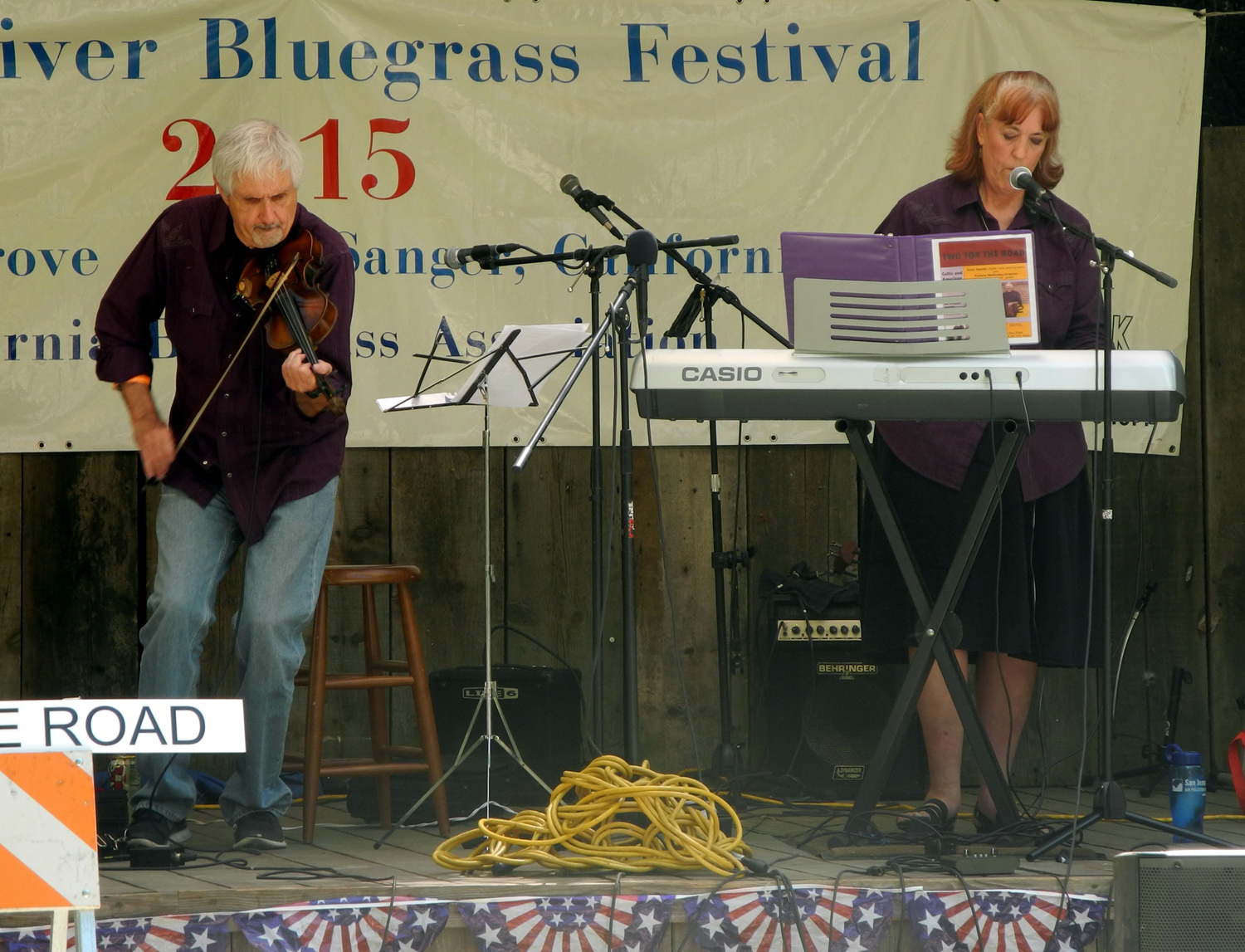
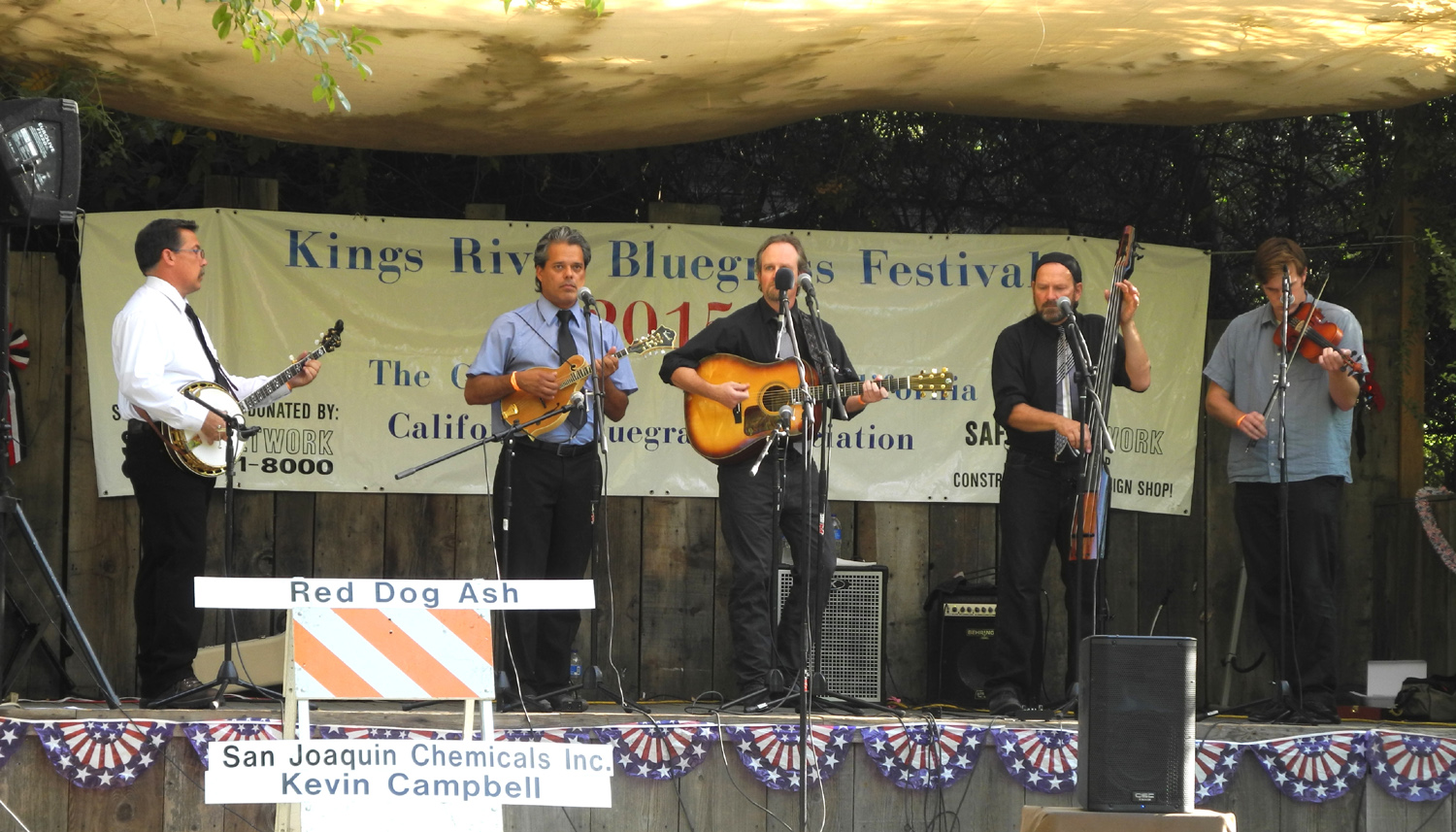
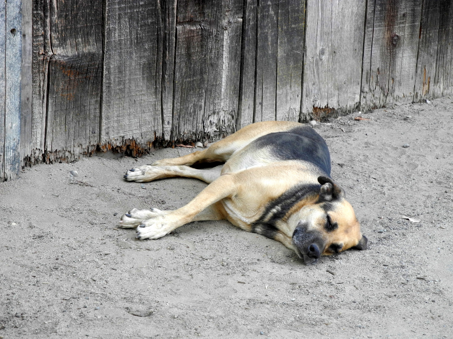
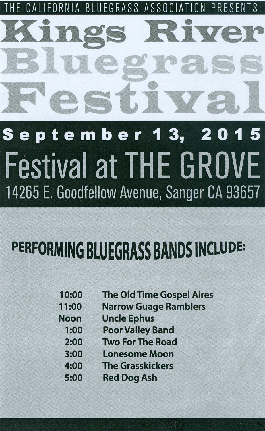
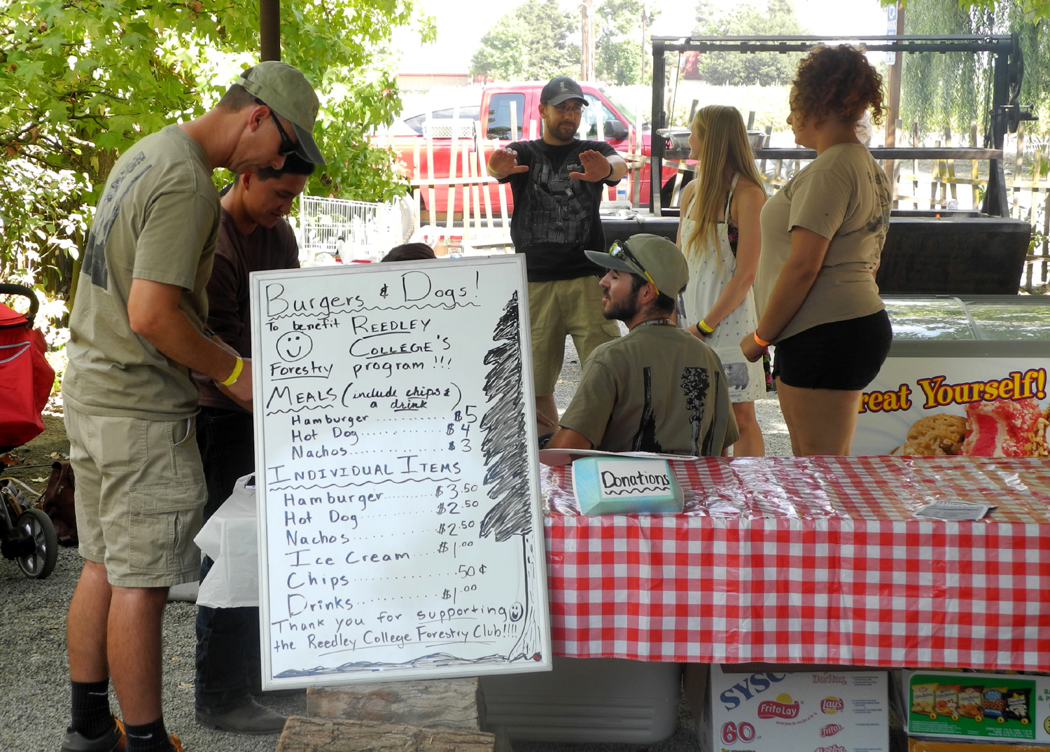
Kings River Bluegrass Festival This will be a short report on a short bluegrass festival. Rising from the ashes of the long-running Kings River Bluegrass Festival, a three-day event that was last held in 2013, is the one-day 2015 version of the event. This was a low-key production, with eight groups, all from the central valley, mostly from the Fresno area. It was at the usual location, The Grove (formerly Hobbs Grove) near Sanger, 20 miles from my home. Five of these groups appeared in the free Bluegrass in the Park program in Clovis during the summer, and I had seen two of the others previously, so it was not a festival where I expected to be amazed by a group that was unknown to me. Fortunately, there was in fact that band that makes it all worthwhile - the Poor Valley Band, based in Merced. It's built around a father and daughter, plus two other musicians. The girl, who is a young adult, does most of the singing, and does not play an instrument, but her voice was amazing. I saw them here in 2013, and hope to see them again soon. Two for the Road was another group that surprised me. When I saw them on stage, just two people, one playing an electric keyboard, I expected the worst. While their music is certainly not bluegrass, it's very good - a mix of pop and country, done well and entertainingly. At the next to last Bluegrass in the Park performance September 3 I had seen the Narrow Gauge Ramblers. This group rose from the ashes of Smiley Mountain, a group mostly from the foothills north of Fresno (North Fork, Oakhurst, etc.) They had a bass player who had a style that was different from the usual "BOOM-boom, BOOM-boom" approach, and the group overall was quite good. At the Kings River festival they had a substitute bass player who was very average, but they added a guest dobro artist, and I enjoyed their performance once again. Grassfire has been around for several years, appearing in the park and at this festival. Their usual banjo player, Tom Naiman, could not make it, but they had a substitute lined up. At the next to last minute, he was called away to a fire in Oakhurst, so Jack Kinney was pressed into service at the very last minute. He's a young man who we've seen develop into a highly skilled musician, expert on fiddle, mandolin and banjo, and capable of holding his own in any setting. Several musicians appeared more than once, either as substitutes, or because they belong to more than one group. The ubiquitous Mike McDonald played bass for the first three acts, and later with one or two more, and is a member of all but one of the groups he appeared with. Like all festivals, there were representatives of other festivals and organizations there, selling raffle tickets, giving out information, etc. A lady who makes jams and jellies and sells at all Fresno Folklore Society events was there, and I was able to augment my supply of homemade apple butter. Mona A., whom I've known since the first Parkfield festival early in the century, collected raffle prizes and sold tickets to benefit the Kings River event. There was only one food booth, which was enough for a single day. It was the Forestry Club from Reedley College, selling drinks, hot dogs, hamburgers and ice cream. Although I brought food that would have got me through the day, I could not resist patronizing this group, since my younger daughter and her husband earned AS degrees in forestry at Reedley about 20 years ago. The weather was warm and slightly humid, but the audience area is mostly shaded by trees that were spindly saplings when I first attended this event, and are now big enough to allow everyone to sit in the shade. There was no evidence of smoke from the big fire burning in the mountains to the east, since the wind had shifted to carry it away from the valley. With only 20 miles to travel, I left home about 9 a.m., arriving at 9:30, plenty of time to get set up for the 10 a.m. start. I visited with several people I know from other festivals and musical activities. There was no break, with a new group every hour, ending at six p.m. as Red Dog Ash, a highly popular group from the Turlock area, sent us home with two encores. Not all the entertainment was from the music. When I arrived there were two dogs sleeping in the shade of the old barn, as relaxed as it's possible to be without being dead. I went out to my car for water and snacks several times during the day, and at noon the large dog appeared to have not moved a muscle since I arrived two and a half hours earlier. Later he was gone, but the small dog was making his way back to the shady spot, moving as slowly as possible. When I left for home about 6:15, the big dog was back in his same spot, looking as if he had not moved the entire day. With a decent attendance, generous sponsorships, discount fees charged by some bands, and raffle ticket sales, the event was declared a success, and planning began before it was over to bring it back again next year. When this event was first announced, I was skeptical about the one-day limit, but I arrived home refreshed and with the feeling that it was just the right amount of time to sit outside enjoying bluegrass on a summer's day. --Dick Estel, September 2015 |
||
|
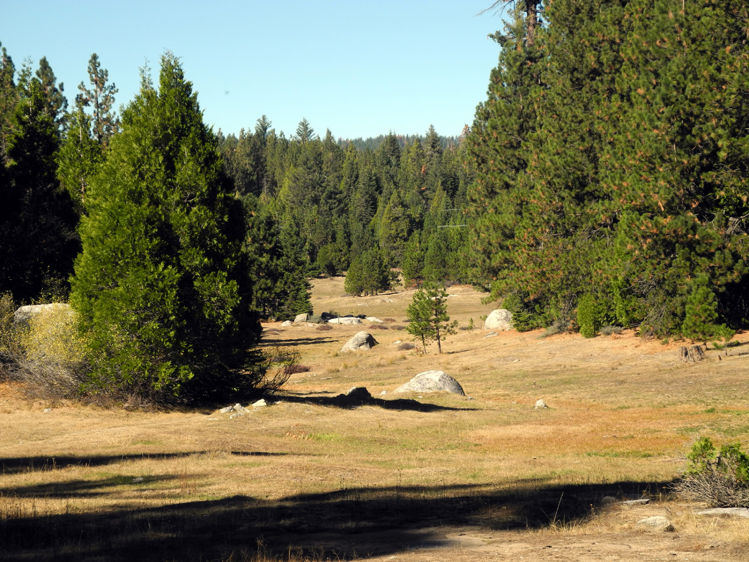
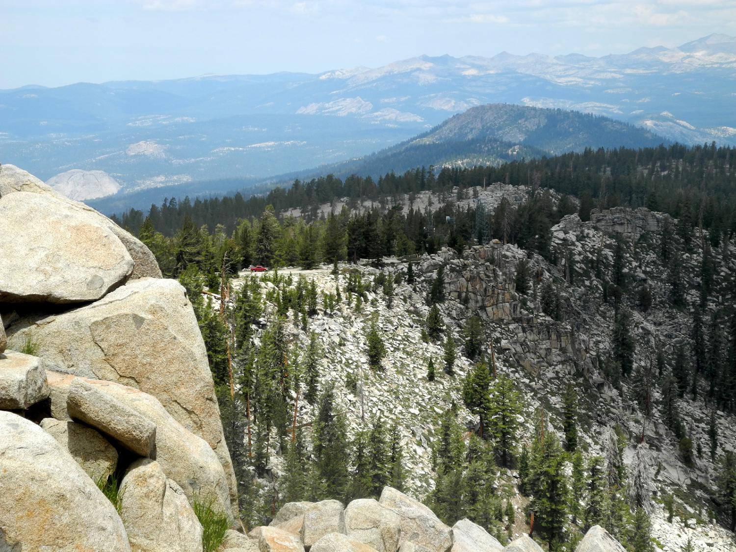
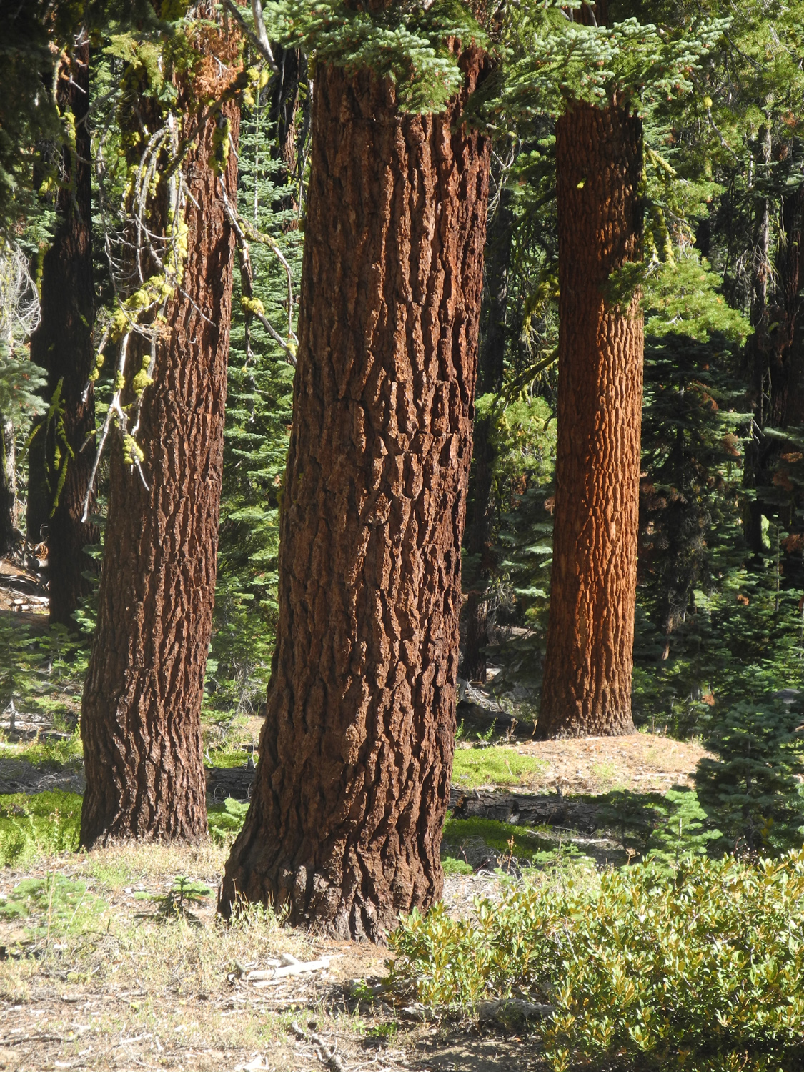
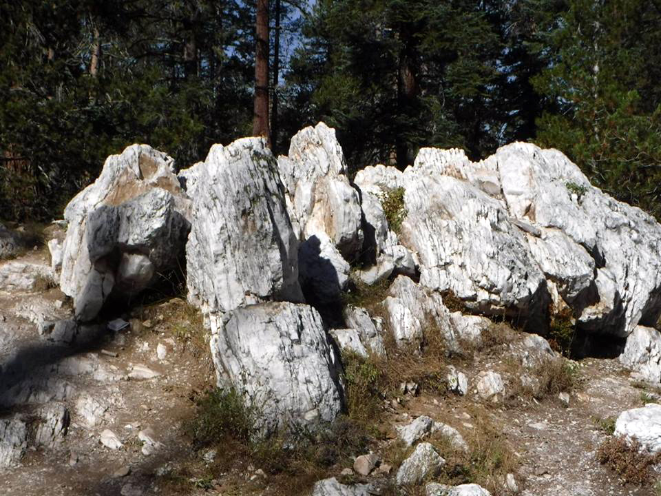
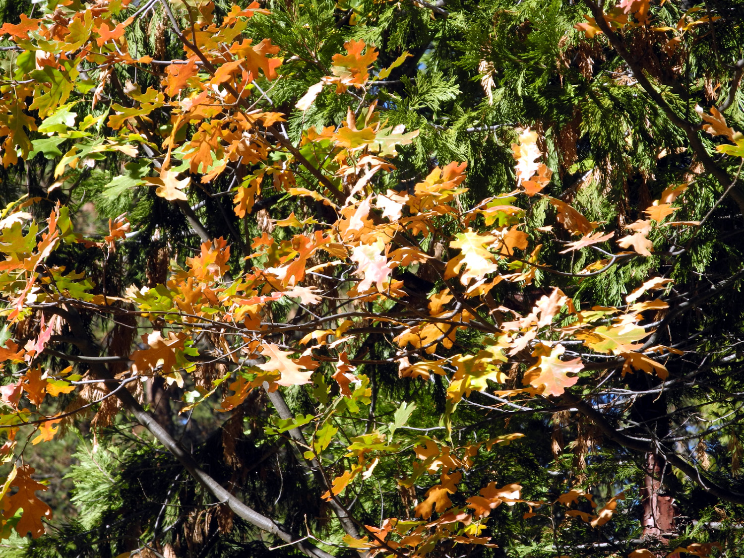
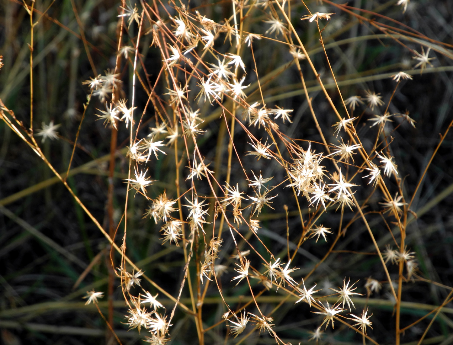
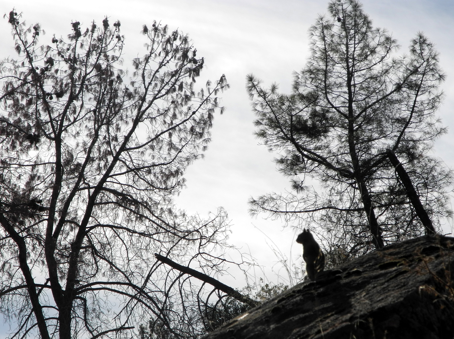
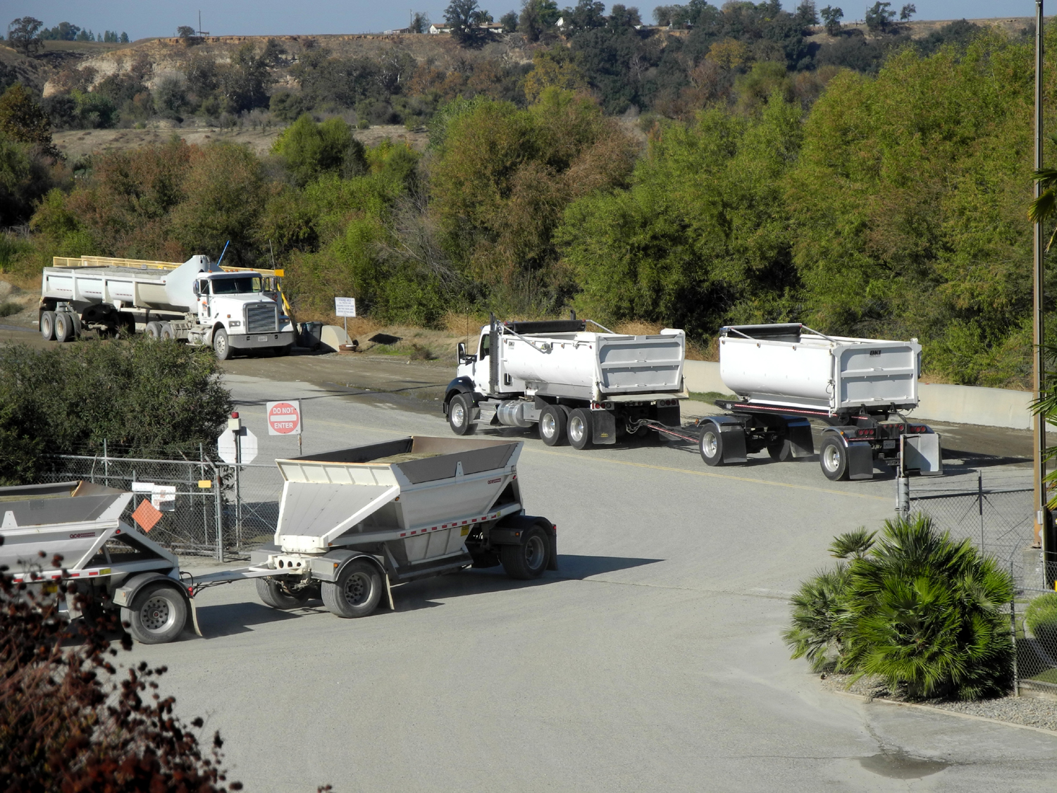
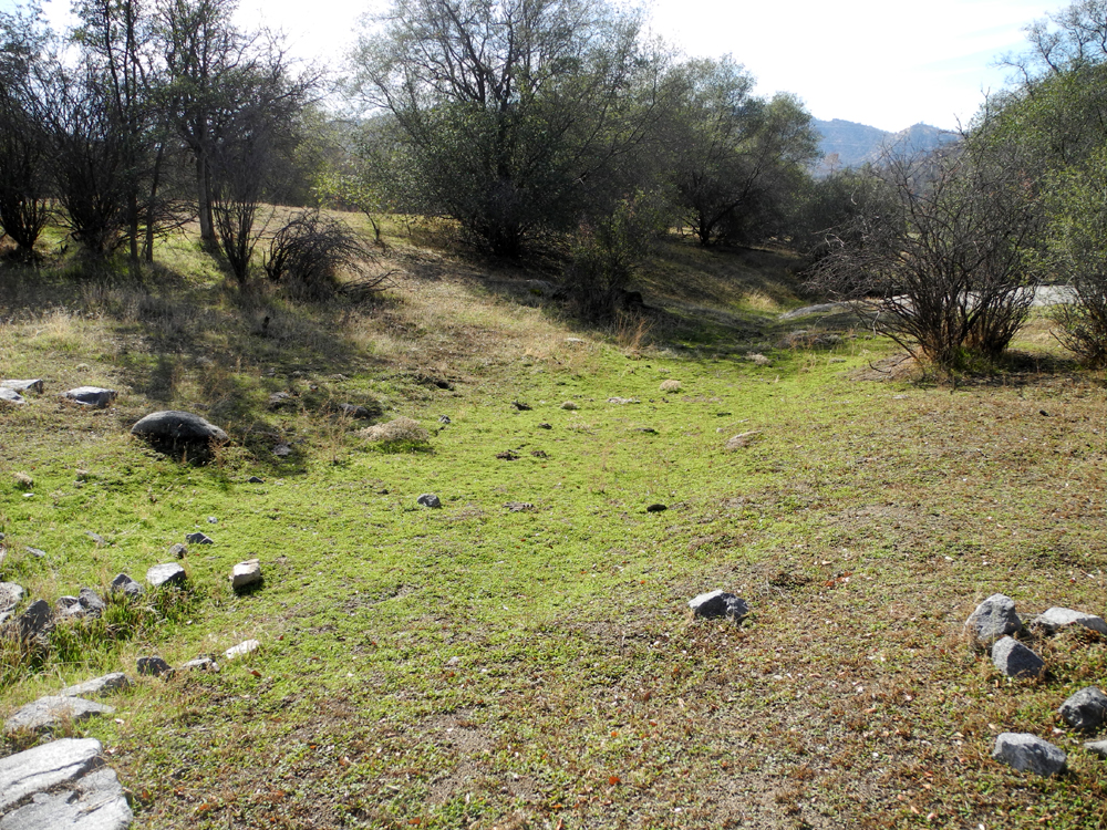
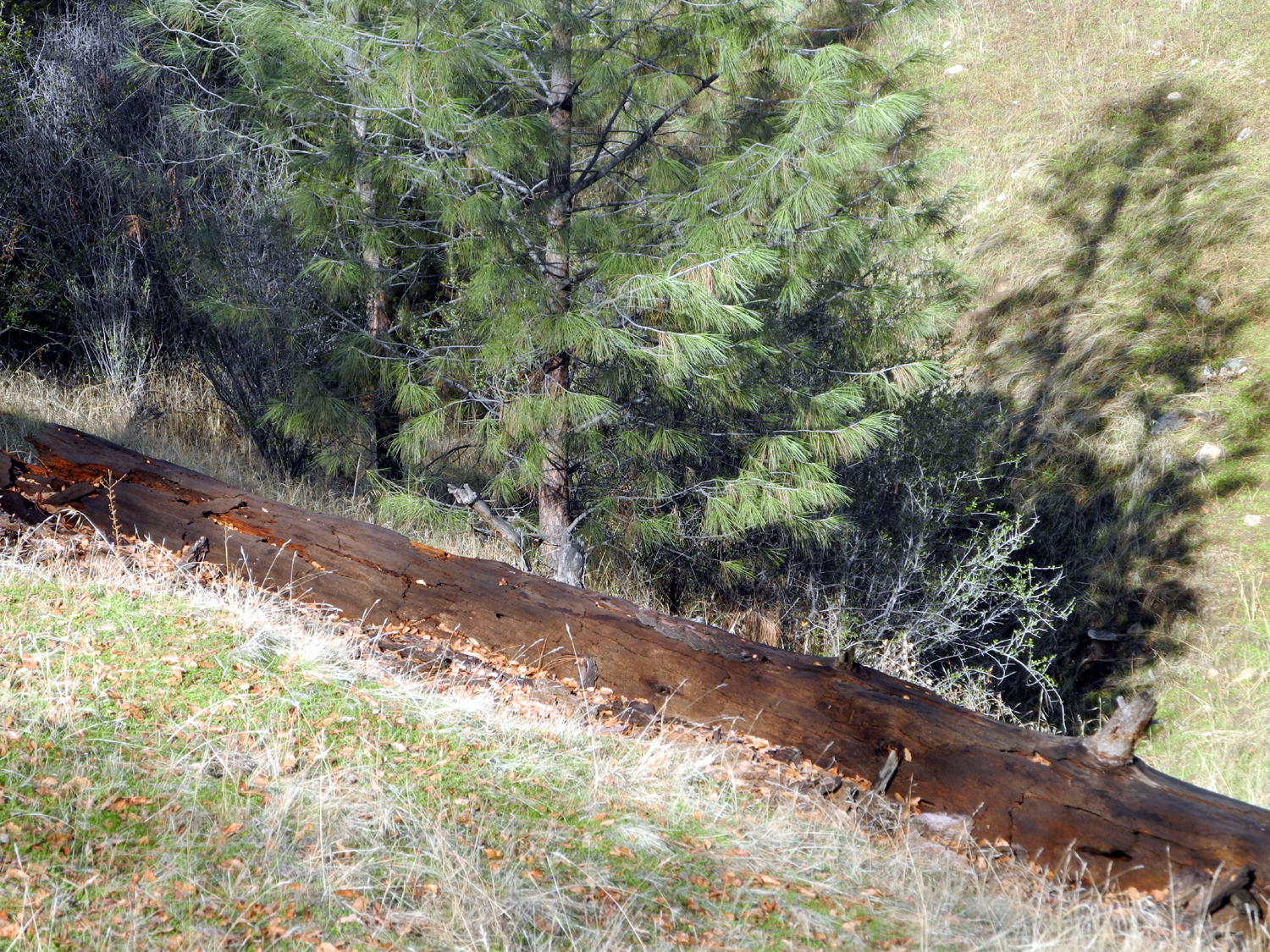
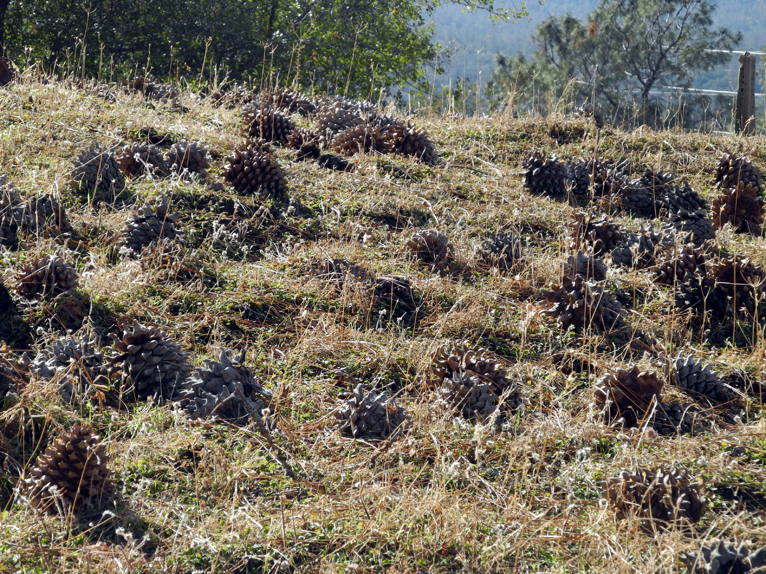
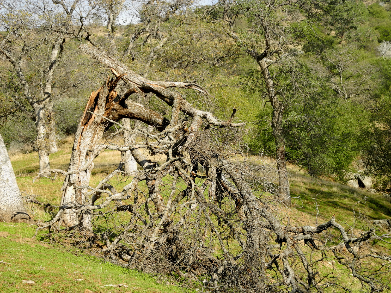
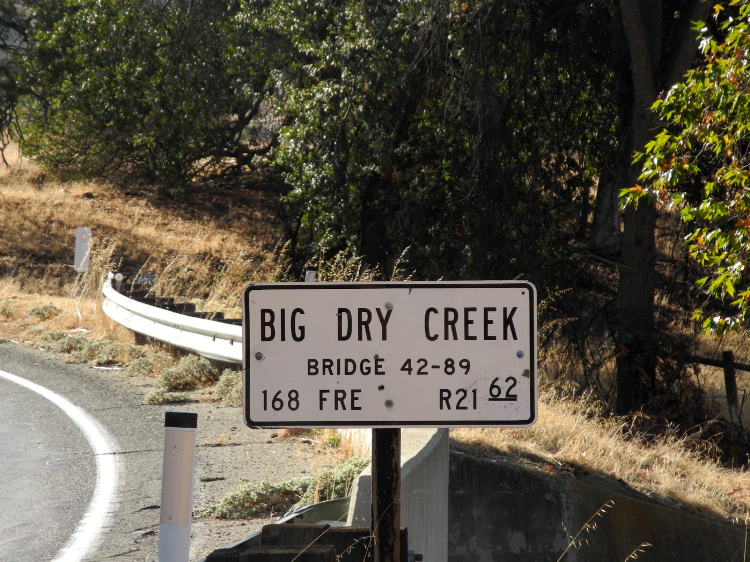
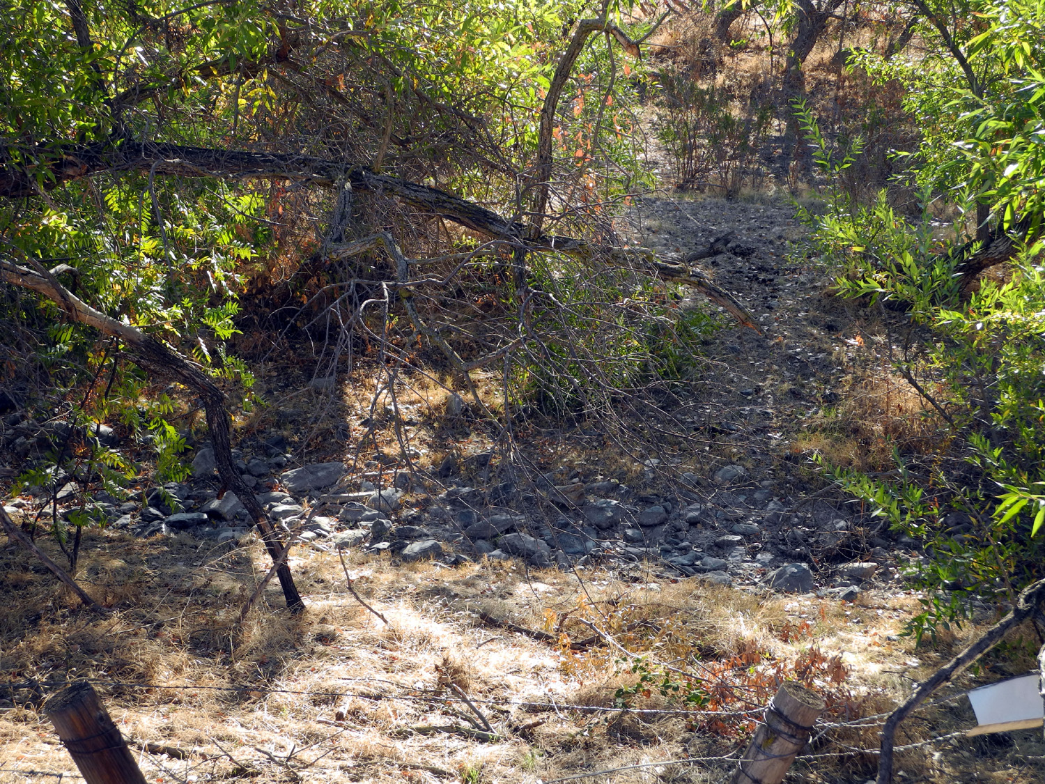
Shaver Lake Logging Road It was November 1, the weather was nice, but storms were predicted for November 2 - several inches of snow possible, down to 6,000 feet or lower. It seemed like the perfect time for a "last chance" trip into the Sierra. I got an early start, planning to drive a few miles beyond Shaver Lake and walk around some of the dirt roads or other suitable places in that area. Heading up Highway 168, I made a couple of stops in the foothills at Big and Little Dry Creeks. Big Dry Creek runs through Clovis and Fresno as a channeled and sometimes concrete lined canal, so it was interesting to see it where it is an actual creek, even though it was in fact dry. Farther up the highway I decided to explore a road that has always intrigued me. The San Joaquin & Eastern Railroad was a line that ran from east of Fresno into the mountains to carry materials for building Southern California Edison's Big Creek Hydro Project, and much of the road is still passable. Off CA 168 a short distance past the road to Auberry is SJ&E Road. I did not know (and still don't) if this is actually part of the railroad line, but I decided to see what was there. It's a good paved road that goes gradually up hill from the highway for several miles, with lots of houses. At one point it seemed to be arriving at a town of some kind, and I was not particularly surprised to realize that I was in Auberry. From here I could have gone back to 168 and up the 4-lane section that climbs from 2,000 feet to 4,000, but instead I turned right on Auberry Road. Just past the town this road forks, with Power House Road going north to cross the San Joaquin River and up to the town of North Fork. This is the road we take to get to Smally Road, which leads to the San Joaquin River Gorge (formerly Squaw Leap). I took the right fork, continuing on Auberry Road, which winds steeply up the opposite side of the mountain from the 4-lane. Eventually it joins 168, but along the way there are a couple of points of interest and many nice views. Side roads lead into an Indian Rancheria and the Mono Wind Casino, located in a long, narrow valley known as Jose Basin. There is a place where the road goes past a gap, and from here you can look down on the highway a few hundred feet lower. Beyond this there are some nice views of high mountains, and the trees change from foothill scrub and oak to ponderosa forest. Near the end of the road are two small communities, Meadow Lakes and Alder Springs, both above the 4,000 foot level. Auberry Road then drops down briefly to connect with 168 at Cressman's, a store and gas station at Pine Ridge, about five miles from Shaver Lake. Needing some chewing gum, I made my first ever visit to the store, spending the huge total of 35 cents. At Shaver Lake I took the Dinkey Creek Road and drove a few miles to the Dorabelle Campground. This is closed for the season, but I parked at the entrance, and walked across the road to a parking area where there used to be a restroom. A short walk past this area there is a good view down into Blue Canyon, which is drained by a creek that runs into Pine Flat Lake. A road that leaves Highway 168 below Cressman's goes all the way down the canyon to Trimmer Springs Road around the lake. I recalled that I had once walked a short distance on an old logging road near this area, so I went to the west end of the parking lot, looking for it. Although the road did not connect with the parking lot, I was able to work my way down to a rough dirt track that connected with the road I was looking for. This road is not accessible to large vehicles, and would not be passable anyway. This road was lined with ponderosa and sugar pine, fir, cedar, and black oaks, changing to their winter colors. I followed it as far as it went, probably a quarter mile or so. It ended, as so many such roads do, in a pile of brush that had been bulldozed into place after logging operations were done. I returned to the car, set up my lawn chair, and had a snack while doing a bit of reading in my current book, The Cat Who Came to Breakfast, part of a series of about 30 or so volumes featuring a pair of Siamese who help solve crimes. Then I went around the locked gate and walked through the campground. I had stayed here a time or two at least 30 years ago, but it's not an area I would choose for camping now. There are 20 or so campsites, and a large meadow runs along the west side and beyond the far end of the campground. I walked to the end and into the meadow a slight distance, getting a few photos of brown grass against bright evergreens. Back at the car, I explored a small area east of the parking lot, then went down to the Blue Canyon vista, set my camera on a large piece of ponderosa bark, and took the obligatory "Dick on the rock" photo. With my walks on the road and in the campground, and random wandering about, I managed a little under two miles of hiking for the day, so I returned to my car and headed back down the road, arriving home about 1:30. As expected, the storm arrived early the next morning, bringing about three quarters of an inch of rain to Fresno and snow down to the area that had been such a warm, sunny place for walking less than 24 hours earlier. --Dick Estel, November 2015 |
||
|
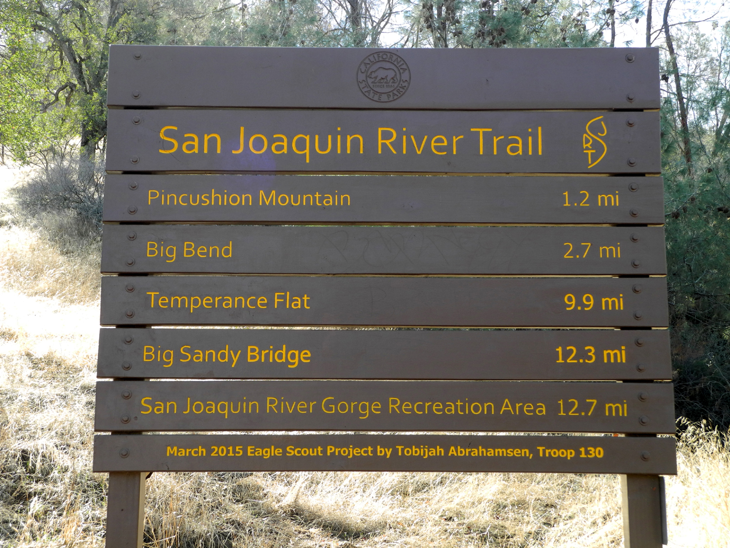
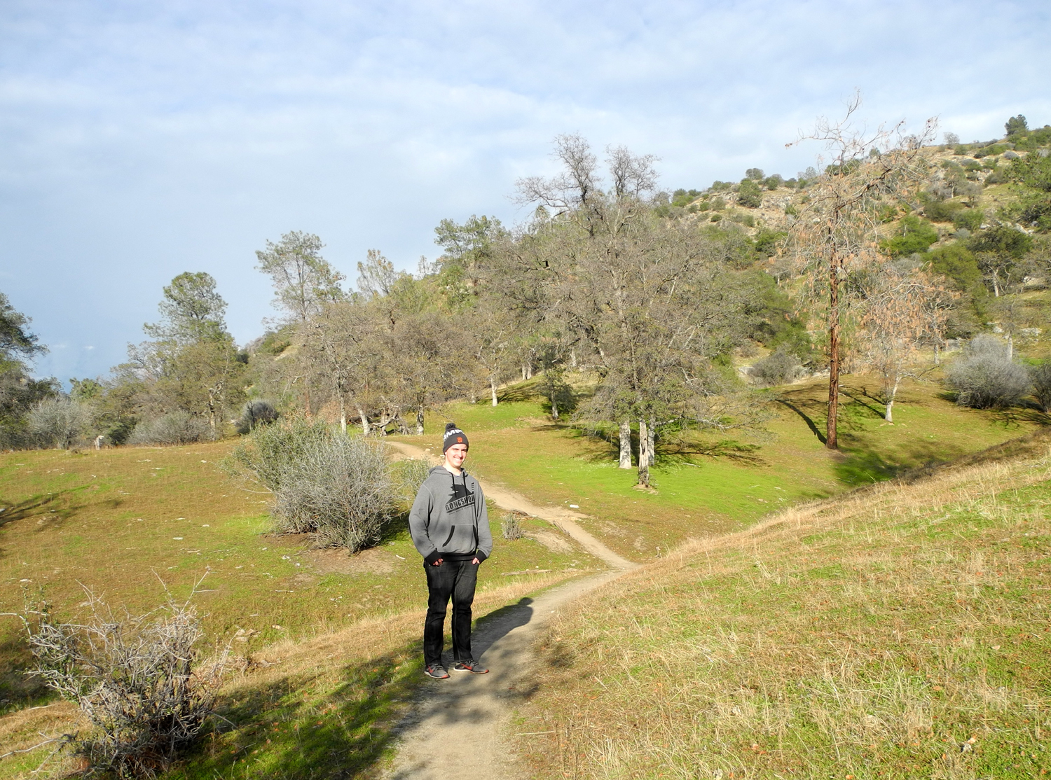
San Joaquin River Trail (Finegold) I've made this hike a number of times, and written about it here, here, here, here, here and here, so I'll keep this short and just cover what's new or different. The location is a trail that runs from the Finegold picnic area by Millerton Lake, at the end of Sky Harbor Road, to the San Joaquin River Gorge management area, previously known as Squaw Leap. It's a low elevation area, so I never go there in the summer, and even the hikes I've done in October have been a little warm at times. My friend Carolyn and I were going to do this hike on Monday, November 9, but the weather forecast was for rain and thunderstorms, so I decided to go by myself on Sunday. Most of my hikes are on weekdays, and usually there are only two or three cars in the parking area, but this time there were at least 20, the most I've ever seen. While I saw a lot of people on the trail, they were spread out and there were never very many near me at any one time. The overnight low was 45 degrees, and it was still quite cool when I got on the trail a little after nine. I wore two layers, thinking I probably should just brave the cold and wear only one. About half way up the trail I had to remove the outer shirt, and stuffed it in my field bag. Nearly everyone I met had jackets tied around their waists, so everyone else had made the same mistake. We've had several rain storms since mid-October, so I was hoping to see some green grass. On the road, the hills looked as brown as ever, but with a close up view on the trail, I could see that the new crop of green is off to a good start - it's just that the old dry grass is still there, trying to hide the next generation from view. As I went up the trail, many of the people I met were runners, and presumably most had run uphill as well. I also met one bicycle and a few walkers. The trail was as steep as ever, and I was older than ever before, but I just kept up the slow steady pace that always works, and made it to the top of the ridge with no problems. Along the way I was glad to see that the lake is slightly higher than on any of my past few hikes. It was also a sparkling clear day, very cool at the start, and quite warm by the time I got to the top. I went up the path to the east that crosses the main trail and sat on a rock while I enjoyed my snack of apple and orange slices. I had once done this hike without eating anything at home and bringing nothing with me, and suffered somewhat, so now I take snacks on all but the shortest hikes. Where I stopped the trail crosses a saddle, and continues on around the hills parallel to the lake. I would like to go a mile or so farther this way, but the climb to the ridge leaves me without the energy to go farther. To the east up from the saddle, you can look down on a narrow passage where the lake starts a double hairpin turn. The lake upstream from this always seems to be sparkling, possibly due to a "wind tunnel" effect through the narrow channel. I spent about 30 minutes at the top, then started back down. Even though I thought I got a later start than everyone else, I met one bicyclist and at least four hiking parties on their way up. Even having eaten an apple and an orange, I was very hungry by the time I got back down to the car. I returned home briefly, then went to Hacienda Tequila, a fairly new Mexican restaurant that I had not visited before. The food was about average, with the salsa and beans less so, and there are other places I like better. Normally I would be carrying a to go box if I ordered a two-item combo with rice and beans, but I was hungry enough to eat everything. Reviews of the place are mixed, but the decor is unique and interesting. Despite the cool nights, it was fairly warm by the time I finished the hike, which officially started my winter hiking season. I'm looking forward to exploring more low elevation places as the weather cools off. --Dick Estel, November 2015 |
||
|
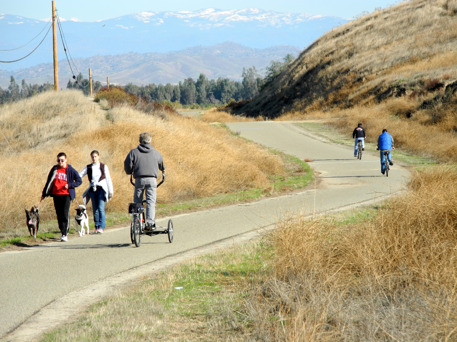
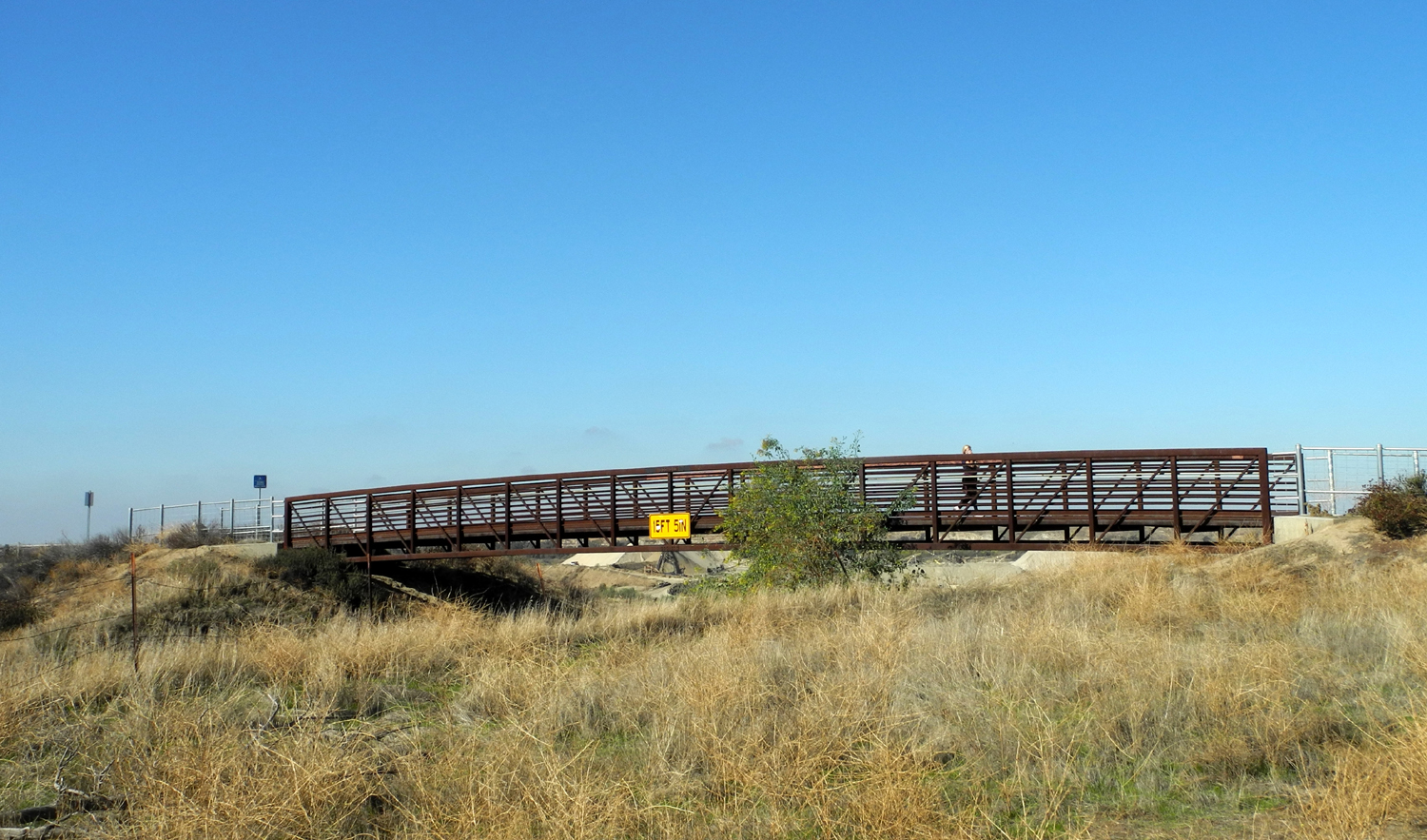
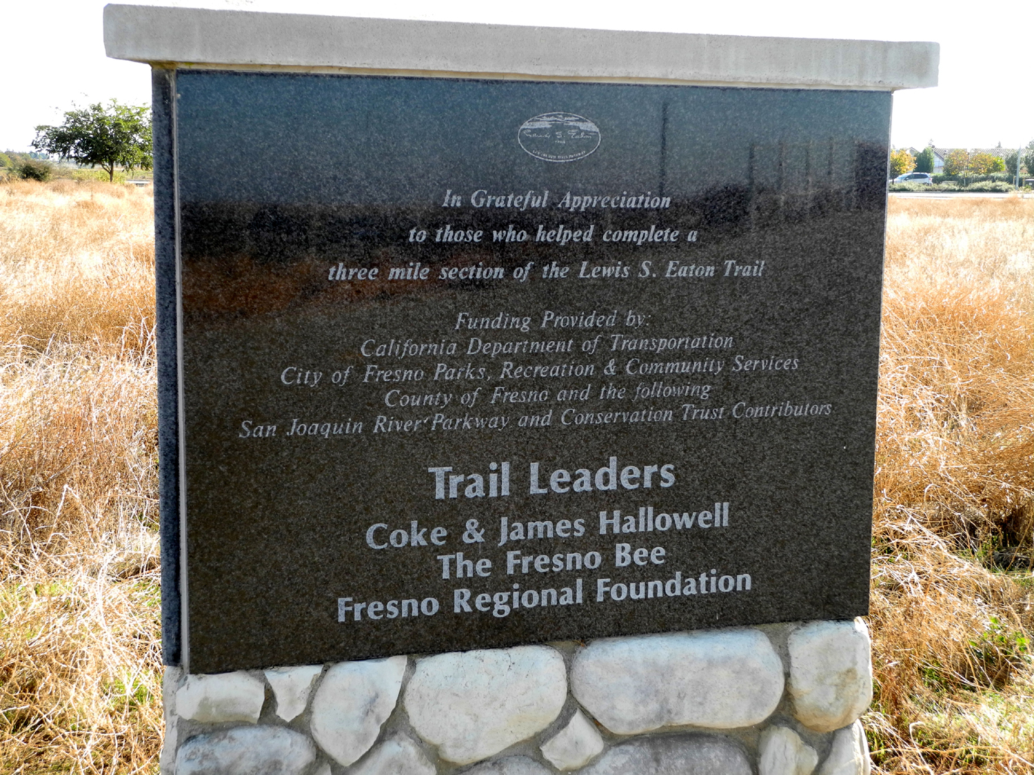
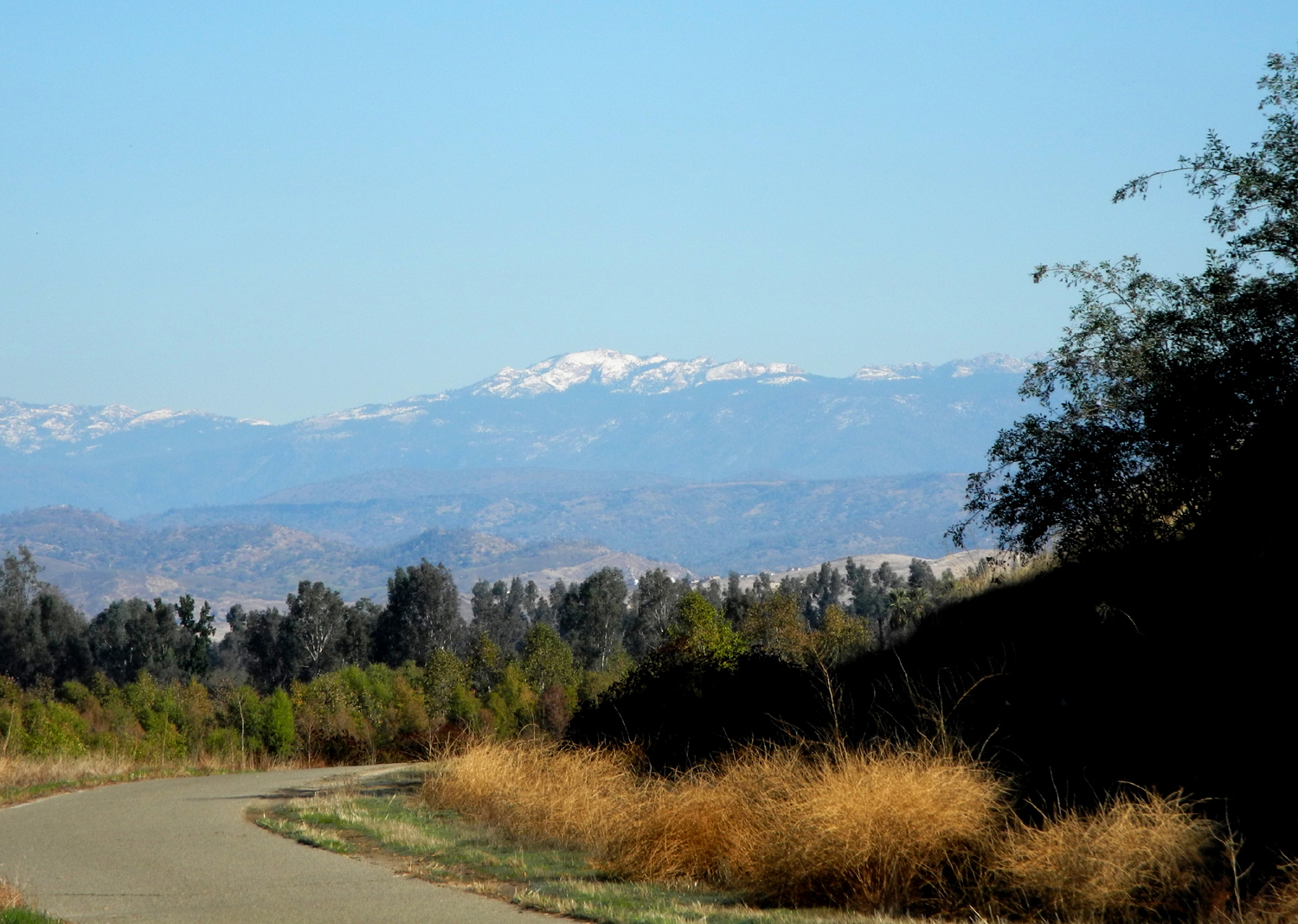
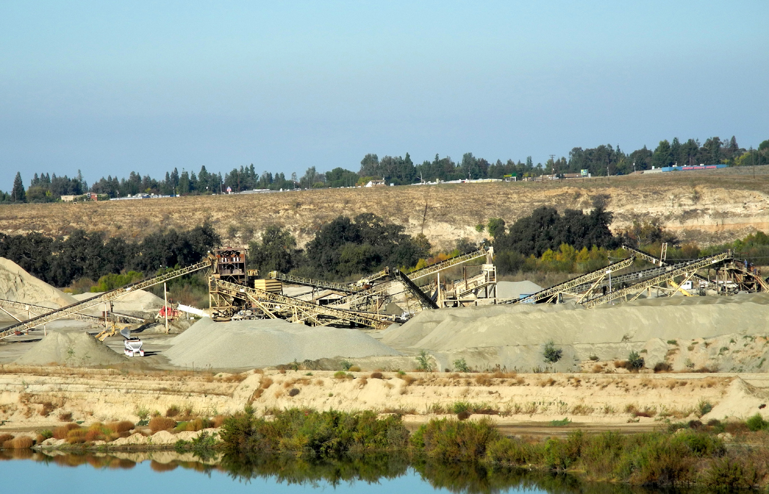
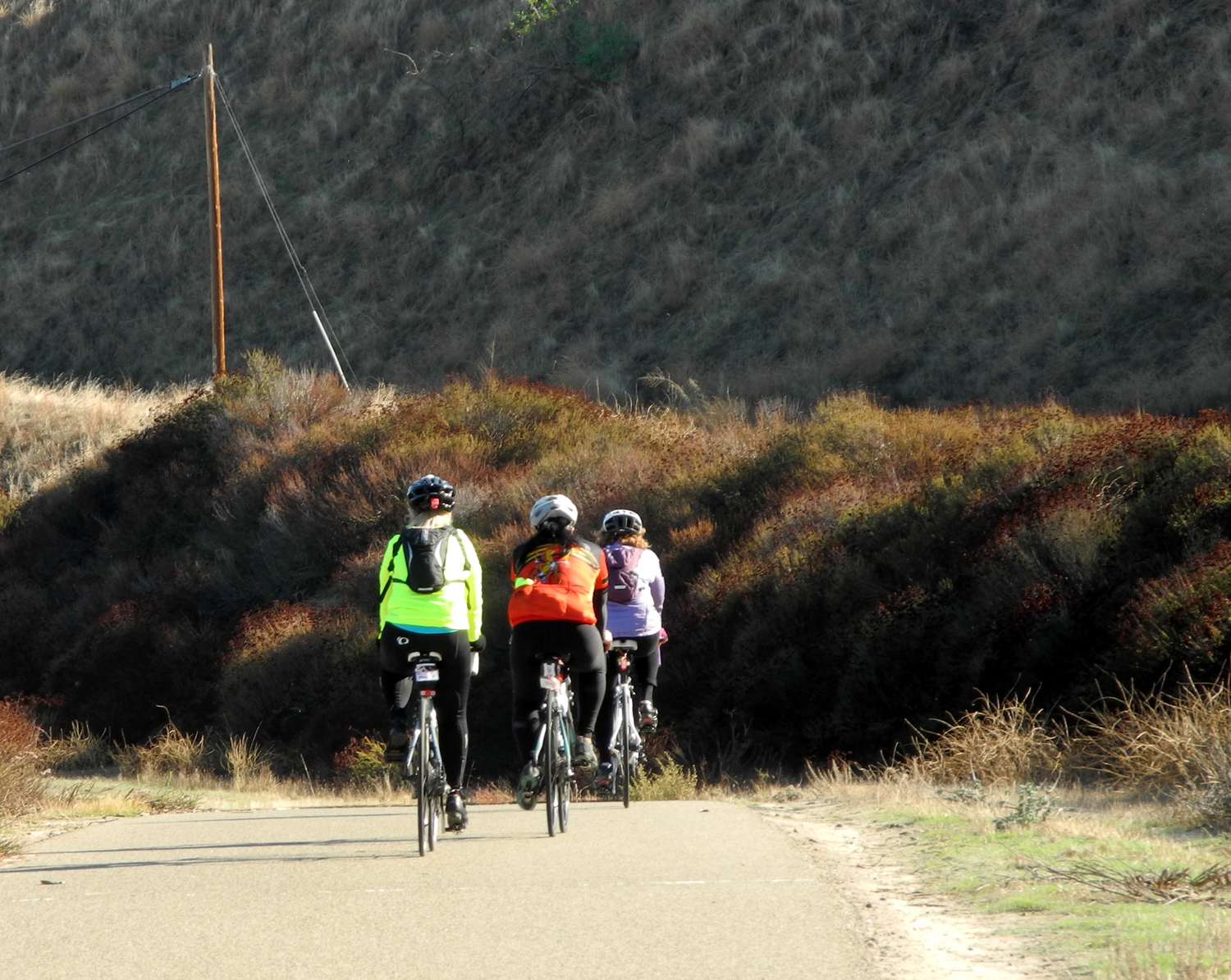
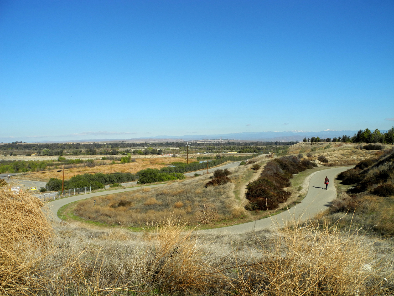
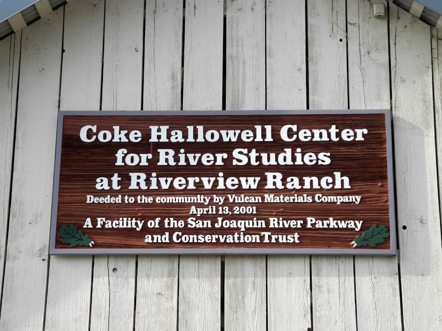
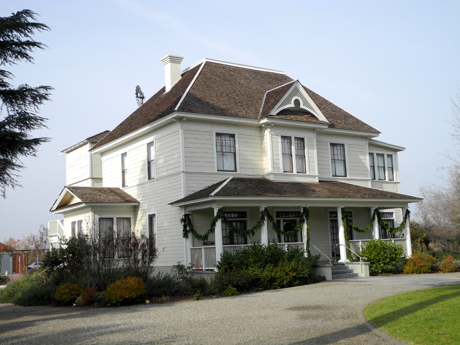
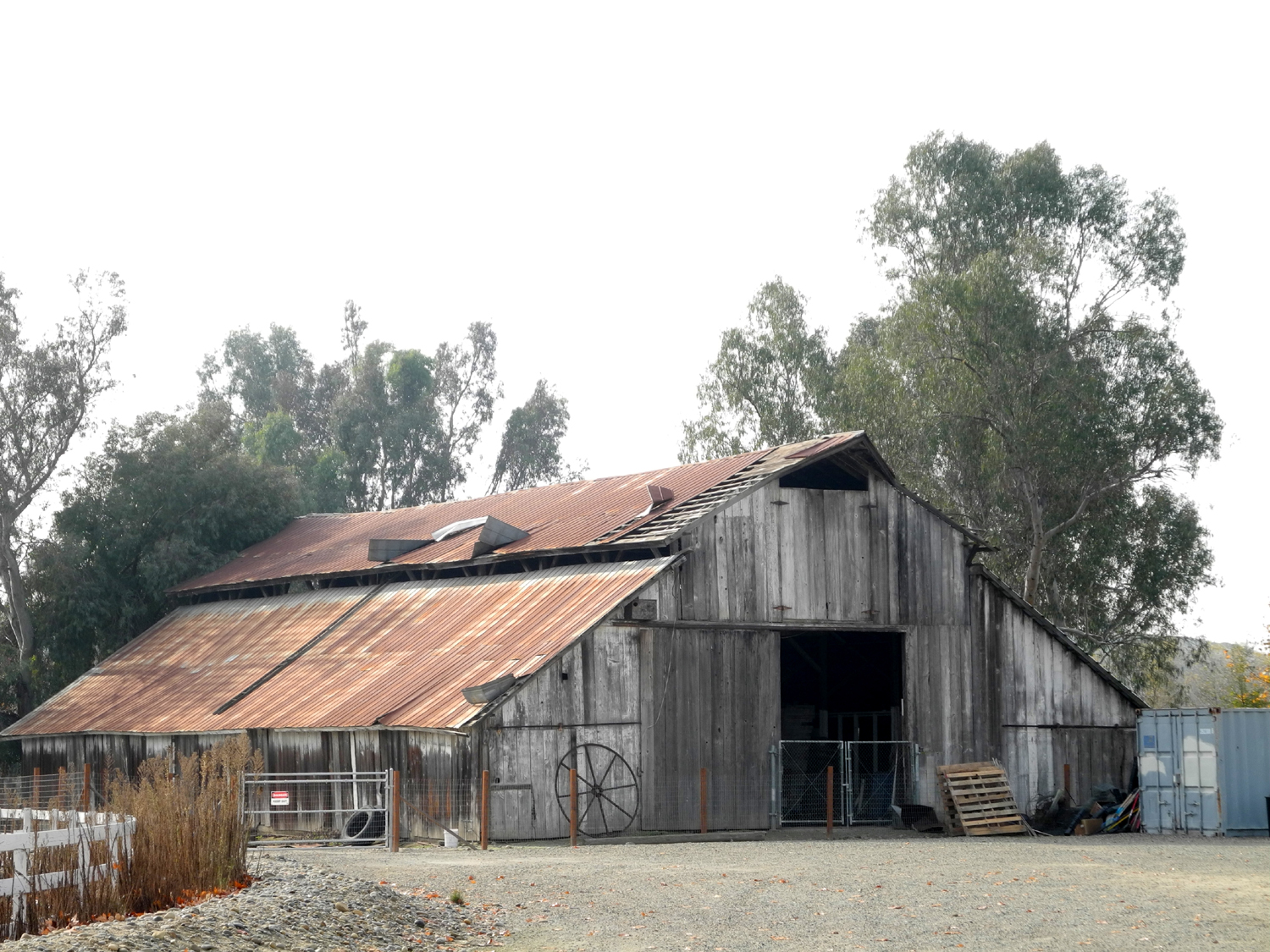
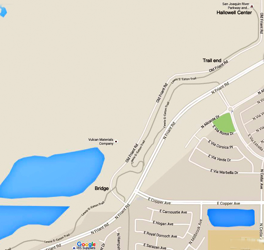
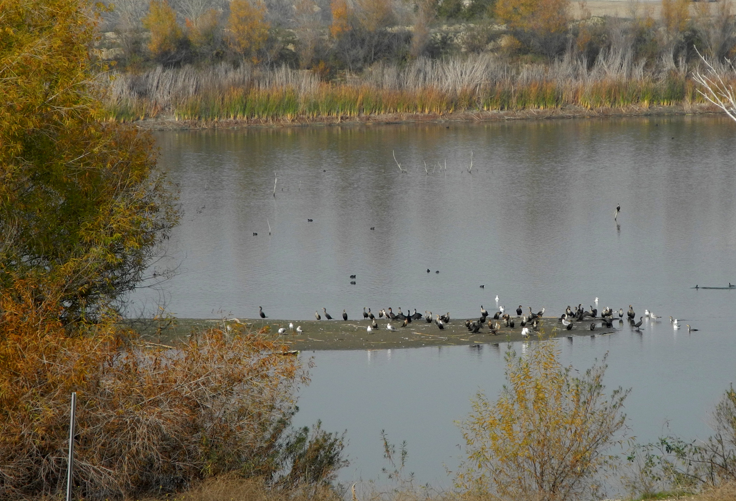
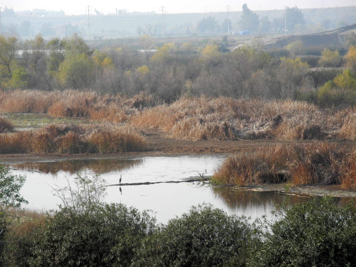
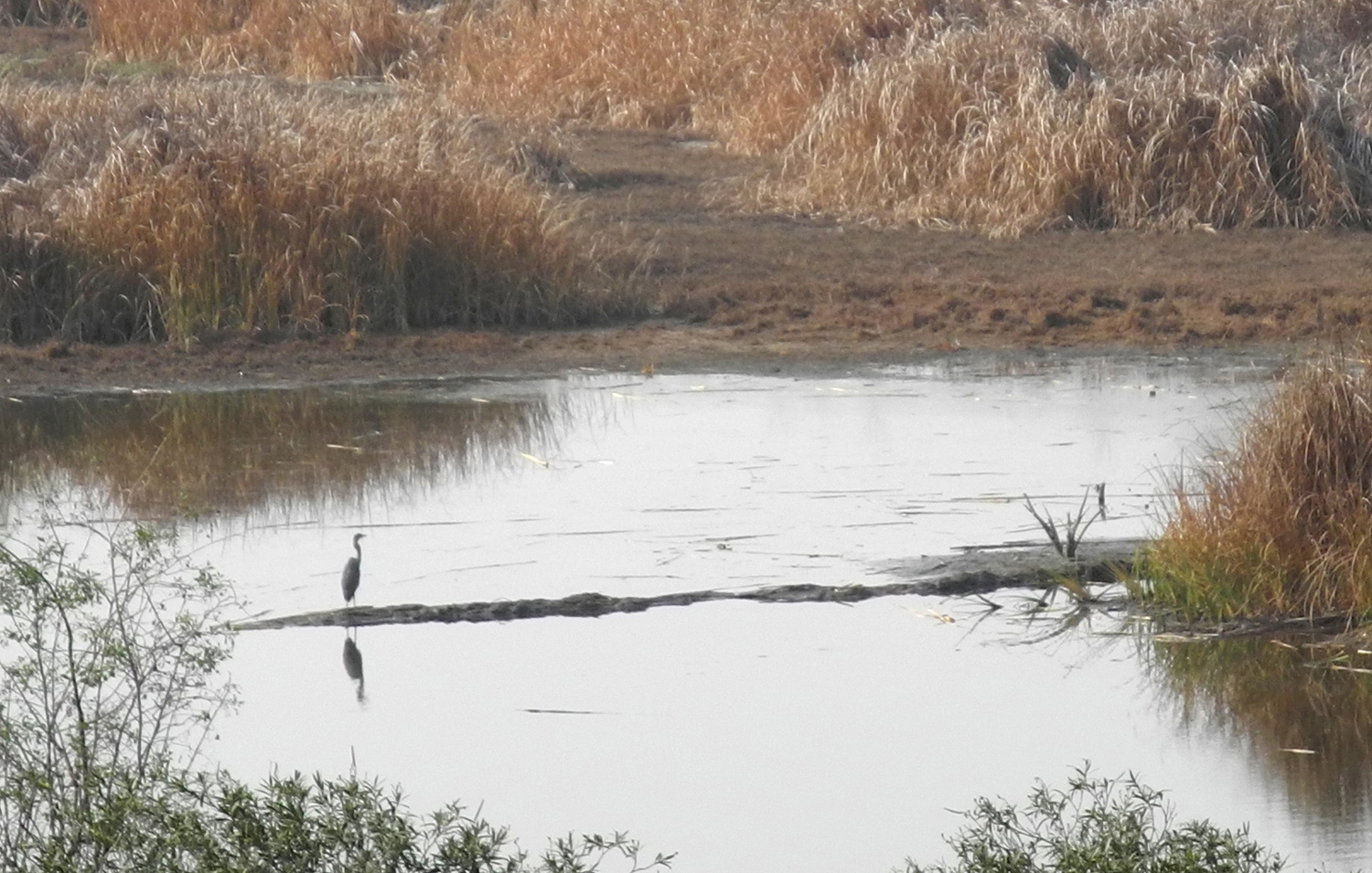
Lewis Eaton Trail (update here) The Lewis S. Eaton Trail is part of a planned 22-mile San Joaquin River Parkway. It starts at Woodward Park, which is north of Fresno and adjacent to State Highway 41. The trail follows the San Joaquin River eastward along the bluffs on the south side, descending to the river bottom outside the park, and ending at the Coke Hallowell Center for River Studies. I walked parts of the trail from Woodward Park a few times more than ten years ago with my daughter Teri, but had not been there since that time. On November 11, wanting a change from the Clovis trail system, but not wanting to drive very far, I went north from Clovis on Willow Avenue and turned west on Friant Road. Where Old Friant Road goes down to the river bottom to a sand and gravel operation there is access to the trail, which crosses Old Friant on an attractive bridge. It was a bright, sunny day; the temperature was comfortable, and there are views of the snow-covered Sierra Nevada mountains in the distance. Much of the trail is level, but at one point it winds down to the river bottom, providing a nice change of pace. It's a gentle slope, not steep. The entire trail is paved (not necessary a good thing) with a white line in the middle. It's a popular place for bike riding, and I probably saw an equal number of walkers and bicyclists. There are views of ponds beside the river, some of which are part of the mining operation, and there were trucks going in and out from the facility on a regular basis. They have to go slowly in that area, and the trail is away from the road enough that the noise of the vehicles is not particularly noticeable. After about 3/4 mile, the trail crosses Old Friant Road and enters the Hallowell Center, which is best explained by this quote from the River Parkway website: There is something for everyone at the River Center. Programs like storytelling, river-inspired art workshops, readings by local authors, gardening classes and kids' crafts keep the place bustling with activity year-round. The River Center has a restored 1890's ranch house, rose garden, orchard, vineyard and picnic area. The grounds and historic ranch house are available to rent for business meetings. I went a short distance on the road after the trail ended, and noticed some benches inside the Hallowell Center grounds. There was a locked gate, but no signs saying keep out, so I went through the fence, as did another party while I was there. I've never visited the center, and it has limited hours, but I hope to check it out someday. My total distance on this walk was 2.3 miles, but the trail from Woodward is more like five miles, so there are plenty of opportunities for those who want some more distance, or who are biking. --Dick Estel, November 2015 Along the way you can take a dirt path that goes all the way around a large pond there, but we followed the paved trail. A group of kids were touring the area, so we listened in a bit on what the guide was telling them. It did not appear that any of the buildings were open, but we walked around the grounds, which include various trees and plants, as well as a beautiful two-story house that was apparently part of a ranch. There's also a large old barn, and of course, informational signs. Heading back, we took the dirt path on the south side of the pond, spotting a blue heron as it took flight. We also saw many ducks and egrets, both white and brown, as well as a cottontail rabbit that was napping just off the trail until we interrupted him. The entire walk added up to about three miles, a good outing, mostly on level ground, but with a section that winds up (or down if you're going upstream) from the river bottom to the top of the bluffs that line the San Joaquin for many miles. Returning to the city, we
went to In-N-Out Burger
for lunch. A word in praise of this chain - although it was very
busy, we got waited on and served fairly quickly, and the cost for
two was about equal to what you pay for one lunch at many such
establishments. Eaton Trail Photos New photos added here December 10, 2015 |
||
|
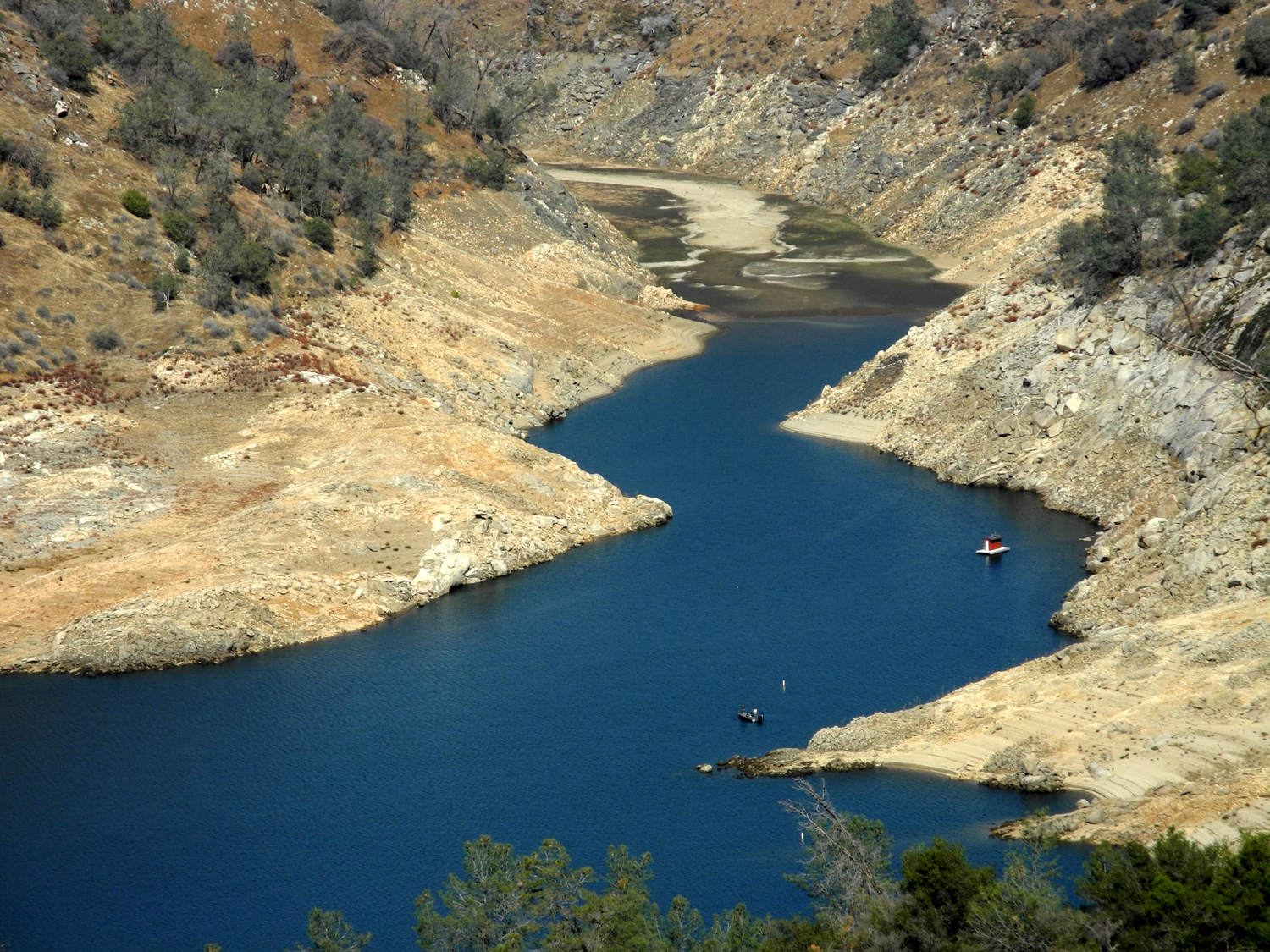
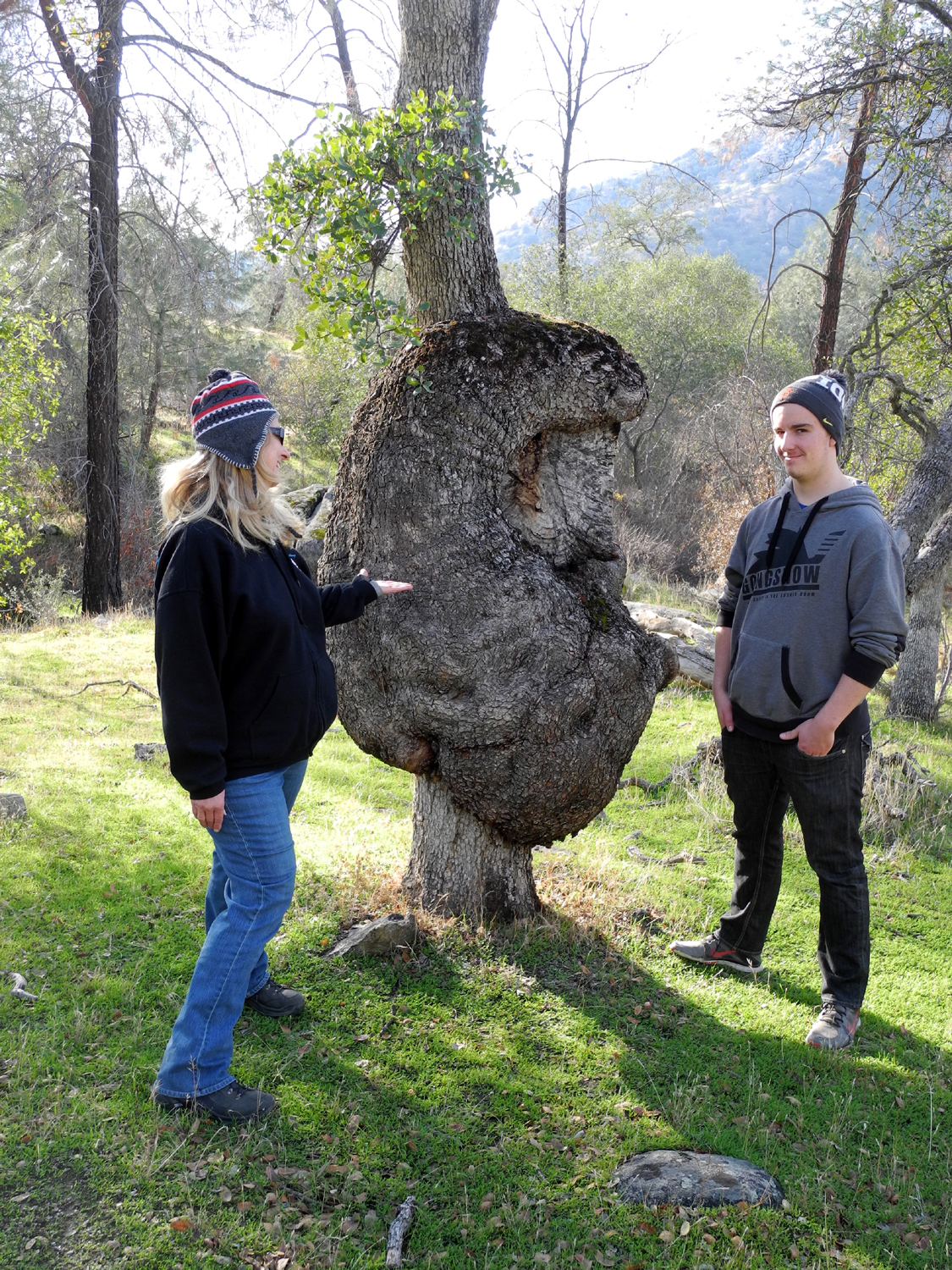
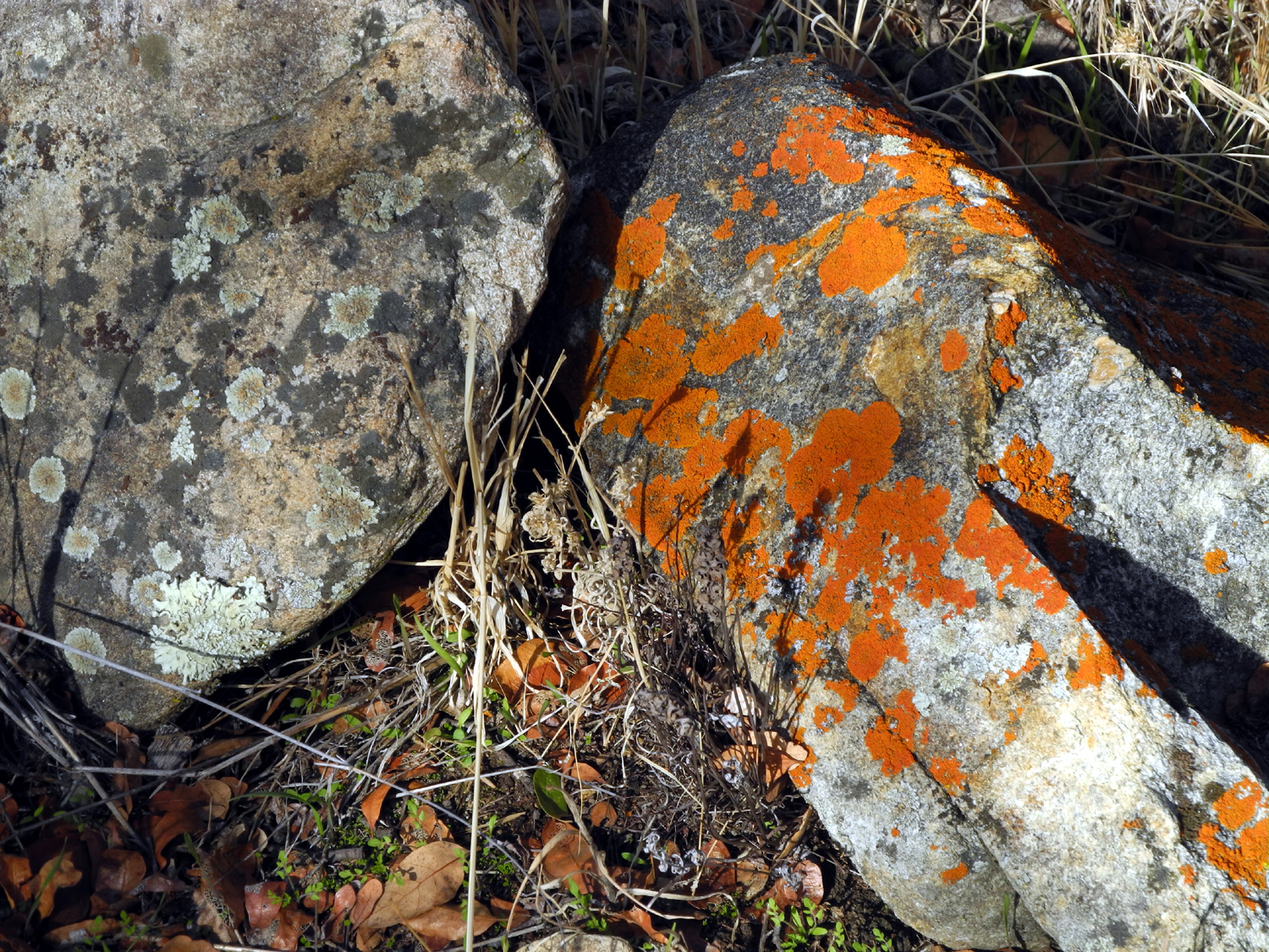
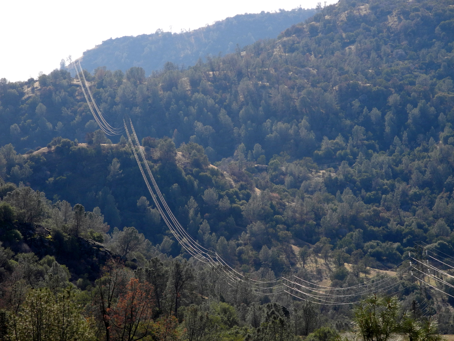
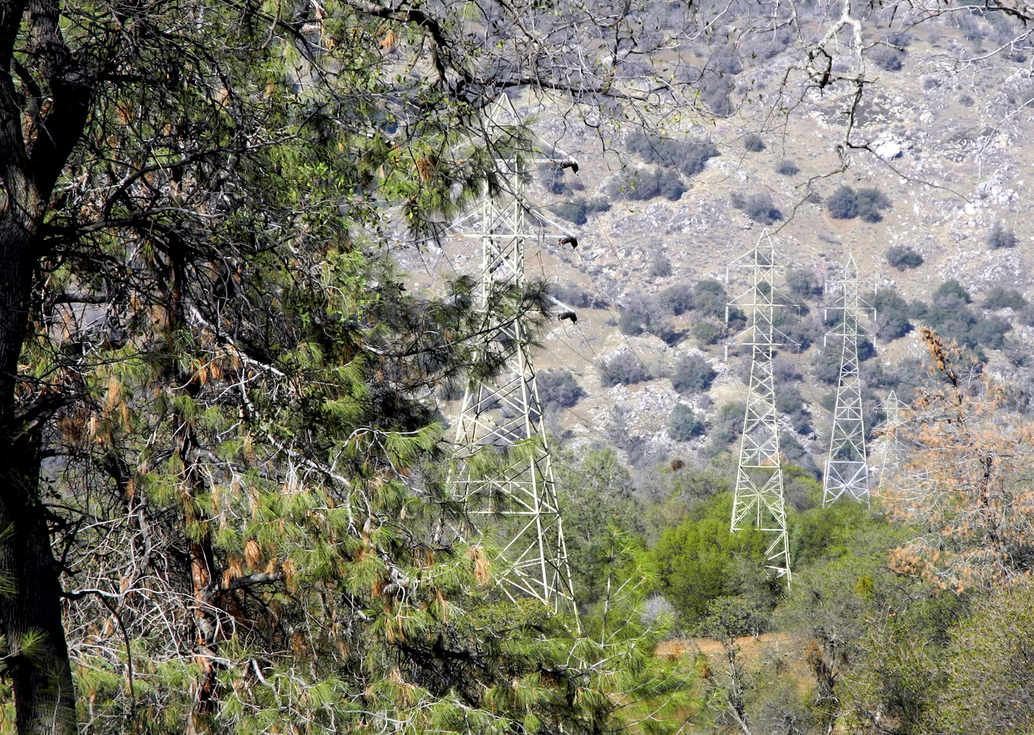
San Joaquin River Gorge Having walked a short distance on the down river end of the San Joaquin River Trail on November 8, (see above) nine days later I decided to drive to the San Joaquin River Gorge area and walk part of the upper end of the trail. On the
way I stopped at the I knew that Jim had three sons, but I had only seen the oldest long ago when he was four. I knew that the middle son, Keith worked at Prather, so I went in and asked for him. He invited me back to a conference room where we had a very nice visit. In addition to knowing his father and paternal grandparents, I knew his mother and her parents, and had worked for them in a restaurant in Mariposa. I also knew his uncles who were all in high school at the same time I was, and his aunt, Jim's sister, who I visited in Santa Cruz in March, 2014. It was a unique experience to meet and talk with a person who was in effect a total stranger, but with whom I had a lot of background in common and knew many of the same people. He did not know me of course, but when I mentioned my dad's business, it fell into place for him. After our visit, I continued on up the road through Auberry and down Smalley Road to the San Joaquin Gorge trailhead. There are two directions you can go from here, and my original plan was to go down the one mile trail to the river, cross the foot bridge, and explore a bit farther on the north side of the river. However, I had got a later start than I planned, and spent at least a half hour at the ranger station. The river trail walk would take more time than I wanted to spend, and I would be getting home late in the afternoon. Therefore I took the easier trail that runs along the base of the hills south of the parking area, officially known as the San Joaquin River Trail. The entire trial goes 11 miles down to the Finegold Picnic Area, and I've hiked in from that end a number of times. Needless to say, 11-mile hikes are not on my agenda. Instead I did what I've done a number of times on this trail, walked till I felt I had gone half the distance I wanted to walk, and turned back. This ended up being a total distance of just over two miles. On the road and on the trail I was delighted to see that the series of rainstorms we've had have brought forth a nice carpet of green. There are no wildflowers at this time, but the weather conditions hold great promise for the future. Although it was quite cool at the start of my hike, I was down to one layer by the middle of my walk. A little over a half mile in there is a blue oak near the trail which has what may be the biggest burl I've ever seen. While most such growths form a bulge on one side of a tree, this one goes all around the tree, a blue oak of modest stature, perhaps 16 inches in diameter. The burl is over three feet in diameter and about five feet high, and of course, I have to photograph it every time I walk on this trail. (Ten days later I was back again with my daughter and grandson, and got this photo.) After resting and taking pictures here I continued on another quarter mile or so. I came to a place where there is a rounded hill between the trail and the basalt cliffs of Squaw Leap above. It looked as if I could make my way up on the hill, get a good view, then go through a drainage on the other side and back to the trail. It turned out that my planned route was blocked by brush, but I enjoyed the extra climb and the sight of sunlight glistening on the power lines, then went back down a slightly different way near where I went up. When I got back to the trail I realized I had reached that "halfway point," and returned to the parking area. The extent of the rains in the foothills was emphasized by several places where water flowing down the trail had carried soil into little runoff channels, forming tiny sand bars, or perhaps more properly, mini-deltas. Walking back out, I saw everything from the opposite direction, which often reveals interesting scenes that were not noticeable going the other way, such as this view of a line of power poles marching off into the distance. As I often do, I finished up my 73 mile round trip with a stop at the Colorado Grill for an excellent chicken sandwich with fries. --Dick
Estel, November 2015 |
||
|
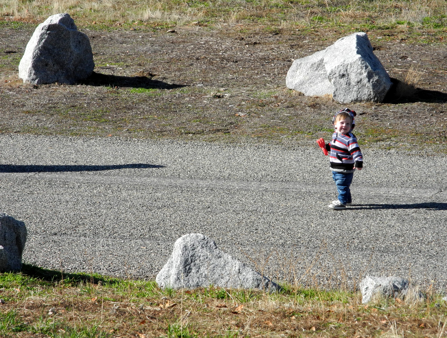
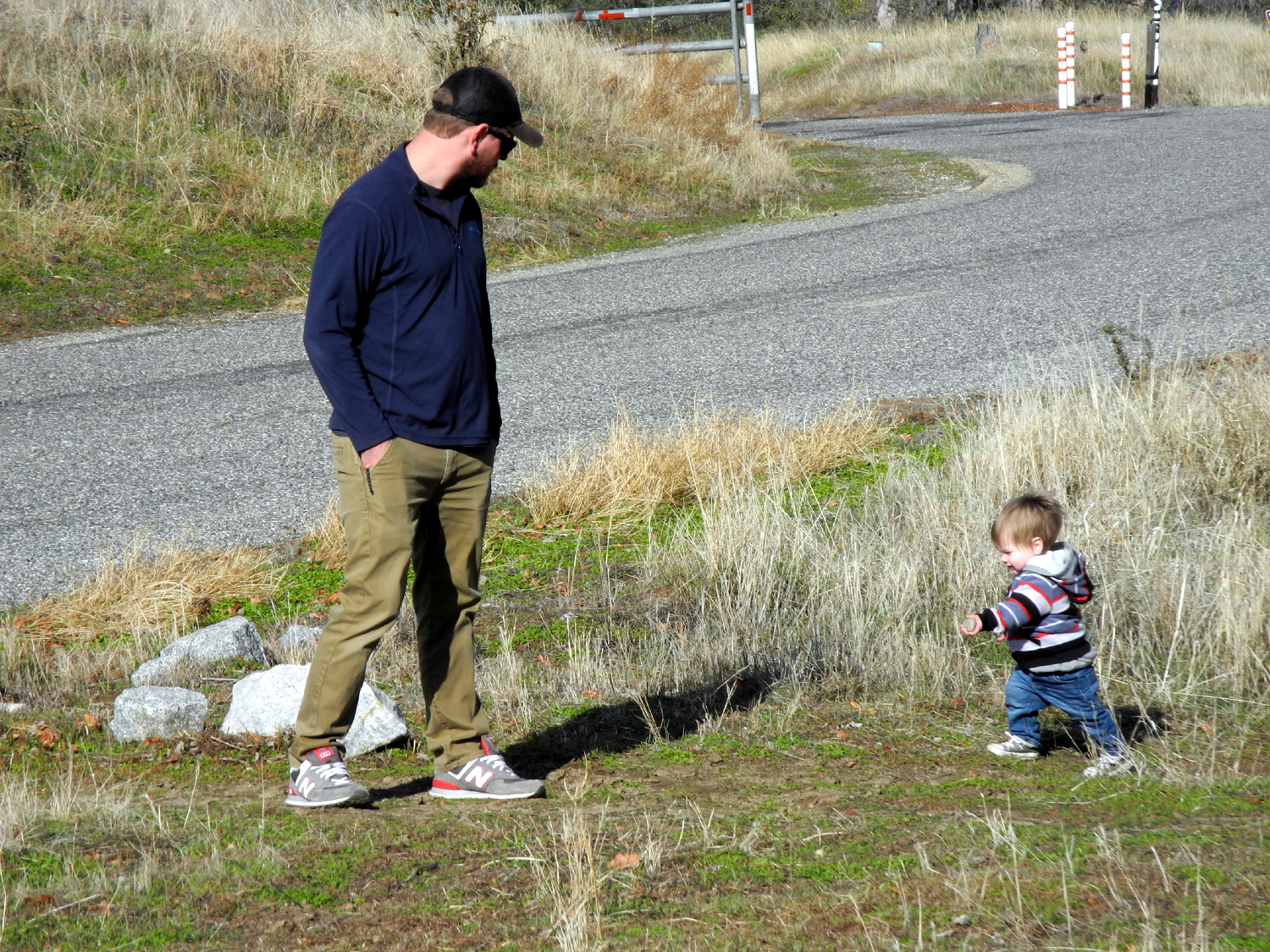
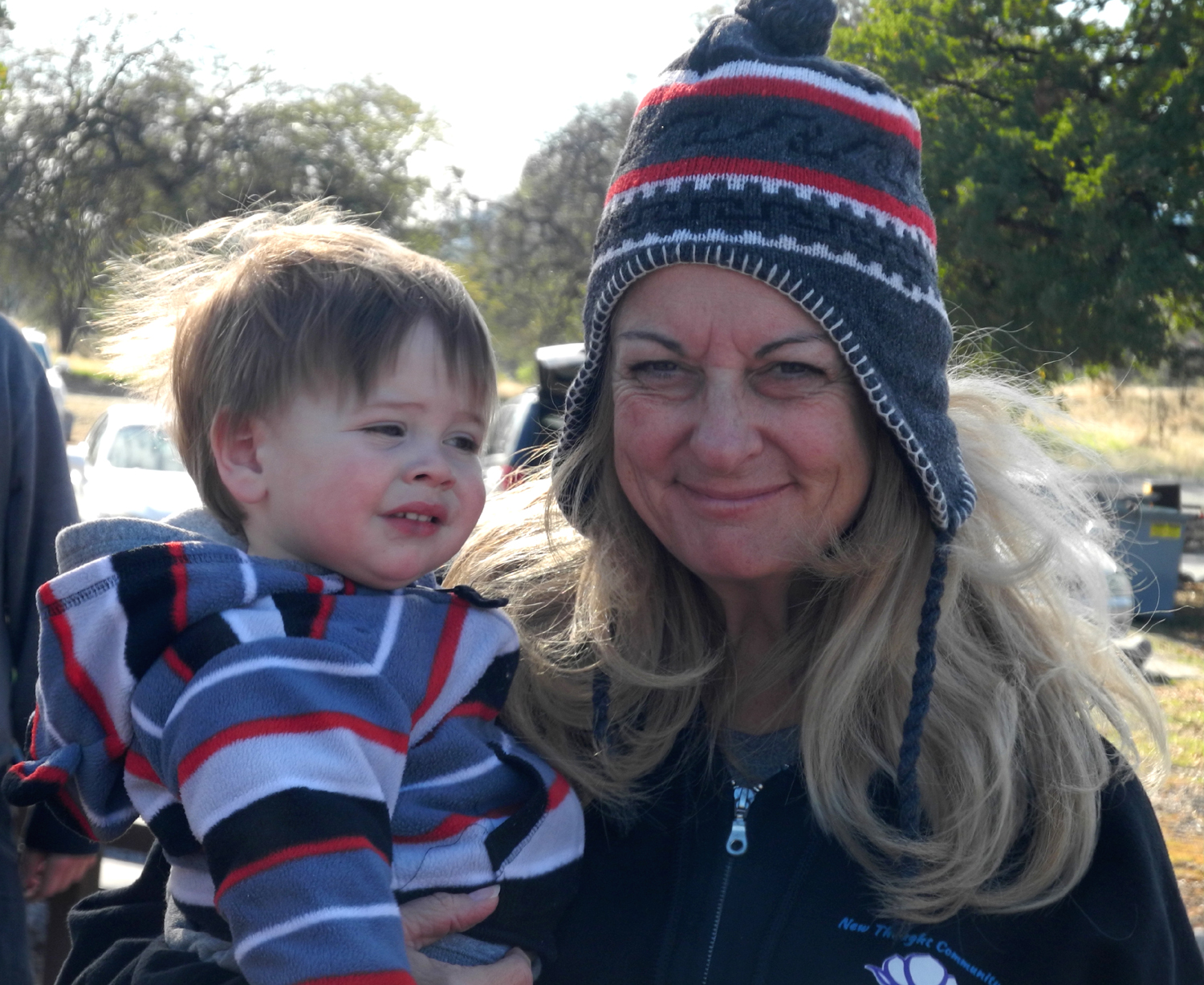
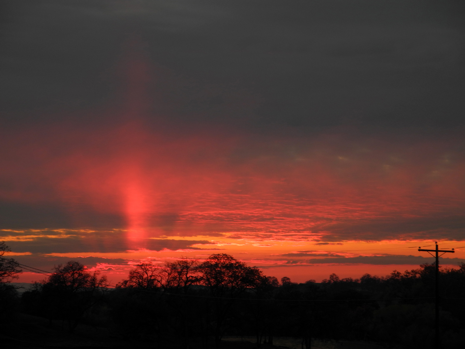
Thanksgiving at the Gorge Every once in a while someone comes up with a crazy idea that turns into something wonderful. I had some doubts when my grandson Johnny suggested we have our family Thanksgiving gathering in the form of a potluck at Nelder Grove. However, it's one of my favorite places, and there would be a campfire and some hiking, and in the end we decided it would be a great idea - "we" being myself and my older daughter, Johnny's mother. As it turned out, Nelder Grove was not in the cards. It's located at 5,000 feet, and the regularity of storms this fall made it questionable from the beginning. When there was three inches of snow the day before Thanksgiving at my younger daughter Jennifer's place above Oakhurst, at 3,200 feet, we all knew that we would have to go to our backup choice, the San Joaquin River Gorge, which we still call Squaw Leap. So on November 27, we met at the group campground - the Upshaw's, Johnny, Brittany and sons Colton and Jack; the Liddle's, Teri, Tim and Mikie, and myself. Rod and Jennifer had spent most of the week at Tahoe (delaying their return by a day due to snow), and were not able to join us. Both the little boys were sleeping when they arrived, but 13-month old Jack woke up almost immediately, and enjoyed the attention of grandparents and an uncle, having them all to himself for close to an hour. Eventually Colton arrived on the scene, a bit sleepy at first, but soon waking up and becoming the normal, very active almost 3-year old we know and love. Not far from the group area is an equestrian campground with corrals. There's a short path in between that goes down into a drainage and back up through a gate to this area, and Colton made the walk over there many times, with everyone going with him at least once. There he had fun swinging on the corral gates, and throwing rocks from the parking area. Jack went there with his dad at least once. We had all brought firewood, and soon had a fire going. There was no concern about snow at this 1,500 foot location, but the high was expected to be about 48, so we were all prepared with warm clothing, and greatly enjoyed the fire. We had various snack items, vegetables and such, and some excellent white chicken chili, a dish I had not encountered previously. After eating it was time for a hike on the San Joaquin River Trail, the one I walked on ten days earlier. Although everyone was invited, and Colton usually likes to hike, it ended up being just Teri, Mikie and myself on the hike. Mikie had not been to the area since he was about four, and I think that was also the last time Teri was there. All the adults had hiked down to the river in years past, but the trail we walked was new to both Teri and Mikie. We walked as far as the big burl that I mentioned above, and Teri and MIkie were duly impressed. Of course, we took a bunch of photos. After enjoying this natural phenomenon and resting on a nice log that fell in just the right place, we started back. Walking from the group camp area, our round trip journey was 1.6 miles. When we got back it was dessert time. Years ago (decades in fact) I sometimes made cheesecake from scratch, using a recipe in the Fanny Farmer Cookbook. I decided it was time to revive this excellent dessert, which Mikie had never had, since he's only 18. I could not find the book, but the recipe was available on line. Everyone agreed that the end results were worth the 20-year wait. Of course, most of them didn't even know they were waiting, but the finished product was such that I vowed to make it again well before the next decade passes. After some more walking around the area, we realized that the sun was getting very low, and the temperature even lower. Just before the sun went behind the hills, it was very obvious that it was getting colder fast. We loaded up our stuff, took some group photos, and headed back to the flat land, with everyone agreeing that this was an excellent idea that we should try to repeat next year. On the way home we were treated to a this fantastic sunset view. --Dick Estel, November 2015 |
||
|
Photos (Click to enlarge; pictures open in new window) |
||
|
Lewis Creek Trail Kaiser Pass Hike Kaiser Pass Part 2 Taft Point & Glacier Point Kings River Bluegrass Shaver Logging Road San Joaquin River Trail Eaton Trail Photos San Joaquin River Gorge Photos San Joaquin Gorge Thanksgiving |
||
|
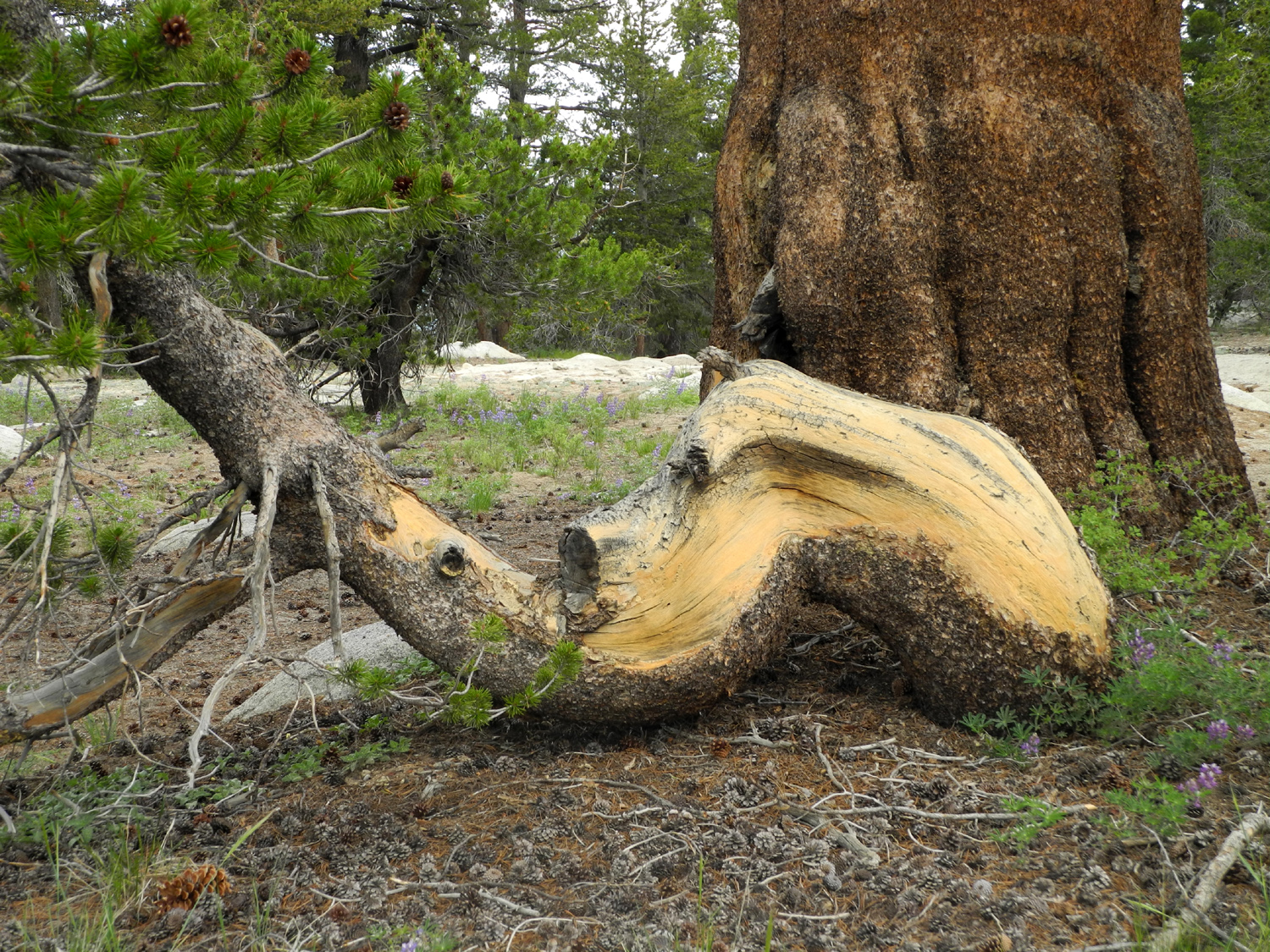
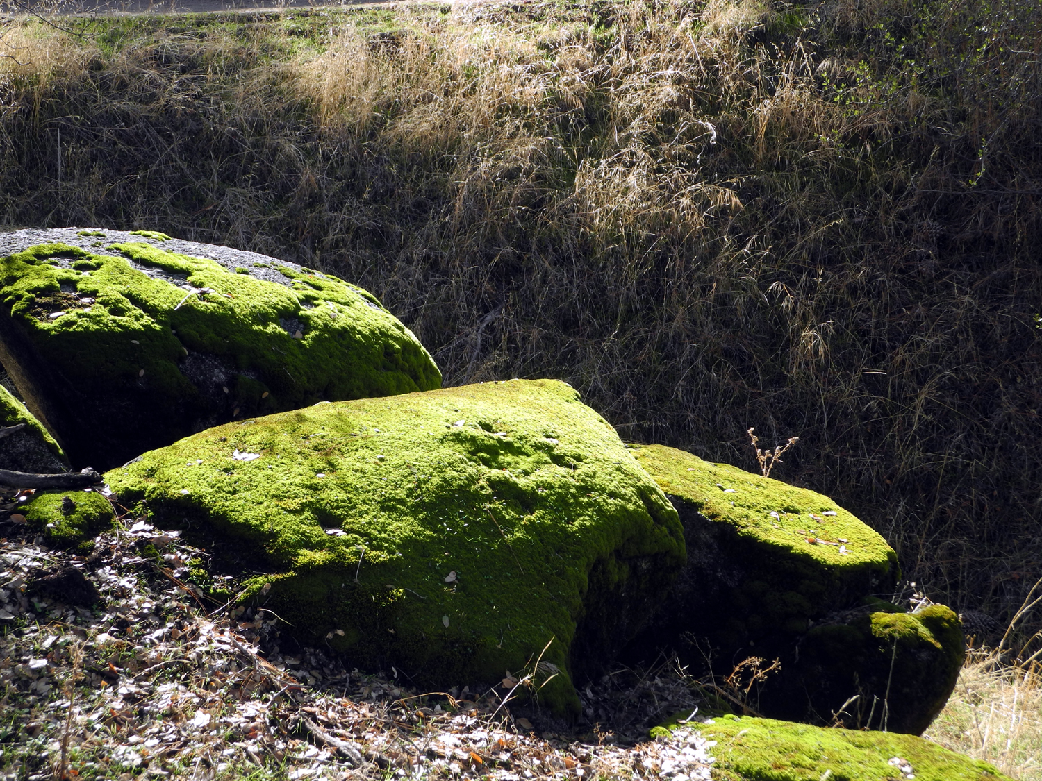
Lewis Creek Trail |
||
|
 |
 |
|
This flower surely has "bell" in its name |
Huge leaves of
Indian rhubarb surround a bell-like flower |
The trail is lined with many old cedar trees |
 |
 |
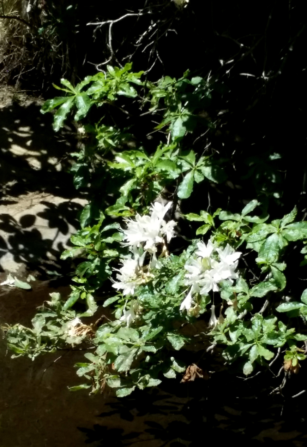 |
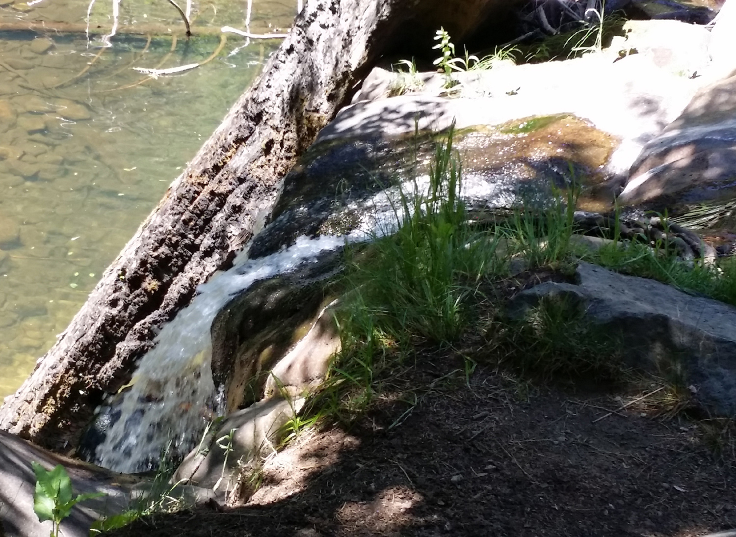
| Base of a large cedar | Red Rock Falls from the top | Azalea by the falls |
 |
 |
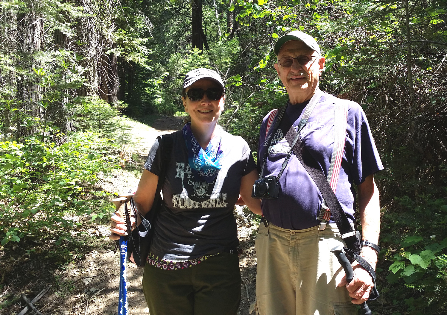 |
| Teri & Jennifer | Teri & Dick | Jennifer & Dick |
| Kaiser Pass Hike | ||
 |
 |
 |
|
My truck on the narrow Kaiser Pass Road |
Turn here for a steep, rough ride | The view when you get to the top |
 |
|
 |
| Dick by the rock | Mt. Ritter |
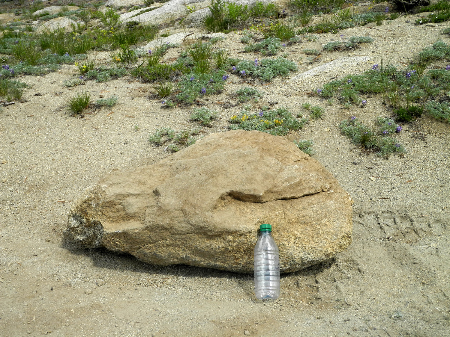
I think my truck straddled this boulder |
 |
||
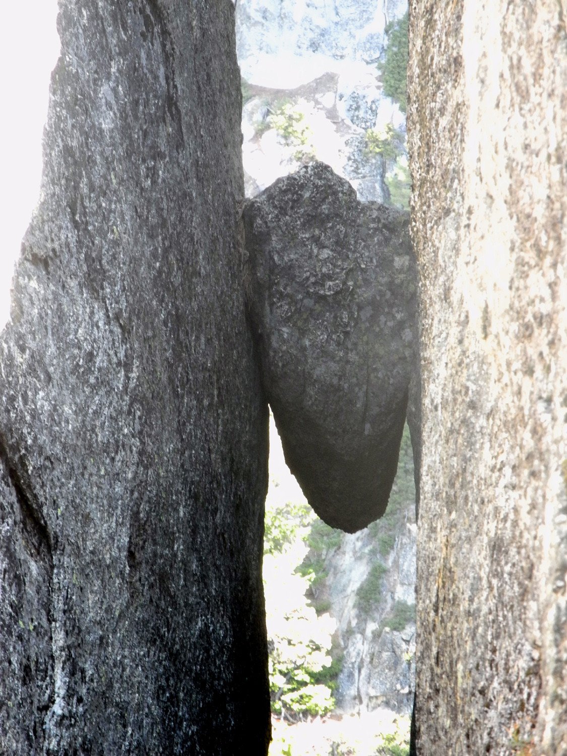
| Balanced rock at White Bark Vista | ||
 |
 |
 |
| The start of the
nation's most challenging 4-wheel drive trail |
Nature's landscaping | Huntington Lake |
 |
 |
 |
| Believe it or not, these are all views of the Dusy-Ershim 4-wheel drive trail | ||
 |
 |
 |
| Lake Edison | Signs help
distinguish just plain rock piles from the road |
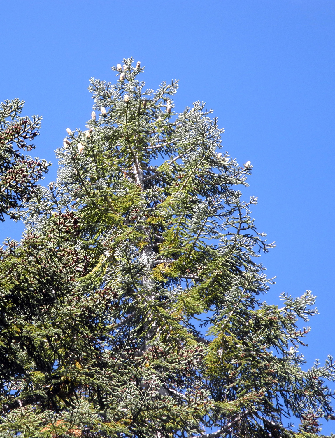
Big western white pine |
 |
 |
 |
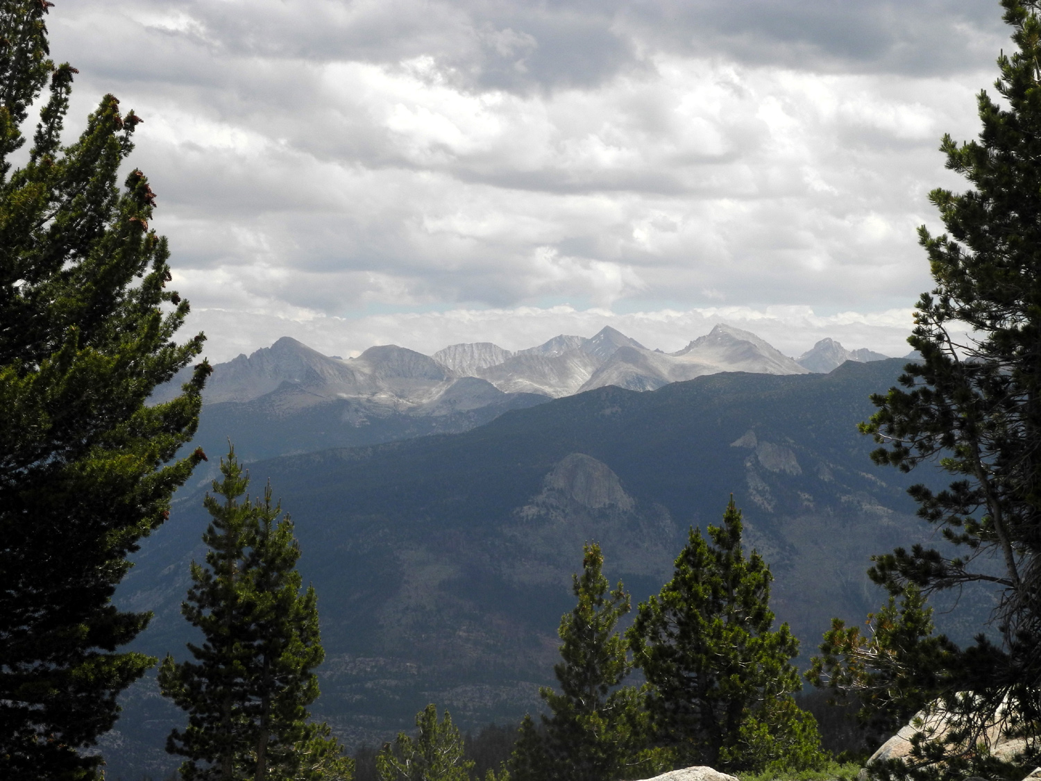
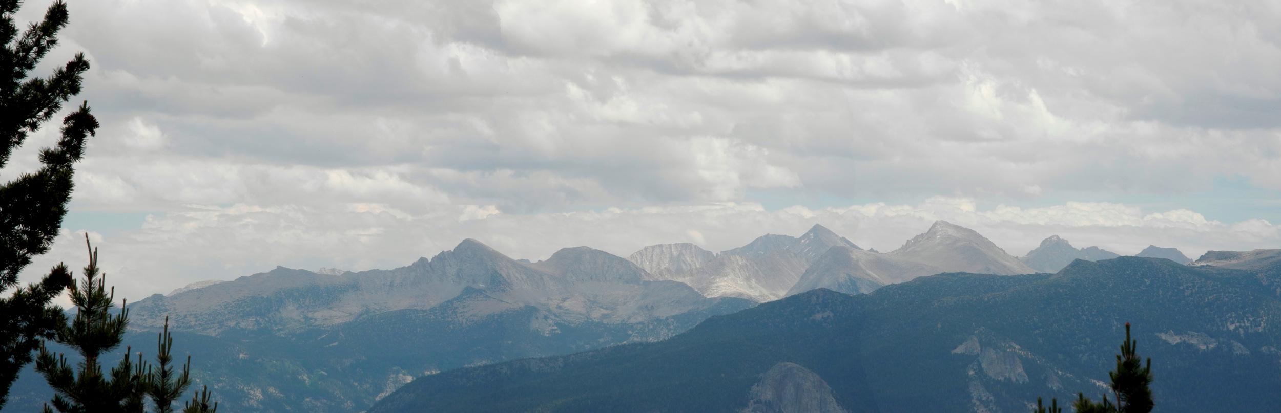
| The Silver Divide |
Dark
skies threatened |
Can you spot my truck in this photo? |
 |
||
| Silver Divide panorama | ||
 |
 |
 |
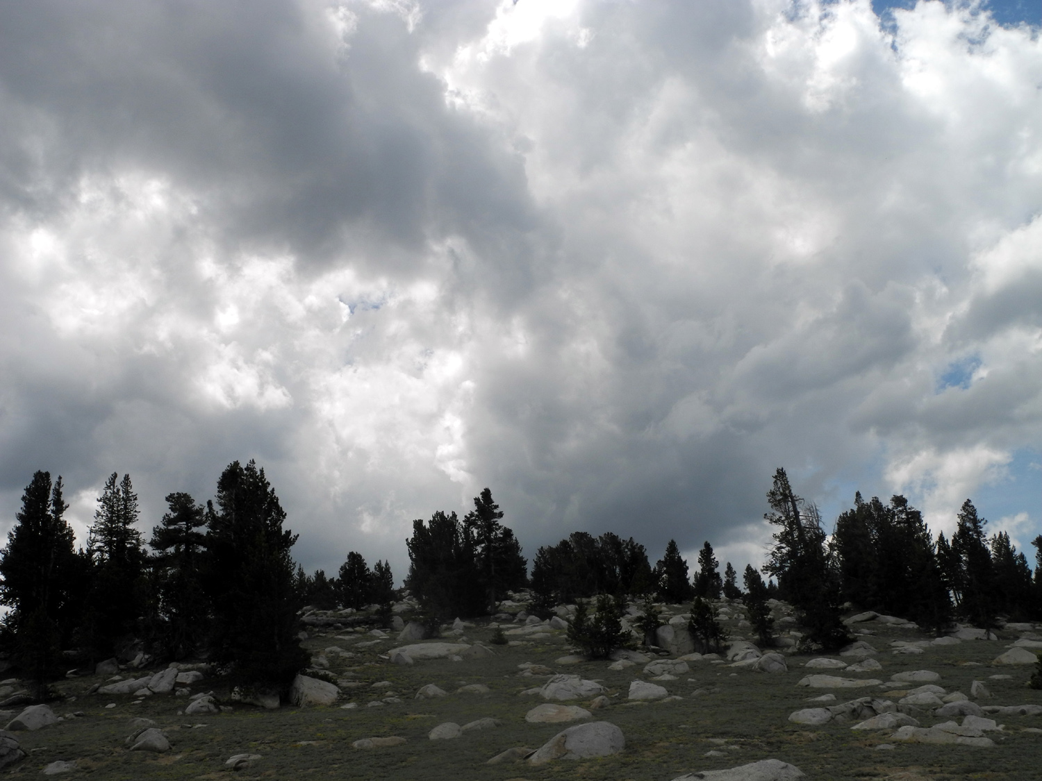
| Two lodgepole pines, one vertical | When the sky looked
like this, I was on my way home |
Western wall flower |
 |
 |
 |
| Pink flowers | Low-growing lupine forms a ground cover | Scarlet Gilia |
| Kaiser Pass Photos 2 | ||
|
 |
 |
| Sandy and Teri out on the edge | Posing in front of the High Sierra | Teri and Dick ready to hike |
 |
 |
 |
| A wonderful rock pile | Edison Lake and the High Sierra make a nice backdrop for the trio |
I considered trying to get up by that top boulder |
 |
||
| The minarets and Mt. Ritter | ||
 |
||
| Huntington Lake and small pond above it | ||
 |
 |
 |
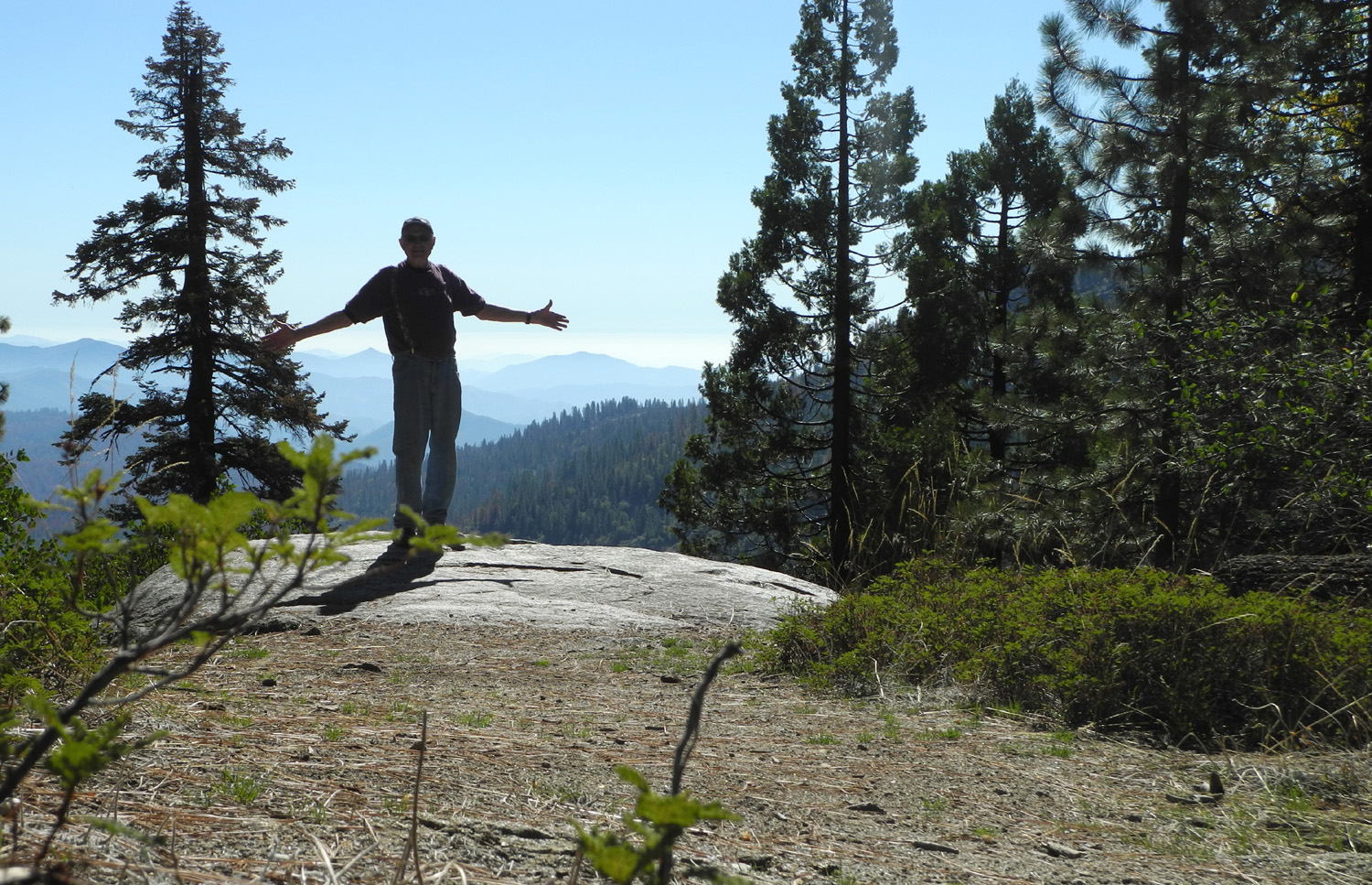
| Dick on the Rock | Teri on the Rock | Rugged scenery, white granite, flowers - a perfect day |
 |
 |
 |
| The Silver Divide | Cones from Western White Pine |
I can't stop taking pictures of this rock |
 |
 |
 |
| The Jeep skidded sideways about two feet in this spot |
The Jeep went up over |
Boys being boys |
 |
 |
 |
| Eventually we identified this flower as Kelley's lily | Lots of identified
flowers look similar, none exact |
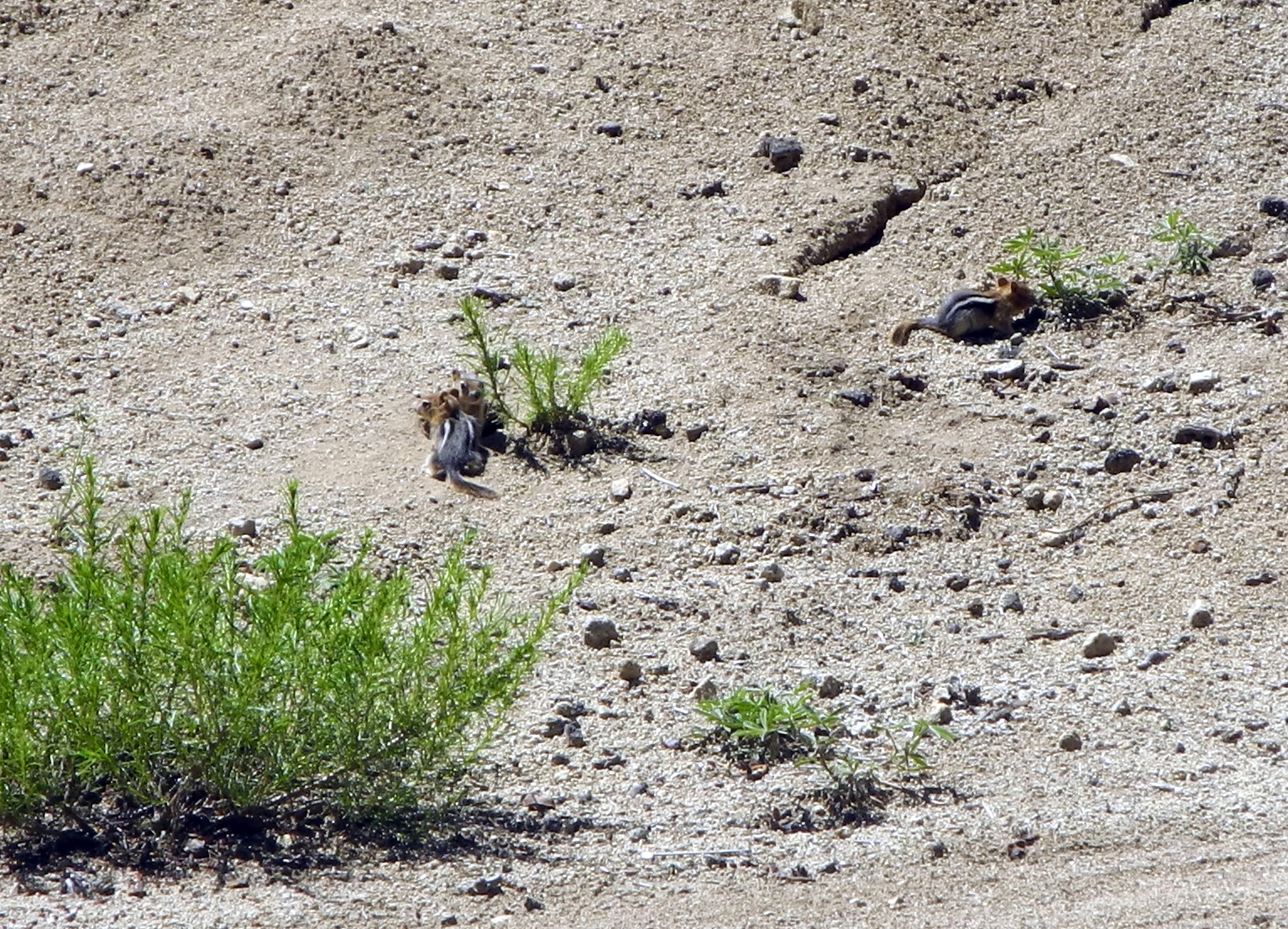
These chipmunks entertained us as we ate lunch |
| Taft Point Photos Glacier Point Photos | ||
 |
 |
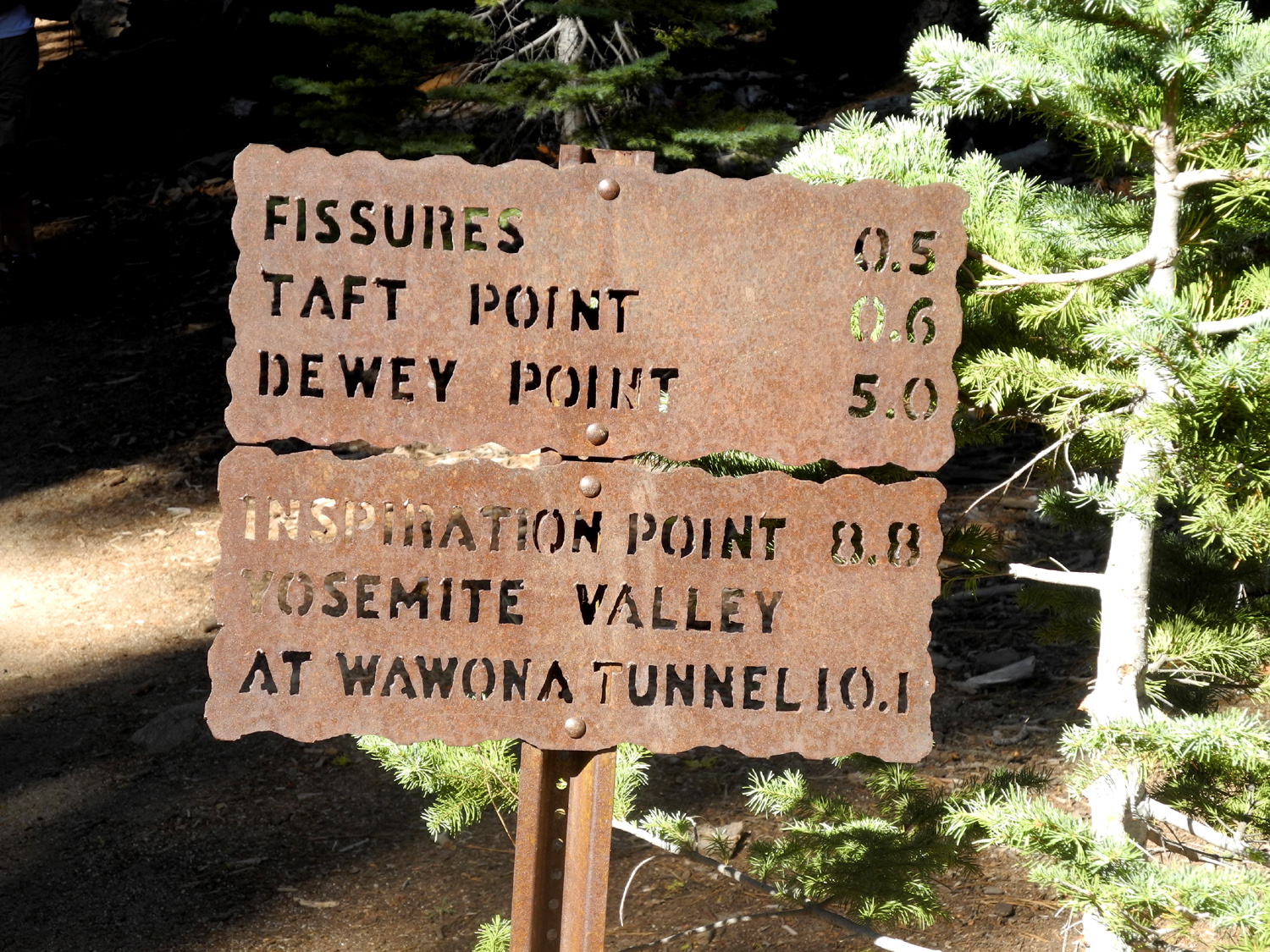 |
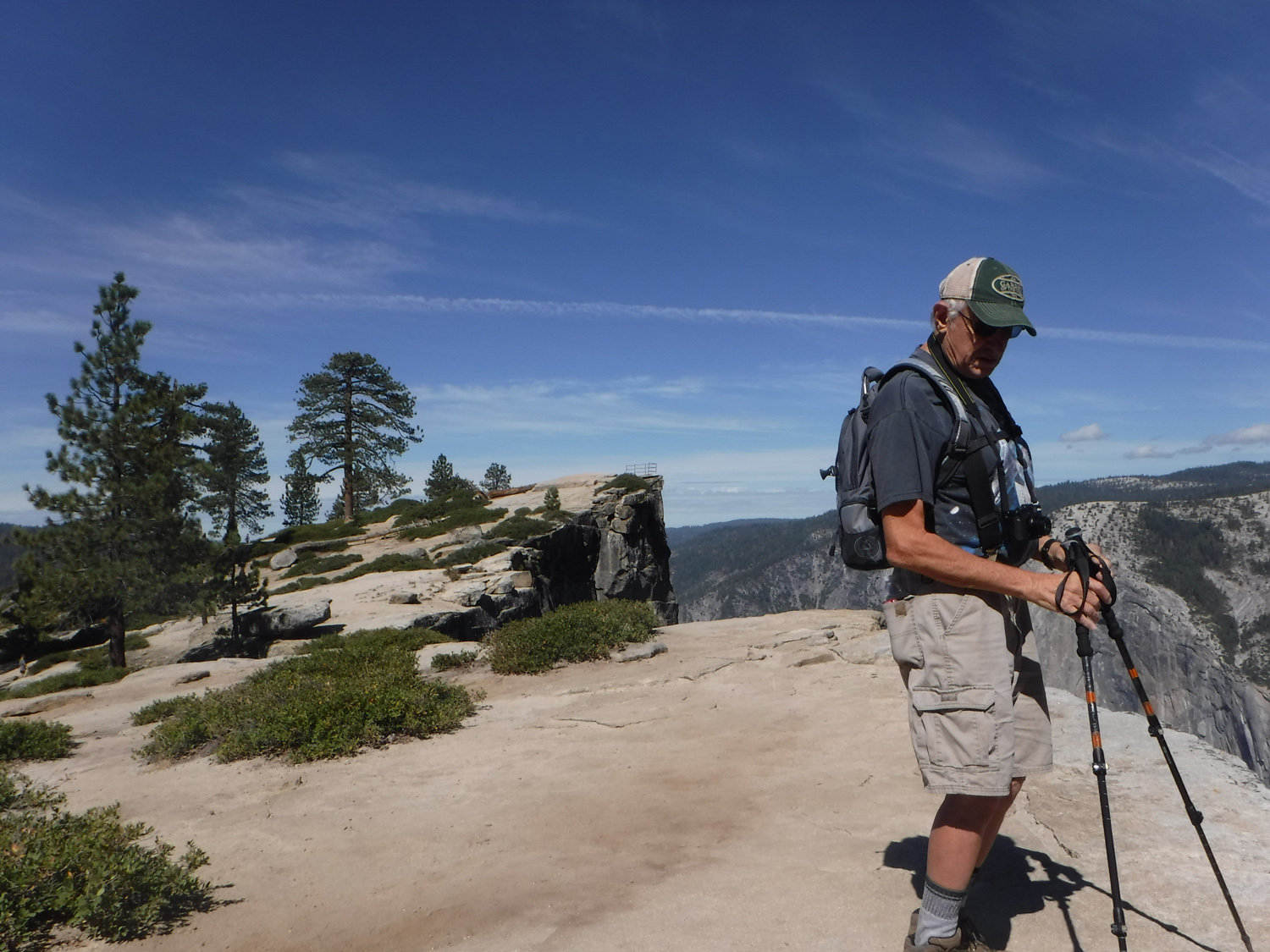
| Ready to hike | This guy greeted us on the trail | Other places you can go |
 |
 |
 |
| Western white pine | Red firs |
Cones
are thick at the |
 |
 |
|
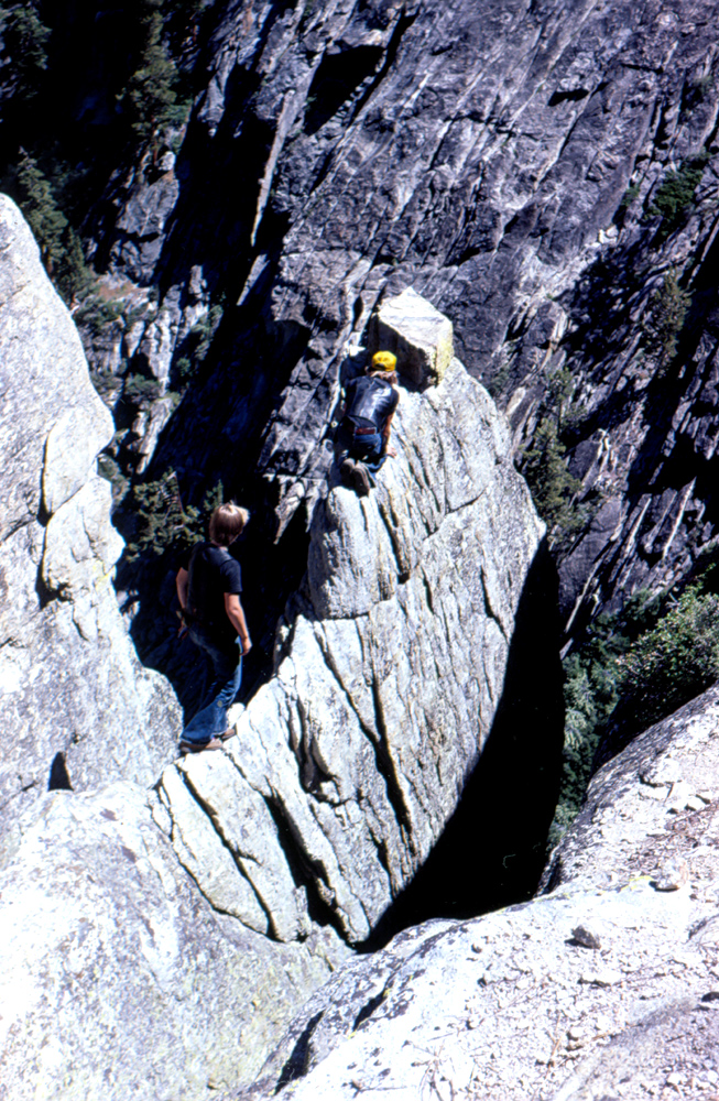
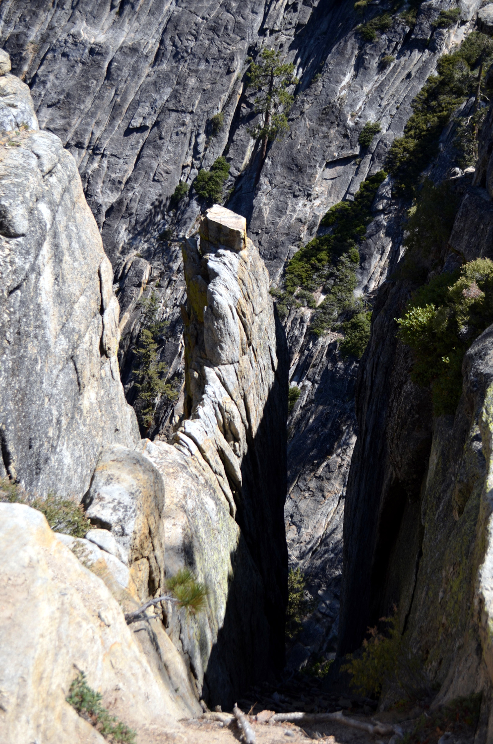
| The big fissure | Rock caught in fissure | The high spot at Taft Point |
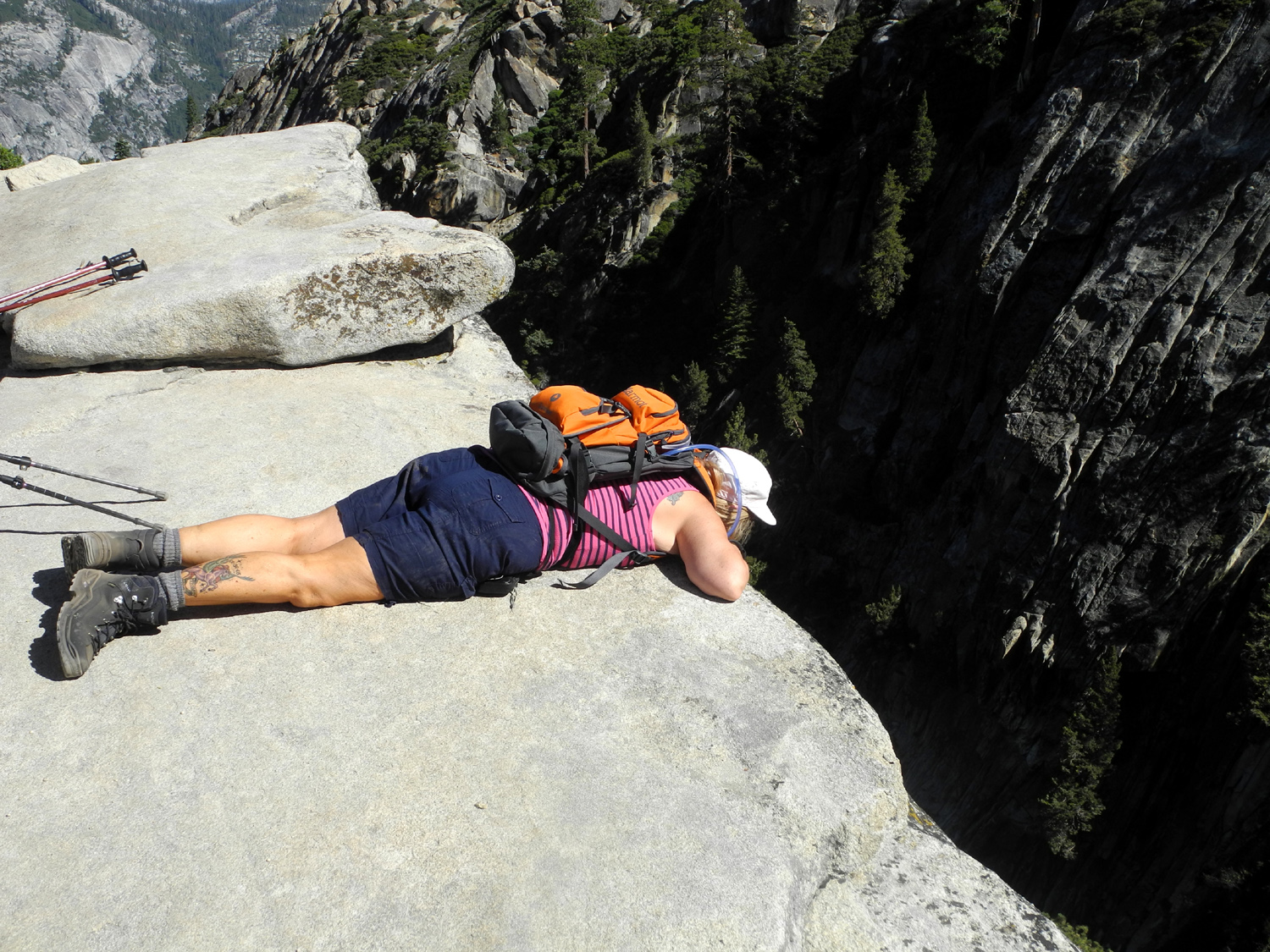 |
 |
 |
| Peering into the abyss | Taft Point from the west side |
A very scenic ridge east of the point |
 |
 |
 |
| Dick at Taft Point | Taft
Point, with Yosemite Valley and El Capitan beyond |
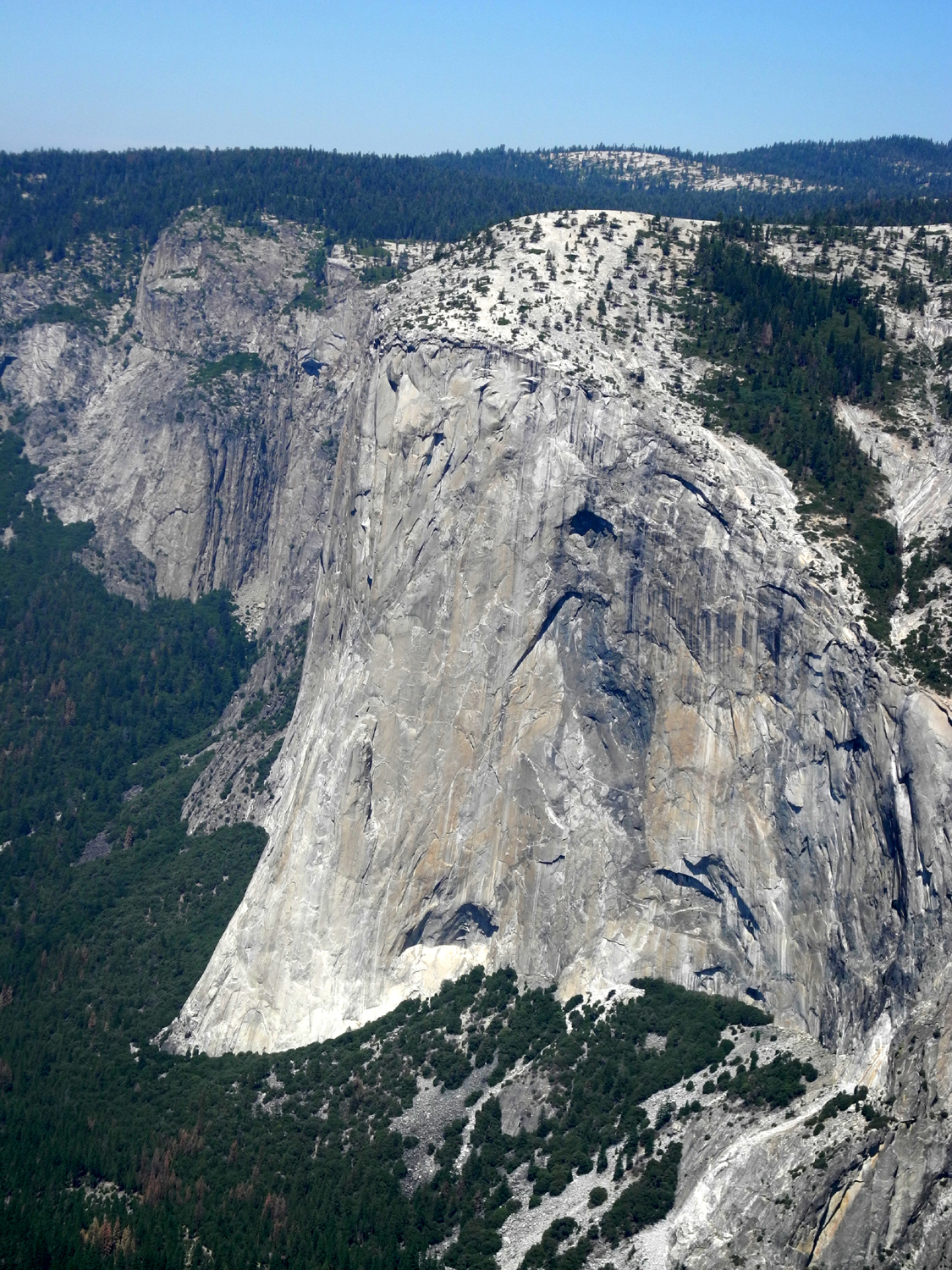
Base of
El Capitan, with cloud shadow approaching |
 |
 |
 |
| Cathedral Rocks | Spires and crags on the east side of Cathedral Rocks |
Large quartz outcropping near the start of the trail |
 |
 |
 |
| Teri and Sandy in the rocks | The only clouds we saw all day | Wind-blown Vernal Falls |
 |
 |
 |
| Half Dome from Washburn Point | And from Glacier Point | North
Dome and Basket Dome rise above Tenaya Canyon |
 |
||
| Mt. Clark on the left, Starr-King on the right | ||
 |
 |
 |
| The base of Glacier Point | Overhanging rock at Glacier Point | Mt. Clark |
 |
||
| High Sierra panorama | ||
 |
||
|
Sandy, Teri and Dick at Glacier Point |
||
| Kings River Bluegrass Festival | ||
 |
 |
 |
| Kings River Gospelaires | Uncle Ephus | Narrow Gauge Ramblers |
|
 |
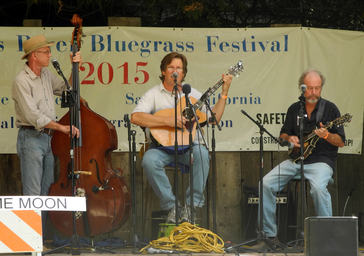 |
| Poor Valley Band | Two for the Road | Lonesome Moon |
 |
 |
 |
| The Grasskickers | Red Dog Ash | "Old Blue, you good dog you" |
 |
 |
 |
| More active than the dog | Program cover | Lunch stop |
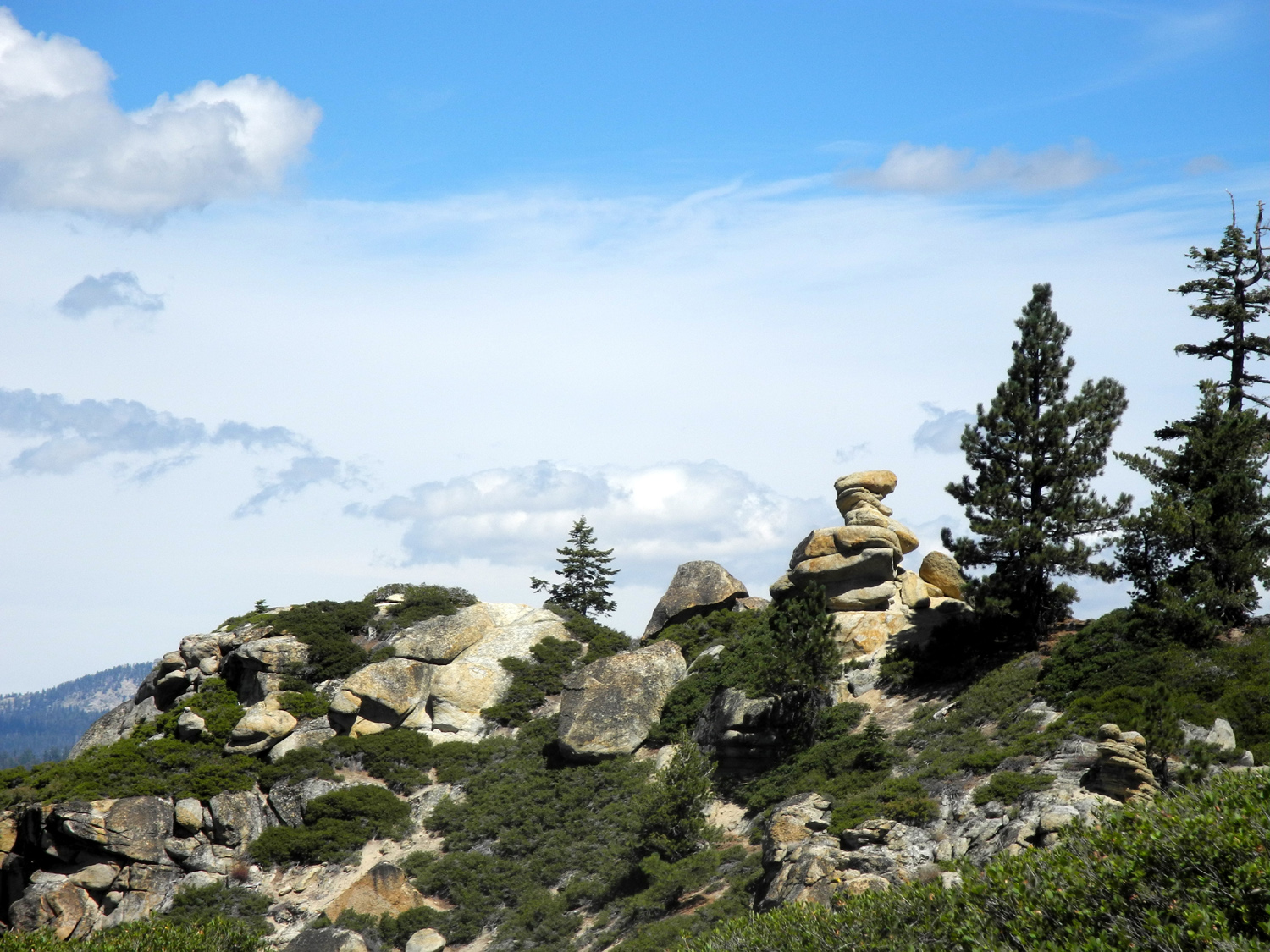
| Shaver Logging Road (& other places) | ||
 |
 |
 |
| Jose Basin from Auberry Road | Mono Wind Casino | Highway 168 from Auberry Road |
 |
 |
 |
|
High Sierra peaks from Auberry Road |
Twisted pine |
Blue
Canyon from near |
 |
 |
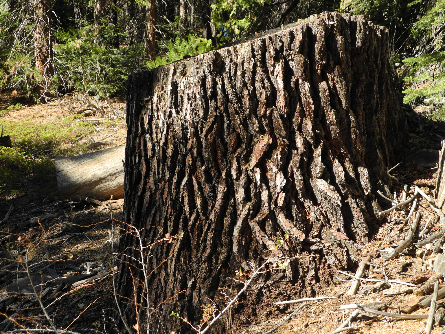 |
| Old logging road | A sugar pine that didn't get cut | And one that did |
 |
 |
 |
| Fall color in black oak leaves |
A
rugged cedar near |
A dead plant creates sparkling stars |
|
 |
 |
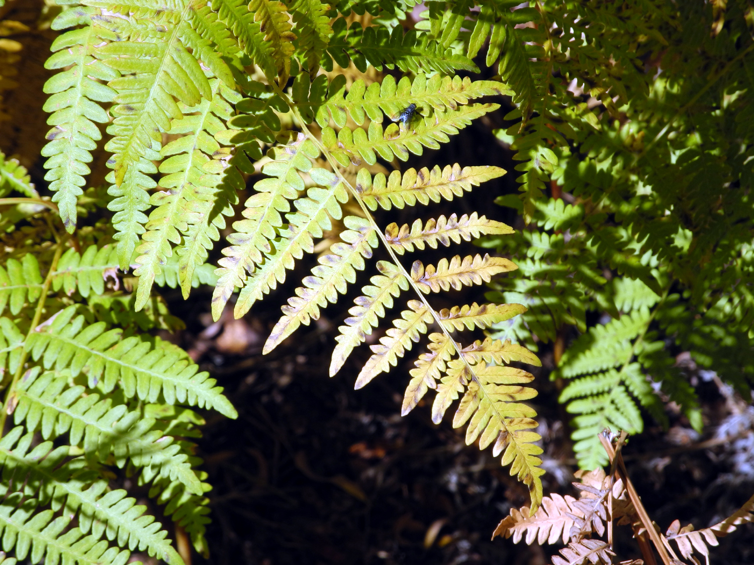
| Meadow near Dorabell Campground | Fern, starting to change to fall color | Dick on
the rock with Blue Canyon in the background |
 |
||
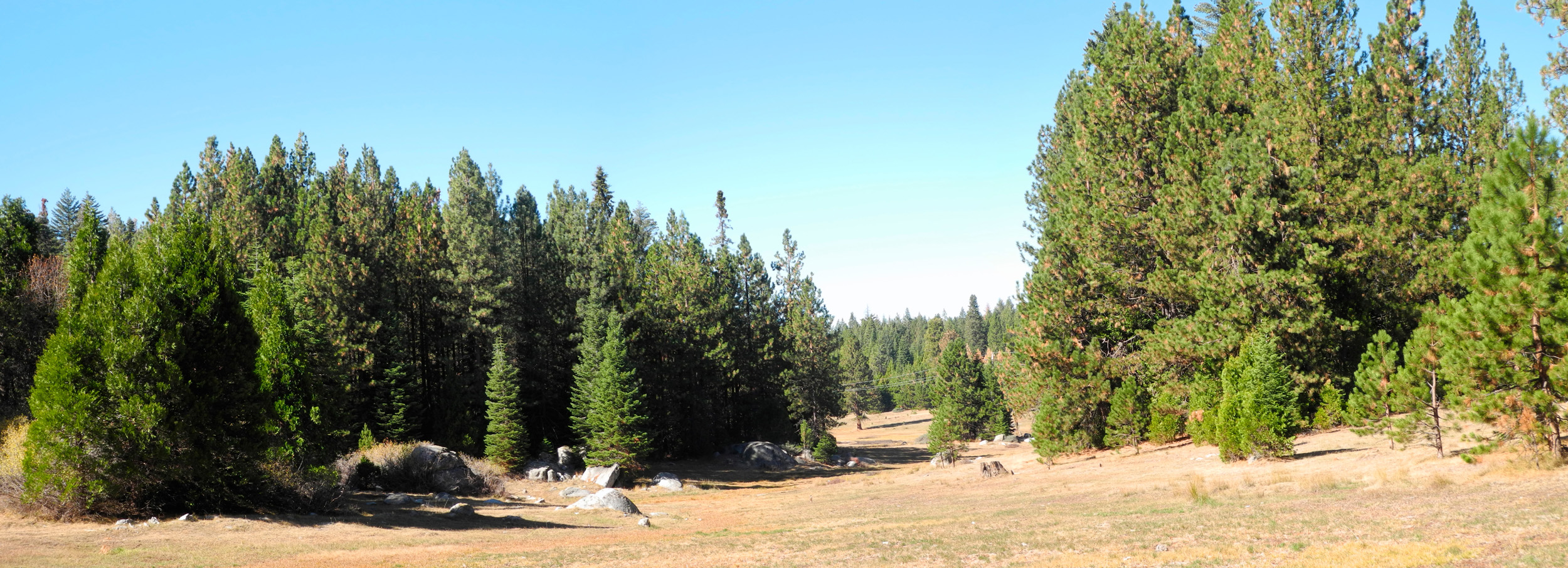
| Panoramic view of the meadow | ||
| San Joaquin River Trail (Finegold) | ||
 |
 |
 |
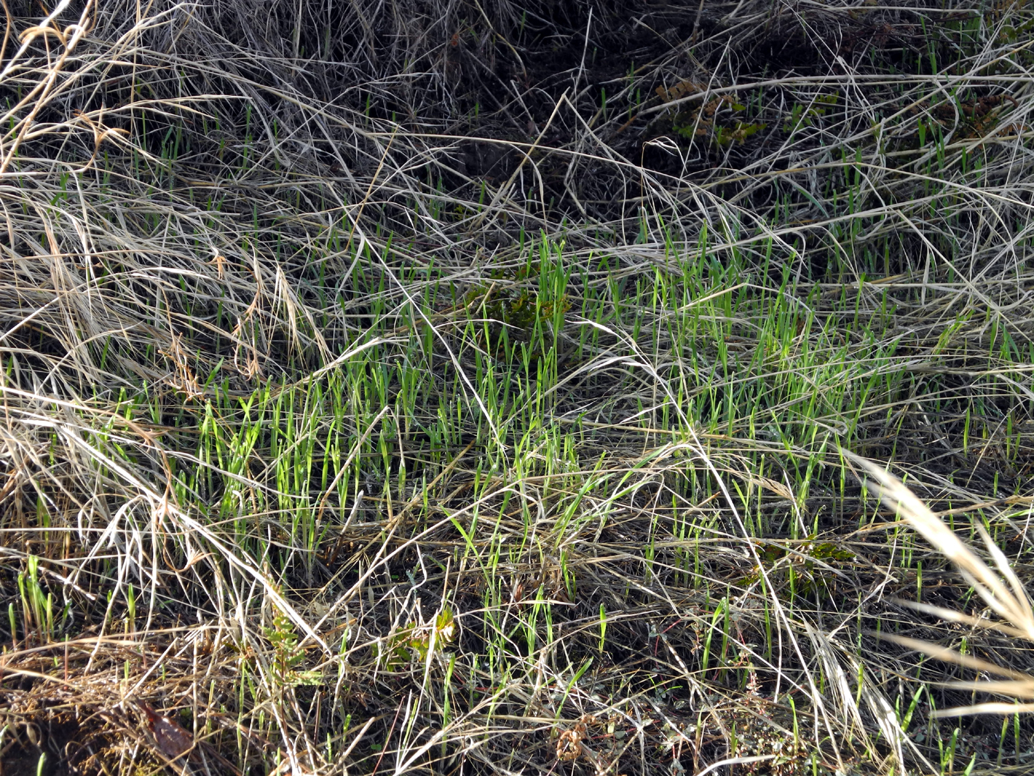
| A choice of destinations | The new grass amid the old | More green - ferns and moss |
 |
 |
 |
|
I'm searching for the
definitive |
Woodpeckers have been at work in this bull pine tree |
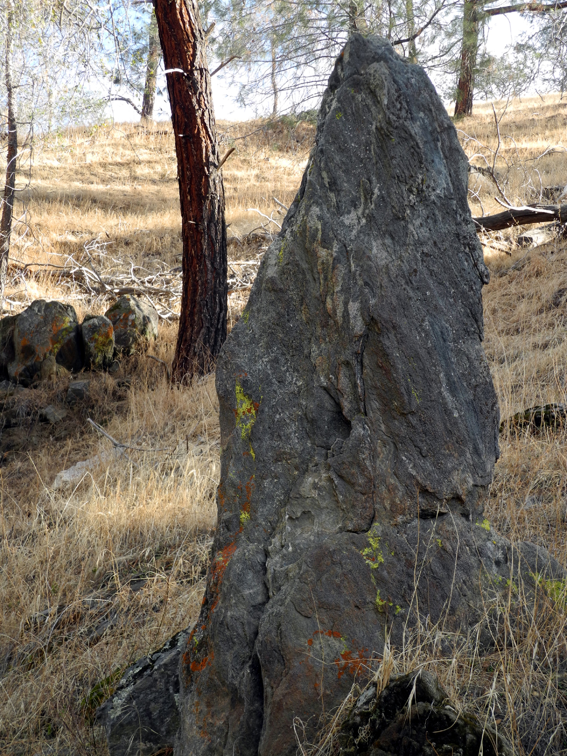
A monumental rock by the trail |
 |
 |
|
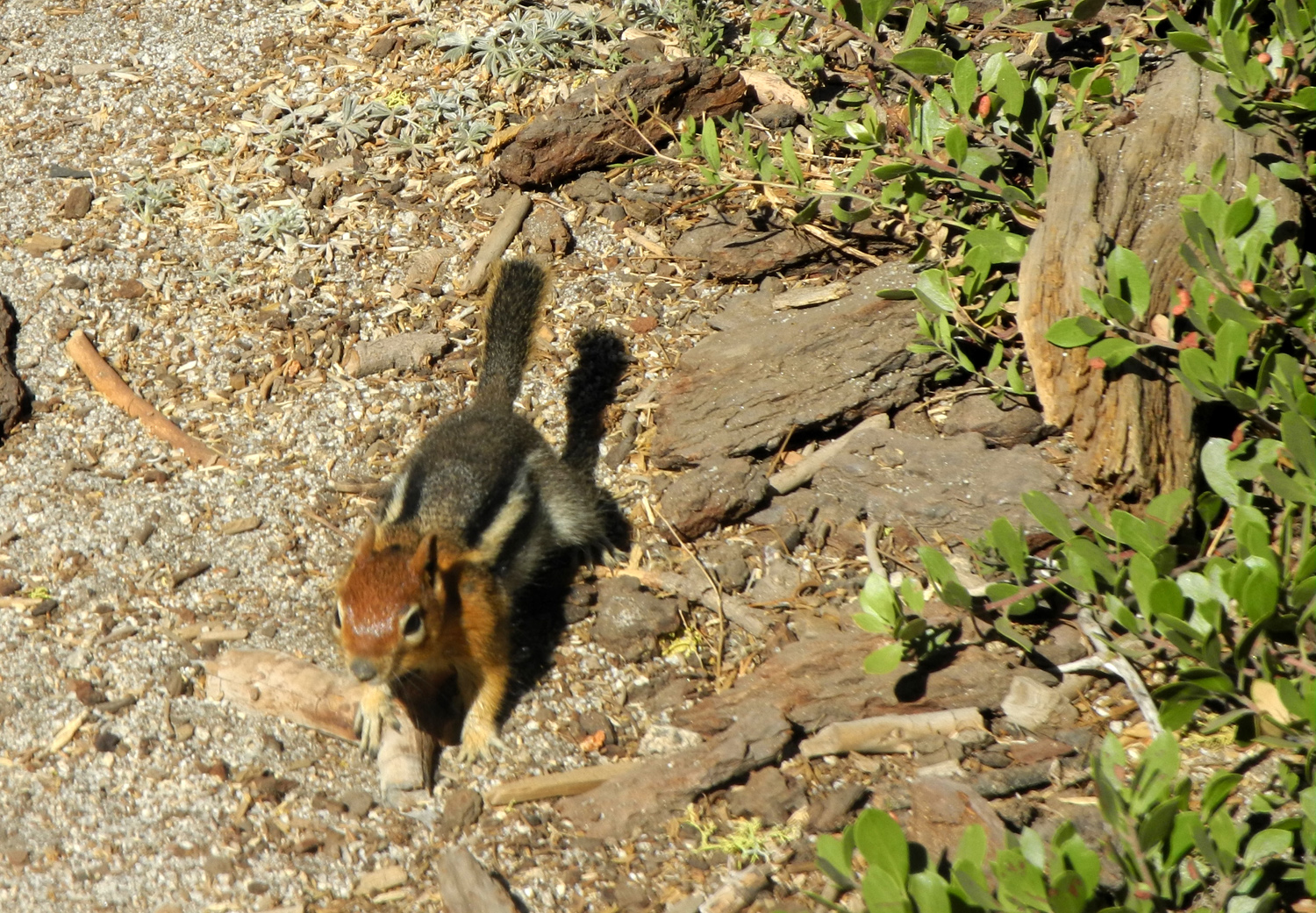
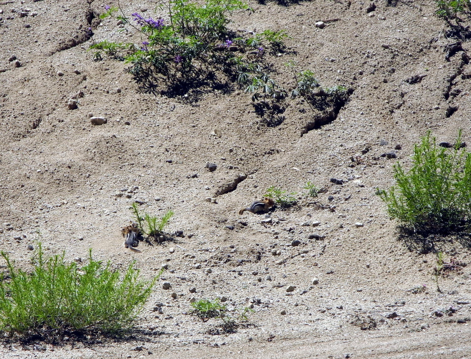
| Typical section of the trail | Squirrel on the rock |
Horseshoe Bend section of the lake |
 |
 |
 |
|
A welcome sight - |
Water level up Finegold Creek is higher than last year |
Hikers continuing on |
| Lewis S. Eaton Trail | ||
 |
 |
 |
| Foot bridge over Old Friant Road |
Honoring those who made |
It's nice to look at snow on a sunny day |
 |
 |
 |
| Sand and gravel operation | Trucks were coming and going nearly all the time |
Planting trees with a purpose |
 |
 |
|
| These plants are seen along roads all over the foothills |
This guy was wisely rushing across the road | Some of my fellow trail users |
 |
 |
 |
| A colorful trio |
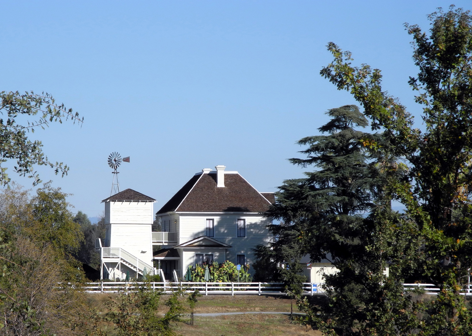
The Hallowell Center for River Studies |
Taking a well-earned rest after walking over a mile |
 |
 |
 |
|
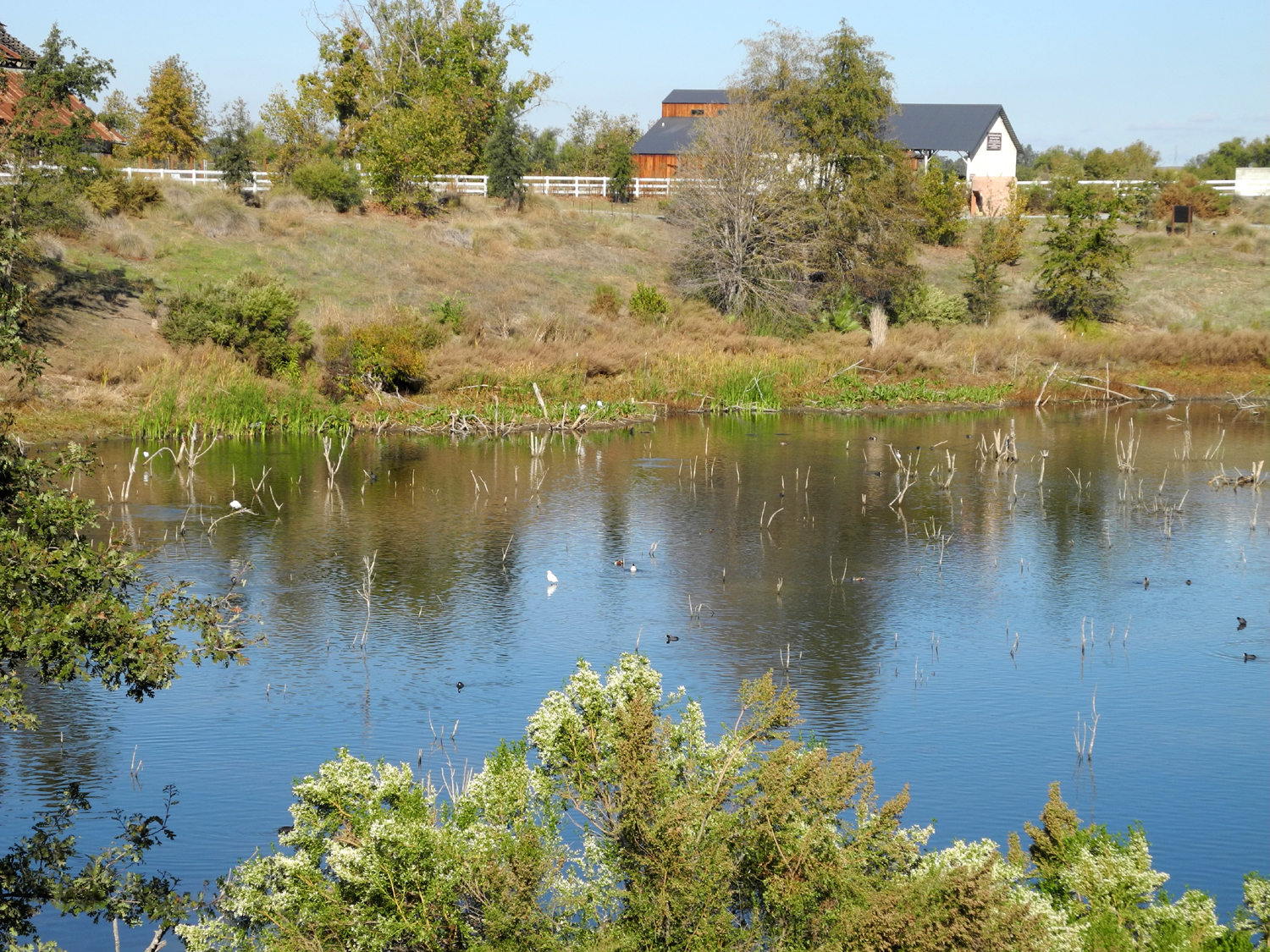
Pond on the Hallowell Center property |
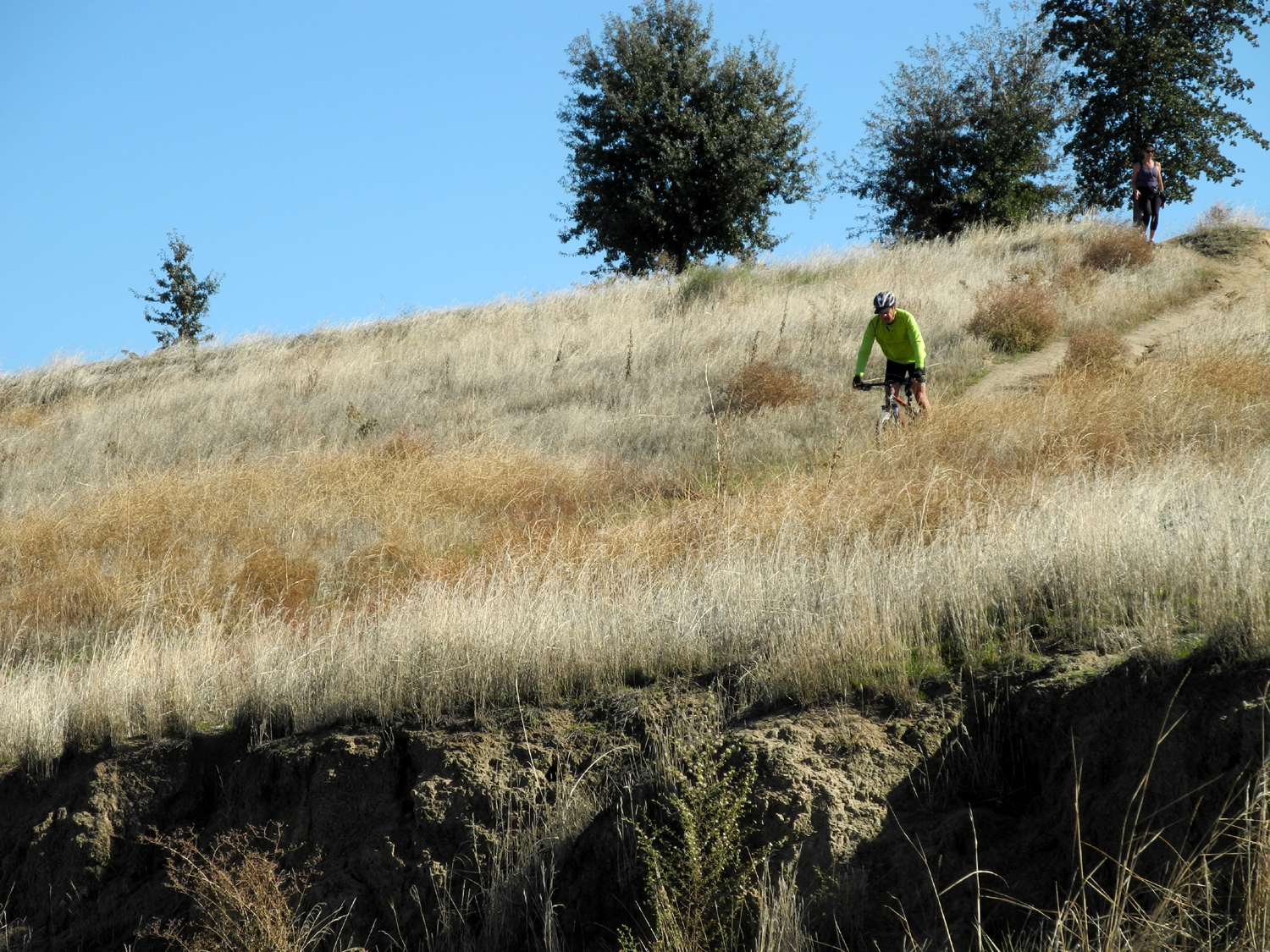
This rider went up and down
this steep hillside time after time |
A gentle slope takes the
trail |
 |
 |
 |
| Sign at the River Center |
Headquarters and former ranch house |
Old barn from ranching days |
 |
 |
 |
| Eaton Trail map |
Birds
congregate on a sand |
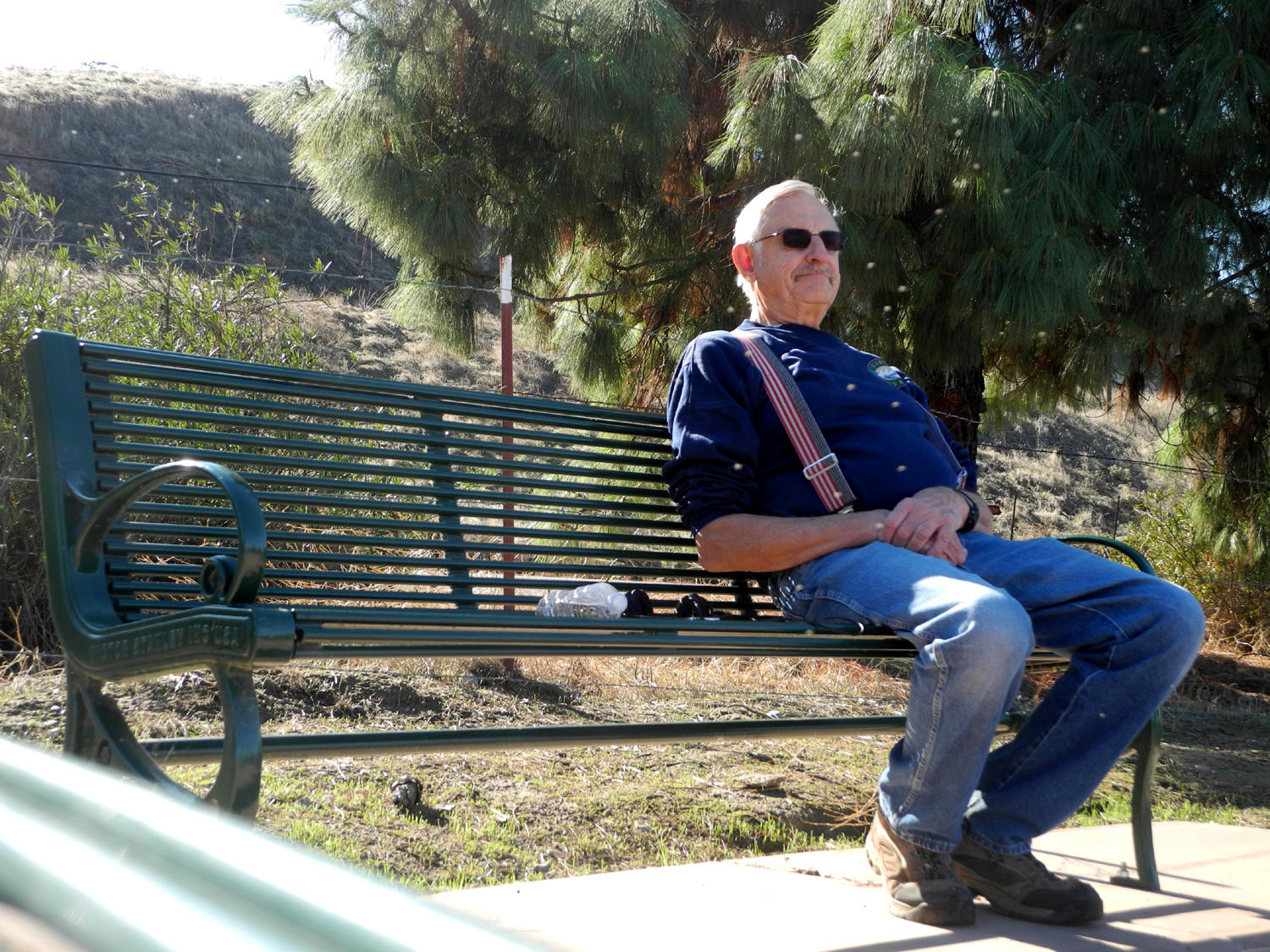
Carolyn
is dwarfed and hidden in the shade of this huge tree |
 |
 |
 |
| Grey egret waits for lunch | A closer look |
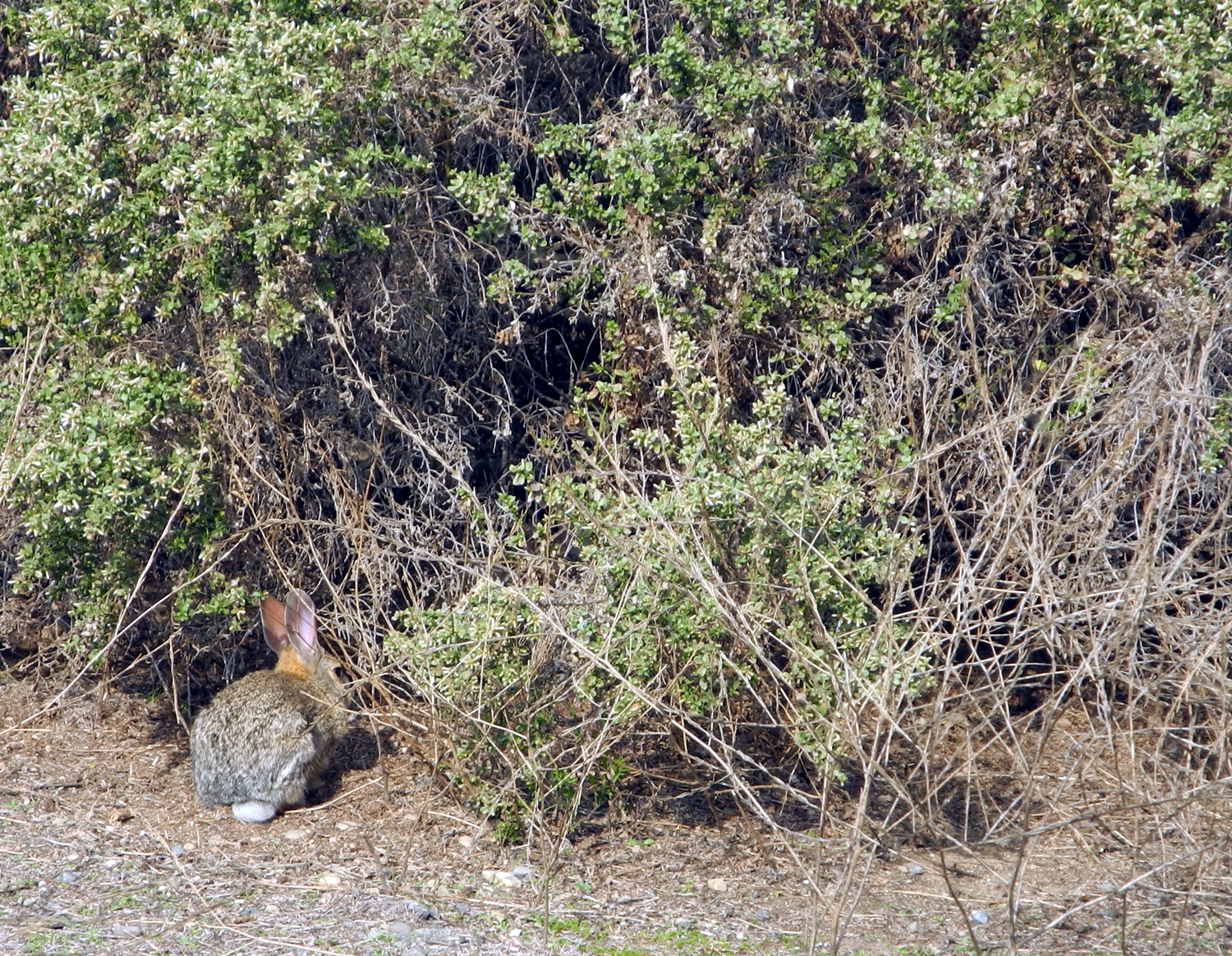
The rabbit whose nap we interrupted |
| San Joaquin River Gorge | ||
 |
 |
 |
|
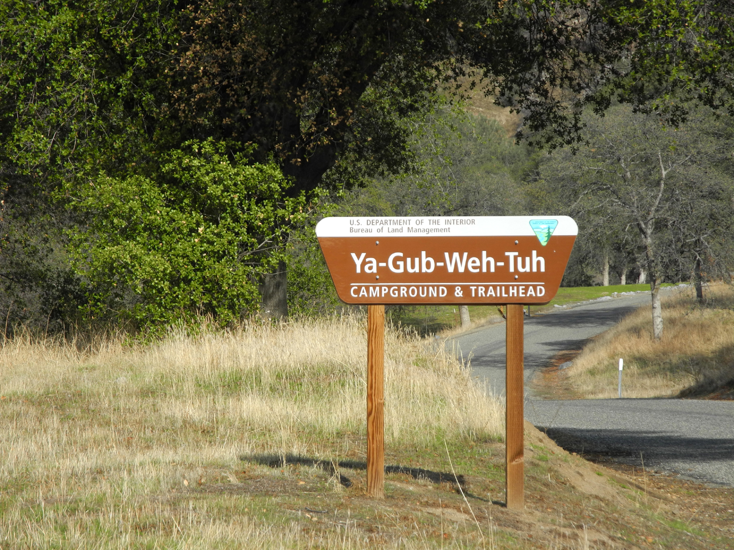
It
means "place where |
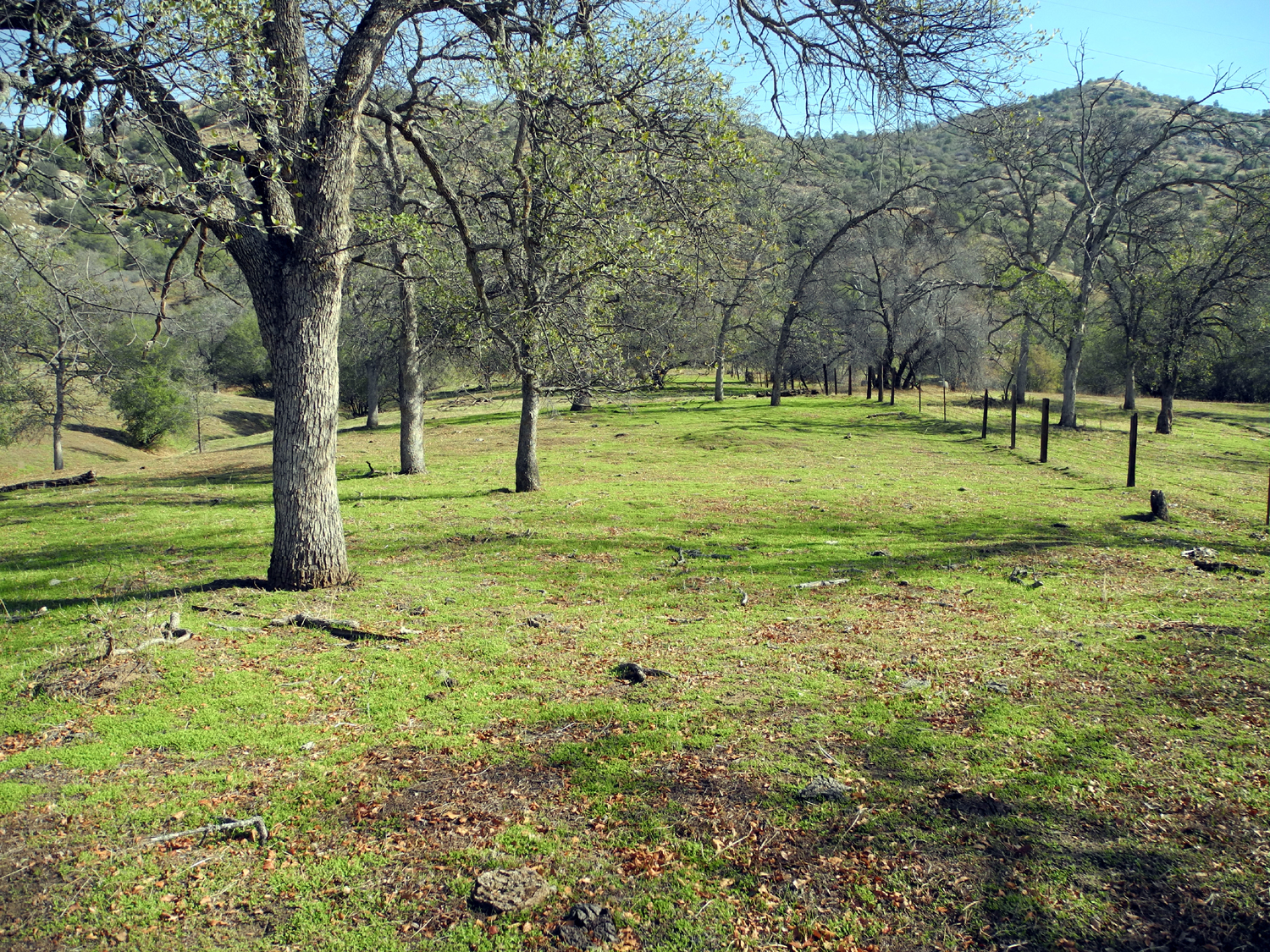
Green grass and blue oaks | Recent
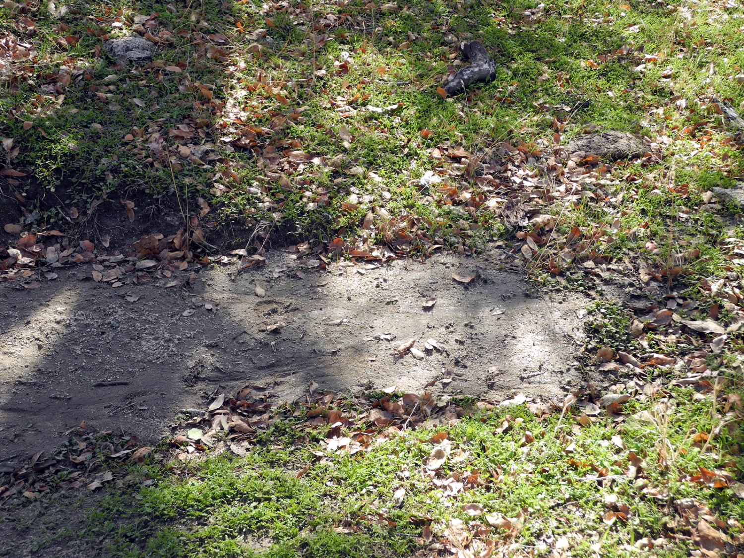
rains have washed soil from the trail into the grass |
 |
 |
 |
|
A
promising sign - green |
A very small bridge |
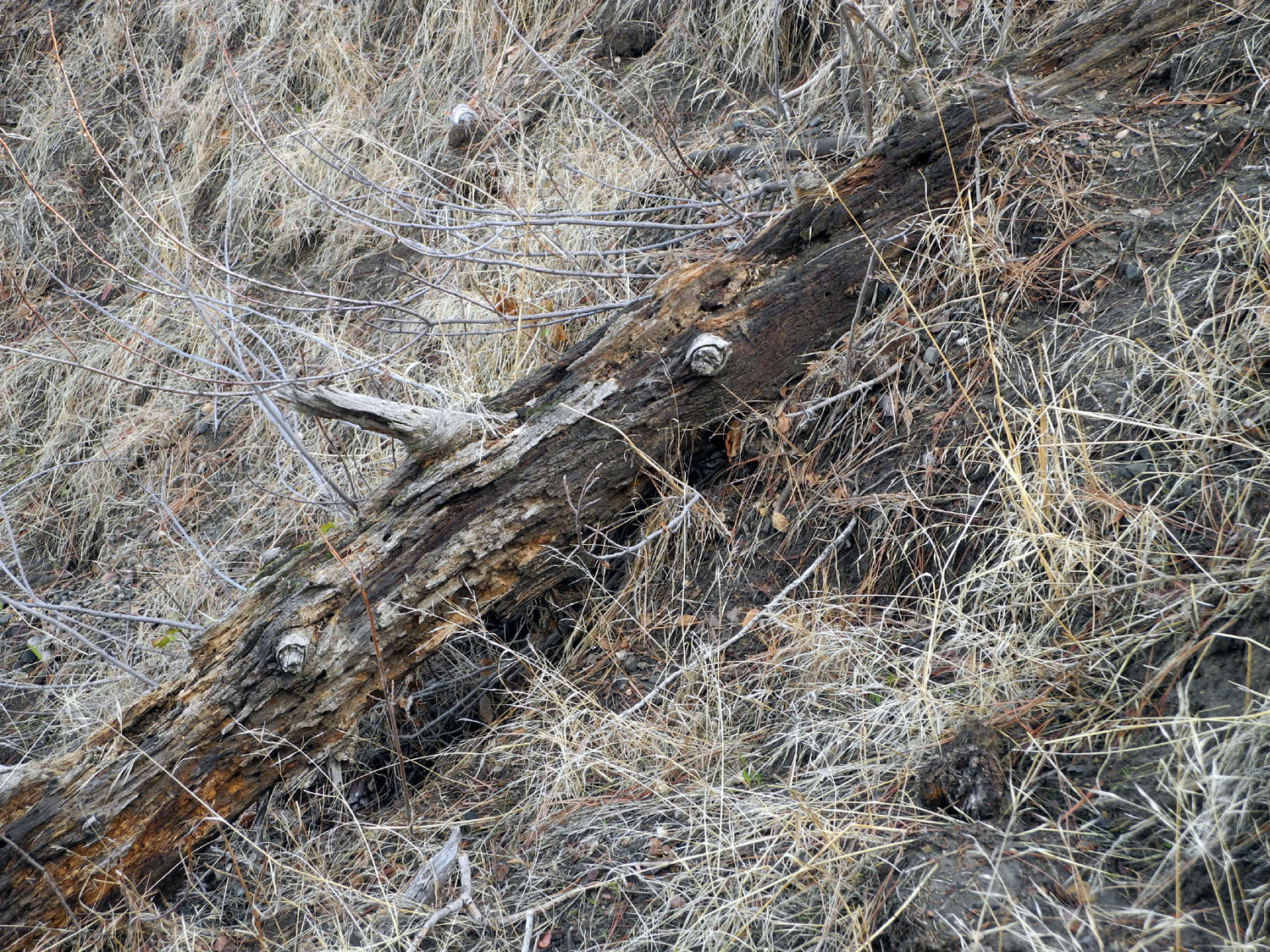
Dead
pine log lies in state |
 |
 |
 |
|
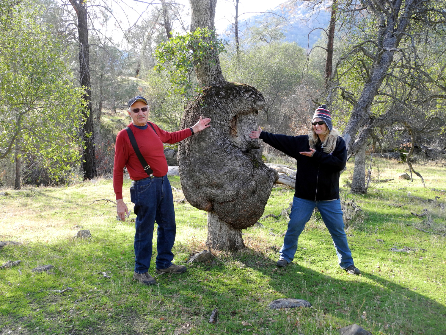
Maybe
the biggest blue |
Ten days later I was back
with daughter Teri & grandson Mikie |
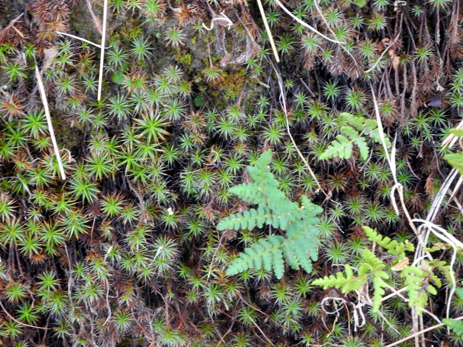
Lichen
adds a nice contrasting color amid the green |
 |
|
 |
|
The greenest green belongs to the moss |
Squaw Leap | There's a bumper crop of pine cones this year |
 |
 |
 |
| Sun sparkles on the wires |
Power poles marching into the distance |
The work of worms |
| San Joaquin Gorge Thanksgiving | ||
 |
|
 |
| Jack on the road | Brittany and Jack explore the area | Johnny and Jack |
 |
 |
 |
| Jack Snack | All the Upshaw's | Lunch time for Colton |
 |
|
 |
| Jack with Grandma Teri | Teri and Mikie and the big burl | Dick and Teri hamming it up |
 |
 |
 |
| Mikie on the trail | Rough winter for this blue oak | Sensational sunset |
 |
||
| Four generations: Johnny Upshaw holding Colton; Brittany holding Jack; Mikie, Teri and Tim Liddle; Dick Estel | ||
| Related Links | ||
| Lewis Creek Trail | Lewis Creek Trail Map | El Cid Restaurant |
| Dusy-Ershim Trail | Dusy Trail Video | Dusy Trail Photos |
| Mt. Ritter | Huntington Lake | Lake Edison |
| Sierra National Forest | Florence Lake | Kaiser Pass Road |
| Yosemite National Park | Glacier Point | Glacier Point Road Hikes |
| Washburn Point | Taft Point | Red Fir |
| Yosemite Valley Railroad | Illilouette Falls | Glacier Point Hotel |
| Poor Valley Band | Uncle Ephus | Narrow Gauge Ramblers |
| Lonesome Moon | Grasskickers | Red Dog Ash |
| Reedley College | Fresno Folklore Society | The Grove |
| Big Creek Hydro Project | San Joaquin & Eastern Railroad | Shaver Lake |
| San Joaquin River Gorge | Millerton Lake | Lewis S. Eaton Trail |
| San Joaquin River Parkway | Coke Hallowell Center for River Studies | Dick's San Joaquin River Gorge Photo Album |
| San Joaquin River Trail | Pete's Place | Sierra National Forest |