
|
Dick's Adventures of 2021 - Part 3 |
|
| Photos Related Links More Travel Reports | |
| Adventures
of 2016 Adventures
of 2017 Adventures
of 2018 Adventures
of 2019
Adventures of 2020 2021 Part 1 2021 Part 2 2021 Part 4 2021 Part 5 |
|
| Family Weekend at Wawona Rancheria Falls Courtright & Shaver Lake Arnold & Other Places | |
| Family
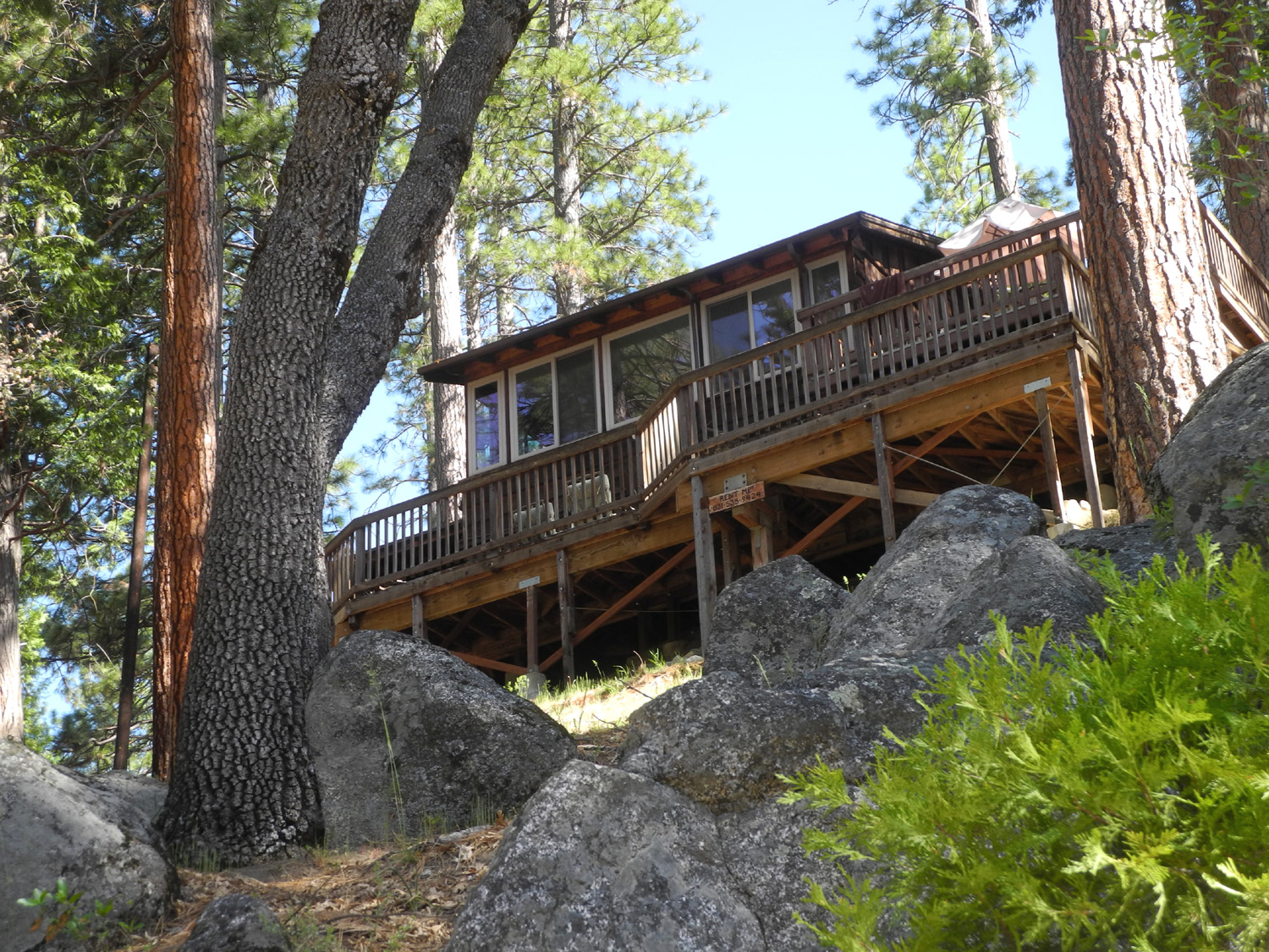
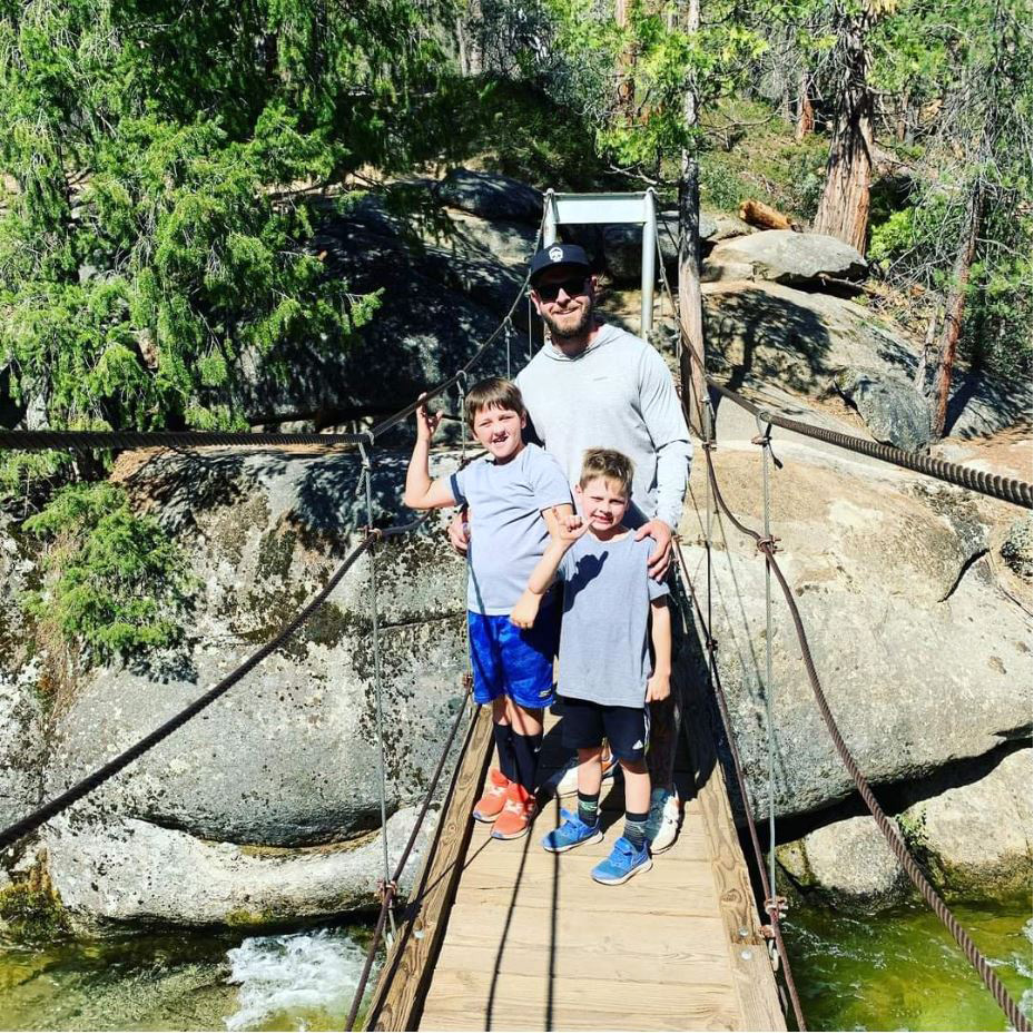
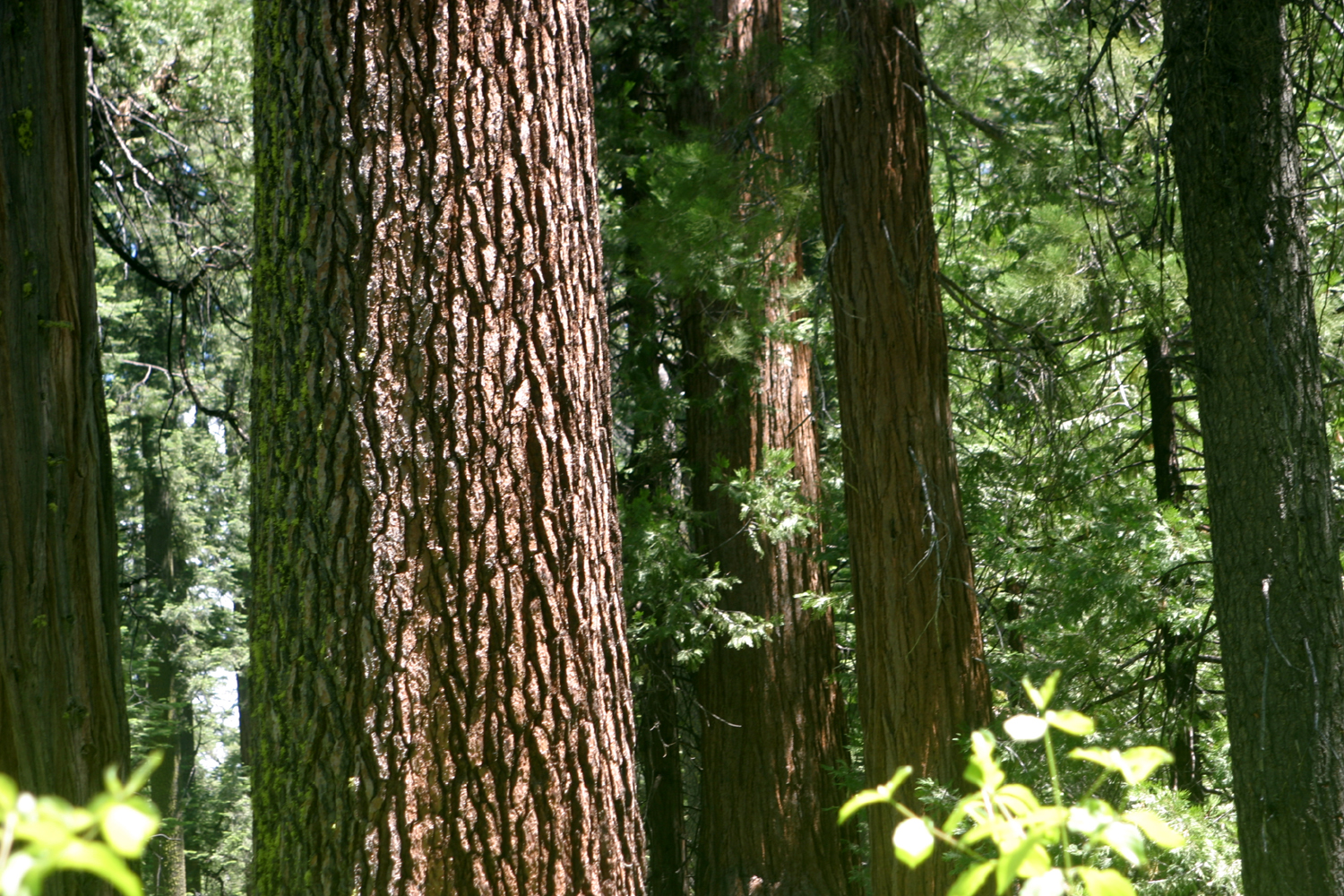
Weekend at Wawona Like a number of our family outings, this one was scheduled then canceled before it finally happened. We had reservations at The Redwoods in Yosemite for May 2020, then along came Covid and the park was closed to all but residents. I decided to take another approach, looked on the Airbnb web site, found a cabin in Wawona with room for ten people overlooking the South Fork of the Merced River, and booked it for May 6 - 9, 2021 Vacation cabin life has become a family habit, starting in 2018 when we stayed at Camp Four and a Half Cabin on the upper Kings River. That was also our second try at that location, our 2017 reservation having been canceled due to heavy storms that damaged the dirt road. We returned to the cabin in 2019, and booked a trip in 2020 that also lost out to the pandemic. At this point I decided we needed to find a place that was convenient for my younger daughter who lives in Oakhurst, the Kings canyon location being too far for an overnight stay, and focused on Wawona, about four miles from the southern entrance to Yosemite National Park and about 20 miles from Jennifer's place. This brings us to the present day, and a weekend that was everything we hoped and more. Since we had nine people coming from five different households in four cities, we did our usual back and forth emailing to plan food and discuss arrival times. On Day 1, a Thursday, my daughter Teri and her mother Jackie drove up from Fresno early in the day and I followed an hour or so later from Clovis. Since we could not check in until 3 p.m., they passed the time looking at the history center, the covered bridge, and enjoying the trees and cool weather around the Wawona store. When I arrived we drove up the road on the south side of the river and hiked the short trail to the Swinging Bridge, where we had all been several times previously. In fact, Jackie was there a week earlier, and said that the river was now running a little bit higher. The bridge trail is virtually level, and continues up and down stream on rhe north side after you cross the bridge. We ended our hike at the bridge and returned to the trailhead. We sat in our lawn chairs in the shade until it was time to check in, then drove back to the highway and up Chilnualna Falls Road on the north side of the river. The cabin is about a quarter mile off this road, with a couple of turns that were clearly described in the directions. Teri and I had looked at the outside of the cabin when we were in the area in December, but we could not see what a great place it was until we got inside. Large windows along two sides of the living room/dining area give a long view of the river. There are two large decks outside, plus a small one off the upstairs bedroom and one half-way down for the hot tub. Stairs go up or down from every deck, and all have river views. There are two bedrooms, each with a king size bed, and another room with six bunk beds, room for all of our party of nine. Big screen TVs in each bedroom and the living room, a wood stove, barbecue, modern kitchen and many other features made it an excellent place for our annual family weekend. |
|
 |
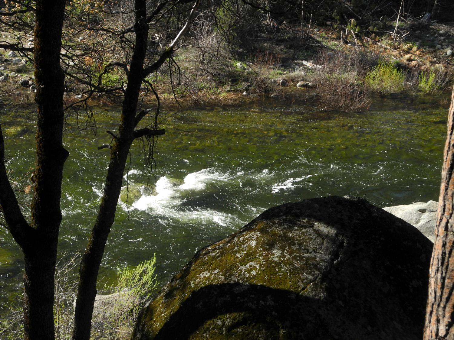 |
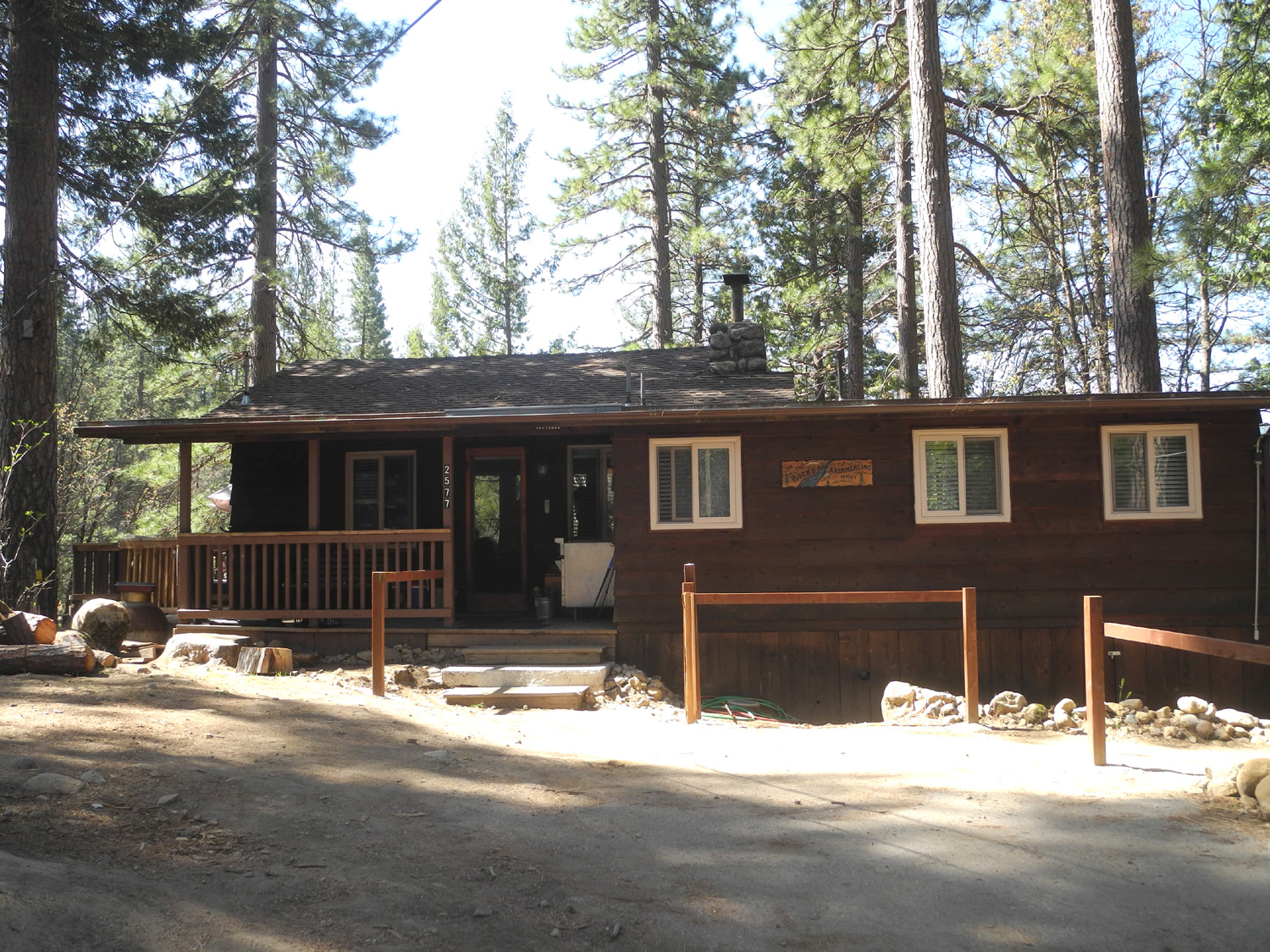
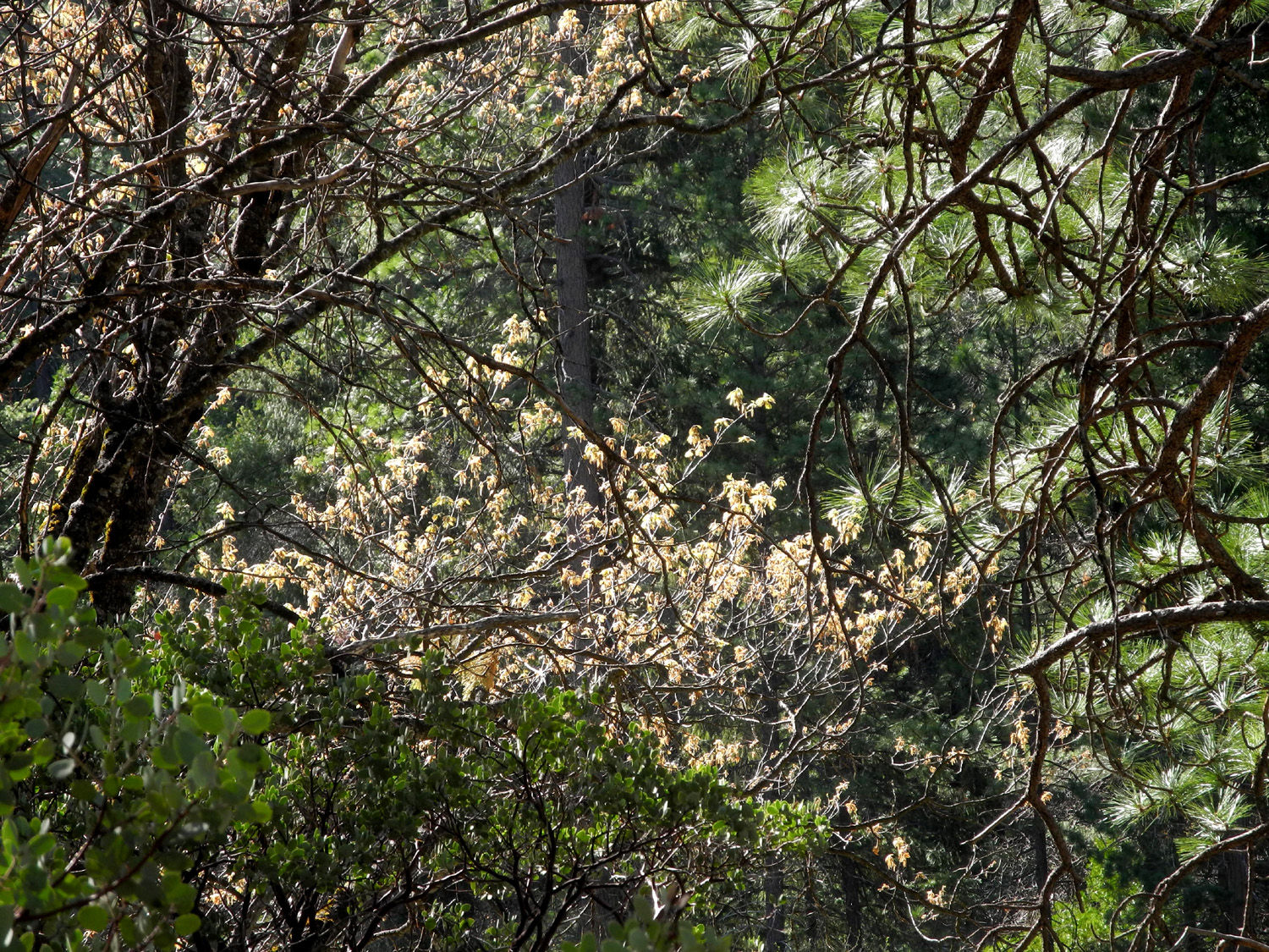
| The front of River View Cabin | One of our several views of the river |
|
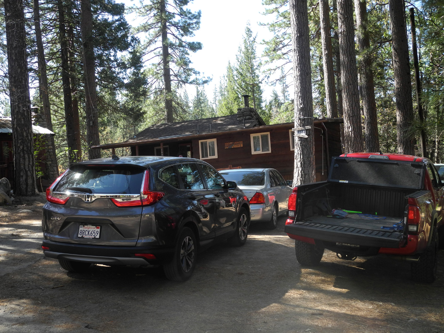
Of course, not everything was perfect. Only three cars are allowed, while we had six part of the time. There was no mention of this on the web site; we learned it only when we read the rule book, a plain binder sitting on a cabinet in the cabin. We had to shuffle vehicles and ferry people back and forth between the cabin and "downtown" Wawona, where there was a large parking lot. Nosy neighbors or someone complained to the owner that we had "way more than nine people," which was either a lie or the result of insufficient brain development. No one came into the cabin and counted heads, but if they had they would have seen eight overnight Friday and nine for half of Saturday, the exact number we booked for. These minor glitches aside, the weekend was a delight from start to finish, and everyone was impressed with the facility and the location. On Thursday, Teri, Jackie and I enjoyed a spaghetti dinner that I had prepared at home and just had to warm up, with salad and bread that they provided. After dinner Jackie and I walked over to the Pine Tree Market on Chilnualna Falls Road, to see how late it was open, and to see how much effort would be required if we had to park some of our cars there. During our walk we saw three deer. The rest of the evening included reading and conversation, and looking forward to the arrival of the rest of our party the next two days. Teri got caught up reading a book that I had brought about logging in the area and stayed up about 90 minutes past her normal bedtime. |
|
 |
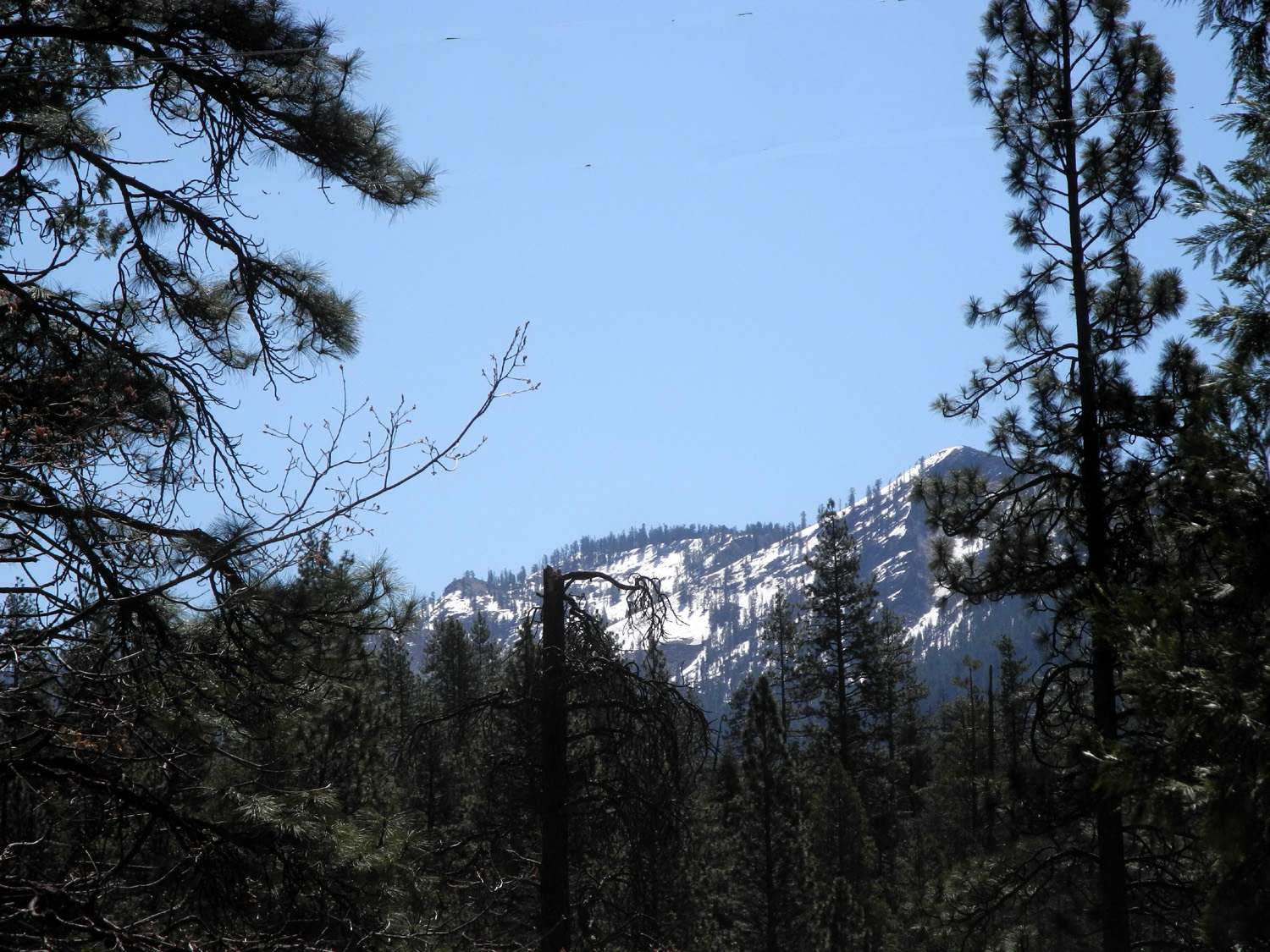 |
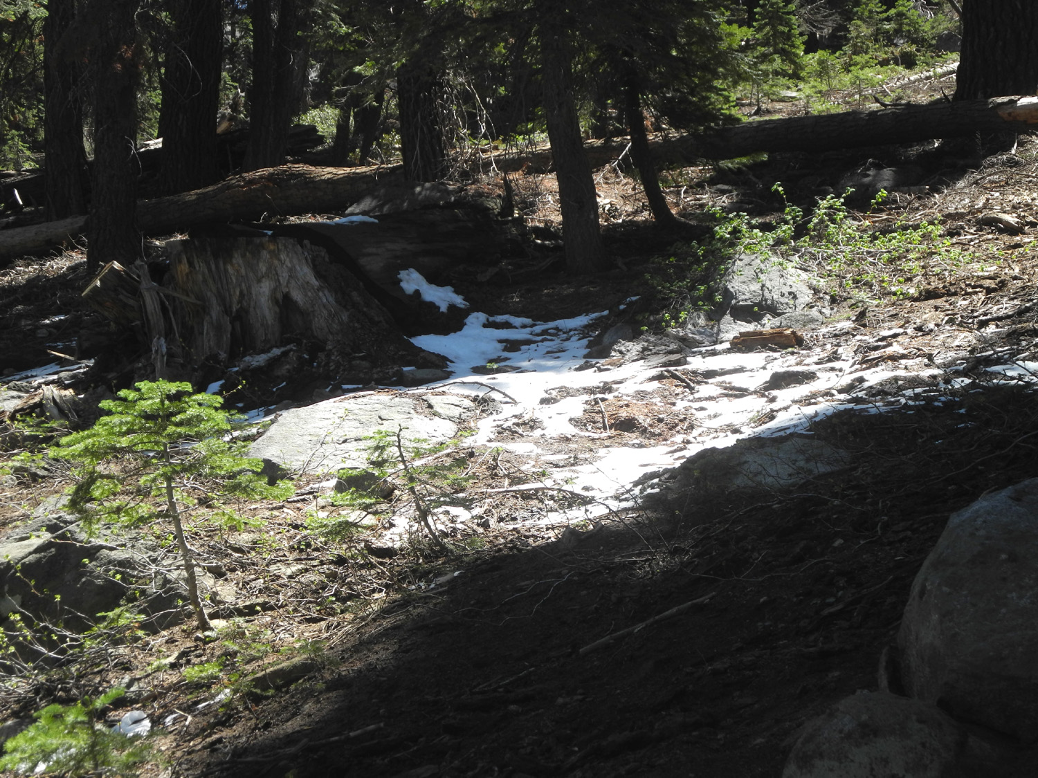
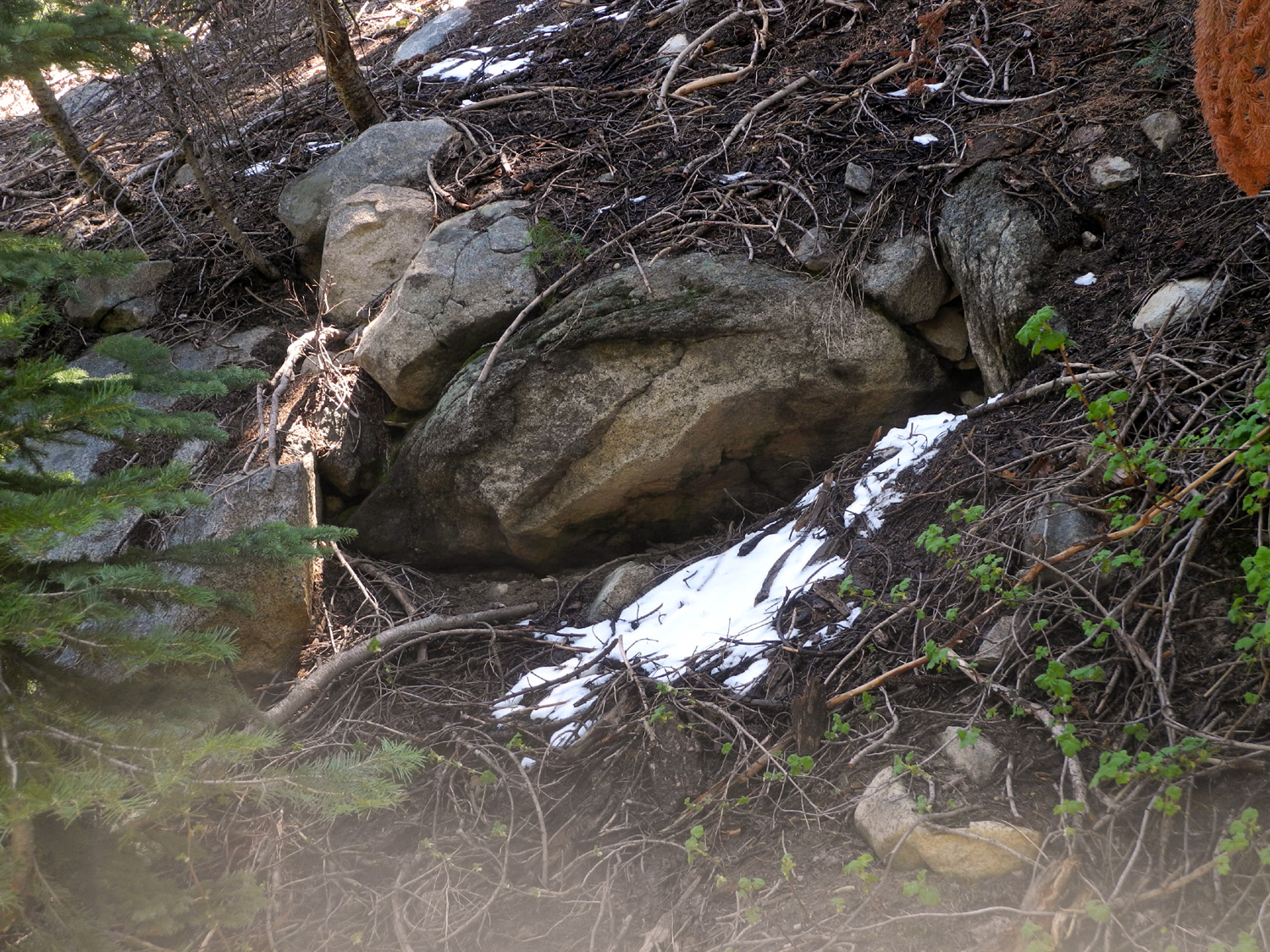
| Too many cars | Snow, not far above the river |
|
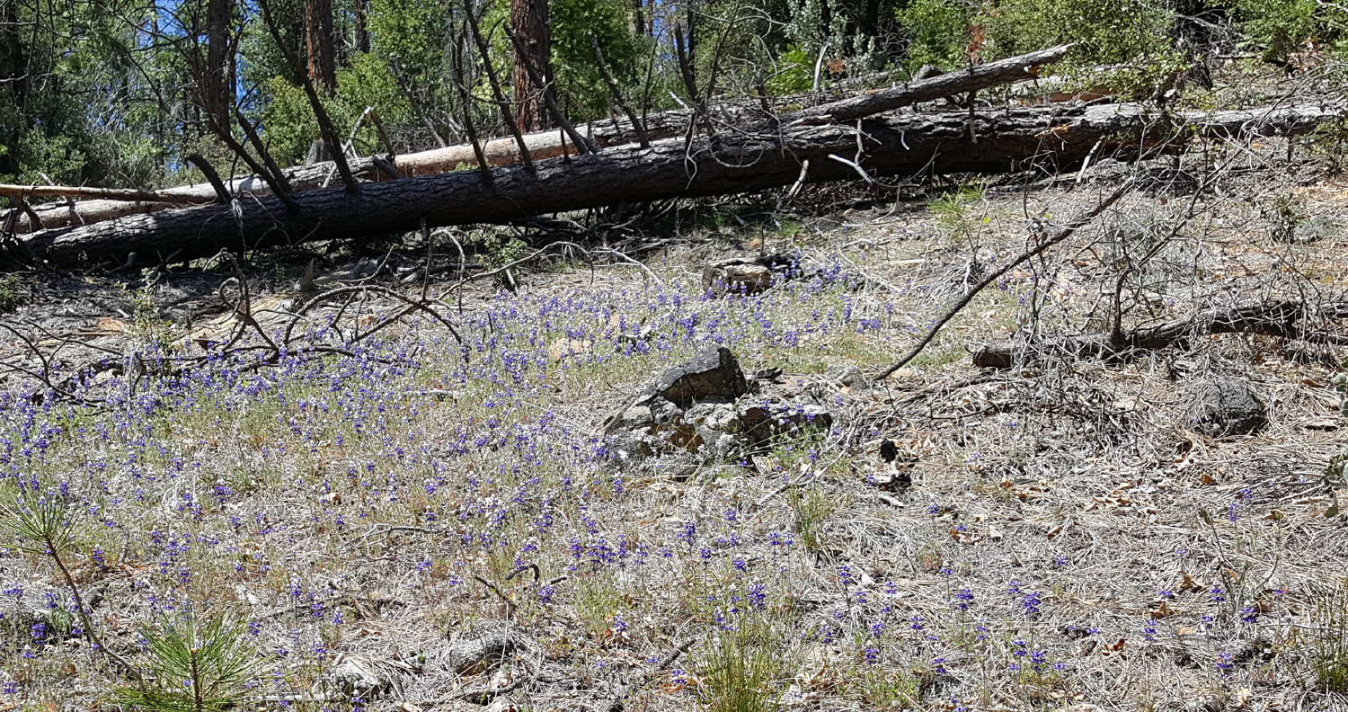
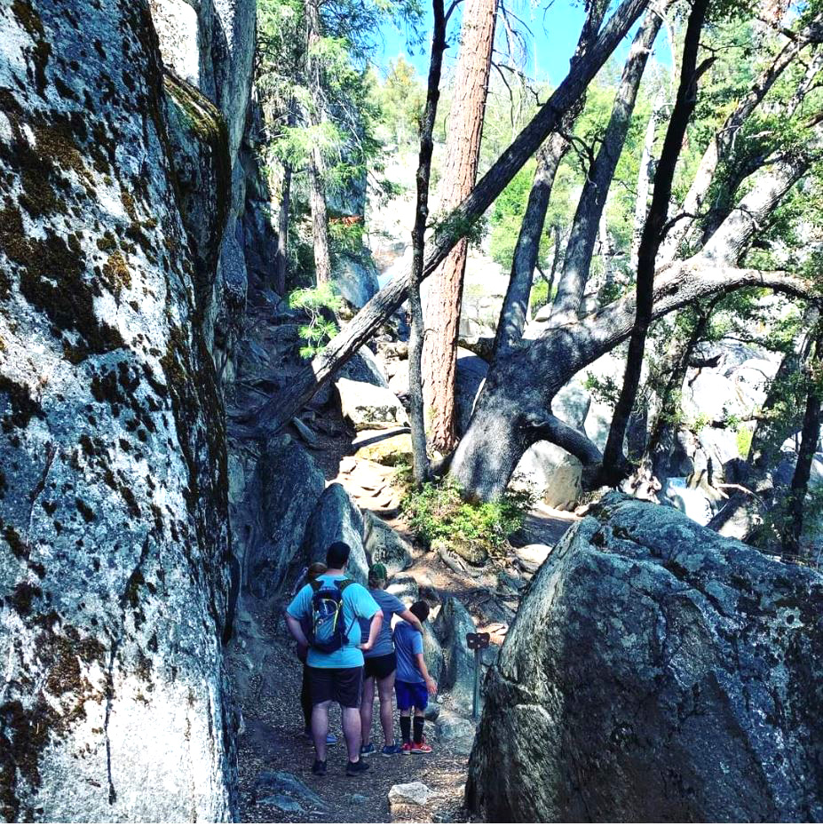
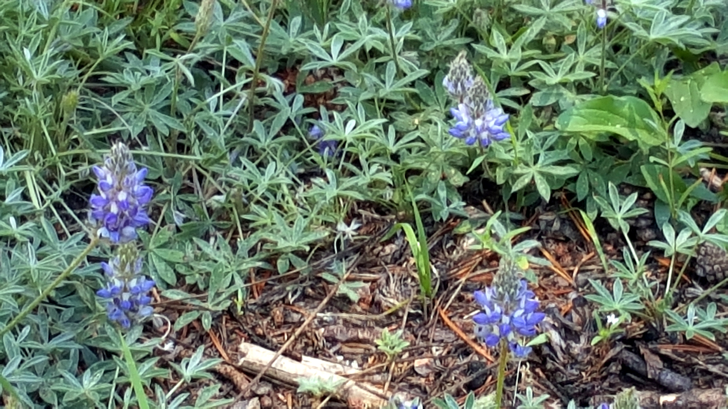
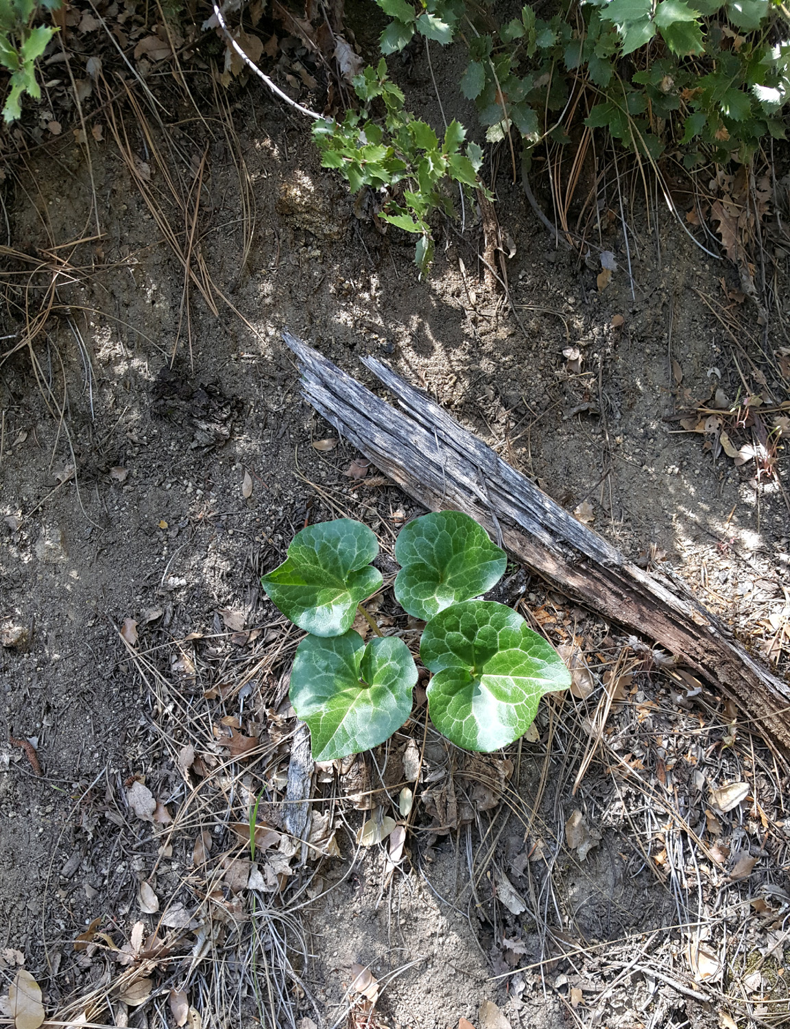
Daughter Jennifer arrived in mid-morning on Friday, and after getting her stuff into the cabin, we decided to hike to Chilnualna Falls. The trailhead parking lot is about a mile or so up the road, and was filling up quickly as we arrived. This is not a single waterfall, but instead a series of cascades and drops of varying height. There are three cascades or five, depending on which website you read. The round trip hike to the farthest fall is about eight miles, not on our radar now or any time in the future. Teri and I backpacked to an upper part of the falls in September, 1980, when we were both much younger. For our purposes in the 21st century, a steep quarter mile hike took us to a nice drop, with a lot of cascades partially visible above and below. Along the way we spotted some lupines and a few other late wildflowers, but the falls was the highlight. I have visited this spot in recent years, once when the water was flowing fairly good and once when it was barely a trickle. This was the best flow I have ever seen, and we all enjoyed this outing. |
|
 |
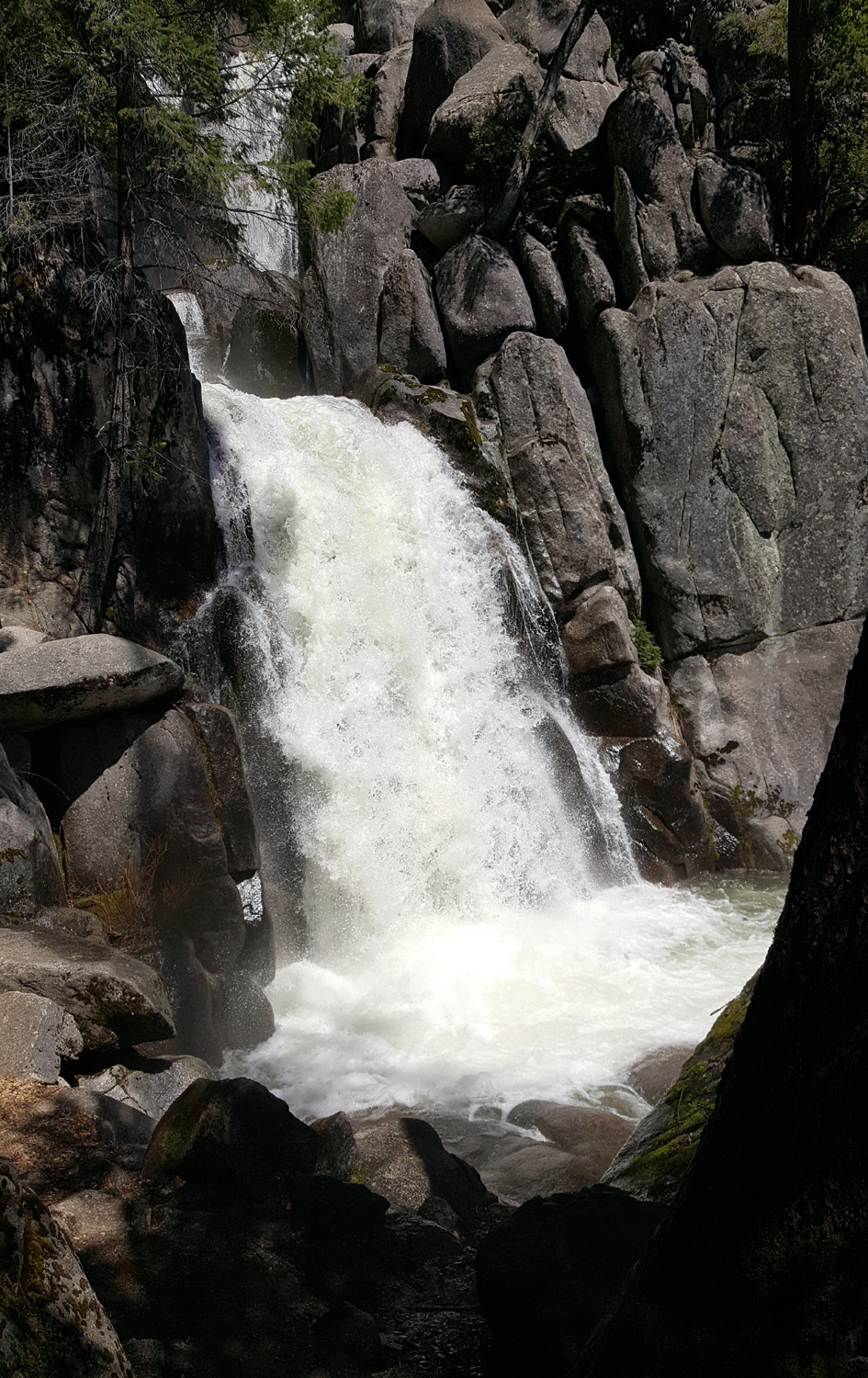 |
| Lupines along the Chilnualna Falls Trail | Chilnualna Falls |
|
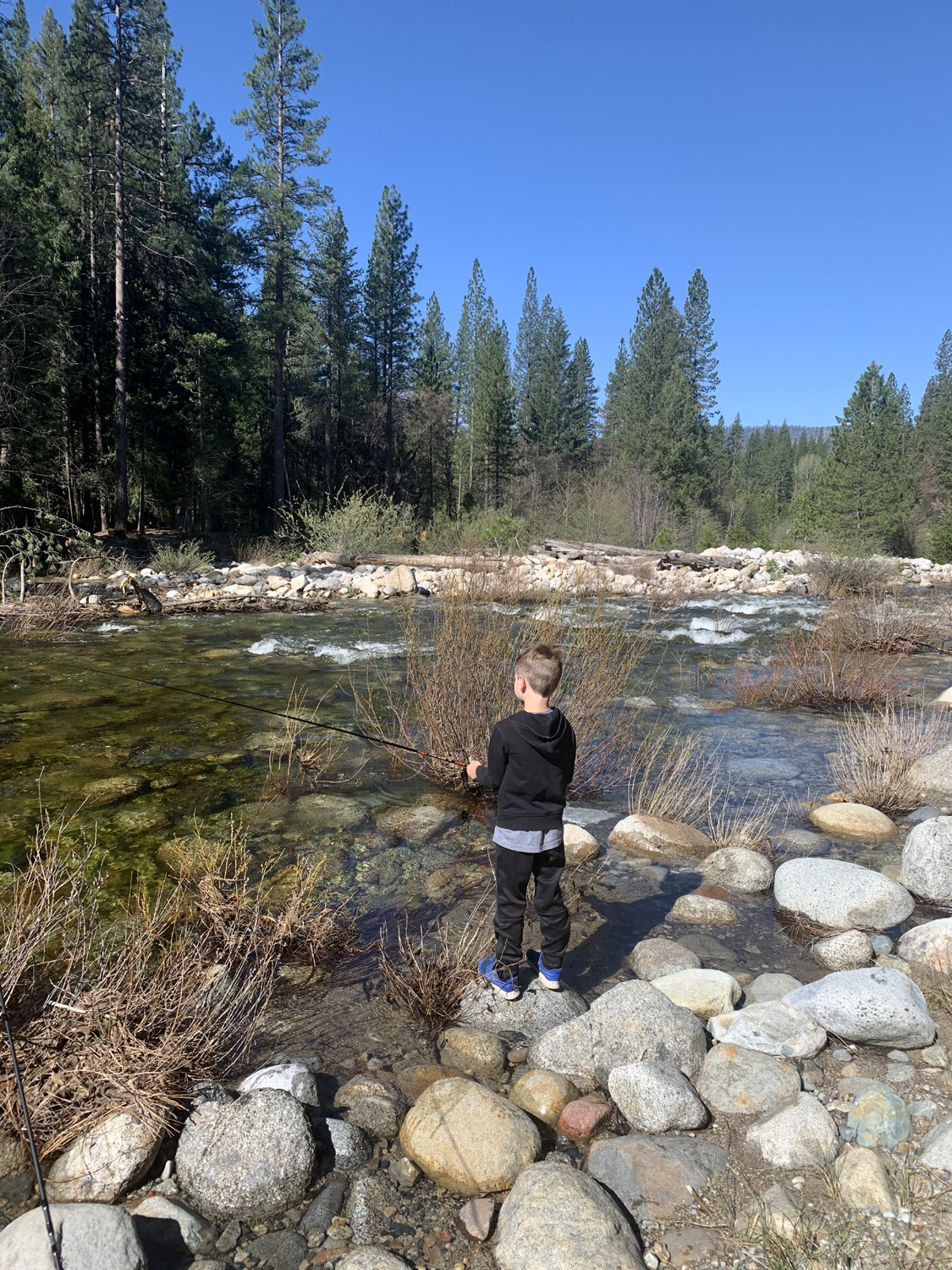
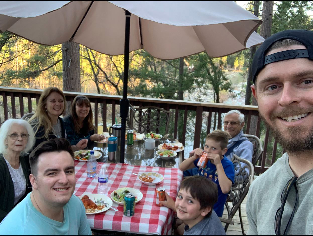
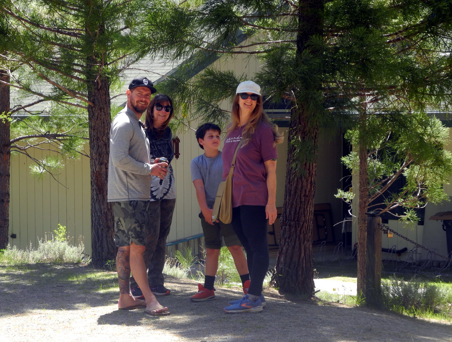
Late that afternoon most of the rest of our party arrived - my grandson Johnny with his boys Colton and Jack, and grandson Mikie right behind him. Johnny's wife Brittany would join us the following day. The boys immediately began exploring the cabin, and were delighted with the multiple decks and stairs. They insisted on giving their father a tour, although he had actually seen much of it while they were in another area. Behind the cabin there were rough concrete steps down to the river, although none of the early arrivals thought this route looked safe. We found that we could go down from the street through a drainage, and get to the river along a rough dirt road, and the boys and Johnny soon got out their fishing gear and went to the river. I admit that things got so lively after the arrival of two young boys that I can't recall everything we did, or exactly when we did it. I do know that Jackie had brought lasagna which she fixed for dinner, and everyone enjoyed it. Jack and Colton had recently discovered a modern version of the Little Rascals, so I brought my DVDs of the originals, produced from 1922 through 1944, and we watched one of these short features in the evening. Of course, the entire crew enjoyed this. Once it got dark, most of the group decided to try the hot tub, which was ready to use and kept them busy till late into the evening. Teri and Jennifer both have to get up very early, and usually go to be around 7:30. I try to get to bed between 9:30 and 10, and everyone else falls somewhere in between. So we all stayed up late or very late, getting settled down for the night well after 11 p.m. |
|
 |
 |
| Sketchy steps down to the river | Jack in a peaceful and scenic setting |
|
On Saturday morning everyone walked down to the river, in two or three separate groups. I was last, and walked along the stream for a ways before I saw Jackie and Jennifer coming back downstream. While swimming in the river was promoted as one of the "amenities" of the cabin, no one wanted to venture into that rushing stream of recently melted snow. |
|
 |
 |
| Jackie and Jennifer on their morning hike | The cabin from down by the river |
|
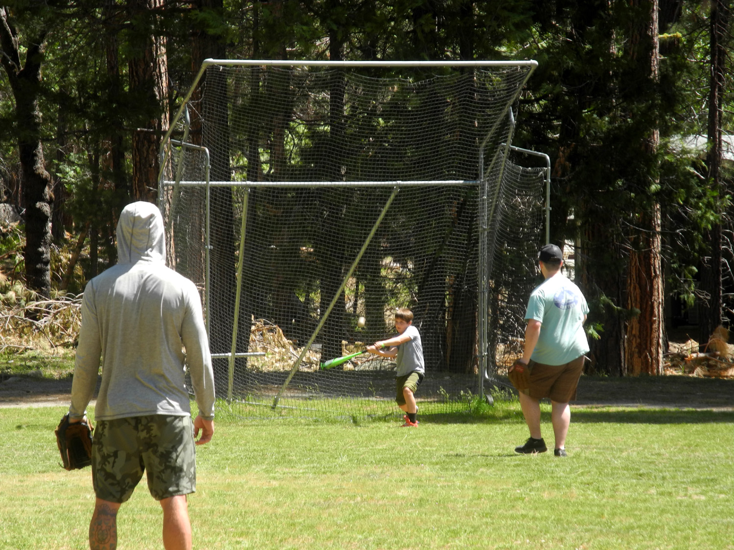
The Upshaw's had just acquired a new puppy, so Brittany stayed home to baby sit, coming up for the day on Saturday. When it got close to the time she was expected, most of us went to the nearby elementary school, where the boys made up for missing their Saturday baseball games at home. Now came the comedy of errors which seems to plague us from time to time. Johnny and Brittany were exchanging texts, during which she said she was waiting at the park entrance, about five miles from where we were. Johnny texted back, telling her to stop at the school. Time passed with no Brittany, at which time Johnny realized that the texts had been delayed and were about 20 minutes behind real time. Mikie and I returned to the cabin while Johnny, Teri and the boys continued to wait. Eventually they drove to the highway to watch for her. Meanwhile, Mikie and I found her relaxing in the cabin, chatting with Jackie. Eventually we got everyone together at the cabin, and after saying goodbye to Jennifer, most of the group drove up to the Chilnualna trailhead, with Jackie and I staying behind. They enjoyed the falls, going a little farther up the trail than we had done the day before. Back at the trailhead, they drove past it and down to a bridge across Chilnualna Creek. At the end of this road was another trailhead for the Swinging Bridge, slightly longer than the one on the south side. The boys had been to the bridge with Teri and me but enjoyed the trip with their parents and Uncle Mikie, along with Grandma Teri. |
|
 |
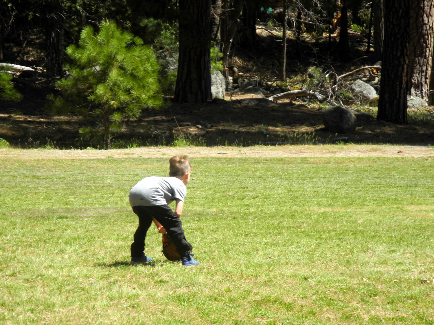 |
| Colton at the bat | Jack's ready to handle a hot grounder |
 |
 |
| The Saturday hiking crew | Johnny Upshaw and sons |
|
Once the hikers returned, Johnny started fixing dinner, taking advantage of the barbecue on the patio. After we had enjoyed a third excellent dinner, the Upshaw's packed up to head for home, leaving Mikie, Jackie, Teri and me to finish out the weekend. None of us stayed up as late as we had the night before, with Mikie being the last to turn in. We had to be out by 9 a.m. Sunday, so we didn't do anything but eat breakfast and gather up our stuff. We ran the dishwasher and emptied it, and took the trash with us as required, but routine clean-up was provided by the cabin owner (we had to sweep and mop the Kings River Cabin along with all other domestic duties). Over the next week or so we had a discussion about next year's outing - Wawona or Kings River. Finally I realized there was no reason we could not do both, so watch this space for more cabin news. |
|
 |
 |
| Friday
night dinner - clockwise from left front: Mikie, Jackie, Teri, Jennifer, Dick, Jack, Colton and Johnny |
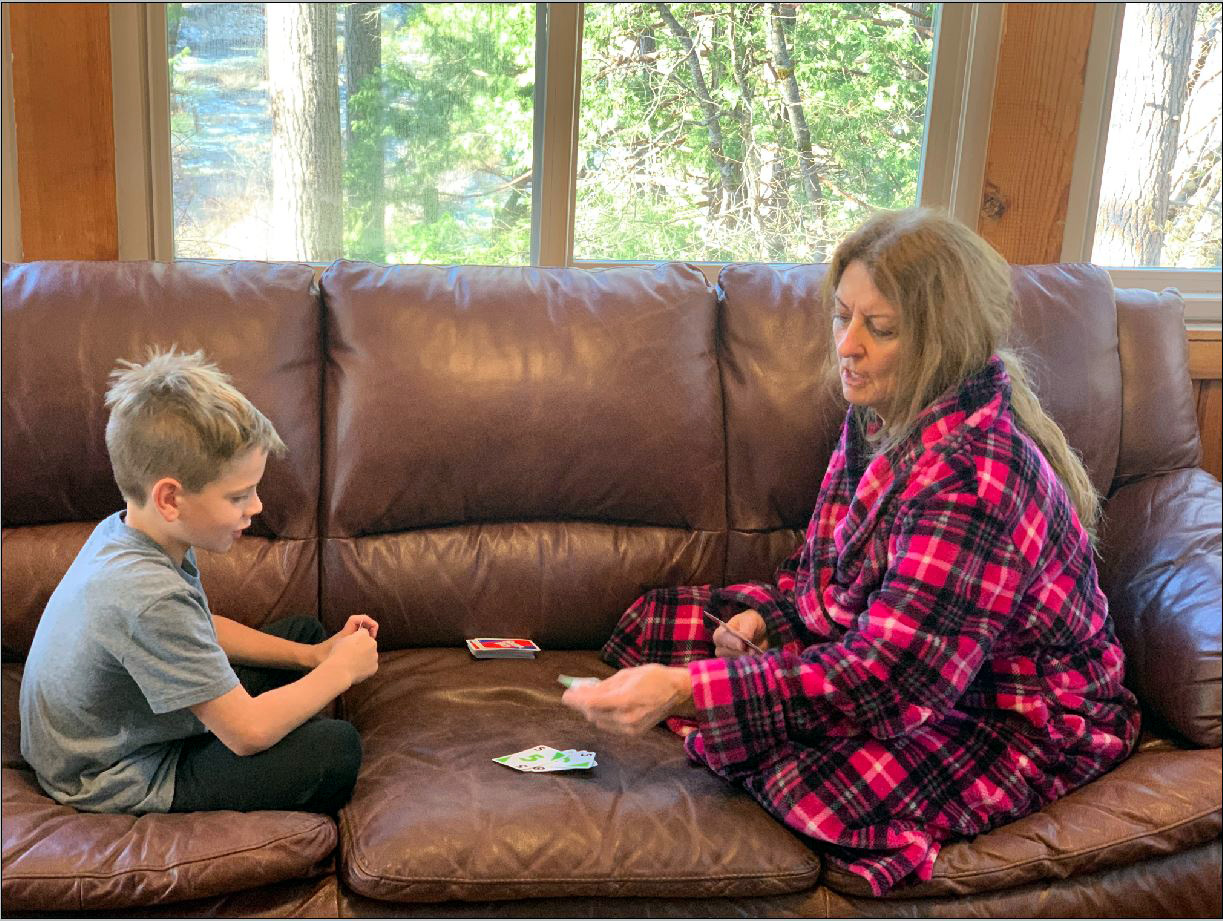
Jack and Teri in an intense card game |
|
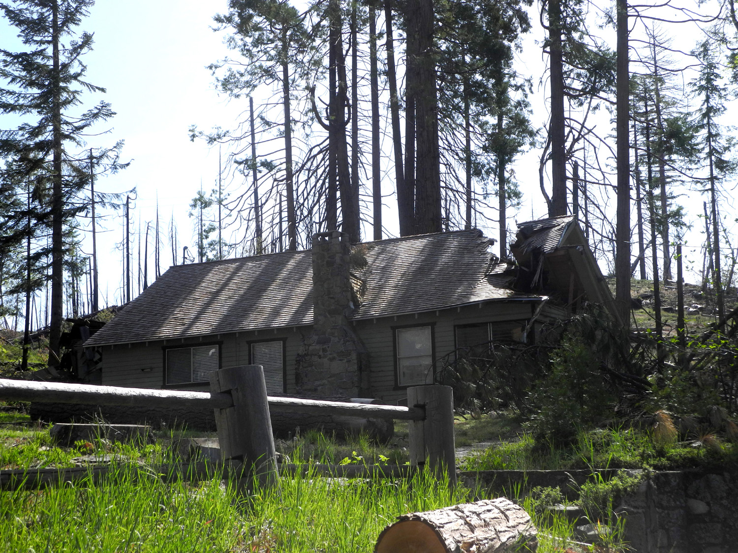
Final comments: Apparently the people naming roads in Wawona are short on imagination. On our trip we drove on Chilnualna Falls Road, Yosemite Pines Road, Yosemite Avenue, and Chilnualna Lane. Of course, there are many other small roads off the Falls Road - there are literally dozens of cabins, most for rent when not in use by the owners. Some are available through The Redwoods at Yosemite, and most others through Airbnb. In February a massive wind storm (Mono winds) blew through the Sierra, breaking off dozens of trees, many of which fell on buildings and cars. There were a couple of cabins near us with damage, but fortunately our place was spared. On the way home I took this photo of a building at Westfall Ranger Station that was badly damaged. Tree removal work along the road between the entrance and Wawona caused delays of about 15 minutes each way as we arrived and departed. --Dick Estel, May 2021 |
|
|
Rancheria Falls
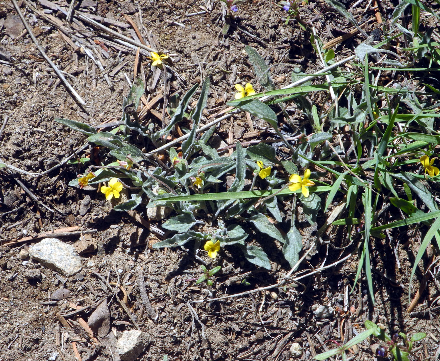
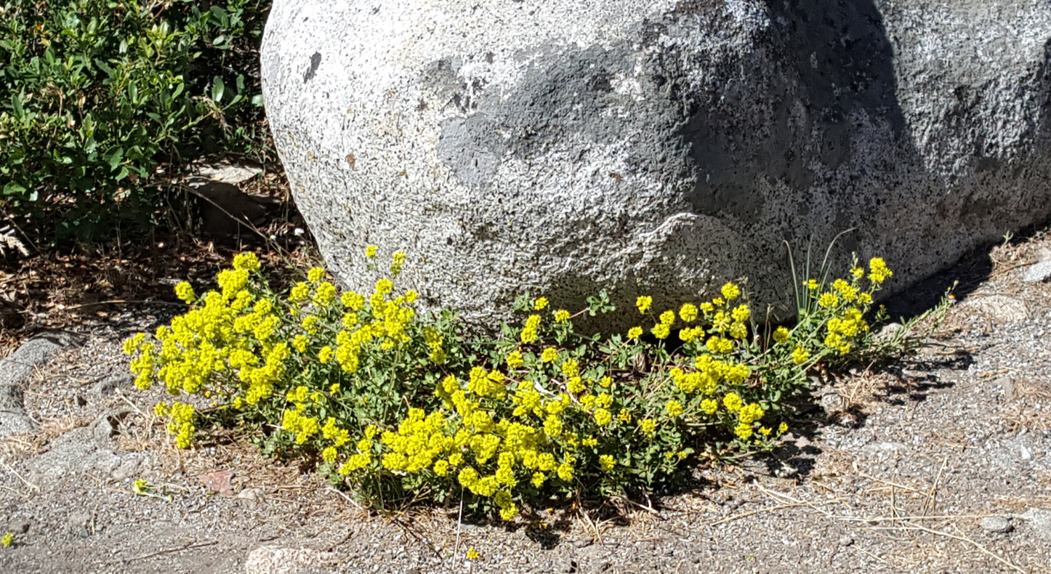
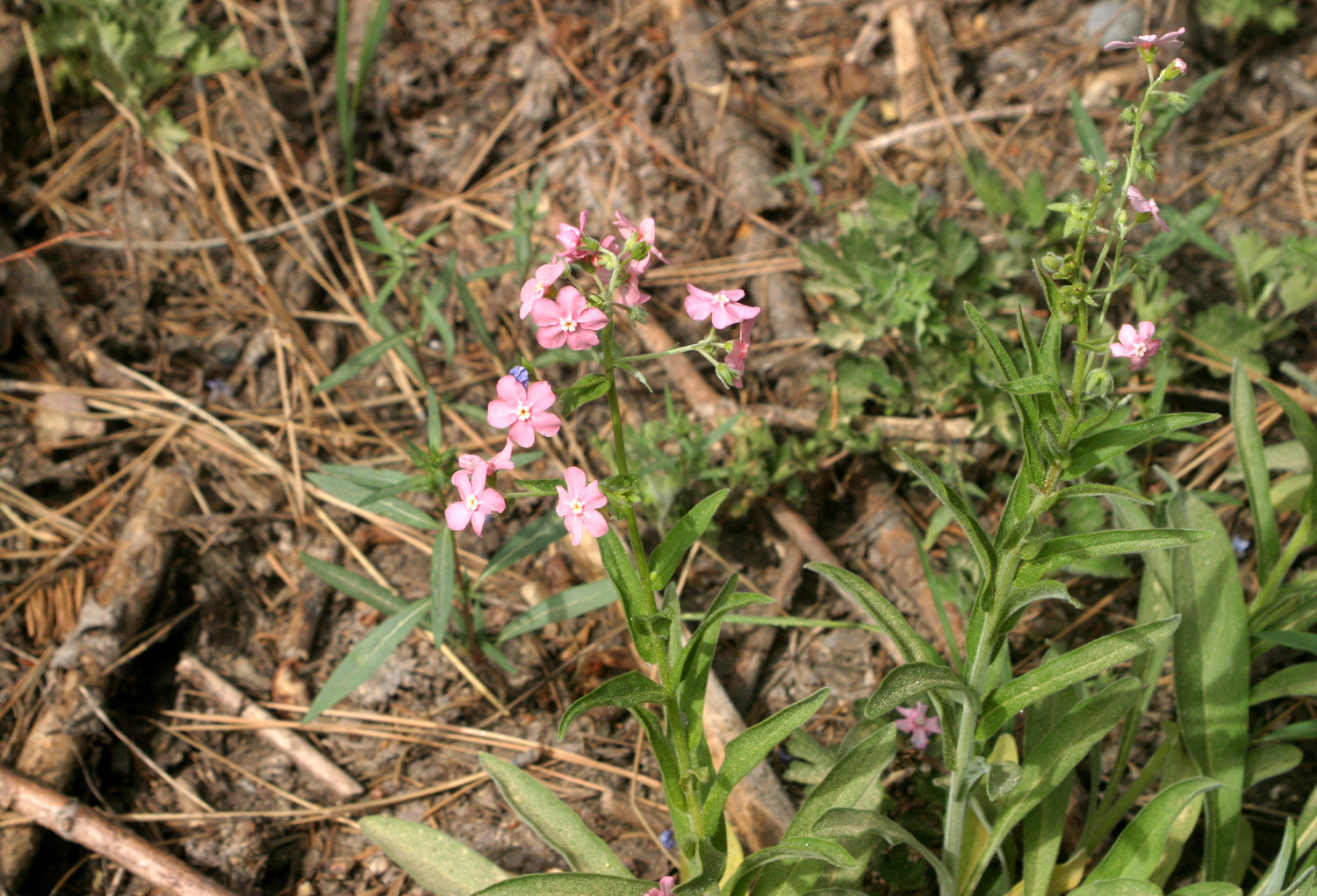
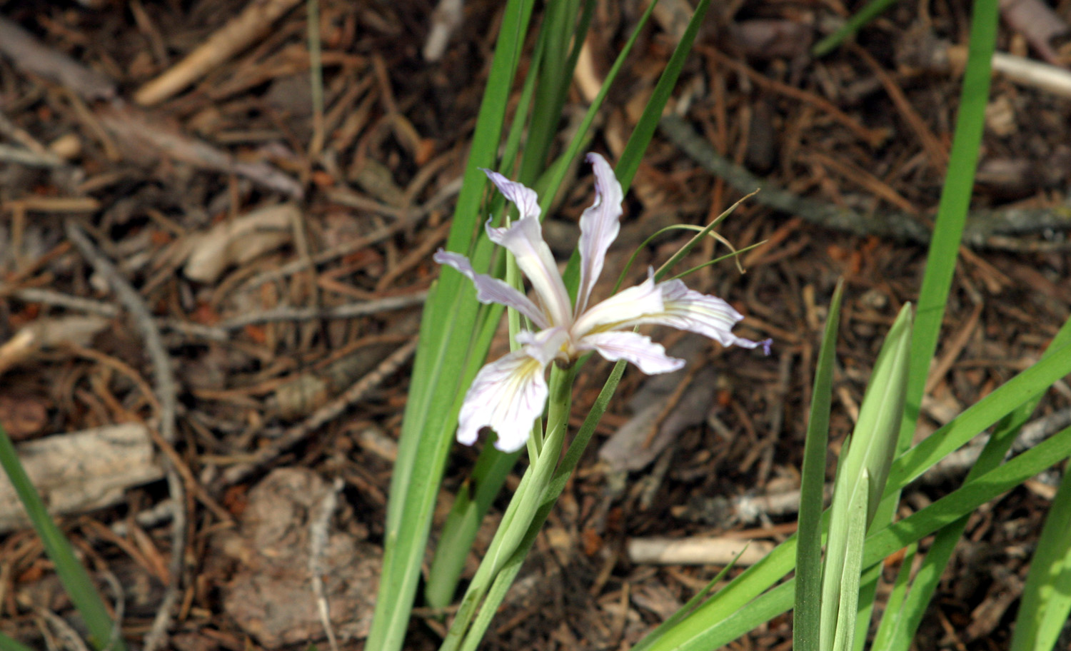
It looks like this was my eighth hike to Rancheria Falls, beginning with The Ramblers in 2016. My companion this time was Jackie Taggart, my daughters' mother and my former wife. We had enjoyed seeing Chilnualna Falls at Wawona earlier in the month, and felt the need for more waterfalls. So on May 24 we drove in my pickup on Auberry Road and Highway 168 to Huntington Lake, elevation 7,000 feet and nearly 70 miles from home, to Rancheria Falls. At the top of 10-mile four-lane section of the highway, we began to see the devastation that had been caused by the Creek Fire, California's largest ever single incident wildfire. On the last few miles before Shaver Lake, what had been a tree-lined road was now a winding and somewhat scary route along the side of the mountain, with views down into the steep canyon on our left. However, the town of Shaver Lake had escaped any damage, and there are sections of the forest that are still nice and green. Most of the way to Huntington Lake is not burned, and around that lake everything is mostly normal. This was certainly true along the one mile dirt road in to the trailhead, and on the trail itself. There were a few wildflowers, and because of a brief late-season storm, patches of snow. |
|
 |
 |
| Yellow violets lined both sides of the trail in this sunny spot | We saw snow patches all along the upper half of the trail |
|
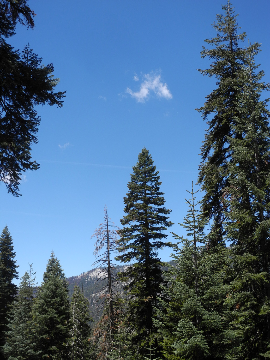
It was about sixty degrees, with a few wispy clouds in the blue sky, and magnificent tall red fir trees all along the way. Actually they weren't all tall - we saw one that had been bent over by the weight of snow, but had started a new leader back up toward the sky. |
|
 |
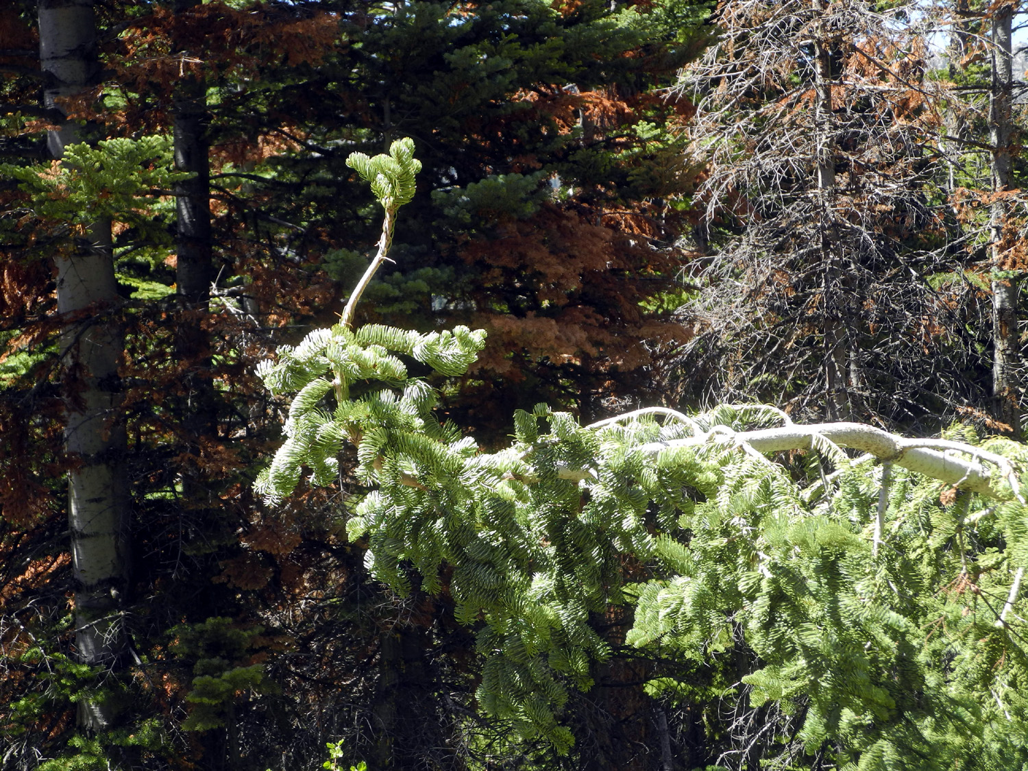 |
| Evergreens frame a single tiny cloud | Nature will not be stopped! |
|
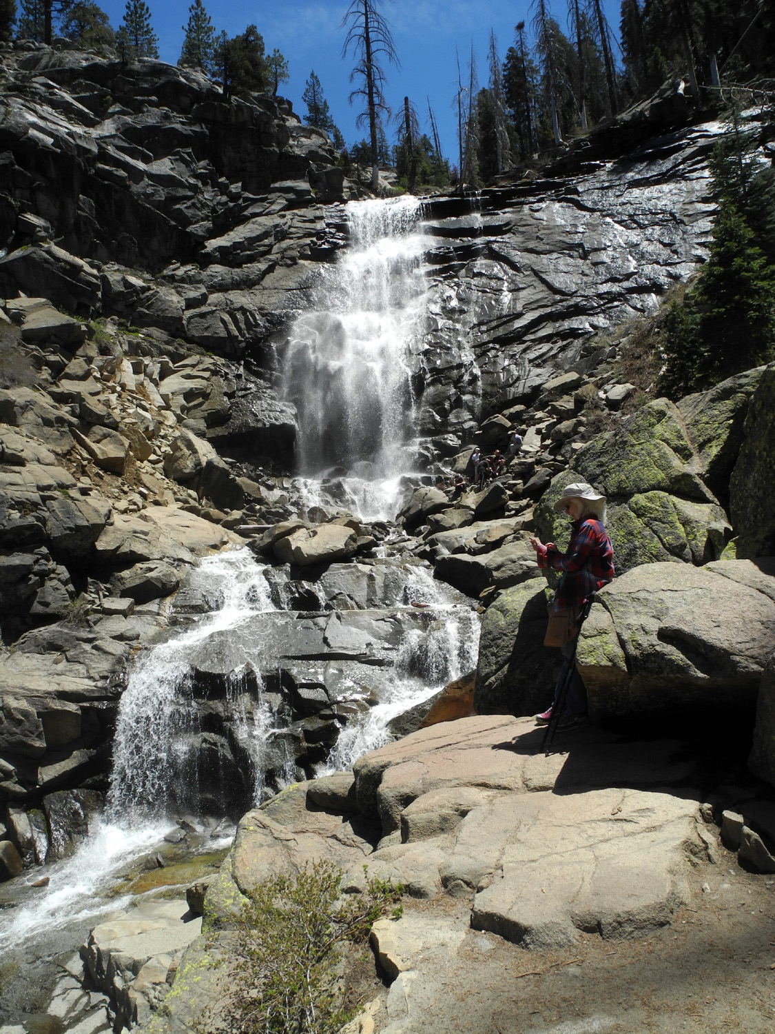
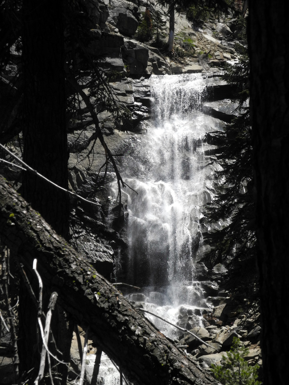
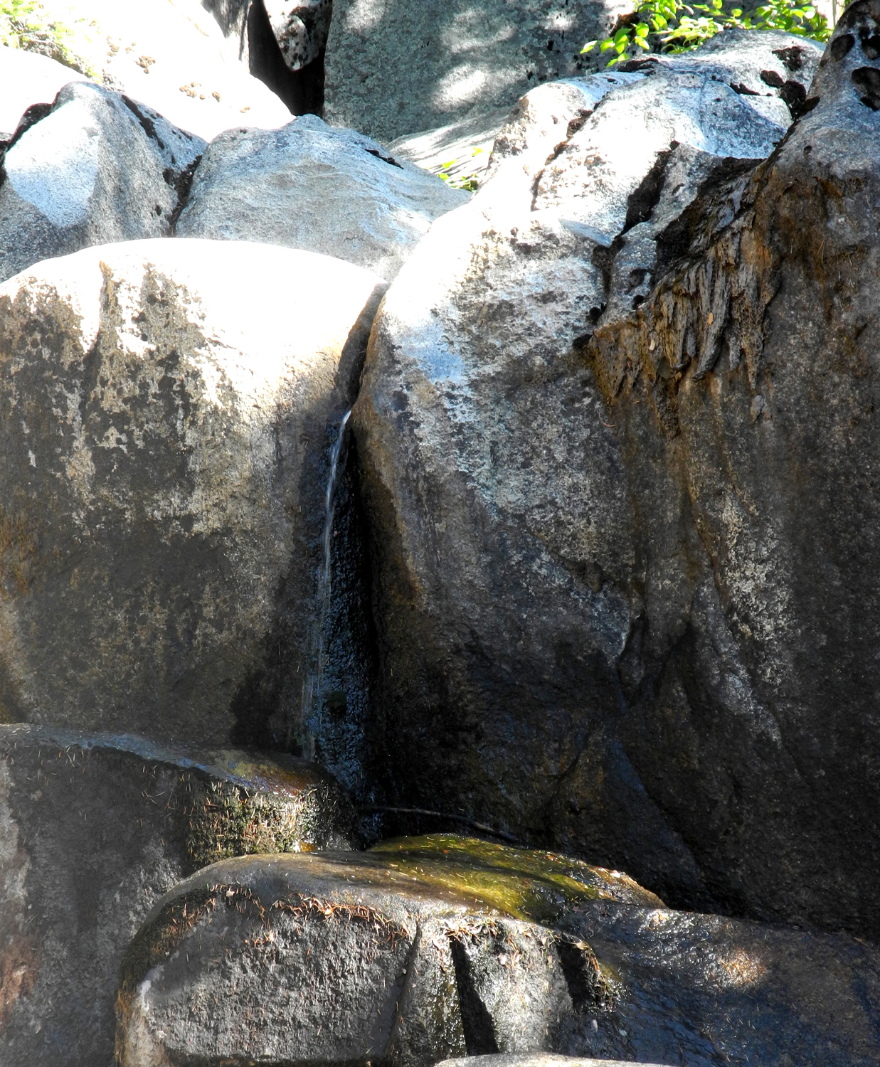
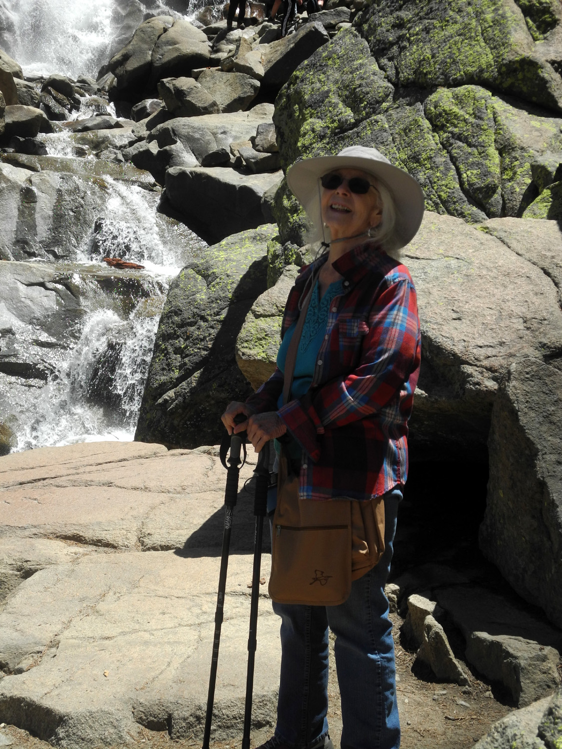
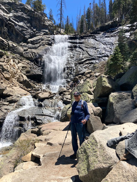
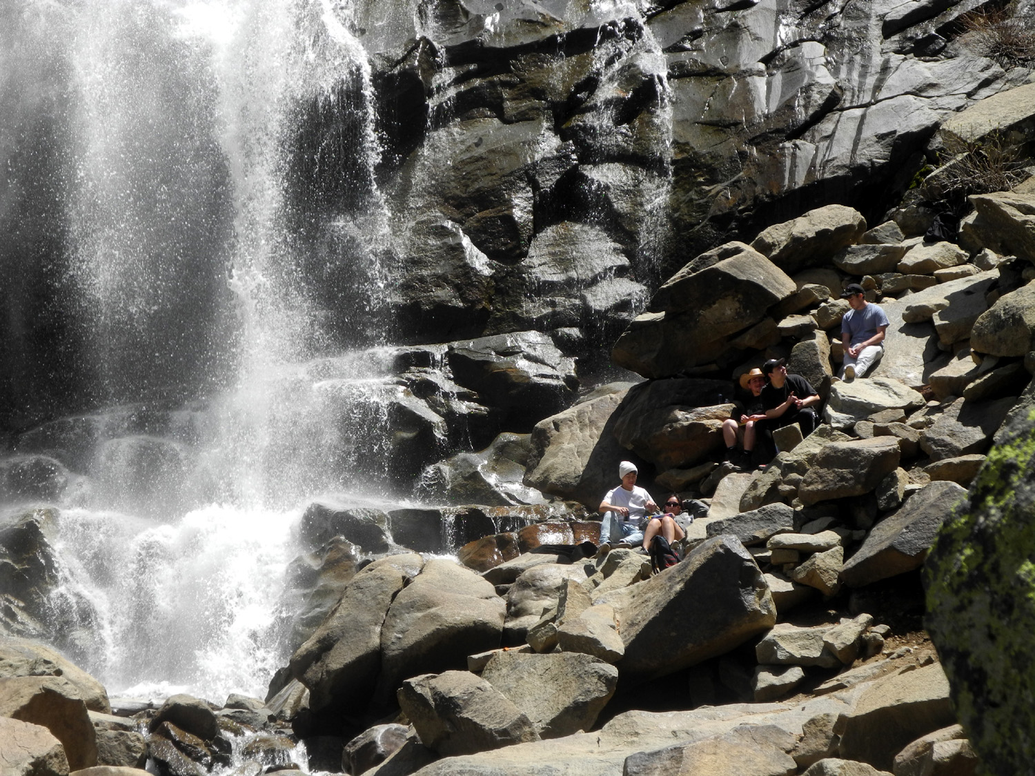
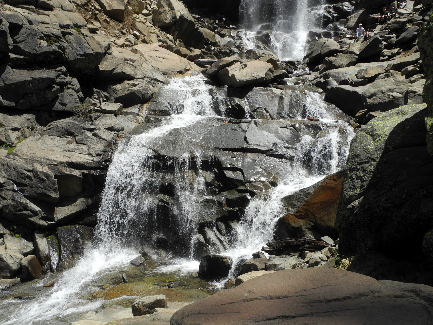
Of course, the best scenery is always the falls. Rancheria Falls runs over a cliff in a large almost vertical drop and down a number of cascades above and below. Although the water was perhaps the lowest I've seen it, the falls is so well "designed" that it is impressive at low water or high. The first view of the falls is framed through a couple of big red firs. Then there is a place where you can stand or sit comfortably and enjoy an unobstructed view of the falls. A few adventurous hikers had made their way down close to the bottom of the falls - a location that would be dangerous if the cascades were at full force. |
|
 |
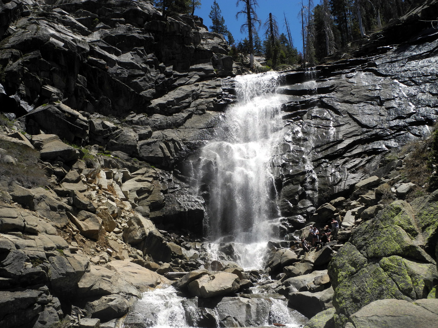 |
| First view of the falls | Rancheria Falls |
|
We enjoyed a light snack while gazing at what I think is one of the best waterfalls outside of Yosemite, then started back down the trail. When we first arrived there was no one else in the parking lot. A couple was hiking out, having decided not to chance the rough road with their rental car. However, we met or were passed by probably 20 other hikers once we got close to the falls, and while hiking back out. Driving back down the mountain, we stopped at the Pizza Factory in Prather, and enjoyed eating inside a restaurant - not the first, but probably the third time since the beginning of the big shut-down in March of 2020. Although we had both been to the falls before, we agreed it's worth an annual visit, even in years with low rainfall. Hopefully we will enjoy a wetter winter next year. --Dick Estel, June 2021 |
|
|
Courtright Reservoir and Shaver Lake
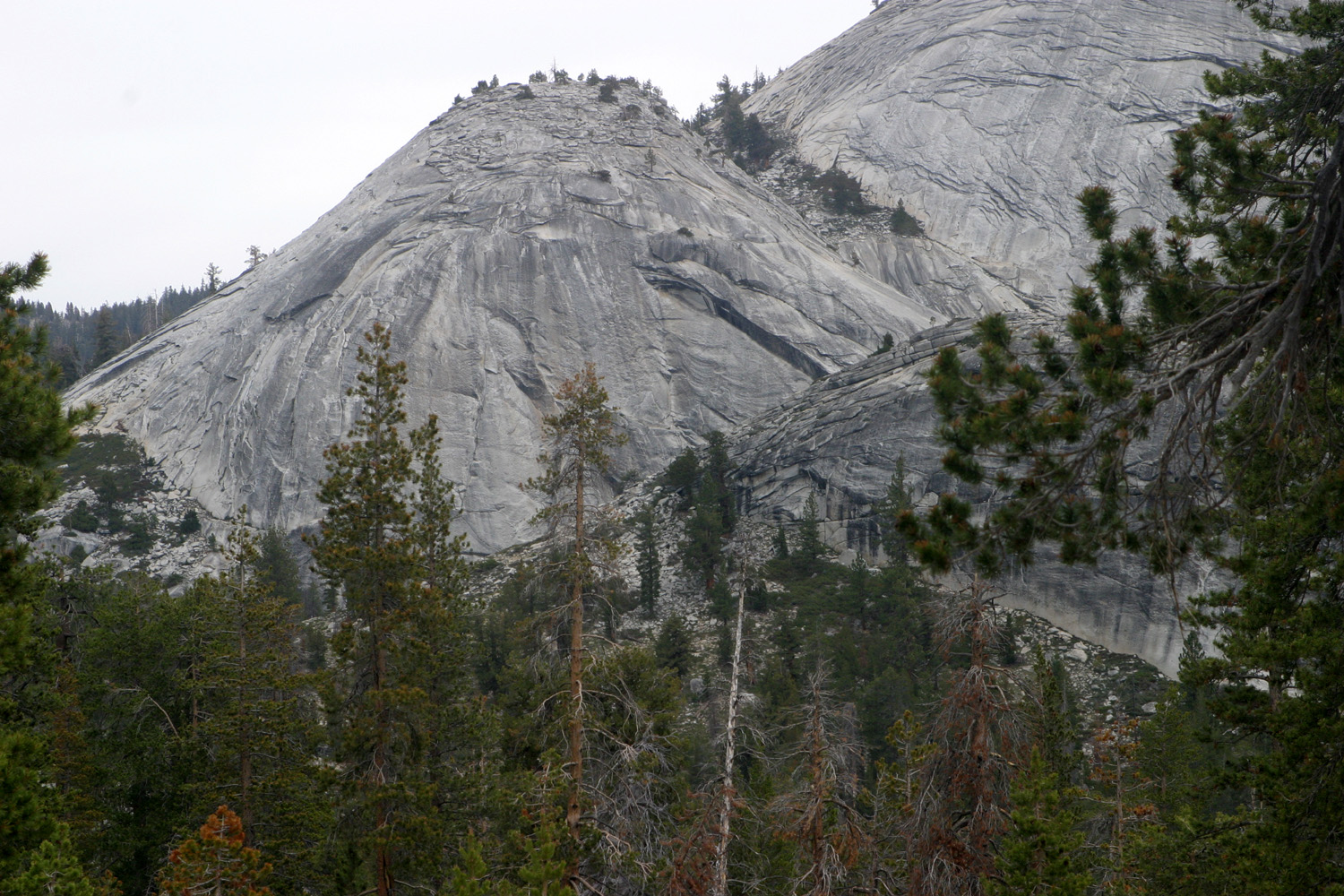
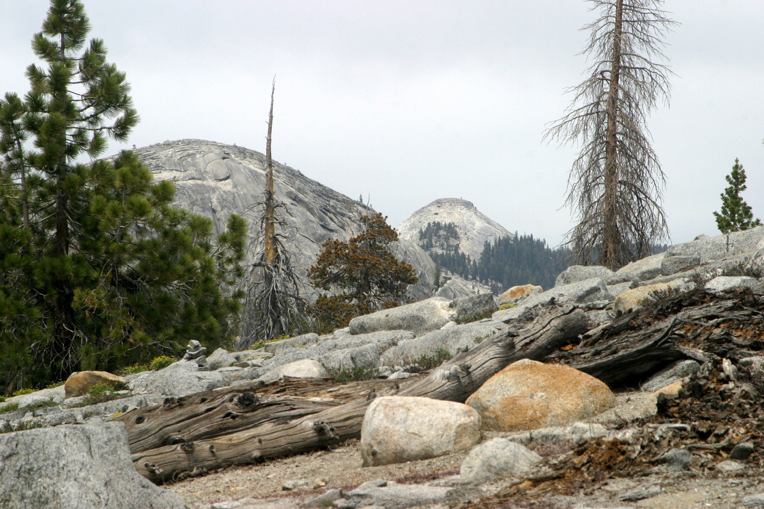
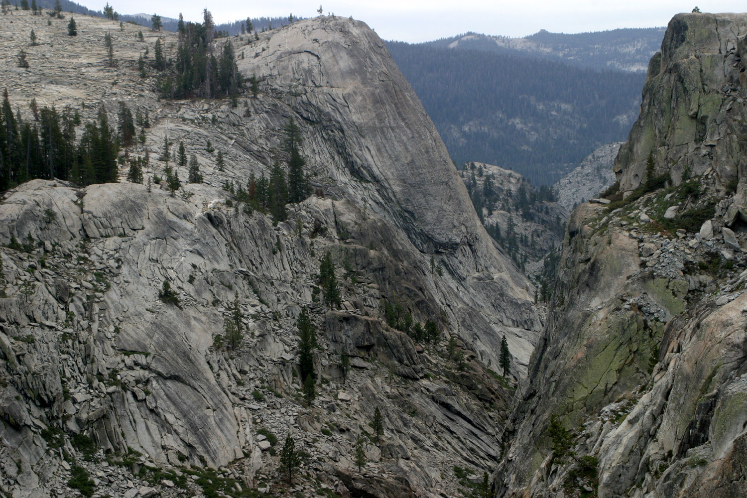
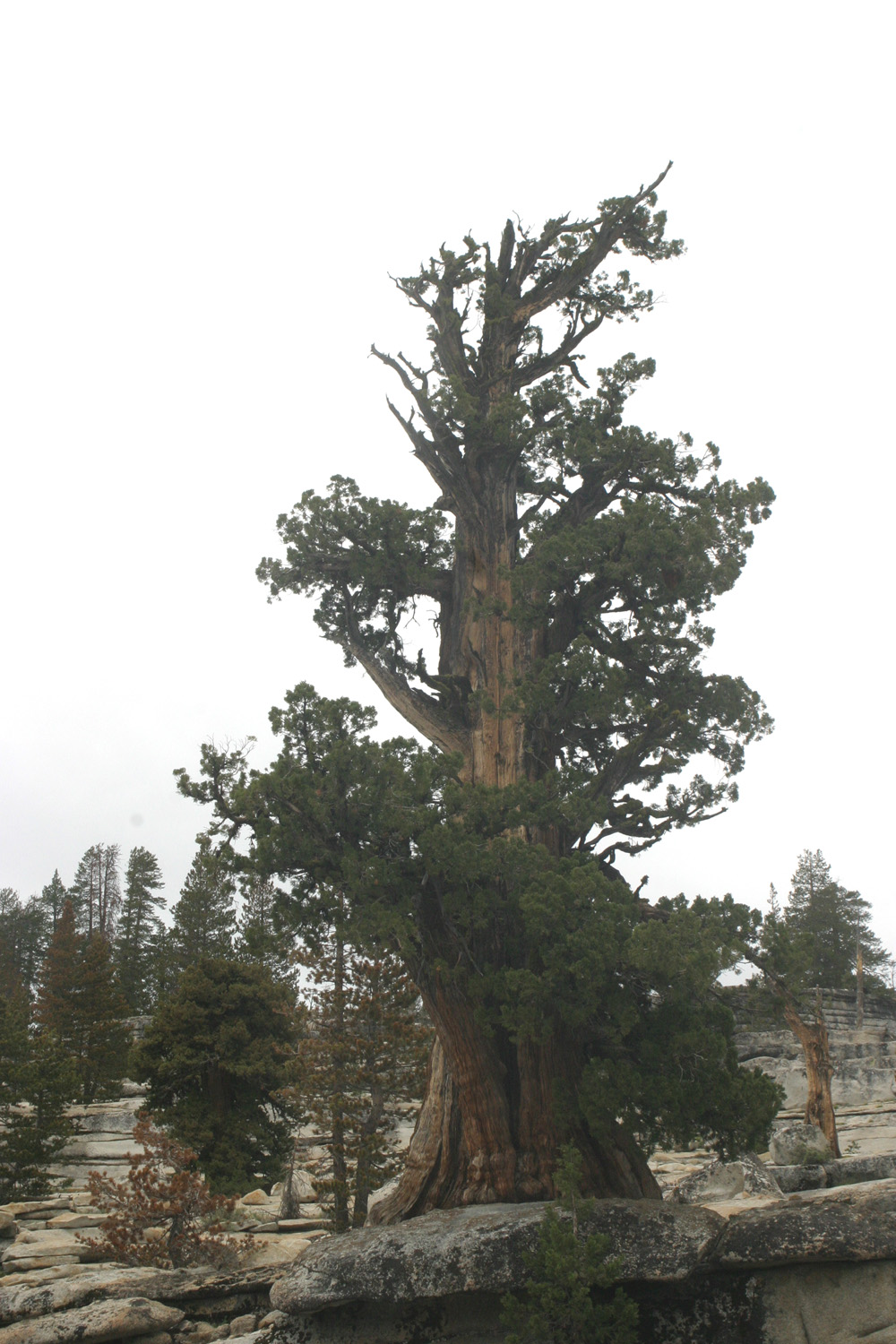
After my recent visits to the Sierra Nevada Mountains, I started thinking about going camping. The more I thought, the more my thoughts focused on the work involved, especially for solo camping. A solution quickly came to mind - I booked a hotel room at Shaver Lake, planning to hike somewhere beyond that area, then check in and spend the night, and maybe do a little more exploring the next day. I got an early start on June 7 and enjoyed the drive up from just above sea level in Clovis to Courtright Reservoir at 8,000 feet. This route goes up Auberry Road and Highway 168 to the village of Shaver Lake, where I turned east on Dinkey Creek Road. Just before the road reached the Dinkey Creek resort area, another turn on to the McKinley Grove Road led me toward my destination. I've hiked and camped here many times, but I did not have any specific plan in mind. When the road reaches the lake, it goes across the dam and about two miles to a large parking lot, which marks the trailhead for the Dusy-Ershim Trail. Just before the parking lot, I turned in at a big flat section of granite bedrock where we have camped several times. This area offers views of at least a half dozen of the domes that are a major part of the scenery here. The Dusy trail is a four-wheel drive route considered one of the most challenging in the United States, but as a hiking trail, the first mile that we usually walk is mostly level, and goes through a small glacier-carved valley with domes and cliffs on both sides. |
|
 |
 |
| Penstemon Dome | Cliffs above Helms Creek |
|
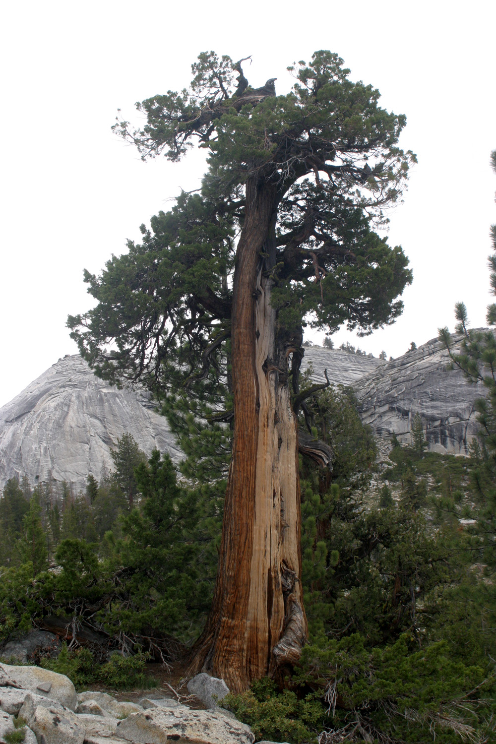
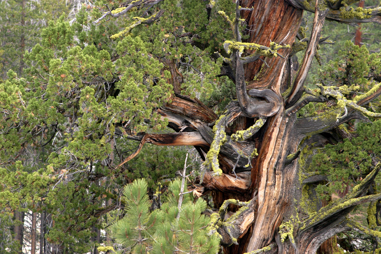
However, I did not hike on this trail. Instead I walked the short distance cross-country to what I have named the Bull Juniper, a rugged specimen with a gnarled dead top, reminiscent of the Bull Buck giant sequoia in Nelder Grove. Although it's a short walk, this territory consists of rocky, uneven ground. In my old age I walk with extra care in conditions like this. After I had enjoyed the tree and the surrounding scenery, I returned to the car and drove a short distance to one of the many unofficial campsites that have been created along the road. Here I got out my chair and enjoyed my snack. We had been blessed with a stretch of cool weather, welcome in the hot valley, but maybe a bit more than I needed at this elevation. I hiked wearing jeans and a long-sleeve t-shirt, but when I sat still, the wind was so cold and strong that I put my chair on the downwind side of the car, and wore a hooded down jacket that I had brought along "just in case." |
|
 |
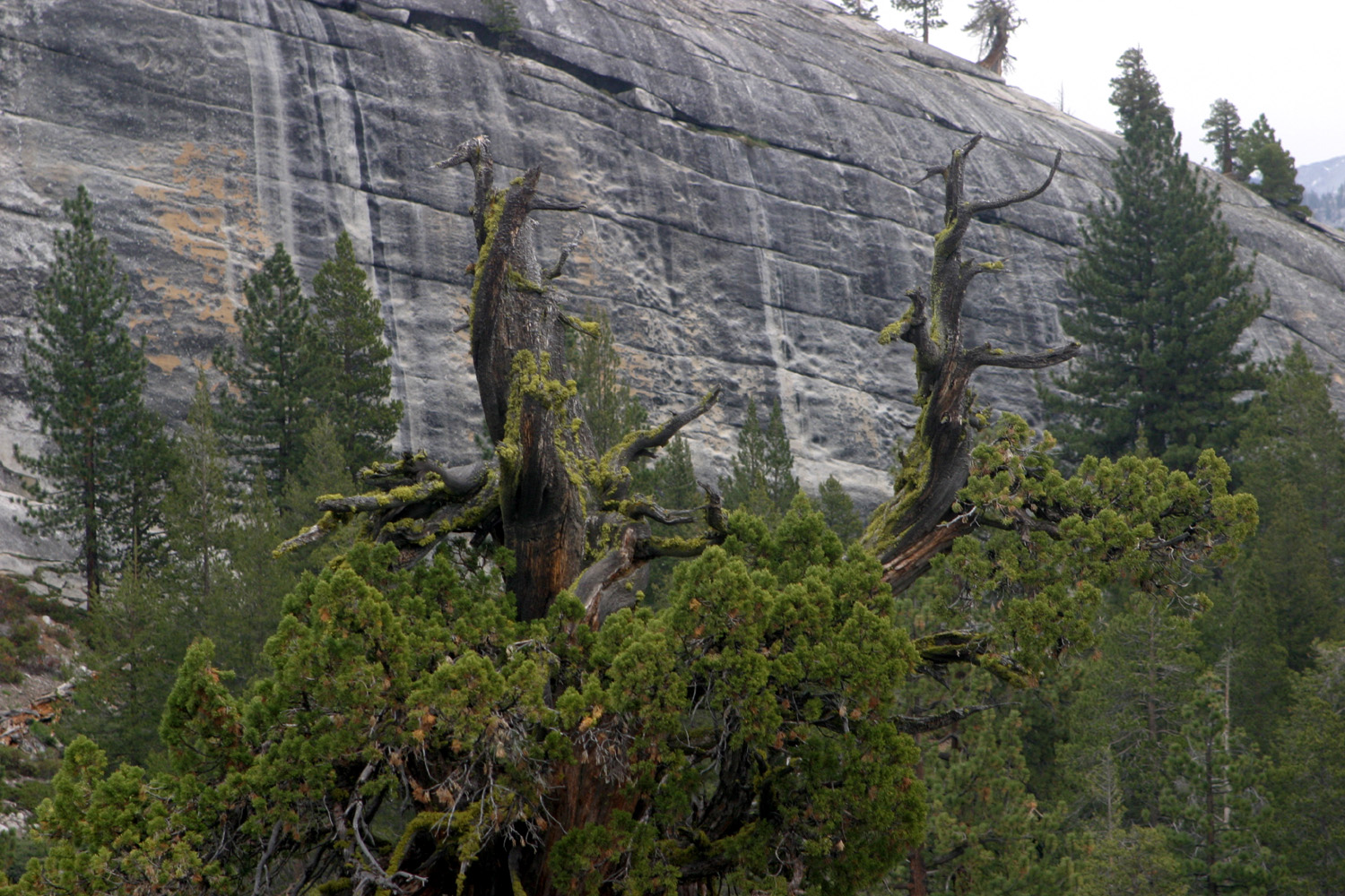 |
| The Bull Juniper | Its top has been through many harsh winter storms |
|
A little further back toward the dam there is a geological exhibit, with signs explaining the formation of the terrain and photos of some of the features found in the rocks there. You can walk south from there and go out to where the land drops off rather steeply into the canyon of Helms Creek, on which the dam was built. Looking back to the north you can see Maxon Dome, near the northern end of the lake, and what I call Constant Dome, because it is visible everywhere you walk along the first mile of the Dusy trail. I've been told that the correct name is Voyager Dome, but the person who gave me this information admitted that it could just be a name that had been given by people who climb in the area. In any case, it's an impressive big chunk of granite. |
|
 |
 |
| We call this Teri's Dome; it slopes down into Helms Creek canyon | Constant Dome, AKA Voyager; Maxon Dome in distance |
|
I drove back across the dam, stopping to take photos of the lake and canyon downstream, then enjoyed a leisurely drive back to Shaver Lake, with several stops along the way. Beyond the lake, my first stop was at the LeConte Divide Vista. Here you can see a ridge of high Sierra peaks, including Mt. Goddard at 13,500 feet. This ridge separates the San Joaquin and Kings River drainages. On
the McKinley Grove Road, a few miles from Dinkey Creek, is a small
sequoia grove, McKinley
Grove |
|
 |
 |
| Courtright Reservoir and its symmetrical dome | Helms Creek Canyon below the dam |
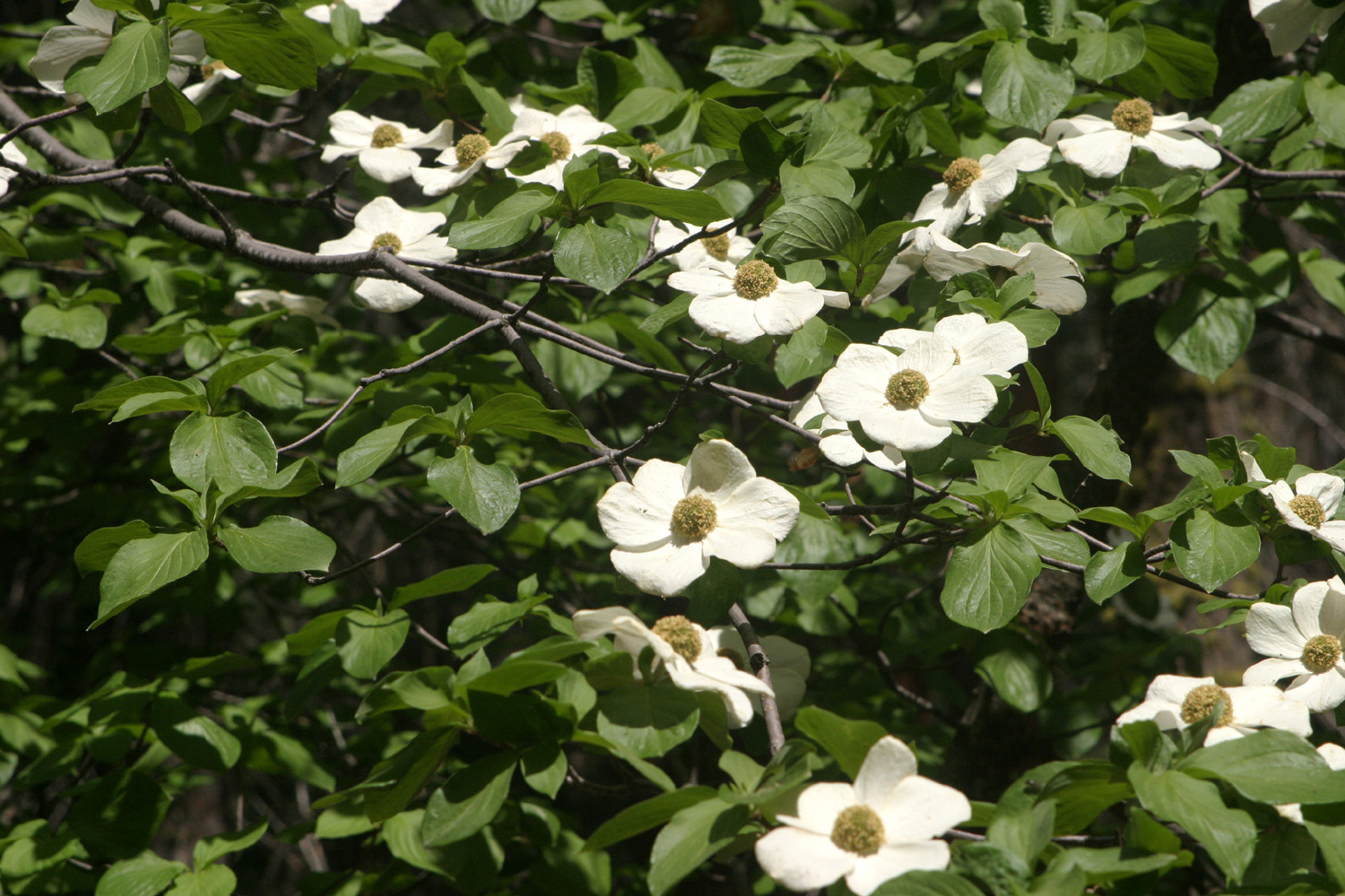 |
 |
| Dogwoods in McKinley Grove | Each petal on these flowers is decorated with a pink dot |
|
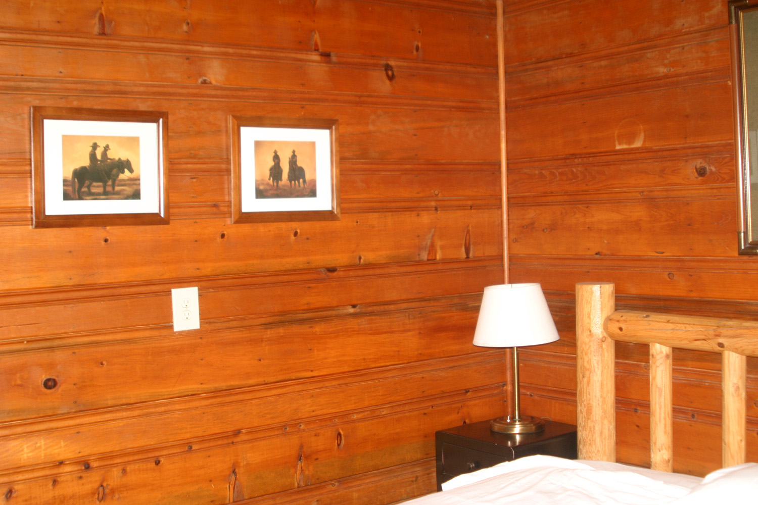
I arrived at my motel, at the eastern edge of "downtown" Shaver Lake, at about 4 p.m., ready to relax and have dinner. Like a spaghetti western and like many such facilities in small, rural towns, the Shaver Lake Village Hotel offered a combination of the good, the bad, and the ugly. Good: The room was physically attractive, with wood paneled walls and western art and artifacts. There was a microwave and refrigerator, and the room was plenty big, well-lighted, well stocked with towels and reasonably clean. On the bad side, there was no ice machine (you could go the market next door and buy ice). The free breakfast had been cancelled due to Covid, but I'm not sure what prevented them from updating the website where this amenity was advertised. The ugly: The room was uncomfortably warm. The heating unit seemed to be giving off a little unneeded warmth, and the windows faced the afternoon sun. Although a flannel shirt and jeans felt comfortable outside, in the room I changed to shorts and a short-sleeve t-shirt. Overall it was OK for a night, but I will probably look into other options if I stay at Shaver again. The place also has cabins, which have received a lot of negative reviews. It didn't matter to me, but the lake is not visible from this location. The Creek Fire of last summer burned tens of thousands of acres in this area, but due to good forest management on land controlled by Southern California Edison, the town was not touched. But standing in the parking lot, I could see a burned over ridge just above the town, a reminder of what a close call local residents had. |
|
 |
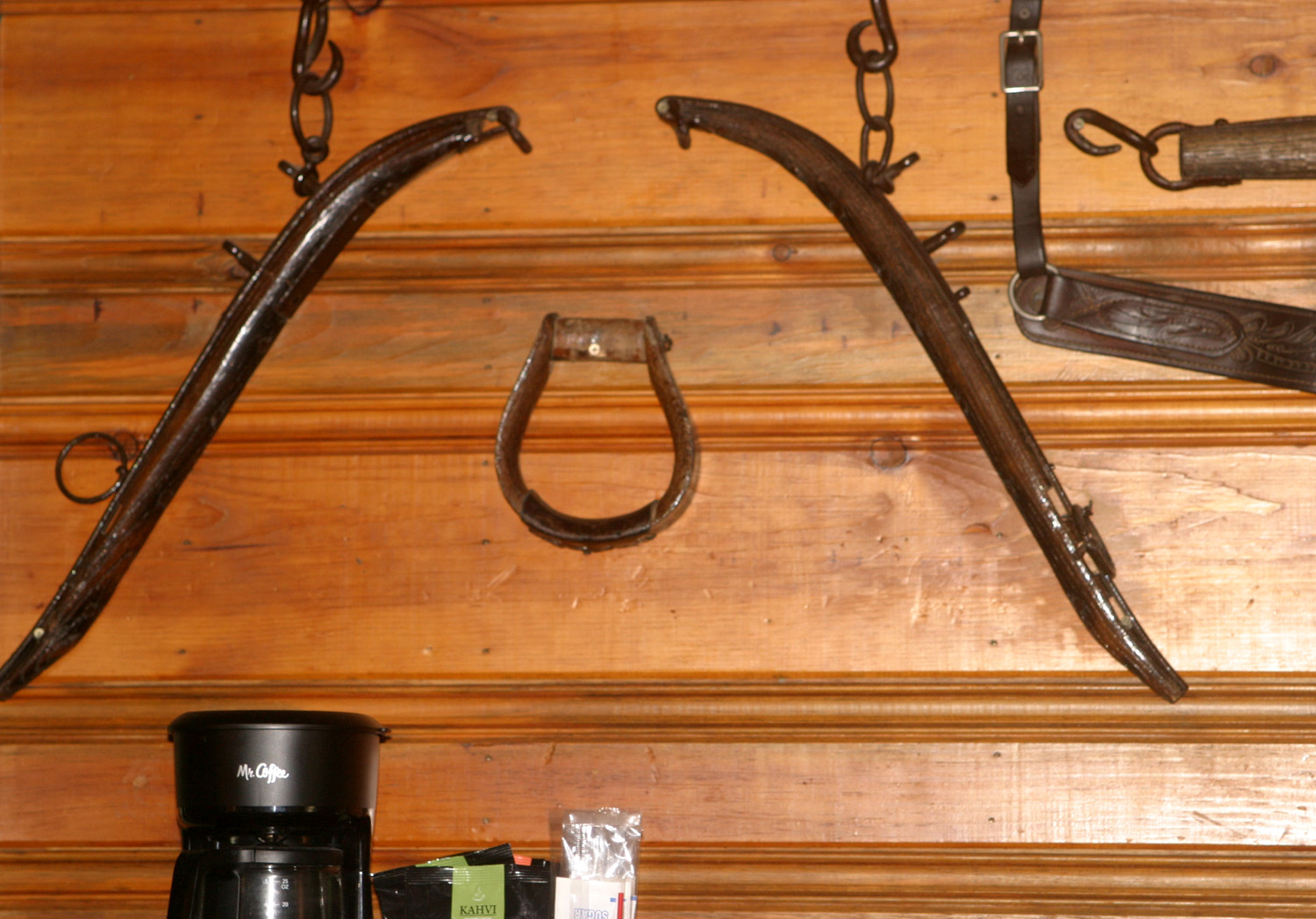 |
| The hotel had an attractive rustic design | Mostly stuff from the days of horse and wagon |
 |
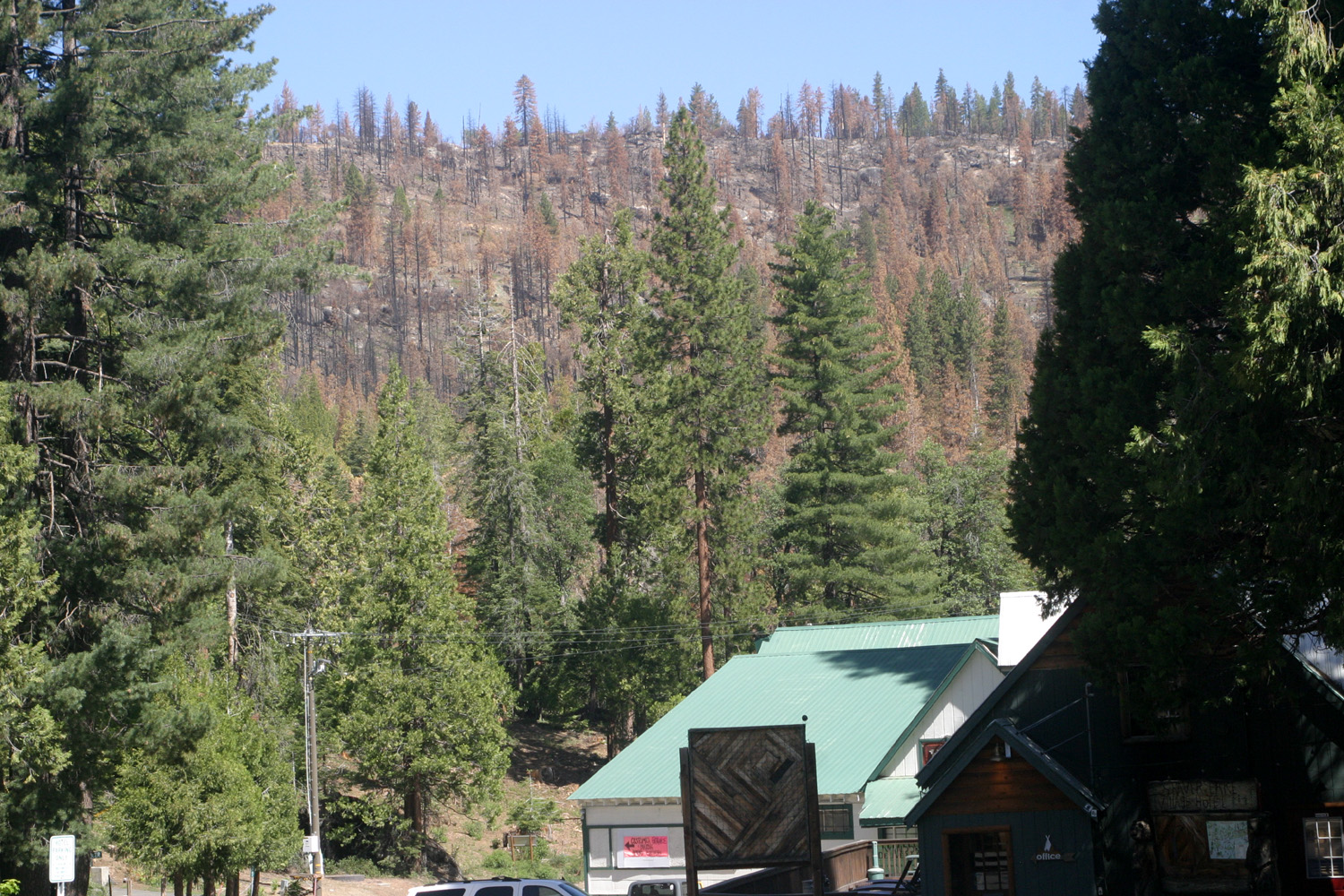 |
| It's easy to miss this sign when driving by | How close the Creek Fire came to the town |
|
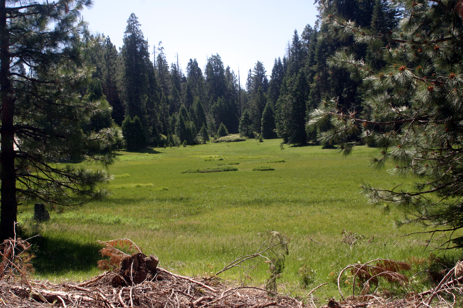
My reason for staying overnight was to do a hike or exploration the next day before starting home, and I decided to head back into the mountains on the Dinkey Creek Road, where I had seen a couple of bright green meadows. This has been a very dry year, and fire danger is high, but there was enough water to get the grass going in meadows, and I stopped at the first one, Poison Meadow, maybe three or four miles from Shaver. It lies on both sides of the road, and I did not get poisoned. Despite the brilliant green of the setting, I didn't encounter any water or squishy spots, as would be normal in a mountain meadow in June. I didn't walk very far into the meadow, so there could have been wet spots out in the middle. However, I think we can be fairly certain that the grass will be brown by the end of July. |
|
 |
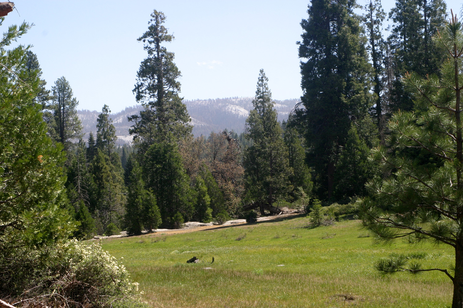 |
| Poison Meadow on the south side of the road | View across the north side |
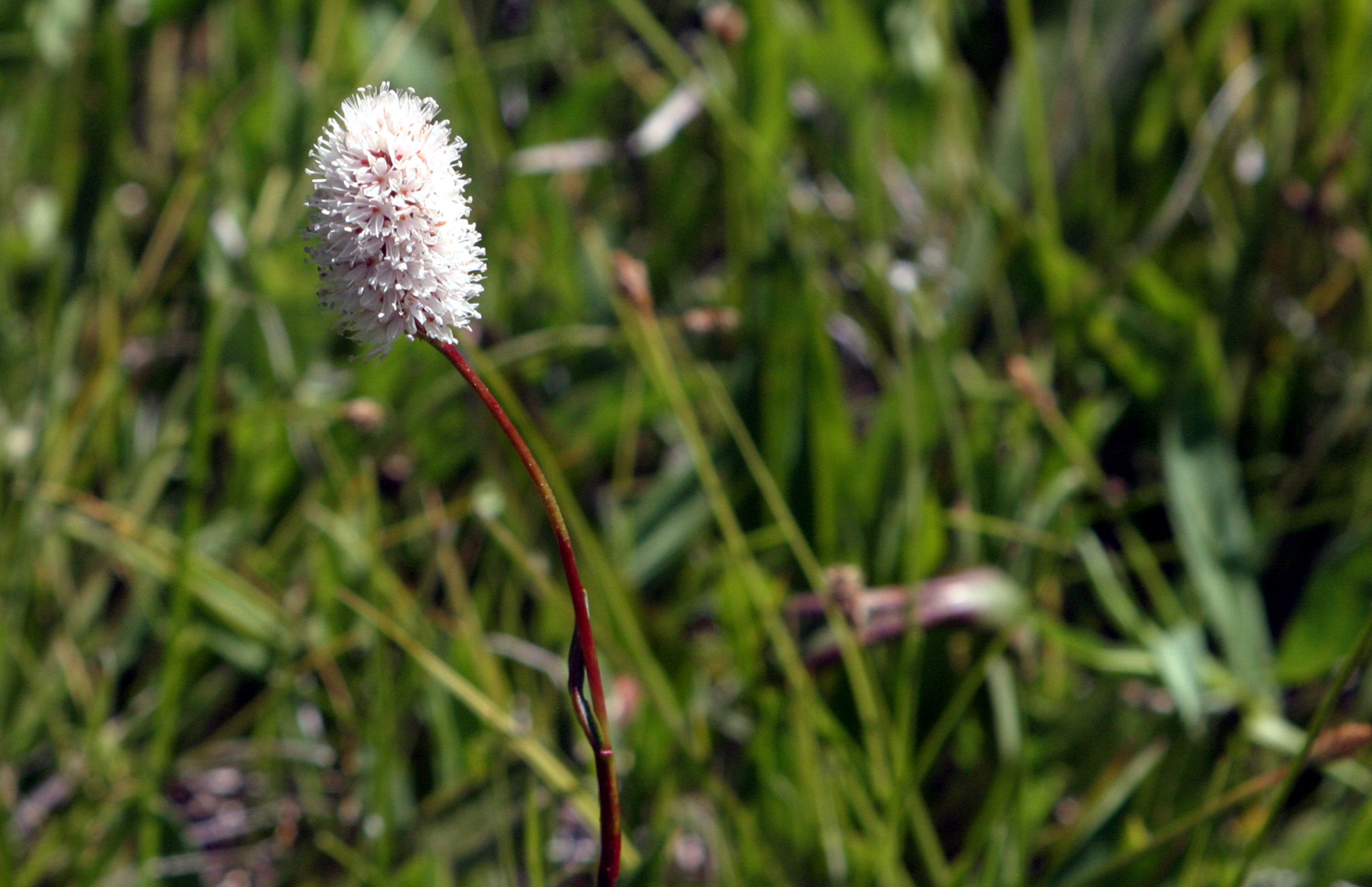 |
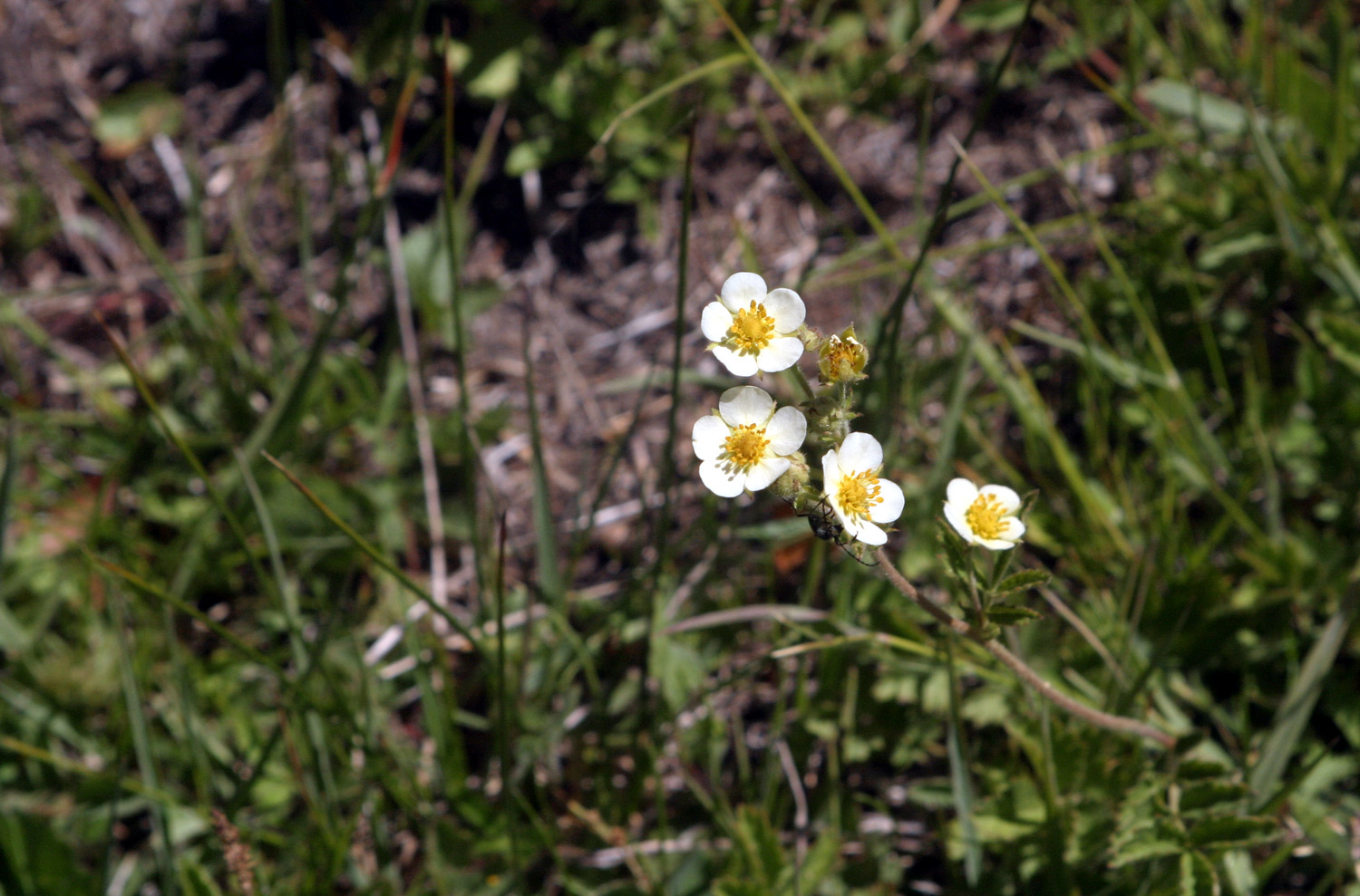 |
| These charming flowers were thick in parts of the meadow | Another meadow flower |
|
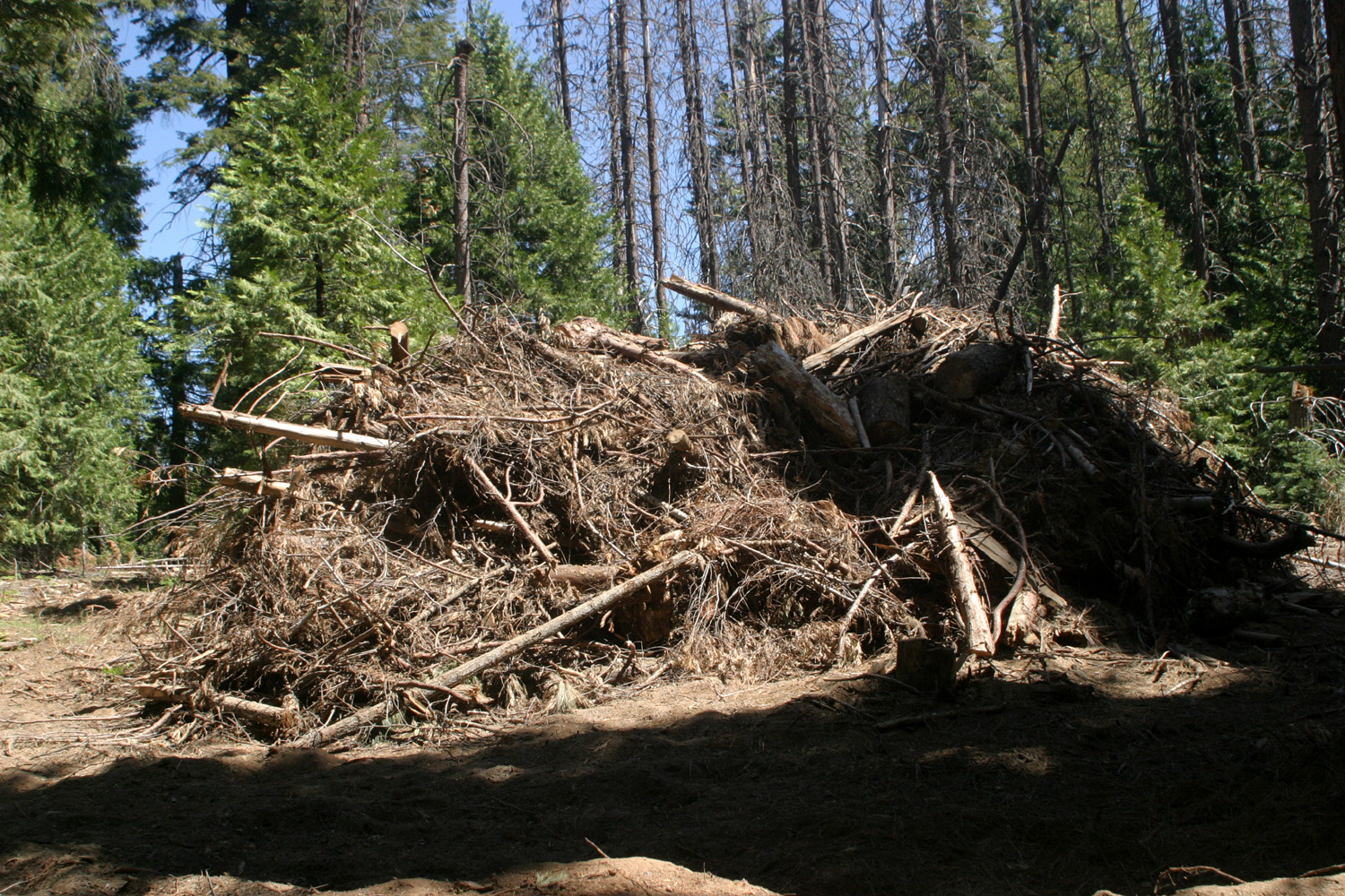
Along with mountain scenery, there were some less happy sights. Along the five miles or so just below Shaver Lake many trees were killed by the fire, and workmen were cutting down and removing dead trees near the road. Higher up, there were dozens, or perhaps hundreds of brush piles, stacked up to be burned when weather permits. Overall I had an enjoyable outing, and plan to get back into the mountains as much as I can during the rest of the summer. --Dick Estel, June 2021 |
|
|
Arnold ((& Other Places)
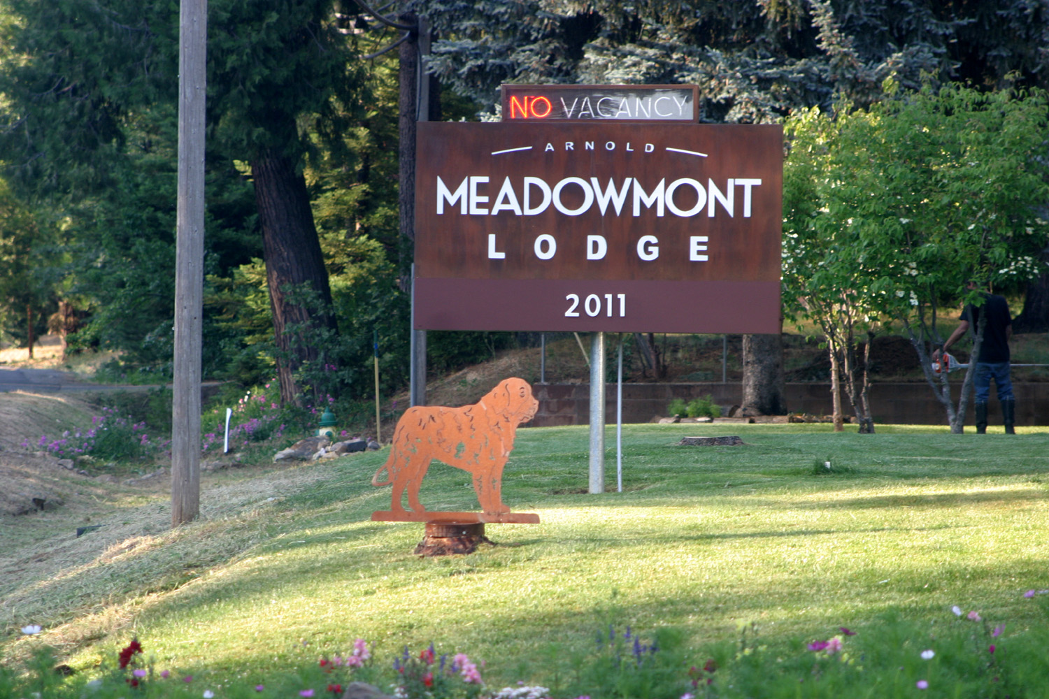
When my daughter Teri invited her mother and me to spend the last weekend of June with her at Arnold, my first thought was "What is Arnold?" I later learned that quite a few of my acquaintances were familiar with Arnold, a small town on State Highway 4 northeast of Angels Camp. But had they heard of White Pines, Dorrington, Camp Connell, Cottage Springs, Ganns, Cabbage Patch, Big Meadow, Tamarack, Bear Valley, and Lake Alpine? These are all small towns, or at least places on the map, farther up Highway 4 on the way to Ebbetts Pass, and I would visit all of them on that weekend. You will not find gas, food and lodging at most of these places, nor much else. Sometimes we were not aware we were going through a named location. But the places where we actually stopped were well worth the time and effort. Wednesday the 23rd was Teri's birthday, so she left work a couple of hours early and drove up from Merced. On the 24th I picked up Jackie about 9 a.m. and we drove northwest on State 99 to Merced. Teri had told me that my GPS would guide us on the most direct route, and our trip was smooth and trouble-free. We left Highway 99 on G Street which took us through and out of Merced for some distance. We would drive on State 59, county road J59, AKA LaGrange Road, State 108 and 49 and Rawhide Road. This latter was a shortcut from the southwest corner of Jamestown to 49, which probably saved about 15 miles from the route that Google suggests. On the way we passed through the historic village of La Grange on the Tuolumne River, my first visit there since around 1960. We arrived at Angel's Camp, home of the famous Jumping Frog of Calaveras County and turned on to Highway 4 for the final run into Arnold, population and elevation both around 4,000. Our 145 mile drive took a little over three hours. Teri had reserved a sort of suite at the Meadowmont Lodge, where she had stayed before. The main room had two double beds, and there was a small separate room with two single beds where I slept. Although the motel has been around for quite a while, the bathroom has been modernized, and we had a microwave and refrigerator. A free-standing air conditioner has also been added. |
|
|
|
|

|
|
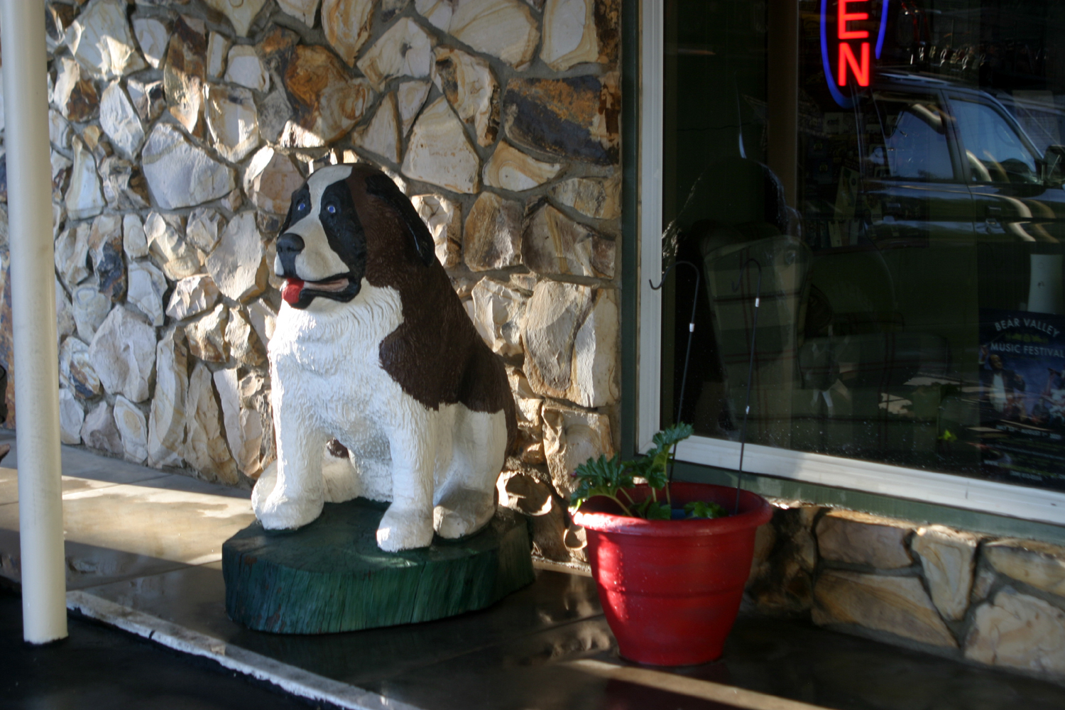
| Arnold to Lake Alpine | There is more than one St. Bernard standing guard at the motel |
|
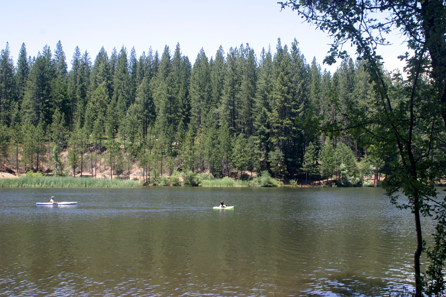
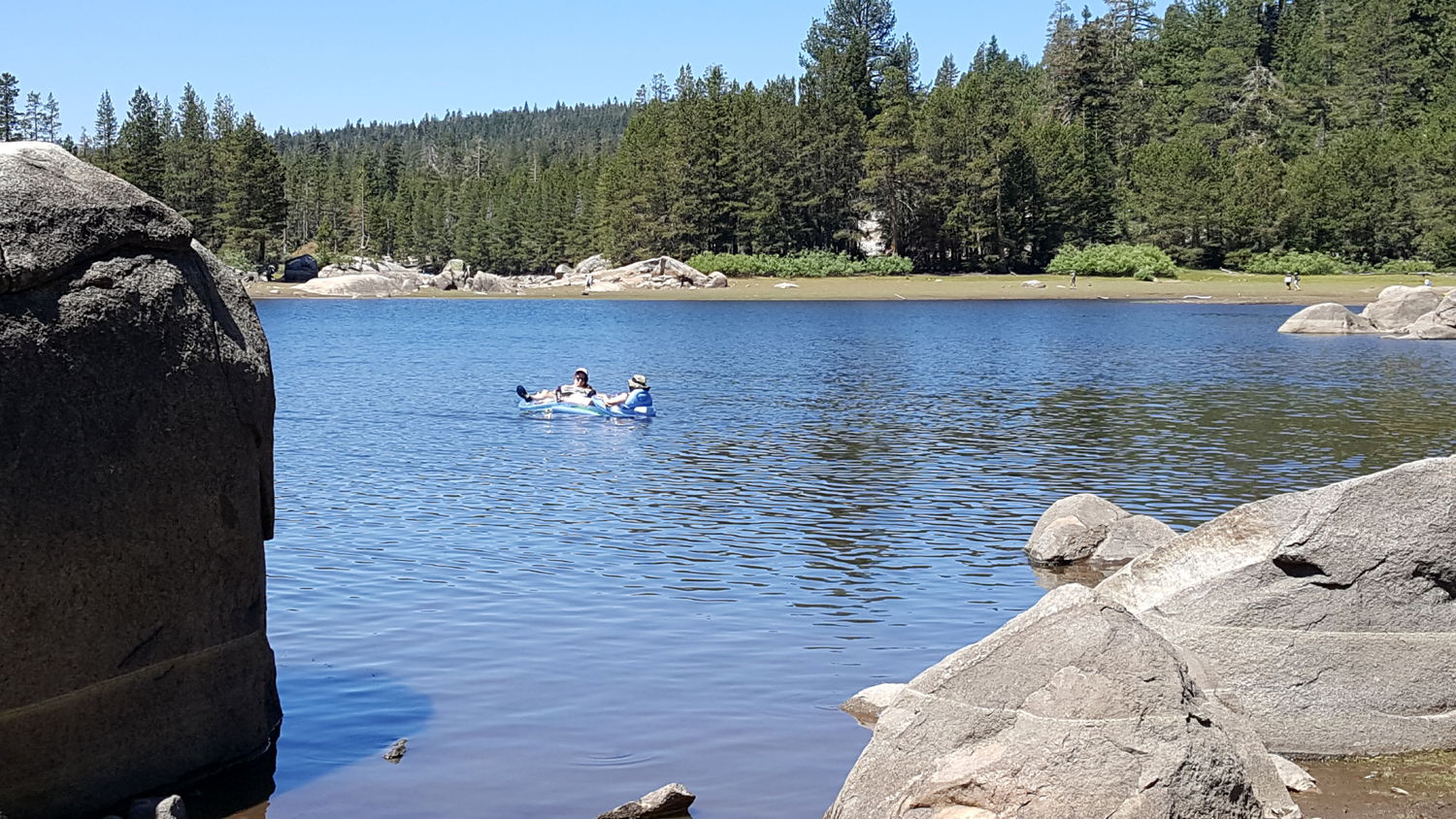
Teri had been in this area last year and also a month earlier with friends, so she knew where to go, what to do, and what to see. We soon set out for our first activity, a visit to White Pines Lake. It is in the village of White Pines, which is a short distance off Highway 4 adjacent to Arnold. Small but proud, the town limit sign reads "White Pines - NOT Arnold." Teri and Jackie had blow-up rafts, and were soon drifting across the lake. Swimming "in the wild" has lost its appeal for me, so I got my chair and my latest book and enjoyed the view of evergreens and mountains, getting up to stretch my legs now and then. Adjacent to the lake is a nice park, with picnic tables, a restroom, and plenty of parking. There were quite a few people there, but it did not seem crowded. Virtually everyone was going out on the water in kayaks, rafts or other floating devices, including one family who got five young boys on to a huge, multi-level blow-up raft. Once the ladies returned from their water play, we loaded up and returned to the motel, where we enjoyed a delicious dinner and a relaxing evening. |
|
|
|
| Vacationers on White Pines Lake | The lake is surrounded by evergreens and mountains |
|
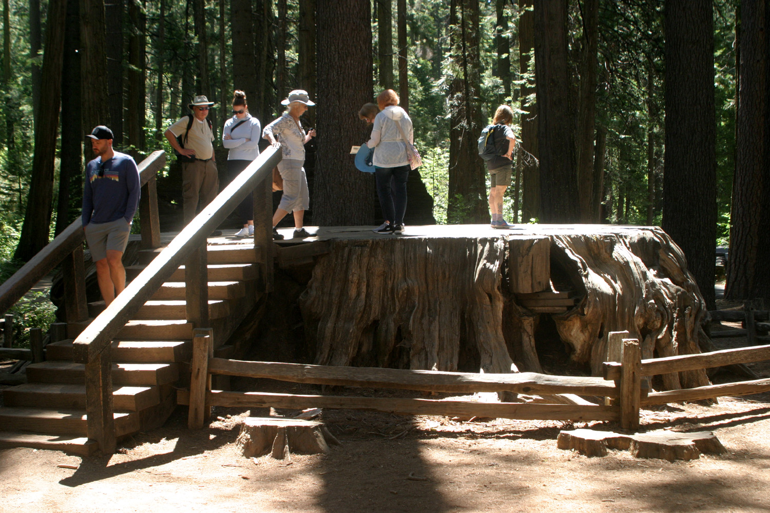
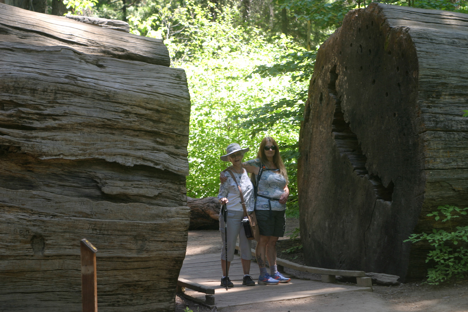
Behind the motel is a nice patio with a couple of barbecues, a large table and plenty of chairs. The view here is a forest of pine, fire and cedar. We sat out there each morning having tea (or in one case, a bloody Mary), before fixing breakfast and setting out on the day's adventures. On Friday we drove about four miles to Calaveras Big Trees State Park, which is said to be the first of these trees visited by people of European ancestry. "Discovered" in 1852, the area has been a state park since 1931. There are a number of hiking trails, and we took the main one, the North Grove Trail. At the start of the trail is the stump of a tree cut down by boring with augers, a 22 day project. The bark was assembled into its original tree form for a traveling exhibit, but was destroyed by fire a year later. This travesty angered not only John Muir, but also Augustus Dowd, who first brought the grove to the attention of the public. |
|
|
|
| Jackie (at top of stairs) and Teri (far right) |
With no saw long enough to take down the tree, it
was bored through with augers, the marks of which can be seen on the base of the log |
|
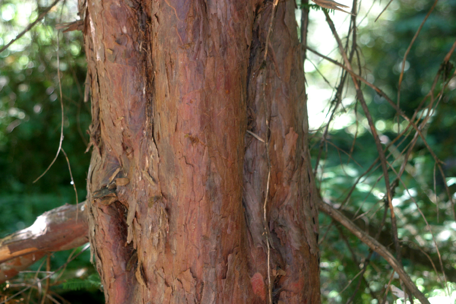
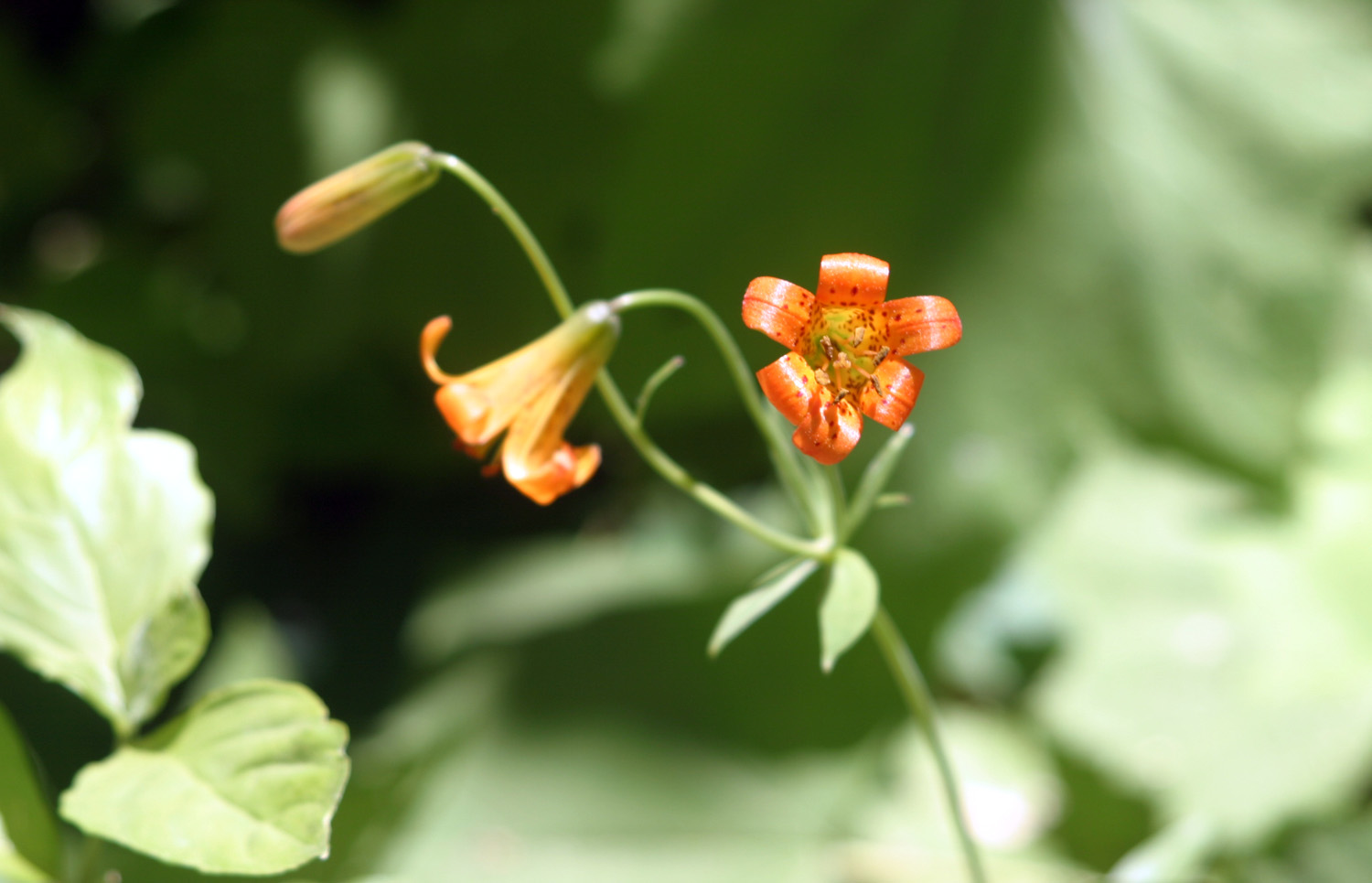
We enjoyed a leisurely two and three quarter mile walk through the grove, which also contains numerous other varieties of conifers, including one that mystified us until we looked it up in the trail guide. The Calaveras Grove is the only place where sequoias and the pacific yew are found in the same location. It's the southern-most boundary of the yew's habitat, and not far from the northern limit of the sequoia. (Farther north, the Placer County Grove contains only six giant trees.) In addition to trees and shrubs, the trail took us past a number of wildflowers, always a bonus during summer hikes at the higher elevations. There were dozens and dozens of dogwood trees, some with a few faded flowers, but for the most part, they were past their blooming season. |
|
|
|
|
Although the
needles resemble a fir, the bark of the yew is unlike any other tree in the area |
These flowers were fairly common along the trail |
|
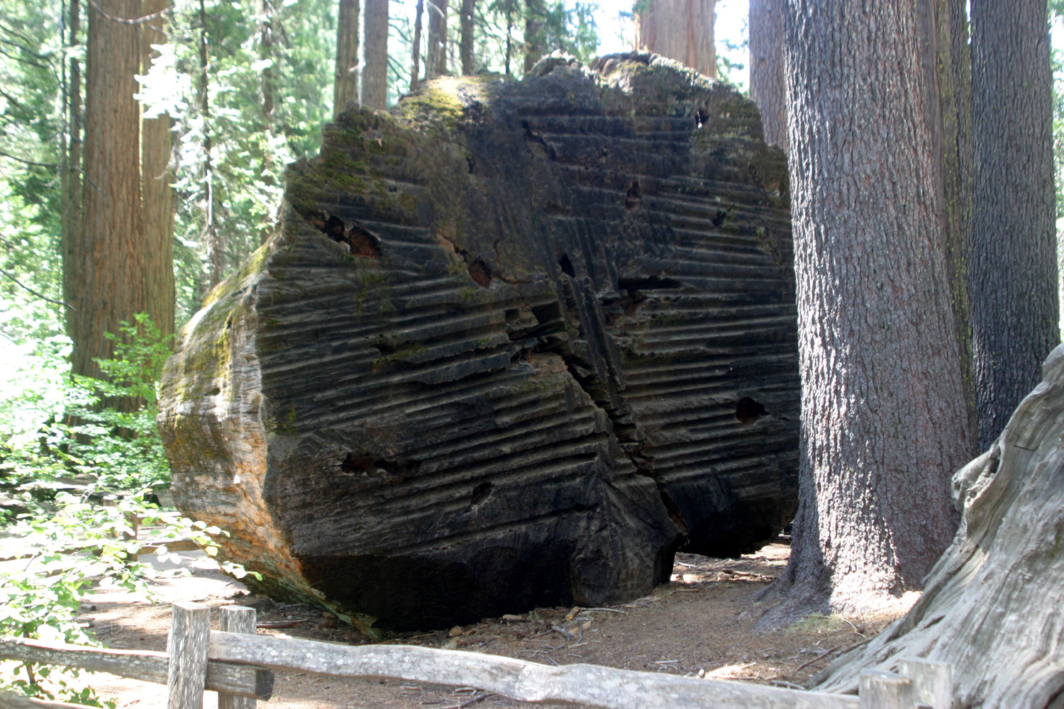
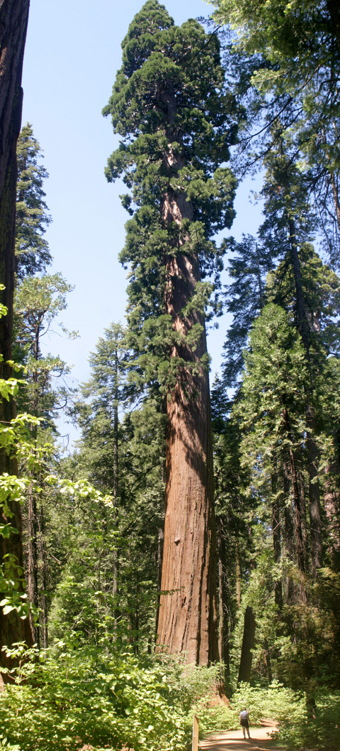
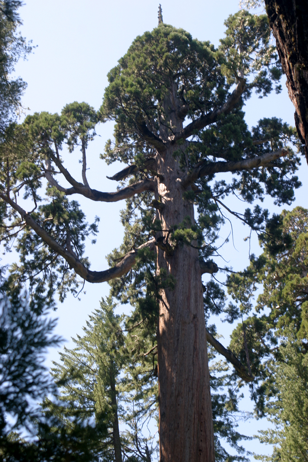
I'm not sure how many big sequoias we saw, but they are present in good numbers, and the place shows only limited signs of logging. The grove's largest tree is the Empire State, 30 feet in diameter at its base, and 20 feet five feet above ground. I can't promise that the photo below is this tree, but I guarantee that it's a big redwood. Since we were on the North Grove Trail, there must be a South Grove. In fact, it has a thousand sequoias, and suffered very little impact from early visitors, so retains a more natural condition. The main trail is 3.5 miles, but you have to hike about three of those miles before you see your first tree. Even Teri, who is undaunted by long hikes, had not been there (yet). |
|
|
|
| A rare bottom-to-top view of a giant sequoia | The trail goes through sections of a fallen tree |
|
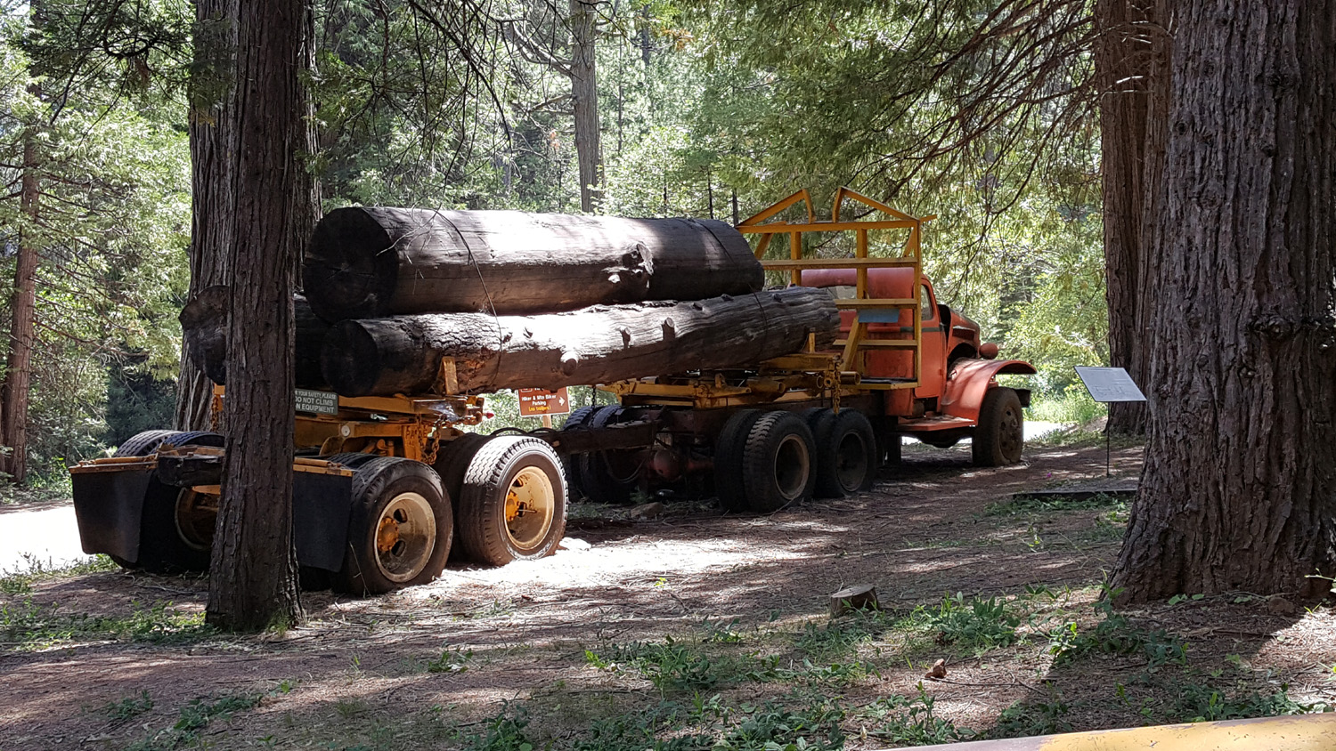
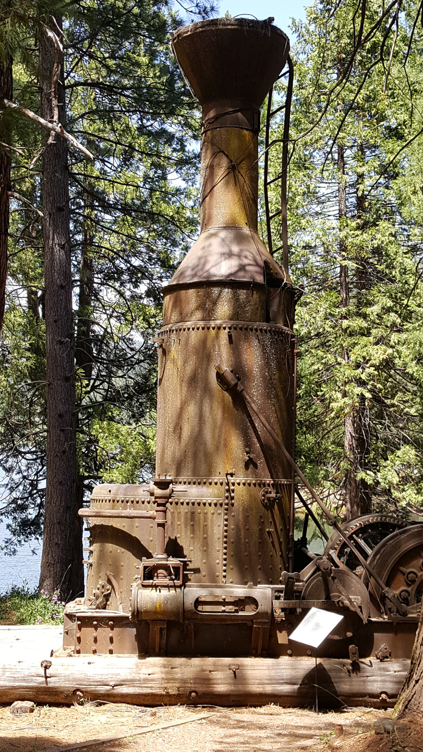
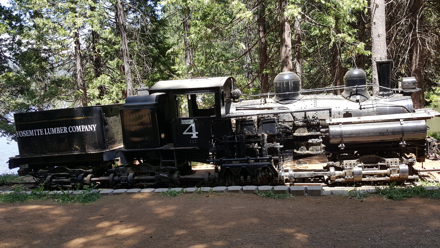
On our way back to the motel we returned to White Pines and went to the Sierra Nevada Logging Museum. This is a small but excellent facility, with lots of artifacts from logging days, including large equipment outside. There is a table-top working model of a sawmill inside, and several screens showing video of 20th century logging operations. This includes scenes of the incline railway at El Portal, that brought logs from the high country near Yosemite down to the Merced River Canyon, where the Yosemite Valley Railroad hauled them to a large mill at Merced Falls, just at the edge of the San Joaquin Valley. The museum was of special interest because my father worked in a lumber mill from 1935 to 1947 and I can remember living at the mill. |
|
|
|
| The outside exhibits include this log truck | The multi-purpose steam operated Dolbeer donkey engine |
|
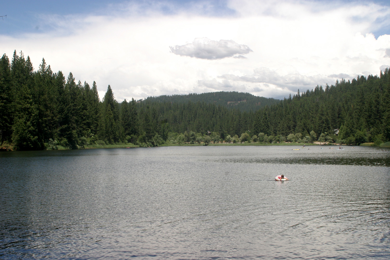
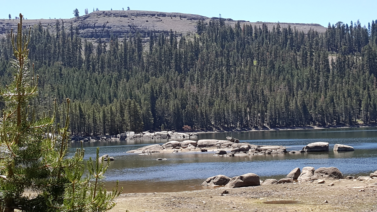
Each of us was responsible for one night's dinner, and in recognition of my cooking skills, I was encouraged to choose a local restaurant. On our way back from the museum, we drove around Arnold and considered several places, but most were closed or did not open till later. We settled on El Vaquero, a very good Mexican restaurant. Amusingly, the internet offers a list of the eleven best Mexican restaurants in Arnold, only one of which is actually in that town. One is 70 miles away in Stockton. We were happy with our choice, and considered returning later for a very tempting dessert listed on the menu, but in the end, once back "home" we decided we had been out and about enough for one day. (We had gone to the grocery store the previous night for Hagen-Daz ice cream.) On Saturday we made a longer trip away from Arnold, about 25 miles up Highway 4 to Lake Alpine. This man-made lake, created to produce hydroelectric power, is located at the 7,300 foot level in Alpine County. We drove to a parking lot at the upper end of the lake, got one of the last few spaces left, and brought our chairs, rafts, and food down by the lake, a walk of about 100 yards. Teri and Jackie immediately set sail across the lake, while I followed a paved trail that ran between the shore and the road into the area. I had an official destination, the boat rental concession about eight tenths of a mile away. Teri had asked me to find out the cost of renting kayaks and other craft, so I photographed the sign and sent it to her. Along the way I had good views of the lake and a lava formation above the far shore. There were various wildflowers, a few birds and dogs, and dozens of people. Families were parking any place they could get off the pavement, and by the time I walked back, it did not look as if there were any spaces left, including in the two parking lots I passed. |
|
|
|
| Teri and Jackie on Lake Alpine | The lake and lava formation above |
|
|
| A nice bit of natural landscaping | High elevation lupines are always a treat |
|
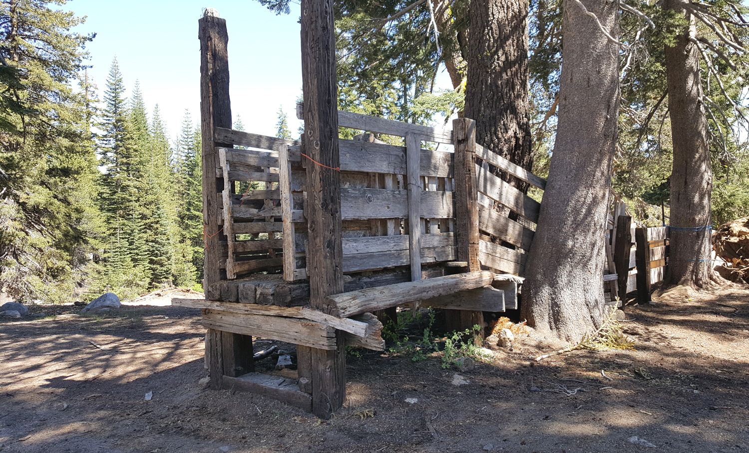
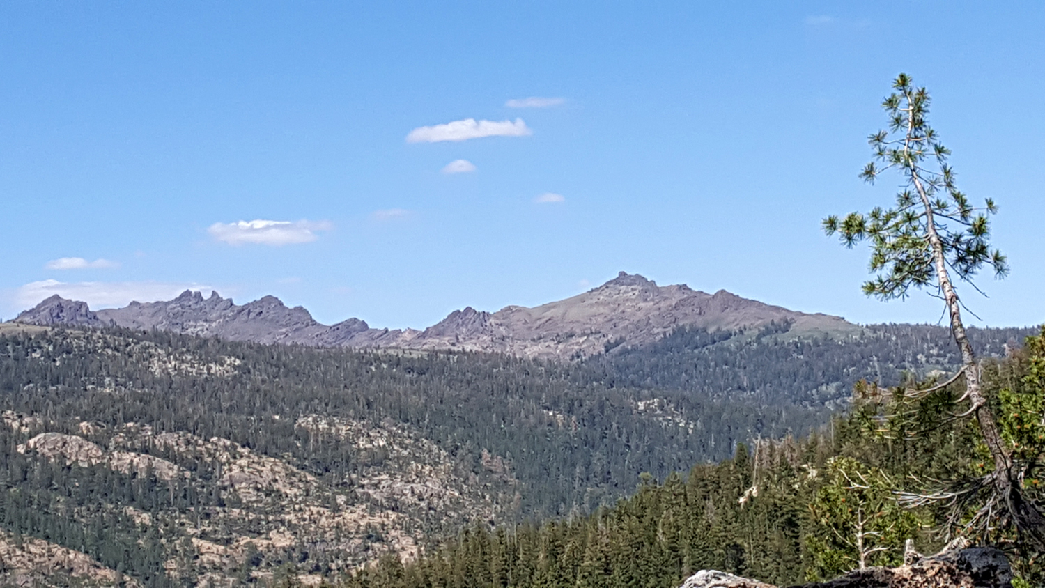
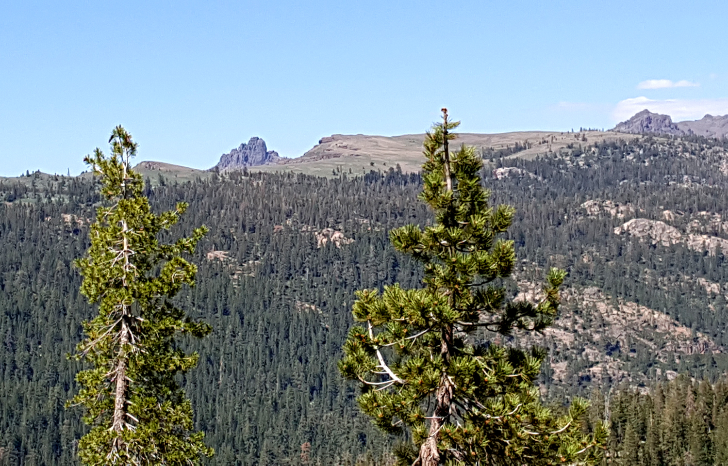
Once the ladies came in from the water we had lunch and relaxed in the shade, watching other vacationers come and go, some carrying fairly large watercraft from the parking lot to the lake. When we left, we decided to drive up Highway 4 a little farther. Shortly before we arrived at the lake, the center line ended, and from that point on the highway is very narrow and winding. We did not go all the way to Ebbetts Pass, but went over an 8,000 foot pass called Pacific Grade Summit. Along the way we saw one of my favorite photographic subjects, a wooden cattle chute, as well as some rugged high mountains. |
|
|
|
| Cattle chute near Pacific Grade Summit | High Sierra south of the highway, above the Stanislaus River drainage |
|
We finished out our weekend having supper, reading, and talking, with tea on the patio the final morning. We all left about the same time, with Teri going only as far as Merced, and Jackie and I completing a total drive of 360 miles as we retraced our route back to Fresno. It was a delightful weekend, and Jackie and I visited some places we had never been before. We all agreed we would like to return. --Dick Estel, July 2021 |
|
|
Photos (Click to enlarge; pictures open in new window) |
||
|
Wawona Weekend Rancheria Falls Courtright & Shaver Arnold & Other Places |
||
|
Weekend at Wawona |
||
 |
 |
 |
| Newly sprouted plant along the falls trail | Sunlight shines through black oak leaves | Jack in a contemplative mood |
 |
|
 |
| Mikie | The South Fork of the Merced River | Johnny, Jennifer, Colton and Teri at the school |
 |
 |
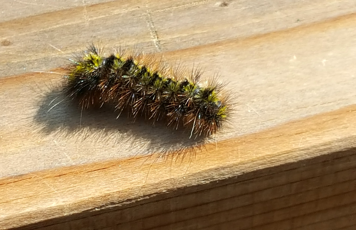 |
| Brittany, Colton and Jack | The Saturday Hikers | We enjoyed watching this fuzzy visitor |
| Rancheria
Falls (Photos by Jackie and Dick) |
||
 |
 |
 |
| Despite the frequent
patches of snow, the weather was warm |
Jackie at the viewing area | Dick and the falls |
|
 |
 |
| The falls and cascades below | Visitors brave the mist at the base of the falls | Cascade below the falls |
| Courtright and Shaver Lake | ||
 |
|
 |
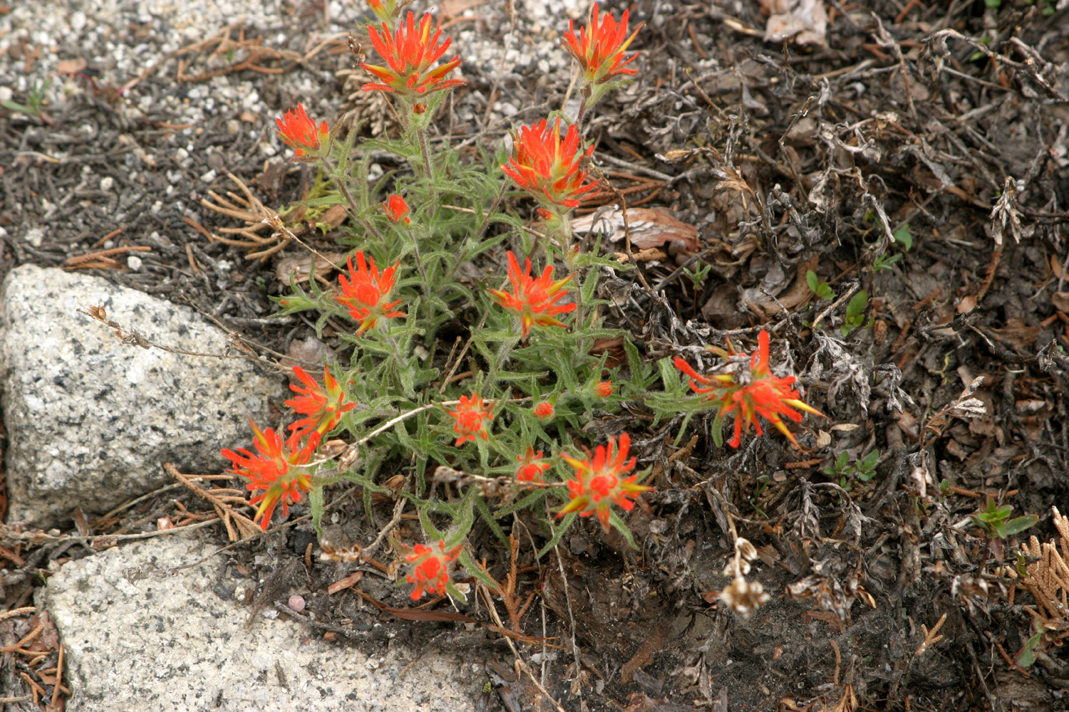
| These flowers lined miles of the road | Wavy-leaf Indian paint brush | Wild iris |
 |
 |
 |
| An extra-gnarly section of the Bull Juniper | This juniper appears to be perched on a shelf | There were hundreds
of piles like this, waiting to be burned in cooler weather |
| Arnold & Other Places | ||
|
 |
 |
| On duty 24/7 | Athurial's Spear, in a pot on the patio | Yew needles resemble fir, but the bark is very different |
 |
 |
 |
| This tree's upper limbs are relatively skinny | Sugar pine and other trees of the forest | This tree was
stripped of its bark, rendering it vulnerable to fire |
 |
 |
 |
| What to do with your old chain saws | This engine did its work close to where we live | Sierra peaks as seen
from Pacific Grade Summit |
| Related Links | ||
| South Fork of the Merced River | Yosemite National Park | Chilnualna Falls |
| Chilnualna Falls Trail | Chilnualna Falls Trailhead | Wawona |
| Airbnb | Mono Winds | Chilnualna Falls Video |
| Rancheria Falls Trail | Rancheria Falls | Rancheria Falls Video |
| Courtright Reservoir | Dusy-Ershim Trail | Mt. Goddard |
| McKinley
Grove |
Shaver Lake | LeConte Divide |
| Ebbetts Pass Scenic Byway | Calaveras Big Trees State Park | Placer County Grove |
| More About the Park | Still More Stuff | Sierra Nevada Logging Museum |
| Incline and Cable Railways | Lake Alpine | Dolbeer Donkey Engine |
| North Grove Trail Guide | North Grove Trail | Calaveras South Grove |