

|
Dick's Adventures of 2021 - Part 4 |
|
| Photos Related Links More Travel Reports | |
| Adventures
of 2016 Adventures
of 2017 Adventures
of 2018 Adventures
of 2019 Adventures of 2020 2021 Part 1 2021 Part 2 2021 Part 3 2021 Part 5 |
|
| Lewis Creek Trail Big Meadow Road Cedar Grove Redwood Canyon Etc. | |
| Lewis
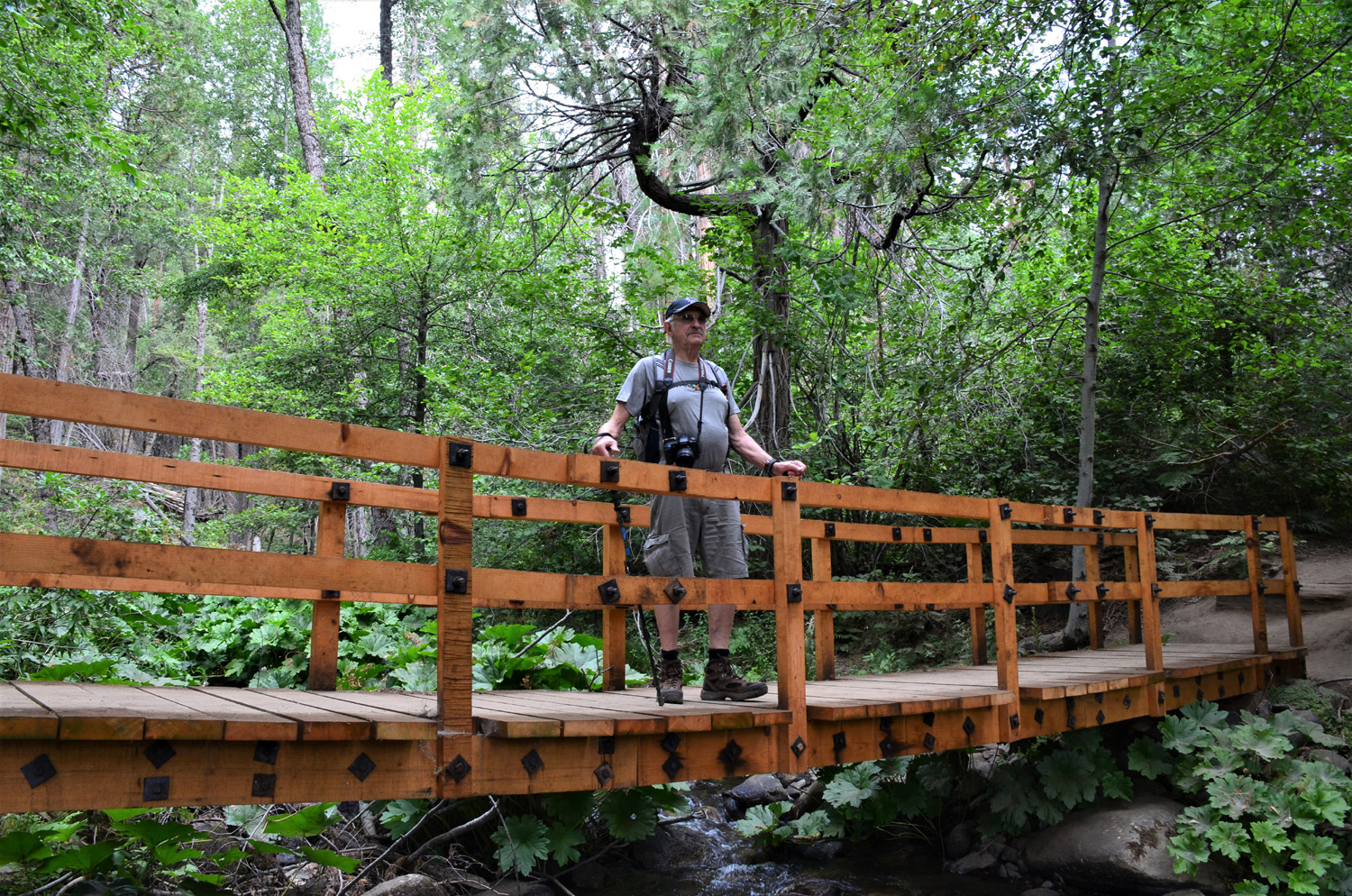
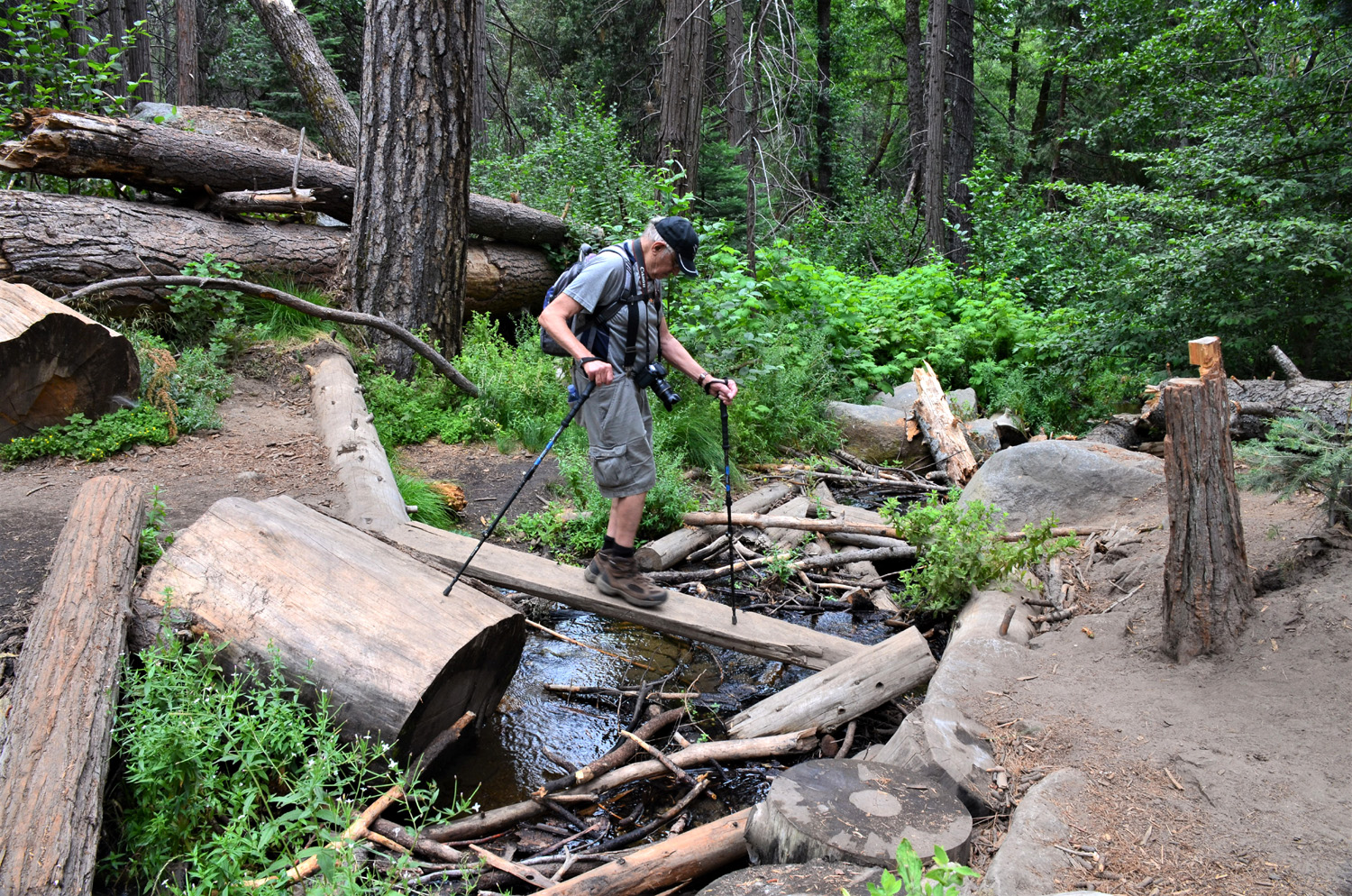
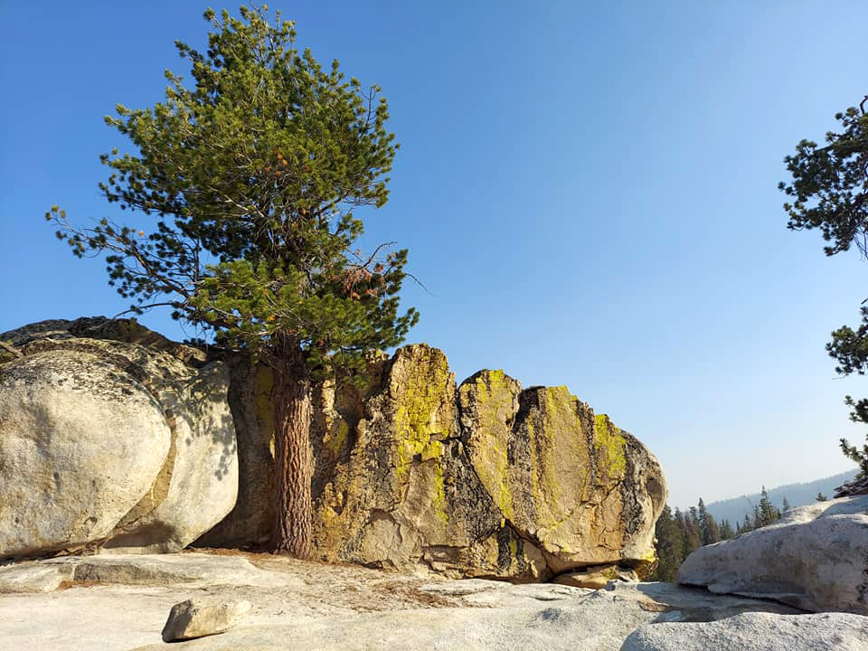
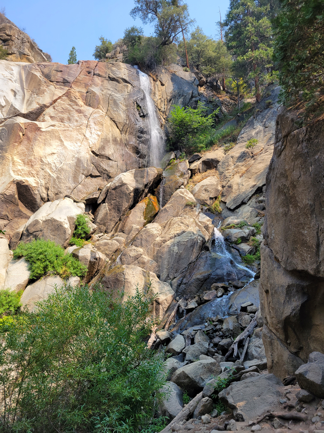
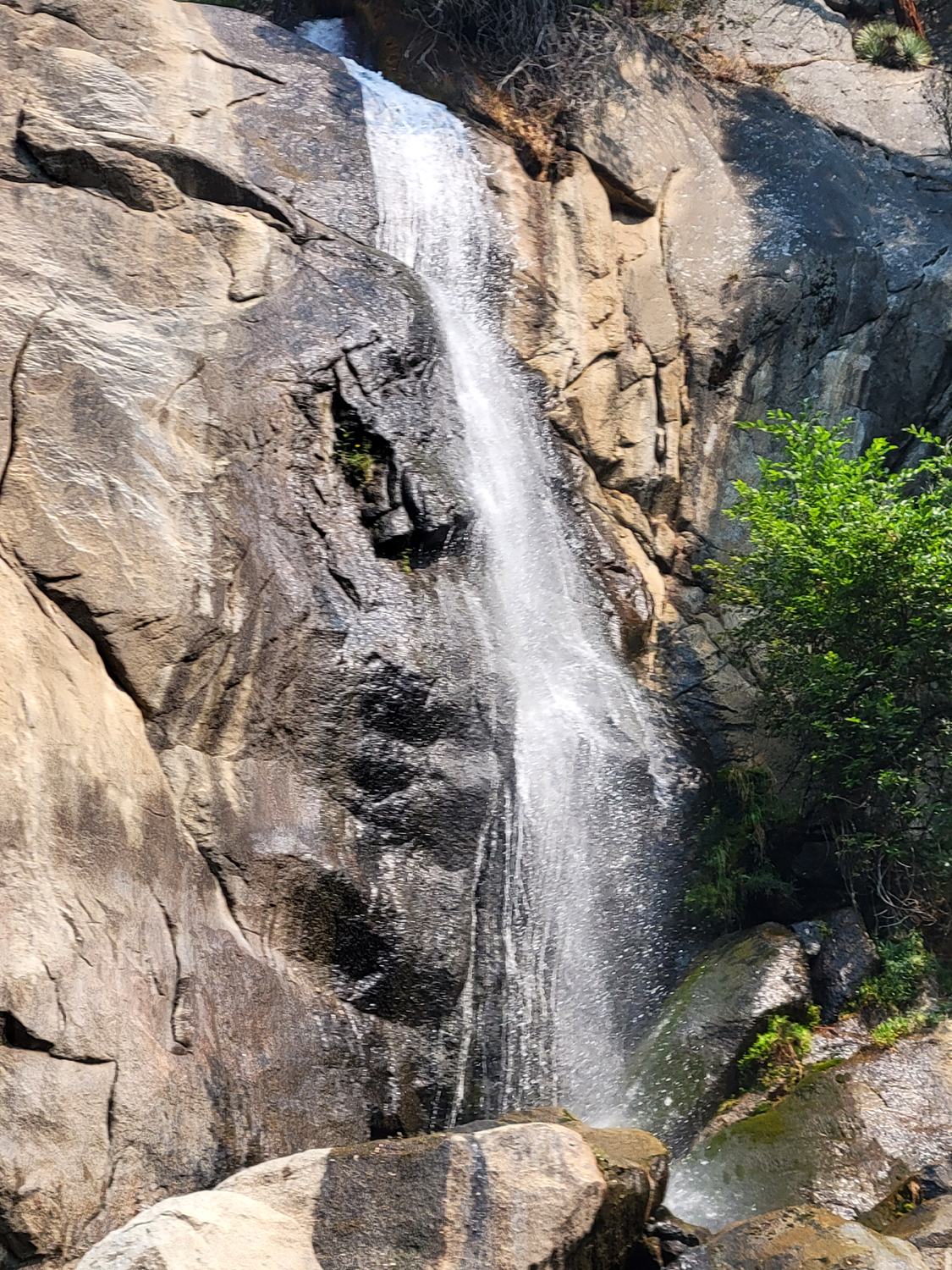
Creek Trail My friend and fellow founding member of the Ramblers was not going to be able to go on our next hike, scheduled for July 21. He suggested that the two of us enjoy a short outing on the 19th, and we decided on the Lewis Creek Trail, an area we've both hiked many times. My daughter Jennifer planned to join us, but she hurt her leg on another hike a few days earlier, so her participation would be limited to having lunch with us after our hike. The usual trailhead most people take is located on State Highway 41, about five miles above Oakhurst. There's also access from the south near the community of Cedar Valley, and from the north at Sugar Pine, which was our destination. When we arrived at this old logging camp location, the trail was blocked and tree work was in progress. So we backtracked to the Highway 41 trailhead and started our hike. From this point you can go to the right (south) to an impressive waterfall, or to the left which leads you across the creek and up the canyon to Red Rock Falls. In the past, it's sometimes been challenging to get across the creek, and I've walked that far several times, then turned back. However, this time we were delighted to find that a footbridge has been constructed across the creek, and we spent some time admiring it and photographing it before continuing our outing. |
|
 |
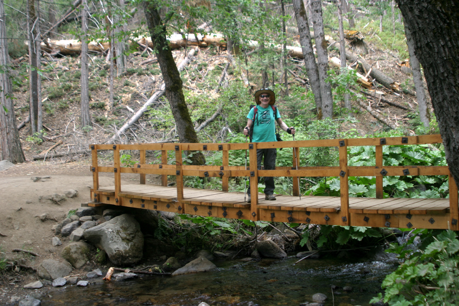 |
| Enjoying the convenience of the new bridge | |
|
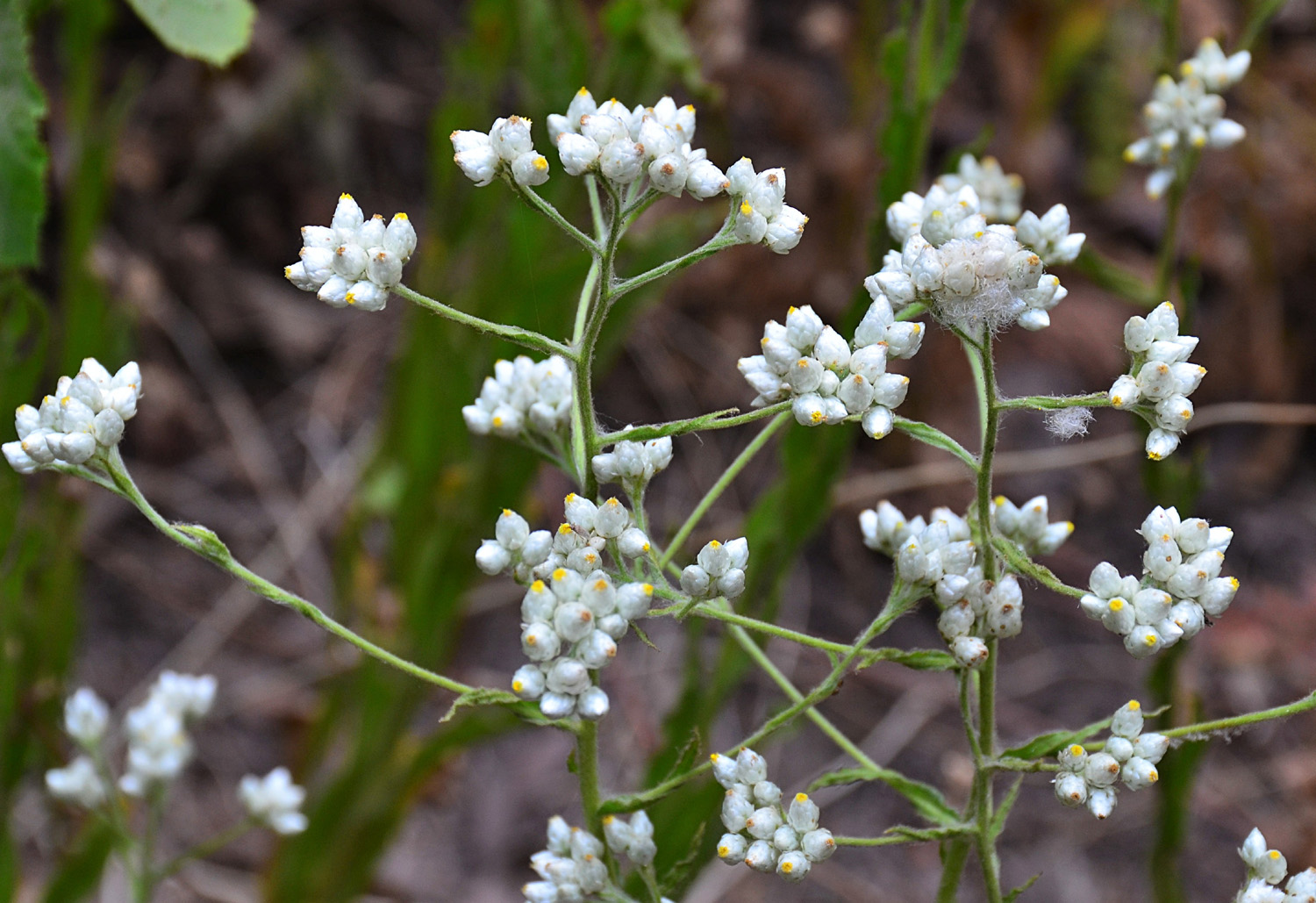
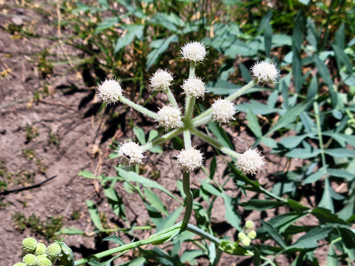
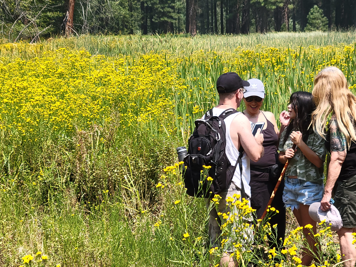
From here we walked through a forest of pine, fir and dogwood, with lots of shrubs, typical habitat at this elevation, about 4,000 feet. The creek was running fairly strong, and there was even a tributary that offered its own challenges. An easier crossing than the narrow board I chose was accessible only after getting over a four foot log, another difficult task as I seem to become a bit more wobbly with each passing month. We made it over this narrow bridge and continued along the trail, enjoying a number of wildflowers. |
|
 |
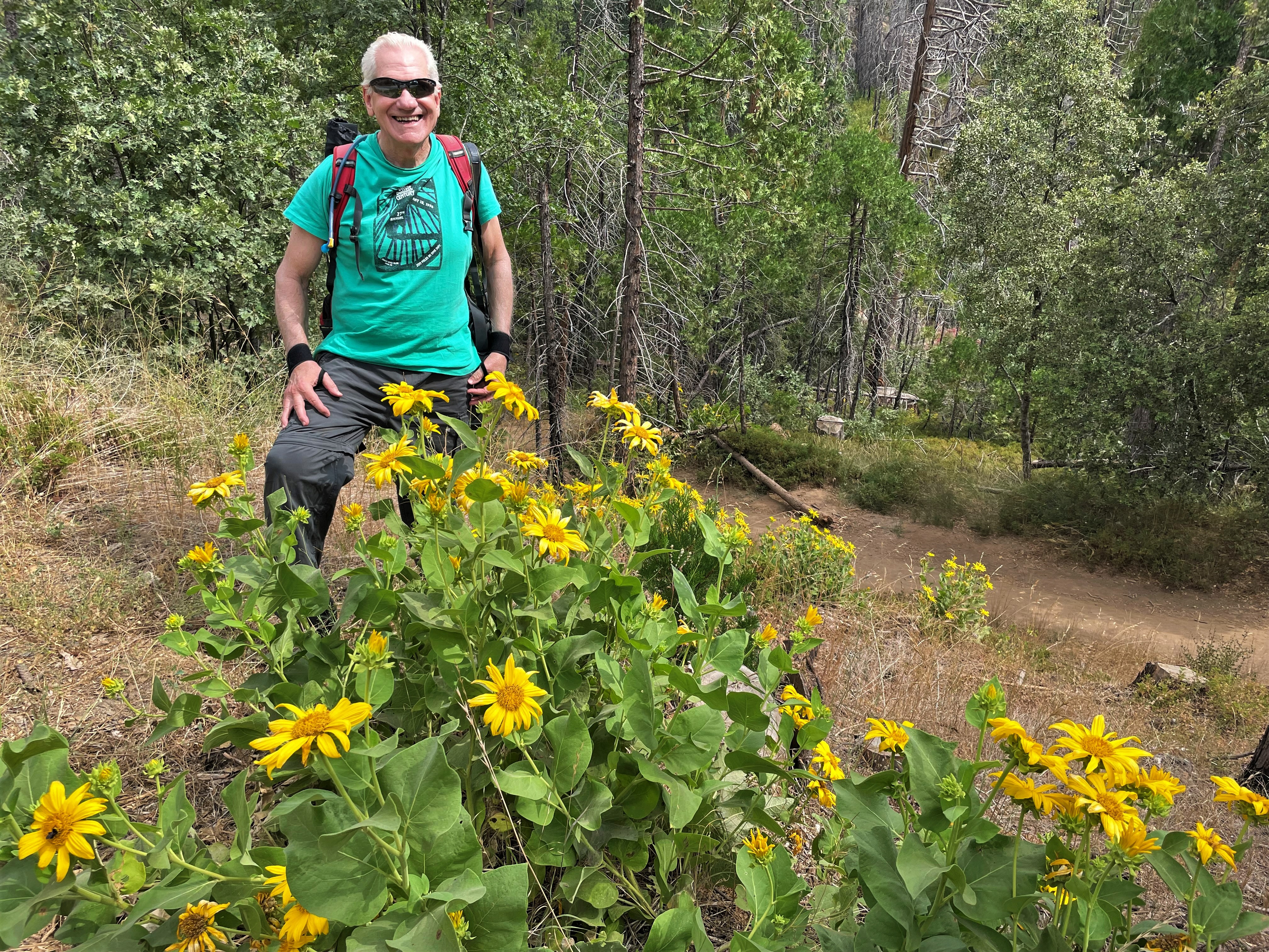 |
| A considerably less convenient bridge | Wes among the flowers |
 |
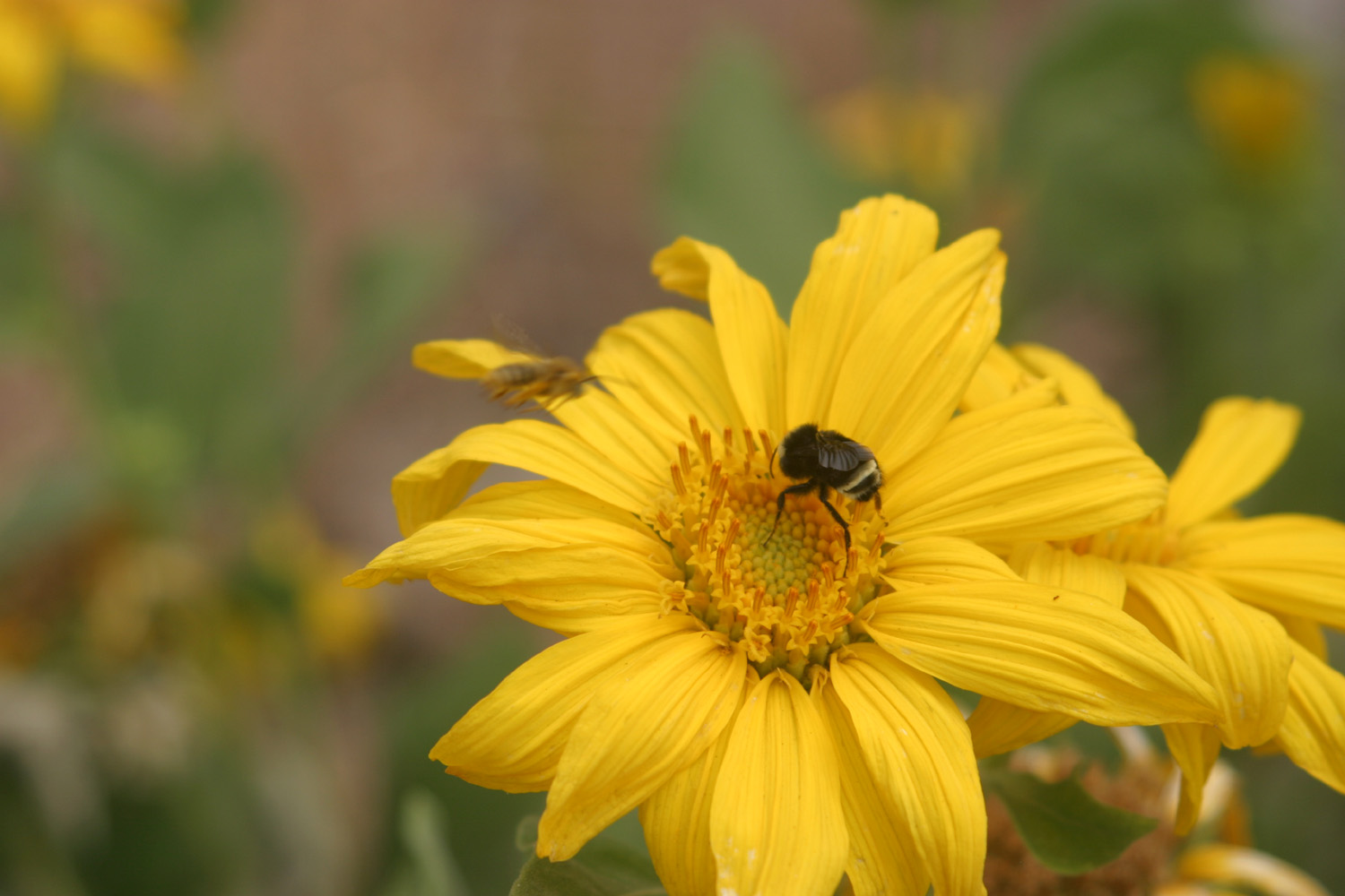 |
| A lovely flower, name unknown | Pollinator at work |
|
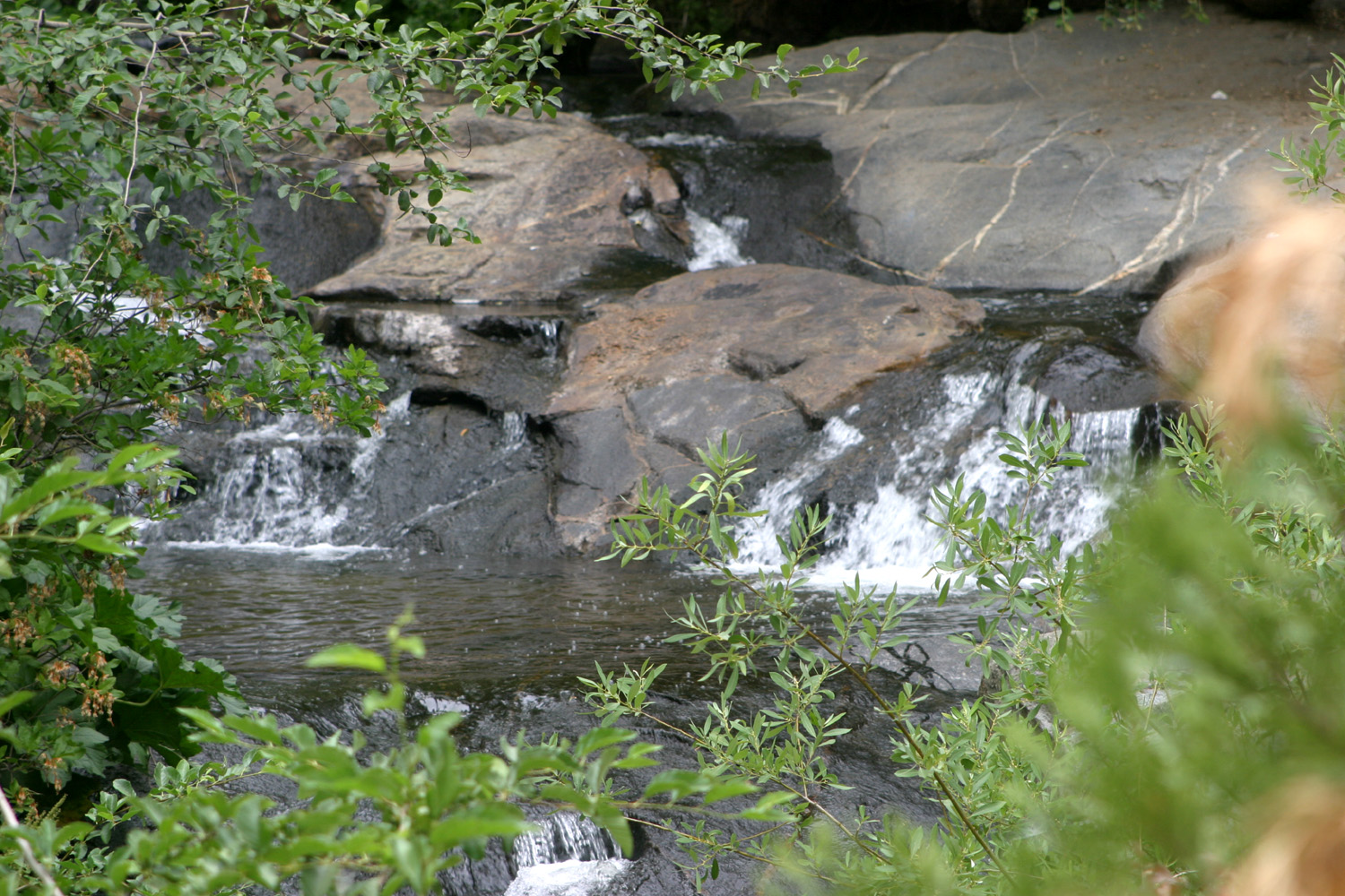
The weather was quite warm, mostly cloudy, with almost no breeze. Thunderstorms were a possibility, and later we had about five drops of rain while driving back to Oakhurst. The clouds and heat did not stop us, nor any of the dozen or so other hikers we saw, including some of pre-school age. Eventually the way grew steeper, then leveled off slightly. Ahead it started down, and we decided to start back, to avoid another steep climb back up to the point we had reached. |
|
 |
 |
| Lewis Creek drops down over many cascades | A section of the trail |
|
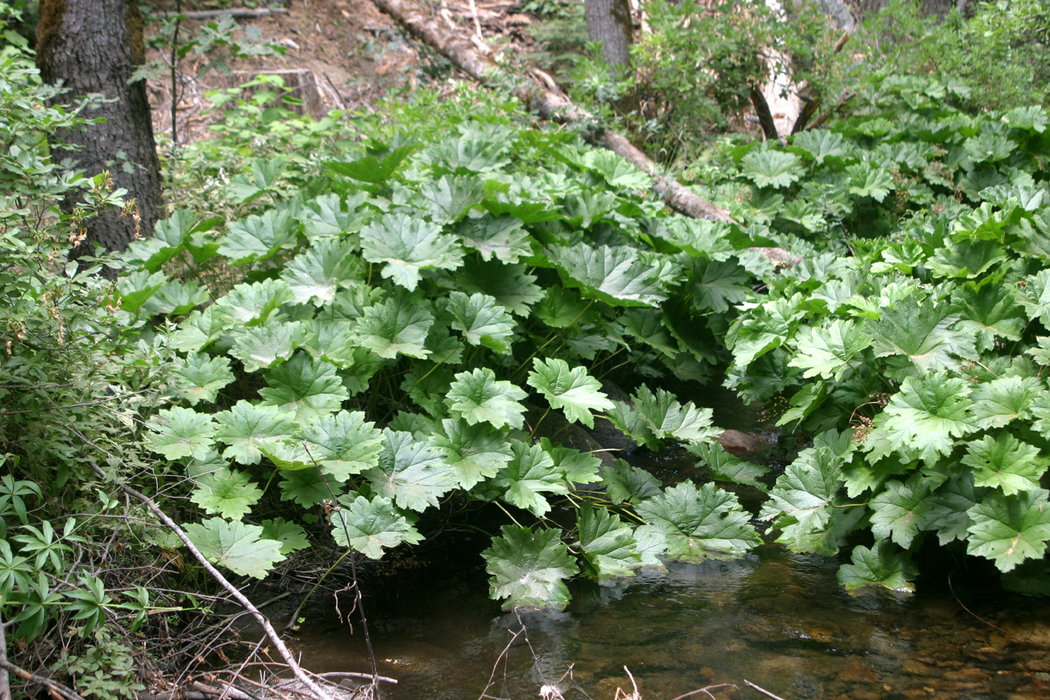
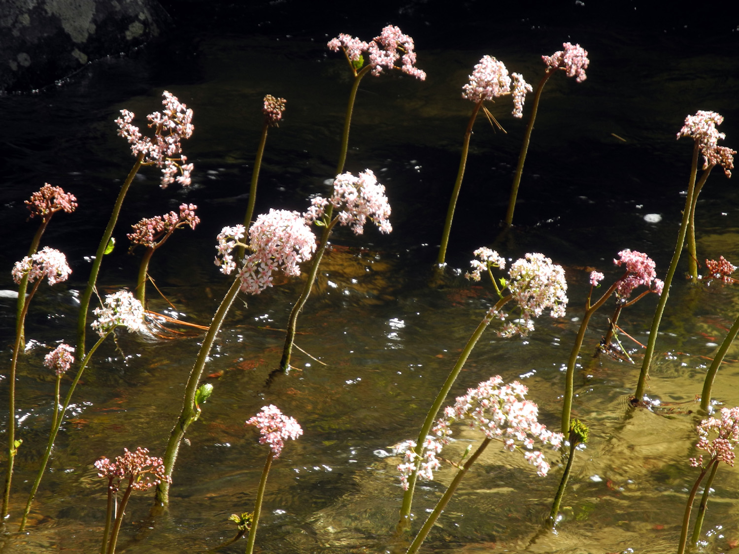
When we crossed back over Lewis Creek on the bridge, I noticed a number of plants growing in and at the edge of the water. They had huge leaves, and I recognized them as Indian rhubarb. In the spring they put up long stalks resembling that vegetable, with big round flower heads. At this time of year, the stems and flowers were long gone, but the plants were thriving. |
|
 |
 |
| Indian rhubarb, in its summer glory | A chance to relax at last |
|
We made our way back to the car and drove to Jennifer's. After looking over the fire prevention work she and Rod had done, we went to Oakhurst and had an excellent lunch at Pete's Place. I highly recommend this restaurant, for both breakfast and lunch. In fact, I had hoped to have pancakes, but breakfast ends at 11:50. If you go there, be aware that they close at 3 p.m. After lunch we took Jennifer home, then returned to the 106 degree heat of the valley, looking forward to a future outing in the cool mountains. --Dick Estel, July 2021 |
|
|
Big Meadow Road
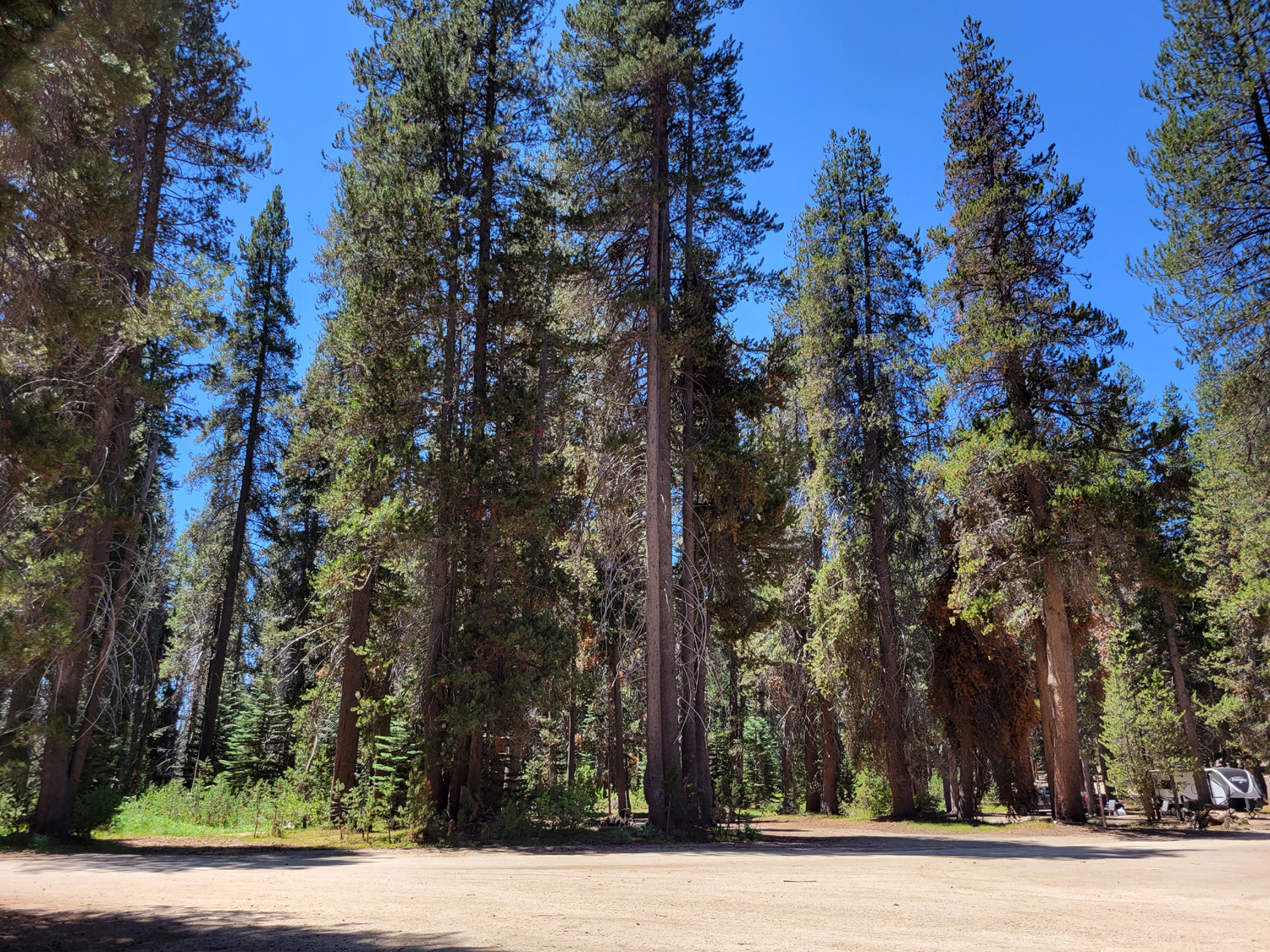
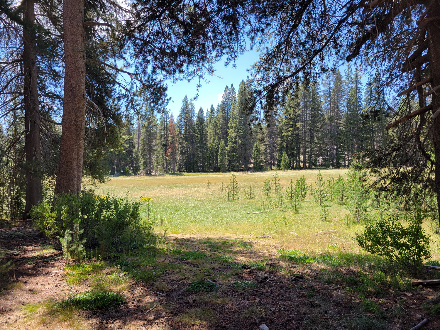
A few weeks ago I was talking with my friend Sue Wirt, a member of the Ramblers hike group, about places to camp in the mountains. My daughter Teri and I were planning an outing, but had not decided on a destination. Sue told me about Big Meadows, in the Sequoia National Forest off the Generals Highway. I knew about the location, and had camped along another road nearby, but had never been on the Big Meadows Road. I looked it up on line and on my paper map, and decided it had potential. Not long after this Sue called and asked if I would like to take a day trip to the area on July 27, and of course I accepted. She picked me up around 9 a.m., and by 10:30 we were driving east through forest and granite outcroppings at the 7,000 foot level. There are several official campgrounds and many places for dispersed camping along the paved section of the road. A short distance in from the highway is a horse camp, with another campground next door. Sue advised me that flies are a big problem at this location. A few more miles from here is the Big Meadow Campground, which has six separate units. Checking Recreation.gov, I found that no weekend dates are available for the rest of the year. We turned in on a dirt road to a forested area where several parties were camping, and informal camps, some with fire rings, have developed over the years. The fire rings are not a big deal this year - no fires of any kind are allowed. Another area of interest was the Jennie Lakes Wilderness trailhead. No camping is allowed here, but there is a restroom and a very nice meadow. My favorite spot was an area of granite outcroppings, with vistas across the basin below to Shell Mountain and a section of the Great Western Divide. After a couple of phone conversations with Teri, we decided to try our luck along the Big Meadow Road August 5 through 8. |
|
 |
|
| Shell Mountain on the horizon | Evergreens at a popular dispersed camping area |
 |
 |
| Rangers Buttons along Big Meadow Road | Meadow at Jennie Lakes Trailhead |
|
On
the morning of August 5, I loaded up my pickup for camping for the
first time since July 2020, and drove east on Highway 180 toward Kings
Canyon National Park Past the park entrance I turned right on the General's Highway till I came to Big Meadows Road, which is paved for around ten miles or so, but somewhat bumpy. I had hoped to find a spot in an area with a large outcropping of granite about two miles in from the highway, but there were several camps set up there, so I continued on the road, stopping a few times to check out possible sites. I drove as far as the place where Sue and I ate lunch, then turned back, and drove in to a spot I had investigated on my drive in. The location was a large, relatively level area heavily forested with lodgepole pines. There were several fire rings, although no camp fires or charcoal fires are allowed anywhere in the national forests of Central California this year. Propane stoves are OK. Best of all there was really no place for another party to set up camp. |
|
|
|
| Our neat, well organized camp | A remarkable rock formation, with a heart |
|
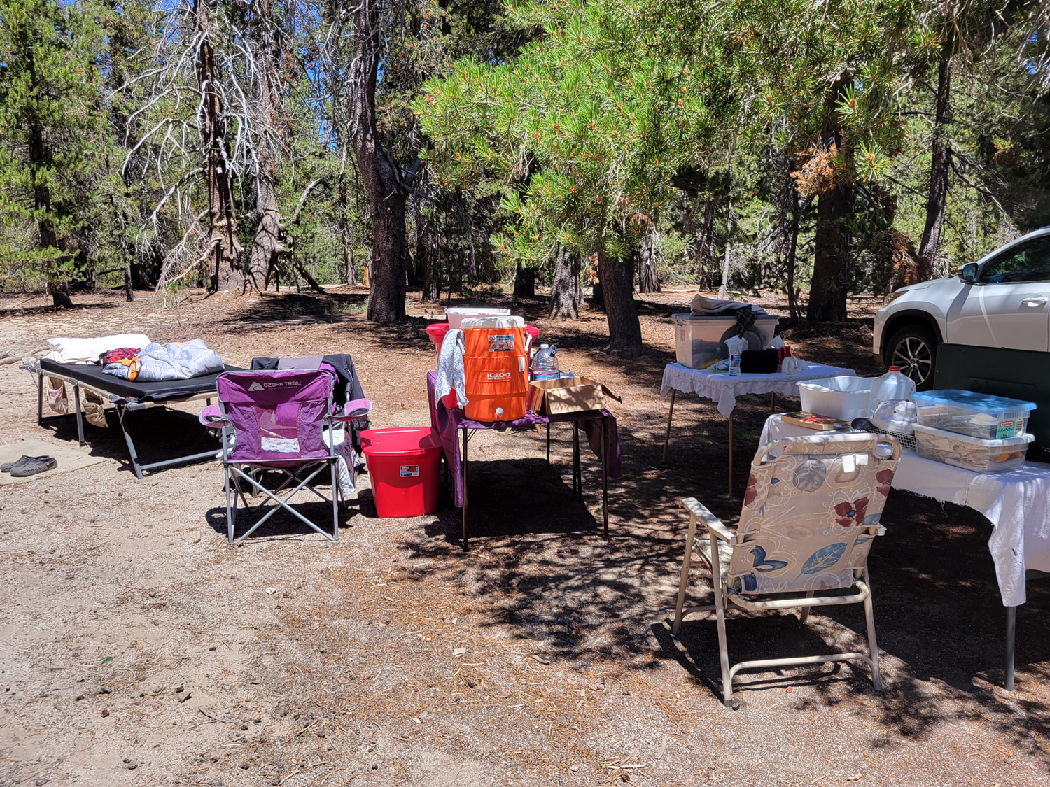
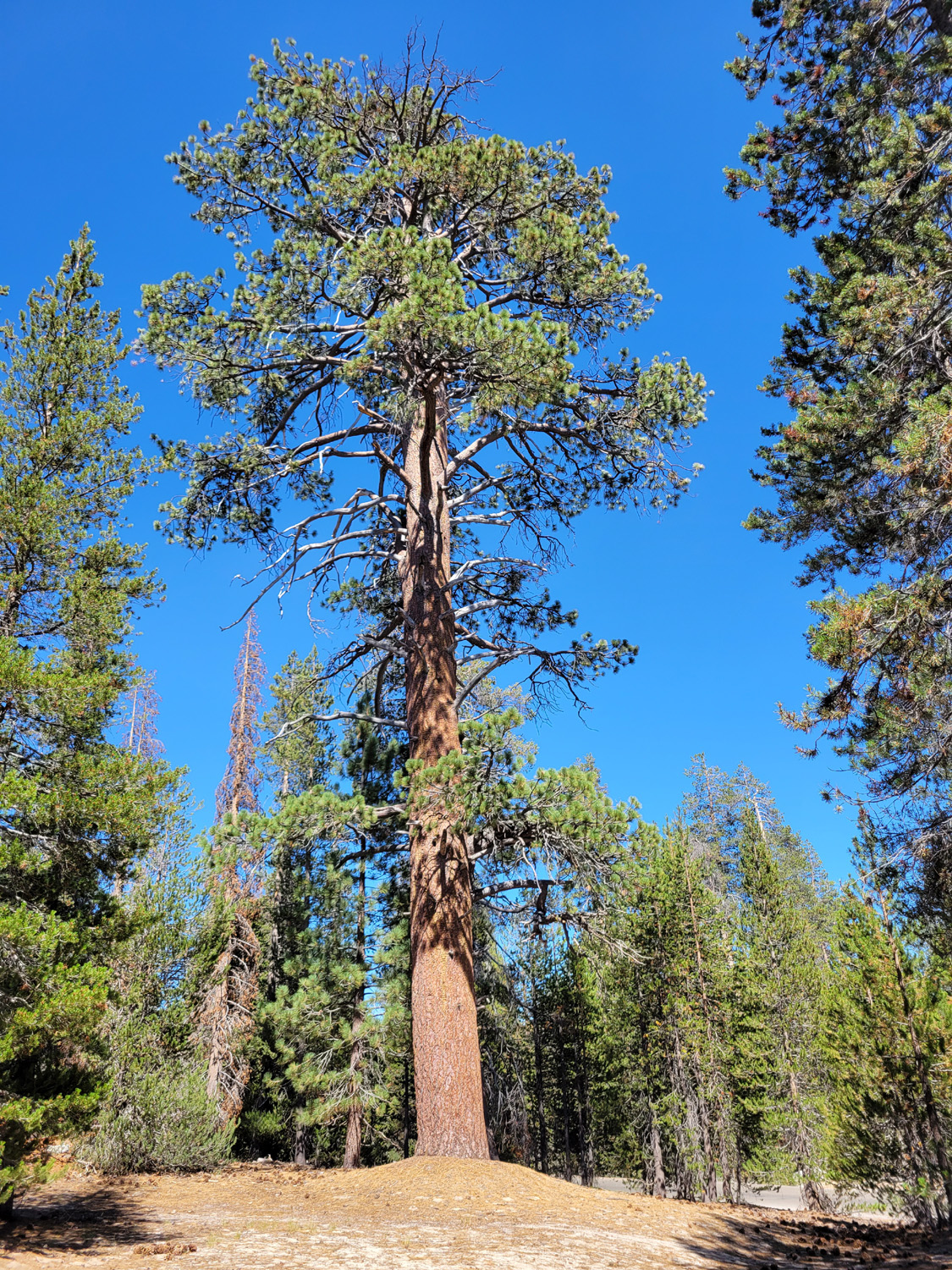
I unloaded the truck and got things set up, including two tables and my cot. When I first returned to truck camping, I slept in the back of my pickup, but getting in and out several times each night was a major hassle, so I got a very nice folding cot that is longer than I am, and wide enough to hold the thick folding mattress I've been using for a few years. I sleep under the stars in a good Coleman sleeping bag, and have always been very warm and comfortable. During the rest of the afternoon, besides the usual reading and napping, I made a couple of short explorations. I drove to the granite outcrop about a half mile west, and walked out to where it drops off to the south. There's a pretty good view here, and some interesting, rugged rock formations. I also did a short hike west on the road, less than a half mile round-trip. My first impression of the area was that all the trees were lodgepole pines, but I soon spotted a huge Jeffrey pine, and then a lot of large and small red firs. |
|

|
|
| Old man in the rocks | A stately Jeffrey pine |
|
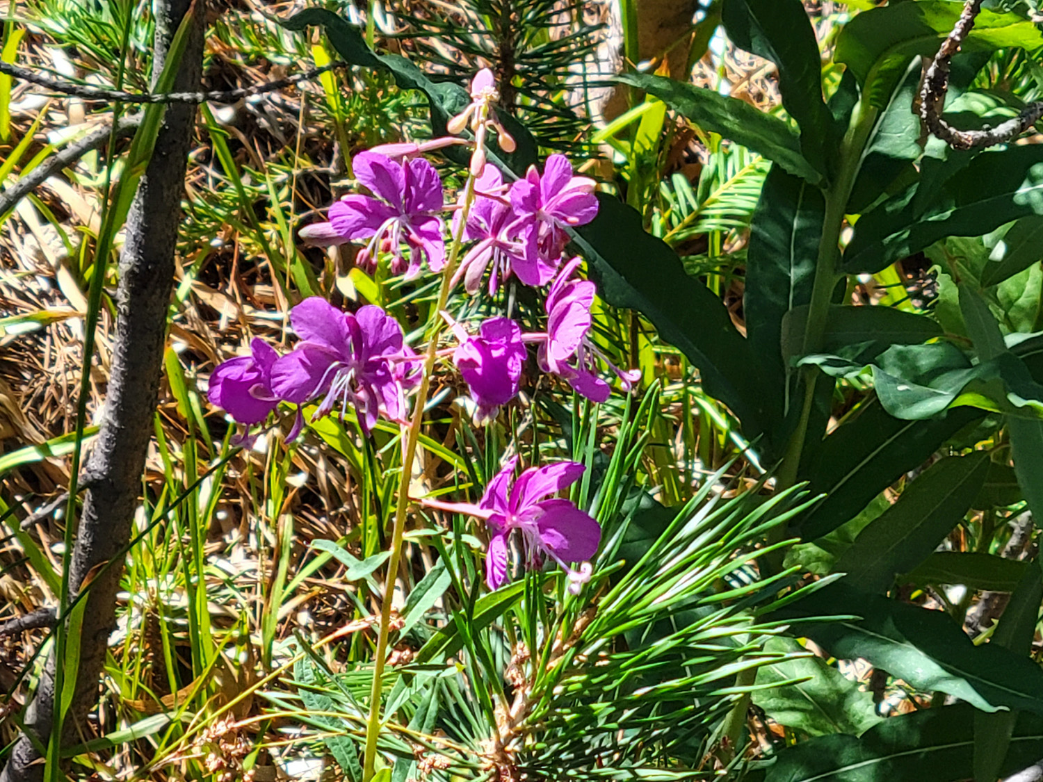
Teri arrived a little after seven, having driven from Merced where she works. We didn't do much the rest of the day, but made plans for an exploration of the Big Meadow Road the next day. On Friday, after tea and a leisurely breakfast, we took my truck east on the road to the Big Meadows Camp. Dispersed camping is not allowed in this area, and there is really no place where it would be feasible. The campground consists of five or six separate units along Big Meadows Creek. We drove into the last unit and discovered there are in fact a few "first come, first served" campsites. The last two units were added in recent years, which may account for the fact that they are less desirable than the older units. We continued on down the road for about two miles, but the scenery was pretty much the same thing as far as we went - trees and a steep, narrow mountain drainage. Just past the camp the road crossed the creek, which was just a trickle, and we saw some nice flowers along the way. |
|
|
|
| The trickle that is Big Meadows Creek | Fireweed flourishes near Sierra streams |
|
We turned back and returned to camp, going down a few "wonder roads" for short distances. These are roads you look at and say, "I wonder what's down that road." None of them revealed any particularly good campsites, and one took us to a private development. After fixing and eating our main meal of the day, we set out for Hume Lake. This is a former mill pond which now has been developed as a resort, Christian camp, and overall nice vacation spot. It was probably a 20-mile drive from our camp - back out to the Generals Highway, north for a while, then a nice drive on a paved road that passes several campgrounds before arriving at Hume. We took the fork to Sandy Cove, the eastern end of the lake, where there is a nice beach. I had passed the spot several times hiking with the Ramblers, but had never seen it on a summer weekend day. There were dozens of people, probably over a hundred, with kids of all ages and people going into the lake on kayaks, paddle boats and other water craft. Teri floated on the lake in a blow-up raft for an hour or so, while I sat in the shade reading, taking a short walk, and watching the families playing in the lake and on the shore. |
|

|

|
| The creek at Big Meadow Campground | Hume Lake, looking much more tranquil than it really was |
|
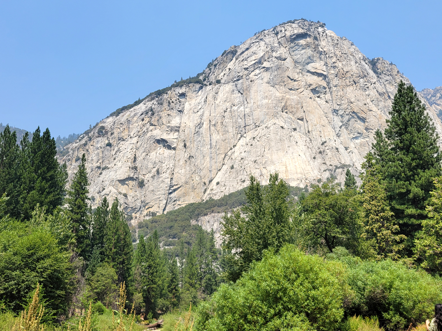
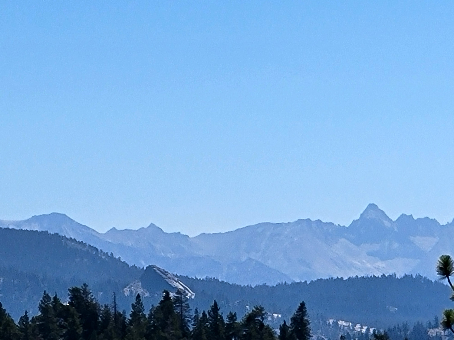
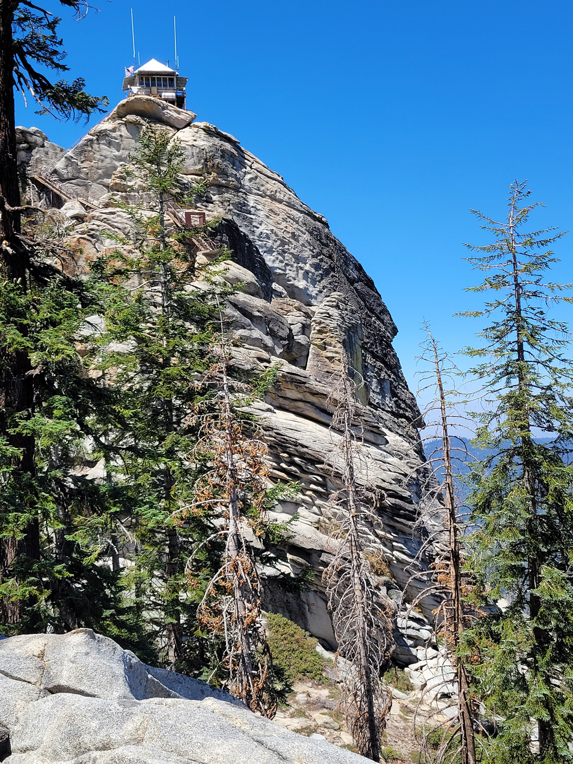
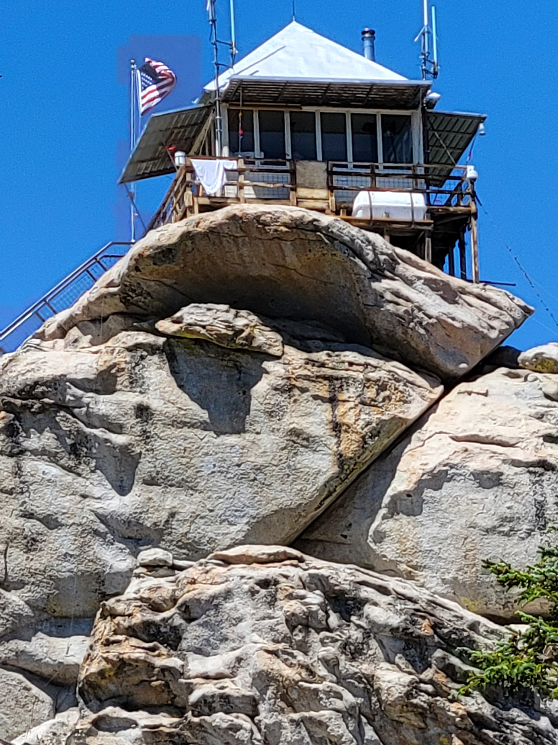
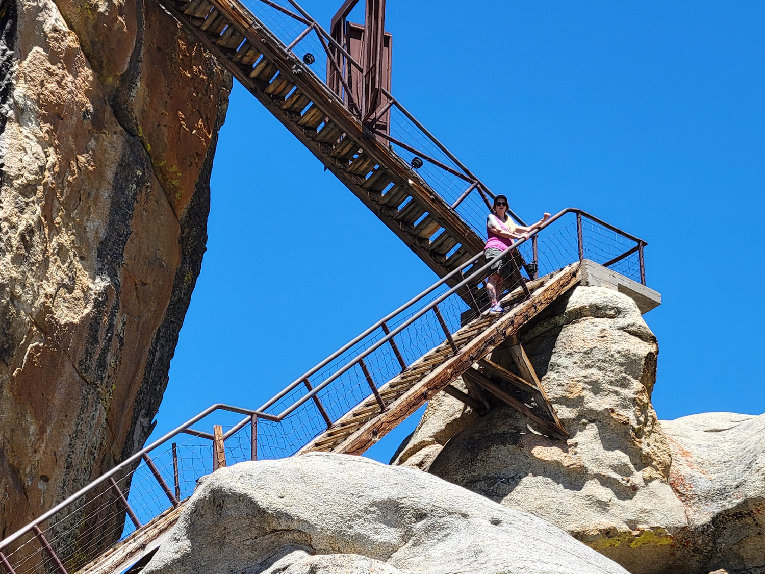
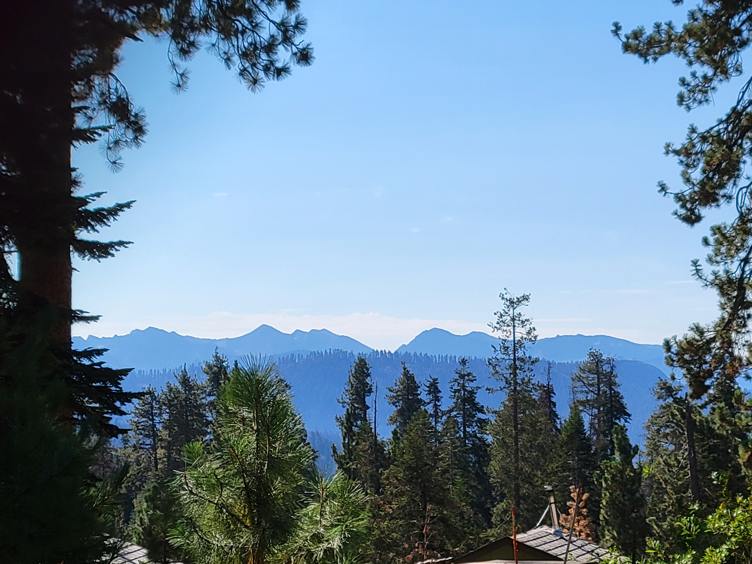
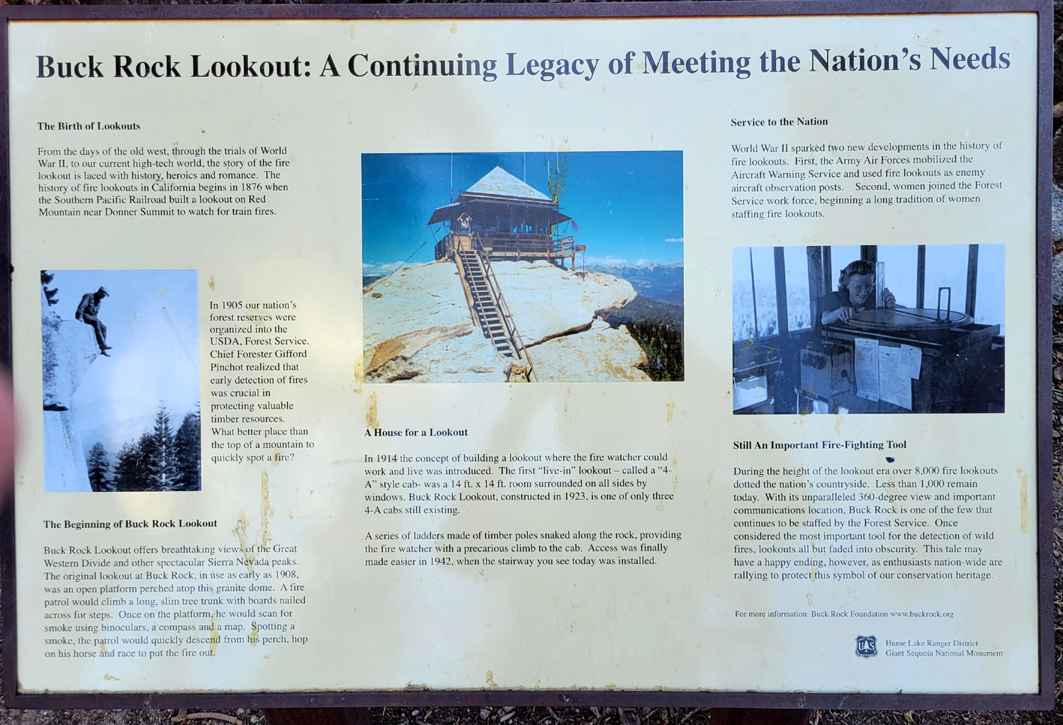
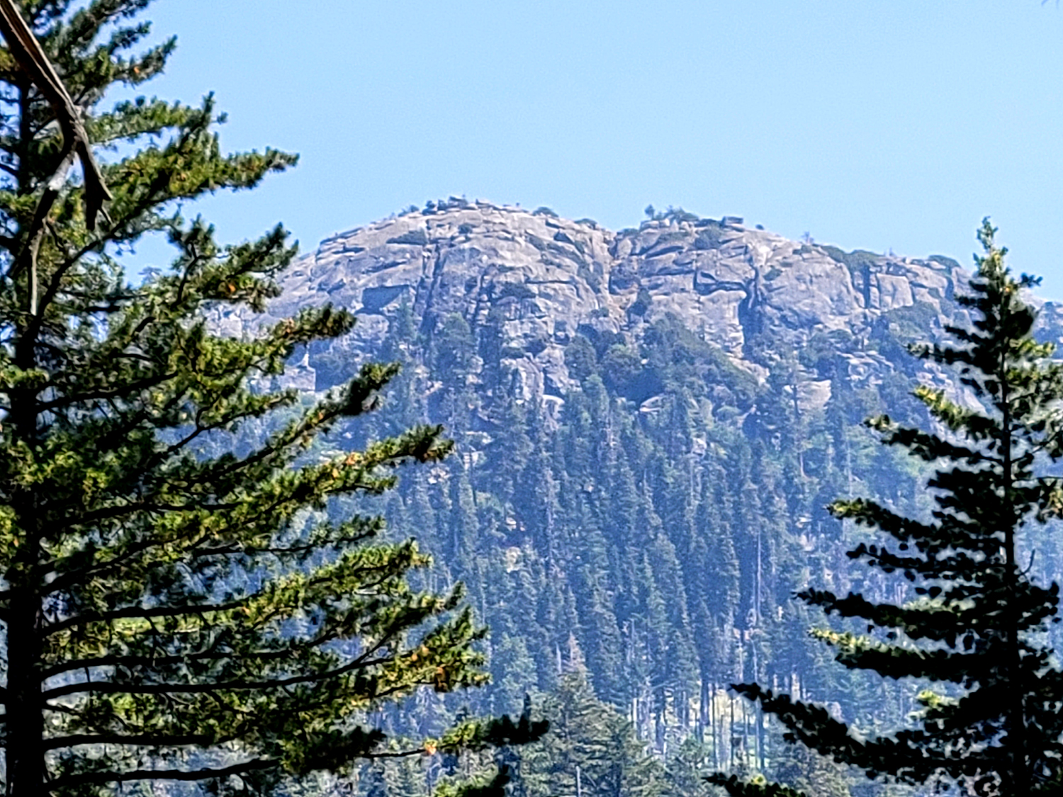
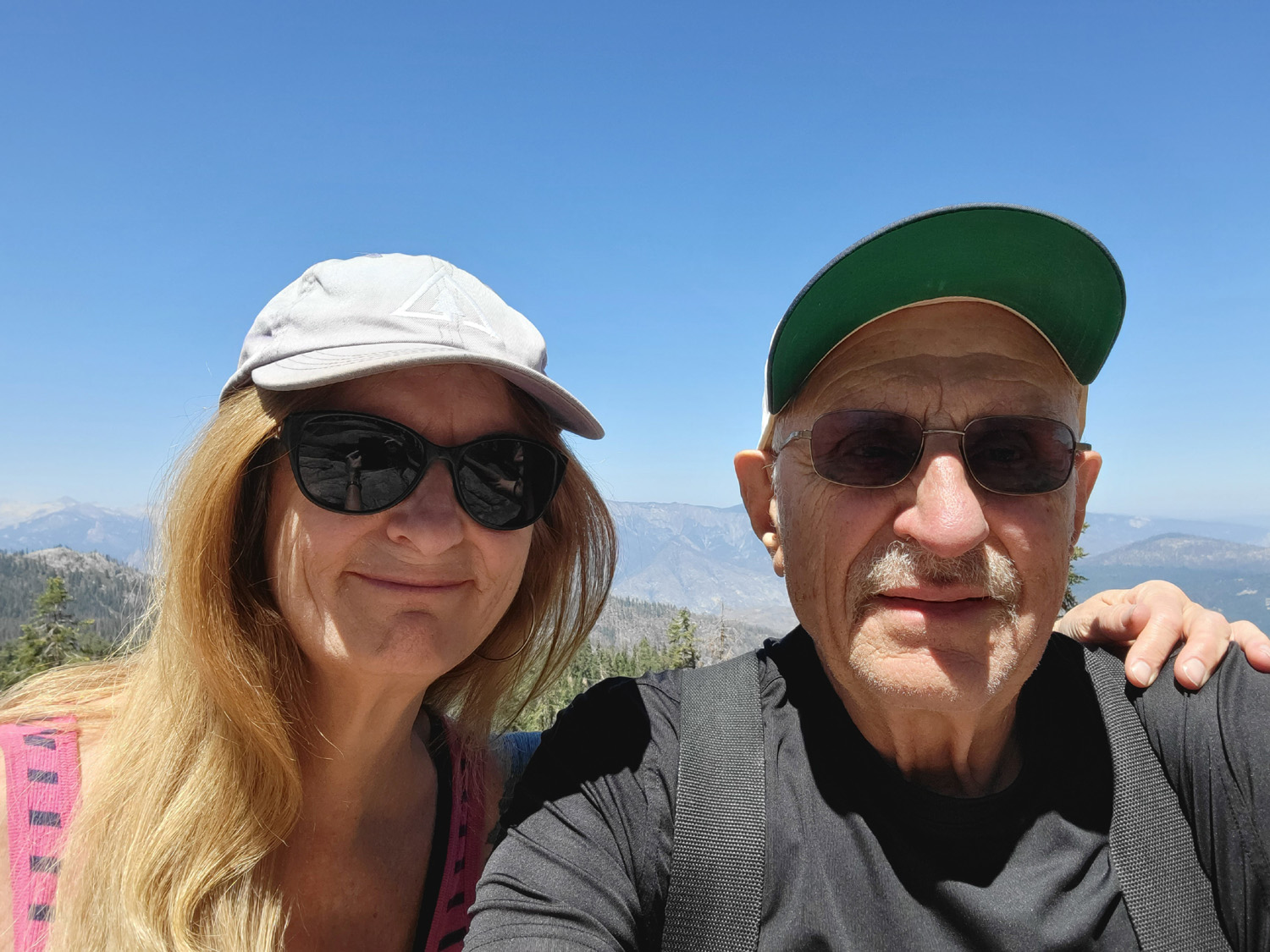
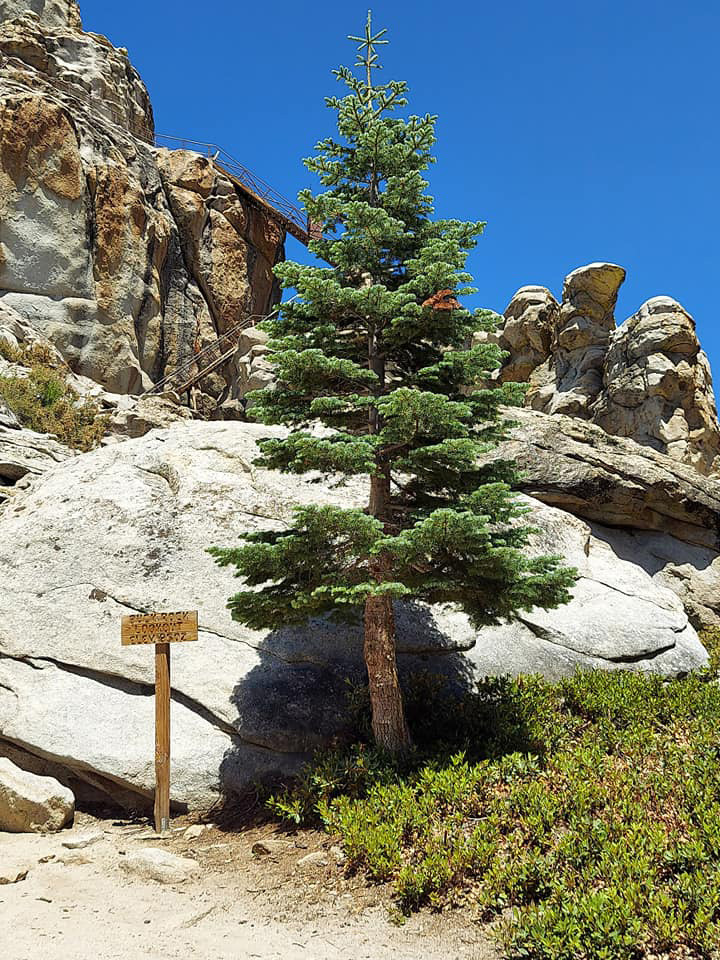
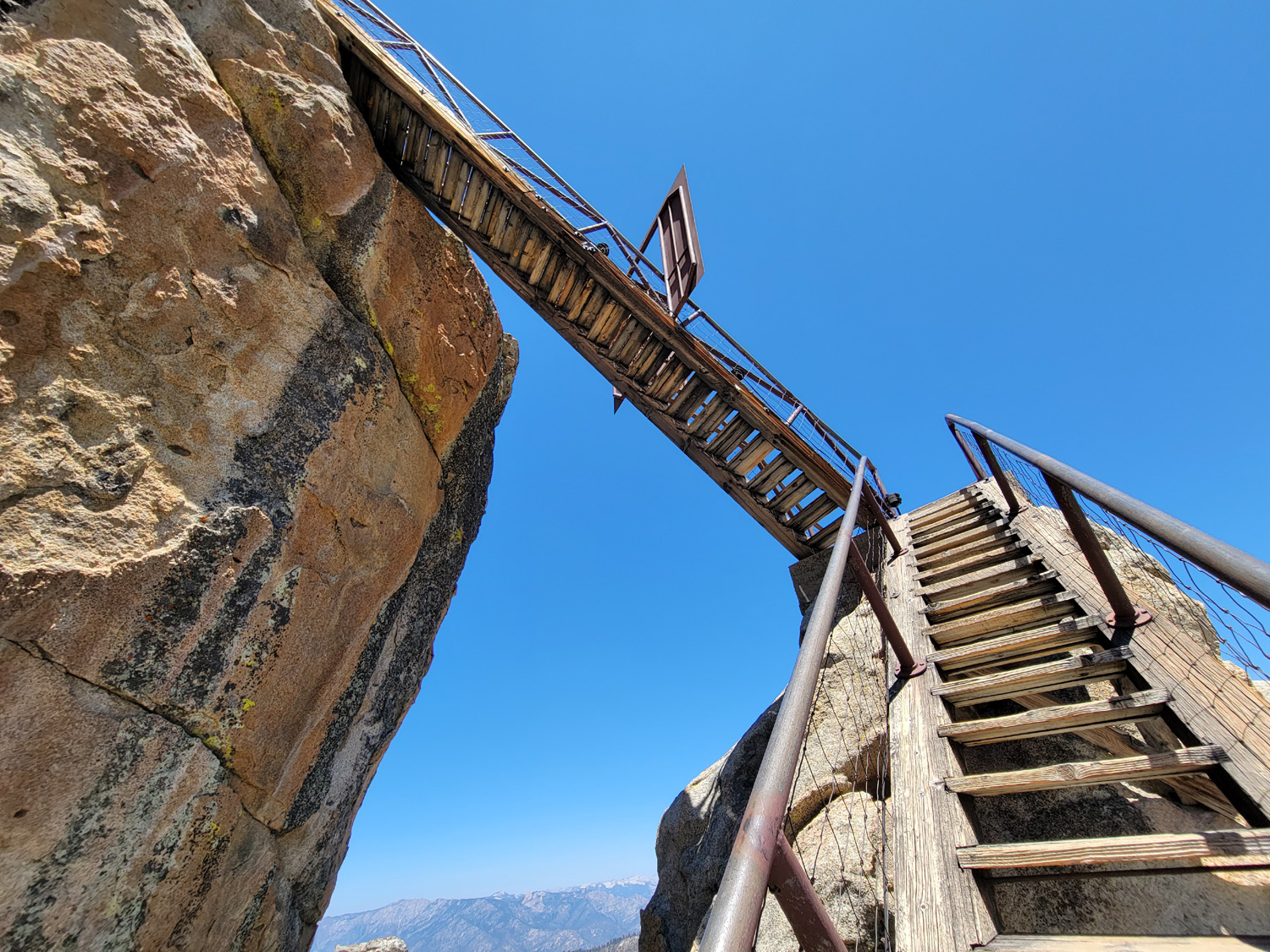
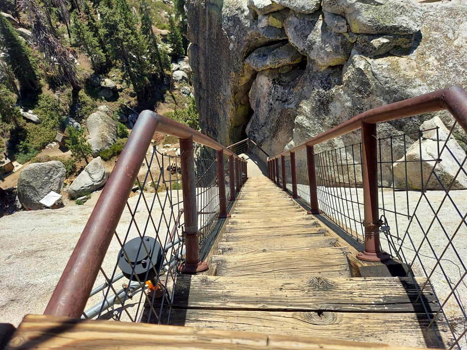
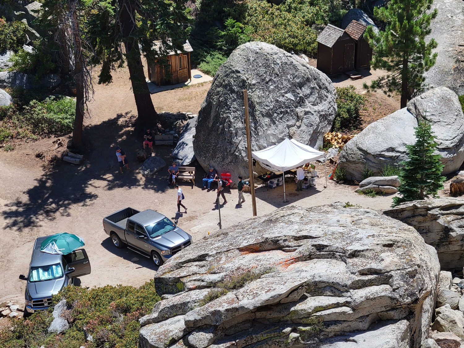
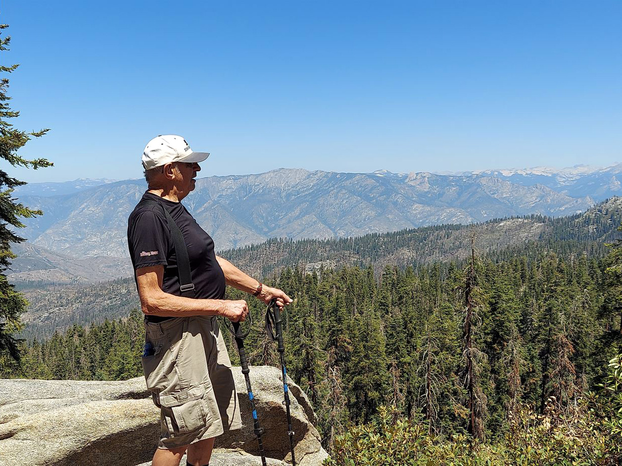
When we got back to camp, we took it easy the rest of the day. I think we may have taken a short walk on the road, and of course, had a snack of some sort. The next day brought a lot more activity for both of us, especially Teri. We drove east to the horse camp, and turned north on the road that goes to Buck Rock Lookout. A half mile drive brought us to a developed campground, and after another two miles, mostly uphill, we arrived at the parking lot below the lookout. Buck Rock itself is a thumb of granite on a ridge west of the Generals Highway, with views north into the Kings River drainage, and south into the canyons of the Kaweah. The original lookout, opened in 1908, was an open platform on top of the rock, which the ranger reached by climbing a tree with boards nailed across it. In 1914 a live-in building was constructed, with a precarious wooden ladder for access. In 1942 the current stairway, with 172 steps, was installed. It has recently been repaired, and there is a solid metal handrail with wire fencing below, making it a safe if breathtaking climb. A group of volunteers was selling t-shirts at the base, and giving certificates attesting to a successful climb. Teri went to the top, while I rested a little more than half way up and waited for her to come down. I could have made it to the top with little trouble but going down was a much more challenging matter. Some of the sections were very steep, and I decided I did not want to go down that many steps. As expected the view from the top (and from the road and the ground around the lookout) was spectacular. North of the lookout is the Kings River drainage, and the 7,000 foot deep south fork of the Kings River. To the south we could see the canyons and peaks of the Kaweah drainage, including the Great Western Divide. Unfortunately the latter view was hazy when we arrived and became more so through the day. Nonetheless, we had a great time, and got in over a mile of walking, having parked along the road a few hundred yards before the parking lot. |
|
|
|
| The Great Western Divide | Buck Rock Fire Lookout |
|
|
| A closer view | Teri on the steps |
|
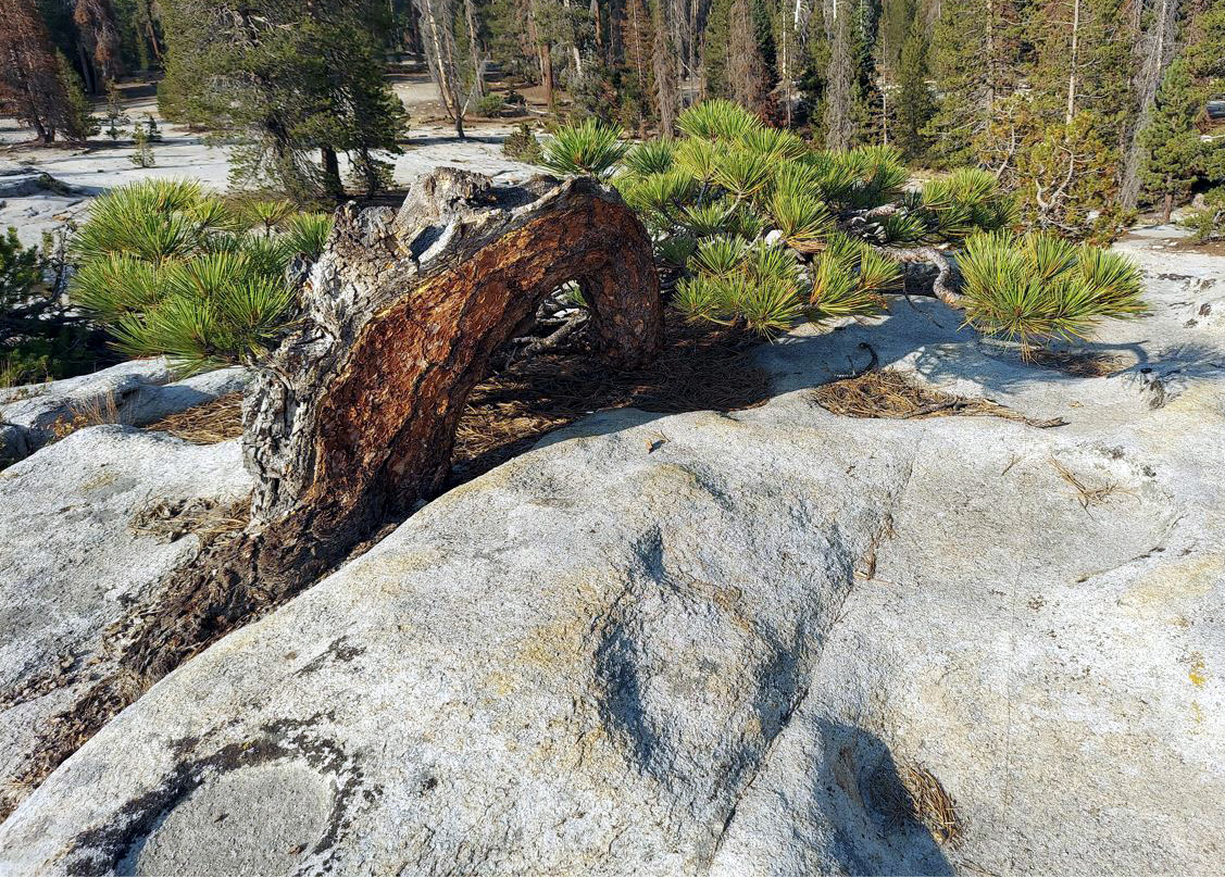
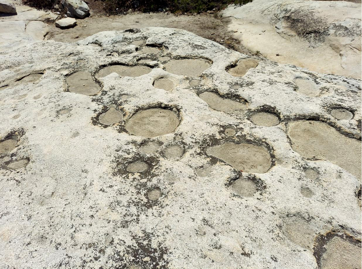
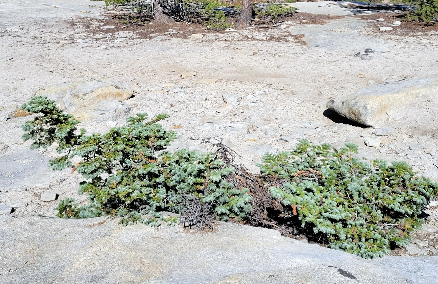
We had one more activity planned, which we delayed till early evening, since it was quite warm during the day. We drove the short distance to the big granite outcropping, and walked out to the edge one final time. Although this feature is by no means a dome, there is extensive exfoliation shaping the rock. It's also the type of terrain which encourages bonsai-like growth of normally tall trees. We discovered one that looked like it was auditioning to replace the iconic Jeffrey pine that graced the top of Yosemite's Sentinel Dome for so many years until it died and fell over. We also observed a red fir in bonsai form, something we had never seen before. All around us on the rock were dramatic examples of an erosion process known as weather pits, a term I had been reminded of when I recently re-read The Incomparable Valley, an excellent book on the formation of Yosemite valley and similar rock features of the Sierra. |
|
|
|
| Gnarled Jeffrey pine, living a long life close to the ground | Weather pits on granite boulder |
|
These things also happened: A woman rode through our camp on horseback, coming from the side opposite the road. I did not see her but she talked with Teri, and said she was picking up trash. She had her eye on a large box behind a rock away from our camp, but it was too big to carry. Teri explained that it was the box that held our portable toilet. Two young men walked in from the road and asked if we could spare some water. They were running in the mountains to train for a marathon, and were not aware of how elevation speeds up dehydration. We gave them each a 500 Ml bottle, which they finished pretty much without stopping for a breath, and went on their way. Driving up one of our "wonder roads," we were asked to stop and wait for several bicycle riders who were speeding down the steep hill ahead. The weather was good throughout our stay. Daytime highs were around 75 - warm enough that we always wanted to sit in the shade, but a big improvement over the 100 to 110 we've experienced at home this summer. At night it got down to 35 degrees, with no wind. Teri slept in her new Toyota Highlander in great comfort. I was never cold outside on my cot. As mentioned, this was our first time ever to camp and explore in this area. It definitely won't be the last. --Dick Estel, August 2021 |
|
|
Cedar Grove
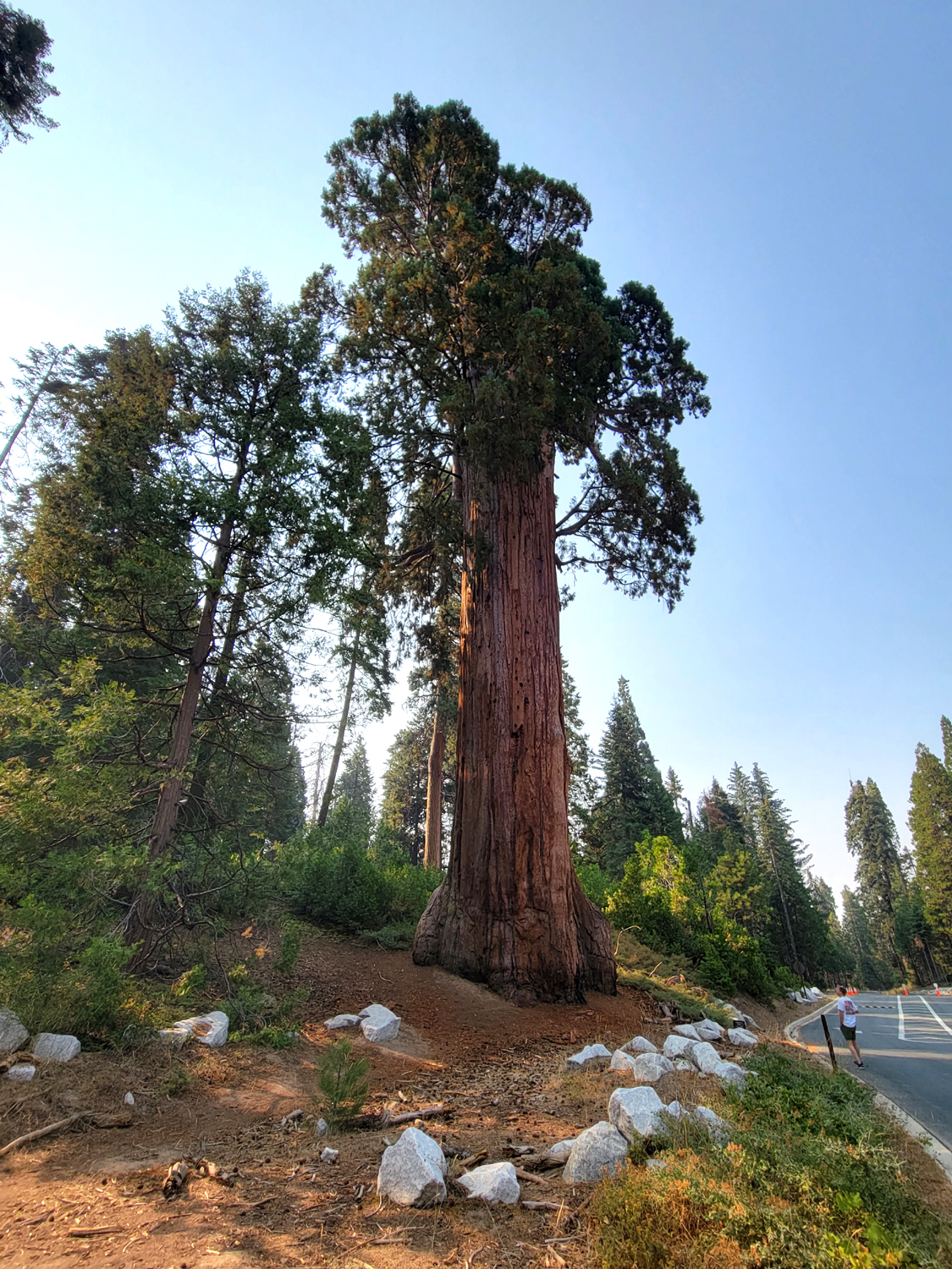
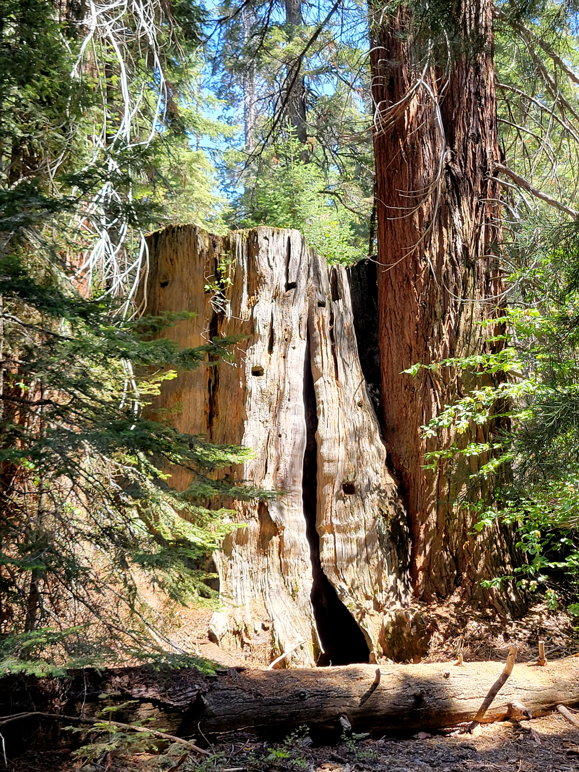
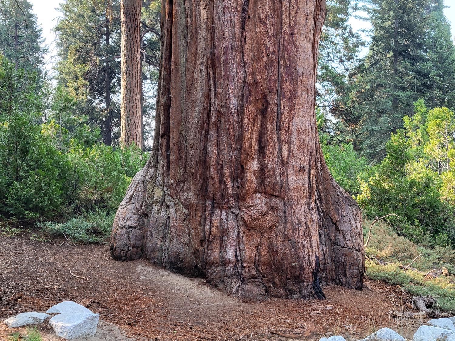
This was one of my rare outings with a fairly large group of people - my daughter Teri, and four of her friends. As often happens with larger parties, we arrived in three vehicles over three days. Teri finished her workday in Fresno on August 19 and drove up to Cedar Grove in Kings Canyon National Park, where she had made a reservation at Moraine Campground. I had a doctor appointment that afternoon, but I got up very early the next day and was on the road at 7:45. With various stops along the way it was 11 by the time I arrived. There is a unique sequoia tree just inside the park entrance - big around but damaged at the top so it's not very tall. I had never taken a close look, so I parked in a pullout just past the tree and walked down the road to take photos. |
|
|
|
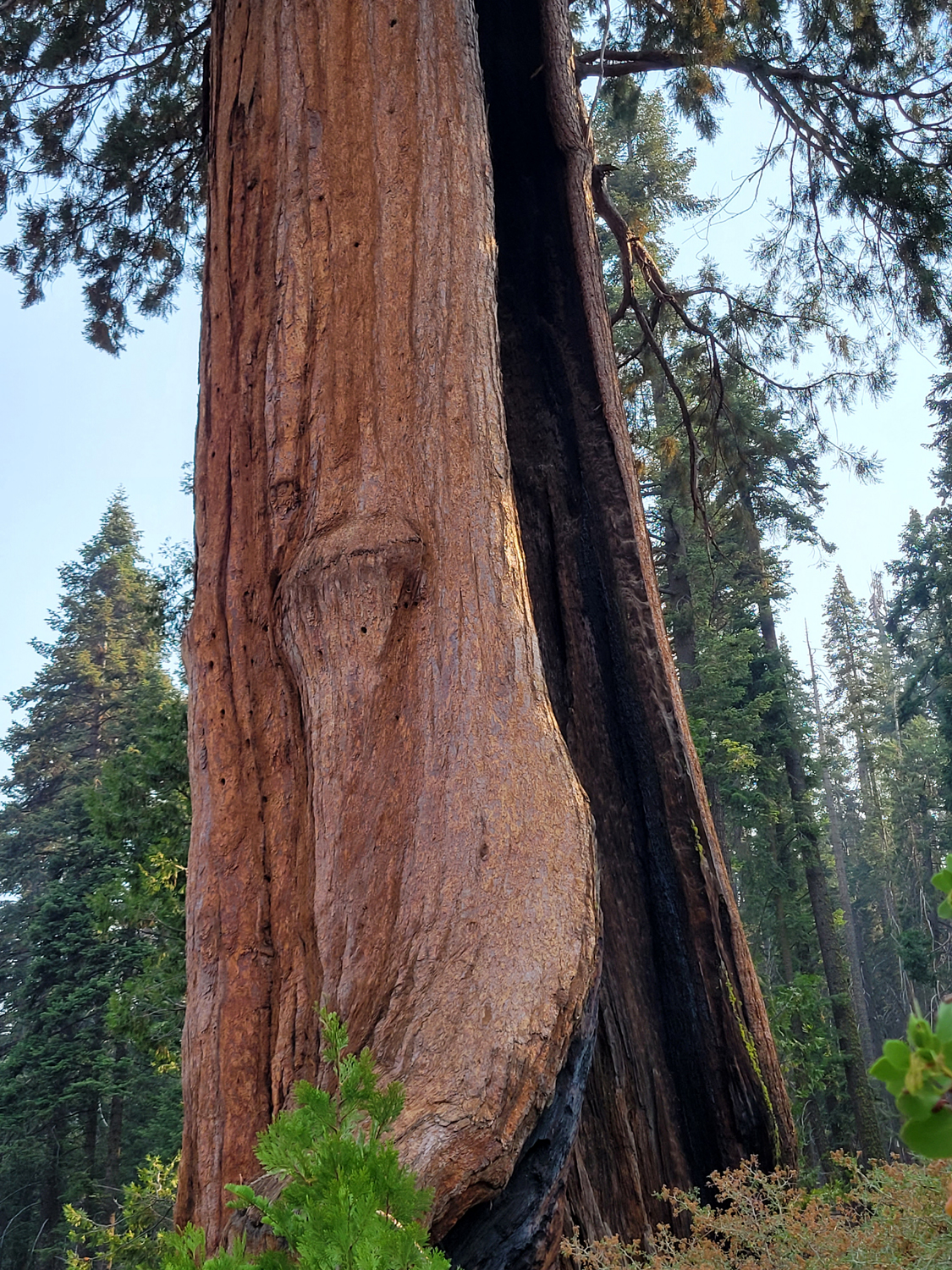
| The Methuselah Tree | Like many huge sequoias, it has a burn scar from lightning strikes |
|
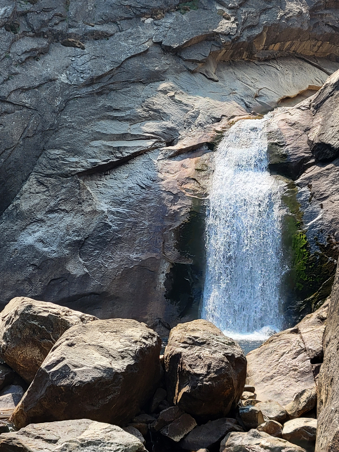
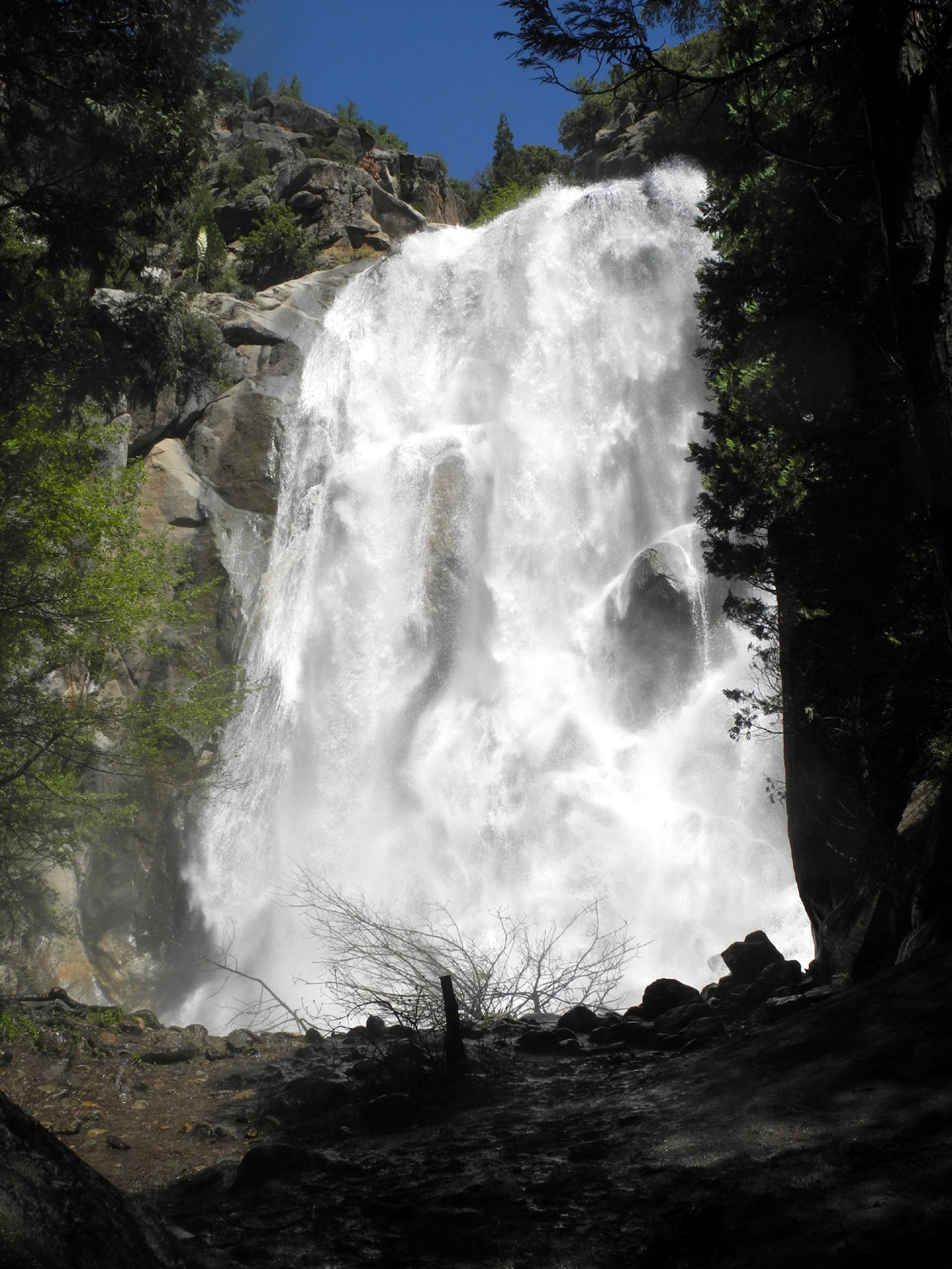
As I was admiring the tree I heard someone say, "Hey, Grandpa Dick." It was my grandson Johnny (Teri's son) and his friend Dustin. It was not a big surprise - he had said he was going fishing in the Kings River and would try to stop in at our camp. We talked a few minutes, then continued on our way, with another stop for me just up the road at the Big Stump Trailhead to use the restroom. I drove past the General Grant Tree area and out of the park. Where the road begins to drop down into the South Fork of the Kings, I could see smoke up the canyon instead of the usual view of mountains and rock formations. Large fires in northern California (and a new one we didn't know of south of us in the Kern County mountains) were sending smoke down the San Joaquin Valley and up the river canyons. When I got to the point where the road reaches the river level, there were Johnny and Dustin getting their fishing equipment ready, so I stopped for a few minutes additional visiting. As it turned out, they never made it to our camp - it got late before they knew it, so they returned home. From that point the road closely follows the river, gaining elevation from about 3,000 feet to 4,000. Although the water is very low, it still has dangerous places and it did not look as if anyone was tempted to test the water along this stretch. About two miles from where the road re-enters the national park at Cedar Grove there is a nice waterfall on the left. Grizzly Falls can be huge but even at low water it's an attractive feature. I stopped for a few minutes and took a couple of photos. (Some web sites say it is in the park, but it is actually in the national forest.) |
|
|
|
| Grizzly Falls and the cascades below | Close-up of the main fall |
|
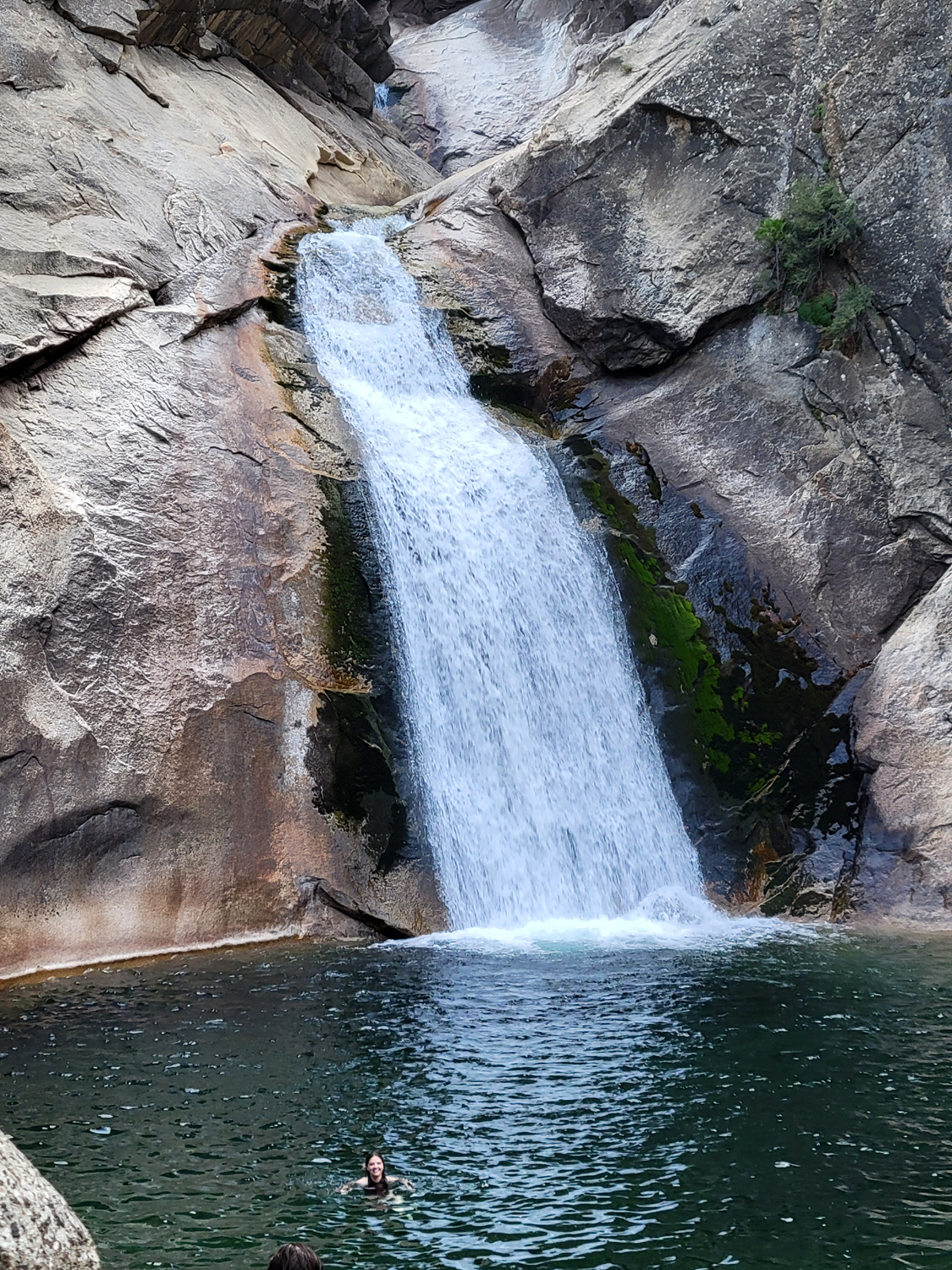
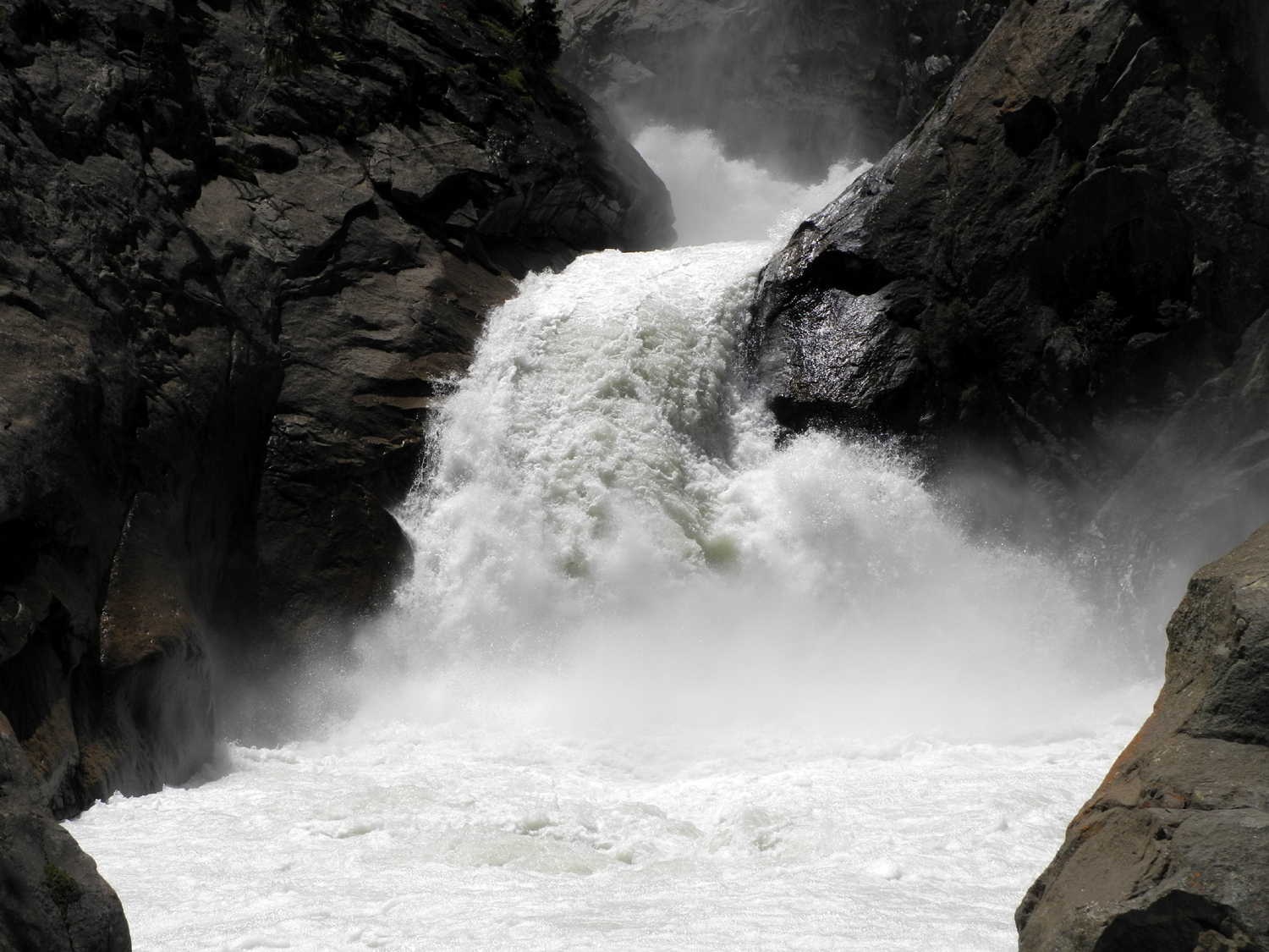
As I entered the park, there were signs saying "Road Closed" and "Detour." This took me on some less familiar roads through Cedar Grove Village and back out to the main road, then another mile to the campground, where I easily found Teri's campsite. Having had an early breakfast, I was ready for lunch, so I unloaded my stuff and we enjoyed fajitas in the shade of the cedars and pines. To the north of us was an obvious section of the lateral moraine left behind when the glacier that carved this valley melted. We went up to the top, where we found it dropped off rather steeply to the river on the other side. At one end of it was a rough path down to the water, but it was nothing either of us would consider walking on. I noticed another section of the moraine a short distance upstream in the eastern part of the campground. There are no doubt many such features in this valley, but we didn't really search for them. Instead, when it cooled off a little about 5 p.m., we drove up to Roaring River Falls. This is a short but very scenic waterfall that comes out of a steep granite gorge and drops into an inviting pool. At least it was inviting at this season. People were swimming, despite the fact that they said the cold water made their heart skip a beat. I've included a photo of the falls in June 2017, at peak runoff. Care to swim in it when it's like that? |
|
|
|
| The Roaring River Falls drops into this tempting pool | During peak runoff, no sane person is tempted |
|
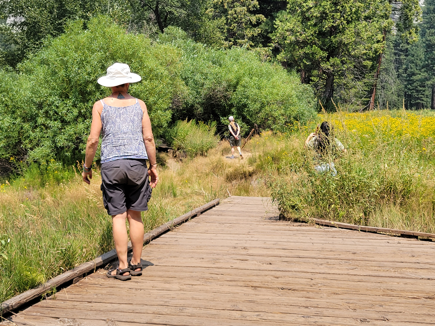
We then drove up to the Zumwalt Meadow trailhead, where a trail crosses the river and goes in a loop around the meadow and and back across it on a boardwalk. Or used to. As we suspected, high water had washed out part of the boardwalk, and you could only walk in as far as the south side of the meadow. We saved this outing for the arrival of the rest of our camping party. For the rest of the day and evening we relaxed, read, and walked around a bit. There were no campfire songs, no s'mores, no warming ourselves by the fire as it grew colder. Fires are forbidden throughout the national parks and forests of the Sierra due to extreme drought and the existence of a dozen wildfires across the state. This includes charcoal fires - only propane stoves are allowed. The daytime temperature had been just under 80; it was 50 degrees through most of the night, dropping down to 46 about 4 a.m. Due to the smoke there were no stars, but the moon was an interesting orange color. The rest of our party arrived late the next morning, all people Teri has known a few years: Kara, Bobby, Maria and her daughter Abby. I had hiked before with all but Bobby. |
|
|

|
| Abby and Maria | Bobby and Maria |
|
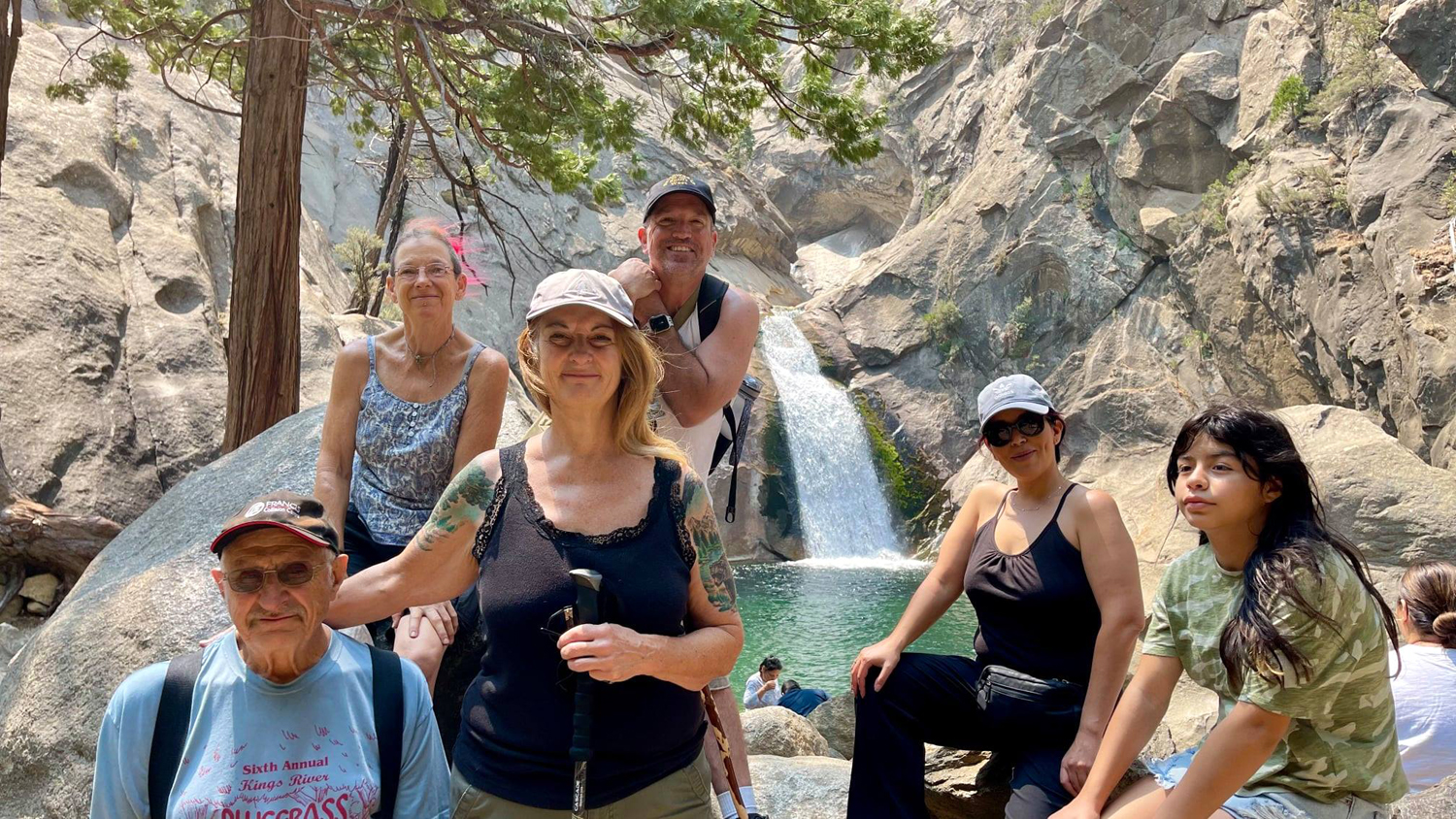
After they unloaded their equipment and set up tents we drove once again to the Roaring River Falls trailhead. In addition to the paved trail on the east side of the river, there is a steeper, rougher trail on the west side. It arrives at a lookout point higher than the main trail and provides a different perspective on the falls, the river, and the narrow granite gorge from which the falls emerges. After enjoying the view here, we returned to the road, crossed the bridge, and walked up the main trail, where a fellow tourist took a photo of our group. Everyone agreed that the pool looked refreshing, but cold. |
|
|
|
| Roaring River Falls from the west side | Our camping crew: Dick, Kara, Teri, Bobby, Maria, Abby |
|
Next we drove up to the Zumwalt Meadow trailhead, and walked to the meadow. Where the trail comes in across the meadow we saw the remains of the boardwalk that had been partially washed out by high water some time in the last few years. We were able to walk on it and into the edge of the meadow, but it was obvious that it was unsafe to go more than a few steps in that direction. We enjoyed the view of flowers and cattails in the meadow, with the huge rock formation known as North Dome looming over us. From this point it did not look much like a typical dome, and we called it "the El Capitan of Kings Canyon." |
|

|

|
| Zumwalt Meadow | The boardwalk and North Dome |
|
|
| Kara approaches the gap where the boardwalk washed out | Bobby, Maria, Abby and Teri in the meadow |
|
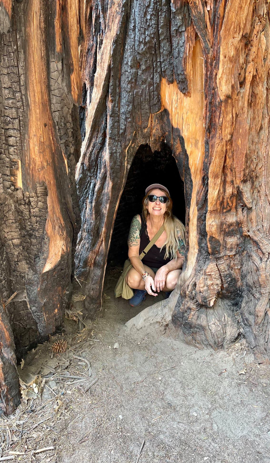
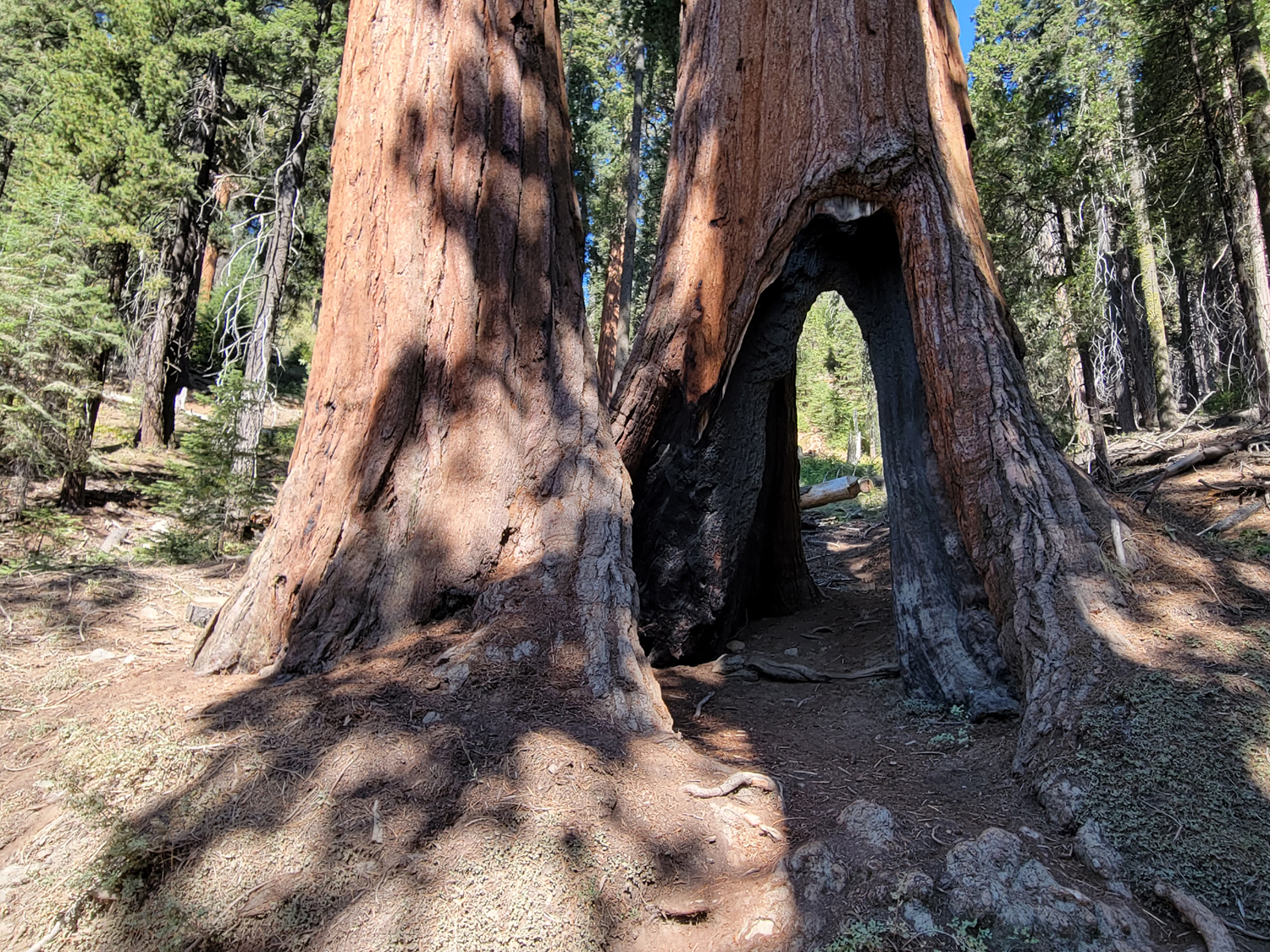
On our way back to the parking lot, we stopped to enjoy a huge cedar tree that has some big, dramatic-looking branches that curve out and up. It had burn scar in the base big enough for humans to enter. |
|

|
|
| A magnificent incense cedar tree | There's room inside the burn scar |
|
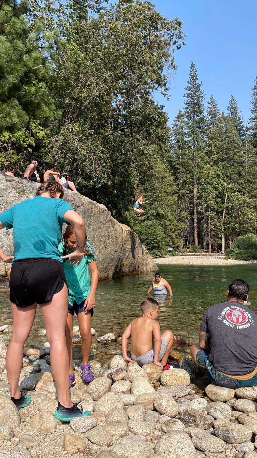
A couple more adventures were still in store this final day. First we returned to camp to eat and restore our energy level. Several members of the group are familiar with Muir Rock, a huge granite boulder adjacent to the river east of Zumwalt Meadow. It's a good swimming spot at low water, and many visitors are tempted to jump off the rock into the river, include Kara. I don't go into wild water anymore (meaning any water not a swimming pool) so I stayed back at camp resting and reading, and making another visit to the top of the moraine. |
|
|

|
| That's Kara launching herself from Muir Rock | We zoom in for a close-up |
|
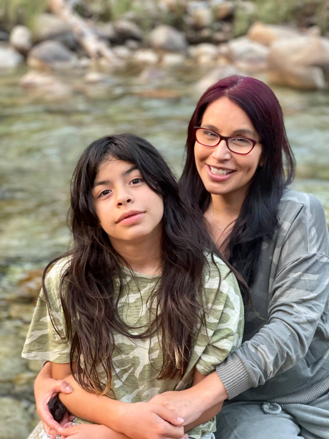
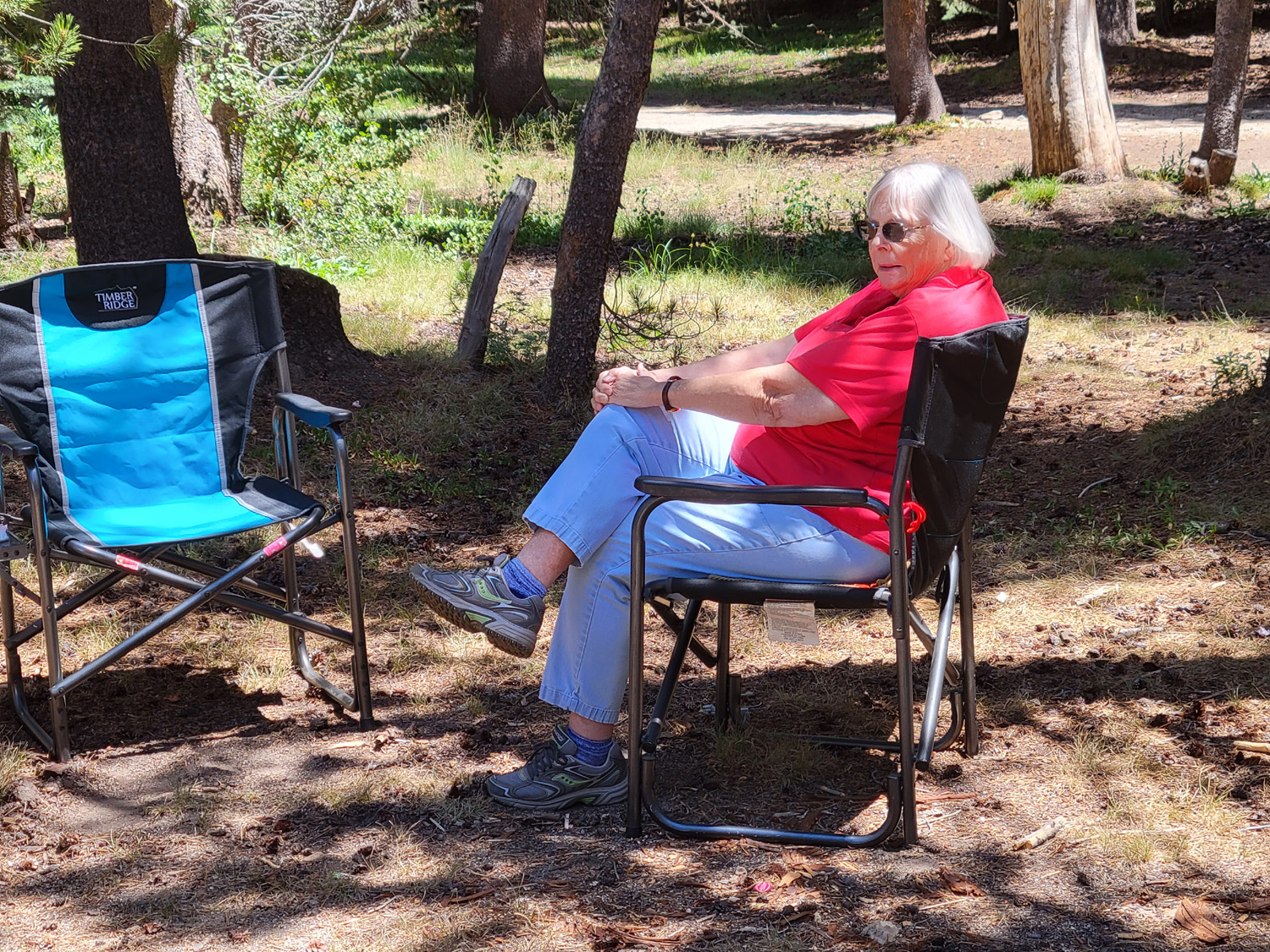
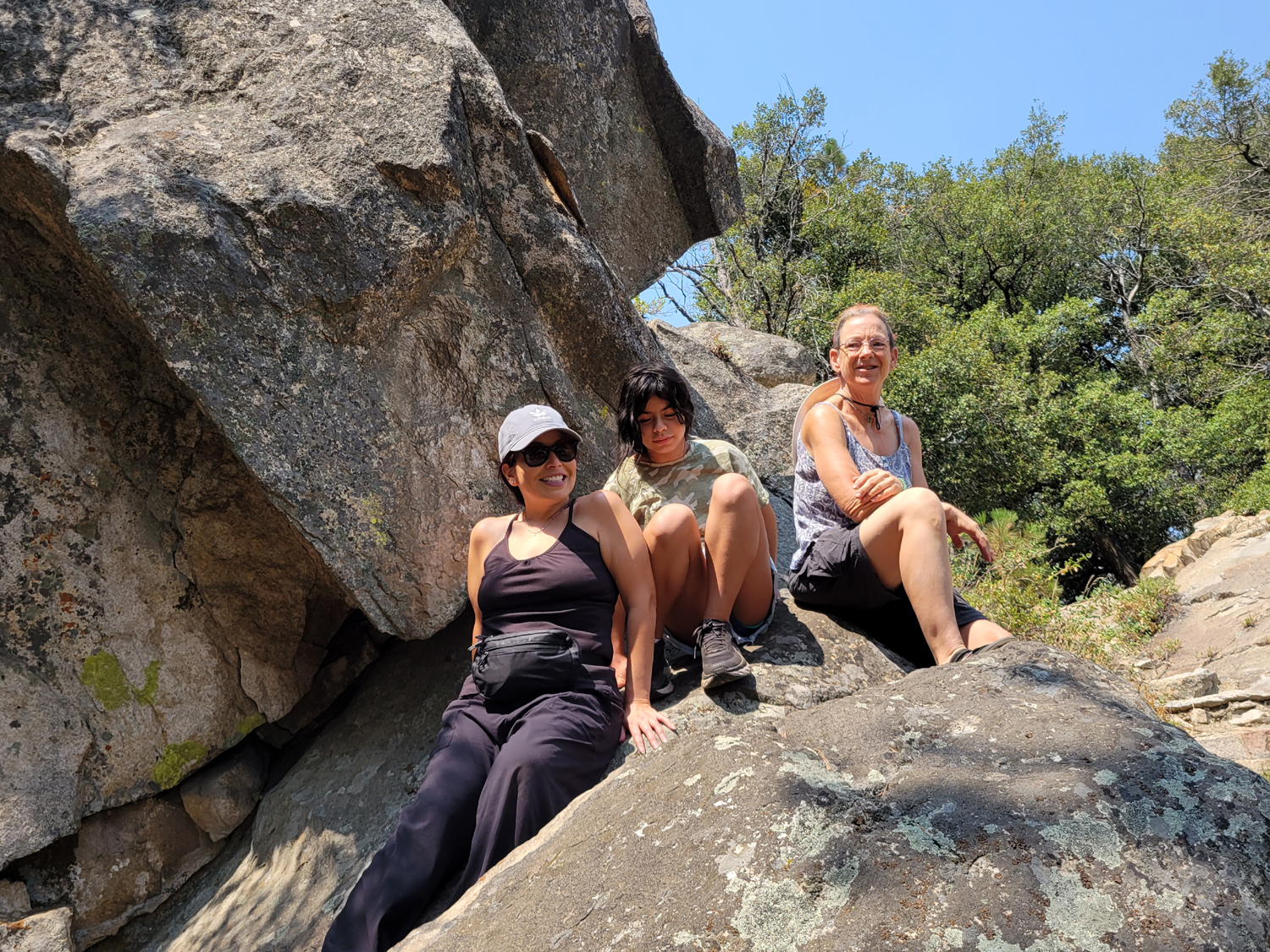
At lunch we had discussed how nice it would be to have ice cream for dessert, but an ice chest does not work. However, a little over a mile away is Cedar Grove Village, with a store, restaurant and other services. When the swimmers returned we drove to the store and chose our favorite ice cream bar (subject to the limited selection), and enjoyed them on the deck overlooking the driver. With dessert finished, it was time for dinner. Kara made hamburgers, and I tried a meat-free burger. It was OK, but I'm not ready to give up my carnivorous ways. After this we sat around the camp - not the campfire. One party up the hill from us appeared to have a fire, but when I went to let them know fires were not allowed. it turned out to be a portable propane fire pit. Later a man just across the road from us had a fire. I gave him the information, and I think he put the fire out a few minutes later. There are signs all over the camp and along the road regarding fire restrictions but he came in after dark, so maybe didn't see them. But there is a big towed LED sign near the park entrance that flashes NO FIRES NO CAMPFIRES night and day. One would also wish for common sense and an awareness of what is going on all over the state. Maria and Abby had a tent, and Tara had brought a small pop up tent. She decided to sleep under the moon and the few stars visible that last night, turning the tent over to Bobby. He had forgotten his sleeping bag, and about 3 a.m., when it was 48 degrees, he got up and put on his jeans and all shirts and jackets available. Teri was very comfortable inside her Toyota Highlander. With my folding cot and a sleeping bag that's good down to 25 degrees, I also slept under the sky. Late at night, shortly before dawn, quite a few stars became visible, and the moon put on a show each night, appearing dark orange, then yellow, then finally the appropriate silver. The next morning Tara fixed a breakfast of potatoes and sausage, after which we packed up at our usual leisurely pace and started out of the park. We made a final stop at Grizzly Falls, which some had not seen before. Everyone but me ventured into the creek near the base of the falls, a place that would be fatally dangerous at high water, and I went closer than ever, to a spot where I would have been soaked by the mist that blows off the rushing water in the spring. It was a congenial group, and we all had a great time 80 miles into the Sierra away from civilization. --Dick Estel, August 2021 |
|
|
Redwood Canyon Etc.
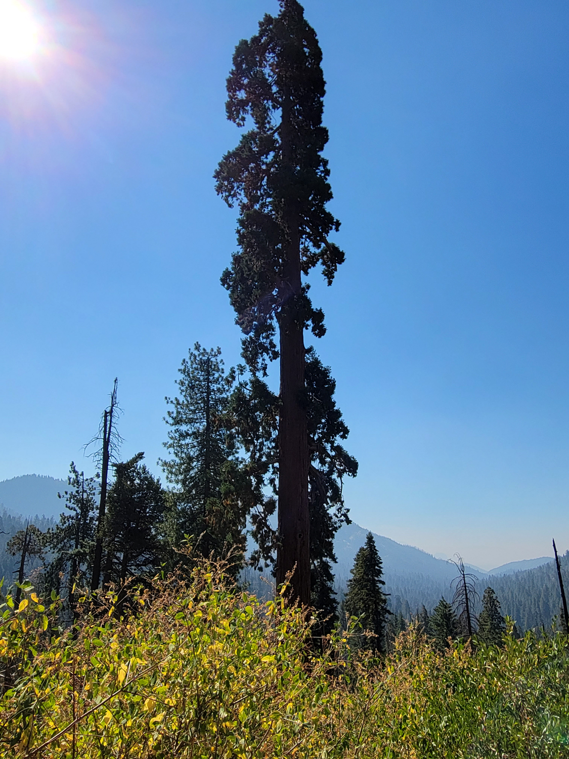
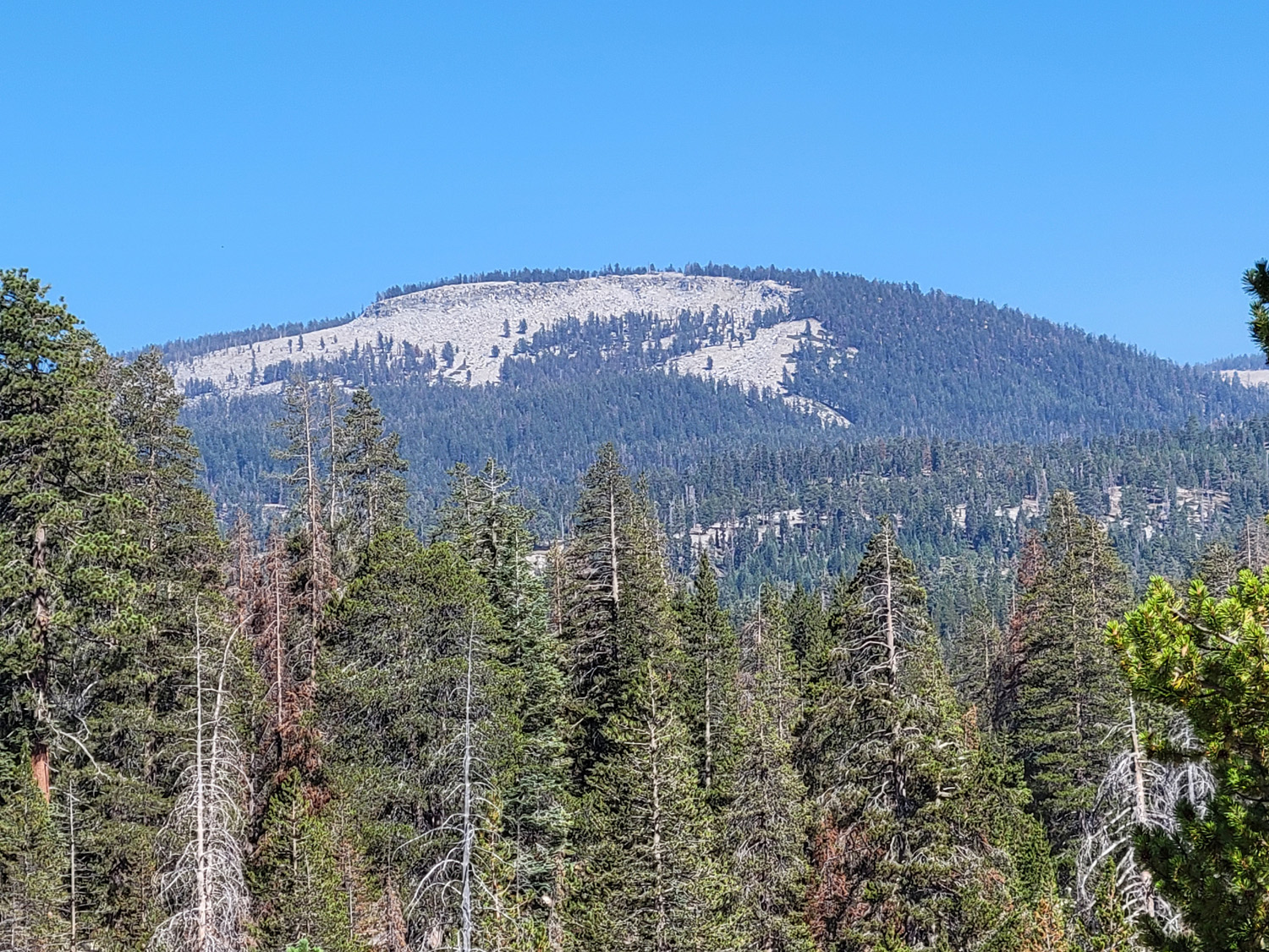
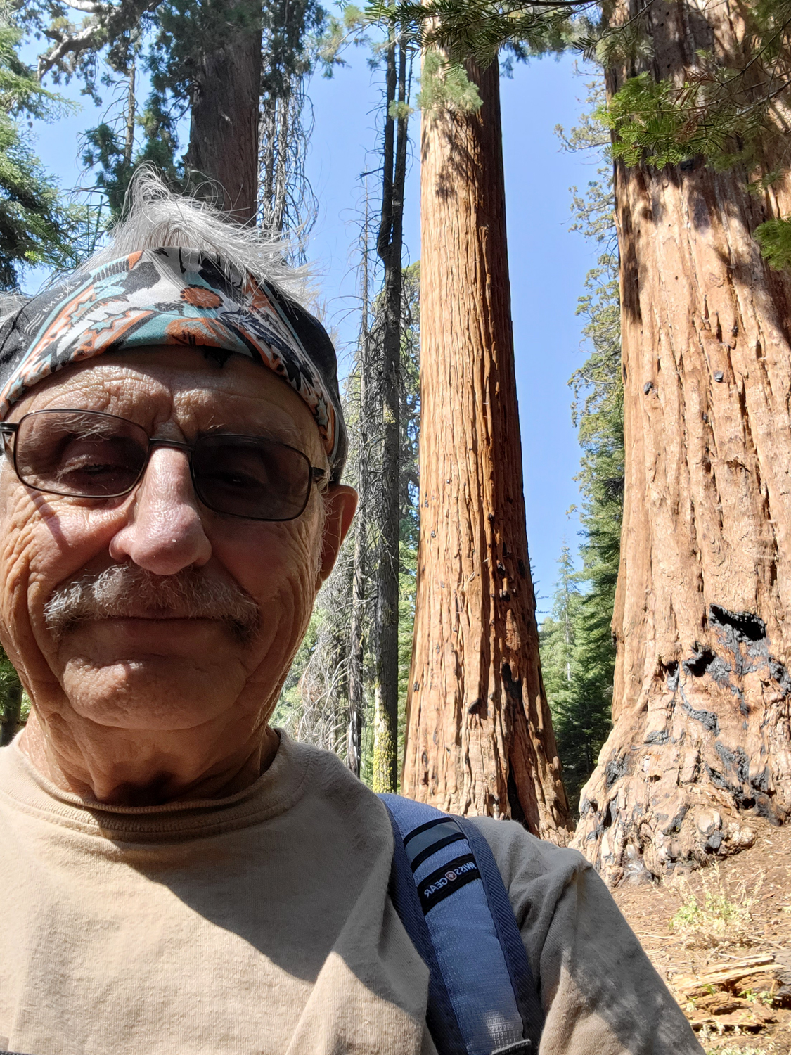
I had a rare experience the last weekend of August. I looked at my calendar, and had nothing scheduled for the coming week. I have wanted to check out Redwood Canyon in Kings Canyon National Park for some time. I didn't want to hike, then drive home late in the afternoon, so I booked a night at Montecito Sequoia Lodge, on the General's Highway between Kings Canyon and Sequoia parks. Redwood Canyon contains one of the largest sequoia groves in the Sierra, with 15,800 trees over a foot in diameter at the base. Several thousand of them exceed six feet at the base. I left home at 8:30 the morning of August 30, and made the 55-mile drive to the turn-off without incident. Soon after you enter the park, the road forks. The left fork goes to nearby Grant Grove, and 32 miles to Cedar Grove, in the Kings River Canyon. The road to the right goes to Sequoia National Park and numerous points of interest along the way. A little less than four miles from the junction, a paved road to the left follows Ten Mile Creek down to Hume Lake. To the right a rough dirt road goes down hill about two miles to the trailhead for Redwood Canyon. As soon as you start down this road, you are driving among redwoods. The road goes down along the side of the canyon, with steep drop-offs on one side. Redwoods growing on the slopes below the road offer a direct view across to the upper half of the tree. Also of great interest along the road is what appears to be a natural tunnel tree, created by fire. |
|
|
|
| View along the road to the trailhead | Natural tunnel tree, created by fire |
|
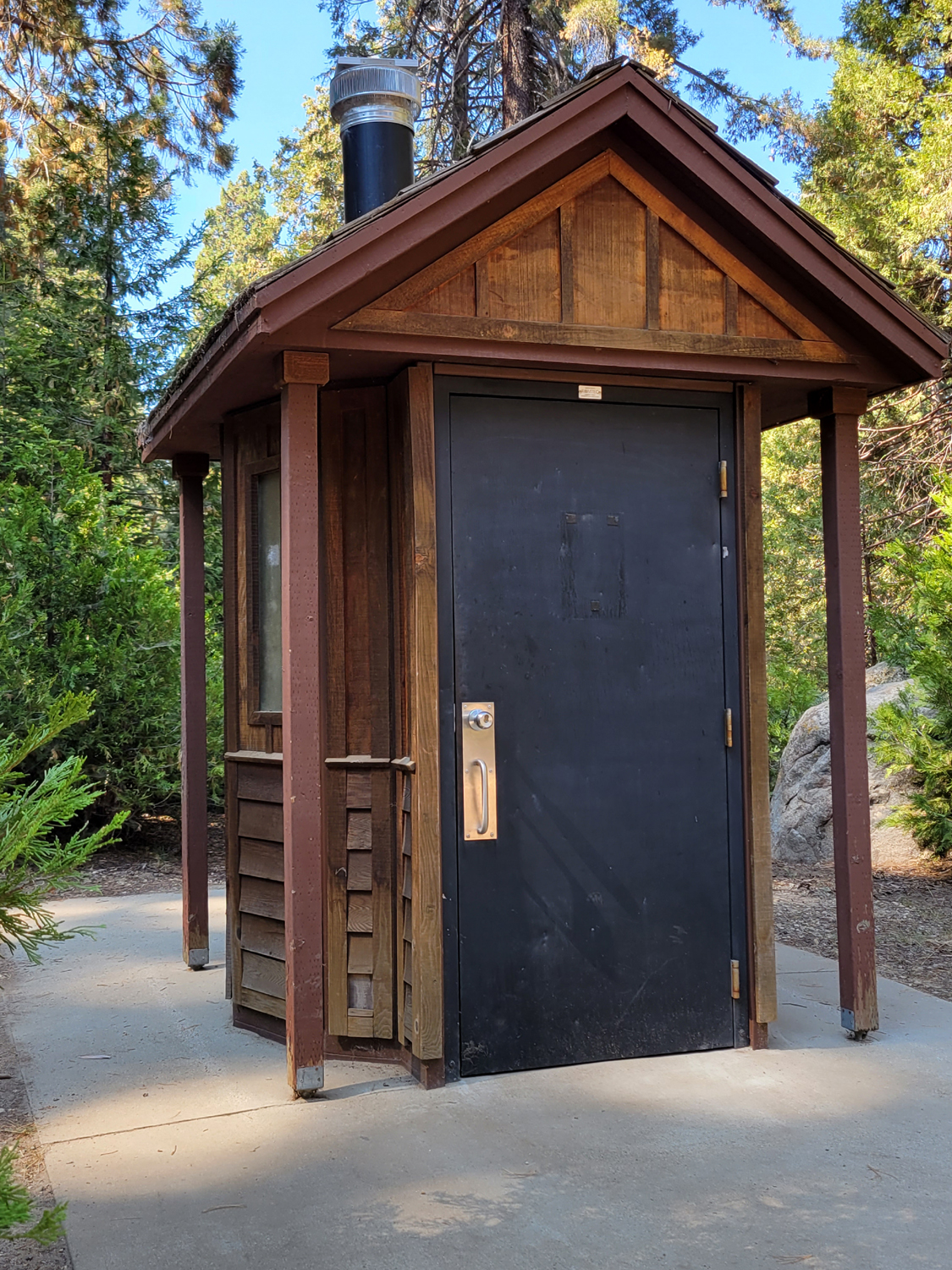
The road is very rough, with bumps and potholes hidden in the shadows, but you want to go slowly and enjoy the scenery. It's about two miles to a junction where you turn left and drive a short distance into the parking lot. Giving promise of a great hike, it is surrounded by large sequoias. It also has one of the most architecturally charming restrooms I've ever seen. The trail goes in two directions from this spot, forming a long loop trail. There are several shorter loops within the main outer perimeter. Since the shortest loop is about five miles, I knew my hike would be "out and back." Sometimes a hike of this sort has a specific destination; sometimes I just go "half of far enough." This one was a little of both. |
|

|
|
| This excellent specimen welcomes hikers at the parking lot | An upscale outhouse |
|
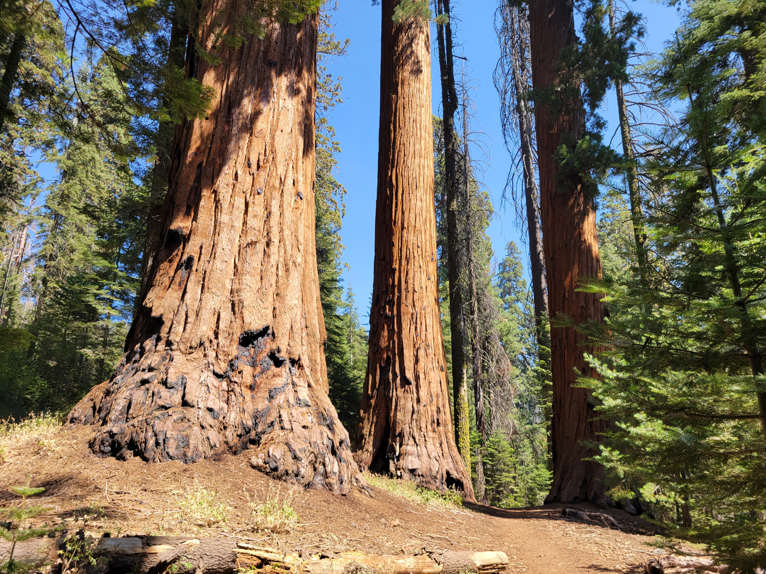
I was delighted to find that any place on the trail that I stopped to look around, I could usually count at least a dozen large sequoias close by. This condition persisted throughout my hike, but I understand there are places beyond where I turned back that they are sparse for a while. The web site Redwood Hikes has an excellent description and large scale map of the trails. |
|

|
|
| Views like this were constant along the trail | Near the Redwood Creek Trail junction |
|
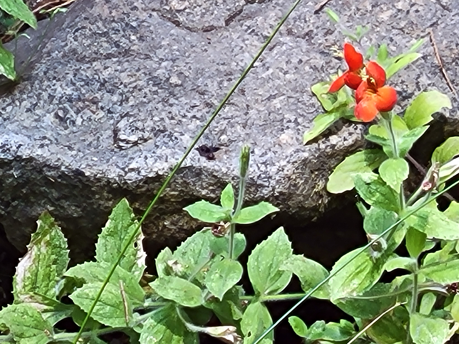
The trail is pretty much all downhill as far as I went, but not really steep. Eventually I came to a trail junction, the Redwood Creek trail, which connects with the longer, outer loop trail. A little beyond this place I came to Barton Creek, where I rested and had a snack at a large flat area. Although this grove was not heavily logged, there were two big stumps here, and it's a short distance to Barton's Post Camp, where trees were cut into posts, railings, and probably roofing shakes. The creek was barely flowing but offered moisture for ferns and wildflowers. |
|

|
|
| The trail guide tells you to cross fern-lined Barton Creek | Wildflower next to the creek |
|
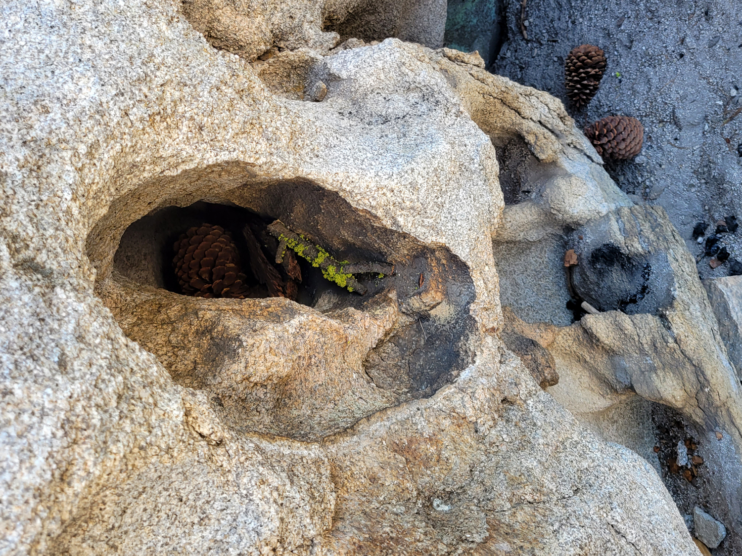
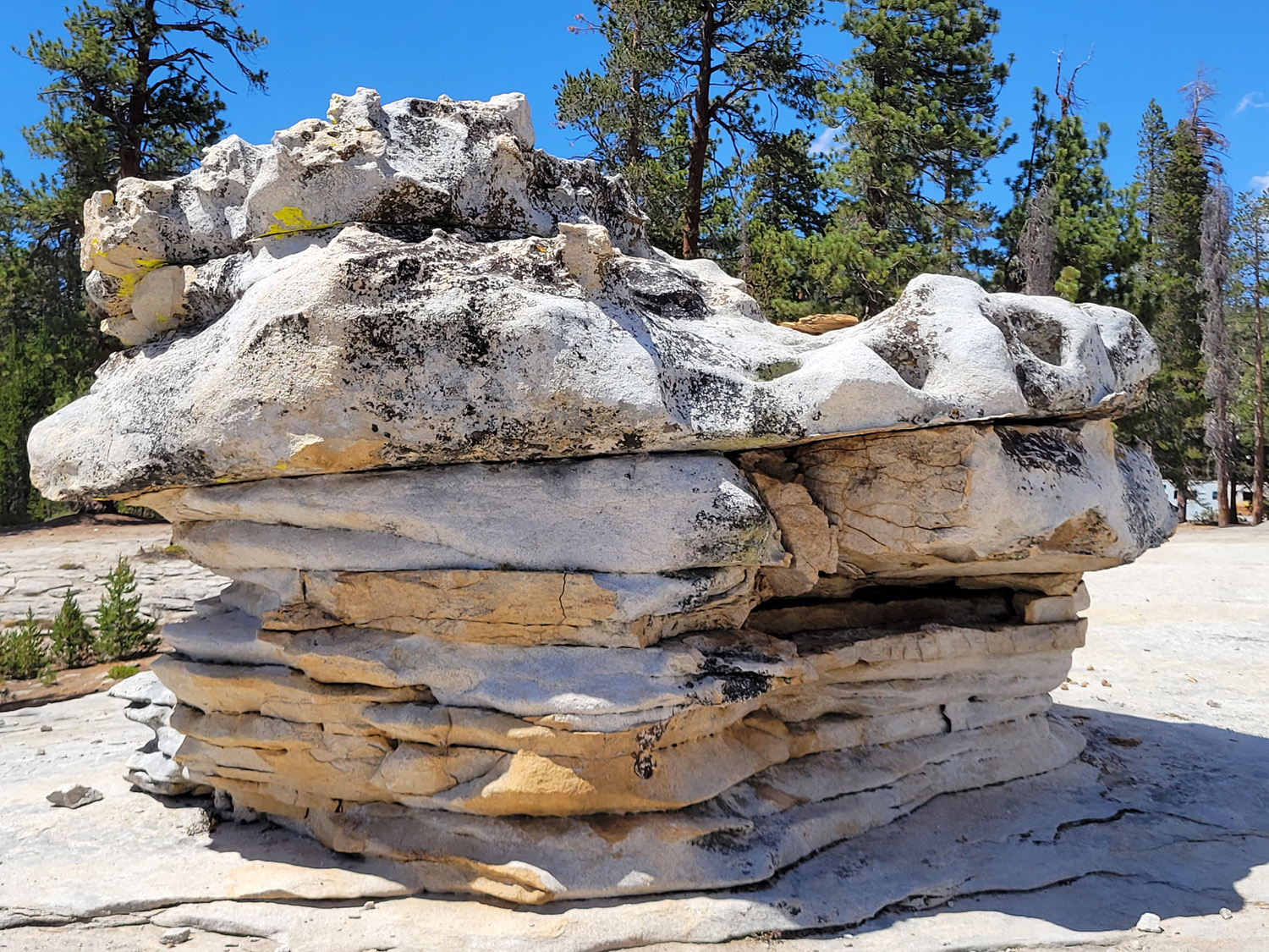
After my rest, I retraced my footsteps back to the parking area. Among the other sights along the way was a good view of the west side of Buena Vista Peak, where I have hiked a number of times. I also saw more big sequoias, with the usual different perspective you get walking the opposite direction, and dogwood leaves just starting to change to fall colors. A group of three passed me as I got close to the trailhead, and a couple came out while I was finishing my lunch in the shade of the firs, cedars, pines and sequoias. Otherwise I had the place to myself. There was still a lot of time left before I could check in to the lodge at 4 p.m., so I explored a couple of the roads that lead off the Generals Highway. First I went down Road 14S04, where I had camped a few times 40 or 50 years ago. Most of the land along this road seems to be private or leased grazing land, and roads off this route were mostly guarded by locked gates. Next I went to Big Meadow Road, where I had camped with my daughter in early August. On the big granite outcropping that we had explored twice, there was a hole in the granite boulder at the southern edge. I had stuck my hiking pole into it, and found it went in about four feet. Someone had placed a pine cone and a moss-covered stick inside. I had wanted a photo, but did not get one on my previous visit, so I accomplished that goal. |
|
|

|
| Hole in the rock by Big Meadow Road | What's inside the hole |
|
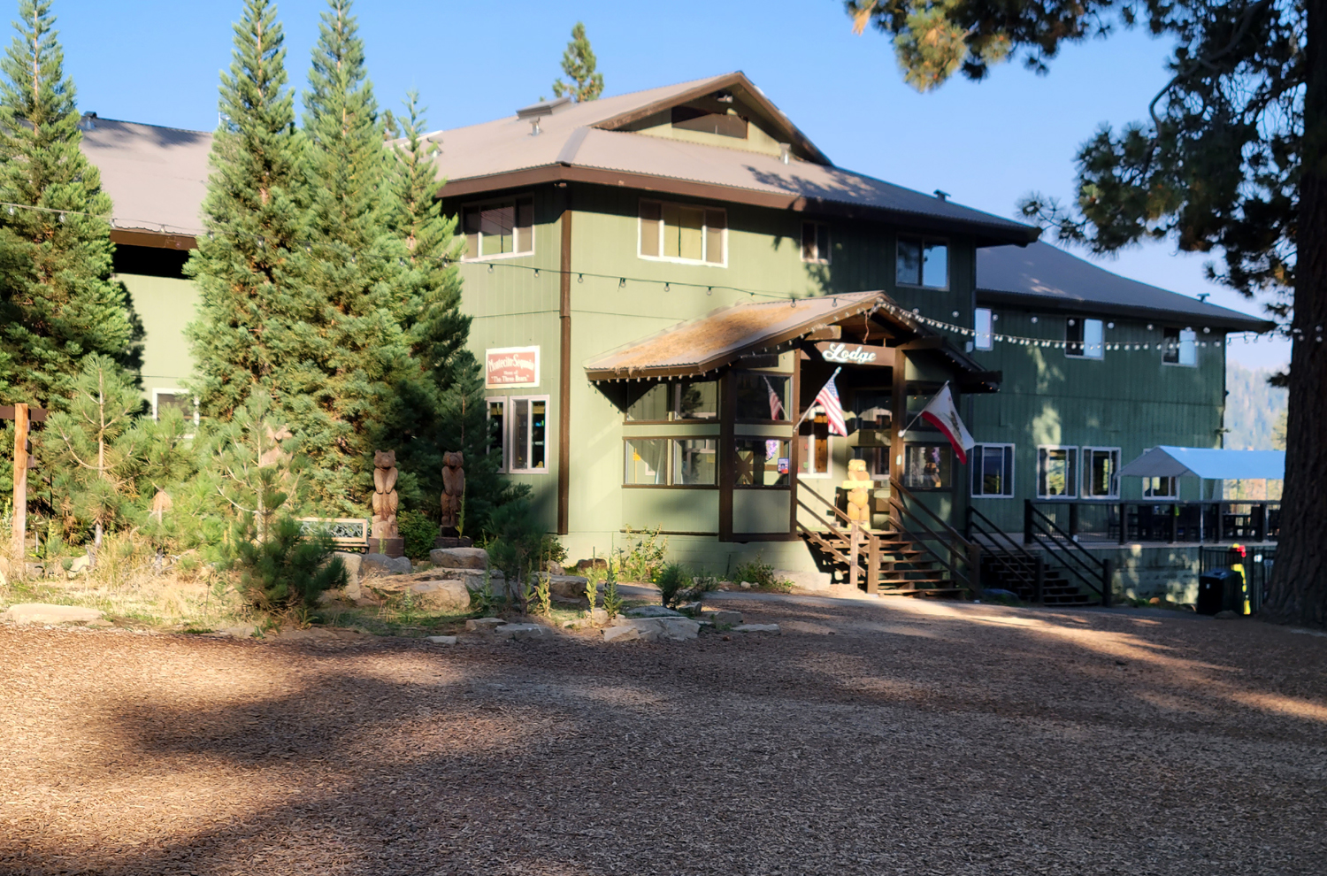
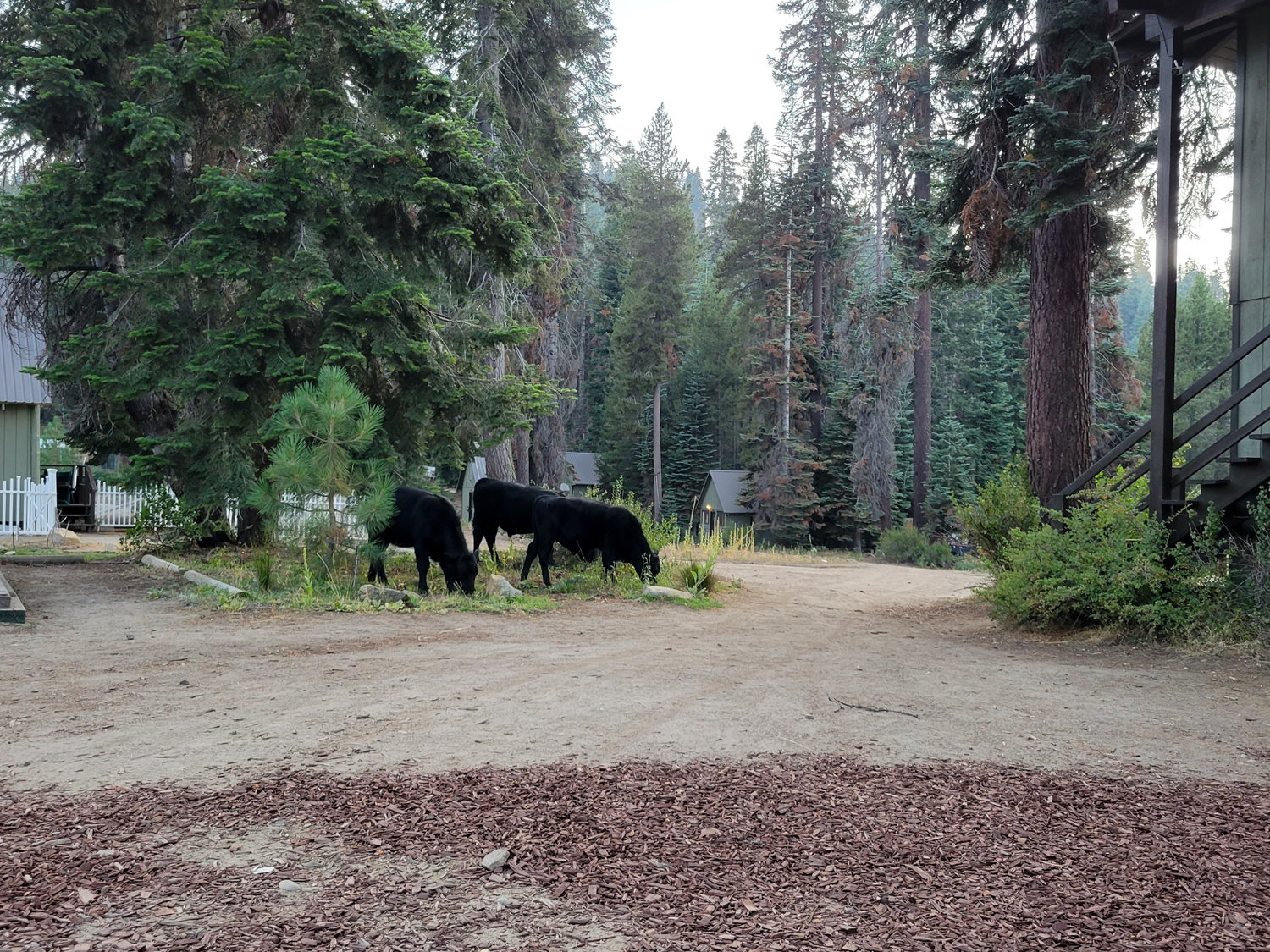
Returning to the Generals Highway, I drove a few more miles to Montecito Sequoia Lodge. When I booked the room I had asked for a ground floor. Soon after I received an email saying my request had been honored. When I arrived I had been assigned an upstairs room. The clerk said no downstairs rooms were available. With great difficulty, I carried my luggage and my 82-year old body up narrow, unsafe stairs with a loose handrail. Then a staff person came and said there was a ground floor room I could have, for $10 more. They provided someone to carry my luggage down, but of course, I was already worn out from carrying it up. They acted like they were doing me a favor by charging me $10 extra for what I had asked for in the first place. Other than the booking problem, the place is quite nice. There is a pond, swimming pool, trampoline, playground and other kid=friendly features. Meals are included. although if you stay only one night, you don't get lunch. Supper was a buffet with sloppy Joe's and hot dogs, while breakfast included cereal, eggs, potatoes and sausage, plus sweet rolls, fruit and other snack items. The cooked food was typical motel food - no gourmet meals here despite room rates that matched the 6,000 foot altitude of the location. Late in the evening cows wandered through the grounds, munching grass around the plantings. Apparently they are the landscape crew. The room had a king bed and bunk beds, plenty of drawers and cabinets. It was a tight fit, but the bathroom was large, the towels high quality, and the bed comfortable. |
|
|
|
| Montecito Sequoia Lodge main building | Landscape crew at work |
|
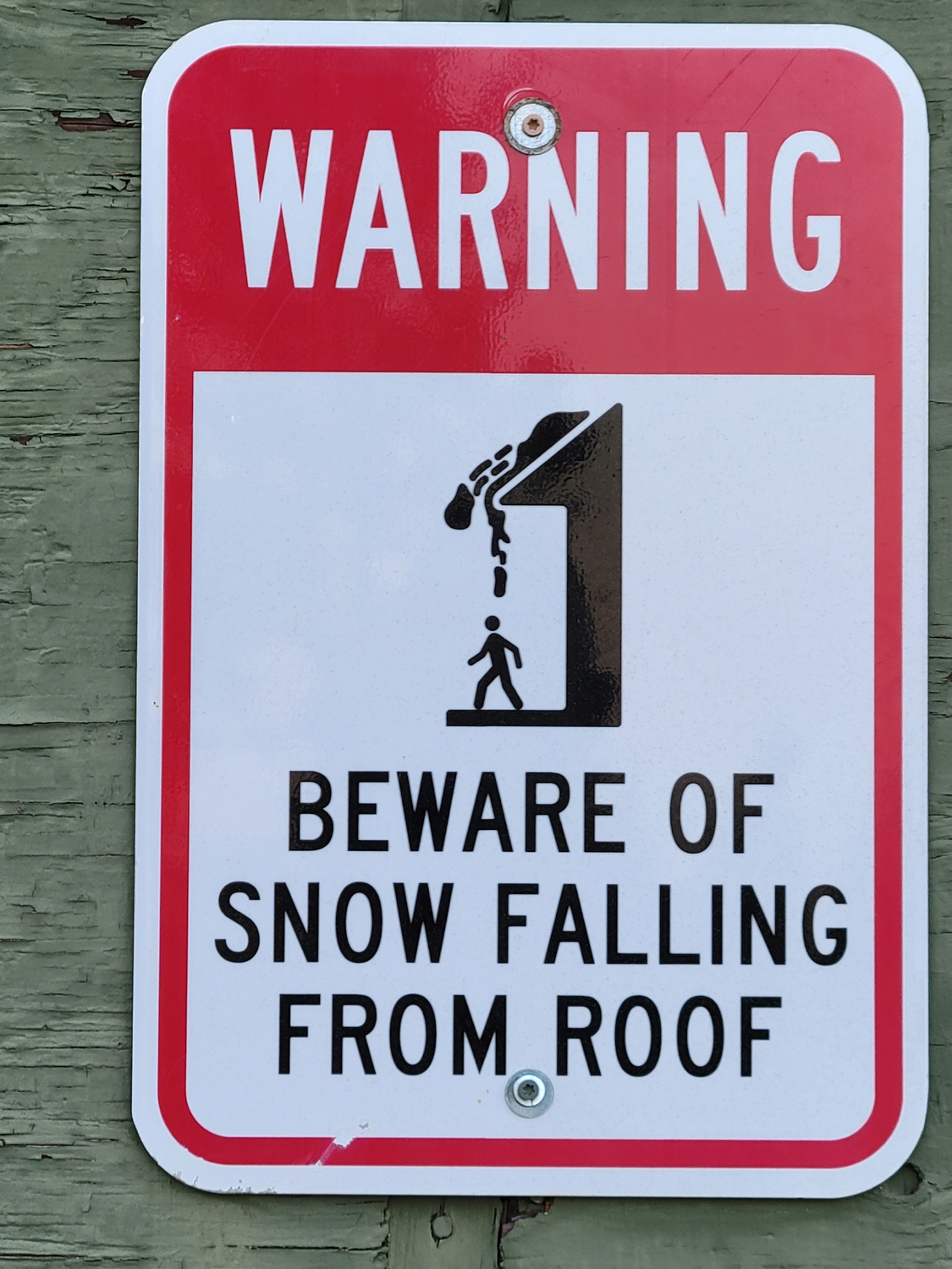
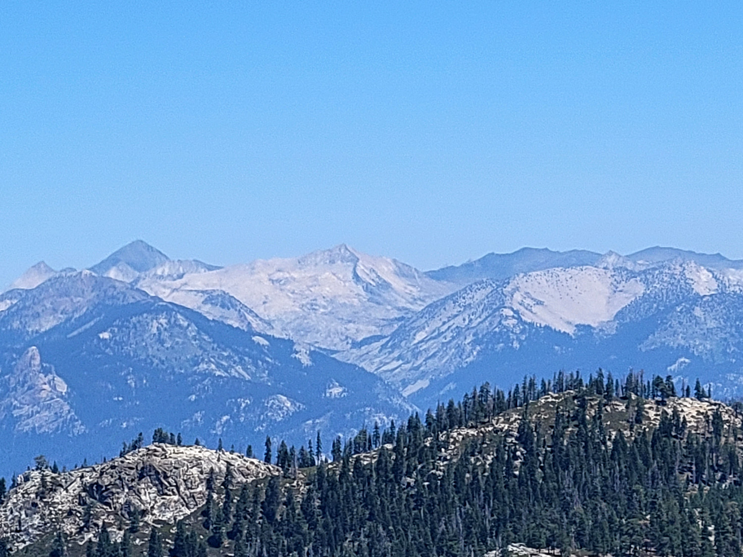
Signs on every building warned of the danger of snow falling from the roof, since the facility is open all year, subject to weather-related road closures.. I had a bad night, nothing to do with the facility, and slept very little. However, the morning brought an amazing view of the distant peaks to the south. |
|
|
|
| I had no worries about this in late August | View of Sierra peaks to the south |
|
After breakfast I got the car loaded, checked out, and went on a brief scouting expedition, driving to nearby Stony Creek Lodge to see if it offered better facilities. The rooms are all in the main building instead of being scattered around the grounds hundreds of feet from the parking lot like Montecito. I am hoping to visit the area in October with my great grandsons. The woman on duty said they might be closing soon, because they had heard the forest might be closed. In fact, the next day all California National Forests were closed, and people were ordered to leave by midnight, August 31. This no doubt inconvenienced thousands of people in Sequoia and Sierra National Forest resorts and campgrounds. Fortunately, national parks are not affected, so a planned Ramblers hike to Buena Vista Peak should still be OK. Last year around this time vacationers were driven from the mountains by the massive Creek Fire. We are cursed to live in "interesting times." --Dick Estel, September 2021 |
|
|
Photos (Click to enlarge; pictures open in new window) |
||
|
Lewis Creek Trail Big Meadow Road Cedar Grove Redwood Canyon Etc. |
||
|
Lewis Creek Trail |
||
 |
 |
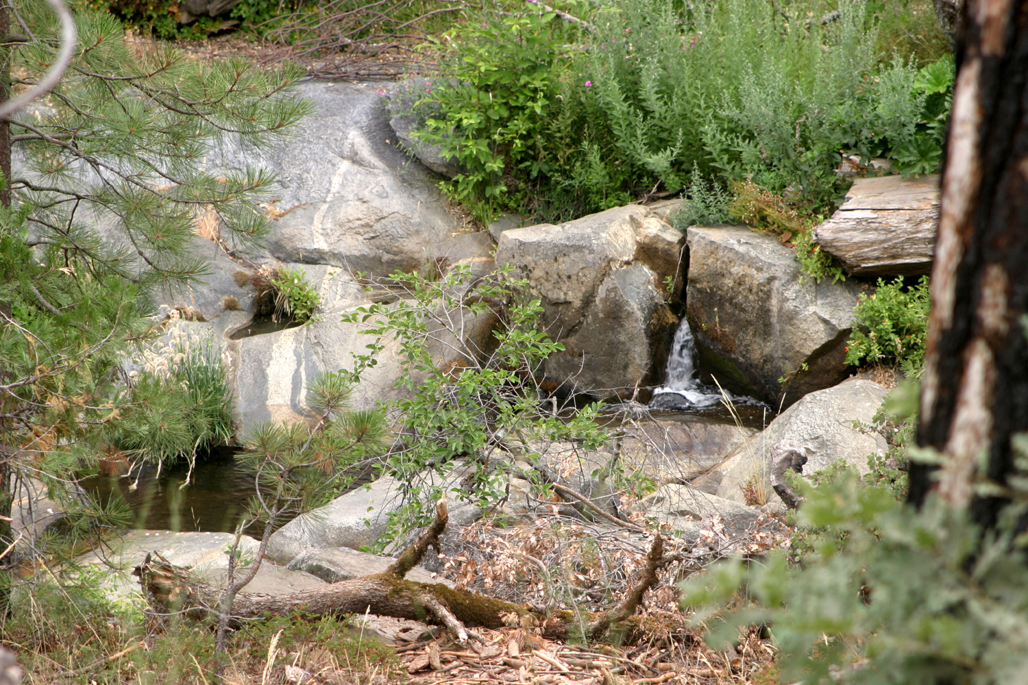 |
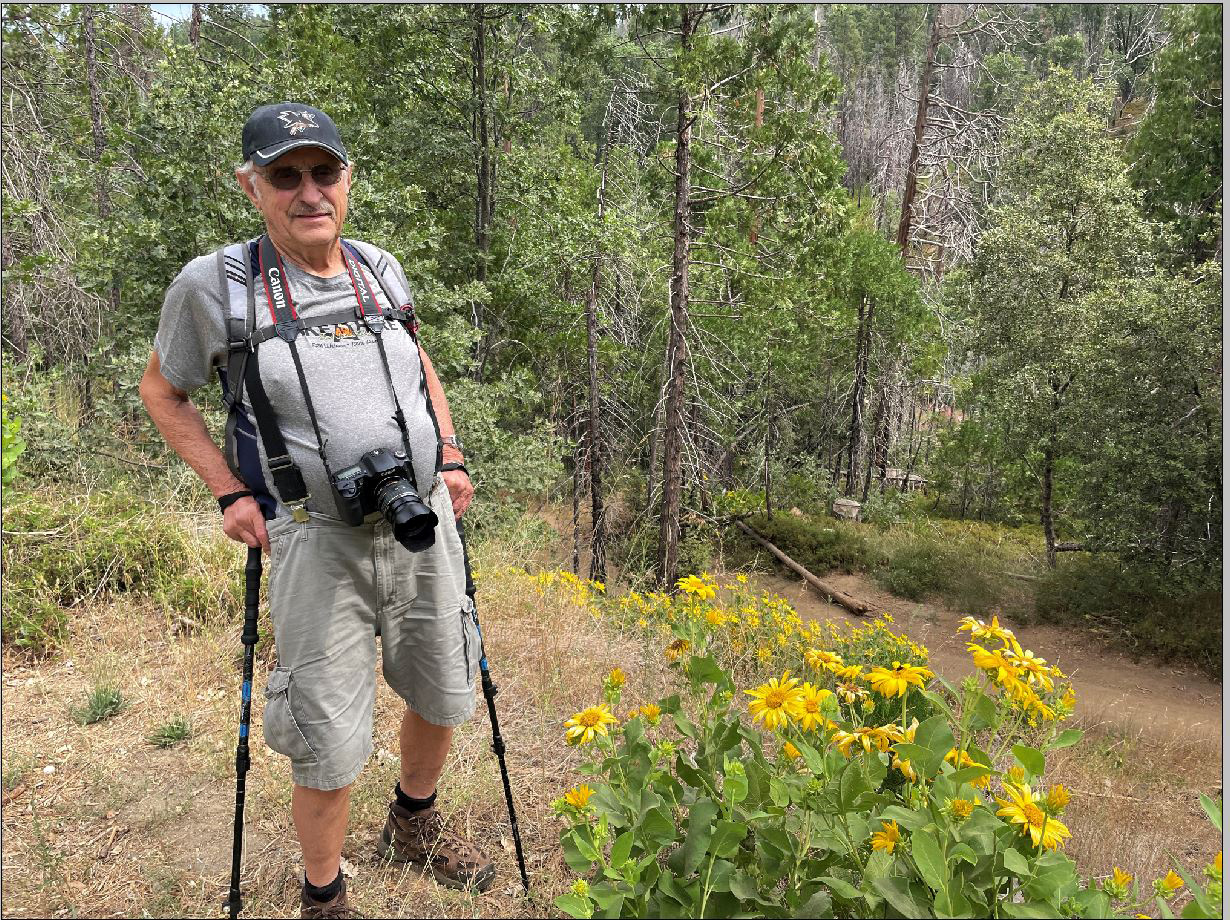
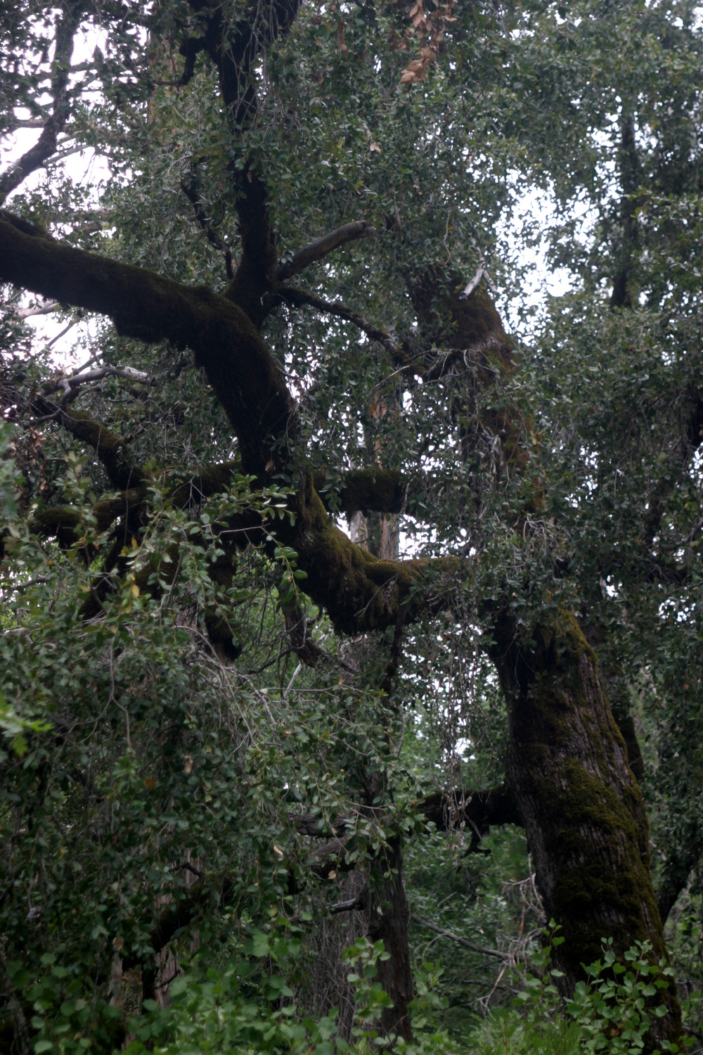
| Dick poses with a clump of mule ears | Massive canyon live oak | One of many little cascades on the creek |
 |
|
 |
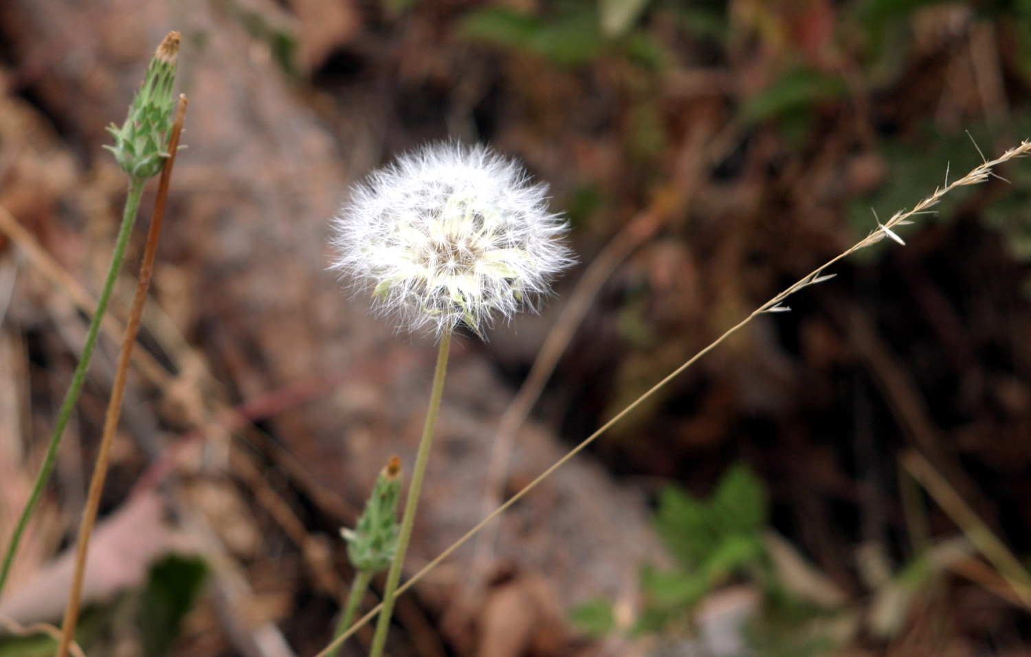
| The delightful dandelion | Looks like morning glory | Beautiful, but an invasive species |
| Big
Meadow Road (Photos by Teri & Dick) |
||
 |
 |
 |
| Sue at our lunch stop | Shell Mountain | Rugged boulder on granite outcropping |
 |
 |
 |
| Teri and Dick near the trail to Buck Rock | The route to the top
starts with a brief climb up a rocky trail |
Taking this photo
required leaning out over the railing |
|
 |
 |
| Teri at the top of the first section | Looking down the top section | View from the steps of the visitor cener |
 |
 |
 |
| All about Buck Rock | Dramatic high Sierra vista | Dick with Kings Canyon in the background |
 |
 |
 |
| There were dozens of
ant hills like these near our campsite |
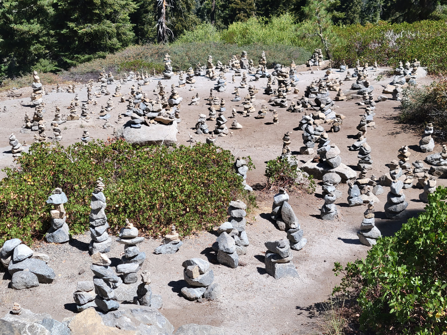
Red fir in natural bonsai form | Artistic expression
below the Kings Canyon Overlook |
| Cedar
Grove Photos by Bobby & Dick |
||
 |
 |
 |
| The Methuselah Tree
has developed buttresses on each side |
Steller's Jay searching for a handout | Maria, Abby and Kara
on the rocks at Roaring River Falls |
 |
|
 |
| Our campsite had an unexpected amenity | North Dome | Teri and Dick at Zumwalt Meadow |
| Redwood Canyon - Montecito Lodge - Big Meadow Road | ||
|
 |
 |
| Redwood Mountain from the Generals Highway | Dogwood just starting to change color | The west side of Buena Vista Peak |
 |
 |
 |
| Proof that I was really there | One of the very few big stumps | Pool at Montecito Lodge |
| Related Links | ||
| Lewis Creek Trail | Pete's Place | Sugar Pine |
| Generals Highway | Buck Rock Campground | Big Meadow Campground |
| Jennie Lakes Wilderness | Kings
Canyon National Park |
Hume Lake |
| Buck Rock Lookout | Great Western Divide | Moraine Campground |
| Moraine Campground | Roaring River Falls | Zumwalt Meadow |
| Zumwalt Meadow Loop Trail | Muir Rock | Cedar Grove Village |
| Grizzly Falls | Redwood Canyon Trails | Trail Description |
| Redwood Canyon | Buena Vista Peak | Montecito Sequoia Lodge |