Colorado Springs Cousin Convention |
||
|
Background Clovis to Grand Junction Grand Junction to Colorado Springs At the Reunion Colorado Springs to Montrose Black Canyon Park Montrose to Delta Delta to Tonopah Tonopah to Clovis |
||
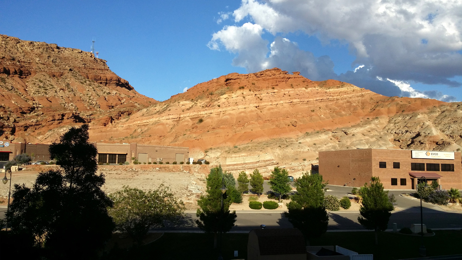
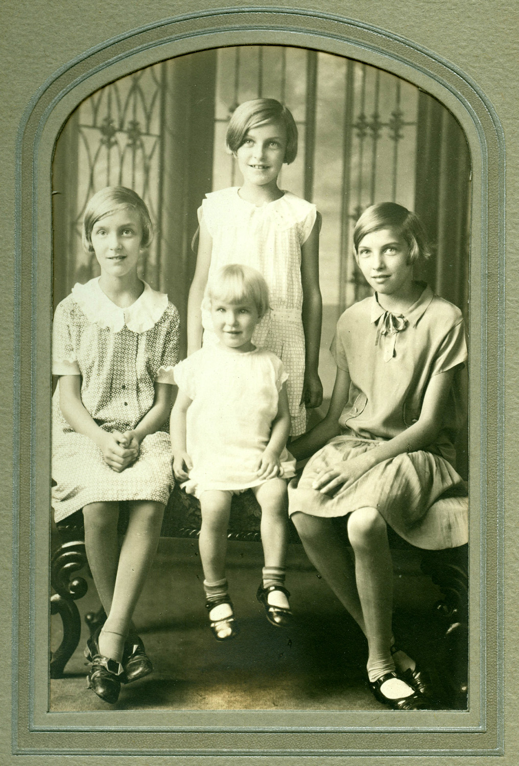
The Background: My mother was one of the four Mason sisters, born and raised in northwest Ohio. Three of them moved to California, while the fourth lived all her life in a small city in Michigan, 20 miles from where she grew up. Between them they produced eleven children. My late Aunt Vivian, who lived in Poway near San Diego and then retired to Lake Elsinore in Riverside County, took it upon herself to host family gatherings, which ranged from two of the families to all four, with varying numbers of the cousins being able to join in as they grew up, moved apart, and produced children of their own. The last time most of us were together was some time in 1990, when Vivian was suffering from terminal cancer, and again a few months later at her funeral. I've seen my sister and all my cousins at least once since I retired in 2002, but some of them have not been in touch with each other during the 25 years since those 1990 gatherings. Several of them had asked me during visits if we were ever going to have another "cousin convention," and it became obvious that for it to happen, someone had to get it started. Late last year we began a series of email "discussions," with the ultimate result being that we reserved a block of rooms at the Hotel Elegante in Colorado Springs for June 12, 13 and 14, 2015. Travel
plans were made, dinner reservations arranged, and during a week of
unsettled weather in mid-June, nine members of our generation, plus two
spouses, made the trip to Colorado Springs from Minnesota, Missouri,
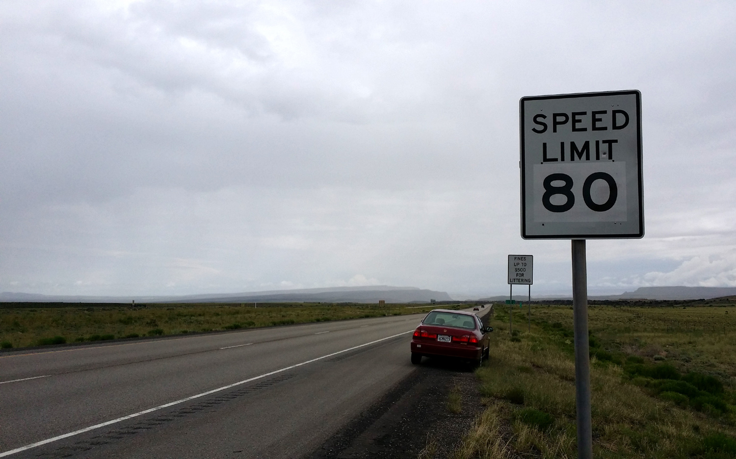
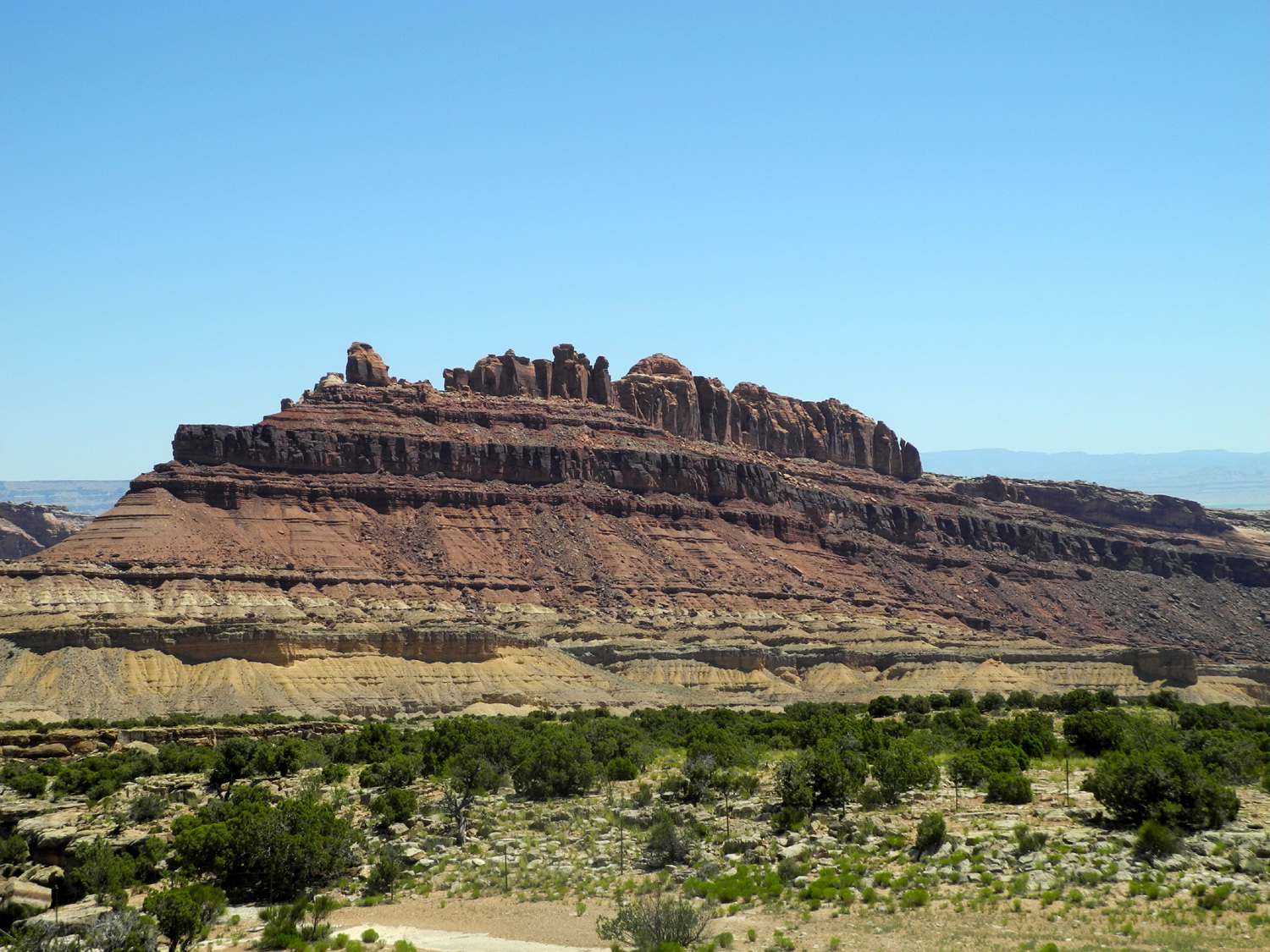
Oregon, Texas, Michigan and California. June 11, 2015: I'm two days into my journey to Colorado Springs, and two very different days they were. Yesterday it was warm and dry everywhere I stopped, although I started early enough that it was actually very pleasant. Even places in the Mojave Desert that usually offer a hot wind provided a cool breeze instead. I got up yesterday at 5 a.m., a time of day I barely knew existed, hoping to leave by 6 a.m. I ate a good breakfast, did the final packing and loading (mainly the ice chest), and actually got under way about 6:20. I had reservations in St. George, Utah, a drive of 513 miles, much more than I am usually comfortable with. Much of the route was all too familiar - down CA 99 to Bakersfield, east on CA 58, and northeast on I-15 through Las Vegas. Leaving Nevada, the interstate goes through a corner of Arizona before entering Utah, and St. George is just past the state line, so I traveled in four states. I stopped two or three times for brief naps, a usual practice for me, and ate lunch in Baker. Since gas is $4.15 per gallon and candy bars are $2 there, I was glad I brought my own sandwich and didn't have to pay whatever lunch prices would have been. My day was brightened considerably by a billboard I saw in two places, advertising a Las Vegas show, "Puppetry of the Penis." My Honda will go over 400 miles on a tank of gas, so I didn't need to fill up till I got to Las Vegas, where it was $3.23, less than Fresno but still not great. I stopped at Mesquite, the last town in Nevada, to set my GPS for the motel in St. George and do some quick grocery shopping. The roads were in good shape, construction zones were no worse than usual, traffic was fairly light, and I arrived at my destination around 5:30 - not as late as I thought it might be. There are red sandstone cliffs around St. George, so it's a scenic location, although fairly low in elevation and therefore quite warm. Not long after I got settled in, there was some thunder and lightning, and a short rain storm, all before bed time. This morning I got up at a more normal time, although still fairly early since I am in the Mountain Time Zone, and got on the road about 8:30. I had watched the weather forecast, and it showed rain and flood warnings over my entire route, which was north on I-15, then east on I-70 to Grand Junction Colorado. There was rain on and off most of the day, sometimes fairly hard, but never lasting more then ten or fifteen minutes before there was a break, and no thunder or lightning. Most of the last 100 miles was rain-free. From St. George I-15 climbed up into a long, green valley with crops and cattle, from a few miles south of Cedar City all the way to the I-70 junction, where I turned east. This route went over a pass a short distance then down into the Sevier River Valley, where the largest city seems to be Richfield, and where agriculture again predominates. East of here the road enters true Colorado Plateau country, with spectacular scenery most of the way to Green River. There are plateaus and mesas, and dramatic canyons; as well as places where a seemingly level stretch gives way to yet another drop down through rugged canyons. Approaching Green River, and the rest of the way into Colorado, the country flattens out, but there are still some cliffs on both sides. Near the border the road begins to parallel the Colorado River all the way into Grand Junction, a long, narrow city strung out for 12 miles or more along the highway and the river. I stopped for lunch at the Subway in Green River, saving half my sandwich for later, and finished it off tonight. Now it's time to wind down the day in preparation for the final 300 miles tomorrow, and a busy weekend with family.
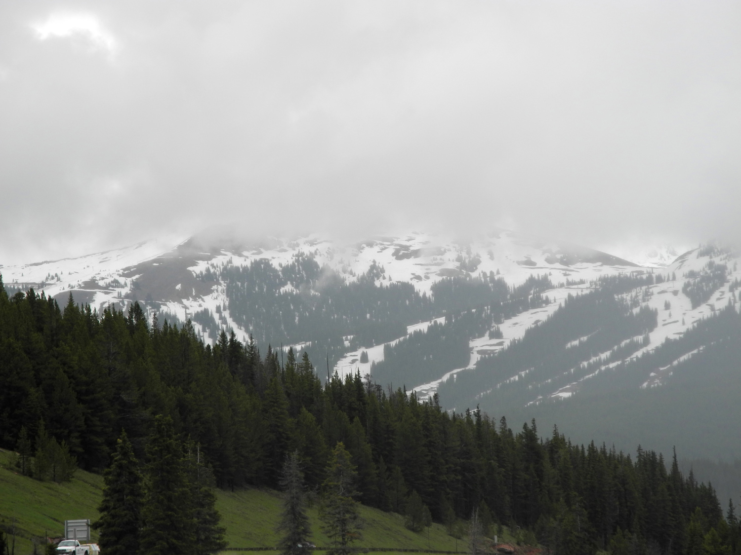
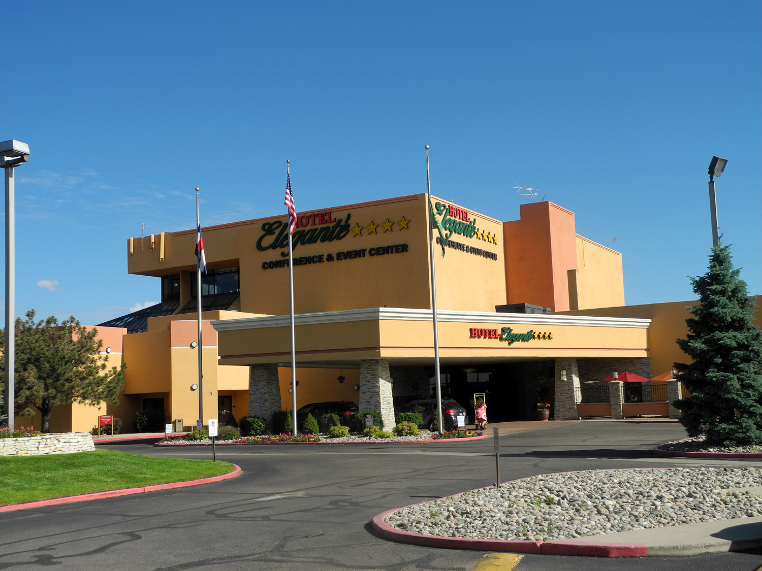
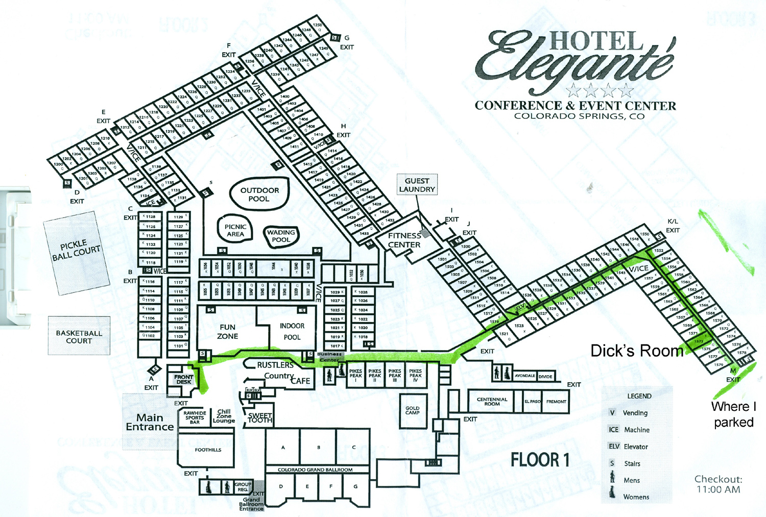
One of the most dramatic sections in this area is Glenwood Canyon. A primitive road ran through this area in the early days, and a Colorado politician of the time expressed the hope that someday it would be extended in both directions across the country. This foreshadowing of the Interstate Highway system must have seemed overly optimistic at the time, but of course, that section is now part of a road that reaches from central Utah to the east coast. In the Glenwood area there was not room to build a ground-level four-lane road, so imaginative engineering came to the rescue. Much of the westbound route is a raised causeway, immediately adjacent to and sometimes slightly overlapping the eastbound lanes. This "stacked" approach made it possible to build a road to interstate standards in a place where it was thought to be impossible. There are some great photos here. Beyond this section the Colorado River turns north, and I-70 follows various other waterways to the east. The highway rises quickly, first going over Vail Summit at 10,662 feet, down hill for a while, then back up over the Continental Divide through the Johnson Tunnel (westbound traffic flows through the Eisenhower Tunnel). From here it is a mostly steep descent into Denver. Near Vail I noticed a paved bike trail running along I-70, starting somewhere near the town at 8,022, going up over the summit and down to the next town...at least 12 miles. There's a center line, and sometimes the bike trail is between the freeway lanes. As the route gets close to Denver, several signs warn that the downhill section is not yet over: "Truckers don't be fooled you still have five miles of 6% downgrade"...."You're not down yet...still 2.5 miles of steep downgrade." The warning probably should also say, "don't expect to whiz through Denver," since it was here I encountered the only really bad traffic of the trip. Speeds got slower as I-70 went east through Denver, then really slowed down when I turned south on I-25. This route runs through the city for many miles before getting out into the country, but once there it was a fairly fast-moving and quite scenic route. Approaching Colorado Springs the highway goes past the sprawling US Air Force Academy, and the village of Manitou Springs, with Pike's Peak looming above. Slightly south the rugged but lower elevation Cheyenne Mountain rises above the big city, home to over 400,000 people. When I left Grand Junction in the morning, there was heavy rain on the east side of the Rockies, with flooding in downtown Denver, and major thunderstorms in CO Springs. I was concerned that I might have bad weather all the way, but in fact, there were only a few misty drops at Vail Summit. All the rain was over by the time I got over the Rockies. I arrived at the hotel around 4 p.m., got checked in, and was immediately given my exercise assignment for the day. The Hotel Elegante is in essence a high-rise hotel that has been squashed down to three stories, spread over a huge area with wings angling off in various directions. Later during our visit, I counted 270 steps from my room to the lobby, about .15 mile. However, there are many outside entrances, and I was able to park within 30 feet of a door that was only a few steps from my room. After bringing my stuff into the room, I began calling to see who was there. Eventually six of us met in a cafe near the lobby and began the process of getting re-acquainted, some of us not having seen each other for 25 years or more. I had talked by phone to my sister, who drove from Duluth; she and her wife Anne had stopped to eat in a town not far from Colorado Springs, and they soon joined us. The other three were arriving later and we would not see them till the next morning. After returning to our rooms for a short time, six of us met in the lobby and went out to eat at Paravicini's, an amazing Italian restaurant in Old Colorado City, a tiny place tucked in between CO Springs and Manitou Springs. If we had not chosen to sit on the patio, we would have had an hour wait, but the weather was perfect for outside dining, and we all had more to eat than we needed, all of it delicious.
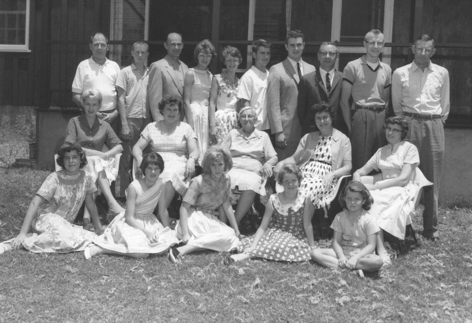
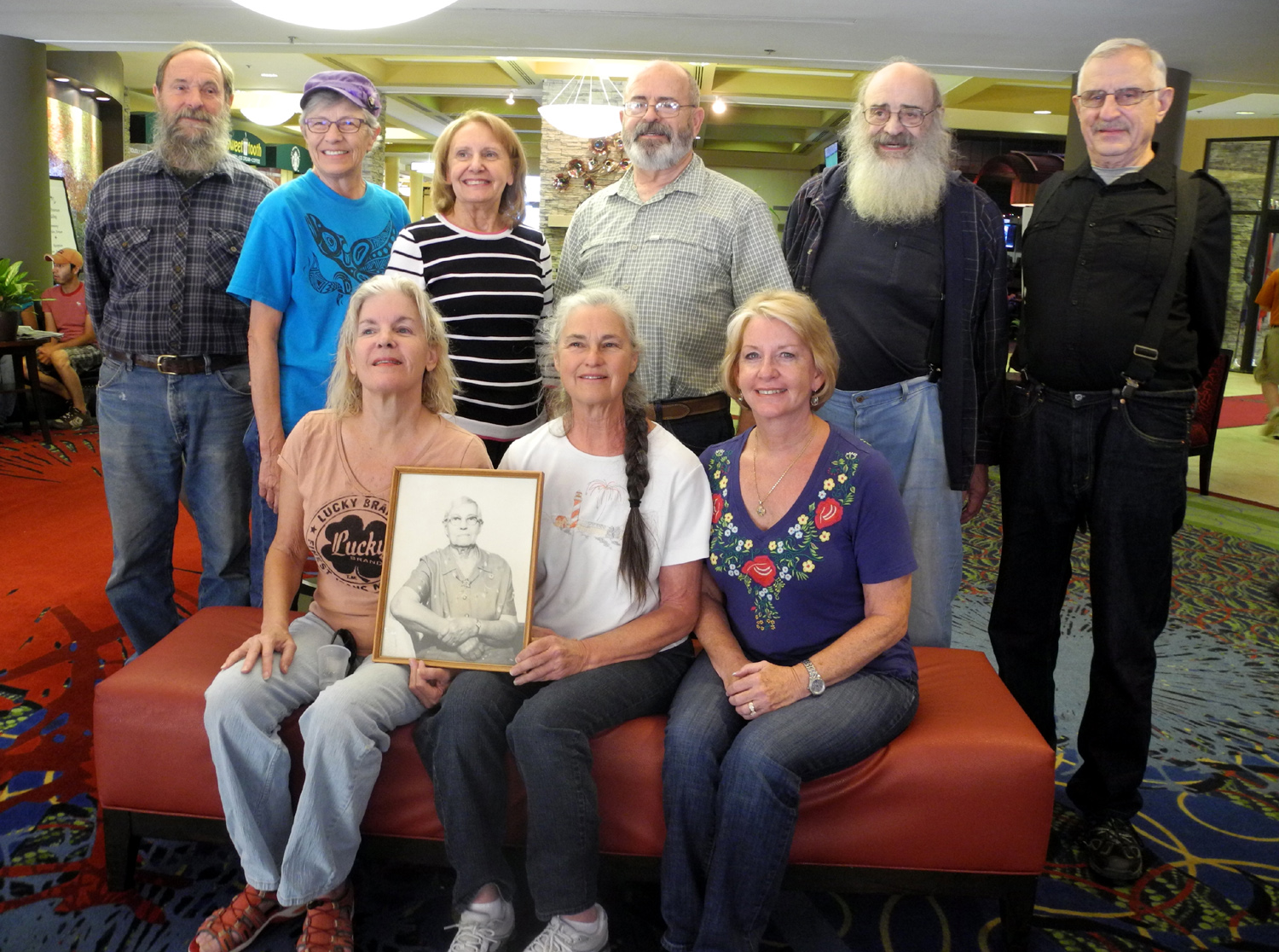
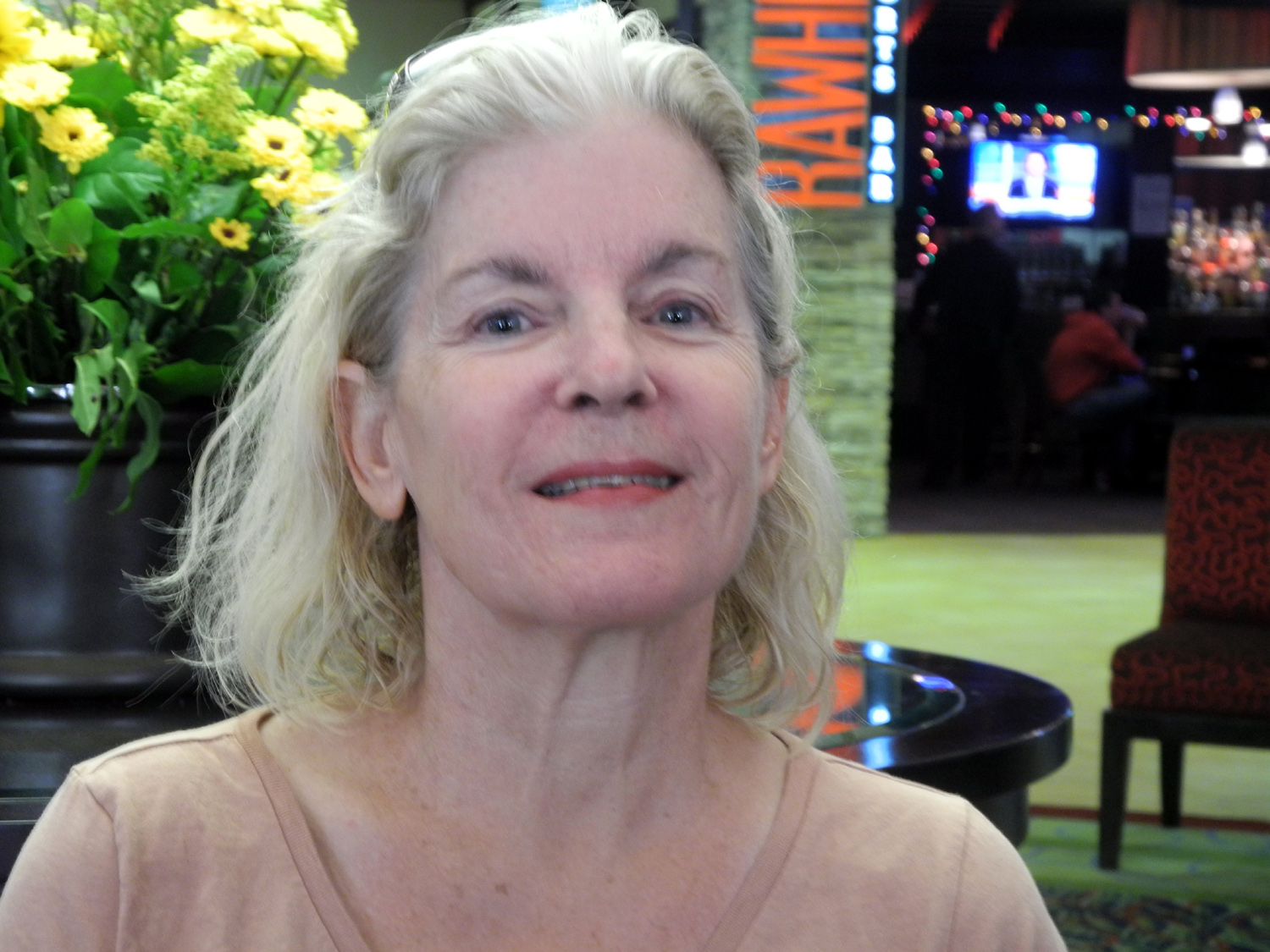
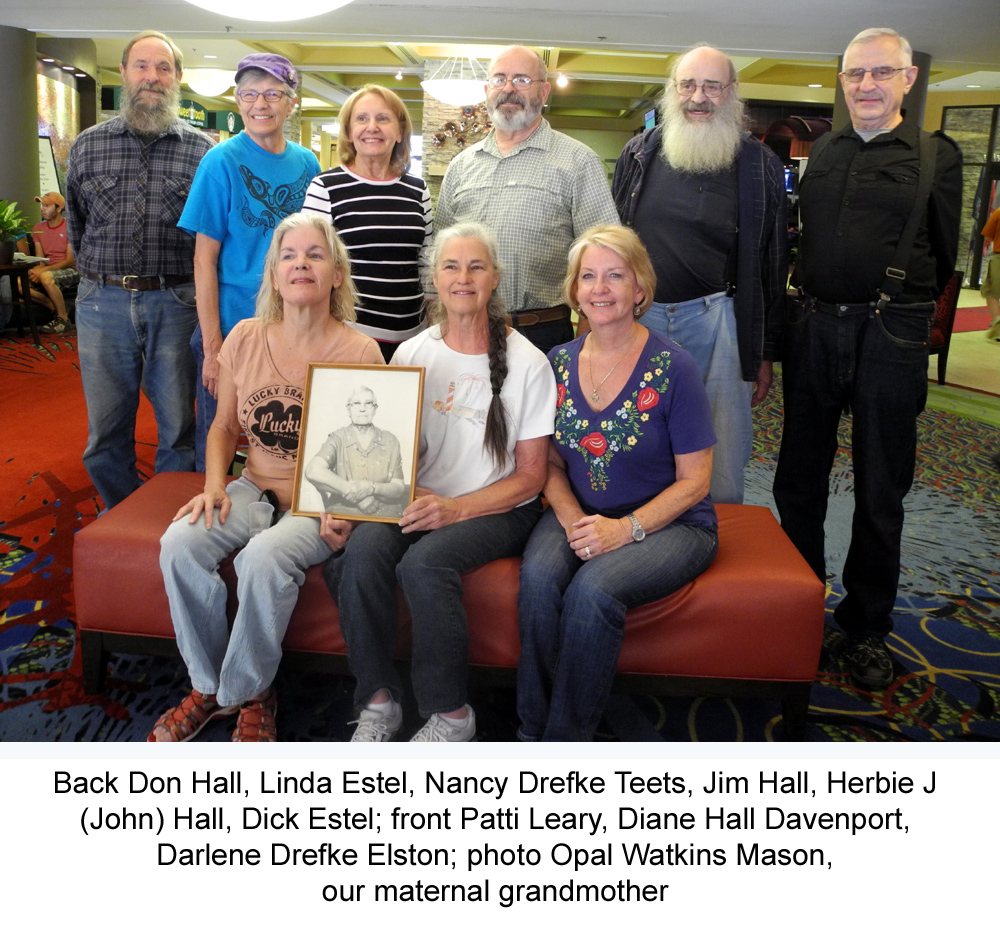
The assembled company was as follows: The
Estel siblings: Myself (Dick) from California, and Linda and wife
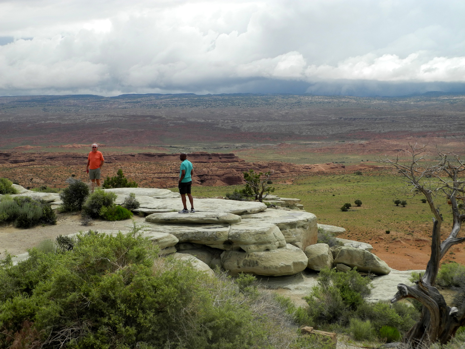
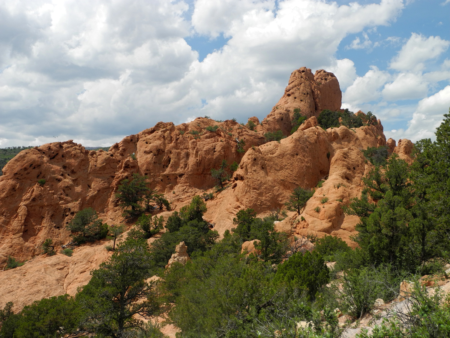
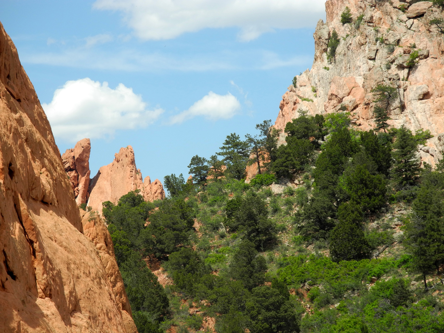
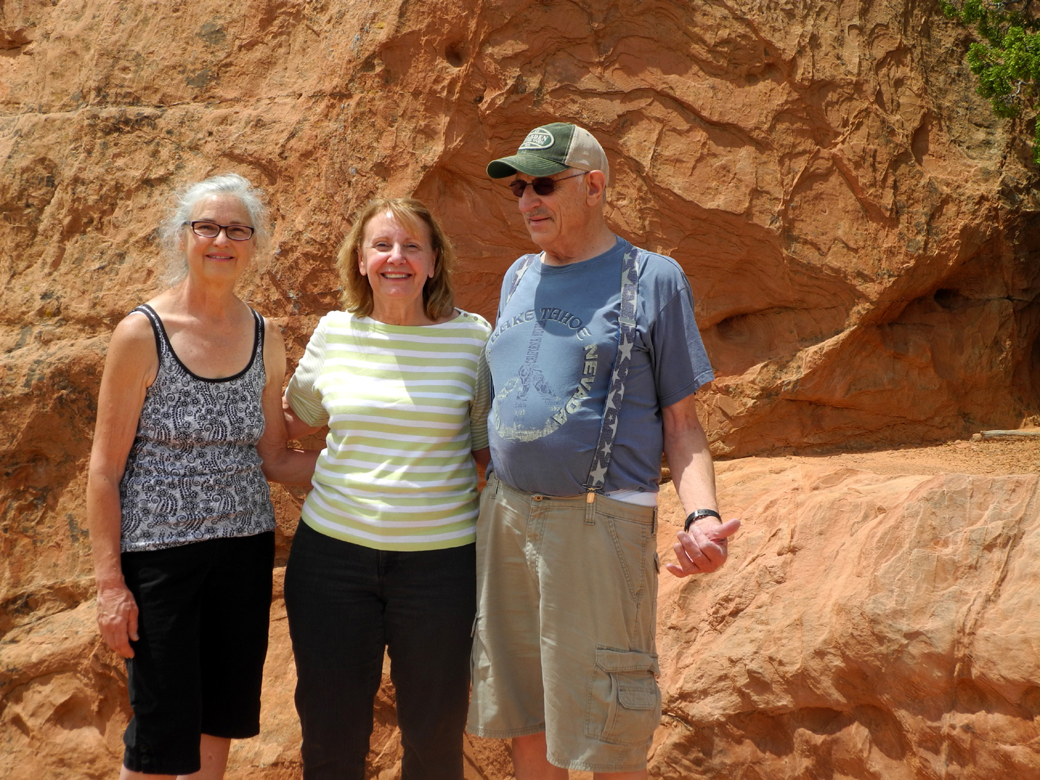
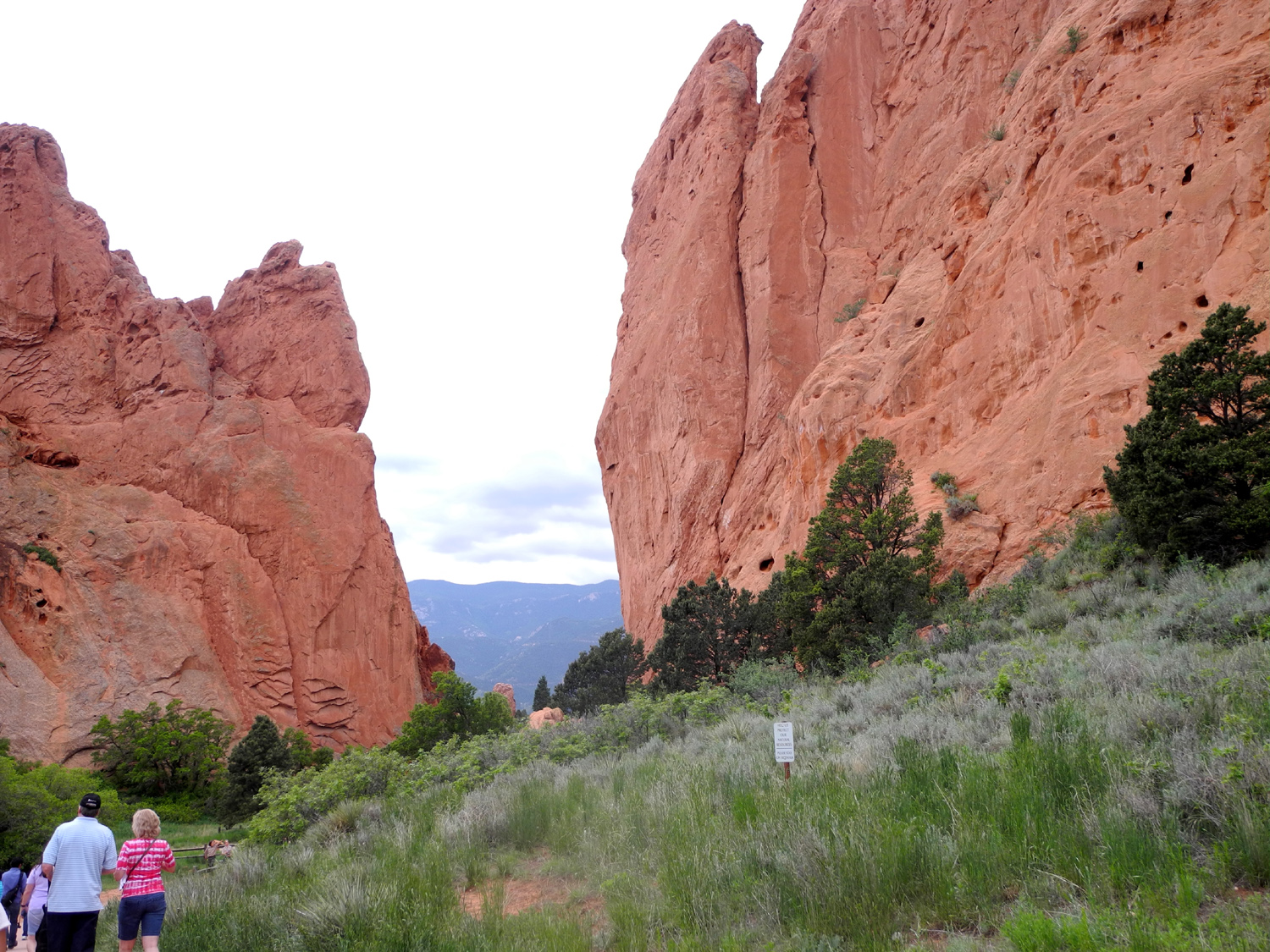
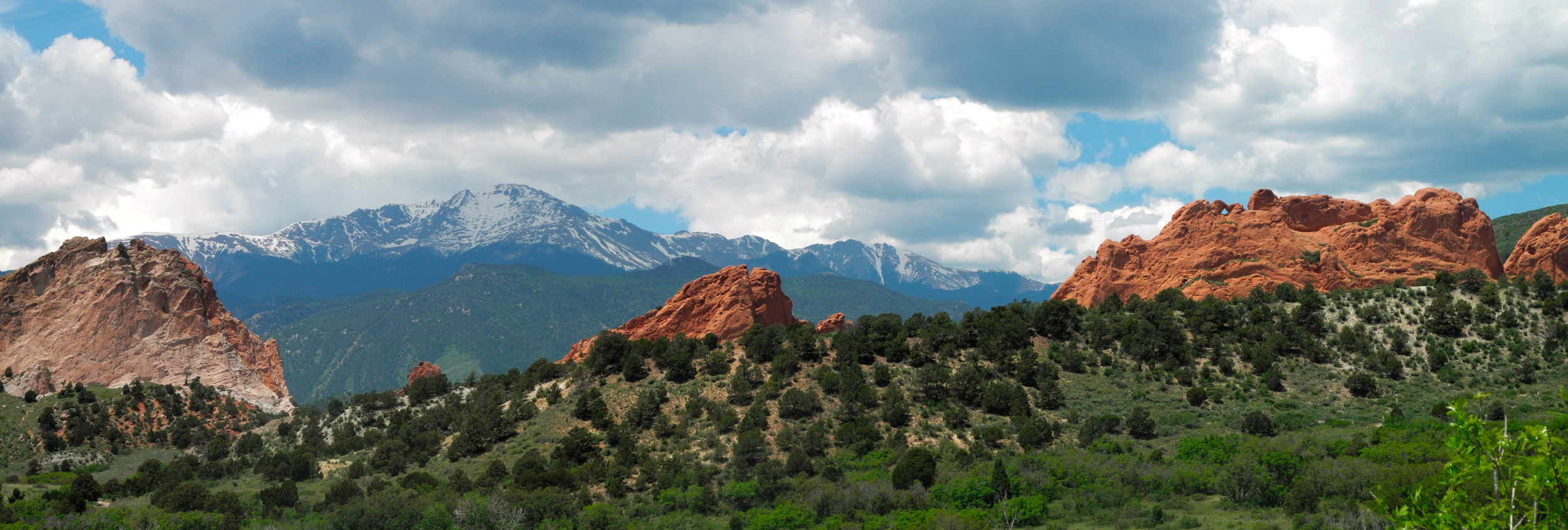
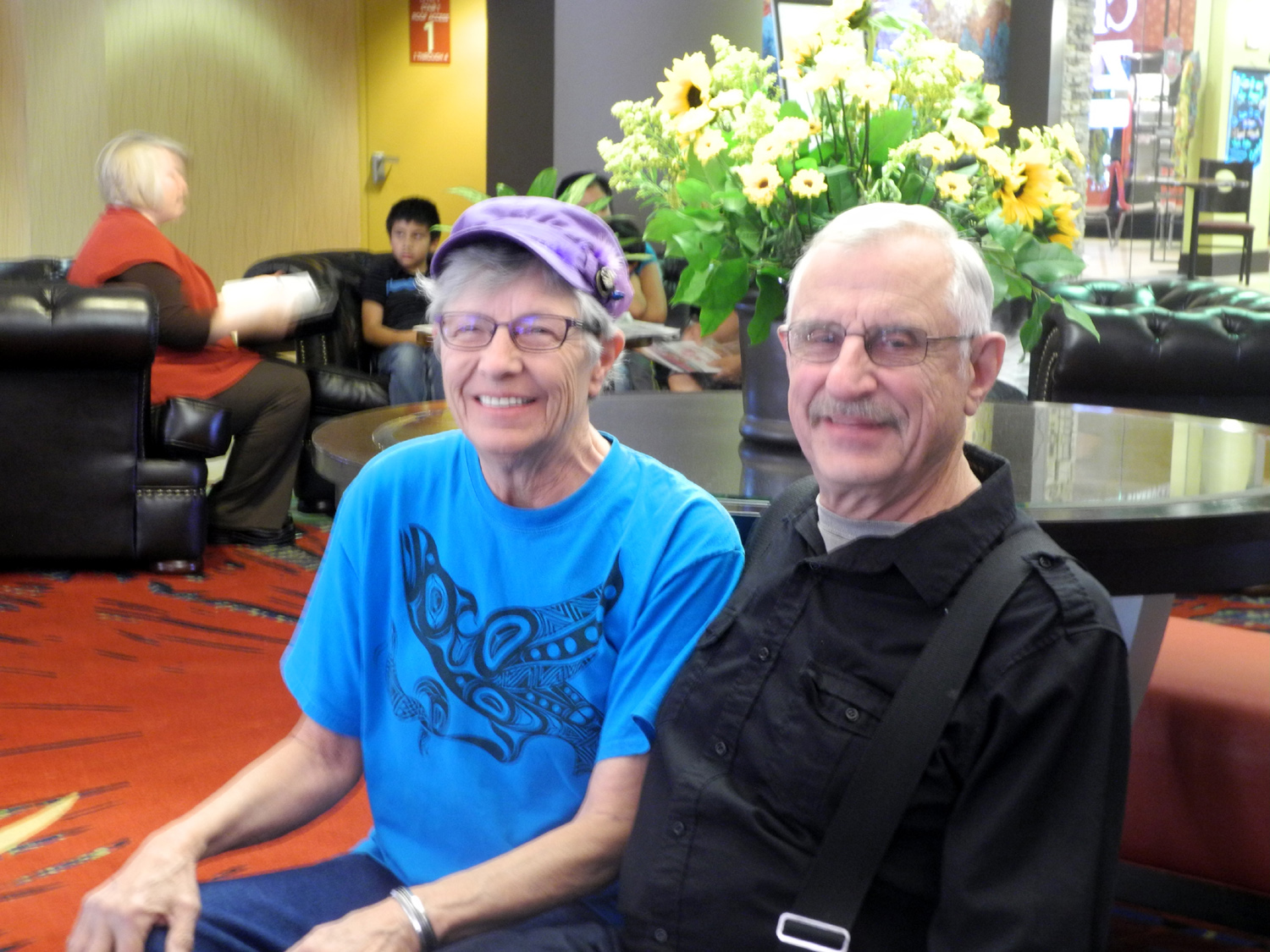
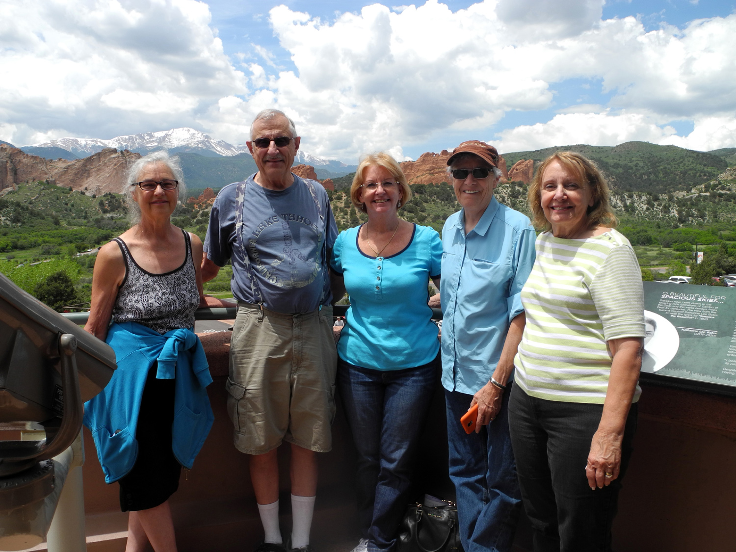
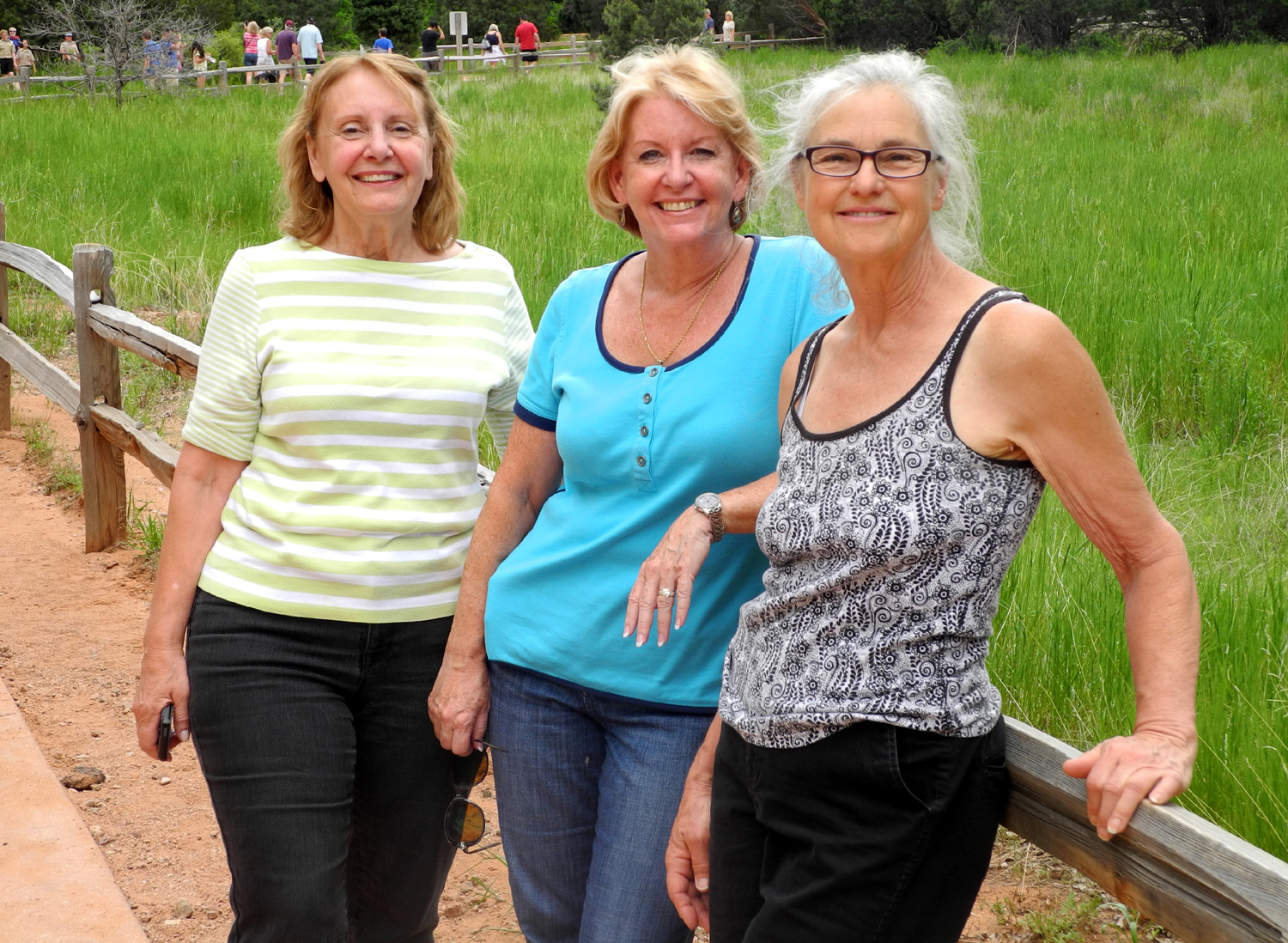
Anne Tellett from Minnesota First we all greeted Patti, who had arrived late and had not seen anyone till she got to the restaurant; then we had one of several wide-ranging conversations, all of which included a lot of reminiscing about previous visits, trips between Michigan and California when all but the Drefkes lived in the Golden State, and of course, the various gatherings hosted by my Aunt Vivian Hall at Poway and Lake Elsinore. Also discussed were some of Grandma Mason's visits to California, when she would come out by train and stay for several weeks with each of the three daughters. We had made plans to visit the Garden of the Gods after breakfast, an area of red sandstone outcroppings next to Manitou Springs; a public property owned and managed by the city of Colorado Springs. When we were here for a hockey tournament in early 2014, my daughter Teri and I hiked in the Garden, and were much impressed. One thing we quickly learned was that there are LOTS more people visiting in June than there were in February. We entered from the south, driving through a residential area where there are homes among the sandstone outside the park, including one house that uses the rock as a wall. We went through three trailhead parking lots that were filled to overflowing, so decided to go to the visitor center. Traveling in four cars, we all managed to park there, since people are coming and going more frequently than at the trailheads. We spent about 45 minutes at the visitor center, looking at the exhibits and taking some group pictures, then decided to try again for trailhead parking. I rode with Nancy, Darlene and Diane, and we managed to find a parking place at the second lot we came to. We hiked a short but fairly rugged trail there, one that goes up a hill with some good views down in to the Garden, then loops back down. During my previous visit all our walking was on paved trails, so I did not wear boots or bring my hiking poles, but I could have used both on this trail. We then went to the parking area for one of the main trailheads, where you can follow the paved trail in a loop, with various connections to other easy trails. This route went through the best parts of the park. None of the others had been there before, and all greatly enjoyed the hike and the scenery. We were considering an additional side trail when we realized that we were running out of time, since we had planned for a 4 p.m. dinner at the hotel, so we started back. Traffic getting out of the area was very slow, but we made it back in time to freshen up a bit before dinner. At this time we learned that none of the other groups stopped to hike, but all enjoyed their drive through the park, and got to see the major features. Thunderstorms were predicted for about 4 p.m., and we had a few drops on the windshield at 3:30 driving back. Right on time a hard rain arrived just as scheduled, but we were all back inside by that time. It only lasted about 15 minutes, and I did not hear thunder nor see lightning. During the pre-planning stage we had made reservations for Saturday dinner at the hotel's Rustler's Cafe, the only advance planning of more than a day that we did for meals. We had an alcove that was off to the side of the main dining room, but with 4 p.m. reservations, the place was mostly empty. We had a very nice dinner with good service, at prices that we agreed were quite reasonable. We took our time, enjoying the food and the company, with lots of time for the one more "scheduled" event we had planned. After dinner we gathered in my room, and I showed a collection of photos featuring all the families. These included some baby and childhood pictures, photos of our parents as very young adults and then later in life, and the "famous" photo that was taken by a professional photographer of all the sisters, husbands and kids with their mother, our grandmother Opal Mason, at the Hall's place in Poway in 1962. This inspired Nancy to propose a group photo in which we would take the same positions as the original photo, which we accomplished Sunday night. Once the photo viewing was over, everyone went off to their own pursuits for the rest of the evening. This was also the theme for the next morning - "on your own" time during which all were free to follow their own desires with whichever group members wanted to join in.
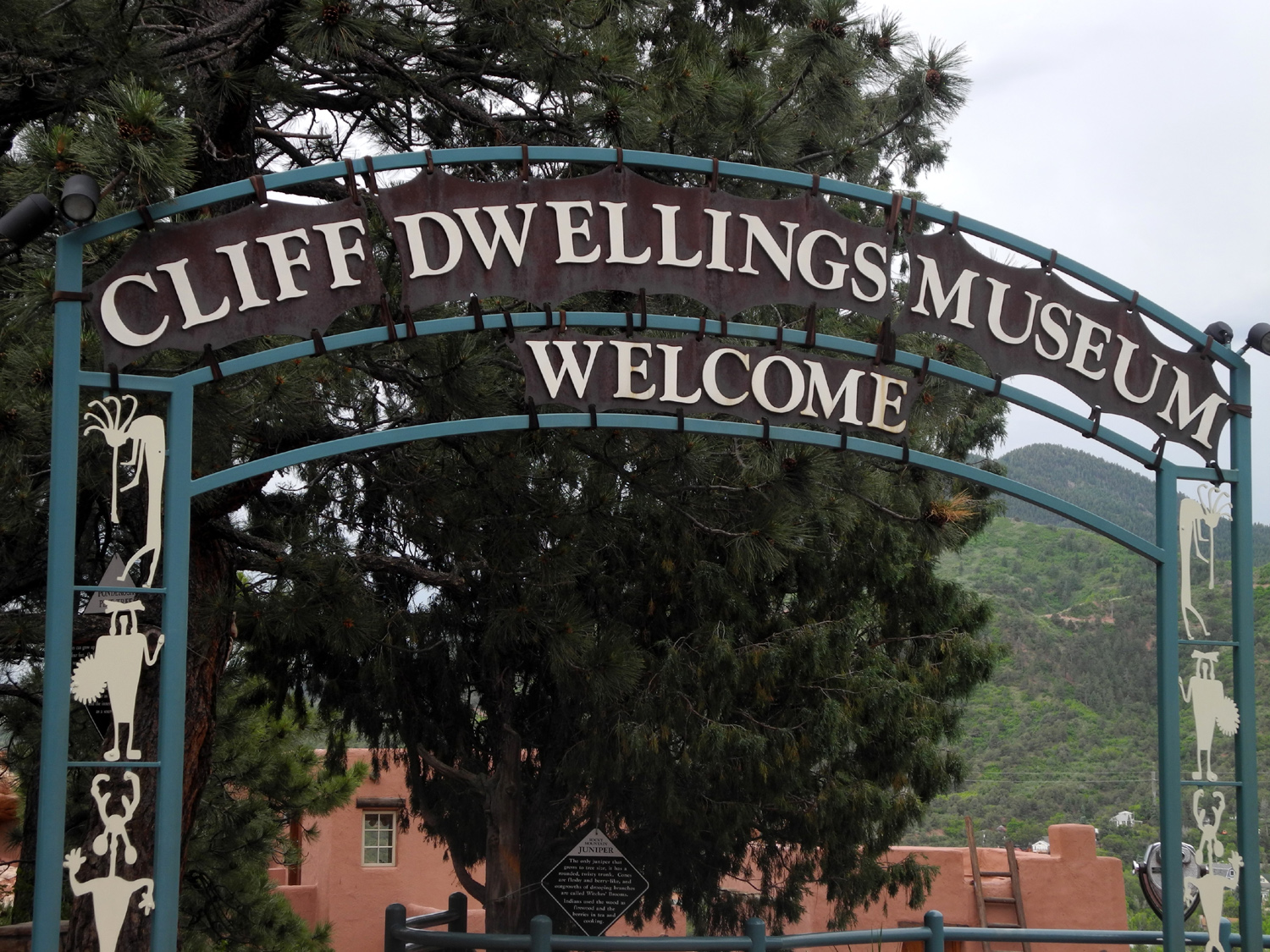
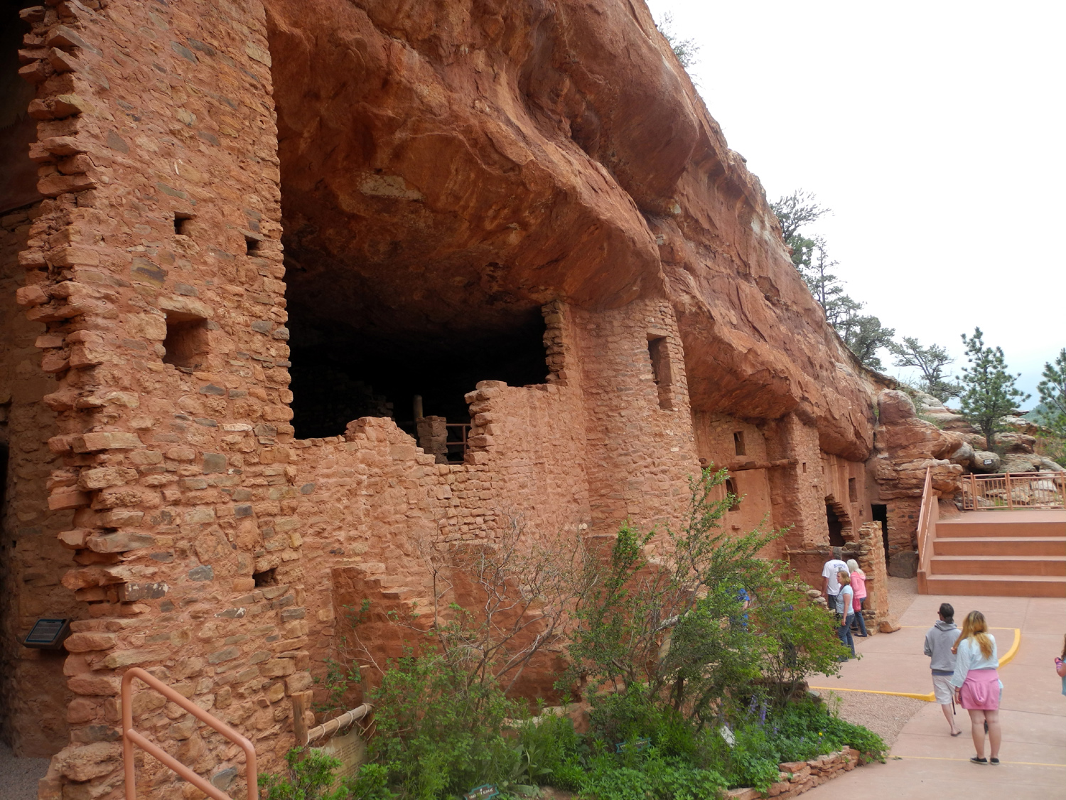
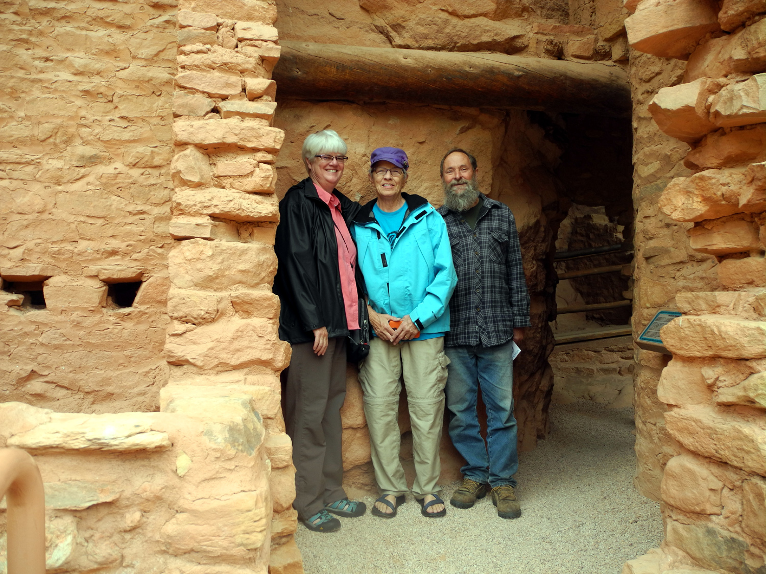
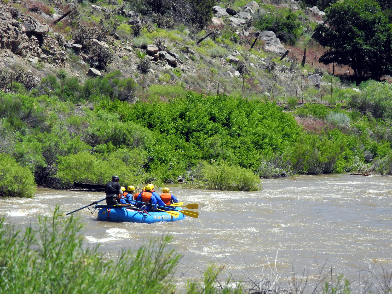
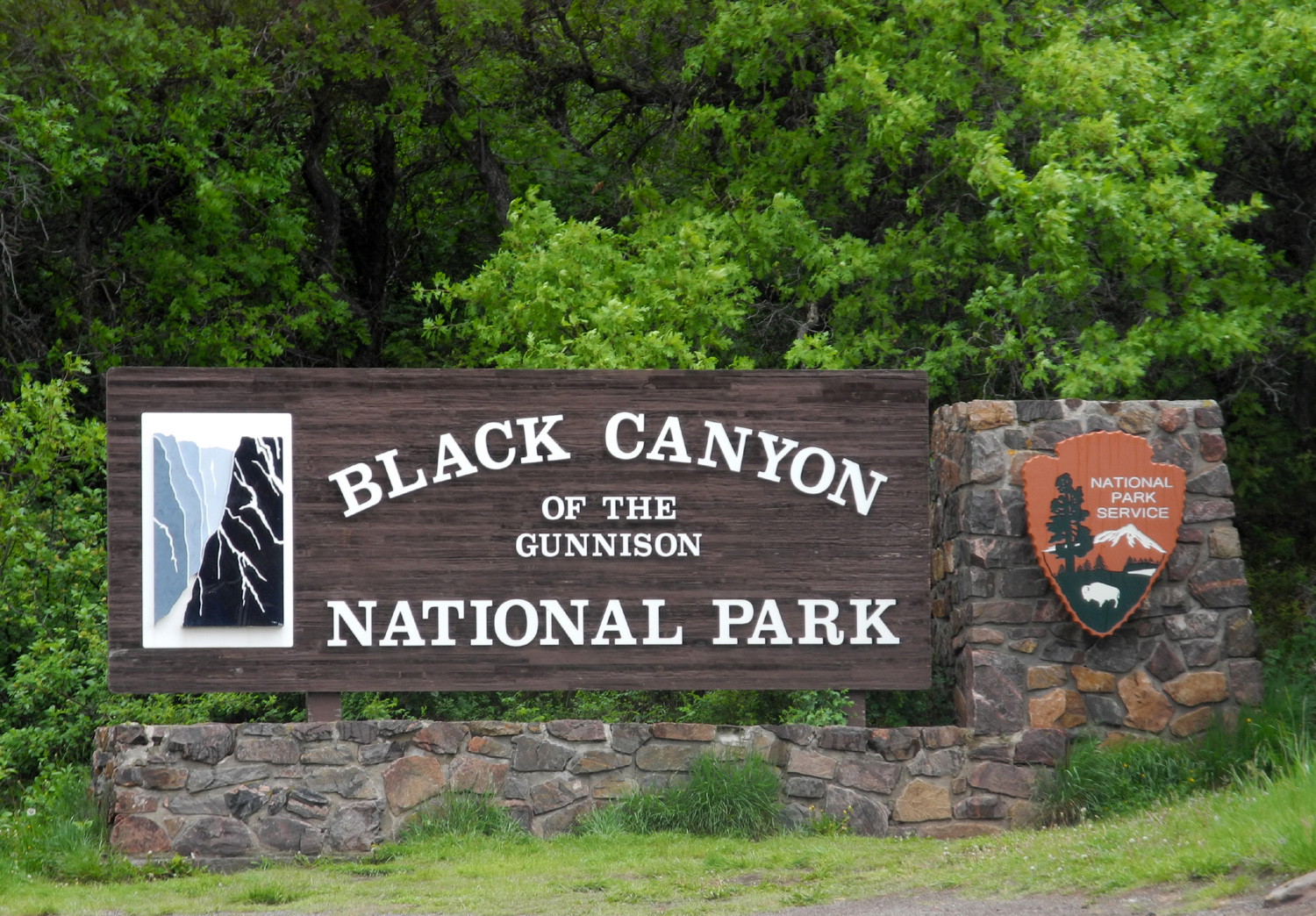
We first stopped in downtown Colorado Springs for breakfast, where Linda and Anne had learned there was a very popular breakfast spot, Over Easy. Popular was an understatement - the wait time was 45 minutes, but fortunately there was a less famous but very good establishment right next door, where we were seated immediately, and had a perfectly good breakfast. Actually, since I had already had that meal, I chose dessert - a milkshake to provide energy for the day's activities. Considering how dominant and obvious the mountain is, getting to Pike's Peak proved much more difficult than it should have. The GPS on two different phones proved to be singularly unhelpful, leading us first to the Pike's Peak Cog Railway station in Manitou Springs. We had only a large scale state map, which did not clearly show the local roads we needed to follow. We finally used human ingenuity and instructed the GPS to take us to Cascade, a small town that was obviously located on the correct route to the peak. Further frustrations lay ahead. When we got to the entrance station, we were informed that a thunderstorm had dropped a quantity of hail on the road. They were awaiting the arrival of a snow plow, and there was a 75% chance that we would eventually be able to get to the top. Since we could not know how long "eventually" was, we chose to turn back, and instead went to the Manitou Cliff Dwellings, which proved to be a worthwhile use of our time. This former residence of the ancient Anasazi is a row of rooms, once three stories high, through which you can walk and take note of the small entrances and rooms that were used for various purposes. There is also an excellent museum, with the obligatory gift shop. Here I was most impressed with their pottery collection, some of of it nearly a thousand years old. We enjoyed our visit here, but we were on deadline for the evening's activities, so after a little less than an hour, we headed back to Colorado Springs. Don had arrived a few days early and stayed in a motel near downtown, where he discovered an excellent Mexican restaurant. He ate there at least twice, and we had agreed that it would be the spot for our Sunday night dinner. Don knew the location, but did not recall the name, so we drove to it, and I went in to make reservations. They normally do not do this, but when I advised them there would be eleven of us arriving at 6 p.m., they decided it would be best for everyone if they had a table ready. We had previously decided to meet before dinner in the lobby for group photos. This included the re-creation of the 1962 photo, such as it was with all the older generation missing, as well as various family groups and whatever other combinations we came up with. At this time we learned that the group that went to the Academy also went to Pike's Peak. The very top was covered with clouds, but they were able to get a good view in the parking area just below the summit, and they found the road "exciting." When the photography session was finished, we drove to the restaurant, where we had good food and good service. All agreed that Don had made a wise choice. By this time some of us had discovered that each room had a booklet on what to do in Colorado Springs, and that it contained a coupon for free breakfast for two at the hotel cafe. We decided to meet Monday at nine a.m. for a final meal. Don got off to an early start and was not with us, but the other ten all made it, and we enjoyed a last hour together before saying our final goodbyes. While some were heading home that day, seven of us had additional activities planned. Don had ridden his bike, and planned to take a different scenic route home. Linda and Anne were heading for Estes Park in the Rockies north of Denver, then to Cheyenne WY. Gayle had a granddaughter graduating in San Diego, so she and Jim were driving to Denver, then flying to California from there. Darlene had a consulting job in Irvine CA, where she would spend about a week. I was headed west mostly on US 50, with a visit to Black Canyon of the Gunnison National Park on my schedule.
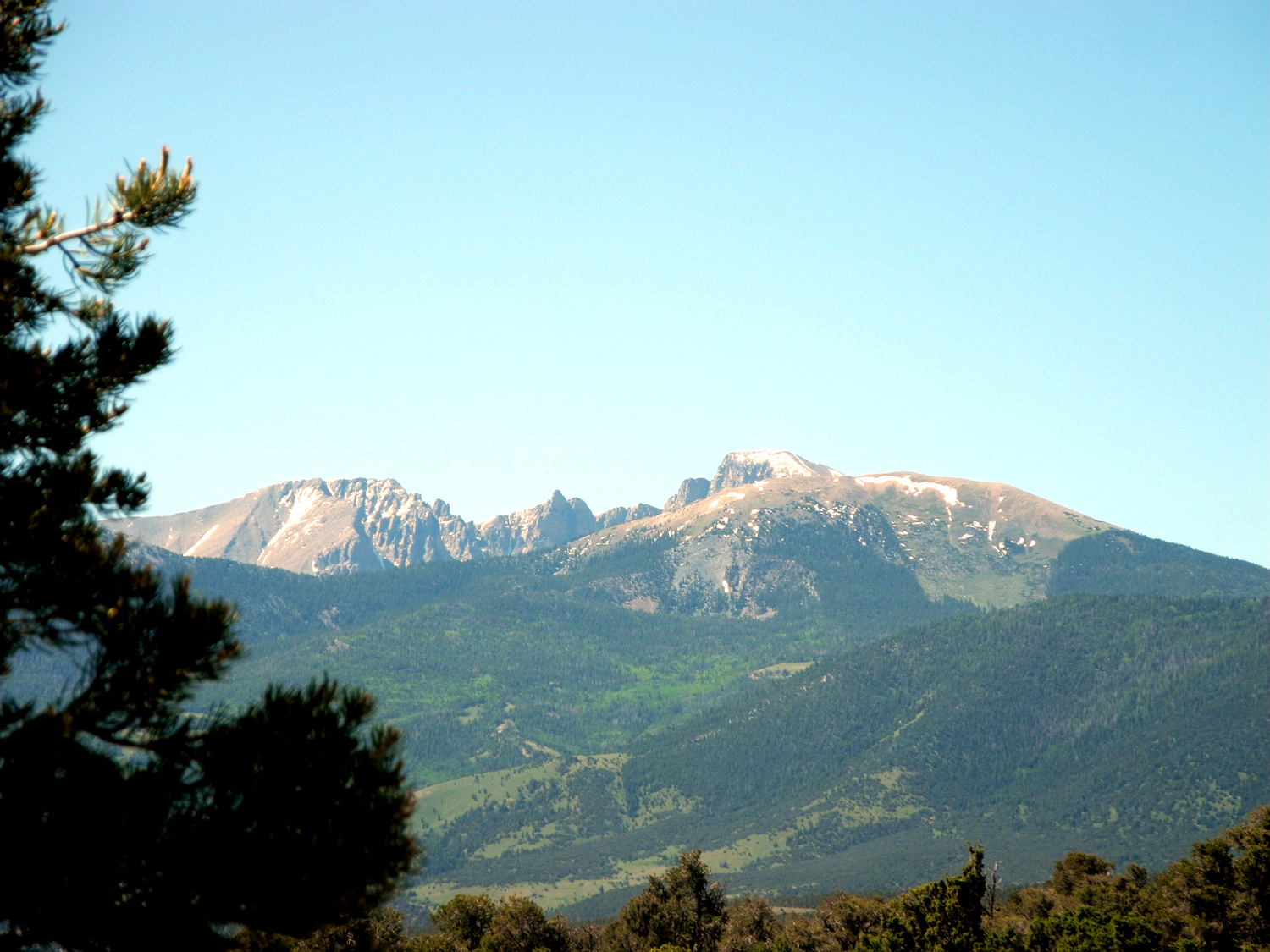
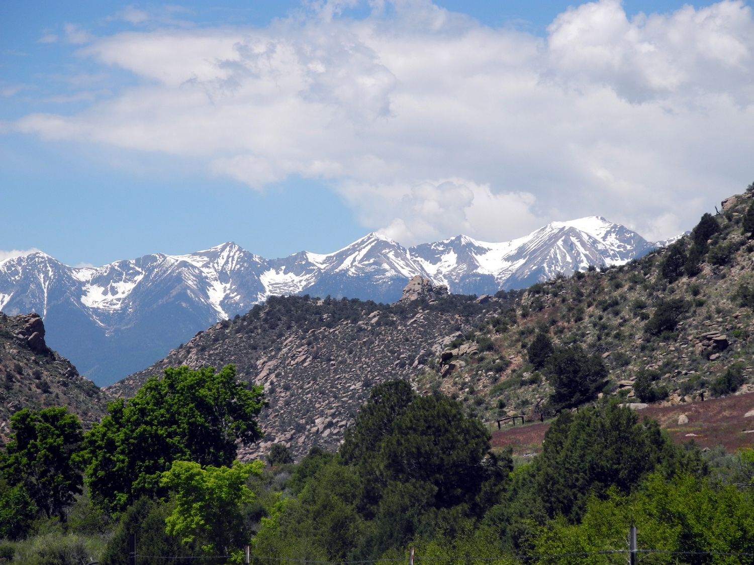
As the road moved away from the Arkansas River, it mostly followed Monarch Creek to Monarch Pass, through heavy forest with snow pretty much covering the ground under the trees. Over the pass, it went down into open, nearly treeless country, with marshy flat land next to a creek but high desert above that. There were snow-covered mountains visible off in the distance nearly everywhere on the drive. The last miles into Montrose were more typical Colorado Plateau country, with canyons and cliffs. Highway 50 crosses a large reservoir on the upper Gunnison River, then drops down into a big flat valley with mountains all around. This is the location of Montrose, and driving south through town, I had a good view of the snow-covered San Juan Mountains. I had brought stuff to make sandwiches, so I ate in the motel room, then went out to get ice cream at a Russell Stover. Although their emphasis is on candy, many stores, including this one, have a good ice cream selection. I managed to get my purchase back to the motel so I could eat it in comfort, while watching the last game of the Stanley Cup final, won by the Chicago Blackhawks.
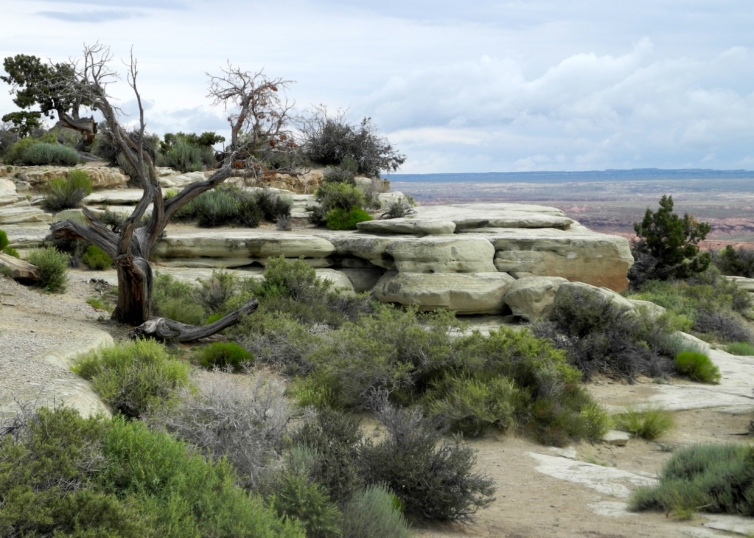
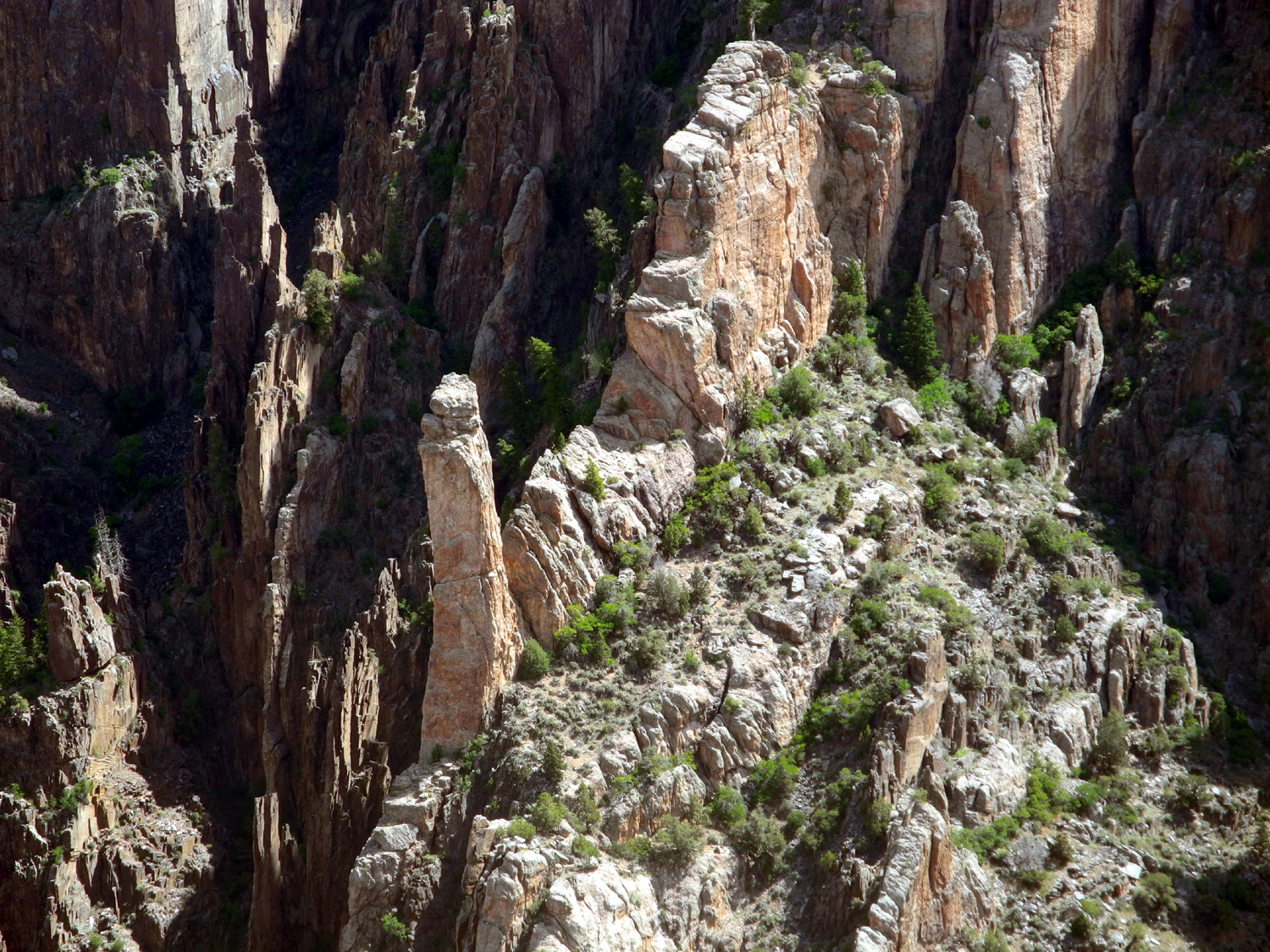
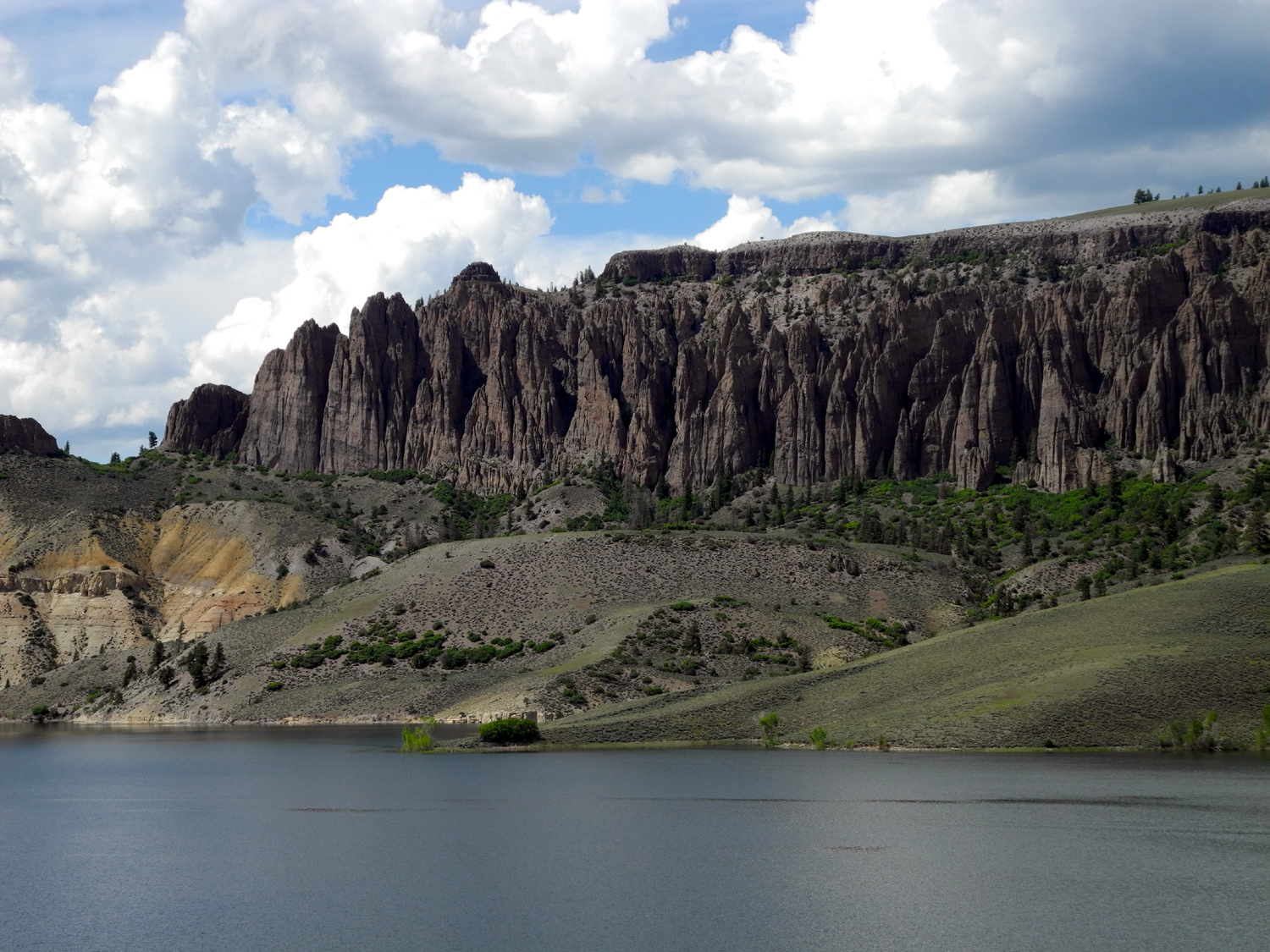
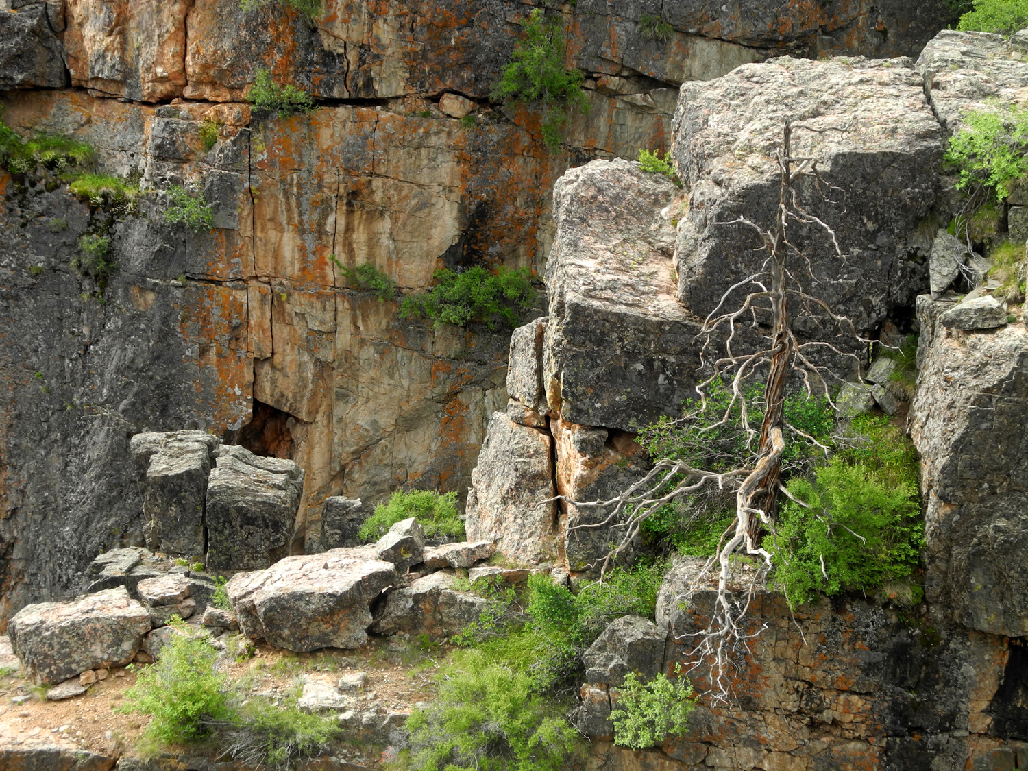
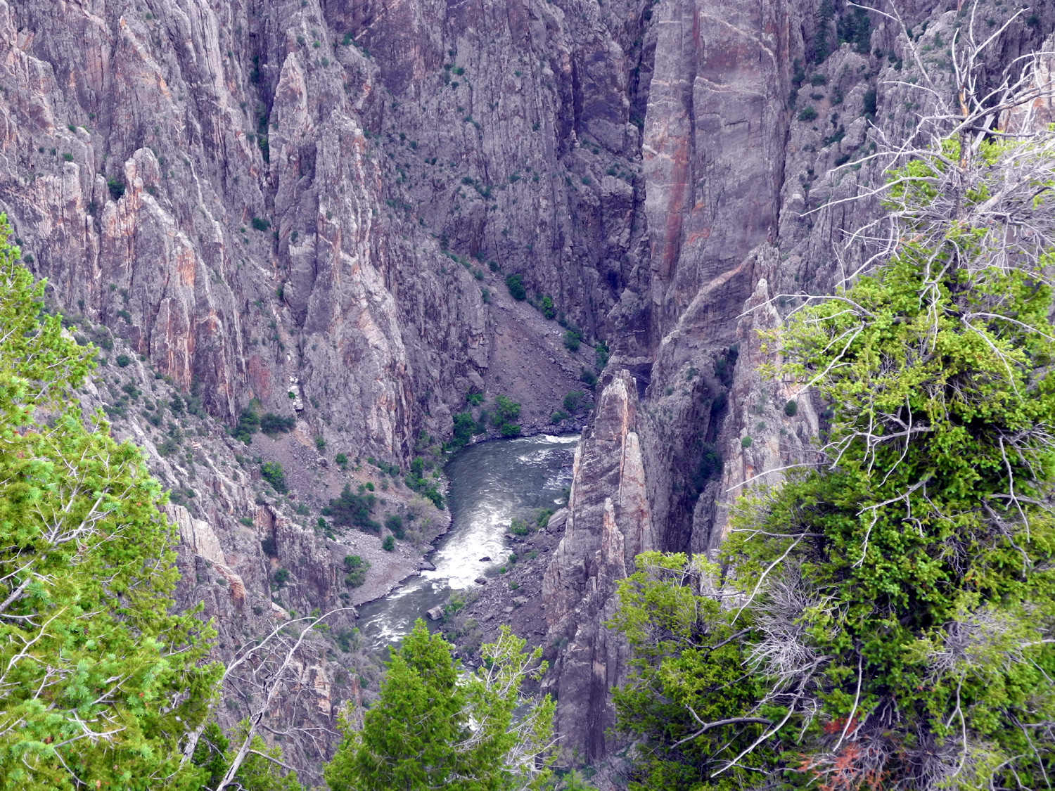
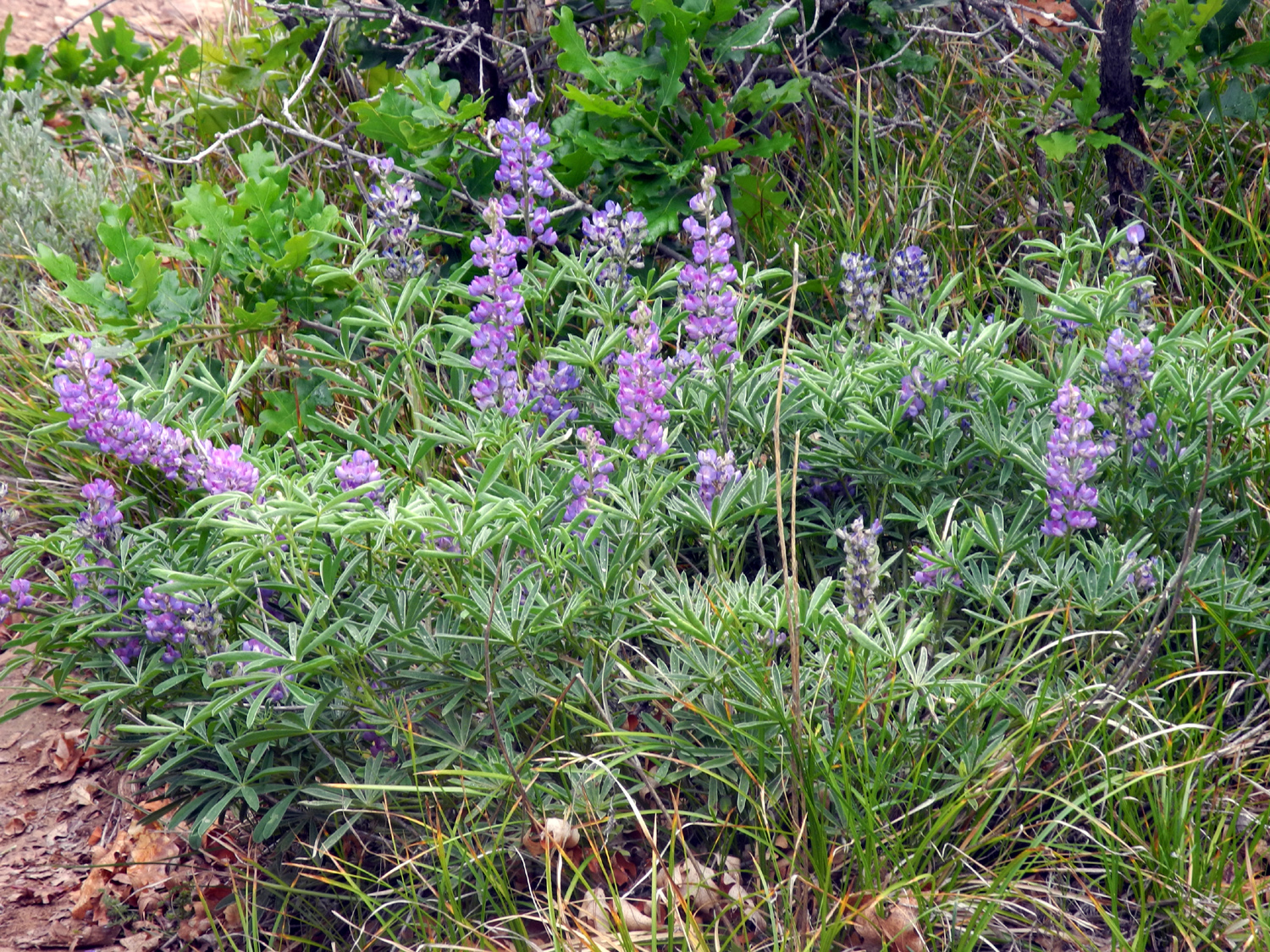
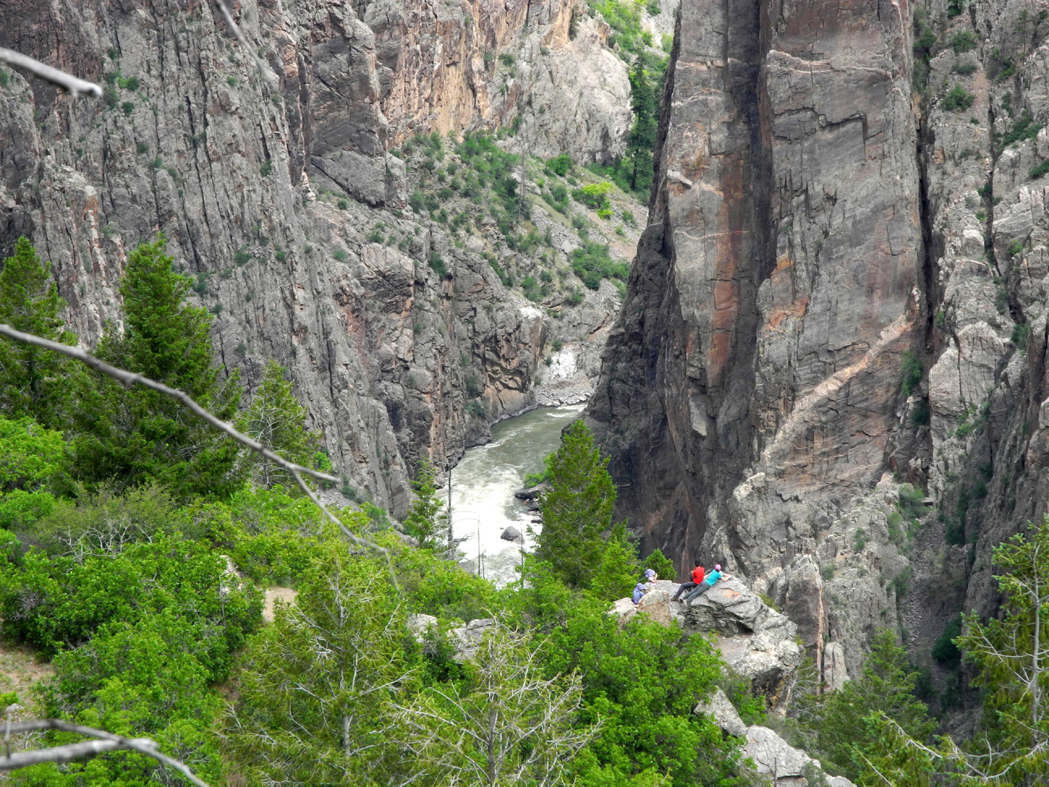
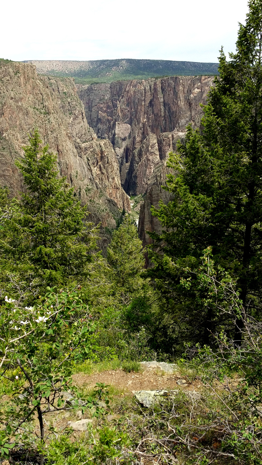
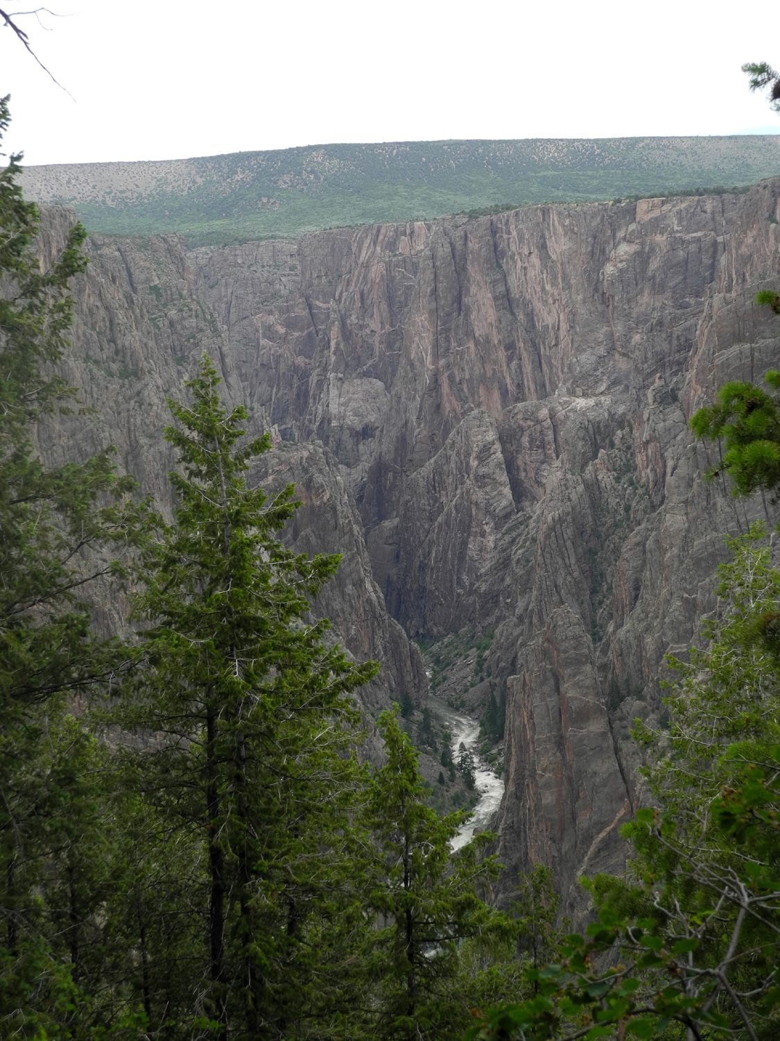
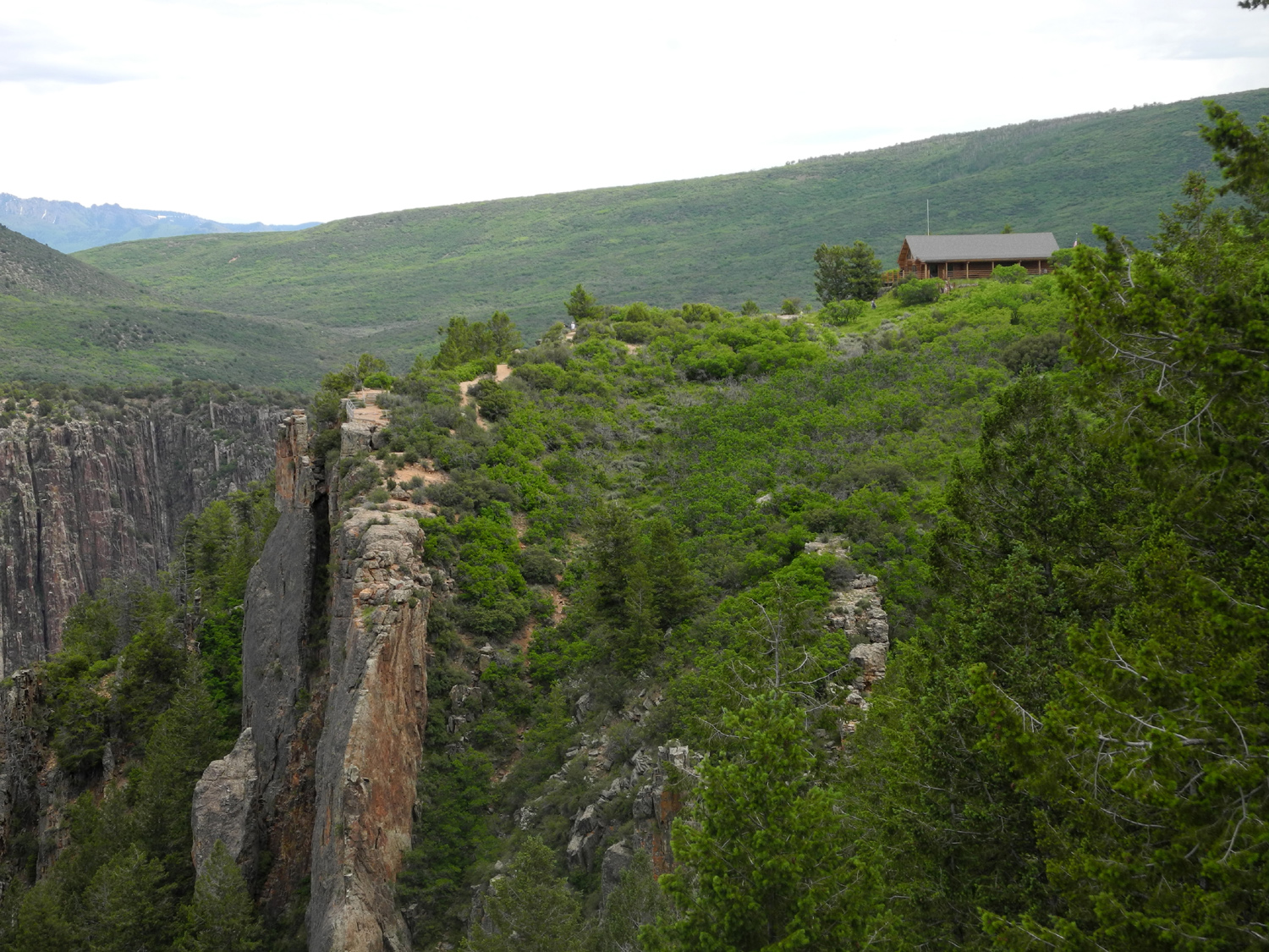
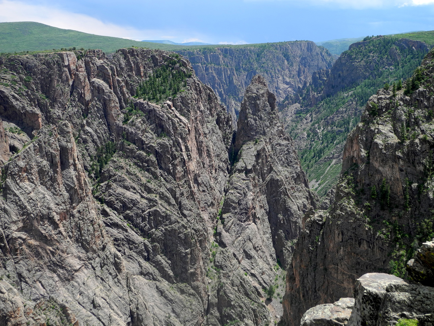
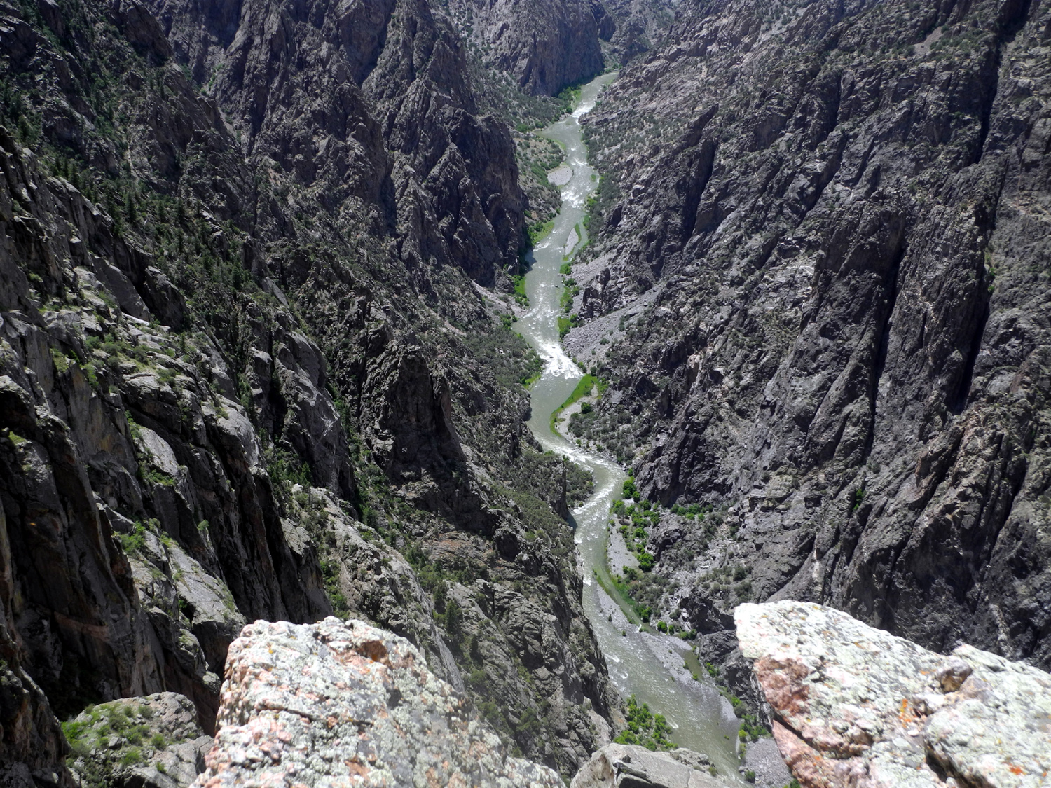
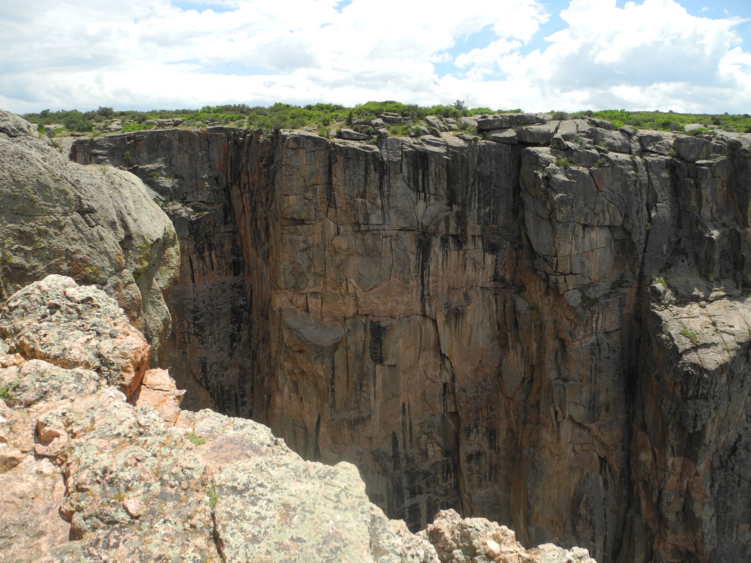
Driving into the park I didn't notice how far up in elevation I was going, but it became obvious when I drove back down at the end of the day. The South Rim at the campground is 8,320 feet, while the town of Montrose is just over 5,600. After a stop at Tomichi Point, the first of many overlooks, I continued the short distance to the visitor center, where I got some information on hiking trails. Before hiking, I followed the walkway from the visitor center to the Gunnison Overlook, just below the building. It turned out to be one of the best viewing spots in the park. Looking at the map and talking with the ranger in the visitor center, I discovered a two-mile loop trail that looked like something I could do. It starts with the Rim Rock Trail, which is a fairly level route close to the canyon rim, then connects to the Uplands Trail, which goes into the brush and juniper country just above the road. This hike started and ended great, but in between there were some challenges. I had not walked more than a quarter mile when a wind came up and it started to rain. I took cover next to a large juniper, which blocked most of the horizontal rain, but did nothing to stop the wind. I had a poncho, which I haven't used for years, and it started splitting down the front as I put it on. With the wind blowing it up, it did not provide much protection. The wind died down a little and I started down the trail, only to be driven back to my juniper as the rain and wind increased again. Once the storm backed off enough for me to continue my walk, I went down the trail a little farther, but turned back where it reached Tomichi Point, about a half mile in. By the time I got back to the starting point at the visitor center, rain and wind were done, and it was actually hot in the sun. Preparing for my trip I had read the description of the Oak Flat Loop trail, and decided it was not for me. It was described as strenuous, with a 300 foot elevation drop below the rim, and a series of switchbacks and other steep areas back up. However, my first "hike" was just over a mile, including the Gunnison Overlook walk, so I decided I would start out on the Oak Flat Loop and see how far I could go. It was not long into this hike before the steep down hill descent began, and once down to the lowest point, it seemed that it would not be that hard to continue on and do the entire trail, which I did. I was glad I made this decision, since the best views of the canyon were along this trail, much of it was in shade, and it did not seem all that strenuous. There were lots of trees and shrubs, and I saw over 20 species of wildflowers. A few short stretches went along the canyon with a drop-off to one side, but it was not dangerous or difficult. Although the trail is two miles long, I made it longer, first by going back a quarter mile or so to the car to get my hiking poles, and at the end by back-tracking another quarter mile or so to find my hat, which had fallen off my pack. Once back at the trailhead, I took another look around the visitor center, then started out the road that parallels the canyon for about eight miles, with ten more places where you can stop and walk out to the rim for a view. These walks ranged from 100 to 1,000 yards, so I kept track of my mileage here also, and ended up with over four miles of walking for the day - and that was without stopping at every overlook. The final view, where the road dead ends, is more or less the end of the major canyon area, and offers a view off in the distance where the canyon opens up and the river flows through a wide plain, with low cliffs on each side. On the return trip I stopped and enjoyed more views at two places I had passed on the way in, then continued out of the park and back to town. Coming down the road just outside the park, I was treated to a spectacular view of the San Juans. I was not tempted to hike down into the canyon, especially after reading this on the park web site: "There are no maintained or marked trails into the inner canyon. Routes are difficult to follow, and only individuals in excellent physical condition should attempt these hikes. "Hikers are expected to find their own way and to be prepared for self-rescue. While descending, study the route behind, as this will make it easier on the way up when confronted with a choice of routes and drainages. Not all ravines go all the way to the river, and becoming "cliffed out" is a real possibility. "Poison ivy is nearly impossible to avoid, and can be found growing 5 feet tall along the river. Pets are not allowed in the wilderness. Inner canyon routes are not meant for small children." Nor are they meant for 75-year old casual hikers. Once back in town, I stopped at a pizza place and got pizza for dinner, taking it back to the motel. Once again I was forced to visit Russell Stover for dessert.
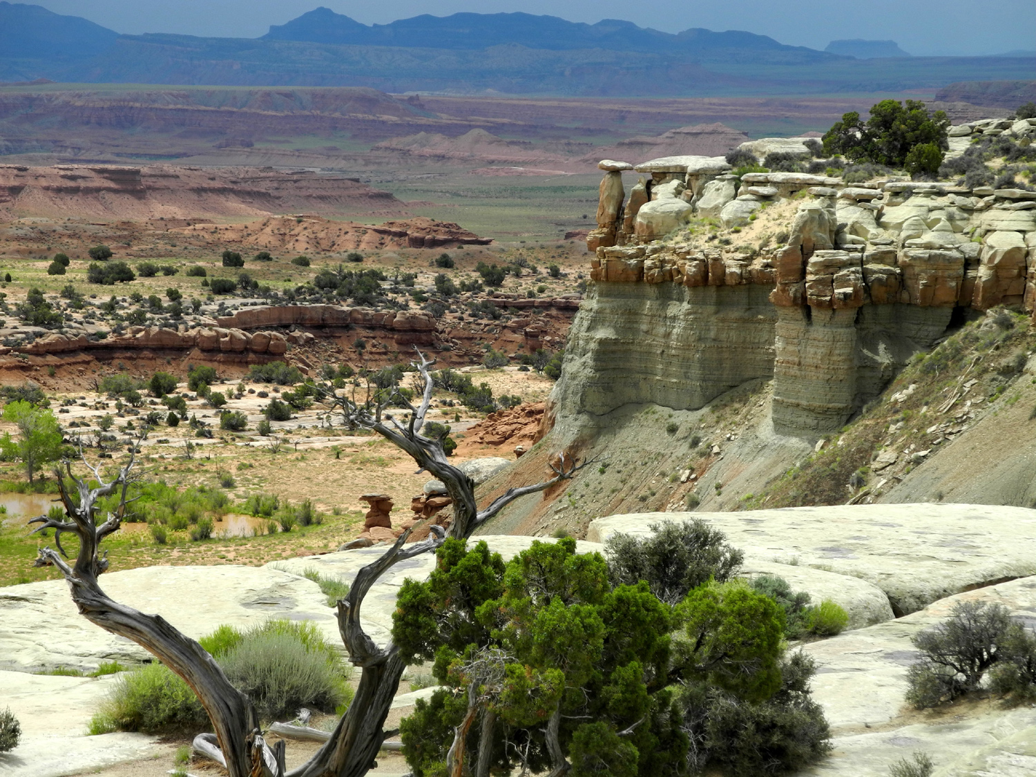
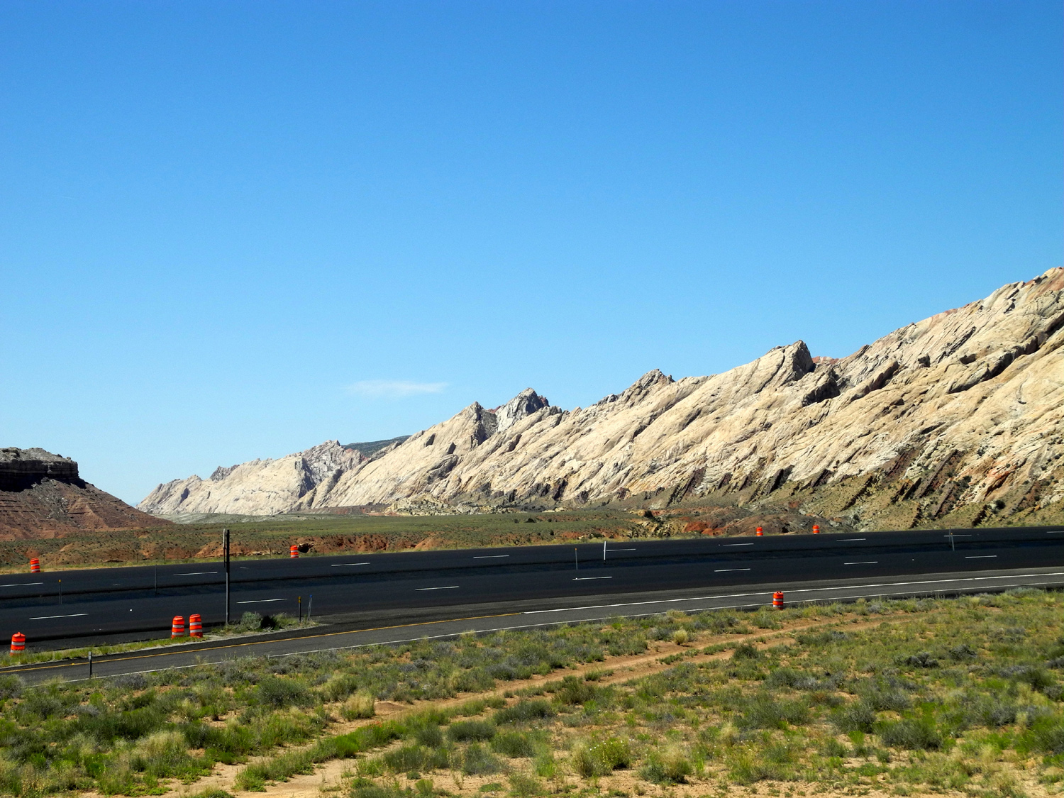
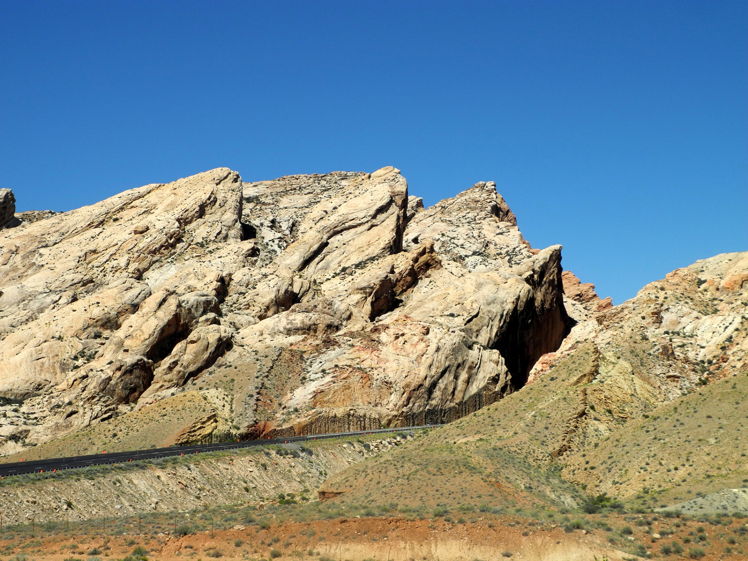
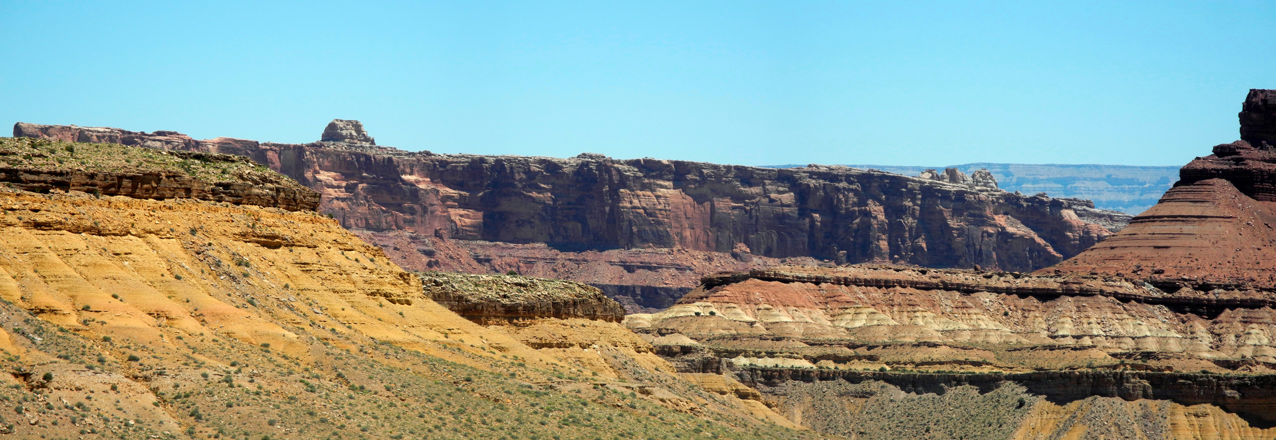
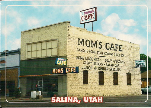
I made reservations for Delta UT and Tonopah NV, both places where I've stayed before with the trailer in RV parks. This gave me two days with 300+ miles each and a final day with less than 300. I would take US 50 from Montrose to Ely NV, then US 6 into California, and CA 120 over the Tioga Pass into Yosemite Valley, and CA 41 down to Fresno. The drive from Montrose to Grand Junction is a gentle down hill run for 30 miles. About half way through this stretch, the Gunnison River crosses US 50 at Delta CO. From here it is a broad, shallow valley instead of a gorge. The road parallels the river, but mostly a half mile or more to the east of it, and after crossing, I did not see the actual river again. I've sometimes wondered just what is so grand about Grand Junction. Well, it lies along I-70, with US 50 coming in from the southeast and US 6 from the northwest. In addition, the Gunnison runs into the Colorado River here...enough junctions to justify the name. I am trying not to backtrack, but going west from Grand Junction to Salina UT, US 50 is the same as I-70 for 210 miles, so that section would be a repeat. At Salina US 50 heads northwest, then is contiguous with I-15 south for a few miles, finally heading west across the rest of Utah and into Nevada. From Delta to Ely US 6 and US 50 are the same. Fortunately, the repeated section is through some of the best scenery anywhere, and the views are noticeably different when heading the opposite way. There are about five view points, all worth stopping at. Going east I had a fairly late start and a long drive, so I didn't stop as much as I would have liked. Today with only 337 miles to go and getting on the road at 8:08 a.m., I stopped at all the places I missed, napped several times, and took lots of pictures. Heading east from Green River UT, the land is fairly open and level, with low mesas on the north. This ends abruptly at the San Rafael Reef, which is the eastern edge of the San Rafael Swell. It's worth reading up on this remarkable geological feature, but in brief it marks the beginning of a rugged area of amazing rock formations - valleys, canyons, gorges, mesas and buttes. The reef and the adjacent maze of tangled, twisted canyons to the west presented a formidable barrier to early travelers, who detoured 20 miles north to get around it. In a remarkable feat of engineering, I-70 was built through the reef, and a narrow passage where a man could stand and touch the walls on both sides was widened to interstate standards with the removal of 3.5 million cubic yards of rock. The vista point for this is only accessible to westbound traffic, but west of here the eastbound route offers many views of the rugged country that is the main part of the San Rafael Swell. One of the better views, with stopping points in both directions, is Eagle Canyon, said by early settlers to be "so deep an eagle can't fly out of it." Heading west, this was just one of several magnificent vista points I enjoyed. I've driven this route previously, but I think in the past I missed the point where US 50 goes northwest at Salina UT, and ended up going southwest on I-70 to I-15, then had to cut across to US 50 via state and local roads. This time I paid attention and exited at Salina, where I had lunch at Mom's Cafe. There's an old saying, "never play poker with a man named Doc, and never eat at a place called Mom's," but it does not apply in this case. I had a good hamburger and excellent French fries. The building dates back to the 1800s, and has been Mom's for about 70 years. From Salina the highway goes about 20 miles northwest to I-15, then south a short distance before striking west to Delta UT. Driving through some hilly country before reaching I-15, I learned that Utah does not have passing lanes....they are "climbing lanes." I had stayed in Delta twice in the past in the RV park with my trailer, and also went through here last summer but did not stop. US 6 joins US 50 here and they are contiguous for many miles to Ely NV. It's a flat section at the lower end of the Sevier River Valley, with various crops surrounding the town. I arrived about 4:30, with the temperature a warm 90 degrees. Since I had a big, late lunch at Mom's, supper was not an issue, but I had a snack and got in some reading, plus a short walk in the warm evening.
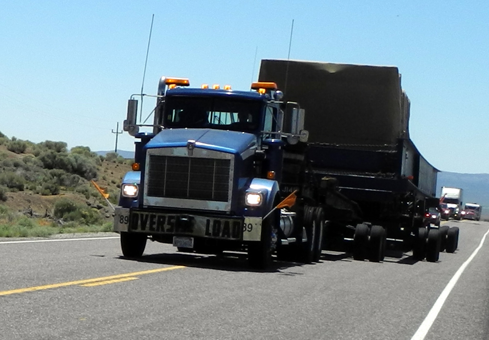
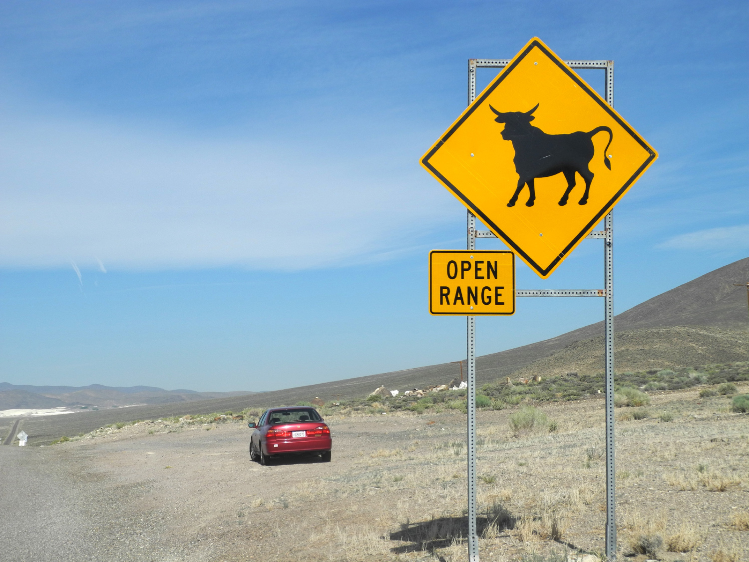
Most of the way was through the Great Basin, which means driving up over passes that are mostly above 6,000 feet, then down into broad basins, often ten to twenty miles across, and up over the next pass. At the Utah-Nevada border, I was looking at the Snake Range, location of Great Basin National Park, which I visited during my trip last summer. This was one of the more scenic spots, with quite a few patches of snow still visible on these mountains. The first few passes are heavily forested with piñon and juniper in the higher elevations, while sage brush, grasses and other small plants mark the lower reaches. Two of the later passes did not go up high enough for heavy tree growth, but I found an excellent lunch stop at the top of one pass - a trail head with shaded picnic tables and a strong breeze. I was not tempted to follow any of the trails, since they led into mostly open country, and even with the breeze and the elevation it would have been very warm very quickly. At one point I came over a pass and spotted a pickup parked off the road, and a highway patrol car with flashing lights coming slowly toward me, partly in my lane. It was followed immediately by another patrol vehicle in my lane, and the officer signaled me to pull over. He then explained that a wide load was coming, and we were to "sit tight." It was about ten minutes before the load arrived, preceded by another patrol car and a "wide load" pilot car. I was trying to take a picture of the big vehicle, so did not get a good look at it, but it took up nearly all of the two-lane road, fully justifying the efforts that had been planned to clear its passage. Having gained back a lost hour at the Nevada border, I arrived at Tonopah a little after 3, but actually had about the same amount of travel time as the previous day. I checked into Tonopah Station, a hotel, casino and RV park, which is also where I stayed with the trailer on a previous trip. I had eaten part of my leftover pizza from Montrose for lunch, and finished the rest for supper, heating it in the communal microwave in the hall. At least I have my own refrigerator, and unlike many travelers of a century ago, my own bathroom.
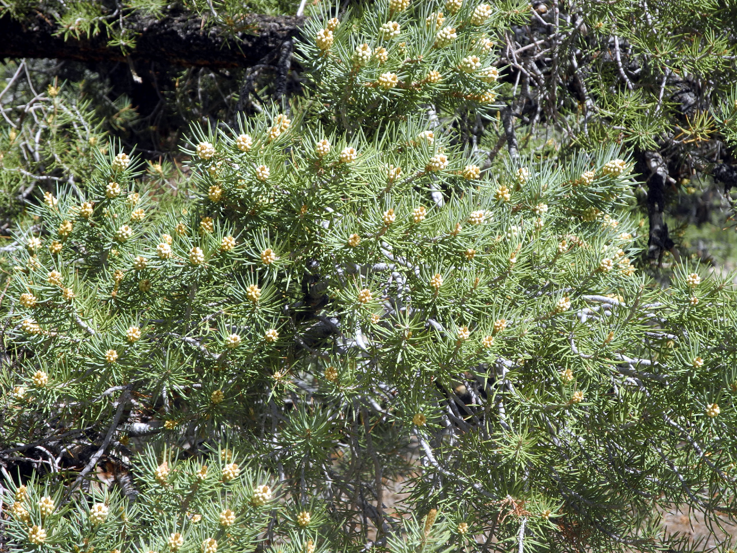
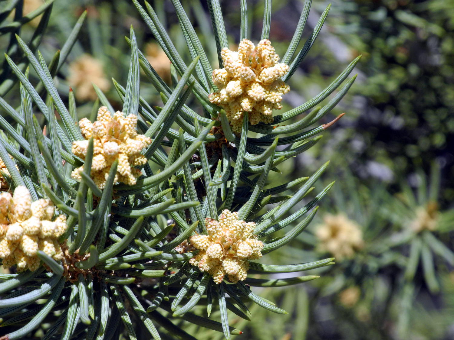
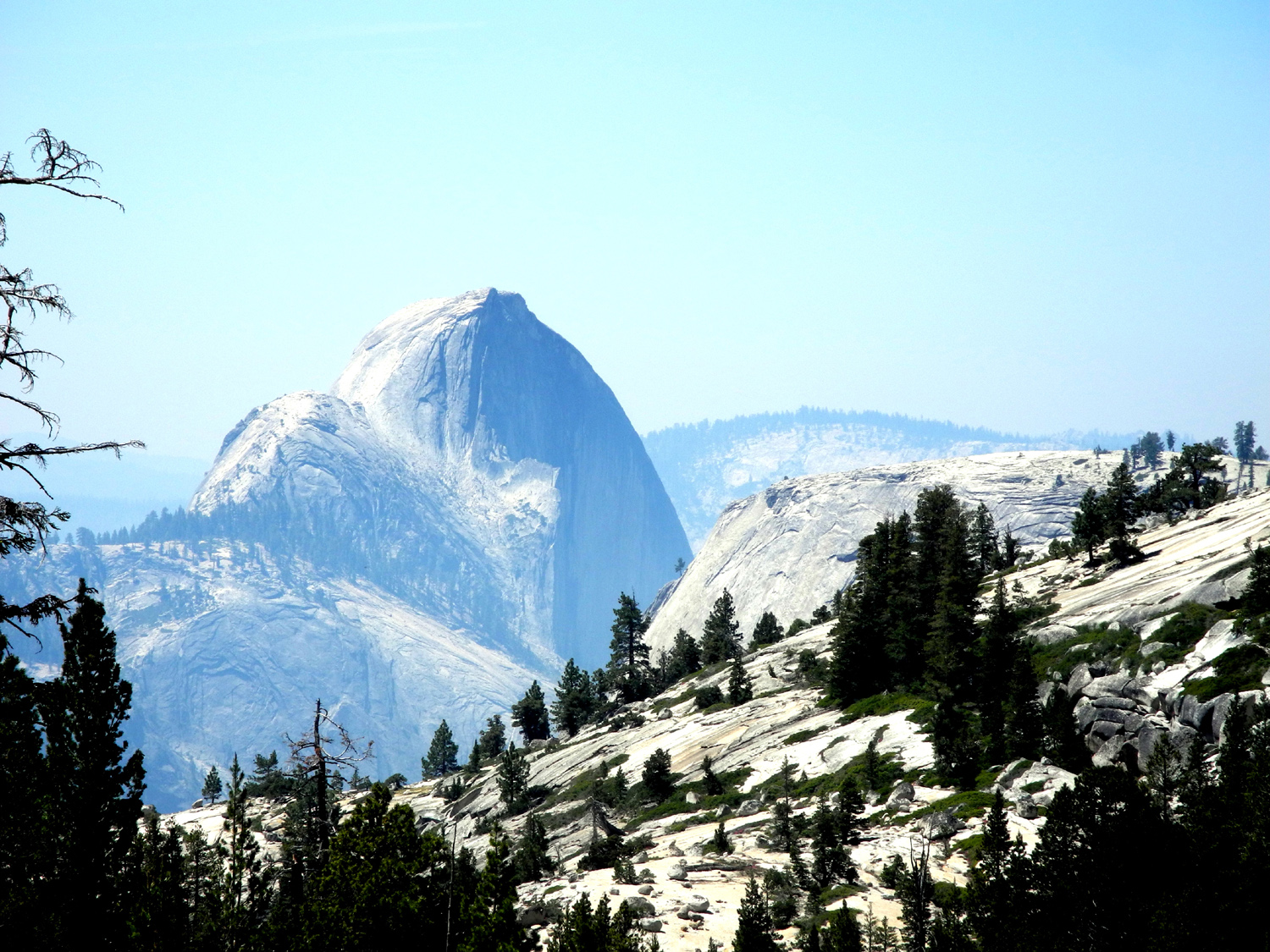
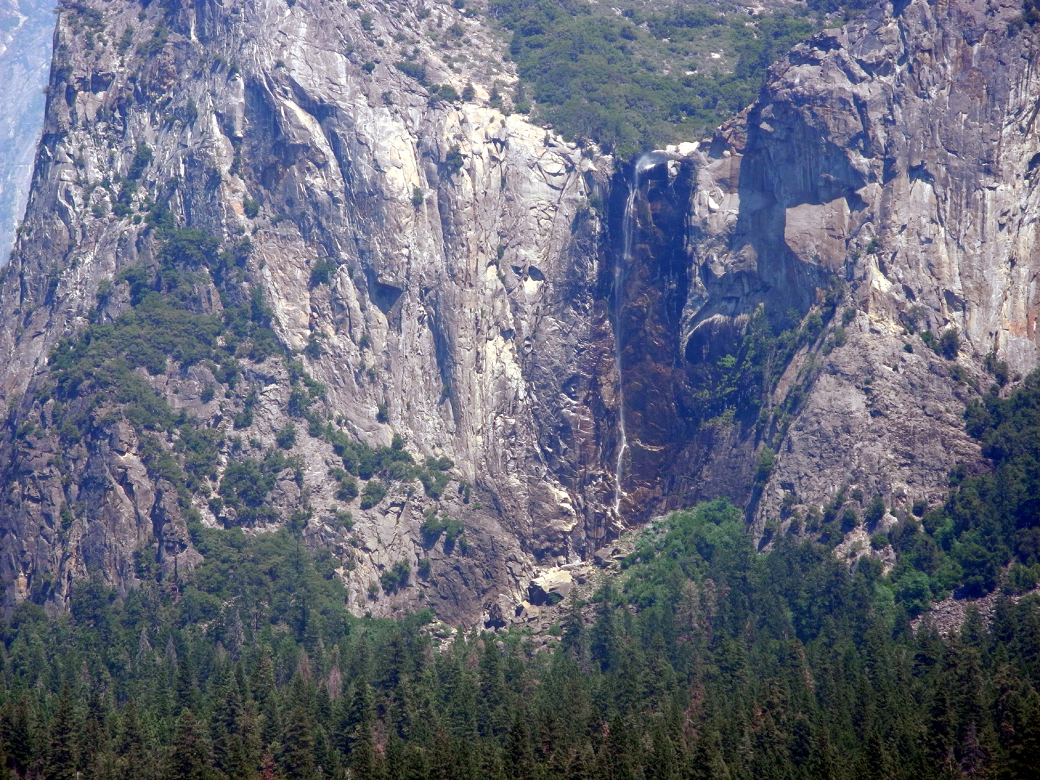
First I had about an hour of driving through more Nevada basin country to the state line. Just after US 6 enters California at the town of Benton, I turned on to California 120, which goes through some mountain country and into a lupine-covered plain, then over some more low mountains through the largest pure stand of Jeffrey Pine in the world. The lupines in some places form 100 square foot patches of blue, and line the road for a mile or two. This variety has a very compact flower cluster, making for an exceptional intensity of color. Where the road goes through the pine forest, I stopped at the site of Mono Mills, where lumber and firewood were cut for the mining town of Bodie. A railroad ran from the mill to the town, but the only things left are a few rotting timbers from the mill complex. There is a very nice viewing platform, with informational signs that include some historical photos. At this location Mono Lake comes into view, and the state road soon joins US 395 and runs north contiguous with it for a few miles, before turning west to go over Tioga Pass. From the junction the road rises steeply to the 9,900 foot pass, which is also the eastern entrance to Yosemite. From there the road goes down to Tuolumne Meadows. In this area cars were parked everywhere there was room, there was pedestrian traffic along the road, and it was a slow, crowded area. Beyond this spot there is a vista point which I believe is second only to Glacier Point - Olmsted Point. At this large parking area along the road, you are looking south across a canyon to 9,900 foot Cloud's Rest. To the west of it is 8,800 foot Half Dome, seen from an angle that is so different from the classic valley view, that you might not recognize it. And to the east, you can see Tenaya Lake and the granite domes that rise above it. From the blue waters of this lake, Tenaya Creek flows down a canyon to Yosemite Valley, where it joins the Merced River. There were fires in the Sierra foothills, and there was a slight smell of smoke at Olmsted. The view was slightly hazy, but not too bad. From Olmsted the road continues through a long stretch that is fairly consistent in altitude, with no significant up or down hill. Along this route I sometimes traveled a mile or two without seeing another car. Then I came to a construction zone, and saw lots of cars, sitting in line. The wait here was about ten minutes. I remained in the construction zone for many miles, although with no stopping for a while, then had one more short wait. At one place where there was a large paved pullout, I stopped, set up my lawn chair under a big fir tree, and enjoyed a sandwich for lunch. From here the road starts down into the valley, going through three tunnels, and offering a variation of the classic Yosemite Valley view, with El Capitan and Half Dome. After crossing the lower end of the valley, I climbed up to the Wawona Tunnel, which goes through nearly a mile of solid rock, and is the longest highway tunnel in California. At the east end there is a large parking lot, and it is here where you see the most famous view of the valley. It is near but slightly lower in elevation from the spot where the Mariposa Battalion became among the first Caucasians to see the valley, while chasing a band of Indians accused of raiding James Savage's trading post. The view here was even more hazy than at Olmsted, and I felt bad for the many tourists there, some of whom who were no doubt making the only visit of their lives to Yosemite. Even so, all the major features were visible. Bridalveil Falls was just a trickle, the level we expect to see in late August. From here I ended my tourist phase, and made the 90 mile drive back home, stopping only to use the restroom at Chinquapin. I got home around 4:30, having added 2,531 miles to the Honda, and satisfied that both the family gathering and my sight-seeing activities had been a success. --Dick Estel, June 2015 |
||
| Photos (click on
thumbnail to enlarge; photos open in new window)
Utah Eastbound Colorado Eastbound The Cousins Colorado Westbound |
||
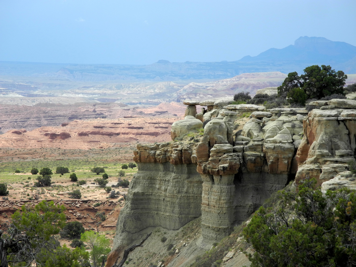
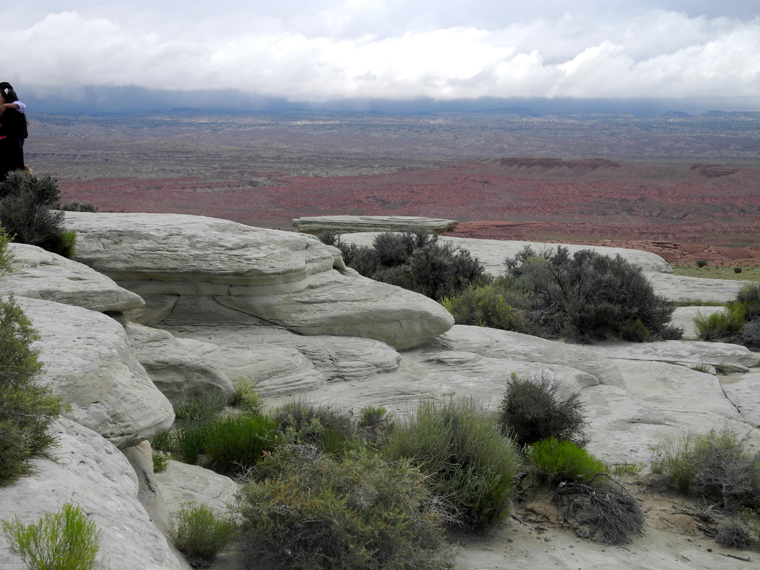
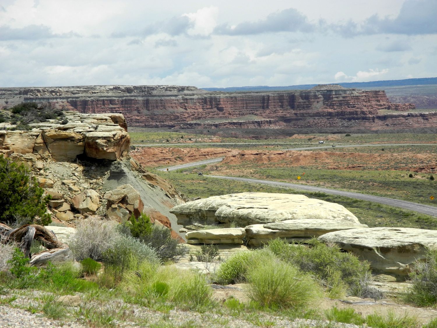
| Utah Eastbound | ||
 |
 |
 |
| Fastest state in the west | Red cliffs above St. George | Castle Valley Overlook, I-70 |
 |
 |
 |
| More Castle Valley views | ||
|
 |
 |
| White sandstone layers | Looking eastward | Wild grain in the rest stop |
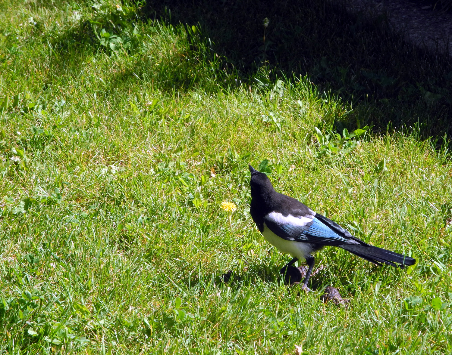
| Colorado Eastbound and Colorado Springs Area | ||
 |
 |
 |
| Magpie at a rest stop along I-70 | The Colorado River | Snow covered mountains above Vail Summit at 10,000 feet |
 |
 |
 |
| In the Garden of the Gods near Colorado Springs |
The view from a rugged trail that some of us hiked |
Diane, Nancy and Dick |
 |
 |
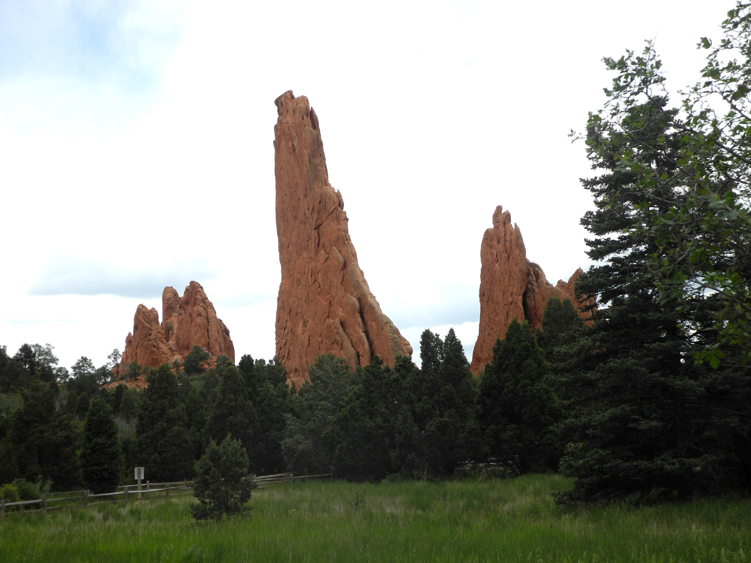 |
| More sandstone formations in Garden of the Gods | ||
 |
||
| Pike's Peak stands guard over the Garden | ||
 |
 |
 |
| Nancy, Darlene and Diane | Entrance to Cliff Dwellings near Manitou Springs |
Anne, Linda and Don |
 |
 |
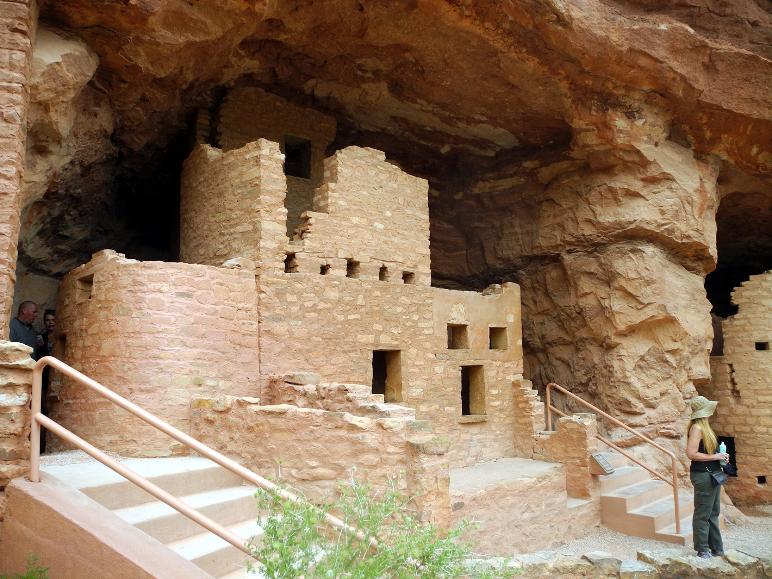 |
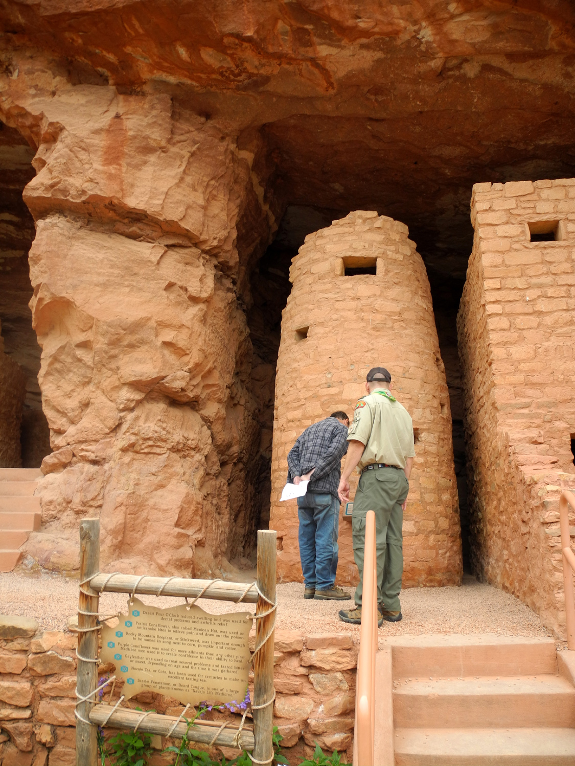
| Cliff dwelling views | ||
 |
||
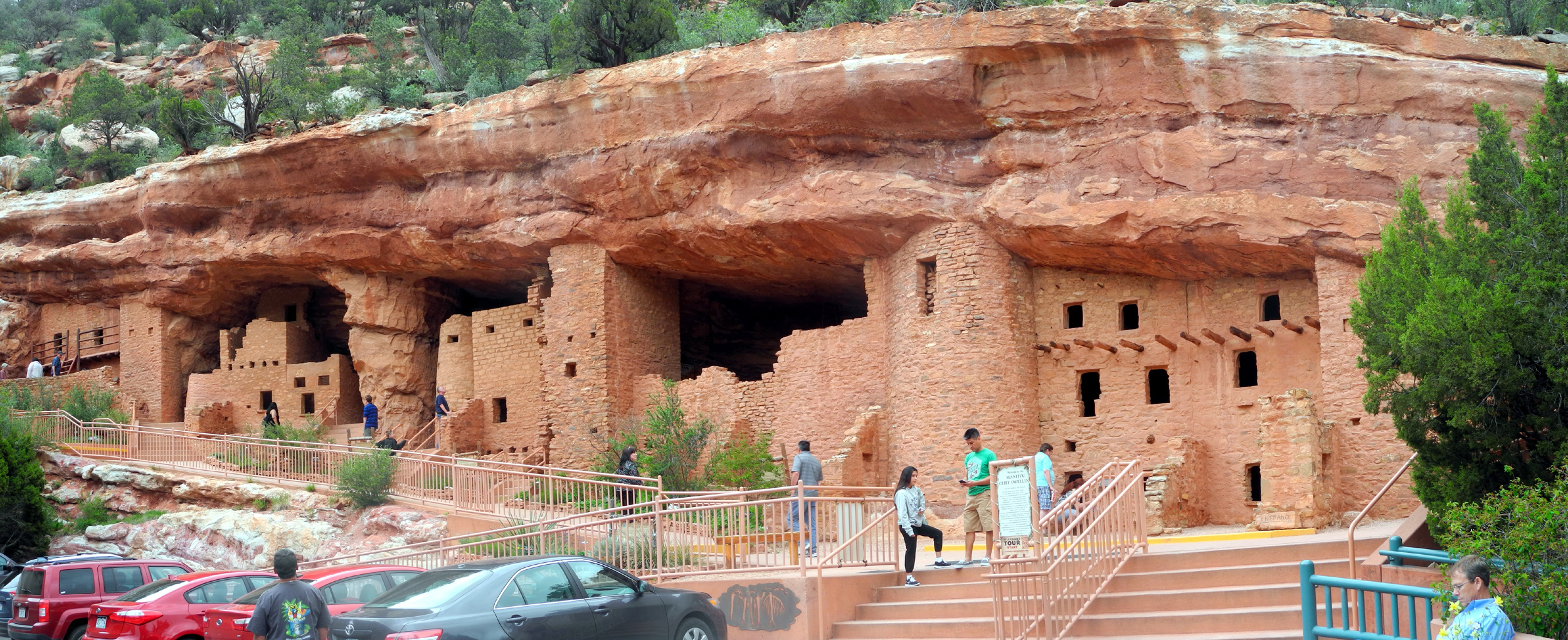
| Panoramic view of the cliff dwellings | ||
 |
 |
 |
|
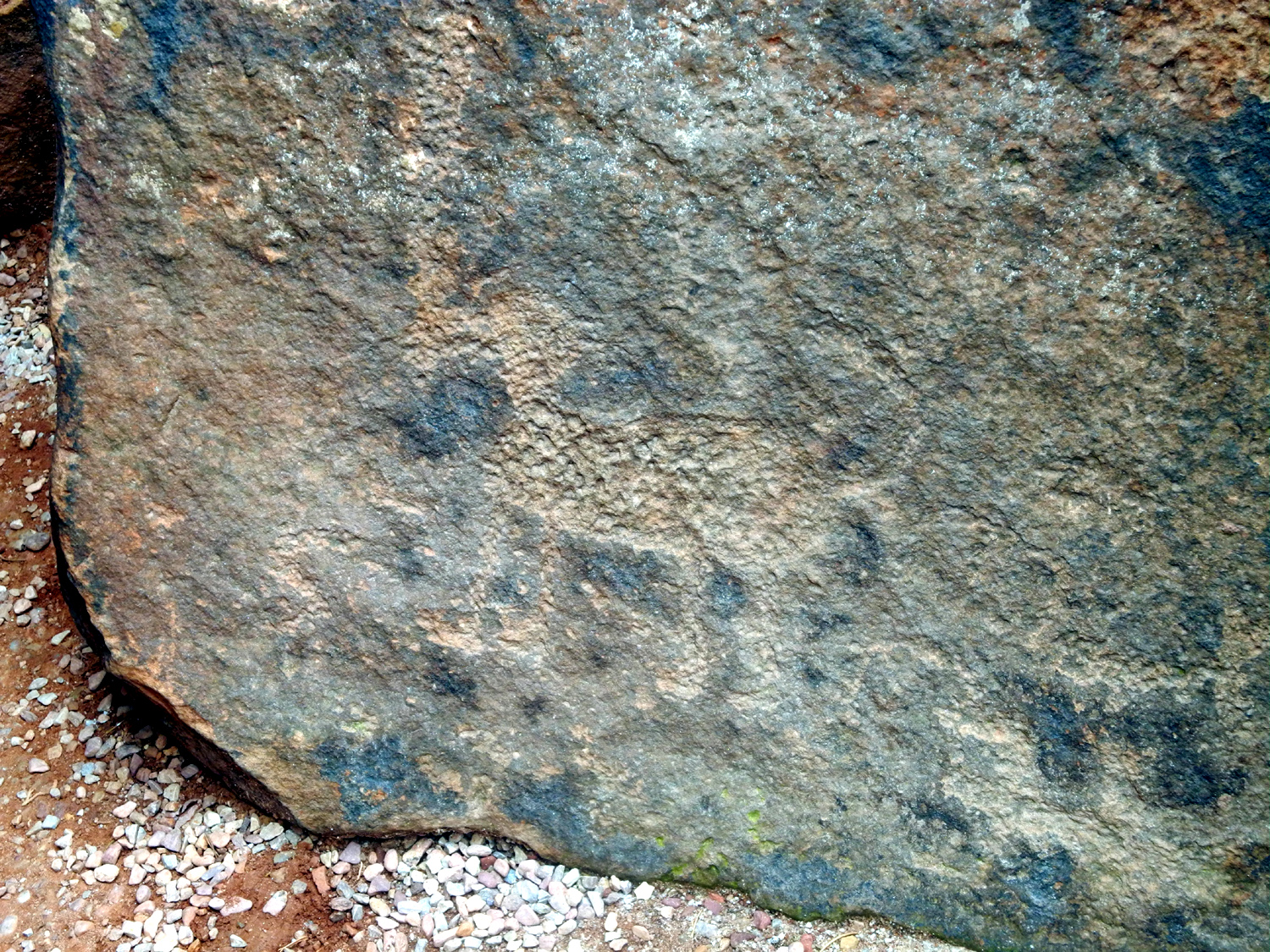
Petroglyph of an unidentified animal |
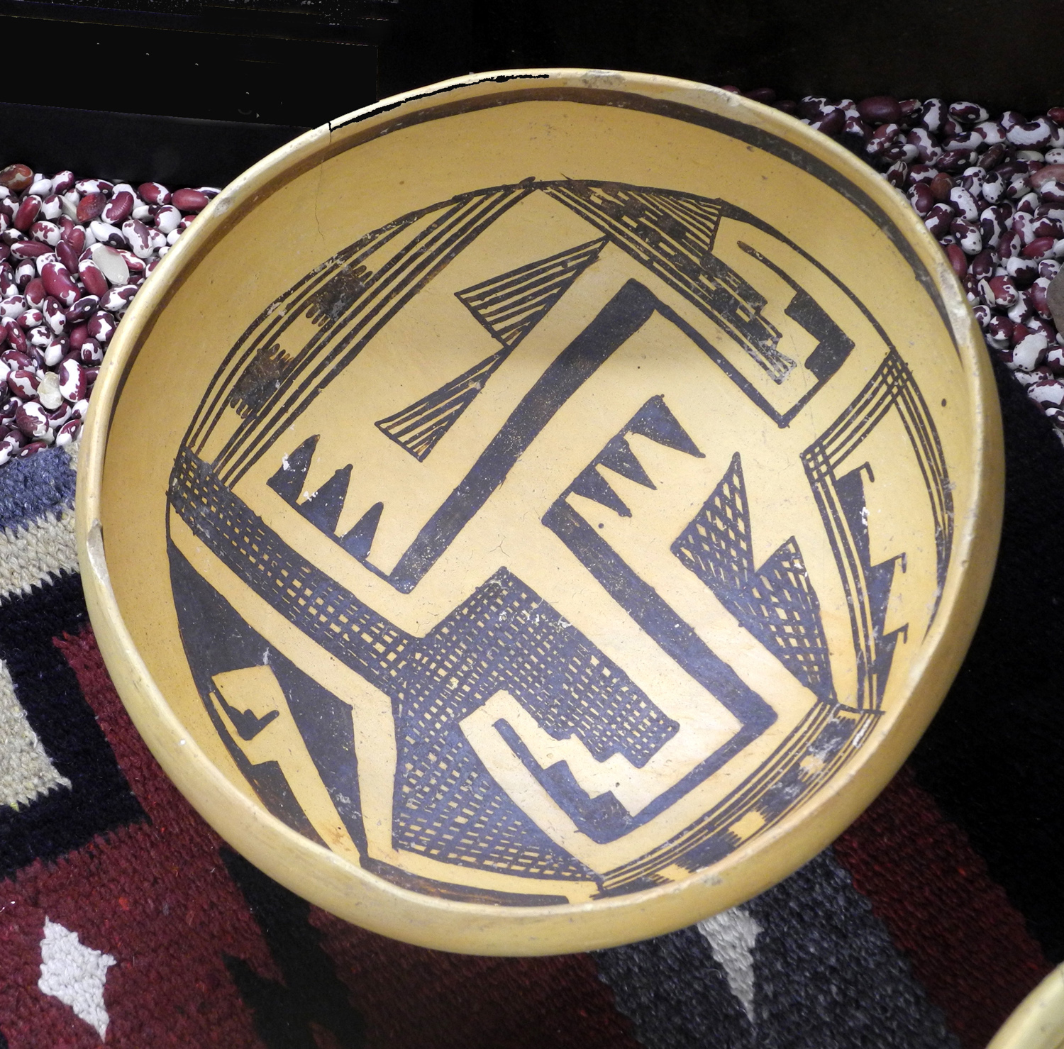
Ancient pot in museum | Another remarkable work of art |
 |
 |
 |
|
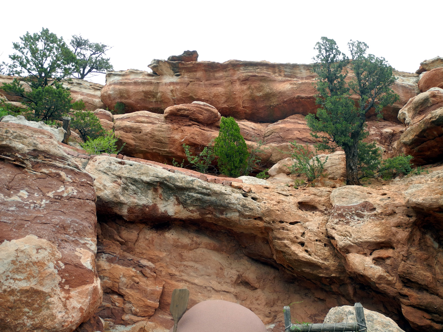
Rock formations above the dwellings |
The Hotel Elegante | The long route to my room |
| The Cousins | ||
 |
|
 |
| Our maternal grandmother, Nancy Opal Watkins Mason |
Opal Watkins Mason,
daughters, sons-in-law, grandchildren |
The cousins in 2015 (click here for names) |
 |
 |
 |
|
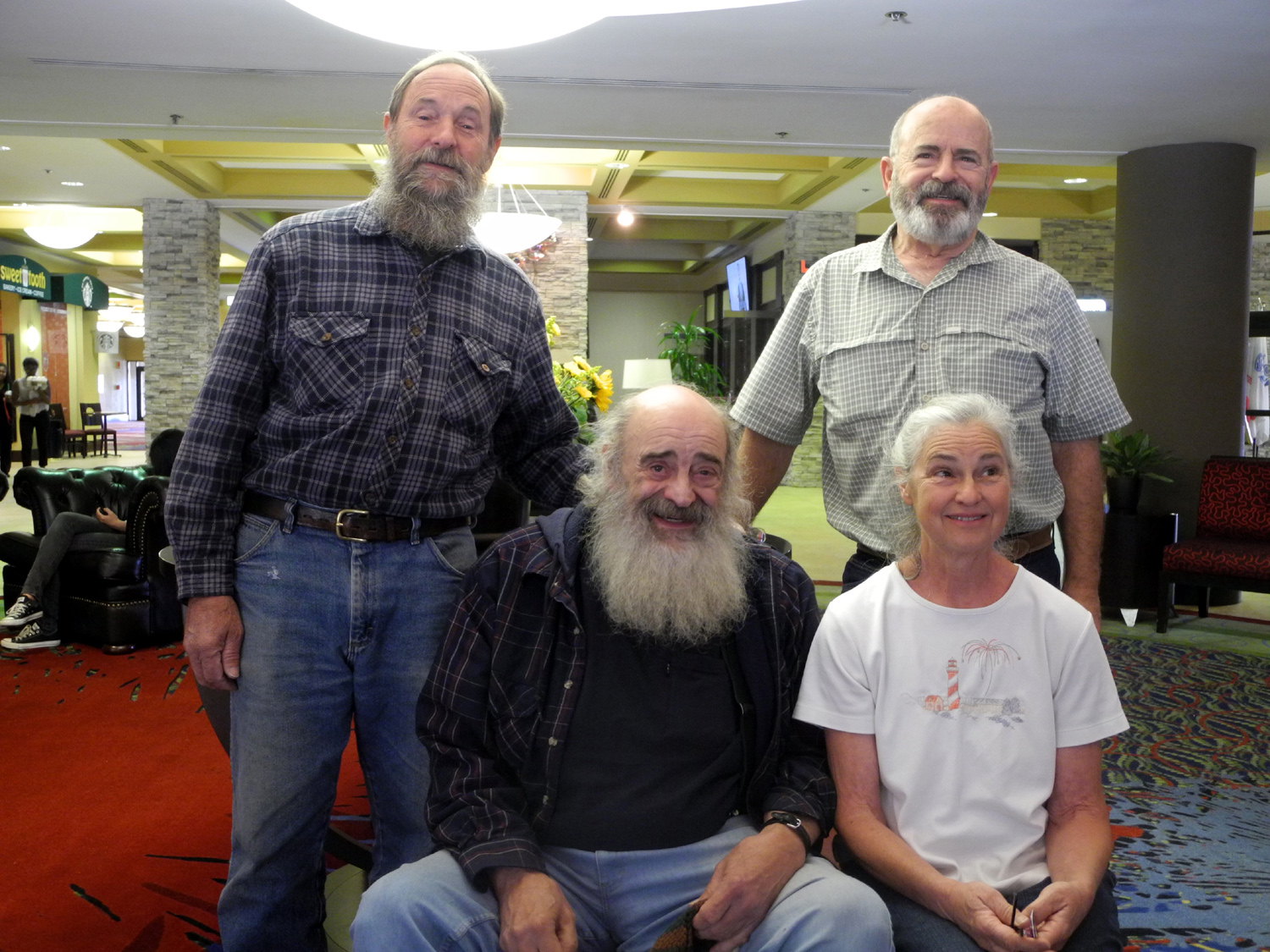
The Halls: Don, John, |
The
Drefkes: Darlene |
Patti Leary |
 |
 |
 |
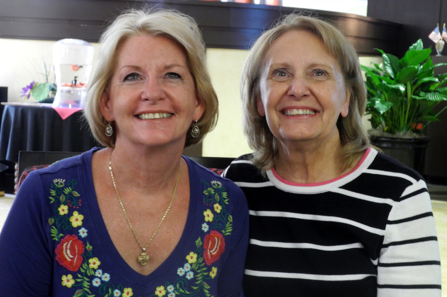
| The Estels: Linda and Dick | Diane, Dick, Darlene, Linda, Nancy at Garden of the Gods Visitor Center |
Nancy, Darlene & Diane on the trail in Garden of the Gods |
 |
||
| Anne, Linda and Don at Manitou Cliff Dwellings | ||
| Colorado Westbound | ||
 |
 |
 |
| Rafters on the Arkansas River | Snowy Rockies north of US 50 | Dillon Pinnacles |
 |
 |
 |
| Park entrance | View from Tomichi Point | Gunnison canyon and river |
|
 |
 |
| View from Gunnison Overlook near the visitor center |
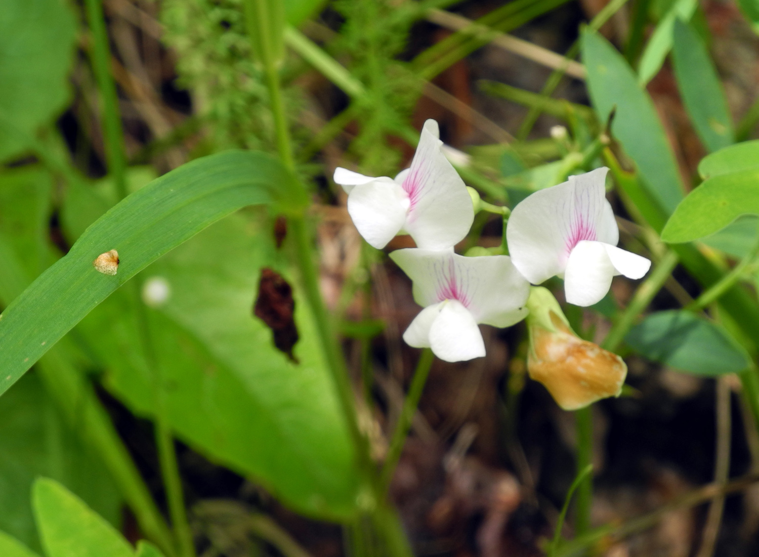
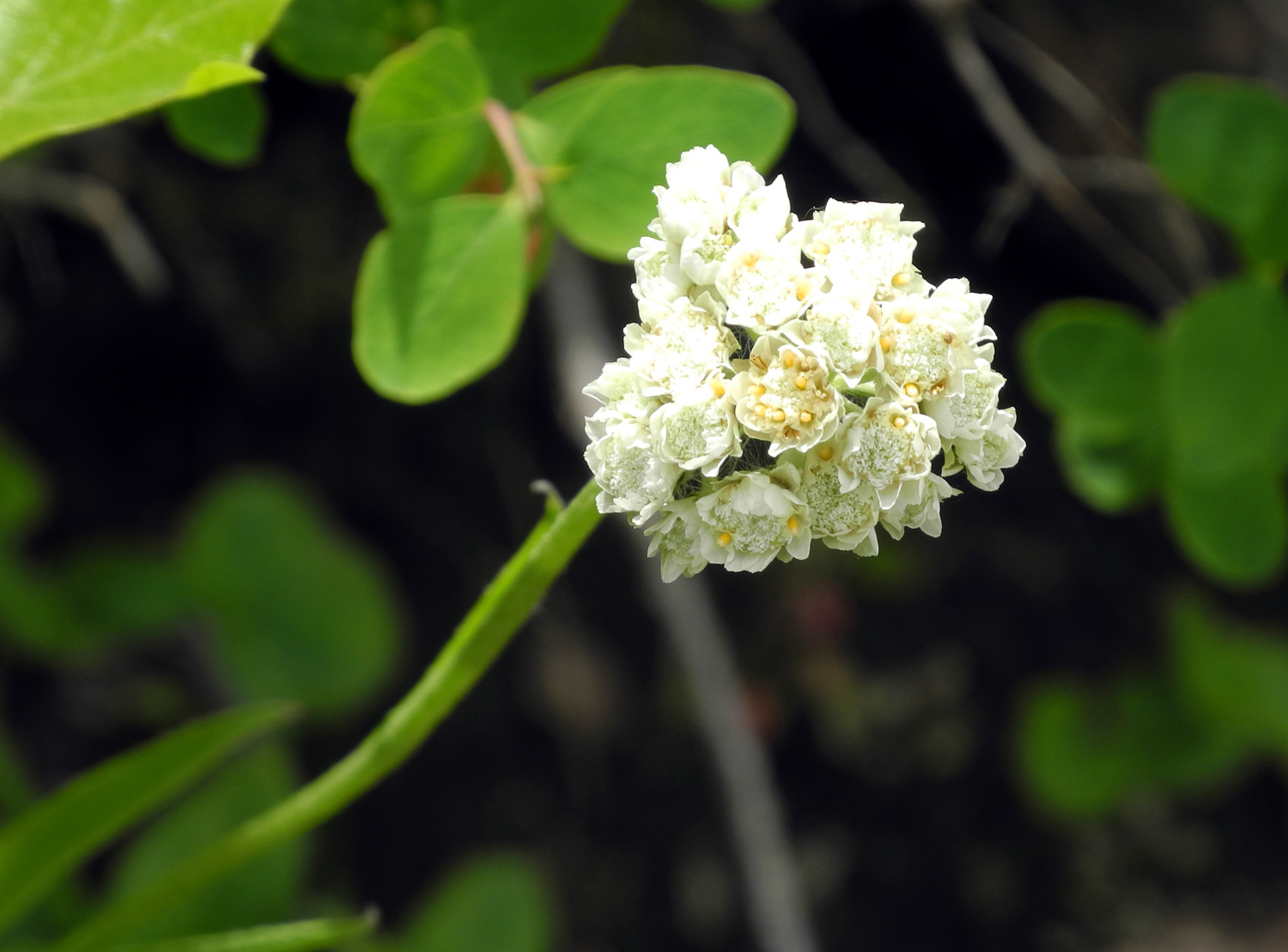
Tailcup Lupines | This flower eludes identification |
 |
 |
 |
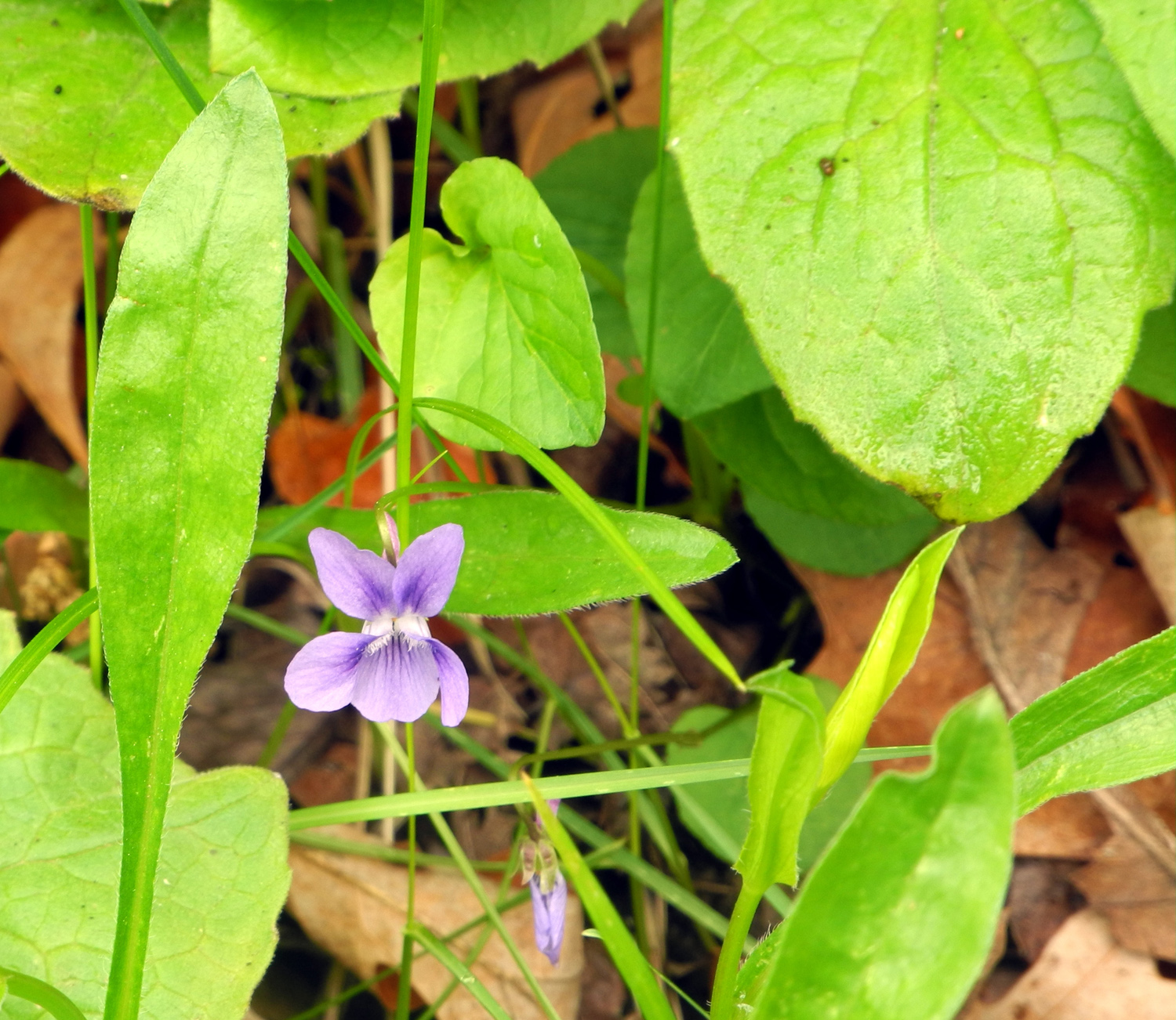
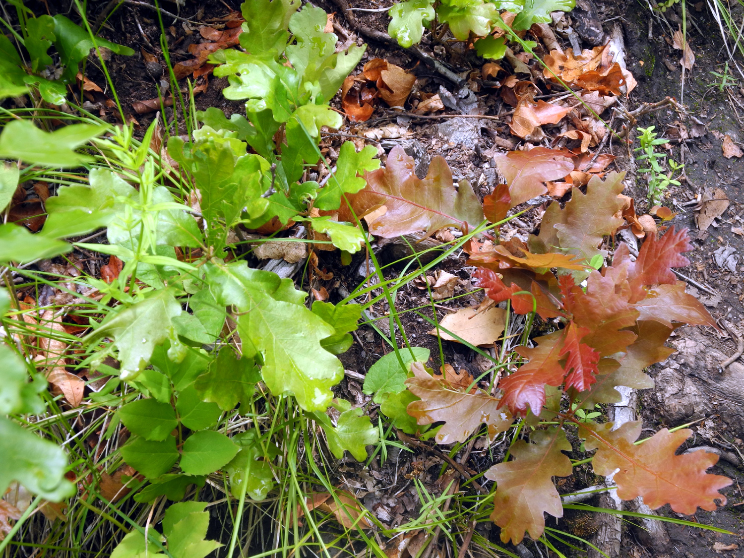
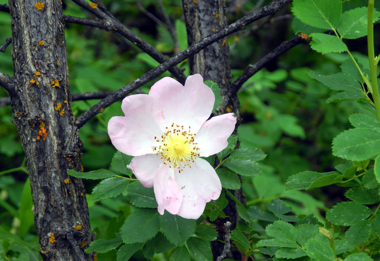
| Gambel Oak in green and red | Wild rose | Looks somewhat but not exactly like mountain pea |
 |
 |
 |
| Common yarrow | Hedgehog cactus | Rest stop |
 |
 |
 |
| Views along the Oak Flat Loop trail | ||
 |
 |
 |
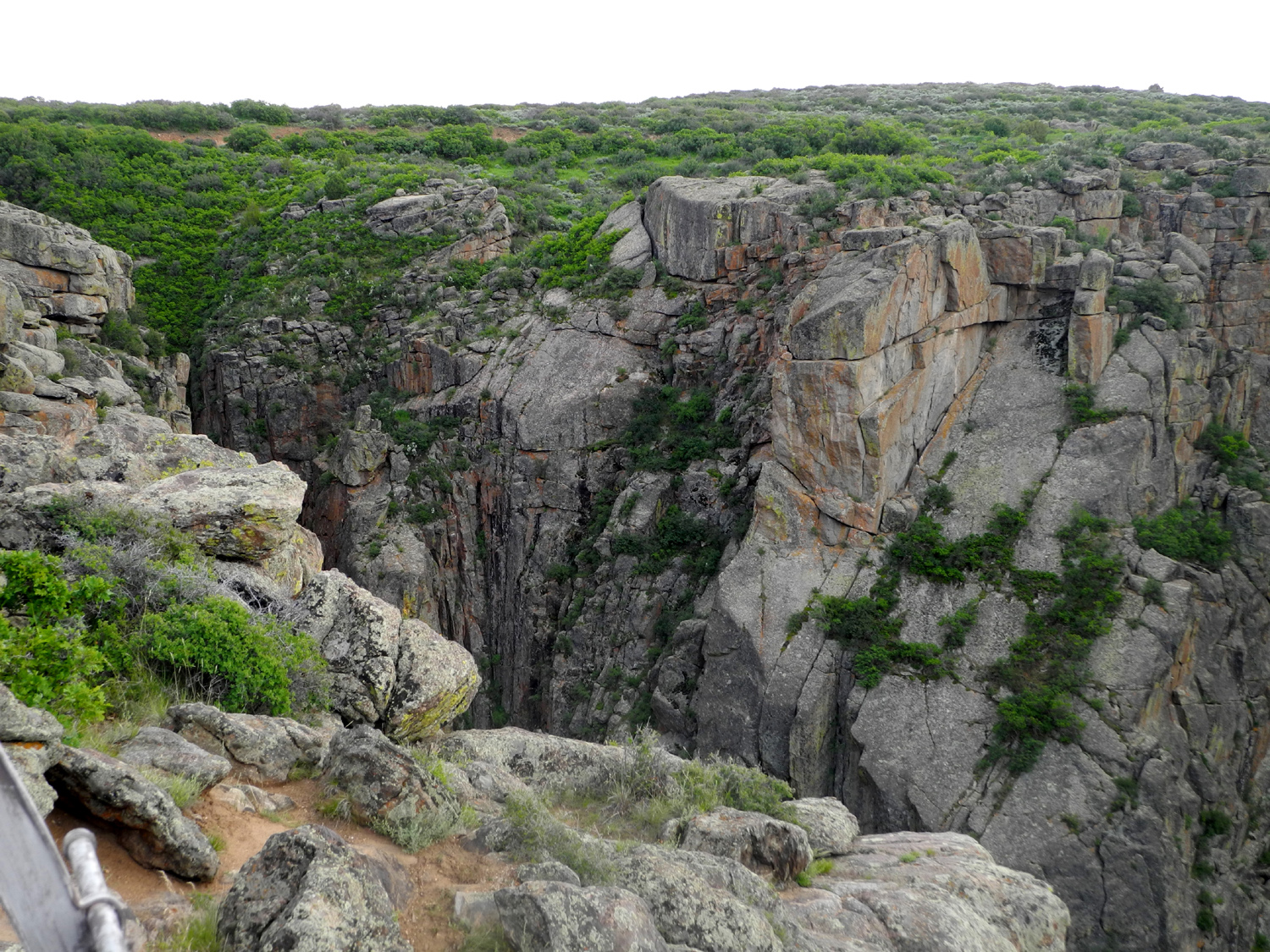
| It's called a "foot bridge" because that's how wide it is |
The visitor center from Oak Flat Loop trail | North and south rims are so close they seem to touch |
 |
 |
 |
| A good view of the river from Dragon Point | Another Dragon Point view |
Juniper along the path to Dragon Point |
 |
 |
 |
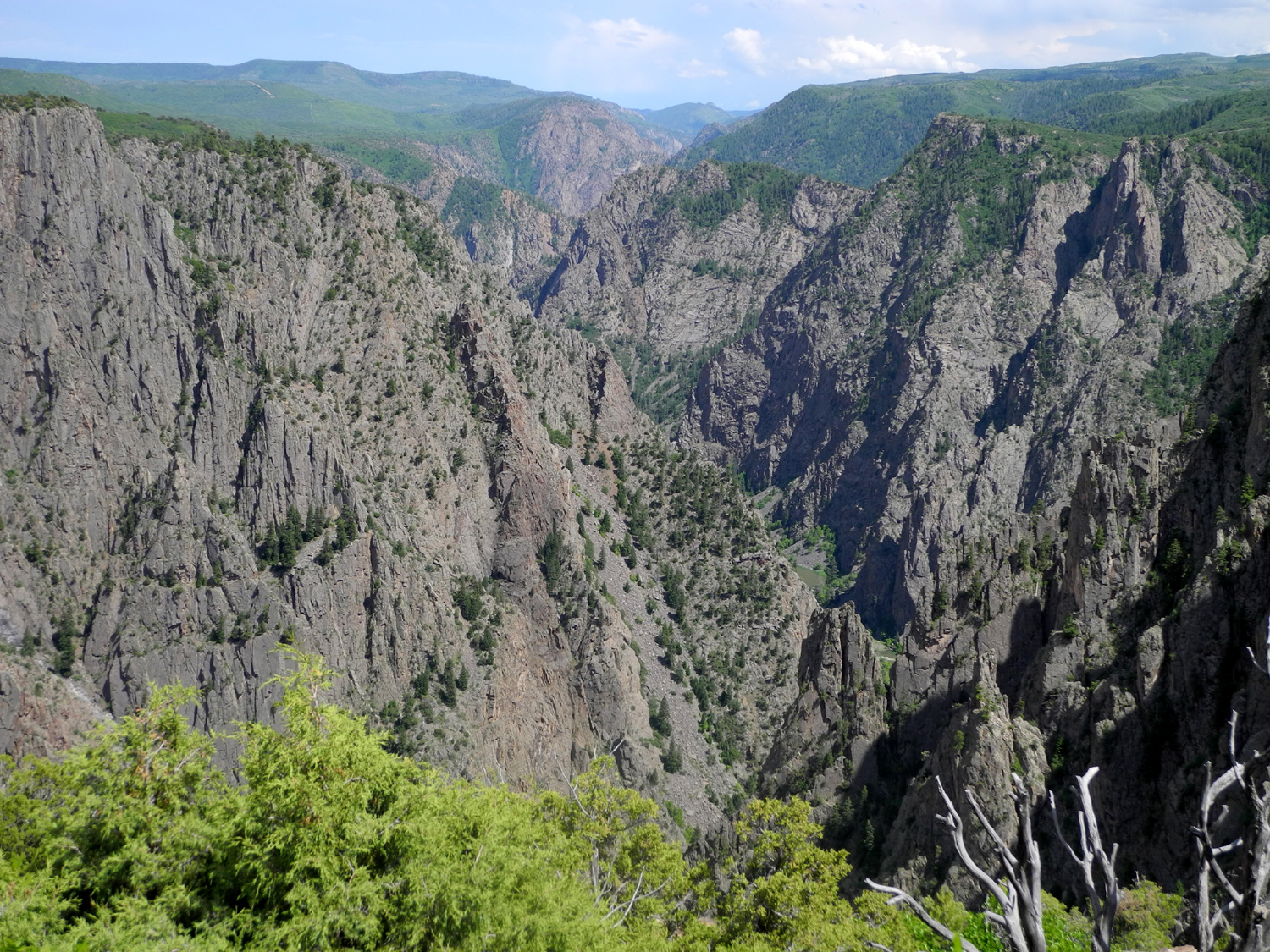
| View from High Point down the Gunnison to the open plain below |
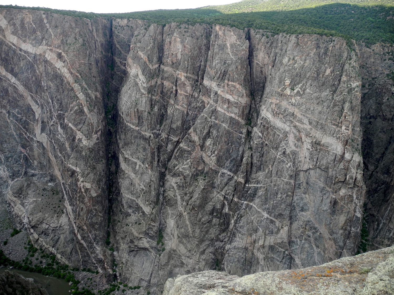
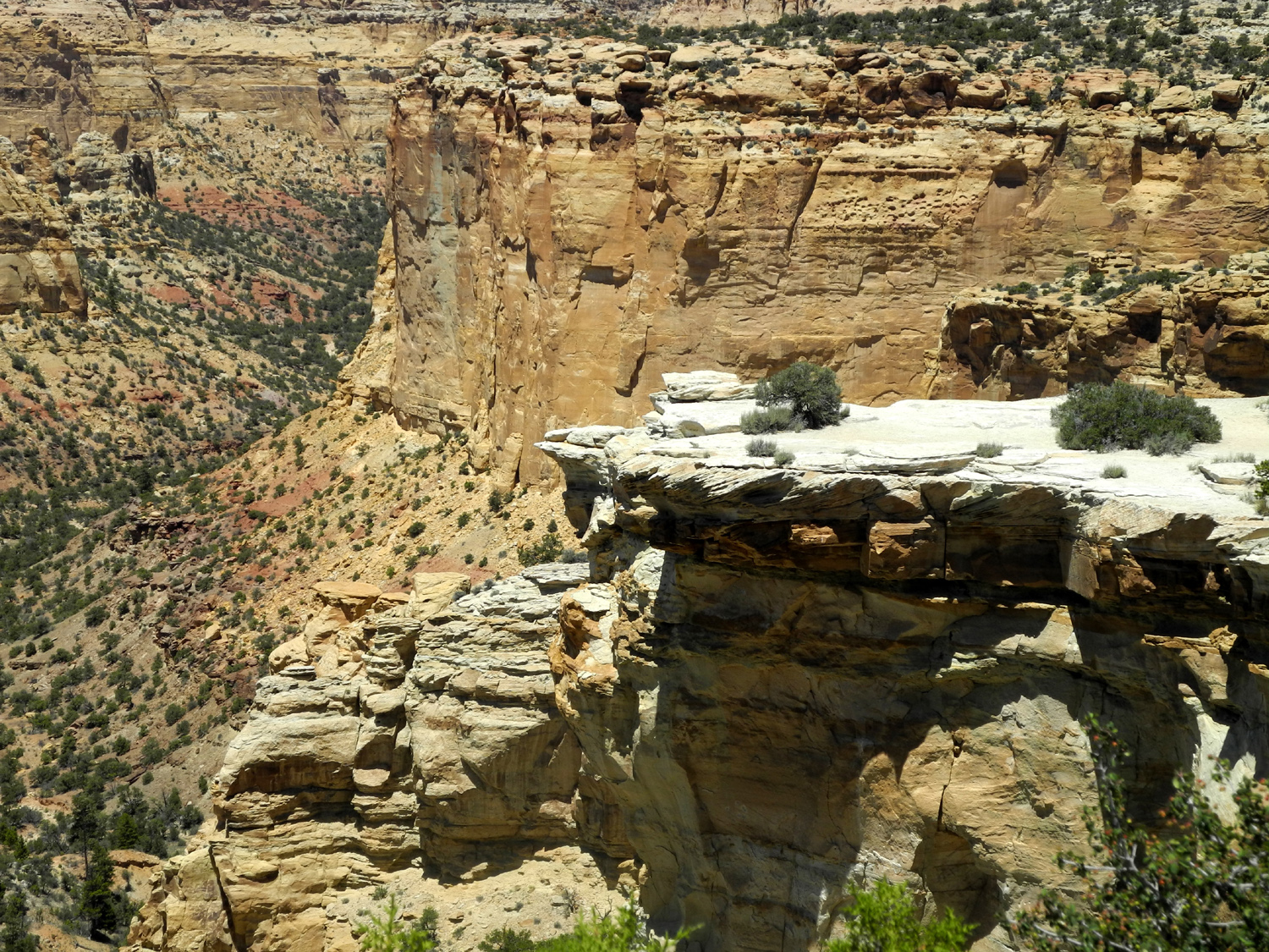
Painted Wall, the |
A side canyon at the |
 |
||
| One last look from Tomichi Point | ||
 |
||
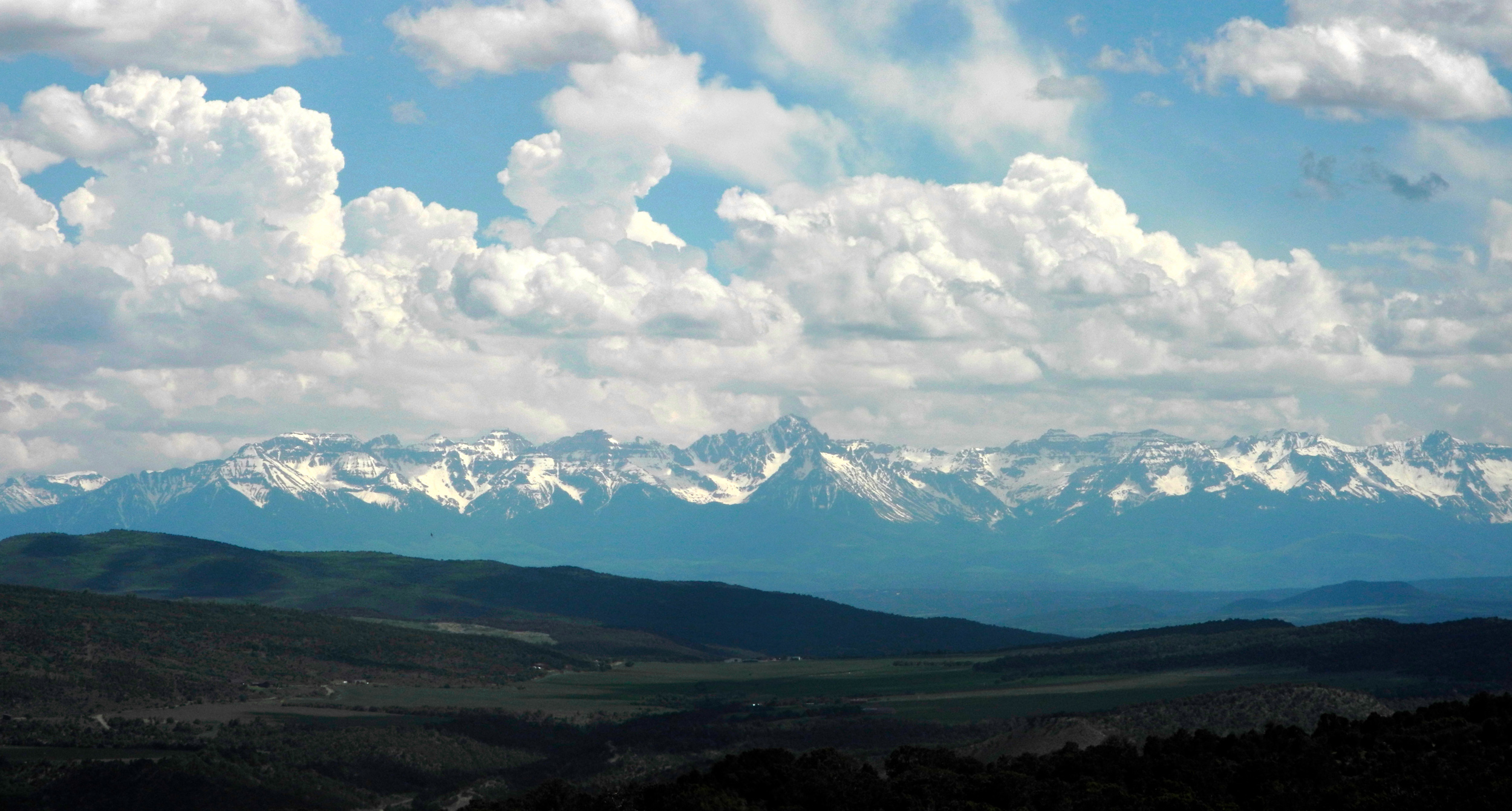
| The San Juan Mountains from Highway 347 between the park and US 50 | ||
| Utah West Bound | ||
 |
 |
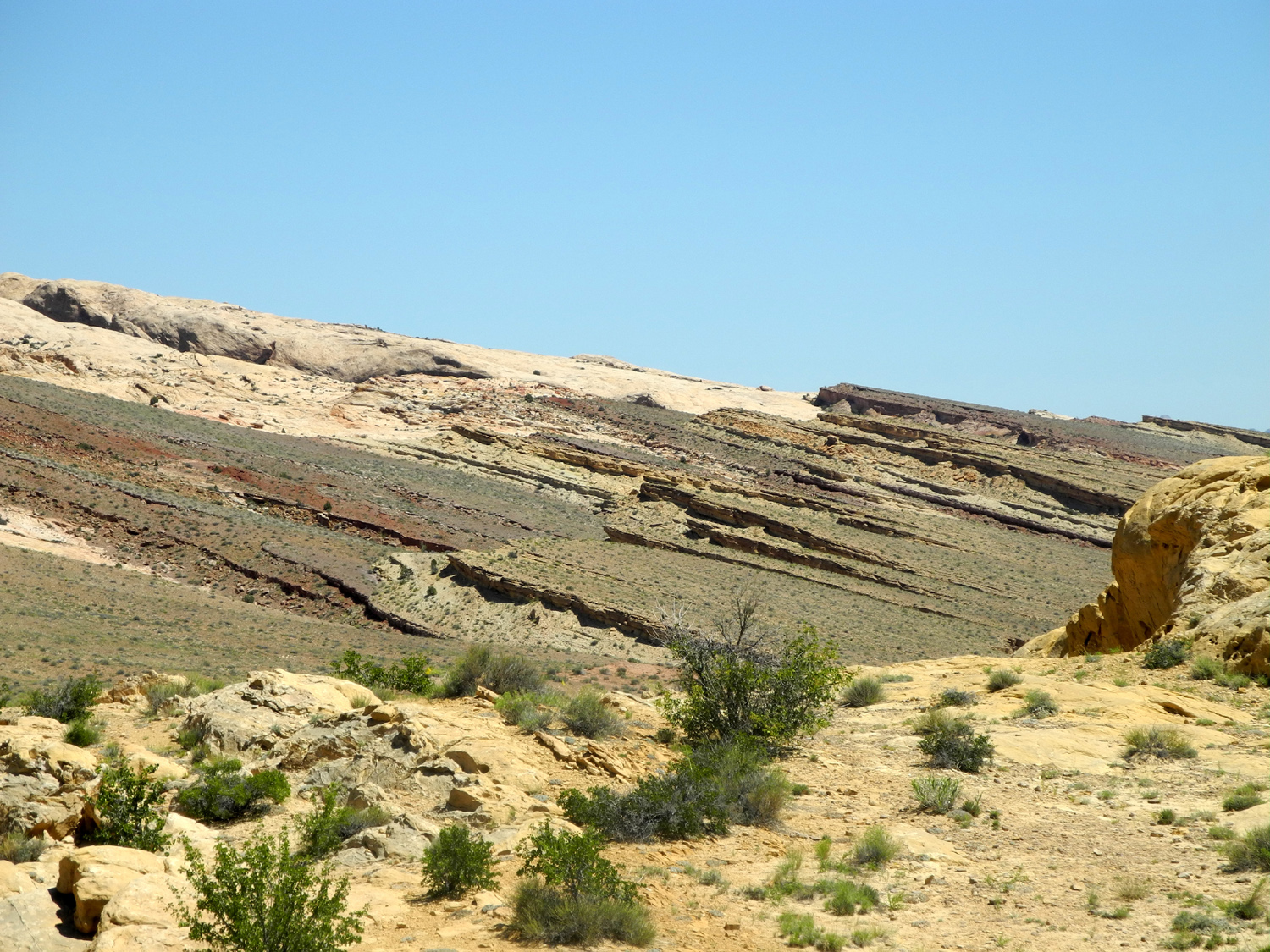 |
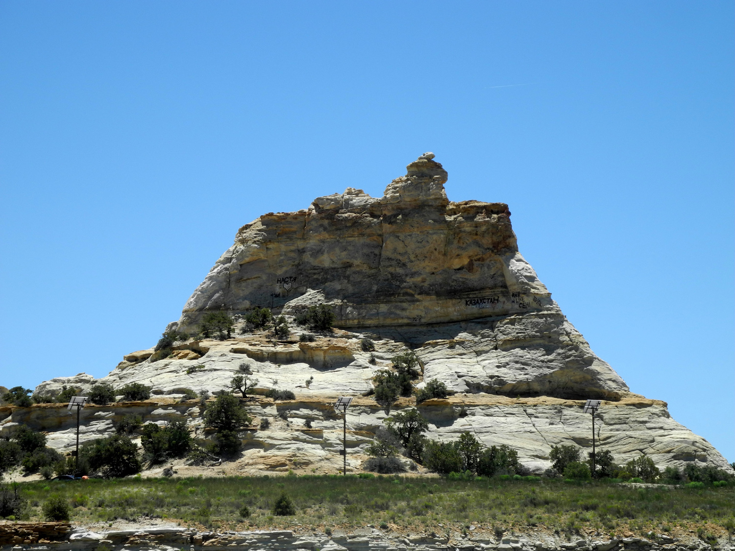
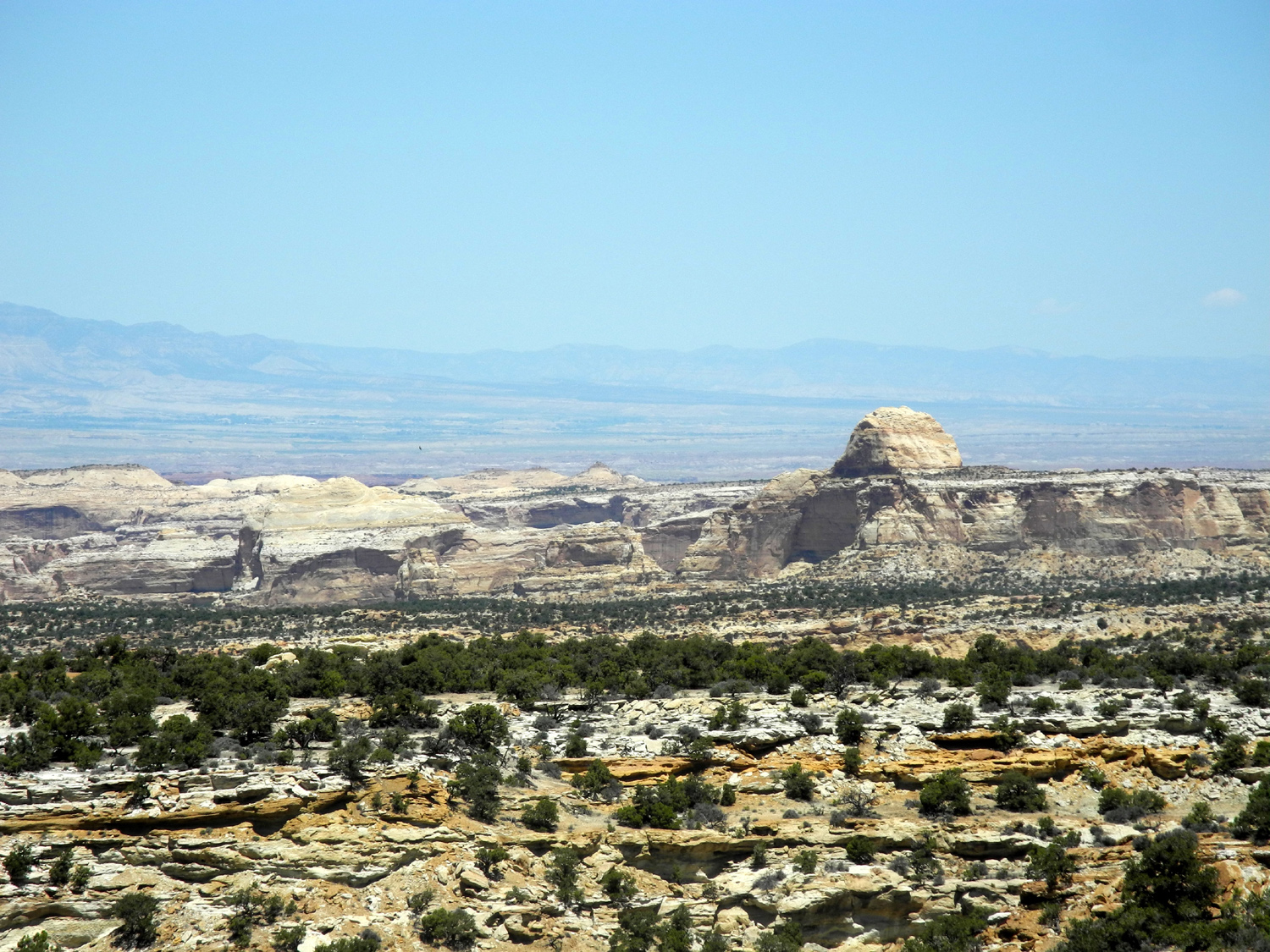
| San Rafael Reef south of I-70 | I-70 through the reef | Tilted strata of reef north of I-70 |
 |
 |
 |
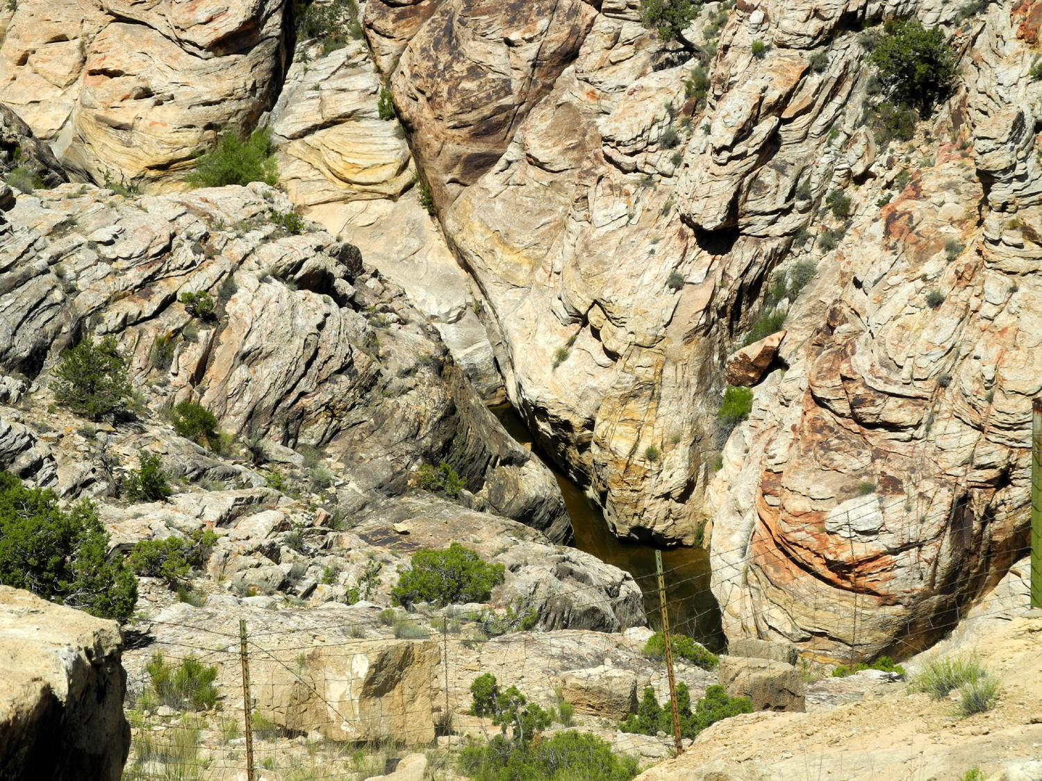
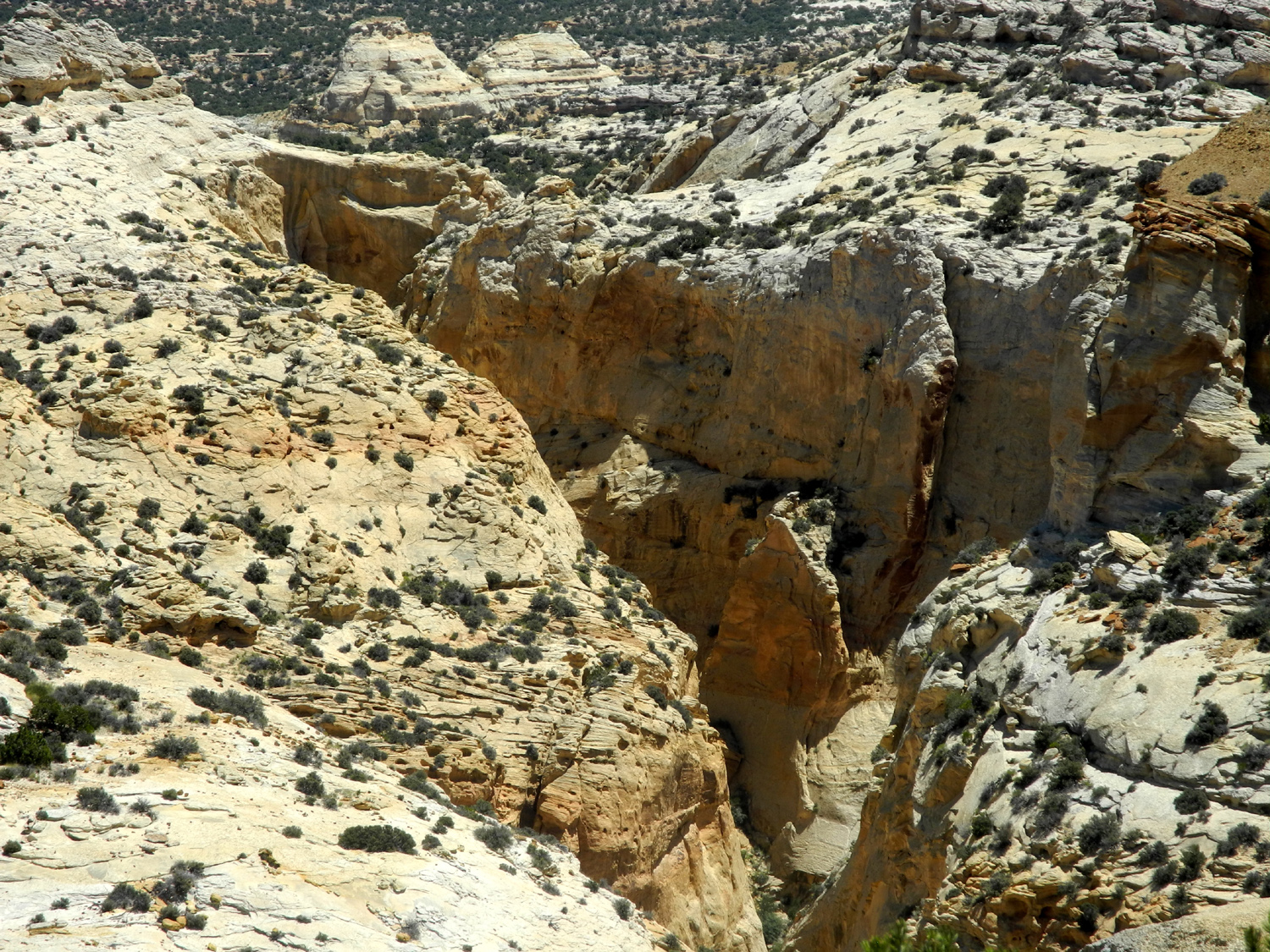
| View from Black Dragon Canyon | Down in the canyon | Ghost Rock |
 |
||
| Black Dragon panorama | ||
 |
 |
 |
| View from Ghost Rock Vista | Another view |
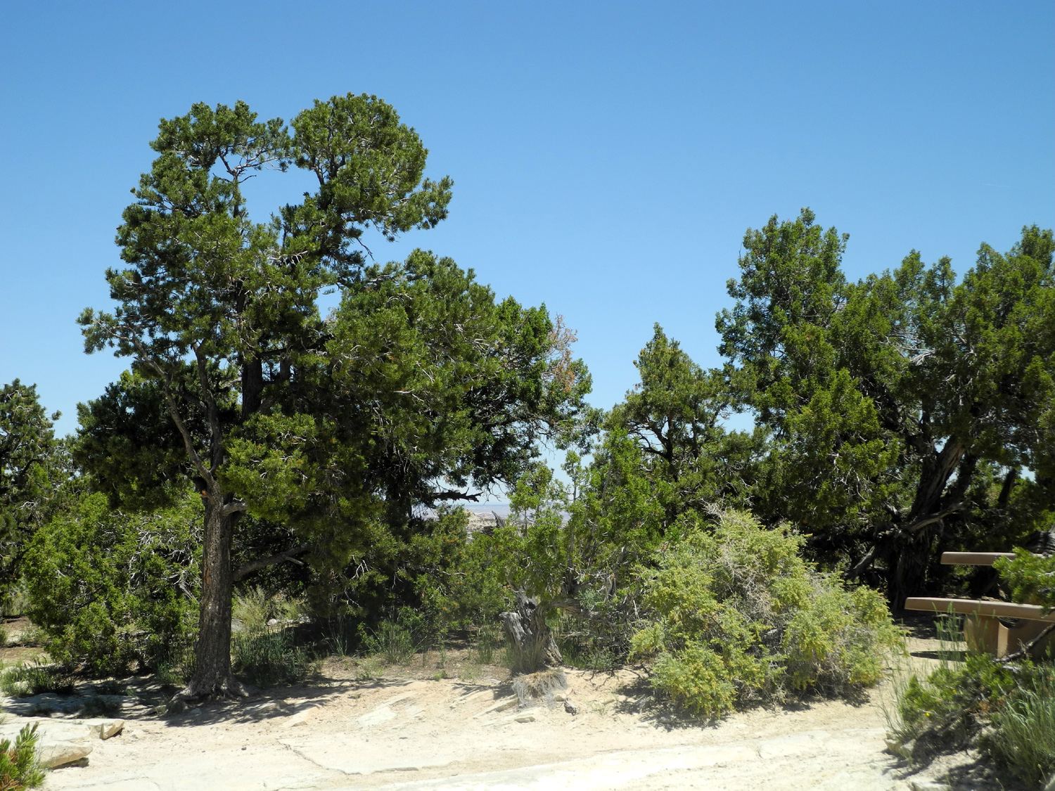
Piñon and juniper at Ghost Rock area |
 |
 |
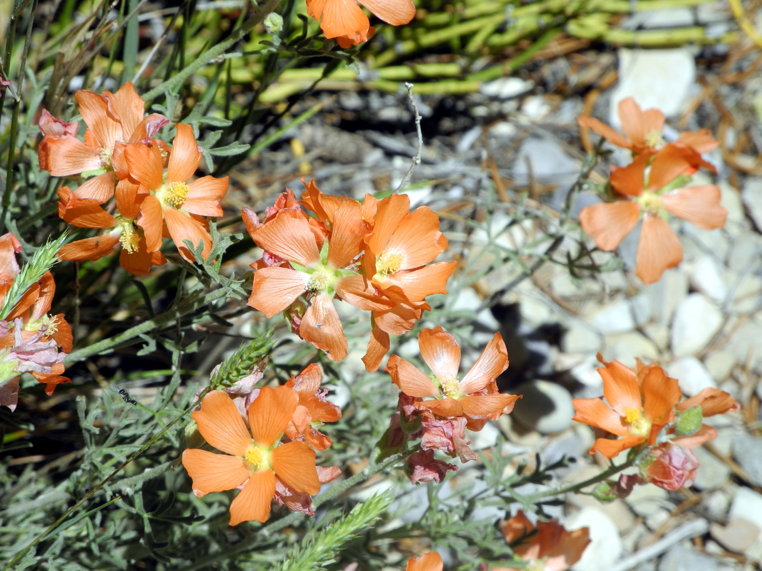 |
| View at Eagle Canyon Vista | Down in Eagle Canyon | Flowers at Eagle Canyon |
| Nevada | ||
 |
 |
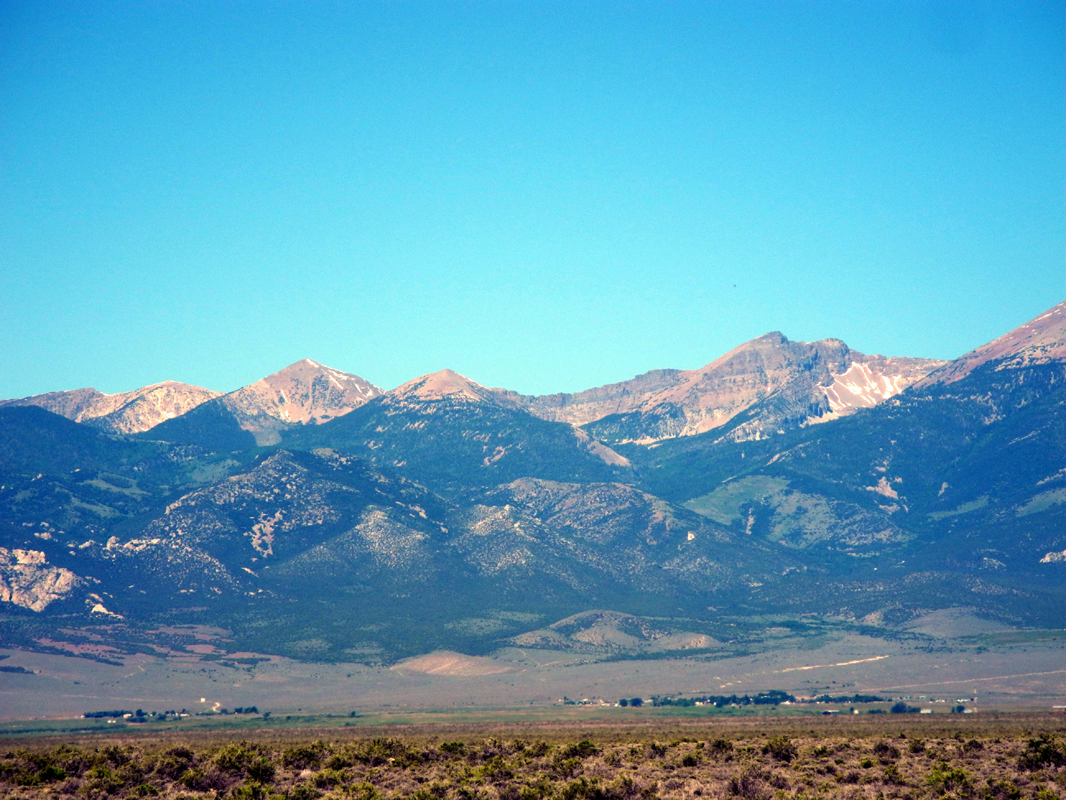 |
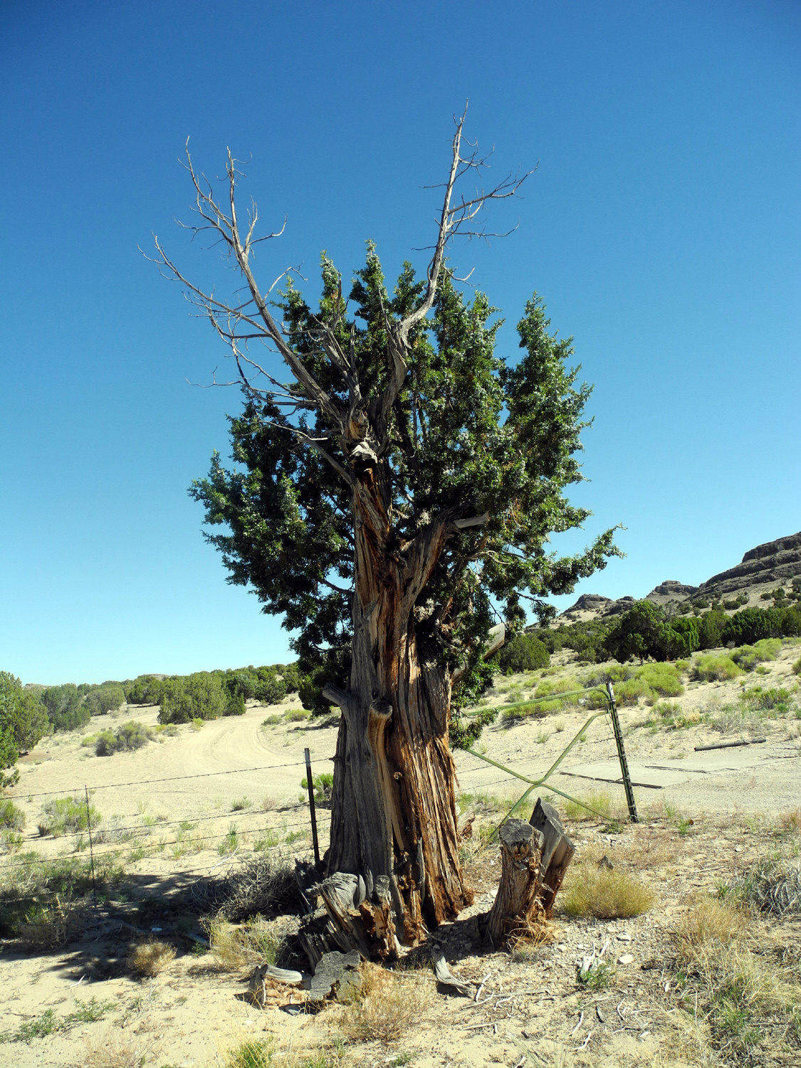
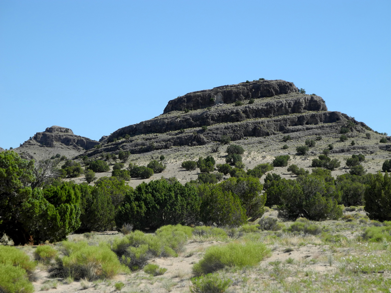
| Rugged juniper | Scene in eastern Nevada | The Snake Range |
 |
|
 |
|
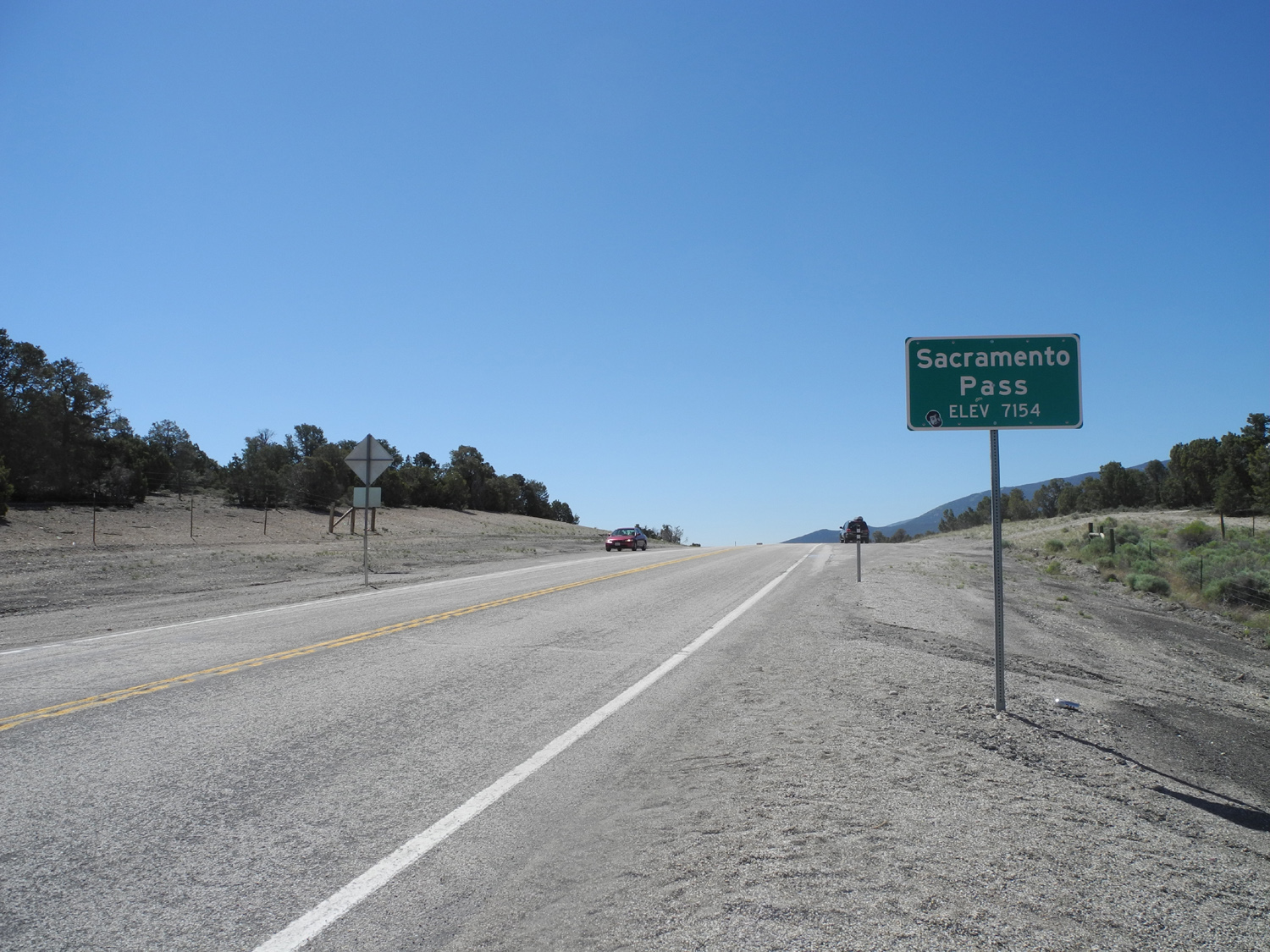
Highway 50 through the Snake Range |
Snake Range from the west | A REALLY wide load |
 |
 |
 |
| Typical Nevada basin | Lodging in Tonopah | My old nemesis |
| California | ||
 |
 |
 |
| Piñon along Highway 120 | Close-up of seed cones | Field of lupines |
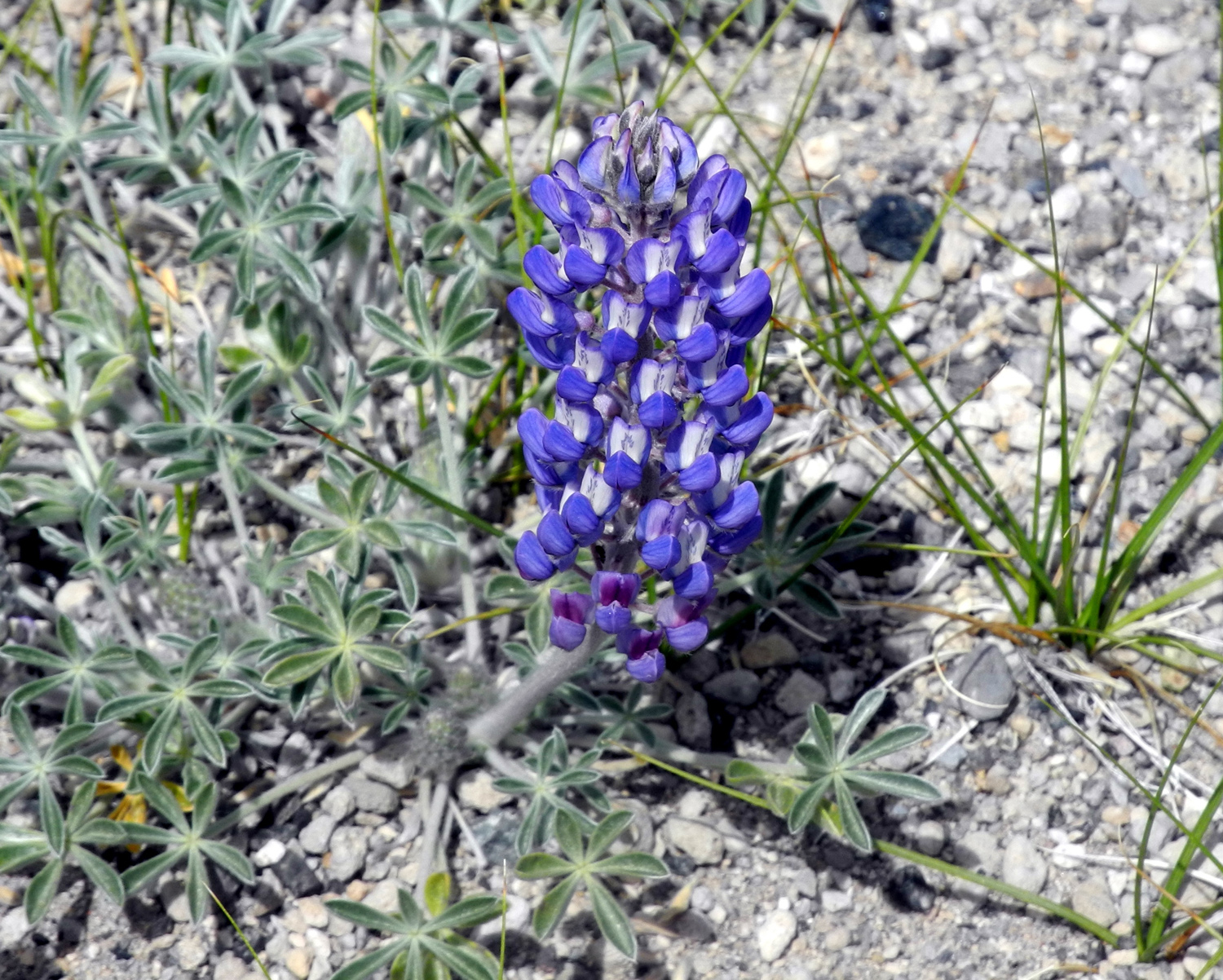 |
 |
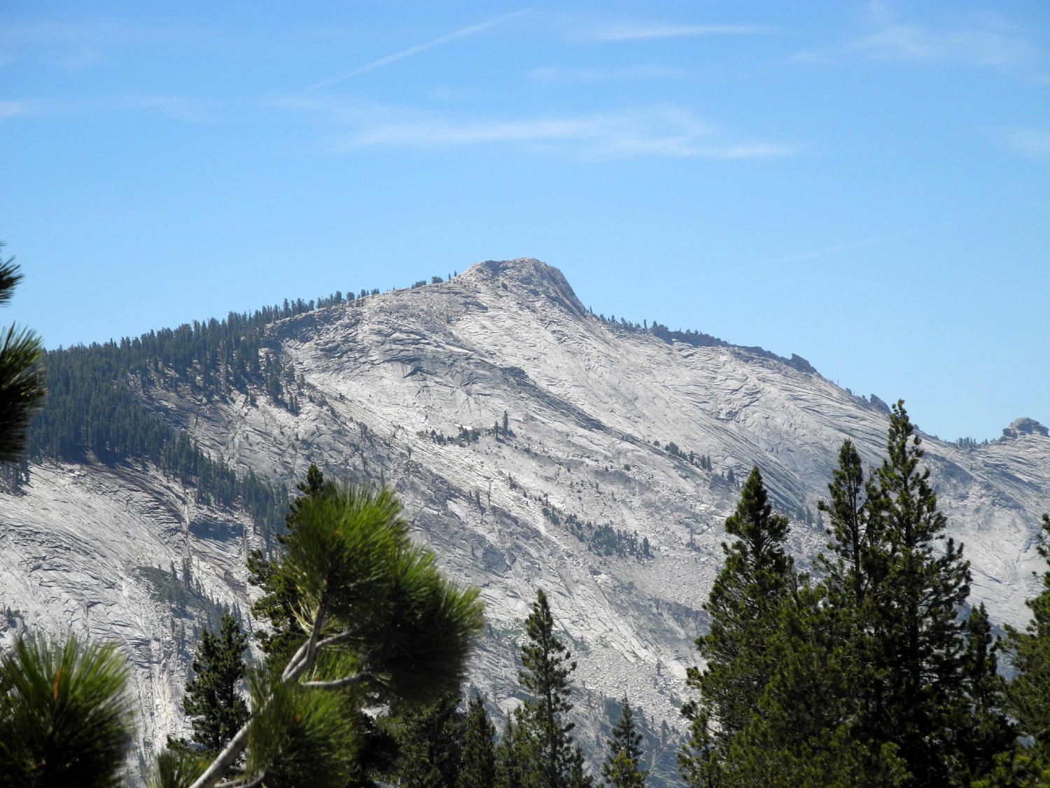 |
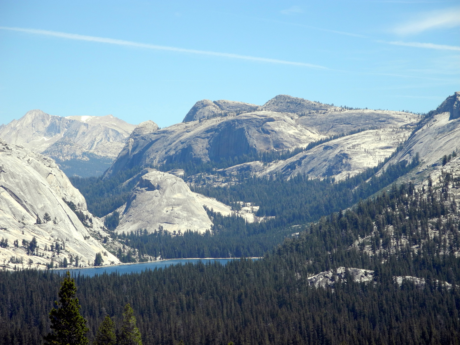
| And a close-up | Half Dome from Olmsted Point | Cloud's Rest |
 |
 |
 |
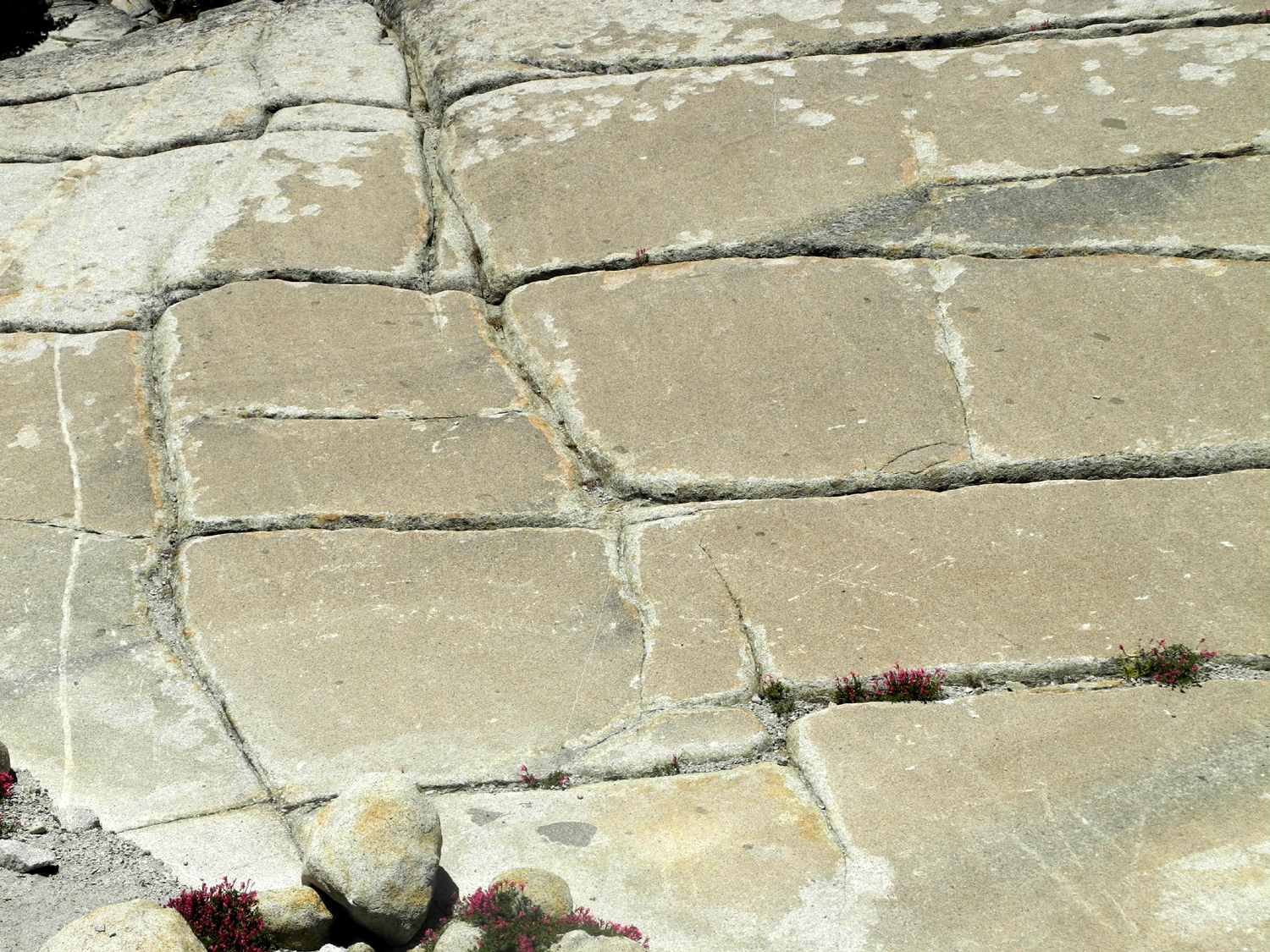
| How the mountains crumble |
Exfoliation - how domes are formed |
Tenaya Lake |
 |
||
|
Bridalveil Falls, with late |
||
| Related Links | ||
| San Rafael Reef | San Rafael Swell | Glenwood Canyon Photos |
| Glenwood Canyon | Colorado Springs | Tourist Info for CO Springs |
| City Web Site | Garden of the Gods | Pike's Peak |
| Manitou Cliff Dwellings | Black Canyon | Flowers of Black Canyon |
| Mom's Cafe Salina UT | Jeffrey Pine Forest | Mono Mills |
| Yosemite National Park | Tioga Pass | Olmsted Point |
| Wawona Tunnel | Mariposa Battalion | Lupines |