|
Dick's North Coast Trip |
||
|
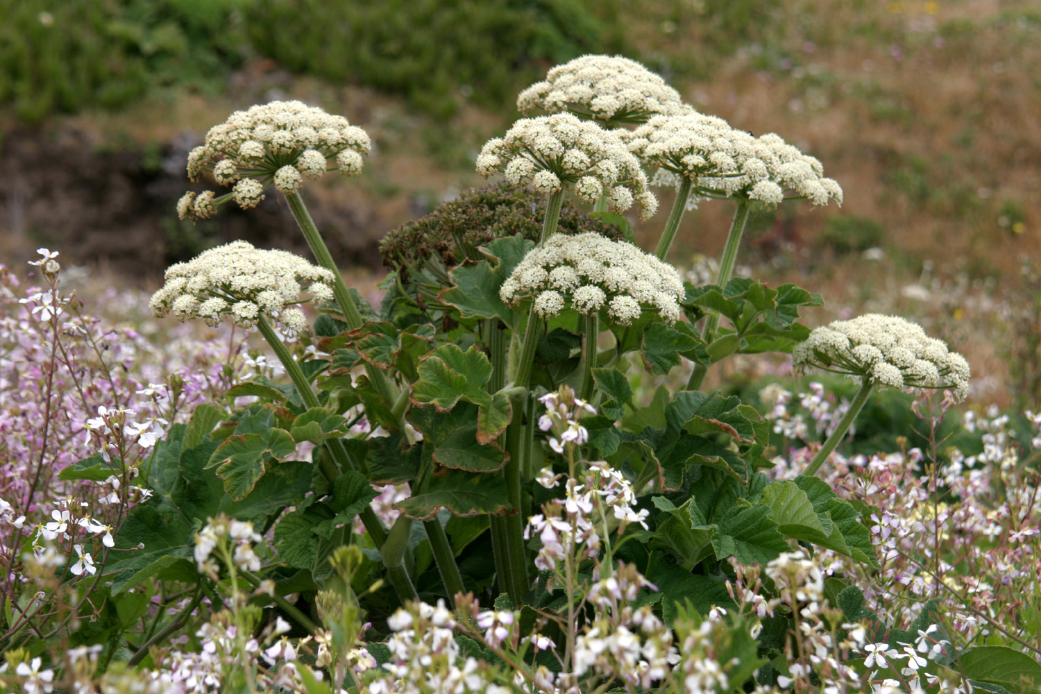
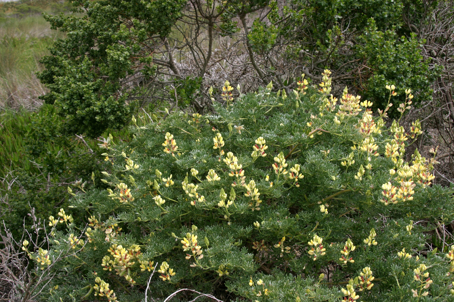
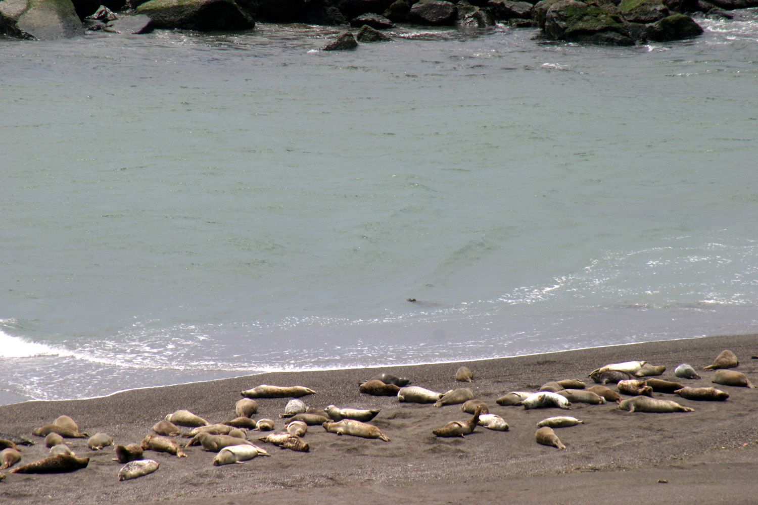
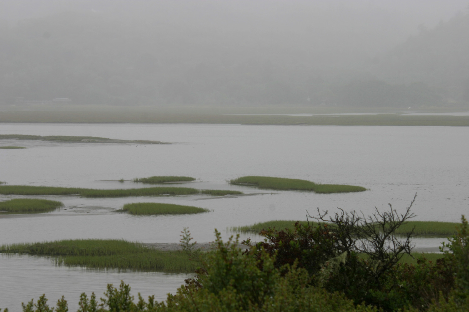
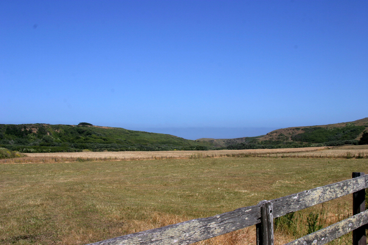
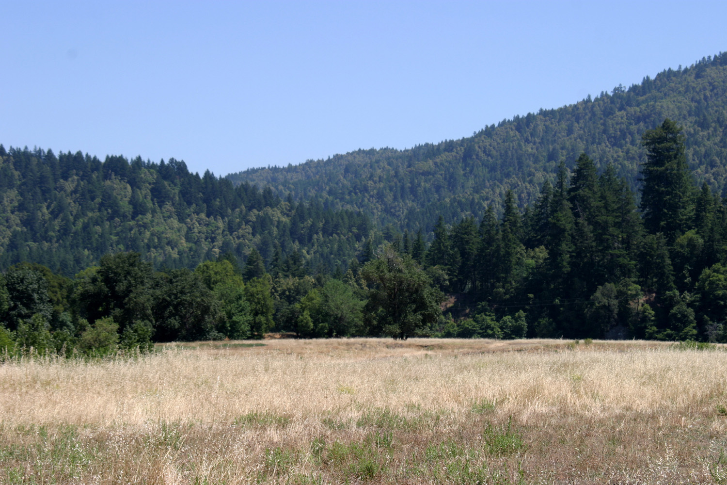
June 26, 2011: This was supposed to be a very different trip. I was planning to travel with my friend Janell Sidney to Oregon, Washington, and British Columbia. However, she was unable to go, so I decided on a shorter, closer trip, which I vaguely defined as "wandering about the northern California coast and a little ways inland." Although I am trying to make this a "no rules, no deadlines, no firm destination" trip, I had to follow a few rules for my first stop. I wanted to rent a car to get around the area, so I had to find an R/V park and a car rental close enough that they would pick me up. A few phone calls and some time on the Internet two days ago got everything set, and this morning I left home at 7:30, heading up CA 99, then west on CA 120 and I-580. This route goes through Tracey and Livermore, over a couple of passes, and turns north into the east bay area and Oakland. The highway goes all the way through the metro area and crosses the bay via the Richmond-San Rafael bridge. A few miles north it merges into US 101, and a little past Santa Rosa I turned west on River Road, heading for the River Bend Resort in Forestville. Tomorrow, if all goes well, a nice lady will pick me up, take me to Sebastopol (about 30 miles away), and rent me a vehicle that is easier to get around in than a 28-foot motor home. I chose this area as a starting point because of some friends who camped at the beach at Jenner, where the Russian River runs into the ocean. This was back in "hippy" days, and there would be people living on the beach in driftwood shacks, staying for a night or a week or whatever they felt like. I was concerned that the driftwood shacks might have been replaced by high rise condos, and in the next two days, I will find out. I will also take most of a day visiting Point Reyes National Seashore, which is about 40 miles south of where I am staying. I arrived about 12:30, and six hours later my accomplishments include eating dinner, getting a good start on the latest Elmore Leonard novel, Djibouti, and taking a nap. I also walked down to look at the river, only a few feet behind me, but down a 15 foot bank. It's a fair size stream, but not wild and raging like the creeks and rivers I saw a week or so ago in Yosemite. June 27: I had made reservations on line through Enterprise Car Rental, so this morning I called them and made final arrangements to be picked up. The office in Sebastopol is a one-person operation, so Amanda has to make sure she doesn't have anyone scheduled to come in when she leaves to pick someone up. In my case, it's around a 20-minute drive one way from there to here. At the office I got the papers signed, got the car, and headed west on various county roads to Bodega Bay, which is on Highway 1. I went in to Doran Beach, a Sonoma County regional park, and spent at least an hour there, going down to the surf on the beach, then walking a couple of trails. There are a lot of plants, many in bloom, that I am not familiar with, so I wandered through the trails that cut across the dunes everywhere, taking pictures. Some of the plants I saw would not look out of place on an alien planet in Star Trek. Something completely new to me were bush lupines with yellow flowers. We have tons of bush lupines in the Sierra foothills, all with blue blossoms. From Bodega Bay I drove up CA 1 to Jenner, located where the Russian River runs in. No condos on the beach, but there were dozens of elephant seals on the sand between the river and the ocean, doing what elephant seals do best - lying still as a rock on the beach. On the south side, a mile or so before you get to the river and the town, there is a road to Goat Rock State Beach, which is the only convenient access to the beach where the river runs in. The seals are on the other side of the river, so there is no human-seal conflict, a good thing since elephant seals are not as quiet and docile as they appear. All along the coast there are flat terraces, sometimes just a couple hundred feet wide; sometime extending back from the ocean a mile or more. Many of these areas contain farming and ranching operations, especially dairy and beef cattle. From Jenner I took CA 116 to Guerneville. Here the highway turns south to Forestville and Sebastopol, but I continued about four miles on River Road to my RV park, arriving a little after 2 p.m. My plan for the rest of the day is lots of reading, loafing, listening to music, and a little eating.
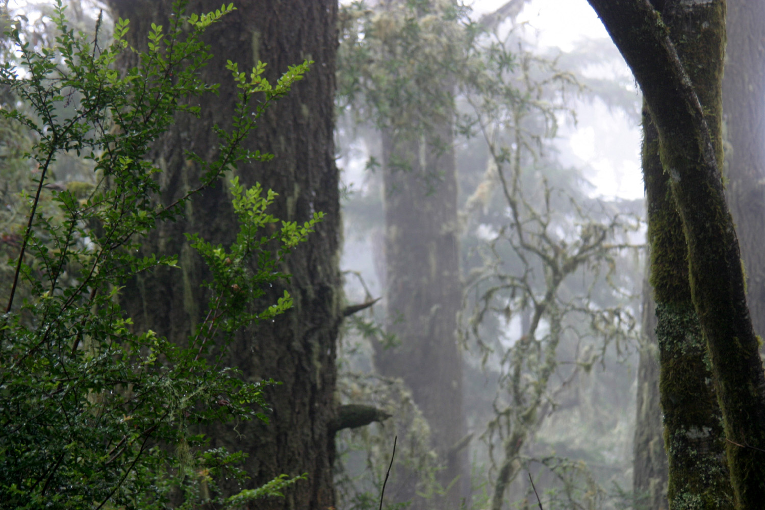
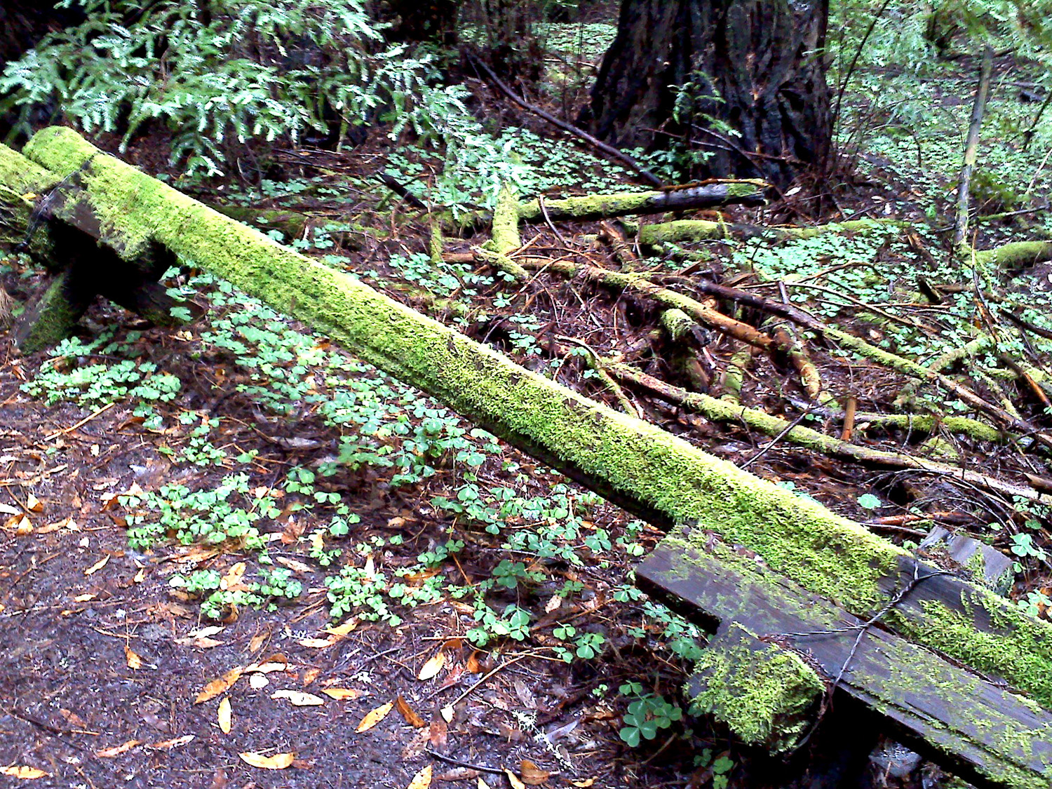
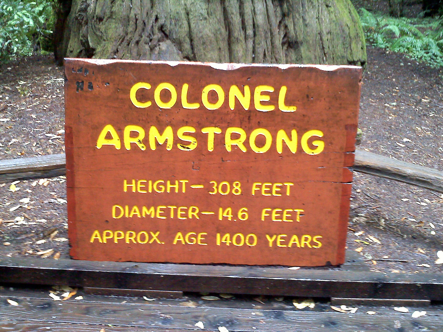
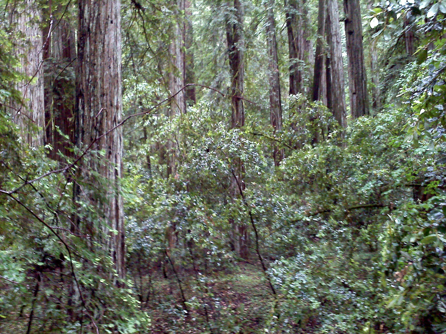
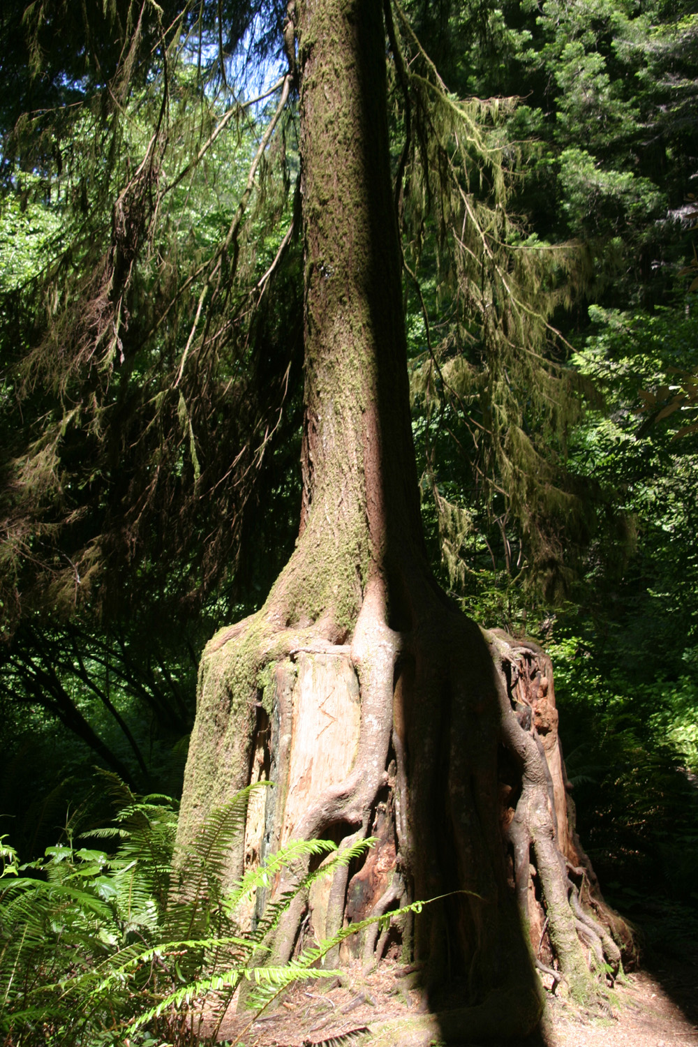
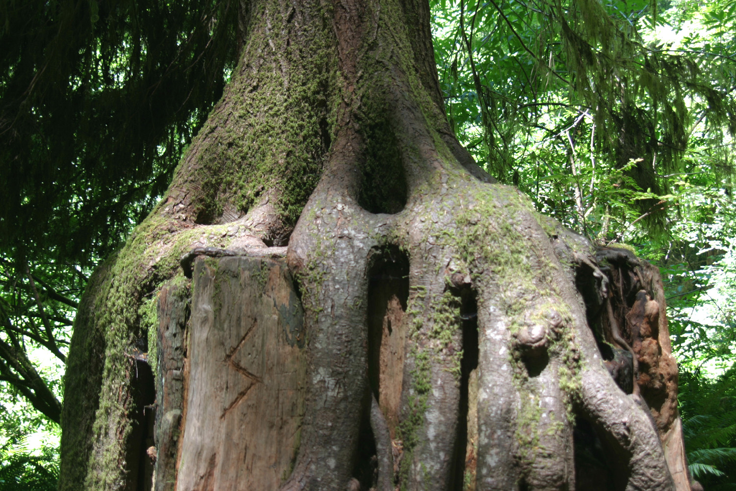
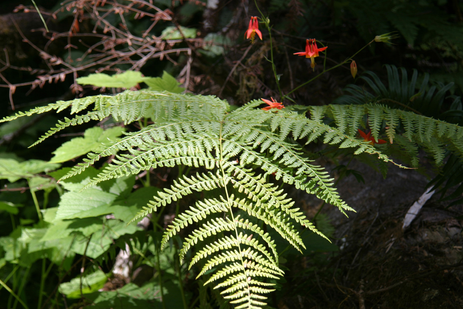
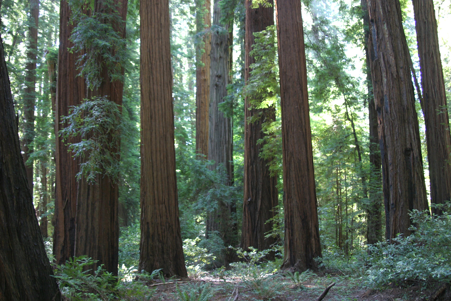
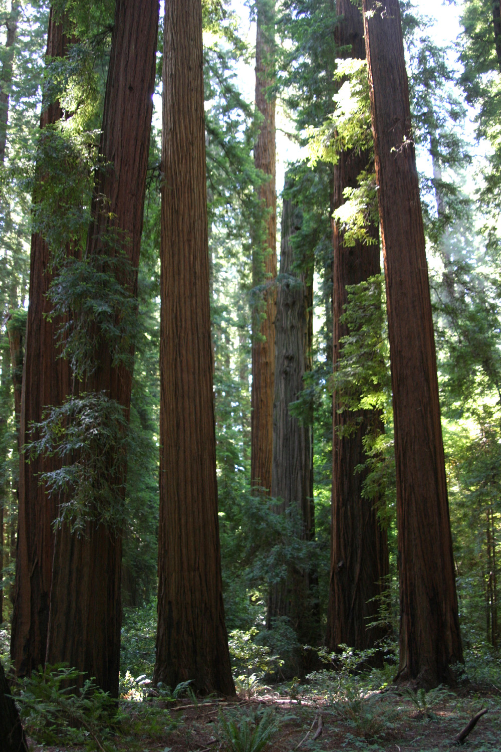
June 28: Today I thought I must be at a bluegrass festival. It started raining about 5 a.m. and didn't stop for at least 12 hours, and rained more during the night. I had planned to go to Pt. Reyes, an all-day trip, but decided to stay closer to "home." I drove west four miles on River Road to the town of Guerneville, and turned north on Armstrong Grove Road another four miles. This led me to the Armstrong Redwoods State Natural Reserve. I checked out the small visitor center, then put on a poncho and headed out on the trail into the grove. With a very light rain falling, it was the perfect time to stroll through this rain forest type of terrain. There is something green growing everywhere, with the dark trunks of the redwoods providing contrast. Any tree that is dead is covered with green moss, as are many living trees. Like much of the coast redwood area, there was logging here prior to it becoming a state park, and a number of big stumps are visible, all inevitably covered with moss and with trees and plants growing from the roots or from the top of the stumps. With the clouds and the thick trees, it was dark but not gloomy. There are lots of smaller redwoods and a few pretty big ones, a couple over 300 feet tall. The coast redwoods are not as big as the sequoias of the Sierra, but are taller. They also prefer a much wetter climate, 55 inches per year in this particular area. Although I have seen coast redwoods that look quite red, most of those in this area are very dark, closer to a very dark brown. Additional color is provided by a number of wildflowers, including some on bushes. I probably walked about a mile and a half total, although there are longer trails available. My path had some up and down, and went by a creek. There are signs along the trail explaining some of the natural features. Something I had not seen before was a hazel nut tree (not harvest season, darn it!) Despite the rain I enjoyed my walk, and did not get wet except for my shoe laces.
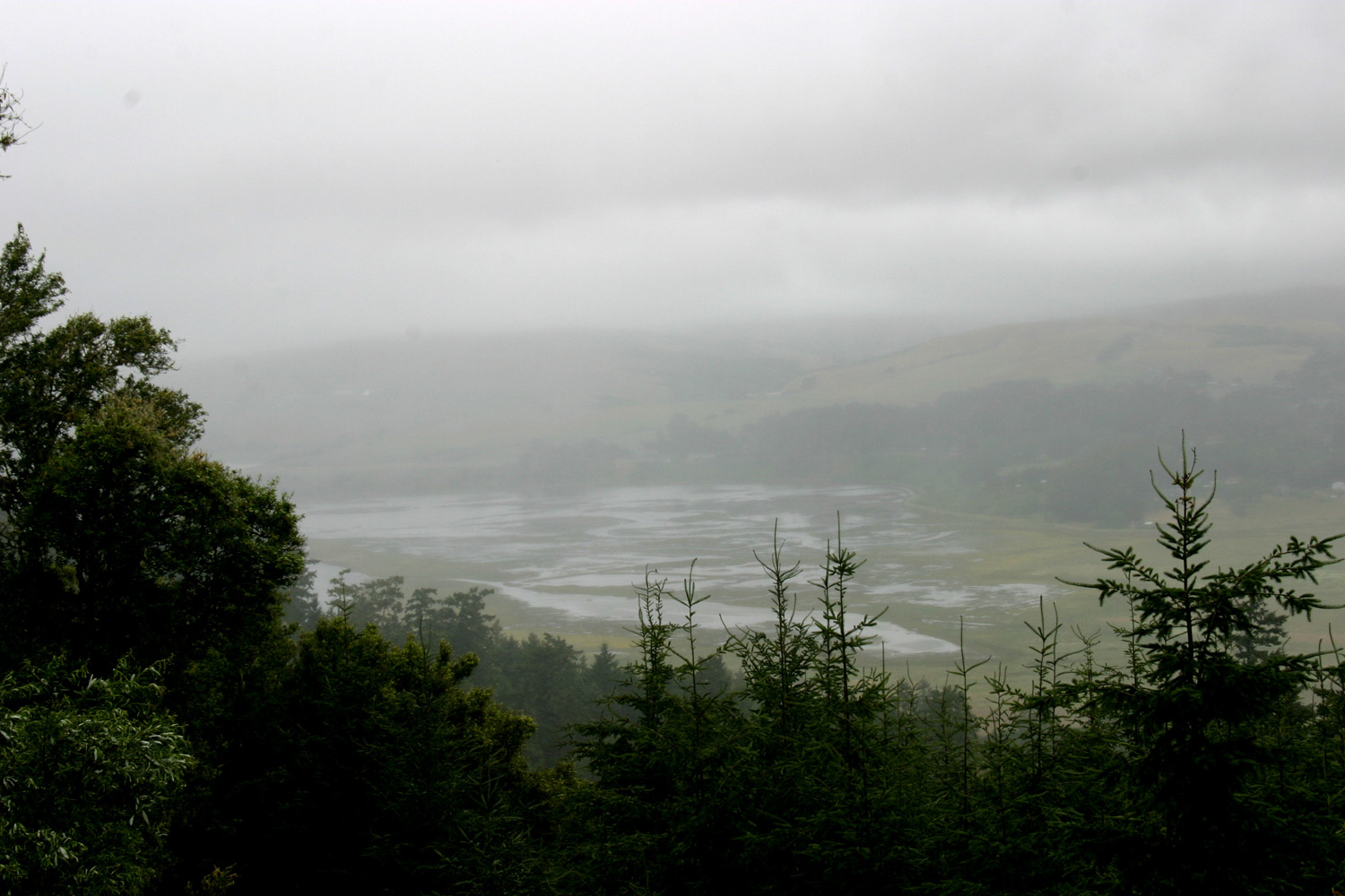
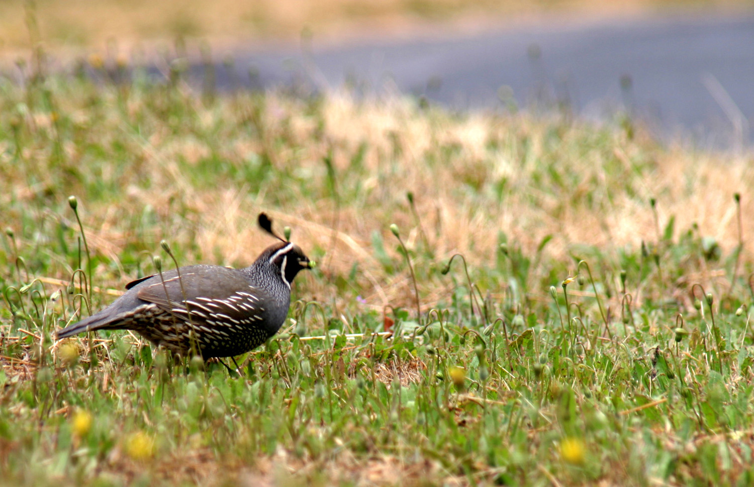
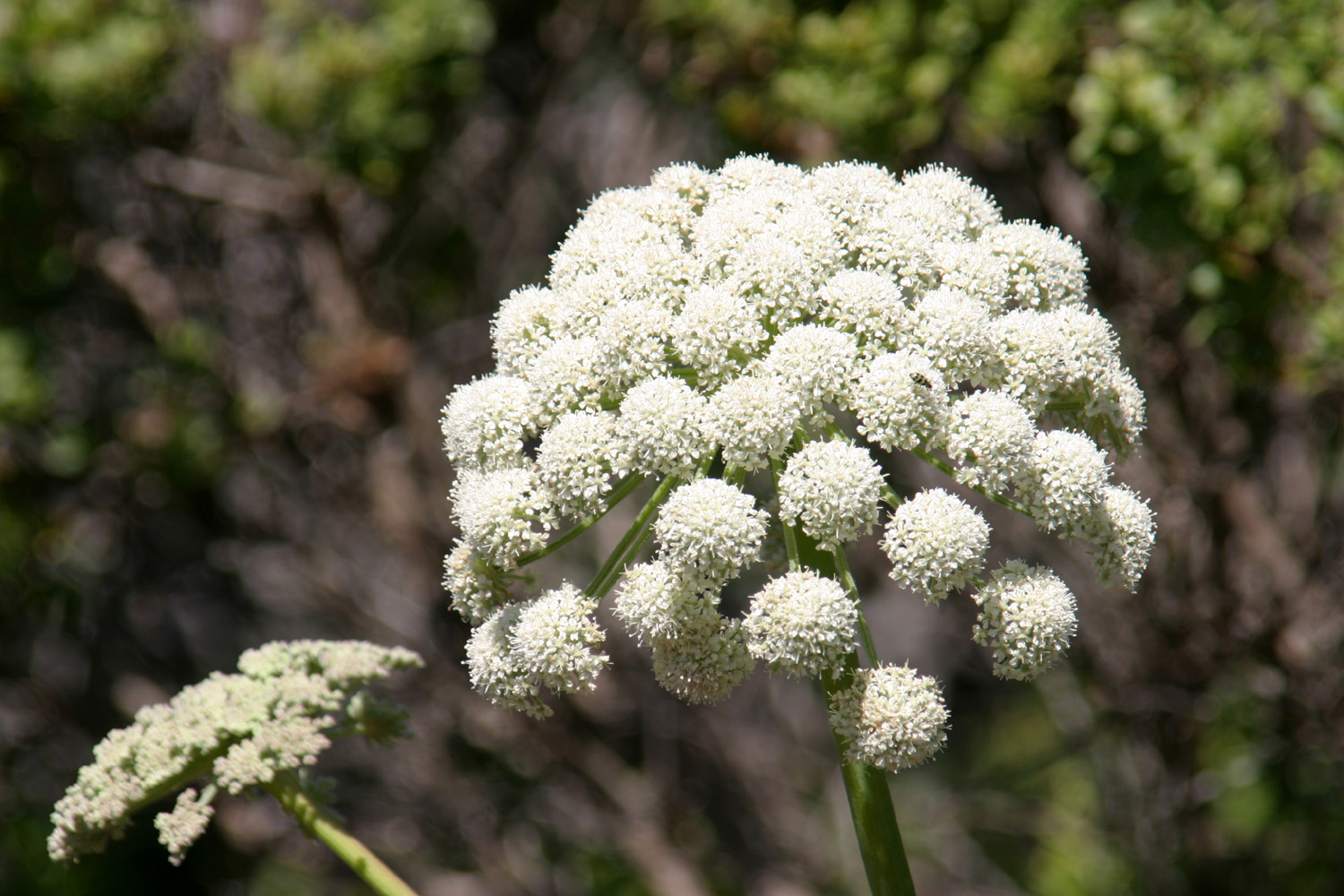
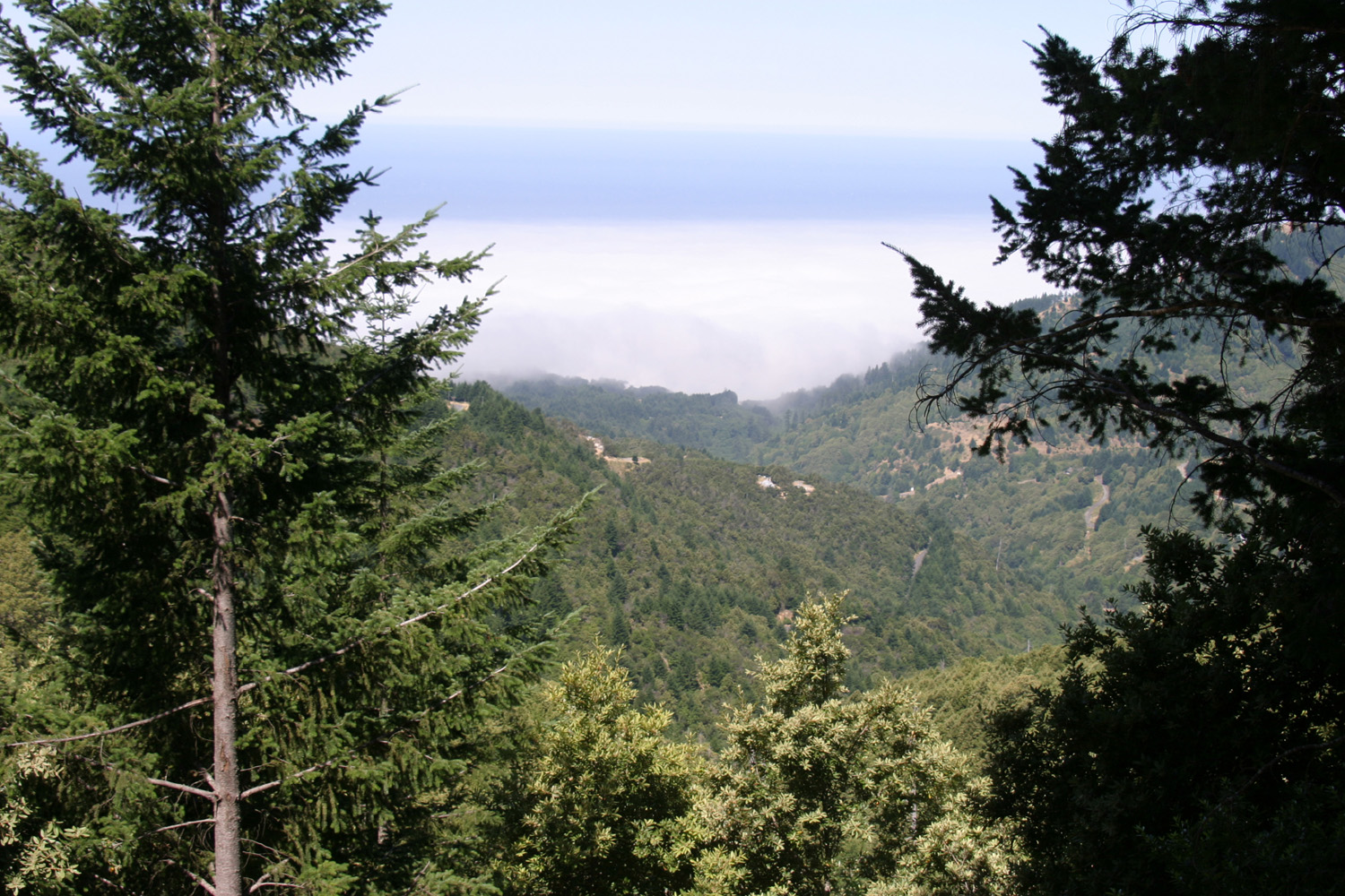
June 29: Today I drove over some back roads, the most common kind in this area, to Point Reyes. I went west on River Road, then took the Bohemian Highway most of the way to Pt. Reyes Station. Pt. Reyes National Seashore is a section of land that is separated from the main coast by the long, narrow Tomales Bay, which is a part of the San Andreas Fault. The area was suddenly shifted north as much as 16 feet in the 1906 San Francisco Earthquake, and was first thought to be the epicenter. Point Reyes itself curves around Drake's Bay, considered the most likely landing site of Sir Francis Drake in 1579. Today the area is a combination of public and private land, totaling over 100 square miles, so there are lots of roads and trails, much more than can be enjoyed in a one-day trip. On the other hand, some areas were damp and foggy, and places with alleged ocean views offered only mist. I hiked a loop trail near the visitor center which has signs explaining how the area has been shaped by earthquakes. As I was leaving the visitor center I saw a number of quail. I then drove up a road that goes over Inverness Ridge, the "backbone" of the area. Although it's probably not a thousand feet above sea level, it's a pretty good climb. Near the top I walked a short way on a couple of trails. For the first walk it was wet and drippy, and I wore my poncho. It seemed a little dryer at the second stop, but it was still foggy, and if there was a view to the ocean or elsewhere, it was not visible this day. Still, it was a nice walk through forest and flowers. This map shows the outline of Pt. Reyes, Tomales Bay, Drake's Bay and SF Bay to the south. When I was ready to leave I called Enterprise, but it was too late in the day for me to return the car and get a ride back to camp, so I made arrangements to return the car in the morning, and headed back to Forestville. I followed some different roads, and ended up going up State 116 right by the rental office on my way back to the Russian River. This country has miles of winding two-lane blacktop roads which go through rolling hills, small valleys, heavily shaded, steep-sided canyons, and low passes over hills covered with redwood, Douglas fir, and live oak. It is rare to be able to drive over 50 MPH, and 30 to 35 is more common.
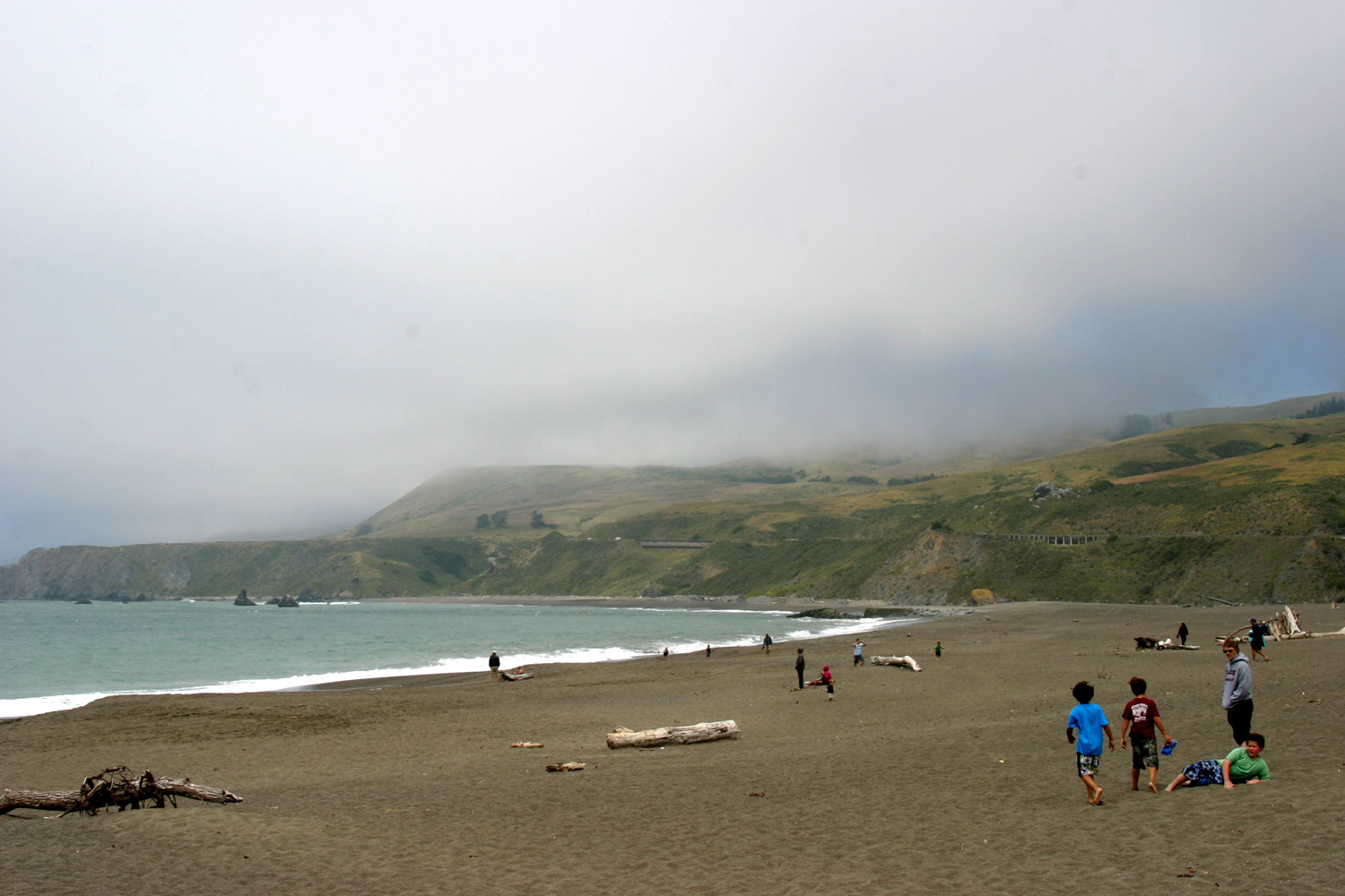
June 30: Today was a traveling day, although the distance was short - about 75 miles. Heading west from my RV park, I drove down to Highway 1 at Jenner. From here to my next stop at Manchester it's a winding, narrow road, with many 15 and 20 MPH curves. About half way up the road, it opens up, with some farms and ranches along the marine terraces. There are more pines and Douglas firs than redwoods in this area, and the road goes high above the ocean in some places. I considered staying at Manchester Beach State Park, but I am spoiled for electricity, so I chose a KOA about a mile from the ocean. I did only a short walk, a few hundred yards down the road that runs by the RV park. I did get a chance to engage in my other exercise, swimming, since this park had a pool, which fortunately was heated. With the July 4 weekend at hand, I thought I should have reservations, and called an RV park in Fort Bragg. Although the signal kept breaking up, I thought I got across my desire to reserve a space for the 1st through the 4th. I then reserved a rental car on line. With the unreliable phone service I didn't try to call and discuss picking me up. There would be time to do that after I arrived at Fort Bragg.
July 1: Today a got a leisurely start, having only 40 miles to travel. I fixed bacon, and checked my email before leaving a few minutes before the 11 a.m. check-out time. I continued north on Highway 1, up the rugged and rocky Mendocino County coast line. The road closely follows the coast most of the way, cutting back away from the ocean where creeks and rivers run in, and generally winding up and down and around most of the way to Mendocino. The road conditions and limited population combine to keep traffic very light much of the way. Between Mendocino and Fort Bragg the road is wider and straighter, and has some long fairly flat sections. It's possible to drive 55 MPH through most of this eight-mile section. There is also more traffic, since a highway comes in from the east and because there are a lot of activities in both towns that draw visitors from throughout the area. Arriving at Fort Bragg I saw the RV park as I drove past it; then missed the road again after I turned around. However, I discovered a better way to get in and out, a road that goes to a cross street that joins Highway 1 at a traffic light. Setting up was a little more of a project than usual since the site was not very level and I had to set up blocks and drive on to them, always a challenging task with no assistant. It's a bit warmer here than Manchester, about 70 degrees, with a strong breeze most of the time. The locals think this is a pretty hot day. Fort Bragg started as a lumber and fishing town, and is still a major sport fishing center. I don't know how much logging activity there is near here, but there are mills and various lumbering operations inland, especially along US 101. The current population is just under 7,000. Food prices are very high in Fort Bragg. A bell pepper was $1.70, although the "club price" was under a dollar. Brand name ice cream that sells for $5.49 in Fresno is a dollar higher. I picked up my rental car, but didn't go anywhere today except to a pizza parlor. I did walk out along a paved trail that runs next to the RV park. It is part of Pomo Bluff Park, and you can follow the trail out to the point of land between the Noyo River bay and the smaller bay of a creek just to the south. It's probably close to a mile to the point, and I did not walk all the way out, but would do so later.
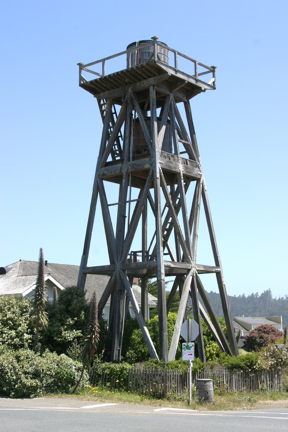
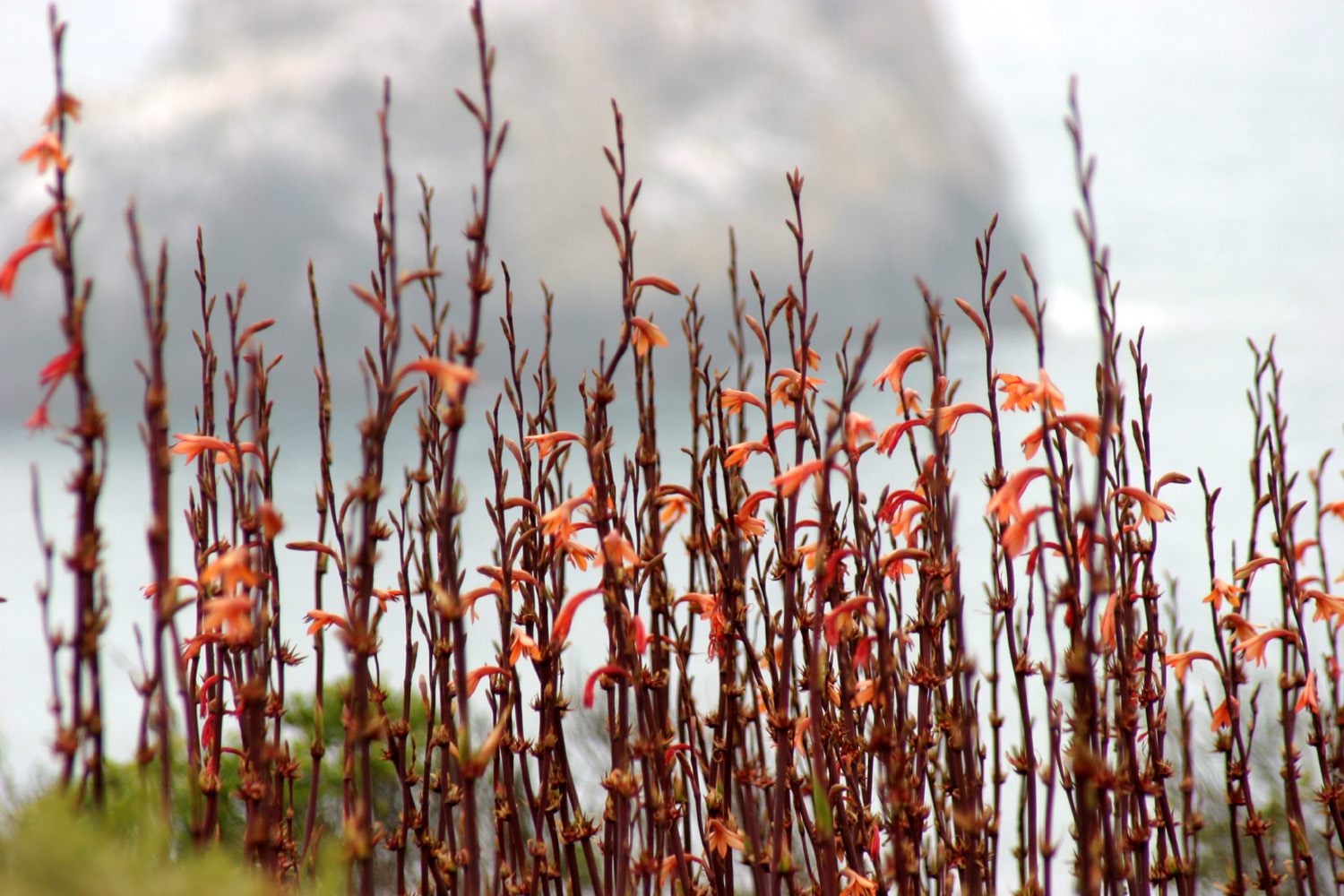
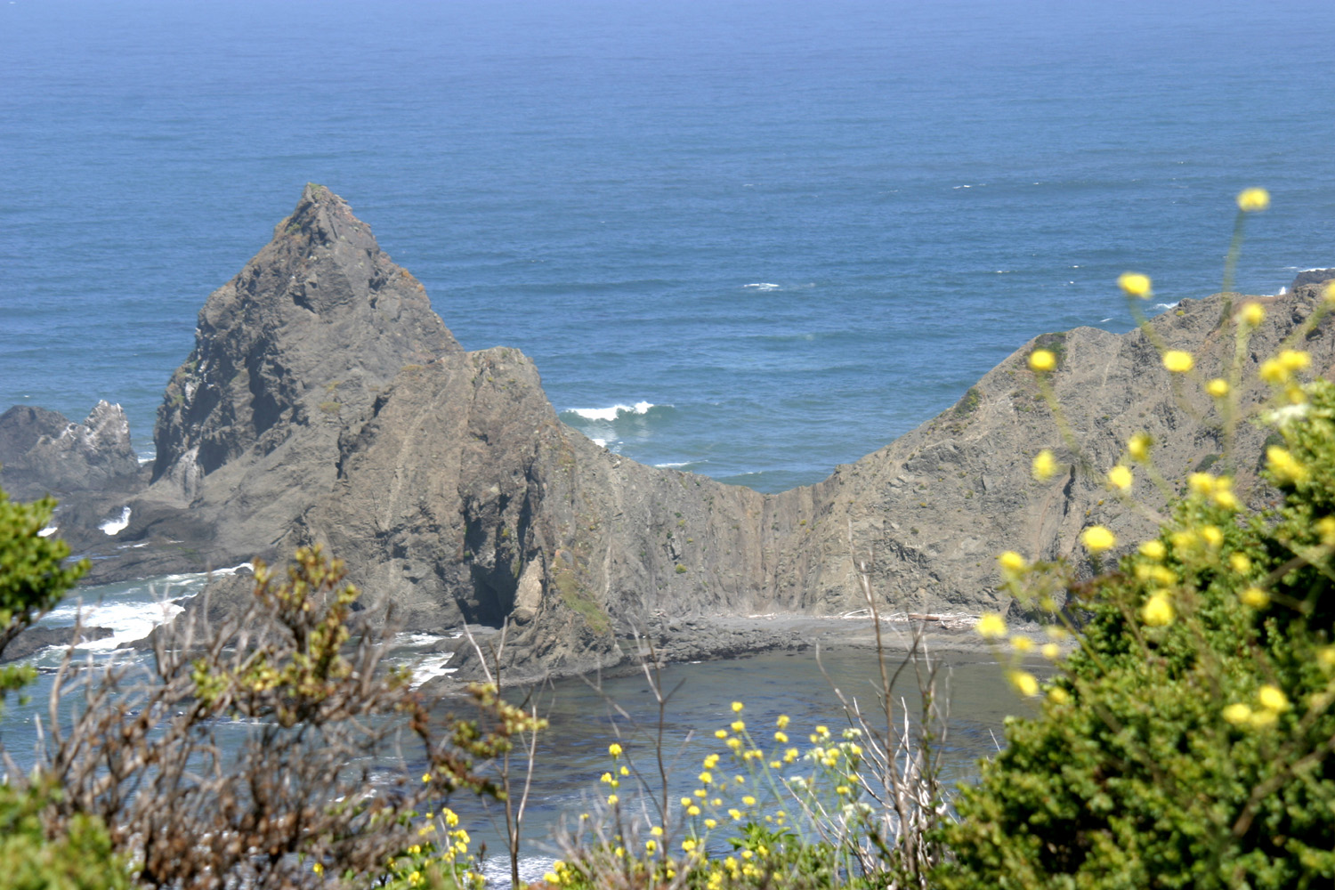
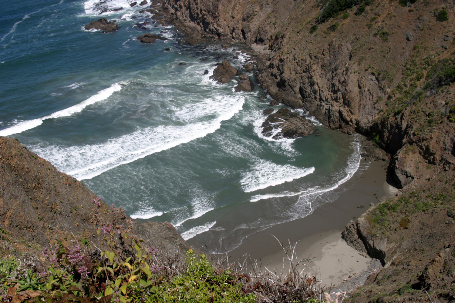
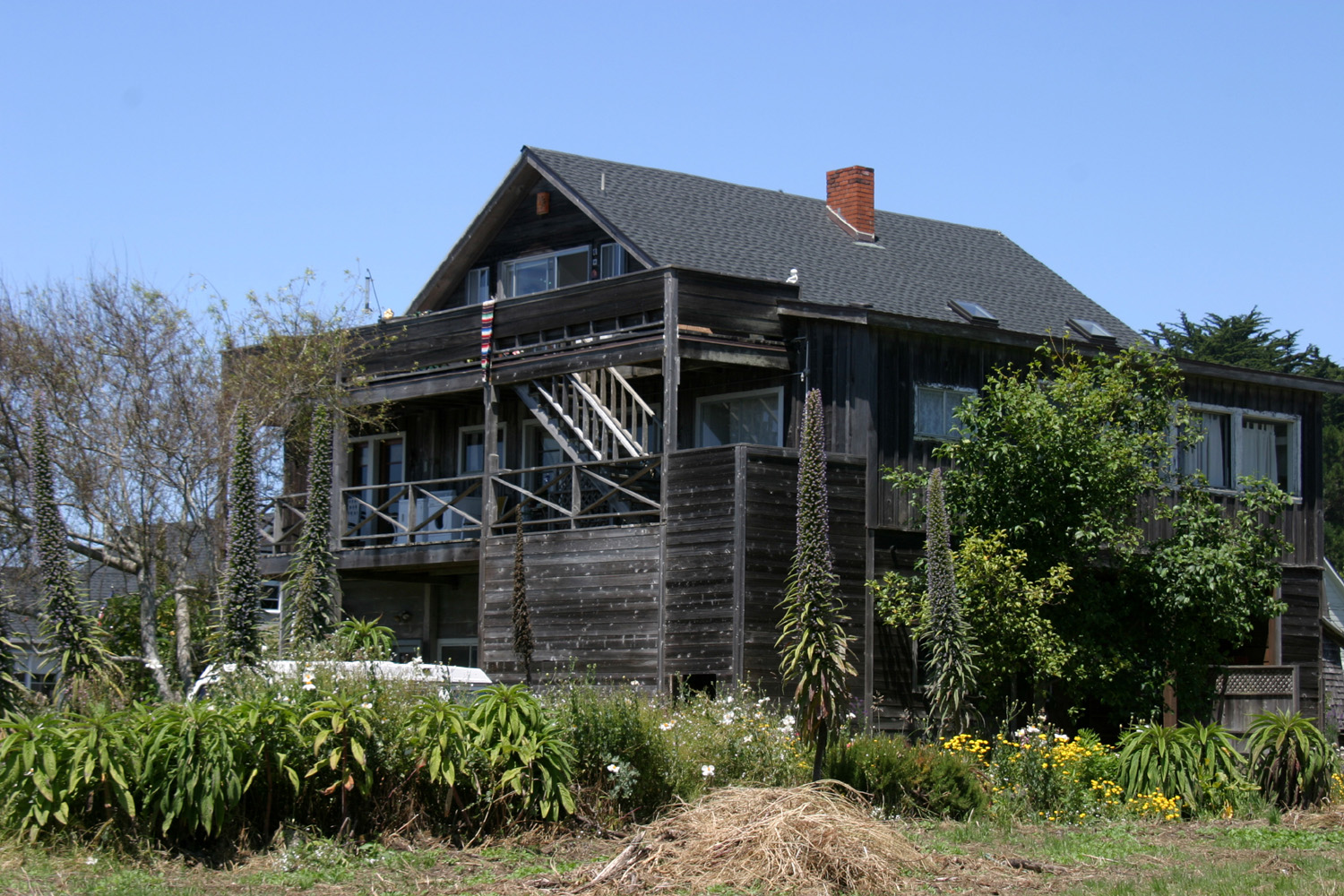
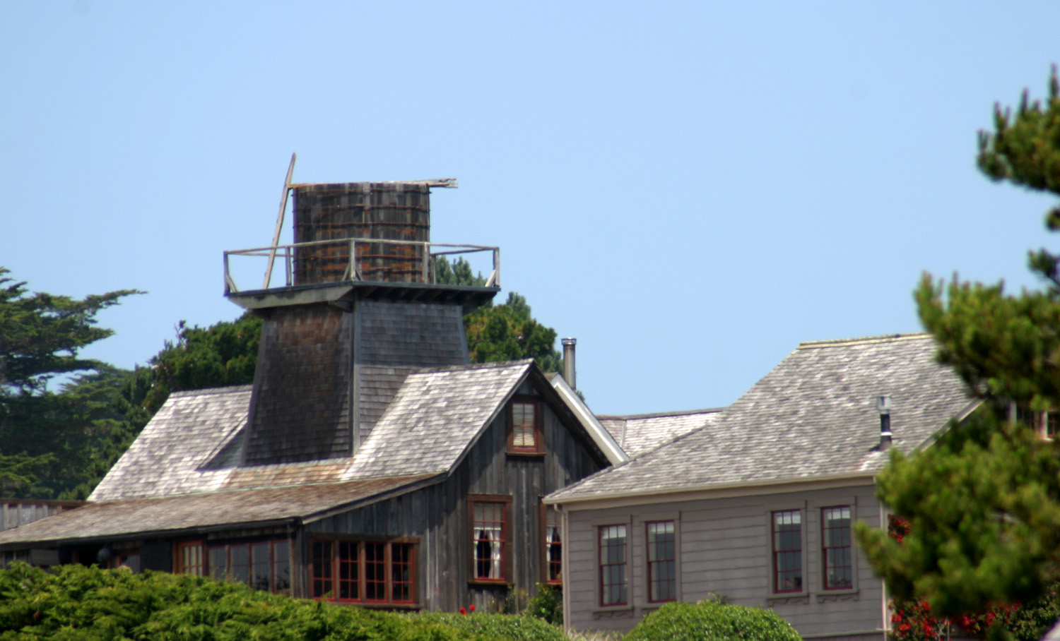
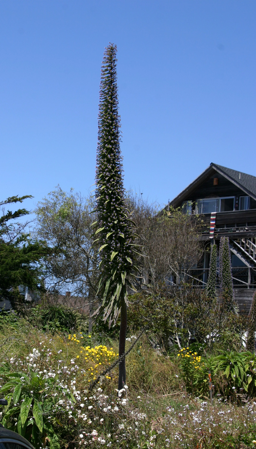
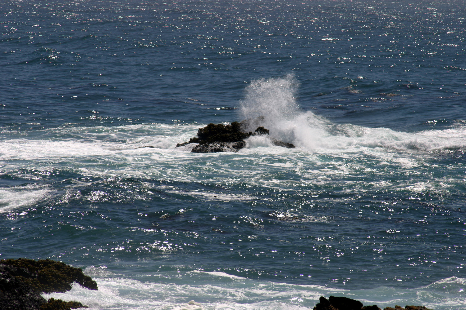
July 2: Today I headed back south in the rental car (a Nissan Versa) to Mendocino Village, about eight miles south of Fort Bragg. Mendocino was founded as a lumber and ranching town, but is now the center of a large artistic community, and a major tourist destination. It's also a town with an unusual number of old wooden water tanks and towers, dating from the early days. Residents built tanks high enough to provide good water pressure, and pumped water into the tank with windmills. Read more about it in this Mendocino history article. Another unique aspect of the town is some tall, spiky plants with tiny flowers. They grow to 15 feet or more, and have long, narrow leaves starting a few feet up, gradually giving way to small purple blossoms on the upper part of the plant. As far as I can determine from my research, they are called echium (the following year I also learned the common name, Pride of Madeira). The town is surrounded by the Mendocino Headlands State Park, which preserves the coastal terraces that rise above the shore, as well as the land along Big River for several miles upstream. The town is on the north side of the river, and you can walk the edge of the bluffs from above the river near Highway 1, out on the headlands that protect the bay on the north and around the point to where the land curves back into a small cove. Much of the protected section of the headland is covered with dry grass, but there are lots of flowers, both on the flat land and growing on the sides of the cliffs, as well as a few evergreens, mostly growing just at the edge of the bluffs. As I always like to do, I stopped at the visitor center which is also a museum known as Ford House, having once been the home of the Ford family, who were involved in the first lumber mill and are considered the founders of the town. Here I was interested to see some photos of lumber milling taken in the 1860s by Carlton Watkins, who is also known for his photos of Yosemite and the Mother Lode country a few years earlier. There is no single trail, but rather a series of narrow paths that cut through the tall grass, with various branches and shortcuts. There are many places to get close to the edge and watch the surf smash on big rocks, pour through windows and under natural bridges in the rock, and show off with what I call "big splash-ups." This is when a strong wave hits a rock or cliff so that the water splashes high up in the air. Centuries of wave action as well as other weathering has created some long, narrow coves, some big rocky islands just off shore, and various narrow passages where water runs through and over and around the rugged terrain. I did a fairly long walk, with several stops to rest on benches that are available here and there, and took lots of photos. I then returned to my car, which was parked in town, and drove to the opposite side of the headlands. Here I stopped at several different parking areas and took short walks, including one that led out on a narrow bit of land where a careless person could fall into the ocean on either the right or the left side. In the visitor center I had asked about hikes into the hills away from the coast, but these are limited. I drove down to Big River Beach, where an old logging road provides a trail for several miles on the north side of the river. I just checked out the first 100 yards or so, deciding that if I want to make a longer walk there it would have to be the main walk of the day, not the big finish to an already busy day. Having covered as much of the Mendocino Village area as I wanted for the day, I headed back "home." Just as it got dark an early Independence Day fireworks display got under way. The rockets were fired from down on the beach by the river, but rose up where we could see them from the bluffs. Some of them were pretty much at eye level, and the concussion from a couple of them rocked the motor home. The best views were from down on the beach or right at the edge of the bluffs, since they were shooting off some smaller fireworks that did not quite reach the top of the cliff (average height of the cliffs in this area is 90 feet). People who were gathered on the beach had built fires, and I counted at least 25 separate fires scattered around the sand.
July 3: I had a couple of possible activities planned for today, but ended up mostly loafing around. Right at the edge of the R/V park is a paved trail that goes along the south cliffs above the bay (where the Noyo River runs in), and I had walked a short distance on it before. This morning I walked all the way out to the end, where I discovered that there is a road in from the other side. There are informational signs at several points along the way, and one thing I learned is that the coastal terraces are sections of former seabed that have been lifted up by the subduction of the Pacific Plate under the North American Plate, along the San Andreas Fault. So they are composed of sandy soil, full of nutrients, making them a great place for natural as well as planted crops. After brunch, I took a short drive a few miles up California Highway 20, which winds through the redwoods, over a ridge, and joins US 101 at Willits. Although I have not decided yet where I will go next, I may drive across on that highway. The other logical route is to continue on Highway 1, which heads north a while, then goes inland to join 101. Returning from my drive, I went down the road that goes out to the point west of my R/V park, and explored the far corners that I did not reach on my morning walk. This proved to be one of my favorite spots. It's very rocky, with rock "islands" creating channels through which the tide surges. There are a number of places where the waves create a huge splash against the cliffs or a rock out in the water. I noticed that the power of the waves would diminish for a few minutes, then increase. At the peak, there would be powerful waves hitting the rocks from several directions, creating huge clouds of spray and areas of swirling white water.
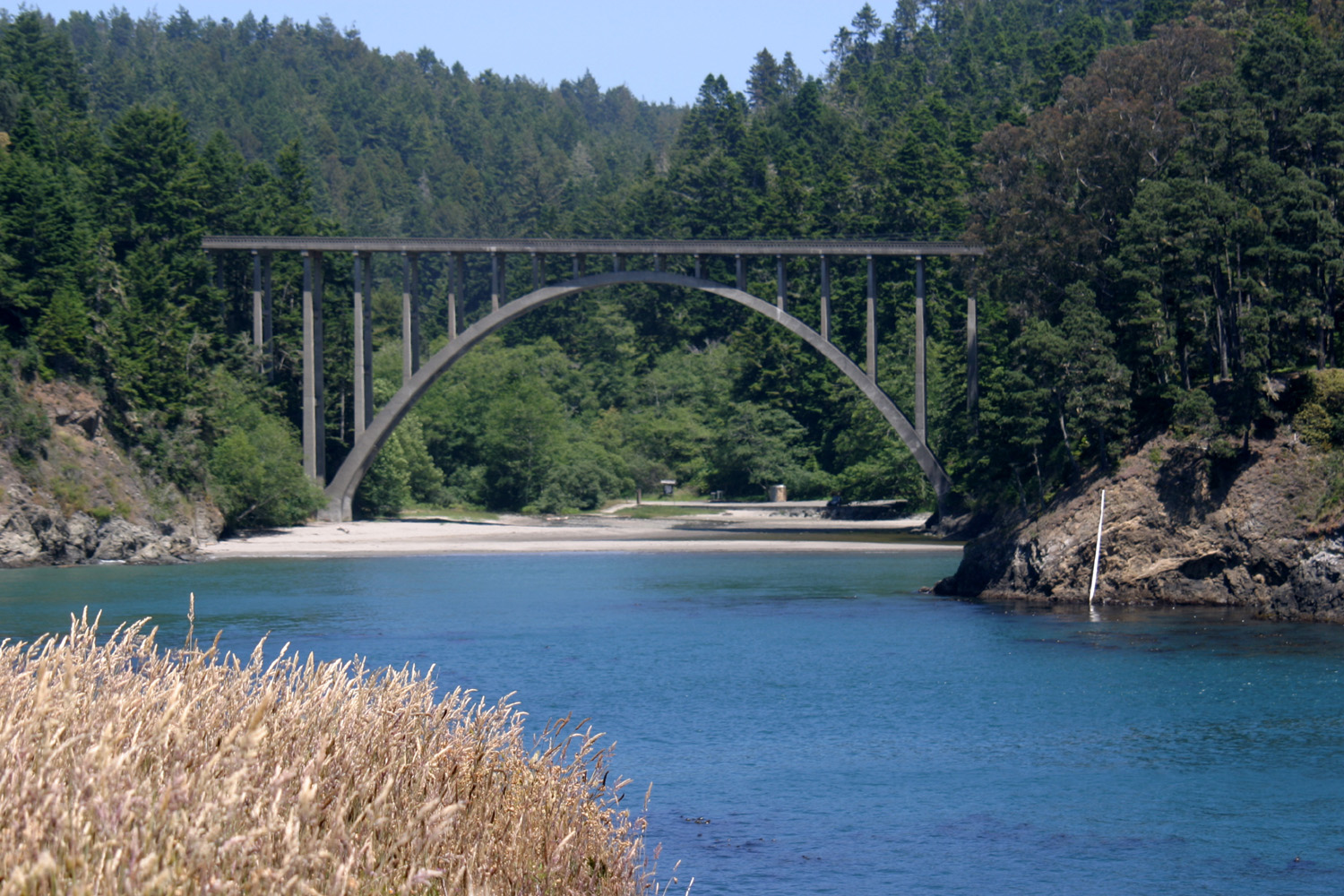
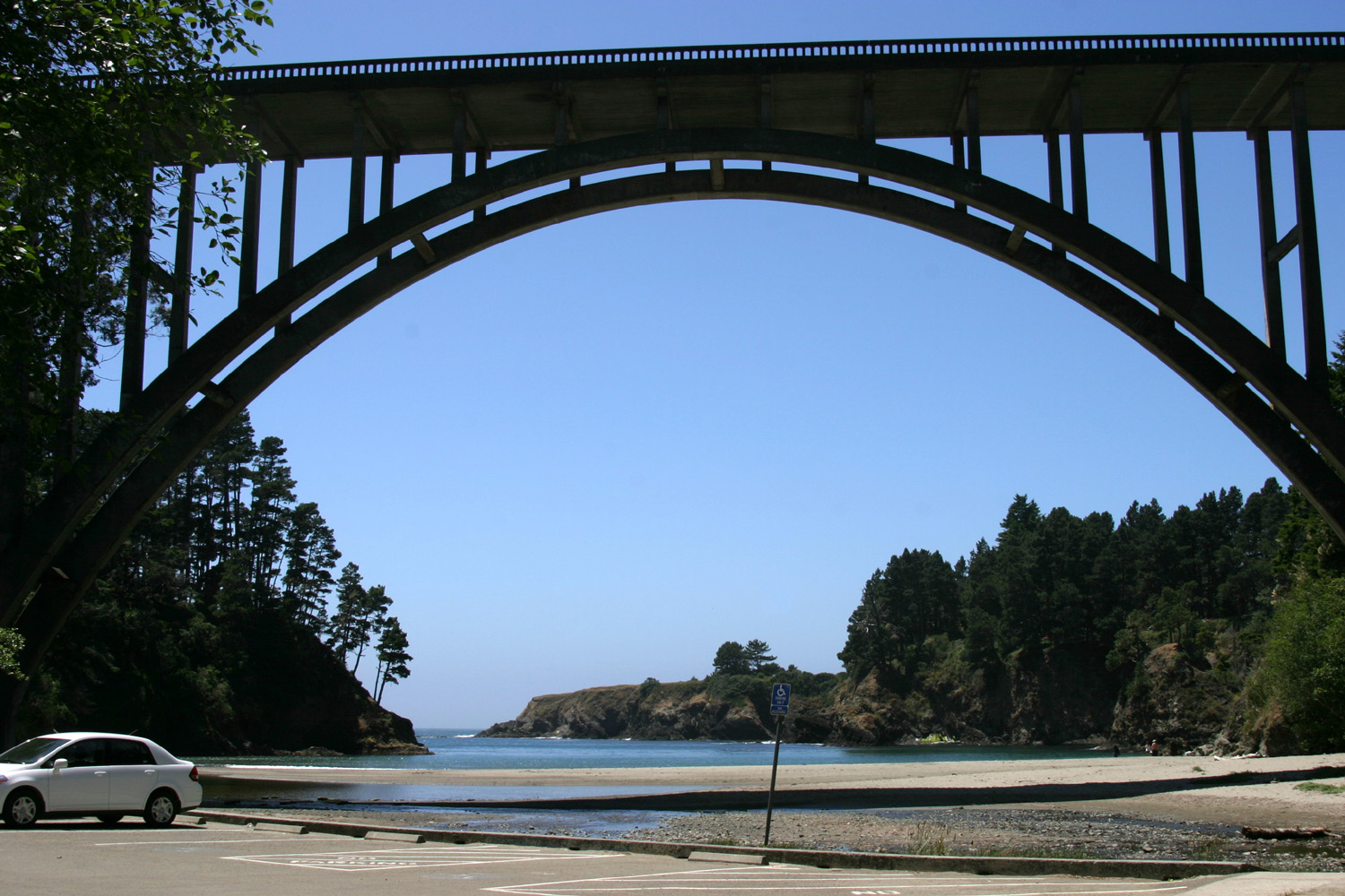
July 4: I finally found a trail that does not follow the coastline, one that led into very warm territory. Looking at a booklet I picked up at the Ford House in Mendocino, I saw mention of a "trail through the redwoods" at Russian Gulch State Park. There are no signs indicating where the trail is until you actually get to it, but I found it with some help from a gentleman who had camped there in the 1980s. The trail follows the creek (Russian Gulch) for probably a mile and a half, then heads up hill to a waterfall. By the time I reached the start of the hill, my leg was telling me to start back, so I skipped the waterfall and retraced my steps. The trial is in a narrow, very steep canyon, with lots of shrubs, redwoods, firs, tan oak, and other trees and plants. Since it heads away from the ocean, for the first time in several days it was warm to be hiking. Along the trail, small creeks run down through the thick forest and into the main creek. To give an idea of how thick the vegetation is, although you can hear the main creek and its tributaries, you almost never see the water. Only in the upper end of the canyon did it widen out and offer views of the creek. I also observed one of the unique aspects of a coast redwood forest - growth of new trees around an old stump. In many areas redwoods grow as "fairy rings" - a circle of new trees that grow around the base of a cut or fallen tree, growing from its roots. In this area the trees had a different approach - a single tree growing right on top of an old stump. In one case the tree had sent roots down the stump on all sides, giving the appearance of a banyan tree. When I returned to the car, I drove down to a small beach that is under a bridge over Highway 1. There were probably a half dozen people enjoying this small cove. I walked out on the sand close to the water's edge, took some pictures, then headed out of that area. Another road off the main park road leads to a picnic area and the start of trails through the brush and grass out to the edge of the bluff. The land here is not as level as other places I've walked, having some small rolling hills, and the vegetation includes quite a bit more brush. After returning to Fort Bragg, I did my usual stuff - eating, using the computer, watching TV. I drove out Ocean View Drive to the bluffs soon after returning; then again late in the afternoon, near sunset. In this area and others I have seen many seagulls, buzzards, crows, quail, pelicans and an eagle, possibly an osprey.
July 5: I've reached a new high (or low) in laziness. Last night I didn't feel like figuring out where to go today, so I paid for one more night and arranged to keep the car another day. After a late, leisurely breakfast, I headed south once again, to the Point Cabrillo Light Station, about two miles north of Mendocino and six south of Fort Bragg. This station was put in service about 1910, and like most lighthouses, was automated in the 1970s, with the original lamp being replaced by an airport beacon light. In the 1990s the run-down condition of the station's six buildings inspired a local group to begin a preservation effort. At the same time, the land around the station was scheduled to become a trailer park. The lighthouse preservation group raised several million dollars, purchased the land, and started restoring the buildings. This included receiving permission from the Coast Guard to go back to the original light - a British-made fresnel lens lighted by a thousand watt bulb. Currently the assistant lighthouse keeper's house is open as a museum, and the lower part of the lighthouse is a gift shop and a place to learn from the docent on duty. Tours of the light area are given a few times a year. The head lighthouse keeper's home is now a 4-bedroom vacation rental, and two small buildings have been converted into cottages suitable for two. Restoration of another assistant keeper's house is awaiting funding. Unless you have a handicap license, the parking area is a half mile walk from the light station. Half of it is downhill going in, so uphill coming out. I contemplated the difference between being able to walk from the mall parking lot into the stores vs. having to walk a half mile, and it seemed there should be some middle ground...close parking for senior citizens, maybe. Leaving Point Cabrillo, I continued south and headed into the Mendocino Headlands State Park once again. I stopped at two or three places and walked to the edge of the cliff, but didn't do any extensive hiking. After about a 20-minute visit, I said goodbye to Mendocino and headed north again. About halfway between Mendocino and Fort Bragg I had noticed the Jug Handle State Natural Reserve, so I stopped there. This proved to be mostly more of the same, paths through the tall grass on the marine terraces. There was a group of wind-blasted evergreens, clustered together as if for mutual protection, that created a dark, shady woods - home to a unique group of plants and animals, according to an informational sign. Trees in the area included Sitka spruce, Douglas fir, and bishop pine. Yesterday when I was out at the point I noticed a couple who had brought their lawn chairs so they could enjoy wave watching in comfort. So today I took my chair, book, and a drink, and went to the same spot. It's a tiny point between two small coves, at a slightly lower level than most of the bluffs, which makes it a little more private. I alternated between reading and watching the waves crashing into the rocks, staying there about an hour. There are some places where a wave hits an exposed rock and makes a big splash, then makes a series of smaller splashes hitting smaller rocks farther in.
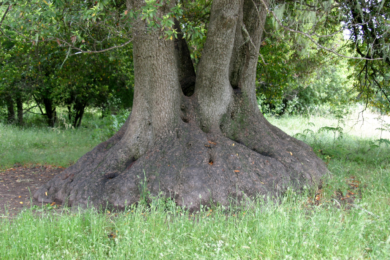
July 6: Today I returned the rental car and started north again. The trip was relatively brief, although far from fast. From Fort Bragg I drove north on Highway 1, which first goes inland through some open country with horse and cattle ranches, then returns to hug the cliffs and canyons at the edge of the ocean. There was fog drifting up above the headlands, but for the most part it did not reach the highway. After a while the road goes inland, with lots of up and down over ridges and continuous curves with speed limit signs of 20, 15 and even 10. This section is even narrower and more winding than the section along the ocean. Eventually it meets up with US 101, and that is the end of Highway 1 in California. Highway 101 remains inland for about 75 miles, returning to the coast at Eureka and staying close to the ocean most of the time well into Oregon. With no advance reservations or other planning, I had chosen as my destination Richardson Grove, about 8 miles south of Garberville. There is a state park with a large campground, but no hookups, and a commercial RV park just south of the grove. I chose the latter - the Richardson Grove Campground and RV Park. Coincidentally, my older grandson Johnny and I stayed here on a trip to Oregon in 1999. Having started late, stopping to eat lunch in the motor home, and generally poking along at a slow pace, it was around 3 p.m. by the time I arrived. The first thing I did was change into shorts, having left the coastal weather behind and arrived in the land of 90 degree temperatures. In addition to getting set up, I walked across the road where there are a couple of long-time Redwood Highway attractions - the One-Log House, and the Grandfather Tree. The latter is worth noting - it has two or three huge trunks, all joined at the base, so it is impressive in size, even though it's under 300 feet in height. Past the tree it's a short walk down to the Eel River, where some people swimming advised me that the water was refreshing. I considered a swim, but figured by the time I walked the nearly half mile back to the motor home, I would be hot and sweaty again.
July 7: I came very close to leaving this morning, with only a vague idea of my destination, then laziness set in and I paid for another night. I considered walking up the road to the redwood grove, but just past this little "village" of RV Park, gas station and gift shops, the shoulder narrows down to a few inches, with thick woods on one side and a high bank on the other. I decided walking that road would be hazardous to my health. Then I thought of driving, but that would mean bringing in the slide-out, disconnecting water and electric, and when I returned, getting the RV leveled once again. So Richardson Grove (the state park) will be a stop on tomorrow's trip. Instead of tree-watching, I put on my swim suit, gathered up my chair, book, and towel, and walked down to the river. The water was indeed refreshing - a bit cooler than the swimming pool at home in my condo complex, but much warmer than some streams I have been in. The current is very slight, enough to carry you slowly if you don't swim against it, but easily handled by an old man. It's safe enough that people were letting their kids swim unsupervised, contrary to the "official" rules. I swam a while, then sat in my chair reading, then took a final swim to get cooled off for the warm walk back "home." Actually it is a little cooler today than yesterday, with a nice breeze a lot of the time. Of course, it's not quite 2 p.m., so there is time for it to warm up a little more. As it turned out, it stayed fairly cool today, with an even stronger breeze late in the day. It's 7:45 now, the breeze has died down, but it's very comfortable inside or out.
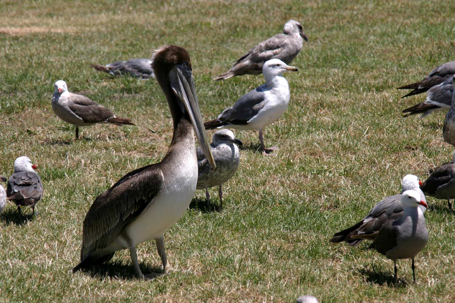
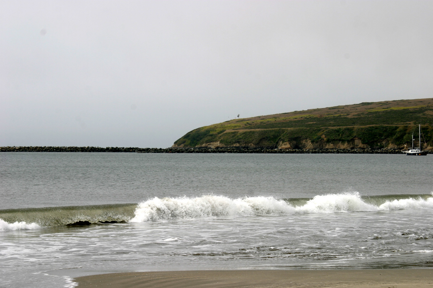
July 8: I got started around 10:30 this morning, but only drove about a half mile before my first stop. I turned in to Richardson Grove Redwood State Park, stopping first at the visitor center. I then walked a short, signed loop trail through the grove. There are a lot of good size trees, and lots of tall ones. It's much dryer in this location than the redwood grove I visited near the Russian River. There's hardly any moss on dead logs and stumps. The Eel River runs through the park, and there are many public camping spaces near the river, but outside the actual grove. I spent a little over an hour there, then continued on to my destination, where I arrived around noon. I am in Shelter Cove, on the "Lost Coast" of California. Where Highway 1 angles inland to join US 101, there are no more roads along the coast until 101 goes into Eureka. In fact, there are few roads and few people in the entire area. Between the ocean and the Eel River drainage is the King Range, which goes up a little over 4,000 feet at the highest point. This is a BLM preserve, with hiking trails, and only the most primitive roads and camping. Since the shortest trail in the preserve is over five miles, I didn't do any hiking here. There is one "good" road into this area, and it is steep, narrow and winding. It goes up from Redway off Highway 101 near Garberville, and over the King Range. It's only about 25 miles from Highway 101 to Shelter Cove, but it takes a good hour. The RV park manager said that other roads on the map that lead from here to Highway 101 are partly dirt and gravel, and not well maintained. Here in town there is an RV park, harbor, fishing services, a small restaurant, and a lighthouse. There are a few other tiny towns nearby, so there are probably some other businesses. But the main industry is obviously tourism. It's kind of cool to know that such remote places exist, and to be in one of them. But don't come in the winter - the north coast is lashed by violent storms in the winter, with winds up to 90 miles per hour. The land rises up steeply very close to the shore. Although the hills are steep, you can see houses scattered about in the forested mountainside. North of here there is a very high headland that appears to drop directly to the ocean. It's a few miles away, so impossible to check it. The lighthouse did not operate at this location. It was built on Cape Mendocino, on top of a rugged 420 foot cliff. This height made it possible to build an unusually short lighthouse - only a little over 40 feet. However, with the cliff it was the highest coastal light in the US. After it was abandoned in favor of a pole light, it began to deteriorate, so a group was formed to move it to Shelter Cove and restore it. This involved dismantling the building, and having the largest pieces moved by Army National Guard helicopter, as part of a training mission. The lens is stored at the fairgrounds in Redway (about 25 miles away), but there are plans to return it to the lighthouse. You can go in the lower floor of the building, and a docent is on duty to answer questions. Soon after getting set up I went down to the lighthouse, then on to the shore. I went down a path with steps to the rocks at the base of the cliff. There were plenty of pools, but not much visible life other than a lot of small anemones. There are a lot of small rocks offshore, but no big "island" rocks like at Fort Bragg. The surf seemed to have a little less power here, and I did not see many good "splash-ups." One good size off-shore rock had a line of birds shoulder to shoulder all across the top. Right next to it a smaller rock was occupied by several seals. Later I went out to the edge of the bluff with my chair and book, and alternated between watching the waves and reading. I stayed about 30 or 40 minutes, then came back to the motor home and heated the last of the pizza I had bought my first day in Fort Bragg. After supper, I took another walk out to the edge of the bluff. The time was 5:40, which was high tide according to a chart posted near the lighthouse. I could immediately see that the rocks I had walked on in the afternoon were under water. It seemed a little warmer here than at Fort Bragg, but around 7:30 the temperature dropped and the wind picked up, and it's too cool for me to be outside now. It's been reported to me that temperatures at home are supposed to drop below the triple digits by tomorrow, which is good since I plan to start toward home then. I will probably stay somewhere on Highway 101 tomorrow, and hope to get home on Sunday. But not at the price of rushing or having too many deadlines.
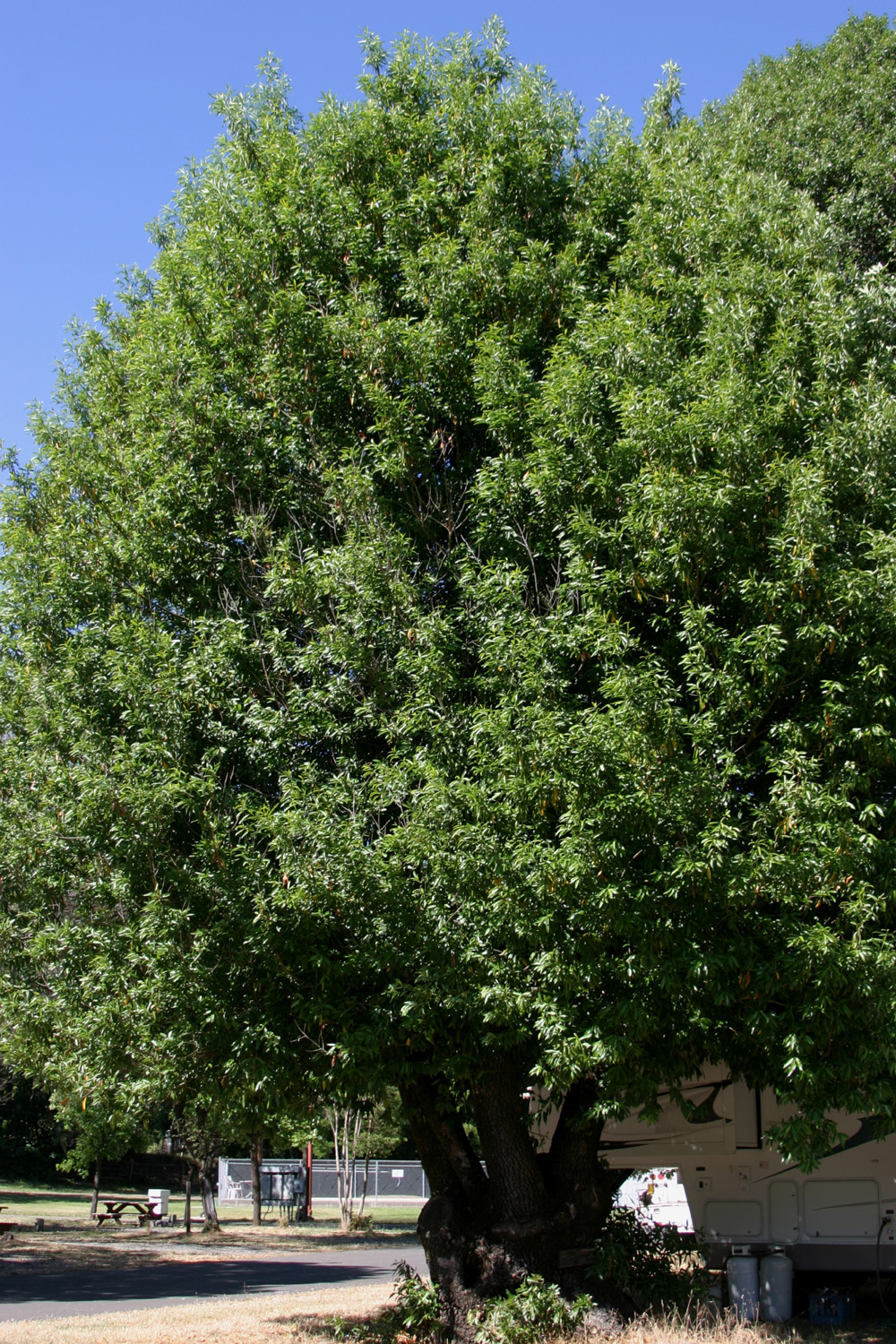
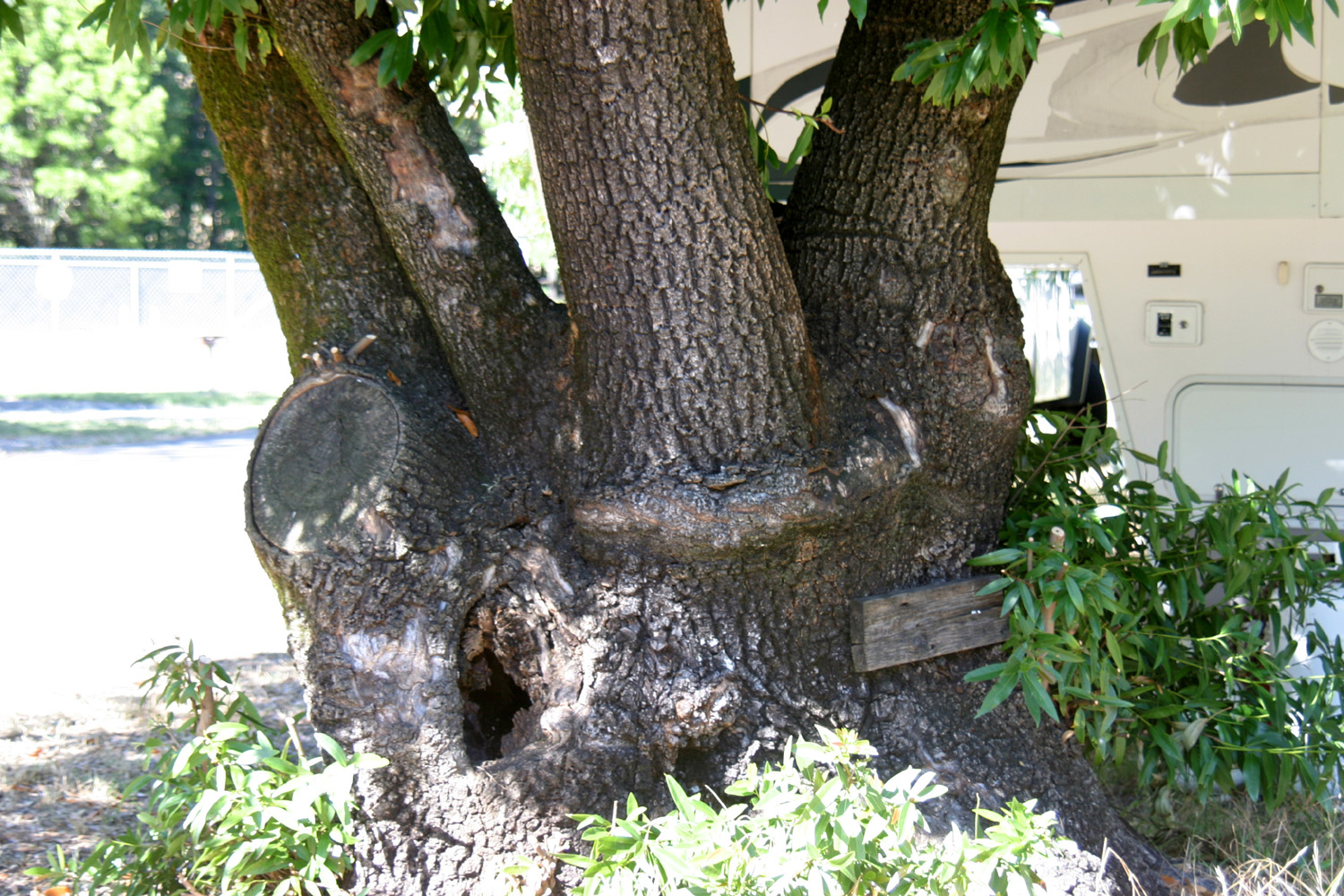
July 9: The weather this morning is more what I expected at the ocean. Instead of the nice sunshine that has prevailed almost everywhere, it is foggy and drippy, with visibility reduced so much that I can't see the ocean. I haven't been outside to see how cold it is, but everyone is bundled up, whereas yesterday many were in shorts and t-shirts. I assume it will burn off, hopefully before I have to drive in it. I will be going up hill as soon as I leave the RV park, so I hope the fog is not clinging to the mountains. I walked out to the edge about 9 a.m. It was cool, but not windy or cold and visibility was improving slightly. I returned to the motor home and got ready to go. Although it never cleared up on the ground at Shelter Cove, I got into sunshine about a mile up the hill. From the pass above town I could look down on green trees on the hill, then fog over the cove, then blue ocean beyond the overcast. I returned safely to Highway 101 and headed south. For a long stretch from where I joined Highway 101 to the junction with Highway 1, the road follows the Eel River. The Eel valley is fairly open, so there are lots of views of the river from the road, and many places where people can get down to the banks for swimming or fishing. Most of the rivers that flow into the ocean simply cross under Highway 1 or Highway 101 at a bridge; as far as I know the Eel is the only one where the road runs beside the river for such a distance. I decided to go "out" for lunch, so stopped at a BBQ/burger place in Laytonville, where I had a pretty good hamburger. It was getting into the middle of the afternoon, and I would be turning east from 101 about 30 or 40 miles south, so I decided it would be easier to find an RV park along the US highway then on the smaller state roads. I am at the Golden Rule RV Park, which is located in a small valley about a mile off 101 and seven miles south of Willits. There is some level terrain, with open fields next to the park. The park is next to Ridgewood Ranch, the home of Seabiscuit (he's actually buried there). Although there are evergreens on the hills above, the trees in the valley are nearly all hardwoods, including a lot of big valley oaks, some live oak, and various landscape trees. There is also the biggest bay tree I have ever seen. The base is about three feet in diameter, and it has several large trunks. A couple of huge limbs have been cut off long ago. The tree is probably 30 feet high. Typical bay trees, at least in the Sierra foothills, have several small trunks, rarely over two or three inches in diameter, and a base that is usually less than a foot across.
July 10: I got a fairly early start this morning and headed for home, arriving about 5 p.m. My trip totaled 870 miles, not counting rental car mileage. There are not a lot of choices in getting from Highway 101 to the central valley and Highway 5 and/or 99. To avoid the Bay Area, I turned east on highway 20, which leaves 101 about 60 miles north of Santa Rosa. This road goes along the north and east side of Clear Lake, a huge lake and major recreation area inland from 101 about 80 miles north of San Francisco. State 20 goes out to Interstate 5 at Williams, but this takes you many miles farther north than necessary. I turned off 20 on State 16, which goes south then east to join I-5 at Woodland. Much of this route is very scenic. There are redwoods along the first part of the drive, then Clear Lake, a huge natural lake, with motels, resorts, condos, and places to stop and fish or go boating. Once over the hills between Clear Lake and the valley, the road follows Cache Creek for a long ways, also going over some mountains, and past various farming and ranching operations. Although this was one of those trips that did not turn out as originally planned, I enjoyed it and would do it all again. --Dick Estel, July 2011 |
||
|
Photos (Click to enlarge; pictures open in new window) |
||
Russian River Area Point Reyes Highway 1 & Mendocino Fort Bragg, Russian Gulch, Cabrillo Light Richardson Redwoods Shelter Cove & Highway 101 |
||
|
Russian River Area |
||
|
|
||
|
|
 |
 |
| Headlands and surf at Bodega Bay | Crashing waves near Bodega Bay | Yellow bush lupines |
 |
|
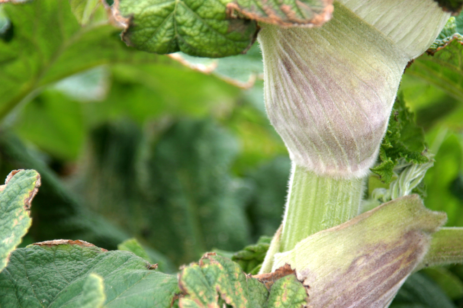 |
| Close up of lupines | Plant from a Star Trek planet? | The stem here is about 1.5 inches in diameter |
 |
 |
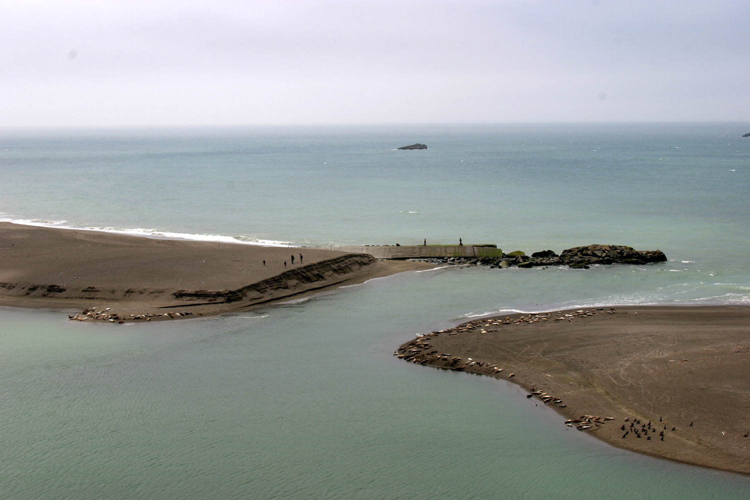 |
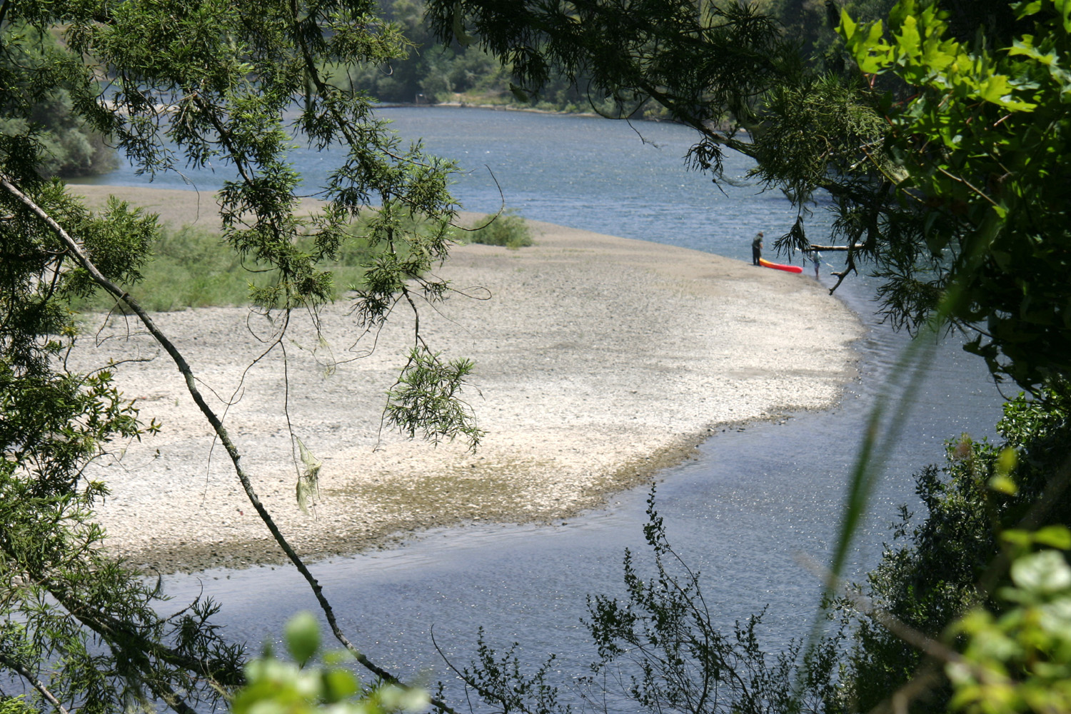
| Highway 1 bridge over Russian River at Jenner | Elephant seals taking it easy | Where the river meets the sea (note seals lining the edge of the sand) |
 |
 |
 |
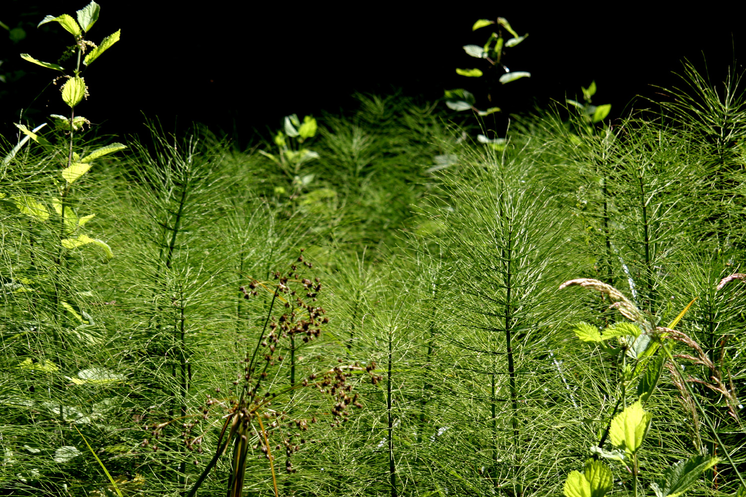
| The wildest animals on the beach | Dunes and bunch grass near Jenner | Who knows what these are called? |
|
 |
 |
| Russian River along Highway 116, inland from Jenner |
Everything is green in Armstrong Grove, even the fence |
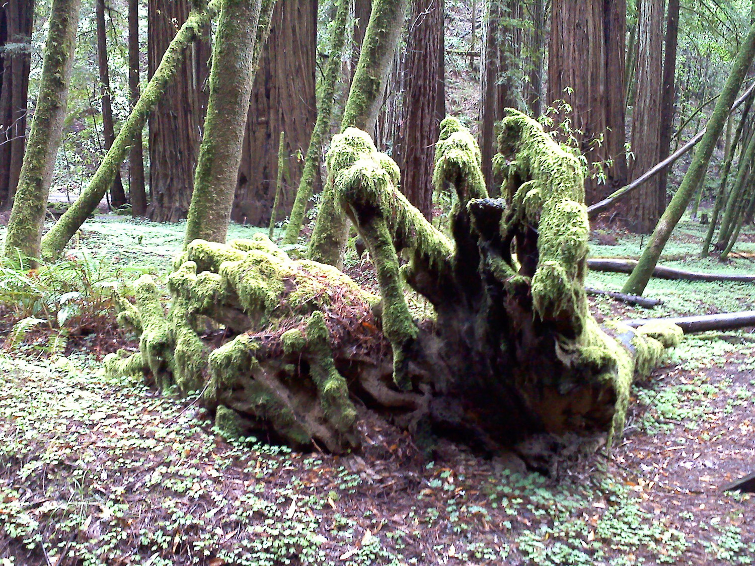
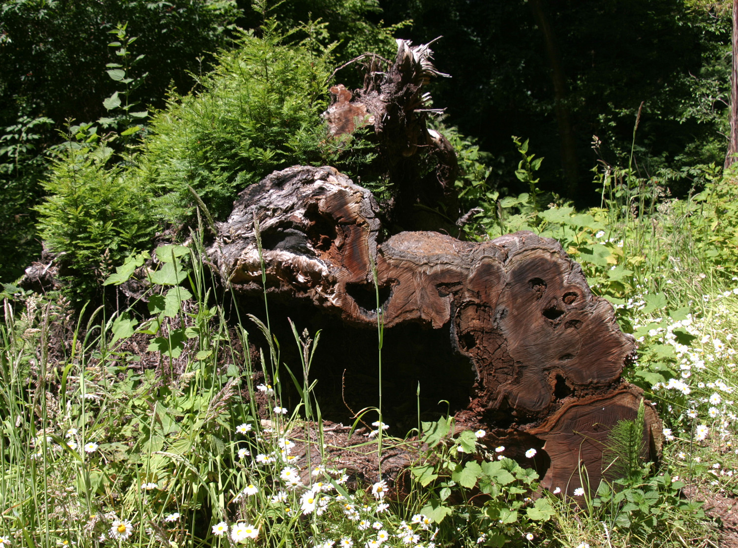
Mossy roots of a fallen redwood |
 |
 |
 |
| Col. Armstrong was a lumberman who chose to preserve this grove |
The oldest tree in the grove, about 1400 years | The misty woods |
 |
||
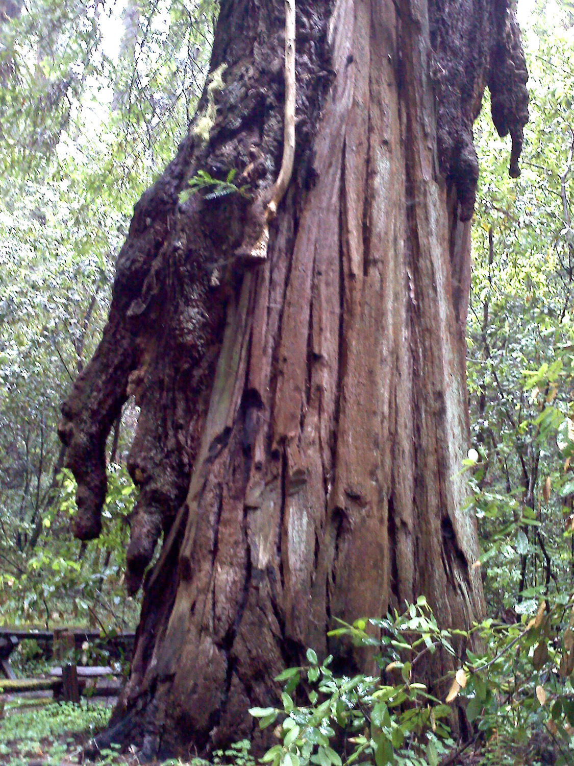
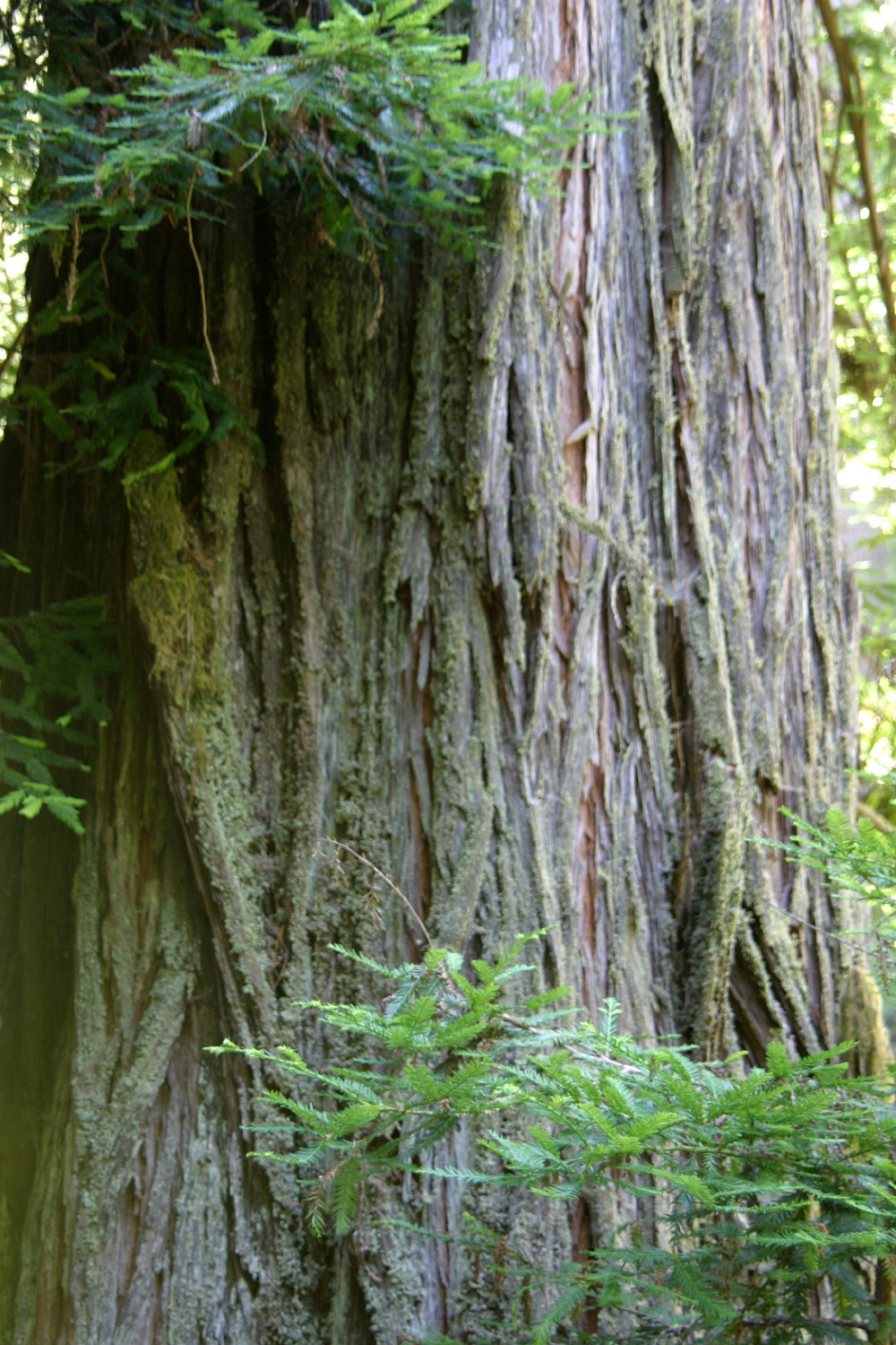
| Redwood with large burl | ||
| Point Reyes | ||
 |
 |
 |
| Tomales Bay at Pt. Reyes | Another view of the bay | Tomales Bay from road above |
 |
 |
 |
| Quail near visitor center | Ancient oak | My rented Chevy on Inverness Ridge |
 |
 |
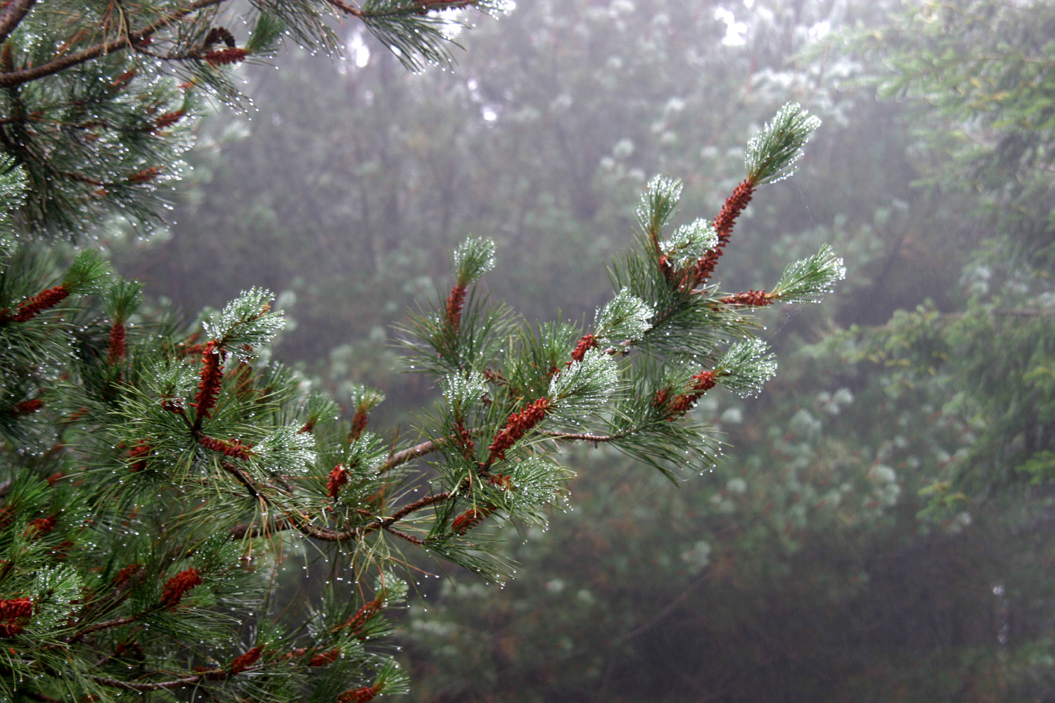 |
| One of many trails on the ridge | Flowers on the ridge | Pine branch in the mist |
|
 |
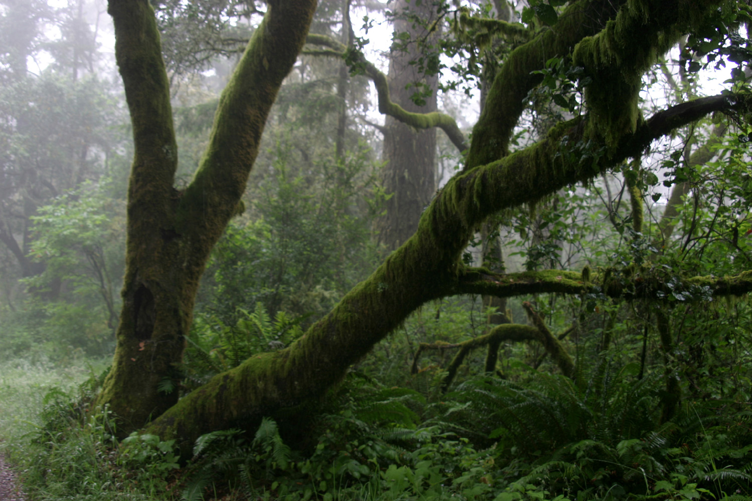 |
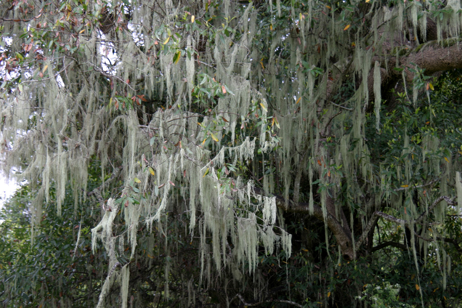
| Another misty scene | Spanish moss is everywhere | Mossy trees reflect the wet climate of Pt. Reyes |
| Highway 1 & Mendocino | ||
 |
 |
 |
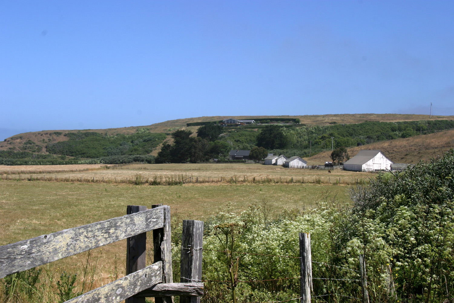
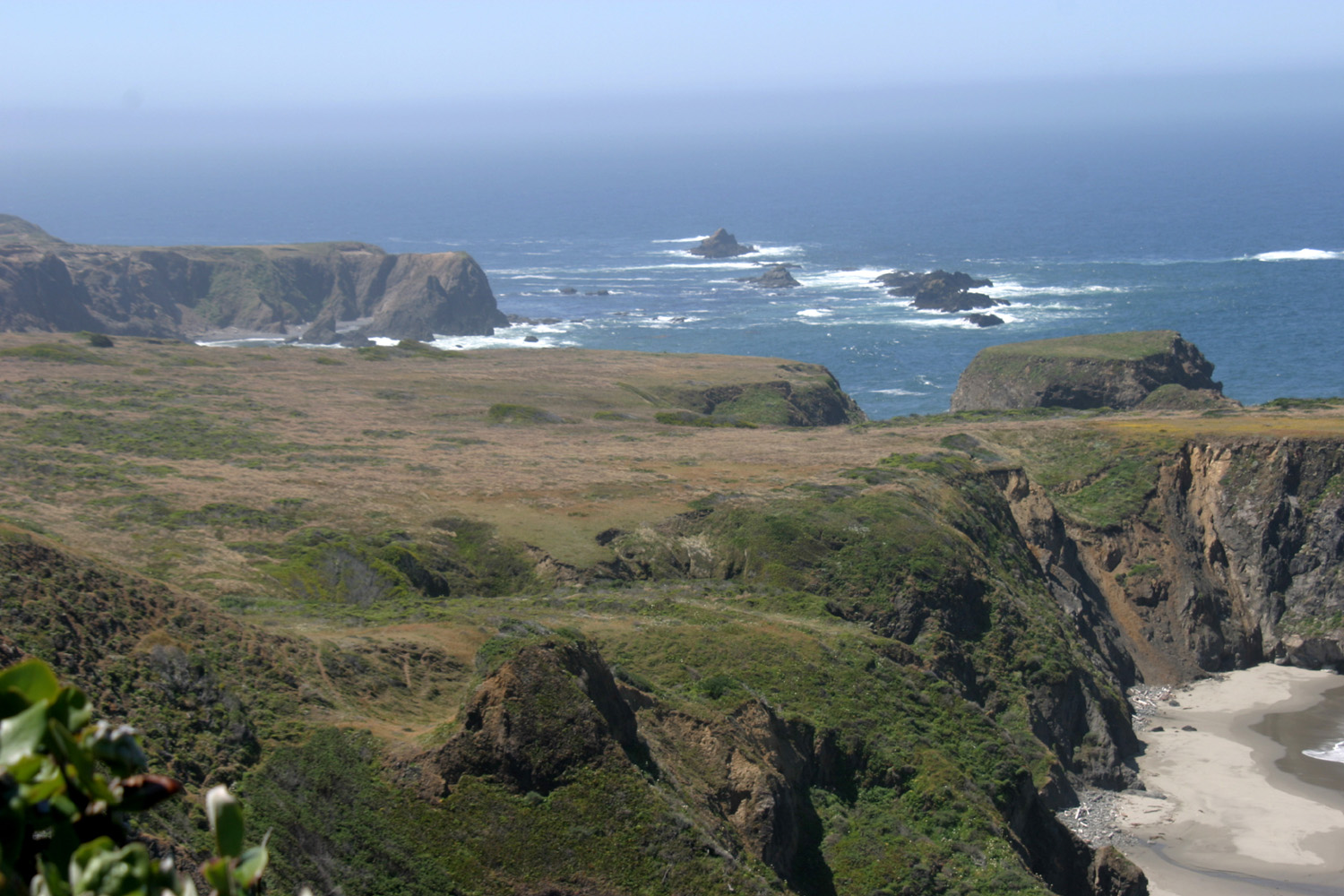
| Ranch by Highway 1 in Mendocino County | Ranch land, looking toward the ocean | They grow all along the coast - whatever they are |
 |
 |
 |
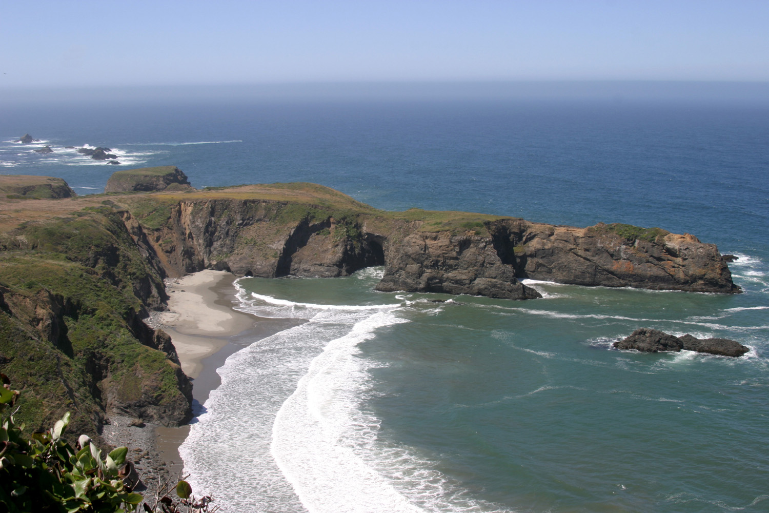
| Mendocino Coast | Hidden cove near Mendocino Village | Mendocino Village, looking inland |
 |
 |
|
| Classic northern coast house | Another typical coastal color choice | Mendocino water tower |
 |
 |
 |
| Water tank | This grass grows by the acre on the marine terrace |
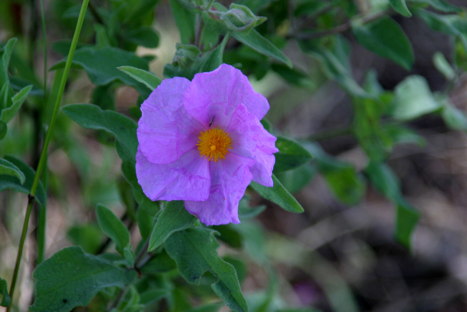
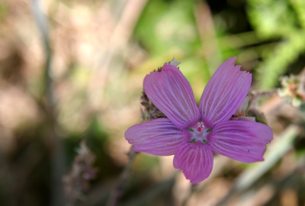
Flower near Mendocino |
 |
 |
 |
| Echium plant (Pride of Madeira) | Mendocino headlands | More headlands |
 |
 |
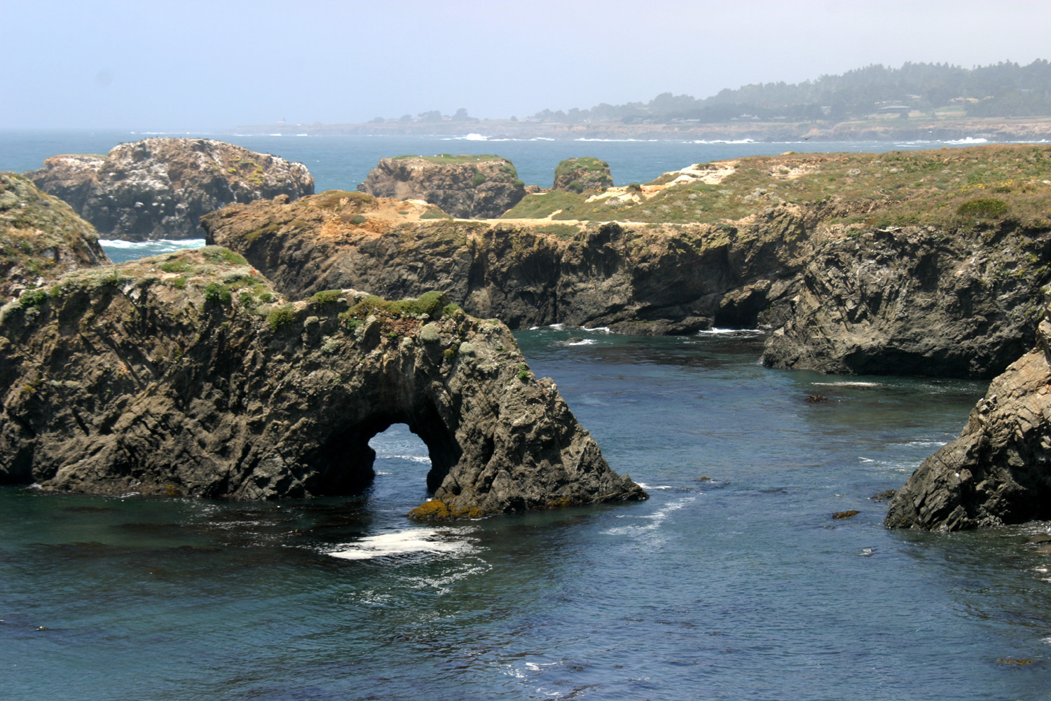 |
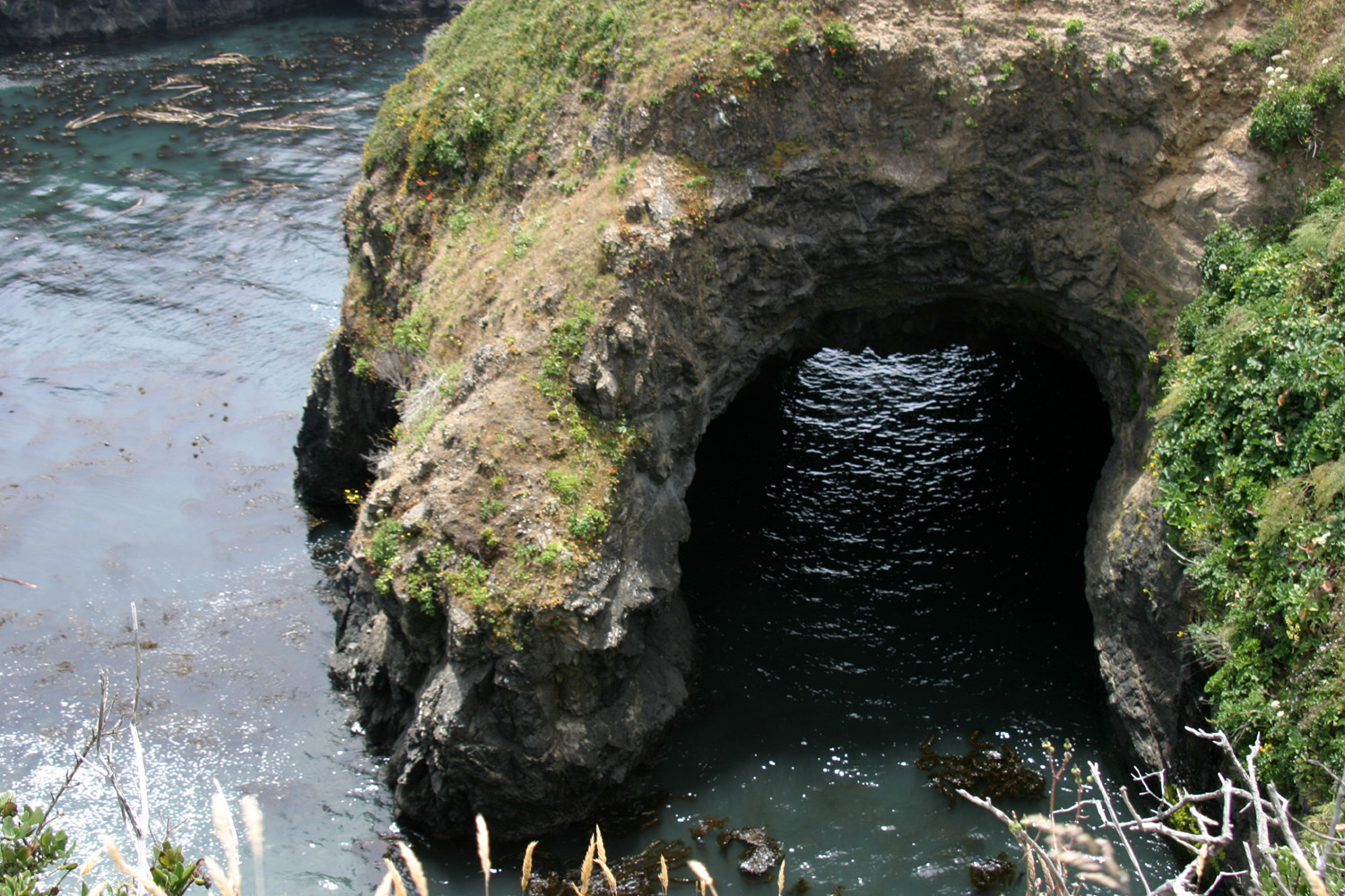
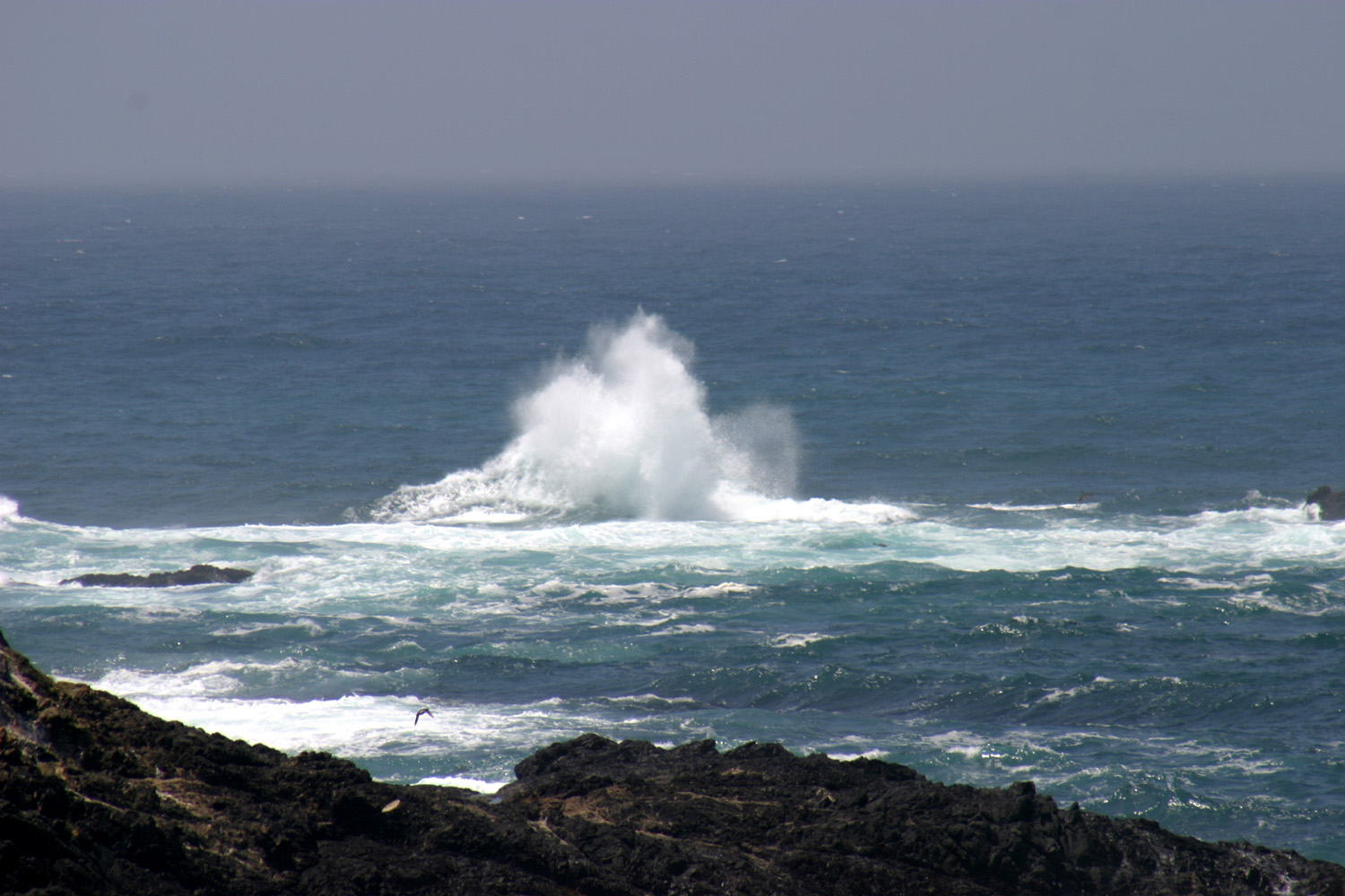
| Tunnel through the rock | A big splash-up! | Weather carved rock formations |
 |
||
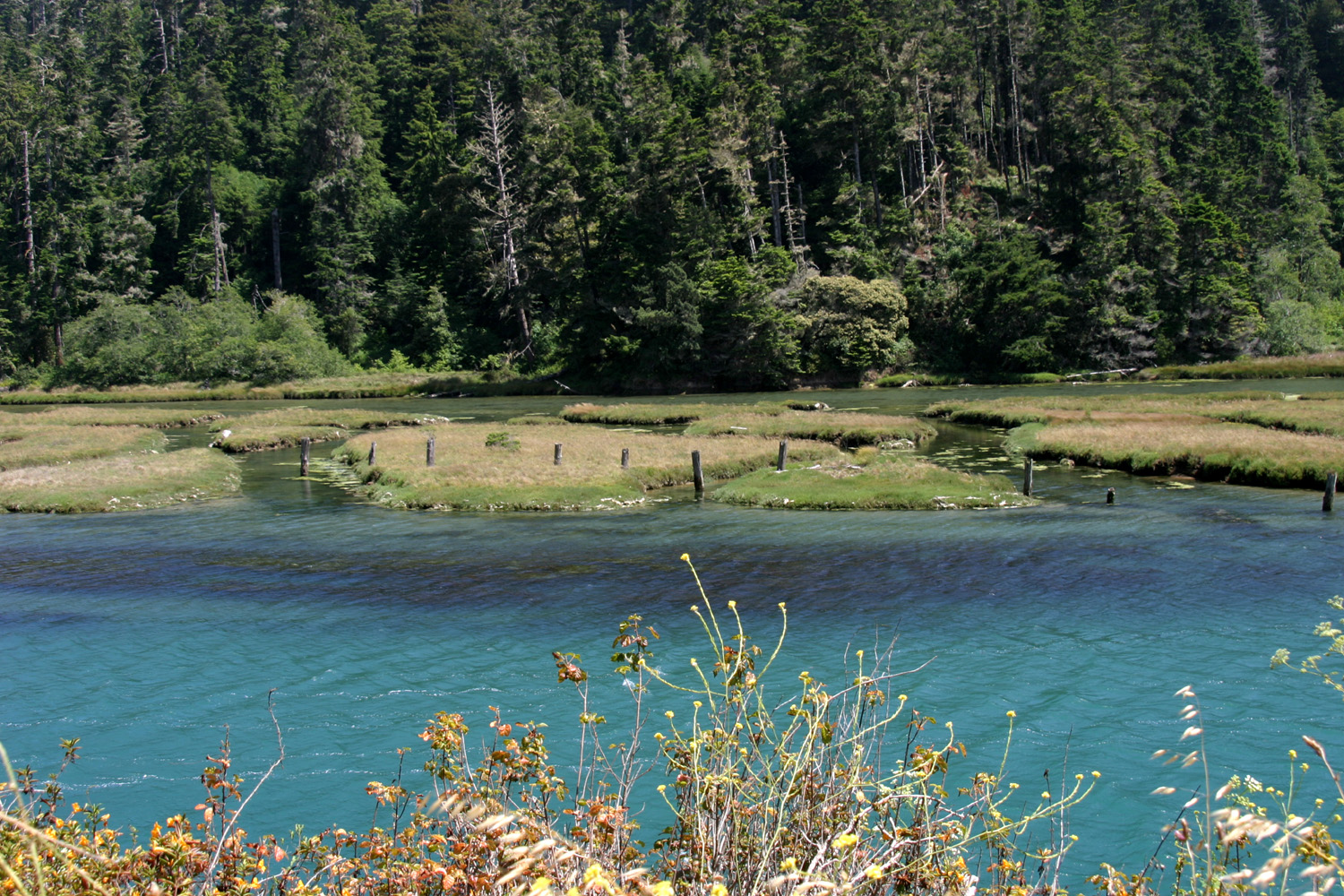
| Big River, a few hundred
yards from the ocean at Mendocino |
||
| Fort Bragg, Russian Gulch, Cabrillo Light | ||
 |
 |
 |
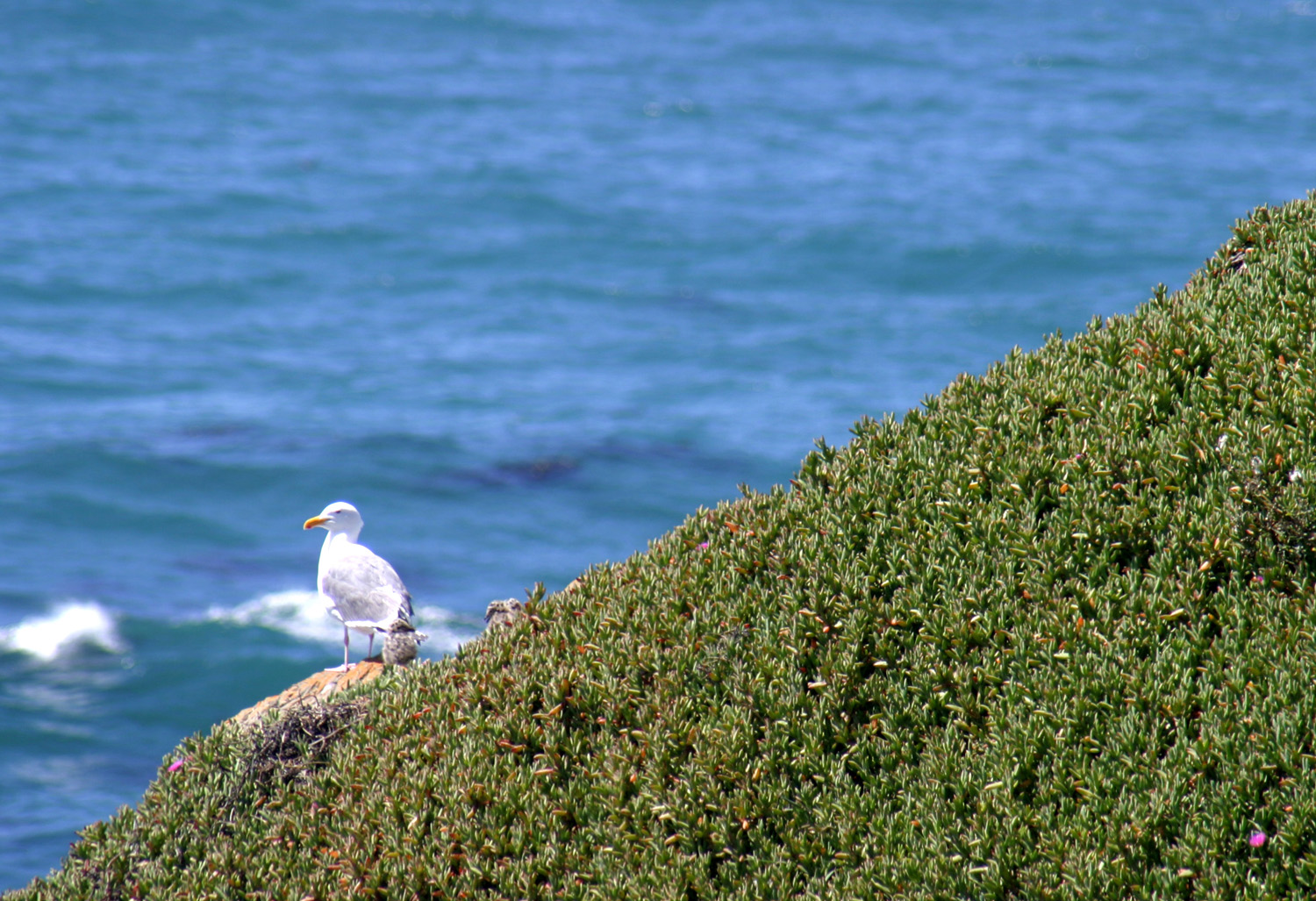
| Big splash-up at Fort Bragg | Seagull on patrol | Reeds along the Russian Gulch trail |
 |
 |
 |
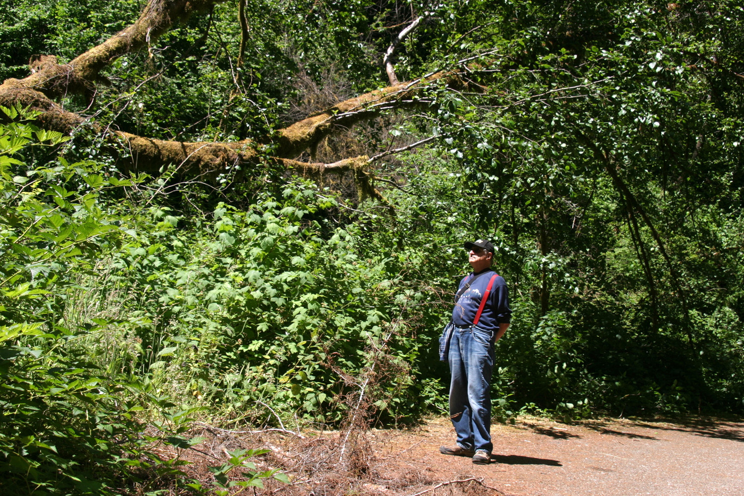
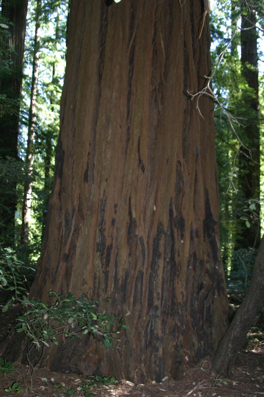
| Redwood trunk | Dick on the trail | New trees growing on old stump |
 |
 |
 |
| New tree roots surround old stump | Close up of roots | Fern by Russian Gulch trail |
 |
 |
|
| Highway 1 bridge at Russian Gulch | Bridge from coastal headland | Closer view |
 |
 |
 |
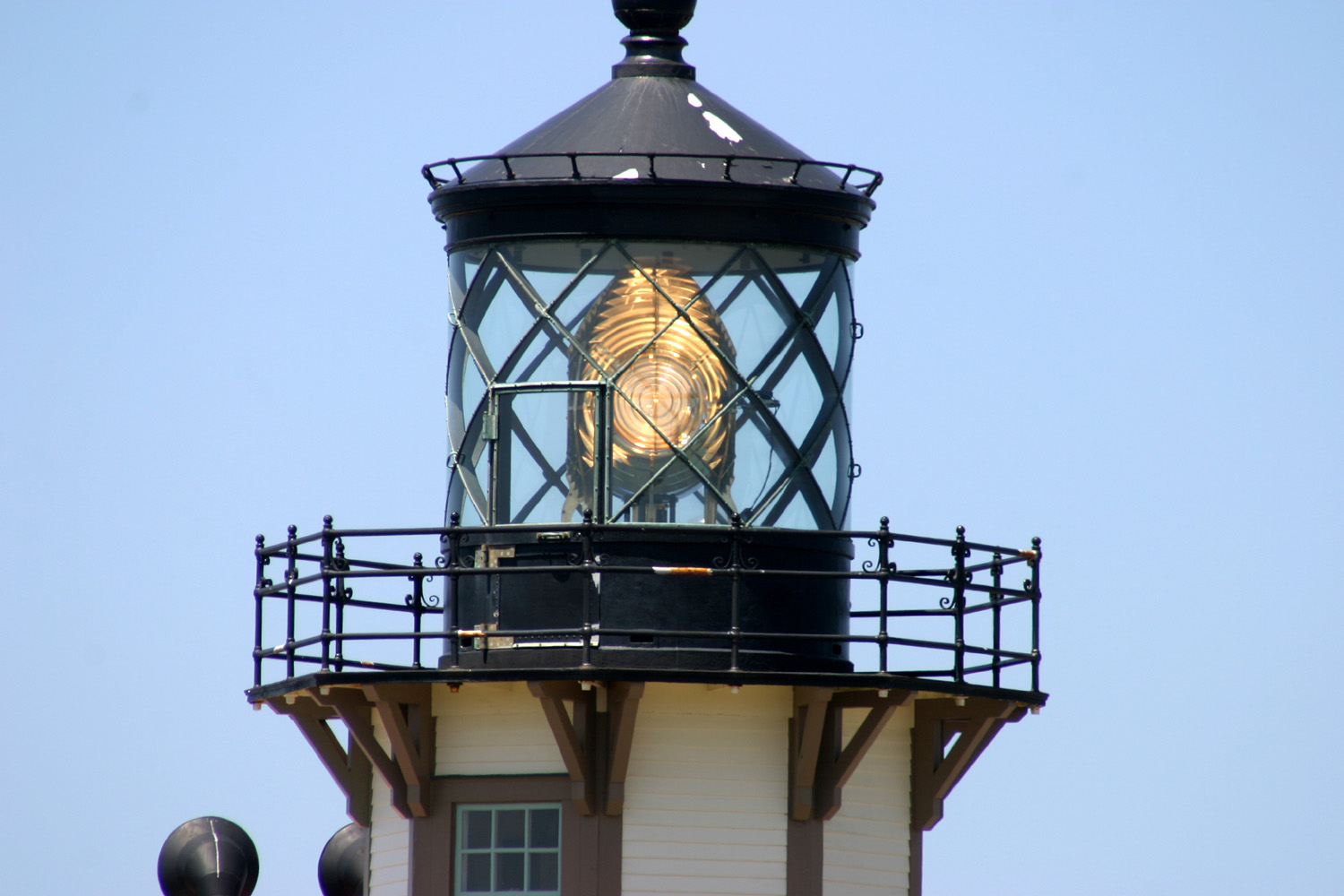
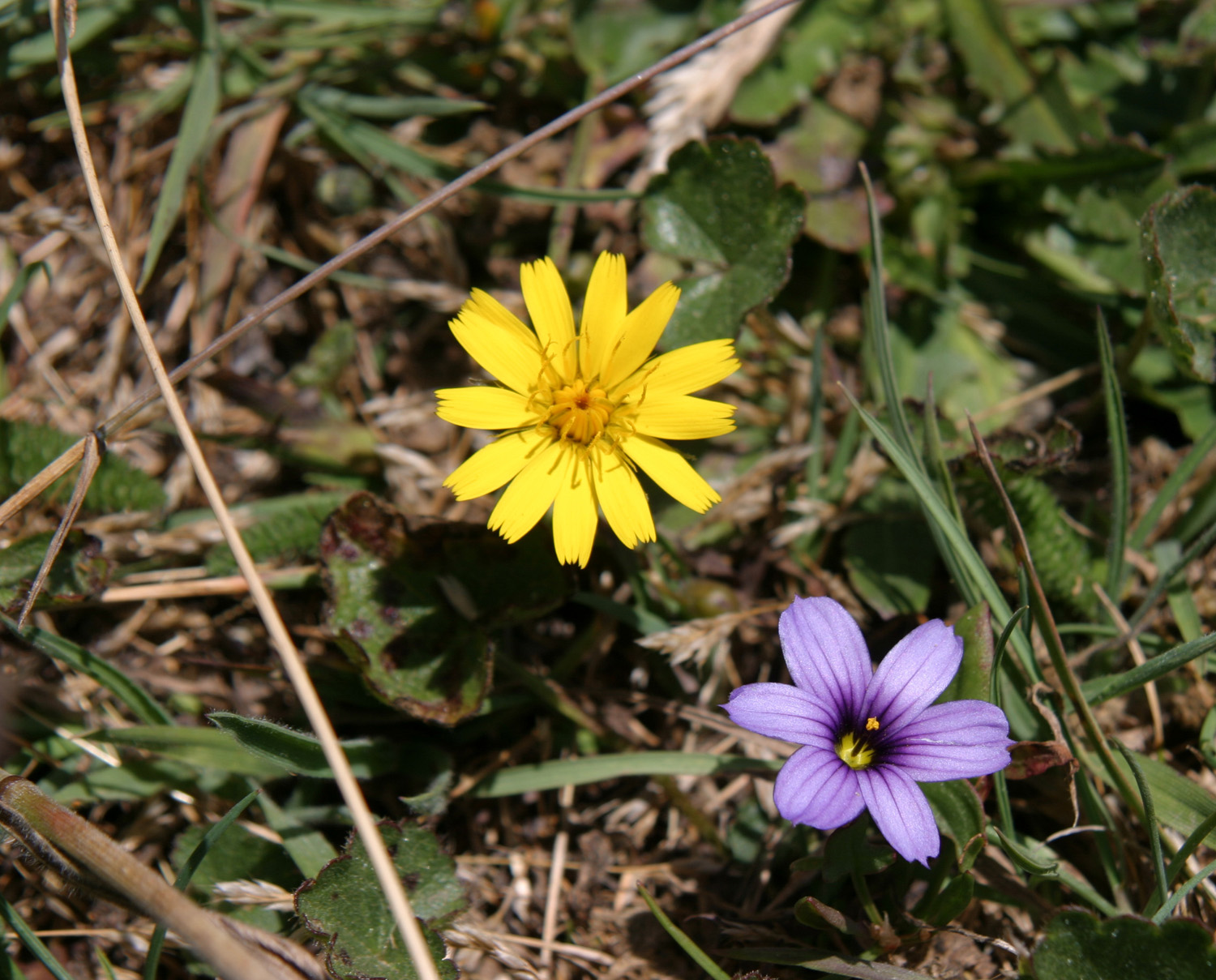
| Point Cabrillo Light Station | Close up view of light | Purple flowers on Point Cabrillo |
 |
 |
|
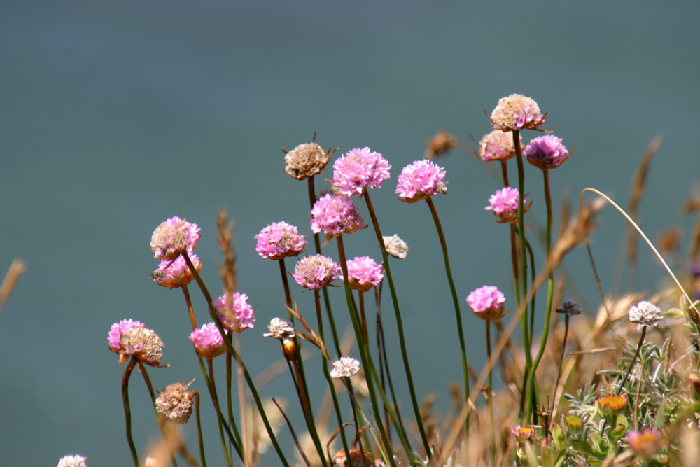
| More Point Cabrillo flowers | And still more | |
| Richardson Grove Redwoods | ||
 |
 |
 |
| Grandfather Tree by Highway 101 | Close-up of the tree | Swimming hole on the Eel River |
 |
 |
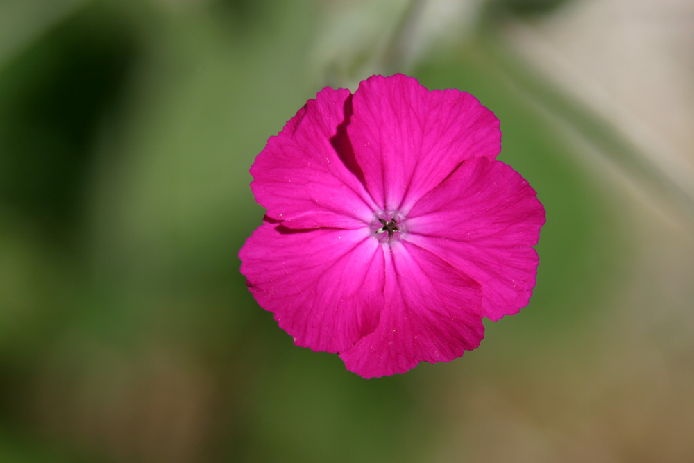 |
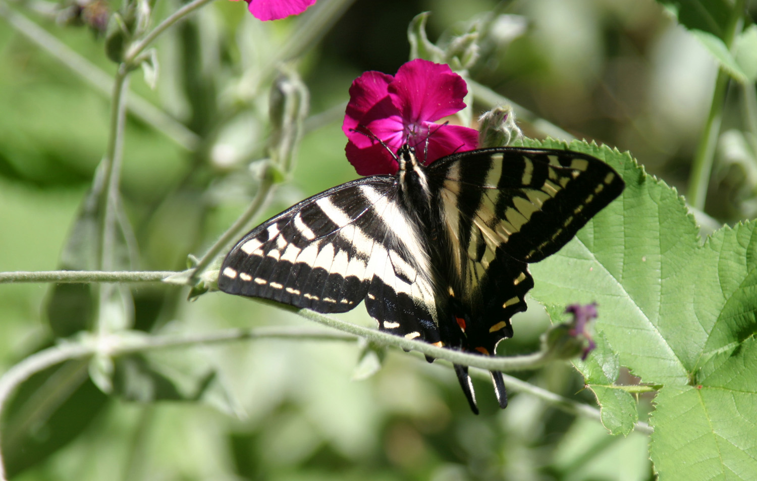
| Eel River Valley | Butterfly dining | Flower in Richardson Grove |
 |
 |
 |
| Redwoods in Richardson Grove Redwood State Park, July 2011 | ||
| Shelter Cove & Highway 101 | ||
 |
 |
 |
| Looking down toward Shelter Cove from the pass |
Seagulls and a pelican
greeted me when I arrived at the RV park |
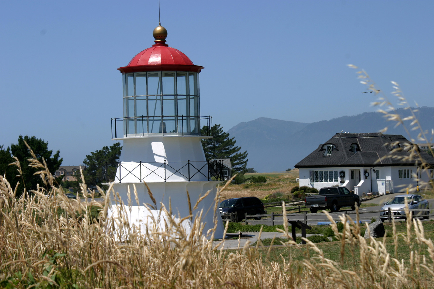
Cape Mendocino Lighthouse (moved to this location) |
 |
 |
 |
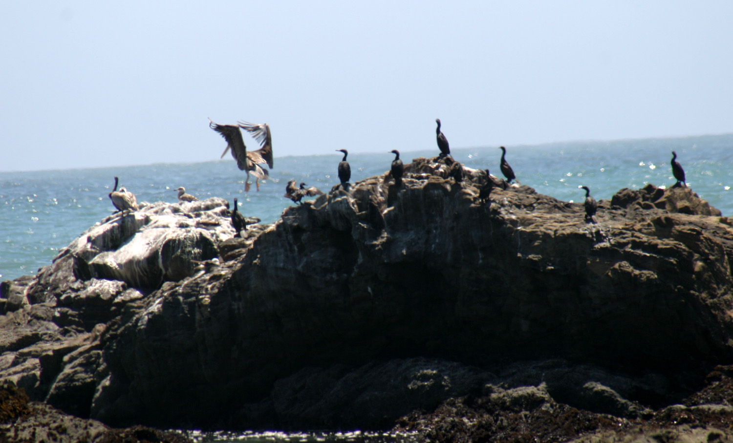
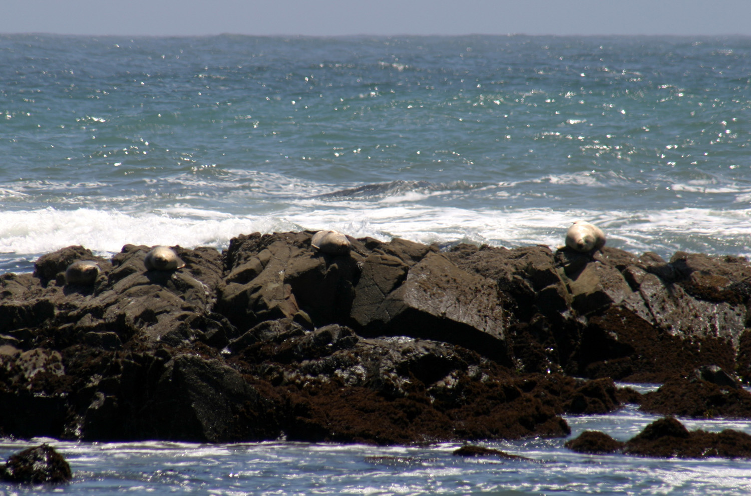
| Bird rock | Seal rock | Shelter Cove and cliffs above |
 |
 |
 |
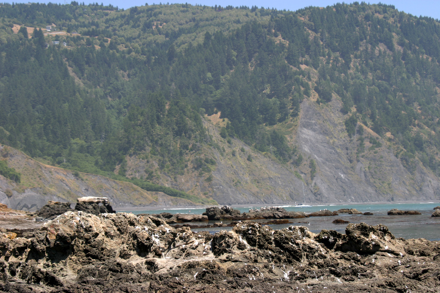
| Hills above town are dotted with homes | The tree-covered hill,
fog-covered Shelter Cove, and the blue ocean beyond |
Eel River near Highway 101 |
 |
 |
 |
| Giant bay tree at Golden Rule RV Park | Trunks of the bay tree | Terrain surrounding the park |
| Related Links | ||
| Russian River | Jenner | Point Reyes National Seashore |
| Bodega Bay | Highway 1 | Armstrong Redwoods State Natural Reserve |
| Tomales Bay | Fort Bragg | Mendocino Village |
| Mendocino Headlands State Park | Russian Gulch State Park | Jug Handle State Natural Reserve |
| Point Cabrillo Light Station | Eel River | Richardson Grove Redwood State Park |
| Ridgewood Ranch | Clear Lake | Mendocino History |
| More about echiums | Shelter Cove | Richmond-San Rafael Bridge |