

| Dick's Adventures of 2019 - Part 3 | |
| Photos Related Links More Travel Reports | |
| Adventures of 2016 Adventures of 2017 Adventures of 2018 2019 Part 1 2019 Part 2 2019 Part 4 2019 Part 5 | |
| San Joaquin Gorge Campout Nelder Grove Hike Sycamore Creek Rancheria Falls Illilouette Falls | |
|
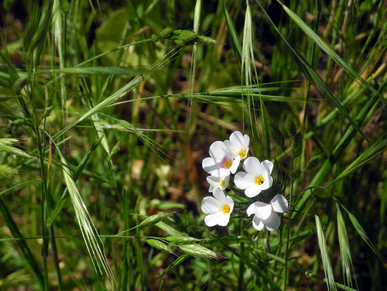
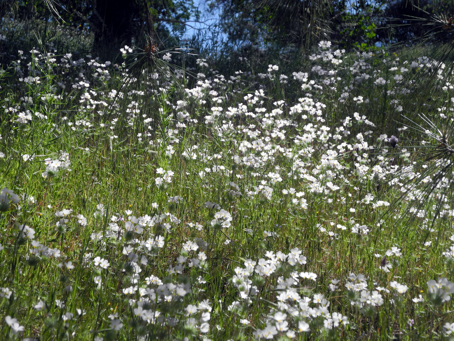
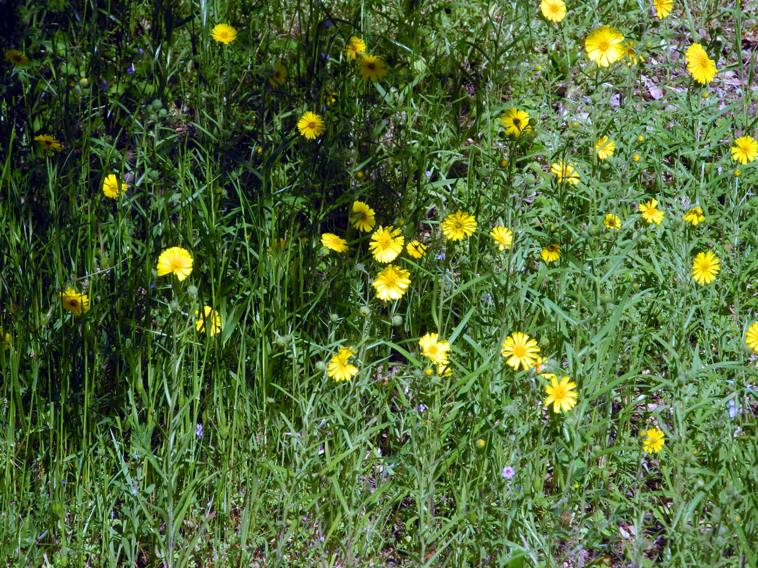
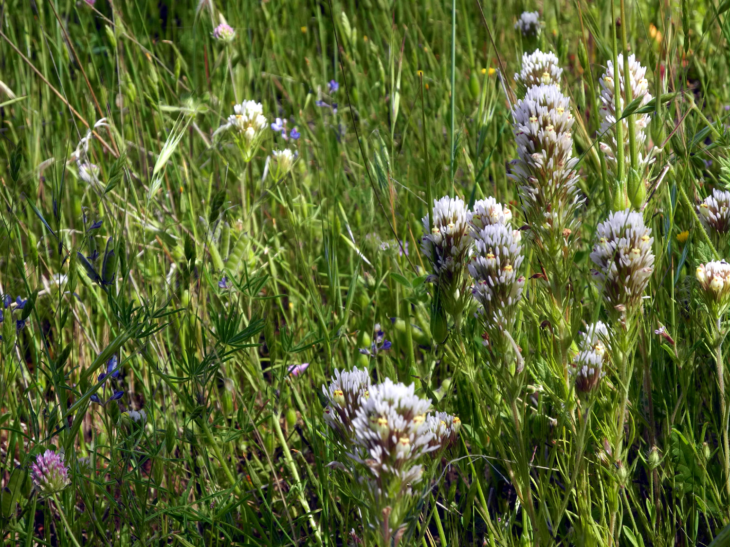
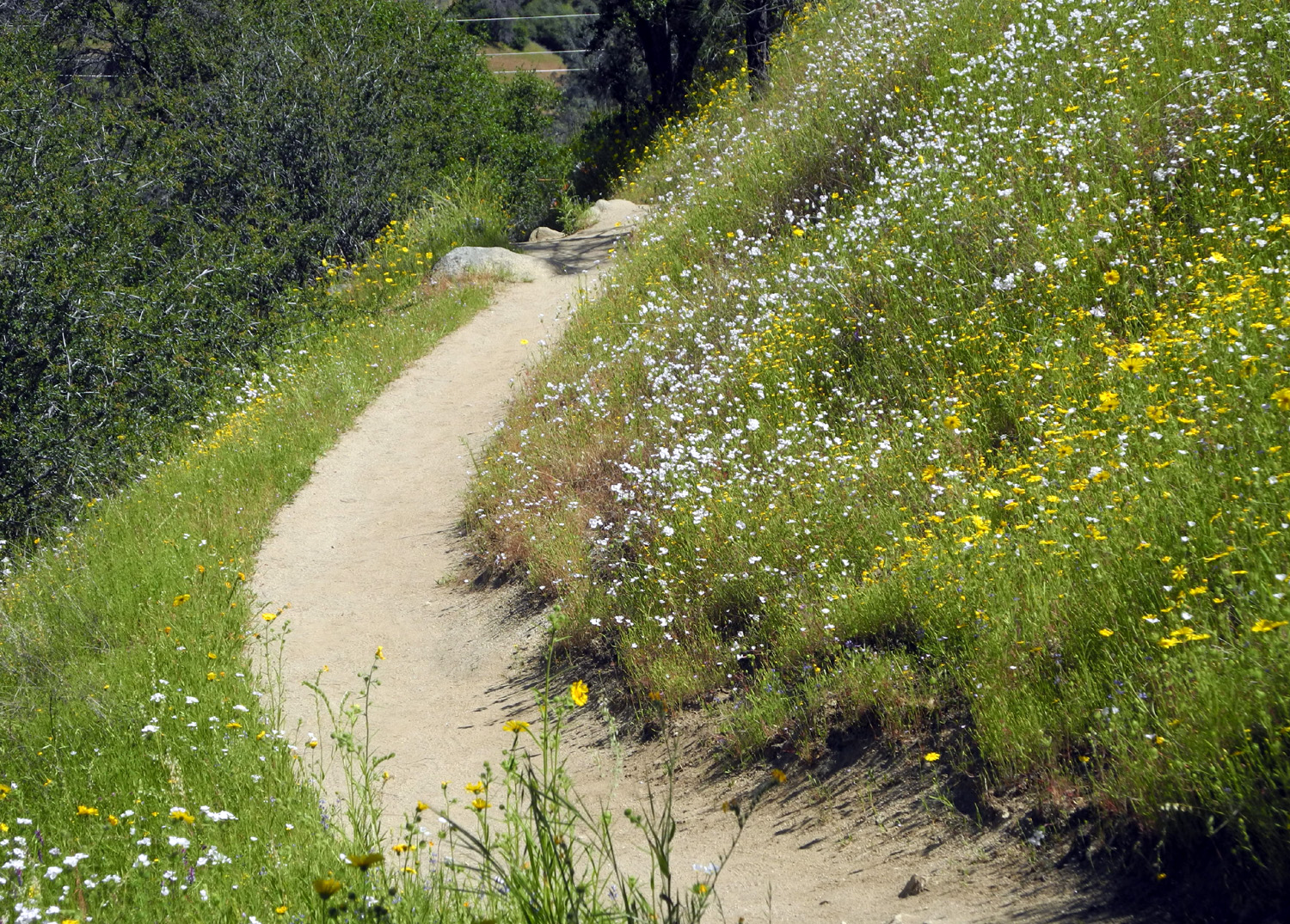
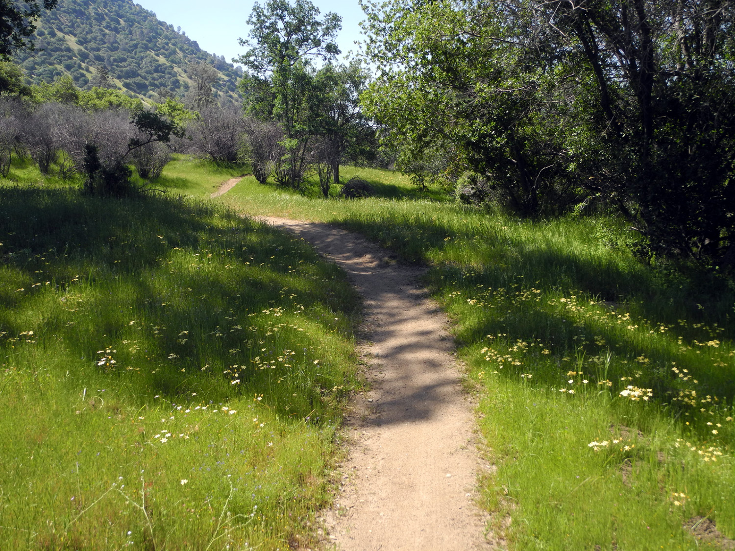
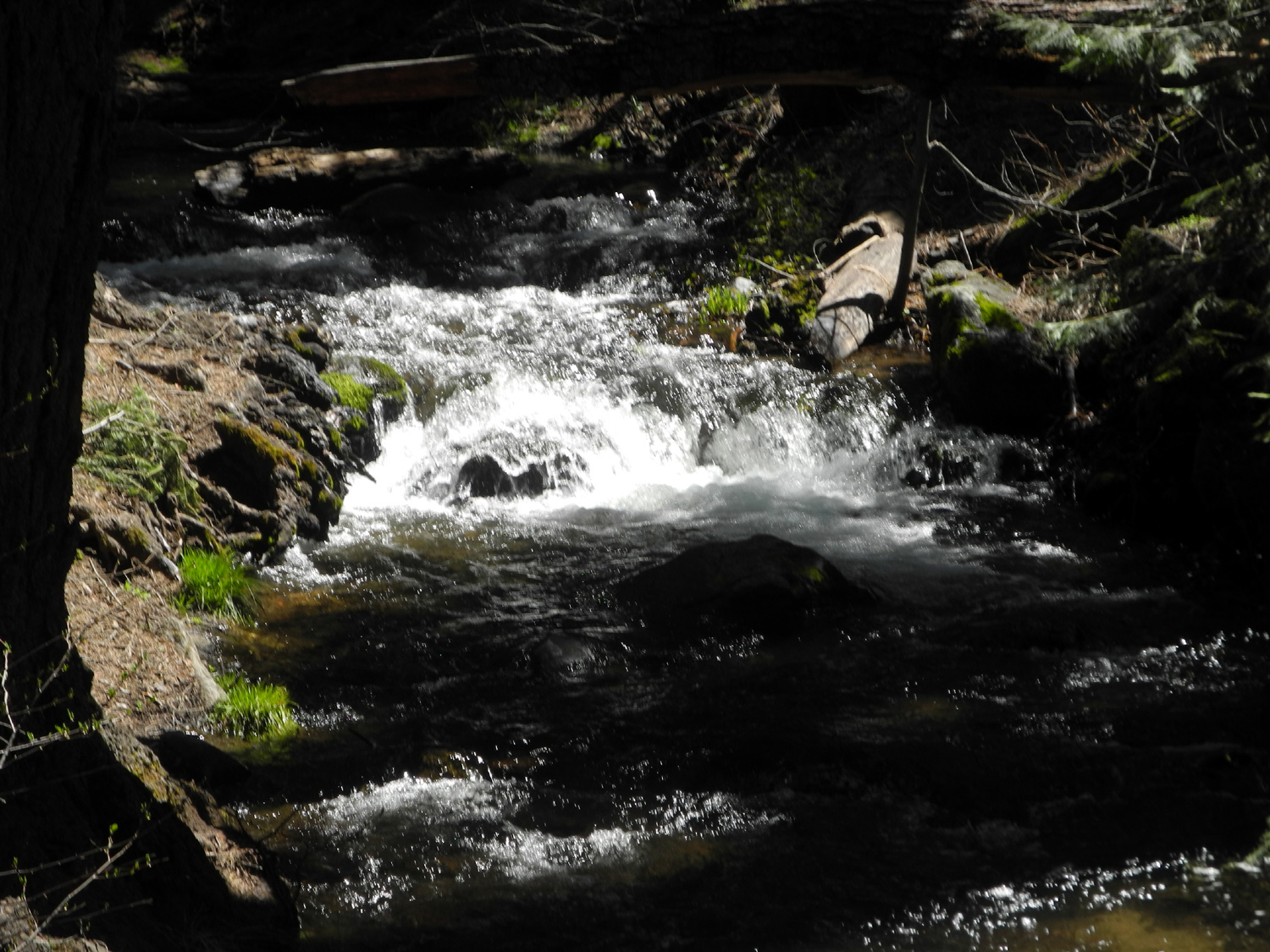
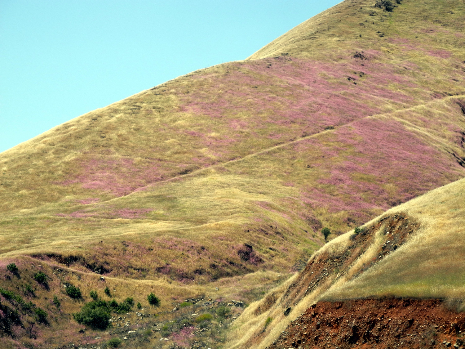
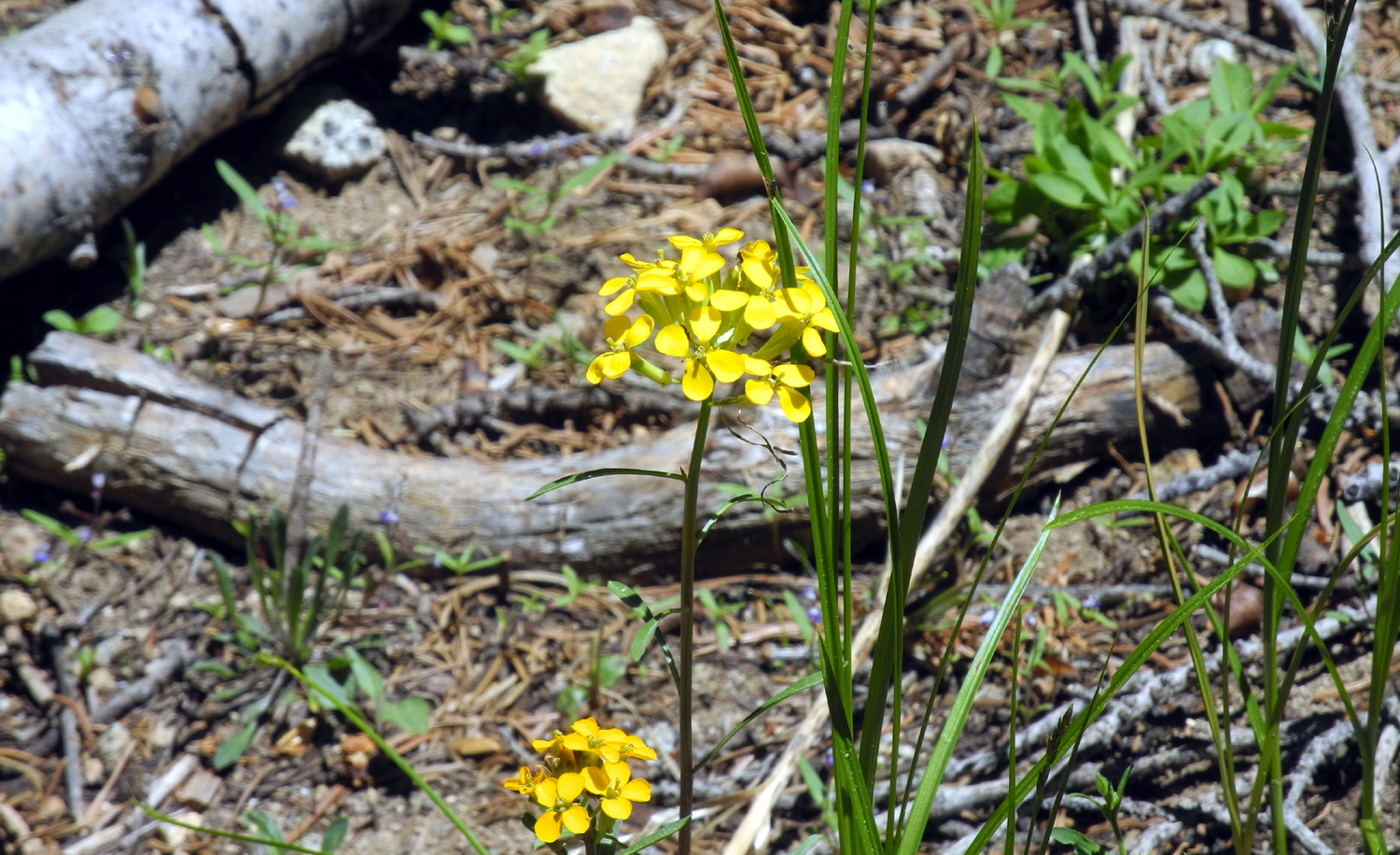
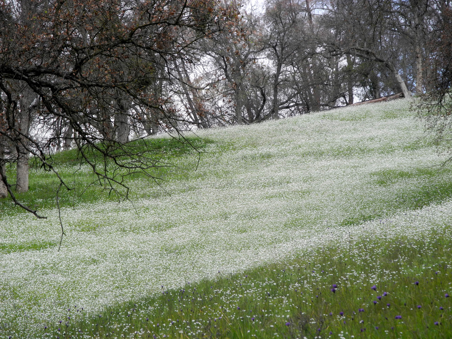
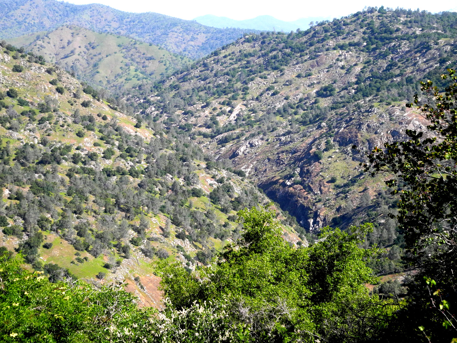
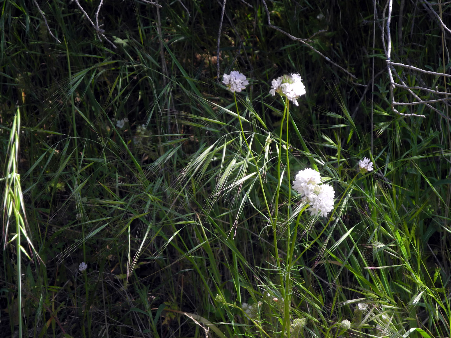
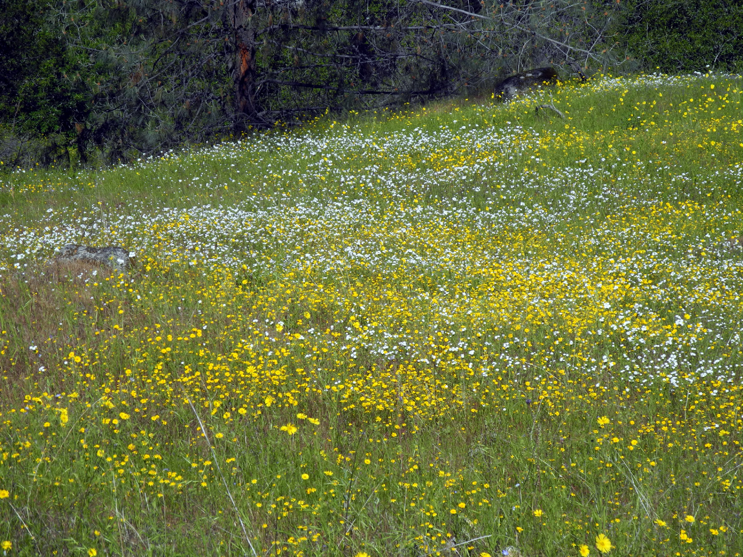
San Joaquin Gorge Camping Trip I've written about the San Joaquin River Gorge Recreation Area many times, so this report will be heavy on photos and light on words. I do need to say that this was the first time I had camped there in my pickup. I only wanted to go for one night and did not feel like going to the trouble of getting the motor home ready for such a short trip. This brief campout still gave me plenty of time to hike the two trails that start from the main parking area. When I arrived, at about 10:30 a.m. on April 22, the only thing I did to set up camp was to get out my card table and chair, just enough to say, "hey, someone is camping here!" I then hiked down the Bridge Trail to the San Joaquin River, and a short distance east on the Ridge Trail, racking up 2.8 miles total. I had been down this trail with the Ramblers about a month earlier, but as expected, different varieties of flowers had taken over the dominant position - in this case, mustang clover and common madea. |
|
 |
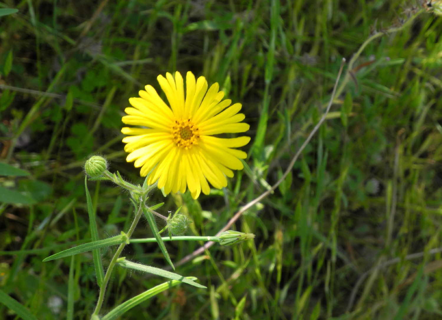 |
| Mustang clover | Common madea |
 |
 |
| A hillside of mustang clover | And a field of common madea |
|
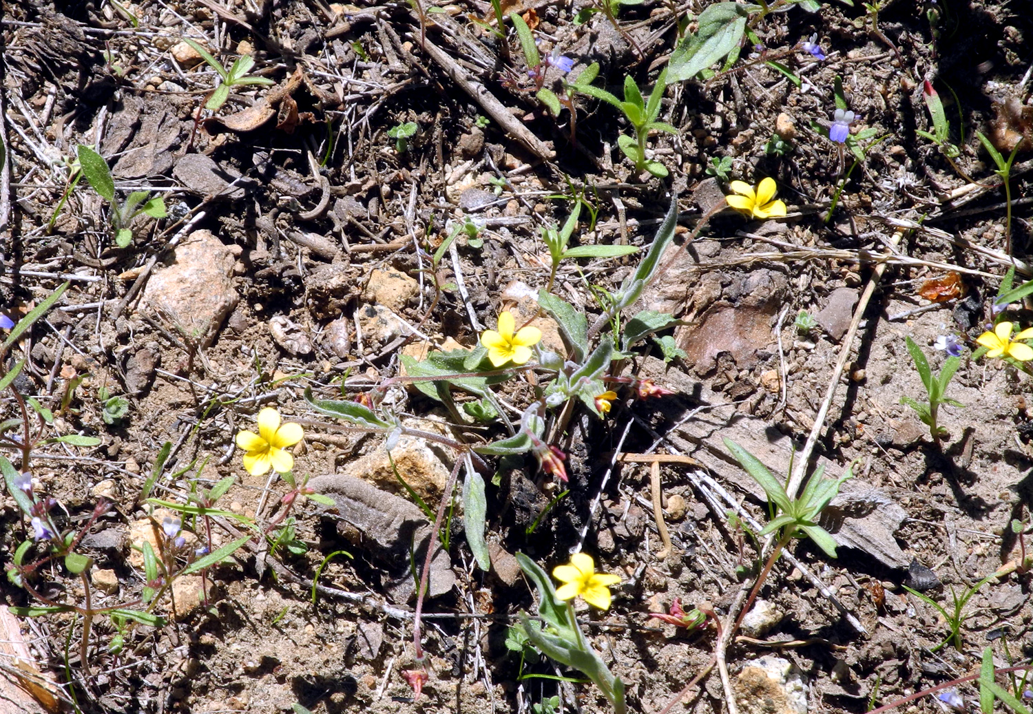
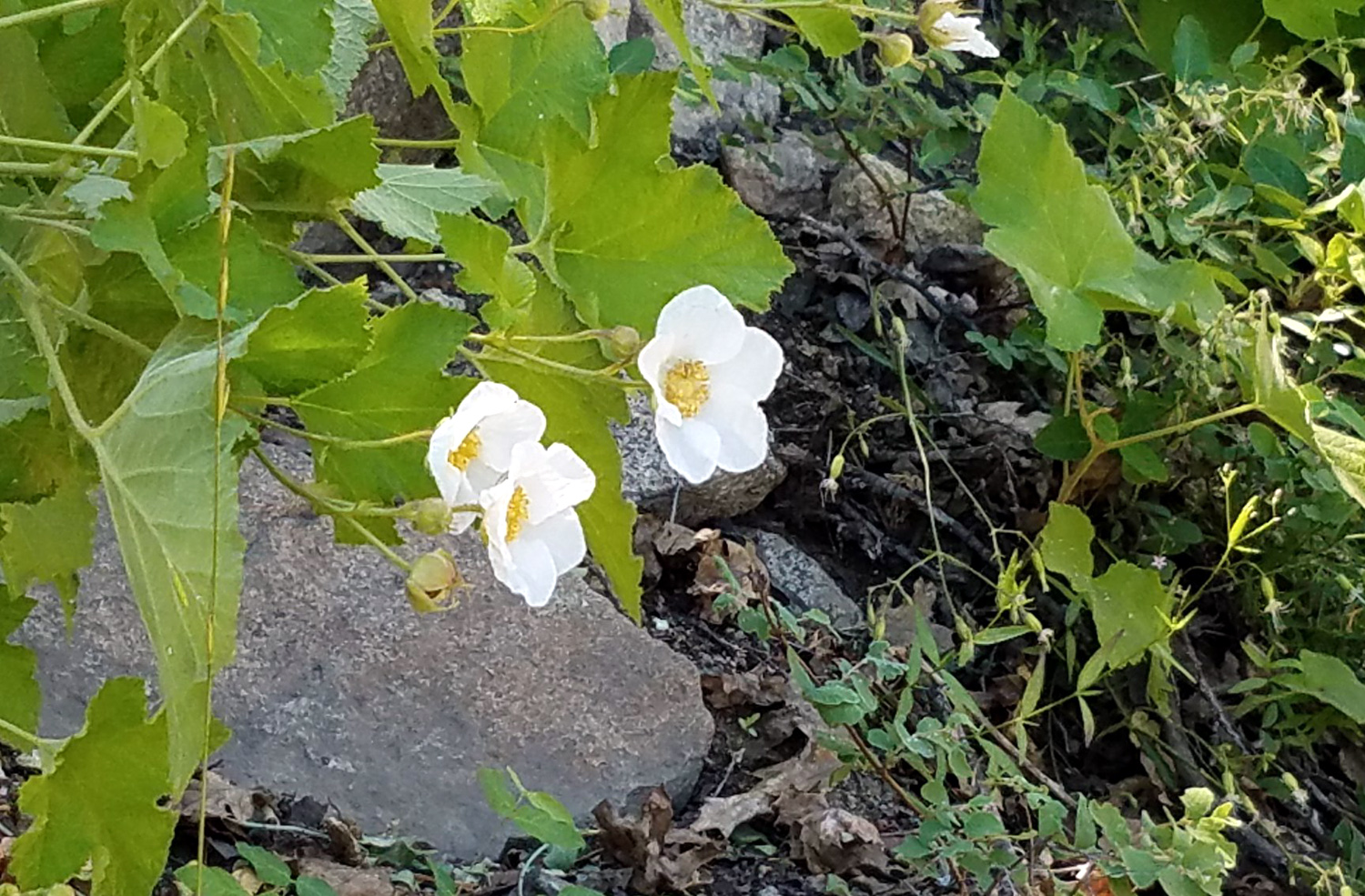
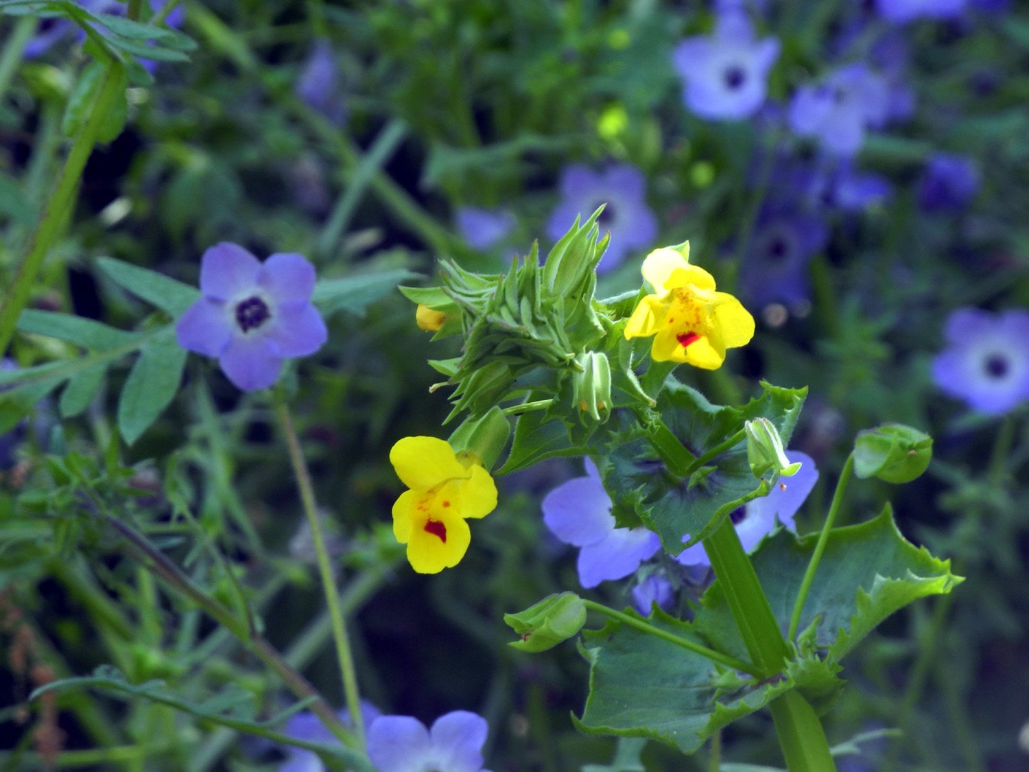
I also saw white and red owl clover, foothill gilia, lupines, fiesta flowers, and many others, including a few remnant examples of early spring blossoms like blue dicks, fiddlenecks and popcorn flowers. There was rarely a time when there were not flowers along both sides of the trail. |
|
 |
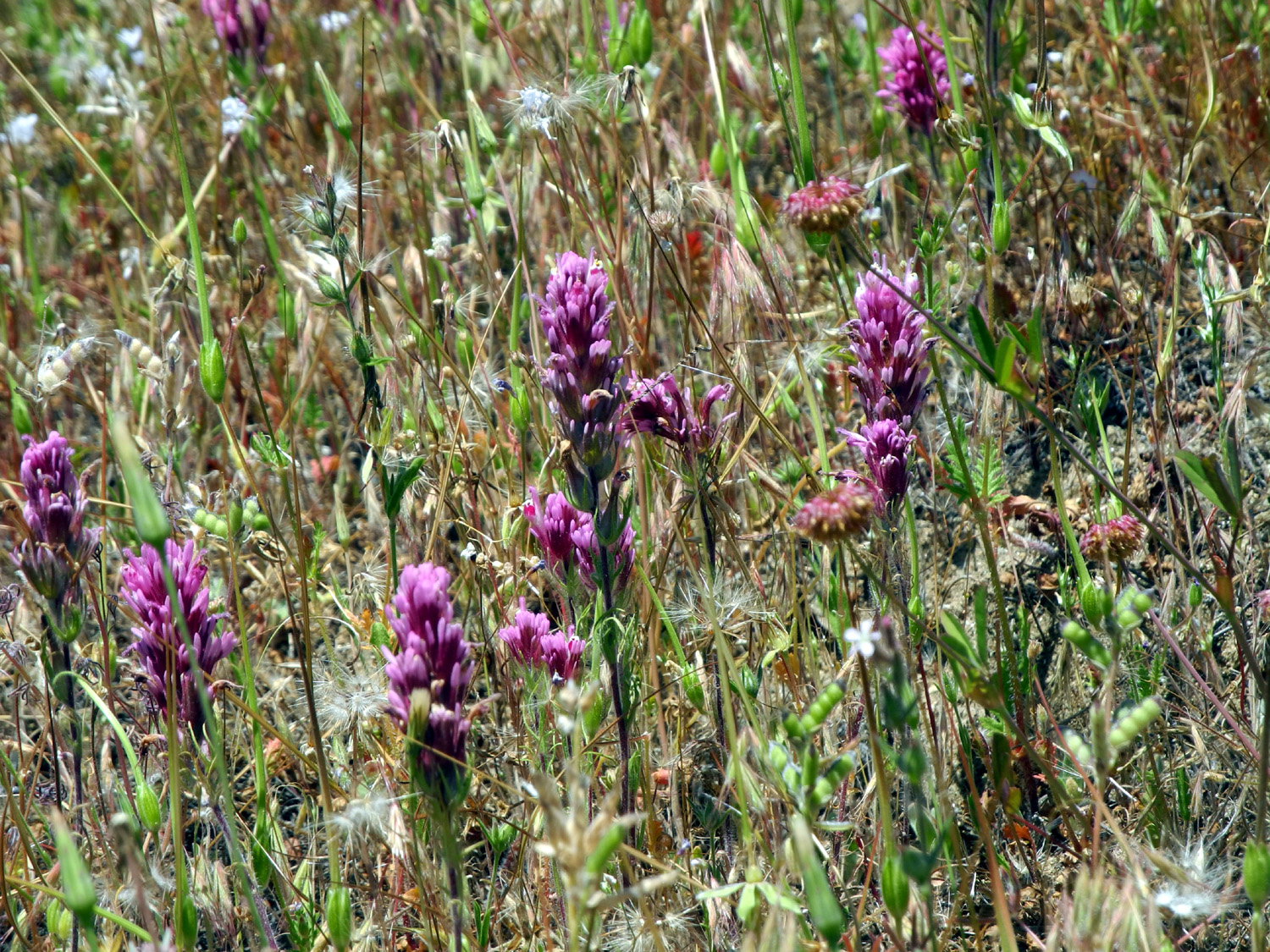 |
| Owl clover is found in white, red and yellow varieties | |
 |
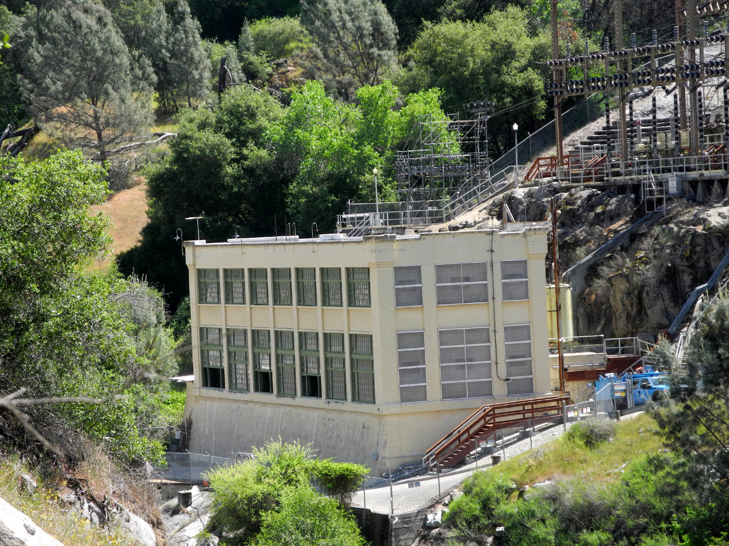 |
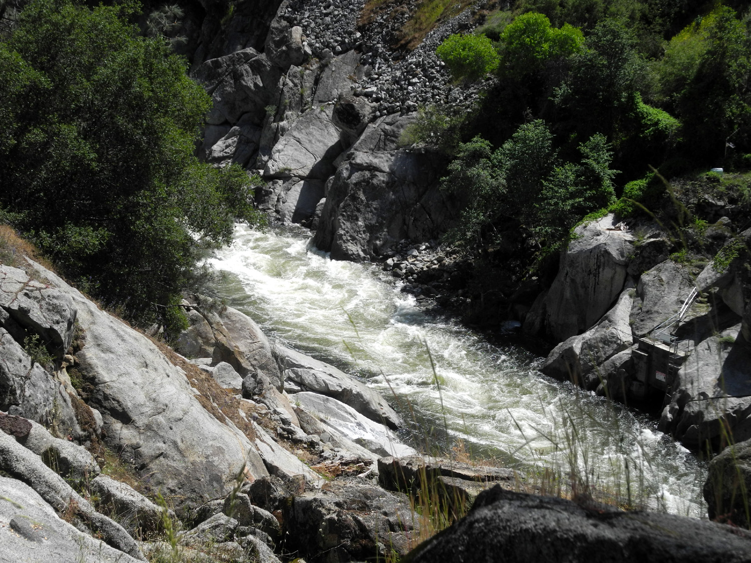
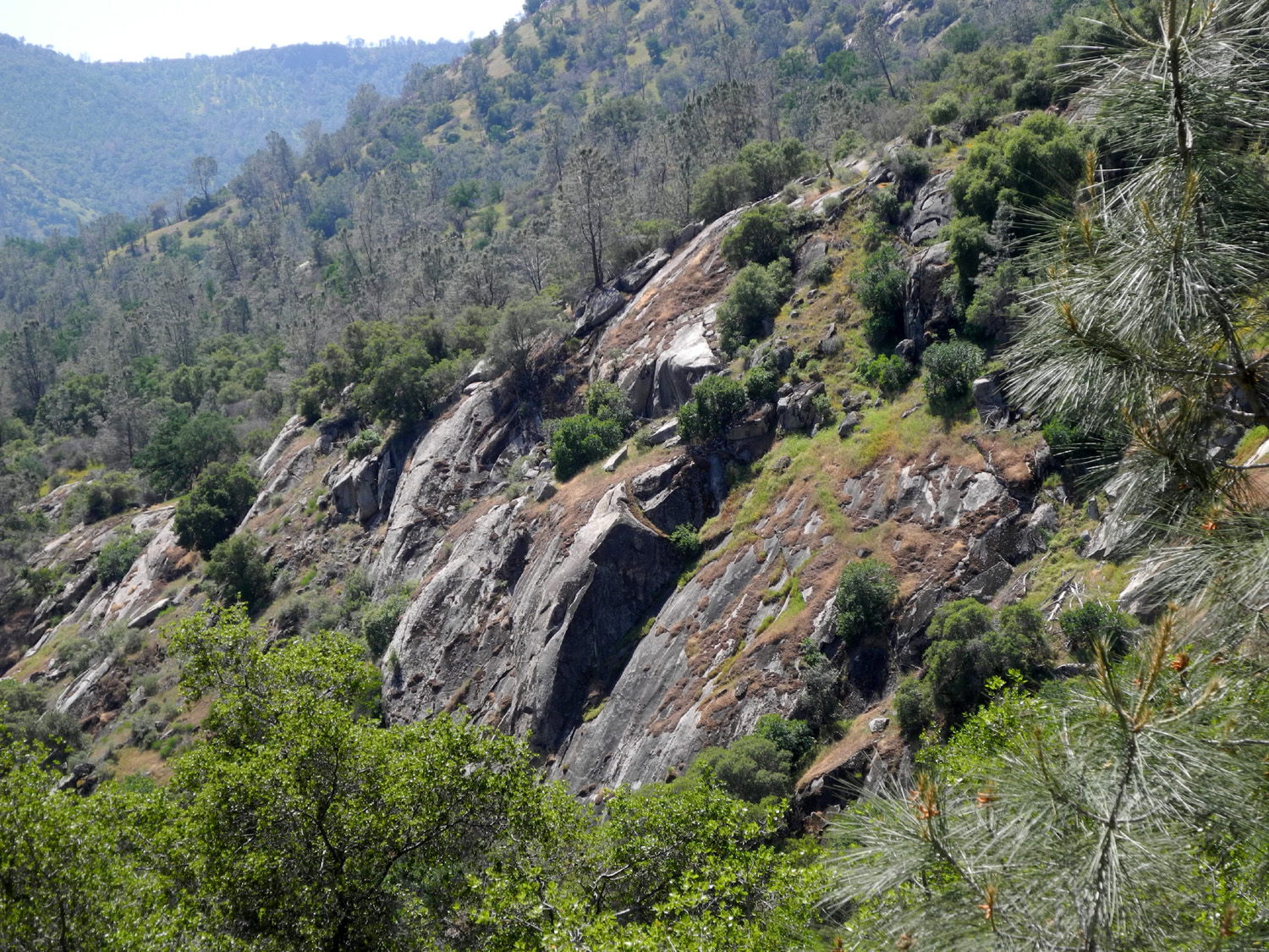
| The San Joaquin River upstream from the bridge | PG & E powerhouse near the bridge |
 |
 |
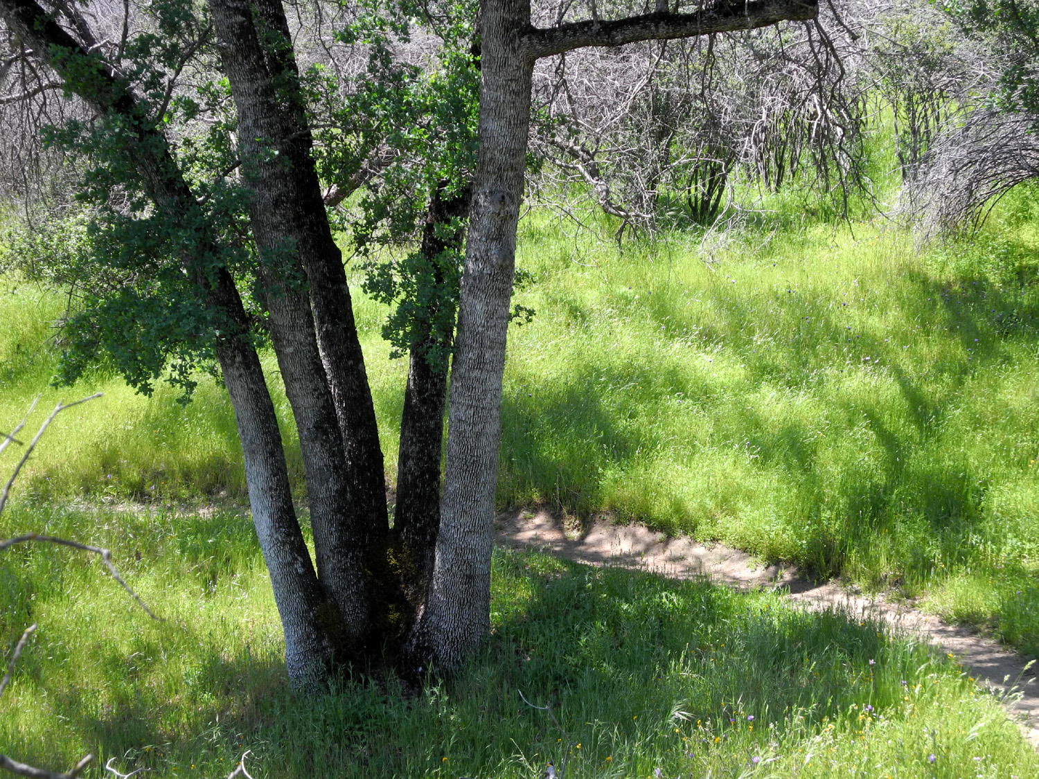
| My second favorite tree, the five-trunk blue oak | Flowers everywhere |
|
I got back early in the afternoon, and after eating decided to walk the nature trail, which starts behind the Equestrian Camp, a few hundred yards from where I was parked. This was not to be, since the gate was locked, there were trees across the trail, and it looked heavily overgrown with grass and other plants. Instead I checked out the nearby frog pond (almost dry), and did a few short wandering walks near camp. At night it was partly cloudy, and once when I went outside, there were long, wedge-shaped streaks of cloud alternating with black star-studded sky, the clouds lit by the rising moon or setting sun or maybe lights from the valley. Whenever we camp at the Gorge, we hope for a repeat of the Night of a Thousand Millipedes, which added so much to our campout here in February 2016. Alas, I saw only a single one of these little creatures. The next day I enjoyed a leisurely breakfast, then set out on the San Joaquin River Trail, which parallels the river high up the side of the canyon on the south side. You can take this trail about 12 miles down to the Finegold Picnic Area near Sky Harbor, but a hike that long is not in the cards for me - I just hike as far as I feel like, then turn back. |
|
 |
 |
| Harvest brodiaea, AKA pretty face, line the San Joaquin River Trail | A steep section of the trail by Canyon Creek |
|
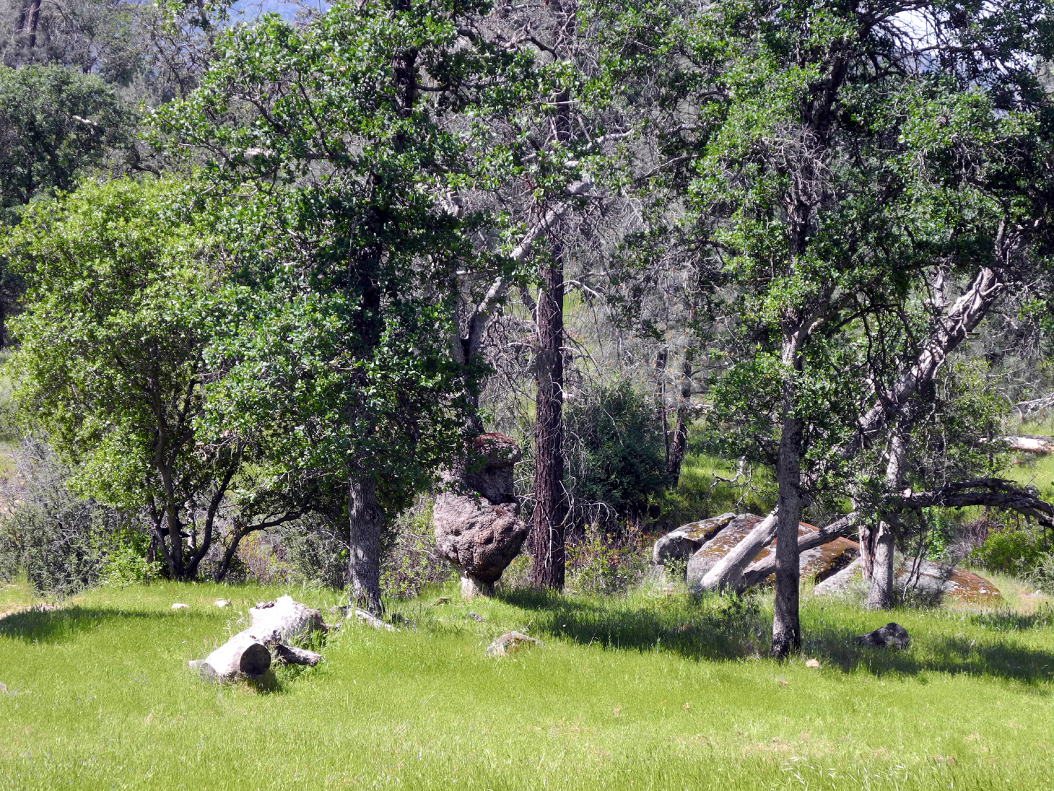
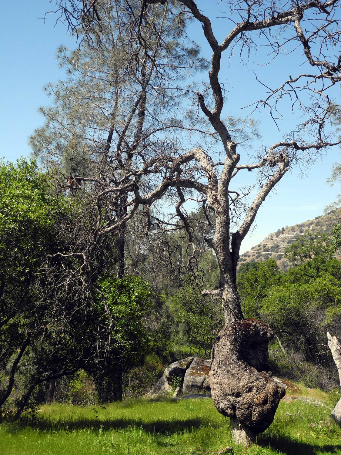
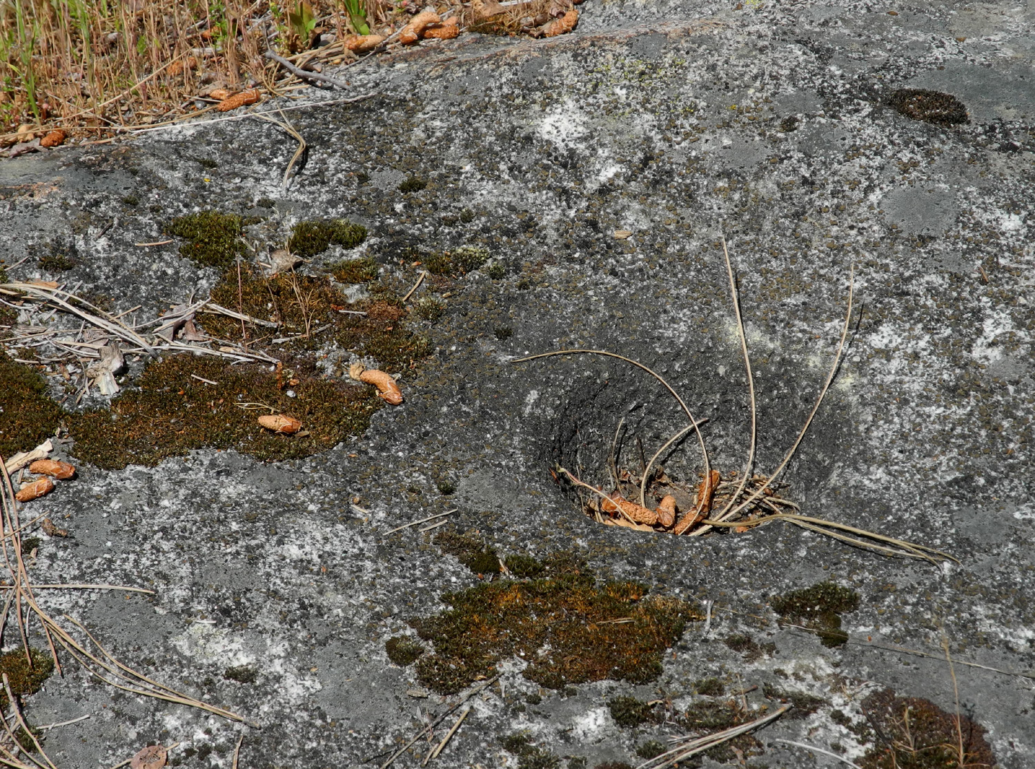
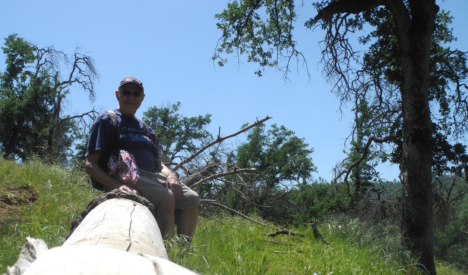
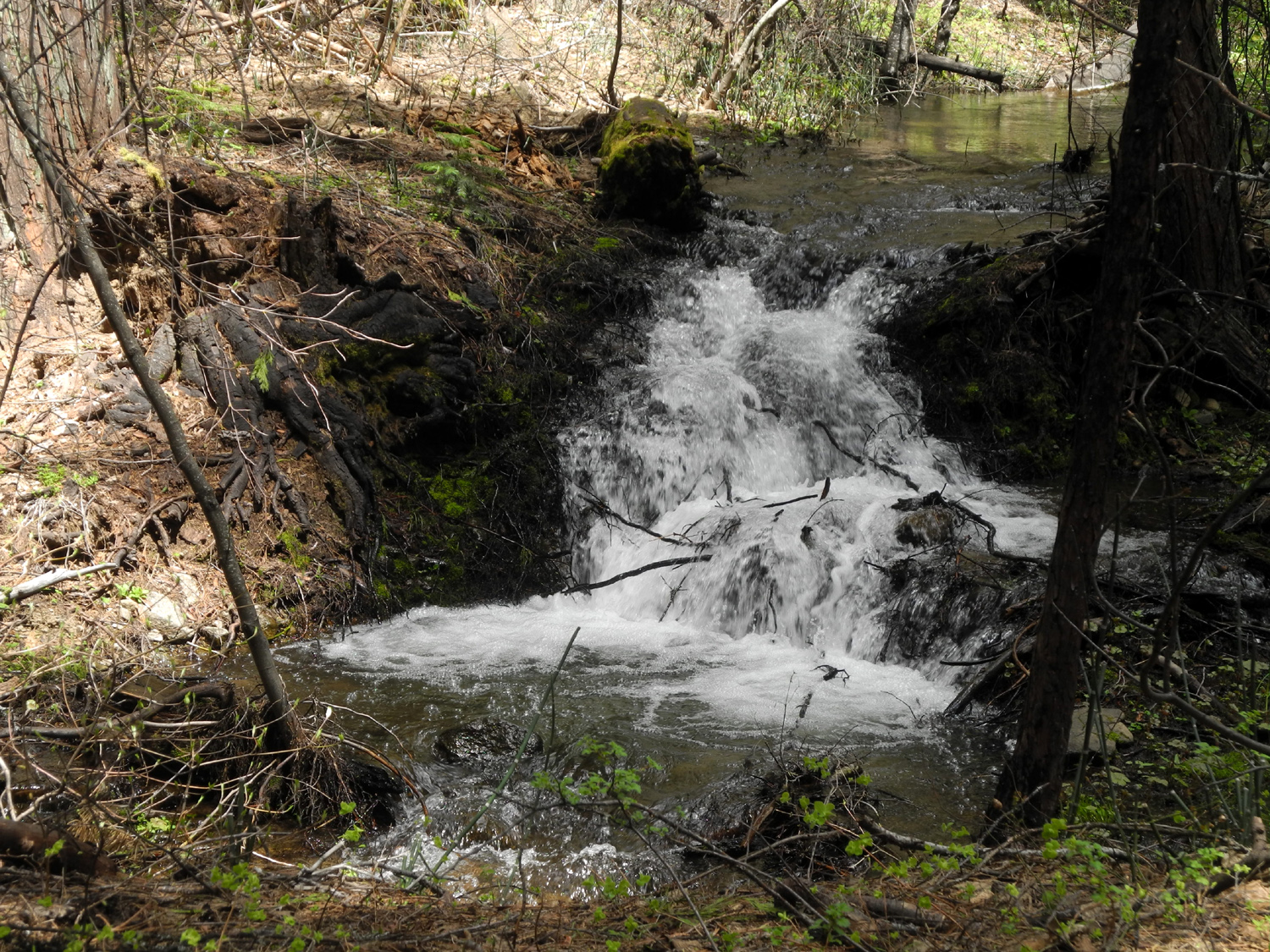
A little over a half mile into this trail is the place I call the Big Burl Rest Stop. It includes an excellent resting log, one of the biggest oak burls I've encountered, some bedrock mortars (Indian grinding holes), and the longest-running creek along the trail. On this hike I gave names to several of the six creeks that were still flowing, and this one shall henceforth be known as Big Burl Creek. |
|
 |
 |
|
Big Burl Rest Stop - resting log, the burl, and grinding holes in the rocks beyond the tree |
The Big Burl tree |
 |
 |
| Bedrock mortar | The burl from the trail to the west |
|
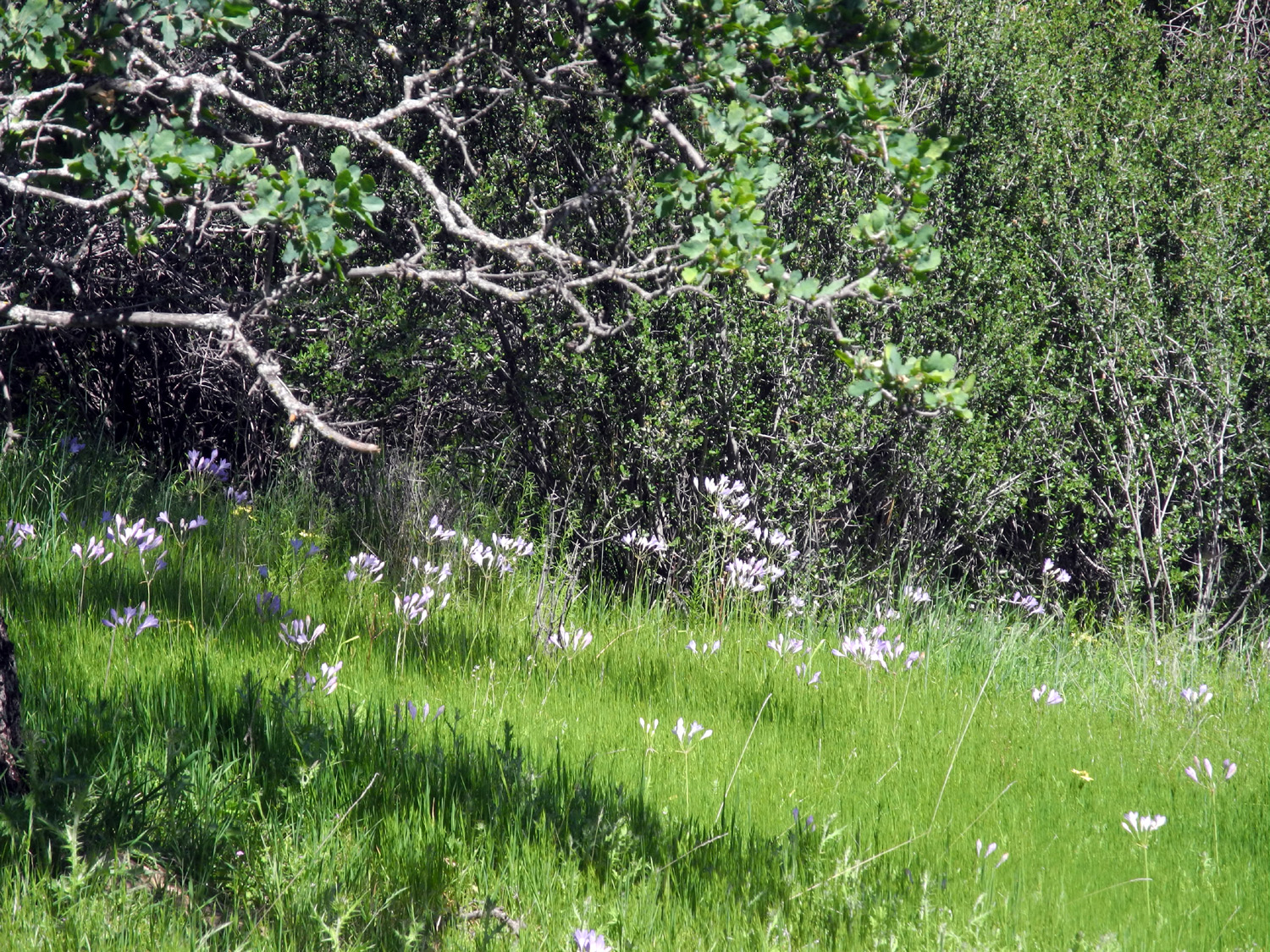
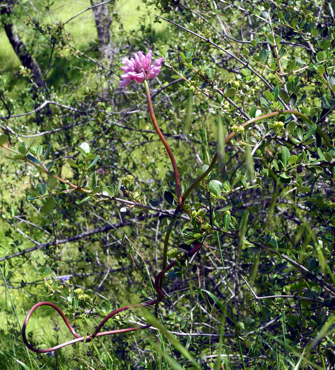
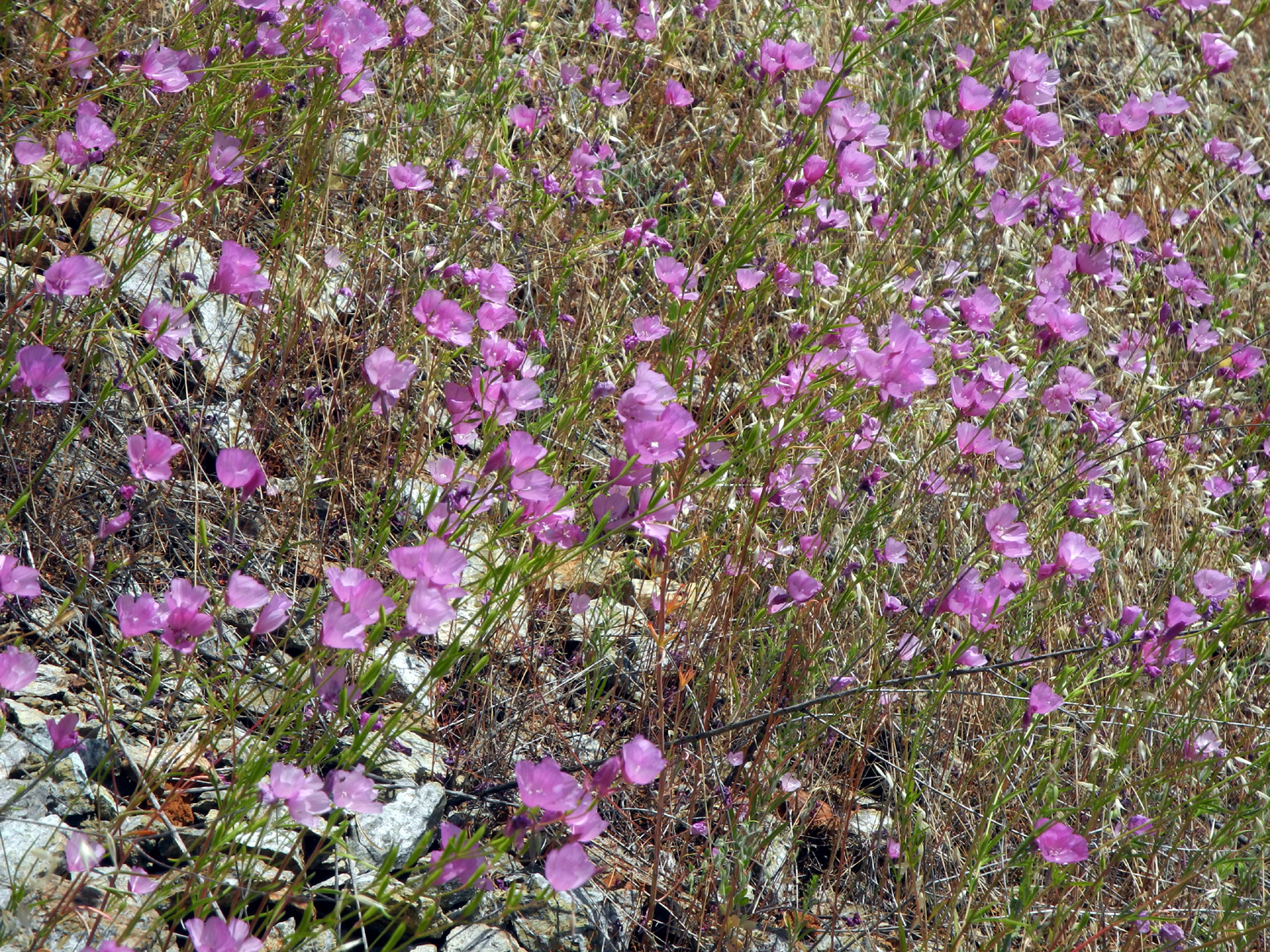
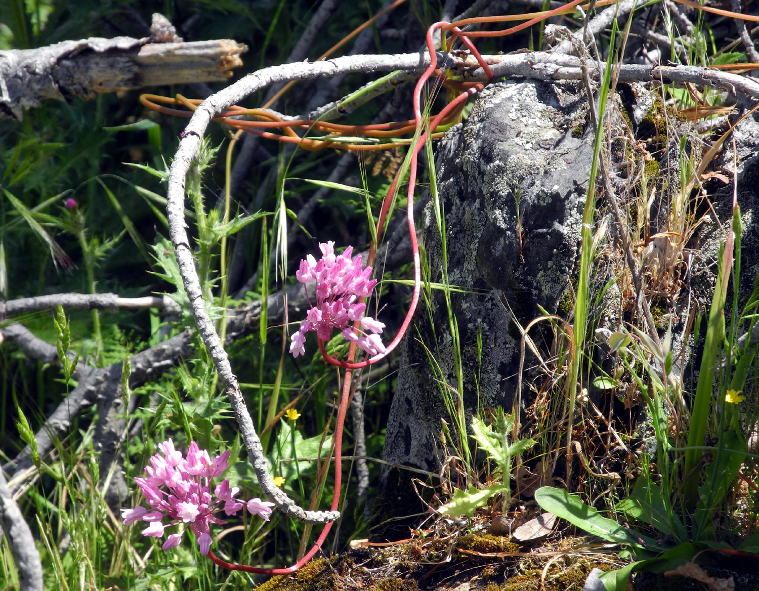
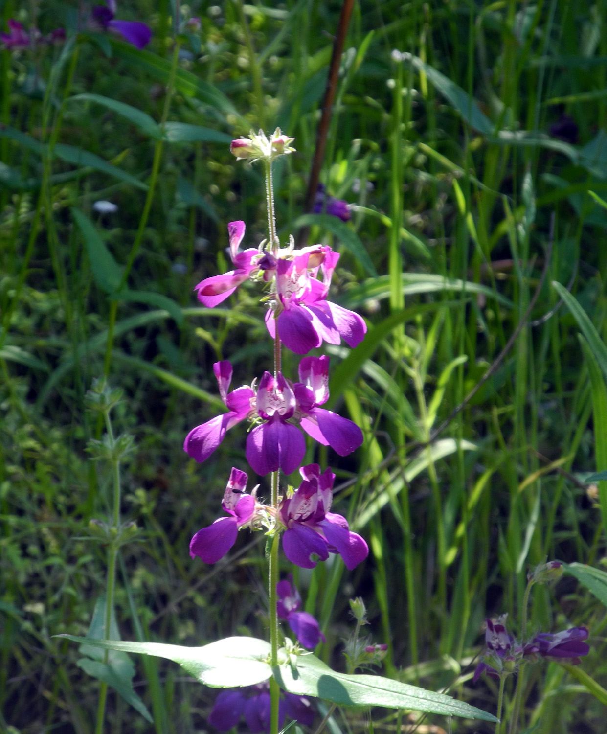
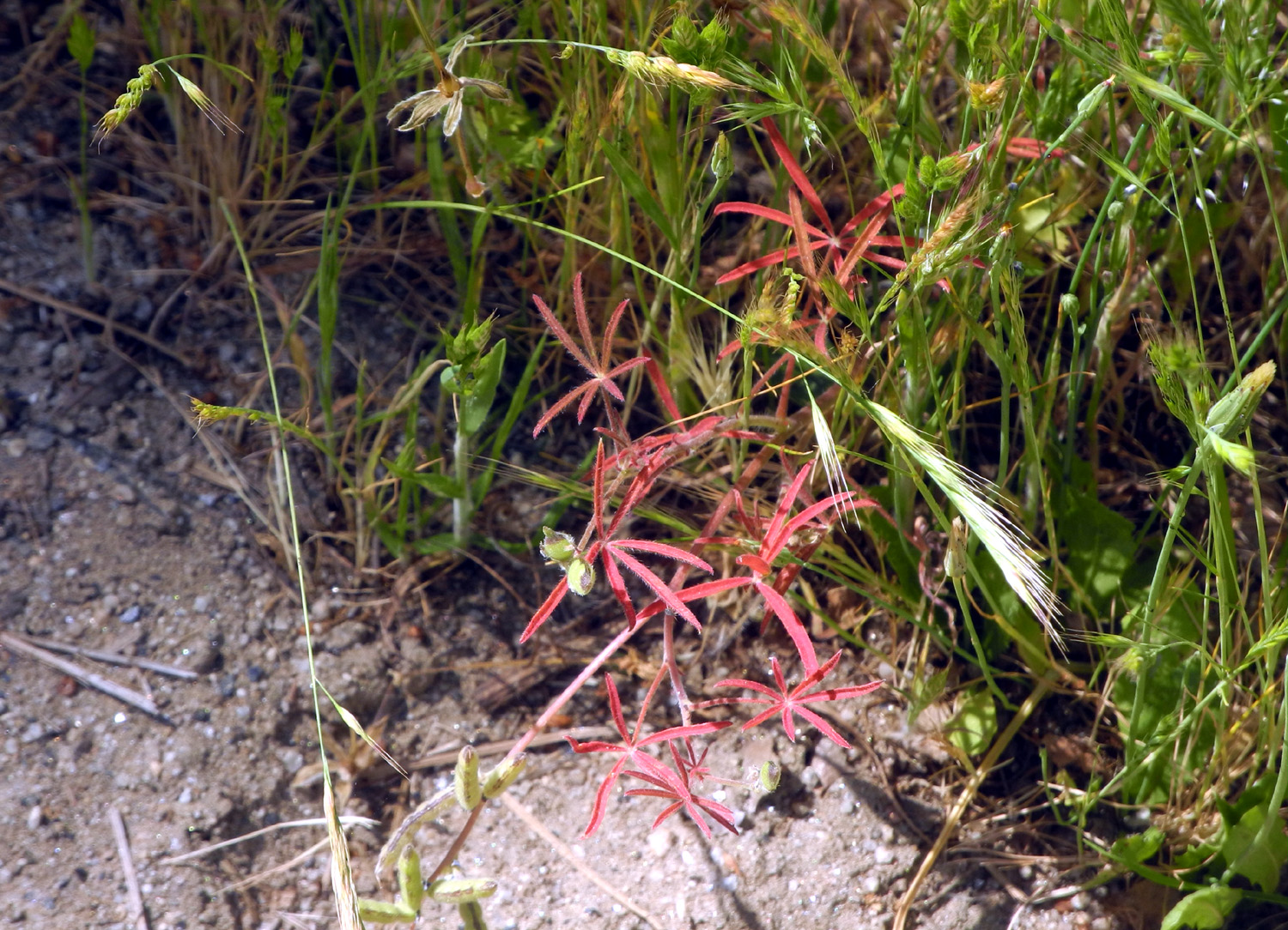
A short distance past the Rest Stop is the "Secret Trail." Actually it's just a cow path, but it does lead to a place where a big pine tree fell across the fence. I went only a short distance, but was very glad I did - I discovered a shady hillside covered with purple brodiaea, one of my top five flowers. |
|
 |
 |
| Purple brodiaea like shady spots | Close-up look at the purple brodiaea |
|
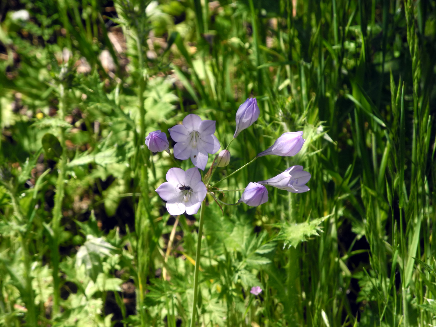
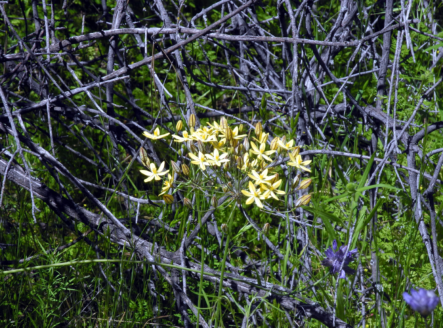
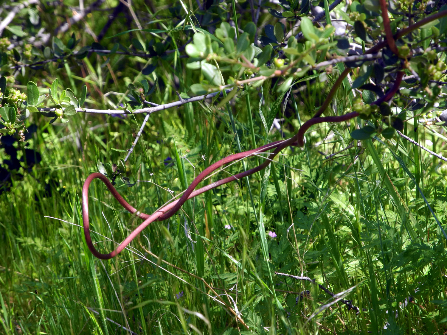
There were also a lot of the yellow harvest brodiaea, a few examples of the intriguing climbing brodiaea, and perhaps my favorite flower of all, the Mariposa lily. |
|
 |
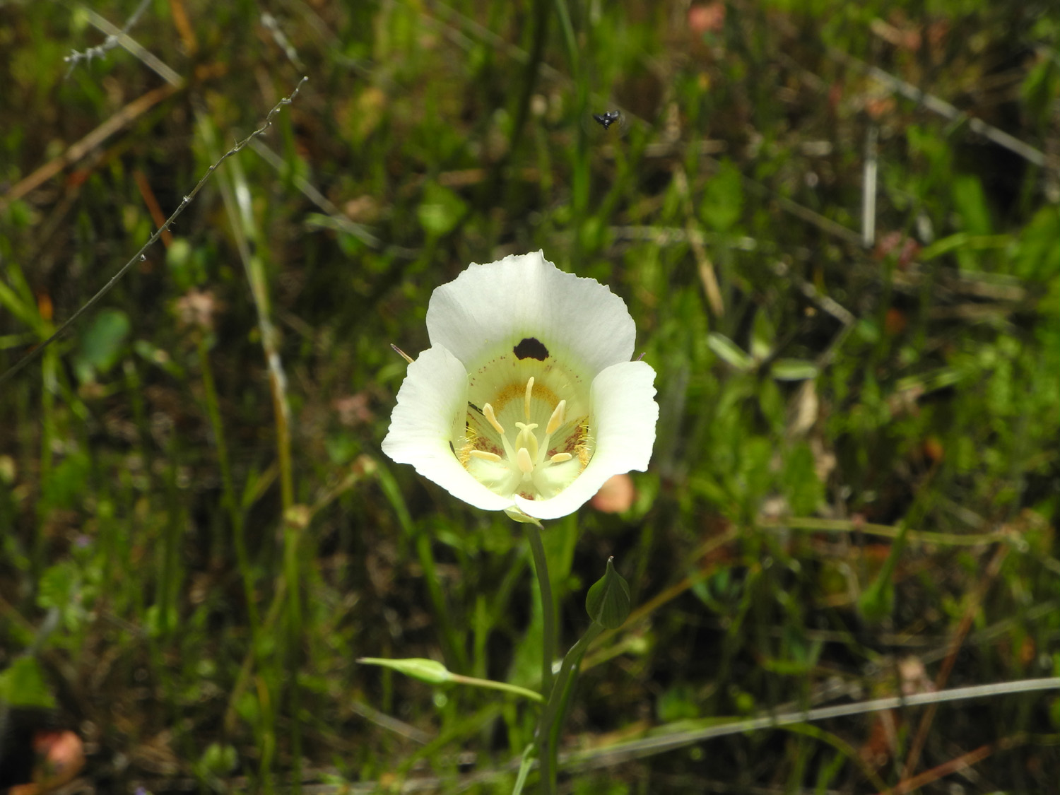 |
| Climbing brodiaea winds around anything available, including its own stem | The magnificent Mariposa lily |
|
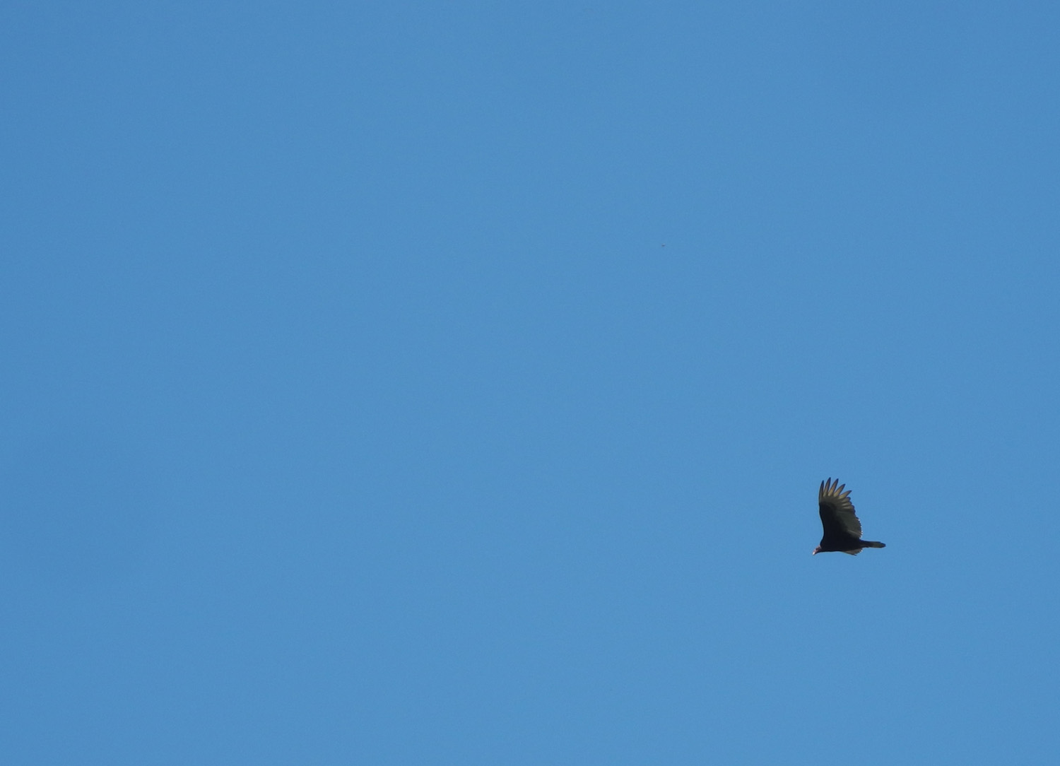
Even though it was a Monday, there were a lot of people on the River Trail. I later learned that spring break extends to the Monday after Easter, and that explains why there were a number of families with kids out enjoying the area. I saw no one else on the trail Tuesday. In addition to the millipede, I saw several lizards and got a fairly good shot of a buzzard flying overhead. The
weather was very nice - quite warm in late afternoon, but cool with
a strong breeze in the morning. However, I returned home to find the
temperature at 90 degrees. This will probably be my list visit to
the Gorge until fall, although I managed to do three more outings to
other places through the 2nd of May. Something for you to look
forward to, hopefully in a positive way. --Dick Estel, May 2019 |
|
| Nelder
Grove Hike
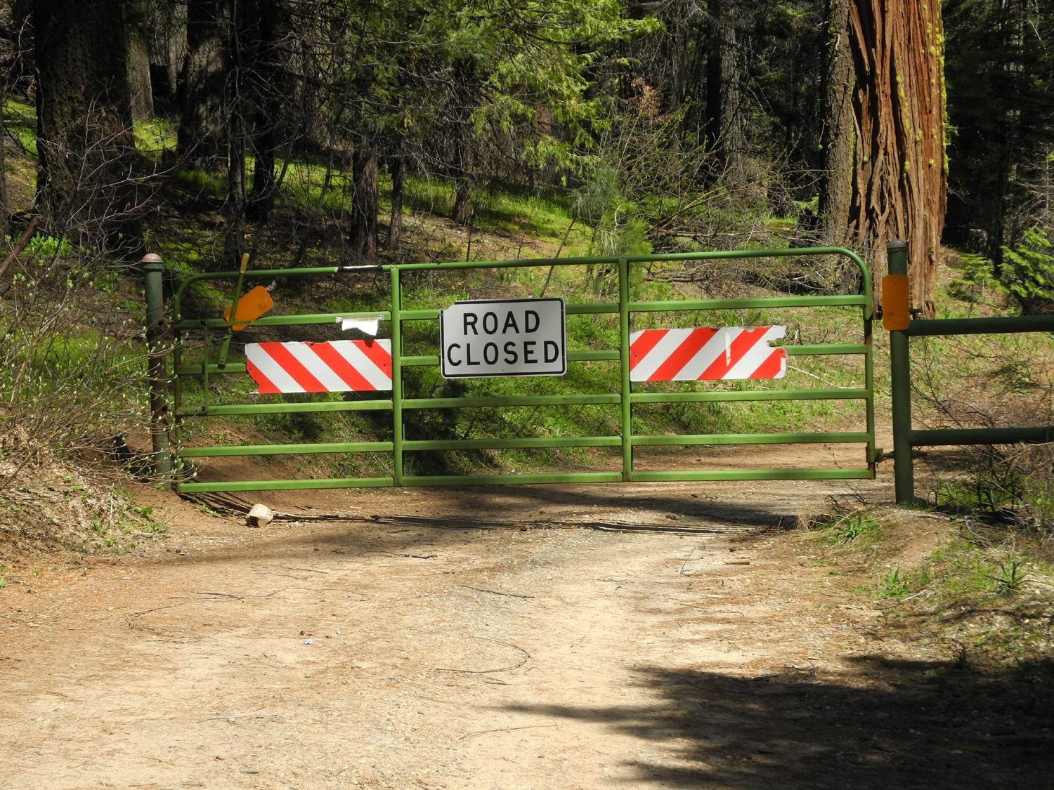
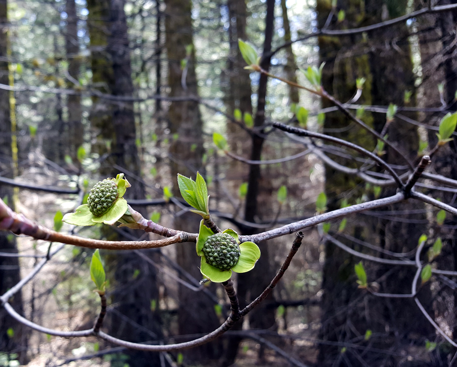
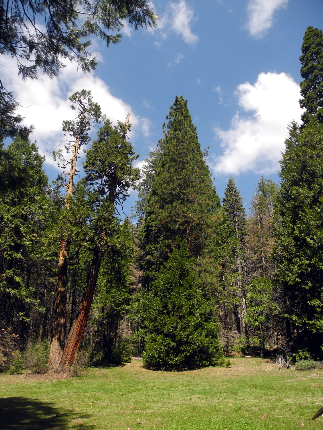
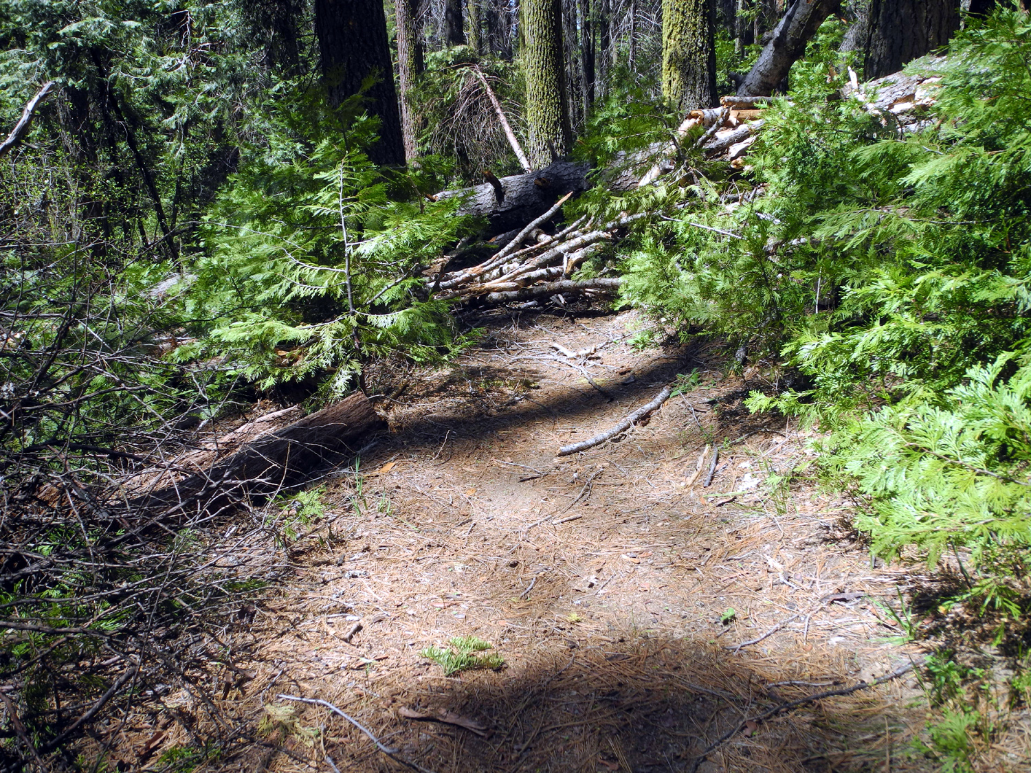
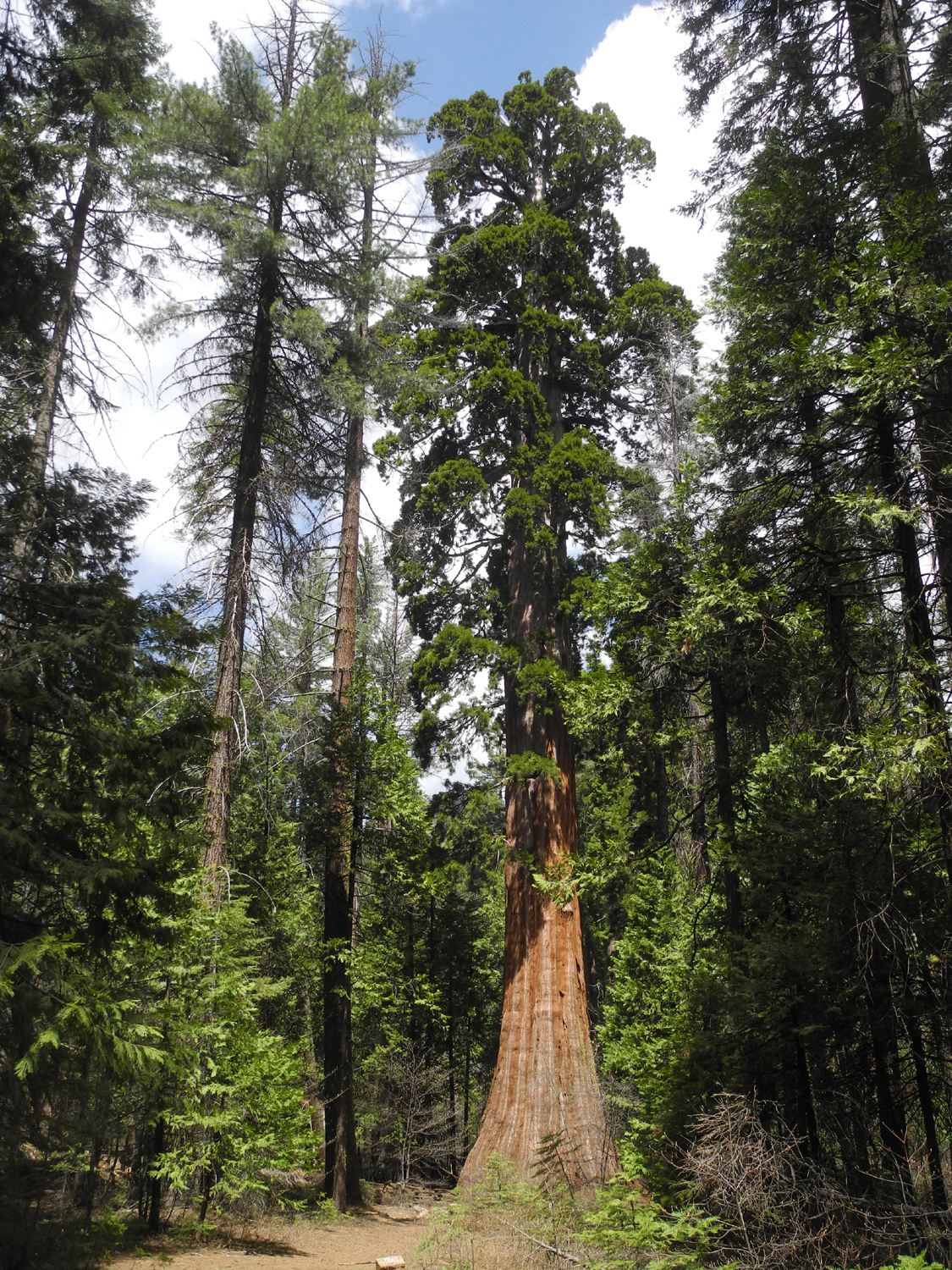
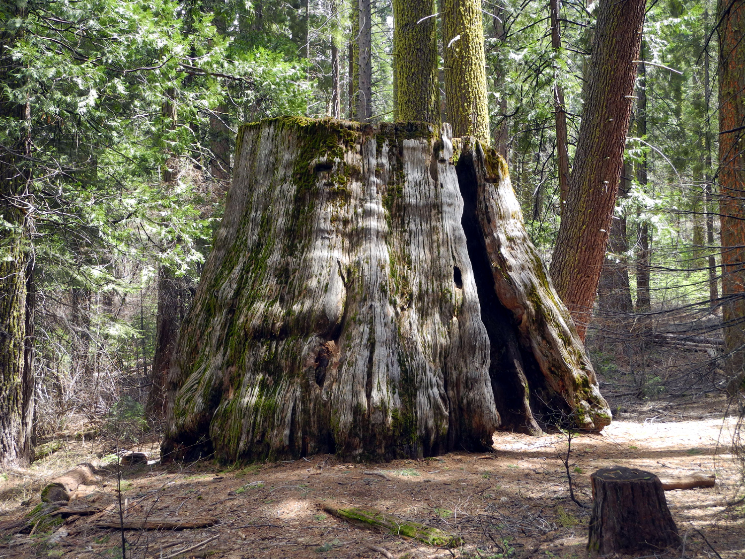
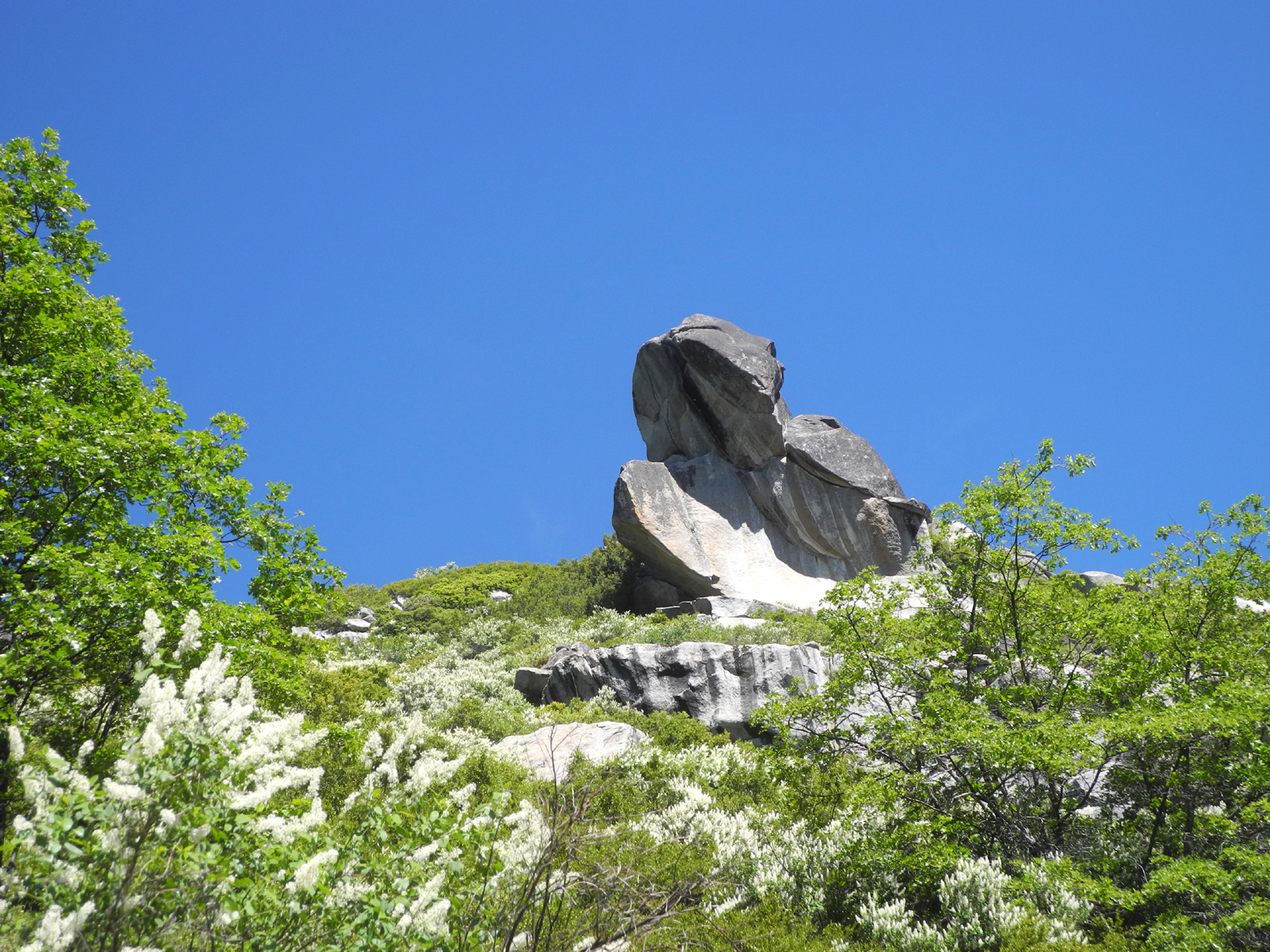
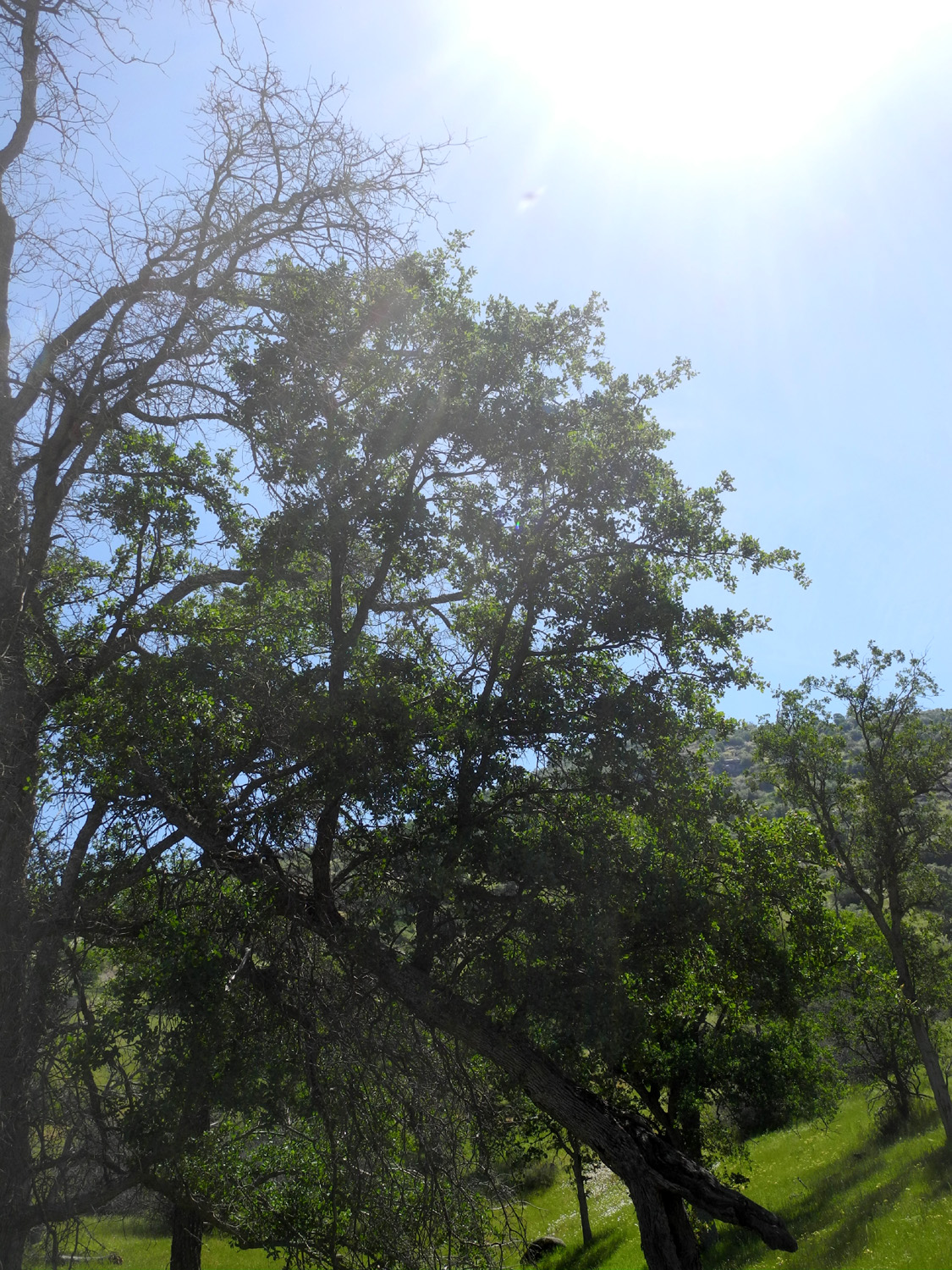
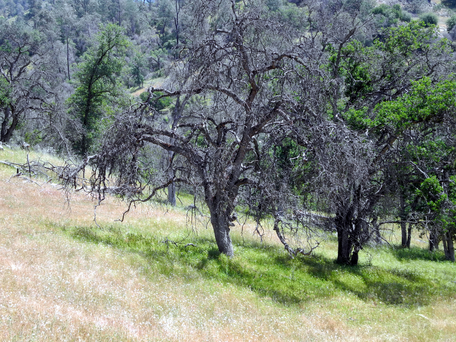
This is another of those places I've been many times, and in keeping with my recent habit, the report will have more pictures and fewer words. I had considered making this a camping trip, since I have not camped in the Nelder Grove Campground for a few decades. However, I was not ready to do some of the things I want to do there, and I decided a day trip would be adequate for now. Knowing the dirt roads into the grove might have suffered from our winter rains and snows, I took my pickup and started out early on April 29, arriving before 10 a.m. There were no problems with the roads, but I was not surprised to find that the campground road was closed. I parked at the junction and got an extra half mile of walking. I walked into the campground, and took the Bull Buck Loop Trail, starting from the walk-in campsites. There was a good size seasonal creek flowing across the road that goes into the camp, and California Creek was running big but not dramatically so. The dogwood was just leafing out, with a few buds and a very few blossoms getting started. It was also not a surprise to find trees across the trail, a couple of them quite large. The forest area here is fairly level and open, so it was easy enough to get around the blockages except for one huge brush pile that made it hard to find the trail on the other side. |
|
 |
 |
| We're hoping it's open in time for the Ramblers hike in June | A lively seasonal creek near the exhibit area |
 |
 |
| Dogwood buds | The meadow next to the campground |
 |
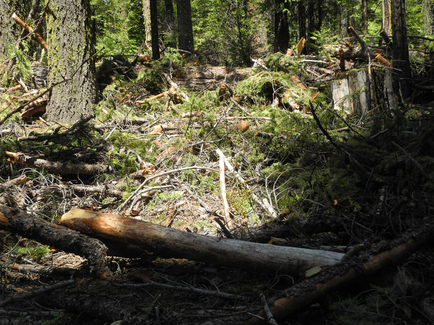 |
| The first of several trees across the Bull Buck Loop Trail | The trail is under there somewhere |
 |
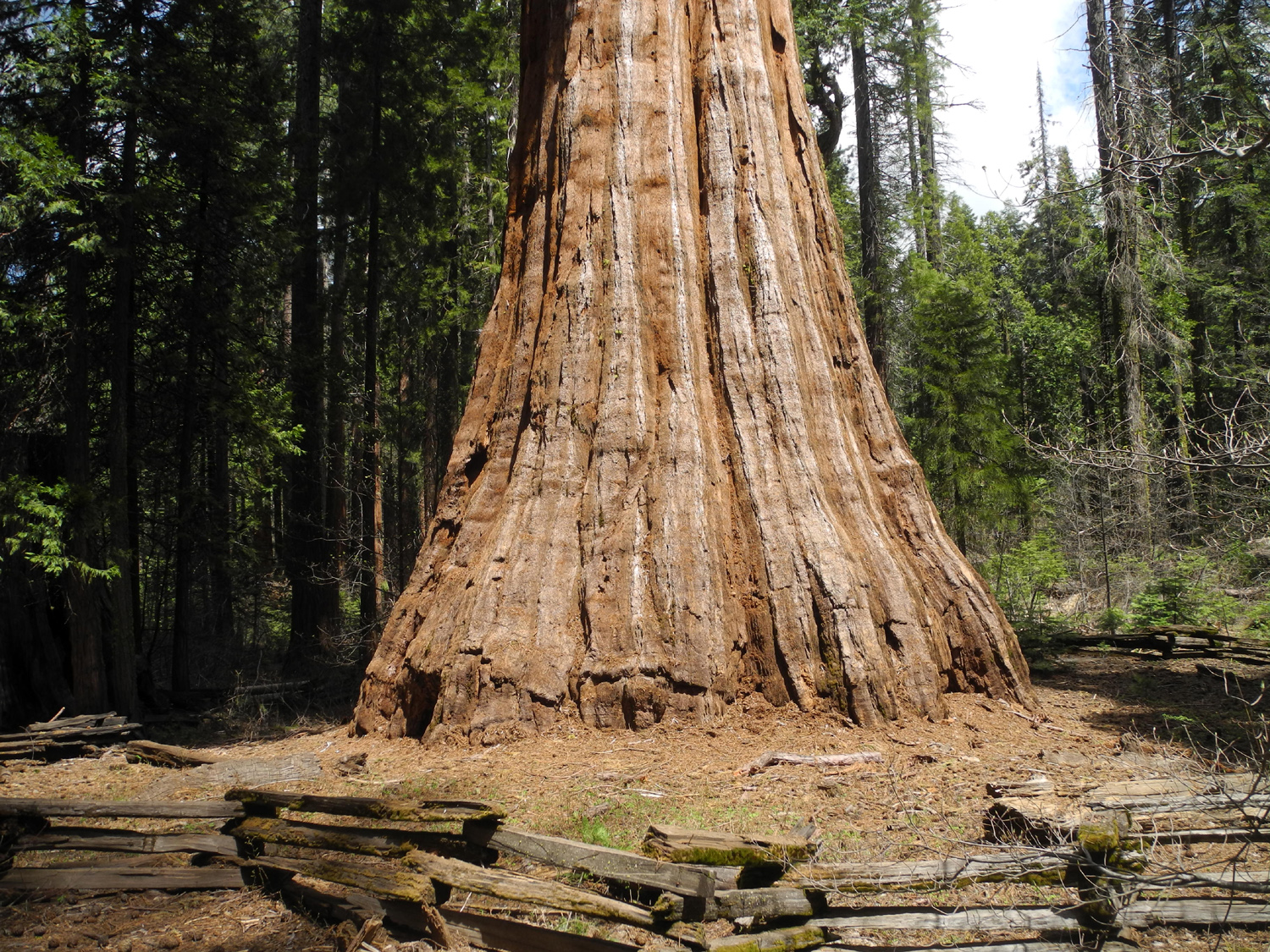 |
| By Federal law, you must photograph the Bull Buck tree on every visit | The base of the Bull Buck is perfectly symmetrical |
 |
 |
| One of several large stumps in the neighborhood of the Bull Buck | Clouds above the redwoods |
|
When I arrived, there was one other vehicle parked at the junction, but I didn't see anyone on the trails until I was almost back to the gate. When I left, four vehicles were parked there. On my way back home I stopped for an excellent Mexican lunch at El Cid, my favorite spot in Oakhurst. Thinking
back, I made my first
visit to Nelder Grove in 1969. So this trip marked fifty years
of coming to this special place. I'm hoping for ten or twenty more. --Dick Estel, May 2019 |
|
| Sycamore
Creek
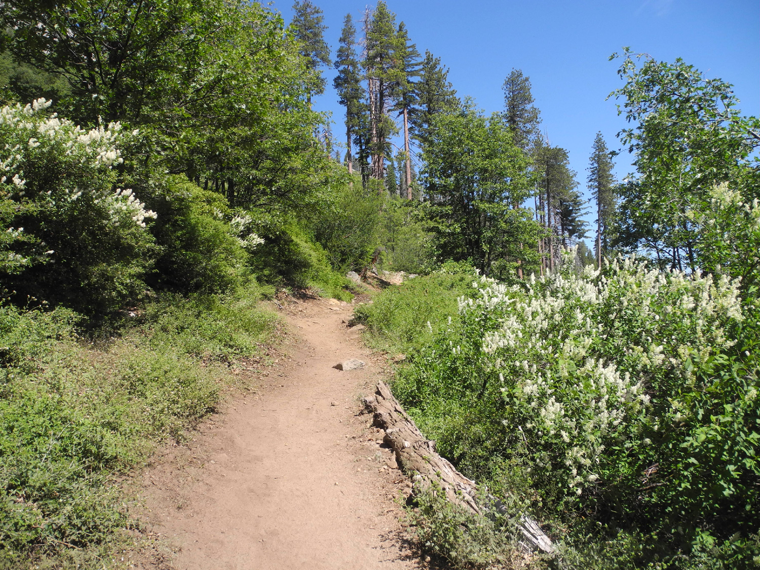
I'm going to get a rubber stamp that says, "I've done this hike many times, more pictures, fewer words." But you know there will be SOME words, and there were some new things about this hike. I was here most recently in February of this year. There were very few flowers then, and I wanted to see what was blooming before it all comes to an end. As I drove into the hills on May 2, I thought I might have waited too long - not for flowers, but for foothill hiking in general. My destination was Sycamore Creek by Pine Flat Lake, and the hills above the first part of the lake were mostly brown. However, there was still quite a lot of green as I drove farther into the canyon, and the grass beside the trail was mostly still green As a bonus, the banks of the road were lined with farewell-to-spring, one of the last flowers to appear. |
|
 |
 |
| Farewell-to-spring add a splash of pink to the brown hillsides | Farewell-to-spring up close |
|
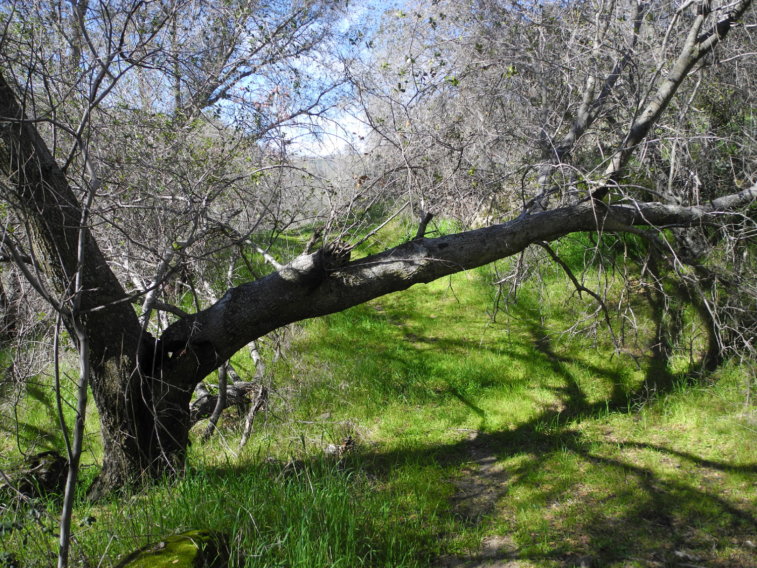
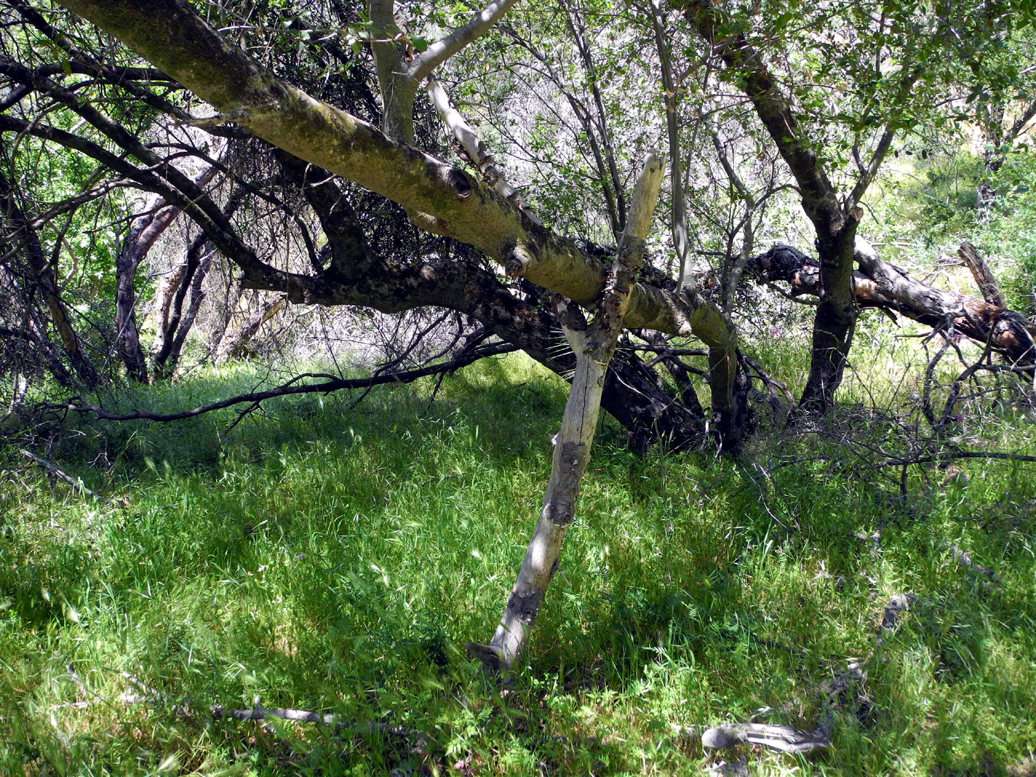
The "trail" is actually an old road that was probably used by ranchers or miners. It's not maintained, and over the few years I've been going there, a half-dozen trees have fallen across the route. However, I was glad to see that two of the trees across the trail had been cut away. One of them was a big live oak trunk that had not fallen all the way down, and I used to be able to duck under it. In February I realized I could not bend down far enough to get under it, and I decided I must be losing some of my flexibility. So I was happy to see it had been reduced to a pile of firewood. When I got back home and checked the photo I took in 2016, I realized that the tree was higher above the trail at that time, and by last February it had dropped lower. I can still bend over! As for the trees that were NOT removed, foot traffic has created fairly easy detours around them, or they are small enough to step over. |
|
 |
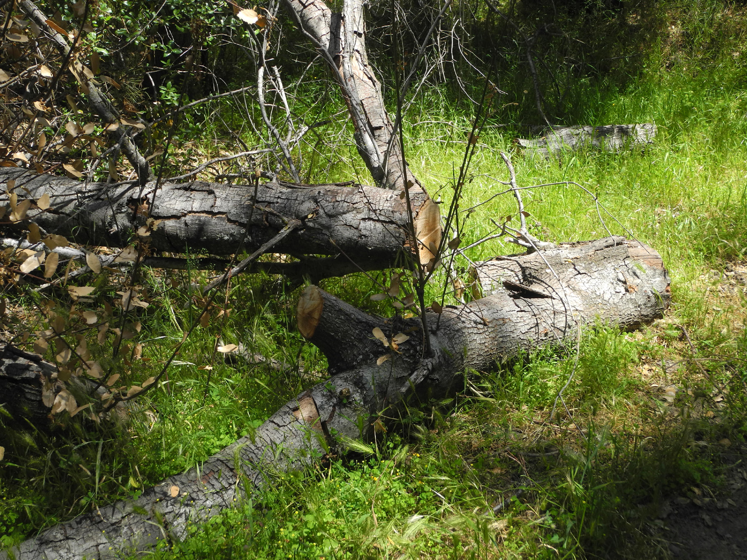 |
| It was easy to get under this branch in 2016; by February 2019, it had dropped a couple of feet lower | Fortunately someone came in with a chain saw and dropped it all the way down |
|
As is usual at this time of year, there were still quite a few flowers. It's common to see a very few samples of the earliest flowers still hanging on - a half dozen or so popcorn flowers, fiddlenecks, and blue dicks were still around. But the seasonal wildflowers that dominated included milkweed, thistles, twining brodiaea, yellow-throated gilia and fiesta flowers. |
|
 |
 |
| Milkweed | A beautiful flower, despite being an invasive species |
 |
 |
| Twining brodiaea hanging from a pine branch | There were a few fiesta flowers still out |
|
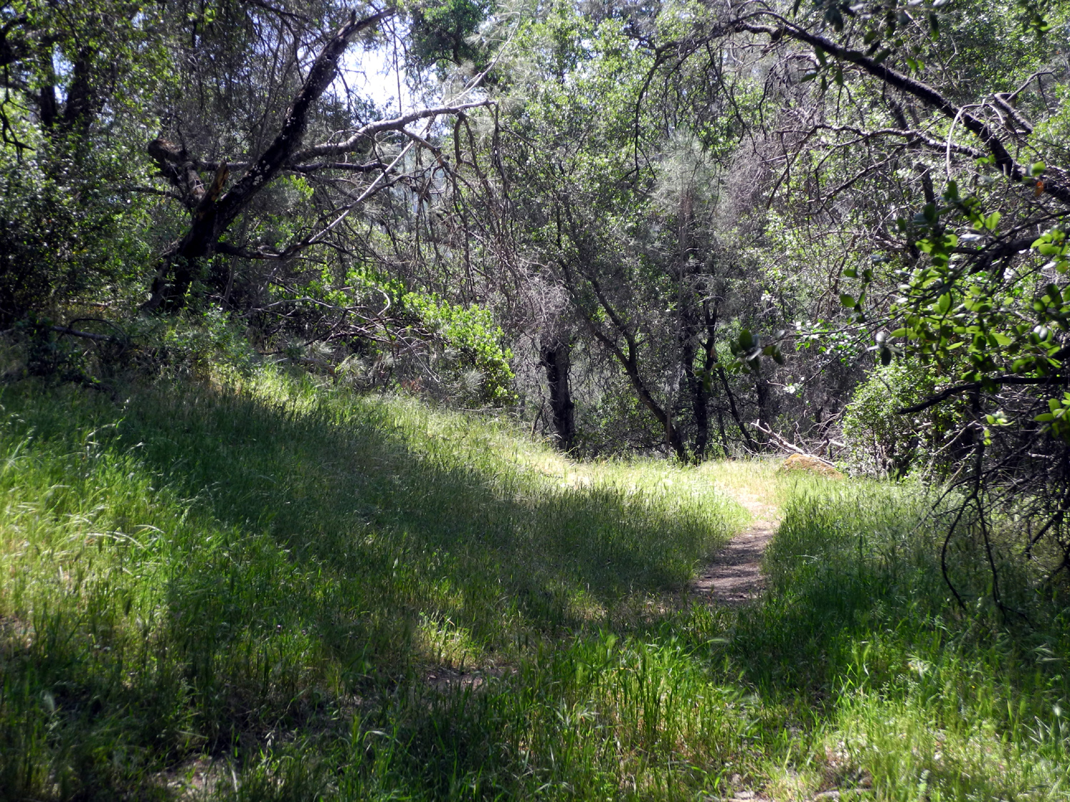
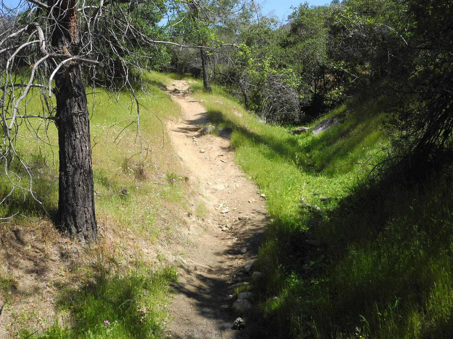
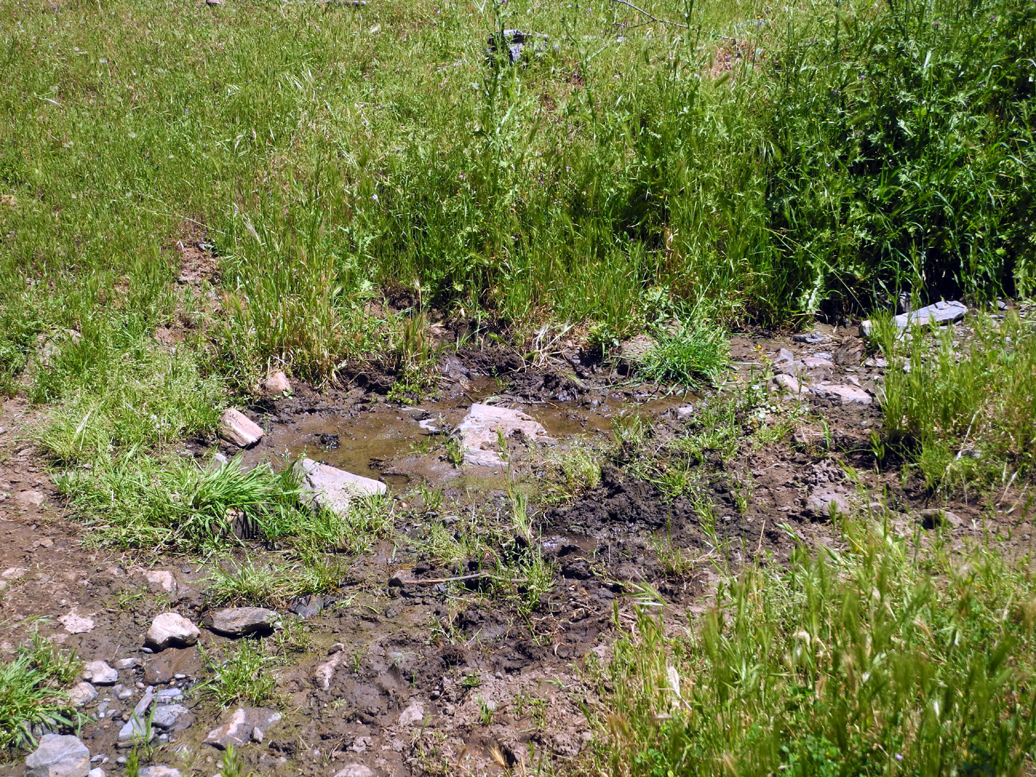
The trail climbs a steep hill where it seems to disappear. However, you can walk across a field at the top of the hill and find the way again, where it is more like an old road. I call this Popcorn Flower Hill, because it was covered with those blossoms on one of my earliest visits. This time I had to walk through tall grass, and I was concerned my socks would be full of stickers, but the grass was just starting to turn, and I had no problems. I came to the first of several logs across this section, and thought about turning back. However, after I had a snack, I was ready to continue, so I went to my usual turning back place, where a nice little creek crosses the trail. This time there was a muddy pool above the trail, but not enough water to actually flow across. After observing the fallen trees, standing flowers and whatever else nature had to offer, I started my return hike back to the car. Hiking out, I saw a snake go across the trail. I could not identify it, but it was non-poisonous, long, slender, and very fast. I also enjoyed a bit of whimsy where someone had fun with a Y-shaped bull pine branch. |
|
 |
 |
| The green grass is quickly turning brown | Live oak and granite boulder combine to create a nice scenic spot |
|
This
is a little-used trail, and I have never seen anyone hiking here,
but the paths worn around fallen trees and the chain saw work this
year show that others do go there. I like to check it out at least
once a year, just to see the flowers and maybe go a little farther
than ever before. --Dick Estel, May 2019 |
|
| Rancheria
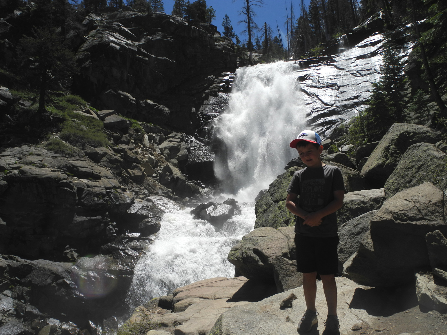
Falls with Colton
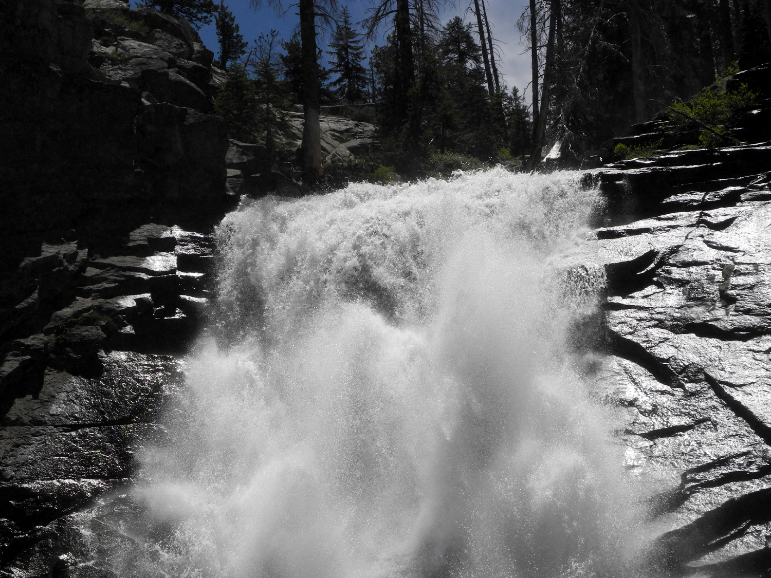
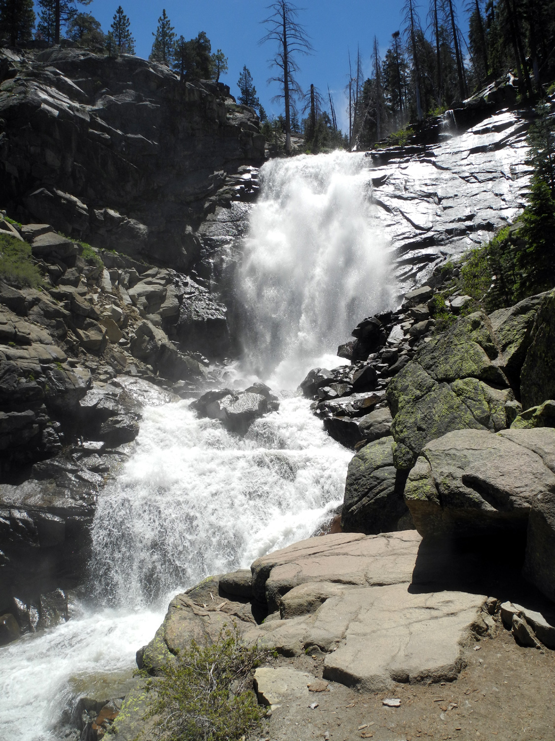
Less than a week after visiting Rancheria Falls with The Ramblers, I went there again with my great grandson Colton. He's been a big fan of waterfalls since his first visit to Yosemite at age three, and at six and a half he's a good hiker and traveling companion. His dad dropped him off at about 7:30 the morning of June 25, and after a breakfast of bacon and toast, we got started on the 60-mile drive to Huntington Lake and the one mile dirt road in to the trailhead. I was happy to see that a big log that had blocked the trail on my previous visit had been cut away, as had the second one. However, the other three or four logs across the path were untouched, perhaps because it was "easy" to climb over or go around them. Along the trail we walked through a cool forest of mostly red fir, with a few wildflowers to brighten the way. |
|
 |
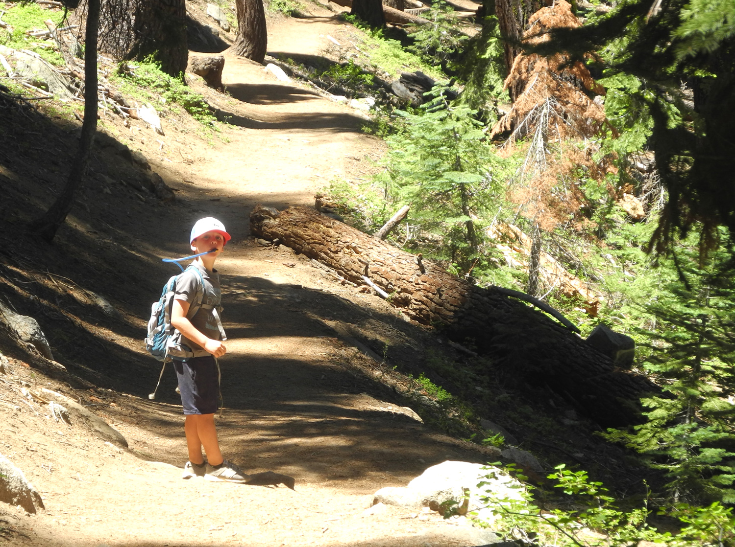 |
| Log that was cut away from the trail | Colton on the trail |
 |
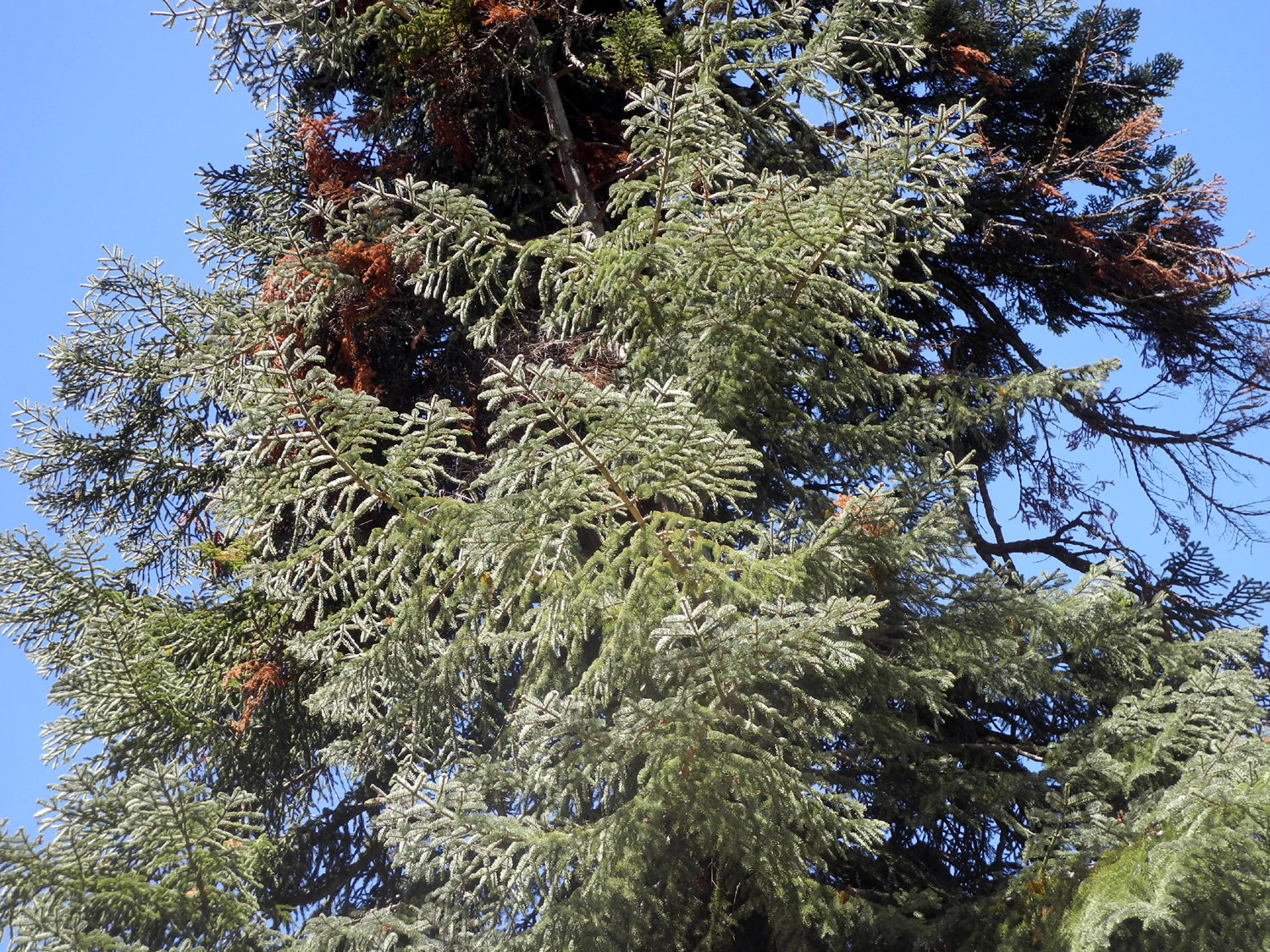
 |
| Western wall flowers | Yellow violets |
|
The falls was flowing about the same as the week before, and creating a fairly cold wind, along with a lot of mist. After a short time at the end of the trail, Colton retreated back about 50 feet to where it was dry and warm. I was concerned that maybe he was not very impressed, but later his dad told me he talked about the falls all evening after he got back home. |
|
 |
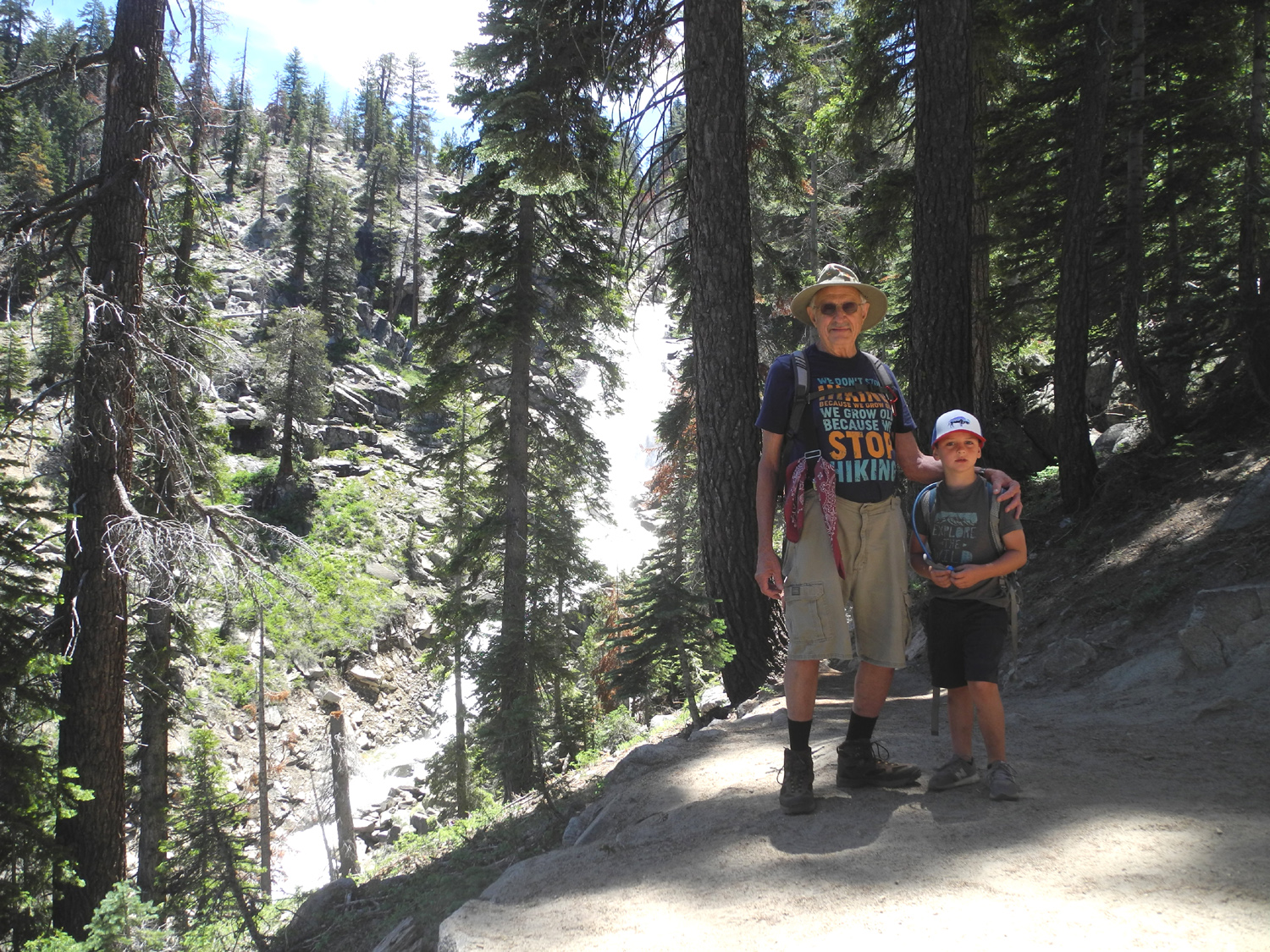 |
| Colton at the falls | Grandpa Dick and Colton |
|
Once we got back to the car we drove down the highway a few miles to a snow park, where we set up our chairs and had lunch. There was a very cool breeze here, and we both had shorts and t-shirts, not quite enough for the weather. I ended up giving him a big towel that I carry in the car to wrap up in. Overall
we had a good time, saw some beautiful
views of nature, and I'm looking forward to a future outing with
both Colton and his brother Jack. --Dick Estel, July 2019 |
|
| Illilouette
Falls
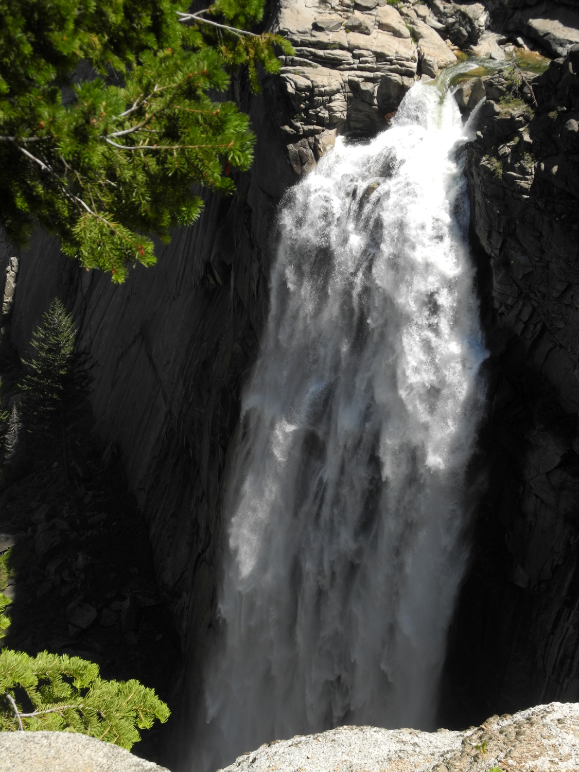
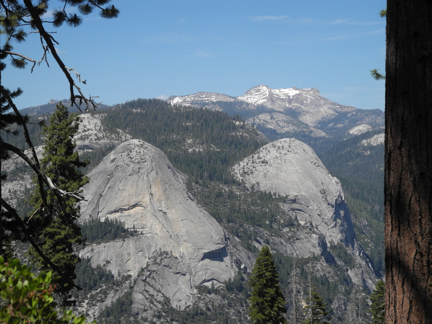
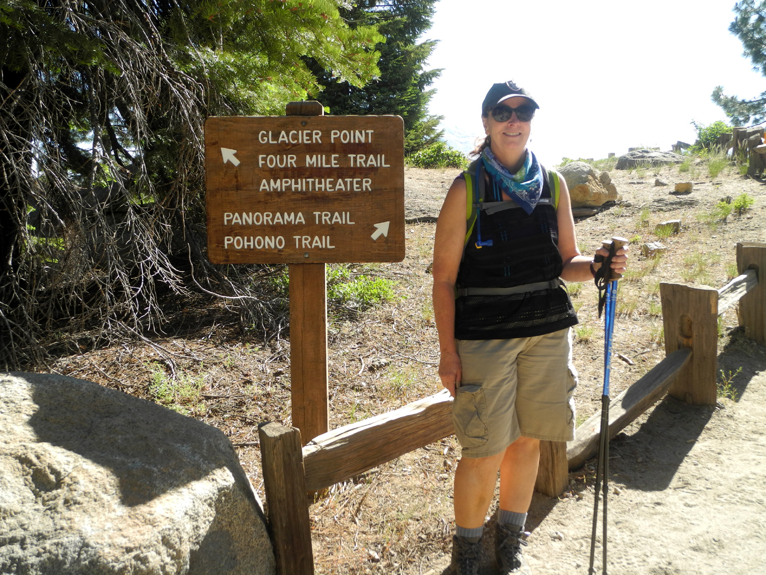
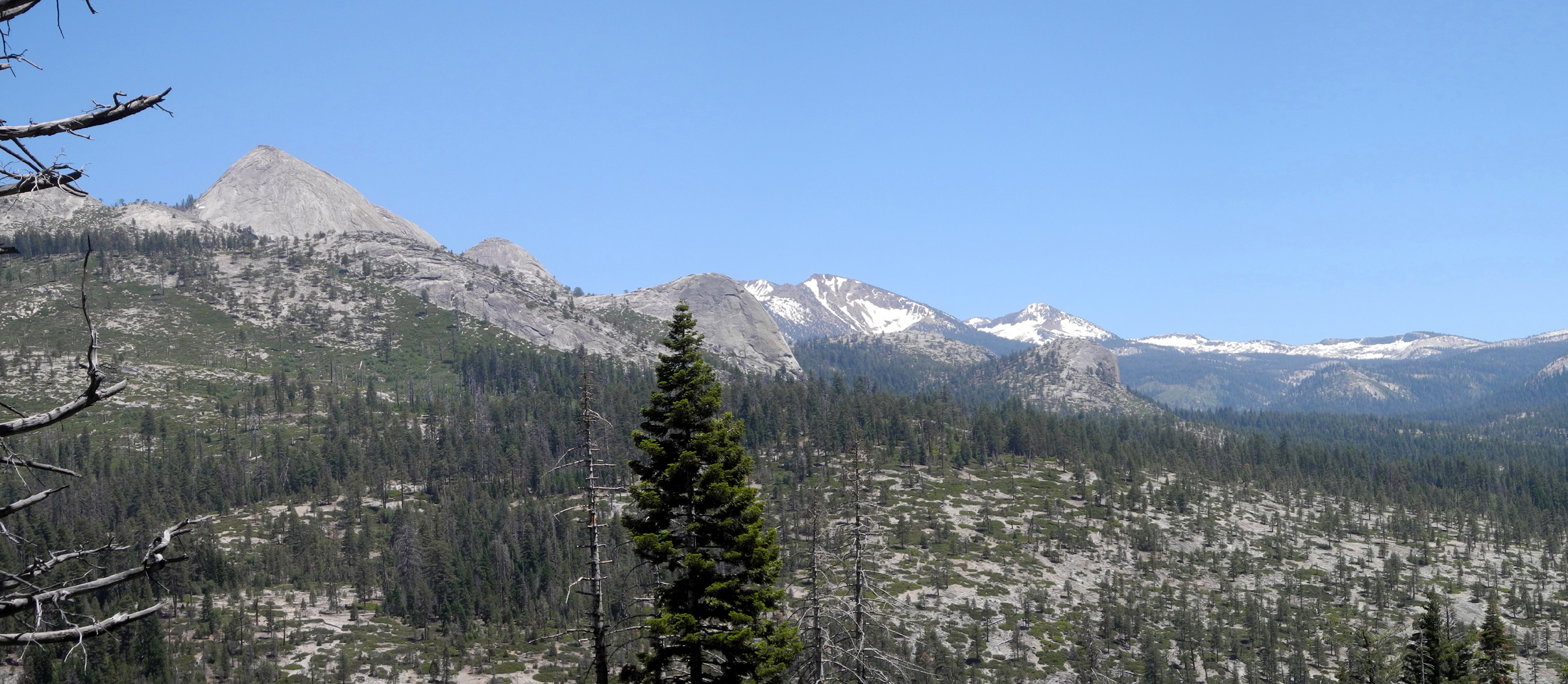
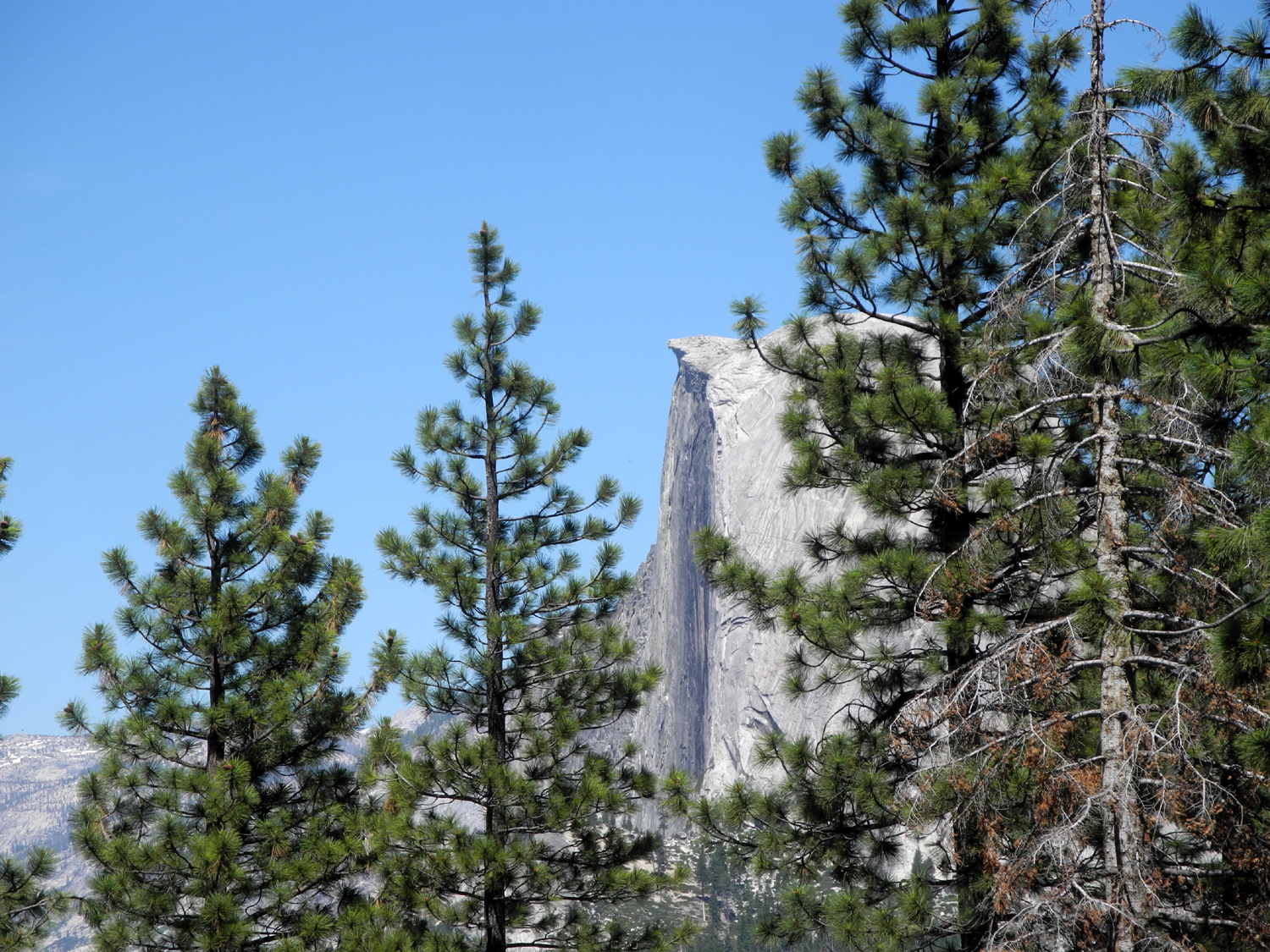
If a natural feature is hard to see and challenging to get to, it should be all the more rewarding when you reach it. Illilouette Falls in Yosemite checks all those boxes. It's located well back in a canyon that drains into the Merced River from the south, above Yosemite Valley and below the iconic Vernal Falls. There are views from the trail that starts at Happy Isles and goes to Vernal and beyond, as well as from a few other places, but for the most part you are looking at the falls "sideways" and its impressive nature is not apparent. There used to be a trail off the Vernal Falls route that went up fairly steeply a quarter mile or so to Sierra Point, where you could see Illilouette (again a side view), as well as Vernal, Nevada and Yosemite Falls. This trail has been closed for decades. So the best hope is to take the Panorama Trail from Glacier Point. This 8.5 mile route eventually goes to the top of Nevada Falls, then down the Mist Trail to Yosemite Valley. But it first drops down (and down, and down) into the canyon of Illilouette Creek. It crosses above the falls, runs parallel back along the creek and offers a view before rising up (and up) to run above Panorama Cliffs to the river above Nevada Falls. Along the way, the hiker can enjoy views of many Yosemite features, including Half Dome, Mt. Starr King, and the Merced Canyon - all from unfamiliar angles. (By the way, pay no attention to the spelling - everyone pronounces it ILL-oo-wet.) |
|
 |
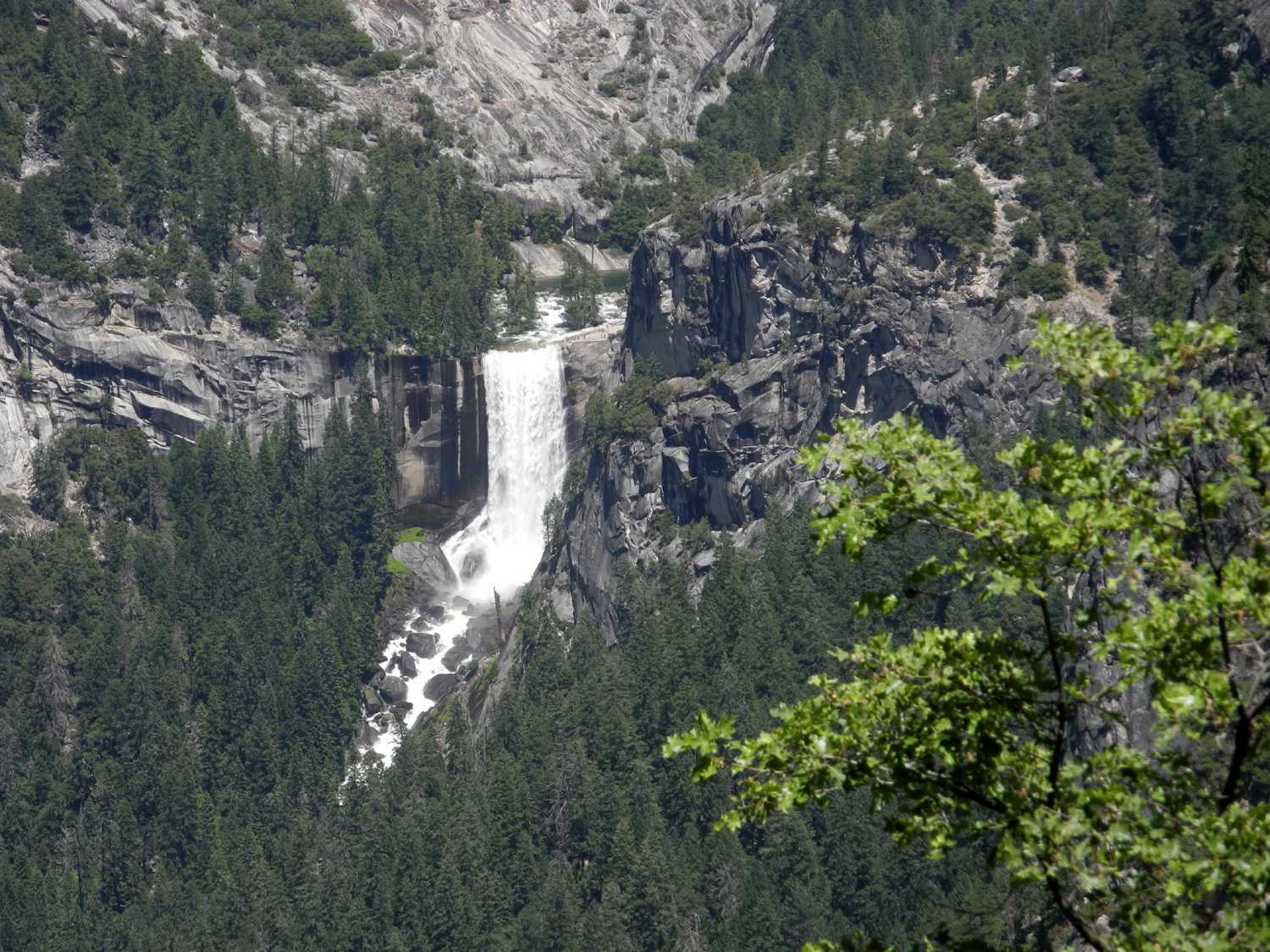 |
| A new and different view of Half Dome | Vernal Falls, Yosemite's most beautiful |
|
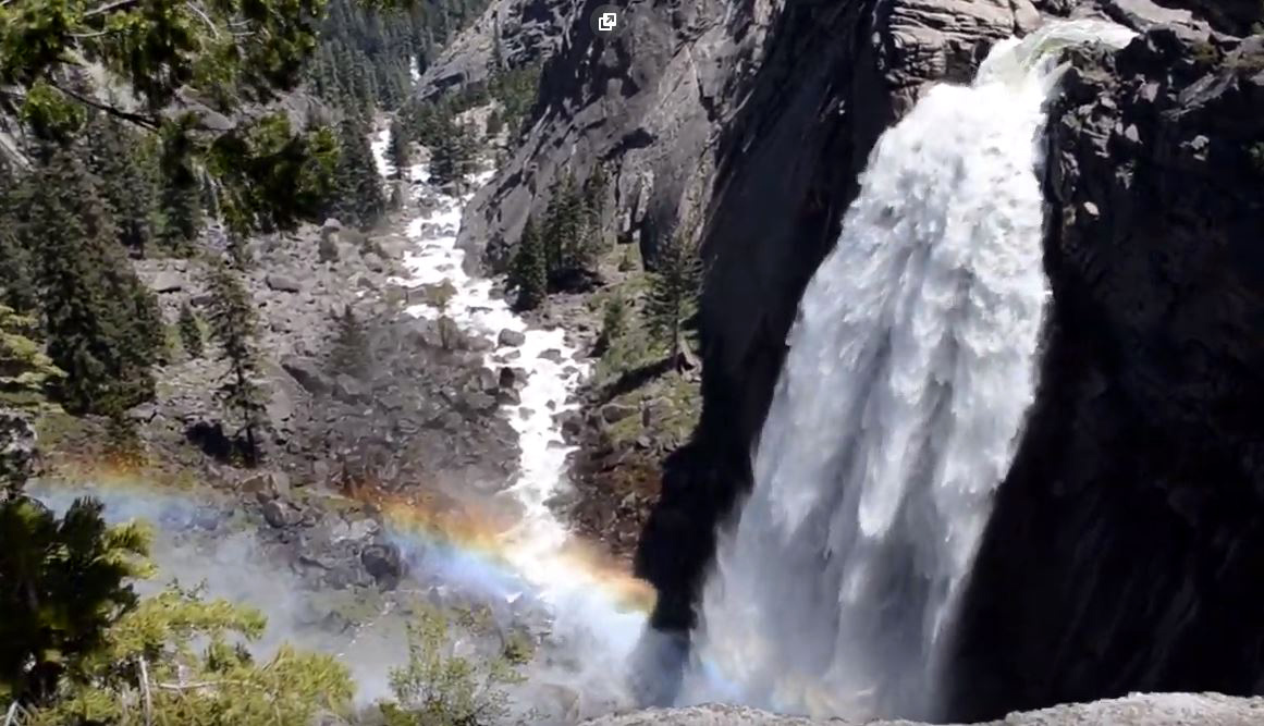
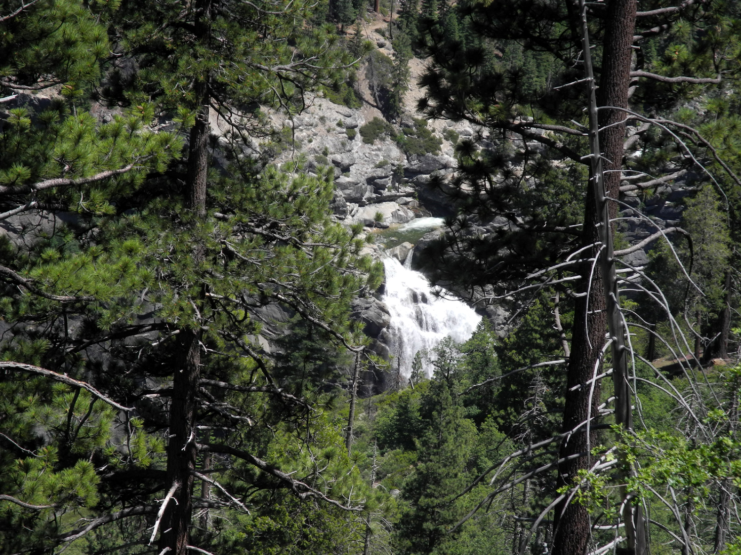
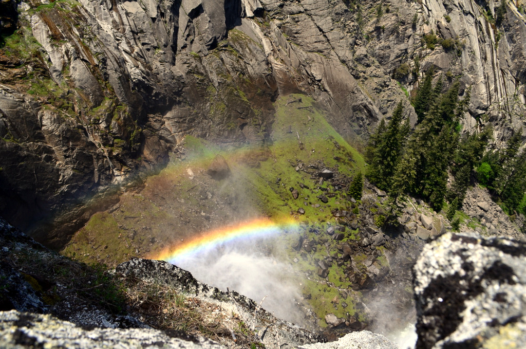
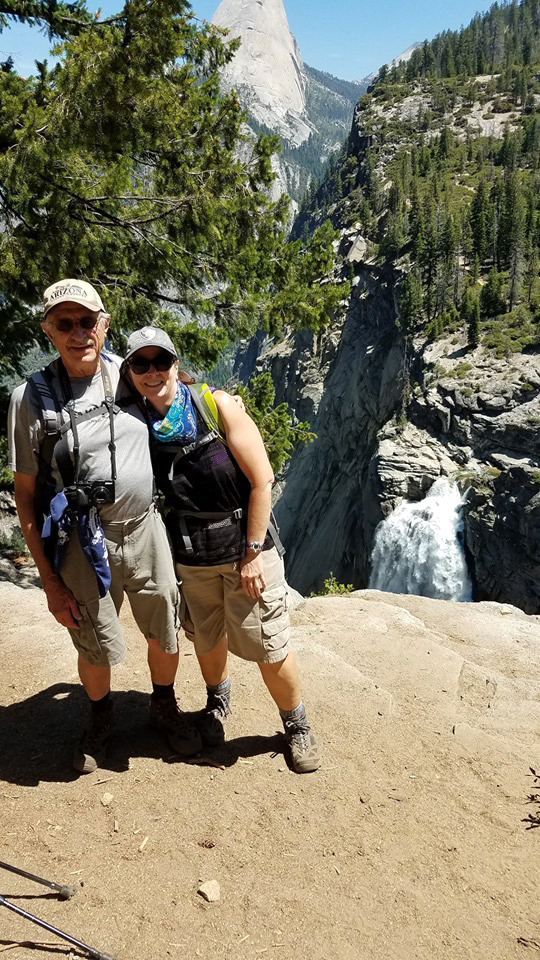
My daughter Jennifer and I set out on July 10 to hike as far as necessary to get a good look at the falls, and we discovered that it's not necessary to go all the way to the creek. About a quarter mile or so from the crossing, an unofficial but well-marked trail leads a short distance to an excellent vista point. This falls is unusual in that it falls at a right angle to the flow of the stream. The configuration of the rock at the top of the cliff causes the creek to make a sharp left turn, where it flows flows over a short cascade, then makes its final drop, only to turn right again to flow out to the Merced. Illilouette is a very beautiful falls, 370 feet high, and like all Sierra streams, it was flowing very big during our visit. From our vista point we had an almost straight-on view, as opposed to the side view at other locations. We also could lean over (carefully!) and see a rainbow at the bottom, although our hiker friend Wes captured the rainbow much better on his recent visit. He crossed the bridge and walked down along the creek on the east side to the top of the falls for his breathtaking view. |
|
 |
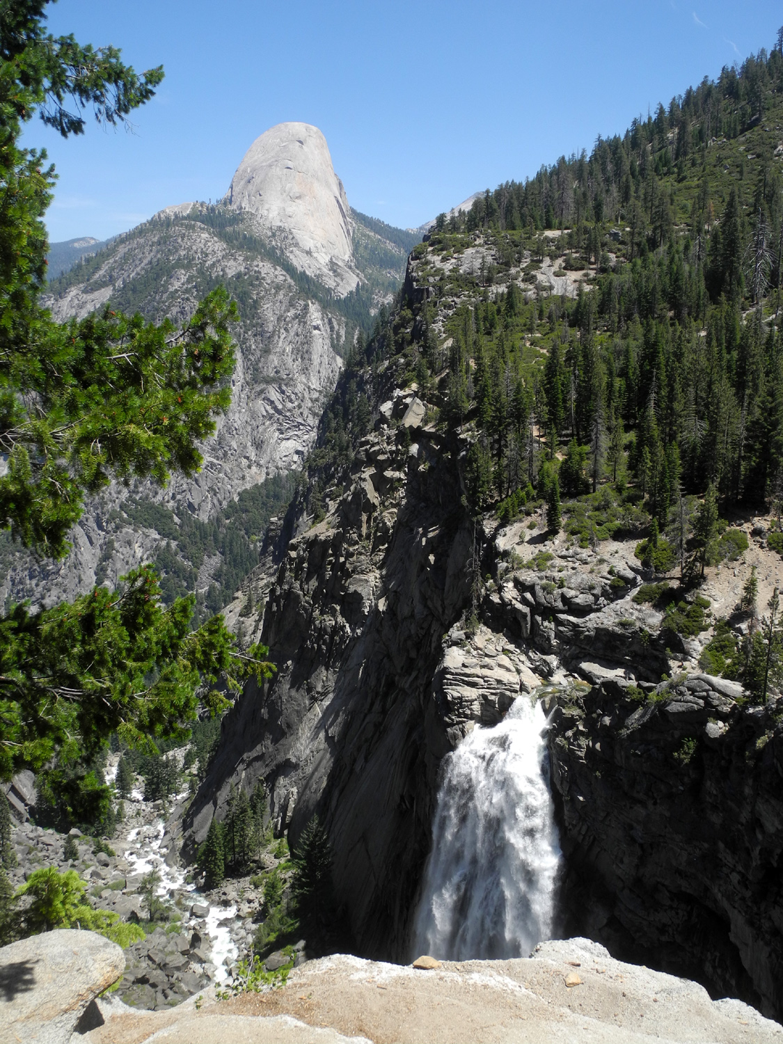 |
| Illilouette Falls | The falls and Half Dome |
|
As I implied above, this trail goes downhill from the trailhead at Glacier Point all the way to Illilouette Creek. There are a few steep spots, but it's mostly a gentle descent, with a number of switchbacks. The upper part goes through an old burn scar, so there's not much shade, but the steep hillside is covered with blooming chaparral and a number of wildflowers. There are also some interesting rock formations on the ridge above the trail. |
|
 |
 |
| Chaparral was in full bloom | This rock looked like it could crash down on the trail at any time |
 |
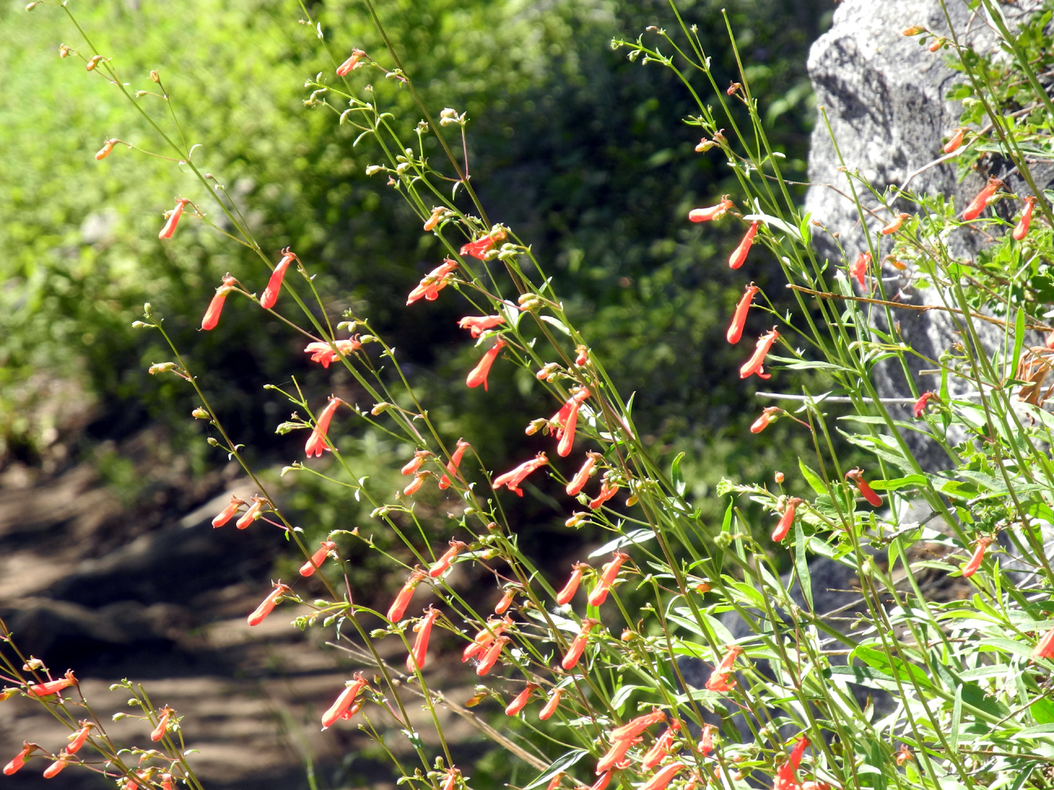 |
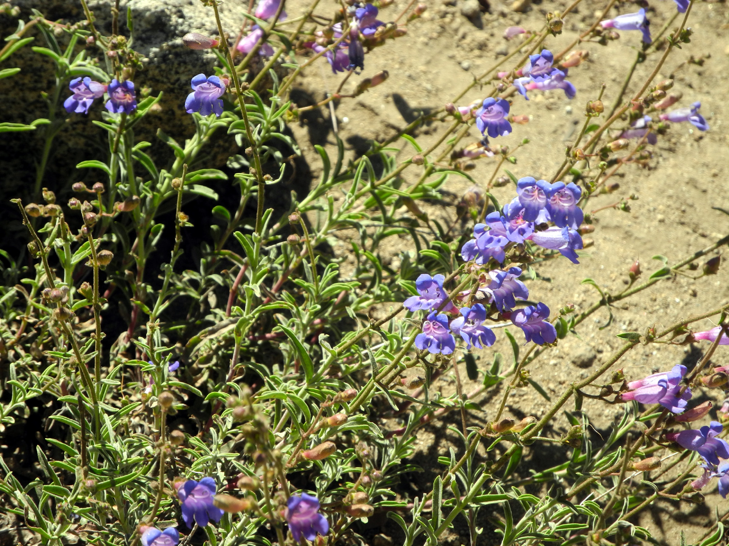
| We need help identifying these big flowers | Orange penstemon appeared in many places |
|
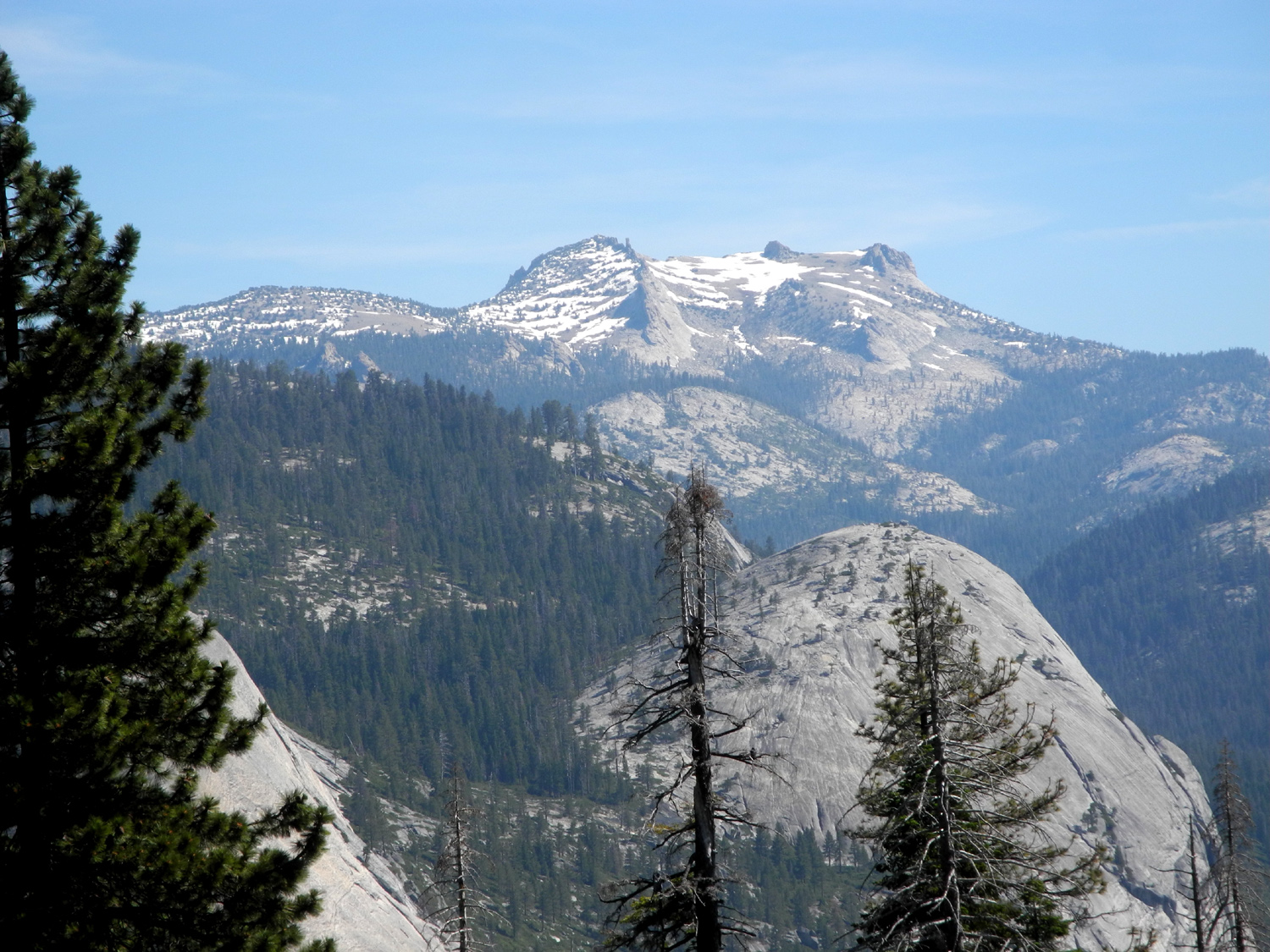
Well-known Yosemite features visible along the trail include North Dome and Basket Dome, Mt. Hoffman, Vernal and Nevada Falls, and Mt. Starr King, a sequence of three domes in the Clark Range, south of the Merced River Canyon. About the mid-point of the trail we had a final glimpse of the top of Illilouette. |
|
 |
 |
| Mt. Hoffman, 10,800 above sea level, north of Yosemite Valley | North Dome and Basket Dome from the Panorama Trail |
 |
 |
| Nevada Fall on the Merced River | We enjoyed a final glimpse of Illilouette from half way back up the trail |
|
We
spent a half hour or so at the vista, finding a somewhat comfortable
rock to sit and enjoy our snack. Jennifer took great delight in
pointing out the rainbow
view to other visitors, since it was not visible from the place
where people would normally stop. We made the rather tiring uphill
climb back to Glacier Point, and back to our homes. Because of a
busy schedule, I had come very close to making this just a visit to
Glacier Point, so Jennifer and I were both very happy that we
decided to do the hike. We were even more proud of ourselves when
this allegedly four-mile round trip clocked in at just under five
and a quarter miles. --Dick Estel, July 2019 |
|
|
Photos (Click to enlarge; pictures open in a new window) |
||
|
San Joaquin Gorge Nelder Grove Sycamore Creek Rancheria Falls Illilouette Hike |
||
|
San Joaquin Gorge |
||
 |
|
 |
| Looking down into the gorge from Smalley Road | An unknown flower | Foothill gilia |
 |
 |
 |
| Common madea and mustang clover | Buzzard over the Gorge | Rocky canyon wall on the north side of the river |
 |
 |
 |
| Fiesta flowers and maybe snap dragons | Chinese houses | Harvest brodiaea |
|
 |
 |
| Rock and thistle on the River Trail | Don't know what it is, but this stood out amidst the grass | Close-up of climbing brodiaea stem |
 |
 |
 |
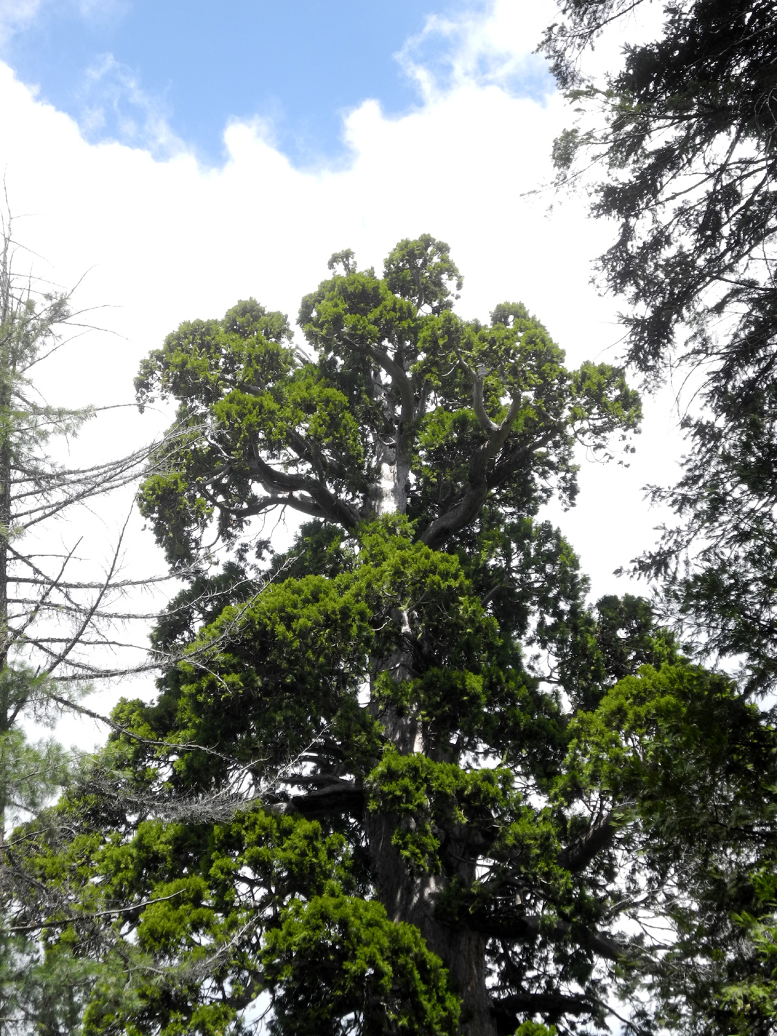
| Lessons from a Tree | ||
| Don't let a bad break stop you | Lean on a friend | Keep reaching up |
| Nelder Grove Hike | ||
 |
|
 |
| A burned out snag along the Bull Buck Loop | The classic top of the Bull Buck | A fair-sized tributary runs into California Creek at the eastern end of the Chimney Tree Trail |
| Sycamore Creek | ||
 |
 |
 |
| This little mud
puddle was all that was left of the upper creek |
It's hard to get comfortable on this slanted resting log | Grass stays green
longer under the oaks, even dead ones |
 |
|
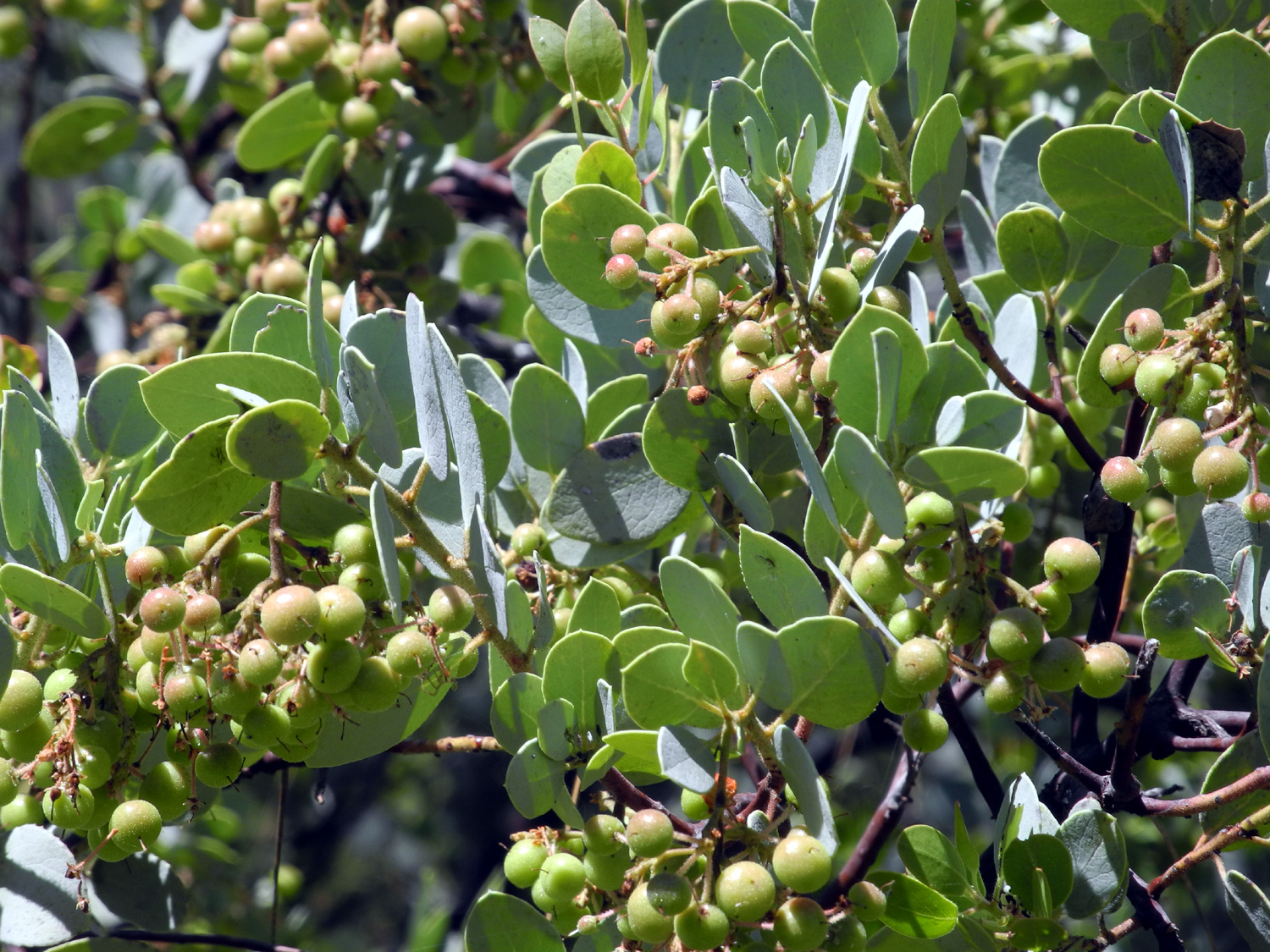 |
| Someone tried to help out nature | The grass was still nice and green in this area | The "little apples" that give manzanita its name |
| Rancheria Falls | ||
 |
 |
|
| Rancheria Falls | Top of the falls | Bluish-green branches of a red fir |
| Illilouette Falls | ||
 |
 |
 |
| Jennifer ready to start the hike | Blue penstemon | Typical view of the trail |
 |
 |
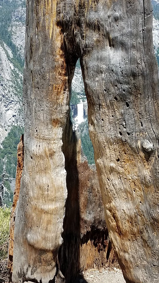 |
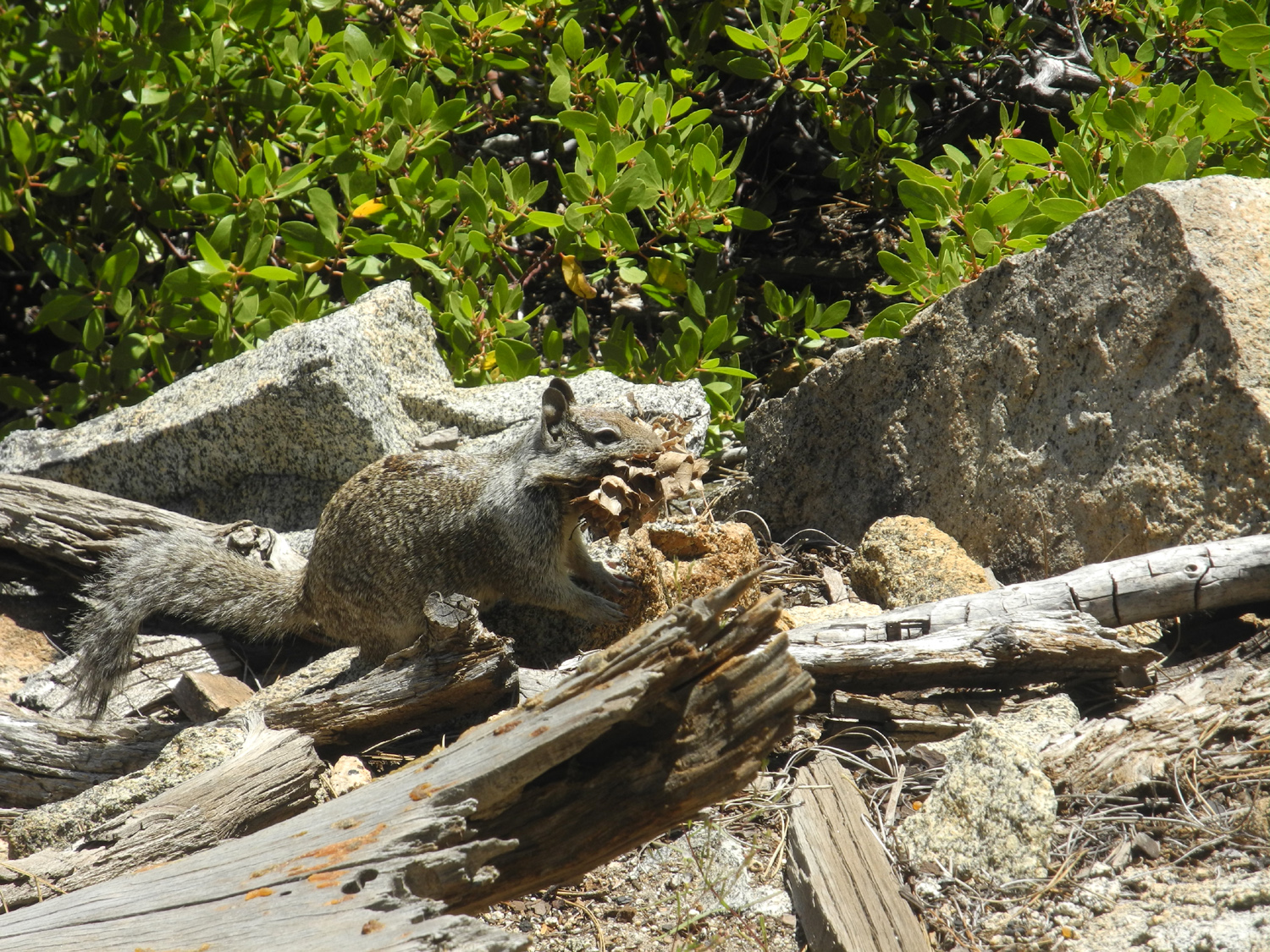
| Squirrel with a large pine cone in his mouth | Dick and Jennier at the falls | Vernal Falls through an opening in a dead snag |
 |
|
 |
| The rainbow at the bottom of Illilouette Falls (by Wes Thiessen) | Another view of the rainbow by Wes | Half Dome through the pines |
 |
||
| Mt. Hoffman and Half Dome panorama | ||
 |
||
| Mt. Starr King and the Clark Range | ||
| Related Links | ||
| San Joaquin River Gorge Special Recreation Management Area | San Joaquin River Trail | San Joaquin River |
| San Joaquin Gorge Photo Album | San Joaquin Gorge Slide Show | PG & E in the Sierra |
| Dick's Nelder Grove Page | Redwood Photo Gallery | Friends of Nelder Grove |
| Nelder Grove Campground | Nelder Grove Hikes | USFS Nelder Site |
| Twining Brodiaea Haiku | Milkweed | Manzanita |
| Rancheria Falls Trail | Rancheria Video | Another Illilouette Hike |
| Mt. Starr King | Panorama Trail | Illilouette Falls |
| Yosemite National Park | Illilouette Video (by Wes Thiessen) | Glacier Point |