|
Dick's Adventures of 2023 - Page 1 |
|
| Photos Related Links More Travel Reports | |
| Adventures
of 2016 Adventures
of 2017 Adventures
of 2018 2Adventures
of 2019 Adventures
of 2020
Adventures of 2021 Adventures of 2022 Adventures of 2023 Part 2 |
|
| Edison
Point Foothill
& Pine Flat Drive
Blue Oak Trail
Pine Flat & Maxon Road Sycamore Fire Road San Joaquin Gorge River Trail |
|
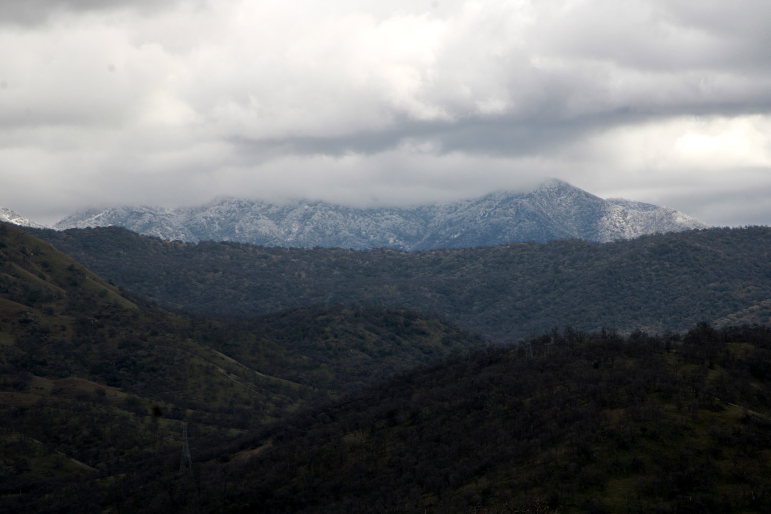
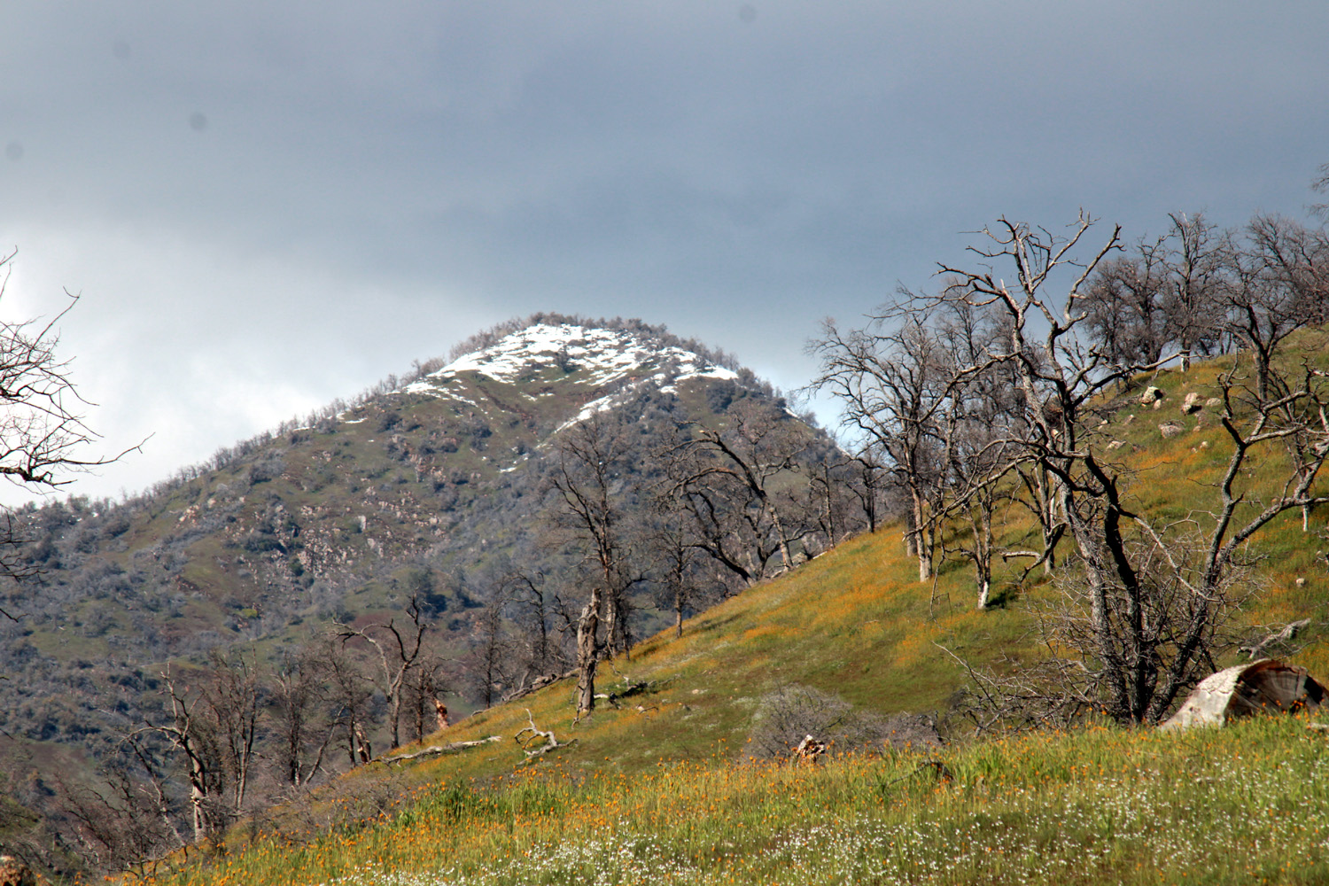
| Edison
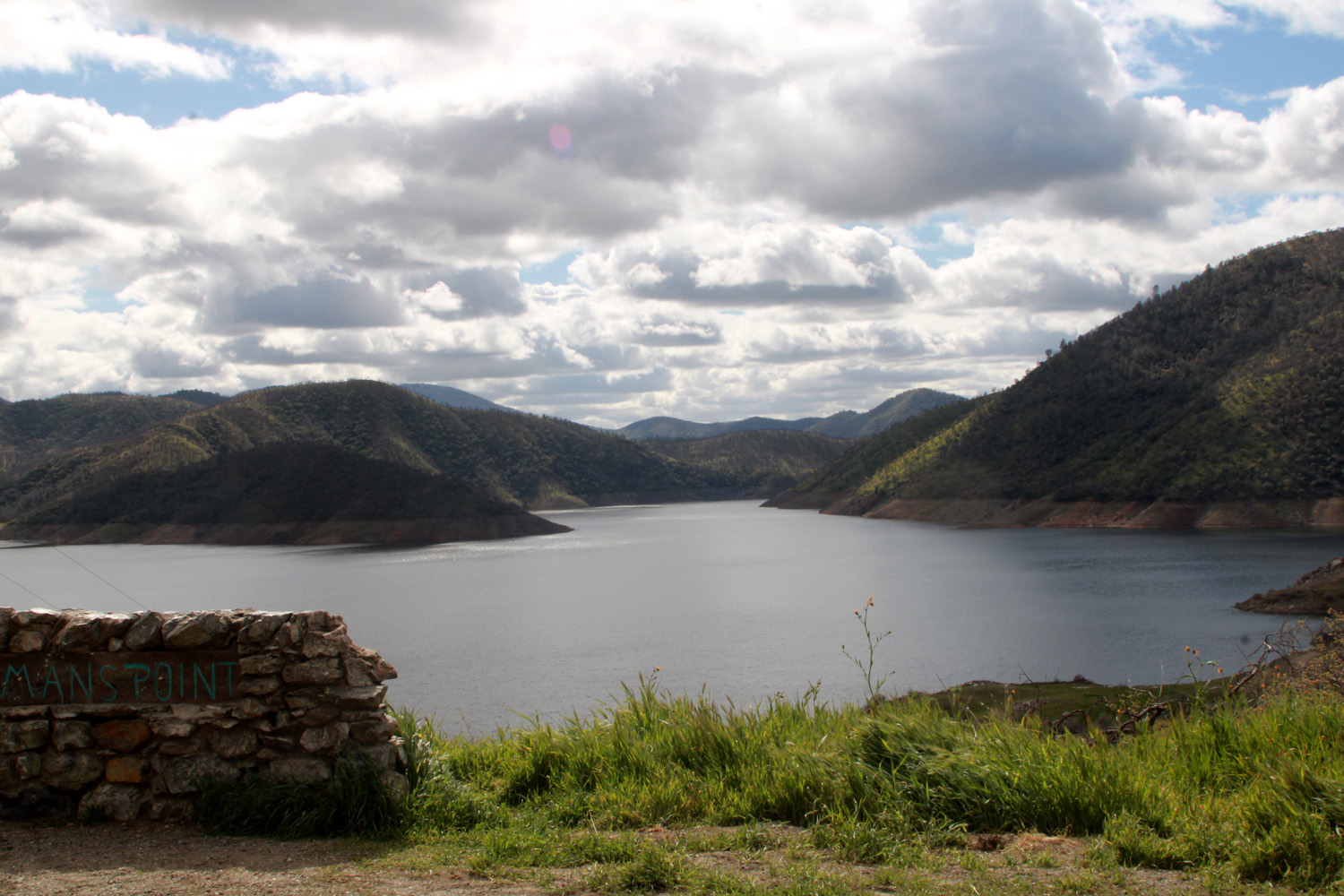
Point The second Ramblers hike in February was scheduled for February 22. However, as the date got closer the weather forecast got worse and worse - a very cold storm with heavy rain everywhere and snow down as low as 500 feet. Reluctantly we canceled the hike, but I thought it would be interesting to drive up to the location, and maybe see snow on the hills above Pine Flat Reservoir. I invited a couple of Ramblers to join me, and Jackie was free to go. As it turned out, it was mostly sunny the morning of the 22nd. There were clouds on the horizon, and it was cold and windy, but Jackie and I drove the 35 miles to the Edison Point Trailhead, at 1,200 feet. As we drove along the lake shore, we had fantastic views of the lake, with interesting clouds drifting about. |
|
 |
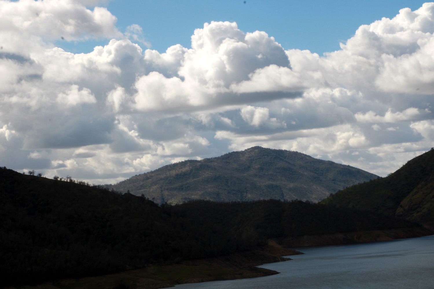 |
| Pine Flat Lake from Kirkman Point | Lake and clouds from Edison Point Trail |
|
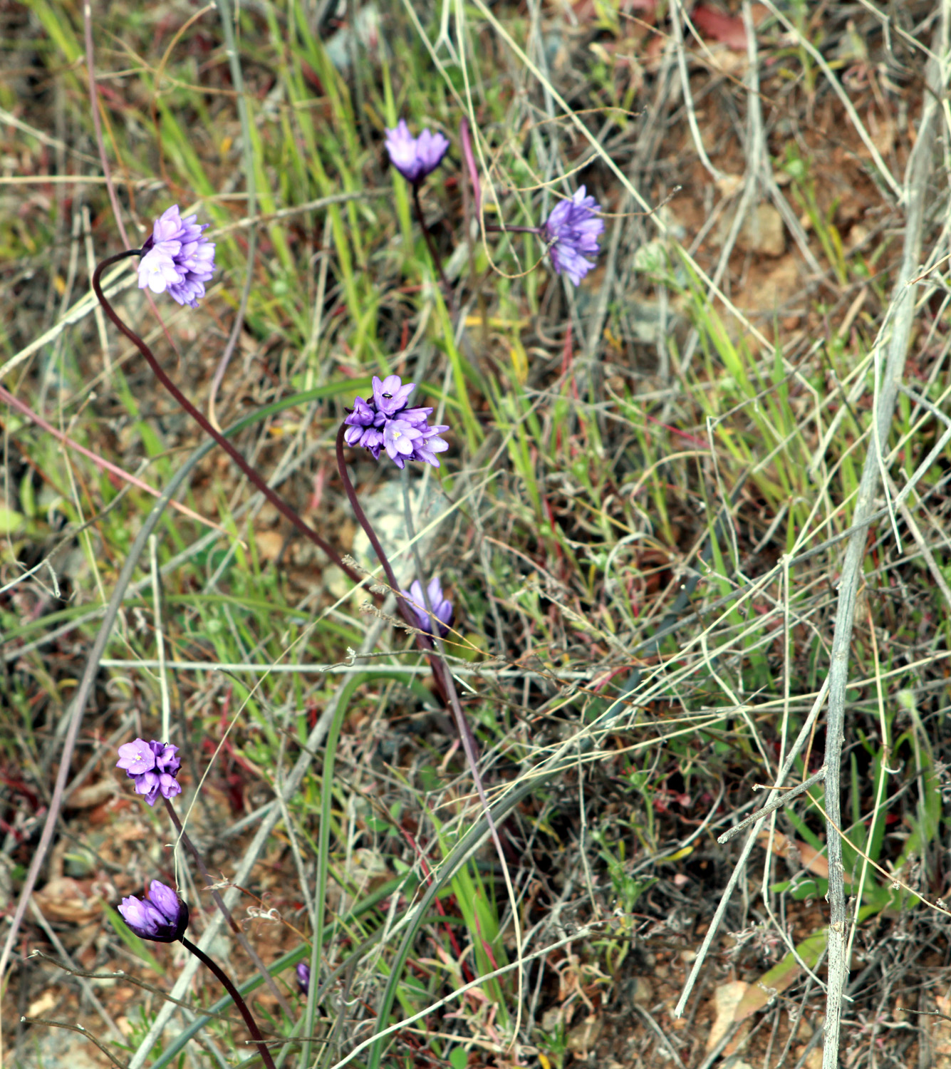
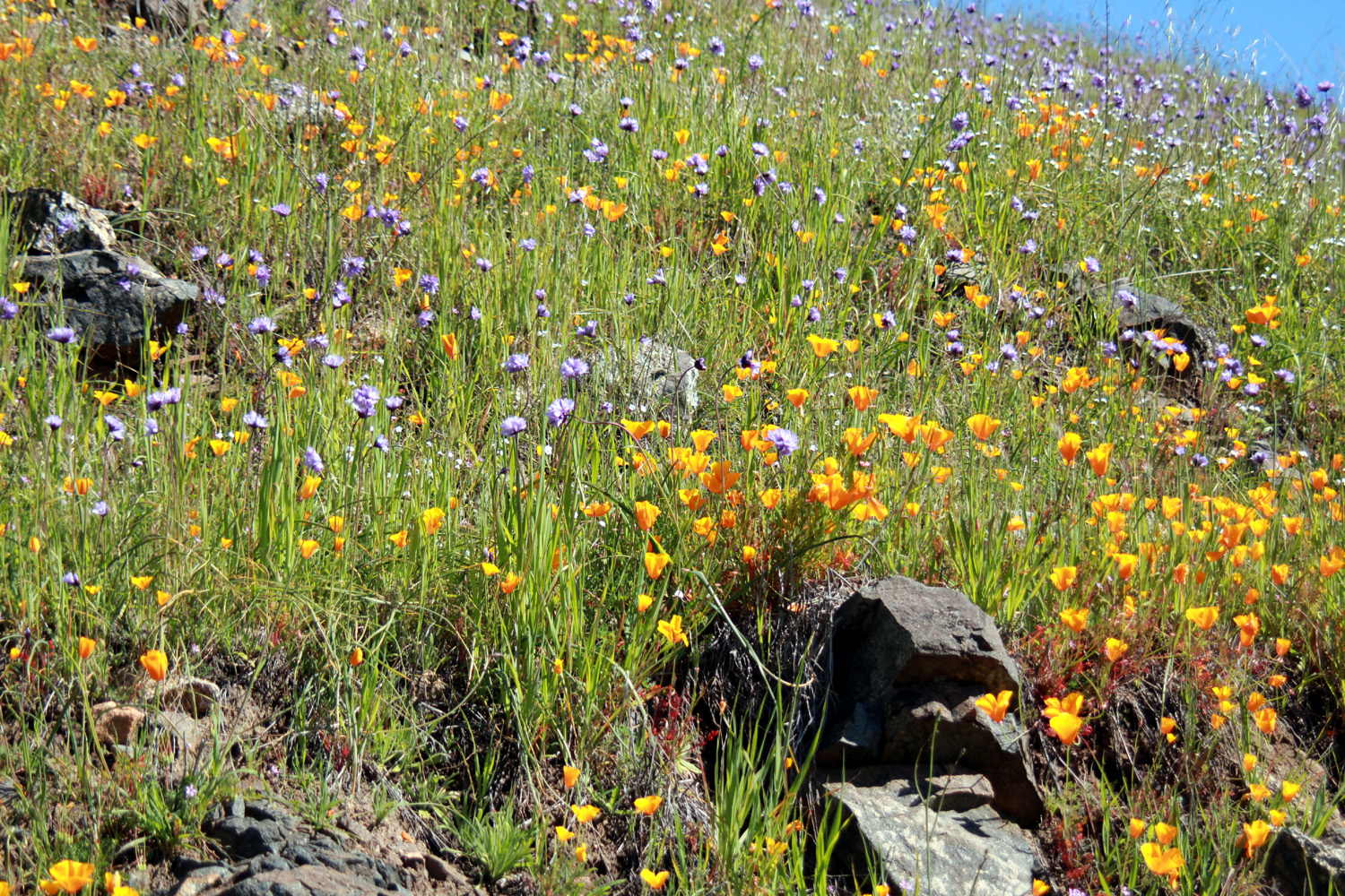
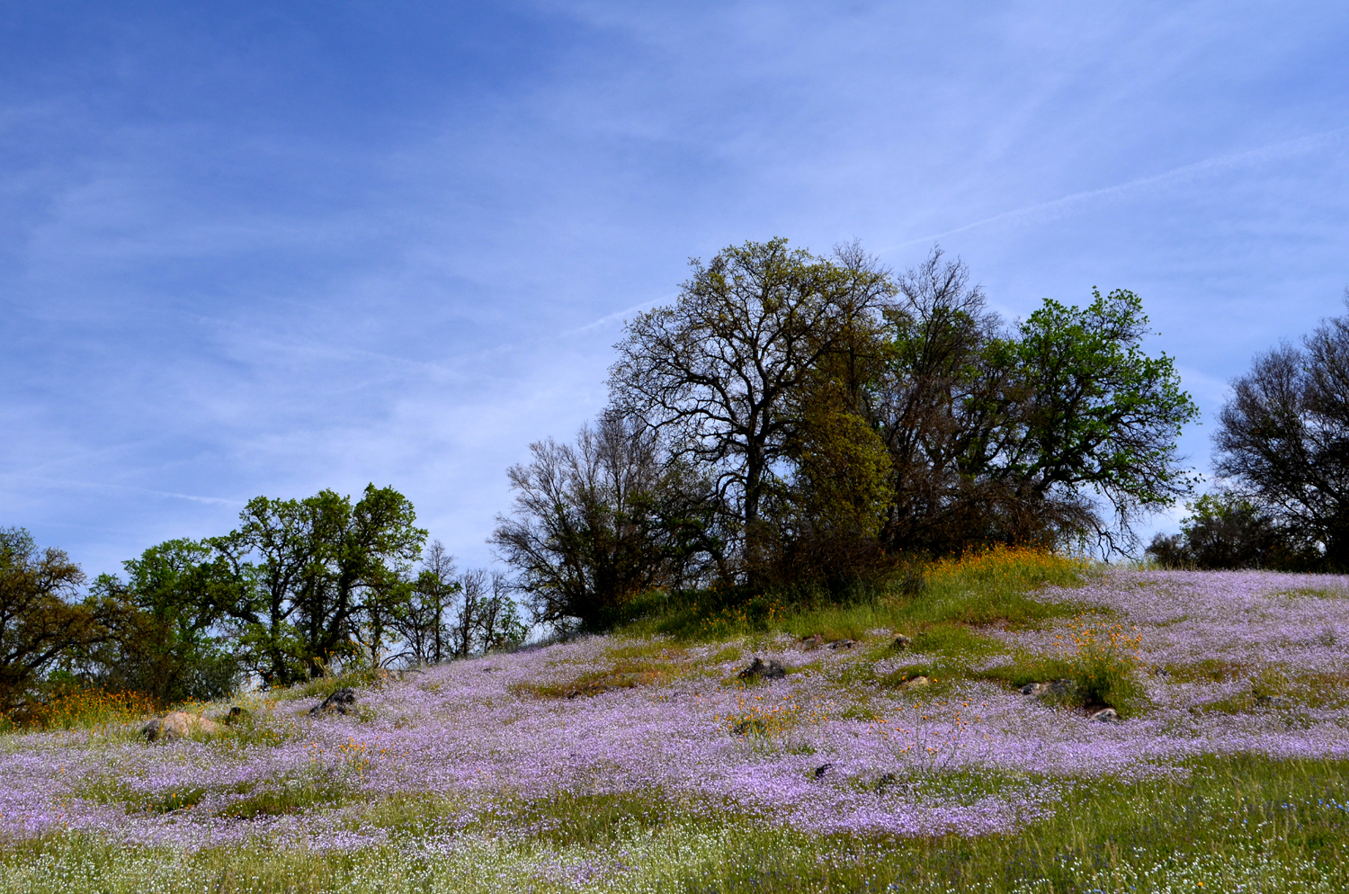
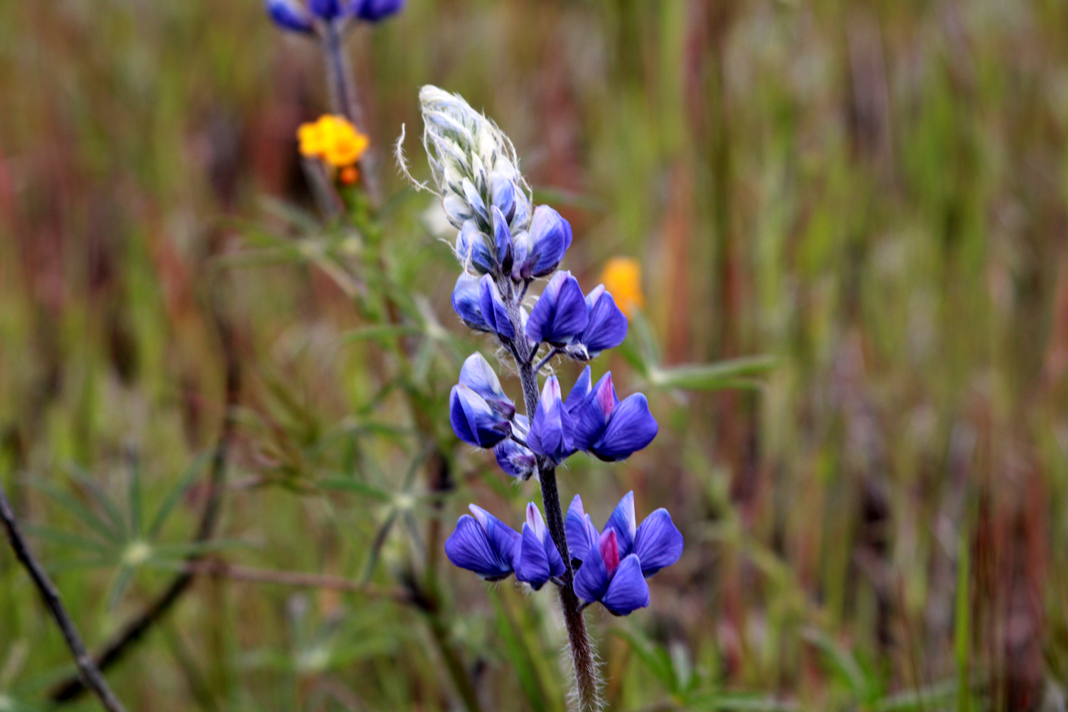
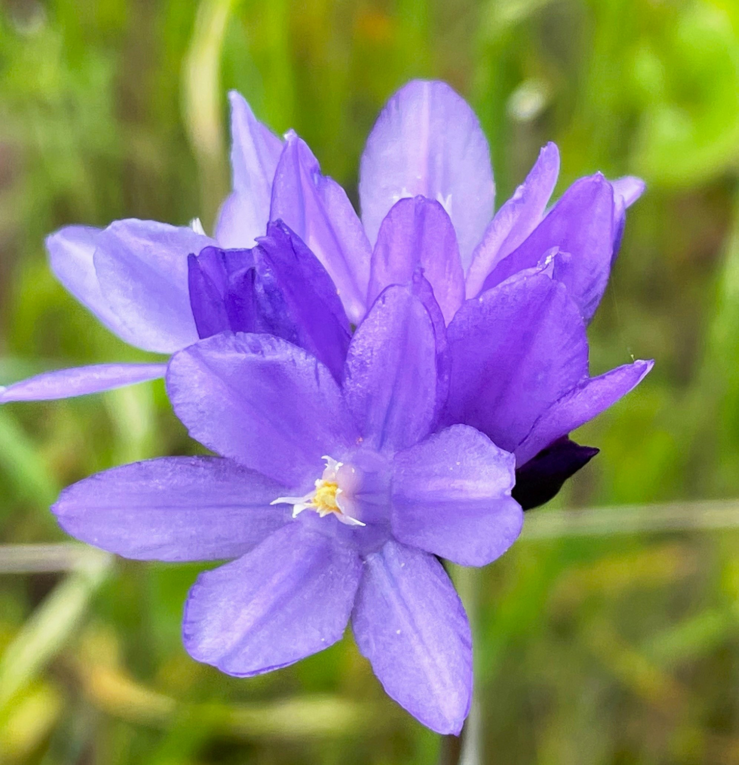
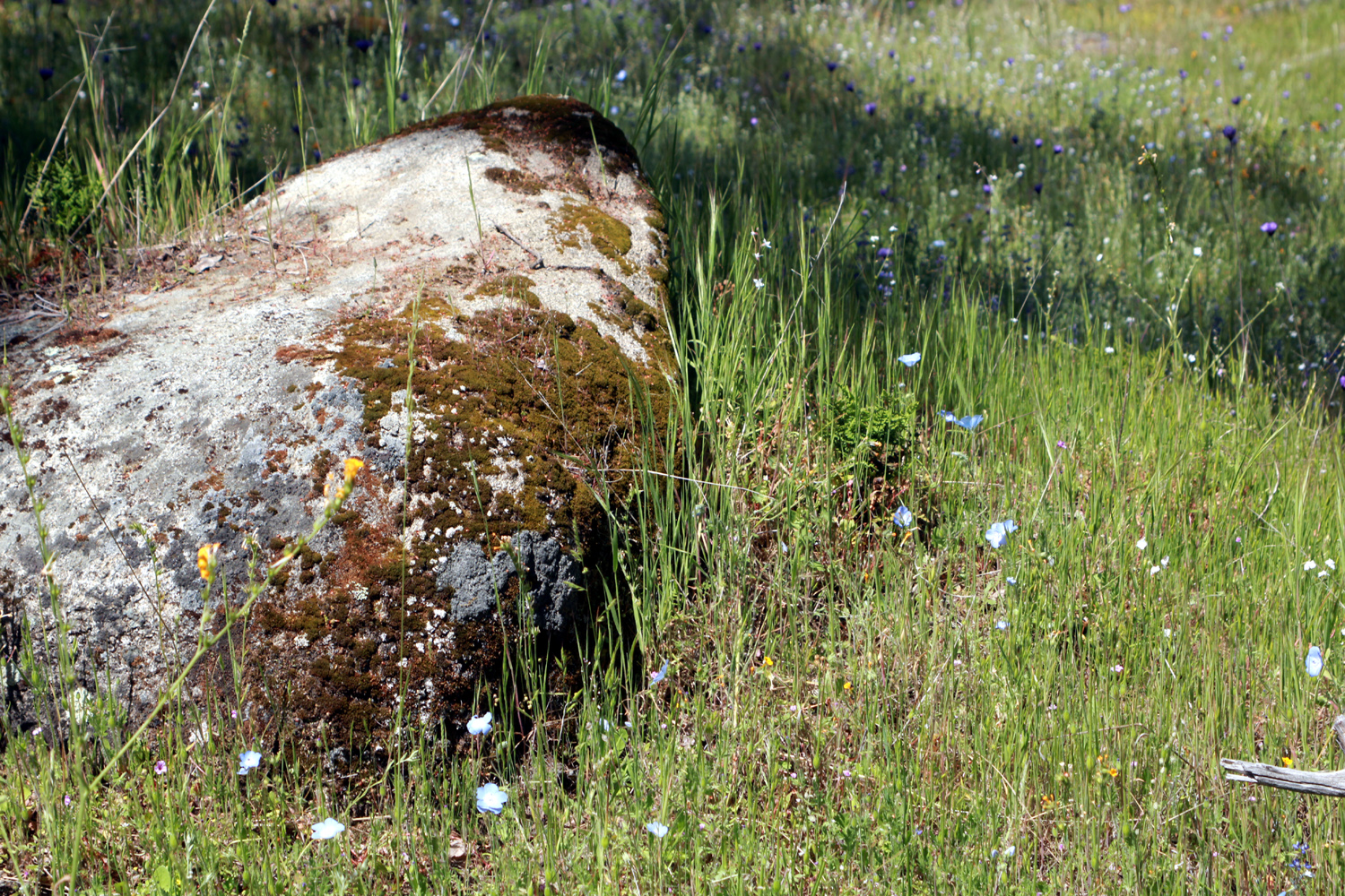
In the foothills it was very cool - we both wore down jackets with the hood up on the entire hike, but the occasional winds were light, so it was a good day to be out. We did not expect much in the way of wildflowers, but in fact, we saw popcorn flowers, fiddlenecks, dove lupine, bush lupine, filaree, blue dicks, poppies, buttercups, and daisies. Most of them were few in number, but there were a lot of poppies. They close up at night and in cool weather, so only a few were open. The blue dicks were also fairly numerous, and the bush lupines were by the road, not the trail. |
|
|
|
|
 |
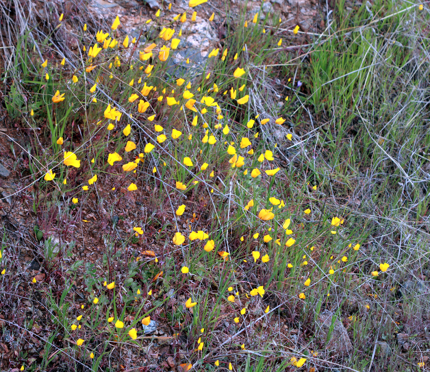 |
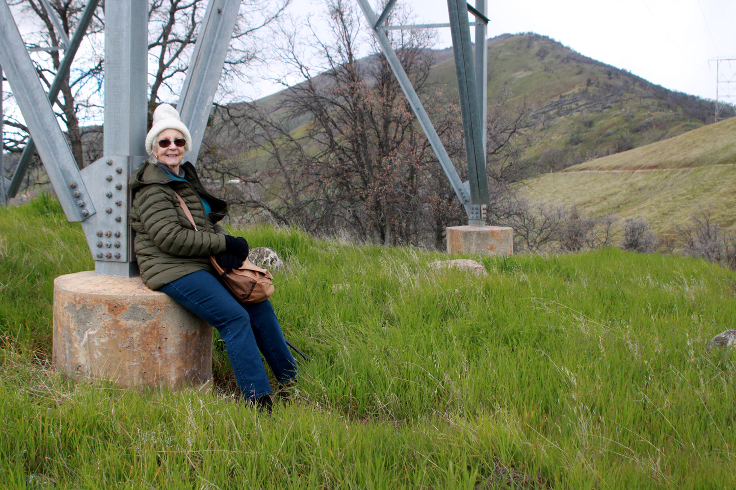
| Jackie rests on the base of a transmission tower at Edison Point | Poppies, most of them still closed up |
 |
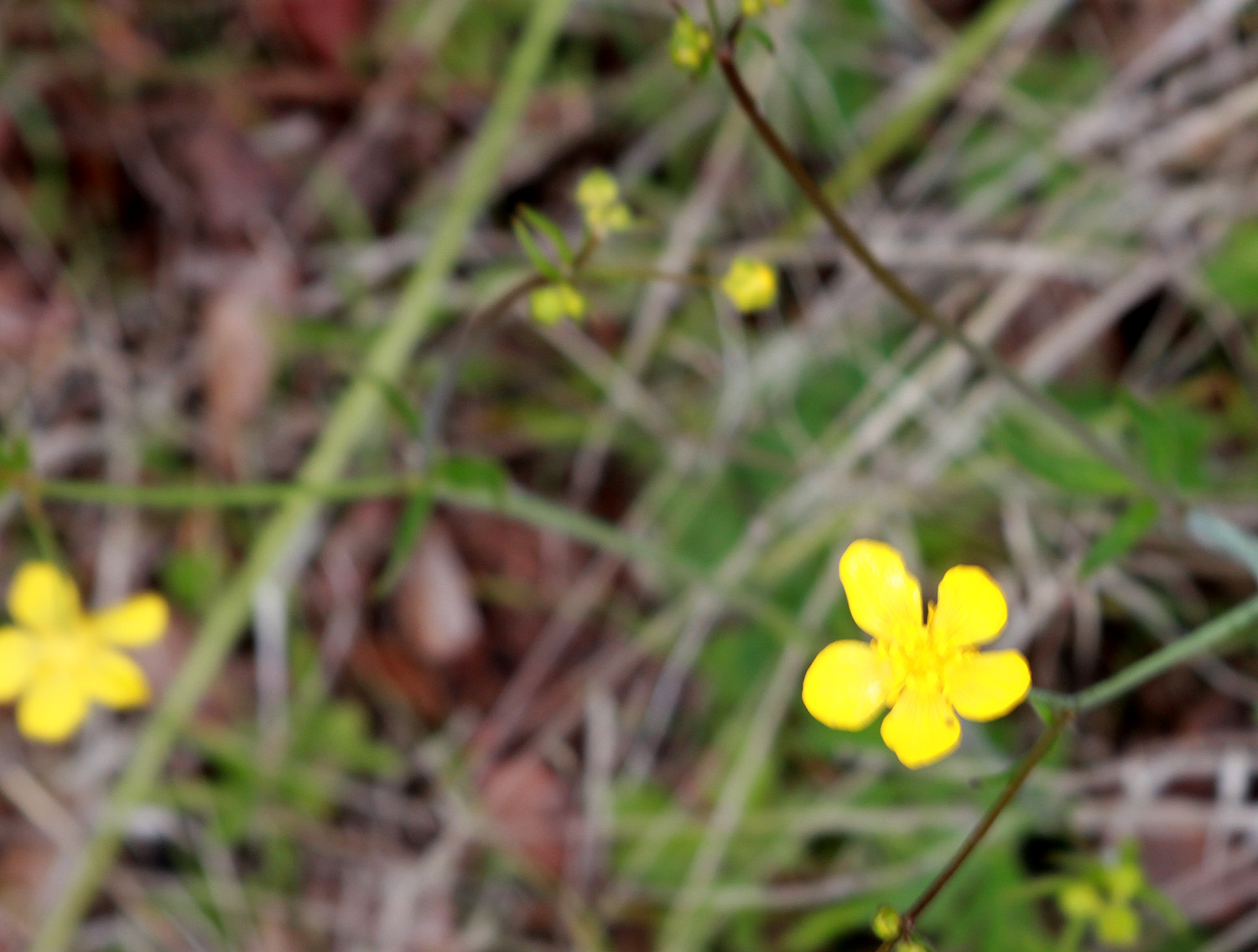 |
| There were blue dicks in small numbers all along the trail | Buttercups appear every spring, but always in small numbers |
|
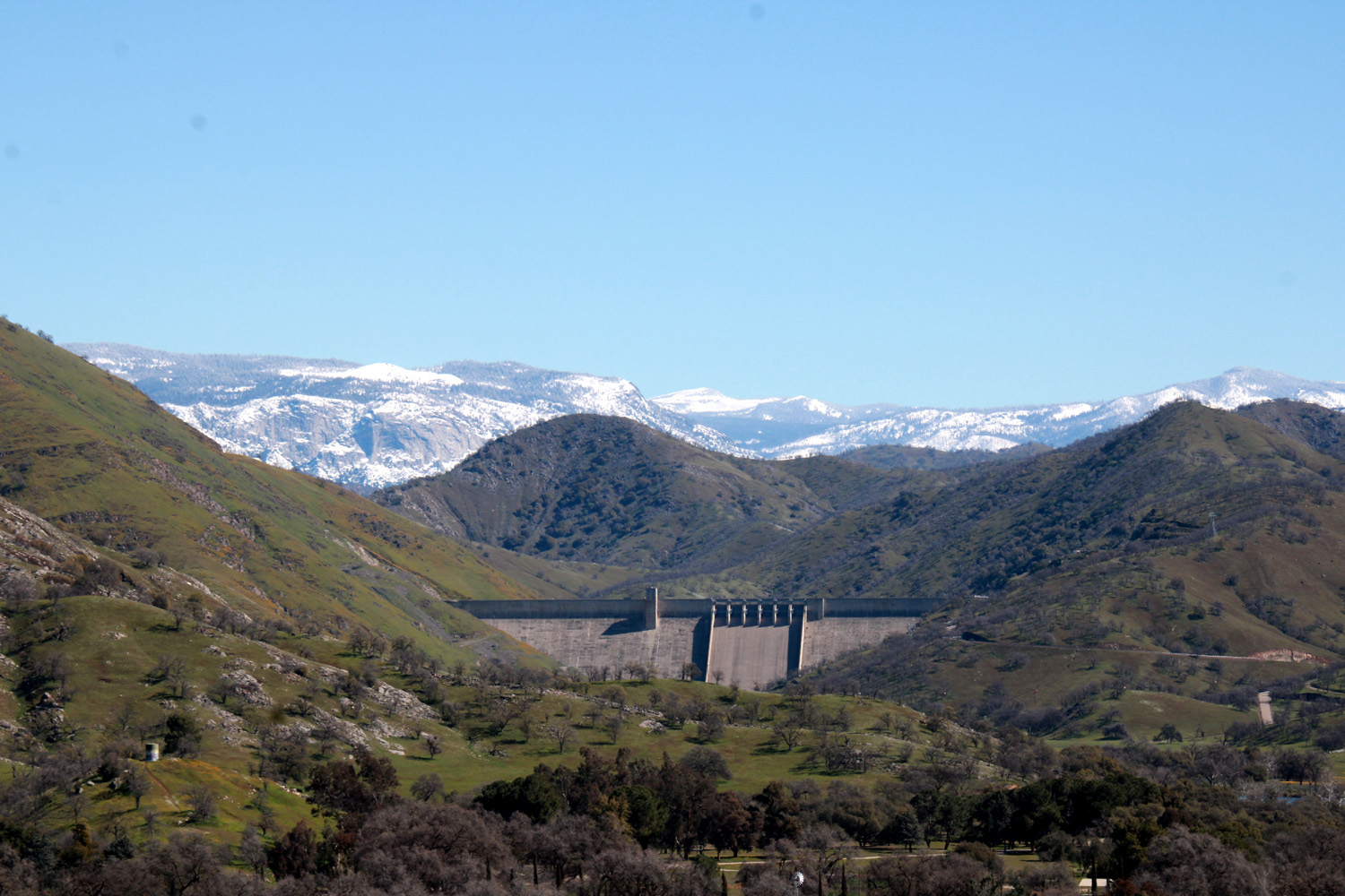
It's only about a half mile to the "point," and the trail is actually a service road used by the power company to access the transmission tower at the point. The trail goes down to the lake from there, and follows the contour of the land back to the trailhead, but that part of the trail is steeper and longer than we were willing to attempt. (You can read about previous hikes where we completed the loop here and here.) Just as we started back to the car, we saw a few white streaks going diagonally across in front of us, and realized that we were getting snow pellets (the local news insists that it was probably graupel, but we are sticking with snow). There were never very many but they stayed on the cold ground for a half minute before melting. When we got back to the car, we were glad to sit inside and have some orange slices before heading back down to the valley. Before we left the foothills, we turned left at Pine Flat Road, which goes up along the river from Trimmer Springs Road to the dam and a campground. The campground was closed, but the 440-foot high dam was an impressive sight. That evening when I went out to the trash bin, it was raining, but I also saw a few snow pellets landing on my sleeve, and the next day brought snow to low elevations in many parts of California. --Dick Estel, February 2023 |
|
|
Foothill and Pine Flat Drive
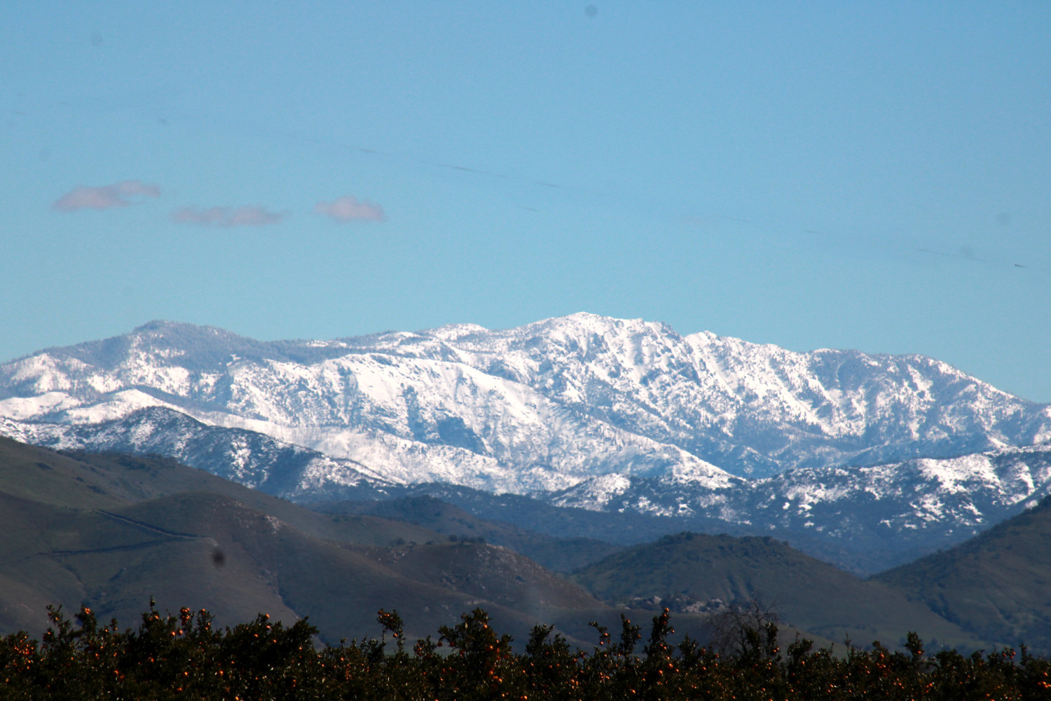
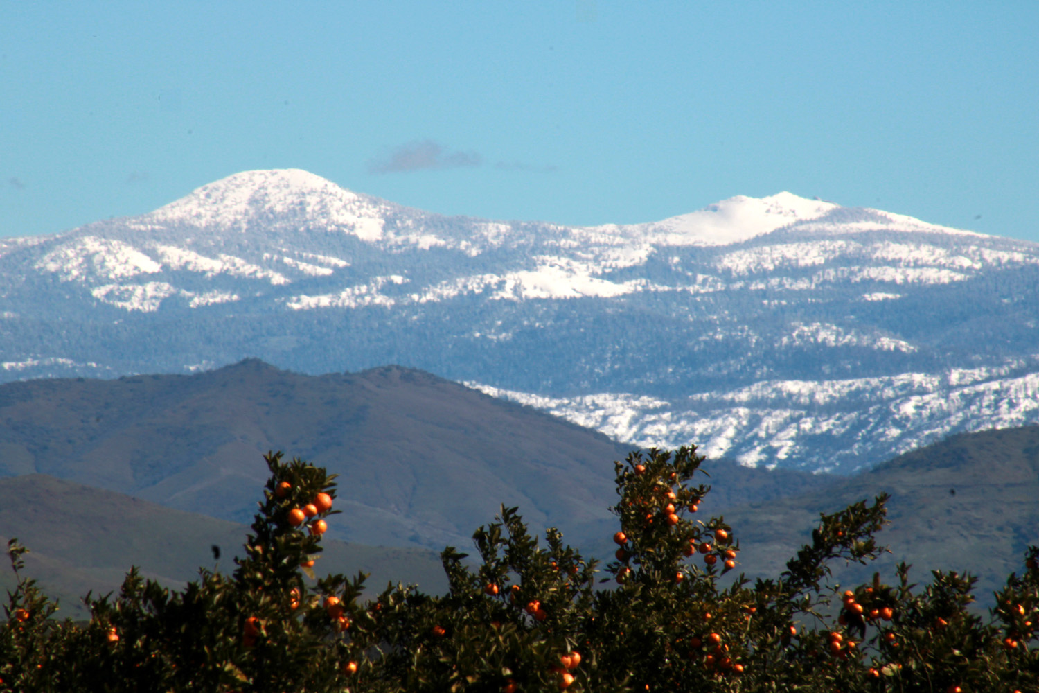
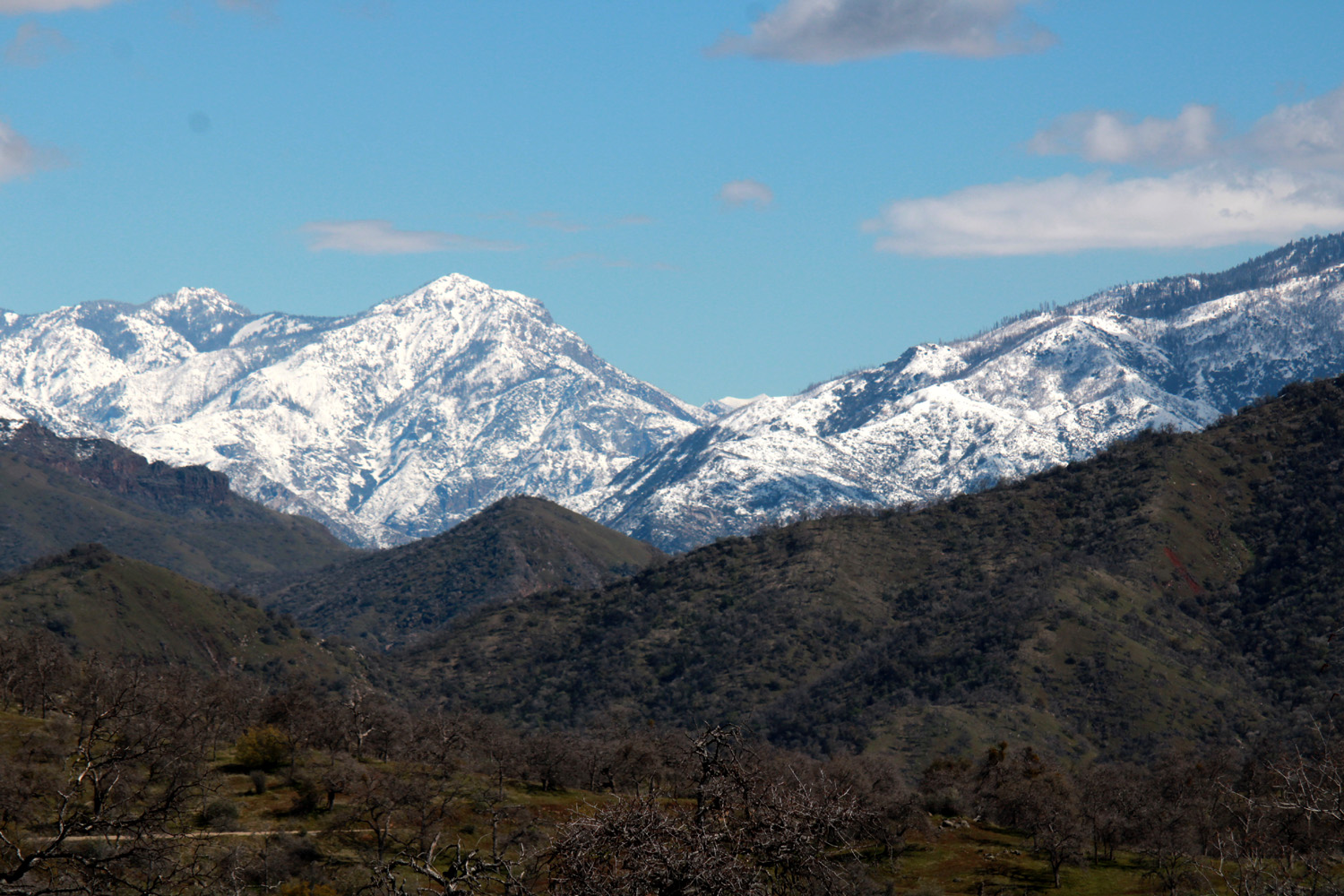
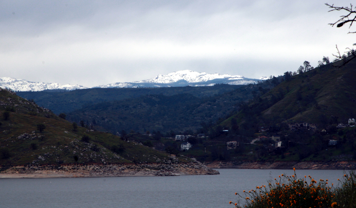
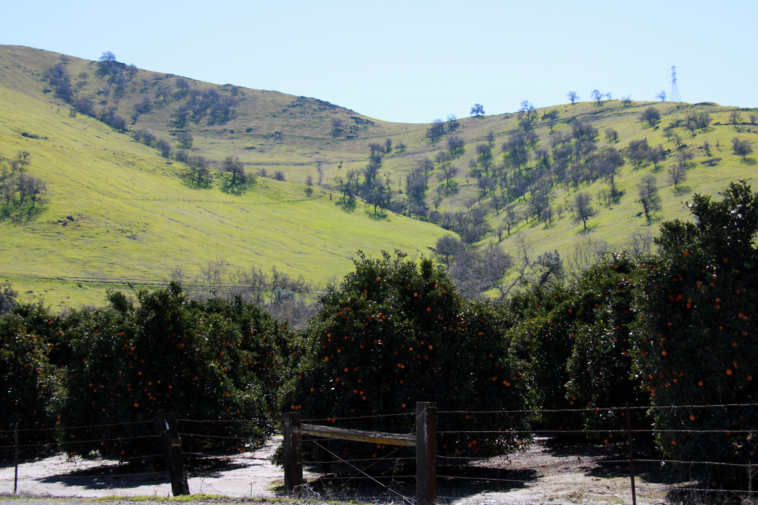
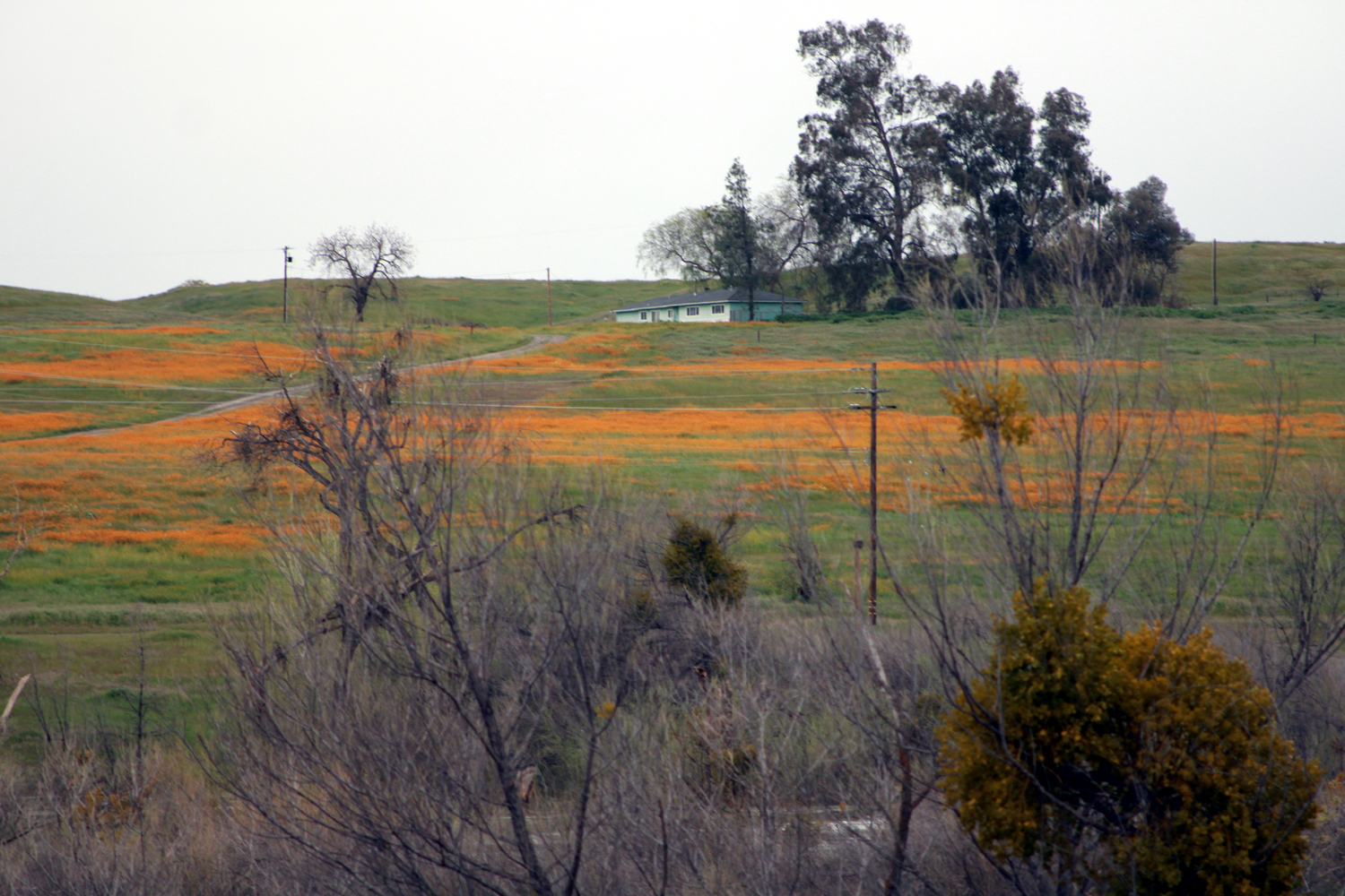
On March 7, not quite two weeks after our Edison Point hike, I again drove up to Pine Flat Reservoir. We had received record amounts of snow throughout California, some down as low as 500 feet, so I hoped I might see snow on the hills around the lake. Instead I found the beginning of what I believe will be a massive bloom of spring wildflowers, along with views of snow in the high and low Sierra. I had no plans to hike, so I was ready to stop any time I saw something worth a closer look. My first stop was along East Belmont Avenue, still on the valley floor, where I had a nice view of the snow-covered mountains, and there were orange groves on both sides of the road. I took my time setting up for a good shot, attaching my telephoto zoom lens and putting the camera on a tripod. The vistas directly east were magnificent, as were the views to the north. The trees prevented a good shot to the north, but I was very happy with what i could see to the east. |
|
 |
 |
|
Sierra snow, probably Rogers Ridge, between the North Fork and main stem of the Kings River |
A classic California scene, oranges and snow.
Peak at left is Mt. Goddard, in the northern part of Kings Canyon National Park |
|
Beyond this point the route becomes Trimmer Springs Road, and parallels the Kings River, which in this location is several hundred yards from the road and not visible. There's a place where the road rises up, giving a good view of the river below, and where the road dropped back down, the floral display began. To get close to the flowers, I had to get up a low bank next to a barbed wire fence, so I did not take the tripod. The ground was soft and uneven, but I made it OK. However the pictures were blurry, so on my return trip I stopped there again, got out a hiking pole and the tripod, and set up by the fence where the results proved to be much more satisfactory. |
|
 |
 |
| Poppies and blue dicks along Trimmer Springs Road | A thick stand of blue dicks |
|
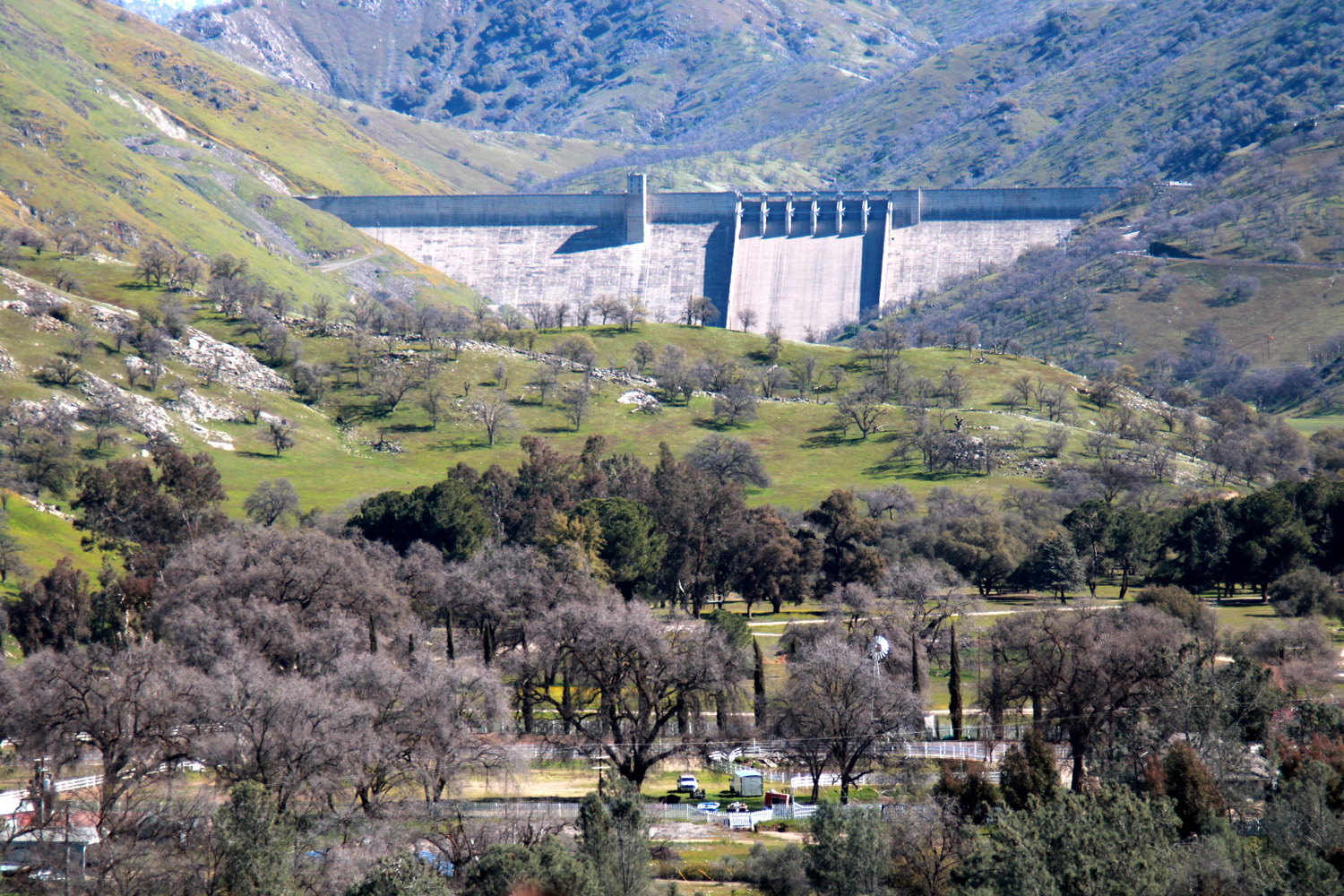
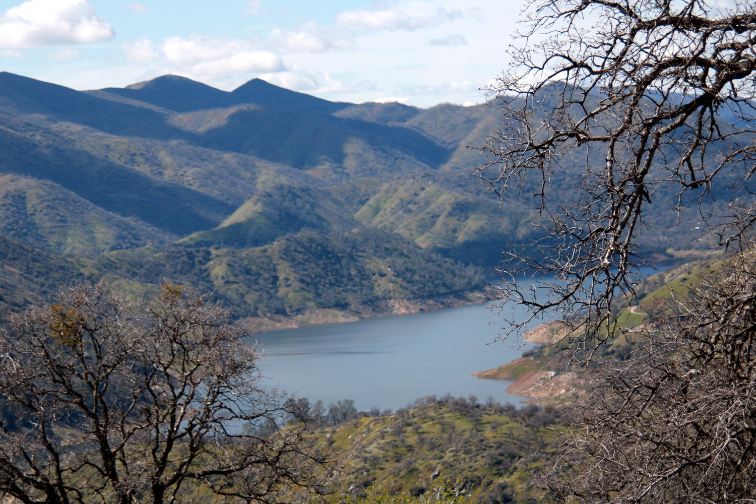
Where Trimmer starts to get into serious foothills, Piedra Road goes to the right and follows the river to Highway 180 near Centerville. A short distance down this road I turned left on Elwood Road, which goes to Wonder Valley. The road rises up quickly over a high point before dropping down again, and from the top there is a great view of Pine Flat Dam, as well as the river below and the snow-covered mountains above. |
|
 |
 |
| Pine Flat Dam and the Sierra | Kings River below the dam |
|
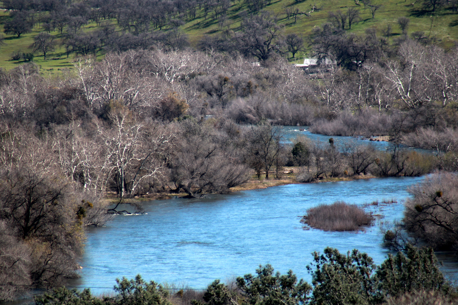
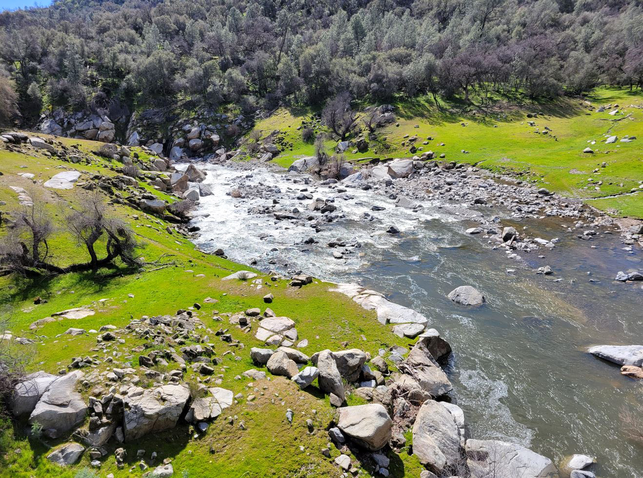
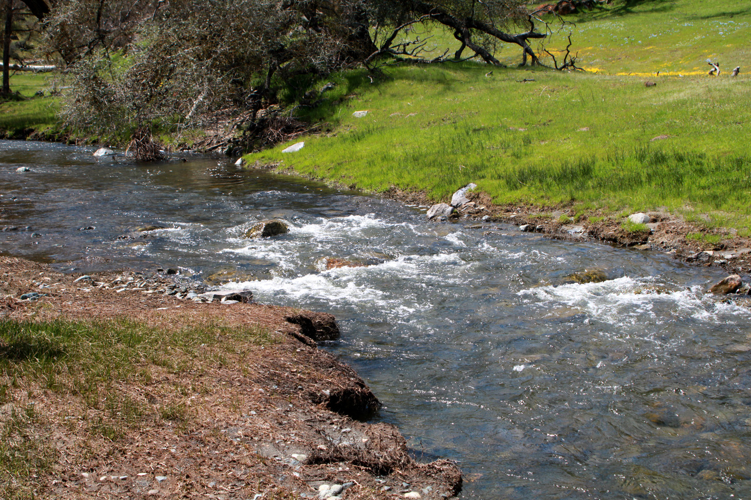
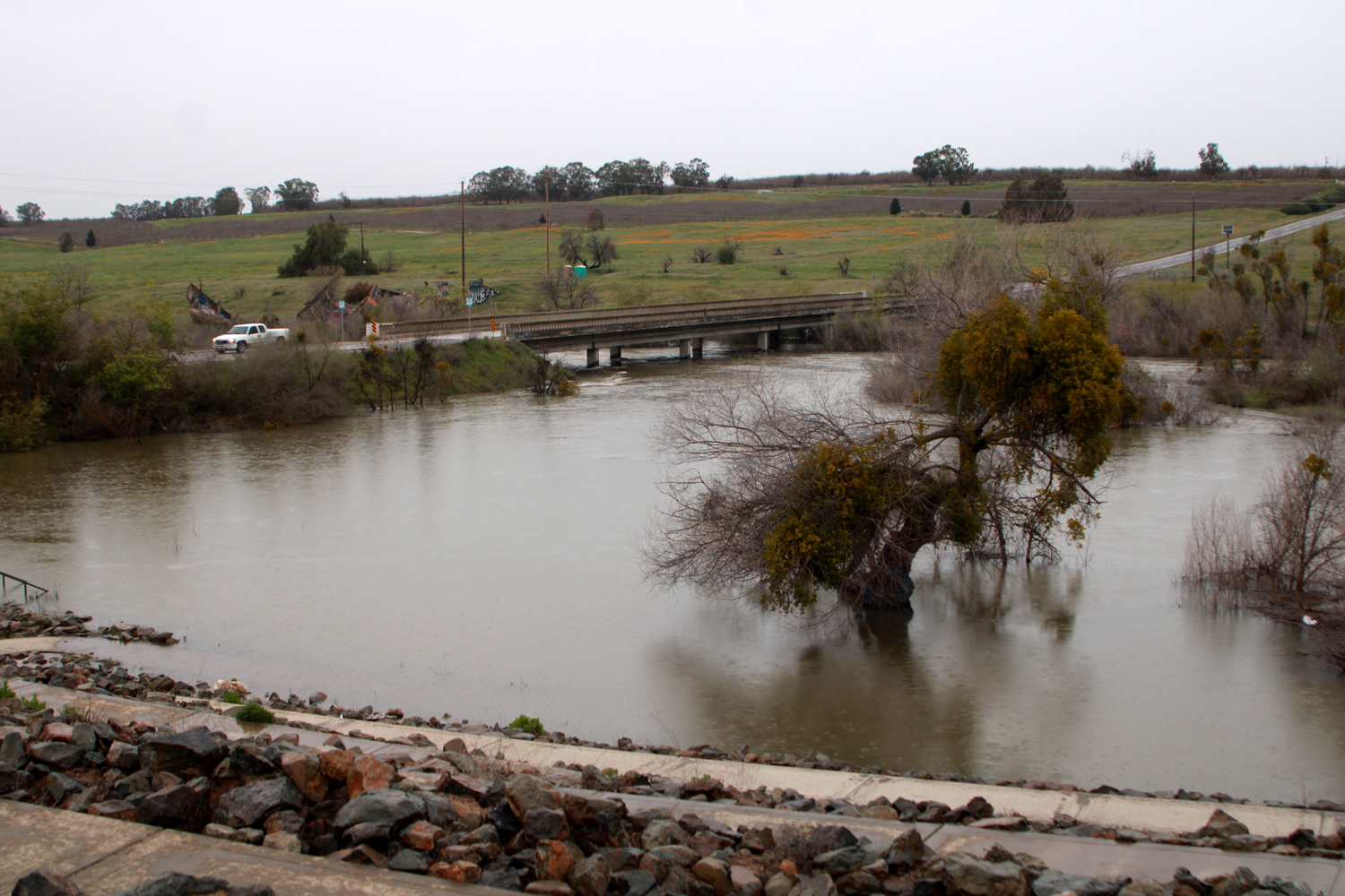
I turned around and went back to Trimmer Springs Road. At this point the route goes north away from the river, running parallel to Hughes Creek for a while, then climbing up over the divide between the creek and river, before dropping down to the lake. After this there were poppies in most areas by the roadside, although not yet in the large numbers we hope to see later. From here on, the road mostly follows the lake shore, winding up and back down the drainages of the two large creeks that enter the lake from the north. Sycamore Creek has been little more than a trickle the last few years, and Big Creek, while larger, has not lived up to its name. On this day both streams were running high, and lured me into stopping for photos and just looking. |
|
 |
 |
| Sycamore Creek from the bridge on Trimmer Springs Road | Looking upstream from the bridge |
|
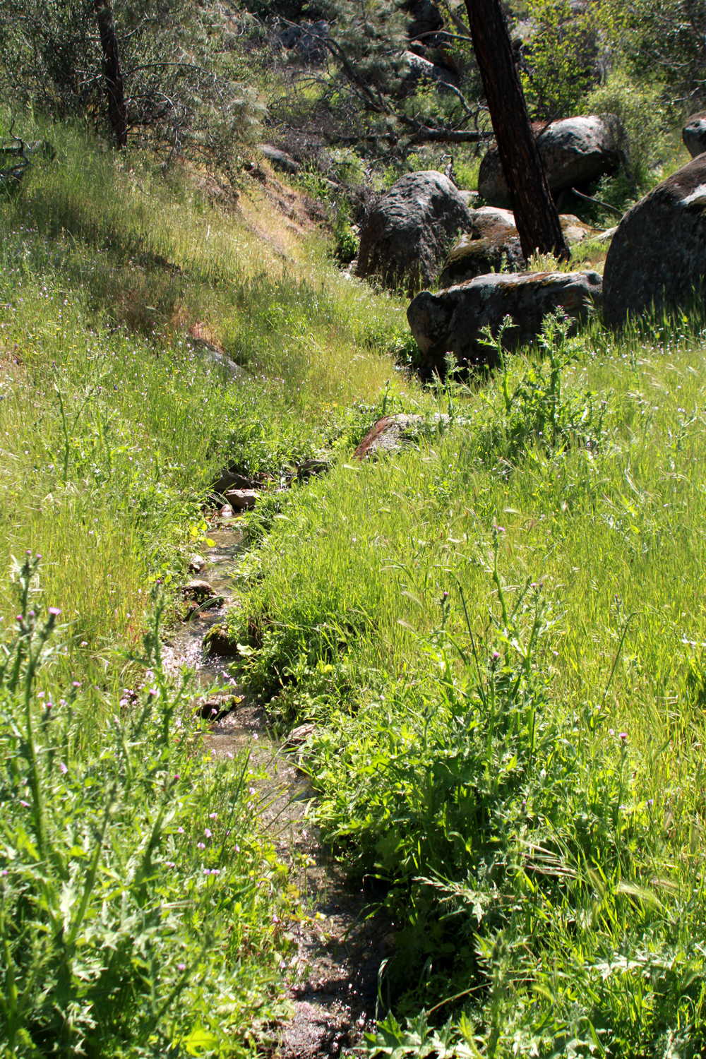
After crossing Big Creek, the road begins a long climb up over Secata Ridge, going high above the lake. Along here there is a creek that tumbles down the western slope of the ridge, creating a series of cascades and waterfalls that are quite impressive after a big storm, and recently we've had rain and more rain. At least two other cars stopped to check out the falls and creek while I was there. |
|
 |
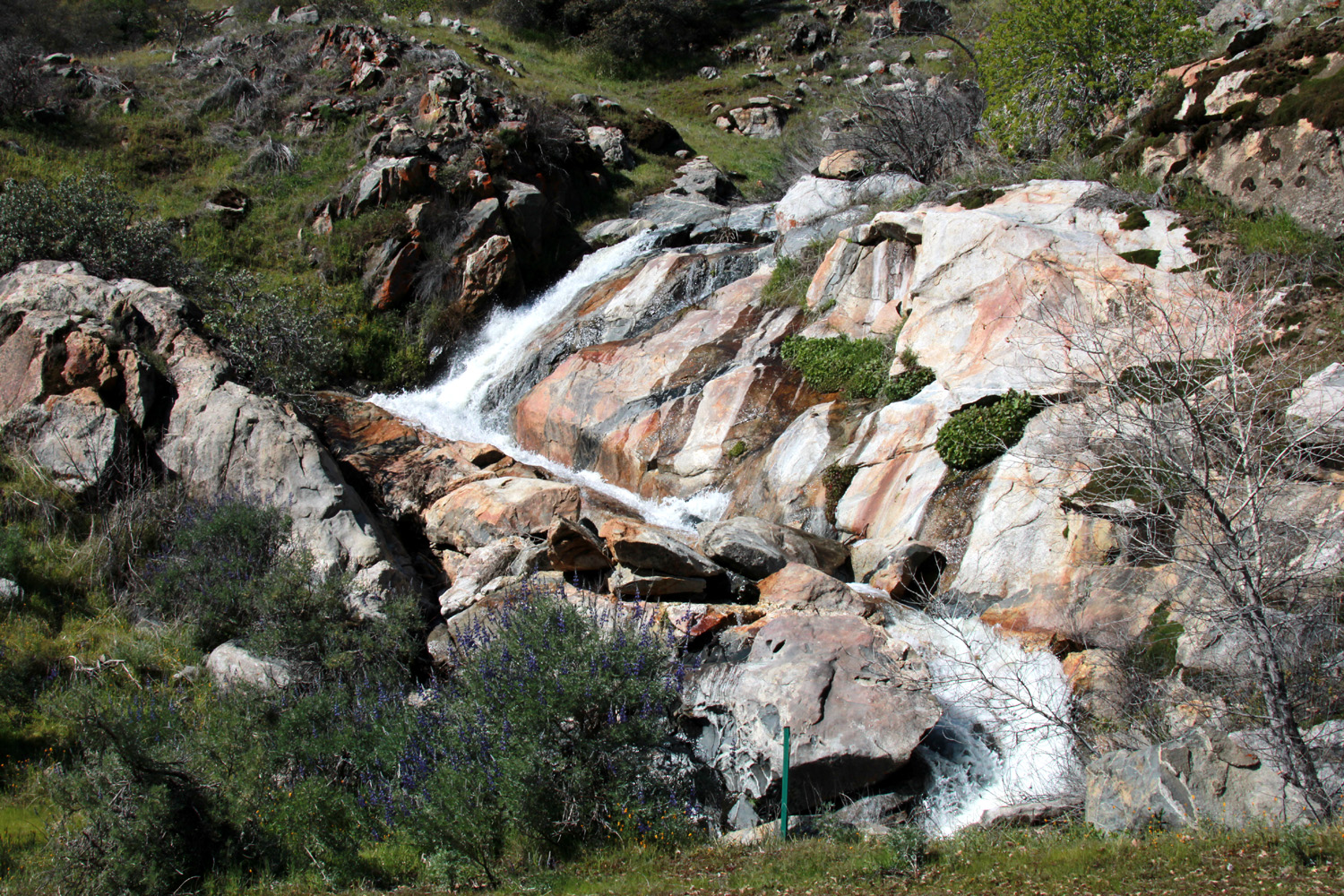 |
| The Falls on Secata Ridge | Where the creek zig zags down to flow under the road |
|
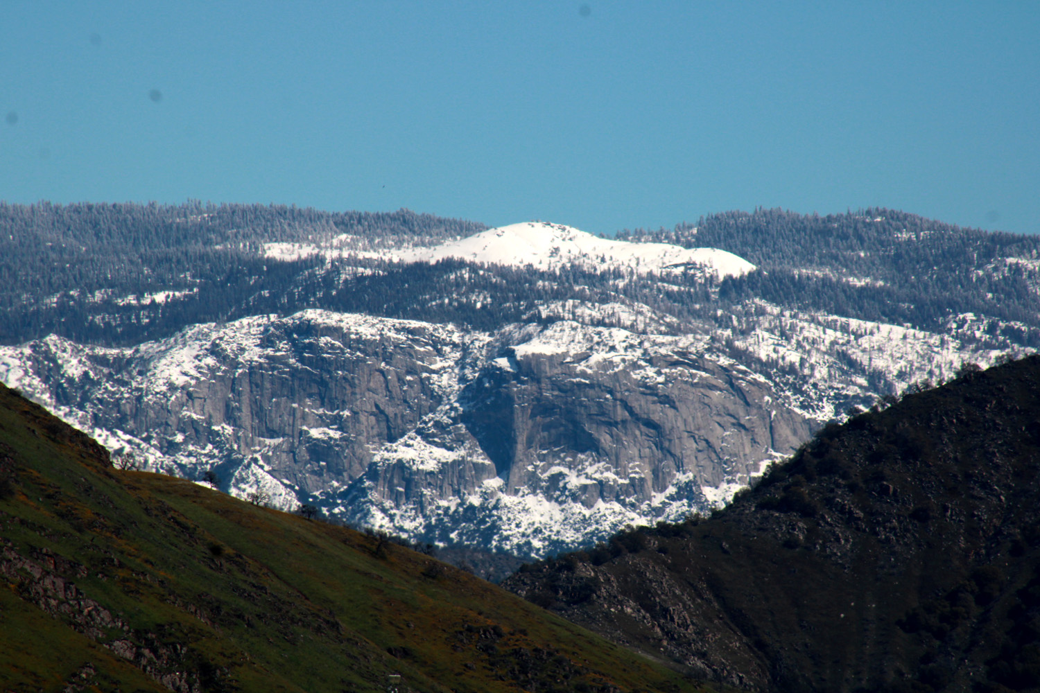
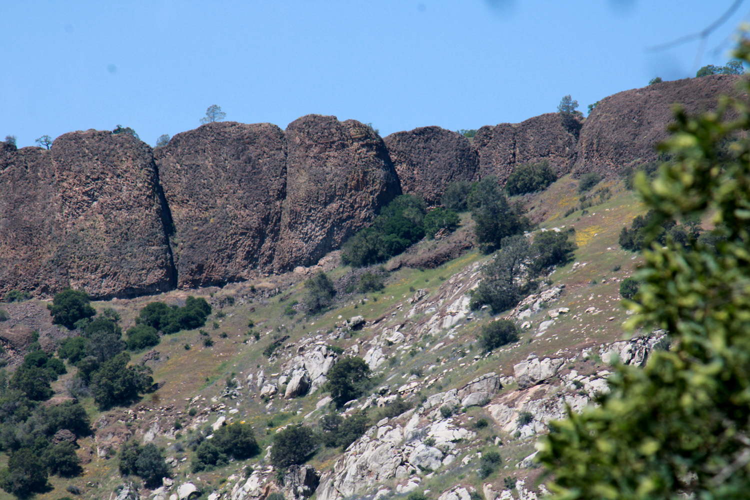
A short time later I arrived at Cell Site Hill, so-called because you can SOMETIMES get a cell phone signal here. It's the highest point on the road between the valley and the upper end of the lake. There's a big open area here with plenty of room to park and enjoy the view down to the lake and up to the mountains. In the past I have always had to drive a few hundred yards farther down the road to see a clear view of Wren Peak, which is the "front end" of the Monarch Divide between the middle and south forks of the Kings. However, I discovered (after stopping here a few dozen times over 40 years time) that I could walk 25 yards down a little slope away from the road and get the full view. All along the road it was obvious that mud had washed onto the pavement, and been cleaned up. The only other vehicle parked here was a big earth mover with chains on four of its six wheels, ready to deal with the next storm. (By the end of the week that storm arrived, flooding areas near rivers and creeks, washing out sections of roadways all over the state, and just generally making the people of this former State of Drought cry "ENOUGH!") |
|
 |
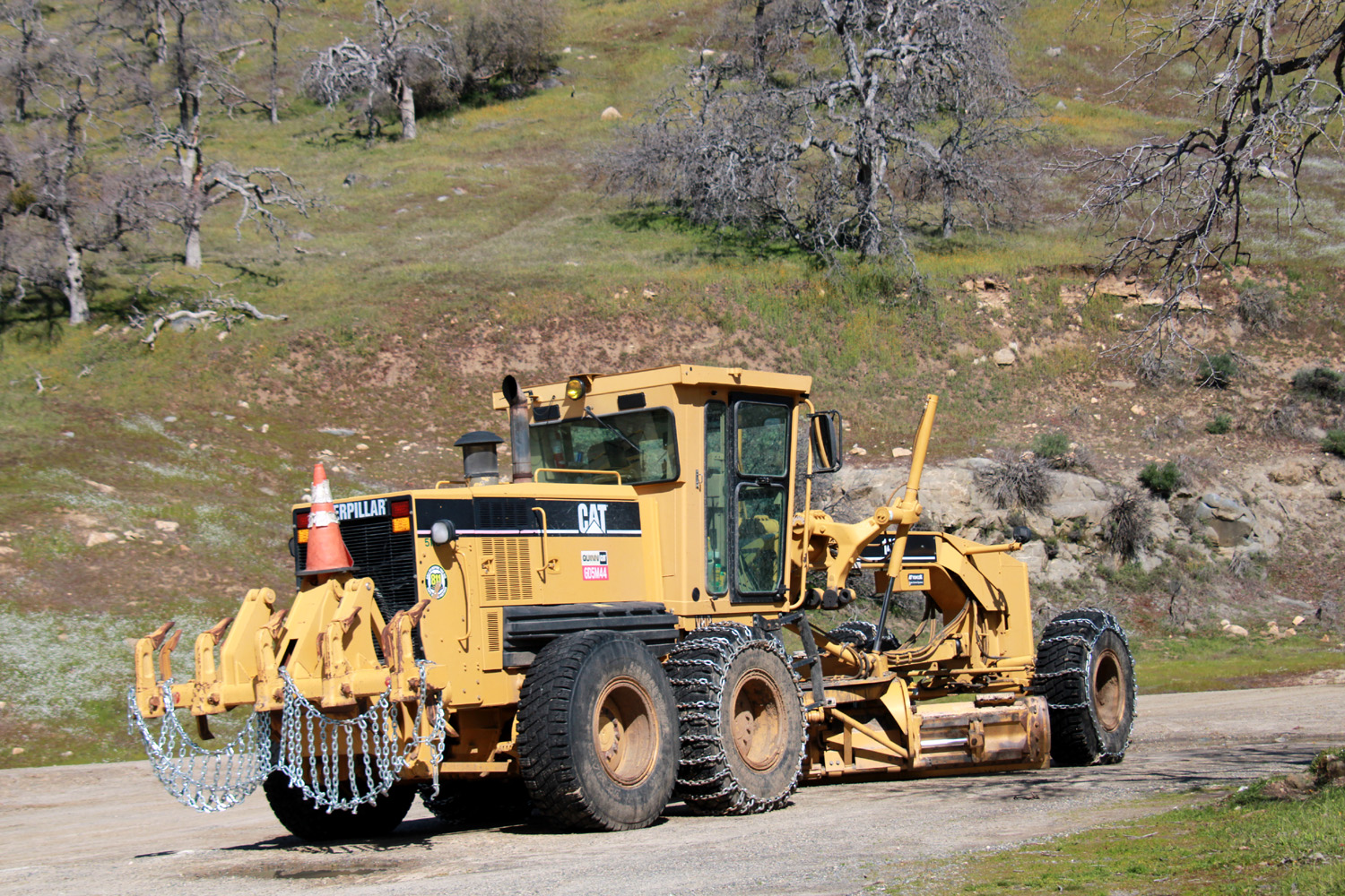 |
| Wren Peak on the Monarch Divide in Kings Canyon National Park | Ready to go to work clearing mudslides |
|
I ate my lunch at this location, then started for home, enjoying the views from a different perspective and stopping several times to capture scenes I had missed on the drive up. By the time I pulled into my garage I had been gone six hours and put 110 miles on my Honda CR-V. I can hardly wait to return to that area in a week or two. --Dick Estel, March 2023 |
|
|
Blue Oak Trail
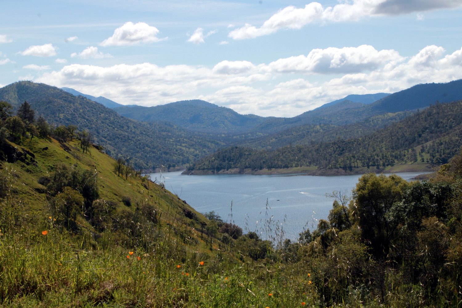
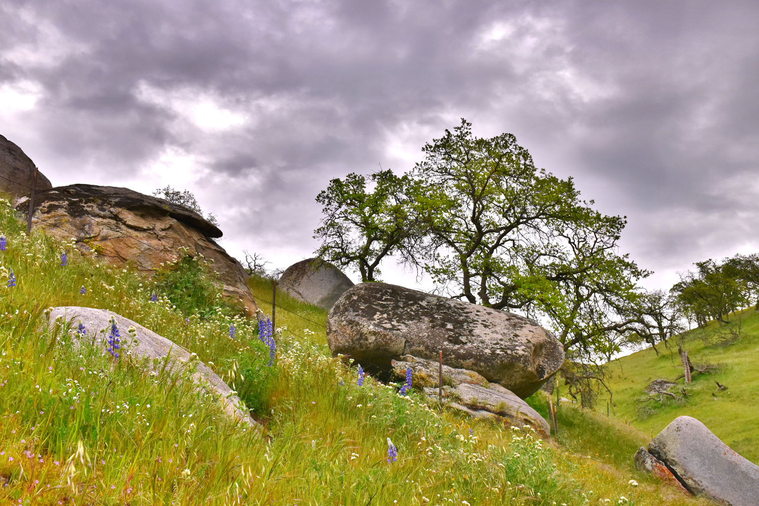
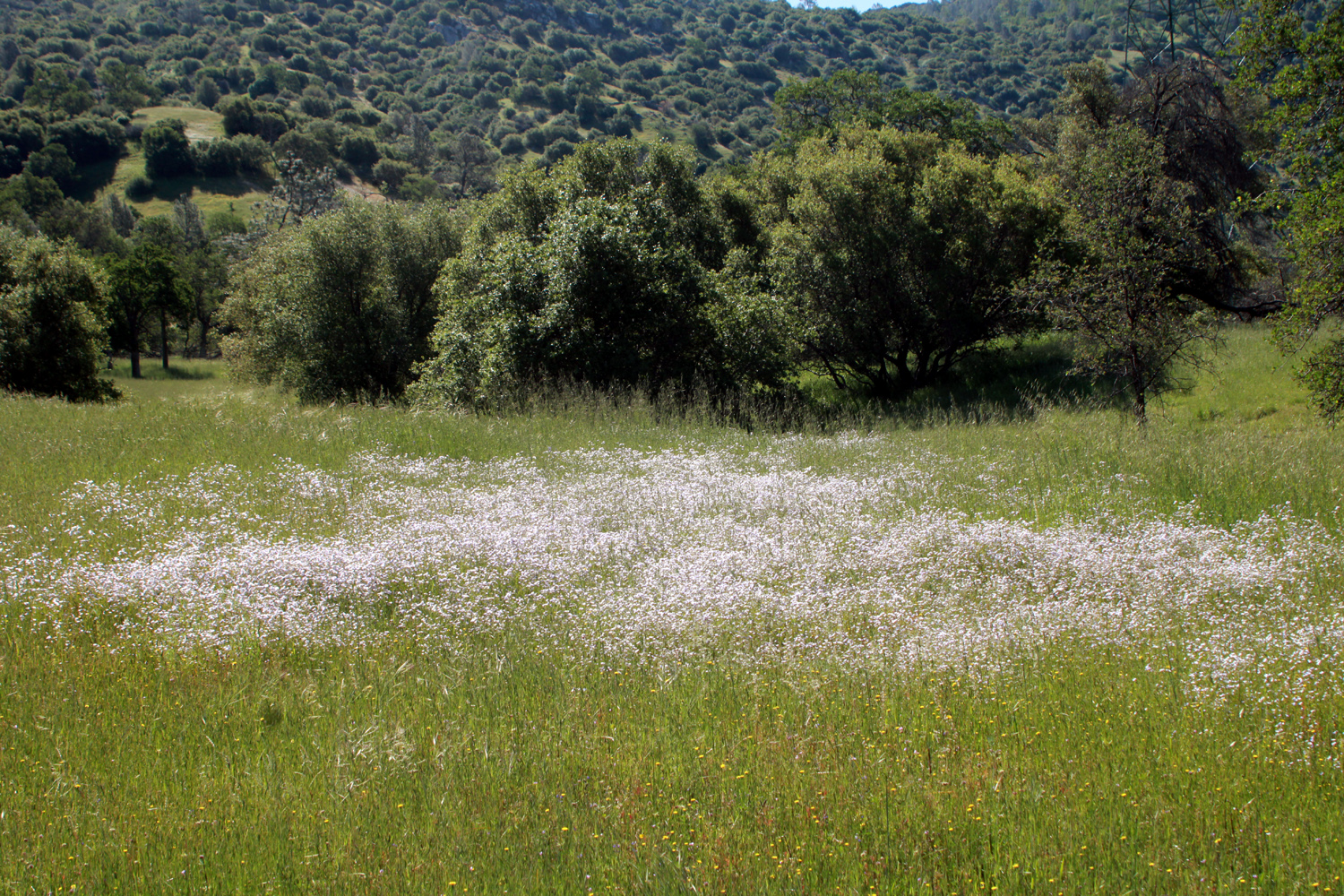
For the second month in a row, the Ramblers hike for March 28 was canceled due to a persistent forecast of rain. Then on the 27th all forecasts indicated that rain would not each our area until after 2 p.m. I attempted to rally a few members of our group to take a chance on a short like. Only Wes Thiessen was available, so he picked me up in his trusty Highlander and we drove to Millerton State Recreation Area and set out on the Blue Oak Trail, which runs along the south shore of the lake for several miles. Although the entire trail is nearly seven miles, we start from a parking area that's probably two or three miles in from the beginning, and hike until we've gone "half of far enough," then return to the car. It was completely overcast most of the time, and the blue water of the lake had turned to slate gray. But the surrounding hills were a lush green, there were lots of wildflowers, and the snow-covered Sierra Nevada reminded us that even when the rain stops, a LOT of water will be coming down the rivers to keep these lakes full. |
|
 |
 |
| Millerton Lake under cloudy skies | Fiddlenecks and popcorn flowers line the Blue Oak Trail |
 |
 |
| A massive display of fiddlenecks | Lots of snow up in the mountains, heading our way |
 |
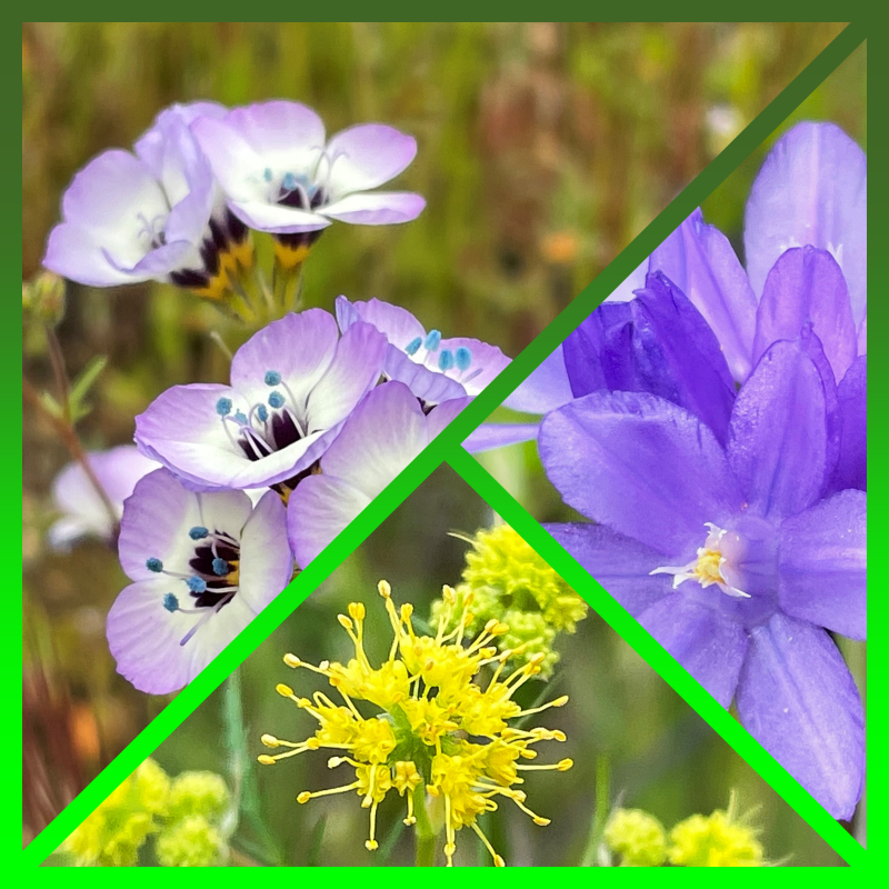 |
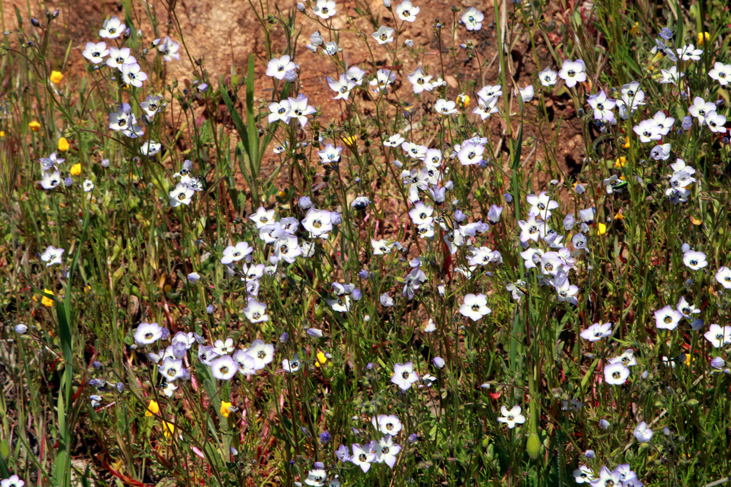
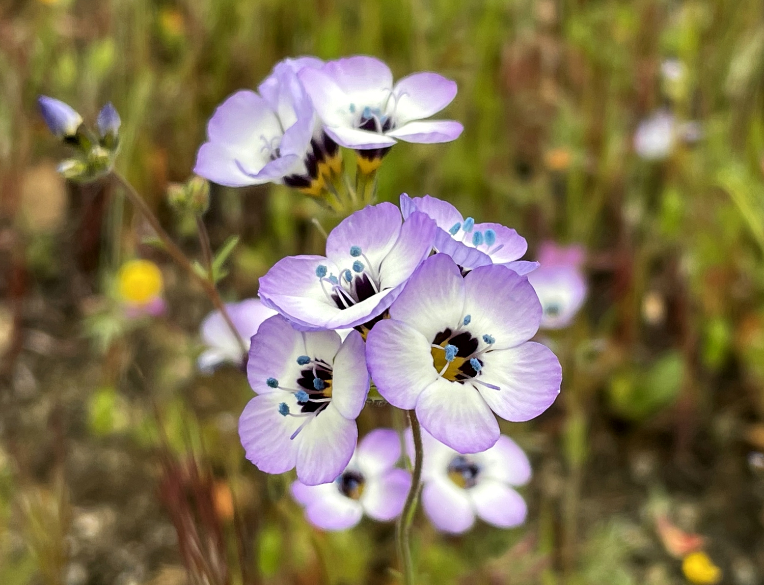
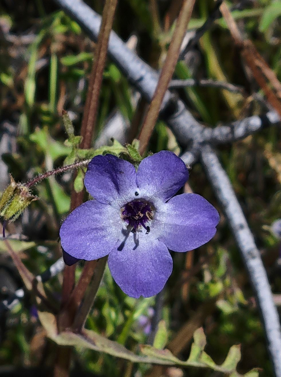
| Bird's eye gillia were out in good numbers |
Wes has an app on his phone that allows extreme
close-ups (More close-up photos below) |
|
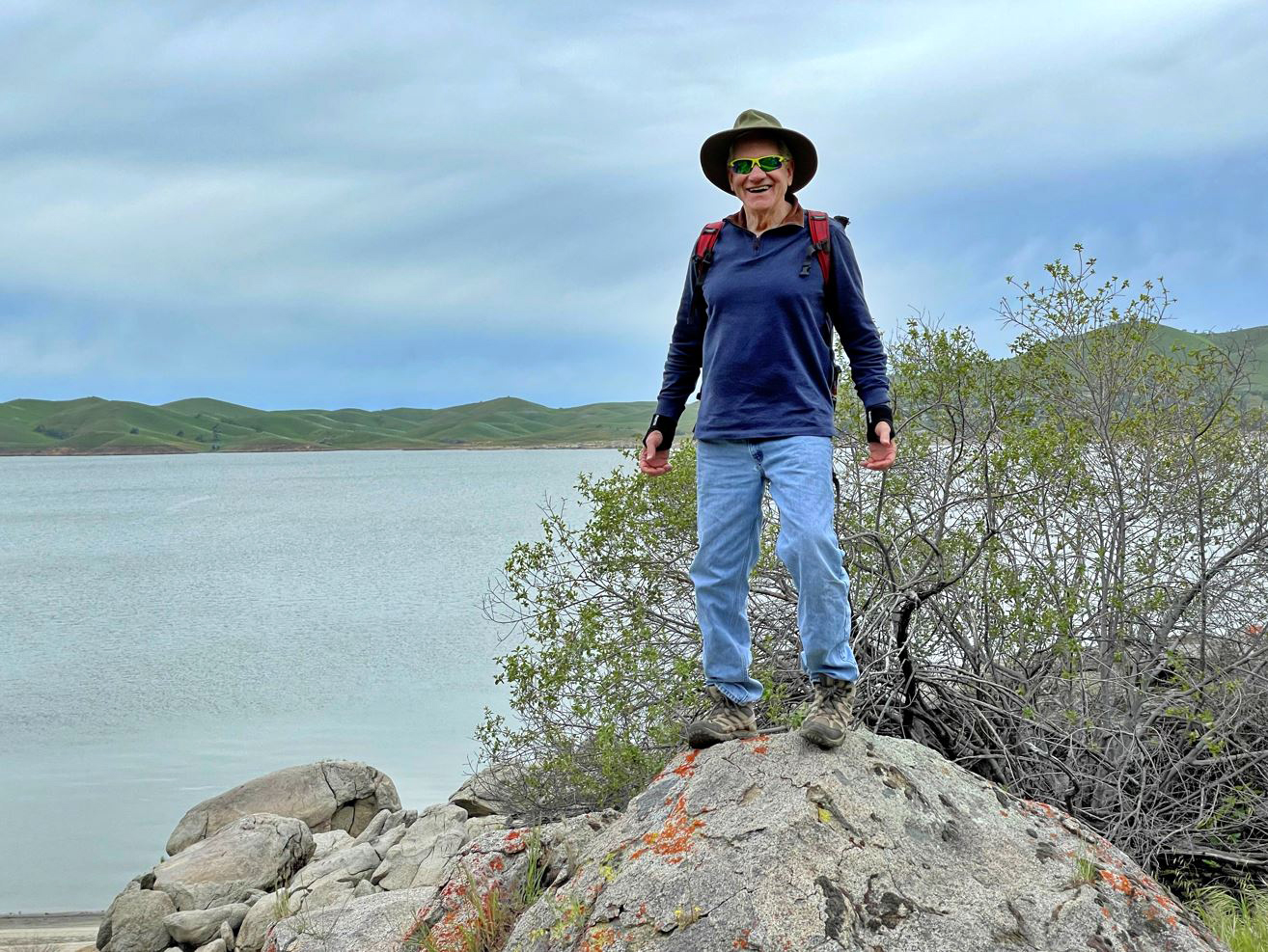
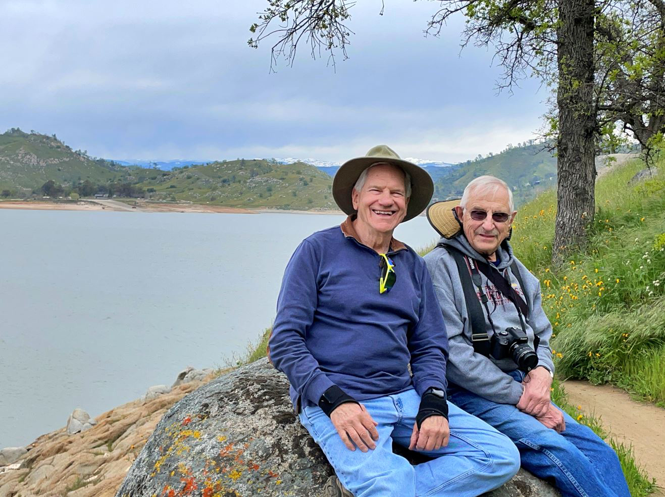
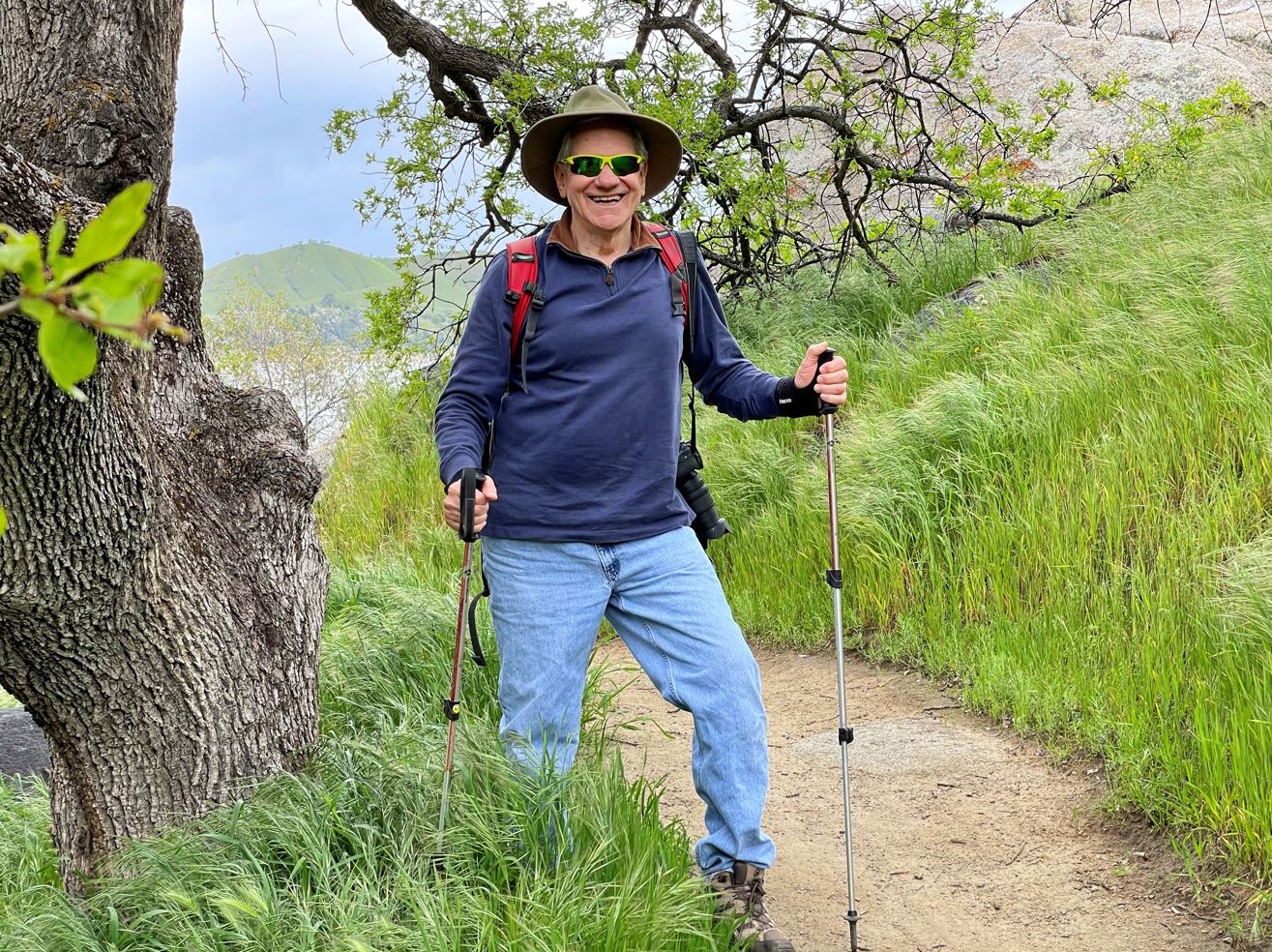
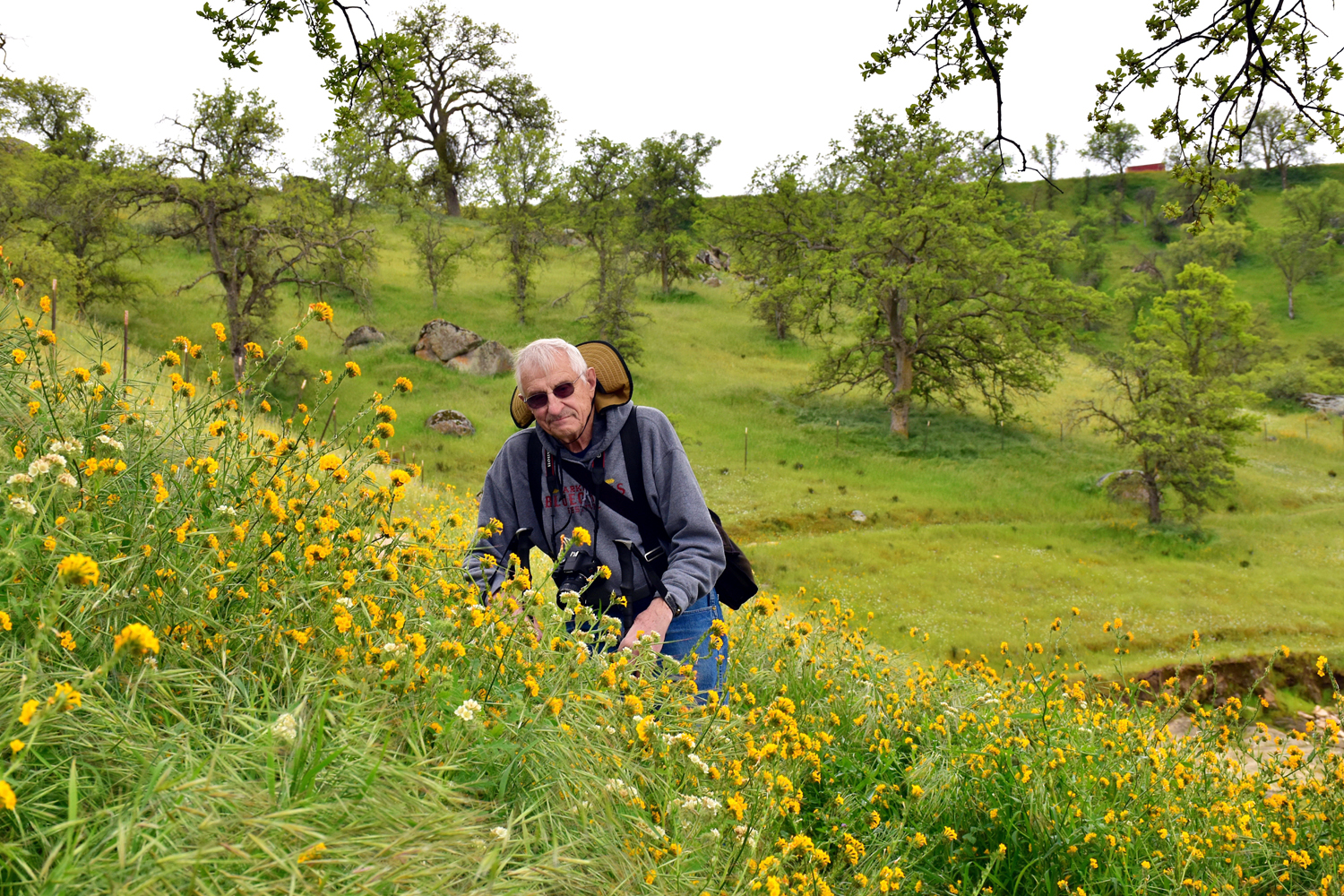
Harkening back to his "younger" days (2019), Wes managed to find a place for the traditional Wes on the Rock photo. Having about ten years on Wes, I confined myself to sitting on a rock, with Wes close by to catch me if I fall. |
|
 |
 |
|
After a period of abstinence from balancing on seemingly precarious locations, Wes is back on the rock |
Wes and Dick enjoy a well-earned rest near the end of the hike |
|
We walked a little over a mile and a half. Although the lake and mountains and trees and especially the wildflowers drew our attention, we also kept an eye on the time and the sky. We got back to the car a few minutes before 2 p.m., and right on schedule, the rain arrived just as we started our drive out to the main road. As we usually do when we're in this area. we had lunch at the Pizza Factory in the nearby village of Friant. Here we encountered another reminder of the effects of the heavy rains that we've experienced since the first of the year. Friant's town water system draws on the lake, and due to the heavy runoff, the water was unsafe to drink. This meant no fountain drinks, but I was perfectly happy to have a canned soda with my sandwich. After lunch I wanted to photograph the mass of fiddlenecks on the hill on the opposite side of the river. We drove across the bridge and then into a new residential development just getting started. There were four nearly finished houses, which we learned are models. We talked with a man sitting in a pickup and learned that sales will not start till late April. At this point most of the work involved leveling the pads where houses will soon appear. Ultimately the planned population is around 10,000. We returned home, patting ourselves on the back for our good timing that allowed us to avoid being rained on, and began discussing our next outing, which will be a Ramblers hike at the San Joaquin Gorge. --Dick Estel, April 2023 |
|
|
Pine Flat and Maxon Road
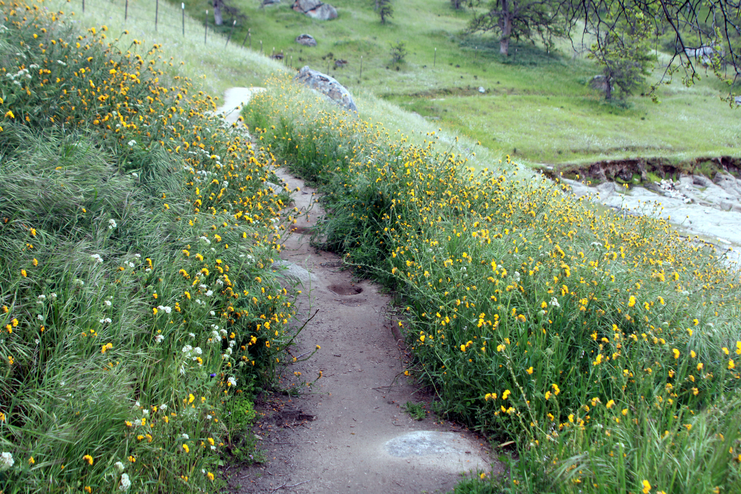
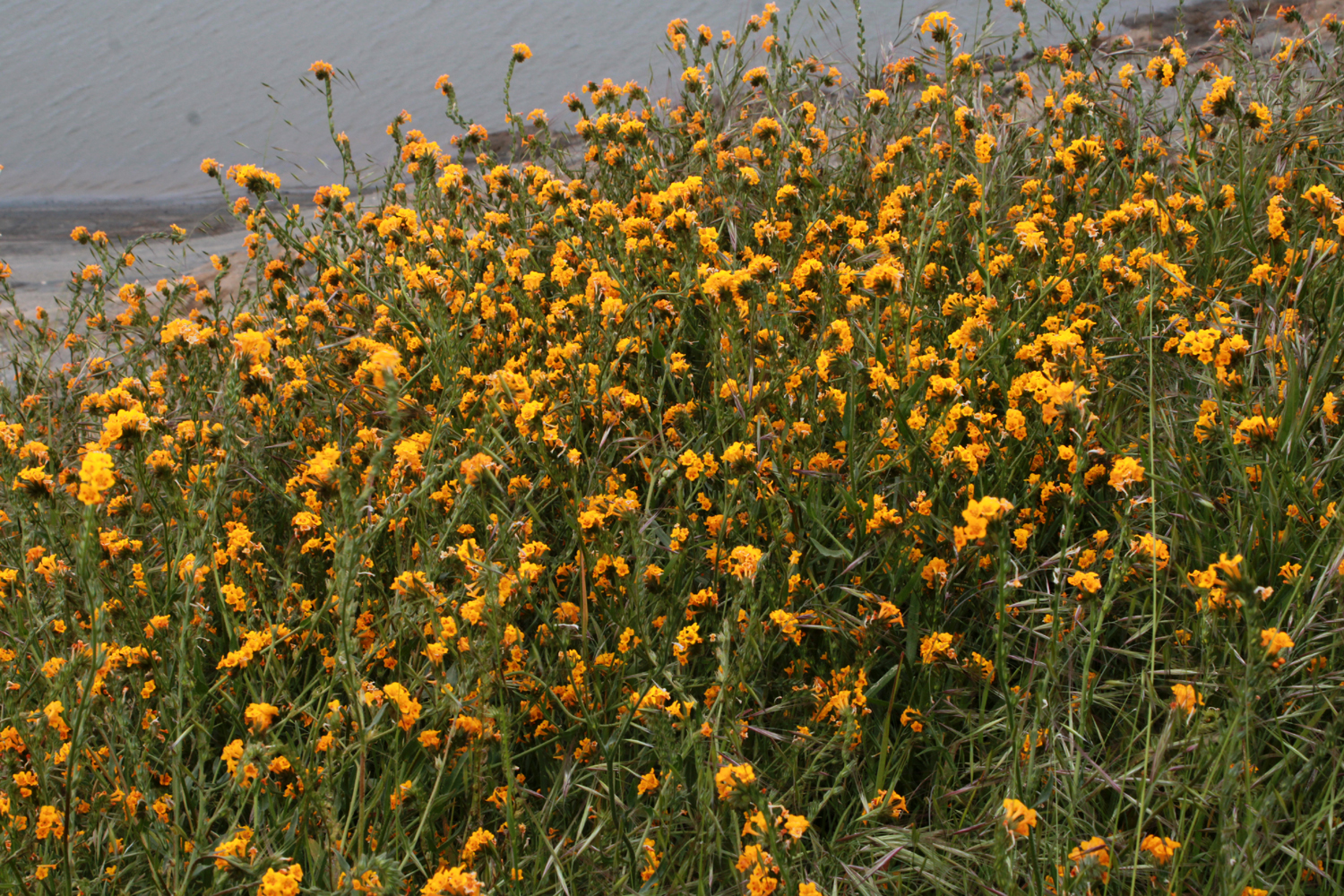
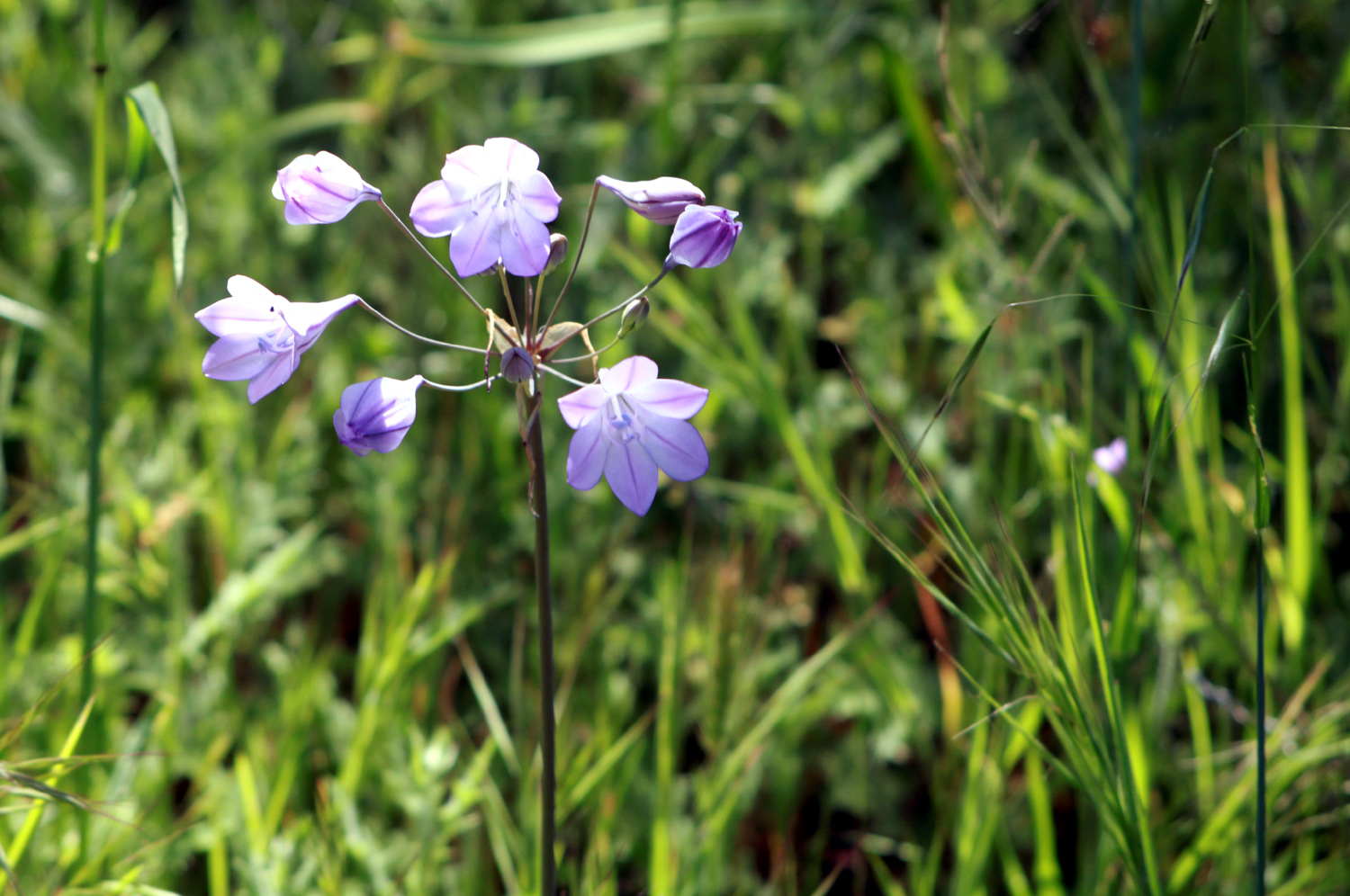
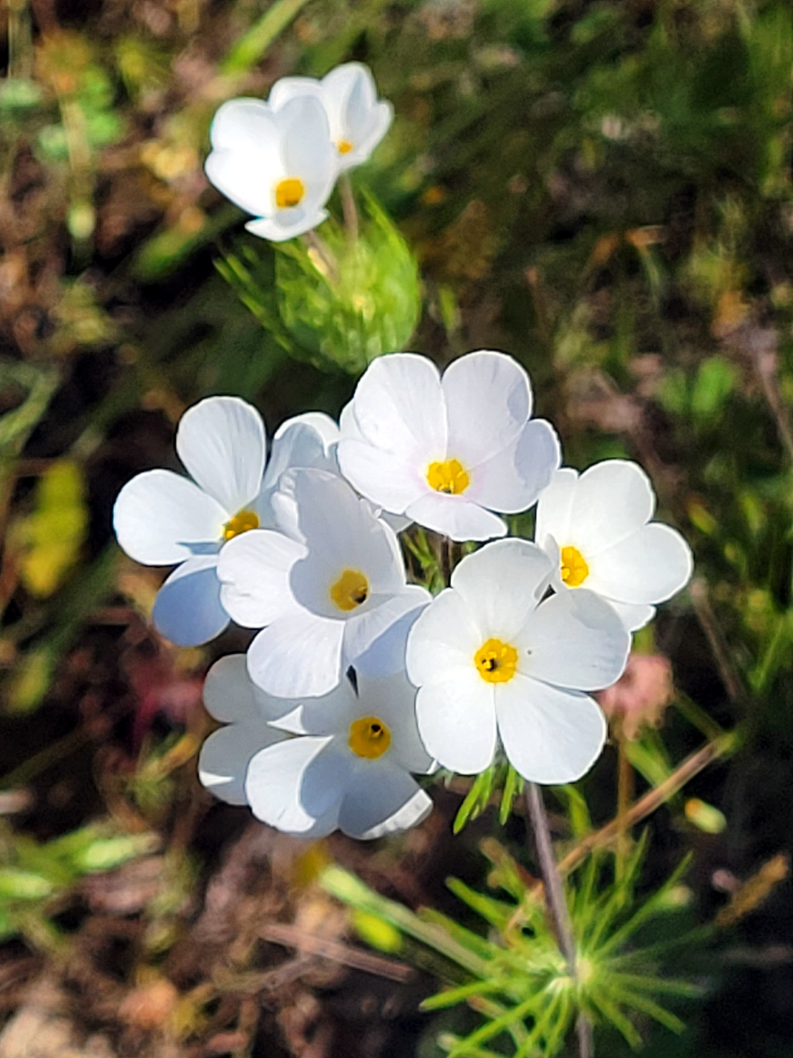
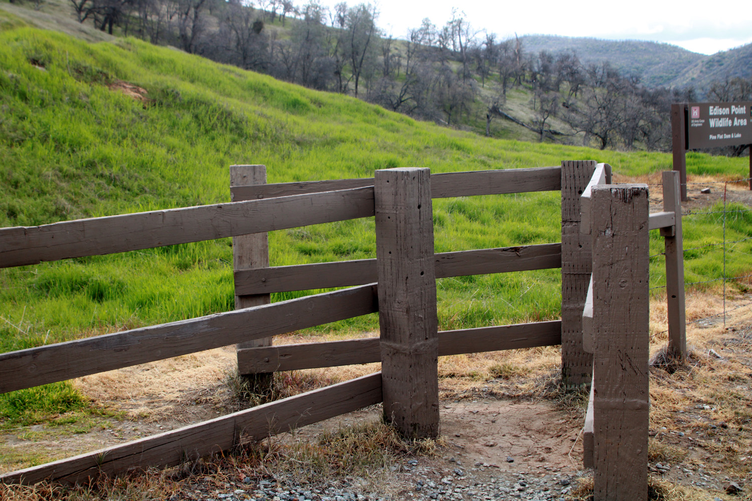
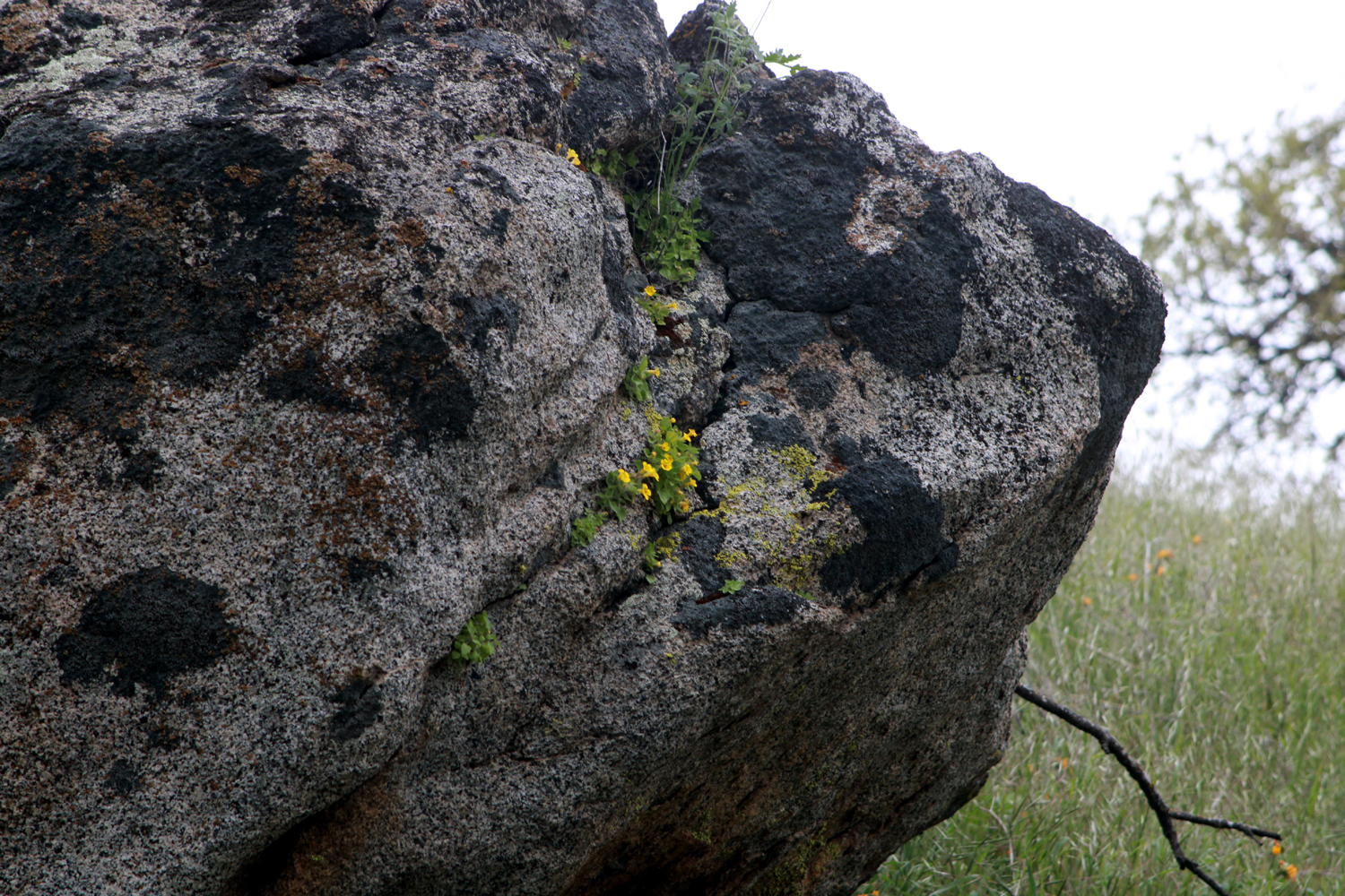
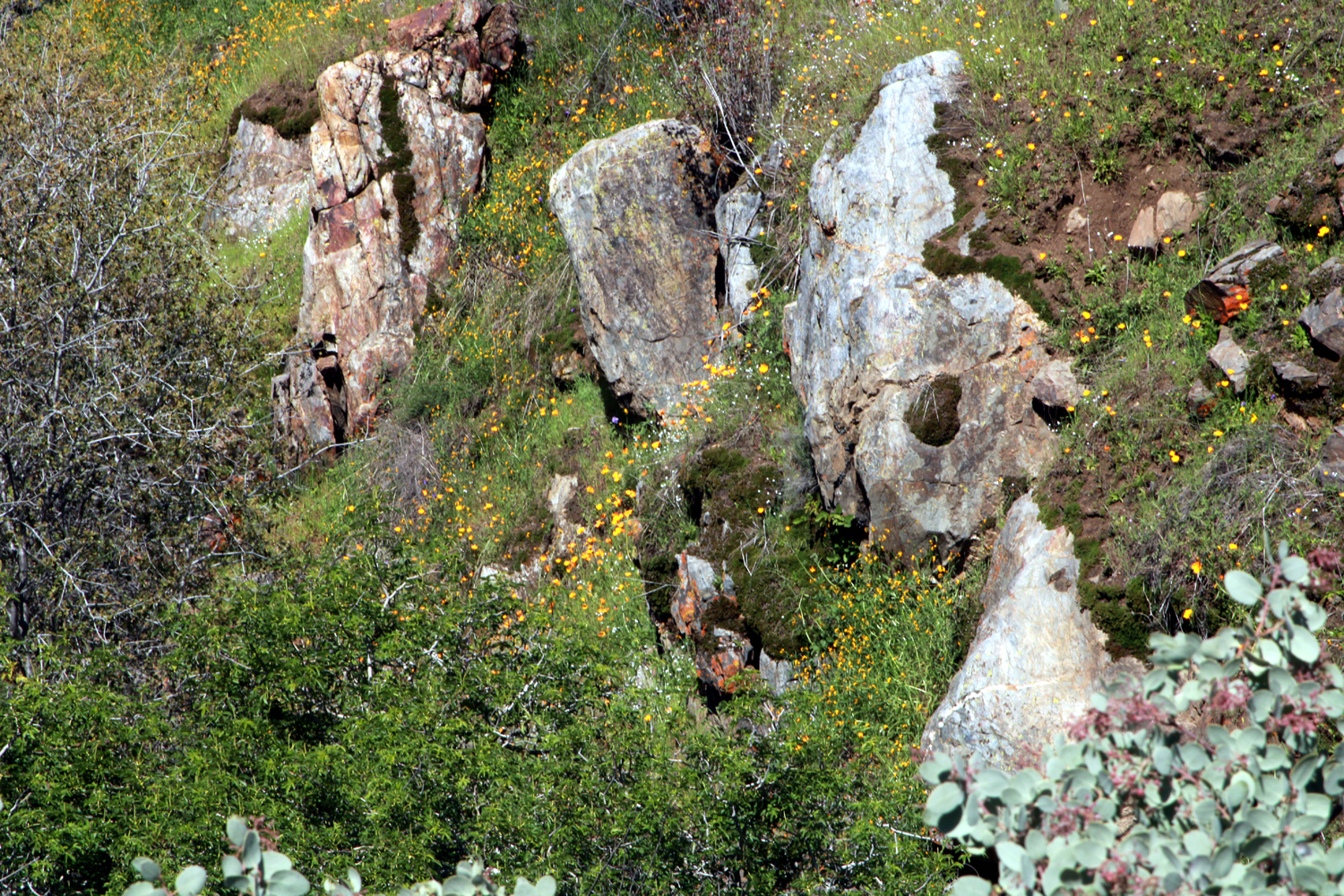
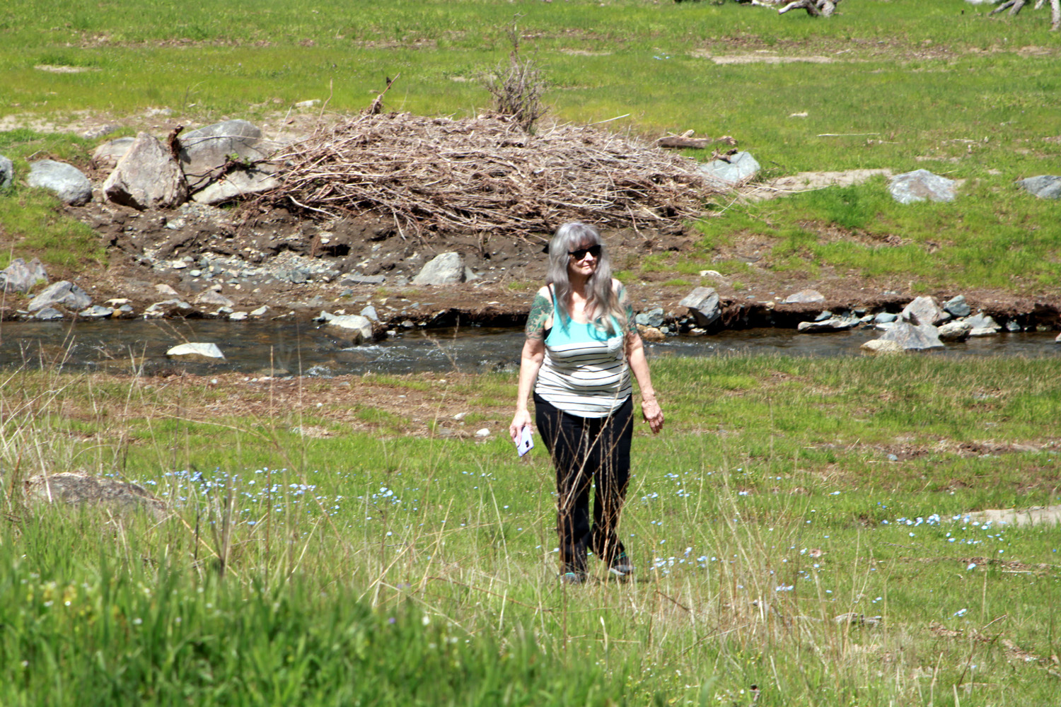
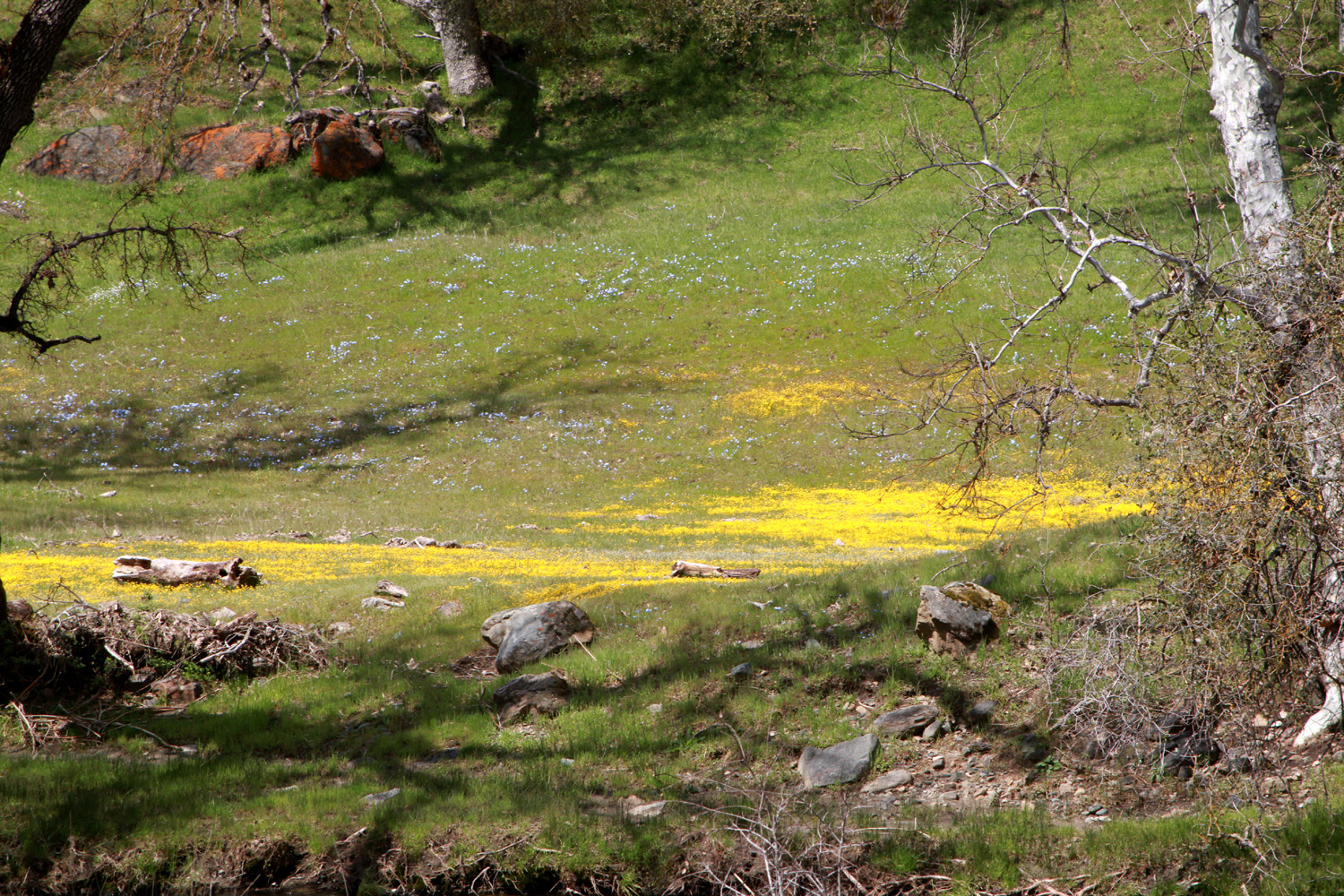
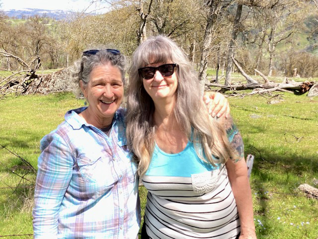
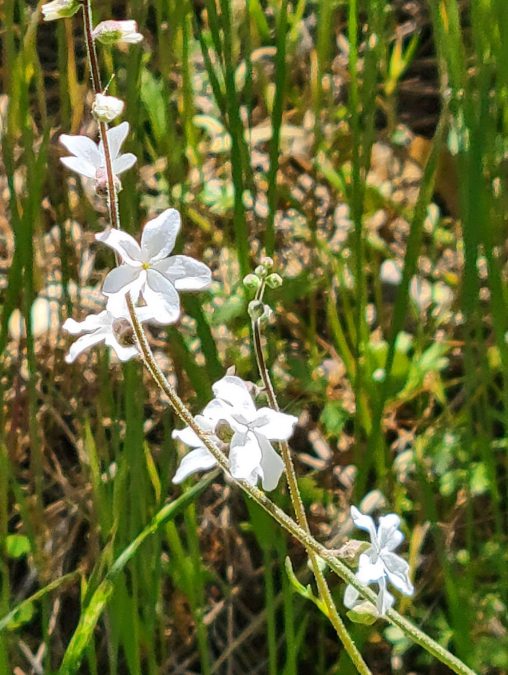
Undaunted by having been turned back in my last attempt to get to the Sycamore Wildlife Area by Pine Flat Reservoir, we headed that way again on April 1. This time I was accompanied by my daughter Teri, her mother Jackie, and her friend Monica, who was visiting after moving to Texas a few years ago. It was a much nicer day, with sunshine and clouds, and temperatures above 60 degrees. When we reached Kirkman's Point, the annoying LED sign that announced the road closure was still in place, but as before, we had to see for ourselves (and also visit the facilities at Trimmer Campground). At this point Maxon Road goes more or less north from Trimmer Springs Road, taking the adventurer through cattle ranching country with green hills, good size creeks, and copious wildflowers. Before we reached the Trimmer area we stopped where a small stream that I've named Little Salamander Creek crosses the road, flowing down its canyon to the lake. There were poppies blooming in the rocky slope of the canyon, and a small patch of bird's eye gillia. We've seen only small, scattered examples of these flowers in the last few years, but conditions this season are apparently just right and there are large patches in all the foothill areas we visit. |
|
 |
 |
| Looking down the valley of Little Salamander Creek to Pine Flat | It's a good year for bird's eye gillia |
|
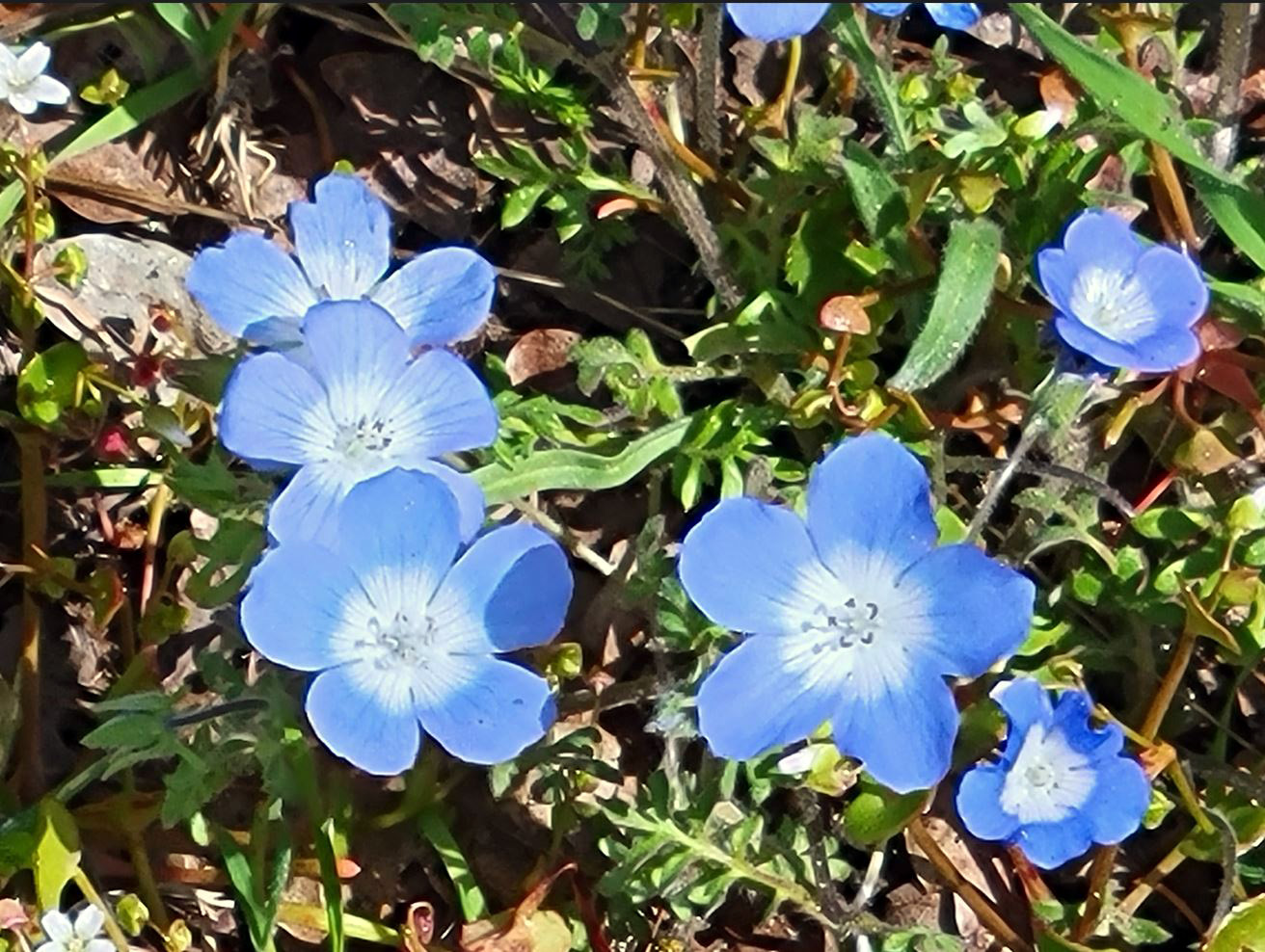
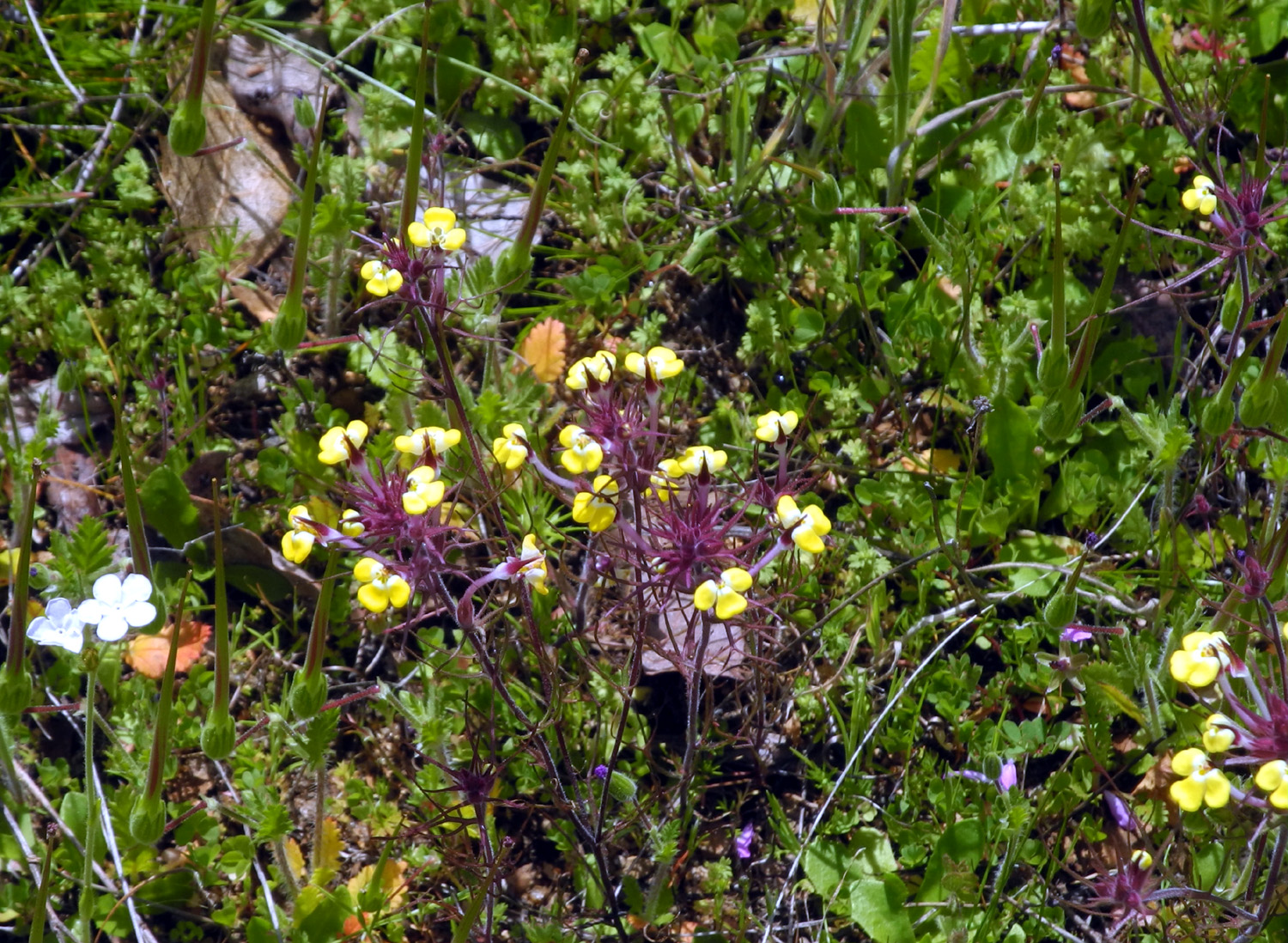
We made a number of stops along Maxon Road, wherever a stand of wildflowers caught our eye. The unique plant known as ham & eggs was thick in some spots, mainly where we had seen them on previous trips. These seem to be fairly rare, since I had not seen them anywhere for decades until they made an appearance in two locations a few years ago. A big favorite, baby blue eyes, were thick in some areas, along with the usual ubiquitous popcorn flowers and fiddlenecks. We passed a striking bush lupine, then stopped and backed up on this lightly traveled road so that I could get a photo. |
|
 |
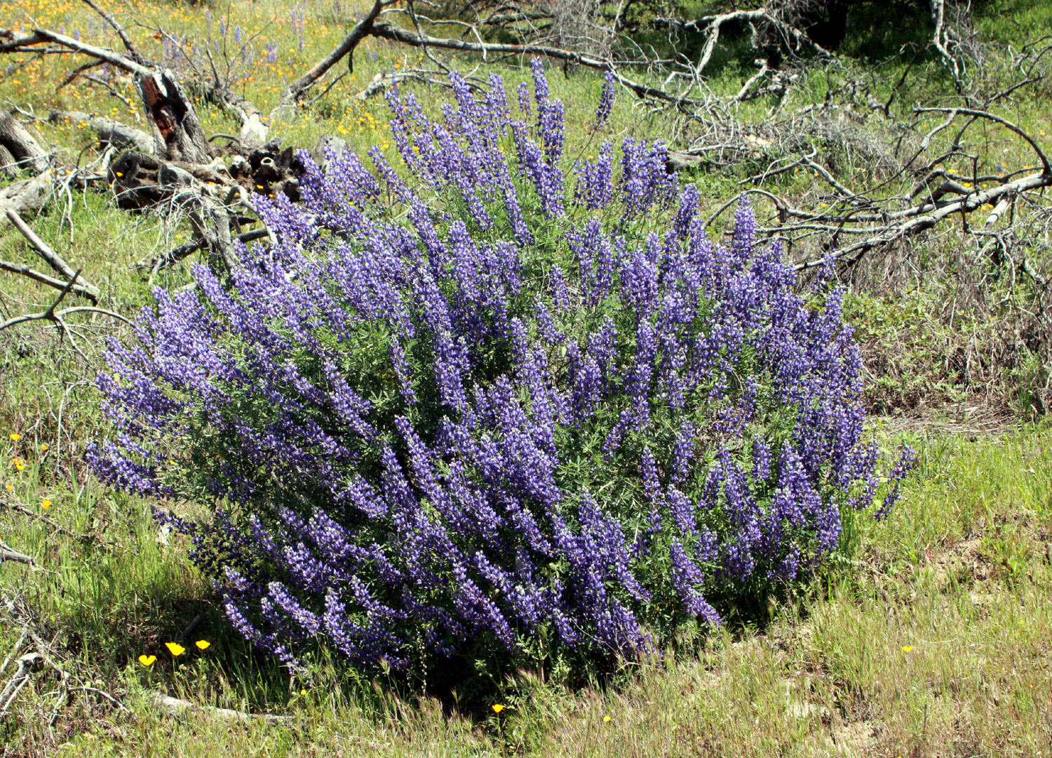 |
| Everyone loves this popular flower, baby blue eyes | Bush lupine along Maxon Road |
|
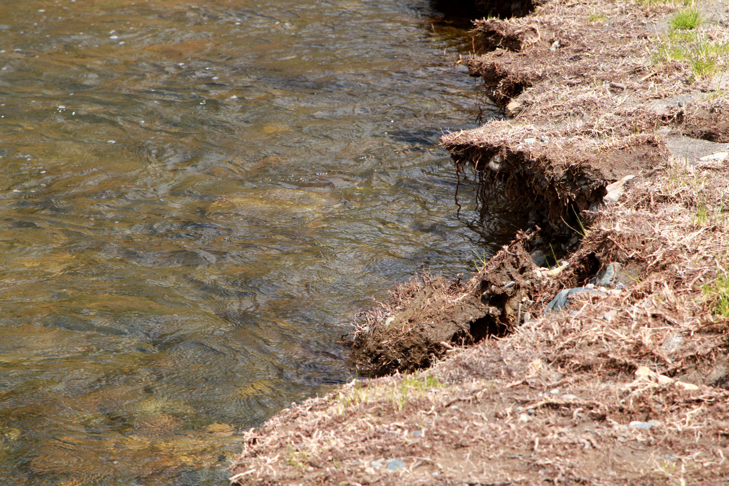
After going up and down over several hills, we came down into the valley of Watts Creek, where we stopped for lunch. We set up our chairs in a flat spot about 50 feet from the creek and enjoyed good food, good company, and amazing scenery. The line of debris 20 to 30 feet from the main creek bed showed that during the peak storm runoff this unassuming little stream had been a raging torrent about 100 feet across. |
|
 |
 |
| Line of debris show how high the water was during peak runoff | Watts Creek, back to its usual tranquil self |
|
Once we finished eating and taking photos at this point, we continued on our journey back to the city. Maxon Road ends at the junction with the Watts Valley Road, which took us up to just under the 2,000 foot elevation level before dropping back down and eventually back to the San Joaquin Valley. At the junction with Pittman Hill Road, Watts goes south and eventually make a sharp turn west and becomes Ashlan Avenue, which you can follow all the way across the city and well west of the metro area to where it dead ends at Grantland Avenue. But of course, we only went as far as my place in Clovis. The day was pleasant and the flowers delightful, and we all look forward to our next jaunt into the foothills. For Monica, her next jaunt may be a year or two away, but the the beauty of the central California foothills will always lure her back. --Dick Estel, April 2023 |
|
|
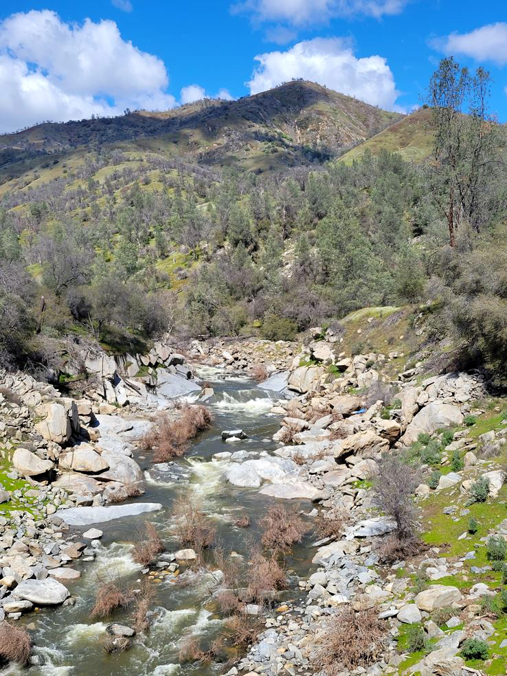
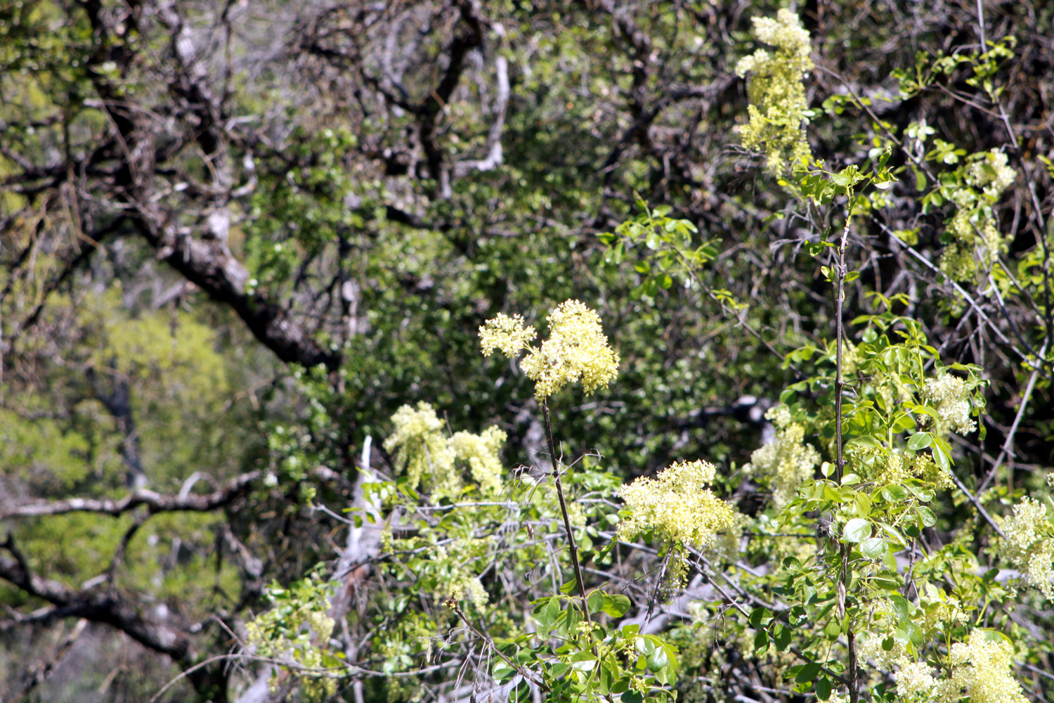
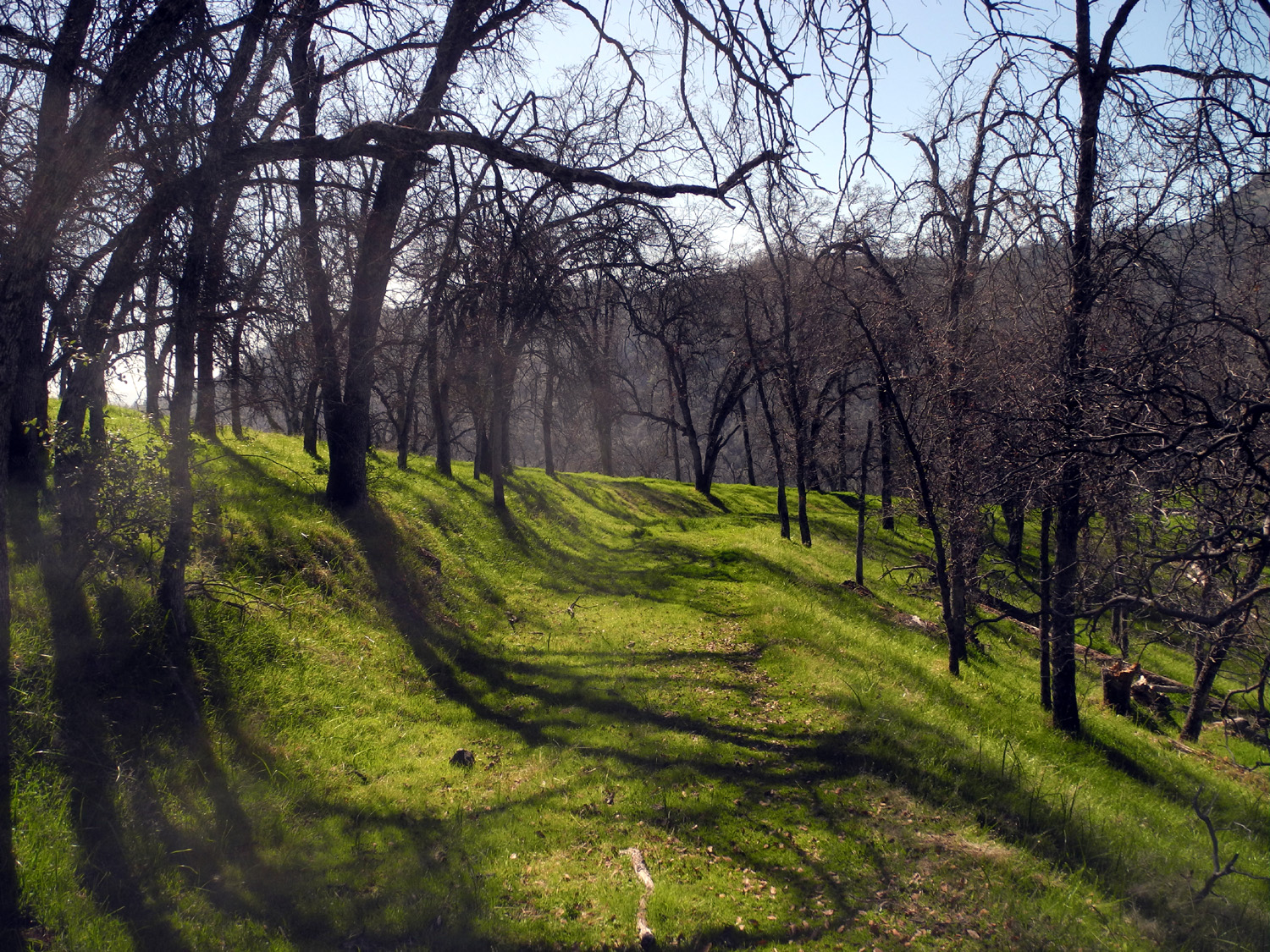
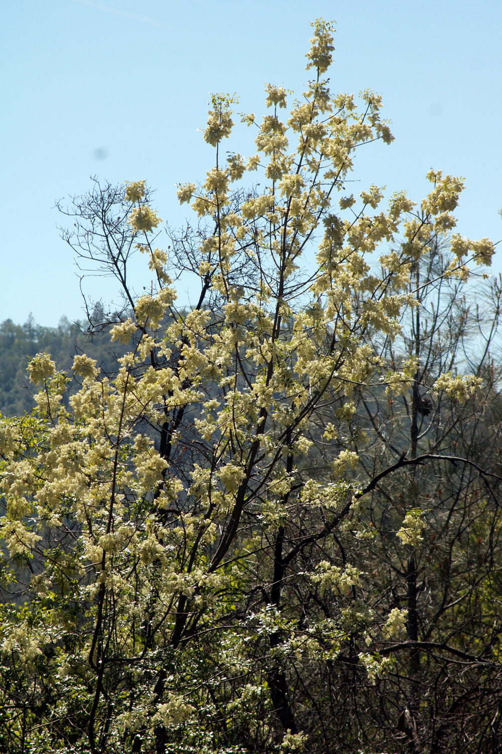
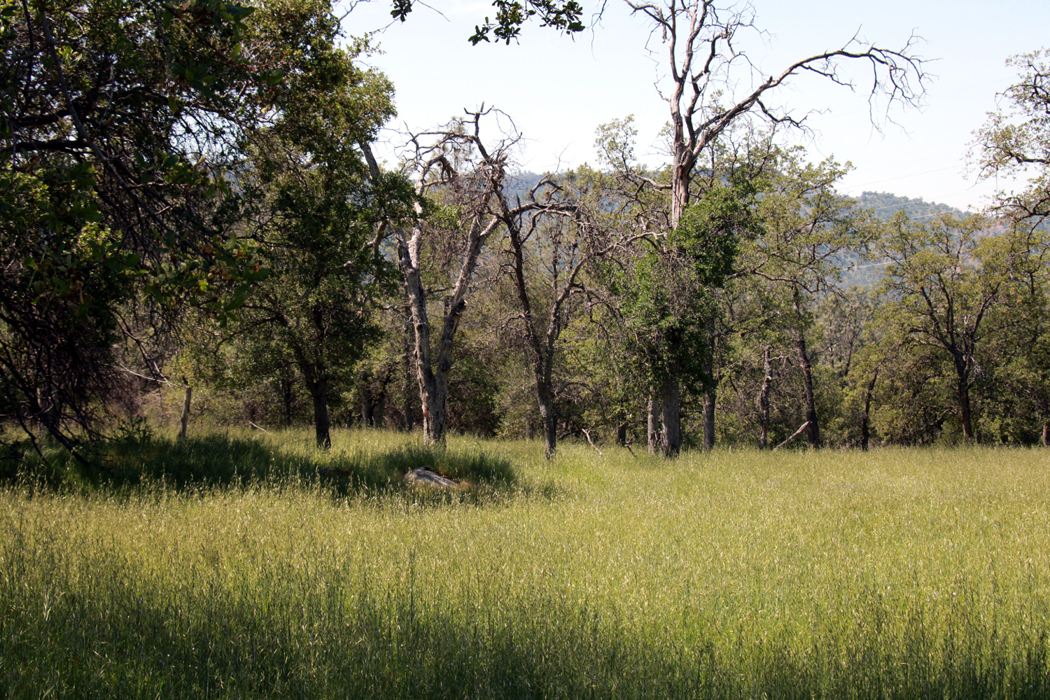
Sycamore Fire Road If you are a faithful reader of these reports (and have a good memory), you already know a few things about this location: It may or may not be a fire road. Since I gave it the name, you won't find it on the map. I've gone there nearly every year since 2014. Having been in the upper Pine Flat Lake area several times this spring, I was eager to make another trip and see what wildflowers are showing off, and also check out conditions on the trail. It's not an official trail, but rather an old road, probably related to ranching or mining, that goes up from the north side of Trimmer Springs Road just past the Sycamore Creek crossing. In most places it's more of a cow path than anything else, and the hiker usually has to bushwhack around trees that have fallen across the trail. For the very first time, there was another car parked at the trailhead, and eventually I met its owners, two men who were hiking out. I've never before seen anyone on the trail that did not arrive with me. On the drive along Trimmer I had seen a wild turkey running across the road, another unusual sight - they usually stroll slowly along, like teenagers crossing at an unmarked intersection. I also saw and stopped to photograph some flowering trees that we had noticed during our Ramblers trip to the area on Monday, April 17. I could not get a really good photo, but perhaps one of my botanically skilled readers can offer an identification. |
|
|
|
|
|
|
| Do you recognize this flowering tree? |
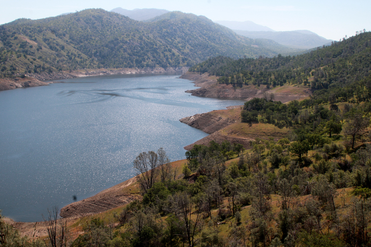
The lake has been lowered to 40% of capacity to make room for the coming snow melt |
|
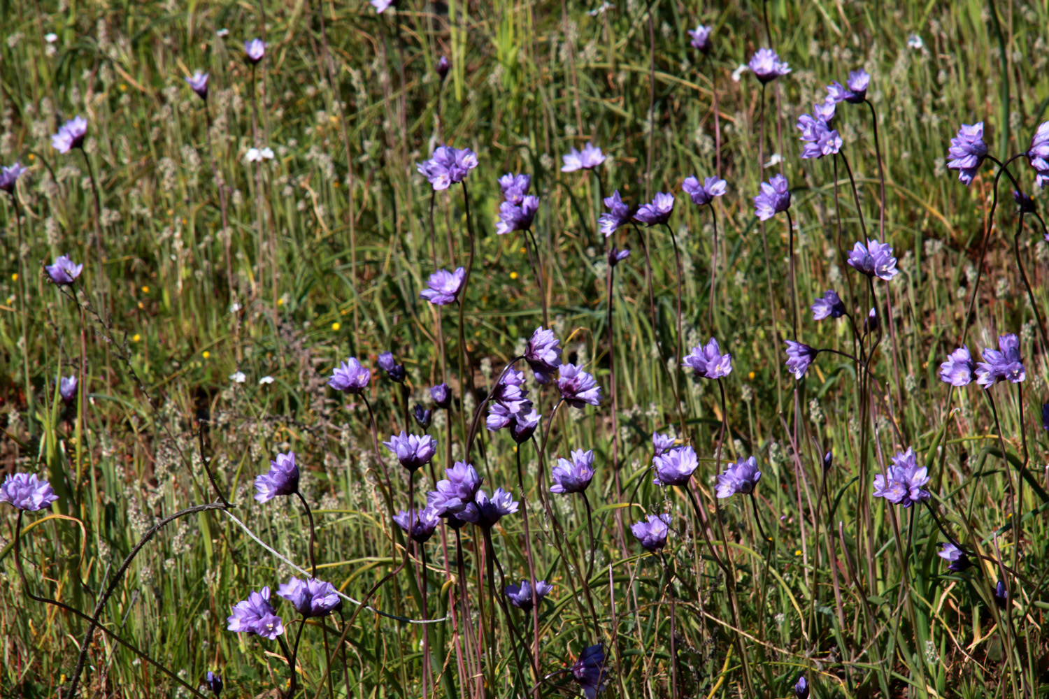
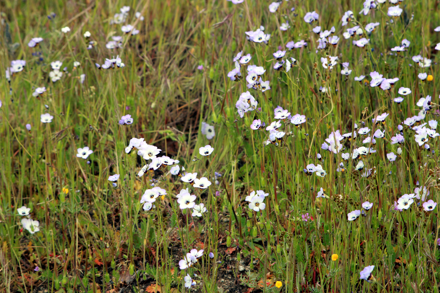
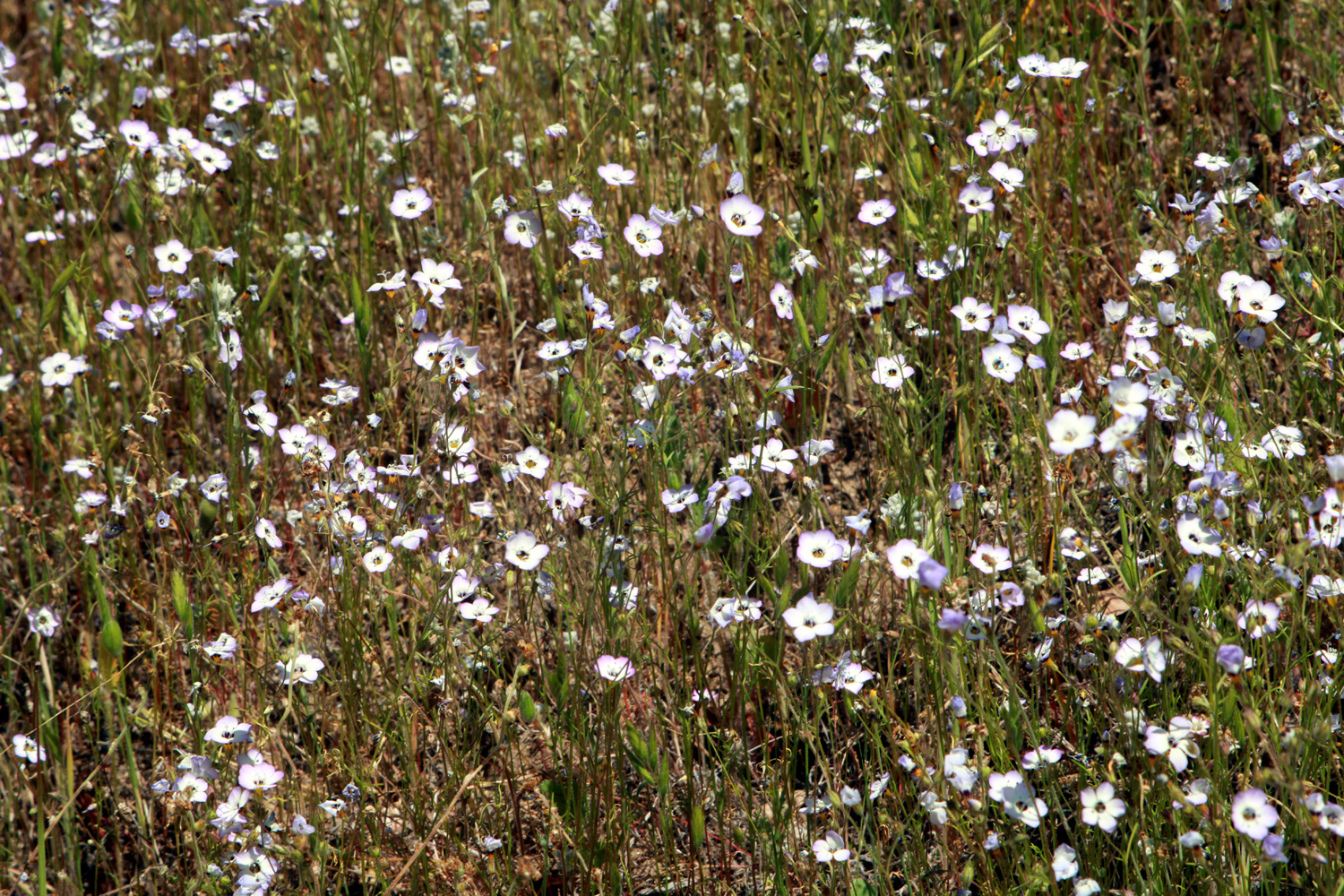
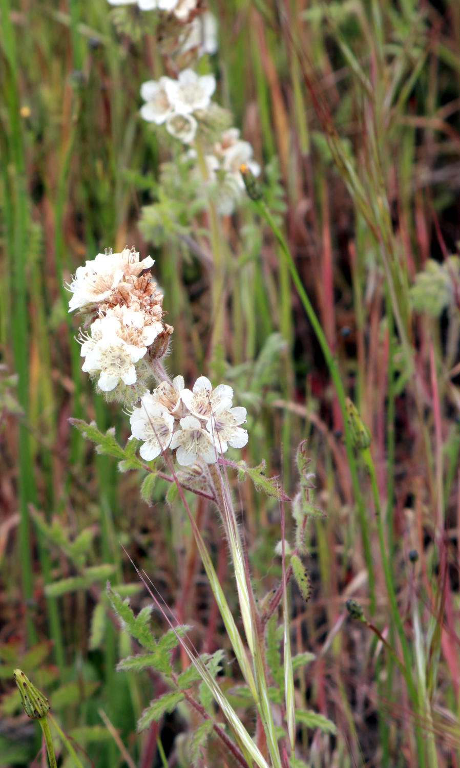
On Friday, April 21 the weather was warm but not excessively so, with no clouds and only a light breeze. There are a number of seasonal creeks that cross the trail, but they had all been dry the last few times I came here. This year there were five running creeks, a couple of them requiring stepping through muddy, mushy spots. The flowers were plentiful, with a few remnant samples of the earliest blossoms, and big patches of one of the later ones, bird's eye gilia. I would like to say a few words in praise of this flower. Wes Thiessen and I first noticed them and identified them when we hiked at Eastman Lake on the Chowchilla River in 2016. They appeared there in large pinkish patches and were also thick on the hills at the San Joaquin Gorge. We've observed them every year since, but never in such large numbers -- until 2023. While some blossoms that usually create sheets of color on the hills were a little sparse this year, the bird's eye seem determined to take advantage and have their own banner year. There were large splashes of color in several locations on this hike, and a few days later I discovered they are also numerous at the San Joaquin Gorge. |
|
|
|
| Bird's eye gilia line both sides of the trail | A closer look |
|
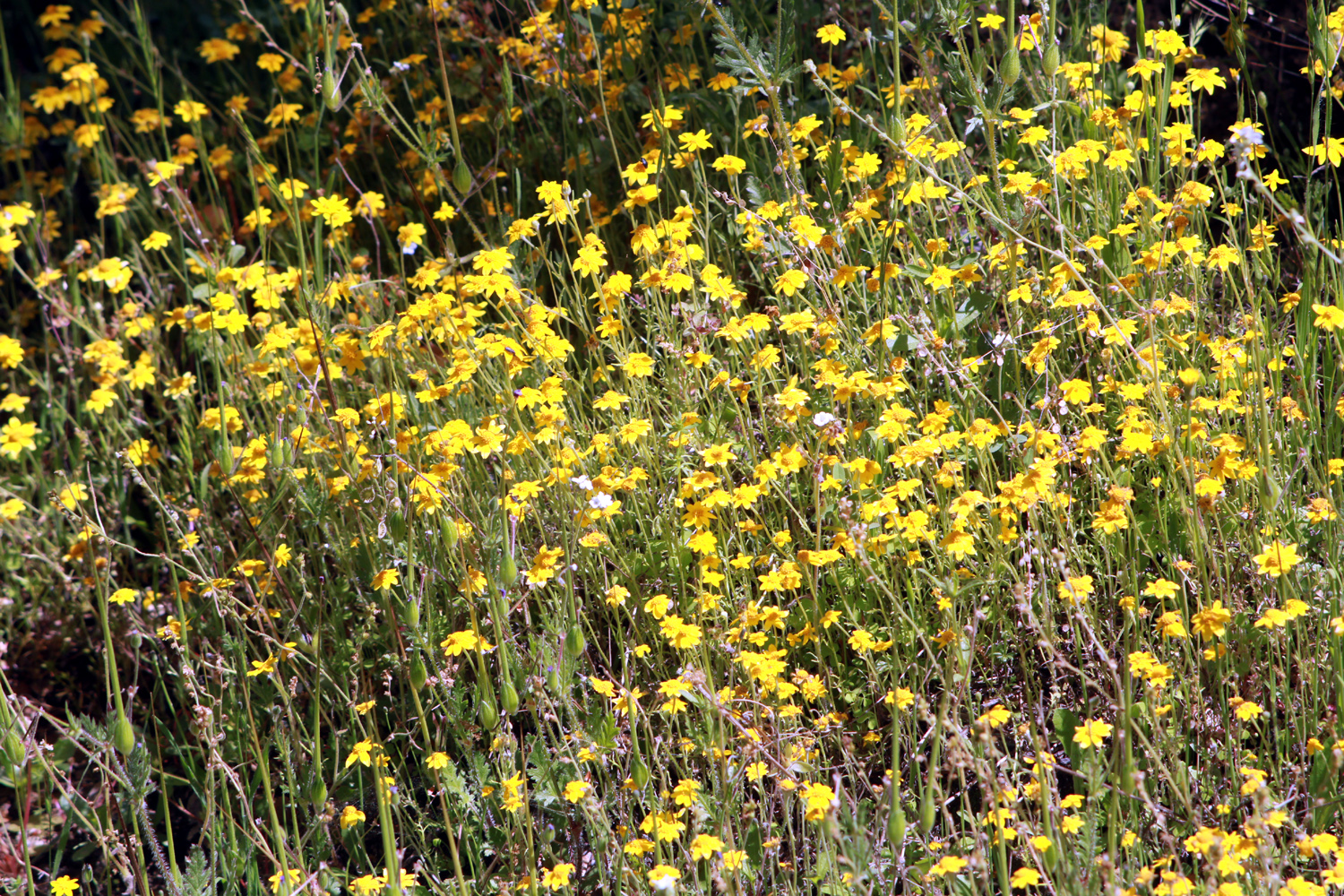
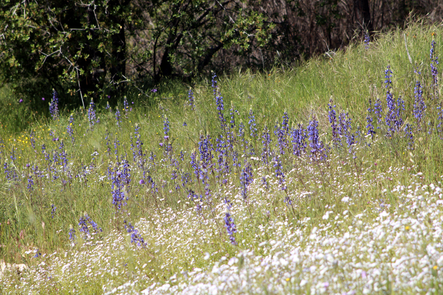
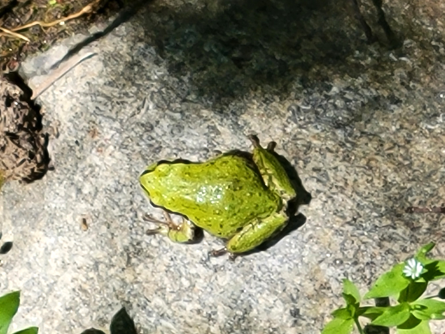
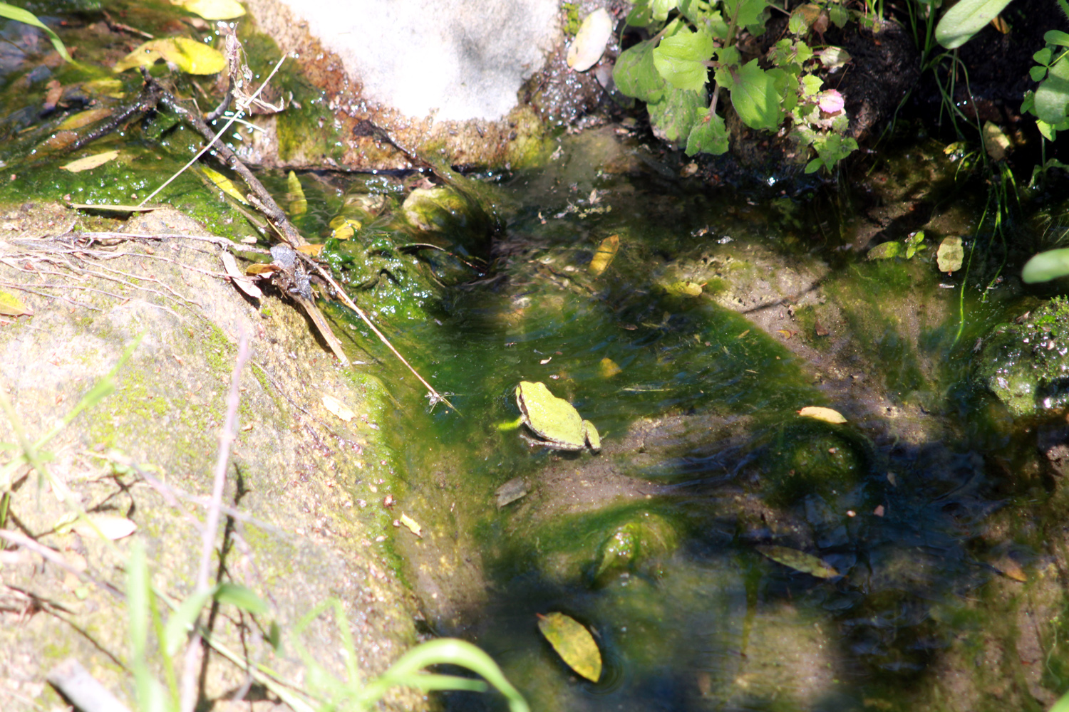
Of course, they were hardly the only flowers out in good numbers, and I enjoyed walking through fields of yellow daisy-like flowers and tall blue lupines, as well as scattered remnants of flowers that had appeared early in the season, including baby blue eyes and blue dicks. And of course, the surrounding countryside was spectacular. Perhaps more interesting than the blossoms was a small green frog in one of the creeks. He swam through the shallow water, and hopped out on a rock to pose for a photo. |
|
|
|
| We call these unidentified flowers "daisy-likes" |
Lupines are still plentiful, and surrounded by the last of the popcorn flowers |
|
|
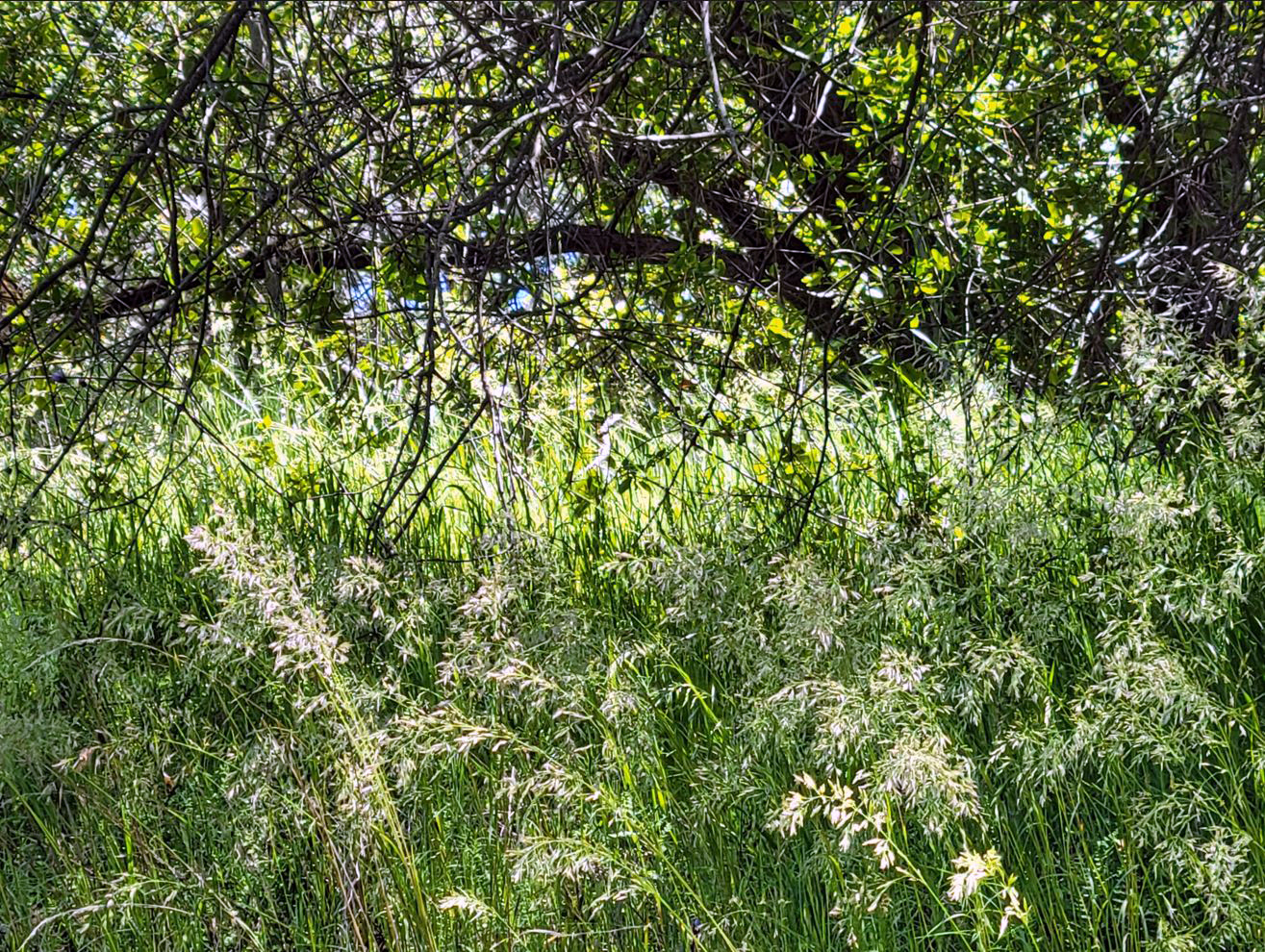
| Tall green grass in a shady spot | This fellow (gal?) has a nice little creek to swim in |
|
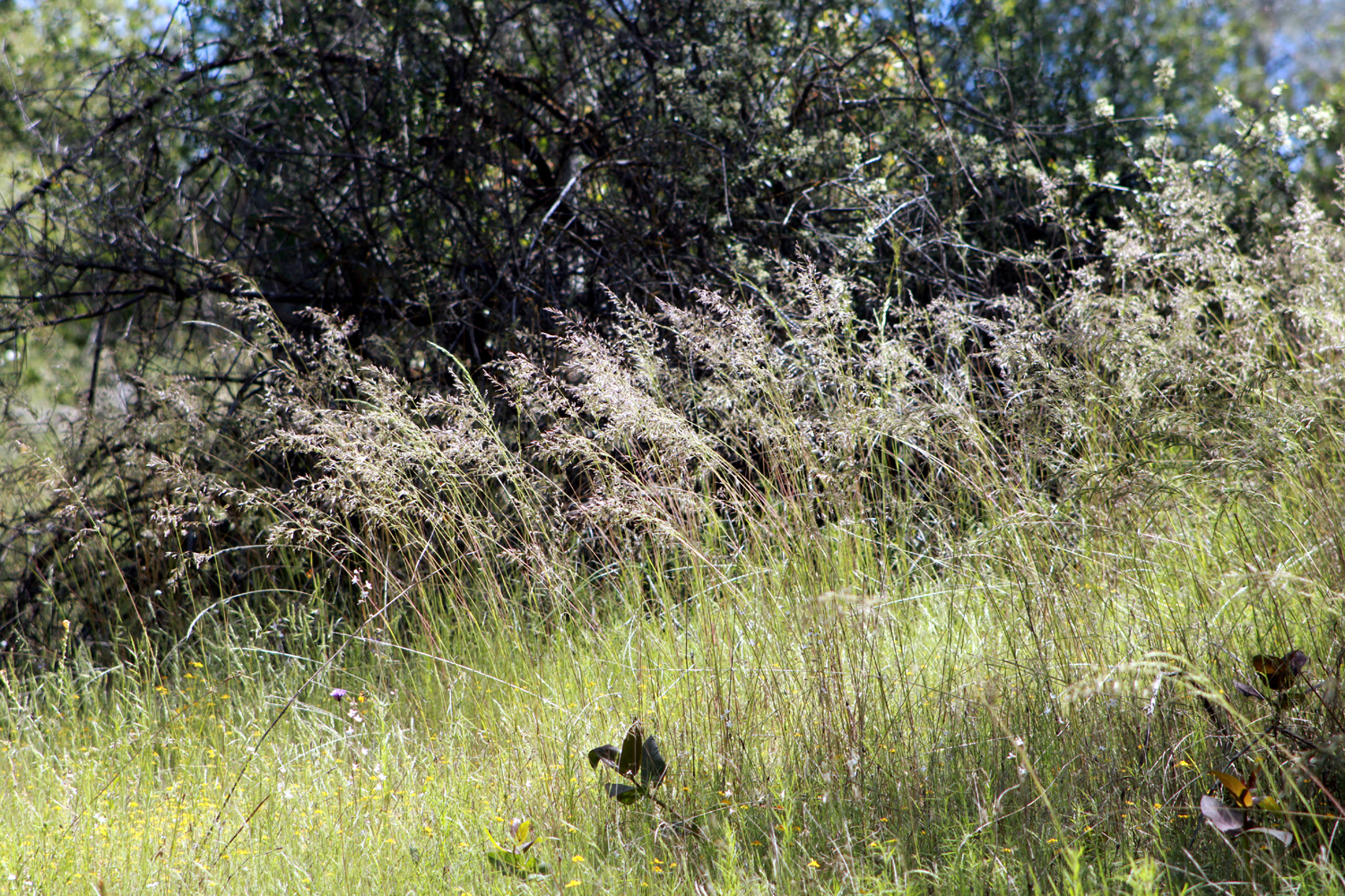
The trail starts with a very steep section, but it is also very short, and then the route has gentle ups and downs for a half mile or so. On my first visit I came to another steep hill and ended my hike there, but on later trips i kept going a little farther each time until I reached a section that was very obviously an old road, crossed by the biggest creek on the route. On my hike this year, I found that the half mile to the second steep hill was much longer than it used to be, and I turned back there. It ended up being a worthwhile trip, with a few new things (other hikers and the frog), the usual flower display, and an excellent year for bird's eye gilia. If all goes well, I will definitely be returning again next year. --Dick Estel, May 2023 |
|
|
San Joaquin Gorge River Trail
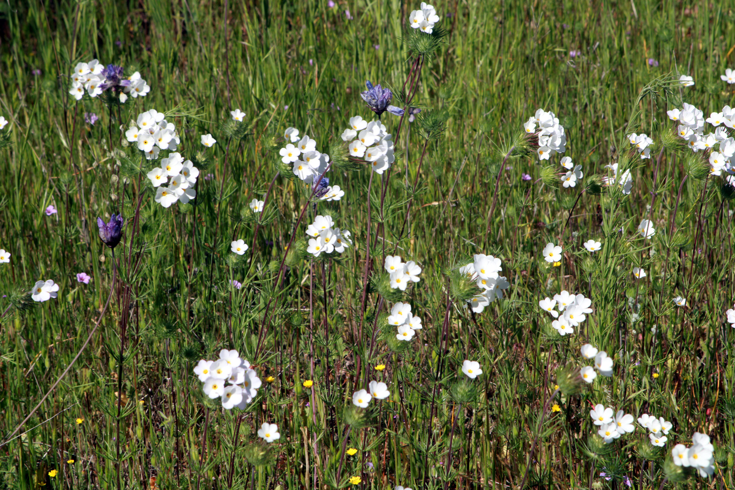
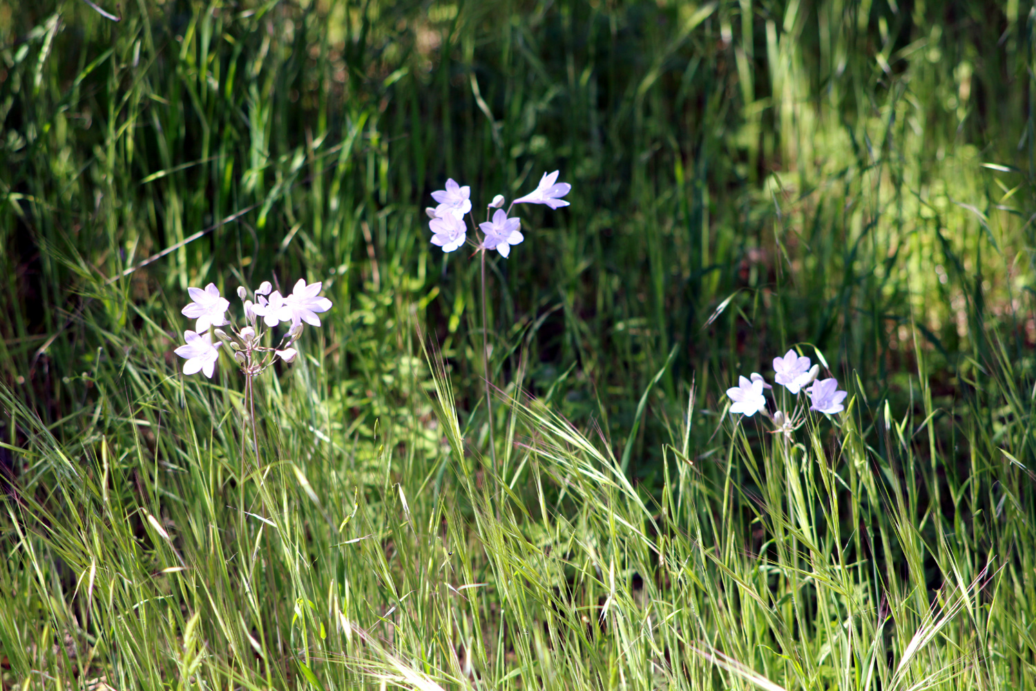
I've only hiked at the San Joaquin Gorge twice this year, which is not nearly enough. On the last trip with the Ramblers hiking group on April 6, we hiked on the San Joaquin River Trail, which goes north, then west from the parking area. We saw a lot of flowers, but there were a couple of favorite species that had not yet appeared, so I went in search of them on April 24. It was warm with an occasional breeze, a few clouds over the distant high mountains, and quite a few other people on the trail. Either the trails are longer or I am out of shape, because I have been getting tired when I have walked about half as far as I used to. There's a place along the trail that usually has a large number of purple brodiaea at the right season, but fortunately I did not have to go that far before I found some. The other flower I was looking for, mustang clover, is usually thick on the Bridge Trail, so I thought I might go a short distance on the River Trail, then go down the Bridge Trail till I spotted these plants. Once again I was fortunate to find them on the River Trail, eliminating the need to go down the other route. |
|
|
|
| Pale purple brodiaea usually appear in cool, shady spots | A dramatic beauty, mustang clover |
|
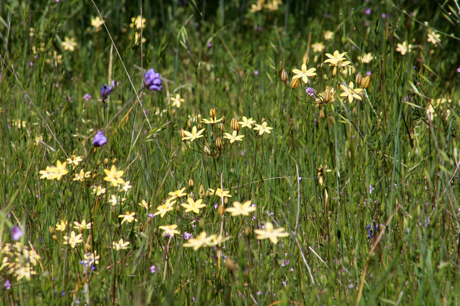
Continuing the theme of most of our hikes this year, all the usual species are out, but mostly not in the big numbers we normally see. On this hike I spotted filaree, dove lupine, yellow brodiaea, purple brodiaea, blue dicks, yellow throated gilia, bird's eye gilia, popcorn flowers, fiddlenecks, mustang clover, actual clover, common madea, and that old favorite, "unidentified." Bird's eye gilia was the most common flower on the section of the trail that I walked. |
|
|
|
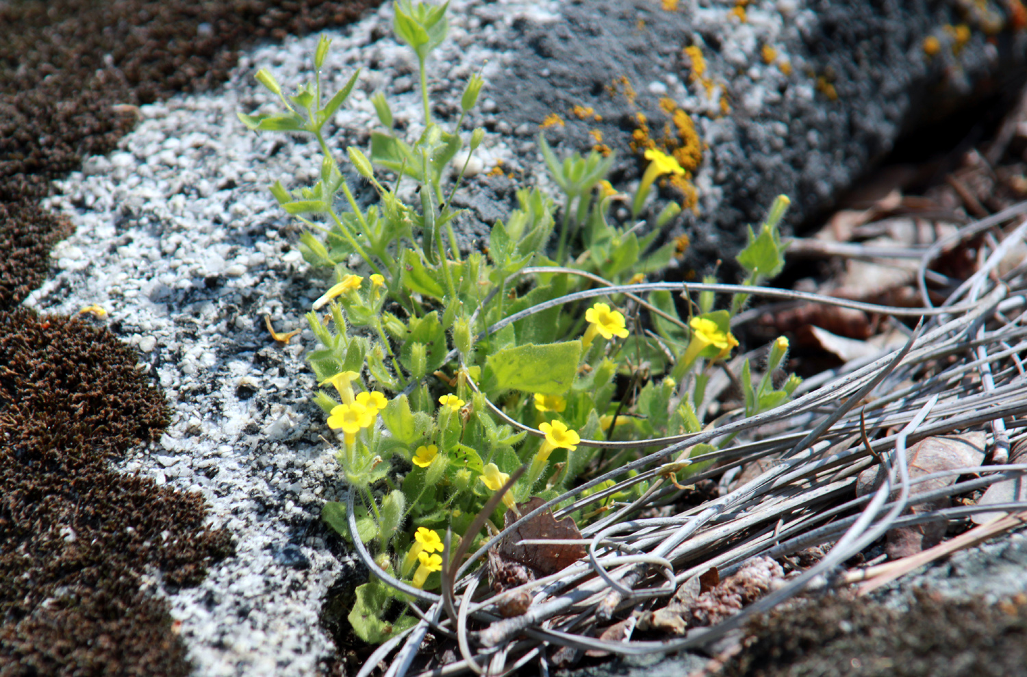
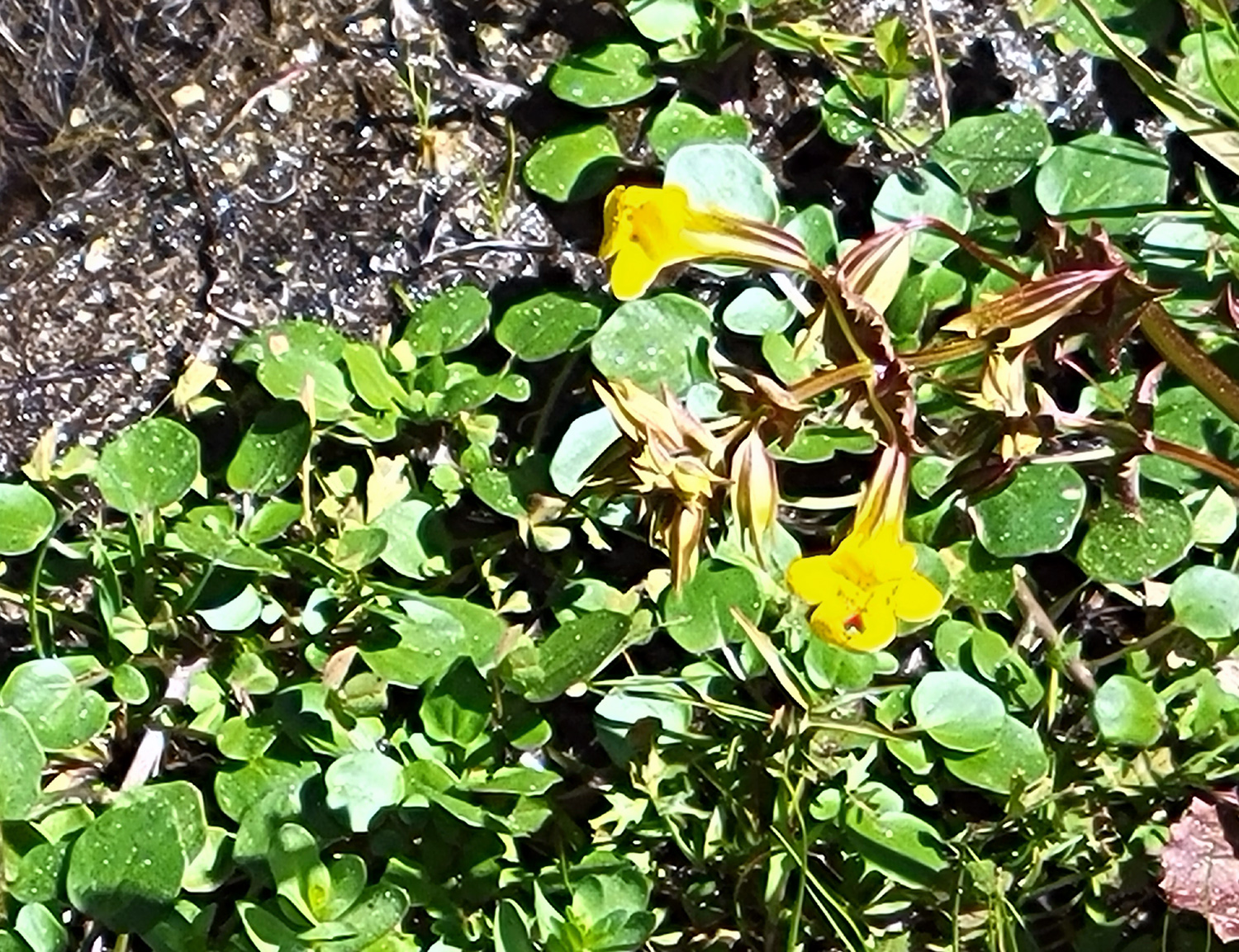
| Yellow brodiaea with a few blue dicks | We think these blossoms growing on a granite boulder are monkey flowers |
|
I had brought my lunch, and after finishing this short hike, I enjoyed it at one of the picnic tables by the trailhead/campground. As I drove home, I contemplated another visit to the area, for a second hike down the Bridge Trail. However, my schedule is fairly full, and the weather is warming up, meaning foothill hiking is drawing to a close. Just wait till next year! --Dick Estel, May 2023 |
|
|
Photos (Click to enlarge; pictures open in new window) |
||
|
Edison Point Foothill & Pine Flat Drive South Bay Trail Pine Flat & Maxon Road Sycamore Fire Road San Joaquin Gorge River Trail |
||
|
Edison Point |
||
 |
 |
|
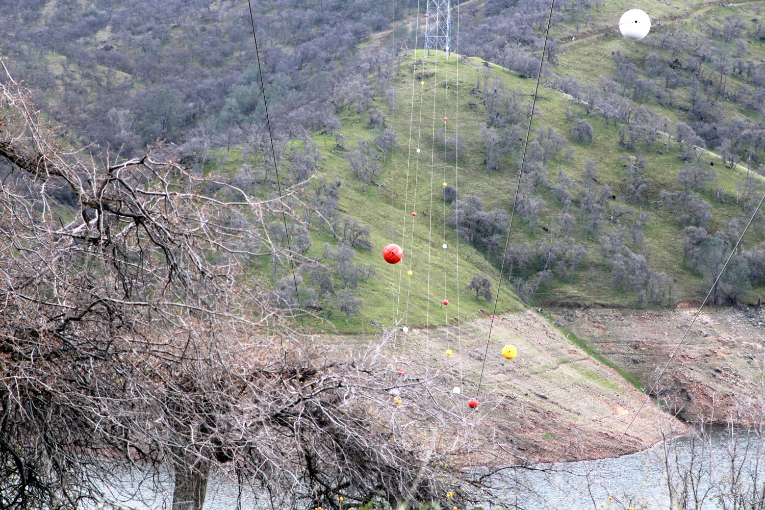
| This gate allows access by humans, but not by cows | Low elevation snow on ridge south of the Kings River | Visibility marker balls
where the power line crosses Pine Flat Lake |
| Foothill & Pine Flat Drive | ||
 |
|
 |
| Green hills and ripe oranges | A closer view of Pine Flat Dam | Pine Flat Lake from Cell Site Hill |
 |
 |
 |
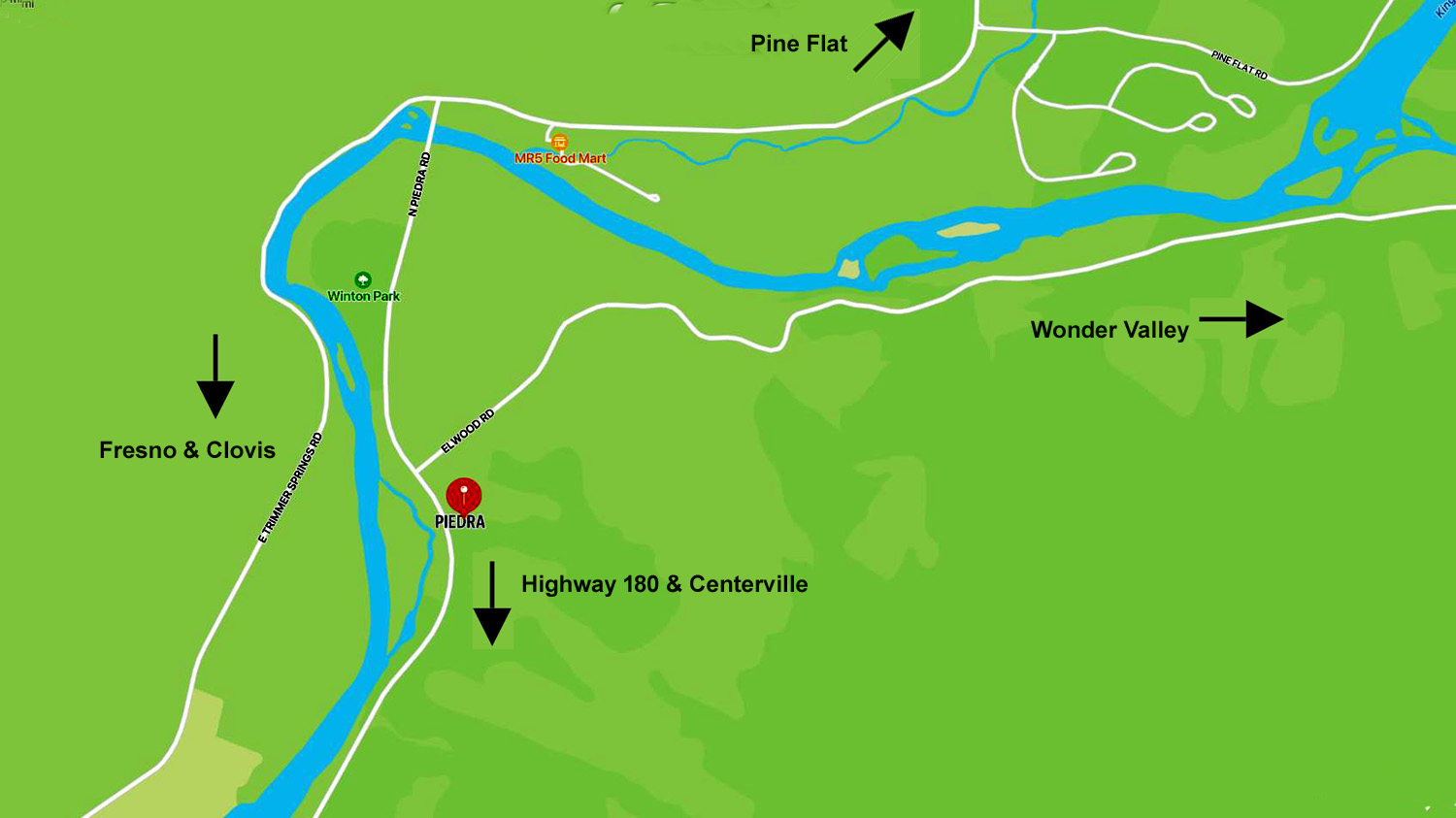
| A snow-covered dome | Low elevation snow | Piedra area map |
| South
Bay Trail (Photos by Wes & Dick) |
||
 |
 |
 |
| All the elements of a typical foothill photo | Phecelia was thick along the trail | We saw only a few lupines |
 |
|
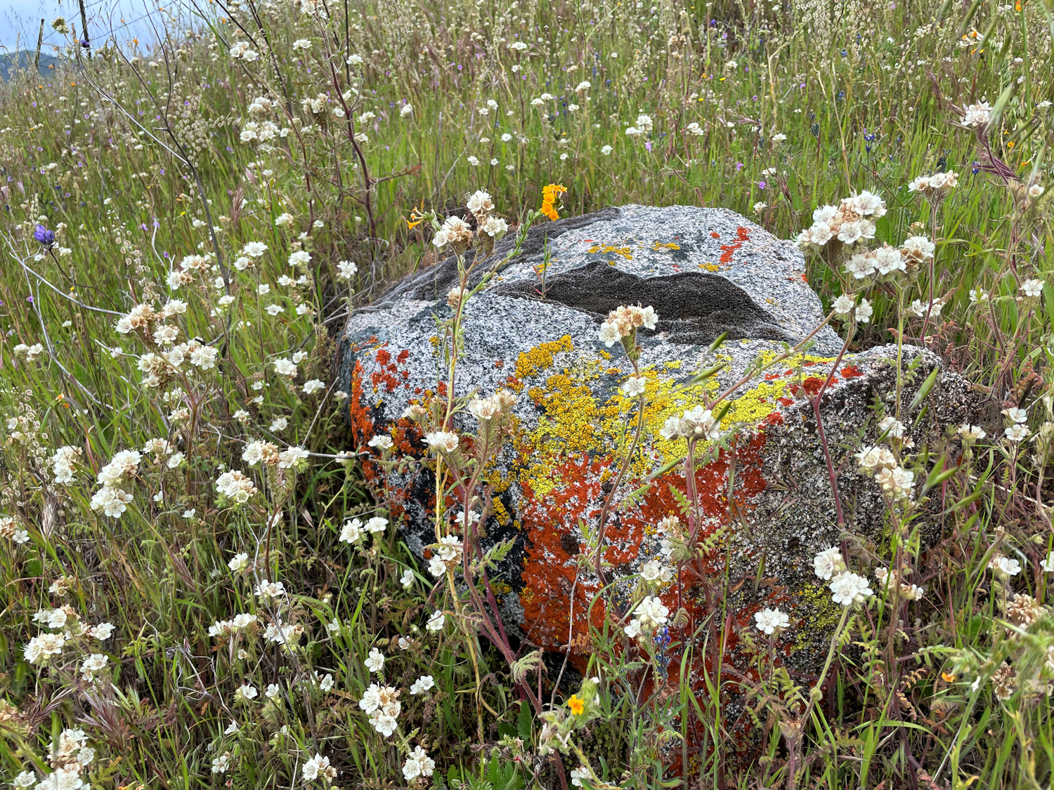 |
| A genuine rock garden | The clouds added drama to every photo | Orange
and yellow lichen on the rock make for a multi-colored view |
 |
 |
 |
| Wes, rounding the bend | Bird's eye gillia close-up | Blue dick close-up |
 |
 |
 |
| Trying to hide in the fiddlenecks? | Fiddlenecks on the Madera County side | The
swollen San Joaquin River - with lots more water to come |
| Pine Flat & Maxon Road | ||
 |
 |
 |
| Poppies in the rocks along Trimmer Springs Road | Teri enjoying her weekend | Splashes of yellow above Watts Creek |
 |
 |
|
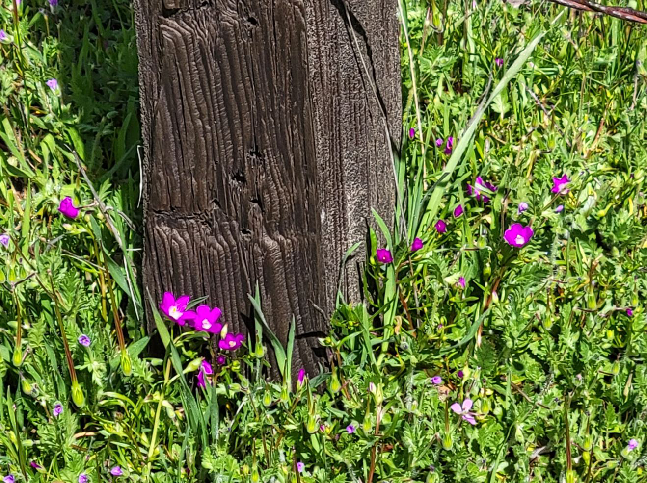
| The creek has washed out the bank here | Old friends - Monica and Teri (by Jackie) | Fringed redmaids by an old fence post |
| Sycamore Fire Road | ||
 |
 |
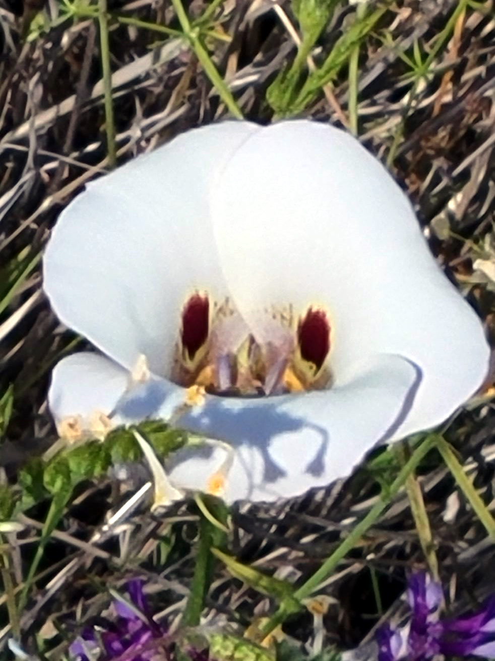 |
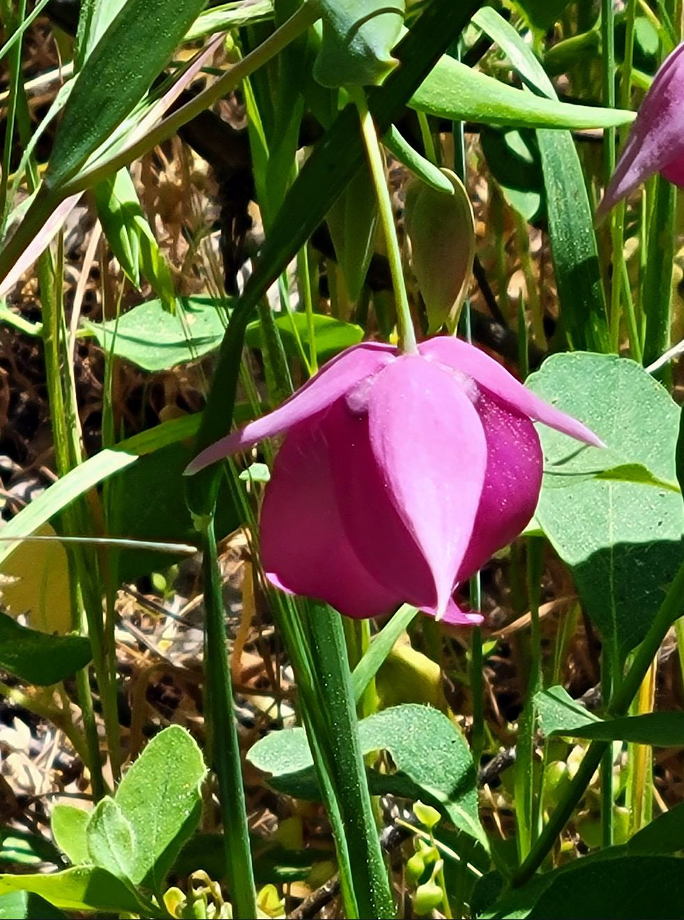
| Fiesta flower | The fairly rare globe lily | The Mariposa lily was a candidate for state flower |
 |
 |
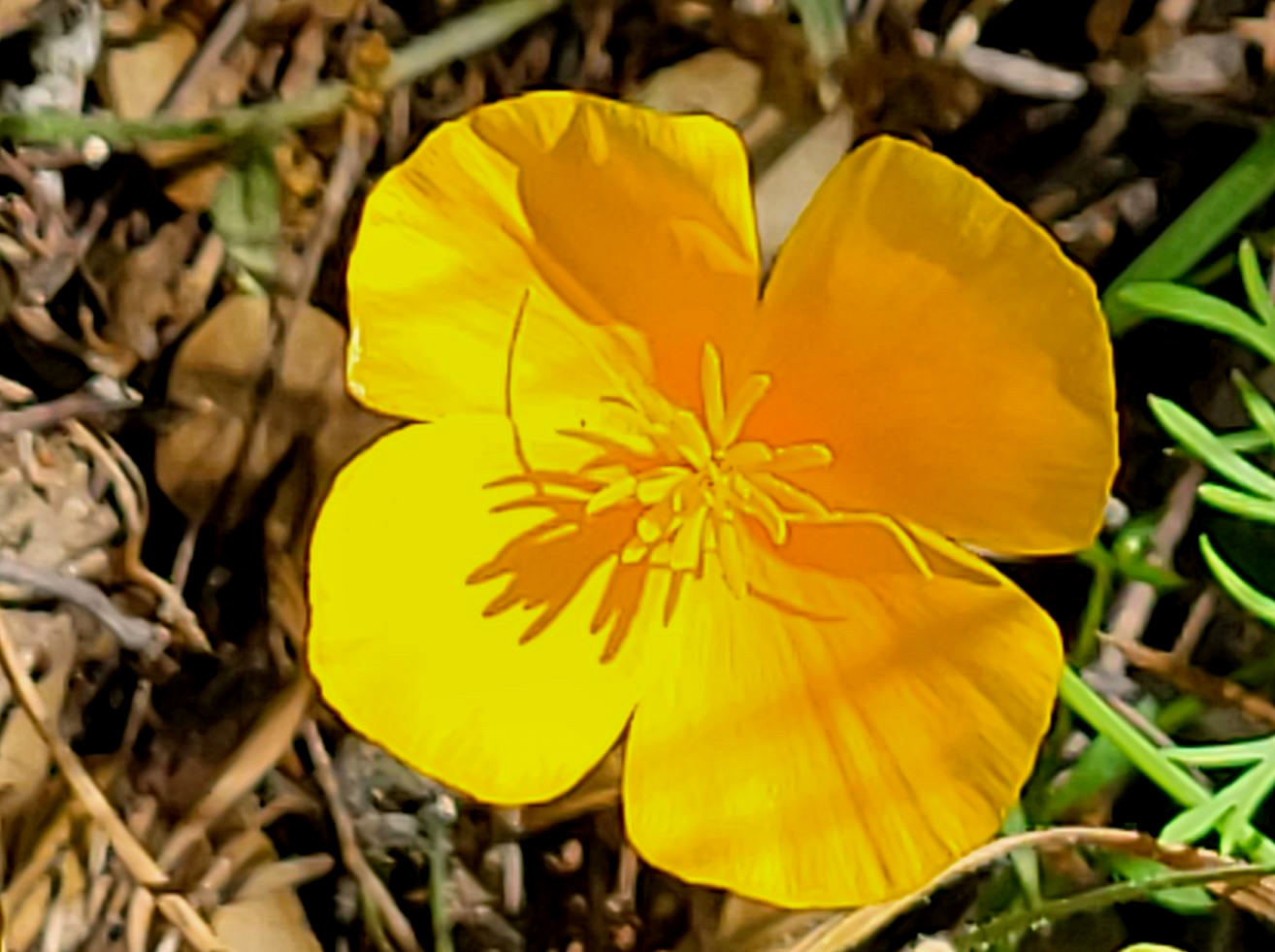 |
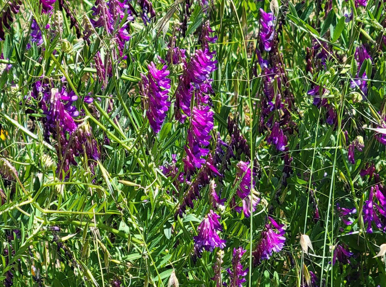
| This daisy-like blossom is only a half inch across | Vetch was at it peak during this hike | The winner of the state flower contest |
 |
 |
 |
| Unknown flowering tree | Purple brodiaea like shady spots | A
few remnant blue dicks, popcorn flowers, and baby blue eyes |
|
 |
 |
| Drying tall grass waves in the breeze | Foothill frog at home | Sierra star |
| San Joaquin Gorge River Trail | ||
 |
|
 |
| A solid patch of wildflowers | Lots of mustang clover | Typical springtime scene at the Gorge |
 |
 |
 |
| Cliffs atop Kennedy Table across the river | The best little creek on the trail | These may be monkey flowers |
| Related Links | ||
| Edison Point Trail | Pine Flat Reservoir | More Pine Flat Trips |
| Pine Flat Dam | Graupel | Wonder Valley |
| Sycamore Creek Video | Secata Ridge Falls Video | Secata Ridge |
| Blue Oak Trail | Millerton State Recreation Area | Friant CA |
| Watts Creek Video | Watts Valley | Trimmer Springs Road |
| San Joaquin River Gorge | San Joaquin River Trail | Best Creek Video |