March 2, 2010:
Yesterday I set out on my first motor home trip of 2010, following a
route I have taken many times, especially around this time of year -
south on State 99, east on State 58 from Bakersfield, and southeast
on I-40 from Barstow. My ultimate destination is a bluegrass
festival at Lake Havasu, AZ, which I'll get into later.
My first stop is the
Mojave National Preserve, which occupies much of the land between
I-40 and I-15 to the north, touching the Nevada border in spots, and
reaching west to a line that runs roughly southeast from the town of
Baker. It's
the third largest unit of the National Park System in the
continental United States, a land of sand dunes, cinder cones, lava
flows, rugged weathered mountains, and high desert vegetation,
including a dozen kinds of cactus. One small section of the
Preserve lies north of I-15, and contains the highest point in the
Preserve, above 7,000 feet.
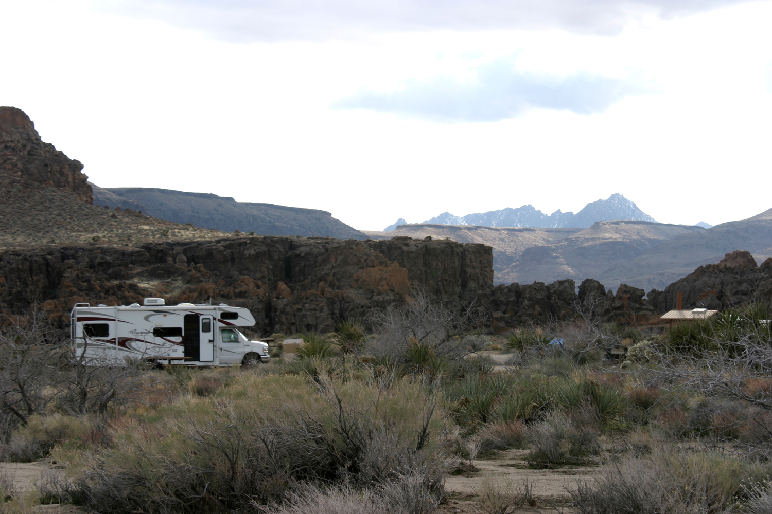
There is limited camping,
and I'm at one of the few spots that accommodate motor homes,
Hole-in-the-Wall campground, about 10 miles north of I-40 on Essex
Road and another ten miles on Black Canyon Road. The campground has
no hookups, but does have water hydrants, toilets, picnic tables,
and an information center.
I arrived about 5 o'clock
last night, with the sun low and temperatures lower, and didn't do
any outside activities except for short walks around my camp site. I
had dinner, did a little TV watching and a lot of reading, and went
to bed early. I would have done more TV watching and probably stayed
up later, but generator use is limited to 7 a.m. to 7 p.m.,
pretty much eliminating my prime TV time. (I watch DVDs that I bring
along, so program schedules are not an issue).
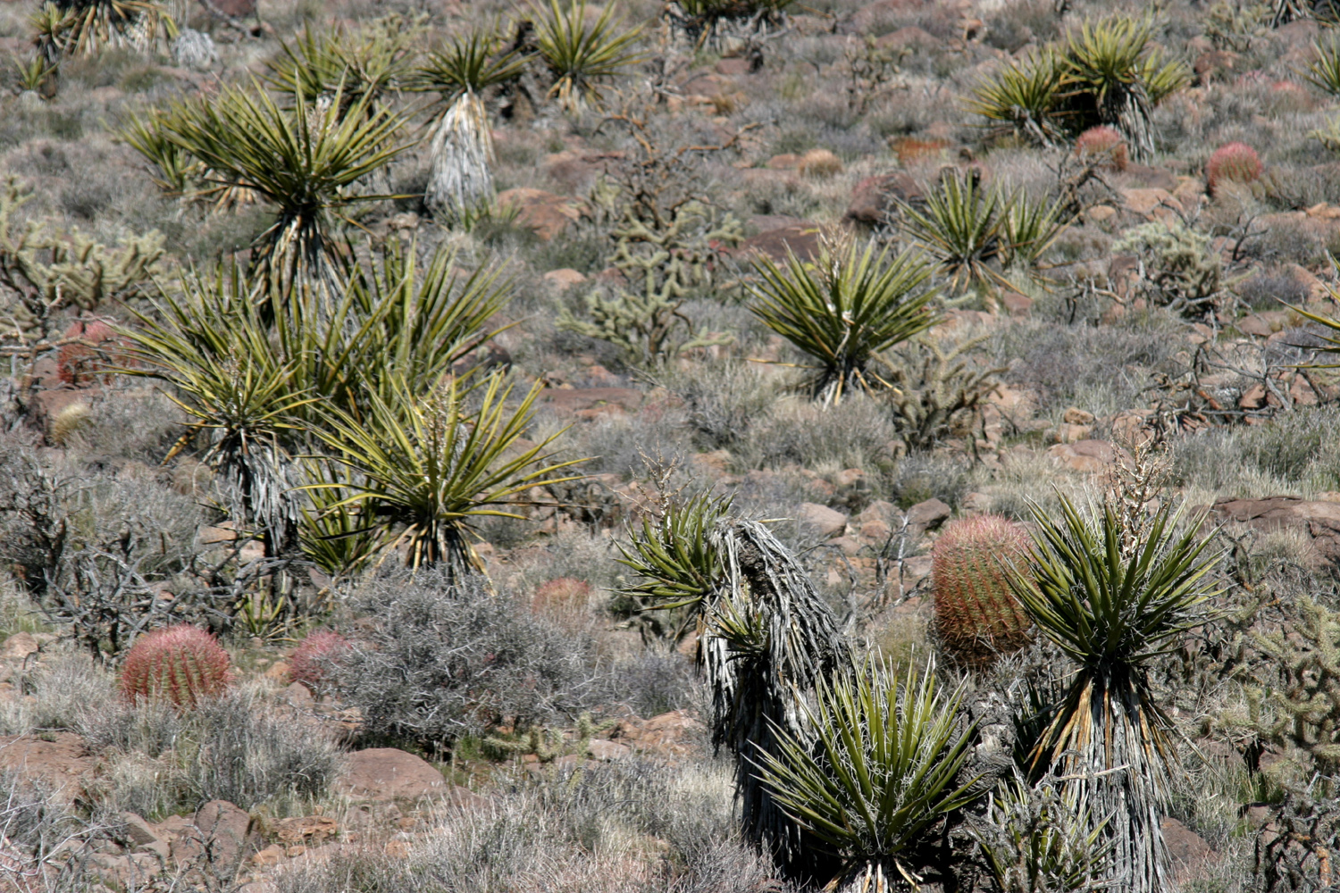
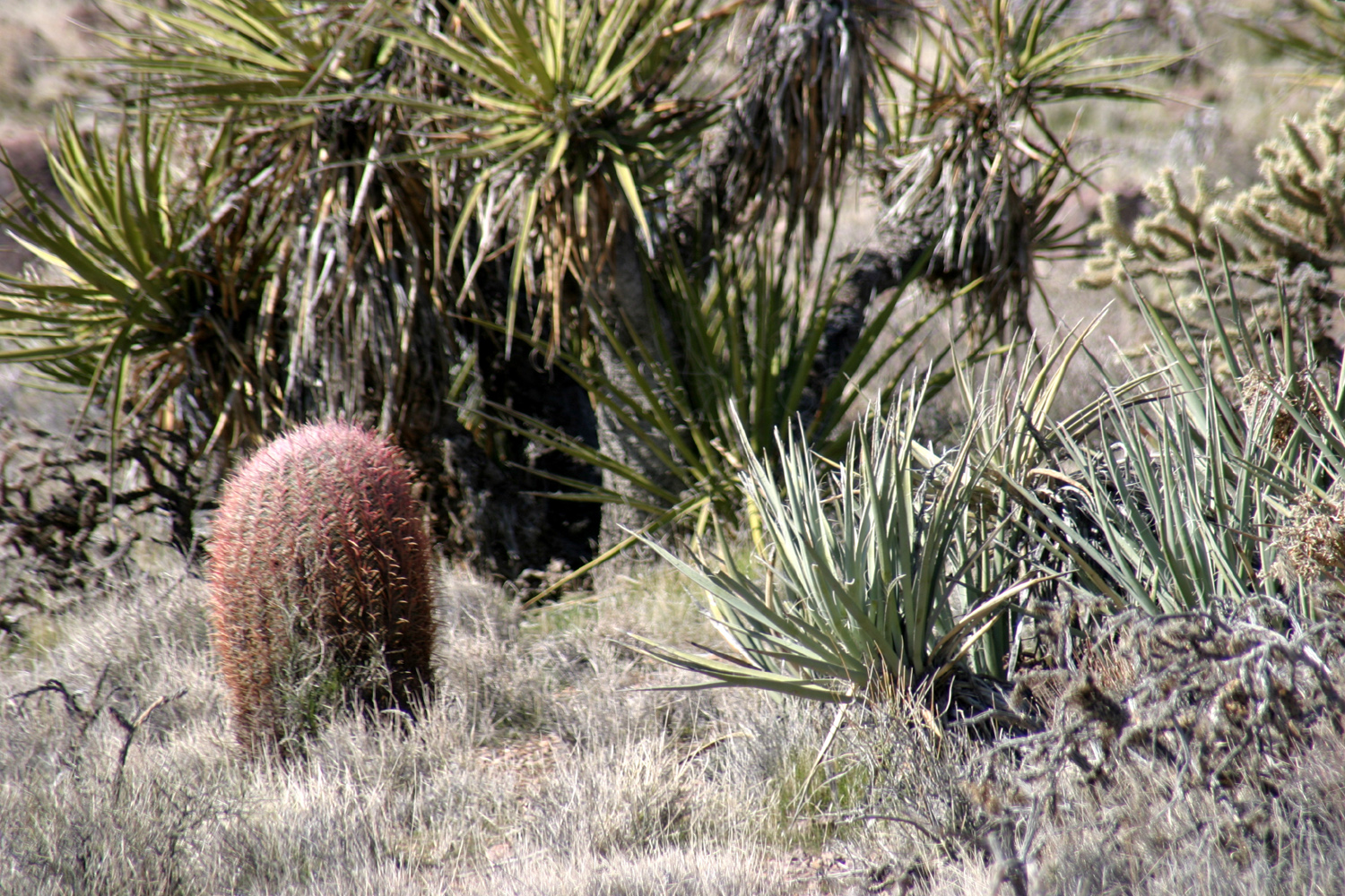
However, I am very happy
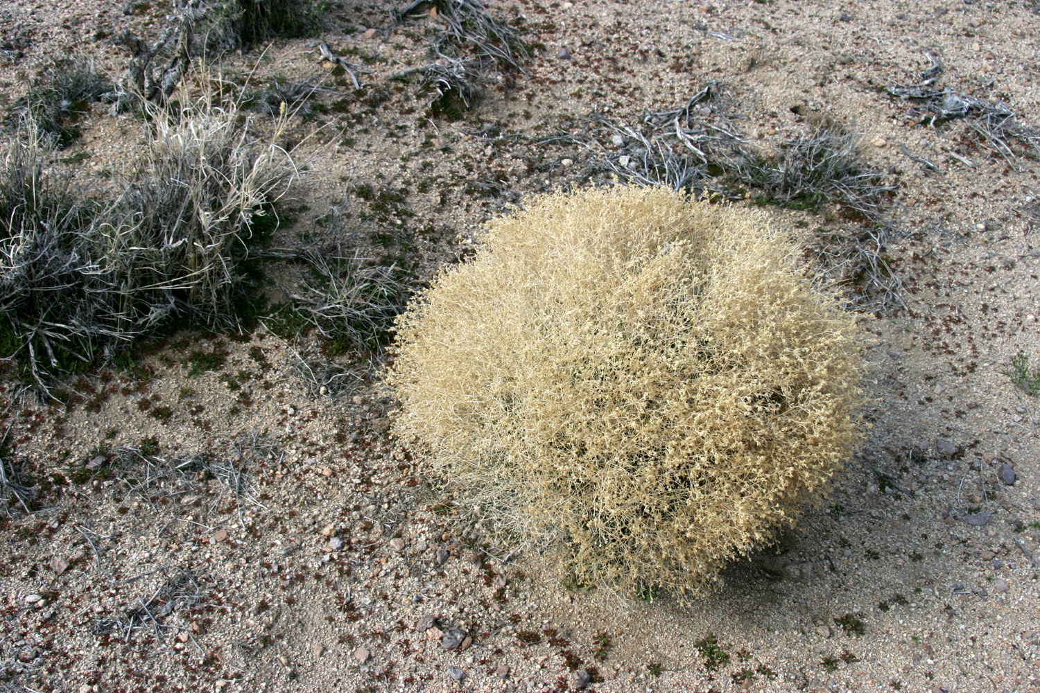
overall with this place. There is an extensive variety of desert
vegetation, very much like the areas I have hiked in the Tonto
National Forest east of Phoenix. A half-mile trail to the
information center had signs and a brochure identifying at least
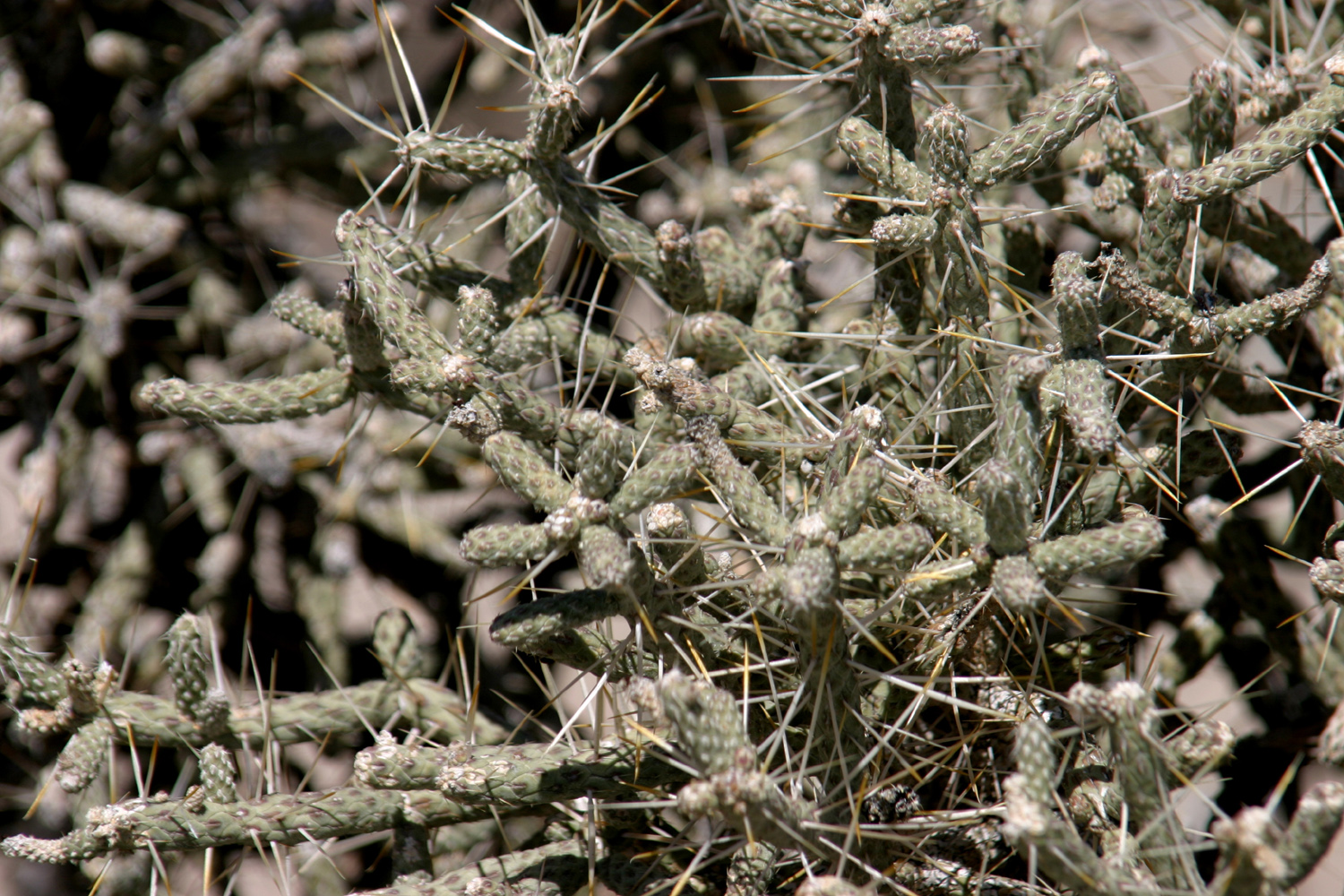
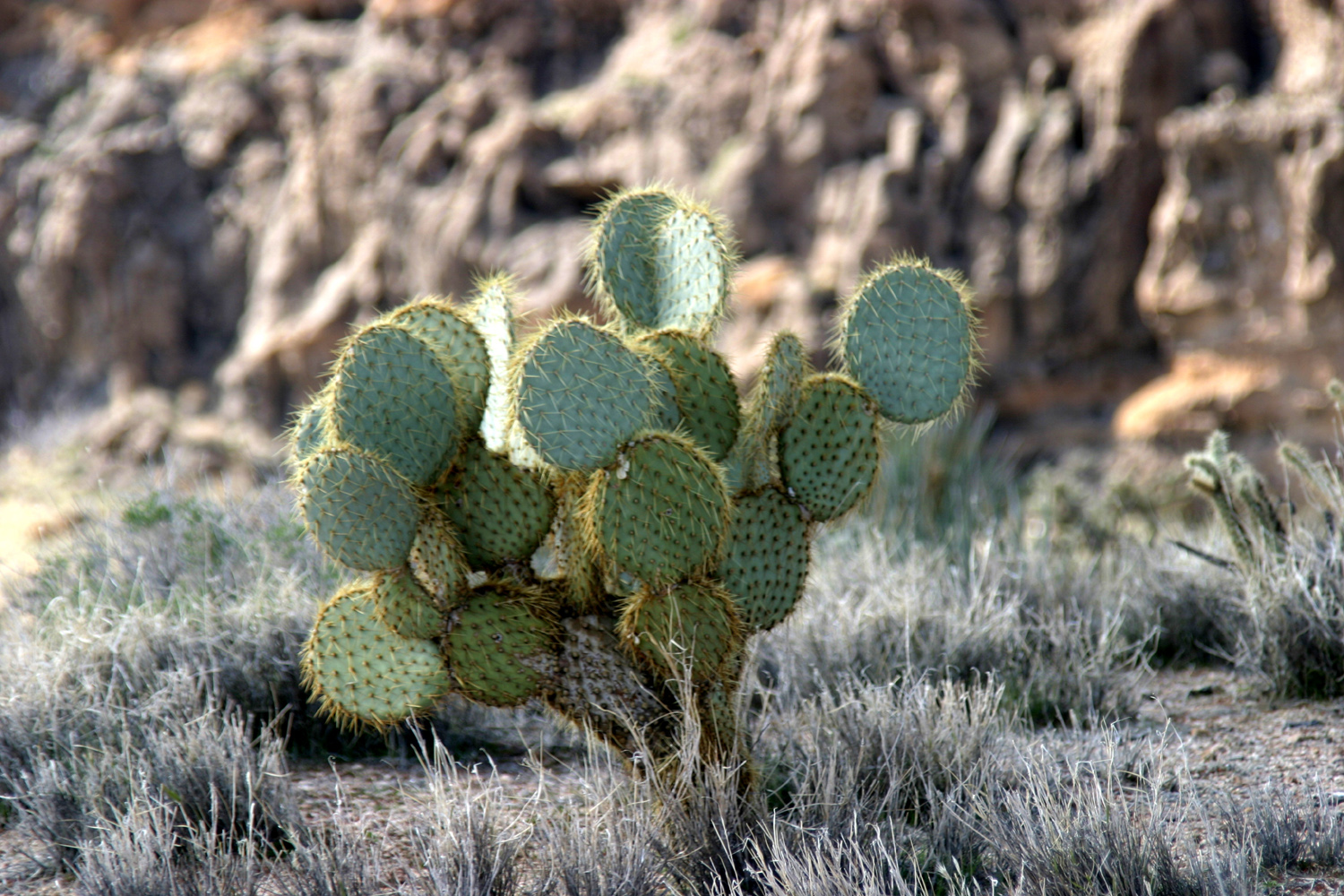
seven kinds of cactus (not including the barrel cactus which are
plentiful nearby); and a dozen different shrubs. Since it's too
early for spring flowers, a lot of these shrubs look quite similar,
but a few are very distinctive. The area around the campground has
hundreds of these plants, but despite the somewhat inhospitable
appearance of the landscape, it's easy to walk through the desert
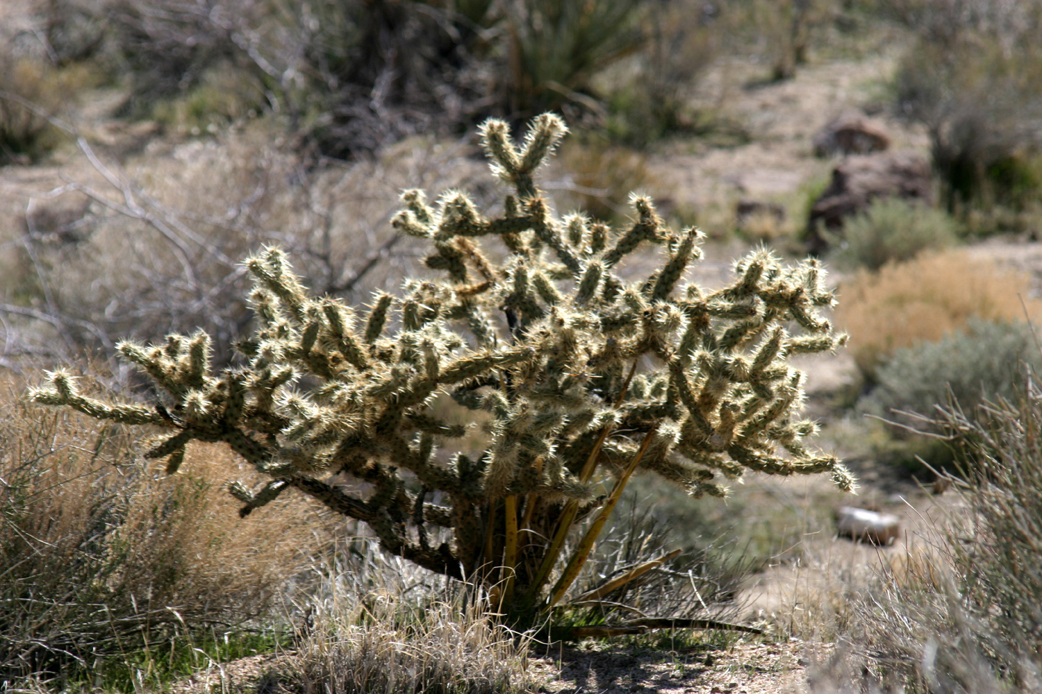
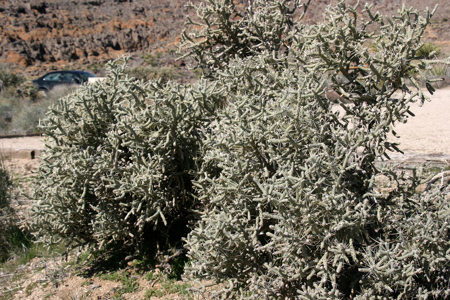
and make your way between the cactus and thorny shrubs without
incident. The most common plants are cholla
cactus and Mojave
yucca.
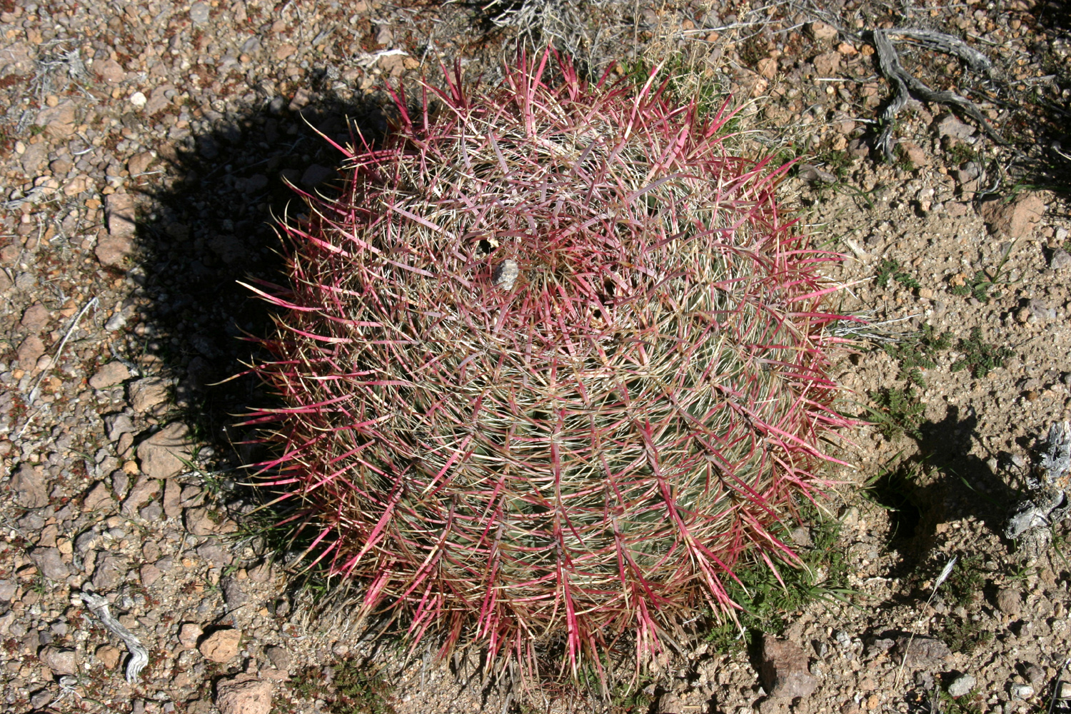
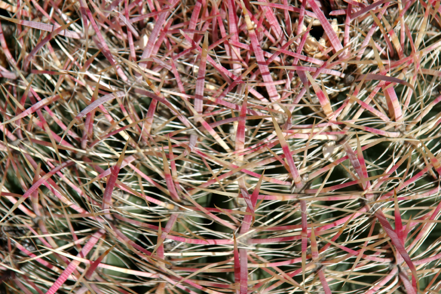
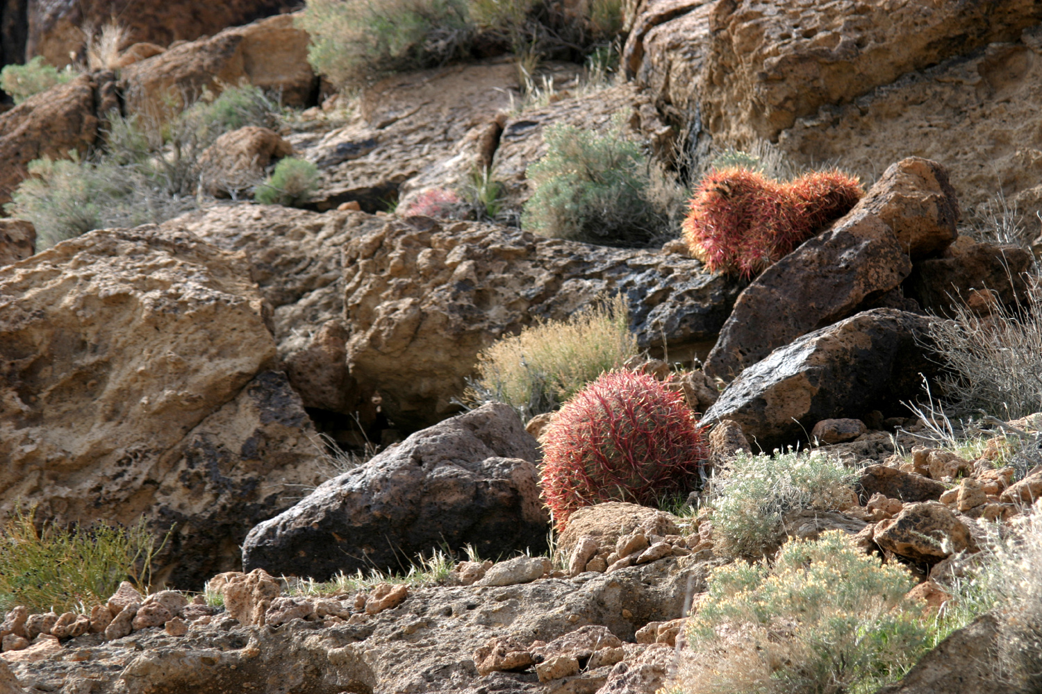
For
reasons I can't explain, my older grandson and I became fascinated
by barrel cactus when we went walking in the desert east of Phoenix
in the mid 1990s. We would not see any, then we would come to an
area where there were several dozen. I finally realized that they
prefer rocky hillsides. West of the camp, I went up a very low hill,
by which I mean it was about 20 feet higher than the surrounding
country. It was quite rocky and covered with barrel
cactus, but as
soon as I reached the more level, sandier area at the bottom, there
were none to be seen.
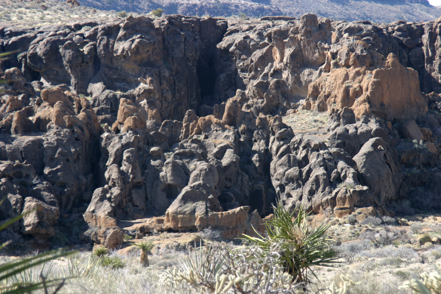
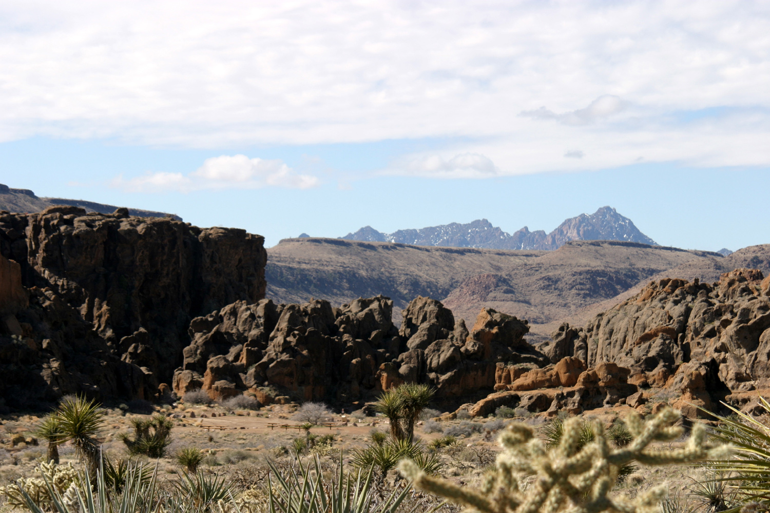
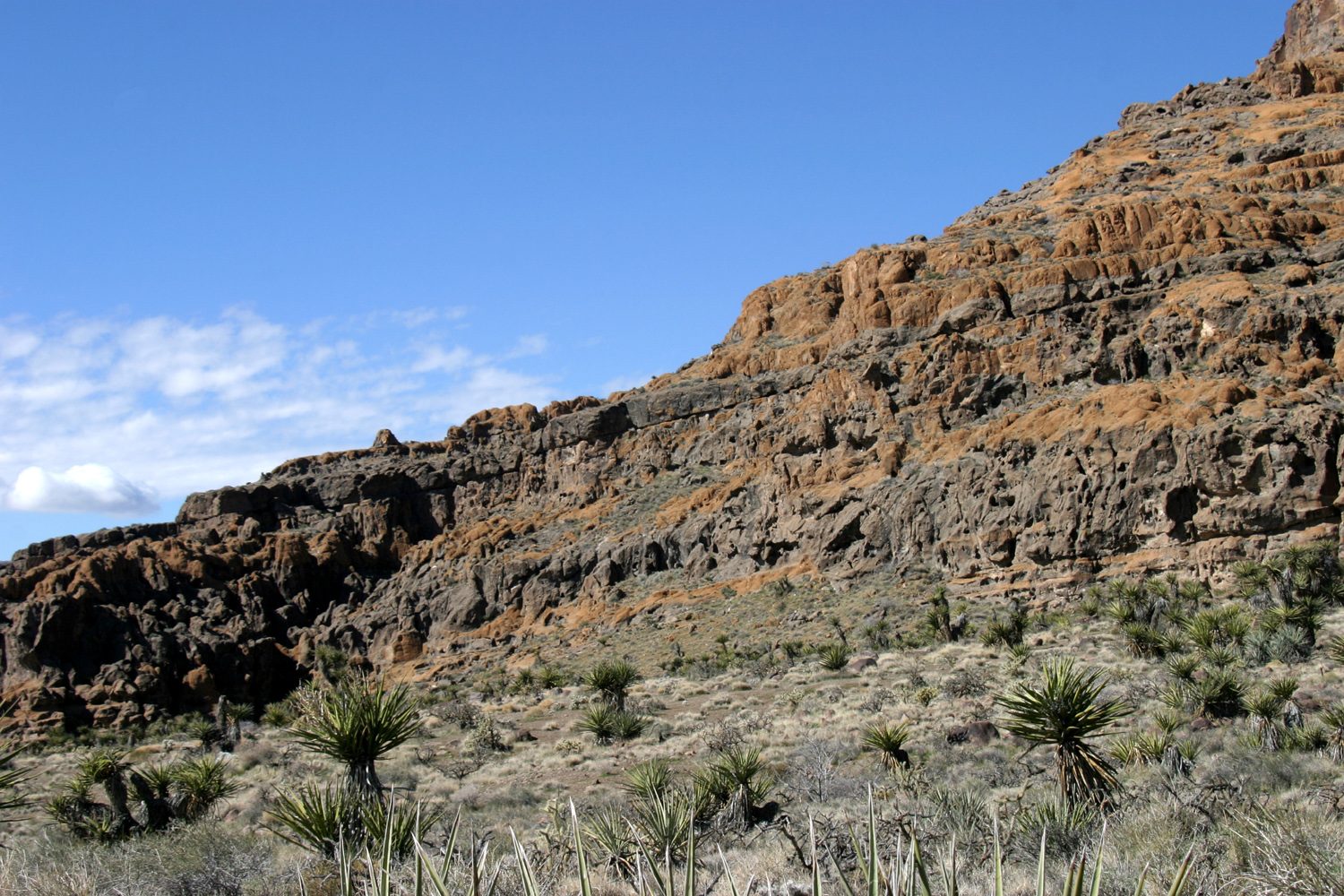
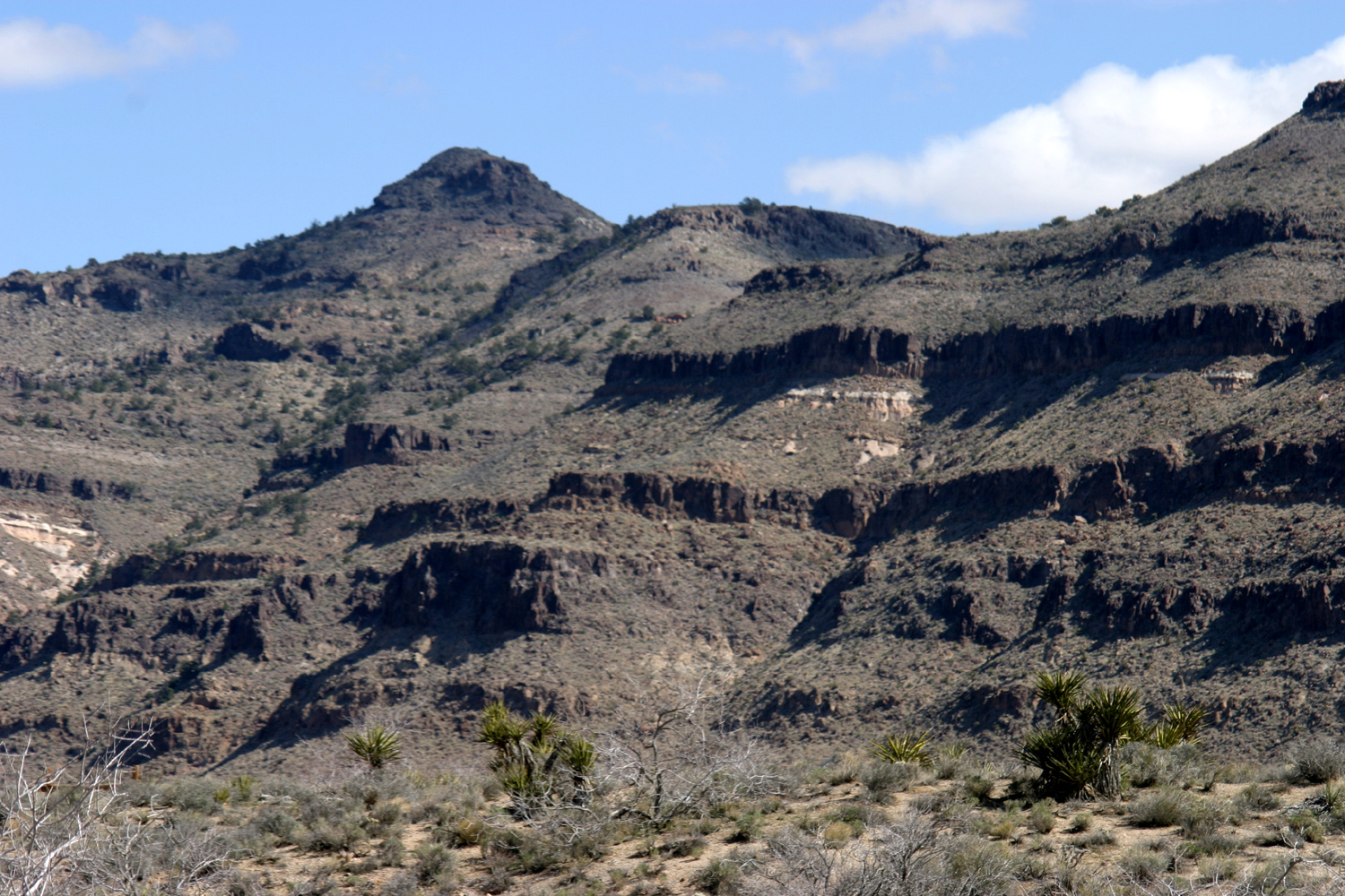
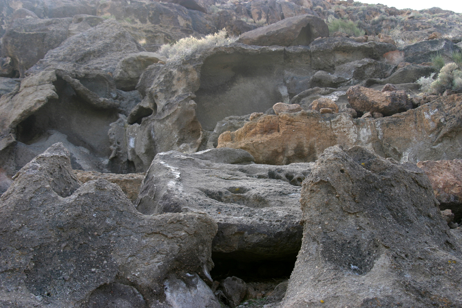
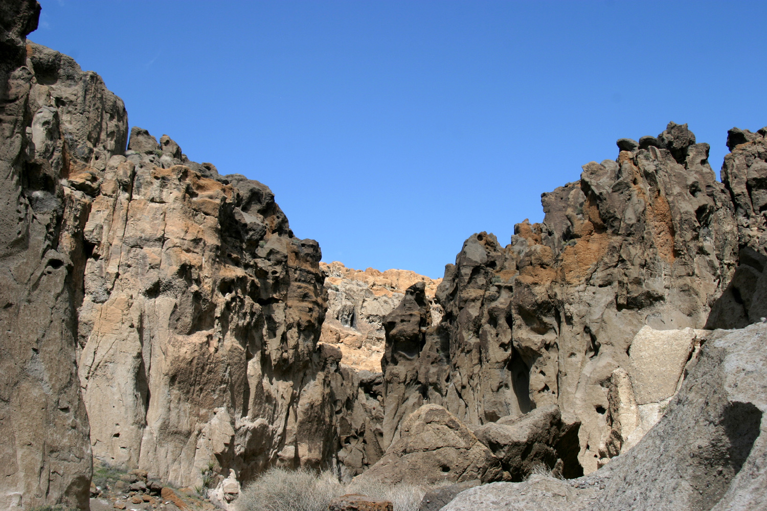
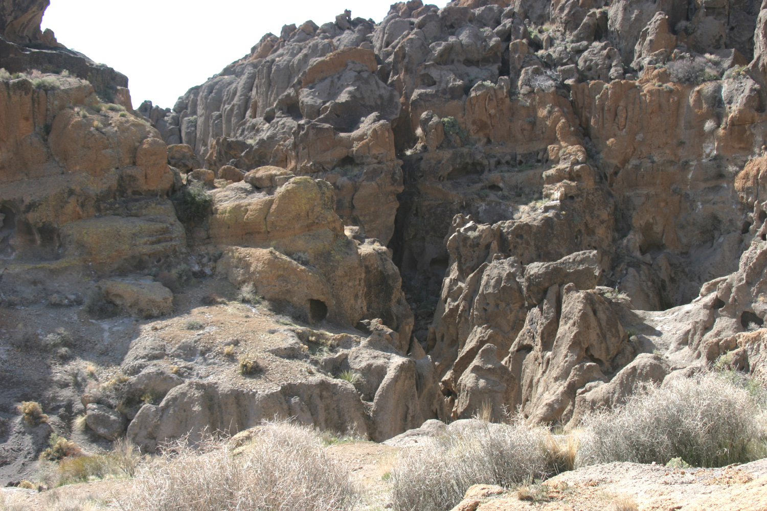
The most dramatic feature
of the area is the "wall," a long black and tan volcanic
ridge,
with a vertical cliff rising a hundred feet or so at the bottom.
This rock is weathered into dramatic shapes, and directly west of
the campground, there is an opening where the wall is only a third
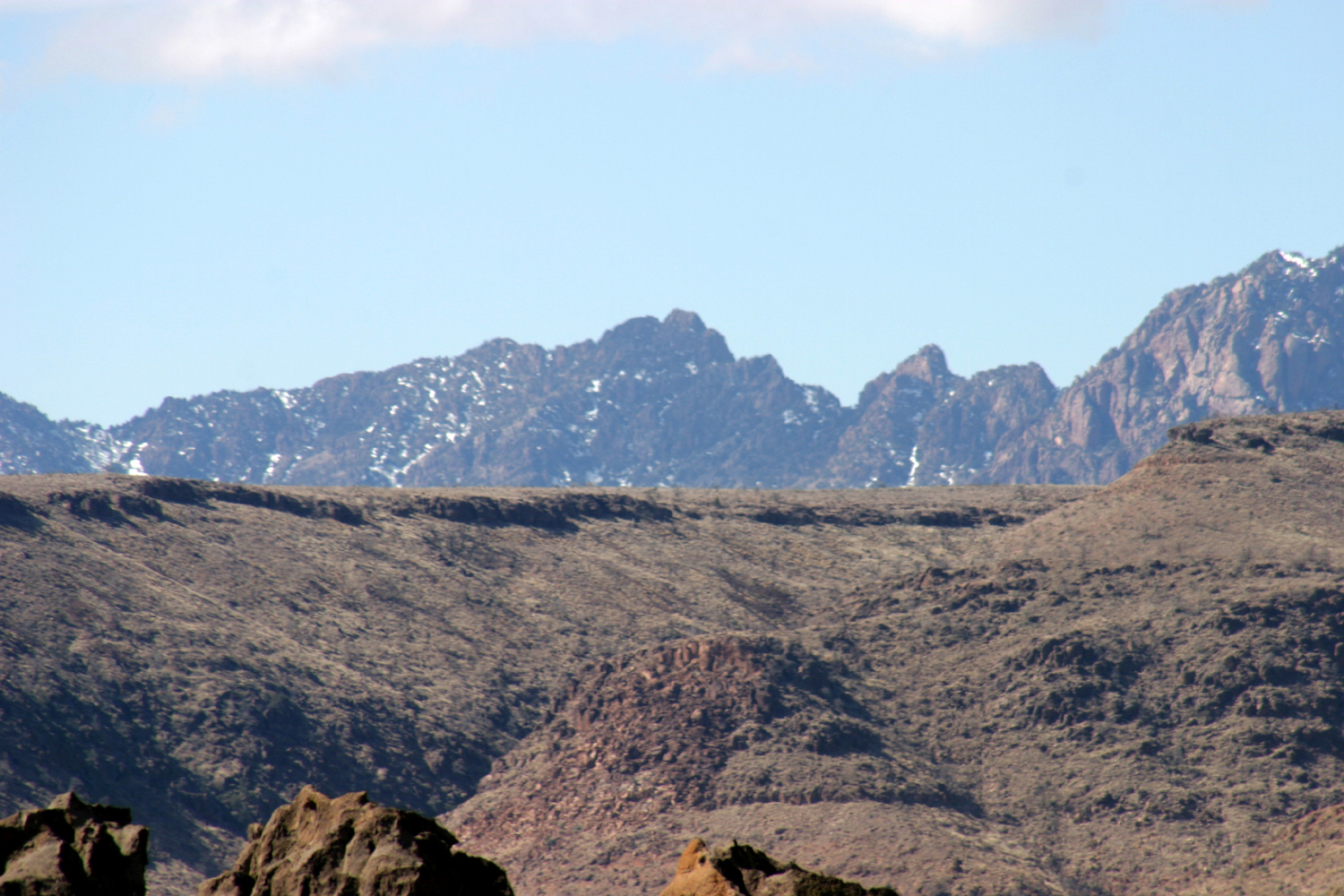
as high as the rest, creating the "hole." Beyond
the wall higher
mountains, dotted with snow, are visible. These
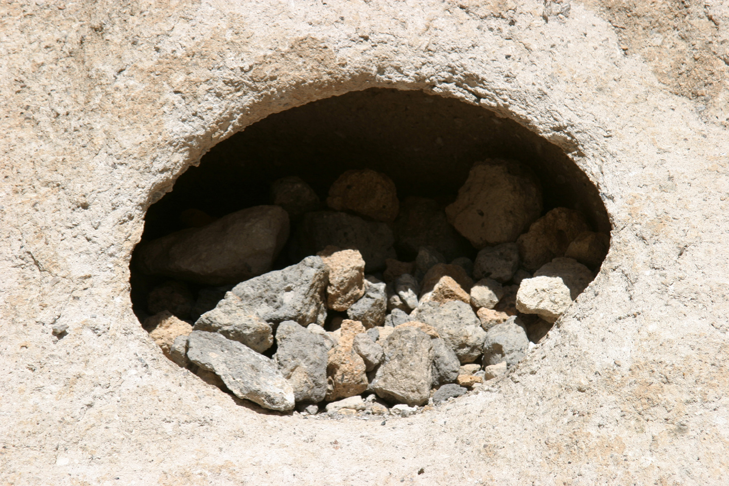
colorful layers were formed by volcanic eruptions 18.5 million years
ago. There was no lava, but thick layers of ash and rock fragments
welded together as they cooled. Gases trapped in the ash created
holes that were enlarged by wind and rain.
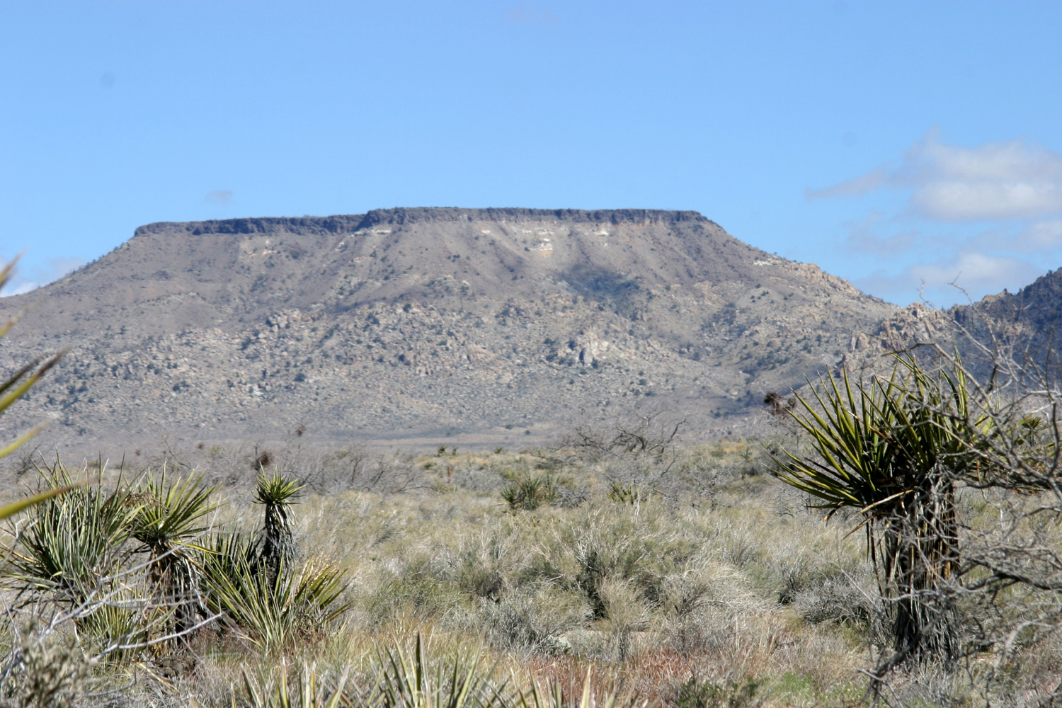
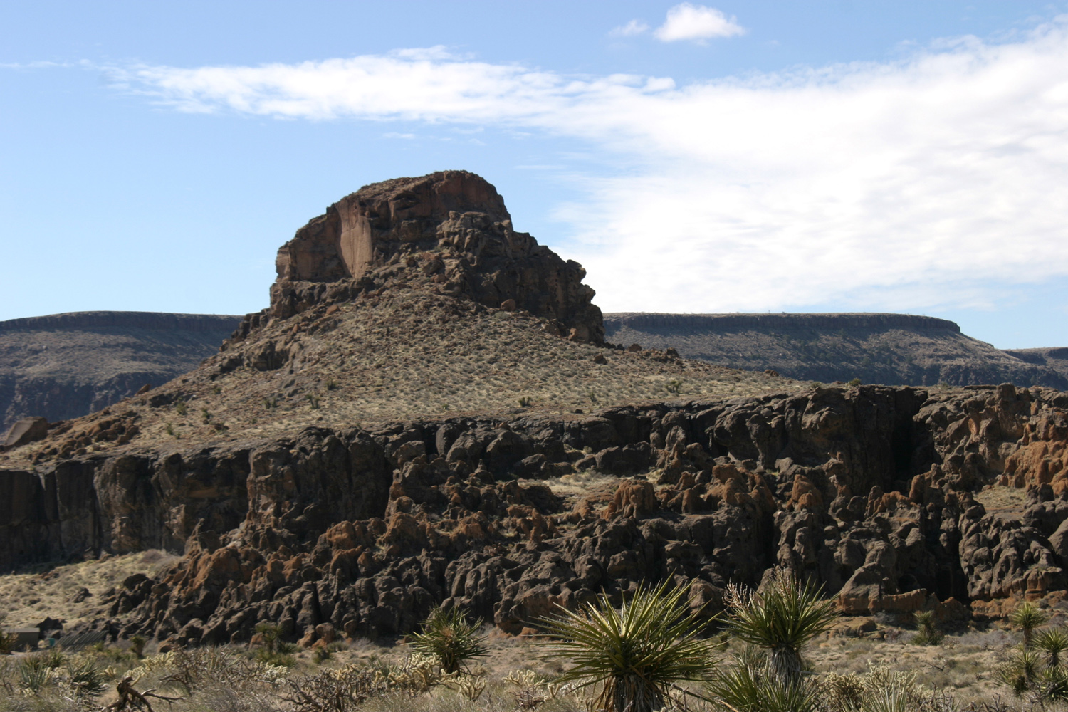
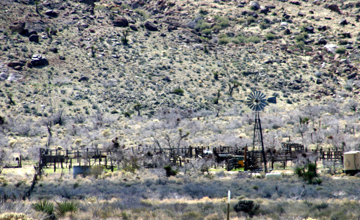
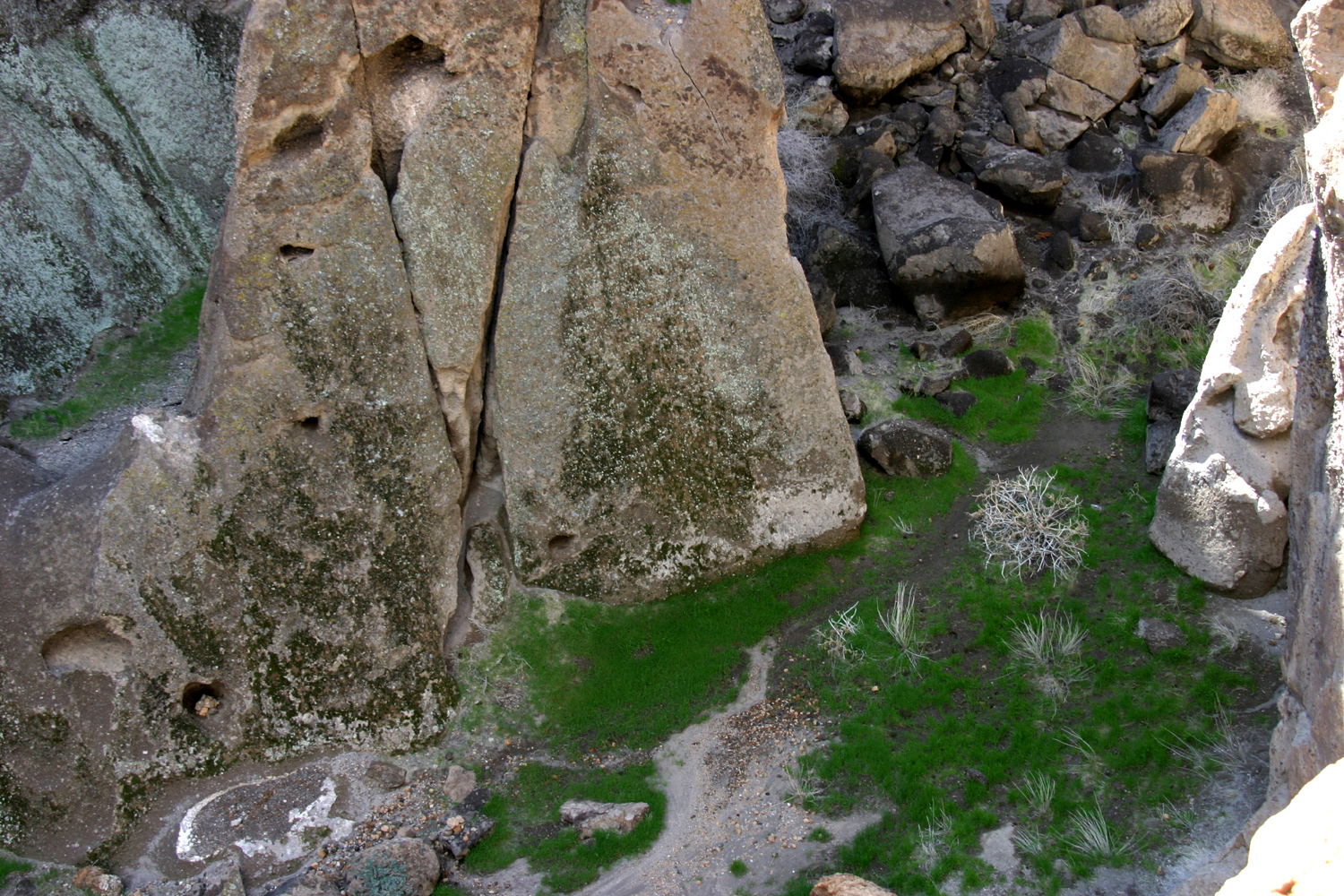
From the Information
Center, a one mile loop trail goes around a nearby mountain and the
striking butte that stands guard over the area. The trail
is fairly level most of the way, first skirting the base of the
wall, with many examples of barrel and other
cactus growing on the rocky slope at the bottom. The trail
then passes through the edge of a flat valley with an old
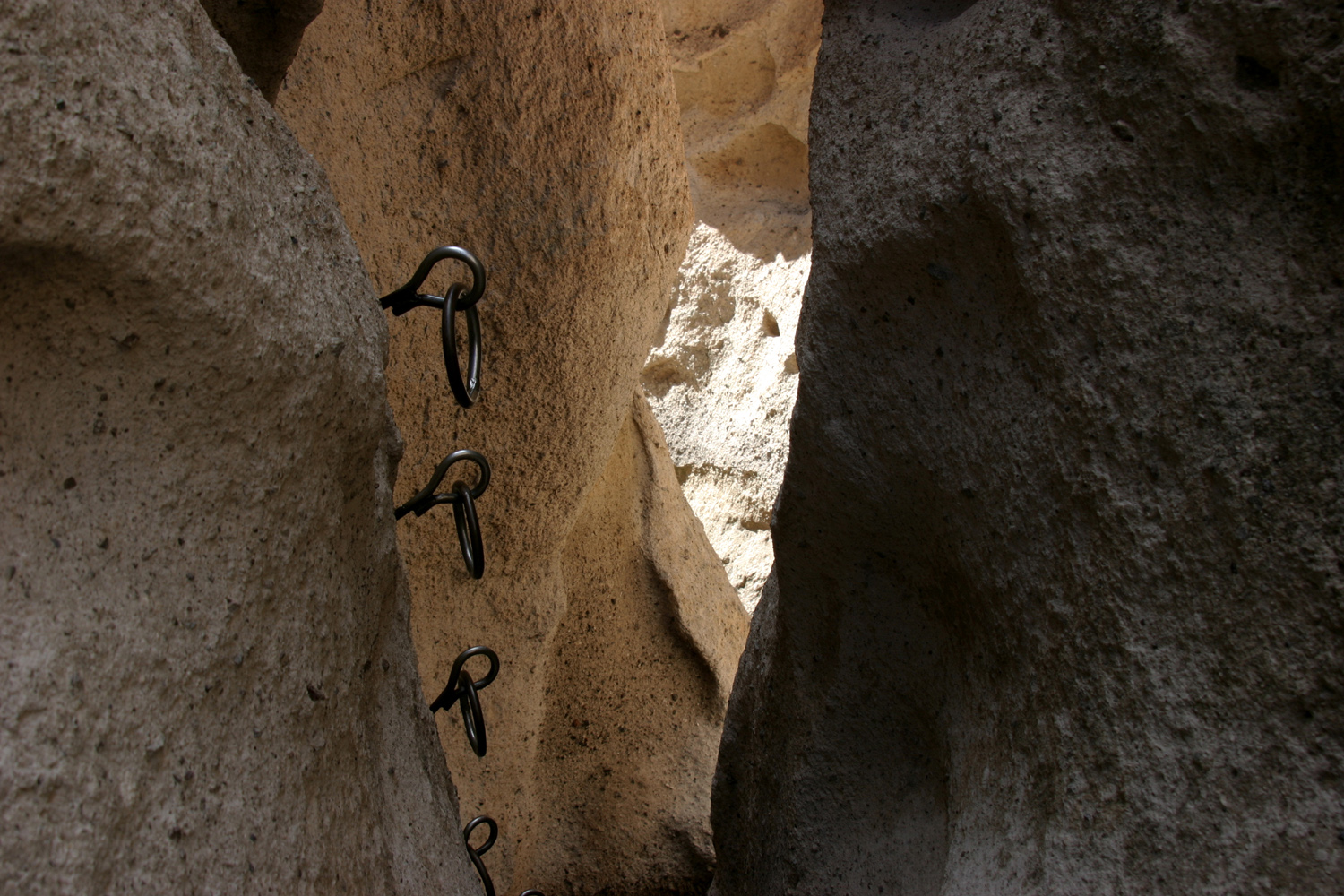
ranch, marked by two windmills. Next it enters Banshee
Canyon, a narrow slot canyon, where two groups of iron rings have
been placed in the rock to facilitate the climb up and out of the
canyon. Soon after the final steep area, the trail comes out just up
the slope from the info center. A worthwhile
side trip here is a very short trail marked "overlook,"
which gives you a view down into a grassy "valley," just
a few hundred square feet of flat land pretty much inaccessible except
by climbing through an even narrower slot canyon with no trail.
During my visit
to the info
center, I learned that the record for the oldest person to climb the
rings was 93, so I vowed to be back in 24 years to break it. The
weight record is over 400 pounds, but I'll leave that one alone - I
don't know how such a person could get through the narrow fence
gates, much less climb the rings. (2020 Update: I went to
Mojave Preserve with my daughter Teri in 2019. I discovered that at
age 79 I could no longer navigate the Ring Trail, so the previous
record is safe.)
I also learned the answer
to a minor mystery that has interested me for several years. A few
miles west of Baker on I-15 you will find Zzyzx Road. I always
suspected it was a made up name, intended to be the last entry in an
alphabetical list of the world's roads, and I was very close to
being right. In the 1940s Curtis Springer developed the pond at Soda
Springs, and operated a resort there. Like so many latecomers, he
imposed a new name on a place that already had a perfectly good one,
with the express intention of creating the last word in the dictionary.
It's now a part of the Preserve, and also home to the California
State University Desert Studies Center.
As might be expected, the
vast majority of the Preserve is primitive and not readily
accessible. There are many roads recommended only for high-clearance
four wheel drive vehicles. Black Canyon Road turns to dirt
just past the campground entrance, but the 20 miles from I-40 are
mostly good two-lane blacktop. The main visitor center is at
Kelso Depot, on Kelbaker Road, about 22 miles north of I-40. Kelbaker
Road joins I-40 about 20 miles west of Essex Road. It is possible to get there from
Hole-in-the-Wall camp without going back to I-40, but 15 miles of the trip would be
on dirt roads.
Six miles west of the
junction of Essex and Black Canyon Roads is the Providence Mountains
State Recreation Area and Mitchell Caverns, a limestone cave that
offers a tour each weekday at 1:30. I'm considering going there
tomorrow, and either staying in the small campground there (only
six campsites available) or coming back here.
Later (during quiet
time): As far as animal life, I've seen lots of birds, a few
lizards, a rabbit, and two very fast moving animals, probably of the
squirrel or rat family, that zipped from one hiding place to another
so quickly I could not see what they looked like.
The weather has been cool
and windy in the daytime, and cold and windy at night - not a heavy wind, but a strong breeze most of the time. There were some thin
clouds last night, with a few stars visible at the highest point in
the sky;
and the moon shining through. Around 1:30 a.m. the moon was almost
completely clear, and it was so bright I felt I could walk out into
the desert and see well enough to avoid spines and thorns.
Tonight, a little after
7, it was clear except for some cloud banks low in the sky, and with
very little light interference, the stars are brilliant. The Big
Dipper, Orion, the Pleiades,
Cassiopeia, and something that's
probably Mars are all visible, along with many bright stars. The
moon has not yet come up, but when I went out just now for another
look, the clouds are rising up all around, blocking out large
sections of the lower sky.
I just put my thermometer
out on the picnic table, and after it's had time to adjust, I'll add
a time and temperature note here:
Tuesday 8:30 p.m.: 42
degrees
Tuesday 9:30 p.m.: 42 degrees
Wednesday 4 a.m. 40 degrees and very windy
Wednesday 8 p.m. 35 degrees
Thursday 3 a.m. 32 degrees with a slight layer of frost on the
picnic table
Thursday 5:45 a.m. 38 degrees, frost gone, and a hard wind
March 4: Yesterday
I considered driving down to Mitchell Caverns, then back to camp,
but decided to just stay around camp all day. I did a few short
walks, and sat outside reading quite a bit. In the mid afternoon I
started the generator, and came inside for TV and supper. It was
windier than the previous day, and not very pleasant to be outside. However, the
night sky has been spectacular until the moon rises, late at night,
at which time the waning moon (a little more than half) washes out most of the stars.
This morning I got
everything loaded up for the trip to Lake
Havasu City, about a hundred miles
from my camp site. The trip went smoothly and I was set up at Lake
Havasu State Park by noon. The festival here started about eight
years ago in Parker, down the road about 20 miles, but a price
increase for use of the county park there forced a move. There is
not as much room here, and I was concerned I might be far from the
stage, but actually I am closer than I have been at Parker the last
few times I went. The festival was here last year, but I didn't
come, so this location is all new to me.
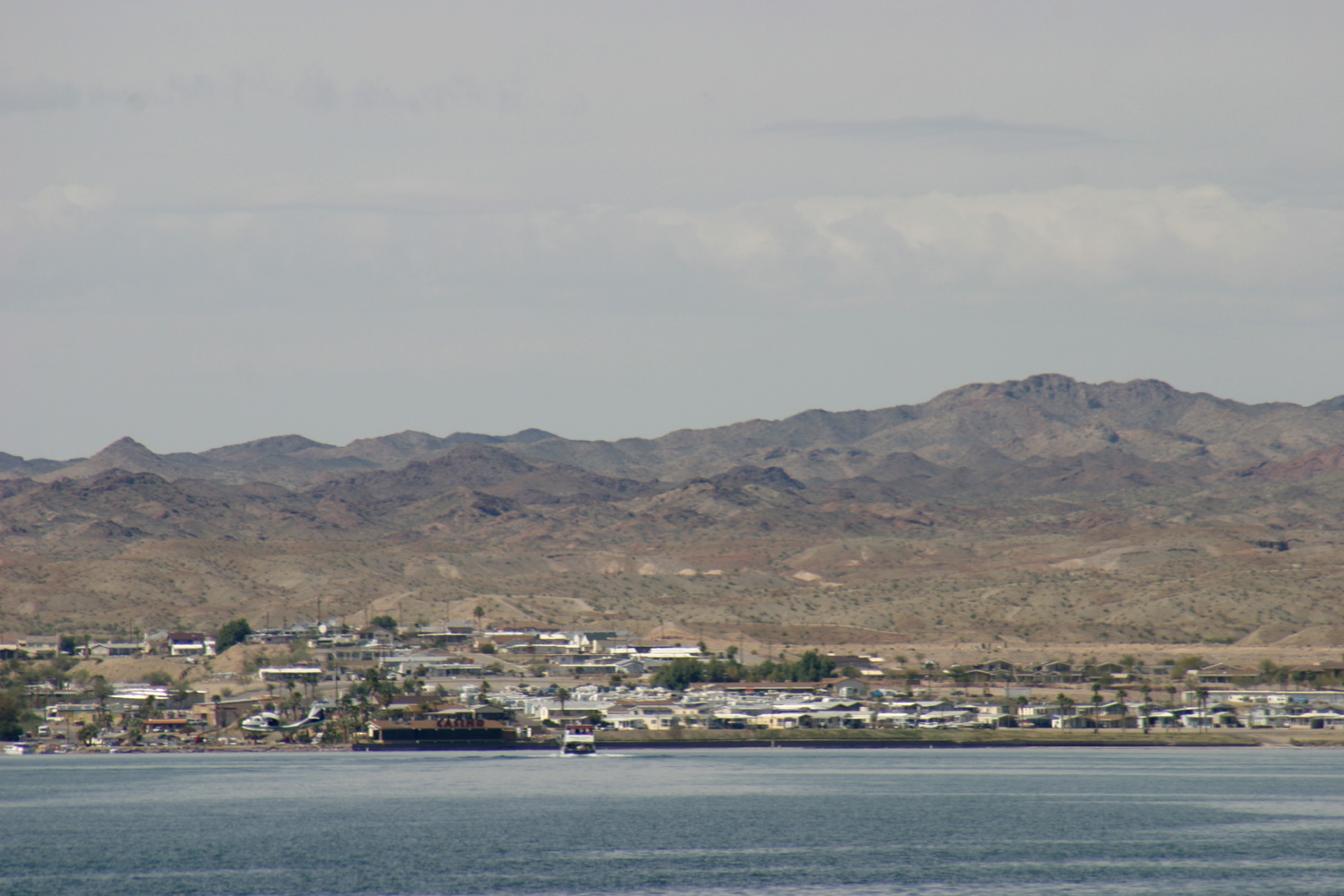
Lake Havasu is formed by
Parker Dam, and is well known as the site of London
Bridge, which
was moved here in sections in the 1960's. I've driven through
town once before, and saw London Bridge Boulevard, but so far I haven't seen the bridge. I won't make a special trip to see it,
either.
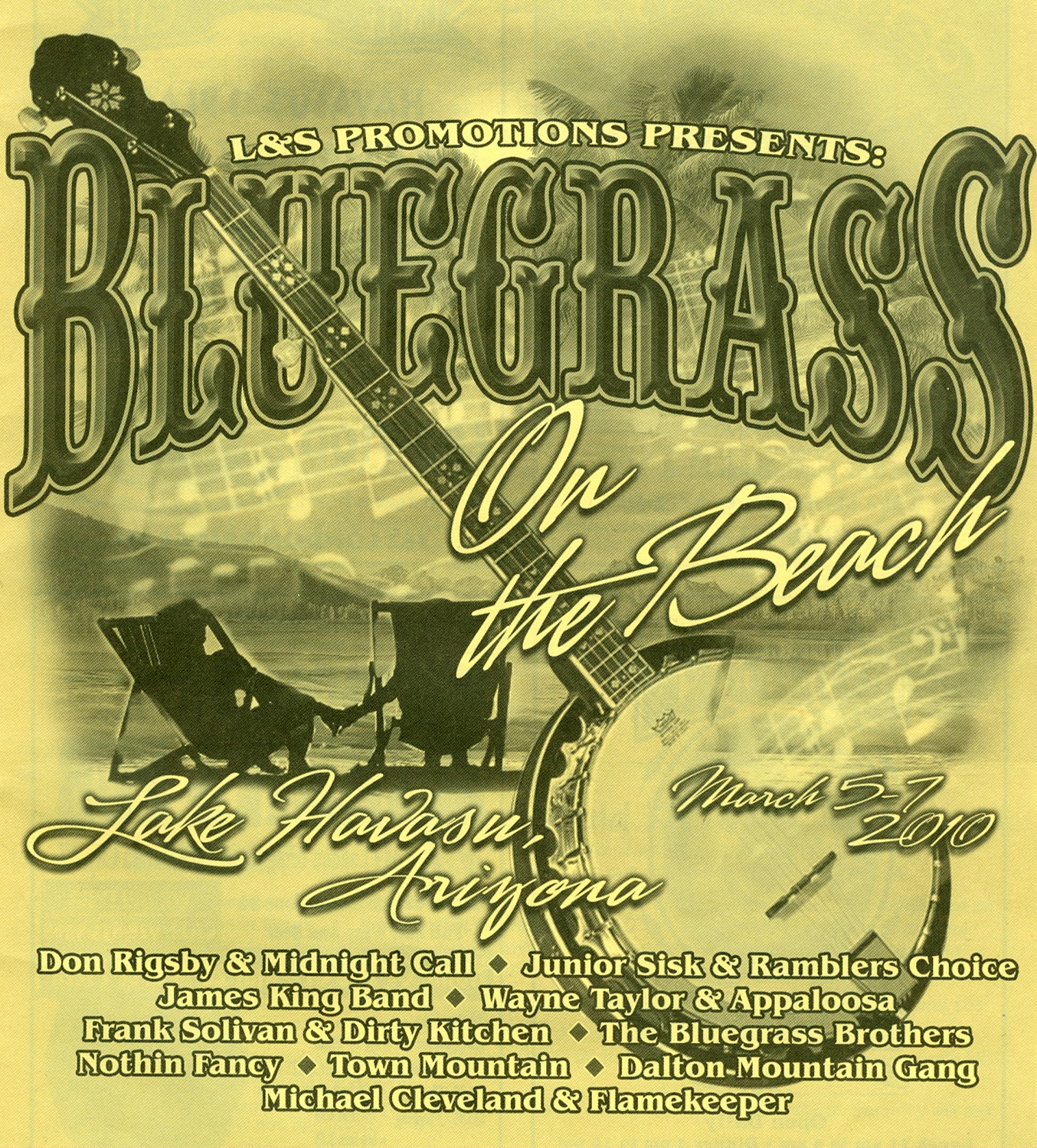
The festival is put on by
L & S Promotions
(Larry & Sondra Baker), who also do the Plymouth Festival, which I
like because it's a little smaller. Promoters are faced with the
dilemma of having a small festival, which is more enjoyable for some
people, or having a larger event that can support the hiring of
several top name bands. This is one of the big ones, and I'm looking
forward to the usual mix of groups that are new to me, groups I've
heard of but not seen, and old favorites from previous festivals.
(It turned out that I have previously seen all the groups here.)
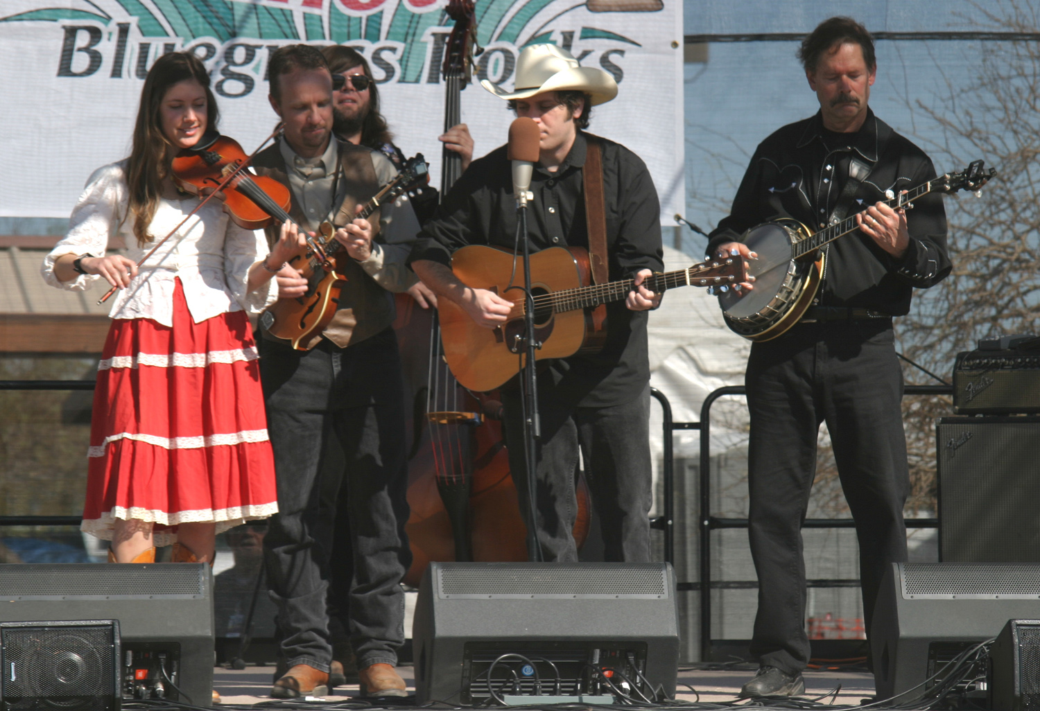
March 5: It was a
day of good bluegrass, good weather, and gathering with good
friends. The groups today were all ones I've seen anywhere from once
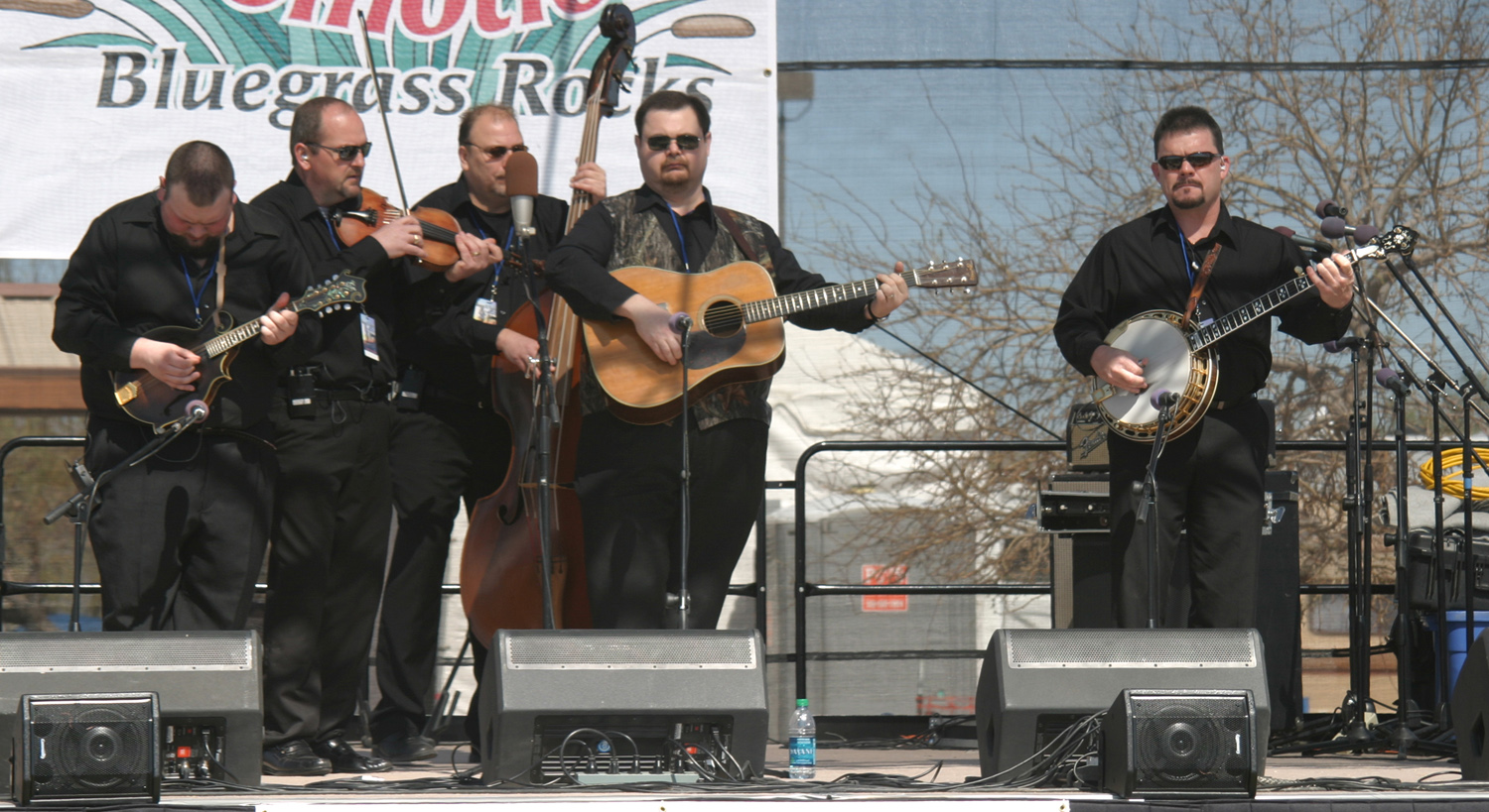
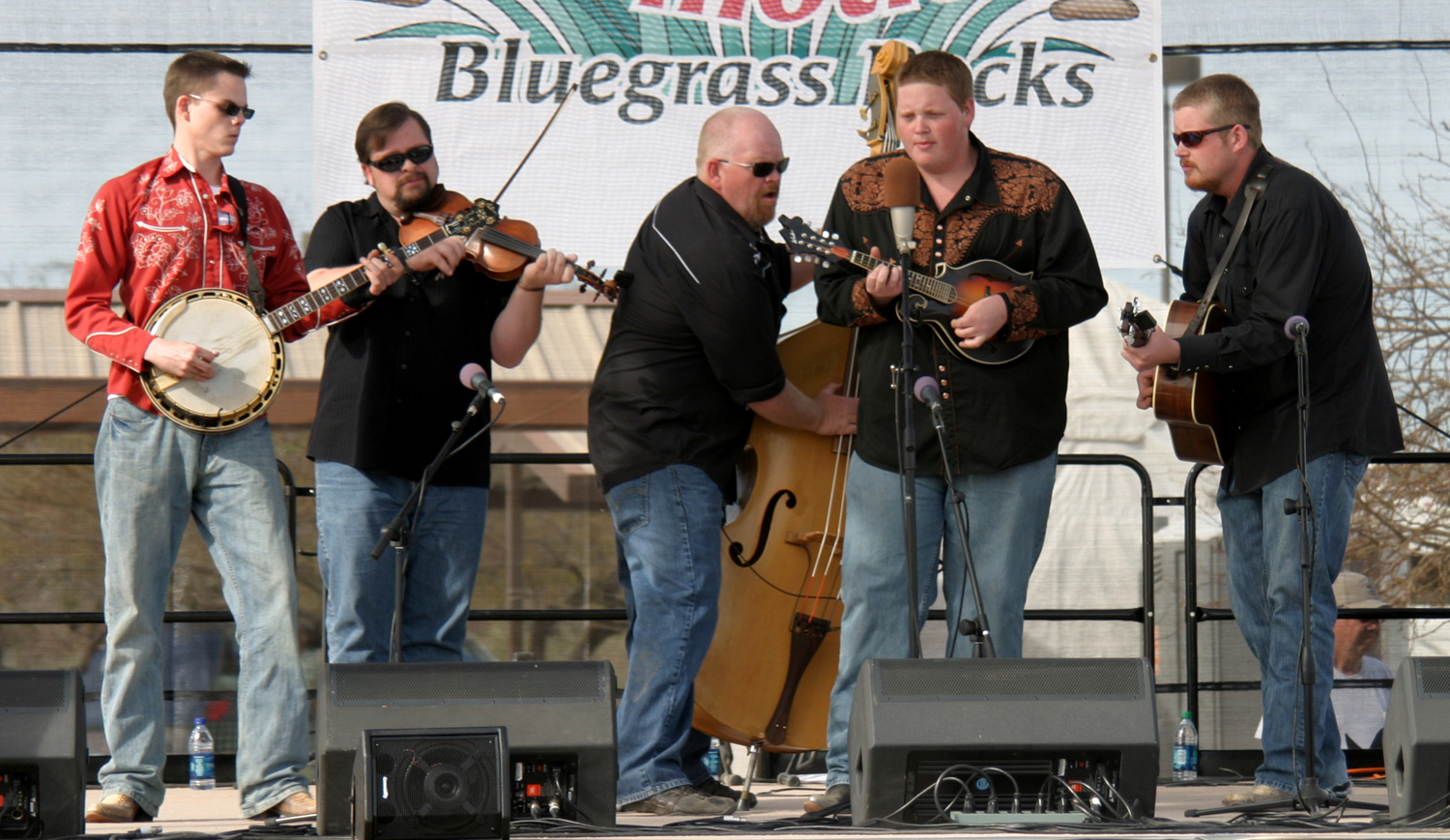
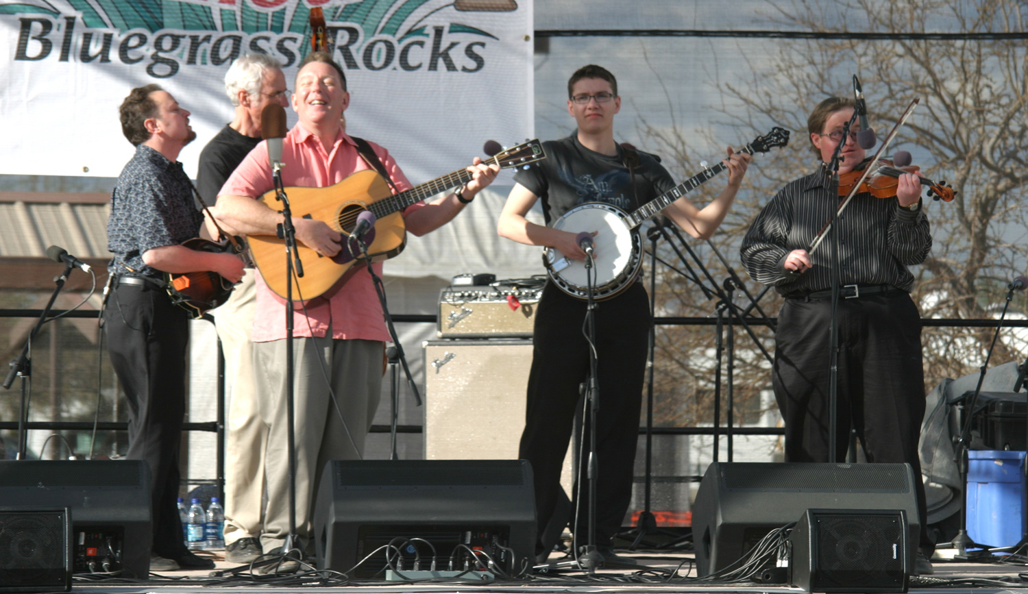
to a half-dozen times. Most familiar to me was the Dalton Mountain
Gang, from the Fresno area, who have appeared at several events in
Clovis barely a mile from my house. I've seen them at several
festivals; in fact, they have been at the
last five festivals I've attended.
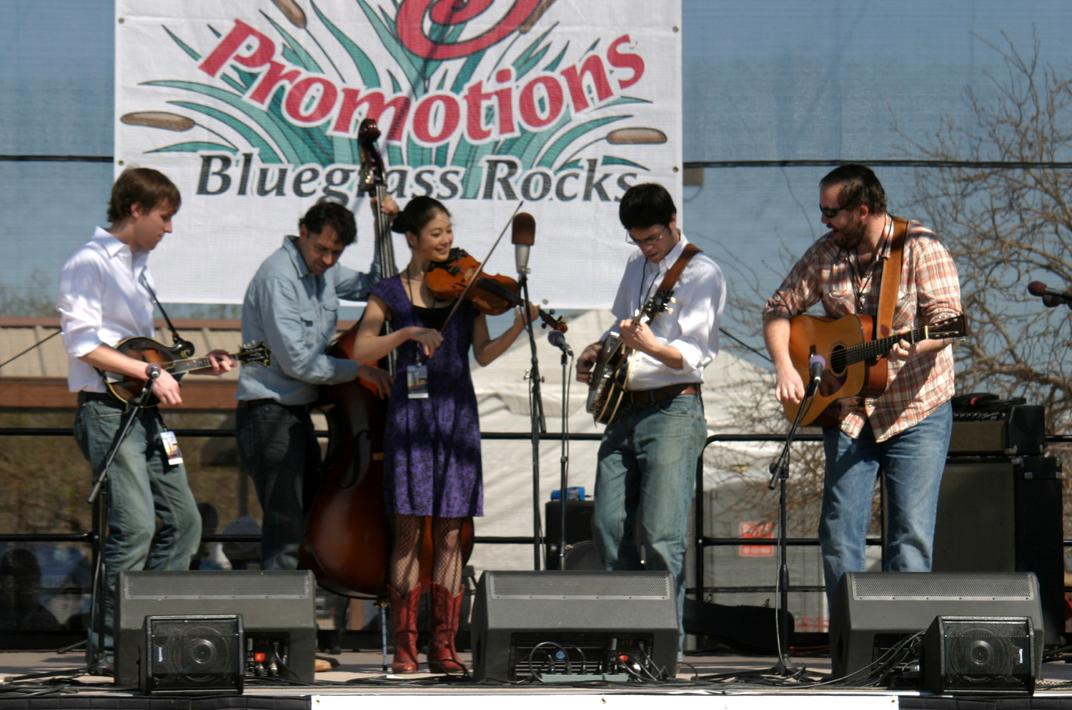
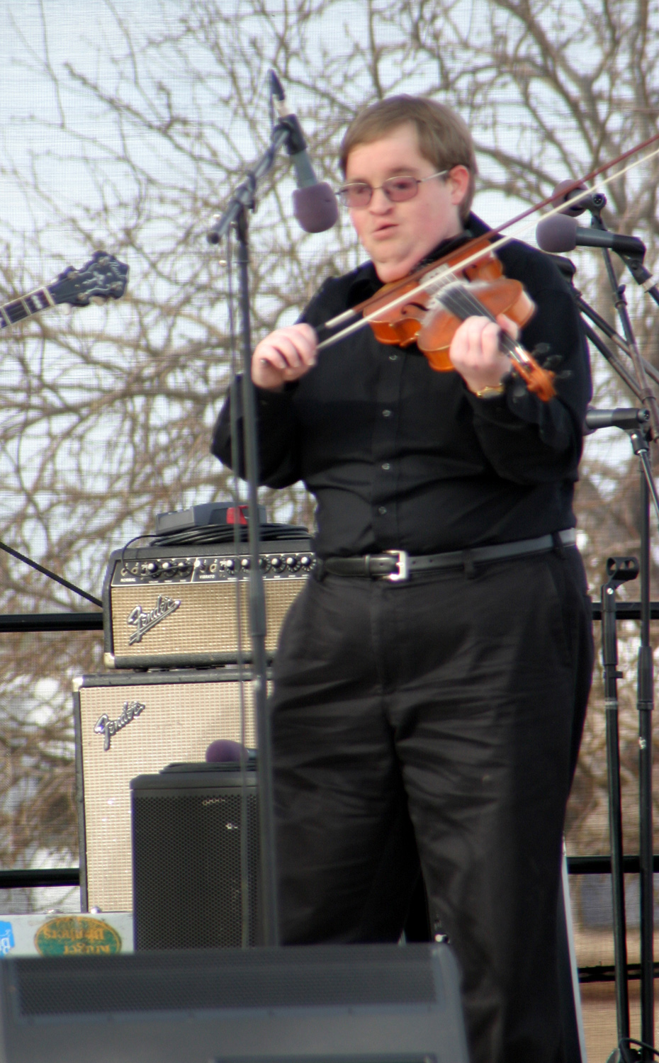
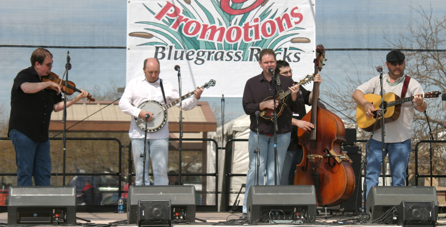
The outstanding group of
the day was Michael Cleveland
& Flamekeeper, featuring three
musicians who won the honor of best of the year on their instrument
- Marshall Wilborn, bass; Jessie Baker, mandolin, and Cleveland,
fiddle.
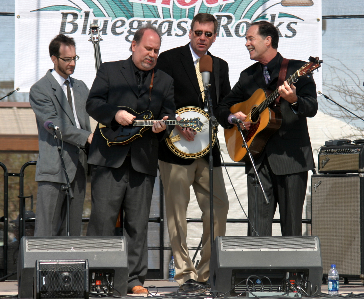
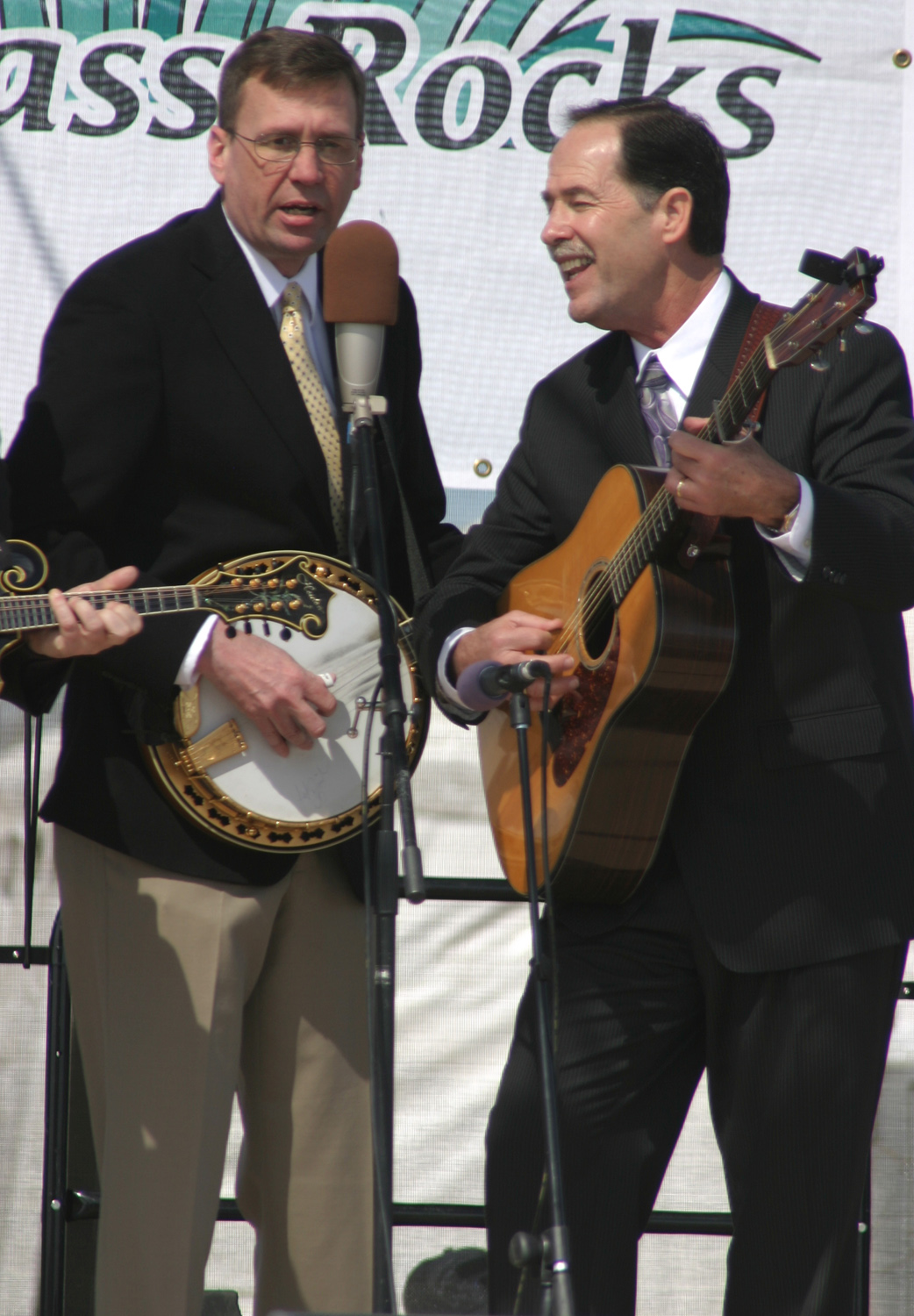
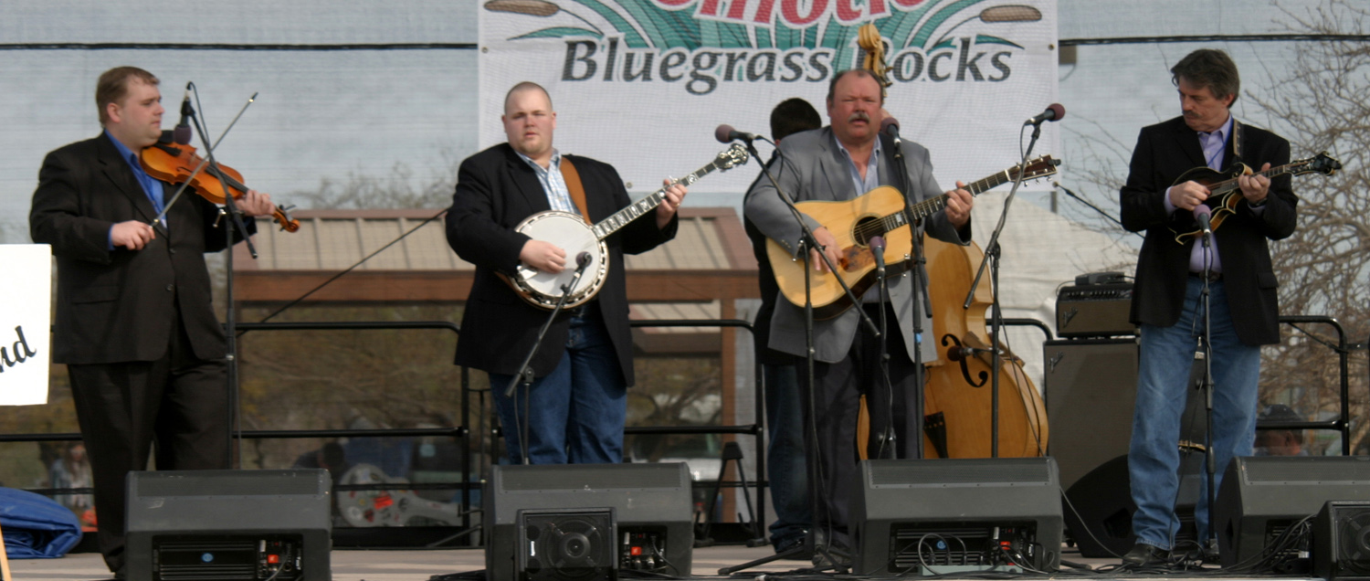
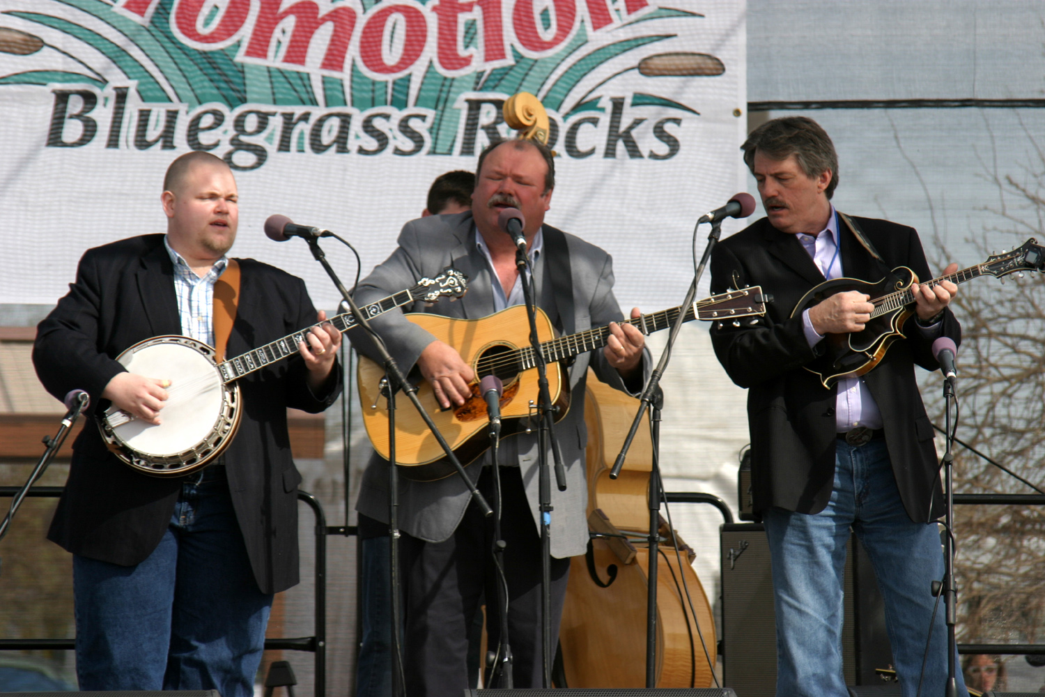
The
appearance of Wayne Taylor and Appaloosa included a special treat -
he was joined by his former colleague with the U.S. Navy Band, banjo
player Keith Arnason, who is on leave. Wayne retired a while back
and has been touring with his own band since then.
Most festivals start with
a brief welcome from the promoter and maybe a local politician,
followed by the national anthem. This was scheduled for 9:45, so I
wandered down to the stage area a little after 9:30. I was surprised
to see a large audience already gathered, since most people usually
straggle in after this ceremony ends. Then I was annoyed to discover
that for some reason the music had started early, and I had missed
most of the first group's performance. I was still slightly annoyed
by the fact that my neighbor had been running his generator at 6:30
a.m., a half hour before the "legal" start time.
Eventually a light bulb came on and I realized that there is a time
change when crossing into Arizona. This state does not observe Daylight Savings Time, so in the
summer there's no change, but of course, it's not summer, despite
the nice weather.
The setting is very nice,
about 100 feet from the lake, with the water partially visible through various
obstructions to the west. The weather was perfect,
warm enough to wear a T-shirt all but the last half hour or so.
There were some thin clouds, and there is a possibility of rain
tomorrow and Sunday, which would be the opposite of perfect, so
we'll hope it does not materialize.
As always happens when my
old classmates Bryce and Alma Green and their family are present, I
was invited to dinner tonight. We had excellent prime rib, cooked to perfection by John and Marie Upton, plus the usual
trimmings.
We had a large group, including Bryce's brother and sister in law whom I
had met at the Quartzsite festival two years ago, his cousin and
wife who were also at Quartzsite, the Greens' son and daughter-in-law, who
have been at the Plymouth festival, a nephew, and a couple from my
old home "town" of Bootjack, whose older brother I knew
fairly well. Two of the couples were just here for a visit and
dinner, and are camped nearby, but won't be at the festival.
Now it's a little past
nine and I am in for the night. That's 9 Arizona time, 8 California
time.
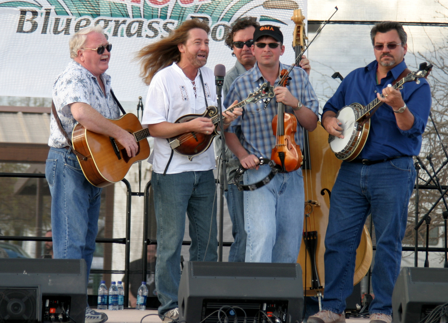
March 7: The
perfect weather continued on Saturday, but today (Sunday) it turned
horrible. I'll get to that in a minute. On the positive side,
Saturday was maybe a bit warmer than Friday, and the music was just
as hot. A group that I thought was new to me (although I have some
of their recordings) was Don Rigsby and Midnight
Call. After
watching them for a while, I realized I had seen them at one of the
Plymouth festivals.
My favorite group of the
day, the main one that drew me to this festival, was Nothin'
Fancy,
a group from Virginia that puts on a highly entertaining show. They
were the last act of the day, and played for 90 minutes, instead of
the usual 50.
Luckily all the groups
scheduled for Sunday had already appeared at least once, since as
far as I know they did not appear on Sunday. During dinner last
night (at the Green camp, naturally), we had rain off and on, with a
fairly hard sprinkle while Bryce's son Lemuel was barbecuing. It was
not enough to hurt the cooking, and they had the awnings out, so we
were comfortable eating outside, although the rain pretty much had
stopped by that time.
It rained a little off
and on during the night, then started coming down hard and steady by
the time I got up about 8:20. When it was time for the music to
start it was still raining, and I accepted the fact that this would
be a two-day festival. At most festivals I would have waited it out
to see what the afternoon would bring, but I planned to leave by
2:30 anyway. I sat in the motor home reading, waiting for the rain
to slack off so I could go down and retrieve my chair. By 11 a.m.,
it not only had not slacked off, it had become a very ambitious,
hard, wet rain. I got my umbrella and walked down to the
audience area. There were only a few people around, standing under awnings,
many chairs were gone, and the vendors were either gone or packing
up.
I stopped at Bryce and
Alma's trailer to tell them goodbye, and got underway about noon.
The hard rain continued well into California, to about 50 miles east
of Barstow. It was 3 p.m. as I approached Barstow, so I decided to
eat lunch in a Mexican restaurant, then stay at the RV park where
I've stayed several times before. It turned out to be full, and the
only other "park" I could find was the kind that has made
"trailer park" a term of derision. I decided to go on to
Mojave, another hour further, although the only park there is just a couple of steps
better. As I approached Boron, half way between Barstow and Mojave, I saw a sign for an RV park, and pulled in there. It's
nothing fancy, but is fine for an overnight stay, and I won't be sitting
outside anyway. I
am far enough along on my return trip that I will be home by early afternoon Monday. There
were a few sprinkles and one hard shower between Barstow and Boron,
but it cleared up overnight.
Boron is every bit as
charming as its name implies, located in a particularly drab part of
the desert. The vegetation is mostly low sage and creosote (no yucca
or cactus), and the nearby hills are low and plain looking. Some of
them are actually tailings from the borax mining in the area that gives the
town its name. On the plus side, its just a few miles from Edwards
Air Force Base.
The reason I wanted to
get home early is my other big spectator interest, hockey. Our local
Junior A team, the Fresno
Monsters, are in the playoffs, and this is
the second round. I'm missing the first game today, and since it's a
best two of three, tomorrow could be the end for us or our
opponents. The team has had a spectacular season, eliminating their
first round opponent in two games last week, so hopes are high. (We
lost the Sunday game in overtime; won the game Monday night, and had
our hopes dashed in an overtime loss Tuesday.)
I took advantage of my
early stop to wash dishes and vacuum the motor home, meaning two
fewer things to do
after I get home. There was a slight mishap in the bathroom, during
which I learned how much toilet paper a ShopVac can suck up in three
seconds (a LOT). But it's now 6:30, the chores are done, and I
plan no more work today, just reading, writing and TV watching.
March 10: I got an
early start Monday, getting on the road just after 8 a.m. Although
it was mostly sunny in the Boron area, I could see clouds over the
mountains to the west (southern Sierra
and Tehachapis),
and thought I might end my trip as it began, with rain. However, it
turned out to be fog through the Tehachapi pass, very dense in
places, causing me to slow down to 45 and 50 MPH. The worst thing
about driving at a safe speed in the fog is the realization that
someone is coming along behind me at an unsafe speed, but I made it
through without incident, and got under the fog as the road
descended west of the pass.
The weather was mostly
sunny down in the San Joaquin Valley, and I arrived home a few minutes
past noon. Despite the Sunday washout, the two days of music were
great, and I am ready to return to Mojave Preserve for another visit
some day.
--Dick Estel, March 2010
|


