|
Dick Estel's Later Trips |
||
| Lassen Park 1 | ||
| Mono Lake, Eastern Sierra | Lassen Park 2 | Canada |
| Mesa 1999 | Whale’s Head Resort | |
Introduction: In my report on The Early Trips, I covered travels back as far as 1940, when I was 18 months old, through 1978. After that, my trips were virtually all for camping and/or backpacking, and there are separate reports on that, in the "Before 2002" section of the links below. In this report I will focus on some trips I took with my older grandson, Johnny Upshaw. Like
both my kids and both grandkids, his first camping trip was in his
first year of life, and I took him with me on many camping trips. In
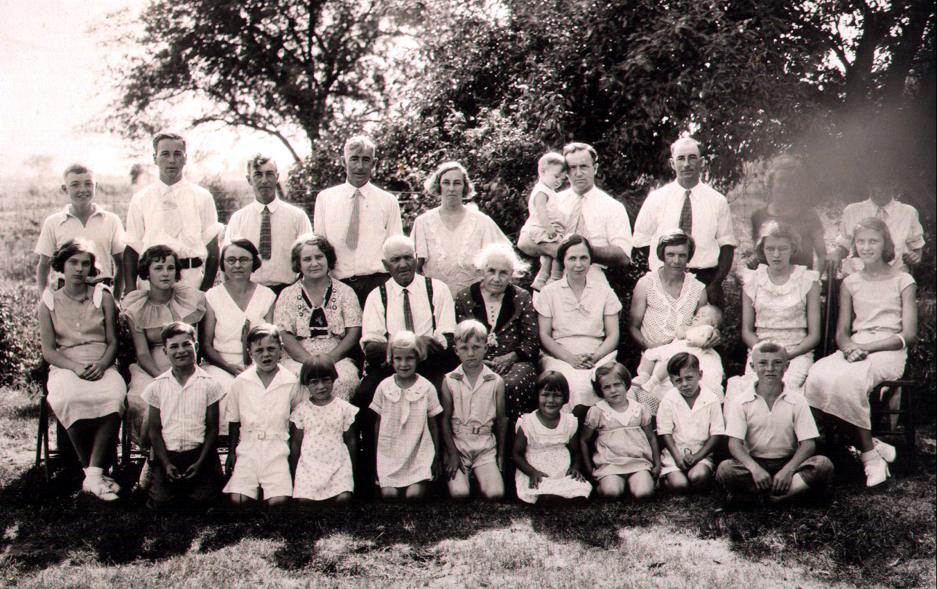
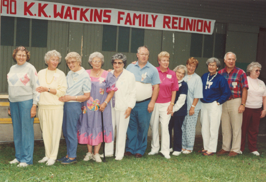
addition, he went by plane with me to Ohio: In 1990 my mother and her three sisters and some cousins decided to revive the Watkins Reunion. K.K. and Tillie Watkins were their maternal grandparents. They had five children who lived to adulthood, 23 grandchildren, 62 great grandchildren, and at least 100 great great grandchildren at that time, so there was a potential attendance of 200 or more. My grandson, Johnny, was one of only two great great great grandchildren at that time, but there are now 20 or 30 in his generation. Of course, K.K. and Tillie were long gone, as were all their children, although two daughters-in-law were still alive. Mother and her sisters had attended Watkins reunions in the 1920s when they were kids, but as people moved around, the event died out. There was a series of reunions into the 1970s, but by 1990 there had been no big gathering for ten years or more. As only
mothers can, she encouraged me to attend, and I made plans for my
first trip to We had a good time at the reunion, which was held at a park in Swanton. It was fascinating to meet so many relatives that I had been only vaguely aware of, and Johnny found kids his own age to play with. Of course, many could not make it, but there were still 50 or so cousins, second cousins, second cousins once removed, etc. We
spent about a week in Dad and
Mother had been coming to It was decided to hold the reunion every two years, and I went three more times, 1992, 1994 and 1996. Johnny went with me again in ’94 and ’96, but we missed the gathering in 1998 and in 2000, which turned out to be the last in this series, with only a handful in attendance. In addition to the reunion, Johnny and I found other things to do around the motor home campsite. There was an old swing set, part of a pile of junk, leaning at a slight angle. We were able to sit in what I guess would be called the glider (two seats facing each other), and swing without any dangerous tilting. We also explored the old barn on the property, and walked along the country roads nearby. Interstate 80 ran near the property, and just over the overpass was a field of soybeans. Walking by that area, Johnny was bitten by a bug of some sort, causing an immediate and quite significant swelling. We headed back, with visions of a trip to the emergency room in my mind, but by the time we made the quarter mile walk, the swelling had already gone down, there was no pain or itching, and no further symptoms. We also had fun standing on top of the overpass watching big trucks go underneath, with seemingly only inches of clearance. Our enjoyment was greatly enhanced whenever one of the drivers would give us a blast on the horn. One year Johnny had his roller blades, and skated down the overpass, but at a slow, controlled pace that did not cause me any worries (his great grandmother, however, thought it was an insane risk). Cousin
Don’s in Oregon: Don’t ask me when,
but in the early 1990s Johnny and I went to visit my cousin Don in We got to Don’s the next day, and had a good time, although I have to strain my brain to remember any details. I know that Don had a quad vehicle, which Johnny wanted to drive. There are a lot of dirt roads and trails around Don’s place, so Johnny had a good time driving the quad, putting it into the ditch only once. The only problem was that the battery was dead, and every time the engine died, we had to push it up the hill and jump start it, which of course, didn’t bother Johnny. I also recall that Don’s wife and kids were visiting relatives, so we didn’t get to see any of them. However, his older step-son, Zef, came by with a big fish he and a friend had caught in the ocean, and we had a good barbecue. We also
made a visit to the
Lassen
1: If my admittedly deteriorating memory is correct, our first
long trip with the trailer was to the area of In the
river, across the road from our camping spot, was a dredge and some mining
equipment, no doubt for mining gold. We also saw a snake in the
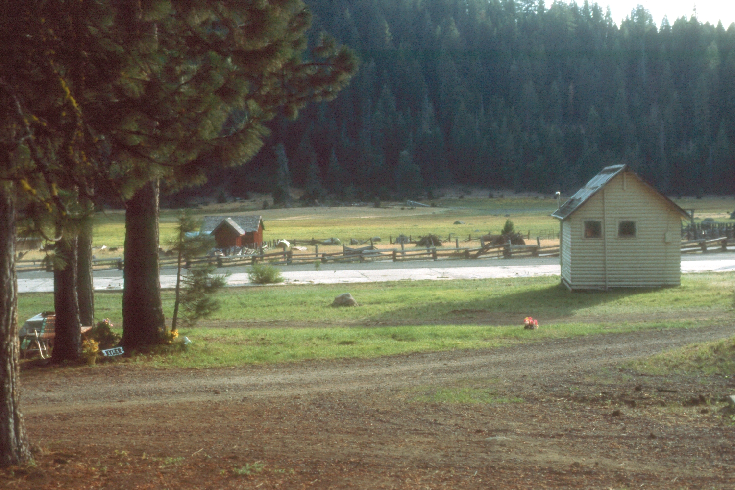
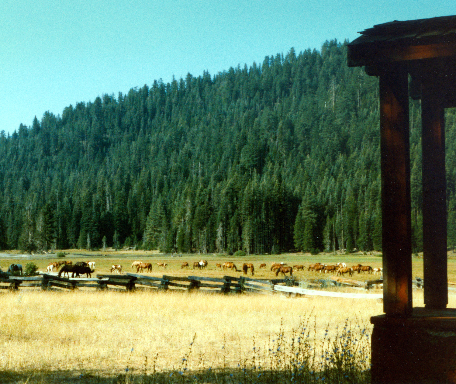
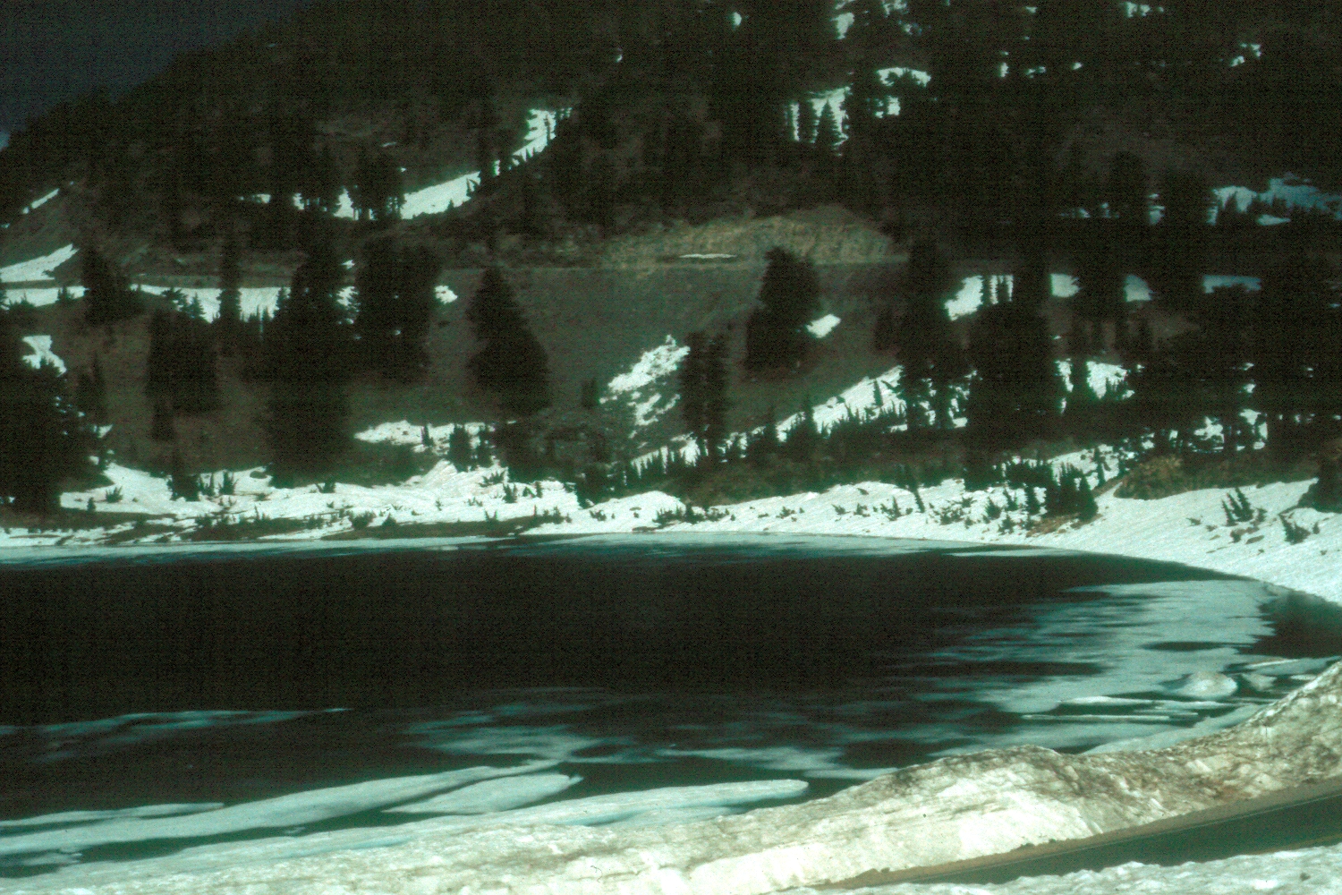
river. Along the The next afternoon, strictly by chance, we discovered an excellent camping area, Child’s Meadow Campground, which offers RV spaces, tent camping, and cabins. It’s located on state highway 36, across the road from a meadow that is at least two miles long, and is occupied by a large herd of horses (the meadow, not the camp). We got settled in that day, then the next morning we set off for our first look at Lassen, less than 20 miles away. One of the dramatic sights I remember was a lake that still had ice around the edges – in the middle of August. We decided to hike into a thermal area called Bumpass Hell, and headed down the trail. Much of the trail was still covered with snow, with little orange flags to mark the way. We reached the end of the trail, and were rewarded with a view of some steaming pools and mud pots, plus the smell of sulfur, evidence that volcanic activity in the area was still going on. We spent another day or so in the area, mostly hiking and biking around the camp. One day we drove a few miles down highway 172 through Mill Creek to Mineral on highway 36. We then rode our bikes down a dirt road to a big meadow full of flowers, surrounded by tall trees and rocky tree-covered hills. One
night a park staff member built a small fire in a ring about 30 feet
behind our trailer. A little later I looked out and saw it had
become a rather large bonfire. Since it was not cold, I did not see
why they had built it so big. Then the manager came to my trailer
and asked me to get my grandson away from the fire “before he
burns down the When we
left Child's Meadow, we headed even farther east and north into this remote area of We
ended up at Howard’s Gulch campground, a national We were fortunate to be there at the time of the Perseids meteor shower, which takes place every August around the 10th to the 12th. Next to the camp was a small hill with a trail to the top, so around sundown we took our lawn chairs, water and candy bars, hiked up to the top, and set up our viewing area. We had a 360 degree view, and there was no moon, and no lights from civilization, so the star field was magnificent. It was the first time Johnny had been in such a dark area at night, and he was duly impressed. Added to this, the meteors were abundant, and in that night, we counted a total of 30. The
next day we drove up to Lava Beds National Monument, which is an area that was
overflowed with volcanic material, some as recently as 1500 years
ago. We also made it all the way to At Lava Beds we explored two of the lava tubes – short, shallow caves that were formed during lengthy lava flows. Here’s a short explanation from the U.S. Geological Survey: Much of the north and south flanks of the Medicine Lake shield were built from molten lava transmitted through lava tubes. These tubes formed beneath the congealing surface of basalt flows in somewhat the same way that a brook may continue to flow beneath a cover of its own winter ice. As molten lava emerges from a vent and flows down slope, congealing lava from the top and sides of the central channel often forms a bridge over the lava stream. The sticking together of bits of lava spatter and fragile lava crusts strengthen the bridge in the manner that thin crusts of floating ice raft together to cover a brook during early stages of a winter freeze. Eruption of basalt lava, however, is a much more violent and spasmodic process than the steady gathering of water that feeds a brook. If liquid lava stops rising from its source deep within the earth, the still-molten lava moving beneath the crusted-over top of a lava flow will continue to drain downhill and may ultimately leave an open lava-tube cave -- often large enough for people to walk through. We observed meteors from an open area near camp that night, and saw about six more. Next morning, when it was time to leave, we stopped in Alturas for breakfast. Again we encountered a cook who was used to feeding hard working men. We had sausage patties as large as a salad plate, and Johnny got a huge quantity of biscuits and gravy – four full biscuits, covering a large plate. We ended up giving some of our sausage to a couple in the restaurant who had a dog in their truck outside. We
headed home down Mono
Lake: One of our more unusual trips was over the We went
through Yosemite
over Shortly after getting set up in our RV park, we went to visit some good friends of mine from Avenal, west of Fresno, who spent the summers in Lee Vining in a different RV park. We enjoyed popcorn and a drink with Ben and Wilma Briscoe, and had a nice visit. The
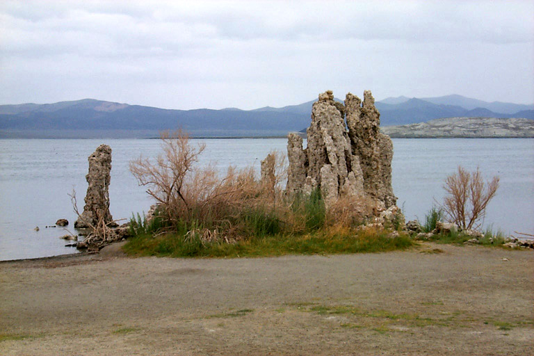
water teems with brine flies and brine shrimp, and seagulls by the
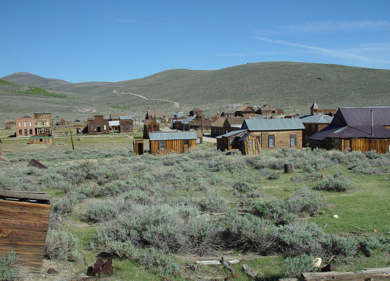
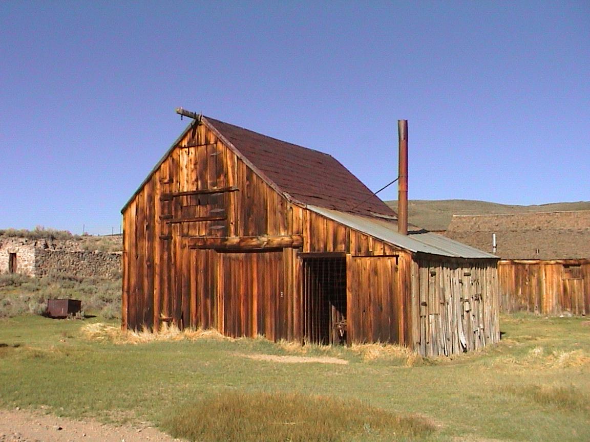
thousands wheel overhead. The vast majority of We also drove over dirt back roads to visit the historic ghost town of Bodie. Now a state park, Bodie was reputed to be a wild and wooly place during the early mining days. The old buildings have been preserved, and contain many artifacts of earlier times. Most of the buildings are unpainted, and have taken on a beautiful color of aged wood. There
was one place in the area that I had visited before, and wanted to
see again – The
hike back to the store and bus stop was longer than I had realized,
and the boys were getting hungry, so there was a bit of grumbling on
the way. We made it safely and quickly hit the store for some
emergency fuel, then caught the bus back to When we
left We
continued on highway 89 then on highway 88 till we came to a
campground across the road from the By this time they had taken over the chore of hitching up the trailer each day. Of course, I inspected their work, but they did a good job and never left any “loose ends.” When we left the campground, we continued over Highway 88, one of several scenic roads that goes over the Sierra. I had traveled this road for the first time shortly before Johnny was born, when we went to my younger daughter’s wedding in Tahoe. This time we had a more leisurely trip, and started looking for a place to spend the night. The one campground we drove into was full and everyone was crowded very close together. We ended up finding a spot beside the highway, where we could get off the road about 30 yards. On our side of the road was a large meadow, and we walked across it and into the woods beyond. We also explored some roads on the other side. I started to check out an old abandoned pickup camper a few hundred yards in, but soon realized that it was occupied. There were a number of trailers in the area, some just people spending a night or two, but apparently others were set up for long term camping. This
was our last night on the trip; the next day we continued down the
western slope of the Sierra to Highway 99 and home to
Lassen
2: Some time a couple of years or so after our first trip, we
made another trip to the We also took a side trip to McArthur-Burney Falls, a destination that had been recommended to me by a colleague at work, Sue Wirt (Thanks, Sue, in case I didn’t tell you at the time). This is a beautiful fall that drops over a lava cliff into a canyon. It’s visible a few steps from the parking lot, then it’s only a half mile walk down to the bottom of the canyon, with another great view of the falls. These were the highlights of the trip, although we did some hiking and bike riding around the camp again. We came home via state highway 32, where I took a picture of Johnny by the highway sign, since 32 was the number he had chosen for his hockey jersey when he first started playing. Canada:
Now it was time for one of the best and biggest trips of all.
Johnny was getting older, and I knew he would soon be involved with
jobs, girls and other activities which would cut into his time for
travel with me. We discussed going to Yellowstone, He had
been playing hockey since he was eight or nine, and finally we hit
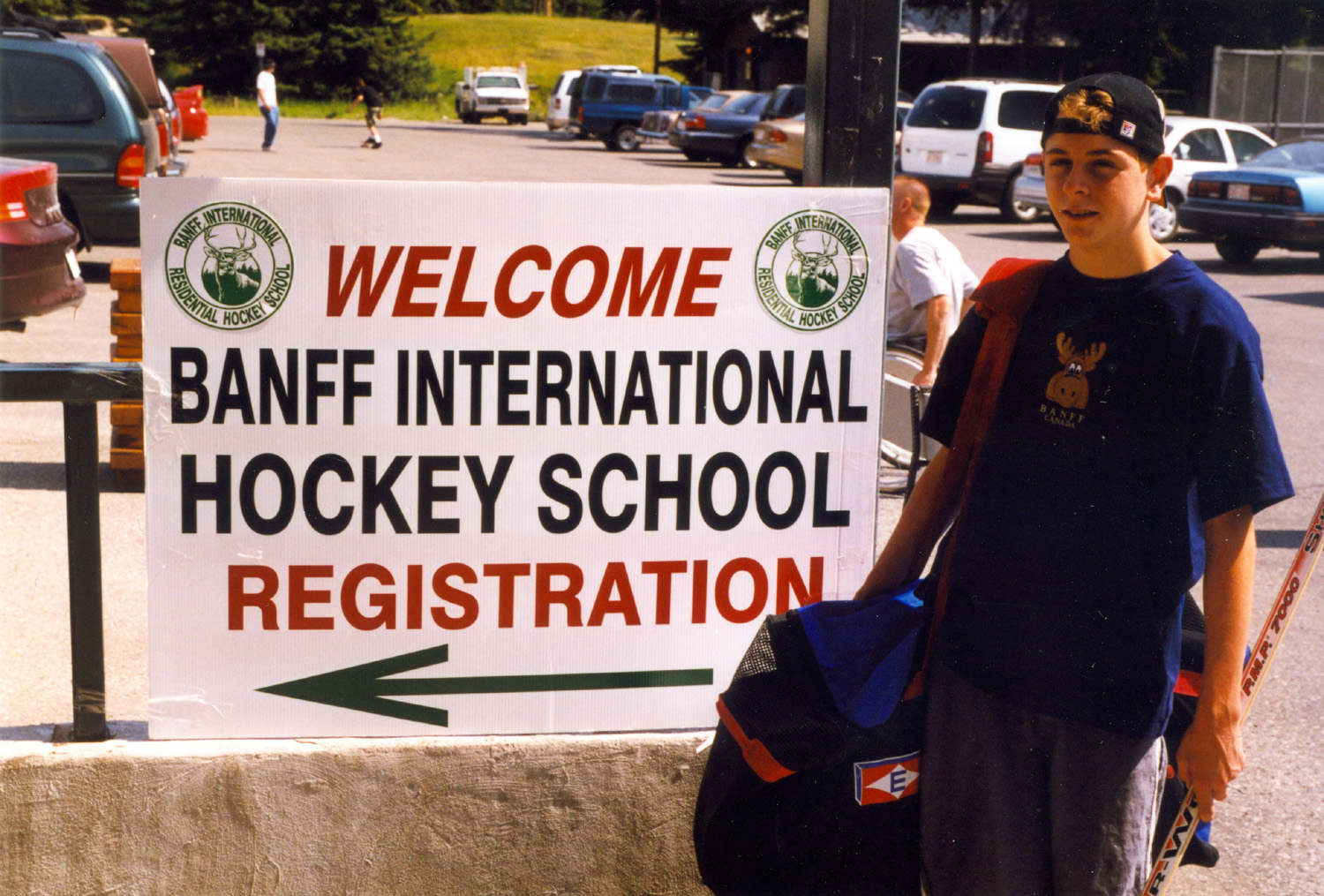
on the idea of him attending a hockey camp in So
early one August morning we headed north up California 99, then on
to Interstate 5 at We
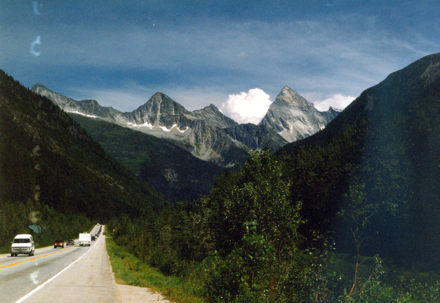
headed on through On the
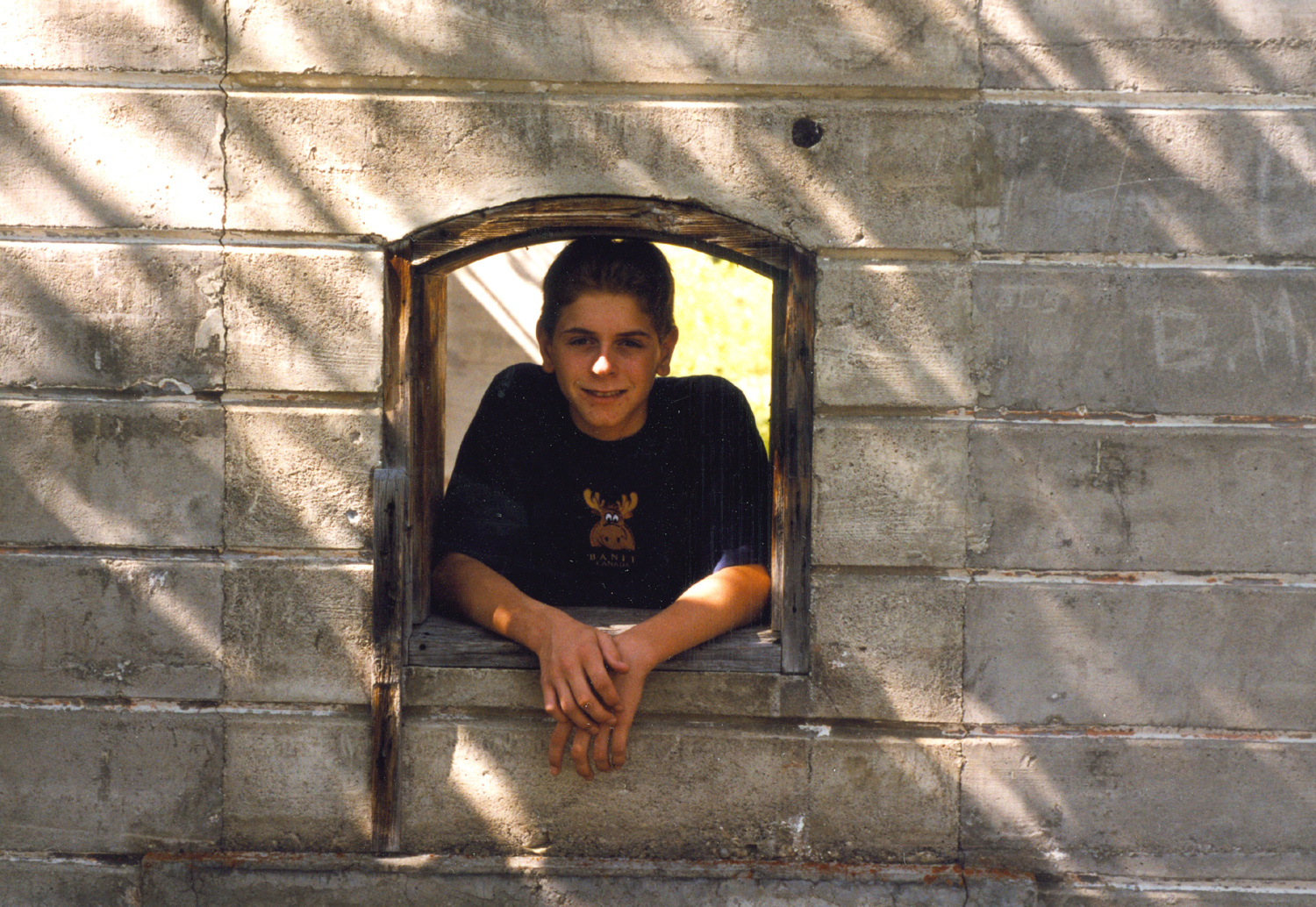
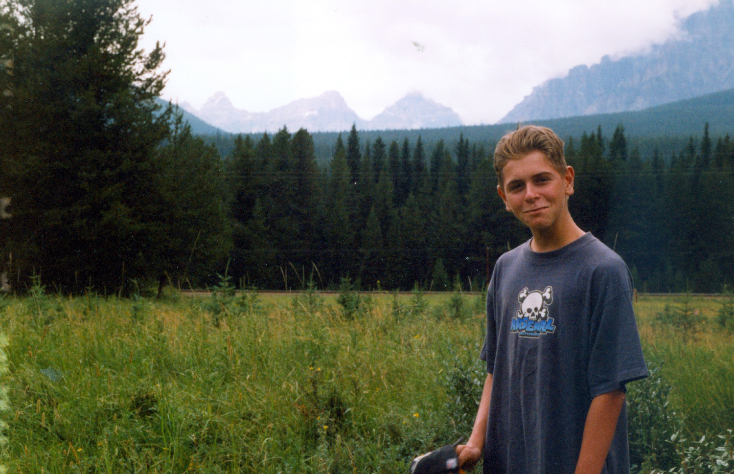
third day we left I-5 and angled slightly east, entering The drive through B.C. was particularly nice, including flat valleys with sharply rising, tree-covered hills, and passage through two National Parks, including one where glaciers were visible. Through the mountainous areas there were gun platforms along the Highway, where they fire cannons in the winter for avalanche control. We
finished our time in Not long after we got set up, it started to rain, and rained for two or three hours. It was not cold, so we sat out under the awning and enjoyed the view. The next day we went into town, found the ice rink, and got Johnny checked in. He would be staying at the rink throughout the week, although I could come and visit him and watch the activities at any time. While
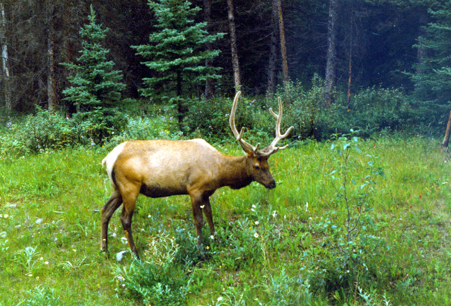
Johnny was at camp I made two hikes, one to the top of I went to the rink every day, and saw the various activities, which included several hours of on-ice instruction, off-ice shooting and stick-handling drills, and a scrimmage (game) every evening. In addition to the hockey activities, the boys were taken on a hike up a steep mountain, to a swimming hole in the river, and other outside activities. When the week ended, we spent another two days or so there, doing some sight seeing and having dinner in a nice restaurant. Our explorations included a visit to Lake Louise, where you can view a glacier across the water. We saw bighorn sheep at one location, and many female elk everywhere. In the town, people put little wire fences around their landscaping to keep the elk away. We also saw two male elk on the drive to Lake Louise. When we
left We
spent our first night near Instead
we headed south through We
continued on to The
next day we made a long drive, nearly 480 miles, through
On the
way down we spent the night in Blythe since I did not want to try to
get there in one day in time for the We got
to As it got close to game time, people in Coyote jerseys descended on the arena from all directions. Our seats were in the second row, right behind the visitors’ bench, so we had a good view which was sometimes blocked by players jumping up to watch an exciting play, or by coach Craig Hartzburg jumping up on the bench to yell at the players. The game did not end our way (Ducks 5, Coyotes 1), but it was incredibly exciting. It looked much faster than it appears on TV. Johnny caught a puck that may have been the one Teemu Selanne scored the first goal with. The puck came flying into the bench and after Hartsburg ducked, he picked up the puck and flipped it over his shoulder. There were several hands reaching, but Johnny read the play perfectly and caught it. We had
a good visit with Dad and Mother, including a trip to Organ Pipe
Pizza (the largest theater organ in the world), where a musician
performs while you enjoy your lunch. We also went to Park of the
Canals, an area where a number of canals built by Hohokam Indians in
the early 1000's are preserved; it also has a cactus garden. We
visited Little is known about this tribe; their culture dispersed around 1450. The local Indians believe they are descended from the Hohokam. Johnny and I also went out one day and spent several hours walking around the desert. It is pretty open so fairly easy walking even where there are no roads or trails. We saw lots of barrel, saguaro and cholla cactus, as well as a small one which may have been pincushion. Mother's cousin Gloria Samuelson and her daughter Margaret Meister, who moved to Arizona from Omaha in September, came over one afternoon and we went to an all you can eat barbecue place. Johnny was in heaven. We had a huge plate of ribs (served family style) and another plate of beef and chicken. We could have asked for more, but that was enough. Dinner also included potatoes, bread and vegetables. We left early Saturday, February 20, a little before 7 a.m., and got home about 6:30 p.m. (there’s a one hour time difference). We came home through Needles; the mileage both ways was about 630. My odometer may be off about 1% but not sure which way. Dad thinks it's more like 660.
Whale’s
Head There
is a “blow hole,” at Whale’s The
weather was overcast all but the last day, but it was not
unpleasant. It was about 60 degrees throughout the day, and very
comfortable in jeans and a flannel shirt. In addition to the hiking
which I’ll discuss shortly, we drove up the highway to One day
we drove south into Near
Whale’s Head Resort there are a number of sections of the Oregon
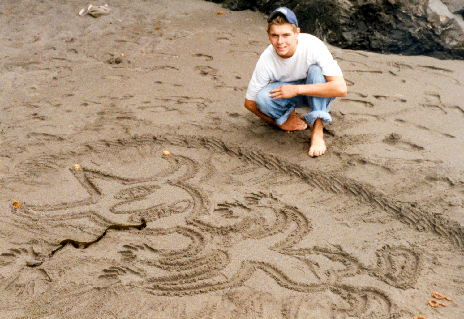
Coast Trail. Although the trail goes from During our hikes we saw two or three snakes and many banana slugs. One day we found a trail that went down to a tiny secluded beach, maybe 30 feet across. Here Johnny drew in the sand a creature I named “The Sand Alien,” something he was into creating in the sand at various places. You can take a look at this masterpiece here. The last day we were there, my cousin Don and his wife Diana came over from O’Brien OR, about 40 miles away. We had lunch in the trailer, then went for a hike. This turned out to be our only sunny day, and also the only day our hike took us out into an open area, a section of grassy dunes. Of course, warm weather by the ocean was still cool compared to what awaited us at home. When it
came time to leave, I knew it would take two days, but we did not
have a particular stopping place in mind. We made the mistake of
driving too long, till we found ourselves on Highway 99 south of We
survived this inconvenience, and made the short trip back to This
pretty much ended the long trips I was able to take with Johnny, as
he became more involved with school, girls, and jobs. We did do a
lot of traveling to the Bay Area, Around this time I started going to bluegrass festivals. I’ve reported on just about every trip since I retired in 2002, and the earlier bluegrass festivals are discussed in my Bluegrass Odyssey page on line. Looks like all that’s left are forty years or so of camping and backpacking trips. |
||
|
Photos |
||
 |
 |
 |
| K.K. & Tillie Watkins & Descendents | Watkins cousins at 1990 reunion (Hazel Mason Estel left) |
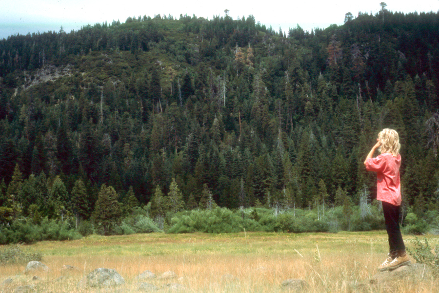
Johnny at meadow in Lassen Park area |
|
 |
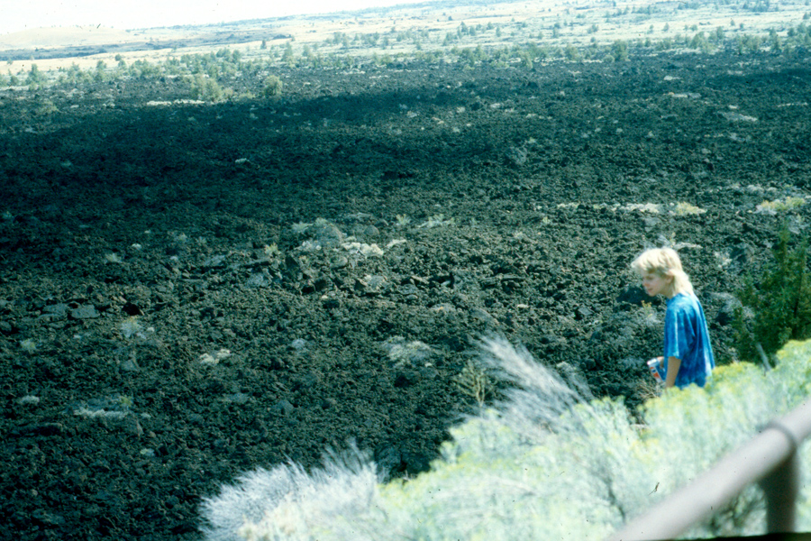 |
| View from campground at Child's Meadow | Horses in Child's Meadow | Johnny looks out at lava flow n Lava Beds monument |
 |
 |
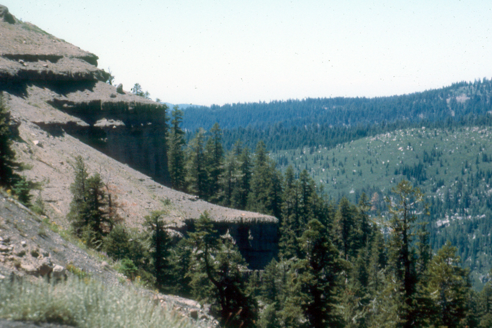 |
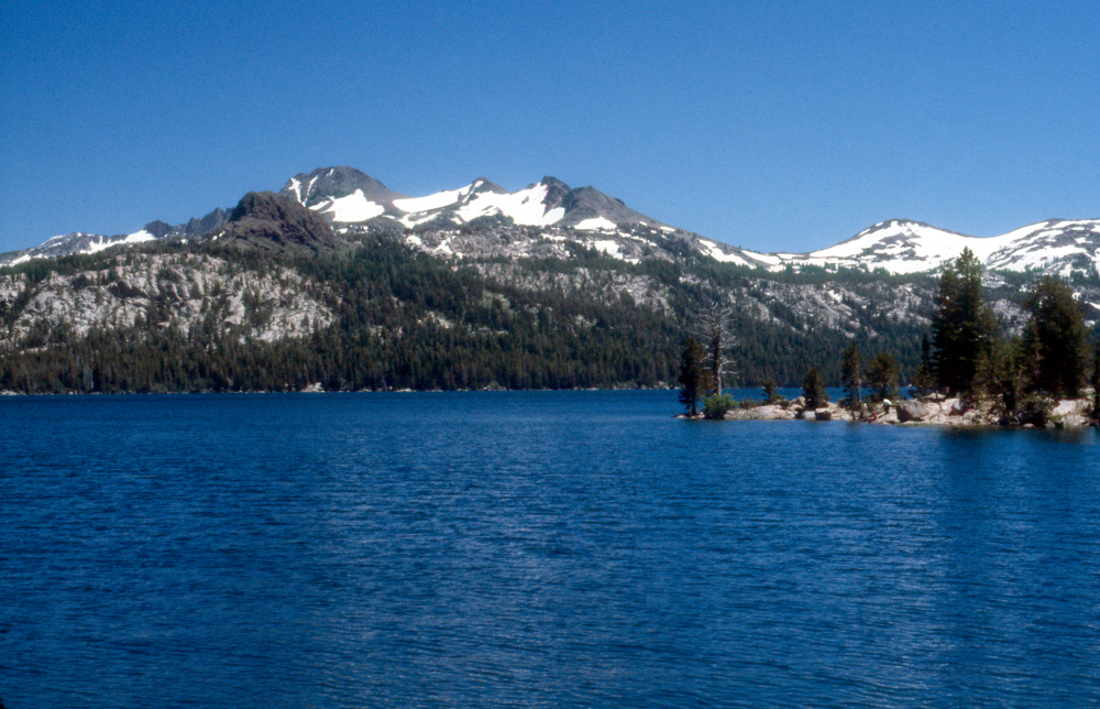
| Icy lake in August, Lassen park | Lake by Highway 88 in Sierra | Lava cliffs along Highway 88 |
 |
|
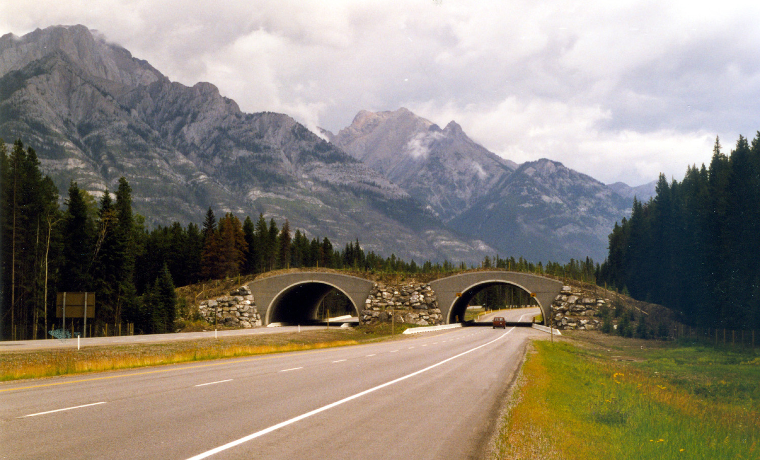 |
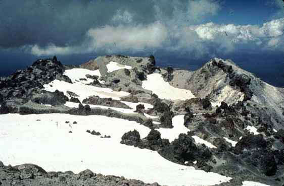
| Summit of Mt. Lassen | On Trans-Canada Highway 2, B.C | Overpass on Highway to allow animal crossings |
 |
 |
 |
|
Elk on the road between Banff and Lake Louise (Johnny took this through the open truck window as we slowed down) |
Ready to check in at hockey school |
Johnny at Bankhead Coal Mine Site, Banff BC |
 |
 |
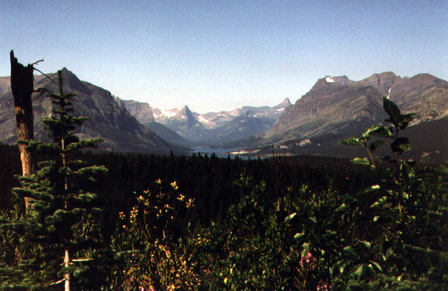 |
| Dick at Bankhead mine site | Johnny in Canada | Looking into Glacier Park from highway to the south |
 |
 |
 |
|
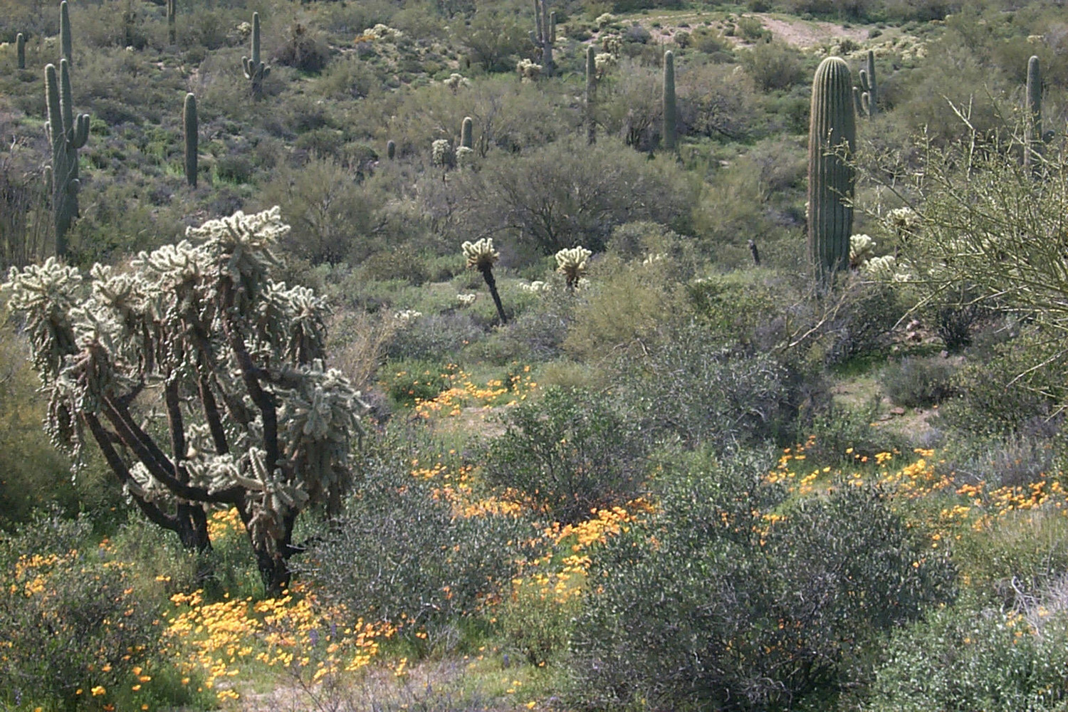
The Sonoran Desert east of Phoenix |
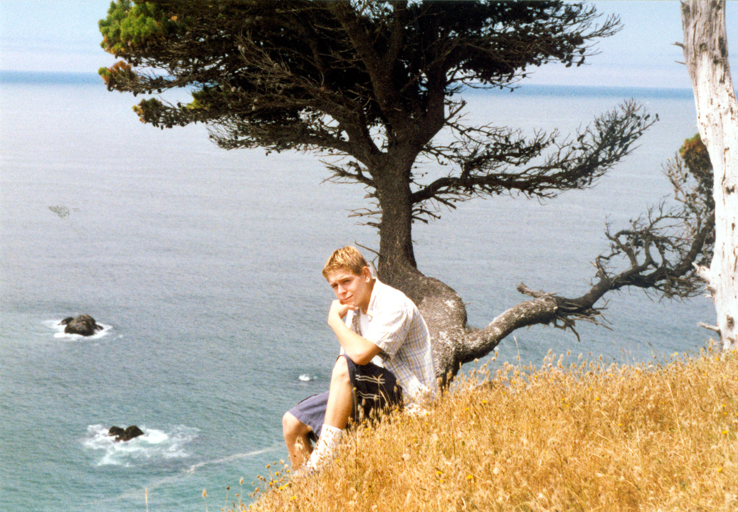
Johnny on a headland near Whale's Head Resort |
Johnny and the Sand Alien |
 |
 |
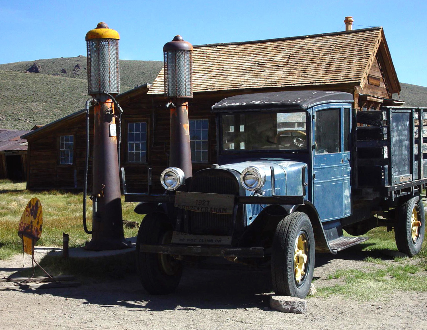 |
| Tufa tower at Mono Lake (photo by Tim Liddle) | Bodie, in a treeless basin at 8000 feet elevation | Permanently parked |
 |
 |
|
| Downtown Bodie | The aged wood beauty of Bodie's buildings | |
| Bodie | Bodie State Park | Casa Grande National Monument |
| Devils Postpile National Monument | Jedediah Smith Redwoods | Kamloops BC |
| Lassen National Park | Lava Beds National Monument | Lava Tube Caves |
| Lee Vining | Mammoth Lakes CA | |
| Markleeville | McArthur-Burney Falls | Mesa AZ |
| Mono Lake | Mono Lake Tufa Reserve | Oregon Caves |
| Oregon Coast Trail | Sand Alien | Tonto National Forest |
| Tule Lake | Tule Lake Wildlife Refuge | Watkins Genealogy |
