
|
Roundup 2010 |
||
|
Hensley Dog Walk Hensley Camp Mojave Preserve 2 Mojave Preserve 3 |
||
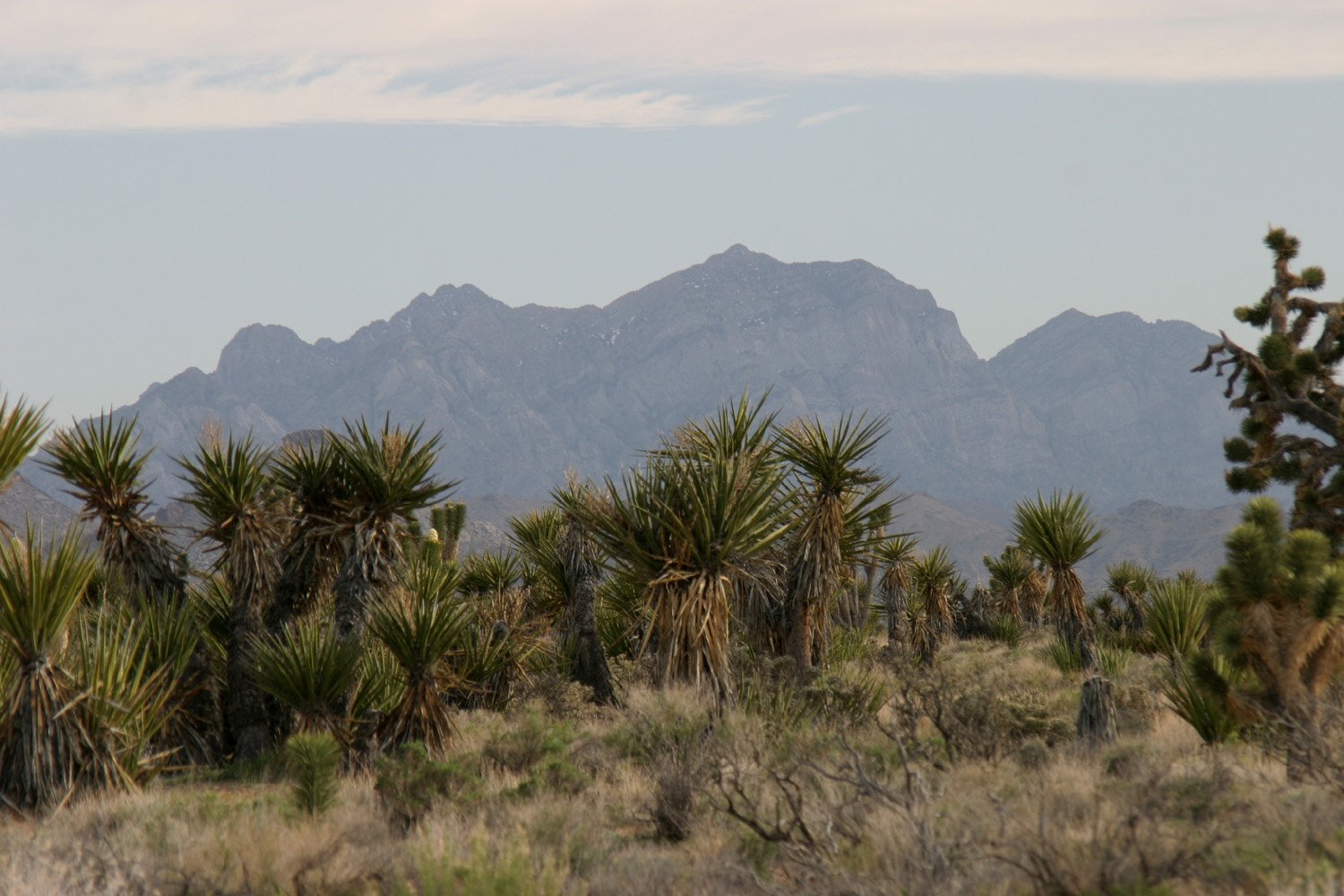
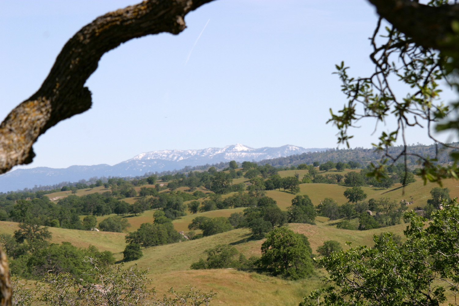
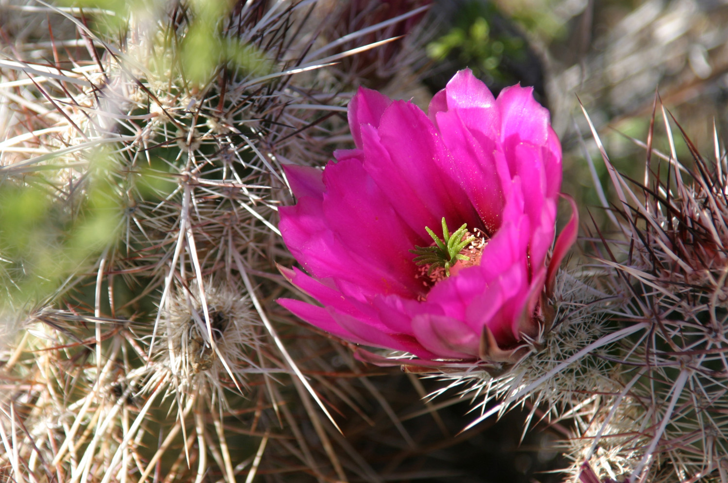
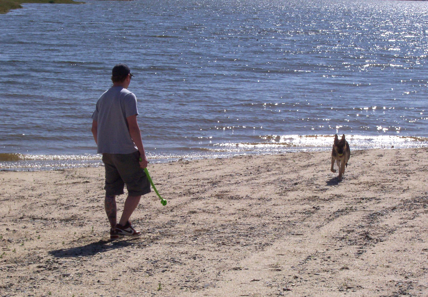
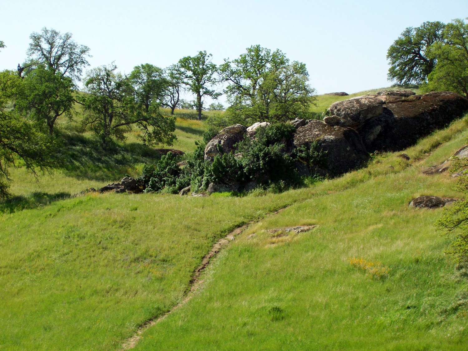
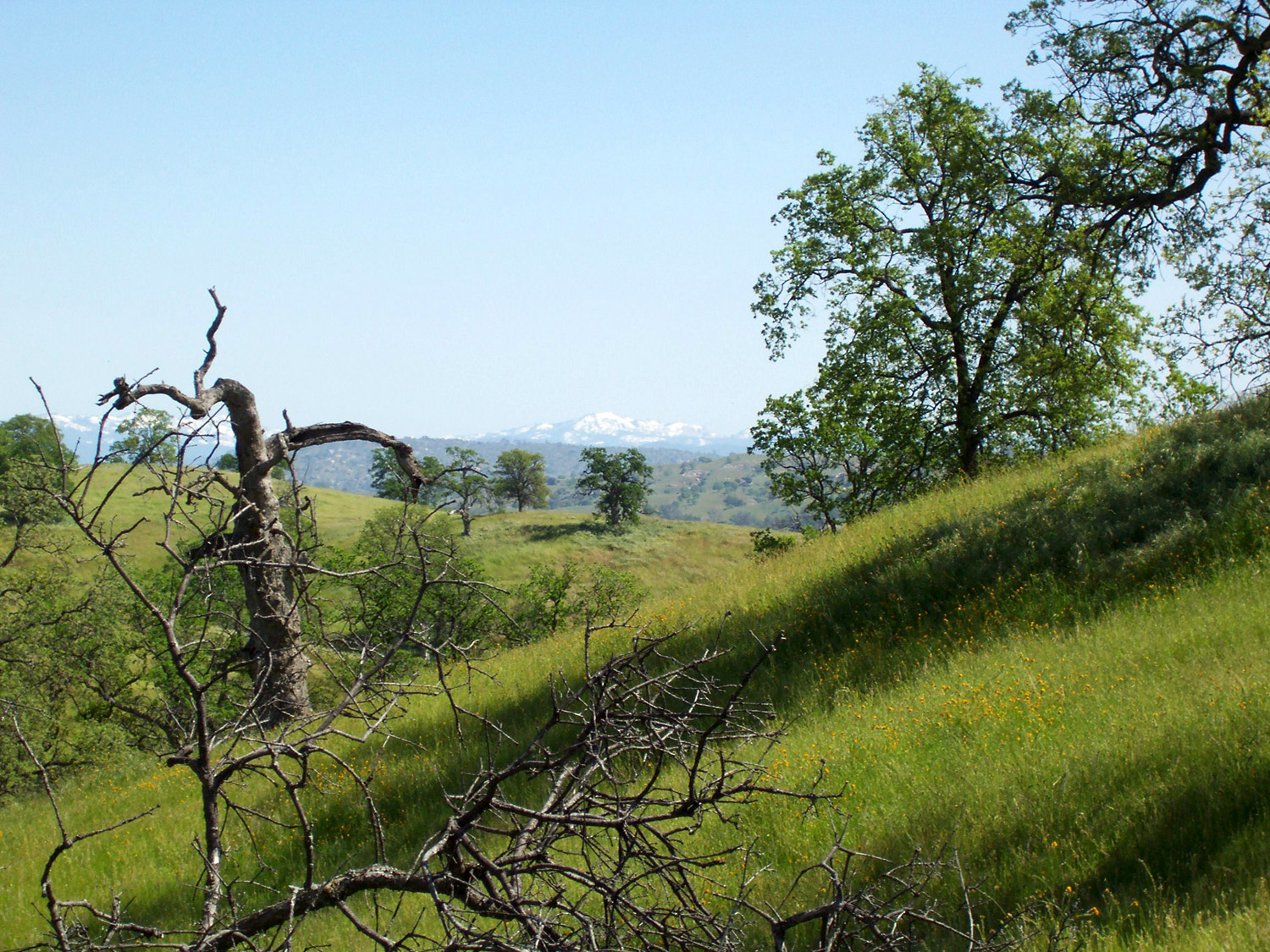
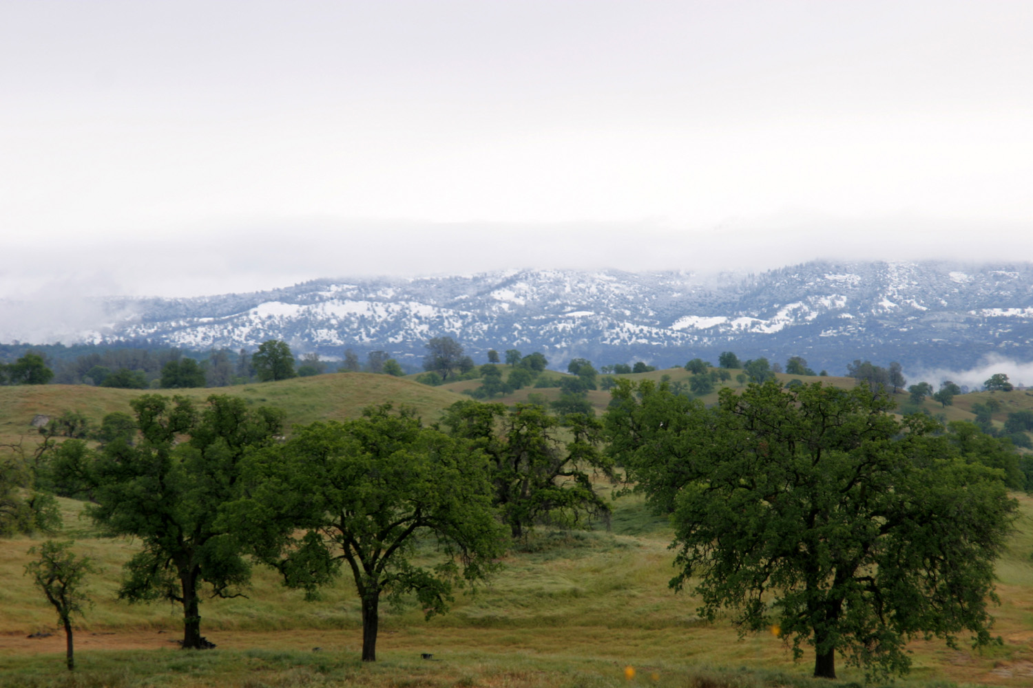
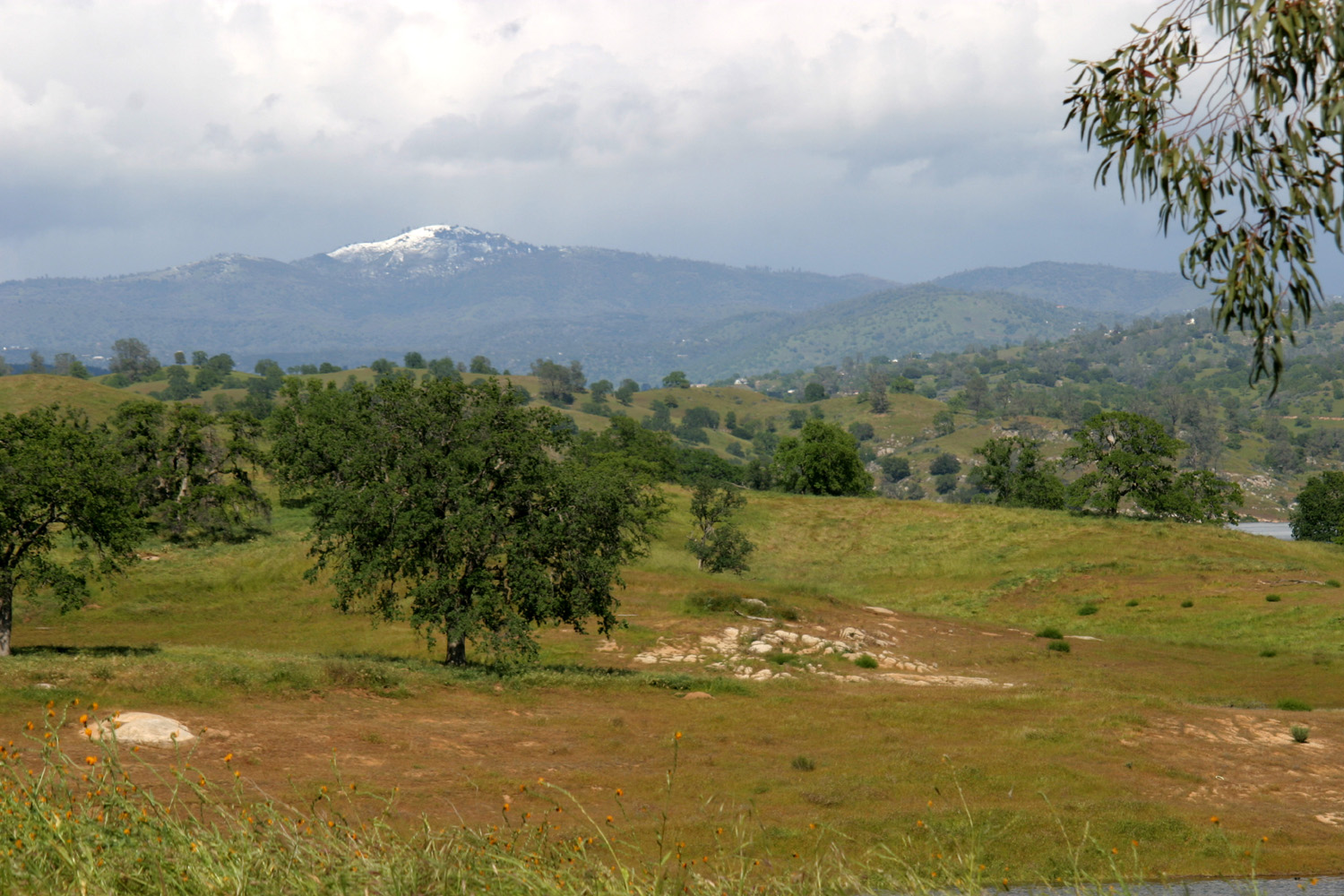
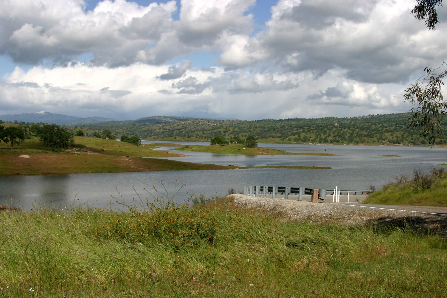
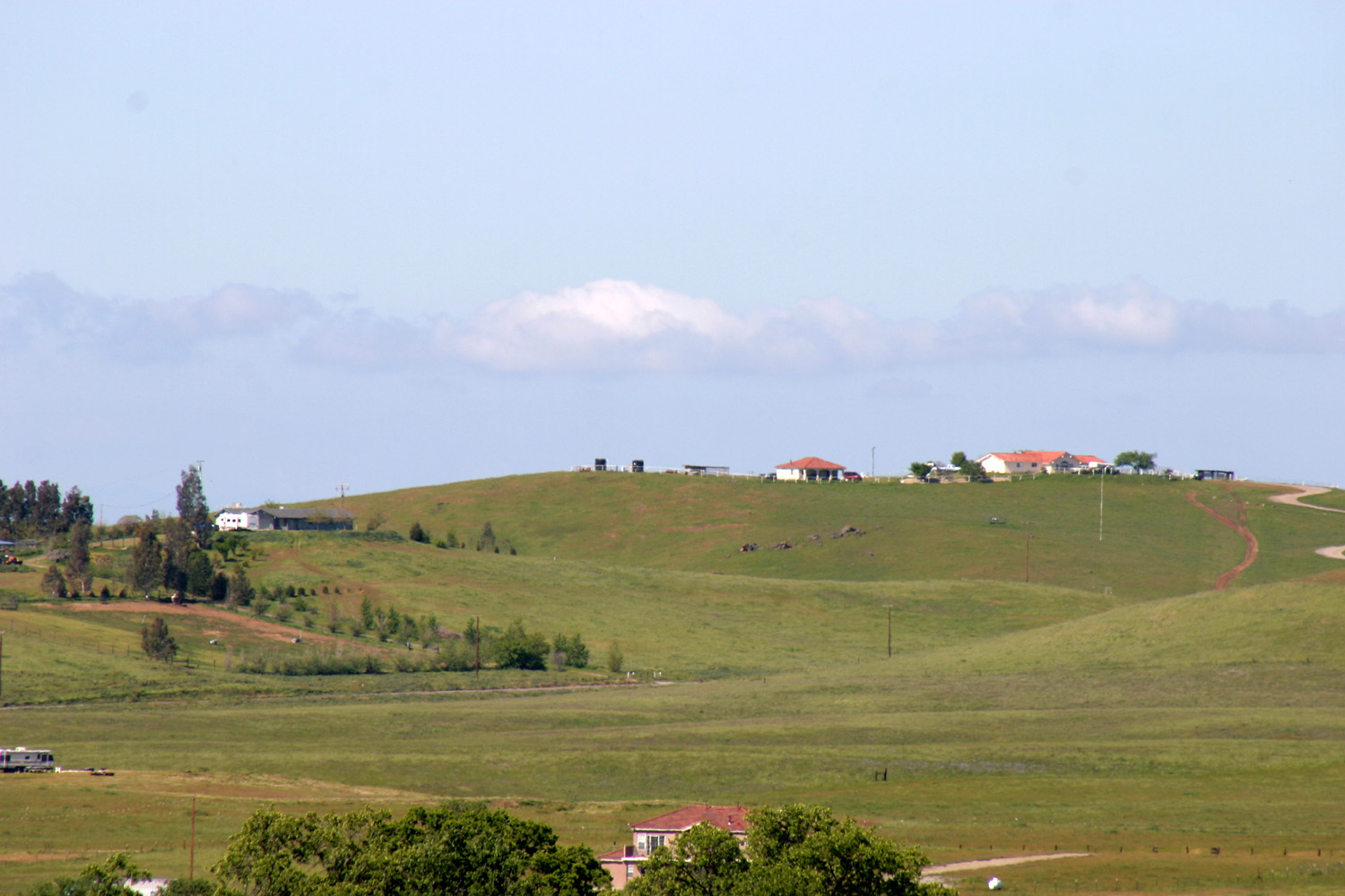
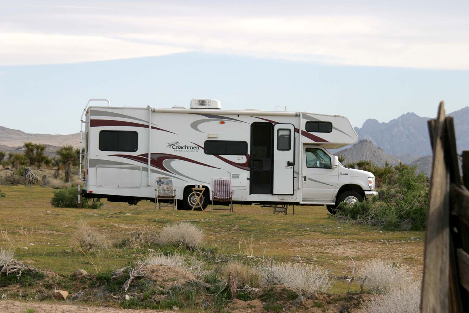
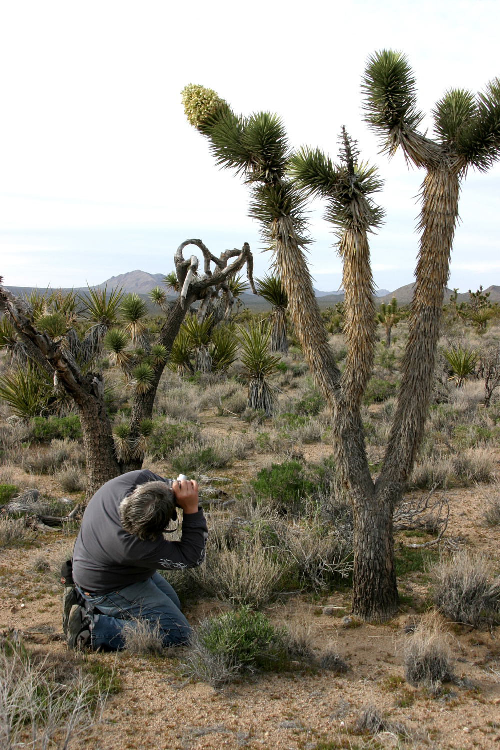
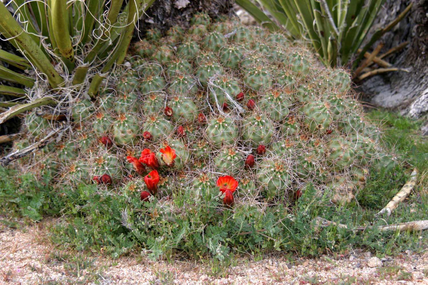
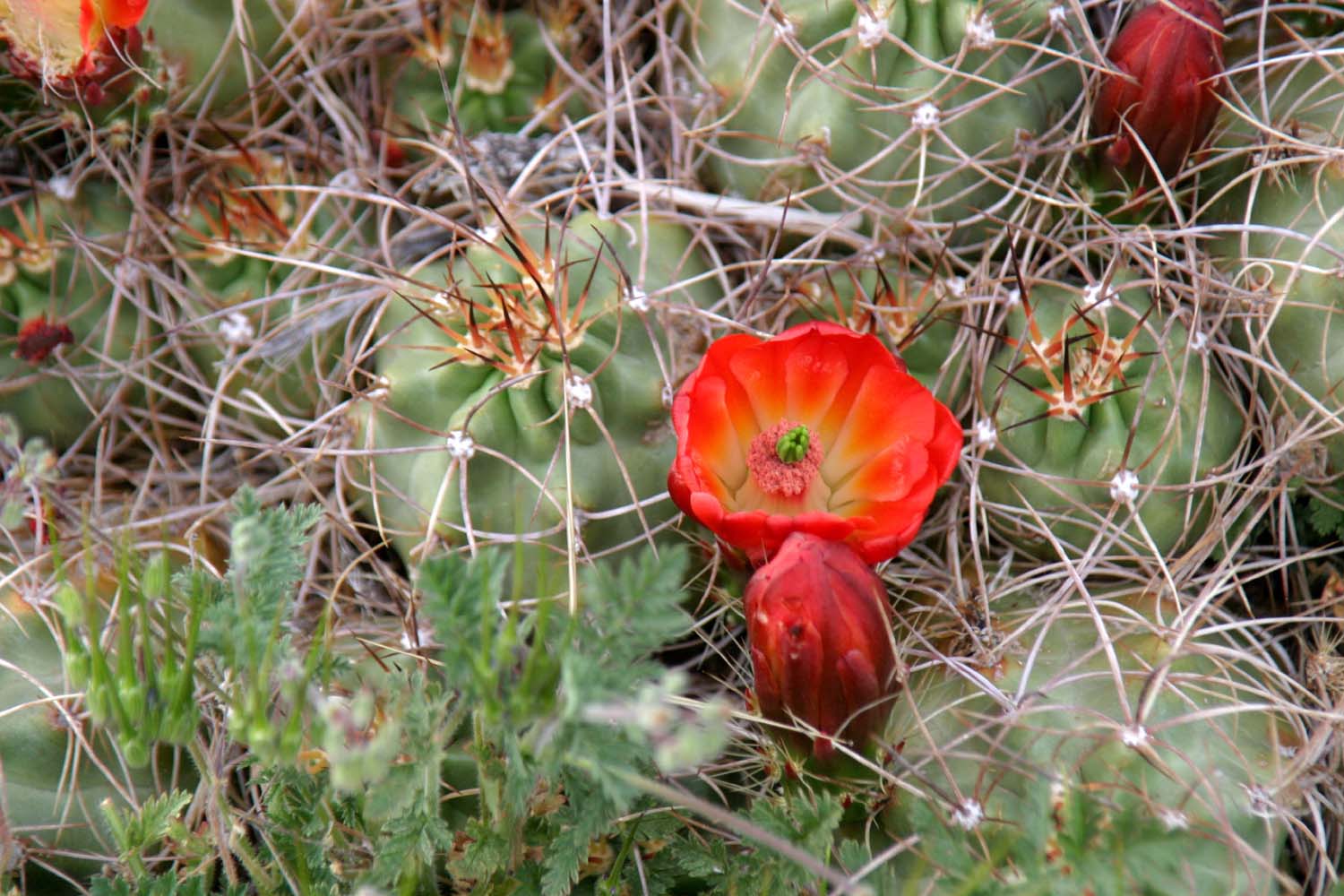
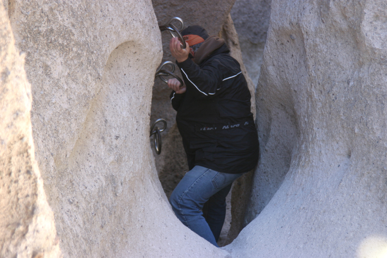
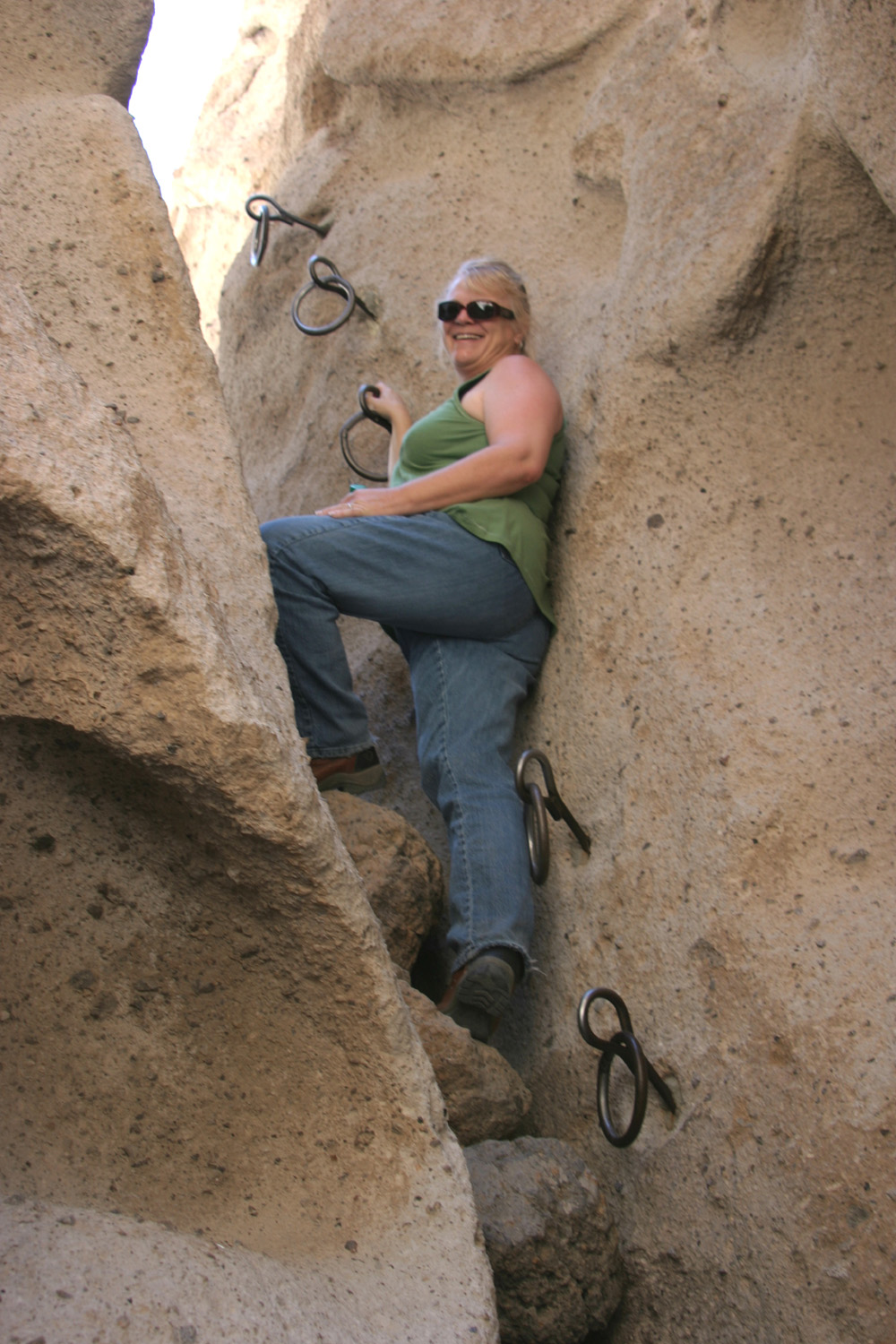
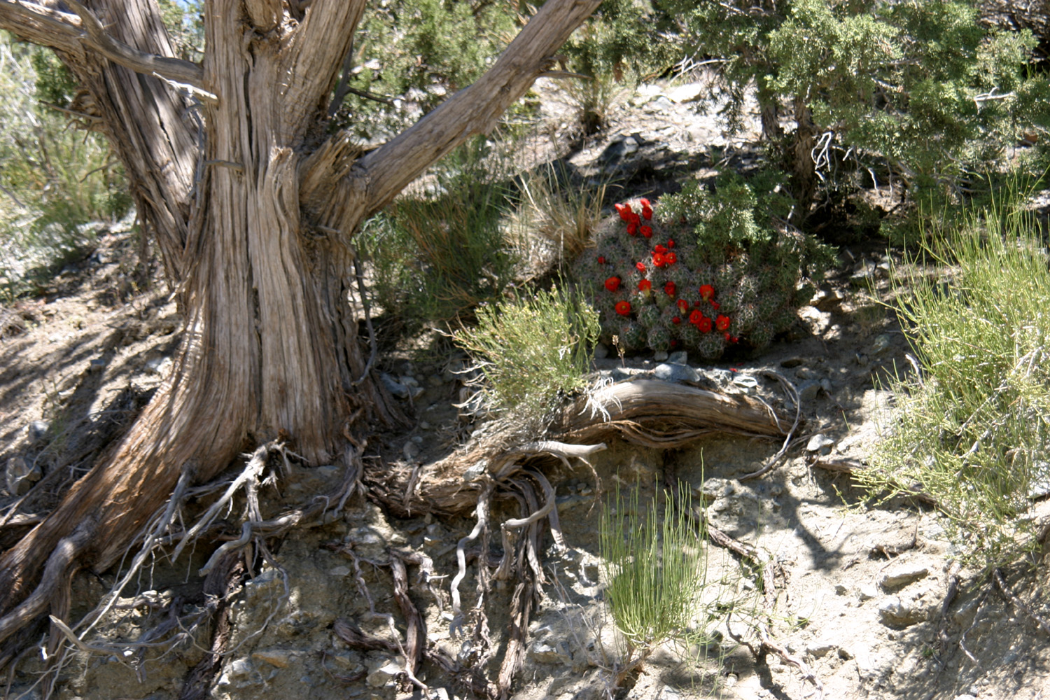
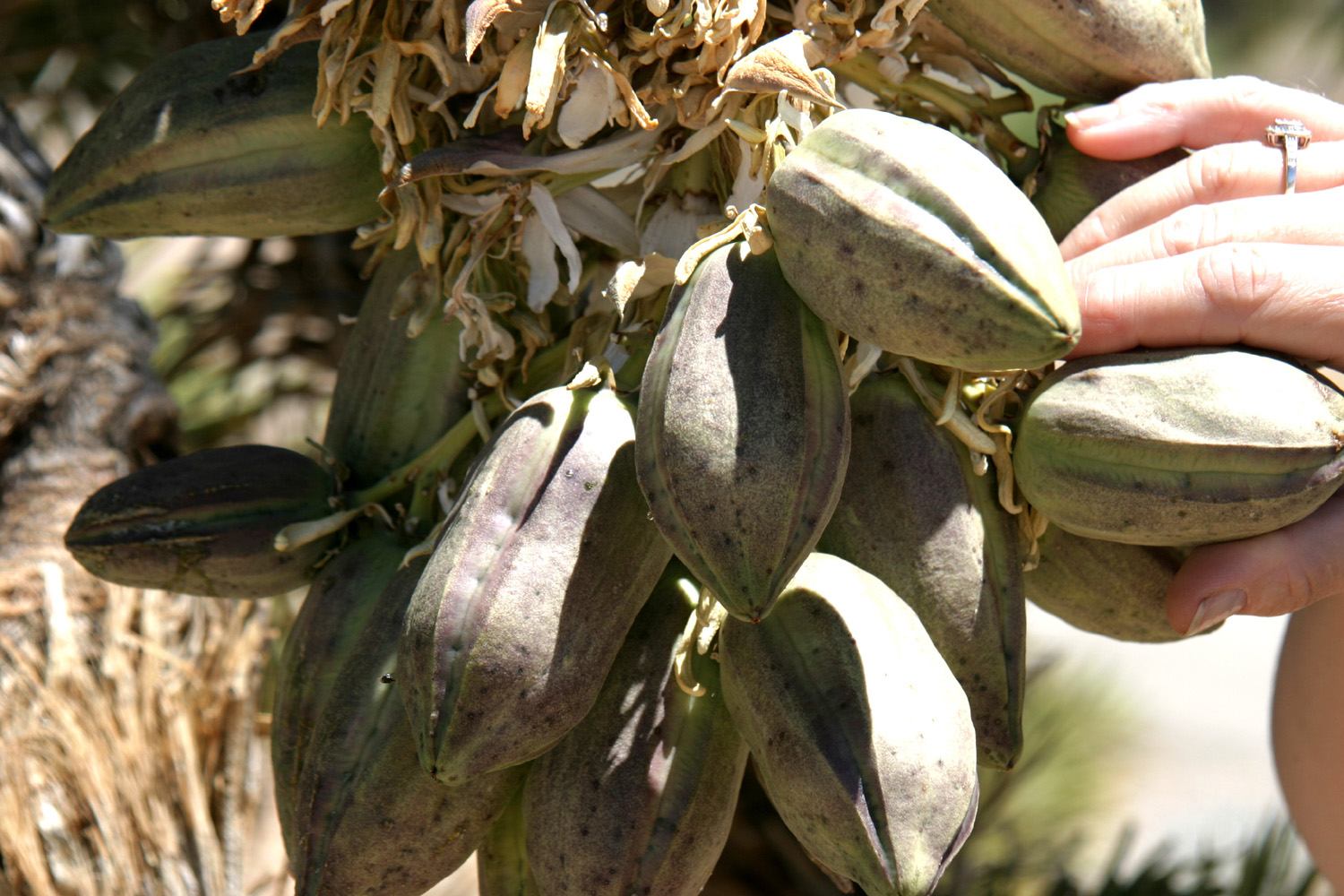
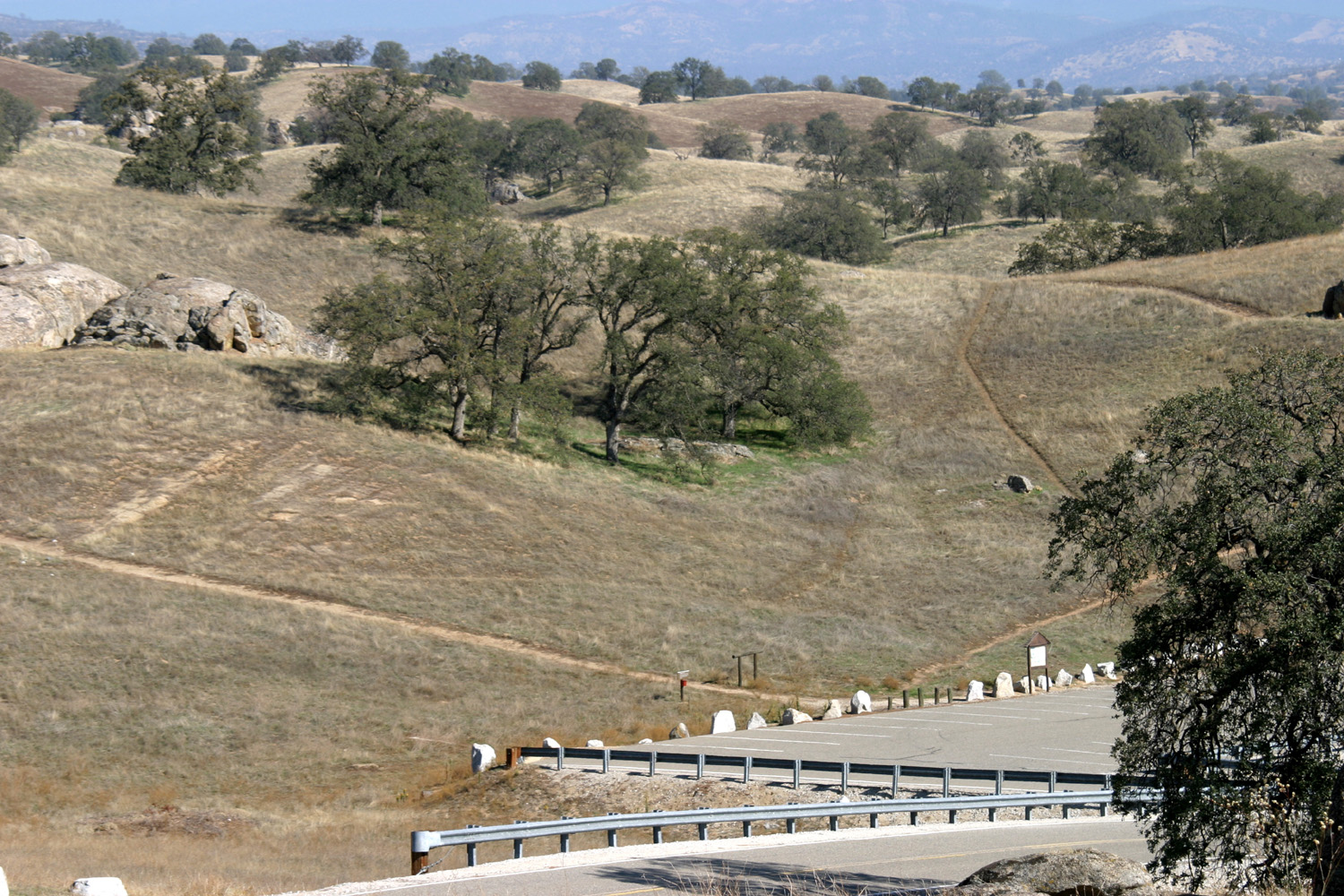
This was supposed to be about Frog Camp 2010, but things got in the way. My grandson, Mikie, had a bad cold, sore throat, etc., and was not well enough to go by the time the departure date rolled around. So instead this is about hiking and camping at Hensley Reservoir, camping in the desert, and camping in the desert again. But first, a little about Frog Camp. When I started this report (before Frog Camp was cancelled), I went through my journal to try and determine when the first Frog Camp was. I started doing an "official" report in 2007, but I knew there had been a few before that. I was surprised to learn that Mikie and I made our first journey to Frog Camp in 2003, so this would have been the 8th annual event. I also found information about the 2003, 2004, and 2005 trips, so I compiled those three years into an on-line only report, posted as Early Frog Camps. Hensley Dog Walk Ever since I camped at Hensley Reservoir in the fall of 2009, I have wanted to go back, for camping or hiking or both. My older grandson, Johnny, and his wife Brittany have a young German shepherd that they got from a rescue agency. Crosby is around two or three years old and requires lots of exercise, so I suggested having him join us while we hiked the Pohonichi Trail at Hensley. It's a one mile loop trail that winds up and down through the oaks and hills. On March 27, the day of our hike, Brittany was bothered by allergies and did not want to aggravate them by walking in the foothills, where everything is blooming, and pollen makes up a good part of the atmosphere. So Johnny, Crosby and I set out on the 40-mile drive to the trail head. As I suspected, Crosby was quite enthusiastic about the outing; in fact, when Johnny started putting stuff in the car a half hour before we left, Crosby laid down next to the door to wait for departure time. I was disappointed that we did not see any ground squirrels for him to chase, but he did not seem concerned, and had a great time running ahead on the trail and going off to the side to explore. I have calculated that a dog walking with a human covers approximately twice the distance the human does. The weather was perfect, with a slight breeze, just right for the moderate exertion required. When I was there last fall, the new grass was just beginning to show under the dry grass of the previous season, but we have had a good rainfall year, and the plants are now tall and green. In most of the area, the grass is just above ankle height, easy to walk through. However, next to the blue oaks, it is cooler and wetter, and there is chest-high grass in some areas. This even slowed Crosby down a little, but he developed a method of diving and jumping, so that from a distance his back would appear above the grass, then drop out of sight, like watching dolphins in the ocean. Besides the hiking, Johnny threw a tennis ball for Crosby to retrieve, which he did both on dry land and in the lake. We all had a good time and some good exercise. When we got back to Fresno, we dropped off Crosby, picked up Brittany, and went to lunch at the Colorado Grill, home of the best burgers in the Fresno area. Camping at Hensley By the time I realized that Frog Camp had croaked for 2010, I already had the motor home loaded and ready to go, so I decided I would camp at Hensley. I chose this instead of Frog Camp for several reasons, but mostly because it is closer. I hoped Mikie would feel better by the next day and he and his mother could come out to the lake for the day (this was not to be, but he recovered fully a few days later). My departure date was Easter Sunday, and the last day of spring vacation for many students, so I hoped that people would be going home and leaving a good choice of vacant camp sites. Instead the place was crowded, with tents, campers, and motor homes everywhere. There was one space available with electricity, but it was located so that my door would have opened directly by the road, with no room to sit. I decided to take a non-electric site and get by with my generator, but as I was driving around, the campground volunteer informed me that a party had left who was originally planning to stay that night, and I could have that site, with power. It turned out to be the spot I occupied in October, and one of the better campsites there. It was cool and fairly windy, with rain predicted for the evening, so I didn't do much outdoors the first day. I did hike the shorter loop trail, and rode my bike a little, but the rain started at 5, so I was in for the night fairly early. It rained all night, 13 hours non-stop (unless it stopped while I was sleeping), but the sky was clearing by the time I got up, and it turned out to be a fantastic day. There was snow down very low, not very far above me (on the lower slopes of Deadwood Mountain if you're keeping track). With the warming weather, it began melting very fast, and by evening there was snow only on the very top of the mountain, and the next morning there was none visible. Of course, there is still a lot of snow on the higher mountains. I started the day with reading and a Bloody Mary, had breakfast, then got started on "officially" camping. When I was there recently with my grandson, and also in October, I hiked the Pohonichi Trail, so I set out to do it again. Many hikes, even short ones, have a lot of uphill one way and a lot of downhill the other. This trail is a very even mix of up and down, alternating in small sections. It goes over a fairly steep hill, around the side of a higher one, and down into a drainage. Then it does it again, so there is never a long stretch of up or down. Along the way there are plants and bushes, but the most common is the blue oak. They are scattered about, creating an open, rolling terrain. And of course, with the good rain we have had, there are grass and other plants everywhere, and a fair number of wild flowers. I took my current book along, and stopped to rest about a third of the way into the hike, and read for a while. I had gone at least another third of the route when I realized I had left my book on the rock where I sat. I made the LOOOONG trip back to where it was. Then I debated just continuing on in the return direction, back the way I came, or repeating a third of the hike. I ended up taking a short cut down a drainage that the trail crosses twice, about 200 yards apart, and going on out the "right" direction. On the first day I had spotted a couple of rabbits near a big rock formation across the road behind my camp. On Monday I went there again, and immediately saw two rabbits, literally hopping down a bunny trail. As I walked around the rock, I saw about eight or ten more. The next day I went there with my camera, but of course, there wasn't a rabbit in sight. Other than these activities, I took pictures, watched TV, read, and wandered around on short walks near my camp. It was much warmer and there was no rain, so I ended up staying outside at least an hour and a half longer than the previous night. On the final day, with checkout time at noon, I had time to do a couple of pretty good walks within the campground. I went up to the highest point in the camp and got some good photos of distant snow covered mountains. I was able to recognize several mountains that lie in Mariposa County and have been familiar landmarks to me all my life. By noon I had packed up, emptied the holding tanks, and was on my way home. This time I would not have to take everything out of the motor home, since I was heading out on another trip the following weekend. After I returned from my trip to the Mojave National Preserve in early March, I wanted to make a return trip and hopefully be there when the cactus was in bloom. My son-in-law Tim (Mikie's dad) decided to join me, and we set off early on Sunday, April 11. Instead of heading to the campground where I stayed in March, we took Kelbaker Road to Kelso, formerly a major railroad stop, and now home of the main visitor center, which is in the old Kelso Depot. On our way we could see the Kelso Dunes, a 45-square mile area of sand dunes rising up to 700 feet high. The dunes were created over the course of 25,000 years by winds carrying sand from nearby dry lakes. We stopped at Kelso and went through the visitor center, braving a very strong wind as we walked from the parking lot to the building. This wind would plague us much of the time during the rest of our trip. From Kelso there are two routes to the campground - back south to I-40, then 20 miles east, then 20 miles north; or north on Kelbaker Road, then east and south on dirt roads. Seeking new scenery, we took this route - shorter in distance, but probably equally long in time. Since it was close to 5 p.m., we decided to stay at a nice flat spot beside the Cedar Canyon Road, about a mile east of Kelbaker. We aligned the motor home so that we could sit on the downwind side, but it was still fairly breezy. This area was about 5,000 feet in elevation, with several kinds of cactus as well as Joshua trees and Mojave yucca. We wandered around the area and took a bunch of pictures, then moved inside to eat dinner and watch TV. Throughout the evening and during the night the wind howled outside, rocking the motor home, but we were comfortable inside. The weather called for rain the next day, and early in the morning the wind stopped and the rain started. It did not last long, stopping soon after we got up. When we went outside, we saw a light dusting of snow on the hills above us, only a mile or so away. By the time we left, it had already melted. Despite the rain, the sandy ground absorbed the water, and it was not muddy at all. After breakfast we got things ready to travel and headed east, hitting the dirt road within the first quarter mile. As we had been warned, the road was rough in spots with sections of washboard, but very scenic, going through a rugged canyon. We turned south on Black Canyon Road, which leads to the campground, and soon came out on a high plateau. The road turned back west and went down through another canyon, finally turning south again toward the camp. Along the way we noticed what we first thought were spider webs in some bushes, but on closer examination, they proved to be some kind of cocoon, with caterpillars inside and crawling around on the outside. When we arrived at the campground area, we had already decided to camp in a different location nearby that I had spotted on my earlier trip, but first we went to the Information Center. It proved to be closed, so we headed up to the upper end of the ring trail. This is a loop trail that winds around the hills by the campground, and up (or down if you start at the top) through Banshee Canyon. This is a narrow slot canyon with iron rings attached to spikes embedded into the rock to assist in navigating the short but steep section between the canyon walls. Since I had done this hike a month earlier, I decided not to repeat it, and Tim did not feel up to it due to a nagging back injury. However, we went down to the top of the rings to take a look, and soon Tim was on his way down. As he reached the lower group of rings I told him if he wanted to go on through, I would meet him on the other side, since the trail passed close to the lower end of the canyon. A few minutes later he announced he was going through, but by this time he was too far for me to hear him. After waiting a while for him to return, I decided that he was going to go all the way through, but just in case, I decided to follow him, and began the climb down the rings, the opposite direction of my previous hike. Although I think it's easier to go up, it was not as bad as I expected, and I made it down, and on back to the info center parking lot. Seeing no sign of Tim, I suspected he had gone on to the top of the trail, but I decided to rest a few minutes before making the short, steep climb to the trailhead. This proved to be a wise decisions, since he appeared a minute later, tired but well exercised. We drove the short distance down the road and in on the dirt road that led to our chosen camping spot, and got set up. The campground does not allow generator use after 7 p.m., which is just the time people are going inside and watching TV and kicking back, so I wanted to get away to a secluded spot where we would not have that limitation. It was still cloudy and as we were putting the awning up, we had a few hail stones, and a few drops of rain (and of course, the wind that had stopped only for the morning rain). However, there was no further rain, and the clouds opened up to reveal some blue sky. We hiked up to the lower entry to the canyon to take some more pictures and see if there was anything we had missed as we hiked through there earlier. The rest of the day remained quite windy, so we did not build a fire as we had hoped, but we were able to sit outside next to the motor home and be out of the wind most of the time. Tim had brought some steaks, and set up the barbecue around 3 p.m. or so, which caused it to start raining immediately. He moved it under the awning and we finished fixing dinner, which we ate inside out of the wind. We had planned to spend another day and come home on Wednesday, April 14. The weather was sunny with only a very light breeze Tuesday morning, but we realized we had done everything we wanted to do in that area. We did some short walks, read and talked, and then got ready to go about noon, planning to stop at an RV park on the way home. I didn't check the temperature as much as I usually do, but the lowest recorded was 41 degrees the second night. Late in the evening it was in the high 40s, and the daytime temperatures were probably around 60, although it felt cooler due to the wind. We stopped and had a late lunch/early dinner at Peggy Sue's Diner, just east of Barstow off I-15, then went on to Boron, where I had stayed on my previous trip. We got the RV parked and I was bringing something in from an outside storage compartment when Tim warned me about the bees. Yes, next to our space was a tree that contained a hive of bees, with hundreds of them buzzing about. We moved to a different location, and spent the rest of the evening with our usual activities. We got under way about 8:30 Wednesday morning and arrived home in the early afternoon. Our search for cactus blossoms was mostly unsuccessful, although we did see one, which I think was a mound cactus, with a number of nice blossoms. There were a few Joshua trees and Mojave yucca in bloom, but most of the flowers we saw were non-cactus plants. Many of the annuals, perennials and bushes have very small flowers, and most non-spiny plants in the desert have very small leaves, to help conserve moisture. There had been a good rainfall this winter, so there were lots of plants and green grass, and overall it was a very worthwhile trip. --Dick Estel, April 2010 Back to Mojave Preserve Again After I sent out my report on my trip to the Mojave National Preserve in March I got an Email from my friend Janell saying "I want to go camping in the desert too!" So being an accommodating sort of guy, we set out on May 28, the start of Memorial Day weekend, for my third desert trip in as many months. Since there had been no flowers in March and few in April, it was our hope that May would finally be the right time. Janell had to work Friday morning, so we didn't get started till about 1 p.m. I did not want to try to make it all the way that late in the day, so we stayed overnight in Barstow. This allowed us to arrive at the Mojave Preserve fairly early the next day. There is a nice campground there, but they don't allow generators after 7 p.m., so I wanted to stay at the spot Tim and I camped at in April. Since this is an obvious camping spot not far off the main road, it was no surprise to find it already occupied. We continued down the dirt road another quarter mile or so and found another level spot that had been used for camping in the past, as indicated by the fire ring. As expected, the weather was much warmer, around 80 degrees, but there was a good breeze nearly all the time, and it was always comfortable to sit outside in the shade. Also as expected, the nights cooled off considerably. When we drove in, there were no flowers immediately noticeable, except for some bushes with yellow blossoms, which we saw everywhere we went. However, we soon learned that walking around paid off and was the way to find flowers. Our first discovery was a cholla with green flowers, which I think is a rare color for blossoms. The various cholla had several different blossom colors, ranging from green to yellow to orange. We also spotted several other cactus plants, which I am pretty sure were hedgehog and mound cactus, with bright red or pink flowers. Each time we went walking around we found some different kinds of flowers, including some very interesting and unusual blossoms on small shrubs. These bushes had been mostly bare and lifeless-looking on my earlier visits. We were about a mile from any access to the infamous Ring Trail, so we saved that for the following day. We decided to go there and to the Hole in the Wall Info Center, then head north and across to the paved road that goes through Kelso and back out to I-40 (the opposite direction I took when I went there with Tim). Having hiked the Ring Trail both up and down, I decided the best way to do it this time was to have Janell do it, while I walked back to the motor home and drove around to the parking area at the trail's upper end. Just as I had in March, Janell had a little trouble with the top of the first section of rings, but made it through and finished the hike in triumph. We walked the guided nature trail next to the campground, spent a short time at the information center, and headed north on Black Canyon Road, which turns to dirt just past the campground. Apparently I had already forgotten how rough this road was, as well as the east-west section (Cedar Canyon Road) that took us back to the pavement. The bouncing caused a cupboard door to come open, and a vodka bottle to come bouncing out, and if we had not stopped it would have been followed shortly by the satellite converter that is in that cupboard. We took it very slow and managed to make it through, although I found a couple of screws on the floor. I still haven't determined if they came out of the motor home, or were left over from the satellite installation. Our camping area was located at 4,500 feet, and this trip took us up over a 5,900 foot pass, where there are junipers growing, but as we descended to the north-south Kelbaker Road, we dropped below 3,000 feet and experienced higher temperatures and not much breeze. The Kelso Depot (visitor center) 15 miles down the road was a welcome site, and we spent some time looking around, as well as having lunch at the sandwich counter there. The food was good, nothing special, but they had the best iced tea I can ever recall having in a restaurant. There are no camp grounds in this area, so as I did the previous month, we drove down to I-40 and on to Boron for the night. This put us less than five hours from home, but we made a few stops the next day, and despite a 9 a.m. start, didn't get back to Fresno till around 5. Our first stop was at Murray Family Farms at the foot of Tehachapi Grade which has a huge variety of fruits and vegetables. I came away with berries, apricots and corn. Then we stopped at the Bravo Cheese Factory near Visalia, which features a similar selection along with many cheeses, a gift shop, and lots of old artifacts to look at. We ate lunch here, and of course, had to bring home some cheese and other items. The desert is not something everyone enjoys, but Janell has long been a big fan, and greatly enjoyed the cactus, flowering bushes and dramatic rocks and mountains. Even after two visits I also found new things to appreciate, but it will probably be a few years before I return - and future trips will NOT involve driving a motor home over the Black Canyon Road. --Dick Estel, July 2010 |
||
|
Photos |
||
|
Hensley Reservoir Photos |
||
 |
 |
 |
| Johnny & Crosby playing fetch | A section of the Pohonichi Trail | Green grass and flowers
contrast with distant Sierra snow |
 |
 |
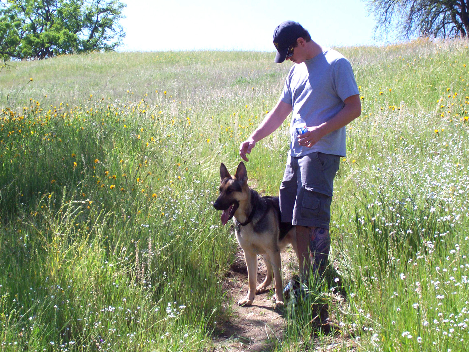 |
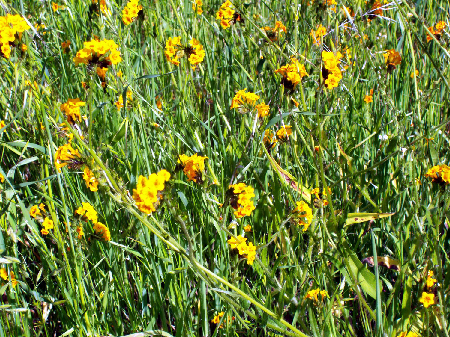
| The foothills' #1 flower, fiddlenecks | In the tall grass | A boy and his dog |
 |
 |
 |
| Easter snow on lower slope of Deadwood Mountain | Deadwood in the distance | By day's end, much of the snow has melted |
 |
 |
|
| Along the trail | The lake is close to capacity | Signal Peak from a Hensley campground hilltop |
 |
 |
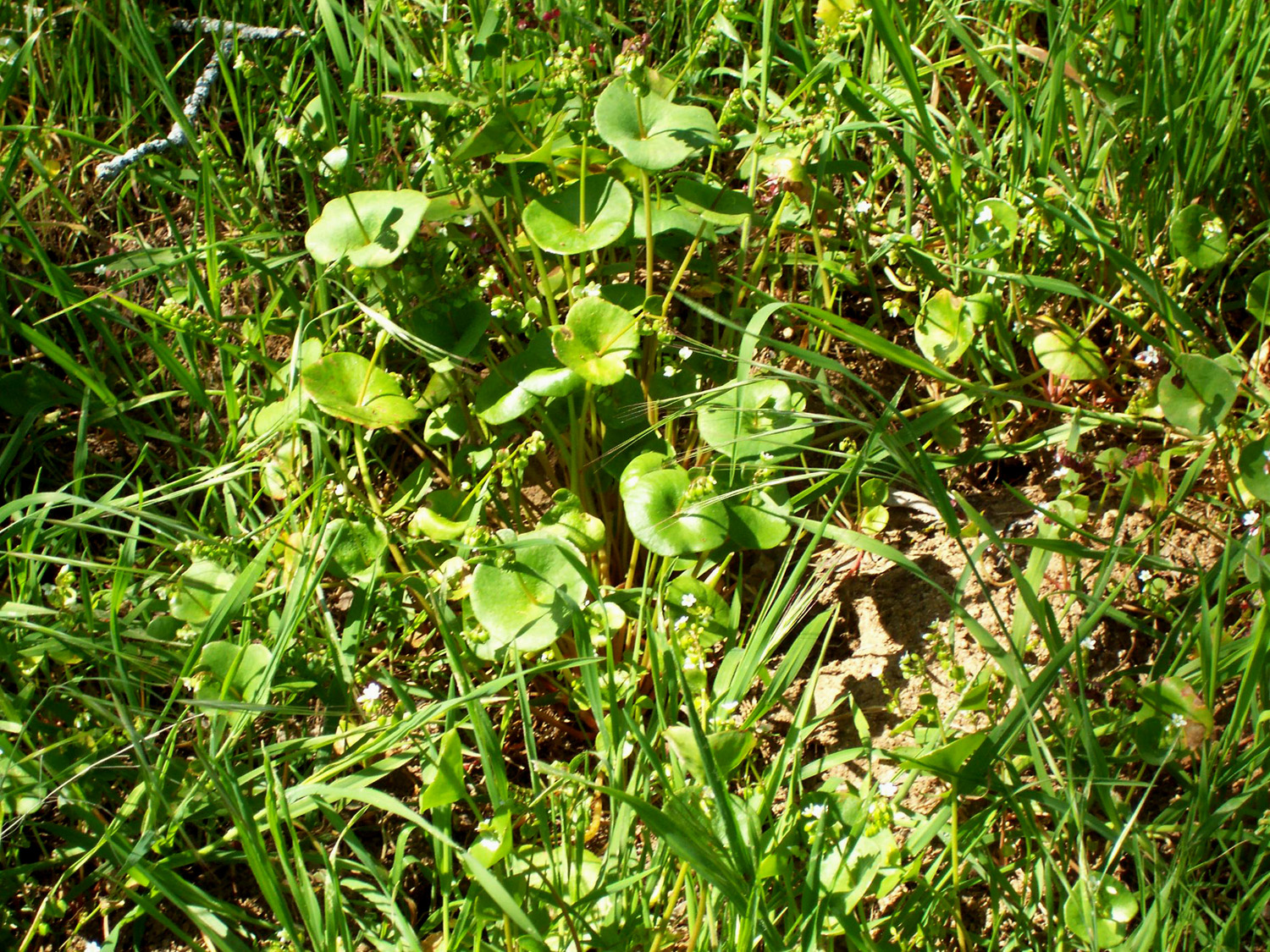 |
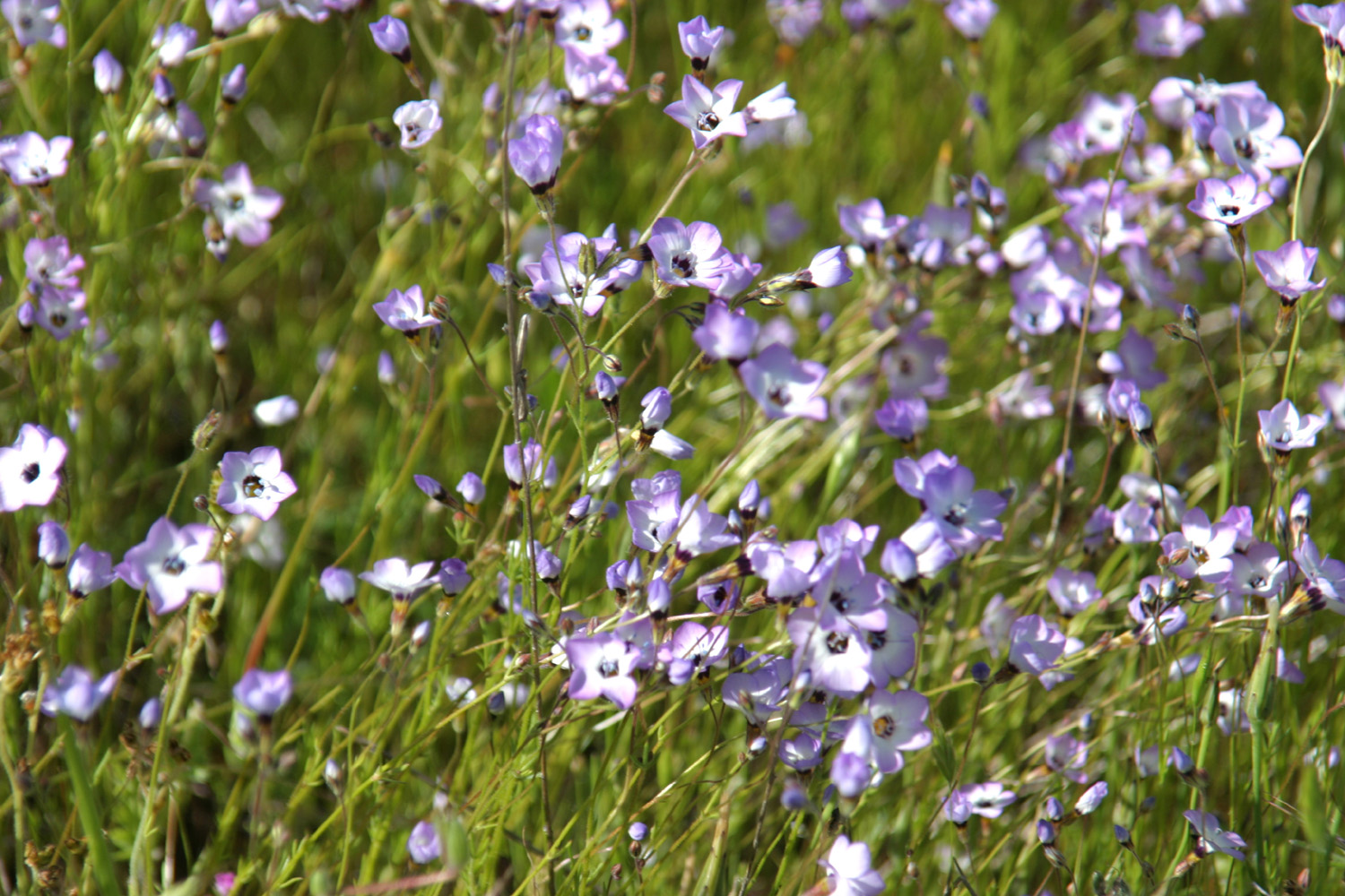
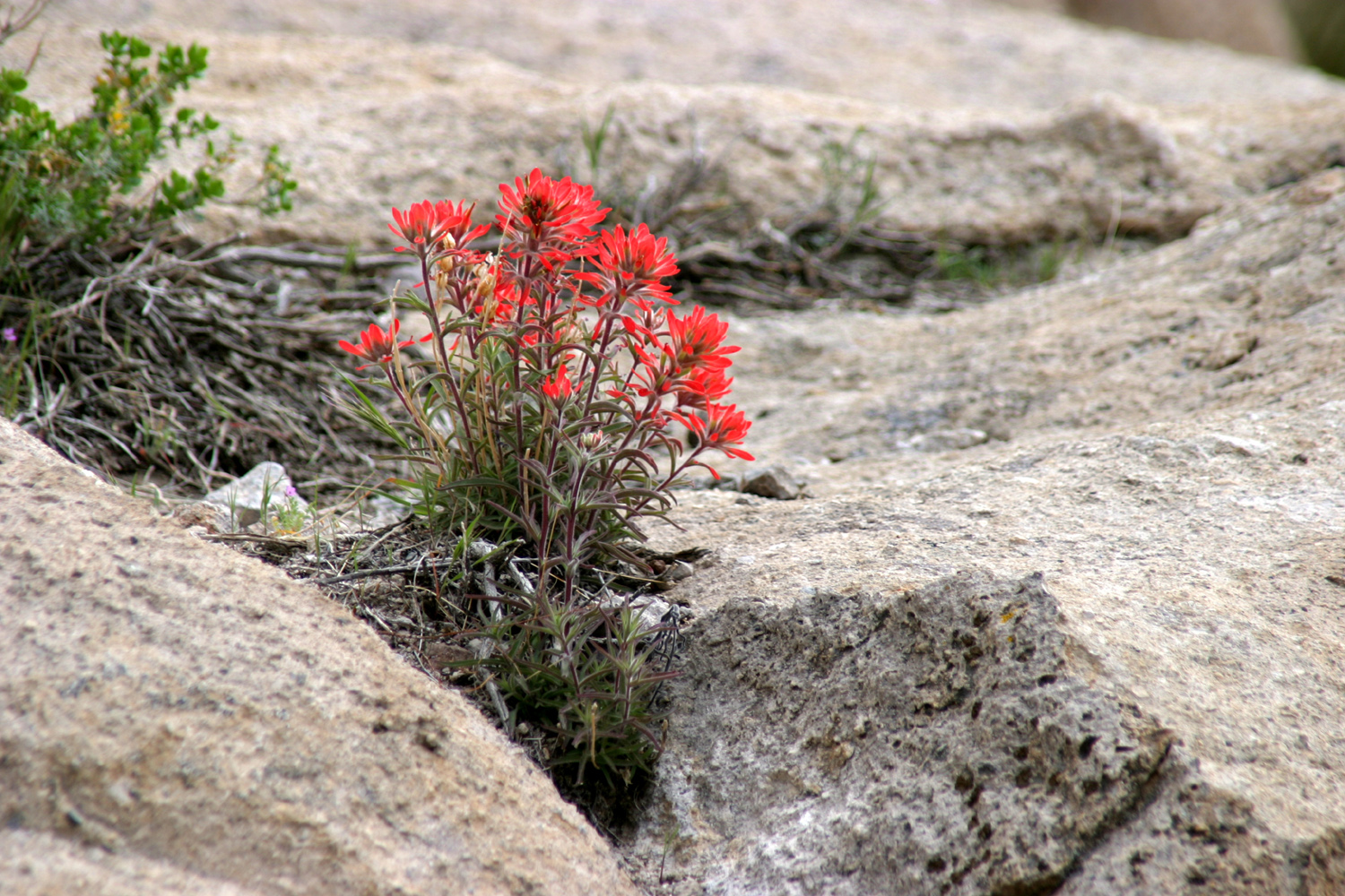
| Homes on the hills near Hensley | Spring wildflowers | Miner's lettuce |
| Mojave National Preserve Photos April | ||
 |
 |
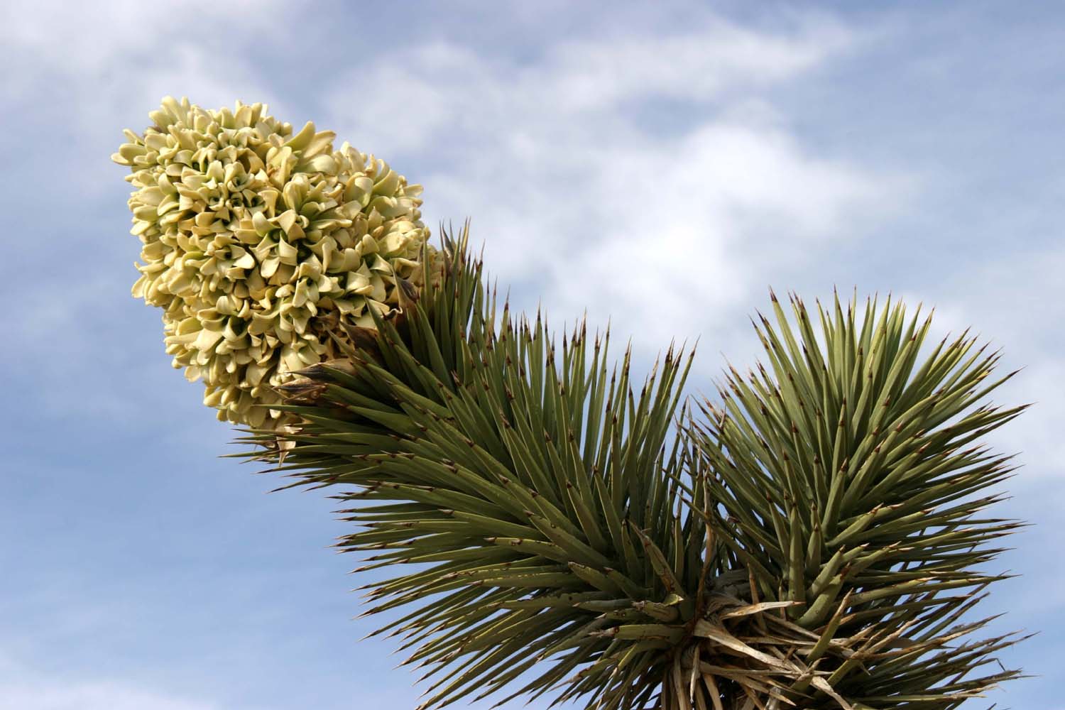 |
| Our first night campsite, on Cedar Canyon Road | Tim photographs a Joshua tree | Joshua blossom |
 |
 |
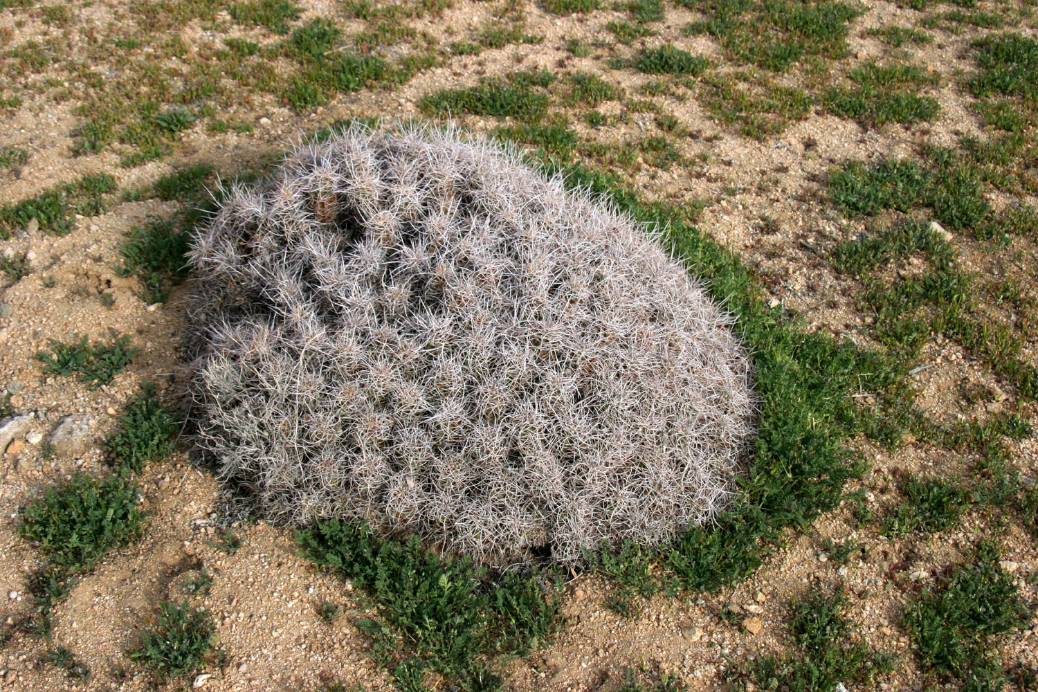 |
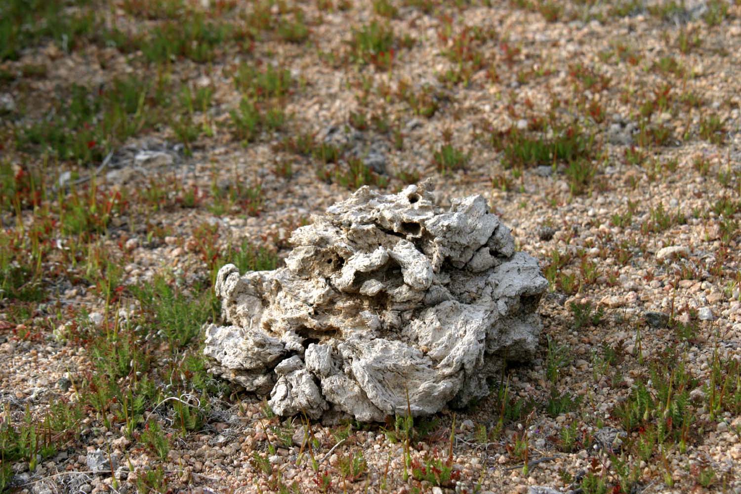
| A baby pencil cholla | Can you identify this object? | An unusual cactus |
|
 |
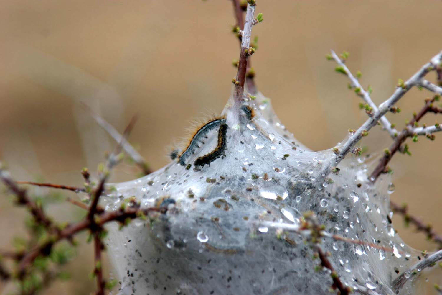 |
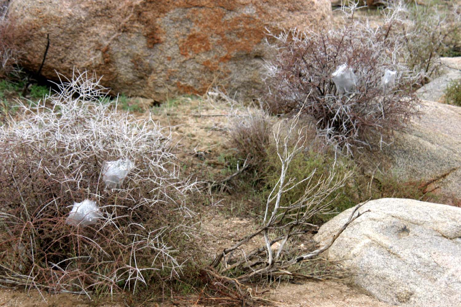
| Tangled Joshua tree | Spider webs? | No - caterpillar cocoon |
 |
 |
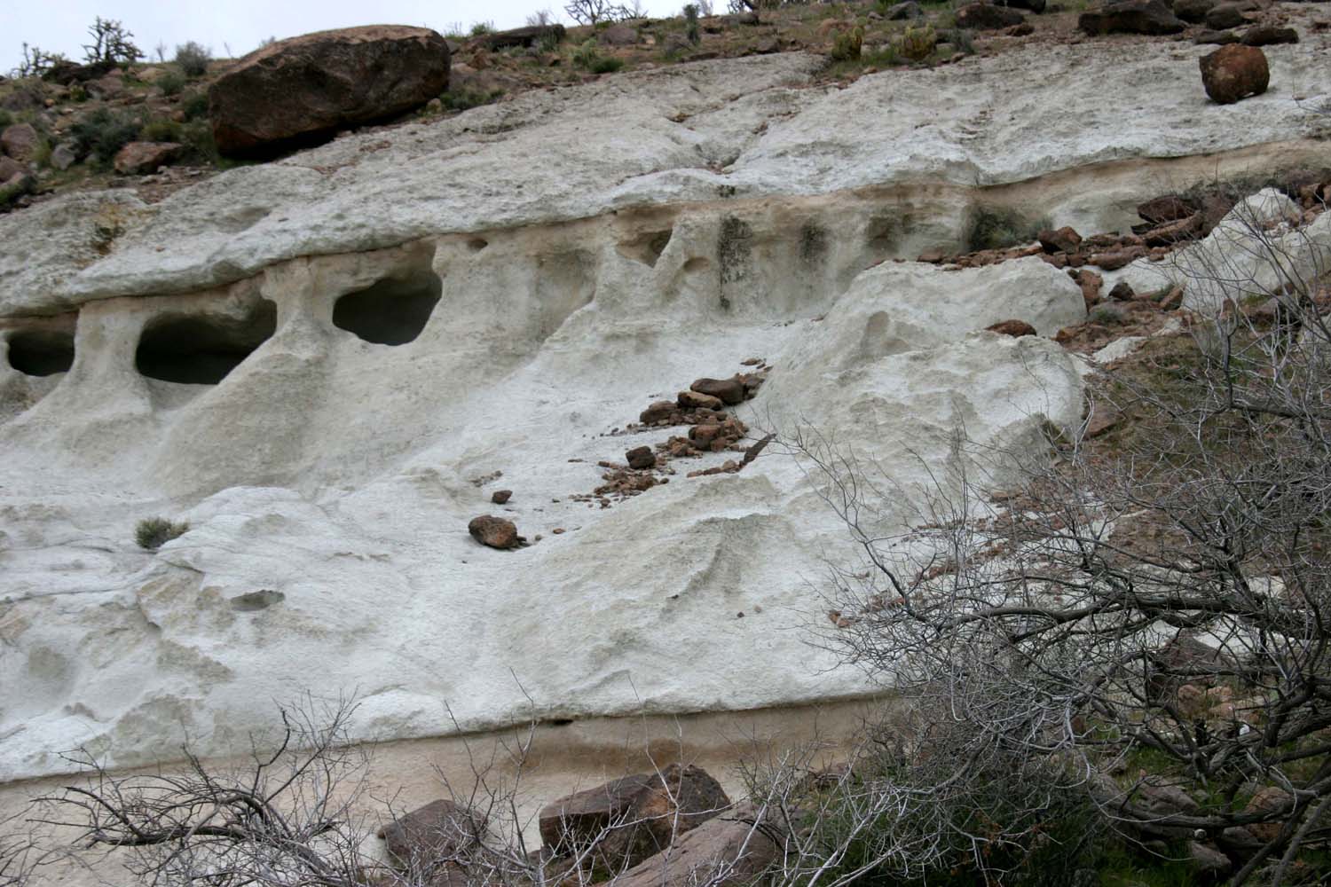 |
| Mound cactus | Close-up of blossom | White rock stands out in a
mostly brown & red landscape |
 |
 |
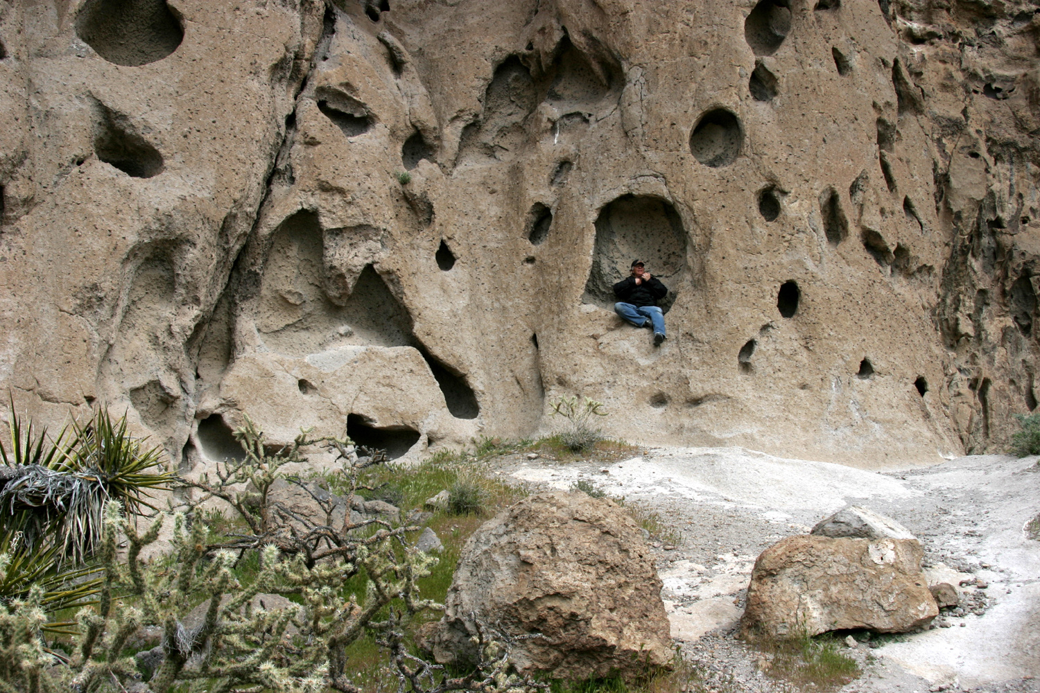 |
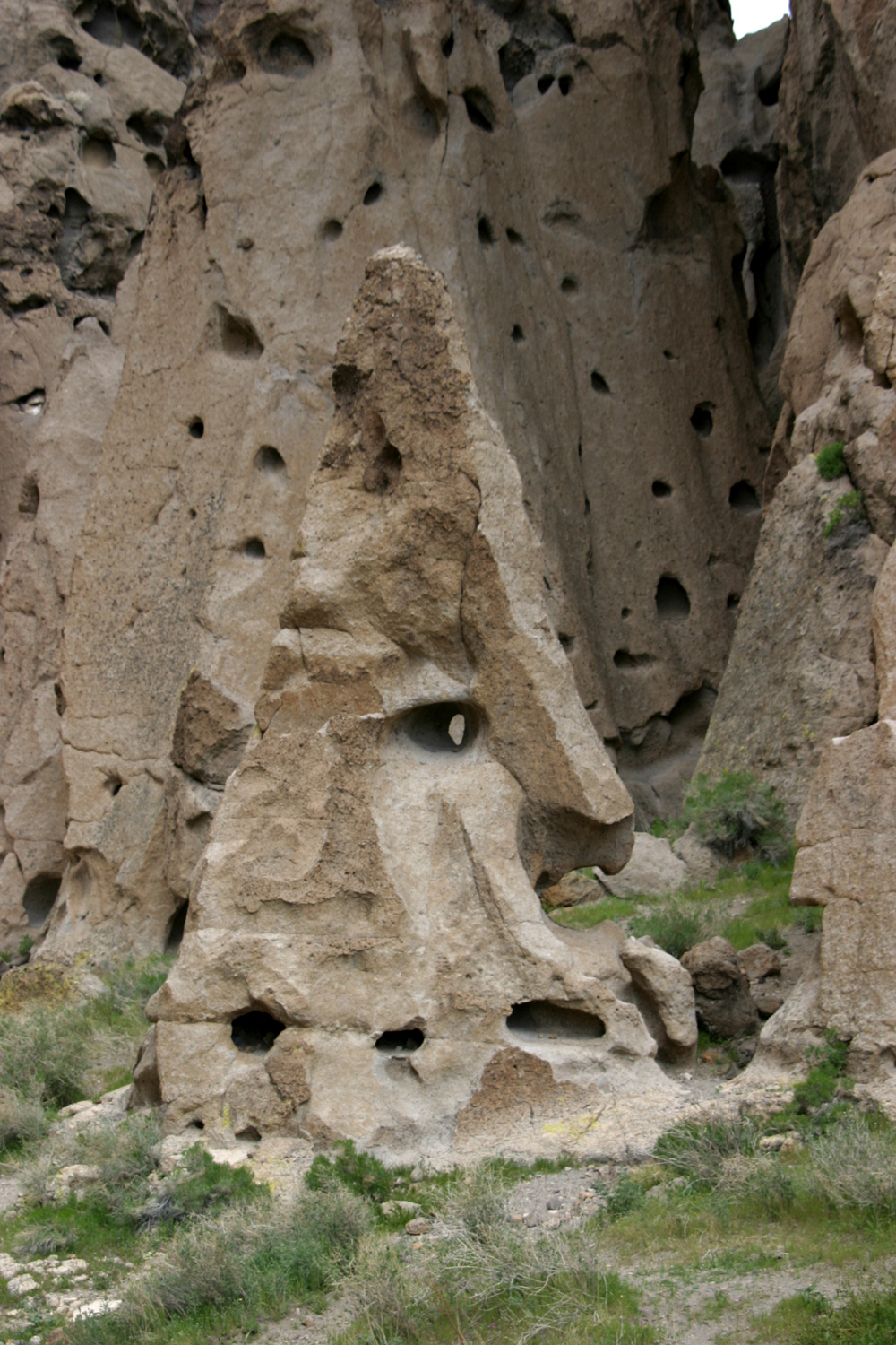
| Heading down the Ring Trail | Formation at the base of Banshee Canyon | A mysterious rock dweller |
 |
 |
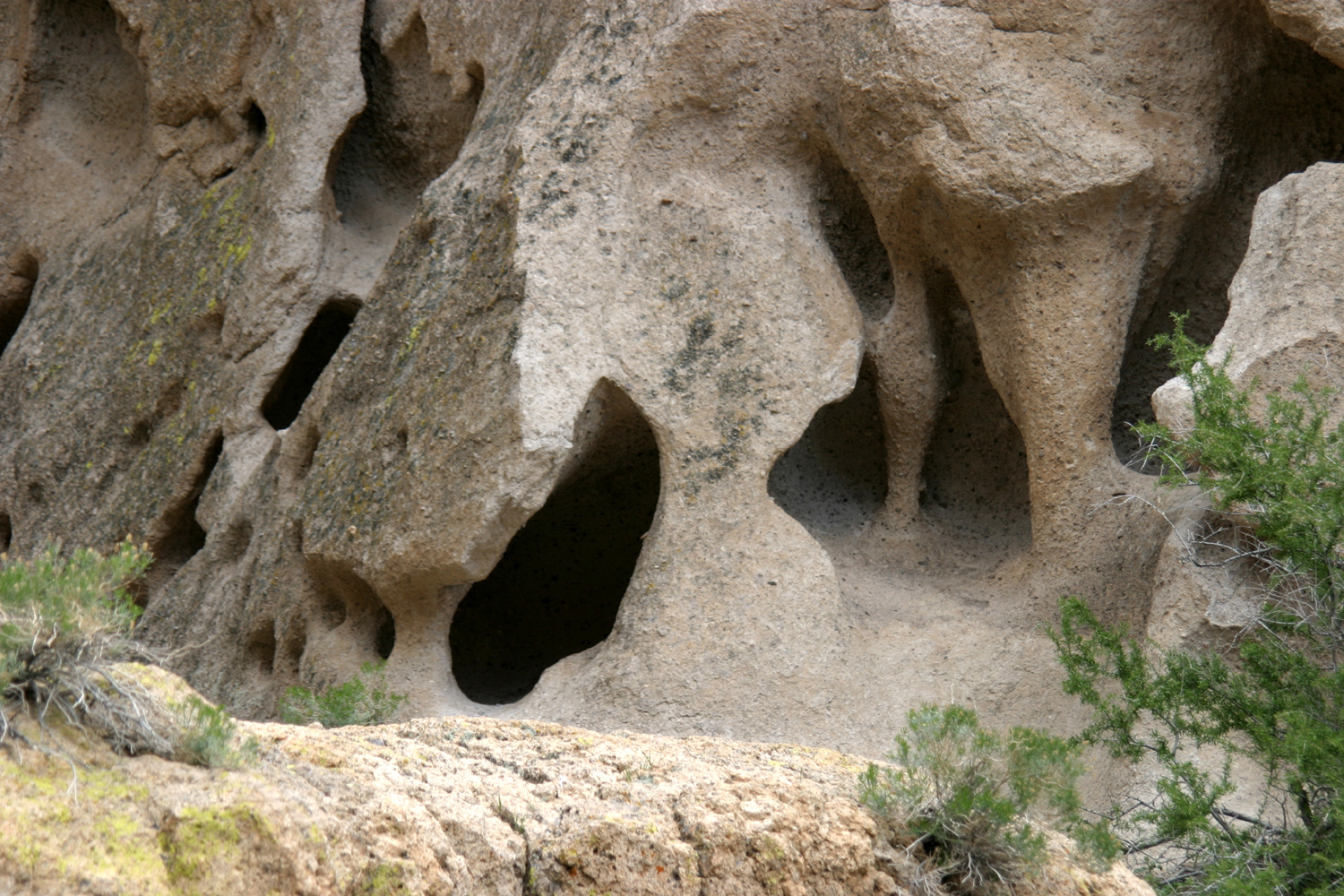 |
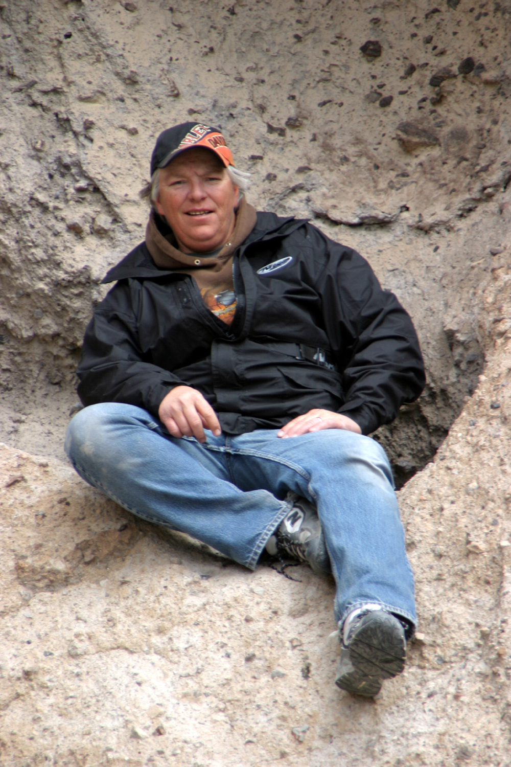
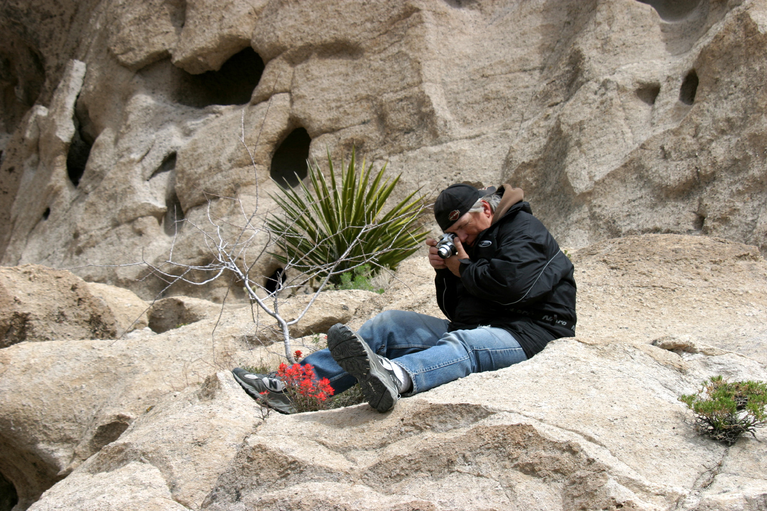
| Tim Liddle | Getting the best angle | Cave-like rock formation |
 |
 |
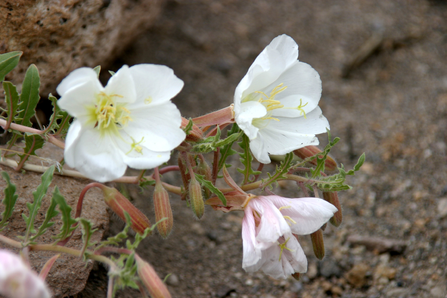 |
| Mojave yucca bloom | Color in the desert | More spring flowers |
 |
 |
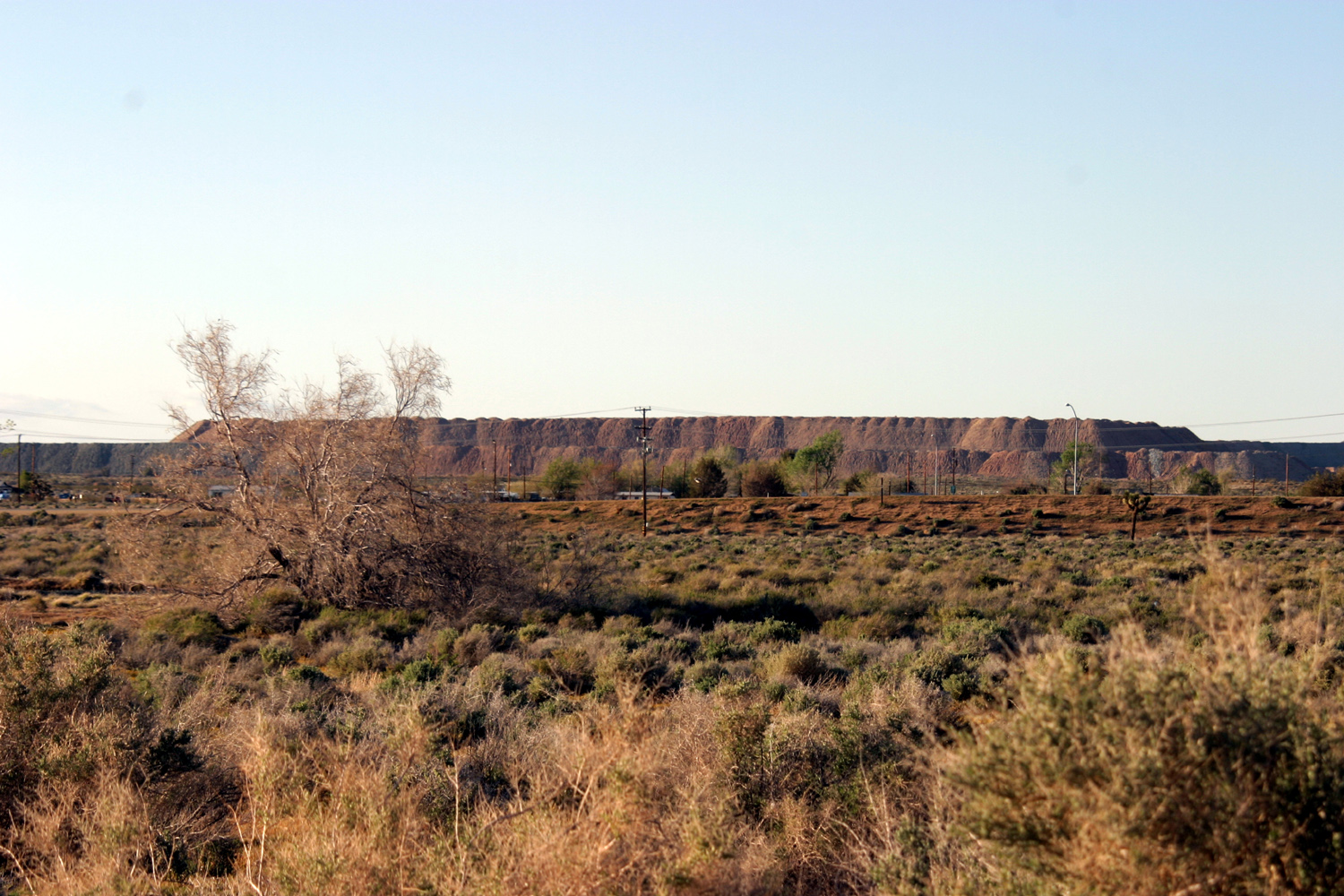 |
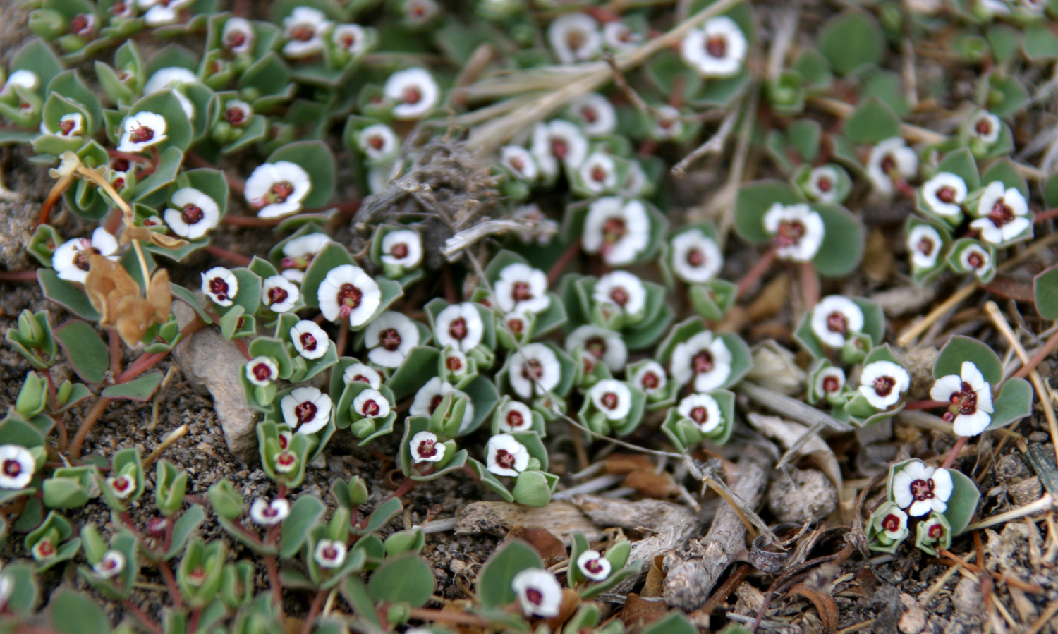
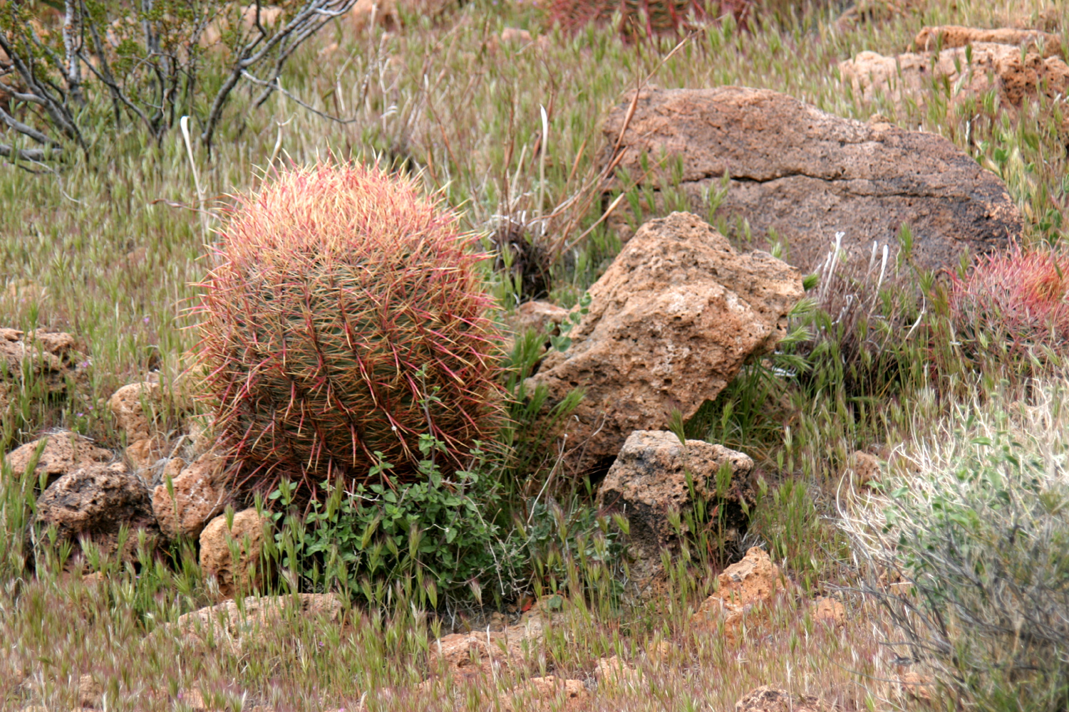
| These tiny flowers are less than 1/4 inch across | The obligatory barrel cactus photo | Mine tailings north of Boron |
 |
||
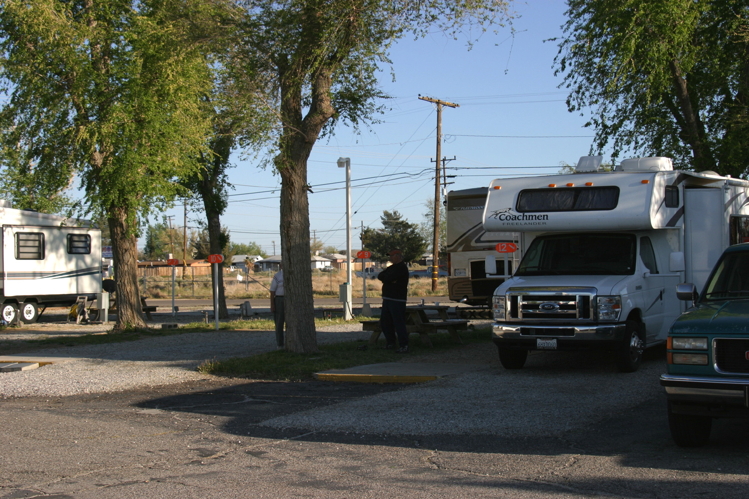
| Our camp site in Boron | ||
| Mojave National Preserve Photos May | ||
 |
 |
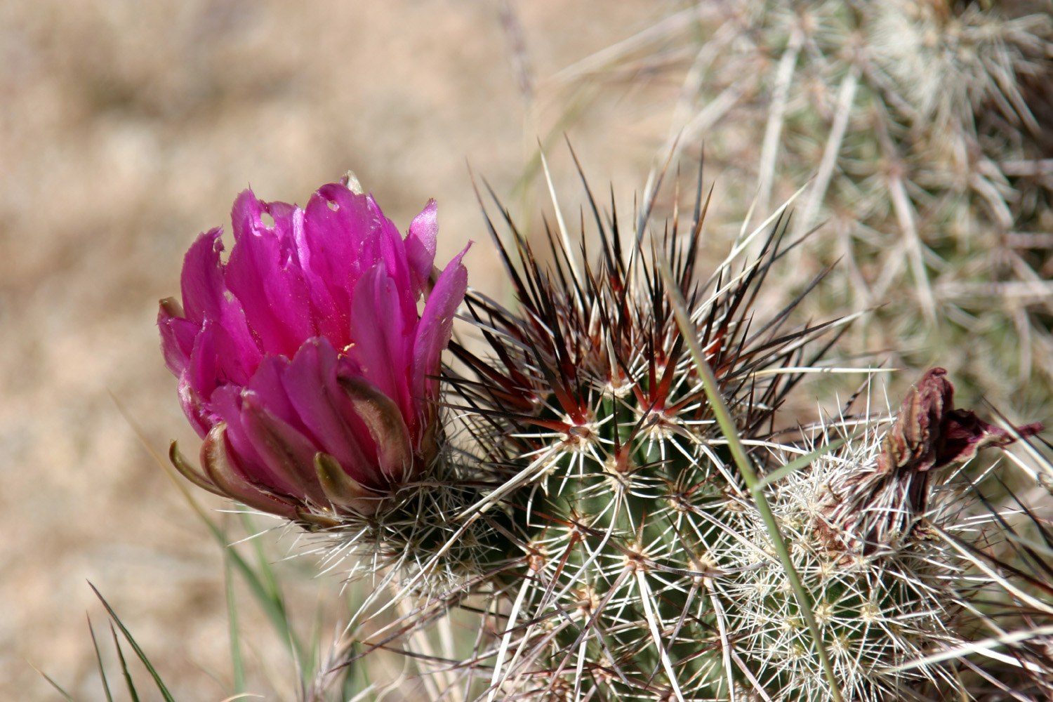 |
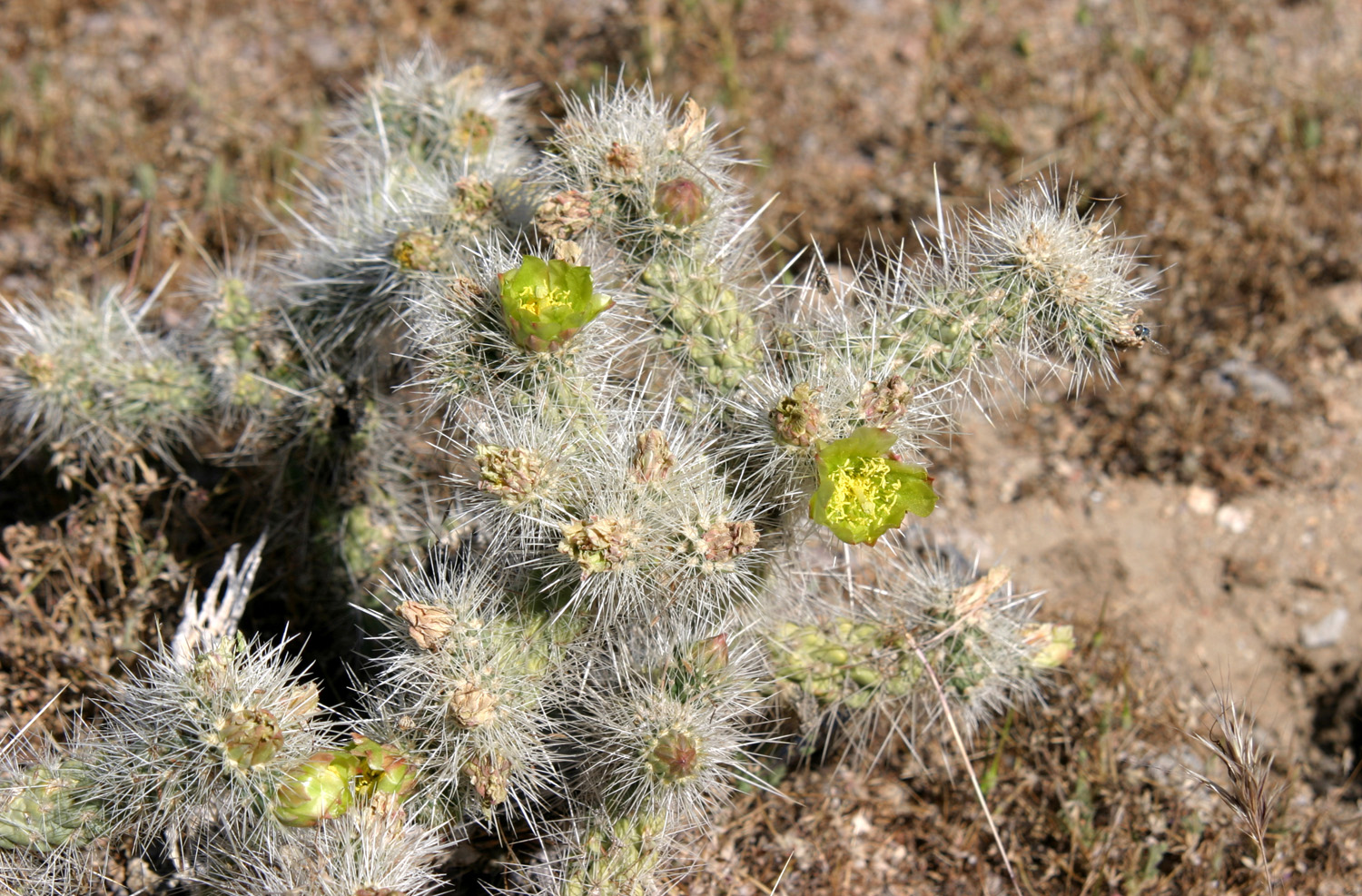
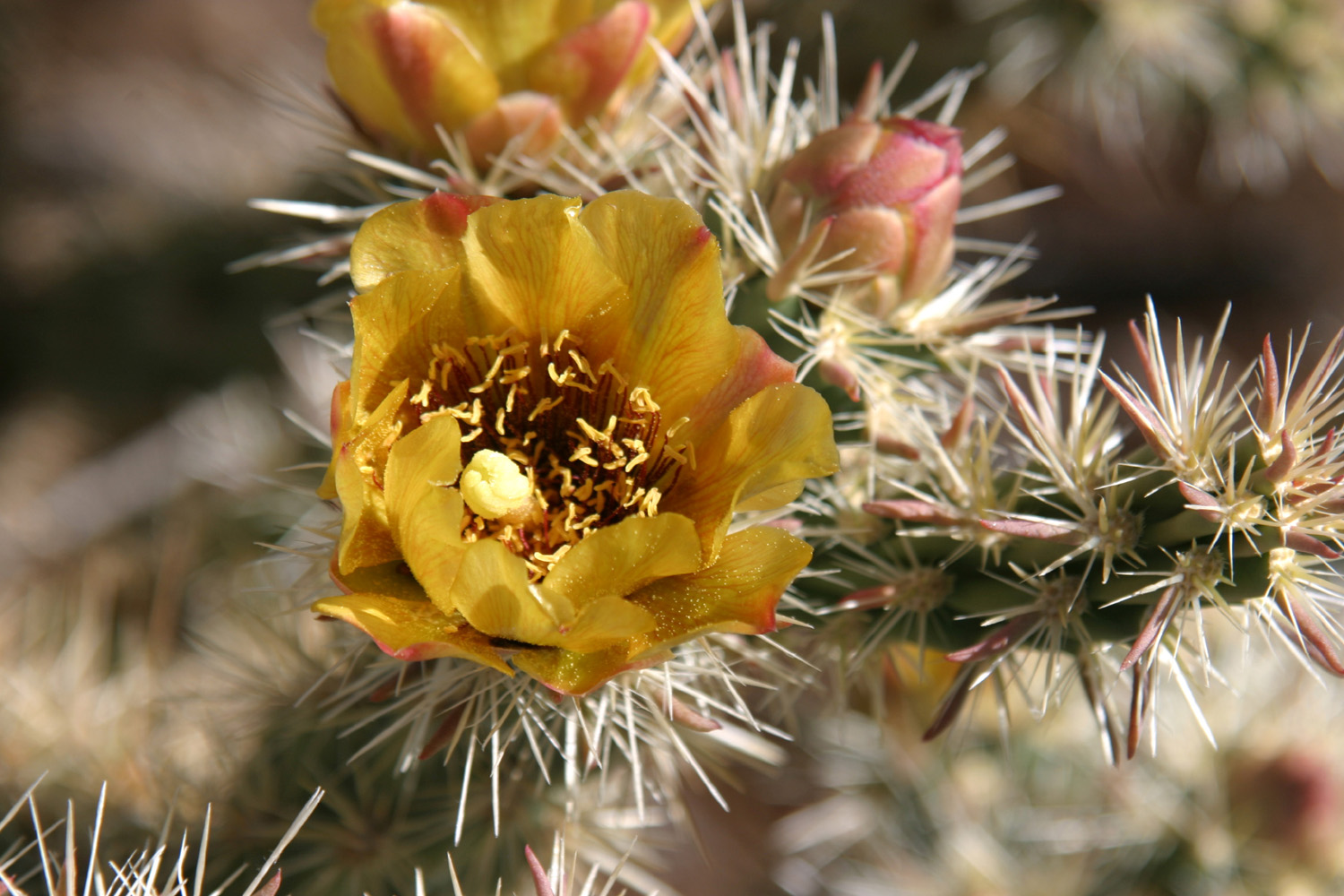
| Green cholla blossoms | Yellow cholla | Probably a porcupine cactus |
|
 |
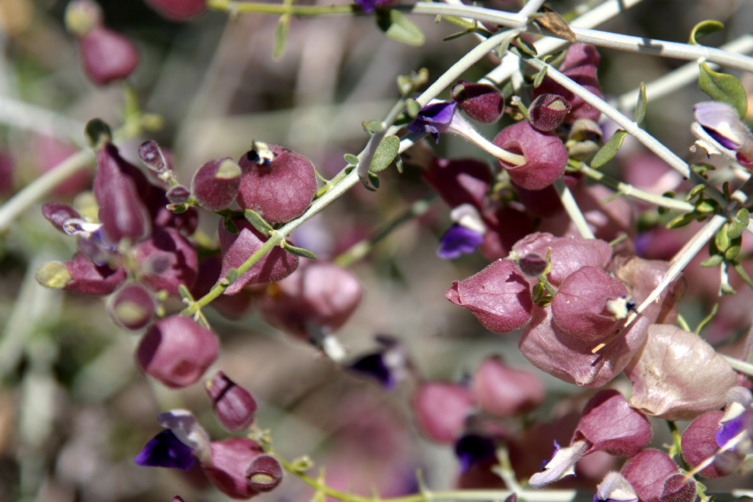 |
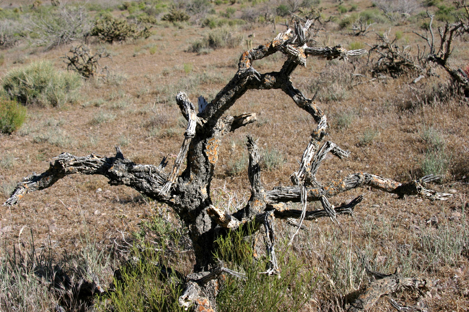
| More porcupine | Cholla "skeleton" | Paper bag bush |
 |
 |
 |
| Janell conquers the Ring Trail | A nice color combination | Juniper and cactus at the road's highest point |
 |
 |
|
| Joshua tree seed pods | Kelso Depot, now the visitor center | |
| Related Links | ||
| Hensley Reservoir | Oak savanna | Cotton tail rabbits |
| Pohonichi Trail | Mojave National Preserve | Hole-in-the-Wall Camp |
| Barrel Cactus | Banshee Canyon | Kelso Depot |
| Ring Trail | Peggy Sue's Diner | Boron |
| Colorado Grill | More Mojave photos | Murray Family Farms |