
|
California Flat Campout |
||
|
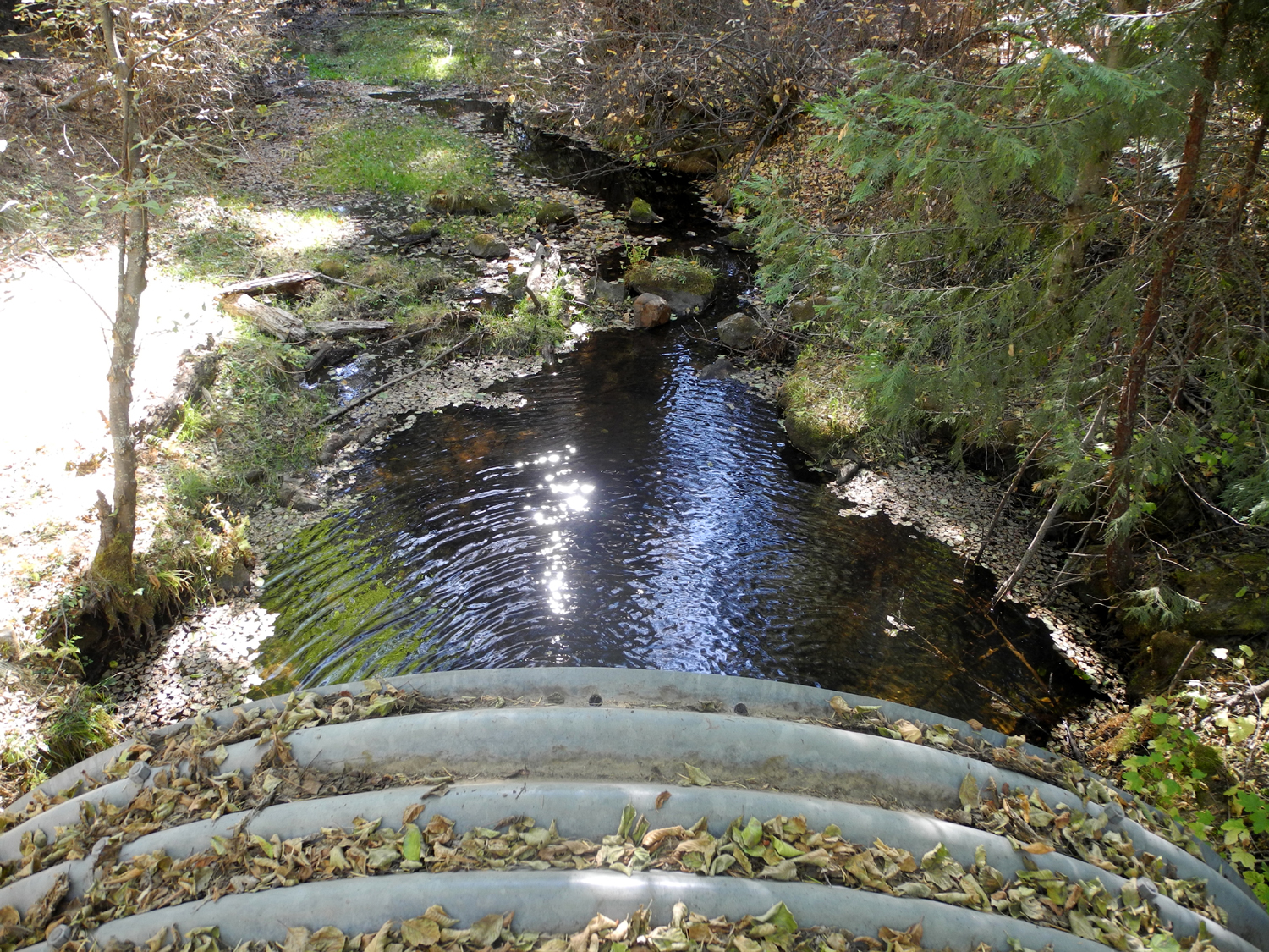
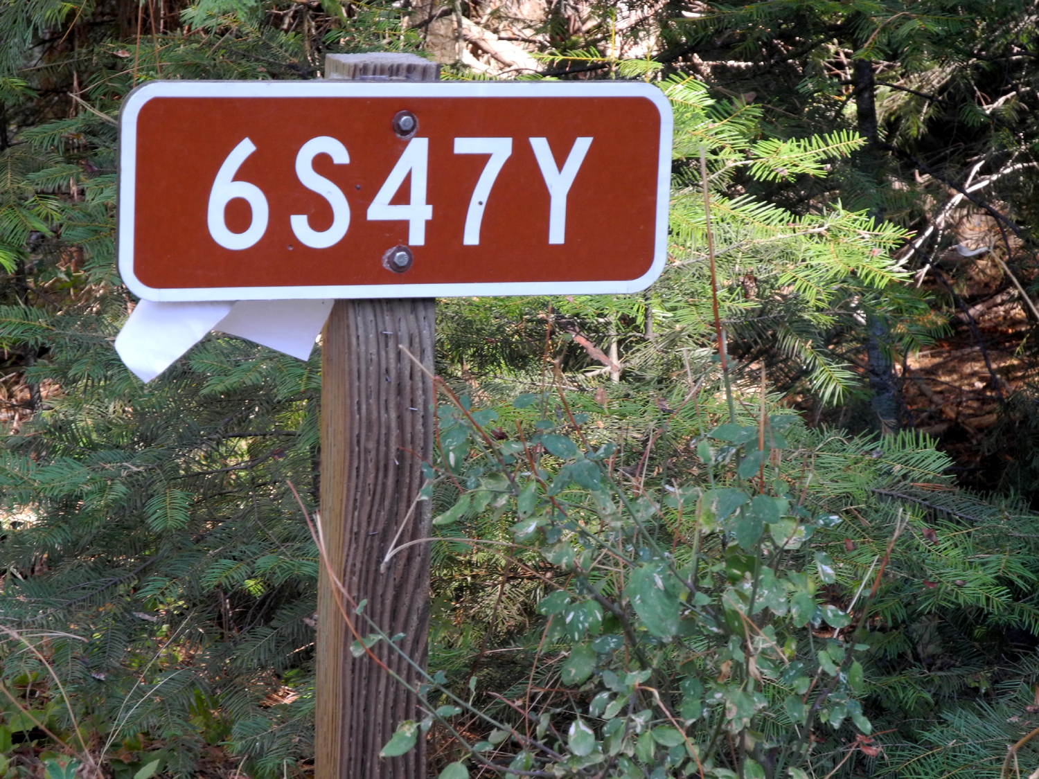
Since my last camping trip of 2014 was late in the winter of 2013-14, I decided I should get one more trip in before winter arrives again. When I planned this trip it took some searching through my calendar to find three consecutive days with nothing scheduled. It finally turned out that the 27th through 29th of October would work. I got started about 9:30 and made the 58-mile, two hour drive to California Flat without incident. California Flat is kind of a second rate camping area not found on any map. That's because I gave it the name. To get there you go north on Highway 41 from Oakhurst and turn right at the Sky Ranch Road. After going through a residential development, this becomes Sierra Scenic Byway 10. From the highway you go about seven miles and turn left on forest road number 6S47Y, which is unpaved. When I reached this point, I got out to take some pictures and immediately realized that a long sleeved T-shirt was not nearly adequate for the weather up there. After a quick photo session, I got back in the motor home and got to the campsite which is down a little driveway off the main dirt road. I had camped here with my travel trailer once or twice, backing down this road with some difficulty. I also camped here in a tent with some friends 30 some years ago. This location is where California Creek crosses road 6S47Y. The
creek
runs in from the north but turns west at this point so I will be
talking about both north and south sides and east and west sides of
the creek at various parts of this report. Calling this a second rate campsite is not intended as a negative. It's not a campground, just a place where people have camped over the years. When I first came here the only real place to camp was down the little dirt "driveway" that probably dates from logging days. However since that time people have created roads that go down a little ways to the flat area below where you can drive around among the trees. There are several fire rings in the area and you can camp very close to the creek. Besides
camping by the creek, my other early camping experience in this area was
to
hike up a dirt road that parallels California Creek on the opposite
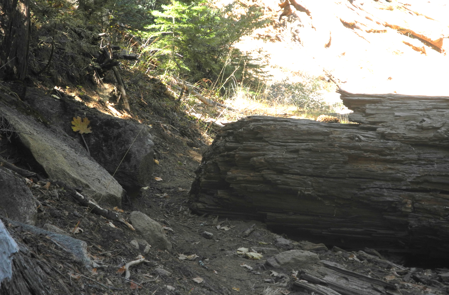
side of the road from where I camp. I used to drive in, but the road
is now blocked by a
log. You can still hike it, and not very far in
there are two nice meadows. My son-in-law Tim and I actually
backpacked in there, a hike of about 10 minutes total, and called it
the candy-ass backpack trip, which I reported on previously Once I got the RV set up and a few more shirts on my back, I made a
bloody Mary and sat outside and read for a while. I then took a
short walk up to the main dirt road, down across the creek and down
another dirt road that goes more or less parallel to the creek. On
the way I stopped and visited briefly with a couple who were cutting
firewood. I had walked on this road a short distance in the past, to the small
meadow, but this time I continued on into areas where I had never been before. After a short time the road started to go down
hill and then there was another dirt road crossing it at right
angles. I continued forward for another few hundred yards, taking
some pictures and looking around and enjoying the pretty trees. At
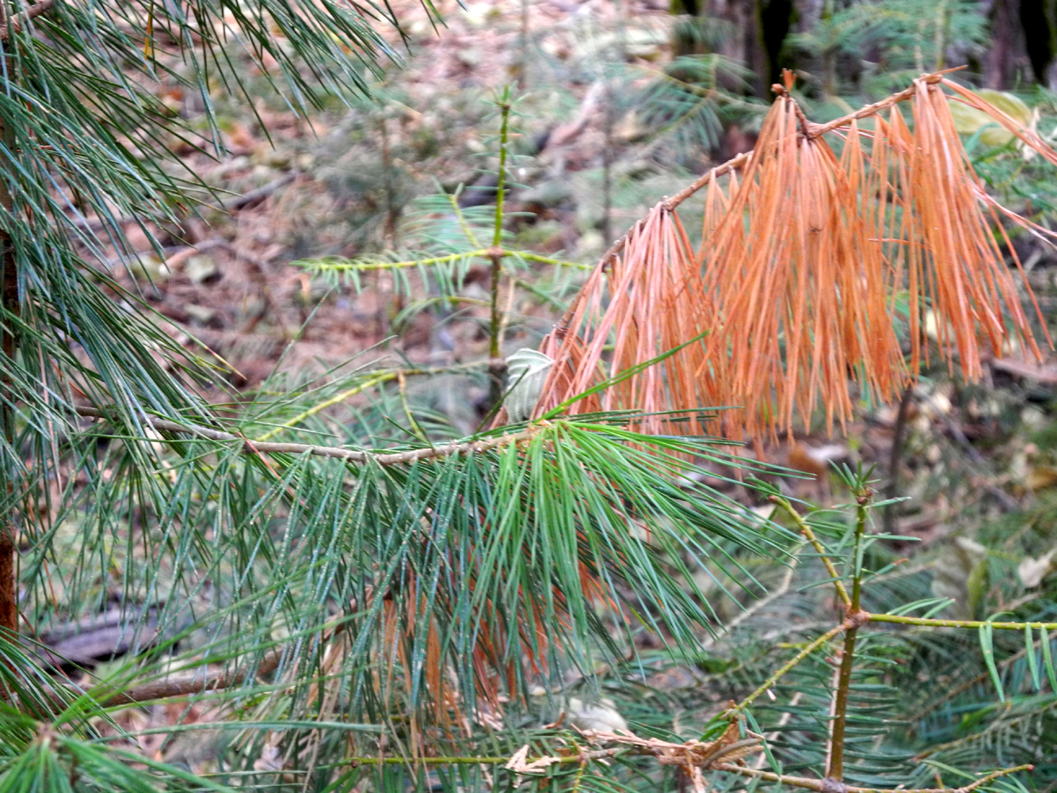
the point where I turned back there were 20 or 30 young pines with
brown needles, due possibly to drought or beetles or both. When I
returned to the crossroad, I turned left toward the creek and arrived at
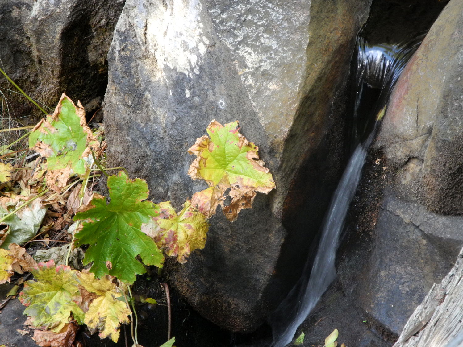
a very nice campsite. At this place the stream drops down over some
rocks in the series of falls and cascades with a total drop of about
20 feet. A rough road came into this camp parallel to the creek, but
access would be very difficult with anything other than a
four-wheel-drive vehicle. I followed this track a ways until I found a place where I could
cross the creek, just a short walk from
my camp. By this time my early breakfast was thoroughly digested so I heated
up some leftover food from the Imperial Garden Chinese restaurant
and ate my dinner or supper or whatever my main meal should be called.
The rest of the afternoon I read and wandered around the
area. This
included a short preliminary exploratory walk for the first 100
yards past the log that would mark the start of my "big" hike the next
day. Eventually it was getting so cold that it was obviously time to
come in for the night. It was I ran the generator while I watched TV or read. I've found that it's usually
only 8 to 10 degrees warmer inside than out, so I was bundled up in
all the shirts and jackets that I had with me. I did not get out the
electric heater or turn on the propane heater that night. I had my schedule for the next day all planned: First a bloody Mary, then breakfast, then a nap, then my big hike to the two meadows. When I woke up I did something I almost never do - I turned on the
generator and the heater. Judging from the temperatures recorded
each morning, it was probably right around 40° inside the motor home,
just a little bit too cold to put up with while exercising and
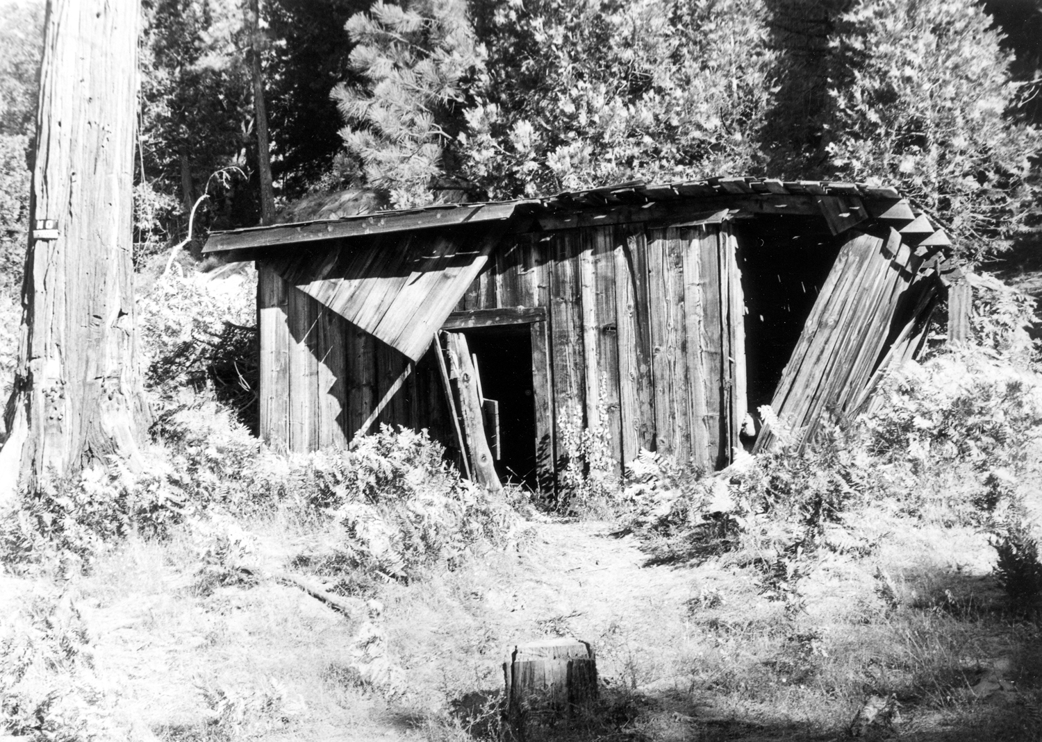
having breakfast. After my planned morning activities, I got started around 11, carrying my camera and a field bag which holds extra water and has room for an extra shirt - either to put on later if I get cold, or a place to put one if I find out I'm too warm and take one off. I went up this road with my Datsun pickup in the 1980s, and once I got past the log, it looked as if it would still be drivable. However, it soon became obvious that no large vehicle could go much past the first hundred yards or so. There were logs fallen across the road in a number of places. The road was passable as a trail in most locations, but where a large tree or one with a lot of limbs had fallen, detours had been developed. Near the start there was a stretch with a lot of thistles growing in the road. These had turned brown and gone to seed as is normal at this time of year, but apparently the changing climate had confused them - several had new green shoots and even blossoms as if it were spring. When I got to where the first meadow should be (which Tim and I cleverly named First Meadow) it was hard to see just where it was, and difficult to get to once I spotted it. One landmark that indicates that the meadow is near is the remnants of an old fence, mostly just a few posts, so I knew I was "there," even if I was not sure how to get THERE. Finally after crossing the creek in a muddy spot, I came up the bank to a small section of the meadow, then saw the opening between trees that led to the main part of it. Let us digress briefly to consider the progression of meadows over time. For many, their fate is to disappear. A meadow is sustained by water flowing through, often through many small channels and sometimes oozing through marshy areas. A tree that starts to grow in the wetter areas soon drowns. As trees grow near the edge, they take up more of the water, creating dryer conditions. This allows new trees to get a start farther into the meadow, and the wet, grassy area shrinks. Another common meadow feature is old logs that are buried to where just a small part is visible. Over the years, soil is carried in, burying these logs. Logic and observation tell us that there must be logs completely buried and out of sight. The main part of First Meadow is quite attractive, with some interesting features. There are at least a half dozen stumps where trees were cut. This may have been for building materials, fencing, firewood, or perhaps an attempt to slow the encroachment of the forest. These stumps are now ancient and weathered and add a unique touch. One of these stumps has been carved as a memorial, with the name and dates of a woman who died too young and "May her spirit soar." There are other names and dates on the stump, but they don't appear to be lifespan dates. All of this has been done since I was last there. The next part of this hike proved to be a bit more challenging than I expected. The road or trail continues from First Meadow for a fairly short distance to Cabin Meadow, so named because there was an old tumbledown cabin at the upper end when we first walked in there in the 1980s. I started north from First Meadow, but was not sure where the trail was. Directly north the land rose up, and I knew we had never walked uphill to any extent. I went north on the right side of this rise, but the way soon became impassible, with no sign of a trail. I cut to the left, going more or less northwest over the shoulder of the hill, making my way through sticks and shrubs, and around or over fallen logs. As I dropped down on the west side of the hill, I came to a well marked path, which led me into Cabin Meadow in short order. However, I was on the east side of the creek, and I knew the way we took previously was on the west. As I followed the path into the meadow, I saw a trail going down across the creek, and realized that was the way I had come into this area in the past. I decided I would leave that way when I finished my explorations. When Tim and I were here, there had been some heavy spring rainfall, and there was a newly-created gully along one side of the meadow. There was one of those buried logs sticking out from the side of the washout, about two feet below the level of the meadow. There was also a cedar tree whose roots had been undermined, leaning at a 45 degree angle, and in the process of dying. None of those things were in evidence this trip, nor was there any sign of the cabin. The cabin was partly standing when I first saw it, but had been reduced to a pile of boards by the time of our final trip. I walked up to the very upper end of the meadow and even looked into the trees in that area, but didn't see a single scrap of lumber. Another change was that a wire fence had been built across the upper quarter of the meadow. There was plenty of evidence that cows have grazed in both meadows, but all the manure was very dry and there was no odor, so it's probably been a couple of years at least. The nose can usually detect any recent bovine occupation of an area by scent long before there is visual evidence. After walking all around the upper end and checking out the gully, I followed the path back to the lower end, crossed the creek, and started my return trip on the trail I had used so many years ago. In some areas it was very narrow, being lined in some places with young trees about waist high. From a distance it was hard to see the trail, but it was not actually overgrown and was easy walking. As I approached the lower meadow I saw the easy route into it. Coming in from the main road, getting to that spot requires staying on the trial a little longer than seems "right," but would make the approach much easier. I got back to the motor home two hours and 40 minutes after leaving (of course, I wasn't hiking all the time), just in time for lunch, a grilled cheese sandwich. The rest of the day went much like the previous one - walking around, napping, and reading. At night there was TV and going outside every once on a while to check the temperature. That night I set up my little electric heater. Update: After I posted this, Brenda Negley, expert on Nelder Grove and vicinity, informed me that the two meadows are California Meadow (lower) and Nichols Meadow (upper). I'm going to leave my names as is for this report. Weather report: When I arrived at 11:30 a.m. the first day, it was 49 degrees, and the high was about 55. By 8 p.m. it was down to 44, and overnight the low was 33 both nights. The highest temperature I recorded was 58 at 3:30 p.m. the second day. Other Adventures: Both of these occurred many years ago. The first was included in my backpacking report, but in retrospect I don't think that's when it happened. So just in case, I'll recount it here. Tim and I had visited the area, and were driving home in my Datsun pickup. I don't remember where we had gone or whether we camped, but somewhere along the road near California Flat we observed smoke coming out from under the hood. We opened the hood, saw flames, and Tim put them out with dirt. A battery cable had become loose (not disconnected) and vibration caused it to contact something metal, creating sparks. The fire damaged the accelerator cable, which broke as soon as we tried to drive off. Amazingly, Tim had previously been in a similar situation (and was mechanically adept and a future automotive technician). He rigged up a cable by tying a boot lace to the accelerator and running it to the place where the cable connected under the hood. We drove home with this fix until the last mile or so, when the lace broke. Tim re-tied it and operated it by hand the rest of the way. The other adventure was much more fun and much less exciting. I was camping in the area with my other son-in-law to be, Rod, at First Meadow. We knew that California Creek runs through the Nelder Grove campground, so we followed the creek upstream all the way to the grove, a distance of around a mile. Of course, there is no trail, so it was not always an easy walk. I really don't remember details, but it was an interesting adventure. We walked back via the road.
--Dick Estel, November 2014 |
||
|
Photos (Click to enlarge; pictures open in new window) |
||
|
|
||
|
|
 |
 |
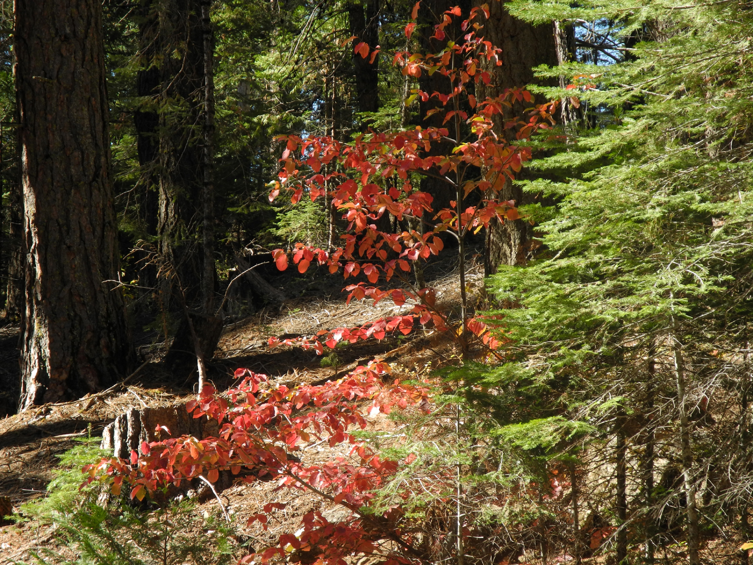
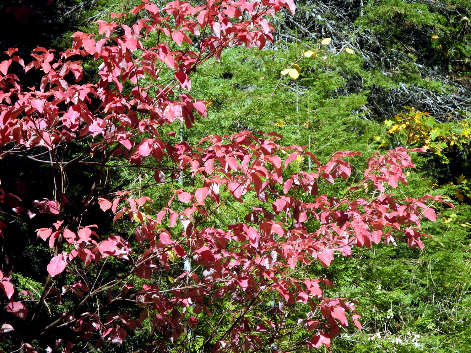
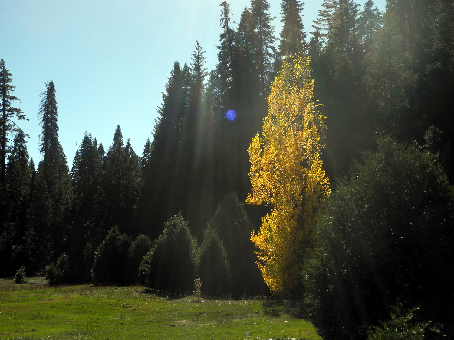
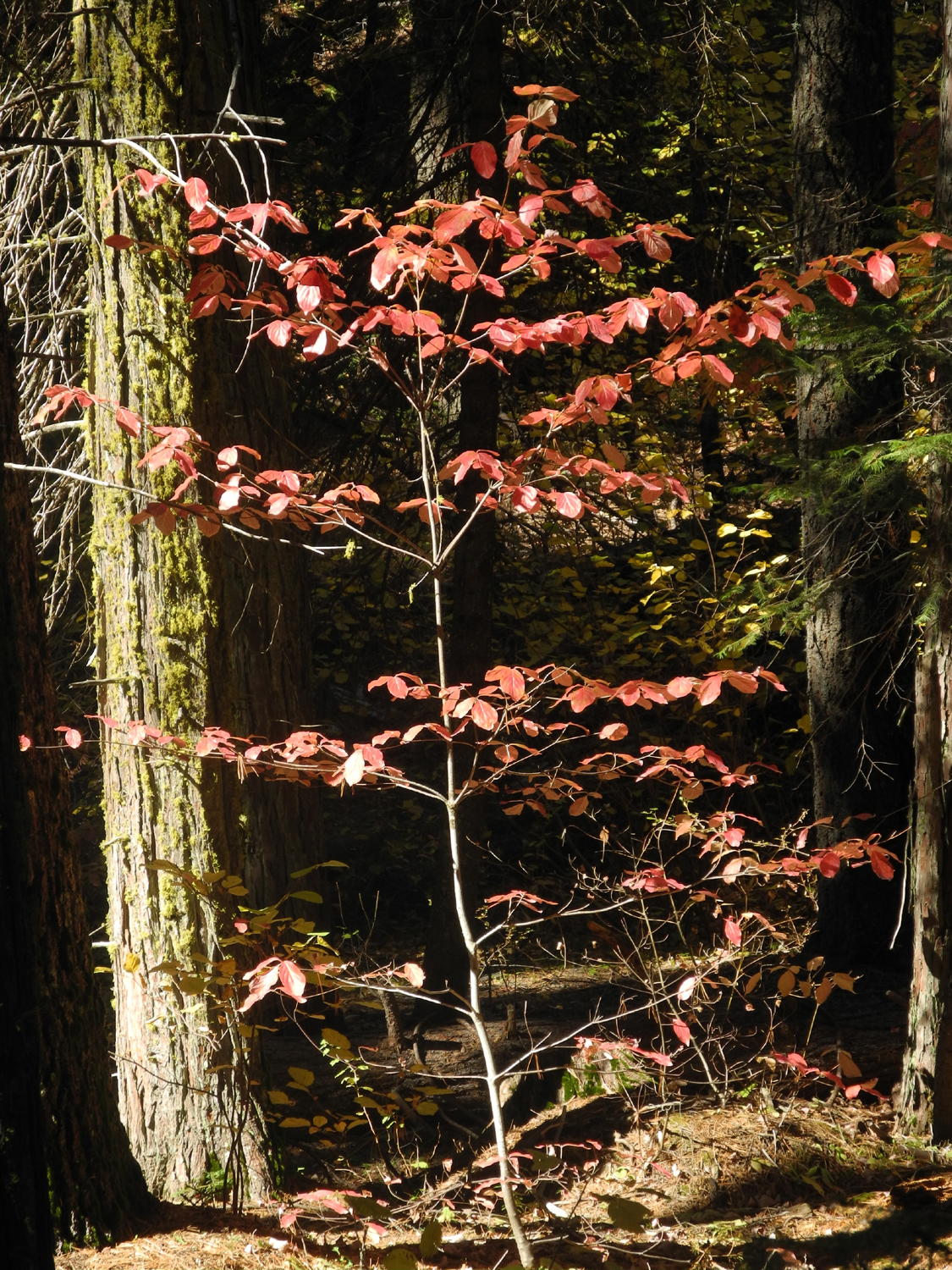
| The dirt road to my camp | In a forest of evergreens, dogwood provides a bright spot of red |
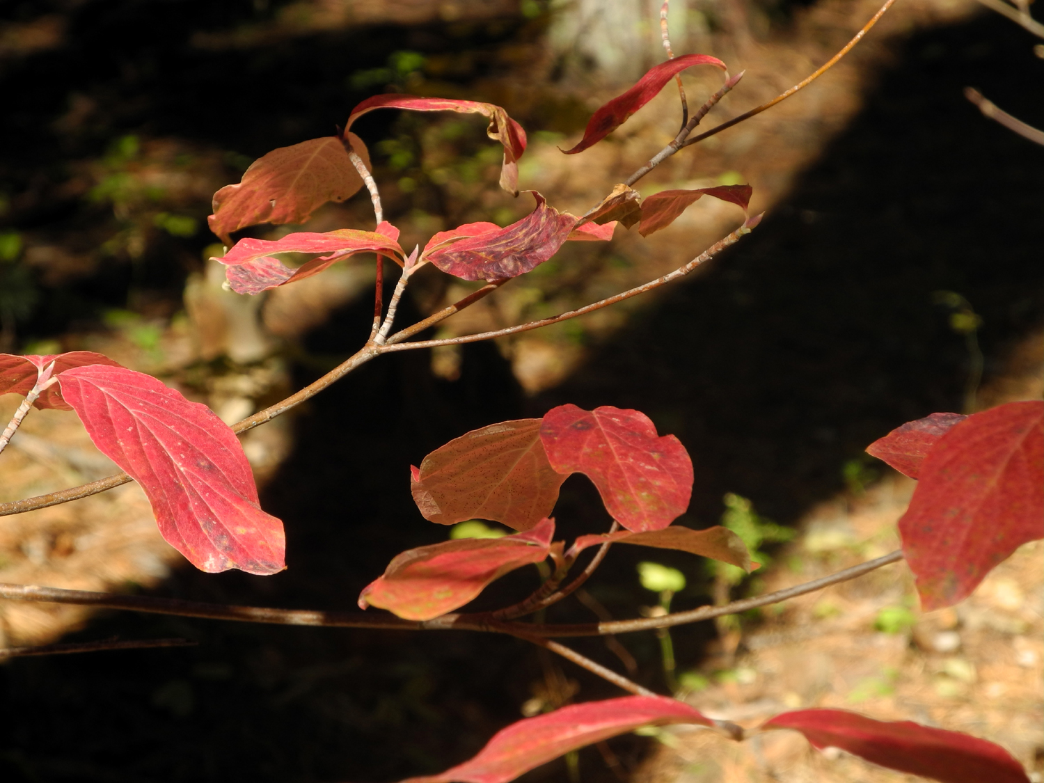
Close-up of the leaves |
 |
 |
 |
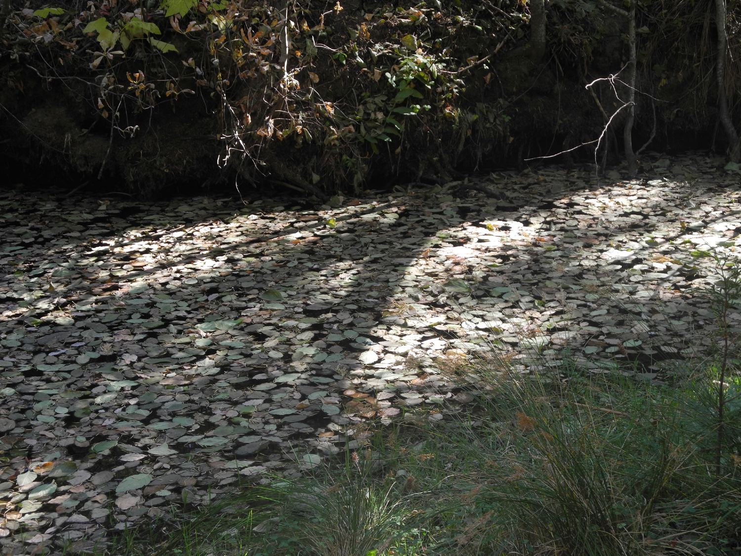
| My camp at California Flat | Fall leaves on California Creek |
Conditions are excellent for |
 |
 |
 |
|
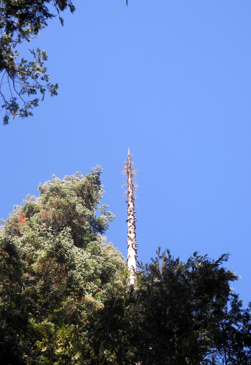
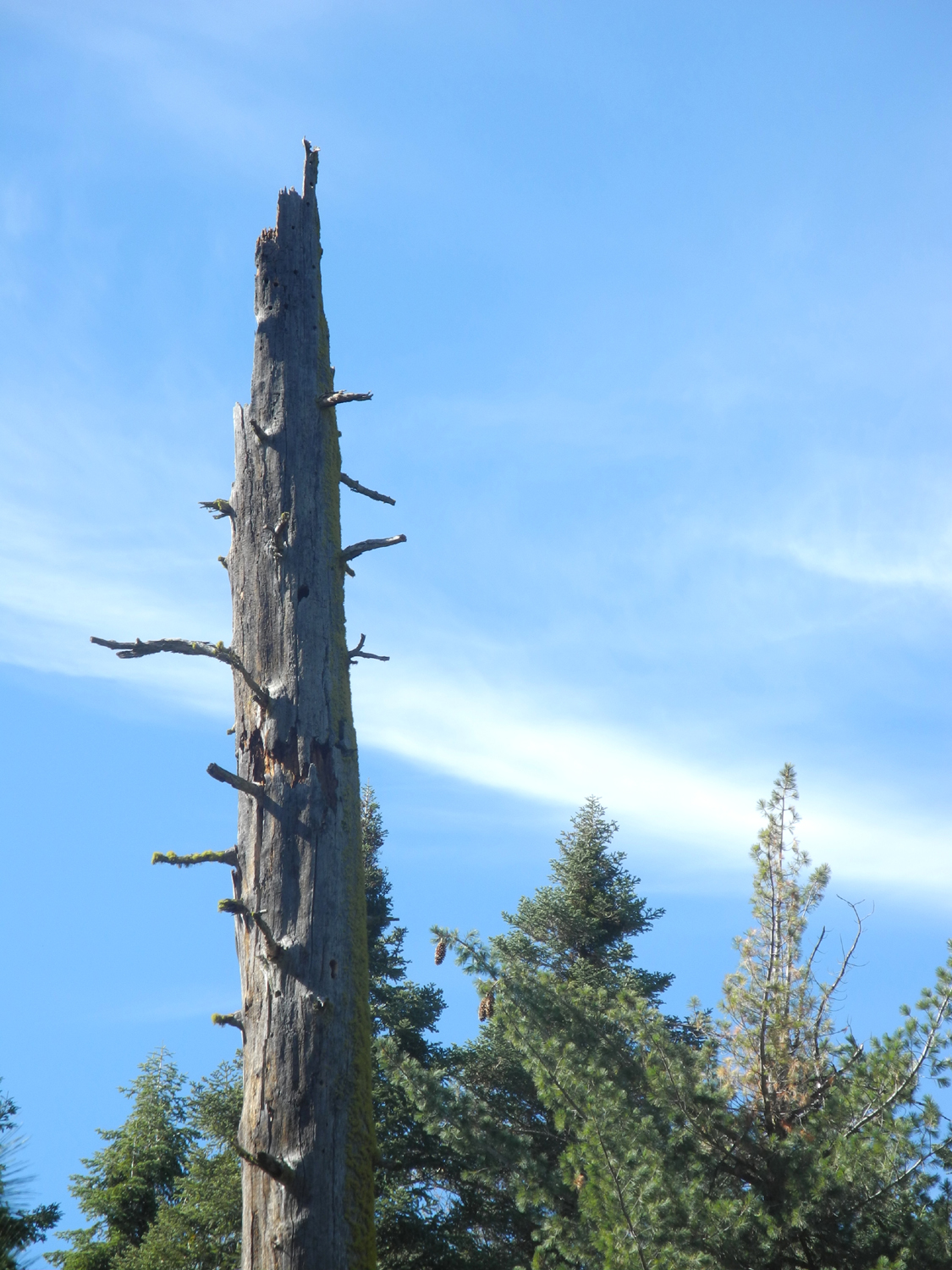
Dead snag reaches |
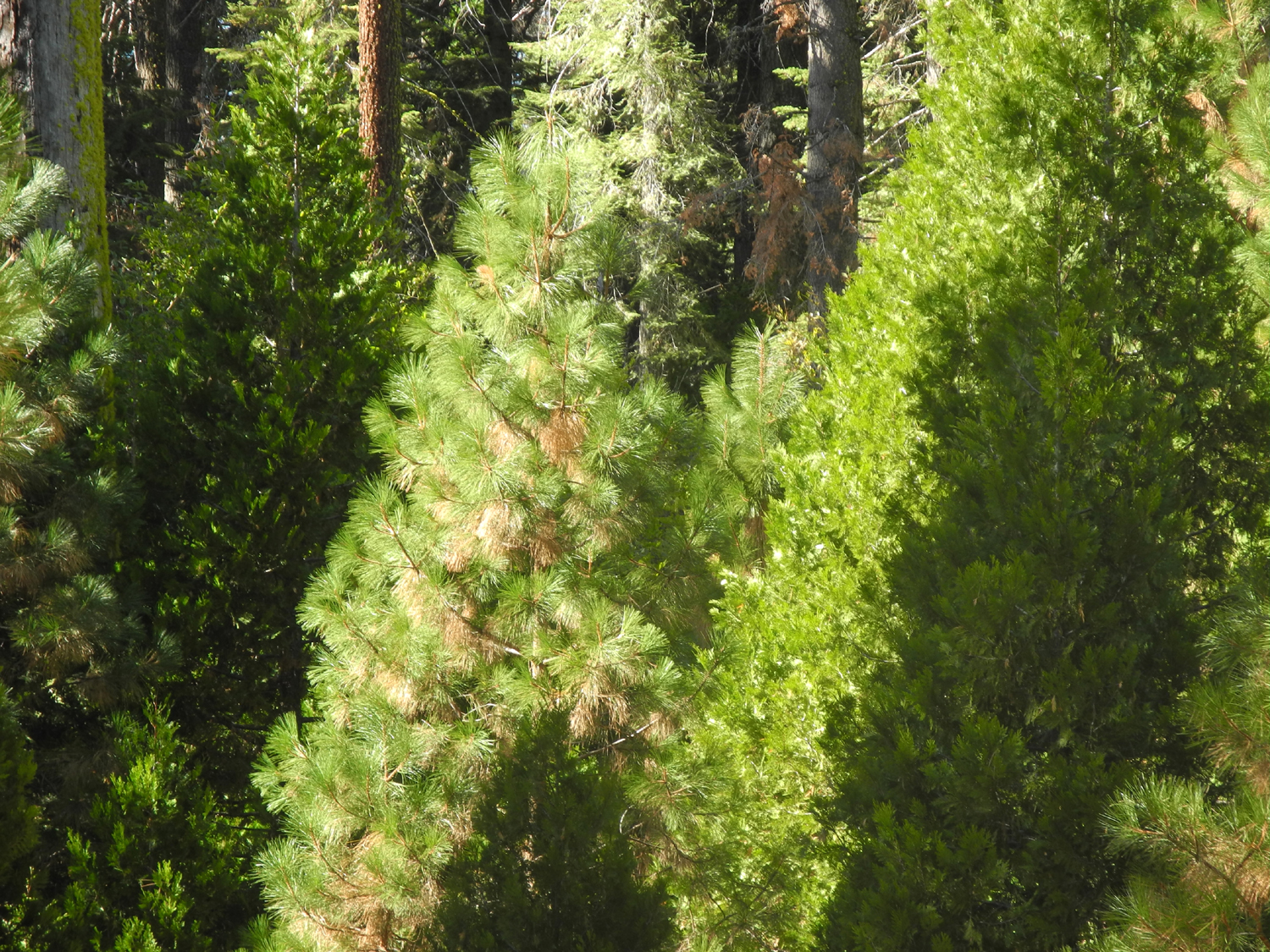
Young pine and cedar | Dead snag stands like a sentinel |
 |
 |
 |
|
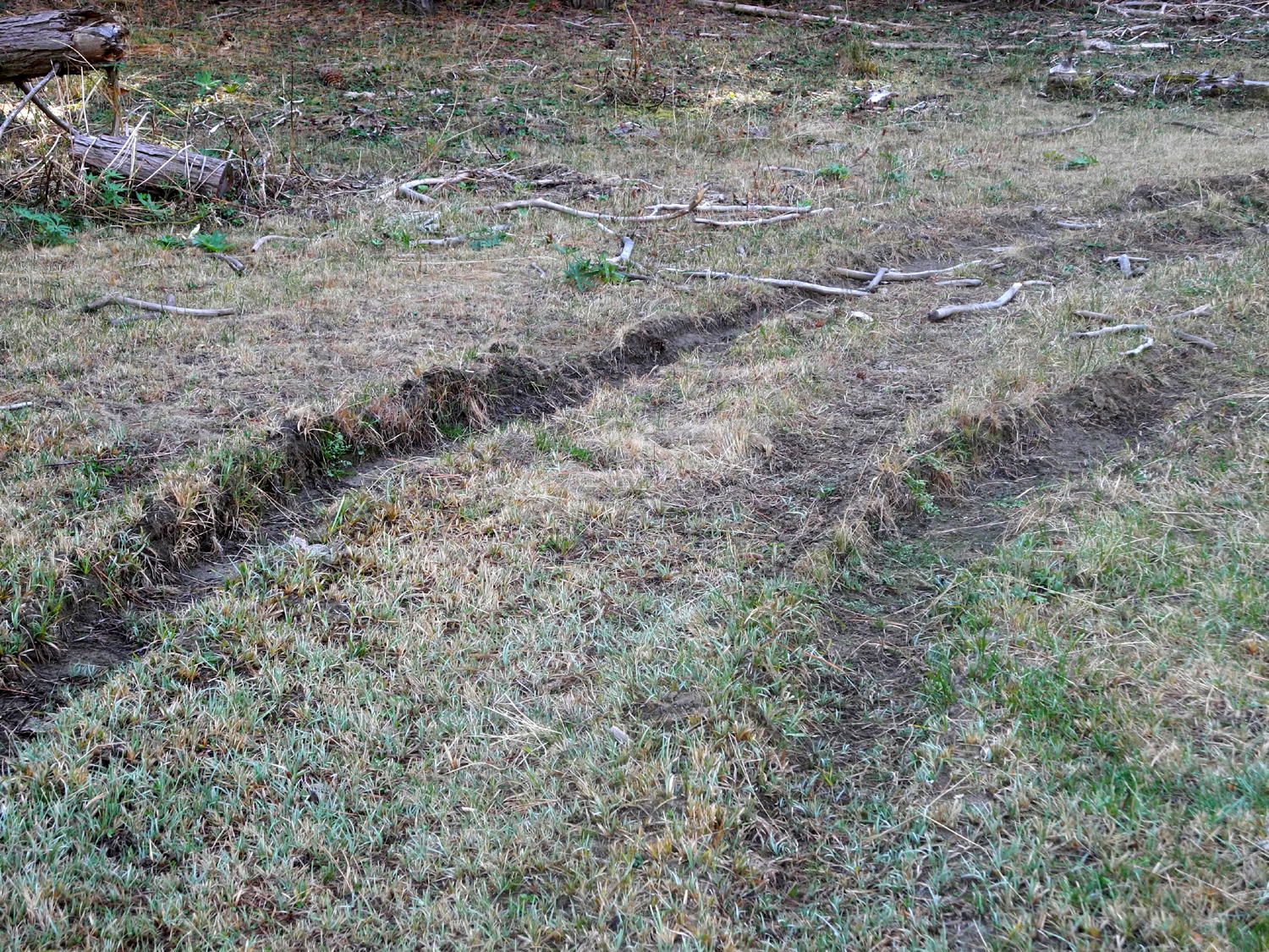
Tracks made when the |
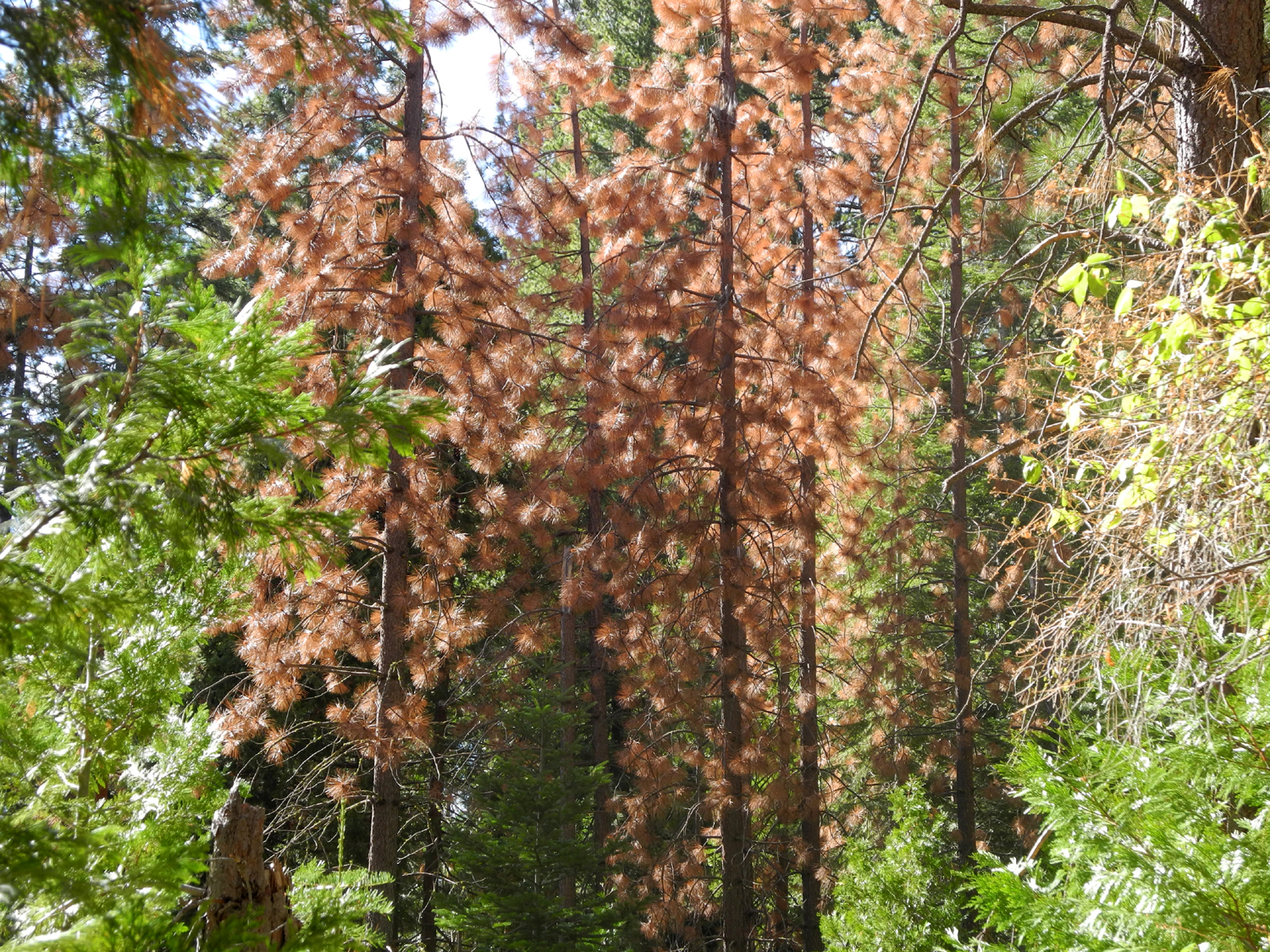
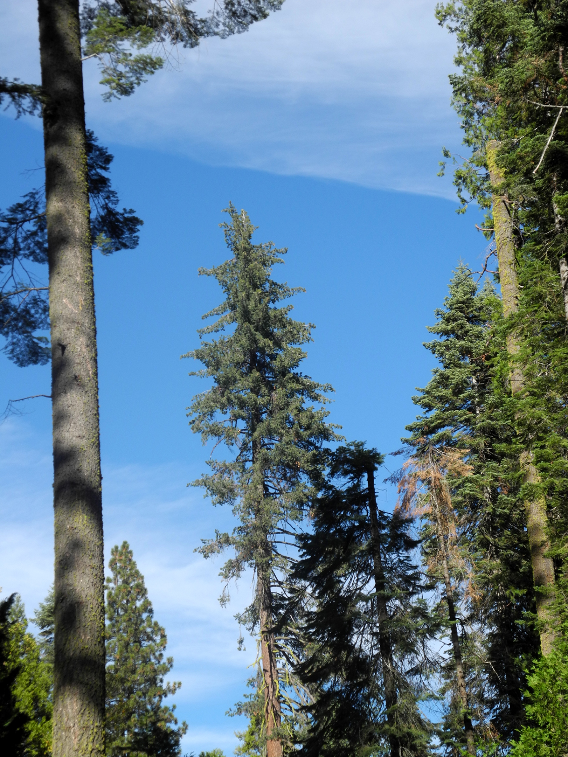
Lots of pines are dying |
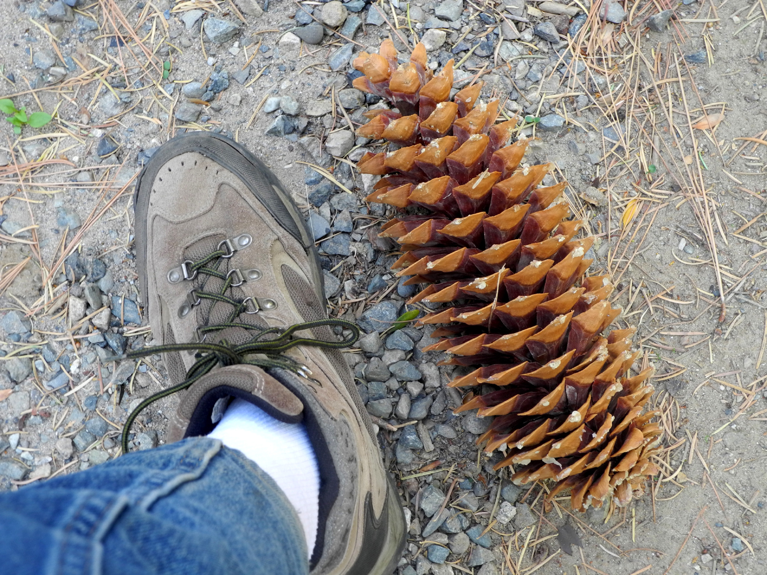
Sugar pine cone vs. my size twelve boot |
|
 |
 |
| The creek starts its drop down from California Flat | Why does this young green pine have one brown branch? |
Dogwood in the deep forest |
 |
|
 |
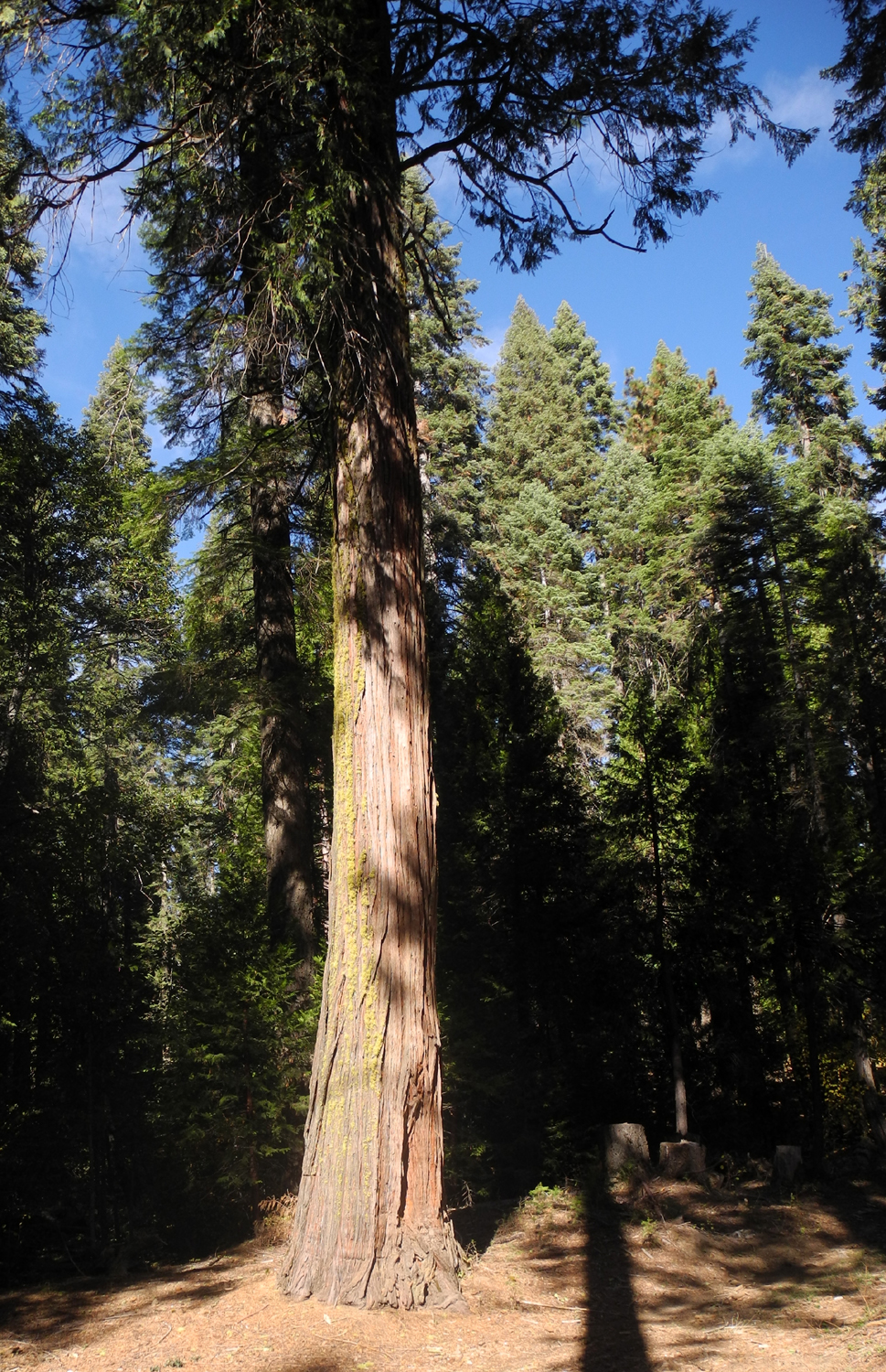
| The view from my lawn chair |
The sugar pines have produced a bumper crop |
The way in to the meadows |
 |
 |
 |
|
Where the creek crosses Road 6S47Y |
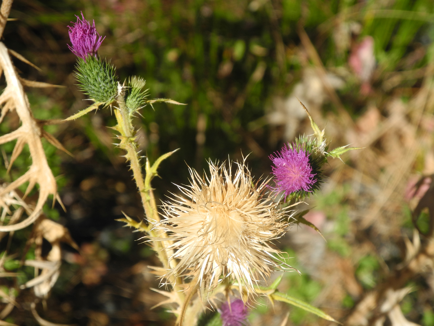
I just can't stop photographing dogwood leaves! | Confused thistle puts out spring growth in the fall |
 |
 |
 |
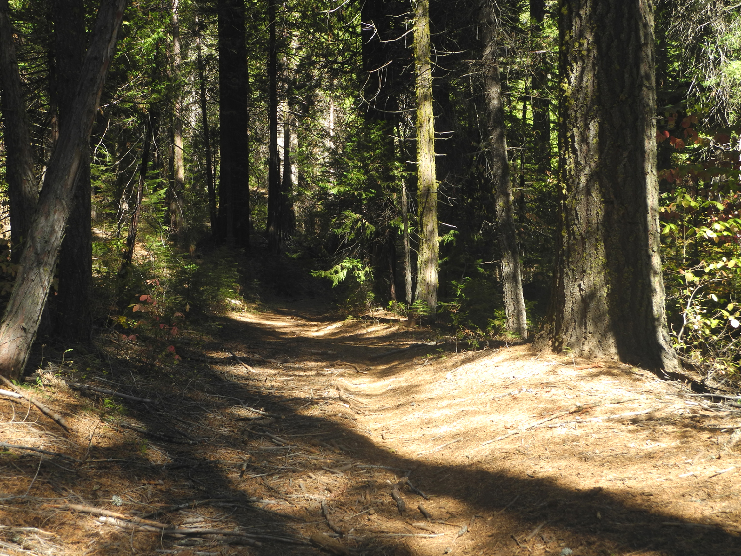
| On the trail |
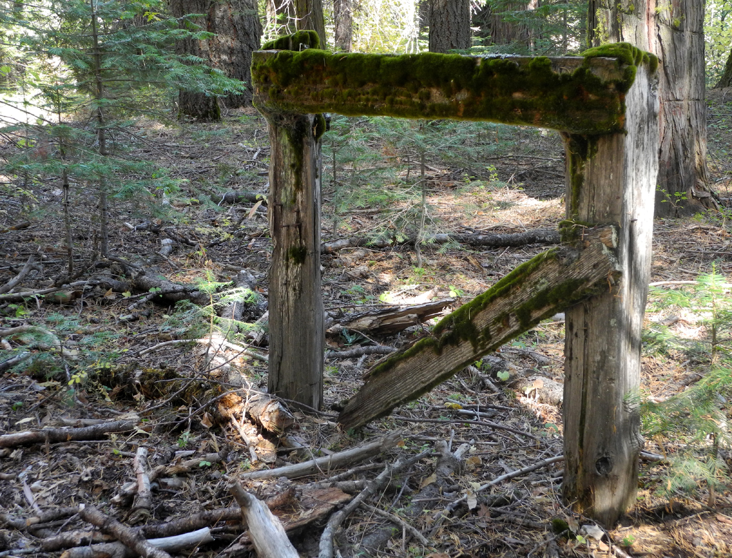
Part of an ancient fence |
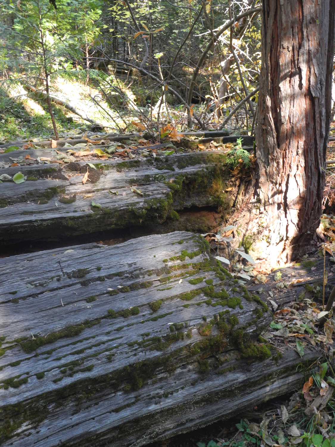
A good sized cedar grows through a fallen ancestor |
|
 |
 |
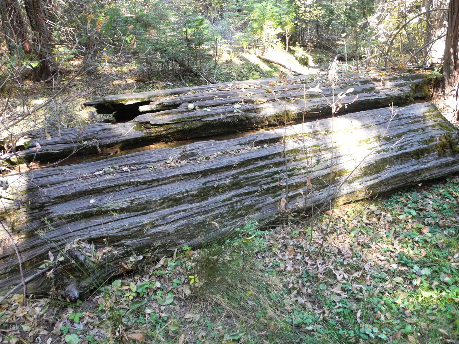
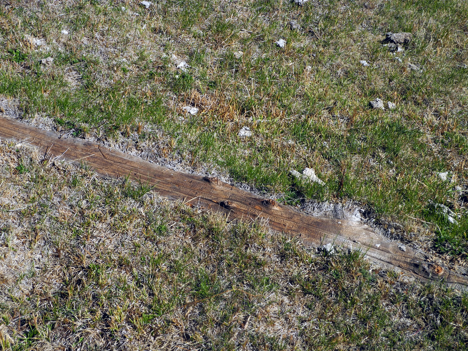
| Ancient cedar log | Log buried in the meadow |
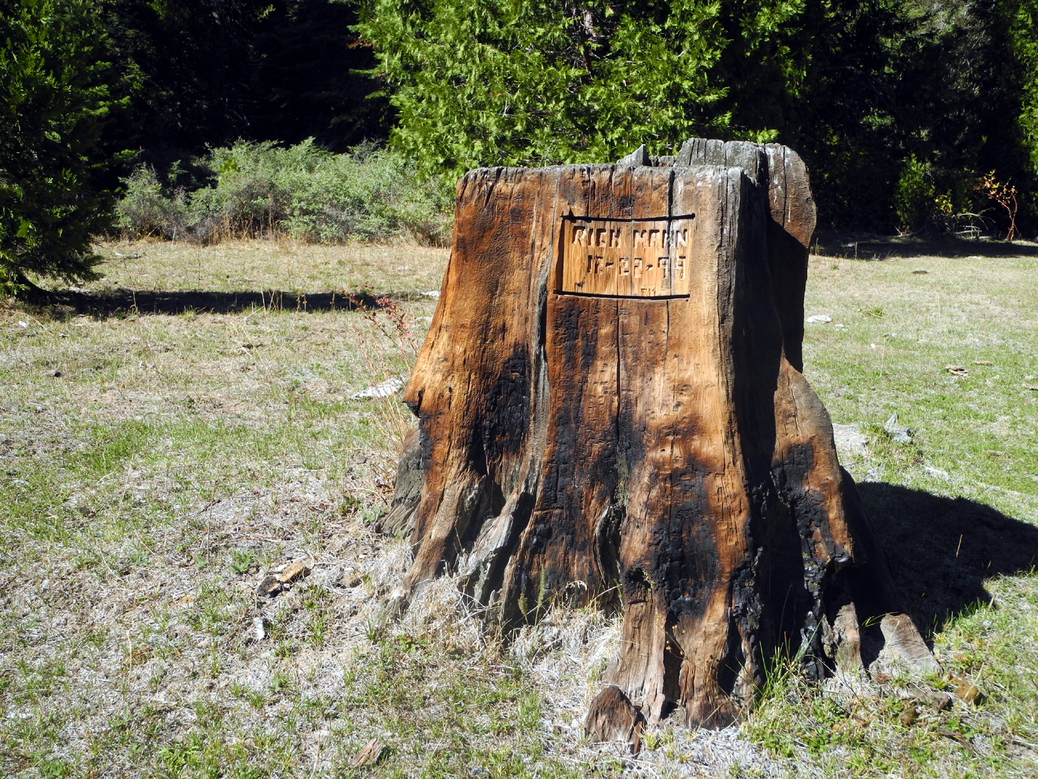
This stump has three different carvings |
 |
 |
 |
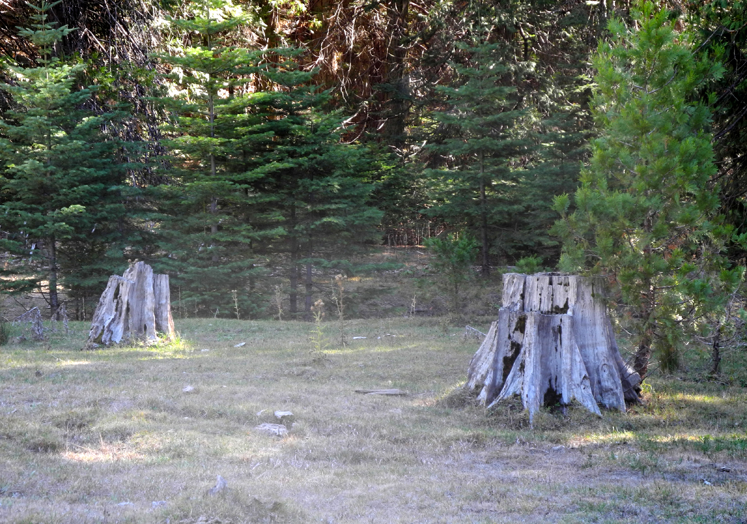
| Stumps in First Meadow (California Meadow) | At the edge of Cabin Meadow (Nichols Meadow) |
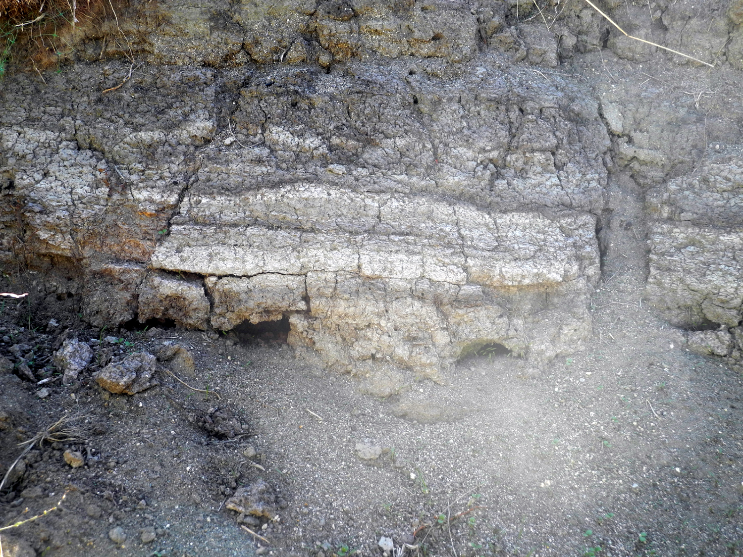
Gully in the meadow shows
layers of soil laid down over the years |
 |
||
| A future fir forest | ||
| Related Links | ||
| Cabin Meadow Backpack Trip | Nelder Grove | Meadow Ecology |
| Sugar Pine, the Place | All About Dogwoods | Sugar Pines |
| Incense Cedar | ||