|
Zion & Bryce Canyon National Parks |
|||
| Links More Travel Reports More Photos | |||
| Weeping Rock & Pa'Rus Trails Emerald Pools Trail Virgin River Narrows | |||
| Click in any photo to see a larger version | |||
|
|||
 |
 |
 |
|
|
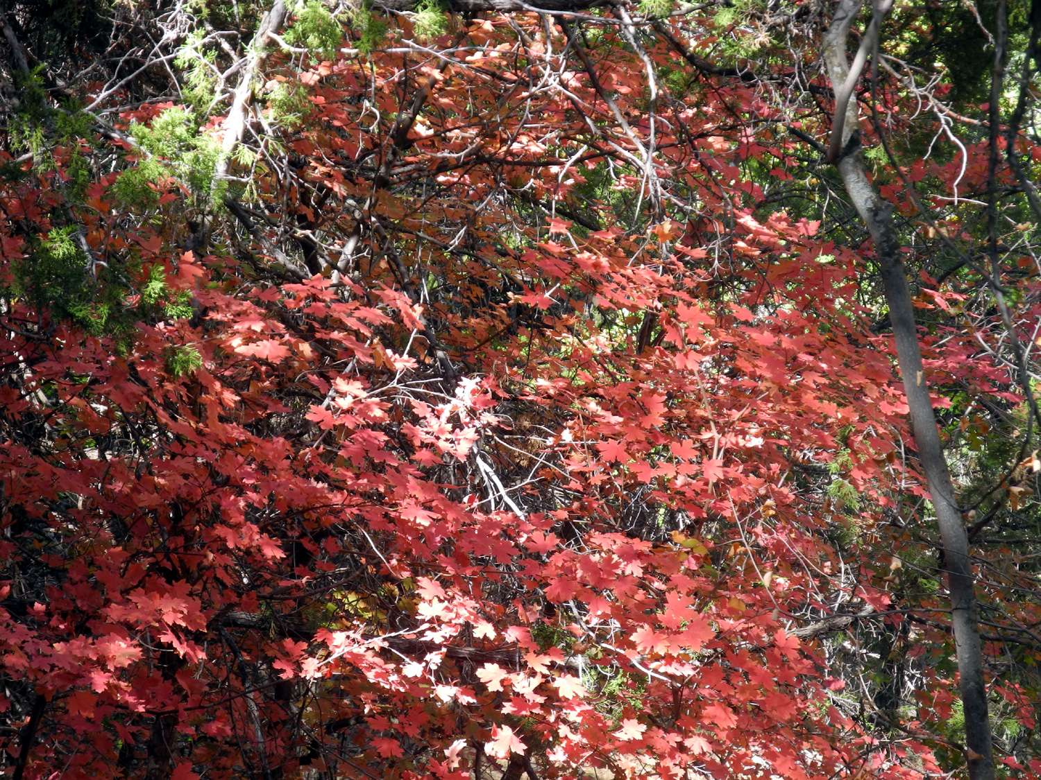
Bigtooth Maple provided splashes of bright red throughout Zion National Park |
Weeping Rock in Zion | Bryce Canyon | |
|
|||
|
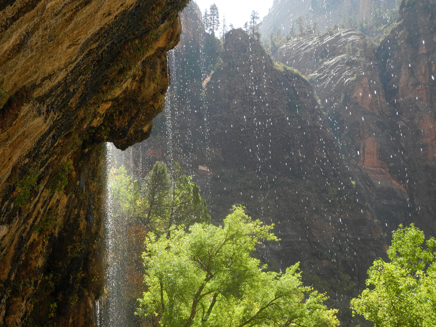
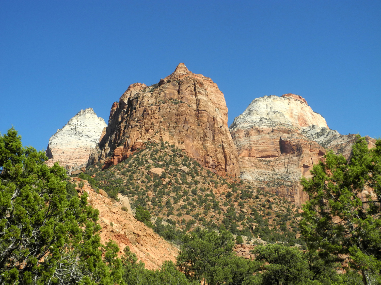
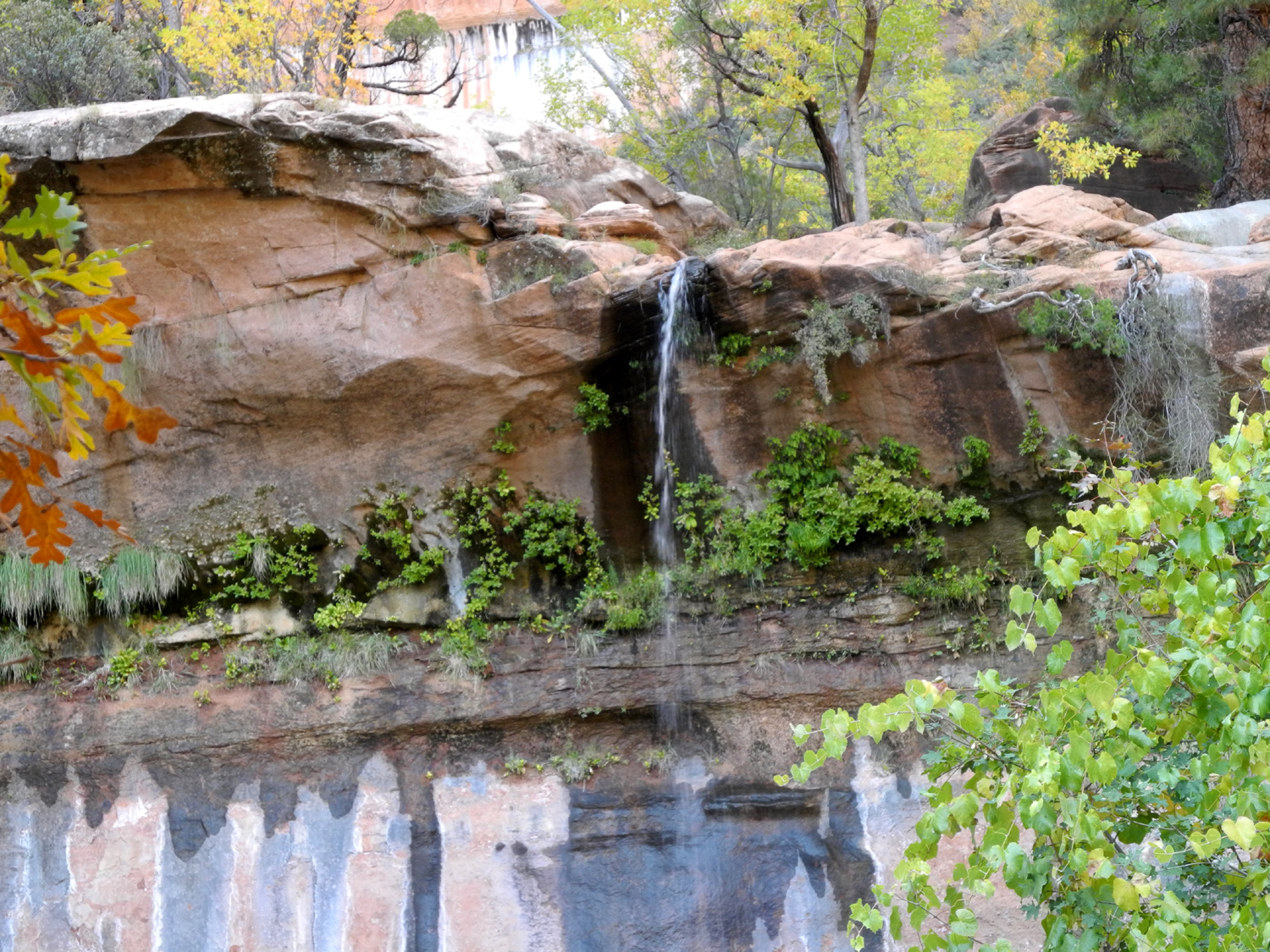
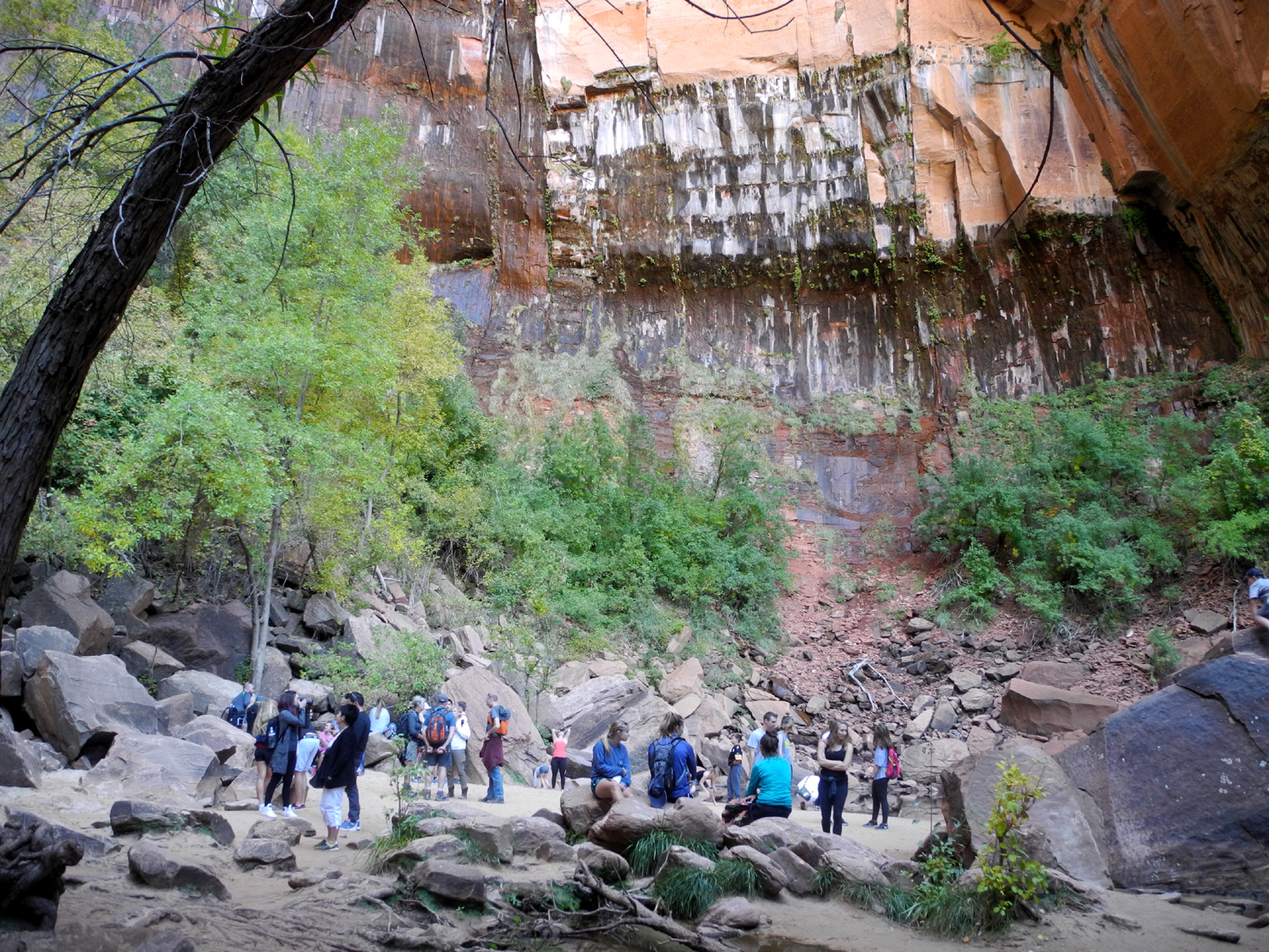
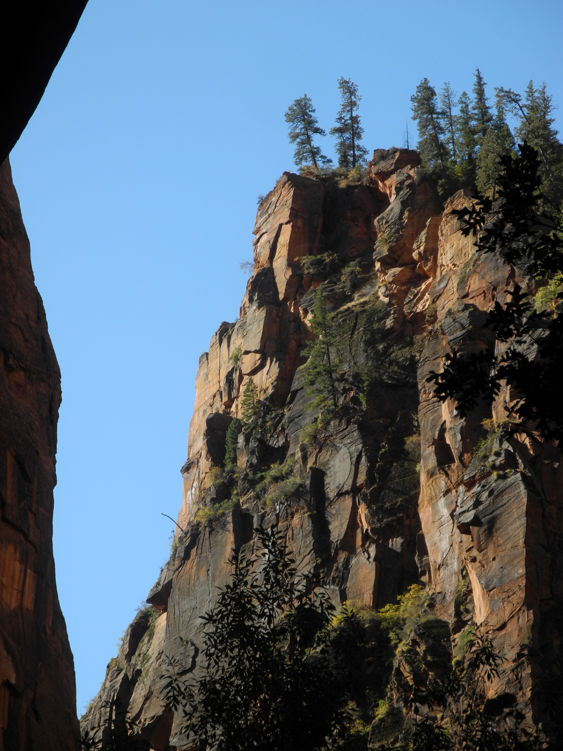
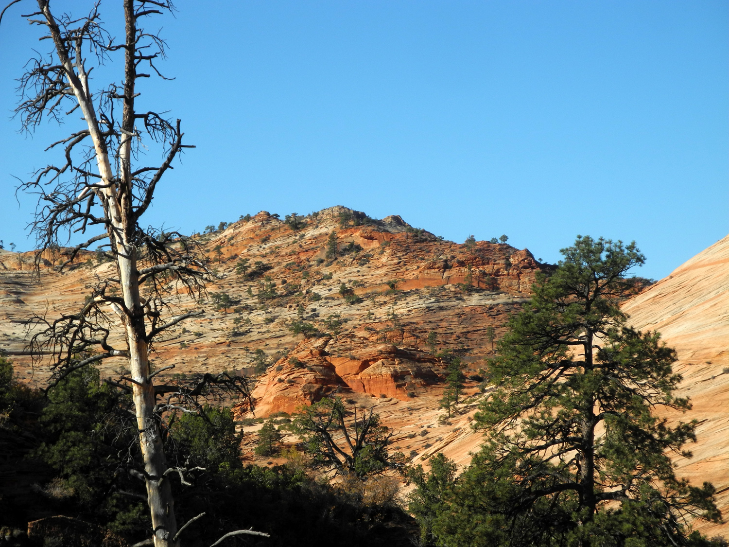
We left Fresno in Teri's motor home around noon on October 12 and drove to Mesquite, Nevada, near the Arizona border, where we camped overnight in a Walmart parking lot. The next day we continued on I-15 across the northwest corner of Arizona, where the highway goes through the dramatic Virgin River Gorge. We then entered Utah, and took Utah State 9 eastward a few miles past St. George. This road led us into Springdale, on the border of Zion National Park, and our reserved space right on the river in the Zion Canyon RV Park. It was fairly early in the day, so after we got set up, we walked through the RV park to the highway, where a shuttle bus system provides transportation into the park about every 15 minutes. This section is Zion Canyon, the most popular and scenic part of the park. The main road goes only a short distance into the canyon, then leaves the river at Canyon Junction and climbs up several hundred feet in elevation and east through a tunnel (more about that later). Private cars are not allowed past the junction on the canyon road, except for guests of the Zion Lodge or with a special permit. The shuttle stops at nine different locations along the way, each of them offering access to the river and trailheads. Teri and I rode the shuttle all the way to the final stop, enjoying the scenery and deciding what our activities for the day would be. We stayed aboard at the turnaround point, then rode back to the Weeping Rock Trail. Zion is located on the Colorado Plateau, which is high desert country, but it's one of the wettest desert areas I've ever seen. Rain falling on the upper part of the country seeps into the sandstone, but is forced out horizontally when it encounters harder rock. This results in seeps and springs in a number of locations. At Weeping Rock there is a misty waterfall dropping from an overhanging rock cliff, along with drops like a light rain along a 30 foot section. The trail to the falls is steep but short, and there were many people going up and down. At the end we were getting a few drops falling on us, but for the most part the cliff has eroded away to form an overhang, giving hikers protection from the main falls. |
|||
|

|
|
|
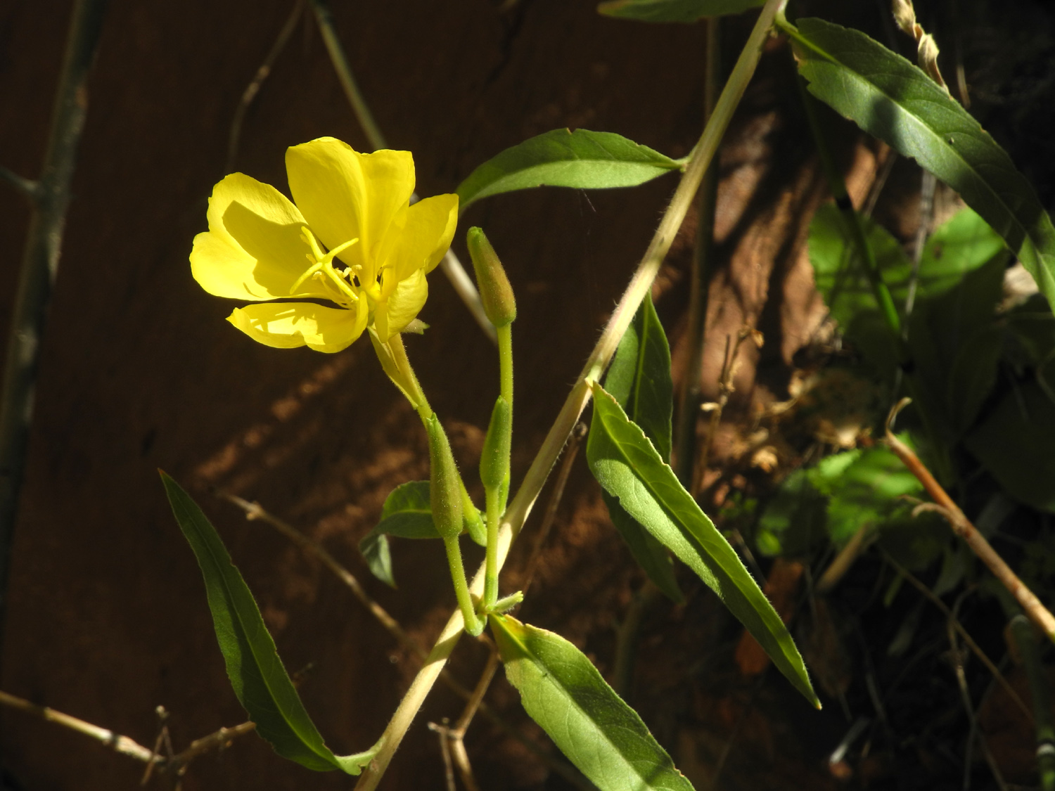
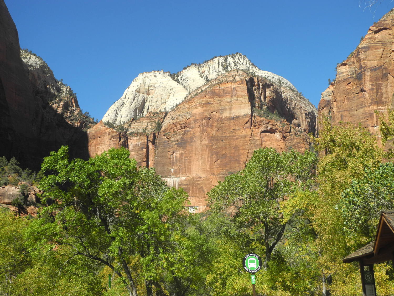
| Flower along the Weeping Rock Trail | View of cliffs from the trail | Water falls like tears from the Weeping Rock | |
|
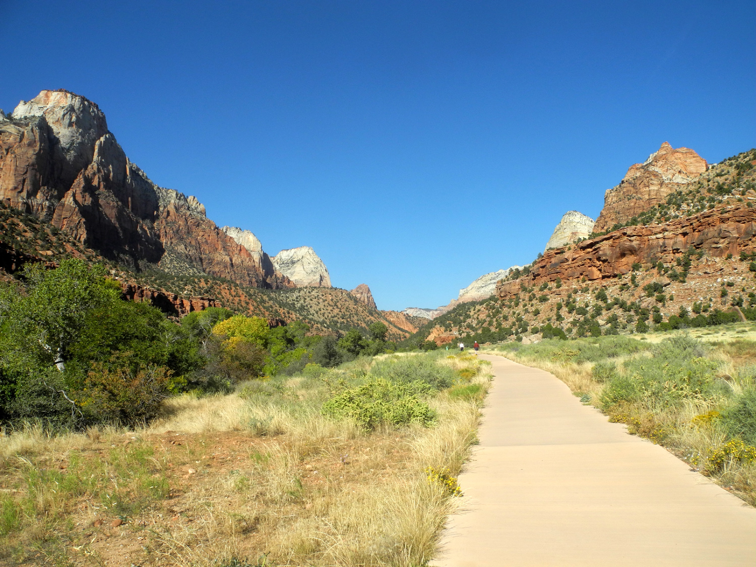
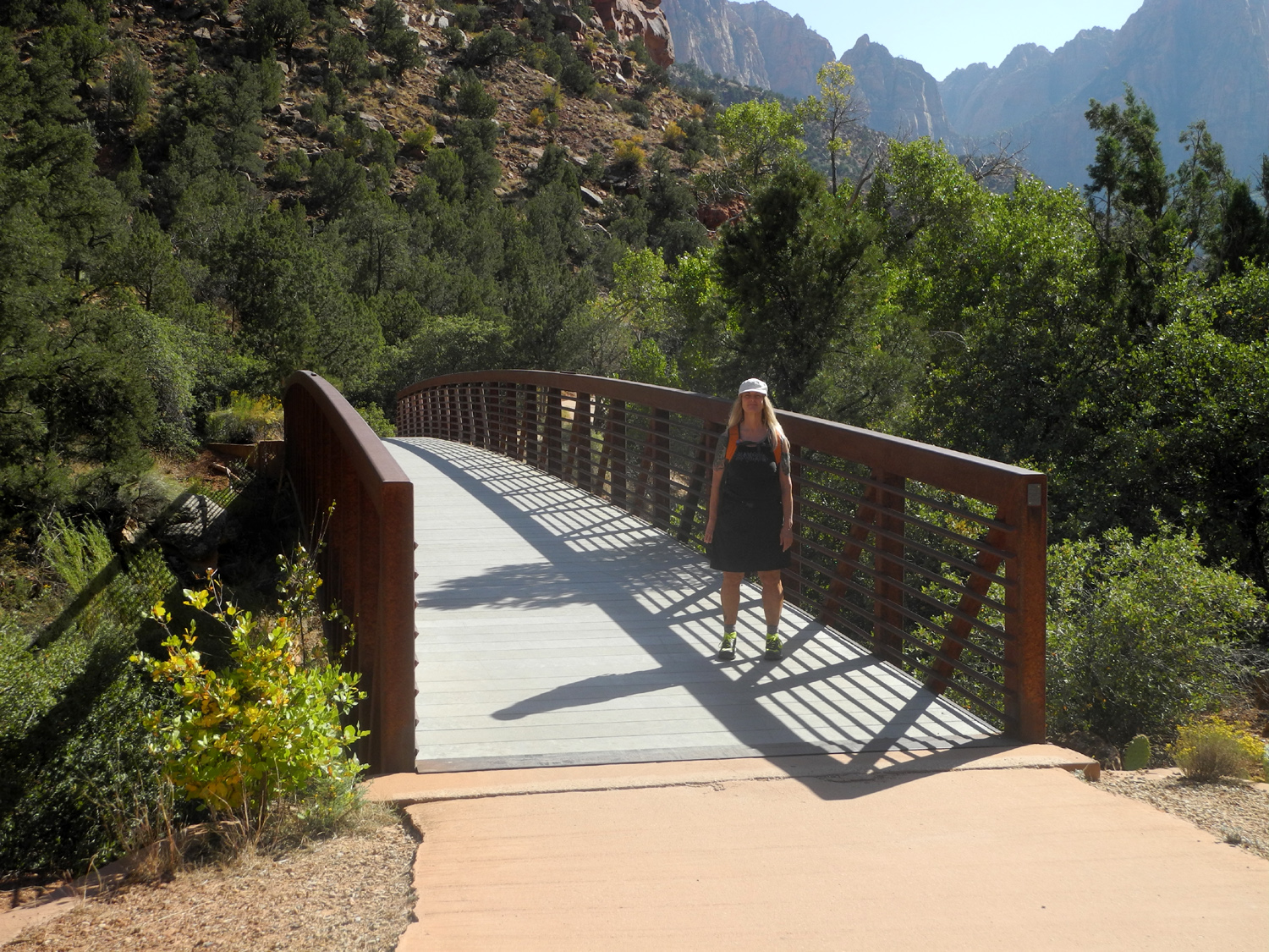
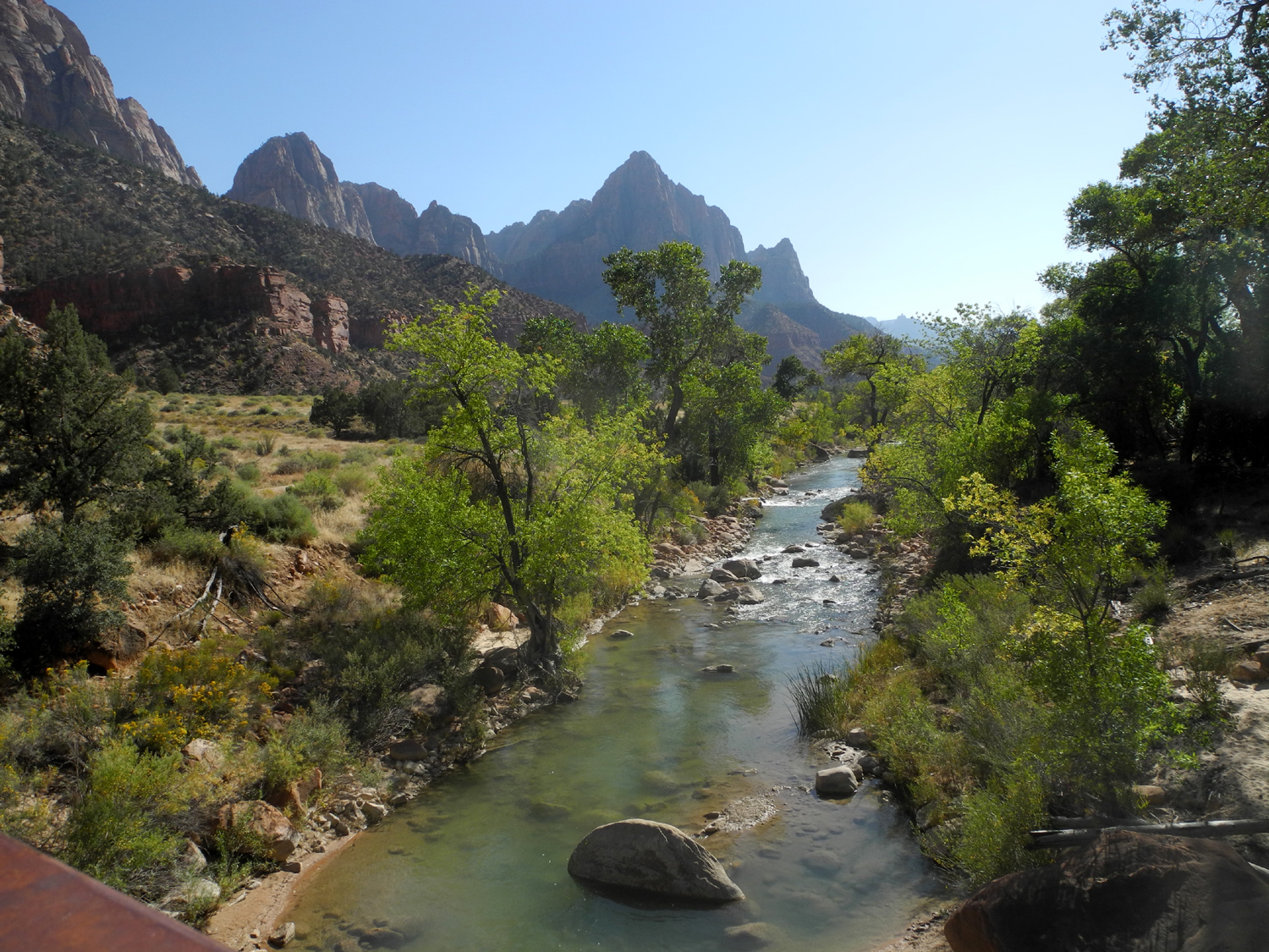
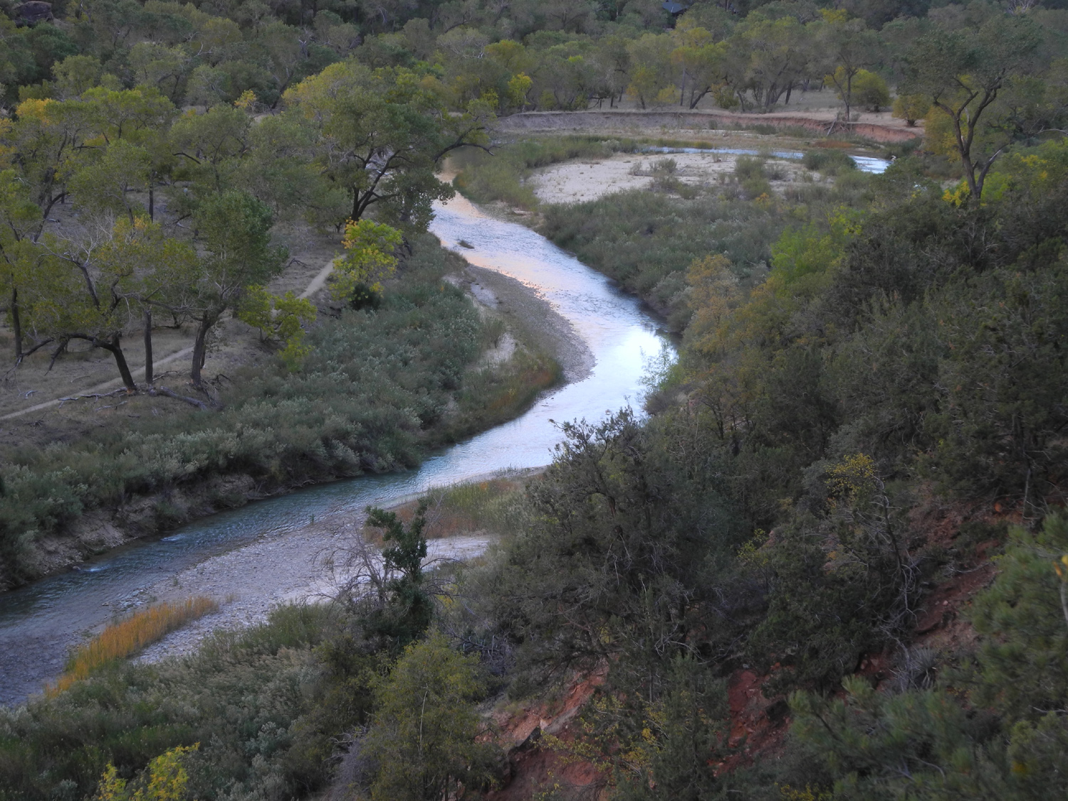
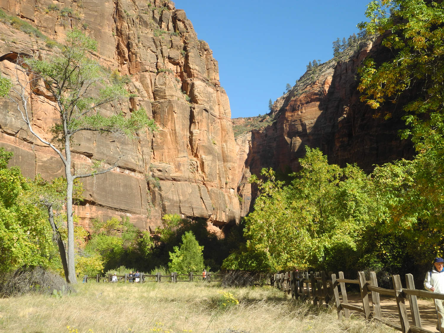
We had our snack back at the trailhead, then took the shuttle out to Canyon Junction. From here we decided to follow the Pa'Rus Trail that runs along the river about two miles to the park entrance. However, we walked only the first section to the museum shuttle stop, a distance of about a mile. This trail crosses the river briefly, then crosses back to the east side, opposite the road. Near the museum it crosses one more time and goes through a tunnel under the road to the Human History Museum. Along the way we had many great views of the colorful rock cliffs, the river, and a wide variety of trees and shrubs. We went inside the museum briefly, but decided that we would rather get back to camp and go through the museum at another time. Back at camp, we sat outside enjoying the view across the river of a large sandstone formation. As the sun slowly set, the color on the rock darkened, and the definition of the shapes changed with the deepening shadows. |
|||
 |
 |
 |
|
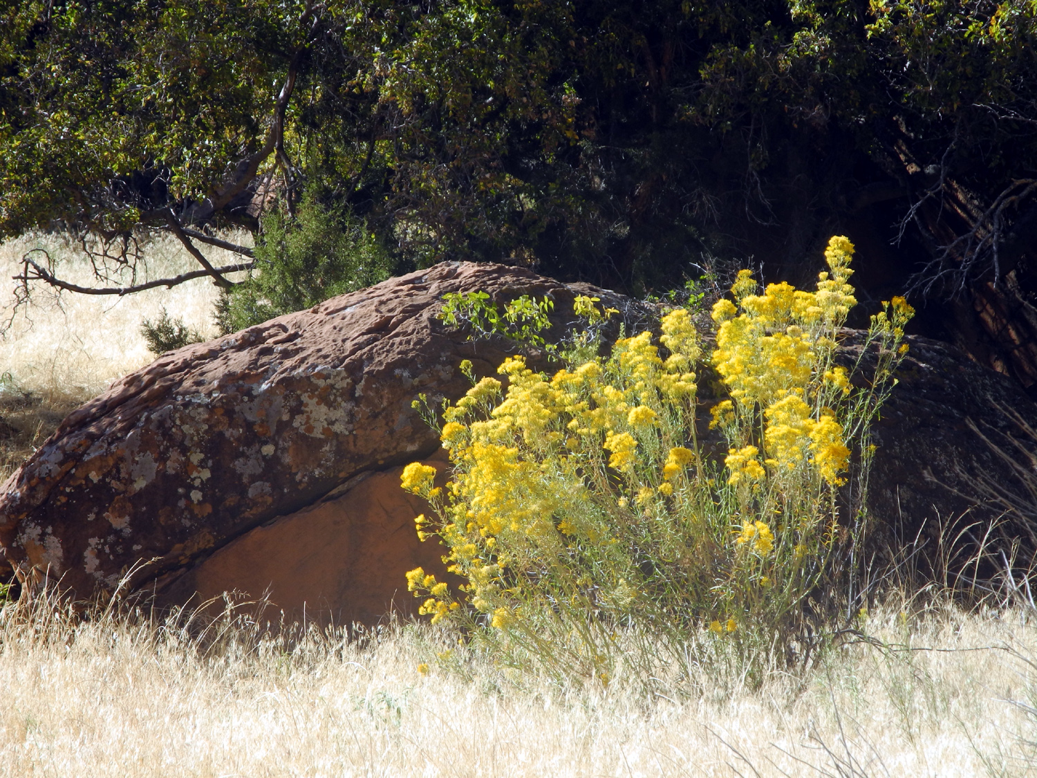
| Views along the Pa'Rus Trail | |||
 |
 |
 |
|
| The Pa'Rus Trail crosses the Virgin River on a foot bridge | The Virgin River | A reminder that we're in desert country | |
 |
 |
 |
|
| A typical scene along the trail | This was our view from the motor home | As the sun set, the colors deepened | |
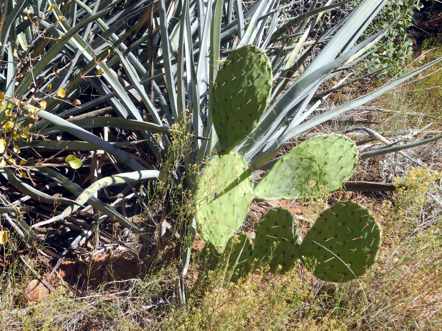
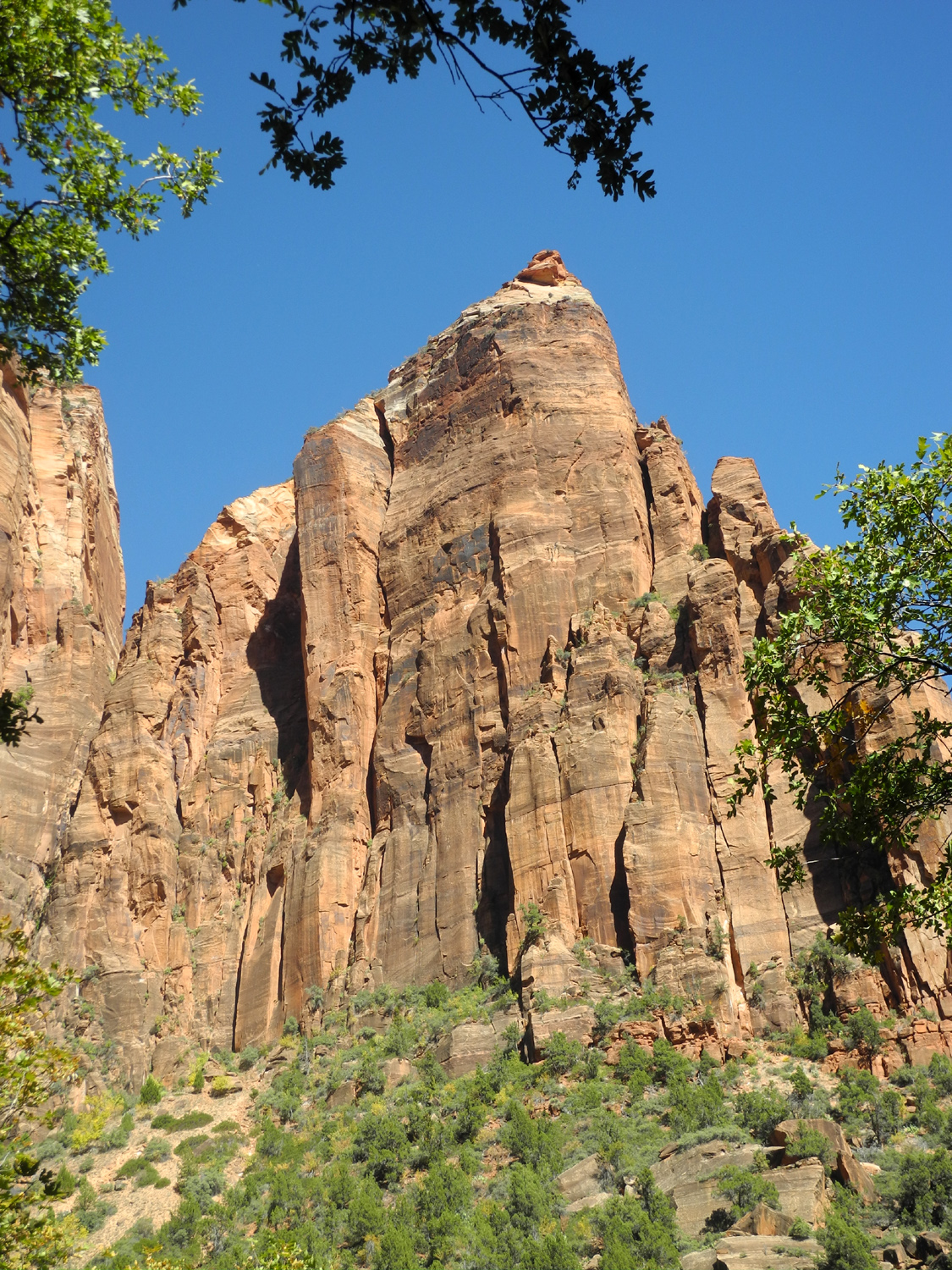
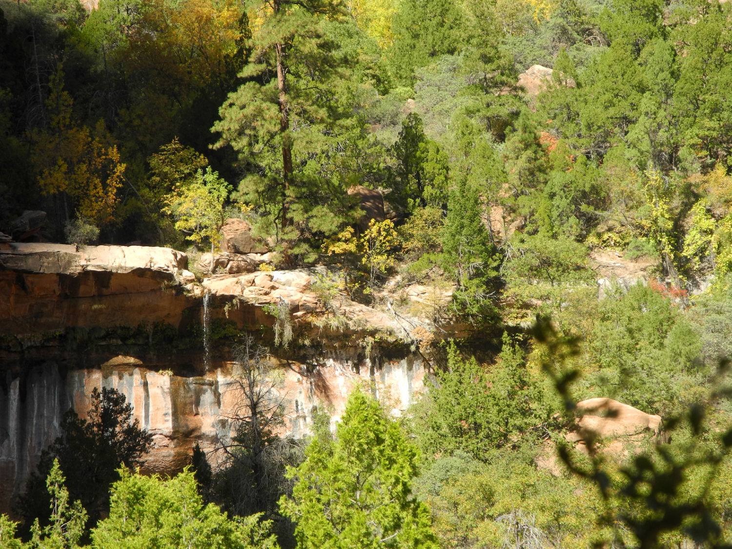
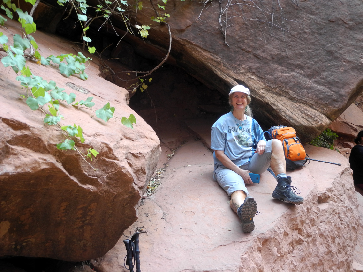
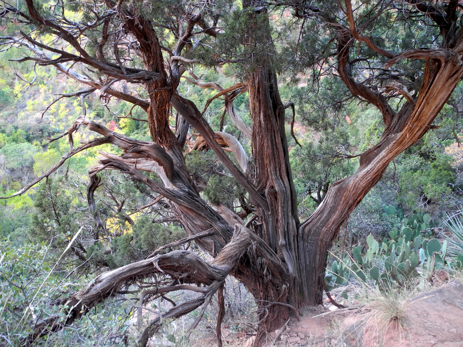
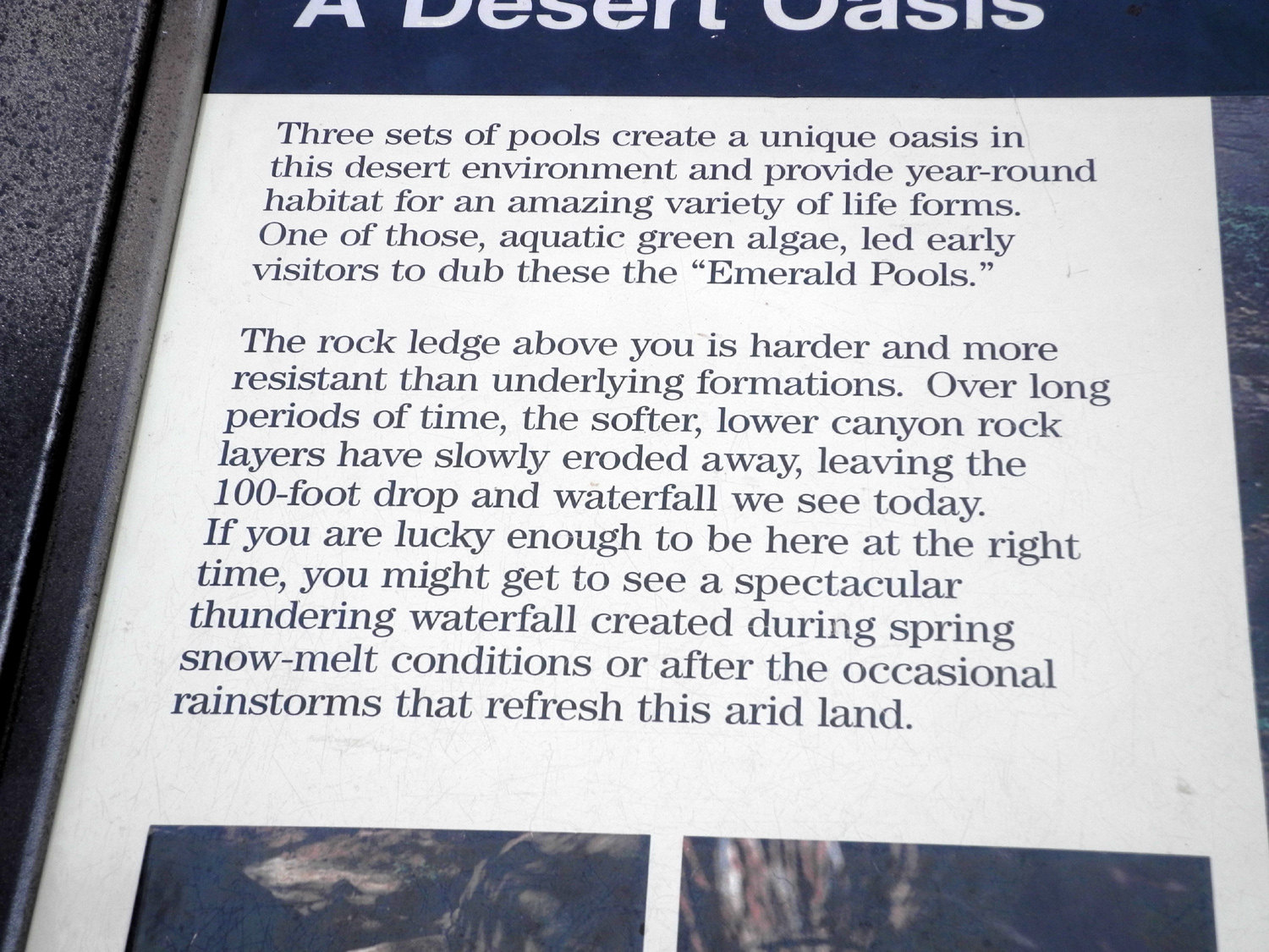
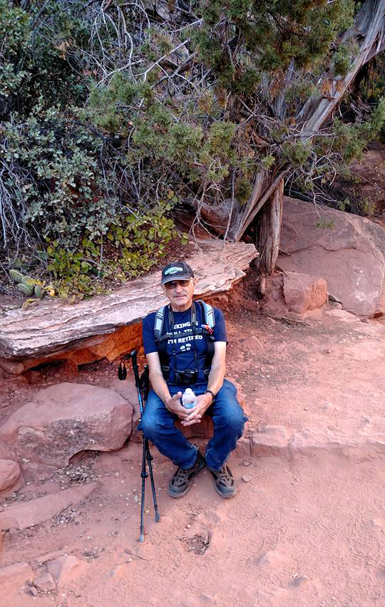
The next day our hiking plans were a bit more ambitious, and we got in a lot of mileage. We actually did a little extra hiking before we got to the real hike. The bus stop in front of our RV park was the next to last one in town, and two shuttles passed by without stopping, already filled to capacity with visitors from the earlier stops. We finally decided to just walk to the park entrance, a distance of seven tenths of a mile. Once past the entrance, we waited in a long line to get on the park shuttle, but finally arrived at our "real" starting point. Across from the Zion Lodge, west of the river, is a side canyon that contains a series of pools, known as the Emerald Pools. They are all fed by the same seep high on a cliff at the head of the canyon. A trail goes up to all three pools, although many hikers just go to the first or first and second pools, and skip the steeper, more rugged route that goes to the final one. However, we are undaunted, and planned to try for the full route, which would take us out to the next shuttle stop to the north via the Kayenta Trail. The trail went uphill gently, and provided fantastic views at every turn. On this route for the first time we began seeing bigtooth maples, which were changing to fall colors. They ranged from light pink to fiery red, and stood out against the green of juniper, fir and Gambel oaks that had not yet started to change. We arrived at a spot where we could see the 100-foot waterfall that fed the first pool. It was just a small trickle, but during heavy rainfall, becomes a raging torrent. Since we had to walk behind it and get a few drops on us, we were just as glad to miss the peak flow. Approaching, crossing, and going up the hill past the pool, we had a variety of different views of the waterfall as well as the countryside surrounding us. We also had a view of a lot of other hikers, but expected the crowd to thin out as the trail became more difficult. It was just a short distance to the second pool, which may have been the most scenic of the three, but after that the route became steeper and more challenging. In spite of this, there were still lots of other hikers of all ages. The final approach to the upper pool is steep and rocky, with no real trail down the final hundred feet, just different paths through what is essentially a big rock pile. We made it down to what would prove to be the largest of the three pools, although there was really no waterfall dropping down the cliff, just water seeping out of the rock and forming a little creek. We found some fairly flat rocks to sit on while we had our snack and enjoyed being in an oasis in the desert. The return trip from this pool requires backtracking on the trail to a junction, where you can return the way we came, or continue the loop to the other trailhead. This was a fairly long stretch, but always with something new and interesting to see. At one place we could see the entire cliff above the pools, and tell that all three were formed by the same creek. We were on the drier side of the canyon here and started seeing rugged Utah junipers. On the southern side, with a bit more moisture, they had been green and even from top to bottom, but this section clearly offered harsher conditions, and the dead tops and twisted trunks were more in line with what we see in the Sierra junipers in California. As we came out of the side canyon into the valley of the Virgin River, we had many nice views of the river below. The trail started down along the red sandstone cliffs, and finally reached a foot bridge where we crossed over to the Grotto shuttle stop, and rode back to camp, with about five miles of hiking on the books. |
|||
 |
 |
 |
|
|
Looking up the side canyon where the Emerald Pools are located |
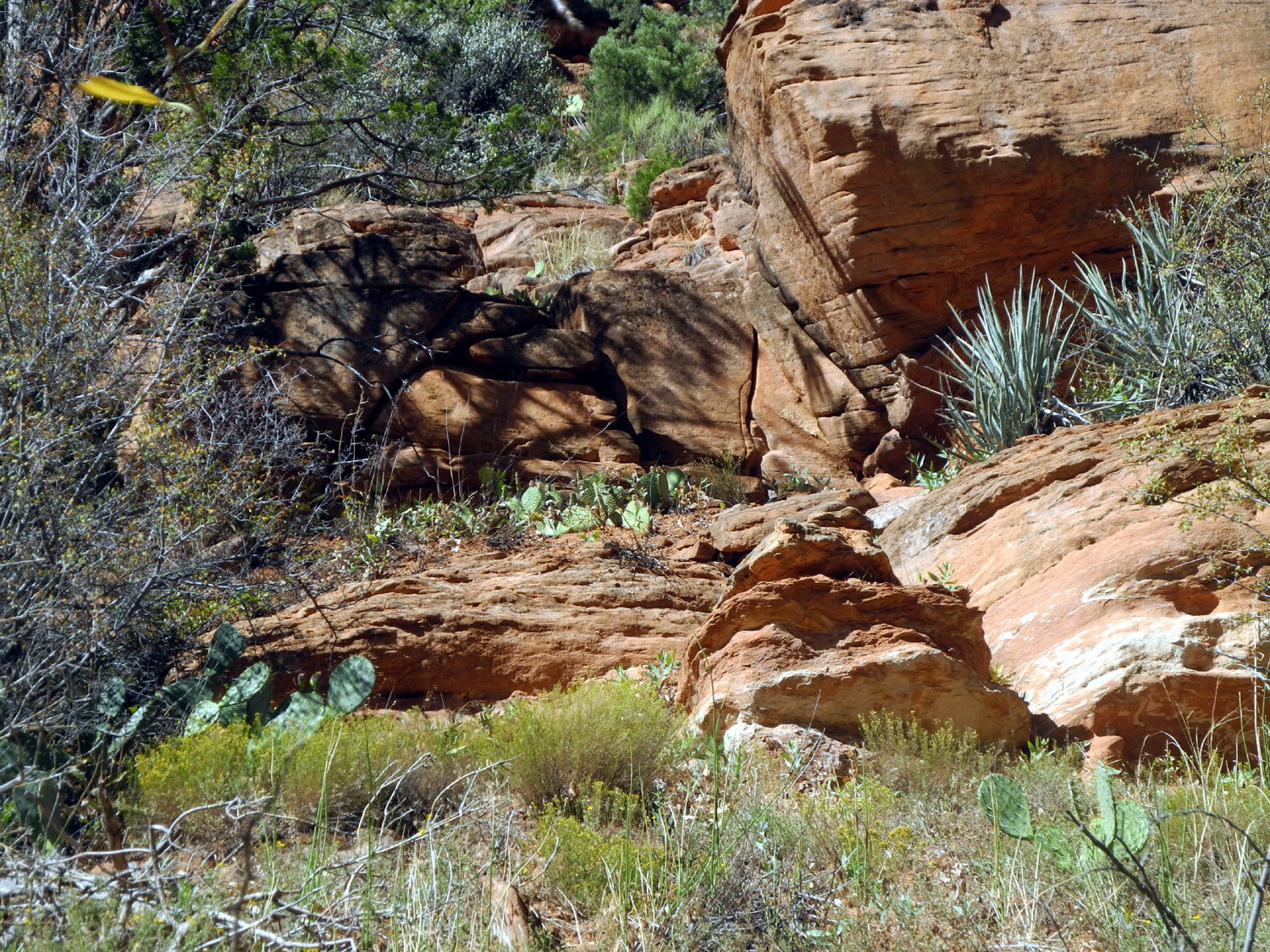
A typical Colorado Plateau high desert scene, with cactus, yucca and sandstone | Cliffs above the Emerald Pools Trail | |
 |
 |
 |
|
| Brilliant red leaves of bigtooth maple | Our first view of the falls that drops into the first pool | This view is from the trail beyond the pool | |
 |
 |
 |
|
| Teri enjoys a well-earned rest on a level sandstone platform | A charming little falls feeds the second pool | The third pool was not as impressive, but the number of people who braved the rough trail was | |
 |
 |
 |
|
| The dark spot left of center is just above the upper pool; the cliff above the lower pool is directly below | One of many delightful rugged Utah junipers | View of the Virgin River on the last section of trail coming down to the Grotto | |
|
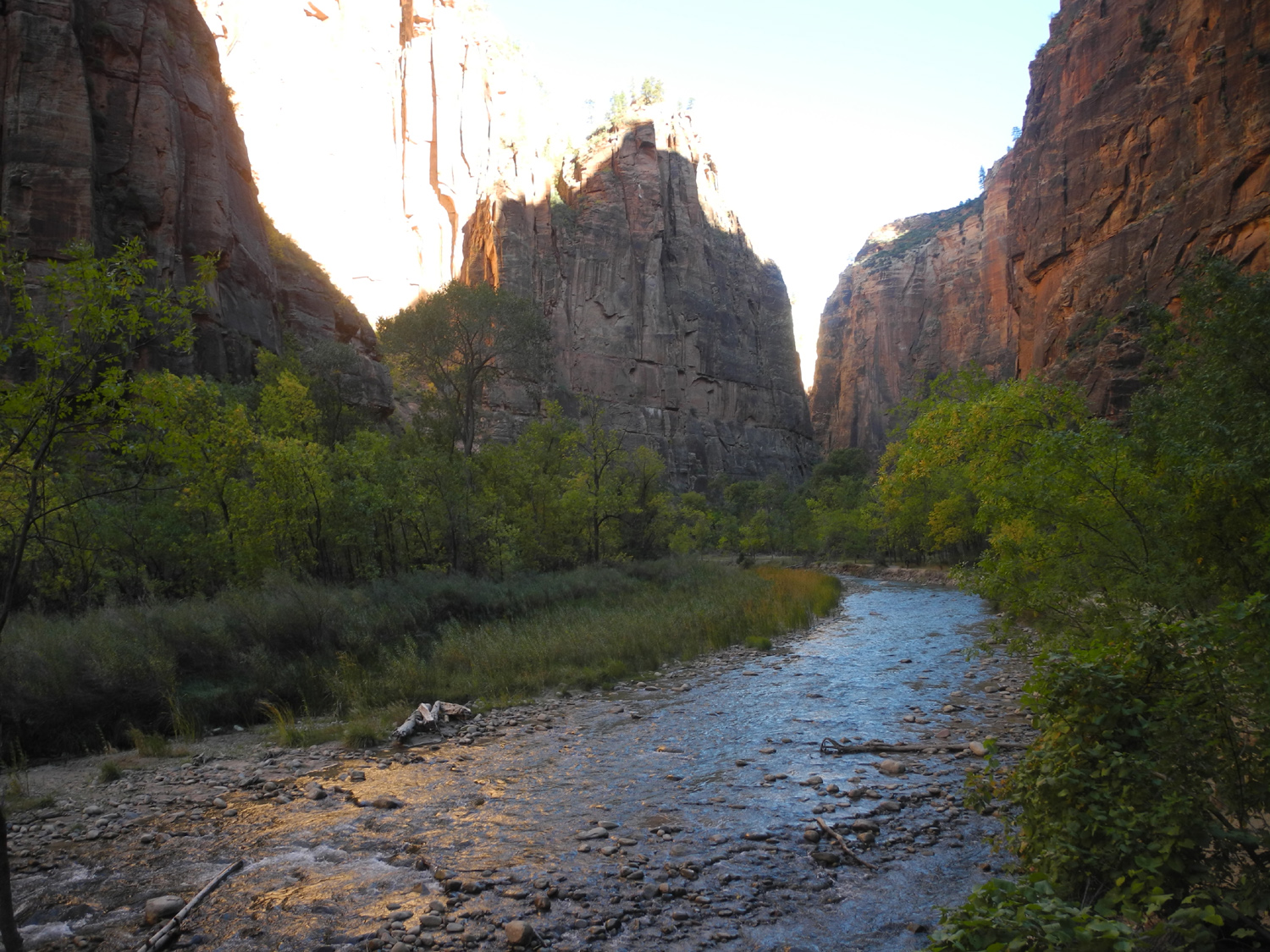
On Sunday, our third and last full day in Zion, Teri and I went our separate ways. She had wanted to hike the Virgin River Narrows, a challenging route which requires wading in the river most of the way. I did not feel that I was steady or strong enough to handle something of that short, and planned to hike some of the trails along the road we had taken into Zion Canyon. |
|||
 |
 |
 |
|
| The Virgin River along the River Walk where the canyon walls start to close in |
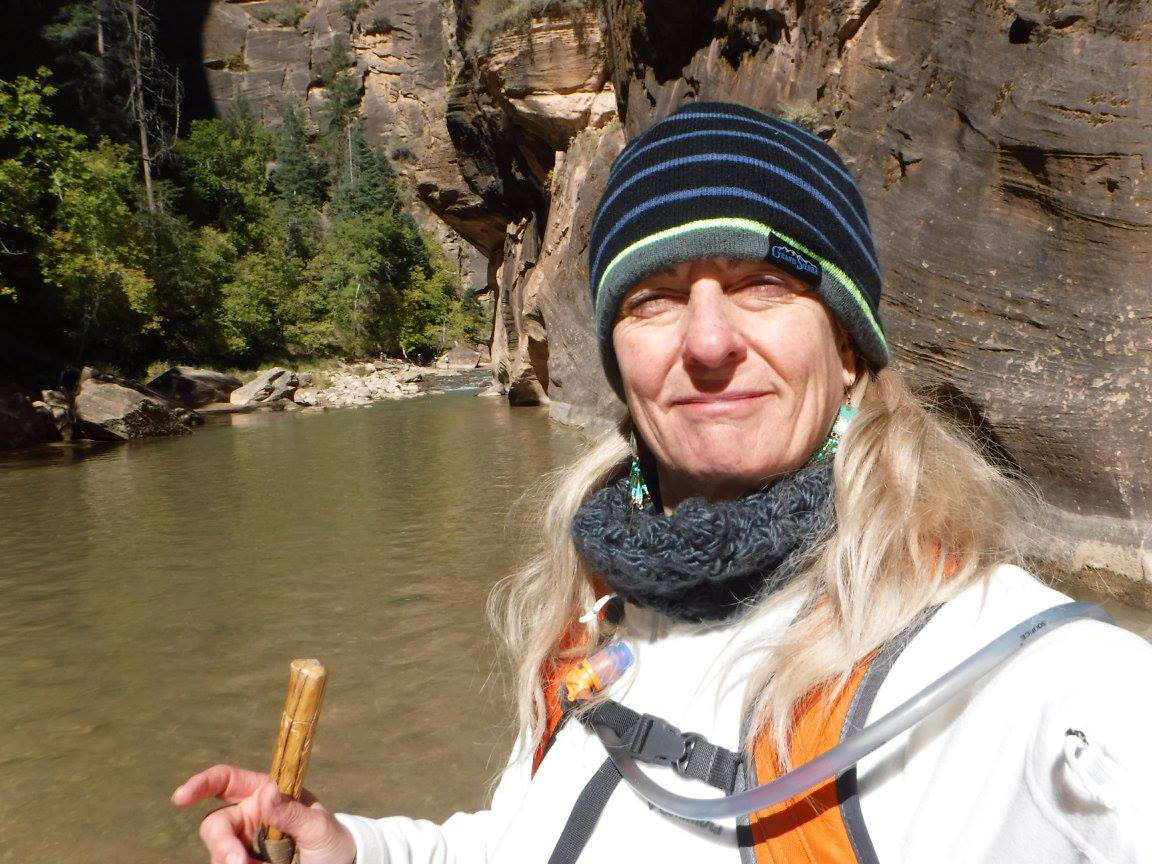
Teri steps into the water to hike the challenging Virgin River Narrows |
Cliffs along the west side of the Sand Bench Trail | |
|
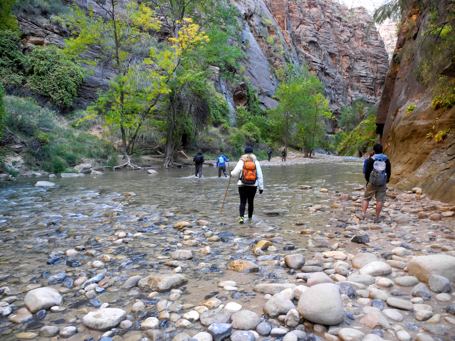
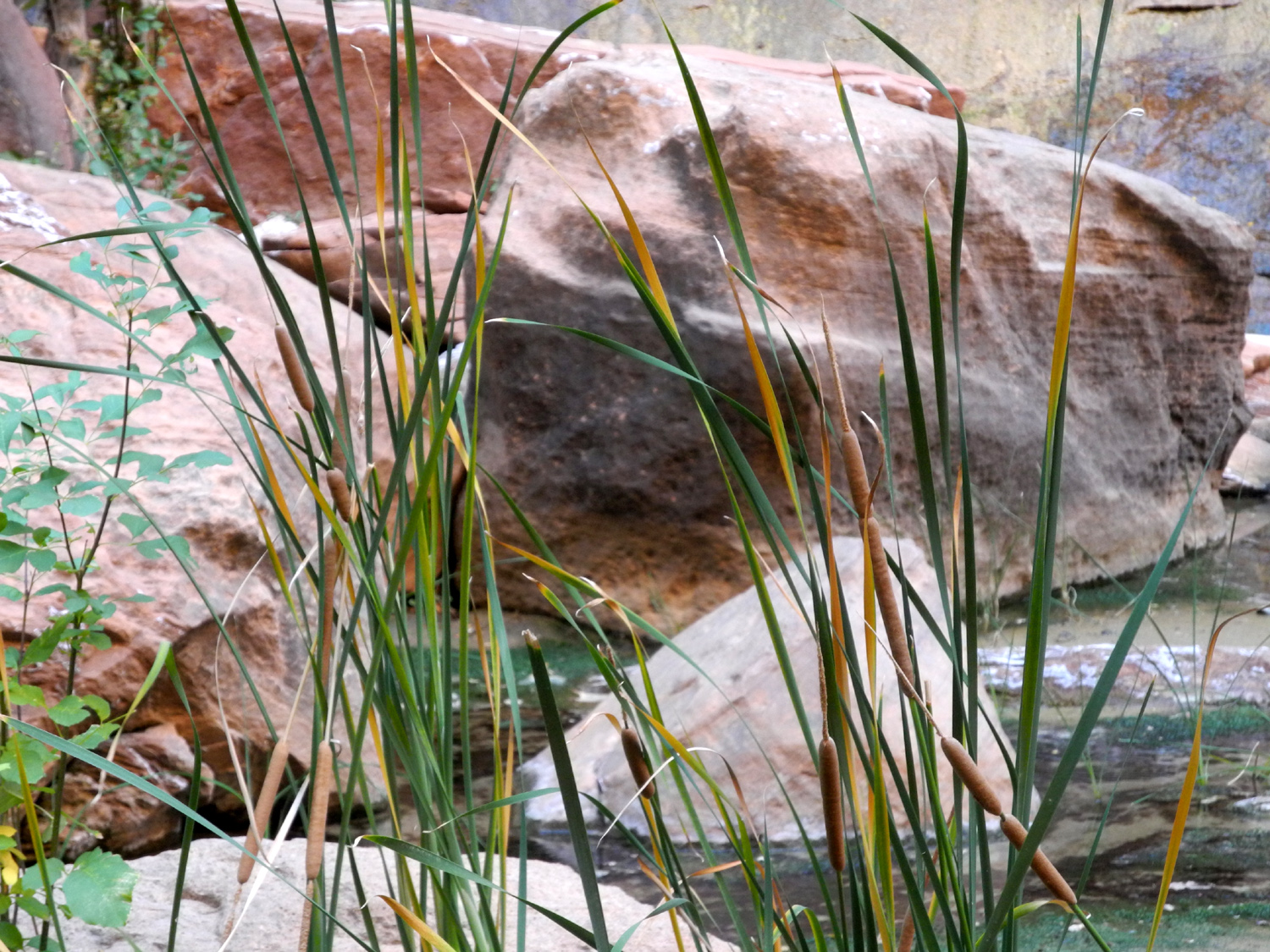
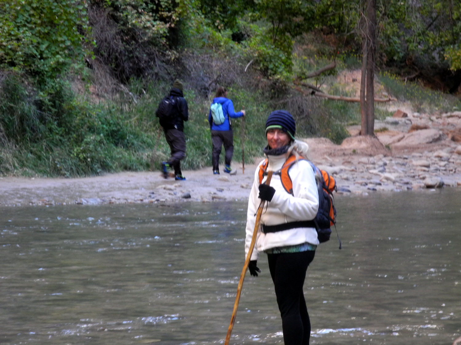
We got up very early and after breakfast braved the 40 degree temperatures as we walked to the bus stop. This time we had no trouble getting a seat on the first shuttle to arrive, and the line to get on the park shuttle was virtually non-existent. We rode to the end of the road, where the trail to the start of the narrows begins. It's a one mile, paved path called the River Walk, and has only a few steep spots. These did not bother us, but the route is wheelchair accessible, and a few people were struggling to push relatives up the two short but steep sections. It was very cold, but I knew it would warm up, and I did not want to have to stuff more than one garment in my pack after I warmed up, so I toughed it out. This part of the river runs through a little narrower passage than the part that parallels the road. We enjoyed the high cliffs, cattails growing in a pond formed by water seeping out of the walls, and hanging gardens that had found a place to send their roots into the soil trapped in cracks in the rock. The river went over some short drops through this section, and was more rocky than downstream. There were many people on the trail, some dressed for the river hike, and some obviously just making the one mile trek to the end of the pavement like me. Teri had special "canyoneering" shoes, and additional preparation at the jumping off place involved changing into waterproof socks. Some
hikers were stepping into the river and heading straight up the middle,
getting in almost to the top of their legs, but Teri observed the best
route and walked across a narrow, shallow part to a gravel bar on the
other side, with the water just up past her ankles. Of course, deeper
water awaited her. Here are her post-hike comments from Facebook The Narrows was an amazing hike. The first mile is along the river on a paved trail. Then it's into the Virgin River. Yep, that's the non-trail. The water is 45 degrees and deep in places. There are also places to walk along a rock covered beach. When I first started it was quite difficult until I got the hang of hiking in a river. I hiked two miles upstream and was at Wall Street, the narrowest section of the Canyon. I then turned off into a side slot canyon, Orderville Canyon, and climbed a waterfall to continue on. Not sure how far I hiked in Orderville. There were only a few people and the water was not very deep as it is not the main channel of the river. I came to a spot with two waterfalls and pools that were chest deep. That was my turn around spot. The colors and swirls on the walls were just beautiful. Lots of hanging gardens with maidenhair ferns and other water loving vegetation. Super grateful to have gotten to do this hike. She also said that the coldness of the water was a shock at first, but she soon got used to it. The current was well below the maximum at which hiking is allowed, but she said she would not have wanted to hike in a current any stronger. My research found that the flow was probably a little under 50 cubic feet per second (CFS), which is considered easy. Above 100 CFS is difficult and dangerous, and hiking is not allowed at 120 or higher. |
|||
 |
 |
 |
|
|
Cattail pond where water seeps out of cliff along the River Walk |
Hanging garden of maidenhair fern | Every bend in the trail reveals another amazing vista | |
 |
 |
 |
|
| Teri steps off on her great adventure in the Narrows | Nowhere to walk but in the river | ||
 |
 |
 |
|
| A little waterfall on the side of the canyon | Cold, wet and...happy! | You have to really work to see Incredible sights like this | |
|
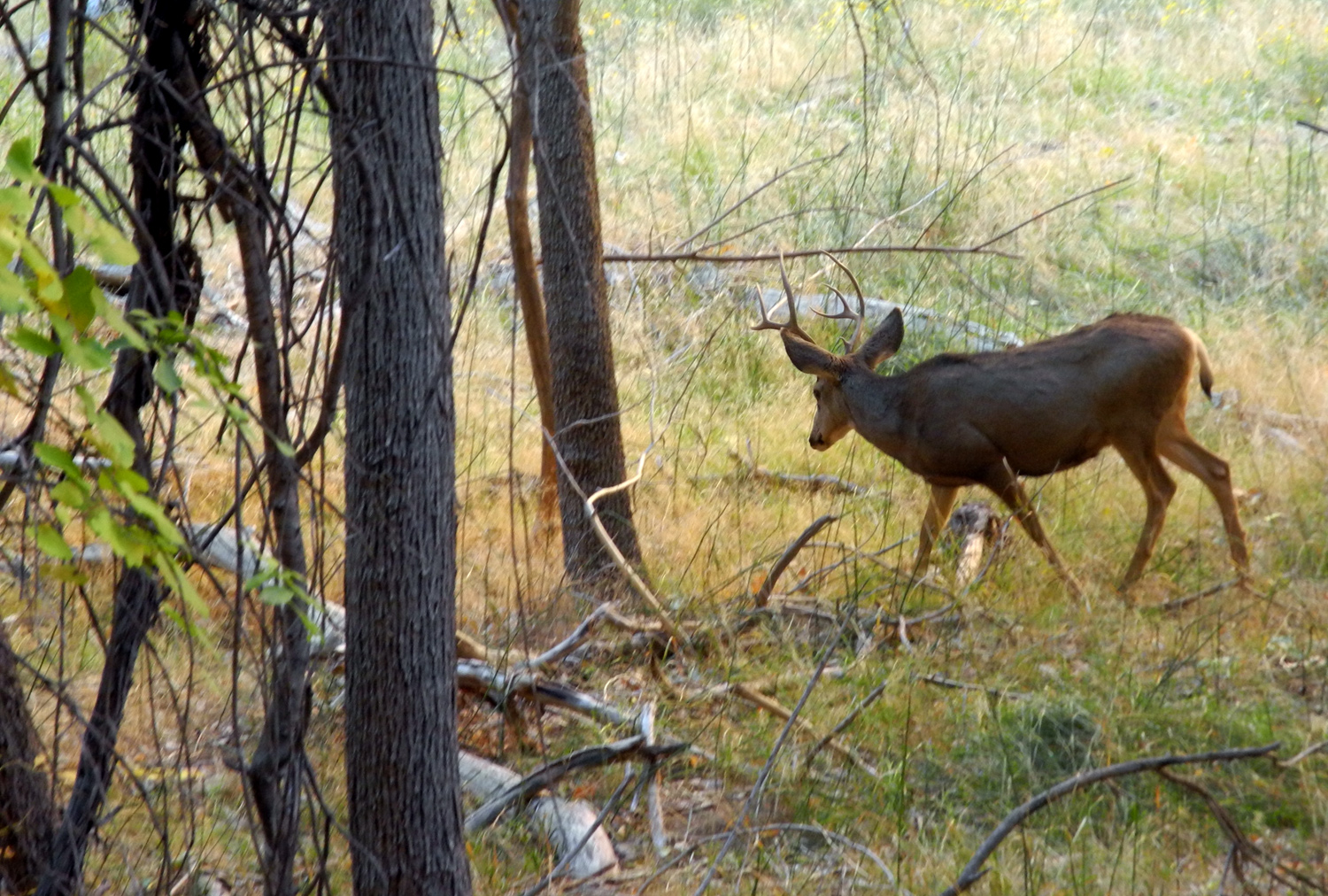
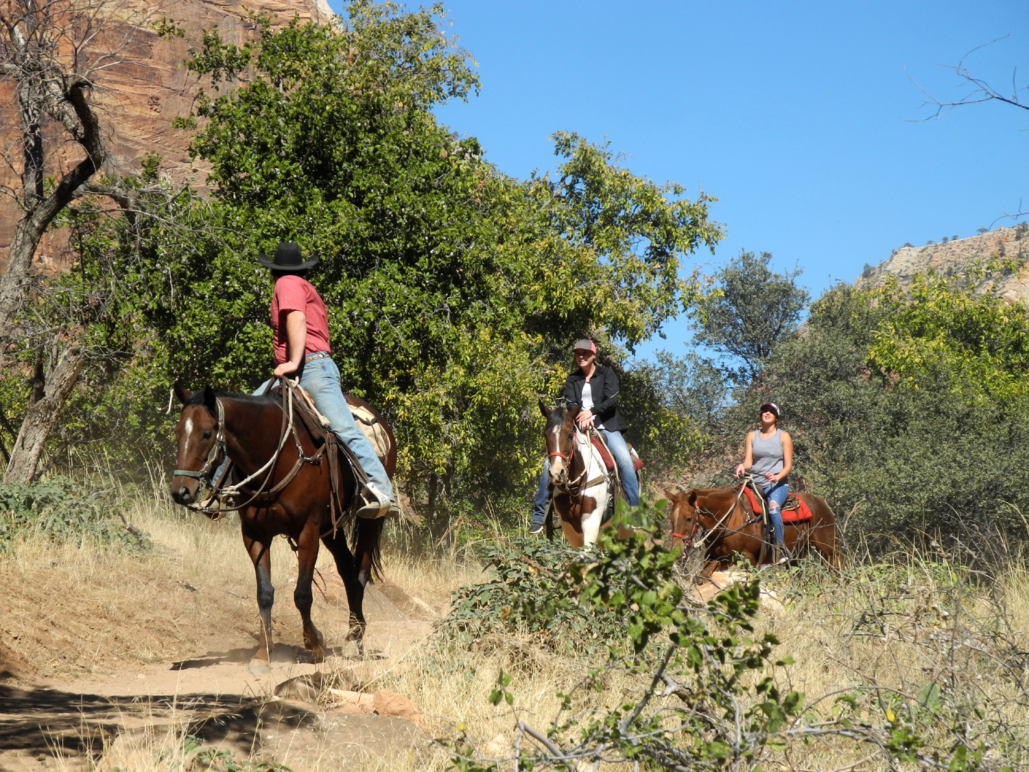
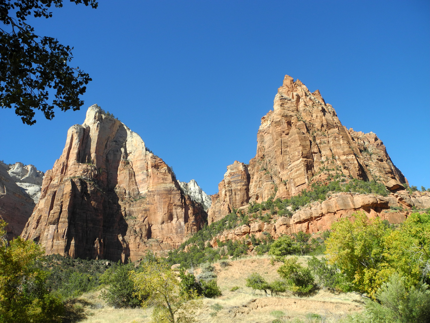
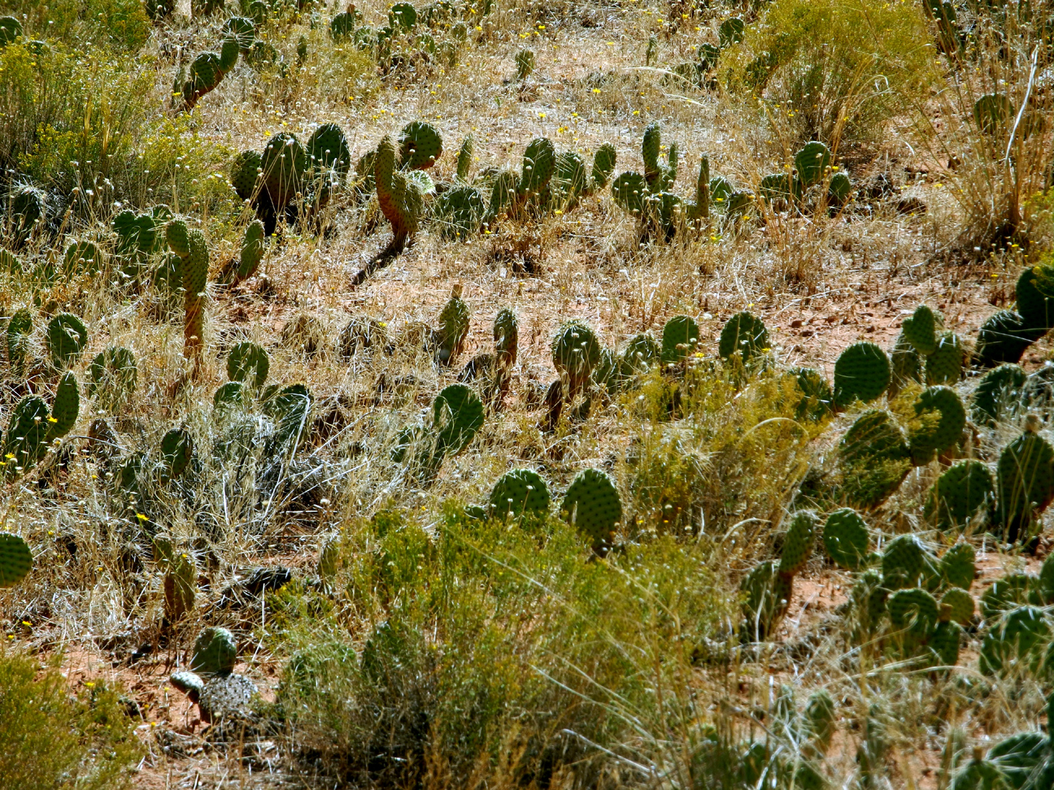
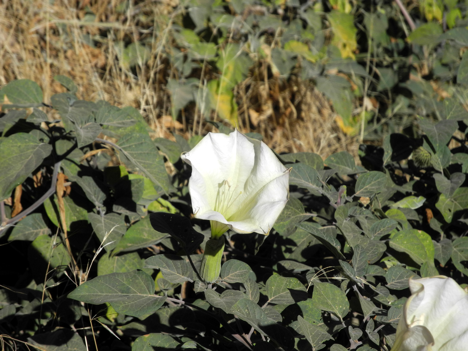
Meanwhile, dry but still cold, I began my hike back down to the trailhead. Along the way I saw two older ladies (60s or 70s) dressed for the water, and I would later talk with them on the shuttle. I asked how far in they went and the reply was "up to here," indicating chest deep. Clearly they did not go as far as Teri. At one place a buck and several does were grazing on the flat between the river and the trail. Some tourists were trying to get way to close to them, but most of the hikers were wise enough to enjoy them from a safe distance. At the bus stop I ate an apple while waiting for the shuttle. My plan was to go to Zion Lodge and take a trail that followed the west side of the river down to the next stop, Court of the Patriarchs. Looking at the map, I saw there was a trail on the east side at The Grotto, so decided to explore that first, and got off at the third stop. This turned out to be a short trail that stayed close to the road and ended at the lodge. Along this trail I walked past many Gambel oaks and other trees and bushes, and a lot of datura plants, something we see by the trails in Clovis and in the foothills of the Sierra. Although I was close to the road, the only traffic was an occasional shuttle bus, and I was glad that the park had eliminated auto traffic. I had the trail mostly to myself for the half mile hike, but as I came in sight of the lodge, I could see more people in that first glimpse than I had seen on the entire walk. I went into the gift shop where I bought some magnets and a candy bar, and sat outside at a table, fortifying myself for the next hike. When I was ready to go, I crossed the road to a trailhead that offered two options - to the right is the Emerald Pools trail which we had walked the previous day, and to the left the Sand Bench Loop. This trail goes south from this point, and the actual loop is beyond the junction where I headed back to the road. It's a horse trail, and it turned out to be a very poor choice for foot hiking. Much of the trail is a narrow channel of deep, pulverized sandstone and other dirt, uncomfortable for walking. In a few short stretches there was a foot trail separated by a fence from the equestrian route, and a lot of the way offered a very narrow hard packed bank on one side or the other of the "ditch." I also realized there were few places where a hiker could get well off the trail if horses came along, but luckily, the only riding group came at a place where there was a lot of room. Despite the unpleasant walking conditions, the trail was scenic and interesting. It was near the river, but up the slope about a hundred feet from the water most of the way. The steep rock cliffs were set back a distance from the trail on the west, and there was a good variety of vegetation. Although I crossed two small running creeks, this area seemed to be drier than most other other places we hiked, and I saw at least three varieties of cactus. About the time I had decided the trail was endless or that I had missed my turn-off, I came to the trail leading down to the road. At this point the main trail was up the side canyon that constitutes the Court of the Patriarchs, so it was about a quarter mile down to the bridge, mostly a gentle down hill slope. When I got to the bus stop a shuttle was waiting for me, and I dropped into my seat and relaxed, glad to be off my feet. At the park entrance, I went into the visitor center and bought a shirt for myself and some stuffed coyotes for great grandsons Colton and Jack, then took the town shuttle back to our RV park. It was about 90 minutes after I got back that Teri arrived, also tired and glad to sit down, but very happy that she had accomplished the challenging hike into the Virgin River Narrows. We had decided to dine out this last night, and after getting cleaned up, we walked up through the campgrounds and across the road to the Spotted Dog Cafe. Teri had an excellent steak and I enjoyed tender boneless ribs. This turned out to be our dinner for the next night also, since we could only finish half our food. This did not prevent us from heading for a grocery store next door that featured an ice cream shop, where we got double scoop cups for that night, and small cartons to put in the freezer for the next evening. The next morning we would leave Zion for the 75 mile drive to Bryce Canyon National Park. |
|||
 |
 |
 |
|
| Deer along the River Walk | Approaching the River Walk trailhead | Gambel oaks along the Grotto Trail | |
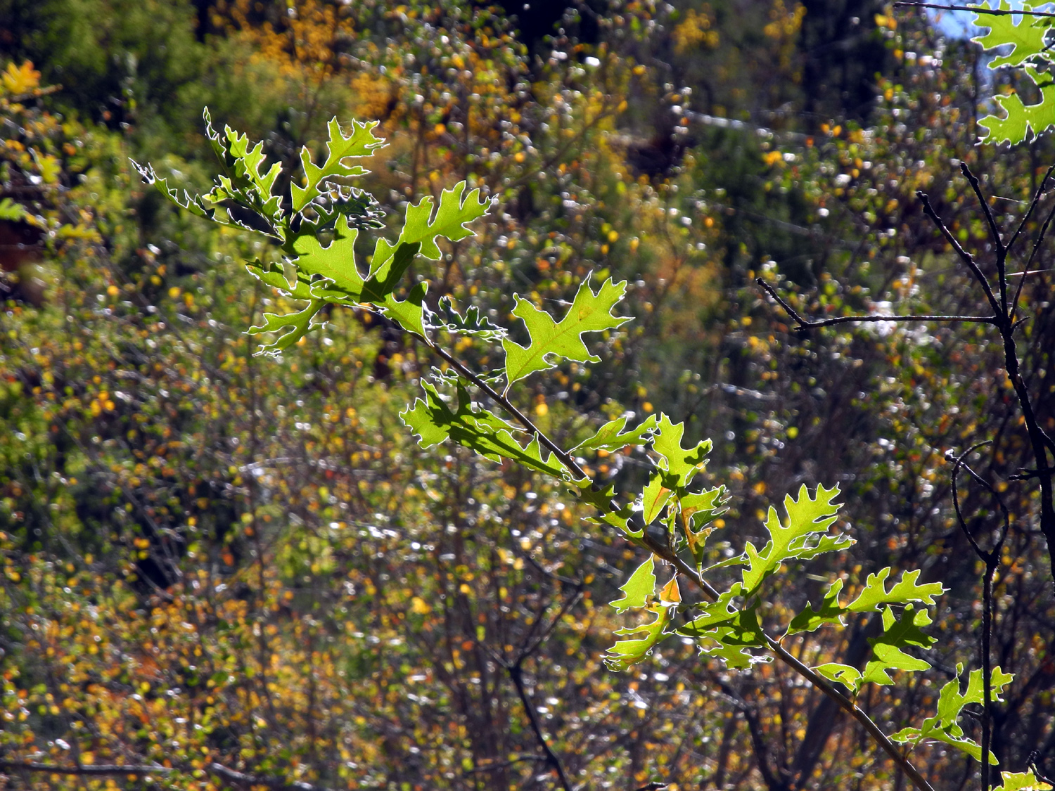 |
 |
 |
|
| The leaves are deeply lobed | Riding the Sand Bench Trail | In the Court of the Patriarchs | |
 |
 |
 |
|
| A reminder that we're in a desert - cactus along the Sand Bench Trail | |||
|
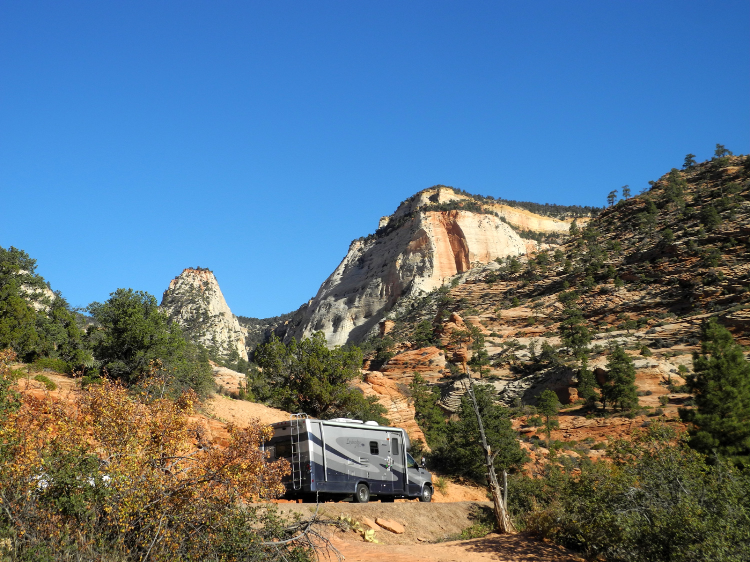
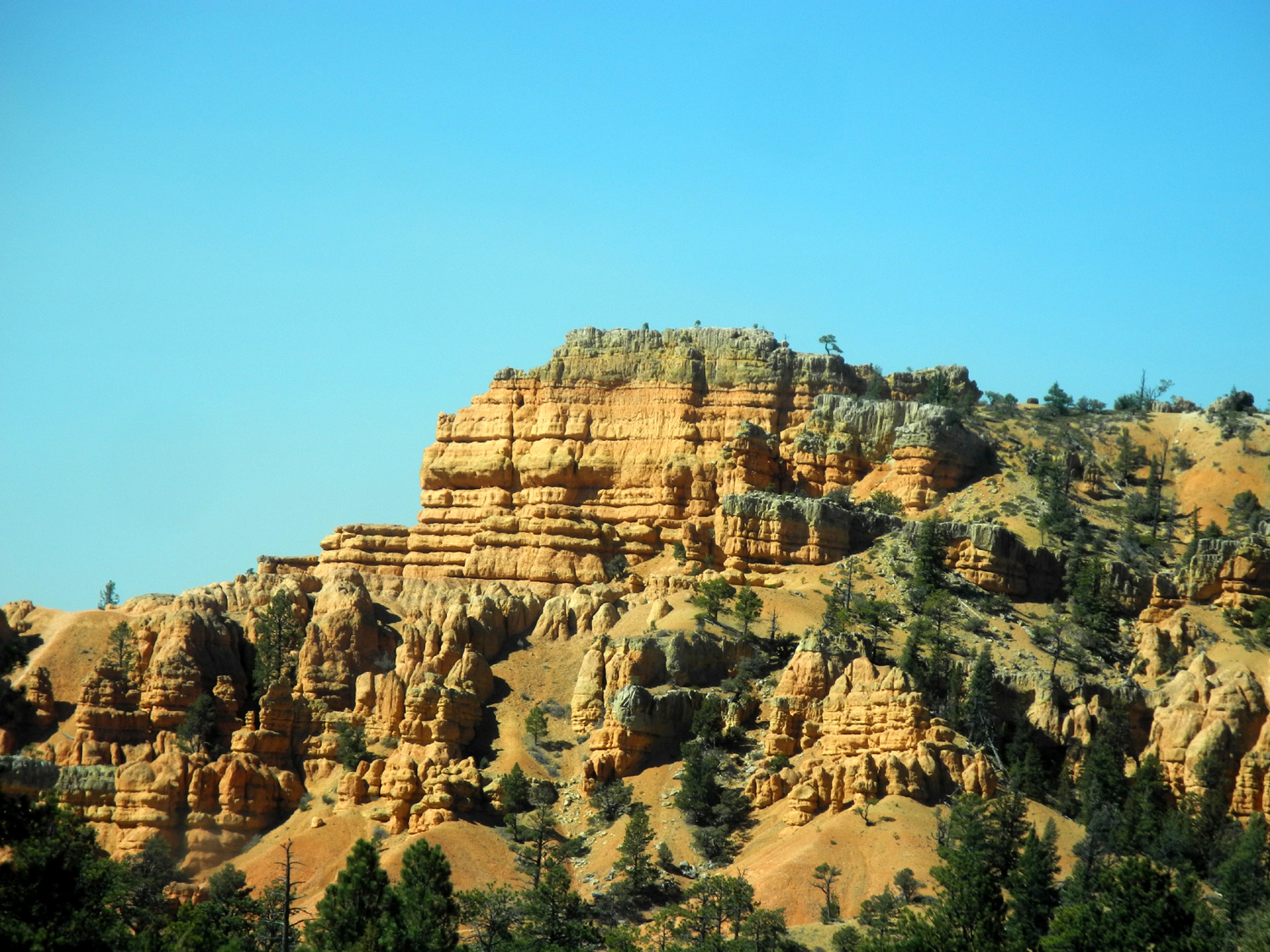
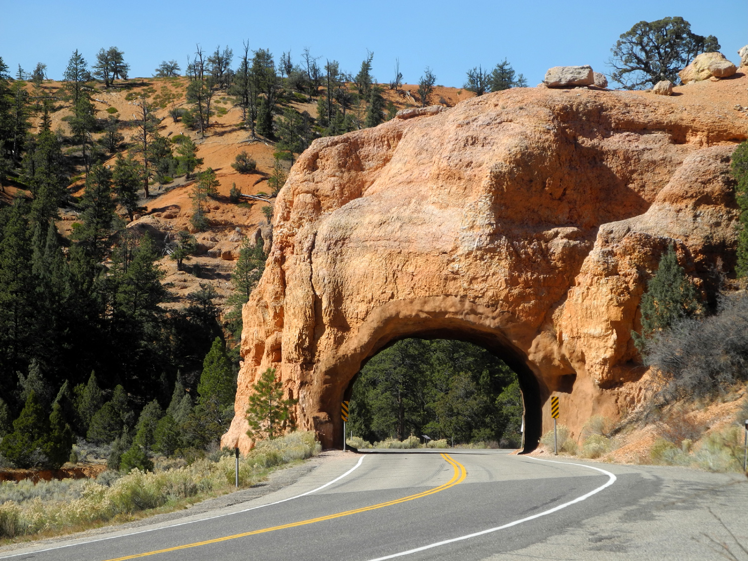
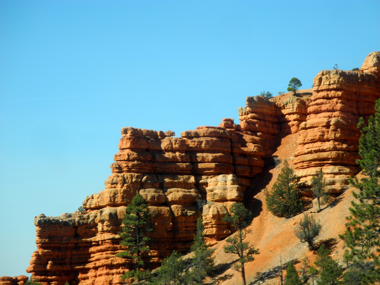
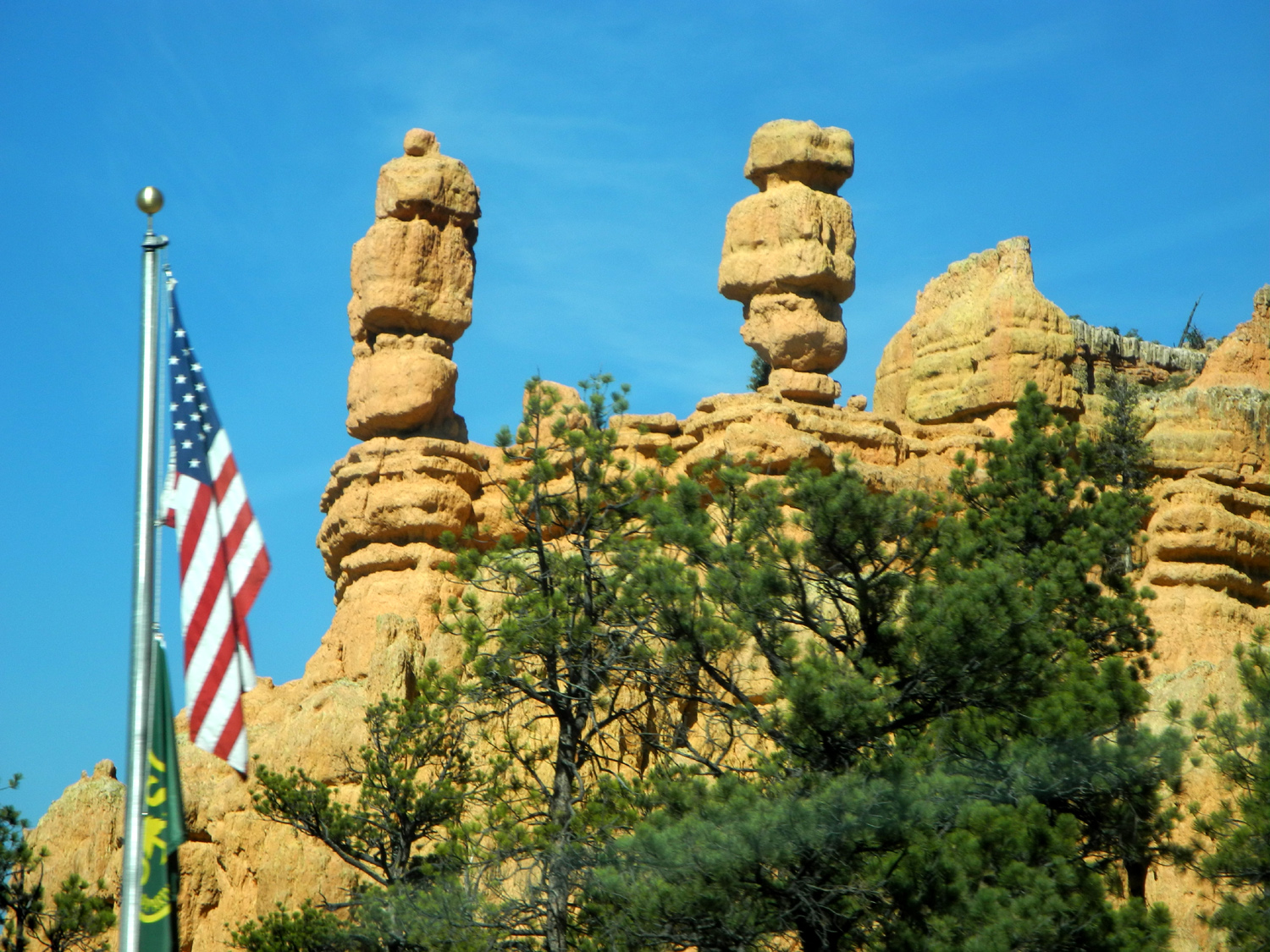
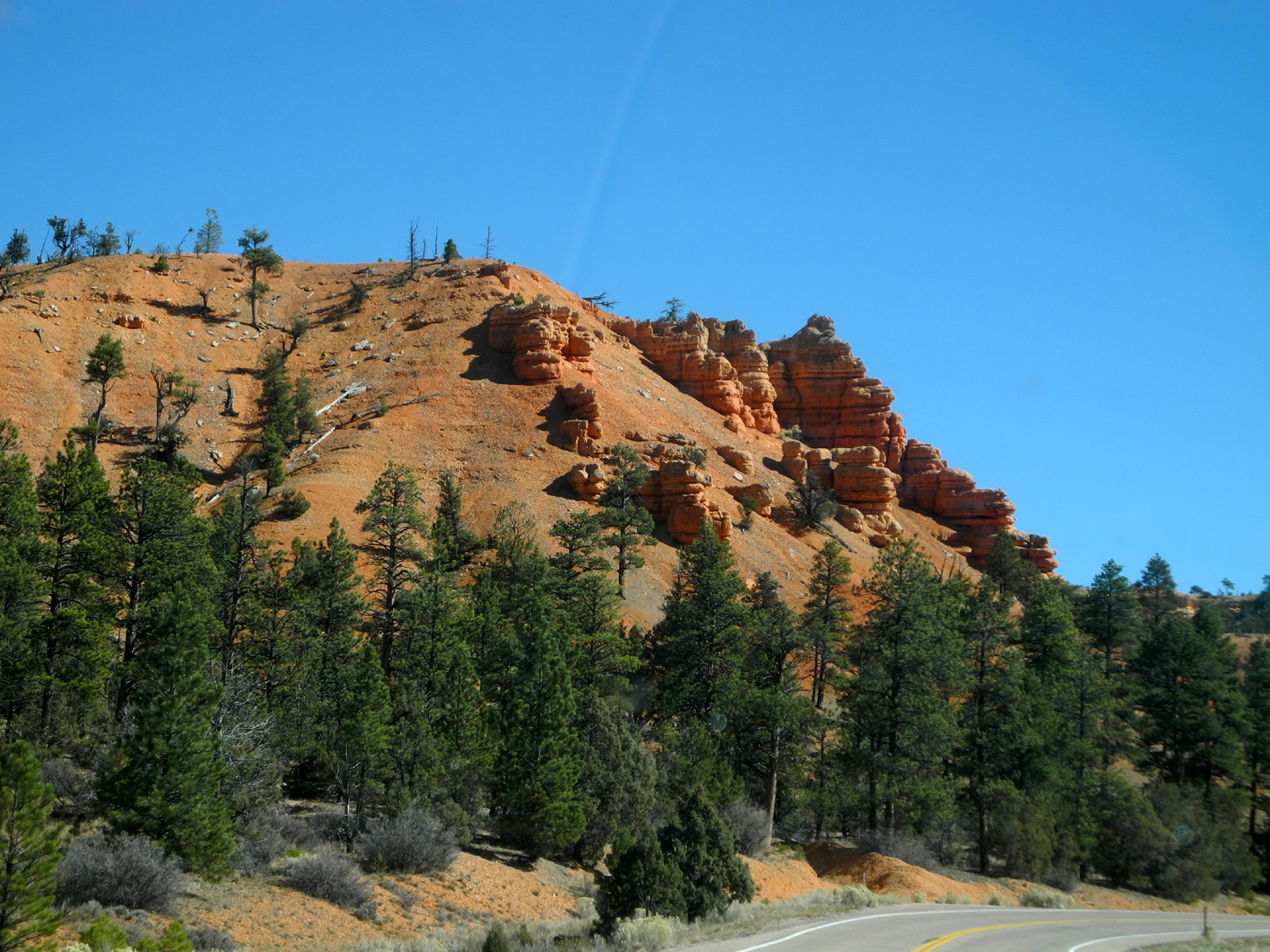
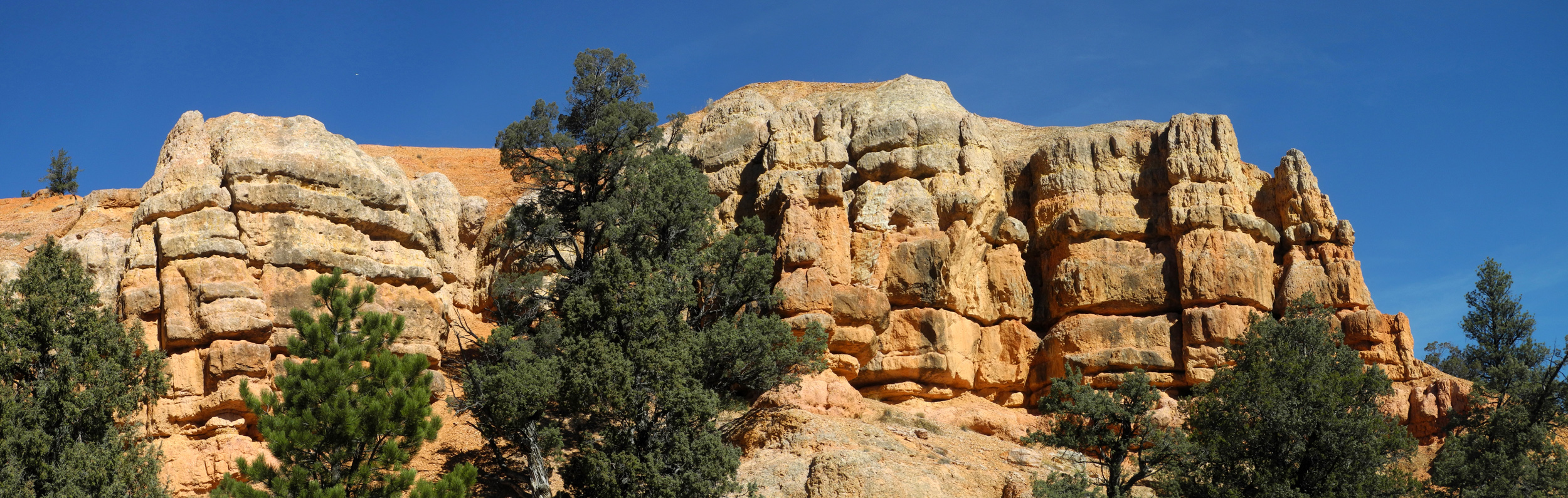
One Utah park is never enough, so on Monday, October 16, we drove out of Zion via Highway 9 for the two hour drive to Bryce Canyon. Approaching the park on Utah highway 12, we went through Red Canyon, sort of a preview of what we would see at Bryce. |
|||
 |
 |
|
|
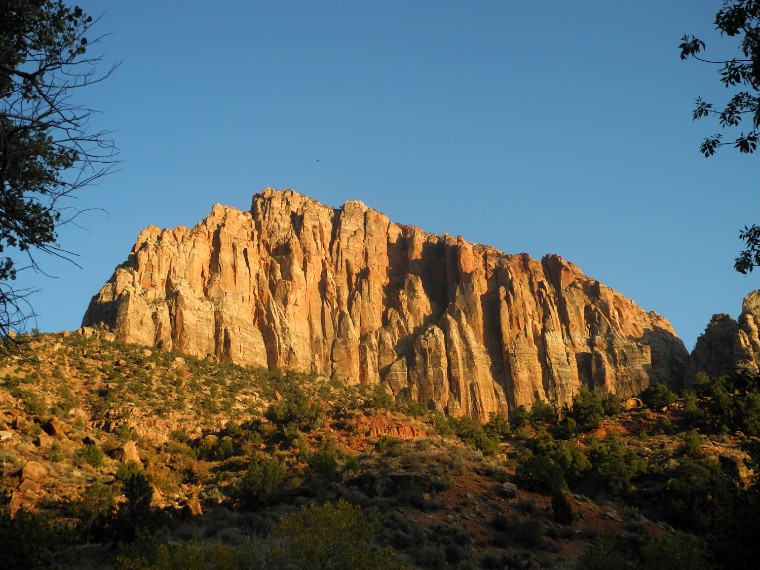
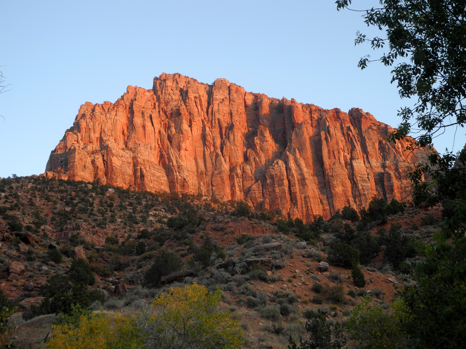
| Teri's motor home beside Highway 9 east of the tunnel |
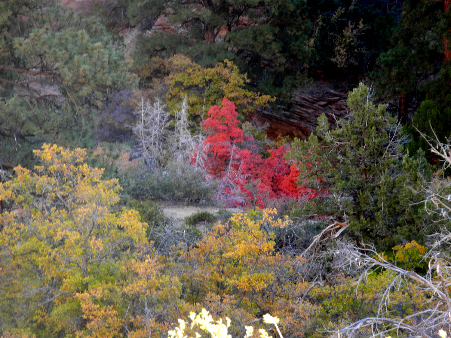
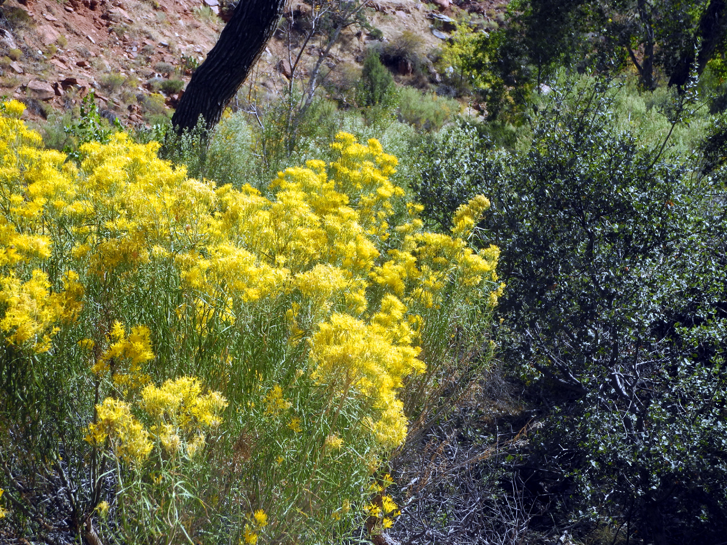
Bright red bigtooth maple and yellow Gambel oaks contrast with the evergreens |
Cliffs by Highway 12 in Red Canyon | |
|
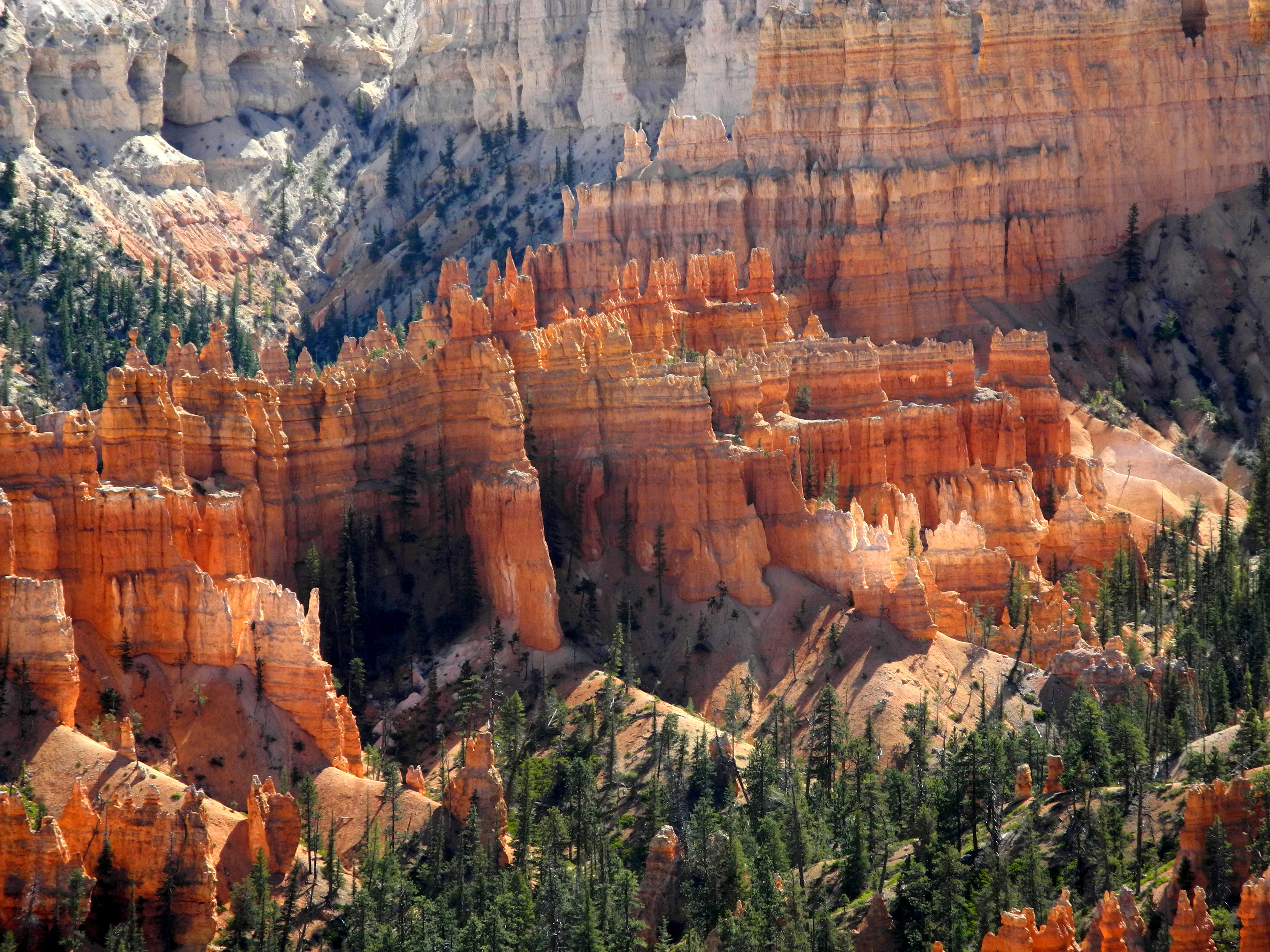
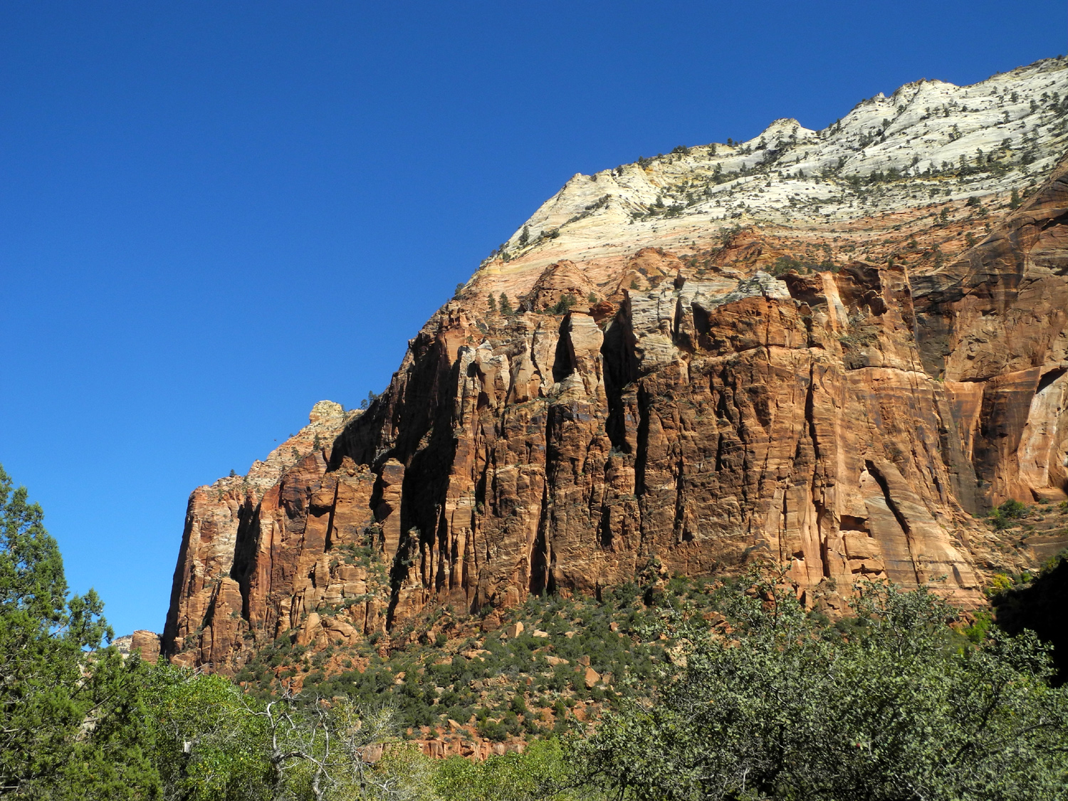
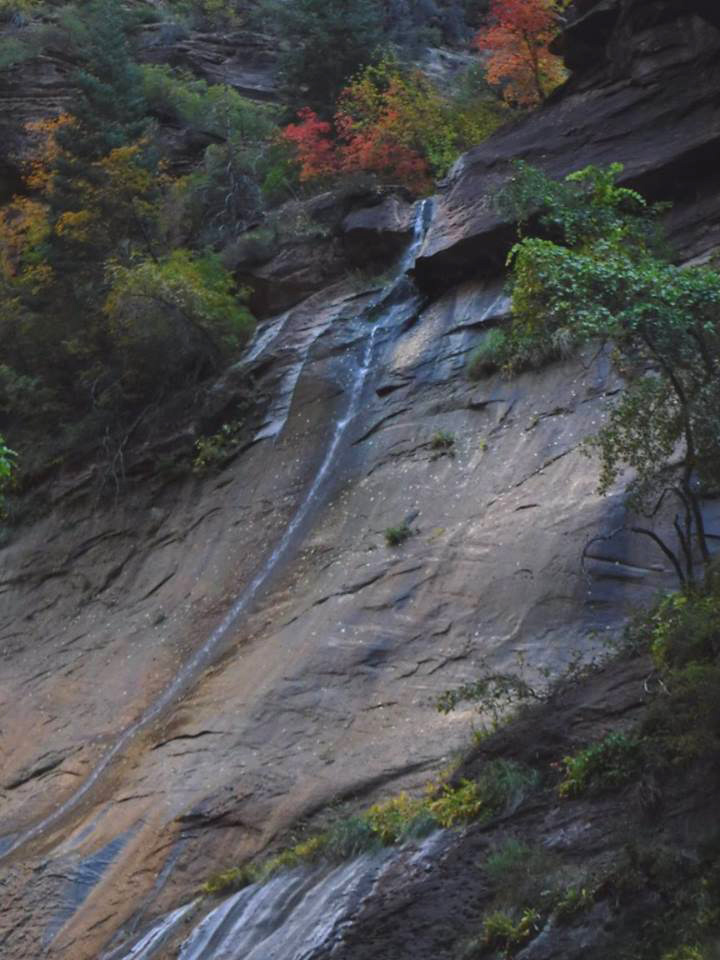
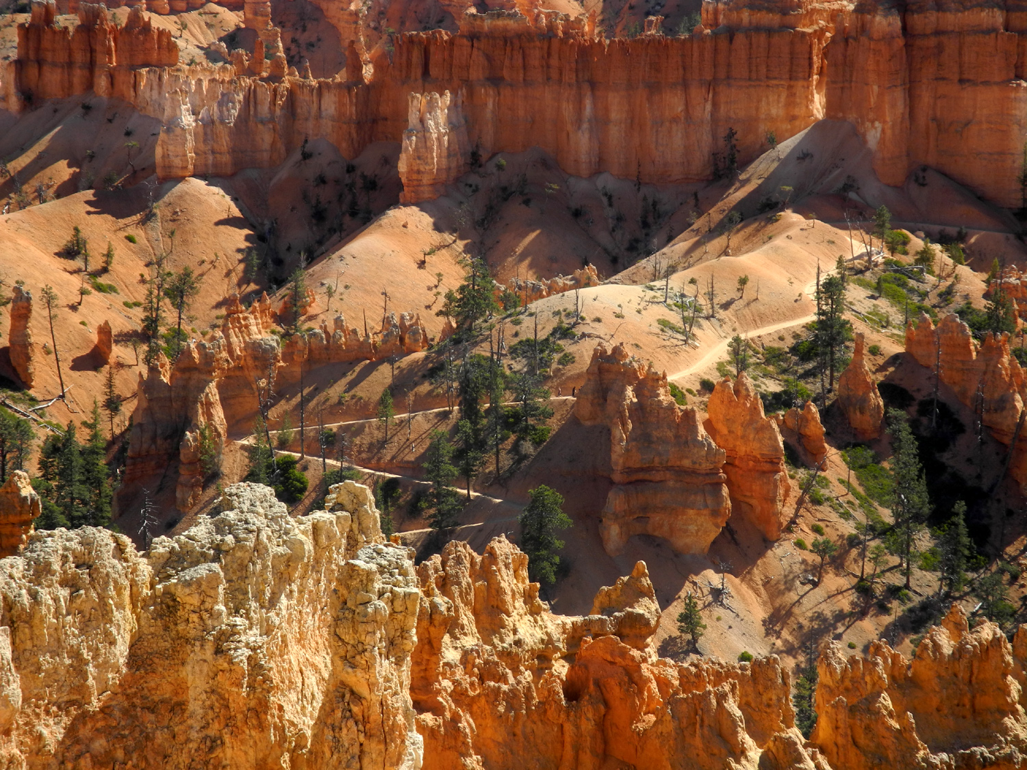
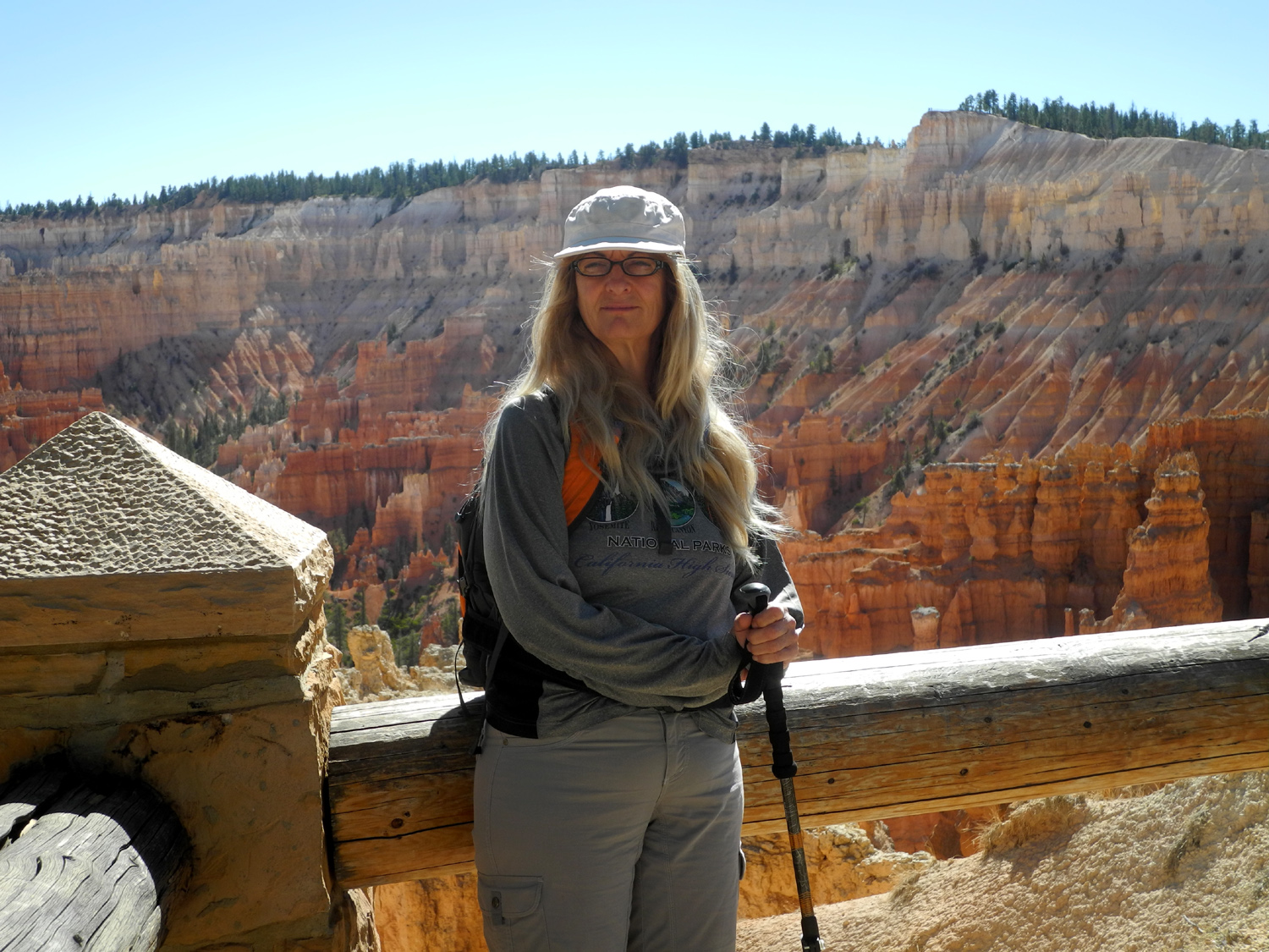
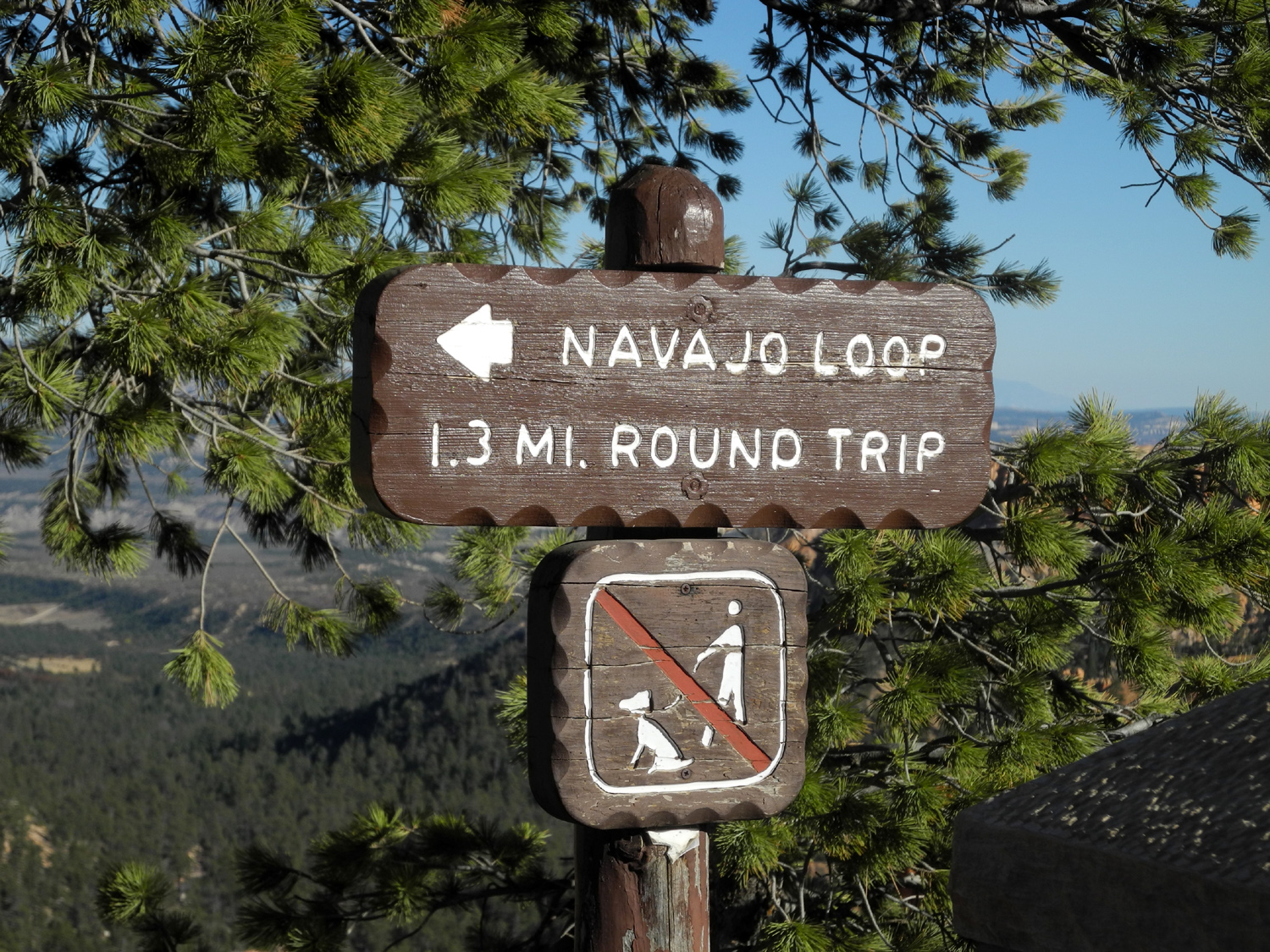
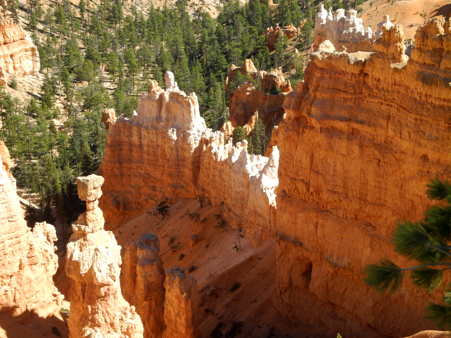
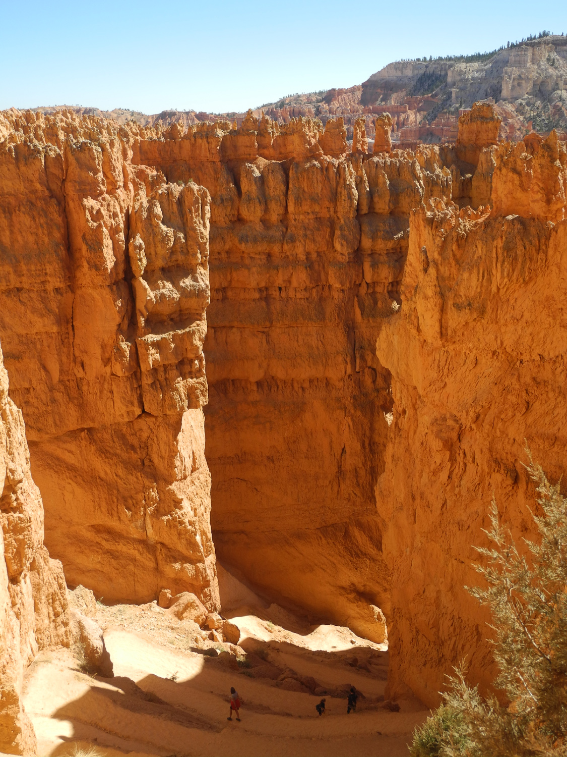
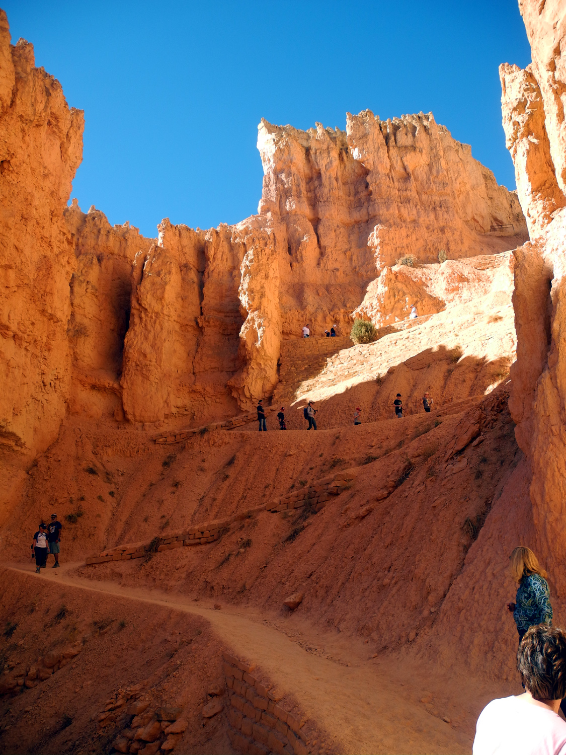
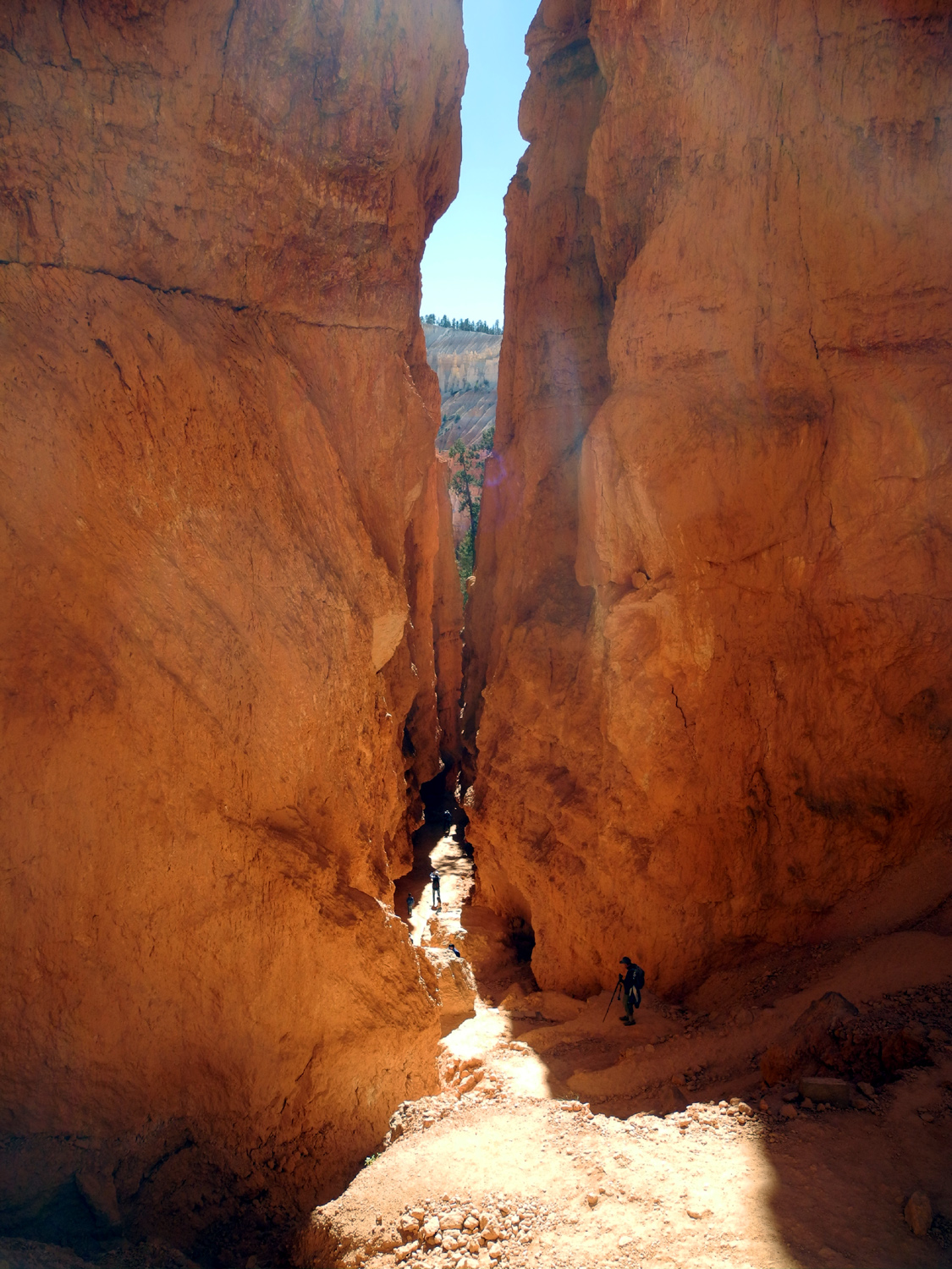
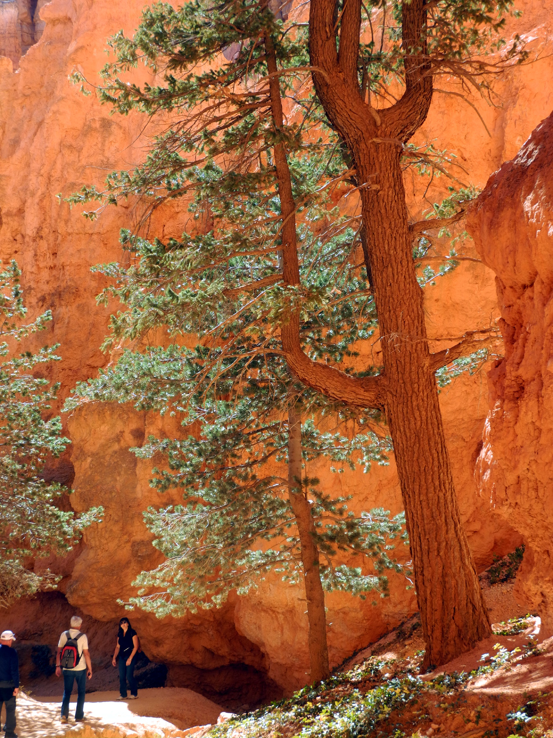
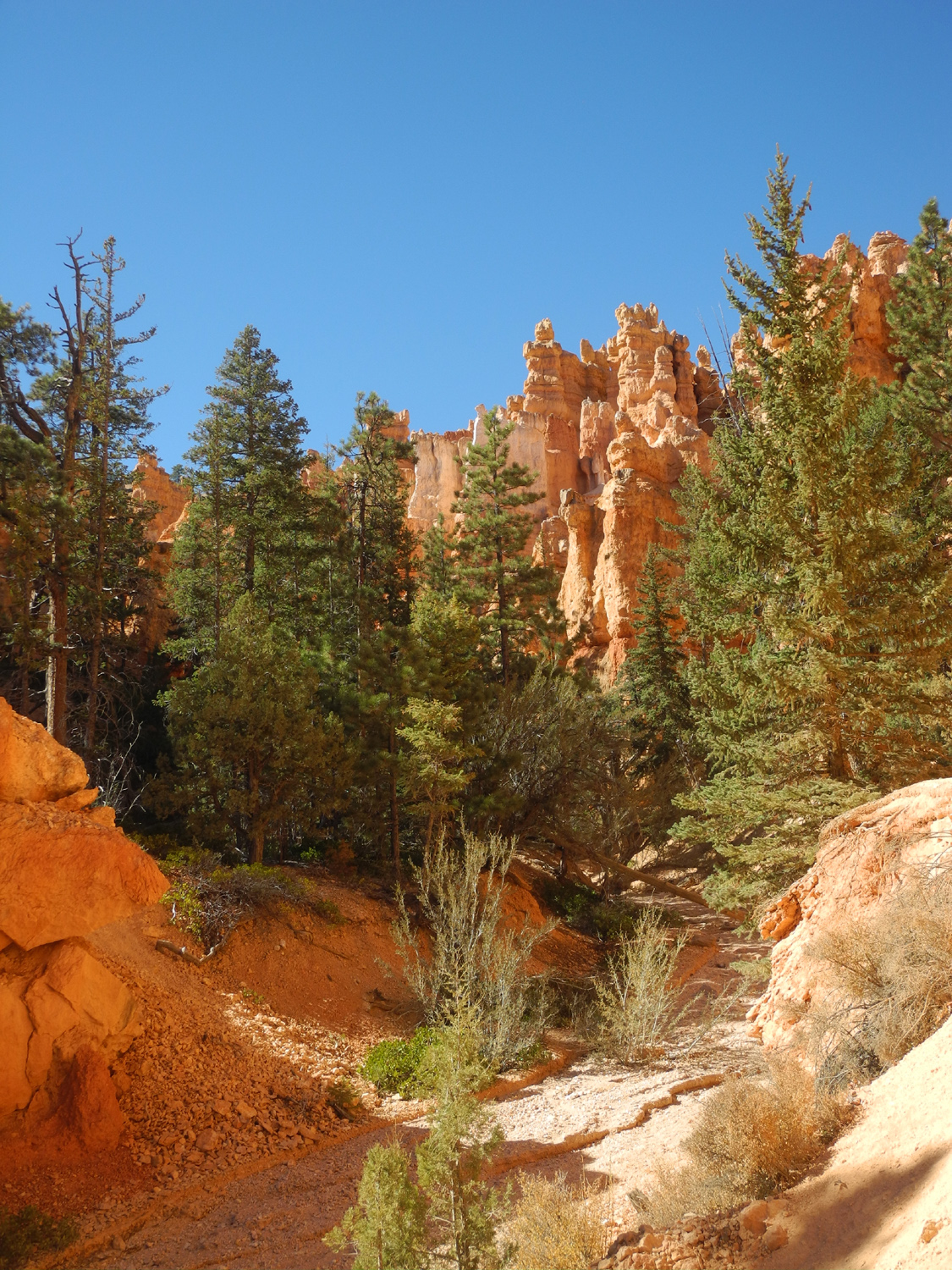
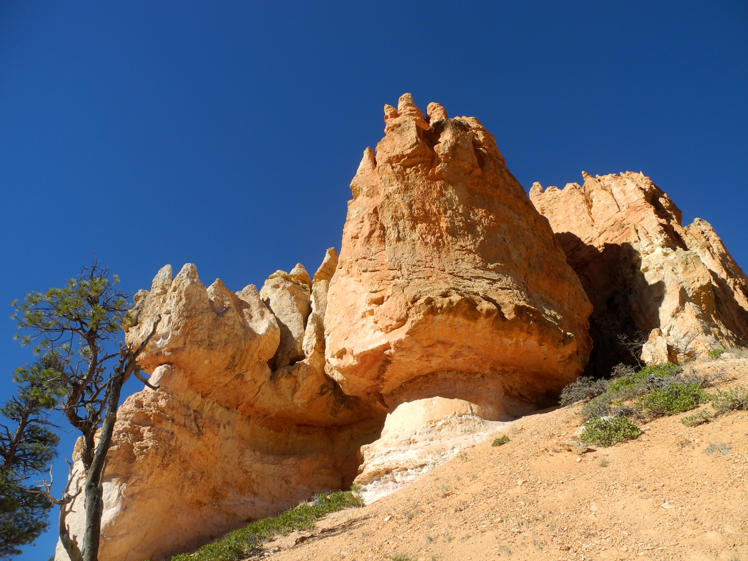
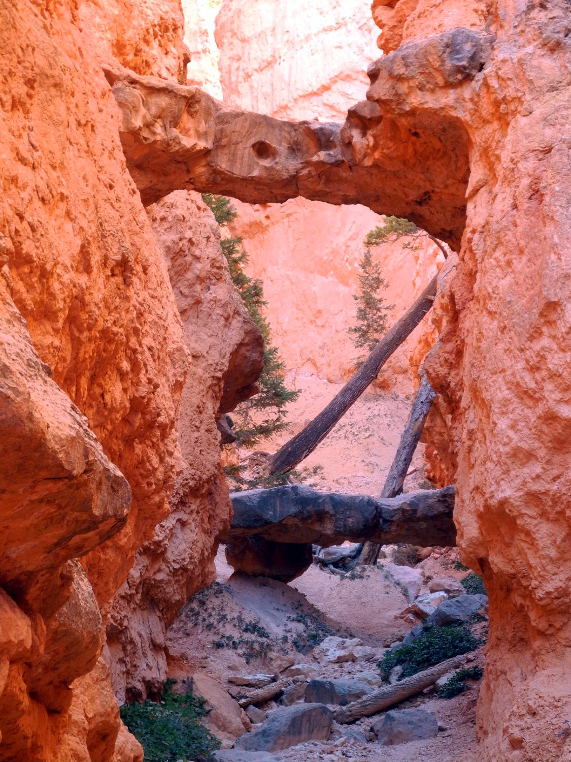
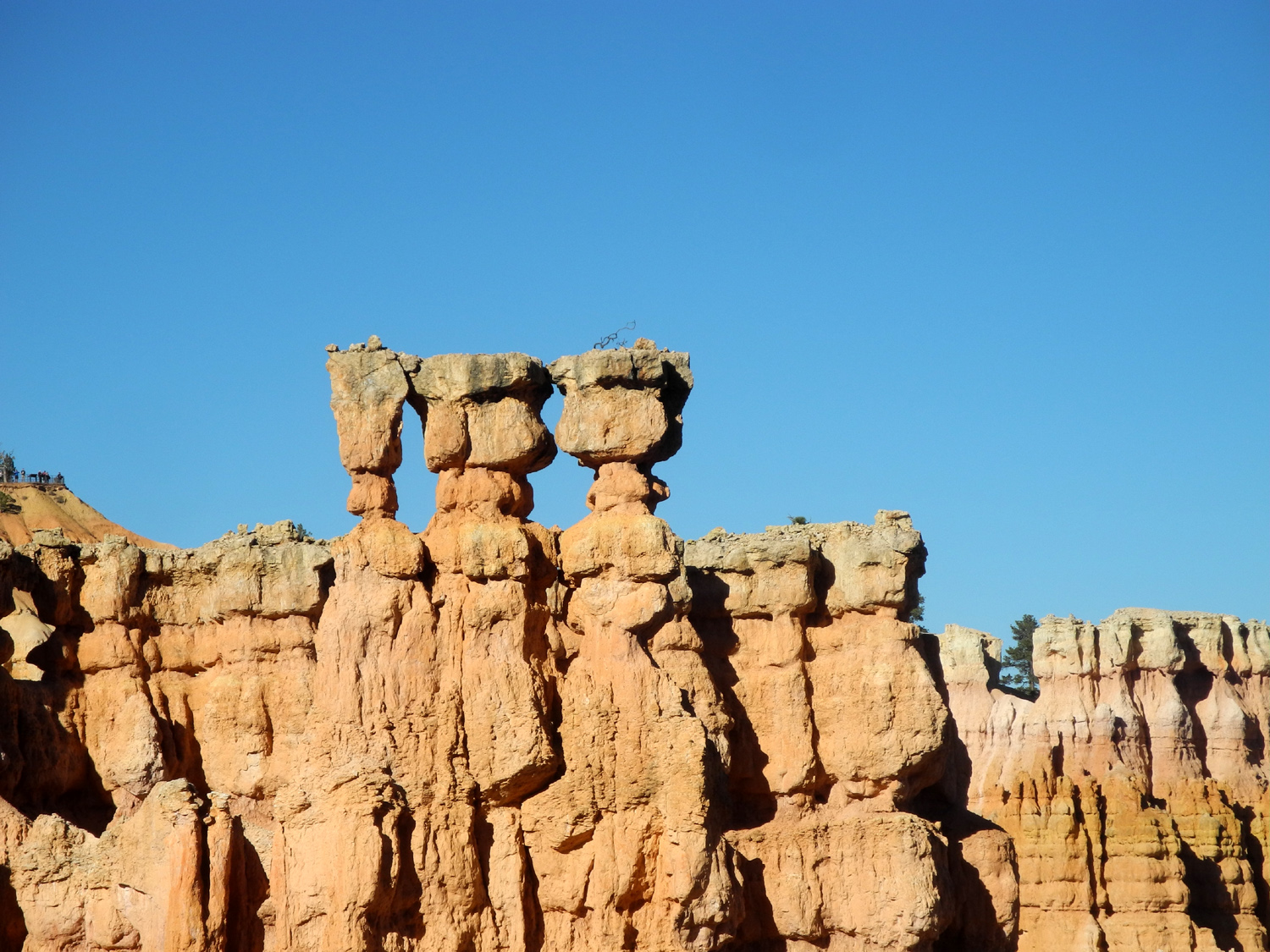
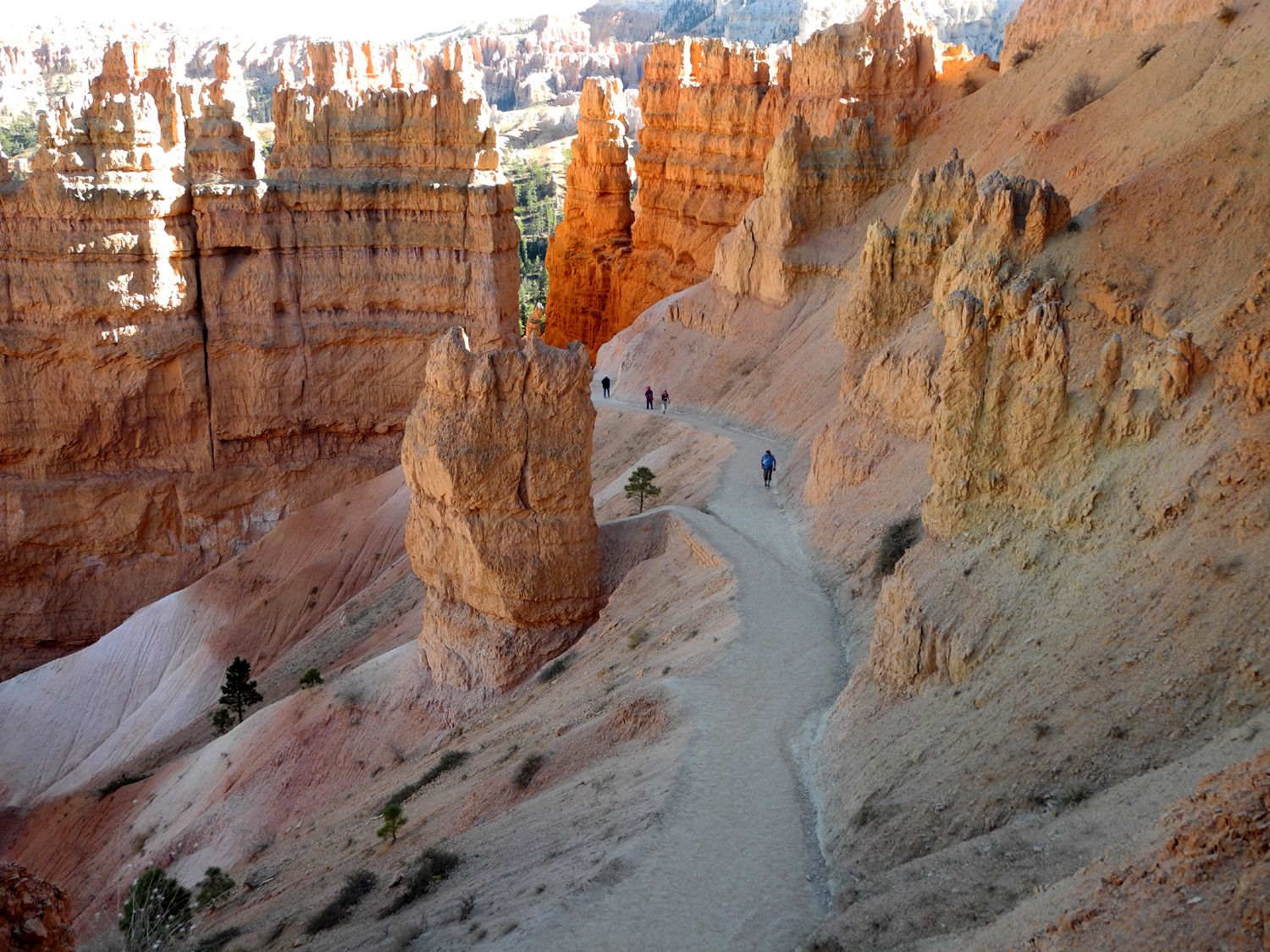
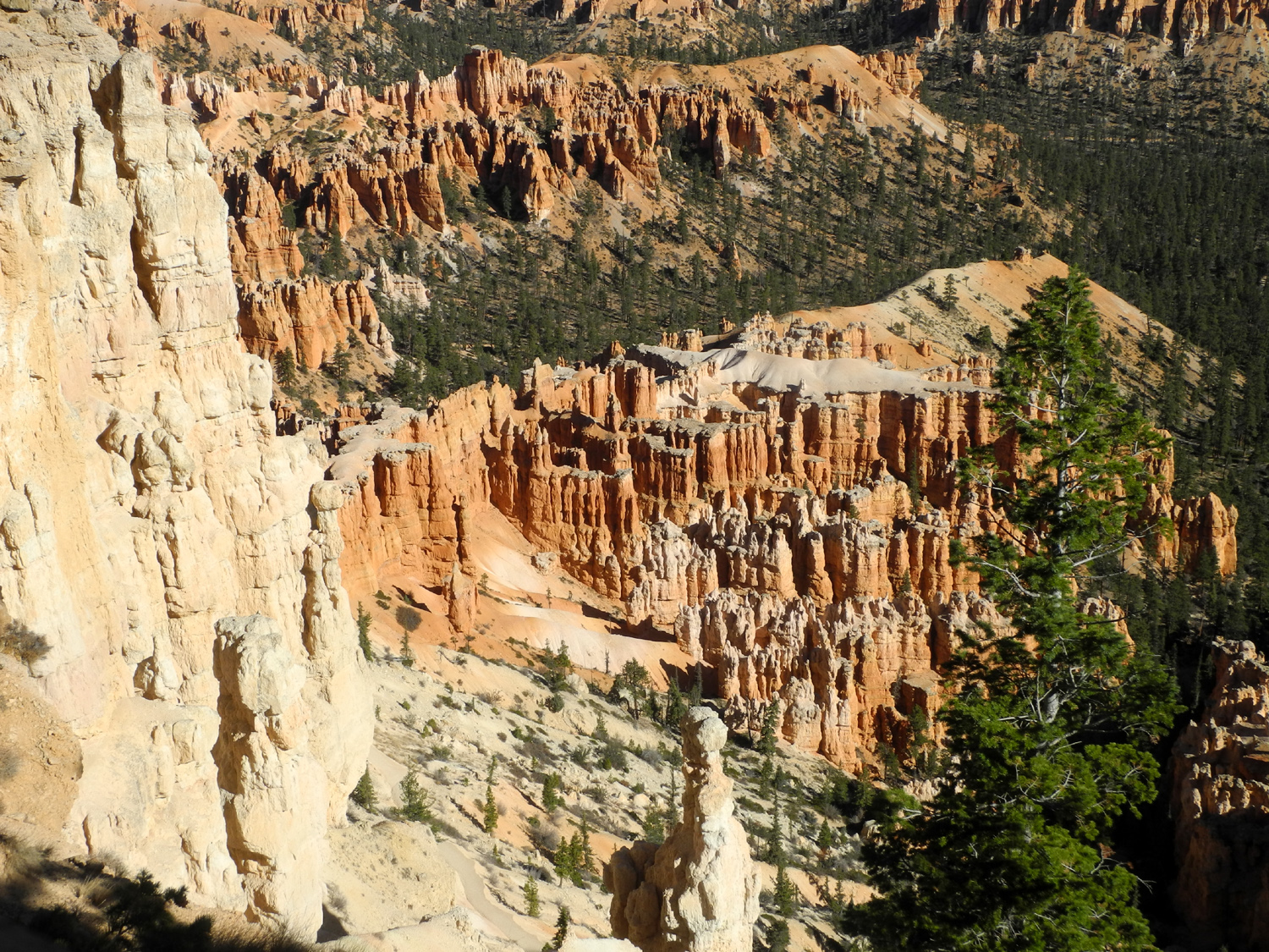
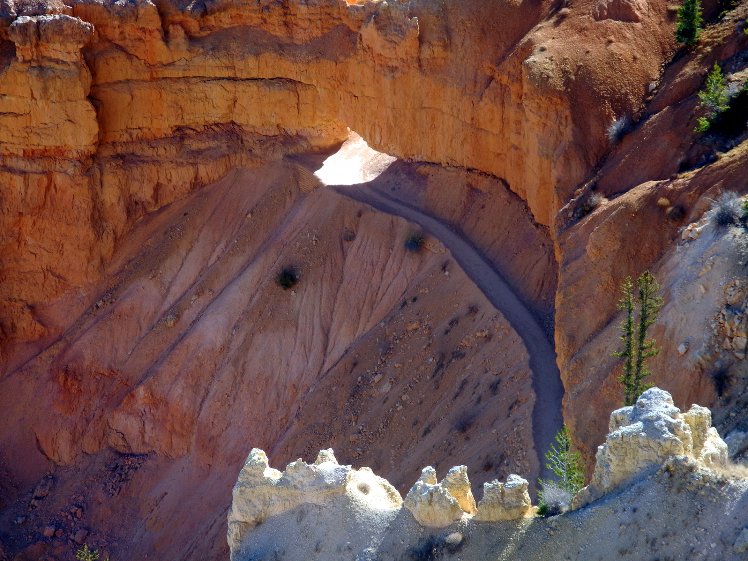
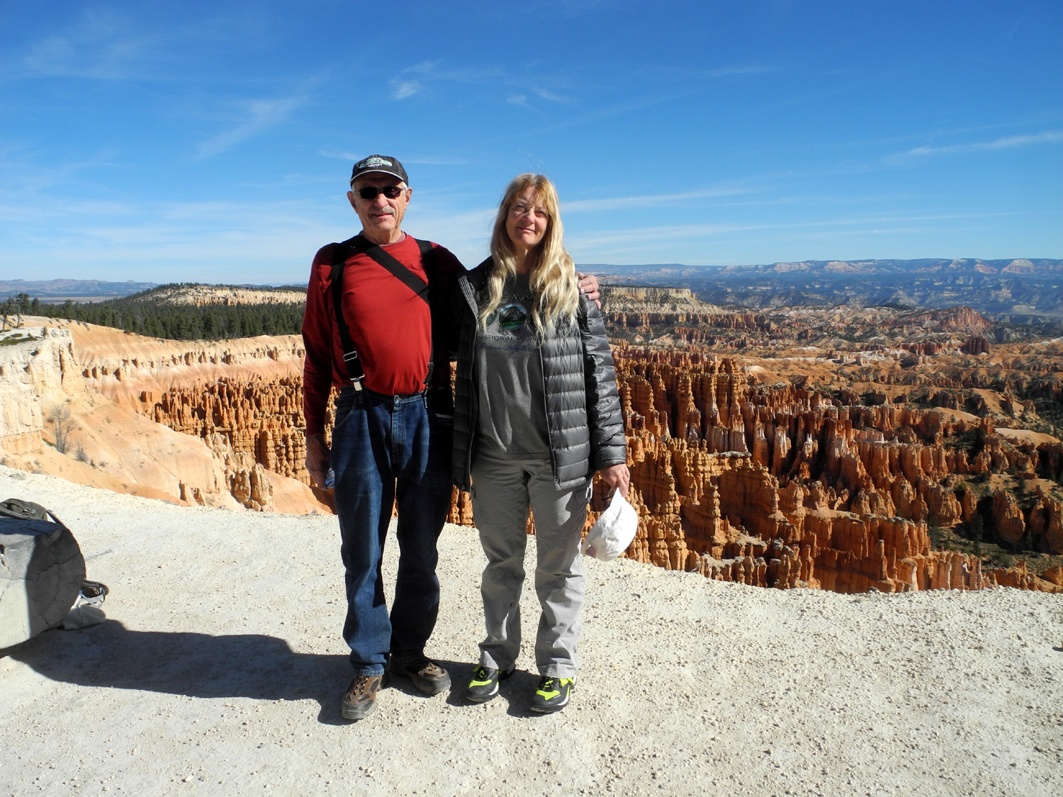
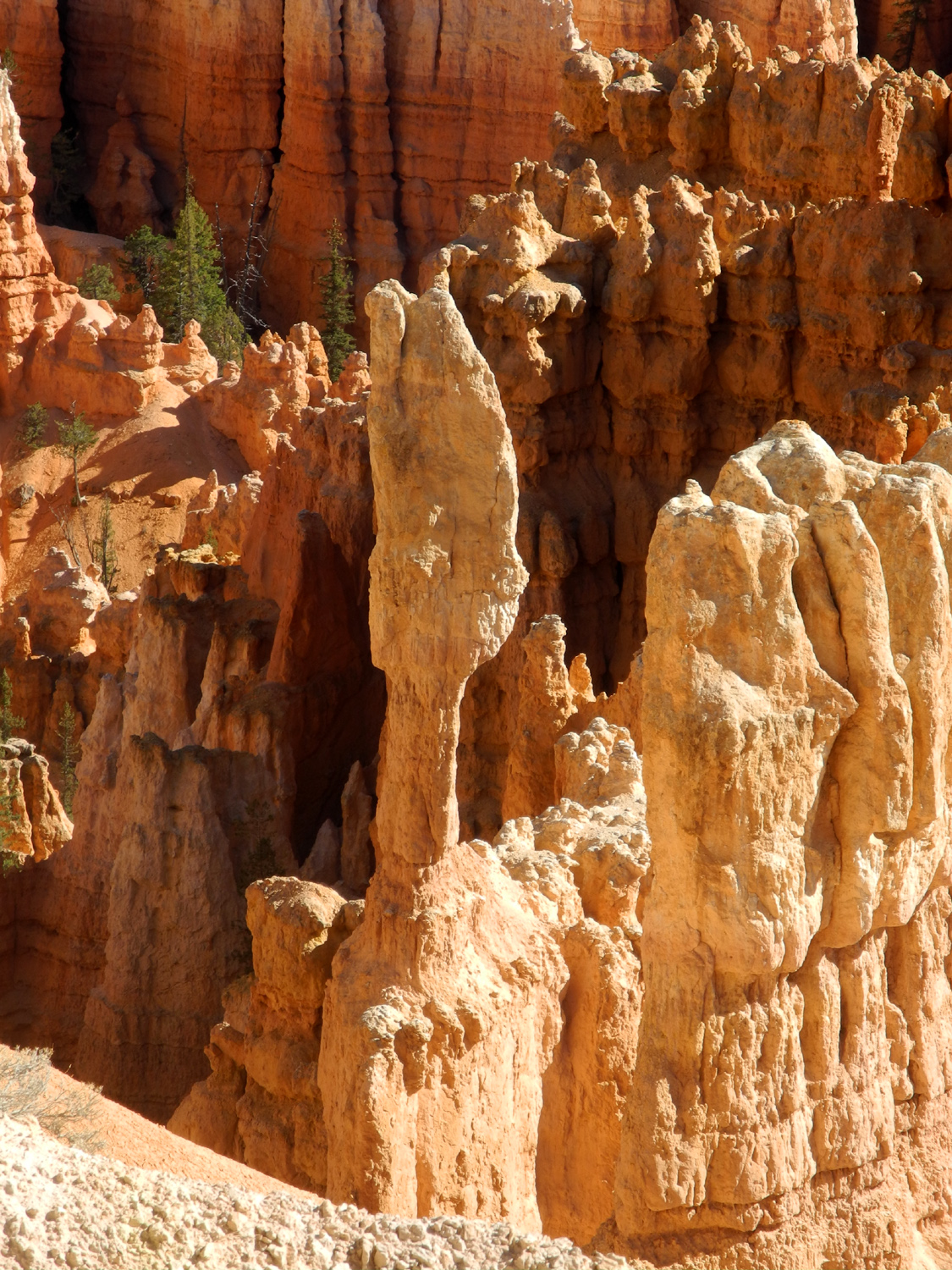
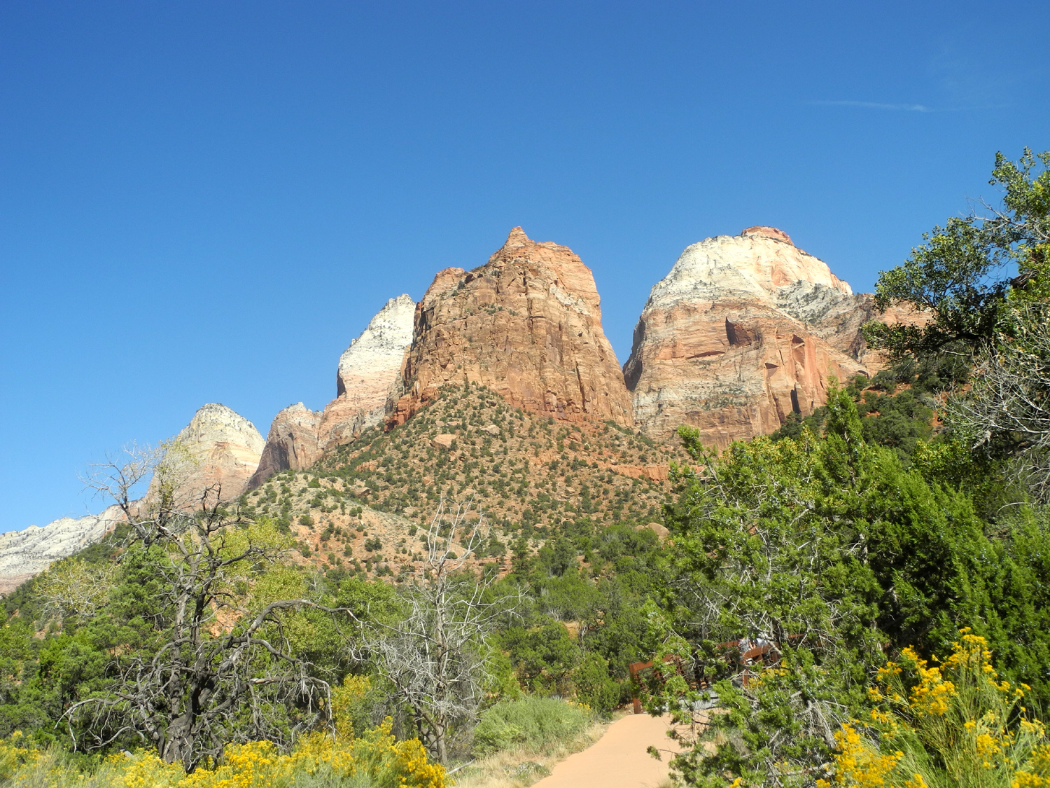
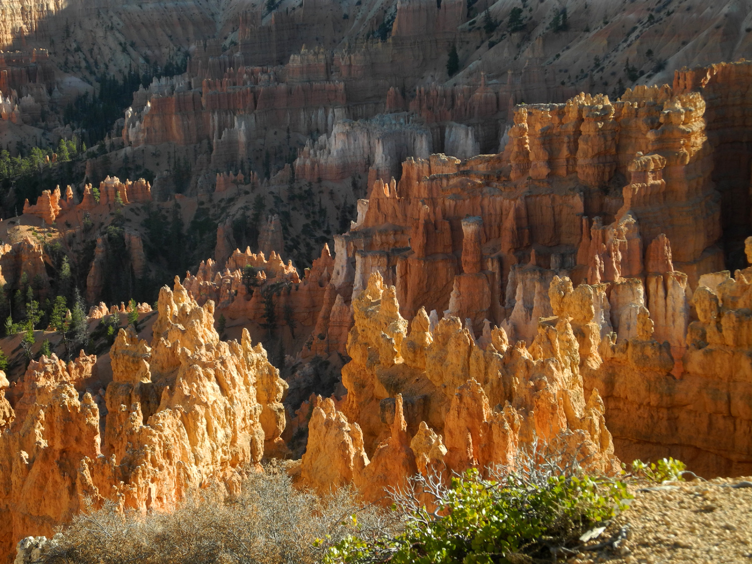
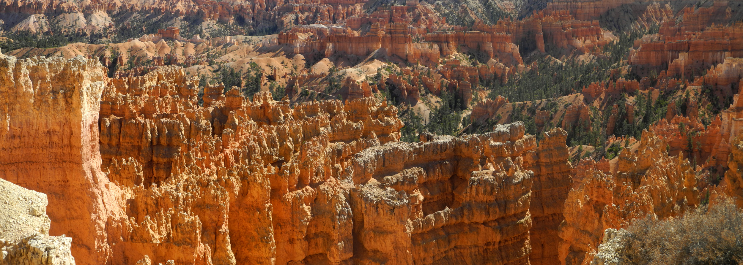
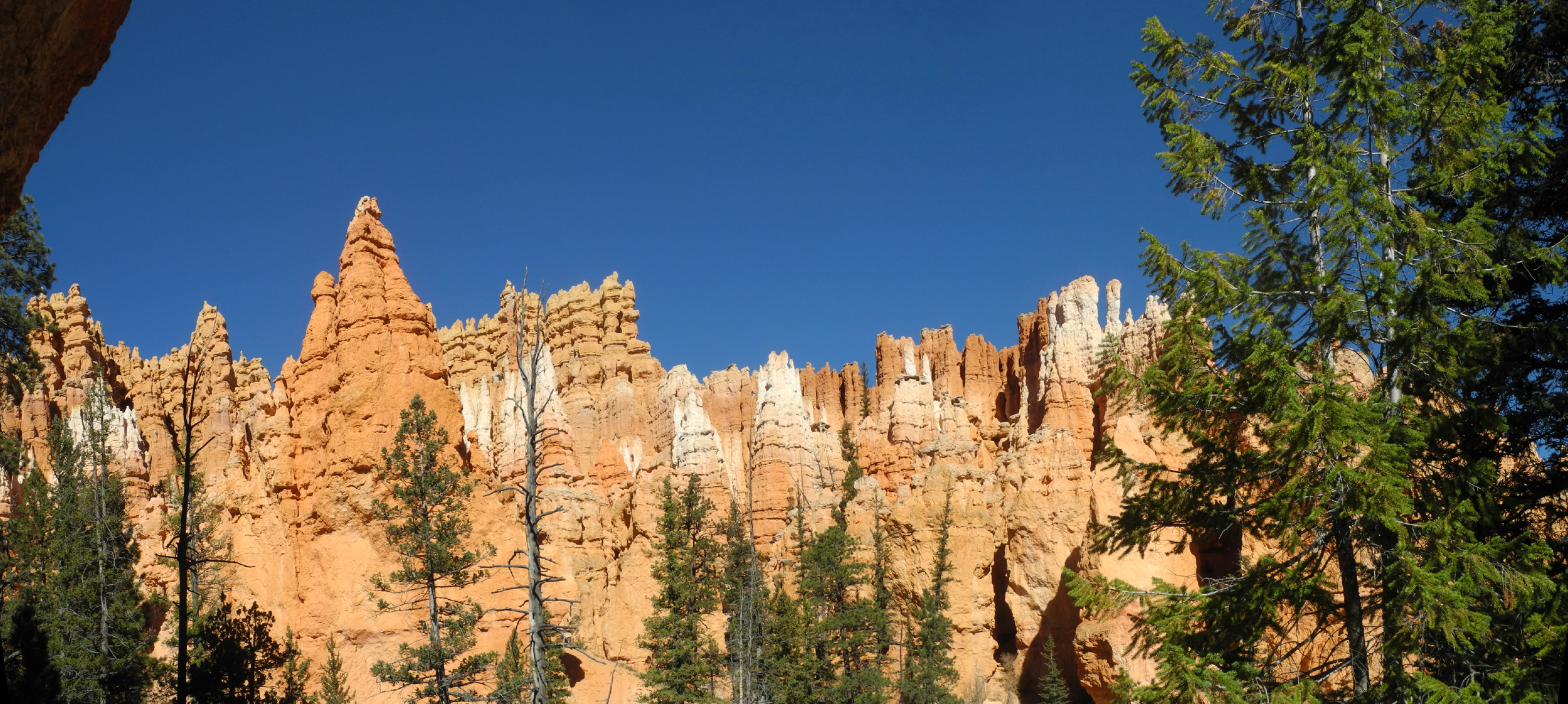
Utah Highway 9 enters Zion park at the edge of Springdale, and then leaves the river a short distance in at Canyon Junction. From here the road climbs up via switchbacks several hundred feet to the Zion-Mt. Carmel Tunnel. Built in 1930, the tunnel was blasted a mile and a third through sandstone cliffs that had stymied previous road builders, and was plenty roomy for the vehicles of the day. Getting through it in a motor home is a different matter. Vehicles over a certain size have to drive down the middle of the road, with traffic controls halting vehicles from the opposite direction. There is a fee of $15 for this service, and we paid that when we entered the park. Getting through the tunnel was no different than dealing with road construction, and our wait was no more than five minutes. On the other side we were still going through impressive sandstone formations, little canyons filled with bright red bigtooth maples, and tall evergreens. We stopped at a turn-out and got some nice photos before saying goodbye to Zion. Highway 9 joins US 89 which runs north from the Grand Canyon to I-70, but after a few miles we turned east on the famous Utah Highway 12 Scenic Byway. We were soon in the Dixie National Forest and going through Red Canyon, which is spectacular in its own right, but of course, pale in comparison with what's to come. The park is not on Highway 12; we turned off on Utah 63 for the final few miles. Due to the lateness of the season there was only one campground open in the park, but it had plenty of spaces, and after driving through one loop about four times looking for the perfect spot, we finally decided on a semi-perfect one. We would be there only one night, so this was not a big deal. We didn't really do anything to set up camp except put our chairs out and extend the motor home slides. We then walked to the pay station, dropped in our envelope, and continued on to the shuttle stop in front of the campground. Bryce Canyon is actually not a canyon, but a series of amphitheaters that are worn into the pink limestone of the Paunsaugunt Plateau. Trails and a 37-mile round-trip scenic drive offer views of the multicolor hoodoos, pinnacles, buttresses and columns that make Bryce what it is. We had decided to hike the Navajo Loop, a two mile trail that zig-zags down about 500 feet, then comes back up. The shuttle goes to several different vista points, so we rode it to four stops before arriving at the trailhead at Sunset Point. From the shuttle we had glimpses of the scenery at some of the stops, but it was not until we walked the short distance from the final stop to the edge that the full glory of Bryce Canyon hit us. The vista is hoodoos and other rock formations, walls of rock with pointed towers rising from the top, and jagged pink and red walls separated by narrow passageways a hundred feet deep and more. My struggle to write this paragraph merely underlined my original thought - this magical place cannot be reduced to words. While the view from the top is amazing, you can't totally appreciate Bryce until you go down between the walls of rock and look up at the hoodoos towering above you. The trail goes down fairly steeply at first, and doesn't really level off, but the slope becomes more gentle and it's no longer a series of switchbacks. It goes by a desert wash, one of many that carry runoff during flash floods and snowmelt season, but were all dry at this time. Teri and I briefly explored up a side canyon, then found logs to sit on by the wash and had our lunch and a good rest. There were a lot of people on the trail at first, but the crowd thinned out after the first quarter mile as less ambitious souls turned back. The second mile of the trail was longer than the first, or so it seemed, probably because we started back up. We took the loop counter-clockwise and where it starts up we entered a very narrow passage between the walls that towered above us. Along this way there was a side canyon with two natural bridges that could be seen by taking a very short detour off the main trail. Eventually we started following a series of switchbacks the last quarter mile or so and came out to the top of the canyon once again. We had a short wait for the return shuttle, and spent the time stretching and resting. Back at camp we had our evening meal, sitting outside with our plates on the retaining wall between the parking spot and the picnic table, which was up a series of steps. This was the only time we sat outside at Bryce. |
|||
 |
 |
 |
|
| A trail zig-zags down into the canyon | Teri at Sunset Point | Like all trail signs, this is an approximation; we measured a full two miles, including wandering around | |
 |
 |
 |
|
| View from just below the rim at Sunset Point | Thor's Hammer, at the start of the Navajo Loop | Hikers descend into the depths | |
 |
 |
 |
|
| A typical section of the upper trail | Can we even squeeze through this narrow passage? | Pines along the trail | |
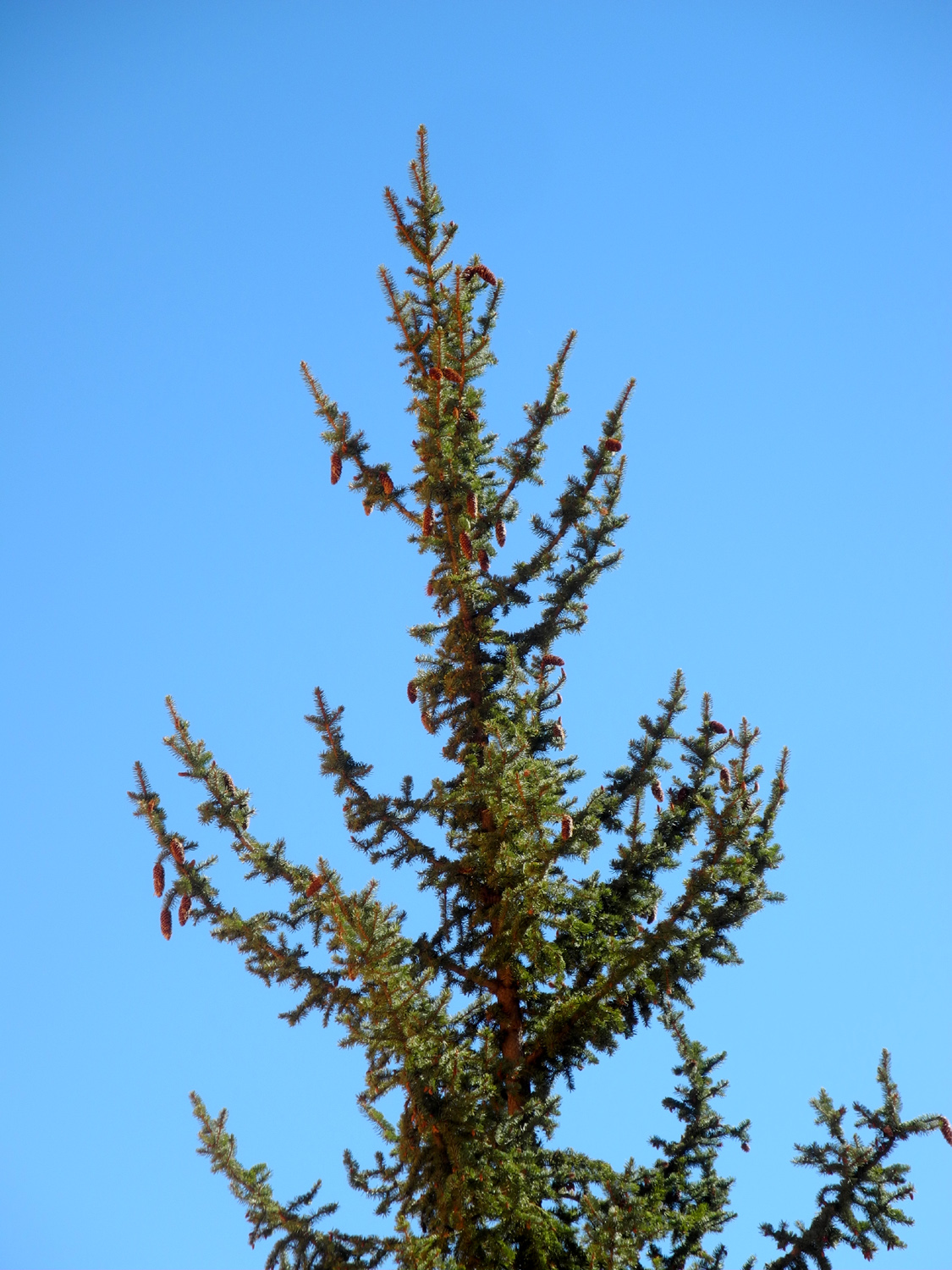 |
 |
 |
|
| Probably a blue spruce | We explored up this wash a short distance | Not a common formation - a rock on a pedestal | |
 |
 |
 |
|
| Natural bridges | Hoodoo that voodoo that you do to me | Looking back down the trail from near the top | |
|
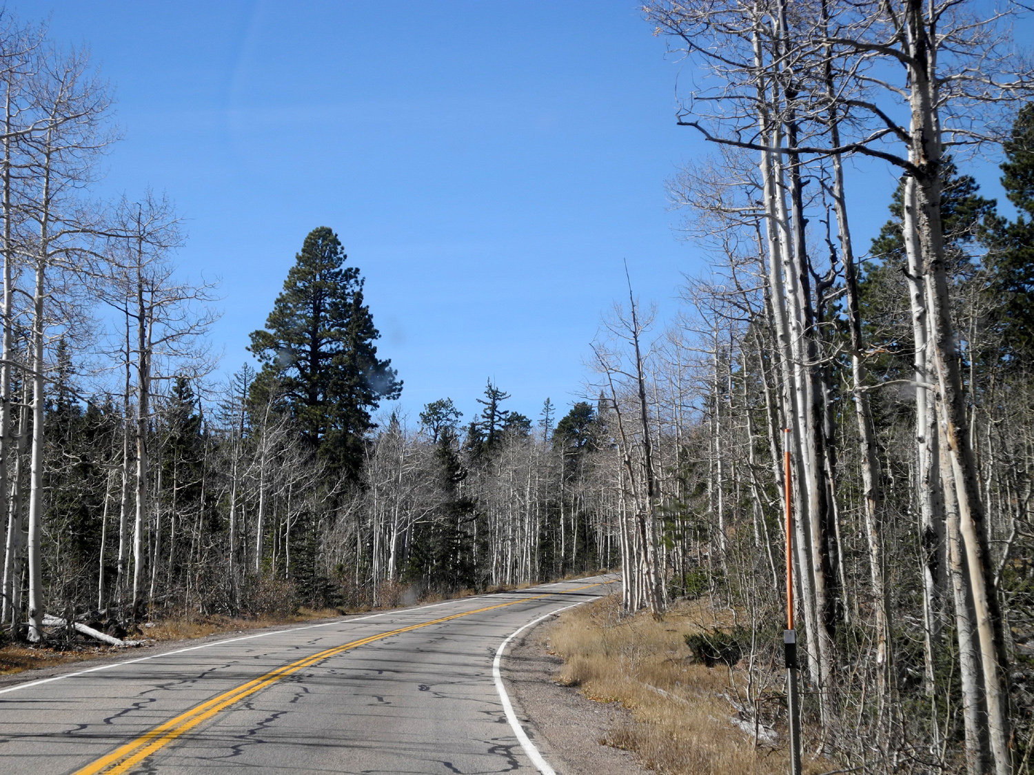
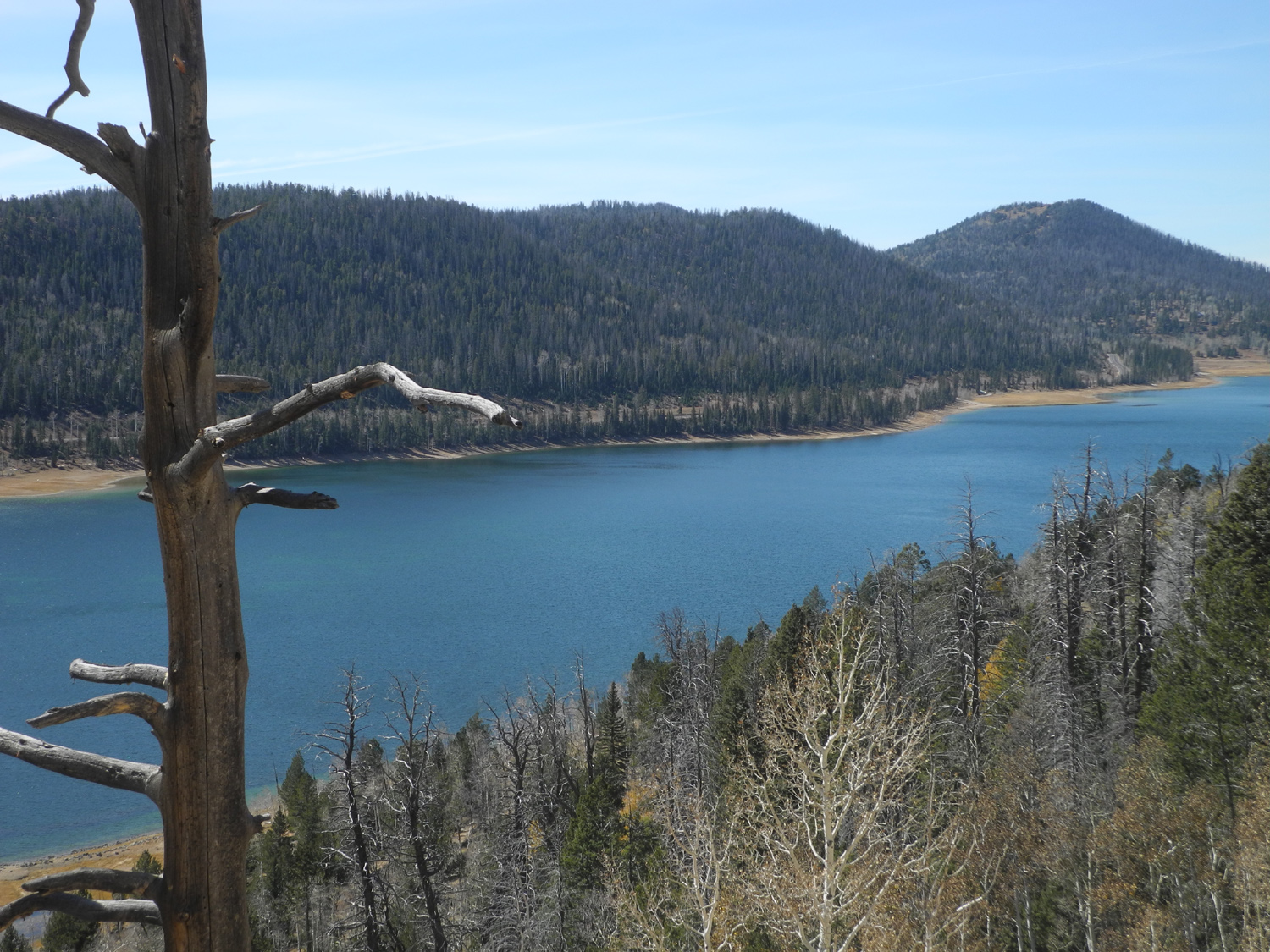
We wanted to get more than halfway home the next day, but we also wanted to do another short walk at the canyon, so we got up early, had breakfast, and drove the motor home out of the campground to a big parking lot near the shuttle stop. The Rim Trail runs about twelve miles along the canyon's edge, and you can get on and off at a number of shuttle stops. We had planned to hike a one mile paved section. The first stop was Bryce Point, and we decided to check out the view there, then take the next shuttle to the starting point of our hike. We got out again at the next stop, Inspiration Point, and instead of riding on to our planned stop, got on the Rim Trail there. This proved to be an excellent decision - although the trail section was shorter, about .8 mile, it was not paved and had some up and down to make it more interesting and more in line with the type of hiking we prefer. As an added bonus, because it was NOT flat and paved, there were relatively few people making this hike. We enjoyed the views into the canyon from different angles along the way, and eventually arrived at Sunset Point, where we had hiked from the day before. We caught the shuttle back to our "home" stop, where we walked across the road to the visitor center. I bought a hat and some more magnets and Teri also did some shopping. Then we returned to the motor home and started our long trip home. We followed the same roads back up to a point, which was Utah Highway 14. This is a very scenic road that goes up almost to 10,000 feet, between US 89 and I-15 at Cedar City. Along the way it passes Navajo Lake, a popular camping spot in the Dixie National Forest. We also went through several miles with fields of black volcanic rock along both sides of the highway. We wanted to stop at a truck stop in Nevada that sold fireworks, and looked on line for RV parks nearby with no success. The location is at the road that goes from I-15 to Valley of Fire State Park, which I've visited several times, so we decided to drive in to the campground there. As we left the truck stop, we noticed several RV's and trucks parked in a huge vacant lot across from the business, so we turned in to investigate, and ended up spending the night there. It was a little noisy, as more trucks came in during the night, but we had a spectacular sunset and sunrise, and the price was right. With about 430 miles to go the next day we got an early start, made it through the traffic of Las Vegas with only a few slow spots, and continued on back home via I-15, California 58 and CA 99. With only quick stops to eat and get gas, we arrived home in mid-afternoon. We agreed that Zion was our favorite, and in fact, it is the 5th most visited park in the U.S. We would like to return, and I hope to also see Capitol Reef, the only park that I've missed of the five that line up across southern Utah (Zion, Bryce, Canyonlands and Arches are the others).
|
|||
 |
 |
 |
|
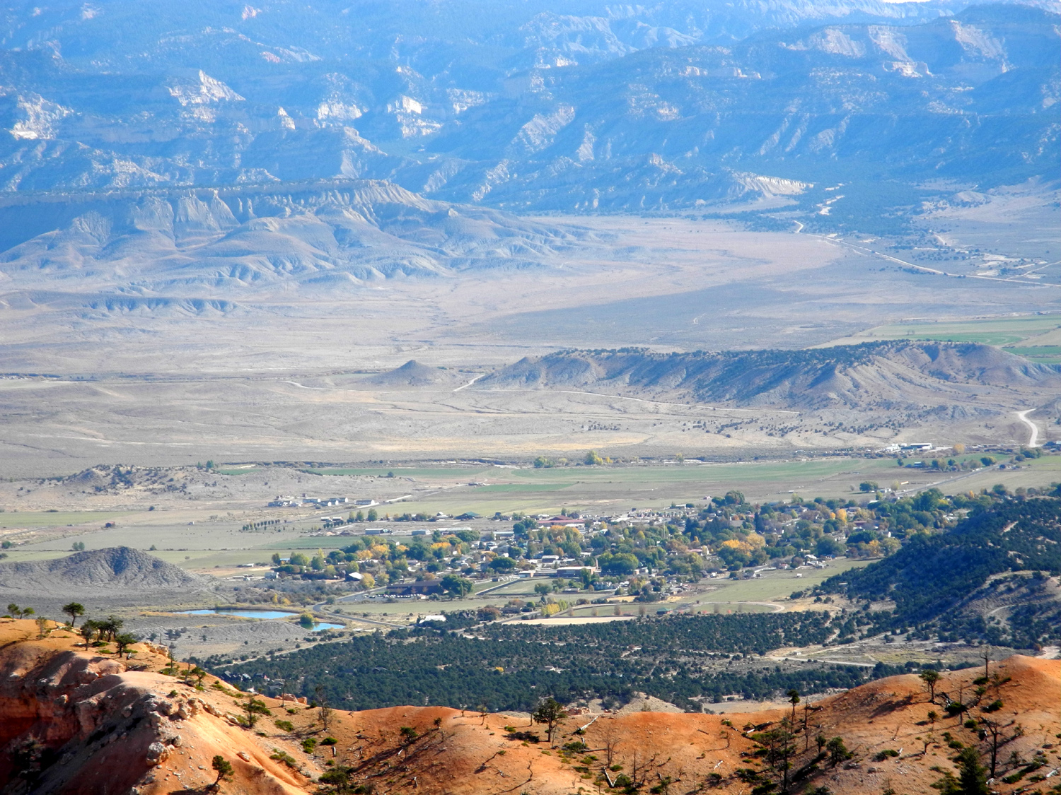
| A view from Bryce Point | Trail goes through a natural tunnel | Small town and distant mountains outside the park | |
 |
 |
 |
|
| Posing on the Rim Trail near Inspiration Point | Hoodoos from the Rim Trail | A sandstone popsicle | |
 |
 |
 |
|
| Tunnel at Red Canyon on Highway 12 | Red Canyon formations | Hoodoos at Red Canyon Visitor Center | |
 |
 |
 |
|
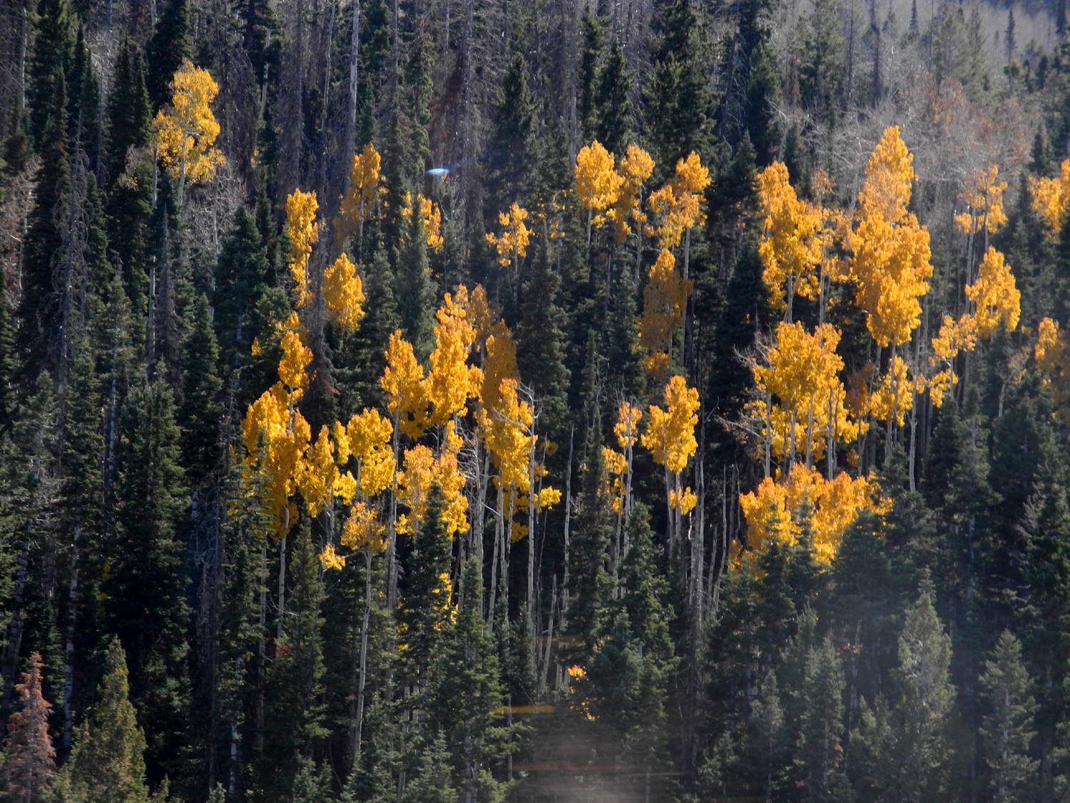
| Leafless aspens along Highway 14 | Navajo Lake | Aspens in their golden fall attire | |
| More Photos | |||
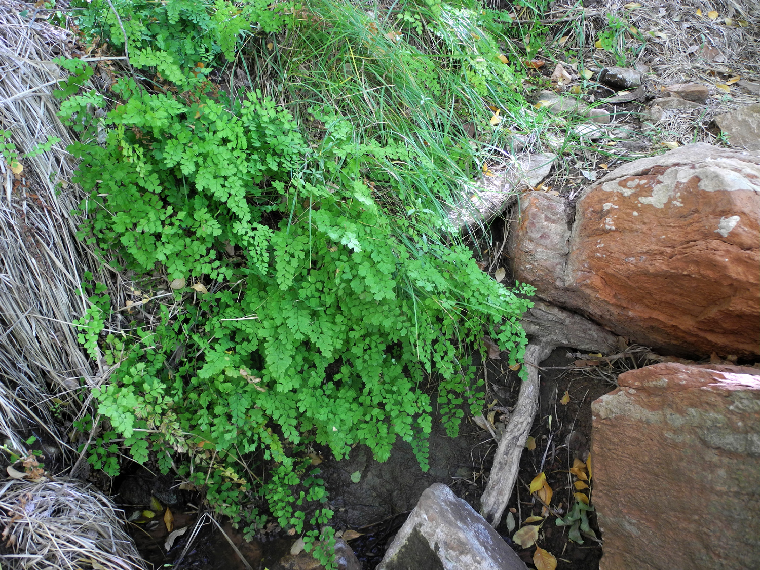 |
 |
 |
|
| Maidenhair fern along Weeping Rock Trail | Rock formations above the Pa'Rus Trail | Several species of flowers were in bloom | |
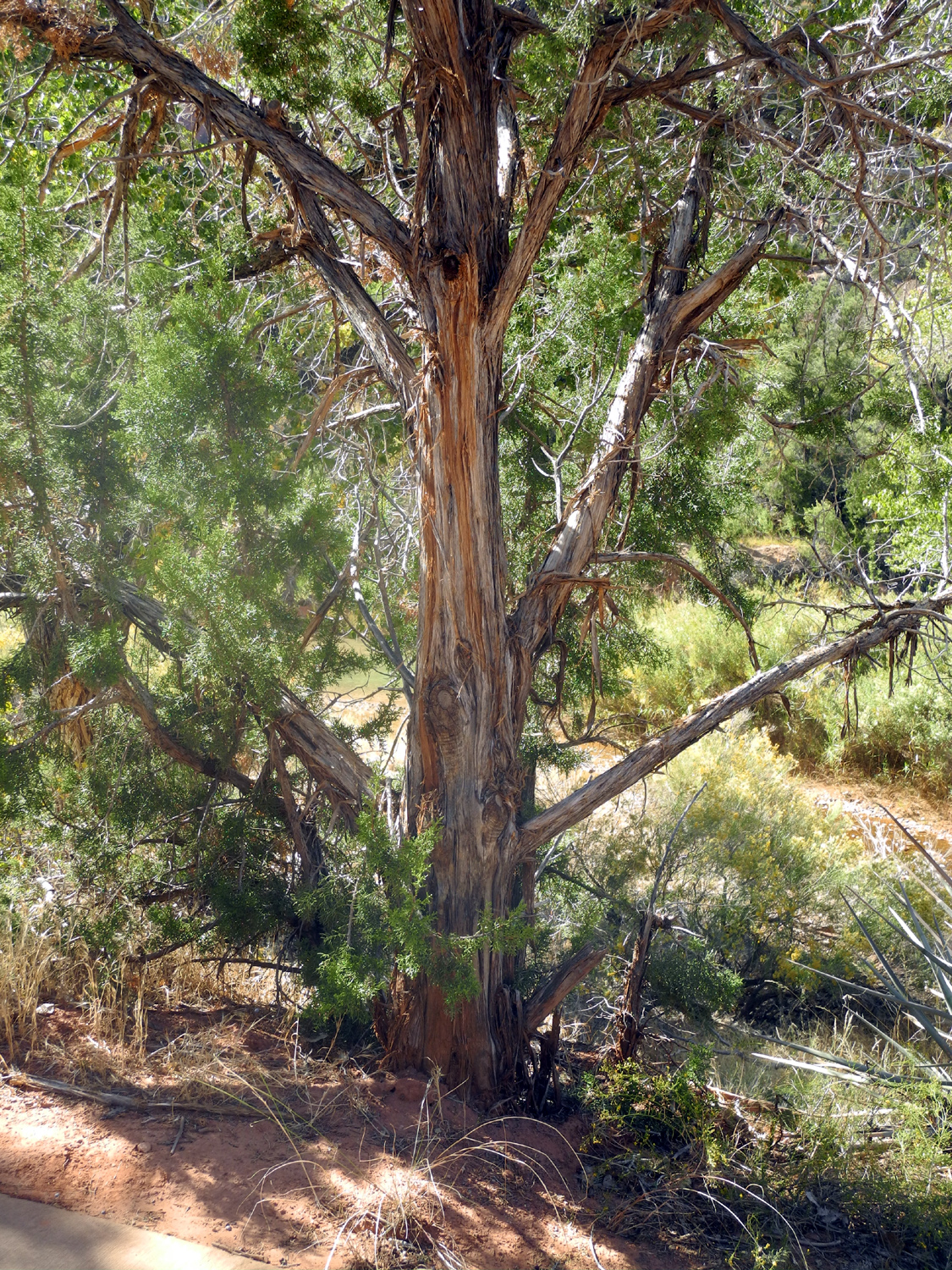 |
 |
 |
|
| Juniper along the Pa'Rus Trail | Emerald Pools informational sign | Dick takes a rest on the Emerald Pools Loop | |
 |
 |
 |
|
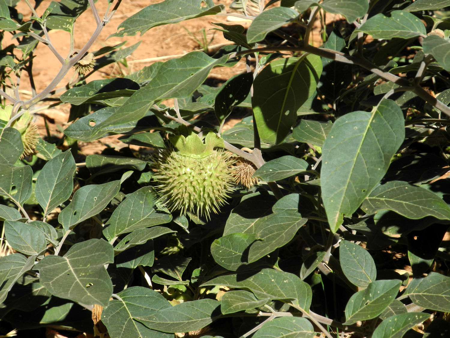
| The large bloom of a Datura plant | It produces this spiny seed pod | Sandstone scenery near the eastern border of Zion | |
 |
 |
 |
|
| Sandy hills set off by a dark green forest | Final view at the end of the Navajo Loop | Hard to survive when you grow on a rock | |
 |
|||
| Panoramic views from Sunset Point and from the Navajo Loop below the point | |||
 |
|||
| Panoramic view of cliffs by Highway 12 in Red Canyon | |||
| Other Links | |||
| Zion National Park | Bryce Canyon National Park | Hiking in Zion | |
| Hiking the Narrows | More about That | Still More | |
| Zion-Mt. Carmel Tunnel | Red Canyon | Hiking in Bryce | |
| Gambel Oaks | Utah Juniper | Bigtooth Maple | |
| Valley of Fire State Park | Utah's National Parks | Dixie National Forest | |