| Dick's
Travel Blog |
|
| Links
More
Travel Reports |
|
| Kings
Canyon June 2017
Family Camp at California Flats |
| |
| Kings
Canyon National Park - Cedar Grove and Grant Grove, June 4 and 5, 2017 |
| |
A
visit June 4 and 5, 2017 to Cedar Grove and Grant Grove in Kings
Canyon National Park brought views of roaring
waterfalls, crashing cascades in the river, magnificent giant sequoias and
wildflowers at every turn of the road or trail
|
 |
 |
 |
 |
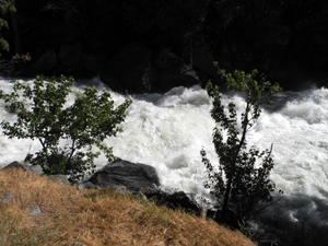
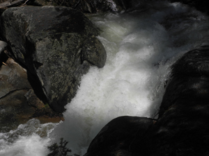
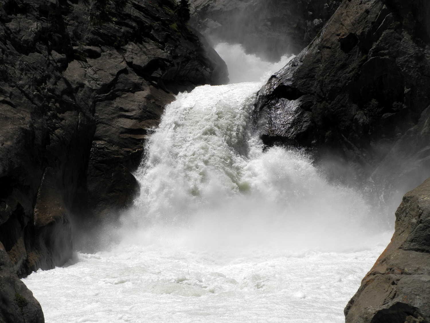
| The
Roaring River Falls is an easy paved walk from the main road. It's not
very high, but lives up to its name during this year of big water |
The
Roaring River runs into the Kings
a few hundred yards below the falls |
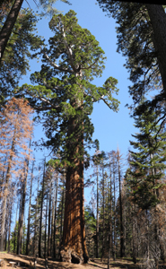
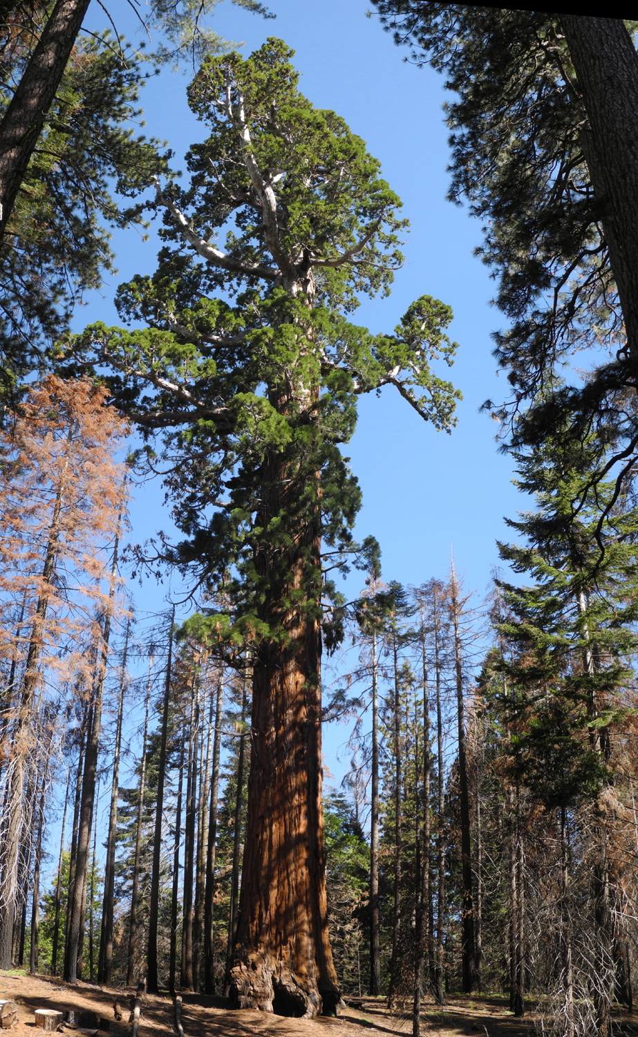
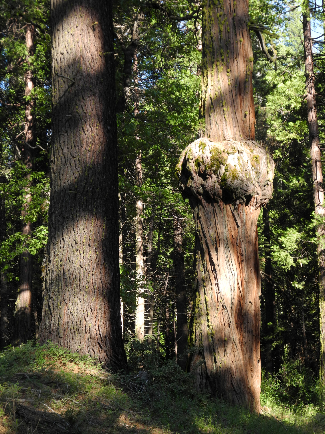
A
classic Giant Sequoia guards the North Grove Loop Trail, which starts at
the
General Grant Grove parking area |
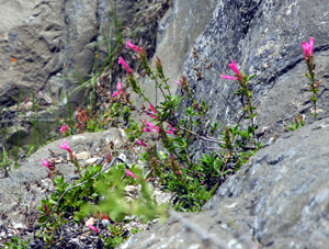
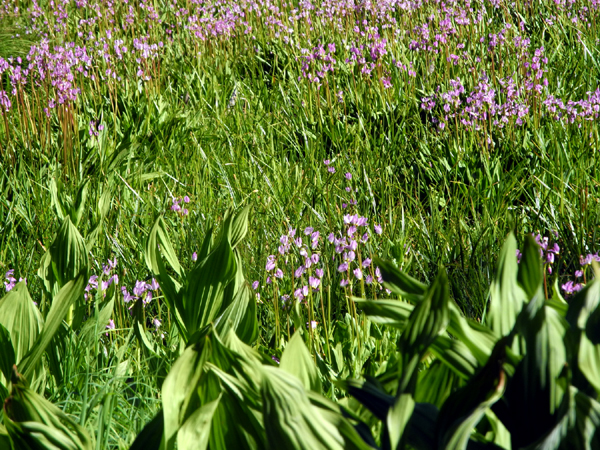
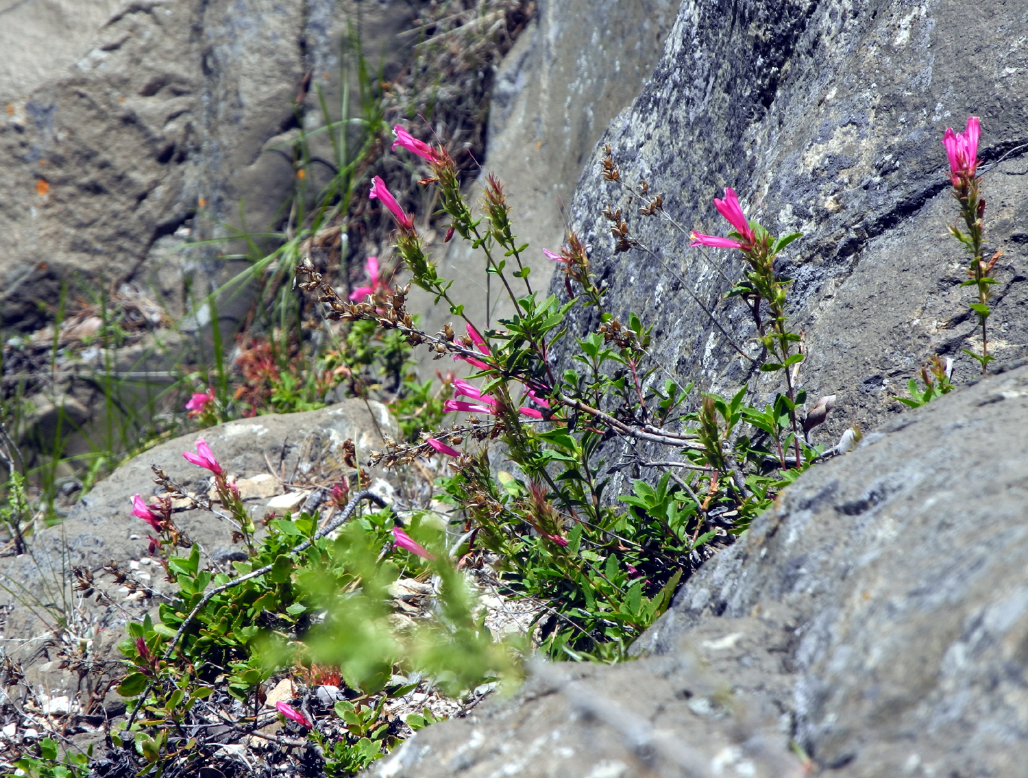
Mountain
Pride Penstemon grow in the
rocks all over the Sierra; these were in
the
cliffs above Roaring River Falls |
| |
| Getting there is
mostly a long drive east from Fresno on State Highway 180. After
leaving the San Joaquin Valley floor, the road climbs up
continuously through Squaw Valley, past the road to Dunlap,
through the dry foothills and into the pines, cedars and firs of
the Sequoia National Forest, then into the Grant Grove section of Kings
Canyon National Park and the territory of the giant sequoias.
Beyond Grant Grove Village
and the turnoff to the General Grant Tree, the road leaves the
park and goes through national forest land as it descends to the
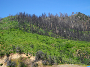
South Fork of the Kings River. Just outside the park the road
passes through a section of the forest that was burned by the Rough
Fire in 2015.
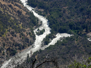
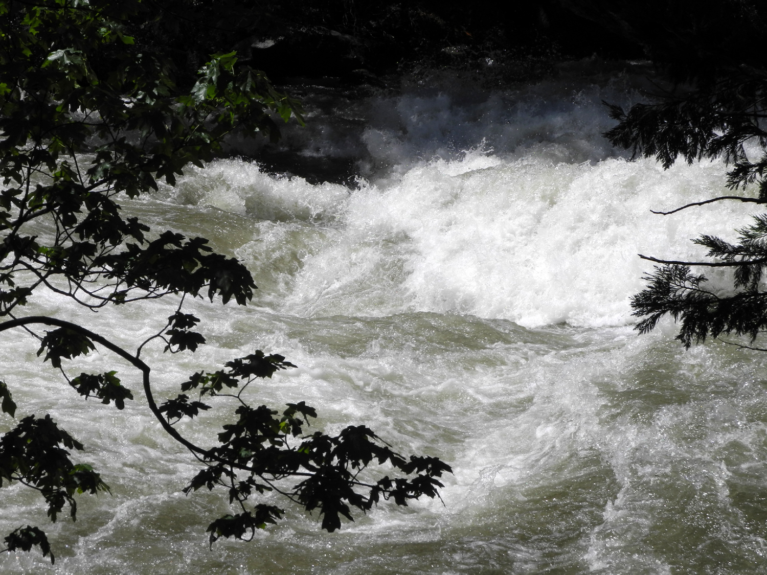
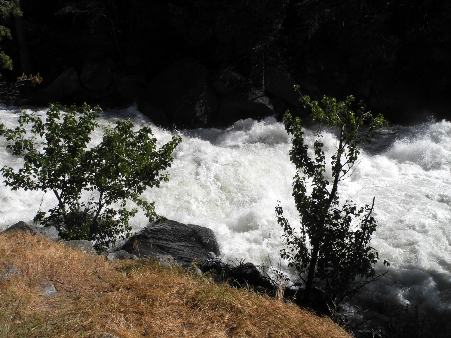
On the way down there's an
amazing view of the Middle and South Forks of the river coming
together below Yucca Point. When you reach bottom, you have
dropped from above 6,000 feet to about 2,400. The road then climbs
gradually to the glacier carved valley that encloses the Cedar
Grove section of the national park at 4,600 feet. Along the
way, the river is a raging torrent of white water, dropping over
ten foot cascades, crashing against boulders and throwing up white
spray.
|
|
| |
 |
 |
 |
 |
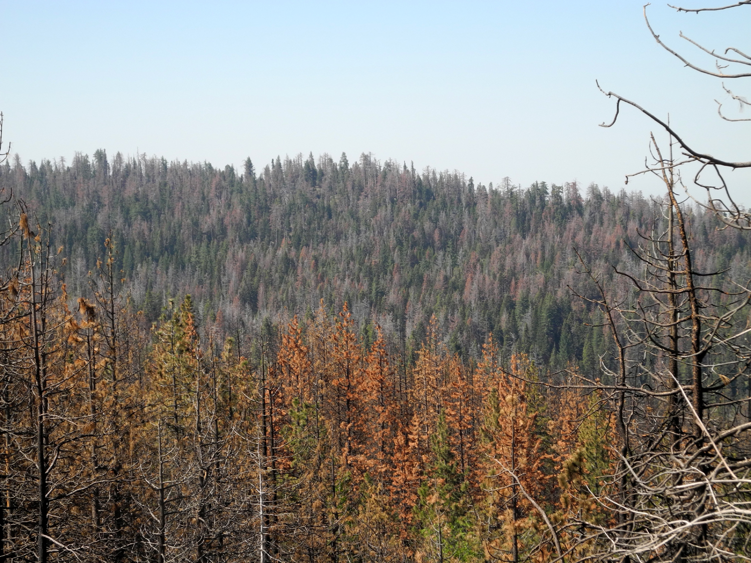
The
scars left by the Rough Fire will linger for
years, but new growth is
already evident |
Two
raging torrents converge as the Middle and South Forks of the Kings
River
join forces below Yucca Point |
There
is absolutely no smooth water
anywhere on the river where it runs
down
the canyon below Cedar Grove |
| |
|
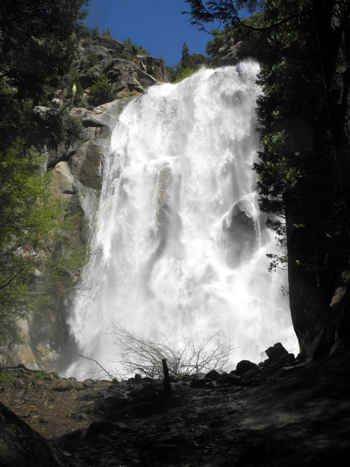
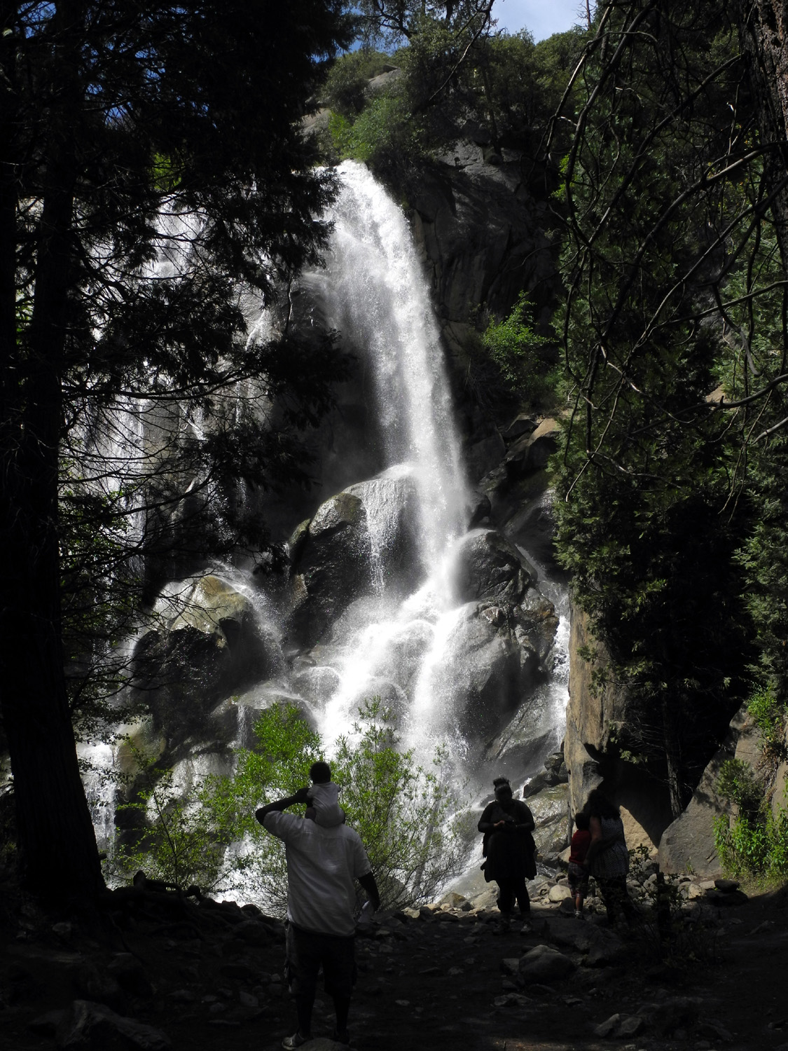
Other than a
rest stop at the Big Stump entrance area, my first stop was at Grizzly
Falls, located in the Sequoia
National Forest about six miles west of the entrance to the
Cedar Grove section of the national park. This falls was running
big when I was here last
June, but I have never seen it like it was this time. I could
feel the mist from the falls as soon as I got out of the car, and
standing at the closest viewing point meant braving wind and water
(I wore my poncho). I stepped directly into that area and took a
quick photo, then observed from the side.
Continuing up
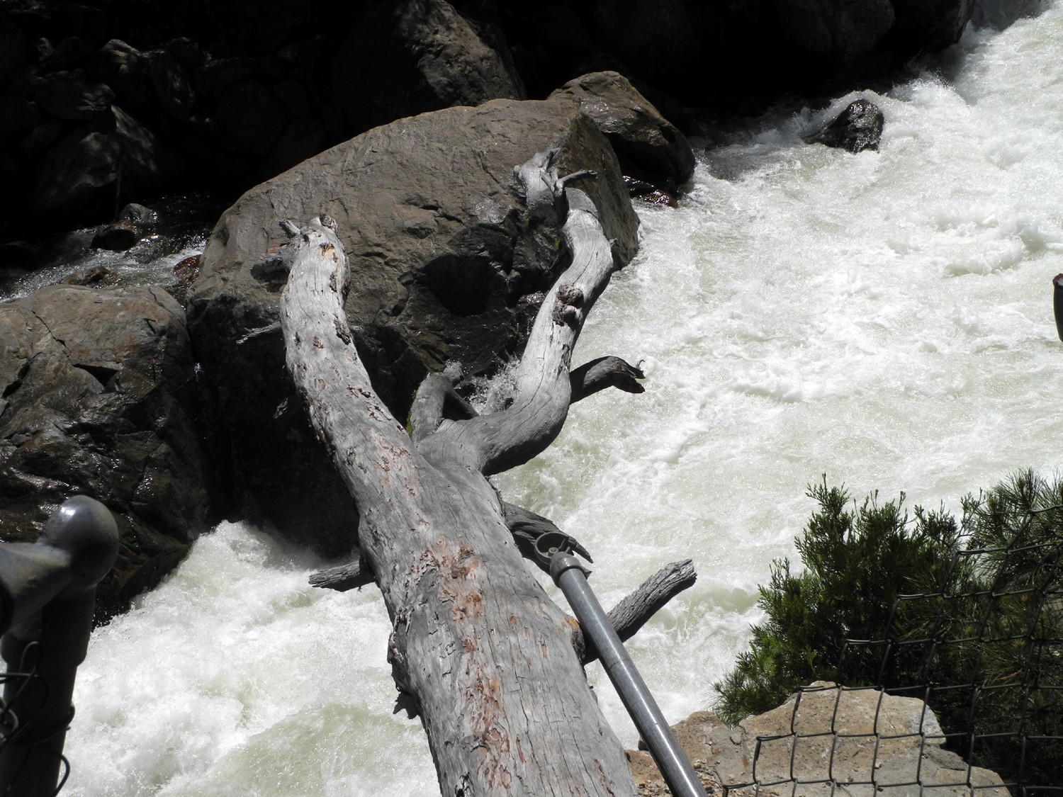
the road, I entered the park and made a stop at the Roaring
River Falls. There is a paved trail up the east side of the
river about 300 yards to the falls; and a rough dirt trail on the
opposite side, which leads to a fenced in viewing area. This side
is made more interesting by the fact that a tree has fallen on
the fence and bent it down in the middle, but it's still safe
if you are not foolish. Many years ago I camped by the Roaring
River in the high country where a trail crosses. Up there it was a
quiet stream, but when there is record snowfall, the last part of
it races down a narrow chute then over the final short drop into a
pool that is a churning whirlpool this year.
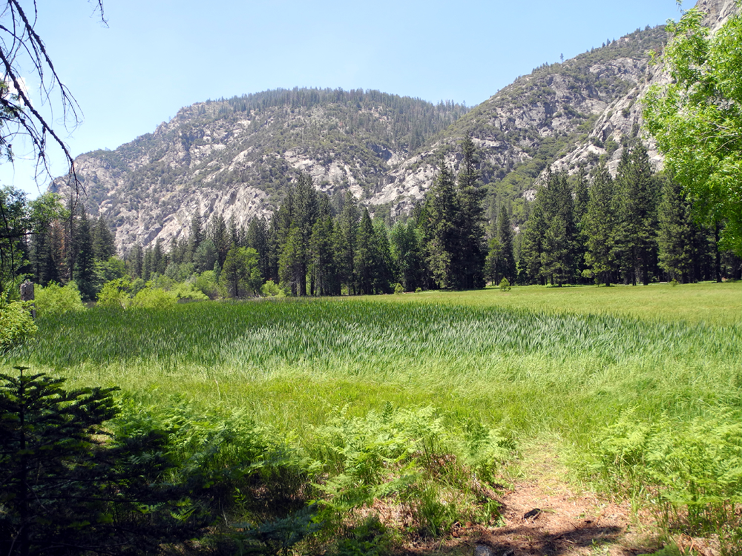
My final
"big activity" in Cedar Grove was a hike at Zumwalt
Meadows, which lie on the south side of the river a short distance
from the end of the road. At one point the 1.5
mile loop trail crosses via a boardwalk a part of the meadow
that is subject to flooding. My daughter Teri was there a week
earlier, and said that the water was about two inches over the
boardwalk in some spots. This time there was water right at the
start of the boardwalk, and it was clear it was way over two
inches not very far in. I didn't see anyone actually go farther
than the first few feet before turning back. In the other
direction the trail goes up through a rocky section, then back
down to the edge of the meadow, where I took some photos and
rested before turning back. |
|
| |
 |
 |
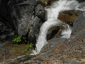
| Grizzly
Falls drops 75 feet and is right off the
road about six miles below Cedar Grove |
Zumwalt
Meadows near Roads End above the Cedar Grove section of Kings Canyon
National Park is a candidate for the park's most beautiful meadow
|
| |
| Once I finished
my hiking at Cedar Grove, I headed back to Grant
Grove Village, where I had reservations for a tent cabin. This
was not my first choice, but on two days notice, it was the best I
could get. It had no electricity, no heating, no cooling, no
bathroom, no water. It did have two nice queen size beds and
plenty of rustic furniture. It was a couple of steps above
sleeping in my pickup camper, but the camper costs a lot less than
$72.
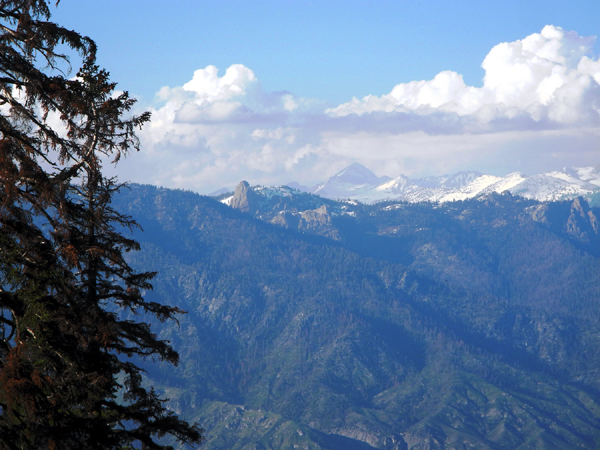
As soon as I got settled, I
drove the two miles up to Panoramic Point, where a paved
quarter-mile trial leads to a spectacular view of the high Sierra.
You are looking down into the South Fork of the Kings, and across
to the snow-covered peaks in the park's wilderness area. Neither
words nor photos do justice to this easy-to-reach vista. |
|
|
 |
 |
The
view from Panoramic Point, with Mt. Goddard
barely visible in the middle
of the photo |
Looking
down into the South Fork canyon; the
Middle Fork goes up just out of the
frame to the left
|
|
|
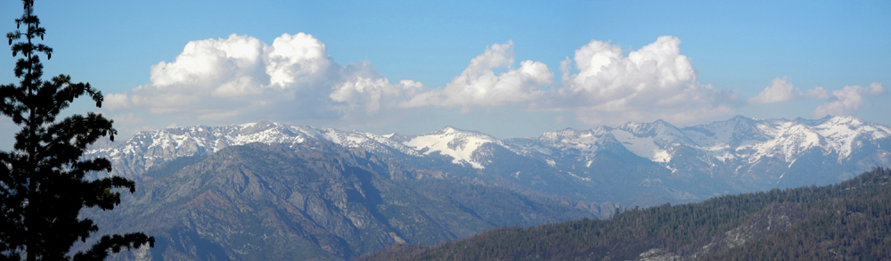 |
| The
High Sierra from Panoramic Point |
| |
 |
 |
 |
 |
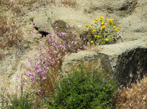
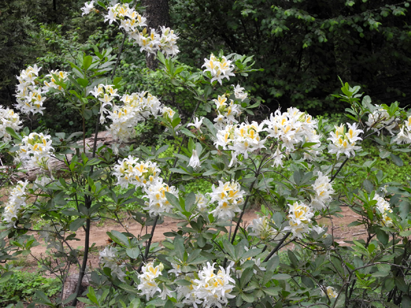
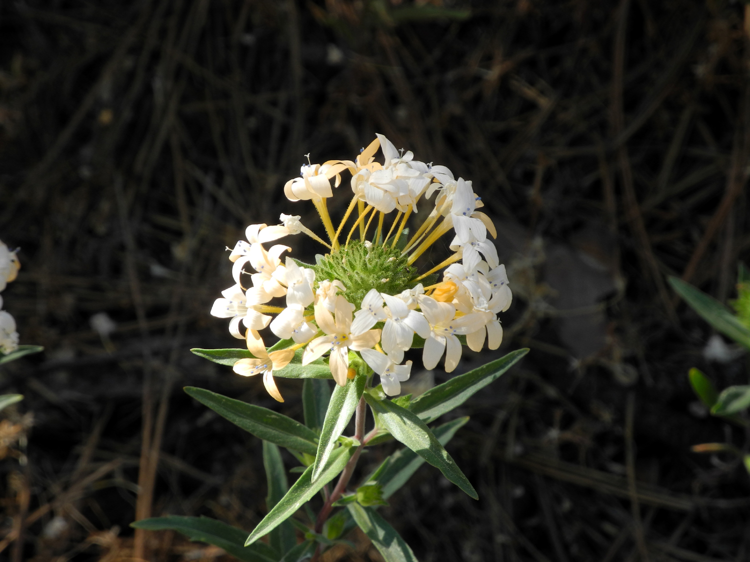
| Farewell-to-spring
and a daisy-like flower provide a nice color combination |
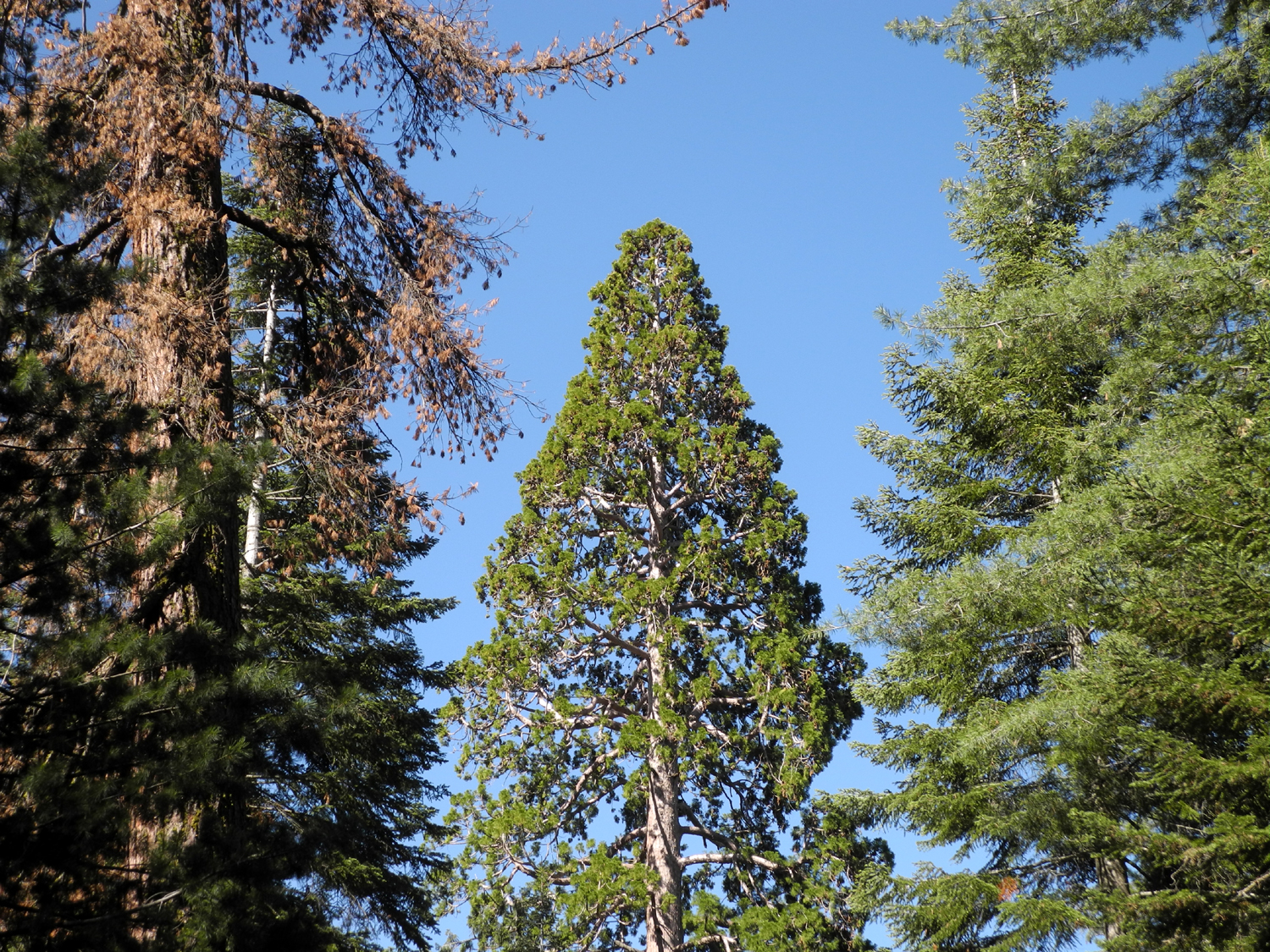
This
sequoia is transitioning from the
pointed top of early maturity to the
rounded shape of an older giant |
Grand
collomia were thick along
the road near Grizzly Falls |
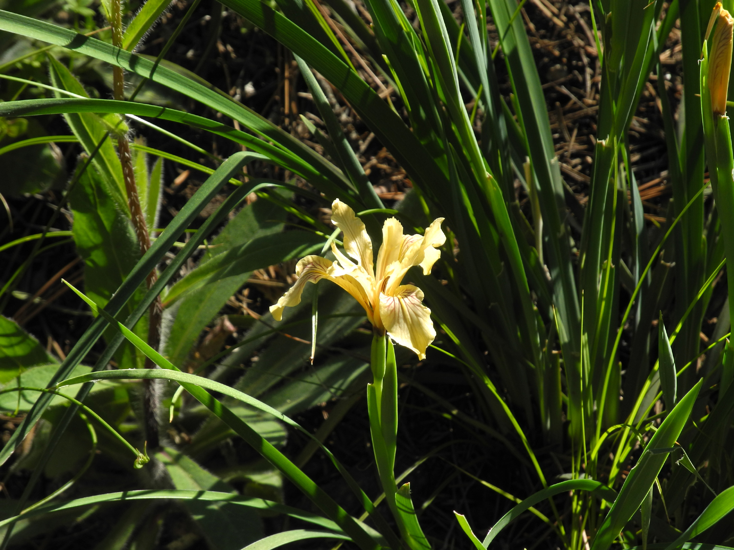
My
first time to see yellow wild iris |
| |
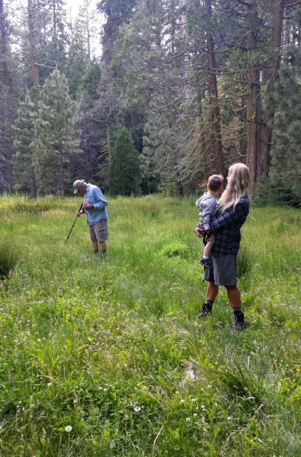
| In the morning,
after getting checked out of my cabin, I drove to the General
Grant Tree parking lot. However, I bypassed the famous
presidential namesake, and instead walked the short distance to
the North
Grove loop. This trail is either 1.5, 1.7, or 2.1 miles,
depending on which source you consult. I trust my smart phone
walking app, which gave the longer distance.
The route follows an easily
traveled dirt road for a while, then forks off, goes down into a
creek valley, and climbs back up to join the old road a short
distance past the entry point. I missed the first turnoff, so I
sort of did the hike "backward." There are quite a few
nice mature sequoias along this trail, and some interesting,
unusual sights. A part of the Rough Fire went through this area,
and there are two or three large sequoias with the upper foliage
dead and brown, the first time I have ever seen such a thing. The
upper bark of one tree was blackened and smoothed to the point
where I thought the bark was gone, but then I saw that the
"rough edges" had simply been burned off.
Completion of this trail
marked the end of this adventure, so I returned to my car and
drove back down to the heat of the San Joaquin Valley. |
|
|
 7 7 |
 |
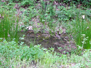
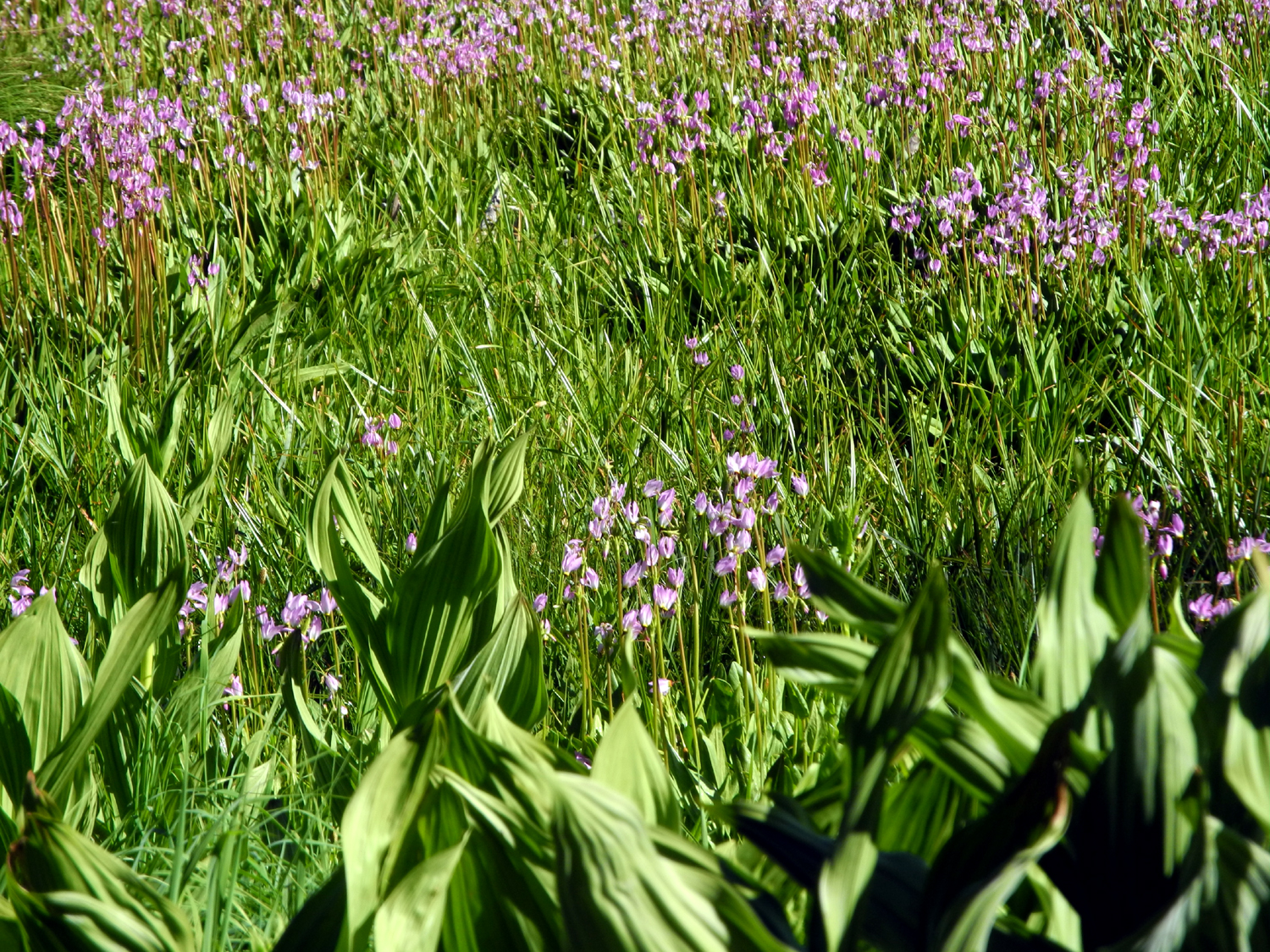
| A
meadow near where I parked overnight was covered in shooting stars |
The
Rough Fire took a toll on this large sequoia |
| |
 |
 |
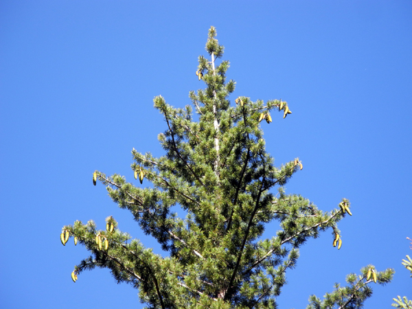
| The
graceful top of a big sugar pine tree, with a bumper crop of cones |
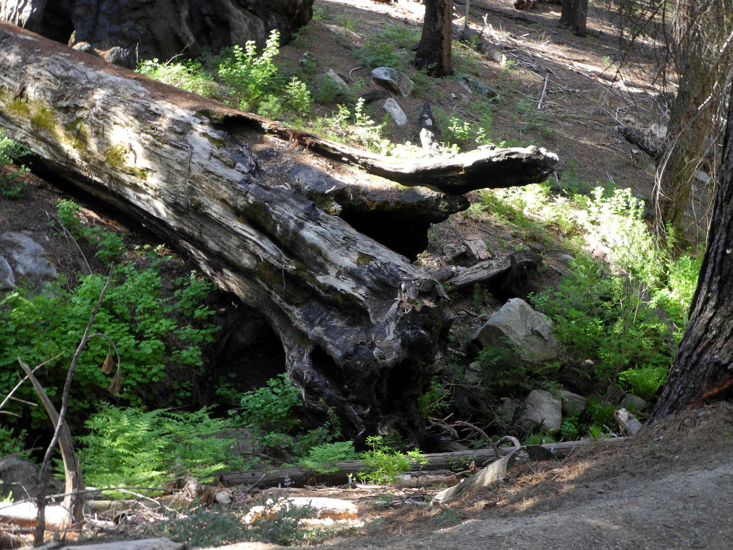
Growing
next to a stream channel led to the downfall of this sequoia |
|
|
| Family
Camp at California Flats June 9, 10 and 11, 2017 |
|
During
a combination Father's Day, Birthday and Anniversary Celebration
at California Flats, we enjoyed the antics of Jack and Colton, and
had a
great barbecue dinner with family members. Hiking, poking
sticks into the mud and just enjoying the beauty of the forest
made it a great outing for everyone
|
| |
 |
 |
 |
 |
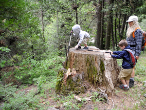
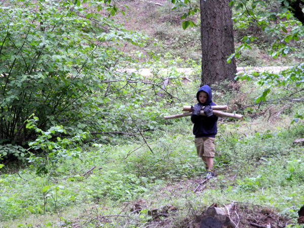
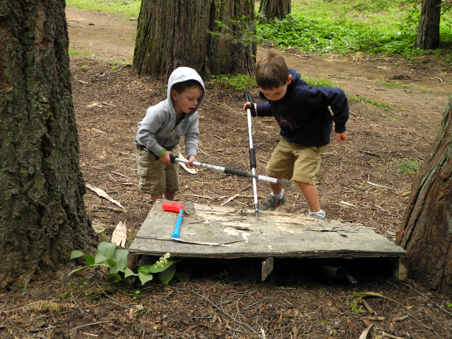
Jack
and Colton making
kindling from an old platform |
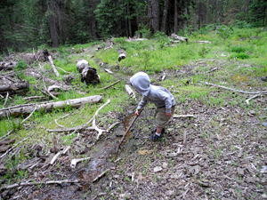
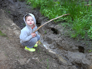
Every
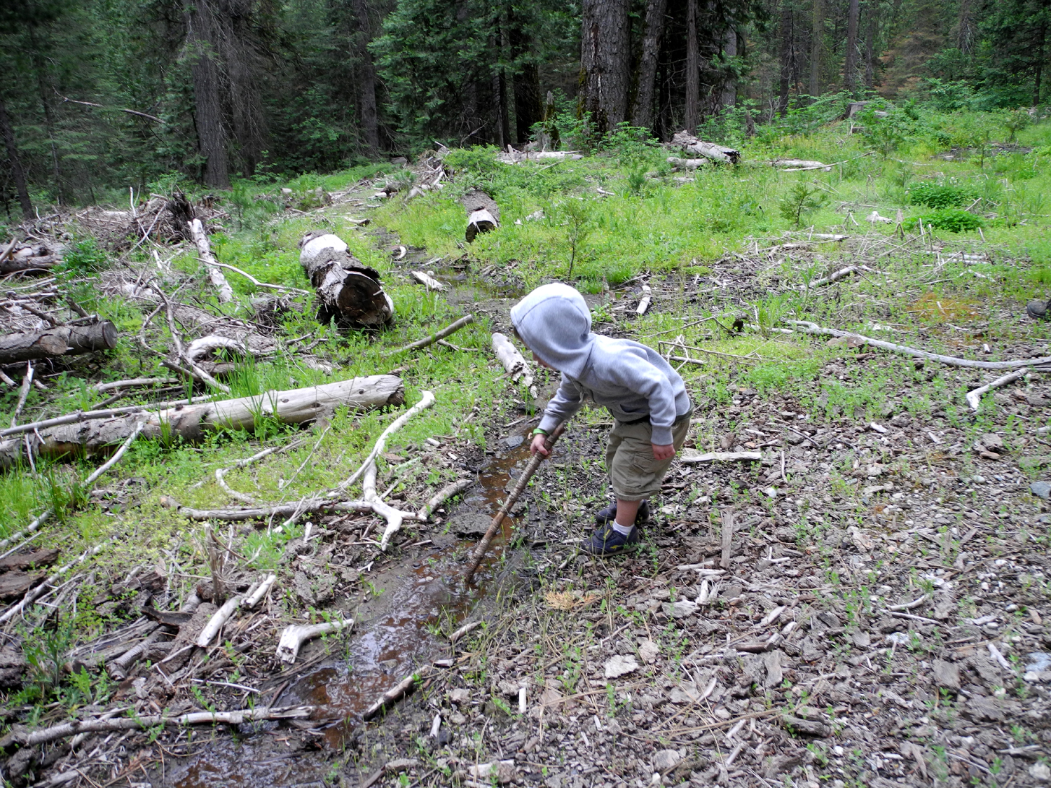
wet or muddy spot
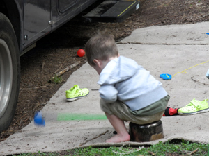
must be poked with a stick |
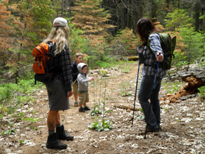
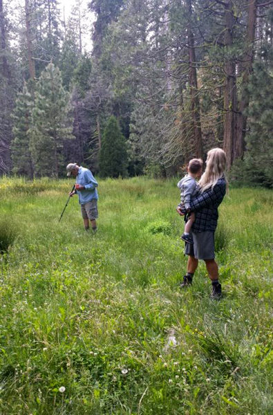
Teri,
Colton, Jack and Jennifer on
the California Meadow Trail |
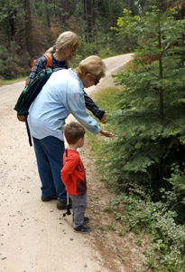
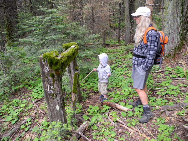
Teri,
Jackie and Jack study
new growth on the fir trees
|
| |
| On Friday
morning I drove up in my motor home from Clovis to a place where
Teri and I camped in
November, which we call California Flats. When I arrived Teri
was already there with her motor home, accompanied by Colton and
Jack. Jennifer had driven up in her new Jeep. There were people
camped right next to the spot we had wanted, so we chose a place
on the opposite side of the creek. The road is a little rougher,
and it took careful maneuvering to get both motor homes situated,
but soon our
camp was in place and we were ready to explore.
An old road goes up along
the creek starting across the main dirt road from where we were
camped. Vehicle access is blocked by a huge log, and the road is
not drivable, but many years ago I was able to drive in there in
my Datsun pickup. Now it's a nice hiking trail, with lots of
plants and trees, and some wet
spots that tempted the little guys to get as close as
possible.
We also enjoyed a flower
that I have not seen for a while, not because they are scarce, but
because I just have not been in the right place at the right time.
There were a number of azalea
bushes in bloom along the trail, and later we realized that
they were thick across the main road from our camp.
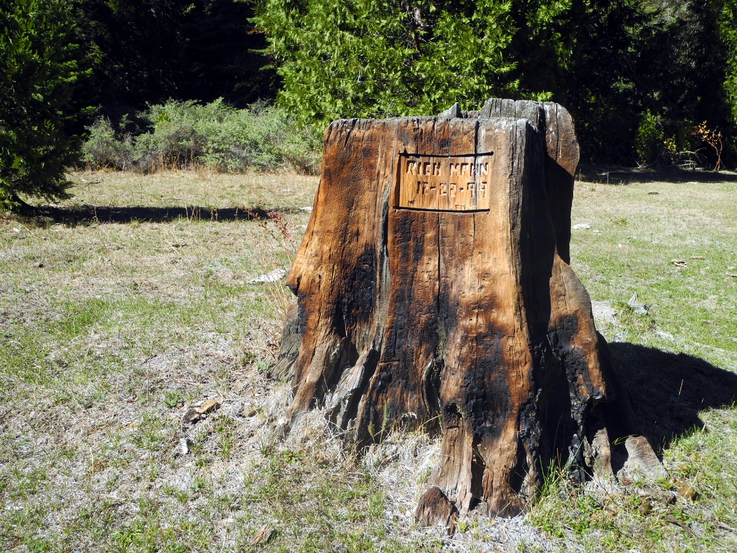
We walked in as far as
California Meadow, which I've written about previously. There are
a number of stumps in the meadow, one of which has names
carved on three sides. However, due to the flow of water in
the creek, we did not attempt to cross over into the meadow.
Instead we introduced the boys to the concept of "artifacts,"
which included a section of an old fence, some posts, and an old
serving table in a camp site.
When we returned from the
hike, it was wood-gathering time. On our scouting
trip the previous week, Teri and I had seen a bunch of
firewood at a campsite near Nelder Grove. Jennifer and I put a
tarp down in the hatchback of her Jeep and drove there, hoping for
a big wood score. However, someone had occupied that camp site, so
we were out of luck. We gathered some half-rotten chunks nearby,
and some more slightly better pieces just up the road that goes
into Nelder campground. When we got back, Jennifer's new Jeep had
lost a lot of its newness.
Meanwhile, Teri and Colton
were gathering
kindling. while Jack supervised. We soon had a good pile
stacked up by the fire ring, and were ready for dinner. Between
that, walking around the area and just "camping," we
never got a fire going that night. But at least we were ready for
the next day.
At some point during the
day, the boys found an old cooking pot in the camp area, which
became a toys of many uses. Our favorite was when Jack used it as a
stool to sit on. |
|
| |
 |
 |
 |
 |
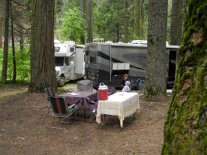
| Our
home in the forest |
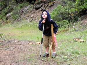
Another
use for hiking poles |
Stump climbing |
The
boys found an old pot near
camp and put it to good use |
|
 |
 |
| Jack
and Teri study an artifact |
Chore
time |
| |
| I always try to
check the temperature during the night when I'm camping. Due to
partial cloud cover, it only got down to 46.
After breakfast the next day
we set out to walk down the creek to where it goes over a small
waterfall. The most direct route was to follow the road past our
camp, then walk through a meadow that Teri and I had crossed
several time in November. Of course, that was before the big rains
of early 2017, and the meadow had become what it should be - wet
and spongy. We were already aware of an alternate route - up the
dirt road toward the paved road, then down an old logging road
that connected with other roads, one of which led out to a nice
campsite right next to the falls.
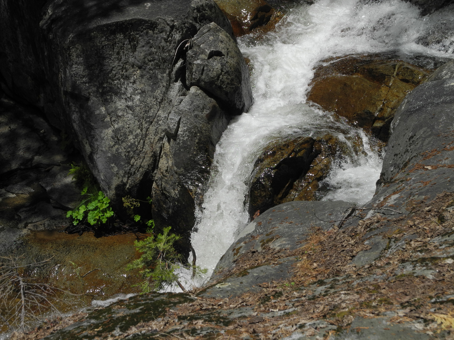
About half way up the hill,
Jack stopped to observe the fascinating dirt and plants at the
side of the road, and was clearly not interested in any further
hiking. Teri stayed with him, while Colton, Jennifer and I
continued on. After we started down the log road, Colton began
asking to go back, but when we reached the little waterfall, he
stood there mesmerized. He developed an interest in waterfalls on
a visit to Yosemite a couple of years ago, but I think this was
the first time he had stood at the top of one, watching the water rush
over and drop just below his feet.
After we had enjoyed the
falls (and enjoyed watching Colton enjoy the falls), we started
back. In March I had tried to go upstream close to the creek,
which Teri and I had done in November. At that time water flowing
out toward the creek all along the meadow made that route
impassible, and considering how wet the meadow still is, we
decided to retrace our original route back to camp.
|
|
| |
 |
 |
 |
 |
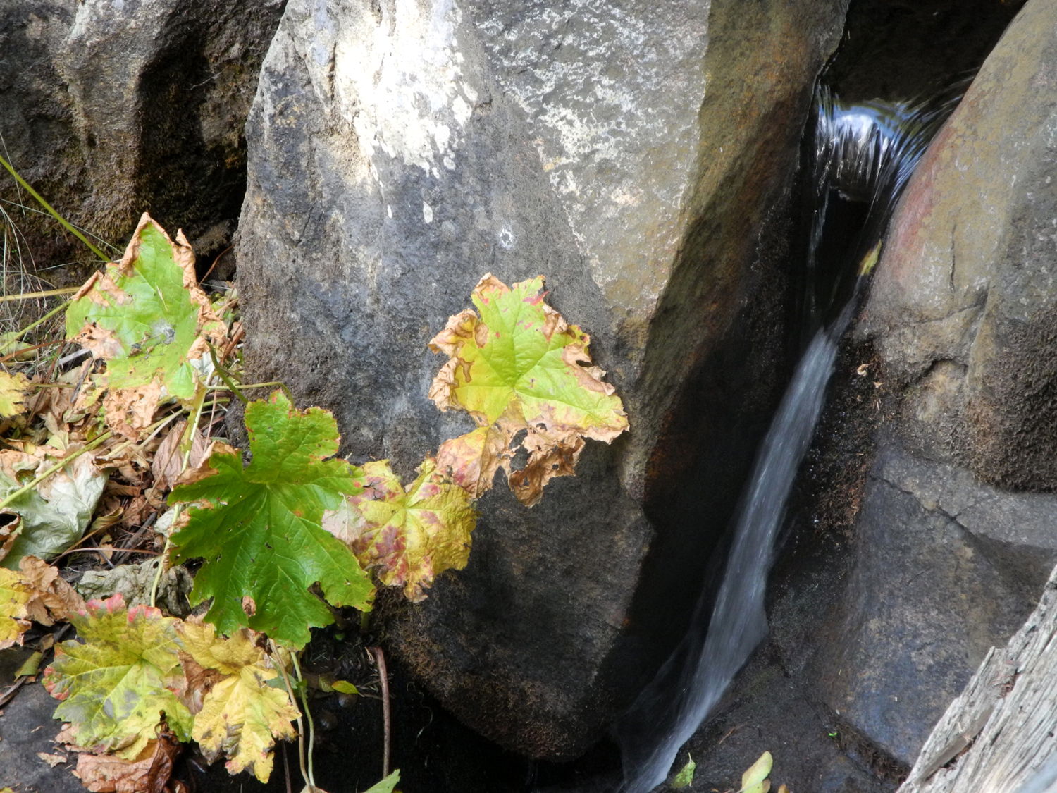
| The
falls on California Creek below our camp - October 2014, April 2017, and
June 2017 |
This
delightful pool, surrounded by water-
loving plants, will soon be gone |
| |
| Not long after
we got back to camp, the rest of our party arrived - Teri and
Jennifer's mom Jackie; the boys parents, Johnny and Brittany, and
Jen's husband Rod. Our family campout group was now complete, and
we filled the time with a variety of activities. Jack was napping
when his parents arrived, and was delighted when he woke up to
find his mother sitting next to the bed.
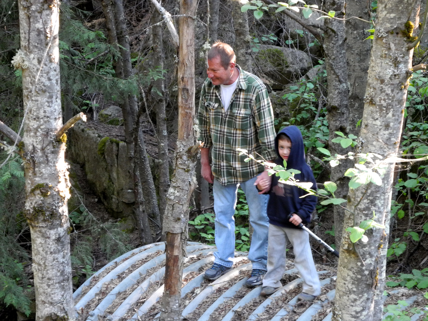
Rod and Johnny led the boys
on a short expedition to check out the culvert
pipe that carries the creek under the road. They were able to
get down by the creek and see where it runs out, then get up on
top of the section of the pipe that extends past the road.
Next the Upshaw's and I
started to hike to the waterfall again, but half way up the main
dirt road it became obvious the boys were not up to that much
effort, so we walked to the paved road, then went back. Johnny and
Colton went ahead, taking a short cut via the rough road road that
runs to the nearby meadow (separate from the trail). As Brittany,
Jack and I followed, Jack discovered
another wonderful muddy trickle of water, so we stopped there for
a while.
Meanwhile Teri and Jennifer
had started the barbecue and were fixing tri-tip, and soon we
enjoyed a fantastic dinner. It was cool enough by this time that
it felt good to have a campfire, and that of course led to s'mores,
which the boys have enjoyed previously. Their marshmallow roasting
technique still needs work, but when you have chocolate and
marshmallow goo on your hands and face, who could ask for more?
Before long it was time for
the day visitors to leave, so Rod, Jackie, Johnny and Brittany
left for home, taking Colton and Jack with them, and leaving Teri,
Jennifer and me to enjoy the fire for a while longer. It was
noticeably cooler the second night, and with no clouds the low was
36 degrees.
In the morning we ate a
leisurely breakfast in my motor home, then got everything packed
up for our departure. Once again we had to do some careful
maneuvering to get the big vehicles pointed in the right direction
and out to the main road, but soon we were on our way - a short
trip of about 15 miles for Jennifer, and about 55 for the valley
dwellers.
Everyone had a wonderful
time, and we are looking forward to other family camping trips
later this summer.
--Dick Estel, June 2017
|
|
|
 |
 |
 |
 |
|
Jack
discovers one more
place to poke in the mud
|
Azaleas
were thick
along the trail and road |
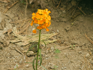
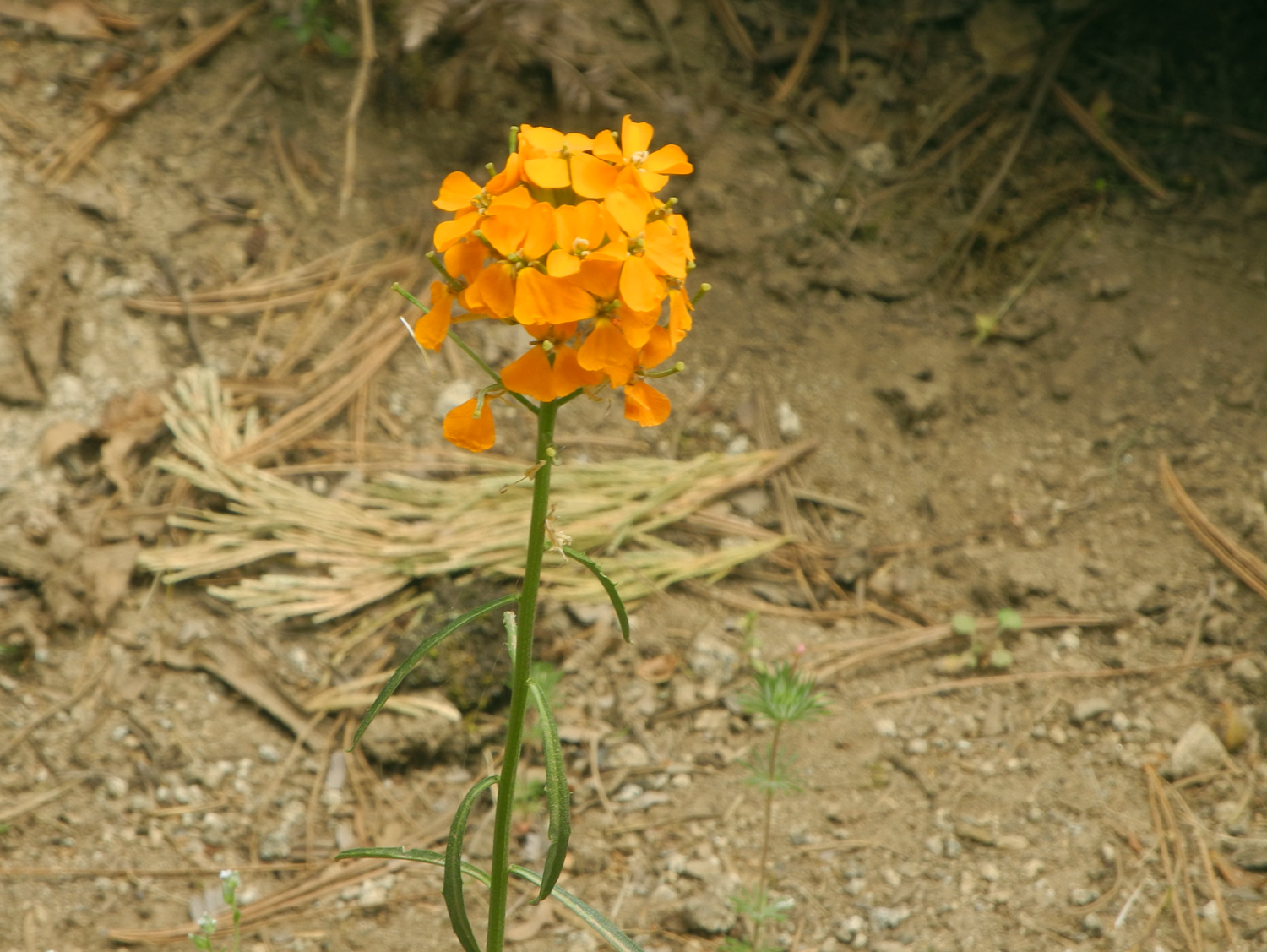
Western
wall flowers added
bright orange spots of color |
Rod
and Colton check out the culvert
pipe that carries the creek under the
road |
|
 |
 |
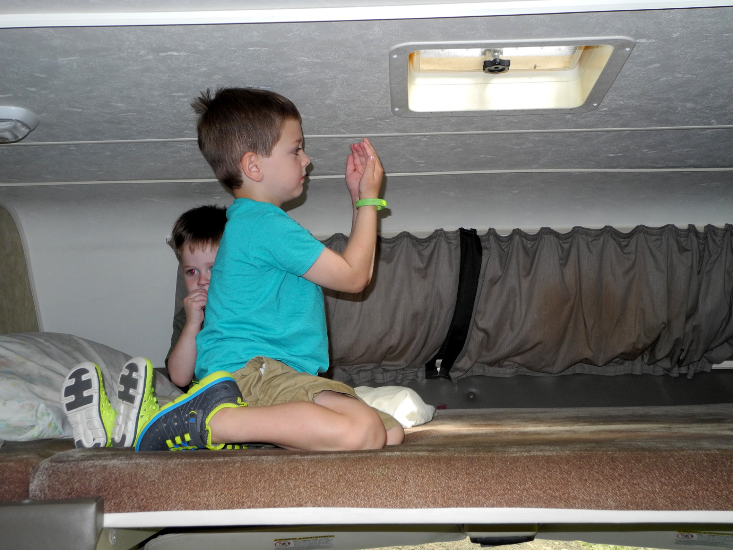
One
of the boys' favorite activities was climbing up into the
upper deck of
my motor home. Here Colton is "catching sunshine" |
Apparently
older "boys" like to poke things with sticks too |
| |
 |
 |
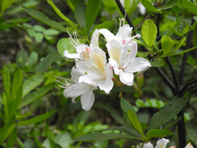
| Azalea
blossoms provided a delicate sweet perfume along the road and trail |
A
big fir tree, and a big cedar with a burl |
| |


 7
7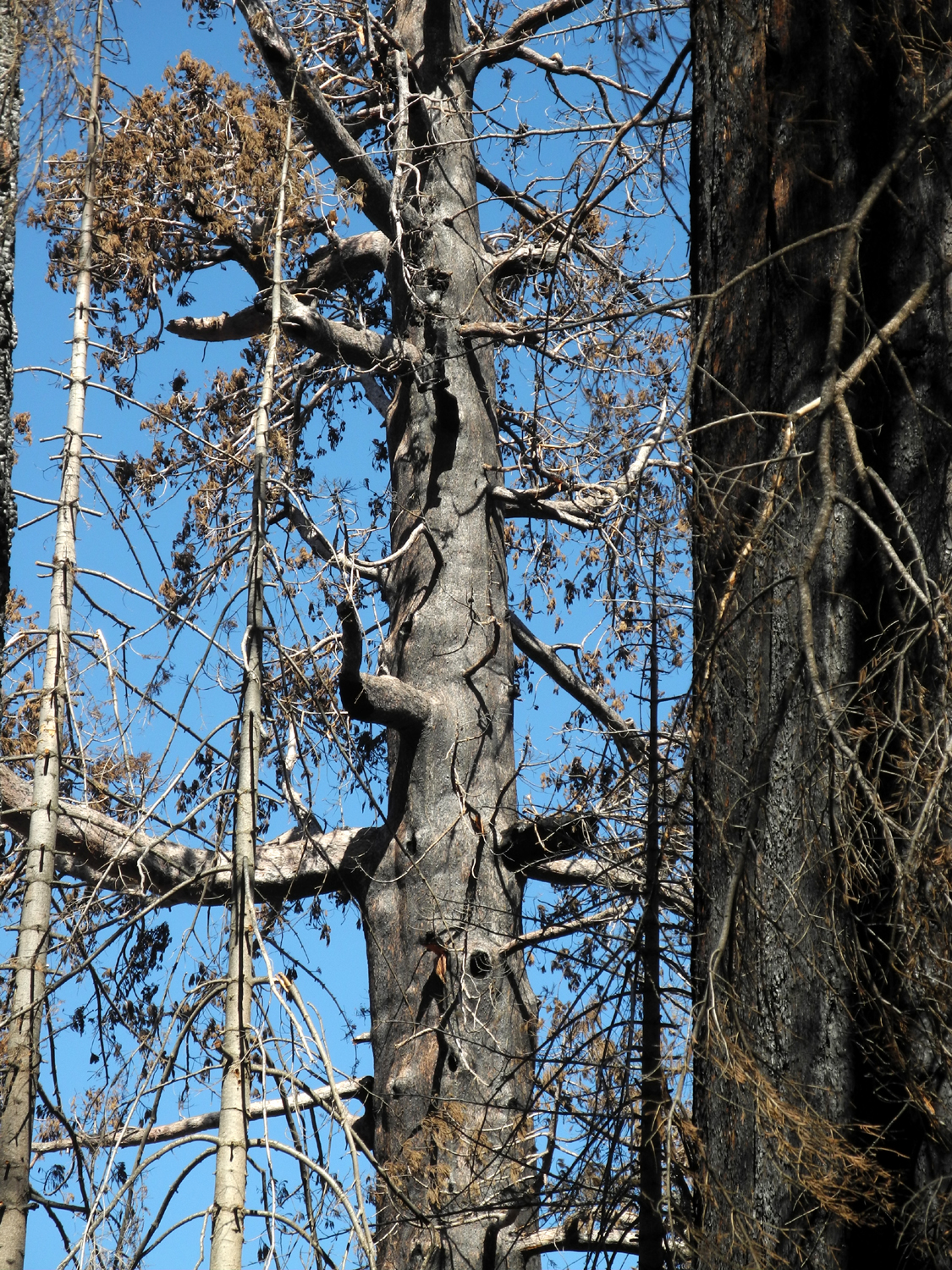


