
|
Dick's Adventures of 2020 - Part 2 |
|
| Photos Related Links More Travel Reports | |
| Adventures
of 2016 Adventures
of 2017 Adventures
of 2018 Adventures
of 2019
2020 Part 1 2020 Part 3 2020 Part 4 2020 Part 5 2020 Part 6 2020 Part 7 |
|
| Eaton Trail Again San Joaquin Gorge River Trail Edison Point | |
| Eaton
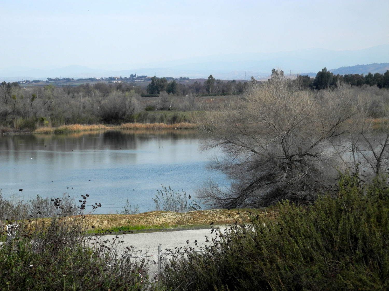
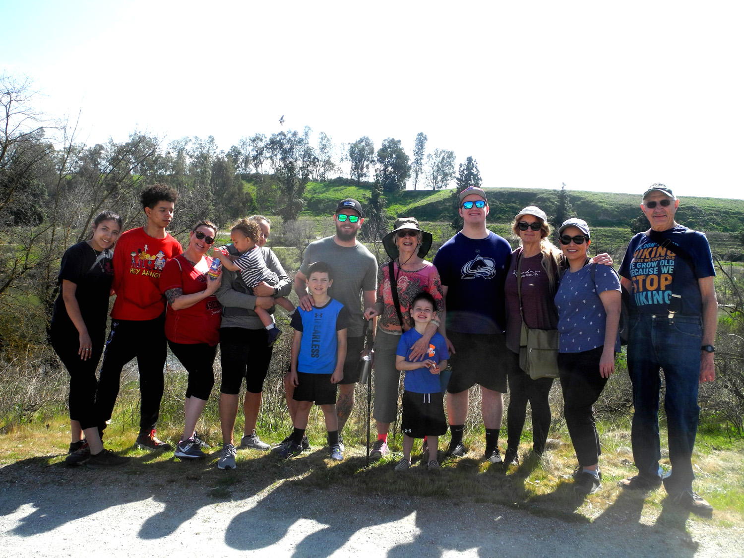
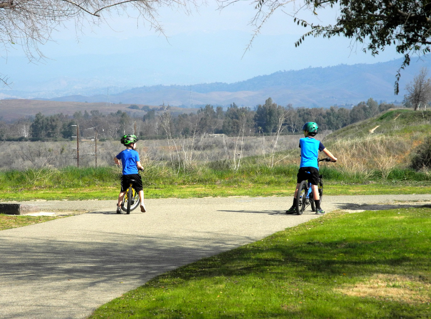
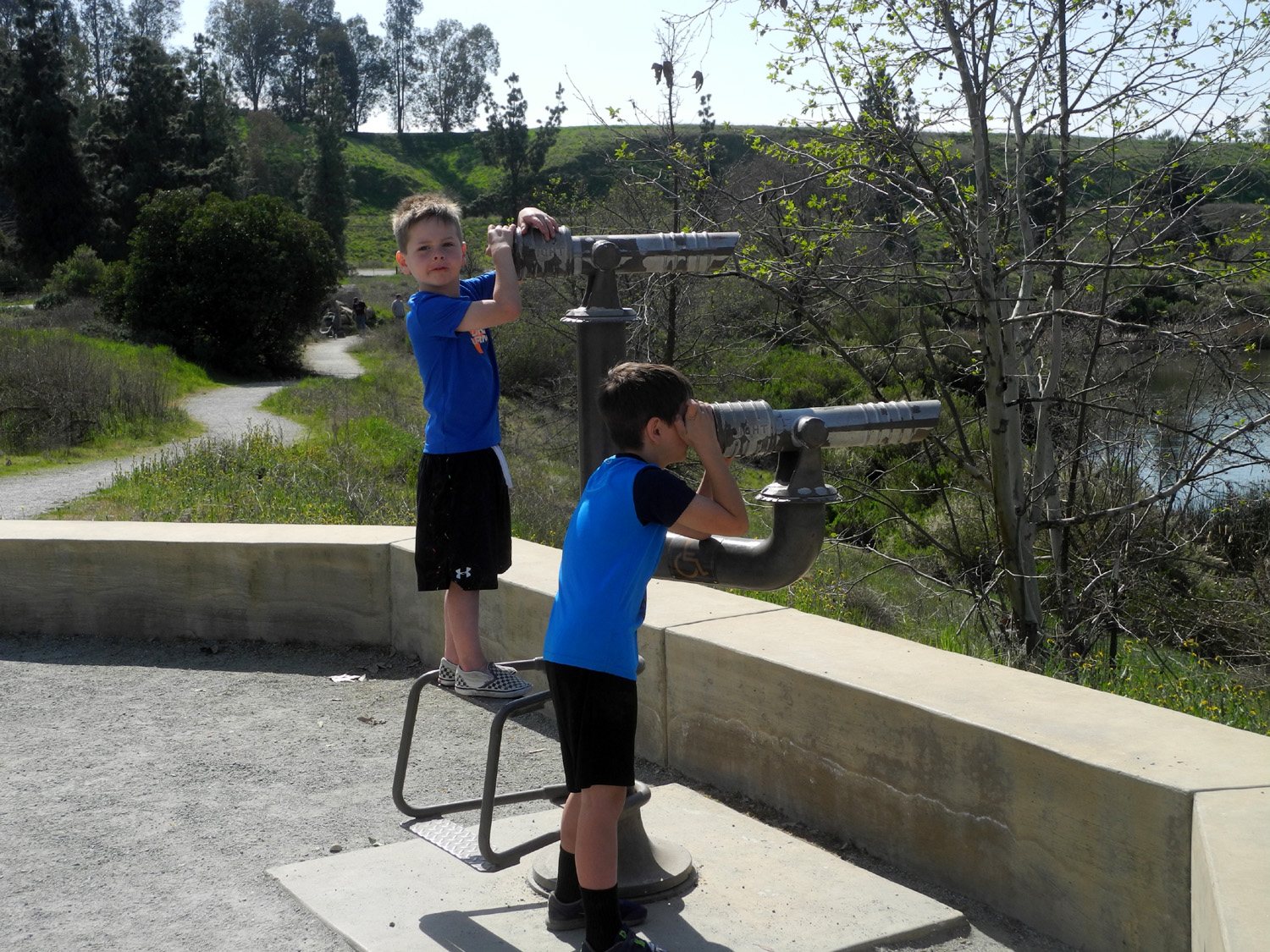
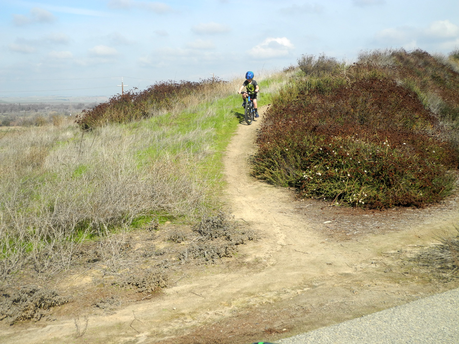
Trail Again I walked this short, easy trail with my daughter Teri, great grandsons Colton and Jack, and their Mom Brittany on January 12. On February 28 we were back again, without Brittany, but with grandsons Johnny and Mikie, Teri's mom Jackie, and several of Teri's friends - 13 lucky hikers in all. As they did in January, Colton and Jack rode their bikes, showing off their trail riding abilities on the dirt paths that have been created in the river bank along the trail. |
|
 |
 |
| Nissa,
Jaden, Dila, Omni, Jackie, Colton, Johnny, Jackie T, Jack, Mikie, Teri, Maria, Dick |
The Notorious Upshaw Brothers, ready to ride |
|
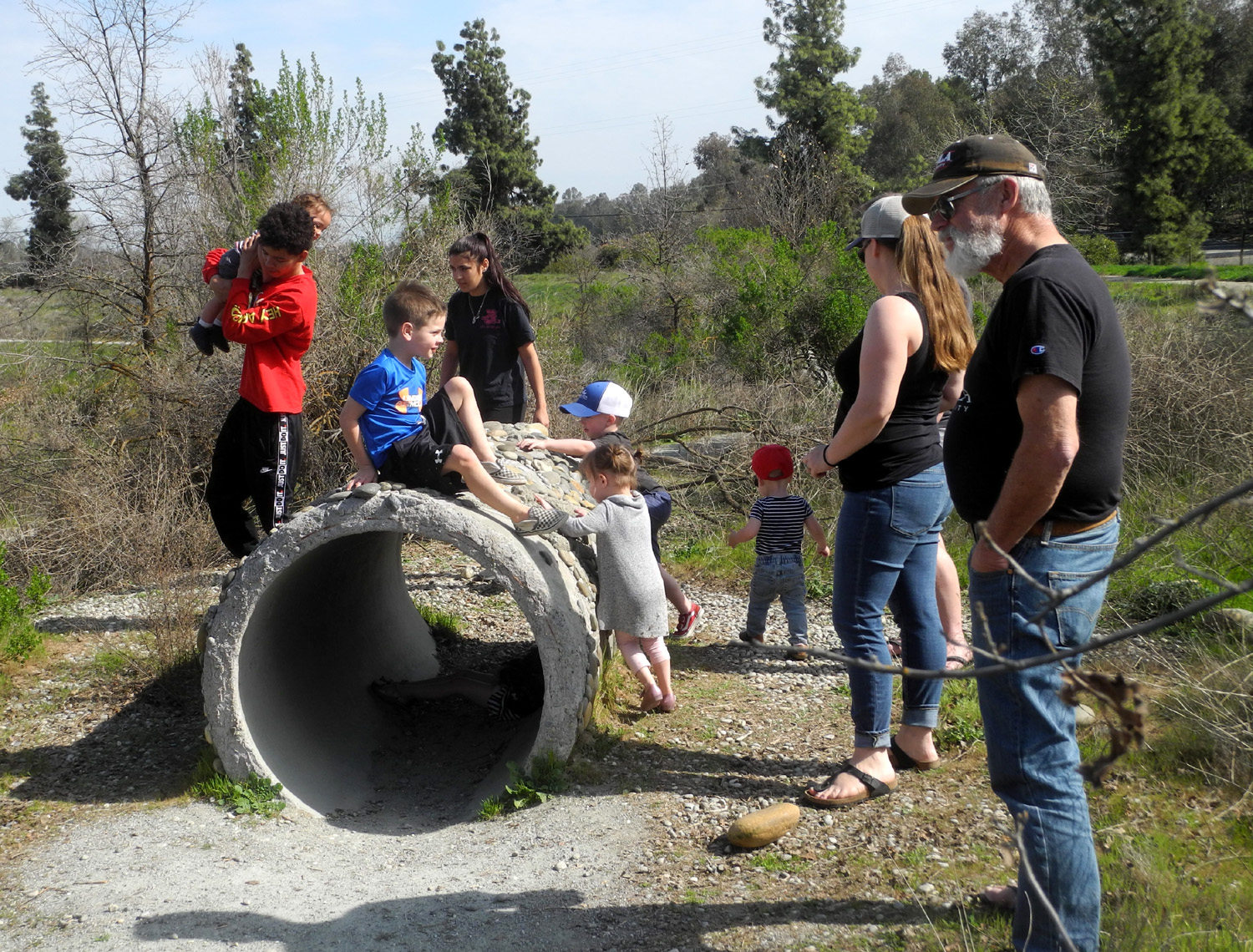
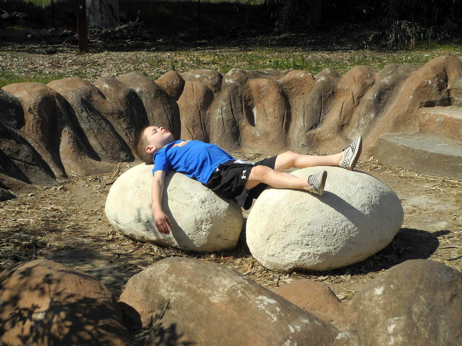
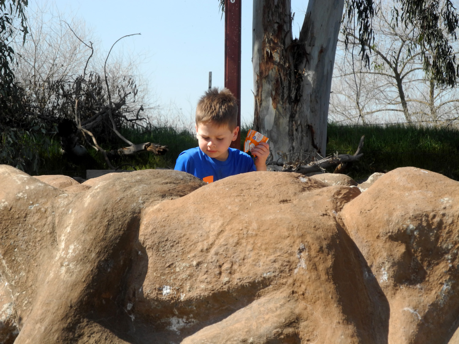
Omni, age 18 months, had one speed - running. He was carried on the downhill sections for safety reasons, but as soon as his feet hit the trail, he was off. The trail ends with a loop around the pond next to the Coke Hallowell Center for River Studies. Jack and Colton left their bikes where the dirt path started, and joined Omni in exploring the big cement replica of a mouse house, which had also attracted a number of other kids. |
|
 |
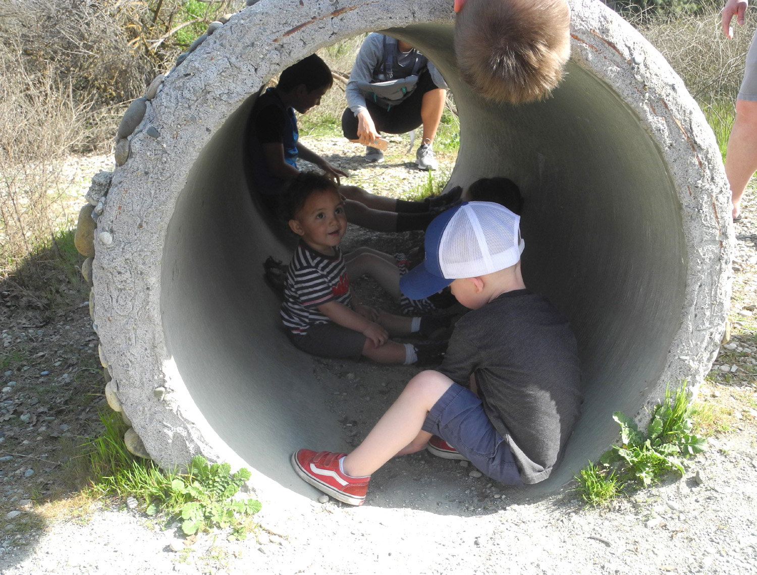 |
| Jack and other visitors at the Mouse House | Omni and friends, inside the Mouse House |
|
The replica eagle's nest, complete with eggs, proved irresistible to Jack. Meanwhile, we were treated to a visit by a hawk that flew low over our group. |
|
 |
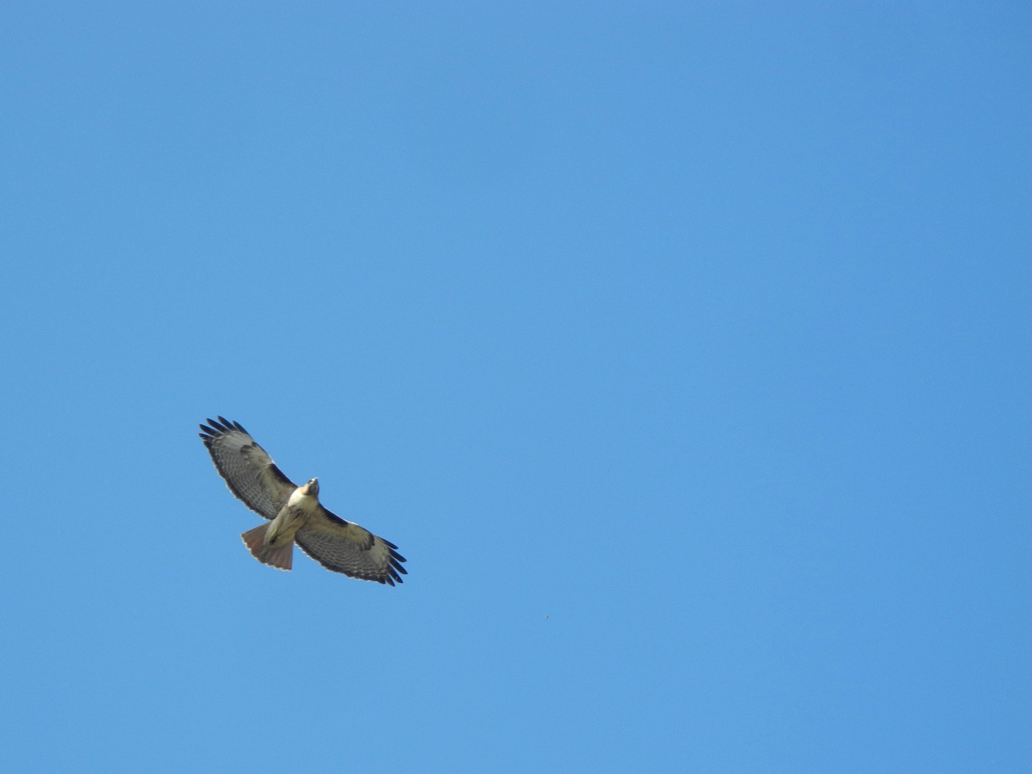 |
| Jack helps hatch the giant eagle eggs | A redtail hawk checked us out |
|
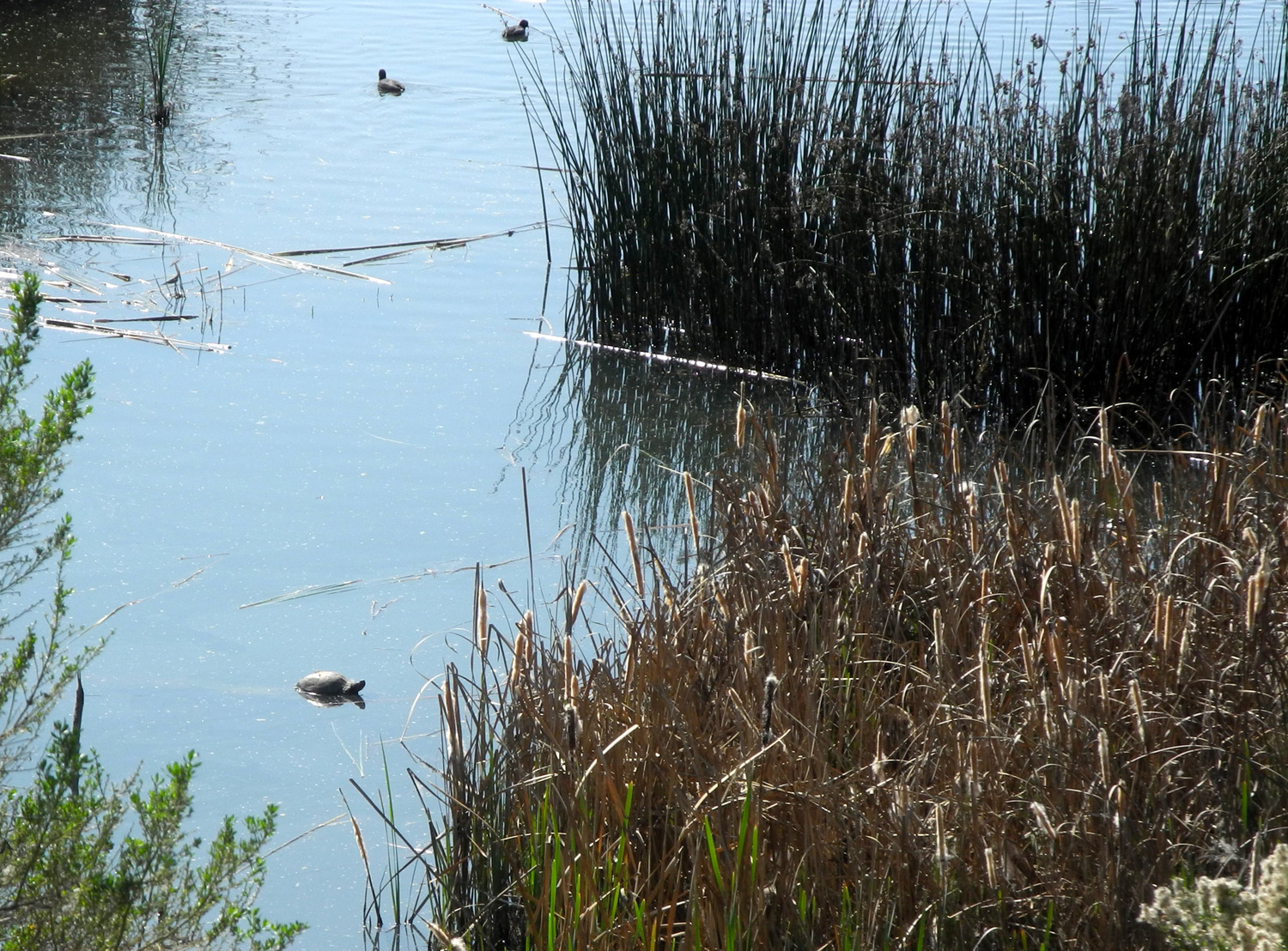
This time the old farmhouse was open, and we explored that. There are displays of animal bones and skulls, stuffed animals, and replica scat from various creatures who live in the area. Jack was especially impressed with the meeting room. Yes, the meeting room. It IS impressive - it contains a beautiful table about 16 feet long, and large comfortable chairs. As we finished our circumnavigation of the pond, we spotted three turtles, as well as a large variety of ducks. The hike back found our group scattered apart, with the younger people reaching the parking lot five minutes ahead of Jackie and I. Teri slowed down to keep us company on the final uphill stretch, which for some reason was steeper than it had been only a month earlier. |
|
 |
 |
| Western pond turtle | Looking for more wildlife |
|
It was the first time on this trail for many of our group, and all agreed that it was a great outing. --Dick Estel, March 2020 |
|
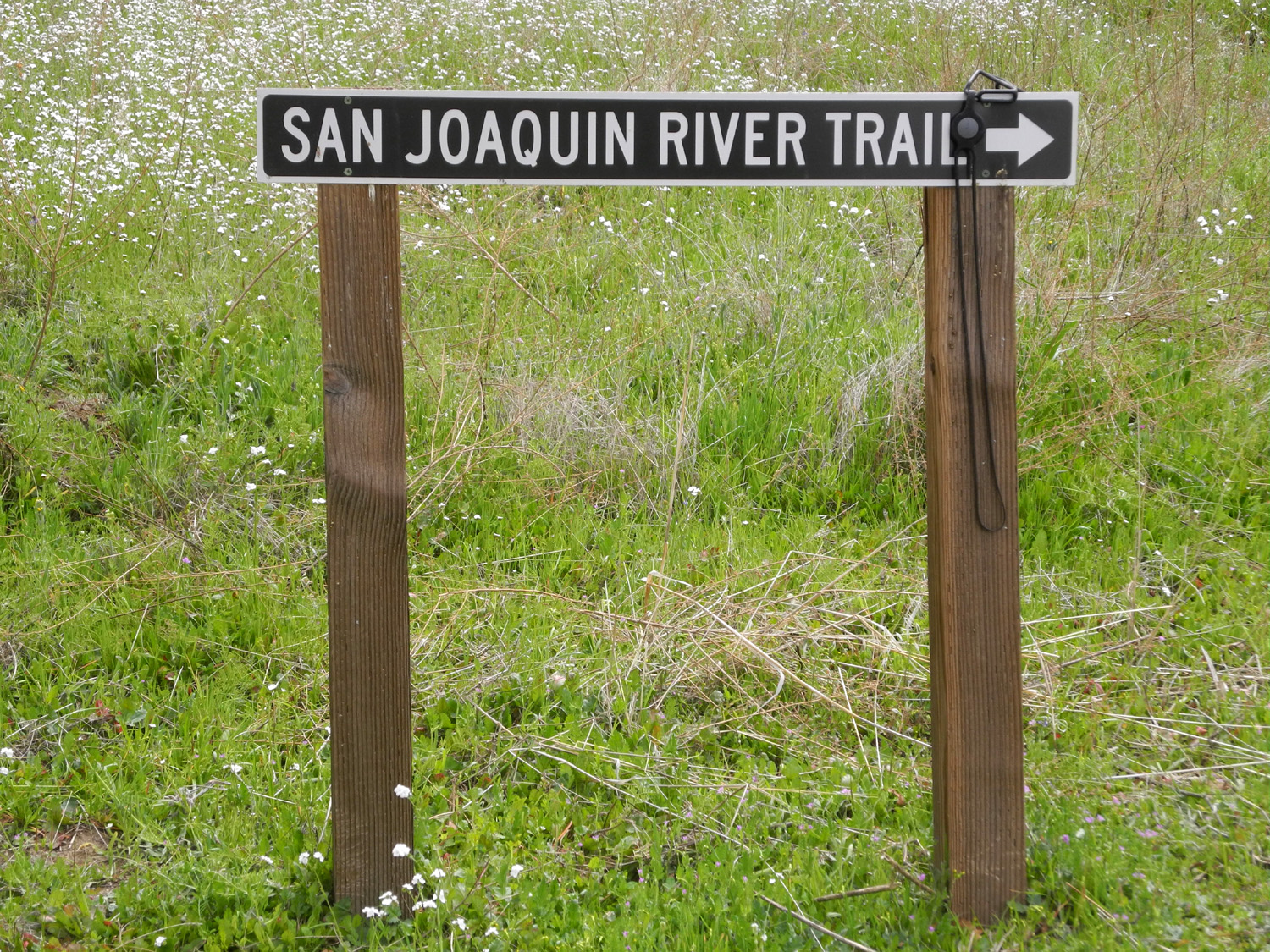
| San
Joaquin Gorge River Trail
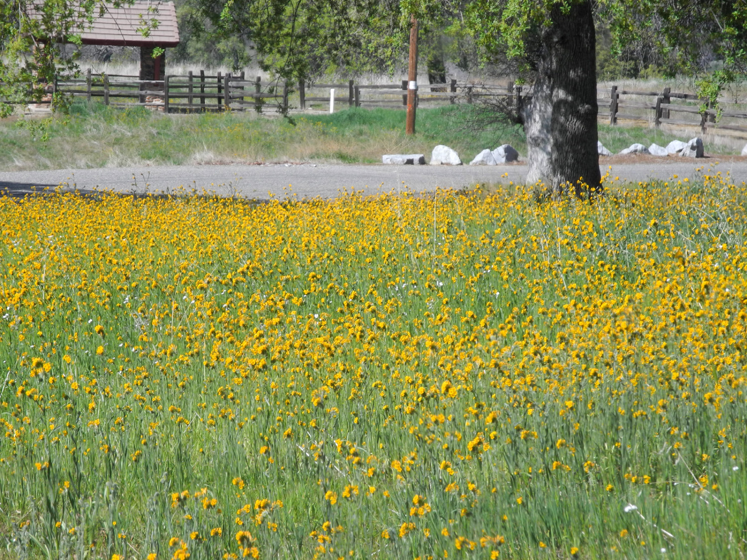
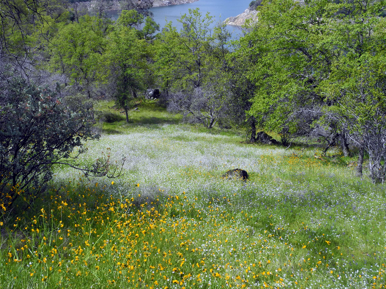
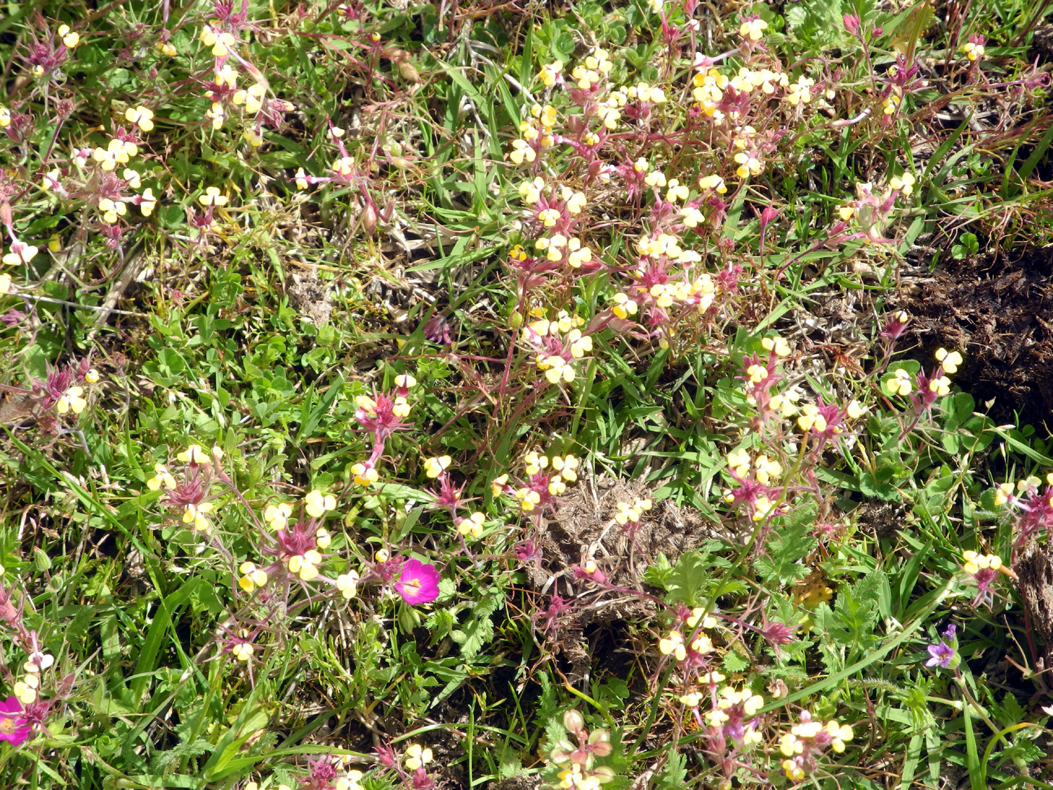
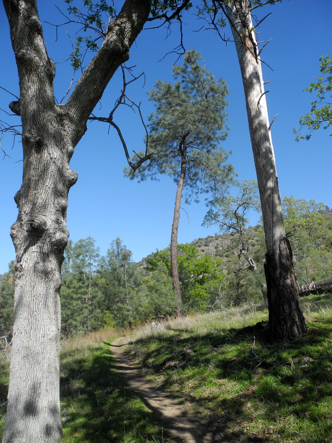
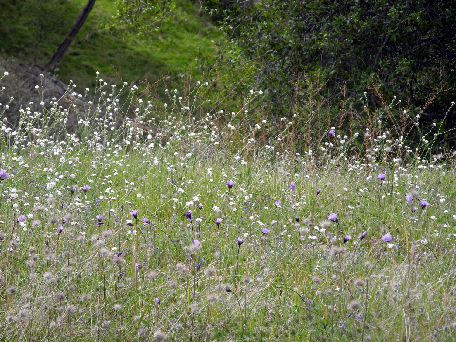
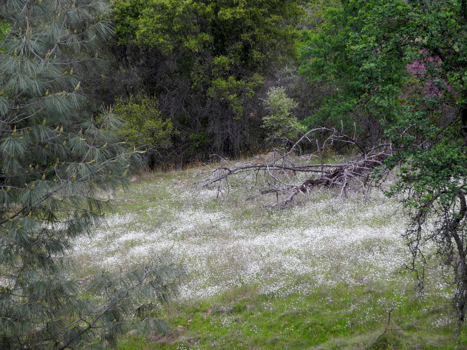
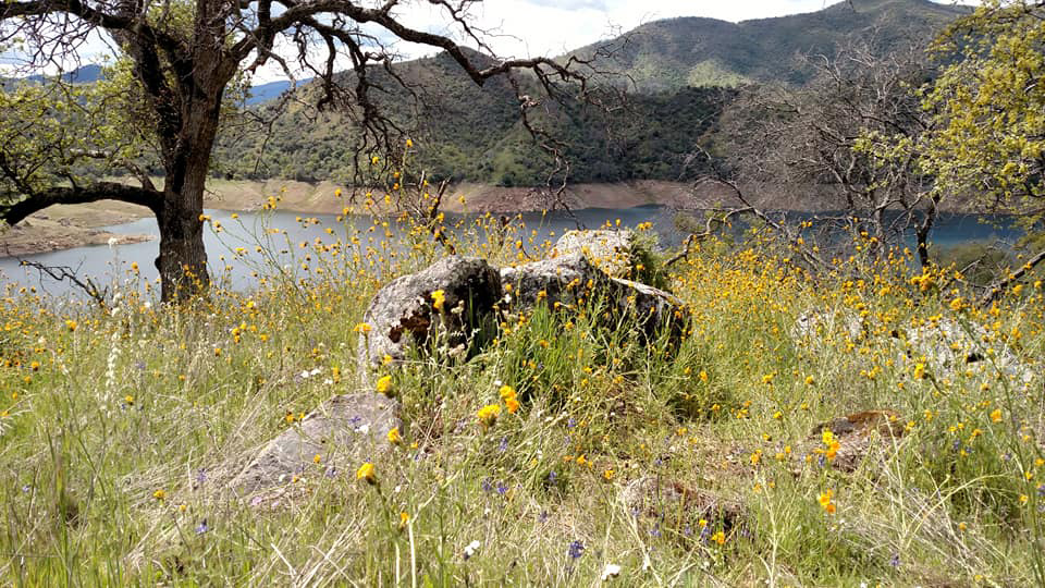
This is one of those trails that I try to hike at least once a year or more. From the parking lot/campground at the San Joaquin Gorge you can take two major trails. The Bridge Trail goes down to the San Joaquin River and across to the Madera County side. The other goes generally west, more or less parallel to the river, but high above it. In fact, you have to hike about three miles before you have a view of the river. This trail ends at the Finegold Picnic area near Sky Harbor on Millerton Lake. Since this is a 14-mile hike, it's not one I'll ever be completing, but hikes of mile or two from either end offer plenty of foothill scenery and good exercise. On March 3 I left home about 9:45 for the 35-mile, one-hour drive. Along the way I observed that the foothill flowers are getting a good start in some areas, while they are nearly absent in other spots. |
|
 |
 |
| Fiddlenecks near the campground | Popcorn flowers along Auberry Road |
|
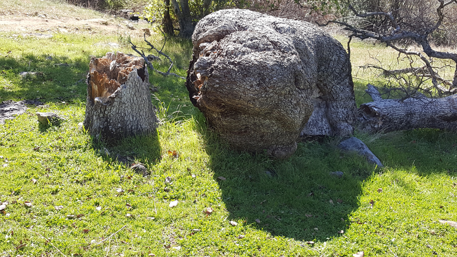
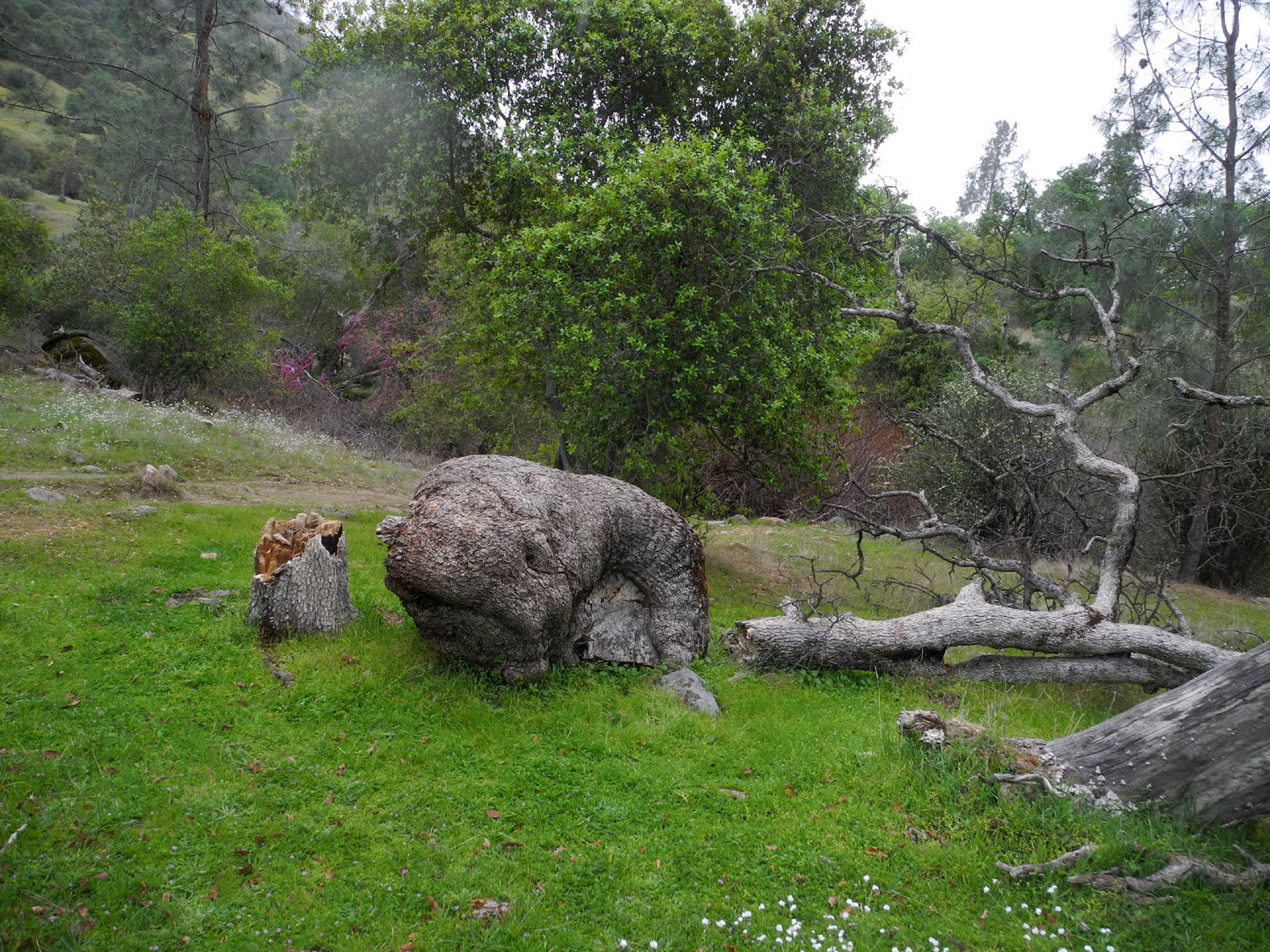
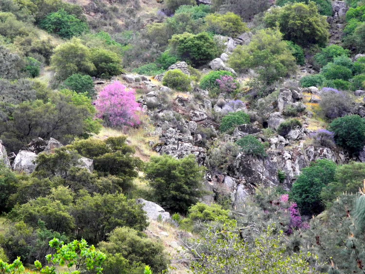
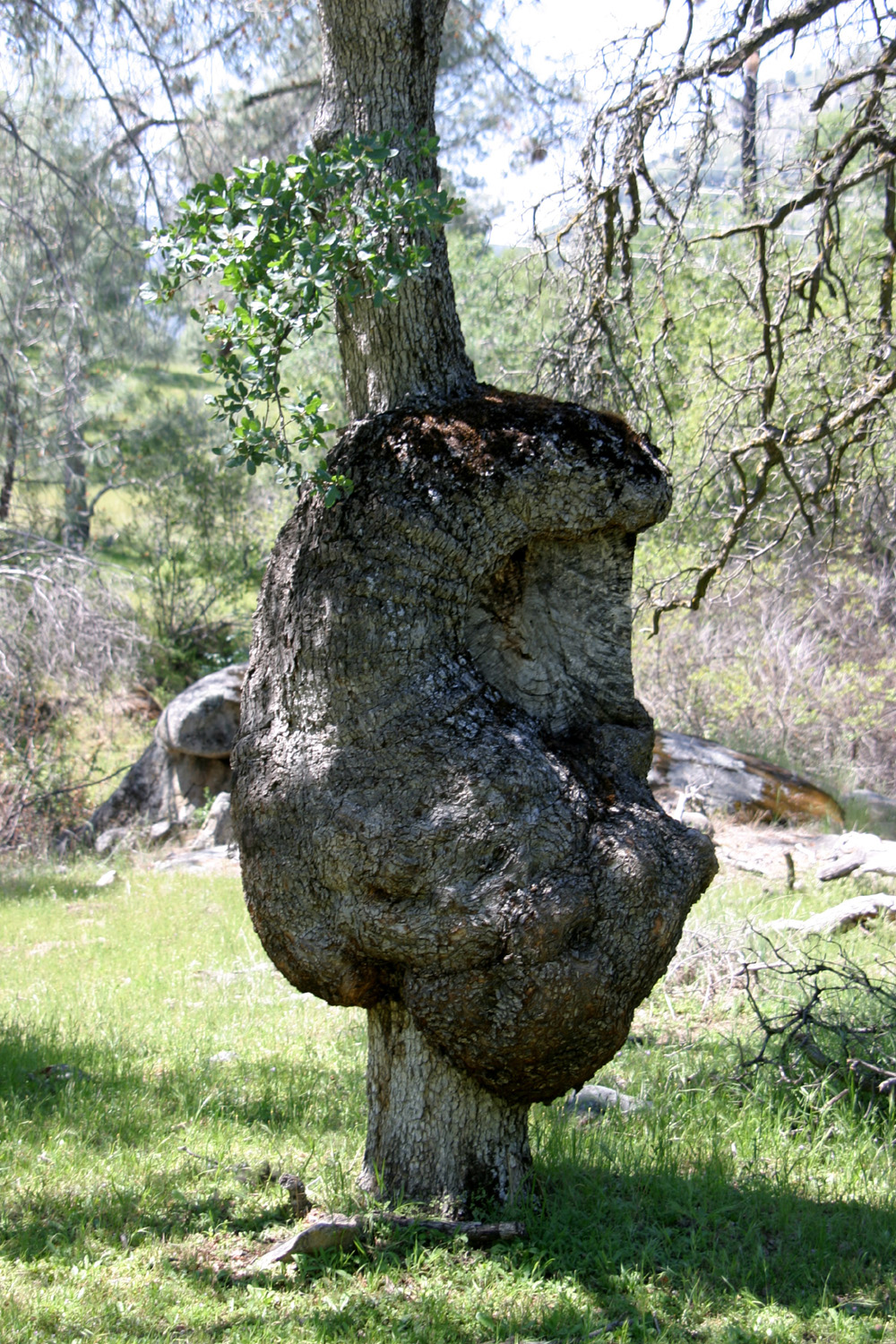
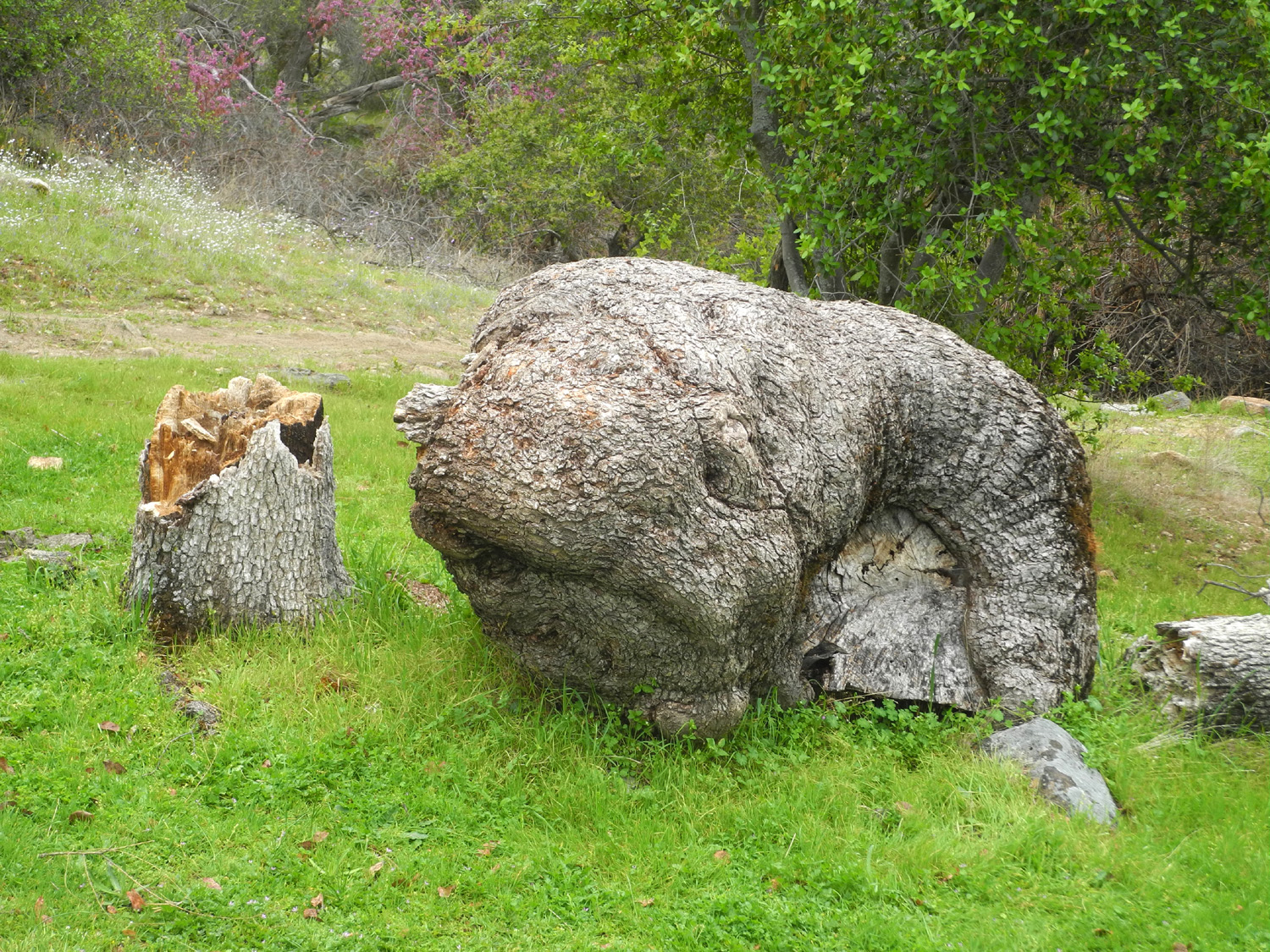
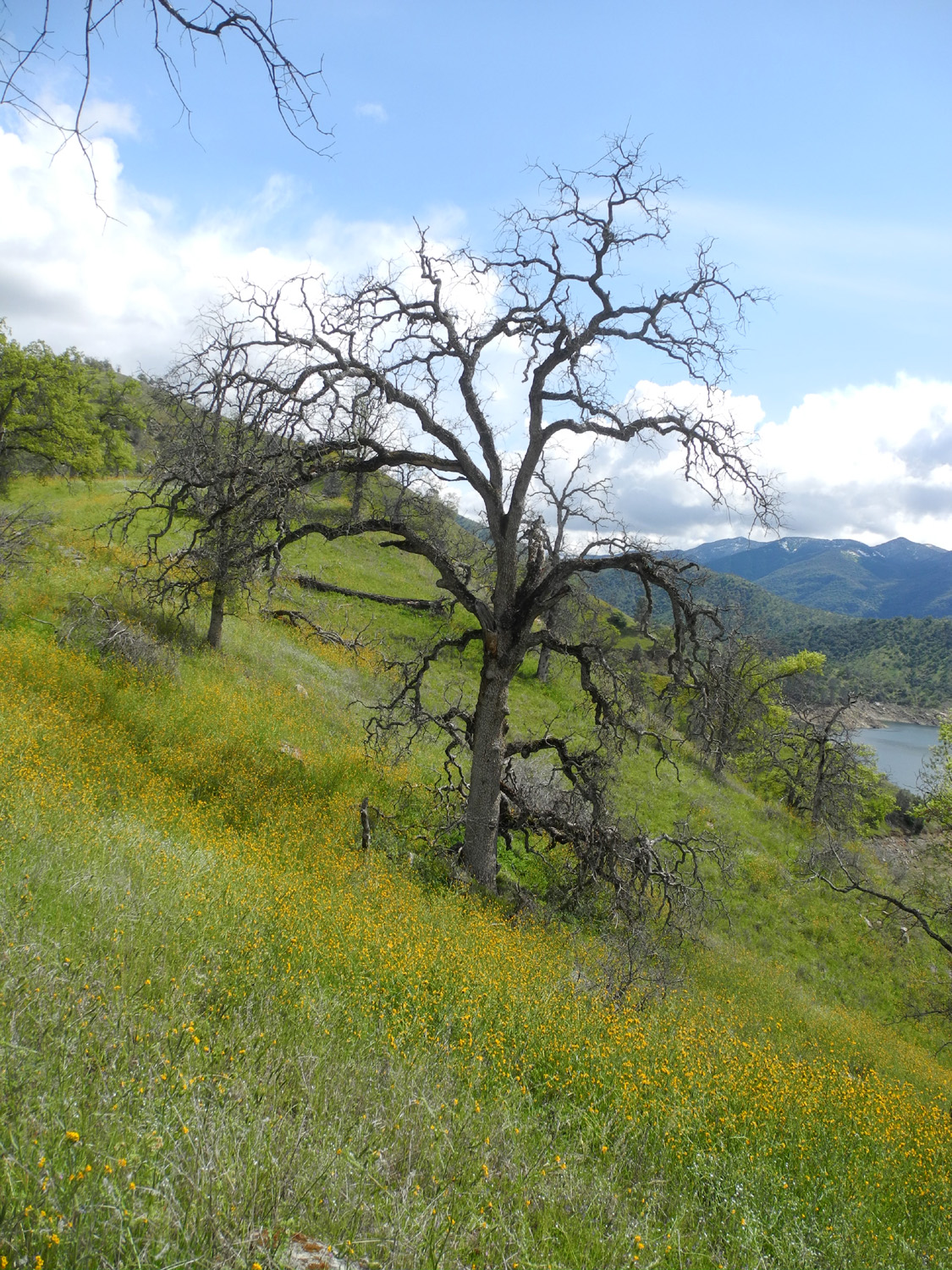
On weekends the parking lot is often full, but on this Tuesday there were only two other cars there. There were quite a few fiddlenecks in bloom around the campground, but this has been a dry year, the flowers have had a late start, and the big patches of color on the hillsides that we hope for were absent. Virtually every flower that is typically seen in the area was blooming, but they were more in the nature of samples rather than large numbers of individual plants. One variety that did not disappoint was the brilliant pink of the redbud. A little over a half mile down the trail there is a special spot, with a resting log, a rock with Indian grinding holes, and a venerable old blue oak with the biggest burl I've seen anywhere in the foothills. It was somewhat of a shock when I approached this area to discover that the burl tree had fallen. The trunk had broken just below the bottom of the burl, and the crash also broke off the upper trunk. The trunk showed signs of major dry rot above and below the burl. I spent some time here, taking pictures and mourning the loss of an old friend. Then I reflected on the fact that this is the eventual fate of all living things, and was grateful that I had enjoyed many visits to the tree over the years. |
|
 |
 |
| As all living things must, this blue oak with a huge burl met its end some time in the last year (Click here and here for views of the tree still standing) | |
|
I continued on till I had gone a little over a mile from the trailhead. This is a natural turnaround place, since the trail starts a steep descent, meaning a steep climb on the way back if I keep going. Along this route in the past we have seen as many as ten flowing creeks, but this time the only water was in the largest one, just past the burl, and it was just a stagnant pond. Shortly after I started the hike I was passed by two women on horseback; these were the only people I saw during my hike. A few more cars had arrived at the parking lot, but they apparently had taken the Bridge Trail. |
|
 |
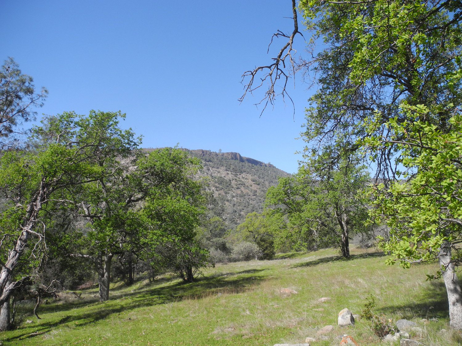 |
| Redbud along the road to the Gorge | Kennedy Table and spring greenery from the trail |
 |
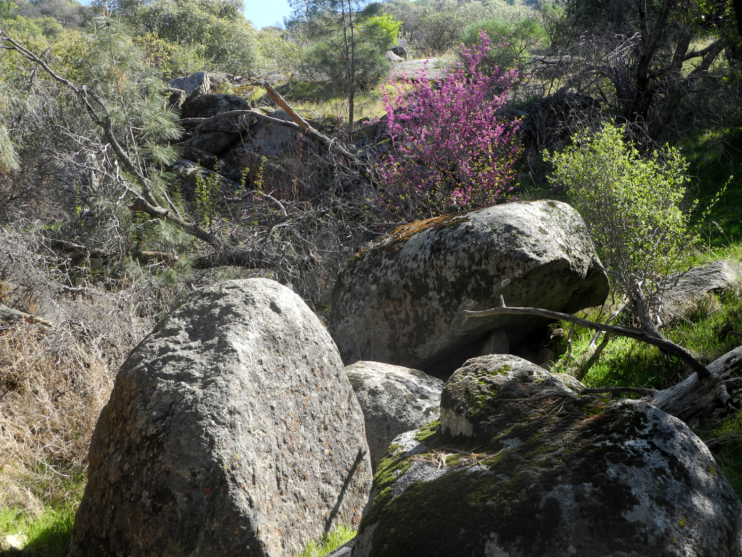 |
| Squaw Leap mountain from the trail | Redbud and rocks in a drainage |
|
On
the way home I stopped for a couple of tacos at Velasco's
Mexican Restaurant in Prather, then made my way back to Clovis and the flat
plains of the San Joaquin Valley. --Dick Estel, March 2020 |
|
| Edison
Point
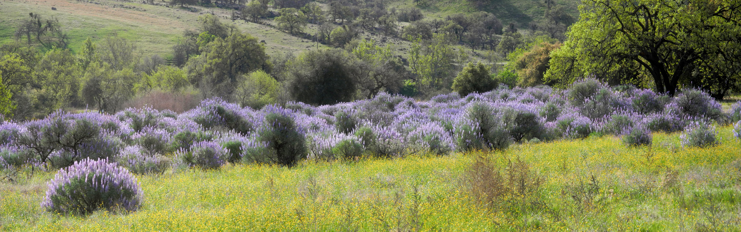
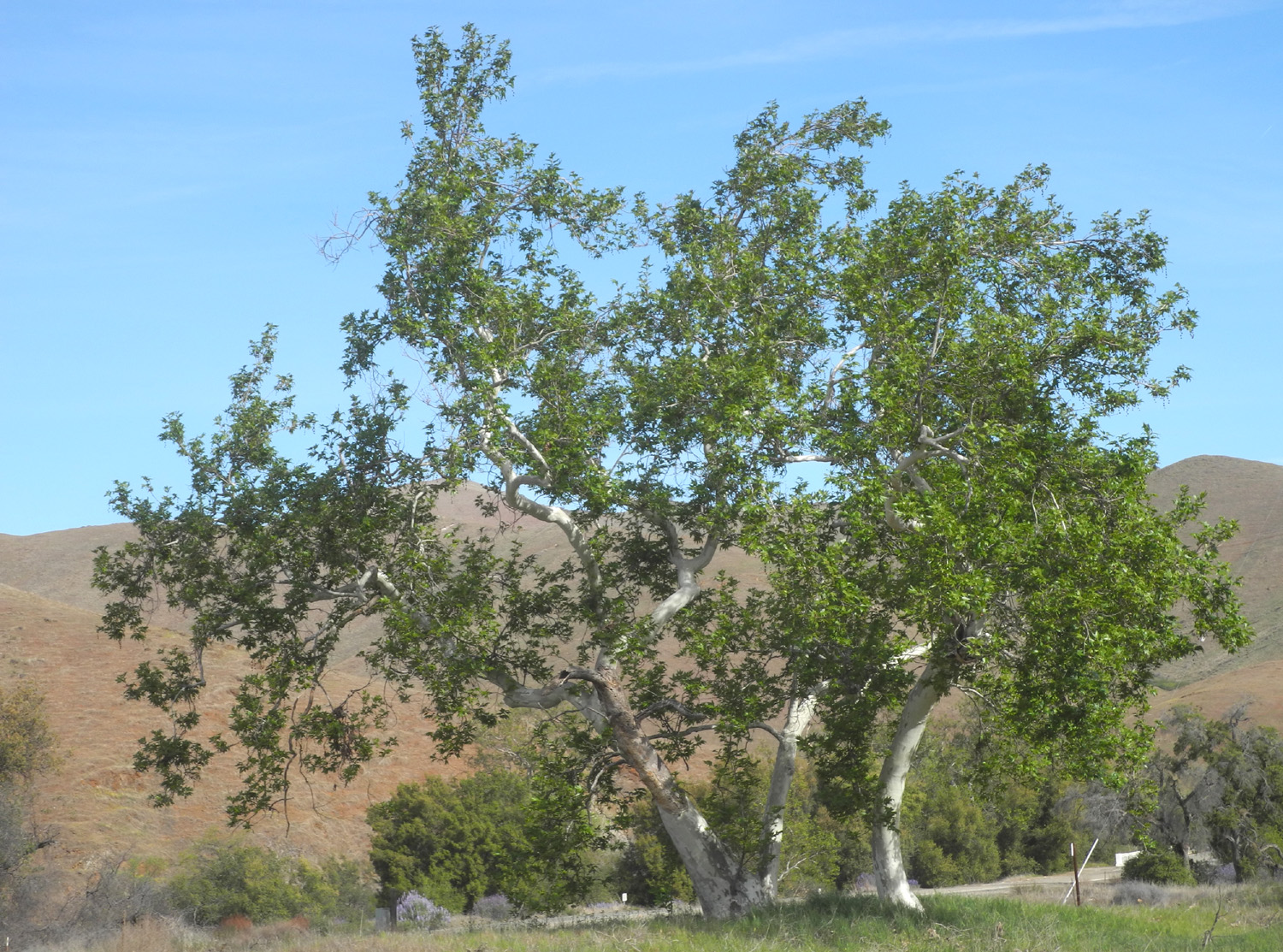
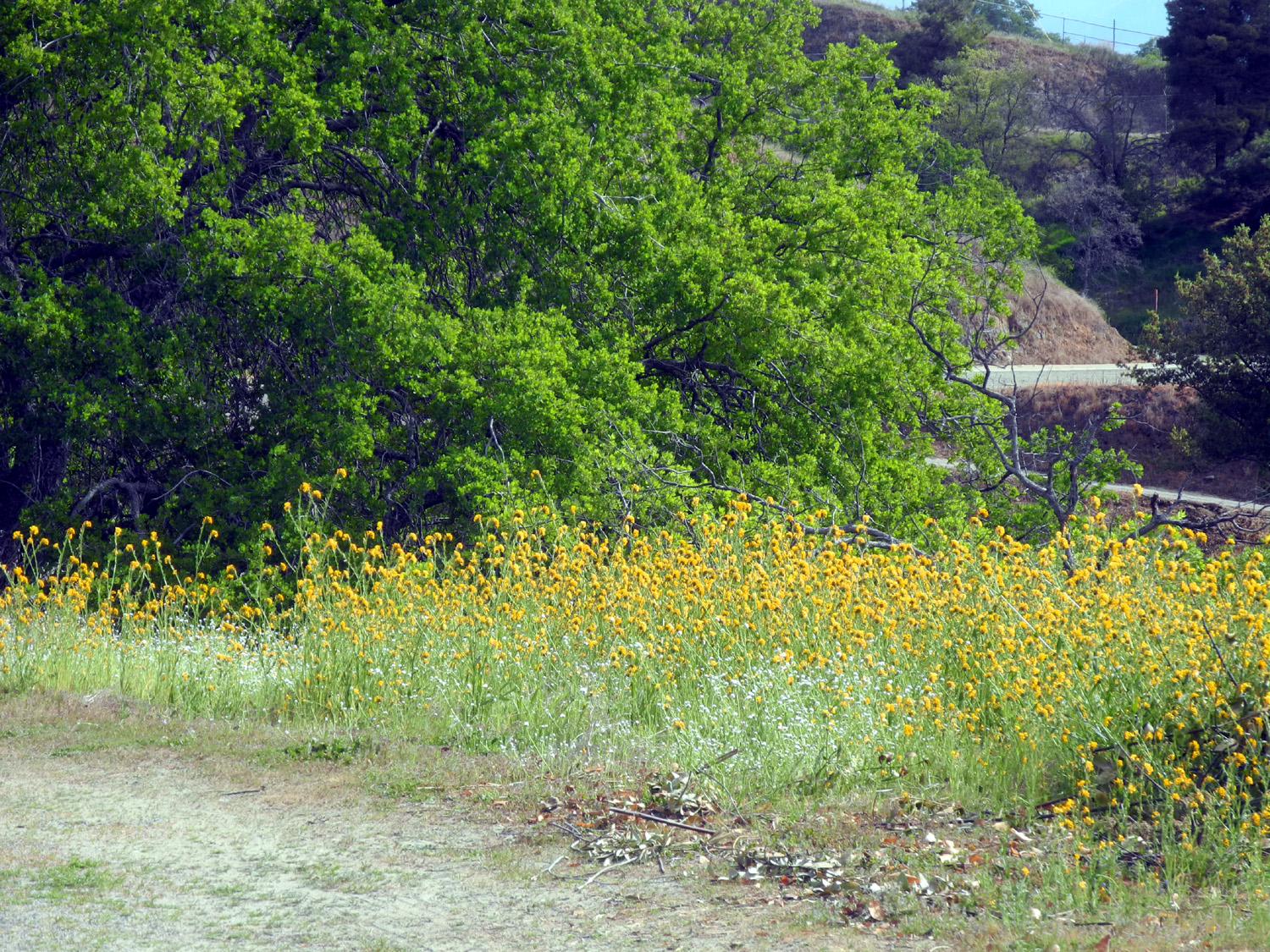
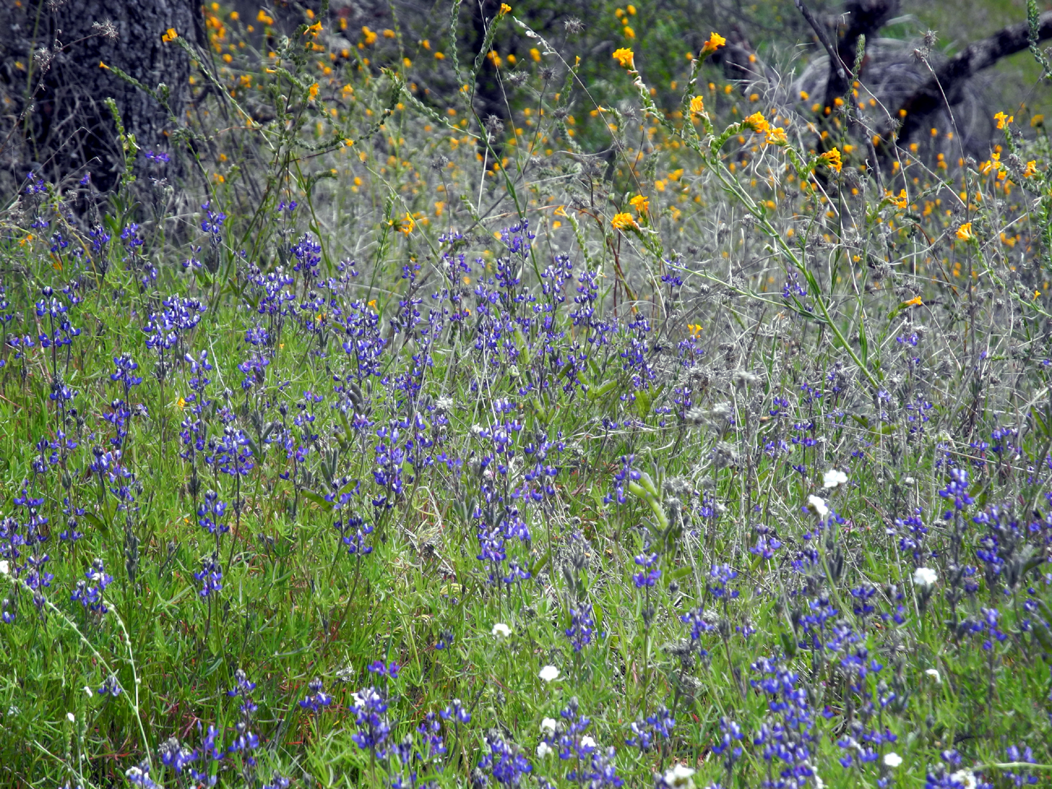
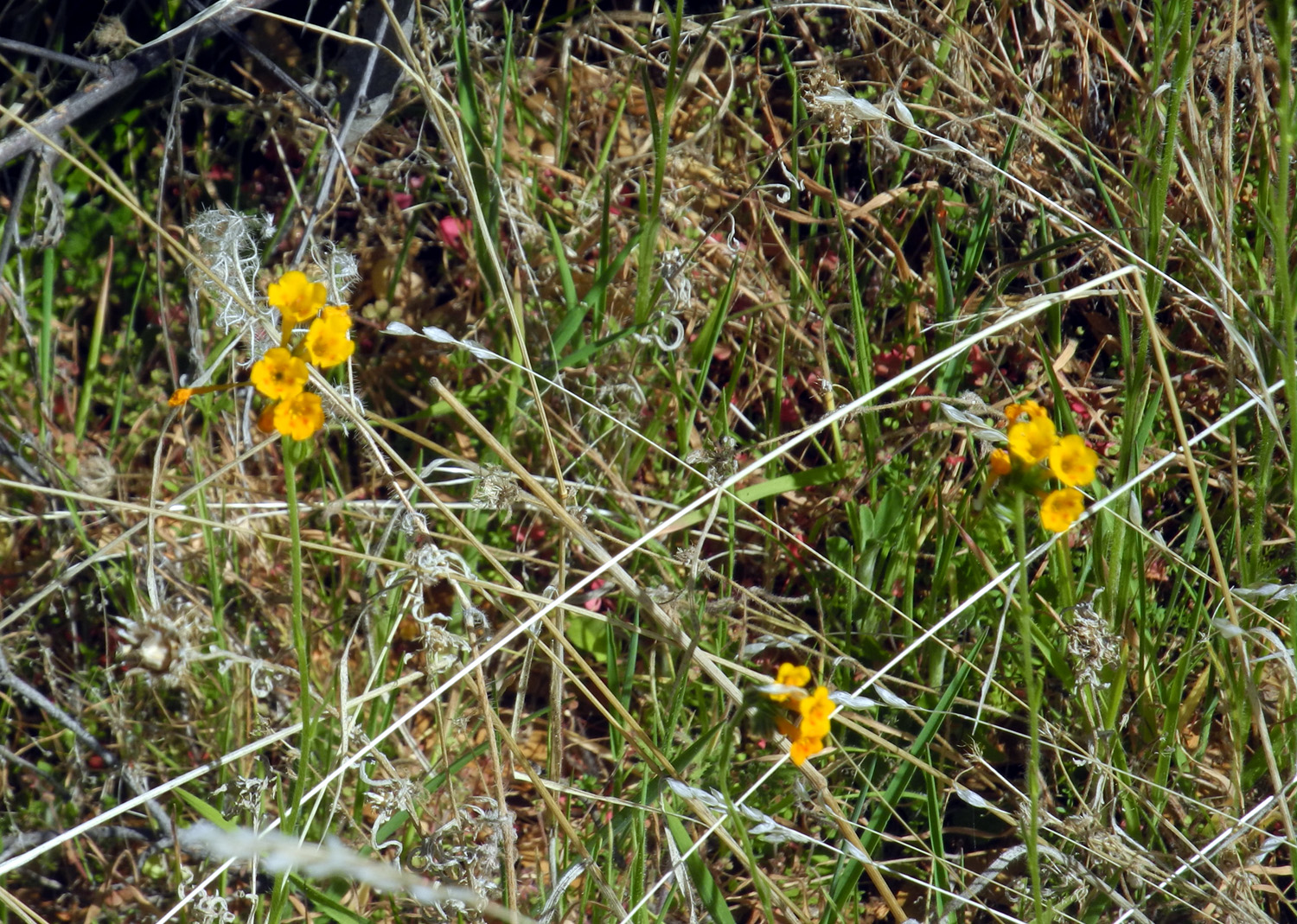
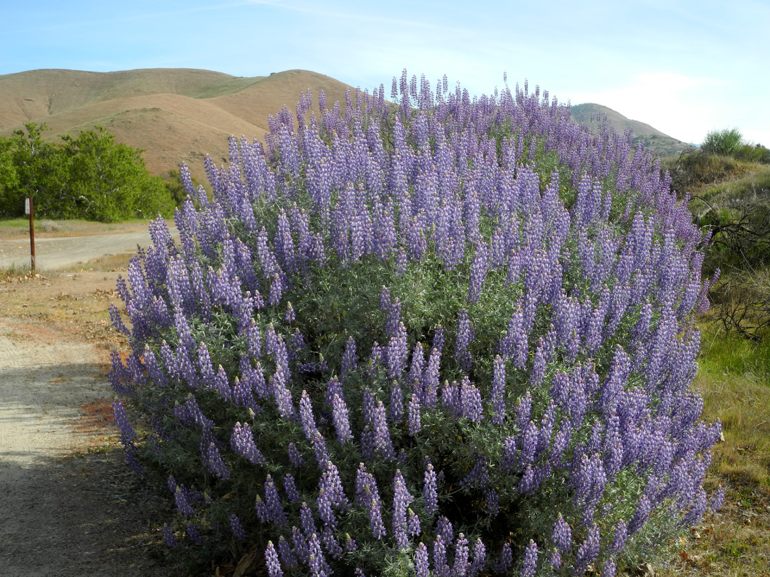
It has not been a great year for wildflowers, but it looks like a good one, so I try to get into the foothills at least every week or two. Even with limited flowers, the grass is green, the deciduous trees are leafing out, and the birds are busy nesting and gathering food. Heading for Edison Point on March 9, I stopped first near Winton Park, where Trimmer Springs Road meets Piedra Road. There is a big cluster of bush lupines in full bloom just west of this point, with more lupines by the park, as well as sycamore trees just leafing out. |
|
 |
|
| A fantastic display of bush lupines | |
 |
 |
| Sycamores with new leaves | Lupines, close-up |
|
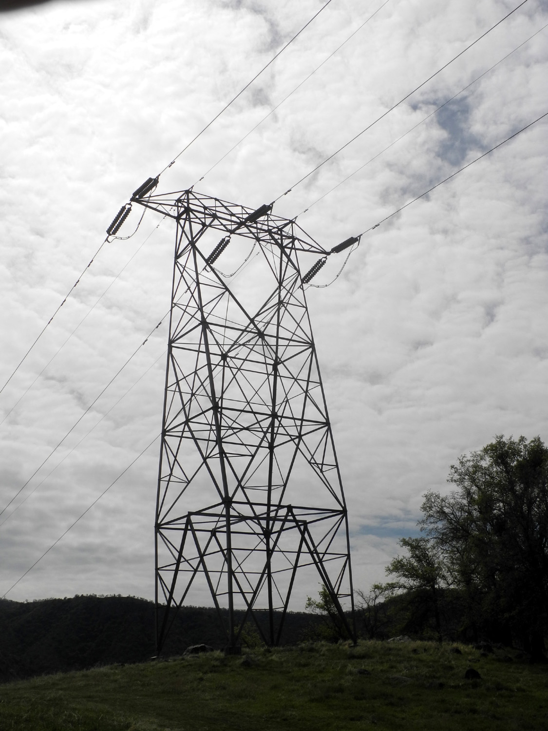
The Edison Point Trail is a loop that leads off Trimmer Springs Road on the north side of Pine Flat Lake. The entire loop has some very steep spots, and a long section has been blocked by fallen trees the last few years, so when I hike there I just go the half mile or so out to the point itself, which is decorated with a giant electrical transmission tower. This part of the trail is actually a rough dirt road for servicing the transmission line. More about that later. |
|
 |
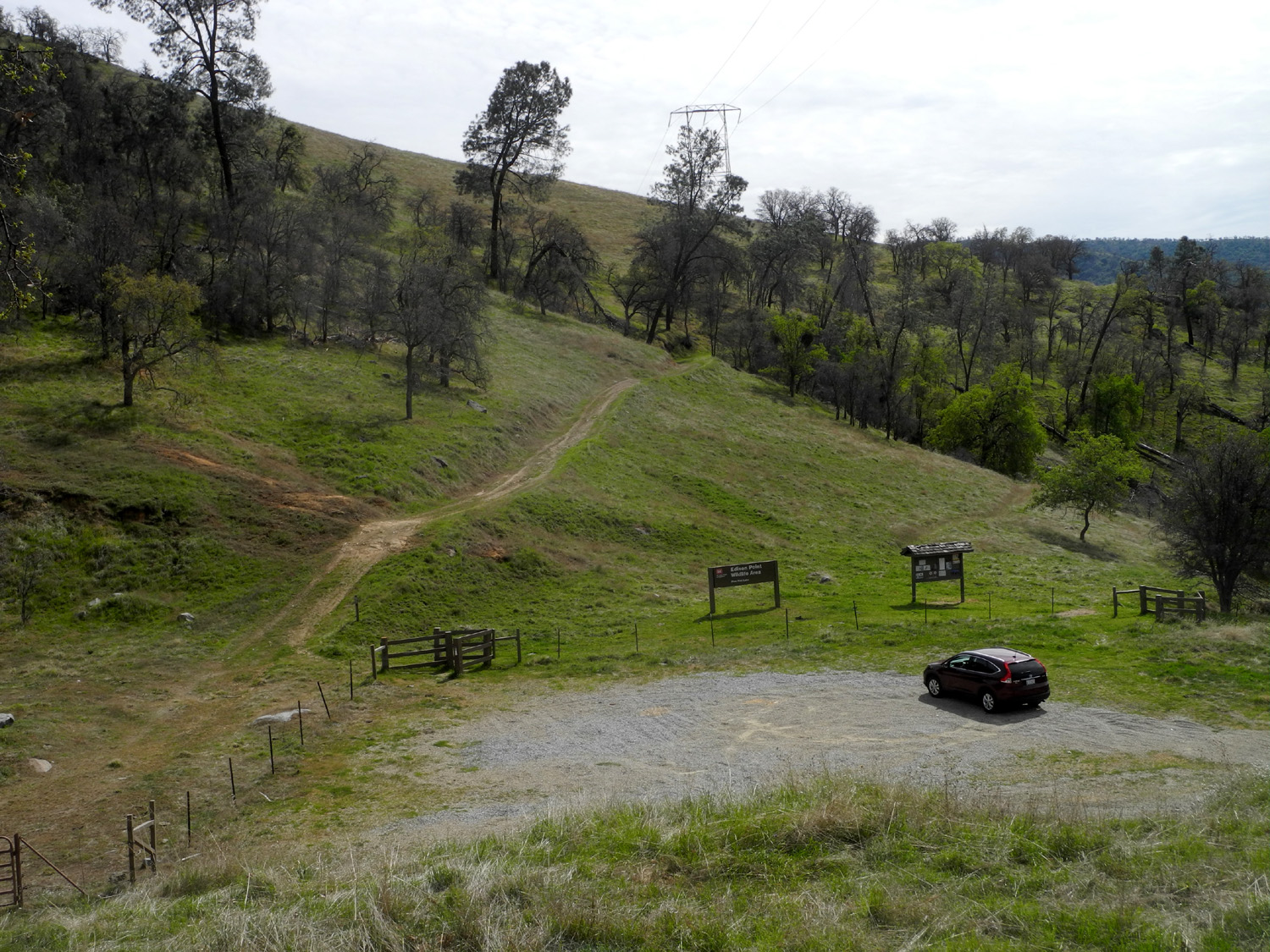 |
| The transmission tower at Edison Point | Parking lot and start of trail |
|
There were quite a few flowers along the road to the trail, and moderate amounts on the trail. As usual, fiddlenecks were the most common, but there are some poppies and popcorn flowers along with other samplings. Along the trail the yellow harvest brodiaea are getting a good start, and I saw a number of the dark purple brodiaea known as blue dicks, and a few of what we call purple brodiaea, whose blooms are actually lavender-colored. |
|
 |
 |
| Fiddlenecks above Pine Flat Lake | Fiddlenecks and blue oaks |
 |
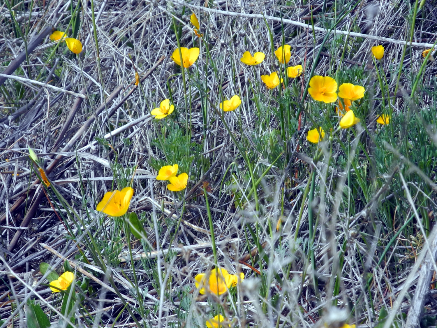 |
| Harvest brodiaea | A scattering of poppies |
|
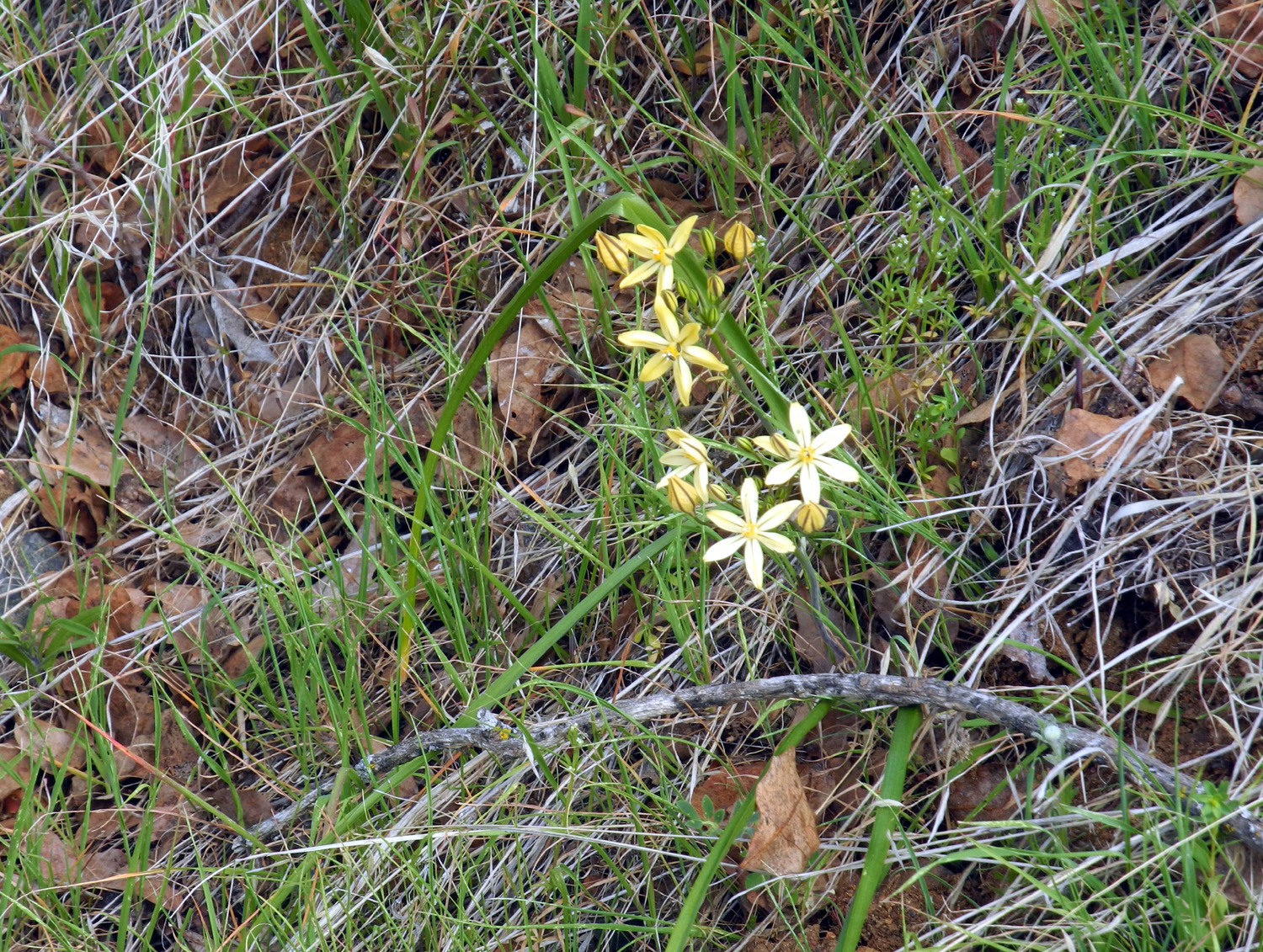
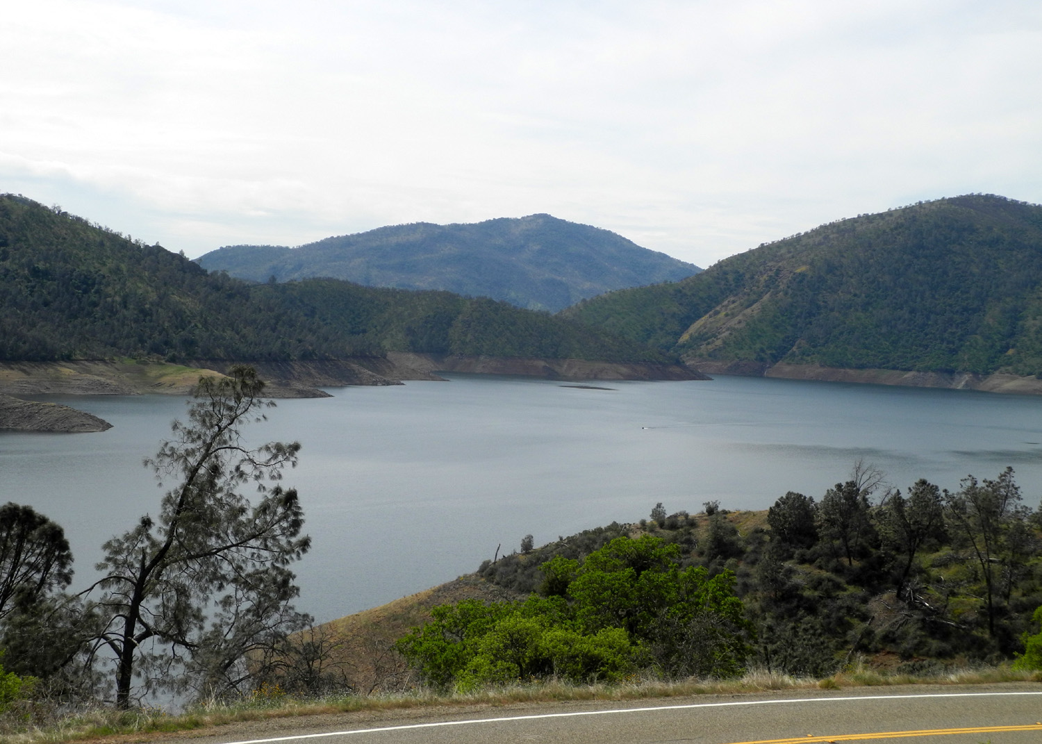
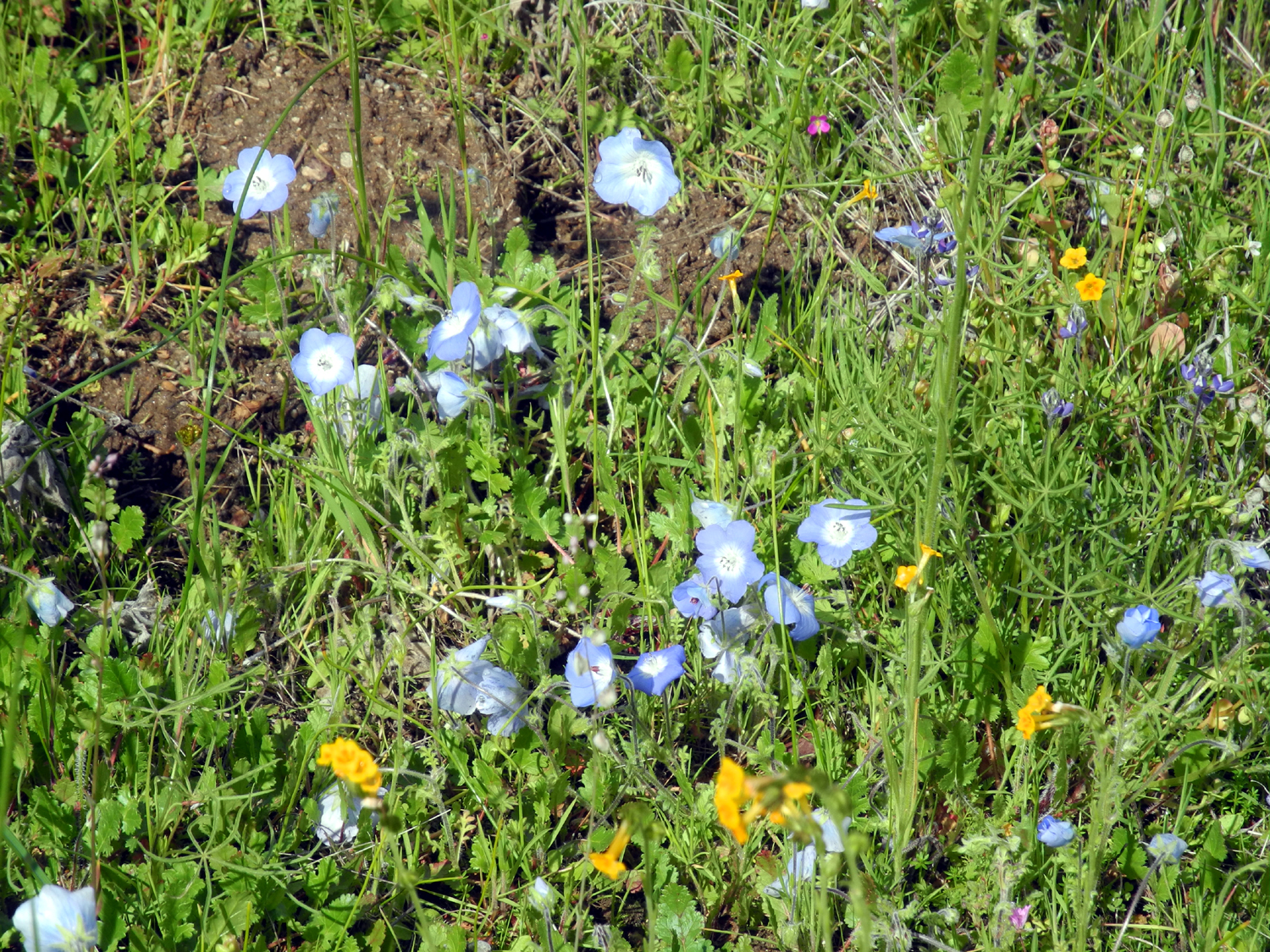
When I got back to the parking lot I sat in my folding chair and had a snack, then started part 2 of the day's hike. This involved going up the power line service road on the opposite side of Trimmer. I've been told you can follow this all the way to Trimmer Springs, which would probably be a hike of two or three miles. Instead I went a few hundred yards, enjoying the view of the lake, and a few more flowers. Since the road was mostly uphill, I soon was ready to turn back, but decided to see what was around the next bend. It was good that I did, because what was around the bend was a small stand of the very rare white variety of shooting stars, something I've seen in only one other place. In fact, that "other place" was really just down the hill from where I was standing, next to the paved road. |
|
 |
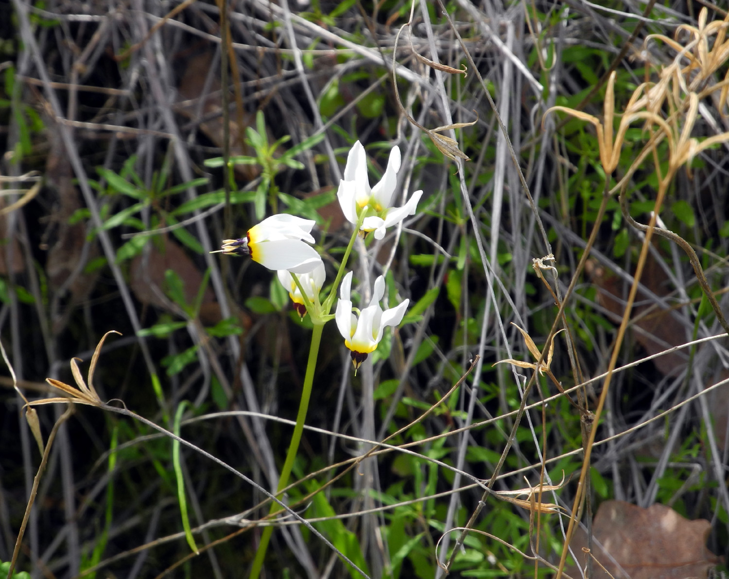 |
| The lake from the power line service road | Rare white shooting stars |
|
With the two parts of my hike, I covered a total distance of 1.74 miles, with just over an hour of actual hiking time. My hiking app records total time and moving time. Although I feel like I'm not stopping all that much, it's quite normal for the total time to be at least twice as much as my "in motion" time. By
the time you read this I will be on another hike, making four solo
or family outings plus two Ramblers hikes in the first three months
of the year. And there are two more Rambler hikes coming up in
March! --Dick Estel, March 2020 |
|
| San
Joaquin Gorge River Trail Again
Only 11 days after hiking this trail, I walked it again, this time with my daughter Teri. This was supposed to be a fairly large group - at least a half dozen and probably more, but work, illness, and other factors kept everyone but the two of us away. There was a slight possibility of rain, although the more likely forecast was "sun and clouds." We did have a few drops of rain an a occasional light mist, the kind where you feel a droplet hit your face every ten seconds or so. However, overall the clouds made it just right for hiking, and many others thought so too. The parking lot was full and we saw more bikes on the trail then ever before. |
|
 |
 |
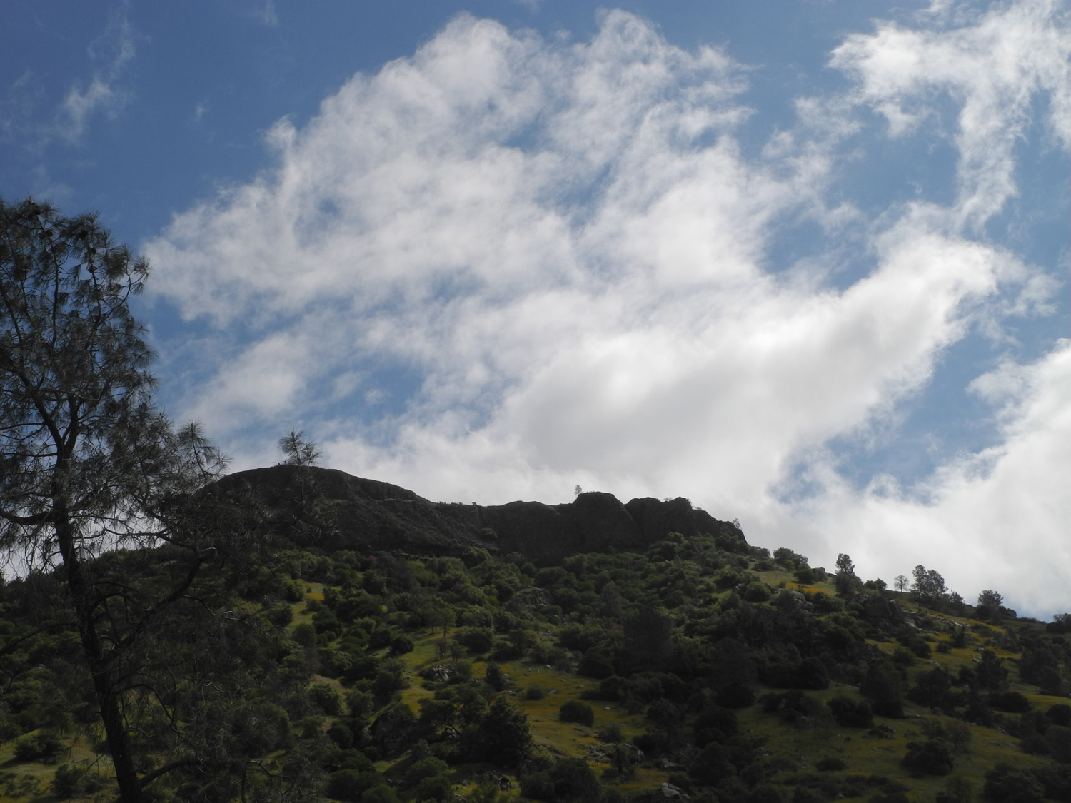
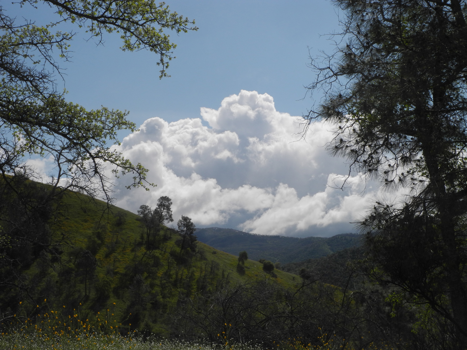
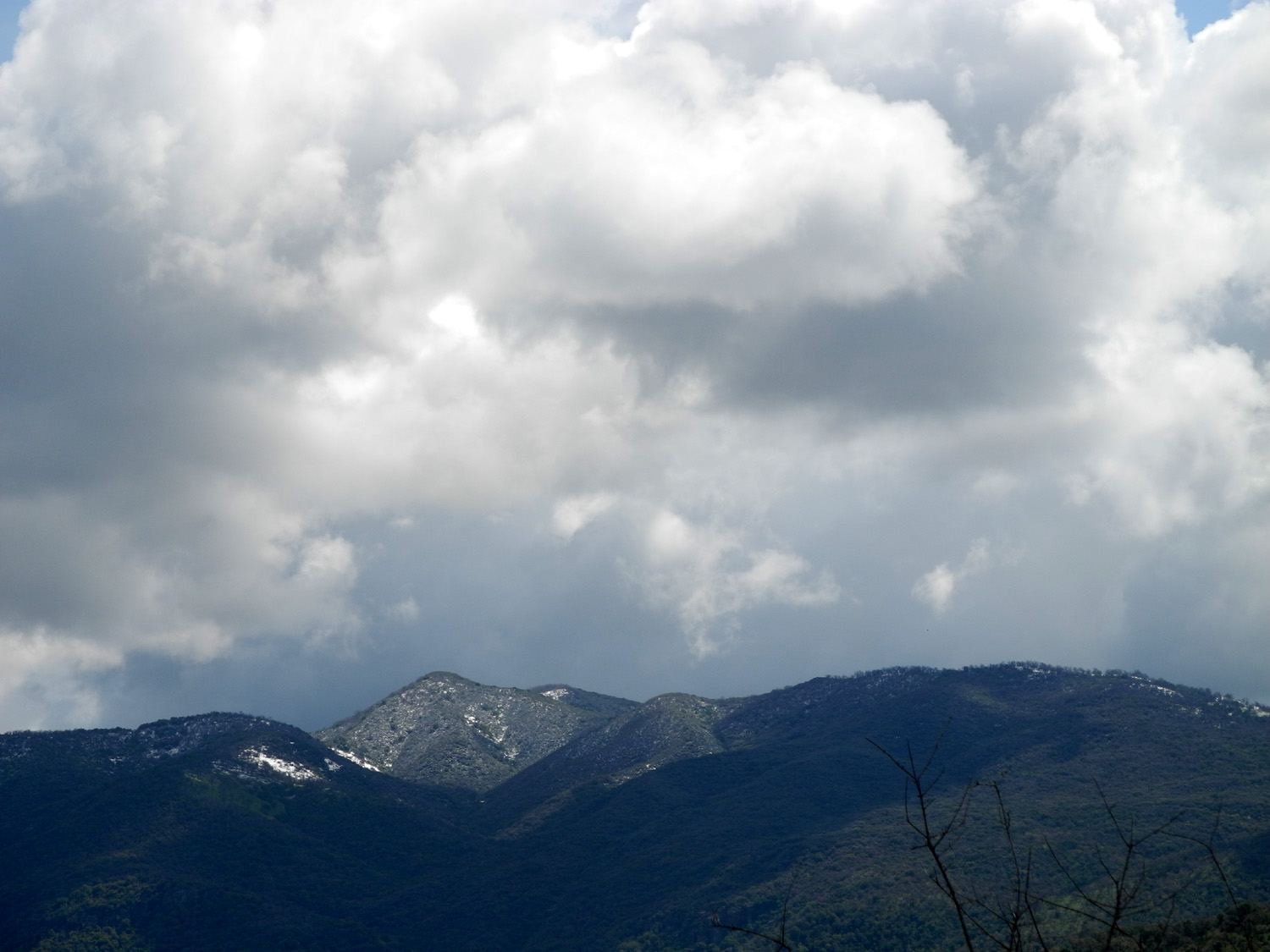
| The clouds ranged from white and fluffy in a blue sky... | ...to dark and foreboding above Squaw Leap |
|
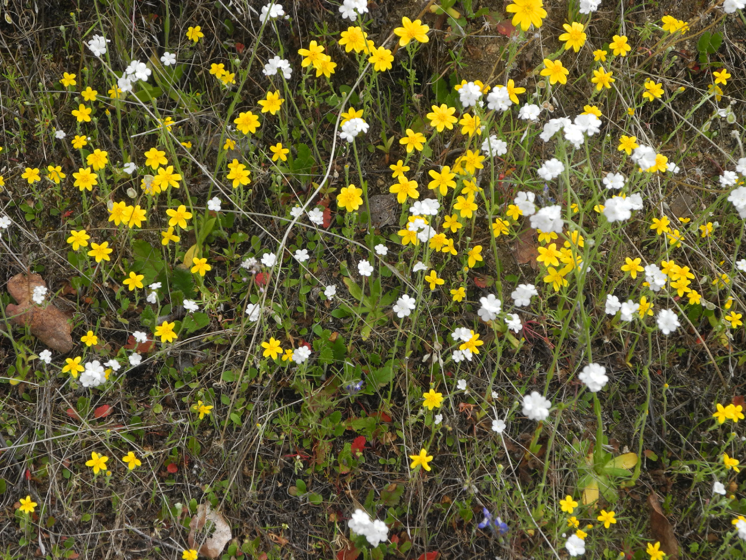
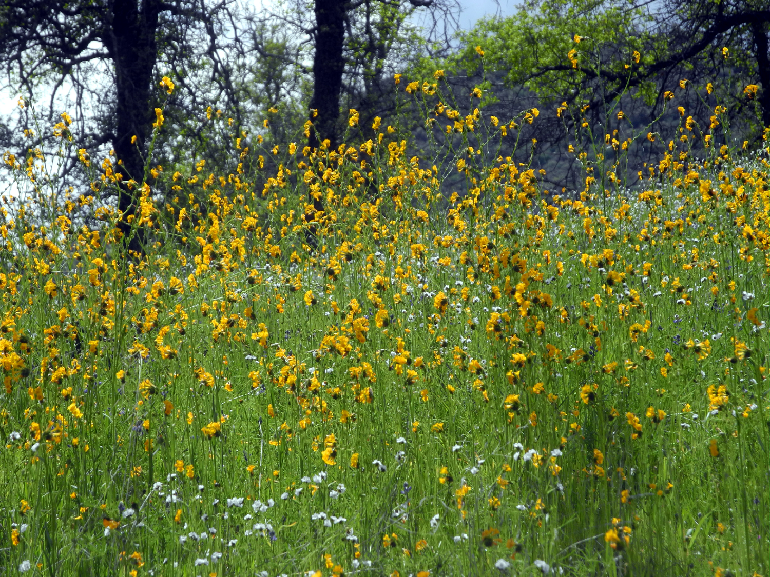
There were noticeably more flowers out than on my earlier hike, including a few additional species. We saw lots of fiddlenecks, popcorn flowers, dove lupines, redbud, and chaparral. Other blossoms out in "sample" amounts included owl clover, blue dicks, shooting stars (one single blossom), daisies, fringed remaids, birds eye gilia, and of course, filaree. |
|
 |
 |
| A mix of daisies and popcorn flowers | Fiddlenecks and popcorn flowers |
|
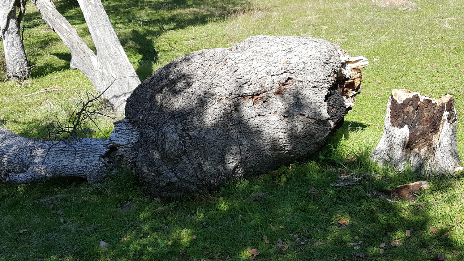
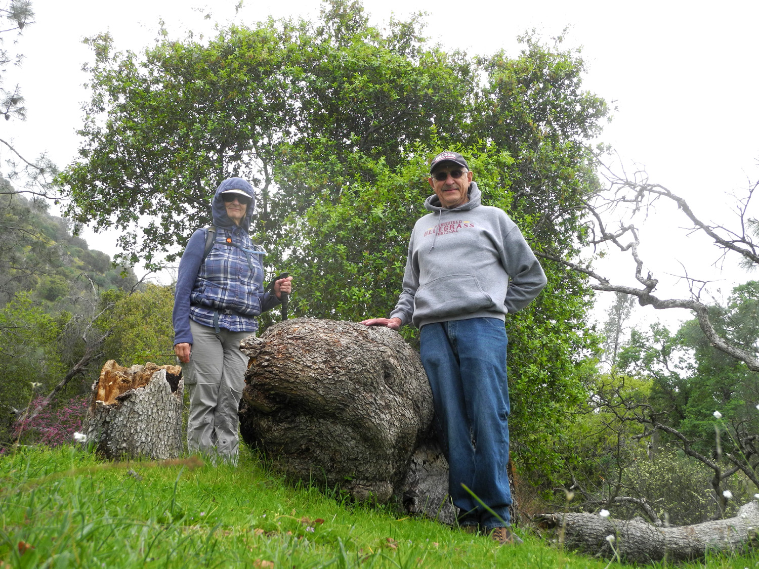
When we had hiked a little over a half mile we arrived at the now fallen Big Burl Tree. As I had done earlier in the month, we both spent some time taking photos, and enjoying the perfect resting seat provided by another long-fallen blue oak nearby. |
|
 |
 |
| Teri and
Dick by a fallen hero (Click here and here for views of the tree still standing) |
The tree broke below and above the burl |
|
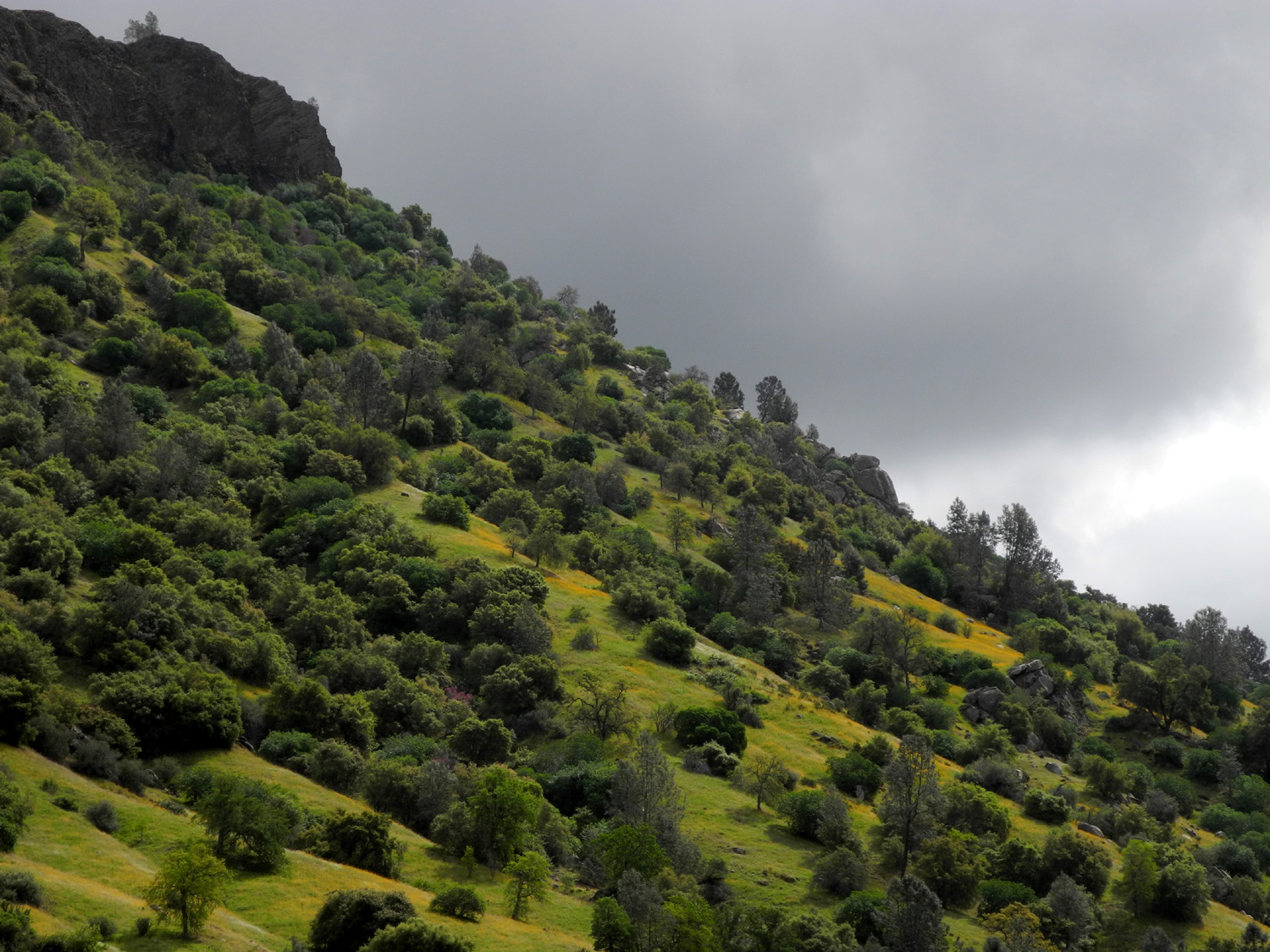
The trail runs below the table top mountain known as Squaw Leap, which hosts redbud, lupine, oaks, shrubs and various flowers on the slope. After a number of days when the temperature in the San Joaquin Valley was in the mid-70s, the approaching storm cooled it down to where we were happy to have hooded sweatshirts, and the clouds kept us from ever feeling too warm. We went to the exact same spot where I turned back the last time, a total walk of 2.21 miles. We had an additional three minutes of moving time, perhaps because I am now older. |
|
|
|
|
 |
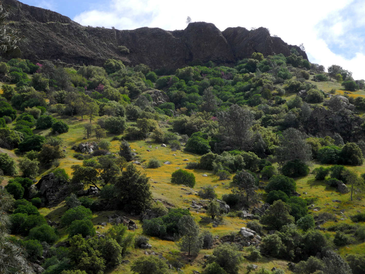 |
| The redbud stands out, but can you spot the buckeye and bush lupine? | Yellow flowers on the slope below Squaw Leap |
|
One
of the things I like about going to this area several times each
season is the changing crops of wild flowers. I'll be back there in
less than two weeks, hoping to see Mariposa lily, baby blue eyes,
yellow and purple brodiaea, mustang clover, and Chinese houses, all
blossoms that are scheduled to come out a little later in the
season. --Dick Estel, March 2020 |
|
|
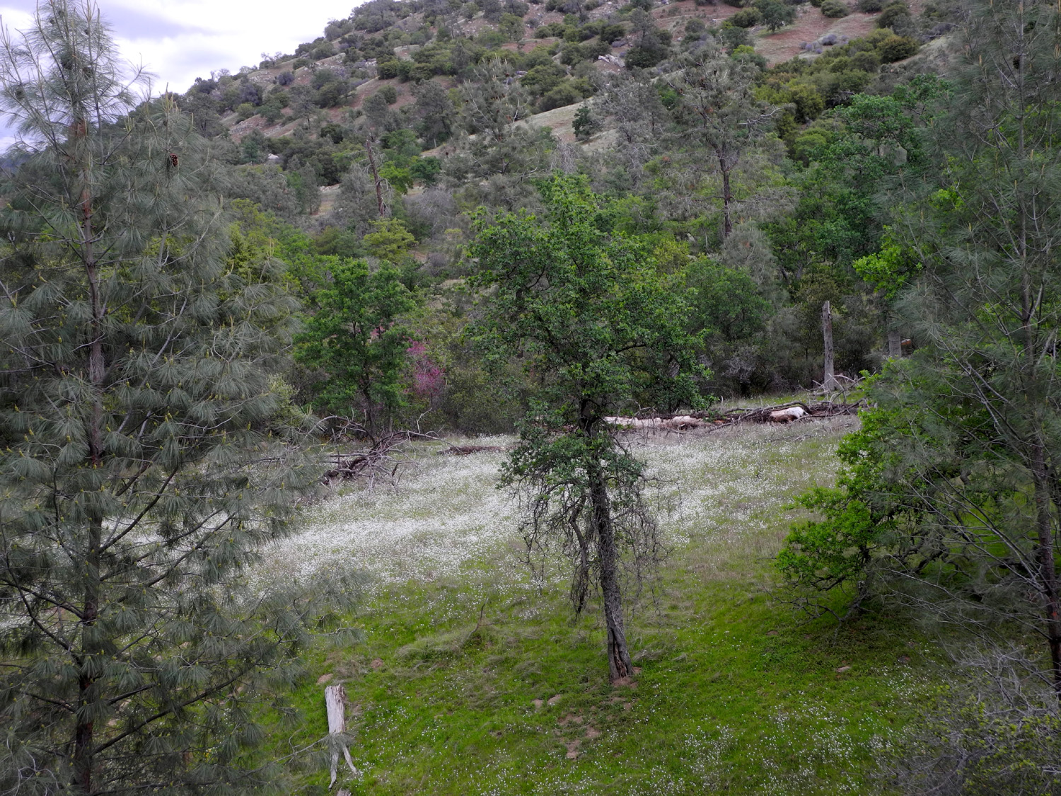
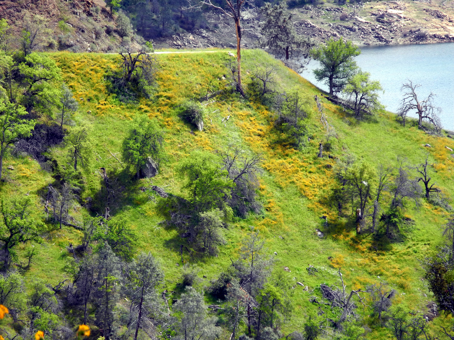
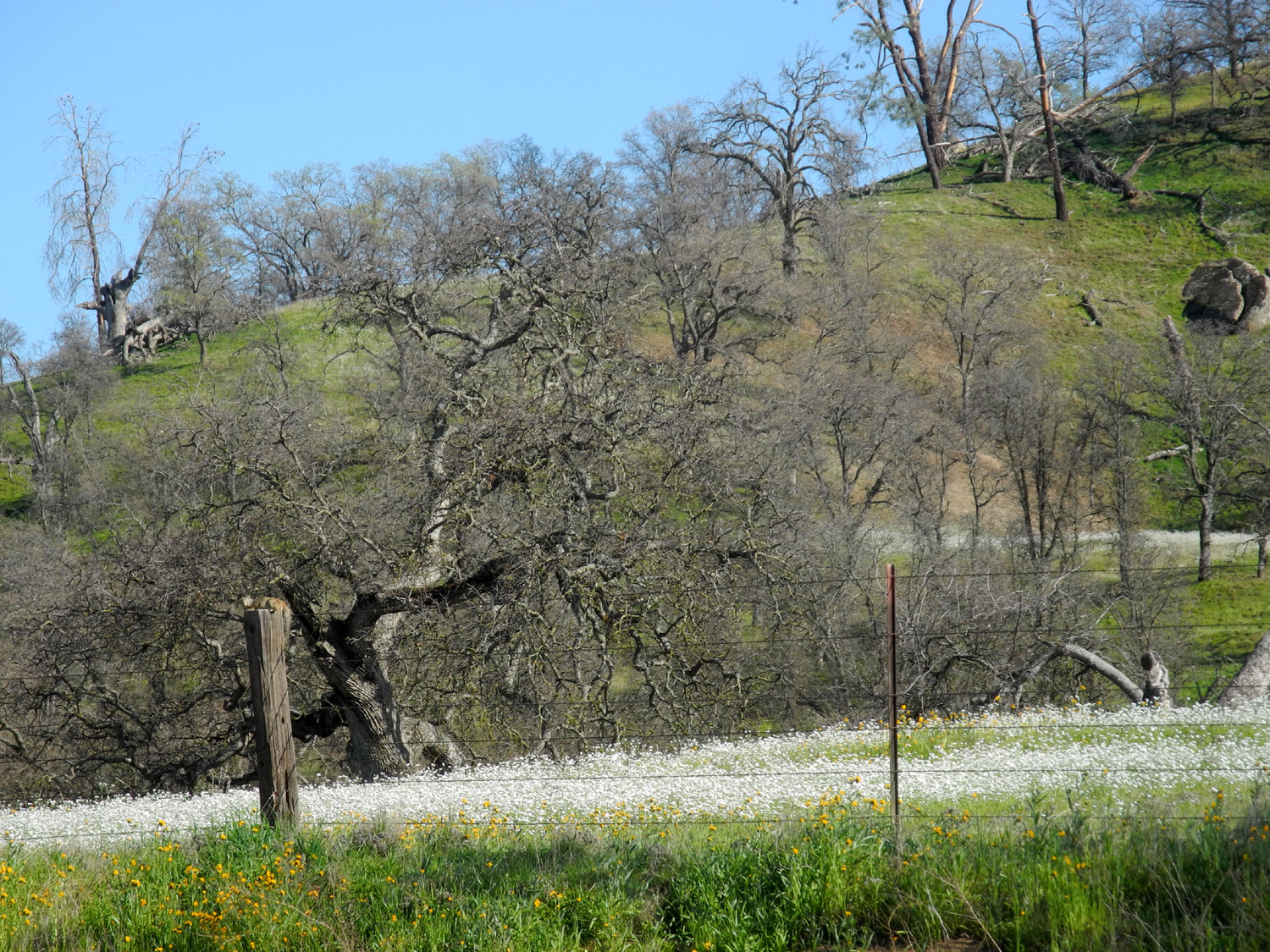
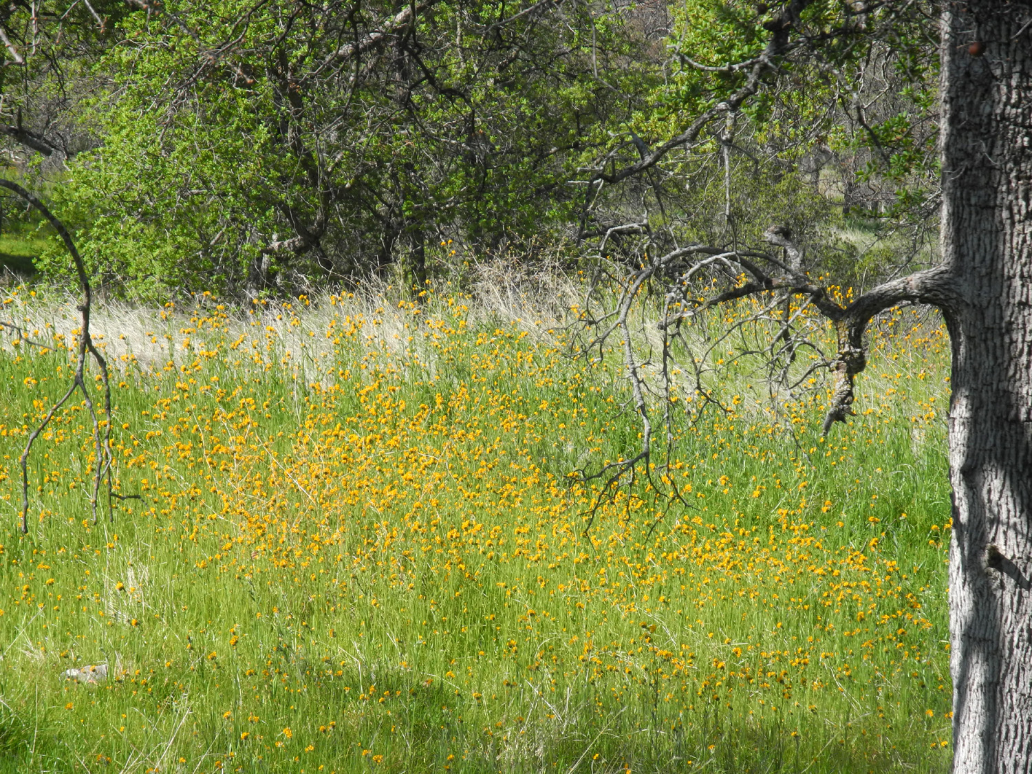
Sycamore Picnic Area This area by Pine Flat Lake has not actually been open for picnicking for several decades, but the old paved road is still there. It's slowly being reclaimed by nature, but is easy to walk on. And despite the COVID-19 virus, some health agencies and the California Department of Aging say that hiking is OK, as long as you follow certain rules. On this hike on March 26, my daughter and her mom, who live together, drove up in their car and I drove in mine, and we stayed well apart from each other, didn't share hugs or food, and of course, didn't cough without covering up with a bandana. We were rewarded with a day of sunshine and rain and lots of wildflowers, as well as a sight I've never seen before. We've had rain on and off for close to a week, and hills that were turning brown on March 9 are putting out a new crop of grass and turning green again. When I first came in sight of the lake it started to rain, hard enough that I had to put the windshield wipers on almost full blast. Teri and Jackie were fifteen minutes or so ahead of me, and had also encountered rain at this location, but it was partly sunny with no rain at the trailhead. The old road runs along the top of a ridge that divides Sycamore Creek from the main part of the lake. There's a loop at the end, but you can continue on a narrow trail all the way to the end of the ridge, where it drops down steeply to the lake. There was plenty to see along the way but of course flowers were the stars of the day. As usual, the dominant flowers were fiddlenecks and popcorn flowers, but we saw examples of nearly all the usual foothill blossoms, including lots of filaree, baby blue eyes, a milkweed plant in bloom, and dove lupines. The latter are usually very low-growing, but the ones here were quite a bit taller and thick enough in some spots to make small patches of blue. |
|
 |
 |
| Sycamore Creek branch of Pine Flat Lake | This old stump has turned into a planter for miner's lettuce |
 |
 |
| Baby blue eyes dotted the first part of the trail | Dove lupines are making a good showing this year |
 |
 |
| A natural bird bath | Fiddlenecks, popcorn flowers, and blue oaks create a beautiful spring scene |
 |
 |
| Clouds over the upper canyon | A field of tall fiddlenecks |
|
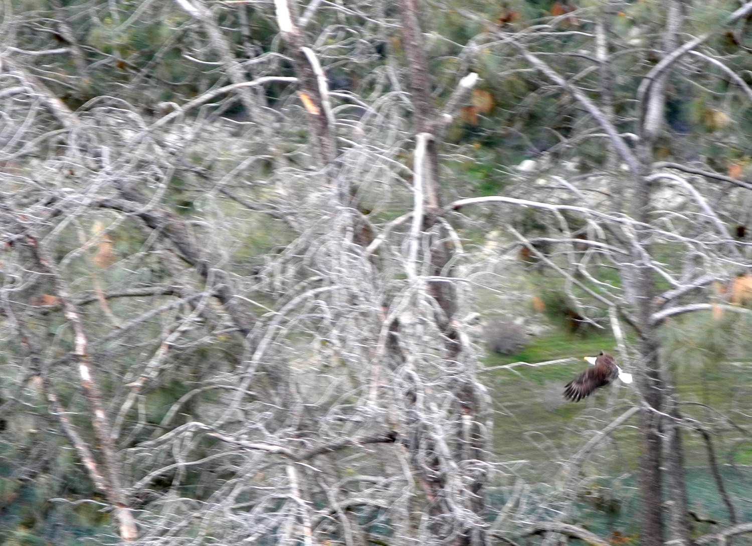
Wes Thiessen, our friend and fellow hiker from the Ramblers, was at this location a few days earlier, and spotted an eagle in a tree top. We kept a lookout, and were rewarded with the sight of a pair of the birds. They were constantly flying and never at an angle for good photos, but we got a couple of fair shots. As a bonus, we spotted the nest, about 50 feet up in a large bull pine. We also saw a hawk, a buzzard and ravens - all in all a good day for bird watching. |
|
 |
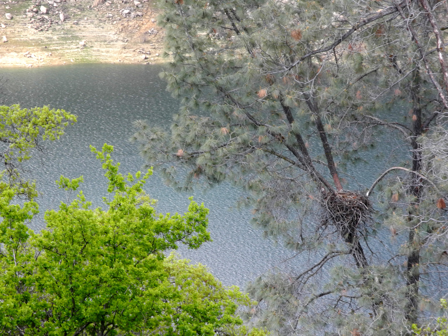 |
| Coming in for a landing | Eagle's nest in the crotch of a big bull pine |
When we got back to our cars it started sprinkling, and as we sat in our scattered circle having a snack, it rained a little harder for a short time. By the time we left it had stopped. Instead of returning via Trimmer Springs Road to Belmont Avenue as usual, we turned off on Maxon Road at the area known as Trimmer Springs, site of an abandoned store and a few houses. This road connects to Highway 168, as well as other roads that lead to Shaver Lake. We turned where It joined Watts Valley Road after a few miles, and along both roads we saw plenty more wildflowers, including the first really big patch of baby blue eyes, and the rare ham & eggs. We drove by ranches sitting in large green meadows, with a few creeks along the way, and eventually reached the valley floor, where the road turns sharply west and becomes Ashlan Avenue, a route that goes all the way across the Fresno-Clovis metro area. |
|
 |
 |
| Teri and her mom live together, so they're allowed to get close | A rare flower, ham & eggs |
Although
our total walk was just over a mile, we enjoyed spectacular scenery,
a variety of weather, and of course, a lot of big birds. --Dick Estel, March 2020 |
|
|
Photos (Click to enlarge; pictures open in new window) |
||
|
Back to Eaton Trail San Joaquin Gorge River Trail Edison Point |
||
|
Back to Eaton Trail |
||
|
 |
 |
| Pond along the Eaton Trail | Break time | Snacking in the eagle's nest |
| San Joaquin Gorge River Trail | ||
|
 |
 |
| About a mile from the parking lot you can take in this view across the river gorge | Blue oaks bracket a tall bull pine | Blue oaks wear bright green in spring |
 |
 |
 |
| Fiddlenecks, the
most common wildflowers in the Sierra foothills |
A close-up look | Redbud makes a nice
contrast to the green along the trail |
| Edison Point | ||
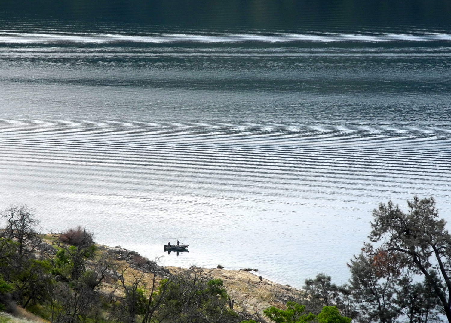
 |
 |
|
| Exposed red rock in the hills above Winton Park | A nice, full bush lupine | Fishermen enjoying
the peace and quiet of the lake on a Monday |
 |
 |
 |
| Blue dicks along the Edison Point trail | Fiddlenecks surround a wildlife guzzler | A prize winner in
the county fair's dry plant display competition |
| San Joaquin Gorge River Trail Again | ||
 |
 |
|
| Where we stared our hike | If you're thinking
about making coffee tables, just don't! |
A patch of white and the ridge south of the trail |
 |
 |
 |
| Blue dicks and popcorn flowers | Another white patch of popcorn flowers | A closer look |
| Sycamore
Picnic Area (Photos by Dick Estel & Teri Liddle) |
||
 |
 |
|
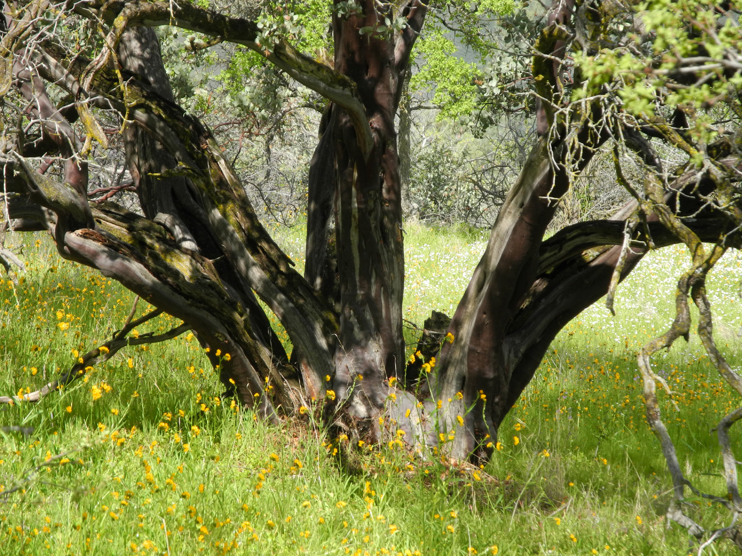
| A cloud picture for our friend Wes | Base of a huge manzanita tree | Yellow blossoms spill down the bank below the road |
 |
 |
 |
| Clouds, lake, trees and flowers | Oak on the hillside below the old road | Dick on the trail |
 |
 |
 |
| Low level snow above the Kings River | The end of the ridge | Maxon to Watts Valley Road |
| Related Links | ||
| Coke Hallowell Center for River Studies | Lewis S. Eaton Trail | San Joaquin River |
| San Joaquin River Trail | San Joaquin River Gorge Special Recreation Management Area | Background & History of San Joaquin Gorge Area |
| All San Joaquin Gorge reports | San Joaquin Gorge Slide Show | Dick's San Joaquin Gorge Photo Album |
| Velasco's Mexican Restaurant | Winton Park | Wildlife Guzzler |
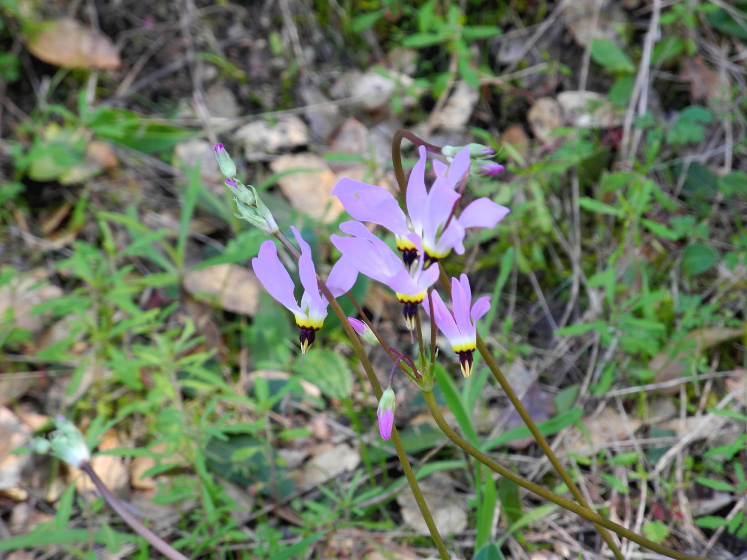
| "Normal" pink shooting stars | Pine Flat Reservoir | Trimmer Springs Road |
| Edison Point | San Joaquin River Gorge Special Recreation Management Area | Popcorn Flowers |
| Sycamore Creek | Dick's Pine Flat Travel Reports | Fiddlenecks |