|
Fall 2014 Hikes |
||
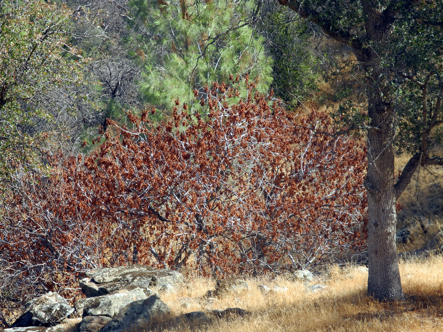
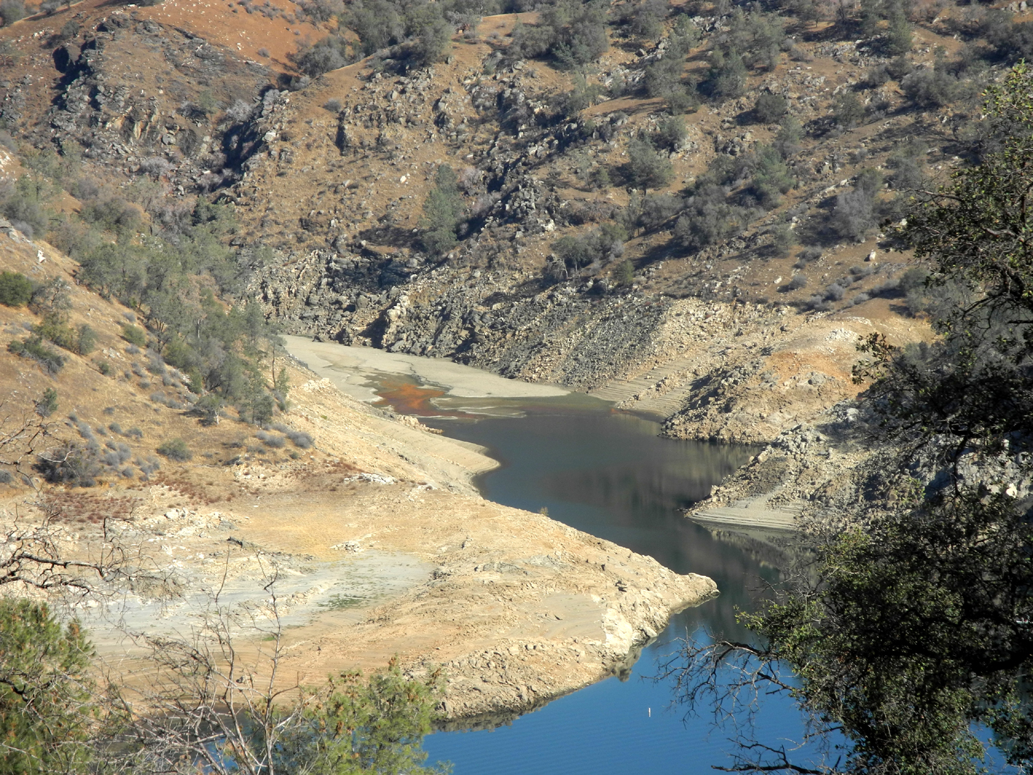
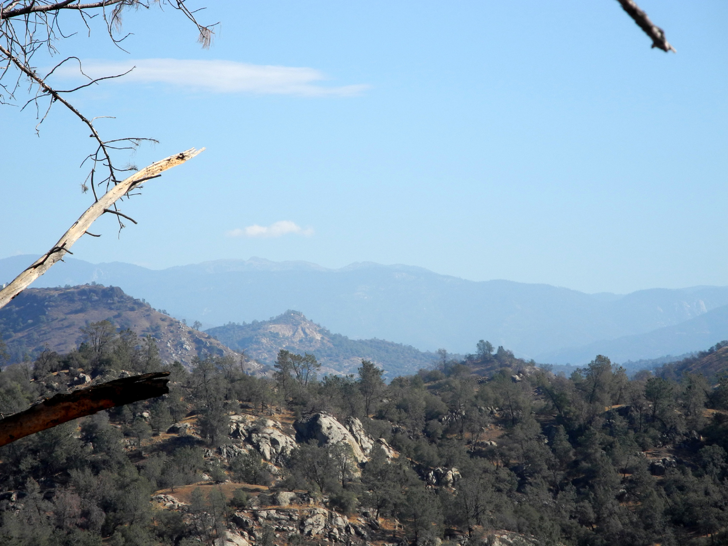
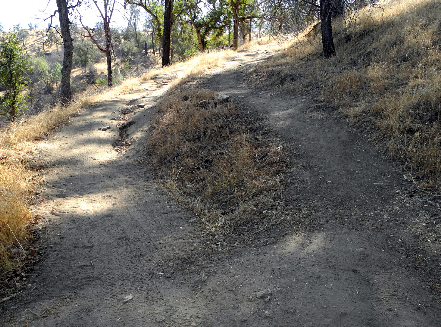
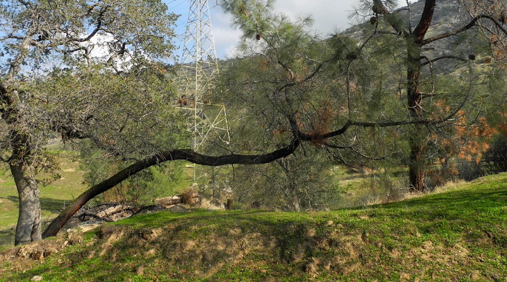
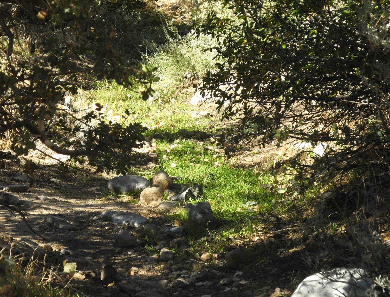
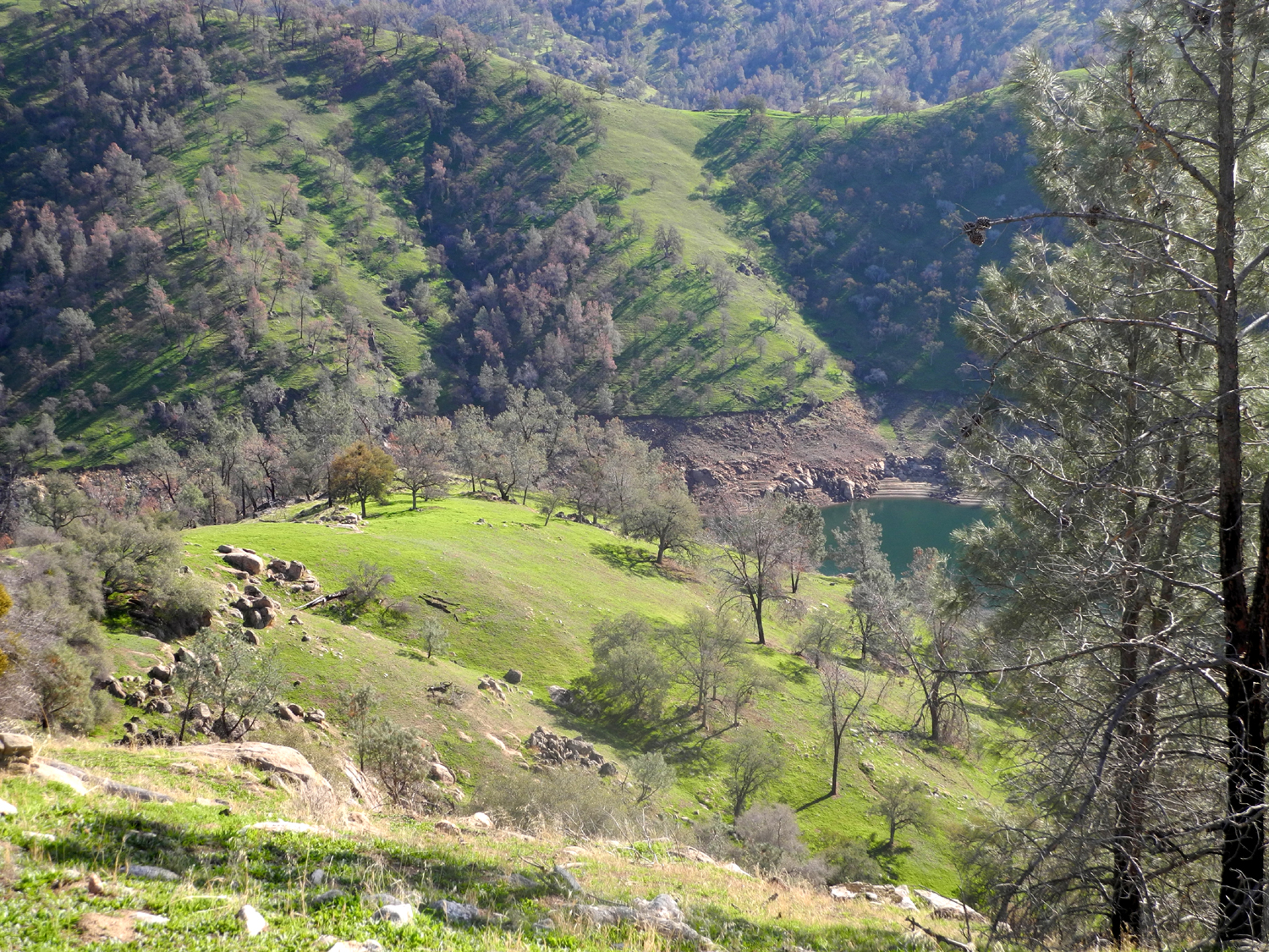
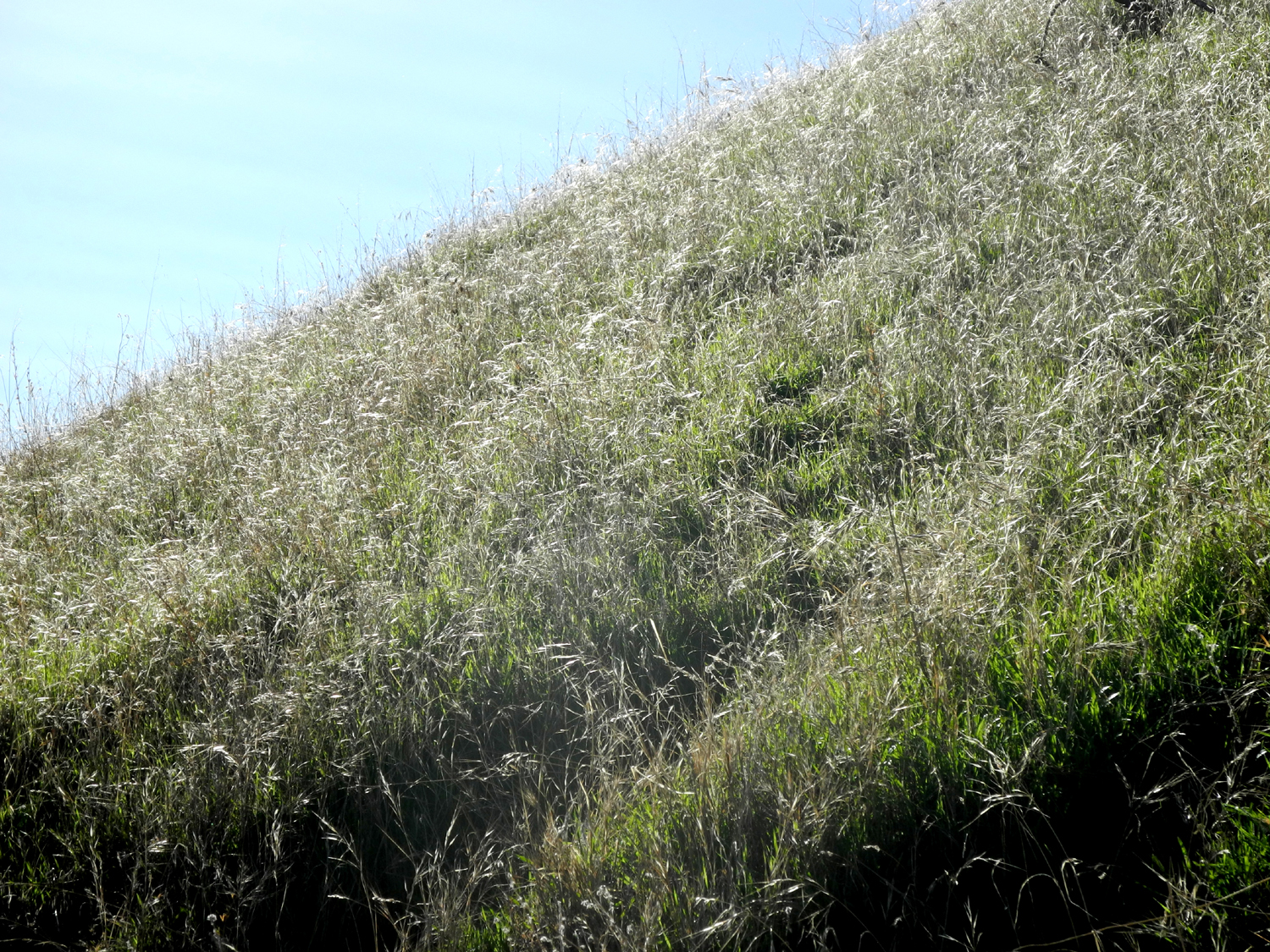
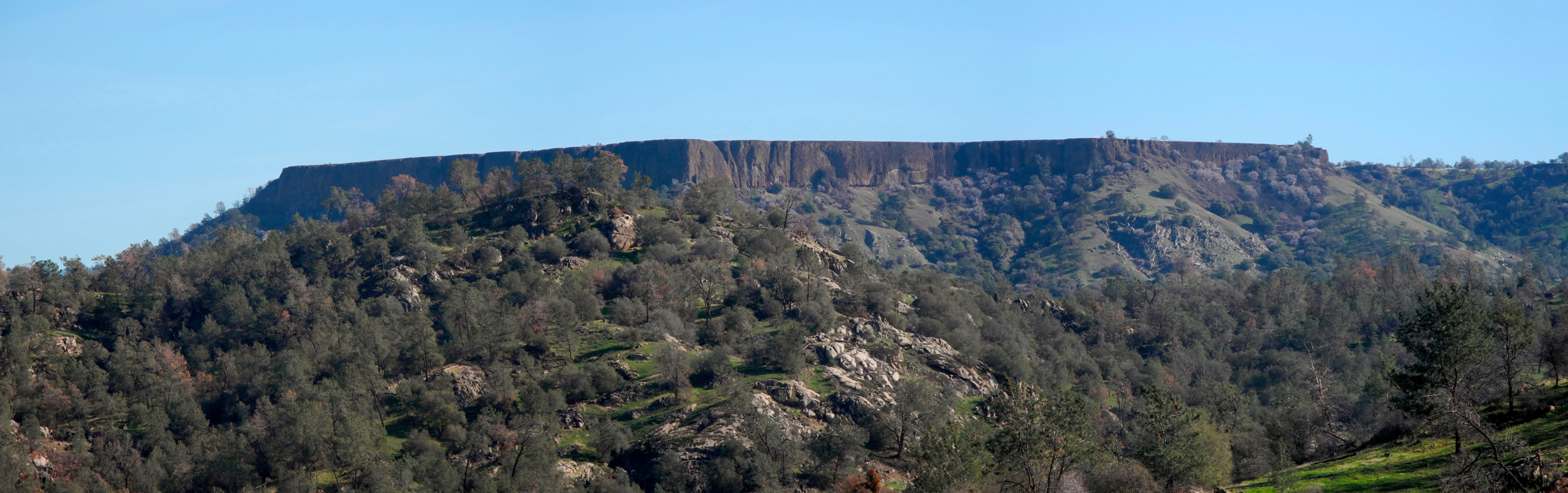
San Joaquin River Trail West With time going faster and faster, it seems I am trying to get as many hikes done in as short a time as possible. How else to explain three hikes in eight days? The Sentinel Dome hike was perfect in terms of weather, beauty and level of difficulty. The next one, with my grandson and great grandson, was so short and easy I felt guilty claiming a half hour of exercise for a 90 minute stroll/playtime. But it was enormously fun. It was the third hike that was the real challenge - a short drive, not a great distance hiked, but mostly steep uphill all the way to the turning back point. The location was the San Joaquin River Trail, which I also refer to as the Finegold Trail, for the location of the western trail head. I've been here a number of times and reported on each trip, starting in the fall of 2012. On October 20 I drove the 22.5 miles from my house the the South Finegold Day Use Area, just past Sky Harbor on Millerton Lake. Since the weather had cooled off I wore jeans and a long sleeve t-shirt, but brought along shorts and a short sleeve t-shirt just in case. After I parked I tested the air temperature and decided to change, even though it was fairly cool. Walking the 100 yards or so down a paved road to the trail head I wondered if I would be too cool, but after the first 50 yards up the trail I was glad I had changed. Better to be too cool for a short distance than too hot for a couple of miles. This trail goes uphill for quite a ways, somewhere between a half mile to a mile with almost no leveling off and no downhill. This causes me one big problem - by the time I get to the top of the ridge, I don't feel like going any farther, because the trail goes down on the other side, which would mean more uphill coming back. Hiking up this trail in the past I had noticed a rough, steep trail that forked off to the right, toward the west. I thought at first that it was probably just a cow trail or an old section of the main trail, but I soon realized that it went off at an angle and up the hill above the official trail. So on this trip, I decided to find out where this trail goes. Well, like all the rest of the trail, it goes uphill. It was steeper than any part of the main trail, a fact emphasized by two ladies I met a short distance from the fork. They told me it was very steep, but at the top there was a 360 degree view. First I would reach a lower summit, and from there the trail went down to a saddle, then up to the highest point, which I later learned is Pincushion Peak. By the time I got to this lower summit, I had used up any energy and desire to go higher, but I also saw a way to reach the top with slightly less effort. From the point where I stopped, I was right above the saddle where the main trail crosses over the ridge, and where I have always stopped in the past. There is a short, steep path down to the saddle from there. Because the main trail is less steep than the fork I took, I think I could hike up to the saddle, then take the shorter but very steep route to the rocky hill top that eluded me this time. We shall see. The trailhead starts at about 600 feet above sea level, the ridge is 1,200, and the place I stopped is about 1,450. The upper hill top that I did not reach appears to be about 1,600 feet, based on the Millerton Lake topographical map. From where I was, I had a view of Shuteye Peak and Eagle Beaks above the San Joaquin River, Deadwood Mountain above Oakhurst, and the Table Mountains to the west near Highways 41 and 45. I rested on the lower summit, eating a granola bar and an orange, then took the short, steep path down to the saddle, and back down the main trail. When I first traveled this route, I found the downhill route a bit challenging, but I now have hiking poles, which make the descent easier and safer. I don't walk a lot faster going down, but I can take longer steps than going up. The hills are very dry, but there was enough rain last year to keep the grass growing through the season, so there is a lot of fairly tall dead grass. There was one plant blooming, a straggly looking specimen with tiny purple flowers. I noticed that some of the manzanita bushes look stressed from the drought, and there are a lot of dead sections on bull pines. On one live oak, about 90% of the leaves were brown, meaning this tree will probably not survive The blue oaks are losing their leaves early, which is their natural response to drought conditions. If we don't get some extensive rain this year, I fear there will be thousands of dead trees in the foothills. The lake had a bit more water than I had expected, with water up into Finegold Creek. Despite the dry conditions, the steep, rugged hills have their own kind of beauty, whether it's the green of spring or the golden brown of late summer and fall, and I was glad I took this three hour hike. I saw a number of quail in addition to miscellaneous unidentified birds. --Dick Estel, October 2014 |
||
|
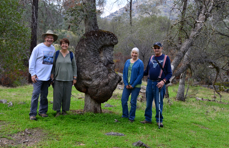
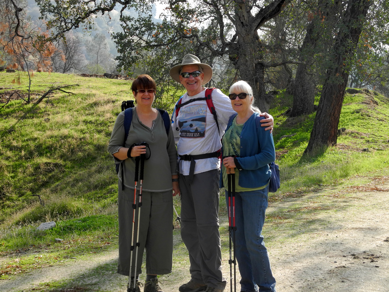
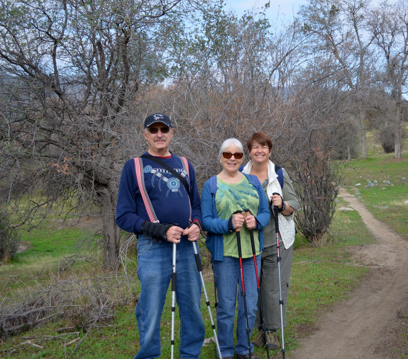
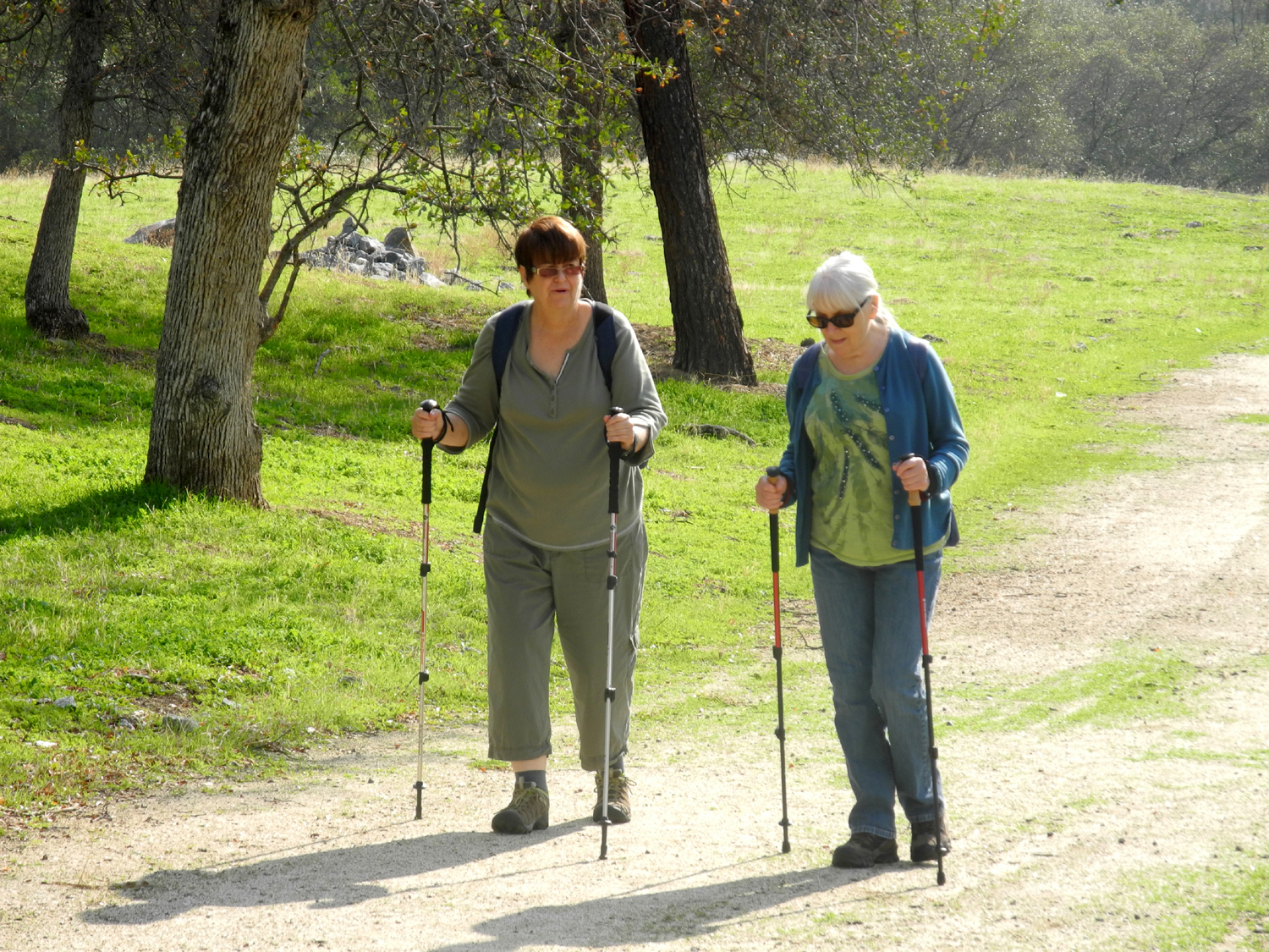
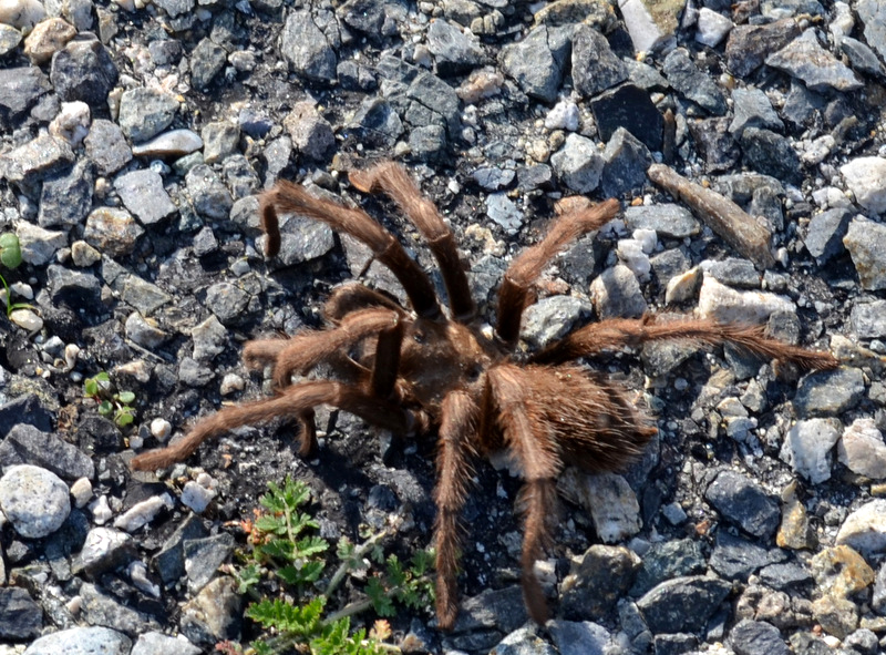
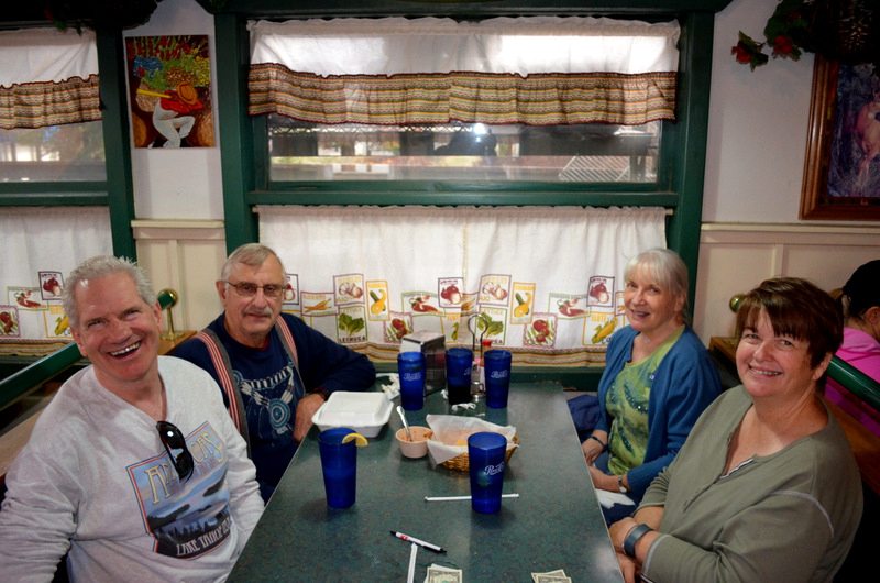
San Joaquin River Trail East (San Joaquin Gorge) First, our hiking group finally has a better name, thanks to our colleague and friend Regina Wheeler. She's not able to join us on the trail, but is there in spirit, and has dubbed us The Ramblers. In the continuing adventures of the group, we set out from the hazy San Joaquin Valley about 9:15 on the morning of November 24, headed for the San Joaquin River Gorge Management Area, and a hike on the San Joaquin River Trail. We arrived at the parking area, and after getting our hiking boots on and loading up with water, cameras, extra jackets, etc,. got on the trail about 10:30. All but Julie have hiked this trail at least once; Wes and I several times. Although it goes all the way to the Lower Finegold Picnic Area, about 12 miles down the river, only Wes has or ever will make that hike. Our plan was to hike for about an hour, then turn back. With lots of ups and downs, but no really steep sections, this is a fairly easy trail, and we made good time, arriving at the blue oak with the giant burl that was the farthest Carolyn and I walked last April. After photos, we continued on a good ways past this point, enjoying the perfect hiking weather, the trees and bushes, the surrounding hills, and the welcome but unexpected carpet of green everywhere. When we planned this hike at least a month earlier, we assumed we would be walking through brown fields and hills. However, we have had a series of small storms, enough to get the new grass going, so it is green everywhere. Hopefully this weather pattern will continue and give us wild flowers for our spring hikes. We also expected much cooler weather, since the forecast was for a high of about 63, and we would be finished well before the warmest part of the day. Instead of the mid 50s we expected, it was well up in the 60s, and warm enough at times that we were glad to reach a shady spot. When we had decided we had gone far enough, we went up on a hill off the trail to get a higher view. We also hoped to find logs or rocks to sit on so we could rest and have a snack, but there were none, so we started back down. Below the trail there is a large water tank, at least 50 feet in diameter, that probably serves the power house down below it on the river. Dick declared that we must circumnavigate the tank, an exercise that some thought pointless. However, part way around we heard what sounded like water running, a very unexpected sound in this dry country. Wes made his way down the adjacent drainage, and discovered a small creek with a little waterfall. We suspected that the water may come from the tank. Meanwhile, the rest of us went up on a little hill just behind the tank, and found we could see the river a half mile or so below. We could also see (and hear) the power plant. Instead of going back to the trail, we walked out the dirt road that led from the tank back to the paved road that continues past our parking spot to the power house, and returned via this route. It was the same type of scenery we would have had on the trail, but it was much more level, although the hard surface was not the most comfortable for walking. This was not a busy road - one car went by during our walk. And one tarantula. When we got back to the car, two and a half hours had gone by since we started. Of course, there were many stops to take pictures, enjoy the scenery and rest, but we agreed that we had experienced a very enjoyable hike and got in our exercise for the day. We started back toward Fresno, but stopped in the village of Prather, where we had a very good Mexican lunch at Velasco's Restaurant. On the way home we discussed our next hike, but did not reach any decision. We arrived back in town around 3 p.m., very much looking forward to the next time. --Dick Estel, November 2014 |
||
|
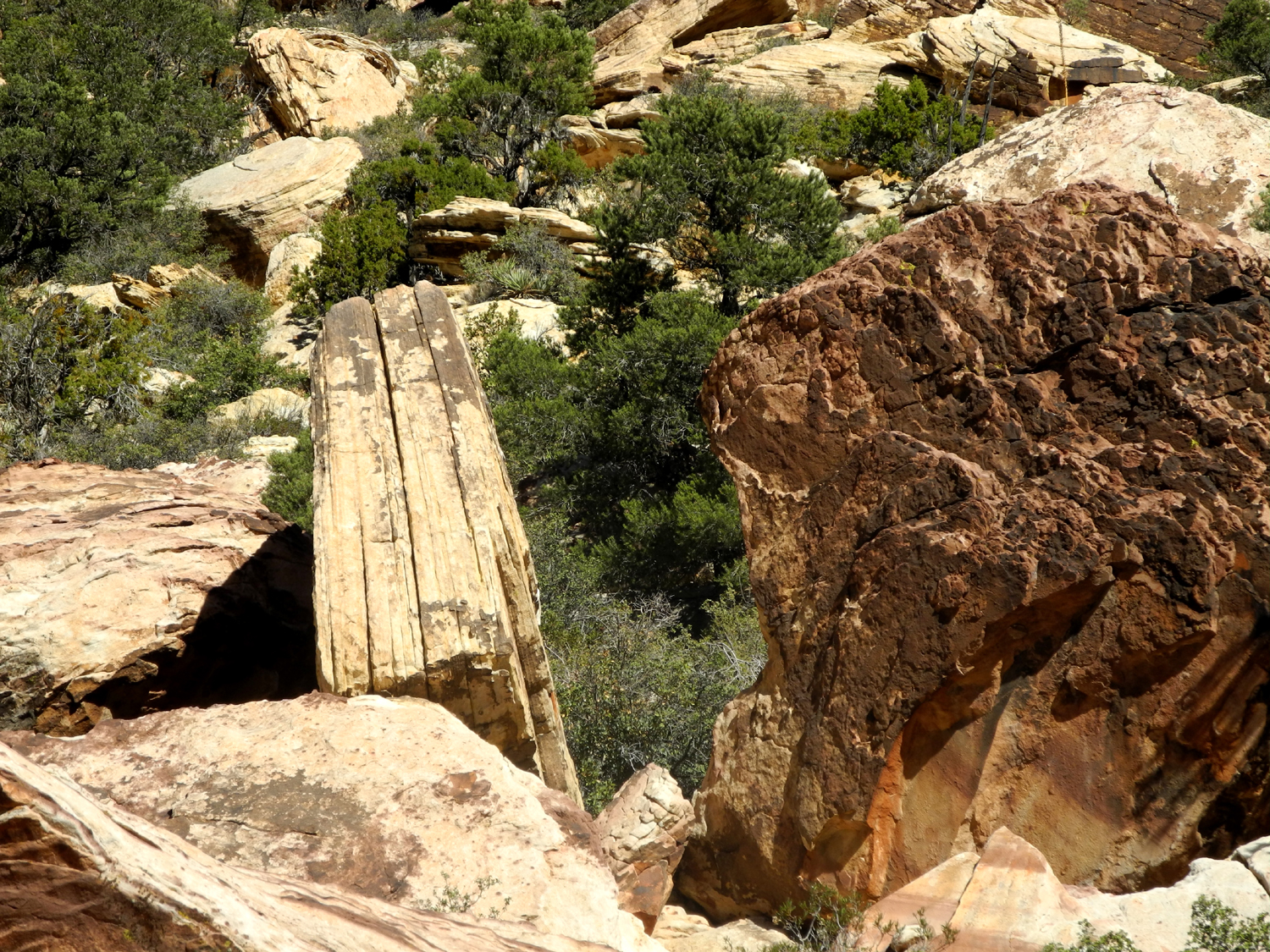
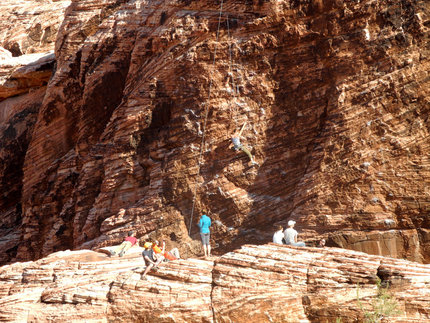
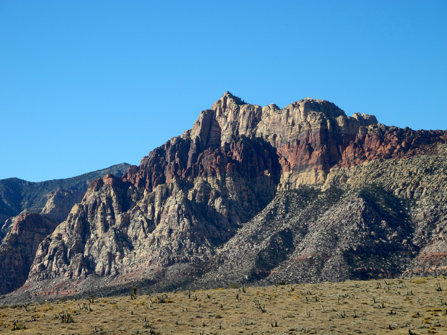
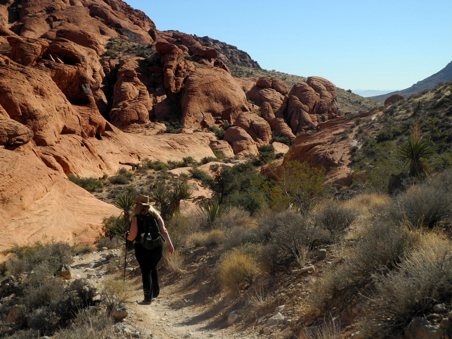
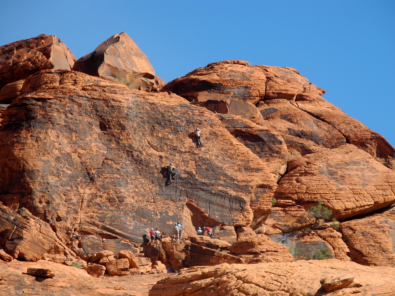
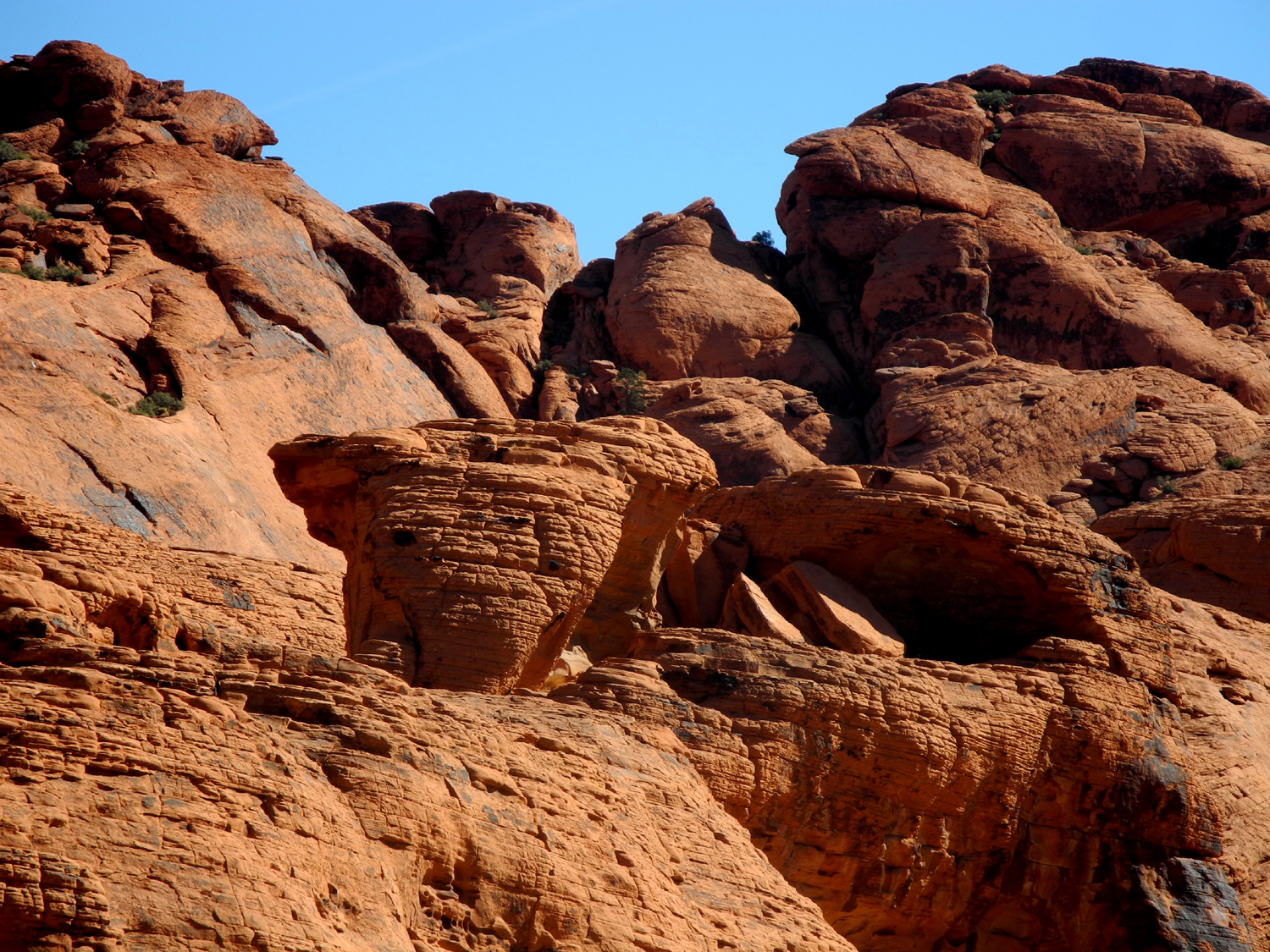
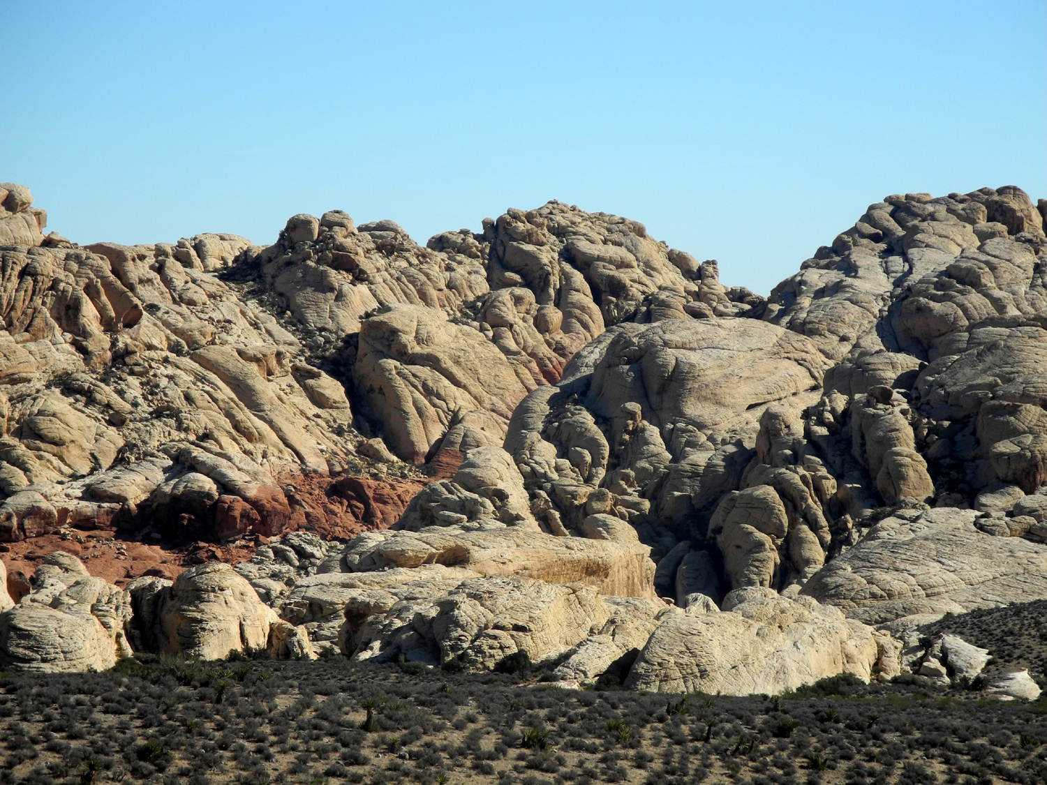
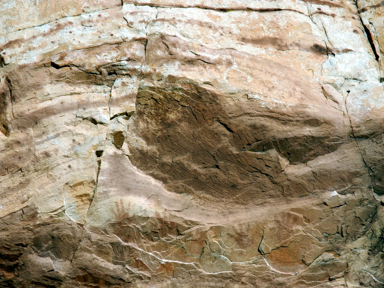
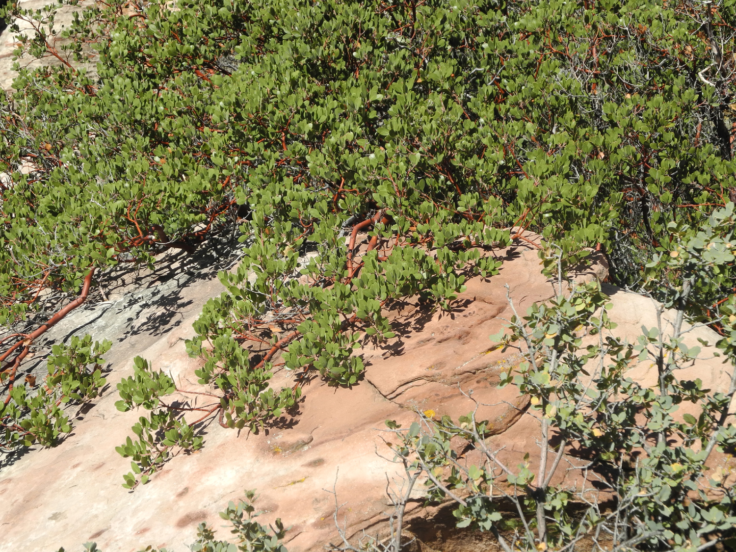
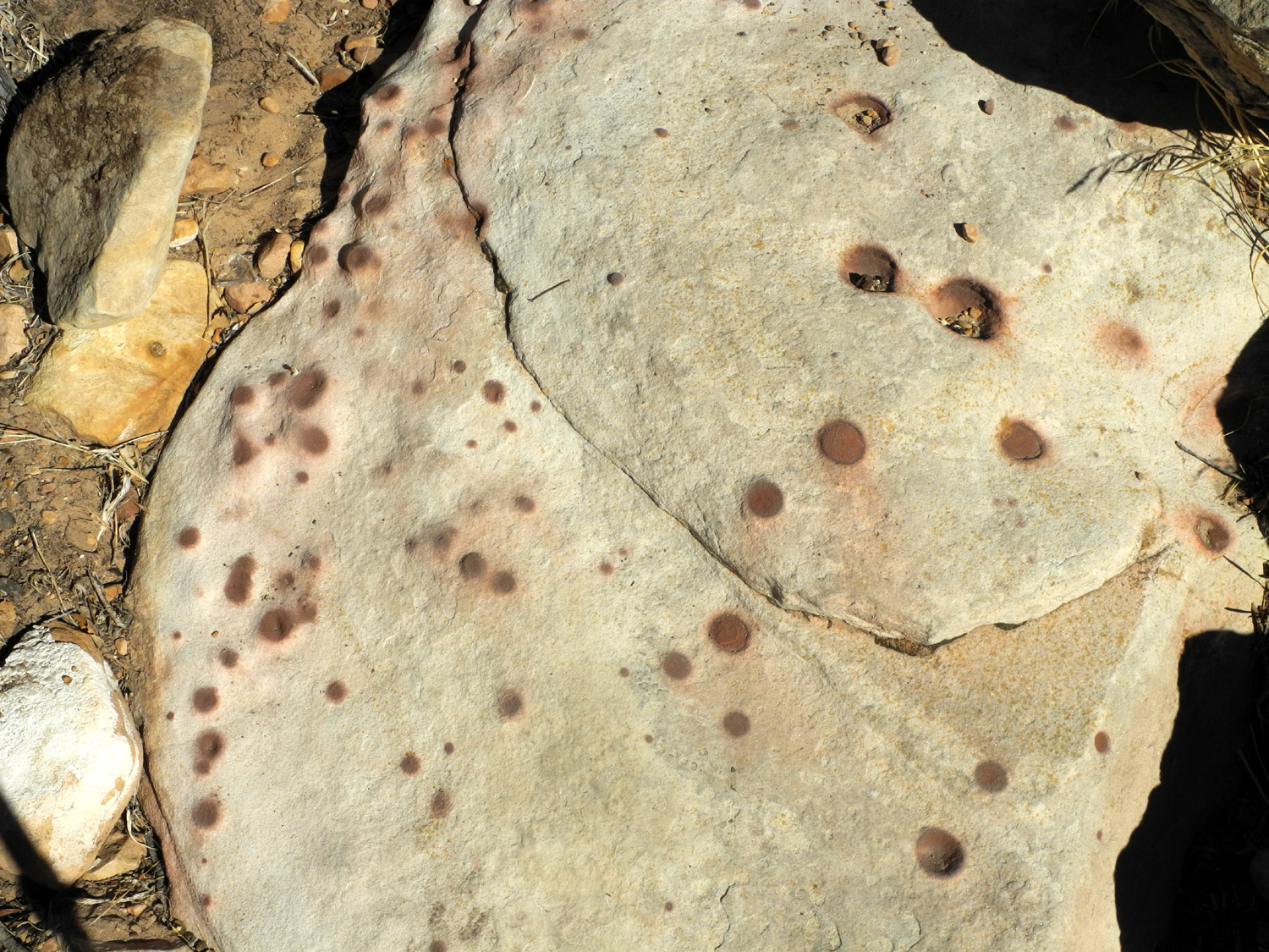
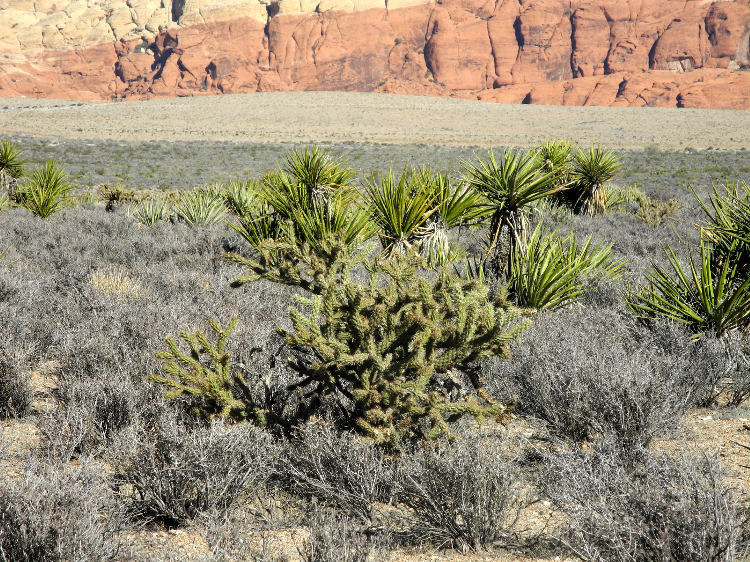
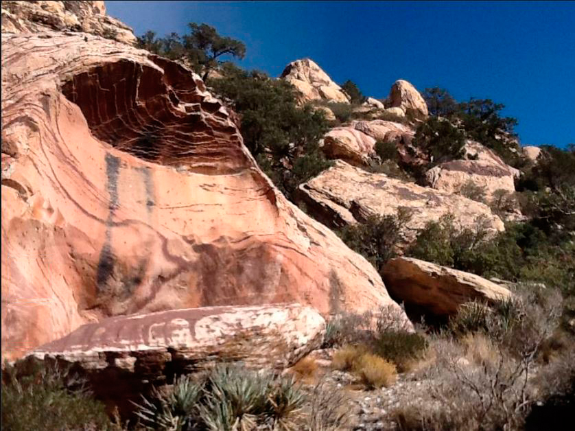
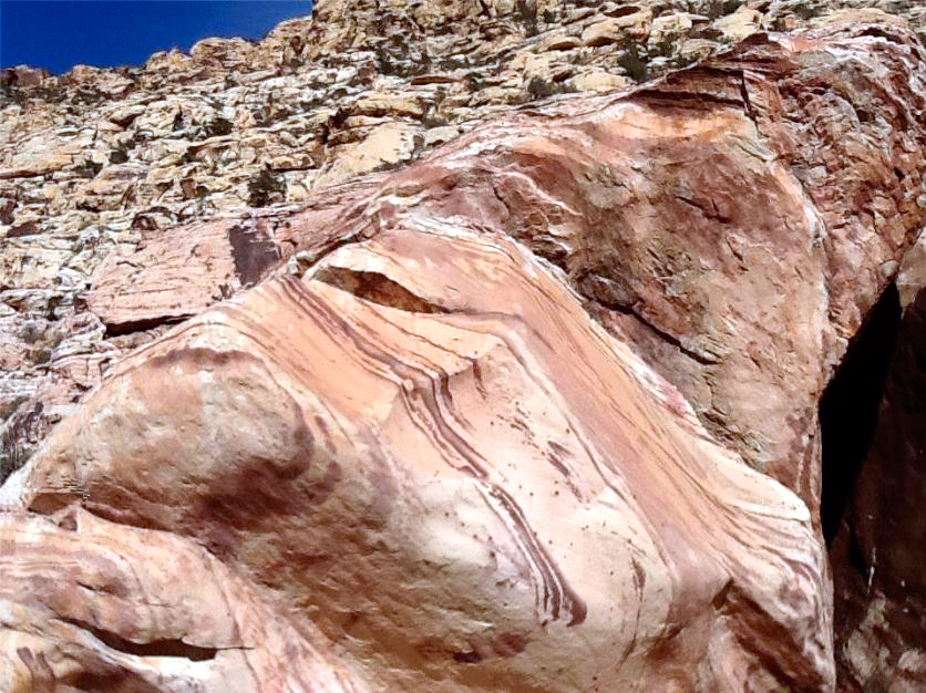
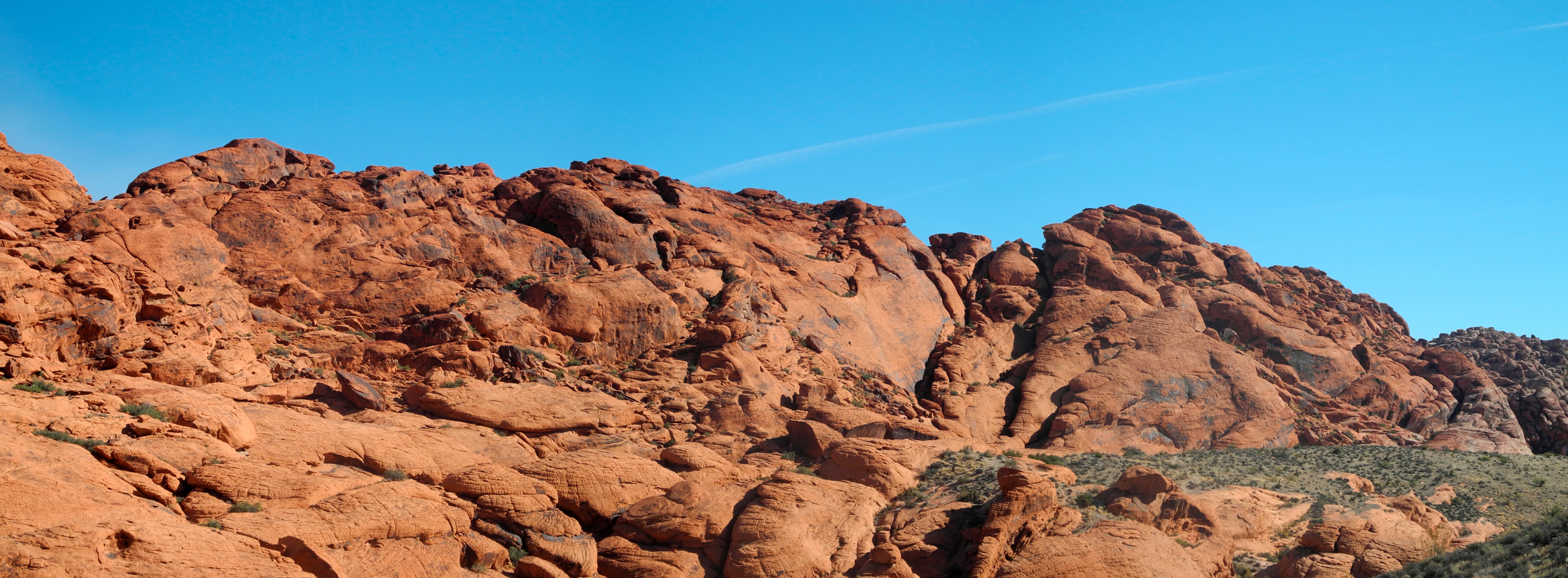
Red Rock Canyon Nevada My daughter Teri and I did not drive 400 miles to Nevada just to do a morning hike. We went there for a hockey tournament that her son Mikie and his team were playing in. However, as soon as we knew about the trip, we started discussing the possibility of doing something to fill the time between games. I knew Red Rock Canyon existed, but didn't know much about it, including the fact that it is a Bureau of Land Management property, and that it includes a nice scenic drive with many marked stopping places and lots of hiking trails. I did know that it was only about 20 miles west of the Las Vegas Strip. The only possible day for this adventure was November 28, the day after Thanksgiving. The team had only one game that day, at 1:15 p.m. Since the players have to be at the rink 90 minutes before game time, we arranged for Mikie to ride with a teammate, and Teri and I left the hotel around 8:30. We were staying on the west side of the city, so it was less than 15 miles to the entrance of what we learned is officially called the Red Rock Canyon National Conservation Area. We stopped at the visitor center to get maps and information on the best way to utilize the short amount of time we had, then continued up to the road to the first vista point. At this location and many others you are looking at the result of the ancient Keystone thrust earthquake fault, which has left cliffs and rocks of red, tan and white sandstone in many areas. Like most similar areas, the red indicates the presence of iron. One feature I had not seen before was an area with red-spotted rocks. The spots indicate heavier deposits of iron, and these mostly small, circular areas weather more slowly than the surrounding rock. Eventually they form little balls known as Indian marbles. We hiked a short way down a steep trail that goes to the bottom of a wash, offering varied views of the surrounding rock formations. Here we noticed the first of many climbers on the rock cliffs across the wash, but had no desire to emulate them. We made several stops, each of which offered something slightly different. At one location there are pictographs and petroglyphs, which are thought to possibly be several thousand years old. Another site offers an open, level area with various common desert plants, including cholla cactus. Teri had brought sandwiches, so we stopped at a picnic area, where we did a short walk before eating. Along this trail we saw a bush that looked ever so much like the manzanita that is common in the foothills and mountains near our home. Close inspection showed that it was indeed this red stemmed bush, with leaves that were a brighter green and slightly longer than those we are used to. Appropriately it's called "pointleaf manzanita." There are a number of short trails we had to skip and some longer ones, and I would like to visit the place again, although Teri swears she will never go to Las Vegas again. Time will tell. On the way out we stopped at an area where the rocks from a distance had appeared rather plain, but up close they had a nice variety of muted colors. Throughout the day we had excellent weather, partly cloudy and cool enough to be comfortable whether we were walking or resting. After a final stop next to an area with a lot of cactus and yucca, we drove out of the park and back into the busy city, arriving at the hockey rink just in time for the game. If you decide to visit Red Rock, the best web site for planning information is the Red Rock Interpretive Association. --Dick Estel, December 2014 |
||
|
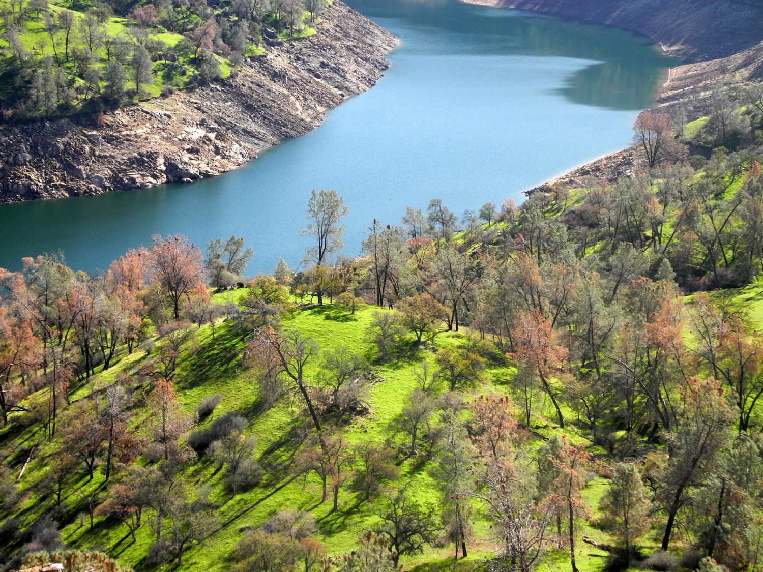
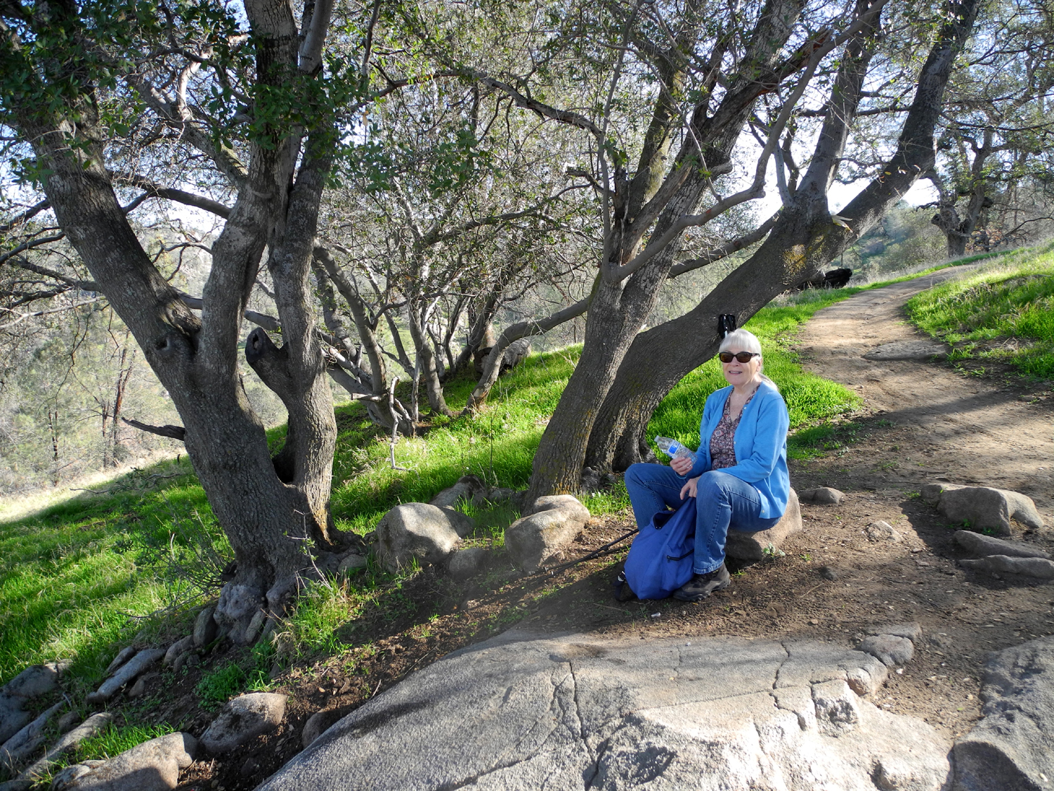
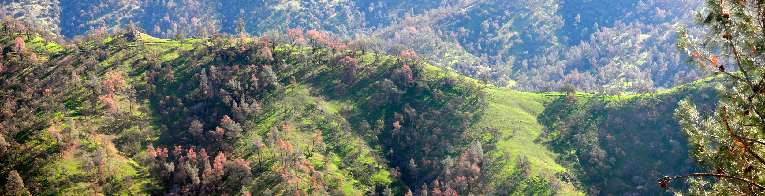
San Joaquin River Trail West Again Although it was not cold, the week of December 1, 2014 was rainy off and on, and cloudy and gloomy much of the time. By Friday I was beginning to question the wisdom of scheduling a hike on Saturday, December 6, but it turned out there was no need to worry. I had invited Carolyn Amicone, my friend and frequent hiking companion with the Ramblers, to join me on what I warned her was a steeper hike than we usually attempt. However, she has lived in Wyoming and hiked in many of the recreation areas of that state and Utah, and was ready for the challenge. We arrived at the South Finegold Picnic area in time to get on the trail at 10 a.m., following the same route I took October 13. Since my visit in October there have been a number of small rainstorms - not enough to counter the affects of several very dry years, but enough to get the grass and new plants started. The countryside was nice and green in contrast to the golden brown of my earlier trip. To go with that, the clouds that had hung around most of the week disappeared and we had a blue sky and clear air with good views of the higher hills and mountains. We planned to hike to the top of the ridge which has been my stopping point on most of my hikes on this trail, then decide whether we wanted to go up the steep hill to the west that I went to last time, and possibly up to Pincushion Peak, the slightly higher point just beyond. We had prepared a light lunch of PBJ sandwiches plus apple and orange slices, to give us the needed energy for the additional hiking, should we decide to try it. Since it was a Saturday, there were many cars at the parking area, and we saw quite a few people on the trail, both hikers and bikers. We were amazed at the strength and stamina of those who were riding bicycles up this very steep trail, and ready to jump out of the way when they came hurtling back down. The weather turned out to be so nice and sunny that we were glad to be hiking in the shadow of the hills much of the way up. Once we got into the sunny area, it was hard to realize it was December. We briefly observed a moment of sympathy for those living in areas getting hit by snow, ice and heavy rains. Once we got to where the trail crosses the ridge, we took the short trail to the east, which goes to the highest point in that direction. From there, an abandoned but still usable trail drops steeply down to the lake. A group of hikers went down that route while we were there, and another adventurous soul came up on a bike. He admitted he had pushed the bike much of the way. We ate our lunch and rested at this point, and contemplated the effort that would be involved in going up the steep knoll to the west. We ultimately decided against this, but instead continued on down the main trail for another 15 minutes, a little farther than I have ever gone. This gave us some nice views of a section of the high Sierra that is covered in snow, and framed by the foothills and table mountains nearby. We reached a point where the trail started down hill, and decided that it was time to go the other direction. We enjoyed the view from that spot for a few minutes, then retraced our steps to the ridge top and back down. On the way we enjoyed brief conversations with a number of hikers who had started later than we did, and therefore had to endure considerably more sunshine then we had. By the time we reached the car we had been out about three and a half hours, probably walking about two and a half - enough exercise for a week. --Dick Estel, December 2014 |
||
|
Photos (Click to enlarge; pictures open in new window) |
||
|
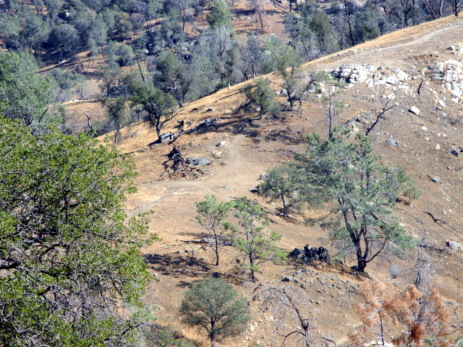
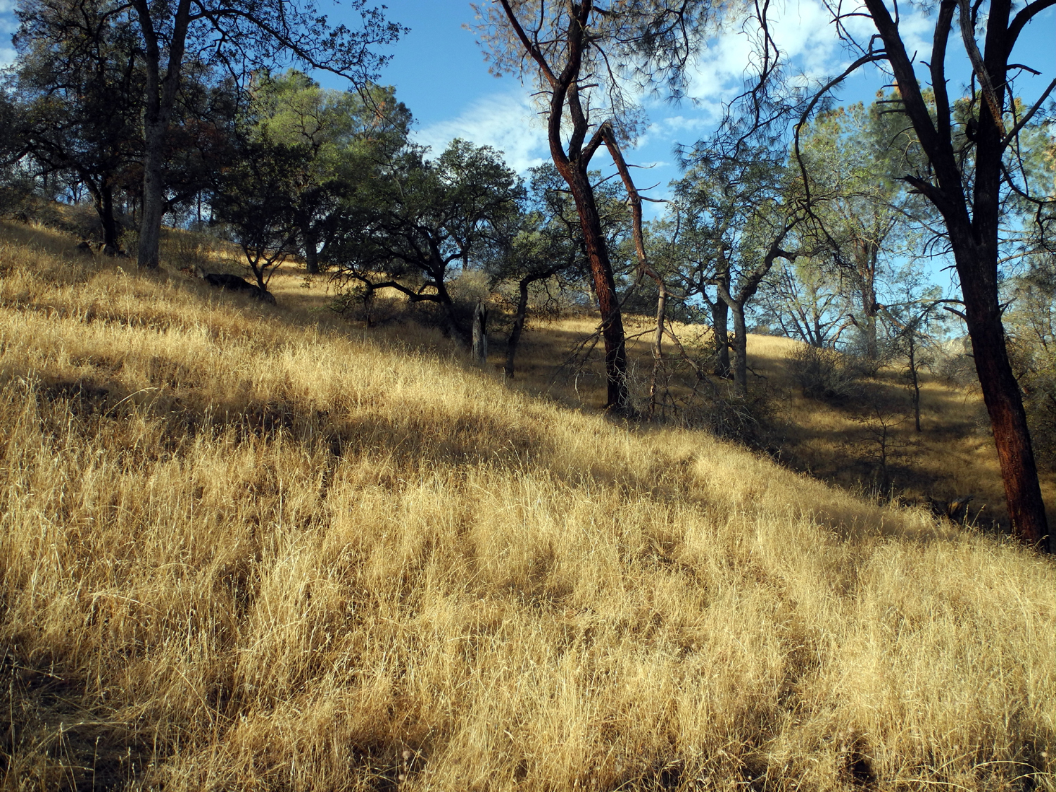
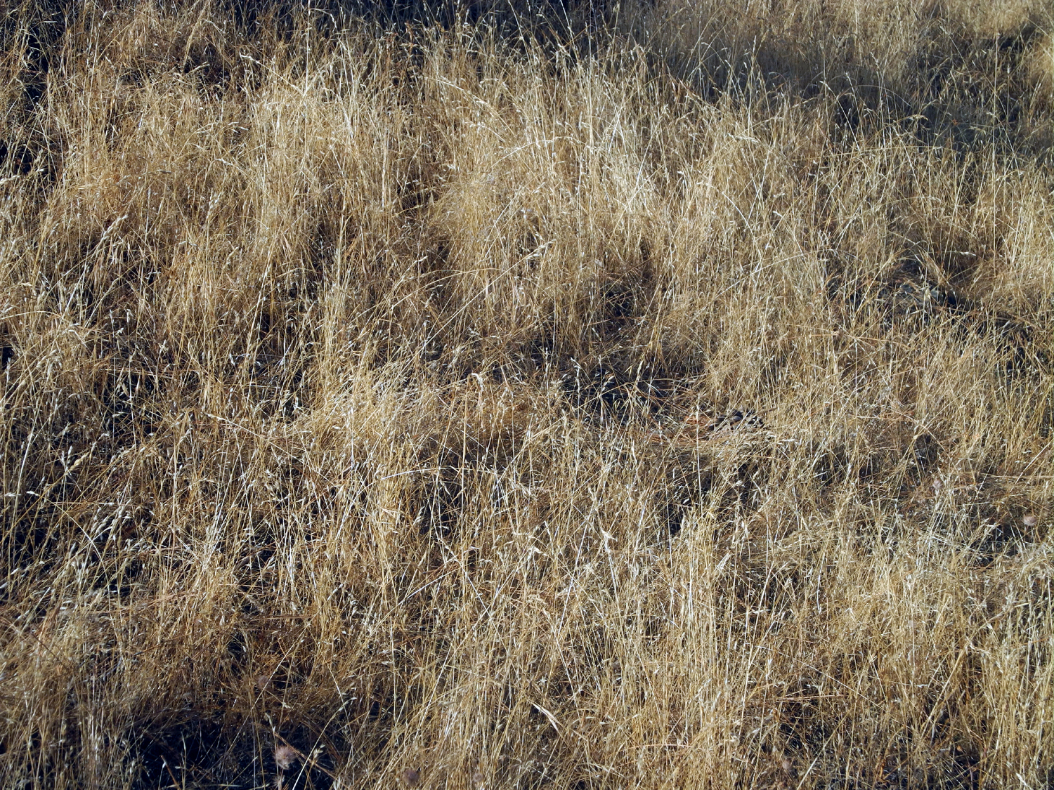
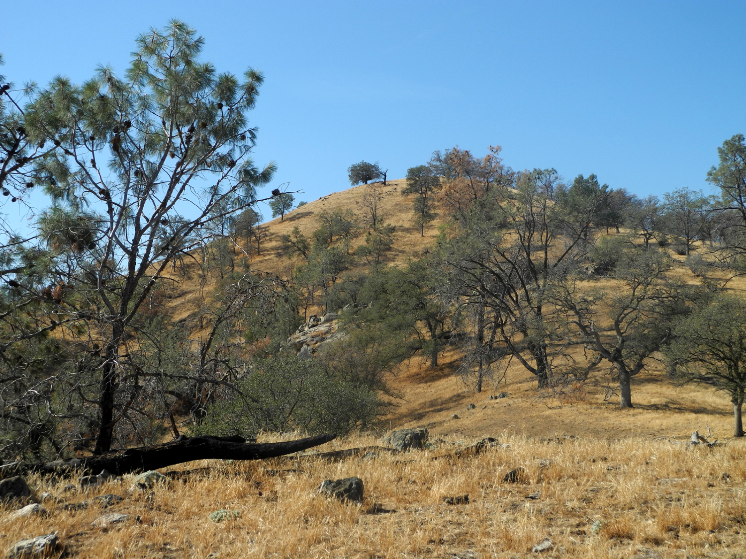
San Joaquin River Trail West (Finegold Picnic Area) |
||
|
|
 |
 |
| Oak and pine woodland of the Sierra foothills | Lots of tall dead grass | Low water in the Finegold Creek branch of the lake |
 |
 |
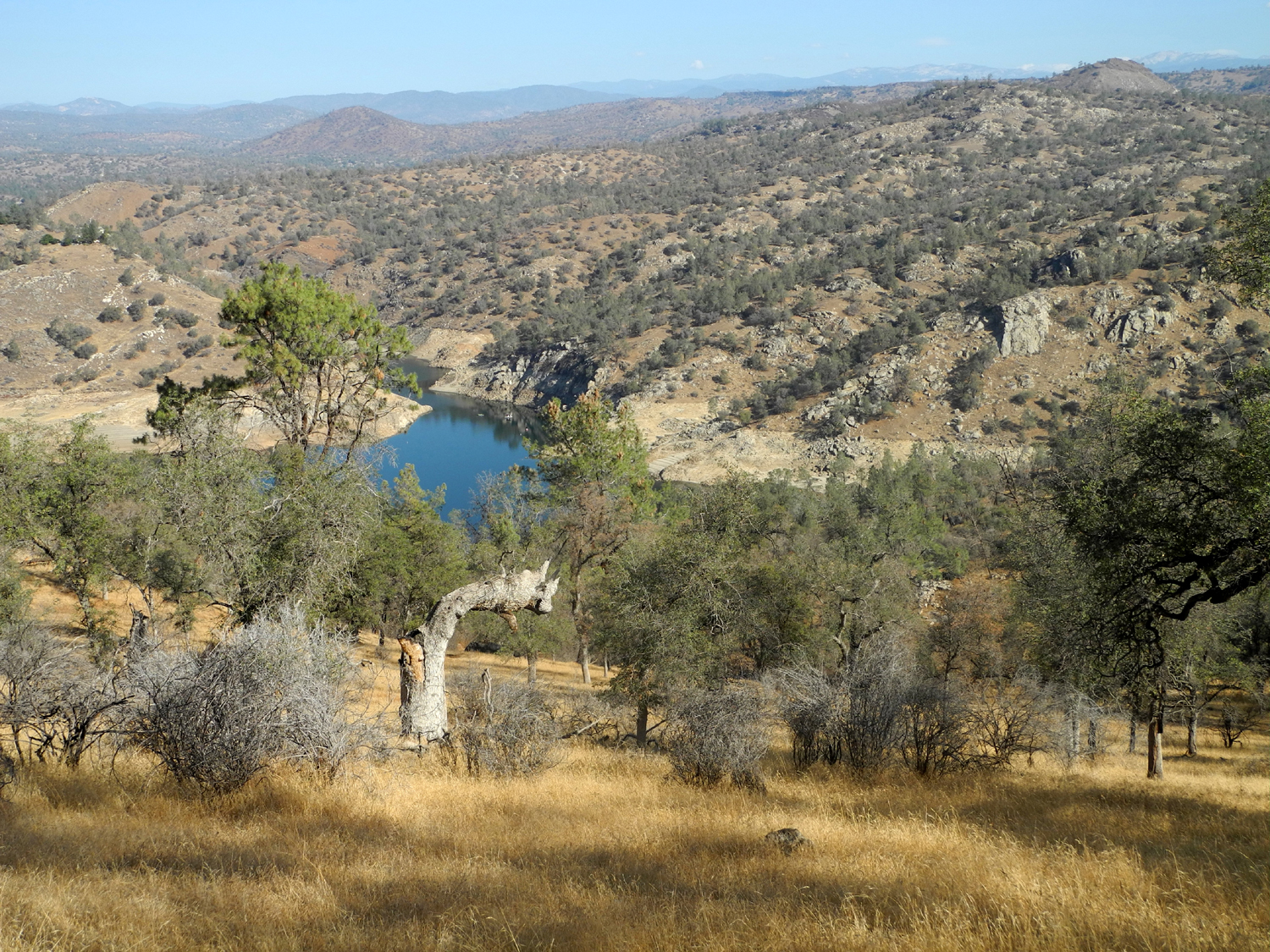 |
| The water for the lake originates in those distant blue mountains |
Ancient blue oak snag |
A little bit of lake in a huge dry landscape |
 |
 |
 |
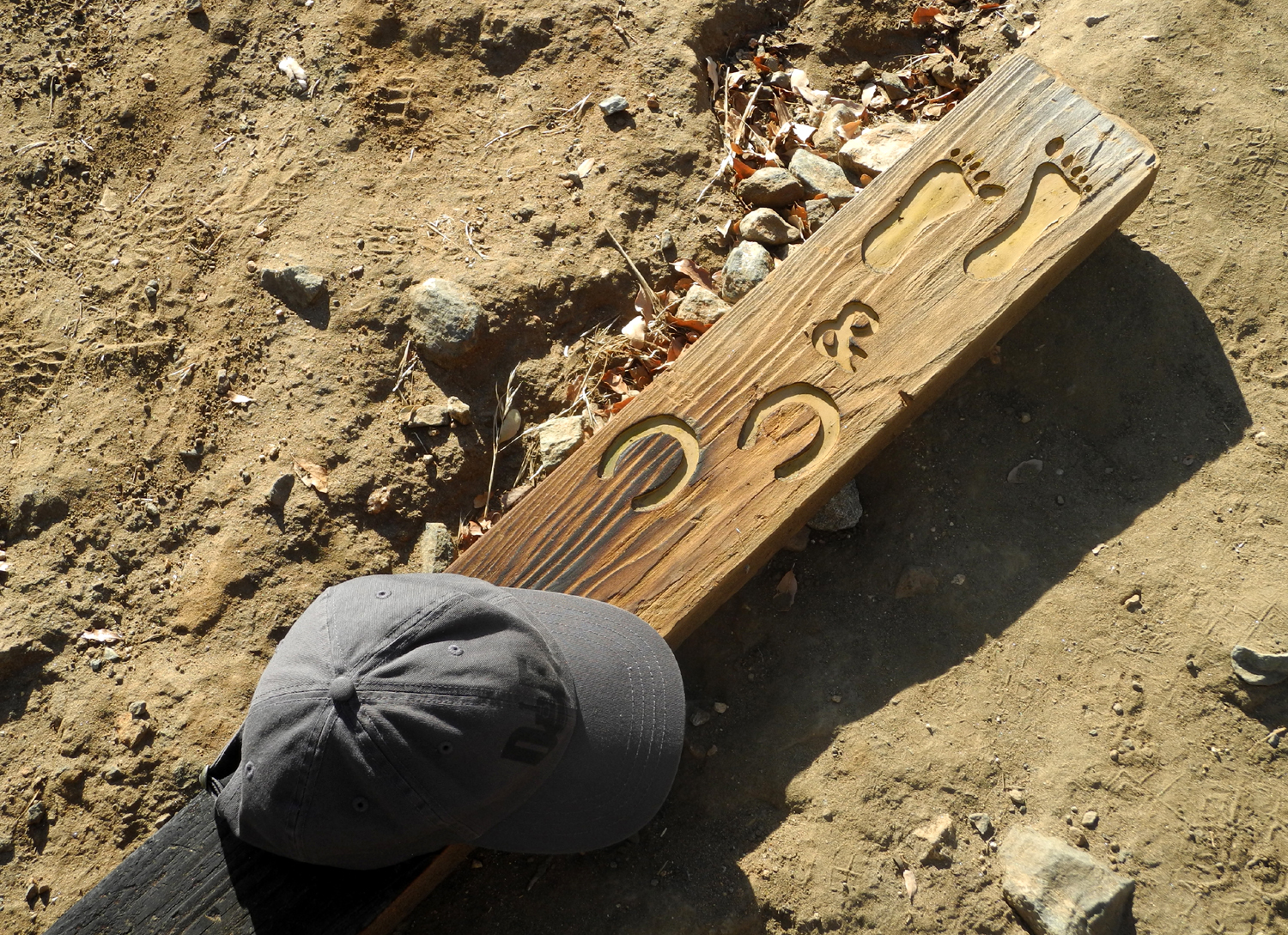
| Trail sign for barefoot kids and very small horses |
Pincushion
Peak looked too far by the time I took this picture |
Wake of a boat creates an artistic view |
 |
 |
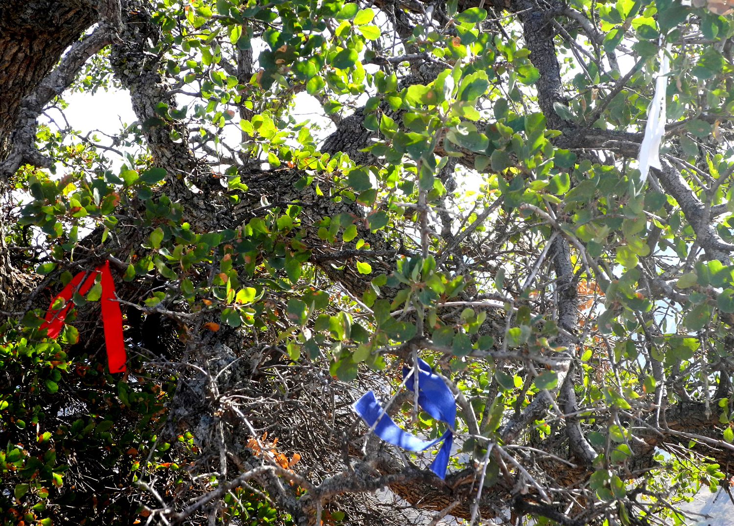 |
| Dick at the lower summit | The main trail crosses the saddle just left of center | Red, white and blue ribbons in a blue oak tree |
 |
|
 |
| Looking back up from the saddle to the high point of my hike |
Buckeye adds another color to the fall palette | Where the trial divides |
 |
 |
 |
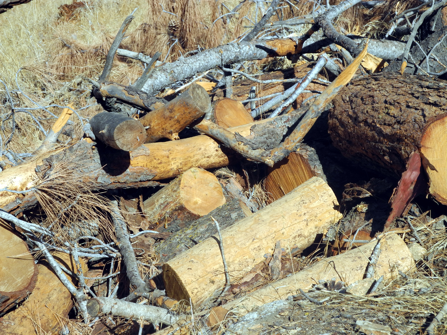
| Bull pines cut down and cut up |
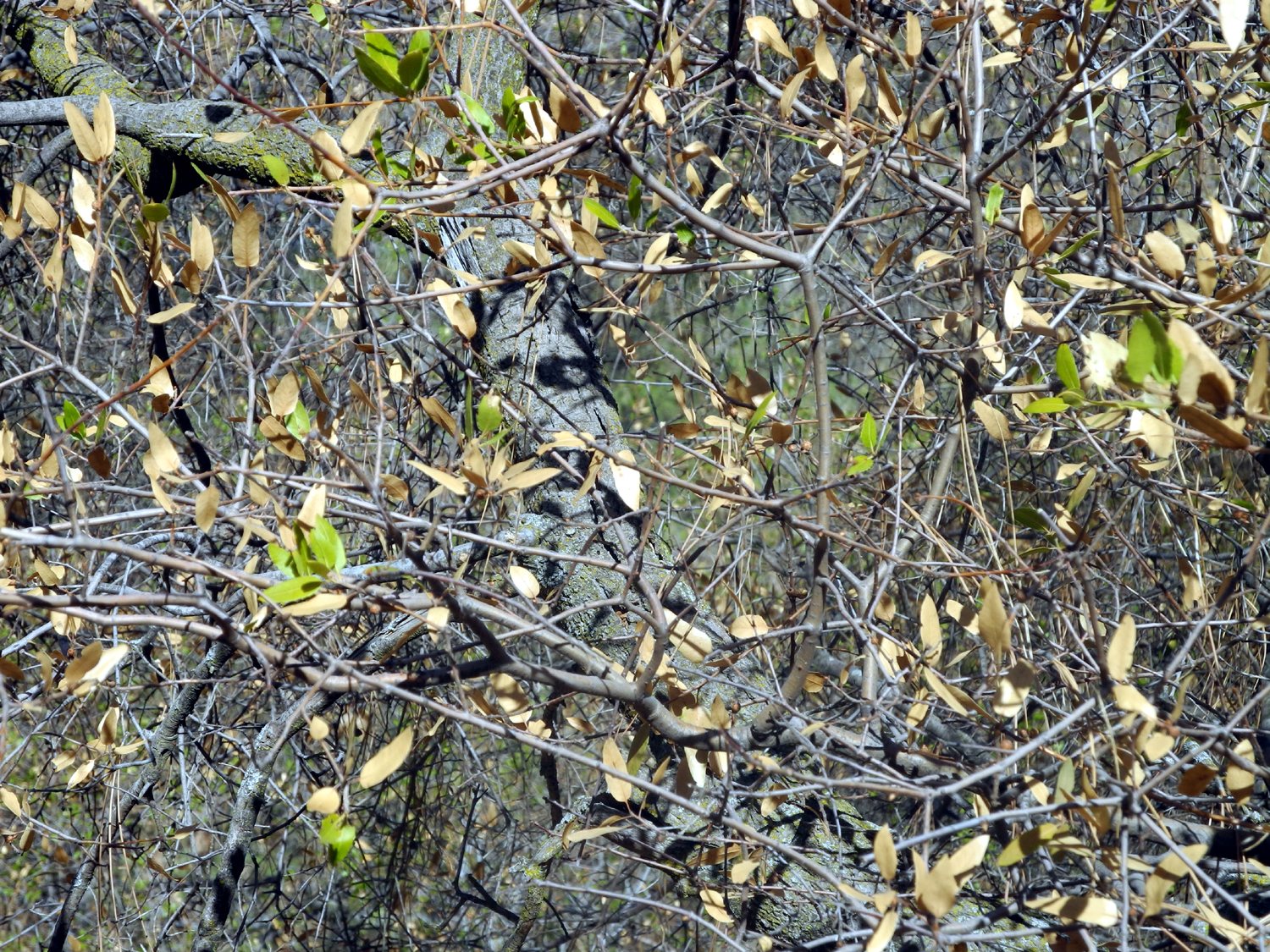
Live oak that's more dead than alive |
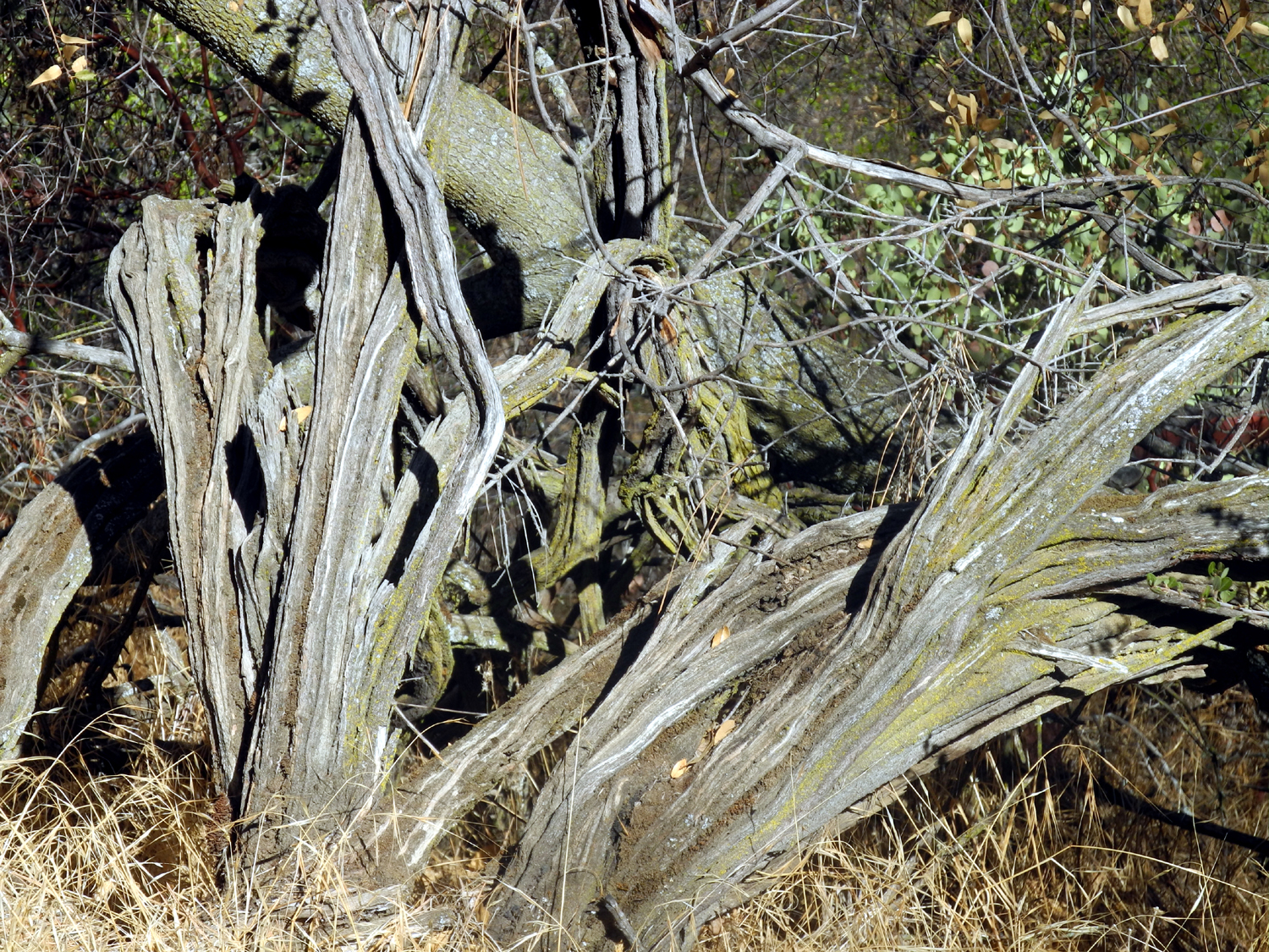
The bones of a long dead bush |
 |
||
|
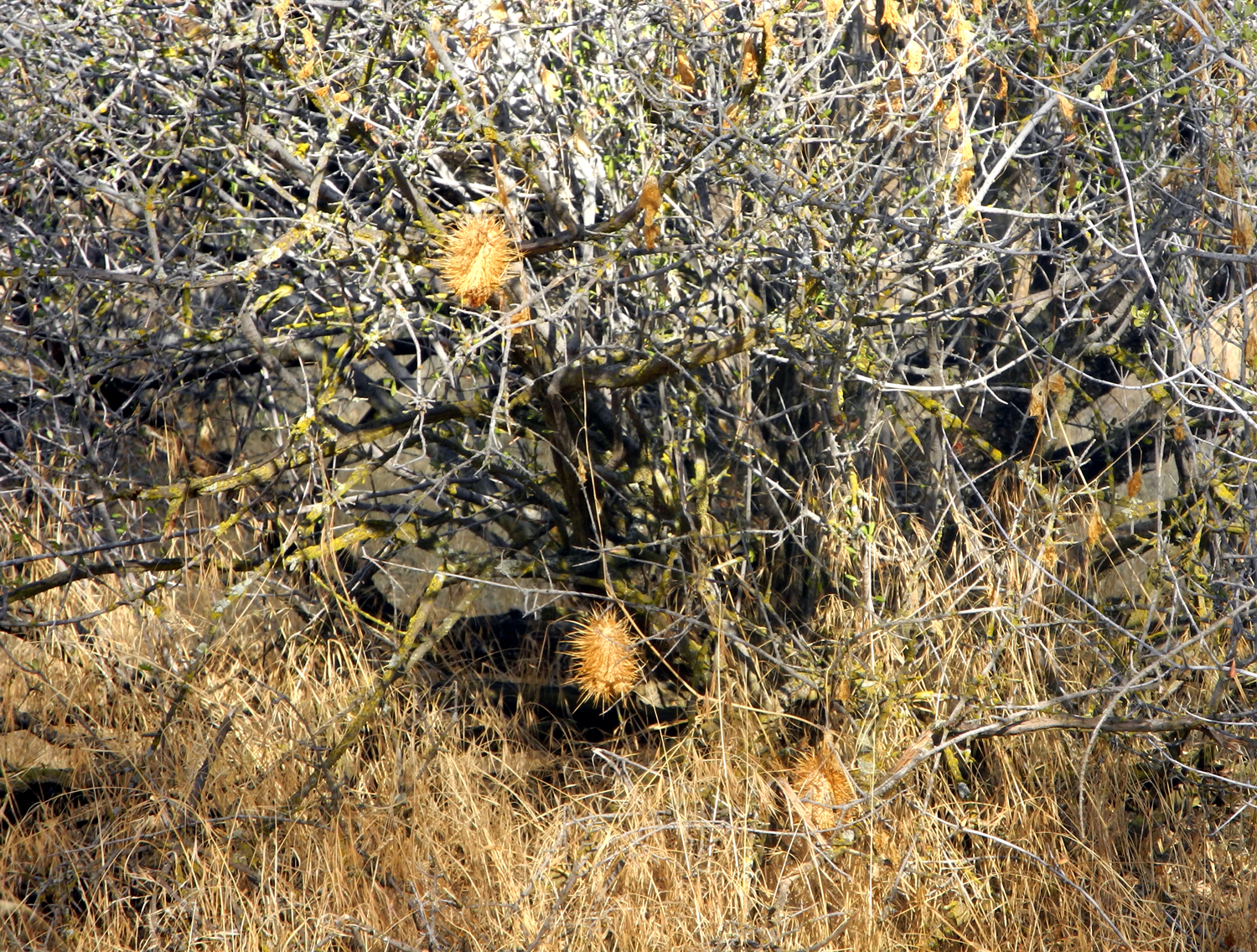
Dried seed pods of wild cucumber |
||
 |
||
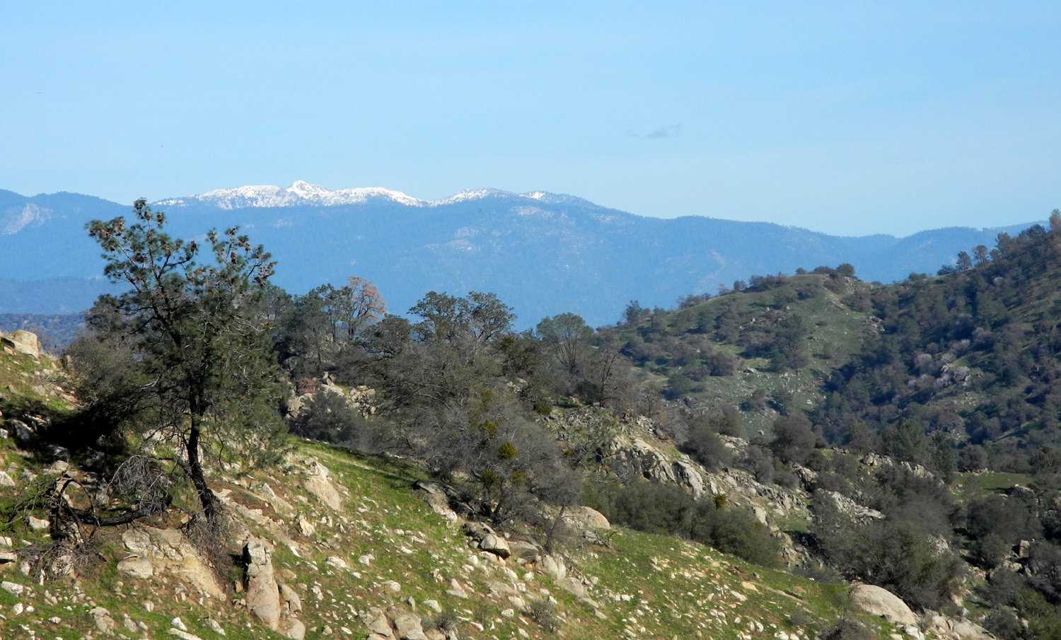
| Table mountains mark the line of an ancient lava flow | ||
 |
||
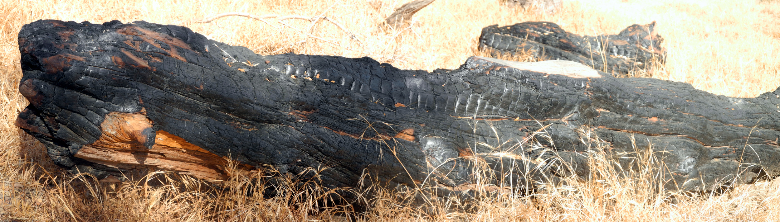
| Burned log along the trail | ||
| San Joaquin Trail East (San Joaquin Gorge) | ||
 |
 |
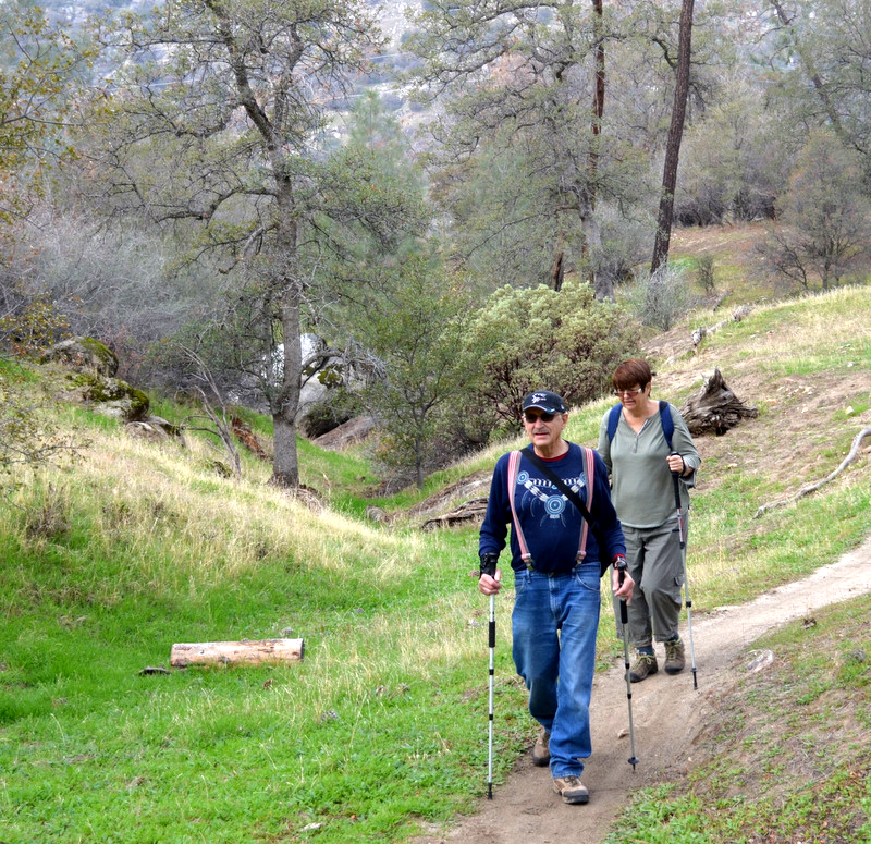 |
| Julie, Wes and Carolyn | Dick, Carolyn and Julie | Dick and Julie make their way carefully up the trail |
\ |
|
 |
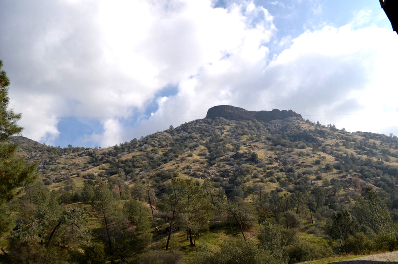
| Squaw Leap under light clouds |
The Ramblers at the |
A horizontal bull pine |
 |
 |
 |
| Julie and Carolyn | Someone we met on the road |
At Velasco's Mexican Restaurant in Prather |
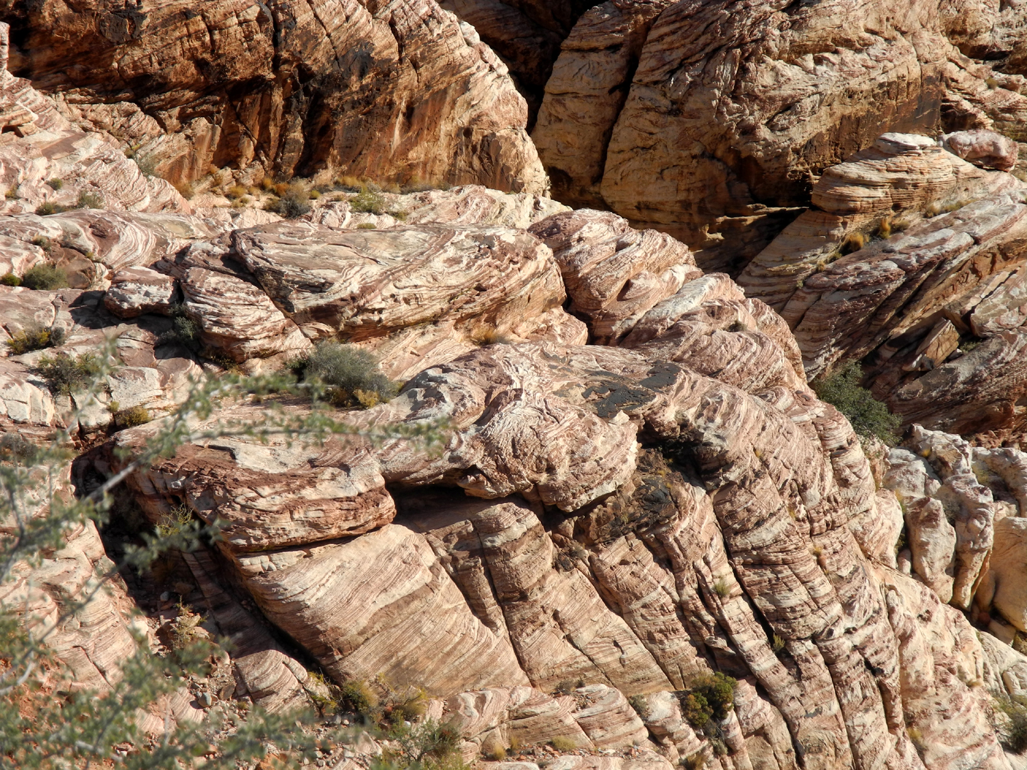
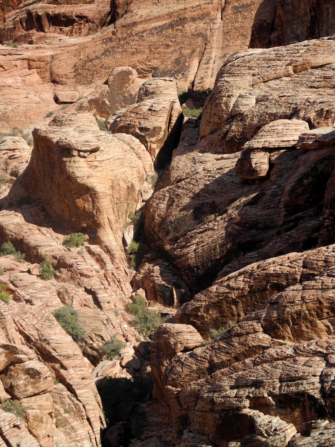
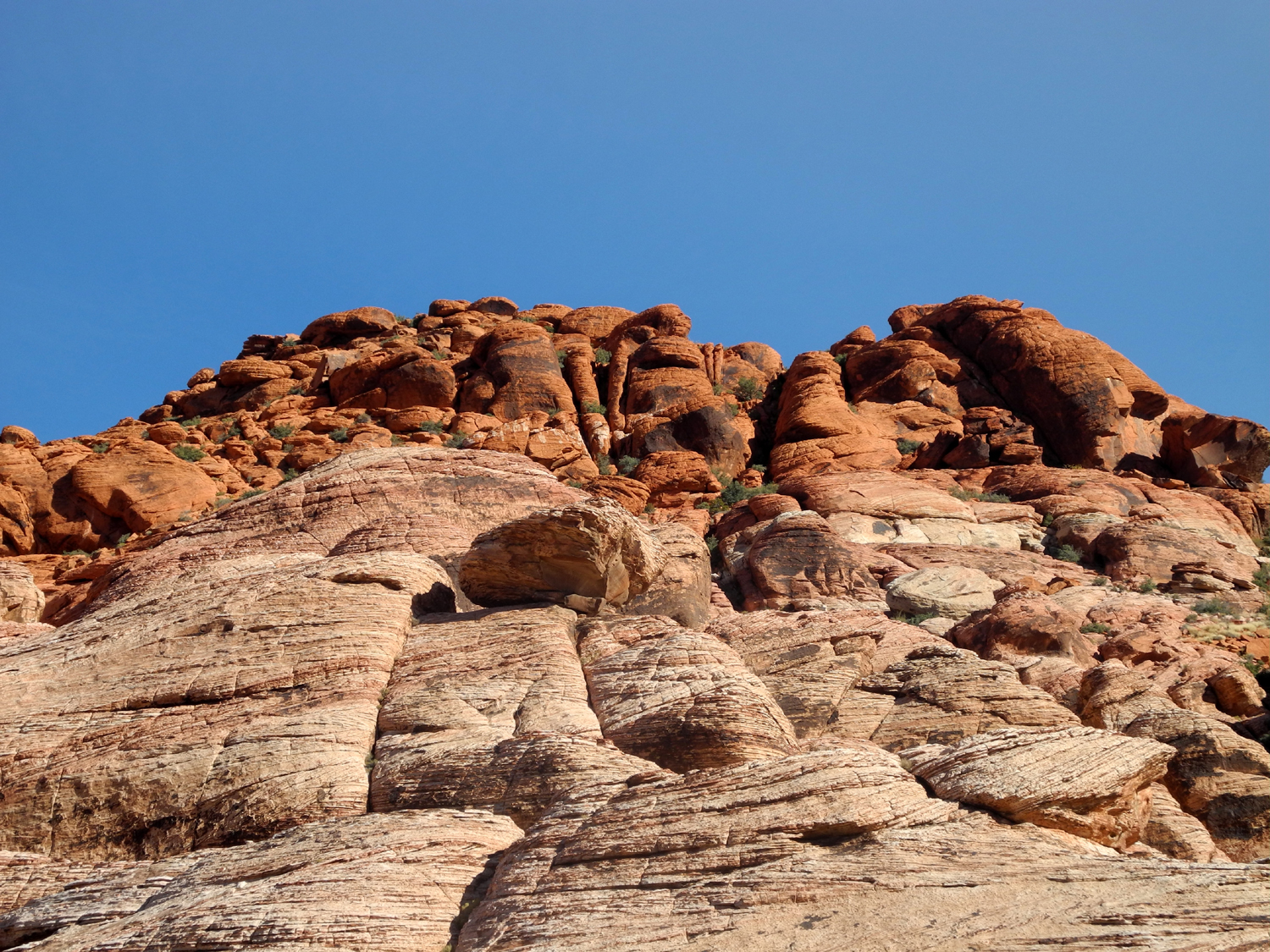
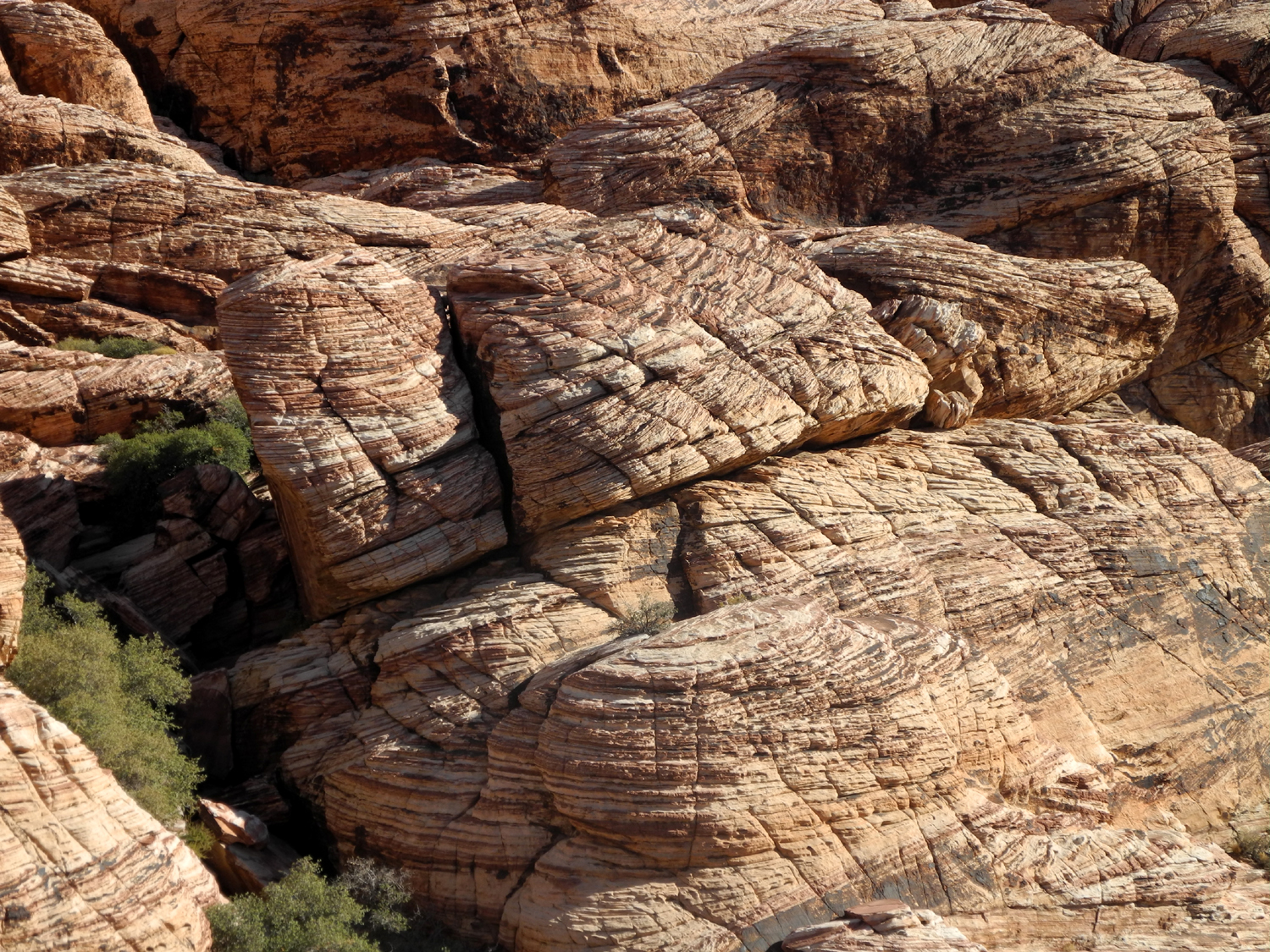
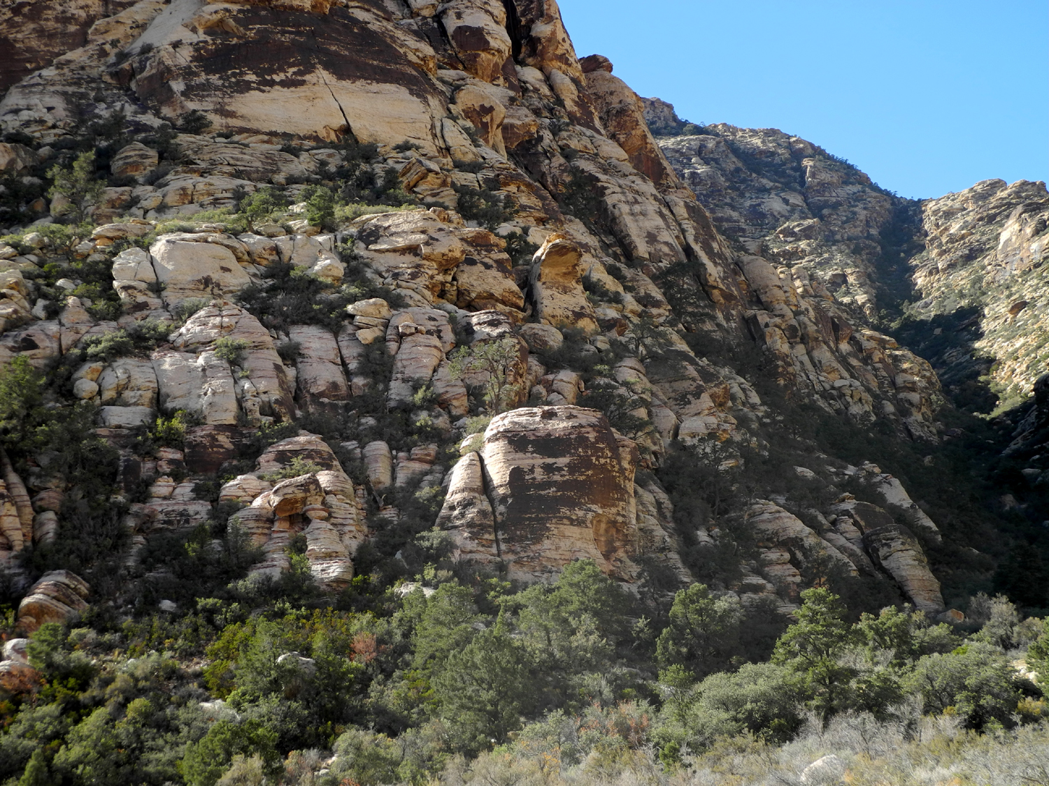
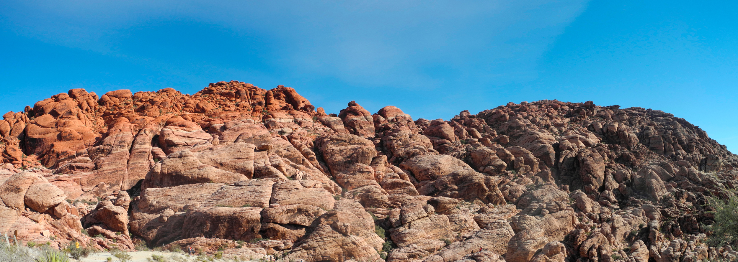
| Red Rock Canyon | ||
 |
 |
 |
| Red Rock Canyon offers endless twisted layers of rock | ||
 |
 |
 |
| A study in red and green | Can you spot the climbers here? | Massive forces created the disconnected layers here |
 |
 |
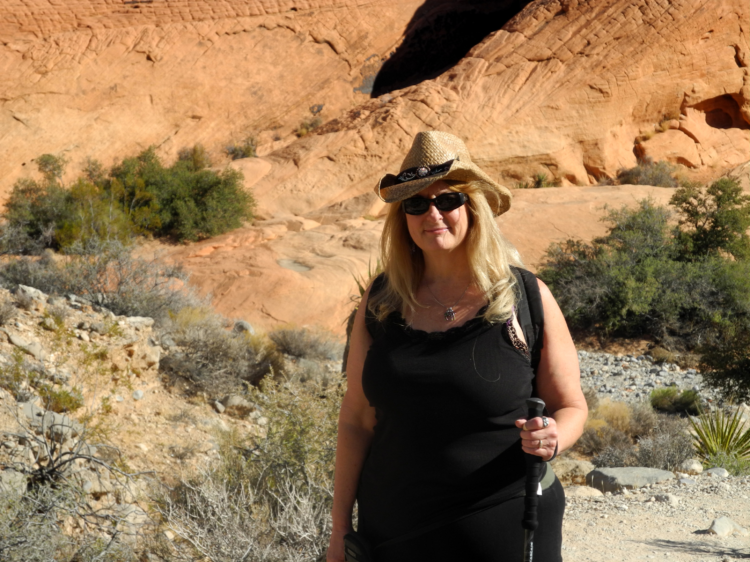 |
| Fun to watch from a distance! | Rugged peak in multiple colors | Teri enjoying a short hike |
 |
 |
 |
| Teri on the trail | Watching these climbers added interest to our visit |
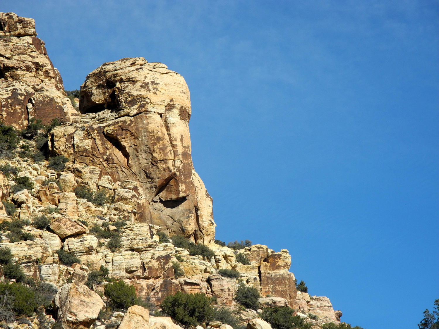
Left center, an elephant head
formation, |
 |
 |
 |
| A bit of red stands ot against the beige sandstone in this spot |
View from the highest point along the road |
Dick and Teri |
 |
 |
 |
| A dramatic cliff |
From a distance this rock looks plain, |
Hand print pictographs across the lower
part of this rock may be thousands of years old |
|
 |
 |
| A chunk with once horizontal layers has landed sideways |
Unexpected in the desert, a manzanita bush |
Red spots indicate heavy |
 |
 |
 |
| There's been enough moisture to get some green grass started |
Cholla cactus, with yucca as a backdrop |
Teri captured this nice scene |
 |
||
| Another from Teri's collection | ||
 |
||
| Red rock panorama | ||
 |
||
| Another panoramic scene | ||
| San Joaquin River Trail West Again | ||
 |
 |
 |
| Carolyn take advantage of the "official" rest stop | The area offers many views
of the table tops lining the river |
Snow on the mountains - a welcome sight |
 |
 |
 |
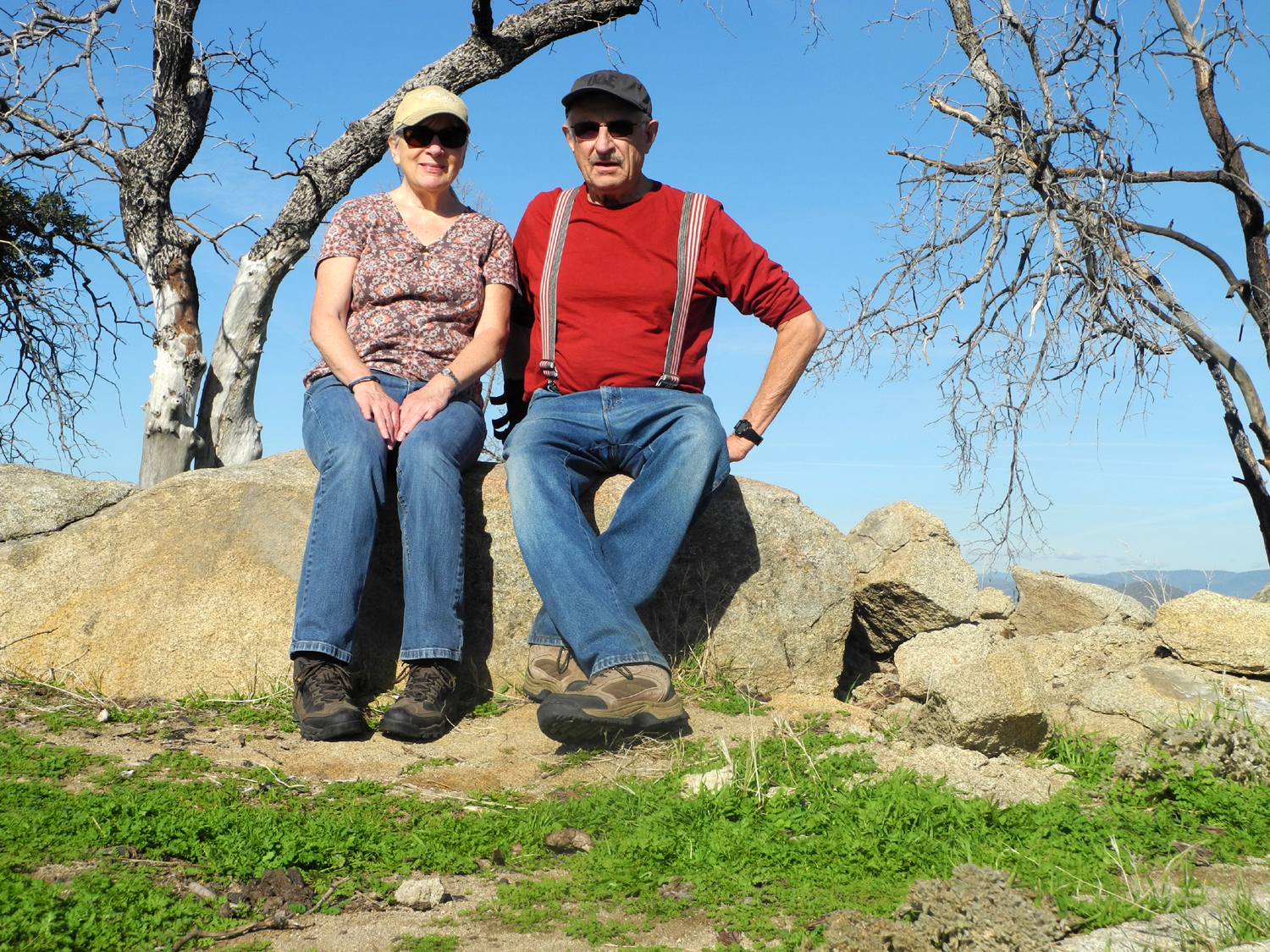
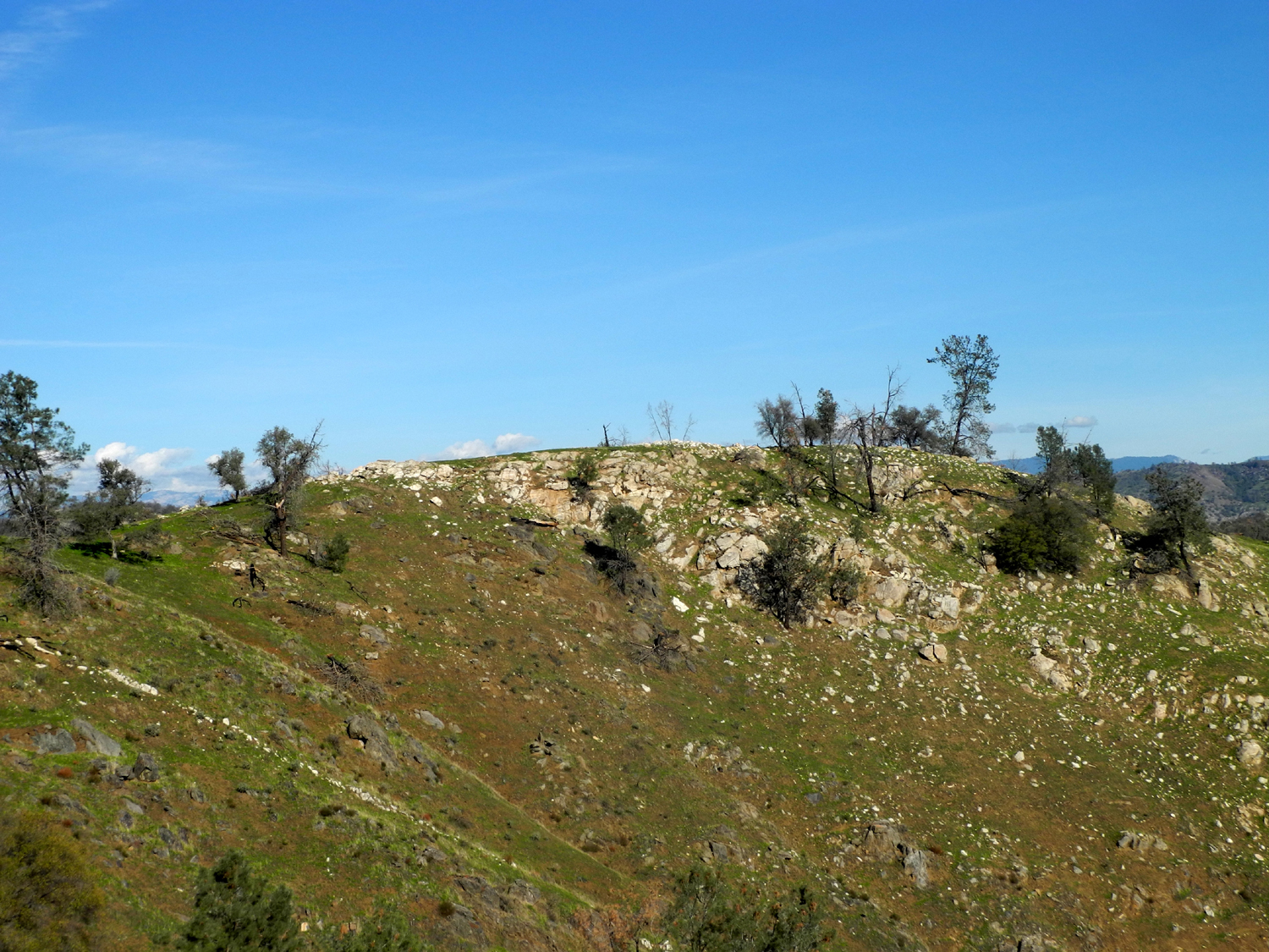
| Conquerors of the mountain | The ridge top where we dined | Erosion has revealed rocky ridges along the hillside |
 |
|
 |
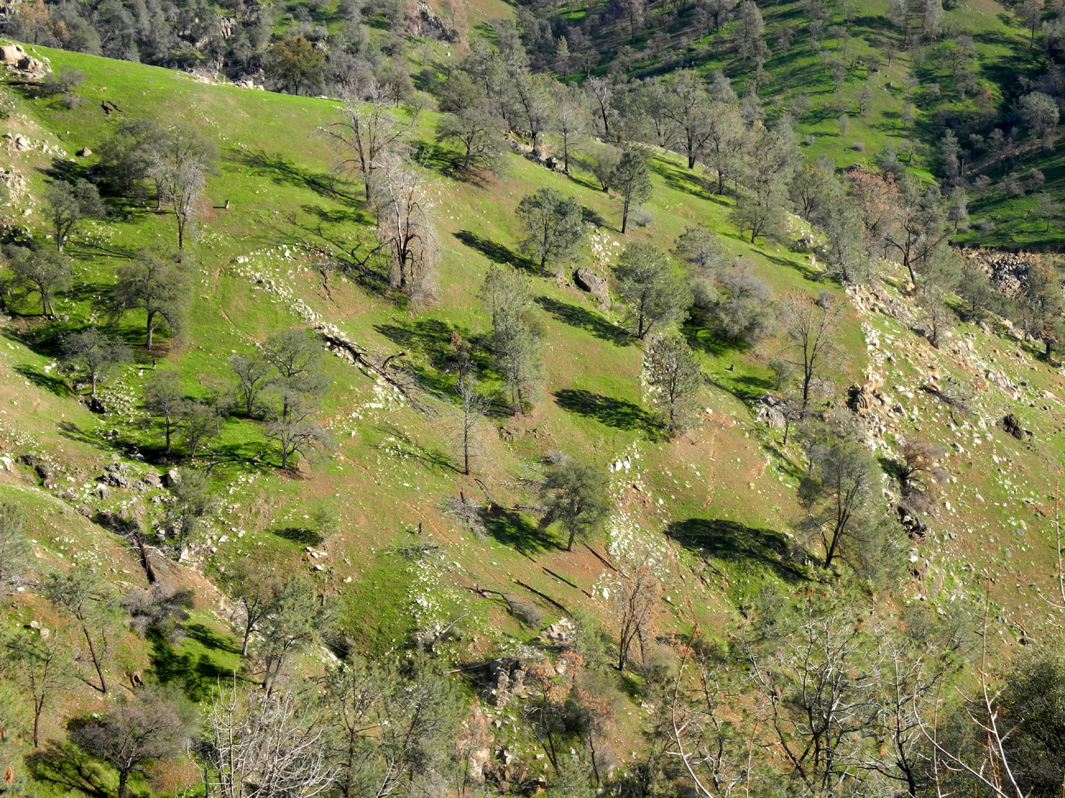
| A delightful layer of
green, something lacking last December |
The lake at horseshoe bend | Last year's dead grasses wave above the new green |
 |
||
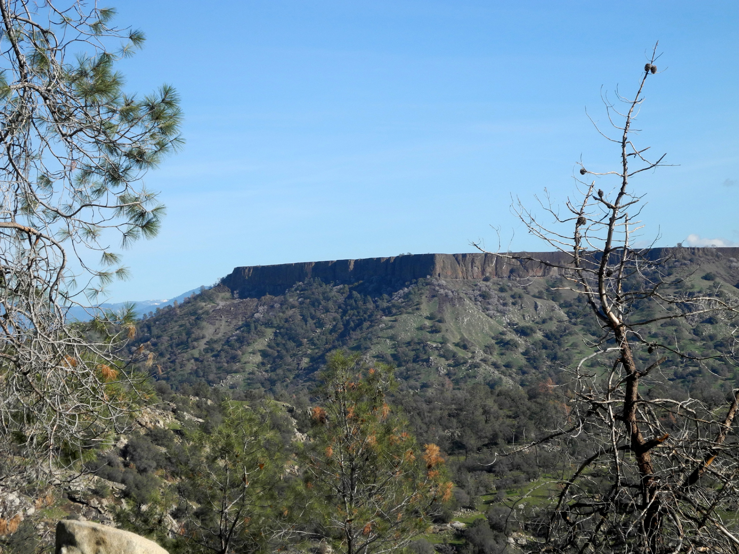
| Big Table Mountain | ||
 |
||
| The river lies on both sides of this green ridge | ||
| Related Links | ||
| 2012 Finegold Hikes | 2013 Finegold Hike | 2014 Finegold Hike |
| Millerton Lake | San Joaquin River Trail | San Joaquin River |
| San Joaquin River Gorge | Four SJ Gorge Hikes in 2012 | SJ Gorge Hike in April 2014 |
| Red Rock Canyon National Conservation Area | Red Rock Interpretive Association | Map of the scenic drive |
| Nature near Las Vegas | ||