
|
Dick's Adventures of 2020 - Part 4 |
|
| Photos Related Links More Travel Reports | |
| Adventures
of 2016 Adventures
of 2017 Adventures
of 2018 Adventures
of 2019
2020 Part 1 2020 Part 2 2020 Part 3 2020 Part 5 2020 Part 6 2020 Part 7 |
|
| Sycamore
Wildlife Area
Blossom Patrol & Eagle Watch
Chinese Ditch & Buffin Meadow Gray's Mountain Camp Ahwahnee Hills |
|
| Sycamore
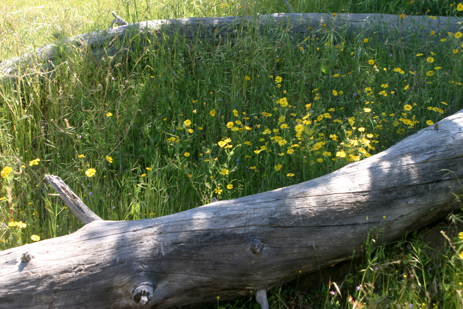
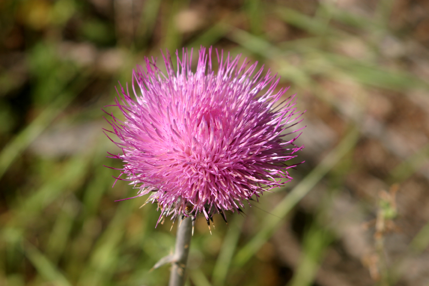
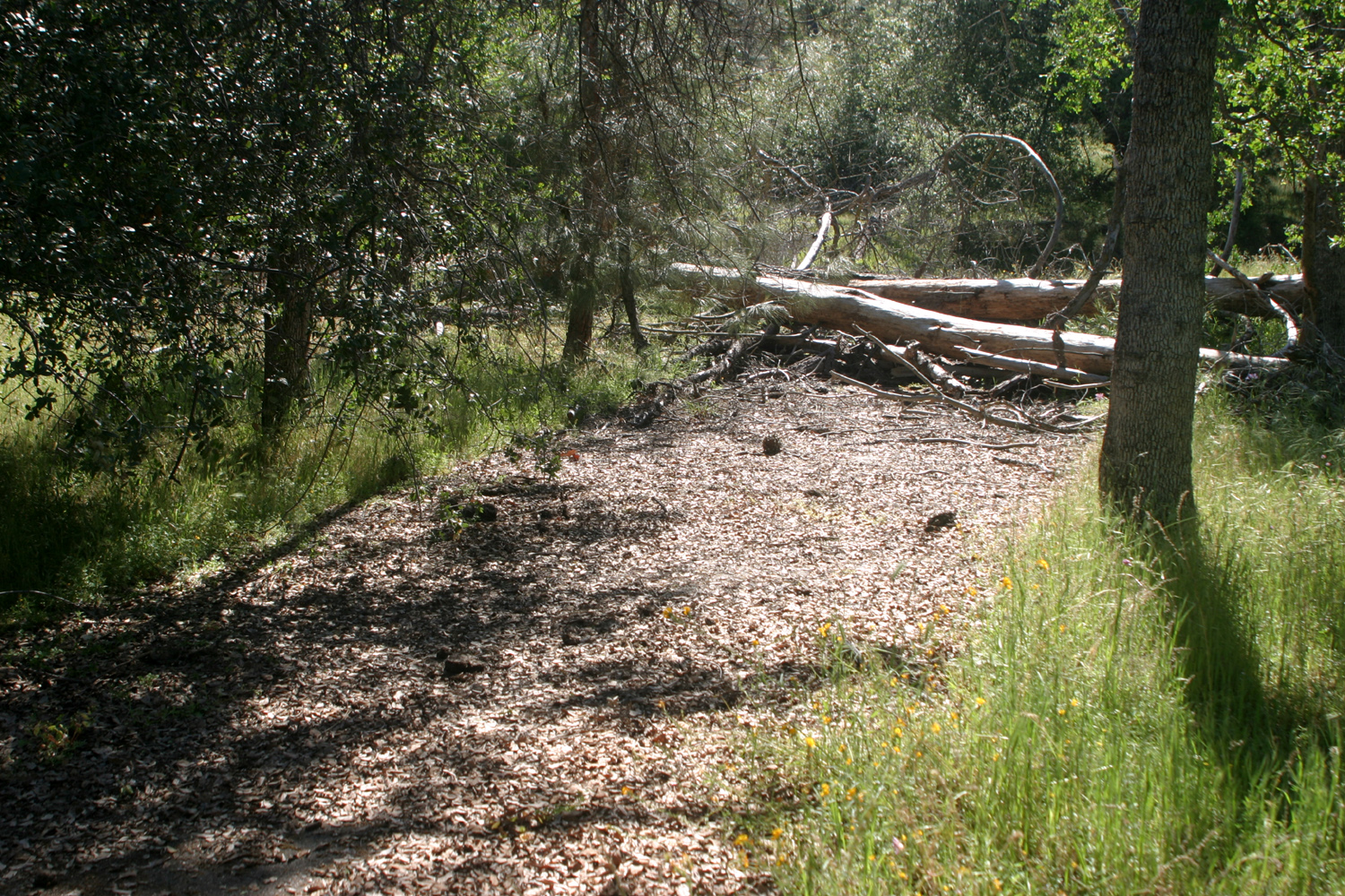
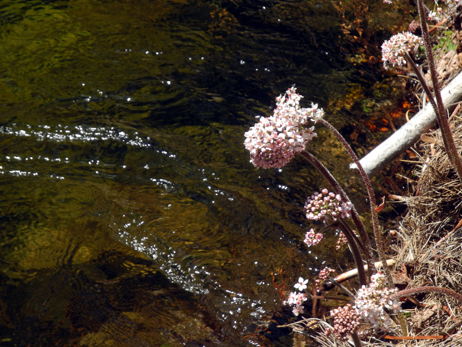
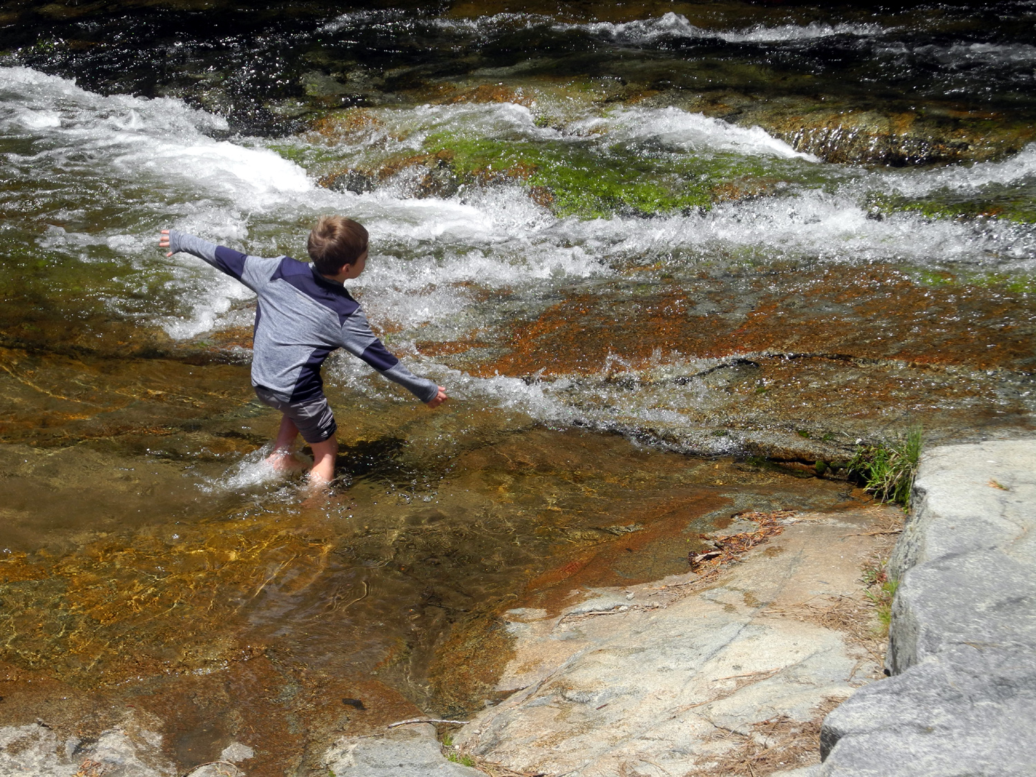
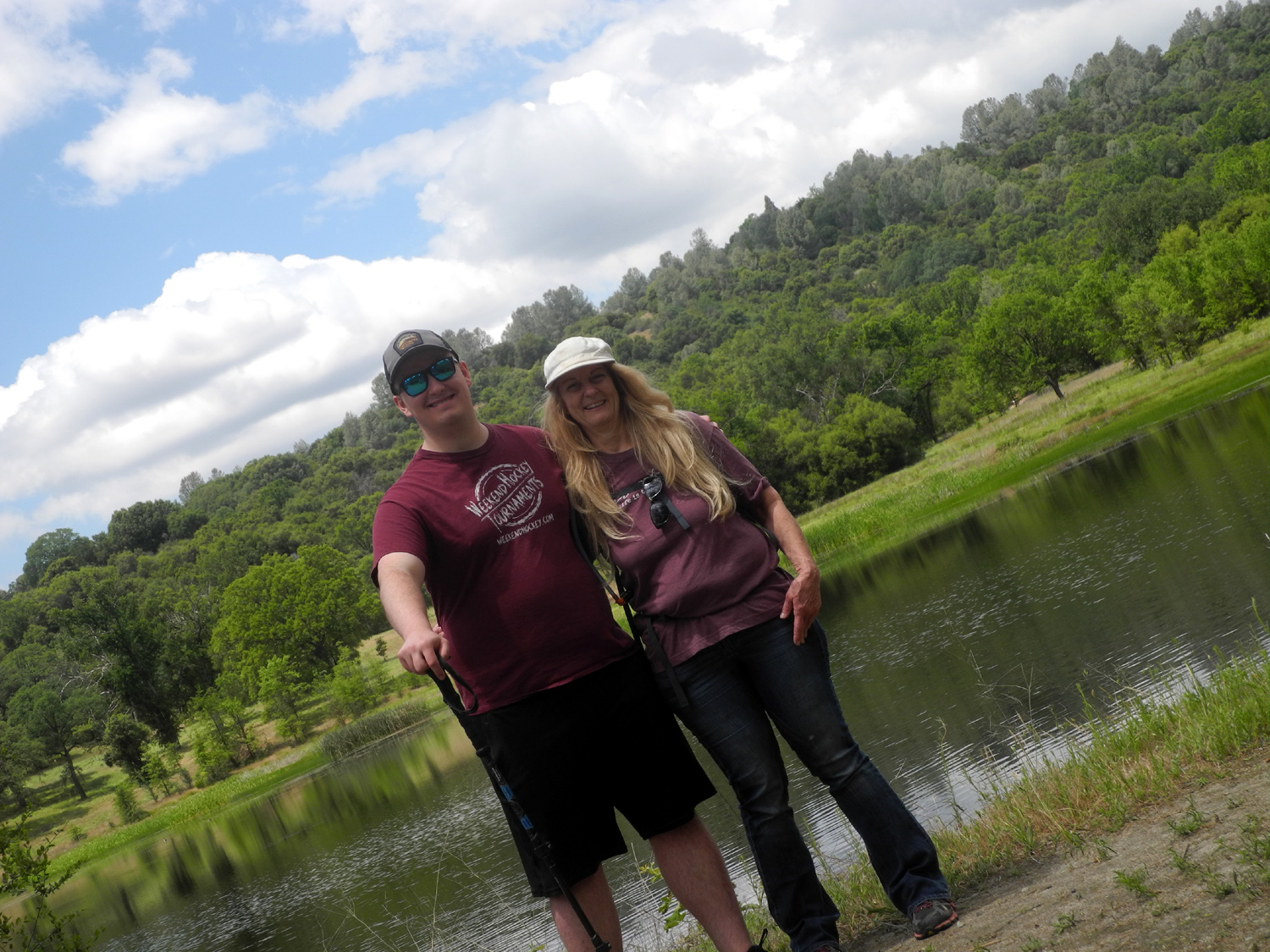
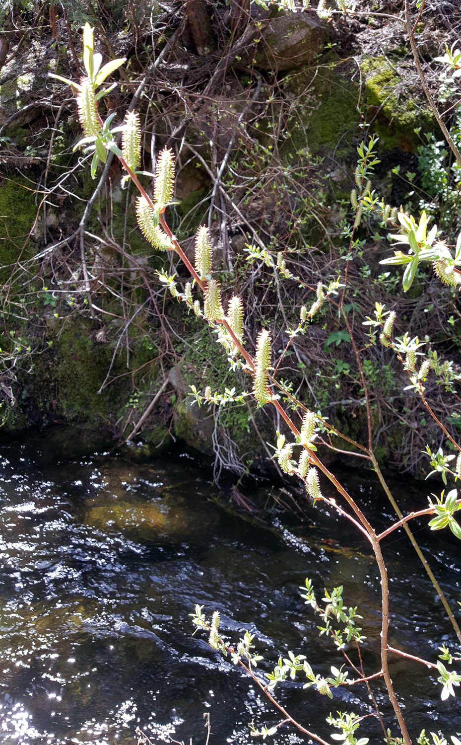
Wildlife Area On April 28 my daughter Teri and I returned to a familiar spot, the Sycamore Wildlife Area adjacent to Pine Flat Lake. With a predicted high of 87 in the valley, we thought this would be our last foothill hike of the season. However, the low foothills are still bright green, and I'm not quite ready to stop going while it's like that. Our destination consists of two former campgrounds and a picnic area that have been closed for decades. However, you can legally go around the gates and walk on the deteriorating asphalt reads. At 1,200 feet, this location offers a sequence of wildflowers as spring progresses. We also see deciduous trees budding and then leafing out, and bull pines putting up long new shoots |
|
 |
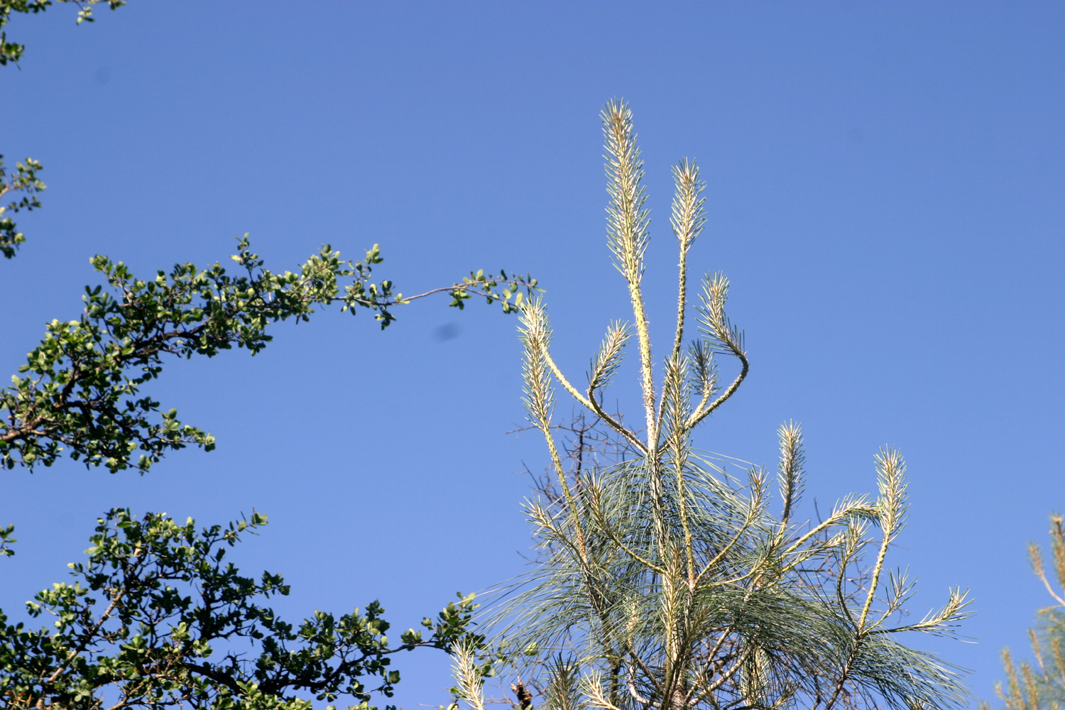 |
| Thistle blossom | New growth on bull pine |
|
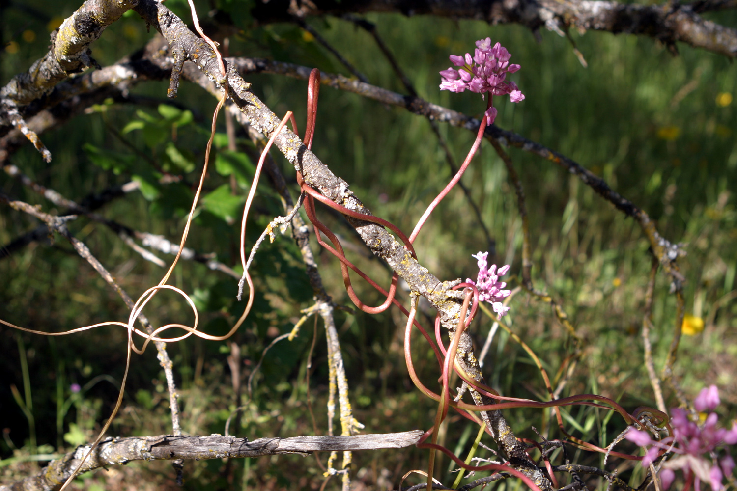
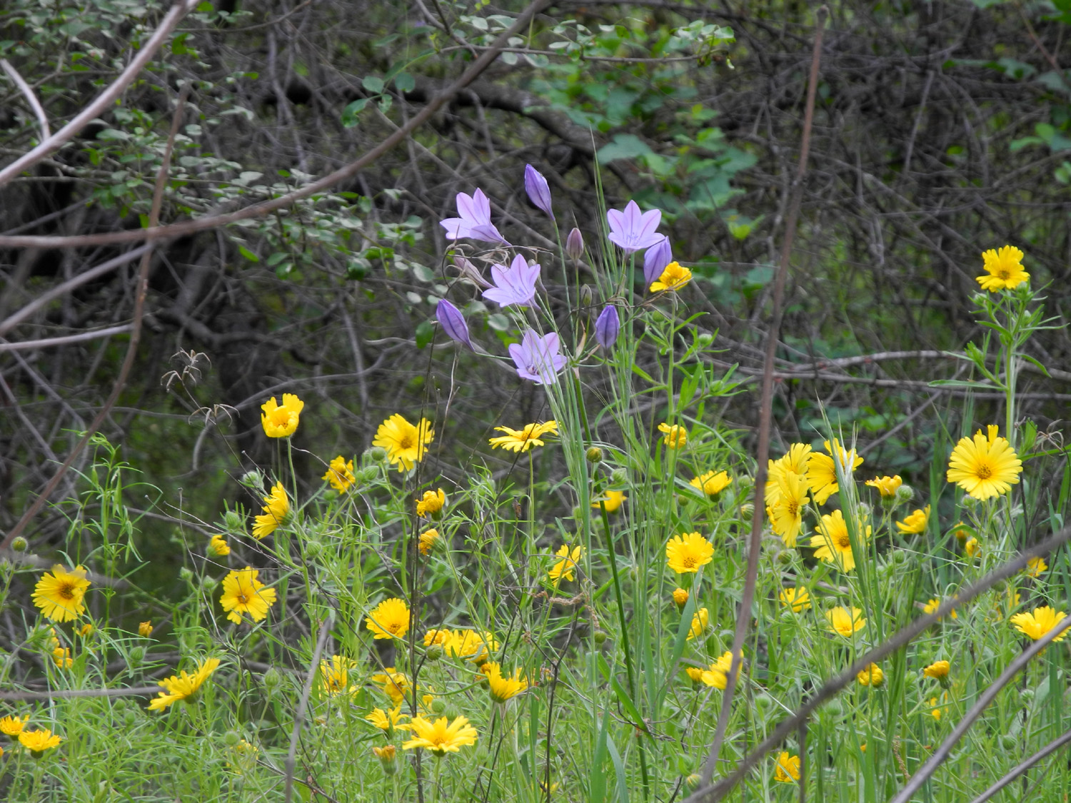
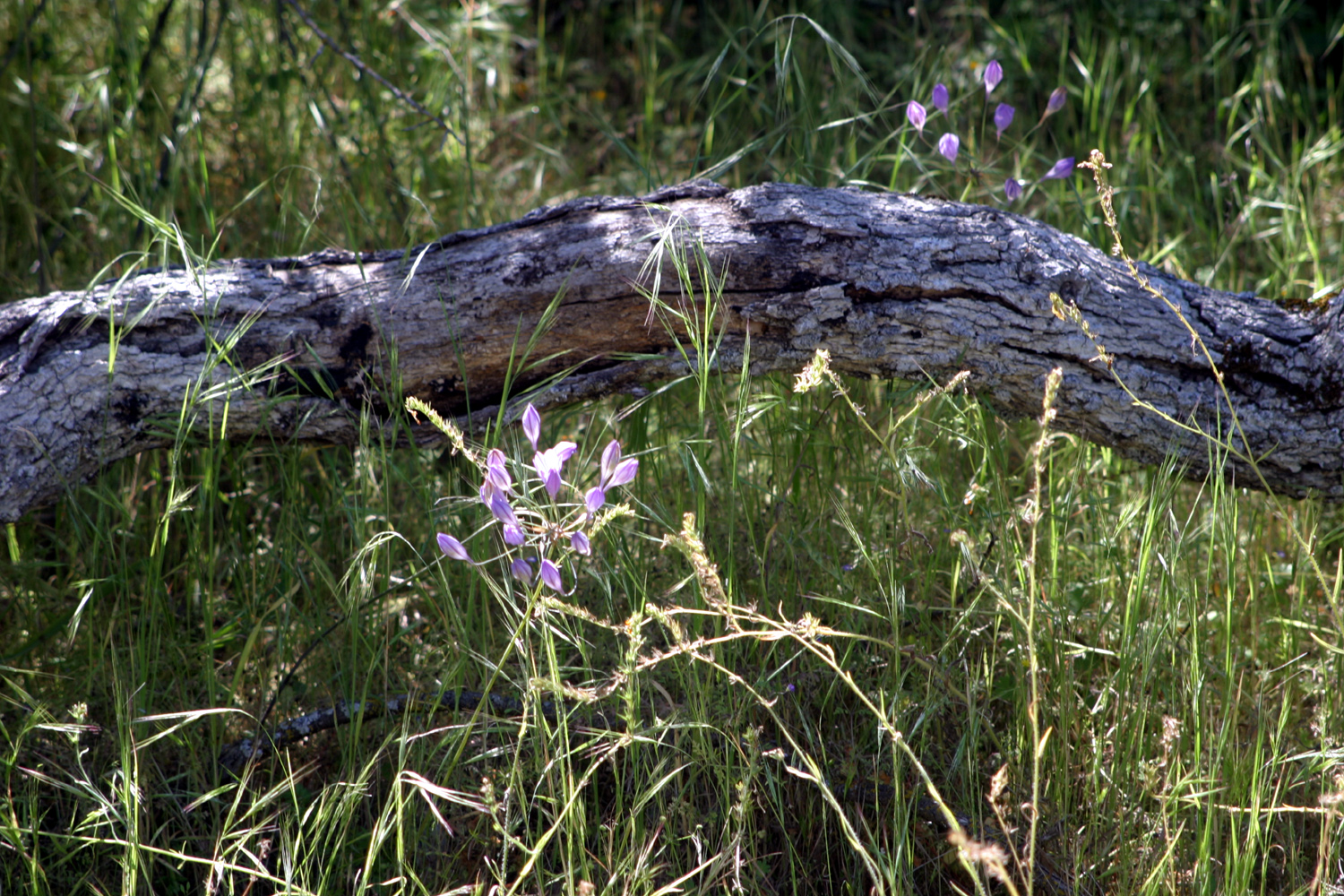
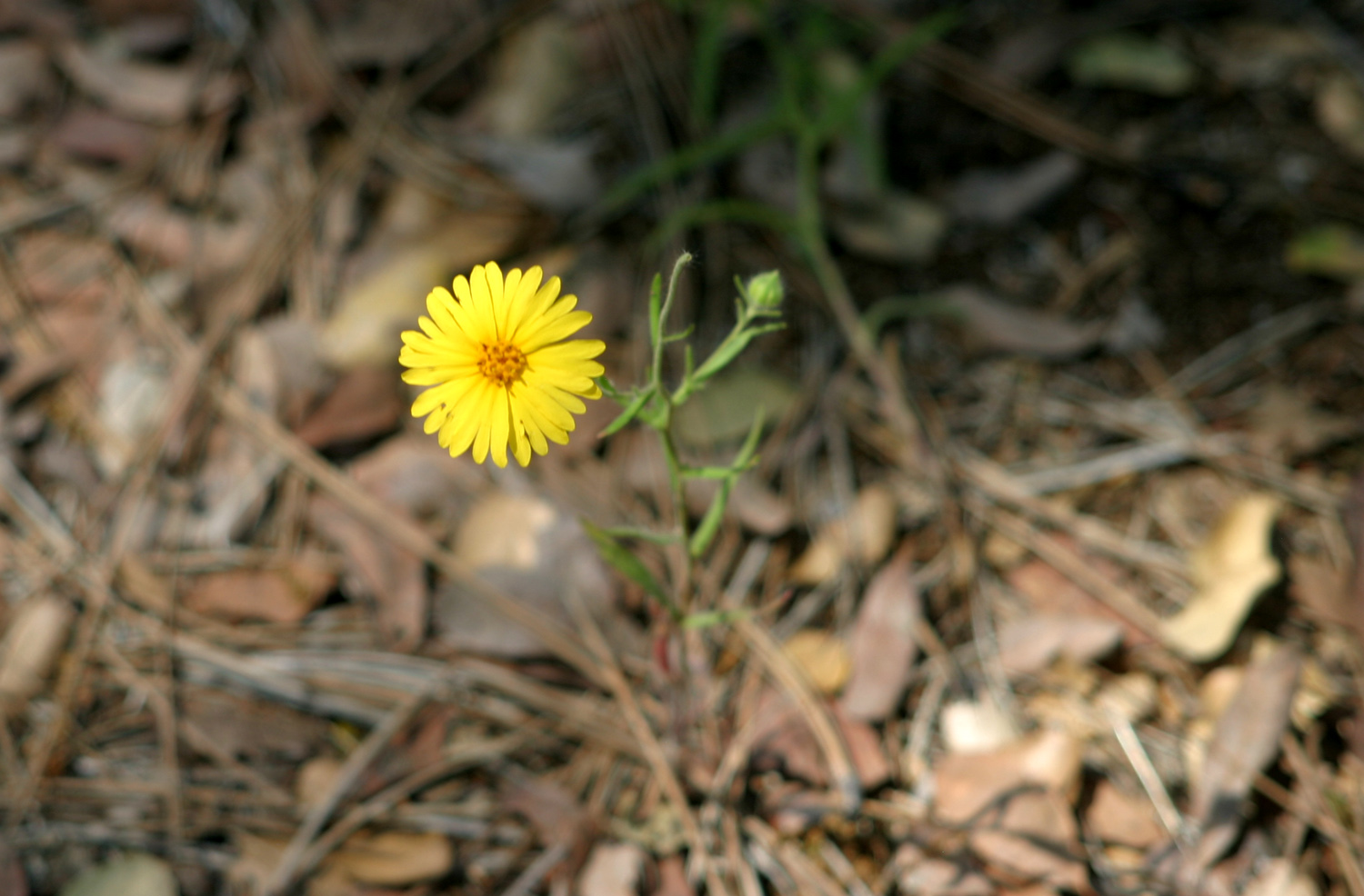
We had both hiked at one or more of the three sections two or three times this year, so we had a good study of which flowers appear first, next and last. On an early trip Teri and her mother saw massive patches of baby blue eyes. On this latest visit, the dominant species were common madea and several varieties of brodiaea, but nearly every plant was still hanging on with anywhere from two to a dozen "sample" blooms. This included the long-lasting fiddlenecks and filaree, and three or four baby blue eyes and popcorn flowers. |
|
 |
 |
| A patch of common madea | Climbing brodiaea winds around itself and surrounding plants |
 |
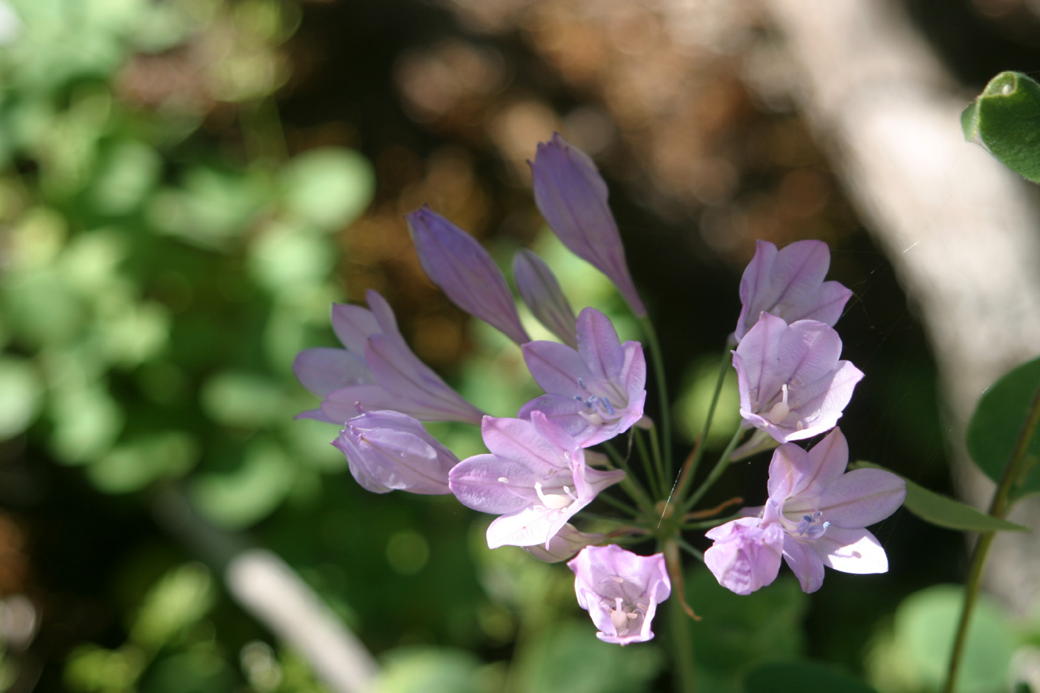 |
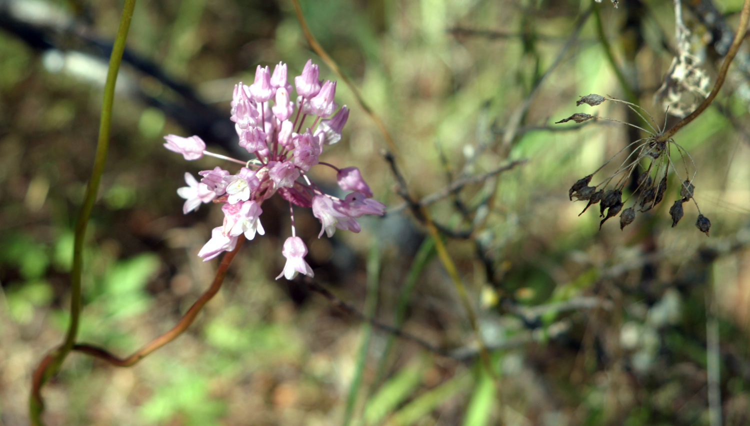
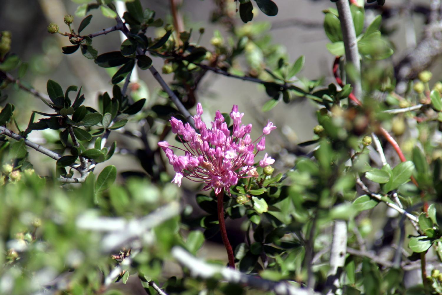
| Harvest brodiaea | Purple brodiaea |
|
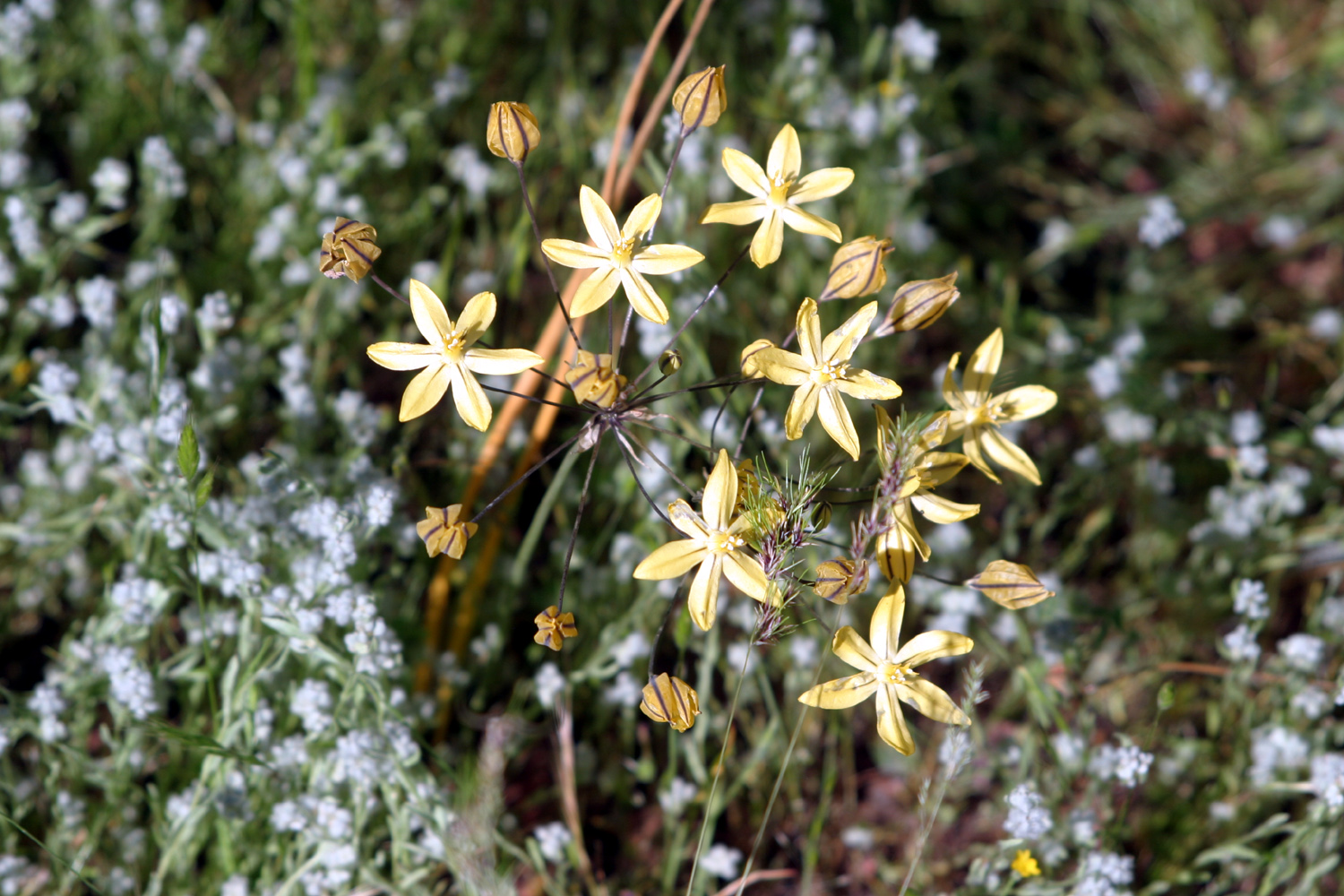
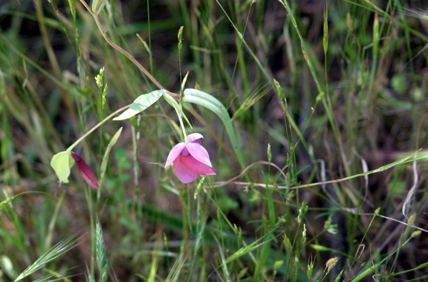
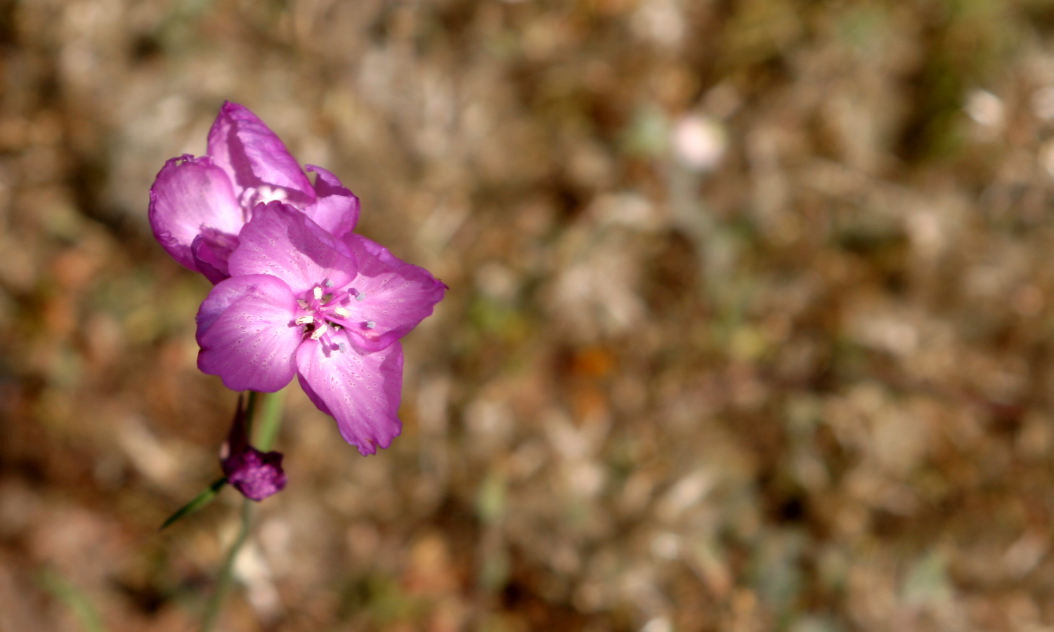
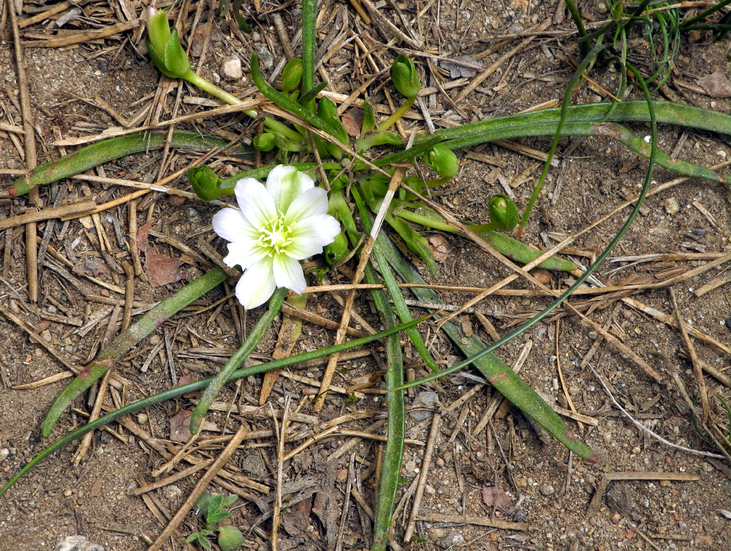
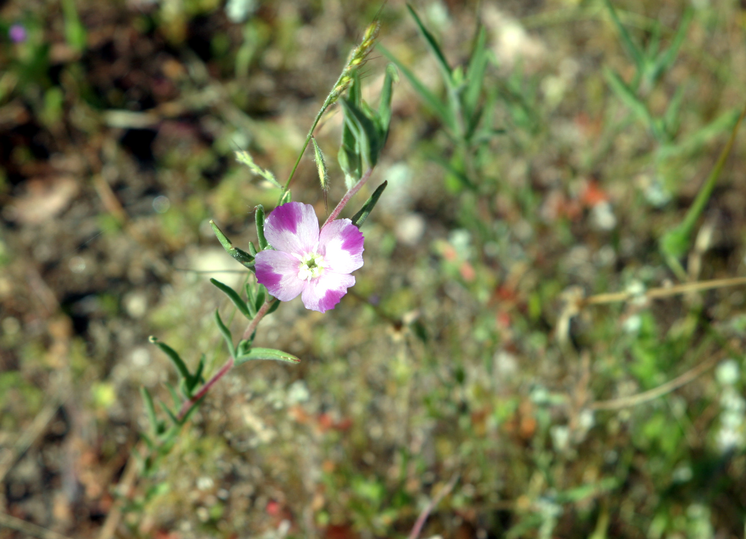
One of the most numerous flowers on this hike and when we went to Goofy Smith Flat April 16 were the globe lilies, which in the past have seemed to be fairly rare. We also saw a dozen examples of an unknown blossom with an intense magenta color. A later careful study of the foliage convinced me that this is a rare variation of farewell-to-spring. |
|
 |
 |
| Globe lily | Apparently a variation of farewell-to-spring |
|
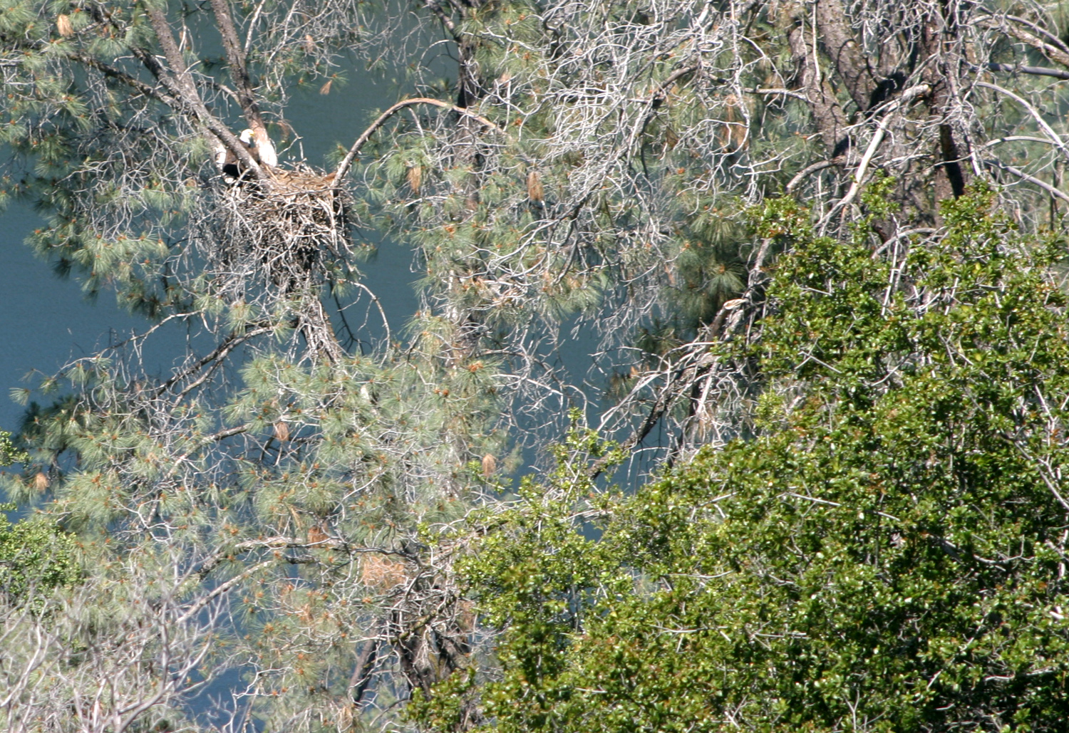
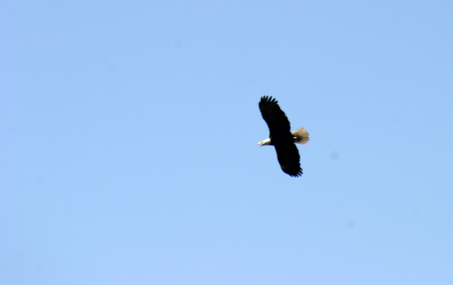
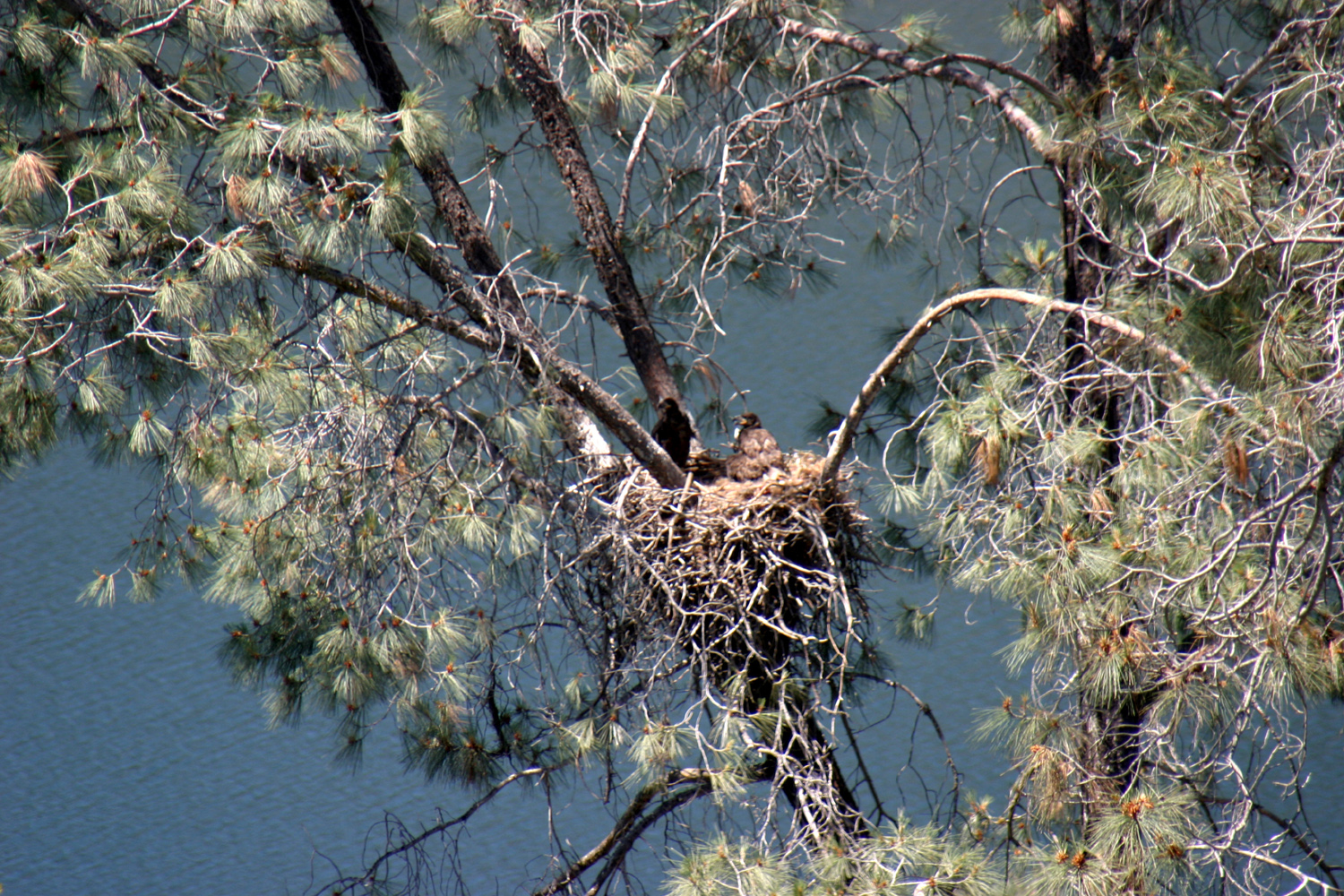
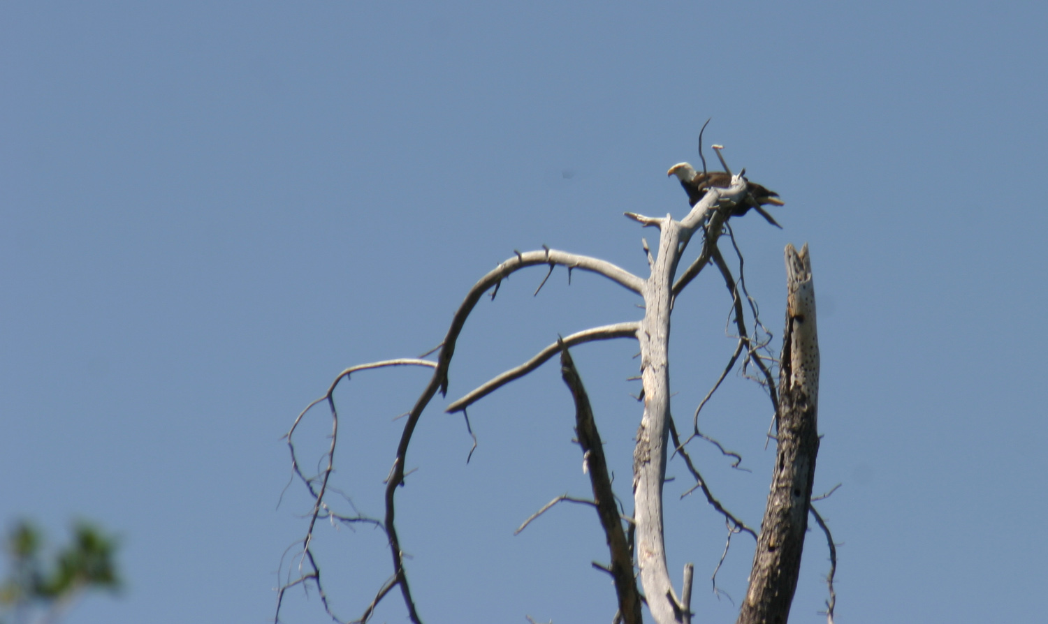
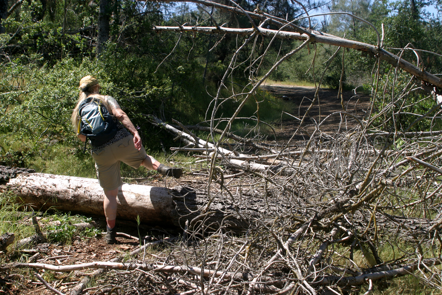
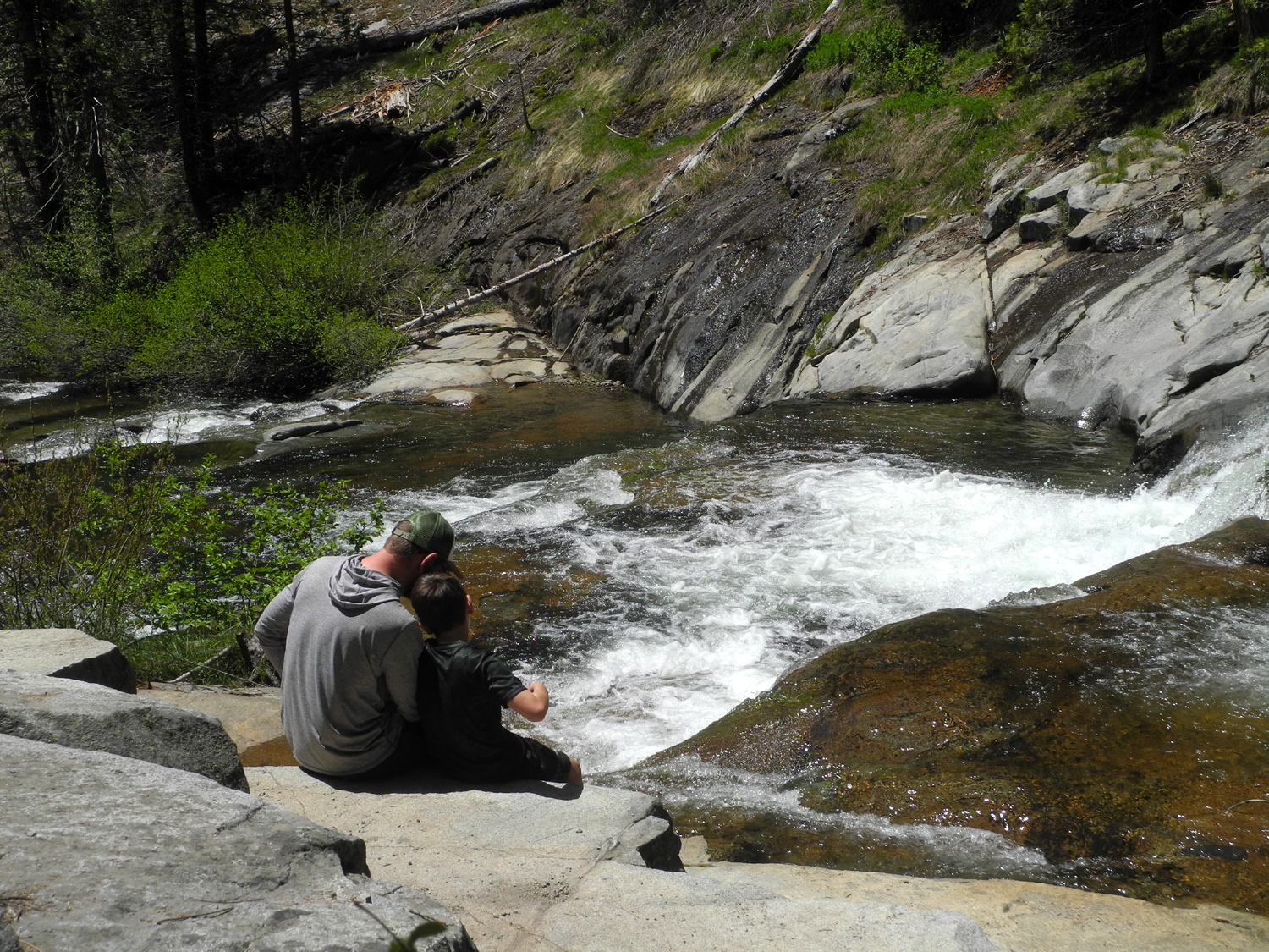
At he final stop, the old picnic area, we checked out the eagle's nest we had spotted when we were there on March 26. I took a picture of the nest, but did not realize until I enlarged the photo at home that the eagle was sitting on it. You'll need to look closely at the upper left of the picture, and maybe download and enlarge it with your photo viewer program. Not surprisingly, there were a few fallen trees across the roads, some that we could get over, and some where we had to go around. |
|
 |
 |
| Hard to see but there's an eagle sitting in this nest | Fallen trees blocked our way in several places |
|
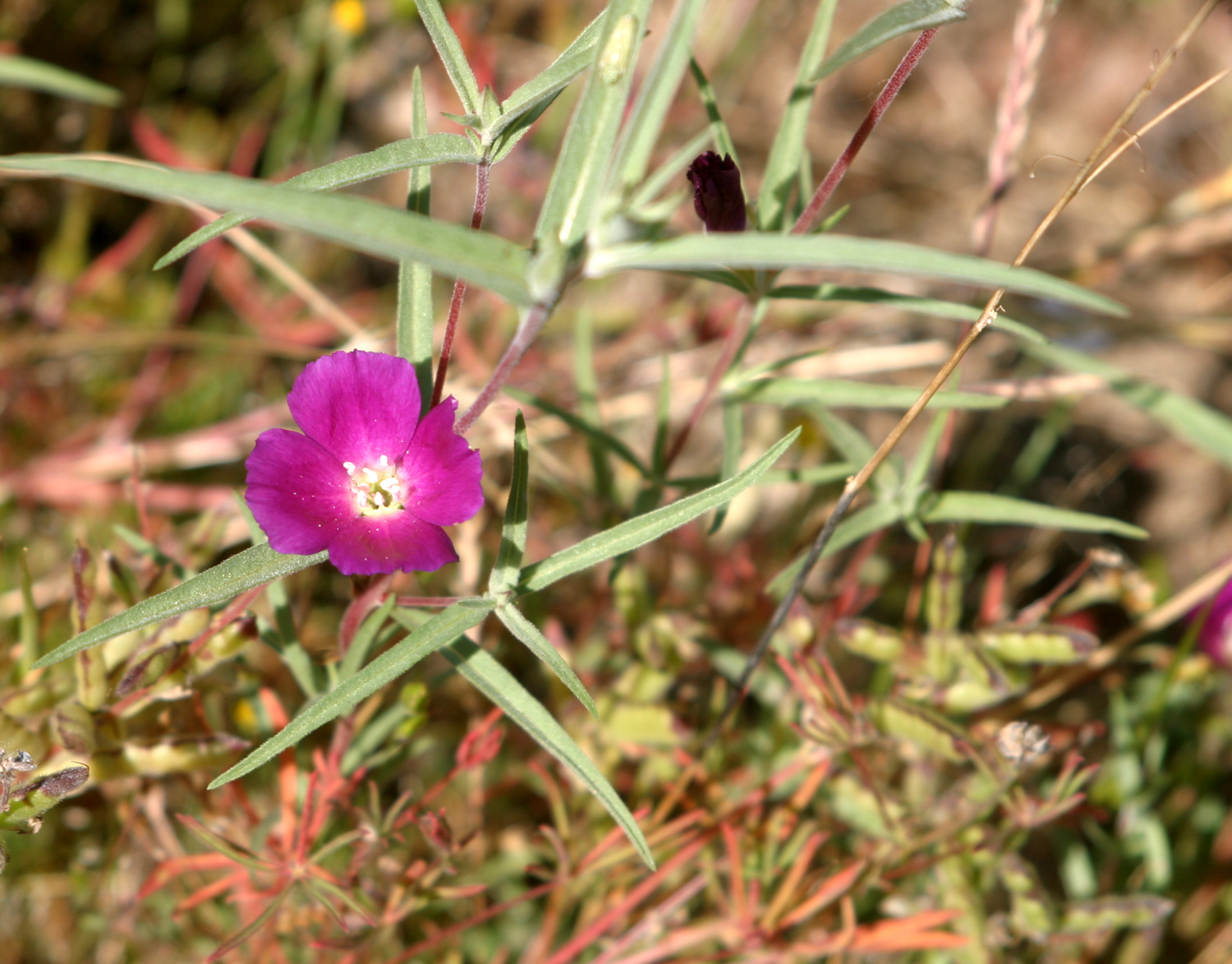
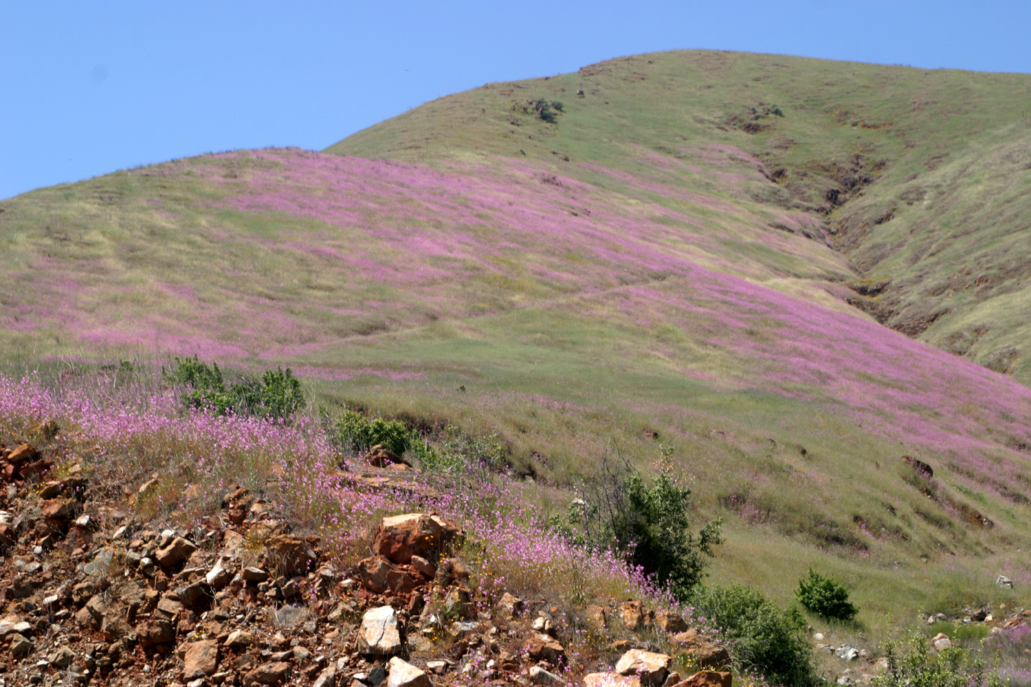
Along the road by the lake, the farewell-to-spring created big pink patches on some of the hills, and we got a closer look at them next to the road. We also saw some of the spotted variation of this flower at the picnic ground. |
|
|
|
| Pink patches of farewell-to-spring | Farewell-to-spring close-up |
|
The weather was warm as expected, the first day I hiked in shorts and t-shirt. However, we got an early start, and were back home well before the high temperature set in. This
year was proof of something I have observed several times in the past:
The amount of rain needed for a good wildlife year is much less than
what is needed to grow crops in the valley. Flowers got started late,
and our total rainfall was well under 50% of average, but wildflowers
were spectacular during the final month and a half of spring. The
reservoirs are relatively full from last year's good rainfall, so we
can weather this dry year. --Dick Estel, May 2020 |
|
|
Blossom Patrol & Eagle Watch
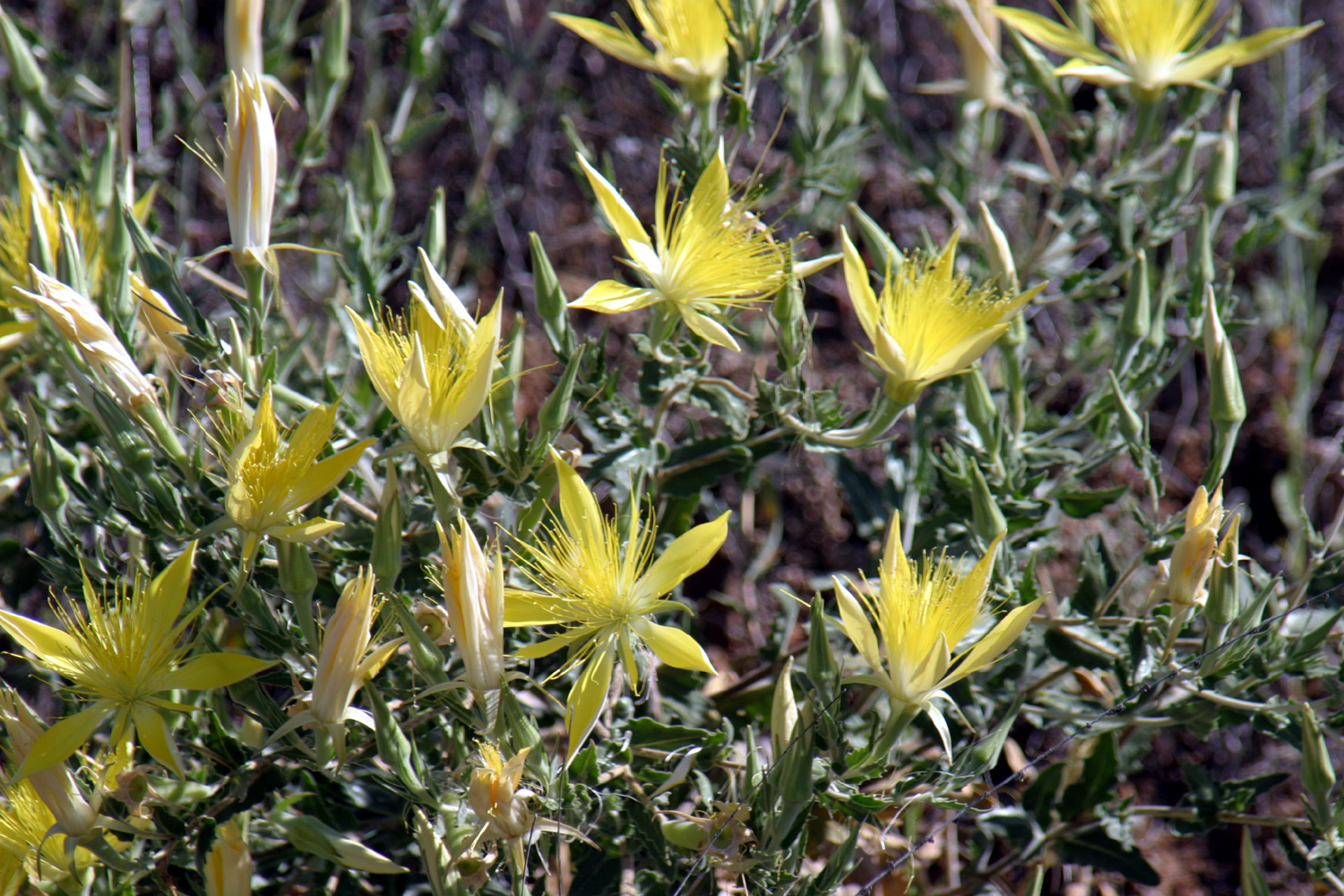
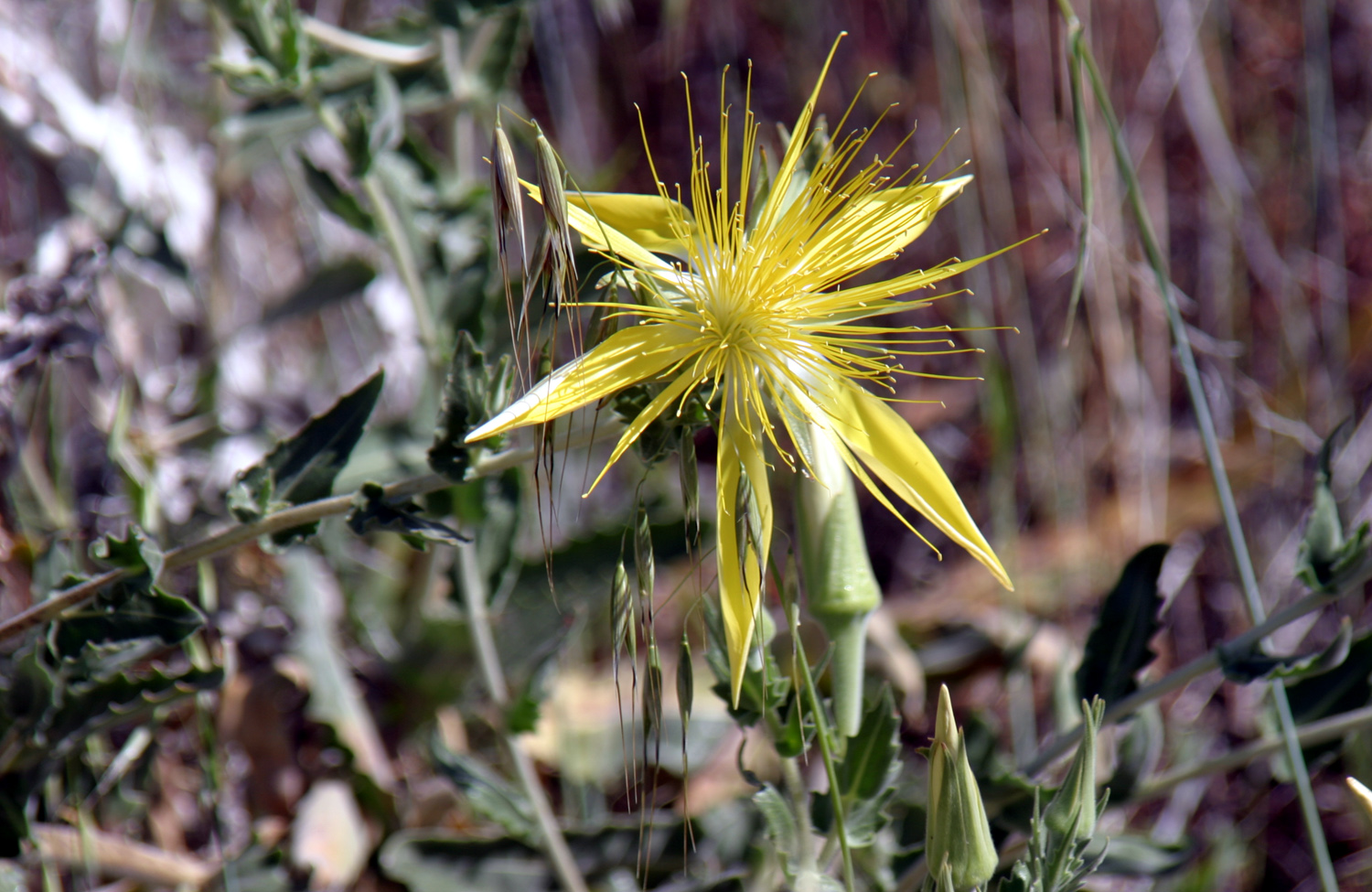
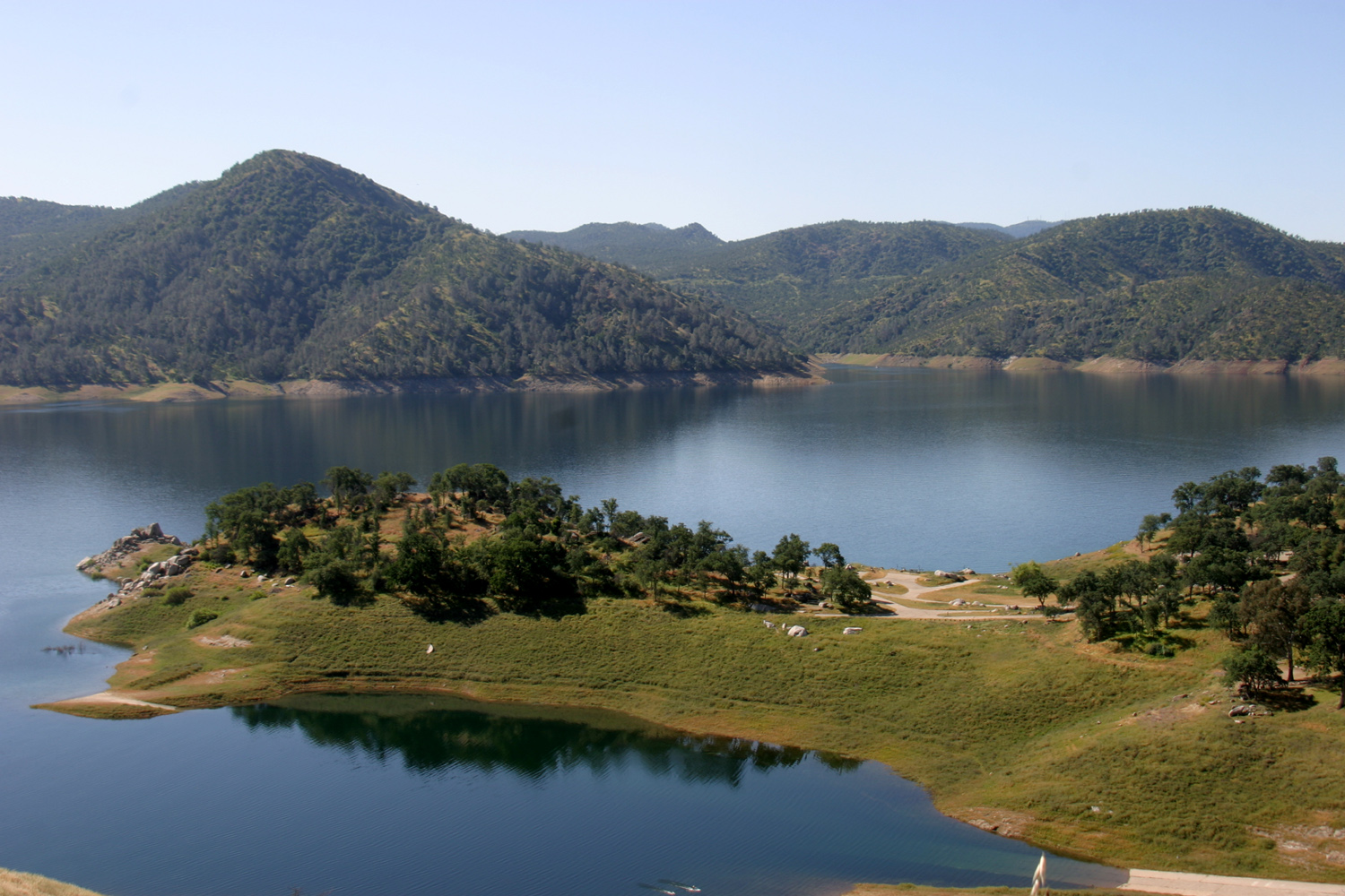
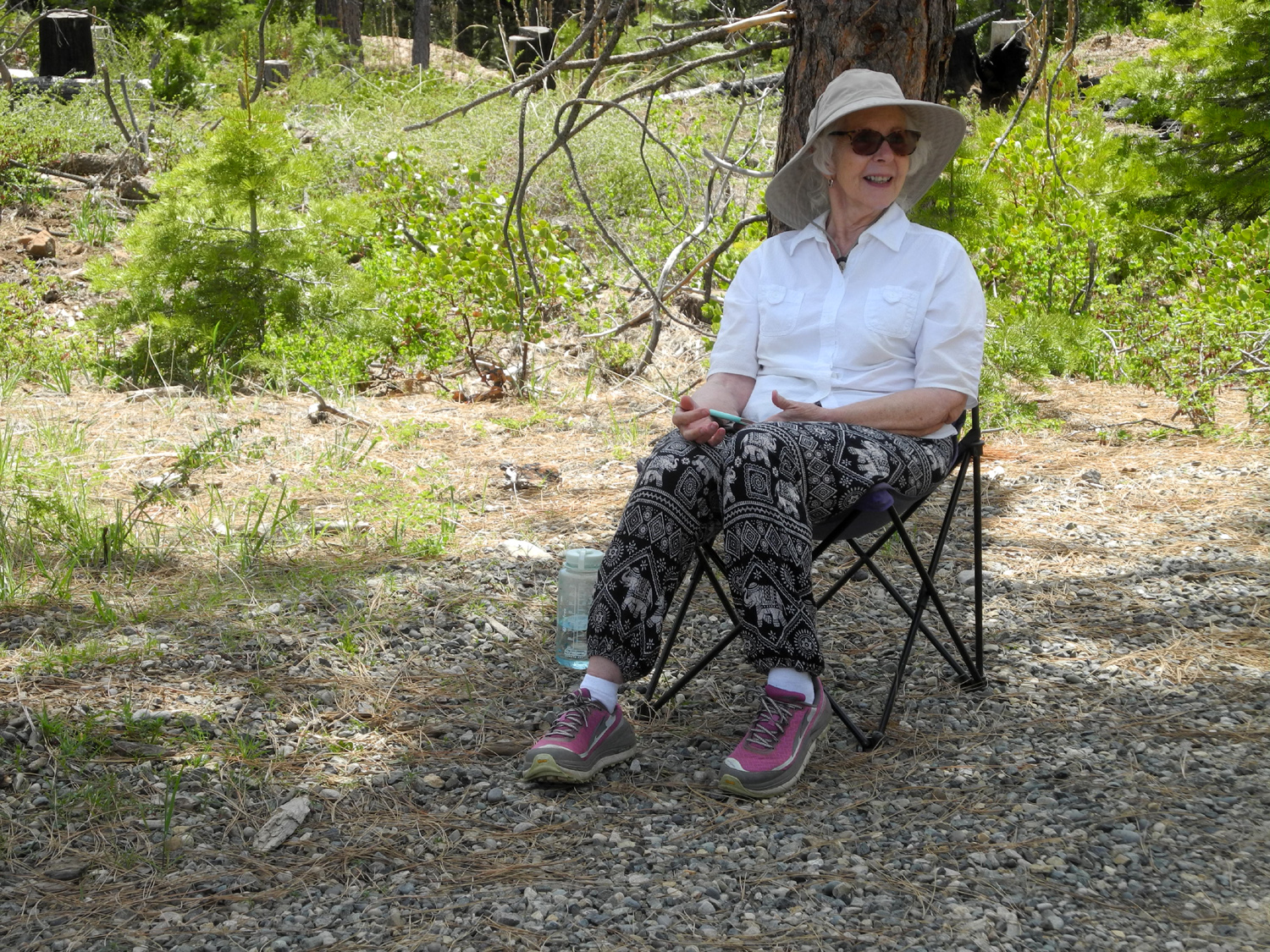
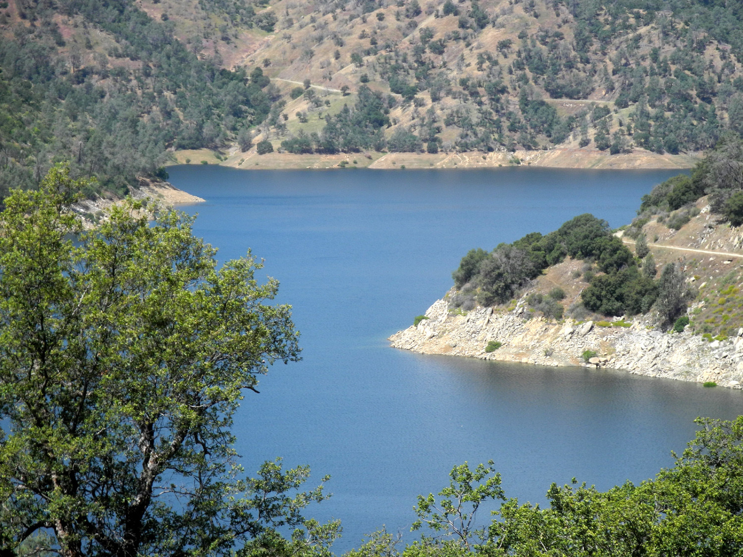
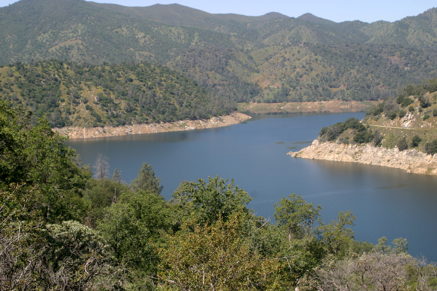
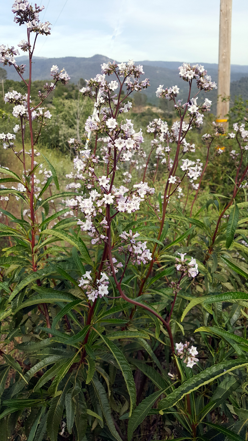
Each time I have visited the Pine Flat Lake area this spring, the beauty of the place has drawn me back again. If my count is correct, I have made eight trips there in 2020. My solo outing on May 4 may well be the last, since temperatures are getting up into the 90s at home, and the places we hike are mostly at 1,000 feet or so, only two or three degrees cooler than the valley. I set out with two goals this time, neither of them involving much in the way of hiking. My first stop was to see and photograph a spectacular flower known as blazing star. I had first encountered this 4-inch blossom along the Edison Point Trail a few years ago. At the same time, I noticed that they also grew on the rocky bank along Trimmer Spring Road near where the lake first comes into view. Teri and I stopped at this spot on our way home last time, but the flowers were not open. This time there were plenty of plants covered in blossoms, and I found a place where I could get up close and be well off the pavement. I had planned to hike in on the Edison Point Trail to where the plants grow if necessary, but did not have to. The plants grow two to three feet tall and look like some kind of thistle, but there are no thorns. I took a number of photos, then drove on up the road. |
|
|
|
| Each plant puts out a dozen or more blossoms | A close-up look |
|
The grass in the lowest part of the foothills had dried out noticeably in the six days since we were last there, but up by the lake it was still pretty green, and the flowers are still doing great. All along the road the two species that are most common are farewell-to-spring and madea. |
|
|

|
| Pine Flat Lake is close to full | Farewell-to-spring dominate the Sierra foothills |
|
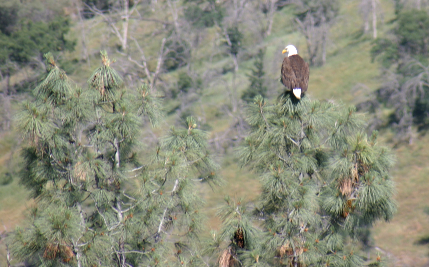
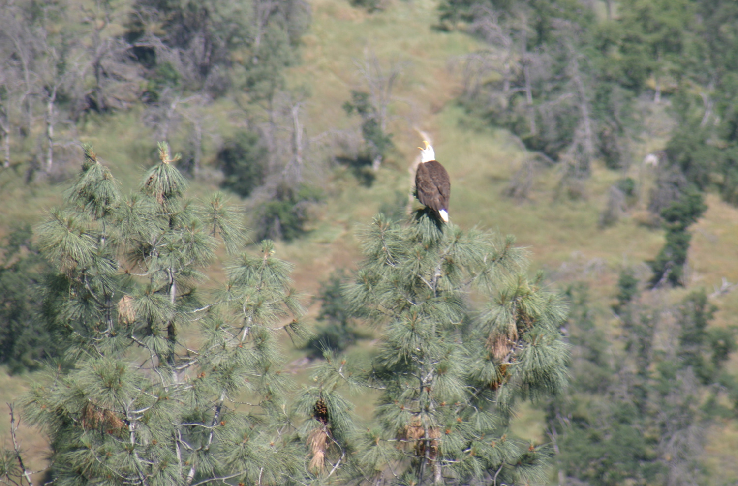
My second goal was to try and spot the eagles that have a nest near the old Sycamore Creek Picnic Area, where I've hiked several times this year. We had first seen the eagles on March 26, and got a photo of one in flight, as well as a shot of the nest. However, my Nikon Coolpix doesn't zoom in very far, and the photos weren't that great. A later photo with the bird on its nest was even less satisfactory. This time I brought my older Canon 35mm digital with a 300 mm zoom lens, as well as my tripod. (This camera is too heavy to carry on a regular basis.) When I walked in to where I could see the nest there was no sign of the big birds, but one immediately flew in and perched in the top of the nesting tree. He (or she) stayed there for at least 15 minutes, allowing me to get a number of photos. Studying the photos after I got home I realized he was sounding off, probably cussing me out for entering his territory. Next I drove up to Big Creek, which I'll discuss later. On my return trip I decided to walk in and see if I could catch the eagle on the nest. He was indeed there, but immediately flew up. He flew back and forth, giving me a royal cussing out, so I didn't stay long. But before I left I managed to capture shots of him in flight and a good photo of the nest with at least two very large babies. When I left, he flew to the top of a dead pine right beside the trail and watched to make sure I was really leaving. |
|
|
|
| This magnificent bird posed on the pine for a full 15 minutes | He called out frequently, no doubt saying bad things about me |
|
|
|
On my second stop, he flew back and forth, complaining about my presence |
Young birds in the nest |
|
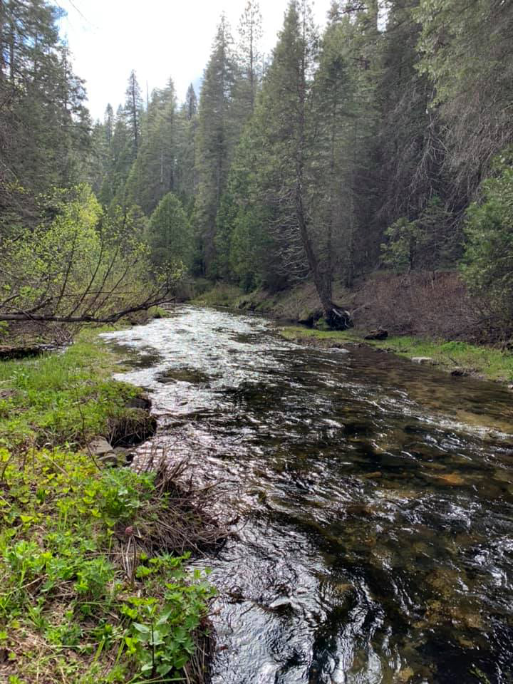
In between my two photo sessions with the eagles, I drove up Trimmer Springs Road to where Big Creek runs into the lake, then up the dirt road along this creek. This is an area where we used to camp in the springtime, although it has become badly littered in recent years. I went about two miles to where a fairly good size tributary comes in from the west, and set up my chair and TV tray in the shade to enjoy my lunch. I walked around this area a little, but even with my two trips into eagle territory, this wasn't really a hike day - my total was just over a mile and a quarter. Along the road many wildflowers were still abundant, including yerba santa, a small bush. I spotted one flower, penstemon, for the first time this season. The weather was nice - not quite 80 degrees, with a nice breeze. |
|

|

|
| Big Creek | Yerba santa |
|
On our various hikes this spring my daughters and I have seen just about every wildflower that we're familiar with. An unofficial list includes the following: Baby blue eyes, birds eye gilia, blazing star, blue dicks, buckeye, bush lupine, buttercups, chaparral, Chinese houses, climbing brodiaea, clover, common madea, cream cups, dogwood, dove lupine, elderberry, farewell-to-spring (3 variations), fiddlenecks, fiesta flower, filaree, foothill gillia, fringed redmaids, globe lilies, harvest brodiaea, Indian pink, manzanita, Mariposa lily, medium ground lupine, milkweed, miner's lettuce, mule ears, mustang clover, owl clover (white & red), penstemon, phecelia, popcorn flowers, poppies, purple brodiaea, purple vetch, redbud, shooting star (white and pink), Sierra star, succulent (unknown variety), tall ground lupine, western wall flower, white lupine, yellow-throated gilia, yerba santa and several we could not identify. If you'd like to see photos of most of these flowers as well as many from other regions, visit my wildflower photo albums, Page 1 and Page 2. Instead
of returning home via Belmont Avenue as usual, I turned north at
Trimmer Springs on Maxon Road. This road joins Watt Valley Road and
eventually becomes Ashlan Avenue when it drops down to the flat
country of the valley. Along the way there were a lot of places still
green, with tons of wildflowers, and enough typical foothill scenery
to last me till next time. Although it was a long and fairly slow
trip, I drove a total round trip of only 91 miles. --Dick Estel, May 2020 |
|
|
Eagle Postscript
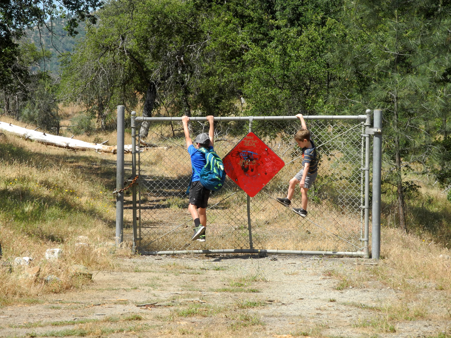
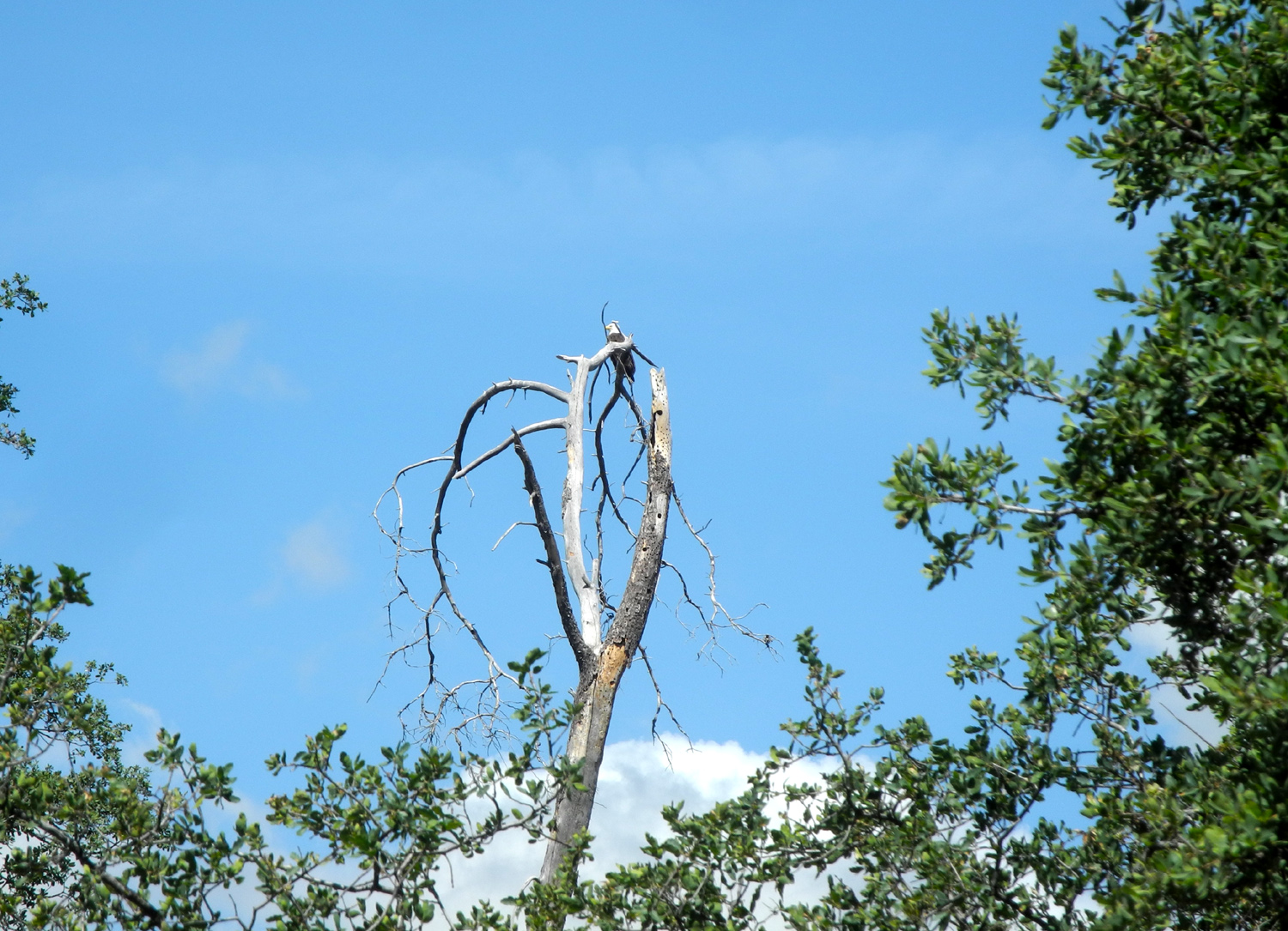
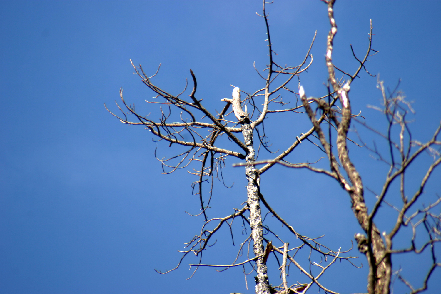
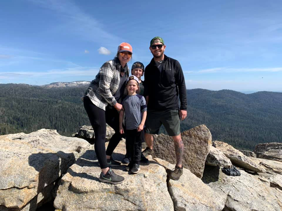
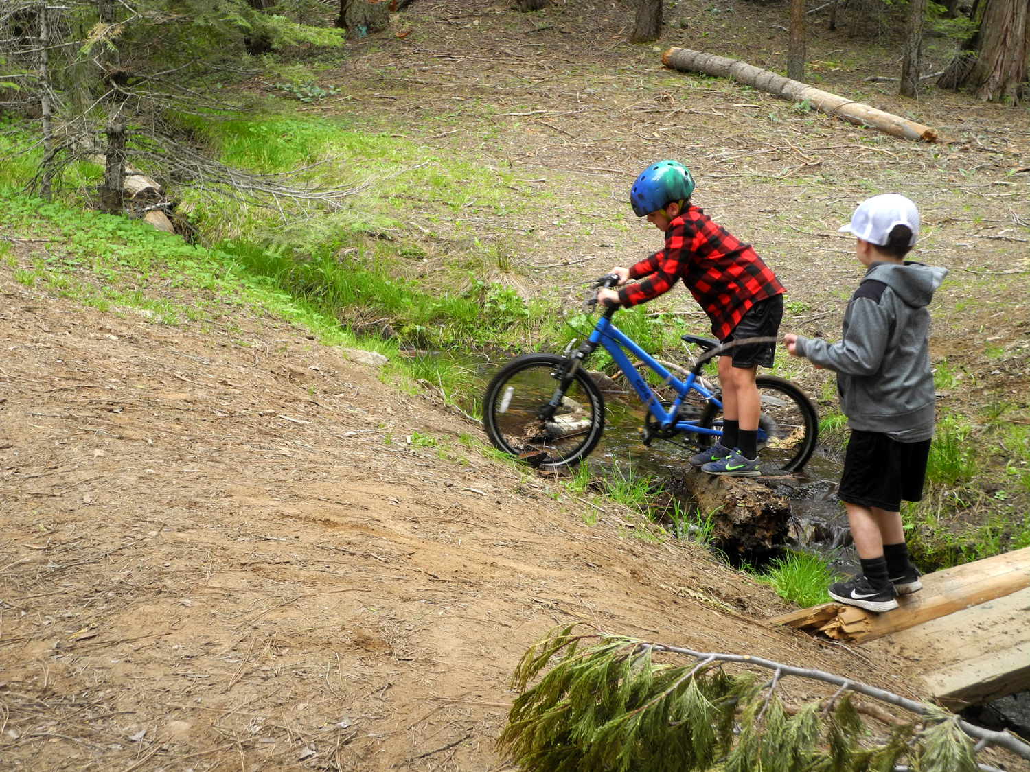
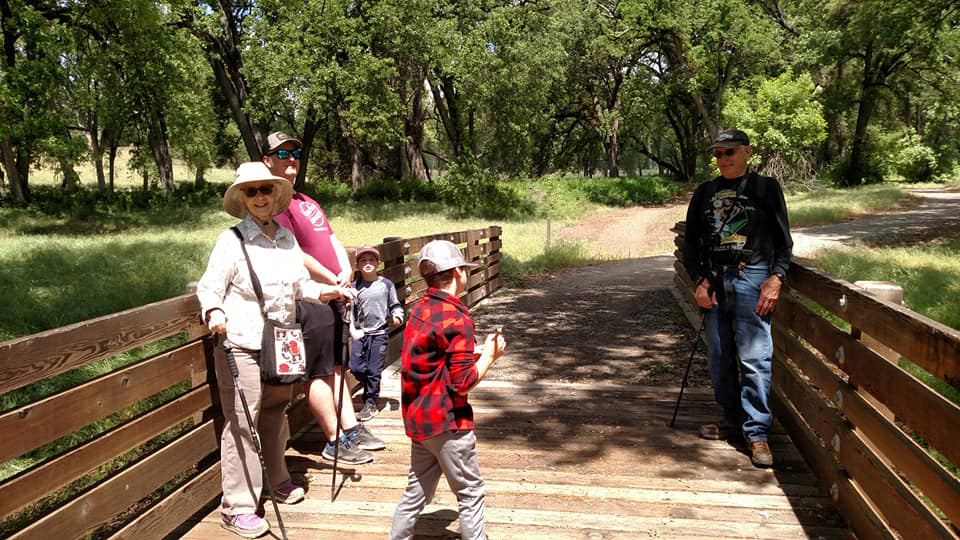
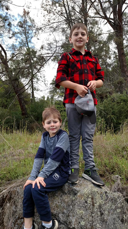
On May 13 I picked up great grandsons Colton and Jack, and we drove to Pine Flat so they could hopefully get a look at the eagle. We took the more scenic Watt Valley Road, which brought us to the lake at Trimmer Springs. From here it was only a short drive to the Sycamore Picnic Area. Since their natural tendency is to run down the trail ahead of everyone, I cautioned them to stay behind me and be very quiet. Of course, I'm pretty sure the eagle was aware of our presence as soon as we got out of the car. We had not gone far when I spotted him sitting in the dead bull pine next to the trail, where he had watched my departure nine days earlier. We got a good look at him through binoculars and the mandatory photo. As we approached his tree, he flew off and was not seen again. |
|
|
|
|
Having visited the Upper Kings with their parents several times this spring, this was not the first time the boys were photographed on this gate |
This conveniently located dead pine gives the eagle a perfect spot to keep an eye on intruders |
|
As we walked in a little farther Colton asked to use my camera and took a couple of nice shots of the lake and surrounding hills. Next we drove on to Big Creek where we found a shady spot to have lunch, then made the two hour trip back home. It was very special to learn later that Colton had written a report about the day's activities for school. |
|
|
Chinese Ditch & Buffin Meadow
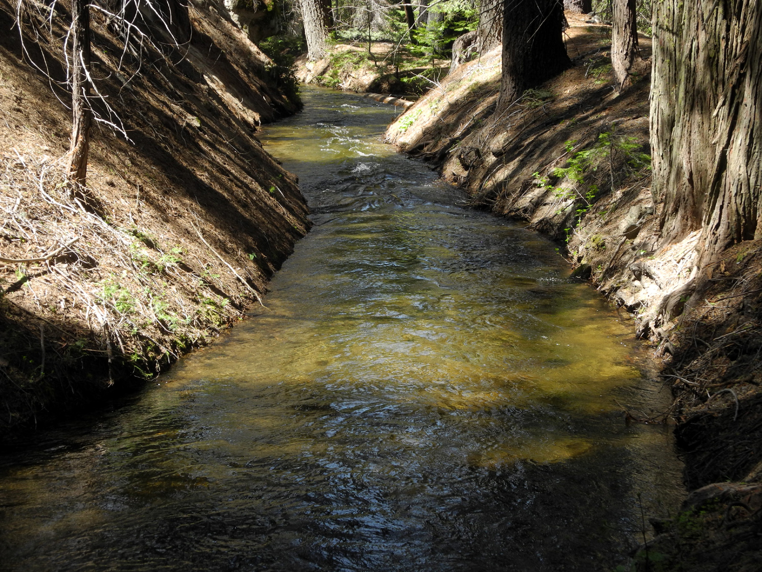
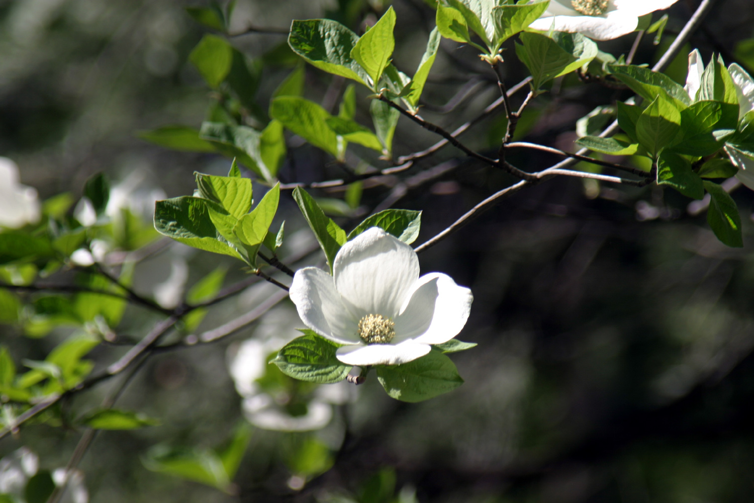
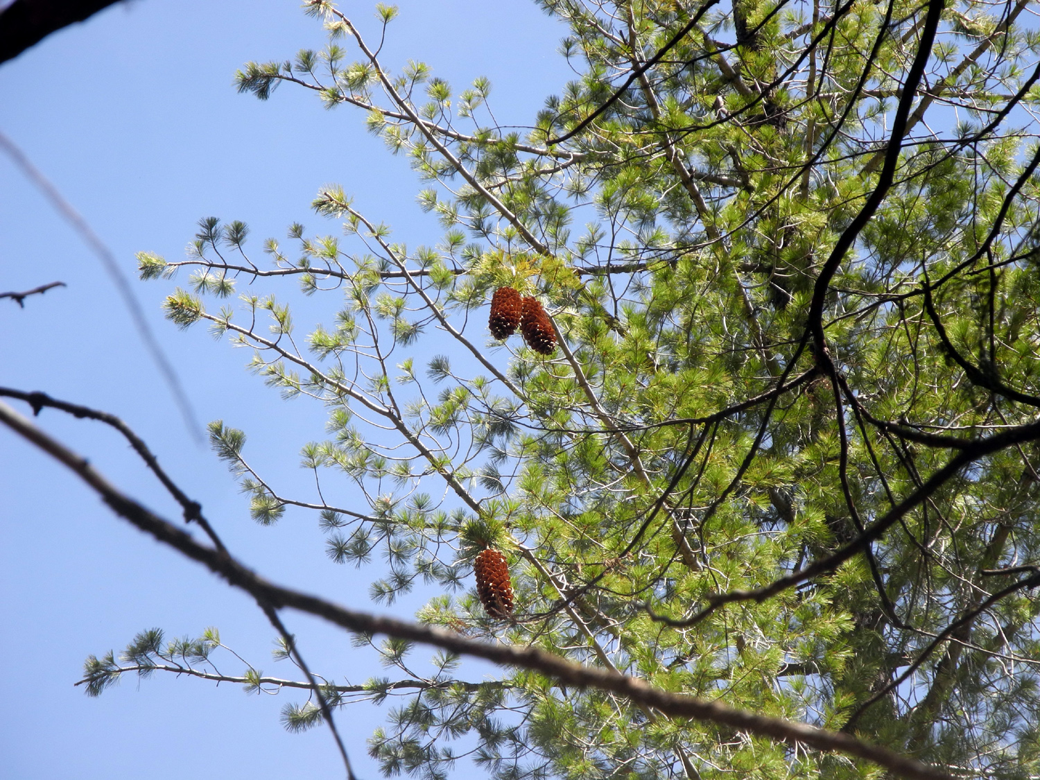
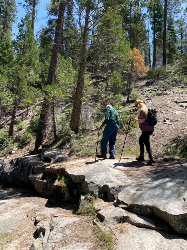
Kevin, the weatherman on ABC 30, said the high temperature would get close to 100 degrees on May 7. It seemed that our foothill hiking days had ended, so I suggested a couple of short, easy hikes I had done several times before near Fish Camp, at the 5,000 foot elevation on Highway 41, about two miles from the Yosemite National Park border. We took separate vehicles to Big Sandy-Jackson Road, then Teri and Jackie joined me in my truck for a a two mile drive over the dirt road to Chinese Ditch. This artifact was built during the days of the Madera Sugar Pine logging operation, and diverts water from Big Creek to Lewis Creek. The ditch bank serves as a trail, and offers relatively flat and mostly easy walking about 3/4 mile to the diversion dam. Although we have enjoyed the flowers, oaks and shrubs of the foothills, we were all glad to once again be among dogwood, ponderosa and sugar pines, firs, and cedars. |
|
|
|
| Dogwood blossoms near Sugarpine | Ripe cones on a sugar pine tree by the ditch |
|
It was also a good day for birds, or at least one bird. We had a fairly long delay along the highway due to tree removal, and got out to look around. I spotted what appeared to be a bird of some kind in the top of a dead tree. I took several photos, but when I zoomed in on my computer, it was just the dead top of the tree; apparently air currents had given the appearance of movement. However, Jackie spotted a colorful bird in a tree on the opposite bank of the ditch, and an Internet search identified him as a western tanager. I think I've seen them before, but usually in flight so it was hard to get a good look. |
|
|

|
| Do you see the birdie? Neither did we | The western tanager provides a bright spot among the evergreens |
|
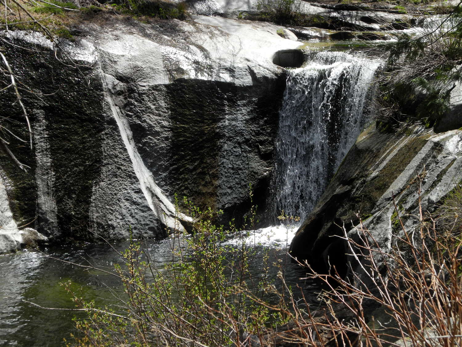
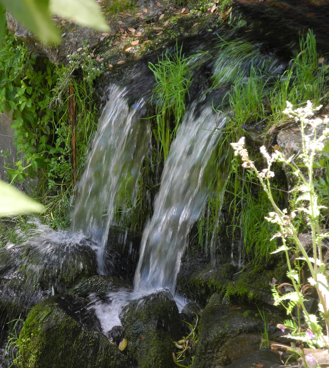
Where the ditch flows out of the creek, there is a series of cascades, topped by a nice waterfall. Above the falls the creek makes a series of 4-inch drops down over a wide, flat granite base. |
|
|

|
| Falls on Big Creek, just below the diversion dam | Big Creek above the diversion dam |
|
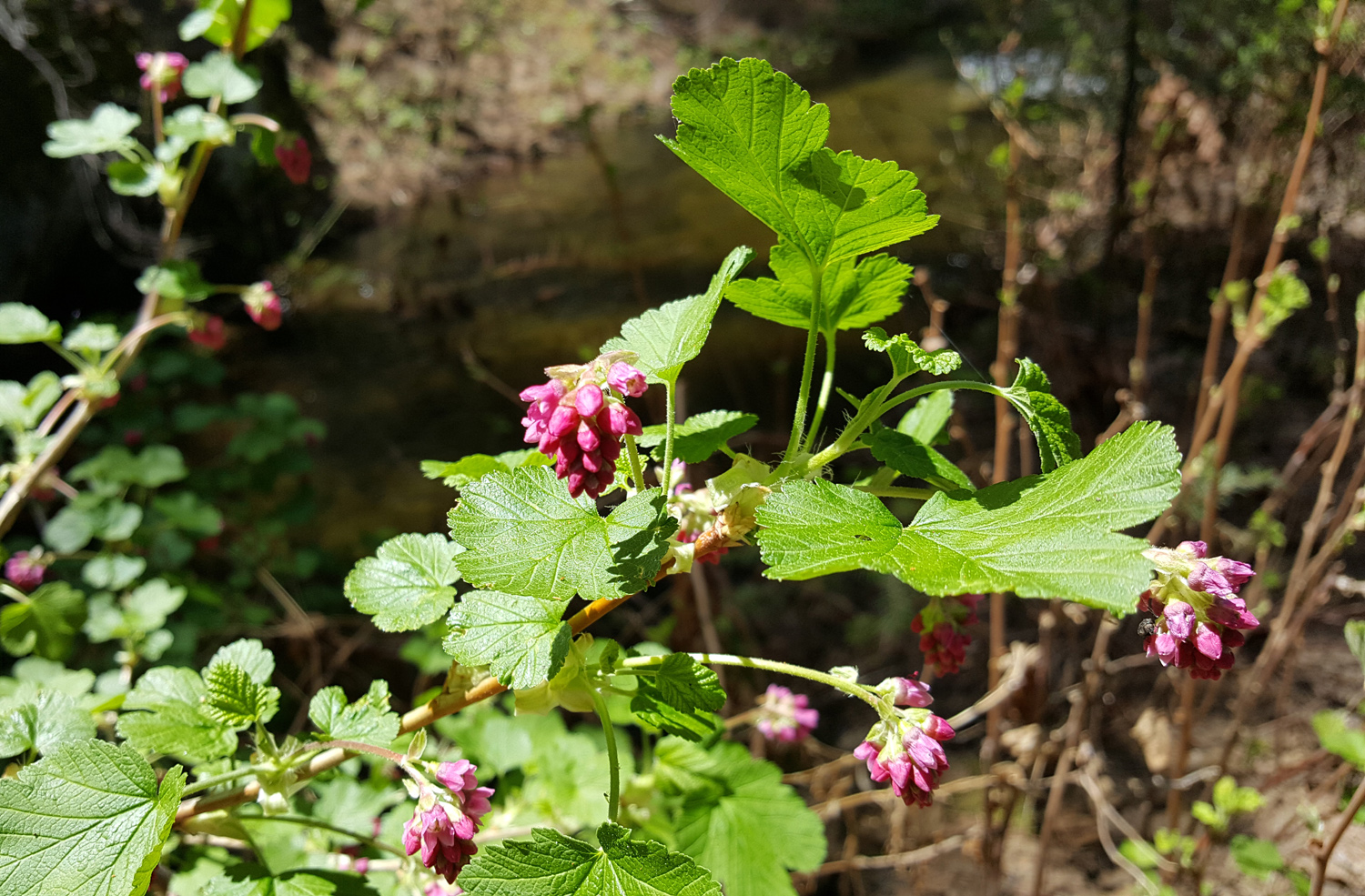
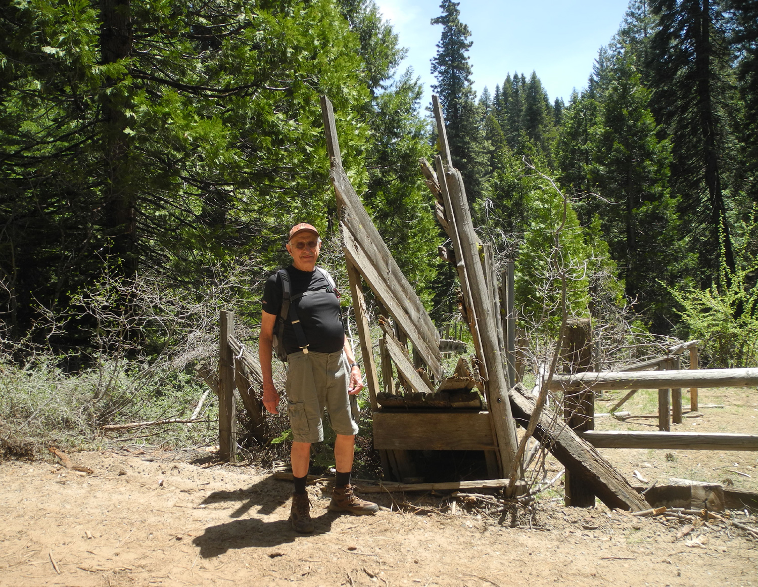
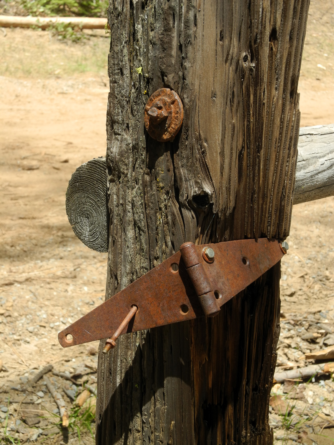
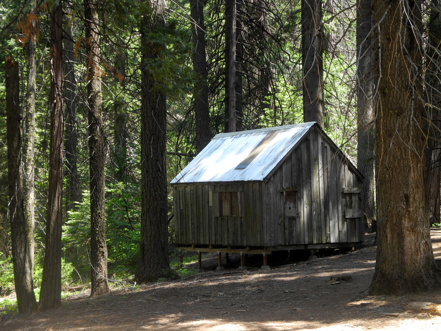
There are few wildflowers at this location, but we did see dogwood, Indian rhubarb, and the usual unidentified species. There are also some man-made features by the road, including an old cattle chute, a corral, and rail fencing. Where the trail starts is an old cabin which I photographed on my first visit in June of 2018. |
|
|
|
| Indian rhubarb often grows right in the water | These might be currants - any suggestions? |
|
|
| Dick by the old cattle chute | Rusted hinge on the corral gate |
|
When we completed this mile and a half walk, we returned to the highway, drove north through Fish Camp about two miles, and turned east on the Mt. Raymond Road. Where the paving on this read ends there is a snow play area, now being used for camping. We left Jackie's car here and drove in a little farther, then took a rough side road I had walked on while camping here last November. We set up our chairs and enjoyed a much-needed snack, then drove in a little farther to the junction of Mt. Raymond and White Chief Roads. Jackie did not feel like any more hiking, and set up her chair in a nice shady spot, while Teri and I walked in a little ways to an old side road that leads into Buffin Meadow. |
|
|

|
| Jackie takes a break | Buffin Meadow looking southwest |
|
On three previous trips to this area I had explored parts of the Buffin Meadow Loop Trail, which starts at the horse-rental business on Big Sandy Road, and winds through the forest as well as into the Mariposa Grove of giant sequoias in Yosemite National Park. We crossed the meadow west to east, stepping over and around wet spots. On my first visit in June of 2018 there were a lot of flowers, but it was too early for them this time. Corn lilies, a common plant in meadow wet spots, were just getting started, two or three inches tall. After leaving the meadow, it was about 100 feet through the forest to the trail, which then goes up to the main road. The trail was buried in pine needles and did not show much sign of recent use. We went only as far as the road, then back out to the truck, walking a little over a mile and a tenth total. After Teri and Jackie got back to her car, we drove back down Highway 41 and stopped to visit my other daughter Jennifer and husband Rod, about five miles above Oakhurst. Driving
out from their place to Road 620, I enjoyed the day's final bird
watching, as a small flock of wild turkeys made their way into the
trees from the road. All in all it was an enjoyable outing, made
special by the chance to spend time with both daughters. --Dick Estel, May 2020 |
|
|
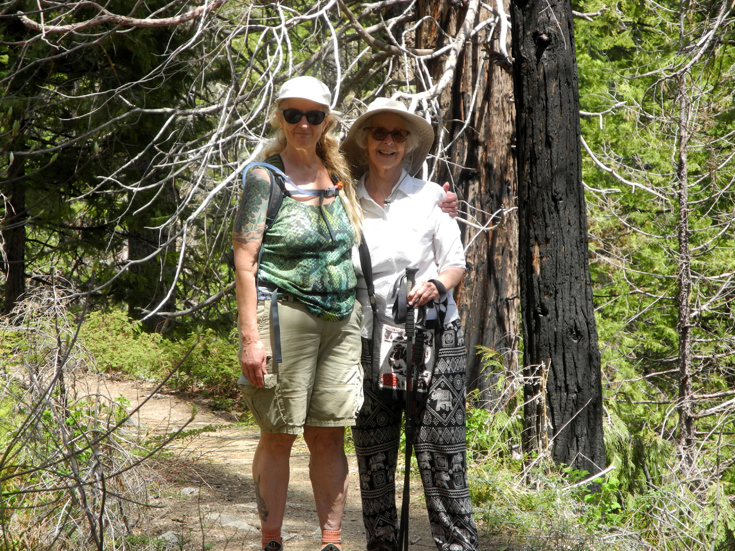
Gray's Mountain Camp
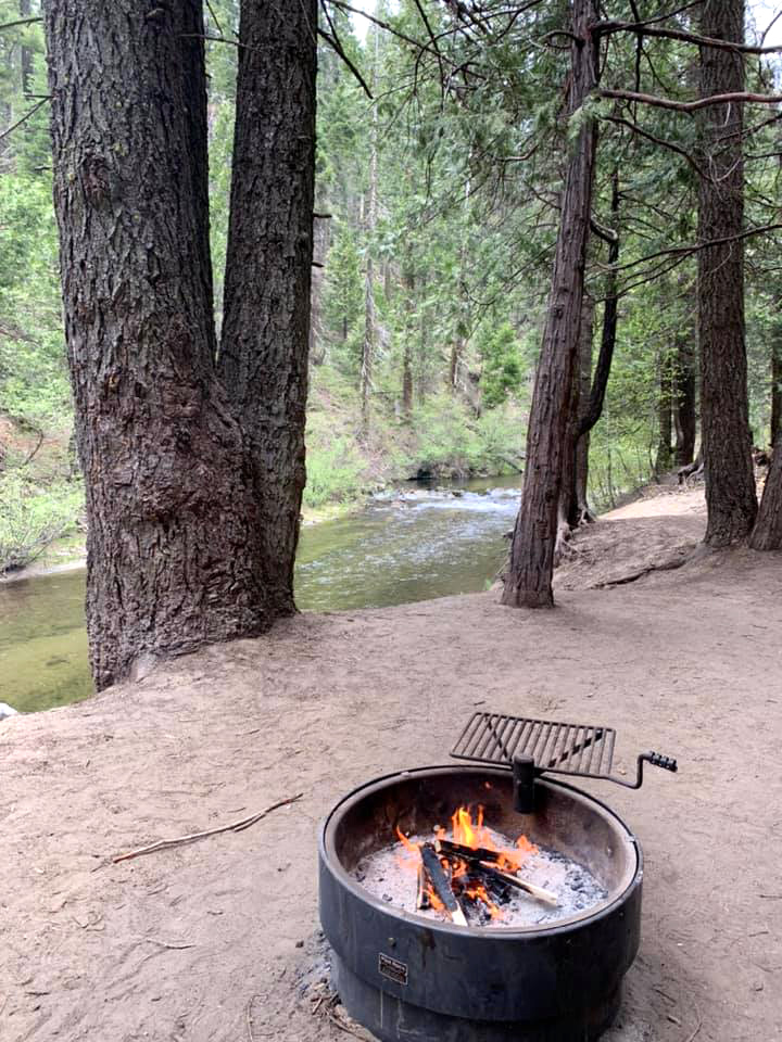
In many ways, this outing felt like a return to normalcy. However, getting to our destination was anything but normal. Teri and I planned to head for the mountains on Thursday, May 14, while Johnny, Brittany, Colton and Jack would join us the next day. I drove my truck and Teri had her Toyota Avalon. Big Sandy Road, which leaves Highway 41 at Fish Camp, eventually joins the route that starts out as Sky Ranch on Highway 41 about three miles above Oakhurst. Big Sandy mostly parallels Big Creek, and we planned to find a campsite along the creek and then send GPS information to Johnny with a device he loaned us. We drove in on Sky Ranch Road to the junction. We had gone only 100 yards after turning west on to Big Sandy when we encountered a mud hole, mixed with snow, that did not look passable with a passenger car. We got out for a look, and beyond this place was more mud and snow. We returned to Road 6S10 and decided to check out Fresno Dome Campground, just a short distance away. Like all Sierra National Forest campgrounds it was closed, with a locked gate. However, there was a tent set up, and a way in from the road just past the entrance. We drove through the campground, and decided to take a chance on camping there. We had not unloaded much more than our chairs when a man arrived, unlocked the date, drove in, and informed us that the campground was closed (we knew that). He was the camp host, there to prepare the place for eventual opening, whenever that might happen. Although we explained that we had everything we needed (including a toilet) and would not leave anything behind, he simply continued to say "the campground is closed." Teri and her sister and mother had been in the area a week earlier, and knew that people were camping at other campgrounds that were closed but not gated. I discussed this with the host, and he said "all campgrounds are closed." I then asked him point blank if he would be checking any other locations. He said he would not, but made it clear that he was not giving us permission to camp. I replied that I was not asking him for permission, nor would we hold him responsible if someone else kicked us out of another campground. Of course, it is always our preference to choose locations that are not official campgrounds, but it seemed that dozens or maybe hundreds of people were anxious to get out, and any promising spot was already occupied. We finally drove to Gray's Mountain Campground, where Teri had been for Mother's Day, found only one other party camped there, and set up in a nice spot beside Willow Creek. We drove 77 mile to get there, taking a total of five hours. I used my reverse gear more that day than in a normal week, backing up from side roads that proved impassible after a short distance, or had no place to camp and no turnaround point. To summarize a long story, we stayed at Gray's Mountain for three nights, with no one telling us to leave, and with nearly every site being occupied for at least one night. Along with dozens of off-highway vehicles cruising past the place, and various groups stopping for a few hours to have lunch, it was as if no pandemic had ever happened. It was a great feeling to live normally, even for just a few days. |
|
|
|
| Willow Creek near our camp | Days were warm, but at night we were glad for this modern fire ring |
|
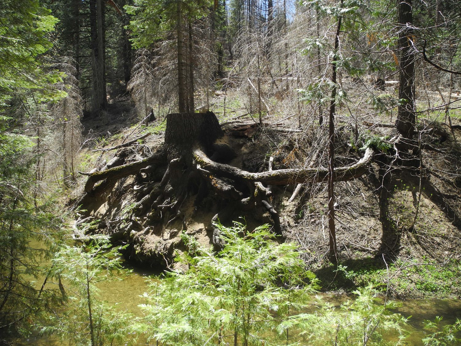
Teri and I set up our individual sleeping areas (her tent, my cot under the stars), had a late lunch, and walked to both ends of the campground. In the upstream end we talked with the other camper present at that time. He had left Palm Springs, where it was 110 degrees, earlier in the month, and was exploring the western slope of the Sierra on his way to Washington. The downstream end of the campground is across the main road, and going that way leads to a nice meadow. Teri and I had hiked here in 2016, but had missed one of the more interesting aspects of the meadow - several sequoia trees, planted a hundred years ago or more. While not in an existing grove, this terrain is normal giant redwood habitat. We also encountered a few wildflowers, including one delightful white specimen which we could not identify. |
|
|
|
| Young sequoia trees in the meadow | A delightful, low-growing, unidentified flower |
|
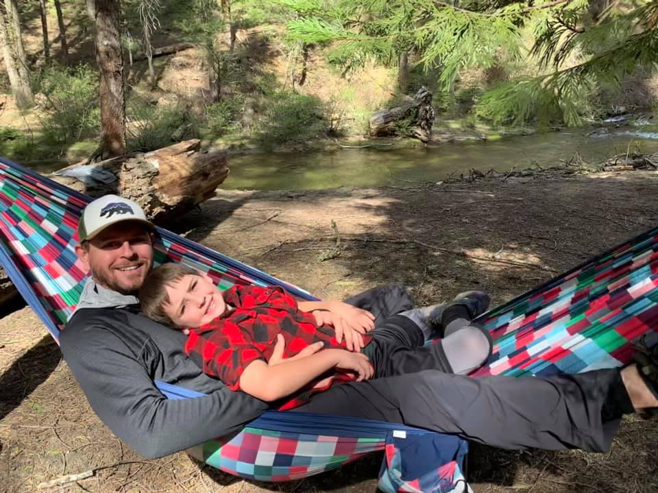
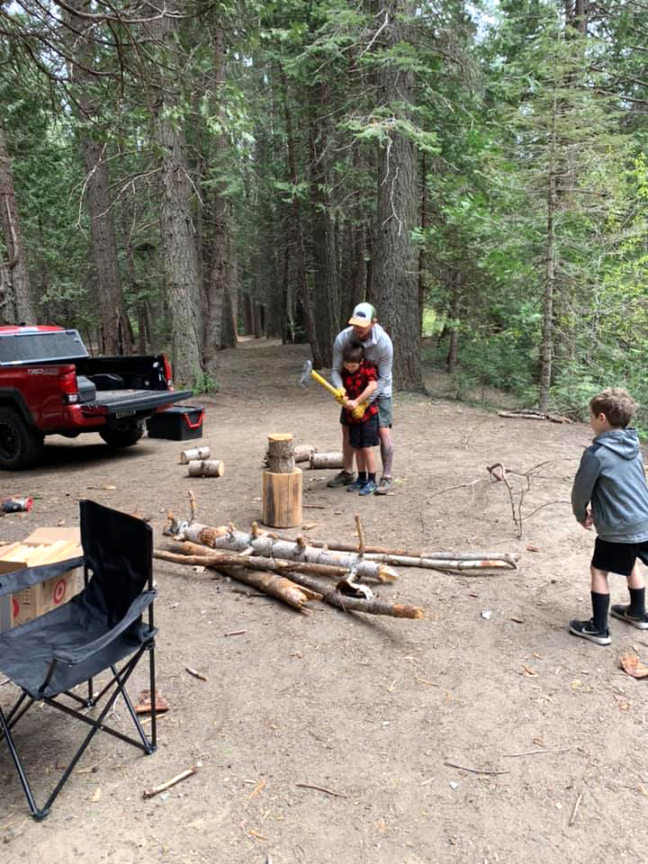
As evening came on, we debated whether to have a fire. We usually go to bed fairly early, but well before dark it was getting quite cool, so we piled small branches and commercial kindling in the fireplace, got a fire going, and kept nice and warm until we went off to bed. I've gone back to my old ways of 30 years ago, sleeping on a cot outside, although it is a high end bed, far more comfortable than the lightweight, narrow thing I used back then. With a good sleeping bag, I was warm and comfortable despite a low of 33 degrees. The next morning we eased into the day, having hot tea followed by breakfast. At some point we walked down toward the meadow, and as we were heading back toward the road, we saw the Upshaw's red Toyota pickup turn into the camp. We hurried back and welcomed them to our first family gathering in a couple of months. |
|

|
|
| Colton and Jack | Colton gets a wood-chopping lesson |
|
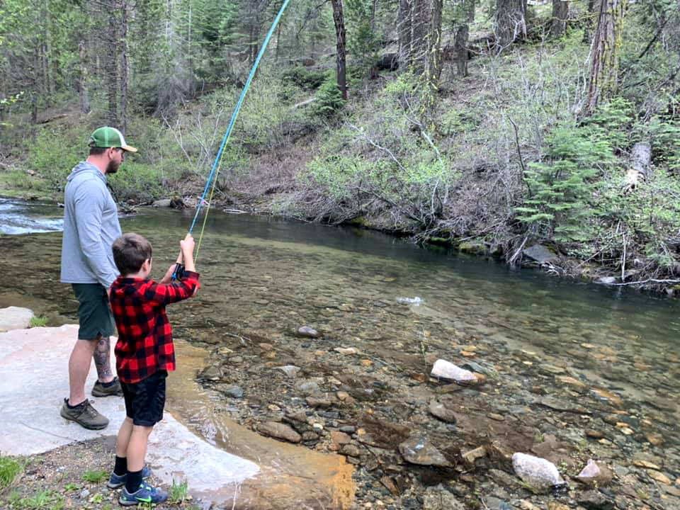
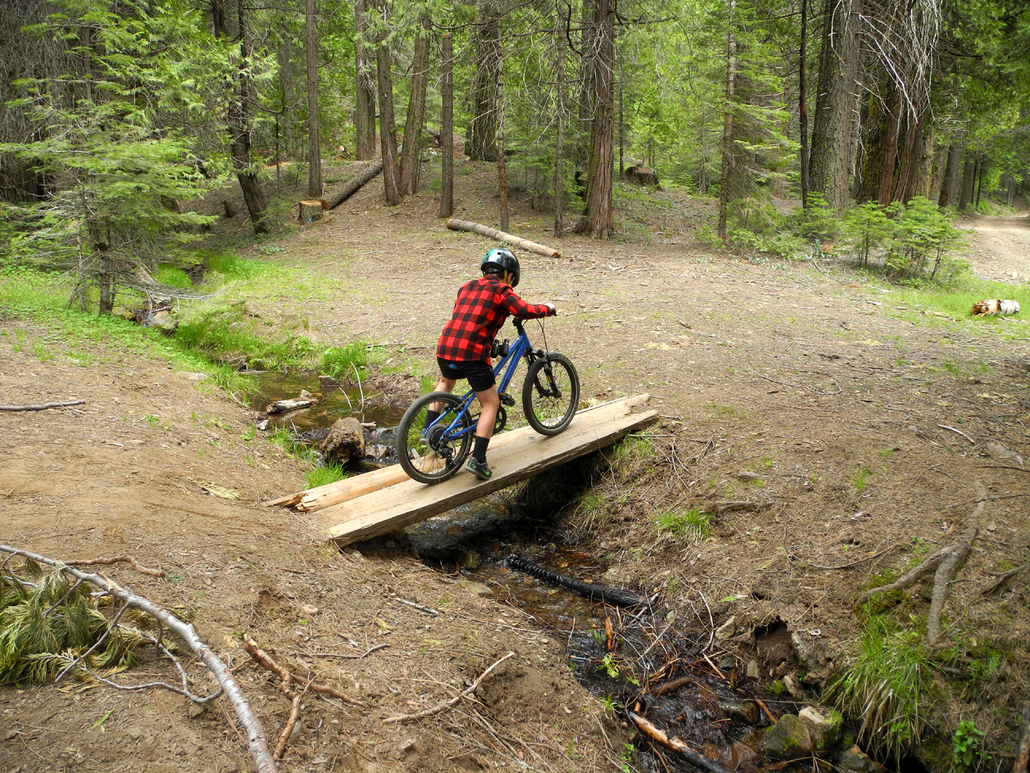
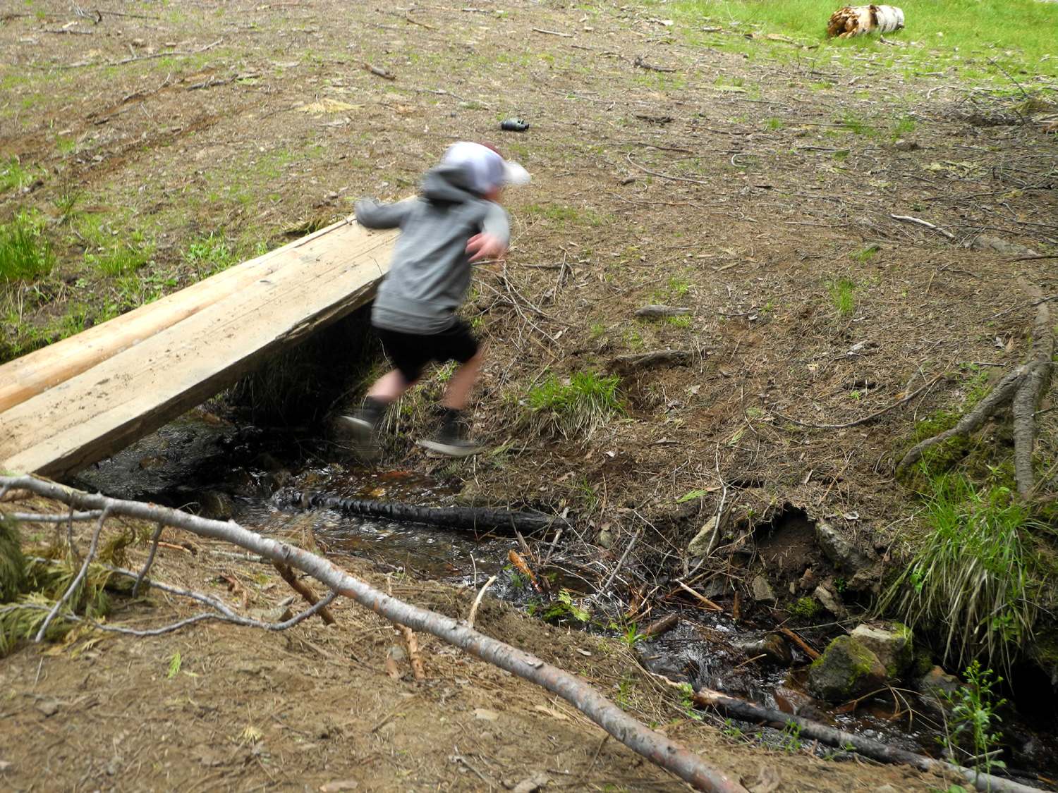
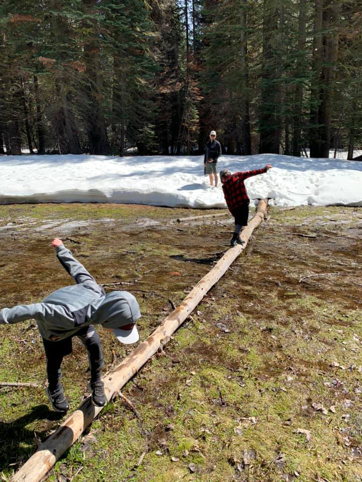
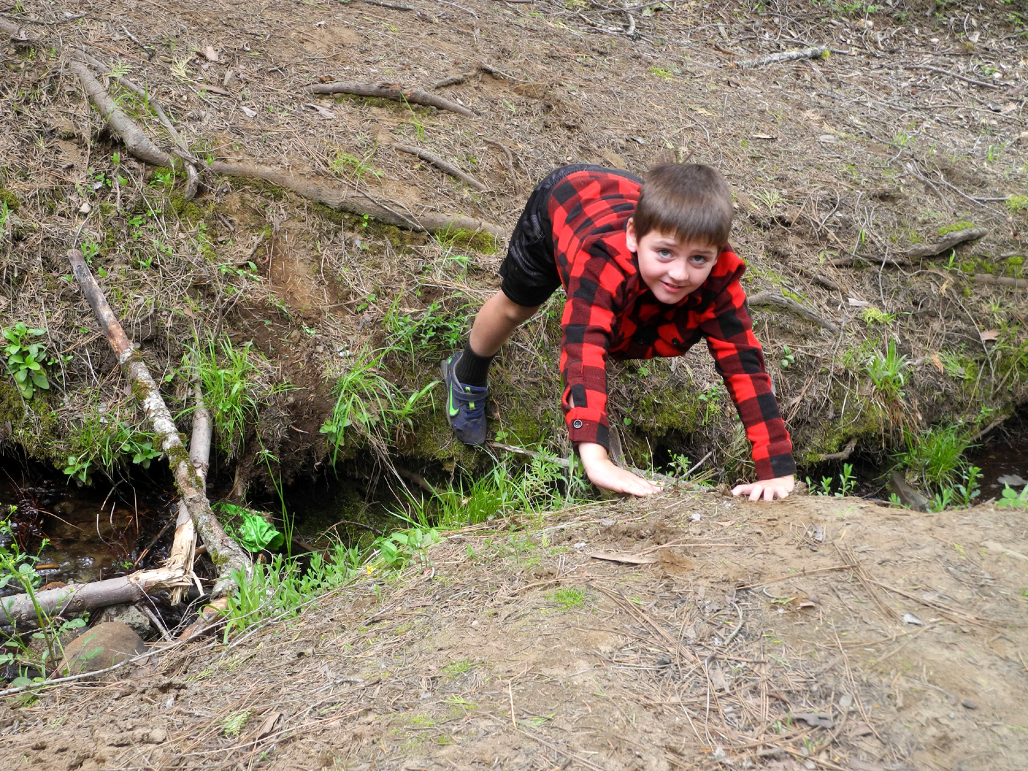
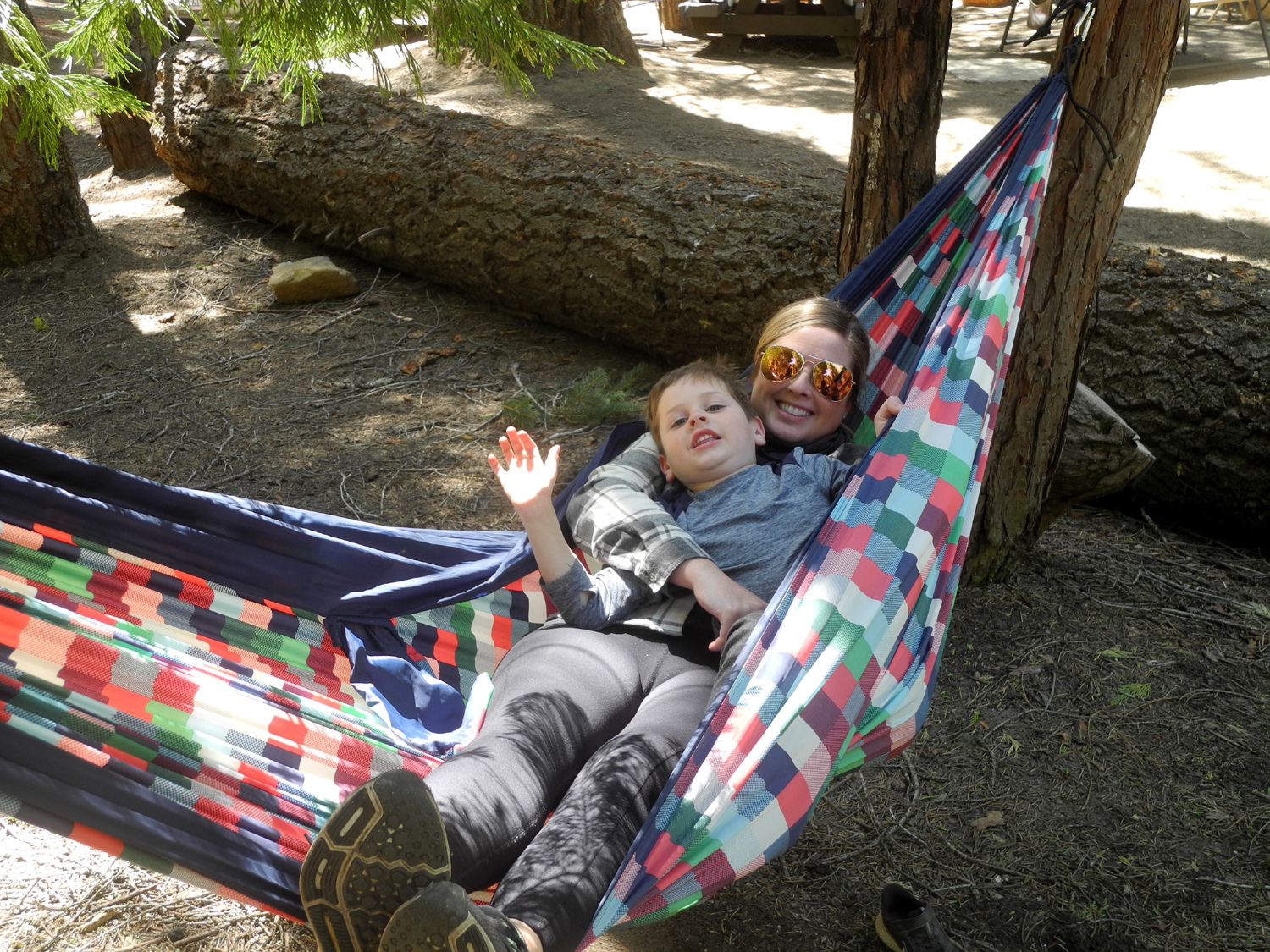
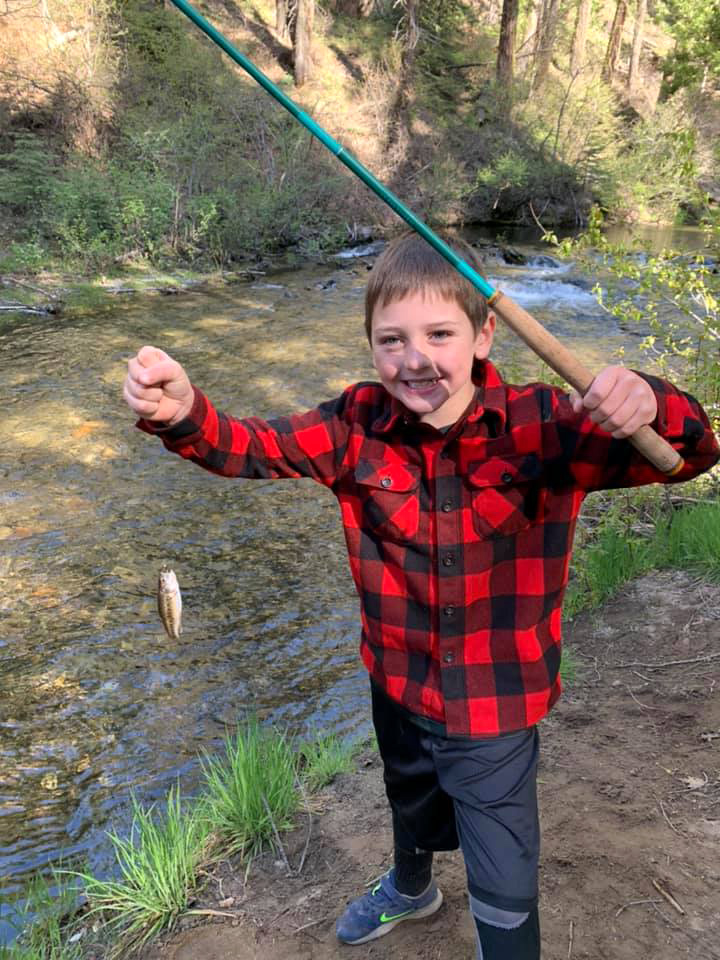
Johnny has been a serious fisherman for many years, and has now got not only his sons but also Brittany hooked on the hobby (Ha - hooked!). In this location, fly fishing is the best approach, and the family fished off and on, getting into the water but not removing any fish. So that the parents could do some fishing without the enthusiastic accompaniment of Colton and Jack, Teri and I walked with the boys to the downstream end of the campground, while Johnny and Brittany went upstream. At the unoccupied camp host site, a tiny creek ran down to Willow Creek, and Colton rode his bike across a makeshift bridge, and through the creek itself, while Jack jumped across a dozen times or more. He stuck the landing every time until number 15, when he ended up wet but unhurt in the water. |
|
|
|
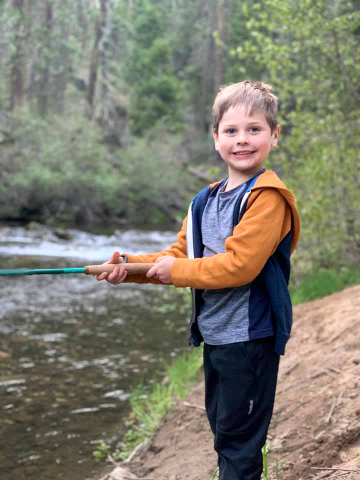
| Johnny and Colton | Jack, the happy fisherman |
|
|
|
Due to the slope on the left side, it was easier to ride across right to left |
"Grandpa! Take a picture of me in the air," said Jack |
|
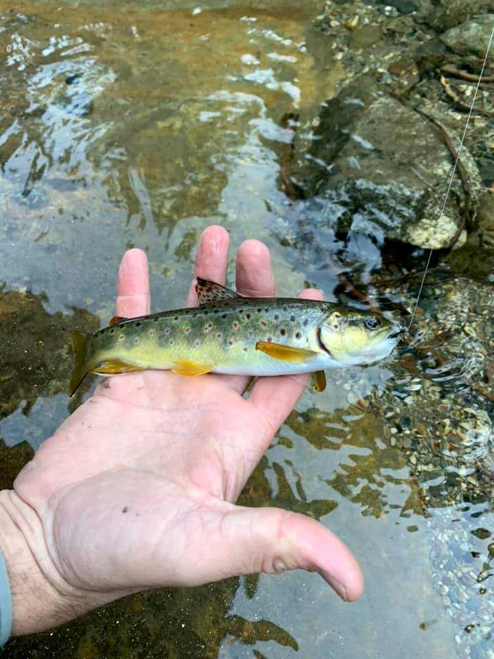
At camp, Colton developed a special bike track, riding down a steep access road to the camp, up a small hill, around several trees, and back to the campsite. Jack did not bring his bike, but chased Colton and also got turns riding the "big" bike. The Upshaw's tried fishing again late in the day and and began having good luck. Both boys caught fish during the trip, all of them small, and all released back to the creek to grow some more. We had a nice campfire, with everyone helping to stir it and add wood. Johnny and Brittany took the boys to the tent and stayed with them till they fell asleep, then returned to the fire. They usually sit up fairly late, and I stayed up later than any time since New Year's Eve. |
|

|
|
| Johnny Upshaw, fierce fisherman | This young brook trout was returned to the creek |
|
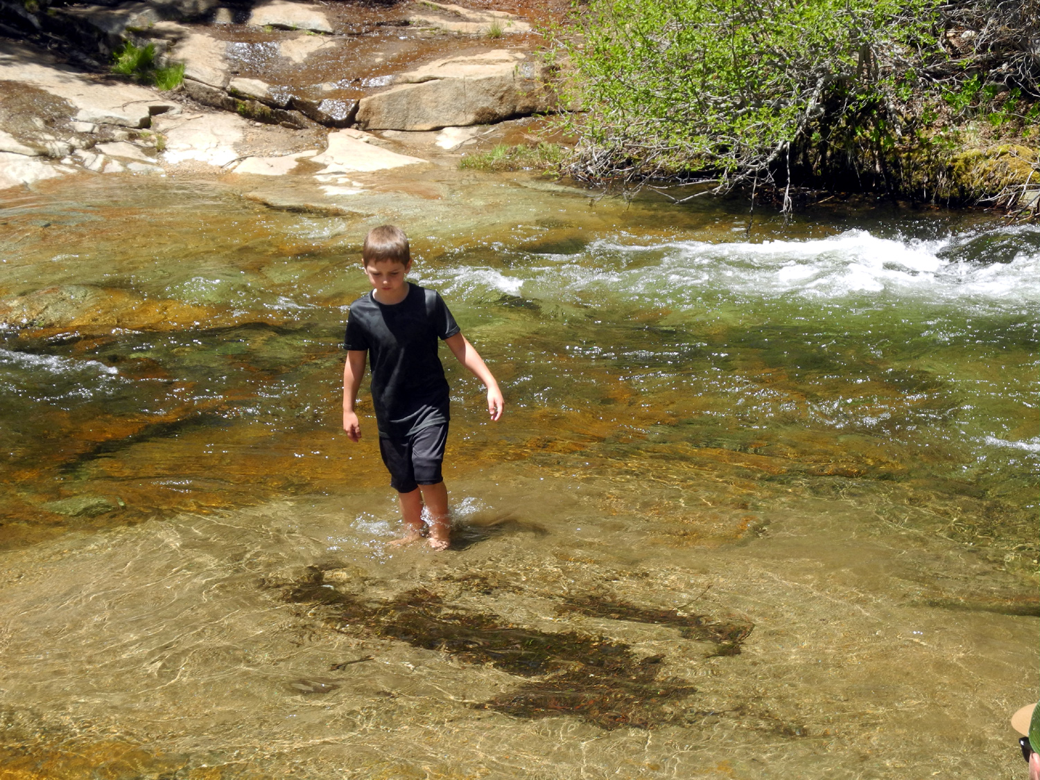
The next morning we started up the fire, having had a "warmer" night of 35 degrees. Teri had to leave that day, but after we ate breakfast we all walked through the campground and past the meadow to a rough trail that runs along the creek. At this location there is a series of cascades known as Soquel Falls. The creek falls about four feet, then over a full six-foot drop into a nice swimming hole. The adults had no desire to get into the water, which so recently had been snow, but several teenagers from another camp were wading cautiously in, and finally sat down in a shallow spot. Above the cascades, Colton and Jack rolled up their shorts and waded in, but I didn't see anyone get in as far as waist deep. |
|

|
|
| Soquel Falls on Willow Creek | Colton in the creek |
|
|
| Despite his enthusiastic wading, Jack kept his pants dry | Dick and Teri on the trail from the falls |
|
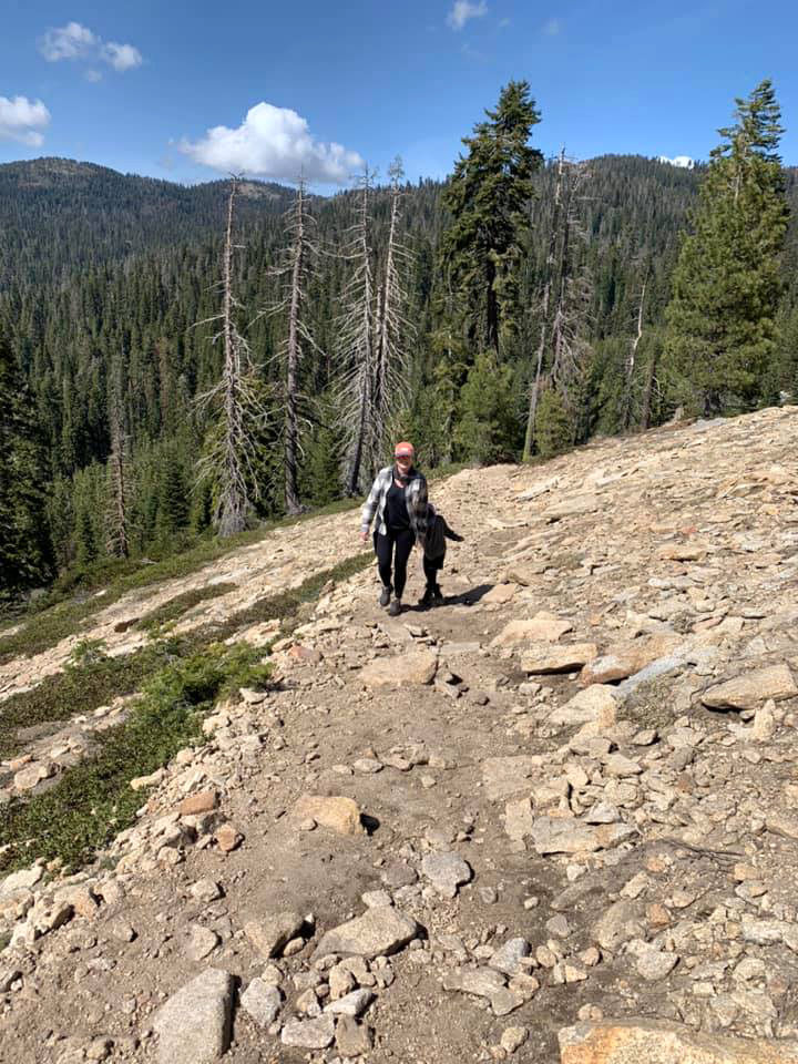
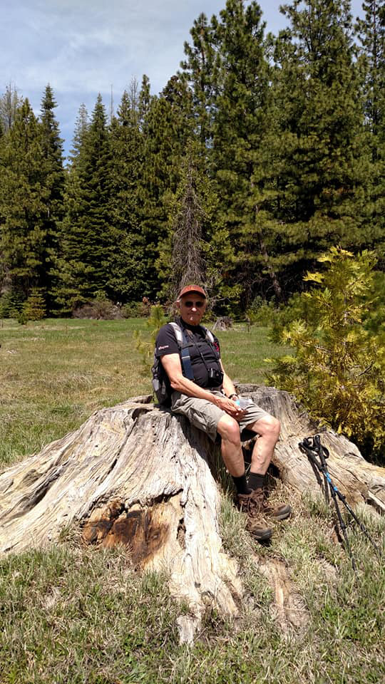
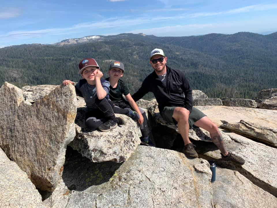
When we got back to camp we said our goodbyes to Teri, and the Upshaw's set out to drive to Fresno Dome, a 8,000 foot formation jutting up out of the surrounding forest land, for a hike. The trailhead is about two miles beyond Fresno Dome Campground, with some snow and mud in between. There's not room for three adults in their truck, and I didn't want to drive through the snow, so I stayed in camp. I had hiked to the top in 2018, as well as several times back in the 1970s and '80s. They had a good time, despite having to walk though some snow on the lower part of the trail, and making their way across a wet, swampy place on a narrow log. Everyone made it up and down without incident. They explored some of the nearby roads, and returned to camp with the truck covered in mud. |
|
|
|
| Crossing a swampy spot on the Fresno Dome Trail | Out of the trees and into the rocks |
|
|
| Brittany, Jack, Colton and Johnny on top | The Flying Upshaw Brothers and the muddy pickup |
|
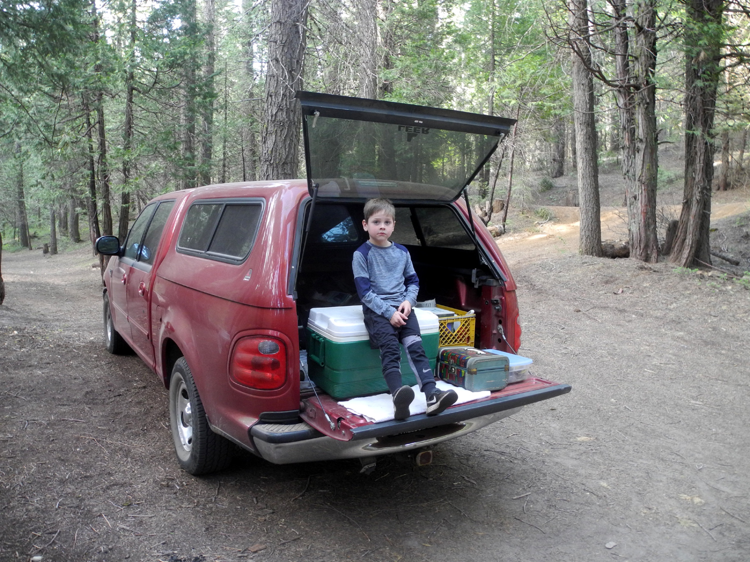
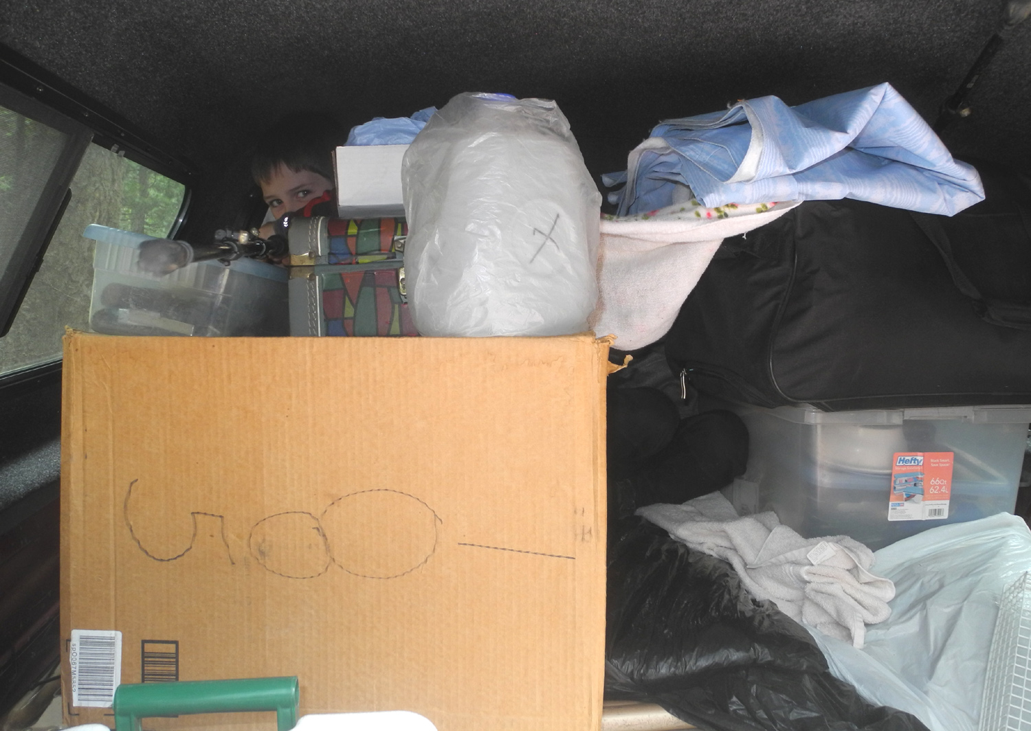
The remainder of the day went pretty much the same way as the previous one - fishing, biking, walking around, reading and eating. Again I stayed up past 11 p.m., and enjoyed a comfortable night with the low temperature dropping only to 40 degrees. I always enlist the boys to help me load my truck, since they can climb into it and all the way to the front of the camper much easier than I can. This time the "help" devolved into the building of a fort, with the boys hiding behind boxes and camping equipment. Of course, when the time came, they put everything in the right place. |
|
|
|
| Before the loading | Colton is back in there somewhere |
|
With
everything loaded up, we said our goodbyes and departed, having
enjoyed a very special family outing in the Sierra. --Dick Estel, May 2020 |
|
|
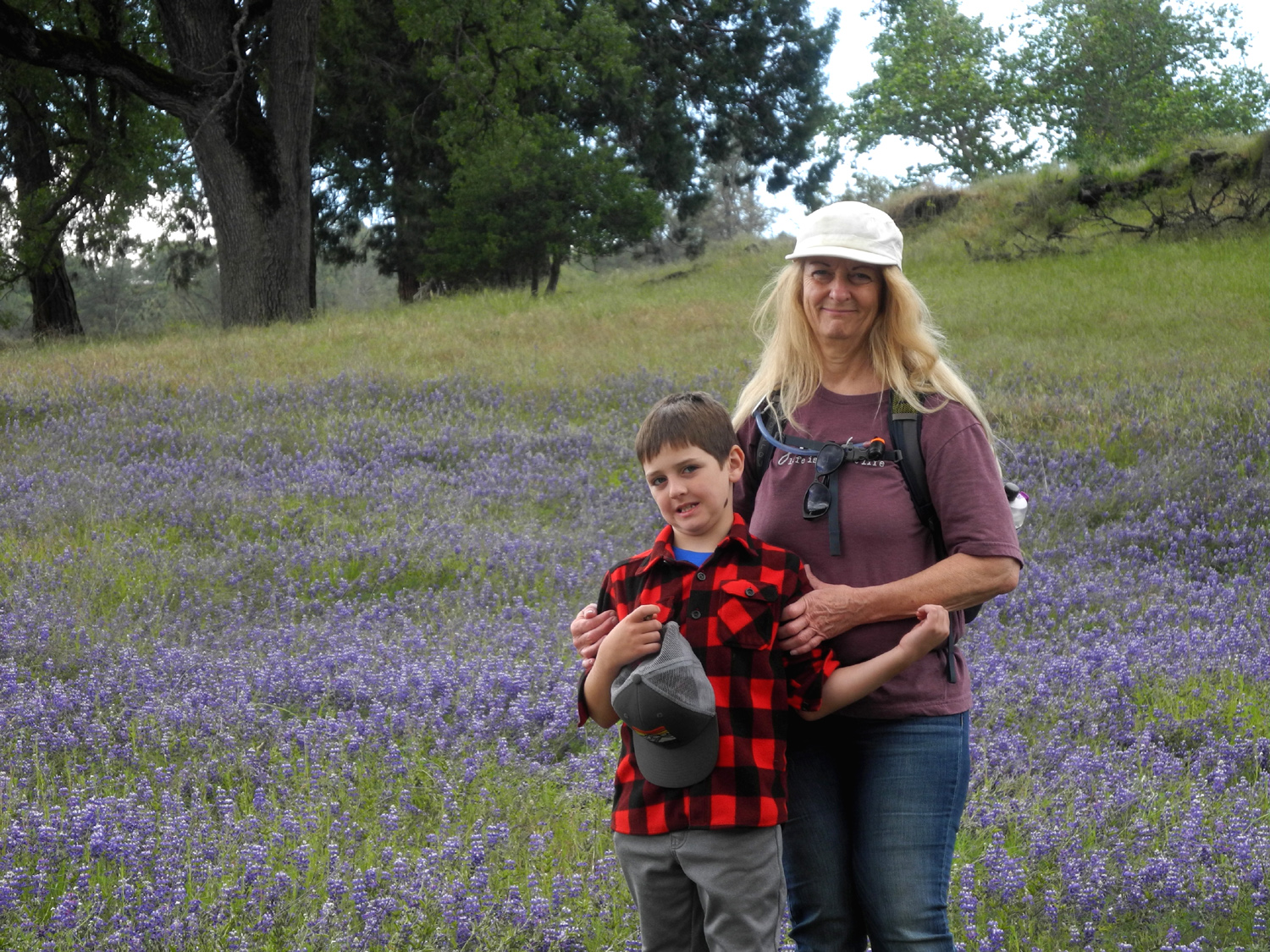
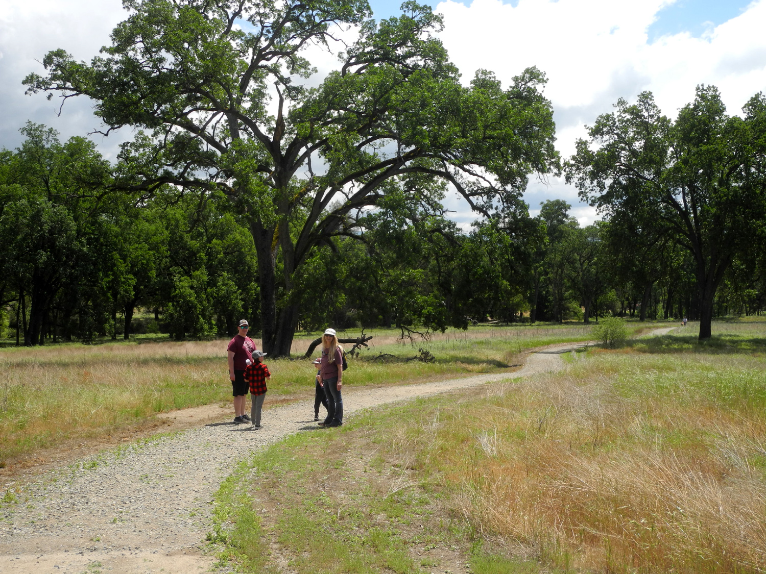
Ahwahnee Hills
This was my second trip to this location in 2020, and my fourth overall. However, it was made special by getting to hike with my youngest grandson Mikie, down from Susanville, as well as Teri, Jackie, Colton and Jack. After a few very warm days, the weather cooled off again, making this low foothill location the perfect spot. |
|

|
|
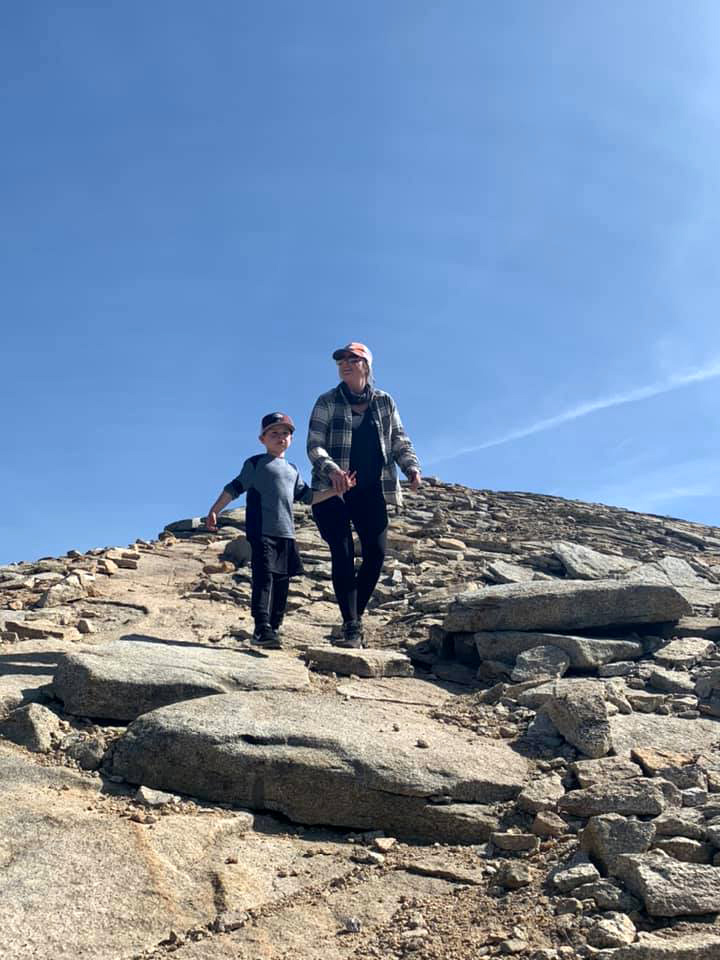
| Dick, Jackie, Jack, Teri and Mikie (photo by Colton) | Colton and Teri in a field of lupines |
|
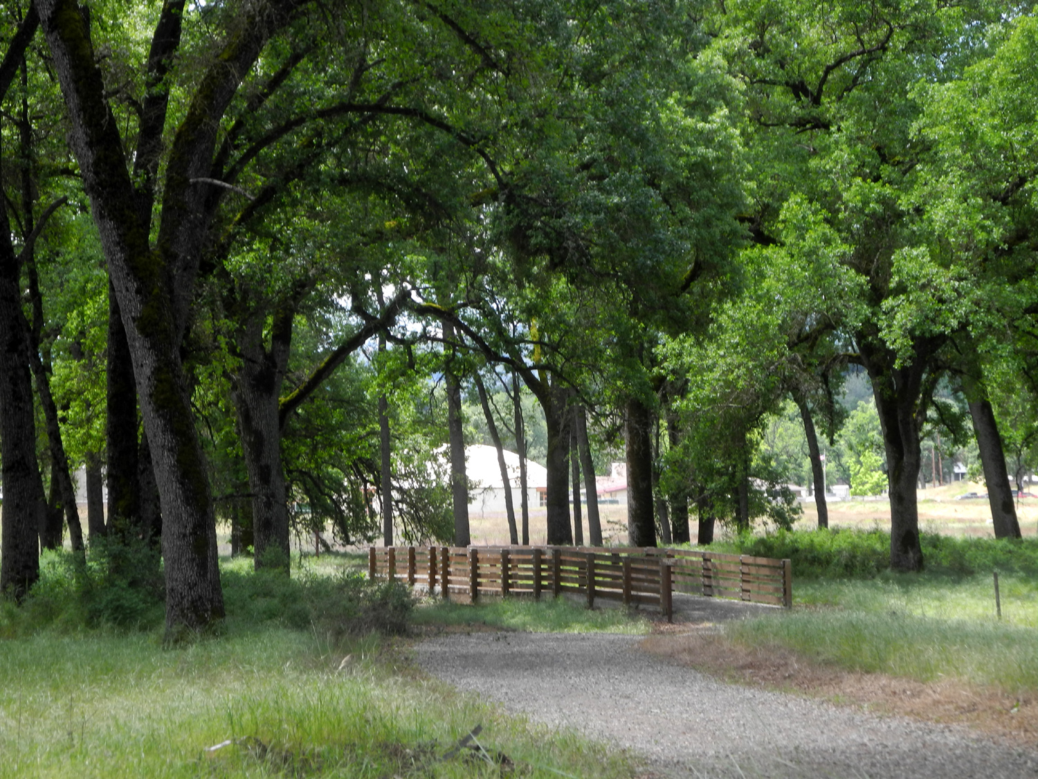
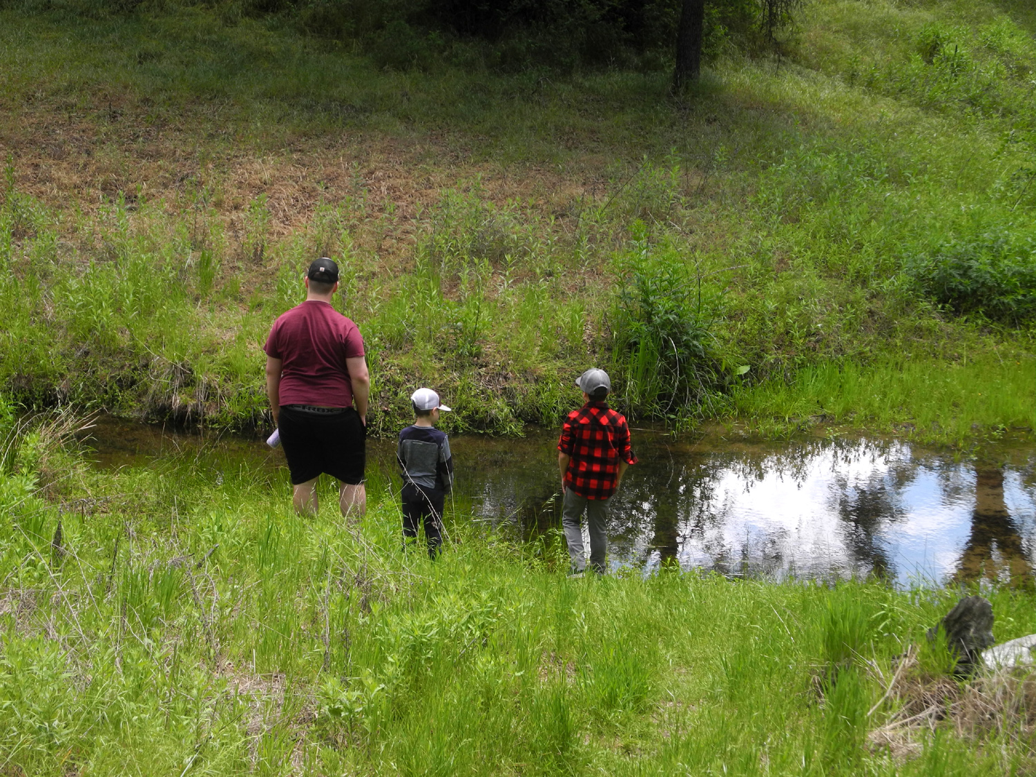
Ahwahnee Hills is a Madera County park, and offers a mostly level loop trail that goes through huge valley oaks, across a creek, and beside a nice pond. It had been a while since the boys had seen their Uncle Mikie, so they walked with him much of the way, and joined him in an exploration of the creek. |
|
|
|
| Valley Oaks line the trail | Mikie, Jack and Colton at the creek |
|
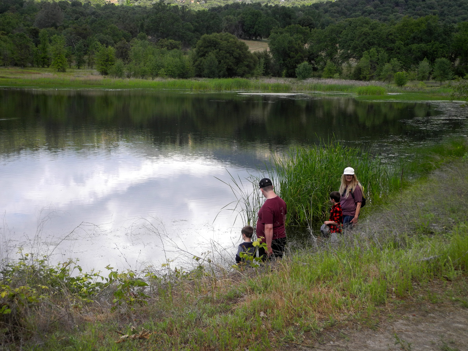
As we approached the pond, Teri, Mikie and the boys went down to the edge of water. Jackie and I were a bit farther back, and we saw there was great excitement next to the water as we approached. Colton had spotted a gopher snake partly in the water. We all went down to check it out, and he posed for a while, then turned and came in my direction. I expected him to veer to one side, but he kept coming slowly, whereas normal snake behavior is to get away from humans as fast as possible. Someone said "you might be standing on his house," so I stepped aside. He quickly entered a hole in the bank and disappeared completely, the first time any of us had ever witnessed such a thing. |
|
|

|
| Exploring the edge of the pond | It's always a great day when we get to see a snake |
|
Colton took over my camera and took a number of "artsy-fartsy" shots as we crossed the dam and started back to the parking area. As we reached the far edge of the pond, we spotted turtles sitting on a stump. Our wildlife spotting also included bullfrogs in the water and red-wing blackbirds in flight and sitting on reeds. |
|
|

|
| Colton's eye view of Mikie and Teri | Two turtles on a stump |

|
|
| Panoramic view of pond | |
|
We
sat at a picnic table and enjoyed a snack before concluding what will
(almost) surely be our last low elevation outing of the season. --Dick Estel, May 2020 |
|
|
Photos (Click to enlarge; pictures open in new window) |
||
|
Sycamore Wildlife Area Blossom Patrol & Eagle Watch Chinese Ditch & Buffin Meadow Gray's Mountain Camp Ahwahnee Hills |
||
|
Sycamore Wildlife Area |
||
 |
 |
 |
| Teri gets her stuff ready for hiking | Where Sycamore Creek joins the Kings River | This wasn't the worst fallen log barrier |
 |
|
 |
| Remains of a campfire in an old parking spur | A nice spring scene | Brodiaea and log |
 |
 |
 |
| Last of the baby blue eyes | Common madea close-up | Dandelion |
 |
 |
 |
| Spotted variation of farewell-to-spring | Climbing brodiaea close-up | New leaves on a live oak |
| Blossom Patrol & Eagle Watch | ||
|
 |
 |
| There are two dozen
blossoms or buds on this blazing star plant |
Climbing brodiaea in a live oak | Small tributary that runs into Big Creek |
 |
 |
 |
| Farewell-to-spring
line the roads all through the foothills |
Penstemon appeared
along the road near Big Creek |
Guarding his territory from the intruder |
 |
||
| Pine Flat Lake by Colton Upshaw | ||
| Chinese
Ditch & Buffin Meadow Photos by Teri & Dick |
||
 |
|
 |
| An old stump has turned into a natural planter | Chinese Ditch | Dogwood along the ditch |
 |
 |
 |
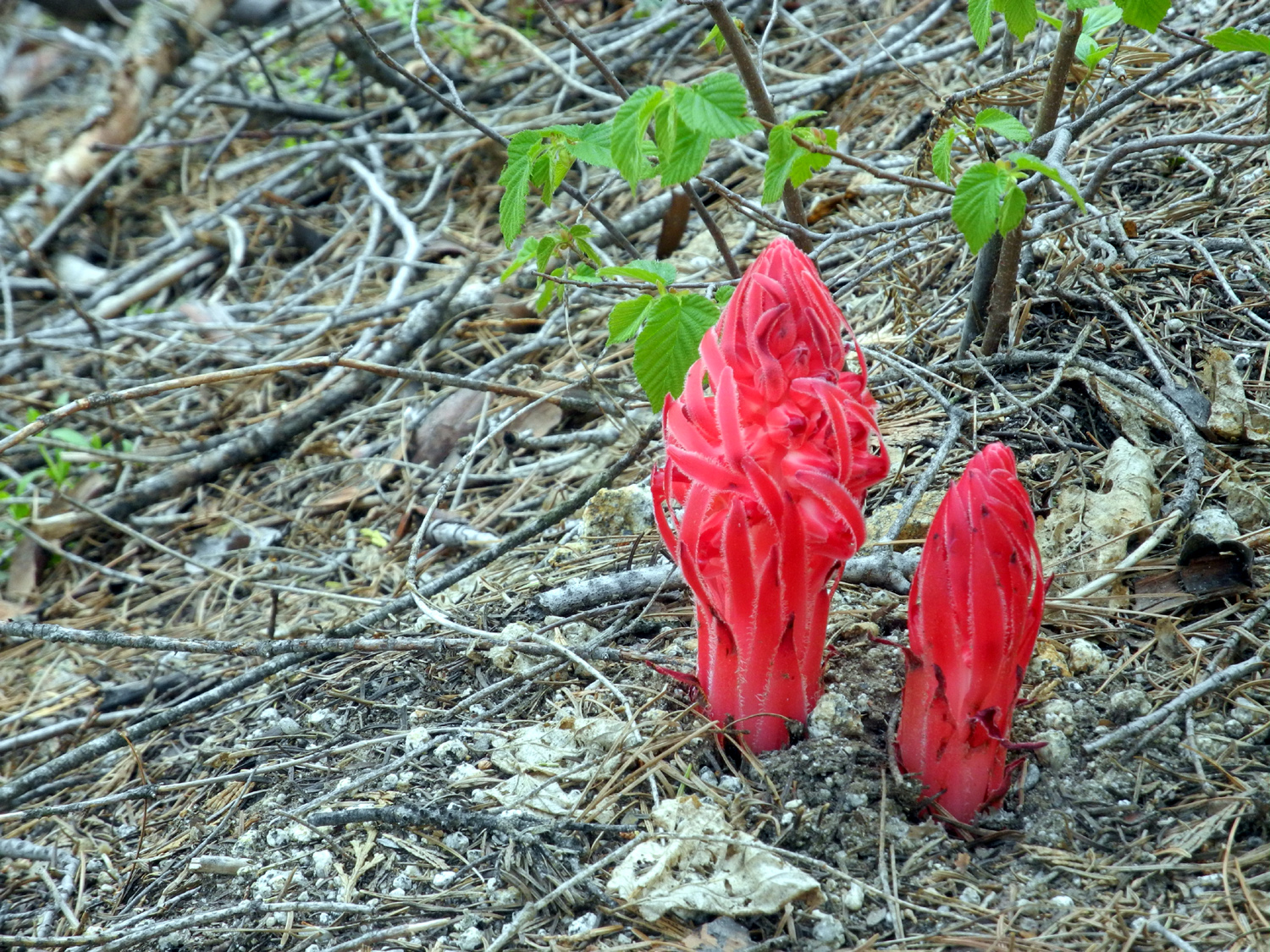
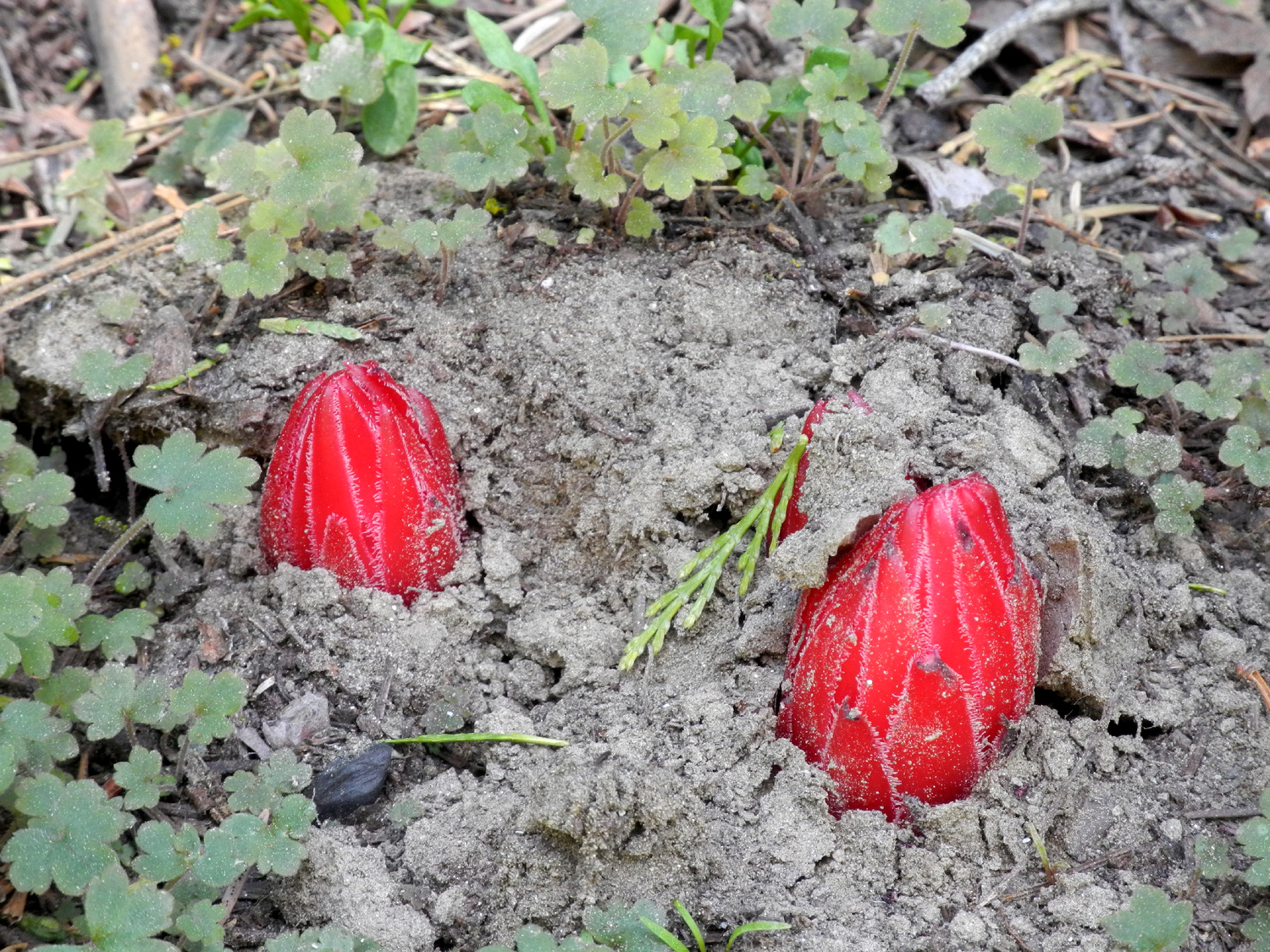
| Snow plants function
without the benefit of chlorophyll |
A "caterpillar" plant? | Teri and Jackie on the ditch trail |
 |
 |
 |
| Ancient, rugged root on the ditch bank | Dick in Buffin Meadow | Yerba santa on the road to Jennifer's |
| Gray's
Mountain Camp Photos by Dick, Johnny & Brittany |
||
 |
 |
 |
| Snow plants were
emerging at the edge of the camp |
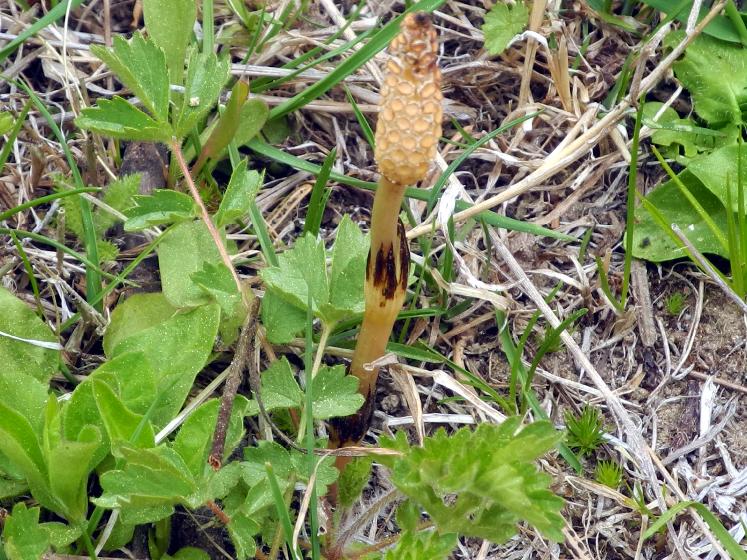
Dandelions in the meadow | An unusual mushroom |
 |
 |
 |
| You can also just ride THROUGH the creek | "Let's see, how am I going to get out of this?" | Fishing with dad |
|
 |
 |
| Hammock time with mom and dad | Time to relax | |
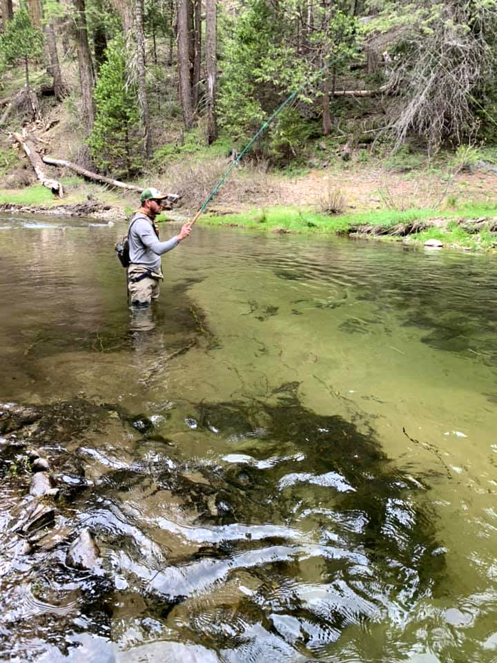 |
 |
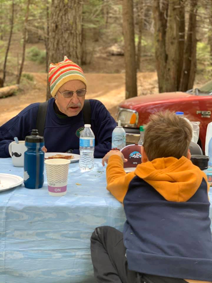 |
| Johnny goes where the fish are | Colton's catch | Jack having hot cocoa with Grandpa Dick |
 |
 |
 |
| On the rocky top of Fresno Dome | In this section, you just make your own trail | Johnny brought back
several pounds of Big Sandy Road |
| Ahwahnee
Hills Photos by Dick, Teri and Colton |
||
|
 |
 |
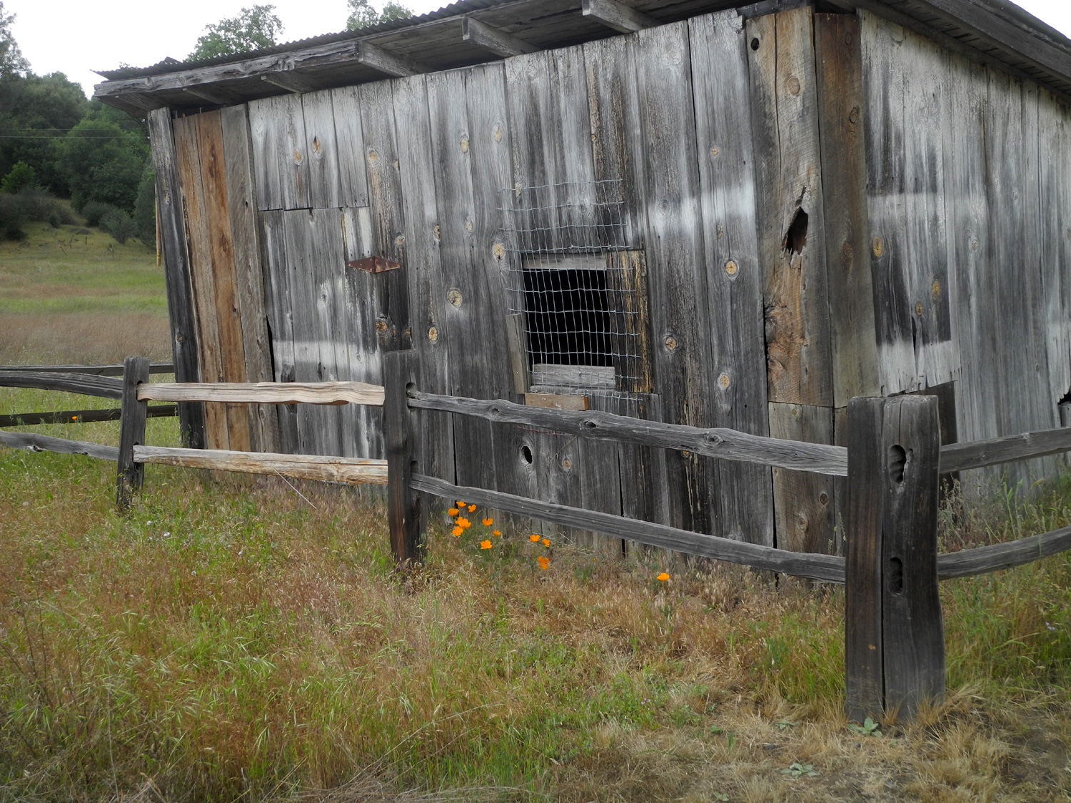
| No words needed | Jack with great grandma Jackie | Old barn in the park |
 |
 |
 |
| Resting on the bridge | Jack and Colton | Did Colton direct this pose? |
 |
 |
 |
| Yellow flowers and the pond | Poppies by the old shed | These lupines are at
their peak in the foothills |
| Related Links | ||
| Pine Flat Reservoir | Dick's Pine Flat Travel Reports | Sycamore Creek |
| Trimmer Springs Road | Brodiaea | Globe Lily |
| Farewell-to-Spring | More Abuot Farewell-to-Spring | Blazing Star |
| Pine Flat Reservoir | Bald Eagles | Big Creek |
| Big Creek Road | Chinese Ditch | Western Tanager |
| Goat Meadow Snow Play Area | Fish Camp | Fresno Dome Campground |
| Gray's Mountain Campground | Willow Creek | Fresno Dome Trail |
| A LONG Fresno Dome Hike | Fresno Dome from the Official Vista Point | Ahwahnee Hills Regional Park |
| Ahwahnee Hills May 2017 | Ahwahnee Hills April 2019 | Ahwahnee Hills March 2020 |