

|
Dicks' Adventures of 2017 - Part 3 |
||
|
San Joaquin Gorge Bridge & Ridge Trails Pine Flat Road Trip Sycamore Fire Road |
||
|
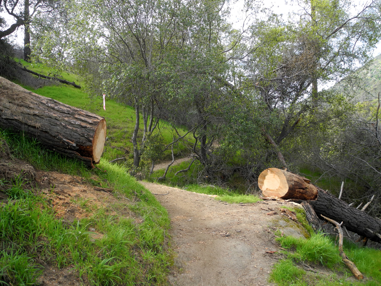
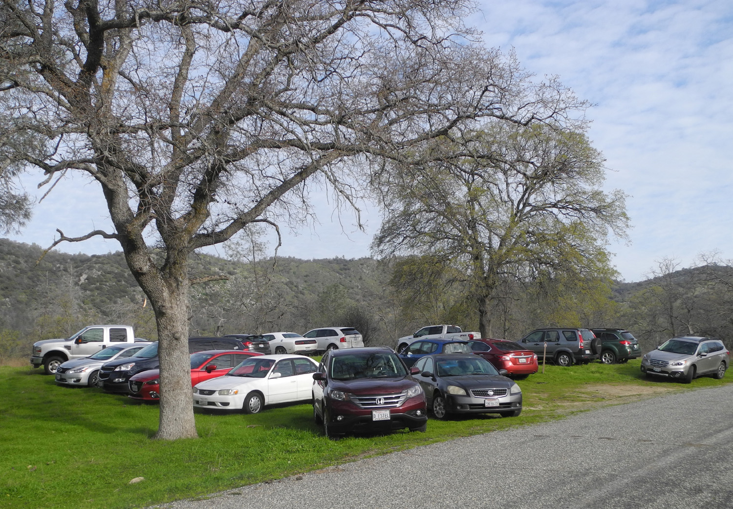
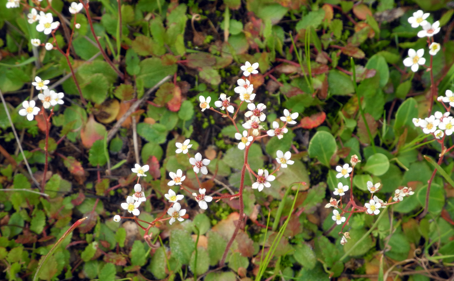
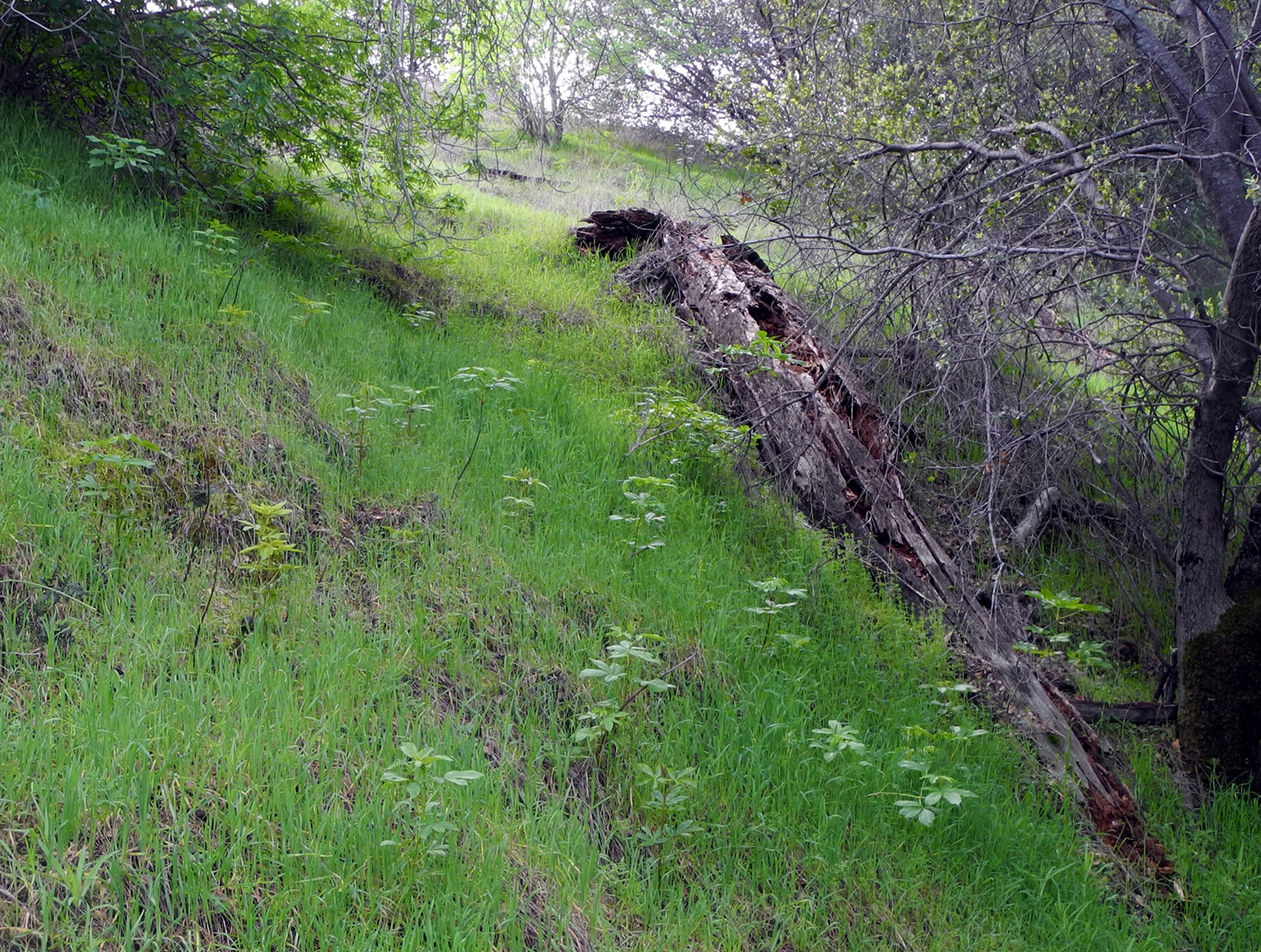
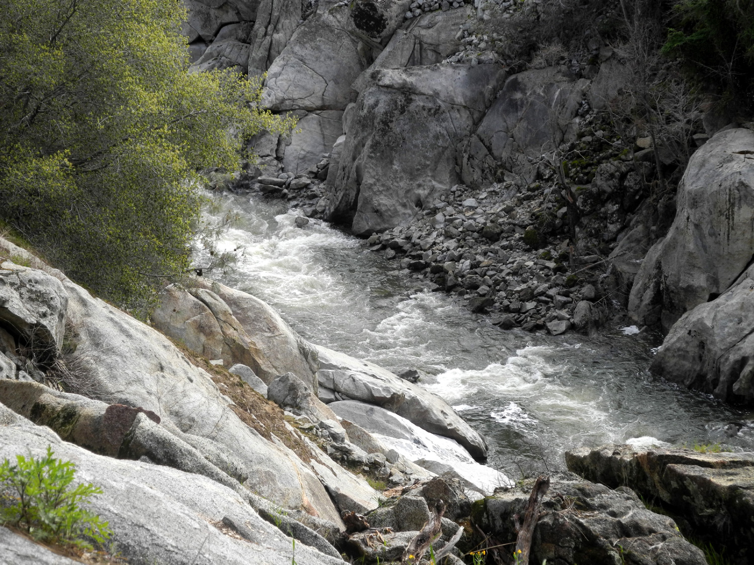
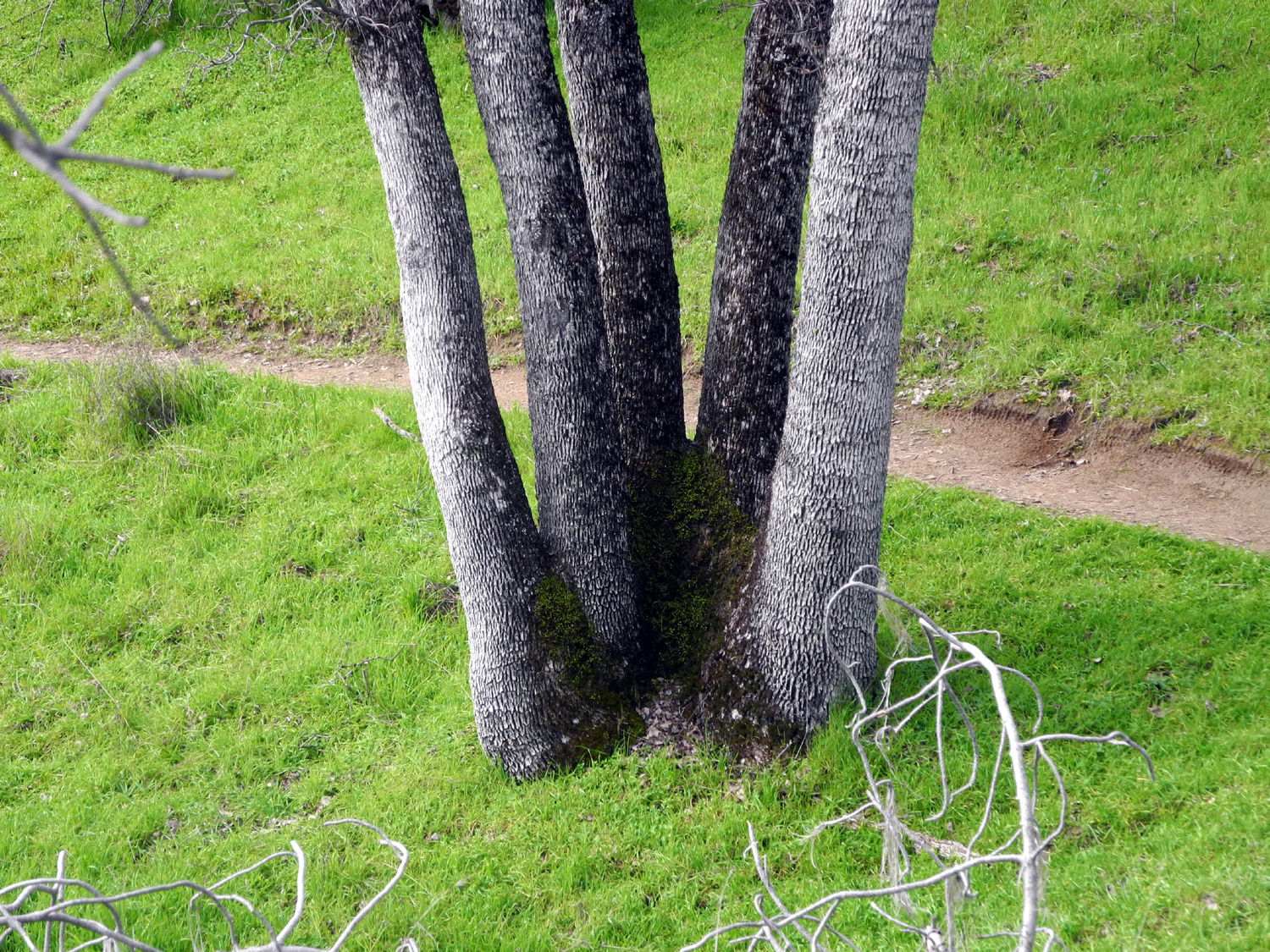
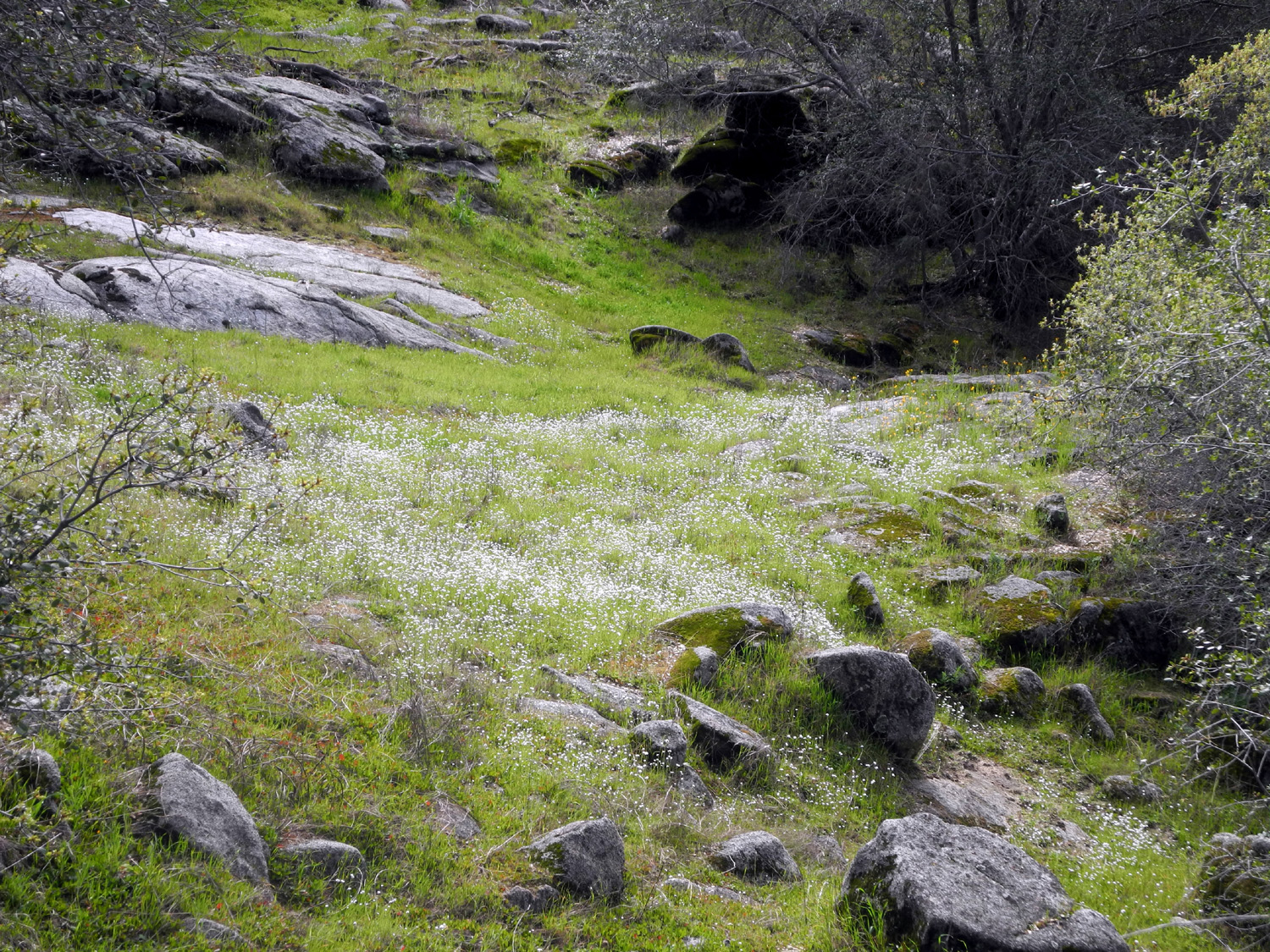
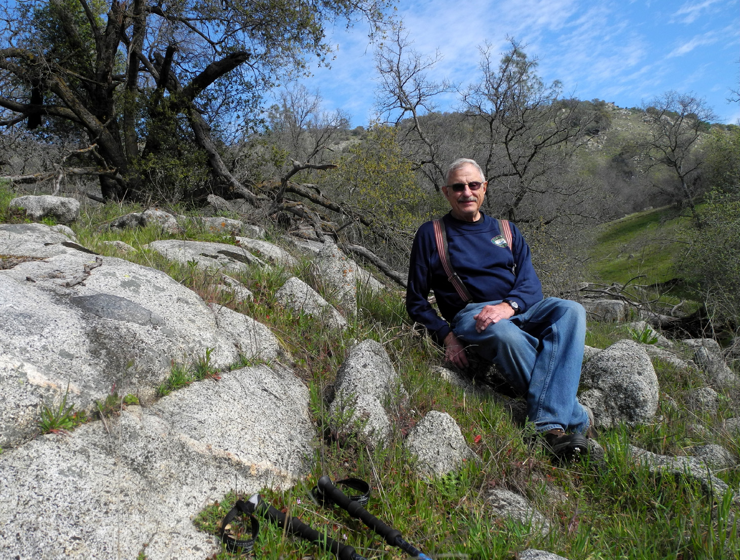
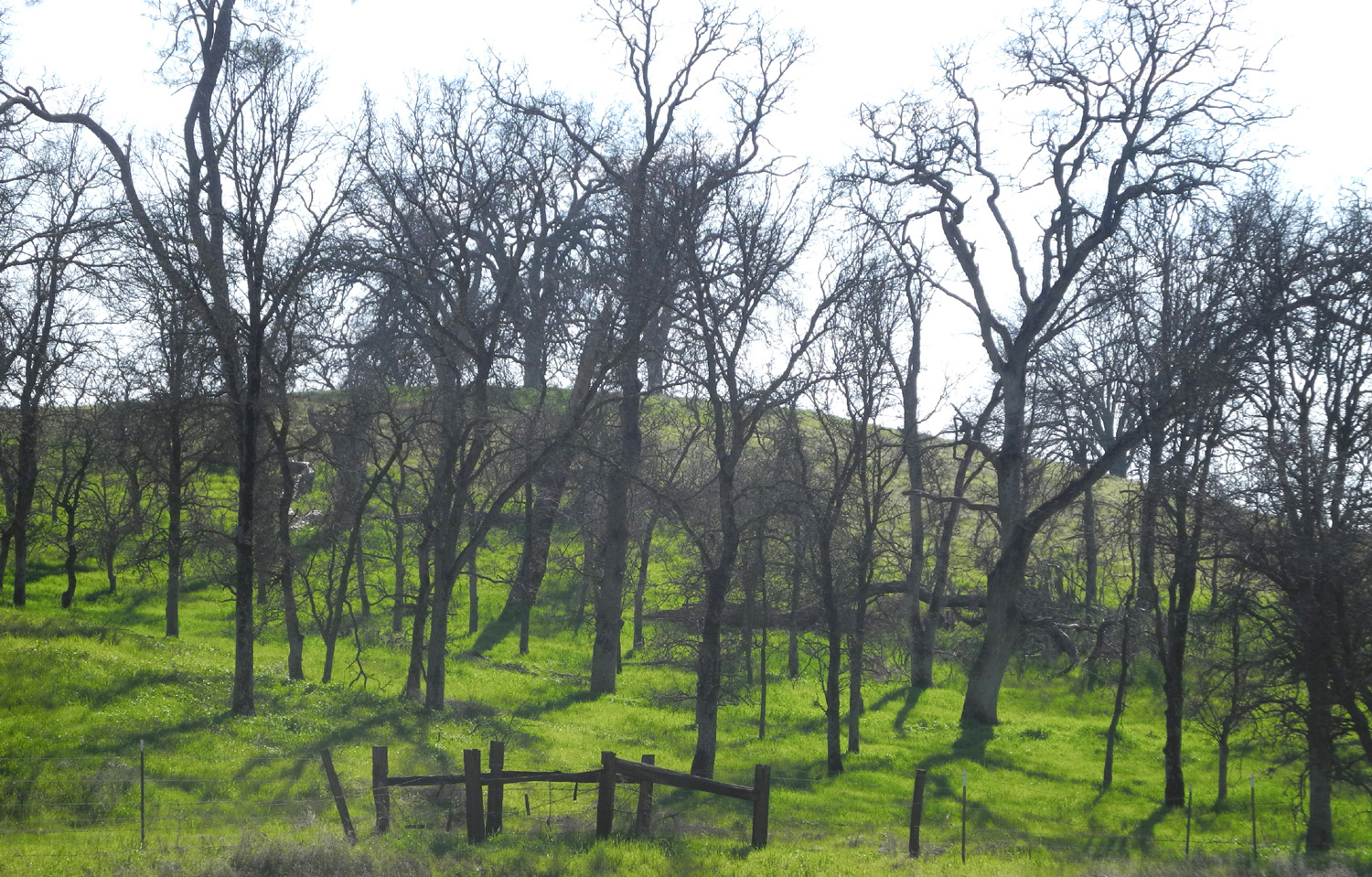
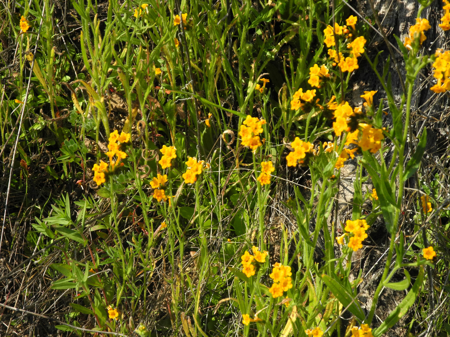
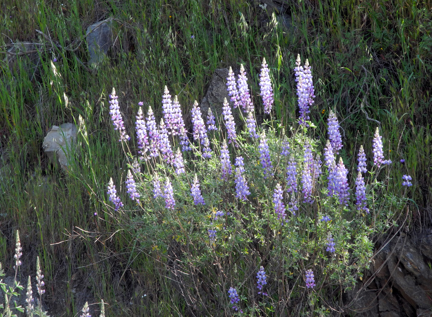
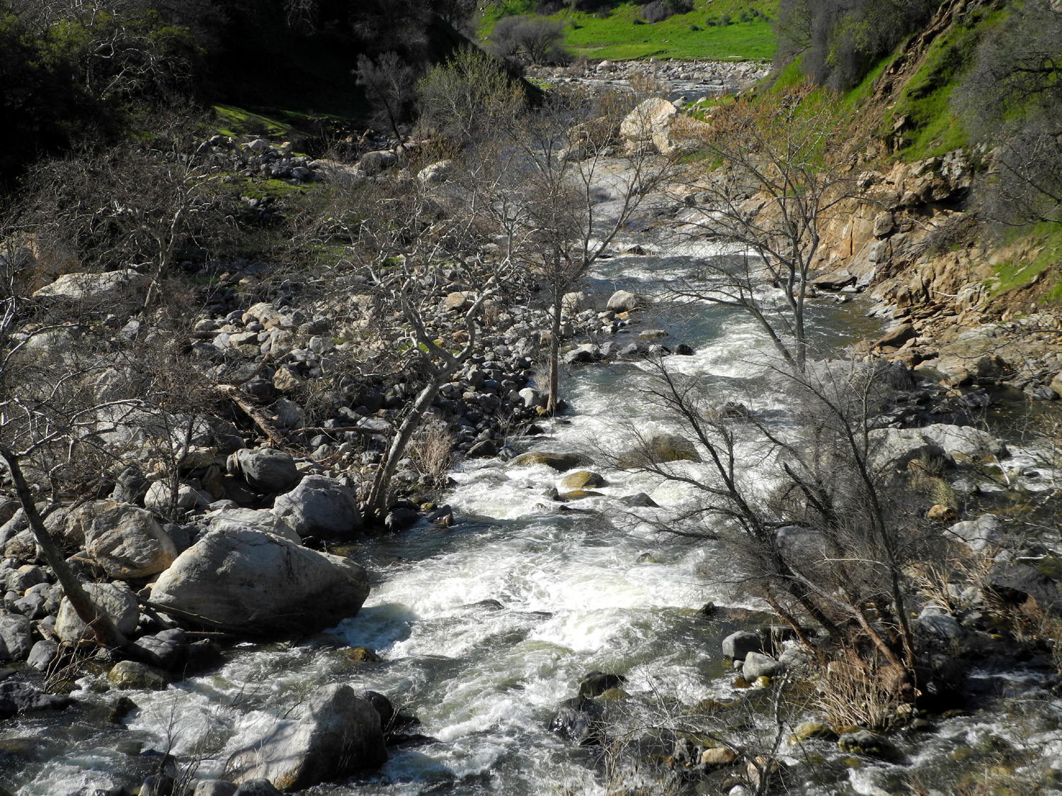
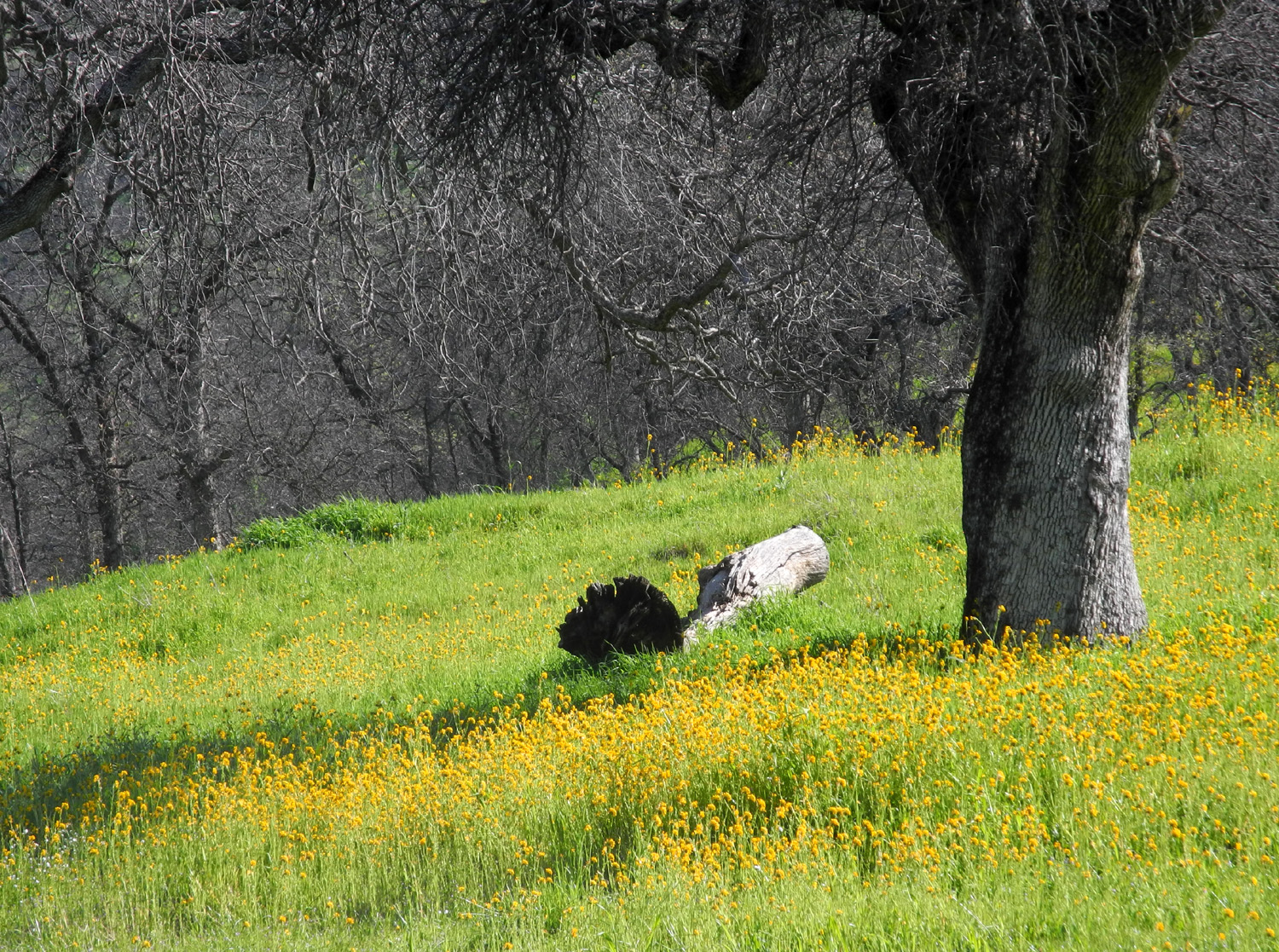
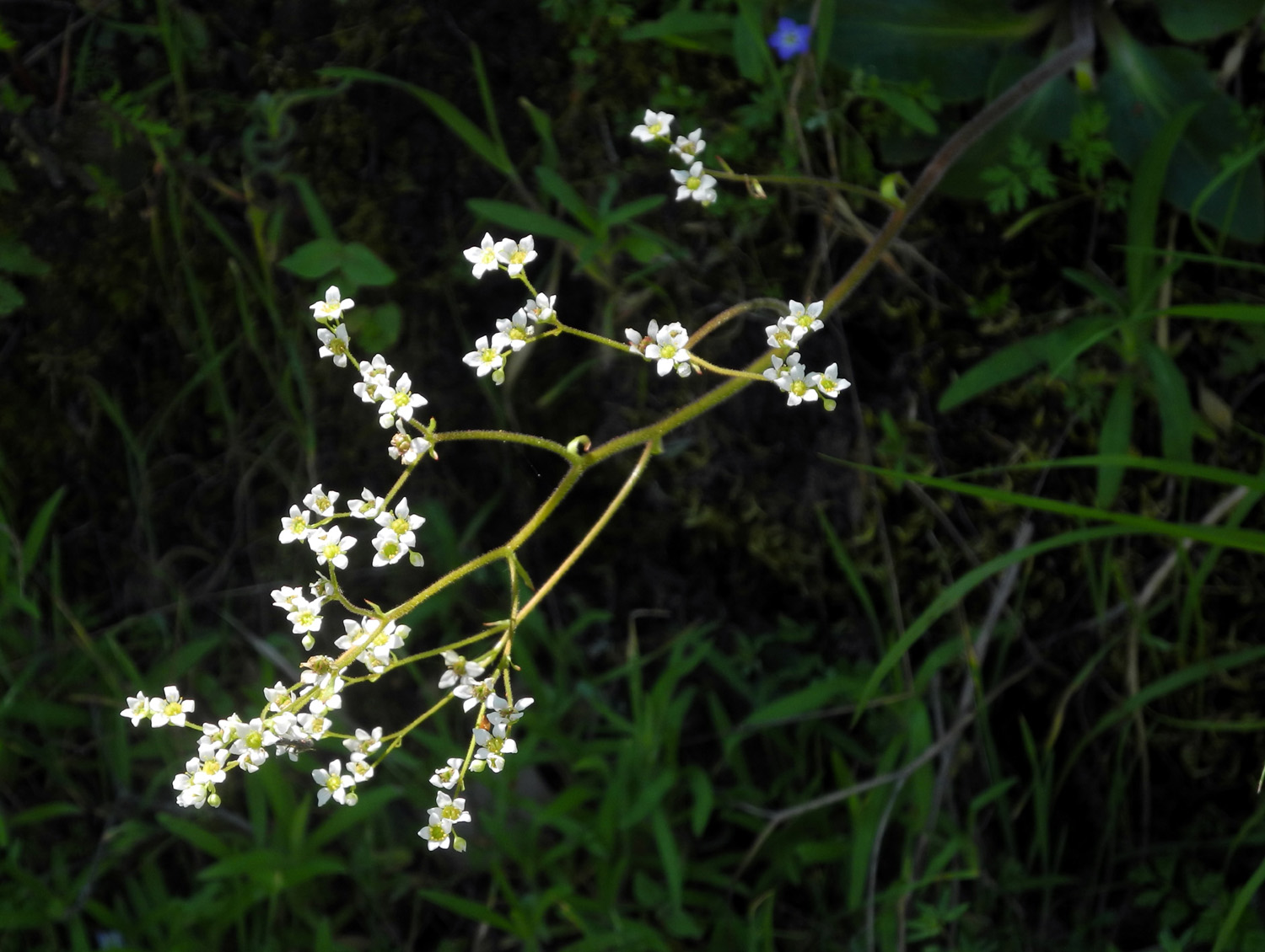
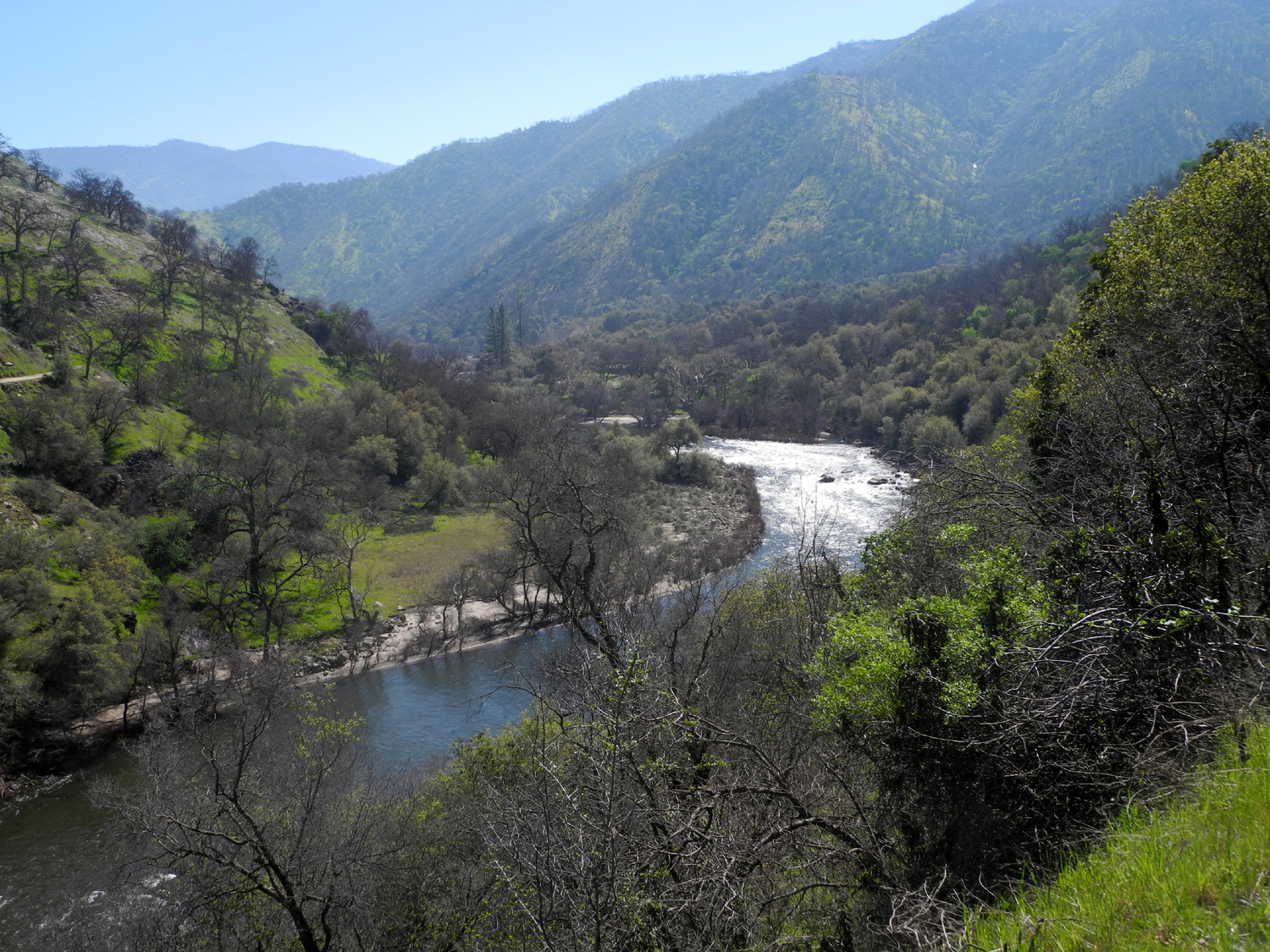
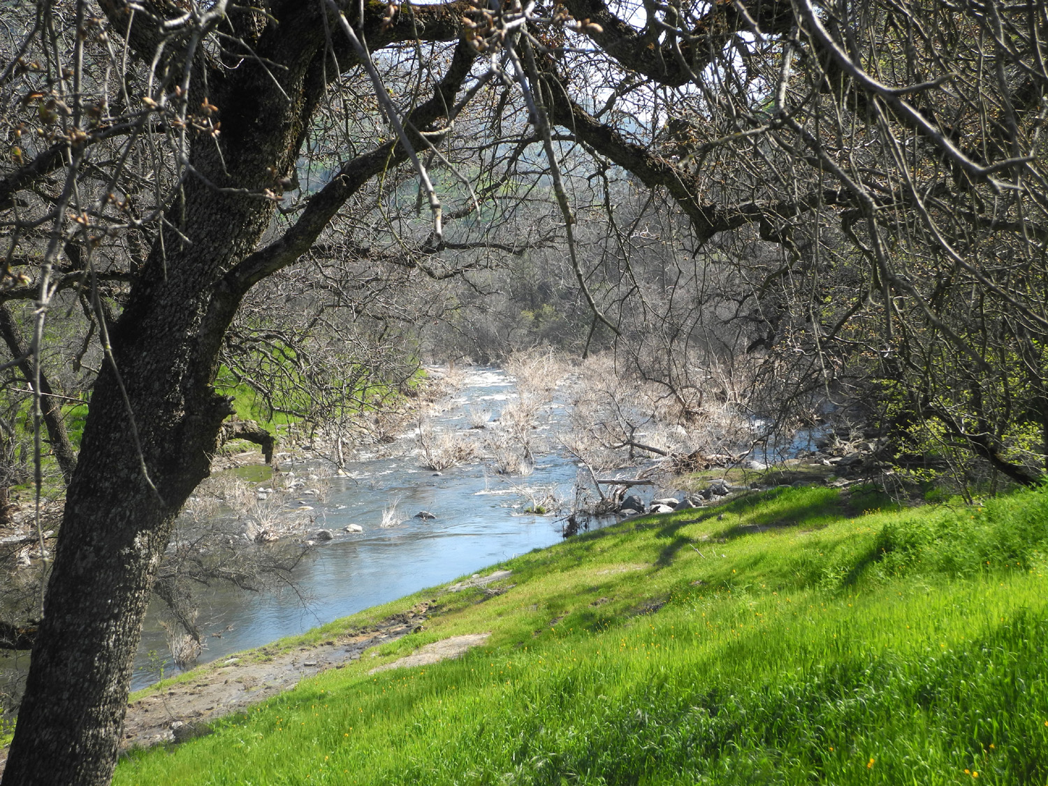
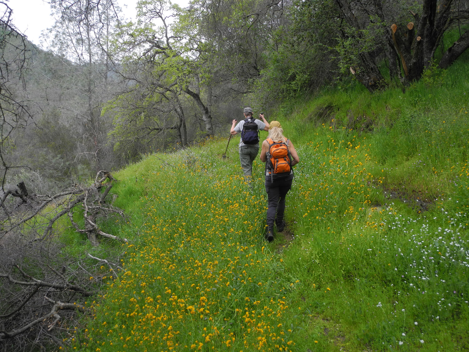
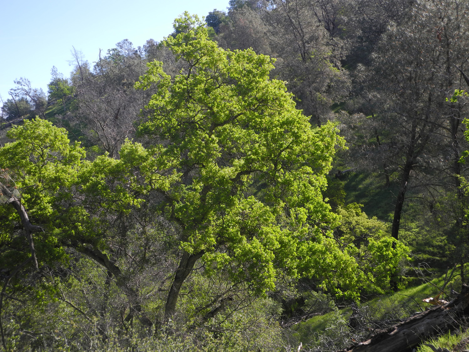
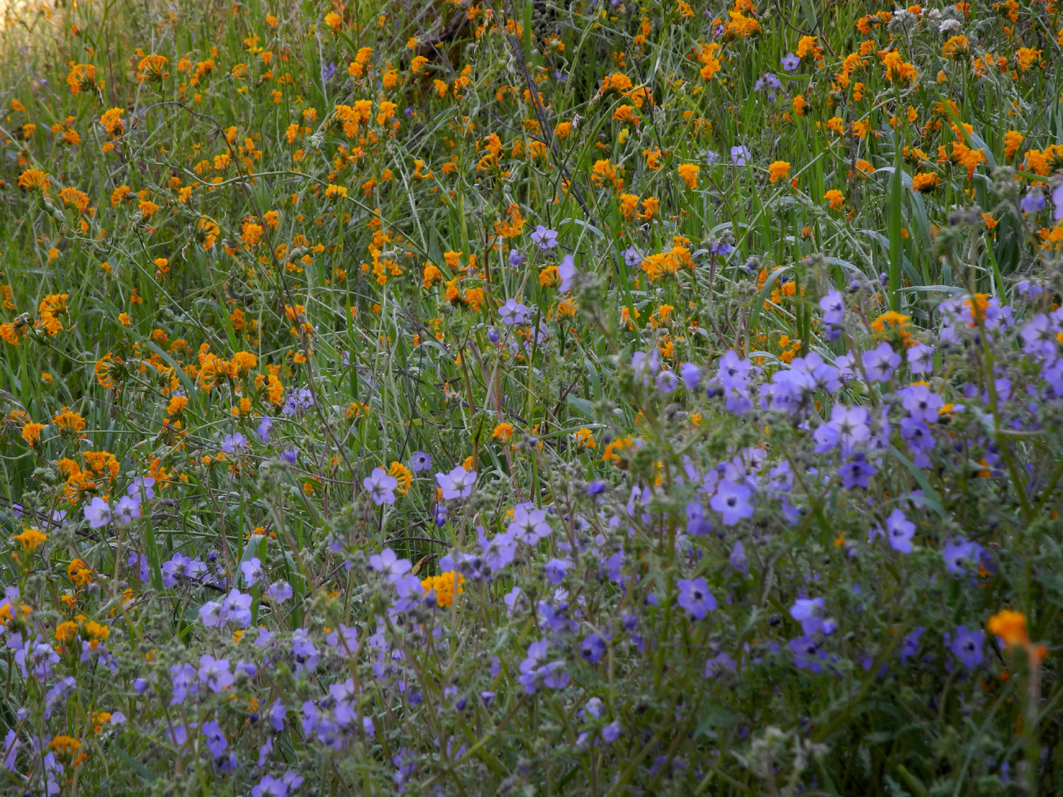
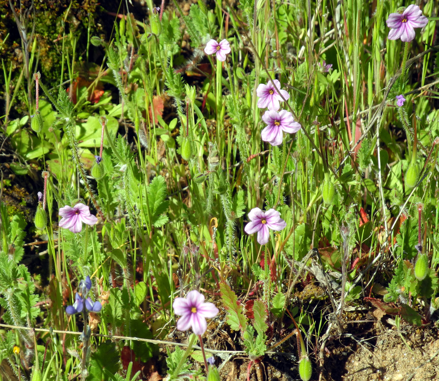
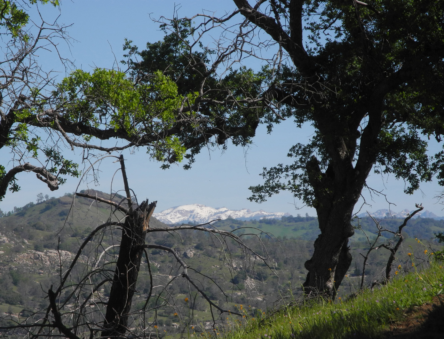
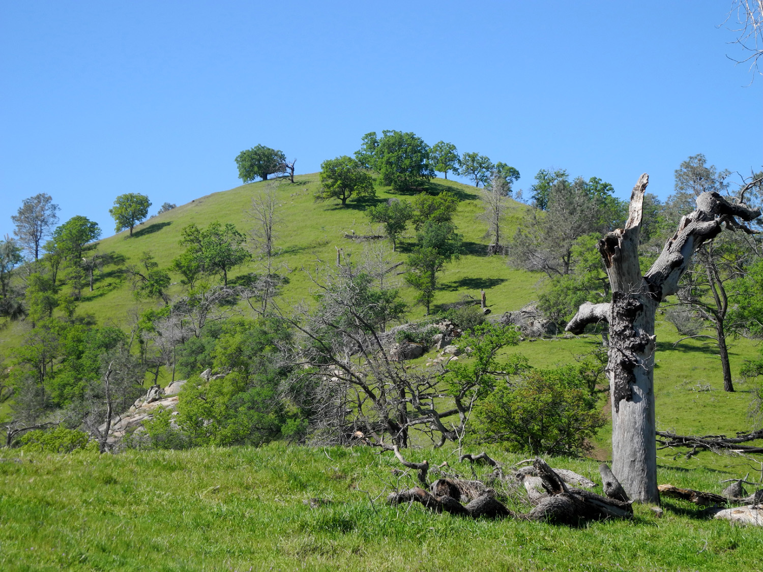
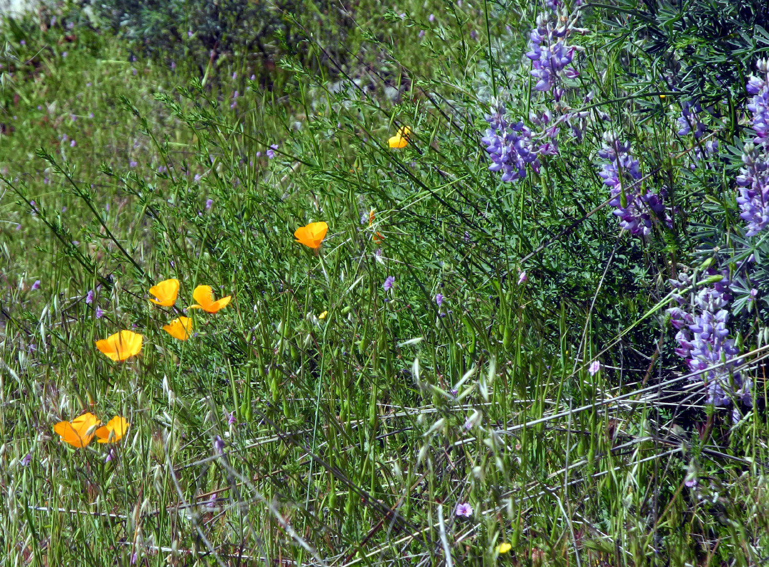
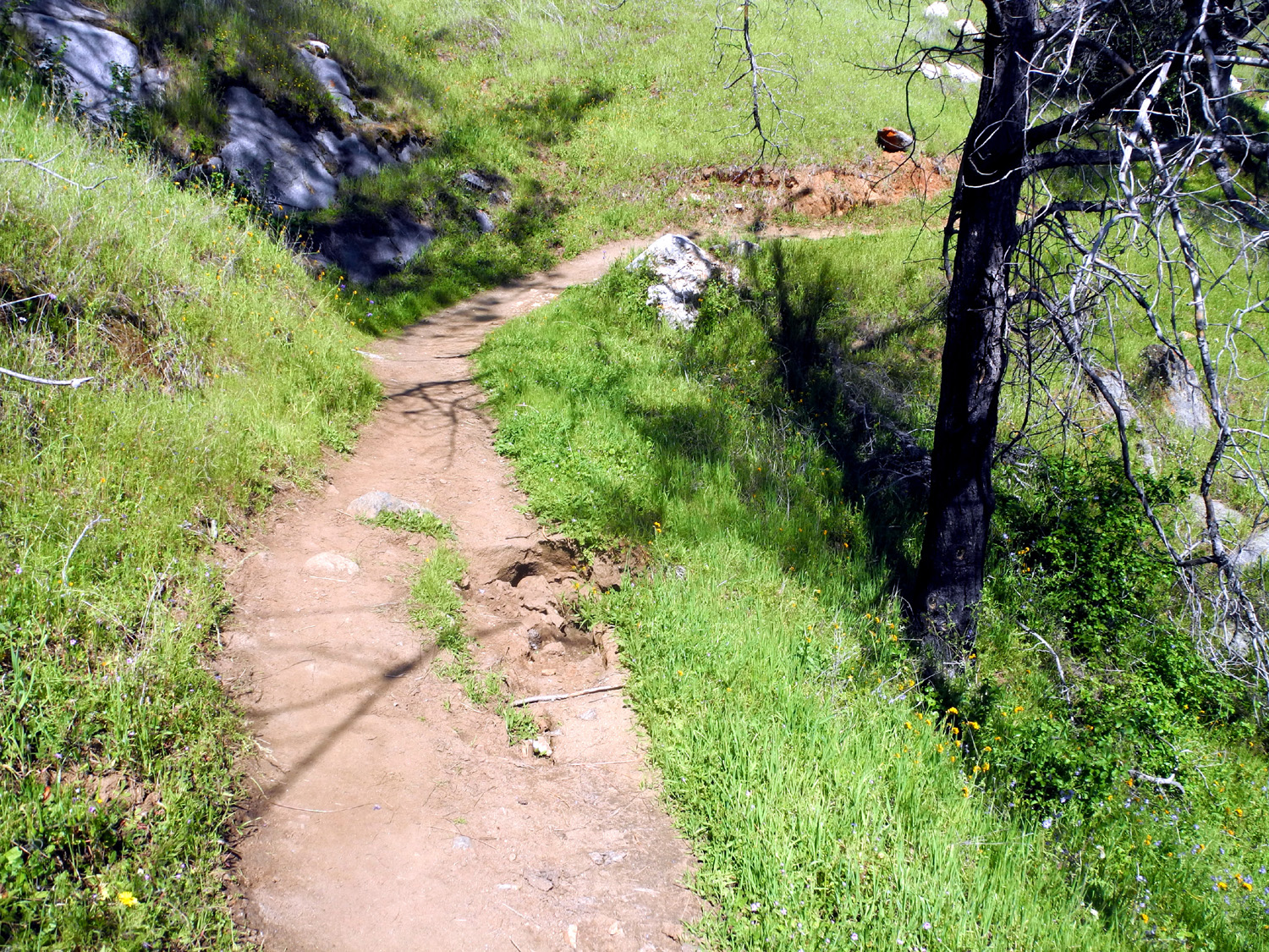
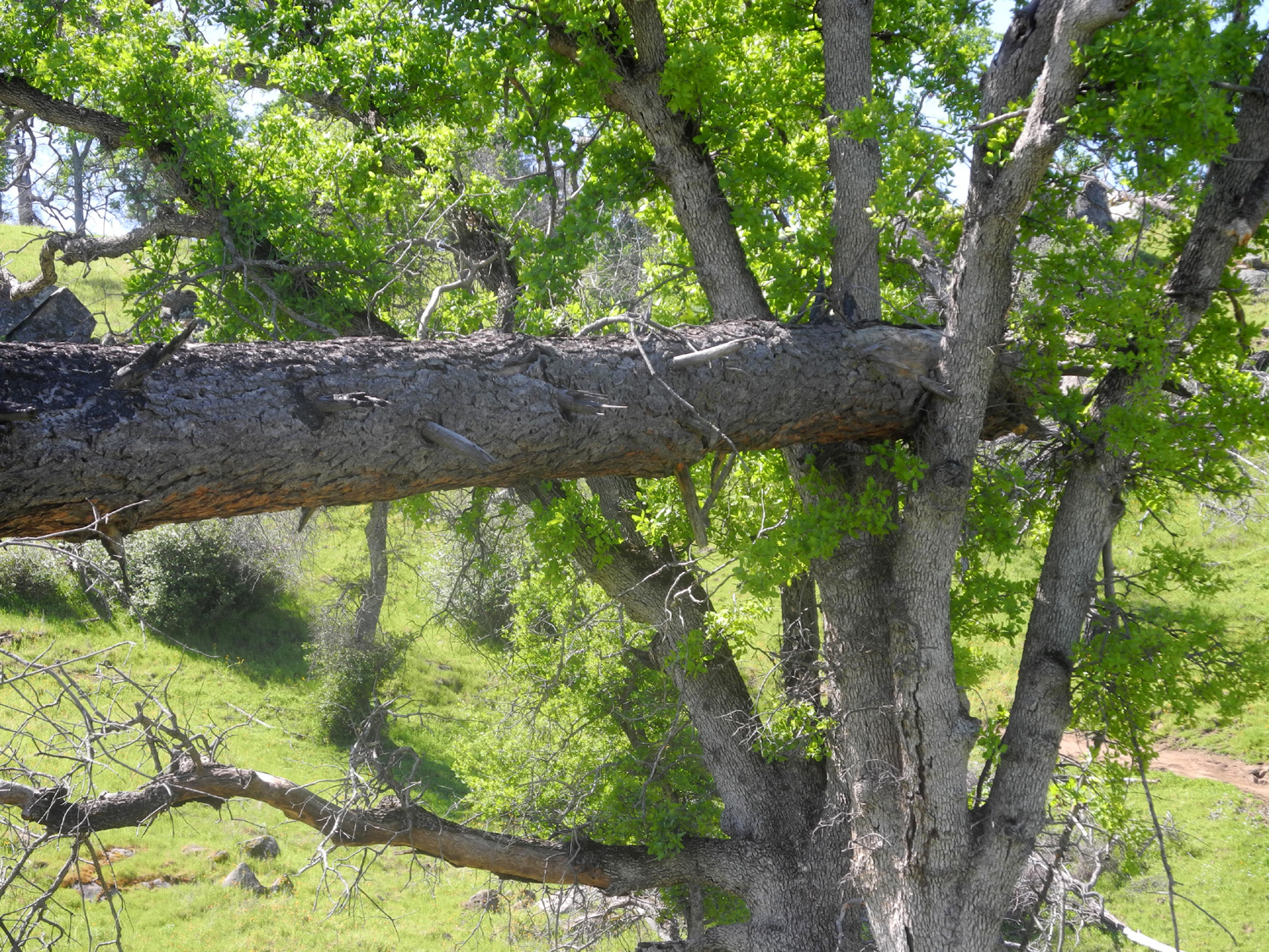
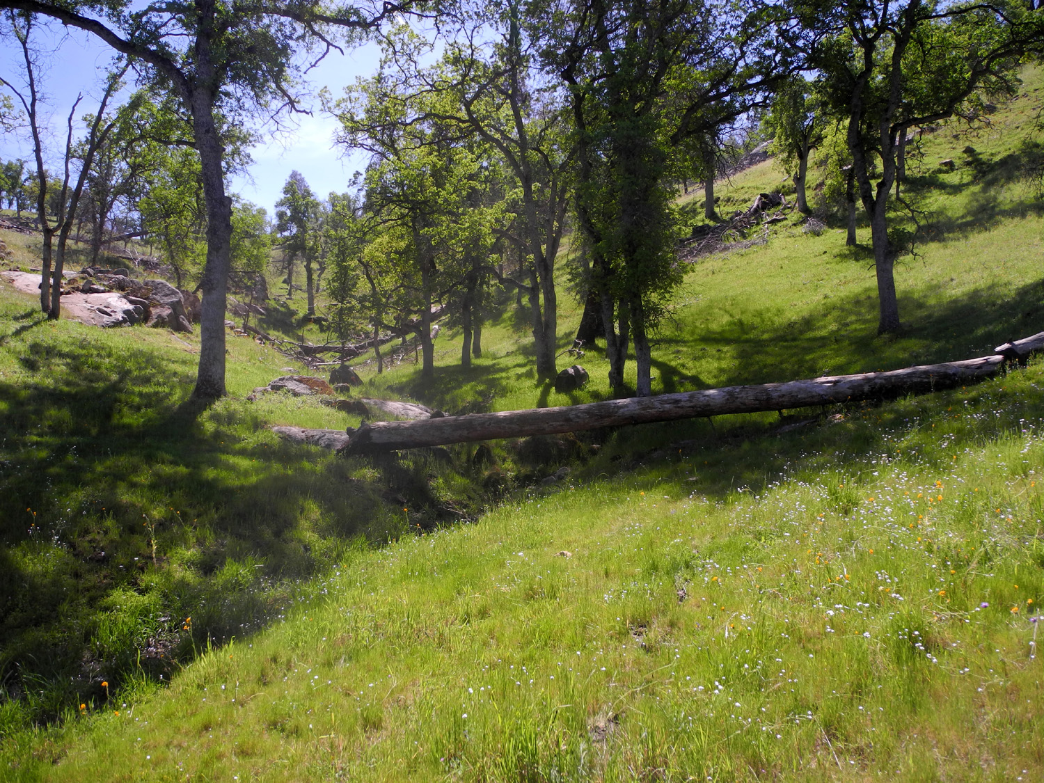
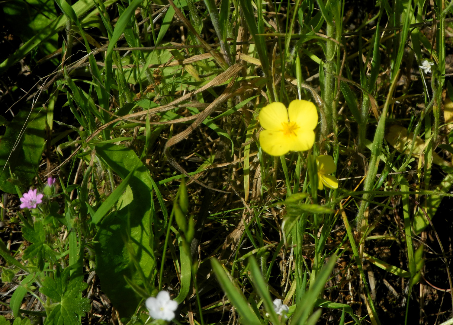
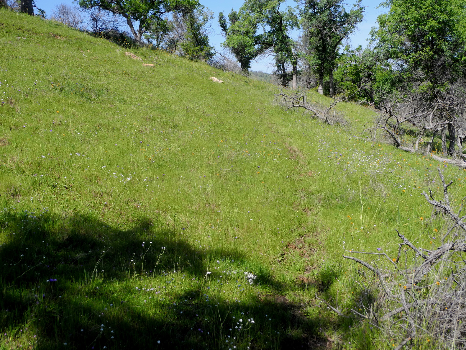
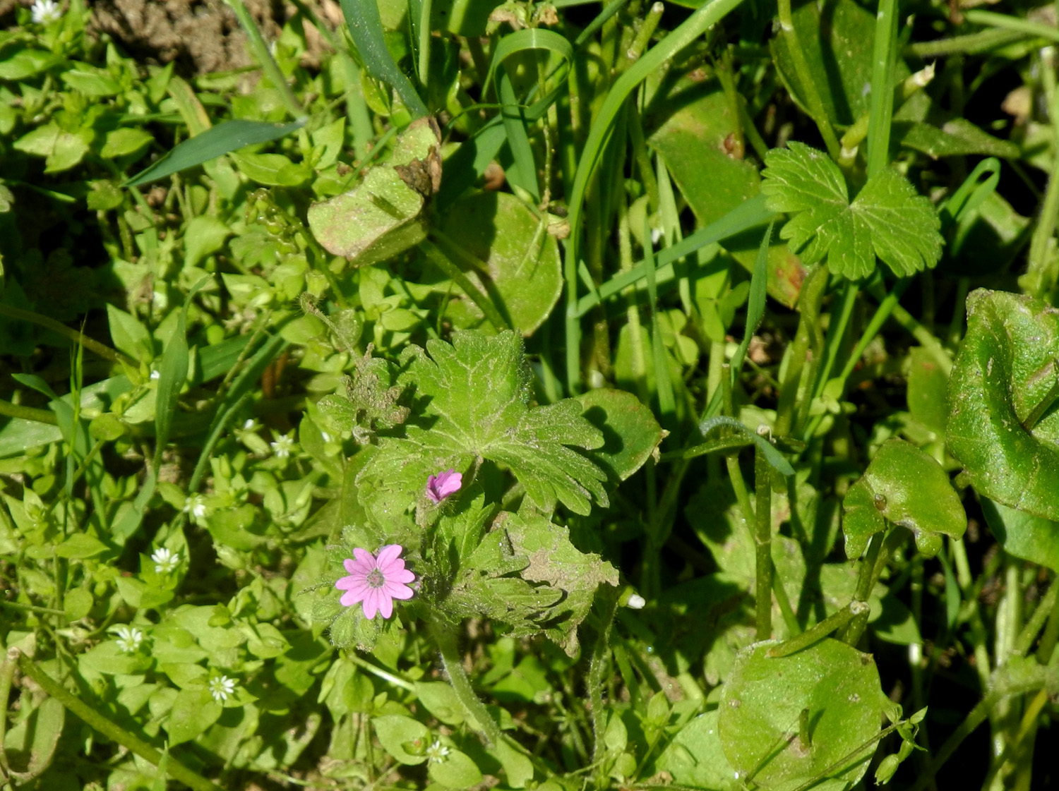
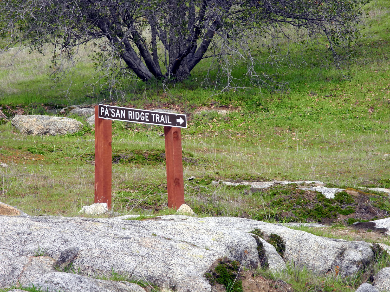
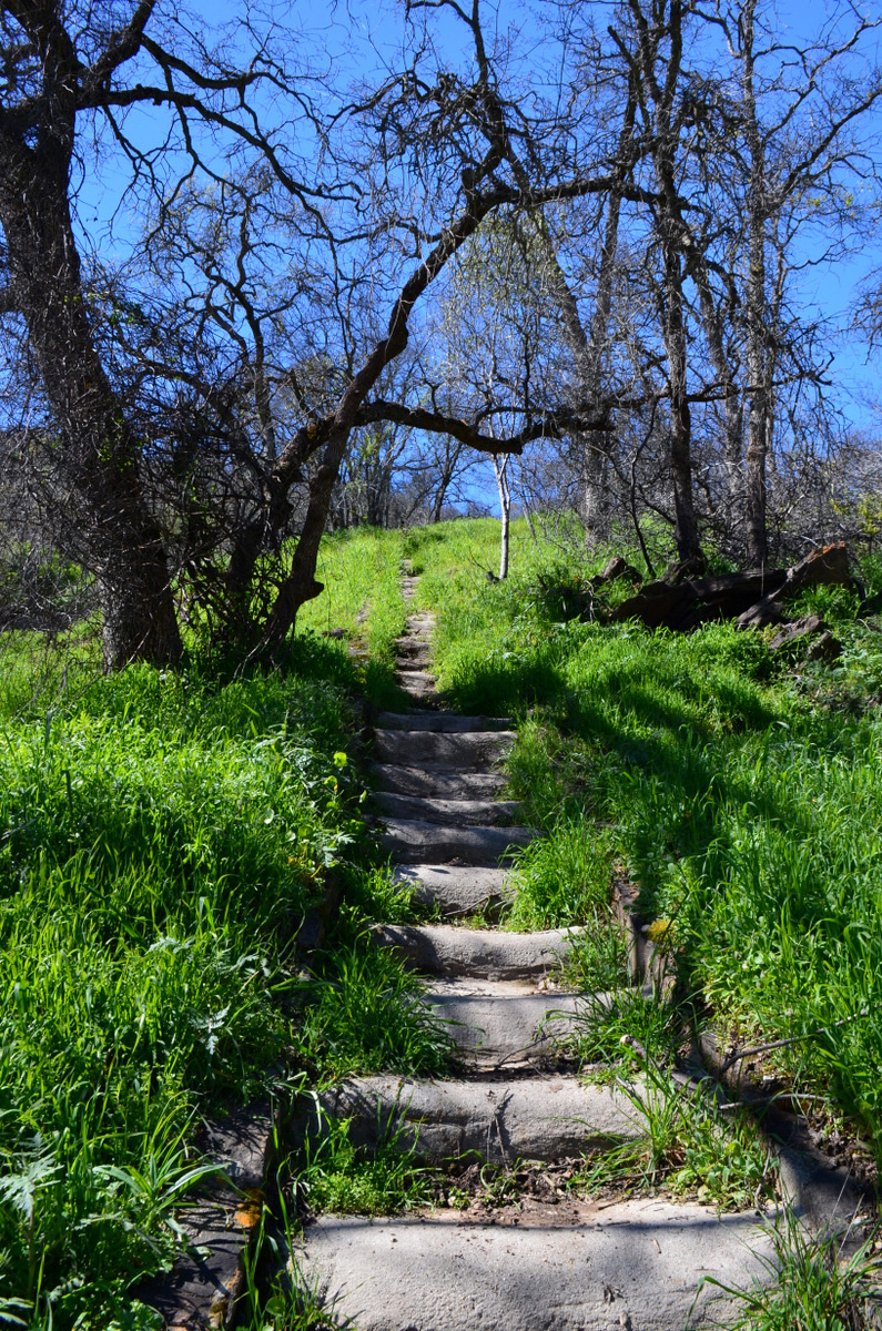
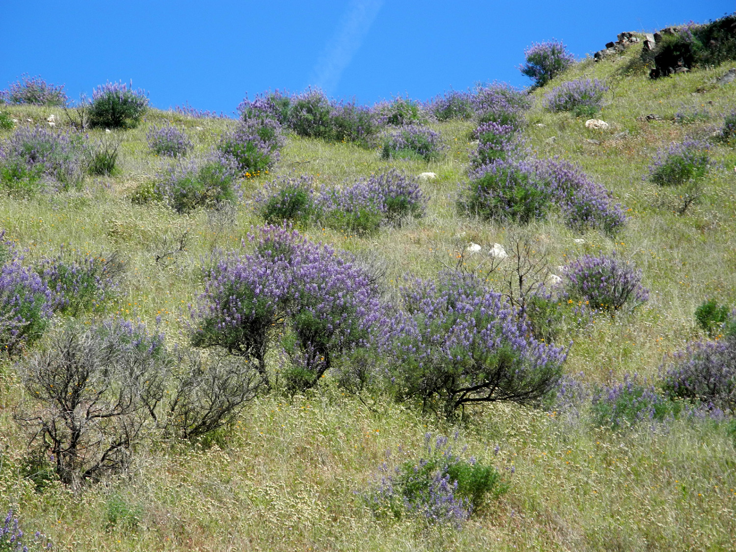
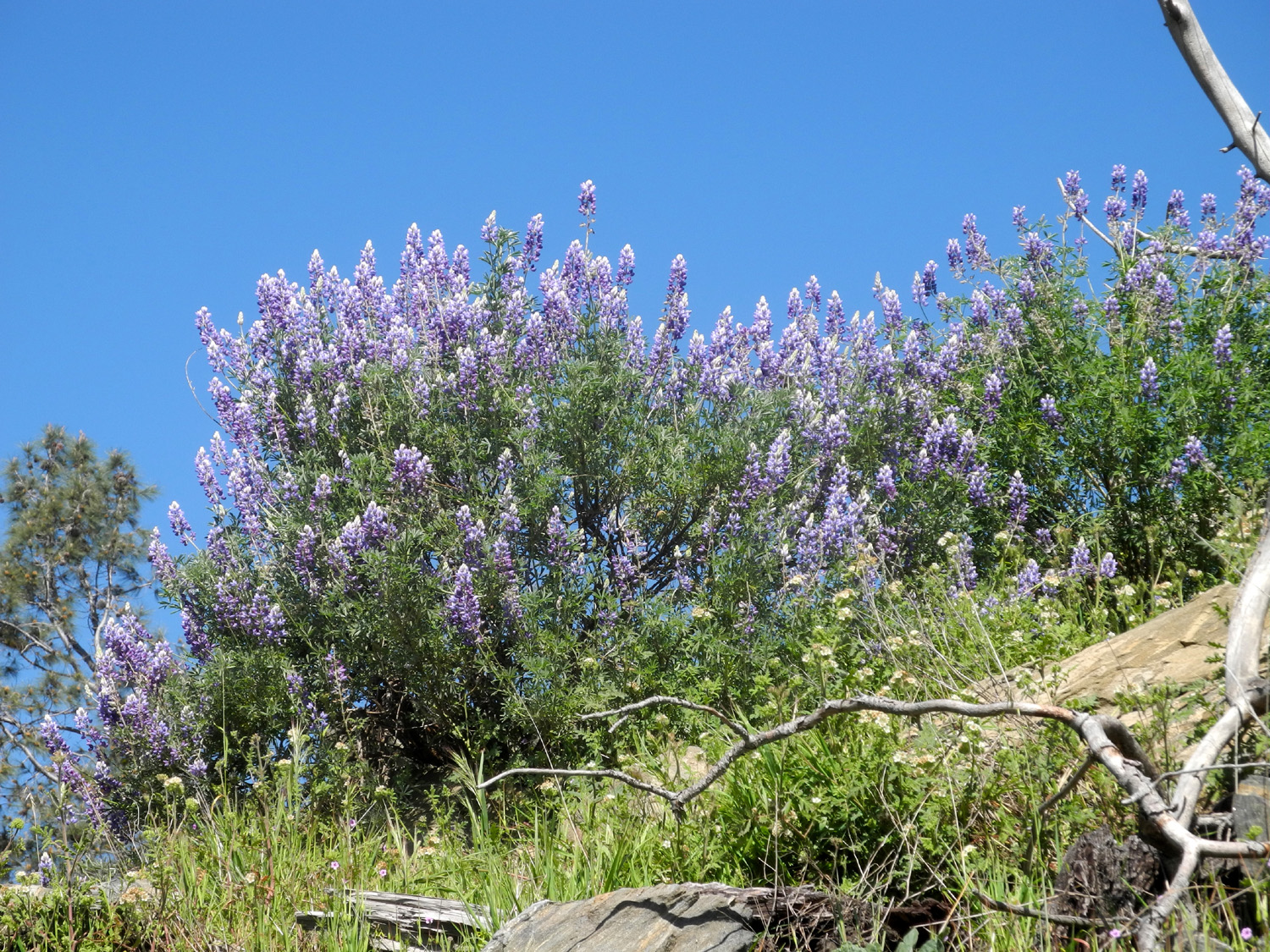
San Joaquin Gorge Bridge & Ridge Trails On March 4, just a week after my last visit, I returned to the San Joaquin Gorge for some hiking. What I did not know was that a run was being held, and there were dozens of people there, maybe even a couple hundred. The group camping area and grass and dirt across the road from it were full of cars, the main parking lot was full, and there was an "overflow lot" in the grass about 200 yards past the main lot that had room for one or two more cars when I arrived. When I got back from my hike, there were six cars parked along the road in this area, and the official lots were still full. The crowded conditions made the first part of my walk, from trailhead to bridge, very unpleasant. I was constantly meeting or being passed by runners, so had to walk to the side of the trail, often on sloping sections where I did not feel safe. When I first heard of people using mountain trails for running I thought it was a bad idea, and this experience cemented that view. These trails are just not made for this type of use. Of course, the scenery was fantastic, and there are many more wildflowers than there were just a week earlier - massive amounts of popcorn flowers and fiddlenecks, and good numbers of shooting stars and baby blue eyes. Bush lupines are just getting started, and there are blossoms on some of the manzanita bushes. All the little creeks that have been dry most of the time the last four years or so are running, and there were a few wet and muddy spots. This is going to be a standard situation on the trails for the next couple of months. However, my path today was MUCH less wet and muddy than the San Joaquin River Trail where we walked a week earlier. Just beyond the bridge the trail forks. The Pa'San Ridge trail runs toward the east, then loops around and joins the other trail. The entire loop is over seven miles, and a very few of the runners were going the entire distance, but 99% of them turned back at the bridge. I had already planned to take the ridge trail, but not the entire length of course. It's always my goal to go a little farther than I did the last time, although I suppose there is a point where going farther will turn out to be more than I am willing or able to hike. On this day I was glad to get beyond the crowds, and began to enjoy my hike as I crossed more creeks, saw a few more species of flowers, and enjoyed the beauty of the foothills. As should be expected with wet ground and lots of dead trees, some have fallen across trails everywhere I've been. On the Bridge Trail a large pine tree had fallen, but a section had been cut out to allow passage. However, the chain saw crew still has more work, since there was another tree on the Ridge Trail that had not yet been cleared. In these places, detour trails develop, but of course they are not designed for easy walking, and usually require a short, steep climb up or down the hillside to get past the obstacle. There were two such trees on the San Joaquin River Trail when we walked there a week earlier. I could not remember exactly where I turned back the last time, since I have walked this trail three or four times in the last few years. However, I'm 99% sure I went farther than before, and this time I took pictures to mark the turnaround spot. I also found a nice resting rock and enjoyed a snack, which I definitely needed. After resting a while, I started back to the bridge, then up to the trailhead. I was glad to see that virtually all the runners were done and hiking was back to normal. At the bridge I talked with two women who were making their first visit to the area, and they asked when was the best time to come there to see flowers. My answer was "every two weeks till May," as I explained that different flowers take their turn throughout the spring, and there's always something new to see. Of course, there are still flowers in May and beyond, but the grass is drying out and temperatures are pushing close to 100 degrees. Back at my car, I got out a folding chair and my ice chest, and enjoyed lunch before heading for home. My hike totaled just over three and a half miles. When I got up, it was mostly cloudy in Clovis, and I was afraid I would be hiking in cold, cloudy conditions. However, it turned out to be a fantastic day, mostly sunny with a few clouds, and quite warm. On my walk back up the hill, it was t-shirt weather. I made one photo stop on the way home. Where Millerton Road comes in from the east to join Auberry Road, there is a big stand of bush lupines against the bank. They are in full bloom at this location, while in other places they are just budding out. It also proved to be a good place to observe a forest of blue oaks on the hillside across from the flowers. As the long list of reports about this area show, this is one of my favorite spots, and I plan to return near the end of March with the Ramblers, as well as another two or three times on my own or with other hikers.
|
||
| Other San Joaquin Gorge (Squaw Leap) Reports | ||
| Four 2012 Squaw Leap Hikes | 2012 Bridge Trail Hike | 2013 San Joaquin River Trail Hike |
| 2014 San Joaquin Gorge Campout | 2014 River Trail Hike | 2015 River Trail Hike |
| Thanksgiving at the Gorge | 2016 Bridge Trail Hike | 2016 February Campout |
| 2016 March Campout | Rambler Hike 2015 | Rambling in the Rain 2016 |
| Squaw Leap Backpack March 1980 | Backpacking 1981-82 | Backpacking 1982-83 |
| L/S Expedition | Backpacking 1984-93 | The Last Backpack Trip |
| 2016 Buzzard Road Hike | 2016 San Joaquin River Trail | 2017 Off-Trail Hike |
| February 2017 Camping | Bridge and Ridge Trails 2017 | Ramblers Hike 2017 |
|
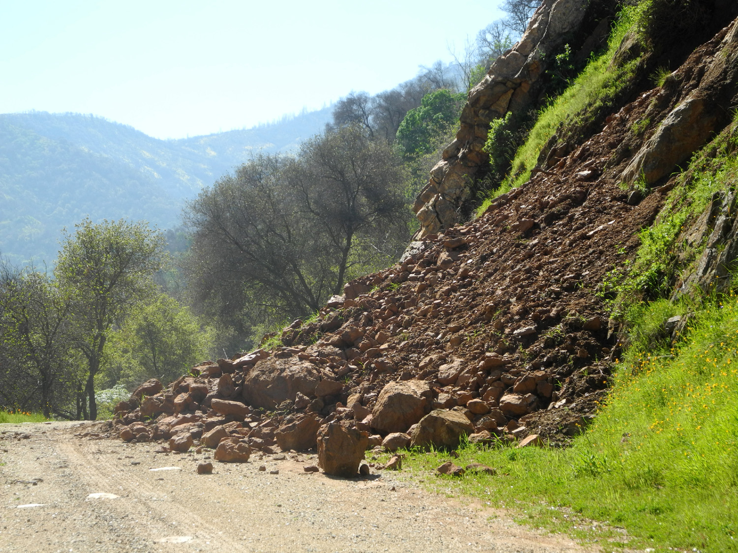
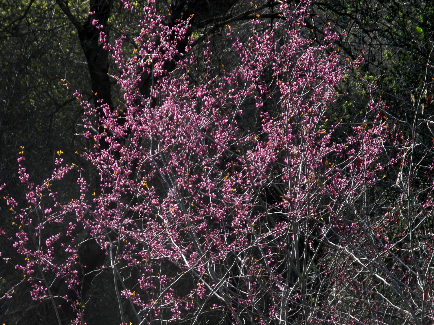
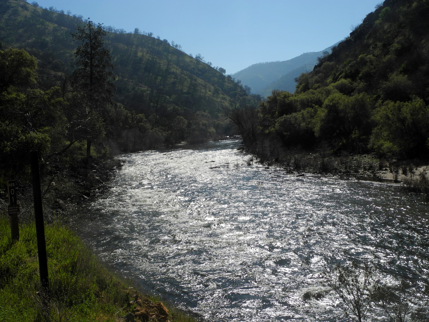
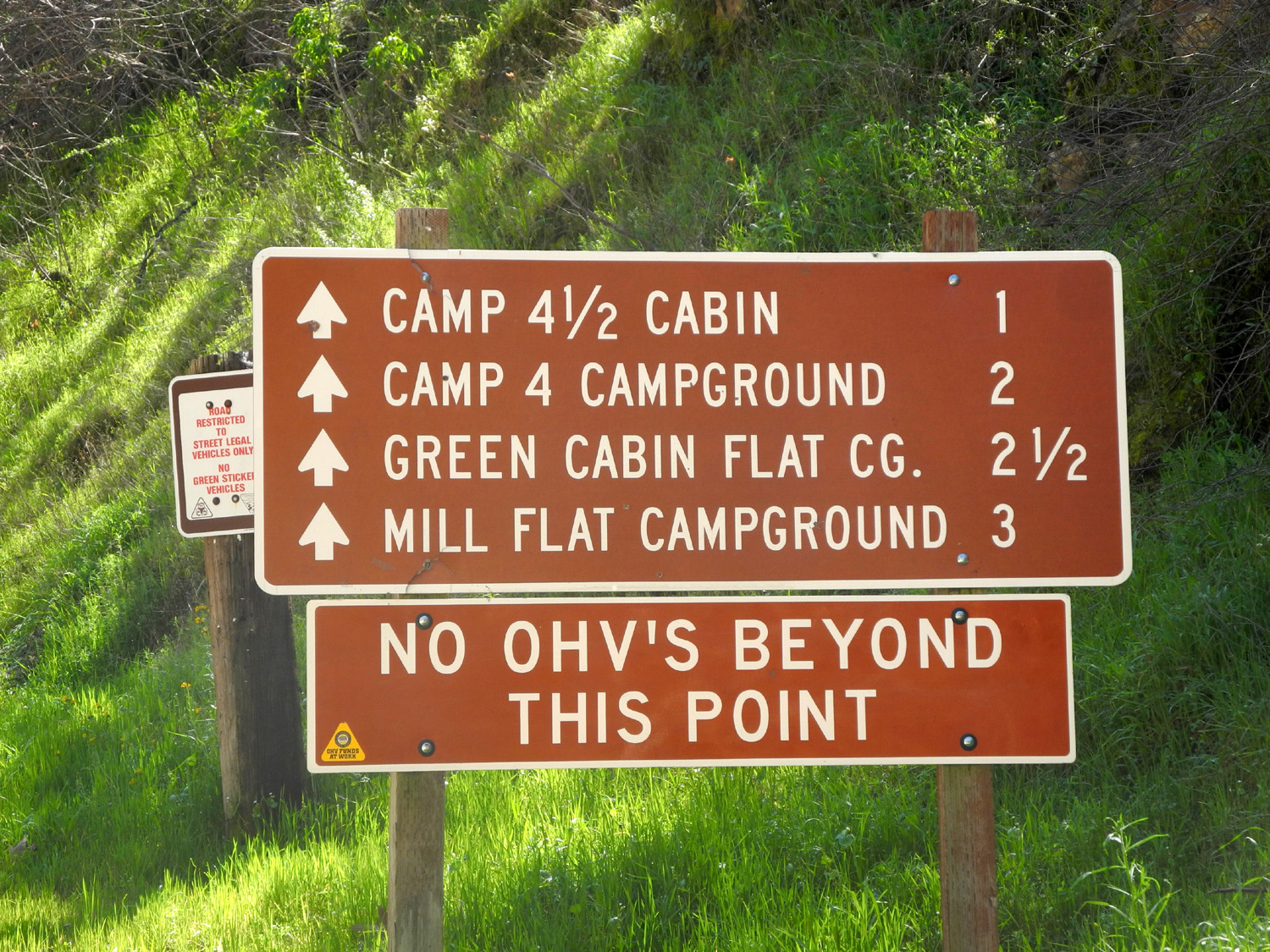
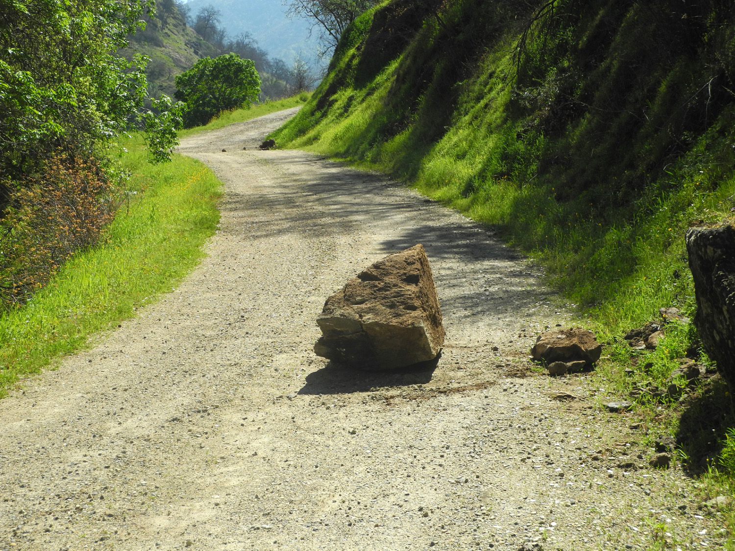
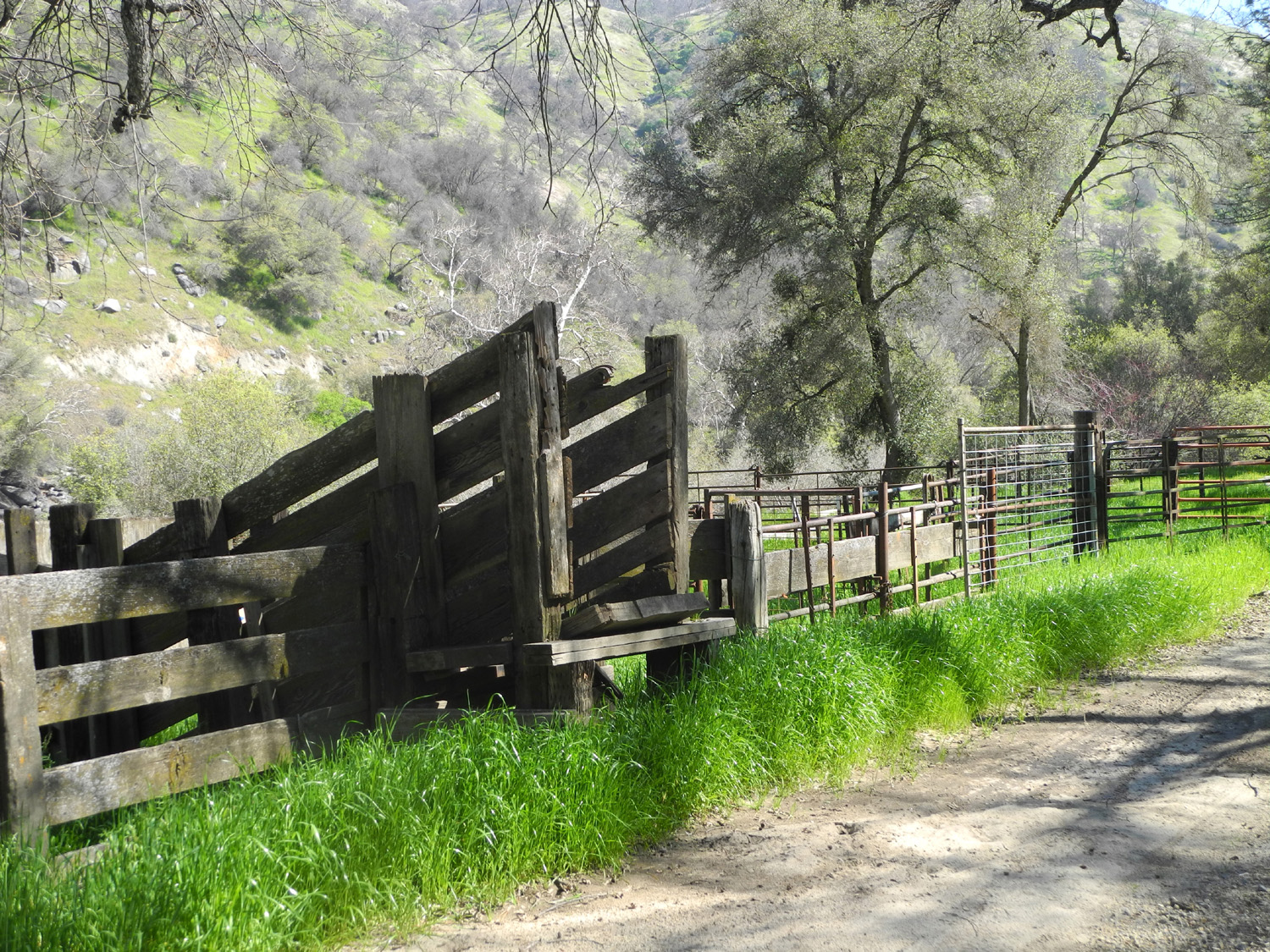
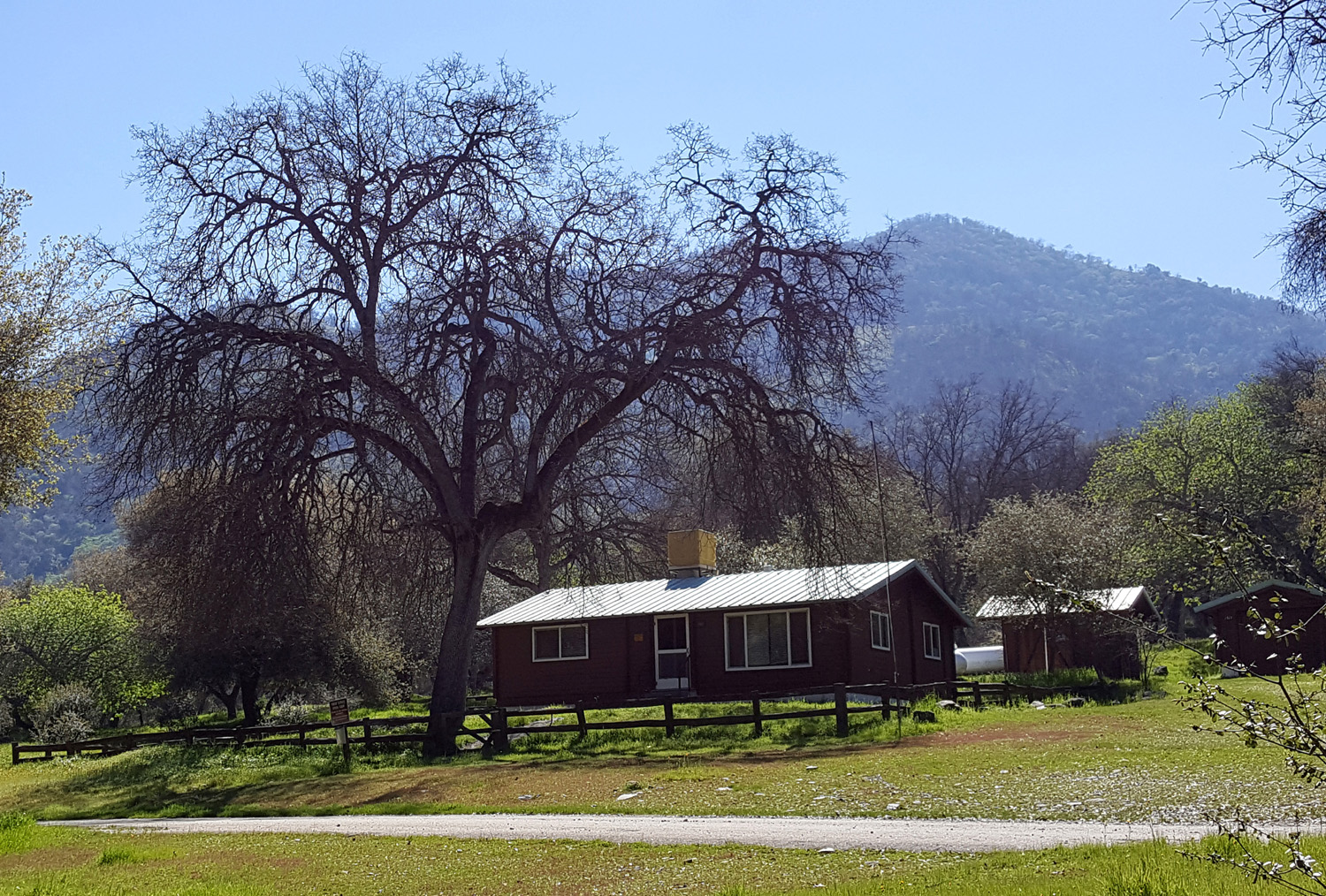
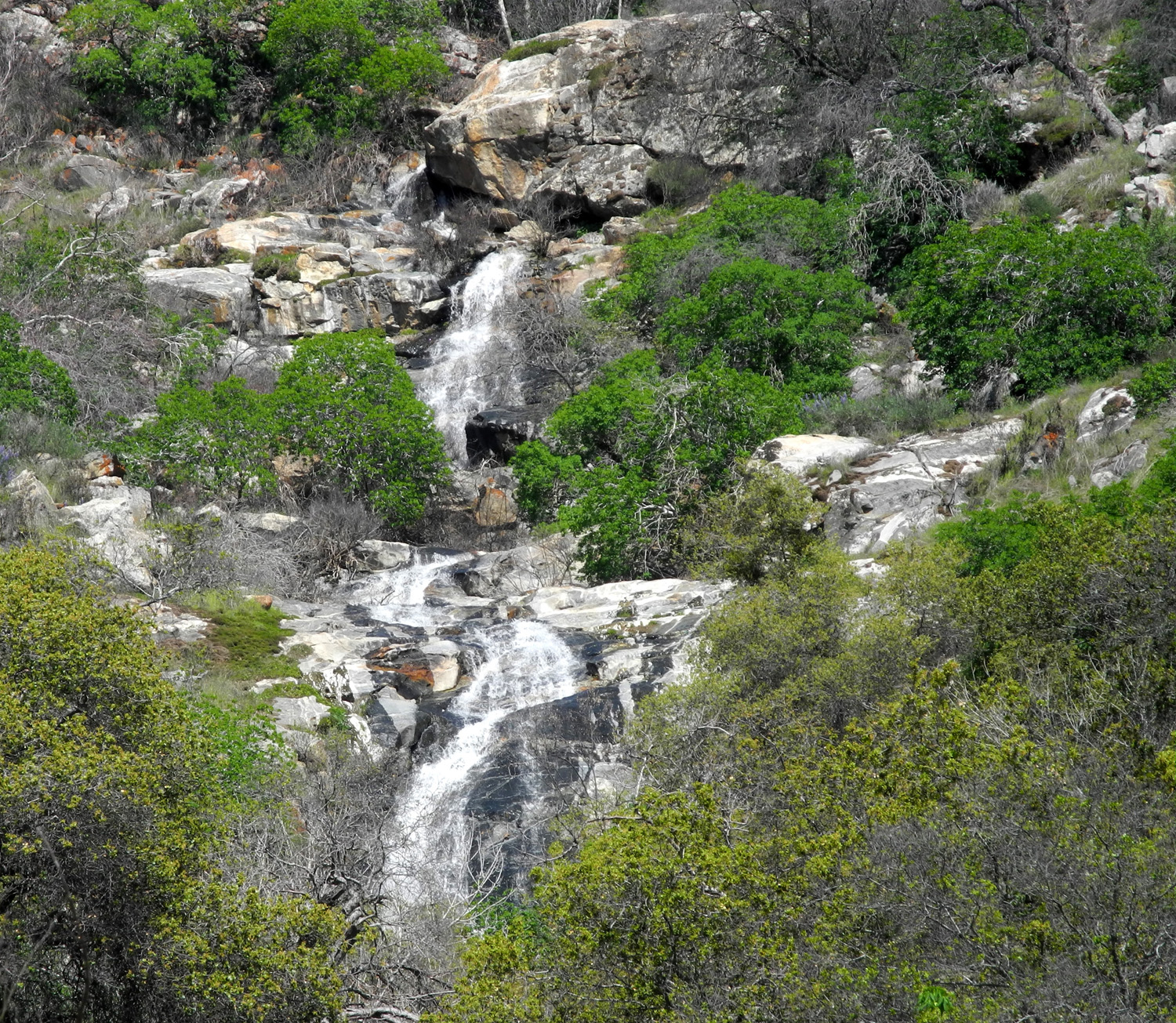
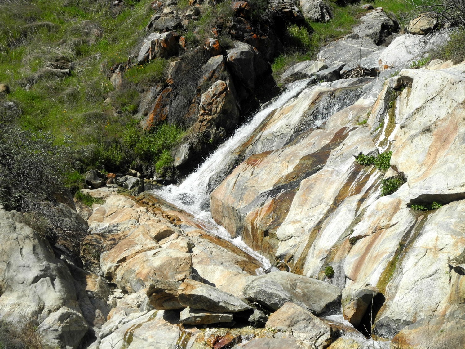
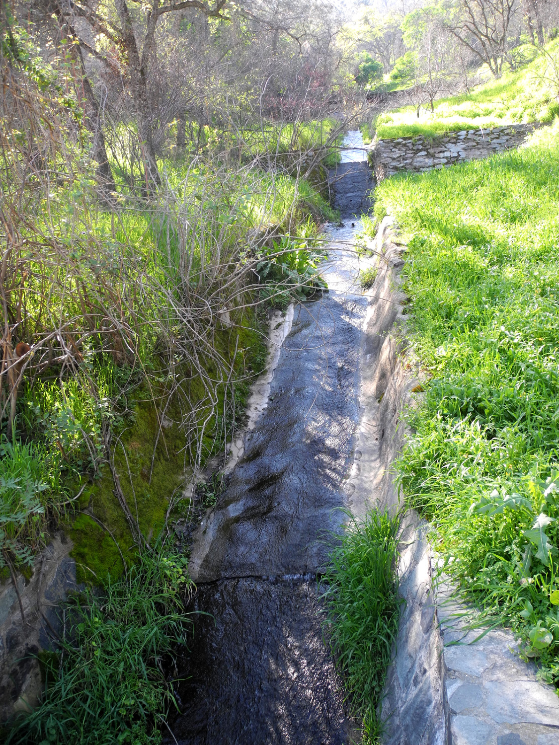
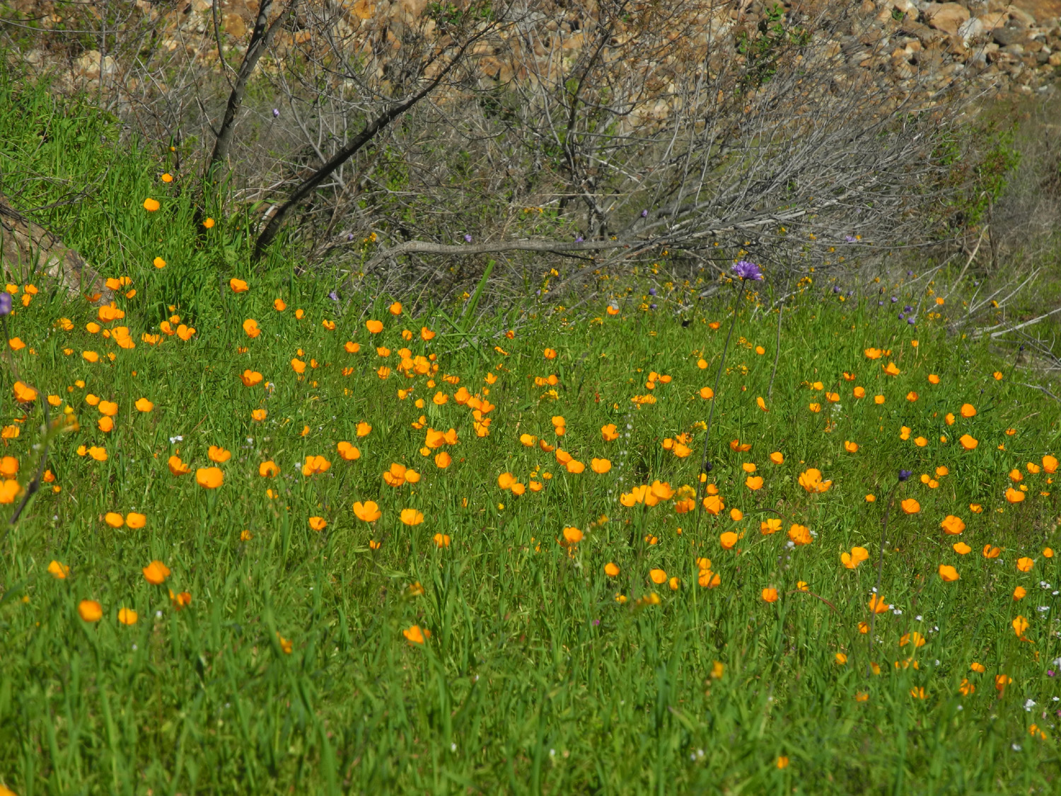
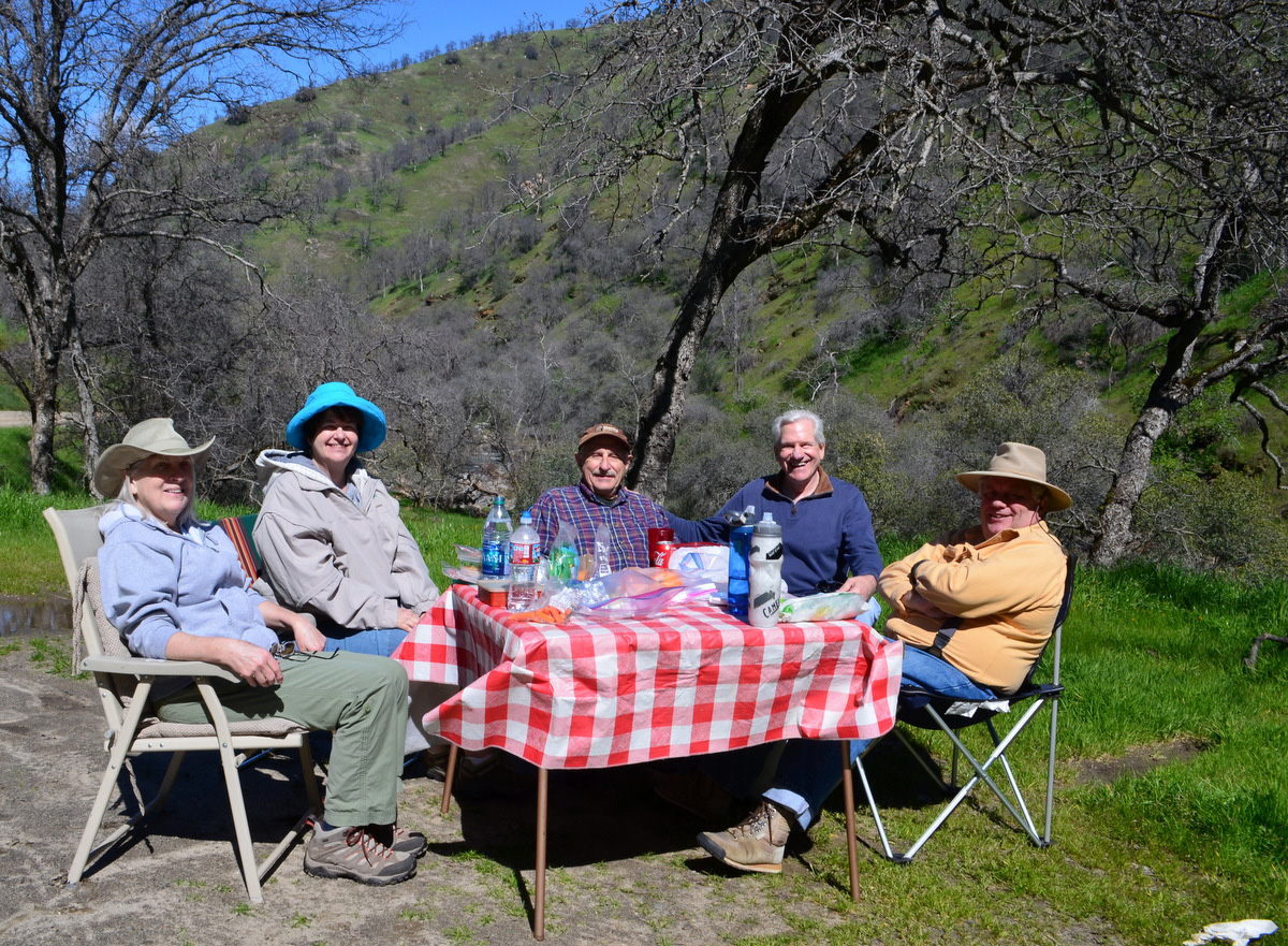
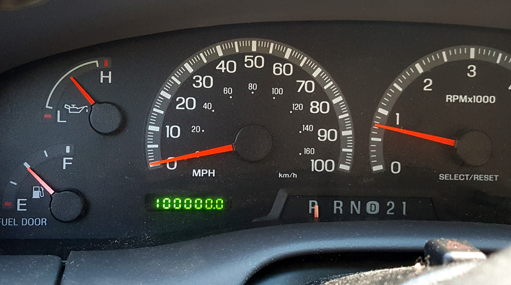
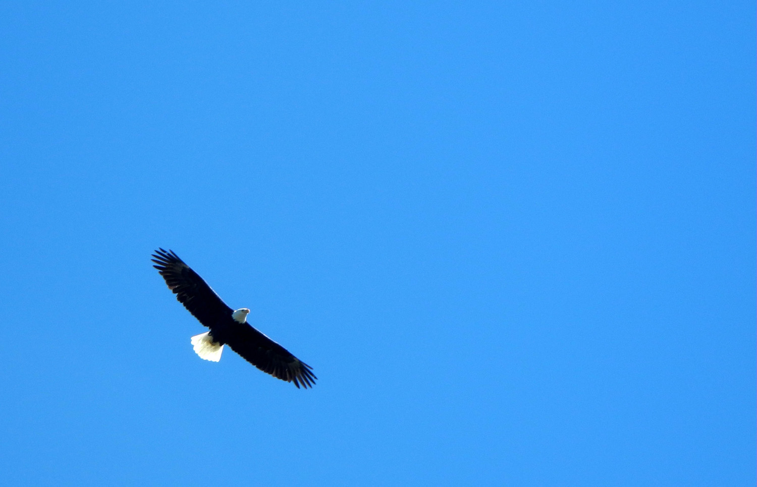
Pine Flat Road Trip To tell this story, I first have to tell another story, but to tell that one, I need to tell still another story. First story: Belmont Avenue goes east from Fresno and becomes Trimmer Springs Road, which goes to Pine Flat Lake, and runs along the north shore all the way to the end. Beyond the lake the road crosses the Kings River, runs on the south side for about a mile, and crosses back. At this point the paved road, seemingly now without a name, leaves the main river and follows the North Fork to Balch Camp, a PG&E town. But that's a whole different story, for a later time. From the second bridge, dirt roads go up the main Kings on both sides, with the north side carrying the name East Trimmer and the south side just Trimmer. Second story: When I was driving back from my trip to Goofy Smith Flat a little over two years ago, on the south side dirt road, I noticed that the old ranger station at Camp Four and a Half had become a rental cabin. It looked like a great place to spend a spring weekend, so I wrote down the toll free number displayed on the sign, although this eventually proved to be useless (that's still another story, not to be told at any time). Eventually I got around to booking the cabin, for the 10th through 12th of March, 2017, and made arrangements for all my kids, grandkids, and great grandkids to join me there. However, it was not to be. Early in February I received a voice mail telling me that the road was closed indefinitely due to washouts and rock slides, and my reservation was canceled. We scheduled a later trip to Bass Lake, and that's a story you'll hear about in a few weeks, but for now, I'll tell the story of what I did on March 13. This story: Wanting to see for myself why we could not get to the cabin, I decided to drive to the upper bridge, and then either drive or walk up the road, depending on conditions. I wanted to take my truck, but it had been in the repair shop for about two weeks. Therefore I knew things were going my way when the repairman called on Sunday and said he was bringing the truck back later that day. I got an early start, with food, water, chair, reading material, camera and way more extra clothing than I would need, and took my time making the 56 mile drive. I stopped at a half dozen or more places to take pictures and just enjoy the scenery. This included the big fields of poppies above Big Creek that had eluded us when I went there with the Ramblers a week earlier. I stopped where the dirt road goes up along Big Creek and walked out on the bridge to get some photos of the creek. Looking upstream, I saw huge fields of orange up on the hills, where a week earlier we had seen just one tiny patch of poppies. Up to this spot the road is mostly close to the lake, but beyond Big Creek it rises into the hills to go up and over Secata Ridge. In this area there is a creek that runs down from the steep hills above and crosses the road about half way to the top of the ridge, where the road drops back down to river level. Several hundred feet above the road, the creek drops over a double waterfall, and runs down a rocky channel at roadside. I've never stopped there to take pictures before, for a variety of reasons, but mainly because the waterfall is not very impressive most years. This year all the creeks in the foothills are running bigger than they have in a number of years, and there was a place I could pull off the road and have a good view of the falls. The upper fall was shaded and the lower in the sun, so I decided I would stop on the way back, hoping for better lighting conditions. A few miles beyond this stop, I came to the road junction, and immediately saw that Trimmer Springs Road on the south side was barricaded. The barricade is only three sawhorses that could easily be moved by anyone - anyone willing to risk a $5,000 fine, that is. I parked there and walked across the bridge to check on the north side road, and found it was blocked by a locked gate. By this time it had been over three hours since breakfast, and I realized I should eat something before starting my hike. I set up my chair, had some apricots and walnuts, put on my boots, and started up the road past the signs. Reading the fine print, I was relieved to find that the prohibition was against motorized travel; nothing against walking. I was barely out of sight of my truck when I came to the first rock slide, actually just a big boulder out in the road and another bigger slab of rock leaning against the bank. Although it looked as if one could drive past it with an inch or two to spare on both sides, when the closure went into effect, we were still getting storm after storm, and blocking vehicles was no doubt a wise decision. There were a couple more big slides, none of them actually blocking the road, and rocks of various size in the road in a number of places. This is actually a regular occurrence on roads like this, and even in years with normal rainfall it's necessary to watch for slides and rocks in roads that are cut into hillsides. More importantly, there were many wildflowers all along the way, including a border of poppies on the edge of the road on the river side nearly the whole way. In the shady areas on the upper bank I saw a few shooting stars, and a lot of another shade-loving flower that I have come to think of as "shooting star's friend." I saw both of these together during my hike at the San Joaquin Gorge on March 4. There were also fiddlenecks, popcorn flowers, fiesta flowers, redbud, buck brush, and the usual collection of "unidentified" to make this a delightful walk. Along the section of Trimmer Springs Road that approaches and then skirts the lake, there were many bush lupines and fiddlenecks, as well as two species of ground lupines.. With all my stopping, taking photos of the river, looking at the river, examining rock slides, observing which flowers grow where, and just strolling along at my usual indolent pace, it took me about 50 minutes to travel the one mile to the cabin. I had driven past it many times when it was a ranger station, and looked it over from the car two years ago, but I had never actually got out of my vehicle at that location, so I had a good look around. Peeking in the windows I could not see much inside, but it is a rather plain, simple building, with a propane tank, a small front porch, a couple of picnic tables, and some storage buildings. It's surrounded by a number of big valley oaks and some ponderosa pines, as well as many shrubs, other trees, and of course, bright green grass. On the opposite side of the road is a large corral with a cattle loading chute. It is about 150 feet to the river, and I walked down to take a look. The river is running big, but at this location and elsewhere I could see where it had been much higher. Near the corral there was a fair sized concrete platform, just high enough for comfortable sitting while I ate another snack. With fewer stops for photos and nature study, it took only about a half hour to walk back out to the truck. After having a snack at the cabin, I was not ready for lunch, so I decided to drive back down to Big Creek and go up the dirt road there to where the Ramblers had lunch last week. But before that, I made a few more stops. At the start of my trip, my truck's odometer read 99,940, and I wanted to get a photo of the dial when it turned over to 100,000. I was afraid this would happen where there was no place to pull over, but it was very close when I got back to Kirch Flat Campground, so I pulled in there, drove around the campground loop, and backed into a parking spot just as the milestone mileage rolled up. Next I parked beside the road just past the falls and was happy to see that the entire falls was in sunlight, making for a more complete photo. I even got out my poles and struggled up the steep hill to try to get closer, but I soon realized it would take a longer time than I wanted to spend to get up near the falls, so I carefully made my way back down to the road. Driving downhill toward Big Creek I found that I could see the big poppy fields from a good vantage point, so I stopped along the road for more photos. Eventually I crossed the Big Creek bridge, turned right, and drove the short distance to the "waterworks" across from the flat spot that was our lunch spot one week earlier. While I was setting up my lunch table I chatted with a couple who were making their first visit to the area, and were going to climb up the stairs where Wes and I had gone the week before. I attacked my PNB sandwich with gusto, finally replacing my exhausted store of energy, then packed up and started home. I made one final stop, where I had a good vantage point to photograph the ridge that runs through the picnic area that we walked on March 6. As I got out of the truck I saw a large bird through the trees on the hillside below me. I didn't get a good look, but it appeared big enough to be at least a hawk and perhaps even the eagle we saw last week, just across the Sycamore Creek branch of the lake from where I stood. There was a cool breeze when I left home, but by the time I arrived at the lake the weather was quite warm. I left home wearing a long-sleeve and a short-sleeve t-shirt, thinking I would just keep one of them on for my hike, and was very glad I chose the short sleeve. It was 78 degrees along the lake on the way home between 3 and 4 p.m. Traffic beyond Kirkman Point was typical for a weekday - almost non-existent. Most of the vehicles I saw were cattle trucks or industrial trucks of various types heading toward Balch Camp. As you might guess, I plan to be back at Pine Flat again soon - but that's another story.
|
||
|
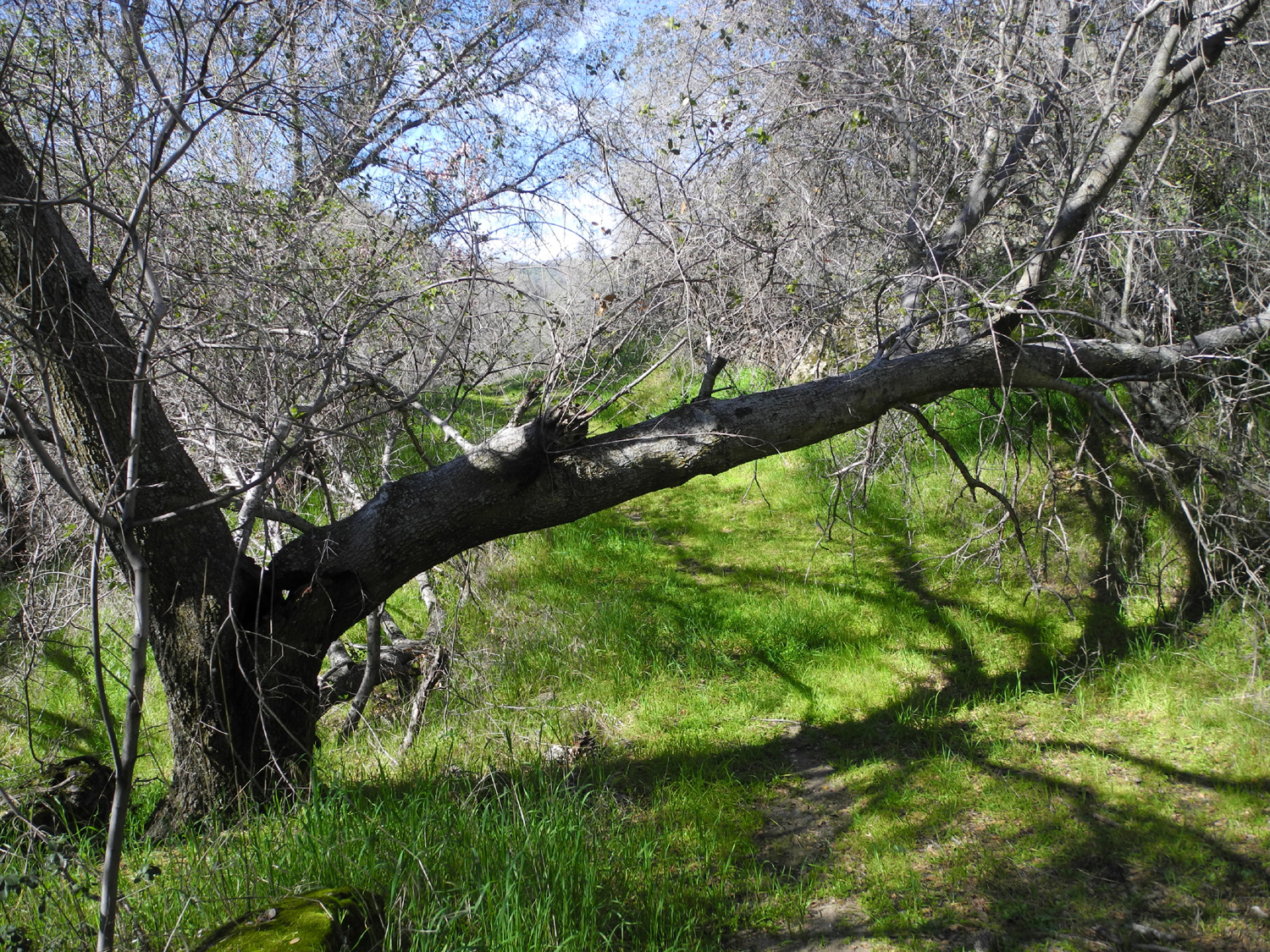
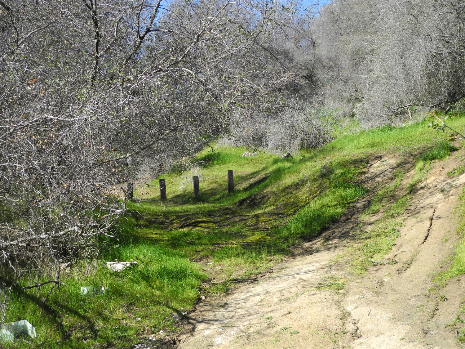
Sycamore Fire Road Having made this hike just over a month earlier, I was looking forward to seeing the changes - what new flowers are out, which ones are more prevalent, and how the creeks are running. This time I was joined by my daughter Teri and her friend Sandy, who has walked with us several times. We met at my house about 10 a.m. on March 19 and set off for the Pine Flat Lake area. Of course, we made several stops before reaching the start of the trail. The first was beside a large flat area south of Trimmer Springs Road, just past the place where the Kings River comes into view. This is actually the upper flood plain of the river, and hosts one of the largest stands of bush lupines I've ever seen. They are some distance from the road, so not really a good photo opportunity, but very striking to see in person. The scenes we hoped for, of one hillside after another orange with poppies, have eluded us so far this year, but there are a few places where they are out in good numbers. One of these is above the drainage of Sycamore Creek, and there's a big wide turnout where the road starts up this branch of the lake where the flowers are visible in the distance, so we stopped for a look. It was not far from that place to the "trailhead," which is really just a small space off the road, big enough to park one or two vehicles, at the start of an old dirt road. I call it Sycamore Fire Road, because I think it was used to get equipment into the area during a grass fire many years ago. It was probably originally used in relation to ranching or mining, or both. I may change the name of this route to the Trail of Fallen Trees. Since it's not a real trail, and is no longer used as a road, there is no maintenance, and trees that fall across the trail stay across the trail. When I walked in February there were two new trees since last year's walk, and there are about ten in total. A couple of them are straight, clean bull pine trunks, small enough to climb over. One, the "limbo tree," is a huge section of a live oak that broke and lies across the trail, but is not completely separated from the rest of the tree, so it's still living. Its top branches hold it up above the trail enough that you can bend down and make your way under it, an exercise that gets harder every year. It was made even more "interesting" this year by the fact that a small creek runs across the trail in this spot, so I was walking in squishy wet soil and grass and trying to bend down enough to get under. It was a little less wet on this second trip. The rest of the trees require a detour, and there has been enough foot traffic to wear bypass trails around them. The road has also been used by 4-wheel drive vehicles, whose operators first had to create a bypass around the concrete posts that block the start of the road. In most cases, the vehicle bypass is longer than the "pedestrian" route. However, with two new trees this year and two last year, it looks like the vehicle people have given up, since the newest trees have only a foot trail bypass. Some of the flowers I saw on my February visit have increased in numbers, and there were others that we saw for the first time this year. The latter included buttercups, harvest brodiaea and dove lupines, the smallest of this species. There were only a few fiddlenecks last month; now they have exploded in the lower foothills, and were tall and thick in spots on the Sycamore trail. Baby blue eyes have increased slightly, and there are a lot more shooting stars. In one place these were mixed in with the largest patch of buttercups I have seen in many years. There are always lots of filaree blossoms, and although many of them have gone to seed, this species remains in bloom throughout the spring months. In February there were five running creeks that crossed the trail, often requiring me to step in shallow water to cross, and wet places where water oozes out of the hillside. Most of these were running much less this time, but there were still a lot of wet spots. The old road is built into the hillside above the final creek, and where we could see down to the bottom, there were pools but no running water. However, at the trail crossing, the creek was running as much as last time. The water is soaking in and possibly running underground through the rocks that lie under all of the Sierra foothills. There's a place about a half mile in where the road seems to fizzle out, and I had always turned back there, but last month I kept going, and found the road continued on to the farthest creek. We crossed the creek and walked up the steep path on the other side to a big meadow, which was my turnaround spot last time. Since I always try to go a little farther each time, we walked across this open area, and found another creek on the other side. It was down in a little valley that was steeper than we wanted to walk, so we didn't actually see the creek, but it sounded bigger than any of the others. This big field was covered in tall grass, still wet with dew. Around the perimeter are numerous blue oaks large and small, including one big one with no grass underneath, apparently a favorite shade spot for the cows that graze in this area. We could not find any sign of the road continuing past this point. Before arriving at the big meadow, we had our snack sitting on one of the big bull pines across the road near the final creek crossing, a place with plenty of flowers for our enjoyment. Just before this spot we had a good view of poppies on the hill not far beyond where we tuned back. After returning to my car, we drove a short distance farther, to where Trimmer Springs Road crosses Big Creek, and up the dirt road to the "waterworks." This road runs along the creek for about seven miles, then climbs away from the creek as it rises to the 3,000 foot level, and eventually comes out on Highway 168 below Shaver Lake. We set up our lawn chairs beside the road, and for the third week in a row I had lunch in this spot. No one felt like climbing up the stairs to the rock and concrete artifacts above the road, but we enjoyed the sound of Big Creek (living up to its name this year) and speculated on the purpose of the structure and how it functioned. We didn't make any stops on the way home, but we enjoyed views of redbud at its peak bloom in several places, especially around Trimmer. We also saw dozens of bush lupines large and small, all along the road. There are scattered bushes everywhere, plus four or five areas where there are a dozen or more of these spectacular shrubs close together. Although there are other flowers to come along the Sycamore Trail, and it's fun to see the changes through the season, there are many other places that need my attention, so I'm not sure I'll get back here again this year. You can find links to all my previous visits below.
|
||
|
Previous Sycamore Creek Hikes |
||
| Solo April 2014 | With Carolyn February 2015 | Solo February 2016 |
| Ramblers April 2016 | Solo February 2017 | |
|
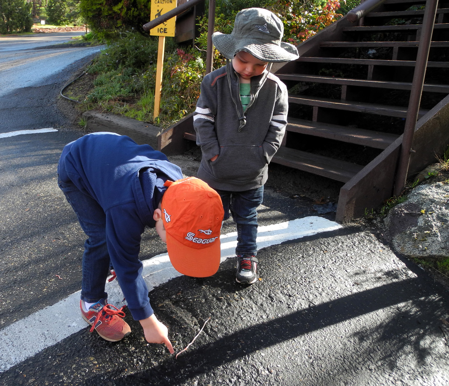
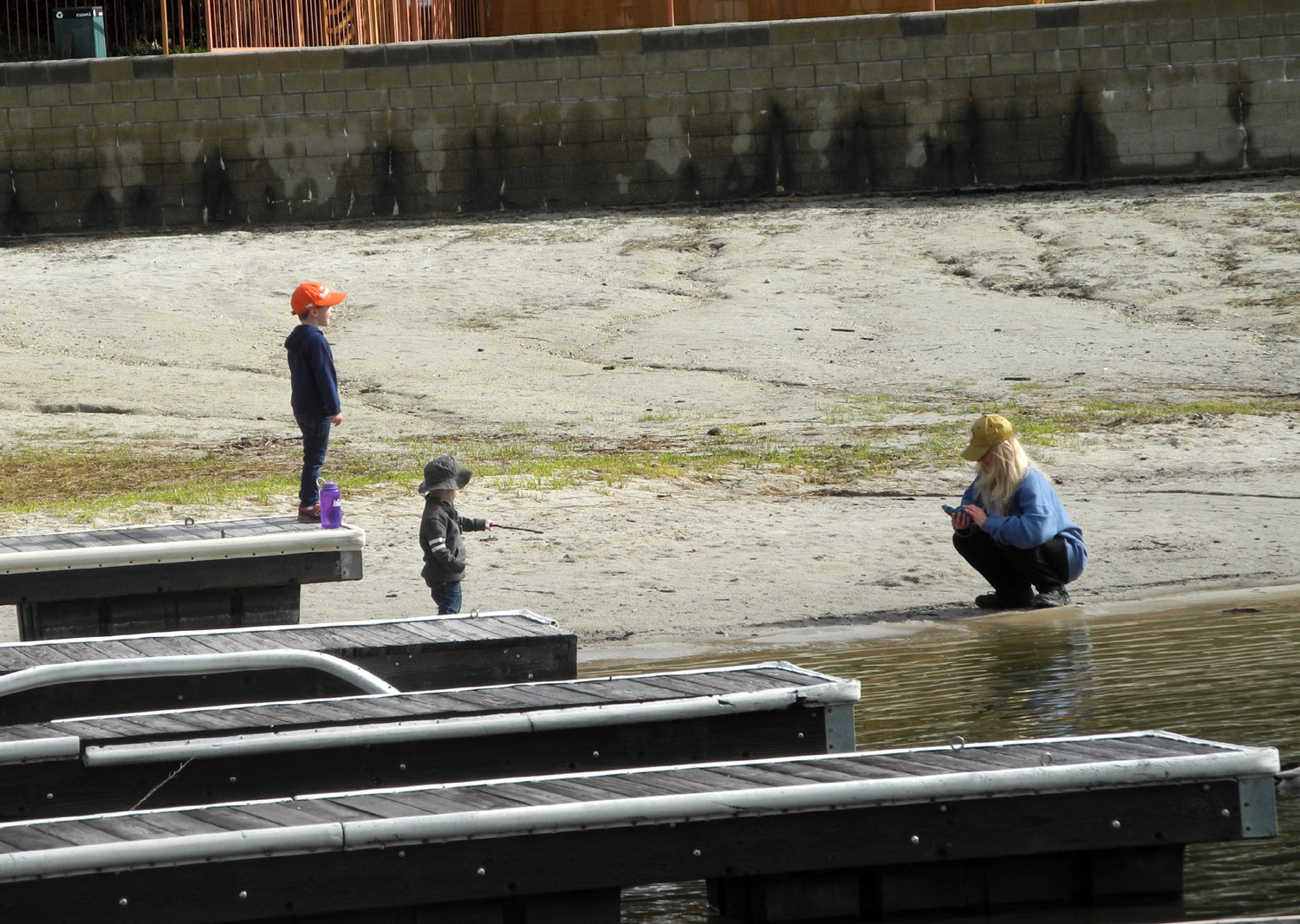
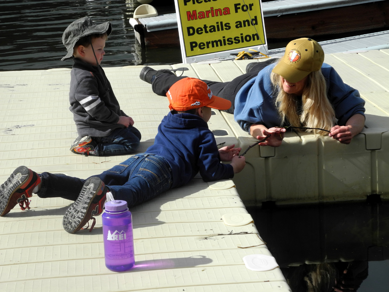
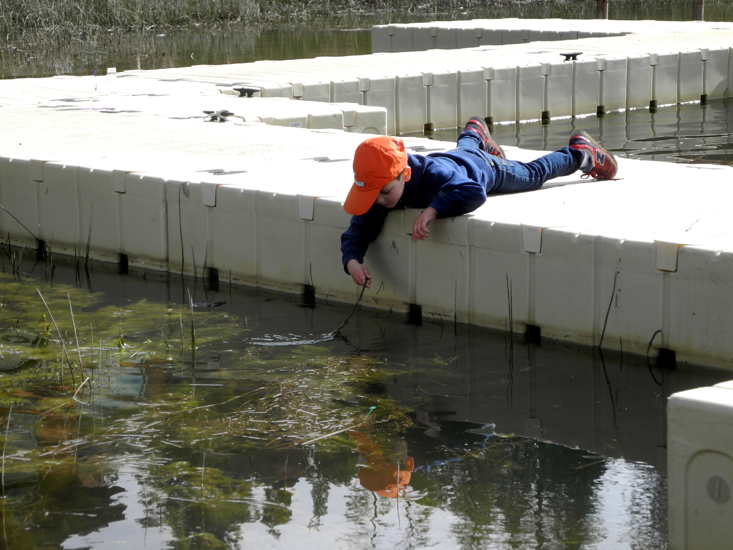
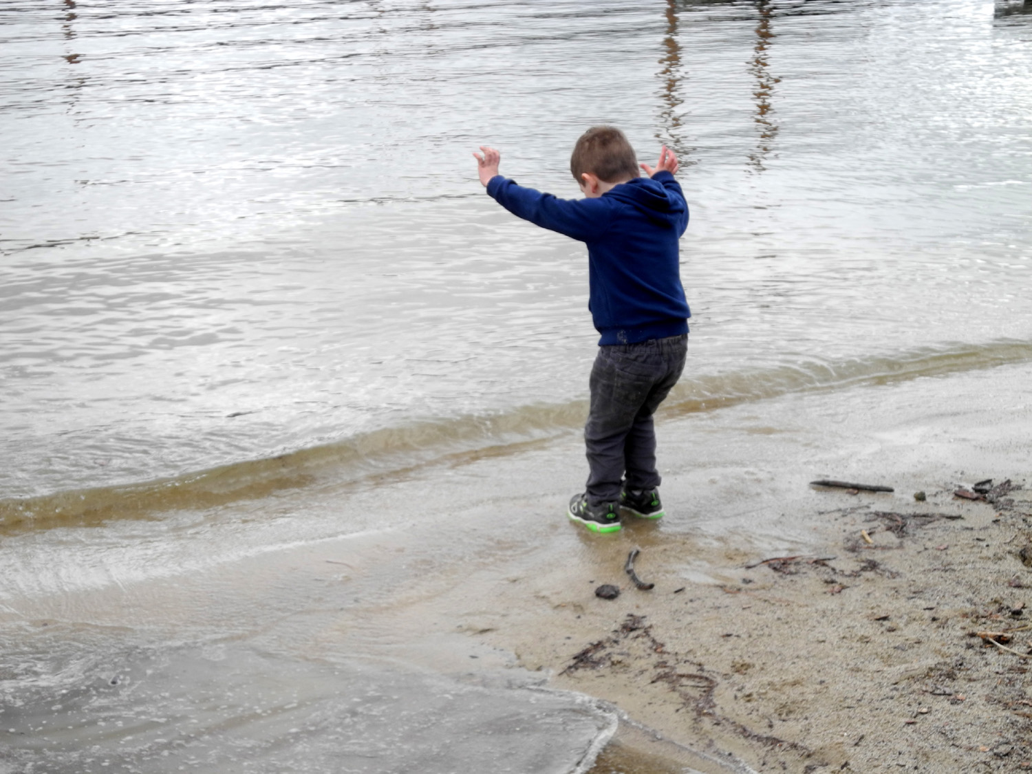
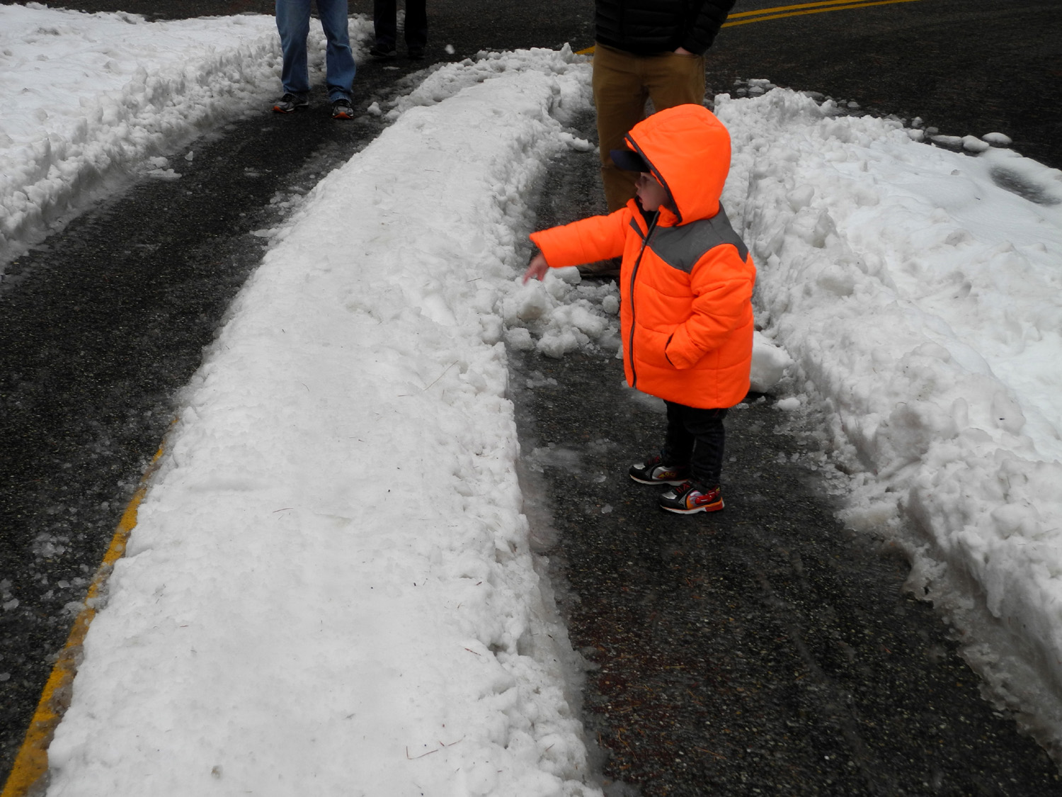
Bass Lake Bash Earlier I wrote about my walk to the cabin we reserved on the Kings River, but couldn't stay at due to road washouts. Our alternative plan was to rent a place at The Pines Resort at Bass Lake, for the weekend of March 24 - 26. My entire family was invited, and most of them were able to join us for at least the day. Son-in-law Tim, younger grandson Mikie, and his girlfriend Lizzie, all had to work, and older grandson Johnny's wife Brittany ended up staying home, but daughter Teri, grandson Johnny, great grandsons Colton and Jack, daughter Jennifer, son-in-law Rod, and I (Dick) were all present. I will warn you right here that this report has more to do with family activities than outdoor adventures, although there are some of the latter. I realize the cute sayings and actions of little kids are not of highest interest unless you're related to them. You may choose to skip the report and look at the pictures, or skim through to the parts about hiking in the rain and driving in the snow. On Friday morning Teri picked up her grandsons, the Notorious Upshaw Brothers, Jack and Colton (age two and four), and came to my house. She then followed me up Highway 41 to Oakhurst, where we made a quick rest stop. Since it was too early to check in, we decided to go to the Lewis Creek Trailhead, about six miles above Oakhurst, and walk in to the creek, a short distance from the highway. The weather forecast was for rain off and on through the weekend, but we always assume it won't rain EVERY minute. We did have rain much of the way on our drive into the hills, but we had the proper clothing and set off down the trail in a very light rain. Of course, the boys consider that a plus, since it creates puddles for stomping, and little "creeks" across the trail. We got to Lewis Creek, which was running very big as expected, and the boys immediately began throwing rocks in the water. The goal, especially for Colton, is to find the biggest rock he can handle, in order to make the biggest splash. Jack is content to poke the ground with one of my old hiking poles and throw whatever rocks are convenient. On our way back to the car we came to a little rivulet of water across the trail. Colton began moving mud around with his pole, and I told him when he got older, I would show him how to build a dam. Then I looked more closely and realized he was doing just that. No one had ever taught him; it was just apparently an obvious thing to do. He called in a "block," but the effect was the same. We made it back to the car and drove to the Pines Resort, about five miles off Highway 41 on the east side of the lake. We had reserved a cabin that had a full kitchen and two large bedrooms, one with a king size bed and the other with two queens. The place had more shelves and cupboard and closets than any of our individual houses back home, and was quite nice. After the boys had a meal to renew their energy, they began to demonstrate just how much energy they had. Their first game was running back and forth between the two bedrooms, with appropriate accompanying vocal sound effects. I joined in with several variations of chasing them or blocking them from getting out of a room, but in the long run I always had to stop to rest while they were still going strong. I asked Jack the meaning of the sound he was making, and he replied, "It's my run." Teri had brought some toys she keeps at her house, mostly trucks, and Johnny had said one of their favorite activities is playing with Legos, so he had sent a large plastic container full of them. What he failed to say was that their idea of playing Legos was to dump the entire box out on the floor. It was still raining, and I noticed that a sort of creek was flowing in waves down the steep driveway near our cabin. We could see it very well through the window, and checking the creek became a regular activity throughout the weekend, as it came and went with the start and end of showers. I took the boys outside for a closer look, and of course, they had to stomp every puddle on the way, and stand in the creek. The flow was shallow enough that it didn't go over their shoes, and with lots of experience, Teri and their parents had made sure they had two pairs of shoes and several changes of clothing. Saturday morning was partly cloudy with no rain, and after breakfast, we started to walk down to the boat dock on the lake. The pavement on the roads was still wet, and there were 15 to 20 earthworms crawling downhill. For reasons unknown, they were stretched out long and thin, some of them close to ten inches in length. Of course, this was a big delight for the boys. There are few boats in the dock right now, and Jack and Colton had a good time going out on the walkways. A floating dock was moored at the end of the dock, and Colton discovered he could move it away from the dock and pull it back by hand. Eventually they picked up sticks from the shore and began the exciting adventure of slime fishing. By the section of the dock closest to shore, there was a lot of algae in the shallow water, and Colton found he could scoop out a big chunk with his stick. Jack was less interested in this activity and preferred to dig in the sand and step in the little "creeks" that flowed into the lake. As we returned to the cabin, Johnny arrived, so the kids filled him in on everything they had been doing. Brittany's twin sister from Bakersfield was visiting so she decided to stay in town. Rod and Jennifer arrived not long after and we all returned to the lake for more of the activities offered there. Johnny wanted to take the boys to find snow to play in, so we headed up the Beasore Road, which leaves the Bass Lake Road across from the resort and goes many miles into the mountains. Both Johnny and Rod and Jennifer had Jeeps, so we felt confident we could drive in a little snow when we found it. A few miles up the road it crosses Chilkoot Creek, which was running very big. We stopped here for a closer look at the big cascades above the bridge before continuing up the mountain. Snow from the most recent storm was limited to 6,500 feet and above, but we knew we would find "leftover" white stuff at lower elevations. Going from about 3,400 at the lake, we had to climb to about 5,800 before there were big areas of snow, although there were small patches much lower. We found a place to park, and everyone got out except Jack. Being two, his default response to any question, suggestion or request is "NO." Of course, he was not really going to miss out on snow play, and 30 seconds later he was out and having a great time. At one point he was standing in the tire tracks in the road, throwing snow at me. I was standing on the snow in the middle, about a foot higher, so I could kick snow at him, aiming for the chest and lower. Then I felt something cold and realized the snow was sticking to my jeans and instantly starting to melt, while it bounced harmlessly off Jack's nylon jacket. After the boys had enough of throwing snow, Teri helped them construct a small snow man, which Colton "decorated" by jamming a stick into the top of its head. I later learned that this was his hair. Since Johnny's Jeep transports kids on a regular basis, it was easy to find Cheerios to use for buttons. We spent about a half hour there, having to move out of the road once for a vehicle coming down the hill, but otherwise enjoying wilderness solitude. When we got back to the cabin, we did a group photo and got dinner started. I had made my famous spaghetti sauce, Teri made a salad, and Jennifer brought bread and miscellaneous snacks. Despite some challenges figuring out the stove, which had no visible marking on the burner knobs, we finally got the water boiling for spaghetti and the sauce warmed up, and enjoyed a great meal. Jack had a bite or two, but mainly stuck with his default favorite, a corn dog. Rod and Jennifer left shortly after dinner, with about a 15 minute drive to their house, and the boys and I played monster chase, block the puppies, and other loud and exhausting games. Johnny had originally planned to spend the night but decided to go home, so they left about 8:30, leaving Teri and me to enjoy a quiet evening reading and an early bedtime. The next morning we enjoyed a late breakfast, swept the floor, put the dishes in the dishwasher, and got things loaded up to return home. Instead of driving back out to Highway 41, we continued along Road 274, known in some sections as Malum Ridge Road. This route runs along the shore of the lake, past the dam, and drops down to the village of North Fork. Here we stopped to look at Willow Creek, which runs out of Bass Lake and which had flooded parts of North Fork in both January and February. It was running good, but well within its banks, although the high water mark clearly showed that a massive amount of water had come down the channel earlier. From North Fork, a road runs west to Highway 41 about 25 miles from Fresno. In this location we were treated to a spectacular display of redbud blooming along the roadside. It was a fitting end to a great family weekend.
|
||
|
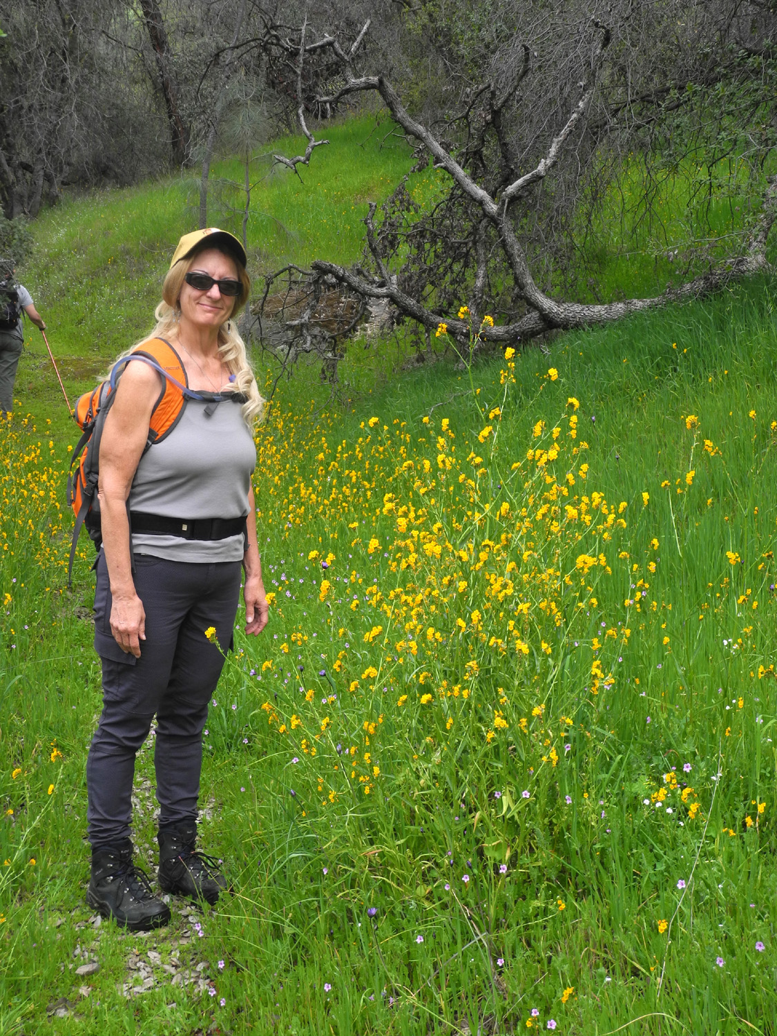
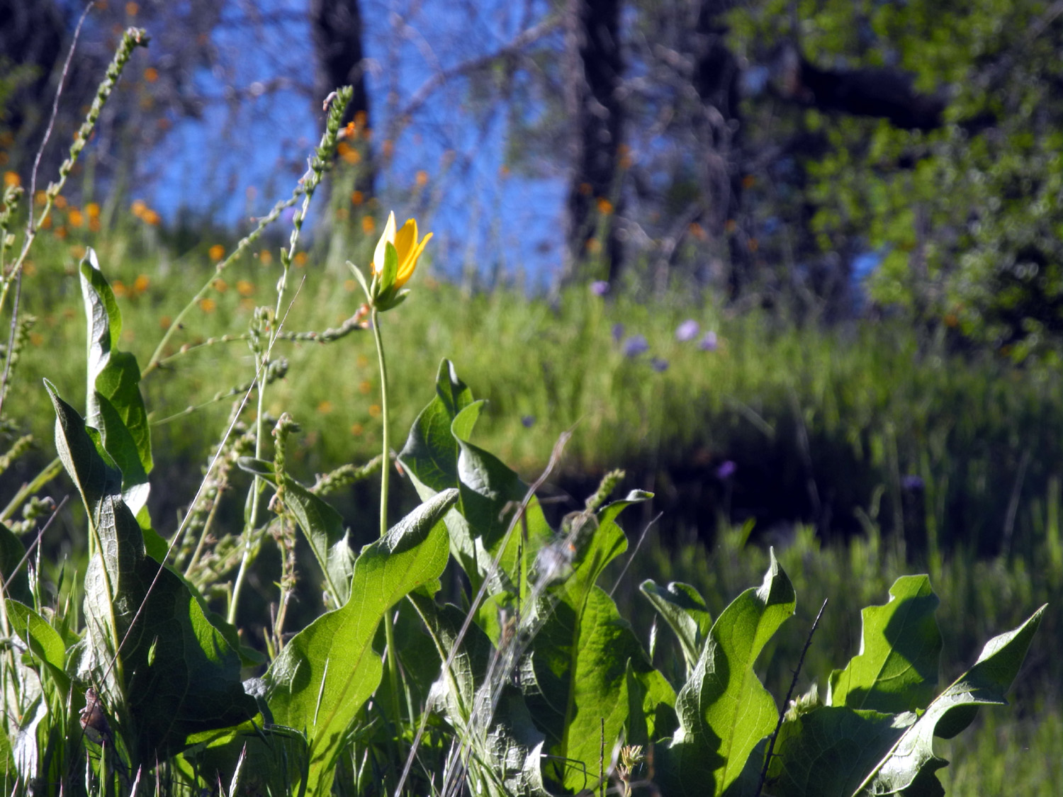
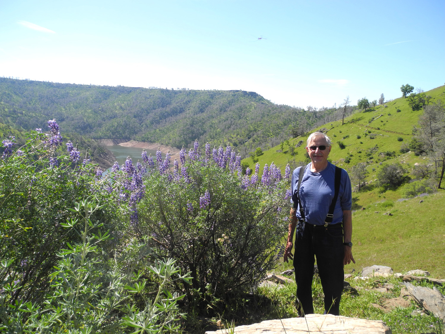
San Joaquin River Trail West This is a path well trod, and also written about many times, so I'll keep it brief. If you're tired of hearing me go on and on about flowers, I've put all that in a separate section near the bottom so you can skip it, but of course, you will miss some brilliant writing if you do. The weather on March 29 was pretty much what we've been enjoying the last week or so - very cool in the mornings, warming up to the 70s, comfortable to hike in a short-sleeve t-shirt, and quite warm after a mile of walking. As I do on most trails, I wanted to go a little farther than I ever had before, and accomplishing this turned out to be a total hike of 3.34 miles. This is the San Joaquin River Trail, which starts at the Finegold Picnic Area at the end of Sky Harbor Road, and goes mostly uphill for a mile on the north side of a ridge. This section is cooler and wetter, and the flowers seen on the first mile are those that thrive in such conditions. These included filaree, miner's lettuce, and blue dicks. After the trail crosses over the ridge at a saddle, it goes for about a mile along the south side of the ridge, producing plants that enjoy lots of sunshine. Poppies, bush lupines and phecelia were dominant on this side. The grass along this part of the trail was starting to dry out and go to seed. Considering that it was a Wednesday, there were a lot of people on the trail, but they all walk faster than I do, so they pass by, we say hello, and they are soon out of sight. Due to the heavy rains of January and February, every foothill trail has places where part of the trail has washed out, or there is a gully down the middle of the trail, or there has been a mud slide from the upper bank. None of these are serious, but a few of the ruts are deep enough that careful walking is required. Once I reached my stopping point, I took photos so I could remember what it looked like, and started my return walk. A hike of this length takes four hours on the clock, but of course, that's not all hiking. It not only includes stops for snacks and rest, but also photo opportunities, and just looking at the scenery. I figure there's about three hours or a bit more of actual movement. While exercise is an important part of my hiking, the enjoyment of the surroundings is paramount. This time the high point was the spectacular display of bush lupines in bloom by the saddle and along the sunny side of the ridge. There are literally hundreds of bushes, in "forests" of anywhere from a dozen to fifty individual plants in close proximity. About half way up the hill I noticed a narrow cow trail that went down into a drainage that looked interesting. Farther up I made a mental note of a spot where I could leave the trail and walk down a ridge to the bottom of the drainage. On the way back out I went cross country down to the little creek, then back up the cow trail to the main route. It was in this area that I saw a buckeye tree, which are otherwise very scarce in this area. I also saw a small, 4-petal yellow flower that I've seen at Hensley Lake, but nowhere else along this trail. At the start of my walk, on the paved road from were we park to the trailhead, I saw a man photographing the top of a large bull pine. He pointed, and I saw that he had spotted a buzzard sitting on a branch and spreading its wings. I believe they do this to dry the dew that collects on their feathers as they roost for the night. It turned out there were four of the birds in that tree. Flower alert! I counted at least 22 different species: Purple and yellow brodiaea were just getting started, there were maybe a dozen or fewer plants of each. They are not very thick in this location at best. Also beginning their run were the birds eye gillia. If last year is an indication, they will be thick within a week or two. Fiddlenecks and filaree start early and continue to bloom for a long time, so there were many thick stands of these common flowers. There were patches of popcorn flowers, lots of blue dicks, and many large and small yellow daisy-like flowers. Others in bloom in modest numbers included sierra star, fiesta flowers, and poppies. On the sunny side of the ridge there were massive numbers of phecelia, but the stars of the show were the bush lupines as mentioned above. Just getting started in small numbers were foothill gillia, dove lupine, and tall ground lupine. Miner's lettuce has been in evidence since January, but is now limited to shady areas. White thorn chaparral is mostly finished, but I saw one bush still in bloom. Unidentified flowers included the little 4-petal yellow flowers, a tiny 10-petal pink blossom barely a quarter inch across, a bunch of little yellow flowers, and a large yellow flower with big leaves, not fully open. Speaking of Lupines, we seem to have six varieties that are common in the Sierra foothills. Most spectacular are the bush lupines (a yellow variety of these is common along the Pacific coast). I refer to the others as "ground lupines," but I'm sure they have specific names. There are three different blue varieties, small, medium and large. The smallest, barely two inches tall, are dove lupines. Then there is a white lupine about the same size as the tall blue ones, found mostly near water. Fairly rare and very striking is a pink and yellow beauty, known as harlequin, that is medium in size. These grow mostly in rocky hilltops. The medium blue lupines, which seem to be the latest to bloom, are the famous blue bonnets of Texas. There are over 200 species of lupine worldwide. A member of the legume family, the seeds have been used as food for millennia.
|
||
| Photos (Click to enlarge; pictures open in new window) | ||
| San Joaquin Gorge Trails Pine Flat Road Trip Sycamore Creek Hike | ||
| San Joaquin Gorge Trails | ||
 |
 |
 |
|
So many cars, some had to park "out in the country" |
Two creeks come together near the overflow parking lot |
These unidentified flowers usually accompanied shooting stars |
|
 |
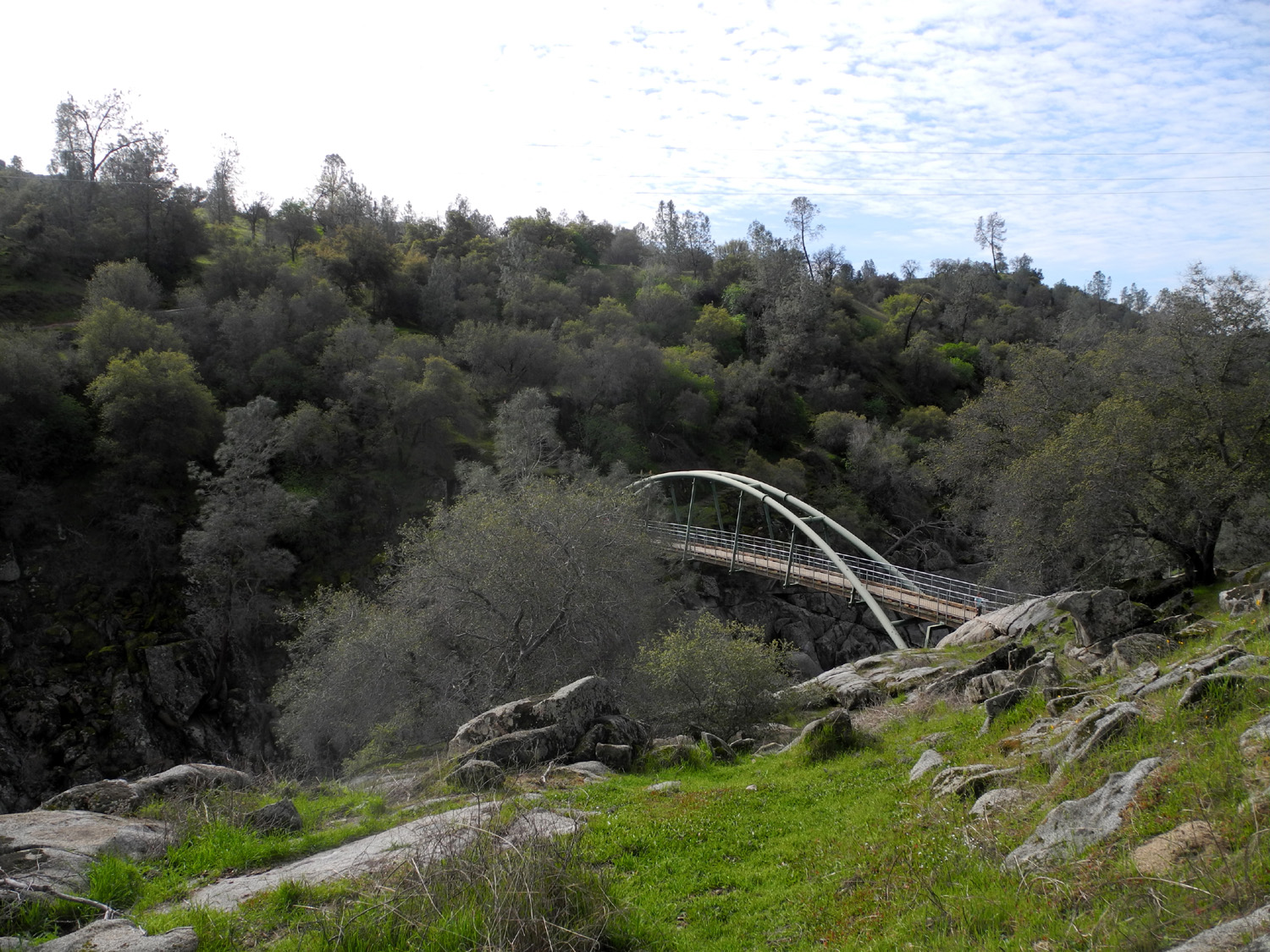 |
| The chain saw crew is kept busy during this wet season | A forest of buckeye seedlings grow on this hillside | A view of the bridge from the Ridge Trail |
 |
 |
 |
|
Tempting beauty - but it's poison oak and it'll make you itch! |
The San Joaquin River has a heavy flow this year | The delightful five-trunk blue oak on the Ridge Trail |
 |
 |
 |
| Another unidentified flower | Popcorn flowers were the dominant species this trip | My resting spot off the Ridge Trail |
 |
 |
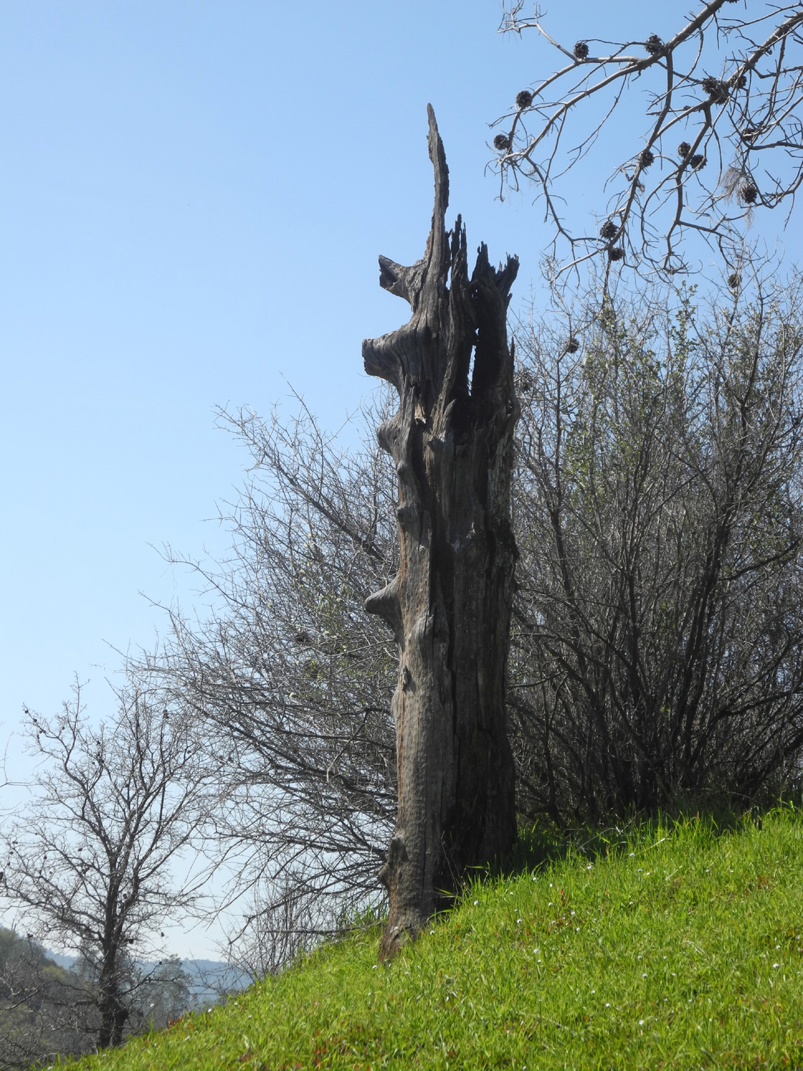 |
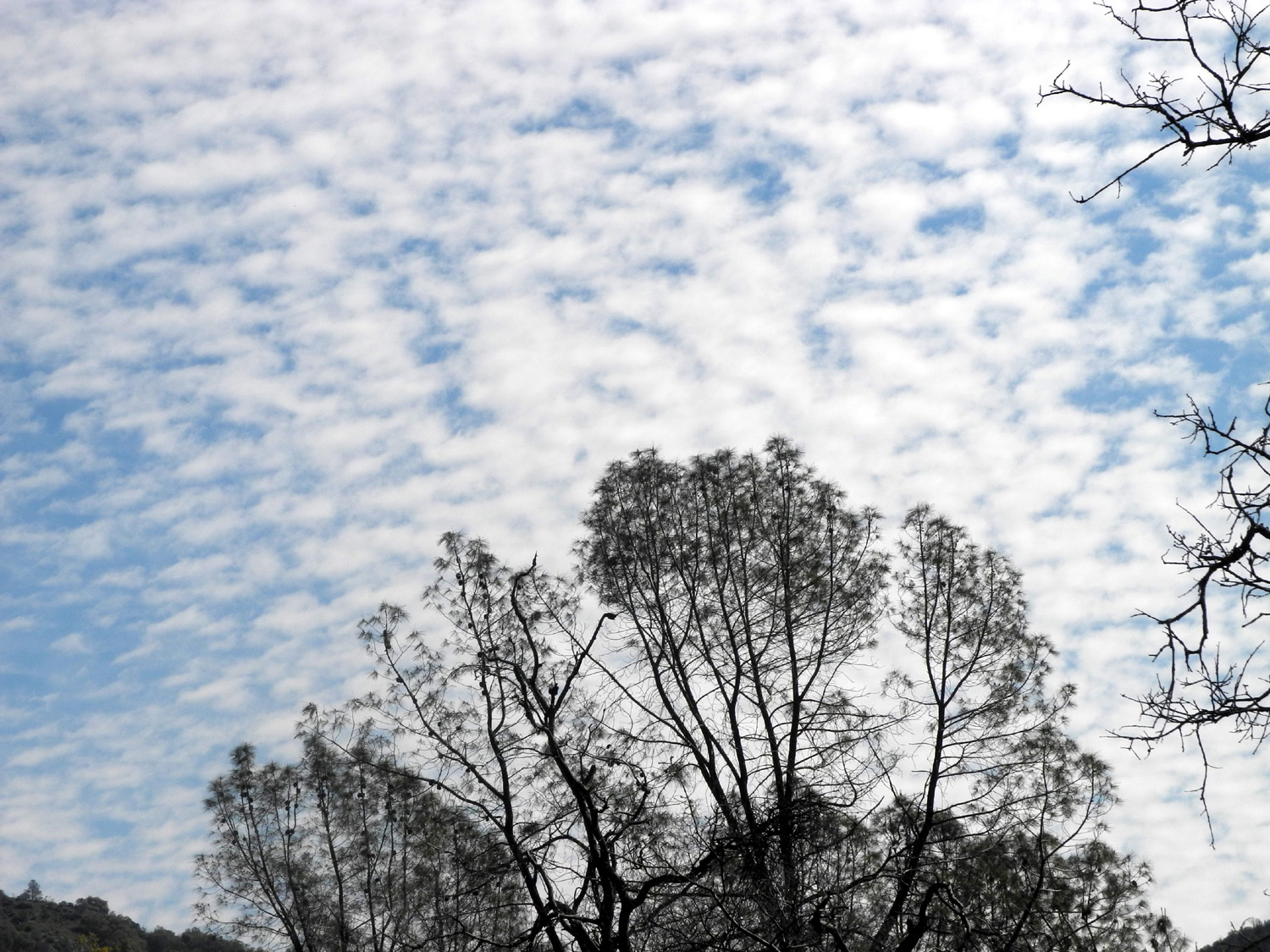
| Bull pine tops and clouds | More work for the trail maintenance crew | An ancient dead snag |
 |
 |
 |
|
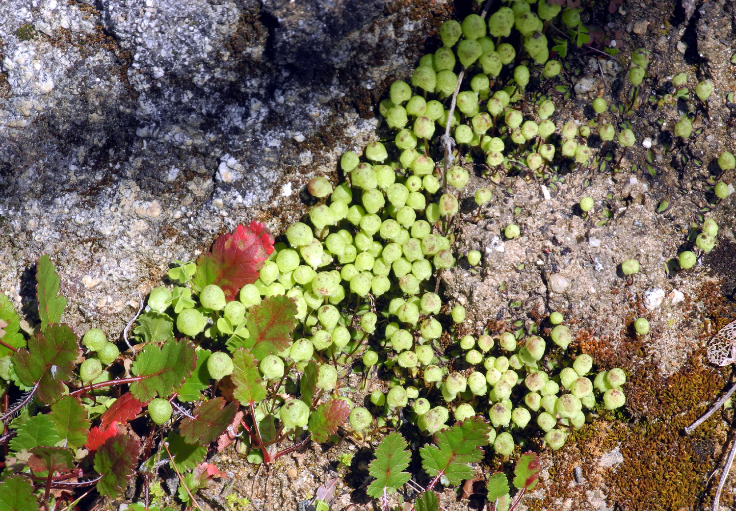
This is probably some type of moss |
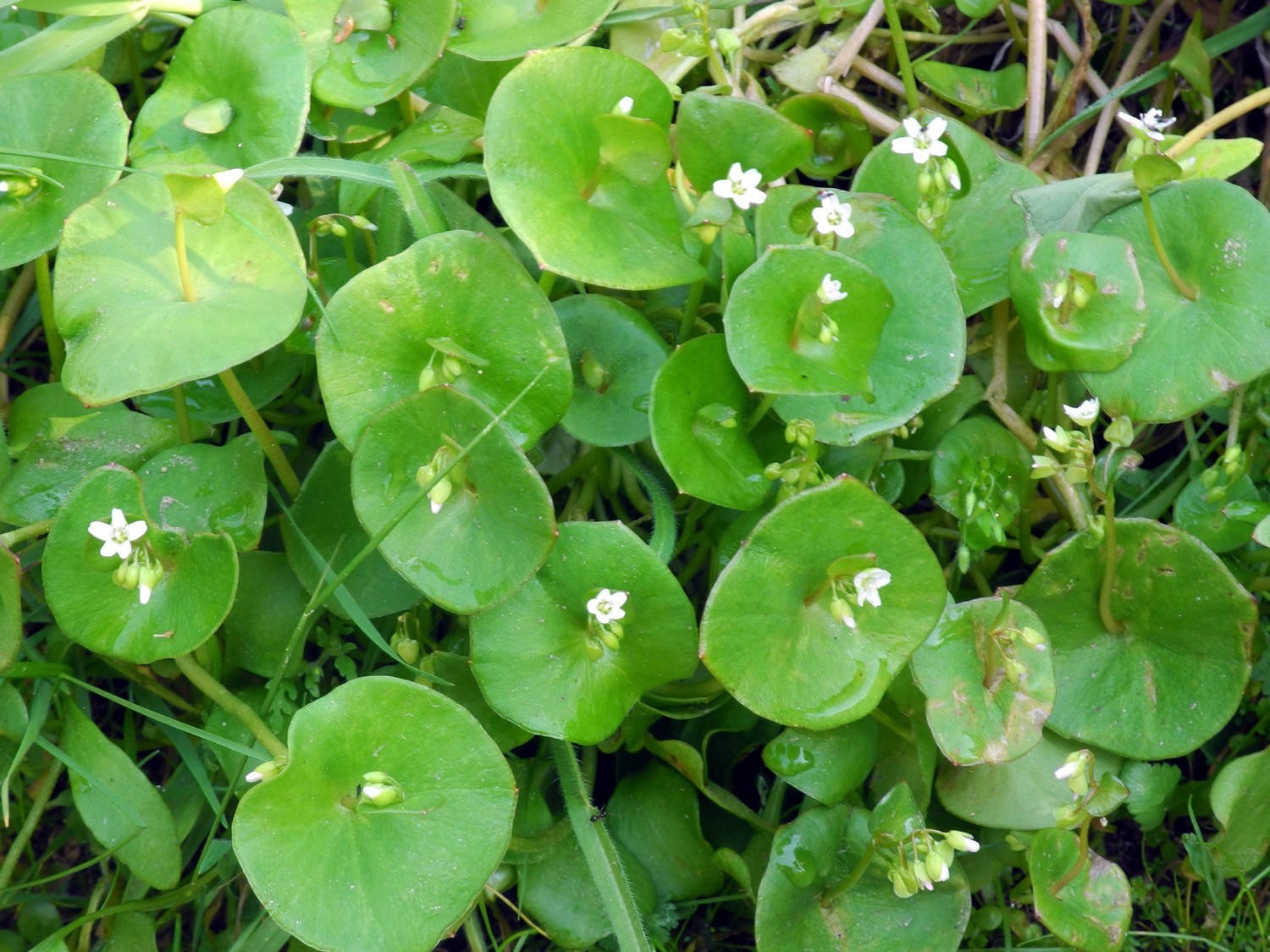
Miner's lettuce |
Baby blue eyes were out in good numbers along the trail |
|
 |
 |
| Lupines along Auberry Road | Blue oak forest across the road | Fiddlenecks are starting to appear in large numbers |
| Pine Flat Road Trip | ||
 |
 |
 |
| Lupines are in bloom all along Trimmer Springs Road | The bridge at Big Creek | Big Creek below the bridge |
 |
||
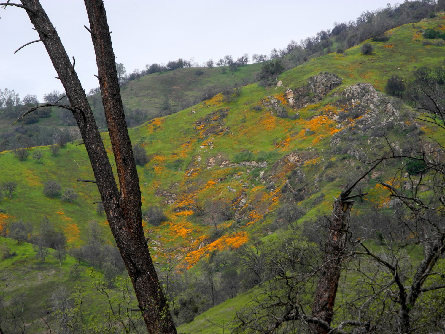
| The season's first big poppy bloom, in the hills above Big Creek | ||
 |
||
| The closed Sycamore Picnic Ground is located on top of this ridge | ||
 |
||
| Monarch Divide and Wren Peak, between the middle and south forks of the Kings River | ||
 |
 |
 |
|
Fiddlenecks above the Big Creek bridge |
The Kings River from the upper bridge |
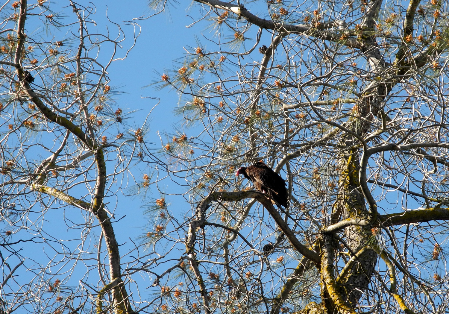
During my visit, no V's of any kind were allowed on the road |
 |
|
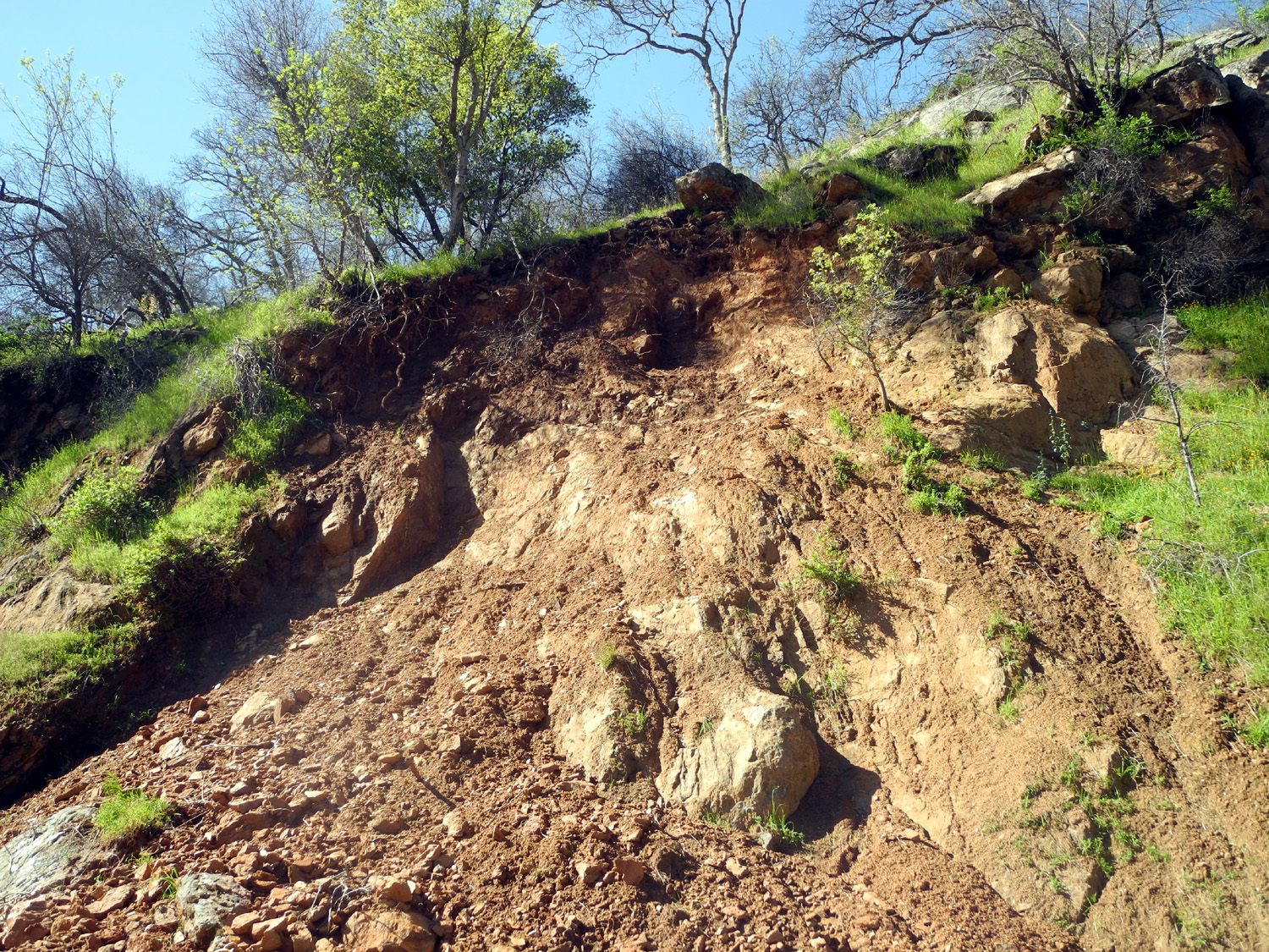 |
| One reason the road is closed to motor vehicles | Another big slide | Where it came from |
|
 |
 |
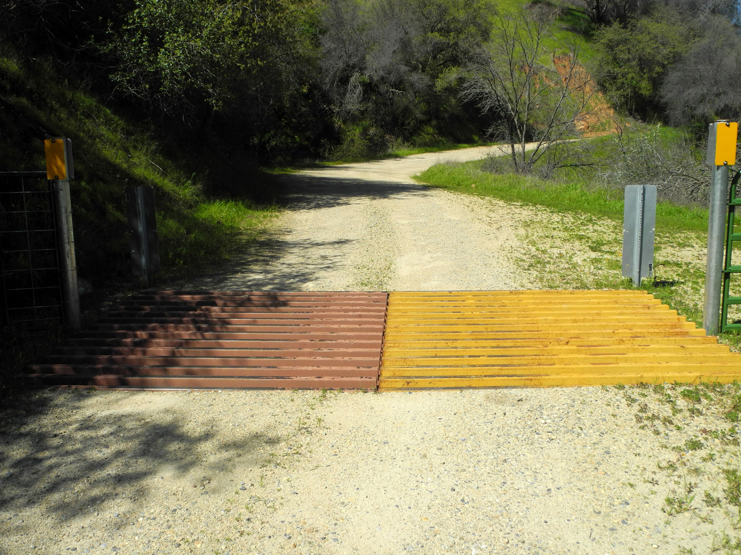
| Redbud is starting to bloom | A bi-colored cattle guard | The Garnet Dike road across the river, also closed |
 |
 |
 |
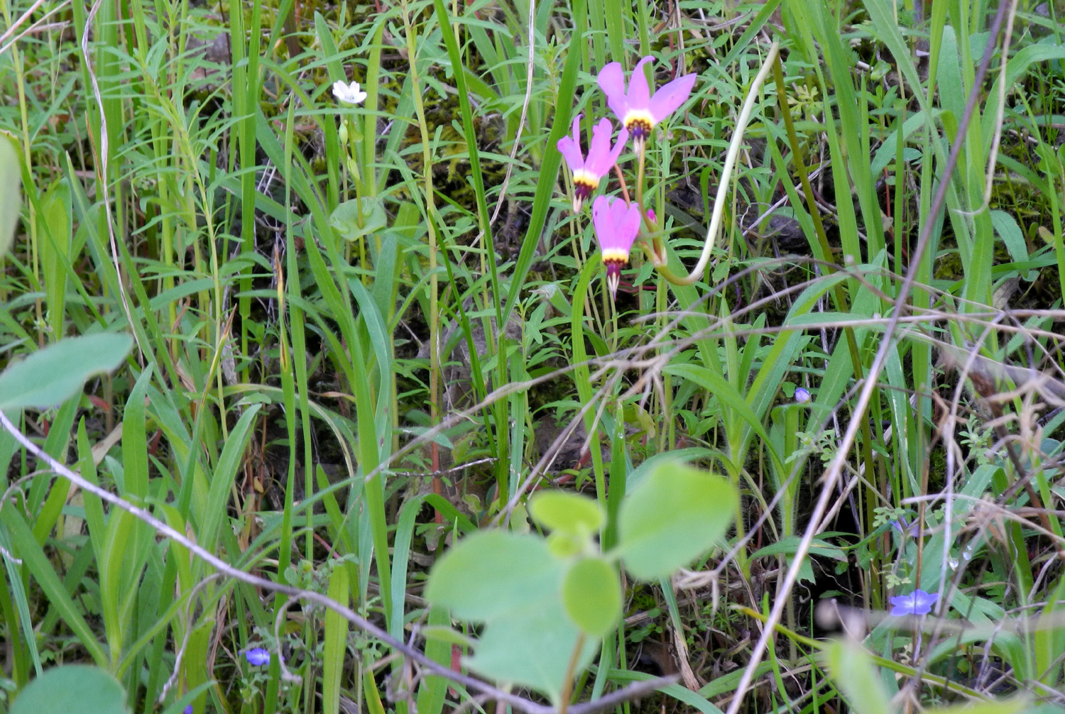
| Shooting stars | I call this one shooting star's friend |
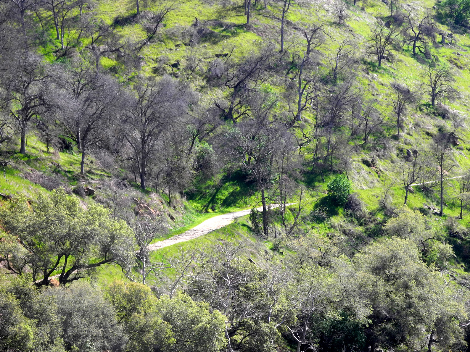
A view of the river from the closed road |
 |
 |
 |
| Old cattle chute across from the rental cabin | Camp Four and a Half Cabin |
View of Big Creek from my lunch spot |
 |
 |
 |
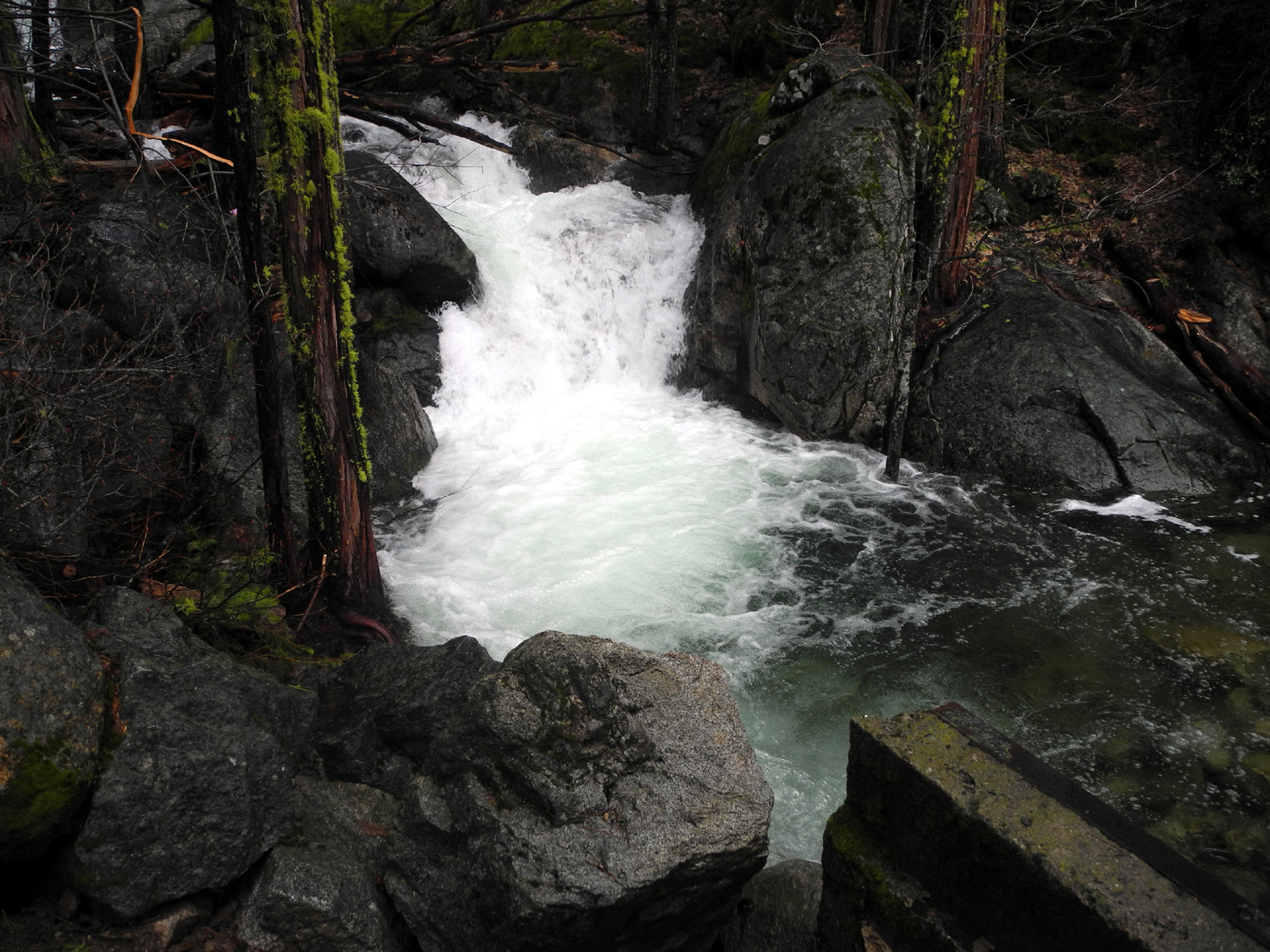
| The Falls on Secata Ridge |
Below the falls, the creek races through this channel by the road |
Part of the old "waterworks" above Big Creek |
| Sycamore Creek Hike | ||
 |
|
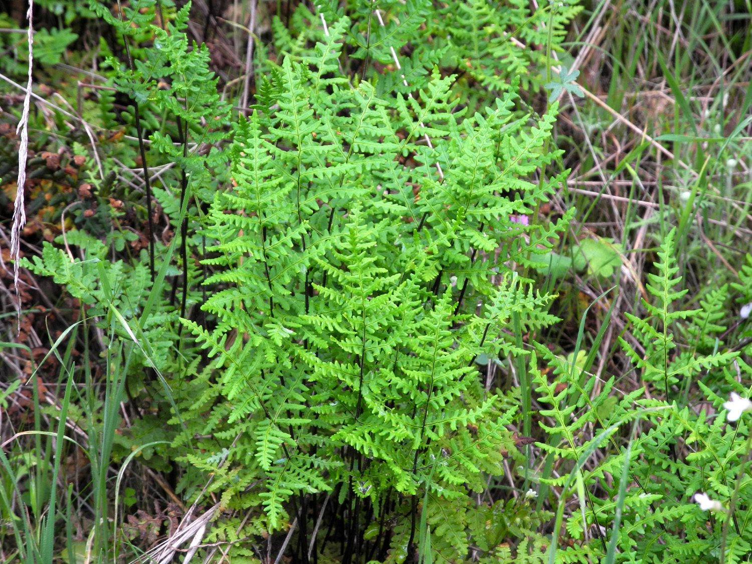 |
| Sandy and Teri head bravely into a fiddleneck jungle | Fiddlenecks, chest high and then some | Shady spots on the trail harbor beautiful ferns like this |
 |
 |
 |
| Dove lupines, the smallest of the species in this area |
Harvest brodiaea, AKA yellow brodiaea and pretty face |
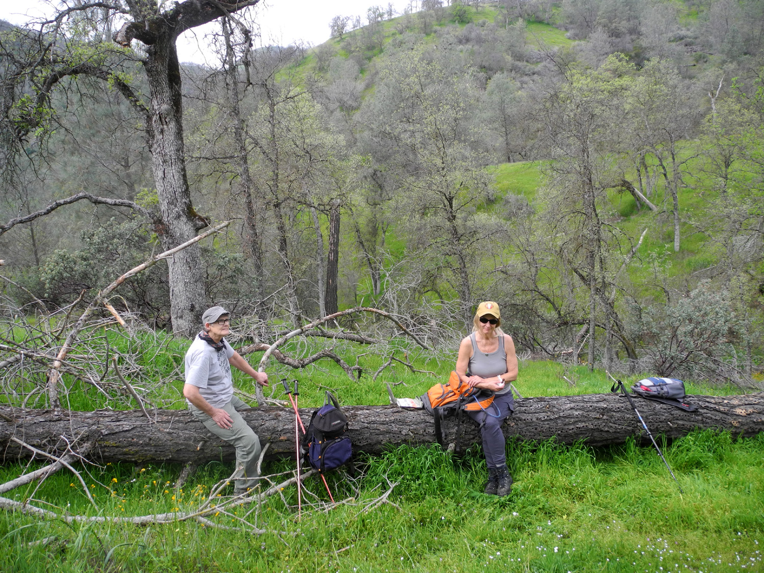
Sandy and Teri on our resting and snacking log |
 |
 |
|
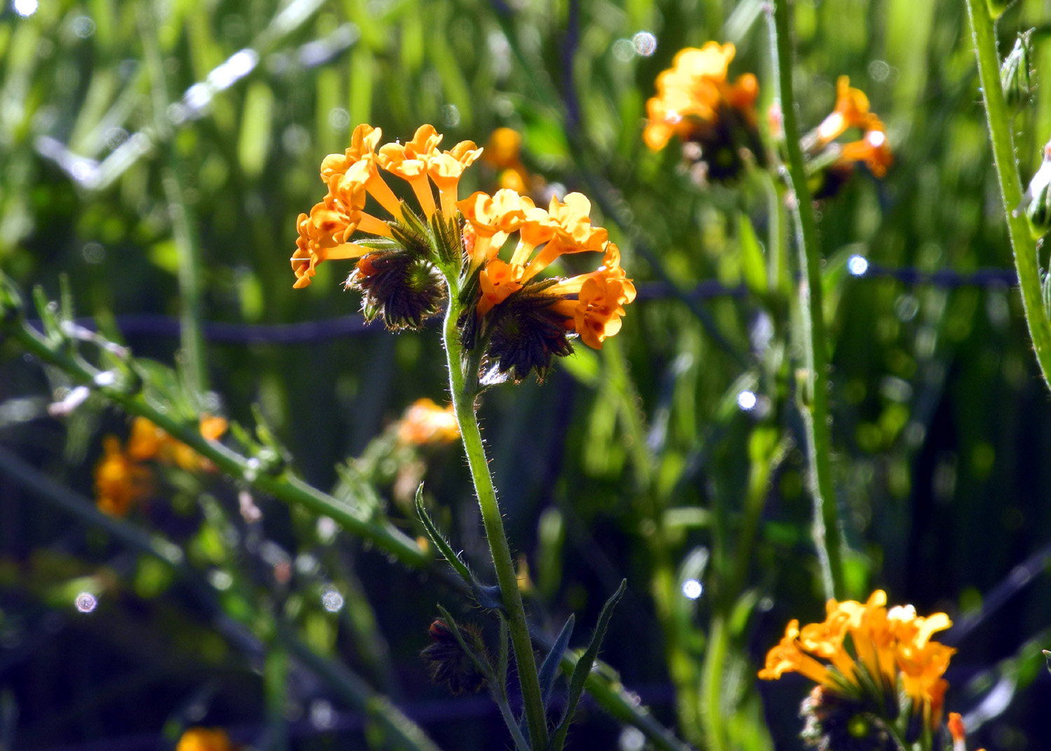
| Shooting stars and buttercups | The small pink blossoms of filaree produce spear-like seed pods | The brilliant orange of poppies, above Sycamore Creek |
 |
 |
 |
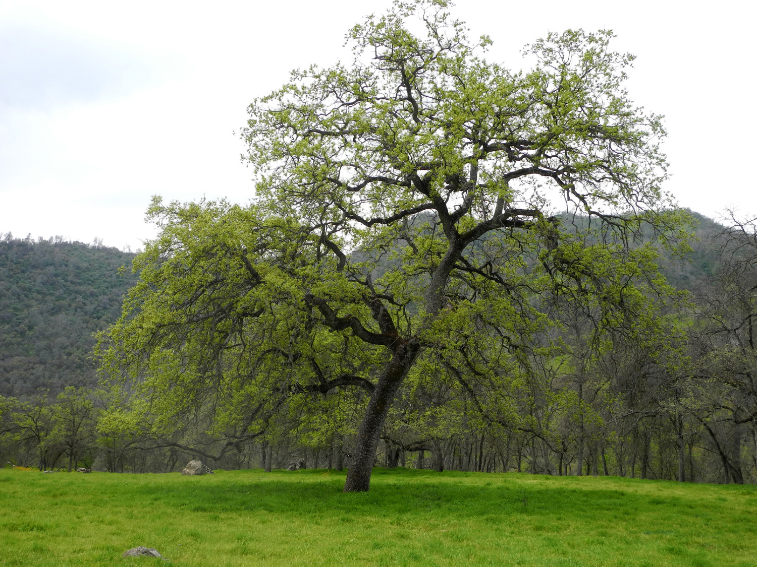
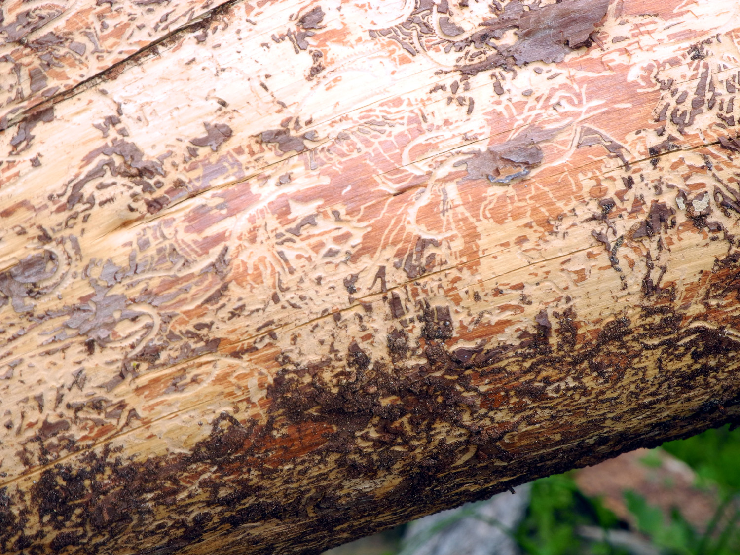
| A delightful blue oak, attired in bright green for spring | Bug art on a dead bull pine |
Dick, Teri and Sandy at the "waterworks" by Big Creek |
| Bass Lake Bash | ||
 |
 |
 |
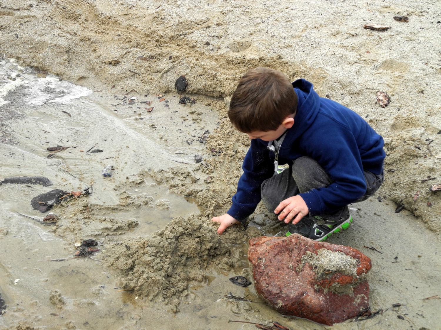
| Colton and Jack inspect a worm | Close up of a member of the Oligochaeta class | Colton, Jack and Teri at the lake |
 |
 |
 |
| Getting a close look at what's in the water | Slime fishing | Colton challenges the waves |
 |
 |
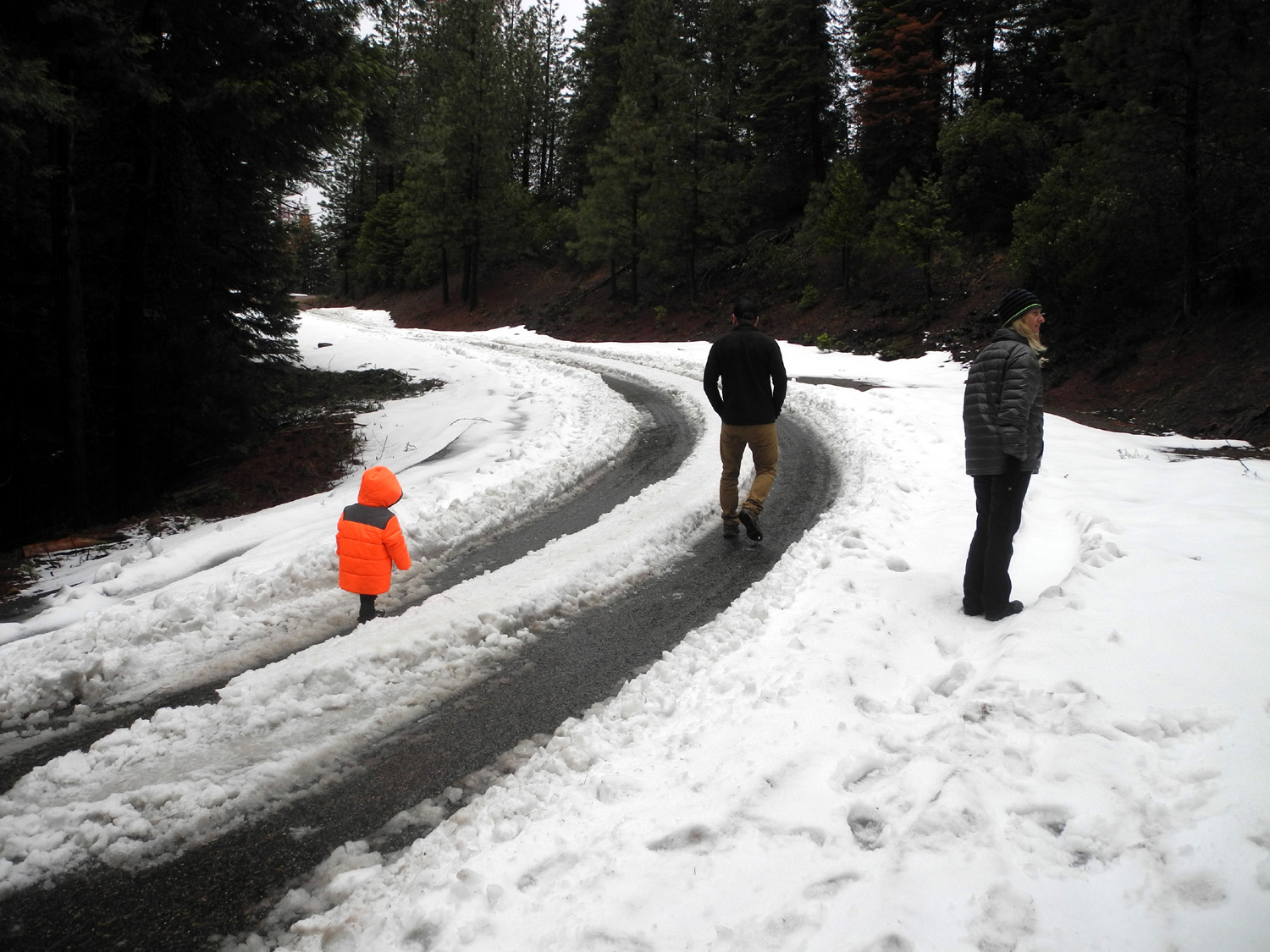 |
| Working with mud, hands on | Cascade on Chilkoot Creek along the Beasore Road | We finally found snow |
 |
|
|
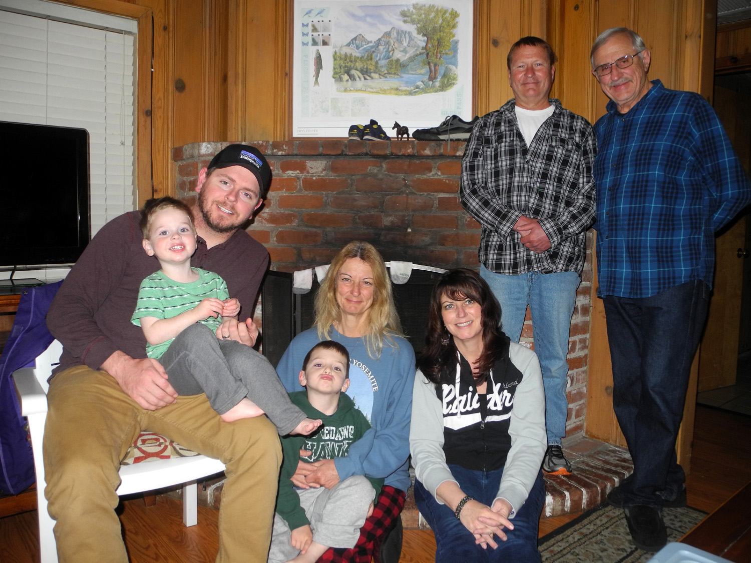
| Jack getting ready to launch a snowball attack on Grandpa | Colton, Jack and the weird snowman | Jack, Johnny, Colton, Teri, Jennifer, Rod and Dick |
 |
||
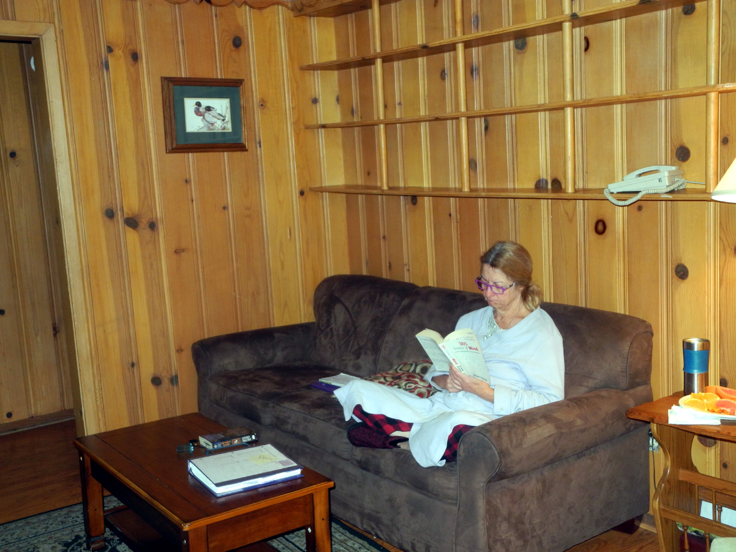
| Teri relaxing in the living room of our cabin | ||
| San Joaquin River Trail | ||
 |
 |
 |
| The places you'll go | After a leisurely wake-up, time to find breakfast | Fiddlenecks seem to be the most common flower in the foothills |
 |
 |
 |
| These were seen in only one spot, near the trailhead |
Bright green new leaves on a blue oak |
Fiesta flowers and fiddlenecks make an impressive display |
 |
 |
 |
| Phecelia, another wide-spread flower | This may be called "mule ears" | Filaree lasts all spring |
|
 |
 |
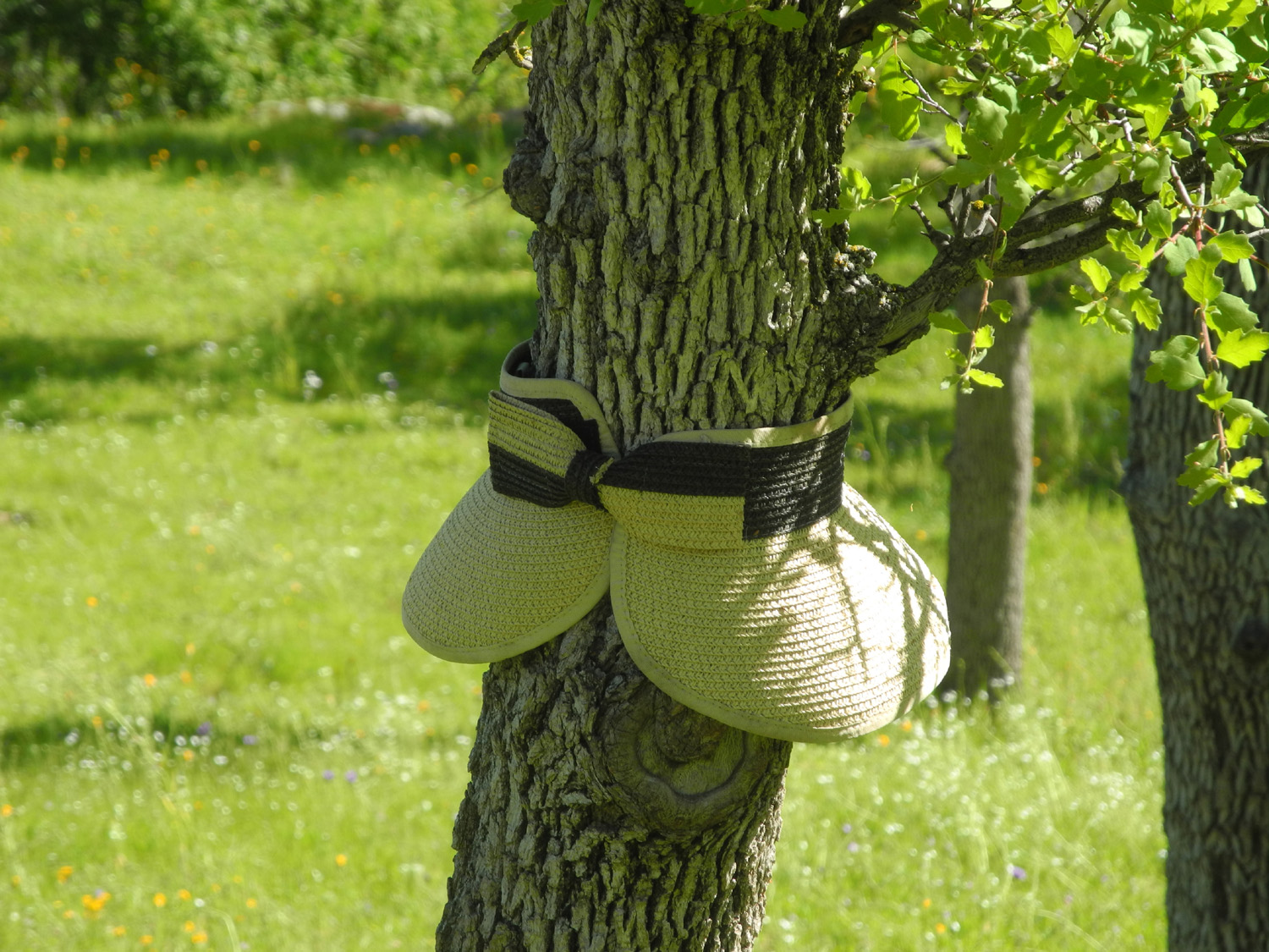
| The lost hat tree |
Part of this year's massive snow pack |
"First Knoll," between the trail and Pincushion Peak |
 |
 |
 |
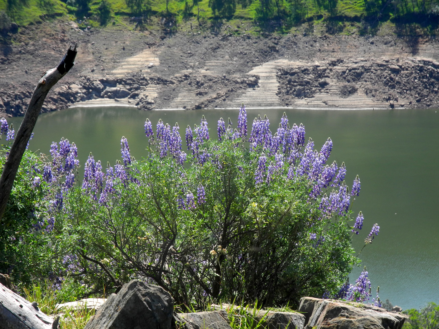
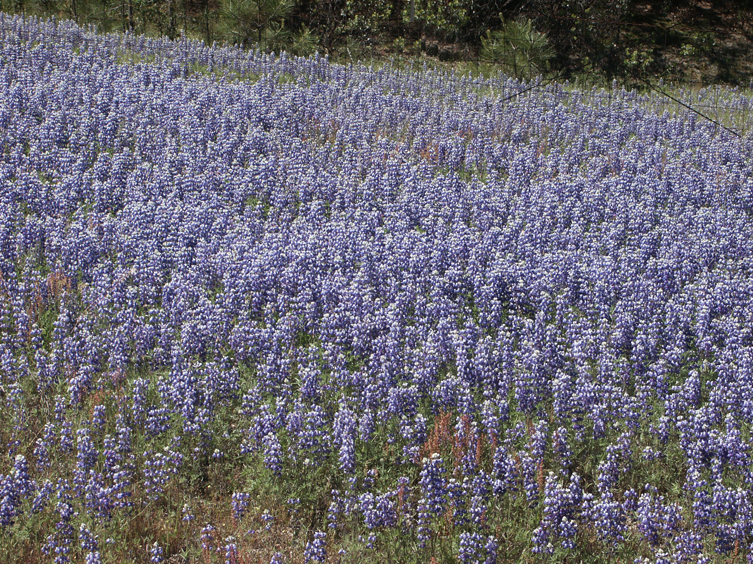
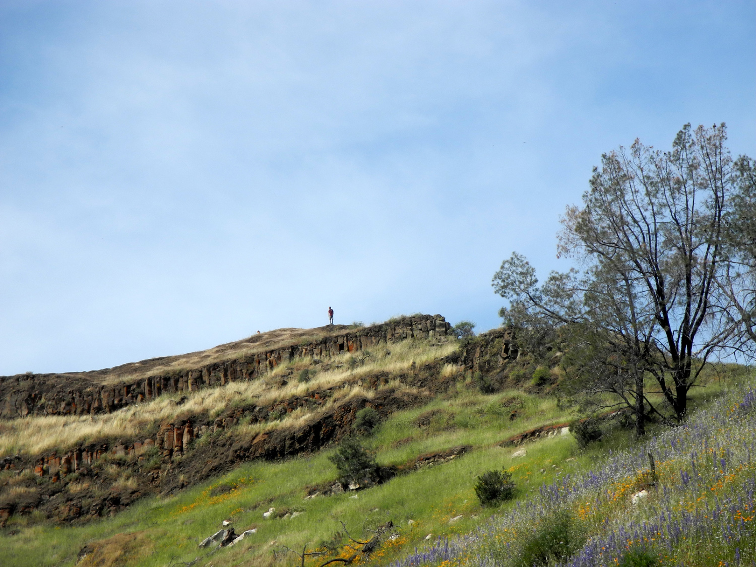
| Dove lupines hide in the grass | The lake, the lupines, and an intrepid hiker |
Poppies in the shelter of a bush lupine |
|
 |
 |
|
I couldn't stop photographing bush lupines |
A small wash-out on the trail | Foothill gillia seem to be fairly rare |
 |
 |
 |
| The daisy-like common madia | Nice catch! | Along my cross-country route |
 |
 |
 |
| A modest little flower, name unknown | The cow path back to the trail | Although tiny, this unknown flower puts on a good show |
| Related Links | ||
| San Joaquin River Gorge Special Recreation Management Area | San Joaquin Gorge Slide Show | San Joaquin Gorge Photo Album |
| Sycamore Creek | Pine Flat Reservoir | Kirch Flat Campground |
| Kings River | Monarch Divide | Camp 4 1/2 Cabin |
| Pine Flat Map | Big Creek Road | Bass Lake |
| The Pines Resort | Earthworms | Lewis Creek Trailhead |
| San Joaquin River Trail | Finegold Picnic Area | Lupines |
| Pincushion Peak | Raise your own Lupines | |
