
Dick's Adventures of 2016 - Part 4 |
||
|
Adventures of 2016 Part 1 Adventures of 2016 Part 2 Adventures of 2016 Part 3 Adventures of 2016 Part 5 Adventures of 2016 Part 6 Adventures of 2016 Part 7 |
||
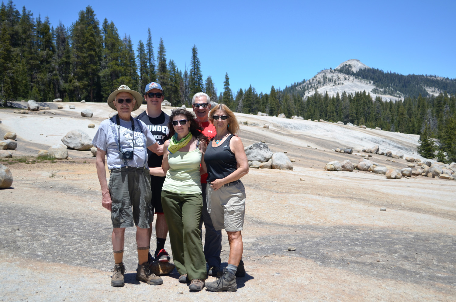
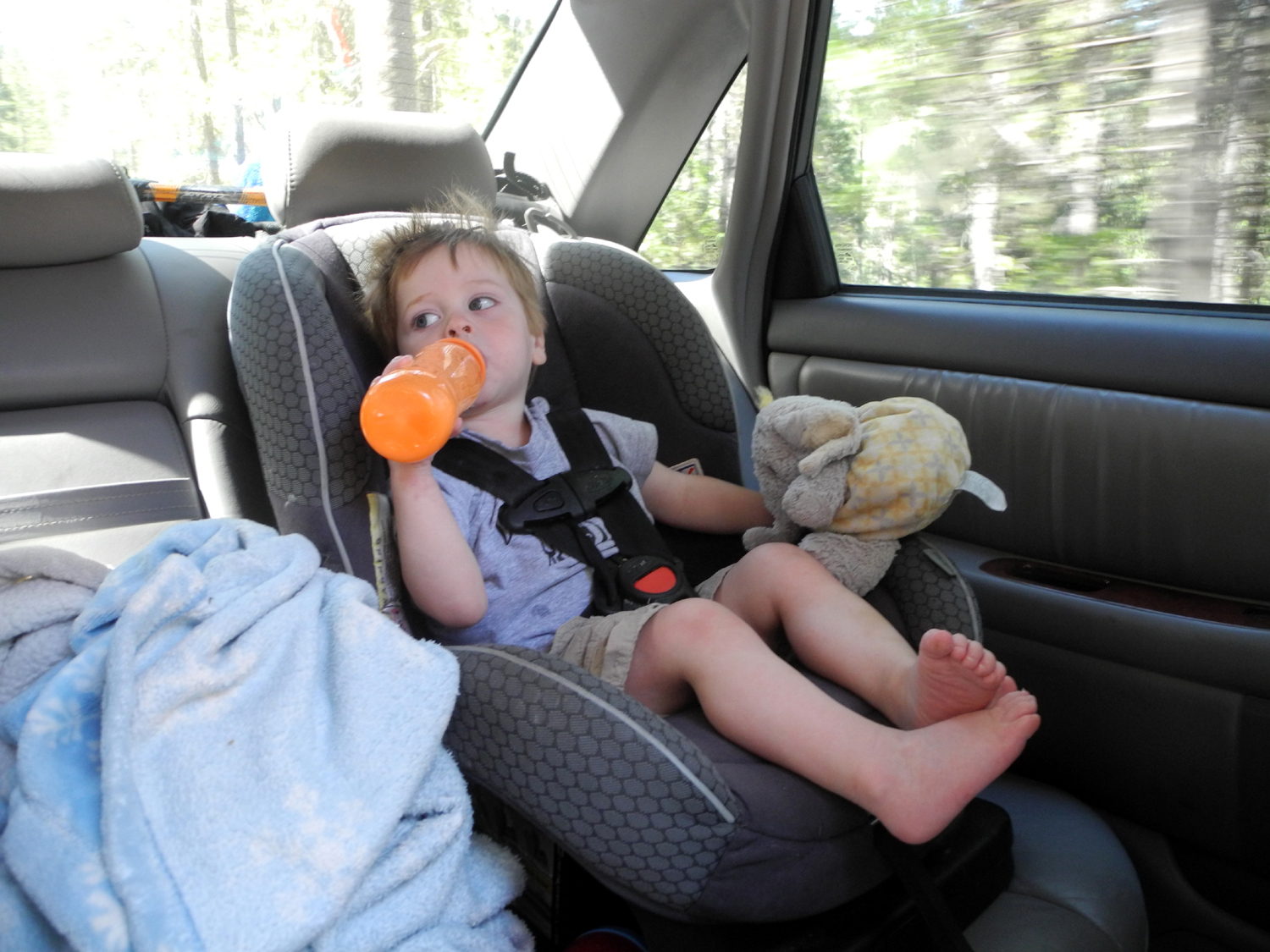
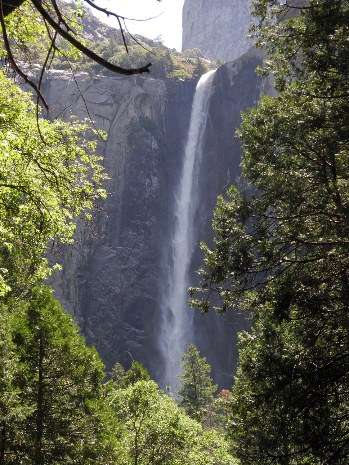
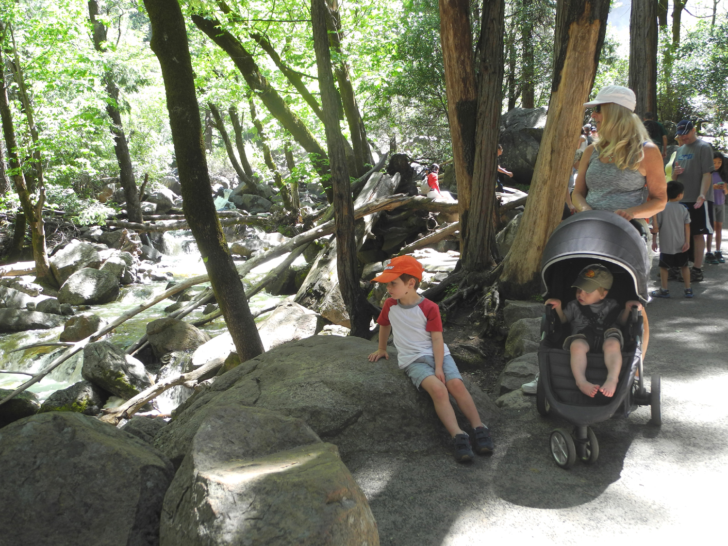
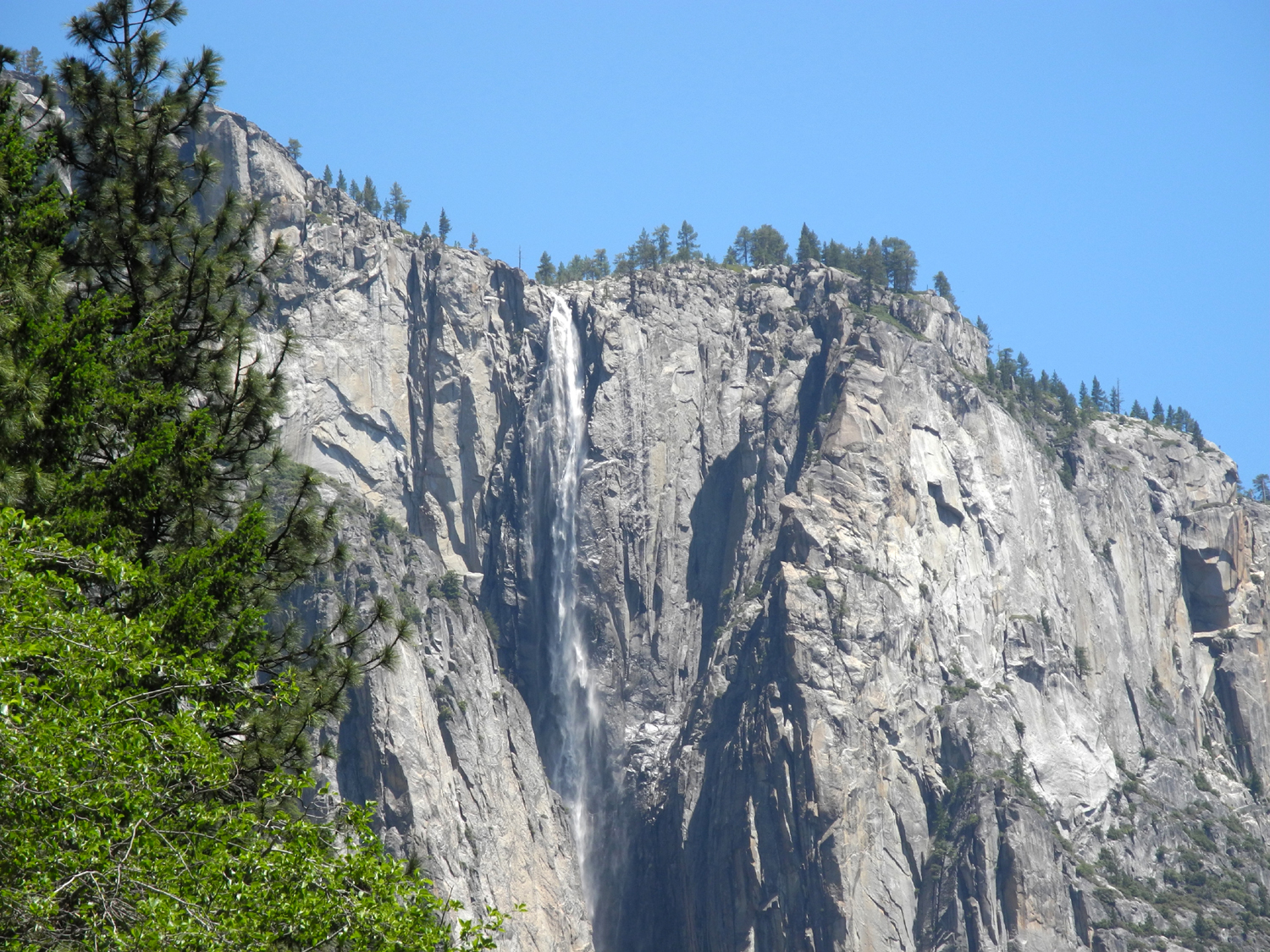
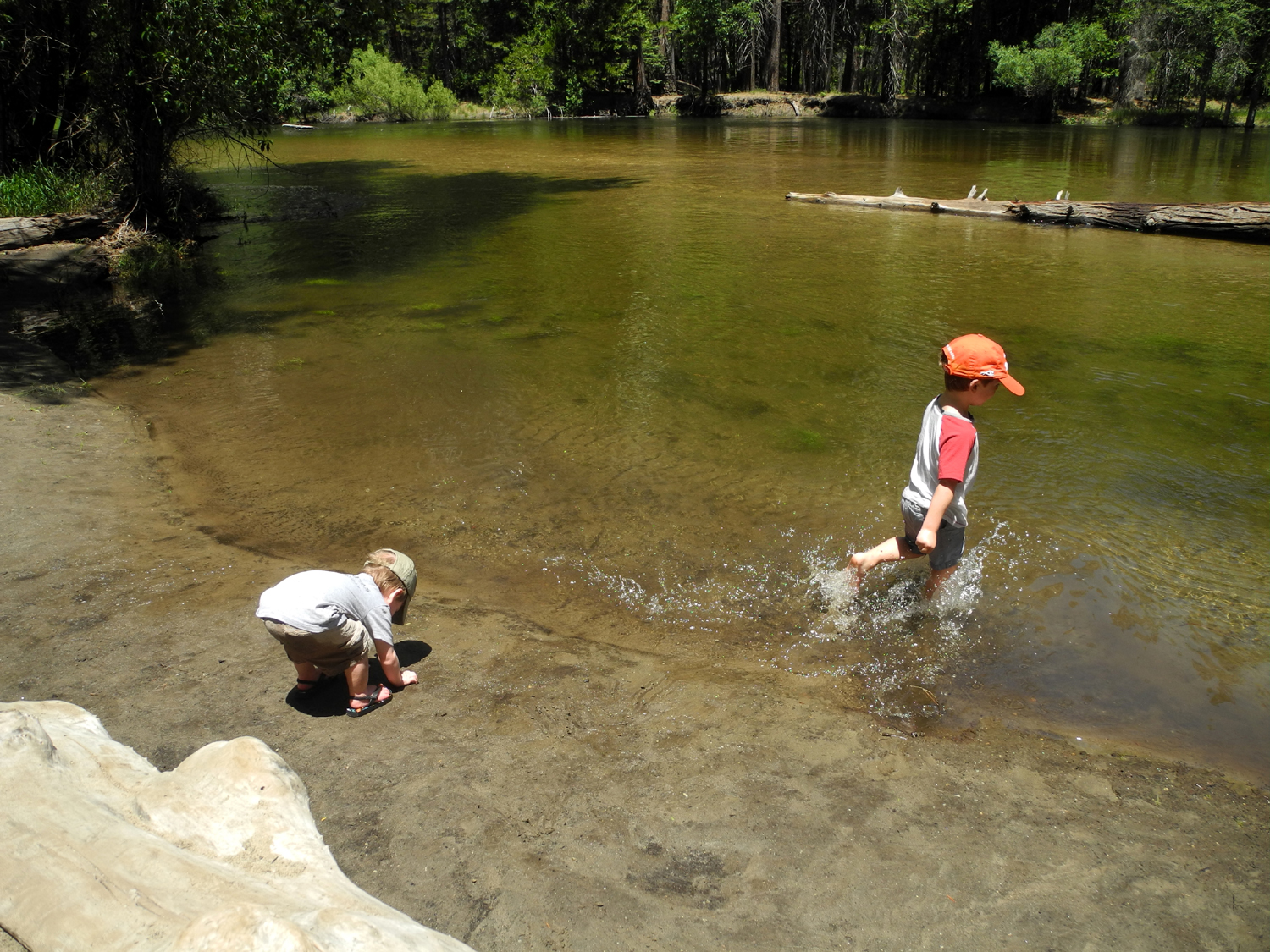
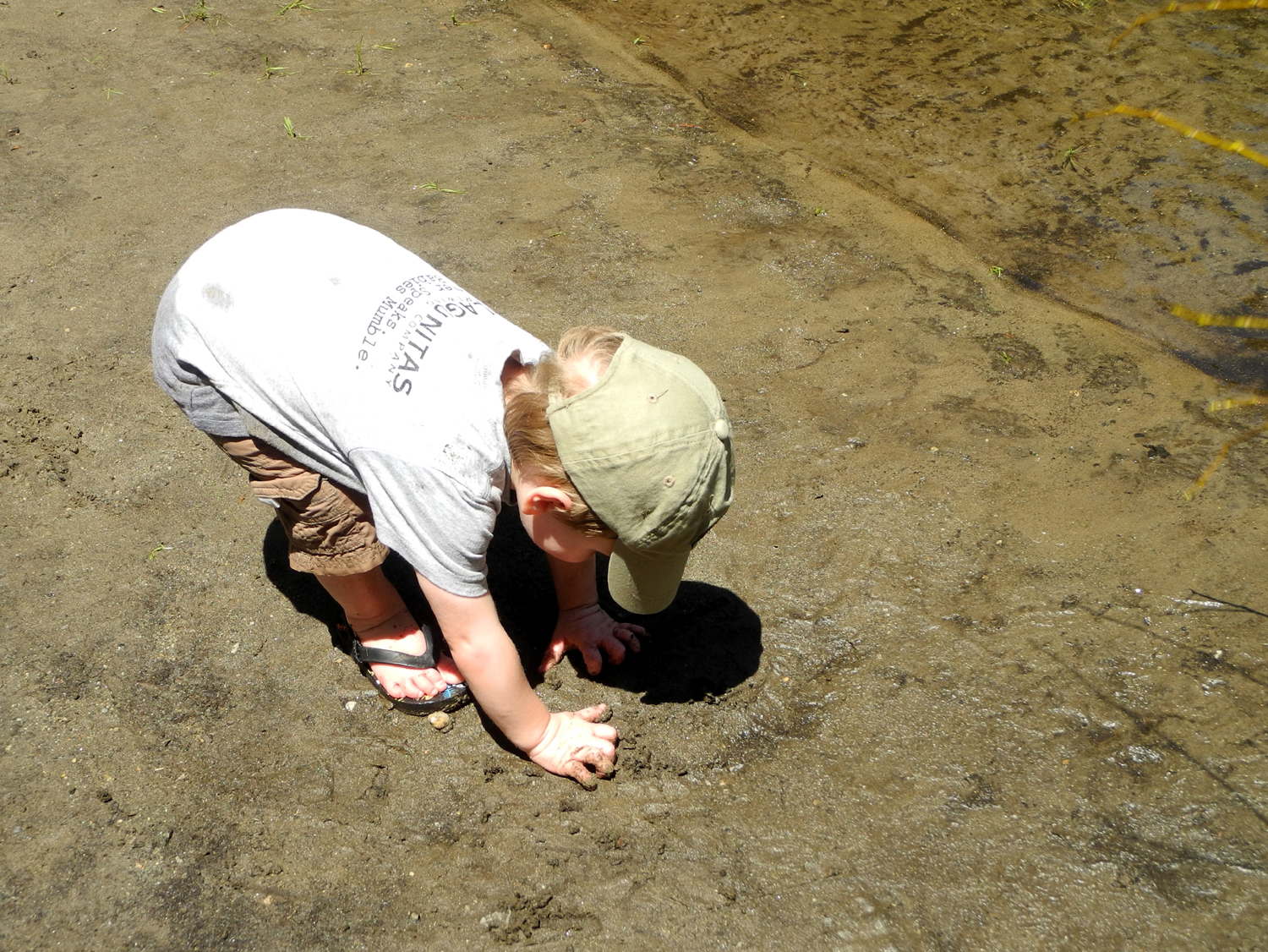
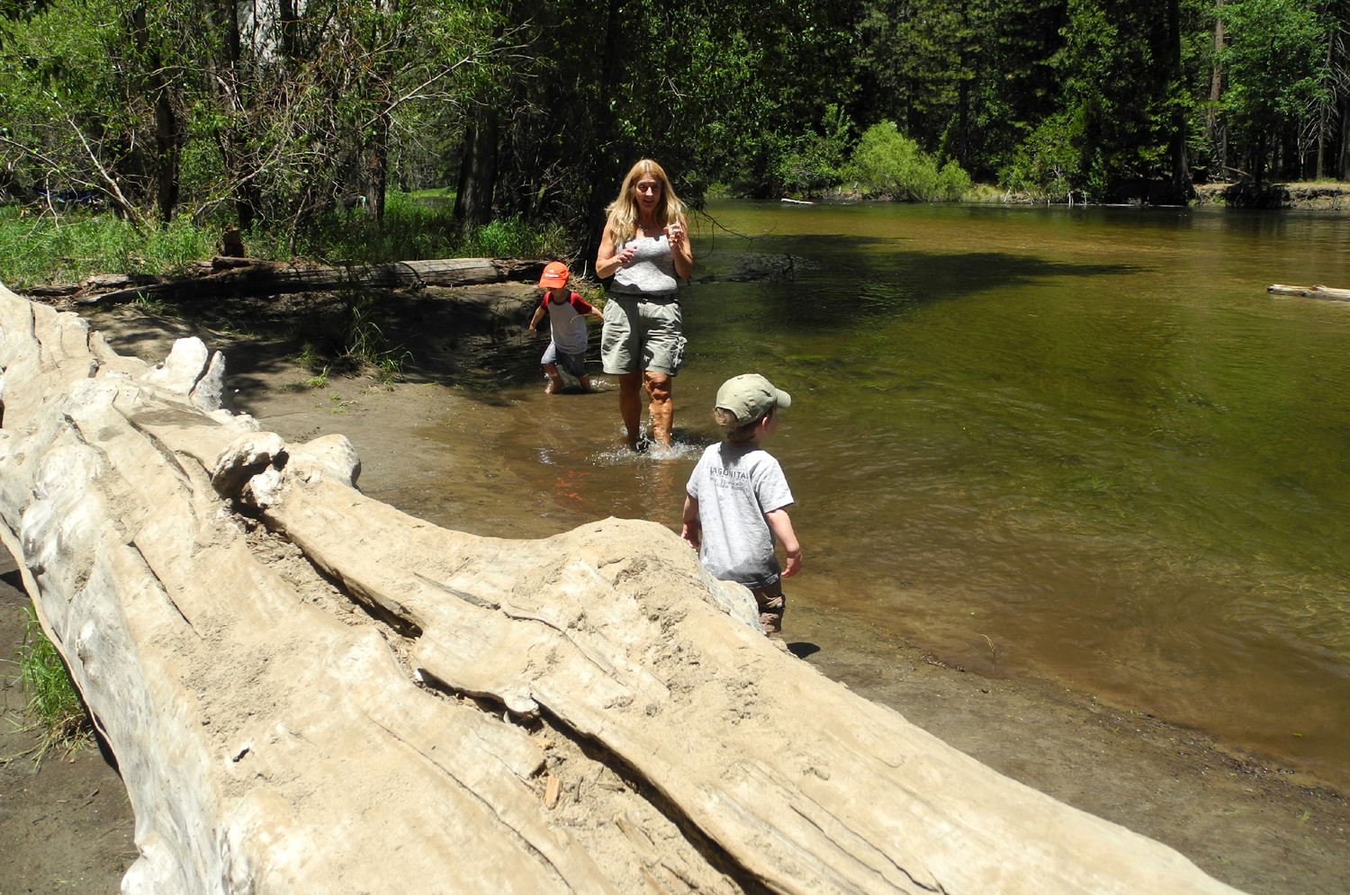
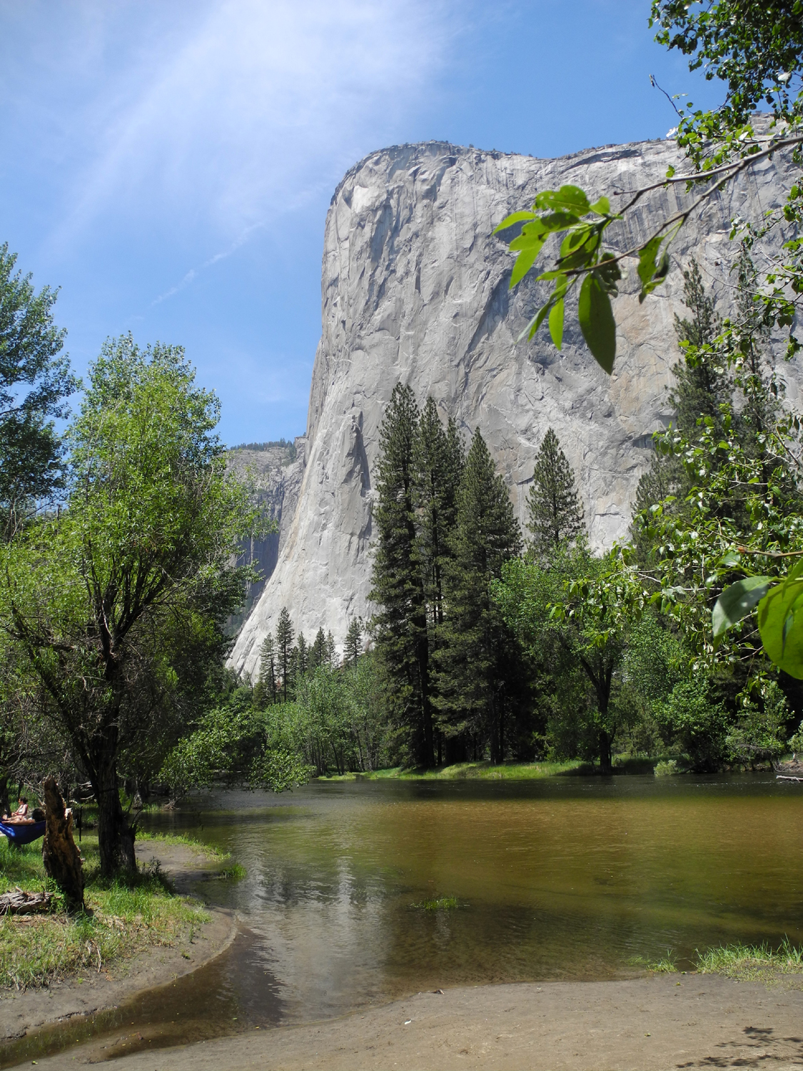
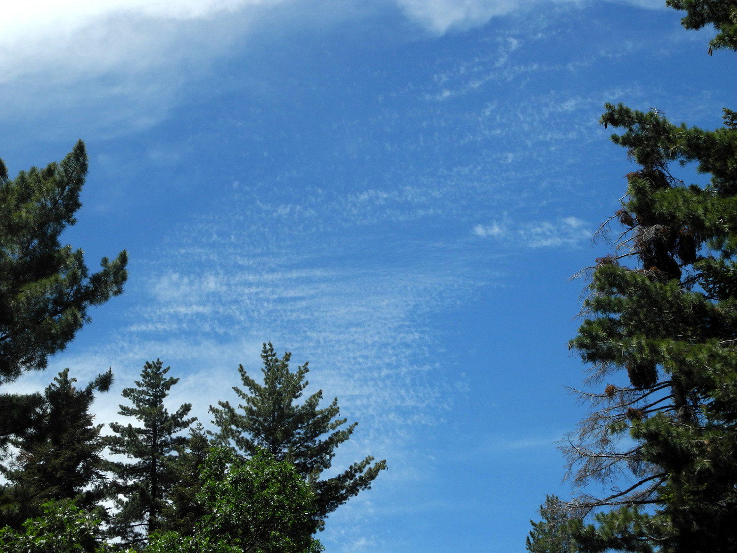
Yosemite Waterfall Tour Once again I had a fun outing with my older daughter Teri and her grandsons (my great grandsons) Colton and Jack. We went to Yosemite for the day on June 3, hoping to get a little jump on the crowds that arrive once school is out. I don't know what the crowds will be like when that happens, but there were certainly more than enough people all over the valley. Cars were parked along the roads everywhere there was room, although we managed to find a spot at the places we stopped. Colton had been to Yosemite a few weeks earlier, and he was very enthusiastic about waterfalls, especially the part where the mist gets you all wet. With the peak runoff nearing an end we wanted to see a few of the falls, all flowing better than they have for several years. Teri and the boys arrived at my house a little before 8, allowing enough time for them to scatter my "decorative" bowl of marbles all over the floor, one of their favorite games here. Teri had to make a phone call at 8, and once that was completed, the marbles were picked up and we were on our way. The trip went smoothly with a rest stop at the park entrance station, where the boys were given a snack. If you've never traveled with young children, the number one rule is, always have food ready. We continued through the park, including one of Colton's favorite places, the Wawona Tunnel, at 4,233 feet the longest in California. It was drilled through solid bedrock in 1933. When you exit on the east end, you are presented with the iconic view of Yosemite Valley, featuring El Capitan, Half Dome, and Bridalveil Falls. Our first stop was at Bridalveil, which drops 620 feet and offers a variety of different looks through the seasons. At peak runoff the wind blows spray from the fall all the way to the parking lot, and there is water running down the trail that goes to the base of the falls. The closer you get, the wetter you get. In late August the flow is reduced to not much more than a trickle, and the winds blow the falls far to both sides, giving the impression of a bride's veil waving in the breeze. The snow melt has apparently diminished quite a bit in the last week or two. When Teri was there with Colton a few weeks ago, they got thoroughly wet, but this time no spray reached the parking lot, and in fact, there was very little mist until we reached the end of the trail. At this point, you could get soaked if you lingered very long. After a couple of minutes the boys were getting chilled so we went back down the trail, and across two bridges that cross the creek, which divides into two channels below the falls. Jack enjoyed his first waterfall experience as much as Colton had, although both of them also liked the bridges, and perhaps enjoyed climbing on rocks even more. From the trail to the base of Bridalveil, and also along the road we followed when we left there, we had a view of Ribbon Falls. This is one of the highest in the park, but it is highly dependant on snow melt, and pretty much disappears by late June. There were other temporary or seasonal falls, including one that came down the cliffs on the south side of the valley in a series of cascades. When we finished our activities at Bridalveil the boys were ready for lunch, and Teri and I were in agreement, so we searched for a picnic site that her son Johnny had told her about. We found it, but so did many others, with all the picnic tables occupied when we arrived. We were resigned to using a large log, but when one party left, we quickly grabbed the table. Teri had brought lunch meat, crackers, cheese, and grapes, and everyone enjoyed a mix of whichever items they preferred. Also Cheerios which both boys love. During our lunch we were entertained by a couple of crows who were looking for goodies around the various tables, and had no fear whatsoever of people. At one point they both suddenly flew down from a tree just a few feet from Colton and Jack, to their great delight. Our picnic site was a short distance from the Merced River, in a place where it was wide and smooth, so after lunch Teri and the boys waded in the edge of the water. Although the water was in the sun, its history as recently-melted snow was obvious when you stepped in more than a few inches, and the kids made no attempt to go out past the first few feet. I had never been to this exact spot in Yosemite Valley before, and was intrigued to discover that it offered a dramatic view of El Capitan, giving the impression that you were almost standing right under the bulging top of the massive granite outcropping. The river had been up several feet higher not long before, so the area next to the water was nice and muddy. This proved to be an excellent place for writing with a stick, although both boys soon abandoned tools and just dug into the mud with their hands. Colton understood the concept of rinsing his hands in the river, but when we told Jack to clean his hands, he opted for something much handier, the front of his shirt. These activities continued until both boys were fairly wet and muddy, but of course, Grandma knows about these things and had brought along extra clothing. Once they got changed, we loaded up and started for home, but not directly. The main road there was part of the one-way loop that goes east into the valley on the south side, so we drove in that direction, and stopped at a parking area where we had a nice view of the upper Yosemite Falls. Although it was flowing very full, there was enough of a wind near the base that the water was sometimes blown completely off to one side of the stained area of the rock that marks its normal drop. Colton was looking forward to another trip through the tunnel, and struggled to stay awake that long, but Jack was out before we started up the hill out of the valley. Colton was still wide awake and enjoyed his second pass through the tunnel. Heading away from the valley, we stopped at a vista point just past the tunnel where you can see Half Dome and El Capitan, as well as the highway that goes up the north side of the canyon and out to Tioga Pass. There are three small tunnels on this road, which Colton had traveled in the past, so he enjoyed watching cars across the canyon disappear into one of the tunnels then emerge from the other end. We also had a nice view of Cascade Falls along this route. This falls races down the mountain side west of the valley itself, making a series of drops both above and below the road across the way. The last part of the falls is the longest and straightest, and is also the first waterfall to greet visitors as they drive into Yosemite on Highway 140 from Mariposa. We enjoyed the view and took some pictures, then got started for home. Colton was asleep within a mile, and both boys slept all the way to my house. Teri was having them overnight, so was glad that they would be rested for the evening's activities. Having got up at 6:30, and missed my nap, I also slept for a few miles myself. We both agreed that the crowds this early mean that our visits to Yosemite are over until next fall, other than the possibility of some hiking away from the valley. Teri had been there at least five times since the start of the year, and both of us are looking forward to a trip to the less crowded Kings Canyon National Park in about a week.
|
||
|
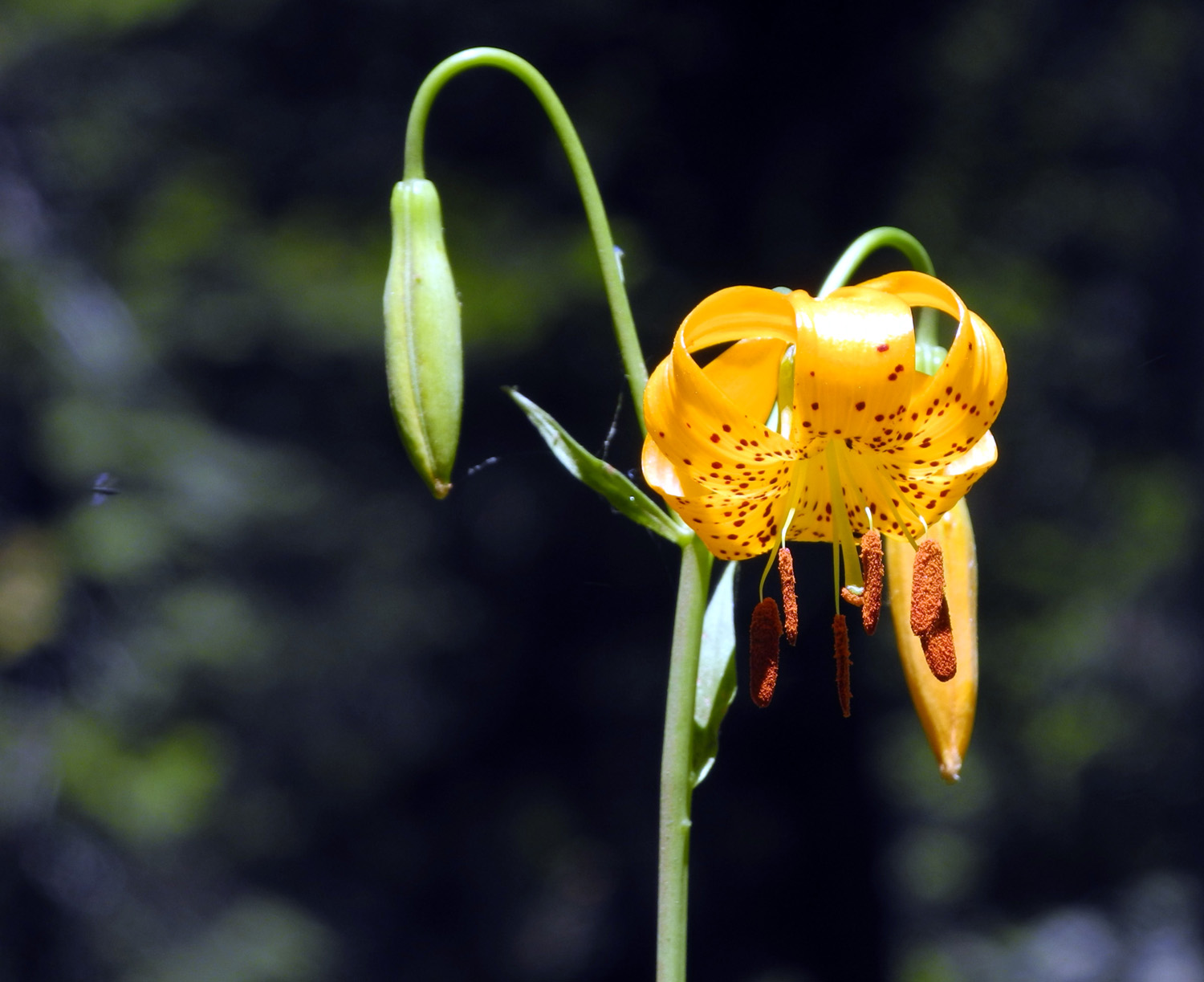
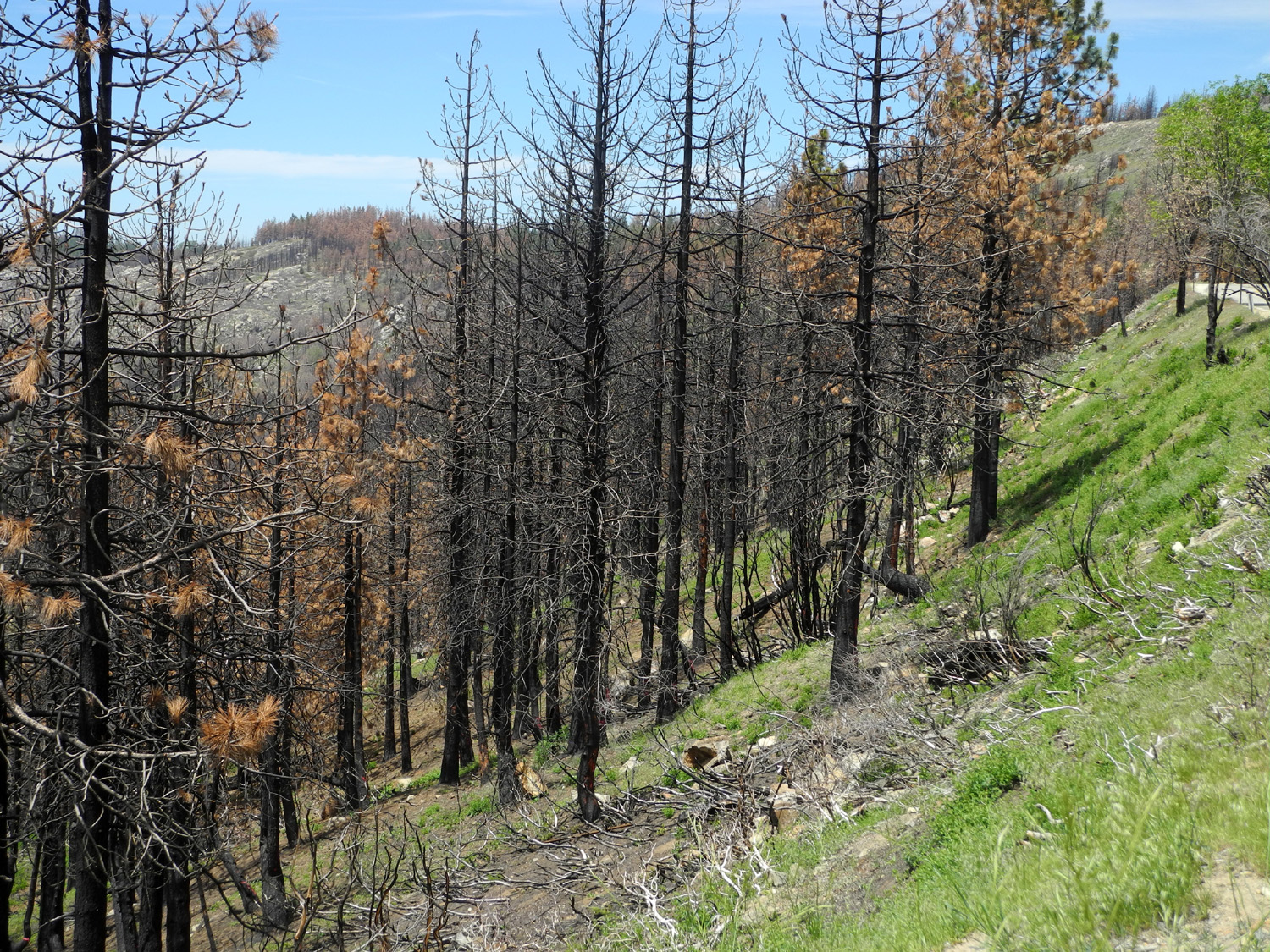
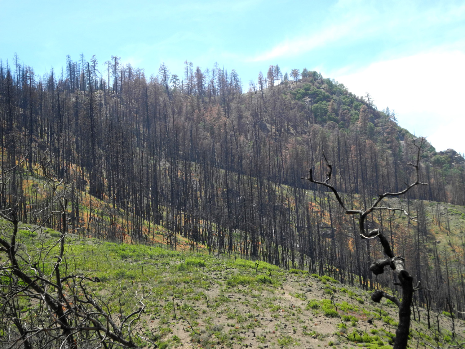
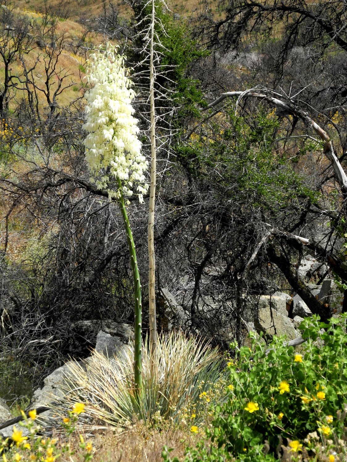
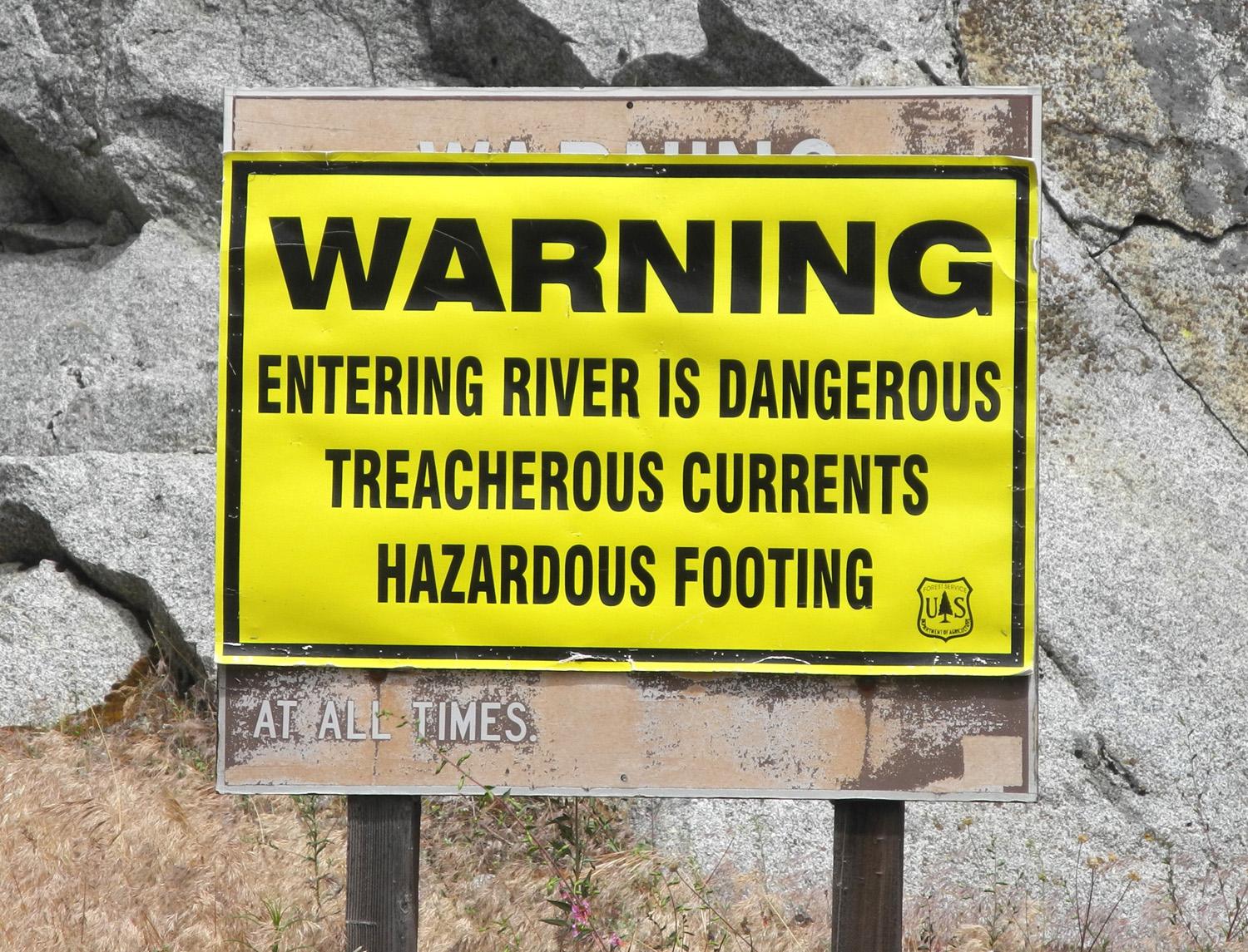
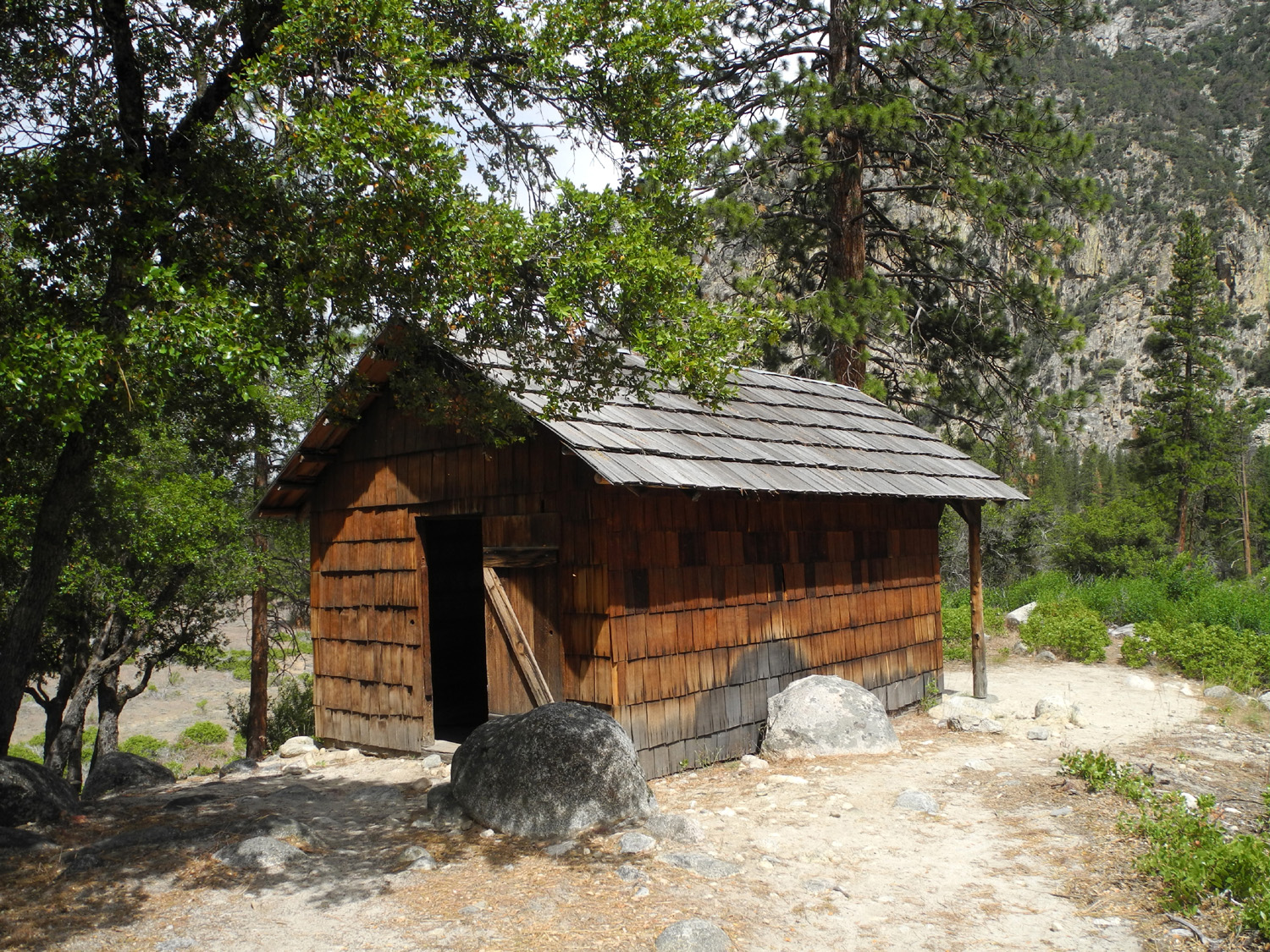
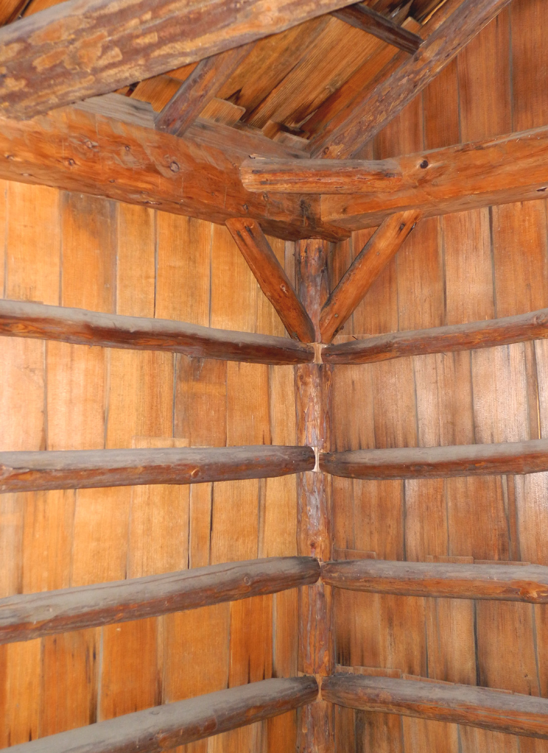
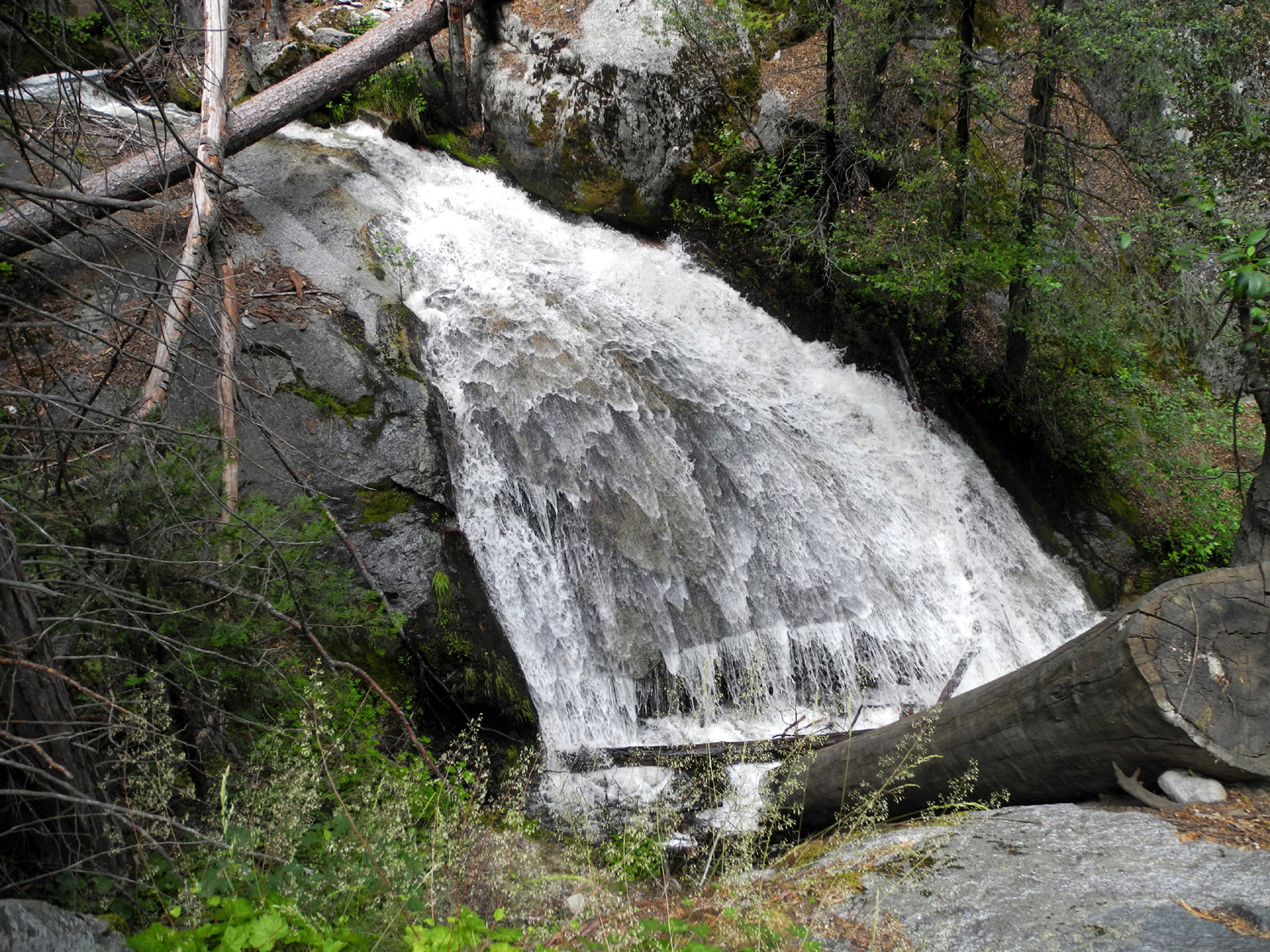
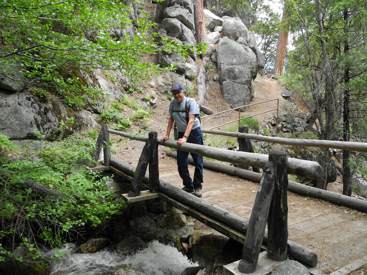
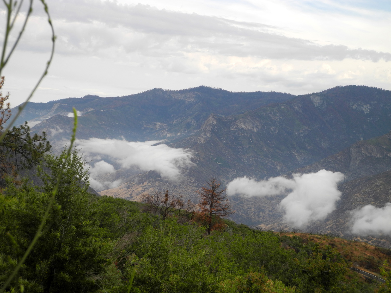
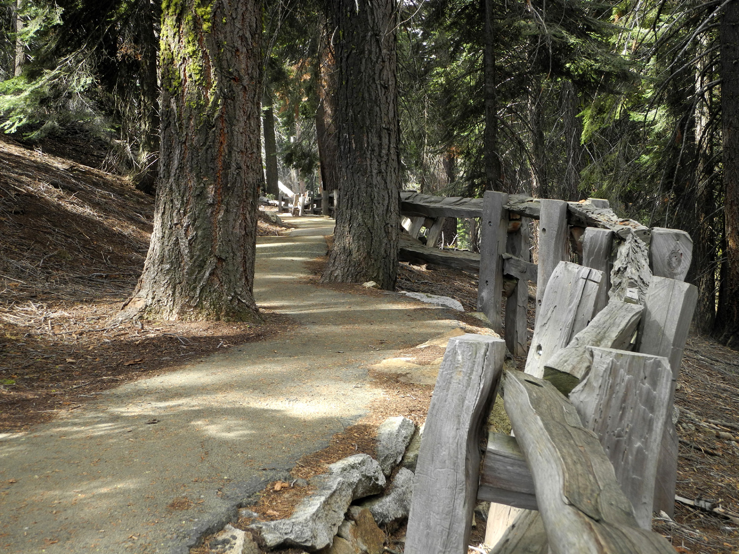
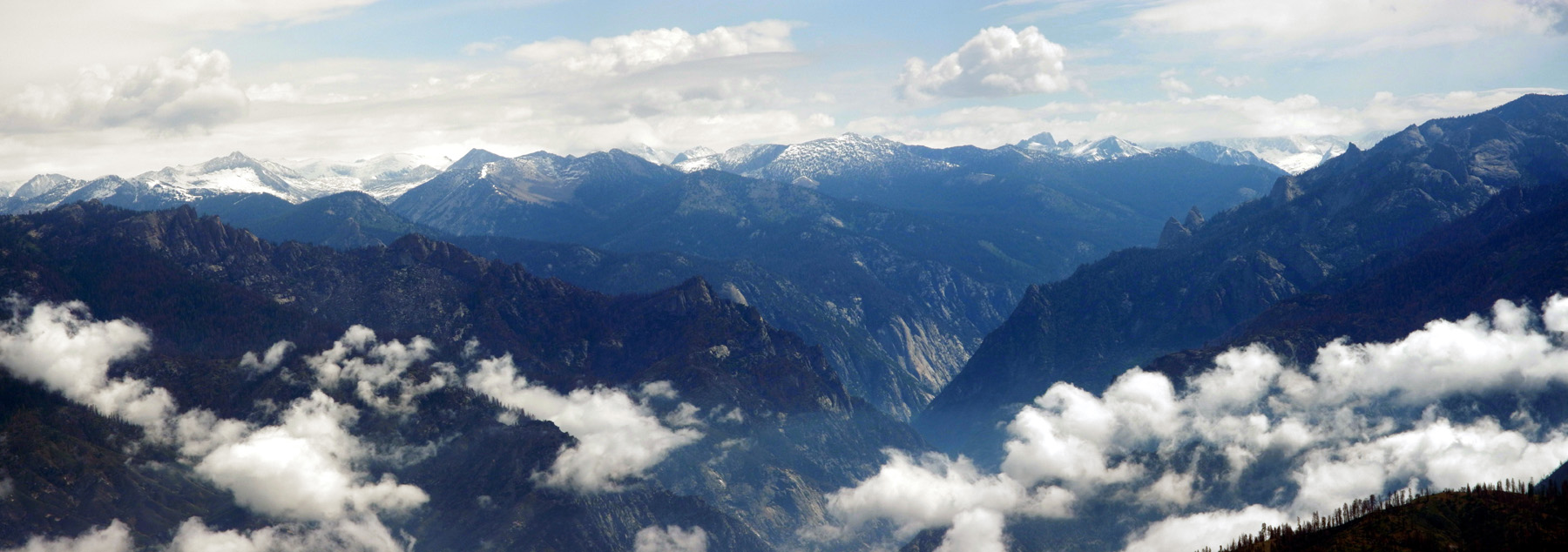
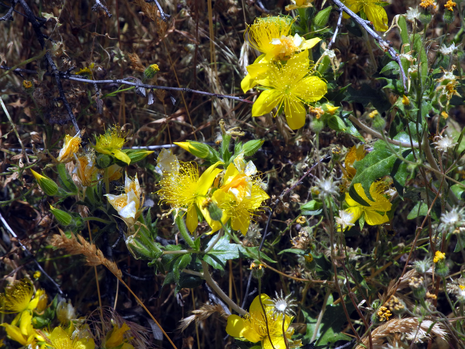
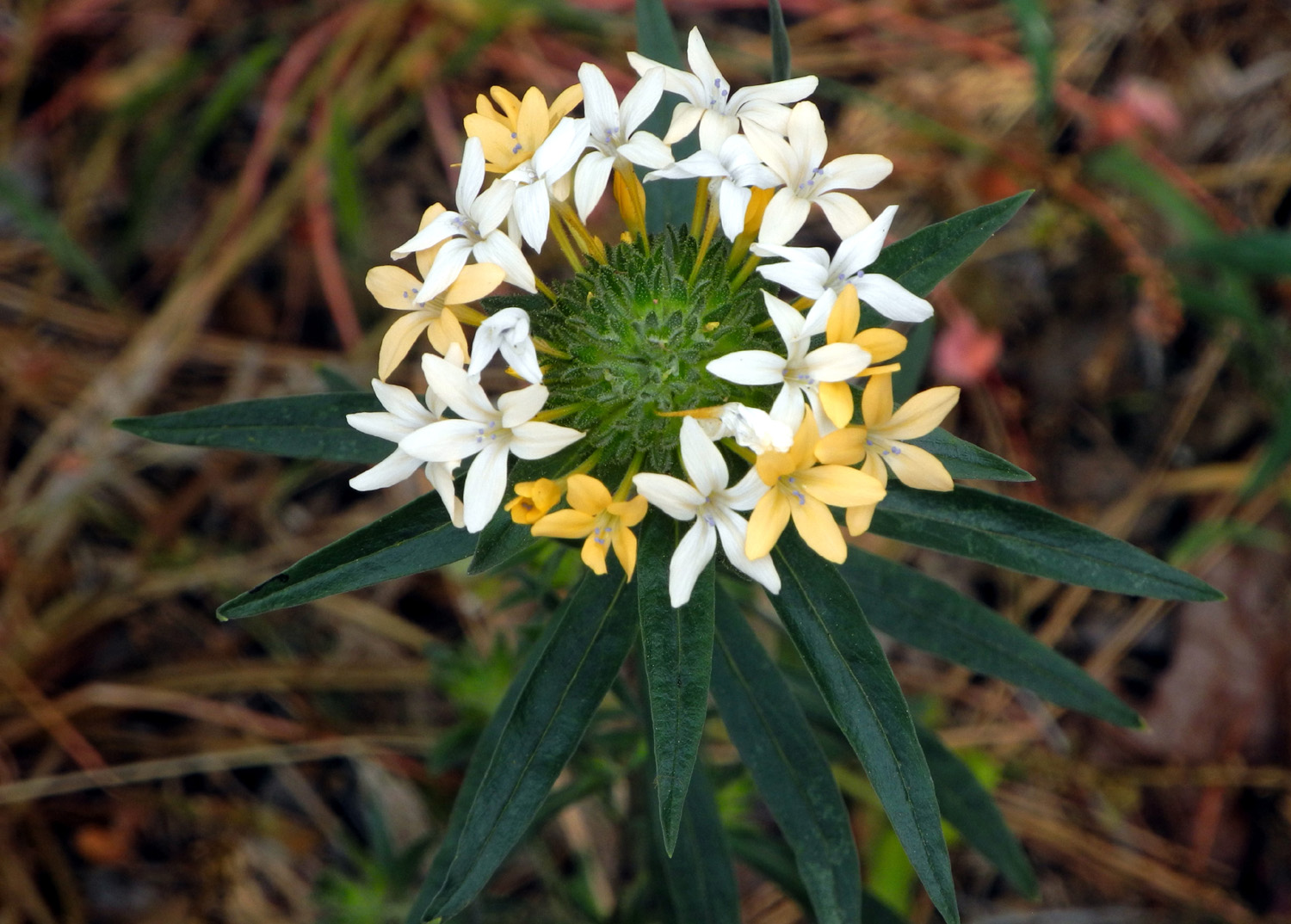
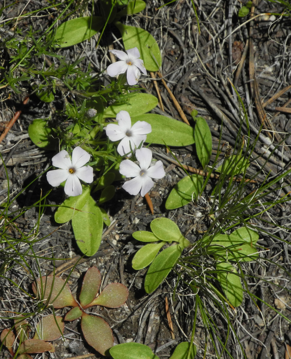
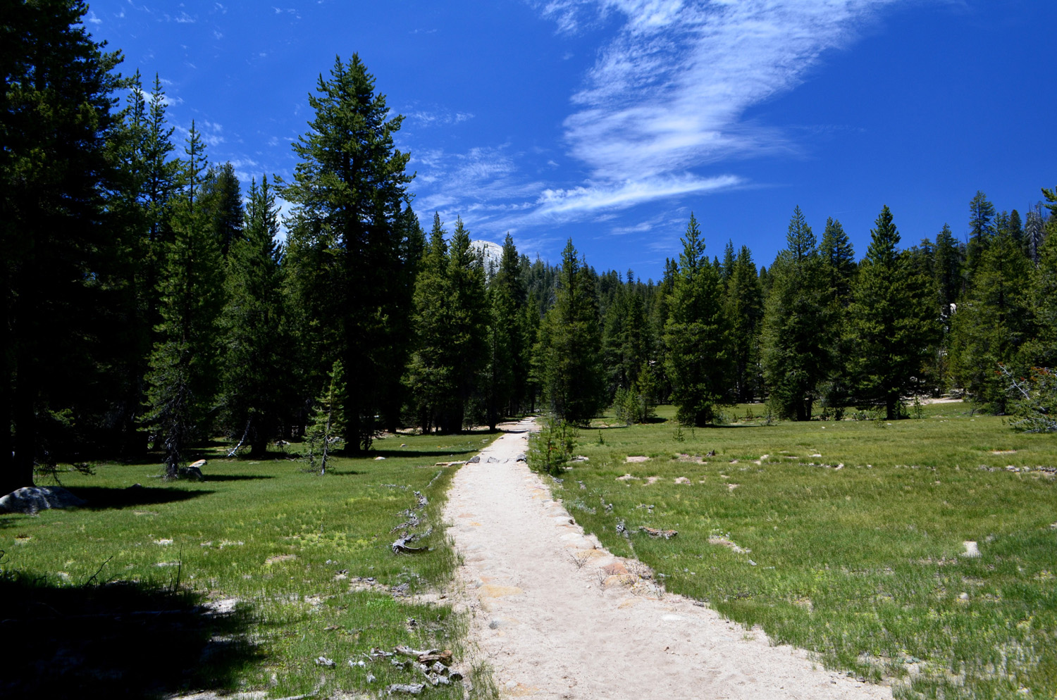
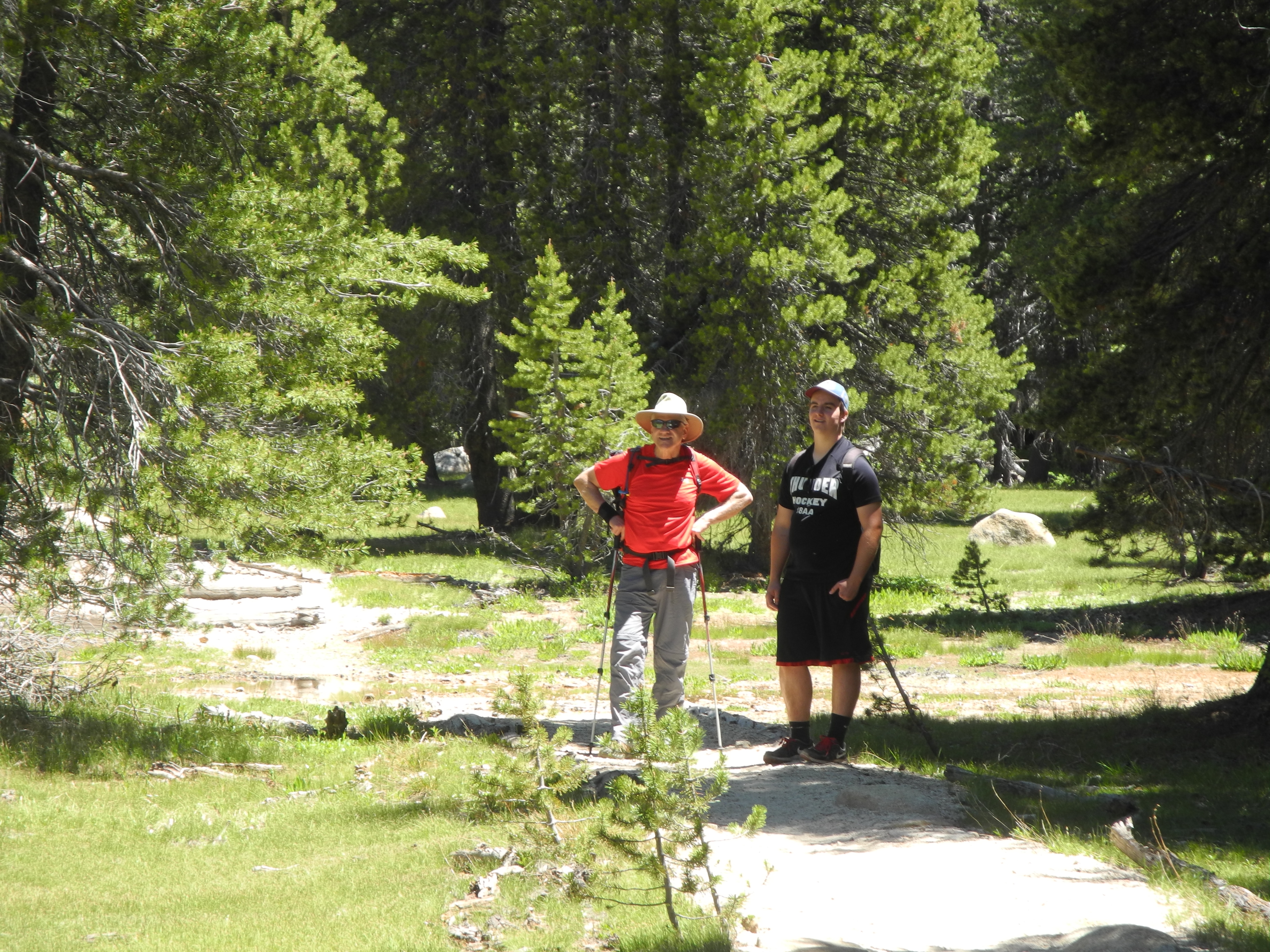
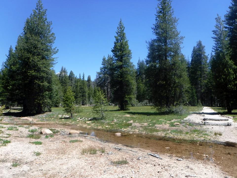
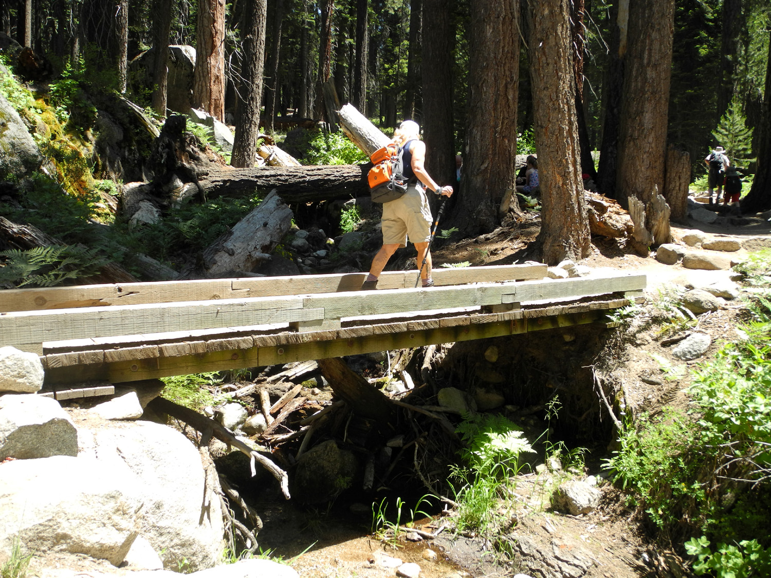
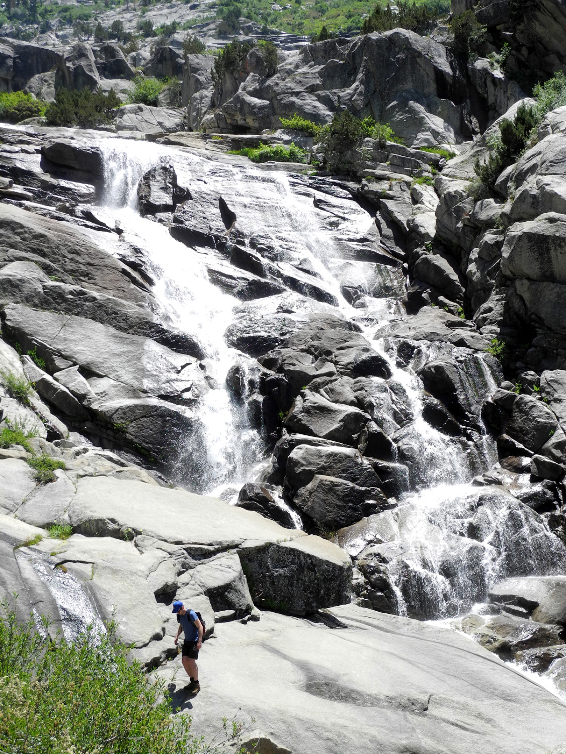
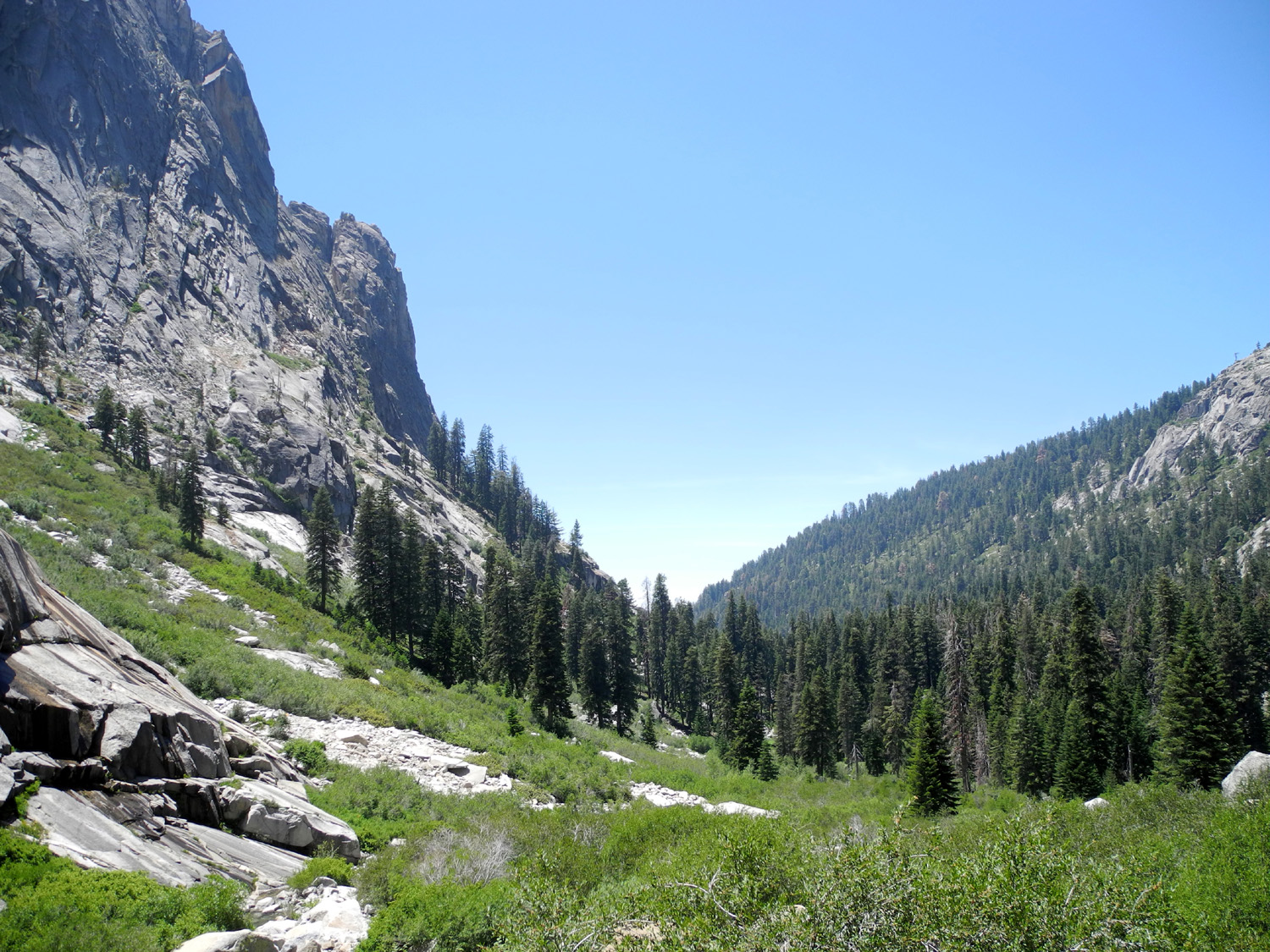
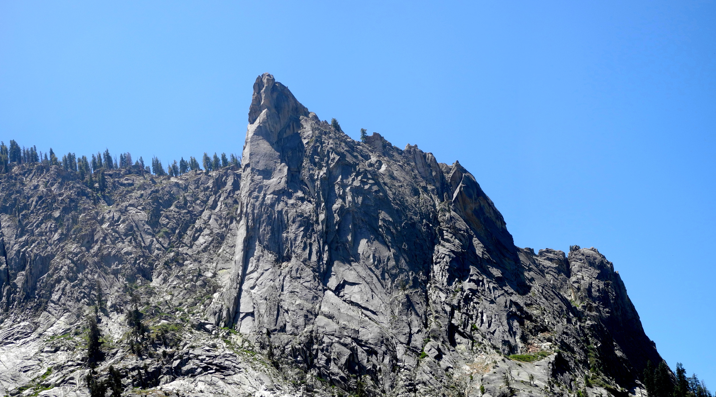
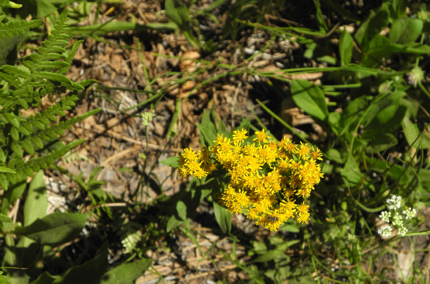
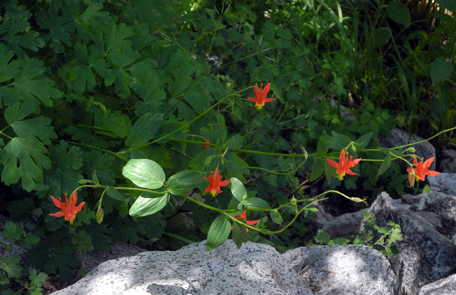
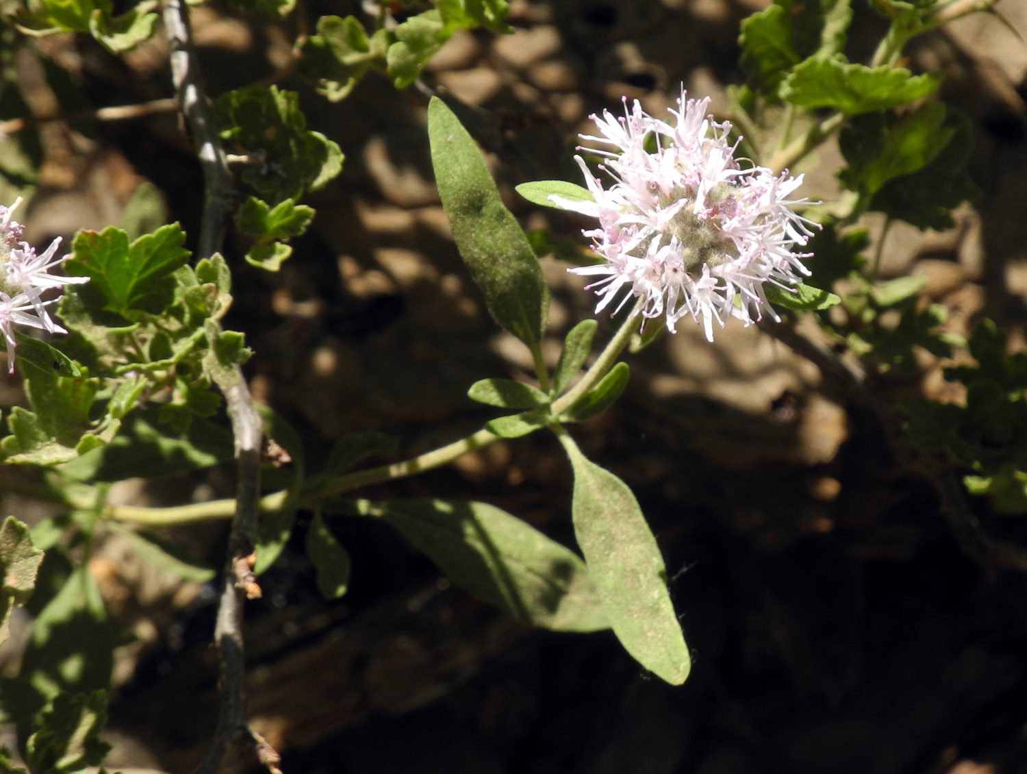
Kings Canyon Campout To call a trip a "campout" gives the impression of lounging beside the campfire, sipping a drink and reading (at least in my vision). When it's a trip with my daughter Teri, plan on more hiking and less lounging. Of course, we do include lounging and reading, but we earn the right to goof off after days with multiple hikes. Also well-earned are the evening meals. My solo camp cooking usually consists of re-heating leftover pizza and maybe making a grilled cheese sandwich. With Teri in charge of cooking, we had chicken tacos, arroz con pollo, and other goodies, including a grilled cheese sandwich, but with better side dishes than I would have had on my own. Teri and I had both wanted to make a trip to Cedar Grove in Kings Canyon National Park, and in fact Teri had made a couple of day trips there earlier this year. For our camping trip, she took her motor home up on June 8, while I drove up in my Honda the next day after a morning meeting. I made quite a few stops along the way, to look at stuff and take pictures. My first stop was along the road past Grant Grove, where there is a view of the Converse Basin to the west. This was the site of the McGee Fire in 1955, which is described on a sign at a turnout. Although what I saw was indeed a scene of destruction from a forest fire, this event was much more recent - the Rough Fire of last summer (2015). After the previous fire, many pines had grown up starting a good recovery, and now they were burned out once again. Beyond this area a few miles there's a road up to a helipad, with a view down the Kings River Canyon. The devastation from the Rough Fire was even more pronounced at this location The burned hillsides were covered with grass and flowers, but it will be a long time before the evergreen forest recovers. In the burned areas, heavy rains this winter have contributed to a good floral display at this 6,000 foot altitude, and I saw Mariposa Lilies, climbing brodiaea, blazing star, and several other species. I made a couple of other stops as the road continued down into the river canyon. At one point there is a great view of the confluence of the middle and south forks of the river, and I could see at that time that the river was running high. When the road dropped down to the river level, I found myself driving beside miles of white water, crashing over boulders, throwing up spray, and in general wondering why anyone needed a sign to warn them to stay out of the river. My final stop before reaching camp was Grizzly Falls, which drops 75 feet into the river canyon from the north side about two miles before the road enters the Cedar Grove section of the national park. I have stopped at this falls several times in the past, but I have never seen it flowing as big as it was this time. This location was to provide more interest and drama later during my trip. There is no cell phone service in the canyon, so I could not call to find out where Teri was camped. She had hoped to get into Sheep Creek Campground, which is near the river and the first one as you enter Cedar Grove. I saw that it was closed, so I kept on driving, but every campground I saw was closed. I finally wound up at the end of the road, six miles up the canyon, where there is a back country permit station. I asked the ranger on duty about campgrounds, and he said the only one open was Sentinel, next to the village, six miles back down the road. I drove back, and there was no sign on the main road indicating the existence of a campground, but a short distance down the village road I saw the campground on the left. I drove around most of the roads in the camp before spotting Teri's motor home, but finally made my arrival. We spent the afternoon resting, reading, and talking about what hiking we wanted to do. Our general plan was to do a longer hike early in the day, and an "evening stroll" after supper. For the first such of these, we drove up the road to where the Roaring River comes in from the south. There are no really big waterfalls like in Yosemite, and the streams that enter the canyon here usually drop down in a series of cascades, with short waterfalls in some places. The Roaring River ends its run with a drop of about 20 feet into a big pool, then tumbles down another half mile or so to the Kings River. There is a short trail from the road to the base of the falls, and we've been there a number of times. Like other streams and falls throughout the Sierra, the Roaring River Falls was running bigger than I've ever seen it, and it was an enjoyable short hike to end the day. Across the stream from the trail's end, there is another viewing platform, about 20 feet higher on the opposite cliff. I had been there, but Teri had not, so we walked from the parking area across the bridge and down to the trail that goes up on the west side. It was a steeper dirt trail, and Teri was in sandals, so we decided to save that walk for another day and returned to camp. Before moving on to the next day, let me pause in telling about WHAT we did and spend some time on WHERE we did it - the lay of the land, the topography, the physical conditions in the areas in which we traveled. When you leave the San Joaquin Valley on State Route 180, it is a 55 mile drive from 500 feet in elevation to the 6,000 foot level just past the entrance to Kings Canyon National Park. While the park is a large continuous section of land, most of it is back-country wilderness. The two sections accessible by road are separated by a stretch of territory that is part of the Sequoia National Forest. The road enters the park and soon divides, with the southern route going to Sequoia National Park. The northern route goes into the Grant Grove area, location of the huge General Grant Tree, as well as a lodge, stores, campgrounds, and hiking trails of varying difficulty. The road exits the park about two miles past Grant Grove, going past the road to Hume Lake, a man-made reservoir originally used in logging operations, but now serving as a popular recreation area with camping, fishing, and a Christian camp. On the opposite side of Highway 180, dirt roads lead into the Converse Basin and a trail to the Boole Tree, virtually the only large tree not cut down during logging operations at the end of the 19th Century. From there the highway begins its descent into the canyon of the Kings River. This is considered the deepest canyon in North America, with a drop of 8,200 feet from the top of Spanish Mountain on the north side of the canyon down to the main stem of the river below. Near this point the South and Middle Forks of the Kings come together, and the road continues down to the South Fork, then runs along the river to the end of the road in Cedar Grove. There is no road access to the Middle Fork, but it's well worth the hike for those having the ability to backpack for several days, which I did once. Where you re-enter the national park at Cedar Grove, the narrow canyon widens out to a glacier carved valley similar to Yosemite, but with a number of differences. The cliffs are not as steep, so most streams entering the valley do not have true waterfalls, except as noted in my report. When the last glaciers melted, a dam of rocks and dirt was left across the lower end of Yosemite Valley, forming a lake. Over the centuries sediment from the Merced River filled the lake, creating today's broad, level valley floor. In Kings Canyon there was no such lake, so the canyon bottom is steeper and less level. From the upper end of the road at Cedar Grove the river drops steeply with continuous cascades and white water. There are few wide, still pond-like areas as are found in Yosemite. The more southern latitude also makes for a drier climate, resulting in more shrubs and fewer large evergreens. The lower end of the valley is the section known as Cedar Grove, and ponderosa pines and cedars are the dominant trees, along with black oaks. Farther up the canyon, especially on the southeast side at Zumwalt Meadows is a wetter climate with more big trees and moisture loving plants. Many trails lead out of the valley, and all but one of them rise steeply in a series of switchbacks for the first few miles. They all lead into designated wilderness areas, and permits are required for overnight hiking. The one "easy" trail follows the river east from the end of the road, and is relatively level for the first two miles. Then it separates into several different routes, all of which head up with varying degrees of steepness. Teri and I discussed various hiking possibilities for Friday, and finally decided on several short or moderate hikes. We wanted to walk up the west side of the Roaring River to the vista point we had observed on that side the night before. We had also noticed a short trail to Knapp's Cabin, built in the 1920s as a storage shed for fishing and camping expeditions conducted by George Knapp, a wealthy Santa Barbara businessman. It's the oldest building in the canyon, and still in good shape after over 90 years. This was our first stop, and at the start of the trail we found a fascinating plant, as high as our heads with many purple trumpet shaped flowers along the top 12 inches. Later we learned that this is called fireweed. The walk to the cabin is very short, and offers a view of the valley from the top of a glacial moraine where George chose to build the structure. Our next stop was at the Roaring River bridge, where a rough dirt trail led up to a viewing platform with safety railings, offering a different angle view of the falls. I had been there 20 or 30 years earlier, but Teri did not know it was there, despite many visits to the area, so it was new for her and almost new for me. When I drove up to the end of the road Thursday I noticed a good size creek tumbling down from the north side of the canyon along the way, so we pulled off the road near the creek and walked to the highway bridge to take a look on both sides. Just as we were about to head back to the car, Teri noticed a foot bridge across the creek a hundred feet or so upstream. We found a route, not really a trail, but where people like us had worn a faint path up the hill in that direction. As we approached the bridge we found ourselves on a "real" man-made trail, which led to and across the bridge. After enjoying what we later identified as Granite Creek and taking some photos we continued west on the trail, hoping it would lead back down to the road. Soon we realized this was the north side trail that runs all the way from Road's End down to Cedar Grove Village, so we cut across to the road by another faint path and continued our drive up the canyon. Our big hike of the day was the Zumwalt Meadow Loop. I had walked on the first part of this trail in about 1968, and somewhere I have photos of Teri and her sister Jennifer playing in the river when they were about two and four. However, I had never hiked the entire loop, so Teri was my guide on this route, which she walked with her mother and Jennifer earlier this year. From the parking lot it's a few hundred yards to the river, which is crossed on a large suspension bridge. Just past the bridge you can take a short walk to the left and be at the meadow, or go right and complete the full loop, which was our choice. This trail goes through the jumbled boulders at the base of the cliffs, and has warnings about unstable footing. With our poles and our regular hiking experience we did not experience anything unstable, but it was easy to see how people who go on trails like this in sandals or flip-flops would find it daunting. We have a name for these people, but are much too polite to express it in public. The trail eventually comes out of the rocks to the river, and runs between it and the meadow. As we walked along the river, we could see that the water had been three feet higher not long before. Near where the loop ends and you come back to the bridge, the trail is actually a boardwalk across the edge of the meadow, with a nice viewing platform with benches. While resting here we had a pleasant conversation with a couple from Michigan who were in the process of moving to Berkeley, visiting parks and other places on their way. They had originally come from Israel about 50 years earlier. When we got back to the trailhead, we drove on to the end of the road, where Teri got some information at the permit booth. Near the booth was a sign at the start of the Bubbs Creek Trail that goes east along the river, and then joins other trails into the back country, including the Rae Lakes Loop, Paradise Valley, and access to the John Muir Trail. We also took a look at the sign at the nearby Copper Creek trailhead. This was the trail I came down in 1982 when I hiked from Lake Wishon on the North Fork, through the valley of the Middle Fork, and over the Monarch Divide to Road's End and the South Fork. Like every other trailhead sign except the one along the river, it announced that the trail would ascend steeply in a series of switchbacks for the first few miles. Just looking at this information made me tired, and anyway, our hiking was over for the day. We enjoyed a good dinner, and after cleaning up and reading a little we took our evening stroll to the Hotel Creek Trailhead. We were not sure exactly where this was, but knew it went up the north side of the canyon near the village. It was about a quarter mile from our camp to the ranger station, so we went in that direction, then took the road that led to the pack station, reasoning that this facility would be located on the outskirts of "civilization." We had a nice walk, down across the river, then uphill to the trailhead, which was right where we suspected it was, at the junction of the road to the pack station and a road that runs on the north side of the canyon. We learned that the trail goes up 1,500 feet in 2.4 miles, a task I would no longer try. On our way back, we stopped at the village store and indulged in ice cream bars, then finished our 1.34 mile walk and wound things down for the night. Our plan for the final day was to hike up the Don Cecil Trail at least as far as Sheep Creek Falls. Teri had gone up this trail on Wednesday a little bit past the falls, a four mile round trip. The distance from our camp to the creek crossing was just over a mile, so I knew an up and back hike would be within my abilities, despite the steep ascent. In 1981 I had hiked up this trail, then east along the upper side of the canyon, across the upper Roaring River, and back down along Sphinx Creek to the parking area at Road's End. Sheep Creek Falls is a short drop, with cascades above and below, but the creek is running full and drops down through a canyon filled with greenery and lined by "stacks" of granite slabs on the west side. A large family group arrived about the same time we did, including about five kids. It was clear that most were enjoying the hike but at least one was not. We spent some time there, then continued a little farther, enjoying a stretch of trail lined with wildflowers of various kinds. The most interesting was one I had seen earlier at Grizzly Falls. From a round, fuzzy green ball formation at the top of the stem, it puts out maybe two dozen star-shaped flowers, some white and some pale orange. Research indicates that this is known as Grand Collomia, Large-flower Mountain Trumpet or Large-flowered Collomia. The most common flowers along the trail were the small white blossoms of bear clover, a low shrub found at medium elevations throughout the Sierra. We reached a good turnaround point (meaning I was ready to turn around), and enjoyed a snack near the falls. As we made our way back down, we enjoyed the views across the canyon, as well as observing different types of vegetation at different elevations. Our total round trip hike was 2.73 miles. We loafed around, read, ate, and then goofed off, and did two more outings. With the motor home, Teri had not wanted to stop at the small Grizzly Falls parking lot, so we drove down there in my Honda and enjoyed another look at this small but very impressive fall. While we were there we heard that some people had climbed up the cliffs beside the falls and were in trouble. There were rangers at the parking lot, and apparently some US Forest Service personnel up on the cliffs. An ambulance arrived just as we were leaving, but we heard nothing more about it. On our way back to camp we stopped to check out one last trailhead, Lewis Creek, right at the western boundary of the park. The fire went through this area, and as we walked up the trail a short distance, we immediately came to a dead tree that had fallen across the trail. A while after we got back to camp, we did our evening stroll. When Teri arrived, the Sheep Creek Campground was closed due to a project to remove hazardous dead trees, but it had been opened Saturday morning. We followed a paved path that runs between the two campgrounds, crossing several creeks on the way. We later determined that Sheep Creek crosses the main road, then splits into several branches before flowing into the river, meaning all the creeks we crossed were part of Sheep Creek. As we walked through the campground, we saw the results of the tree cutting project. Piles and piles of branches had been cut up into firewood length and left all over the camp, so that campers would only have to walk a few feet to gather wood. We speculated that most of it would be gone by the Fourth of July. We walked around several of the loops, noting that the campground was sparsely occupied compared to Sentinel where we were, which was to be expected since Sentinel was the only choice until that morning. We walked up to the main road and made our way back to our camp as dusk fell, having added another 1.34 miles to our hiking efforts. Including a couple of short walks near the camp, we hiked nearly 10.5 miles for the three days, and I added another 1.17 on my own as I drove home (more about that below). In addition to loafing and reading, we enjoyed observing some of things gong on around us in camp. The rules listed at the entrance include "no skateboards or scooters." There were two young girls, four and seven, safely riding their scooters down a gentle slope on the road, so we dubbed them "the scooter hoodlums." It appeared that the rangers on duty agreed with our view that the rule was silly, since they did not bother the riders in any way. They did, however, bother a group that brazenly violated the rule about keeping food put away to discourage bears. This is not a difficult task, since every campsite has strong metal bins, large enough to hold several big ice chests, and designed with a latch that bears can't operate (although I suspect they are working on it). The people at a camp near us had driven off and left an ice chest and other items sitting out. The signs say food left out will be confiscated, and two rangers who came to their camp did exactly that. Later that evening the rangers were there talking with the people, no doubt giving them a gentle lecture. Naturally we also observed some wildlife. Most common were the Steller's Jays that arrived in camp on a regular basis to look for crumbs. There was also a little chipmunk who scurried across the ground between trees every so often. On her first day in camp, Teri saw a bear across the road from the campground, and five deer wandered through the camp in the early morning at least twice. Teri saw them Thursday morning, and we both saw them Saturday. On my way home I pulled over at the Yucca Point trailhead and was reading the sign saying the trail is closed due to damage from the fires. I saw movement ahead and looked up to see a bear gallop across the road about 100 feet from me. This was only the second time I had ever seen a bear outside national park boundaries. I saw one more deer near my final stop of the trip. We had great weather throughout our trip, with a forecast of storms the last day. A few drops fell while we were eating breakfast that day, and we had drops off and on throughout the day, never enough to get us wet. During the night there were two pretty good storms, with loud thunder and frequent flashes of lightning. Teri had to be at a meeting early in the day on Sunday, and needed to leave before 7 a.m., so we got up way too early, had a simple, non-cooked breakfast, and departed. I did NOT have to go to a meeting, so I planned to make several stops on the way out of the park. As I approached Grizzly Falls I noticed a car following too close, so I pulled into the parking lot to let it pass. Then I decided to use the restroom while I was there. I looked up toward the falls to see the white water through the trees, but it did not look right. I walked up to the falls and discovered that it had turned brown! The area above the falls was part of the Rough Fire, and the storms of Saturday night had obviously washed soil into the stream, creating a very unusual sight. Where the road first offers a view of the river canyon downstream there is a wide dirt pullout, and a locked gate across a road that leads up to a heliport. I stopped there again, and this time walked part way up the road, getting a good view of mist over the canyon, as well as enjoying some more wildflowers. My final stop and hike was the Panoramic Point Trail. A narrow paved road goes through Grant Grove Village, then up the ridge about two miles to this trail. Along this road is where I saw one last deer. The walk is very short, just over a half mile round trip, and the trail is divided into two parts, one of them accessible to wheel chairs. The view at the top is well worth whatever effort it takes, with the entire backcountry of the park spread out before you. With lingering haze and clouds, the right side of the view above the South Fork was obscured, but it was fairly clear up the Middle Fork, and some of the mist lifted before I started back down. Once I got back to my car, it was mostly a non-stop trip back home, leaving the cool weather of the higher elevations and dropping back into the hot and somewhat hazy air of the San Joaquin Valley. I immediately started planning more trips into the mountains.
|
||
|
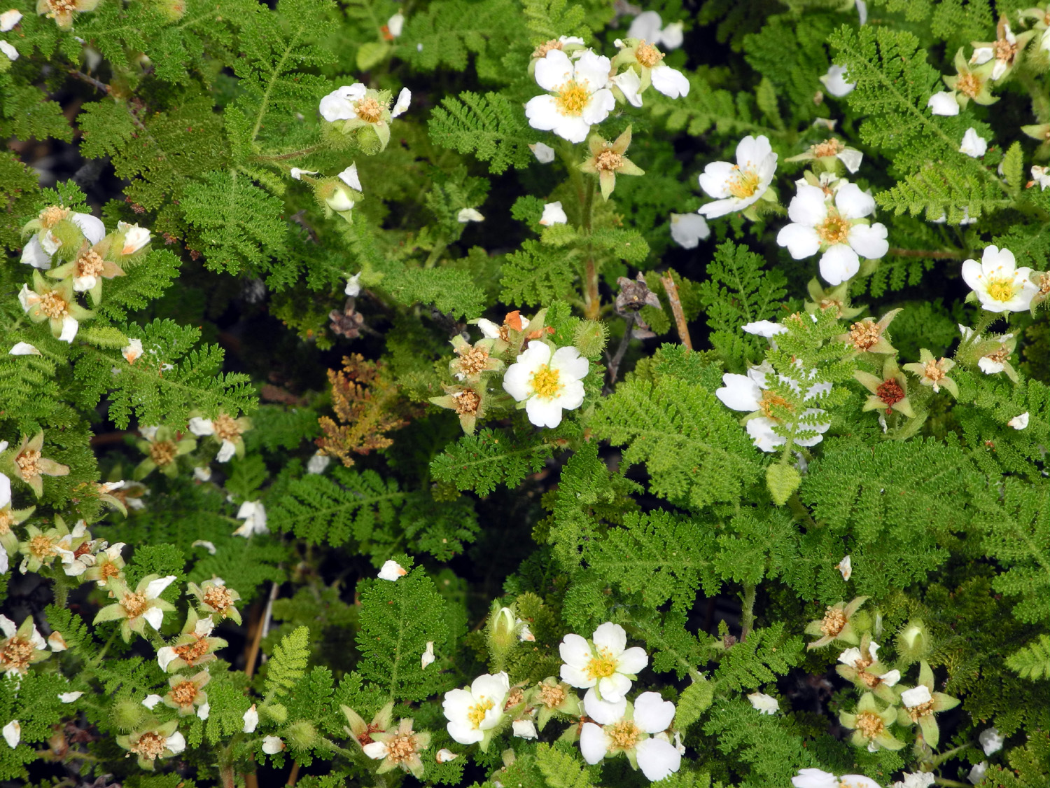
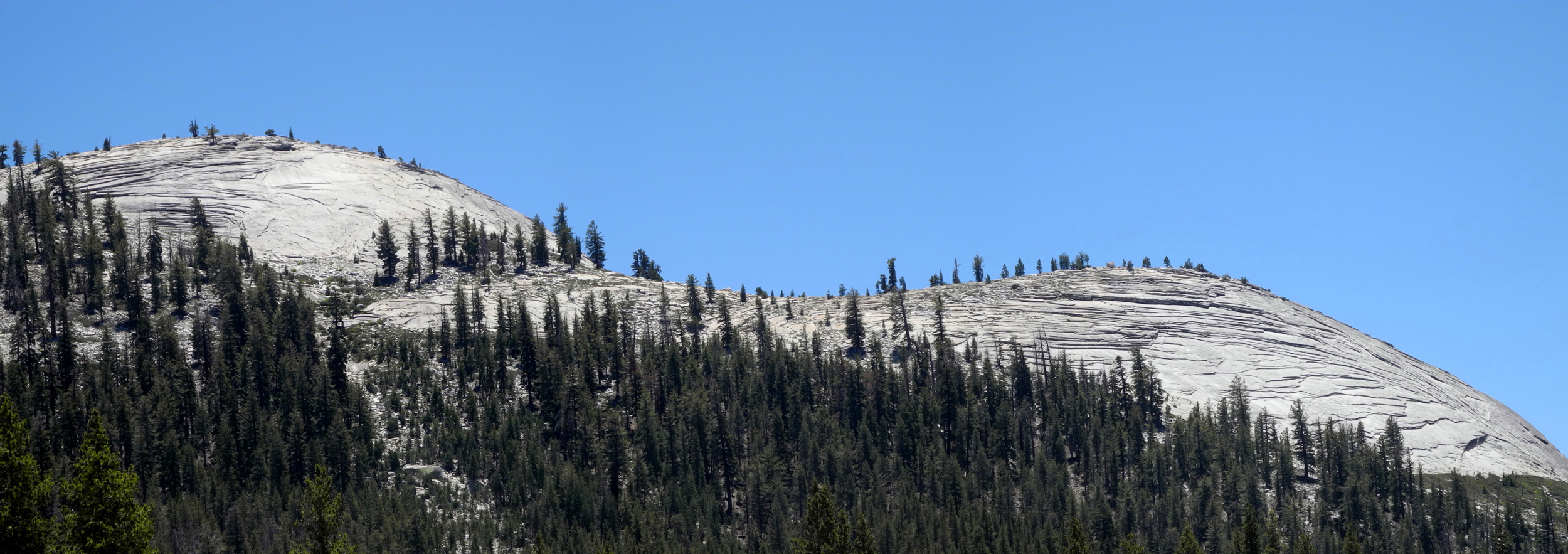
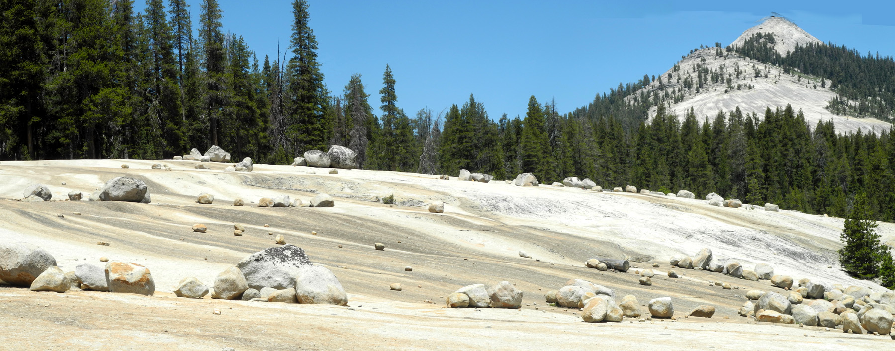
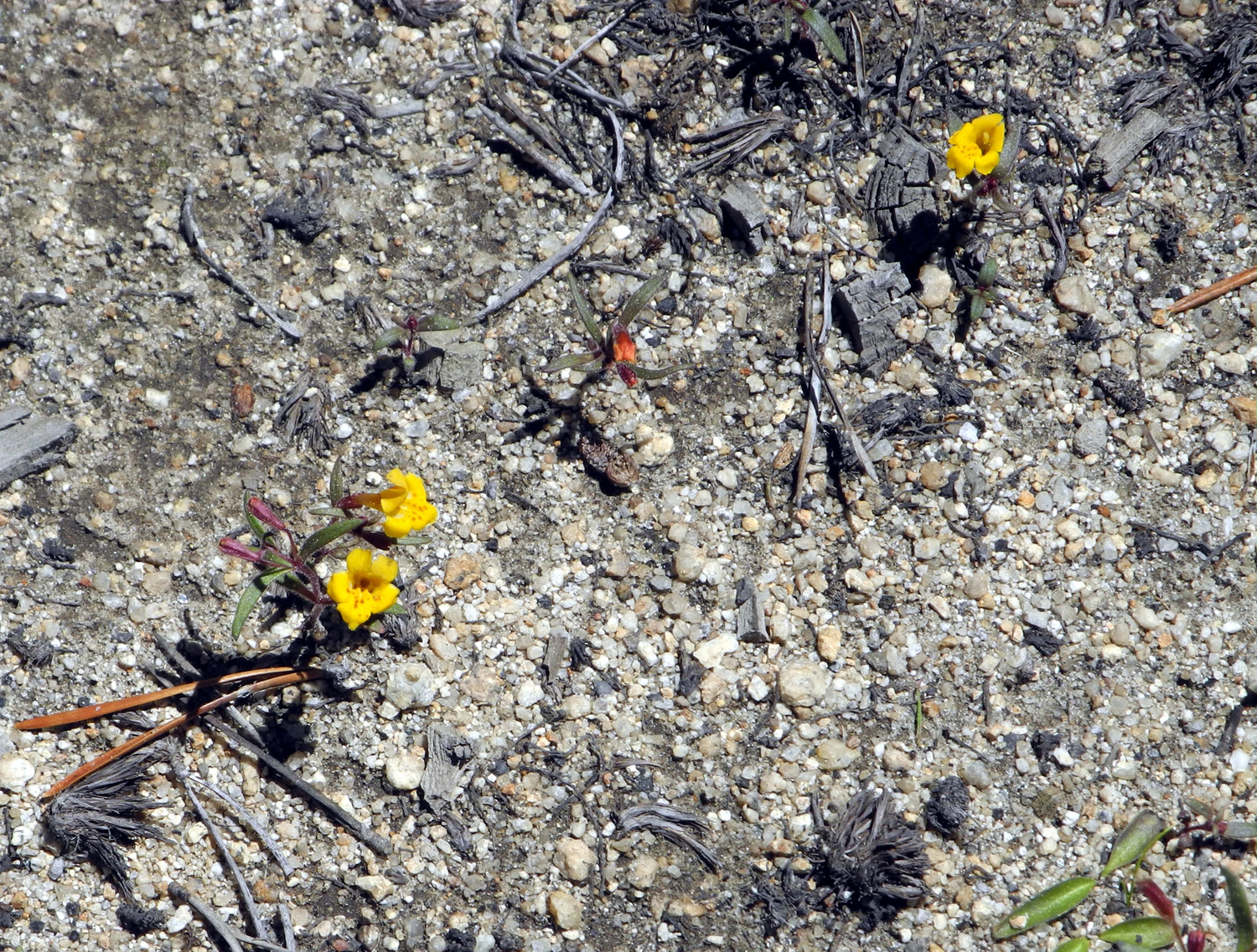
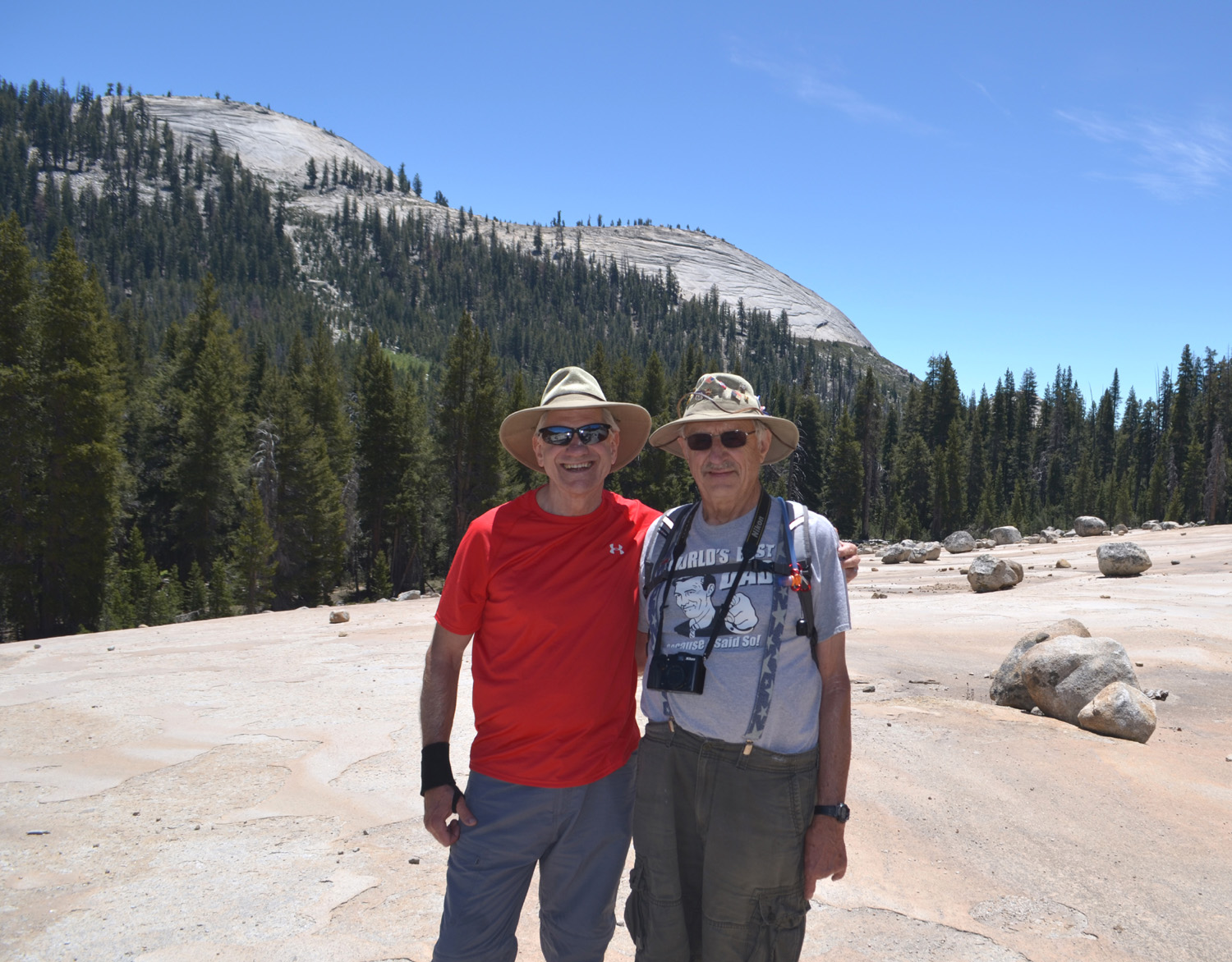
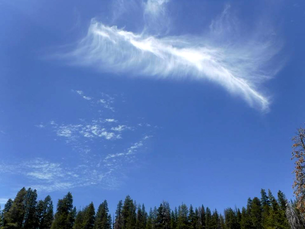
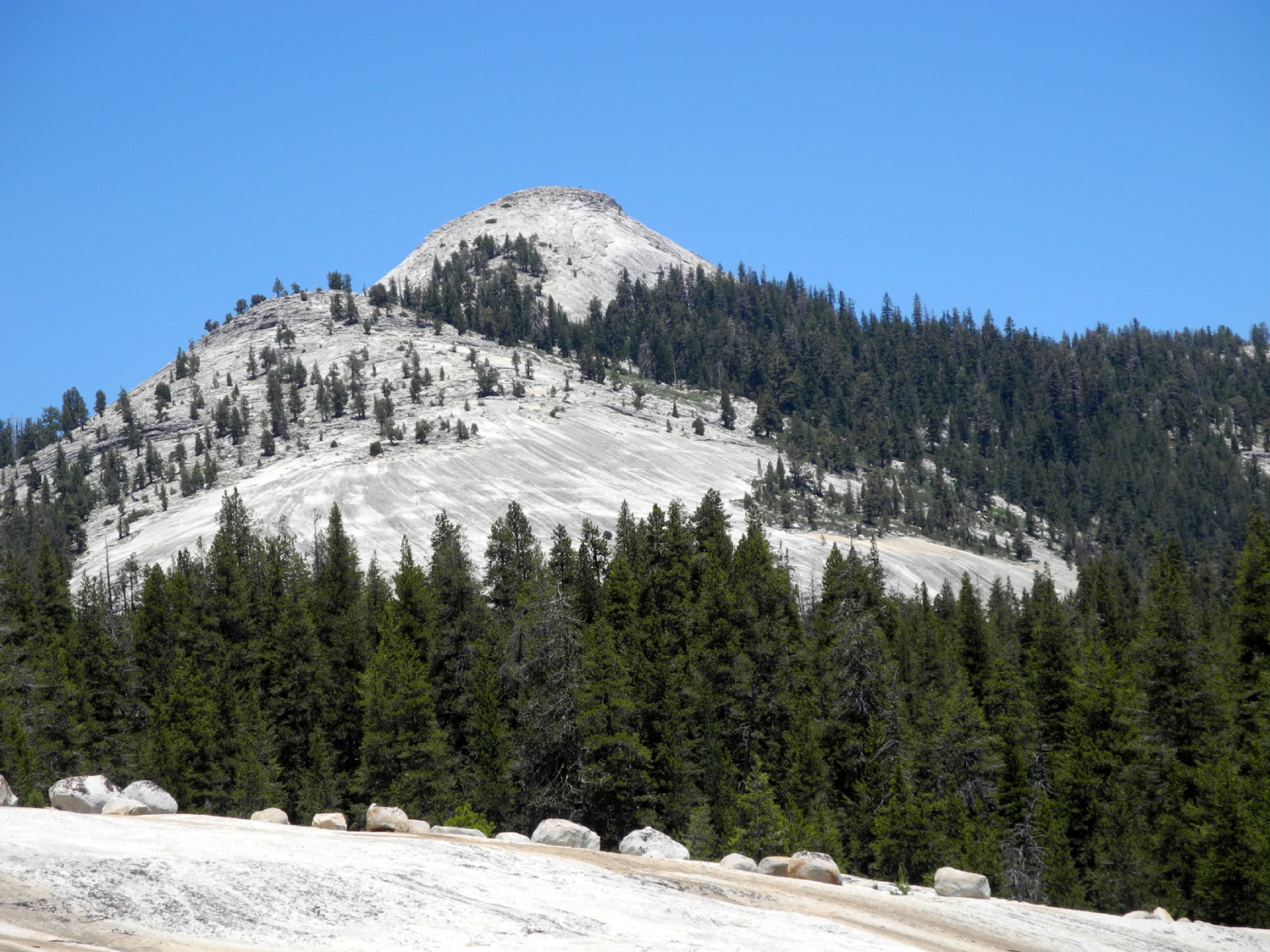
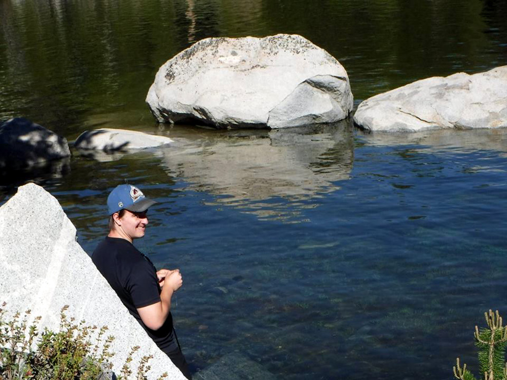
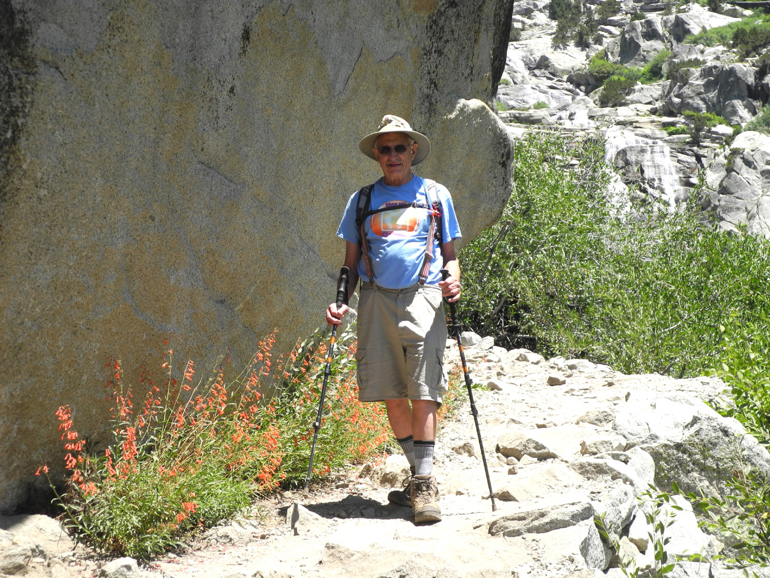
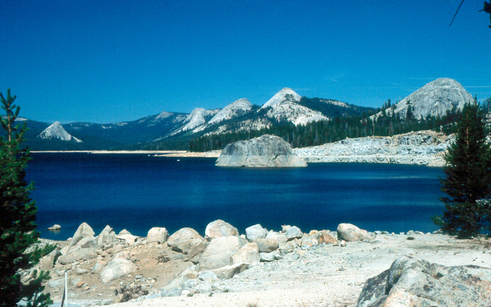
Father's Day at Courtright For the second year in a row, I enjoyed a Father's Day hike with both my daughters, Teri and Jennifer. As an added bonus, we were joined this year by Teri's son Mikie, and Wes Thiessen, who served as my adopted son for the day. Our destination was Courtright Reservoir, at the 8,000 foot level in the Sierra National Forest, a distance of about 75 miles from home. The Ramblers hiked there last year, and all of us had camped or hiked in the area at least once. Teri and Mikie left about 6 a.m. on June 19 so Mikie could do some fishing before the start of the hike. Wes and Jennifer arrived at my house a little after 8 a.m., and we piled into Wes's Toyota Highlander, arriving at the lake about 10:30. Teri was parked by the road near the dam, so we collected Mikie, who had left all the fish in the lake just as he found them, and drove the short distance to the trailhead. The hike starts out with a modest downhill stretch, then is level nearly all the way. Part of the way the route doubles as a four-wheel drive road, the southern end of the very challenging Dusy-Ershim Trail, but we never got close to the challenging part. To underline the challenging part, here's a quote from one of the trail's web pages: "Recommended equipment: Full size and long wheel base vehicles are not recommended. A lifted, locked short wheel base vehicle with skid plates, rocker guards, and tow hooks and straps are a must. It is highly recommended that someone in your group have a winch. The less the vehicle is equipped the more work and damage you can expect. Bring extra gas and spare parts. Remember help for your vehicle and medical attention are hours or even days away." All in all, I kind of think it's easier to walk this trail than to drive it. Eventually the foot trail forks off to the right from the road, in a generally north-northeast direction, crossing a swampy area on a log boardwalk that offers its own challenges. The rounded logs are a bit weird to walk on, and they have rotted away in spots, leaving small holes to trip the unwary. We were wary, and made it safely through this part. The trail runs through a small, glacier-carved valley, similar to Yosemite but on a much smaller scale. There are no high cliffs, but there are dramatic granite domes visible all along the first mile of the trail on both sides. At this one-mile point, there is a huge, gently sloping granite slab, very easy to walk up on. It's probably 100 yards wide across the slope, and a quarter mile long. There are boulders large and small scattered across this area, carried along by the glacier, and left behind when it melted. In some parts it resembles a giant marble game. Although this was our destination, and the place that the Ramblers stopped last year, we decided to continue on the trail for a ways to see what was there. I had backpacked on this trail at least twice in the 1980s, but did not remember any details. Where we walked, the trail veered slightly more to the east, and soon ran across a meadow with a small stream running through and across the trail. From this point the trail began a gentle climb through an evergreen forest. We did not go much farther, but this trail is one of the main access routes to the high Sierra back country. Branches of the trail will lead you to Hell for Sure Pass, the Leconte Divide area, Goddard Canyon, and the John Muir Trail. Early in the hike we were walking near a lively creek, but the trail moved away from it when we crossed the boardwalk. During the final part of the walk, we heard this stream again off to our right, so we all walked off the trail to enjoy the sight. At this point we turned back, but when we reached the giant granite slab we cut through the trees and walked up on the rock. Here we rested, had a snack of Teri's famous home-made energy bars, took photos, and enjoyed the incredible views of Maxson Dome and other natural features. Besides the views and the boulders, there is another interesting aspect of this spot, large areas of glacial polish, which is a place where the rocks and soil carried by the glacier ground the rough granite to a smooth, shiny surface. I mentioned that everyone had been to this place before, but our experiences vary widely. I hiked here for the first time with friends from work in the late 1960s as described in my backpacking and day hike report. I also backpacked here a couple of times, most notably with two young friends, one of whom later became Teri's husband. Tim and Teri, their sons, sons' friends, and sometimes her father (me) drove back the 4-wheel drive road and camped near the lake a number of times, which accounts for Mikie's previous visits. Wes hiked with the Ramblers last year, but Jennifer's visit here was so long ago she does not remember it. With my ex-wife and both daughters, we walked in as far as the granite slab when the girls were probably about four and six. No matter what our previous experience, we all enjoyed the trip, and appreciated the fantastic scenery. Although the domes and the granite slab along the trail are great, the most dramatic view is when you first arrive at the lake and see the blue water with a row of domes on one side, and the unique form of Maxson Dome at the far end. Instead of returning to the trail at the base of the granite, we walked up and across to the 4-wheel drive trail. Where it crosses the slab it's marked by a series of reflector dots, but in the past drivers had to rely on the guidance of rock cairns, which are subject to being knocked over by weather, humans and animals. It's only a short distance across the rock until the road goes into the forest and through some spots where it's hard to see how ANY vehicle could pass. We ended our hike with the only real uphill walking, about 200 yards back up the hill to the parking lot, where we enjoyed a brief rest and changed out of our boots. Throughout the hike we had a nice breeze, with temperatures probably around 70 degrees, warm during the uphill sections, but otherwise extremely comfortable. We drove back to the lake for lunch. In honor of Father's Day, Teri, Jennifer and Wes had brought stuff to make sandwiches, veggies and fruit, and some amazing chocolate cookies. Teri set up a card table with a view of the lake, and we enjoyed a well-earned meal. On our drive home, Wes, Jennifer and I made one final stop, to get a look at a waterfall on Bear Creek that comes down from the hills above the road. The best view was from the middle of the road in a place where we could not stop, but we did get a good look at the lower section of the falls from the bridge. I would like to end this report with a BIG thank you to my daughters for arranging this hike, to my son of the day Wes for driving, and to Mikie, who has been one of my faithful travel companions since he was barely able to walk.
--Dick Estel, June 2016 |
||
|
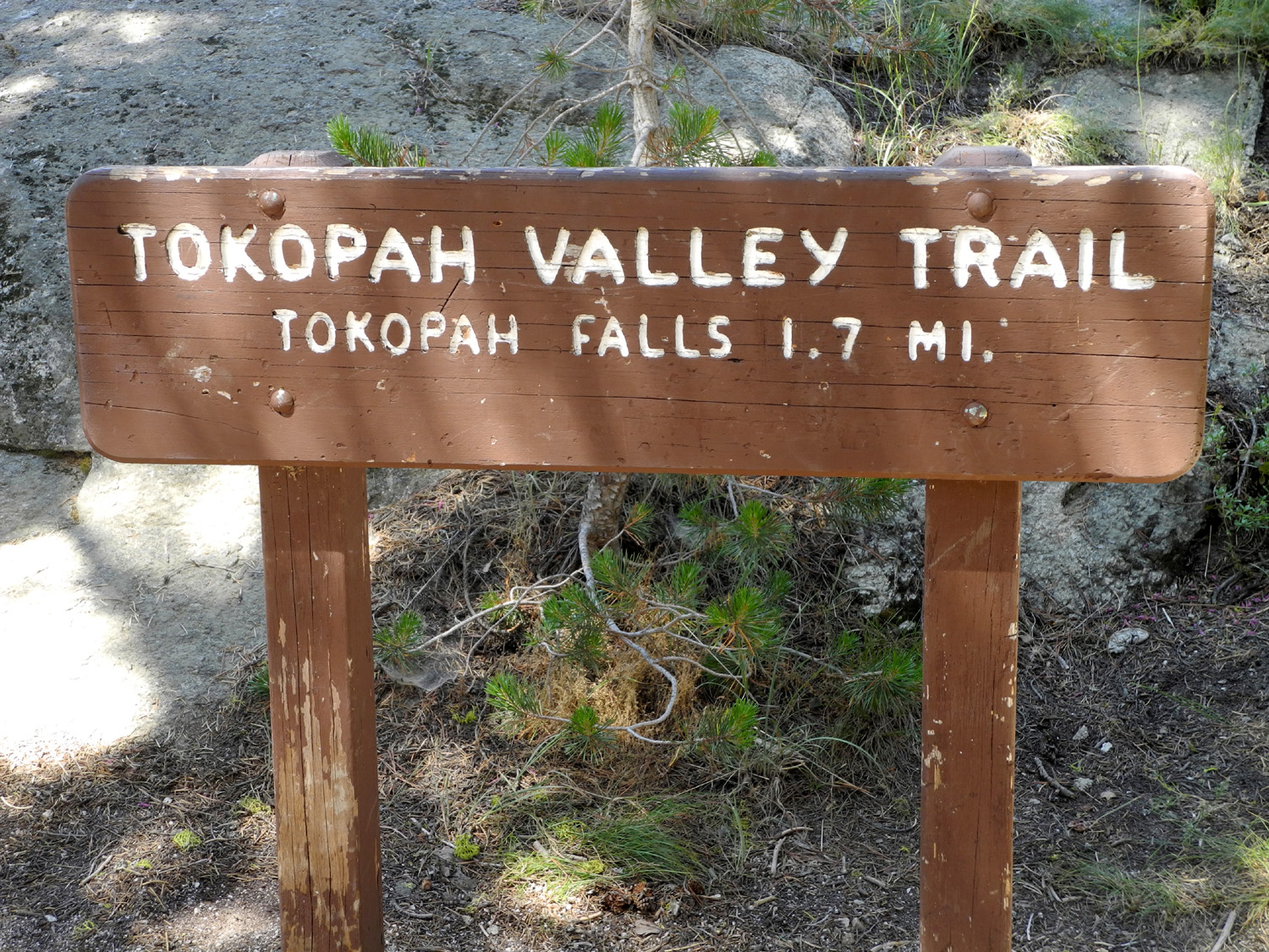
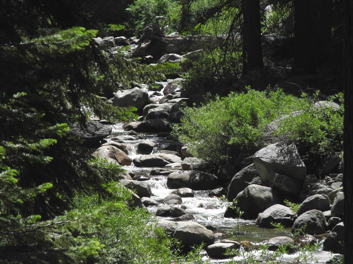
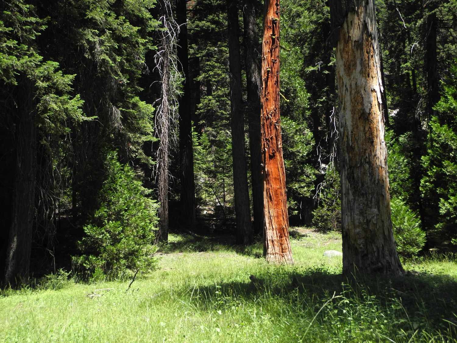
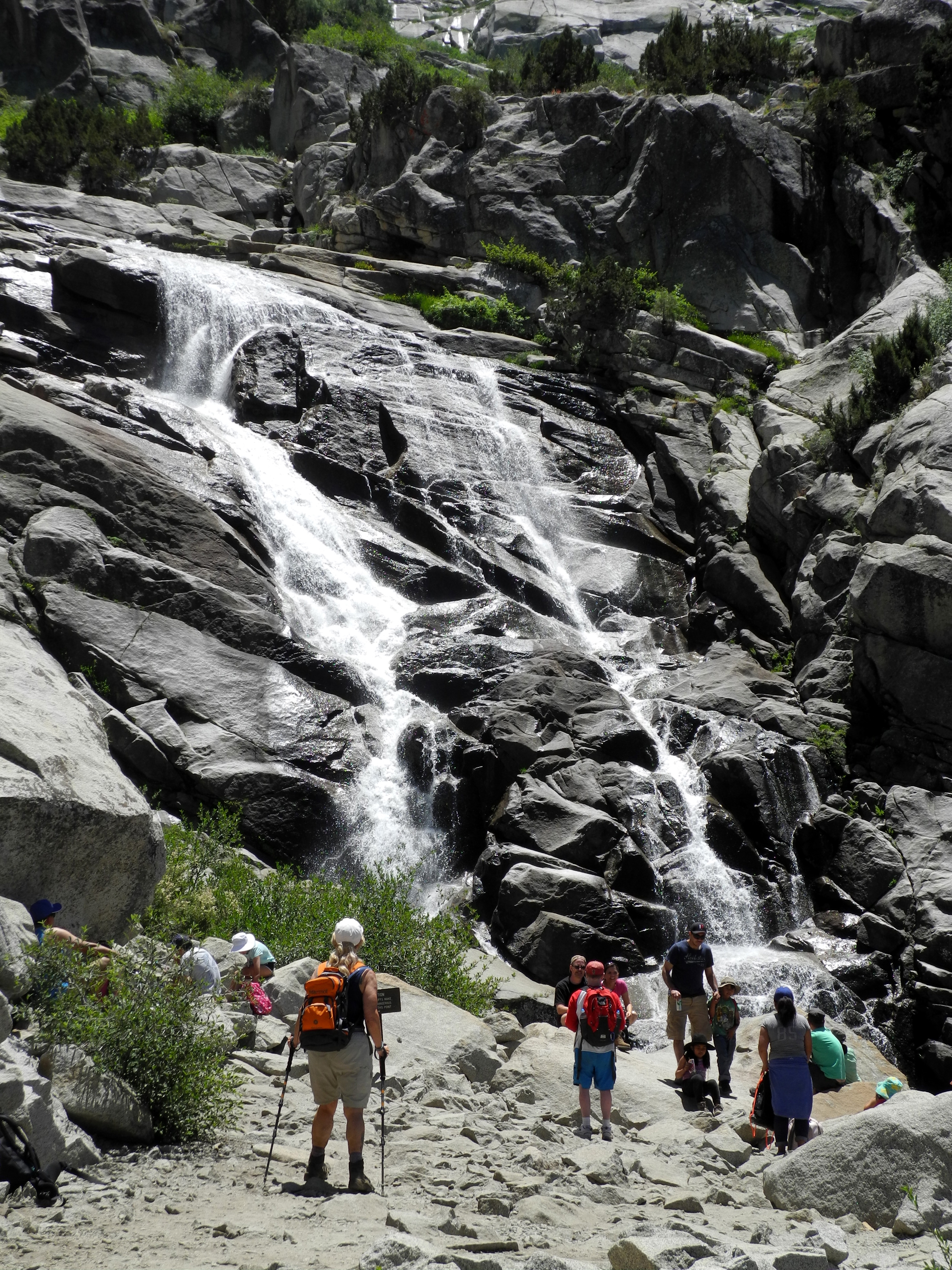
Tokopah Falls Trail This hike on July 6 was supposed to be the Big Baldy Trail in Sequoia National Forest, but for the third time in our history of hiking together, my daughter and I were forced to change our plans due to a fire. In this case it was a prescribed burn (we used to call them control burns) in the canyon below the Generals Highway, in the area of Redwood Mountain. When we got out of the car at the Big Baldy trailhead, the smell of smoke was strong, and we agreed we did not want to breath that while we hiked uphill for two miles. Our first thought was to go on to the Tokopah Falls Trail at Lodgepole, but on the way we stopped to check out two other possibilities. The first was at Dorst Creek Campground, where a trail goes about two miles to the Muir Grove redwoods. A little farther on was the trailhead to Little Baldy. Both of these were smoke-free and both sounded good, so we added them to our wish list, and stayed with our first alternate. Lodgepole is a large campground in Sequoia National Park. All the campsites were taken, but there were still a few parking spaces for the trailhead. The trail starts at the upper end of the campground and immediately crosses the Marble Fork of the Kaweah River, heading east into the Tokopah Valley on the north side of the stream. There are campsites along the river on the opposite side for about the first half mile, then you are in undeveloped forest. The trail climbs gradually, gaining 800 feet, but there are only a couple of very short places where it is actually steep. The last half mile or so goes through a maze of large granite boulders, a good place to have hiking poles, but not really difficult. There are a number of bridges in one place, where small creeks cross the trail, but only three of these had water at this time. Teri made this hike early in the spring, and the river was all white water and there was water running across the trail in many places. This time people were playing in the river by the campground, something that could have been fatal during her earlier hike. There are a lot of flowers along the way, the most common being yellow-throated gilia, a half-inch pink flower with a yellow center. There were also some very spectacular examples of Kelley's Lily that we first saw last year on the Ramblers' Courtright hike, and shortly after that below Kaiser Pass. I didn't know what it was at the time, but was later able to identify it. This flower seems to be fairly rare, usually growing adjacent to running water. Although this route is in Sequoia National Park, there are no redwoods in this area. Instead the attraction is the trail itself, and a fairly big waterfall at trail's end. The falls does not drop down a cliff, but instead is really a long, steep cascade, ending in a sharper drop where there is plenty of room to rest and enjoy the surroundings. There were dozens of people on the trail, including a large number of kids, many age six or under, most of whom were handling the trail with no problem. One boy would fall behind, looking at rocks and stuff, then run uphill to catch up. This made ME tired. Despite the numbers, the viewing area and the accessible rocks above and below had places where everyone could sit and rest, enjoy the falls, and have something to eat. Usually Teri brings snacks for the trail, and we eat lunch when we get back to the car. On this hike, despite having a good breakfast, I was feeling pretty hungry before we got to the falls, so I was delighted to find that she had brought our full lunch. A good refueling was necessary, since the hike was longer than expected. The trail sign gives the one-way mileage as 1.7, so a 3.4 round-trip hike seemed just about right. In fact, my GPS hiking app, which has been shown to be accurate over known distances, gave our total walk as 4.46 miles, not exactly "too much," but definitely a good workout. While walking up the trail we spotted a marmot just as he disappeared into the bushes. At the falls, there were at least two of them who would come out of the rocks, check out the people, go back out of sight, then repeat. From the campground, the terrain ahead looks like mountain forest, but as you walk up the trail, and of course, back out, you realize it's a glacier-carved valley, one of many "little Yosemite's" as Francois Matthes described them. The rock cliffs to the north are not in view till you get close to the falls, but then they present some striking views of fractured granite. On the south side, the dominant feature is known as the Watchtower. It looks like a fairly ordinary rocky mountain top till you get near the falls, then it too appears in all its dramatic glory. We spent quite a bit of
time at the falls, resting and eating lunch, then started back. As
usual, there are things
seen on the outward journey that didn't catch the eye walking
in, a good argument for hiking both ways. --Dick Estel, July 2016 |
||
|
Photos (Click to enlarge; pictures open in new window) |
||
Yosemite Waterfall Tour Cedar Grove Courtright Hike Photos Tokopah Falls Trail |
||
Yosemite Waterfall Tour |
||
 |
 |
|
| Jack Snack on the road |
Bridalveil Falls at its beautiful best |
Sun reflects off the mist
blown away from the top of the falls |
 |
|
 |
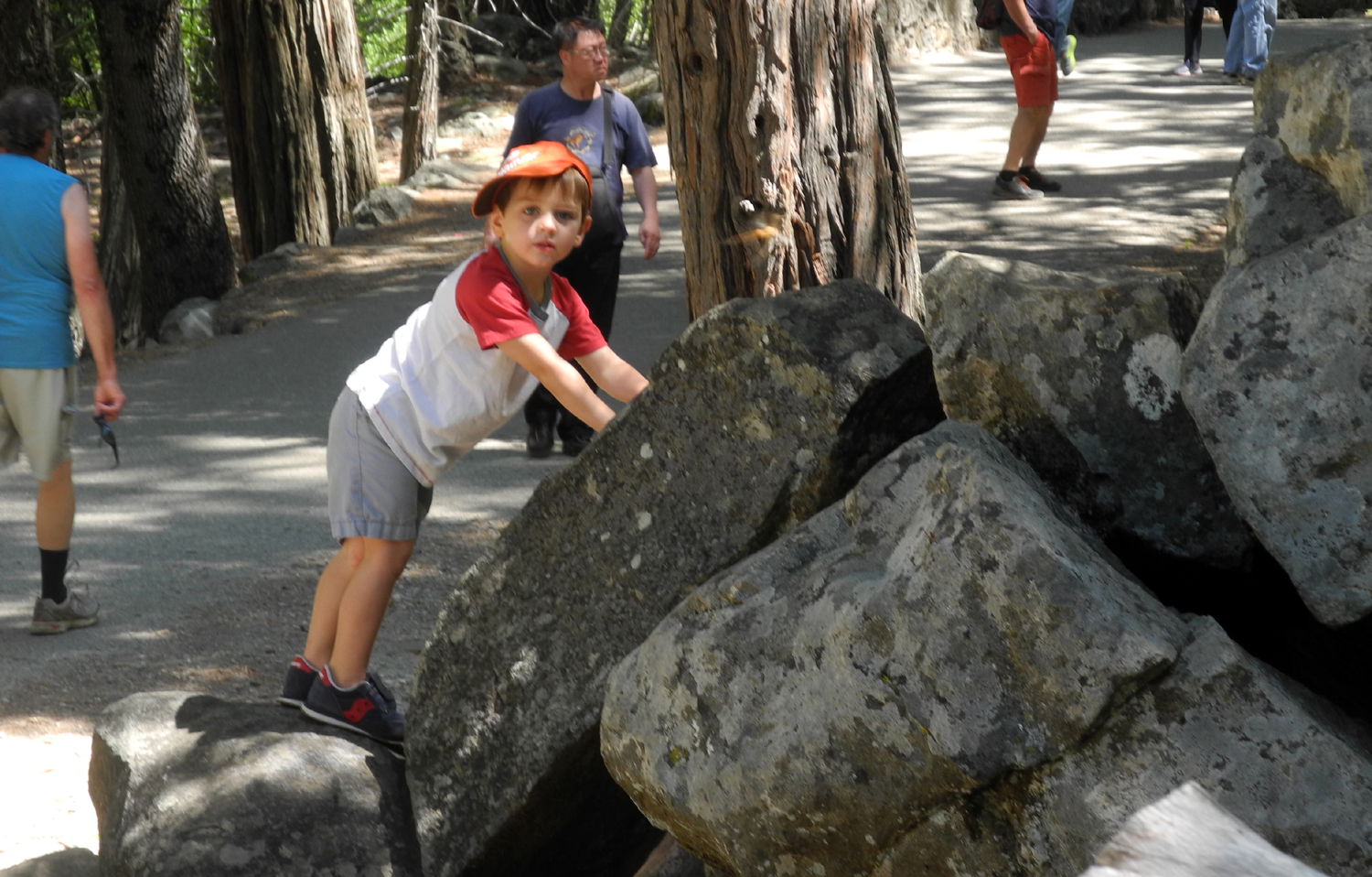
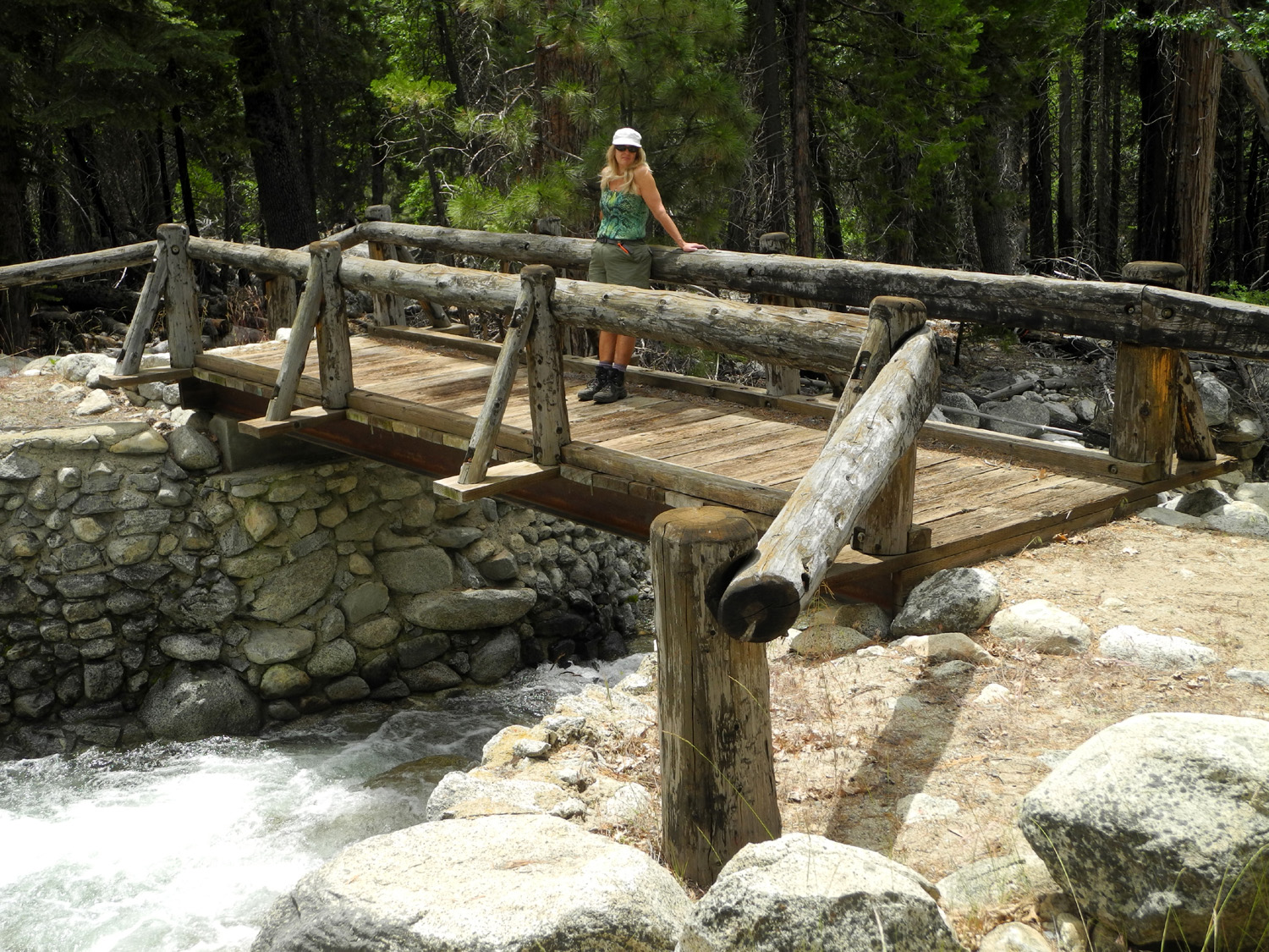
| Colton, Jack and Teri check out Bridalveil Creek | Rock climbing is another favorite activity in Yosemite |
Ribbon Falls drops a total of 2,425 feet |
 |
 |
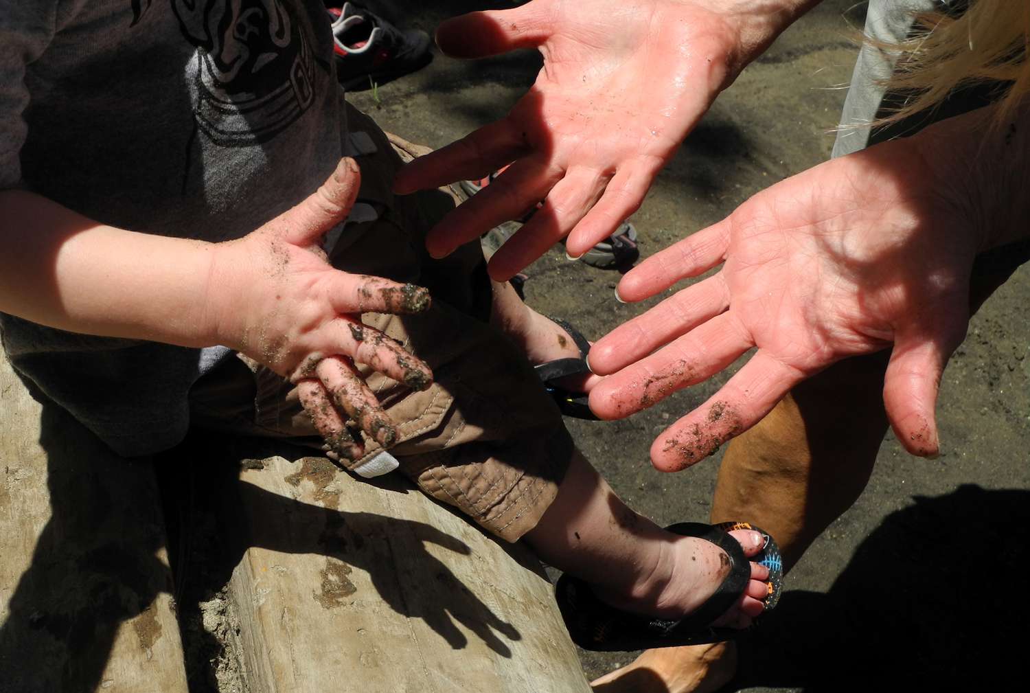 |
| Fun in the Merced river | Even more fun in the mud | Jack shares his mud with Grandma Teri |
 |
 |
 |
| Colton, Teri and Jack in the river | Dramatic El Capitan |
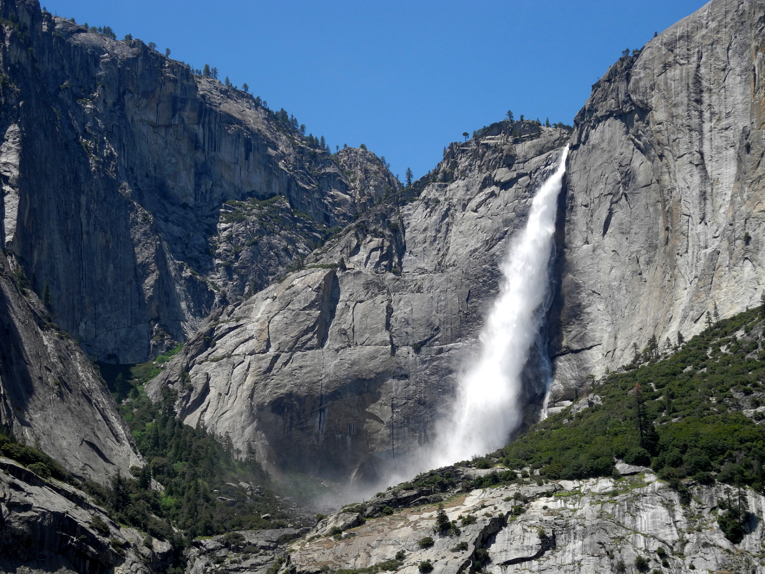
Yosemite Falls the way it should be |
 |
 |
 |
| And the way it was in
August 2015, 3rd year of drought |
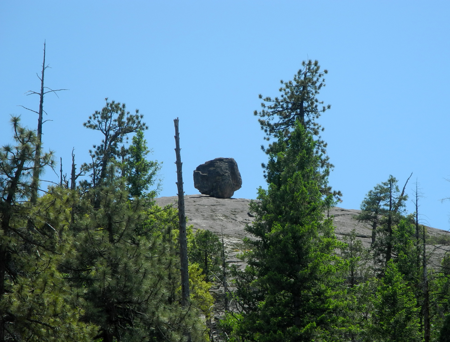
Cathedral Rocks | This
boulder was no doubt deposited by the glaciers that carved out Yosemite Valley |
 |
 |
 |
|
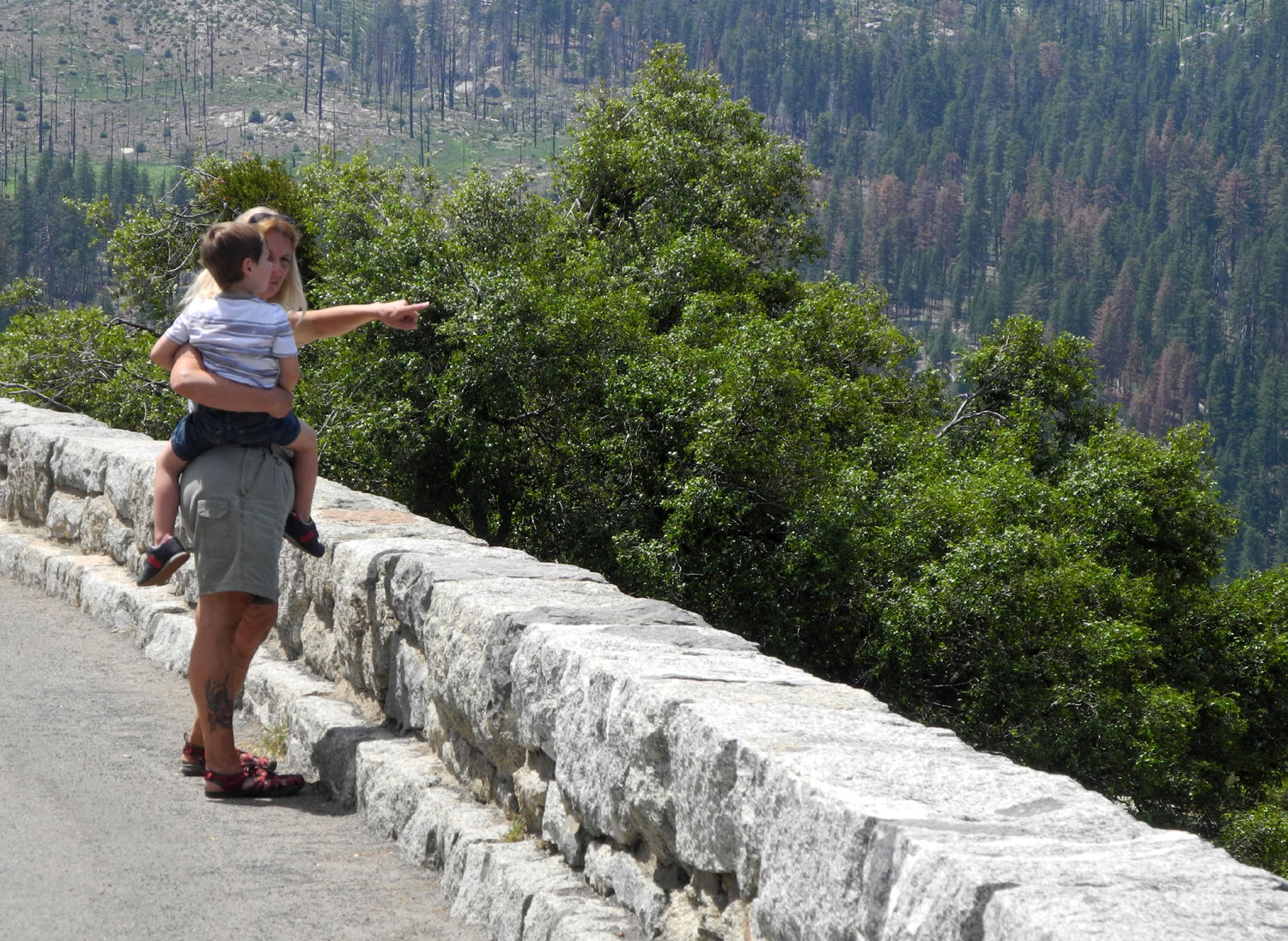
Pointing out the tunnels across the canyon |
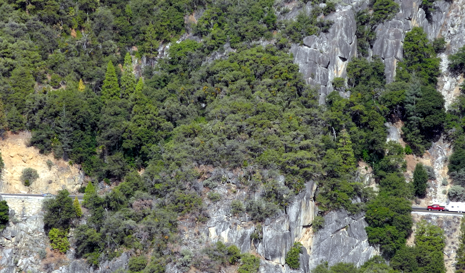
A truck enters one of the
three tunnels on the Tioga Pass Road |
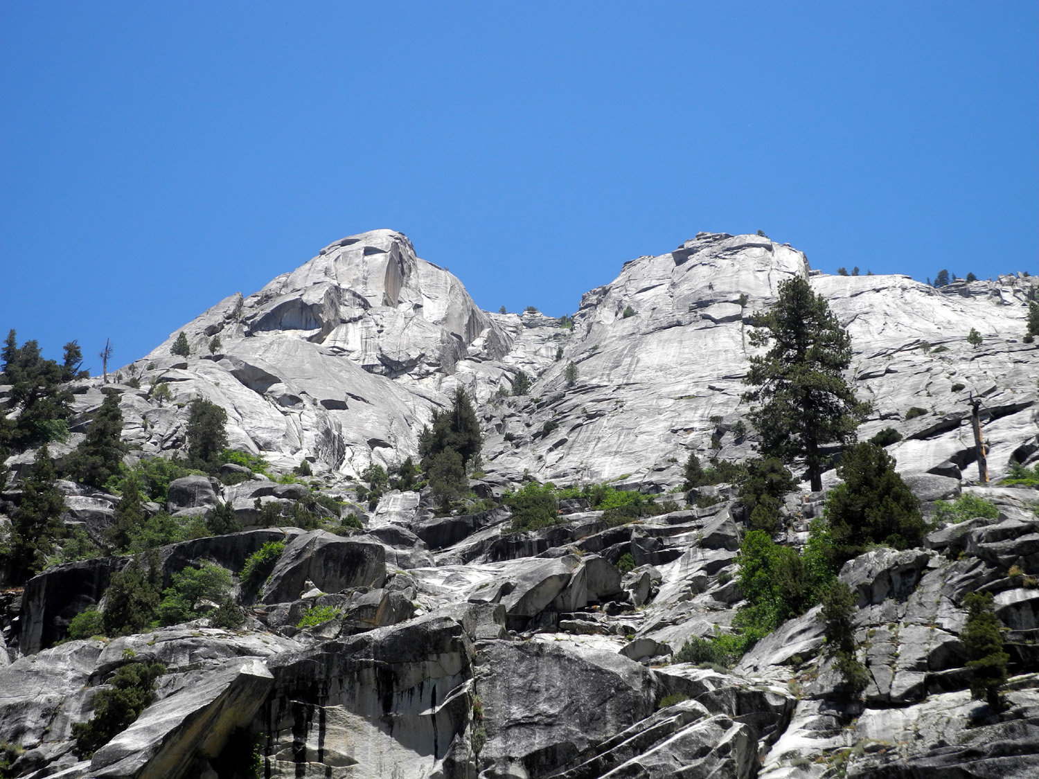
You can never see too
many pictures of Half Dome |
| Cedar Grove Campout | ||
 |
 |
 |
| Clouds
over Big Stump parking area near park entrance |
Burned
twice - McGee Fire in 1955, Rough Fire in 2015 |
Another area of the Rough Fire |
 |
 |
|
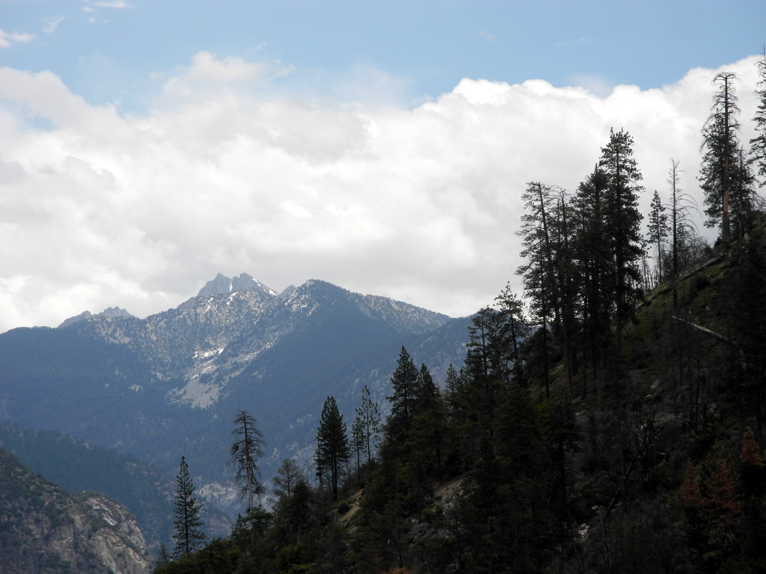
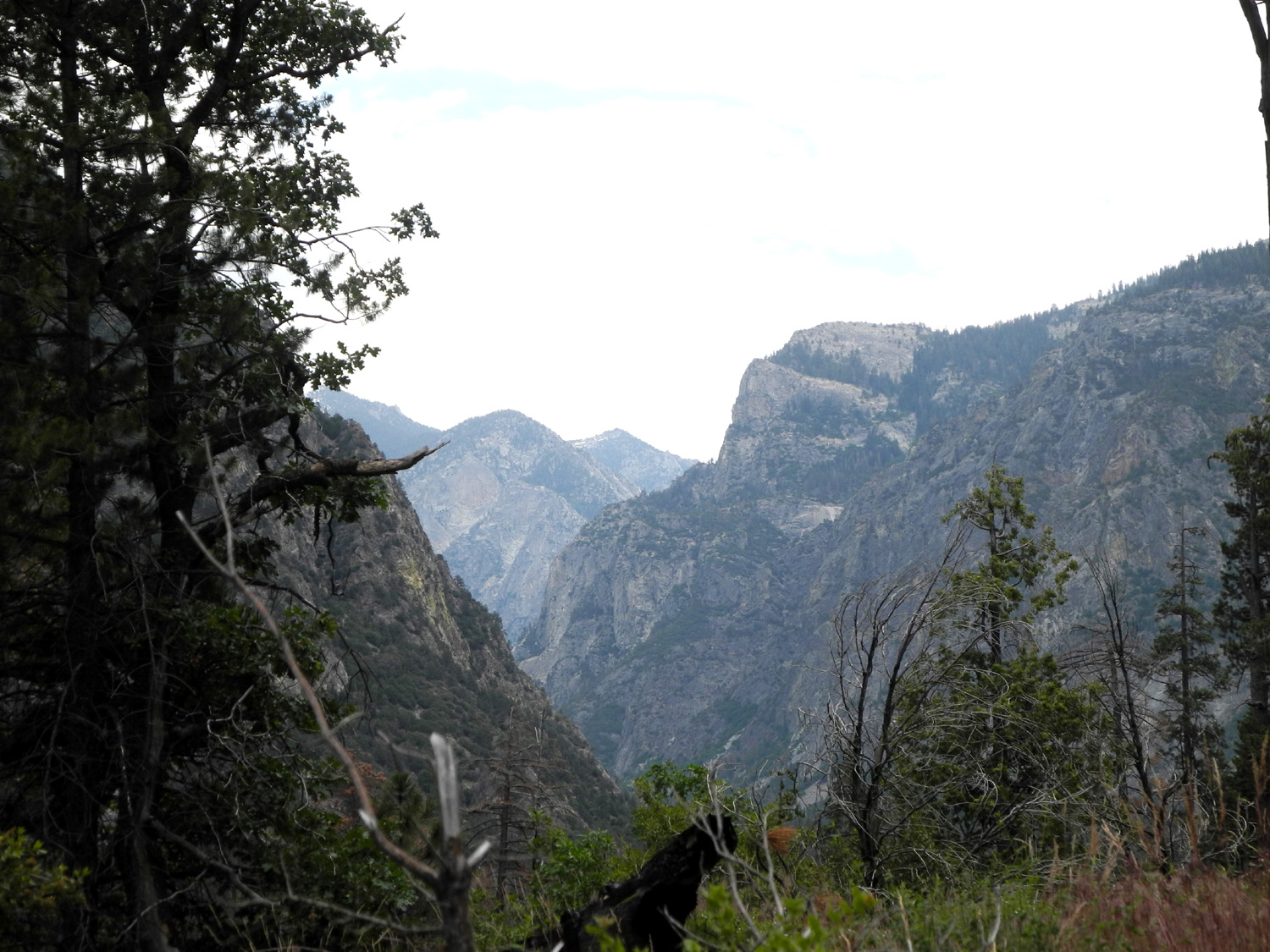
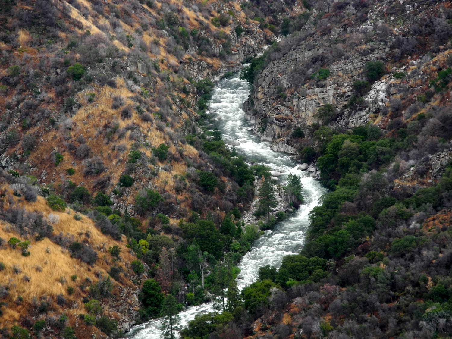
| Junction
of the Middle and South Forks of the Kings River |
Yucca
along the road between Grant Grove and Cedar Grove |
Grizzly Falls at its best |
 |
 |
 |
| This should NOT be necessary | The river gives its own warning! |
Canyon live oaks near Roaring River Falls |
 |
 |
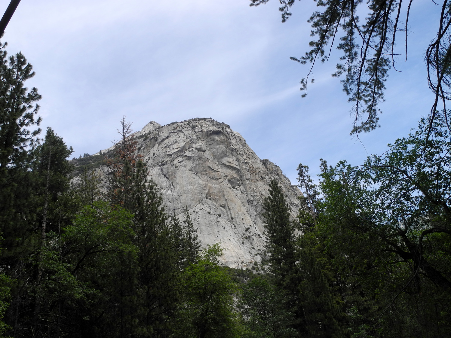 |
| Knapp's Cabin, oldest building in Kings Canyon | The interior is still in good shape | North Dome |
 |
 |
 |
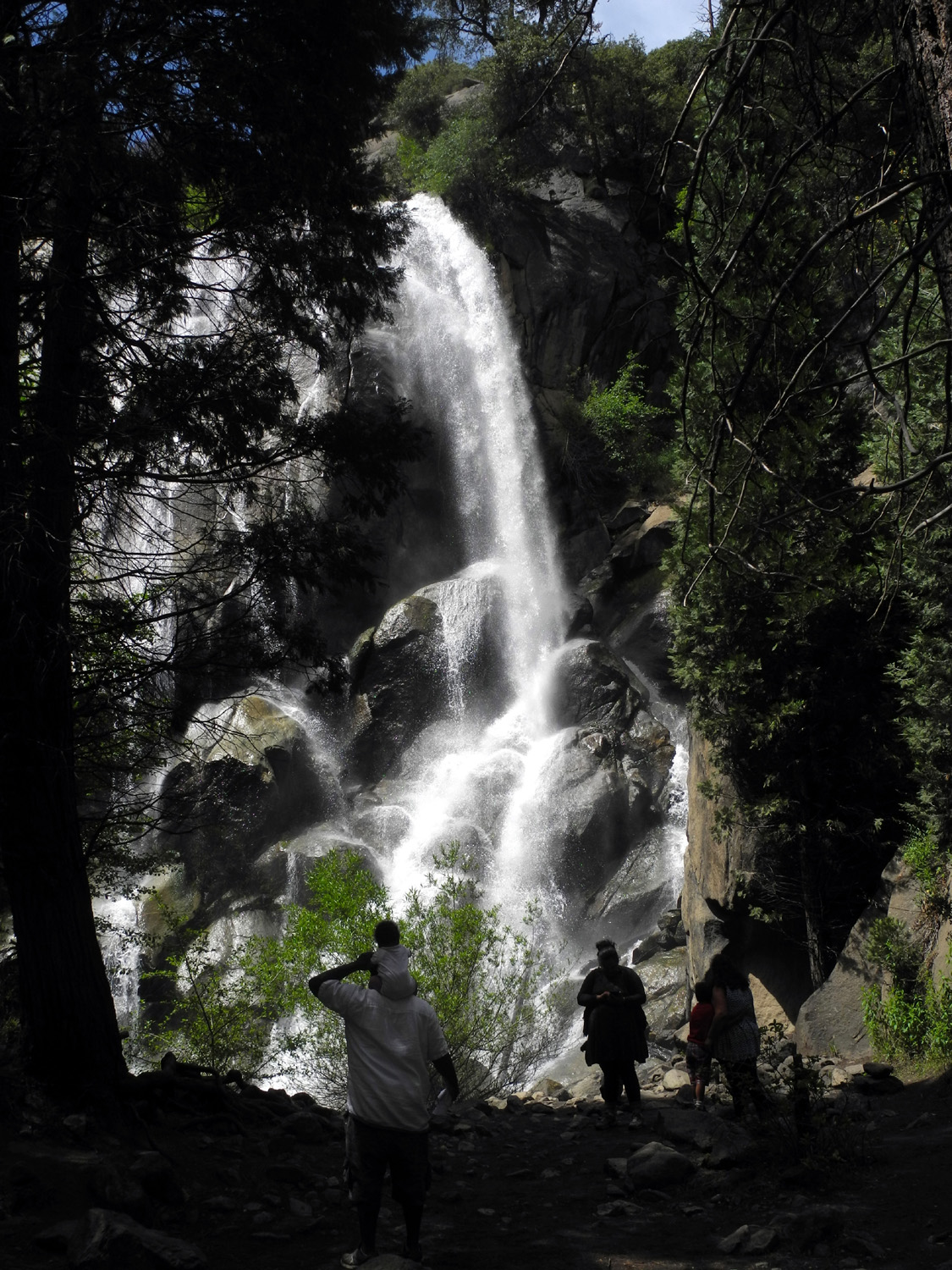
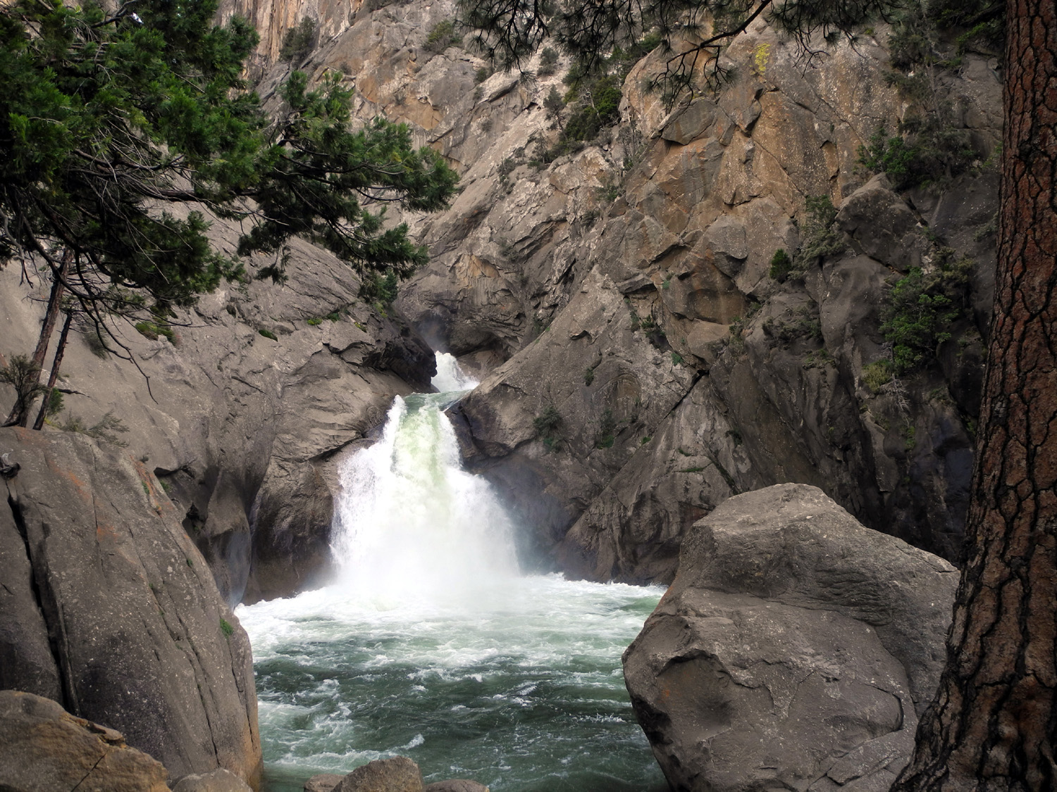
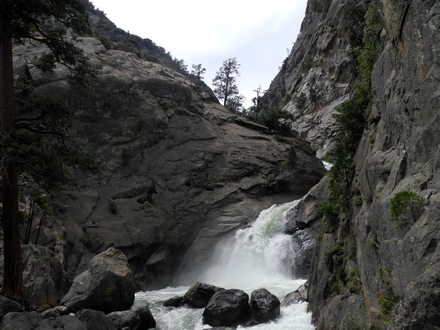
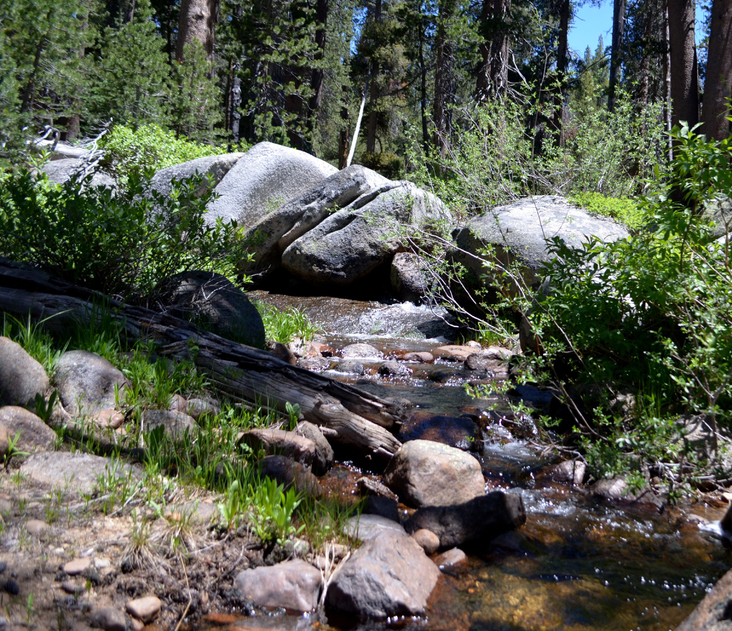
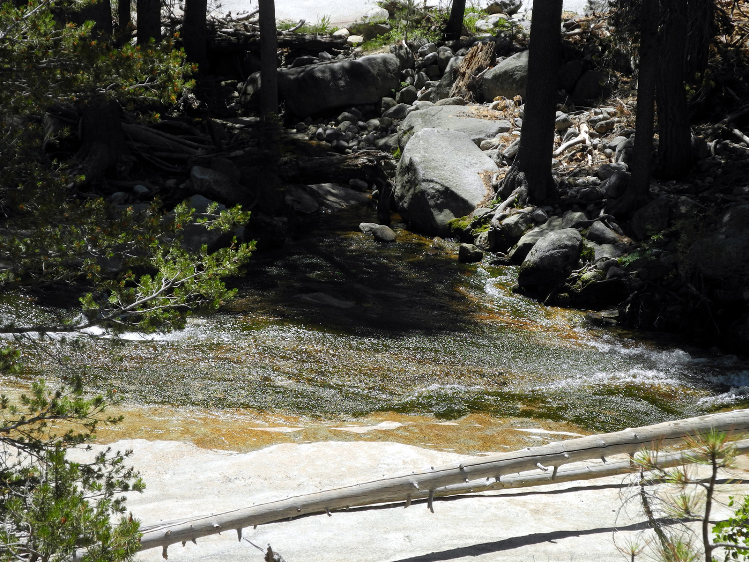
| Roaring River Falls |
View from the opposite side of the river |
Roaring River below the falls |
 |
 |
 |
| Granite Creek |
Teri on the bridge over Granite Creek |
The bridge from downstream |
 |
 |
 |
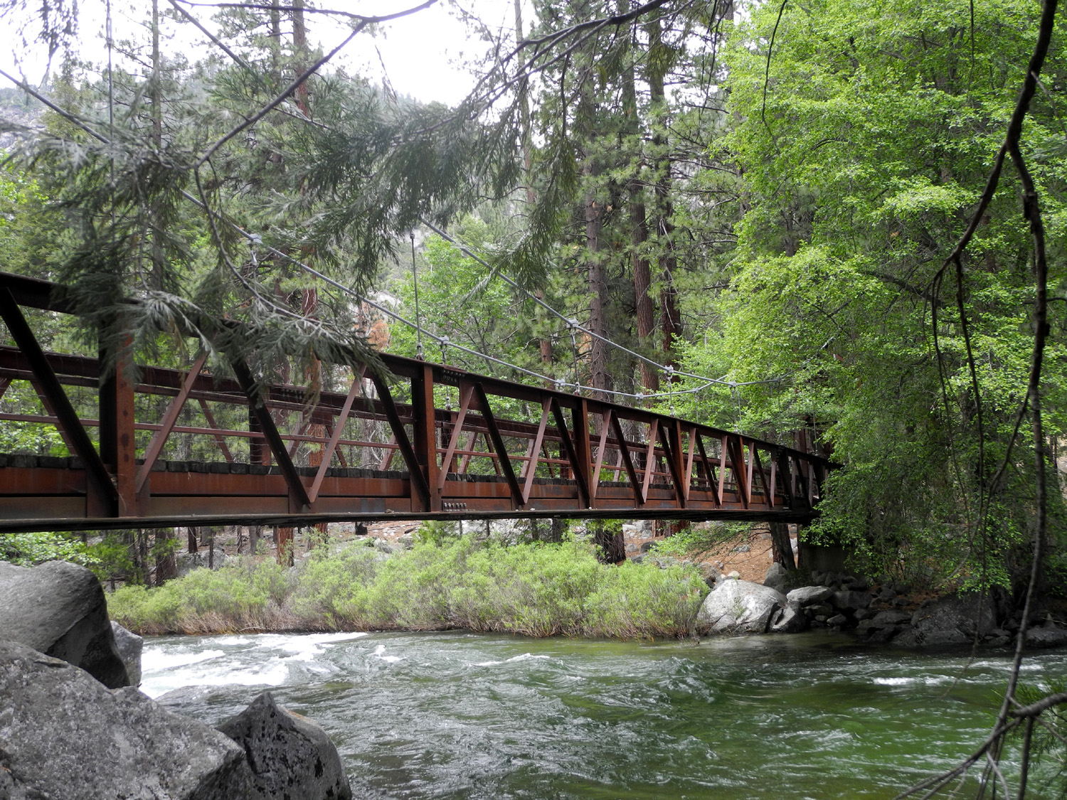
| Bridge
over the Kings River on the Zumwalt Meadow trail |
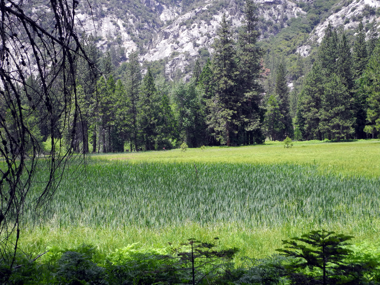
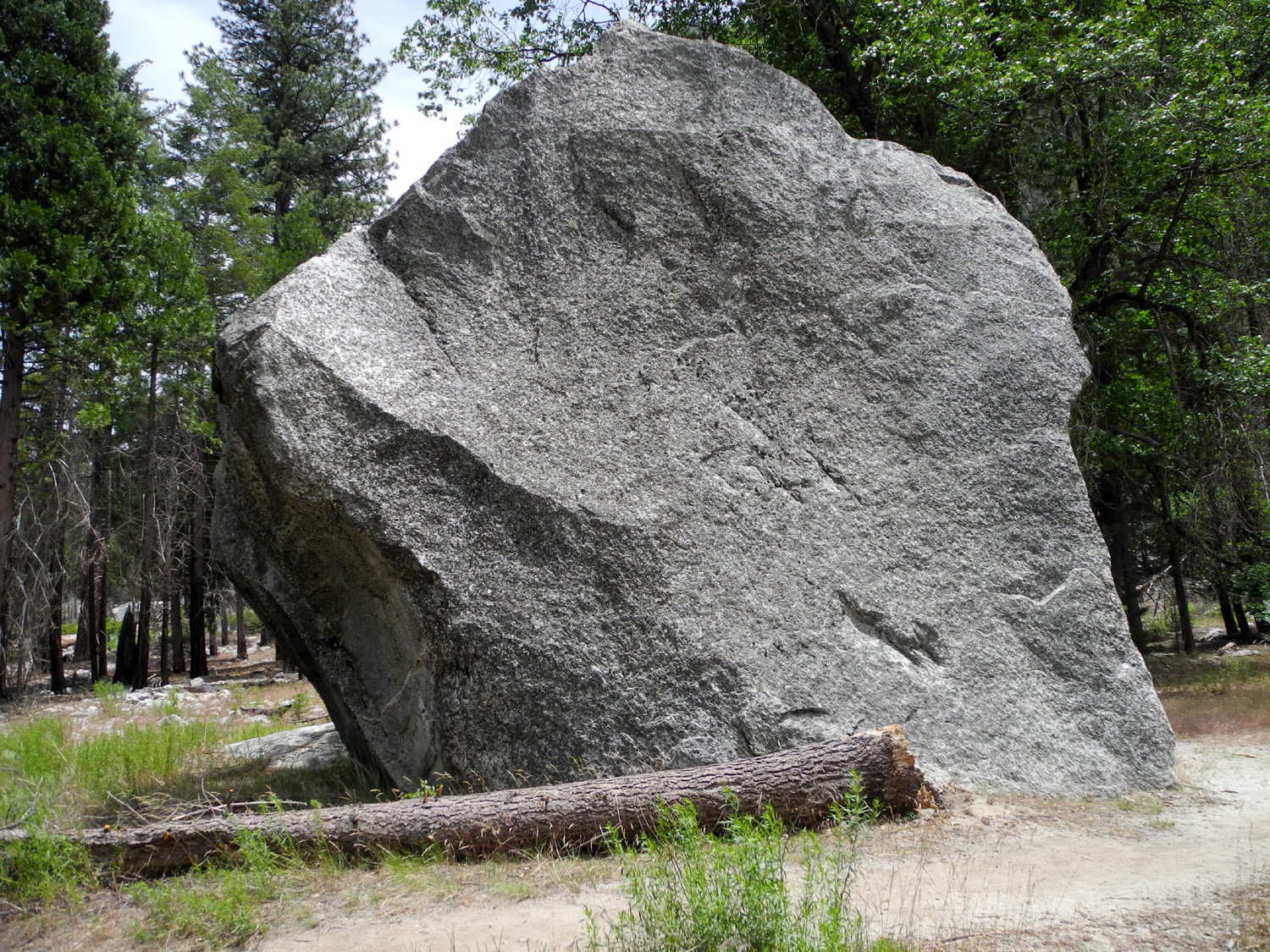
Zumwalt Meadow | House-size boulder by the meadow trail |
 |
 |
 |
|
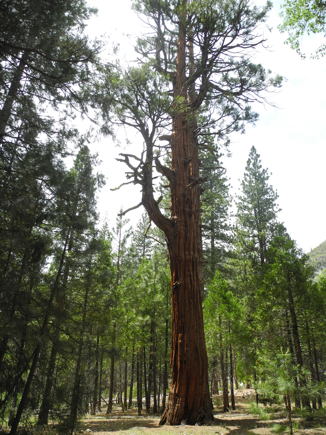
A
venerable cedar near |
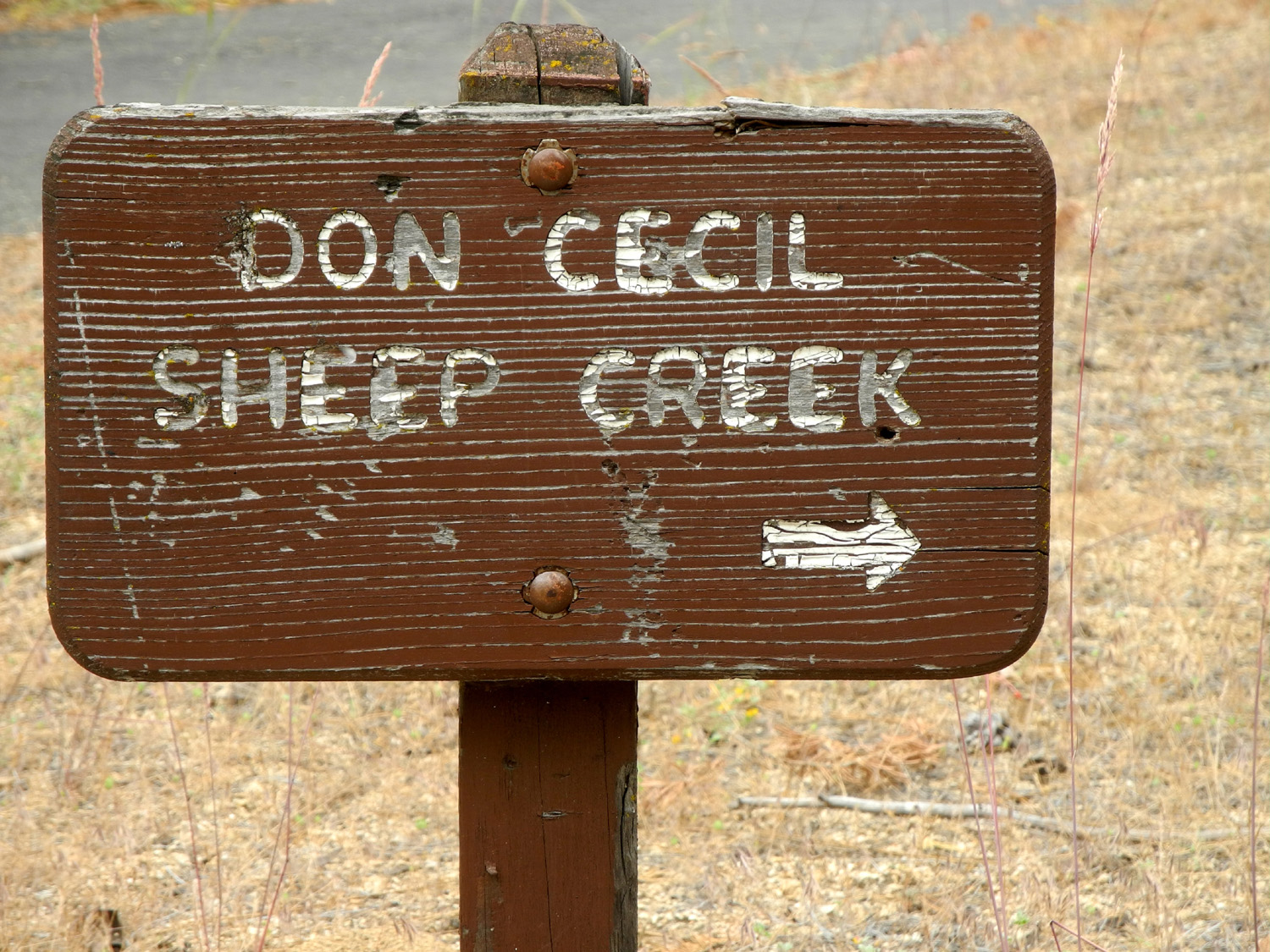
These
old-style signs are rarely seen these days |
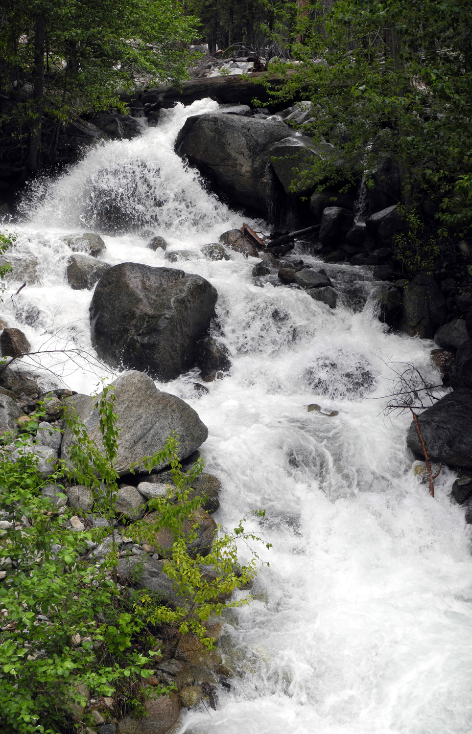
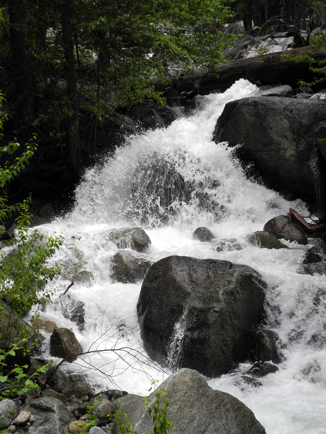
Sheep Creek Falls |
 |
 |
 |
|
Dick on the bridge across Sheep Creek |
Granite "stacked up" beside the creek |
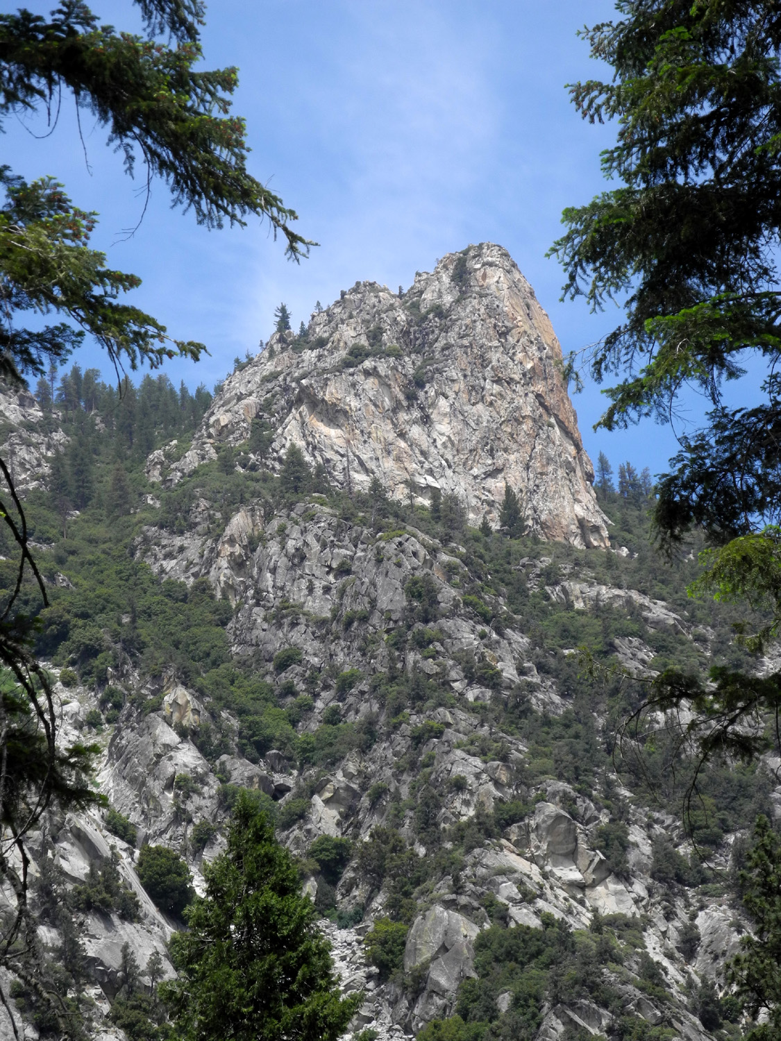
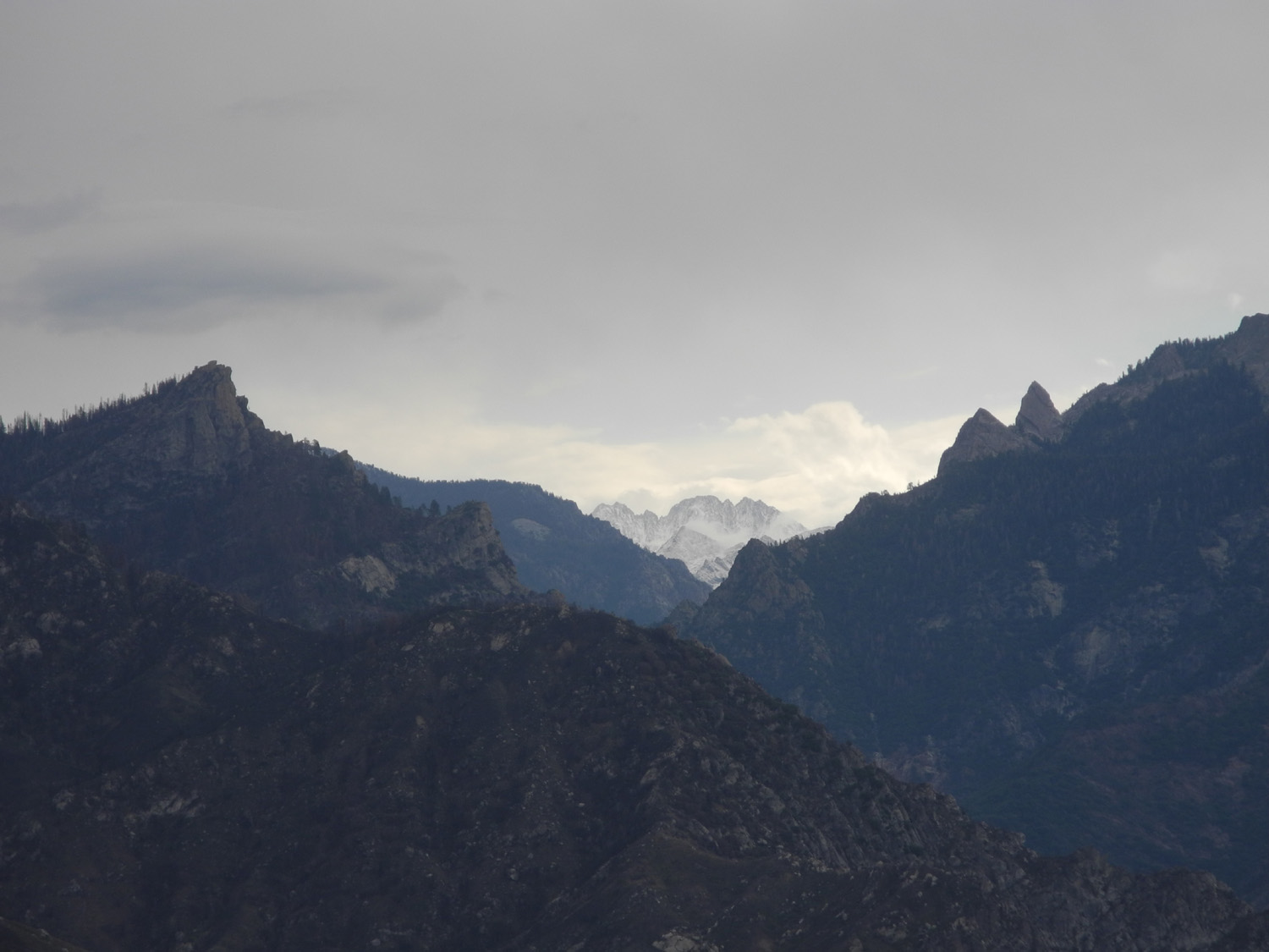
Monarch Divide from Don Cecil Trail |
 |
 |
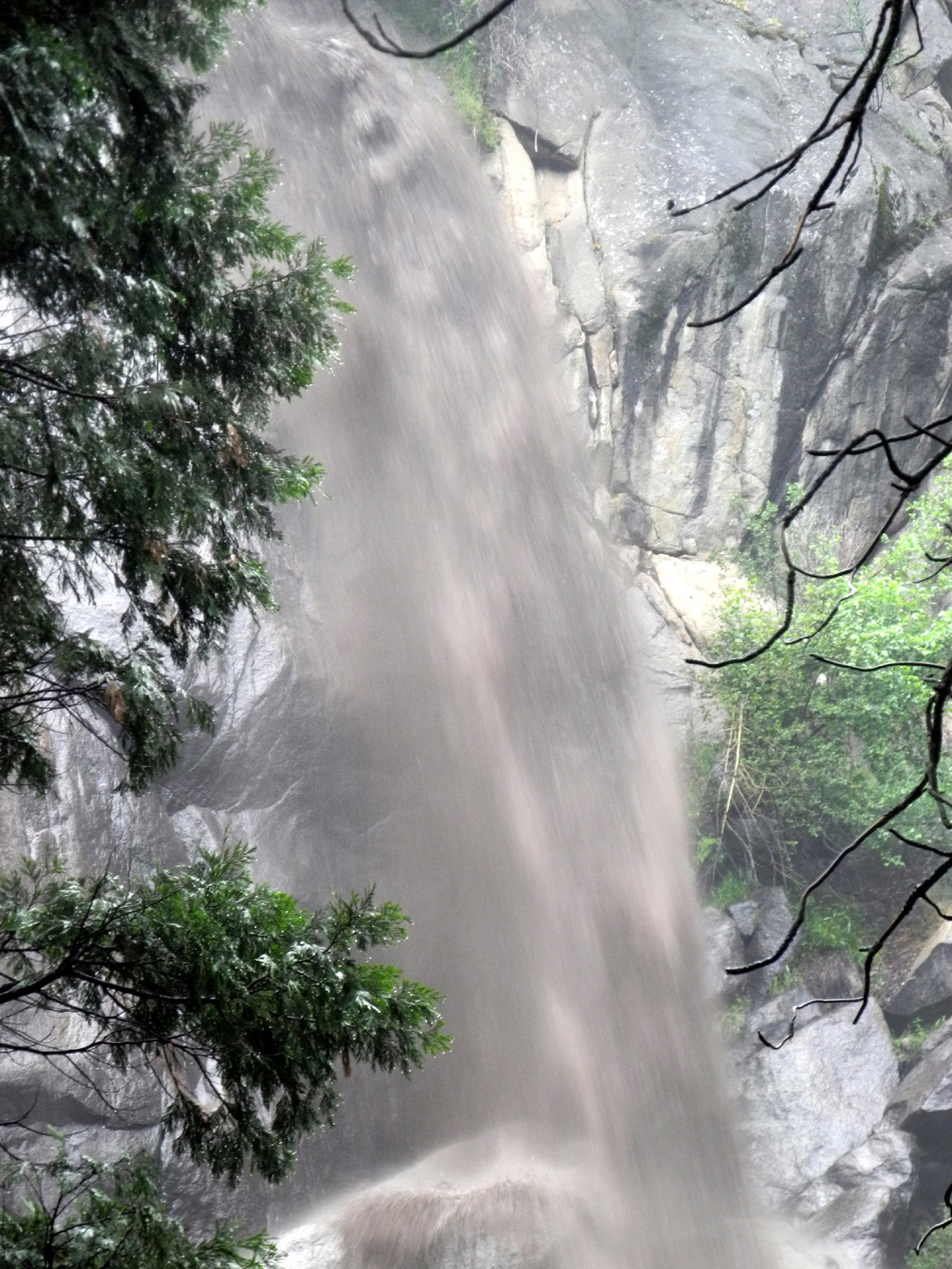 |
| View up Kings Canyon | Rocky peak above the canyon | Grizzly Falls, dirty from storm runoff upstream |
 |
 |
 |
| Middle Fork of the Kings River |
Mist over the main Kings River Canyon |
Live oaks on the heliport road |
 |
 |
|
| View up the Middle Fork | Panoramic Point Trail | |
 |
||
| Kings Canyon back country from Panoramic Point | ||
| Readers are urged to help identify the flowers listed as "Uknown" | ||
 |
 |
 |
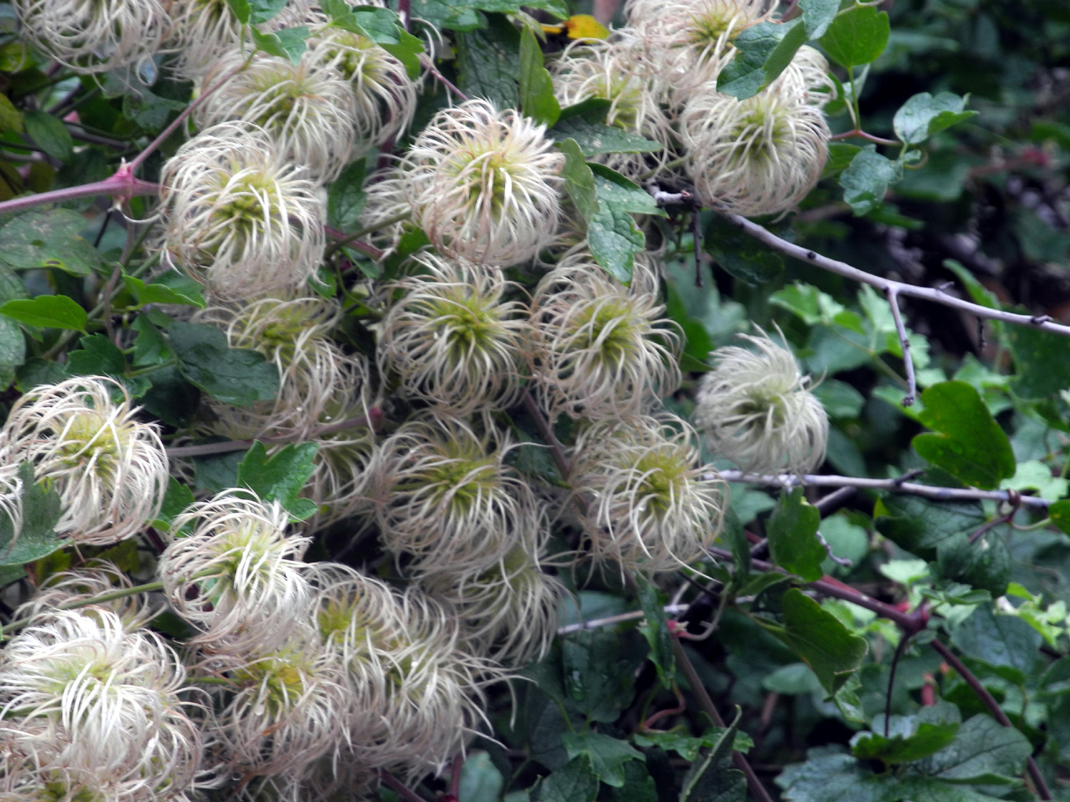
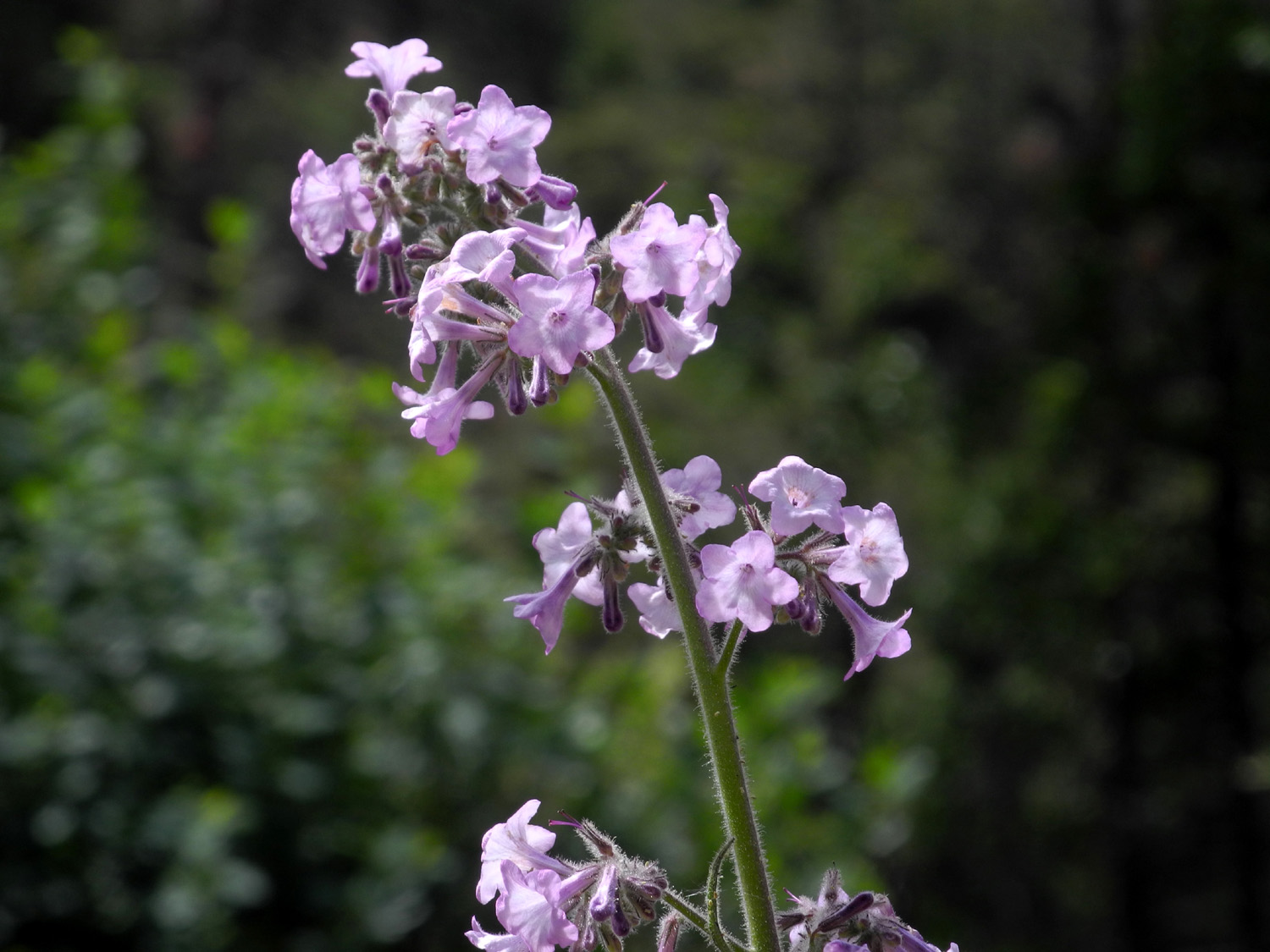
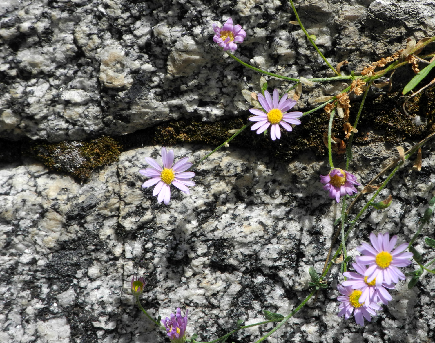
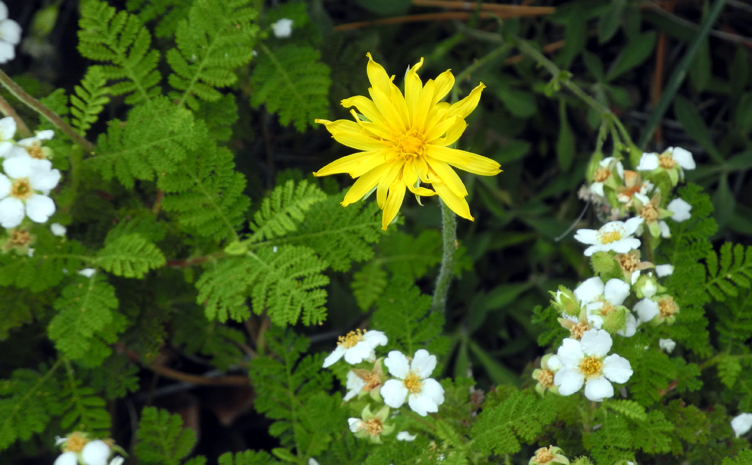
| Blazing Star | Grand Collomia | Unknown 2 |
 |
 |
 |
| Fireweed | Teri and a tall fireweed plant | Western Meadow Asters |
 |
 |
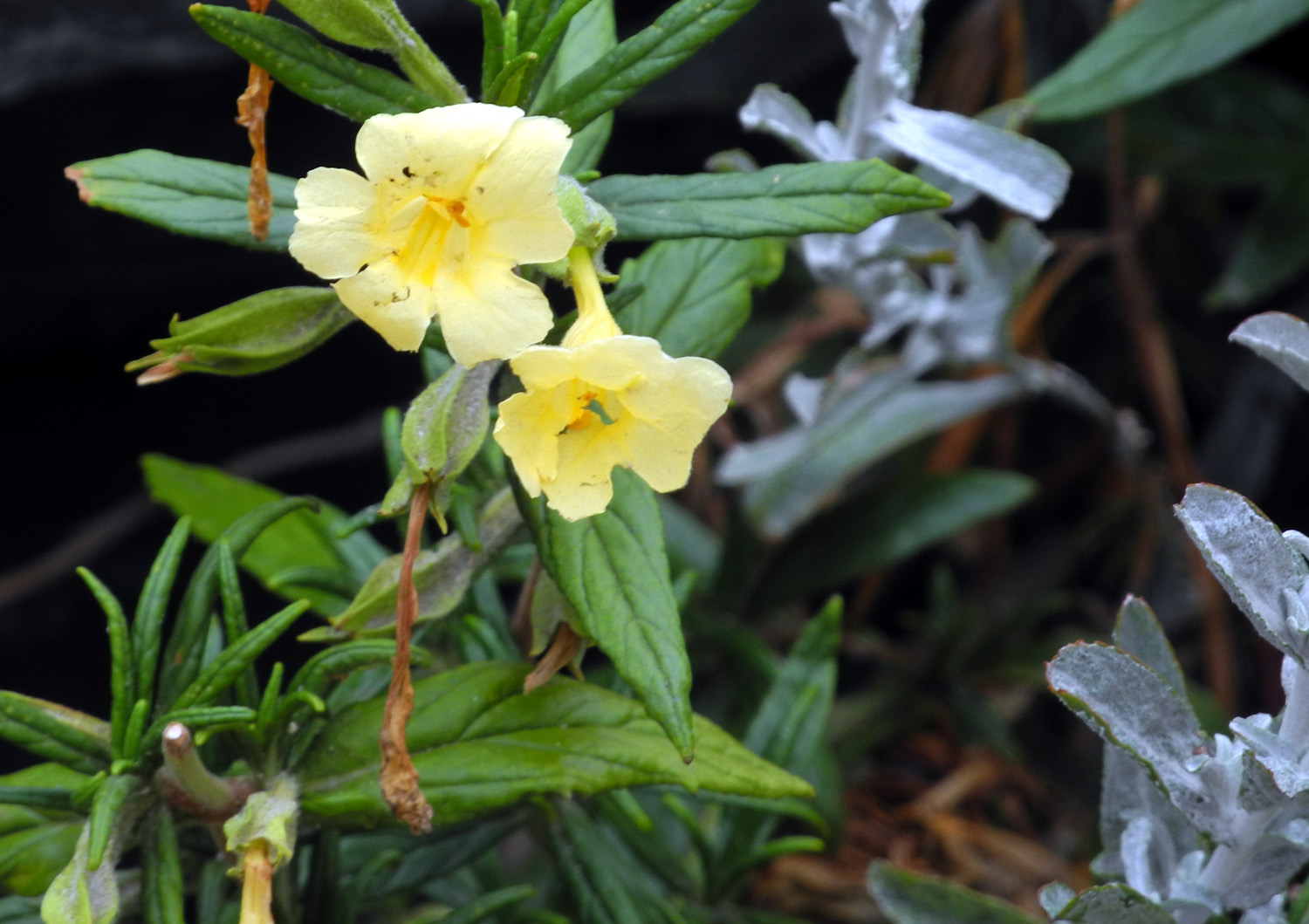 |
| Clarkia | Unknown 5 | Unknown 6 |
 |
|
|
| Bear Clover | Unknown 7 | |
| Father's Day
at Courtright (Photos by Teri Liddle, Wes Thiessen & Dick Estel) |
||
 |
||
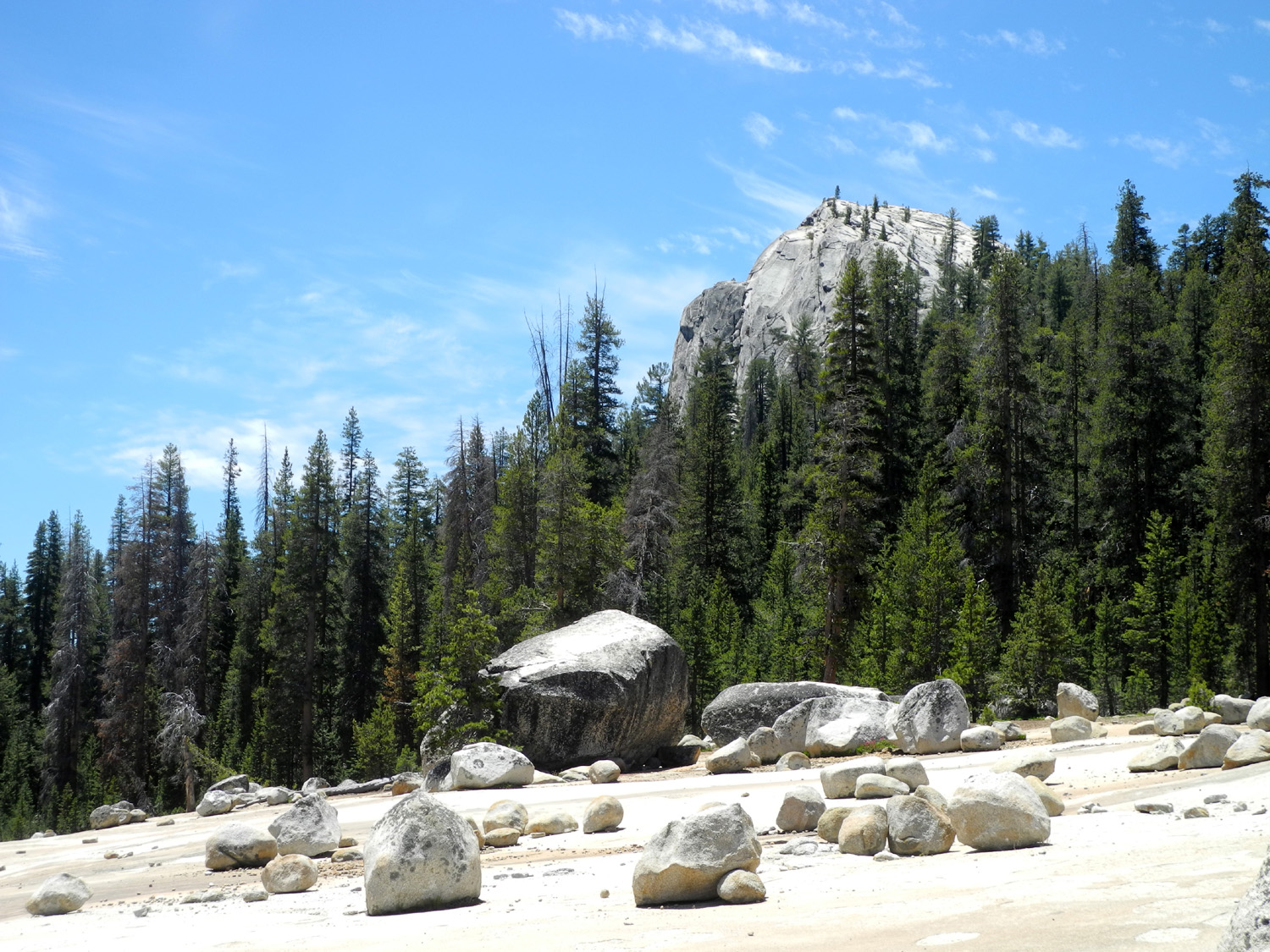
| Double dome east of the trailhead | ||
 |
||
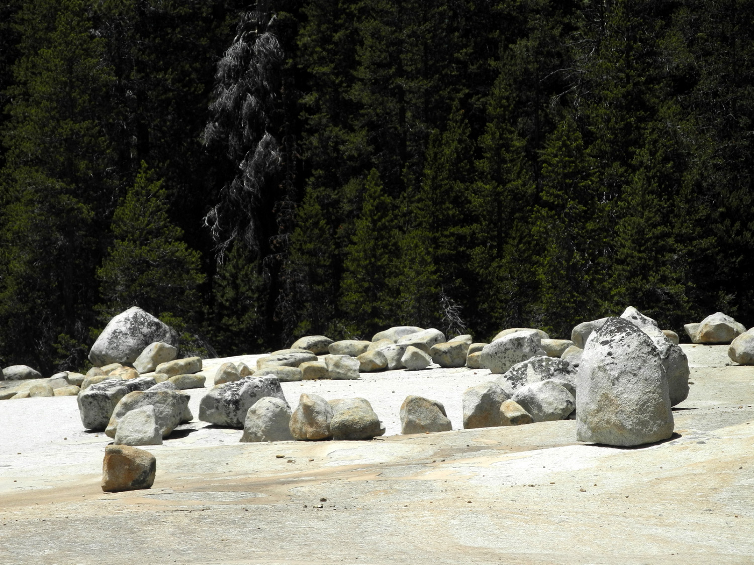
| The giants' marble game | ||
 |
 |
 |
| Dome between trail and lake | Tiny yellow flowers | Tiny white flowers |
 |
|
 |
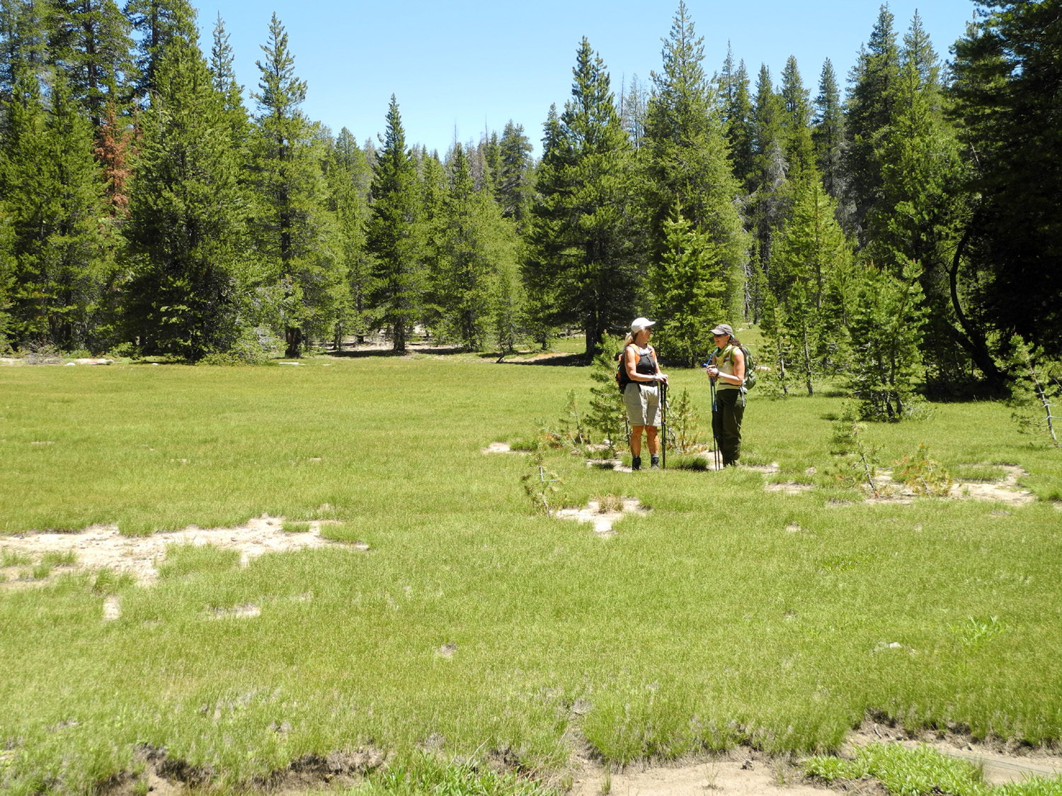
| The trail through the meadow | Teri and Jennifer in the meadow | Wes and Mikie |
 |
 |
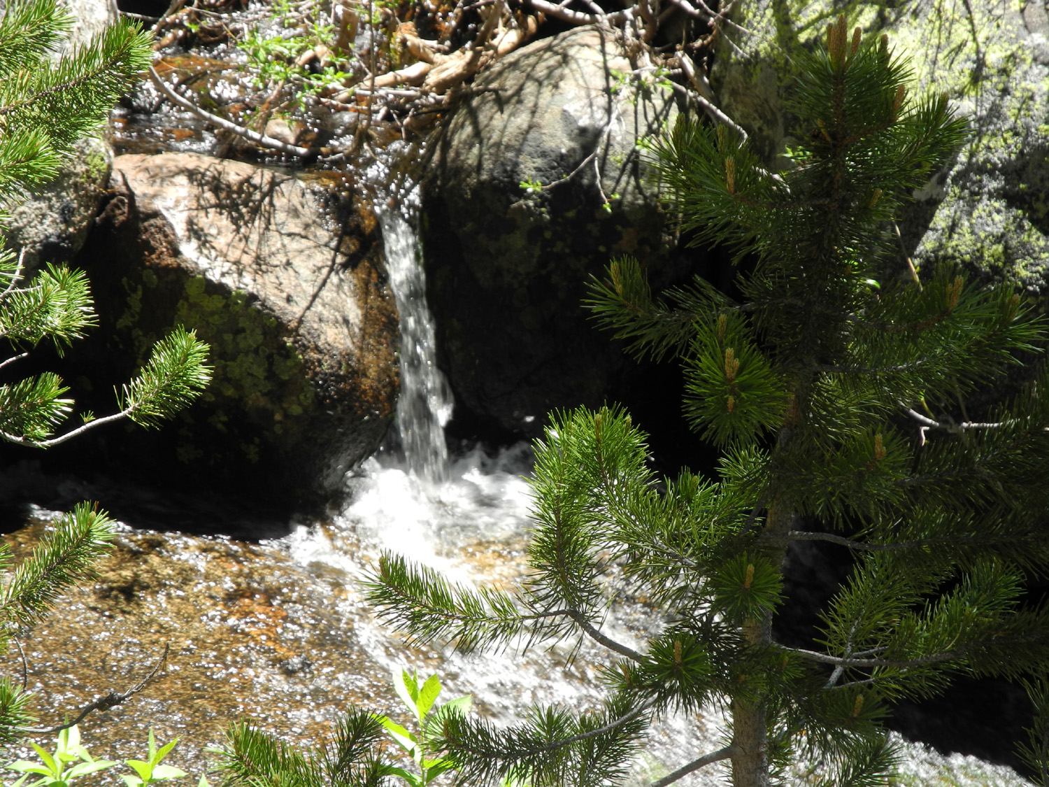 |
| The creek through the meadow | The bigger creek east of the trail | A tiny waterfall on the creek |
 |
 |
 |
|
Looks
like a deliberate |
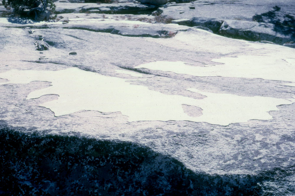
The big
granite slab, boulders and a dome in the distance |
Wes and Dick |
 |
|
 |
| Teri, Dick and Jennifer | Our
hiking crew: Dick, Mikie, Jennifer, Wes and Teri |
Clouds over the forest |
 |
 |
 |
| Maxson Dome, north of the granite slab area | Mikie looking for fish |
Falls on
Bear Creek where it |
| Tokopah Falls Trail | ||
 |
 |
 |
| This sign lies | Marble Fork of the Kaweah River | Cedar beside the trail |
 |
 |
 |
| The river runs over a rock bed in this spot | Teri on one of several bridges on the trail | A great place to rest and enjoy the falls |
 |
||
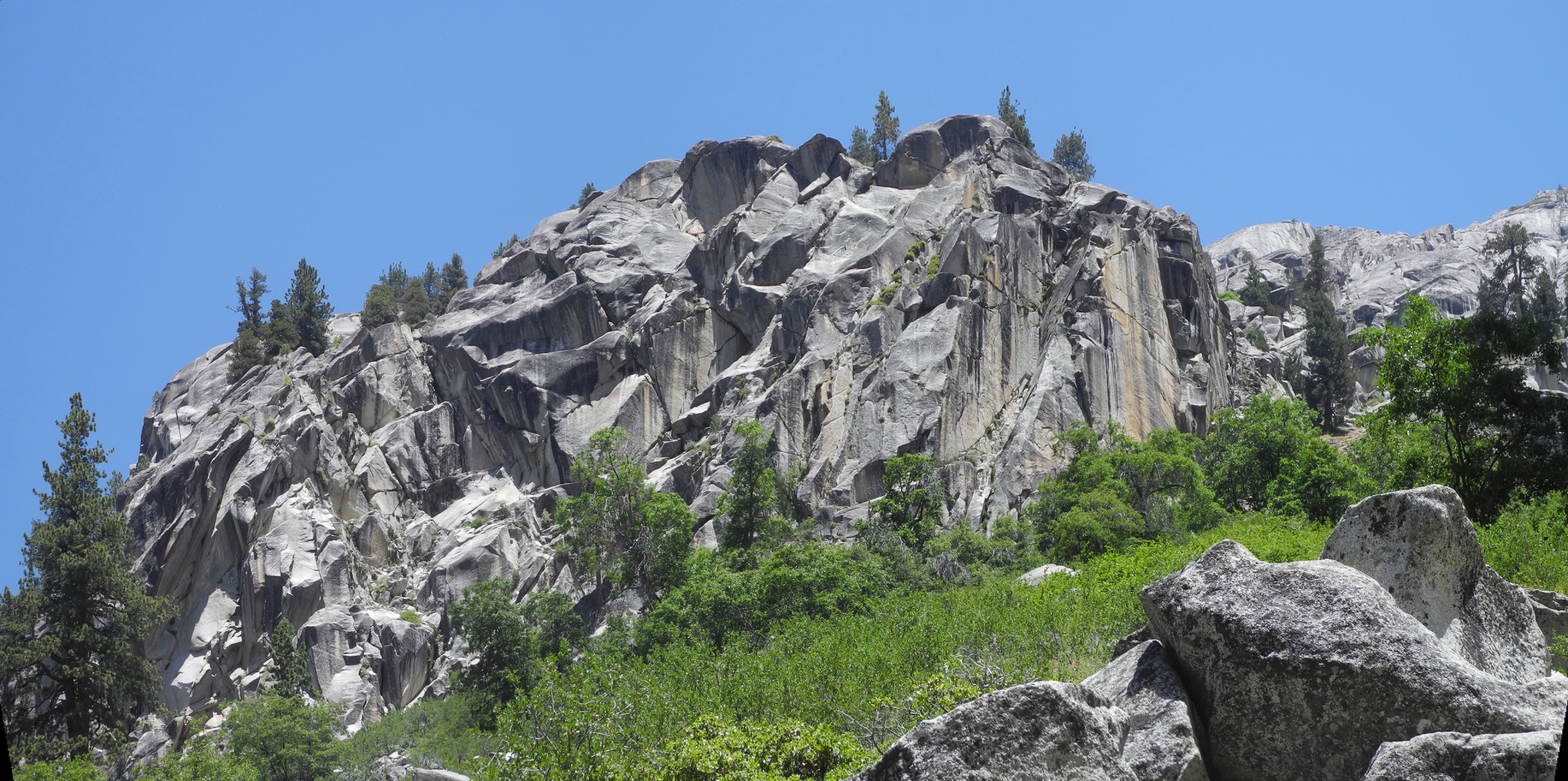
| Cliffs on the north side of the canyon | ||
 |
||
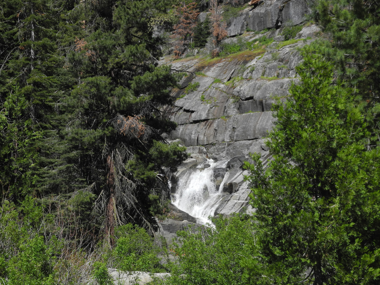
| The full view of Tokopah Falls, top to bottom | ||
 |
 |
 |
| Lower section of the falls | This guy watched the
tourists who were watching him |
Looking down the Tokopah Valley from the falls |
 |
||
| The Watchtower stands guard on the south side of the canyon | ||
|
 |
 |
| More of the north side cliffs | Dick on a nice section of the trail | The Watchtower from the trail down river |
 |
 |
|
|
Yellow-throated gilia were the most common flowers along the trail |
Bright yellow stands out in the greenery | Kelley's Lily |
 |
 |
 |
| More green than yellow | Scarlet gilia | Another flower to be named later |
| Related Links | ||
| Yosemite National Park | Wawona Tunnel | Tunnel Photos |
| Bridalveil Falls | Ribbon Falls | Yosemite Falls |
| Cascade Falls | Knapp's Cabin | Zumwalt Meadow |
| Grizzly Falls | Roaring River Falls | |
| Grant Grove | Kings Canyon National Park | Cedar Grove |
| Rae Lakes Loop | Rough Fire | Glacial Moraines |
| Dusy-Ershim Trail | John Muir Trail | Hell for Sure Pass |
| Tokopah Falls | Marble Fork of the Kaweah | Kaweah River |
| Lodgepole | Muir Grove | Little Baldy |
| Big Baldy Trail | Francois Matthes | Generals Highway |
| Boole Tree | ||