
Dick's Adventures of 2017 - Part 1 |
||
Adventures of 2016 Adventures of 2017 Part 2 2017 Part 3 2017 Part 4 2017 Part 5 2017 Part 6 Pine Flat Creek Exploration Wet Dry Creeks San Joaquin Gorge Off-Trail |
||
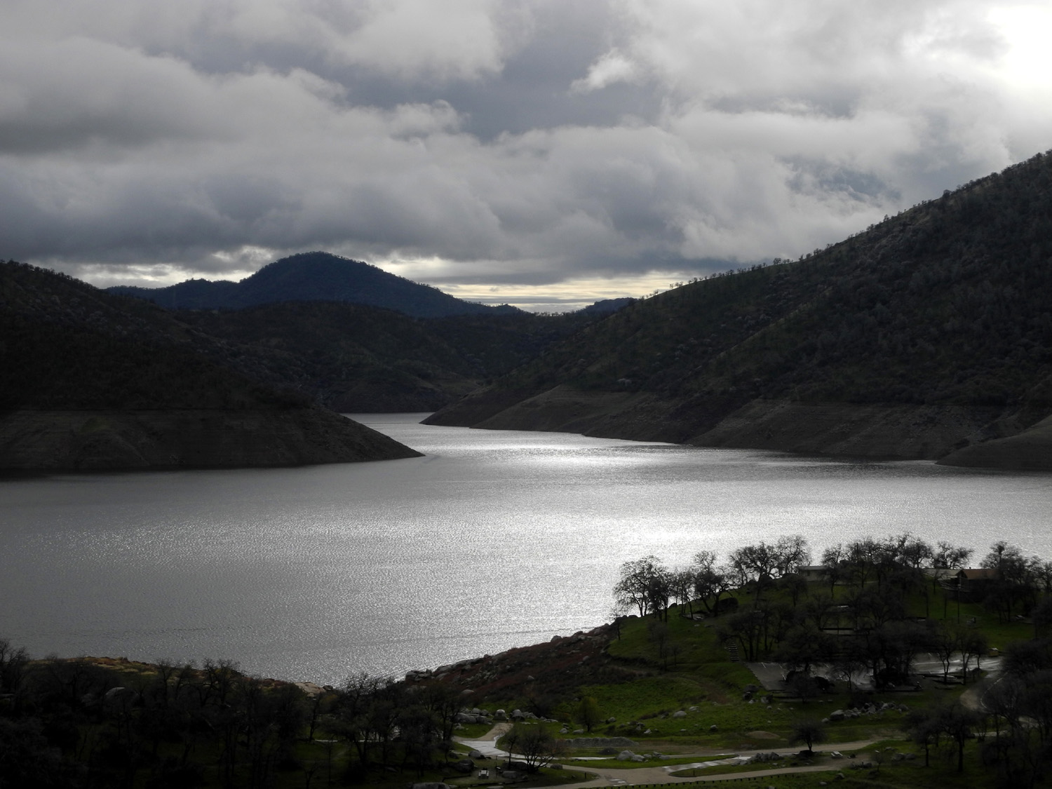
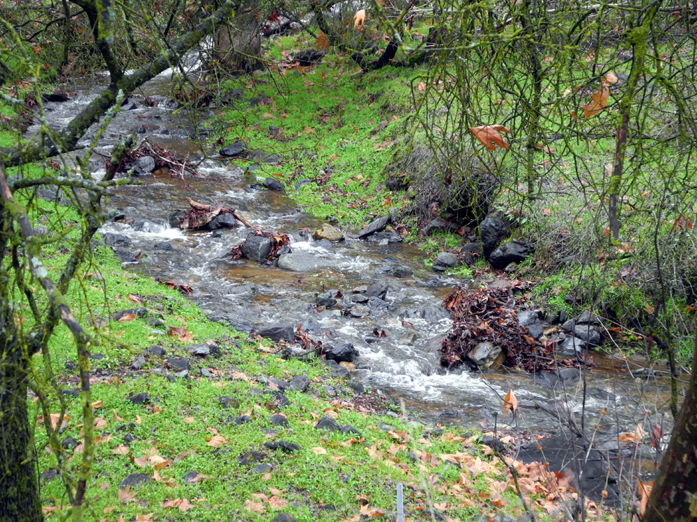
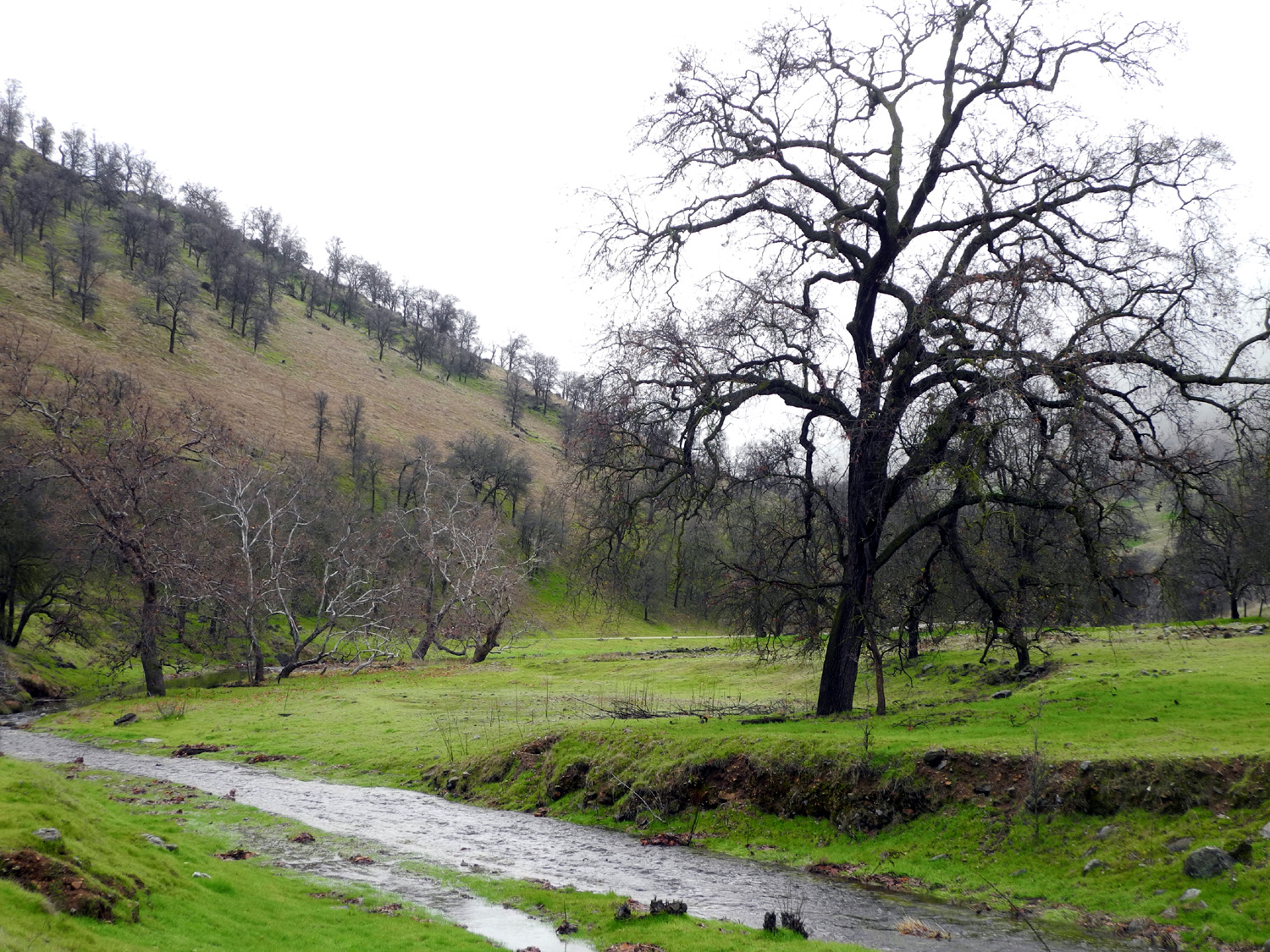
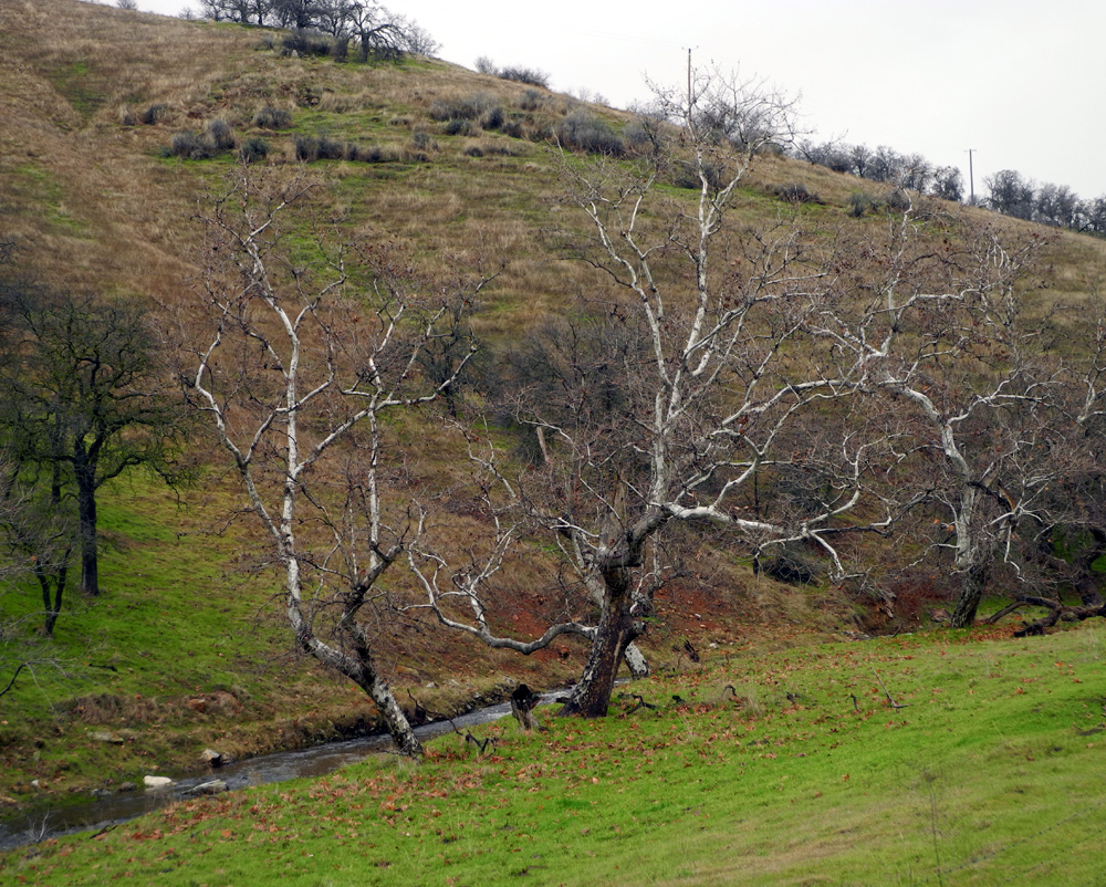
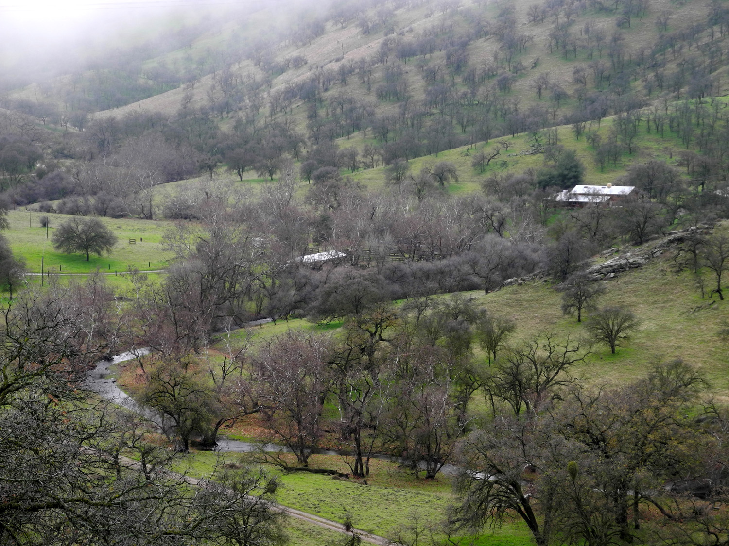
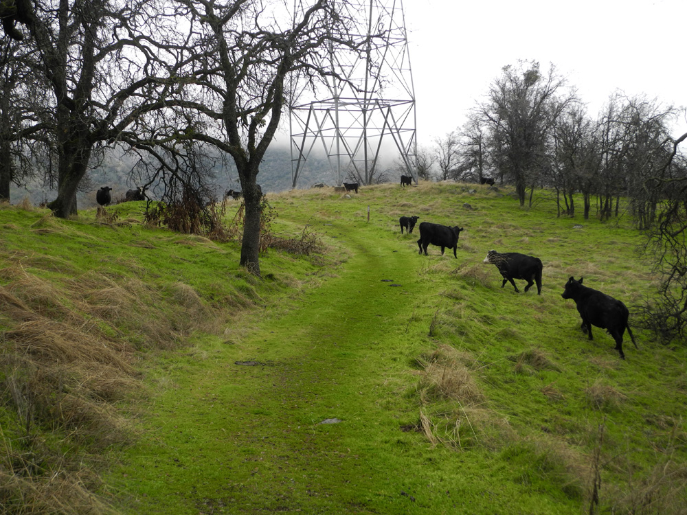
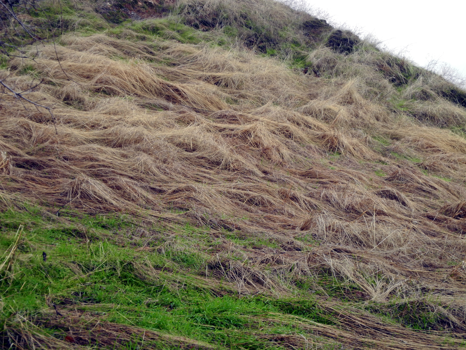
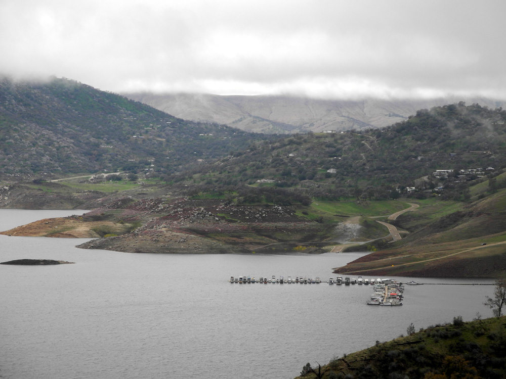
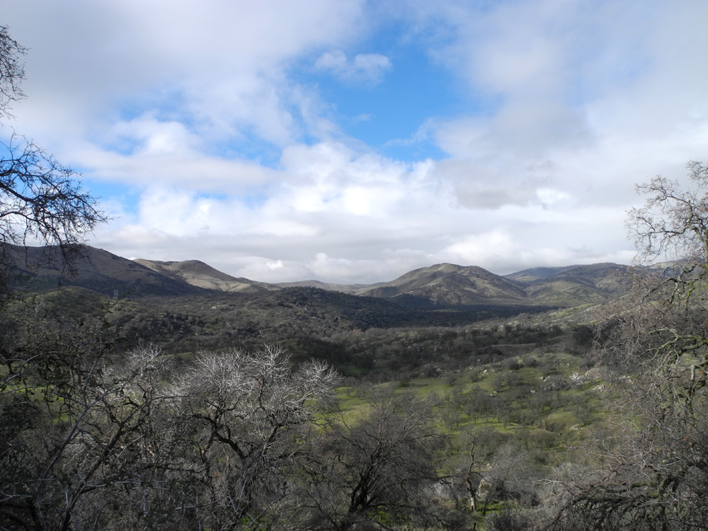
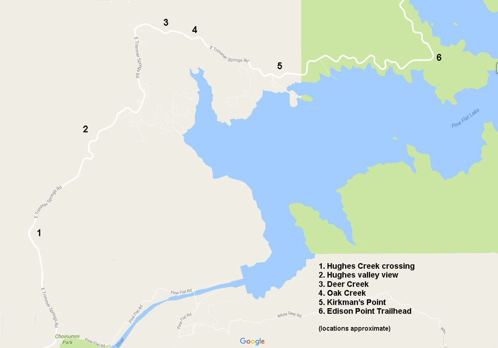
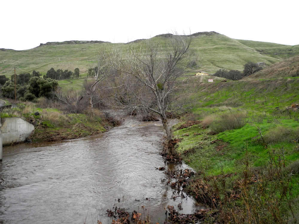
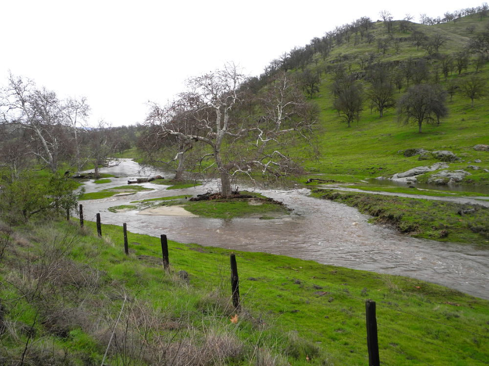
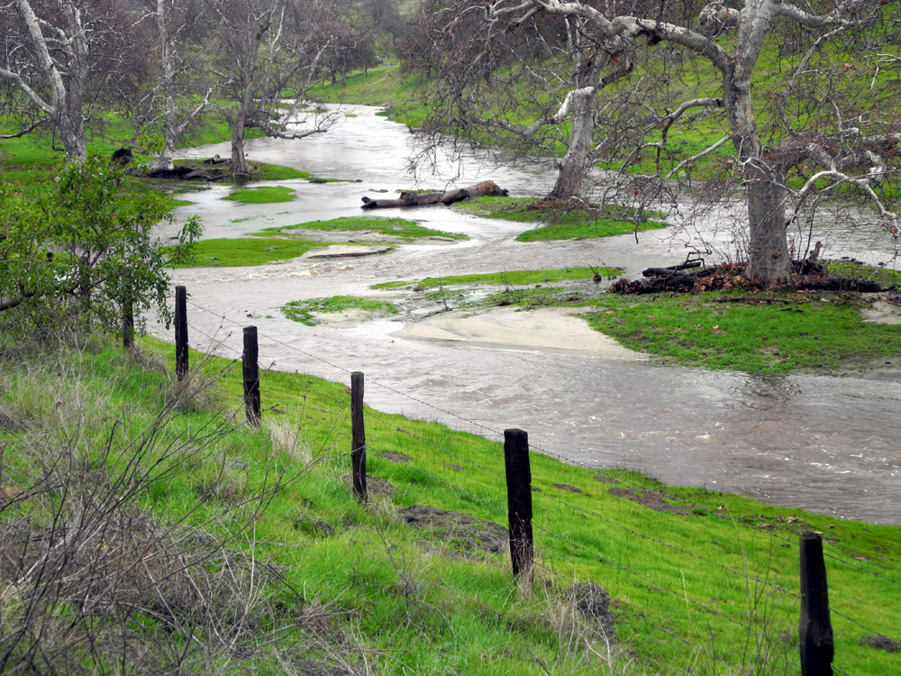
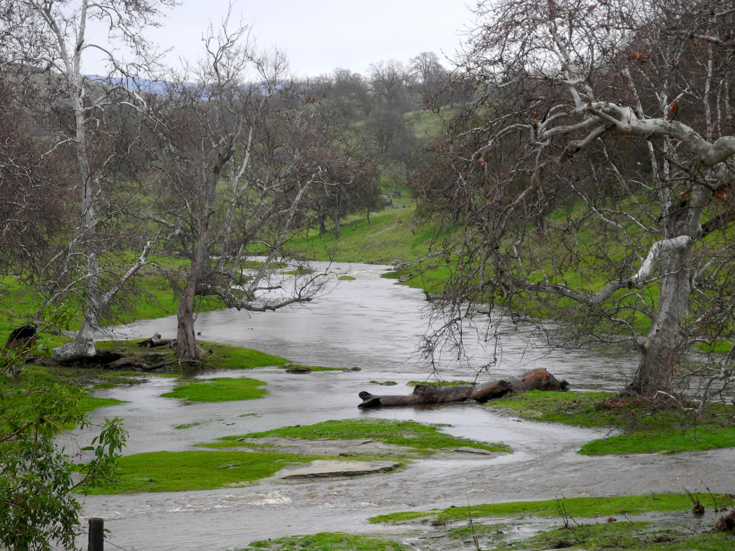
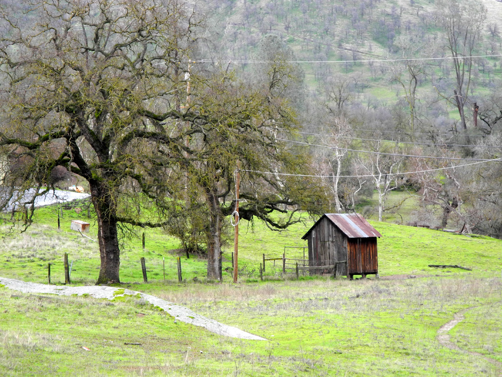
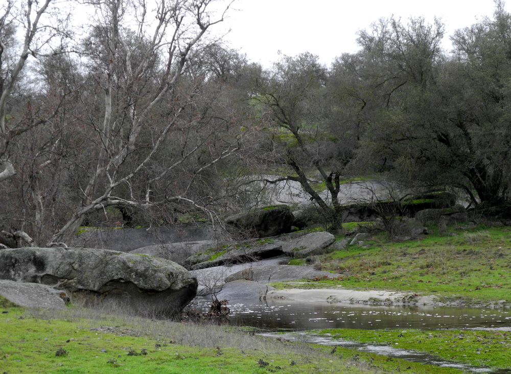
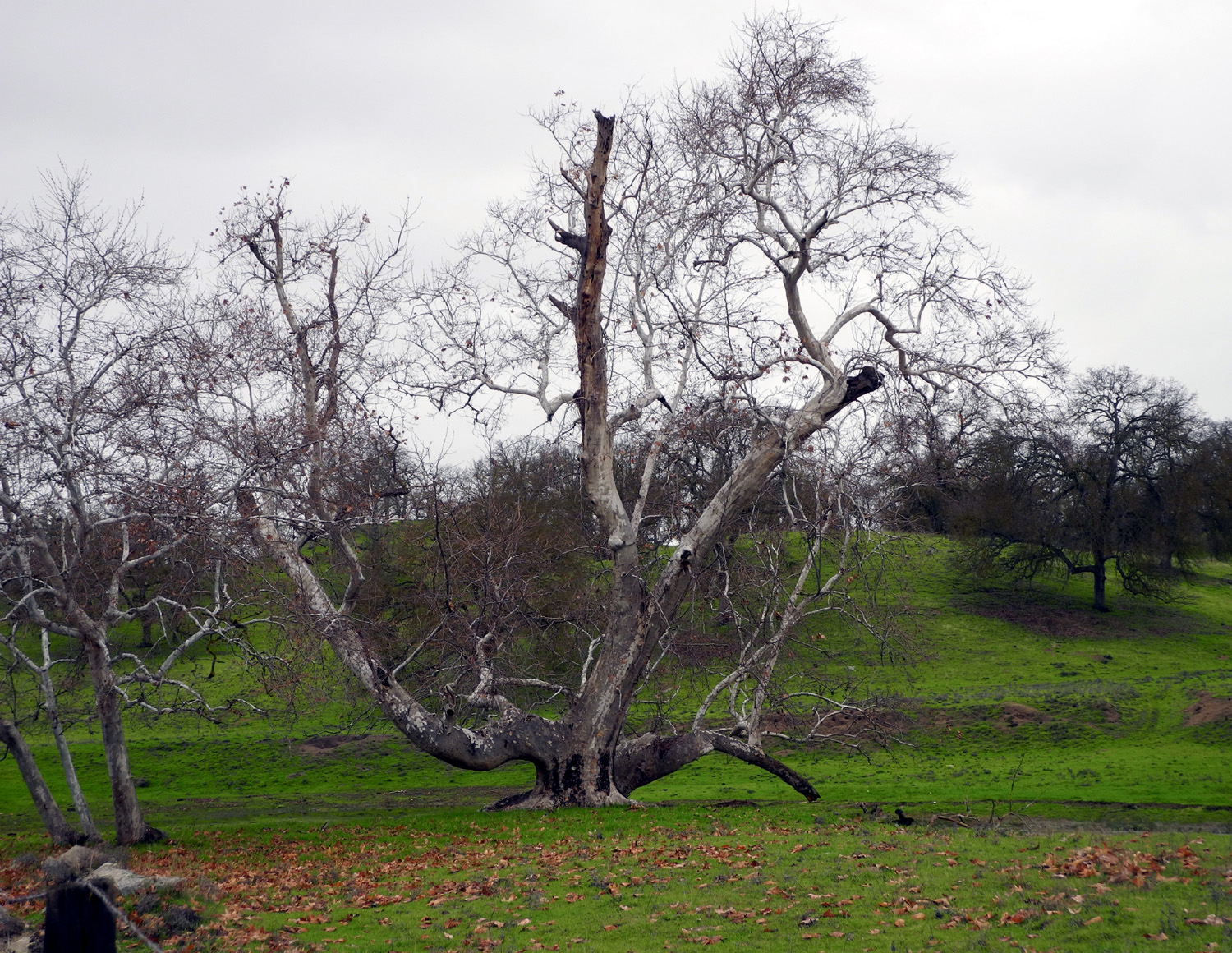
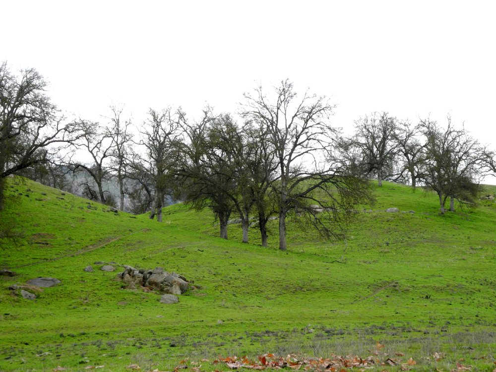
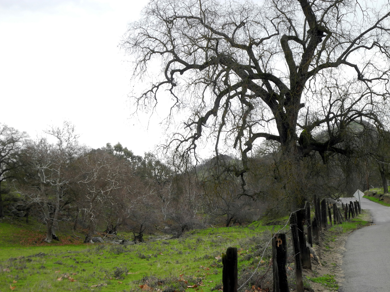
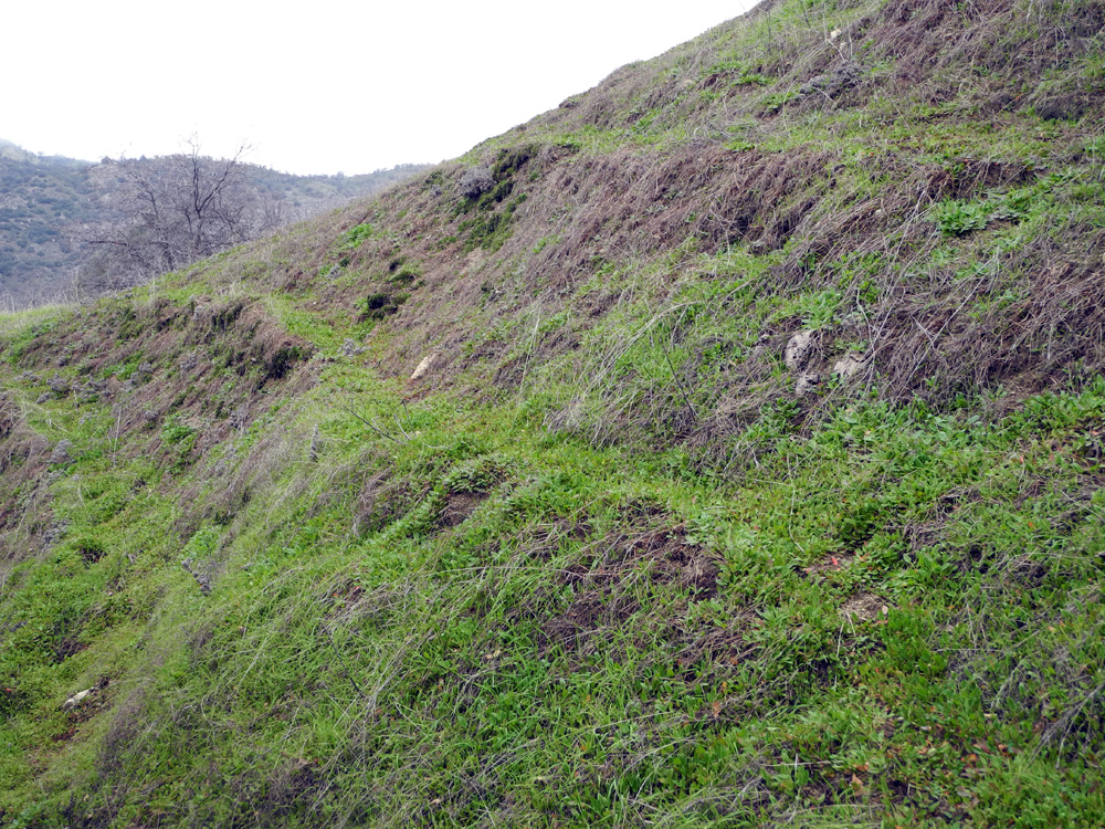
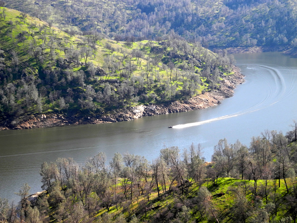
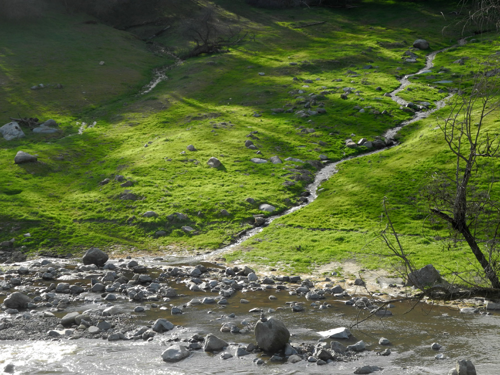
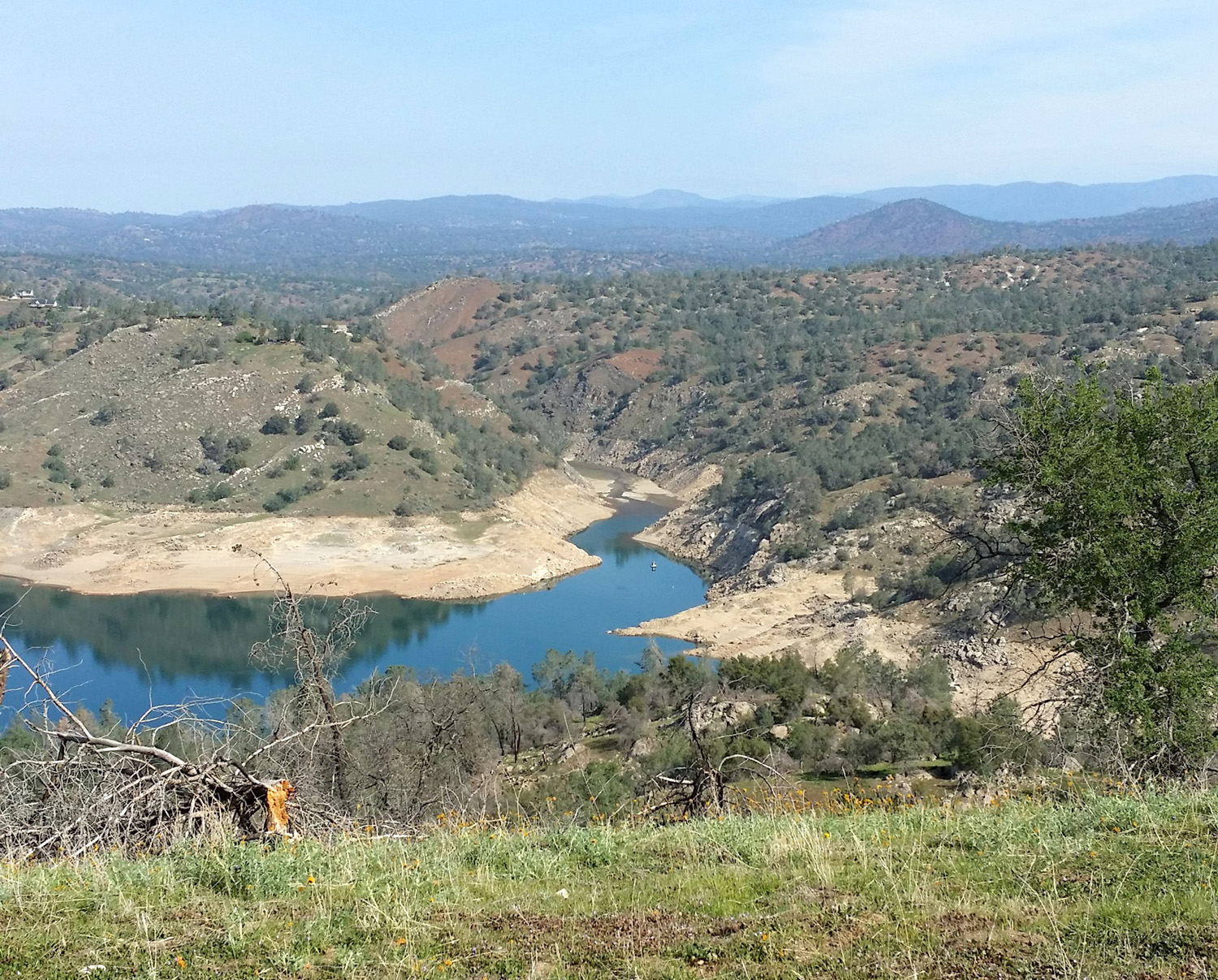
Pine Flat Creek Exploration This was a low-key trip -- a short drive and a walk of less than a mile in familiar territory. What was different were the weather conditions. California has been enjoying a series of storms, with heavy rain in the nearby Sierra foothills, and several feet of snow at high elevations. The forecast was for this to continue most of another week, with rain on and off on January 5. In fact, the prospect of heavy rain on that date caused us to cancel a Ramblers hike. The series of storms that have blessed us this season means that the small creeks in the foothills that are dry in summer are flowing, or soon will be. Returning from our Christmas Eve hike at San Joaquin Gorge, my daughter Teri and I passed the three Dry Creeks that flow across Highway 168. Only one had water. Teri was in that area on January 4, and sent me a message that "the Dry Creeks are no longer dry." A lively creek flowing through green hills is a delightful sight, so I decided to see for myself, although I chose a slightly different destination, heading east on Belmont Avenue toward Pine Flat Reservoir. Based on the forecast of the previous day, I expected to be driving through showers, hopping out for a few quick photos. If all went well, my hopping would take place during a lull in the rain. As it turned out, there was no rain where I went, although some showers fell higher up in the mountains. The road to Pine Flat from Fresno starts with a drive east on Belmont Avenue. Near the foothills the road curves to the north, and becomes Trimmer Springs Road, which follows the river and the lake shore for many miles. The first section of it is far enough away from the river that you don't really see it, but soon it goes up over a ridge that provide an excellent view down into the river valley near where it emerges from the hills. At the community of Piedra the road turns north away from the river, following Hughes Creek for about two miles. I stopped to take pictures where the road crosses the creek, and had a nice chat with a local resident. She had ridden an ATV out her dirt driveway from her house to get the mail, right by the bridge crossing. She and her husband own land there which they lease for cattle grazing. They are enjoying the rain and hoping for a good wildflower year. From this spot the road starts up to cross over a ridge above the lake. I made another photo stop along here, getting a nice view of Hughes Creek and a ranch in the valley below. I was dismayed to also get a view of how much trash people have thrown over the road bank, including a mattress and a bunch of tires. The road tops the ridge near the Oak Knolls Trailer Park and the I Forgot Store, where a fork goes to the right down to the lake near the dam. In the opposite direction, Trimmer Springs Road continues north and east through a couple of creek valleys before you come to a view of the lake. A study of the map indicates that the first one is Deer Creek, but I could not find a name for the second one. I'm calling it Oak Creek, although all the creeks in the area are lined with oaks. I stopped at each of these creeks for photos. I liked Oak Creek better, possibly because it was easier to see. Both are on private land, with access blocked by barbed wire fences. Both creeks were running nicely, but neither were raging. Perhaps the big storm predicted for the weekend will change that (it did). I made my next stop at Kirkman's Point, enjoying the dramatic sight of clouds and mist hanging over the lake. Here I talked with a man in a truck from the Fresno County road department. He had been cleaning up some dirt and rocks that washed down into the road, and was waiting for a different piece of equipment to pick up several large boulders that had slid into the road "up the hill." My final stop was the Edison Point trailhead. I've written about long and short hikes here with the Ramblers (twice), by myself, and with Teri. I decided to walk out the first section of the trail, which is basically a dirt road for access to some of the big electrical transmission towers that run along the lake. I passed on hiking the complete trail, which would have meant slogging through old dead grass, soaking wet from the rains, and trying to navigate some steep sections of the trail. Walking out to the point and back was a total distance of just under a mile. As I expected, there were some wet and muddy spots on the trail, but nothing that blocked my way. There was water almost all across the trail in one spot for a few feet, with room to get by on the side. In another location, a large bull pine had broken off and fallen across the trail, but at the edge of the trail there was just a small branch which I easily stepped over. There were a lot of cows gathered around the electrical tower out on the point, keeping an eye on me as I approached. When I got close, they started to drift off, but I decided to let them have the high ground and just walked through the grass where the land starts to rise steeply on the other side of the trail. Although there were no wildflowers other than dried seed pods from last year's growth, the grass is thick and green, and with all the rain we've had, there should be a nice display within the next month or so. "How was the weather?" you ask. The best answer is "Variable." It was fully overcast when I got up and I expected to be driving in the rain some of the time, but that never happened. As I started to pull away from my garage, the sun broke through, so I went back and got my sunglasses, but didn't need them till later. By the lake, and in high, open areas, there was some breeze, but the creek valleys were sheltered from this. As the photos show, it was misty on the hills above me much of the time. Heading home, I stopped at 1:30 and sat in the truck by the road above Hughes Creek and ate my lunch with the sun coming out. I wore my sunglasses for a while when I resumed my drive, but then got under the overcast layer and took them off for the rest of the trip. Back in Clovis, about half the sky was cloudy and the other half sunny. During the following weekend a massive, warm storm came in, causing flooding in foothill communities, a partial washout on the McKinley Grove Road above Dinkey Creek (our route to Courtright Reservoir), and rock slides on the roads into Yosemite and Sequoia National Parks. News coverage showed massive flows over the waterfalls in Yosemite. Although I had hoped to see some big water like this on my trip, the flood warnings convinced me that what was coming was bigger than I wanted to drive in, so I didn't attempt a second trip, but instead enjoyed my weekend working on this report and watching the water flow on TV.
--Dick Estel, January 2017 |
||
| Previous Edison Point Hikes | ||
| With the Ramblers March 2015 | Solo March 2015 | Ramblers February 2016 |
| With Teri & Monica March 2016 | ||
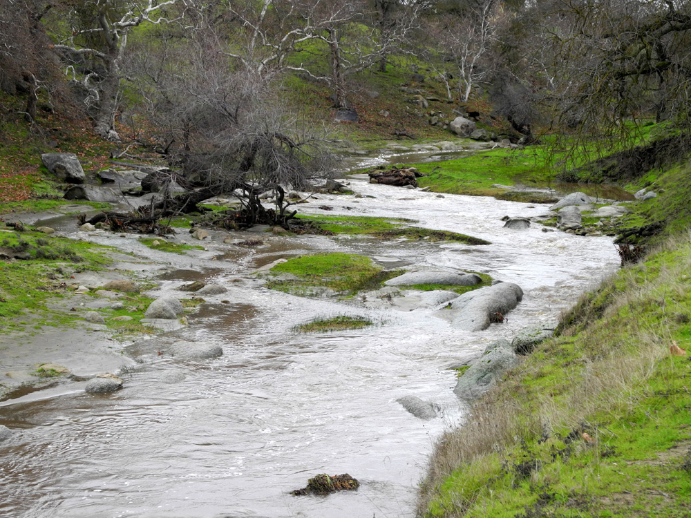
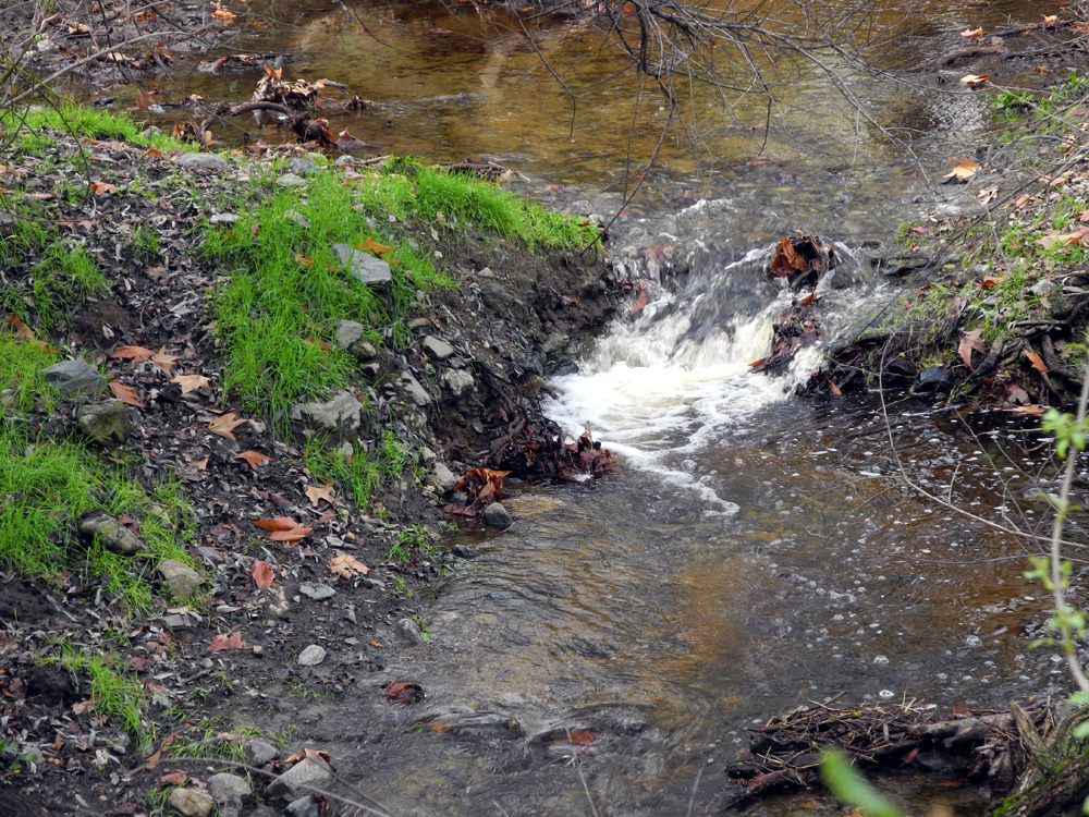
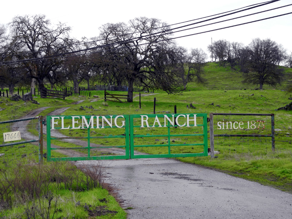
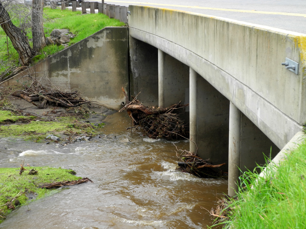
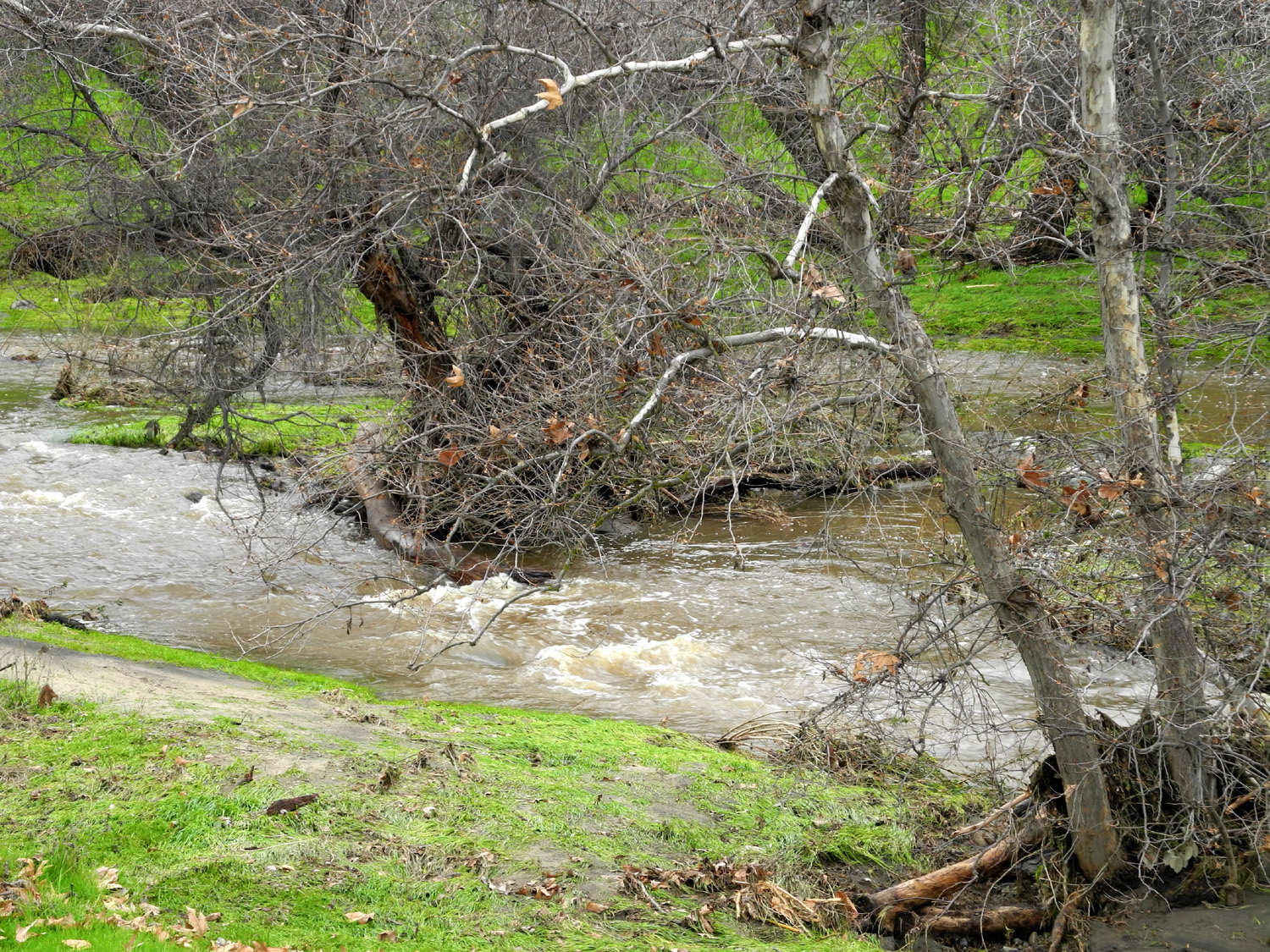
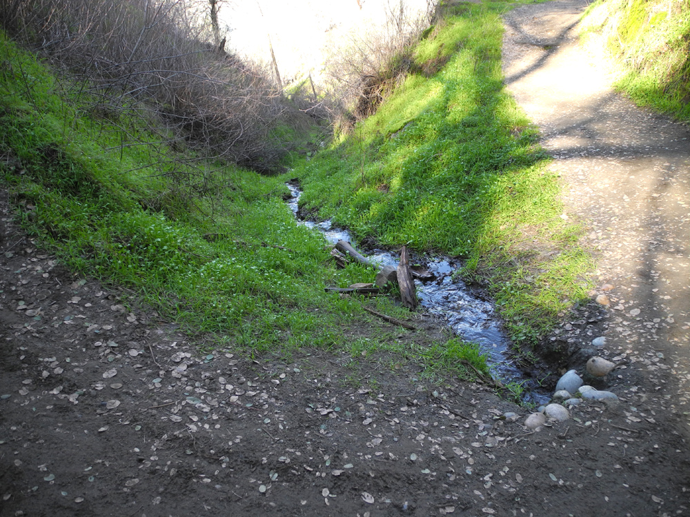
Wet Dry Creeks Five days after my exploration of creeks near Pine Flat Reservoir, I again went in search of big stream flows. During the interim period, a series of massive storms came through California. There were rock slides, road closures, road washouts, and minor flooding in several areas. Of course, the best time to have seen massive water flows was during the storms, but there were flood warnings, and heading into the foothills at that time seemed unsafe and unwise. My daughter Teri has been working in the foothills and mountains, and she described conditions on January 9 as "a mess." On January 10 I set out under cloudy skies, driving north from my house to Auberry Road. This route starts at the edge of the flat San Joaquin Valley floor, but soon drops down into the valley of Little Dry Creek, and runs beside this waterway for several miles. I got into a misty rain as soon as I gained a little elevation, and during the first half of my drive, there was rain most of the time, increasing slightly at the highest point. I stopped at several places along Little Dry Creek, keeping my camera under my shirt except when actually taking photos. At the entrance to Fleming Ranch, a Fresno County fixture since 1875, the creek goes southeast and the road goes northeast. About two miles past this point the road goes up over a ridge, where I turned right on Millerton Road. This route drops downhill quickly and comes to a creek crossing, where I again stopped. I had taken photos at this point during the Ramblers rain drive last year, and at the time we thought it was Little Dry Creek. This time I realized there were two problems with that identification. Where I had driven by Little Dry Creek along Auberry Road, it had been muddy, but this one was clear. Just past this point I came to a muddy creek, running toward the clear creek - in other words, the "wrong direction" for the first one to have been Little Dry. A look at the map after I returned home indicated that this was the North Fork of Little Dry Creek. Millerton Road stayed near the main part of Little Dry Creek, crossing it three times, but eventually the creek went its own way and I came to the junction with state Highway 168. I turned right to head back to the city, knowing that I would have a couple more creek stops along the way. As the highway begins its descent from the foothills, it drops into the valley of Big Dry Creek. It closely parallels the creek for about a mile through a narrow canyon before reaching the flat country. I stopped by a whitewashed wood fence and cattle guard, part of the Dry Creek Ranch. When I moved to Fresno in 1966, we used to drive out here and walk around down in the creek. Now there are several bridges across the creek, and five or six houses near it in this section. I made a final stop for creek viewing at the bridge where Big Dry Creek crosses the highway. I was able to get a good look at the creek and its surroundings at this location. The creek was running fairly strong, but it was clear I had missed the peak runoff. There was a line of debris along the creek that showed it had been about five feet deeper during the storm, which would have made it about 40 feet wide. There were large tree branches and other material caught against the bridge foundation, additional testimony of the huge flow of water. Another mile or so down the road there is a large pond on the west side of the highway, formed by a dam or dike of some kind. I did not think this water was from Big Dry Creek, which seemed like it would be at a slightly lower elevation in this area. It appears the pond is formed from either Sales Creek or Dog Creek. This was my final stop for the day, and I got some nice photos of this small lake. By this time it had stopped raining, but as I got closer to town, it started up again, and was sprinkling as I pulled into my garage. These weather conditions were predicted to continue for two more days, with periods of rain and sun through the night and day. Once again that night and the next the TV weather news reported road damage, flooding and rock slides throughout the central Sierra, with heavy snow at the highest elevations. I had arranged to take my truck in for some repair work on January 11, hoping to get my daily exercise by walking the mile and a half from the shop back to my house. About 15 minutes before I had to leave, it started raining fairly hard, but it was over quickly, and I ended up walking home with sunshine at my back. Within an hour, I found myself hurrying through a heavy rain when I went out to the mailbox. Clearly the Dry Creeks of Fresno County would not be dry for many more months.
|
||
|
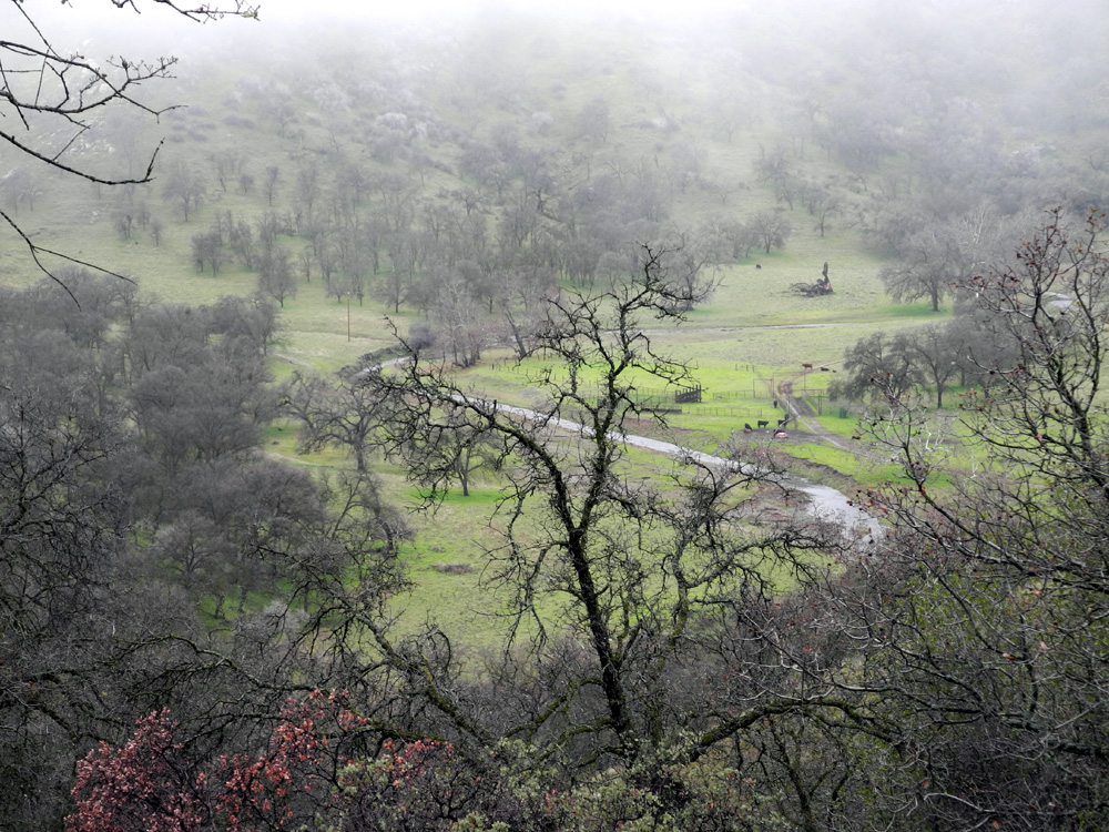
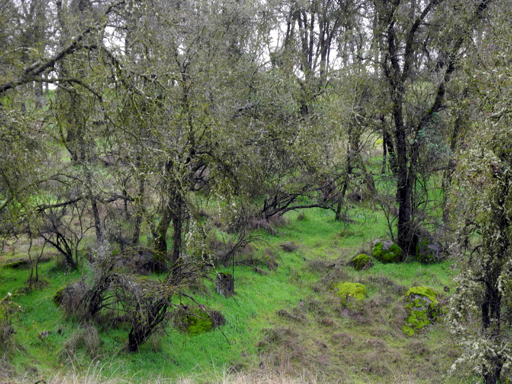
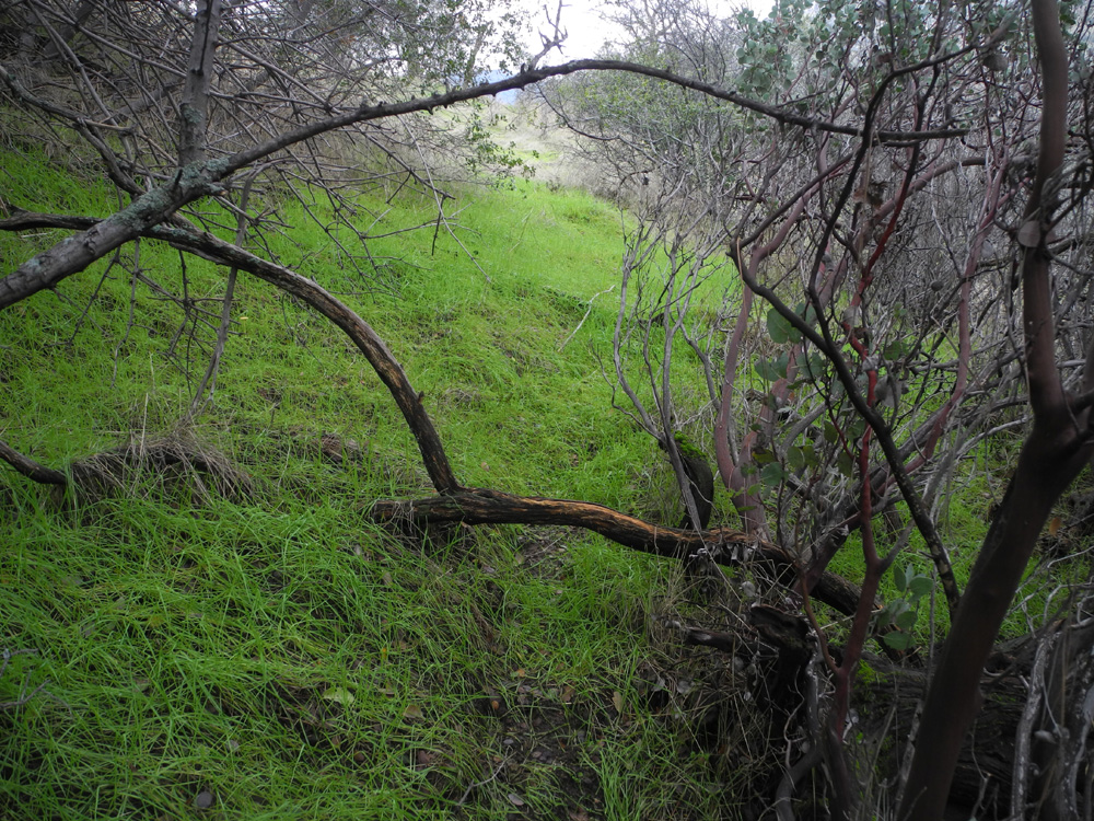
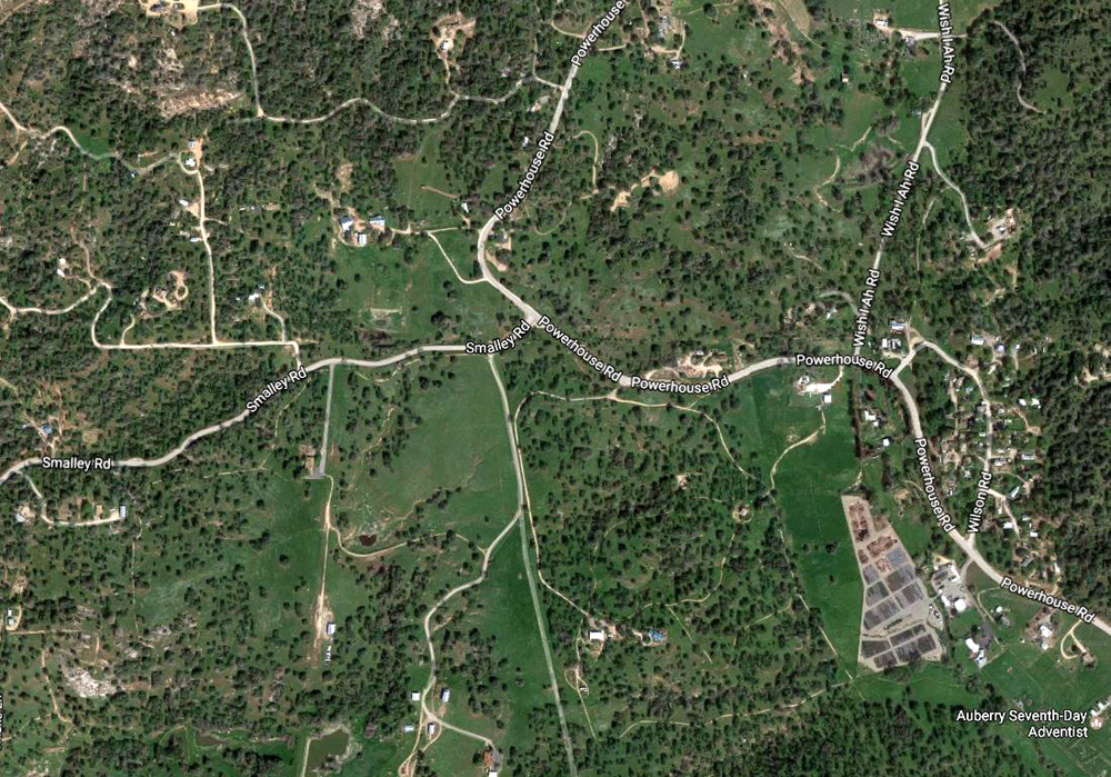
San Joaquin Gorge Off-Trail Hikes My hiking companions and I have a long tradition of going off the trail and doing some cross-country hiking at the San Joaquin Gorge. The first area I did this and the most recent was the territory on the north side of the river above the main trail. We also used to go off the Bridge Trail right at the start and go more or less northeast across the rolling upland there, from where we would make our way down to a lower section of the trail. I last did this a few years ago, but it is easy to get into steep, brushy areas, and I don't have a clear route to the trail in my mind, so I probably will not wander in that area again. The most adventurous treks were when we went up the old road that goes over the ridge in Madera County north of the Bureau of Land Management property, then up to the top of 2,000 foot Kennedy Table. This is another challenging hike that is probably now off the table for me. On the south side of the area, I've done several short trips off the San Joaquin River Trail, mainly to go down to a big water tank, from which you can follow a dirt road out to the main paved road west of the parking area. This is easy, but once you've done it, it holds no attraction for future repeat episodes. When I headed up into the foothills on January 14, my plan was to go down the Bridge Trail, up to the junction, off the trail to the L/S Camp area, then head east toward the Buzzard Trail and back down to the bridge. However as I drove down the steep, winding road a mile or so before the parking area, I noticed a large, rounded knoll below the road on my left. It looked like an interesting area to walk around in, but by the time I realized this, I had gone too far past it. Perhaps I could stop there on the way out. But I'm getting ahead of myself. It was more or less a last minute decision to make this trip, and in fact when I sat down to put my boots on, I was tempted to get my slippers instead and park in front of the TV set. Then I reminded myself of the Ramblers Creed: Carpe diem! I laced up my boots, tossed the necessary items into my Honda, and set out on the 35 mile drive to my destination. It was foggy and cold in the valley, but there is often sunshine in the foothills above the fog. In fact, the forecast for Auberry, about two miles from the San Joaquin Gorge, was for sunshine. And there WAS sunshine there, but the drive to the trailhead is down a thousand feet into the San Joaquin River canyon, and it was still foggy or cloudy down there, and would remain so all day. Just before the turnoff to Auberry from Highway 168 I had stopped at the bridge over Big Sandy Creek to see if this stream was running strong like the others I had seen on my two earlier trips to the foothills this year. Below the bridge is a barbed wire fence which was filled with leaves, twigs and other debris, showing that the water had been about five feet higher during peak runoff, just like most of the foothill waterways. My second stop was where there is a seasonal waterfall coming down a small rock cliff beside Smalley Road that runs into the gorge. When I was here with the Ramblers last year, the waterfall was running a lot fuller, but it was still a nice stopping point. The idea of going out on the knoll above this point gave me the idea of exploring new, off-trail terrain near the parking area, so I turned on the road to the visitor center and parked at the group camp parking lot instead of the main lot. To the east and north of the group camp, there is a wide mowed path that goes a hundred yards on the east side, then along the south side between the camp and the road. Where it comes to the road there is a cattle guard, and you can walk up into the hills above the road without having to go through a fence. I had walked along the fence in this area over to the San Joaquin River Trail last year, but this time I started up a gentle rise that goes up to the ridge that runs from the Squaw Leap table top to the east. This route, which was open grassland with a few trees, was a little steeper than the typical trail in the area, but nothing I could not handle. I took it slow, and after a couple hundred yards, reached a level spot that dipped down to a shallow saddle beyond. Here the land rose up steeply and was more heavily covered with trees and brush, so I decided to make my way generally west, following the contour of the hillside as much as possible. From the saddle I saw that I would have to go down across a fairly steep drainage, but of course, there were trails - cow trails. Cows are not the world's greatest engineers, but they are better than deer and rabbits. There were actually three or four different cow trails leading down into the drainage, so I chose the one that seemed widest and most stable. Following cow trails requires a certain skill, acquired through a lifetime of trial and error. These trails are not level and not very wide, but wide enough. When there has been a lot of rain there is the additional challenge of not twisting an ankle in a deep hole made by a heavy cow hoof. And cows have no problem going through areas where there is low brush across the trail. They consider it a plus, since it gives them a free back scratch and helps brush away flies. When I got to the bottom of the drainage, I saw that I had two choices - go down a steep hillside toward a big moss-covered boulder, or head through what looked like an opening in a chaparral thicket. My rule is, "when in doubt, follow the cow," so I took the narrow path into the brush. It proved to be the right choice, and I made it through easily. From here I was able to follow various narrow trails across the hillside. From my elevated position I enjoyed several nice views, including a creek that cascades down the north side of the canyon, far across the river from where I was standing. I could also see a number of cows keeping a close eye on the main parking lot, which was filled even on this cold, gloomy day. I had a strong breeze in my face at this higher spot, and could see sunshine hitting a hill well up the river canyon, as if to taunt me. Eventually I came to a fence and it was time to go down hill. Even here, despite the lack of a proper cow trail, it was fairly easy to go down a gentle ridge, doing a little zig zag walking to reduce the steepness. In this area I encountered something new - a "bearing tree," complete with a warning sign saying not to mess with it. My first thought was a tree that produced extra good acorns to improve the species, but then I realized the spelling related to "getting your bearings." The content of the sign supported this interpretation - that it marked a corner of the BLM land. Eventually I came down near a gate that leads out to the San Joaquin River Trail, about 100 yards from the trailhead. From here I walked along the fence to my starting point and back to my car. I greatly enjoyed this exploration of a part of the area I had never walked in before. The only problem was that the time needed was long, the effort great, and the mileage short - only .94 mile. At least I logged an elevation gain of 150 feet, none of them as gentle as my usual hikes. When I started back up the road toward Auberry, I decided to stop at the location I spotted when I was driving in. There was no place to pull off right next to the green knoll, but a few hundred feet farther up the road I saw a place. By good fortune, this turned out to be a perfect choice. As soon as I got out of the car, I heard the sound of a creek, and realized that the road had climbed up just above the waterfall where I stopped on my way in. At first I could hear but not see the water, but walking up the road a short distance, I came to a spot where I could look down on a series of cascades on the little creek. After looking around this area, I was ready to head for my original destination. I had to walk along the road for about 300 feet, and at one point there was a guard rail, with no safe place to walk - or so I thought. It looked like I would have to hug the side of the road and hope for the best, but as I reached the guard rail, I saw that there was a nice cow trail outside the rail, wide enough to walk safely down toward the knoll. As I approached the knoll, I realized that it was down below the road farther than I thought, but once again, the bovine engineers came through for me, and there was a nice little trail down from the road to the level grassy area. I walked only a short distance here, since the land dropped off steeply after a short way. I did add another .66 mile to my total, which included walking up the road to investigate the creek, as well as walking down to the grassy area below the road. I got back to the car and continued my homeward journey. As I approached the place where Smalley Road joins Powerhouse Road, about a mile north of Auberry, I saw a nice snow-covered ridge above me, which I think was just below and west of Shaver Lake. This was my last photo stop of the day. Due to the recent major rains, there were small mudslides along the roads, and anyplace that a dirt driveway went uphill from the main road, there was mud across the pavement, usually just a thin layer, but a fairly large amount by one steep roadway. At this point I was ready for lunch, but I passed by our usual stop, Velasco's in Prather, and ate at Don Fernando's, about three miles farther down Auberry Road at Marshall Station. The food here was seasoned differently than I am used to at most Mexican restaurants, but very good. Thus ended my third foothill adventure, all within the first two weeks of 2017. I had one day of rest ahead of me before my next hike, with the Ramblers at Lake Millerton on January 16. A few statistics: I started my "big walk" at 11:56 and was back at the car at 1:24. Elevation at the parking lot was 1,060 feet, and at the highest point, 1,210. Temperature was always around 50 degrees.
|
||
|
San Joaquin River Trail West It's been 15 years since I started writing these travel reports. FIFTEEN YEARS! I start to wonder if people are as tired of reading them as I am of writing them. Actually I enjoy the ones that are about new places, or have something new and different to report. But the tenth trip to a place leaves me struggling for something to say. Therefore, when I write about one of those familiar places, I'll just provide minimal information, plus anything new about the area. At the end of the report I'll provide links to previous reports, which will tell you more about where the place is and what it's like. On January 29 I hiked with daughter Teri on the west end of the San Joaquin River Trail, a hike we usually refer to as "Finegold" for the name of the picnic area at the trailhead. Like everywhere in the foothills, it was bright green everywhere. There were no wildflowers out, but there were certainly hikers and bikers. We saw more cars parked at the trailhead than any other trip, met at least two dozen people on the trail, and saw eight or ten bike riders. We were also happy to see that Millerton Lake has more water than any time since I started hiking in this area. A little drainage that crosses the trail is a lively creek, for the second year in a row. Teri had stuff to do later, so we went only to the top of the saddle, where we rested, chatted with other hikers, and had a snack, before heading down hill, for a total walk of 2.3 miles, in a total time of 2.5 hours.
|
||
|
Previous West San Joaquin River Trail Hikes |
||
| October-November 2012 | February 2013 | March 2014 |
| October 2014 | March 2015 | November 2015 |
| February 2016 | April 2016 | November 2016 |
|
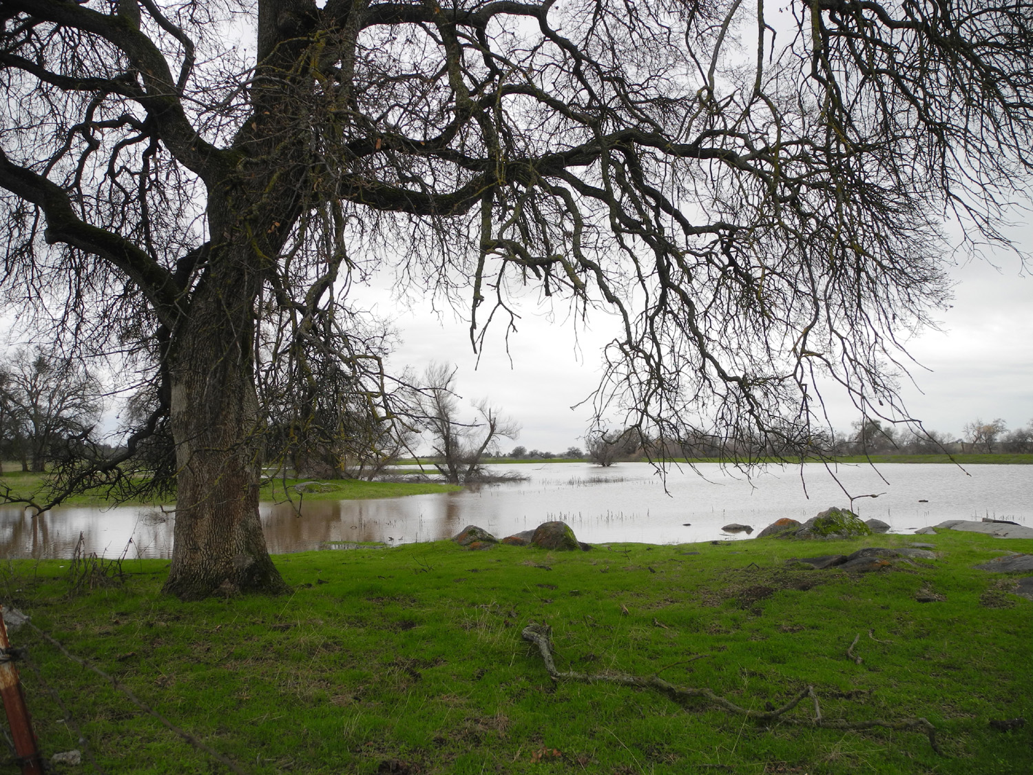
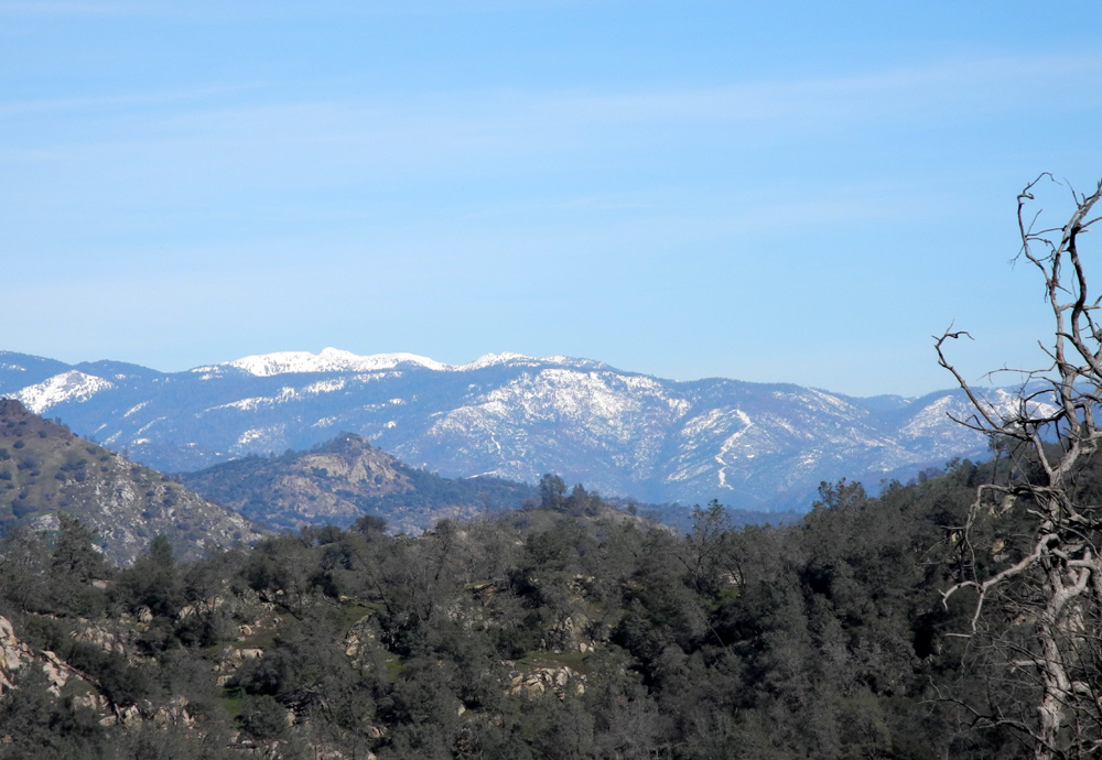
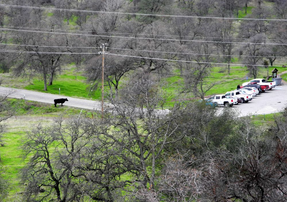
Pine Flat Drive & Hike On February 4 my friend Janell and I did what I call a "drive and hike" to Pine Flat Reservoir. This is where you stop and do a short hike, drive a ways and do another, until it's time to go home or eat lunch or both. I've previously written about all the places we visited, so there are links below to those earlier reports. We got started from my house around 10:30 and went east into the foothills, along the Kings River, and finally took Trimmer Springs Road along the shore of the lake, which is at its highest level in many years. Our first hiking stop was at Edison Point, where I walked about a month earlier. The first part of this trail is actually a dirt service road, used to access the power transmission towers that run along the north side of the reservoir. It's mostly a gentle up hill walk, made a little more challenging in spots by areas covered with water or mud due to the heavy rains of January. We went as far as Edison Point, a knoll that overlooks the lake with views in three directions. We were happy to see the first flowers of the season, including fiddlenecks, fringed redmaids, and many low-growing little white flowers that I have not been able to identify. We wandered around the point, took some photos, and enjoyed the new green growth. From the trailhead and back, this was the longest of the three hikes of the day. It was a few miles to our next stop, one of two campgrounds that have been closed for decades. The roads are still in fairly good shape, and you can make a nice loop walk in this area. There were several tiny creeks flowing through the campground, something we did not see last year despite it being an El Nino year. Our final stop was one tenth of a mile farther up the road, a picnic grounds that has also been closed for a long time. The road here goes out and loops around, but at the farthest point there is a trail out to the end of the ridge. The Sycamore Creek branch of the lake runs along one side of this route, with the main lake on the other, so at the end you have water on three sides. I camped in this area long ago when these facilities were open and I'm still mad at the Forest Service for closing them. When we returned to the car, we set up my card table and folding chairs on the flat approach to the area and had a picnic outside the picnic grounds. During our walk, we were quite warm, taking off our outer layer at one point, but there was a slight breeze, and sitting still at the table, we both decided to put our outer shirts back on. We made one final stop where the road crosses Sycamore Creek. The lake water is not quite up this far, but the creek was running very full. We saw the largest number of fiddlenecks at this spot, and walking by a little rivulet that runs into the main stream, we heard a frog croak. All in all we got in 2.64 miles of walking, and enjoyed being out in nature on a day that was 90% sunny.
|
||
|
Previous Pine Flat Trips |
||
| March 2015 Edison Point | Feb 2015 Drive & Hike | |
| February 2016 Ramblers at Edison Point | March 2016 Edison Point with Teri | April 2016 Ramblers at the Campgrounds |
|
Photos (Click to enlarge; pictures open in new window) |
||
|
|
||
Pine Flat Exploration Wet Dry Creeks San Joaquin Gorge Off-Trail |
||
|
|
||
|
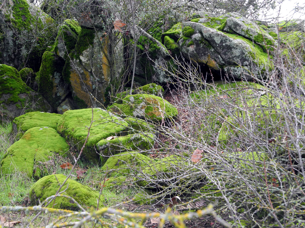
Pine Flat Exploration |
||
 |
 |
 |
|
Old shed by Trimmer Springs Road near Piedra |
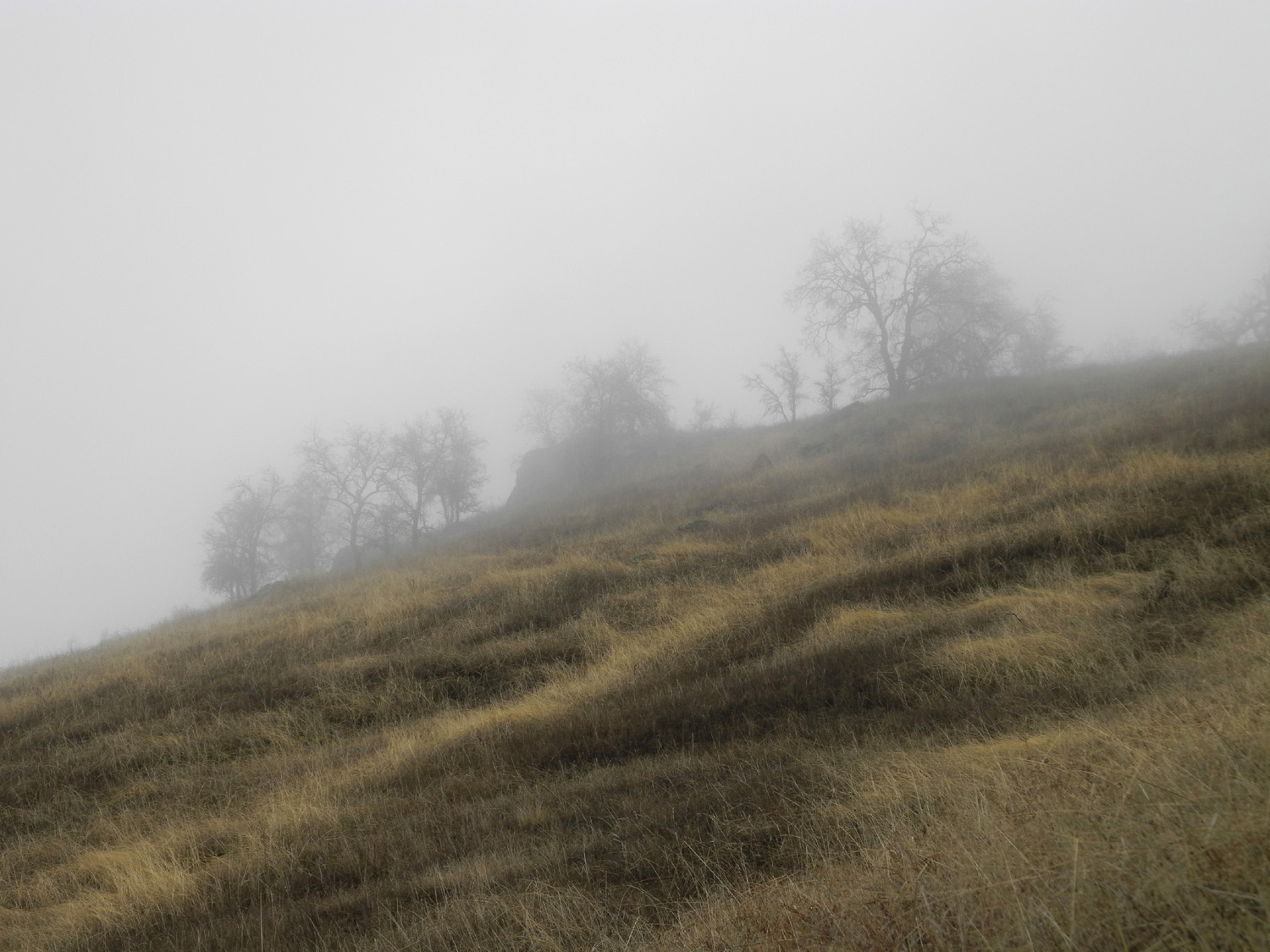
Mist on the hill | Hughes Creek |
 |
 |
 |
| Sycamores along the creek | A view of the creek and a ranch where the road starts up hill |
Another view of Hughes Creek valley |
 |
 |
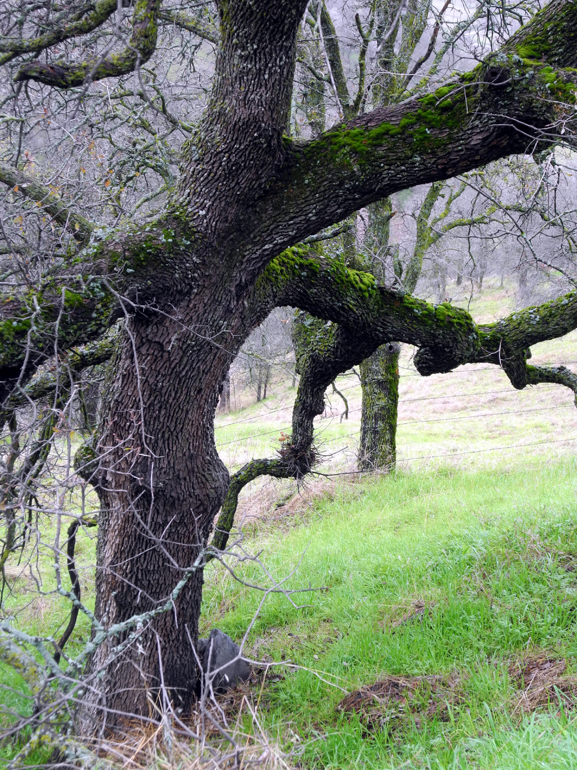 |
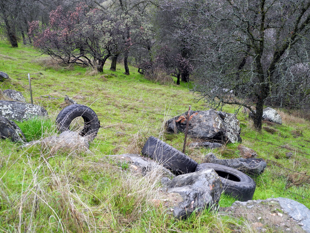
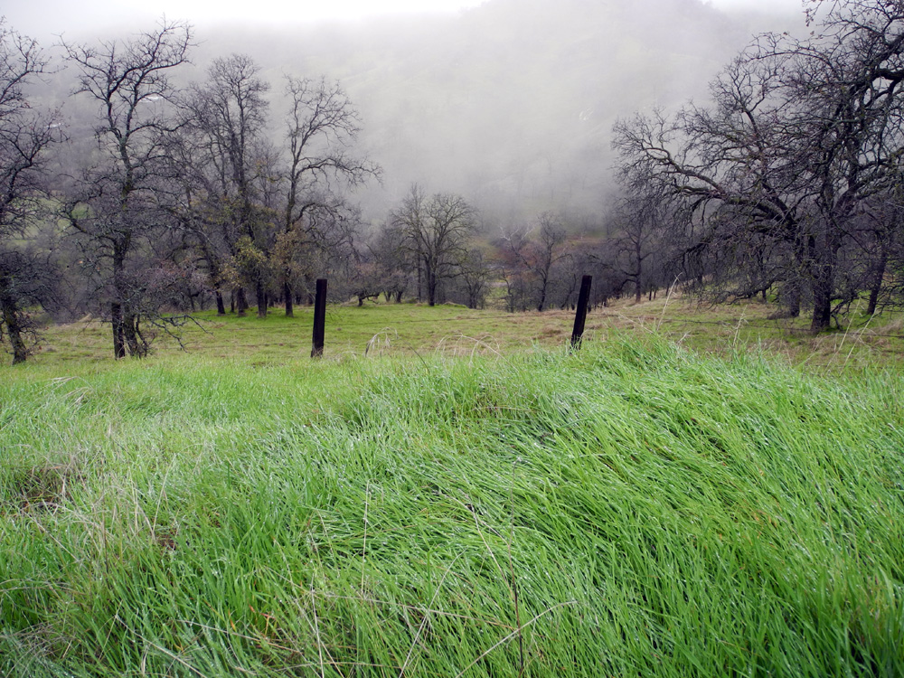
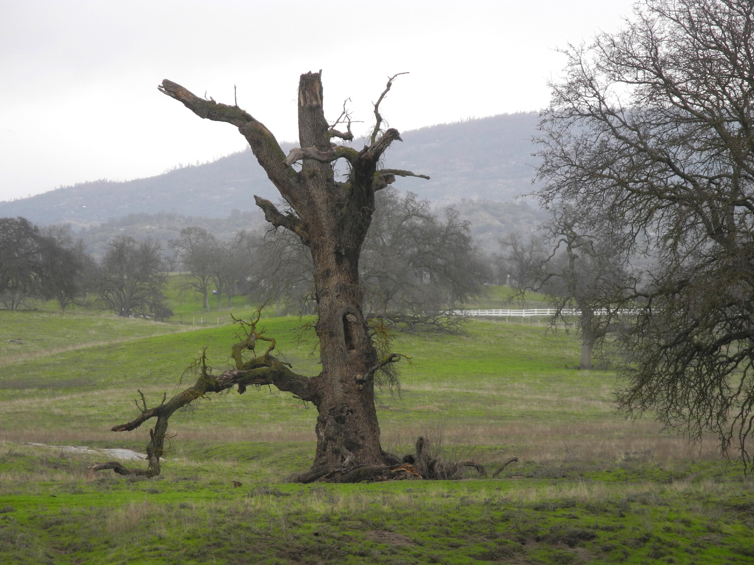
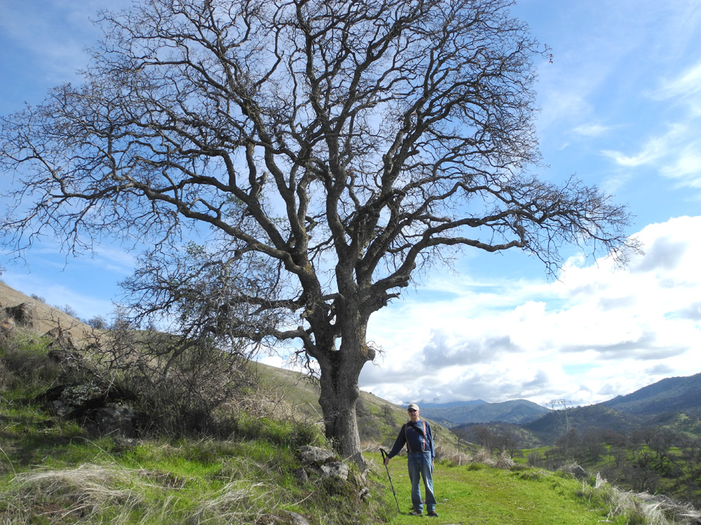
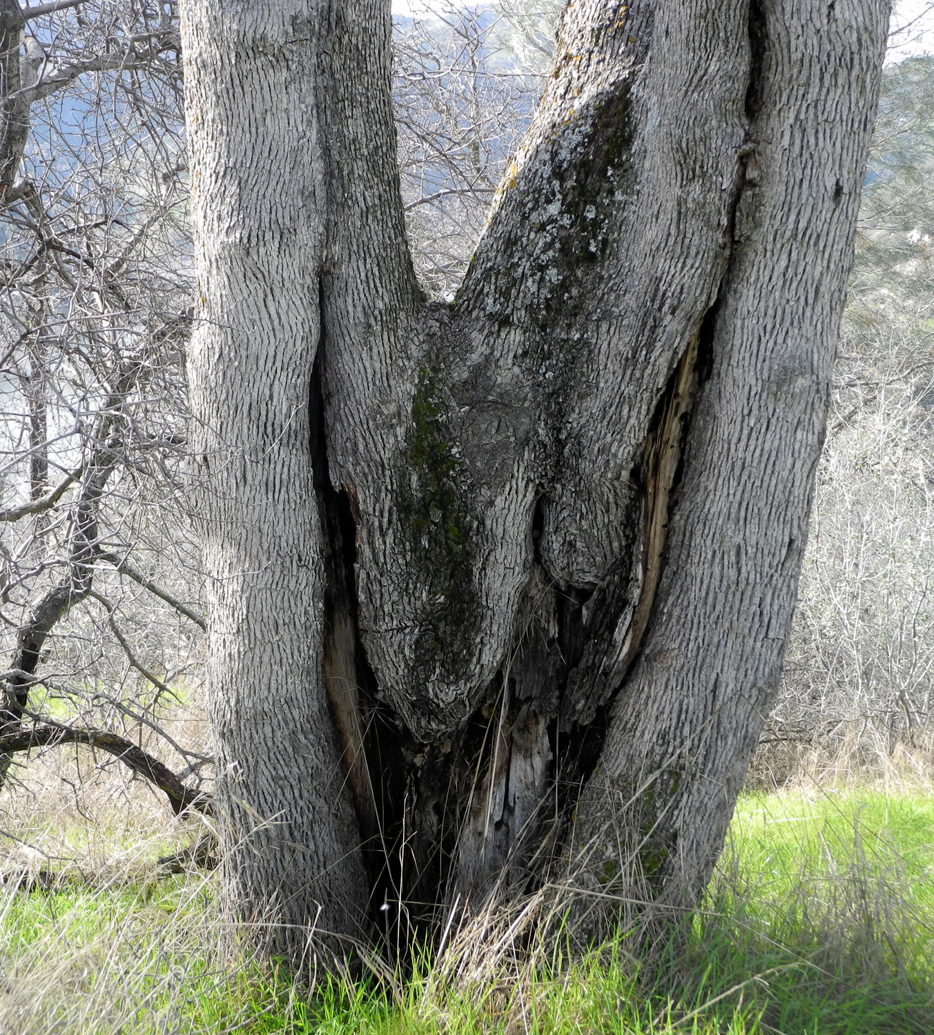
| Two-legged pigs have been here | Tall, wet grass by the road, with a fence, field and misty hills | A gnarly old blue oak |
 |
 |
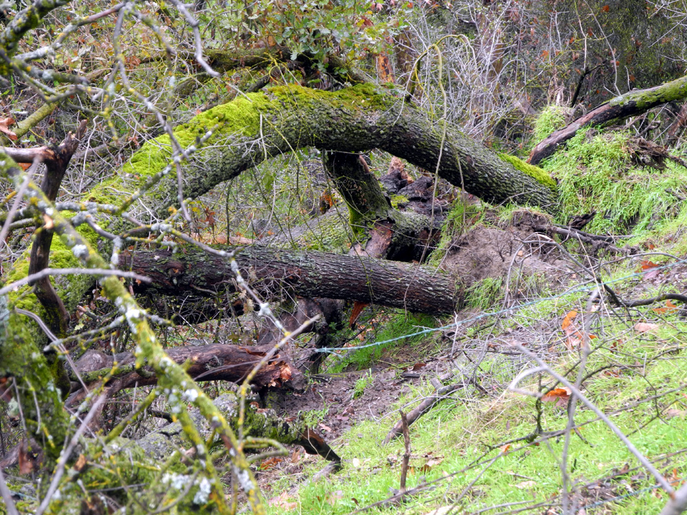 |
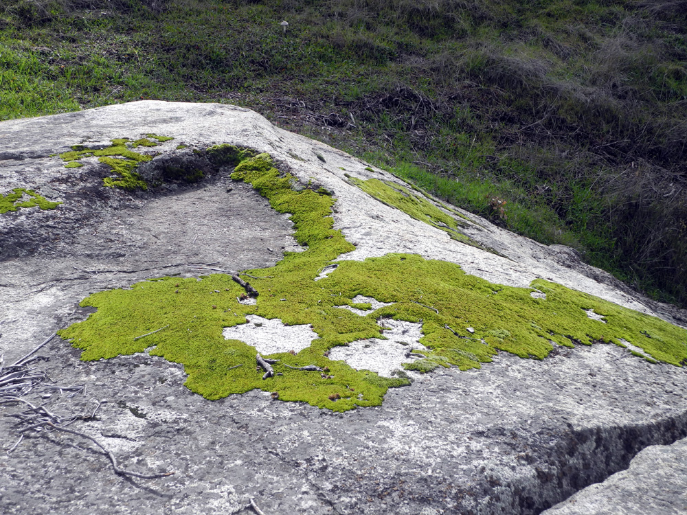
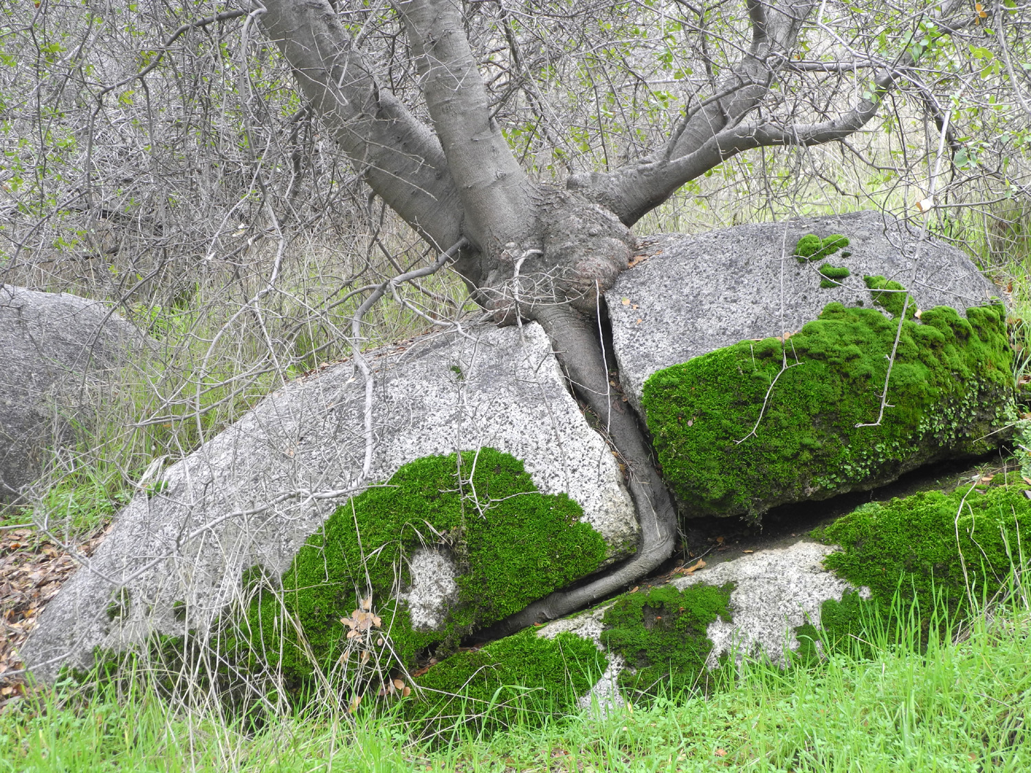
| Deer creek | The intensely green moss fully covers some rocks | Wet ground probably helped bring down this tree |
|
 |
 |
| Oak Creek |
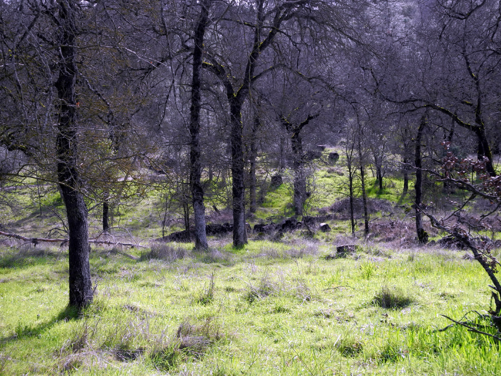
Moss-covered trees above the creek |
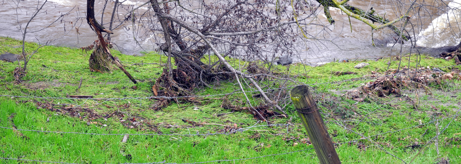
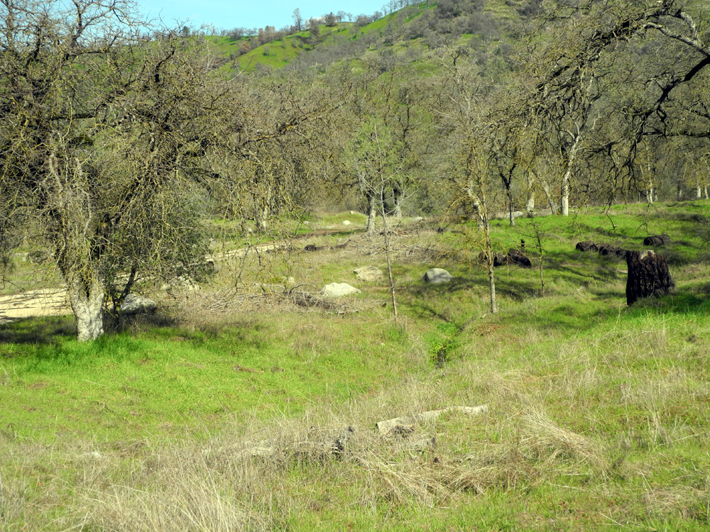
Edison Point Trail, partly blocked by a fallen bull pine |
 |
 |
 |
|
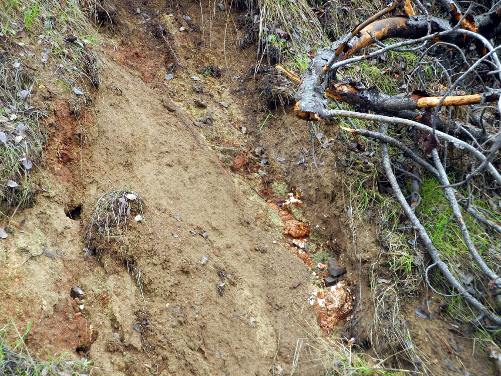
Washout exposed a vein of quartz - could there be gold? |
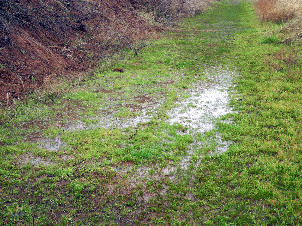
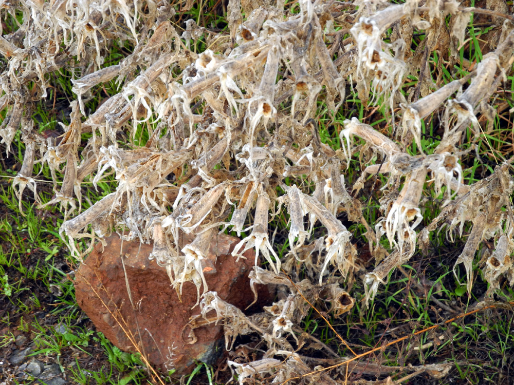
There's just enough room to squeeze by this puddle on the right | There were many of these dried plants along the trail |
 |
 |
 |
| Misty hill above the trail | The cows are enjoying a bumper crop of new grass | Last year's tall grass, beaten down by heavy rainfall |
 |
 |
 |
|
Island Park Campground area from the Edison Point Trail |
This dead plant stands out against the gray of the lake | Bovine stairway to heaven |
|
 |
 |
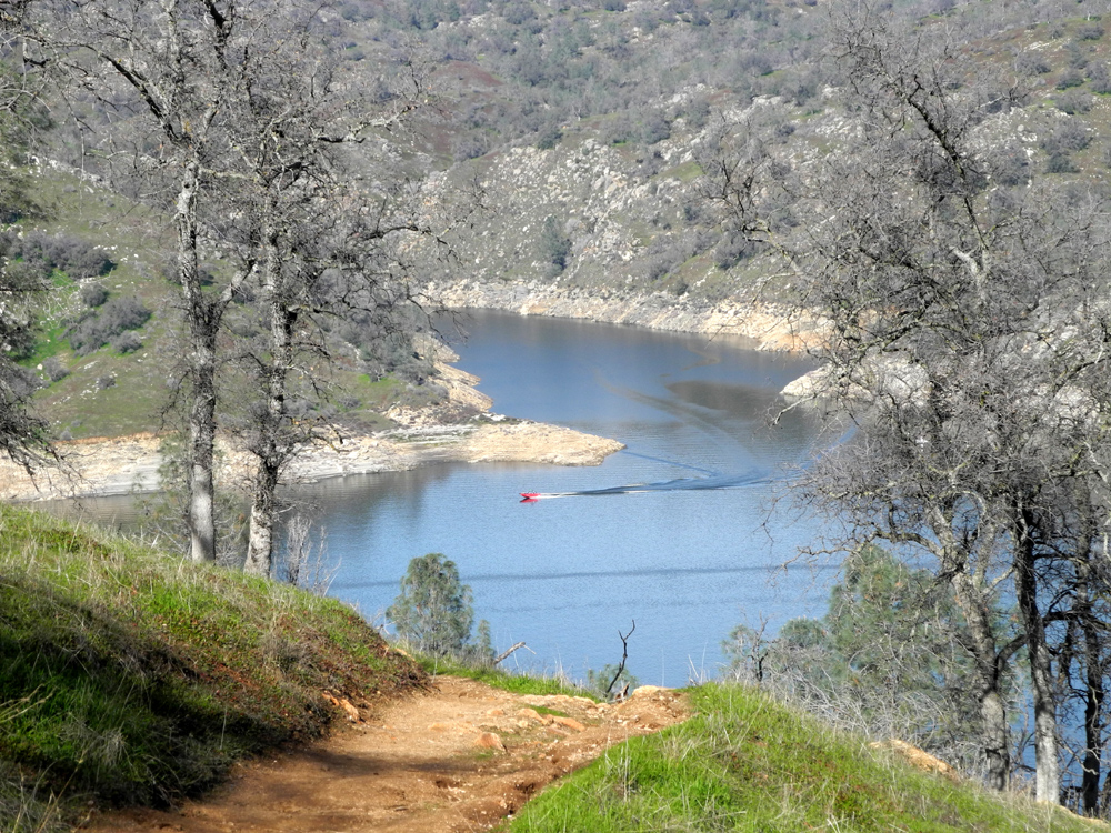
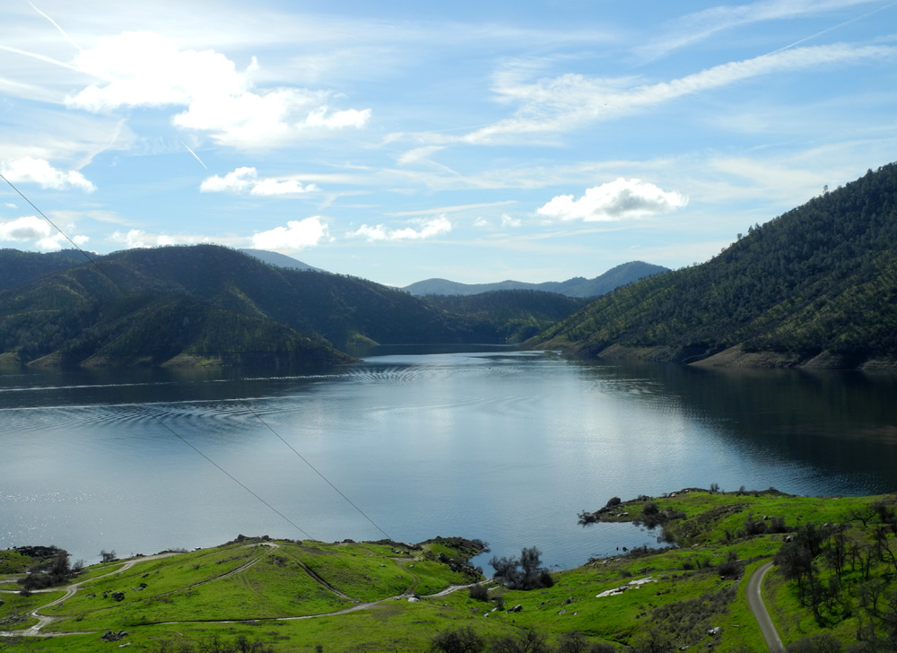
| A dramatic view of the lake and clouds in early afternoon |
Looking up the valley of Hughes Creek |
Location of my photo stops |
| Wet Dry Creeks | ||
 |
 |
 |
| Little Dry Creek where road to shooting range joins Auberry Road | Lots of history here | The creek where it goes away from the road, by Fleming Ranch |
 |
 |
 |
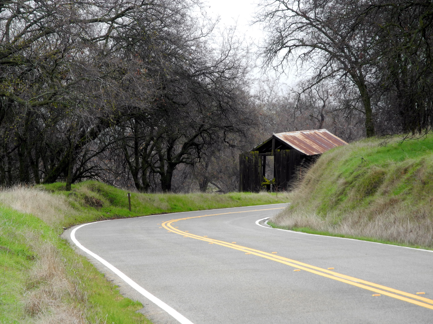
| Another view near the ranch | And another | Shed on Millerton Road between Auberry Road and Highway 168 |
 |
|
 |
| North Fork of Little Dry Creek | Another North Fork view |
Dramatic old sycamore by Millerton Road |
 |
 |
 |
| Little Dry Creek at one of three Millerton Road crossings | Green hills and blue oaks | Along Millerton Road |
 |
 |
 |
|
Another dramatic tree, an oak this time |
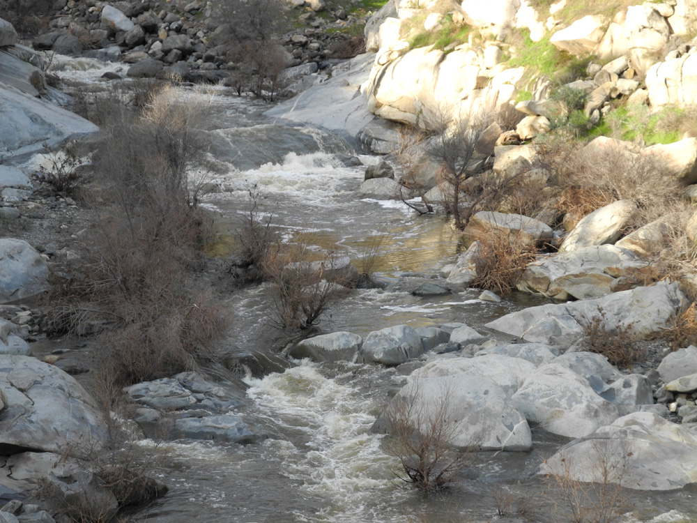
Swift water in Little Dry Creek is undercutting the bank | Next to the Big Dry Creek bridge - maybe in case you get stuck? |
 |
 |
|
| Storm runoff piled debris up against the bridge | Big Dry Creek just above the bridge | Pond by Highway 168 |
 |
||
| Debris line by Big Dry Creek shows that the water was five feet higher the previous day | ||
| San Joaquin Gorge Off-Trail | ||
 |
 |
 |
| Debris on fence shows water in Big Sandy Creek was recently five feet higher | A nice moss and granite combination | Seasonal waterfall along Smalley Road |
|
 |
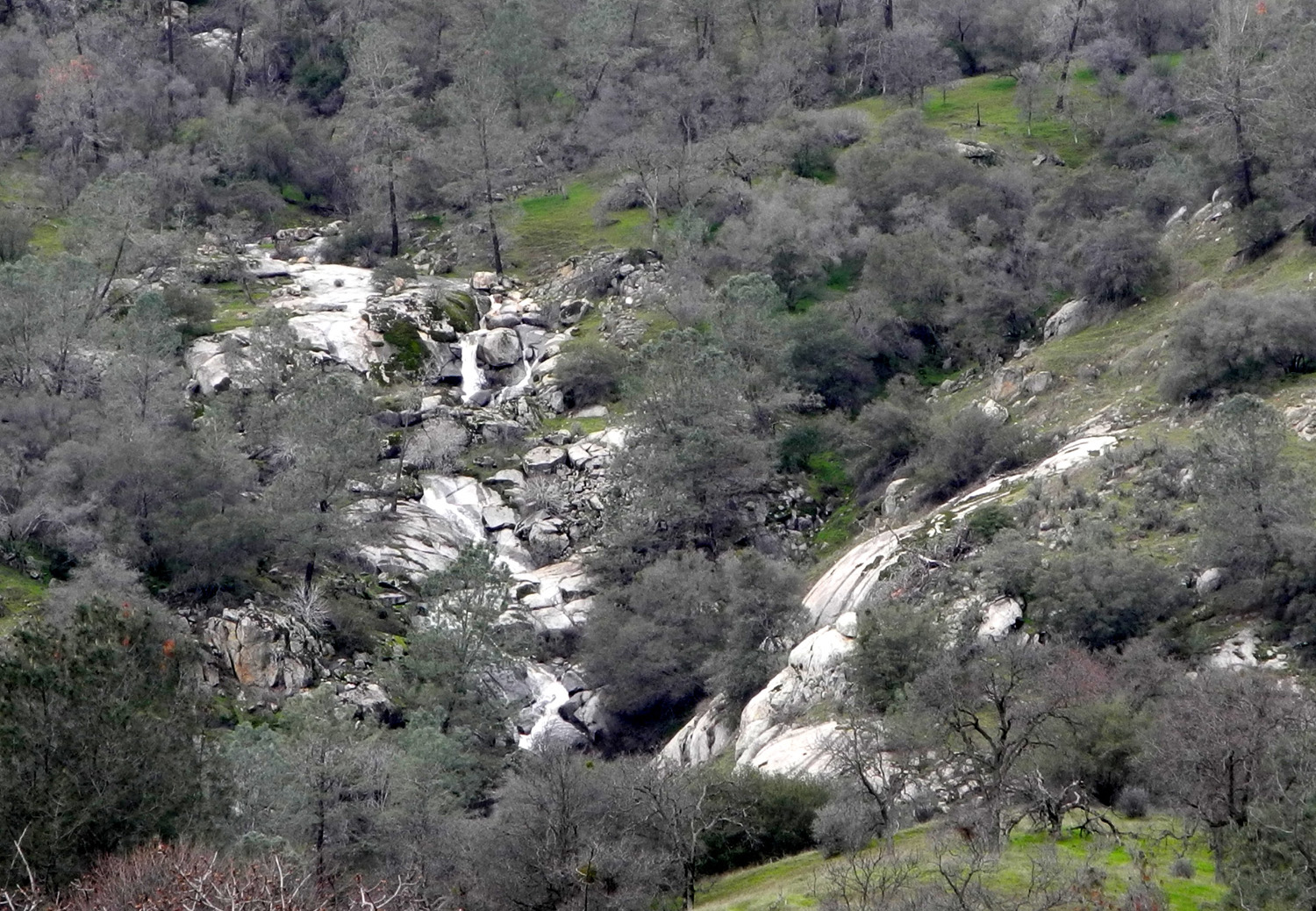 |
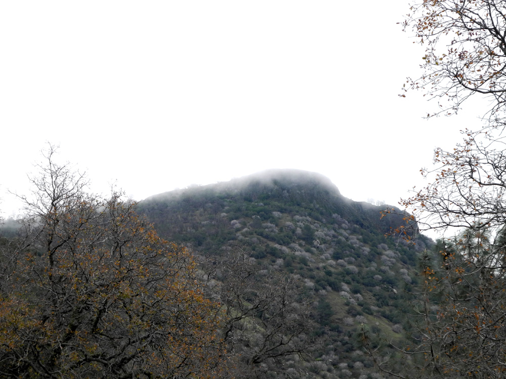
| This creek tumbles down the steep slope by the road south of the river | Fog lays on top of Squaw Leap table top | Creek cascades down the north side of the river canyon |
 |
 |
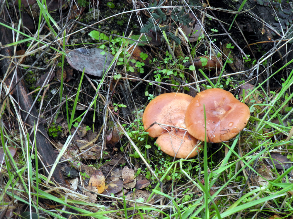 |
| Cow trail down into a drainage | The root knew which way to go for food and water | The wet weather has produced a bumper crop of mushrooms |
 |
|
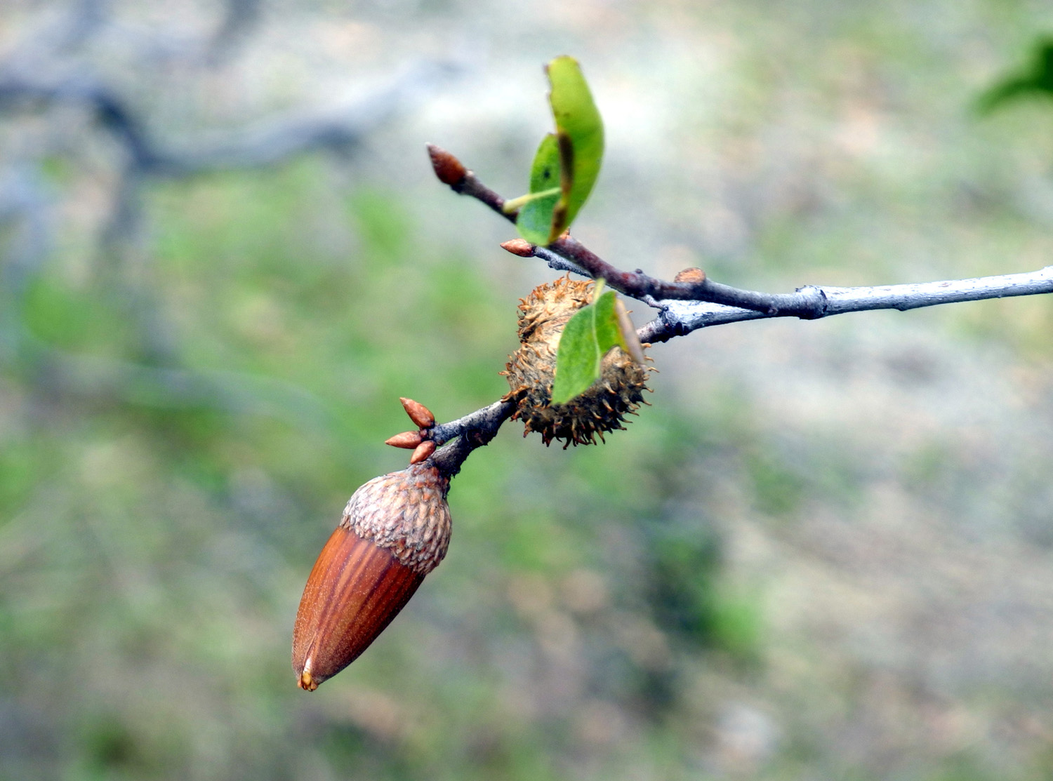 |
| Passage way through a brushy area | Cow keeps watch on the parking lot | Acorn and gall on a live oak tree |
 |
 |
|
| Are these YOUR school colors? |
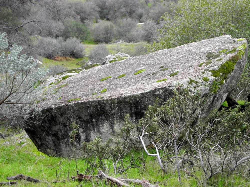
If we could only level this nice table rock |
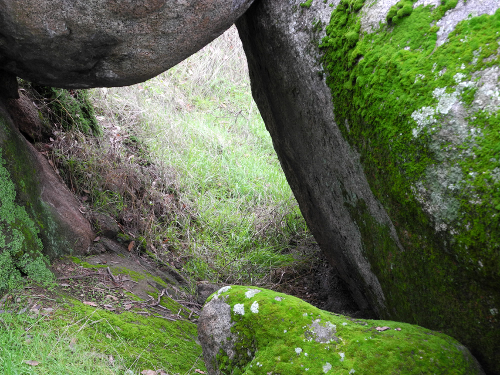
A "tunnel" through the rocks |
 |
 |
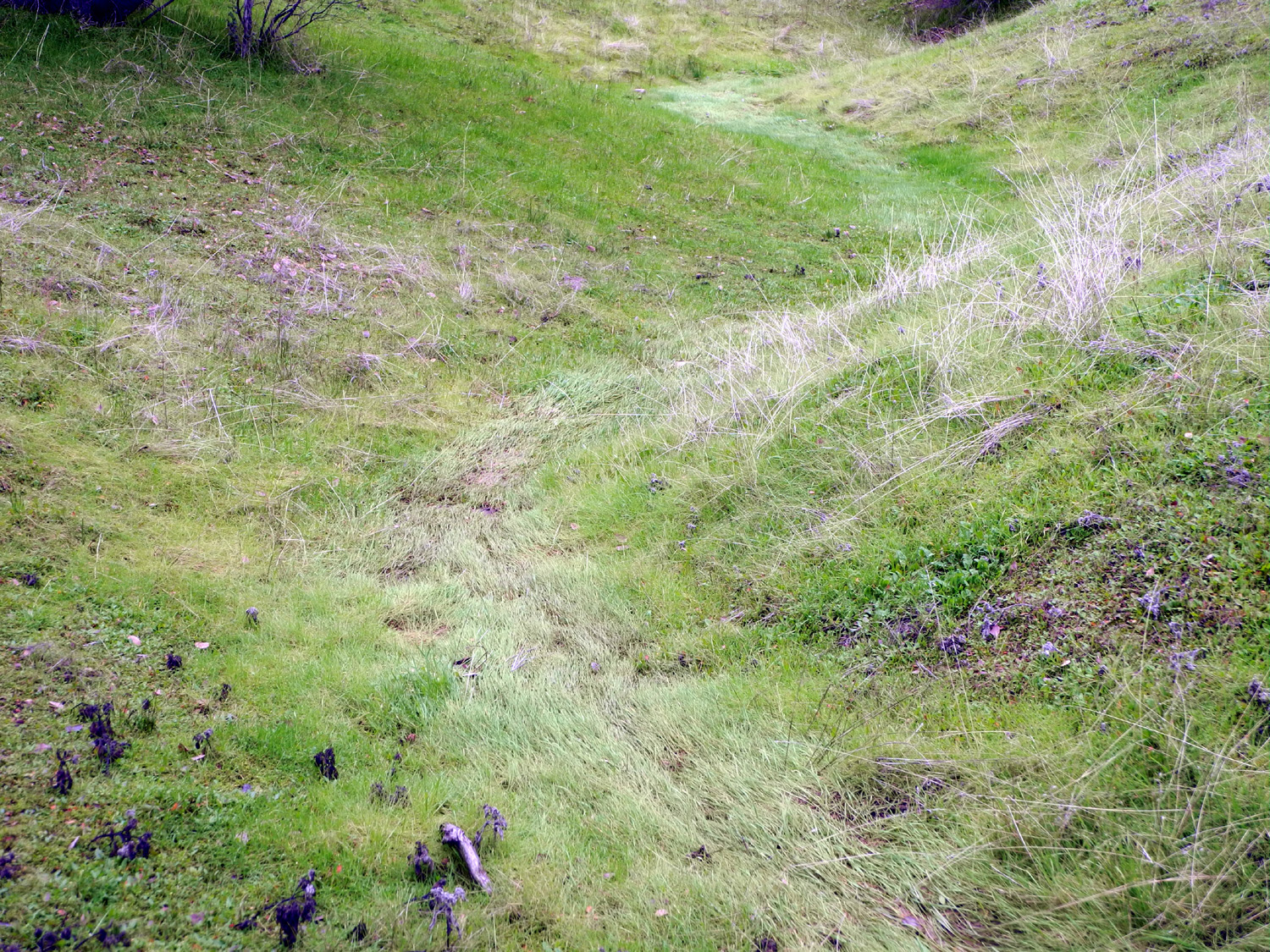 |
| Warning sign | One of two bearing trees in this spot | Flow of recent runoff is clearly seen in this grassy drainage |
 |
 |
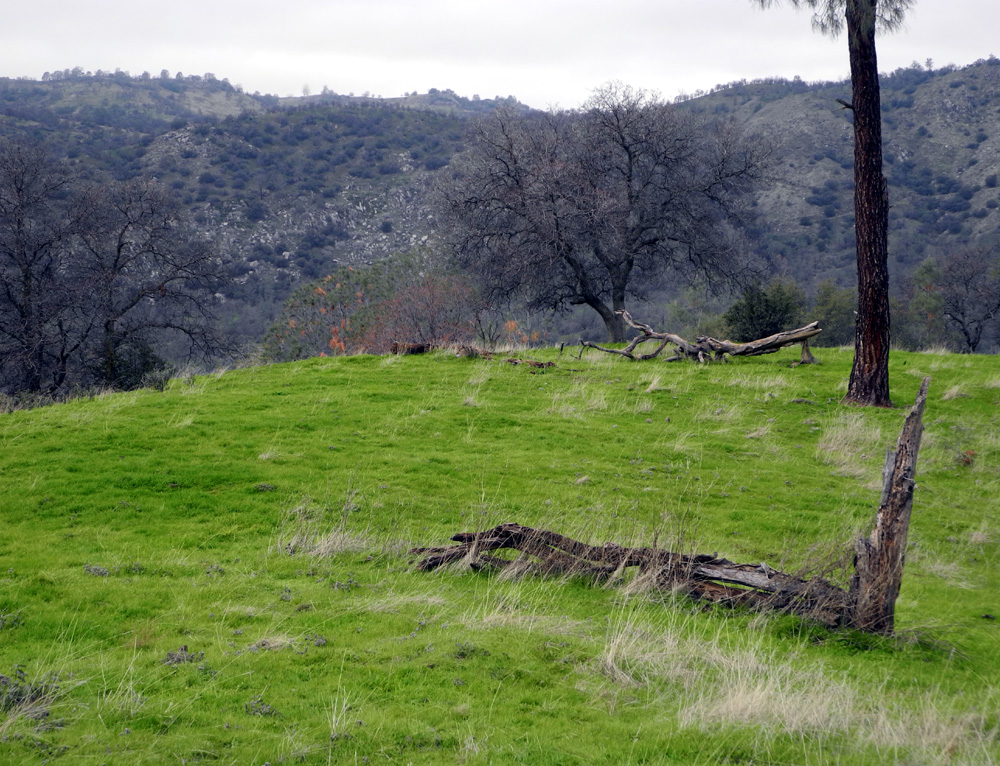 |
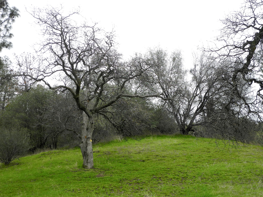
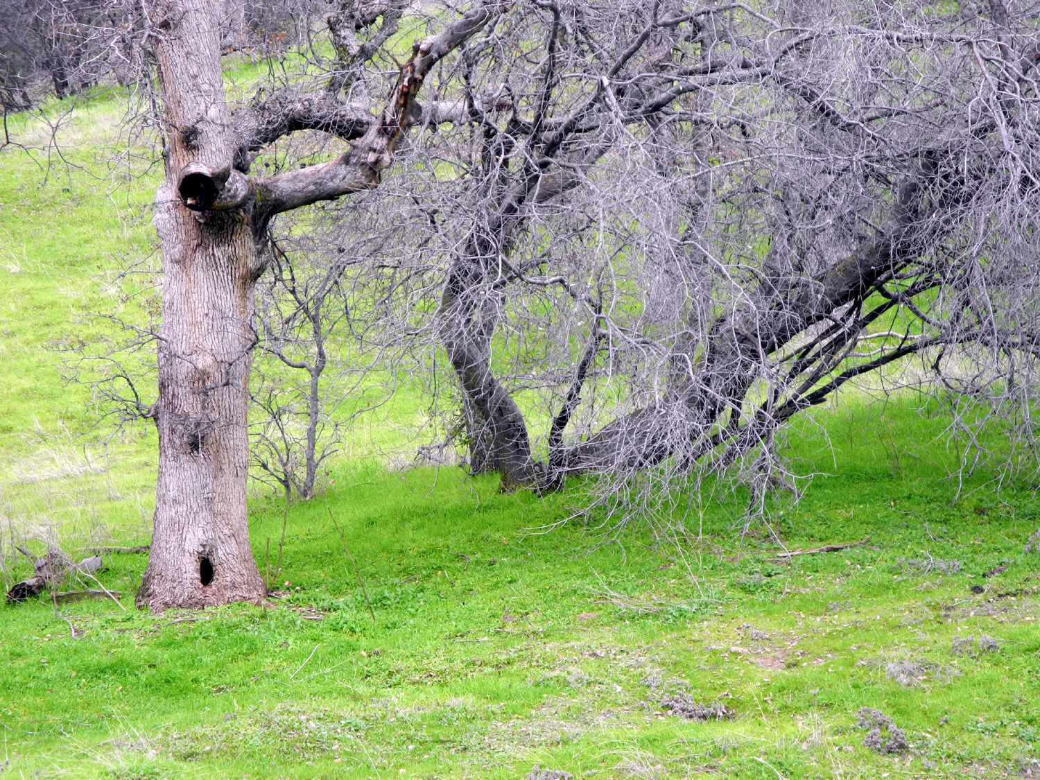
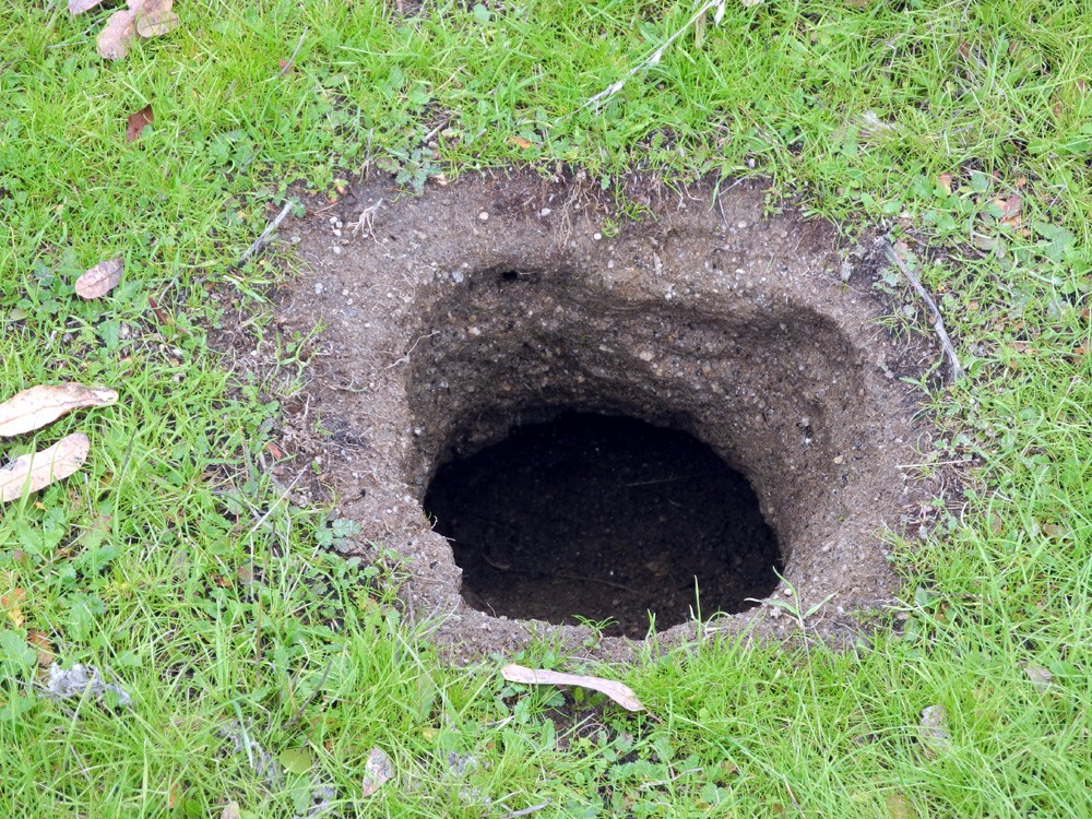
| Blue oak with a mysterious hole | Who lives down there? | A nice green knoll to be explored |
 |
 |
 |
| More mushrooms | Cows have made a safe walkway below the guard rail | Cow trail to get down to the knoll |
 |
 |
|
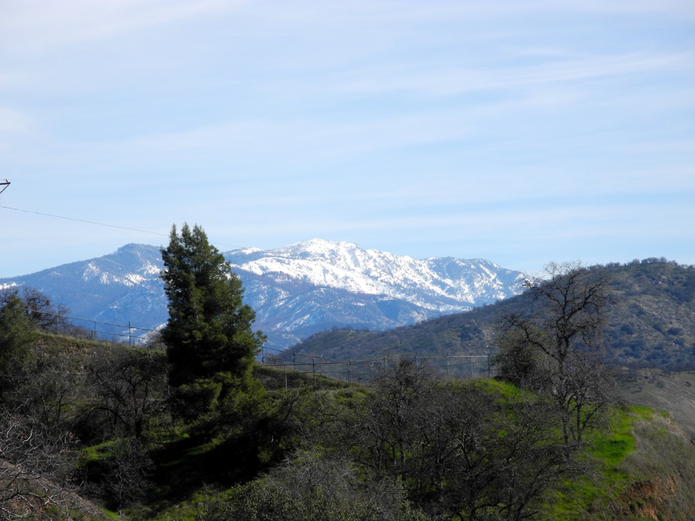
| Snow on the low Sierra above Auberry | North of Auberry follow Powerhouse Road, then left on Smalley Road | |
| San Joaquin River Trail West | ||
 |
 |
|
| Creek crossing on the trail |
Hikers going down the trail, seen from across the creek valley |
Where Finegold Creek enters Millerton Lake |
 |
 |
 |
| There's lots of snow in the Sierra Nevada this year |
Lake just below the saddle, the end of our hike |
View of Finegold Creek junction from the saddle (compare the 2014 water level) |
| Pine Flat Drive & Hike | ||
 |
 |
 |
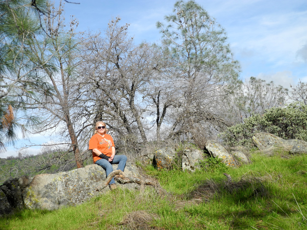
| A welcome sight - nearly full lake and green grass | Also welcome, a nice snow pack on the Sierra Nevada | Janell and Dick at Edison Point |
 |
 |
 |
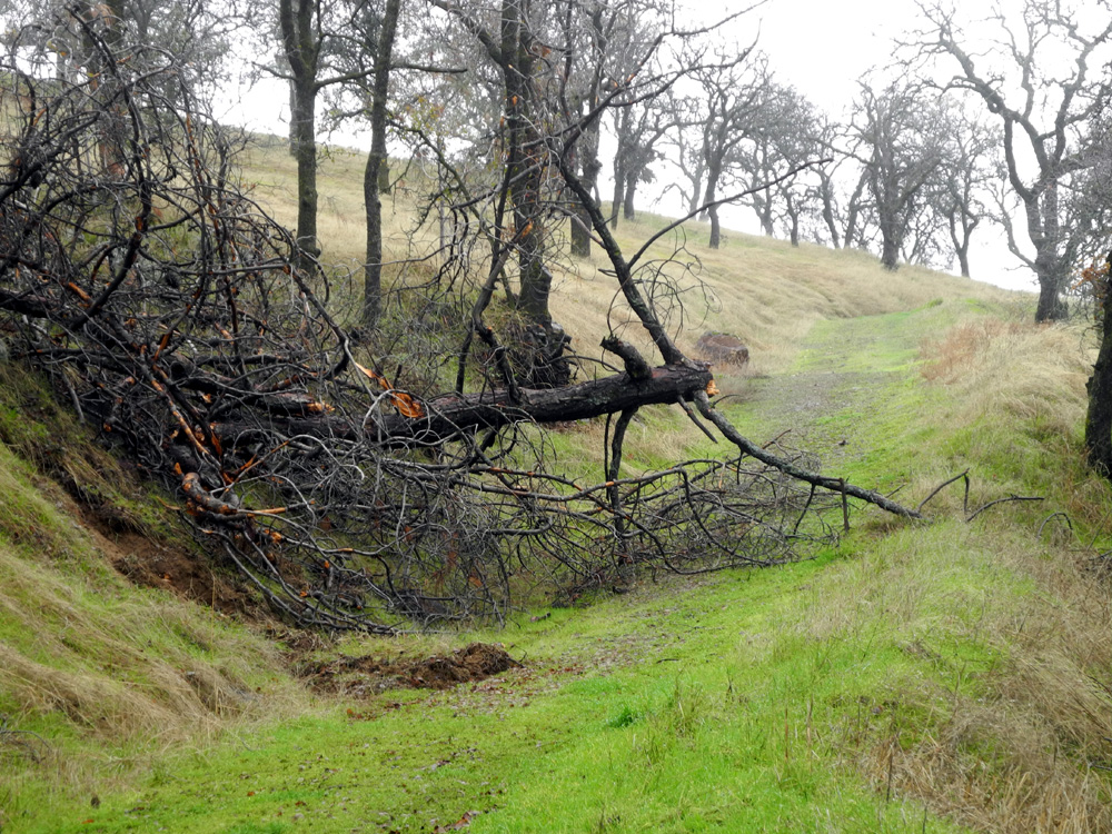
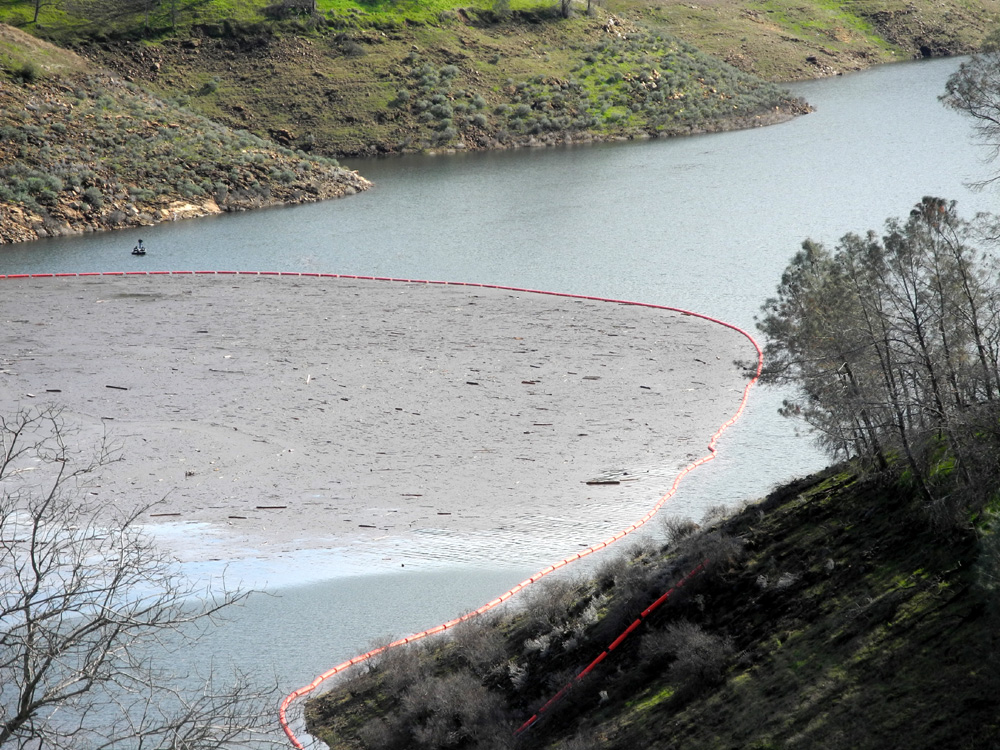
| Dick along the trail | This debris barrier keeps logs and other trash away from the dam | In the closed campground |
 |
 |
 |
| Mostly blue oaks in the campground | Hills to the northeast | This blue oak displays an unusual growth pattern |
 |
 |
|
| Janell by the trail out from the picnic ground | Little streams run into Sycamore Creek | Looking upstream from the bridge, lots of water in Sycamore Creek |
| Related Links | ||
| Edison Point Trail (Review) | Edison Point Trail (Description) | Pine Flat Reservoir |
| The Dry Creeks of Fresno | Kirkman's Point | Electric Power Transmission |
| San Joaquin Valley | Rambling in the Rain | Rains of January |
| Other San Joaquin Gorge Reports | San Joaquin Gorge Slide Show | San Joaquin Gorge Photo Album |
| Don Fernando's | San Joaquin River Gorge Special Recreation Management Area | Marshall Station |
| San Joaquin River Trail | US Forest Service | Finegold Picnic Area |