
|
Dick's Adventures of 2022 - Part 3 |
|
| Photos Related Links More Travel Reports | |
| Adventures of 2016 Adventures of 2017 Adventures of 2018 Adventures of 2019 Adventures of 2020 | |
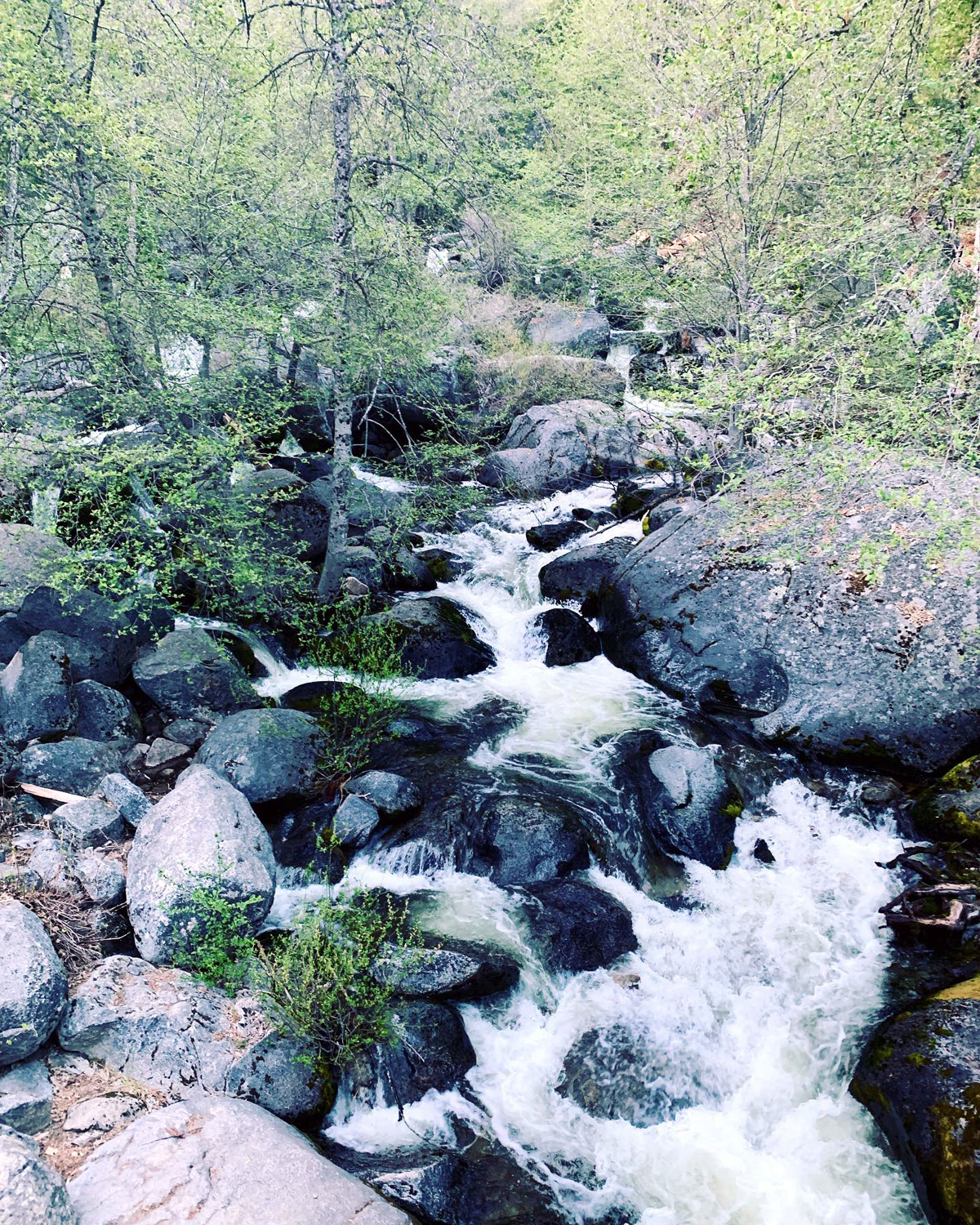
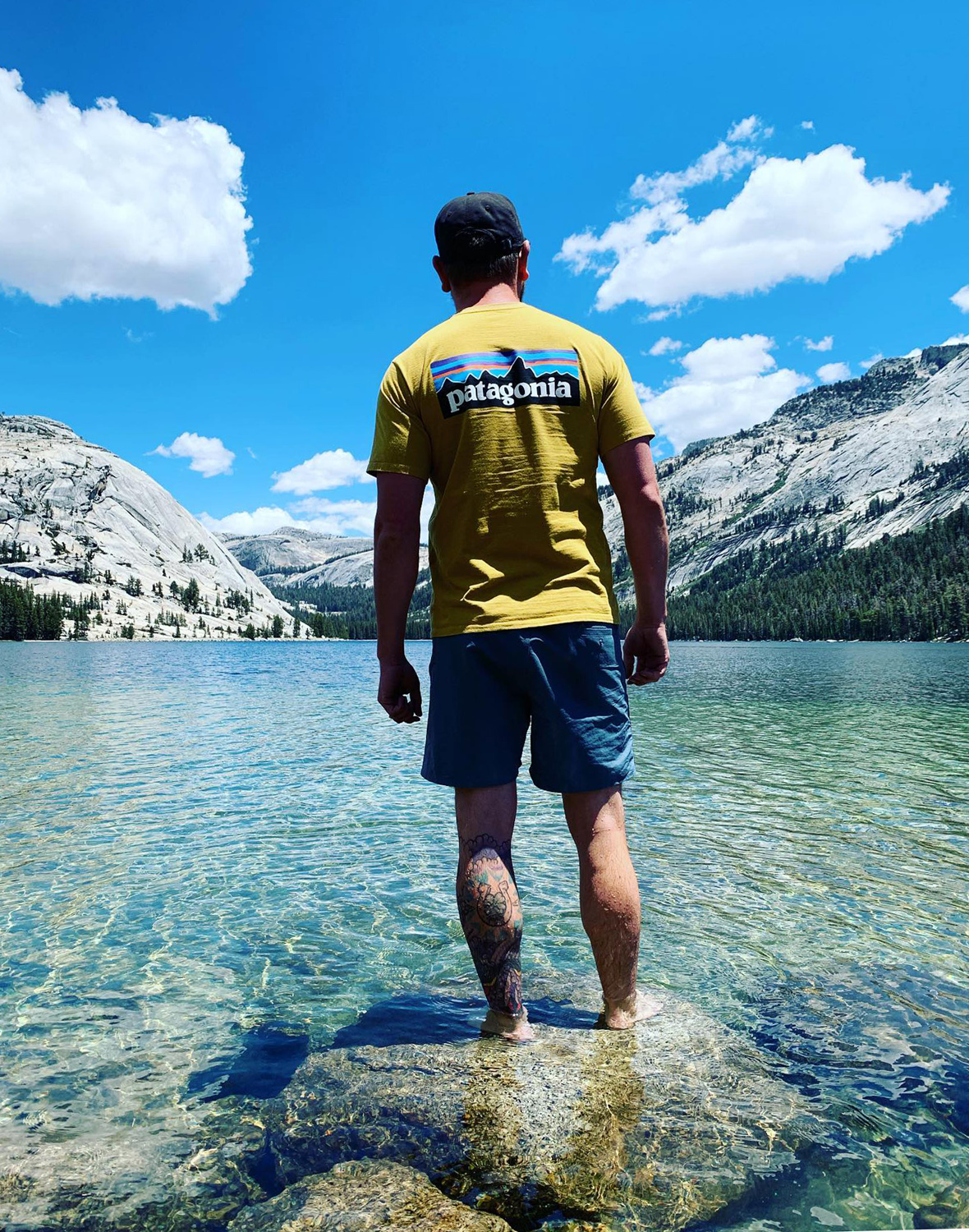
| San Joaquin Gorge River Trail Wawona Weekend Cat Sitting, Moon Shot, and Glass Rock Eastern Sierra | |
| San
Joaquin Gorge River Trail
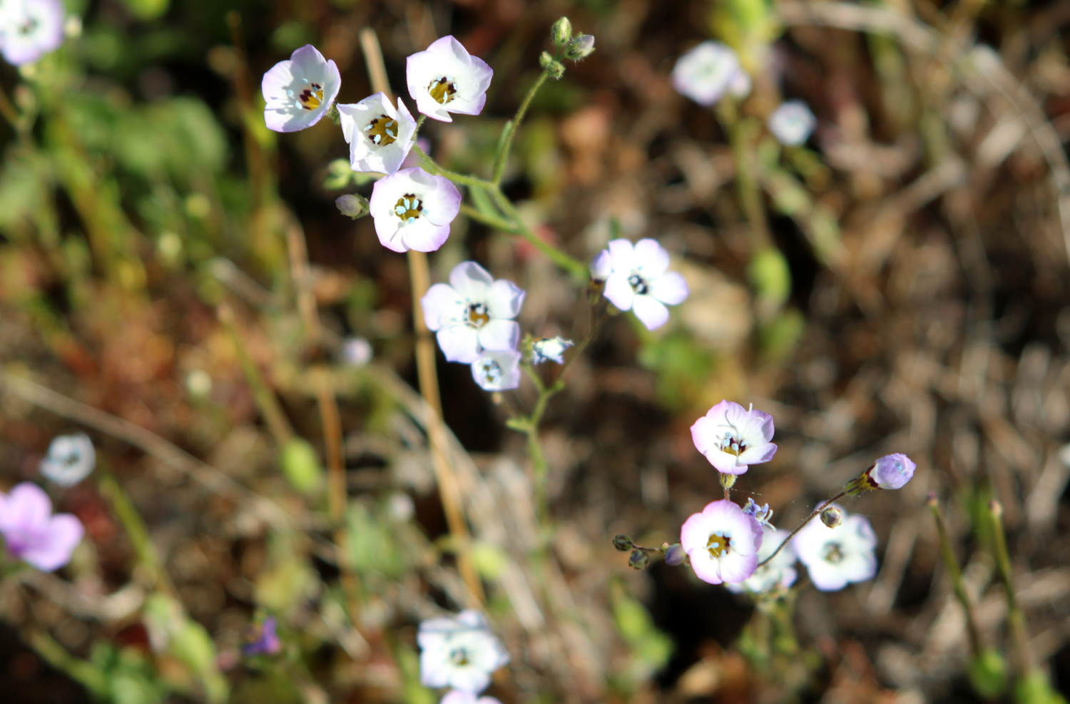
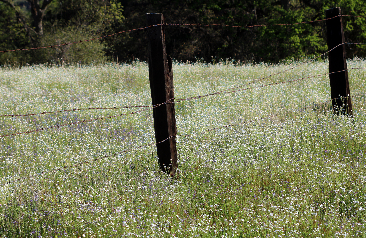
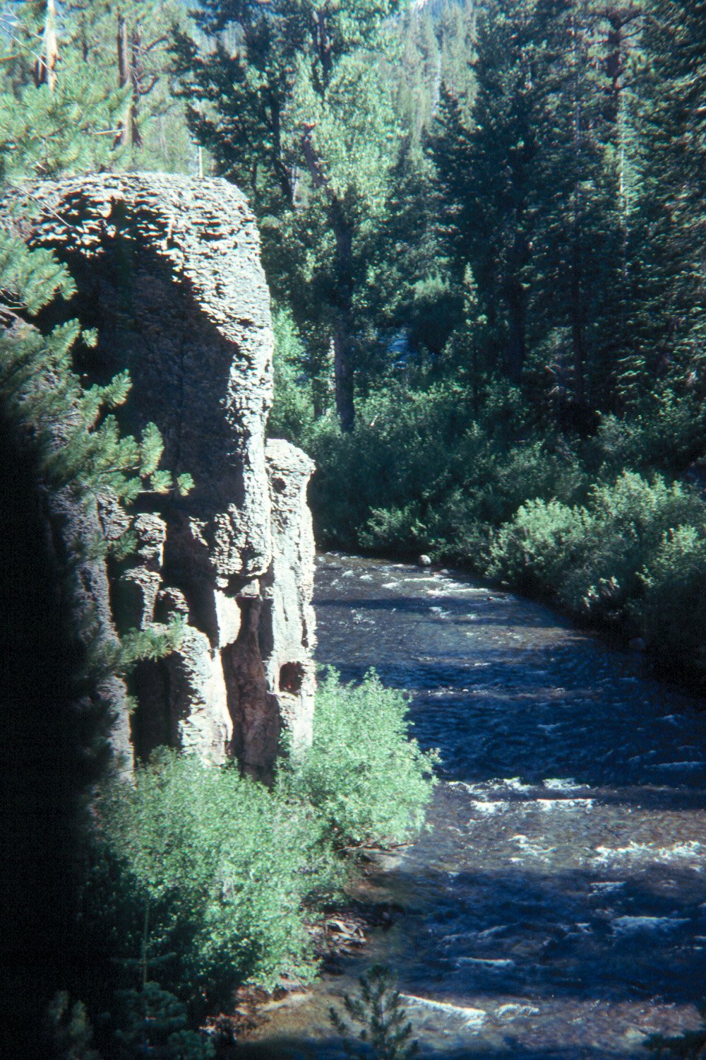
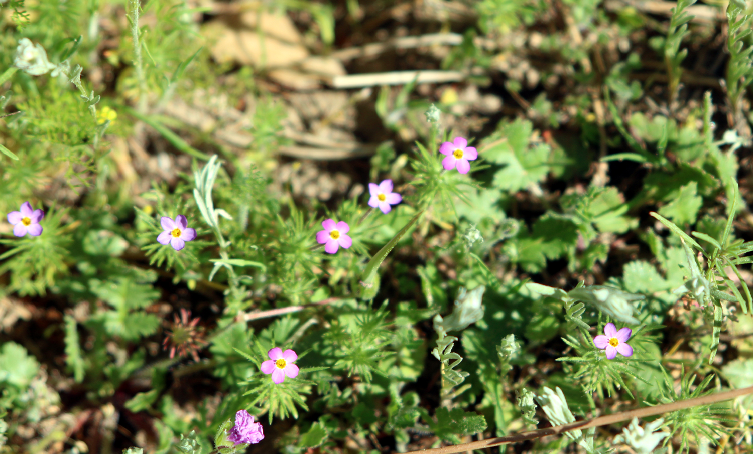
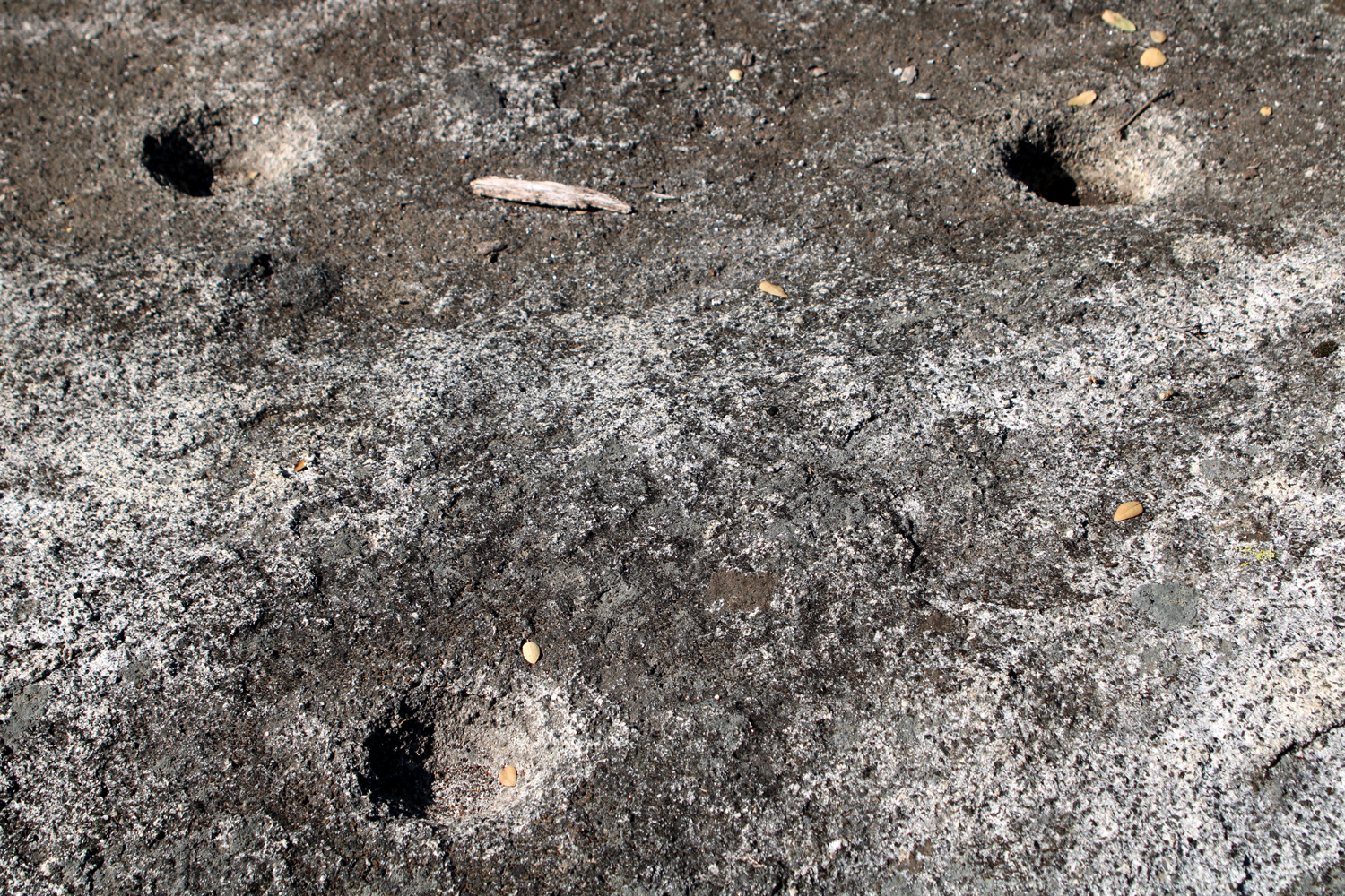
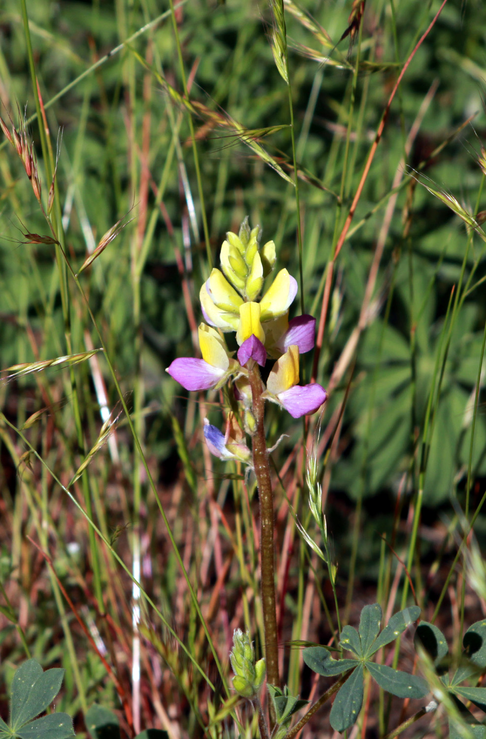
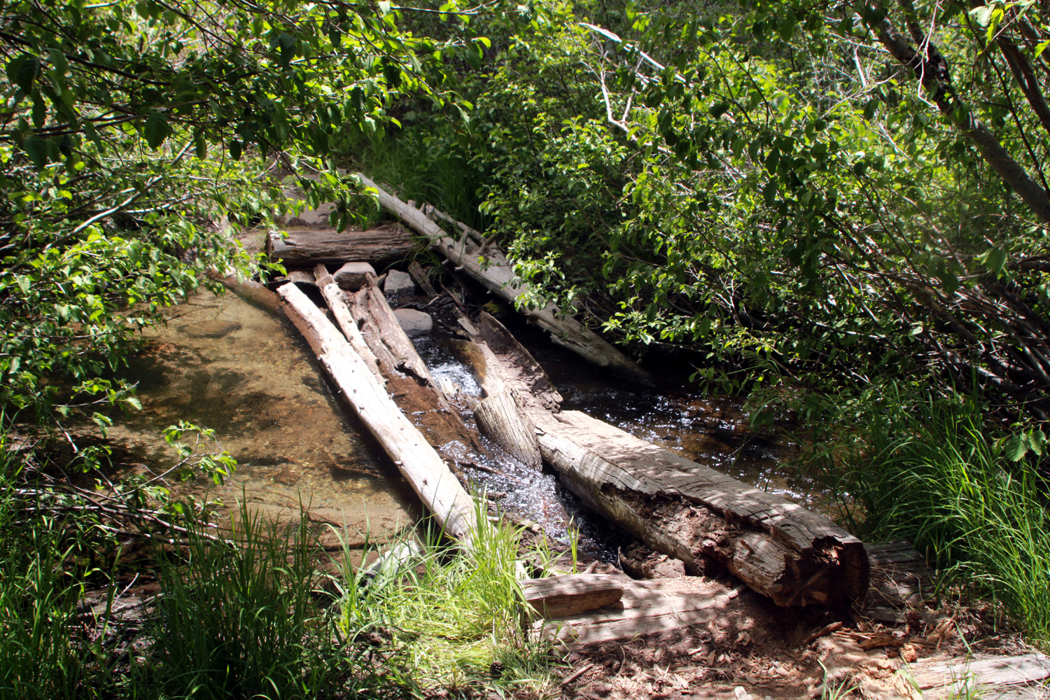
I would guess that I have made more trips to the San Joaquin River Gorge Special Management Area, and spent more time there, than any foothill location other than my parents homes in Mariposa. So with a desire to enjoy the spring weather and wildflowers before it gets too hot, where do you suppose I went on March 25? It goes without saying. Since the Ramblers will be hiking on the Bridge Trail there April 6, my plan was to walk on the San Joaquin River Trail, which in this area is far from and out of sight of that river. The Ramblers went there on February 21, but the vegetation changes rapidly in the spring, and it was my hope to see flowers that were not out earlier. Just before I entered the BLM property, a field of popcorn flowers caught my eye, so I stopped. A barbed wire fence, and some posts which had been drilled by woodpeckers added interest to the floral scenery, which also included fiddlenecks. |
|
 |
 |
| Popcorn flowers near the BLM property entrance | Woodpeckers have been using these posts for acorn storage |
|
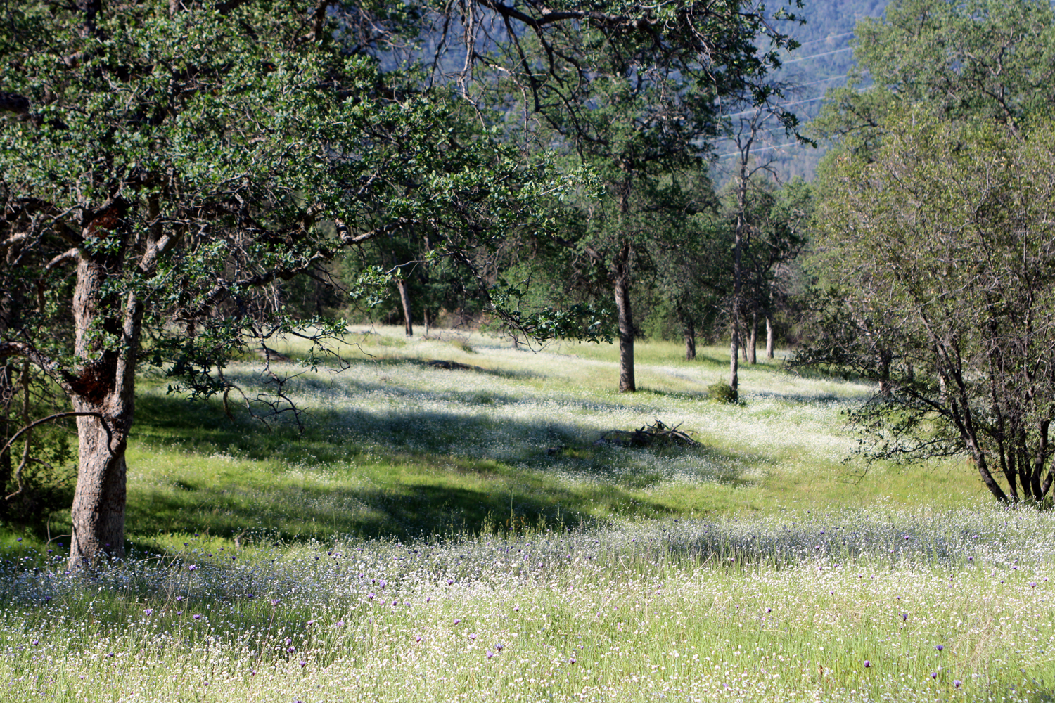
Once I parked and put on my boots, I set out for a hike that would take me a little less than a mile in from the trailhead. I counted at least 18 different known species of wildflowers. I've included photos of some of them below. |
|
 |
 |
| Bush
lupines are fading in the San Joaquin Gorge; this was the only one in bloom along the trail |
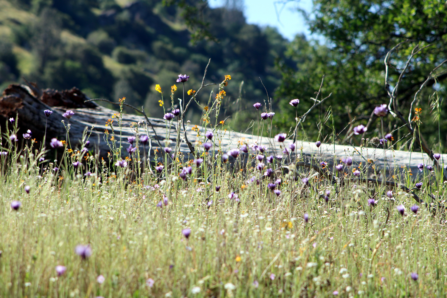
Blue dicks and a few fiddlenecks against a fallen log |
 |
 |
| Zoom in
on the photo and you can see blue dicks among the popcorn flowers |
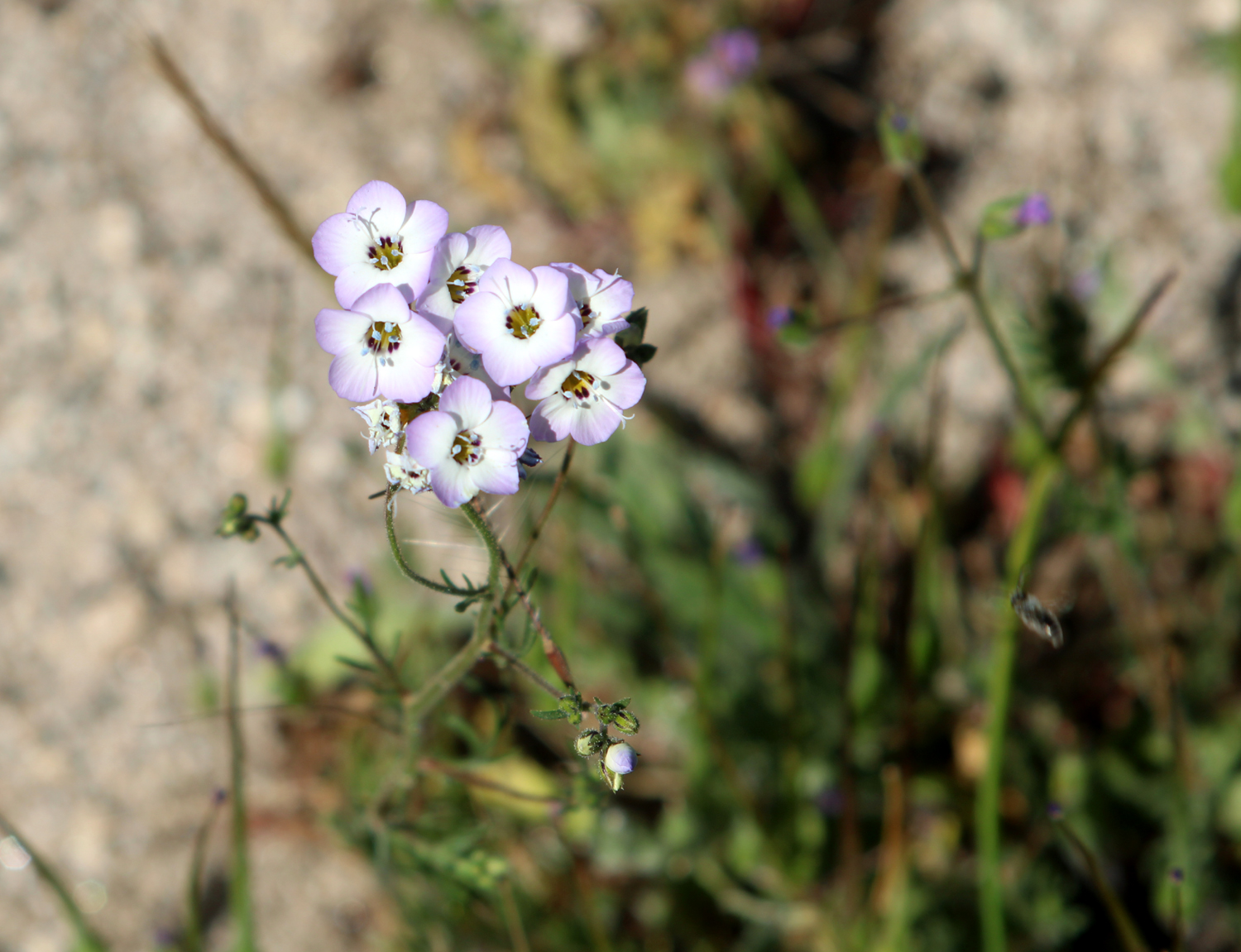
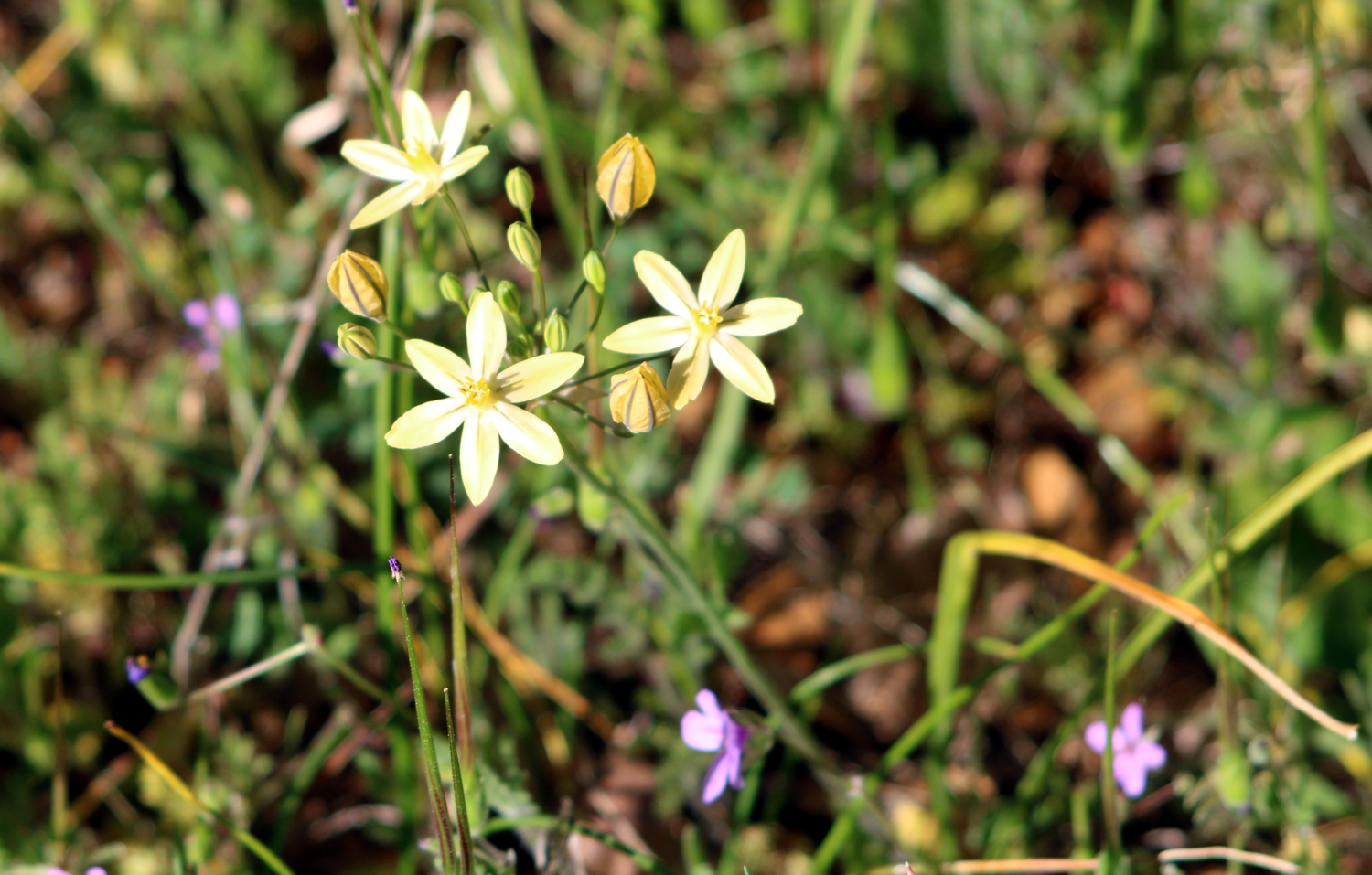
Birds eye gillia |
|
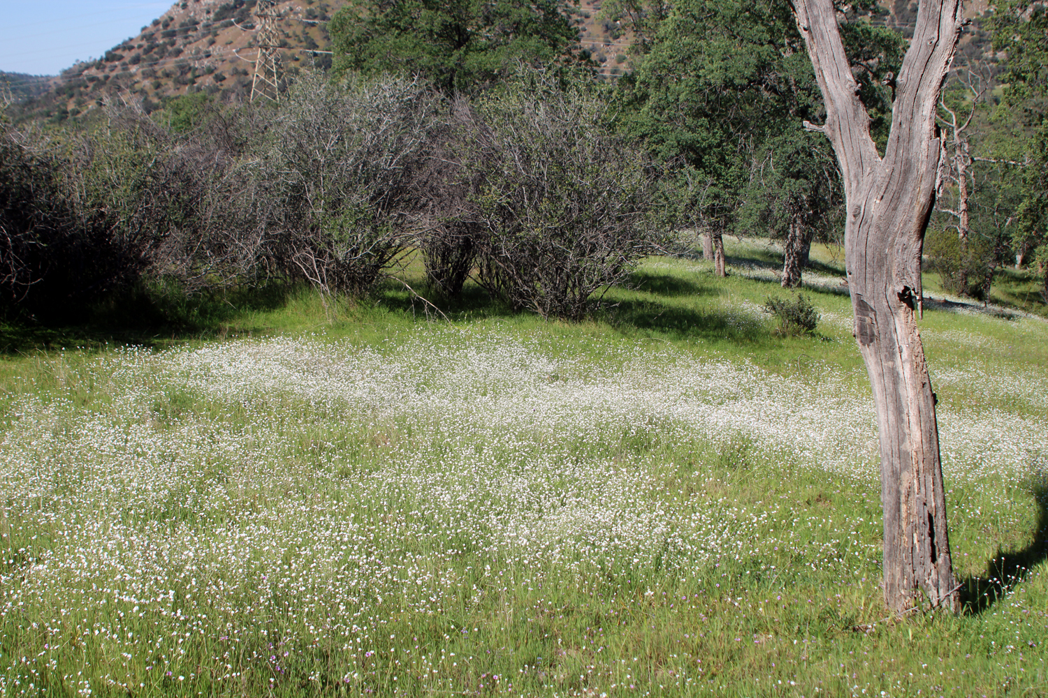
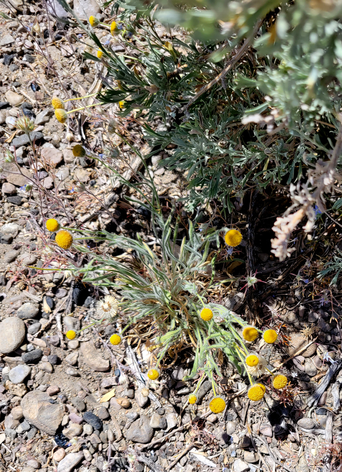
The dominant species was popcorn flowers, which covered many acres. Blue dicks were also present in large numbers, but their growth pattern does not create a massive patch of color. There were a lot of birds eye gillia, and of course, filaree. I saw a single poppy blossom, but they never appear in significant numbers on this trail, even in the best of years. Flowers I had hoped to see but did not were owl clover, mustang clover, purple brodiaea, and Mariposa lilies. Maybe next time, which fortunately is not far away. --Dick Estel, April 2022 Note: Until a few years ago this Bureau of Land Management property was known as Squaw Leap. Considered offensive by Native Americans, the name survived on the table mountain overlooking the area on the south until late 2022, when it became San Joaquin Butte. |
|
|
Wawona Weekend
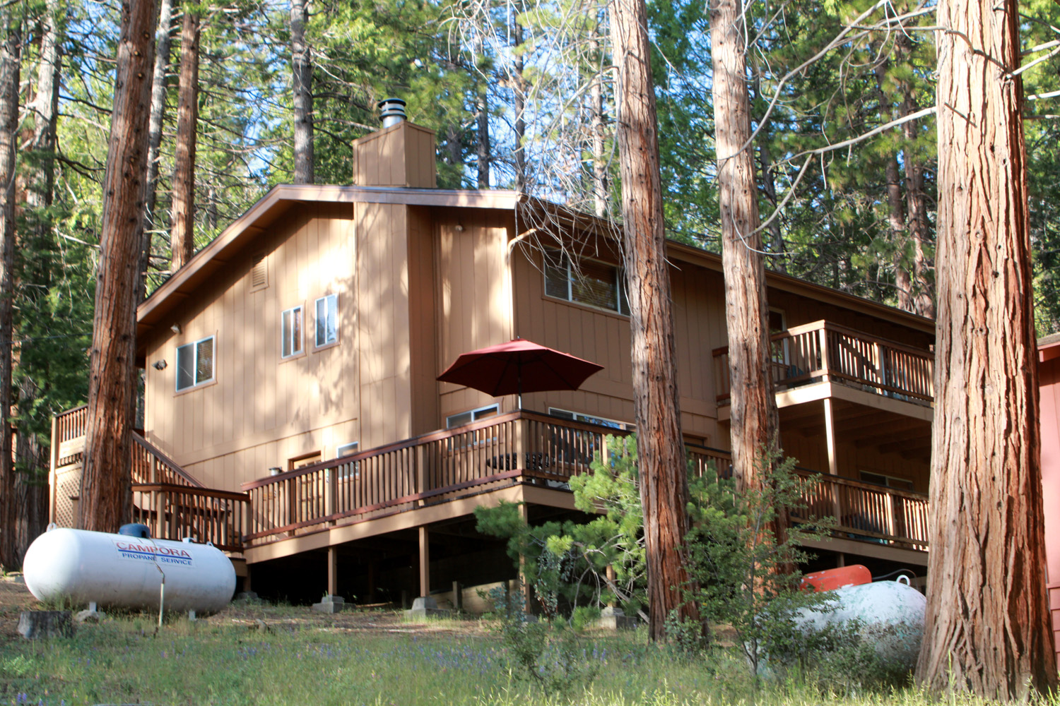
We had such a great time when my family and I rented an Airbnb cabin at Wawona last year, that we decided to do it again. For those not familiar with this corner of Yosemite National Park, Wawona is a combination private and government community along the road that enters Yosemite from the south, about four miles from the park entrance. It got its start as a stage stop on the rough wagon road that originally came over the mountains from Mariposa, then took early tourists on a heart-stopping 34-mile trek up over Chinquapin summit and down into Yosemite Valley. The Wawona area was developed by the three Washburn brothers from Vermont, and operated by the family until 1932. Missing the covered bridges of their childhood, they built a covered bridge across the South Fork of the Merced River, which lives on today, re-modeled and/or rebuilt. Today there is a hotel and restaurant, a small golf course in Wawona meadow, and a history center with wagons and other artifacts from early days. There is also a large number of private homes and cabins, many of which are available to rent, including Arrow Lodge, a little over two and a half miles from the highway and just a few yards from the Chilnualna Falls trailhead. |
|
|

|
| Arrow Lodge, our weekend home in Wawona | The lower deck |
|
Although I had driven through Wawona dozens of times starting from early childhood, hiked the trails, and eaten at the restaurant, I had never spent a night there until last year. Roads go east from the main highway on both sides of the river. On the south side is a market and the history center, with the road ending at the trailhead to the swinging bridge. Along Chilnualna Falls Road on the north side, there are many side roads, and many more houses. Most are privately owned, but many are available to rent. The ones we have stayed in are both multi-level, with upper and lower decks, barbecues, everything you need for cooking, bedding, towels, satellite TV, WiFi and much more. Although we booked through Airbnb, Arrow Lodge is managed by Yosemite Scenic Wonders, and we could have booked directly through that company. They were available by phone till 8 p.m. and when we needed to call them a couple of times, we received fast and courteous help. We did not get that excellent service last year. Everyone agreed that they liked this place better, despite the excellent river view we had last year. |
|
|
|
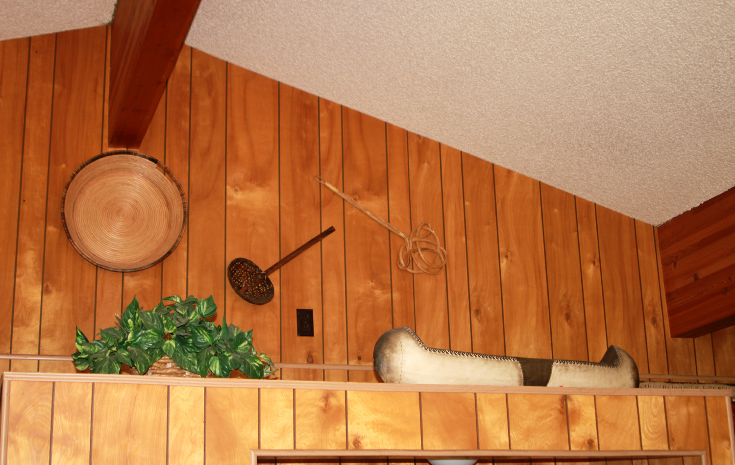
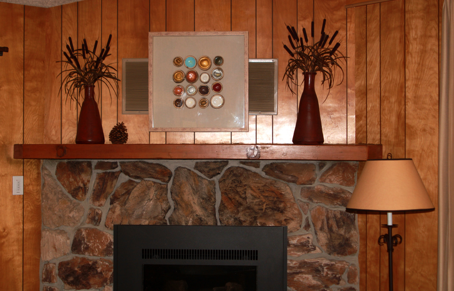
| Decor in the upstairs living room |
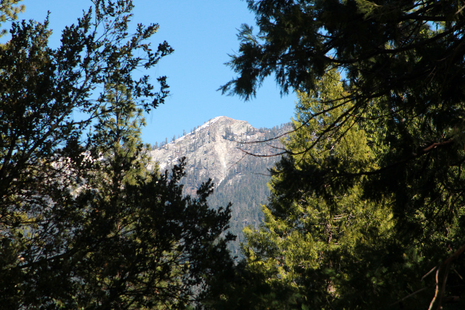
A
little snow remains on 8,500 foot Mt. Raymond, just outside the park, visible from the bridge and from our cabin |
|
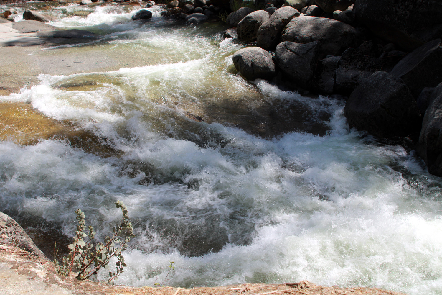
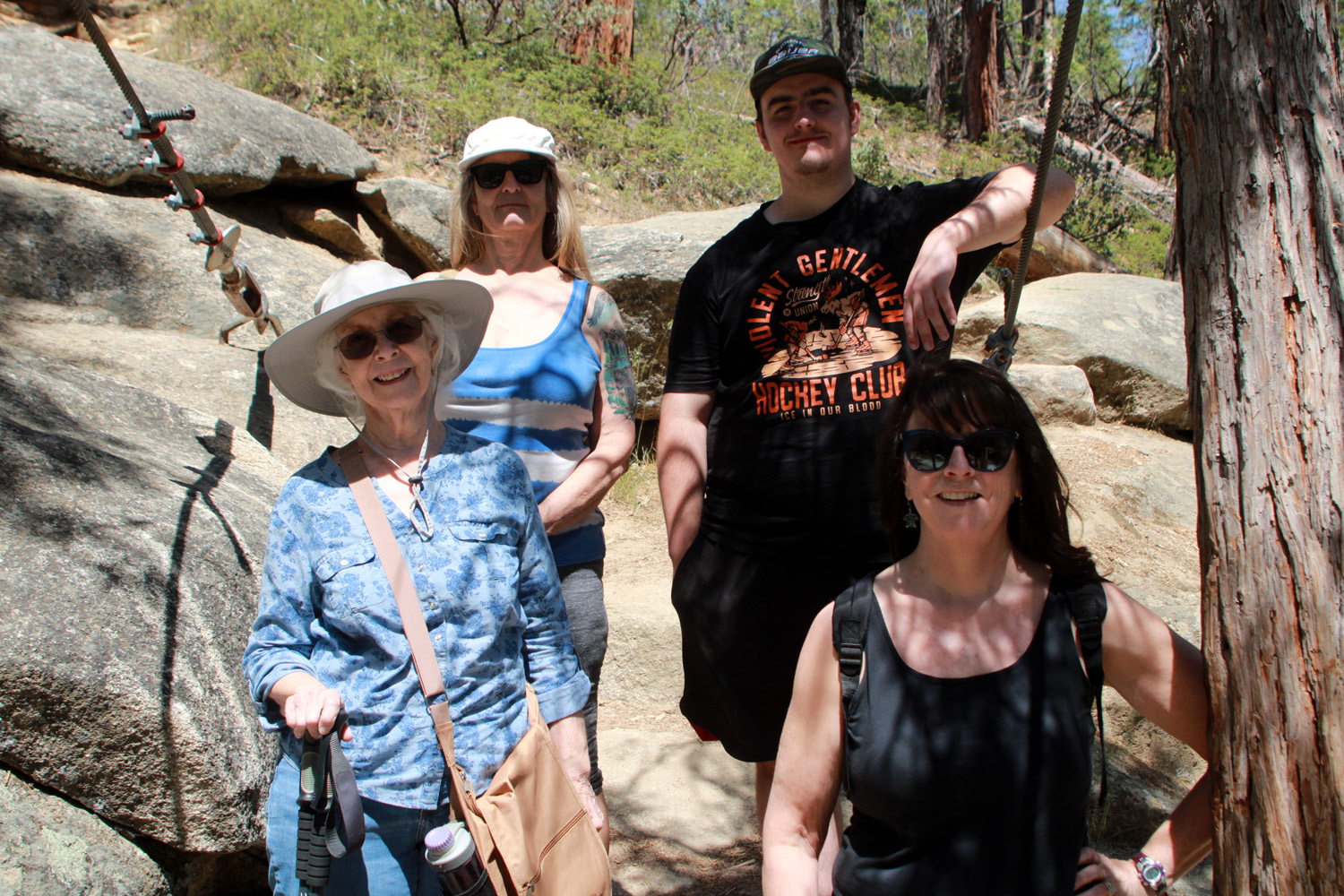
We could not check in until 4 p.m. on Friday. Johnny, Brittany, Colton and Jack would come up after work and the rest of us would meet at Jennifer's near Oakhurst and go to Wawona for some hiking. I arrived at Jennifer's about noon, but the others got a late start, so would meet us in Wawona instead. Jennifer followed me into the park and on to Wawona, and Teri, Jackie and Mikie arrived a short time later. We drove up Forest Drive to the Swinging Bridge trailhead, and enjoyed the easy, mostly level 2-mile round trip hike to the bridge. We were happy to see that the river was running high with spring snow melt. |
|
|
|
| South Fork of the Merced at peak runoff | Jackie, Teri, Mikie & Jennifer on the south side of the bridge |
|
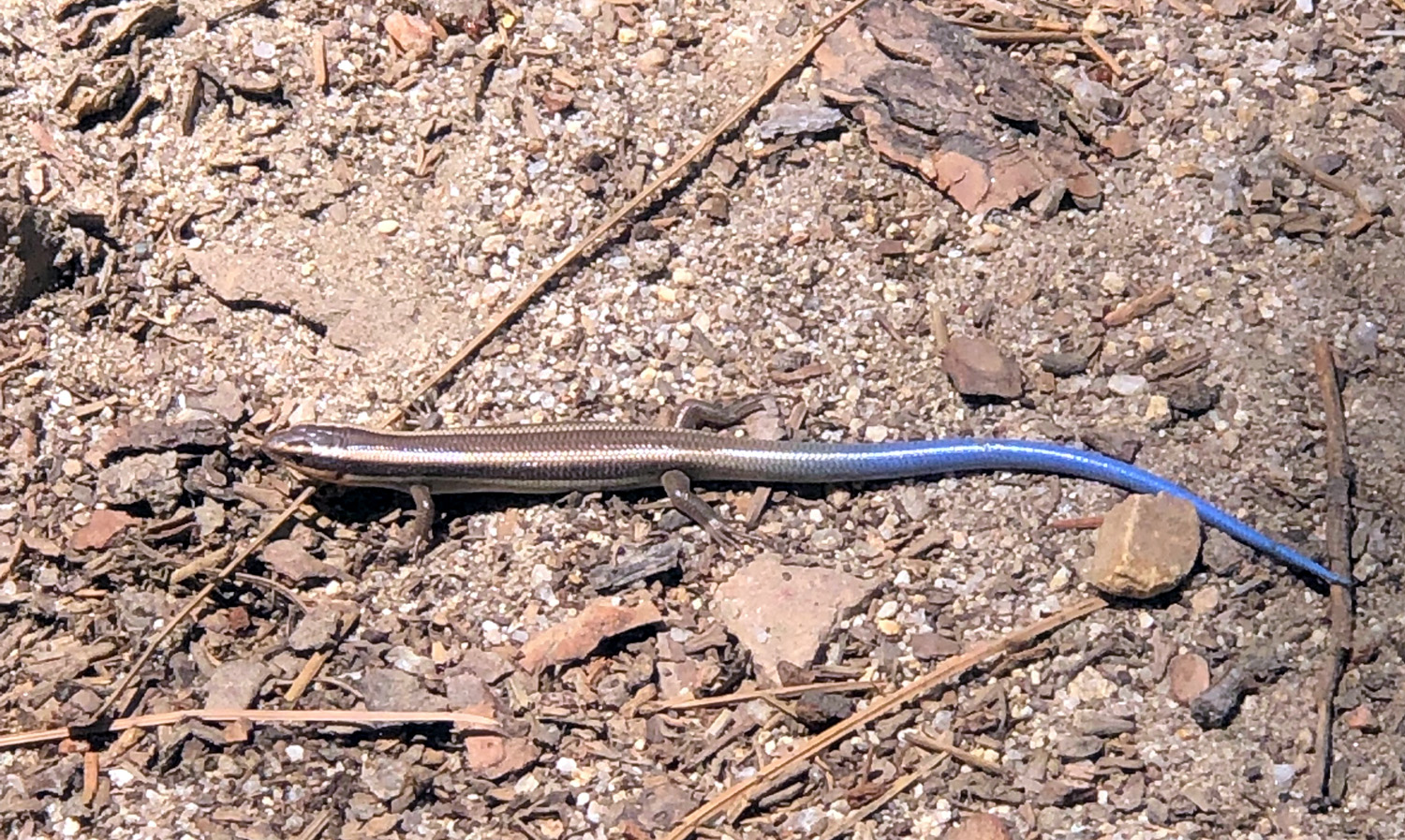
We all crossed the bridge, and sat there for a while, enjoying the river and the forest beauty. The trail continues for a short distance upstream, and downstream to a bridge across Chilnualna Creek. It's a bit of a scramble to go on, so Jackie and I did not go any farther, but Teri and Mikie explored a bit. I noticed Mikie looking intently at something on the ground. We decided it was a blue tailed skink, a reptile none of us had ever seen before. Further research indicates it was probably the very similar western skink. Fortunately Mikie captured a good photo on his phone. We crossed back over the bridge and hiked back to the parking lot. enjoying many wildflowers along the way. By the time we drove out Forest Drive and up Chilnualna Falls Road, it was time to check in. |
|
|
|
| Western skink - fairly common but rarely seen | Indian pinks along Swinging Bridge Trail |
|
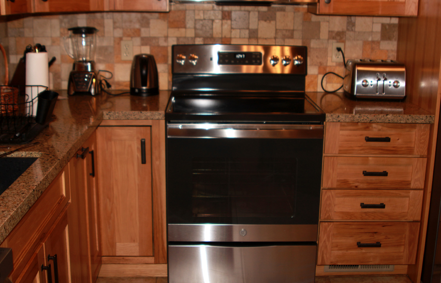
As we brought in our stuff and decided who would have which bedroom, we were delighted with the facilities. Arrow Lodge has a full kitchen on both floors, including a full-size refrigerator, dishwasher, and all the necessary pots, pans, dishes, and utensils. On the ground floor there is very nice ping pong table, which Mikie and the Upshaw boys made good use of. Each floor has a wide screen TV with satellite service, a welcome feature for this family of hockey fans, with the playoffs underway. There are propane barbecues on the decks upstairs and down. The decor has a low-key western and Native American theme, probably in keeping with the cabin's name. The outside view is forest with some open areas, and lots of lupines. |
|
|

|
| Inside the cabin | Thick patch of lupines near the cabin |
|
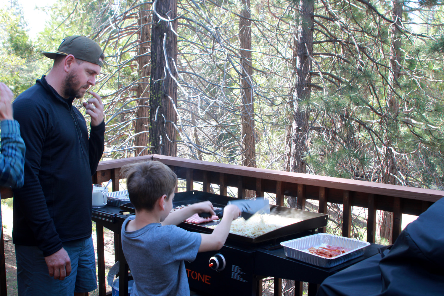
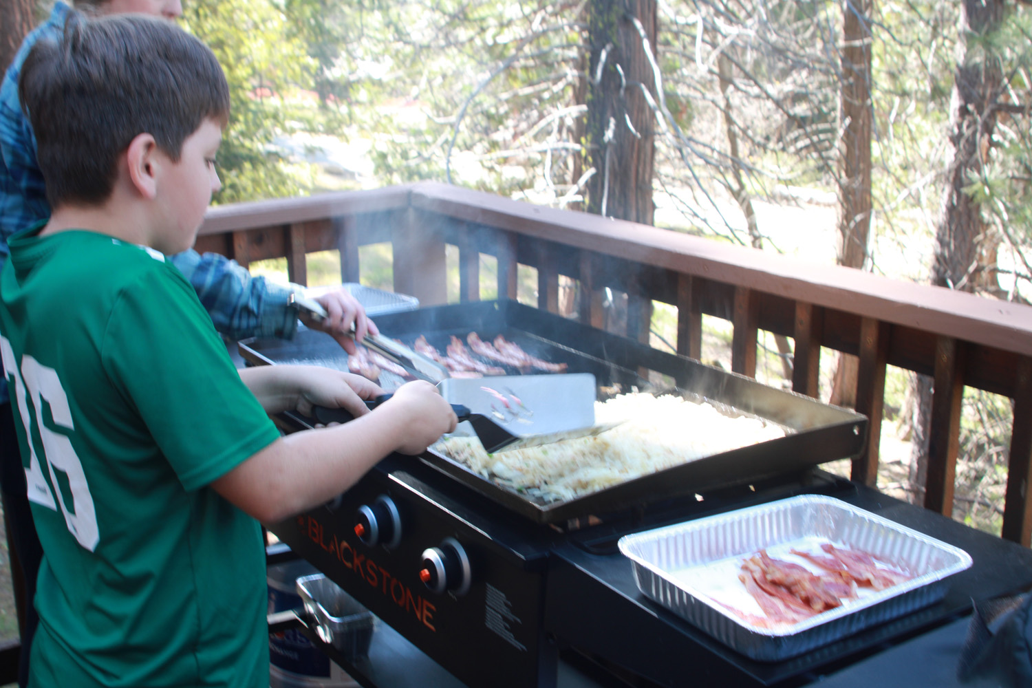
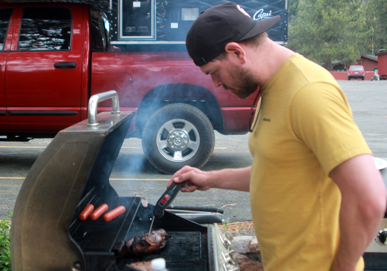
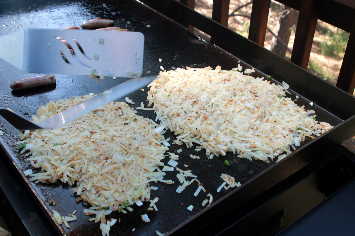
Jackie had brought hamburgers and hot dogs for our Friday night dinner, and after a false start, or actually non-start, with the upstairs BBQ, produced an excellent dinner, prepared downstairs and served on the upstairs deck. We were relaxing after dinner when we heard footsteps on the outside stairs that went up from the front to the second floor. The door flew open and two whirlwinds named Jack and Colton blew in, raising the energy level by 50% for the rest of the weekend. We went down and helped Johnny and Brittany bring their stuff in, and our group was complete. Watching a hockey playoff game that lasted till about 10:30, Johnny, Mikie and I stayed up late, along with the boys, who probably exceeded their normal bedtime by at least two hours. The next morning Teri and the Upshaw's had breakfast duty. Johnny had brought his new grill, and with help from Jack and Colton, fixed a fantastic breakfast of sausage, bacon, hash browns and eggs. |
|
|
|
| Johnny supervises, Jack cooks | Colton takes a turn at the grill |
|
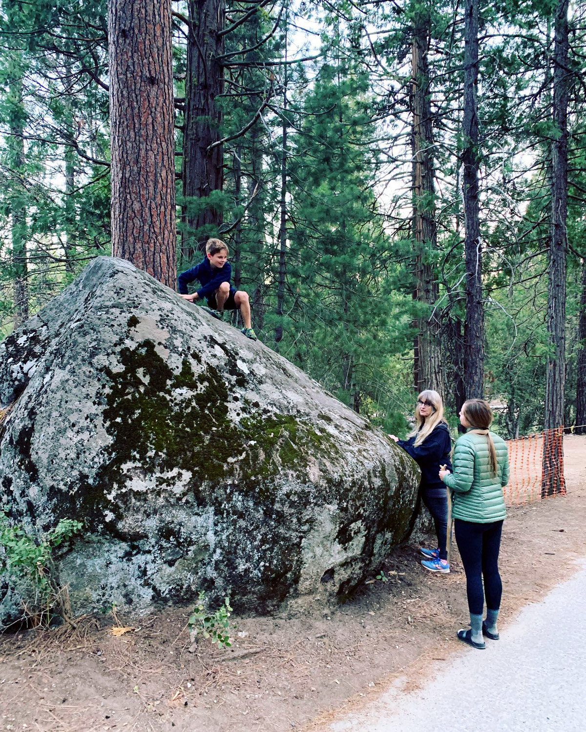
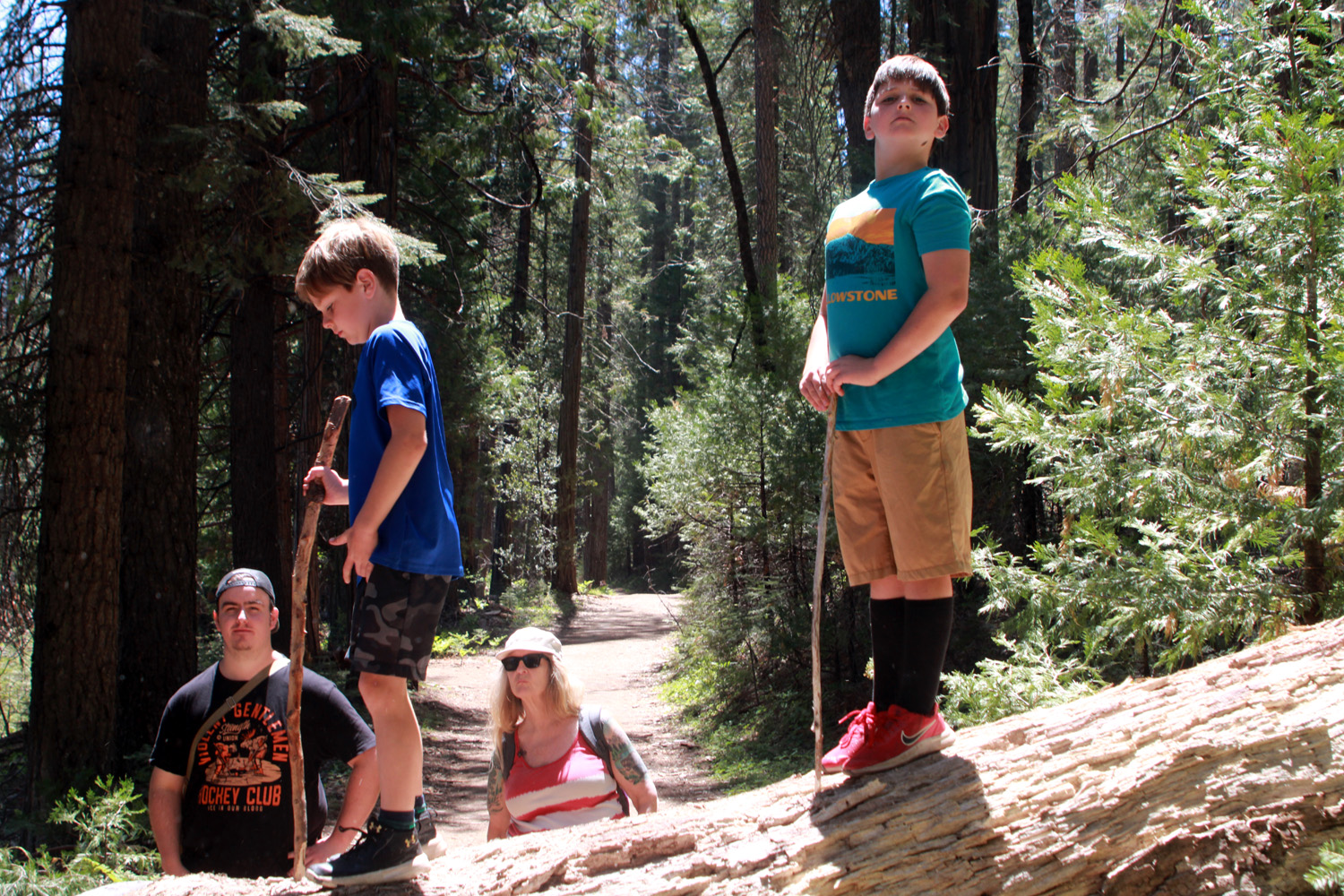
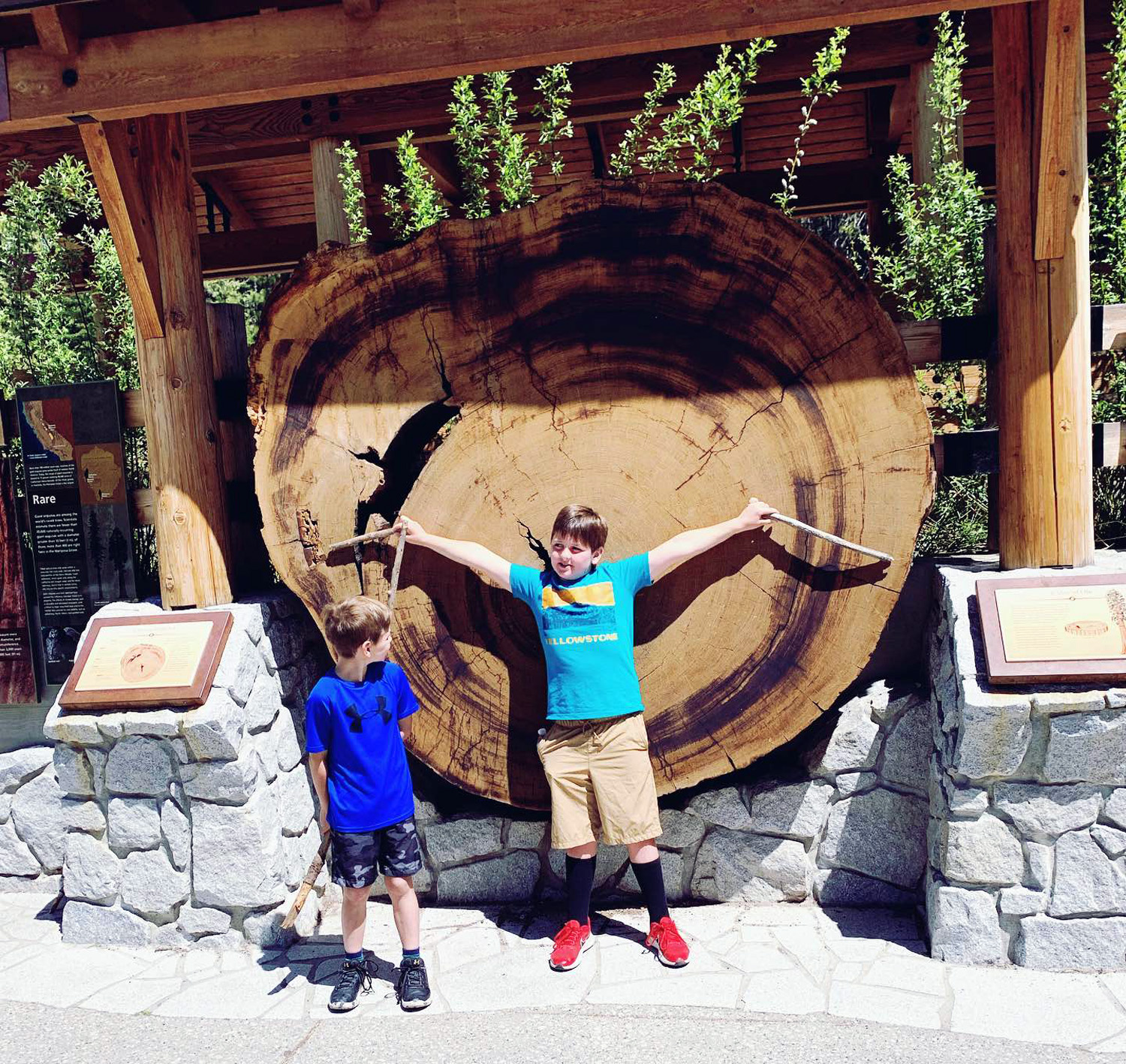
The plan for the day's activity was a trip to the Mariposa Grove of Giant Sequoias. When roads were built into the area in the 1800s, they often ran within inches of the big trees, and in the 20th century, cars could freely drive through the grove. Eventually we understood that this was damaging the trees, which have a very shallow root system. Roads, trails and parking lots had fragmented wetlands in the grove. In 2015 the park service closed the grove for three years and did a major restoration project. Roads were removed or converted to trails and routed away from the trees. Meadows and streams were restored to a more natural condition. And a shuttle service was provided to bring visitors but not their cars into the grove. In season, the shuttles run every ten minutes from a huge parking area just inside the park border. At any time people can walk the two miles to the grove, but this is more than many of us want to do, since seeing the major trees of the grove requires additional hiking of one to six miles. From Wawona it's only about four miles to the park entrance, so we loaded everyone into two cars and arrived at the shuttle stop in late morning. This is when we learned that the shuttle service would not start for another week. We could drive in if someone had a handicap permit, but despite being great grandparents, neither Jackie or I qualify. Undaunted, we returned to Wawona to hike on the Wawona Meadow Loop trail, which starts across the road from the hotel, and goes four miles around a huge meadow and through a forest of pine, fir, cedar, black oaks, and dogwood. Teri, Jackie, Jennifer, Colton and I had hiked all or part of the loop several times before, but it was the first time for Mikie, Johnny, Brittany and Jack. At one point the trail was blocked by a fallen log, much to the delight of Colton and Jack, who climbed up, ran up and down it like chipmunks, and hopped off on the other side. Jackie and I made it across with much effort, and we certainly did not win any style points. We walked about a mile on the trail, then returned to the hotel parking lot. |
|

|
|
|
The gang on the Wawona Loop Trail - Jackie, Brittany, Johnny, Colton, Mikie, Jack, Teri, Jennifer |
Jack and Colton on the log |
|
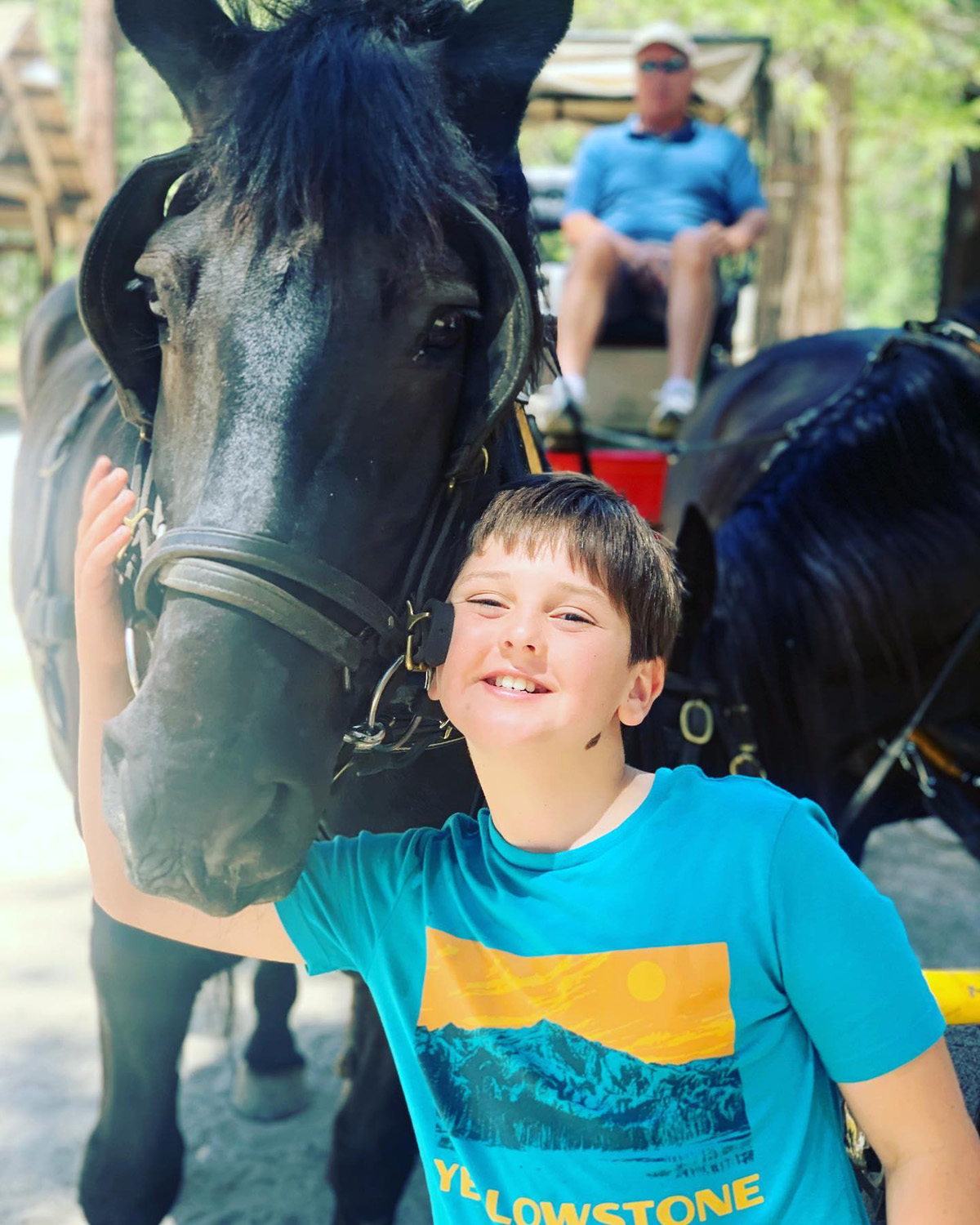
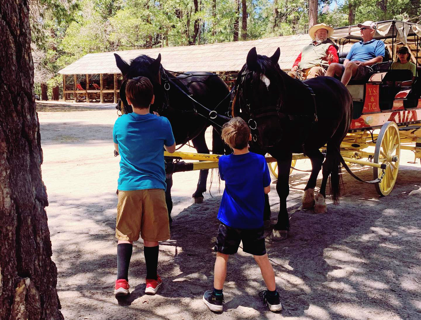
Next to the river on Forest Drive is the Wawona History Center, which offers horse-drawn wagon rides. Several of our group took advantage of this free service, while the rest of us checked out the Thomas Hill Studio, which also serves as a visitor center and souvenir shop. Hill was a renowned artist in the latter half of the 19th century, and had a studio in the area from 1884 until his death in 1908. |
|
|
|
| Colton makes a new friend | Getting ready for a wagon ride |
|
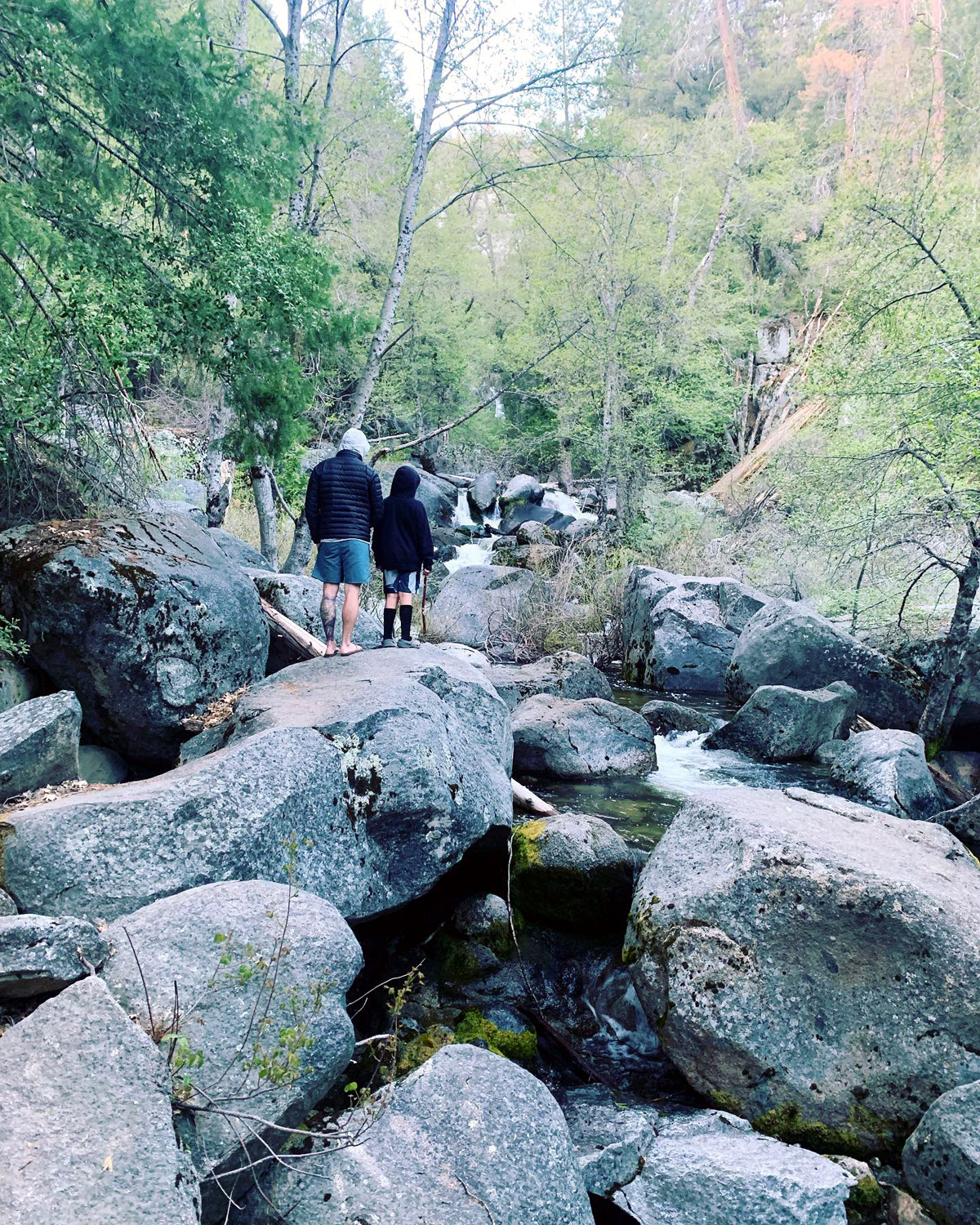
After checking out the hotel and grounds, we returned to the cabin for dinner. We were having my famous chili con carne, which requires considerable advance preparation. At home I had soaked the beans, browned the meat, cut up the vegetables, and mixed everything together Early Saturday morning I had put it all in my ancient crock pot and left it simmering all day. It was ready when we got back, and all the adults enjoyed the concoction, while the boys had something more to their liking. As we were sitting around the living room later someone said, "There's a coyote!" We watched him come out of the woods and disappear down into a drainage. Then after half a minute, he reappeared, stepped up onto a log, walked down it a short distance, and stood there for another minute, giving all of us the best and longest look we had ever had of this animal. Shortly before dark we took a short walk down to Chilnualna Creek, just a few hundred yards from our cabin. A trail goes up the creek a little over four miles past a series of cascades and falls ranging from 50 to 250 feet. We went to the first falls last year, but this time just explored the creek below the bridge that crosses over and leads to a trail that goes to the Swinging Bridge. Walking back to the cabin, we had an amazing view of Wawona Dome, lit up by the setting sun. |
|

|
|
| Colton at Chilnualna Creek | Sunset on Wawona Dome |
|
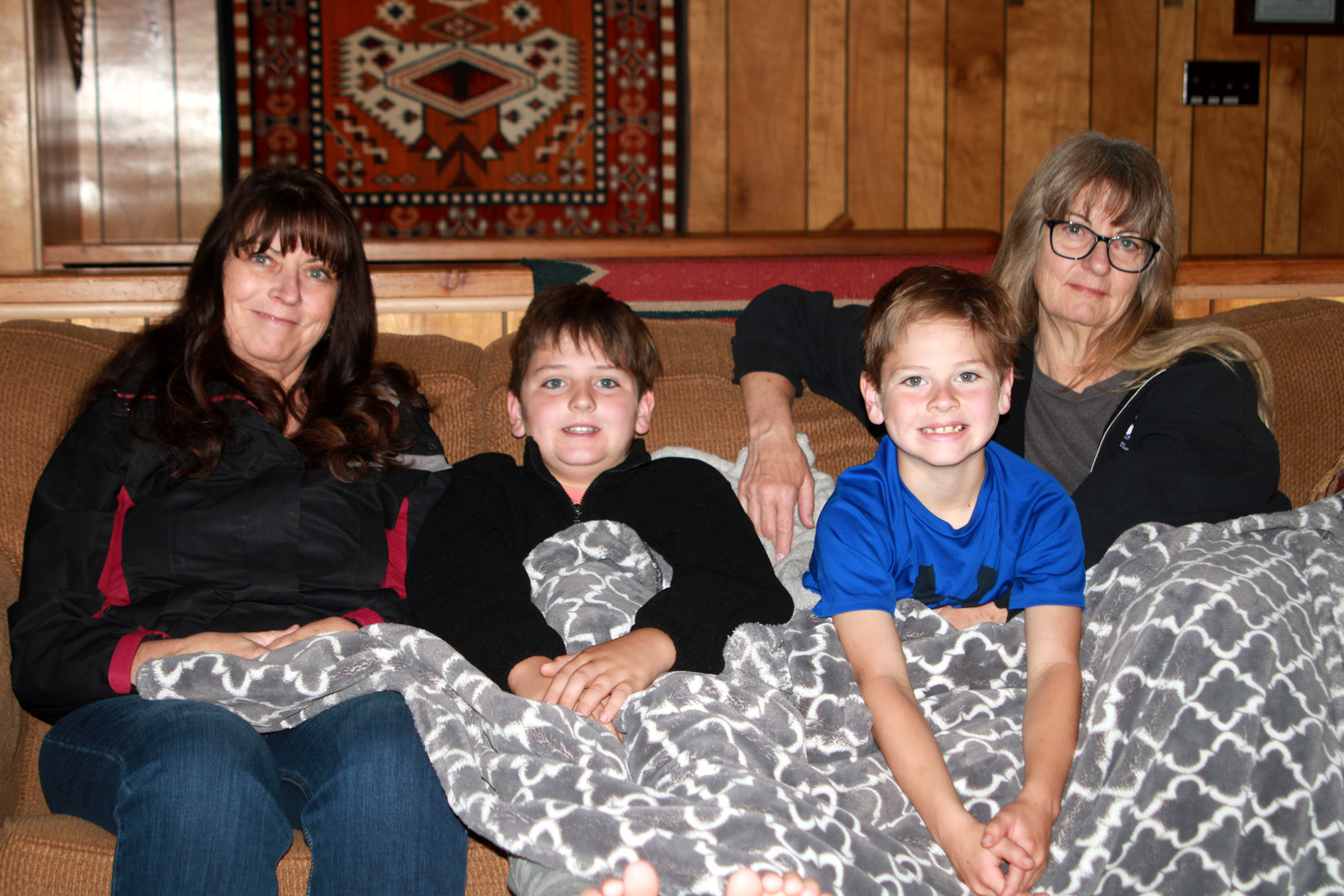
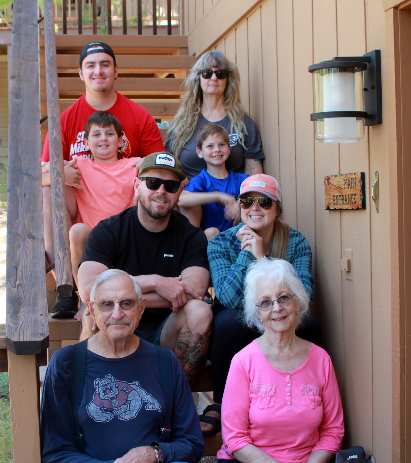
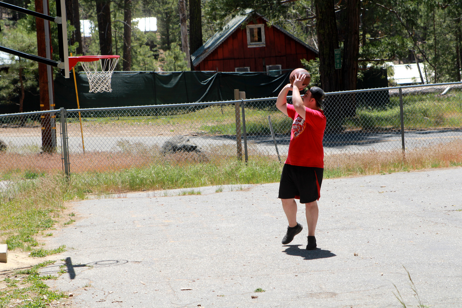
When I came out of my bedroom Sunday morning I found Teri and Jennifer and the boys snuggling on the couch. Eventually everyone else came to life, and Johnny once again served up an excellent breakfast. Jennifer had an obligation early in the day, and left shortly after breakfast. Everyone but me would be leaving by mid-day, so the rest of us started packing up, with my wonderful kids, grandkids and great grandkids carrying as much of my stuff as possible down the stairs for me. After a group photo, we drove to the elementary school where the boys planned to play basketball. As far as I could see, Mikie took one shot at the basket, and everyone else sat around talking, or wandered around the school grounds until it was time to go. Back at the cabin I did what I usually do when solo camping - ate (chili again), read, and went for a couple of short walks, plus watching hockey, not normally an option at most campsites. In the morning I made sure the cabin was returned to its required condition (trash taken to the dumpster, dishes washed, everything back where we found it), and started for home a little after 9:30. |
|
|
|
| Early Sunday morning - Jennifer, Colton, Jack & Teri |
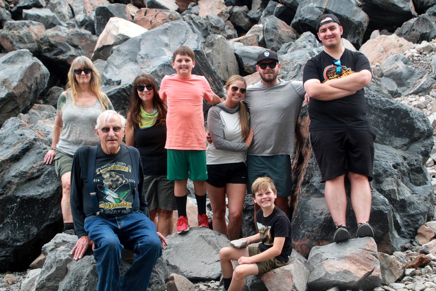
Final group photo, but without Jennifer - Mikie, Teri, Colton, Jack, Johnny, Brittany, Dick, Jackie |
|
Some final comments: I made our reservations through Airbnb, but there are a number of similar rentals in Wawona available through other companies. The place where we stayed is managed by Yosemite Scenic Wonders, and they were a delight to deal with, unlike my direct dealing with the owner of the place we stayed last year. The Redwoods at Yosemite also offers rentals. We booked a cabin with them for 2020 but Yosemite was closed due to Covid, so we did not actually stay there. Yosemite's timed entry system went into effect the day we arrived. Permits are required to enter any time between 6 a.m. and 4 p.m., including just to drive through the park. These reservations are made through Recreation.gov. Permits are not needed if you have a camping or cabin/hotel/motel reservation. However, if you are entering in more than one vehicle, each one needs to have a copy of the reservation AND a copy of the photo ID of the person who made the reservation. Another thing to be aware of when visiting Yosemite, the road to Glacier Point is closed for all of 2022, and I believe there will be traffic controls in 2023. There is also road work and construction in other areas which may impact your travels. --Dick Estel, June 2022 |
|
|
Cat Sitting, Moon Shot, and Glass Rock
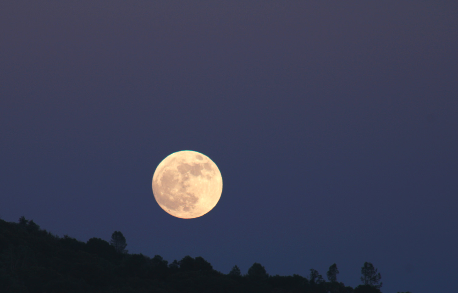
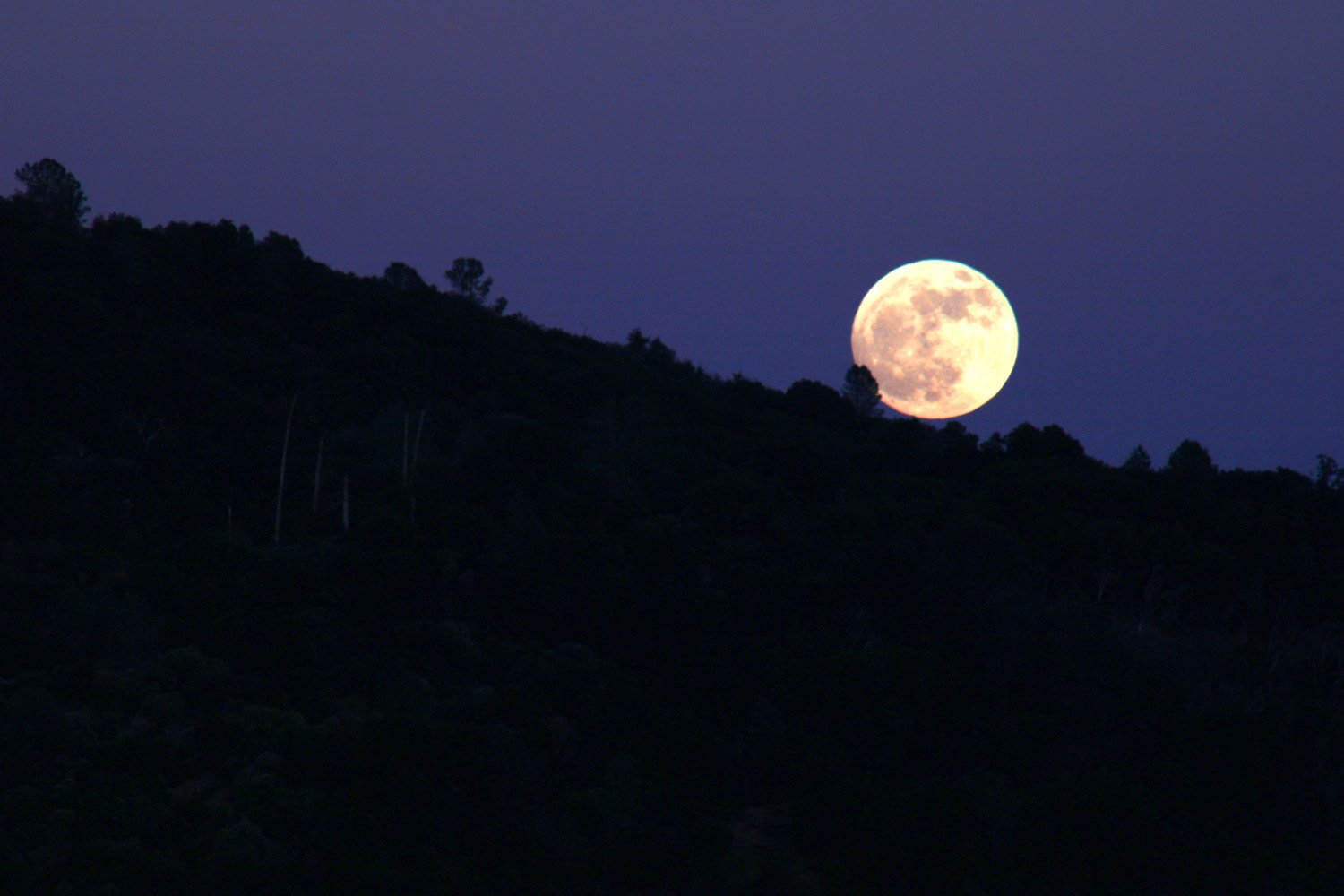
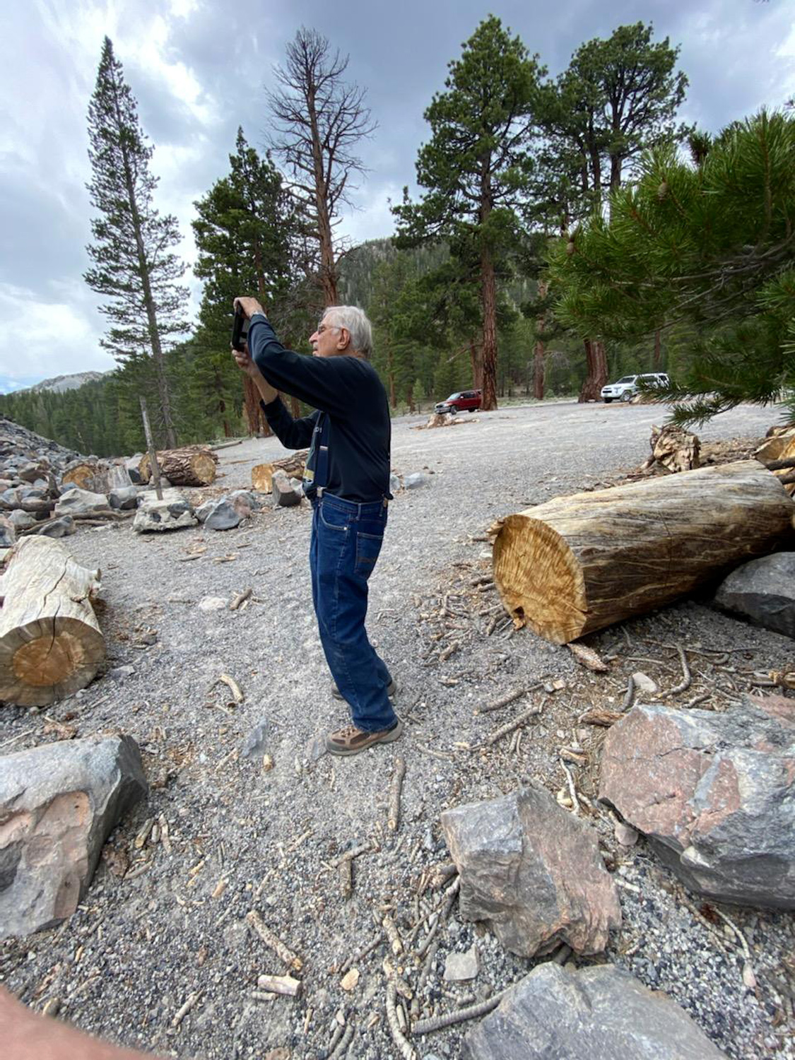
In mid-June, as I have done a number of times in recent years, I drove up Highway 41 to Oakhurst, to the home of my daughter Jennifer and her husband Rod, to take care of their cats while they enjoyed a trip to Tahoe. I had recently bought a new camera, and in the course of watching videos on how to use it, I ran across instructions for photographing the moon. My first day there, June 13th, was the night of the full moon, so as the time for moonrise approached, I gathered up my equipment and drove a short distance to a spot along Road 620 where the eastern horizon was not blocked by trees or nearby land features. Of course, the actual horizon is some distance below even the most open mountain horizon, so I had about a 20 minute wait from the "official" time till the moon actually appeared. I had the camera, with telephoto lens in place, mounted on a tripod and set for a ten-second delay to eliminate camera shake after the shutter was pressed. I took a half dozen shots, most of which turned out as well as I had hoped. However, the first one, with the moon just touching the trees on the horizon, was my favorite. |
|
|
|
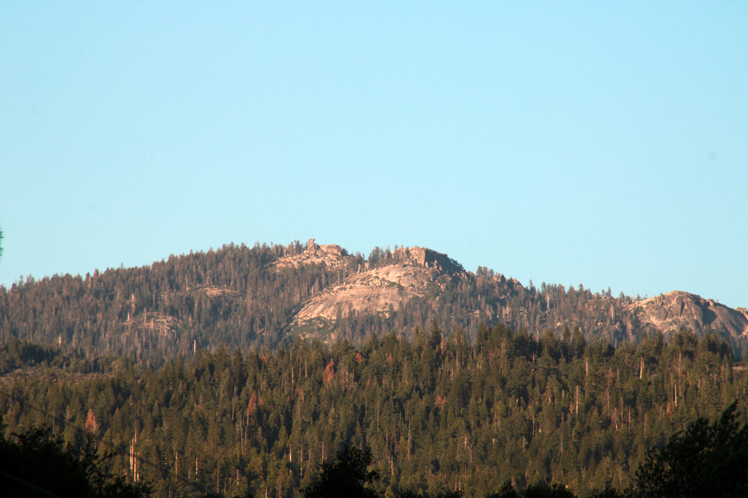
| Full moon, June 13, 2022 | Domes to the east of Highway 41 |
|
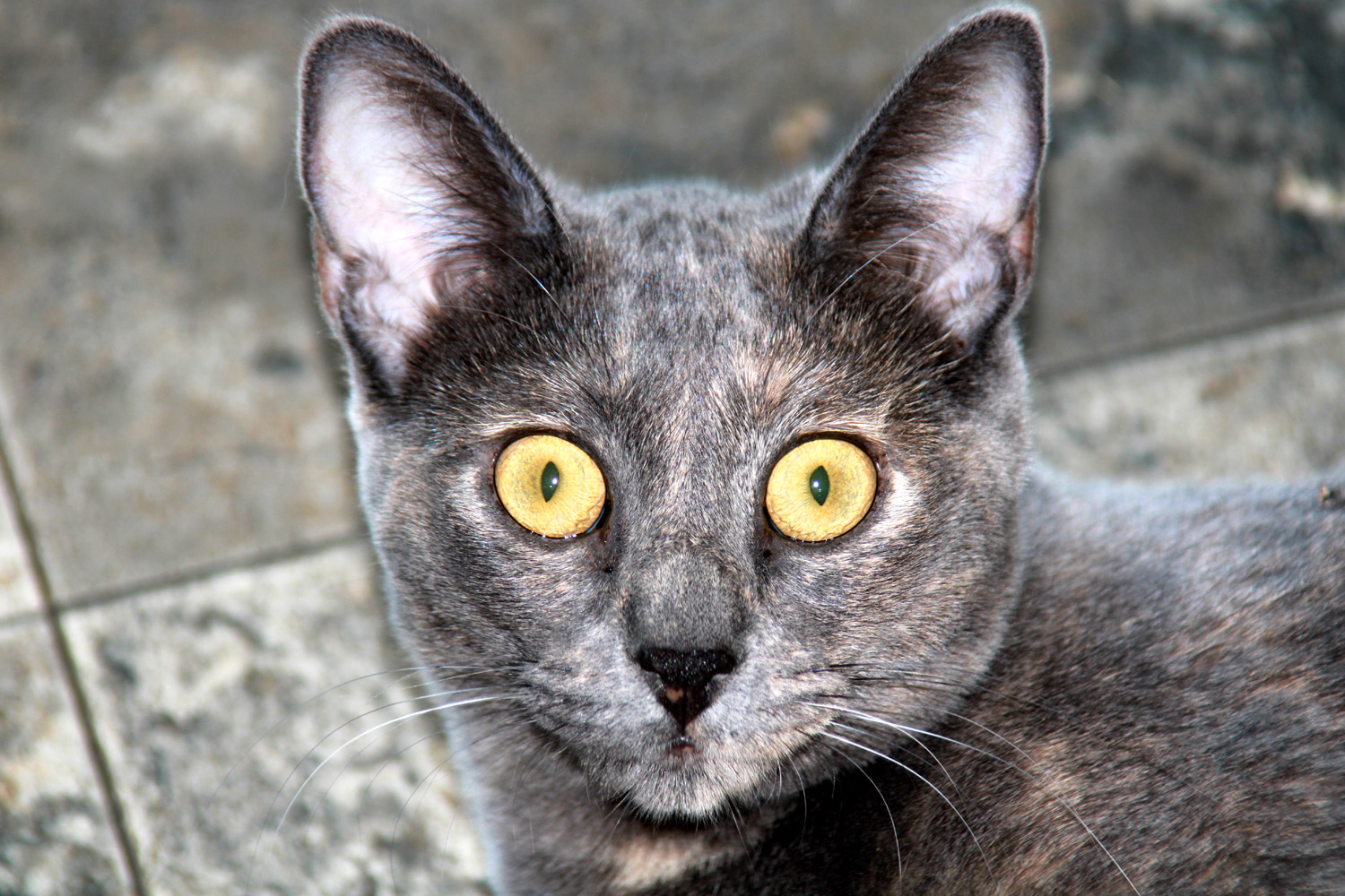
Meanwhile, back at the house, the cats were doing their thing, which is mainly eating and sleeping. There's a different arrangement with the cats this time. Over the years, a number of cats have disappeared, with the local coyotes being the main suspects. After much urging from family members, Rod & Jen decided to keep their two newest cats, Newton and Peanut, inside. Pebbles has always been an outdoor cat, and does not really care to go in and and out like most of the others in the past. She seems to be fairly wily (and fast), having survived around eight years. The two youngsters, just under a year in age, were both friendly when I stayed with them in November of 2021, but Newton had decided I was not his human, and therefore not worthy of close contact. He didn't run from me, and would allow me to get within a foot or two, but there was a "no touching" rule in effect. Peanuts on the other hand was very friendly, allowing me to pick her up and pet her any time. Pebbles is less freaky than she used to be, and ate her special treat food in the evening with me sitting on the patio five feet away. |
|
|
|
| Bright-eyed Peanut | Newton in his younger days |
|
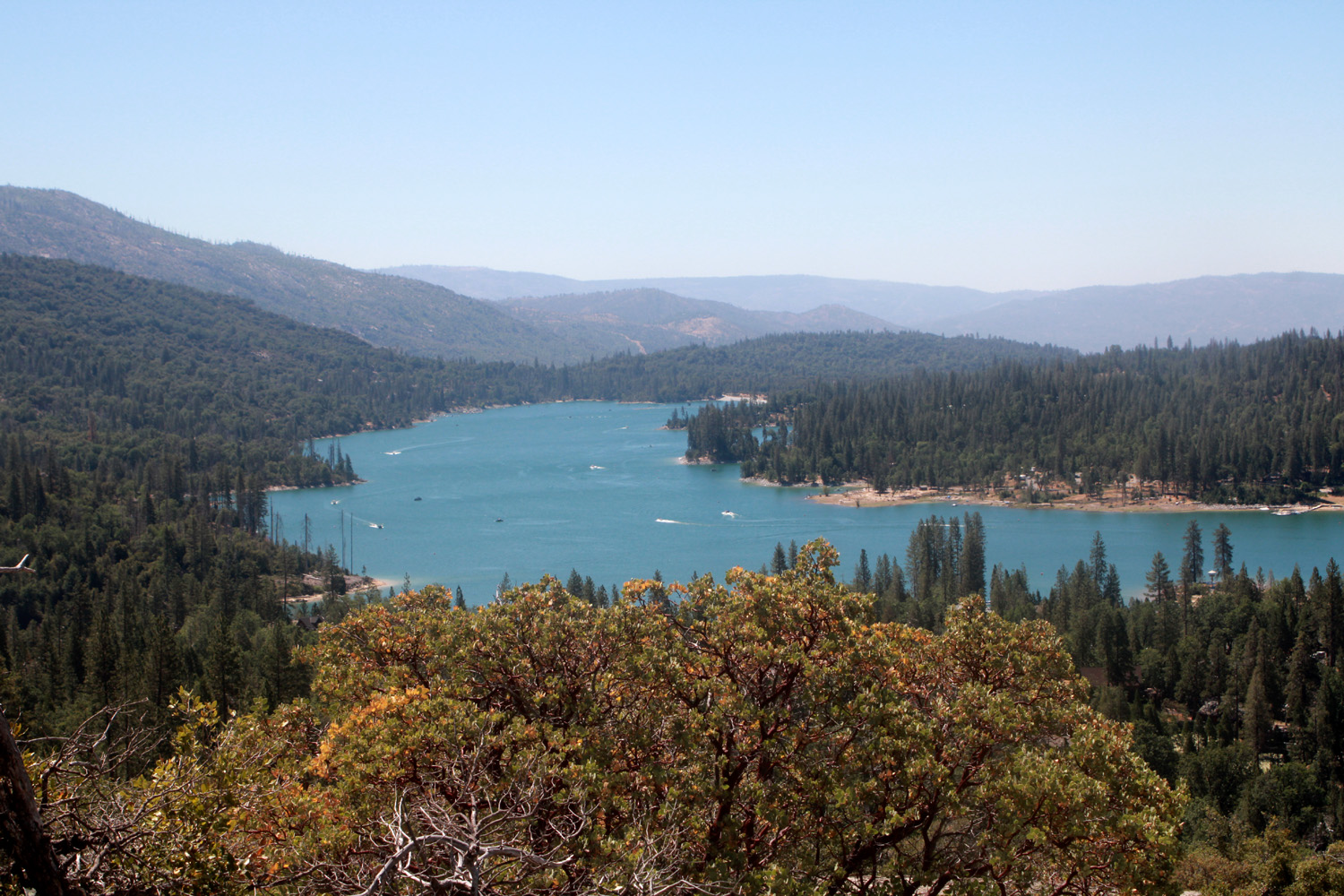
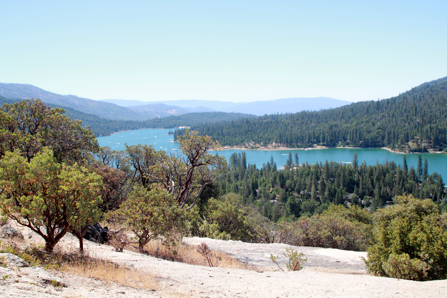
A month or so before this trip, Rod and Jennifer had told me about a hike they had made near Bass Lake, to a place called Glass Rock. This is a large granite outcropping, a gently sloping area of an acre or so, which provides views of Bass Lake and the surrounding country from various angles. The name comes from the fact that people found this to be the perfect spot to break a large number of glass bottles, but most of the fragments have now been cleaned up. The trailhead is unmarked, but the directions are fairly simple: From Highway 41 take Road 222 toward Bass Lake. At the lake stay on the east side (left at the fork), then turn left on Beasore Road (5S07) and go a half mile to the trail on the left. The web site says to look for the pile of cut up logs, which gave me a little laugh. There are probably ten thousand piles of cut up logs in the Sierra, and they are constantly being removed for salvage logging, chipping, etc., and being replaced by new piles. The trail is an old road, blocked with a big pile of dirt and rocks. After walking the narrow path around to the right, I DID see a pile of logs on the other side, completely hidden from the road. |
|
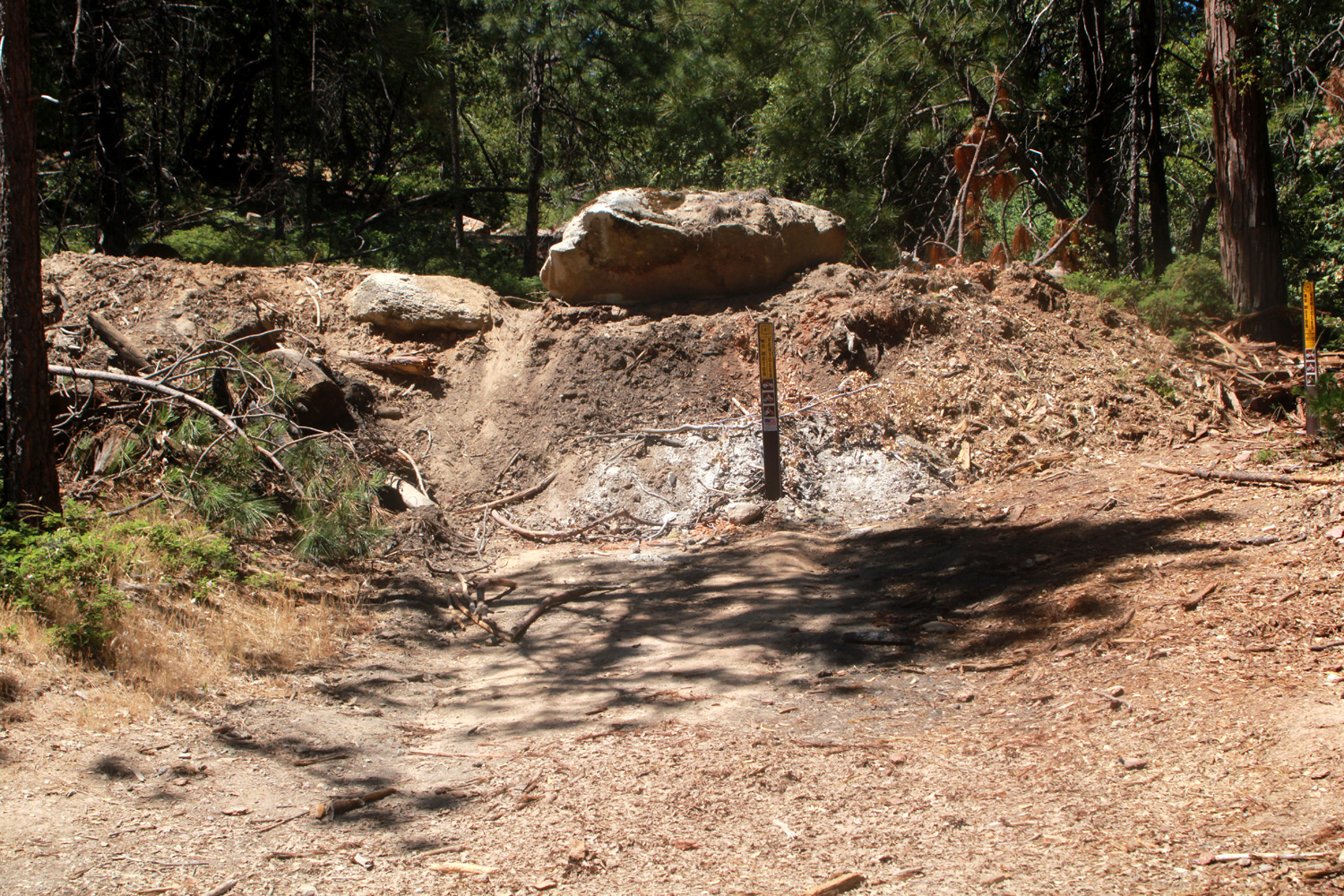
|
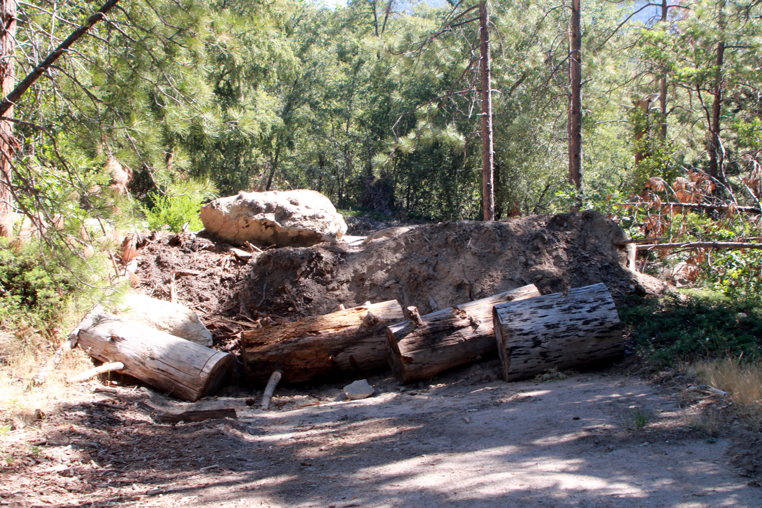
|
| Look for this landmark to find the Glass Rock trailhead | The advertised log pile is hidden from the road |
|
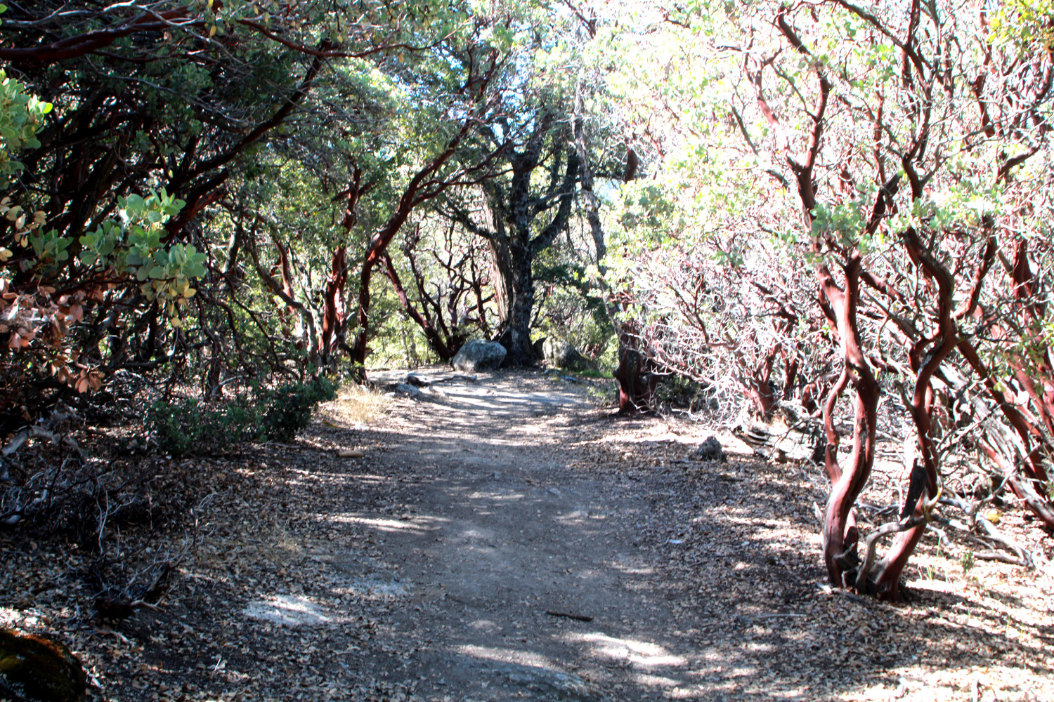
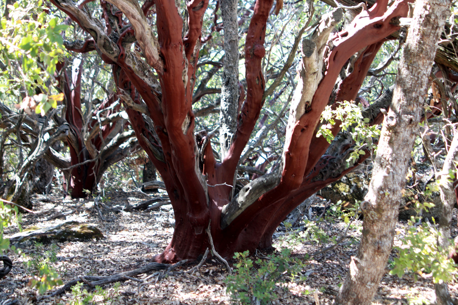
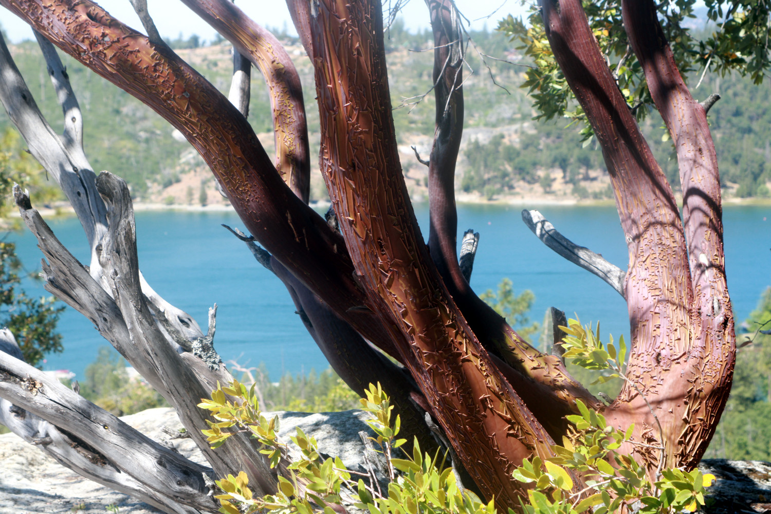
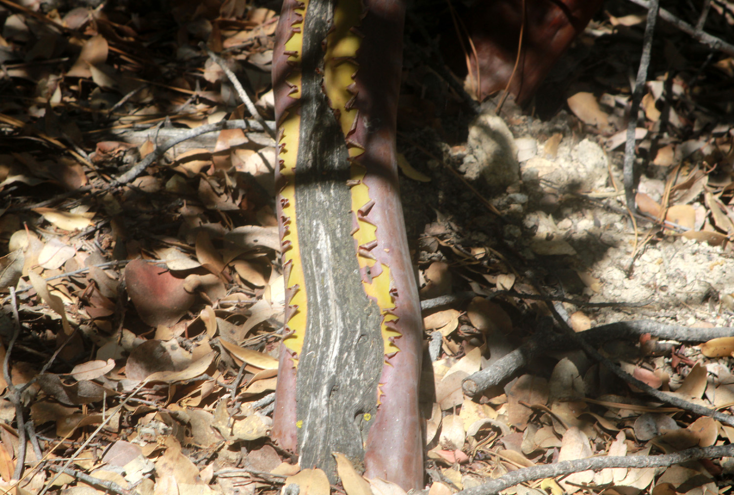
The trail immediately starts up hill and is fairly steep, but it's not far to where it levels off and goes through a shady area. Since the elevation is just above 3,000 feet, the vegetation is black oak, live oak, ponderosa pine and many shrubs, mostly manzanita. I don't believe I've ever seen such a thick "forest" of manzanita, many of them taller than usual. |
|
|
|
| Manzanita lines this shady section of the trail | A nice specimen of this common foothill tree |
|
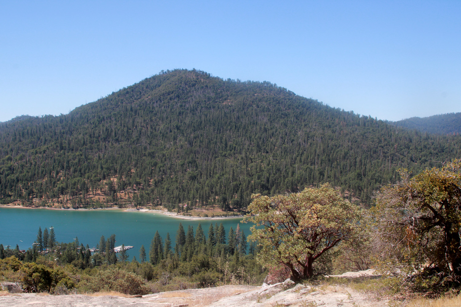
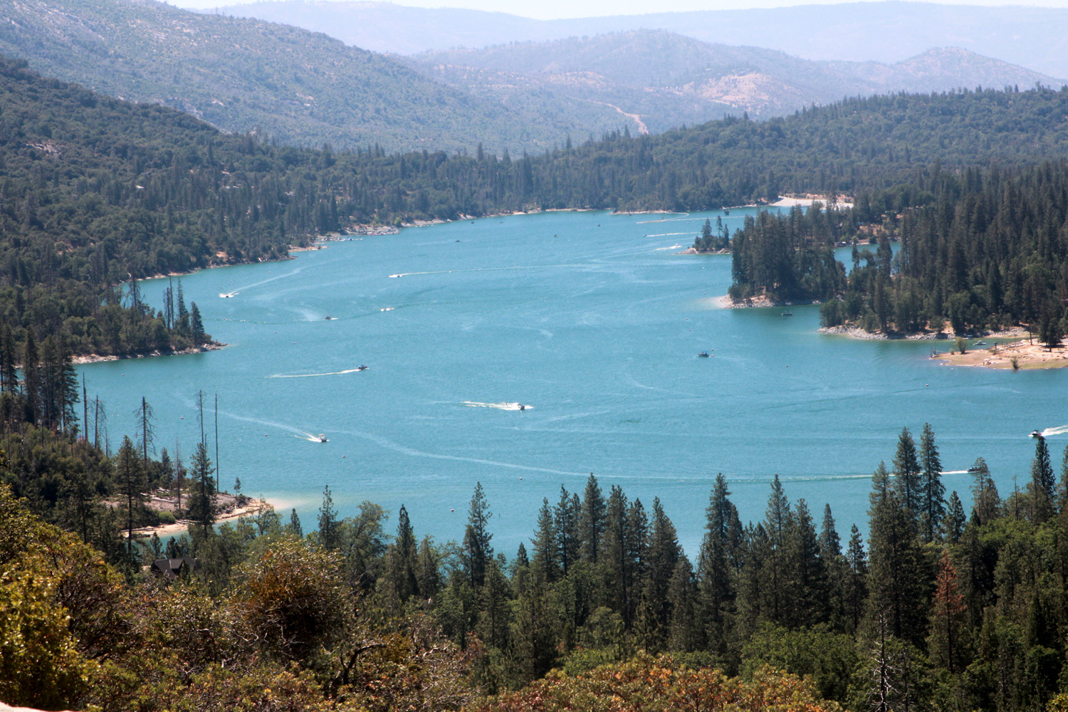
After the welcome shady passage, the tail descends gently with some mild rock scrambling to the big granite slope, where nearly the full five mile length of the lake is visible. Goat Mountain rises to 4,600 feet on the western side of the lake. I took way too many photos, then returned to my car and drove farther up Beasore Road to Chilkoot Campground, where we have camped many times in the past. It was a little more than half full, with campers paying $33 per night at a spot that was free when we first started going there. |
|
|
|
| Bass Lake from Glass Rock | Goat Mountain irises above the lake |
|
I retuned to the Neely home, rested a bit, then drove down to Oakhurst for a delicious Mexican dinner at El Cid. The rest of my mountain sojourn was uneventful and unspectacular, with a little walking around the property, a lot of resting and reading, and serving up the cats' special evening treat of canned food each evening. --Dick Estel, June 2022 |
|
|
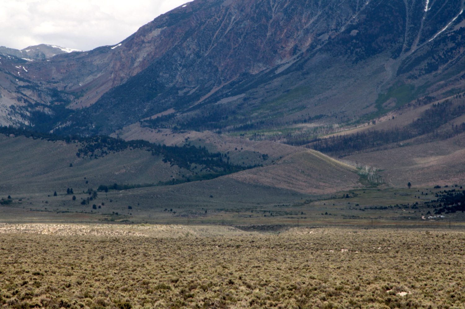
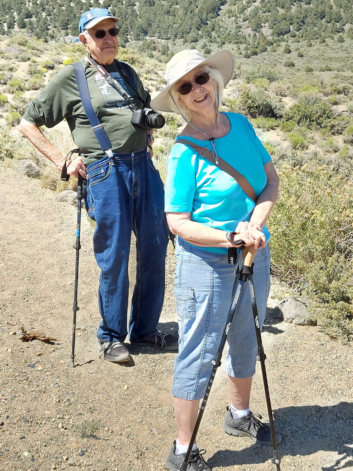
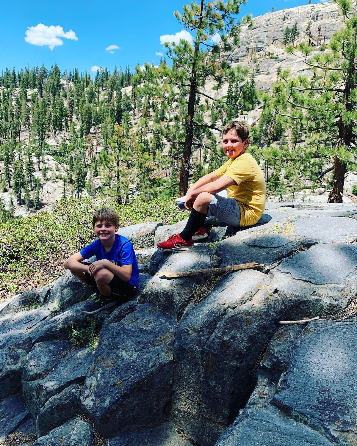
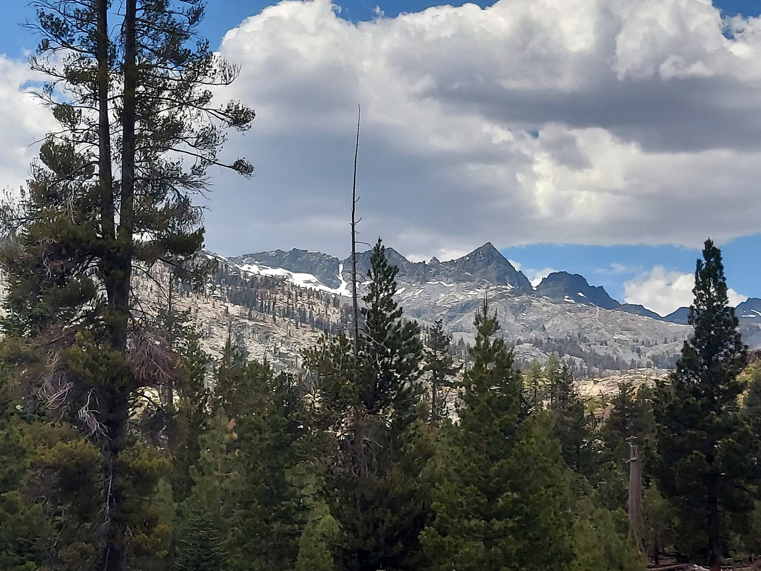
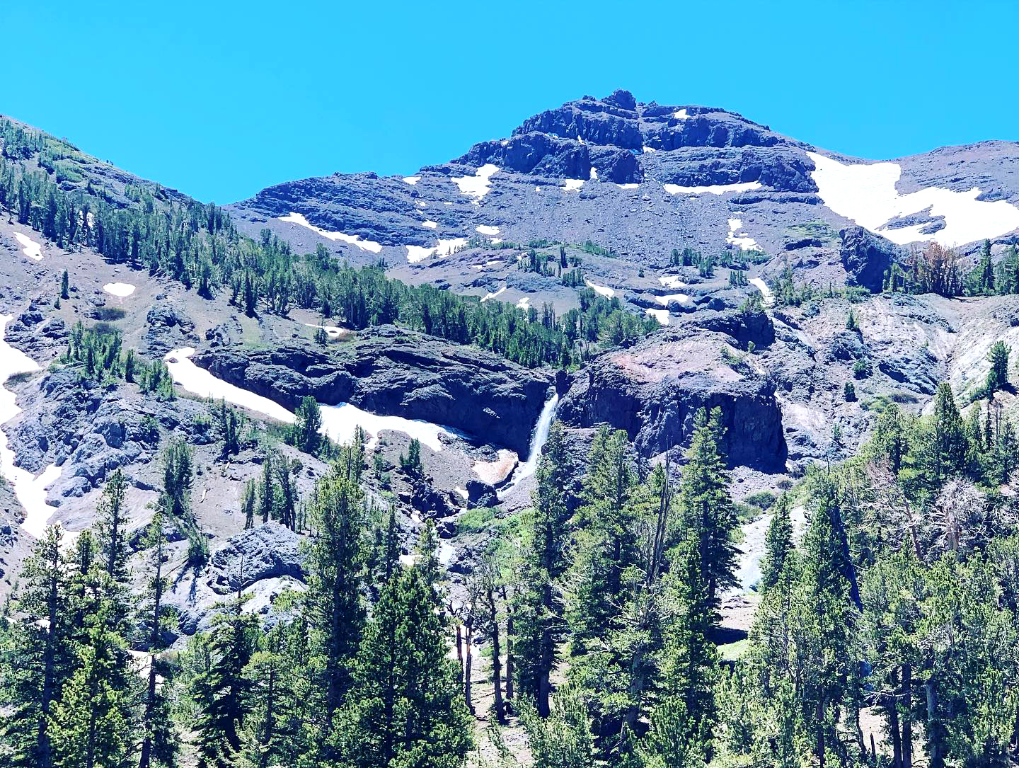
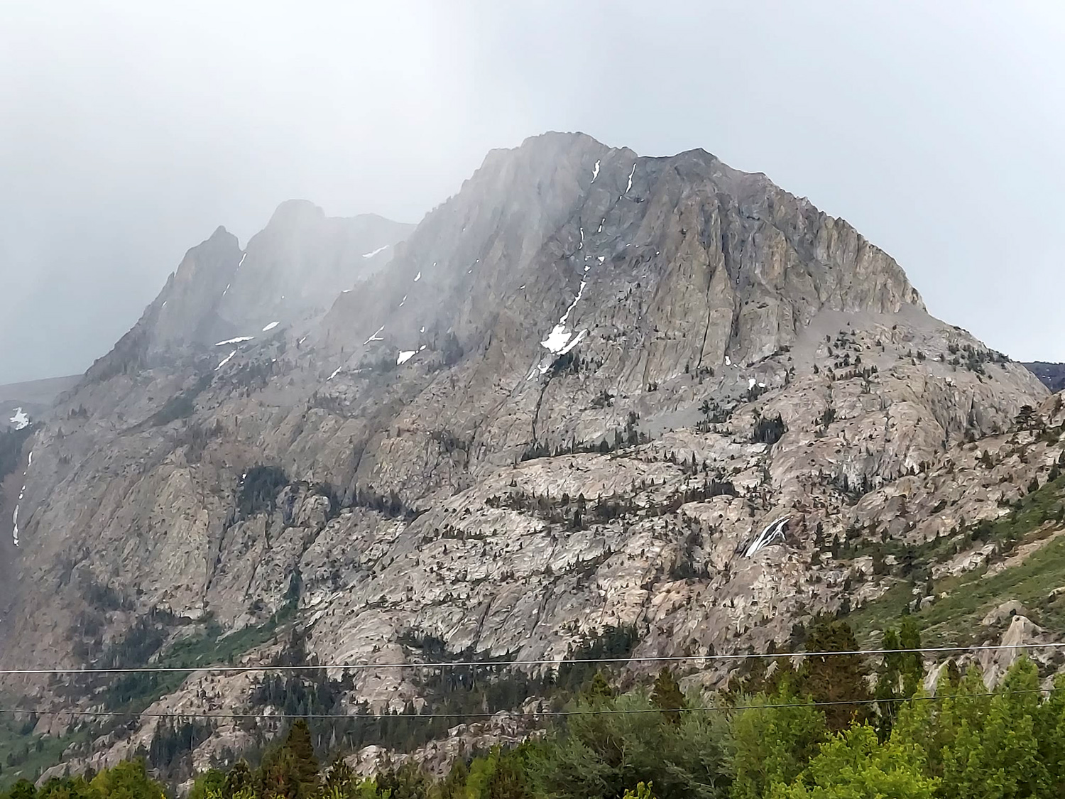
Eastern Sierra - June Lake Panum Crater Mono Lake Crowley Columns Obsidian Dome Devil's Postpile Mammoth Village Yosemite Permits (Photos by Teri, Jennifer, Johnny, Brittany, Colton, Jack and Dick) A number of years ago my older daughter, Teri, fell in love with the eastern Sierra, particularly the area known as the June Lake Loop. The loop itself is California Highway 158, which goes west from US 395 a short distance south of Lee Vining, winds through the eastern edge of the Sierra past four lakes, and returns to 395 about five miles farther south. Two miles from this southern junction is the town of June Lake, a major tourist headquarters with shops, motels, restaurants and other businesses catering to fishermen, winter sports fans, and sightseers. June Lake makes a good jumping off place for visits to Mono Lake, Mammoth Mountain, the Devil's Postpile, Obsidian Dome, Panum Crater and Crowley Lake Columns. More about all these later. Teri made all the arrangements for us to stay at Boulder Lodge for five nights in mid-June. Traveling from four different cities were Teri, her sister Jennifer, their mother Jackie, her son Mikie, son Johnny with wife Brittany and sons Colton and Jack, and her dad, me, Dick Estel. The shortest route to June Lake from where we all live is over the Tioga Pass Road (State Highway 120), through Yosemite National Park. This presented our first challenge - advance permits are required to enter the park, even for those just driving through. If you don't obtain a permit a month or more in advance, you get one more chance. Tickets become available at 8 a.m. each day one week in advance. With five cars involved, coming on three different dates, and leaving on different days, it was probably inevitable that not all of us were able to get both permits (Mikie and I were the two lucky ones). You can enter without a permit before 6 a.m. or after 4 a.m. This worked out well for Jennifer, who lives about 25 miles from the park entrance - it was no big deal for her to get in before 6 a.m., and allowed her to arrive at the lodge fairly early in the day on Friday. A couple of other scenarios worked for the others who did not get both permits, and all of us made it to June Lake and eventually back home. Five of us traveled on Thursday - Jackie driving her car with Jack as a passenger, and Teri, Colton and I in my truck. Plans to take Teri's car fell apart at the last minute due to a dead battery. Instead of going in the south entrance to Yosemite on Highway 41, we took Highway 49 from Oakhurst to Mariposa, then 140 to the park. The Highway 41 entrance has the most traffic, often resulting in long waits. When we reached the Arch Rock entrance on Highway 140, there was exactly one car ahead of us. A few miles into the park we took the Tioga Road, which leaves 140 at the very edge of Yosemite Valley. This is a scenic route that goes up from around 4,000 feet at the start to 9,945 Tioga Pass, the highest elevation Sierra crossing. It's not a particularly fast route, but few trans-Sierra highways are. In the park, strictly enforced speed limits range from 35 to 45 MPH. And of course, you encounter the usual twisting and turning of any mountain road. Once over the pass, it's a drop of over 3,000 feet in eight miles down to the US 395 junction at Lee Vining at 6,700 feet. Go with the flow, enjoy the scenery (preferably at one of the many turnouts) and the trip will be an enjoyable experience. After a drive of just over 190 miles, we made it safely to our motel, brought in our stuff and enjoyed the views of the lake and mountains. Teri and I and the boys had two adjoining rooms with access between them, while Jackie was a few doors away. Although our entrance was on the ground floor, the motel is on a hillside, so there were balconies in the back overlooking the lake. We also made use of the big screen TV to watch game 4 of the Stanley Cup final. Mikie has been a fan of the Colorado Avalanche since he was three. They won the cup that year, but he has no memory of it. He has remained a loyal fan through ups and downs, and was rewarded by seeing his team in the finals against defending champion Tampa Bay Lightning. Two nights later we enjoyed watching with Mikie present, and after he had gone home on Sunday, we cheered on his behalf as the Avalanche had a chance to win the third cup in team history. OK, it's probably time to talk about the adventures we enjoyed in the eastern Sierra, rather than stuff we could just as well have done at home (hockey, eating, reading). |
|

|
|
| This was the view from our back balcony | |
|
|
| Just kicking back after the day's vigorous activities | |
|
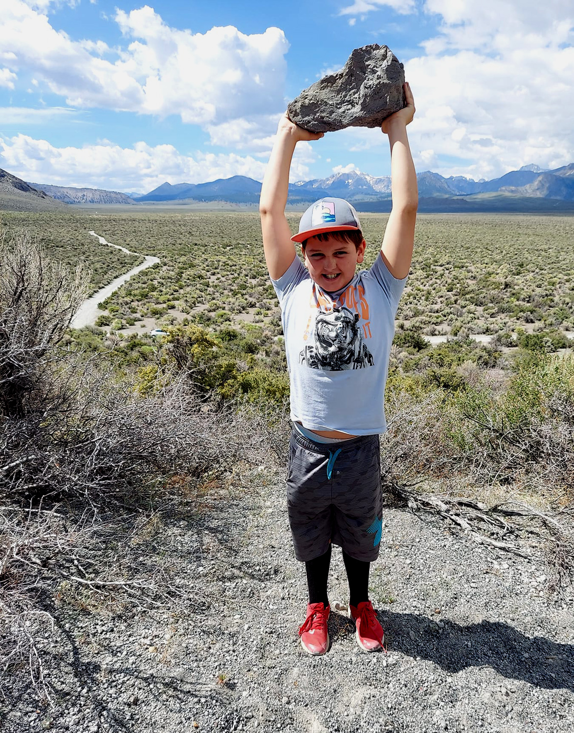
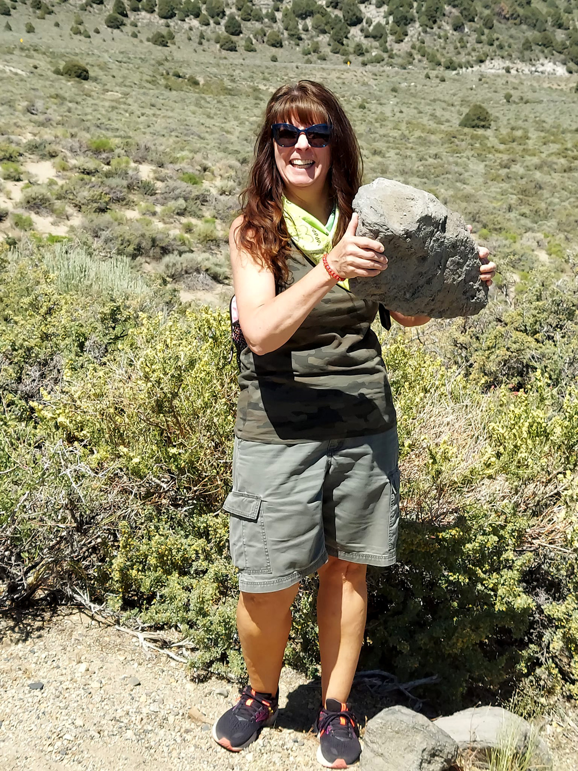
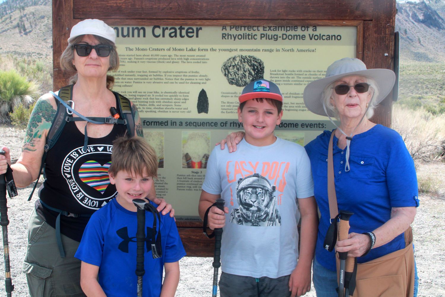
Thursday morning after breakfast the five early arrivals set off to hike at Panum Crater. This is a small, extinct volcano just south of Mono Lake and east of Highway 395. Access is via Highway 120 after it goes east from 395, on a narrow dirt road that goes a mile or two to a parking area. A well marked trail leads to a fork where you can walk the rim of the crater, or up to the top, the route we chose. The trail here goes down a short distance to a gap where there is a good view of the lake, then starts up. The boys were excited about being on and in a volcano, but even more eager to pick up the big light-weight pumice boulders that are plentiful on the hike. There is also plenty of obsidian, which is chemically the same as pumice, but has cooled into smooth, dense glass chunks that none of us could lift. |
|

|
|
| Air bubbles trapped in the pumice at the time of explosion makes it possible for boys to perform amazing feats of strength | |
|
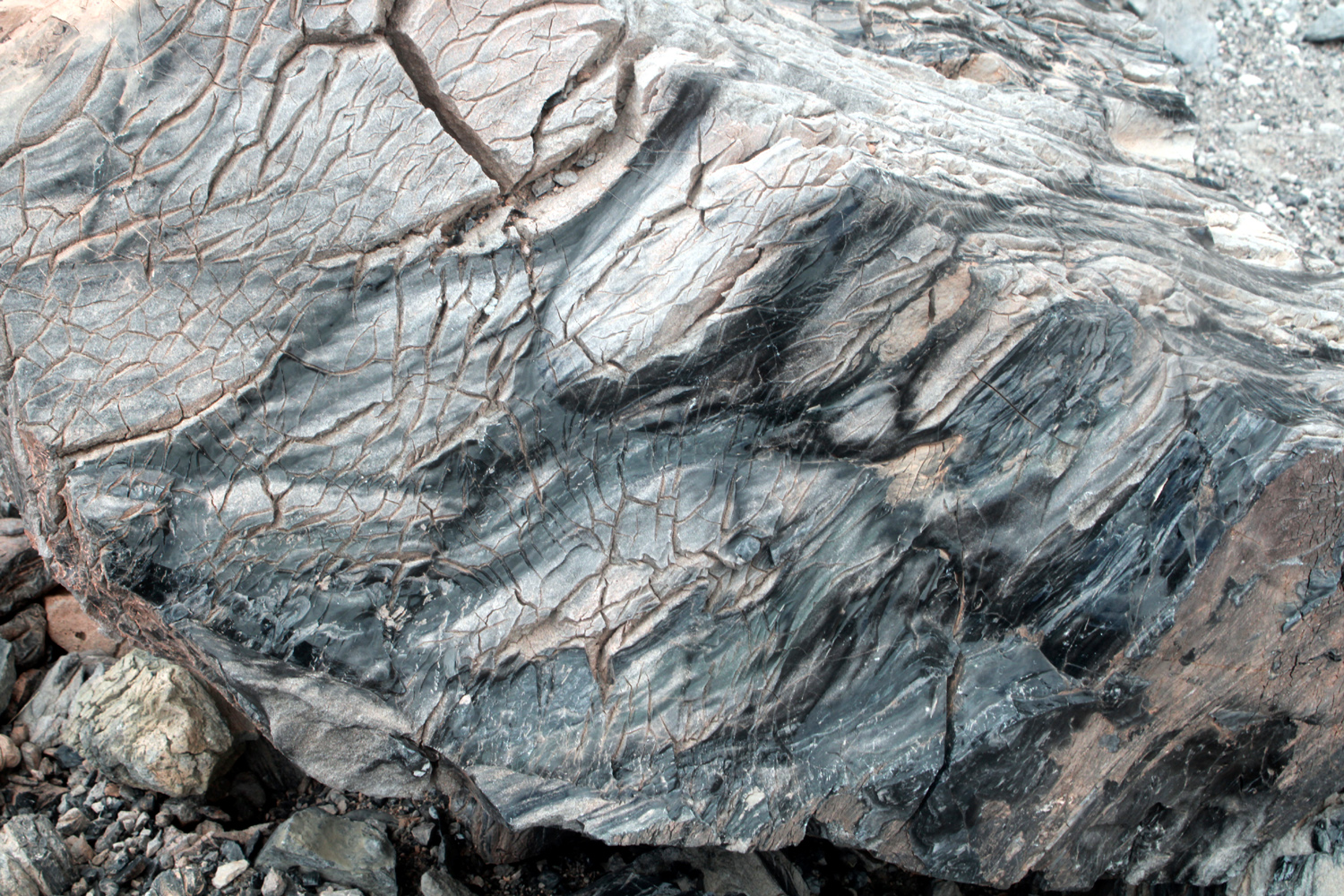
We reached a point where Jackie decided to stop and rest, and Colton stayed with her, spending part of the time building steps so she could get back to the trail from a sitting rock she had hiked to just off the trail. Teri, Jack and I continued up the hill, but I stopped at a place that had several more nice sitting rocks. At trail's end Jack wanted to go down into the crater, where Teri got a good "Where's Waldo" type photo. At various places on the trail were rocks that showed evidence of the enormous forces that had created this otherworldly environment, as well as views of the Sierra, with many patches of snow still in evidence. |
|
|
|
| Where's Jack? In the very center, at the top of the triangle of dark rock | Did these cracks form at the time of eruption? Or over the years since? |
| More Panum Photos | |
|
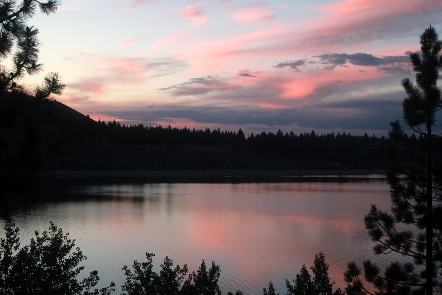
Jack emerged from the crater, and we went down to where Colton and Jackie were waiting. We found them talking with a couple who were on a hike guided by a retired geologist. Colton had impressed him with a question about the boulders that combined pumice and obsidian, and he had pointed out to them the glacial moraine that curved gracefully out from the mountains across the valley from us. Soon after we returned to the motel, Mikie arrived and was practically tackled in an enthusiastic greeting by Jack and Colton. The motel has an indoor swimming pool and some of our group went there, while others napped or read. You can guess which group I was in. That evening we went to the Tiger Bar & Grill for dinner. Dating from 1932, the place has been under current ownership since 1978, and offers burgers, sandwiches, Mexican specialties and a nice dinner menu. Everyone was happy with their choices, and despite being full, went for ice cream. There used to be a nice ice cream shop in town, but it is gone, and the only choice was a soft-serve truck. You could get your ice cream in various configurations, with cookies, candies and other additives. Once I had eaten the cookie chunks I was left with a half cup of flavorless goo that was cold and sweet, but far from ice cream. My recommendation is to get ice cream bars at the grocery store, which we did another night. Back at the motel it was video game time for the boys, reading and conversation for the adults, and a couple of very nice sunset photos across the lake. |
|
|
|
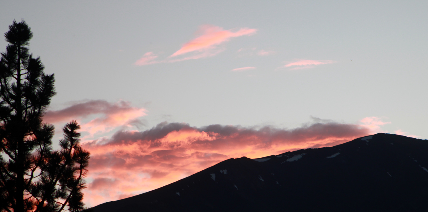
| Moraine, a ridge of debris left by a glacier | Sunset at June Lake |
|
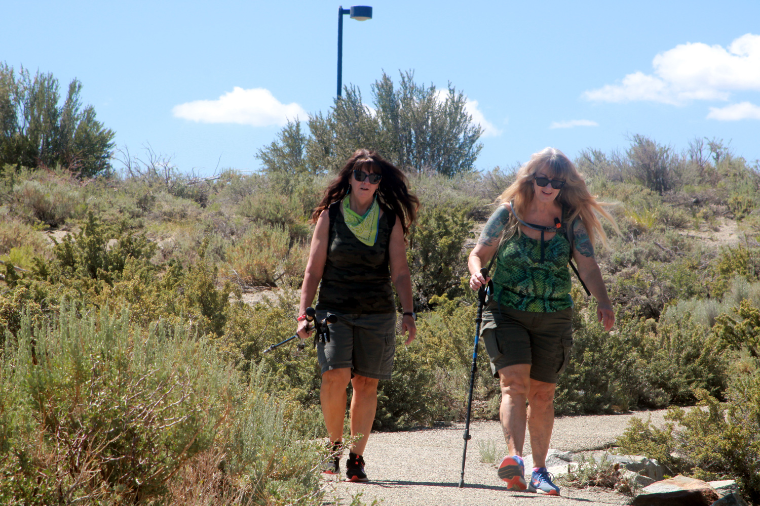
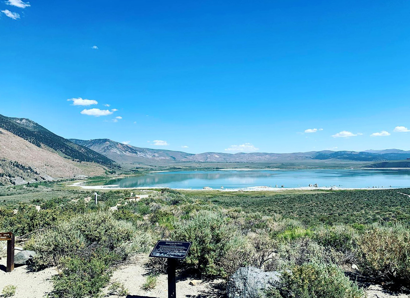
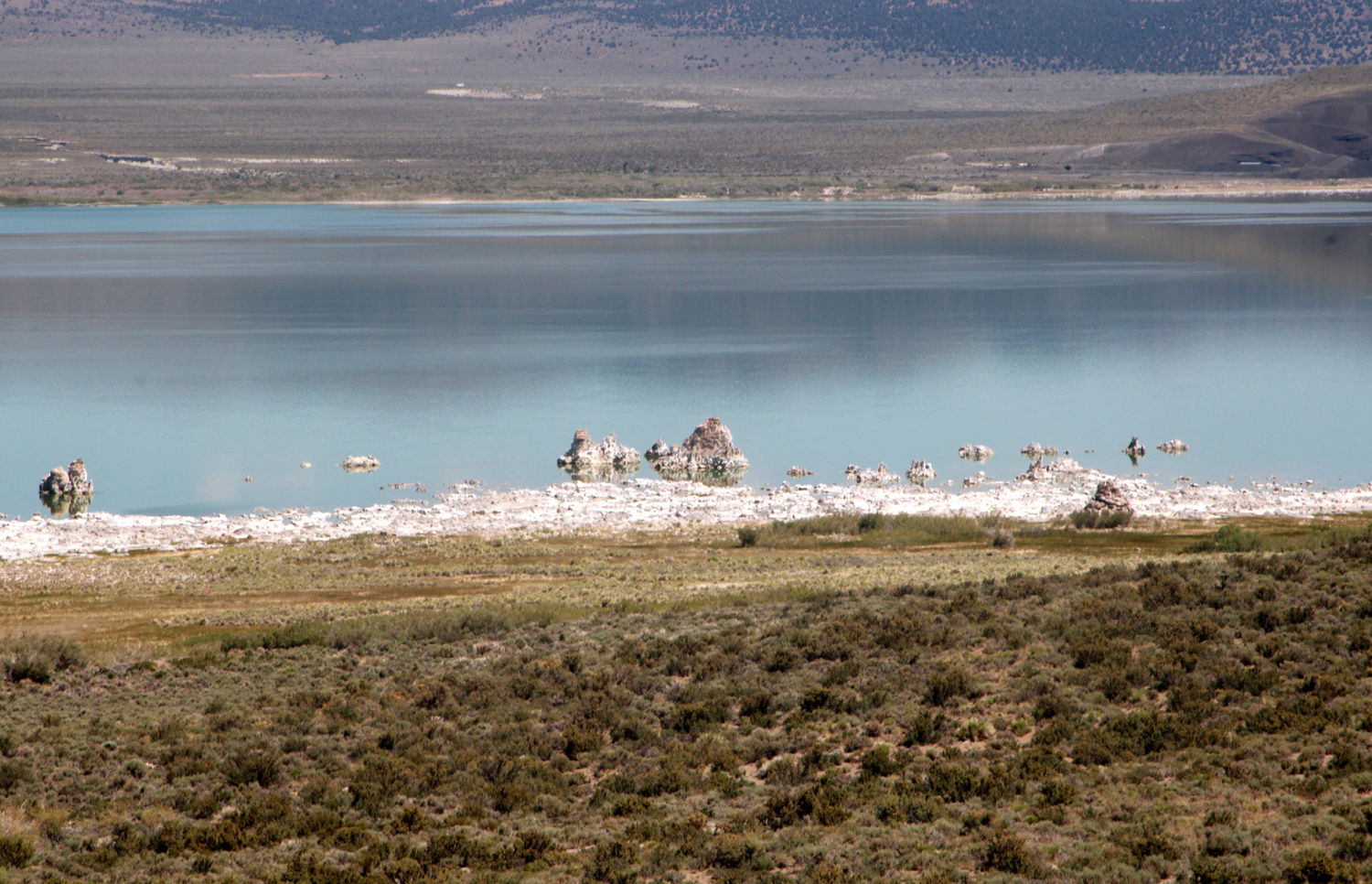
Jennifer arrived Friday morning, and after presentation of Father's Day gifts to me and birthday gifts to Teri, we split into two groups. Mikie has recently taken up golf, and had located a driving range at the nearby town of Mammoth Lakes. Colton and Jack wanted to go with him, so he fulfilled his duties as Number One Uncle by taking responsibility for two lively young boys for the first time with no other adults as back-up. They all had a great time, with Colton hitting a ball 50 yards, using Mikie's much too long clubs. Teri, Jackie, Jennifer and I drove to the visitor center at Mono Lake in Lee Vining, and hiked a short distance on a trail that went down toward the lake through the high desert brush and rocks. Teri and I had hiked here in the past and knew it was much farther to the lake than it appeared. We turned back when the trail turned to steps, a bit challenging for Jackie and me, but enjoyed the flowers, the view of the tufa towers at lake's edge, and the company. Formed under water when the lake was much deeper, these features were exposed as the City of Los Angeles sucked much of the area's water south for 30 or 40 years. After a long battle, a settlement agreement placed limits on the water that could be diverted from the small streams feeding into the lake, which has no outlet other than evaporation. The best towers are on the south shore, but we made do with the smaller formations on the north, with only a long-distance view. |
|
|
|
| Jennifer enters the rock lifting contest | Jennifer and Teri on the Mono Lake Trail |
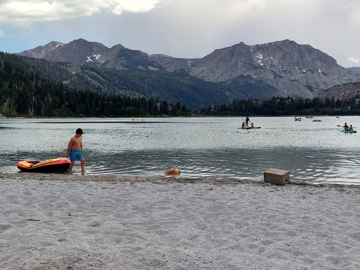
|
Back at the motel, we said our goodbyes to Jackie. She had not felt well throughout the entire trip and decided to leave early. She had not been able to get a pass for her departure date, but Yosemite passes are good for three days, so leaving on the third day eliminated any worries. Everyone else but me went to a beach on June Lake for swimming (in 57 degree water!) Not long after the swimmers returned, Johnny and Brittany arrived, and after proper greetings, Johnny got to work fixing tri-tip, hamburgers and hotdogs for dinner. In case there was not enough food, the motel has a popcorn machine in the lobby, and free bags were available each day, something the Upshaw boys took full advantage of. |
|
|
|
| Chef Johnny prepares dinner | Teach your children well - popcorn time |
|
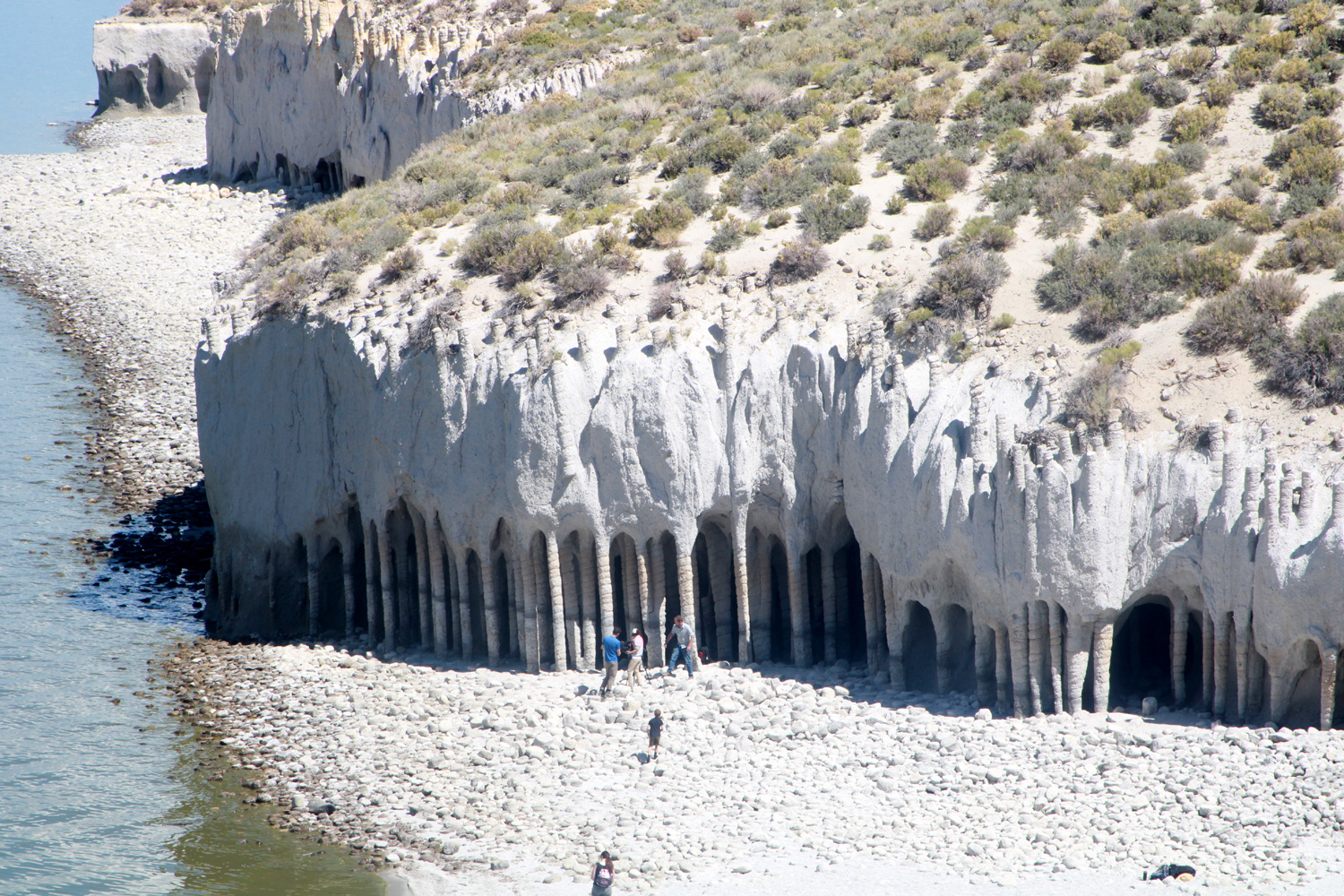
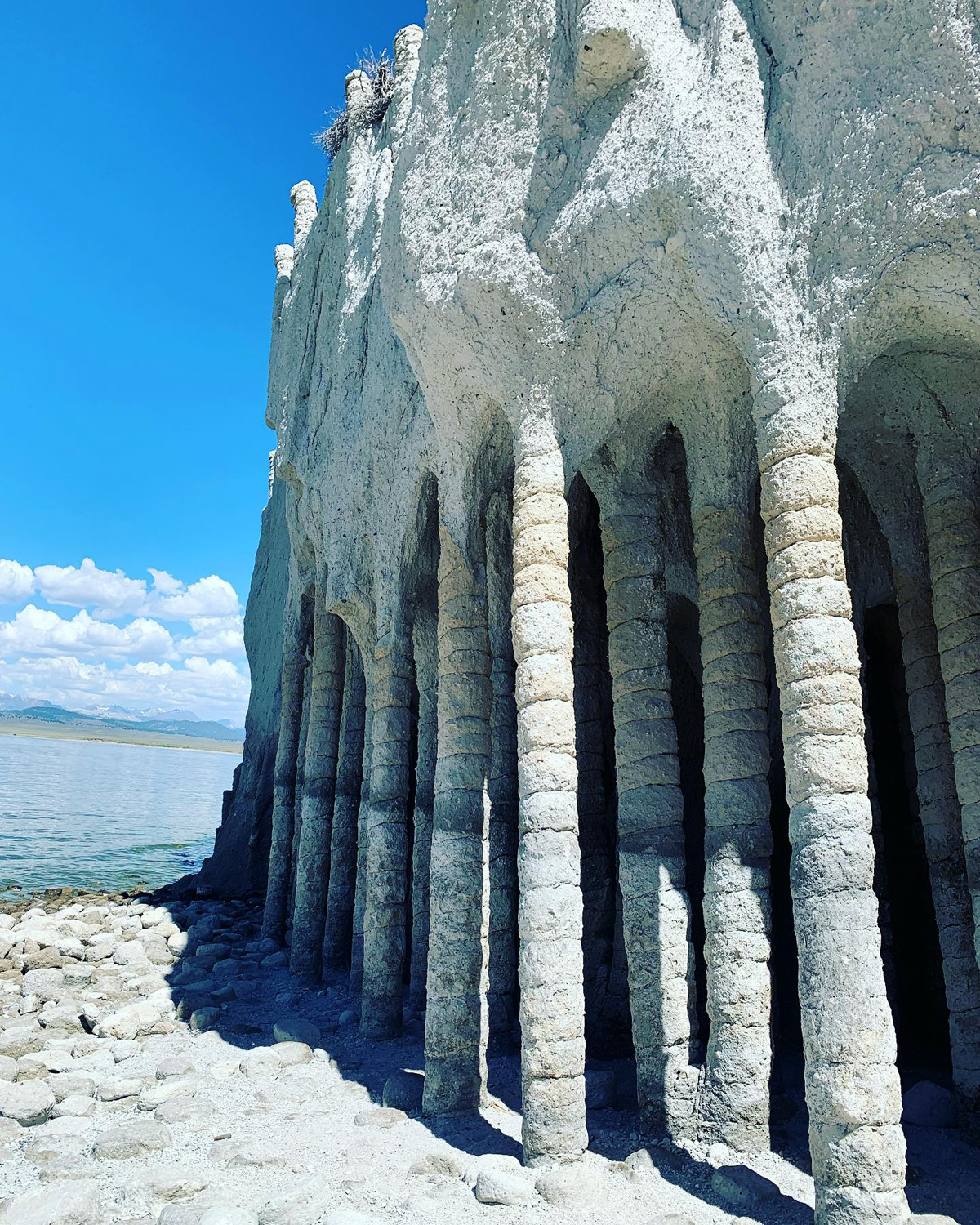
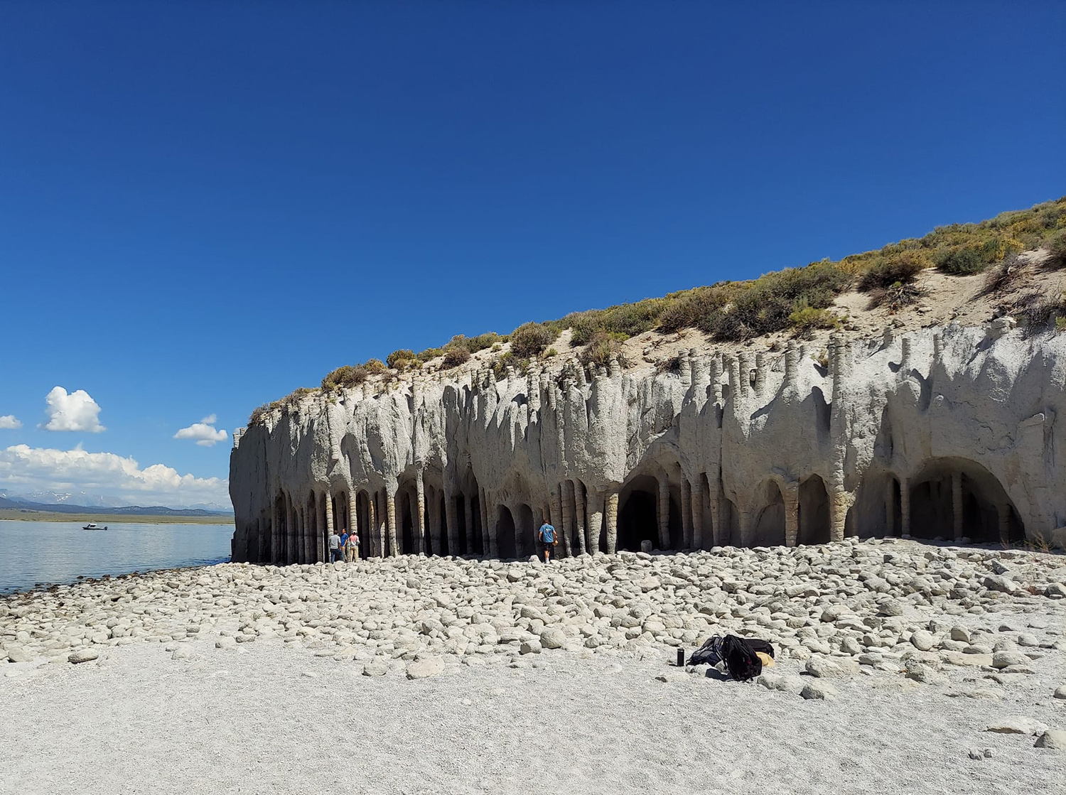
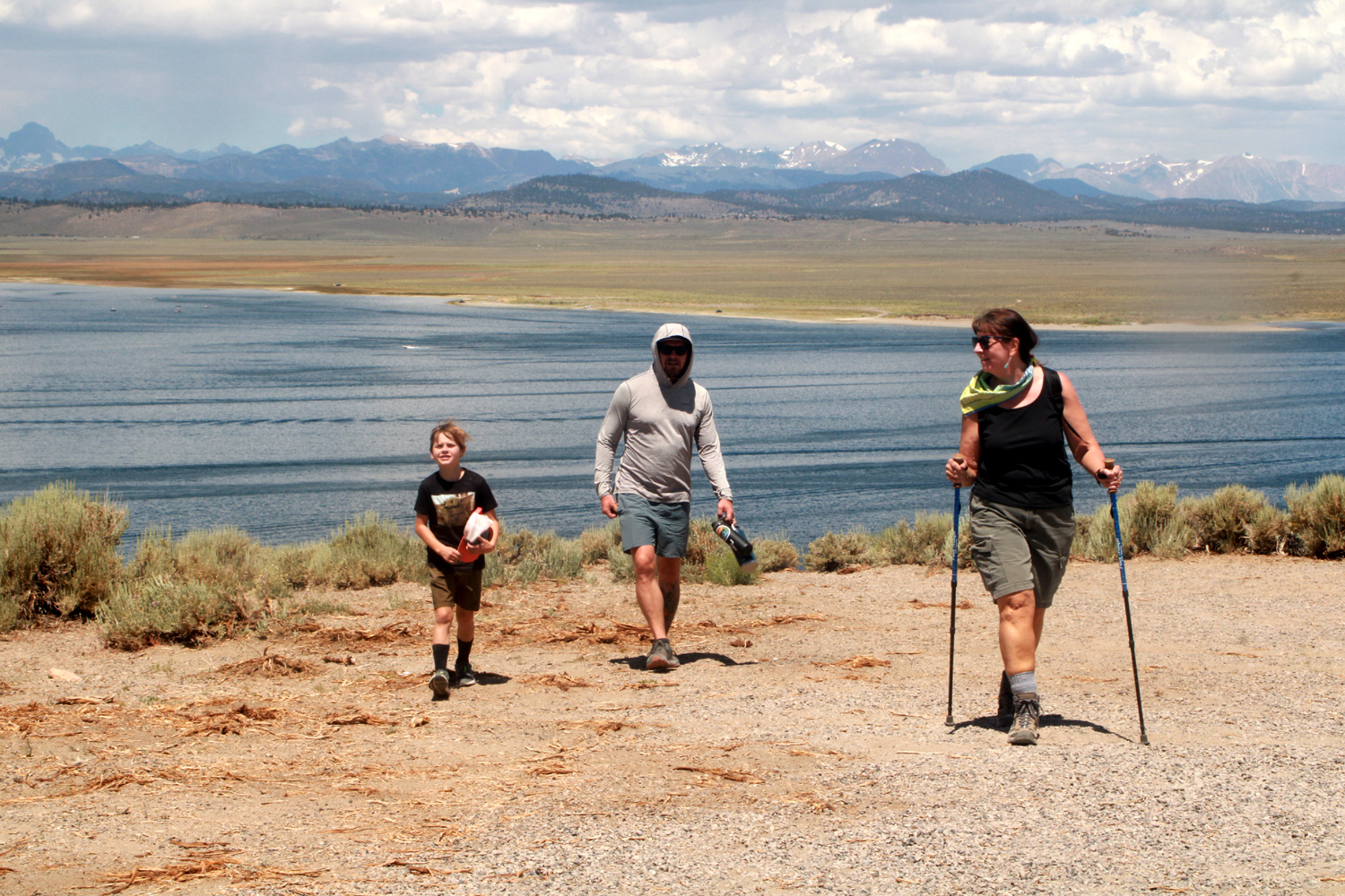
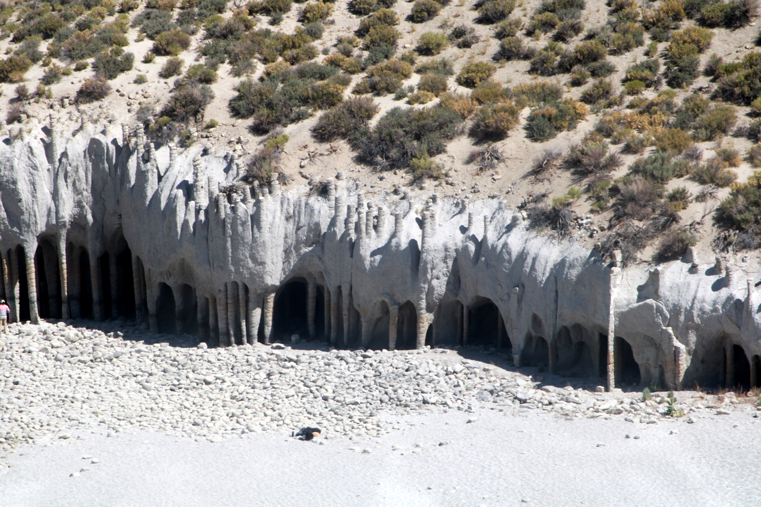
That evening we watched game 5 of the Stanley Cup final. With the Avalanche up three games to one, Mikie hoped to see his team clinch the cup on their home ice. Alas, it was not to be, as Tampa won 3-2, setting up game 6 back in Florida Sunday night. Saturday morning the four Upshaw's, Teri, Jennifer, Mikie and I set off to see a place we had not known exited until very recently. Johnny's friend Dustin had visited the Lake Crowley Columns and Johnny was intrigued. The rest of us did not know of this feature until we drove down Highway 395 about 30 miles, then turned east on a narrow paved road. Then came a very sharp turn on to a dirt road, and we were above the lake on its eastern side. We had Upshaw's 4-wheel drive Toyota and my ancient Ford F-150, which barely has two-wheel drive. We reached a point where the road became very rough and went up steeply. We watched another driver attempts the hill, then give up and leave his vehicle to walk to the trailhead. We squeezed all eight of us into the Toyota and rode the final mile. From where we parked, the route down was fairly steep, and the "trail" was more a matter of finding a way between the sage brush. When it got even steeper, I found a place to sit while the others went on down. I was able to get some fairly good photos from this vantage point, and also had views of the Ritter Range and Minarets on the Sierra crest to the west. A number of people had arrived at the columns via kayak, and there is also a way to drive in from the other side - strictly 4-wheel drive. Websites warn that the water is up into the towers in spring and summer, and the best time to go is fall. With California's current drought, this was no longer an issue, and there was 30 feet of beach between the lake and columns. I have been to many places in California and the USA, and have never seen anything remotely like these columns, nor have I found anything similar in my extensive exploration of the World Wide Web. This website explains the geology better than I can. While we were waiting for the others by the car, Teri and I talked with some people who had been filming at the columns. They were shooting for a program called Bartell's Backroads, which is seen on TV stations in Sacramento, San Diego and elsewhere, but not Fresno. They have done programs in each of California's 58 counties. Their videos are available on YouTube. |
|
|
|
| Lake Crowley Columns from about half way up the trail | Jack inside the columns |
|

|
| View from up close | The Ritter Range - Minarets in the center |
|
|
| The columns, the beach, and a bit of Lake Crowley | Jack, Johnny and Jennifer coming back up from the columns |
| More Crowley Photos | |
|
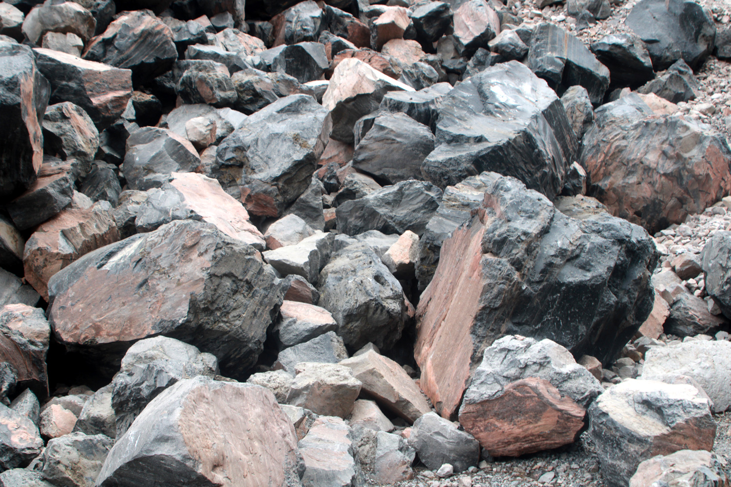
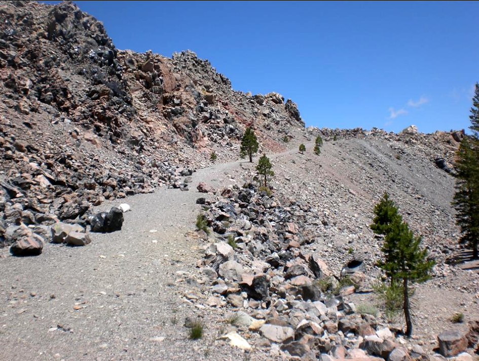
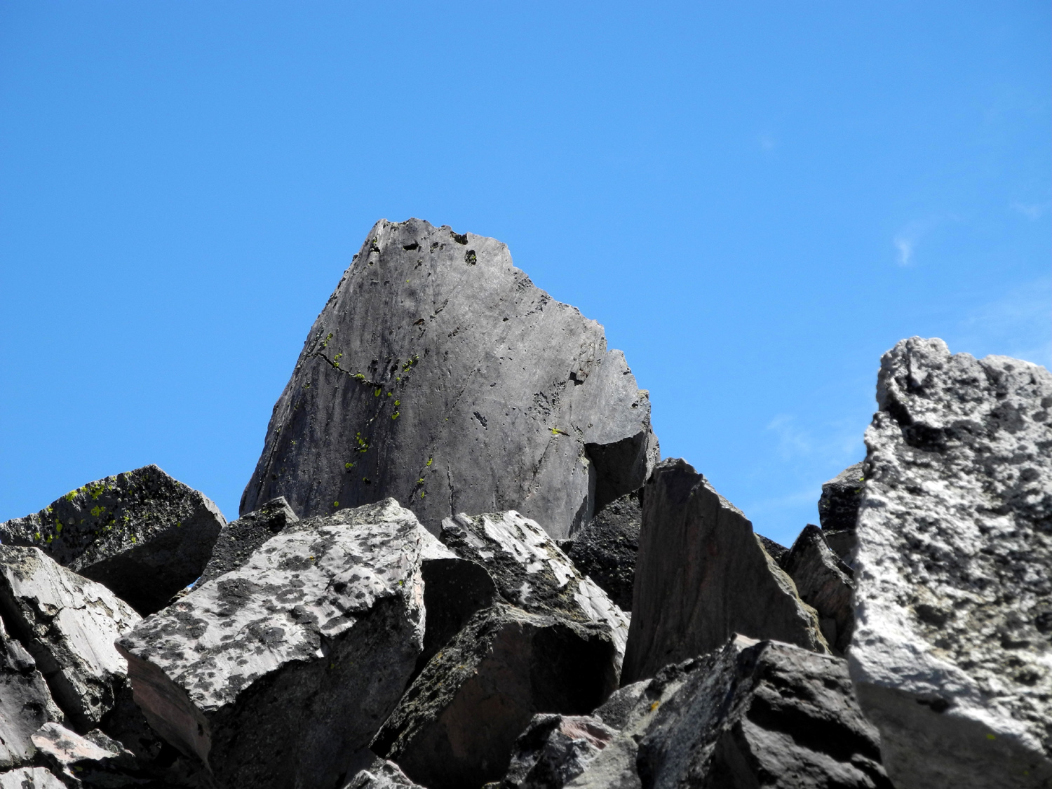
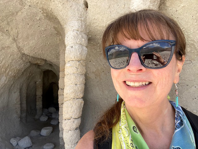
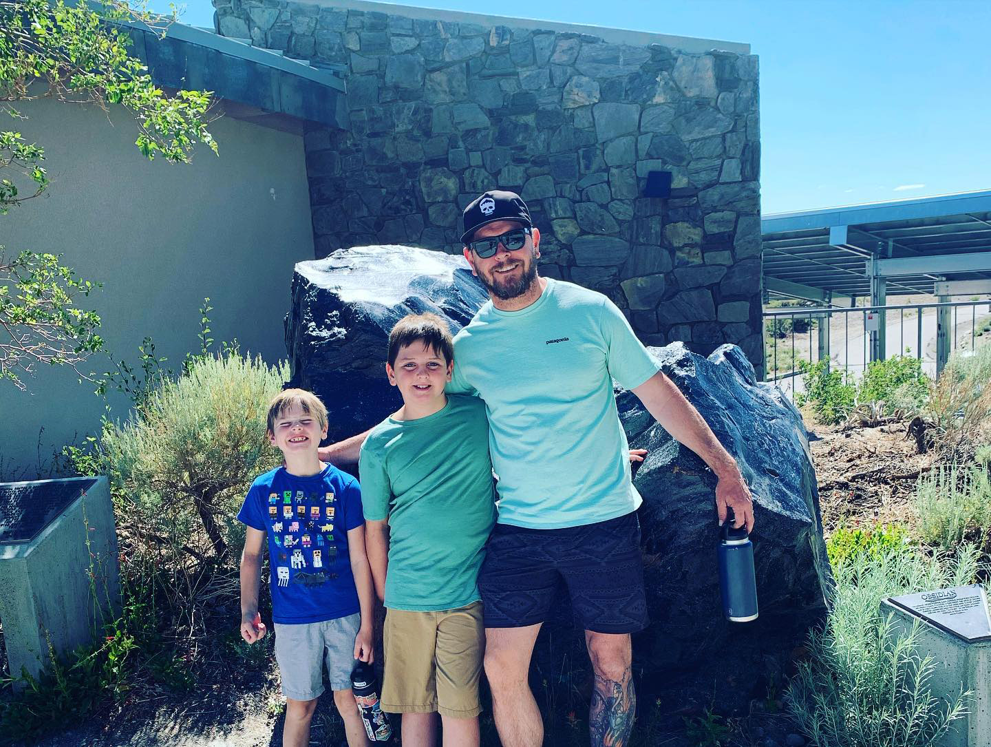
After we left this amazing location, our next stop was Obsidian Dome, a little more than a mile west of US 395, and a short distance south of the June Lake junction. It's a rocky mountain formed of volcanic glass, and is very young. About 600 years ago hot magma came in contact with underground water, creating steam and a big blast that formed huge boulders combining obsidian and pumice. It's less a dome than a huge pile of boulders, with obsidian predominant. Although the web site implies that you can't get very far up the mountain, there is in fact an old road, dating from pumice mining in the past, where you can walk nearly to the top. Just keep going around to the east side of the mountain and you will probably see cars parked there. Walk the short distance to the base and as far up as you want. Because of the time we had spent on our earlier adventure, we did not hike up the road, but instead took our group photo on the boulders at the base. We had barely turned off the engines of our vehicles before the Upshaw's were scrambling up the rocks. Johnny went to the top of a pinnacle a hundred feet or so, with Jack not far behind. Brittany and Colton were more cautions, and the rest of us contented ourselves with observing and photographing. |
|
|
|
| Multi-colored boulders at the base of Obsidian Dome | Jack and Johnny scrambled up the rock pile |
|
|
| Jack on a big obsidian boulder | Brittany, Jack and Colton in the rocks |
| More Obsidian Dome Photos | |
|
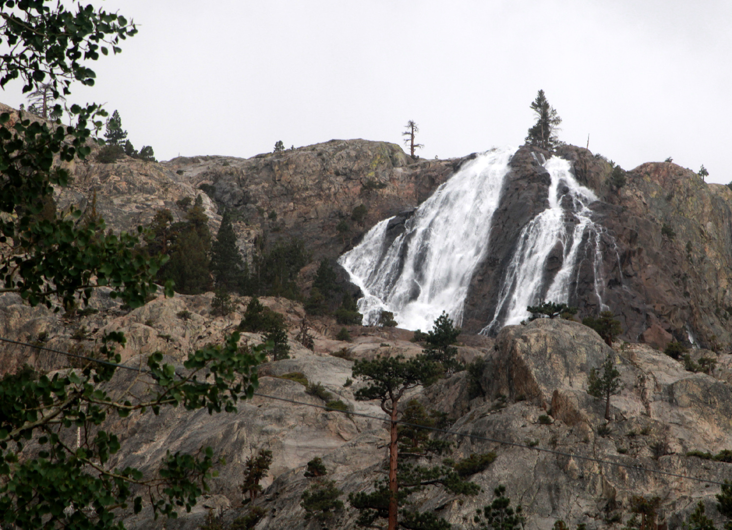
Despite having enjoyed a goodly number of adventures, we got back to June Lake early in the afternoon. Time stamps on the photos indicate we left Obsidian Dome not long after 1 p.m. Back at the motel, Jennifer packed up and started for home. While the Upshaw's and Mikie went to the golf driving range, Teri and I drove the entire June Lake Loop. We took State 158 out to 395 then north about five miles to the other end of the loop, and west into the mountains. The road goes by several lakes and through a narrow valley with mountains on both sides, as well as a nice waterfall. We also encountered a short rainfall. When we got back to the town of June Lake, we bought ice cream for everyone at the grocery store and stashed it in the freezer (our main room had a kitchenette with full size refrigerator). When everyone got back we went to a pizza place and enjoyed our Saturday night dinner. Later while Teri and the boys were swimming, Johnny, Mikie and I went to a pub just off the main street and sampled some of the large beer selection. |
|
|

|
|
This waterfall, name unknown, appears south of the
June Lake Loop (In 2023 we learned that it is Horsetail Falls) |
Jack, Mikie, Colton and Johnny at the driving range |
|
|
| Did Arnold Palmer get his start like this? | The gang at the pizza parlor Saturday night |
|
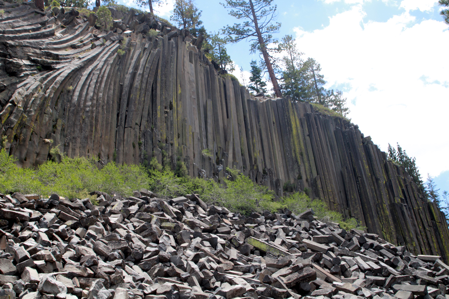
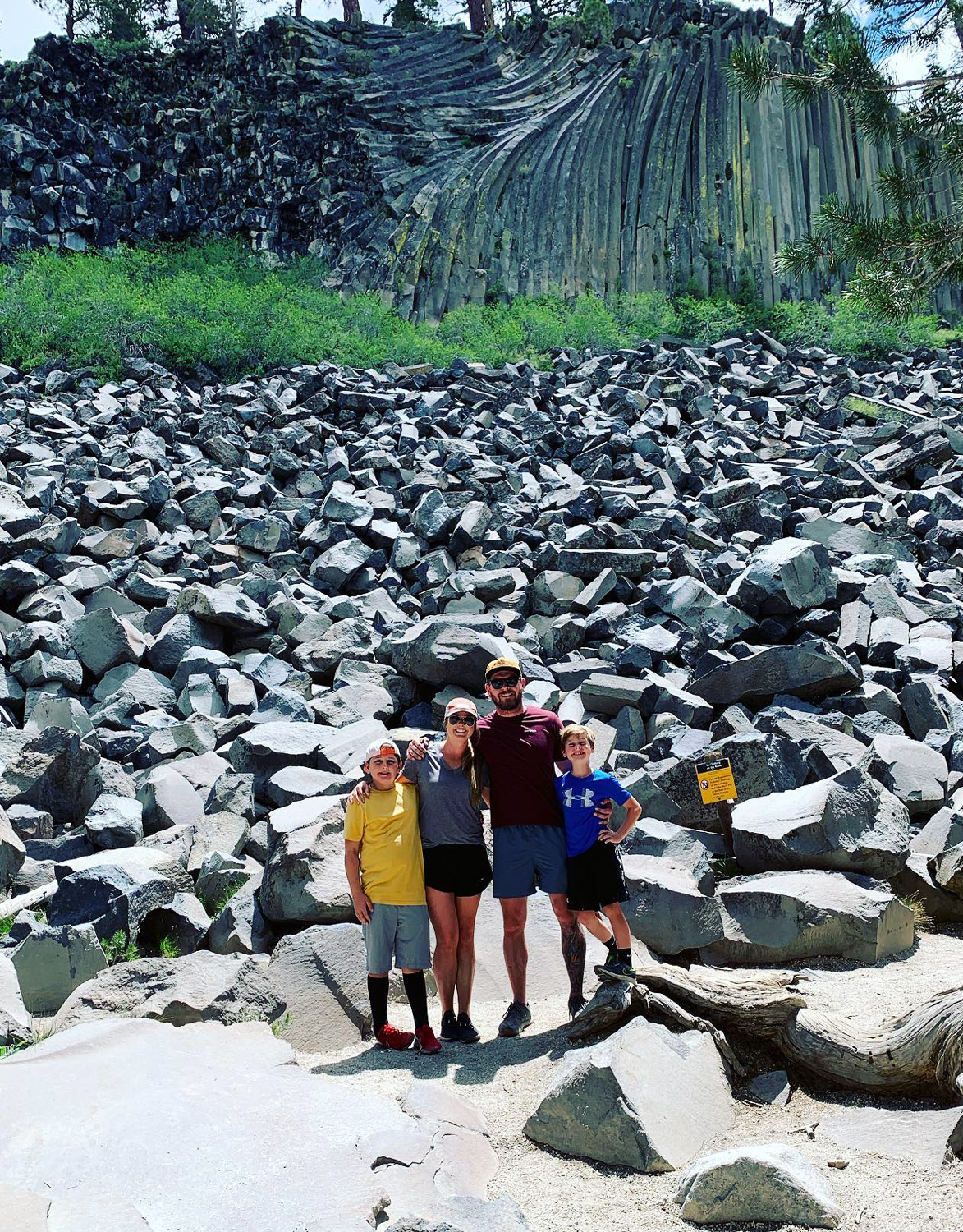
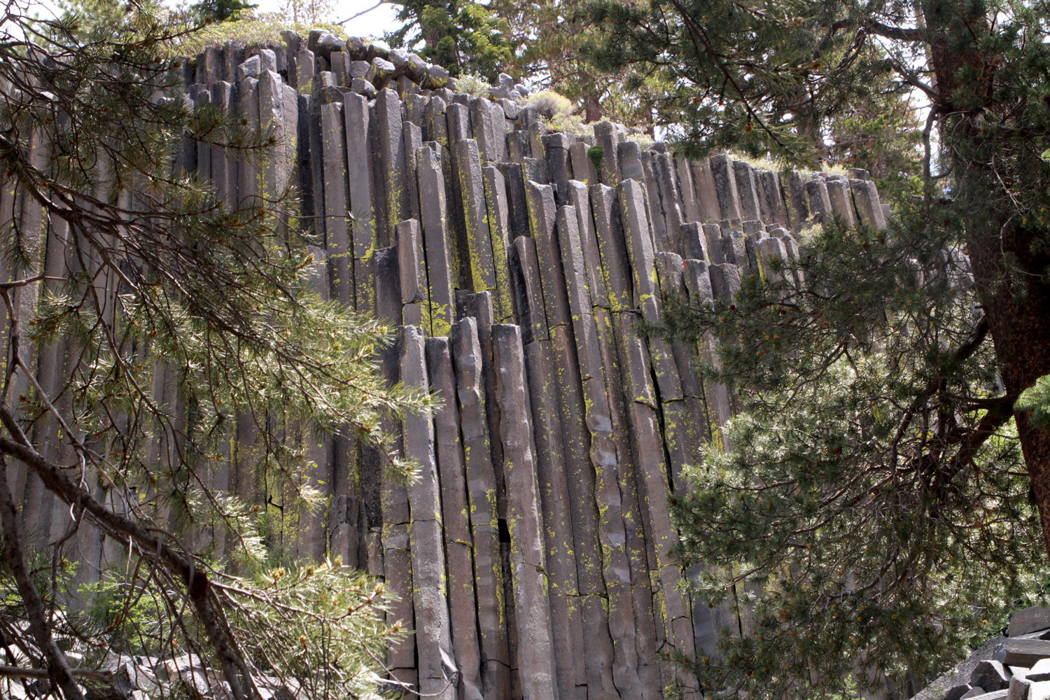
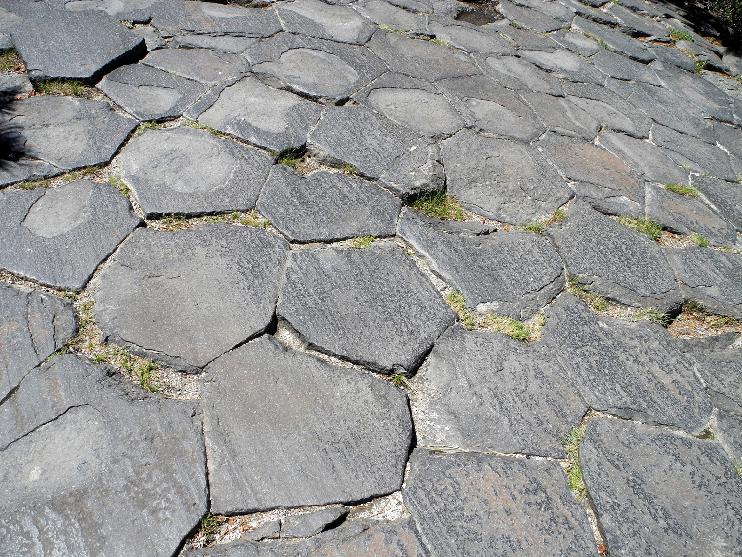
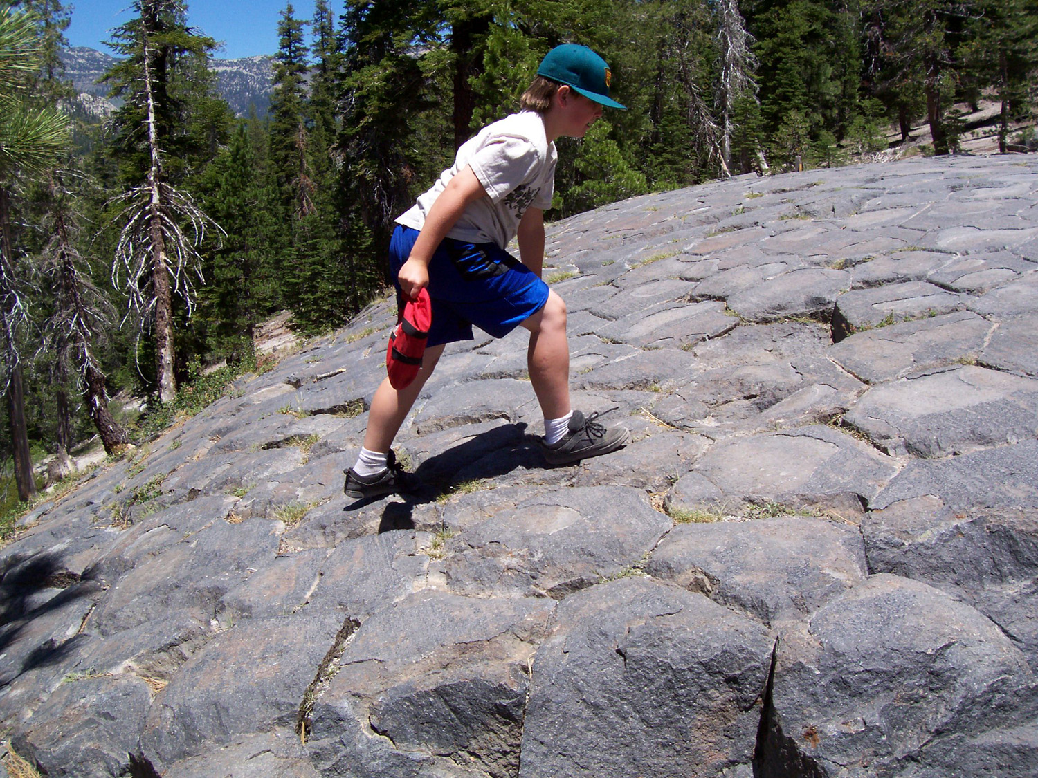
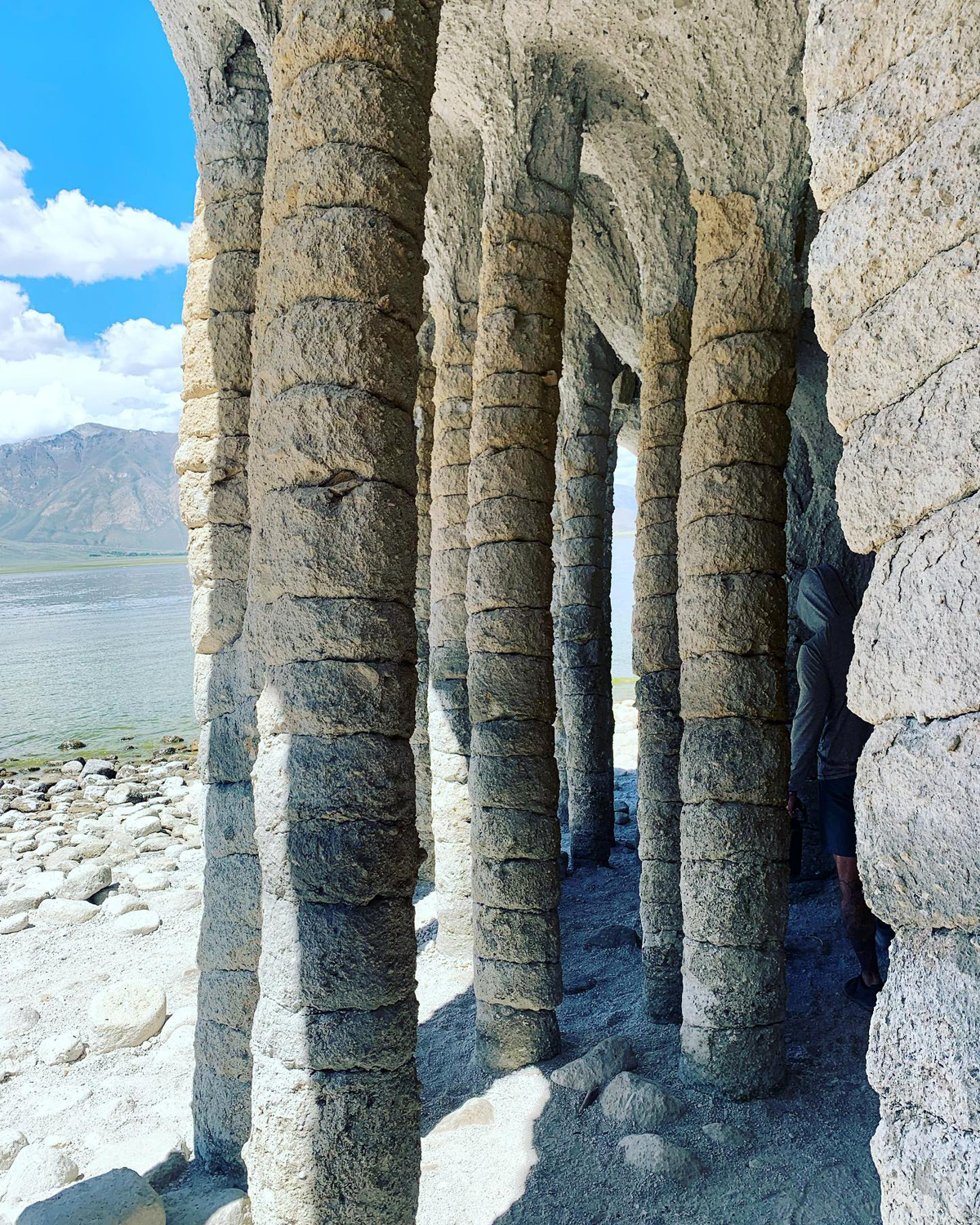
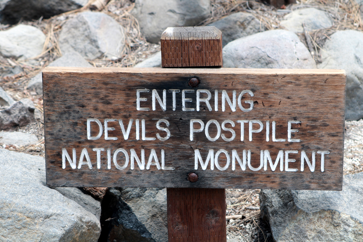
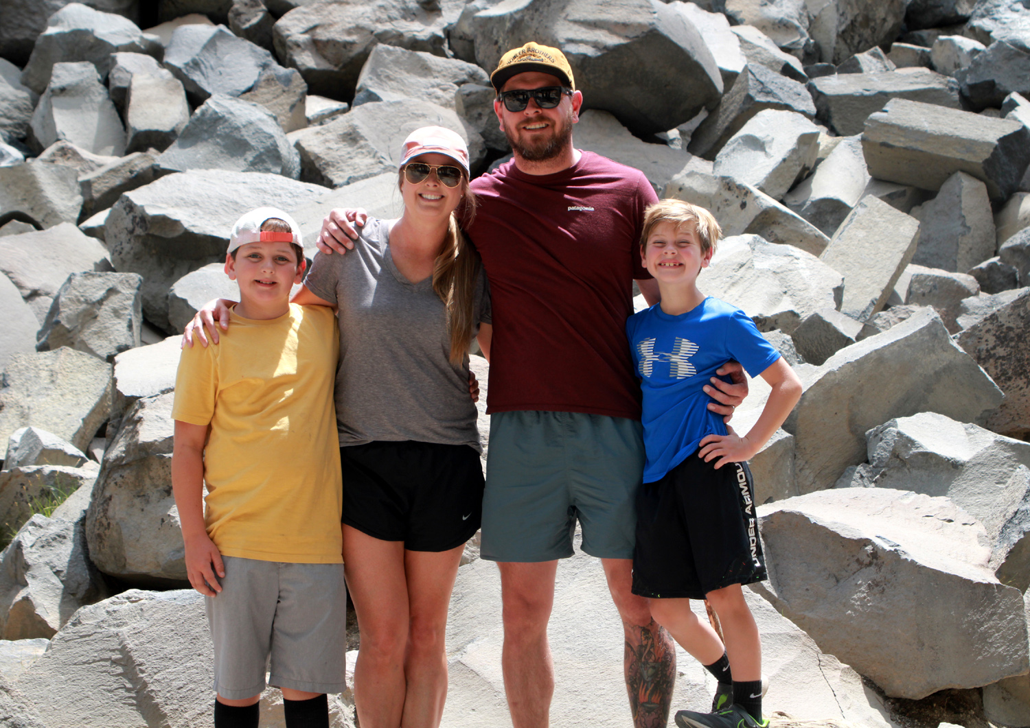
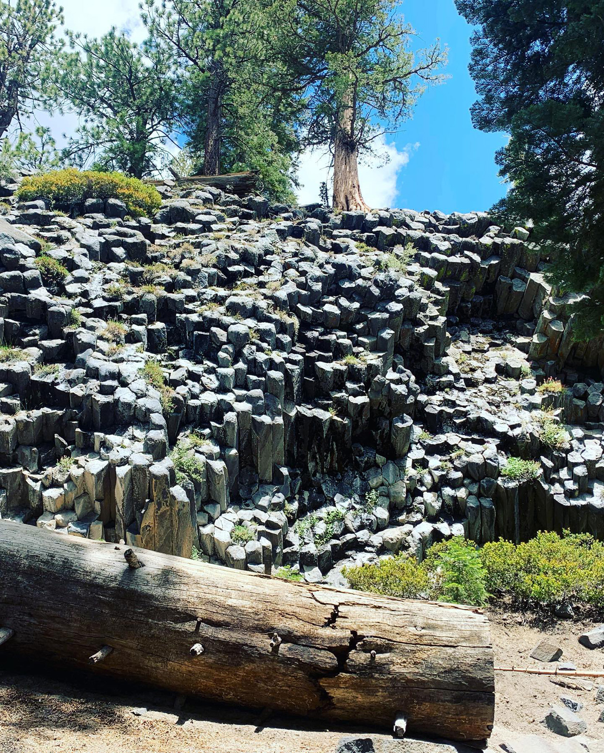
Sunday the 26th was our last full day of this adventure. Mikie left for home early in the day, and the rest of us (4 Upshaw's, Teri and Dick) went to the Mammoth Lakes Village area, where our first activity was a trip to the Devil's Postpile National Monument. It takes about a half hour to drive the 15 miles to the main parking area. If you want to drive, you must go in very early, or have a handicap placard. Most people choose to ride the shuttle bus, which offers service every half hour. I have always been glad to let someone else do the driving on this narrow, winding road. The shuttle makes a number of stops, but like most passengers, we got off at the trailhead for the Postpile. From there it is a half mille walk to this remarkable landmark. The feature began as a flow of molten lava down the valley until it was blocked by a natural dam. This 400 foot deep lava lake began to cool, and in some locations the rock cracked into hexagonal columns, giving us today's dramatic 60-foot high "posts." A much more complete explanation can be found here. The posts were originally much higher, but a recent glacier carried off a top layer and polished the top, giving us a good look at the hexagonal design. It was not until my third visit here in 2007 that I discovered that there is a short trail up to the top of the formation. This time the Upshaw's went up on top, while Teri and I stayed below, chatting with other visitors and enjoying the surroundings. |
|
|
|
| Iconic view of the Devil's Postpile | Upshaw family at the Postpile |
|
|
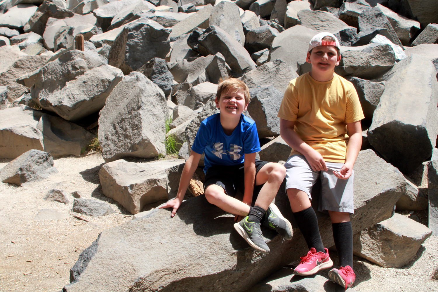
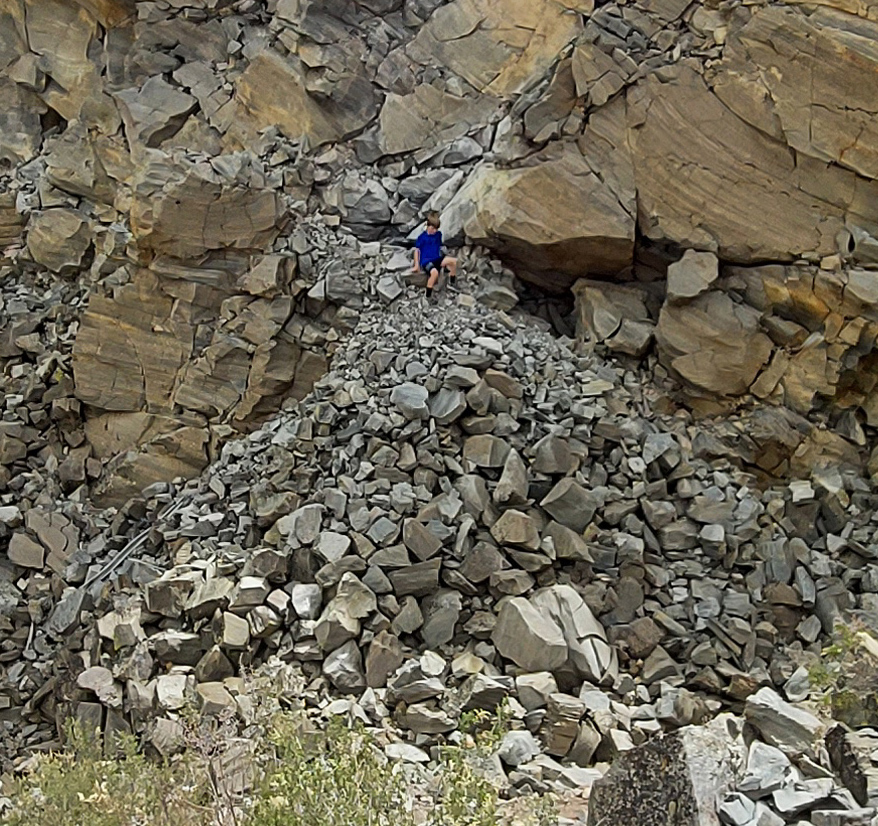
| A closer view of the "posts" | Jack and Colton among the thousands of broken pieces of basalt |
|
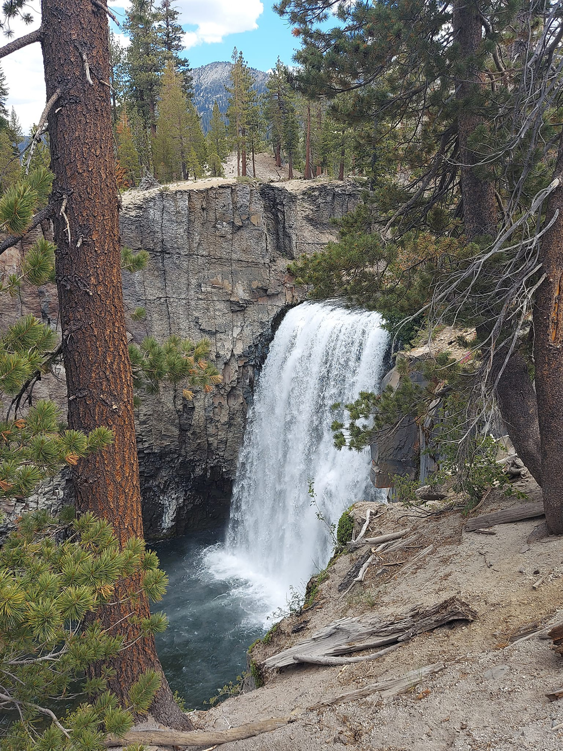
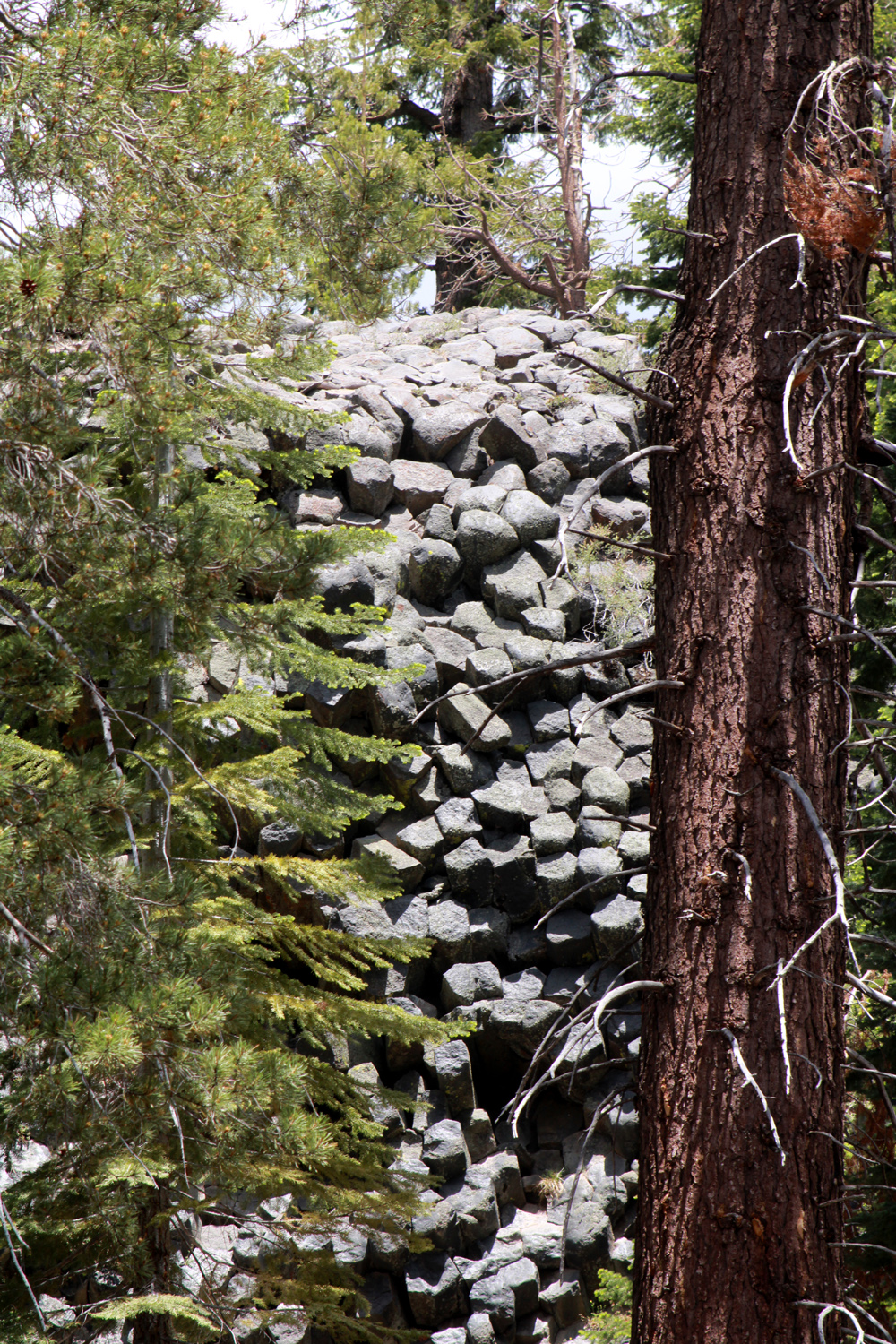
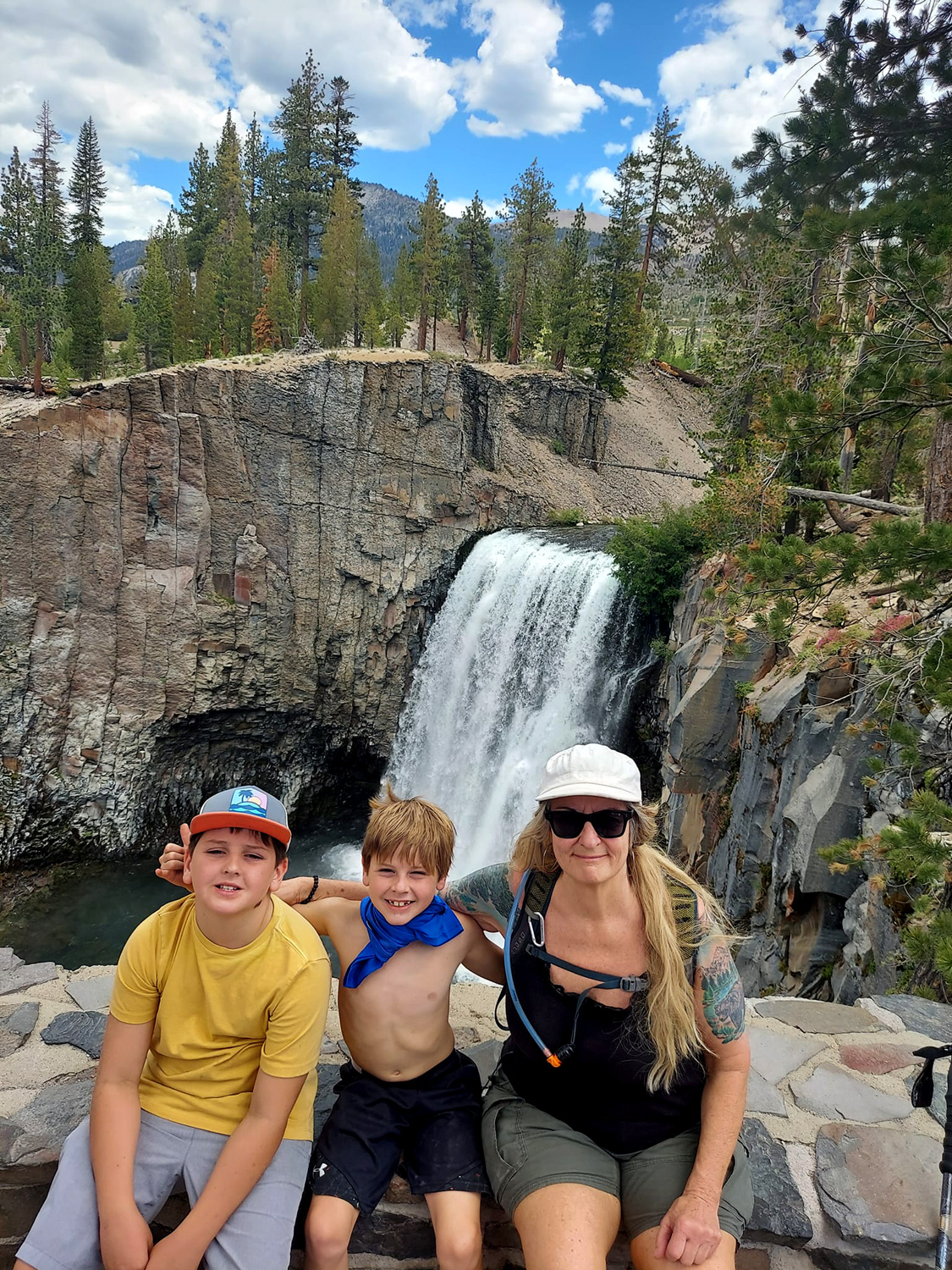
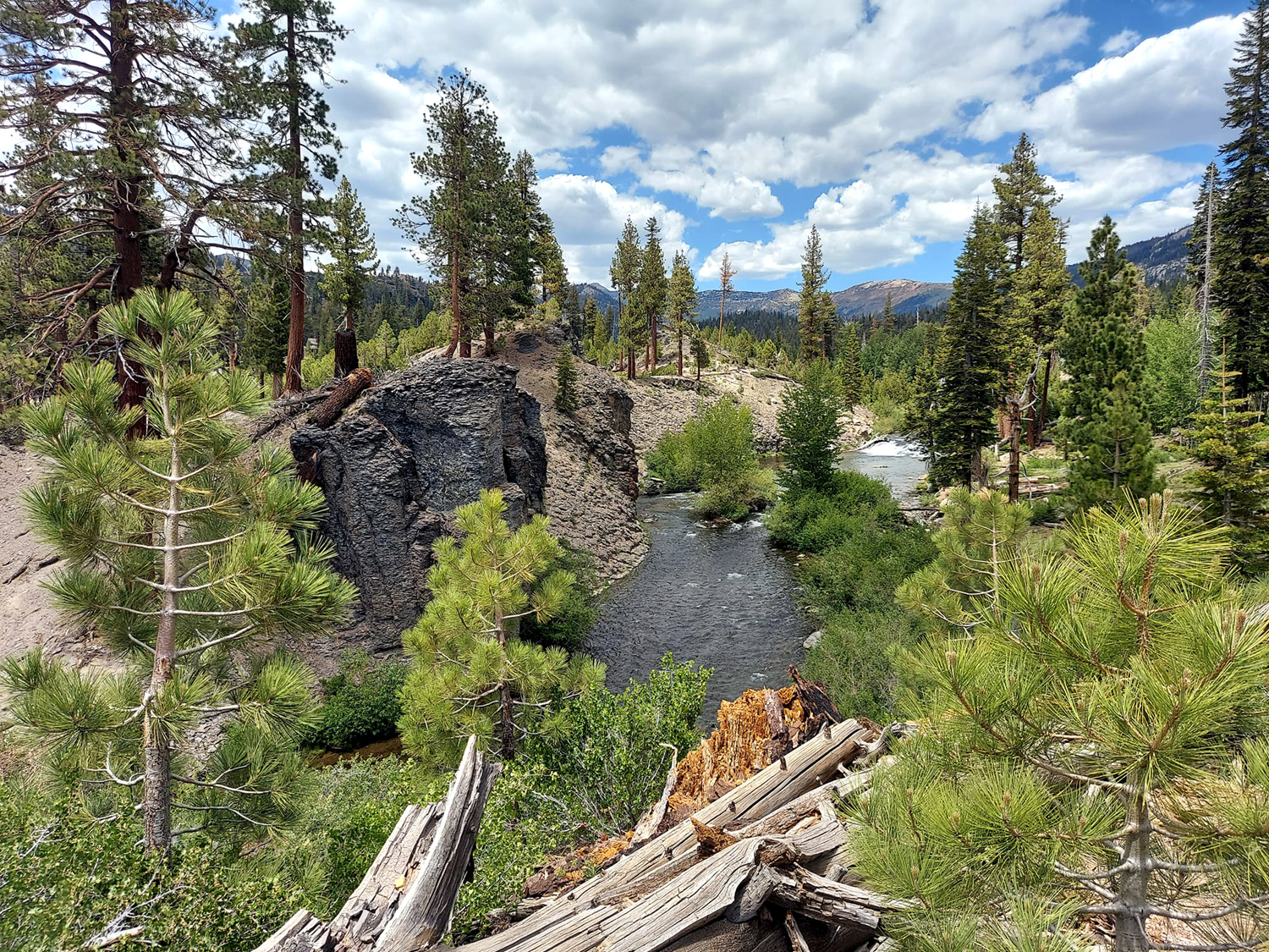
The Middle Fork of the San Joaquin River flows through the monument, and about two miles downstream from the Postpile, drops over 101-foot Rainbow Falls. Along the trail are views of basalt cliffs, part of the massive lava flow that forms so much of this region. I had been to the falls twice, and did not feel up to the additional mileage, so we agreed to meet at Shuttle Stop 9, where an alternate trail comes back from the falls to Red's Meadow, site of a campground and store. Teri and the Upshaw's set off, and I followed, going left at a fork and moving at my usual slow pace. At one point I passed up the chance to walk a short distance to Shuttle Stop 8, and continued walking on a trail that provided plenty of exercise, but had only a few truly steep spots. A short distance past the main feature, a couple of mini-postpiles can be seen from the trail. The first one seems to be piled horizontally rather than vertically, while the second has stacks of posts tilted first one way then the other. |
|
|

|
| Another variety of Postpile | These posts were stacked randomly |
|
I had neglected to bring any snacks, and in the hubbub of going our separate ways, did not think to get some of the nut mixture Teri had brought. By the time I got close to Stop 9, I was in need of an energy boost, so I trudged on up the trail to Stop 10 and the store. I bought an apple, water, and a candy bar which I ate as soon as I stepped out the door of the store. I then returned to Stop 9 via the paved road. As I started down the last section of this road, a coyote entered the road about 100 yards in front of me. He stopped and looked down the hill, but realized there were people at the trailhead below, and continued on another 30 yards for so before heading into the woods. I sat on a log at Stop 9 and ate my apple, then got a phone call from Johnny. The trail they were on had sent them directly to Stop 10. I waited a few minutes, then got on the shuttle and rode up to where they were waiting for me. They climbed aboard and we made the scenic drive back to Mammoth Village. |
|

|
|
| An eastern Sierra gem - Rainbow Falls | Teri with her grandsons at the falls |
| More Devil's Postpile Photos | |
|
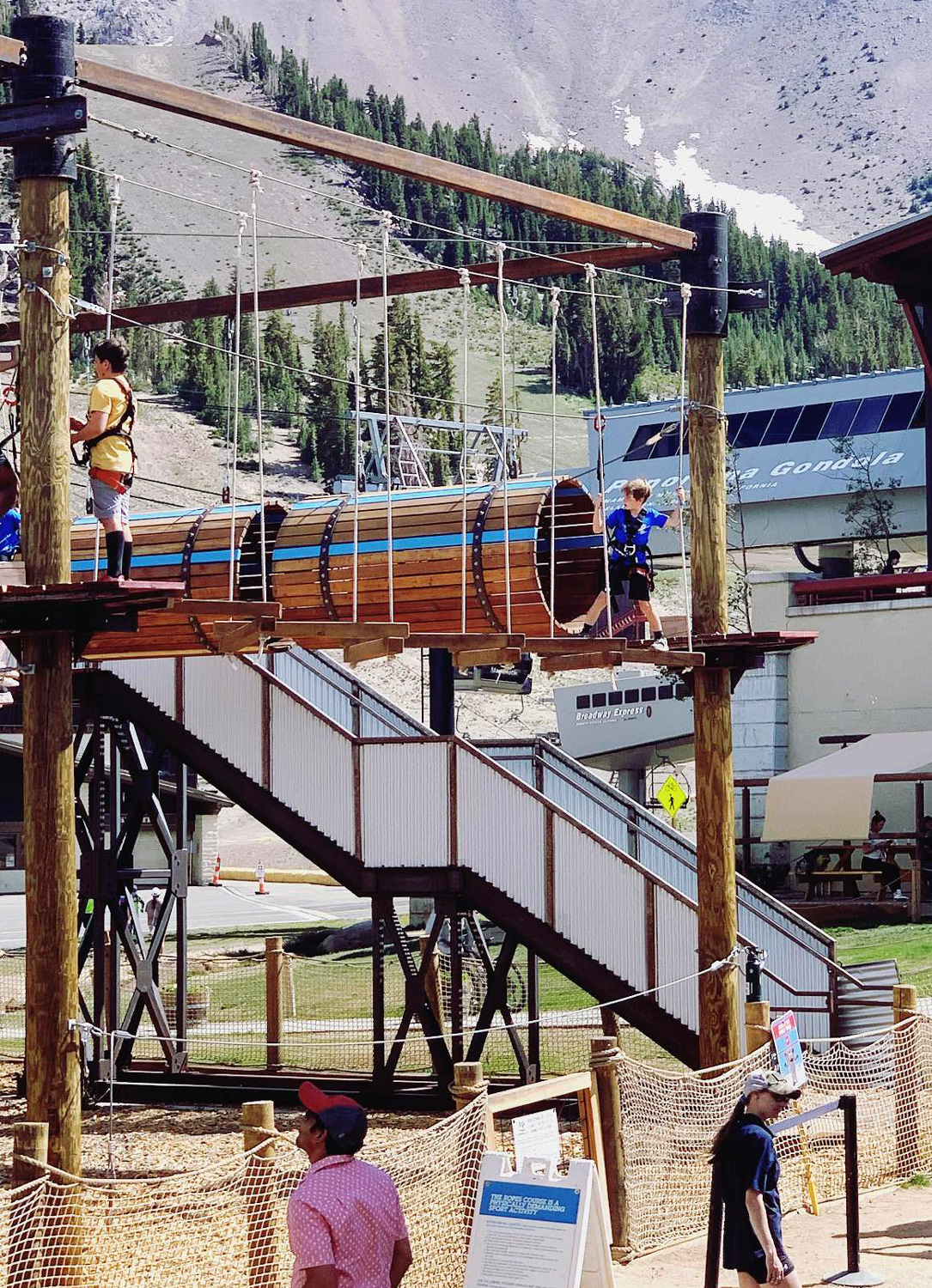
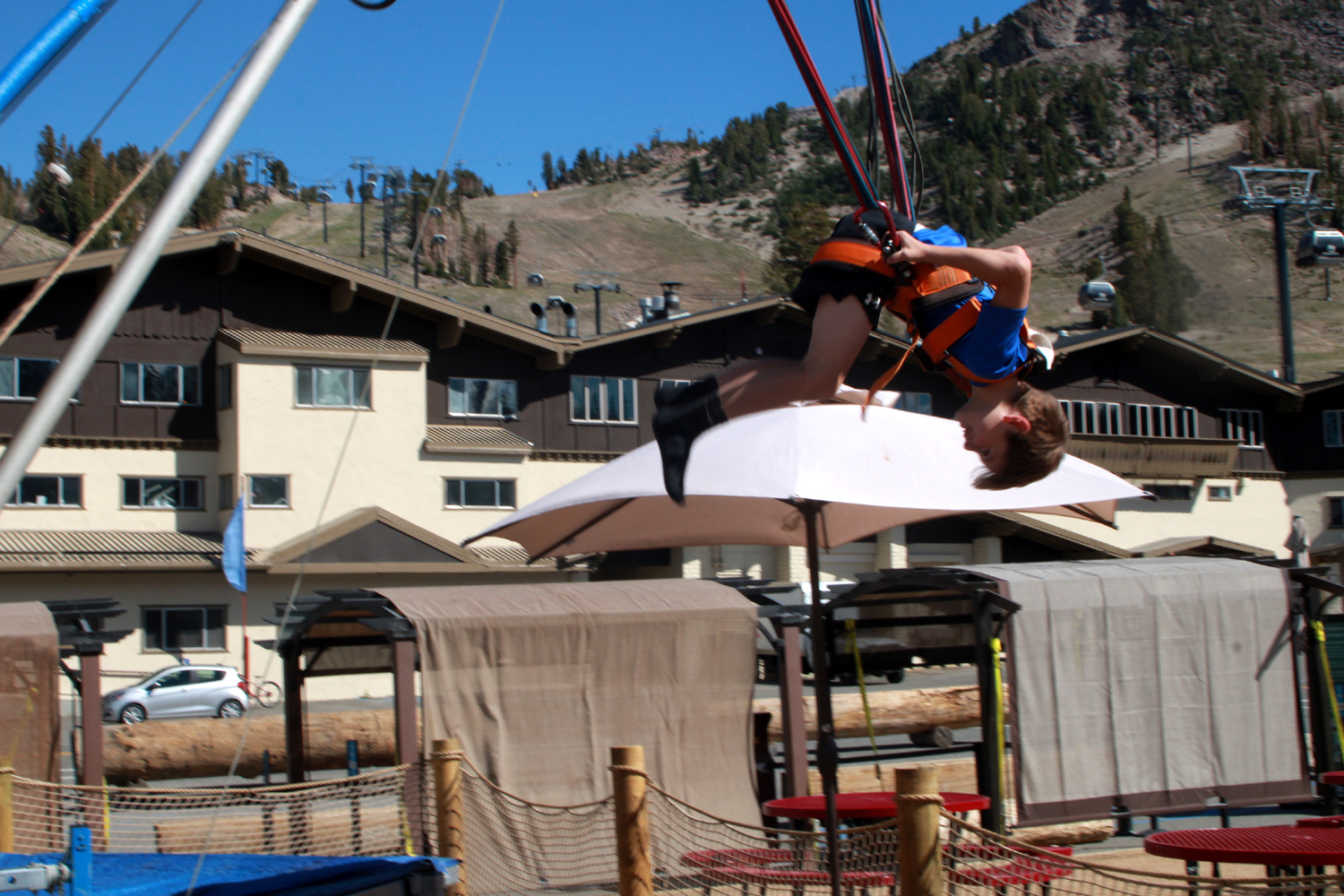
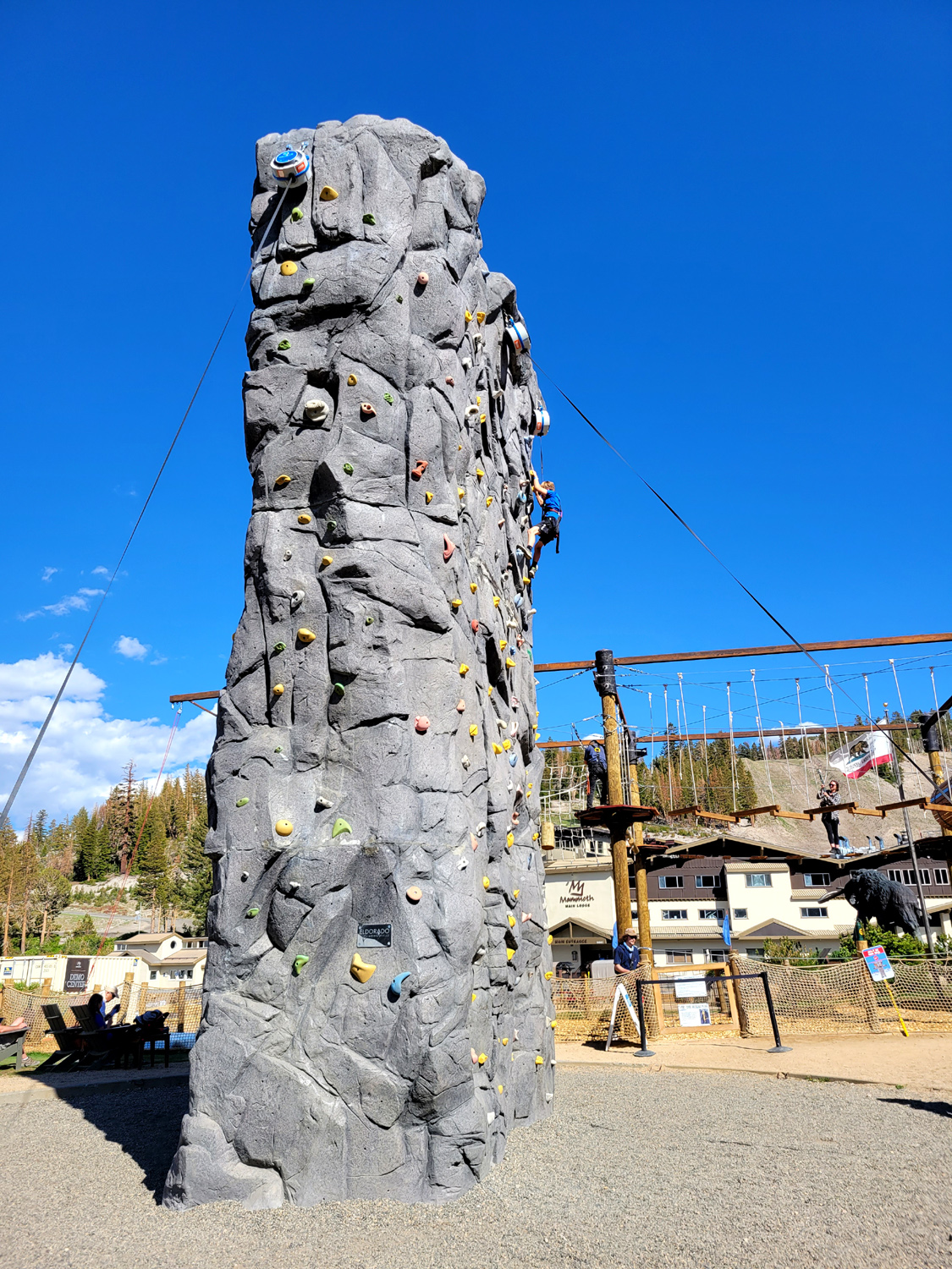
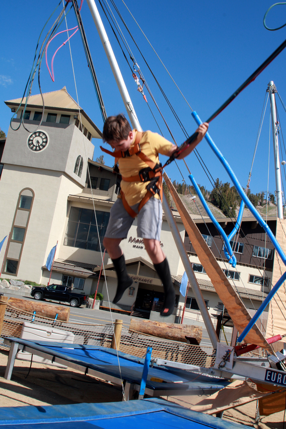
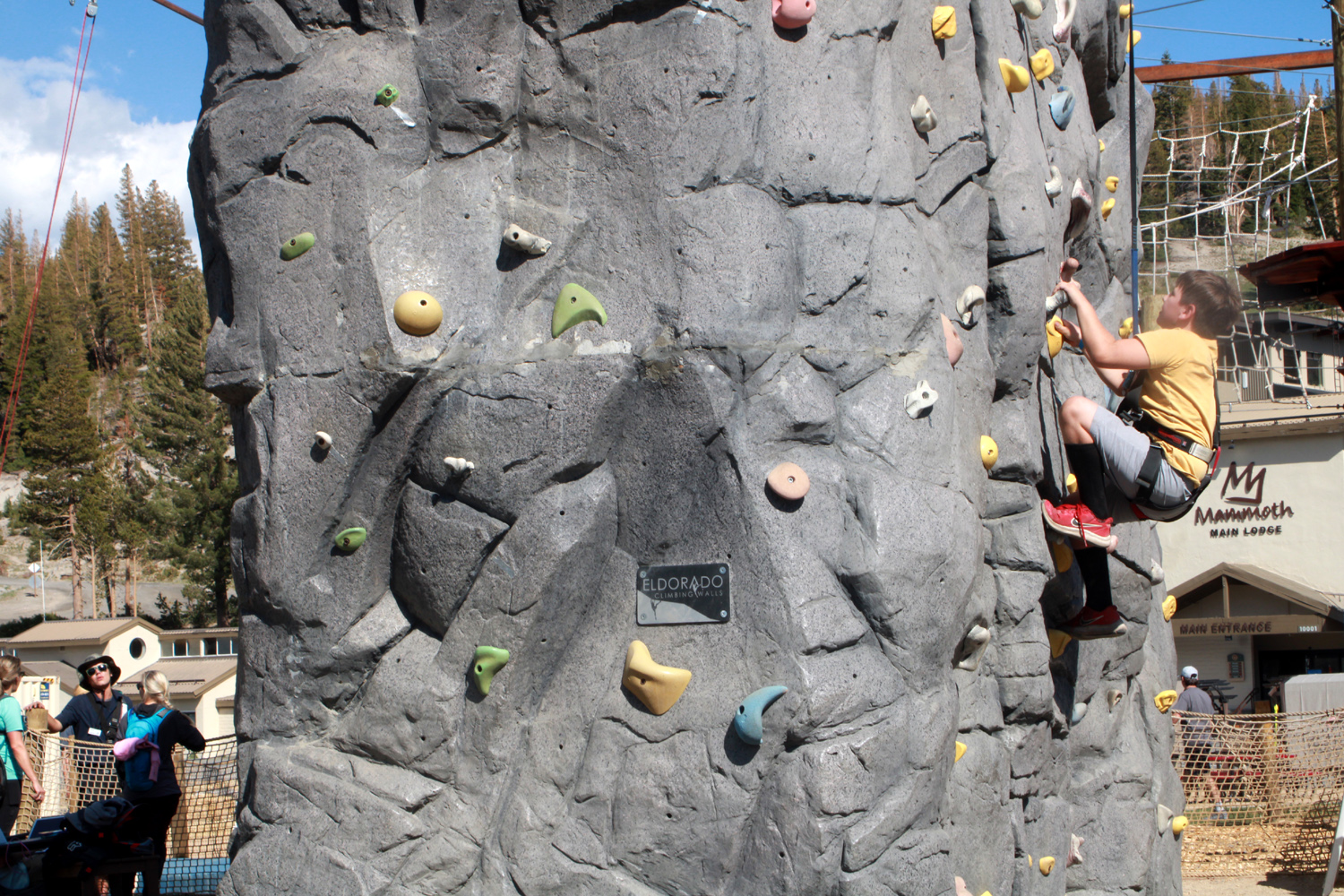
One final fun activity awaited us. At Mammoth Lakes Village, in addition to dining, shuttle rides, and gondolas to the top of the mountain, there is a sort of amusement park that attracts kids of all ages. When Mikie and I were there in 2007, there was just a climbing wall. Now there is also a zip line, bicycle course, elevated rope walk, and bungee-trampoline feature. A single ticket provides access to all of these, so Johnny got tickets for the boys. We watched them play as we enjoyed lunch on the outdoor patio. |
|
|
|
| Colton (yellow shirt) and Jack (blue shirt) on the rope walk | Jack does a flip on the bungee-trampoline |
|
|
| Jack made it to the highest point possible | Colton on the bungee |
| More Mammoth Photos | |
|
Finally it was time to head back to the motel and start preparing to leave the next day. But we had one final activity that put the cherry on top of the week. Although Mikie was back home, we thought of him as we watched game six of the Stanley Cup Final. If the Avalanche won, they would have their third championship, the first in 21 years. If they lost, they would still have one more chance in the best of seven series, but game seven's can be heart-stoppers. By the middle of the game, Colorado was ahead 2-1, and they managed to defend that thin 1-goal lead for nearly 30 more minutes of intense play, earning the right to skate around the arena with the cup held high. Jack would have made his uncle Mikie proud, jumping up and down and yelling as if he had scored the winning goal. The next day we packed up and left for home. Teri and I went back through Yosemite, and down Highway 41 through Oakhurst. Upshaw's had not been able to get a pass for that day, and went home via Sonora Pass, California Highway 108, with a stop at Mono Lake on the way. |
|

|
|
| Tenaya Lake, beside Tioga Pass Road near Tuolumne Meadows | Mono Like lies in high desert territory |
|
I'm going to conclude with a few words about Yosemite's entry permit system. In previous years, ir your destination was on the other side of the park, you could get a sticker allowing you to drive through. The entry time was noted, and if you took too long, you could face consequences (they were never spelled out). Basically this meant, "keep driving, don't stop to look at the scenery." The current policy requires a regular permit to enter, no matter what your plans are. Permits are made available several weeks in advance on Recreation.gov.. For example, as this is written on July 10, permits are available for 15 days in August, and all but two days in September. A number of passes are reserved for people who are not able to plan far enough ahead, so that on any given day, you can request a pass for one week later. They become available at 8 a.m. PDT, and are often gone by 8:15. Passes are good for three days and you must enter on the first day. After that you can go in and out of the park as you please. We needed passes for five cars, for two different dates. We were not all entering the same day, so we were not all in competition with each other, but we were not able to get all the permits we wanted. Mikie and I got permits for both days; Jackie and Johnny got permits for the first day we entered, and Jennifer did not get any. But there are still other possibilities - you can enter before 6 a.m. or after 4 p.m. without a permit Permits are also not needed if you have reservations within the park, as we did when we stayed at Wawona in May, or if you walk in. Since Jennifer lives close to the Highway 41 entrance, it was no hardship for her to get to the gate before 6 a.m. the first day. Both she and Jackie planned to leave later in the afternoon and go through after 4, which still would give them time to get home before dark. As it turned out, Jackie left early, on the third day, with her entry pass still good. Jennifer discovered that people who are considered "local" don't need a pass at all. Johnny's route on Highway 108 was around 250 miles, while the more direct route that we took through Yosemite was about 193 miles. Other routes over the Sierra would all be much longer than the 108 way. So - plan your trip well, and get your reservations early. --Dick Estel, July 2022 |
|
|
Photos (Click to enlarge; pictures open in new window) |
||
|
San Joaquin Gorge Wawona Cats, Moon, Glass Rock Eastern Sierra |
||
|
San Joaquin Gorge |
||
|
 |
 |
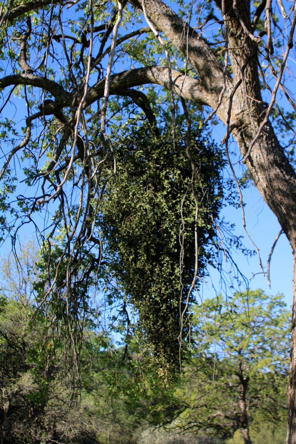
| Birds eye gillia | An unusual clump of mistletoe | Harvest brodiaea |
 |
 |
 |
| Long-dead tree stands in a field of popcorn flowers | Yellow-throated gillia | One of several areas with Indian grinding holes |
| Wawona
in Yosemite National Park (Photos by Brittany & Dick) |
||
 |
 |
 |
| Upstairs fireplace | First class modern kitchen | This makes me hungry |
 |
 |
 |
| Jack & Colton at the Mariposa Grove Visitor Plaza | Never use the official path when there's an alternative | Jack & Colton at the gateway to the Loop Trail |
 |
 |
|
| Johnny and Colton at Chilnualna Creek | Cascades on the creek | Jack discovers it's easier to go up than down |
 |
 |
 |
| Field of lupines greets visitors along the highway | A little one-on-none | Harlequin lupine |
| Cat Sitting, Moon Shot, and Glass Rock | ||
|
 |
 |
| As usual, the moon
continued to rise higher in the sky |
A large black oak near the start of the trail | Glass Rock in the
foreground, with Bass Lake beyond |
 |
 |
 |
| Manzanita and lake | Colorful base of a manzanita trunk | Bass Lake with boats |
| Eastern
Sierra
Panum Crater Crowley Columns Obsidian Dome Devil's Postpile Mammoth Village Other Photos (Photos by Teri, Jennifer, Johnny, Brittany, Colton, Jack and Dick) |
||
 |
 |
 |
| Teri, Jack, Colton
and Jackie at the Panum Crater Trailhead |
Colton and a big shiny chunk of obsidian | Mono Lake from the Panum trail |
|
 |
 |
| Some creative rock art by Mother Nature | Interesting layering on rock | Dick and Jackie on the trail |
 |
 |
 |
| Crowley Lake Columns | Jennifer at the Columns | An inside view |
 |
 |
 |
| Jack and Johnny climbing Obsidian Dome | While others
scramble in the rocks, Dick is content to just take photos |
Standing: Teri,
Jennifer, Colton, Brittany, Johnny, Mikie; seated: Dick, Jack |
 |
 |
 |
| Dedicated to Ron N | Upshaw Family at the Postpile | One of the great
grandsons caught Grandpa Dick in his favorite activity |
 |
 |
 |
| The Upshaw Brothers on top of the "Pile" | The Junior Postpile south of the Devil's Pile | The Middle Fork of the San Joaquin River |
 |
|
 |
| The top of the falls | You can't have too many waterfall photos | Ritter Range and Minarets from the Falls trail |
 |
 |
 |
| Near the end of my
hike, I had to cross on this "bridge" |
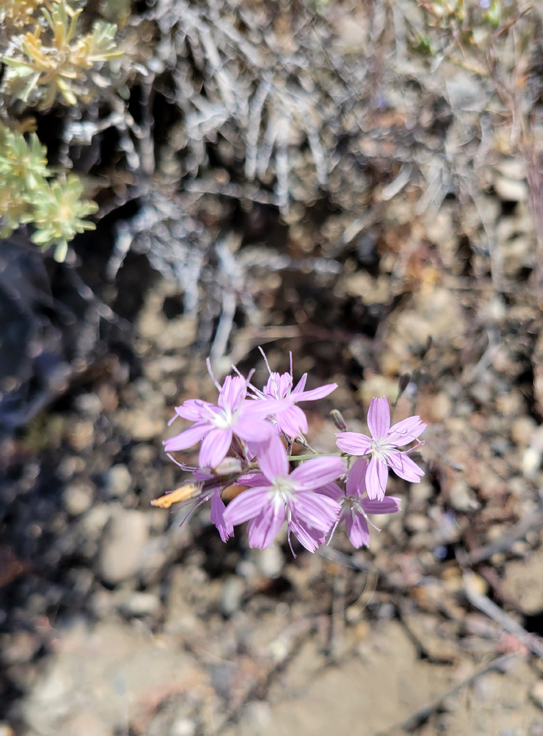
Unknown flower | Flower near Mono Lake |
 |
 |
 |
| Colton on the wall | Teri, Johnny,
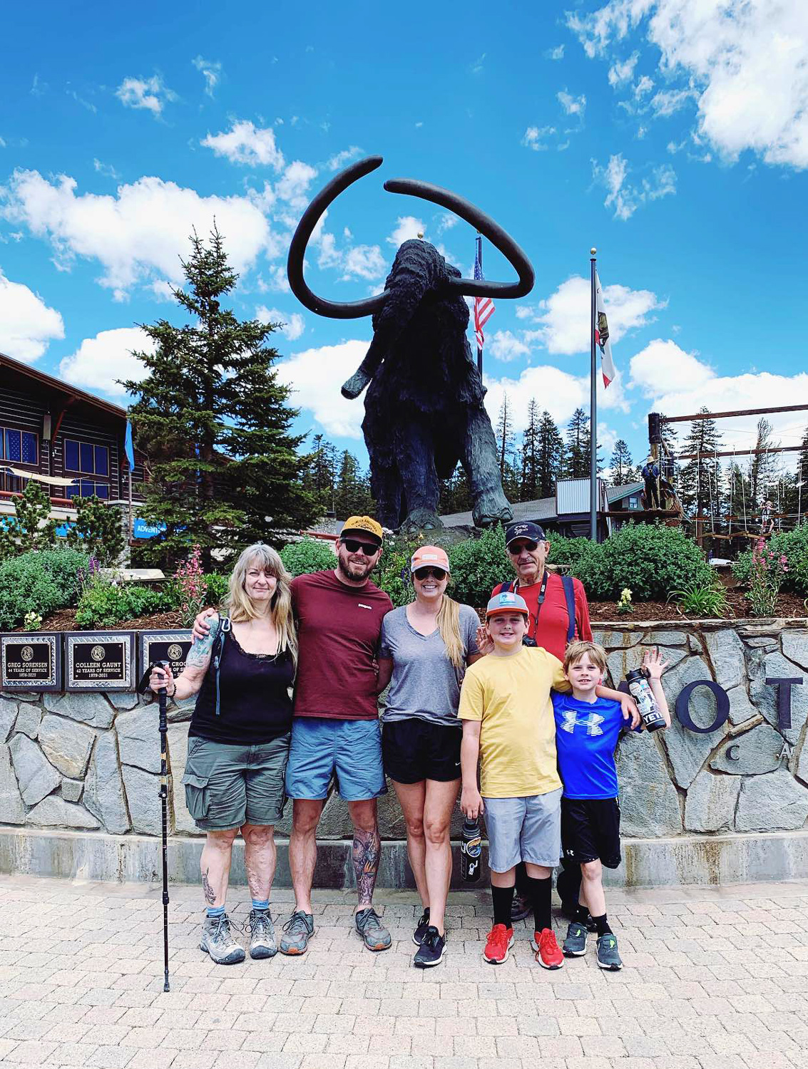
Brittany, Dick, Colton and Jack with the Mammoth Village Mammoth |
Another Mono Lake flower |
 |
 |
 |
| June Lake sunset | Jack and Teri | At June Lake beach |
 |
 |
 |
| Colton at the driving range | The Upshaw men and a huge chunk of obsidian | Johnny dips his toes in Tenaya Lake |
 |
 |
 |
| Eastern Sierra | Mist on the mountains | All the places we went |
| Related Links | ||
| San Joaquin River Gorge | San Joaquin River Trail | Woodpeckers |
| San Joaquin Gorge Hikes | Chilnualna Falls | Wawona |
| Mariposa Grove Restoration Project | Wawona Meadow Loop | Yosemite National Park |
| Mariposa Grove of Giant Sequoias | History of Wawona | Wawona Swinging Bridge |
| Thomas Hill Studio | Yosemite Scenic Wonders Property Management | Recreation.gov |
| Glass Rock | Bass Lake | El Cid Mexican Restaurant |
| June Lake Loop | Panum Crater | Glacial Moraines |
| Mono Lake Tufa Towers | Crowley Columns | Crowley Columns Again |
| Bartell's Backroads Crowley Video | Bartell's You Tube Videos | Obsidian Dome |
| Devil's Postpile National Monument | Geology of the Postpile | Rainbow Falls |
| Postpile & Rainbow Falls Photos | A June Lake Drive & Photo Tour | Tenaya Lake |