
|
Dick's Adventures of 2022 - Part 2 |
|
| Photos Related Links More Travel Reports | |
| Adventures of 2016 Adventures of 2017 Adventures of 2018 Adventures of 2019 | |
| Tesoro Viejo Again Hermit Hole Camp Sumner Peck III Spring Drive & Hike | |
| Tesoro
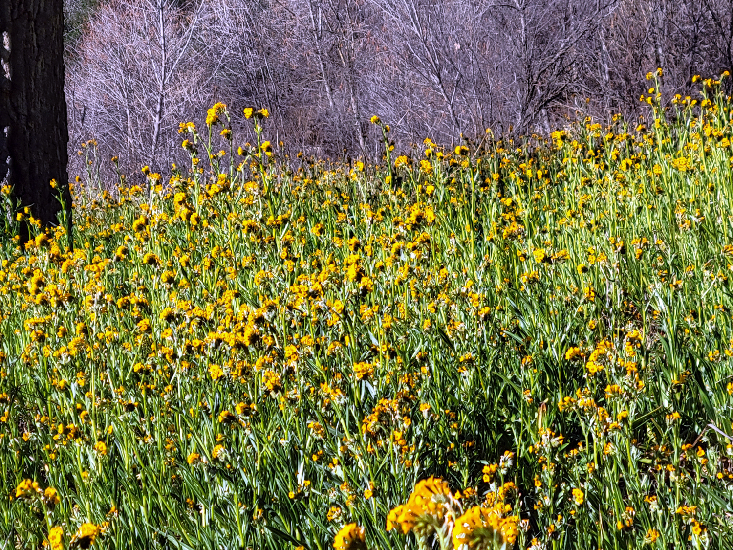
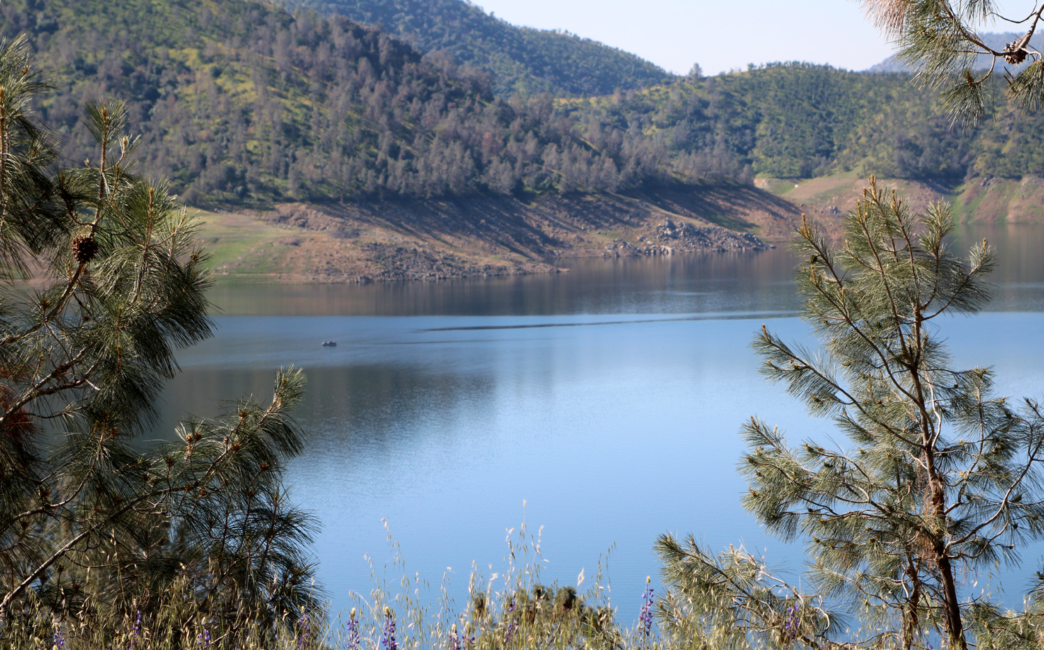
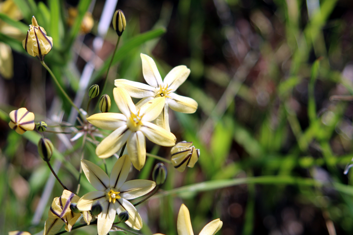
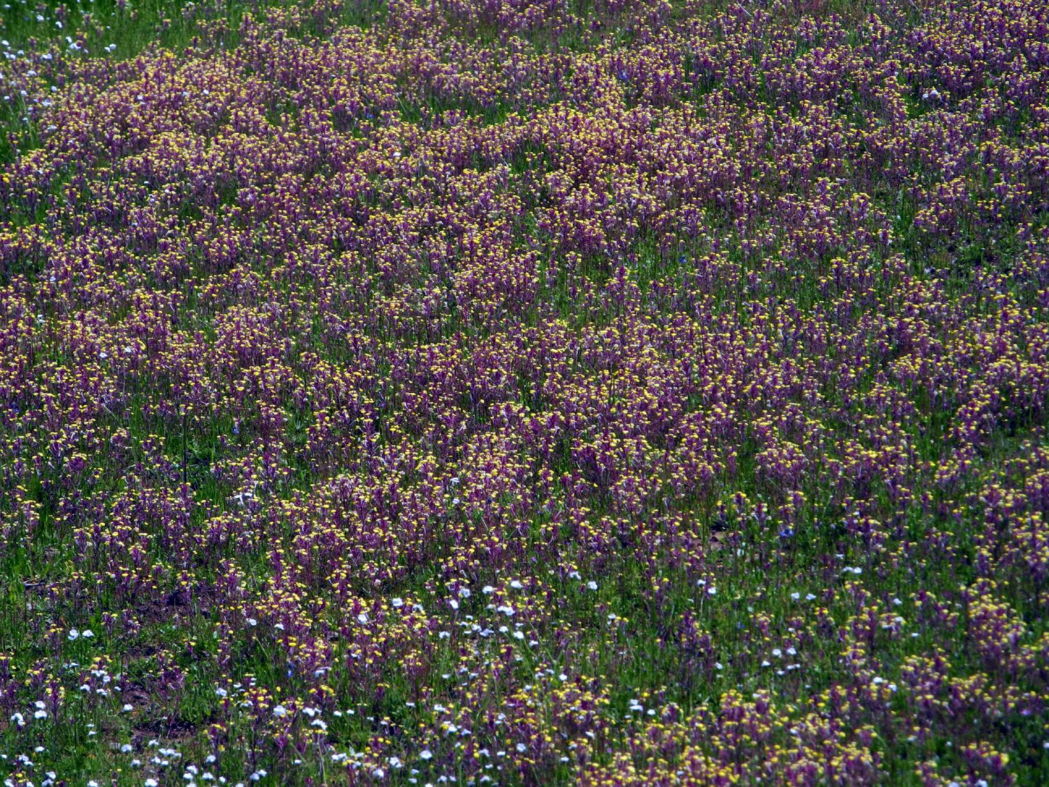
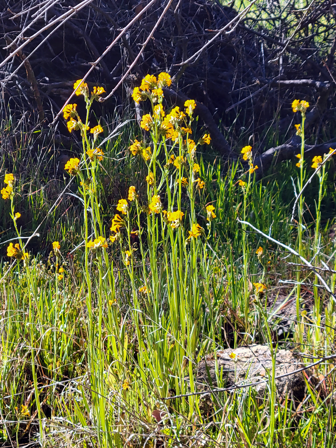
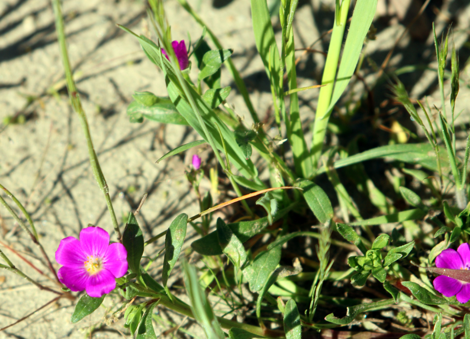
Viejo You can't hike new place just once. After two hikes at Tesoro Viejo, I returned again on February 12, with a group of half a dozen. This included my daughters Teri and Jennifer, their mother Jackie, Teri's friend Kara, who has hiked with us a number of times over the past few years, and Sue Wirt, long-time member of the Ramblers. I walked this trail with Rambler Wes on January 12, and with the Ramblers on January 24. Refer to those reports for information about the location and other details. On this hike, the weather had warmed up considerably, and it was one of four consecutive days when we set a new all-time high temperature for the date. While we were not dripping sweat, at the end of the hike we were definitely "glowing." To compensate, the warmer weather had brought out a few more flowers. The most common were blue dicks, which we saw all along the trail, especially on the back end where the terrain sloped slightly downward and faced the rising sun. We also saw scattered examples of the rare ham & eggs. The little yellow bud-like blossoms do resemble bits of scrambled egg, but it's hard to see the reddish stems as ham. It helps when there's a massive bloom, such as we saw near the Upper Kings River a few years ago. |
|
 |
 |
| Blue dicks provide a nice contrasting color in the rocky soil | Tiny ham & eggs are best seen in massive fields |
|
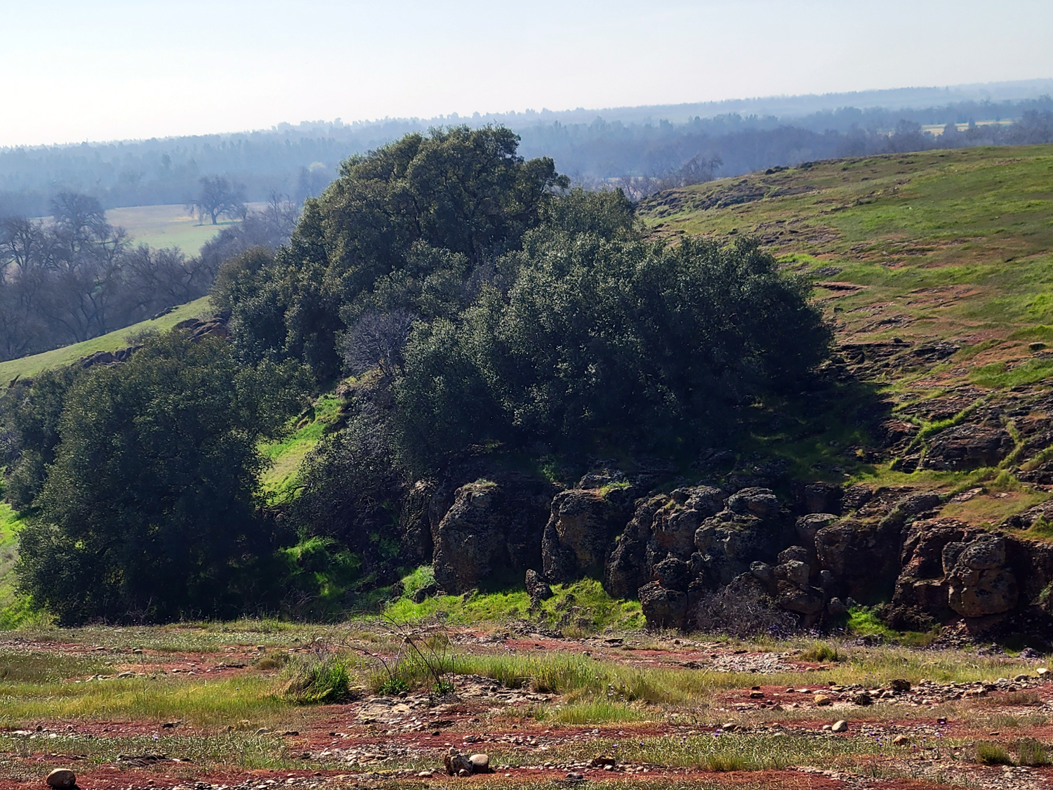
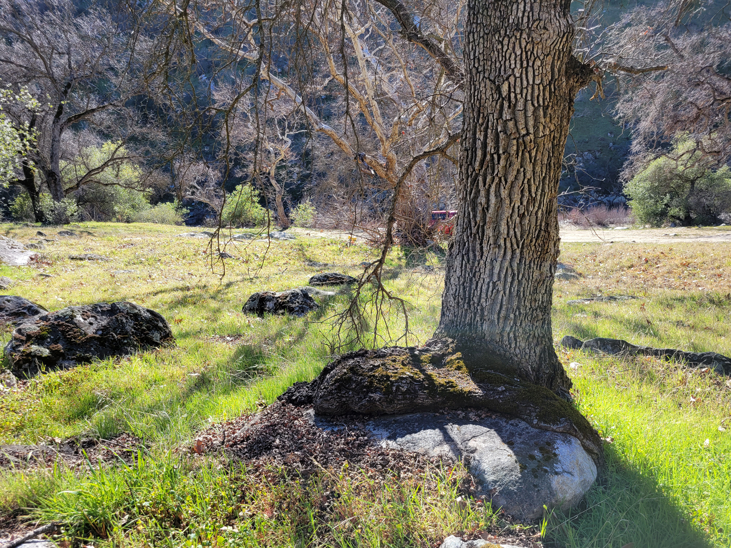
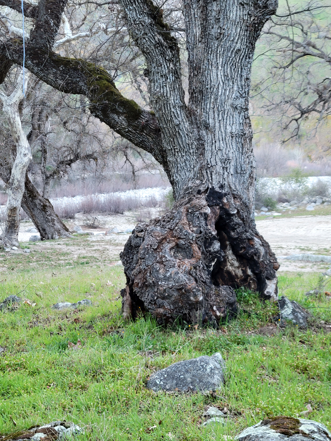
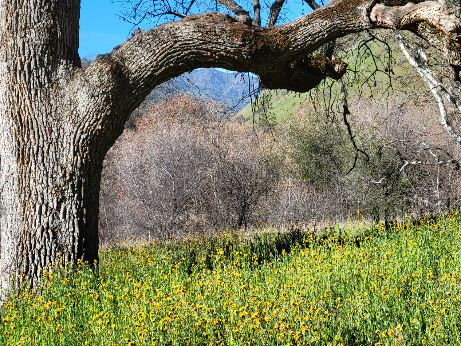
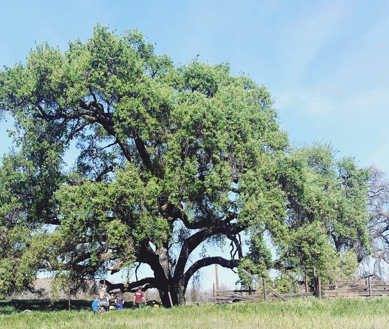
Despite the warming temperatures, the grass is still green, and the shapes of hills and little valleys was a delight. For the first time, along with the rest of the group, I went to the point where the trail goes steeply down to the San Joaquin River near the Sumner Peck Ranch. I was delighted to be able to see the massive Wheeler Oak that I wrote about when I returned to Sumner Peck on January 28. |
|
 |
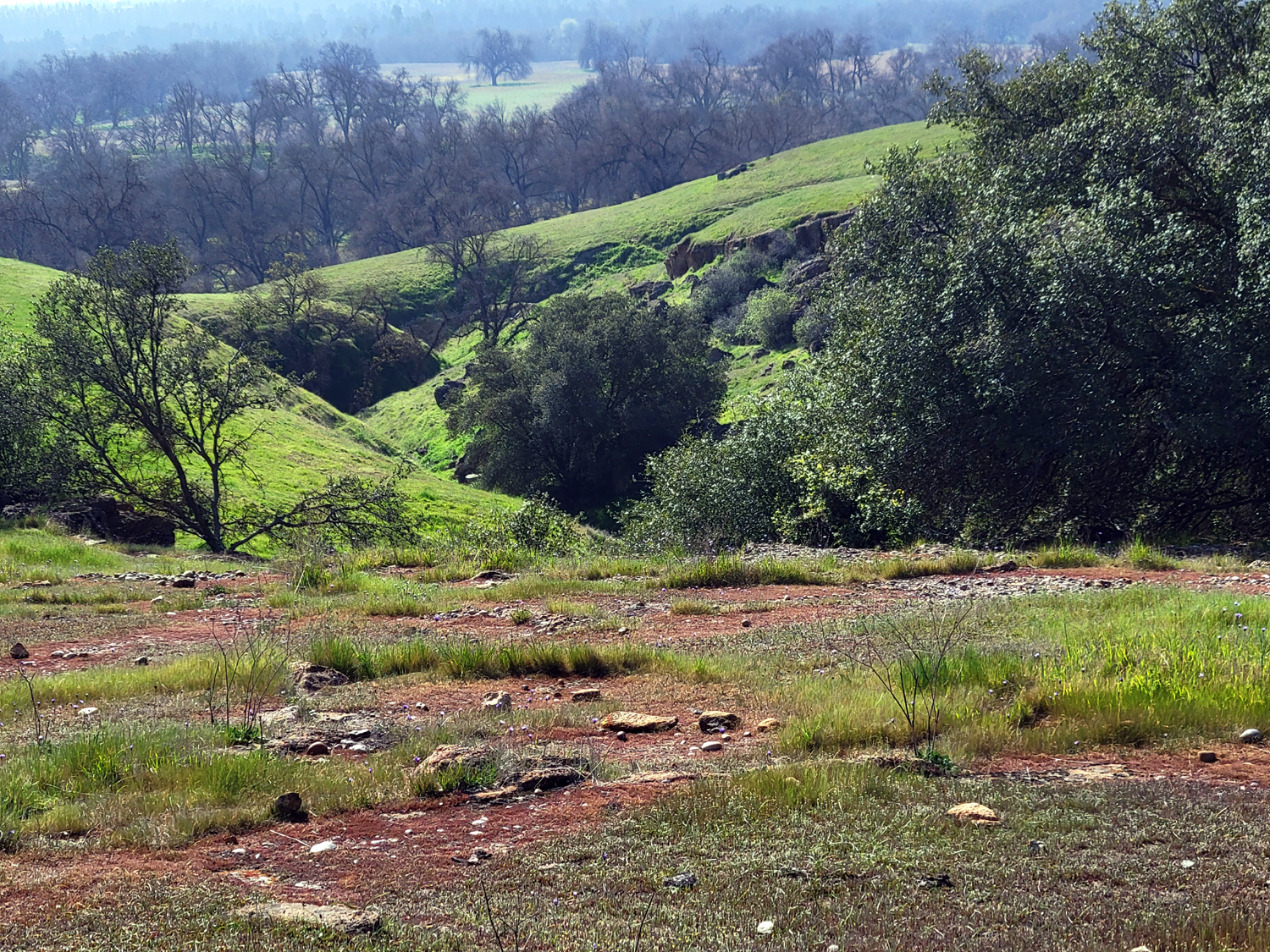 |
| Ancient river rock lines this little side valley | Another channel that drains down into the San Joaquin River |
 |
 |
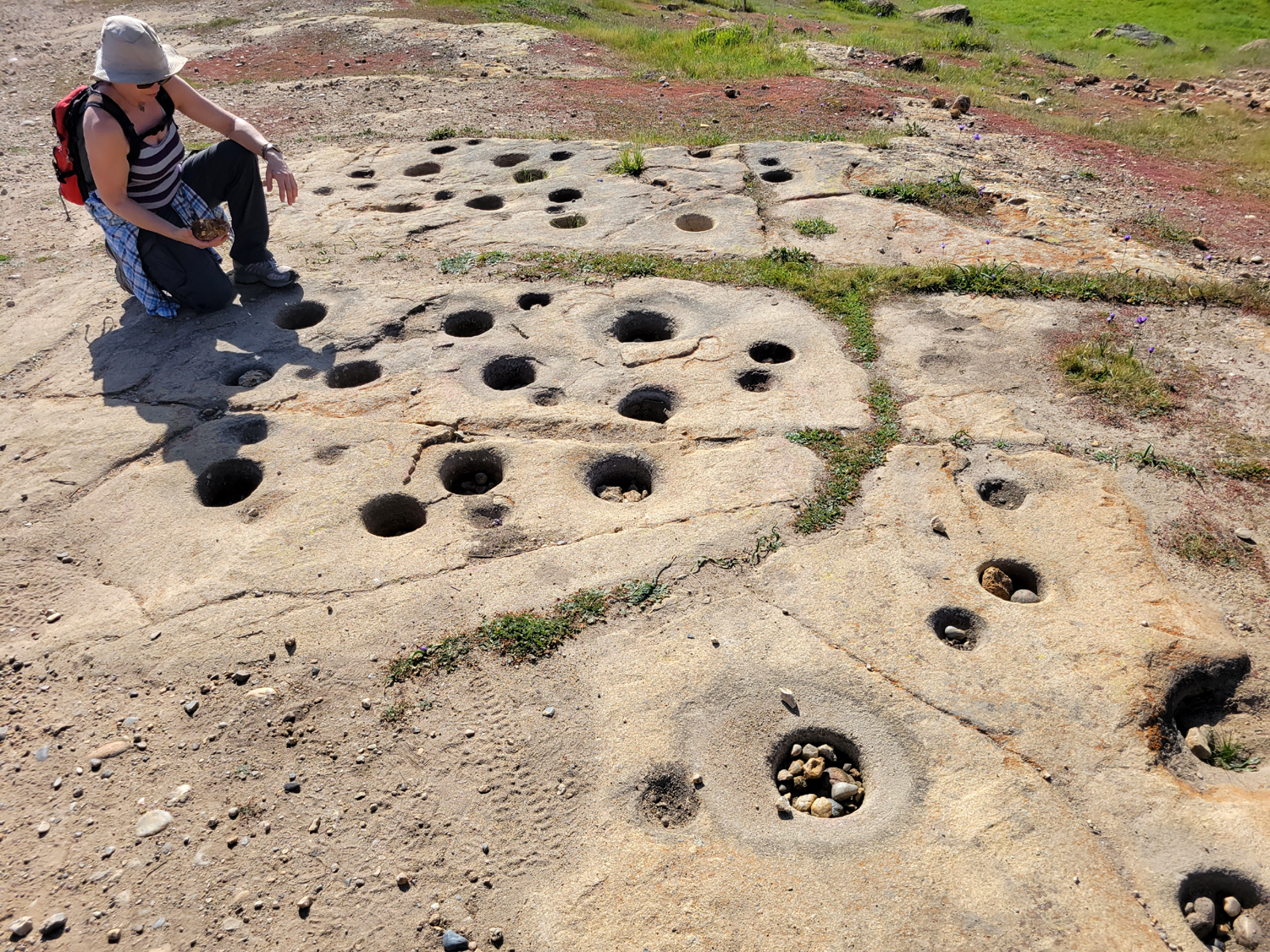
| Tara
contemplates the work Native Americans put in to grind acorns to meal in these bedrock mortar holes |
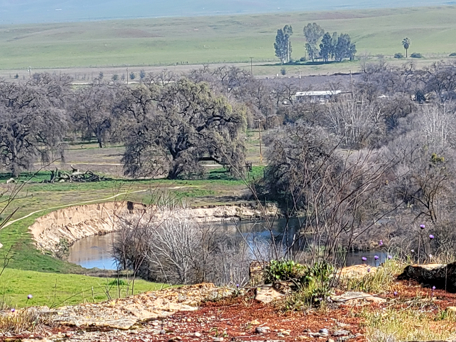
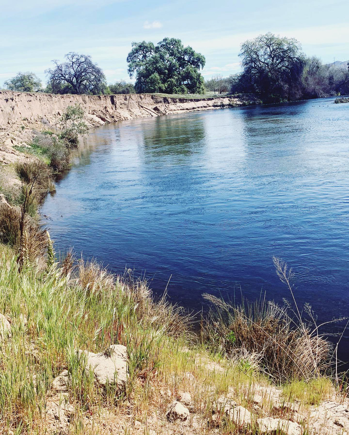
The San Joaquin River, with the Wheeler Oak at left center |
|
My previous walks here had been on weekdays, when we saw only two or three others on the trail. On this weekend day we must have seen 50 people or more, and at least 30 bicycles. When we got back to the parking lot Jennifer had to leave for home, but the rest of us enjoyed a delicious lunch at the AXIS Coffee Bar & Eatery. The three Ramblers encouraged Teri and Kara to join us on our next hike, February 21, at the San Joaquin Gorge. Since it's a holiday, we have high hopes of getting some working people to hike with us. --Dick Estel, February 2022 |
|
|
Hermit Hole Camp
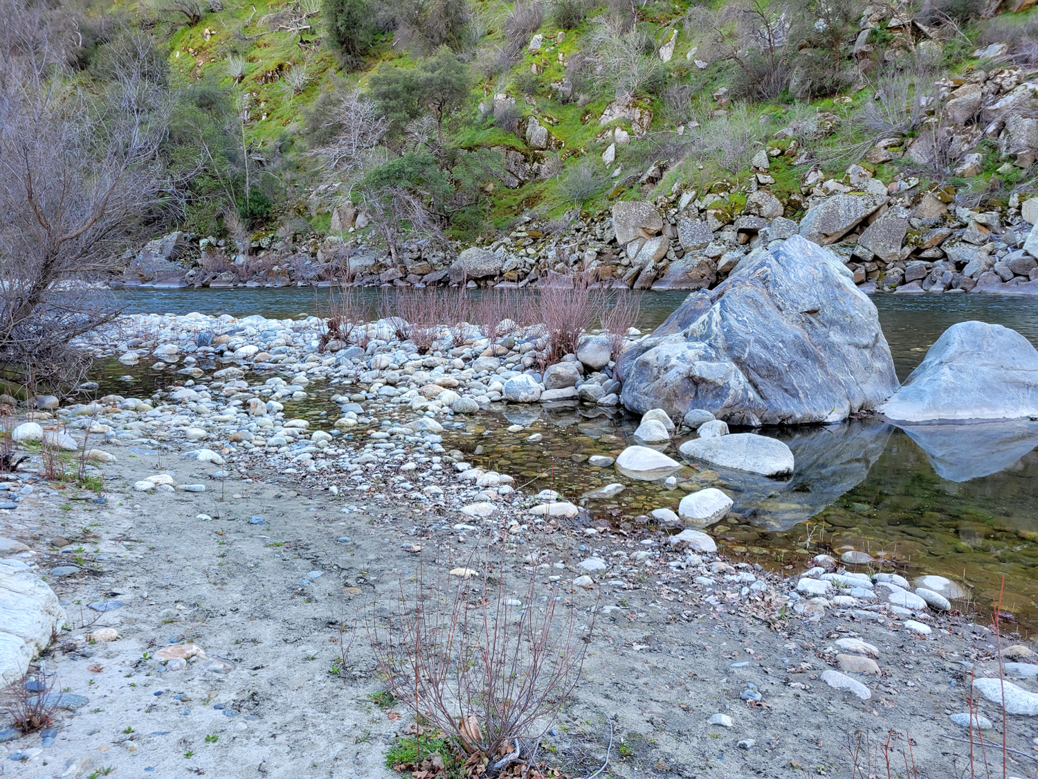
You may be asking, "Where is Hermit Hole?" "Is there really a campground by that name?" "Is the hermit still there?" OK, you probably are not really asking these questions, but I will answer them anyway. Going from last to first, I did not see a hermit. I did see "Spotlight Man," or at least his pickup that slowly drove in after dark and kept flashing a spotlight to the sides of the road. Poachers and other suspicious characters are known to do this, but maybe he was just looking at the poppies. I say "Man," because most women have better sense than to drive on a narrow, crooked, rocky road in the dark. No, it is not an official campground. It is a "Raft Put-in," a location where rafting companies launch trips down the Kings River. It has no picnic tables, but two unisex toilets. Why so many? When rafting season is going strong, large numbers of people will arrive at this location to float down the river. To get there, follow Trimmer Springs Road all the way around Pine Flat Reservoir and past the upper end of the lake. Cross the first bridge from the north side of the river to the south, drive a mile or so, cross back to the north side on the Bailey bridge, and immediately turn right on the dirt road that is still called Trimmer. This road goes eight miles up to Garnet Dike, which is another raft put-in area, and the trailhead for the Kings River National Recreation Trail. I backpacked on this trail several times in the late 1970s and early '80s, and have driven up there twice recently, in 2016 and 2018, hiking in a mile or so on that second trip. |
|

|
|
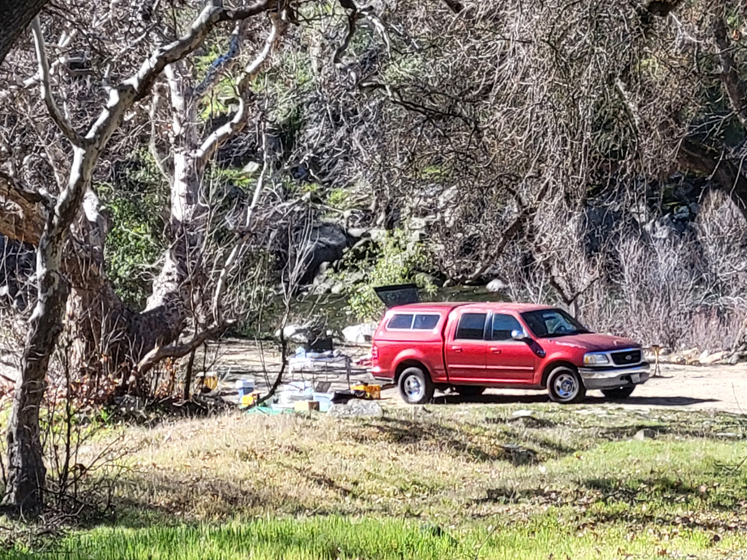
| Having no raft, I camped here | Having no picnic table, I put a bunch of stuff on a tarp on the ground |
|
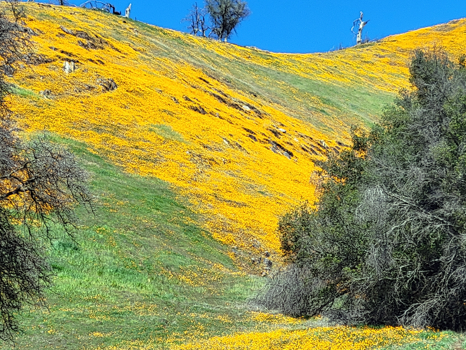
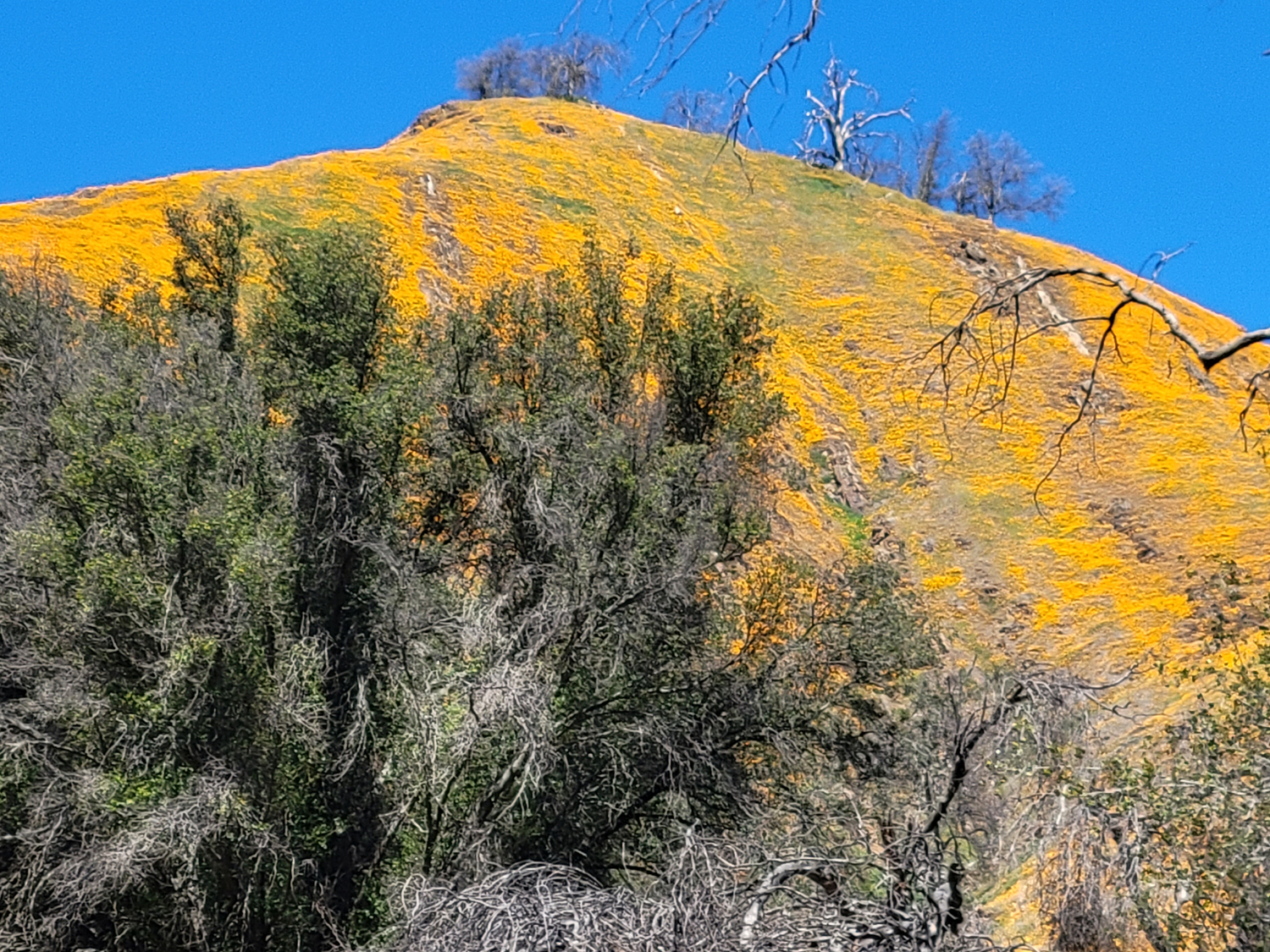
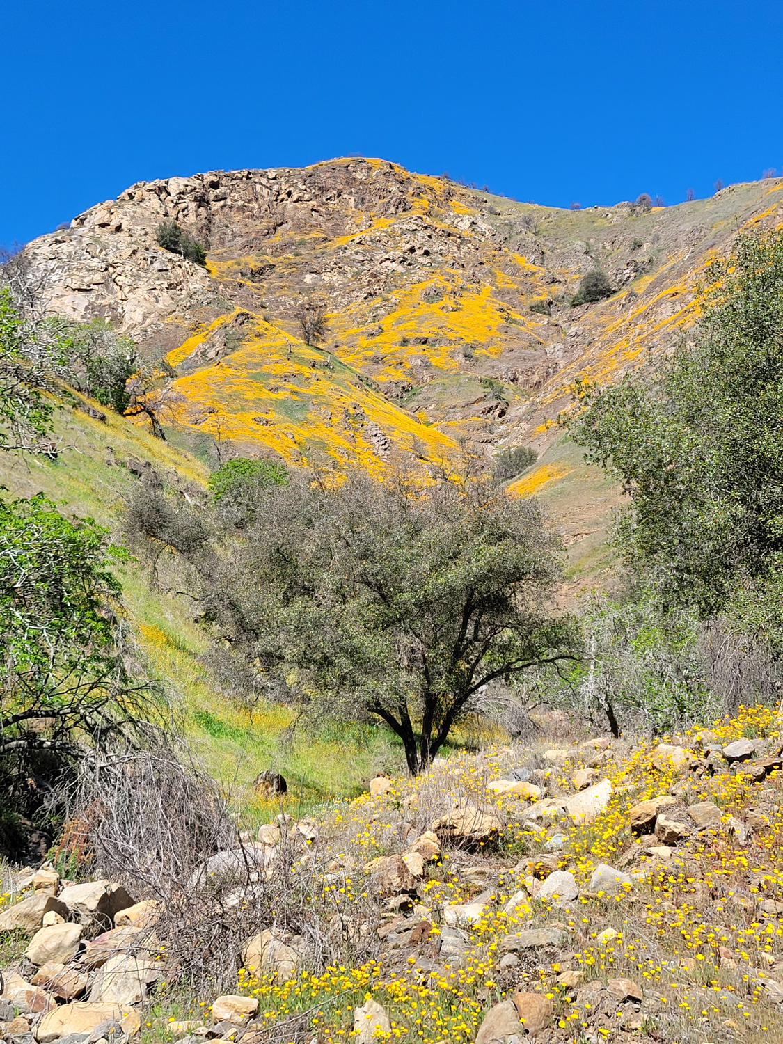
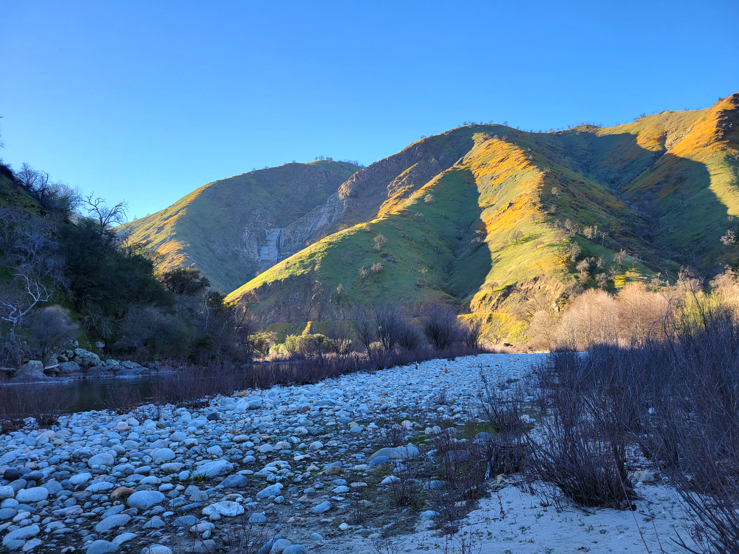
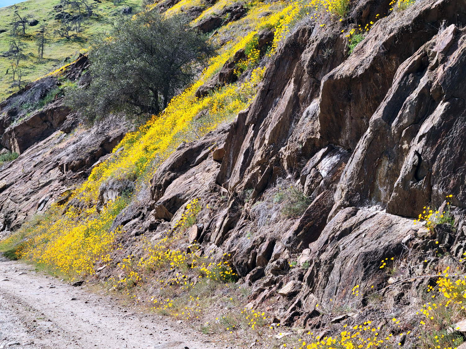
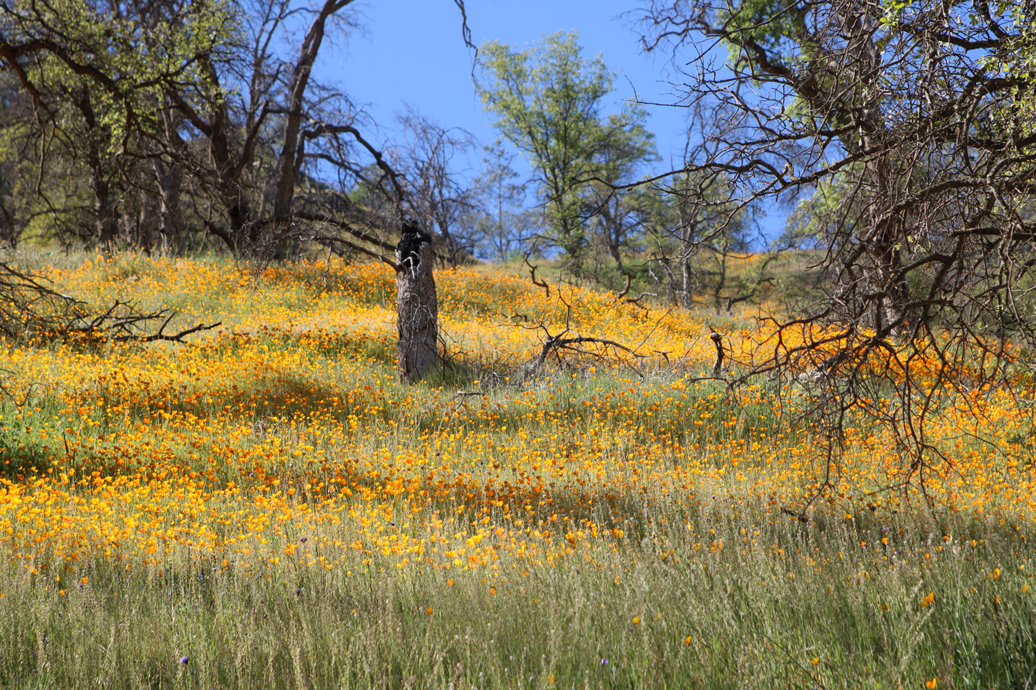
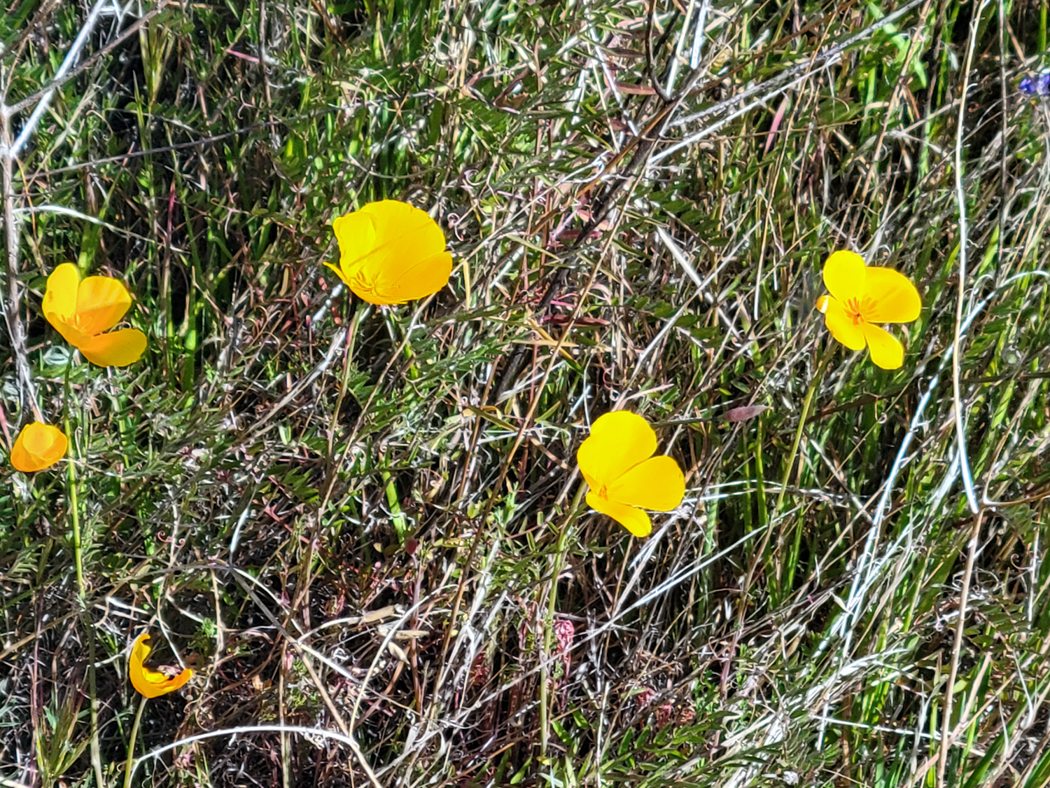
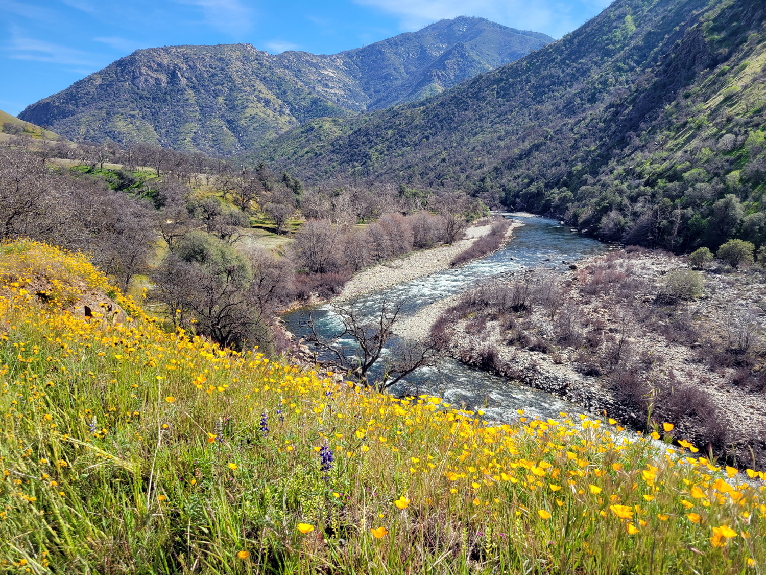
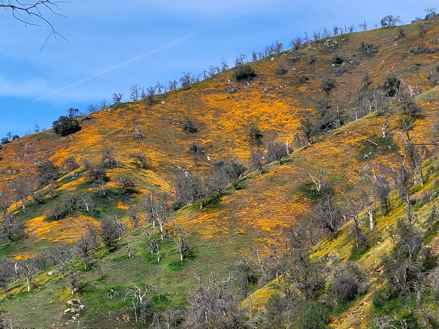
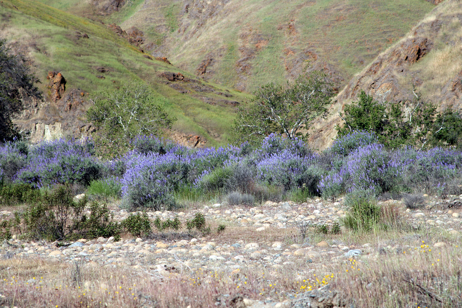
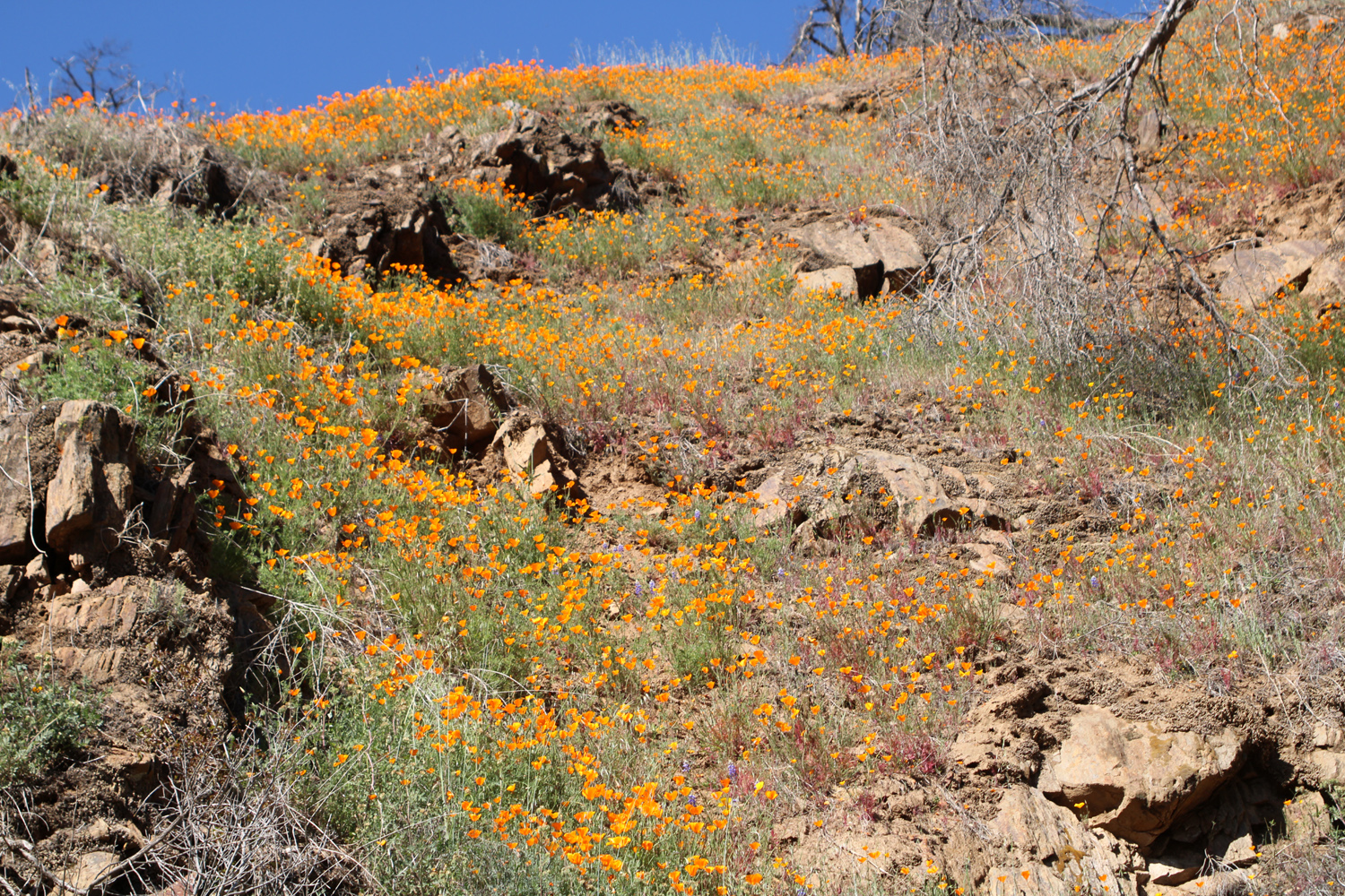
At the beginning of February I had camped on the other side of the river, about two miles up the south side dirt road, and wanted to return to the area while we are still enjoying spring weather (yes, it's still officially winter, but de facto spring comes early to our part of the country). On February 28 I set out, hoping to camp at Bear Wallow Camp, about three miles up from the bridge. There are three campsites, but only one with a picnic table, and it was occupied, so I decided to try for Hermit Hole, another three miles. I had not brought my large folding table nor my portable toilet, but I had a card table. After looking around the site, I decided I could make do with what I had, as long as there was a bathroom. I believe that rafting has been suspended during the pandemic, so I was not expecting to have to put up with hordes of people. In fact, I met two vehicles when I was driving in, and no one else drove by except Spotlight Man. One reason to visit this area is the hope of seeing massive poppy blooms. There were hardly any when I camped at the end of January, and only a few scattered patches when the Ramblers hiked at Sycamore Wildlife Area on February 7. This time I began seeing fairly good amounts as soon as I reached the foothills. They were fair to good all along the road around the lake, but any one who would brave the rough dirt road was rewarded with a display that was very good and sometimes excellent. I'll let these photos "speak" the next few thousand words of this report. |
|
|
|
| A hilltop painted orange | Poppies in the rocks and above a drainage across the road |
|
|
| River bank and hills in the late afternoon sun | Bright green grass and California poppies |
|
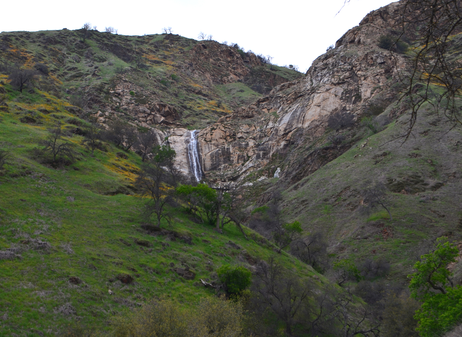
Like my previous camping trip to the Upper Kings, this was a one-night event, and again, I did not do any serious hiking. The first day, after I had set up camp, I relaxed with a drink and my current book, enjoying the view of the flowers on the hills above me and the oak trees around the camp. Also visible from this spot is a small waterfall, just a trickle at this season, that drops pretty much straight down maybe 50 feet. Many years ago I was in this area for two days when it rained most of the time, and the falls was like a mini-Yosemite. When I drove up here in 2018 there was a fairly good flow. I had to dig sand out of the fire ring, but when the temperature cooled off, I was able to have a nice fire till I was ready for bed. Again it was a clear, moonless night, with a brilliant star display. In the daytime it had been warm enough to have just a t-shirt, whereas last time I wore two or three layers all day. It was also warmer than the 25 degree low of last time - 26 degrees! |
|

|

|
| This little waterfall can be very impressive after a good rainstorm | Valley oak near the camp entrance |
|
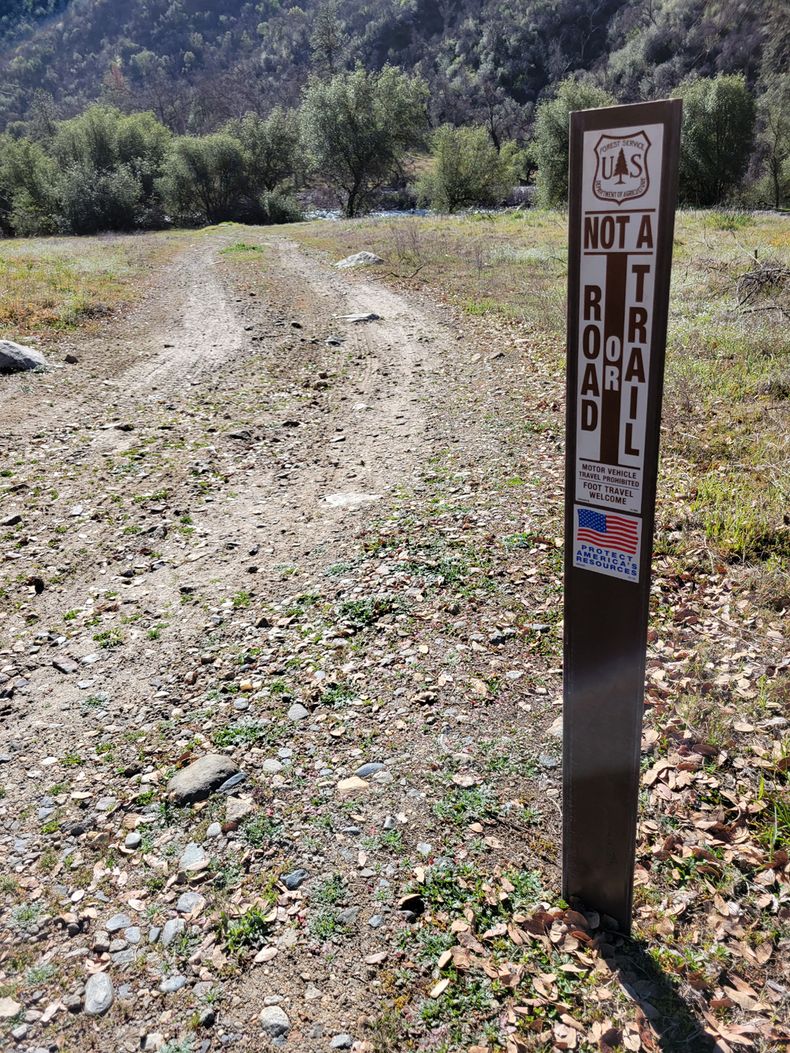
Despite the chilly low temperature, the morning warm-up was much quicker this time. The sun was already starting to hit my camp area when I got up, and I only had to move my chair about 10 feet to be in full sun while I had my tea. By the time I fixed breakfast, I was removing most of my top layers. I did a short hike before eating, out to the main road and east a bit more than a quarter mile. There were a lot of fiddlenecks along the road there, as well as popcorn flowers, and of course, poppies. A little driveway of sorts led off the main road toward the river. It was covered with tire tracks, and marked with a sign that said "Not a Road." When I got back to camp, I had hiked almost seven tenths of a mile. |
|
|

|
| Lots of fiddlenecks near the camp | A closer look |
|
After breakfast and hiking I started loading up in my usual leisurely way, getting started for home at 12:35 p.m. The floral and riparian scenery on the way out made for an enjoyable drive, a good thing since it took an hour to travel the 5.8 miles to the paved road, with a few stops for photos along the way. The drive around Pine Flat is tedious, since it's rare you can exceed 30 MPH, but it was like a freeway compared to the rough, rocky road to camp. |
|

|
|
| Looking down the river canyon | Poppies in the rocky road bank |
|
In the past I have almost always camped at least two nights, believing that the work involved hardly justifies a one-night stay. However, with these last two trips, I felt that one night in the "wilderness" was enough. Could I be getting old? --Dick Estel, March 2022 |
|
|
Sumner Peck III
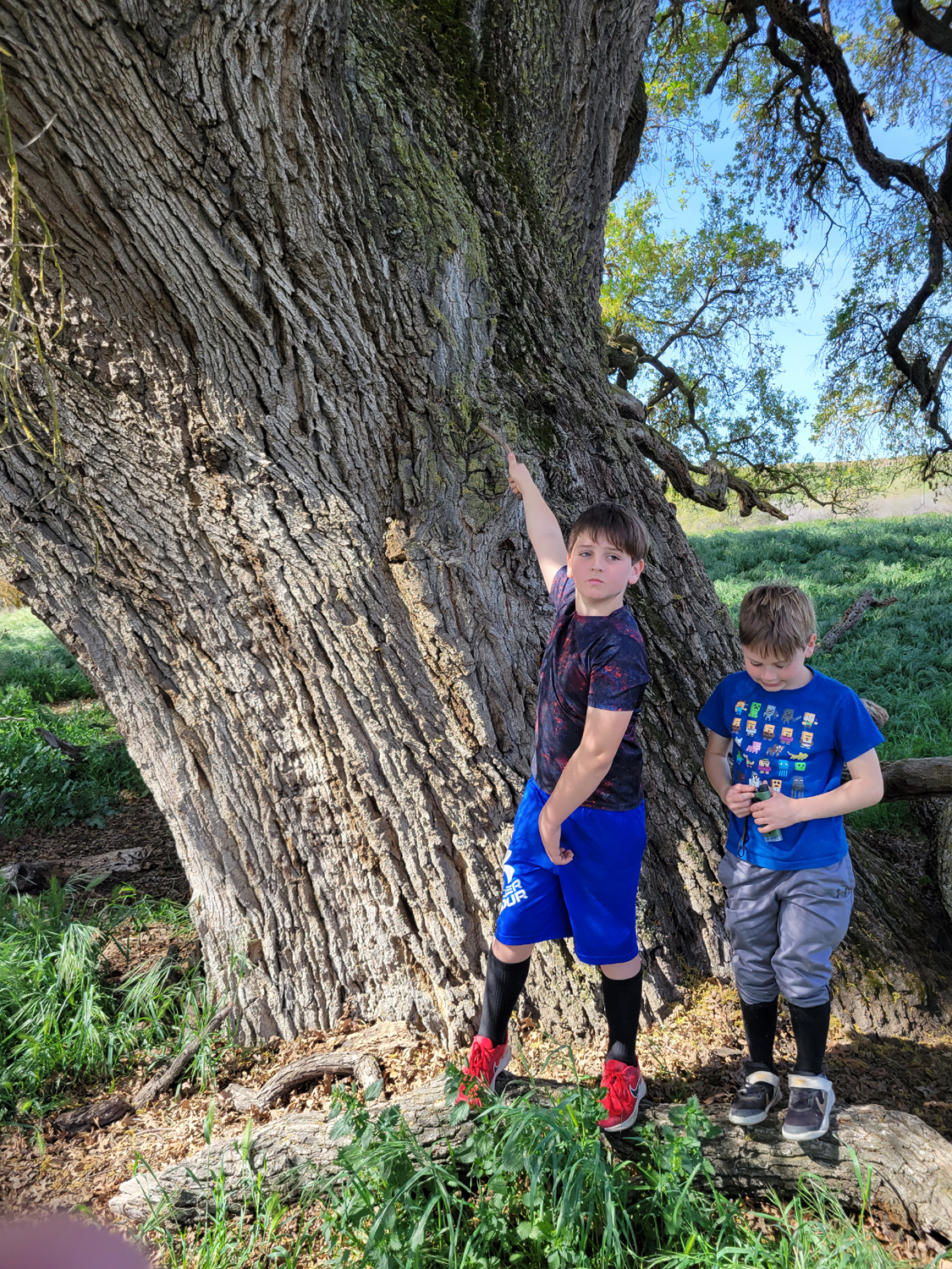
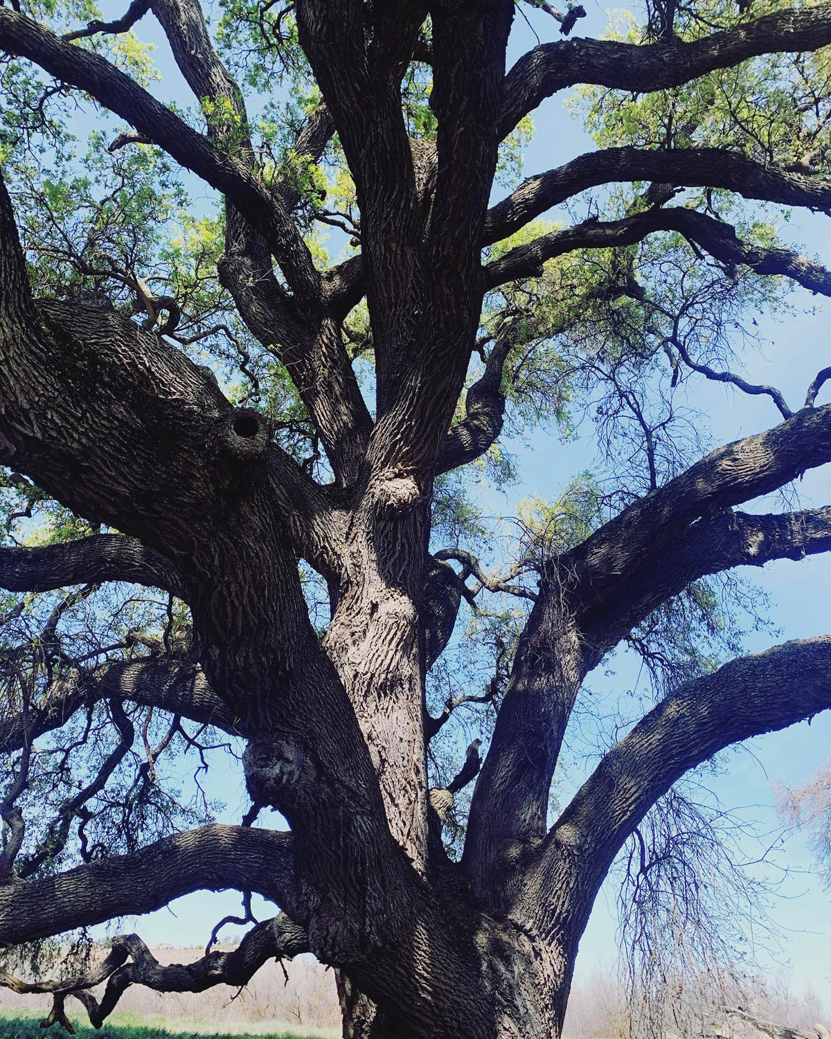
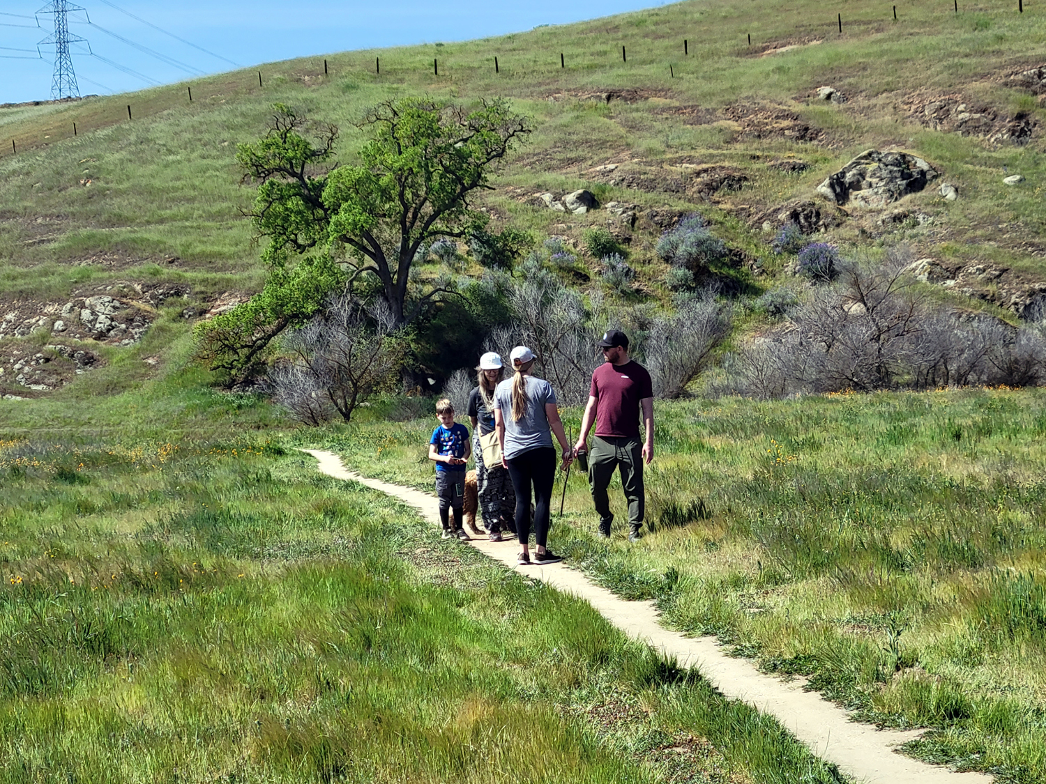
For my third hike along this trail, I was joined by several family members - daughter Teri, her mother Jackie, grandson Johnny. his wife Brittany, sons Colton and Jack, and Dottie the Dog. March 13 was a sunny, breezy day, with a few streaks of cloud overhead. This trail is almost 100% flat, with a couple of very short sections, twenty feet or less, up or down, one of them to the old road that leads to a bridge across the San Joaquin River. Of course, my main goal was to see and to show the others the massive Wheeler Oak, a venerable valley oak that has a circumference of 24 feet. We were all delighted to see that the tree has leafed out since my two previous visits, and is still surrounded by the green, green grass of spring. |
|

|
|
| The Wheeler Oak, in its spring finery | Colton and Jack are dwarfed by the massive trunk |
|
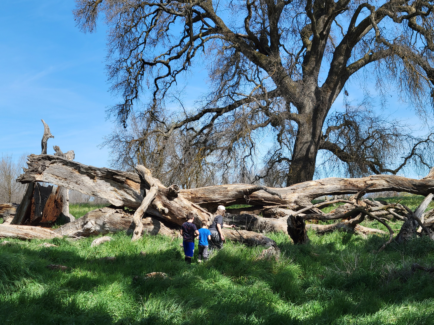
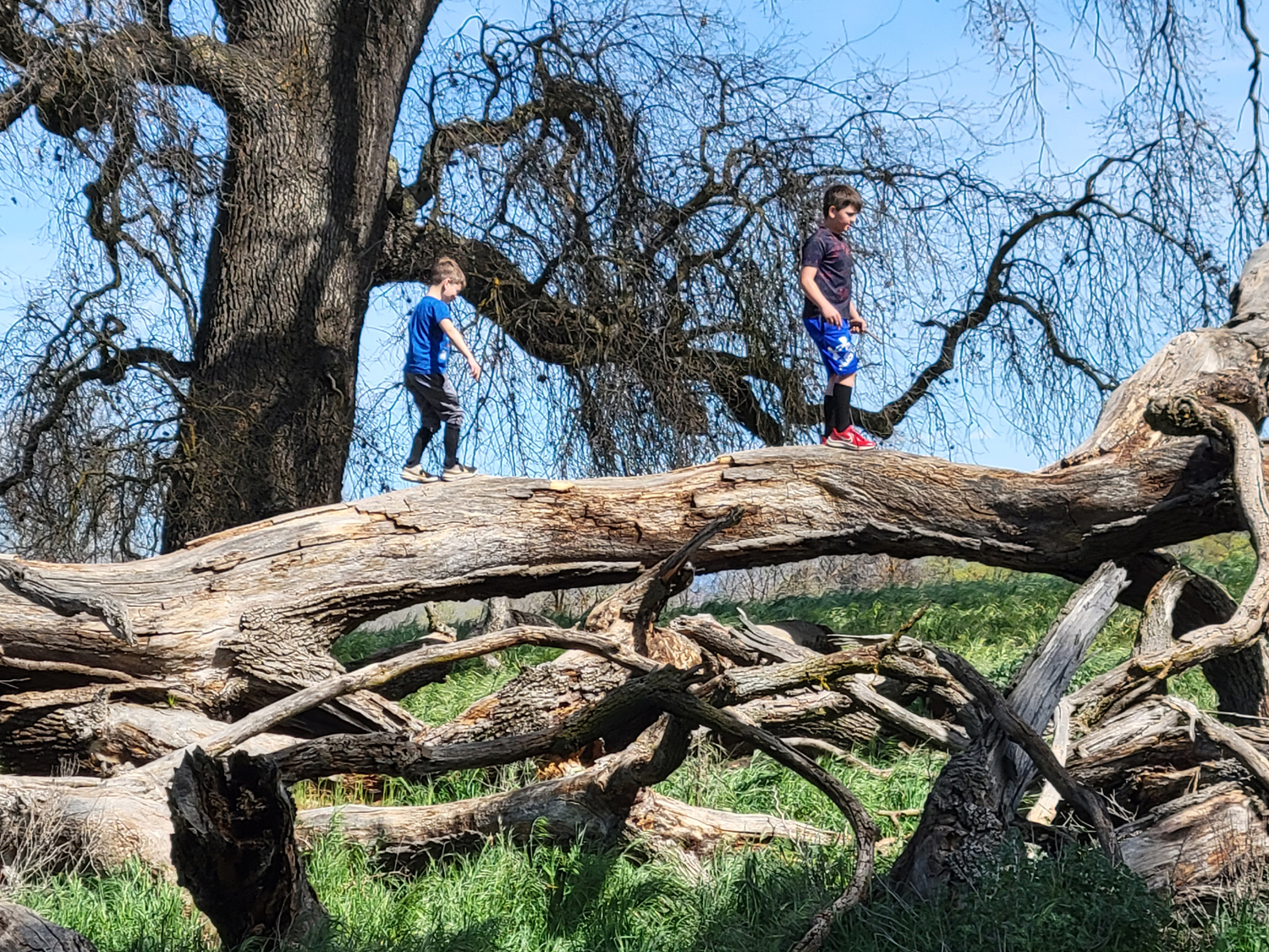
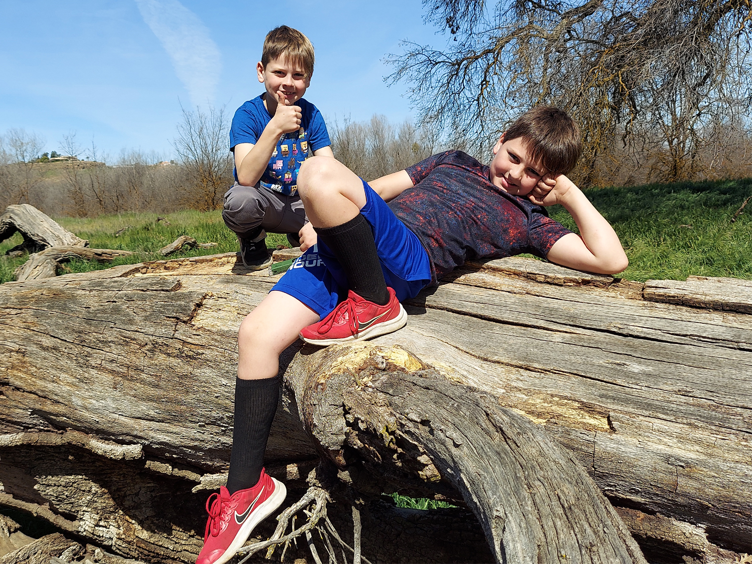
Of greater interest than the Wheeler tree to the two young boys was another huge valley oak, this one on the ground, dead and down for who knows how long - 30 years, maybe 50. It proved to be a better climbing feature than those found at our city parks, and with Teri nearby to remind them to be careful, they spent a quarter hour or more climbing up and down and around. |
|
|
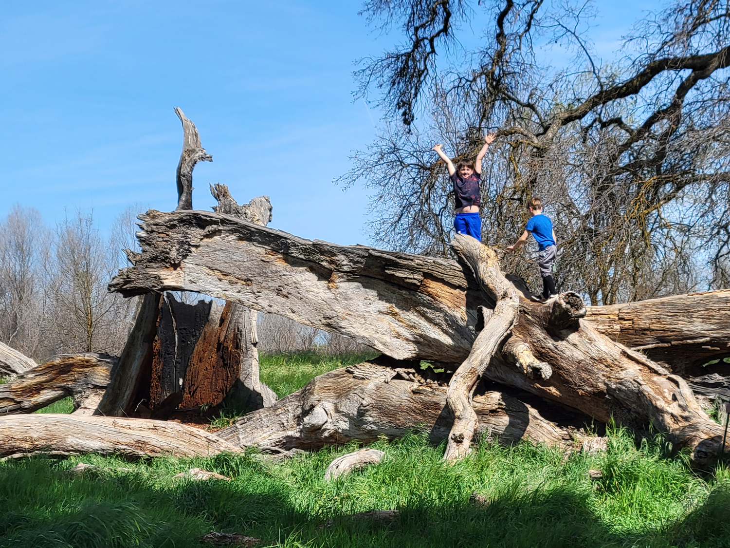
|
| This nearby fallen giant was their favorite tree | Triumphant, after a challenging climb up the big limb |
|
|
|
The grandparents and great grandparents envied the boys' sure-footed sense of balance |
Just kicking back |
|
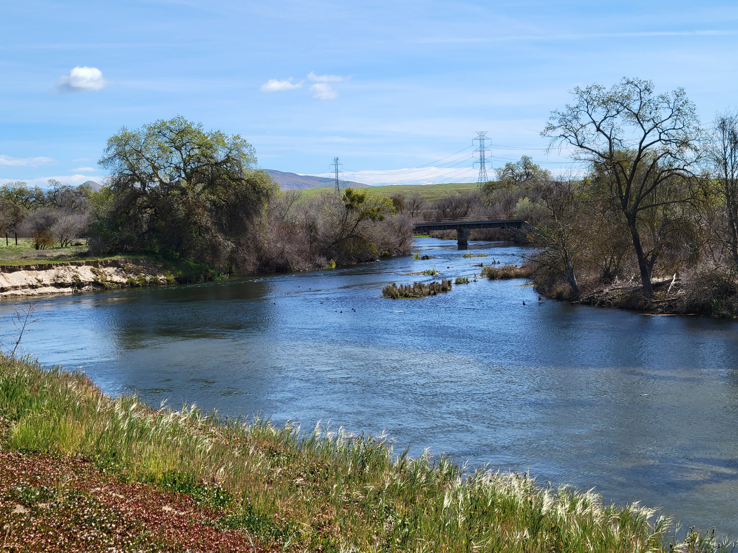
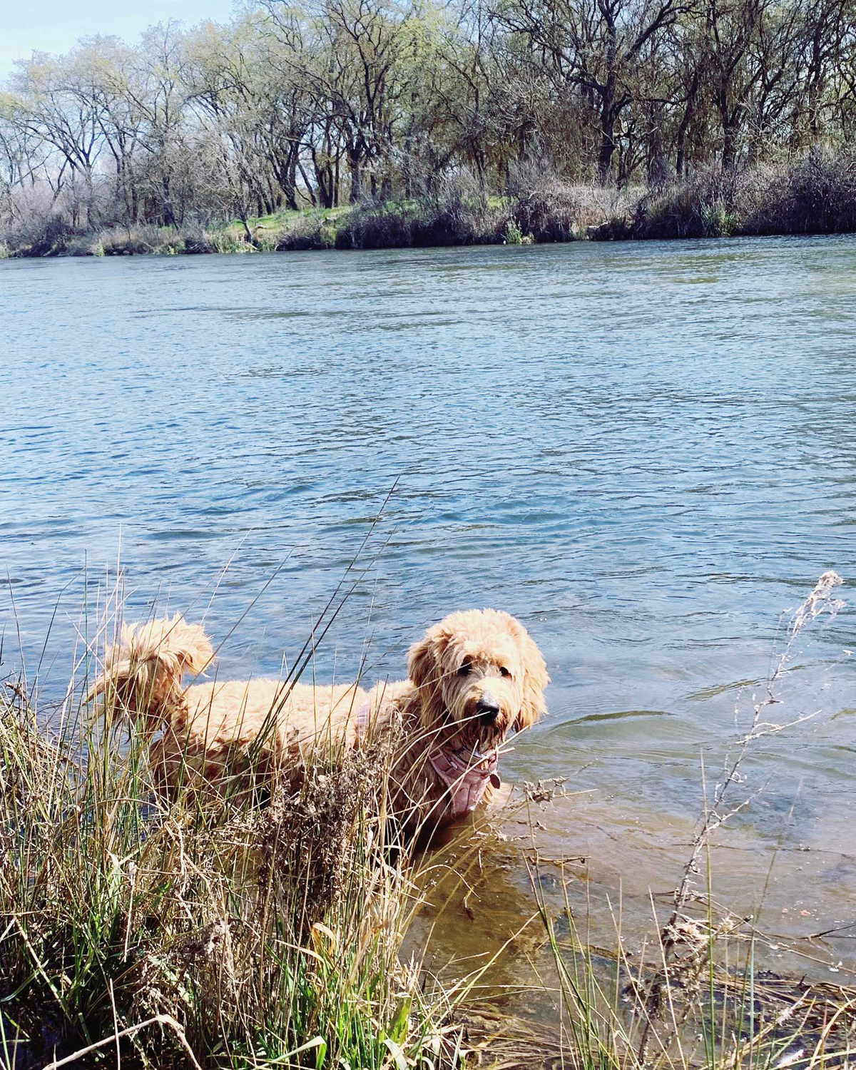
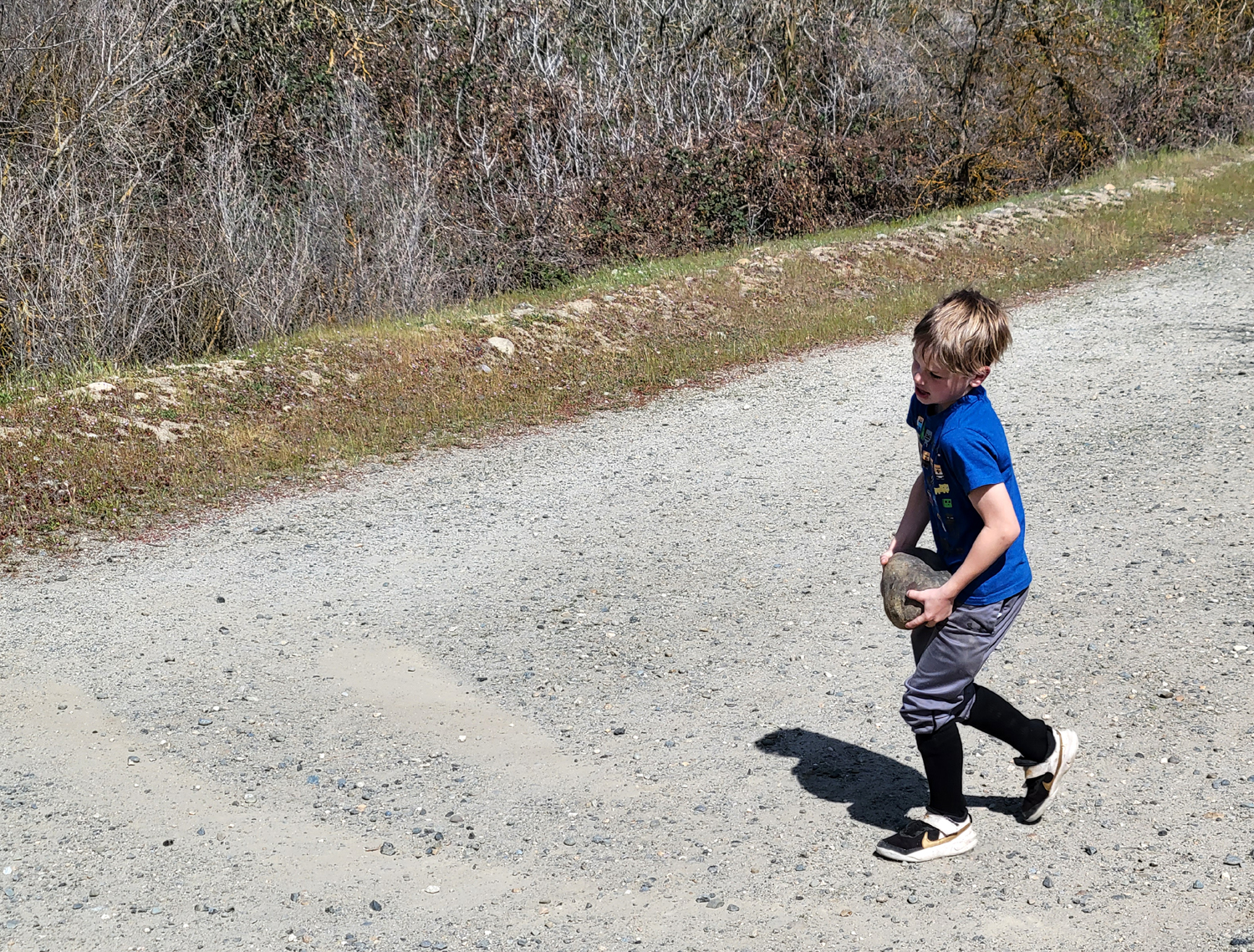
We went past the tree a half mile or so, to a place where the Upshaw's and Dottie could get down to the river. This proved to be Dottie's favorite part of the hike, as she returned to the trail with mud up to her elbows (or whatever those first joints are). Near the bridge the bank of the trail was lined with river rock, and the combination of kids, rocks and water always means that some of the rocks will end up in the river. |
|
|
|
|
Dottie Dog has a swimming pool at home, but it lacks the delightful mud of the river |
Jack with a rock to drop off the bridge |
|
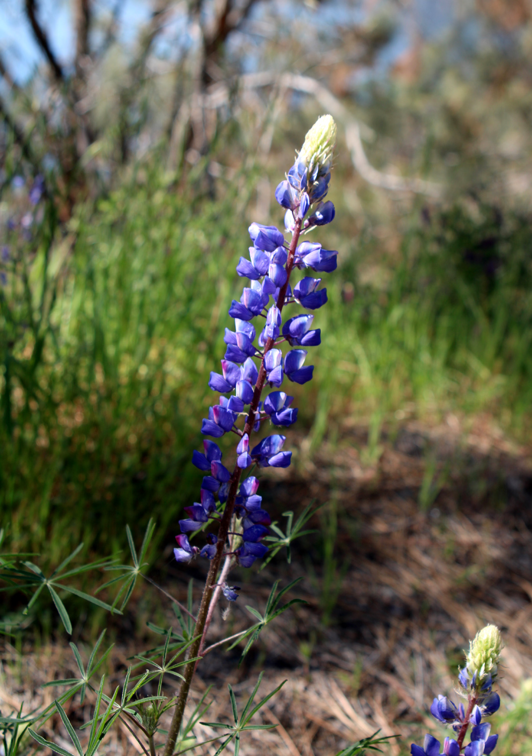
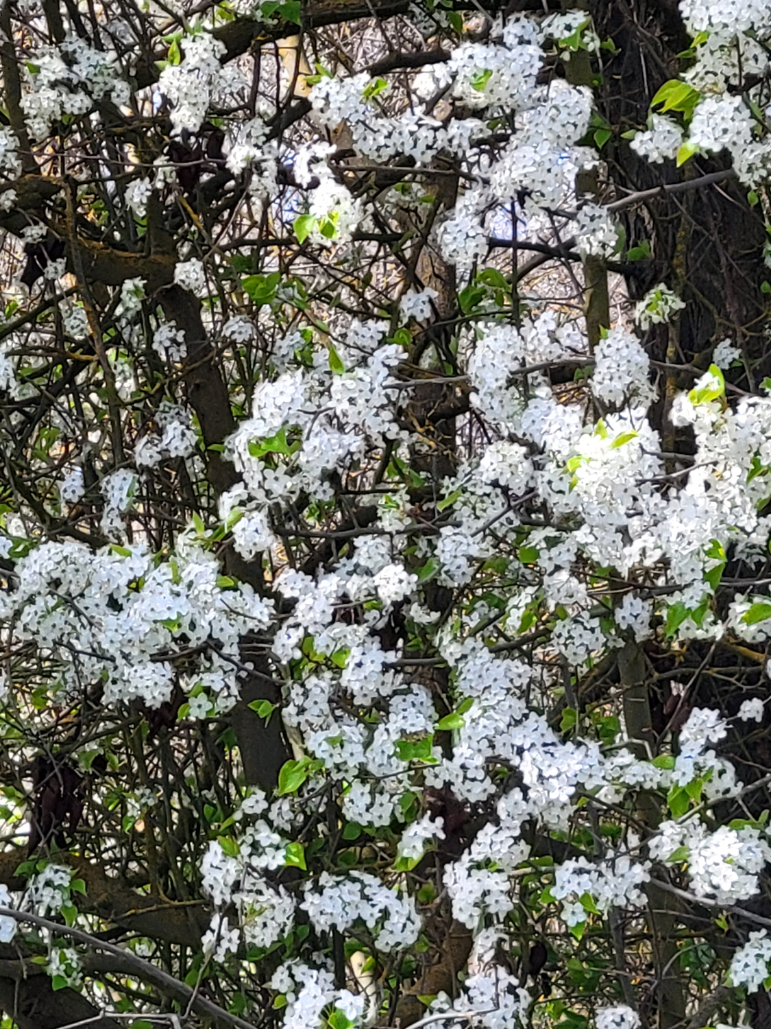
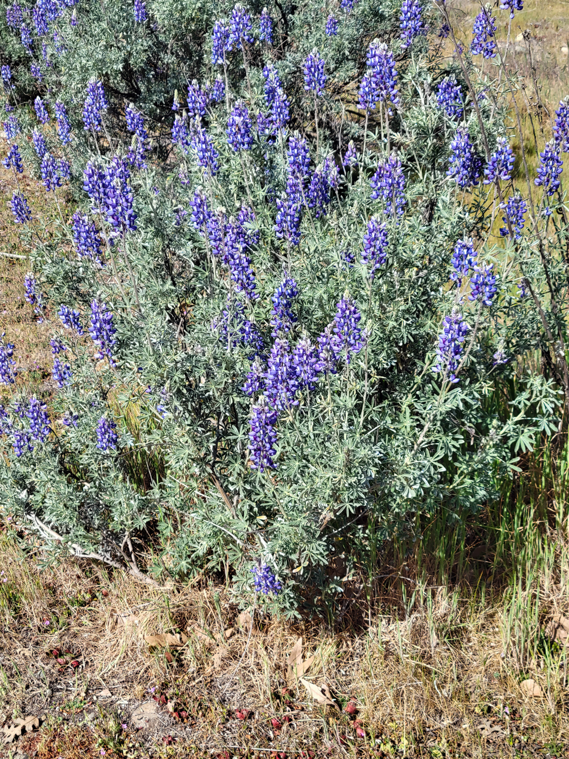
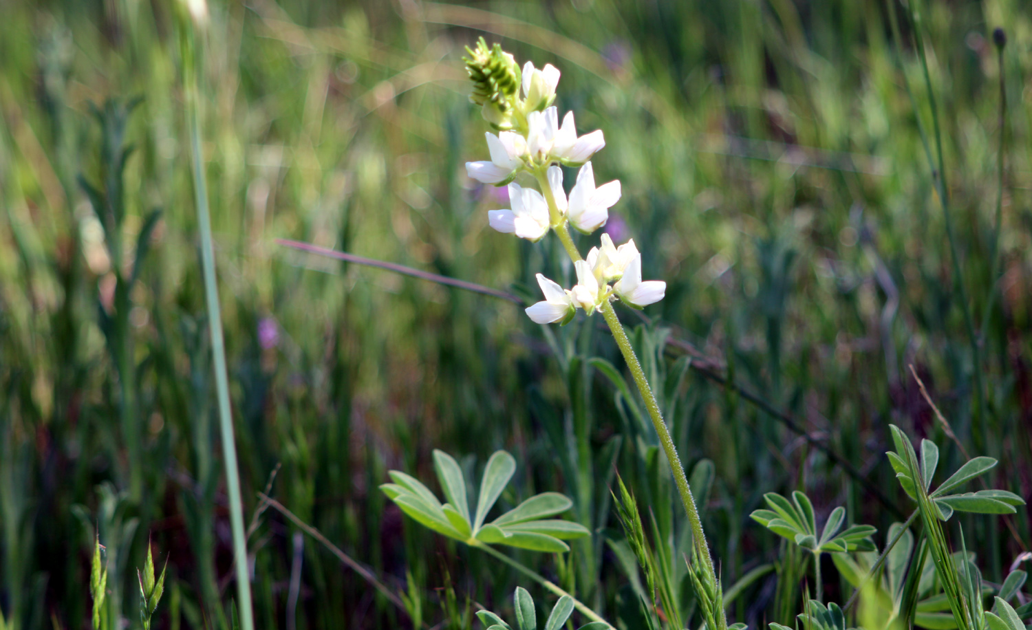
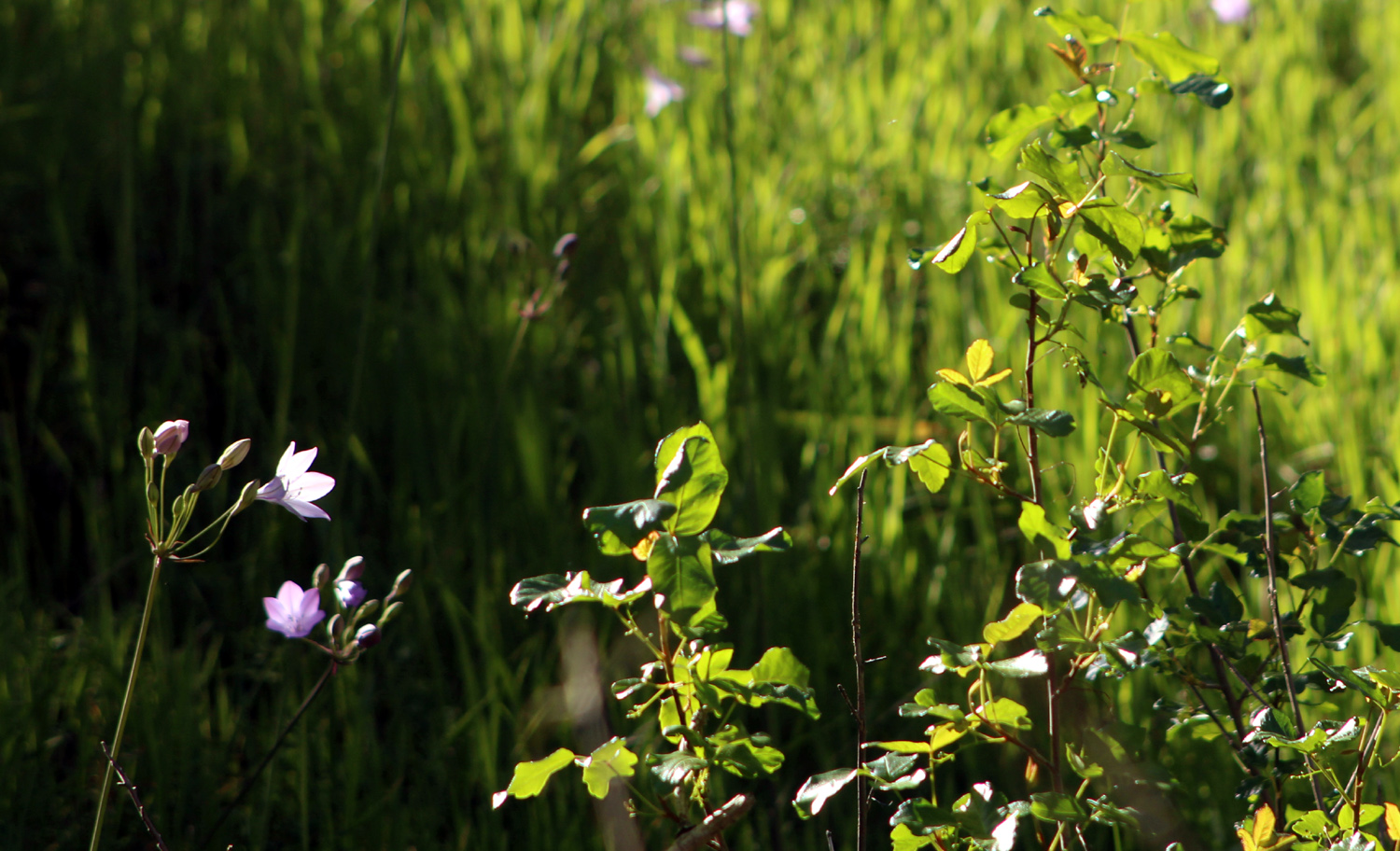
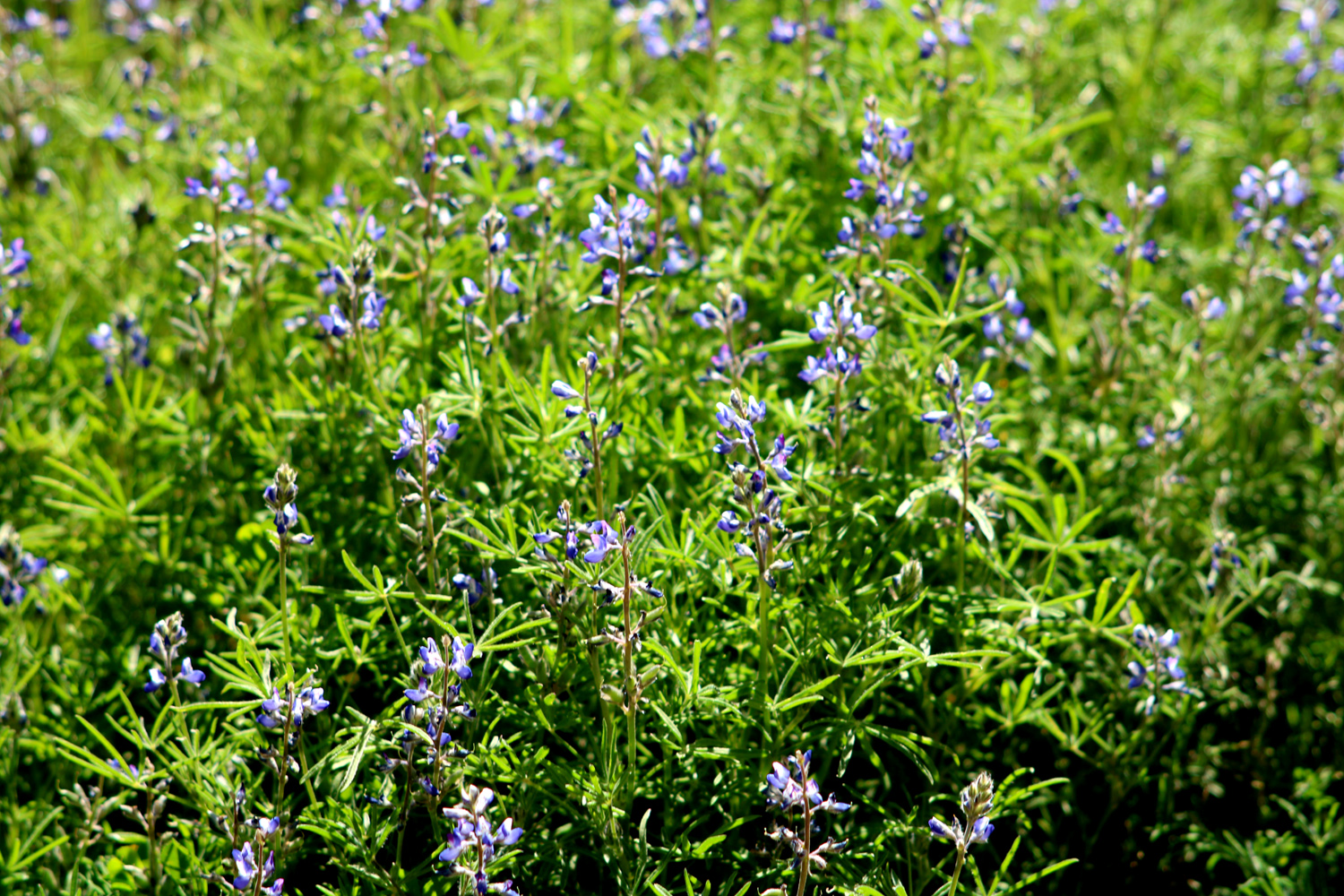
We saw a few flowers, mainly bush lupines and a flowering tree whose name was unknown to us. |
|
|
|
| Unknown white flowering bush by the trail | Bush lupines were at their best |
|
Mostly we just enjoyed the company of family and watching the kids (of all ages) having fun. On the way back one of the boys said, "We had a lot more fun that we thought we would." Most of their outings are like that. --Dick Estel, March 2022 |
|
|
Spring Drive & Hike
Spring is a state of mind...and a period of time on the calendar...and a natural event when new grass and leaves and flowers appear. It's no surprise that these three "spring's" are not simultaneous. And in central California the spring of nature has always arrived earlier than the calendar says it should. Driven by climate change, in recent years it has been starting even earlier, so that while our friends in the east are braving single digit (or lower) temperatures and battling dangerous snowy conditions on the road, we are hiking in short sleeves through fields of wildflowers. On Mach 22, being well into the "state of mind" phase of spring, I set off on what I call a "Drive & Hike." This is when you drive a while, stop and hike a while, then repeat. You may say, "well, all your hikes start with driving," and this is true. But in a Drive & Hike the driving is a major part of the adventure, with the route chosen to provide a scenic outdoor experience during the driving portion. |
|
|
|
| Bush lupine in full bloom | Pines above the bank of Pine Flat Lake |
|
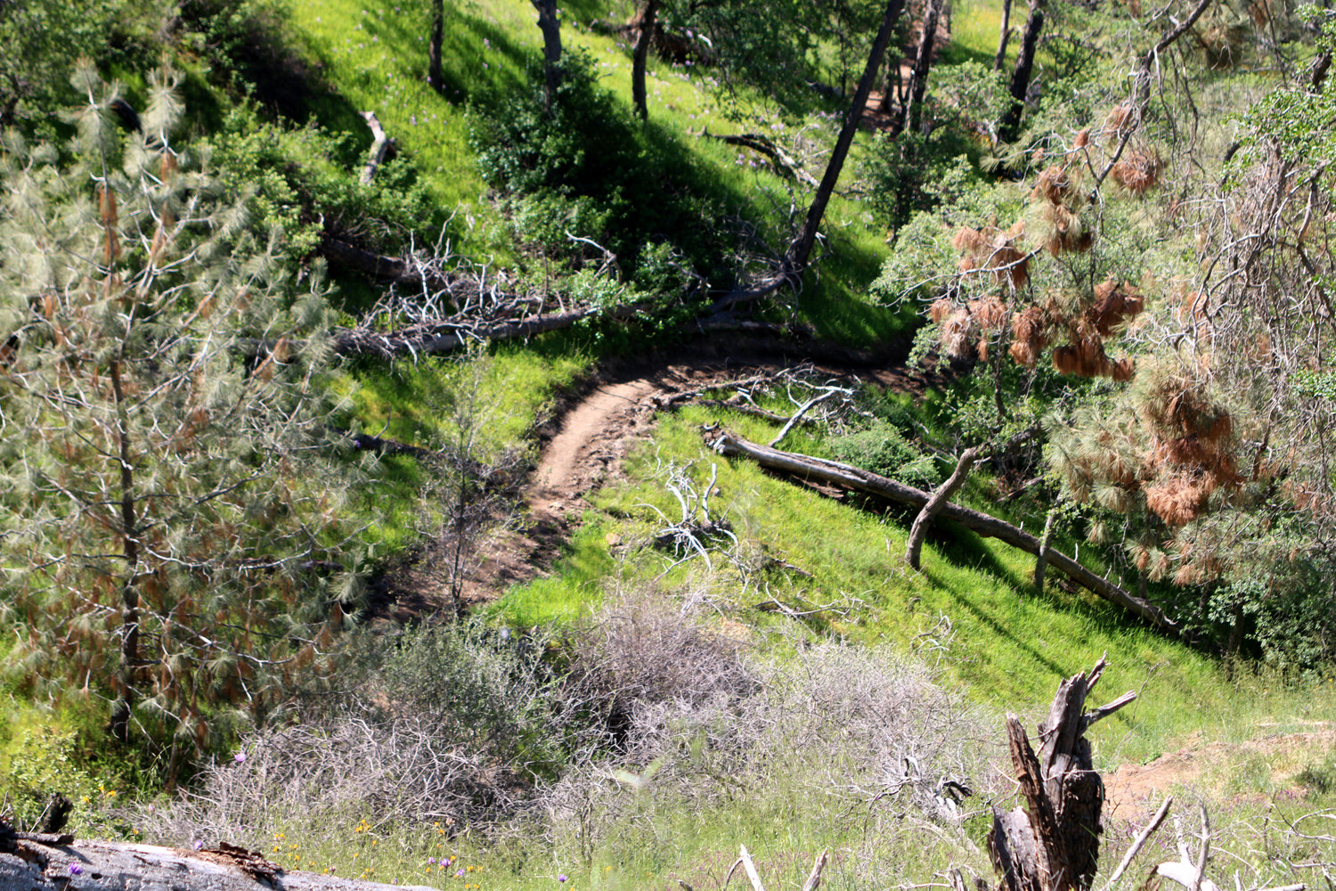
When I hiked with the Ramblers five days earlier, we noticed that extensive maintenance work had been done on the Edison Point loop trail. This route goes out on a ridge, with the first part being a service road for the power transmission line. At road's end the the trail goes down steeply with some long switchbacks to the edge of the lake, then back toward the road and up through a shady drainage to the trailhead. The last time I was here this section of the trail was blocked by eight or ten fallen pine trees, making it virtually impassible. I assumed the recent maintenance would have included removing the trees, and decided to walk in a short distance on this lower section of the trail, to a place where there had been massive fields of purple brodiaea on my first visit. The trail is clearly marked, and in very good condition. It is not 100% level on a side to side basis, so care must be taken in some places. The beginning of the trail was good enough to tempt a family I talked with to bring a stroller, but after a half mile they were about ready to turn back. Later I saw them come out, carrying the child. Interestingly this was not the worst trail where I have seen people bring a stroller. In that other case they soon abandoned the stroller and also carried the kid. Emphasizing how hard it is to keep this trail maintained, there was already a tree down across the newly graded section. |
|

|
|
| The first tree down on the newly maintained trail | Two years ago this trail was overgrown and virtually impassible |
|
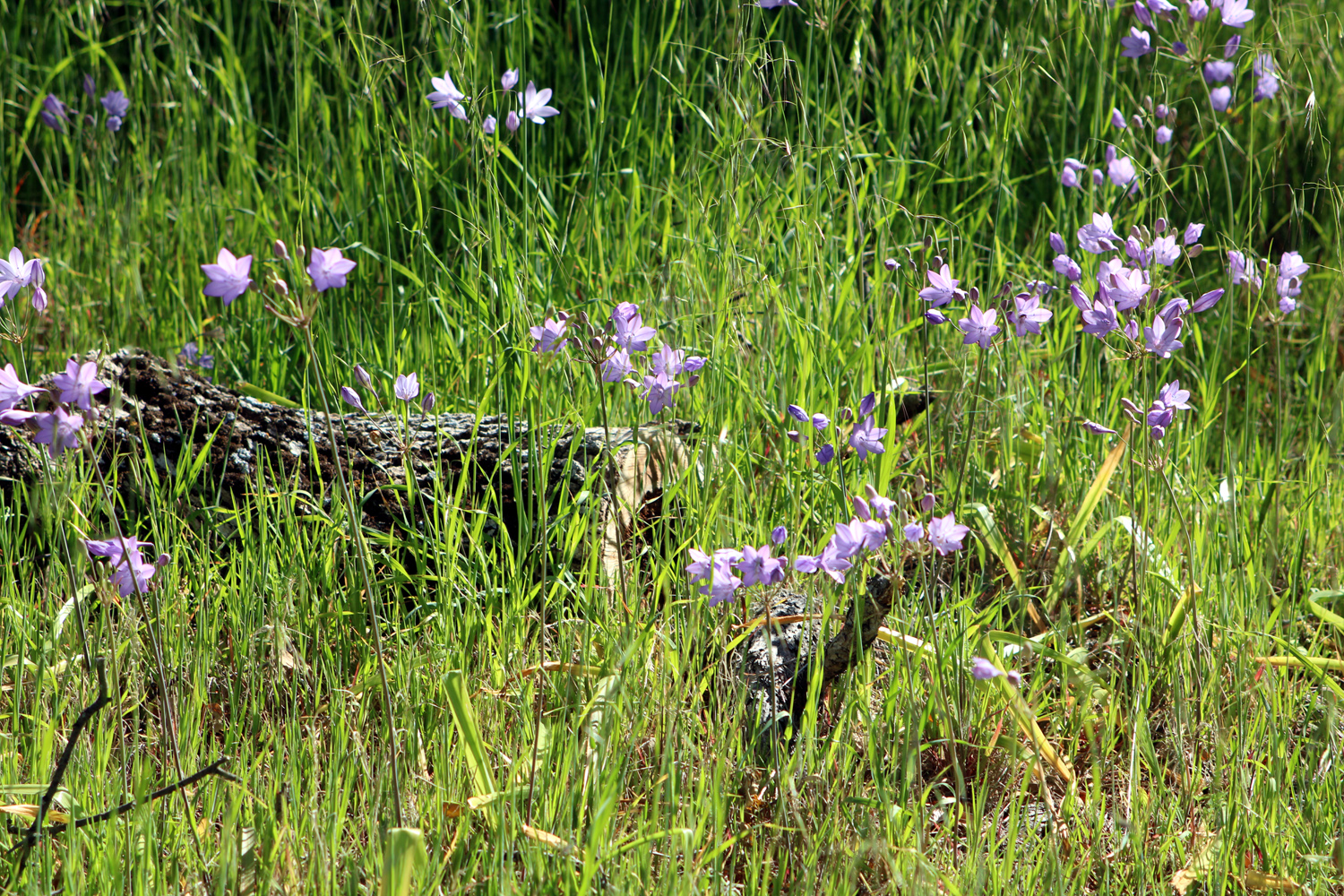
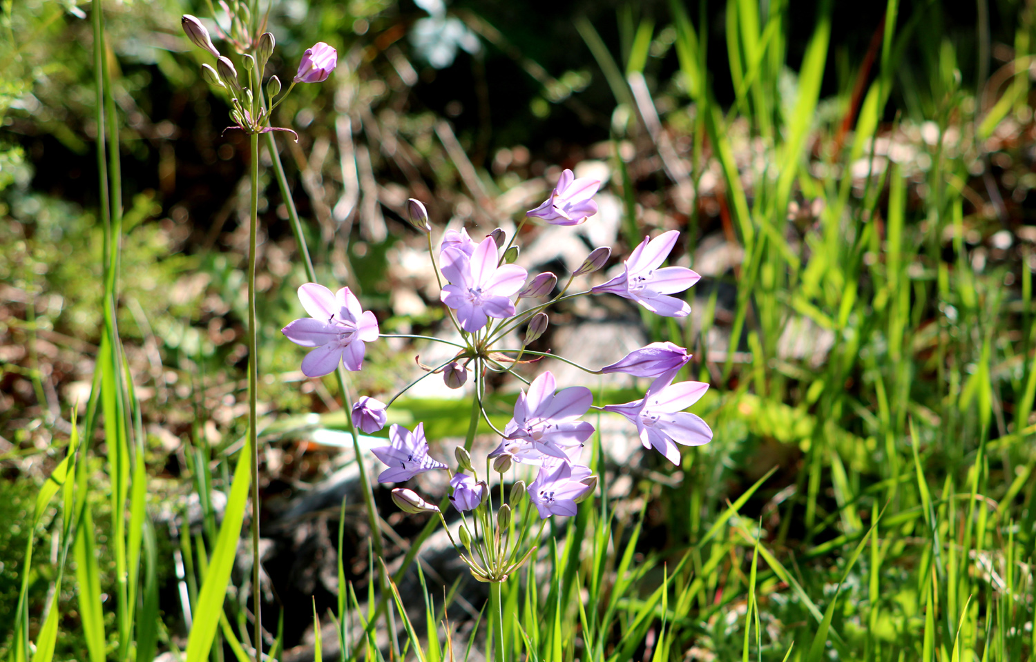
There were flowers of various kinds all along the trail, and when I reached the place where the brodiaea were so thick, I saw that the fallen logs were all gone, and the "garden" was everything I had hoped. Other flowers included the yellow harvest brodiaea, several varieties of lupine, and the foothill standards, fiddlenecks and filaree. Along the road I saw a few farewell-to-spring, a bit early on the third day of the season. |
|
|
|
| A small part of the purple brodiaea fields | Close up of brodiaea blossoms |
|
|
| This brodiaea is called pretty face or harvest brodiaea | White lupine |
|
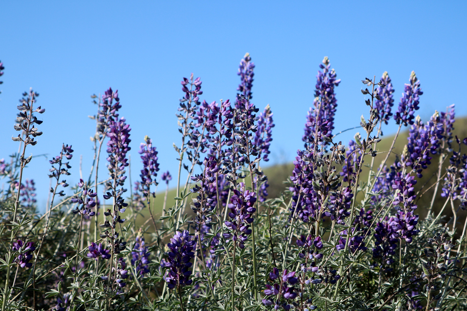
While the flowers were not as thick as on my first visit in 2015, It was still a very satisfactory outing, especially being able to hike without the effort of getting around the fallen trees that had made previous hikes a challenge. The entire loop is about 2.5 miles but seems longer due to the steep sections. However, it took only four tenths of a mile of hiking to reach the good flower fields. I became the trailhead host, answering questions and providing SOLICITED advice to the stroller family and a couple who were camped nearby and were looking for places to hike the next morning. If you decide you'd like to try the loop, do it soon before the weather gets too warm, and while the flowers are still good. Start by going out the upper section of the trail to avoid a steep climb near the end of your hike. Take plenty of water. Start early in the day. Say a thank-you to the maintenance crew that you will not have to try to identify the trail in places like this. When I finished my hike and my hosting duties, I started the "Drive" portion of the day. My plan was to continue on Trimmer Springs Road to where Big Creek runs in, then go up the dirt road along the creek. I would stop wherever and whenever something caught my eye. And I would continue to test my new camera, which I had just bought after I decided that my cell phone was not working out for me. Even before arriving at the Edison Point trailhead, I had stopped shortly before the road begins to rise into the foothills, to photograph lupines near Winton Park and along the road higher up. |
|

|

|
| Lupines and hills above the river at Winton Park | Someone scattered thousands of lupine seeds down this hillside |
|
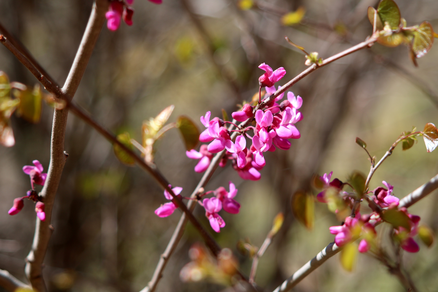
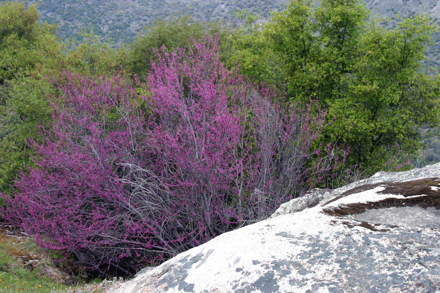
A few years ago I had observed some white shooting stars about a half mile beyond Edison Point . They are normally pink, and I suspect this is a rare mutant. They appear in this same location every year, and along the power line service road up the hill. This was my first stop after the hike. Something that has not been highly visible this year is redbud. I did find one bush where I could get a close-up photo. They are in bloom along the road, but they are also almost fully leafed out, so you don't get the usual sight of an all-pink bush, like this one from a few years ago. |
|
|
|
| Rare white shooting star | Redbud blossoms |
|
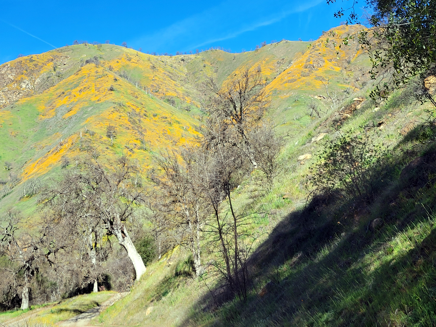
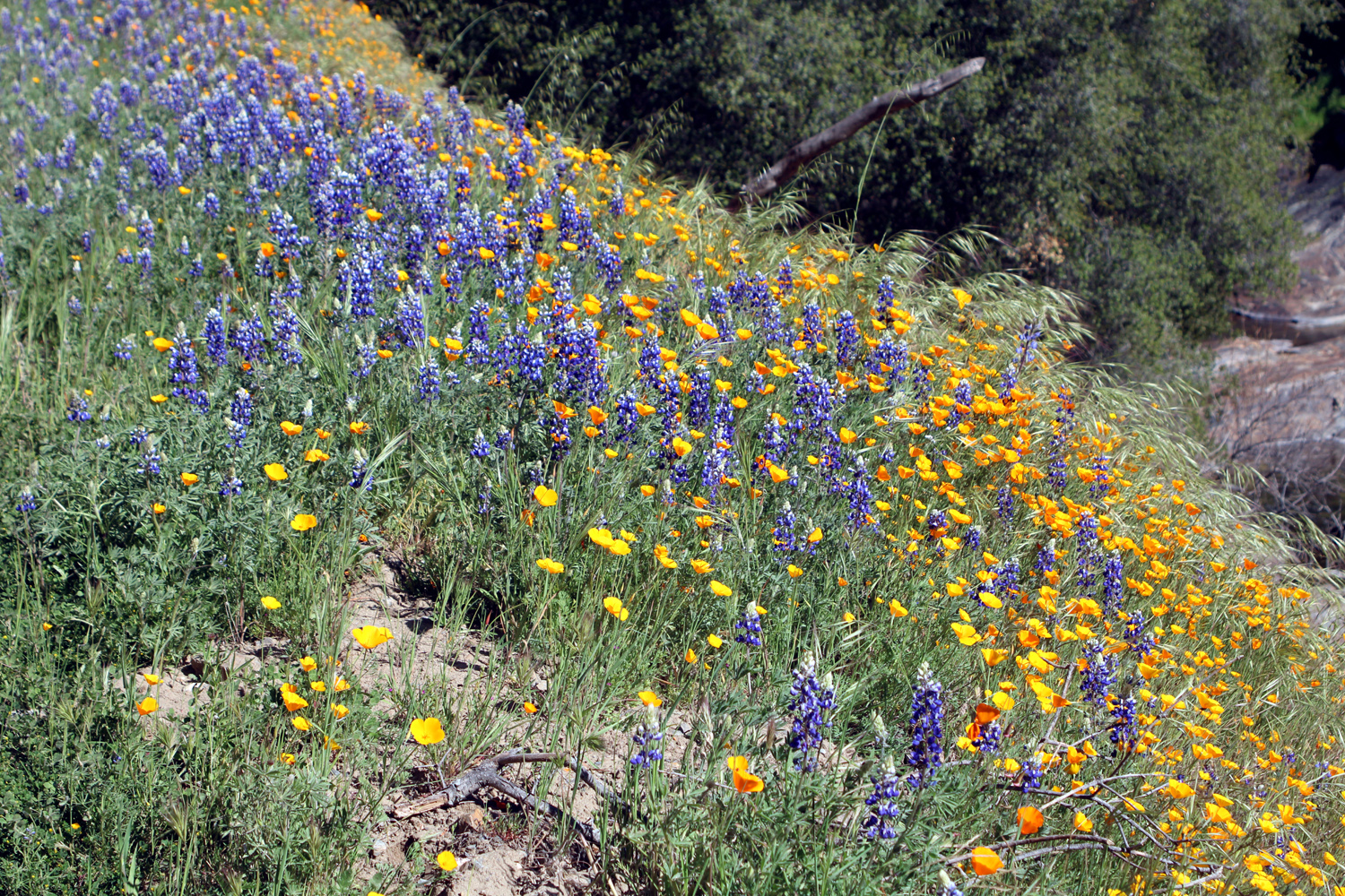
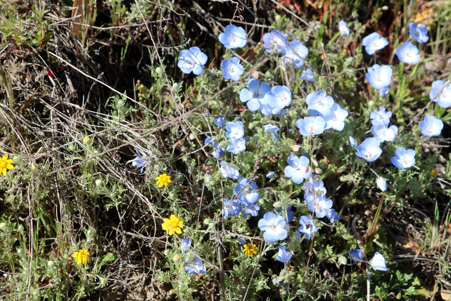
Driving up the dirt road I had nice view of Big Creek, and spectacular poppy and lupine displays, as well as other foothill wildflowers. I pulled off at a shady spot and enjoyed my lunch with a view of the creek as well as patch of baby blue eyes. |
|

|
|
| A cascade on Big Creek | Poppies above the dirt road along the creek |
|
|
| Hillside between the road and creek | Baby blue eyes |
|
Driving on Trimmer, I saw two solo wild turkeys in two separate locations. Usually a flock will stroll across the road as if they owned the place. but these two both ran, perhaps not feeling confident without any backup. On the dirt road I spotted a small mammal, possibly a fox or raccoon. It disappeared before I could get a good look, and I was tempted to claim a sighting of a marten or fisher, but they both prefer higher elevations. I think it was most likely a fox. It was a nice day, not too hot, and a great time to be out in the foothills. I accomplished all my goals - seeing the brodiaea fields, and enjoying the blue and gold along Big Creek. --Dick Estel, March 2022 |
|
|
Photos (Click to enlarge; pictures open in new window) |
||
|
Tesoro Viejo Hermit Hole Sumner Peck III Spring Drive & Hike |
||
|
Tesoro Viejo |
||
 |
|
 |
| Teri and Dick with some cool-looking clouds | Sisters - Jennifer and Teri | Kara and Jackie |
| Hermit Hole | ||
 |
 |
 |
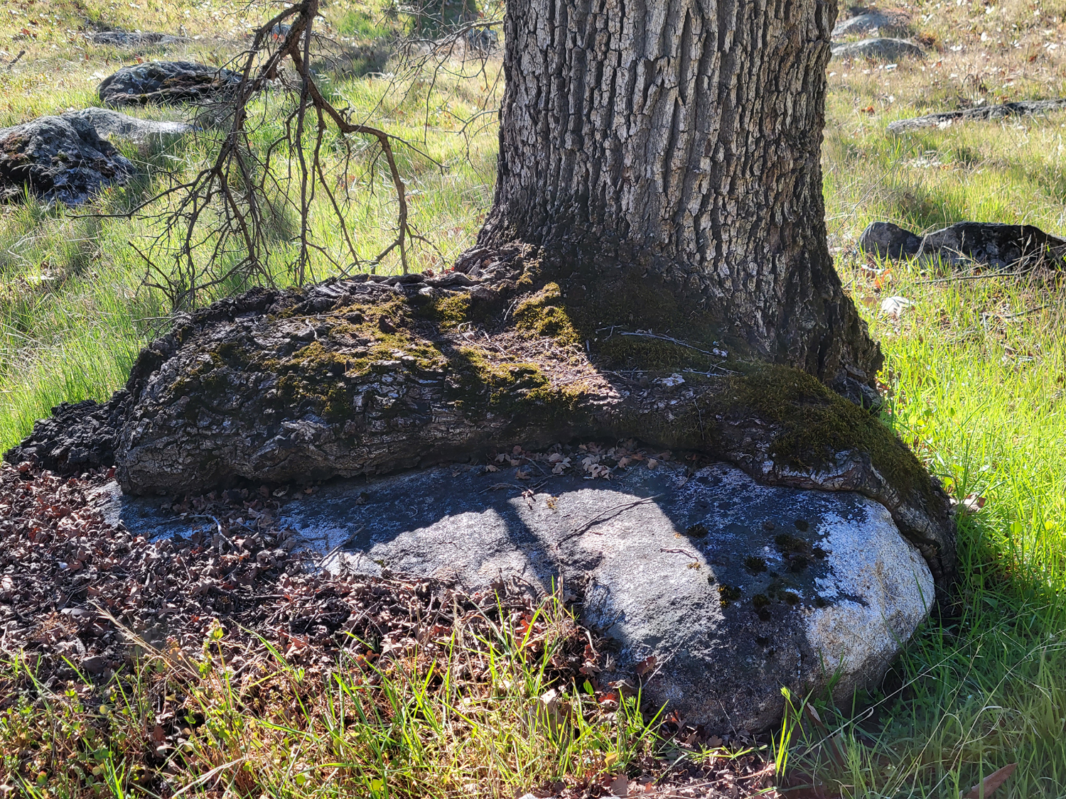
| The base of this
valley oak has spread out on top of an adjacent rock |
A closer look | Kings River below my camp |
 |
 |
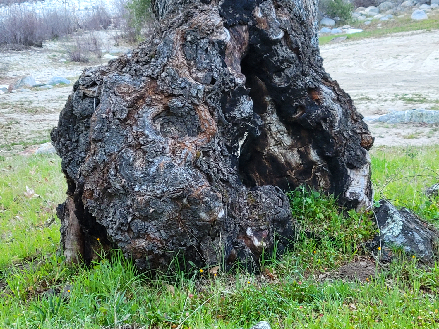 |
| Poppy close-up | Ancient burl on a valley oak | Up close it's gnarly and looks to be rotting |
 |
|
 |
| A few patches of
snow remain on the hills above the south side of the river |
Another poppy-covered hillside | On the south side, the hills are steep and rocky |
 |
 |
 |
| Valley oak limb frames fiddlenecks | Many of the fiddlenecks were three feet tall | The fine print says "Foot travel welcome" |
 |
 |
 |
| A river view with poppies and a few lupines | Fiddlenecks and blue oaks on Sacata Ridge | One final orange
hillside, this one up the canyon of Big Creek |
| Sumner Peck III | ||
 |
 |
 |
| Colton prepares to launch a large rock | Jack, Teri, Colton and Johnny under the oak | Nature's sculpture |
|
 |
 |
| The San Joaquin River | High water here has caused the bank to collapse | Teri and the Upshaw's on the trail |
| Spring Ride & Hike | ||
 |
|
 |
| A forest of bush lupines near Winton Park | Lupine close-up | Brodiaea among the poison oak |
 |
 |
 |
| Lacepods | A splash of orange above Pine Flat | Big Creek |
 |
 |
 |
| Dove lupines, the smallest variety | Poppies in the rocks above Big Creek | Fringed redmaids provide eye-catching color |
| Related Links | ||
| Tesoro Viejo | AXIS Coffee Bar & Eatery | Tesoro Viejo Trail Guide |
| More About TV Trails | Hermit Hole | Kings River National Recreation Trail |
| Kings River | Pine Flat Reservoir | Rafting from Garnet Dike |
| Kings River Expeditions (Rafting) | Sacata Ridge | Bailey Bridge |
| Sumner Peck Ranch | Valley Oaks | Edison Point Trail |