 f
f


|
Dick's Adventures of 2026 - Part 1 |
|
| Photos Related Links More Travel Reports | |
| Adventures
of 2016 Adventures
of 2017 Adventures
of 2018 2Adventures
of 2019 Adventures
of 2020
Adventures of 2021 Adventures of 2022 Adventures of 2023 Adventures of 2024 Adventures of 2025 2026 Part 2 |
|
| Sycamore Creek Wildlife Area McKenzie Preserve Sycamore Fire Road Finegold Fishermen's Trail | |
| Sycamore
Creek Wildlife Area
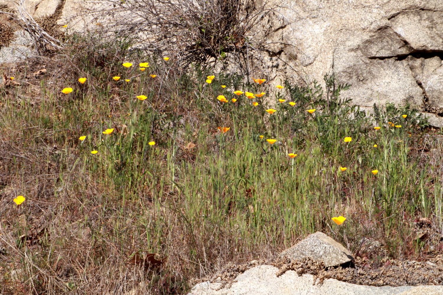
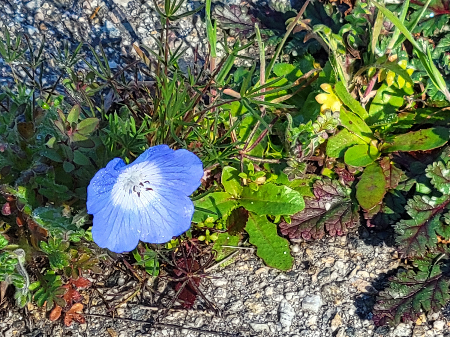
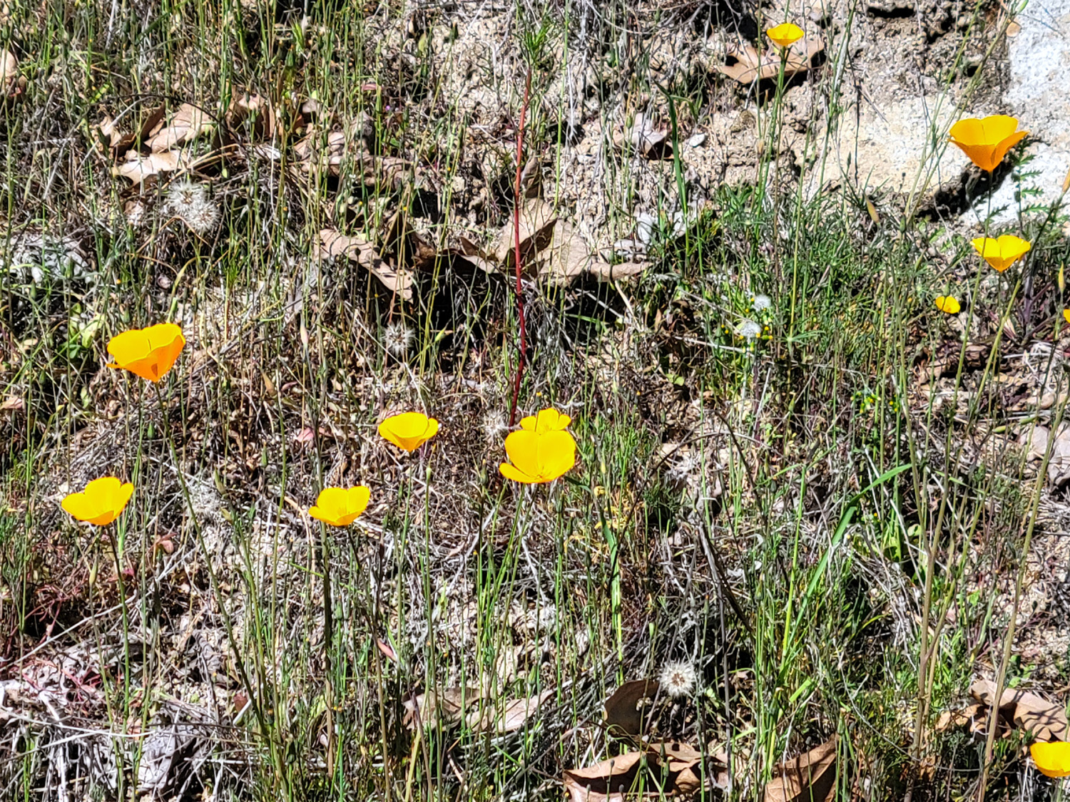
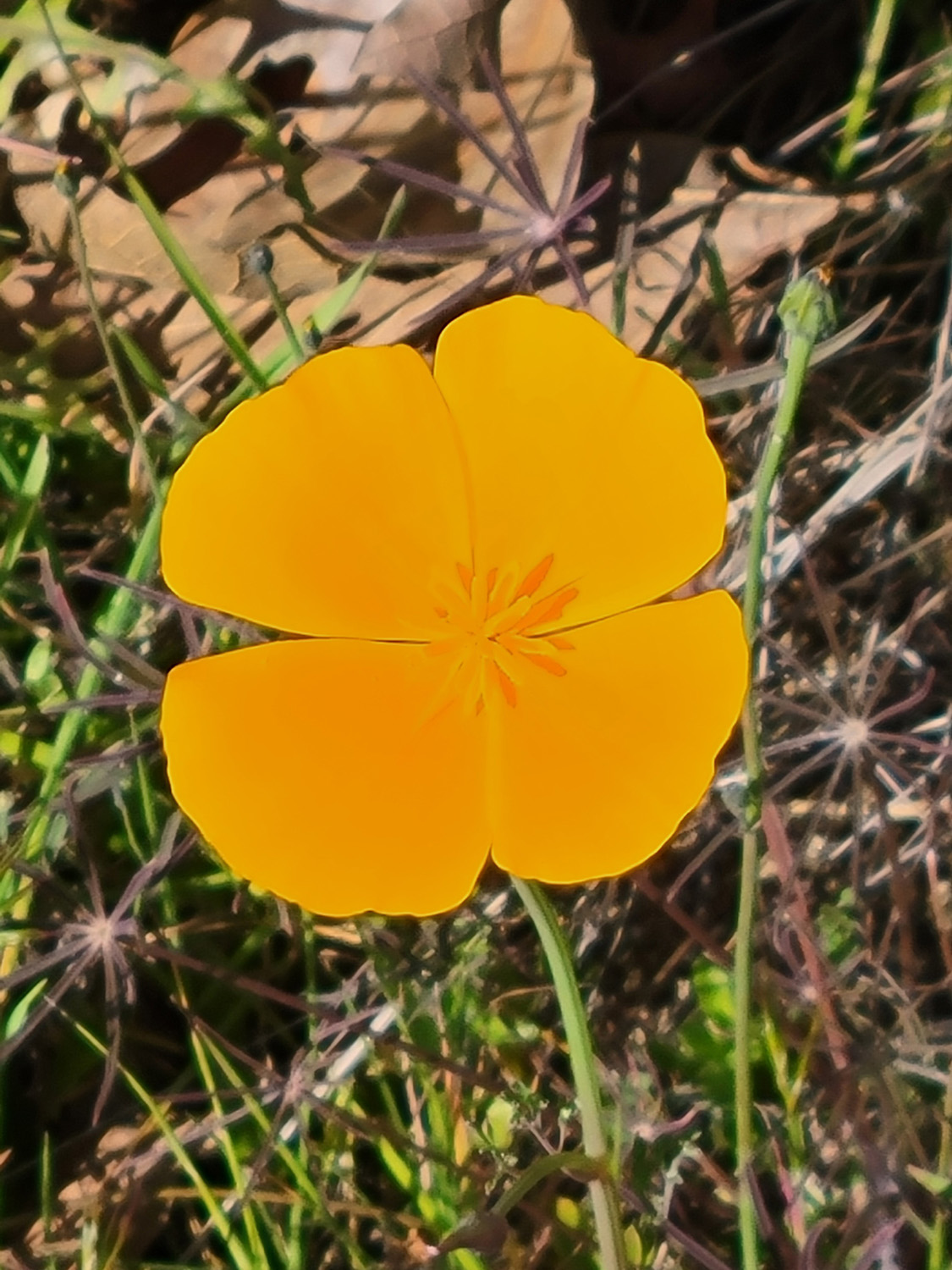
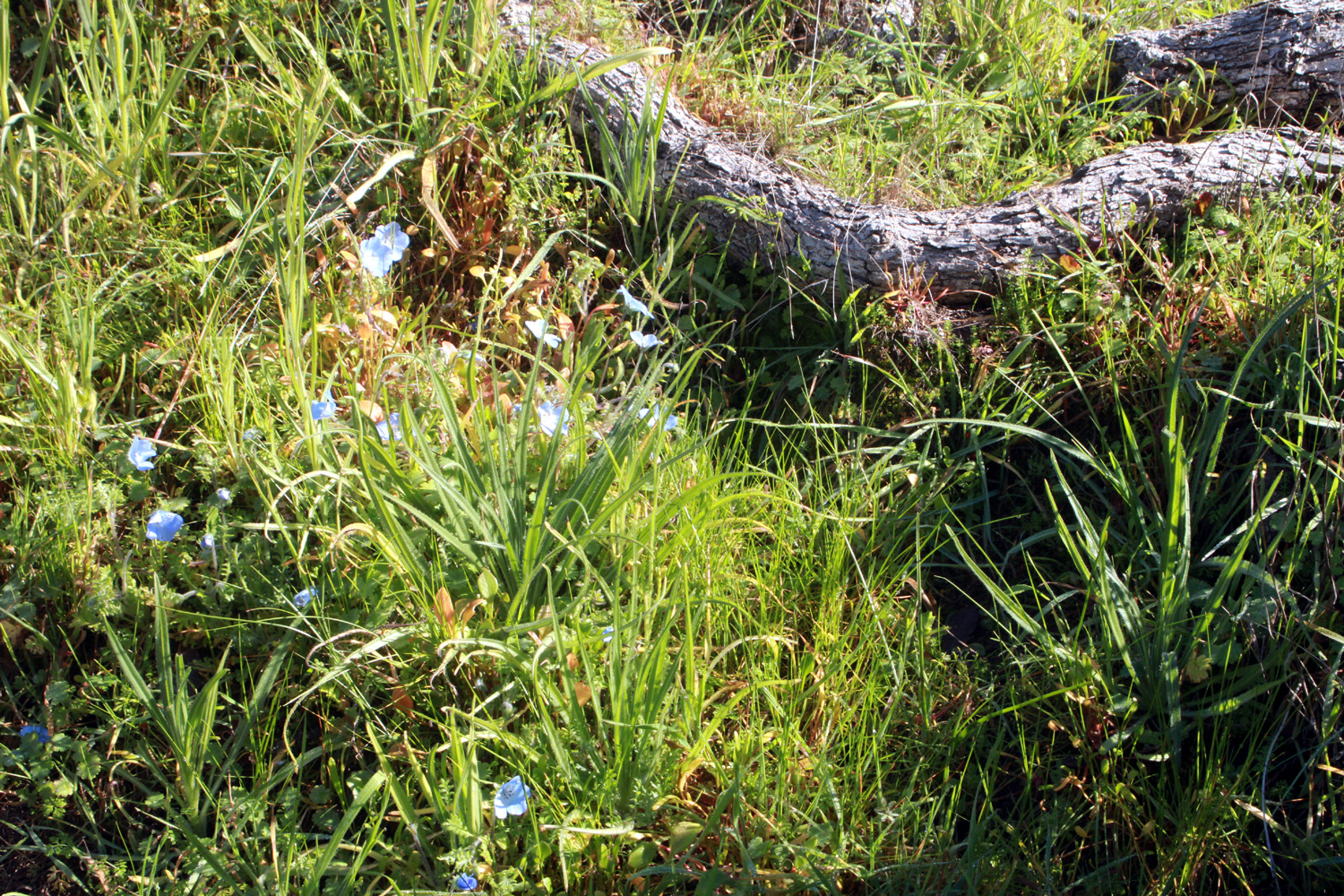
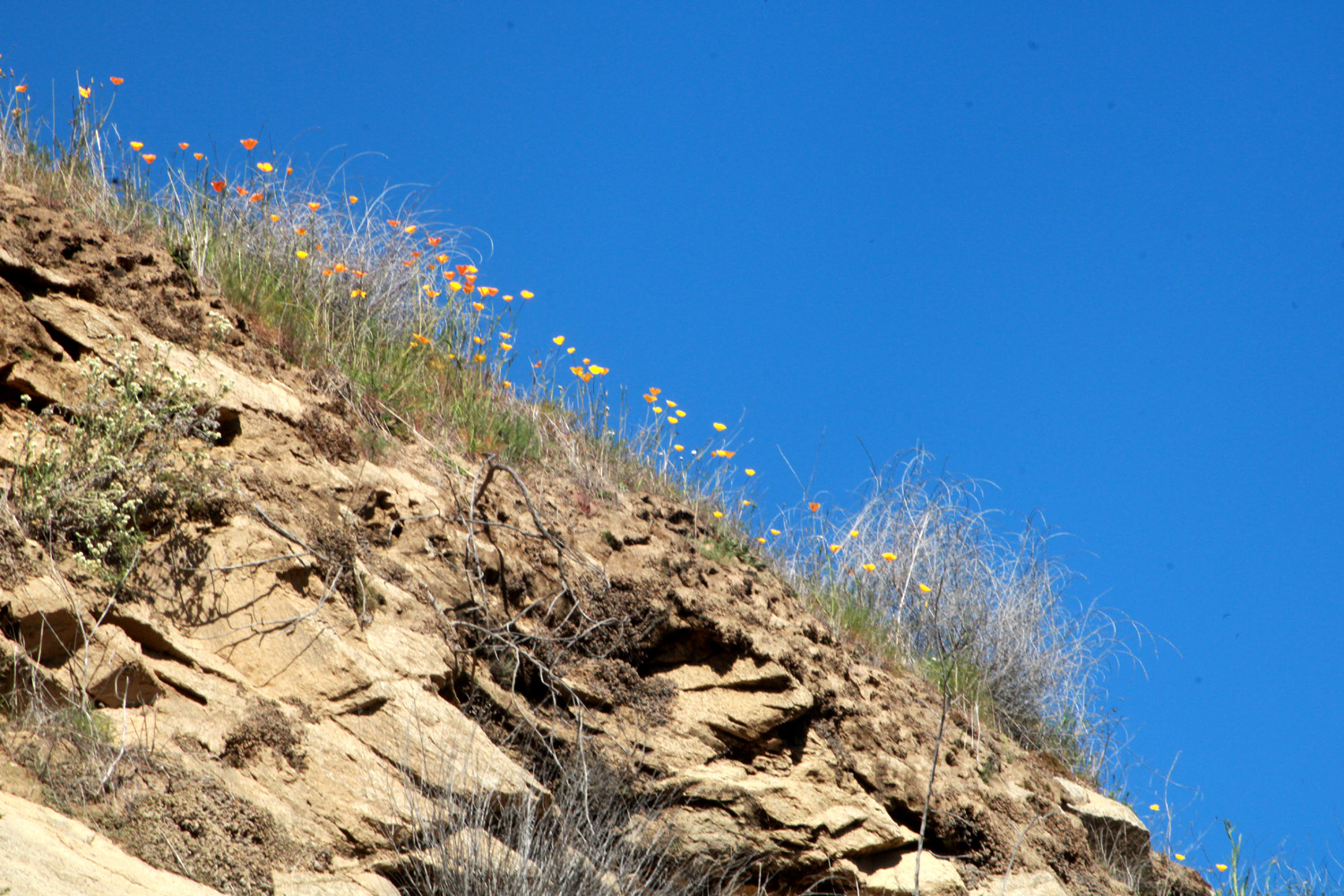
It has become very easy to look out at the morning fog and decide “I’m not going out in that.” Some days I will go out later in the day after the fog clears, but I much prefer to do these outings first thing in the day. In early February I decided I was going to go into the foothills and do a short hike no matter what. My friend Wes has recently been to the Sycamore Wildlife Area area by Pine Flat Lake and sending photos of poppies, so that was my chosen destination. When I drove up the first big hill from the lower elevation on February 4, I came to a place where fiddleneck blossoms are thick. These small orange flowers are probably the most common species throughout much of the Sierra Nevada foothills, and I would see them everywhere throughout the day. I soon came within sight of the lake, about 30 miles from home, and began to see a few poppies, more fiddlenecks, and the occasional blue ground lupine. |
|
 |
 |
| A passel of fiddlenecks | Poppies by Trimmer Springs Road |
|
After you drive along the lake shore for some distance, you come to three former campgrounds (one was actually a picnic ground). They have been closed for decades, and there are locked gates at the entrances, but entry on foot is permitted, even encouraged. The old paved roads in these areas are still more or less intact, with a lot of cracks where grass and wildflowers can grow. The walk through each one is not steep and fairly short, and we usually hike at two or all three of them. Since the Ramblers will be hiking in this area next week and will probably go to the first and third spot, I chose the second one. The road into this location goes down a steep hill, then levels off and forms a loop past the crumbling parking spurs where people once could camp. |
|
 |
 |
| Green grass and blue oaks in the campground | On the right, a parking spur where you could once camp |
 |
 |
| More fiddlenecks and a blue oak | Falling branches often block the camp roads |
|
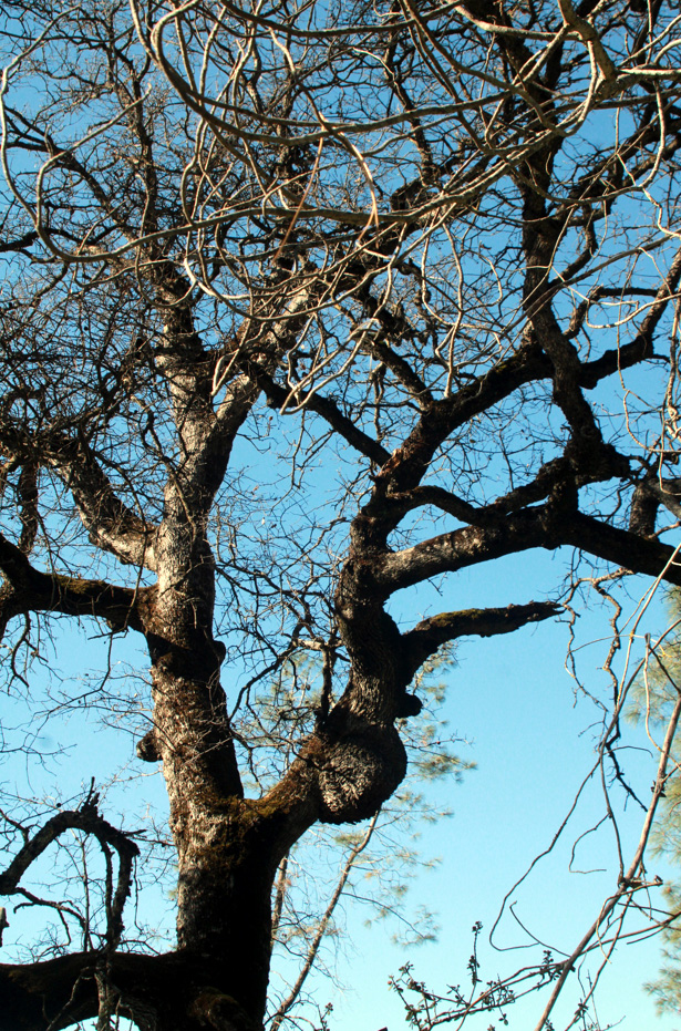
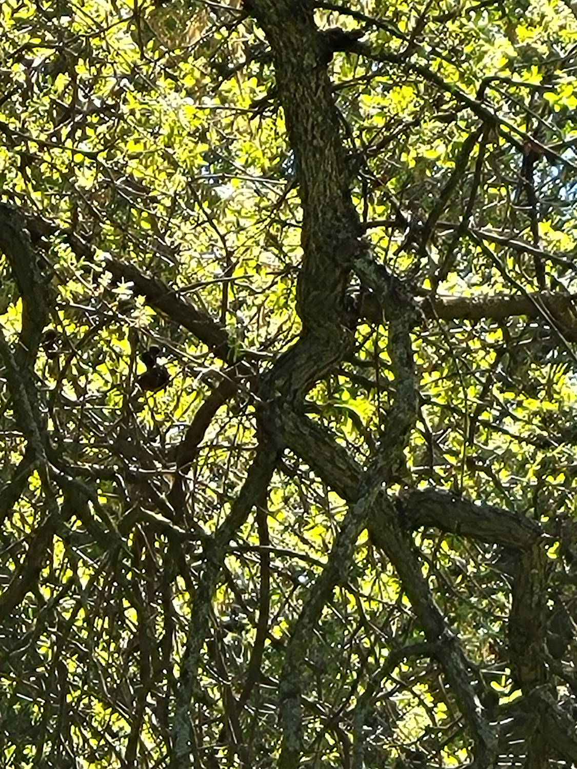
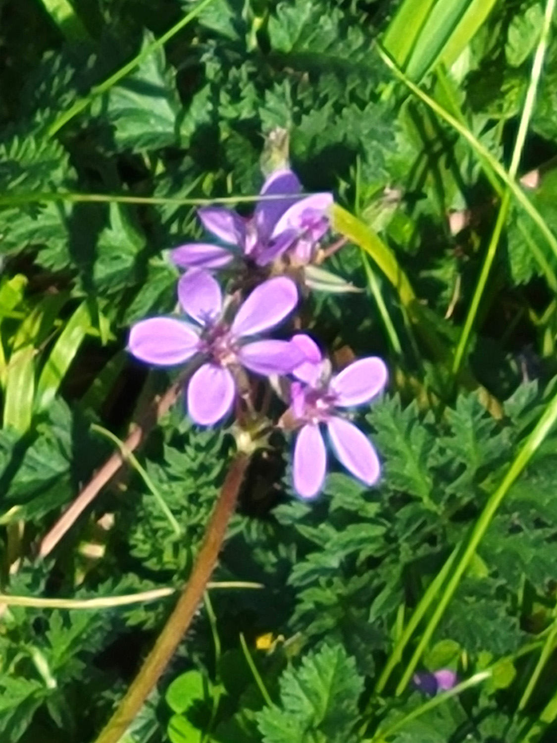
Besides multi-thousands of fiddlenecks, I saw baby blue eyes, always a favorite, lots of popcorn flowers, a few fiesta flowers and filaree. This latter is very common, but they were just getting started. This is low foothill country, about 1,500 feet above sea level, with all the usual trees and bushes of that environment. Most common are blue oaks and bull pines. |
|
|
|
| Baby blue eyes growing out of the pavement | Rugged branches of a blue oak |

|

|
| Bull pine close-up, showing male cones | Fully developed seed cones near the top of the tree |
|
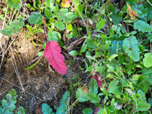
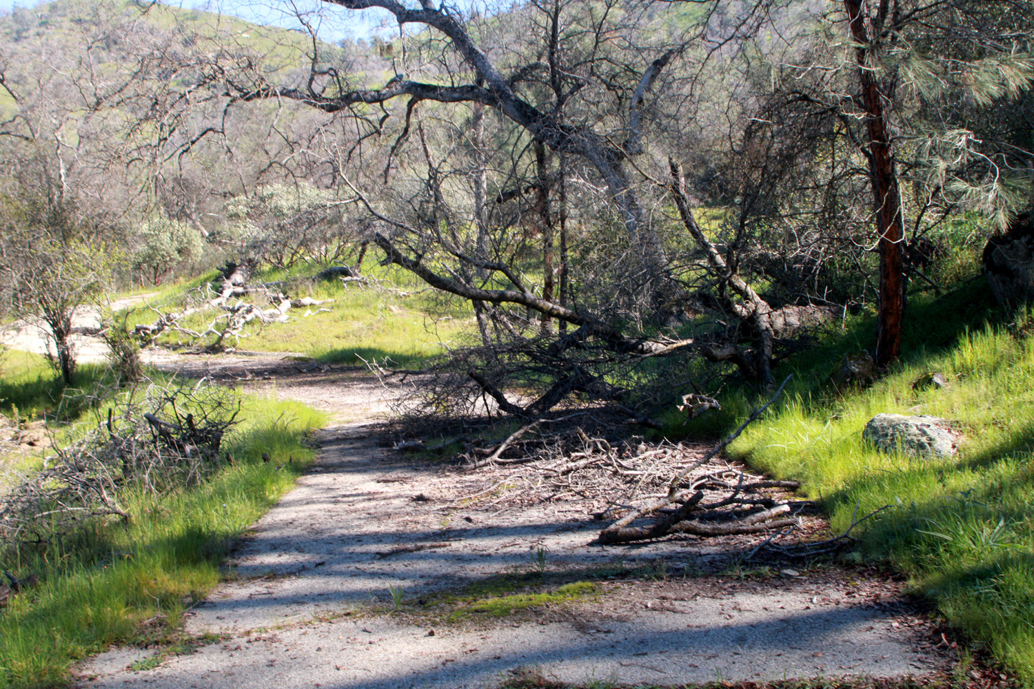
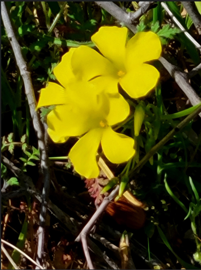
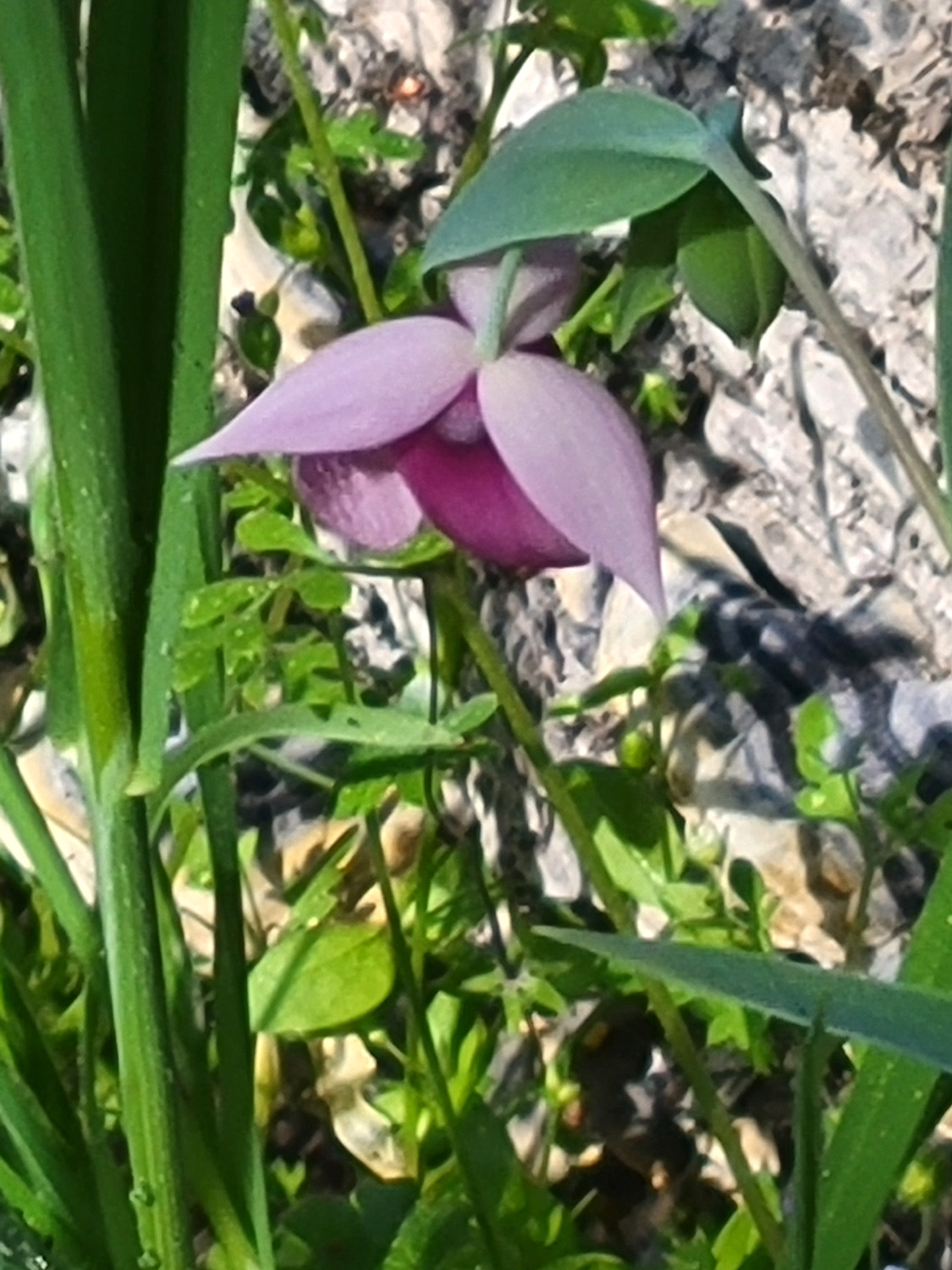
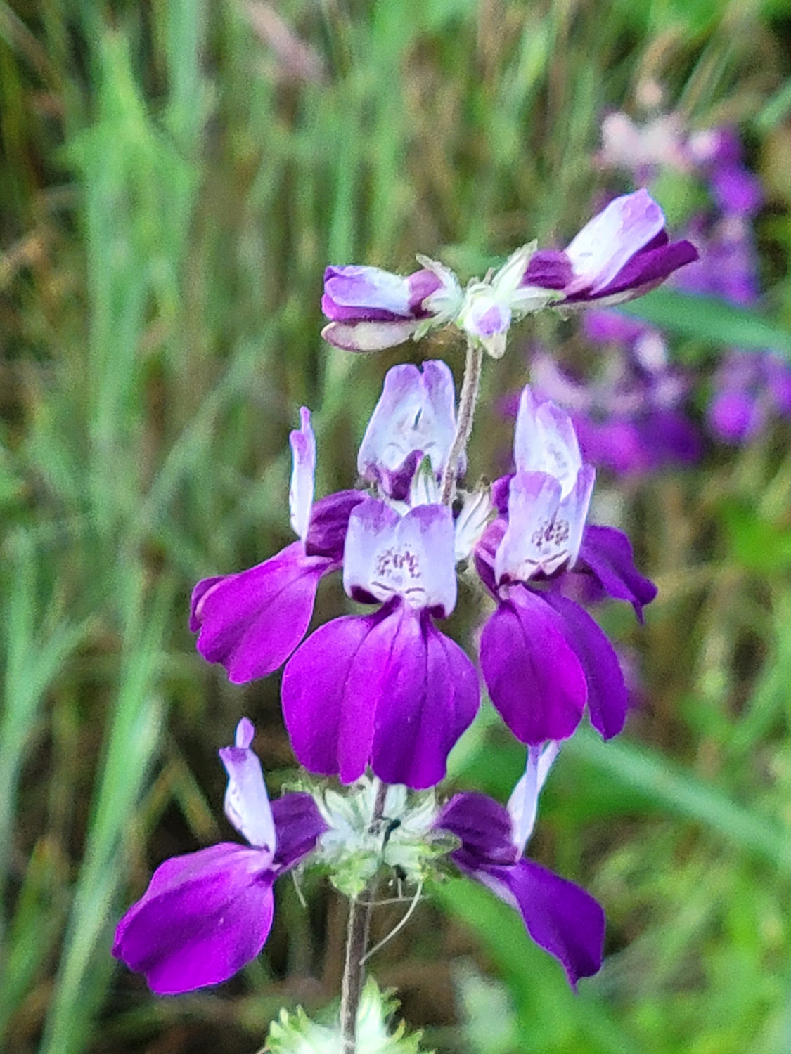
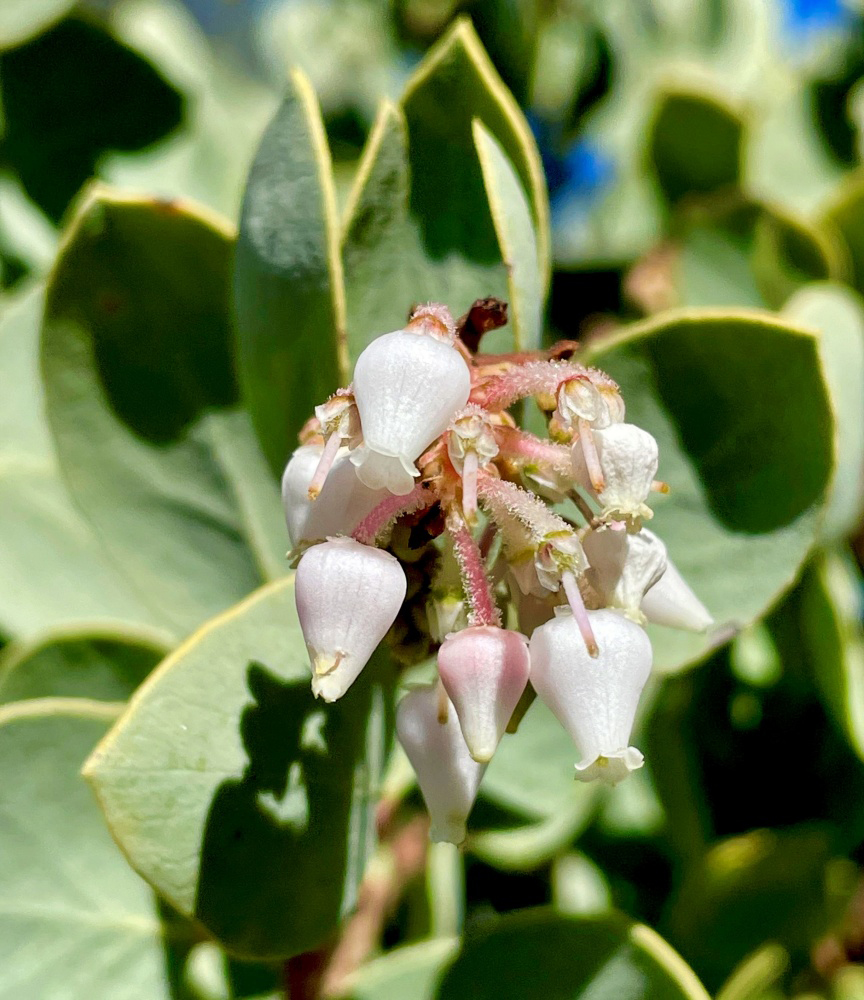
When I finished my hike I set up my chair by the car and had an apple, then drove back down the road a short distance to a sort of trail I call Sycamore Fire Road. This is an abandoned road that was probably related to ranching or prospecting. It was never paved and has deteriorated to just a trail most of the way. I've walked in a mile or so many times, but since this was the second hike of the day, I just went in a few hundred yards to the first creek. In wet years a half dozen little creeks flow across this trail, but we have not had significant rain since very early in January, and I was not surprised to see that the creek was dry. Nevertheless, there were flowers getting a good start, including the brilliant magenta of fringed redmaids, and the pink bell-shaped blossoms of the manzanita. When I first arrived at the wildlife area I noticed some fairly large flowers along the road. I parked by the sign, walked back to to take a look, and discovered a flower I don't think I have ever seen anywhere before. They are yellow, about an inch and a half across, and grew in two clusters, about 15 feet apart. Eventually a fellow hiker was able to use an app on his phone to identify them as Bermuda buttercups, an invasive species from Africa. Invasive they may be, but they are certainly impressive. |
|
|

|
| A remarkable and previously unknown flower, Bermuda buttercups | A look at the complete plant |
|
Having enjoyed a spectacular, sunny day in the foothills, I reluctantly returned home, stopping as I often do after hikes at the Colorado Grill for a buffalo chicken sandwich with fries and a coke. And of course, I was delighted to know I would be returning to the foothills in just over a week. --Dick Estel, February 2026 |
|
|
McKenzie Preserve
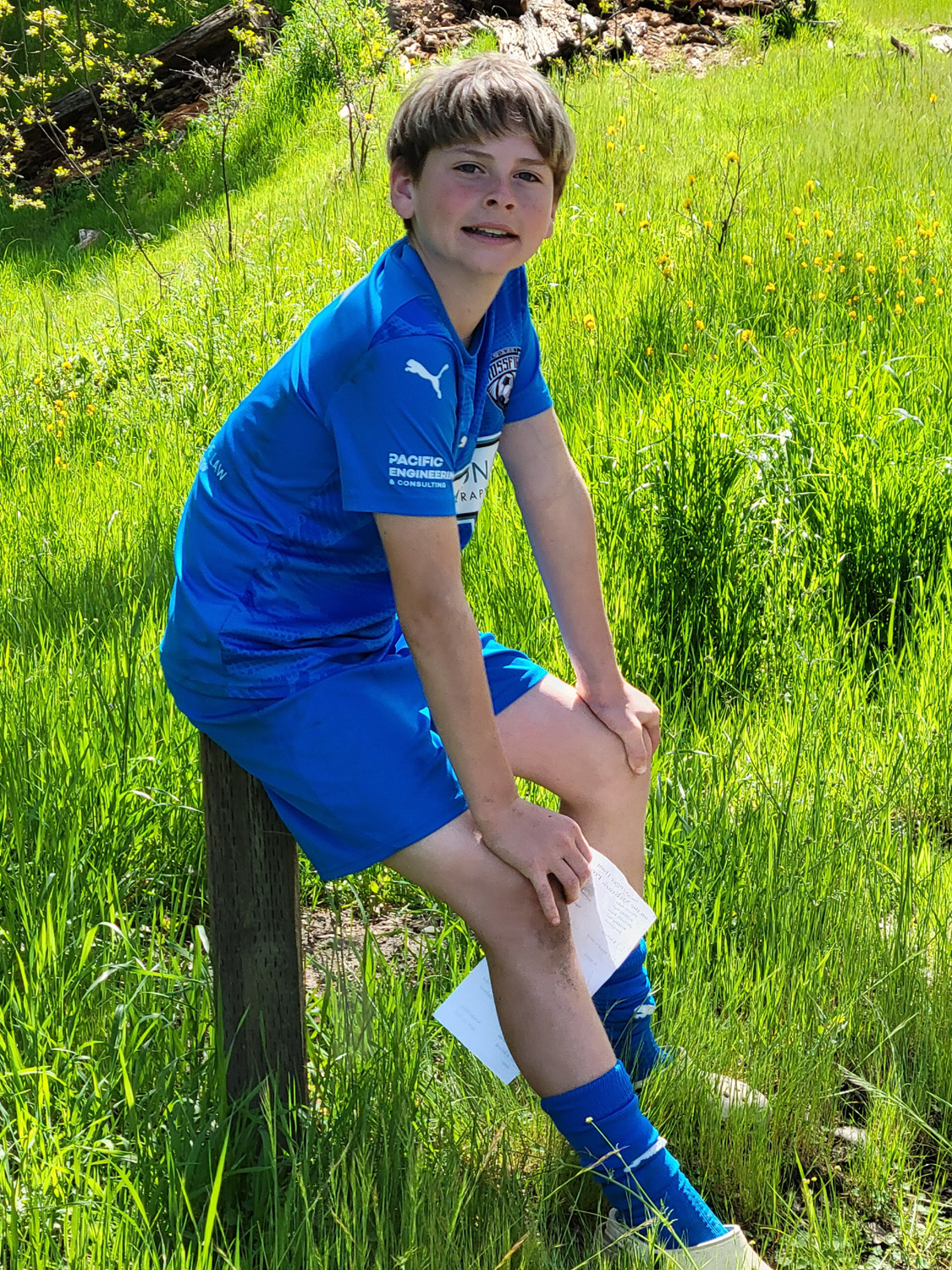
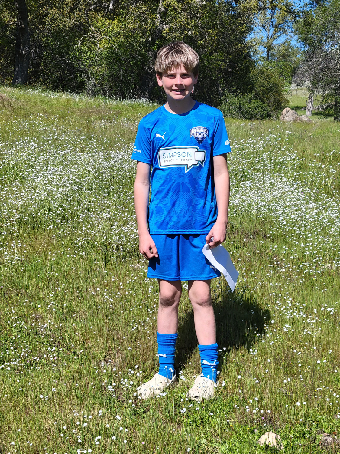
On March 7, great grandson Jack had a soccer game at 8 a.m. Both teams put forth a great effort and had some good scoring chances, but the game ended in a scoreless tie. No more need be said about that. I had already arranged for him to go with me to do some work at my house, but it was such a nice day that I changed our plans to a short hike. About 20 miles from town along Auberry Road is the McKenzie Table Mountain Preserve, administered by the Sierra Foothill Conservancy. The preserve is nearly 3,000 acres of rolling foothill terrain and table-top mountains edged by basalt cliffs. The property is normally open only for guided hikes, and these are too long and steep for my abilities, although Jack could certainly do them. However, once or twice a year is an "open day" when you can come in and hike unguarded, as much or as little as you like. You do have to sign in and out. After the game we went out to eat, a little after 9:30. I had eaten a very light snack before since I thought Jack would want some food after the effort of playing soccer.. He wanted Mexican, and a lot of restaurants were not yet open. He looked on his phone and found Miguel's Taqueria, opened the map app, and directed me to the location.. It proved to be a small operation inside the Peacock Market in Clovis. I had read good things about it, and we both enjoyed our food. Although he had eaten breakfast before the game, he finished off a two-item combo with rice and beans. I had a huge burrito which provided me with two more meals. We made our way to Auberry Road and drove into the foothills. Reflecting an early Saturday wake-up and over an hour of vigorous exercise, Jack fell asleep the last few miles of the trip but woke up ready to go. We arrived about an hour after the 9 a.m. opening, and were instructed to park in the grass along the road, with all the official spaces filled. We set out through the entry area, signed in, and started up the first part of the trail, which is at first an old road that runs parallel to a little creek. |
|
|
|
| Jack Upshaw at McKenzie Preserve | Backlit blue oak |
|
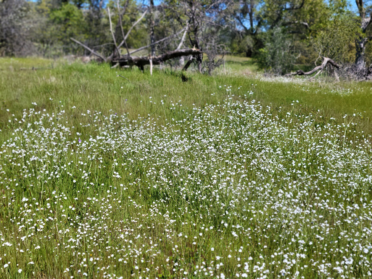
There were quite a few different wildflower species out, although only two appeared in great numbers, popcorn flowers and fiddlenecks. I was telling him the names of different blossoms and he asked about others. At one point he said that he had not really wanted to hike, but was now glad that we did and that he was having a good time. |
|
|
|
| The popcorn flowers were thick | So were the fiddlenecks |
|
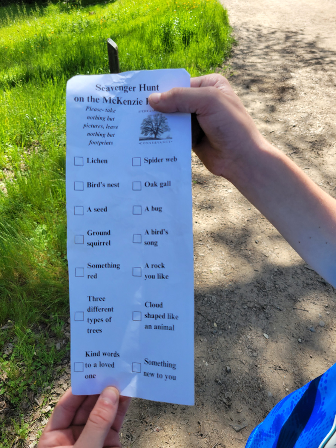
When we signed in, he was given a scavenger hunt sheet, with 14 things to watch for. We saw at least 10. It was a cloudless day, and I told Jack we might strike out looking for a cloud shaped like an animal, but he spotted a jet trail and pronounced it a snake. We also saw a real snake, which was unfortunately dead, plus birds and squirrels. He was not familiar with the word "lichen," but eventually we spotted a rock with the orange variety on it, close to the trail so he could get a good close look. This served as its own category as well as "something new to you." |
|
|
|
| We found at least ten of the items on this list | Jack's hiking outfit - a soccer uniform and crocks |
|
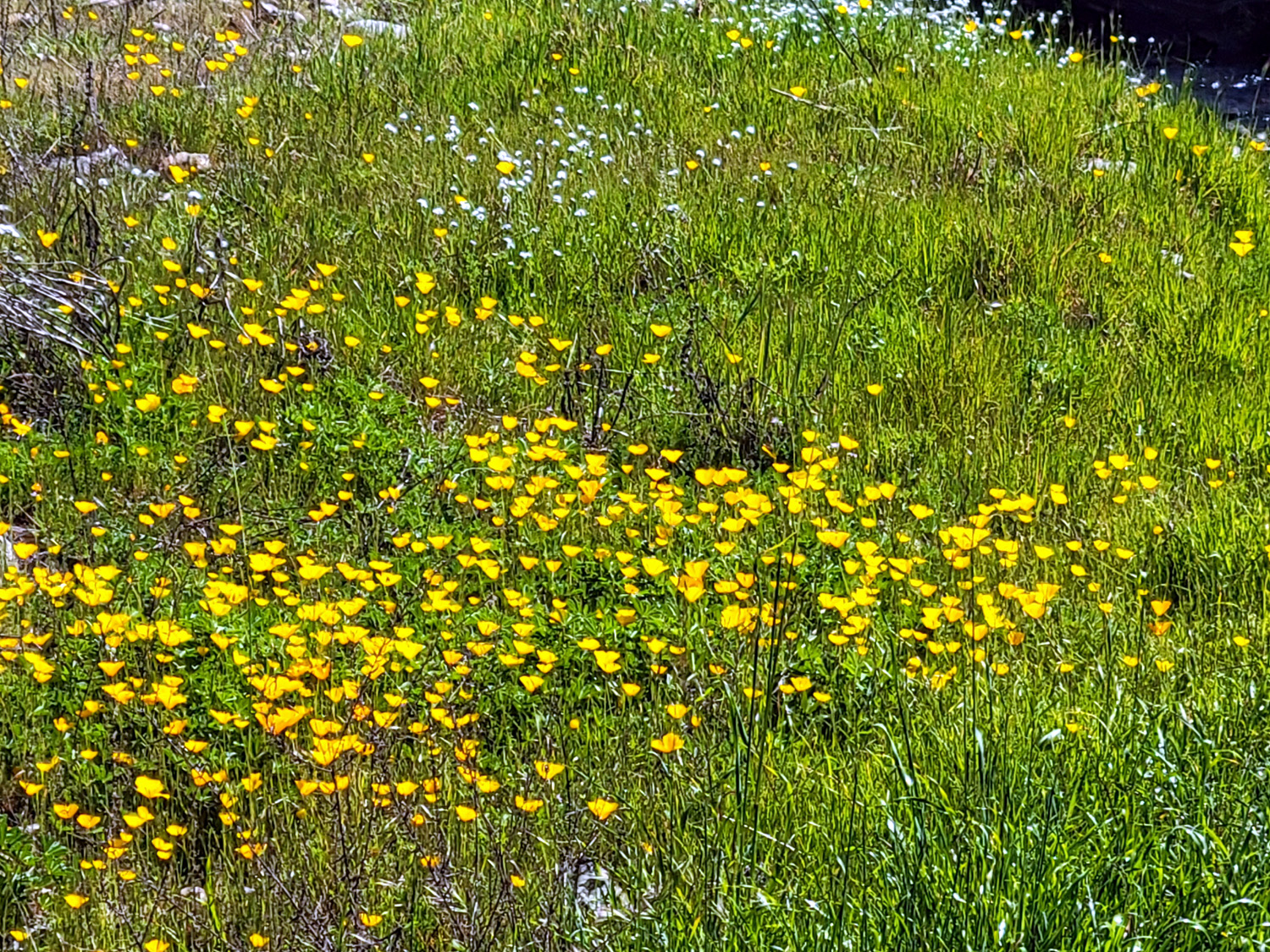
At one point he asked if there were poppies, and I explained that there are areas where they are thick, such as Pine Flat Lake, while some places have none or very few. We soon saw a single blossom, then on our way out, spotted a good size patch of them down by the creek. |
|
|
|
|
| A tributary of Little Dry Creek | The only poppy patch we saw |
|
We had made plans to stop at Menchies frozen yogurt, at Willow and Herndon, after the hike. I had gone there a few months earlier with Jack and Colton, and returned several times. It's a self-serve operation with a dozen or more flavors and twice that many toppings, where you get what you want and pay by weight. However, before we had our dessert, there were two other stores in that shopping center that attracted Jack. The first was Best Buy, where we have gone several times. This is a place with expensive toys for kids of all ages, although my last purchase here was a dishwasher. Jack's newest wish is a 3D printer, which he does not need and almost surely won't get. We made one more quick stop, at Pet Smart, where I looked at cats and he looked at fish (cat food?). He has one fish and has a good chance of getting another. I like other people's cats, but don't want to live with one. After taking Jack home, I took a nap in my recliner, and also slept better than usual that night, which I often do after hikes. All in all it was a delightful day. --Dick Estel, March 2026 |
|
|
Sycamore Fire Road
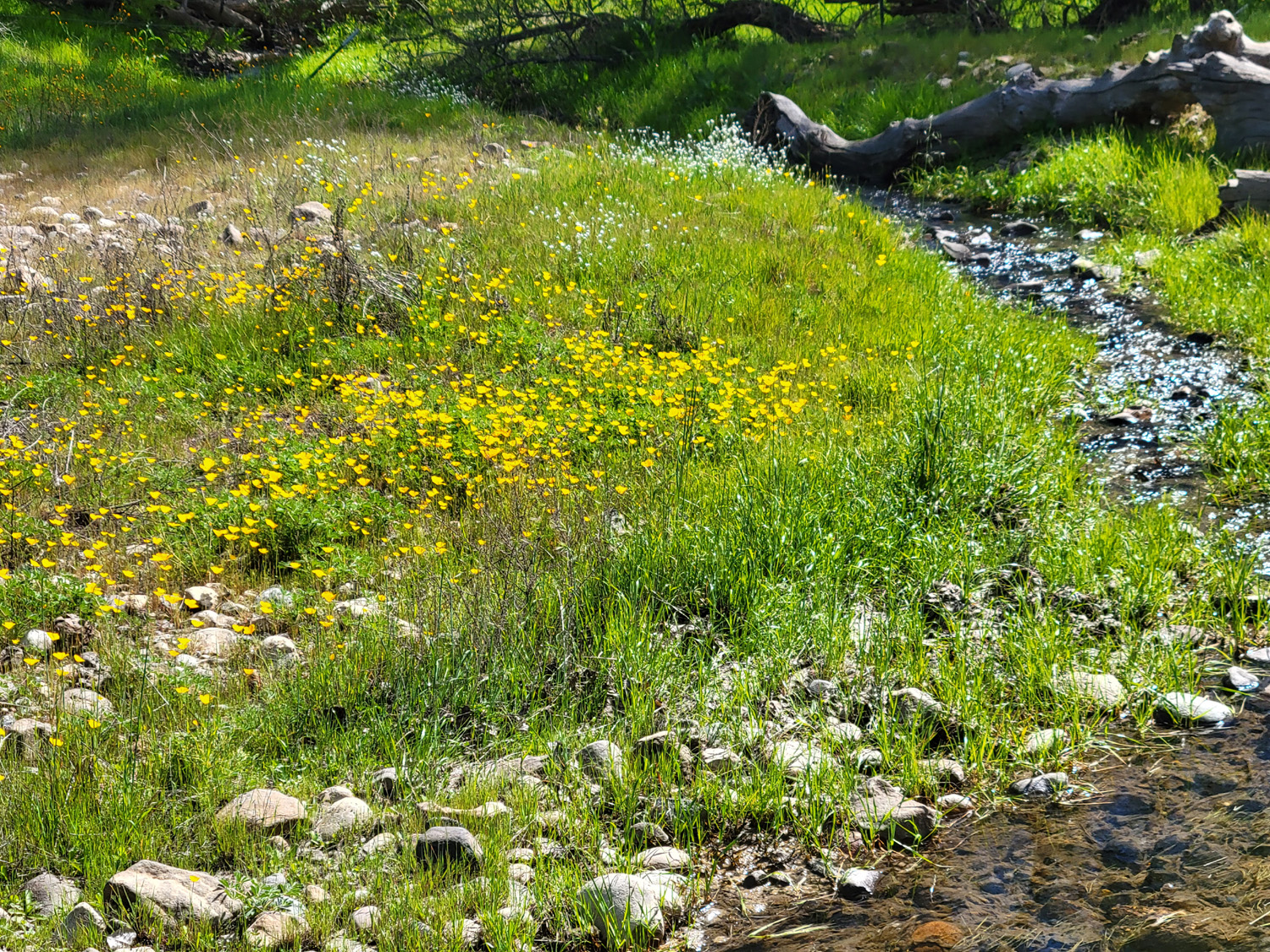
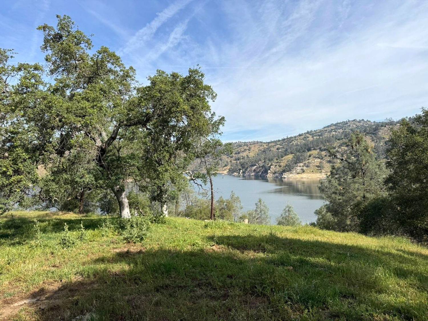
I'll try to keep this short on words and focus on the pictures, which tell the story of this area better than I can. You can read about other visits to this foothill location and find more details about the terrain by clicking on this link and doing a search for "Sycamore fire." This report and this one probably give the best description of the trail and how to find it. It's about a 44 mile drive from home to the trailhead, but with the last 15 miles being mainly a series of curves where a speed above 30 MPH is unsafe, plus at least a half dozen photo stops, it took me nearly two hours to get on the trail. That winding stretch is on the north side of Pine Flat Lake, and the trail is an old road, no longer accessible even to 4-wheel drive vehicles, and barely recognizable as a trail, much less a road. |
|

|

|
|
This view of Pine Flat Lake seems to contain every possible shade of blue |
Chinese houses along Trimmer Springs Road |
|
We've had a stretch of unusually hot weather, at least ten degrees above average, but it was very nice on this day, with a slight breeze, and the temperature staying in the mid-70's during my hike. The very lowest foothills, just above the valley floor, are starting to dry out, but it was still nice and green along the trail. |
|

|

|
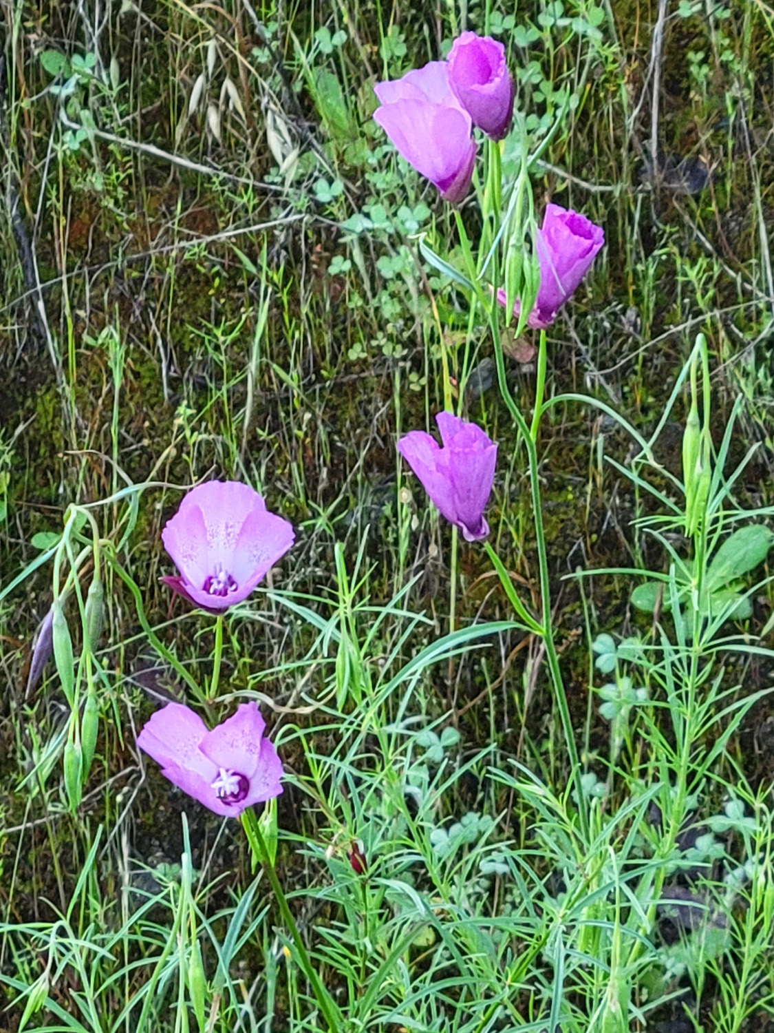
| Still lots of green along Sycamore Fire Road | Purple brodiaea |
|
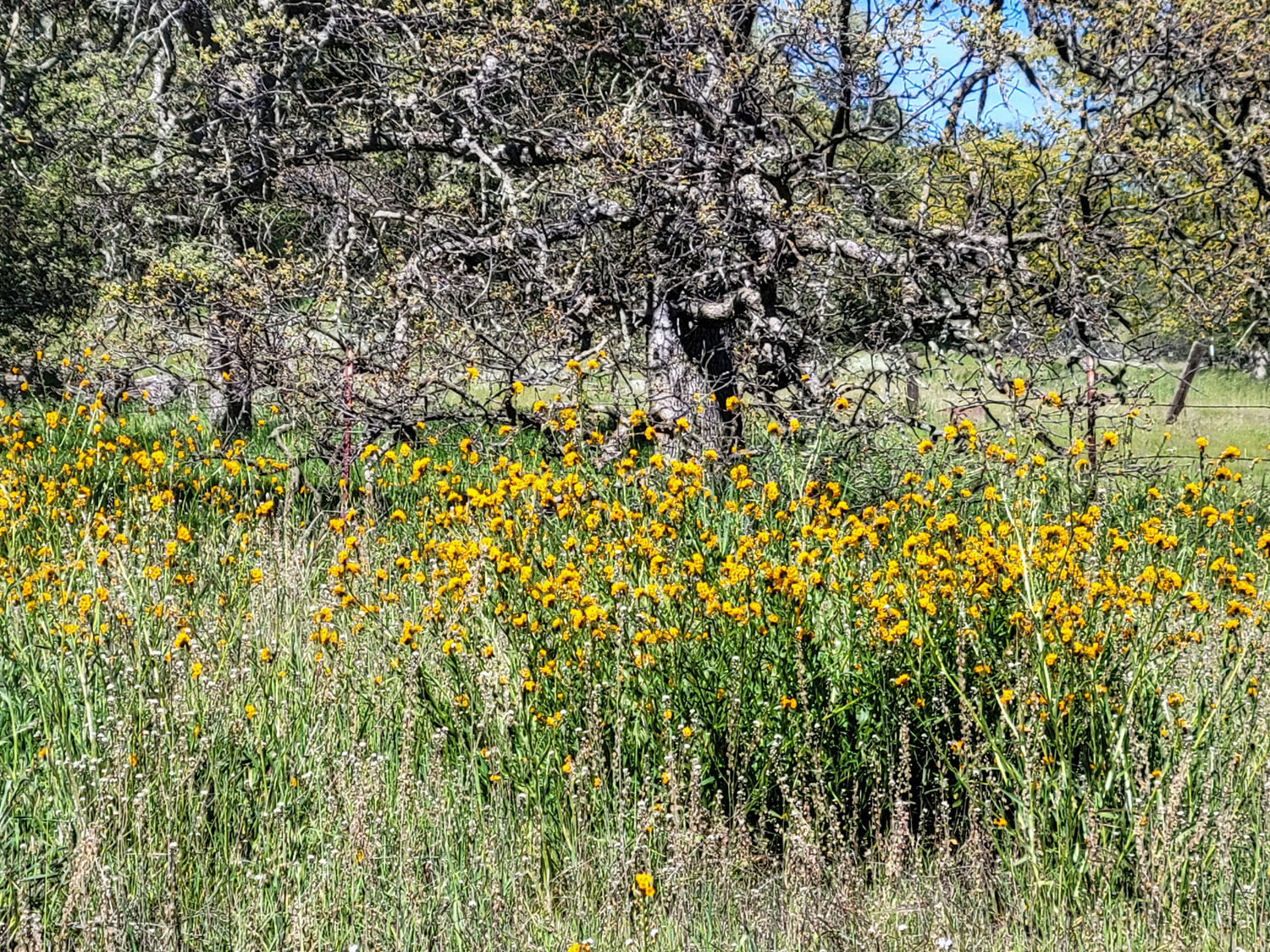
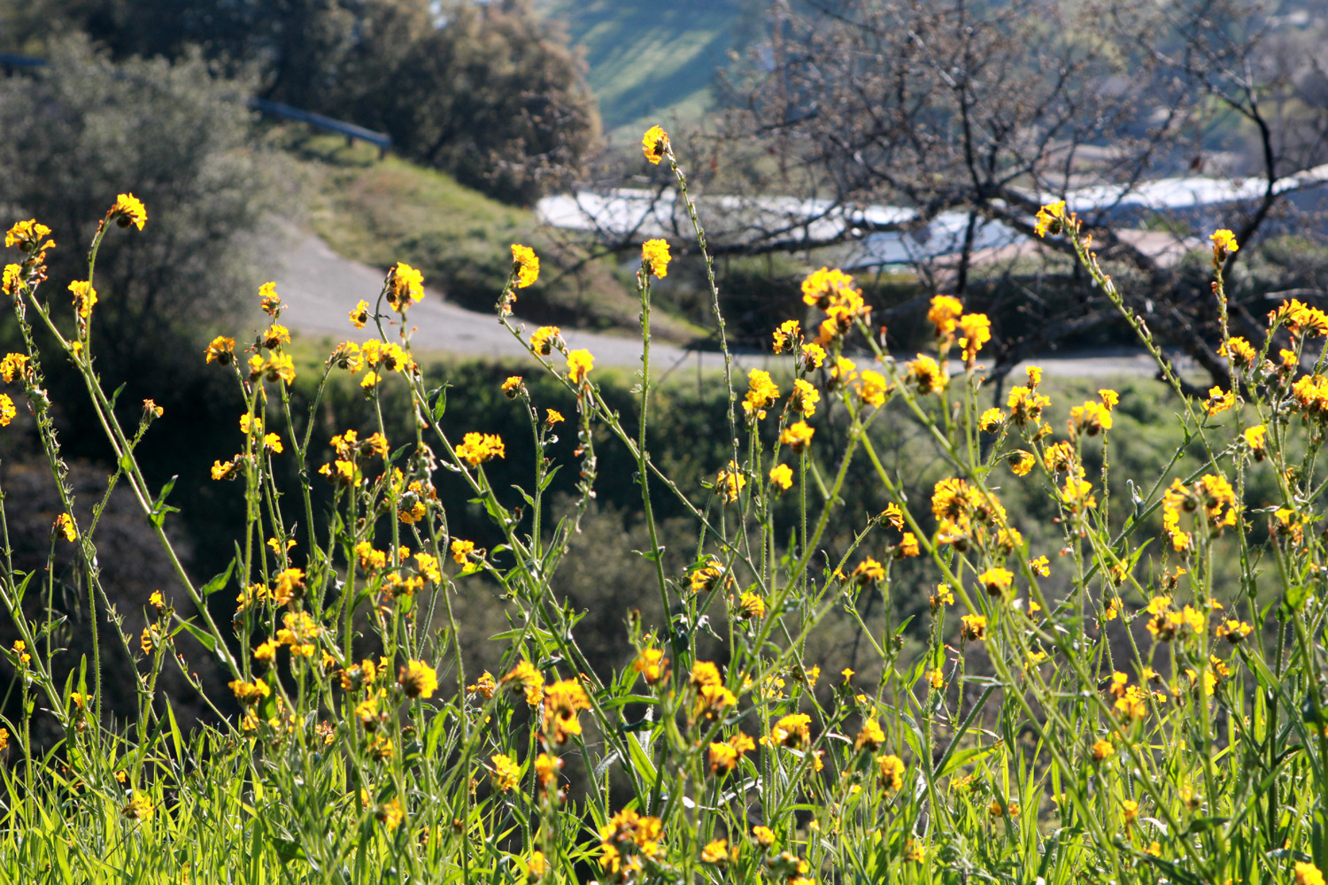
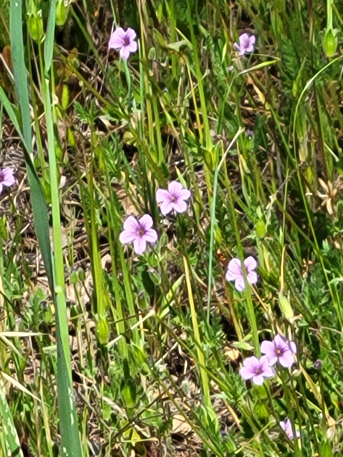
As to flowers, we have seen a lot of different varieties on our various hike this spring (de facto spring, not calendar). However, with a few exceptions, we are not seeing huge numbers. On this trip the most common species were vetch along the main road, and filaree along the trail and actually everywhere in the green fields. |
|
|

|
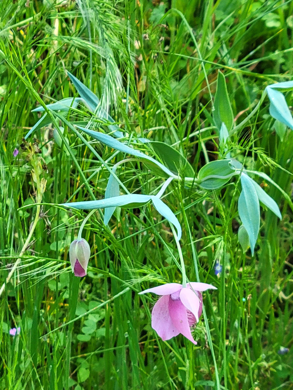
| This delightful flower is a globe lily | There were several species of lupines, but not many individual plants |

|

|
| Phecelia, in its final days as it goes to seed | Purple vetch was one of the most common flowers |
|
|
| Farewell-to-spring, in the first week of the season | Chinese houses, a single specimen |
|
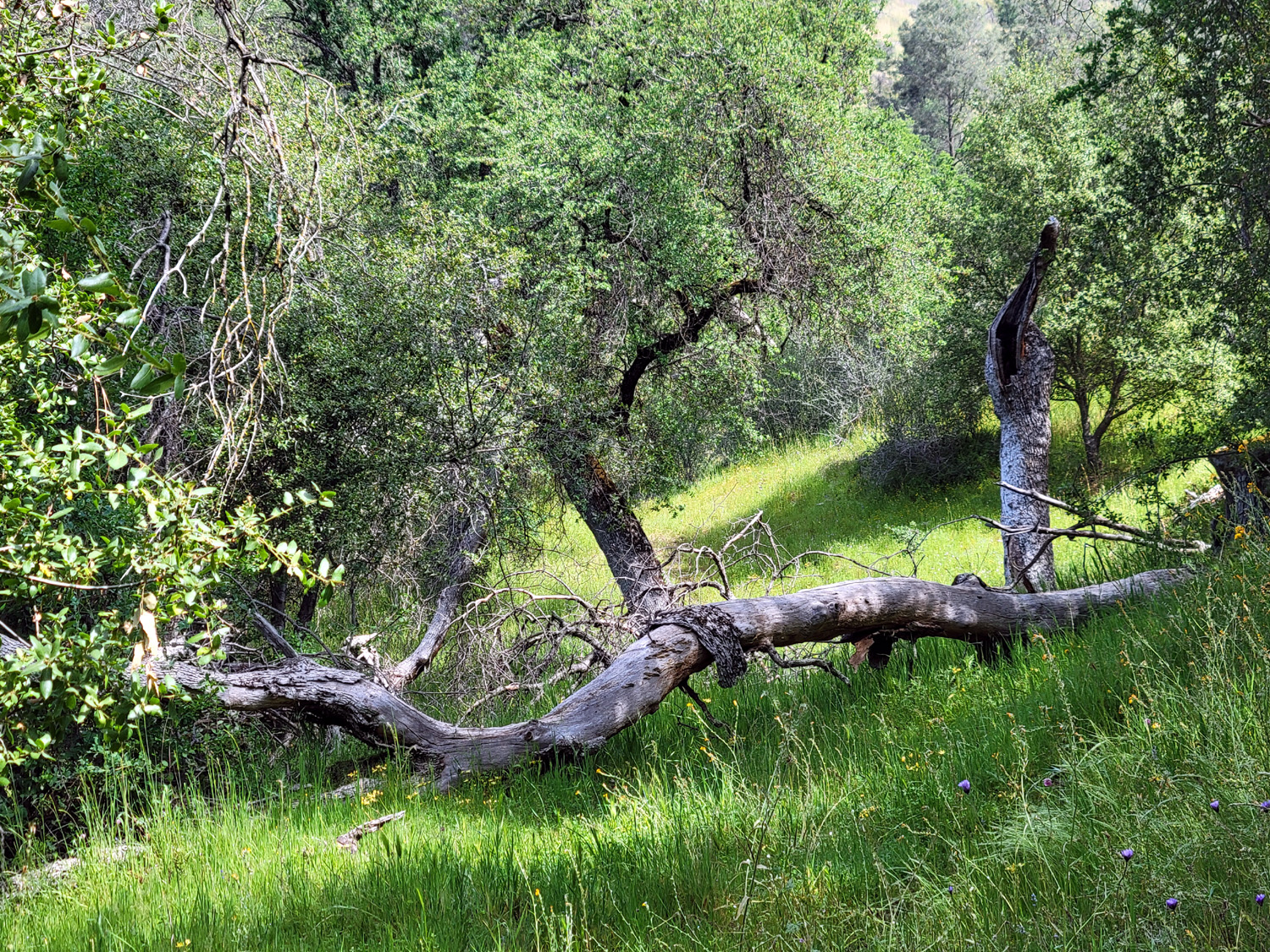
As always, I walked till I had gone "half of far enough." Lately "far enough" seems to arrive more and more quickly. To the best of my memory and records I used to keep, the farthest I have gone on this trail is about a mile one way. It always seems longer, partly because of a few challenging spots, but more because I stop to rest and look at scenery so often. I stopped keeping track of my foot mileage a year or so ago, but I'm pretty sure I went a mile round trip on this outing.. At the half mile point there was a fallen log across the trail. I could have stepped over, and there has been enough foot traffic here to create a good bypass, but it looked like such a good place to sit that I made this my turnaround point. |
|
|

|
| Although it blocks the trail, this is an excellent sitting log | Dick, sitting |
|
I probably rested there for 15 minutes (more than I really needed), enjoying the nearby flowers and greenery, before making my way back to the car. As I usually do after a solo hike, I went to a favorite restaurant for a late lunch, in this case In-N-Out Burger. With each hike I ask myself if I can do that route again, especially by myself. The worst part of this hike is the long, boring drive that I have made so many times. I think I am still good for another hike or two on that trail, and maybe I'll try to go another hundred yards next time. ---Dick Estel, March 2026 |
|
|
Finegold Fishermen's Trail
This is a trail I've hiked only twice previously. The starting point is the Finegold boat launch and picnic area on Millerton Lake, just past Sky Harbor. It's an unofficial trail used by cattle and fishermen that goes upstream along the Fresno County side of the lake from the parking area. For this outing I was accompanied by my friend and fellow Rambler, Wes Thiessen. We first hiked together a dozen years ago, and have been on many Ramblers hikes. Wes is very smart, funny, and an interesting conversationalist, knowing a lot about many subjects, and a little about many more. I told him I needed someone with me on this hike to drag me out in case I fall on one of the steep places on the route. This is not really a joke. There are three places where the trail is very steep for a short distance. I no longer feel comfortable hiking alone on trails like that. We had excellent weather - not too warm, with a slight breeze. Although some areas are drying out, the grass along this trail is still mostly green, and there are quite a few flower species in bloom. About a half mile from the start a small creek crosses the trail, which then rises steeply. I had never gone beyond this point, but asked Wes to climb that hill and report back on what he found. I chose a nice sitting rock next to the creek and rested while Wes carried out his assignment, returning after ten minutes or so with a photo and verbal report. |
|

|
|
| A little creek flows through this area |
At the top of the hill beyond my resting spot, Wes
found an excellent view of the lake, where Finegold Creek runs in on the Madera side |
|
We made our way back to the trailhead, where we found several cows "mowing" the lawn. Although it was a Thursday, there were at least a dozen cars parked by the road. One visitor went down the steep hillside to a little cove with fishing equipment, but probably 99% of the people there went up the San Joaquin River Trail. You can follow this trail 12 miles to the San Joaquin Gorge, but most hikers go up a mile or so to a saddle, or up the short but challenging climb to the top of Pincushion Peak. |
|

|

|
| A sea of tall grass along the trail discouraged cross-country adventuring | Picnickers enjoying lunch near the trailhead |
|
As is traditional after most hikes I'm on, we returned to the city and went out for lunch, at one of my favorites, Colorado Grill. Their accurate slogan is "Better tastier burgers," and I recommend this spot without reservation. --Dick Estel, March 2026 |
|
|
Photos (Click to enlarge; pictures open in new window) |
||
|
Sycamore Wildlife Area Sycamore Fire Road Finegold Fisherman's Trail |
||
|
Sycamore Wildlife Area |
||
 |
 |
 |
| Where the adventure begins | Poppies by the road | Nature gives us an occasional surprise |
 |
 |
 |
| California poppy | Small and very common - filaree | Phecelia |
 |
 |
 |
| Fiddlenecks with the
road and lake in the background |
A clump of baby blue eyes | A nice scene in the campground |
 |
 |
 |
| Someone did a number on this cattleguard post | Poppies up on the road bank | Where everything is |
| Sycamore Fire Road | ||
 |
 |
 |
| A mix of common
madia, farewell-to-spring and Chinese houses |
Common madia | Unknown flower |
 |
 |
 |
| Filaree | This bank beside the road displays mostly madia, with some vetch, Chinese houses, and blue dicks | Hills below the dam
and lake are starting to turn brown |
 |
 |
 |
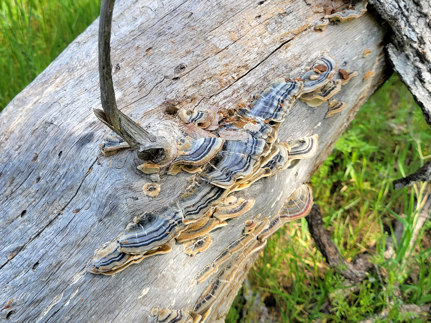
| A very beautiful fungus | Globe lily, with distinctive blue-green foliage | Harvest brodiaea |
 |
 |
|
| Wild oats, gone to seed | The trail is barely visible in many places | A huge blue oak dominates this scene |
| Finegold Fisherman's Trail | ||
 |
 |
|
| This unusual flower
was growing along the road down to the picnic area |
A damp area produces lots of moss | Wes documented a typical section of the trail |
| Related Links | ||
| Pine Flat Reservoir | Sycamore Creek | Sycamore Wildlife Area |
| Sierra Foothill Conservancy | McKenzie Preserve | Miguel's Taqueria |
| In-N-Out Burger | Common Madia | Brodiaea |
| Sky Harbor | Colorado Grill | San Joaquin River Trail |
| Pincushion Peak | First Hike 2024 | 2025 Hike |