


|
2018 Ramblers Hikes Page 3 |
|
|
The Ramblers are Carolyn Amicone, Julie Hornback, Wes Thiessen, Don McClellan, Sue Wirt, Elsa Sweeney, Ardyss Webster, and Dick Estel, former colleagues at the Fresno County Department of Social Services, and former CDF firefighter Allen Ward. Every month or so we get together for a short hike, good conversation, and lunch. |
|
|
Photos Related Links More Travel Reports 2017 Hikes 2018 Part 1 2018 Part 2 |
|
|
Taft Point Nelder Chimney Tree Trail Millerton Blue Oak Trail |
|
|
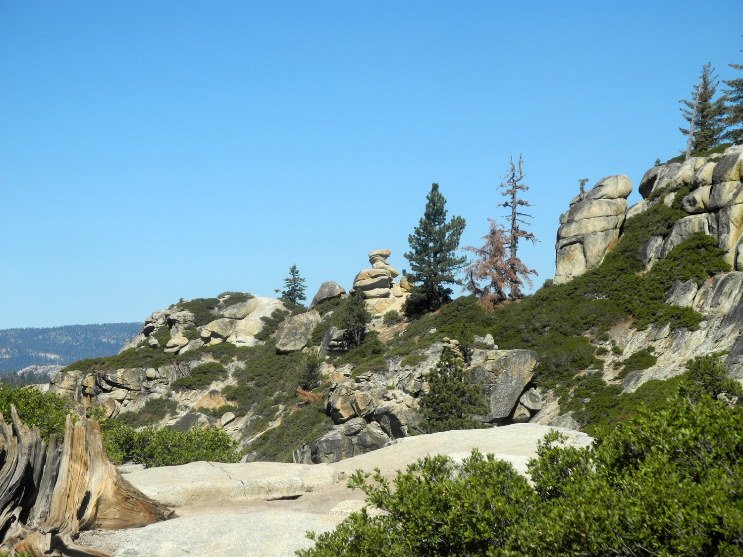
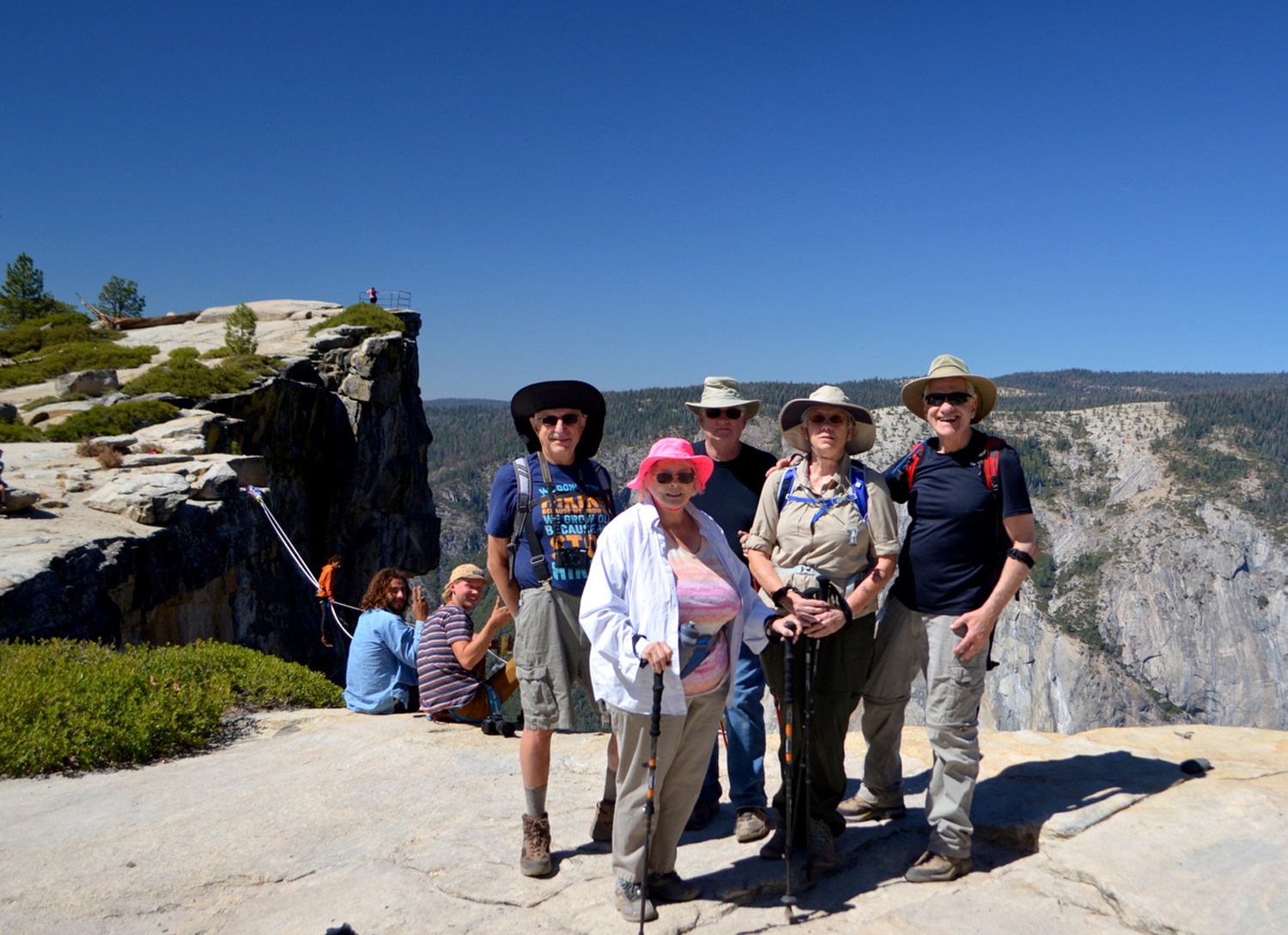
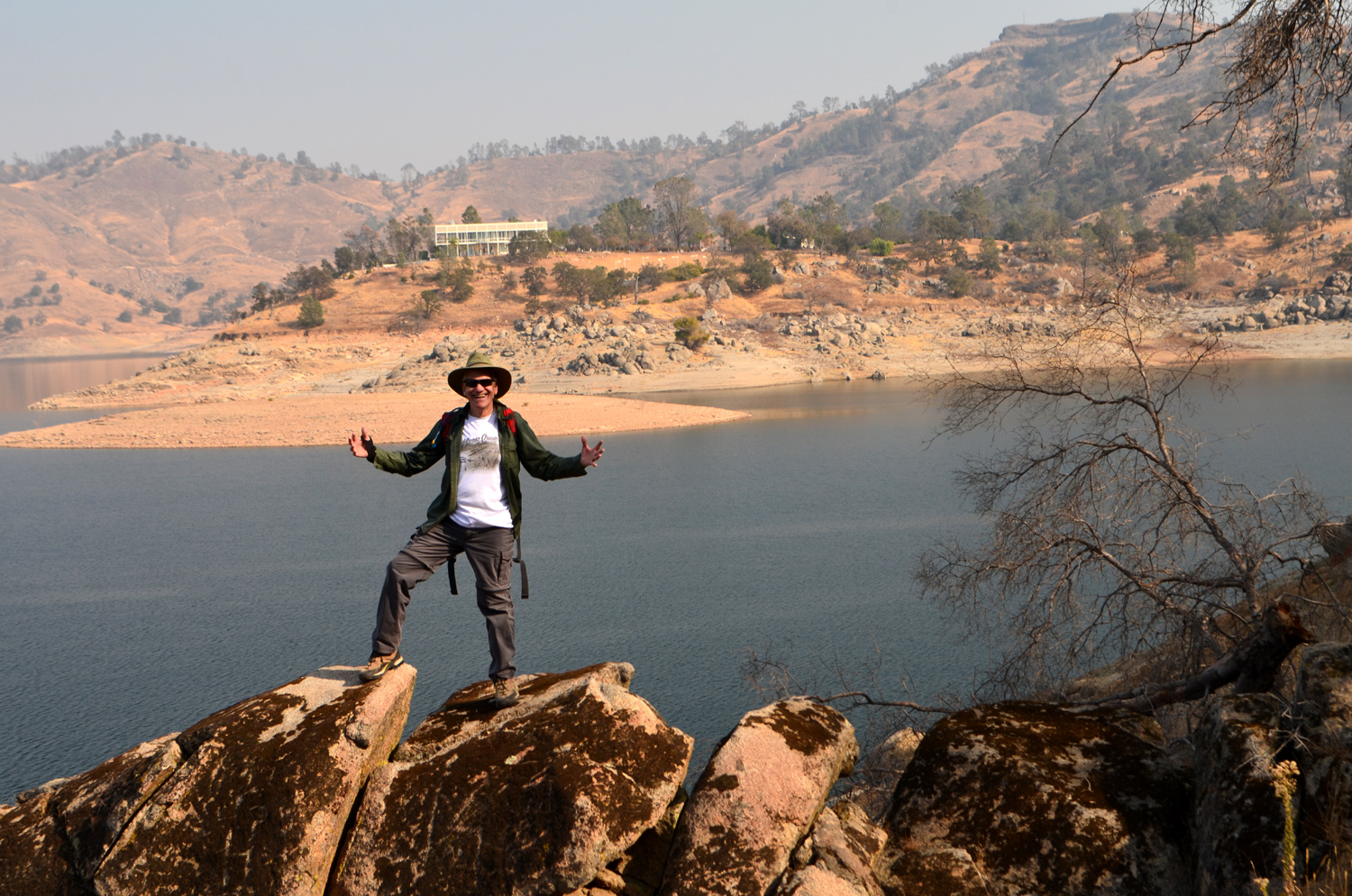
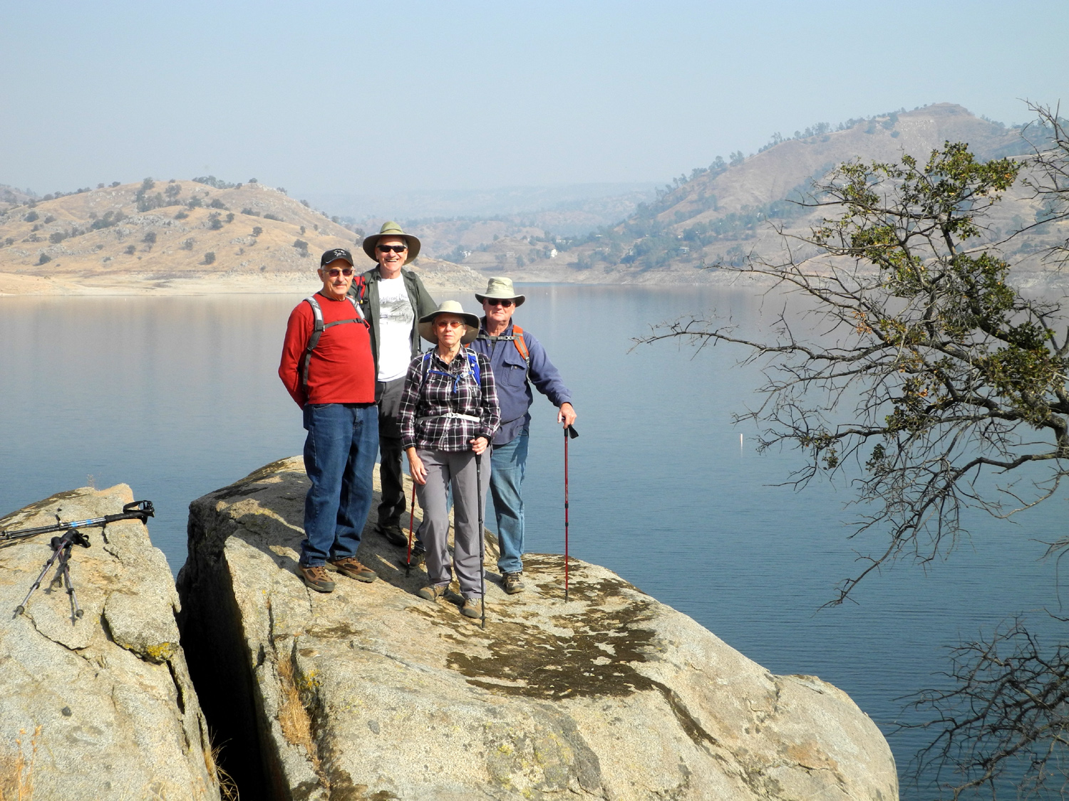
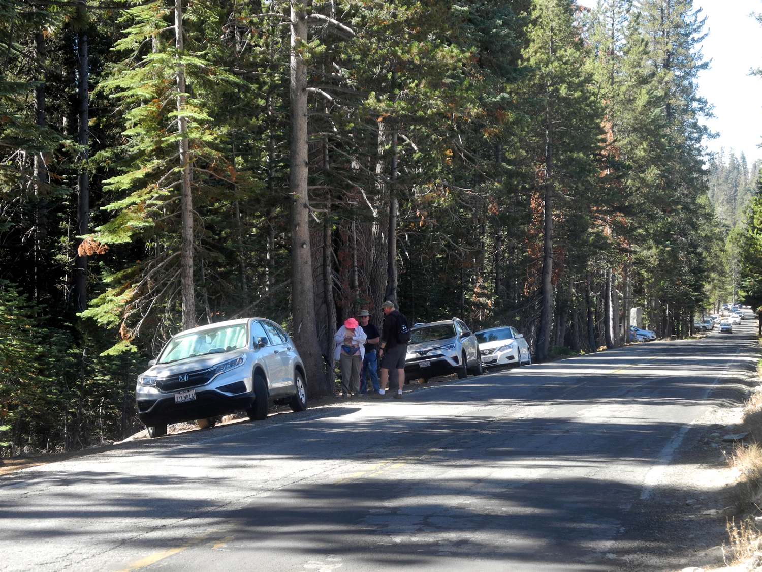
Taft Point My first visit to this location was in 1982. The Ramblers went in August 2015 and I went a few weeks later with daughter Teri and a friend of hers. For some reason I am able to remember trails as being easier than they really are, and I told the people going this year that our route was "fairly level, with some ups and downs." I'm still getting harassed about that. But we all survived and had a good time, and saw some unexpected sights. Our party consisted of Sue Wirt, Ardyss Webster, Wes Thiessen, Dick Estel, and Allen Ward, a friend and high school classmate of Sue's. He is a retired CDF firefighter, and has some issues with one leg, but he made the hike with no real problems, even though it was longer and somewhat harder than advertised. The trail starts on the Glacier Point Road in Yosemite National Park, about 14 miles from the main southern access road, Highway 41. We had been warned that parking at the trailhead was very crowded, so we left the city by 8 a.m., but we still had to drive past the parking lot and find a spot along the road that proved to be three tenths of a mile from the trail, adding over half a mile to our total hike. Once we got our packs and boots on, we made the sometimes tricky walk along the road to the start of the trail, and took the left fork to Taft Point. The other choice is Sentinel Dome, where Wes and I hiked in July. Our parking difficulties were forgotten as we walked among red firs, western white pines, Jeffrey pines, and a seemingly endless array of ferns turning yellow for fall. |
|
 |
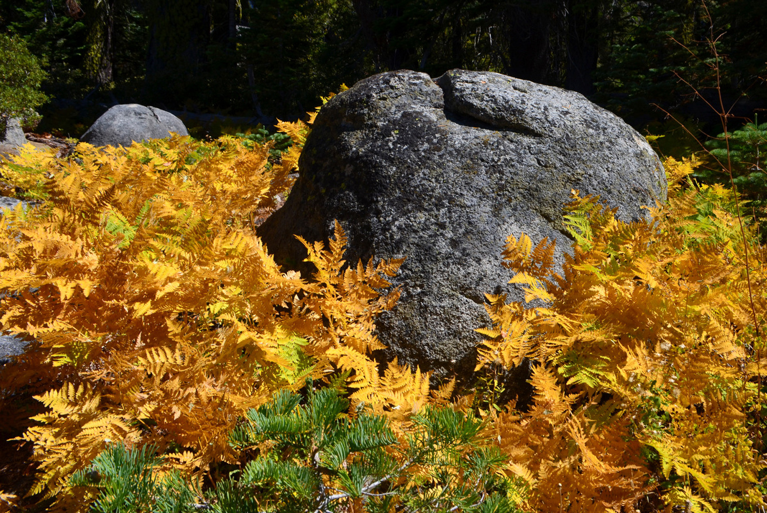 |
| We all need someone to lean on | Ferns turning gold with the arrival of fall |
|
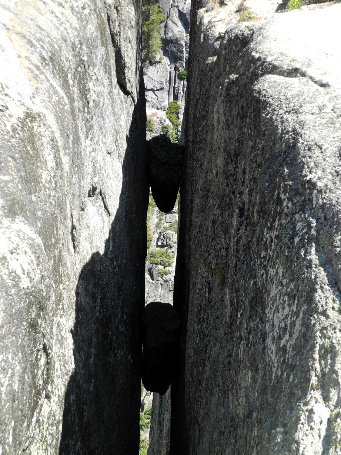
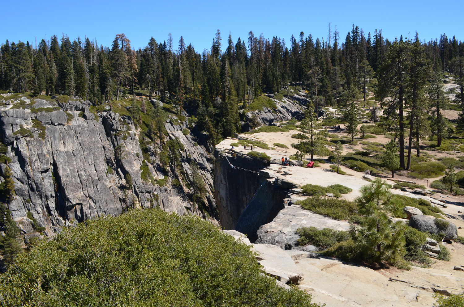
The trail had a lot more up and down than I remembered, and the last hundred yards or so were particularly challenging, with a steep, rocky stretch as we approached our destination. There were many places where we had to step down eight inches or more, using our poles to maintain balance. For some of us, this was too big a step, but Wes managed to find short detours where the drop was only a few inches and led us safely toward The Fissures. According to the unofficial web site, "These immense vertical gashes in the valley wall were caused, it is now believed, by an epic battle between Mothra and Godzilla, during which Mothra slashed at his scaly foe but missed and raked his talons against the cliff side instead." OK, that may be a bit fanciful, but the reality is equally dramatic - natural fractures separating the rock into two pieces that have not yet slid apart. These fissures range from two to ten feet across and offer some dramatic views. |
|
 |
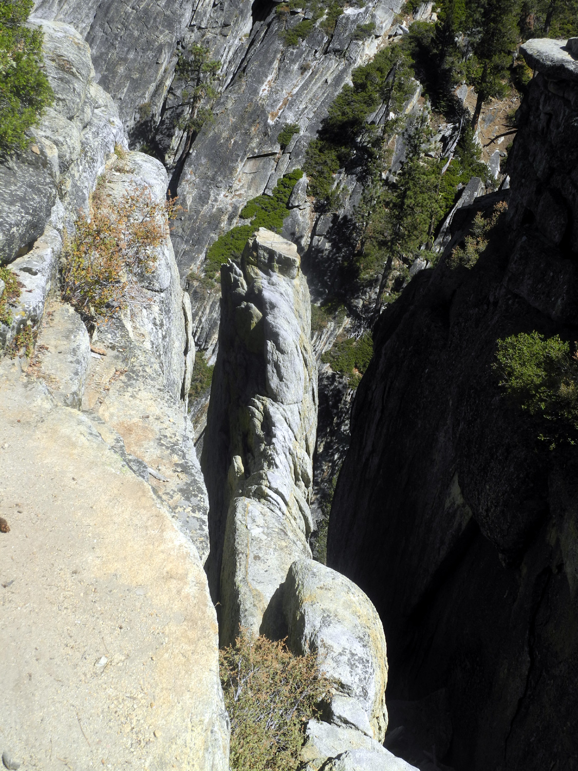 |
| The big fissure to the right runs in at a right angle from the valley rim | One of several smaller fissures that run perpendicular to the big one |
|
|
|
|
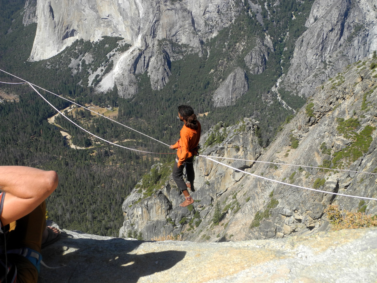
The most unusual sight along the trail was several people in suits and ties. We soon learned that they were part of a wedding party that had chosen the magnificent views from Taft Point as a backdrop for their vows. We chatted briefly with the bride and groom, and wished them well. We also met hikers who advised us that some people had set up a slack line at the edge of the cliff. Although the photos and Wes's video make it look like a crazy daredevil stunt, the rope walker was wearing a harness fastened to a safety line, and when he did fall, he just experienced a short bunji-style drop of about eight feet, and quickly got back on the rope. (In the video, scroll in to about the 1:40 point to see him get up and walk the rope.) |
|
 |
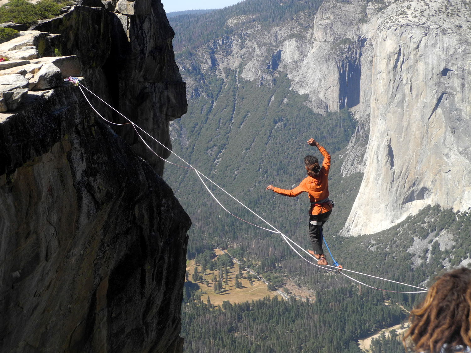 |
| You have to sit on the rope and think about what you're about to do for a while | Don't try this at home - or anywhere! |
|
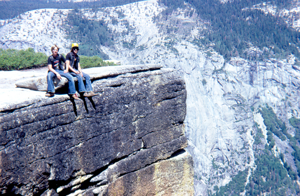
Even without daredevil activities, there's plenty at Taft Point that takes your breath away. Beyond the fissures, you can walk up the rock a short distance and go right to the edge of the cliff. One website makes a big deal about the lack of railings, and that was true in 1982, but some time since a short section of safety railing has been installed at the highest point. There's still plenty of room near the top where you can walk right up to the edge and look over, with no protection. Perhaps it's best to lie down and peek over the rim as I did in 1982. Or you can just casually dangle your feet over the 3,000 foot cliff, as Tim and Scott did back then. |
|
 |
 |
| Taft Point as viewed from the northwestern most part of the fissure | The Ramblers: Dick, Sue, Allen, Ardyss and Wes |
|
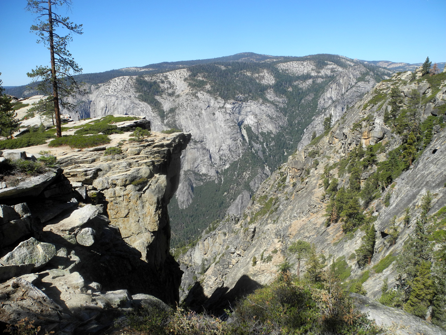
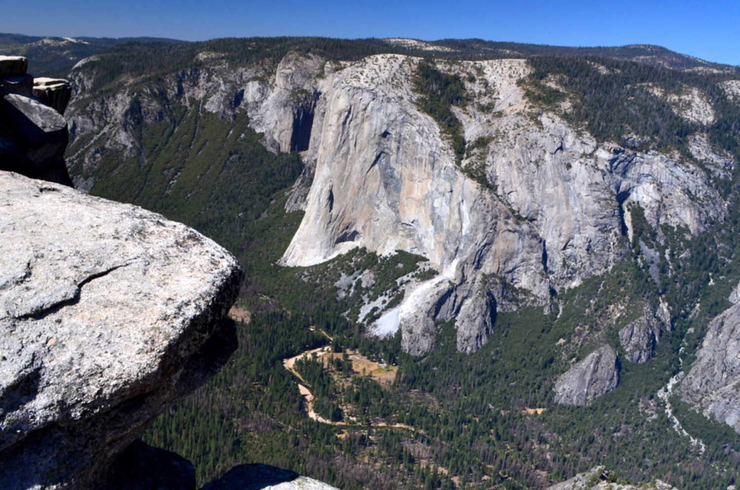
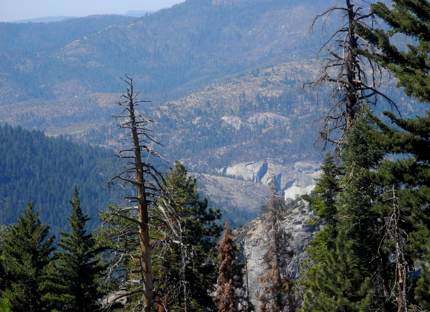
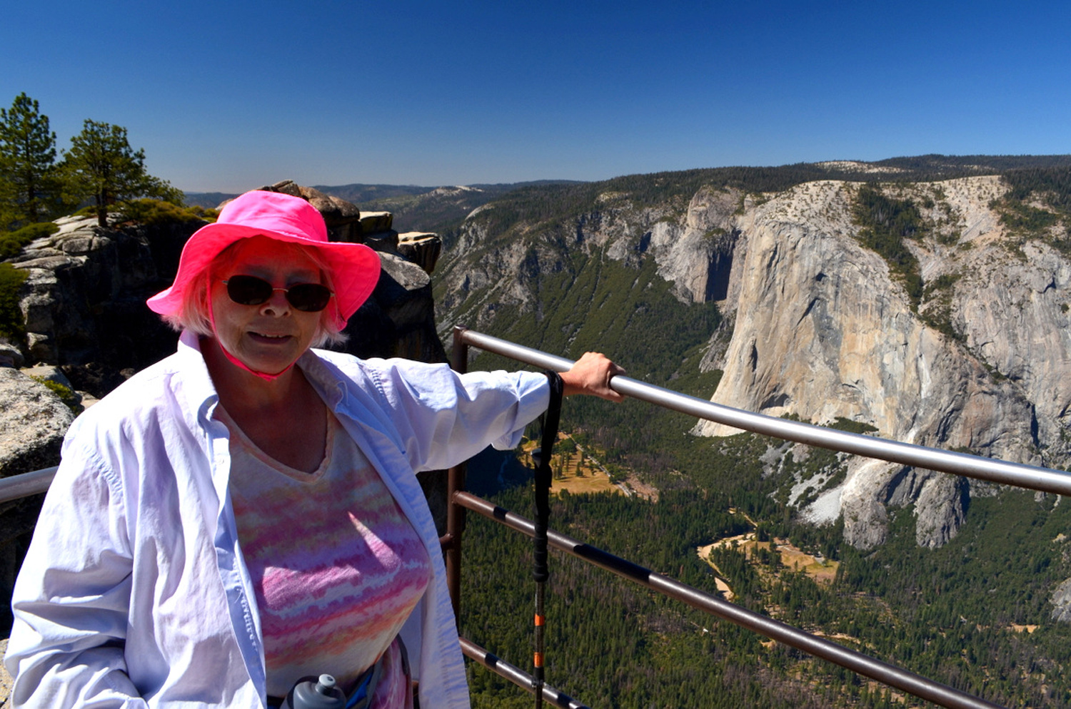
From Taft Point there is a fantastic view of the western end of Yosemite Valley. You can see Yosemite Falls, or rather where it will be after the rains come, but nothing much east of that - no Half Dome, no Vernal and Nevada Falls. You are looking down at the top of El Capitan, and down the river canyon, well below the valley, you can see the rounded top of some granite cliffs that are not visible when you're driving in the canyon. The elevation at Taft Point is 7,500, about 300 feet higher than Glacier Point, so the limited valley view is compensated for by a more extensive view of the high country beyond the northern rim. |
|
 |
 |
|
Looking down at the rounded top of El Capitan. You can climb it from the valley, or hike out from the Tioga Pass Road north of the rim |
A high angle view of cliffs in the river gorge below the valley |
|
We walked down away from the rim and found a shady spot with good rocks for sitting, and enjoyed a robust snack. This gave us the much-needed energy to climb up from the rim through the steep rocky section to the forested trail beyond. Along the way we enjoyed the shade of the red firs, the most common tree along the way, and found a place for the official "Wes on the Rock" photo. |
|
 |
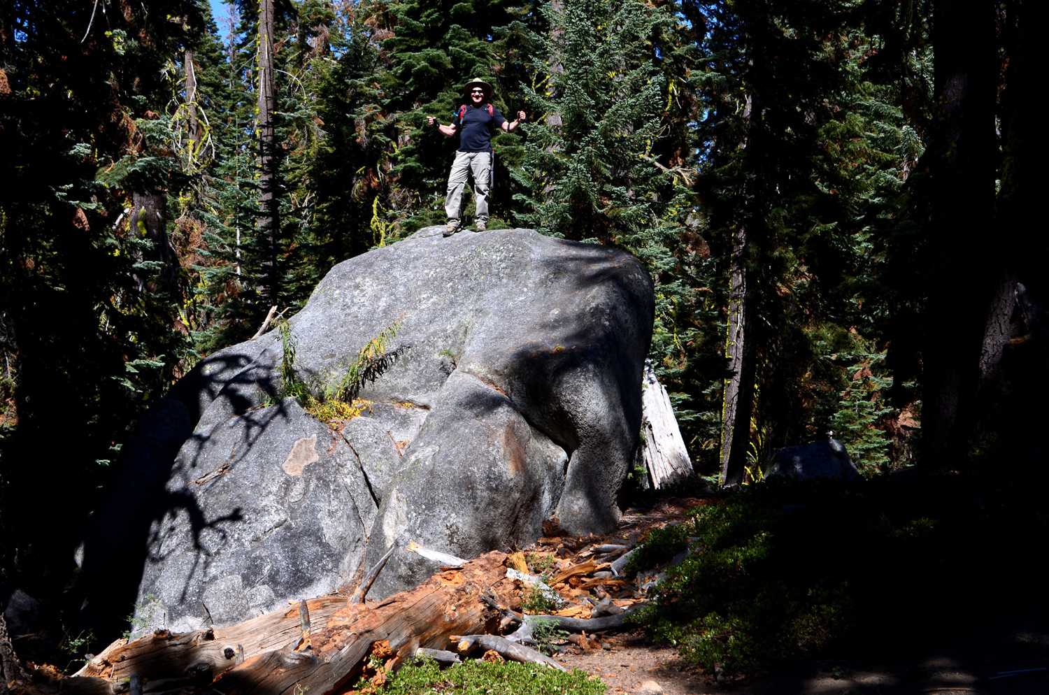 |
| The predominant tree along the trail is the red fir | In the woods, we found a perfect spot for the traditional "Wes on the Rock" photo, a bit less breath-taking than his first time at Taft Point |
|
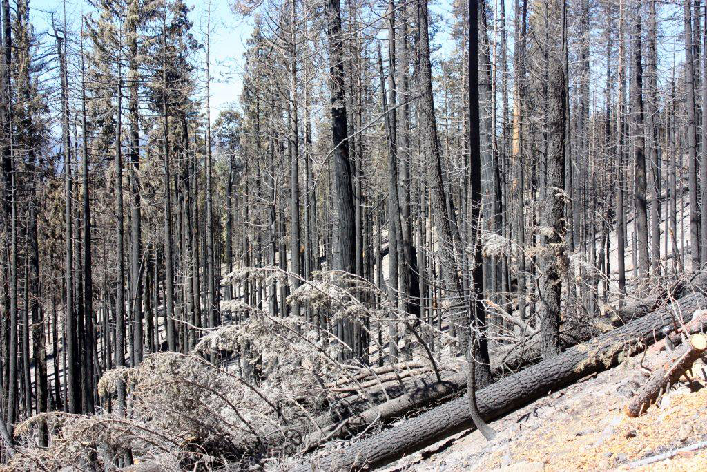
By the time we reached the trailhead, whoever said it was a "fairly level" hike was in danger of being expelled from the group. There is some debate over whether I used those words, or if maybe Wes was responsible. The email records are being reviewed as this is written. The trail is said to be 2.2 miles round trip, but that does not take into account the wandering around people do when they reach their destination, trips off the trail to look at ferns, and in our case, the six tenths of a mile round-trip walk along the road between trailhead and where we parked. In the end the hiking app on my phone said we went 3.25 miles, and I have tested it against known mileage, so I think that was pretty accurate. It must be noted for the record that we drove through areas where the Ferguson Fire this summer burned over 96,000 acres and caused the closure of parts of Yosemite National Park for several weeks. It started near the confluence of the main Merced River and its South Fork, and burned its way up both canyons. North of Wawona the road goes high up along the canyon of the South Fork, and there were places where the trees were blackened sticks, and the ash on the ground gave the appearance of a dusting of snow. There was a short stretch of damage along the Glacier Point Road. Fortunately the places of beauty greatly outweighed this sad sight. Despite the physical effort of our hike, we had a great time. Sue, Ardyss and Allen had never been to Taft Point before, and were suitably impressed. The hike took so long that we decided not to stop for lunch, but instead went to the Wawona Store for snacks as needed. It was after six before we got back to the valley, and Allen still had another hour's drive to Visalia. (The sign on the store actually says "Big Trees Lodge Store," but those of us who have lived near Yosemite most of our lives will never stop using the historic original names.) As we said our farewells, we agreed that our next outing will be at Nelder Grove, where the trail is fairly level, with just a few ups and downs.
|
|
|
(Ferguson Fire photo courtesy Susan Crandall) |
|
| Nelder
Grove Chimney Tree Trail
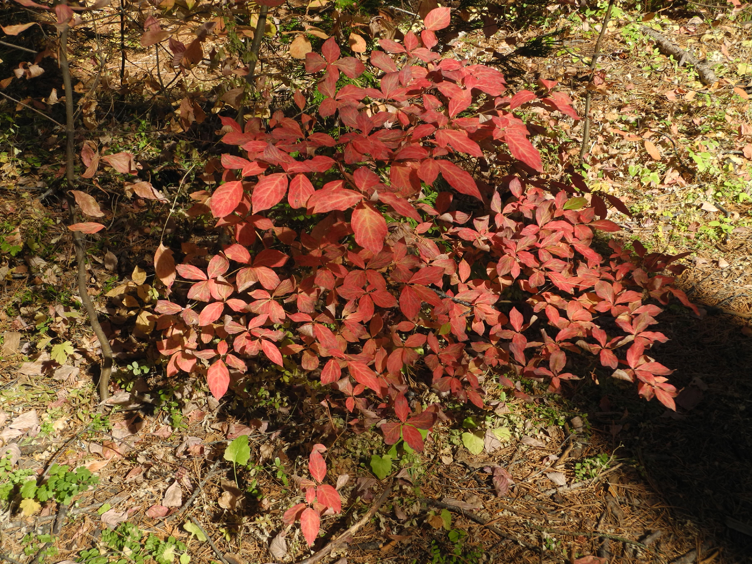
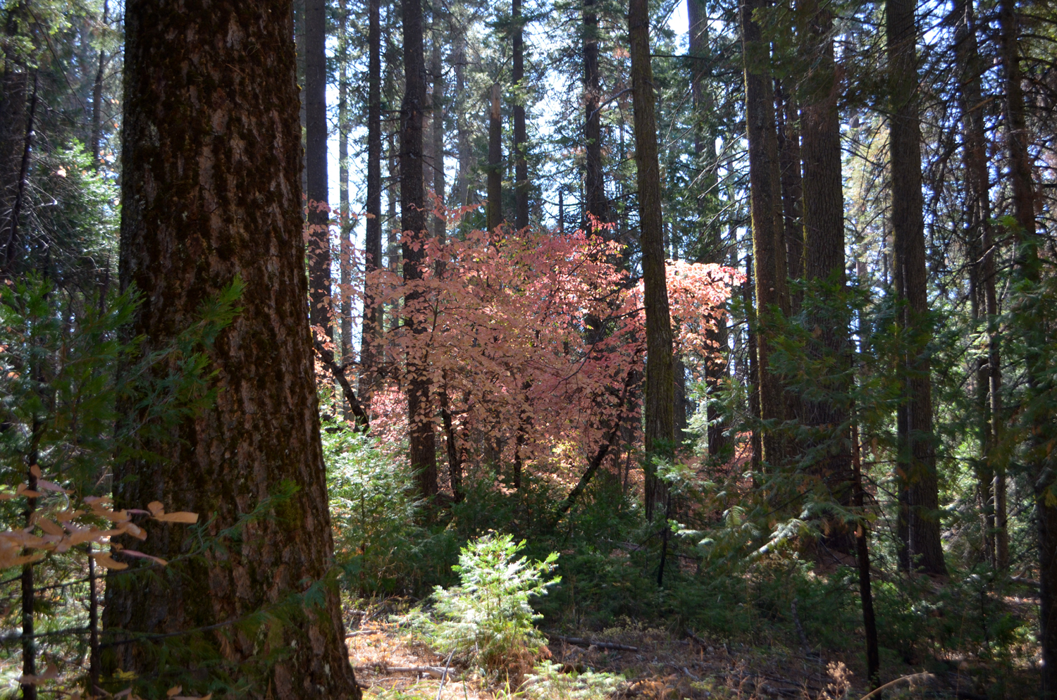
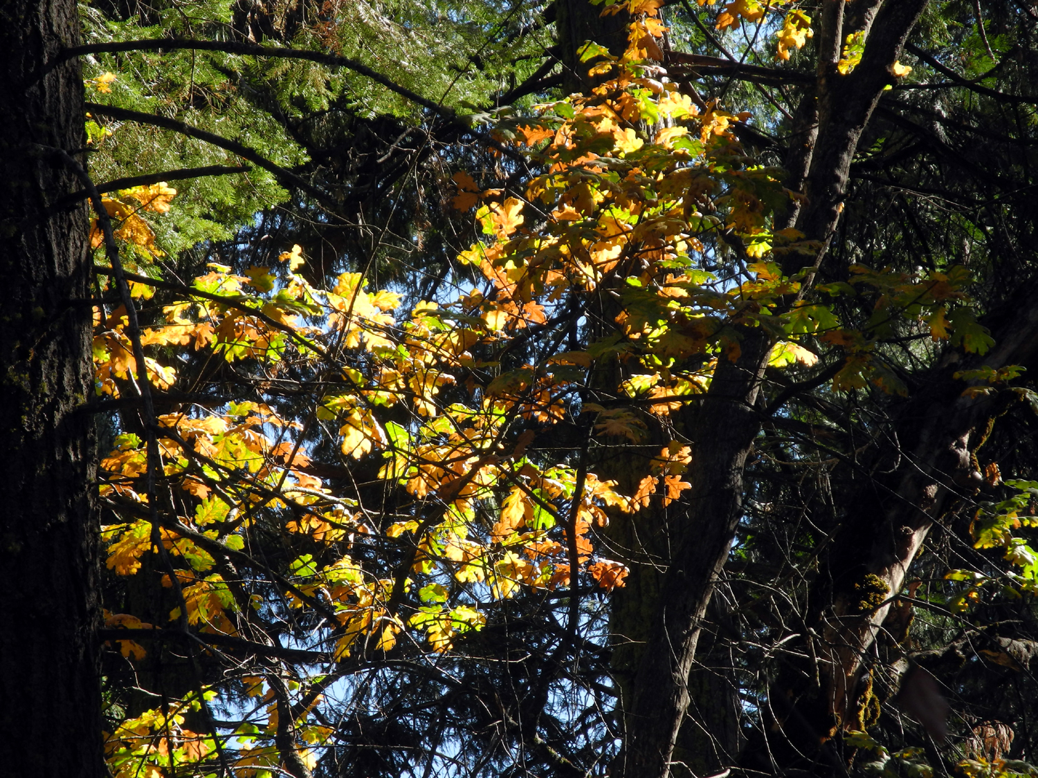
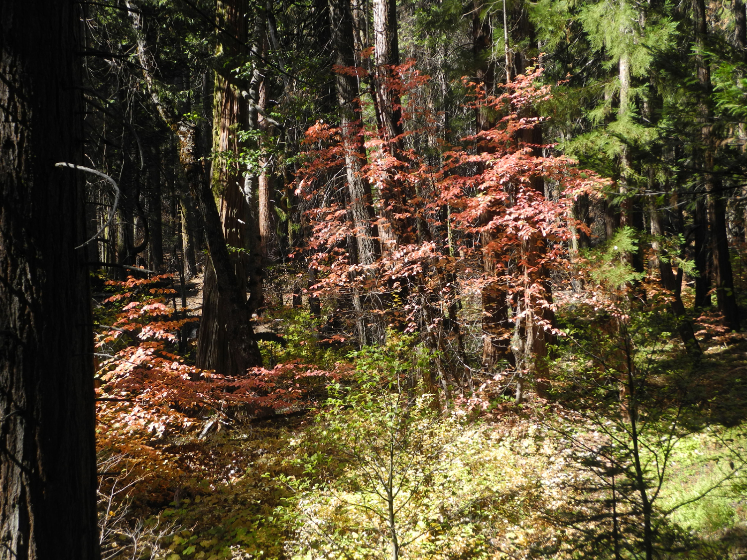
Let's open this report with Wes's traditional after-hike message: What an amazing adventure! Today the Ramblers traveled to Nelder Grove above Oakhurst to hike the Chimney Tree Trail. This loop trail follows the California Creek on two sides. We caught the fall colors in the "nick of time" as the slightest breeze dislodged the leaves of the dogwood, azalea, oak and other deciduous trees and plants. It was a wonderland of color with the sun "back lighting" these leaves. We followed the rule of John Muir by sauntering through the forest stopping every few yards to "ooh and ah" over the natural beauty. We walked under a green canopy of the forest enjoying what the Japanese call "forest bathing." And we were all the better for it. |
|
 |
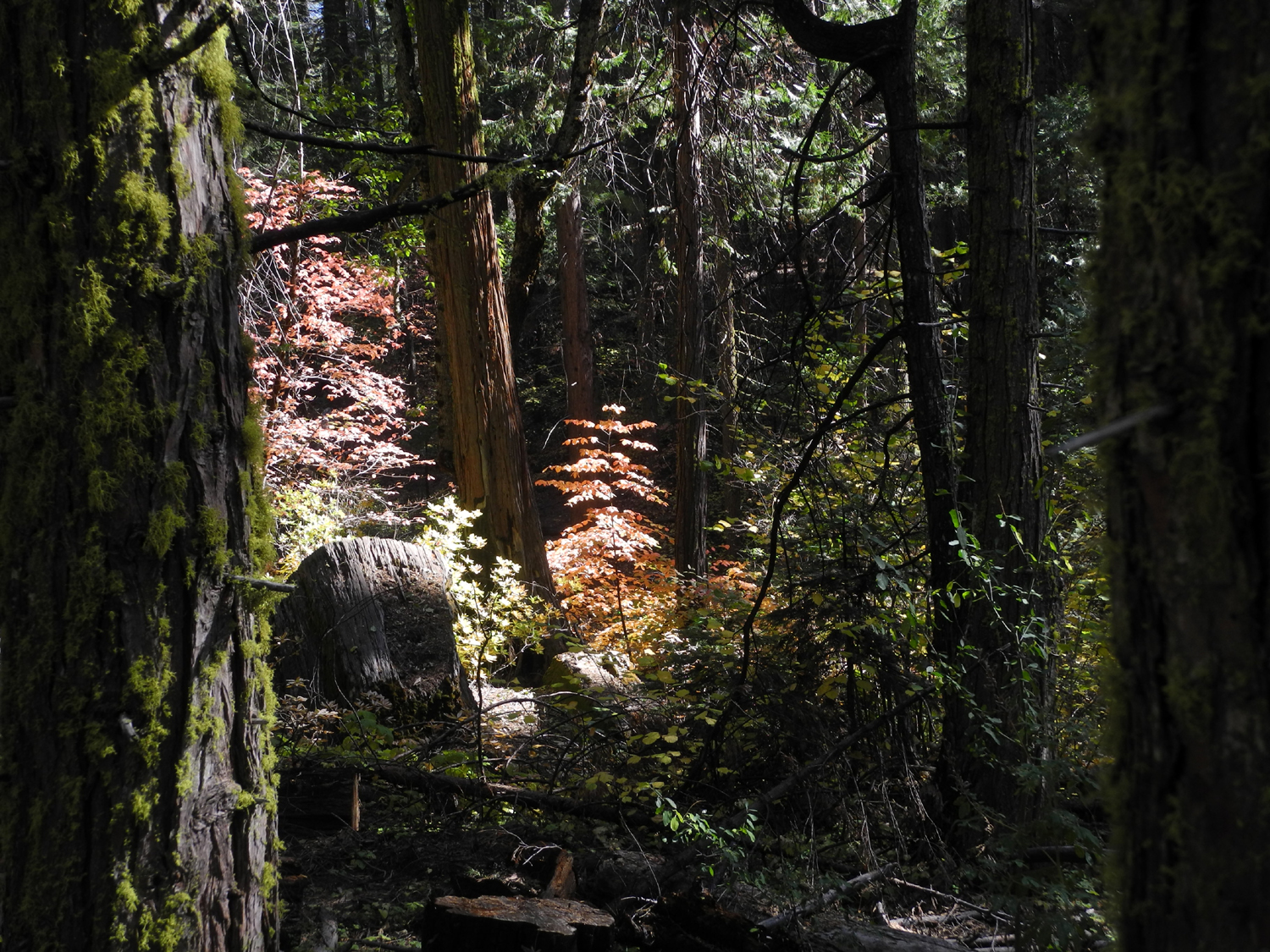 |
| Dogwood lit up by the sun | Sun-lit dogwood stands out in the dark green forest |
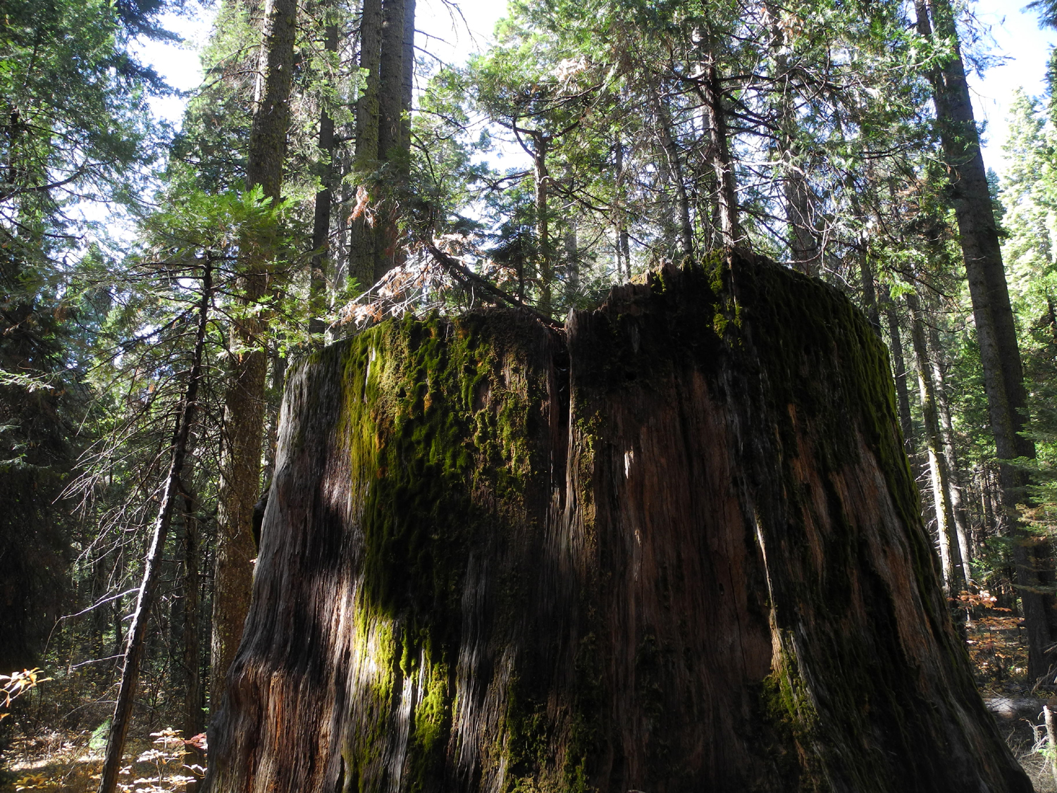
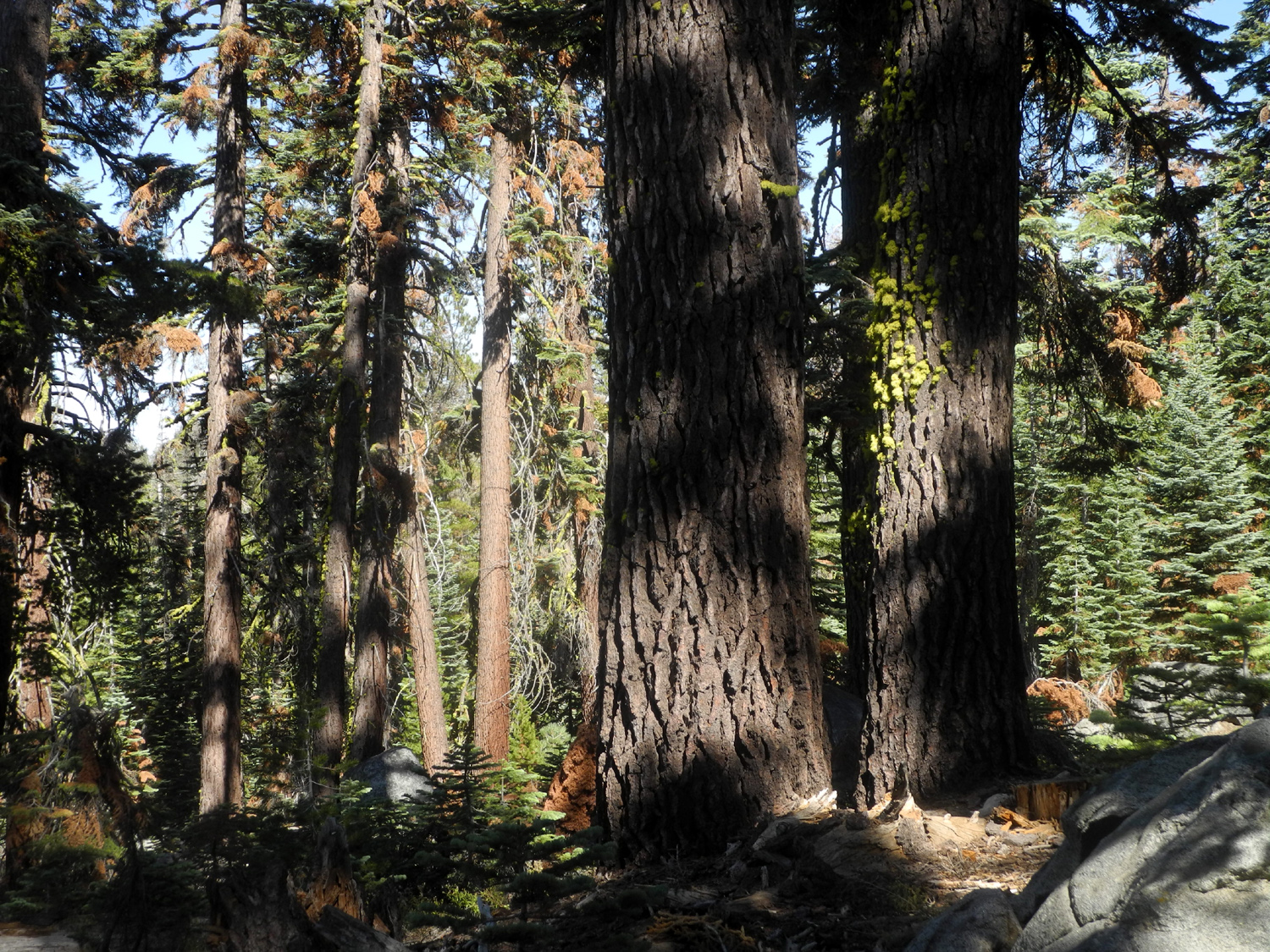
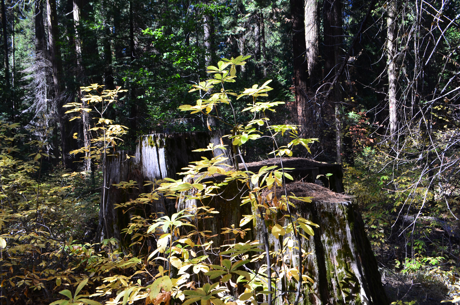
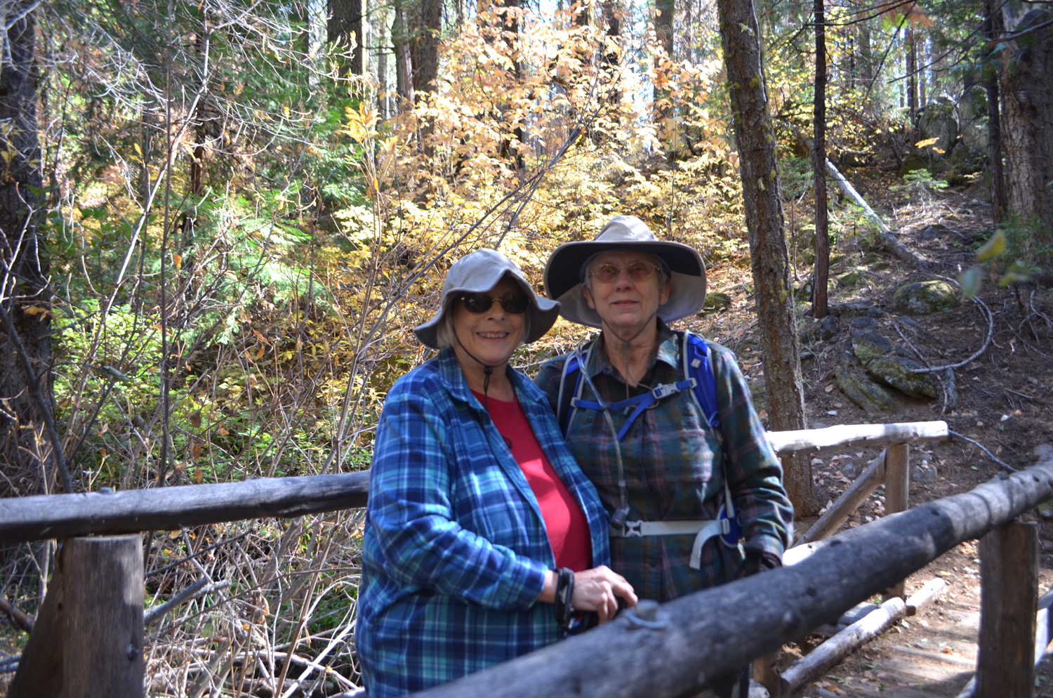
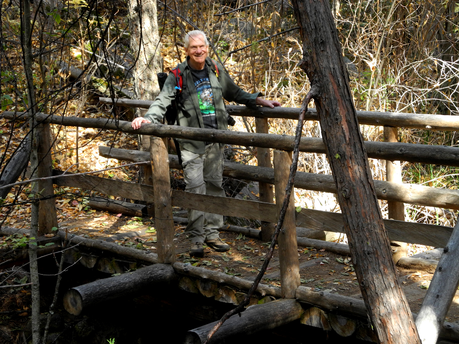
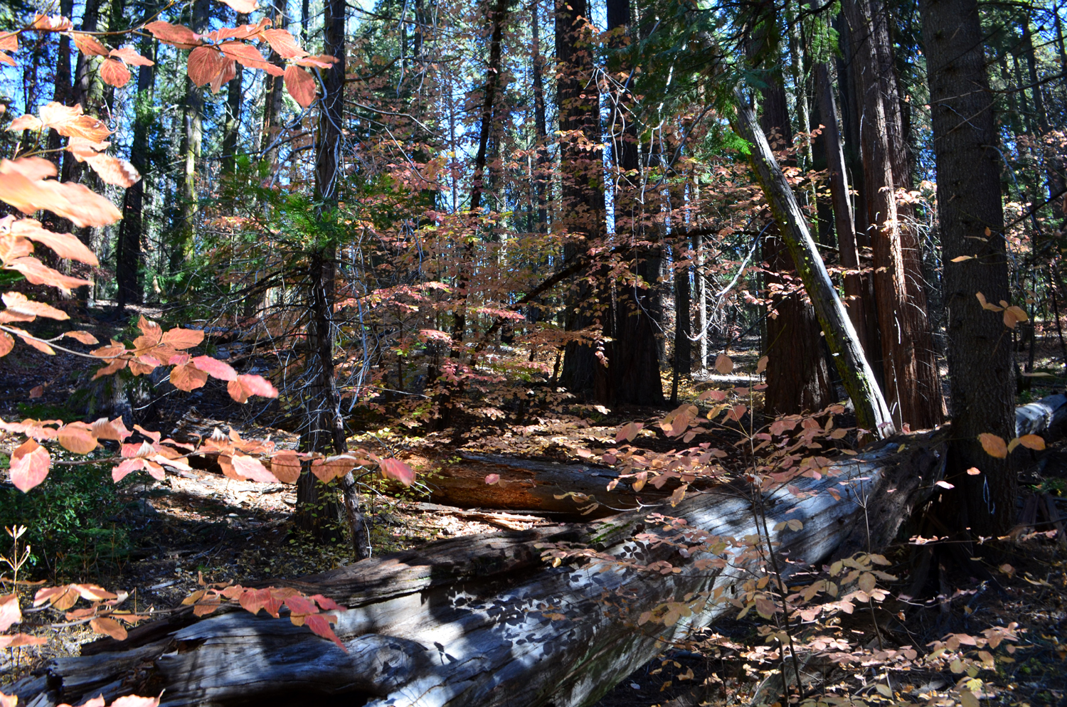
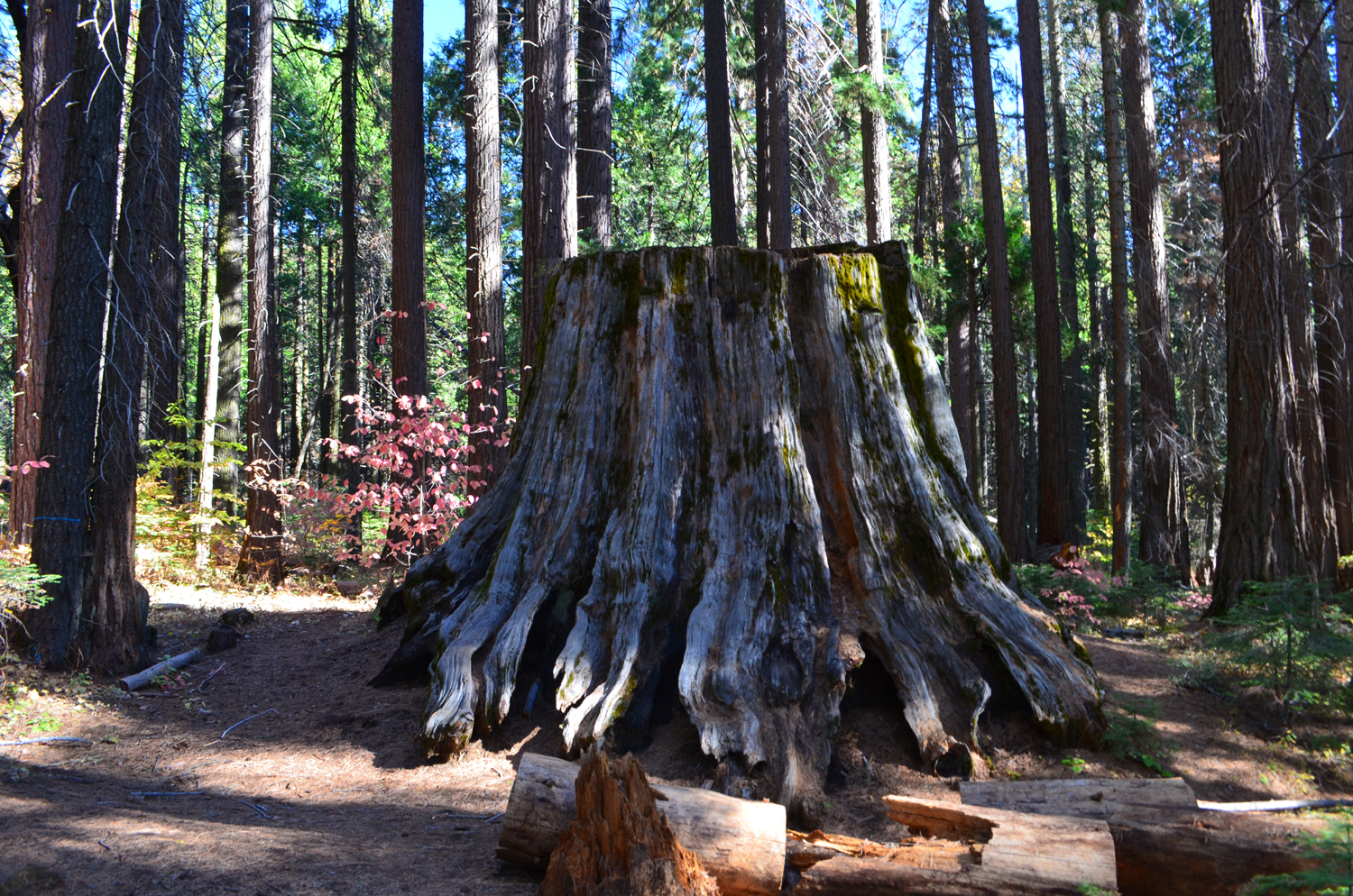
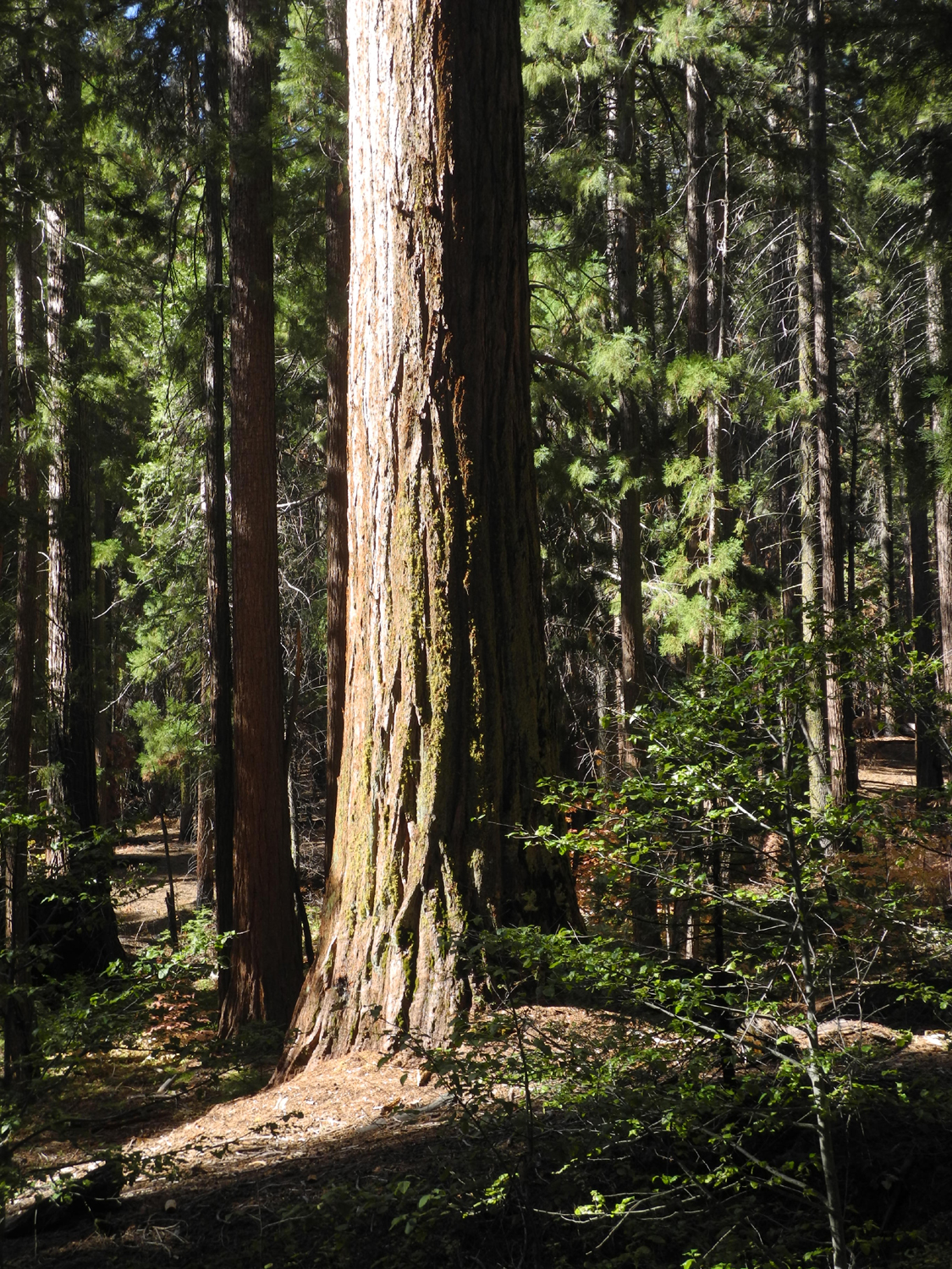
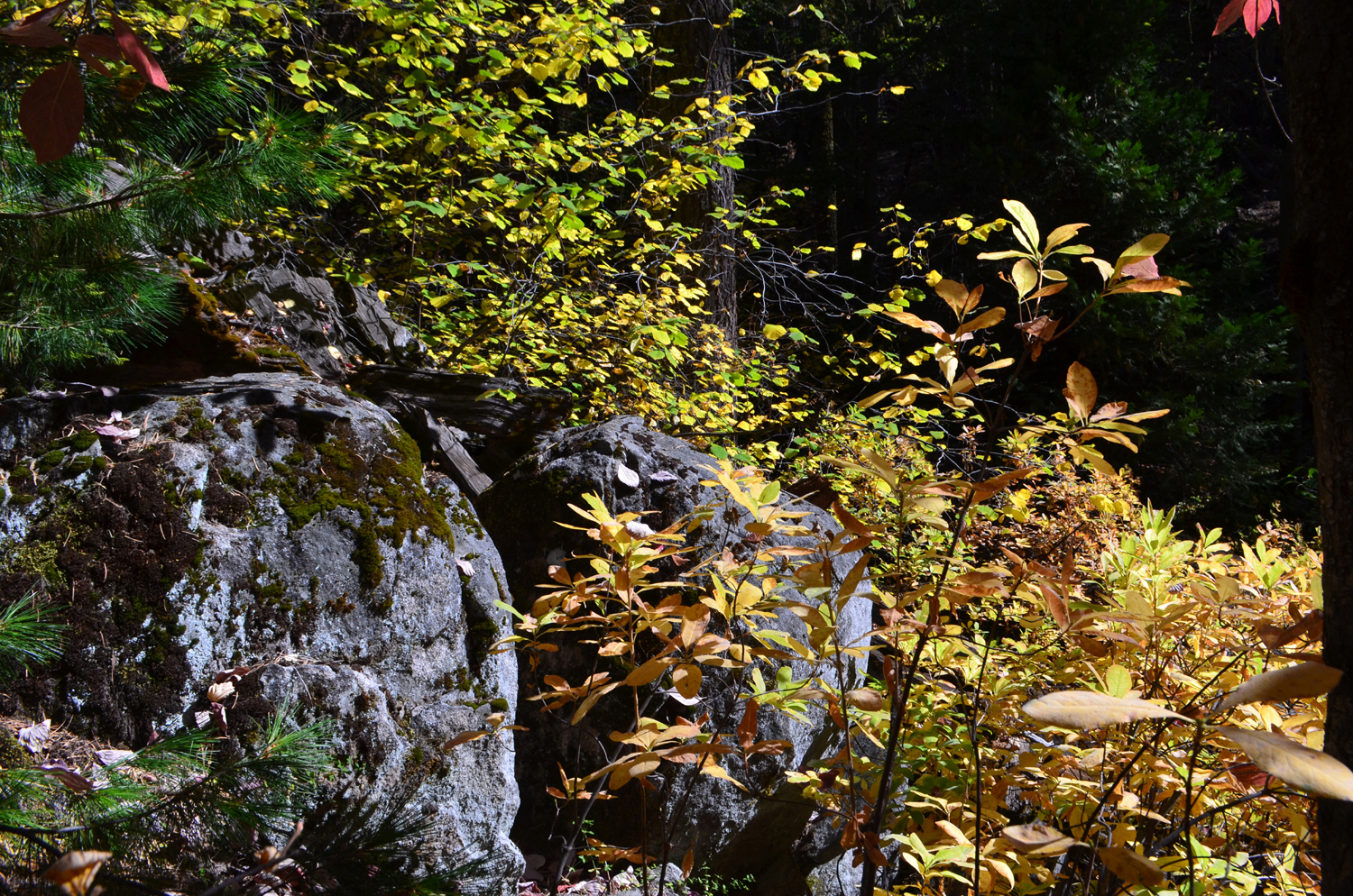
This outing was special for a couple of reasons. First we welcomed Allen Ward as an official member of the Ramblers. He met our rather demanding qualifications of hiking with us for the second time. Even more heartening to long-time members, it was the first time since December that Don was able to join us, after dealing with health issues that required him to use a walker for several months. He was still not up to hiking, but brought his walker (for occasional use), his chair, and a book, and set up an outpost at the Interpretative Center while the rest of us hiked. As noted above, we walked on the Chimney Tree loop trail, which starts a short distance from the Interpretative Center, and goes gently up hill parallel to California Creek, crosses the stream on a bridge, and winds its way back to the old road between the campground and the Bull Buck Tree. This is now the "short trail" to the Bull Buck, having been closed to vehicles for several decades. We had the trail guide prepared by Brenda Negley, who served as campground hostess for several years, following in the footsteps of her grandparents, who held the job for 20 years. With support from the US Forest Service, Brenda and others placed numbered wood markers along the trail at various points of interest, with descriptions available in the trail guide. Sadly, most of the markers were missing, and some had been moved far from their proper location. This did not detract from our enjoyment, since we could recognize many of the features, and those we didn't see were there and part of our experience. Some of the notable stops include a section of sequoia log which was cut by ax, one of only two trees felled in that manner. There are many stumps along the way, part of a total of 277 big sequoias cut down for posts, shingles and shakes, mostly in the 1880s and 1890s. The forest consists of many young sequoias, along with white fir, ponderosa and sugar pine, and cedar. As often happens in our warming, drier climate, we saw a few wildflowers. |
|
 |
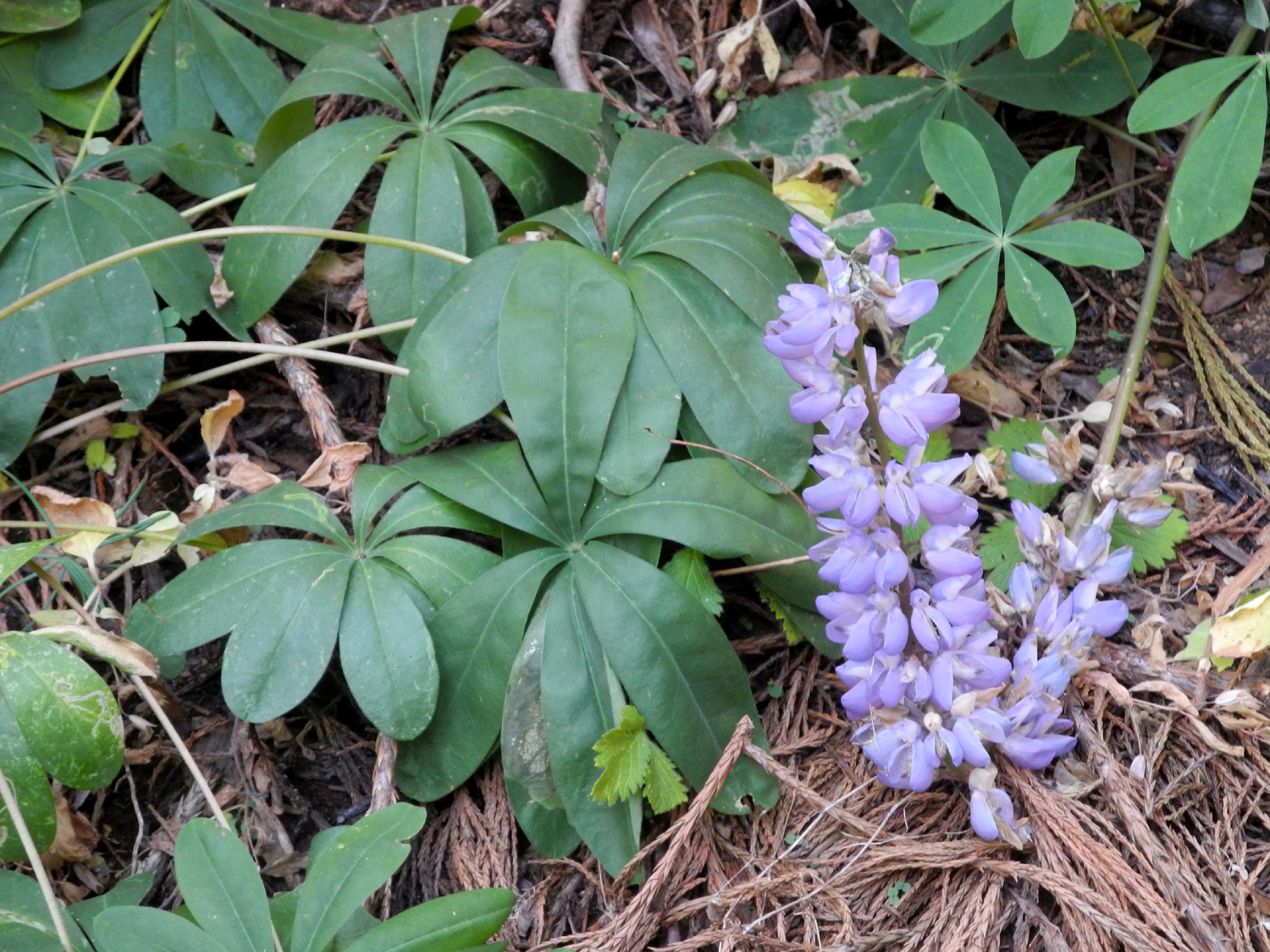 |
| Azalea decorates an old stump from logging days | There were a few of these late-blooming lupines throughout the area |
|
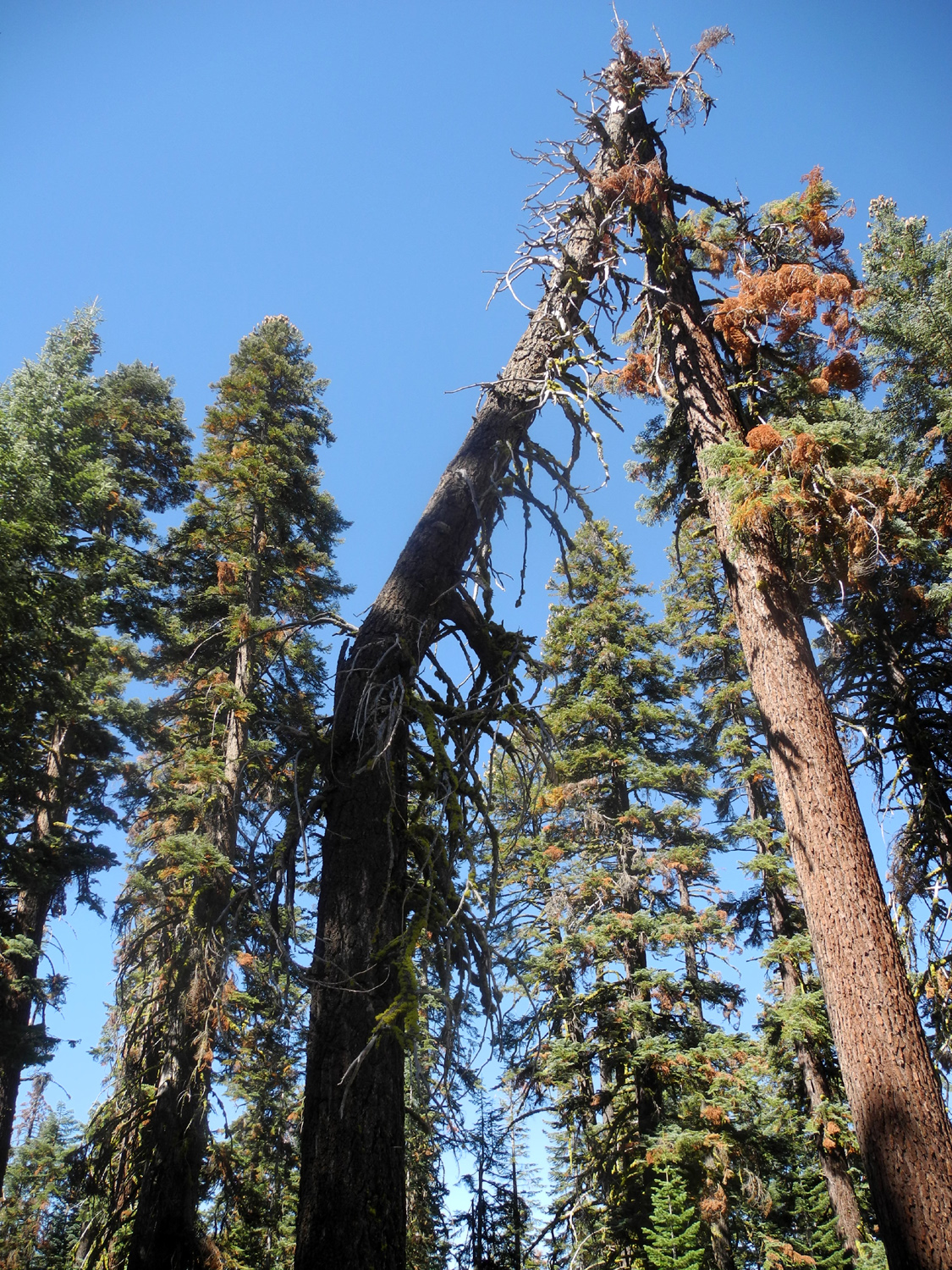
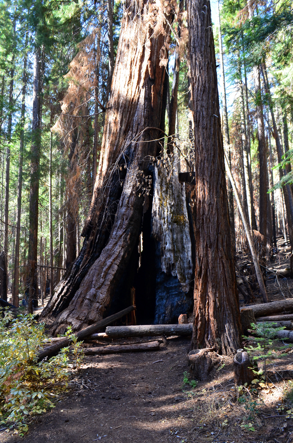
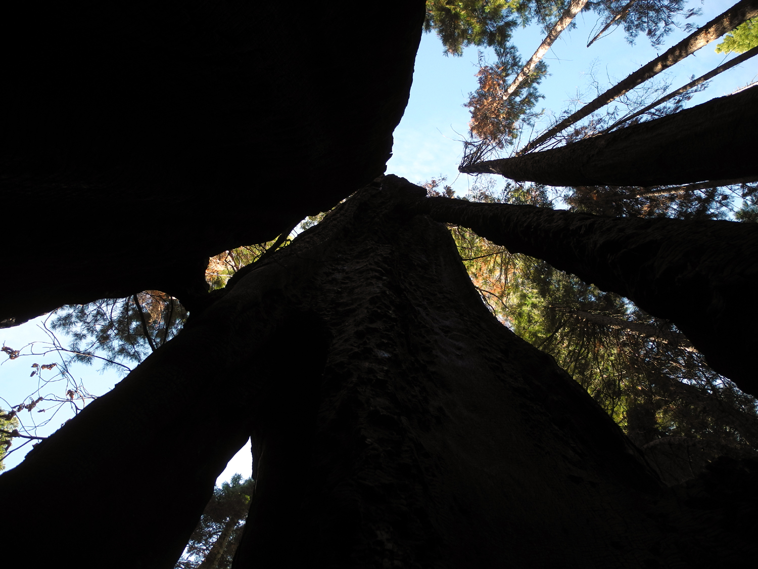
There are only a few mature sequoias along this trail. We easily recognized the California Tree, the first large tree most people notice along the trail (its marker was stashed away in the burned out opening of a nearby stump). The trail's namesake Chimney Tree is also easy to spot. It was burned out in the middle in the early 1900s, so that you can stand inside it and look up at the sky - but the tree still lives, tribute to the hardiness of these wonders of nature. |
|
 |
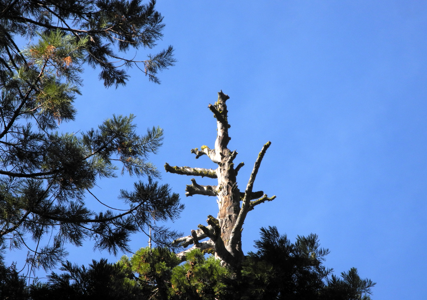 |
| Wes at the base of the California Tree | Like many big sequoias, the California Tree has a dead top |
 |
 |
| The Chimney Tree | Looking up the "chimney" |
|
After a gentle climb parallel to the creek, the trail crosses on a bridge, and it's an easy downhill stroll from there. Beyond the bridge we had good views in several spots of the Old Forester tree, 299 feet tall. This was named to honor long time Sierra National Forest Supervisor Walter Puhn. When Walter was informed that a tree was to be named in his honor, he declined to have his name on it, but instead suggested the Old Forester name to honor all the Sierra foresters before and after his tenure. |
|
 |
 |
| Sue and Ardyss on the bridge over California Creek | Wes on the bridge |
 |
 |
| Top to bottom view of the Old Forester | A fallen sequoia log, surrounded by dogwood and evergreens |
|
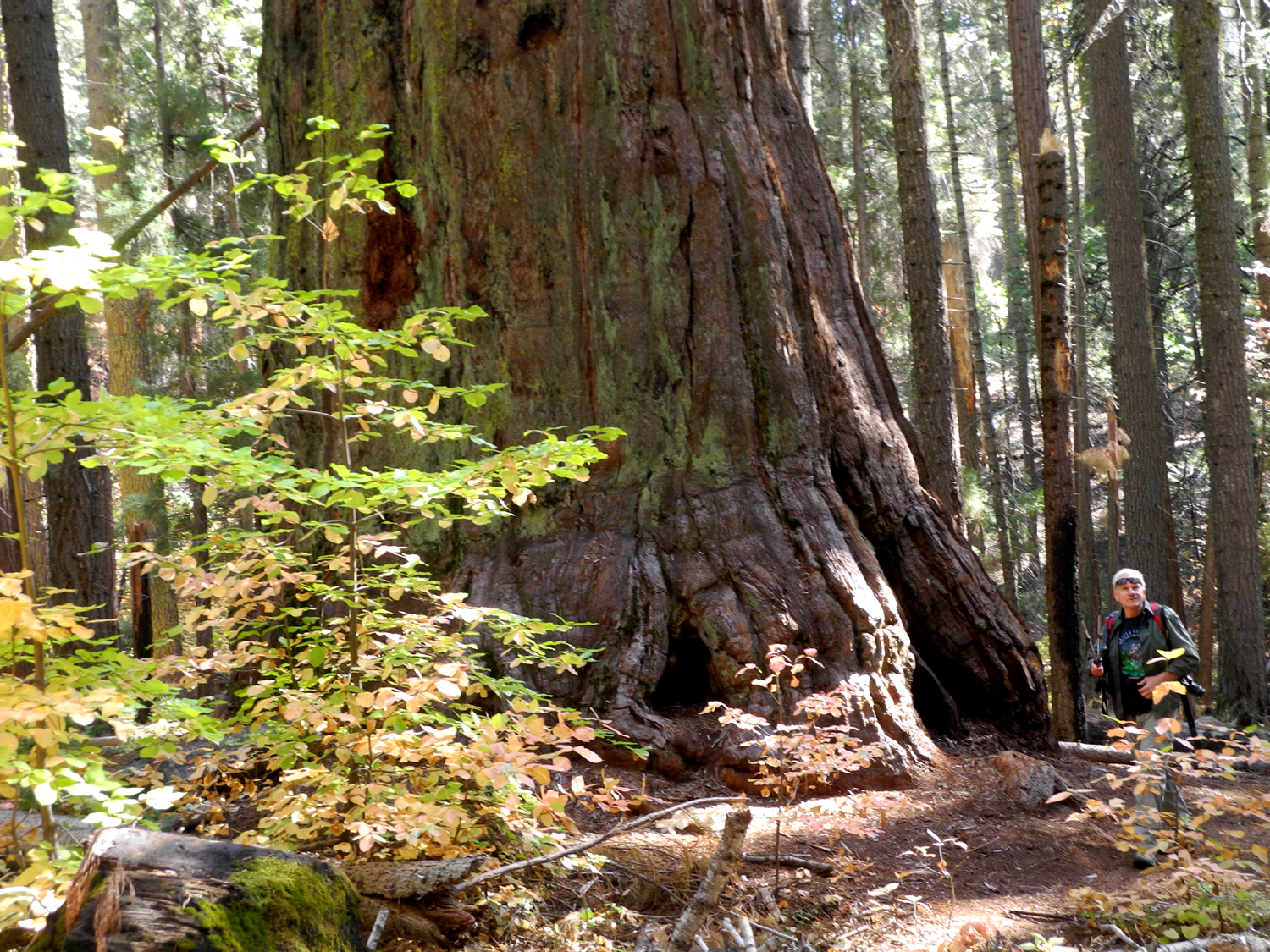
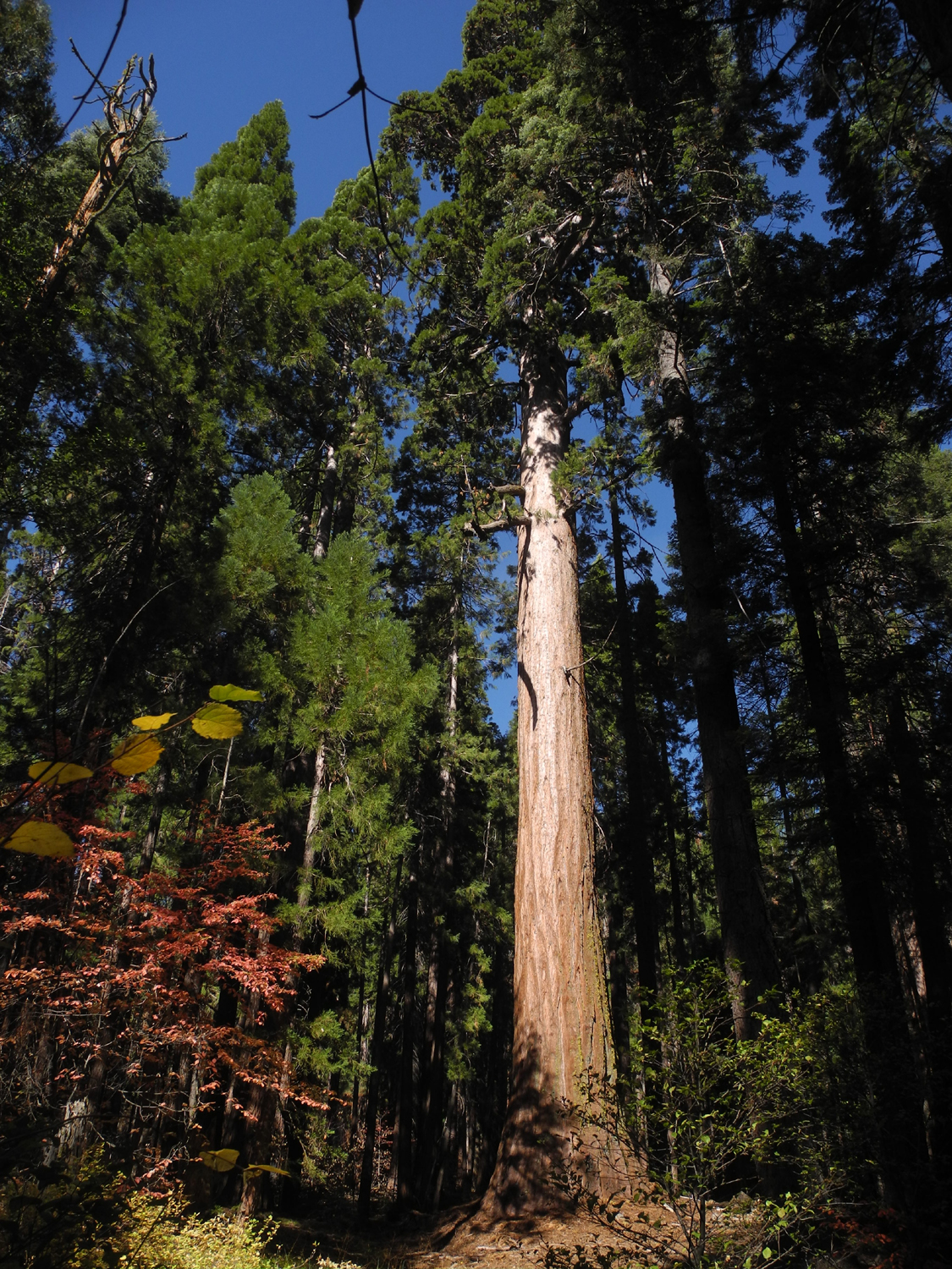
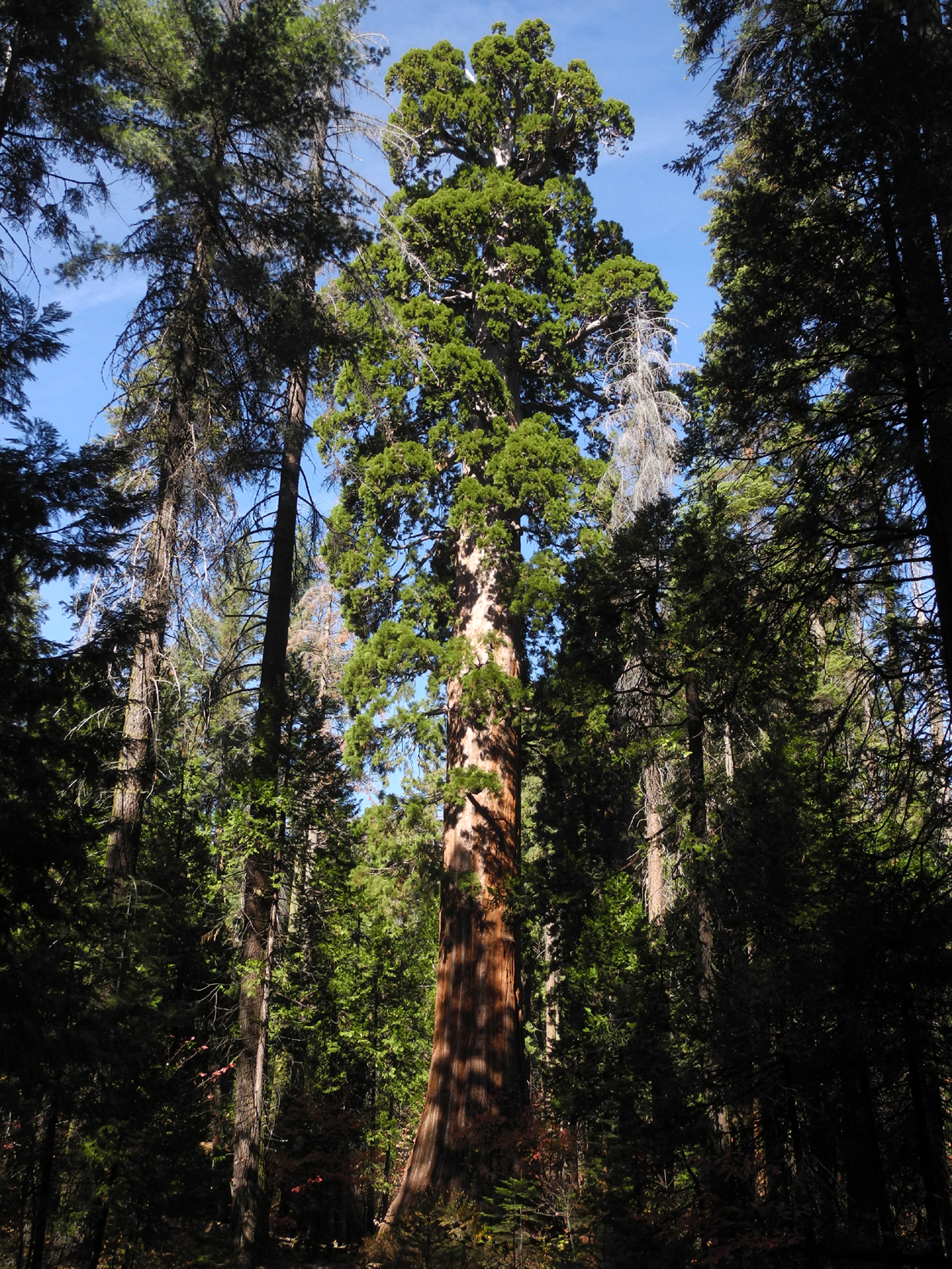
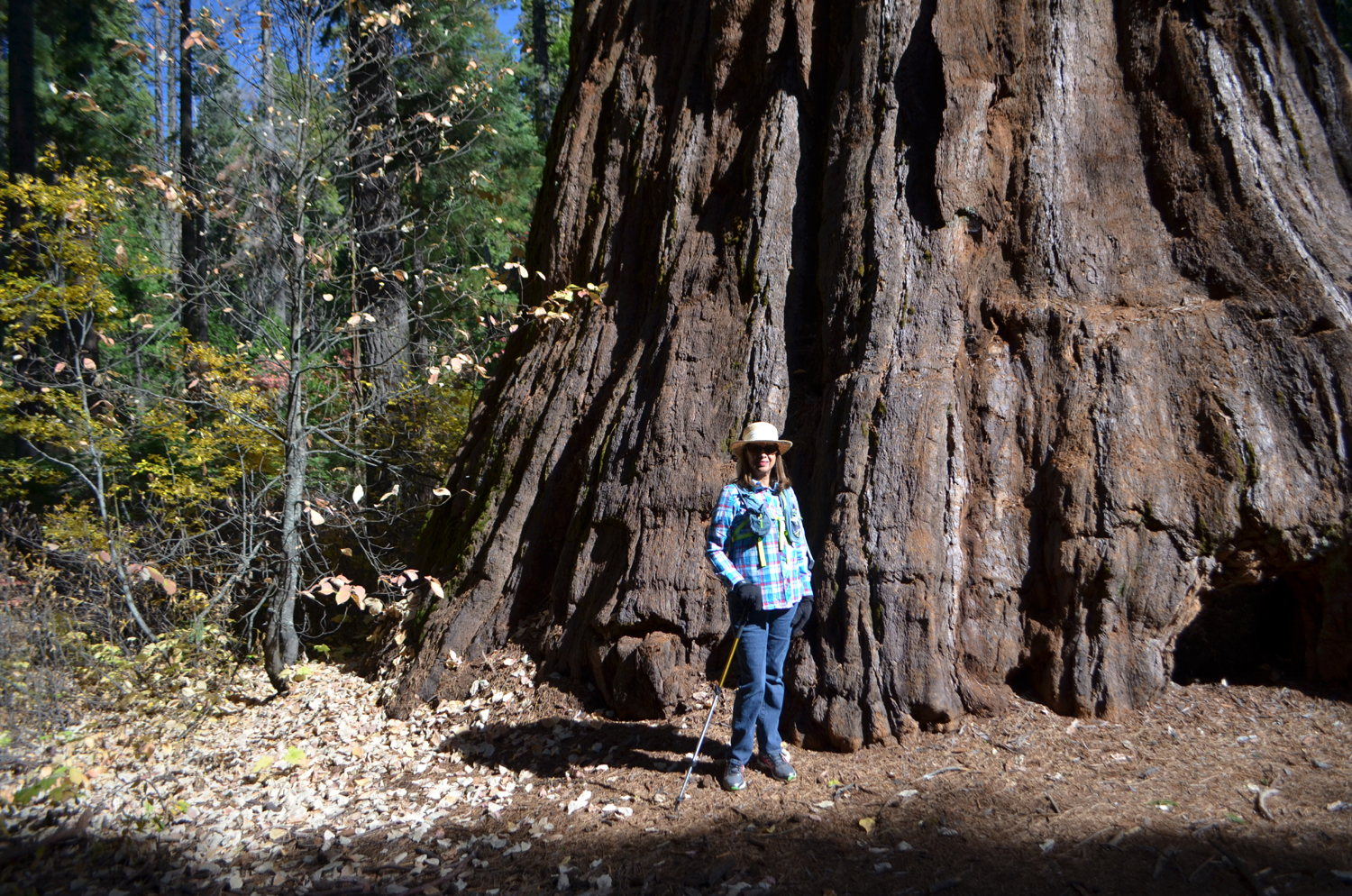
Of course, it's almost illegal to visit Nelder Grove without a stop at the Bull Buck Tree, a couple of hundred yards from the end of the Chimney Tree Trail. The name comes from the term for woodsmen who felled the trees and "bucked" them into logs. The woods boss was called the Bull Buck. This tree is certainly one of the most impressive trees in the grove, as well as the most accessible and one of very few that offers a top to bottom view from a distance that does not require straining one's neck. This was not the case the first time I saw it in the late 1960s, but the Forest Service cleared a path uphill from the tree, so that it's easy to view it and take photos of the entire tree. At the end of the path is a bench constructed by the late John and Marge Hawksworth, long-time campground hosts. The Bull Buck is neither the largest nor tallest tree in the grove, but it has the largest circumference at ground level, owing to its dramatically flared base. And its size is nothing to scoff at - it's the second largest tree at Nelder, and the 43rd largest Sequoia in the world - a respectable position among perhaps as many as 10,000 significantly large trees. The Yosemite Hikes page offers an assessment that I cannot improve on: "The Bull Buck Tree is not only humongous and humongously old, but also serves as a sort of platonic ideal of tree aesthetics, pleasingly proportioned with a nicely arranged selection of bark, branches, and leaves, providing the kind of profile that any sky would feel flattered to have rising in front of it. You get the sense, gazing on it, that this is what other trees should aspire to. If you count yourself a looker-at of trees, in short, this one belongs on your list." |
|
 |
 |
| Never hesitate to take one more photo of the Bull Buck Tree | Elsa, Dick, Sue, Ardyss and Allen enjoy a rest at the Bull Buck vista |
 |
 |
|
Elsa joins the hundreds of visitors who have been photographed at the base of the magnificent Bull Buck Tree |
The thick, full top of the Bull Buck |
|
After we had properly communed with nature at this special spot, we made the short walk back to the campground, and on the Interpretive Center. When we arrived Don was nowhere to be seen, although his chair and walker were there by a picnic table. Despite his physical limitations, he has been an avid camper and hiker for decades, so we were not worried about his safety. He soon came ambling down a nearby hill. With the temperature barely above 50 degrees, he had gone to find an open sunny spot. We hikers had been comfortable walking with two or three layers, but of course, Don spent most of his time sitting. He did make the 100 foot walk down to the Big Ed Tree, and proudly announced that he had hit 500 steps for the first time since his health problems began early in the year. |
|
 |
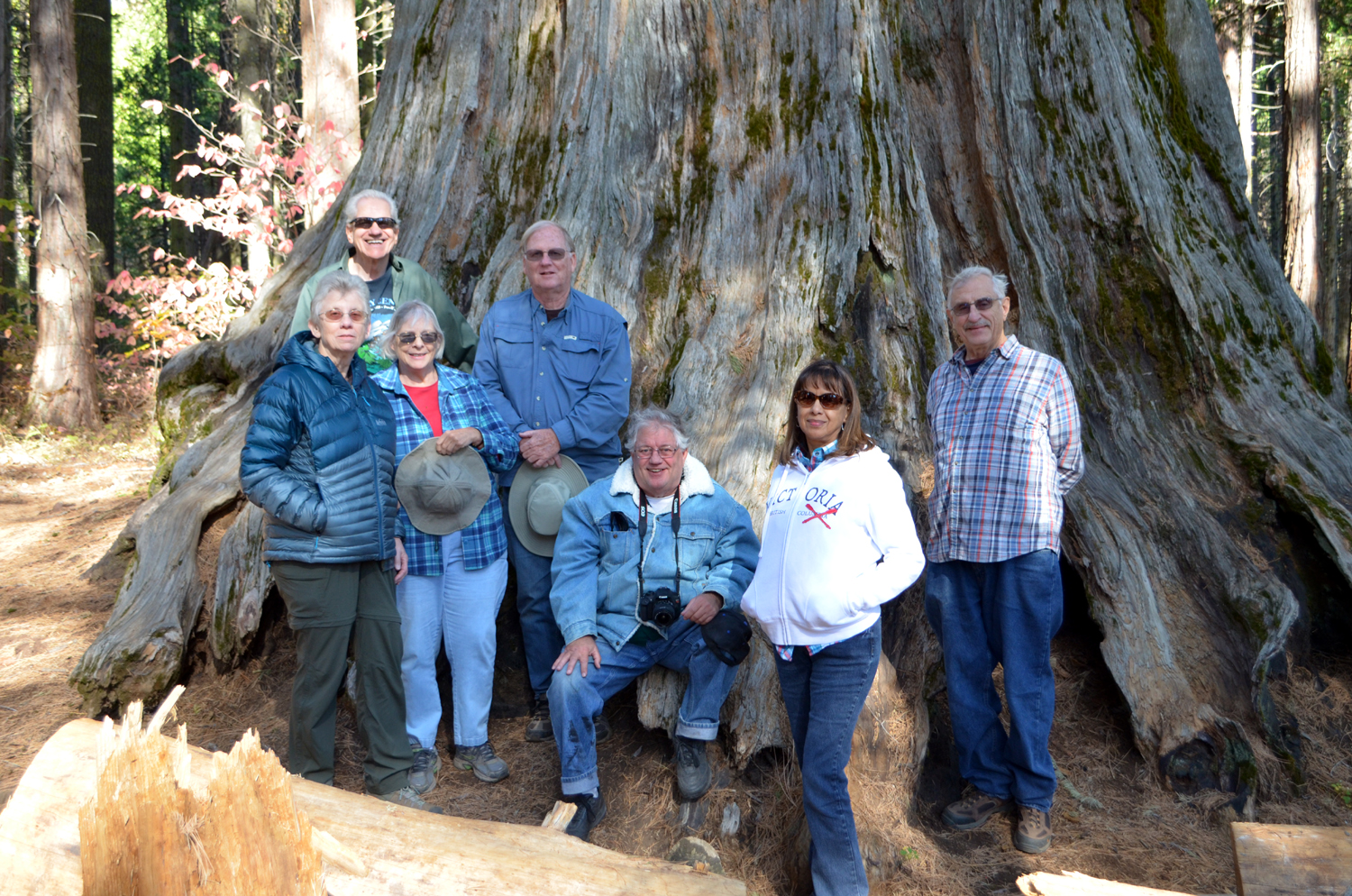 |
| Big stump in the interpretative area | The Ramblers: Ardyss, Wes, Sue, Allen, Don, Elsa and Dick |
|
The
only picnic table was in deep shade, so we set up our folding chairs
in a sunny spot and enjoyed the sandwiches we had picked up in
Oakhurst. We reflected on what a fine day we had been blessed with,
with brisk autumn weather and blue skies. At 5,000 feet elevation,
we realized that this would probably be our last mountain outing of
the year. But plenty of trails await in the foothills and even in
the valley, and our monthly adventures will hopefully continue for
many more years. --Dick Estel, November 2018 |
|
| Blue
Oak Trail - Lake Millerton
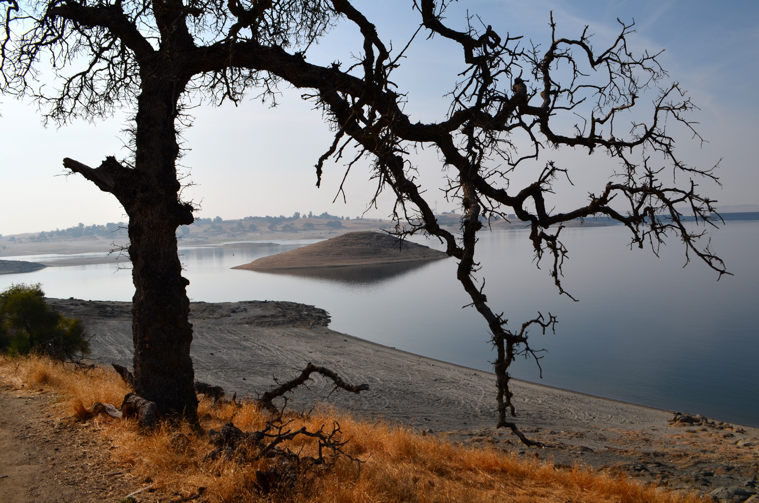
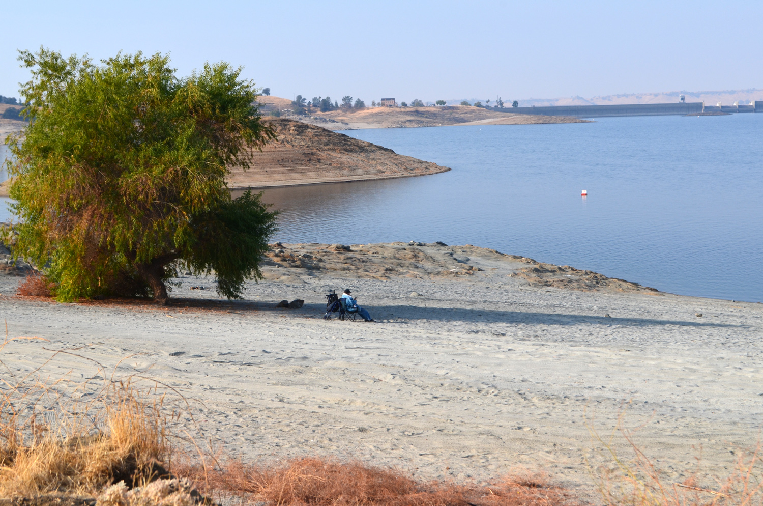
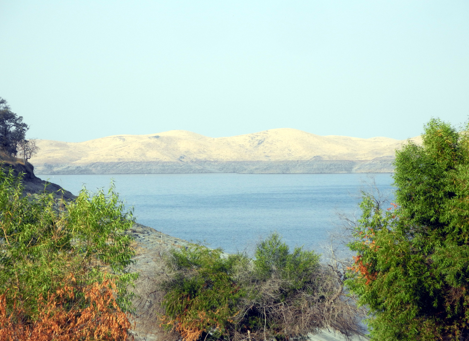
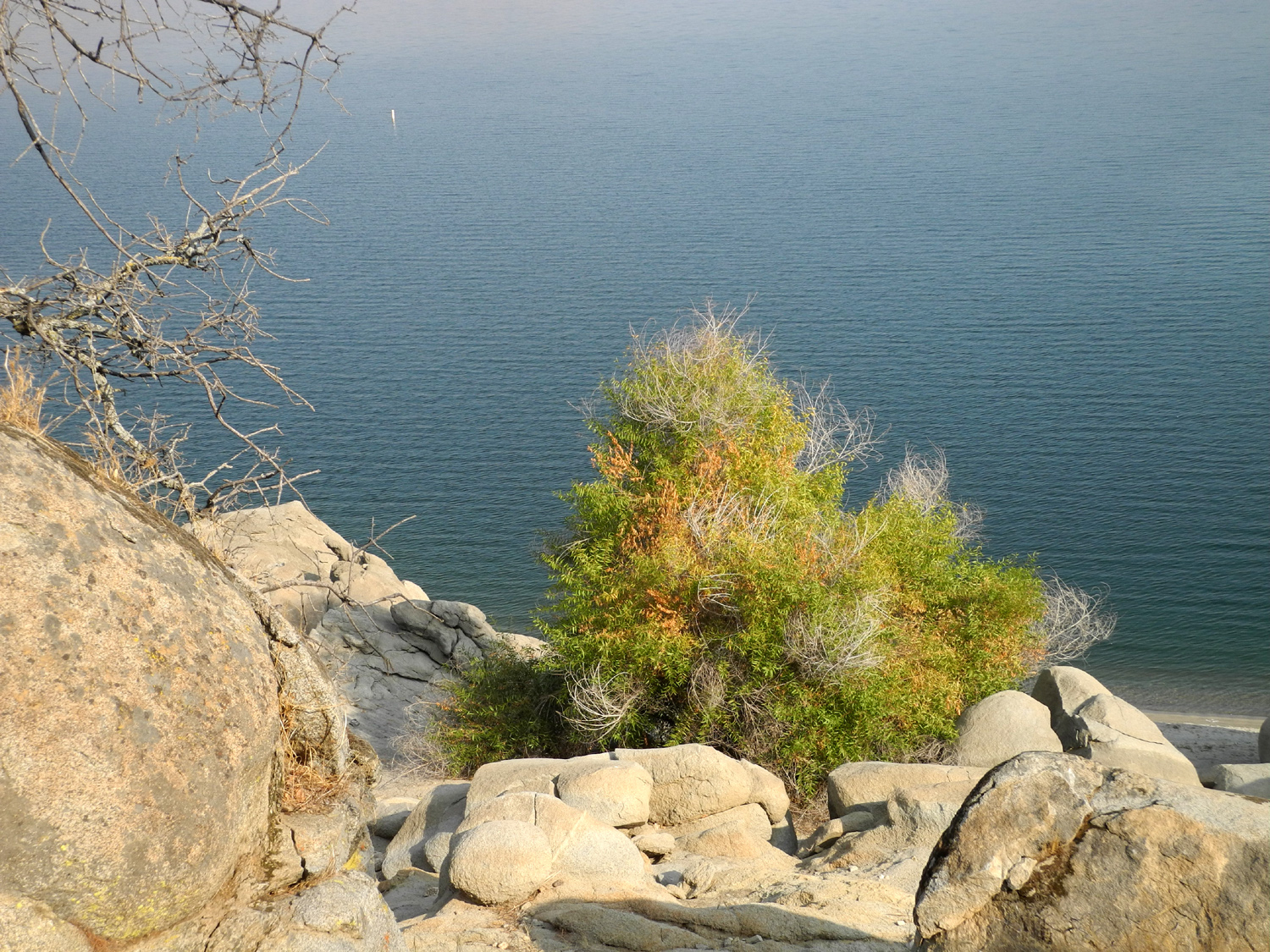
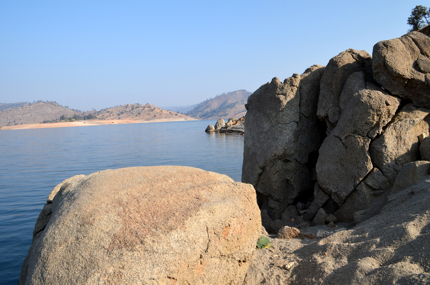
With colder weather approaching, the Ramblers chose a low elevation destination for our November hike. Ardyss, Sue, Don, Dick, Wes, and Allen met on November 15 at a shopping center in the small town of Friant, just down river from Friant Dam. From there we drove in two vehicles to the entrance to the Millerton State Recreation Area, paid our $9 fee, and continued to the trailhead for the Blue Oak Trail. This trail follows the shoreline of Lake Millerton, and goes through endless specimens of its namesake tree, as well as an occasional live oak, plus willow near the water. There are also rocks and boulders of all sizes in interesting shapes - no doubt partly sculptured by the rising and falling of the water level over the 80 years of the lake's existence. |
|
 |
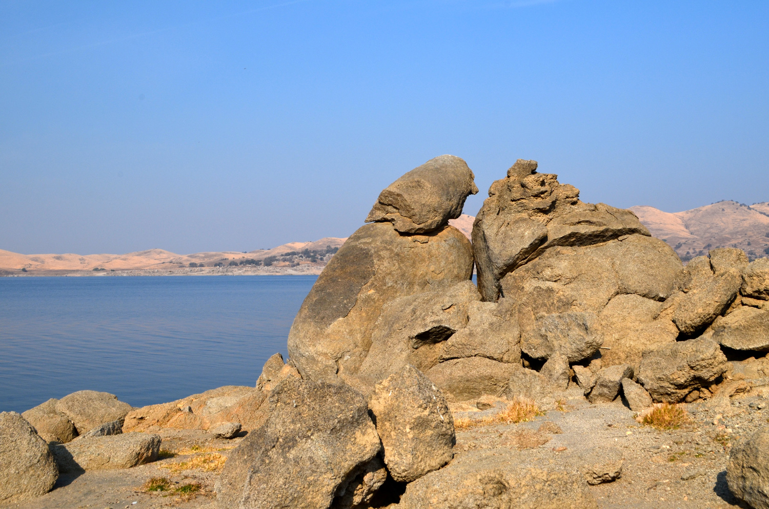 |
| A serene vista with the dam to the right | Rock formations sculpted by the elements |
|
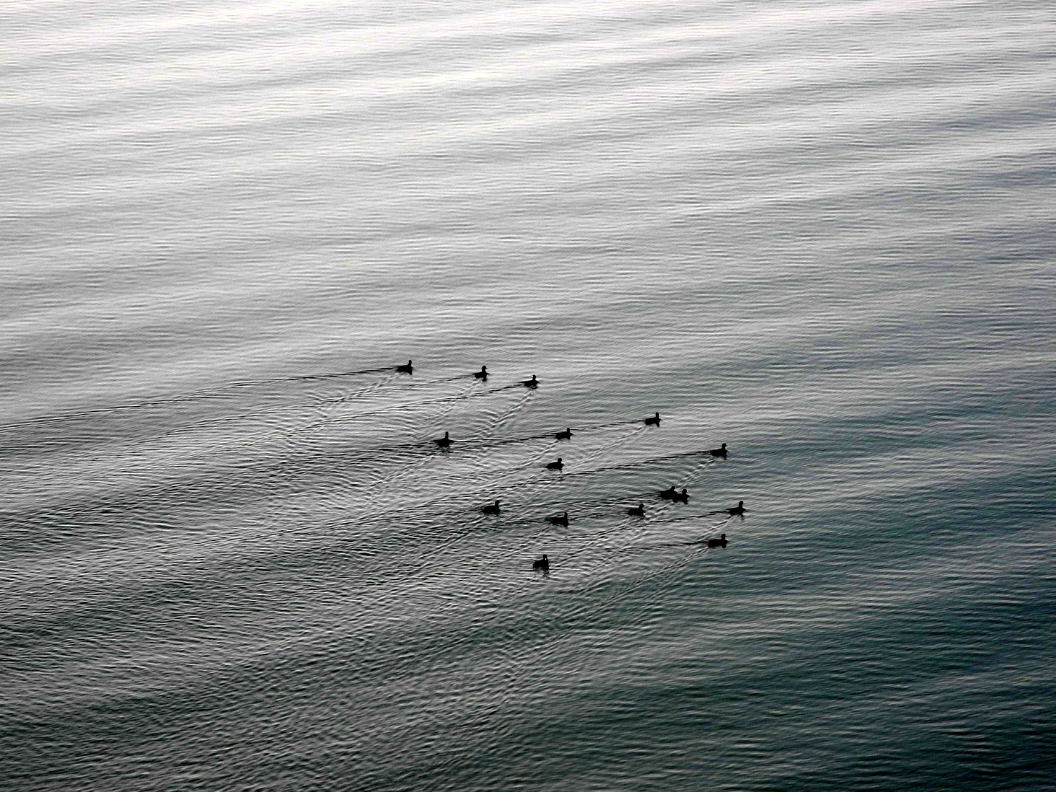
Don is still not ready to hike, so he set up his chair in the shade of a willow tree between the trailhead and the water line, which is down a good distance from the high water mark. He could move from shade to sun as conditions dictated, and also enjoyed a little walking down to the shore and to a nearby rock pile. The rest of us set out on the trail, always hopeful of spotting one of the eagles that nest near the lake. This was not to be, but we did see a redtail hawk, several ravens, a rabbit, and a goodly number of ground squirrels. On the water there was a flock of birds, most likely coots. |
|
 |
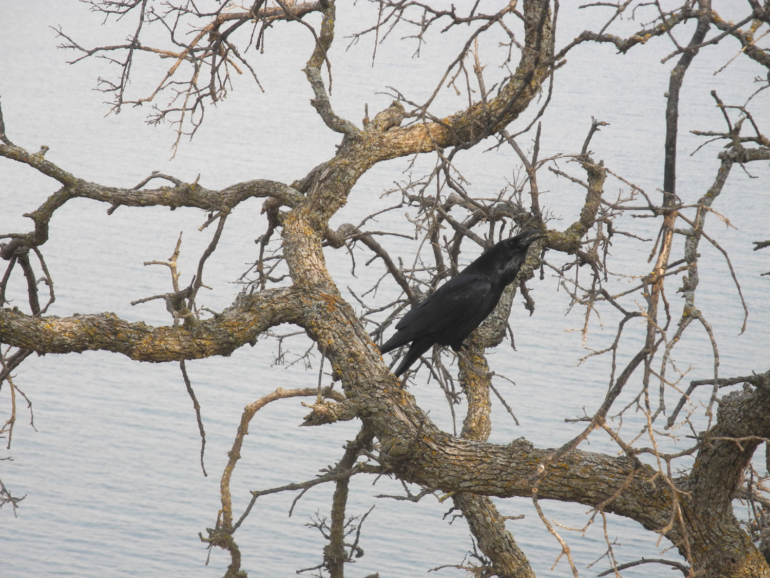 |
| Don had his choice of sun or shade, and a nice view of the lake | Ravens joined us at several places along the trail |
|
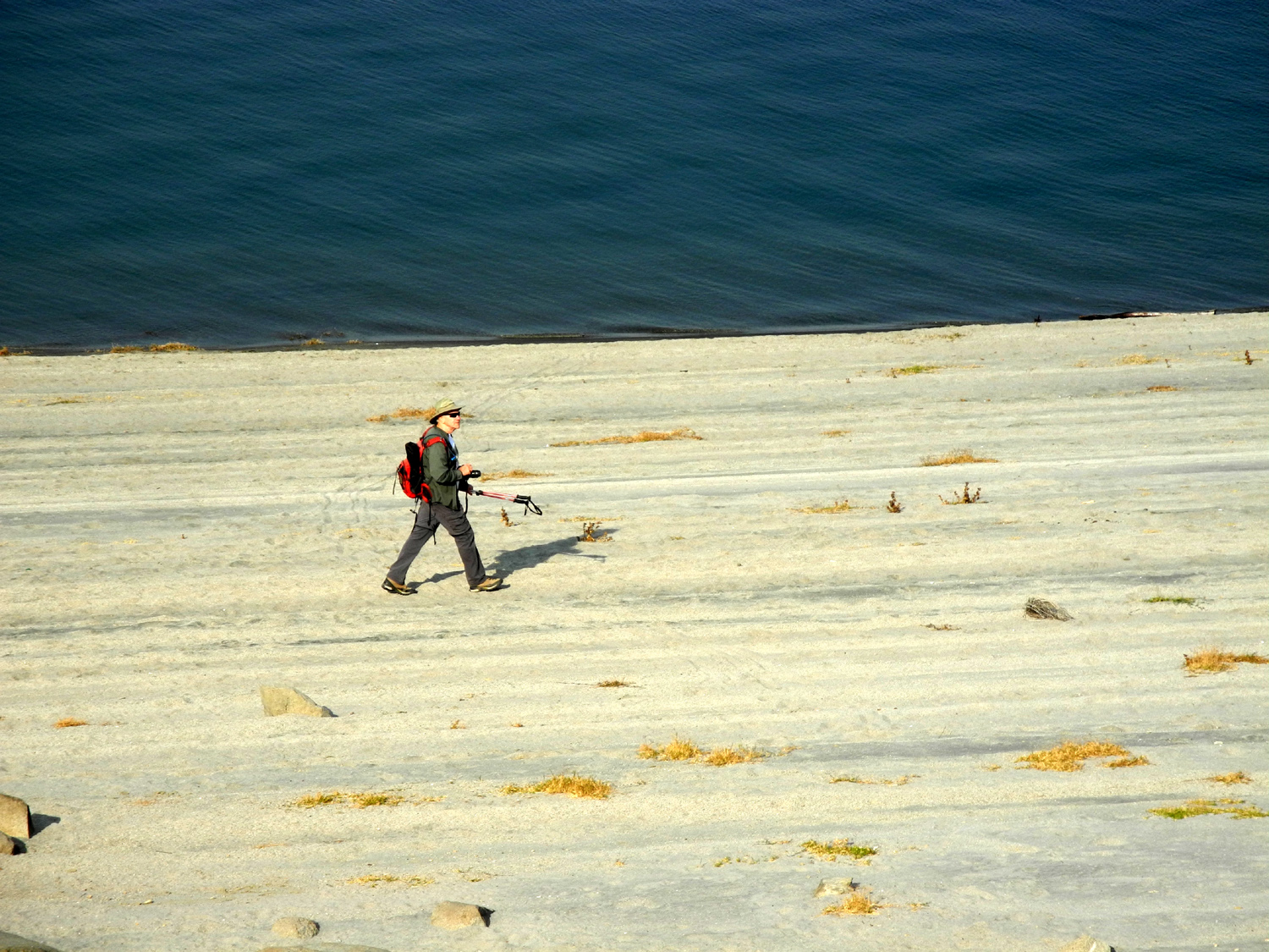
On our previous hike we've had a good view of the Sierra Nevada upstream from the lake, but smoke from fires in northern California hid the higher part of the range. We had to be satisfied with the nearby foothills. On most of our hikes some feature of the landscape catches Wes's eye, and he focuses on that in many of his photos. On this day it was the shore, with the dramatic rock formations and ever-changing views of the lake, and part of the time he walked down by the water, well below the trail. This enabled him to capture an interesting shot of the rest of us hiking single file along the grass-lined trail. |
|
 |
 |
| Leaves changing color, and a view of the golden foothills across the lake | Wes, the lone hiker, searching for the perfect photo by the shore |
 |
 |
| An out of this world vista | Allen, Ardyss, Sue and Dick, in serious hiking mode |
|
Of course, we found a place for the mandatory "Wes on the Rock" photo, and also created an "Everyone on the Rock" pose, with Sue volunteering to stay safely on the trail while she snapped our picture. |
|
 |
 |
| Wes on the Rock | Almost everyone on the rock |
|
This trail runs from the state park to a private marina, a distance of around two miles. Except for one time when we left a vehicle at both ends and hiked the entire length, we have always gone about a mile, then turned back. This time we did not turn back until we had gone farther than ever before. At the end point there was a buckeye tree which I photographed. Looking at the photo later, I noticed a nest in a blue oak beyond the buckeye. We made our way back to our starting point, where we found Don right where we had left him, although he reported that he had wandered down to the water and explored the area a little. We took our group photo next to his shade tree. |
|
 |
 |
|
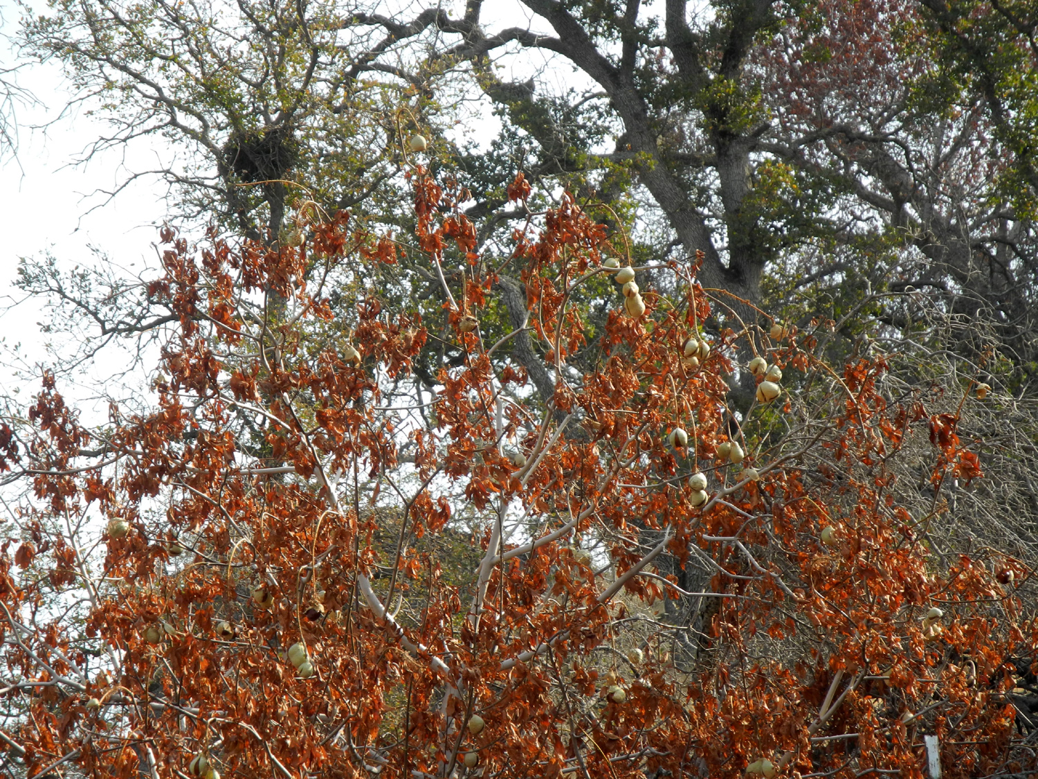
Photographing this buckeye tree in fall color, we also captured a nest in a blue oak beyond it |
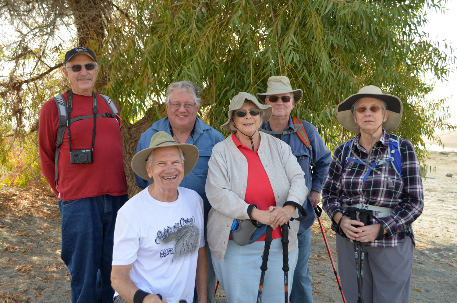
The November Ramblers: Dick, Wes (in front), Don, Sue, Allen, Ardyss |
|
In keeping with tradition, we went back to our meeting place in Friant and had lunch at the Pizza Factory. And in another tradition, Wes summarized the day in a post-hike email: Today the Ramblers hiked over two and a half miles along the Blue Oak Trail at Millerton Lake. With no rain this season, the landscape was "California Golden" and the water level was quite low, exposing islands and rock formations not usually seen. We looked hard for eagles that are known to nest in these blue oaks. One passing hiker reported an eagle sighting near the water's edge. But for us, seeing those majestic birds was not to be. We did have a great time of laughter and camaraderie. As many of you know, Don is a nature lover. His health did not permit him to join the hike. Instead, he found a comfortable spot near the trail-head and soaked in the beauty of the lake. We all had a good time. We
discussed the possibility of a December visit to the Mariposa Grove
of Sequoias in Yosemite National Park, weather permitting. As this
report is being completed at the end of November, the winter storm
season has begun in earnest, bringing several feet of snow to the
mountains above 6,000 feet. It looks like our destination will more
likely again be in the low country. --Dick Estel, November 2018 |
|
|
Photos
(Click to enlarge; pictures open in new window) |
||
|
Taft Point |
||
|
|
||
 |
 |
|
|
We couldn't even see the official parking area, a third of a mile down the road from Sue's RAV4 |
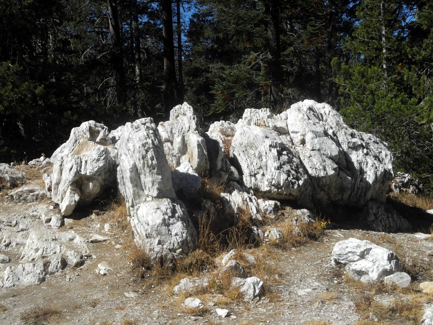
In a land of granite, this big quartz outcropping provides a startling contrast |
East of the big fissure is a ridge with interesting rock formations |
|
 |
 |
|
Ardyss, Sue and Allen rest among the rocks and manzanita |
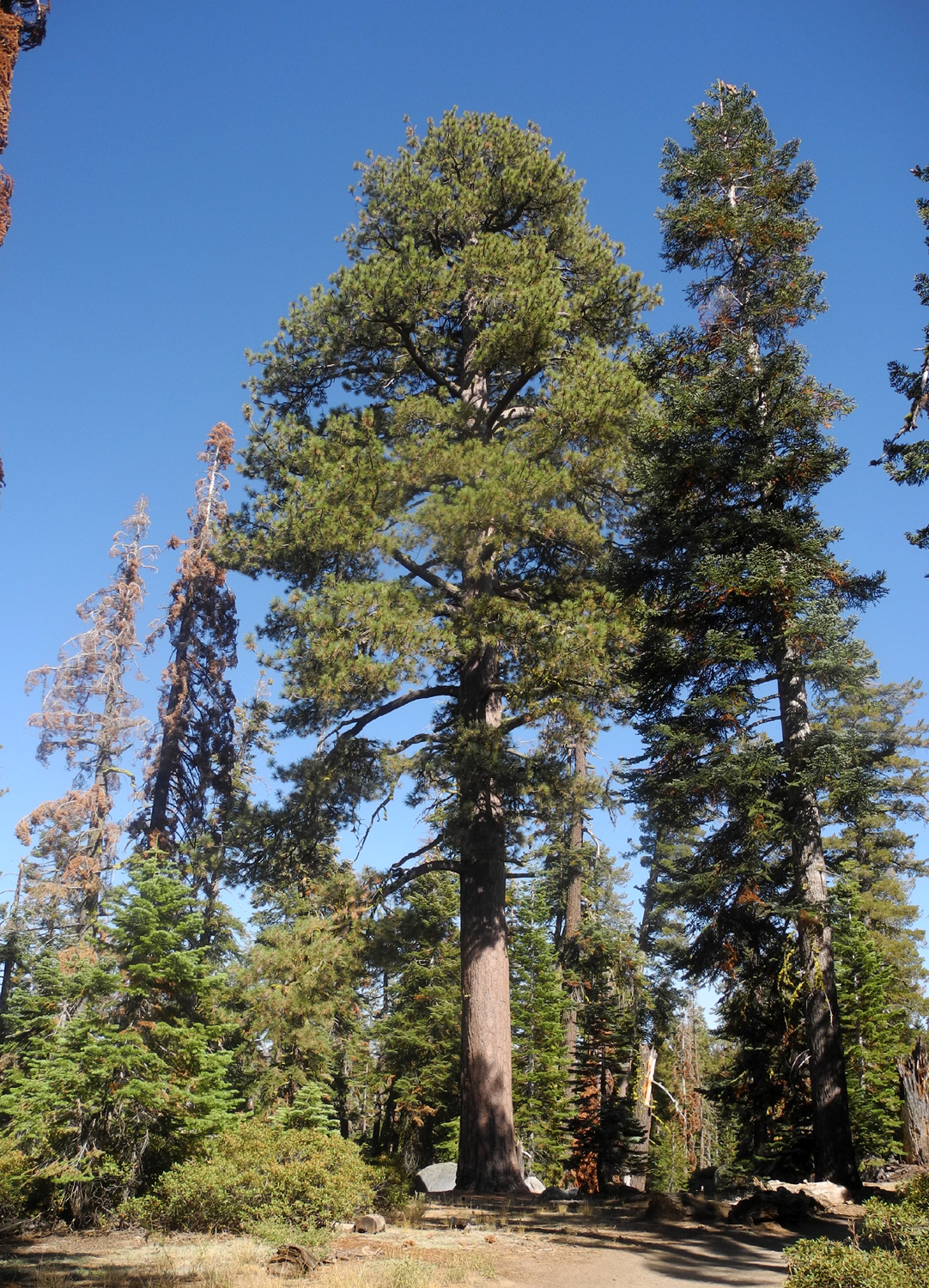
Sue looks quite comfortable, one step from a 3,000 foot drop-off | Near the trailhead, a stately Jeffrey pine |
 |
 |
|
| Heading down the tricky last 100 yards | Looking up the Big Fissure | |
| Nelder Grove Chimney Tree Trail | ||

|
|
 |
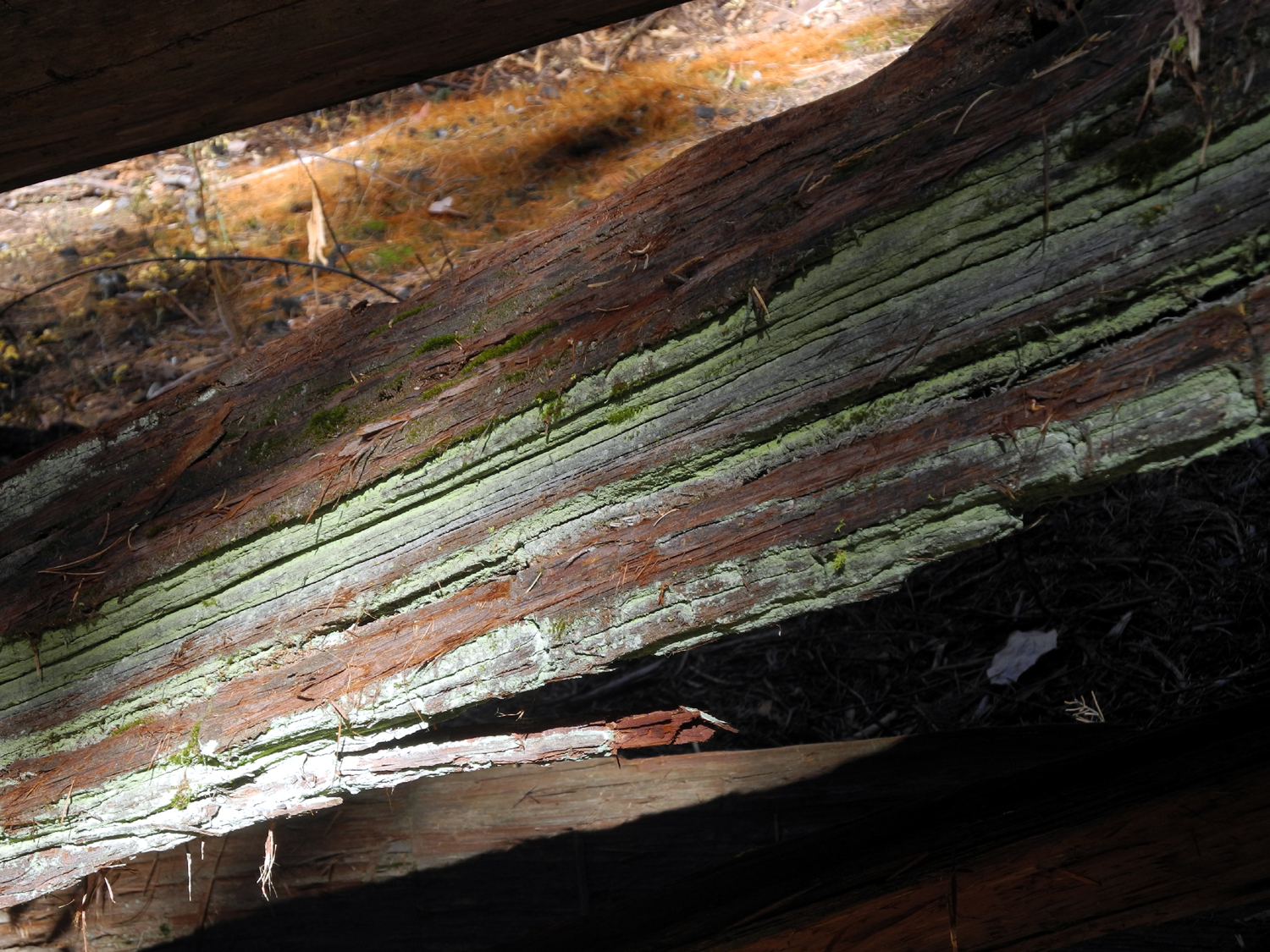
| A fallen dogwood branch | Dogwood by a section of an old sequoia log | Sequoia log used for posts |

|
 |
|
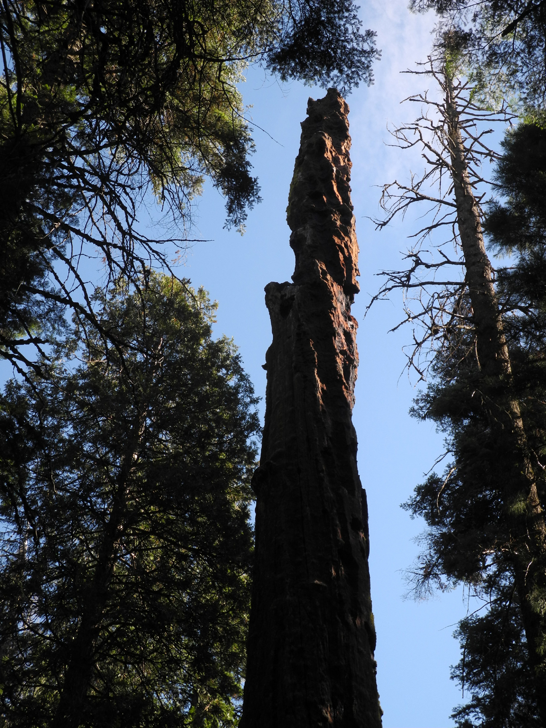
| The stately Old Forester Tree | One of the few sequoias to lose a battle with fire | It's hard to see, but there is a small evergreen growing on top of this old stump |
|
 |
 |
| Green mold or lichen on a fallen log | Ponderosa pine, dogwood, and lots of young trees | Black oak along the trail to the Bull Buck |
|
 |
 |
| Fall scenes along the Chimney Tree Trail, October 2018 | ||
| Blue Oak Trail | ||
|
|

|

|
| Falling water level creates a striking pattern of parallel line | Looking up river past weathered rock | Willow by the shore |
|
|

|
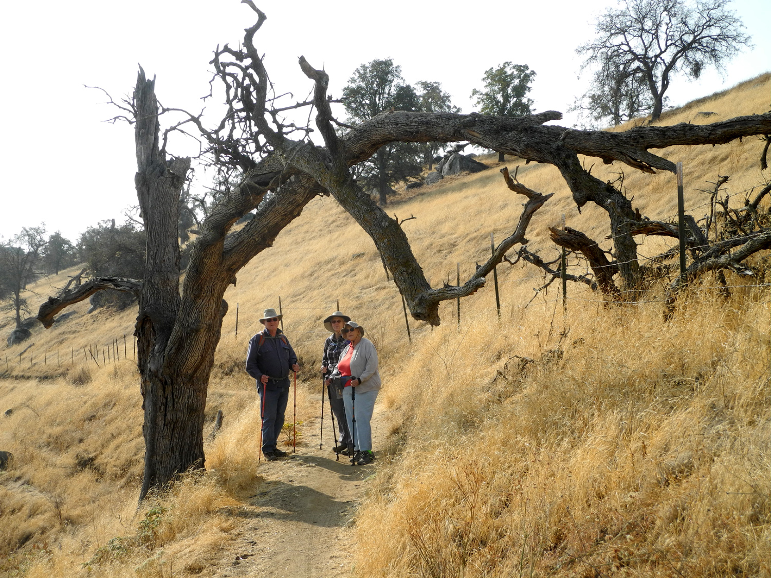
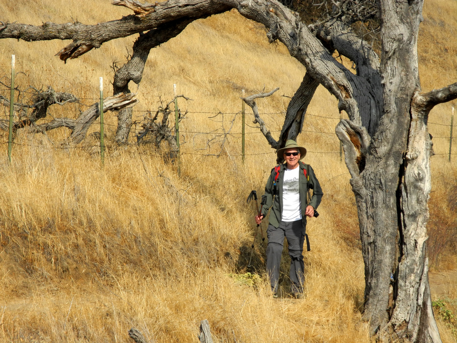
| This dead blue oak invites hikers to pose under its natural arch | Wes finally came back from his shore explorations | Seeds for next year's flowers |
|
|
|

|
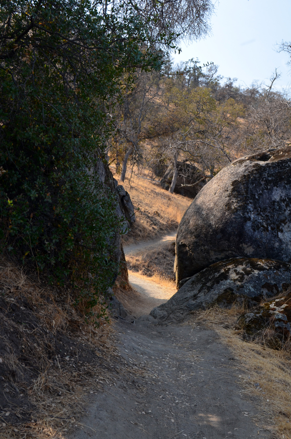
| Keeping a sharp eye out reveals nature's artwork | The trail goes through a narrow passage here | Coots on the lake |
|
Related Links |
||
| Taft Point Video | Wawona | |
| Ferguson Fire Map | Ferguson Fire Photo | |
| Nelder Grove | Chimney Tree Trail | Bull Buck Traril |
| Bull Buck Tree | Big Ed Tree | Dick's Nelder Photo Page |
| South Shore Trail Info | Millerton State Recreation Area | Pizza Factory |