
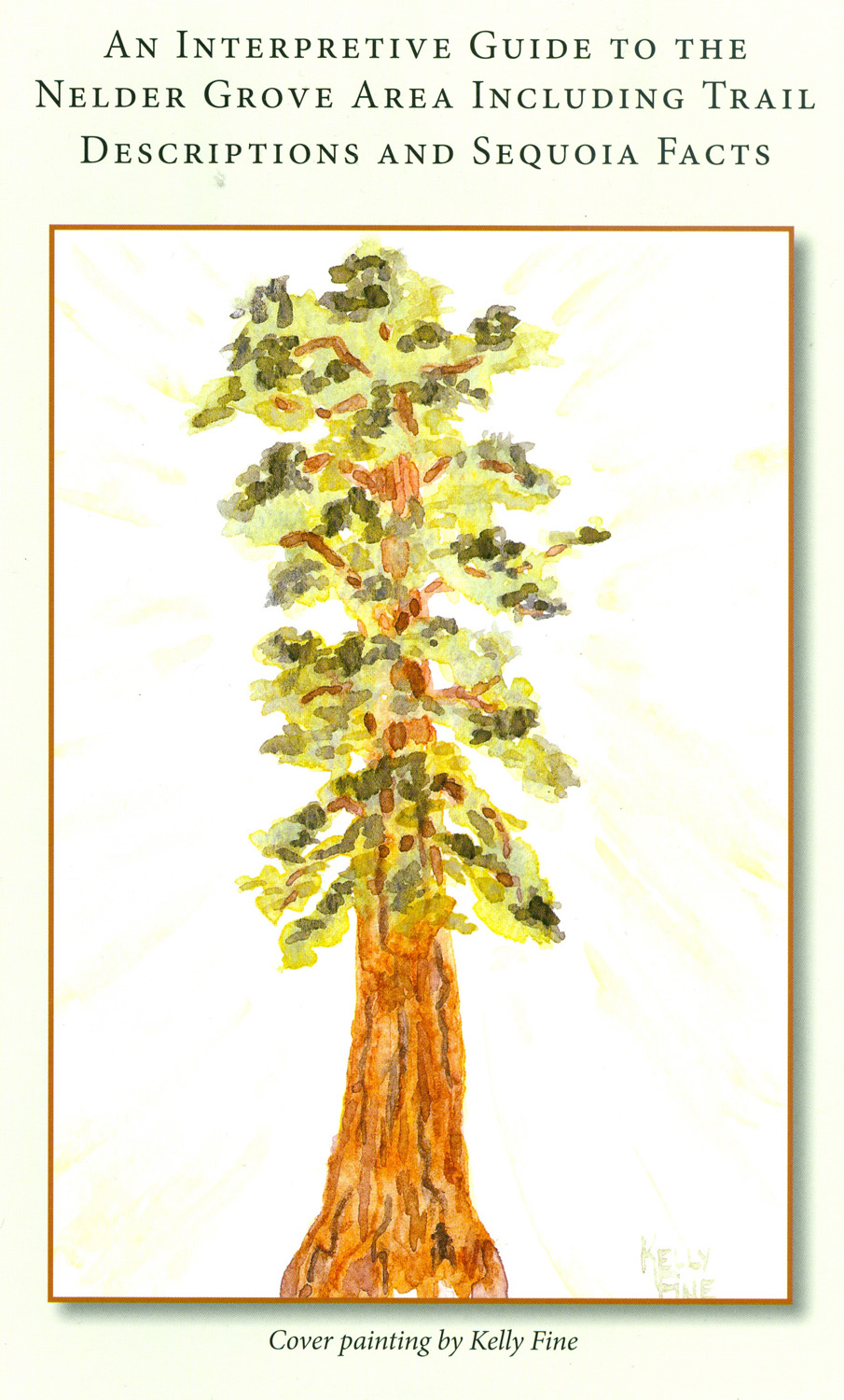
|
Nelder Grove Hikes 2014 |
||
Bull Buck & Chimney Tree Trail Hike Shadow of the Giants Trail Slow Hiking with Colton |
||
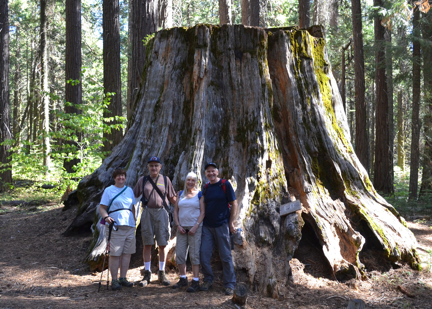
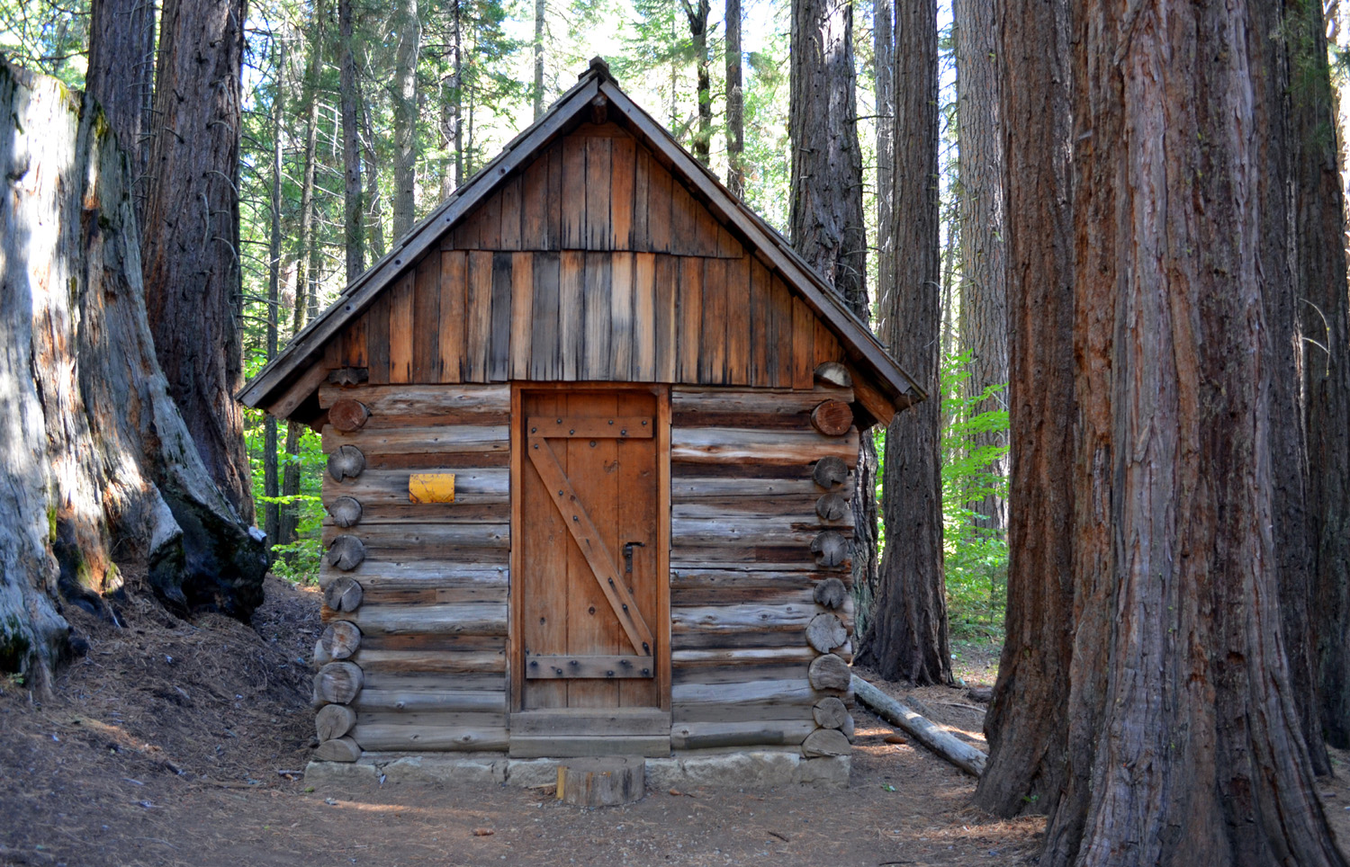
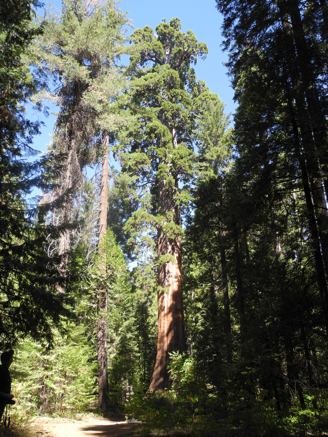
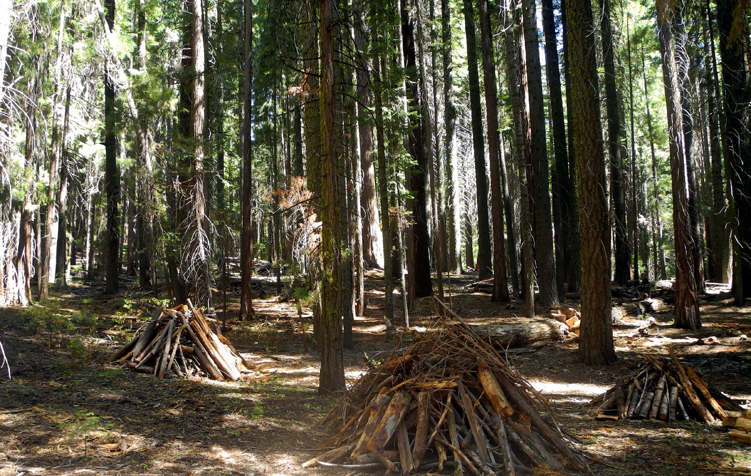
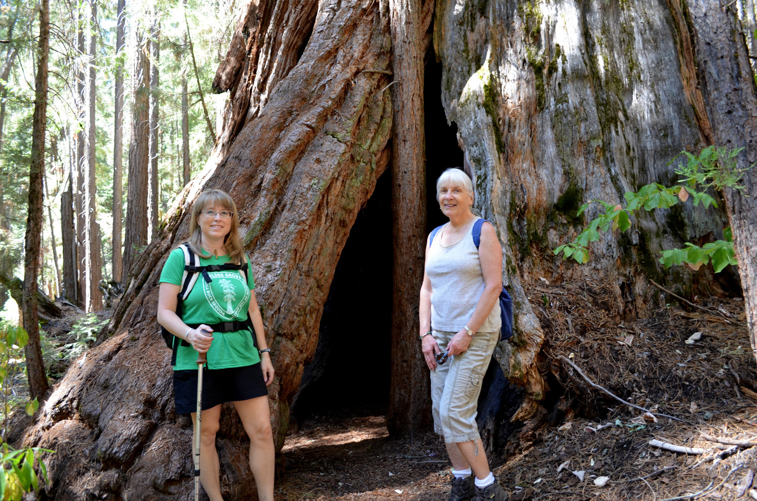
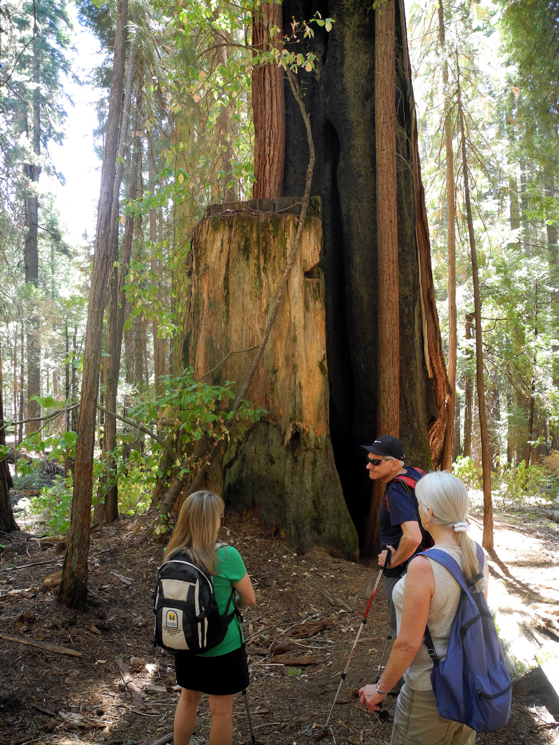
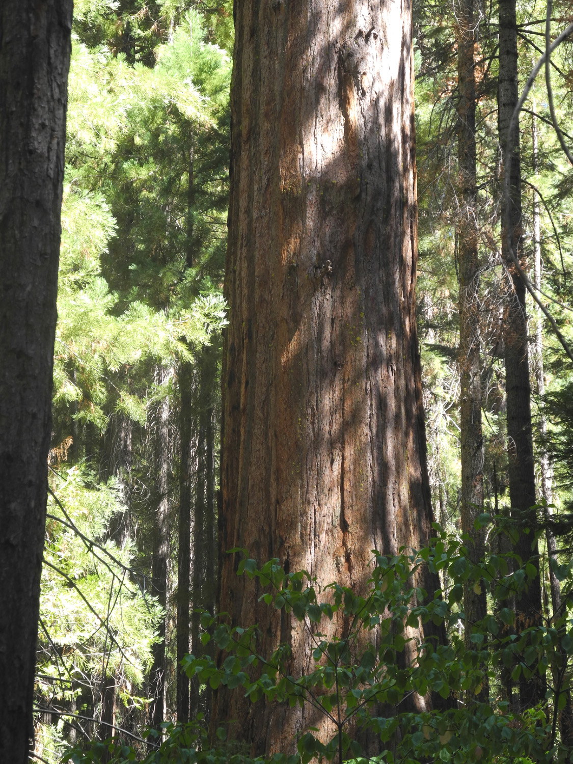
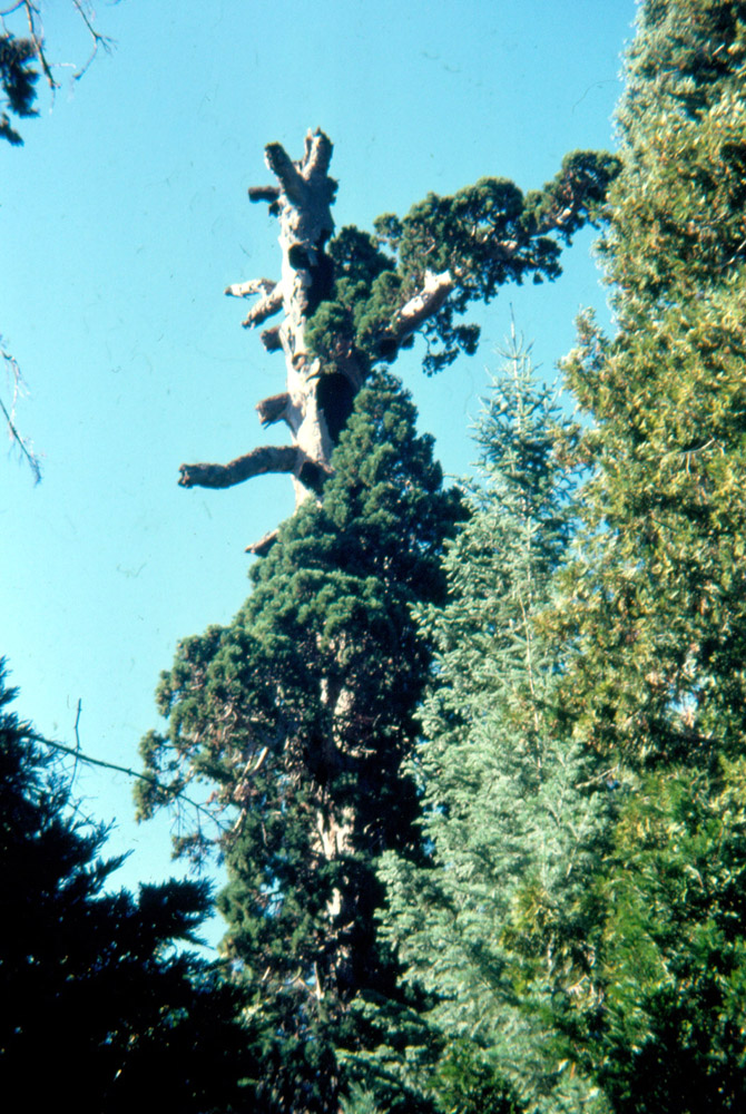
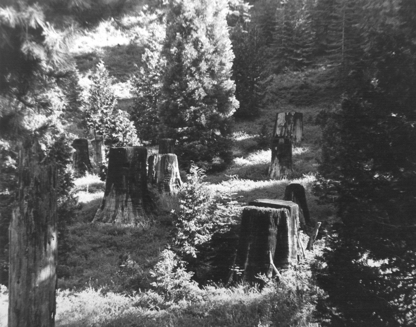
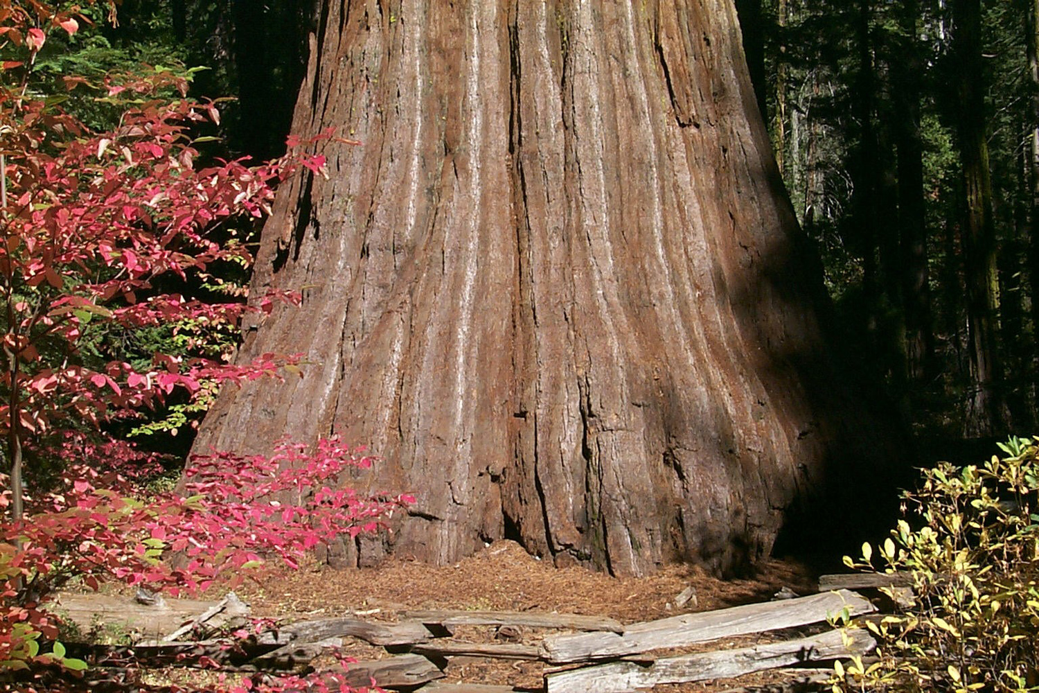
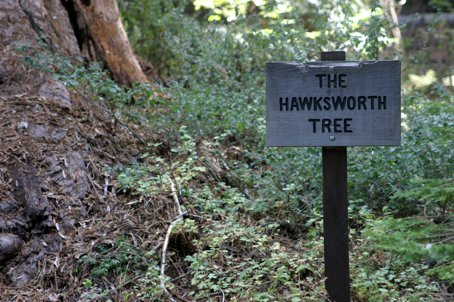
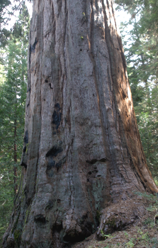
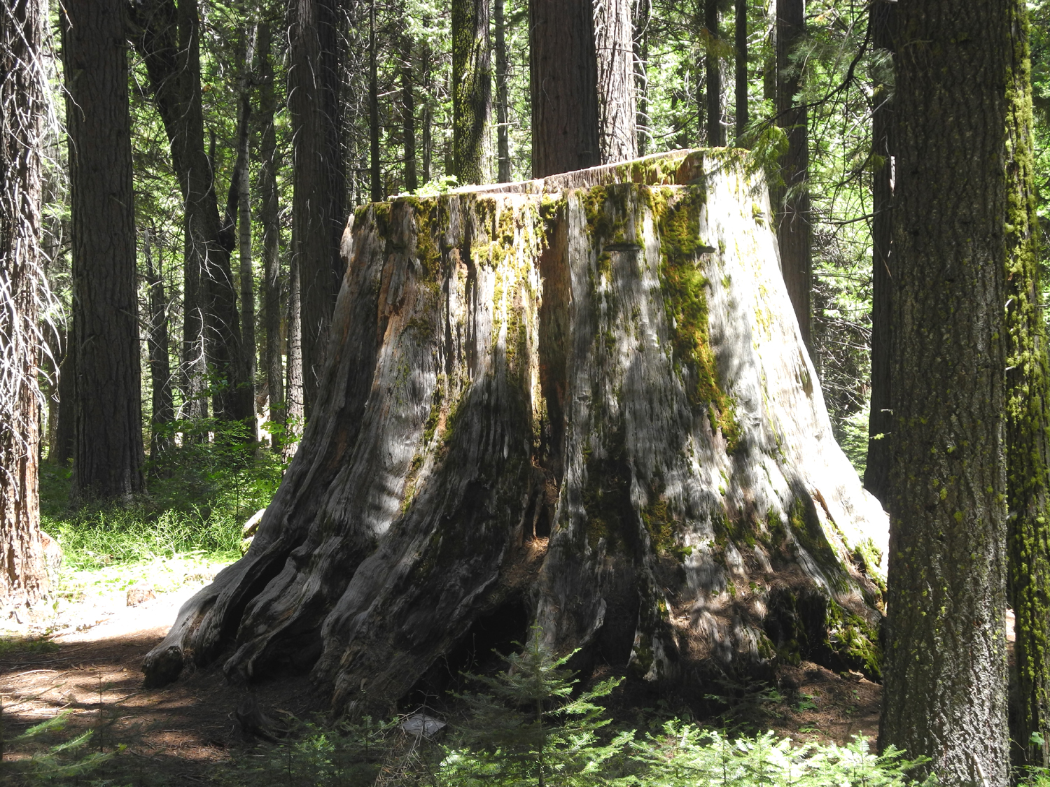
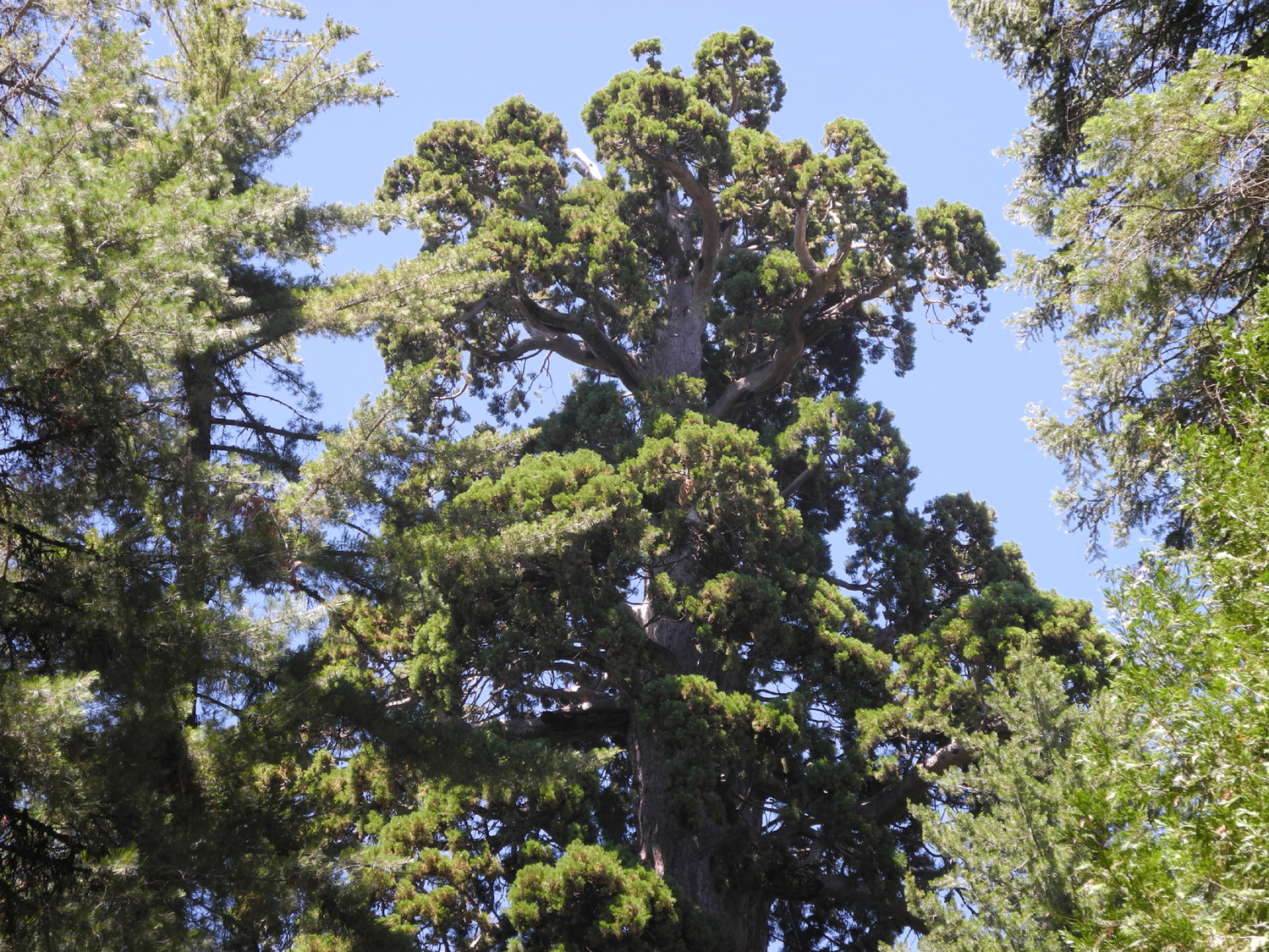
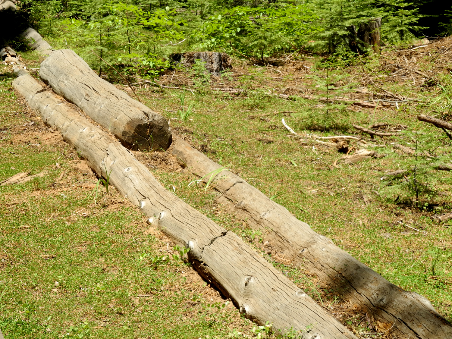
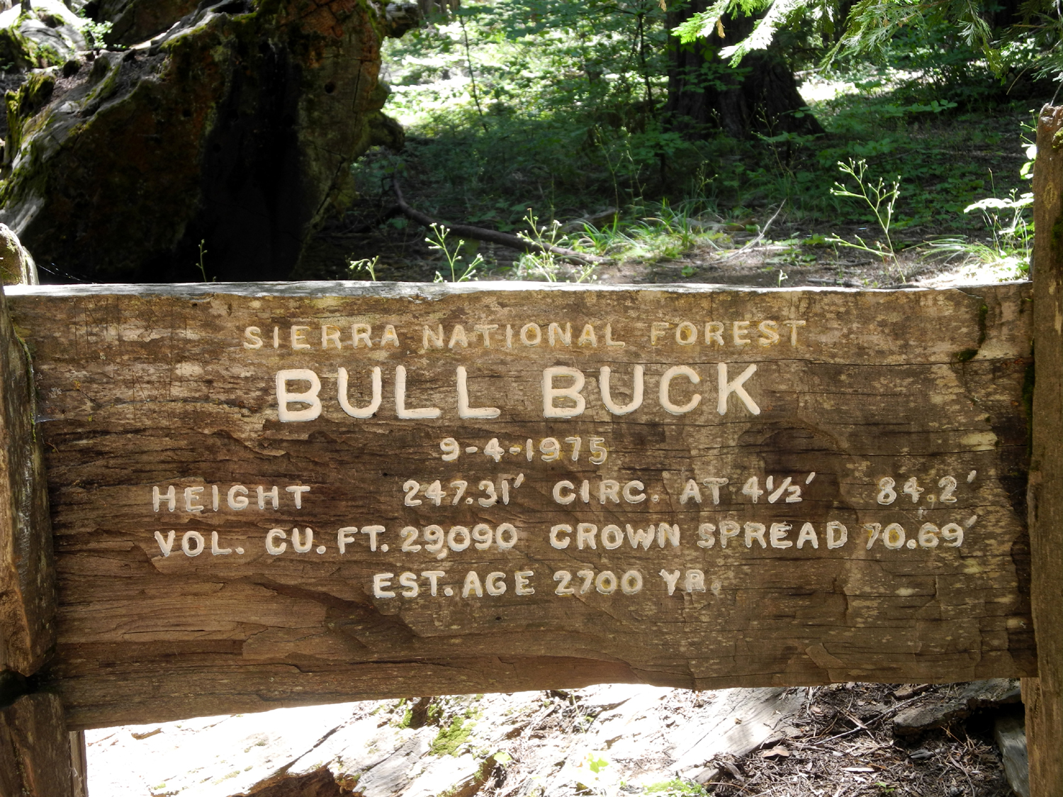
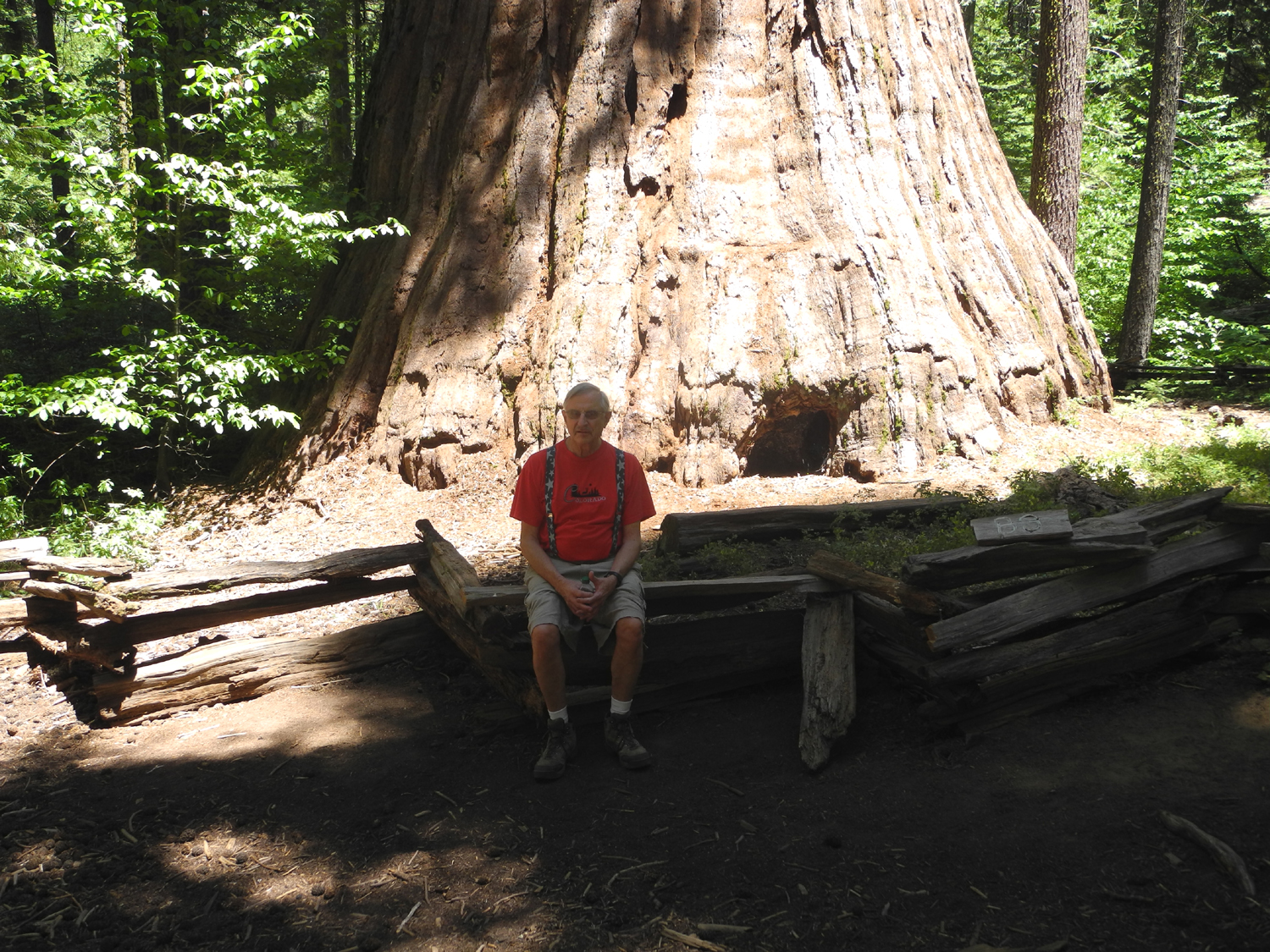
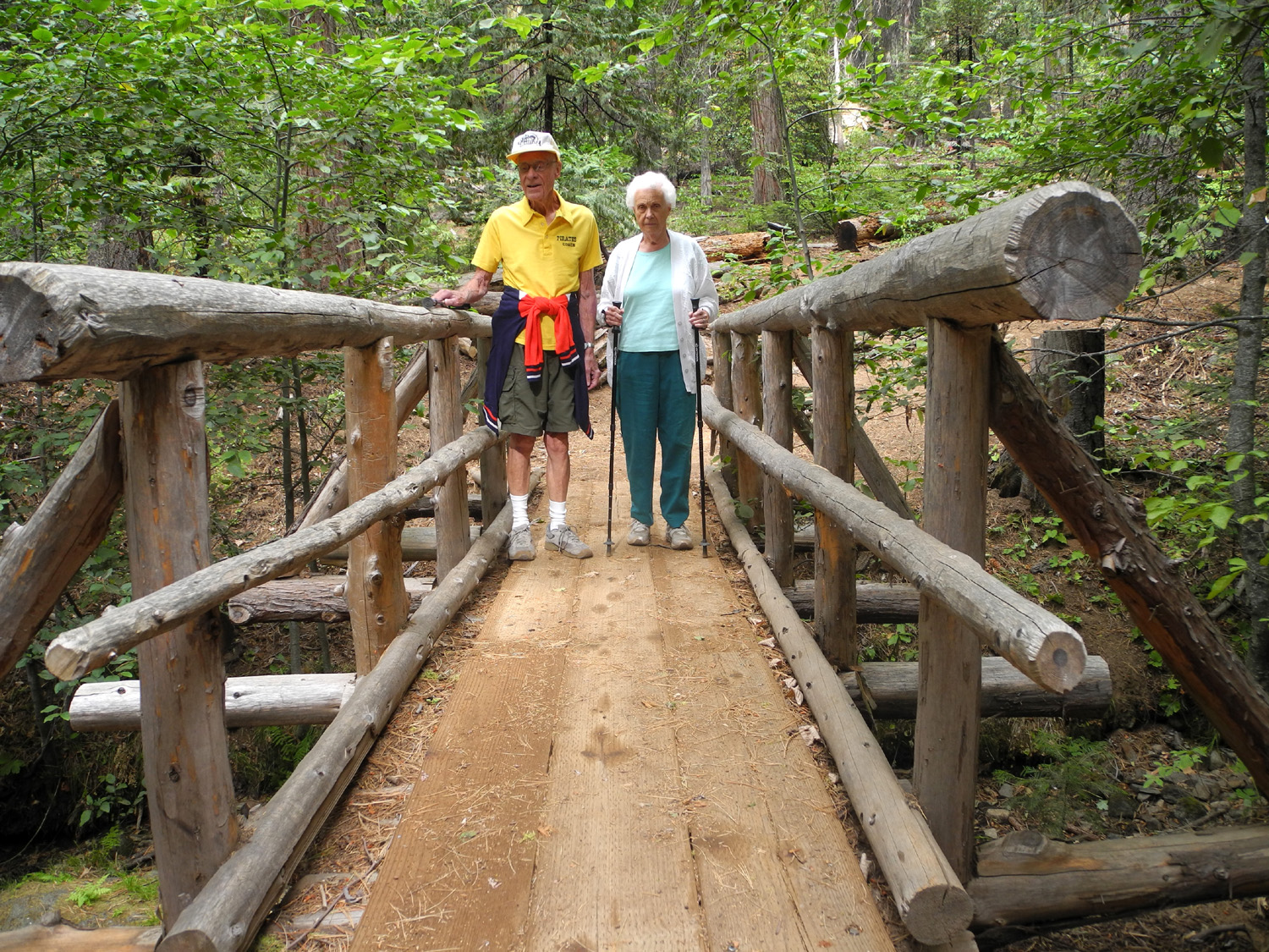
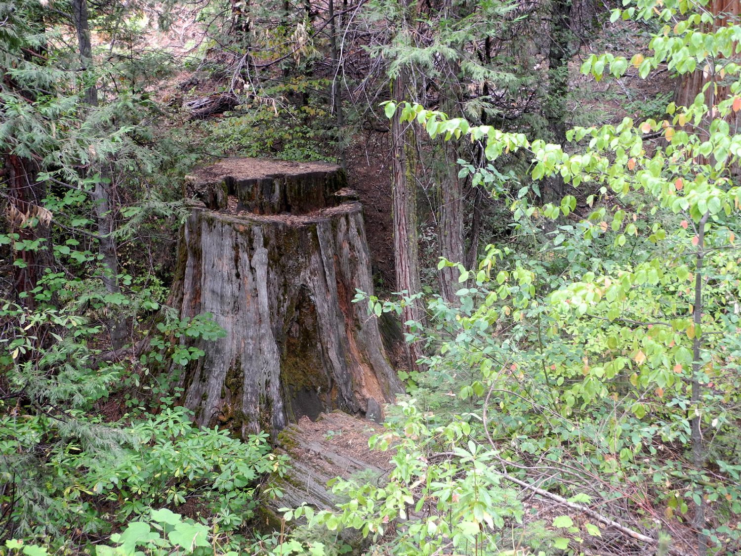
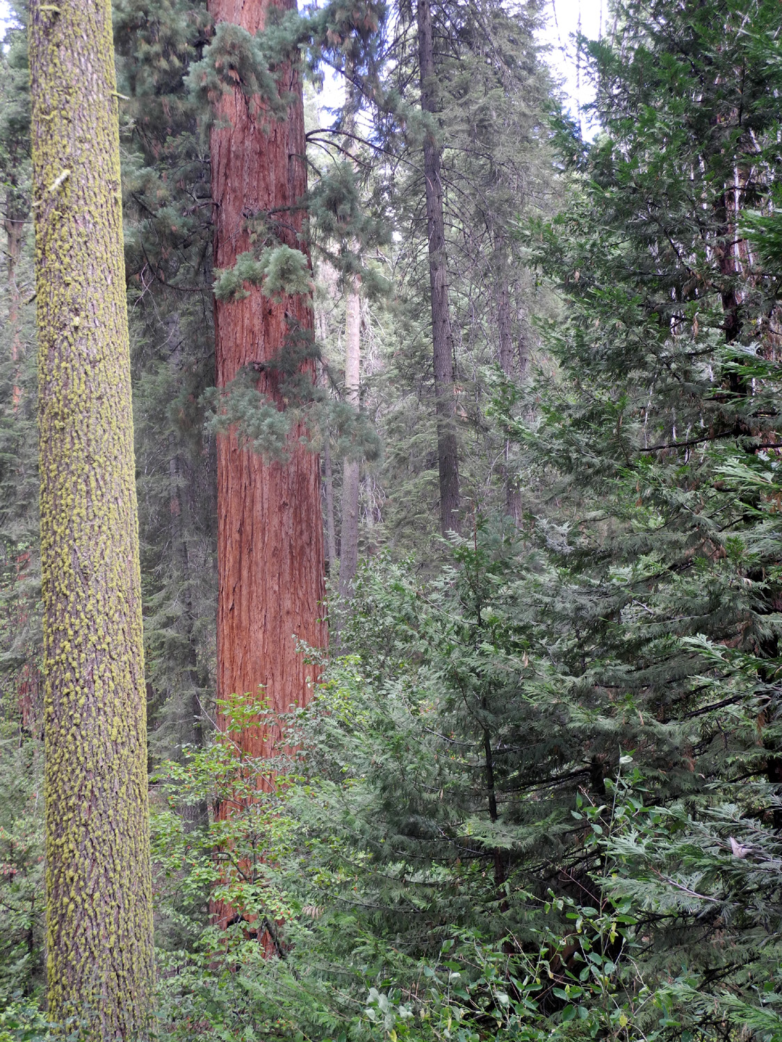
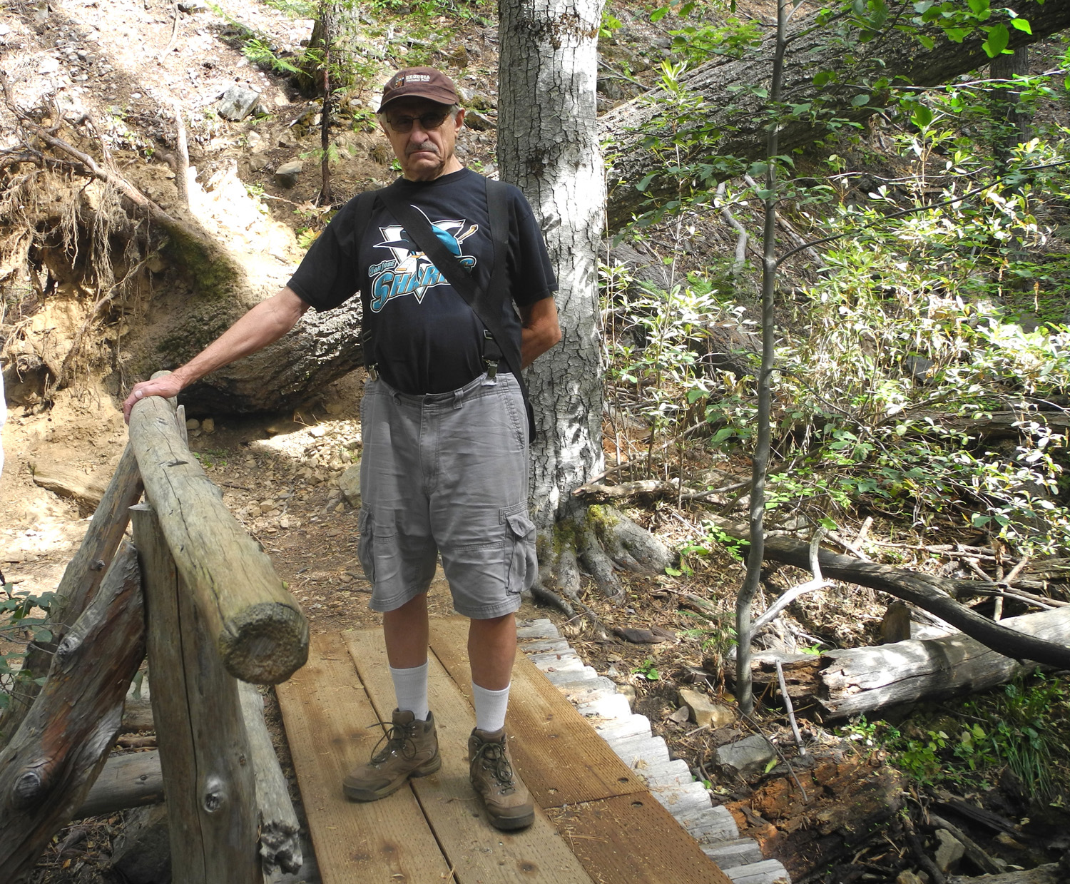
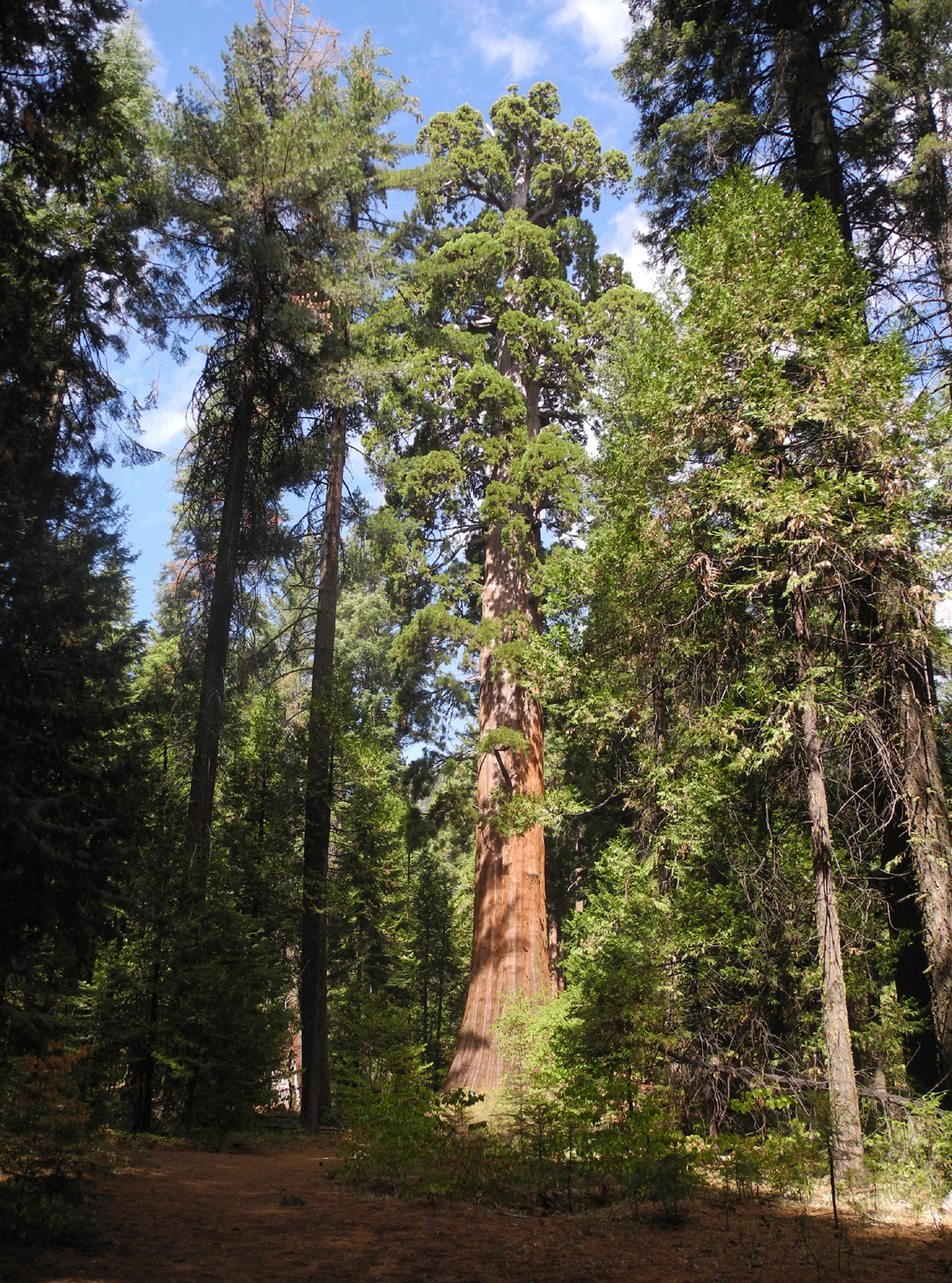
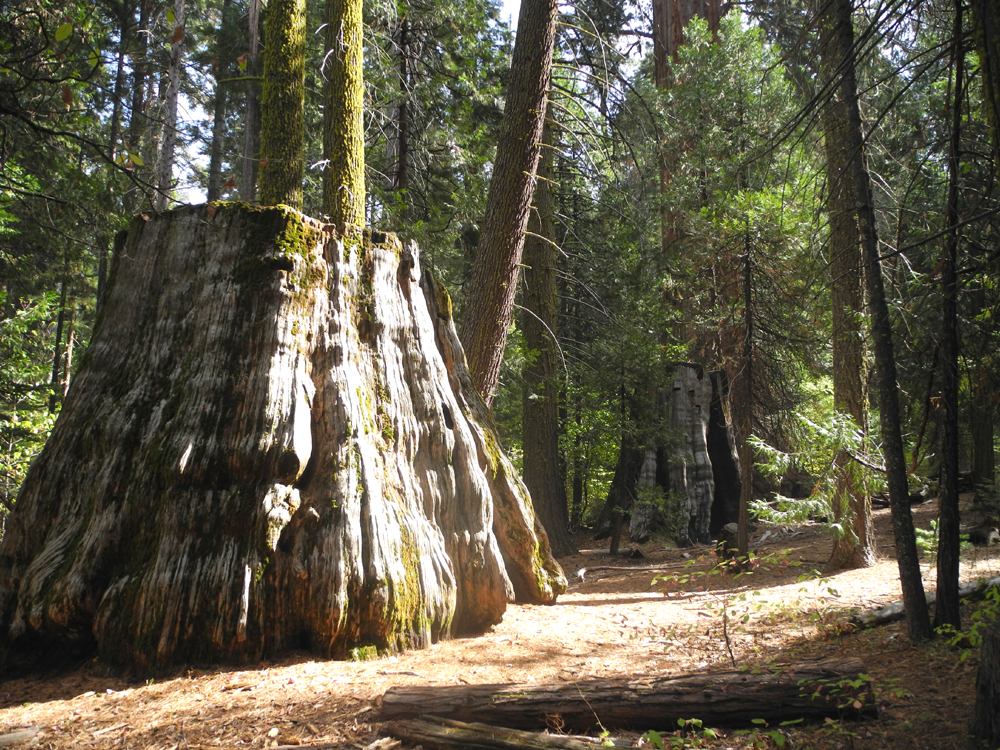
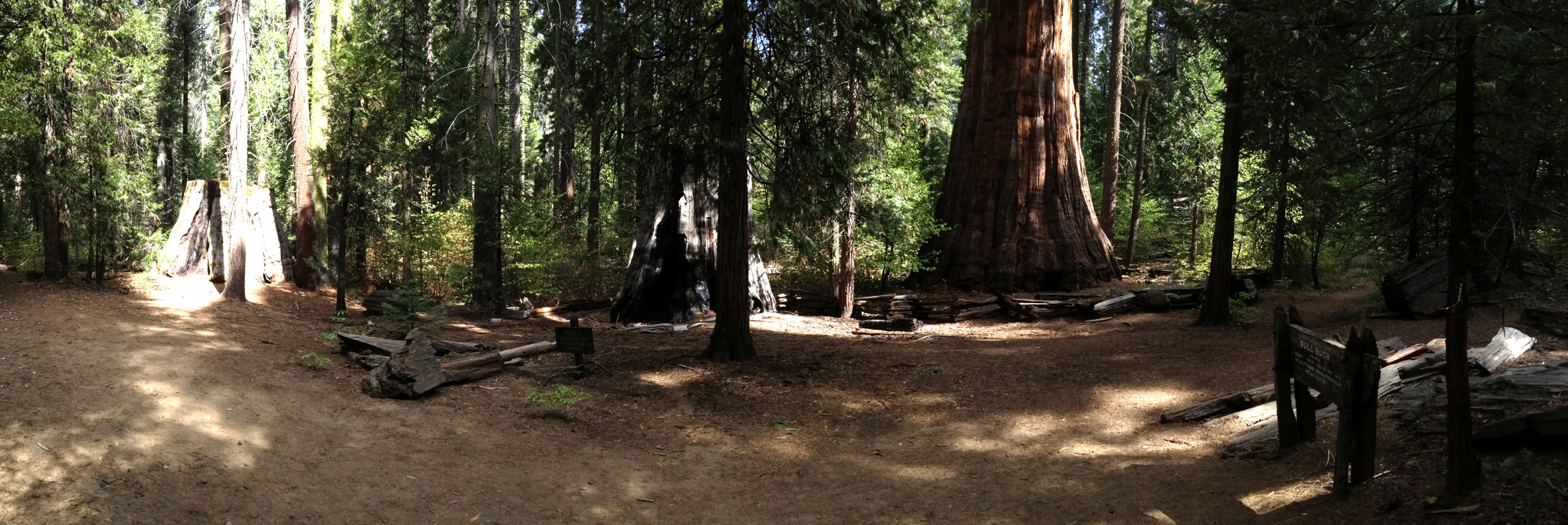
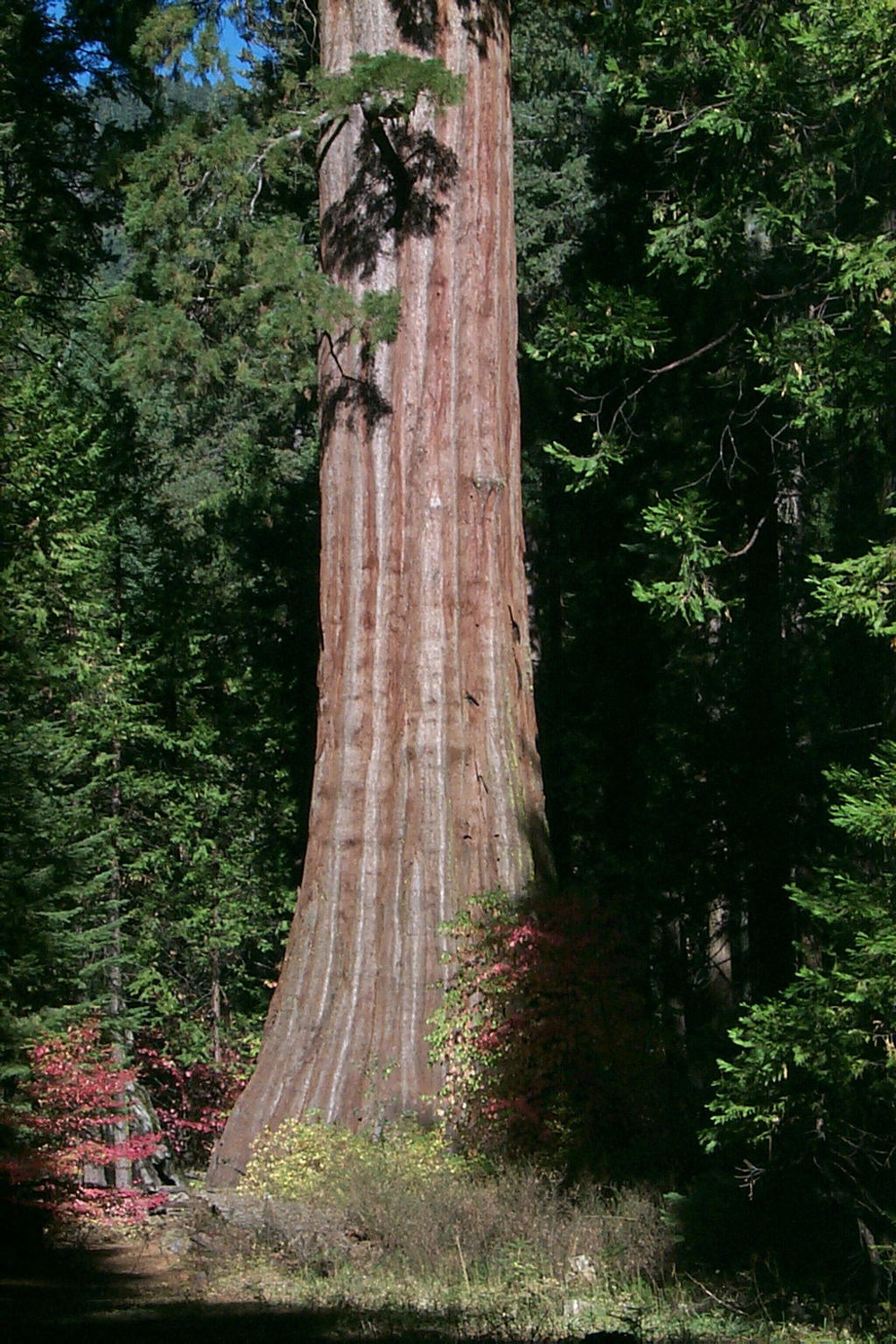
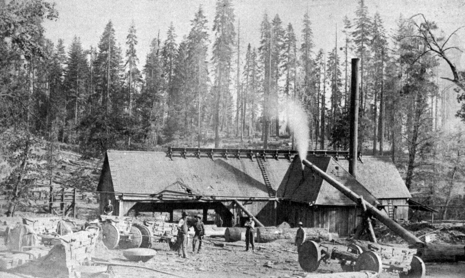
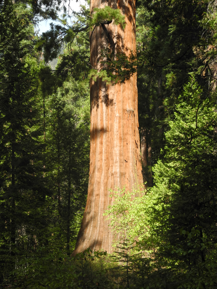
Bull Buck & Chimney Tree Trails The County Hike Group had its second outing on September 16, traveling to Nelder Grove in the Sierra National Forest about 60 miles from Fresno. I should explain that this "organization" consists of Julie Hornback, Carolyn Amicone, Wes Thiessen, and Dick Estel, four friends who worked at the Fresno County welfare department together going back to the early 1970s, but all now retired. Wes, the originator of our name, agrees that we need a better one, and we'll entertain suggestions from my loyal readers. (Thanks to Regina W for dubbing us "The Ramblers.") You'll find the story of our first hike, to Buena Vista Peak in Sequoia Forest in May, here, and we hope there will be many more to come. I first visited Nelder Grove in 1969, and it has been my pleasure over the years to introduce many people to the wonders of this area. So after our Sequoia Forest hike, it seemed like a good place for our next outing. We met at Julie's about 8:30 a.m. and drove up State Highway 41, through Oakhurst, to the Sky Ranch Road. From here it is about six miles to the grove, the last three on dirt roads of varying quality. The dirt road from Sky Ranch joins another dirt road that comes in from Highway 41 through Sugar Pine. Turning left toward Sugar Pine takes you to a section of the grove where there is a loop trail, the Shadow of the Giants Trail, one mile from the junction. A short distance past the junction to the right, a spur road goes into the main part of the grove. California Creek, which is nearly dry after several years of drought, runs through the campground. To the west and slightly higher in altitude, Nelder Creek flows through one of the most beautiful but most inaccessible areas of the grove, then through the Shadow of the Giants Trail. The creeks come together some distance down steam from the grove. A short distance before you arrive in the campground area is the Interpretive Center, which includes a display of early logging techniques, a couple of old cabins that were moved from a meadow about 20 miles distant, and a three dimensional topographical map that shows not only the terrain but all the large trees. There are also several large stumps, and a short walk down a trail, a striking giant redwood, Big Ed, named for a mill foreman who worked in the area. A parking area, and a clearing where the host sets up her trailer during the summer completes this section of the grove. A few hundred yards farther is the campground, with several sites accessible by vehicle on the north side of the road, and some walk-in camps on the south. The road comes to a dead end here, but when I first saw the area it continued past the campground a mile or so and rejoined the main dirt road. Nelder differs from many of the better-known giant sequoia groves in that there was a considerable amount of logging around 1888 to 1892, during which many redwood trees were cut down. There are still 100 large trees, but one of the unique aspects of the location is the many large stumps that remain, some of them 15 feet or more high. Because the trees flare out at the bottom, loggers cut notches to insert springboards, and stood on these to make the cut where the diameter of the tree was significantly smaller. By previous arrangement, we were met by Brenda Negley, who heads up Friends of Nelder Grove, an organization working to protect and enhance the area. She is also the campground host during the summer, and the granddaughter of Marge and John Hawksworth, who were campground hosts for about 20 years, from the 1970s to the 1990s. She spent a lot of time there as a child and young adult, and is now working on a book about Nelder Grove. Having camped and hiked in the grove many times over the last 45 years, I consider myself fairly knowledgeable on the subject, but Brenda has done a great deal of formal research, and provided many historical details that I was not aware of. Her presence on the hike was a terrific added bonus. We arrived a little after ten and after greeting Brenda and putting on hiking boots, we walked down the short trail to the Big Ed tree. From here our choices were to return to the road and walk to the trailhead for the Bull Buck Tree, or continue a few feet and make our way across the creek where logs have been piled up to make a rough "bridge." Never ones to take the easy way, we all made it across the logs, and started up the Bull Buck Trail, which was our main destination. This trail winds through the forest for about a half mile from the walk-in camp area and ends at one of the most magnificent sequoias in the entire Sierra Nevada. Along the trail we saw many piles of small trees and fallen wood that had been cut to be burned when the weather permits. When I first saw the Bull Buck, I had to stand near the tree and tip my head way back to see the top. However, in the 1970s, Hawksworth cleared a "viewing path" through the dense forest and built a bench at the end. Now you can see and photograph the tree from top to bottom in comfort. Next to the Bull Buck are two large stumps, and on the ground is the shattered remains of one of those trees. Redwood logging was very inefficient and usually not profitable; only the lower third or so of the trunk was used, and often the brittle wood broke apart on impact, leaving it useful only for posts and shingles. Next to the tree is a sign giving its statistics: 247 feet high, 84 feet in circumference at four and a half feet from the ground, estimated age 2,700 years. At one time it was a candidate for the largest tree in the Sierra, but it has been determined to be about number 30 - still impressive, considering the difference between 15 and 30 is not that much. In fact, it is only the second largest in the grove, but the Nelder Tree, which exceeds it in total size, is not readily accessible. After we had enjoyed the view of the tree and looked at the stumps in the woods nearby, we continued down the trail to the start of the Chimney Tree Loop. In my early days of coming to the grove, the old road went close to the Bull Buck and you could drive within 30 feet of it. The Bull Buck and Chimney Trails did not exist. With the road abandoned, the trees have greater protection, and the Chimney trail provides access to giants whose tops were all that were visible in the past. The Chimney Tree Loop is about a mile and a quarter, and goes closer to California Creek, so the forest is a little more dense. The work crews did a lot of thinning along this route also, leaving more burn piles. The trail crosses the creek over what has become known as Ben's Bridge. Brenda's now 14-year old son has enjoyed riding his bike on the trails for a number of years. One one such ride, he misjudged the turn and went off the bridge into the creek. The railing which was down at that time has since been replaced; Ben was not seriously injured, and Brenda says she is kind of glad she did not witness the accident. There are markers showing points of interest along this trail, and Brenda has created a booklet available at the Interpretive Center describing each one. It also contains other information and history about the area. Large trees along the route include the Old Forester, tallest tree in the campground area at 299 feet; and the Chimney Tree, which has been burned through at the bottom so that one can walk through it and look up through an opening. Despite the damage, the tree is alive and continues to grow. One of the more interesting sights, which I had seen before without knowing its significance, is a section of sequoia log that was cut down with an ax, one of only two in the grove known to have been brought down by that method. Of course, there are several large sequoia stumps along this trail. This trail brought us back to the campground area, where there are a number of large stumps and two apple trees, all that remain from a camp for disadvantaged children that operated in the grove in the 1930s. From here it was a quick walk back to our car. The campground and trails we hiked are only a small part of the entire Nelder Grove area, which covers a little more than 1,500 acres. My favorite area is actually the most difficult to reach, requiring a three mile hike each way up an old road. This leads to an area now called Graveyard of the Giants, which I photographed and wrote about long ago and called Land of the Giants. I won't say much about it here, since it's discussed pretty well on this web page. Another of my pages has information about John Nelder for whom the grove is named, a bit about how the area has changed over the years, and lots more. Other links below will lead you to more about redwoods than you ever wanted to know (if that's possible) and my redwood photo page, on which Nelder is extensively featured. The map reproduced from Brenda's interpretive guide is not to scale, but shows the different areas and some of the key trees in each one, and gives a good general overview of the different parts of the grove. Back at the parking area, we looked at the exhibit that shows some of the early logging techniques, said our goodbyes to Brenda, and started back down the mountain. On our way out, on the last section of dirt road, we participated in a cattle drive. Perhaps "participated" is not the precise word. We came up behind about eight cows, two mounted riders, a man on a quad, and several dogs. The quad had hay in the back, to help lead the cows, and the driver pulled to the side trying to get the cows out of the middle of the road so we could pass. We drove slowly behind the uncooperative herd for a couple hundred yards until we were finally able to split them down the middle and continue on our way. When we arrived in Oakhurst, we stopped at Pete's Place. I had eaten breakfast there with my daughter and son-in-law several times, and though I had never been there for lunch, I had heard good reports. They proved to be accurate, and we all had delicious and generous-sized sandwiches, building up our strength for the 45-minute ride back home. Experiencing the peace and quiet that prevail most of the time in Nelder Grove today, it's hard to picture the bustle of activity during logging days 120 years ago.
|
||
|
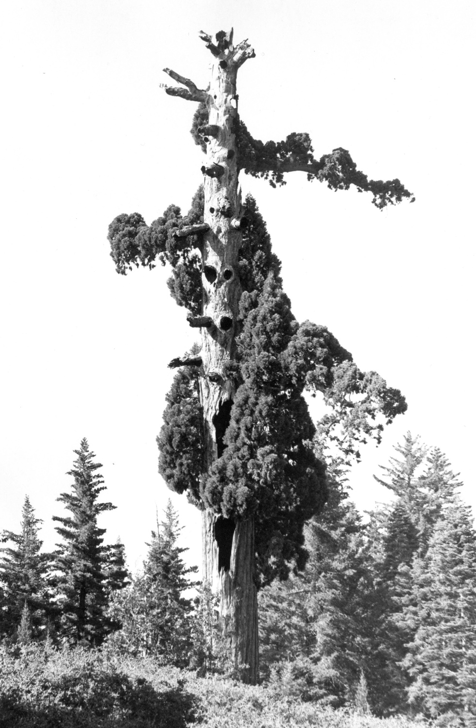
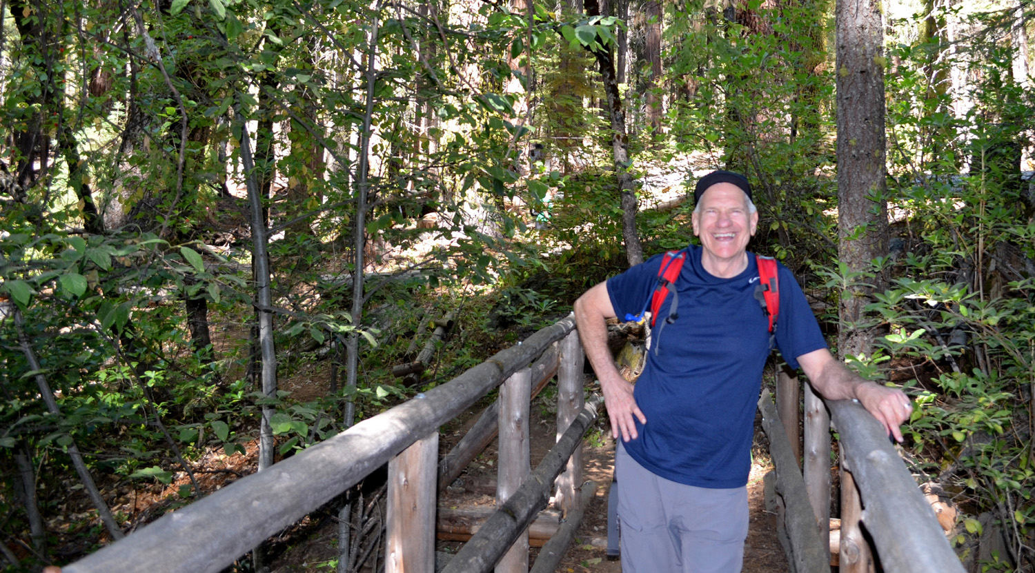
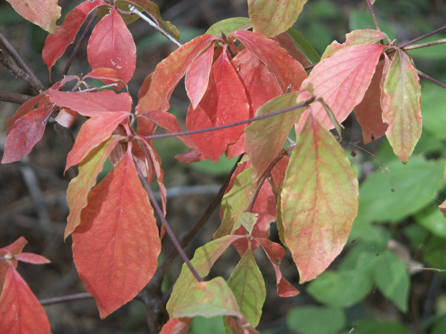
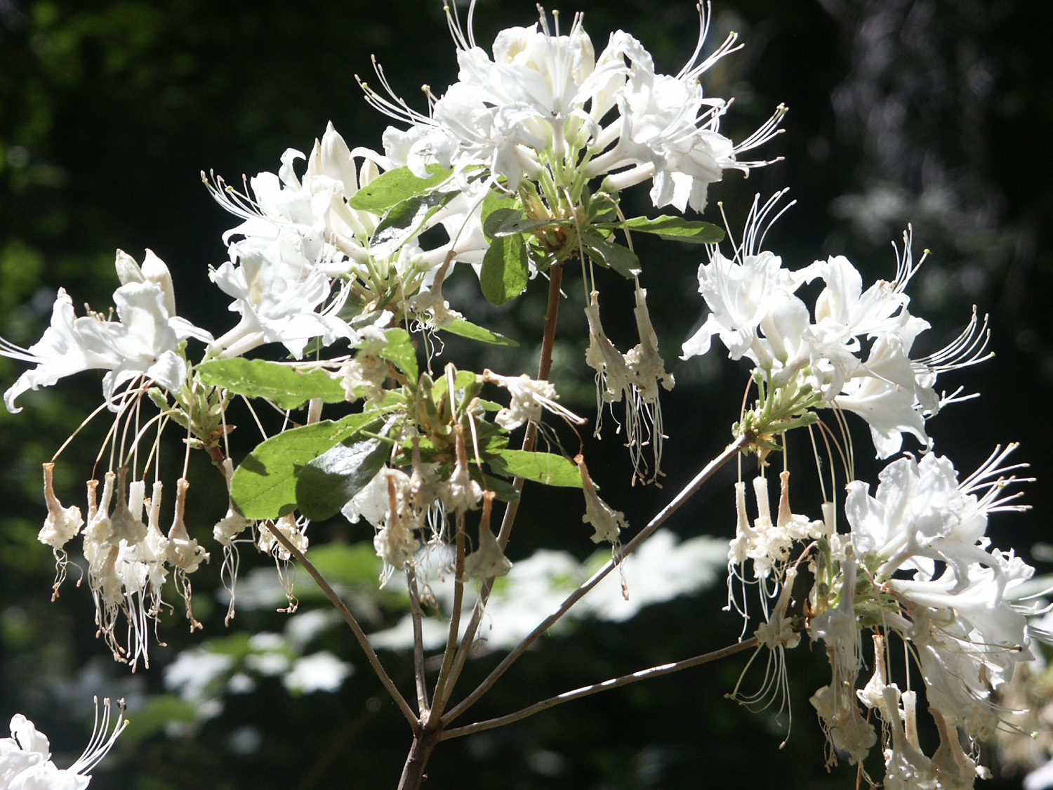
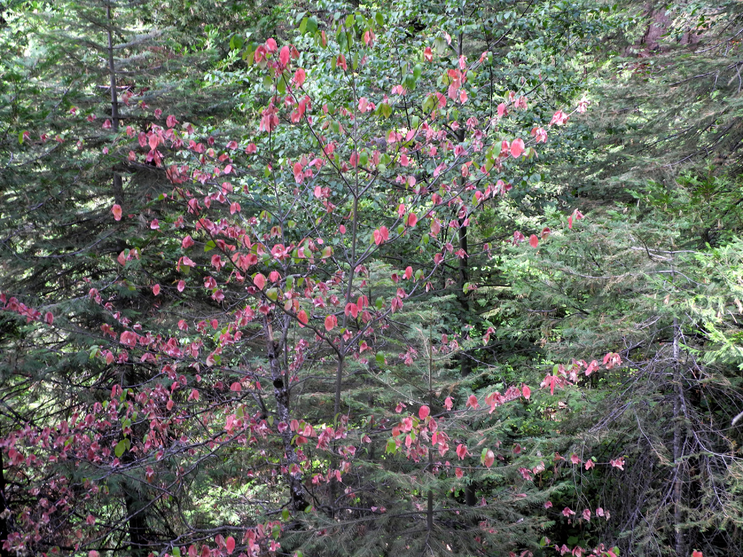
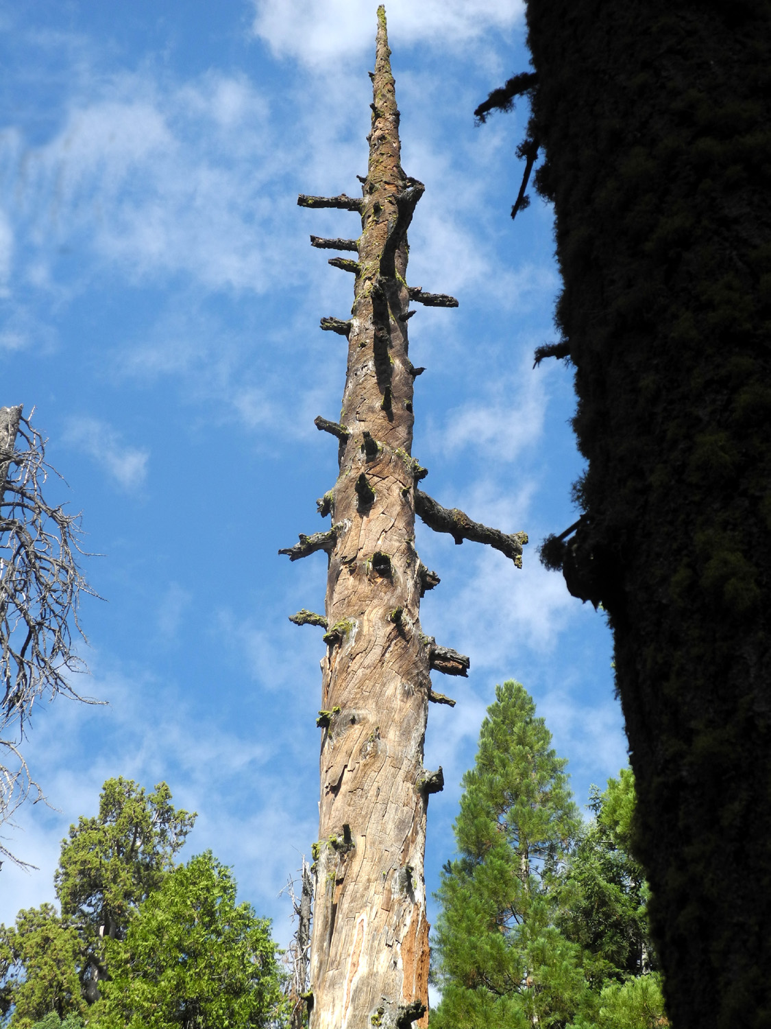
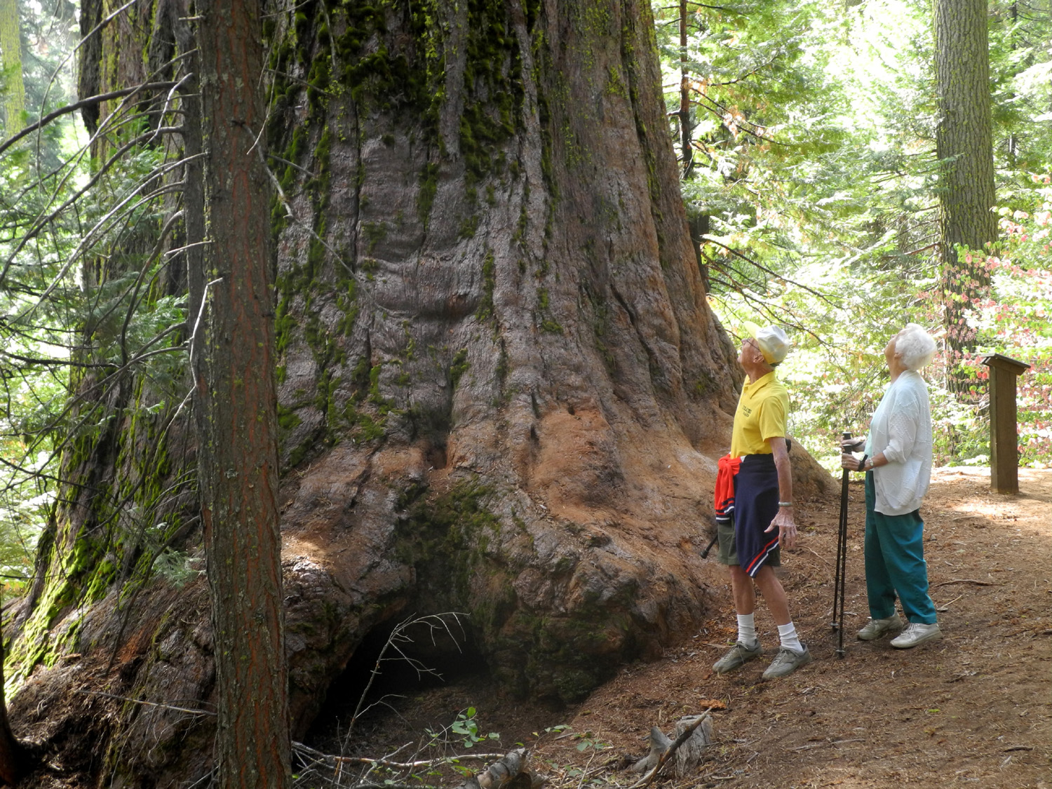
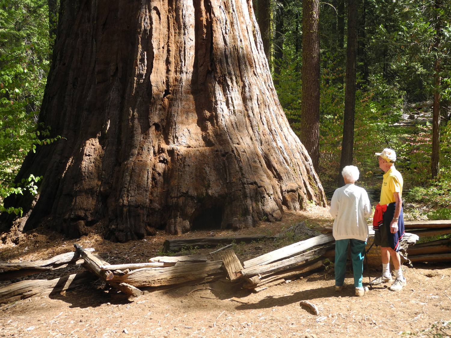
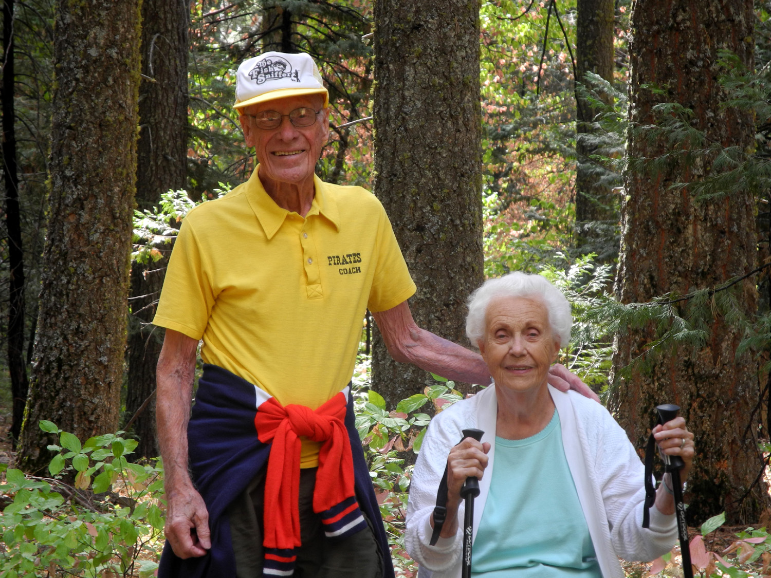
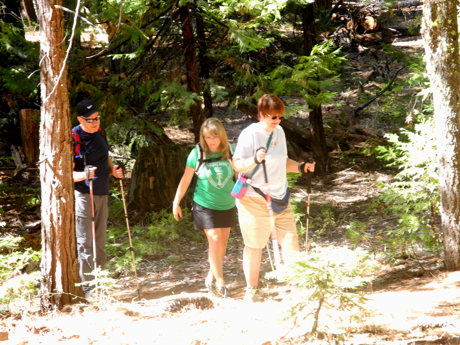
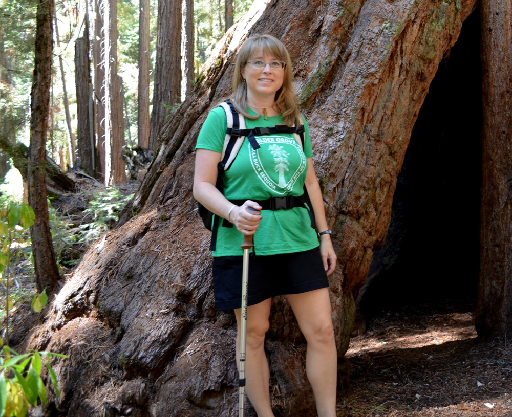
Shadow of the Giants Trail Only nine days after the hike with the county group, I returned to Nelder Grove with my next door neighbors, Bob and Alice. They walk every morning on the streets of Clovis, as do I, but we have taken several walks together in the foothills, which they greatly enjoy. Throughout the summer we had been discussing getting higher up in the mountains where it would be cooler, and September 25 was the day we chose. The days before our hike were still very warm, so we left at 8:30 to beat the heat. As it turned out, the temperature was about ten degrees cooler than the day before, and where we hiked it was probably not over 70 degrees. When you take the road toward Nelder Grove from Sky Ranch Road, there's a junction where you go right to the campground and main part of the grove. A mile to the left there is a loop hike known as the Shadow of the Giants Trail, which goes up one side of Nelder Creek and down the other, passing by about eight good size trees. The trail has signs along the way explaining various trees and bushes, and is an easy one mile through the forest, mostly shaded and very pleasant even in warmer weather. I made almost this same trip with my daughter, Jennifer, last July. Special sights along the trail include a large dead sequoia snag, a fairly rare sight. The trees are highly resistant to fire and insects, and the usual cause of death is falling over. The root system is very shallow, and if the soil is disturbed by water or excessive human contact, a tree can fall. This is especially likely for trees that grow on creek banks, but to die standing up is a rarity. Besides the sequoias, the trees are mostly sugar pine, cedar and fir, and there are lots of dogwoods and azaleas, which add to one's enjoyment of the hike in the spring and early summer. The dogwood provides a bit of color at this time of year also, as the leaves turn red when the weather starts to cool off. Bob and Alice had never been in this area, and didn't know it existed until I told them about it, but their reaction was much the same as mine decades ago - they enjoyed it greatly and want to return. When we finished our hike it was about 11:30, and they agreed that since we were so close, there was no reason we should not visit the campground area. Here they got a look at the display of logging methods, walked to the Big Ed Tree, and marveled at the big stumps. Then we took the old road that leads to the Bull Buck Tree, only a quarter mile instead of the half mile trail I had followed last week. As expected, they were impressed by the Bull Buck, and particularly liked the viewing bench where you can see the tree from top to bottom without straining your neck. Once we got back to the car, we drove back down to Oakhurst and got lunch at the local Subway. Alice has some dietary restrictions and brings her own lunch, so we took everything to the Community Park, which is located between the Fresno River and China Creek (both dry in this drought season). Oakhurst is at 2,000 feet, so it was warmer than the 5,000 foot elevation of Nelder Grove, but we had a shaded table, there was a good breeze, and the high was only expected to be about 80. We
enjoyed our lunch, discussed our hike and possible future outings,
and drove back home, arriving about 3 p.m. --Dick Estel, September 2014 |
||
|
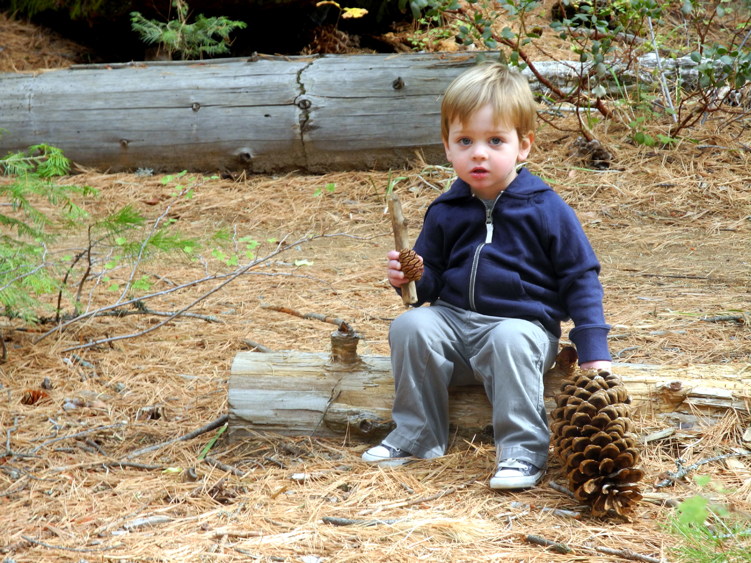
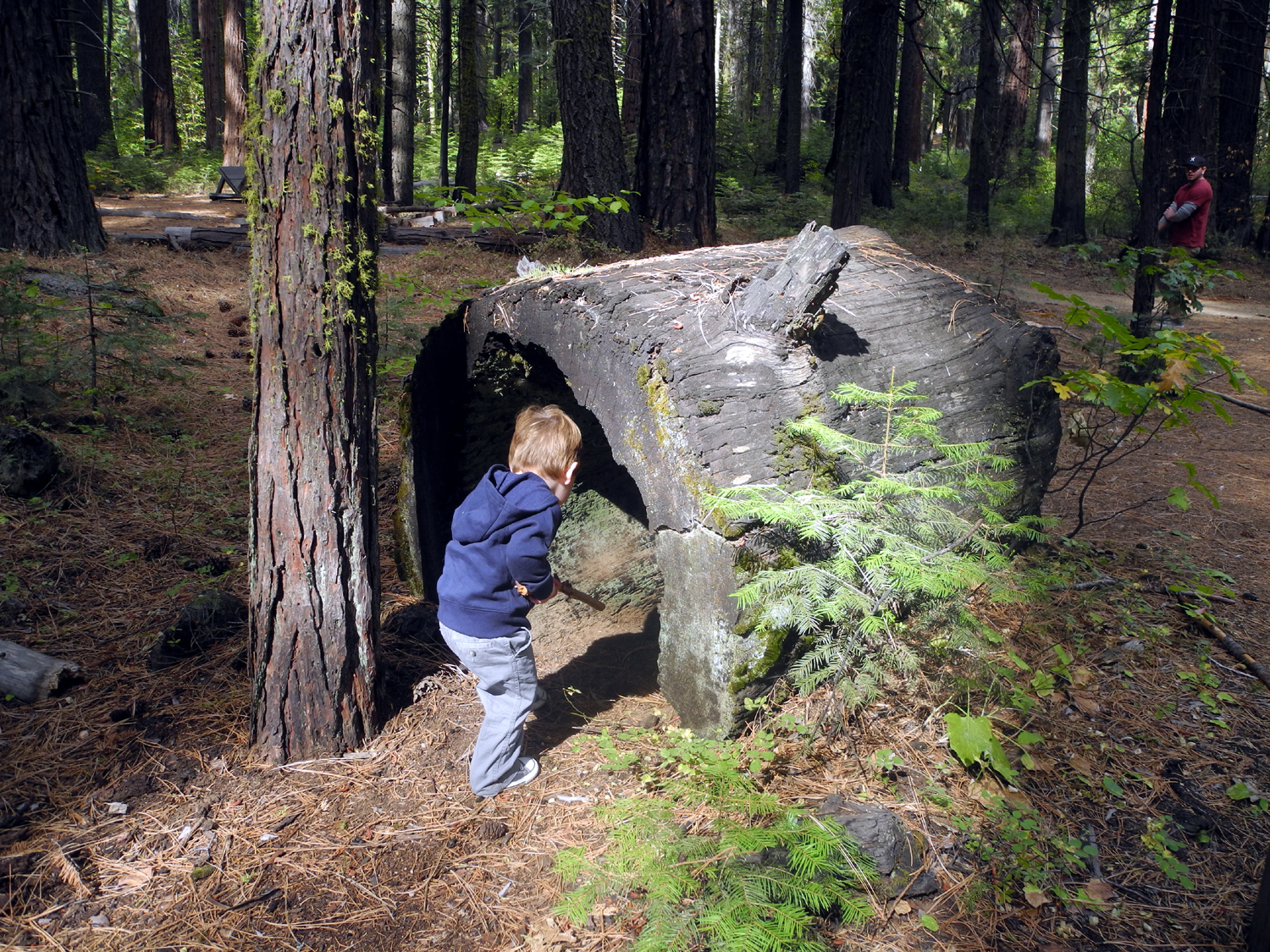
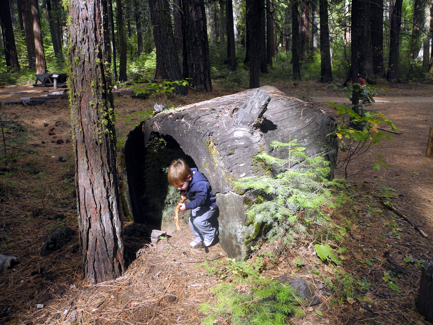
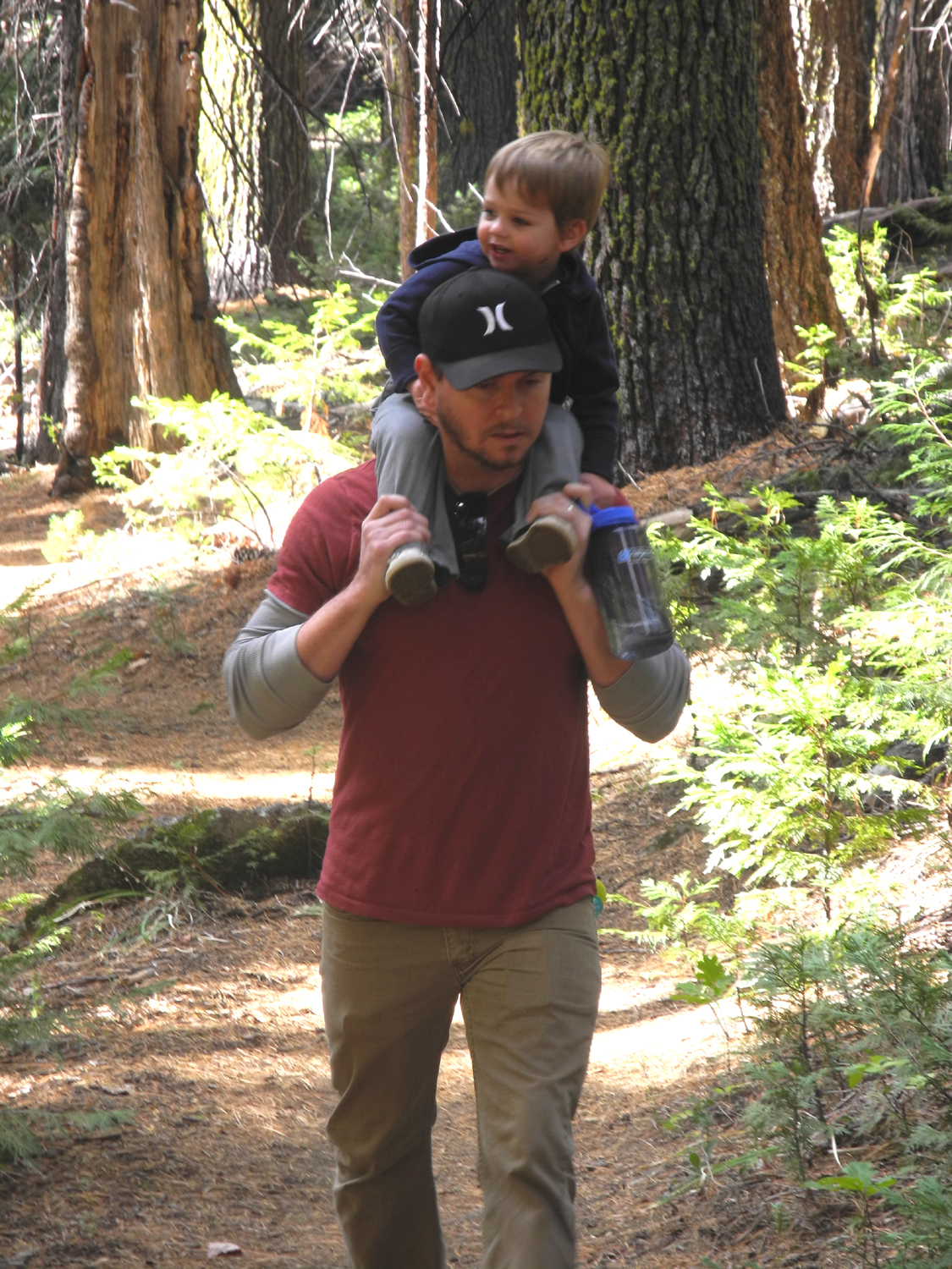
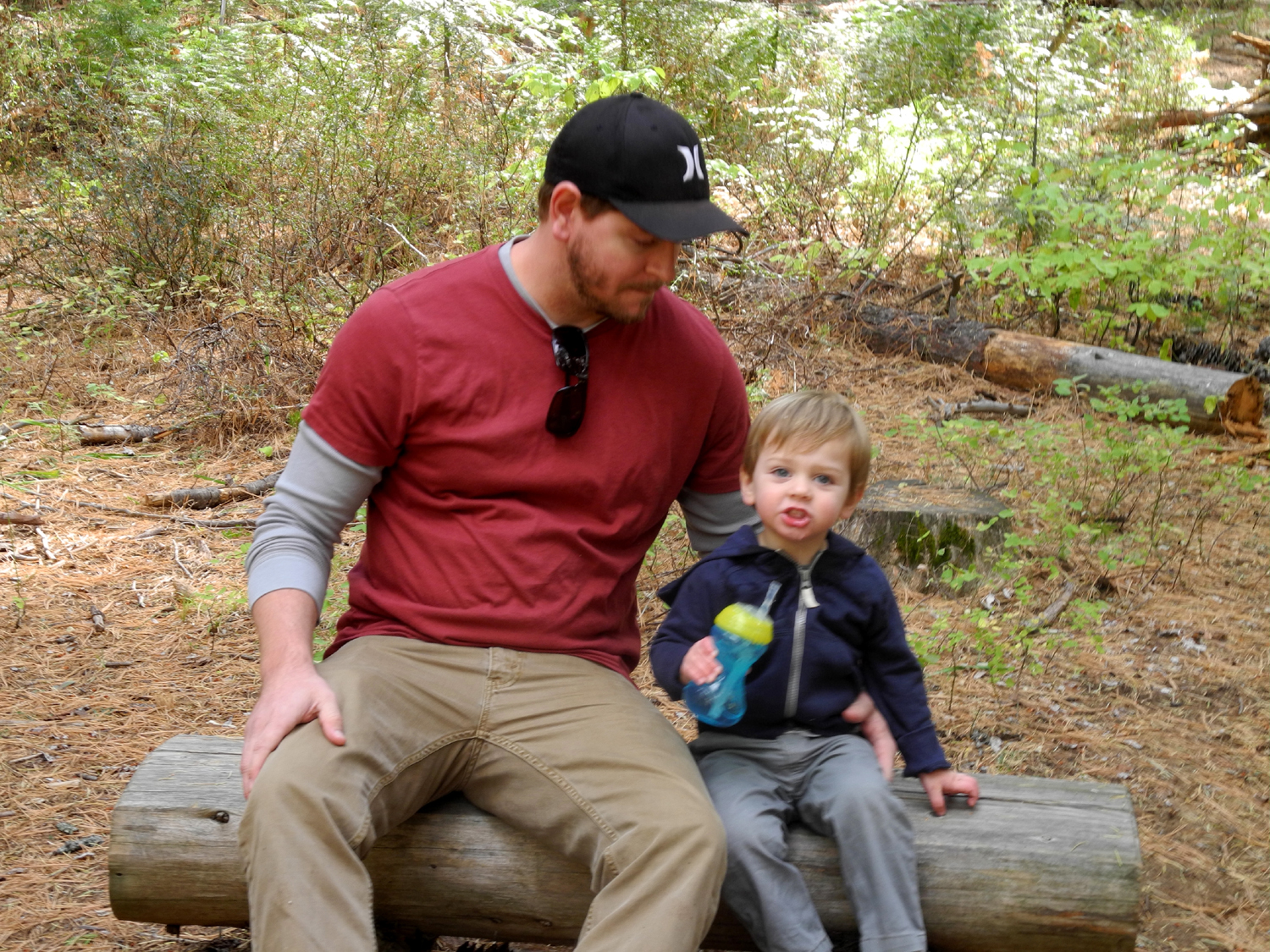
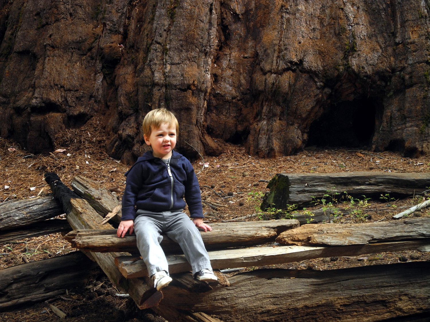
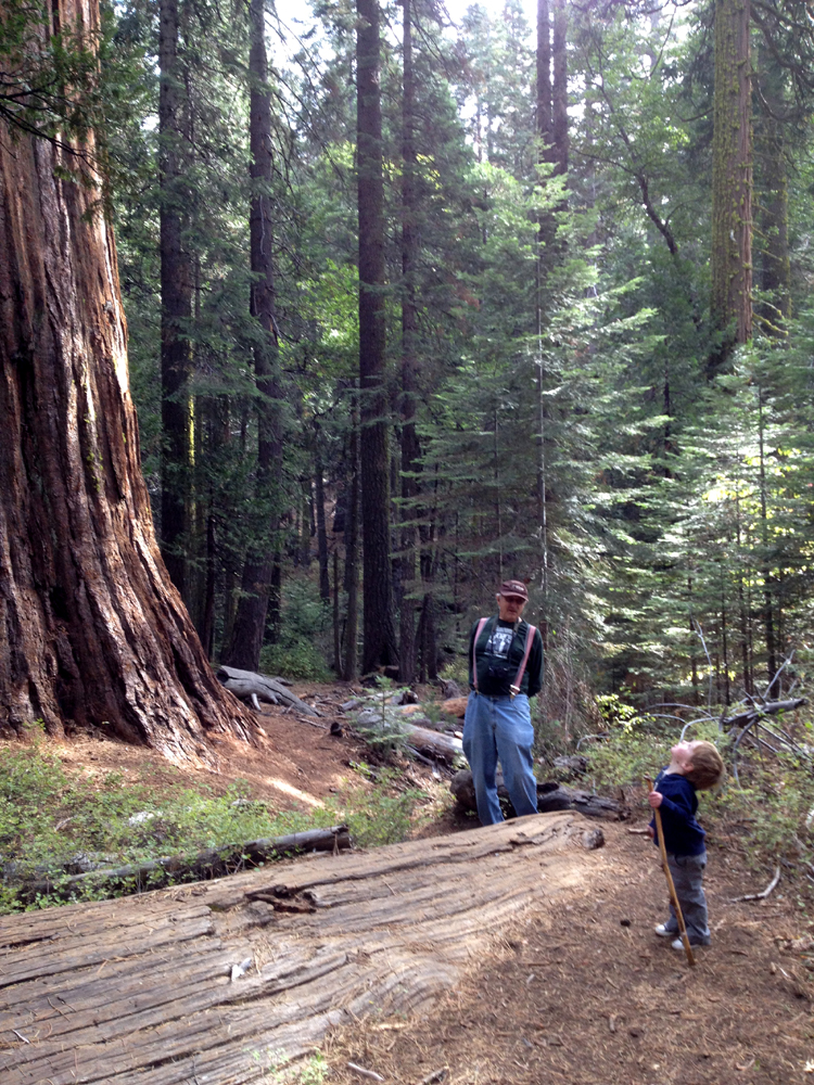
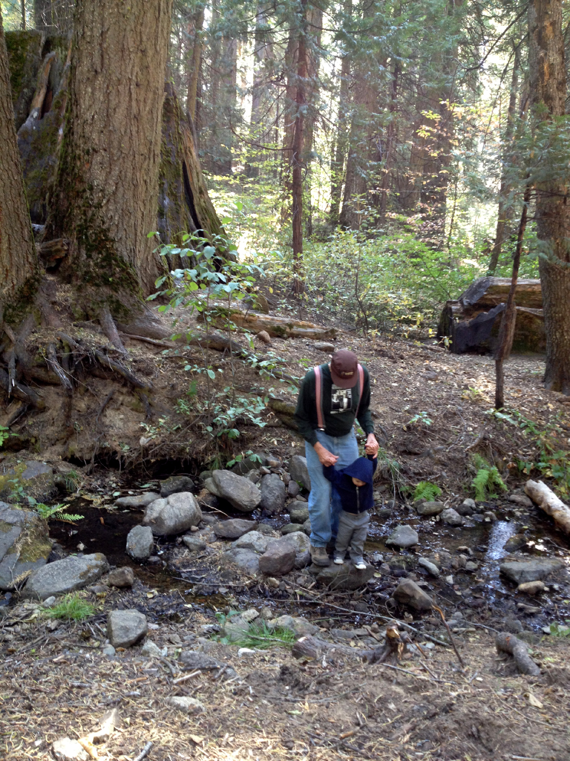
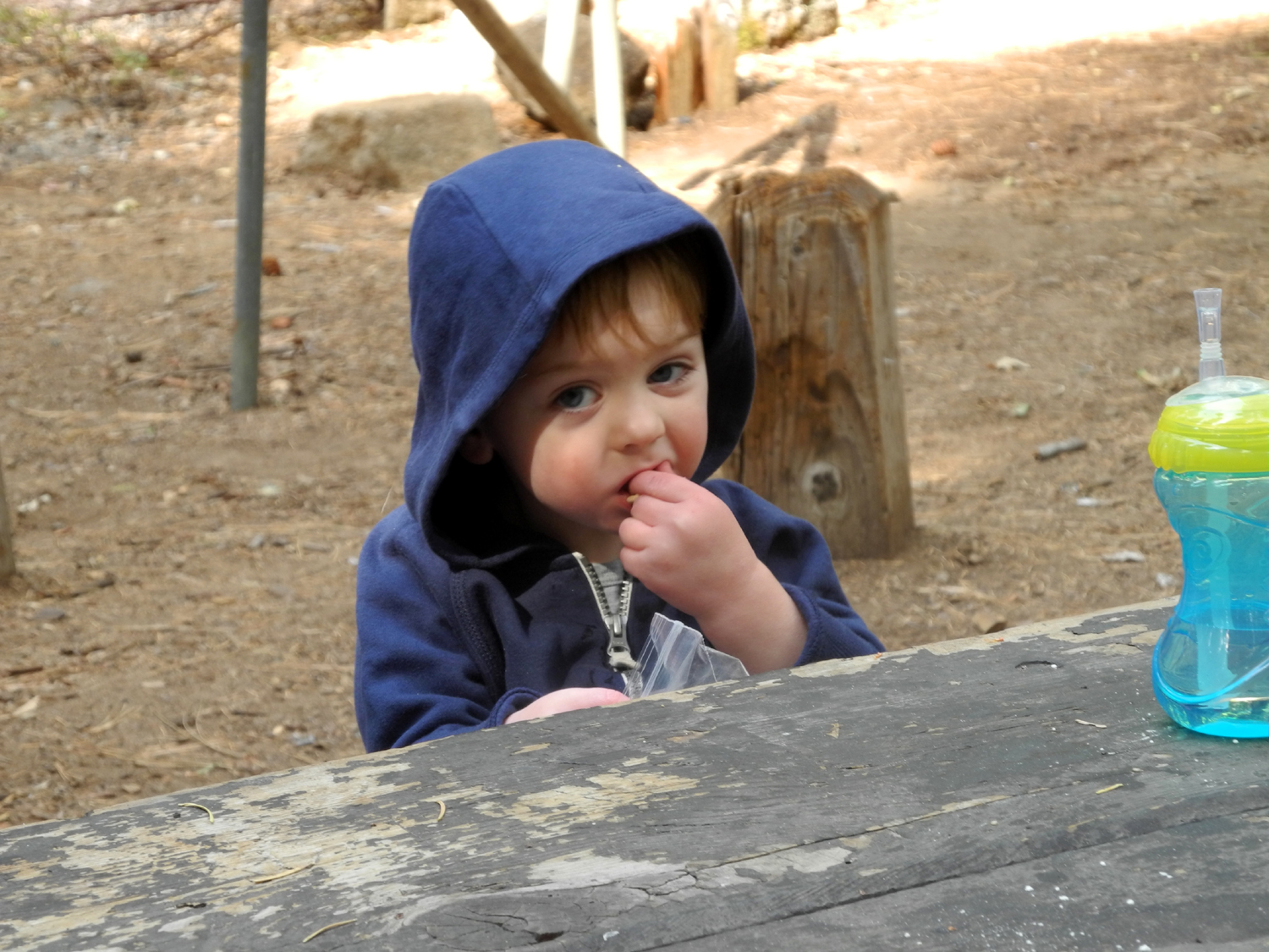
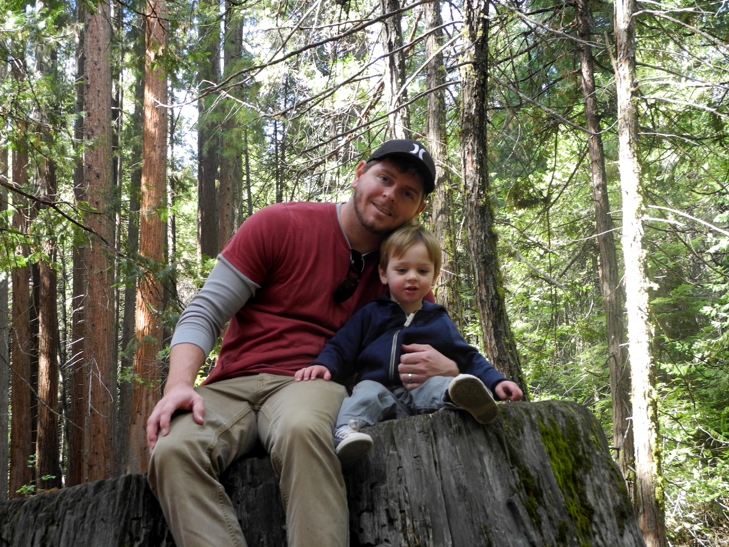
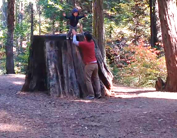
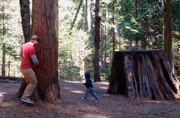
Slow Hiking with Colton My third and probably final hike of the year in Nelder Grove was with my grandson Johnny and his son, 22-month old Colton. On the morning of October 17. I drove to their house and spent some time holding my new great grandson, Johnny and Brittany's second son, Jack. Within a short time, Colton was ready to go and was saying "hiking" and "hike," so we soon got started. It had been many years since Johnny had been to Nelder Grove, and of course it was Colton's first visit. We spent some time in the interpretive area (which I discussed in my earlier report above). There is a short, hollow redwood log there, which Colton immediately identified as a tunnel, and which he went through several times. He also likes pine cones and sticks, and soon was carrying a huge sugar pine cone, a small sequoia cone, and a stick. Despite his enthusiasm for the idea of hiking, when we actually got on the trail, Colton mostly wanted to poke his stick at trees and into the dirt, and there was not much progress except when Johnny carried him. He did walk about half of the trail, but the time to travel that half mile was probably three times as long as my previous walks. Still, we eventually reached the Bull Buck tree, and enjoyed the view from the bench that a former campground host built after clearing out a path through the pines, firs and cedars that blocked the view of this huge sequoia. Colton has been to the redwoods in Kings Canyon and seemed to be impressed with them, saying "way up high" as he looked at each tree. However, today he didn't take much notice of the two big trees we visited, Big Ed and the Bull Buck. He did sit still on the fence surrounding the tree long enough for me to take a third generation picture to go along with those of Teri, Johnny and Mikie. When we got back to the campground, following the old road instead of the trail, we ate lunch - sandwiches from Raley's in Oakhurst for Johnny and me, and a pre-packaged plate of goodies that his mom had fixed up for Colton. After this we looked around the campground, during which time we discovered the activity that Colton seemed to enjoy most of anything we did that day - chasing him and being chased by him around trees and stumps, and jumping off a stump into dad's arms. After
enjoying his antics a bit longer, we loaded up the car and started
home. Not surprisingly, he was asleep after about two miles, and got
a nice 90 minute nap, waking up just as we turned into their street. --Dick Estel, October 2014
|
||
Photos
(Click to enlarge; pictures open in new window) |
||
Nelder Grove Hike Earlier Nelder Photos Shadow of the Giants Trail Hike Hiking with Colton |
||
|
|
||
 |
|
 |
| Cabin moved to the grove from a nearby cow camp |
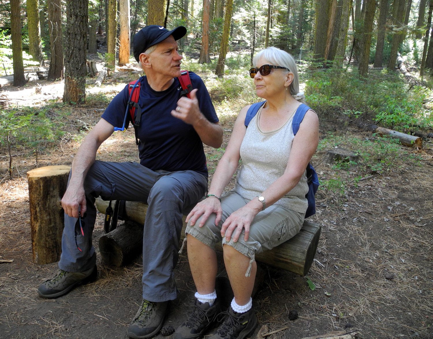
Julie, Dick, Carolyn and
Wes by stump near interpretive center |
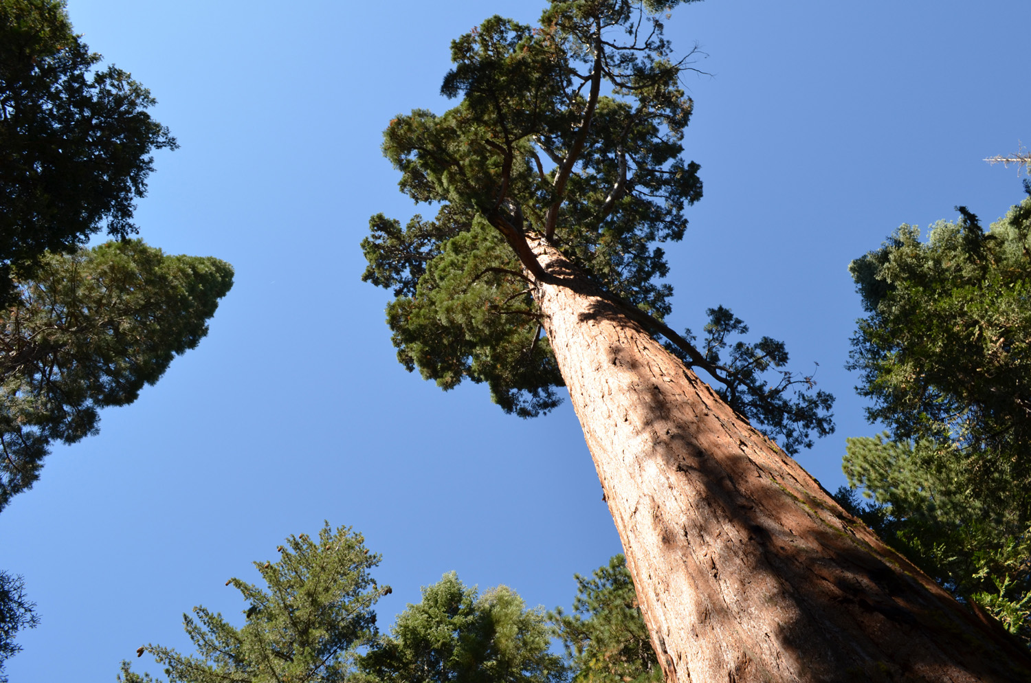
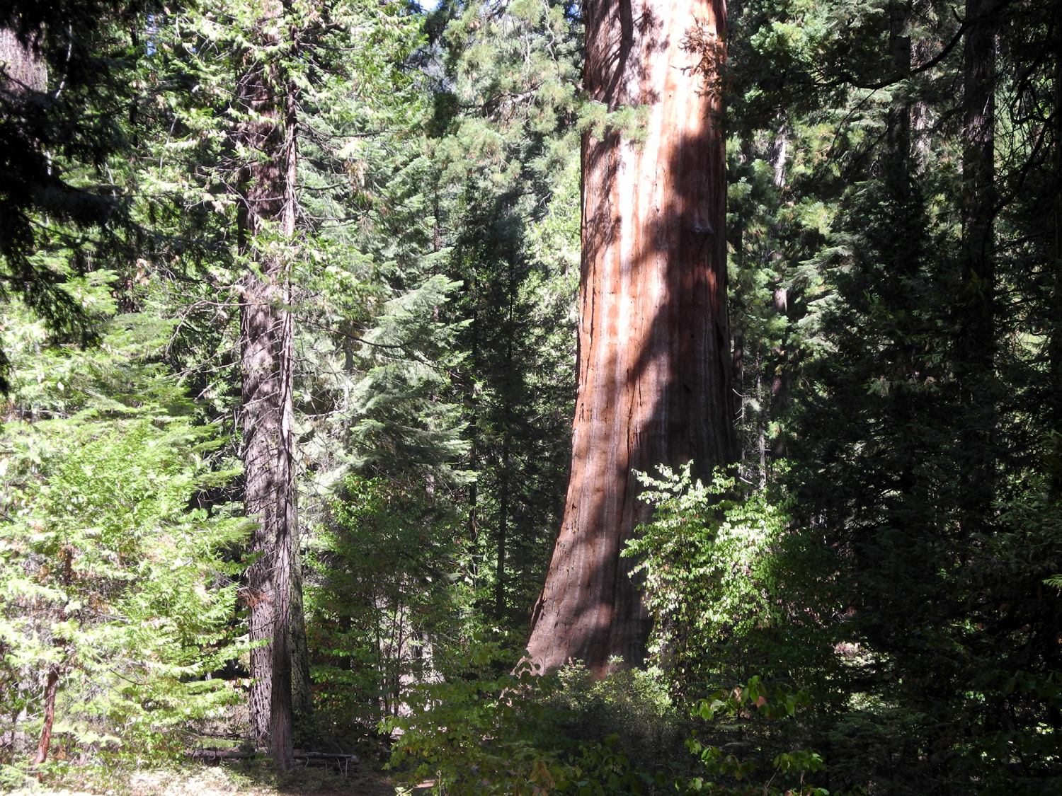
Looking up at Big Ed |
 |
 |
|
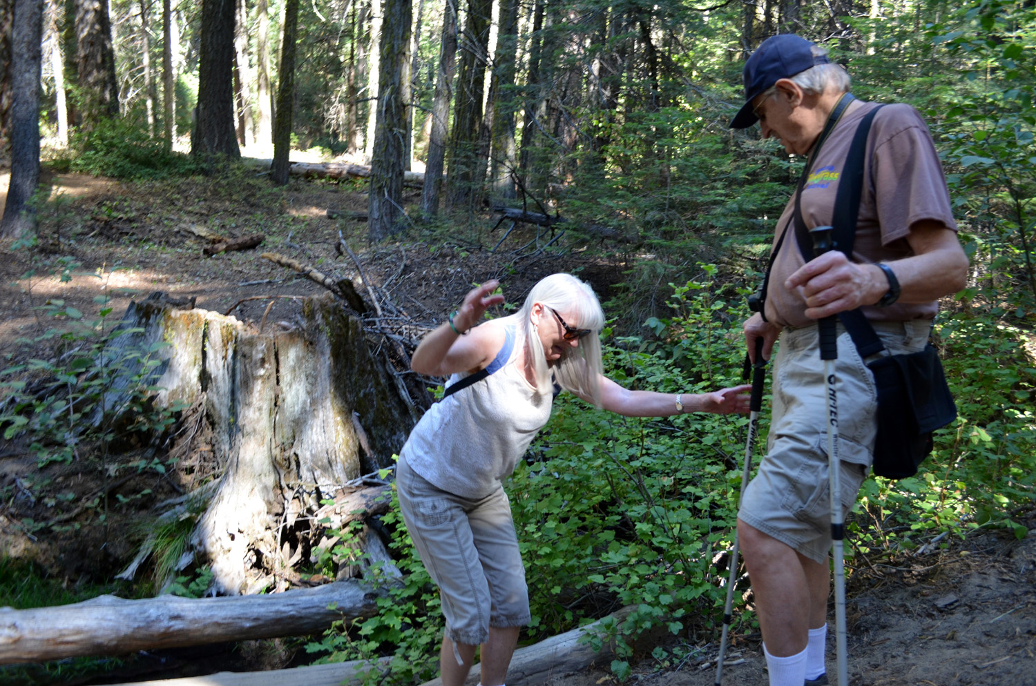
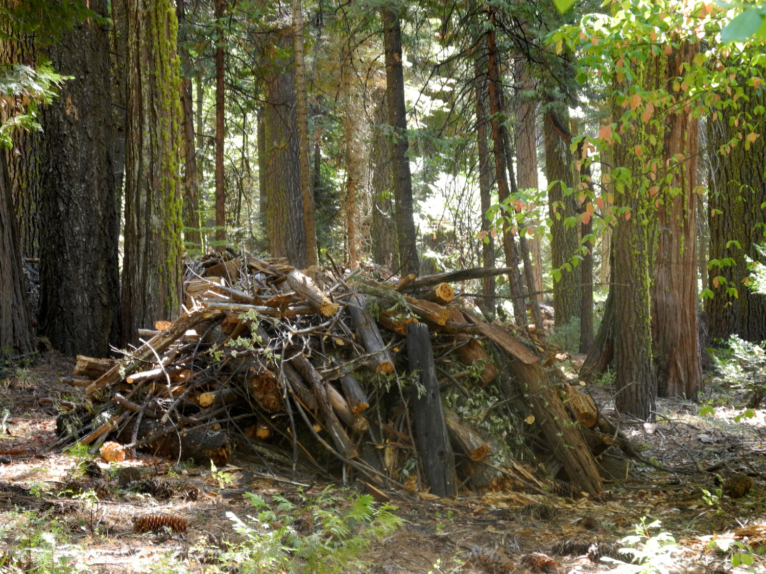
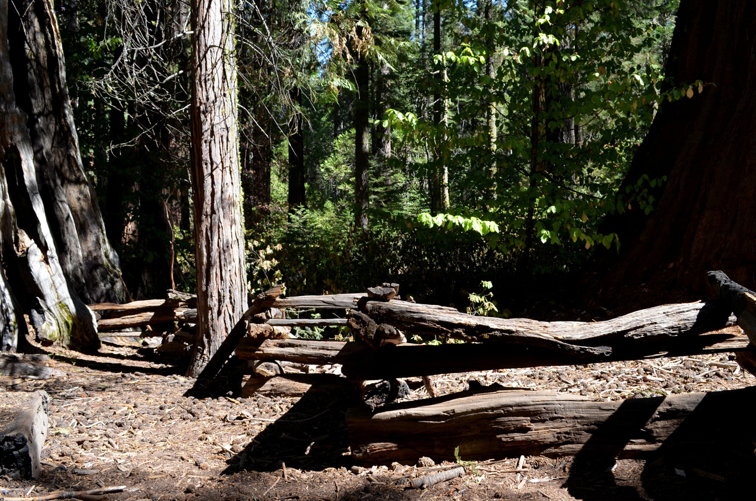
| Carolyn crossing the log "bridge" | One of dozens of piles from the thinning operation |
Wes, Brenda and Julie on the trail |
 |
 |
 |
|
The crown jewel of the
campground |
A closer view of the Bull Buck |
Fence built to protect the Bull Buck |
 |
 |
 |
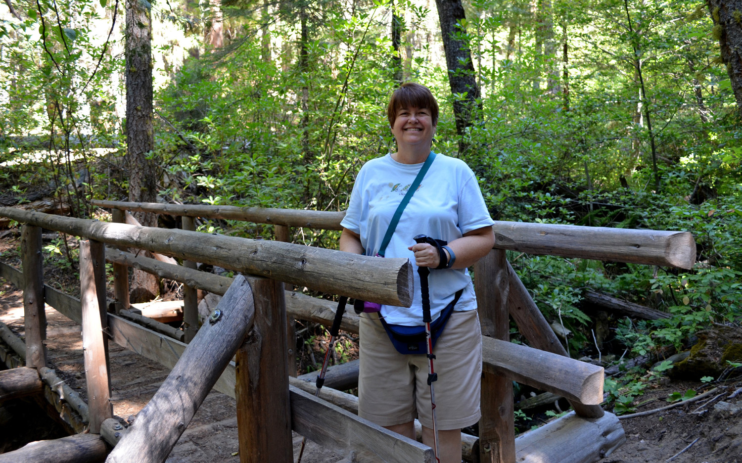
| Wes and Carolyn enjoy the Bull Buck view | Julie on the bridge over
California Creek on the Chimney Tree Trail |
Wes on the bridge |
 |
 |
 |
|
Brenda calls this the "Heart Stump" |
Top of a burned out
sequoia on the Chimney Tree Trail |
More slash piles, to be burned after the first snow fall |
 |
 |
 |
| Brenda and Carolyn at the Chimney Tree | Brenda, Wes and Carolyn at the Chimney Tree | Dick and Julie enjoying the walk |
 |
 |
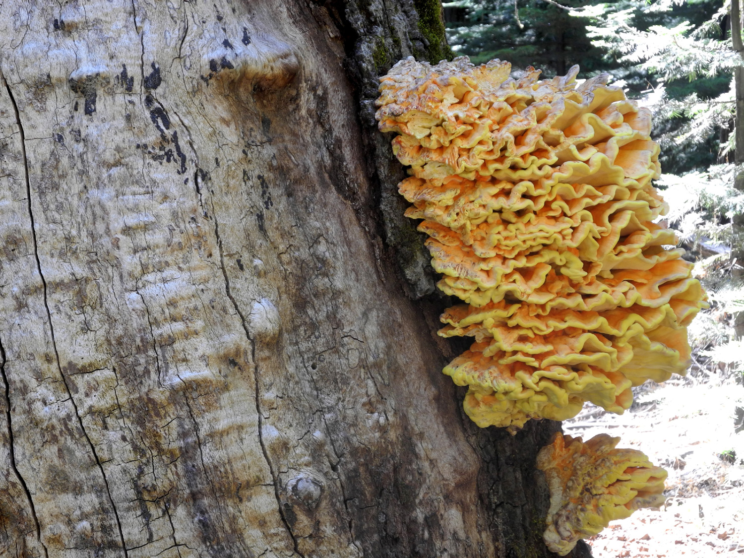 |
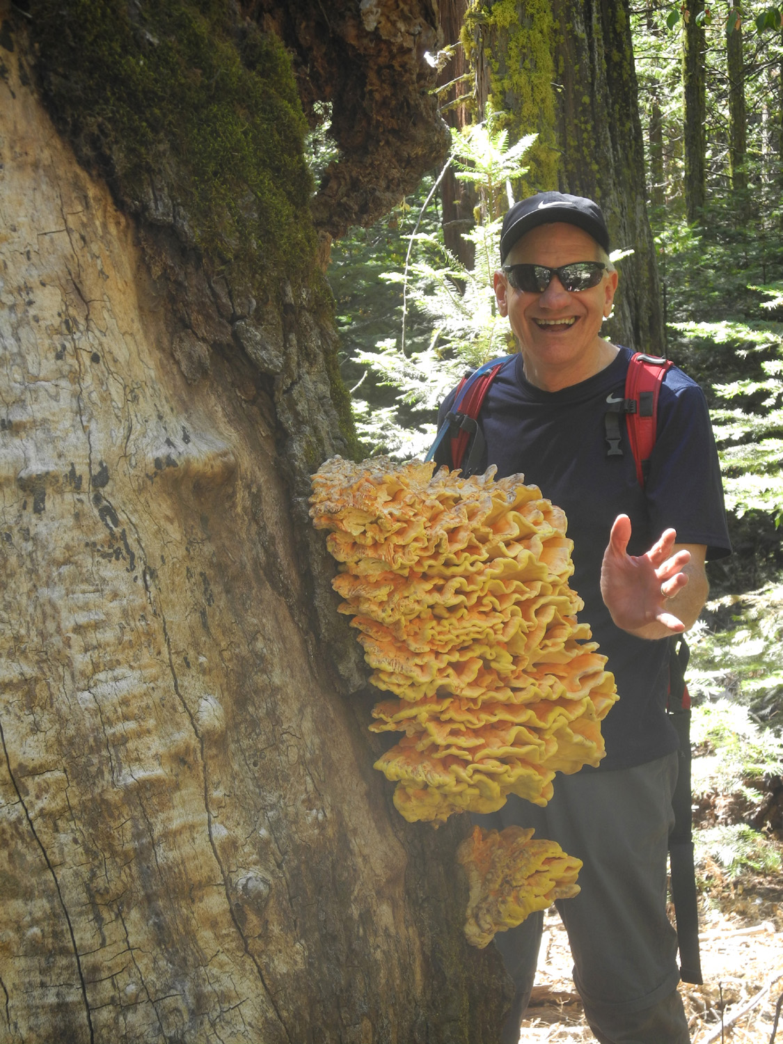
| The California Tree | Wes admires a huge fungus | A closer look |
 |
 |
 |
| Base of log cut down with axes | Nelder insignia design for T-shirt | Cover of the guide |
 |
||
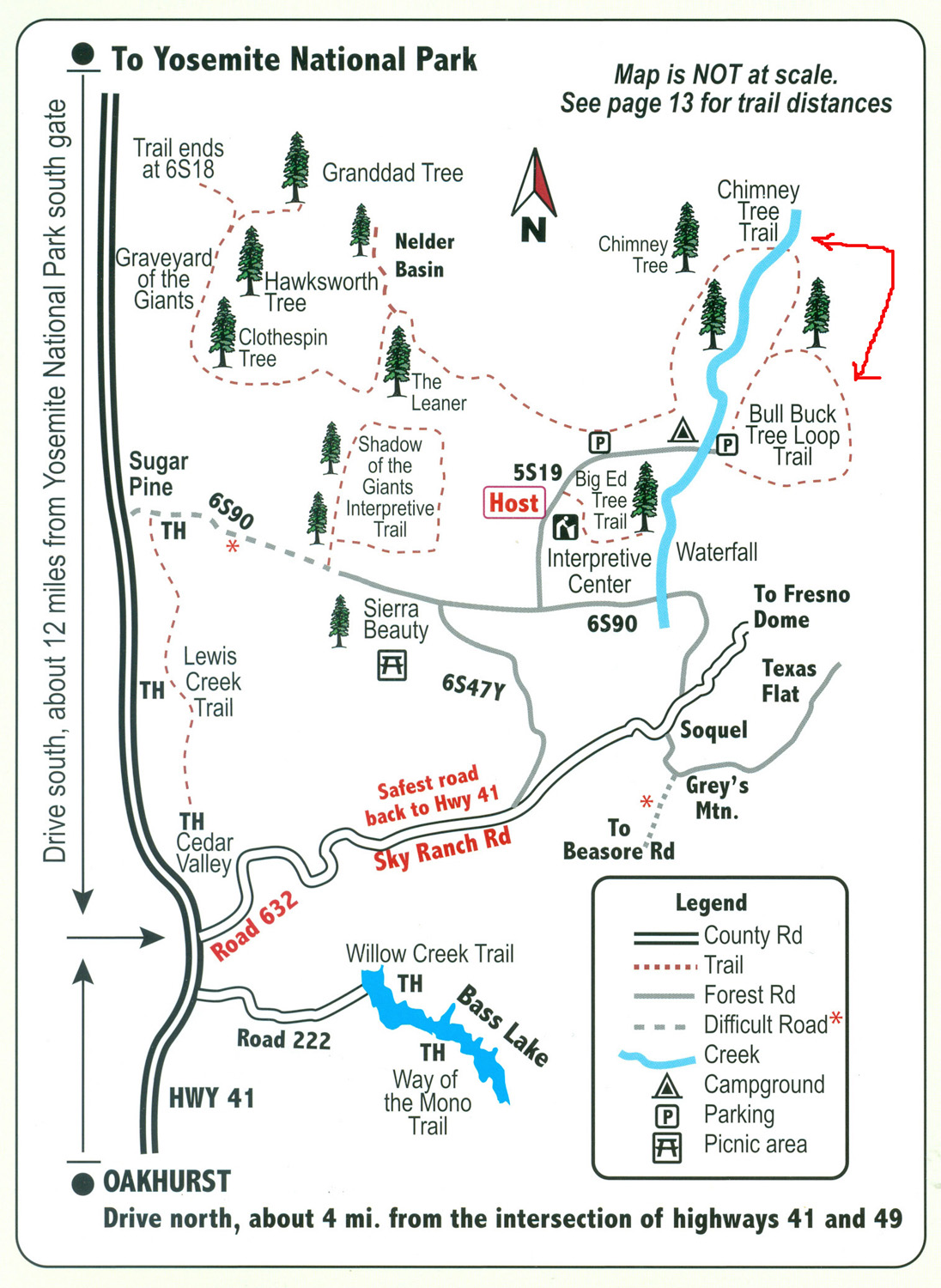
| Red arrows point to the two trails we hiked | ||
|
Earlier Nelder Photos |
||
|
 |
 |
|
Old Granddad Tree in 1969 |
Granddad tree in 2008 |
Fire
has charred but not |
 |
 |
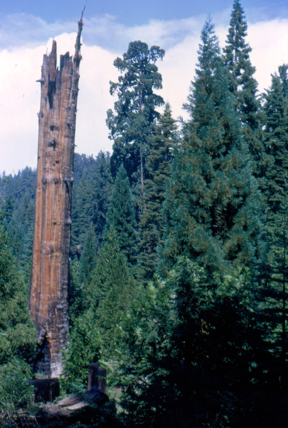 |
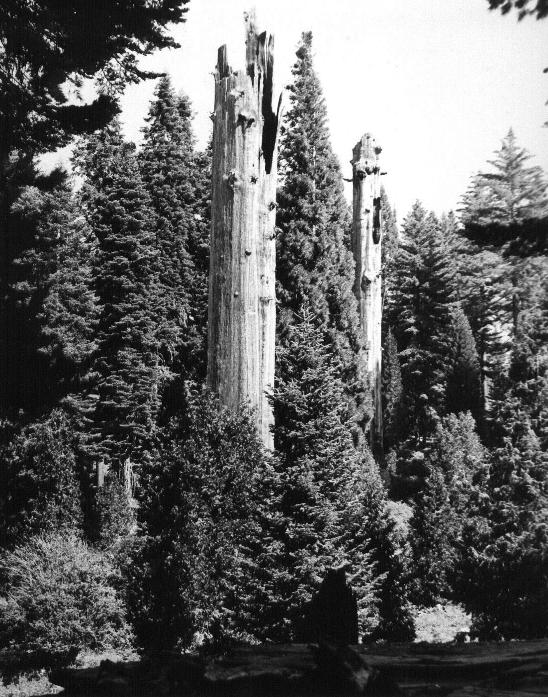
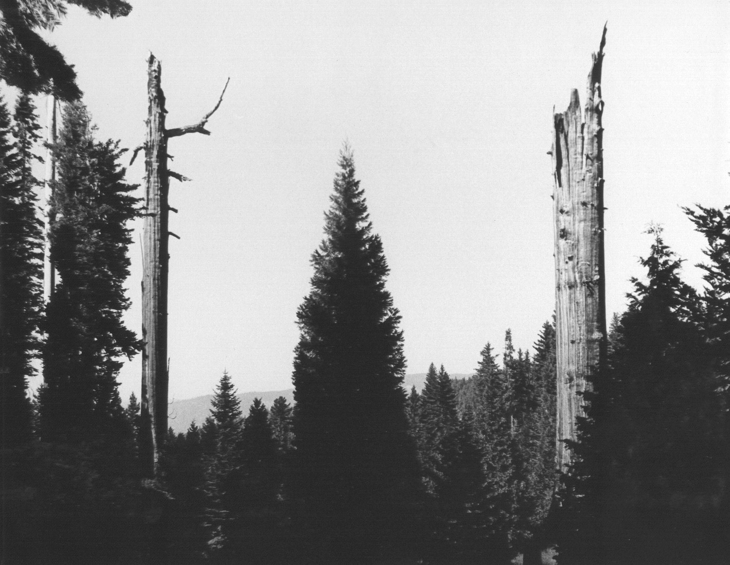
| Broken sequoia
snags in Graveyard of the Giants |
Close-up of top of snag | Color view of one of the snags |
 |
 |
 |
|
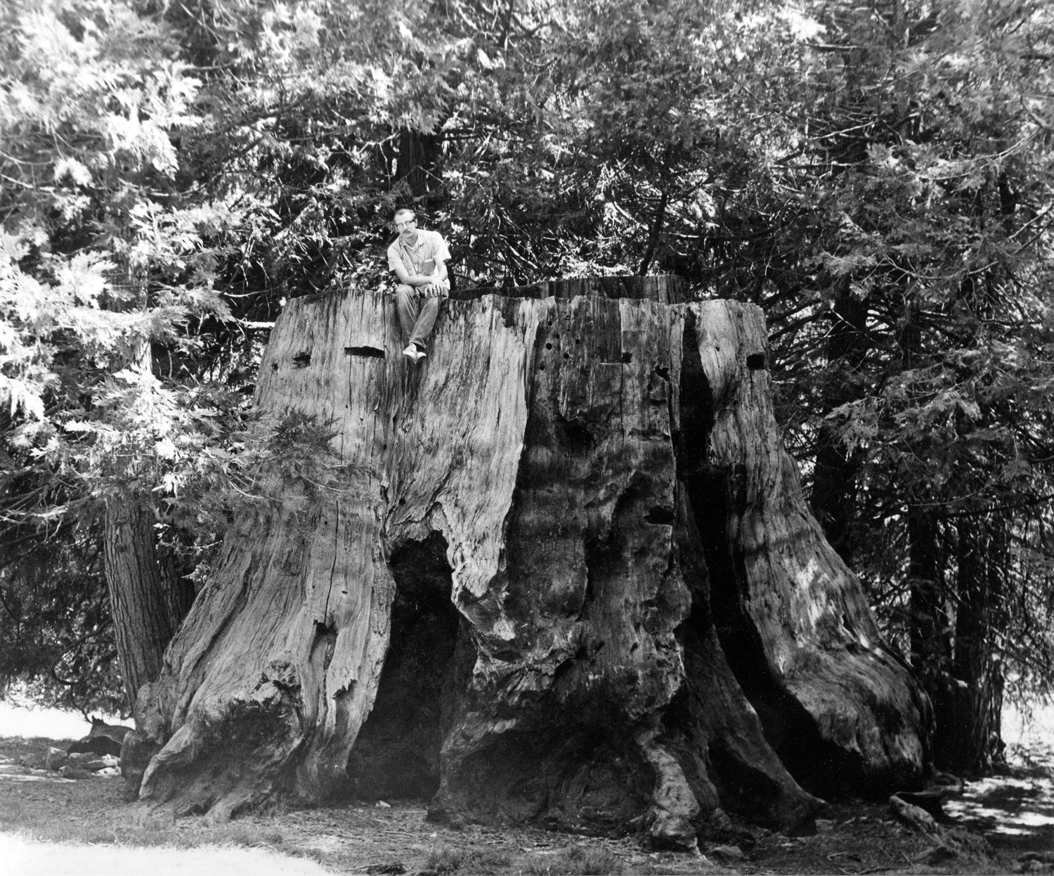
Dick on stump in campground in 1969 |
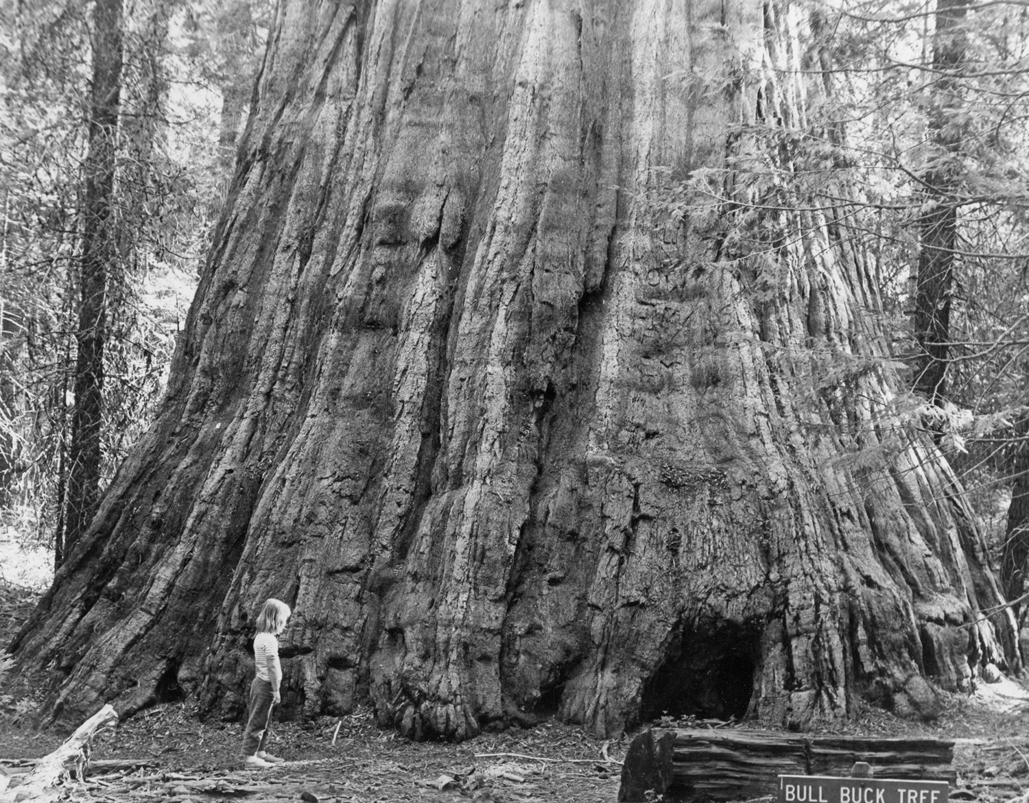
Dick's daughter Teri at the Bull Buck in 1969 | My favorite Bull Buck photo |
 |
 |
 |
|
A graceful tree along the upper trail |
Shattered log near Bull Buck tree | Dick on the first of many photo expeditions to Nelder Grove |
 |
 |
 |
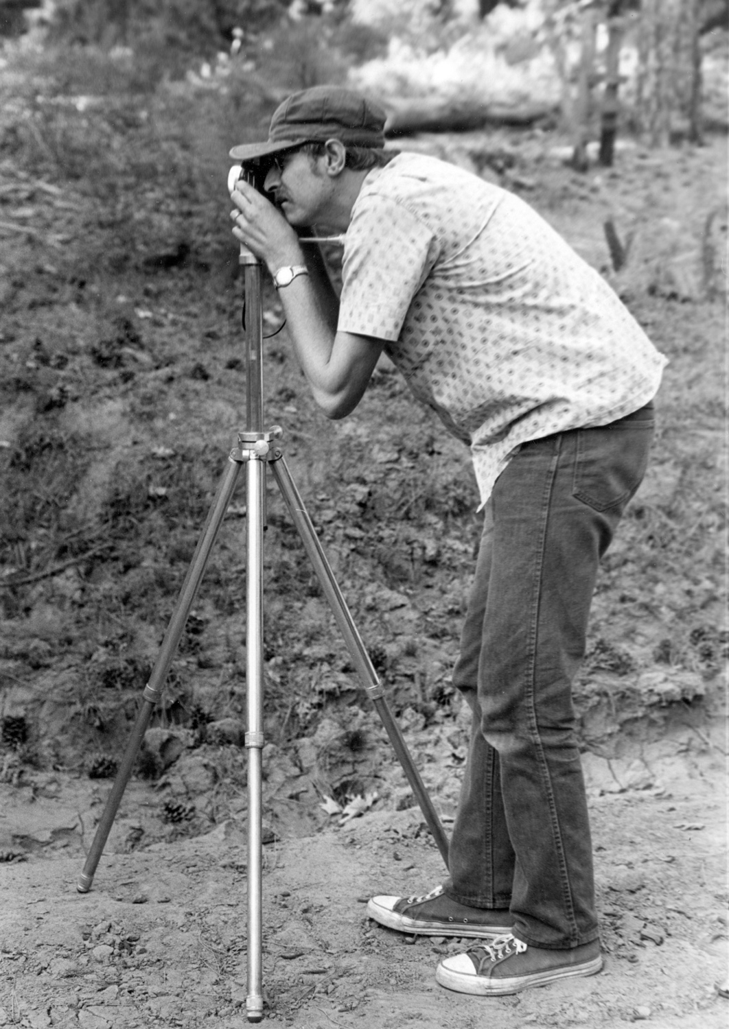
| Dick photographing in the Graveyard of the Giants in 1969 |
Two dead snags flank a young redwood |
Fir trees by the Shadow of the Giants Trail |
 |
 |
 |
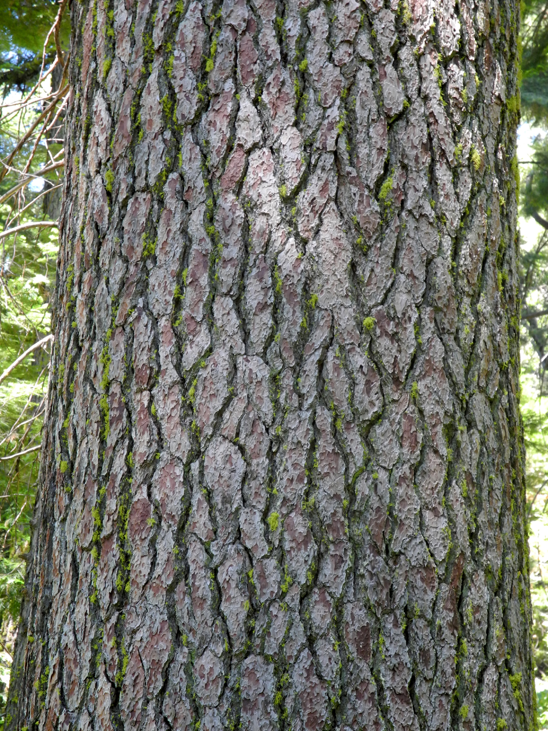
| The distinctive color and pattern of sugar pine bark |
Sign for the Hawksworth Tree |
Giant Sequoia honors
long-time |
 |
 |
 |
| Pioneer
cabin moved from Biledo Meadow to campground |
Dogwood leaves provide fall color | Azaleas
put on a dramatic show in the springtime |
 |
 |
 |
| Jennifer shows us how big a Sequoia tree is | Stump near Interpretive Center | Rounded top of sequoia |
 |
 |
 |
| Description of log chute | Two-pole log chute | All about the Bull Buck |
 |
 |
 |
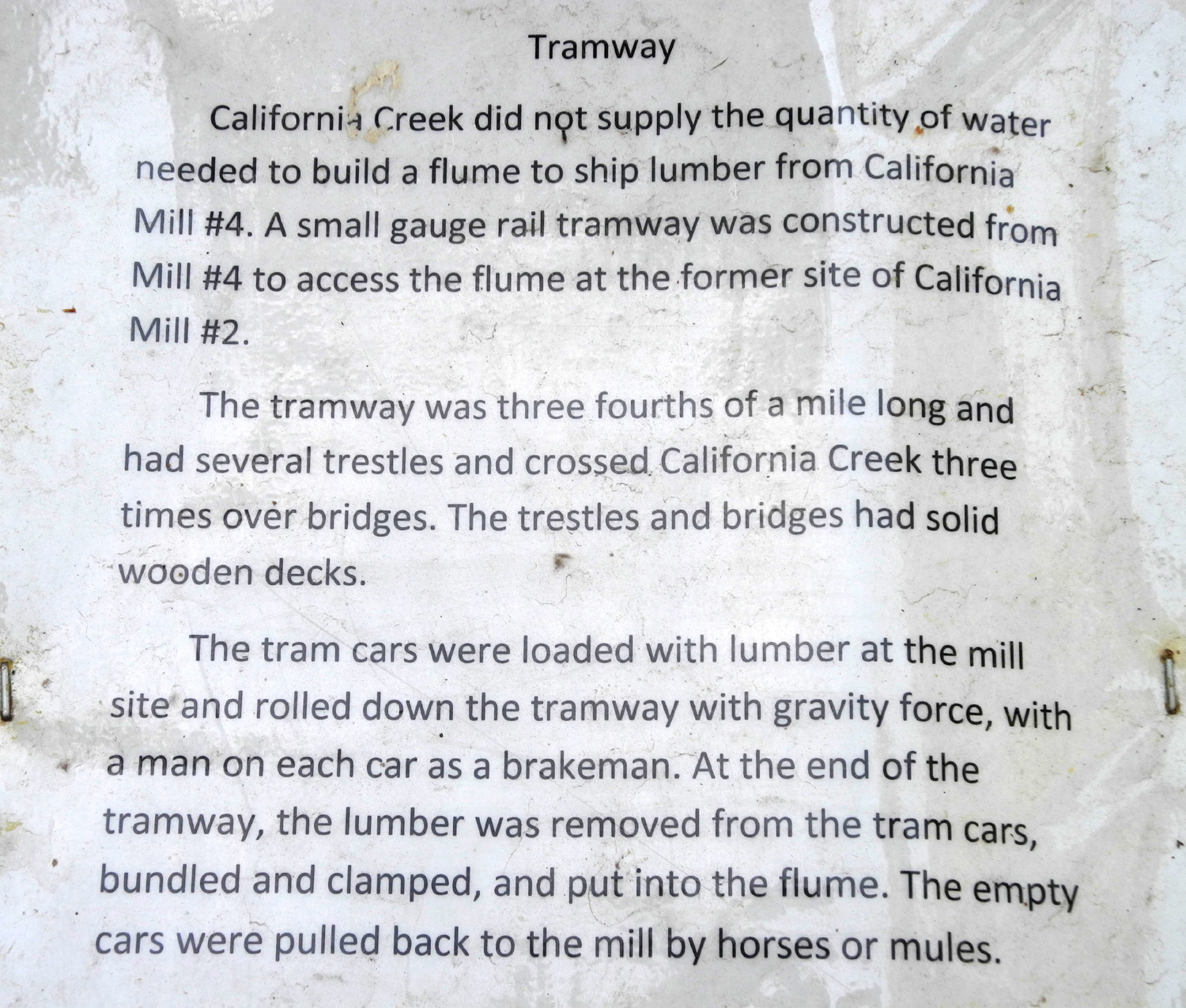
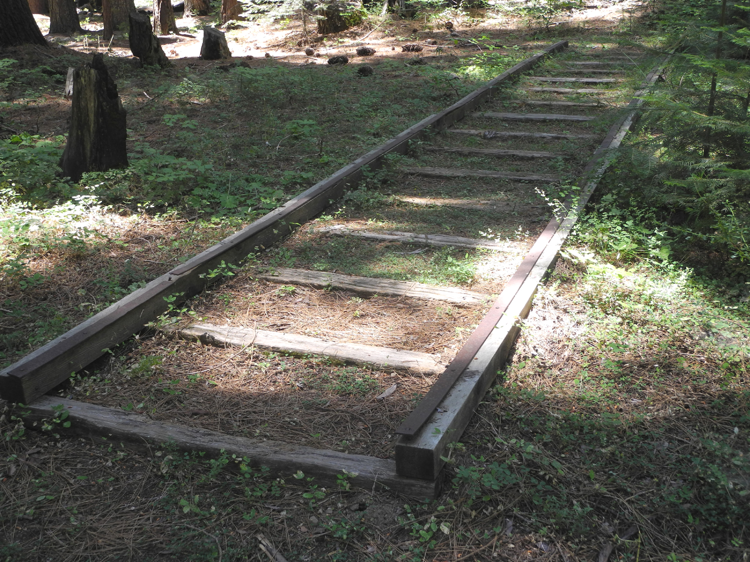
| Interpretive sign for tram rails | Tram rails described in sign | Dick at the Bull Buck Tree |
| Shadow of the Giants Trail Hike | ||
 |
 |
 |
| Bob & Alice on the bridge over Nelder Creek | This old stump is almost
hidden in the surrounding bushes |
Dogwood provides fall color |
 |
 |
 |
| The unmistakable color of a sequoia stands out in the forest |
A rare standing dead sequoia | Dick on the upper bridge on Shadow of the Giants Trail |
 |
|
 |
| An impressive giant along the trail | A peaceful place to walk | Huge log from tree felled in the Interpretive Center area. |
 |
 |
 |
| Bob & Alice at the Bull Buck | The late John Hawksworth
cleared the path to give us this view |
Bob & Alice at the view point |
| Hiking with Colton | ||
|
 |
 |
| Colton with his collection of forest products | Into the tunnel... | ...and back out |
 |
 |
 |
| Johnny and Colton
investigate the lumber flume replica |
Inside a hollow stump | Dick and Colton near Big Ed tree |
 |
 |
 |
| How Colton "hikes" |
Resting at the Bull Buck viewing area |
Posing in front of the Bull Buck |
 |
 |
 |
| Colton on the fence | Colton checking out the Bull Buck | One more photo of the Bull Buck |
 |
 |
 |
| Two large stumps next to the Bull Buck | Crossing California Creek | Time for a snack |
 |
 |
 |
| In the campground | Leap of faith | Who's chasing who? |
 |
||
| Bull Buck on right and stumps of two long gone giants | ||
| Related Links | ||
| Dick's Story of Nelder Grove | Dick's Early Nelder Grove photos | Dick's Redwood Page |
| Dick's Redwood Photos | Friends of Nelder Grove | Nelder Grove Trails |
| Shadow of the Giants Trail | Biledo Meadow | John Nelder |