Tahoe & Virginia City |
||
|
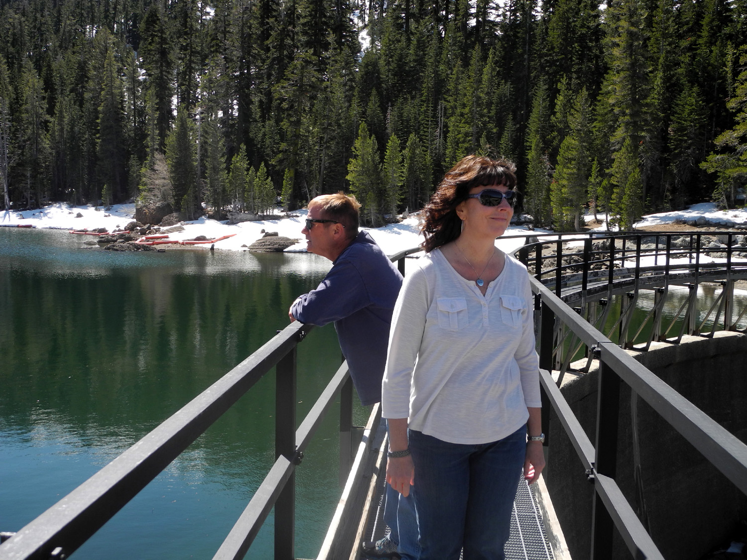
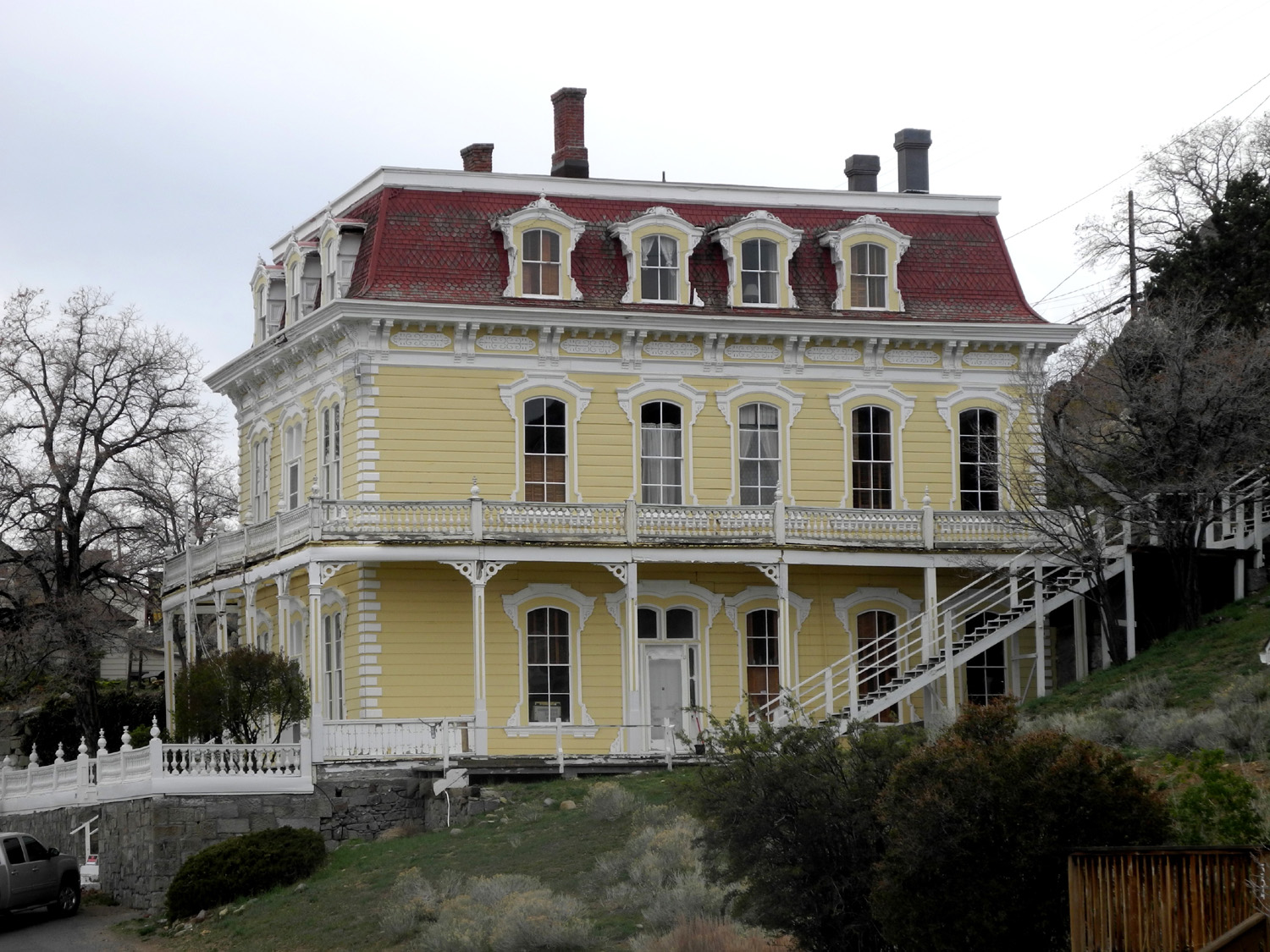
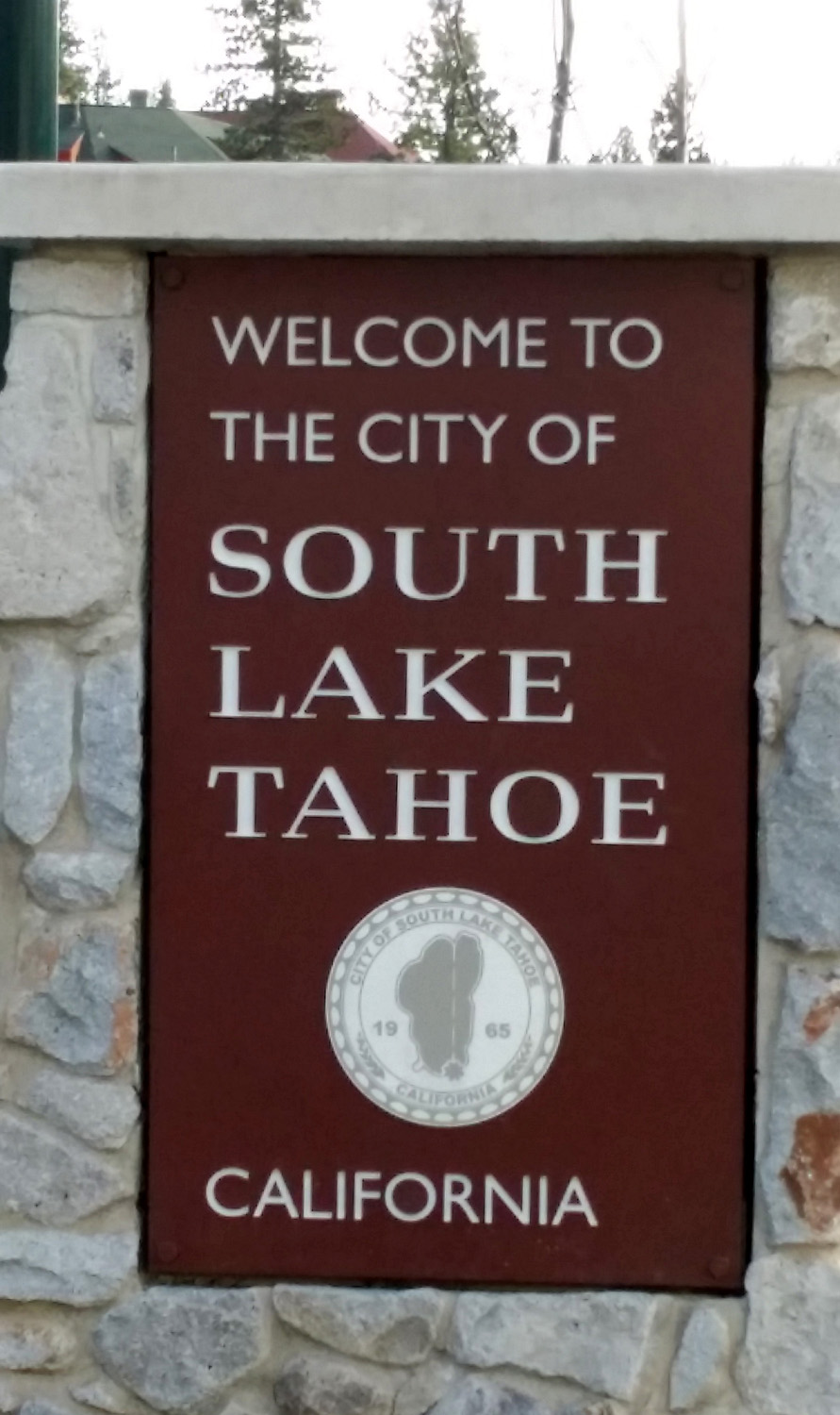
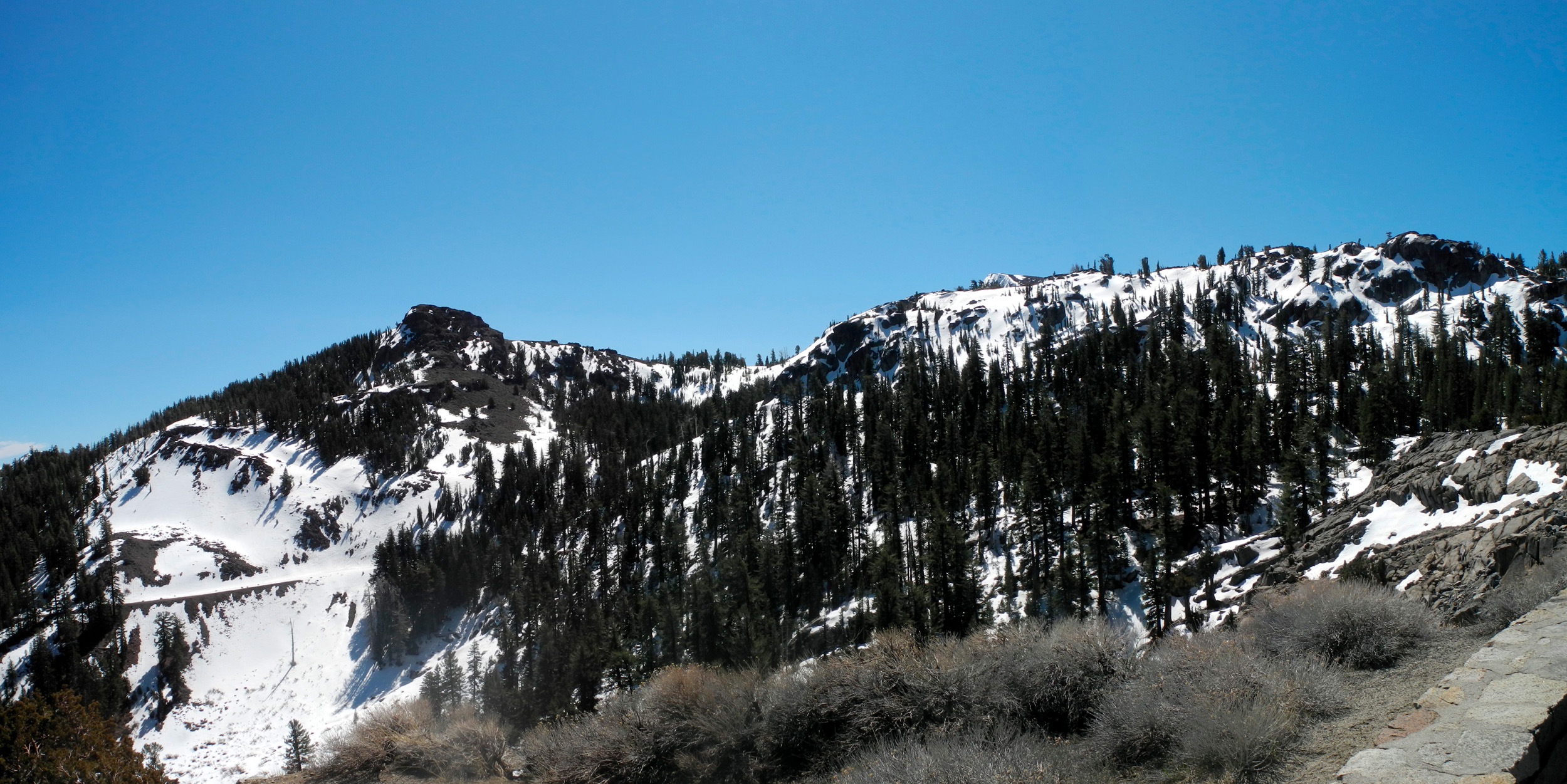
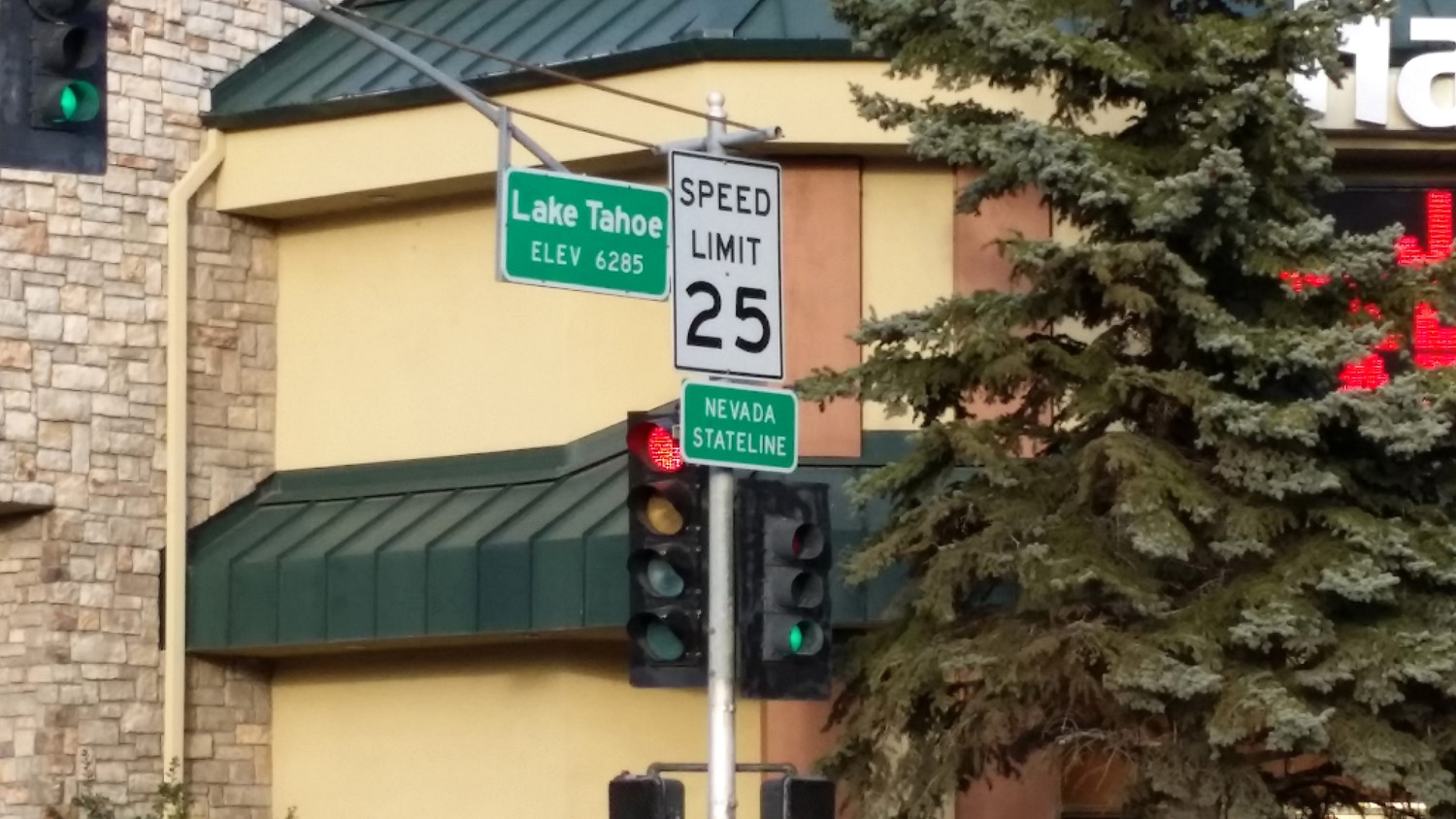
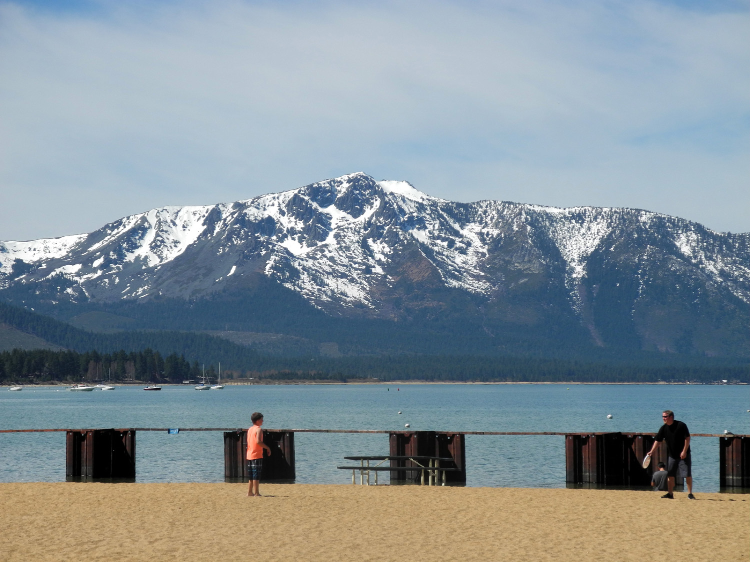
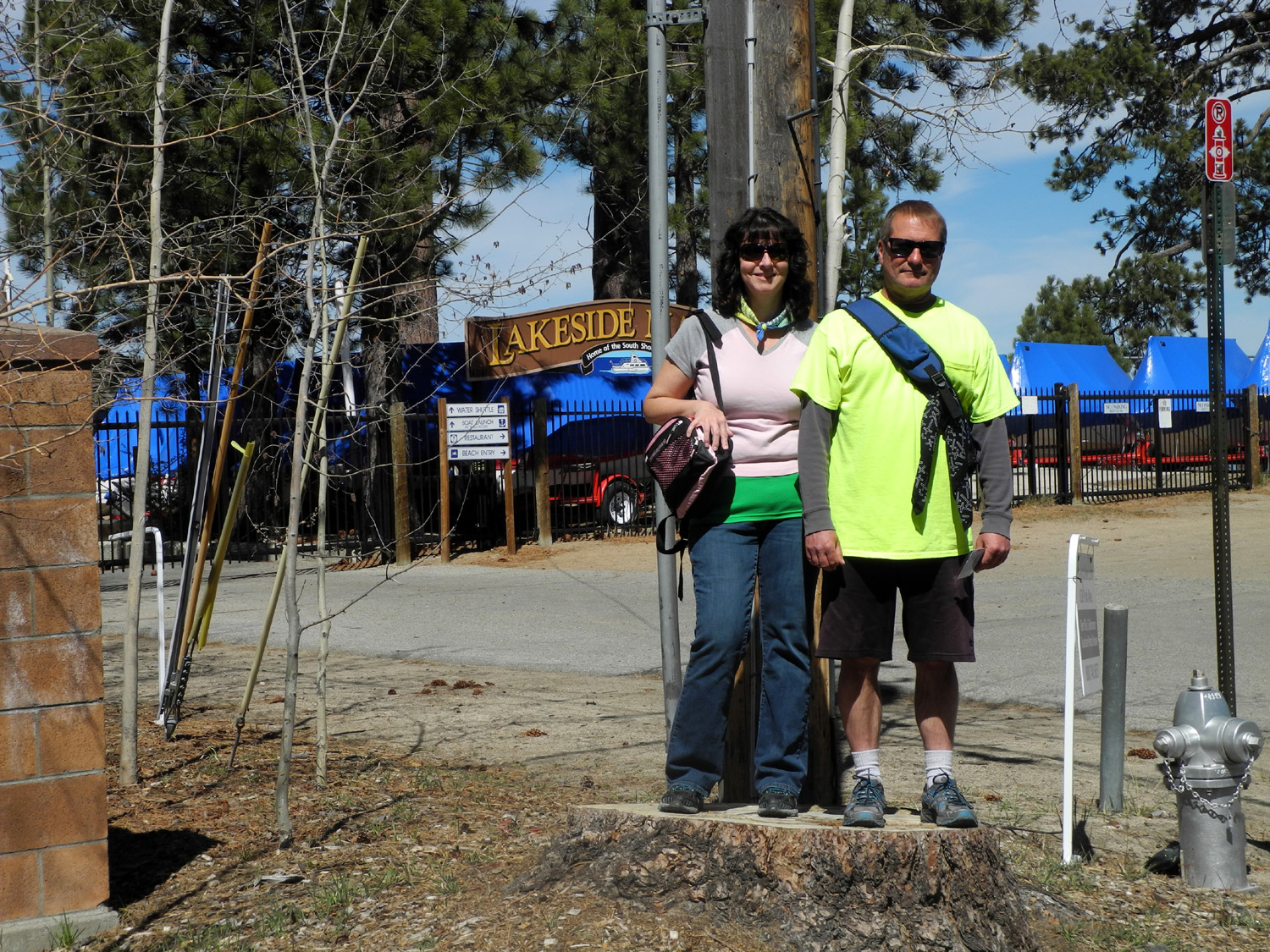
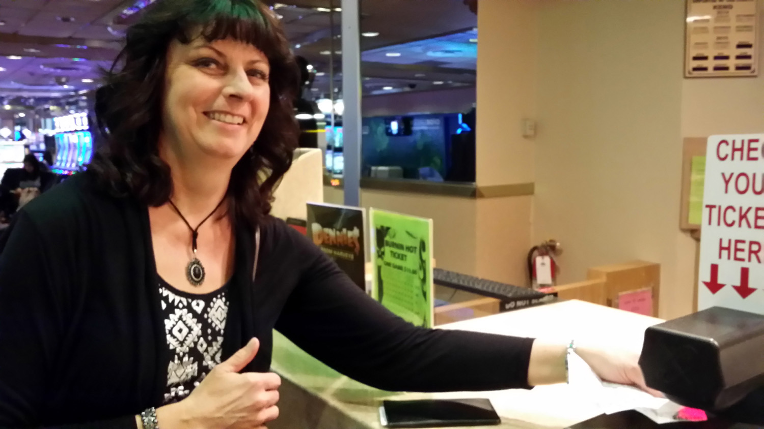
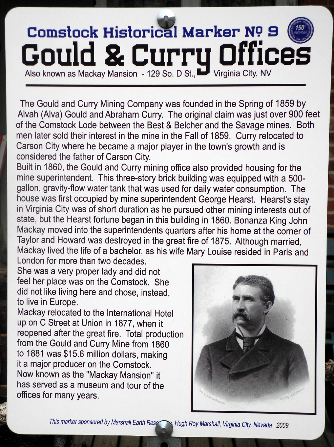
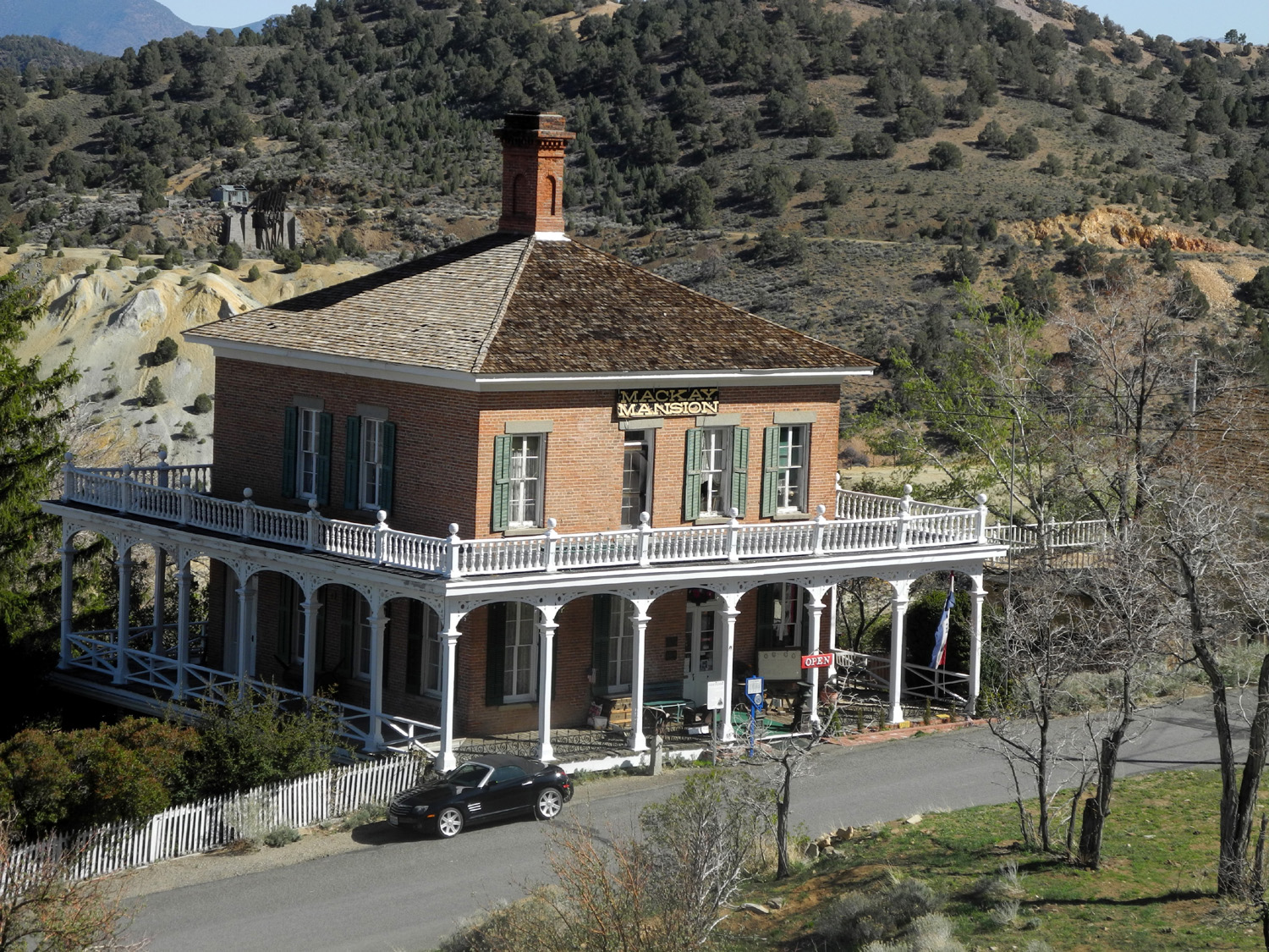
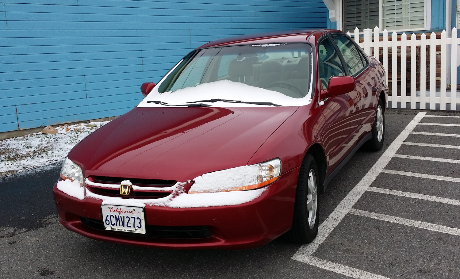
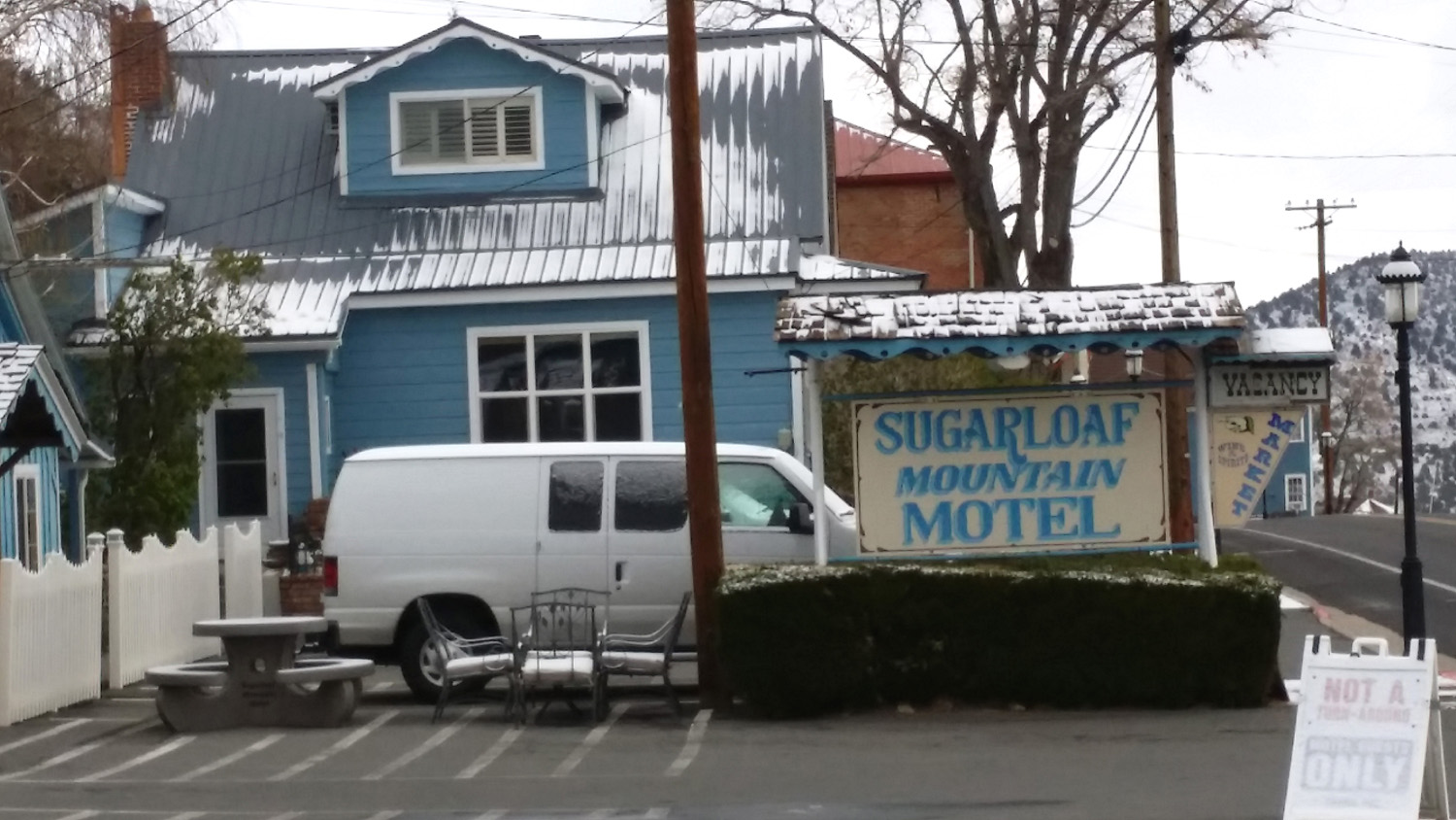
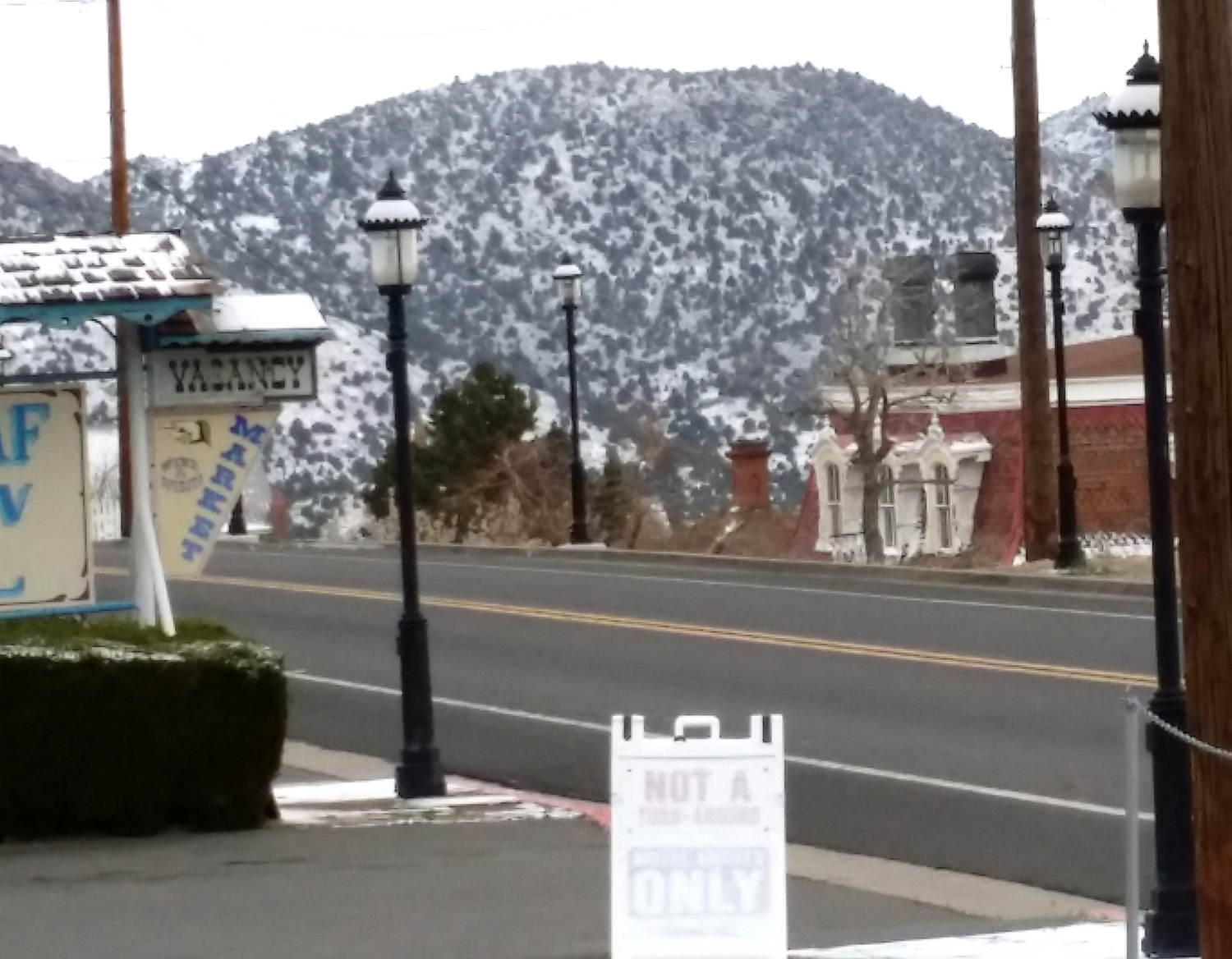
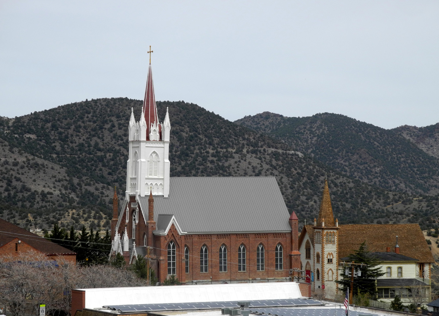
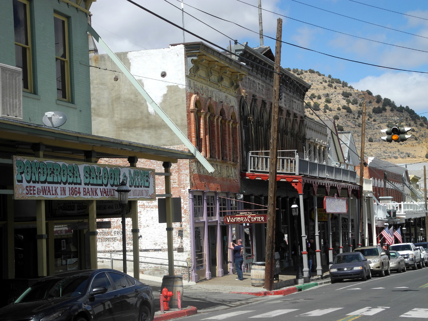
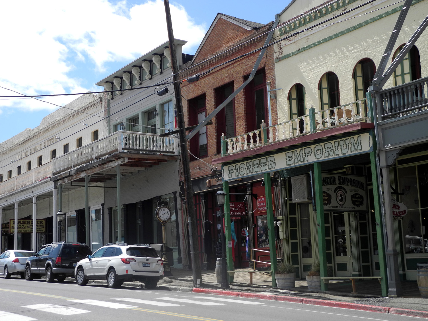
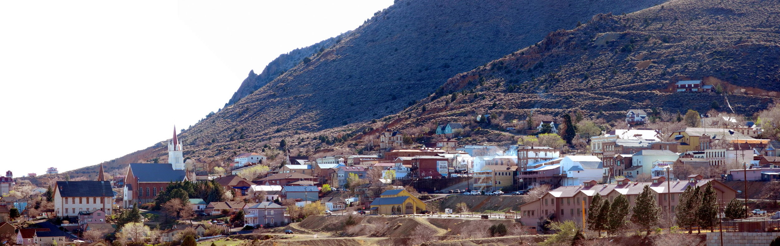
My younger daughter and her husband, Jennifer and Rod Neely, were married at Lake Tahoe in 1984, and it has been one of their favorite vacation spots ever since. I had been wanting to join them on one of their trips, and it finally worked out during spring break this year. On March 29, 2015 I got up very early and made the one-hour drive to Oakhurst, arriving at their house about 6:30 a.m. for a planned 7 a.m. departure. Since we would be going our different ways after our Tahoe visit, they drove their Jeep and I took my Honda. Rod and Jennifer have made this trip many times, and their preferred route is to follow State Highway 49 from it's southern starting point in downtown Oakhurst all the way to State 88 at Jackson. They also know all the rest stops, and we made our first one in Mariposa, about 35 miles from their place. Here Jennifer joined me and took over the driving duties. We continued on the winding road across Lake McClure on the Merced River at Bagby and on to Coulterville, the northernmost community in Mariposa County, and our next stopping point. Like most towns on Highway 49, Coulterville had its heyday during the gold rush, and is an interesting place to visit. Our stay there was very short, however. The Jamestown-Sonora area in Tuolumne County has become a rather large population center, with the traffic congestion that goes with that. The Neely's have discovered a bypass on county roads that avoids the problem area. Beyond this section, we came to San Andreas in Calaveras County, where we stopped at a mini-mart. As we approached the door I saw a man who looked familiar going in. Once inside, I took a closer look, and it was indeed Larry Anderson, who lives a few blocks from the market. Larry was a regular at the Commodore shows that our computer club in Fresno sponsors each year in Las Vegas. He has not been able to attend recent events, but continues to maintain the web site for the show, and we had a nice visit. It was a fairly short jaunt from here to Jackson, the county seat of Amador County, where Highway 88 comes in from Stockton. We turned east and started over the Sierra Nevada, on this very scenic route that reaches its highest point at 8,574 foot Carson Pass. We made a gas stop for the Neely's jeep in Pine Grove, then a final rest stop at Caples Lake, set in snow-covered mountains near the highest point of the route. Highway 88 continues to US 395 near Minden, NV, but to get to Tahoe, we turned north on State 89, which runs into US 50. This took us right through downtown South Lake Tahoe CA and into Stateline NV and Harvey's Resort, right on the street that marks the border. After checking in, we spent the rest of the day loafing around our rooms, having a cocktail hour, and going to eat. We also contributed to Nevada's gambling economy, although I think in the long run Rod and Jennifer made a profit for the time we were there. I didn't. We mostly played slots, although they played a few keno games, so I tried that for the first time. I doubled my $10 investment, but this did not make me think it was a surefire way to make money. The next morning we went across the street and had breakfast at a restaurant in Harrah's (part of the same ownership), where the pancakes surpassed almost any I have eaten, but the bacon left a lot to be desired. After that we did a nice walk down to the lake, then back up into town, a little over a mile and a half all together. I had hoped we would do more hiking, or maybe a gondola ride, but it was very cold and windy the second day. Rod and Jennifer walked to a nearby shopping center, and eventually brought me some berries and yogurt for breakfast. That night we had dinner at the Cabo Wabo that is located in Harvey's - pretty good Mexican food but nothing outstanding. I think this chain is more famous for overpriced tequila and being owned by Sammy Hagar than the actual food. Our final morning, April 1, we were going to go out to breakfast, but Rod and Jennifer wanted to get started for home, and I was heading for Virginia City. We collected our final keno winnings, said our goodbye, and departed for our respective destinations. I had known a little about Virginia City for decades, but had never been there. Since it was only about 50 miles from Tahoe, this seemed like the perfect time, and after I arranged the trip with Rod and Jennifer, I made reservations at the Sugarloaf Mountain Motel. Leaving Harvey's, I drove north from Stateline on US 50, which climbs up from the Tahoe basin and drops down to the Carson Plain, and Carson City, capitol of the state. I stopped here for breakfast at a Denny's, then got gas, and continued east a short distance on highway 50, to the turnoff at state highway 341. My cell phone GPS told me to get off on state 342, but it was closed and 341 was the detour. It turned out that both highways came together at the western end of Virginia City, just a couple of blocks from my motel. Highway 341 is the truck route; apparently 342 is more steep and winding, although it looks as if it would be like comparing red apples and light red apples. From the motel, and many places in town, the view to the south looks over a low, rounded peak, which is the actual Sugarloaf Mountain, and out to the flat country beyond. Locals claim there is a 100 mile view on a clear day (some say 200 miles). Once I got checked into the motel and brought in my luggage, I set out to see the city. I can't remember the exact details of when I did what, but I know I did a bunch of walking that first day, into the heart of downtown Virginia City. The main street from the motel to the end of the main business district is probably a little over a mile. I enjoyed looking at the old buildings, not just the stores, but also several well-preserved large mansions from mining days, and a couple of churches of classic design. There seem to be three main category of stores: Saloons, most of which offer historical displays or even a museum. These range from a few artifacts on a shelf to a complete separate area, usually with an admission charge. Stores that sell clothing and various types of souvenirs. I collect magnets from places I visit, and one of these was my only purchase in any of these emporiums. Food sources, including full sit-down restaurants, sandwich shops, and ice cream and candy stores. One of these, Grandma's Fudge Factory, tempted me with ice cream, and the first time I entered I also bought some peanut brittle and chocolate "bark." There are no Reno/Vegas style casinos, but all the saloons seem to have slot machines. There are a couple of old hotels, which may also include a saloon or museum. There are also some formal museums, two of which I visited and will discuss a bit later. Since the town is at 6,200 feet elevation, winters in the past have often been quite severe, and many attractions are only open from May through October, so I missed out on a couple of things I would like to have seen. Walking through town I had to watch my step on the old wooden sidewalk, which slopes down along with the terrain., Once I got about halfway through the town, I could see that continuing to the end of the business district would be a bit more of a walk than I wanted that day. I crossed the street and started back toward my motel, window shopping and making mental notes of places I'd like to check out later. My most important stop was the visitor center. Before arriving I had looked on line for things to see and do, and realized that many of these were not open. I mentioned this when I checked in, and the motel owner explained that many things ARE open, and that I could get good information at the visitor center. The man on duty gave me a map of the city which listed various things to do and see on the back, with the ones that were open marked. Seeing that the Mackay Mansion was on the "open" list, I walked down to D street, and I do mean DOWN; it's a steep drop from one street to another in this town that's fastened on to the side of a mountain. I entered the museum just in time to join a tour, which consisted of just two other people, conducted by a very friendly and knowledgeable guide. The building was not just a residence, but also the main office of the mining operations. There's plenty of information about Mackay and his mining operations on line, but two bits of information stood out - the first occupant of the building was a mine superintendent named George Hurst, who started with $400 and left the area a multi-millionaire, setting the stage for the various enterprises of his son, William Randolph. The other tidbit of information was that during the peak of his mining operations, Mackay was the fourth richest man in the world, testimony to the huge fortunes that were made in Virginia City. After completing the tour, I walked west on D Street to where it joins the state highway, and followed that around to C Street and my motel. After a brief nap, I drove down town and parked approximately where I had turned back earlier. From here I walked to the end of the main business district, and made my way back to the car, stopping at Grandma's for ice cream. I stashed this in the freezer in my motel and settled in for the night, enjoying a light supper of cheese that I had brought with me, plus some nuts that I bought at the motel store. Later, as I was finishing up my ice cream snack shortly before going to bed, I looked at the weather app on my iPad. I have several different cities active, and can bring them up with a finger swipe, and when I saw a forecast of snow showers I thought maybe I was looking at the Duluth MN page. But no, this was what the Weather Channel thought was in store for Virginia City, between the hours of 10 p.m. and 1 a.m. I went to
bed early, a little before 10, but woke up around 11. I immediately
opened the blind, and sure enough, there was a little bit of snow on
my Honda and on the grass outside my room. The next morning it did
not appear to have snowed any more, but there was a dusting of snow
on the buildings and surrounding
hills. It started melting quickly
as soon as the sun came up, but little pellets of snow drifted
down once in a while throughout the morning from partly blue
skies. There was still snow late in the day in a shady area below street level on
the north side of
buildings and in a narrow open air walk-in mall. Throughout
the day it was very cold, either
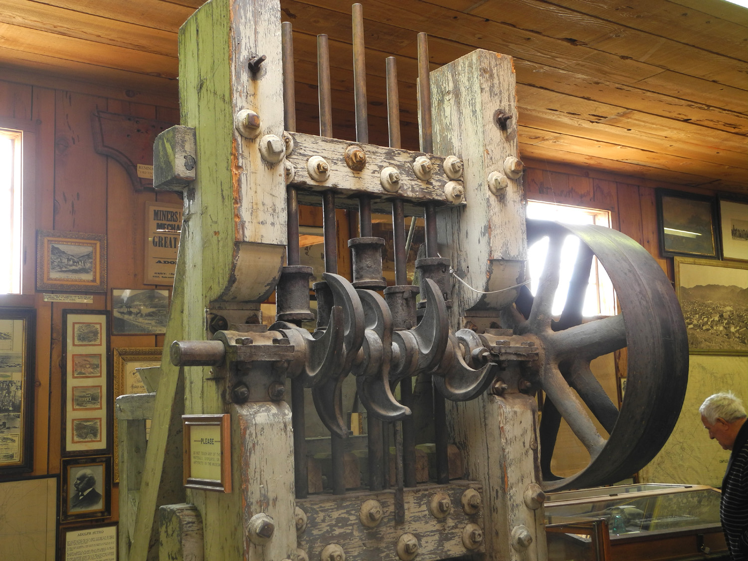
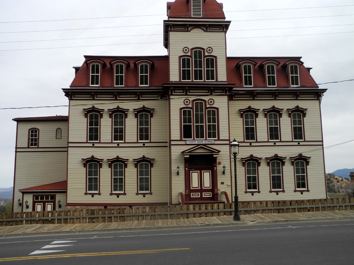
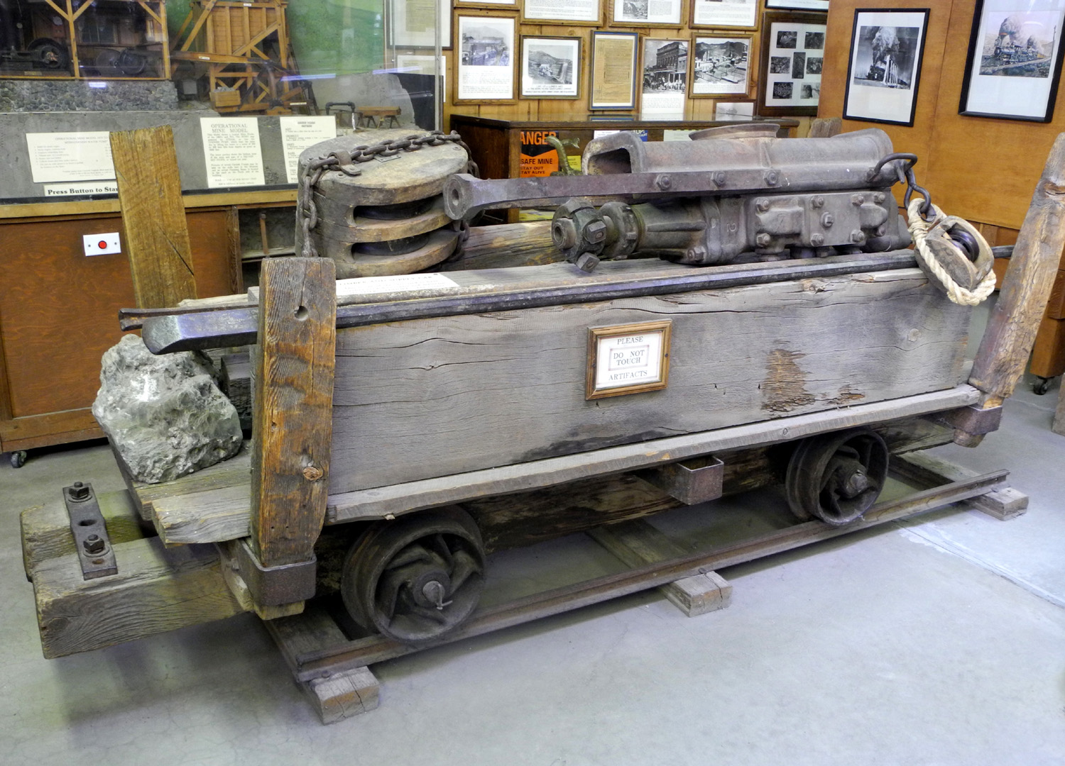
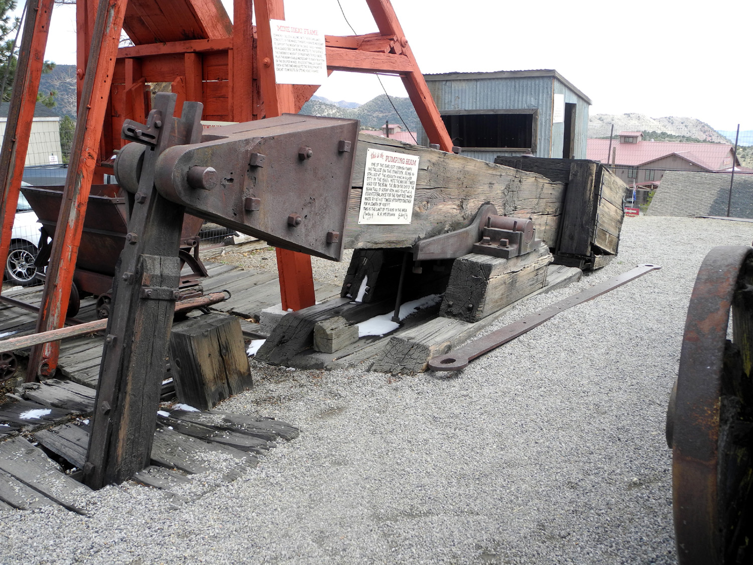
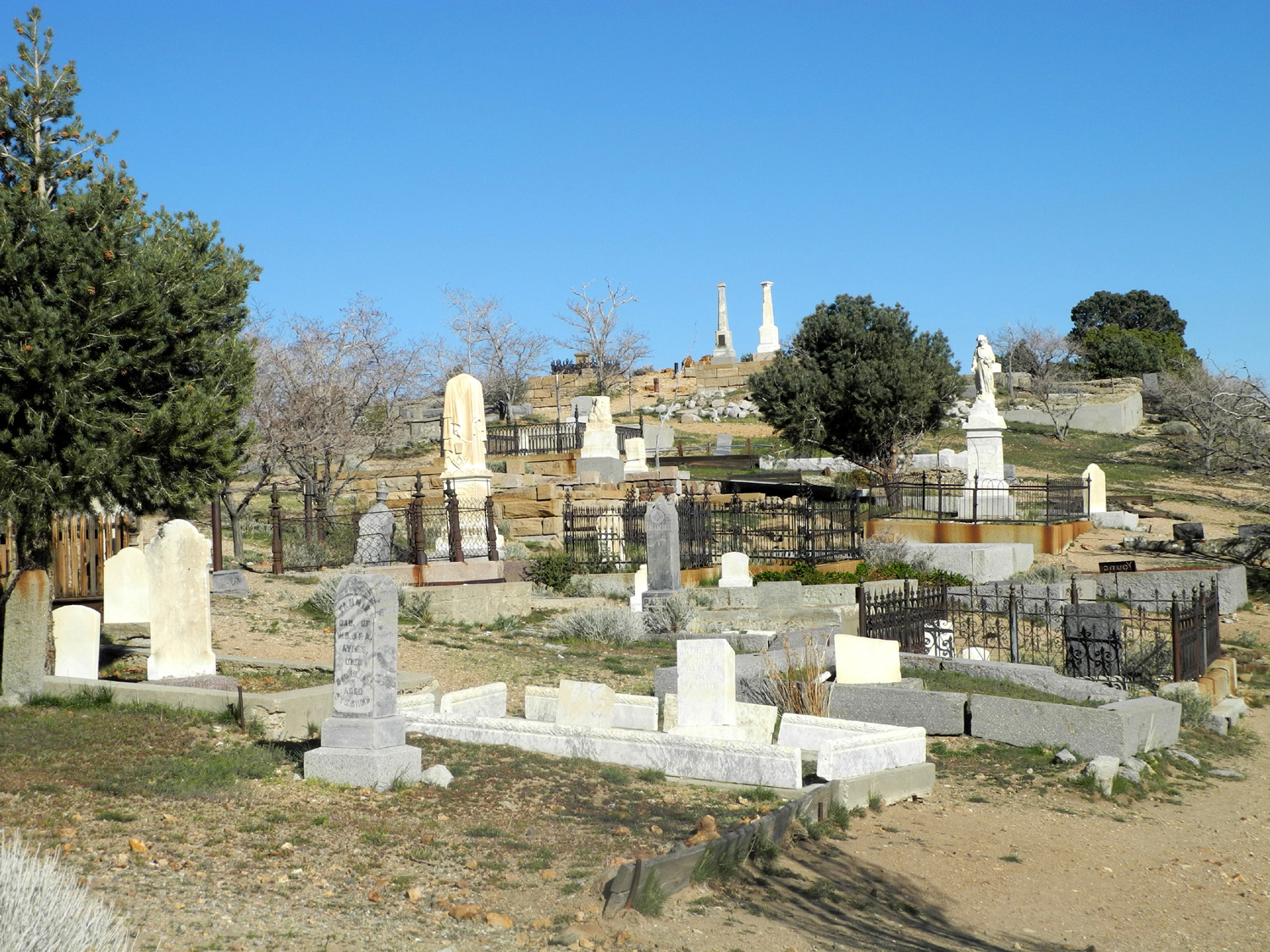
46 or 38 at I finished my berries and yogurt for breakfast, then drove a bit more than halfway through town to The Way it Was Museum. For $3 you can wander through the history of the area, with what is described as the most complete collection of Comstock mining artifacts in the world. There are also photos and maps from the “Bonanza” period, and well thought out signs describing some of the photos and objects. The price of admission includes a short film about Virginia City history, and a visit here is well worth the time. I spent an hour or more in the museum, taking quite a few photos and reading most of the informational signs. One of the most striking items is the "Cornish pump," which operates in a way similar to an oil pump and was used to remove water from the mine shafts. The heavy rocker beam is attached to a wooden rod, made from attaching numerous timbers together, to reach down as far as 900 feet. There was also a great deal of information about the Sutro Tunnel, a three mile long conduit to carry water away from the mines and eliminate the need for pumping. Although it was completed just as mining went into steep decline, it continues to drain water from the upper levels of the old shafts. I also learned that in more recent years, the school had a class in staying out of abandoned mines, always a wise idea in any mining area. There's a ton of information about mining days on line.. Other than mining, Virginia City's major claim to fame is being the location where Samuel Clemons (Mark Twain) got his start as a writer. He came to Nevada as assistant to his older brother, who had been appointed secretary to the governor, but his duties were virtually non-existent, so he sought his fortune in silver and gold like so many others - in Carson City and a number of other areas, including bustling Virginia City, home of 15,000 residents. He found much of Nevada unappealing, describing it as a barren desert, but was enthralled with Lake Tahoe, which he considered the most divine scene he had ever seen. Of course, he didn't see it when the slightly less divine gambling interests lined its shores with high-rise casinos. However, he remained in the area some time, trying unsuccessfully to make his fortune in mining and timber. Ultimately
he became a reporter, feature writer and briefly editor of the Daily
Territorial
Enterprise in Virginia City, where he perfected the art of
the "tall tale." This ultimately launched him to world
wide renown, but it must be pointed out that the story that really
made the biggest first impression was The
Celebrated Jumping Frog of Calaveras County, set in California,
where Twain also spent time during his western sojourn. I believe this
is the complete story. Reading a plaque on one of the buildings that
housed the Enterprise, I was reminded that Twain recounted his
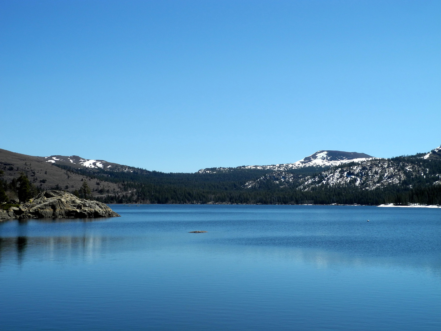
time in this area in the book Roughing It Articles about those times credit reporters William "Dan De Quille" Wright, James "Lying Jim" Townsend, and Samuel "Mark Twain" Clemens with perfecting the art of the western tall tale with articles that became legendary for their wit. My next "tourist" activity was to take a short guided tour through the Bonanza Mine, which displayed equipment and mining techniques, as well as some of the minerals that were found there other than silver and gold. The mines on either side of the Bonanza each made millions, but that was actually an exception. The Bonanza and hundreds of others took out less than a thousand dollars each. After this tour I drove back to the motel, then took a long walk through the town and back. I finished my tourist activities by driving to the local cemetery. This is a very large area, but I walked through only a small part of it. For some people it's probably worthwhile to explore the entire complex, but with no one I knew there, and no familiar names, it didn't really capture my interest. Heading back to the motel, I was dragged into Grandma's for another ice cream snack (saved in the freezer for after dinner), and picked up a sandwich at the Firehouse BBQ. There were a number of places I would have visited if they had been open, including the Virginia City & Truckee Railroad, which offers rides through the mining country. I also would have liked to see the Marshall Mint Museum (not closed for the season, but closed the day I was there), the Fireman's Museum, Fourth Ward School museum, Comstock History Center, and Silver State Peace Officers Museum. These give me a reason for a return visit some day. I spent an enjoyable final evening getting started on Twain's book, and got to bed at a reasonable hour. Without the distraction of my computer and DVD player at home, I tend to go to bed earlier on trips. I got up the next morning, and got started on my homeward trip around 9 or 9:30. When I approached town the first day, I caught a glimpse of snowy peaks in my rear view mirror, but there was no safe place to stop to take pictures. Fortunately the view was still there when I headed the other way from town, and a wide turnout lined up perfectly with this scene. I took a bunch of photos there. My return trip followed the same route as far as South Lake Tahoe, with stops at the summit between Carson City and the lake, and at a couple of vista points that offered a panoramic view of Lake Tahoe and the Sierra. Instead of turning on Highway 89 and back to 88, I stayed on US 50 over Echo Summit. This is another very scenic stretch of highway that I had never been on before. The route downhill on the west mostly follows the south fork of the American River into Placerville, where I stopped for lunch. This is another gold rush town, accounting for its original name of "Hangtown." It's located where Highway 49 crosses US 50. I continued on 50 into the southeast corner of Sacramento, and south on Highway 99 back home, a 645 mile round trip. Tahoe was beautiful, but I had too much food and drink, and too much gambling. Virginia City was surprising, educational, and full of history. --Dick Estel, April 2015 |
||
|
Photos (Click to enlarge; pictures open in new window) |
||
|
|
||
|
|
 |
 |
| Rod & Jennifer at Caples Lake | Caples Lake | At the border |
 |
||
| Snowy peaks above Caples Lake | ||
 |
 |
 |
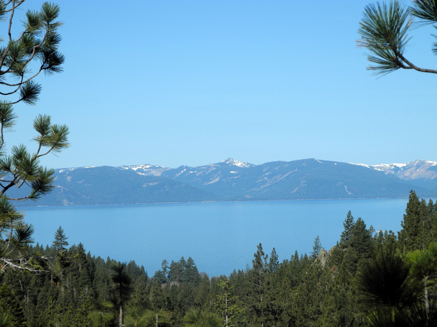
| Entering Nevada | The view from my hotel room | Tahoe and the snowy SIerra |
 |
 |
 |
| Rod & Jennifer out and about | Jennifer wins at Keno | A very windy day |
 |
 |
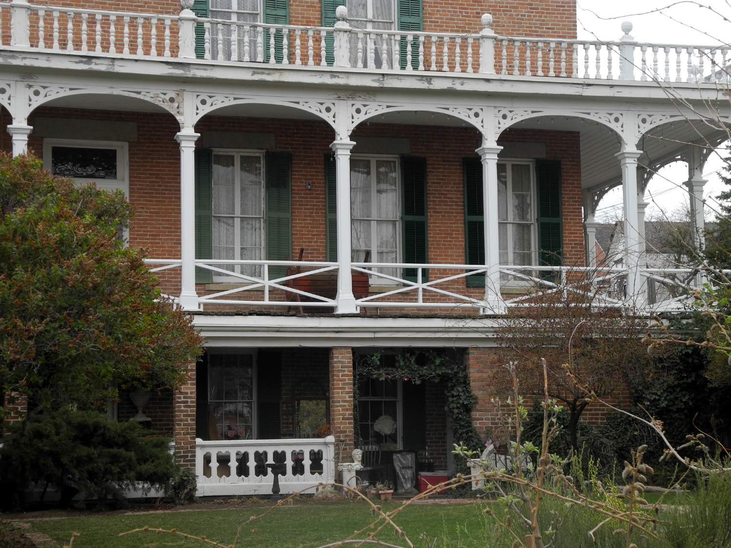 |
| Mining history | Mackay Mansion Museum | The front entrance |
 |
 |
 |
|
This phone could call about seven people |
One of the first flush
toilets |
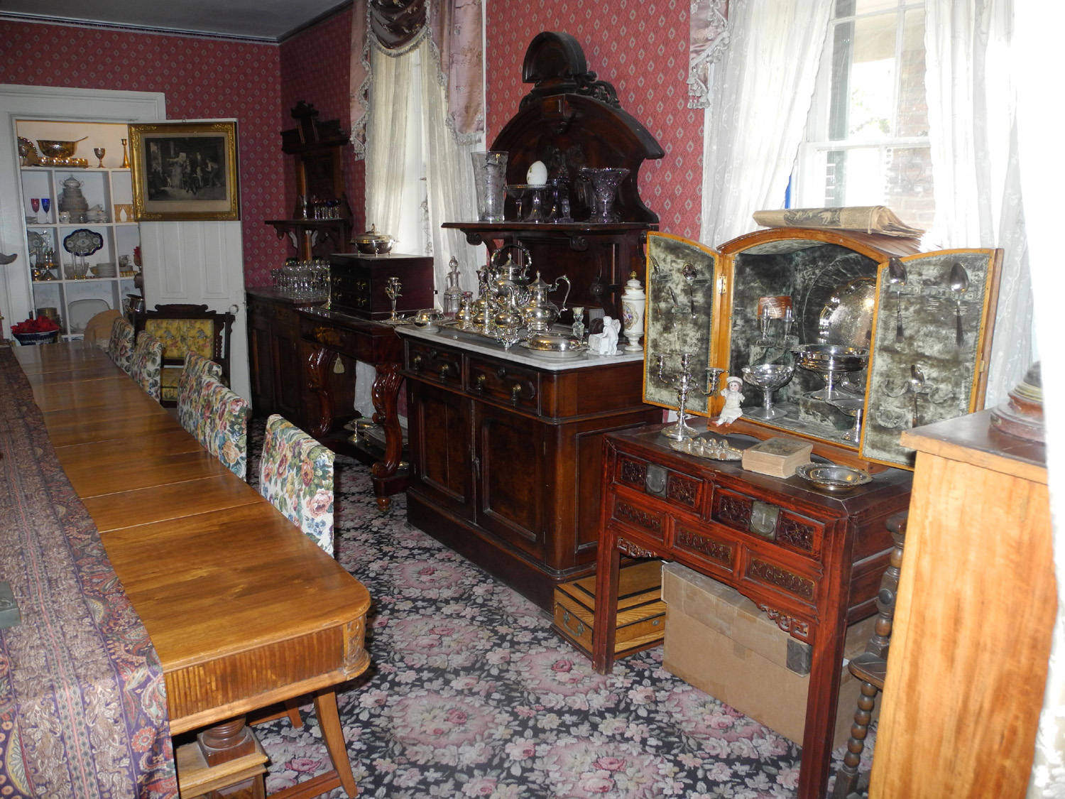
In the dining room |
 |
 |
 |
| Snow on the Honda | Snow on the motel | Snow on the hills |
 |
|
 |
|
Classic churches from late 19th century |
Savage Mansion and Mining Office |
The Fourth Ward School, capacity over 1,000 students |
 |
|
 |
| Car used to carry construction materials into the Sutro Tunnel |
James Fair's small stamp mill |
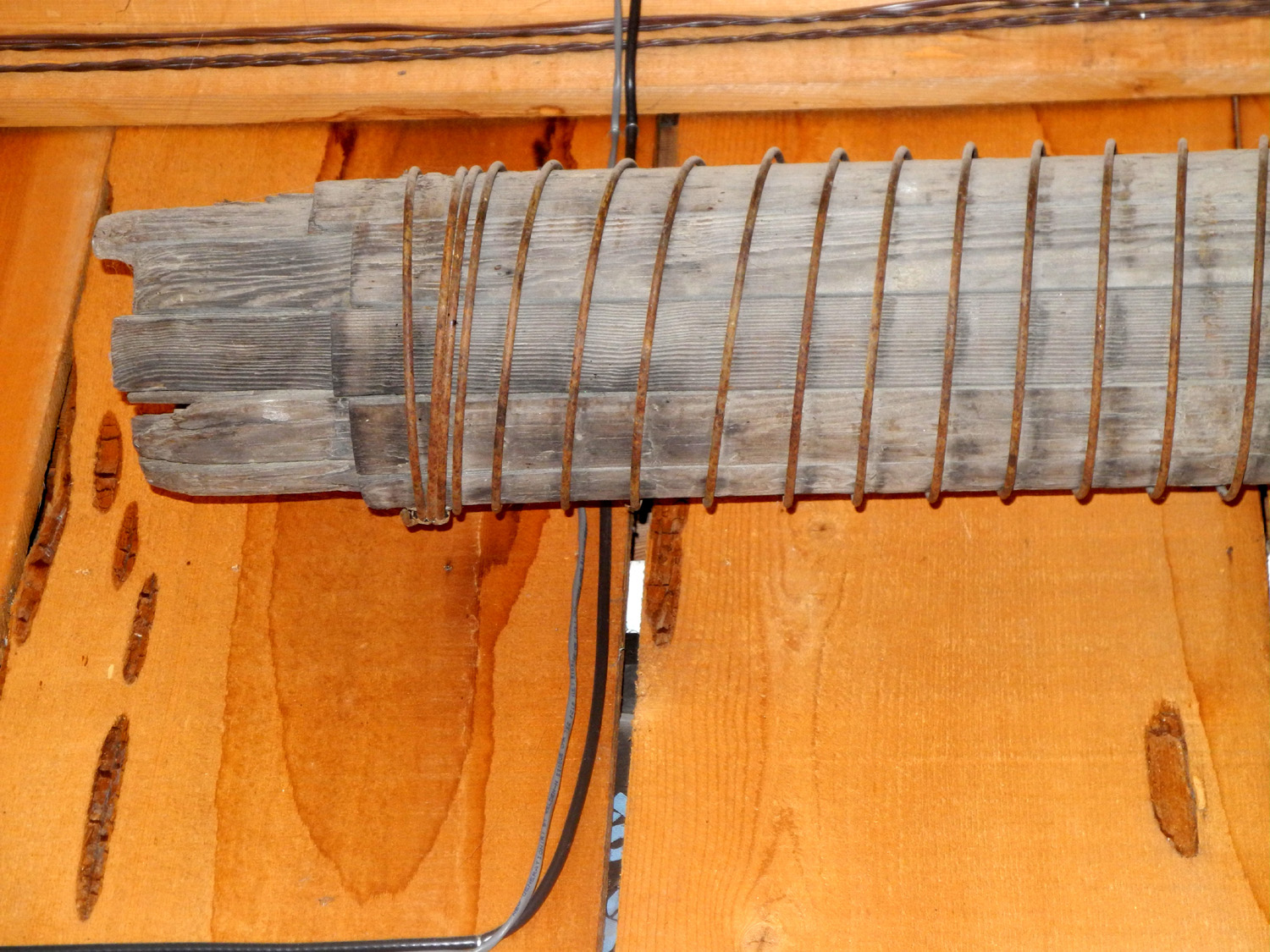
Wire-bound wood pipe;
lots of it remains |
 |
 |
 |
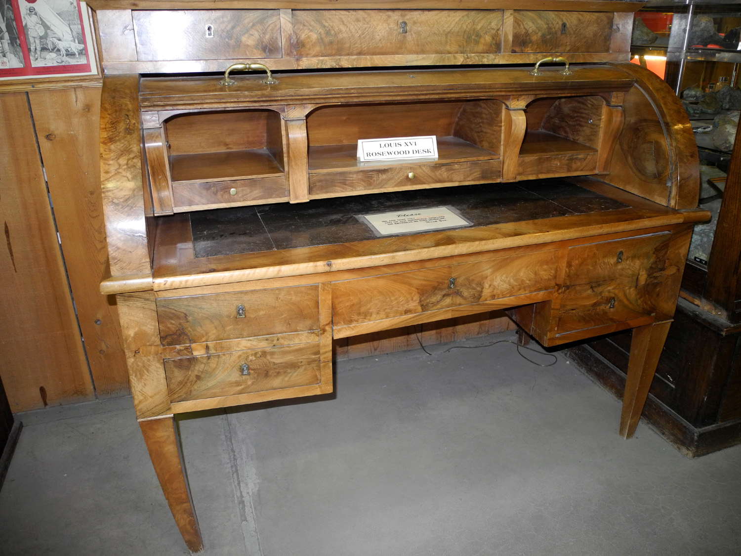
| Louis XVI desk from the 1700s |
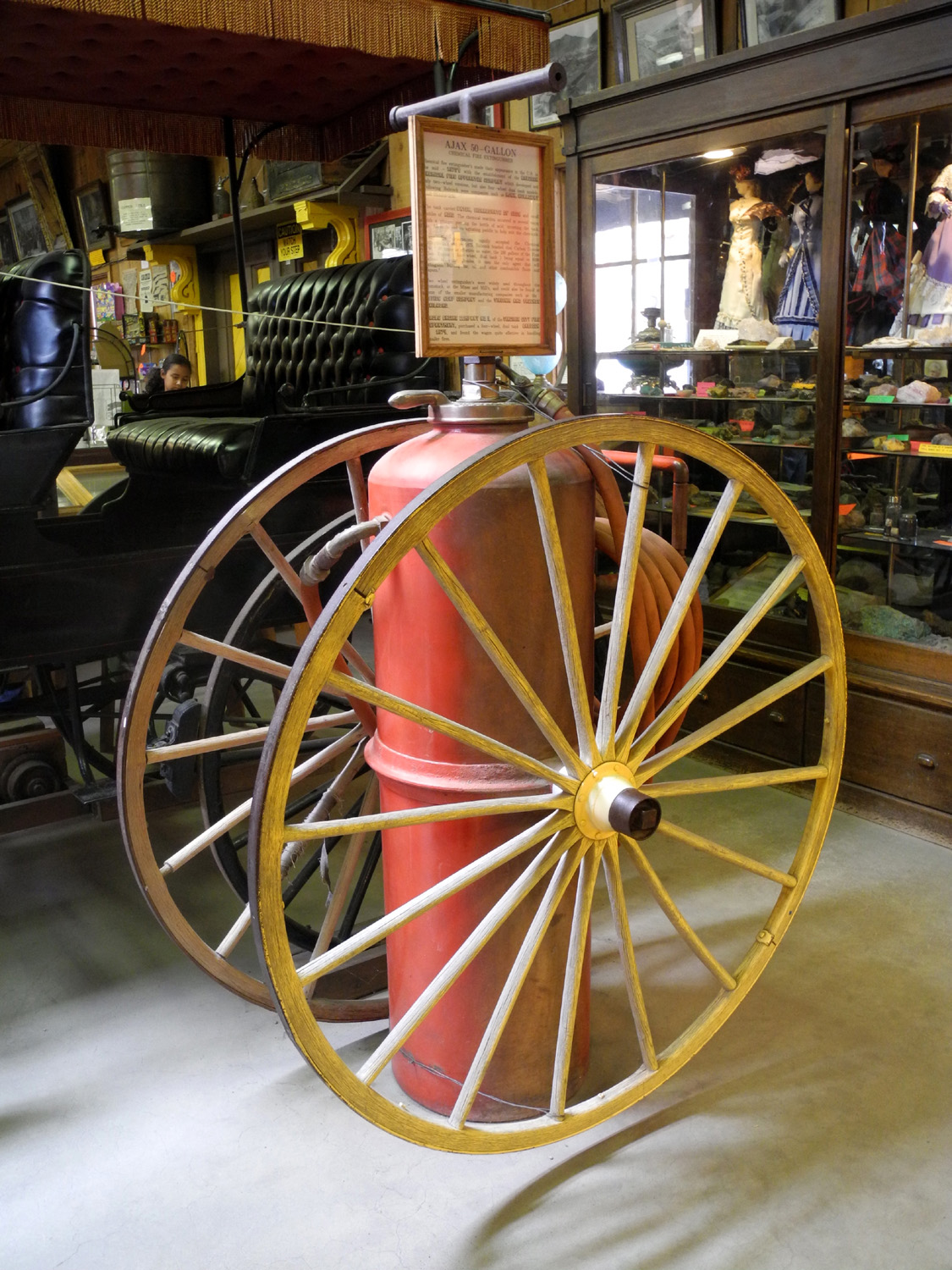
Ajax 50 gallon chemical |
Cornish pump, used to extract water from mine shafts |
 |
 |
 |
| C Street in Virginia City in 2015 | The old west flavor is retained |
One of the iconic
saloons |
 |
||
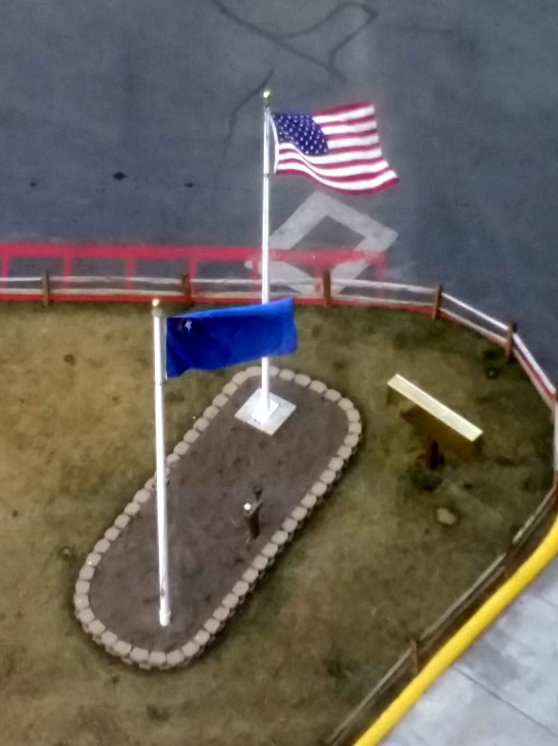
| Panoramic view of town from the cemetery | ||
 |
 |
 |
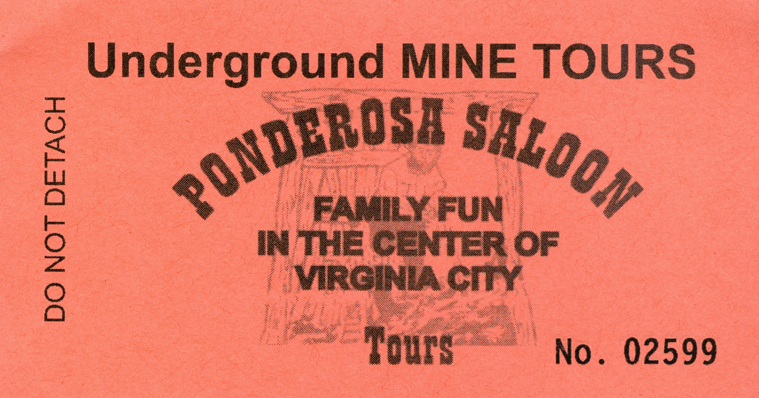
| Tour ticket | Virginia City Cemetery | Sugarloaf Mountain |
 |
 |
 |
|
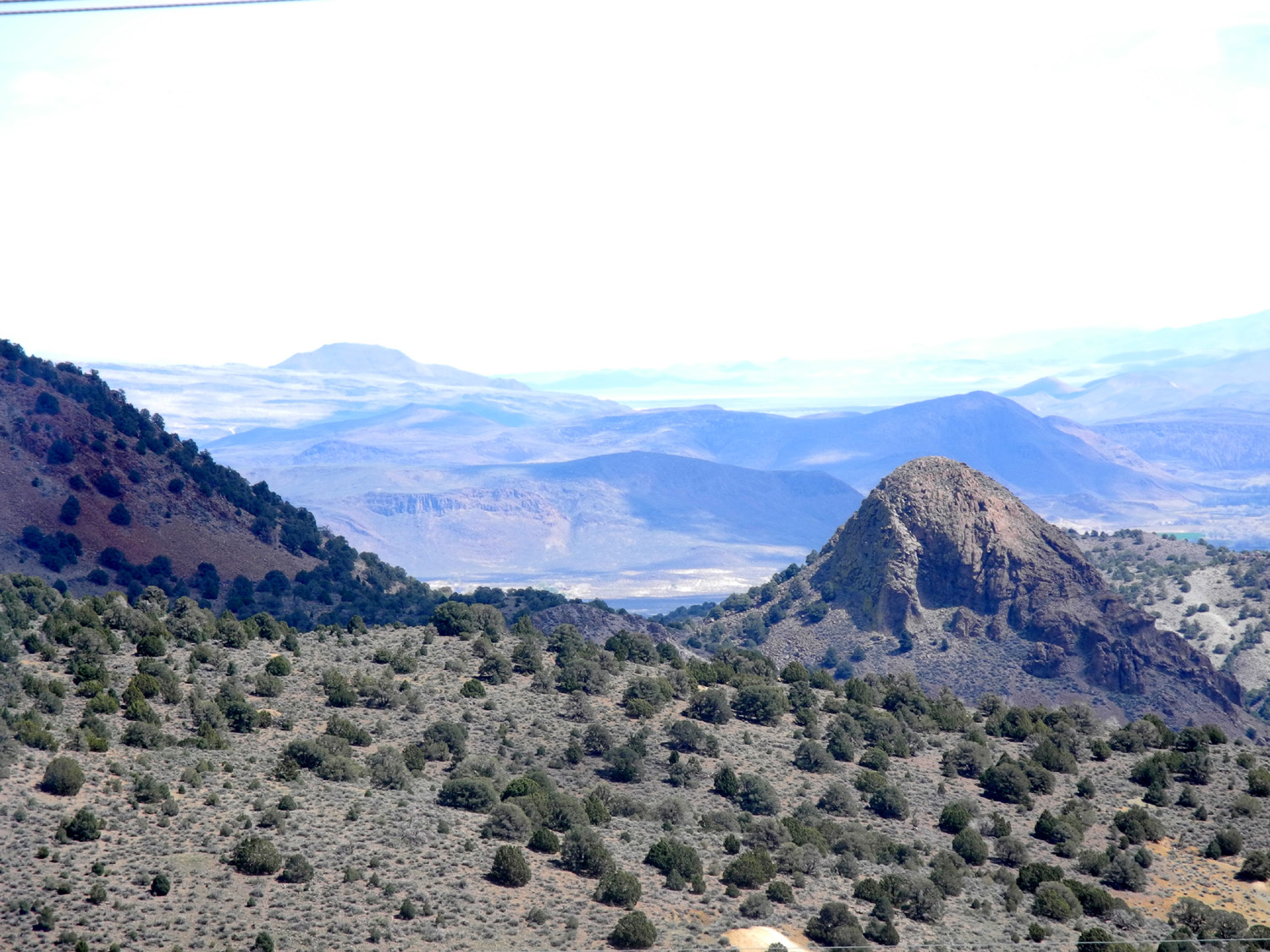
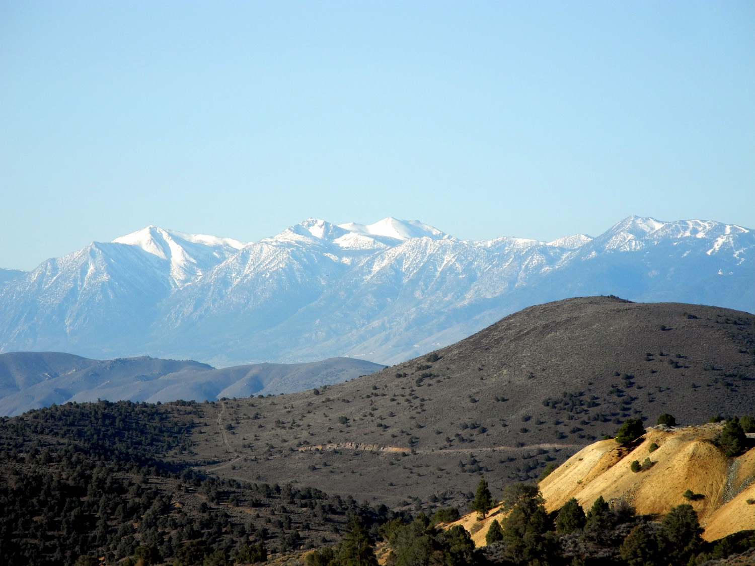
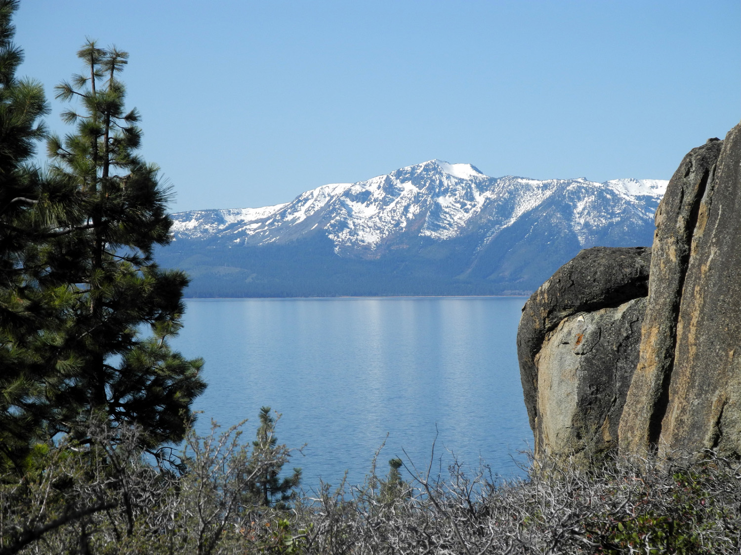
View from just outside Virginia City |
Tahoe from US 50 |
Lake from Logan Shoals Vista Point |
 |
||
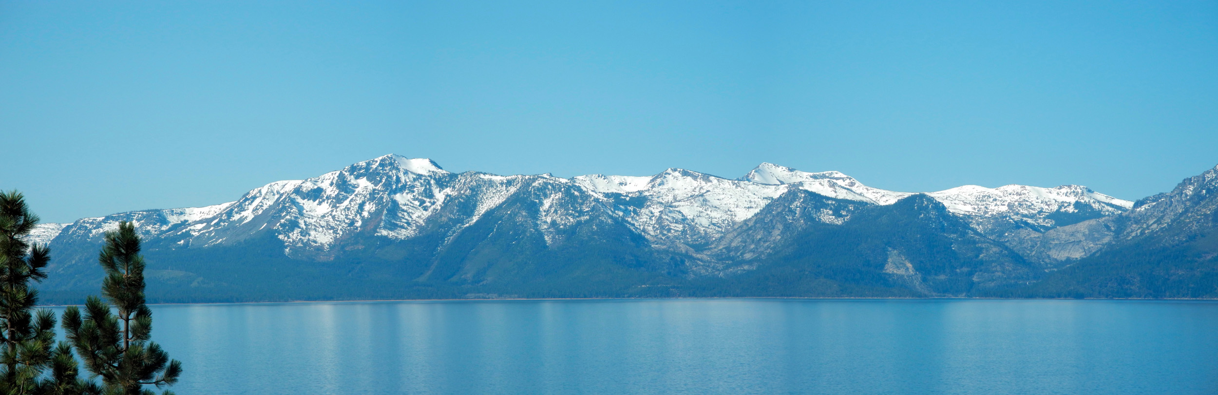
| Panoramic view of Lake Tahoe and the Sierra Nevada | ||
| Related Links | ||
| State Highway 49 | Coulterville | State Highway 88 |
| US Highway 50 | South Lake Tahoe CA | Stateline NV |
| Virginia City | Carson City | Mackay Mansion |
| Mackay Mansion History | Mackay Mansion | Sutro Tunnel Restoration |
| Sutro Tunnel | Sutro Wikipedia Article | Comstock Lode |
| Mark Twain Official Site | Mark Twain | Mark Twain Biography |
| Virginia City & Truckee Railroad | Virginia City Museums | Samuel Clemens |
| The
Celebrated Jumping Frog of Calaveras County |
Complete "Jumping Frog" | Territorial Enterprise |
| Grandma's Fudge Factory | The Way it Was Museum | Placerville |