
|
Dick's Adventures of 2022 - Part 4 |
|
| Photos Related Links More Travel Reports | |
| Adventures of 2016 Adventures of 2017 Adventures of 2018 Adventures of 2019 Adventures of 2020 | |
| Dinkey Creek Drive Grant Grove Camp Cat Sitting, Hiking and Sierra Snow | |
| Dinkey
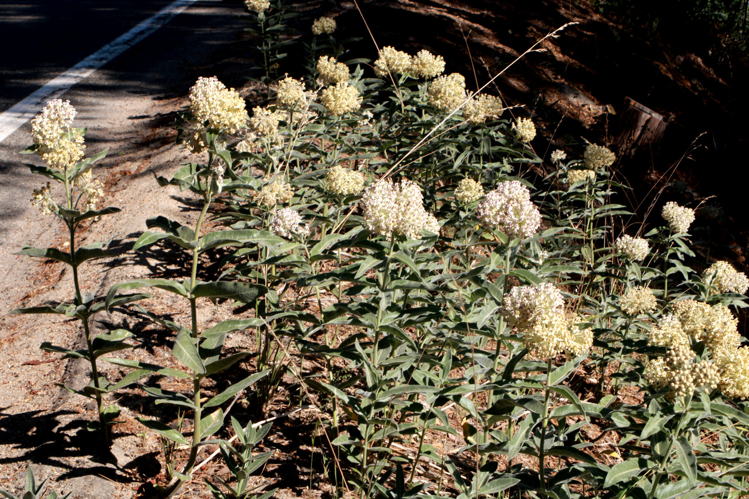
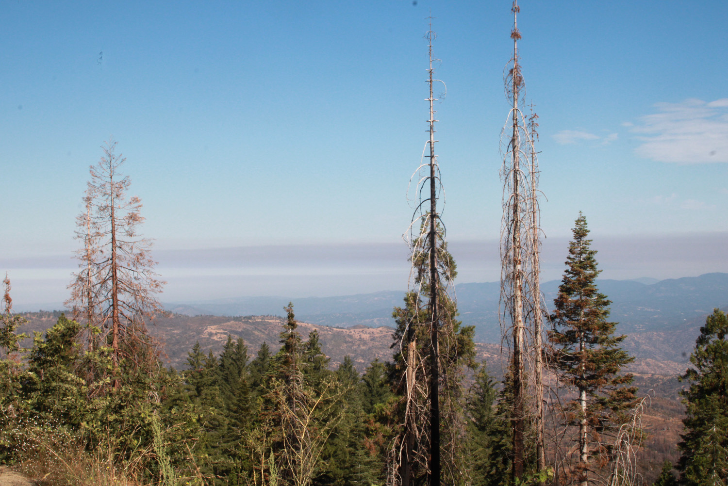
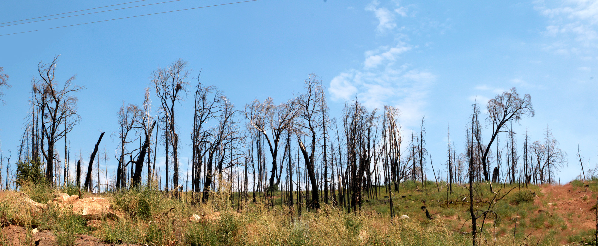
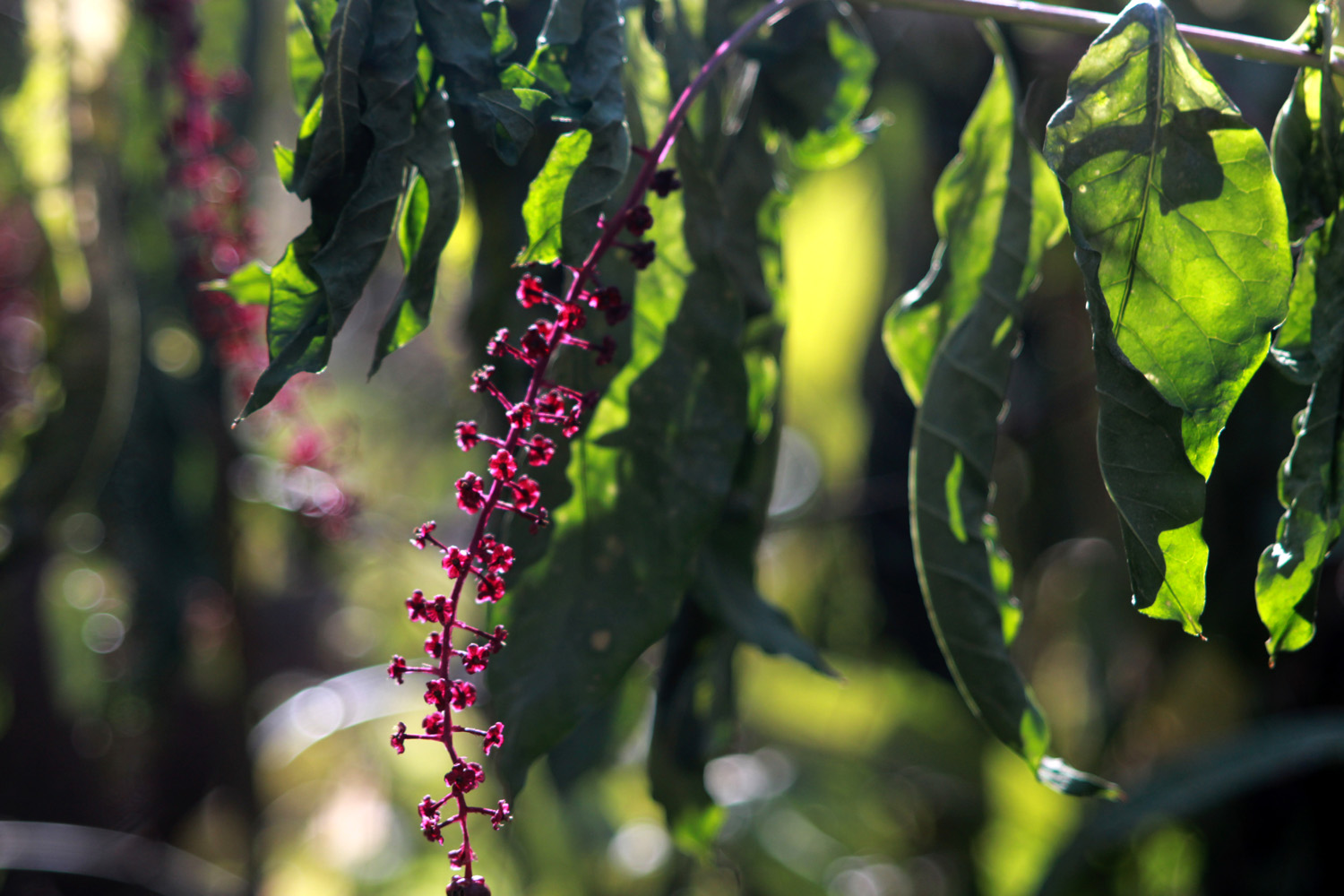
Creek Drive Even though I enjoyed two family outings, in May and June, go out to lunch every week with a group of fellow retirees, and am involved with three different organizations, I got to feeling like I was in a rut. Get up, exercise, have a bloody Mary, eat breakfast, watch TV, take a nap, play on the computer, repeat. "I should go to the mountains," I thought. This would not only break up the routine, but would get me away from the triple digit heat for a day. I decided to go to Lake Wishon, a PG&E reservoir on the North Fork of the Kings River, about 75 miles from home, a place l I have not been to for several decades. The planned date was July 25, but thunderstorms were predicted for the higher elevations, so I postponed the trip. There was a similar forecast the next day, but the storms would be above 8,000 feet and not appear till late afternoon, so I decided that the 7,000 foot elevation would be safe, and I would be well on my way home before the active weather was expected. Since I was not on a schedule of any kind, I had no hesitation about stopping to look at stuff and take photos. Driving up Highway 168, I reached the area of the Creek Fire of 2020, the fifth largest fire in modern California history. As if to emphasize the continuing danger from drought, heavy fuel load and global warming, part of my view was a plume of smoke from the Oak Fire, which is still burning as this is written on July 30, is 52% contained, and has destroyed over 100 homes in Mariposa County. A flower I had never seen before grew along the roadside, and on a ridge above me was what a major burn scar looks like after two years. |
|
 |
 |
| A never before seen flower with large blossom clusters | Smoke from the 20,000 acre Oak Fire drifts above the horizon |
 |
|
| Devastation from the Creek Fire was complete on this hillside | |
|
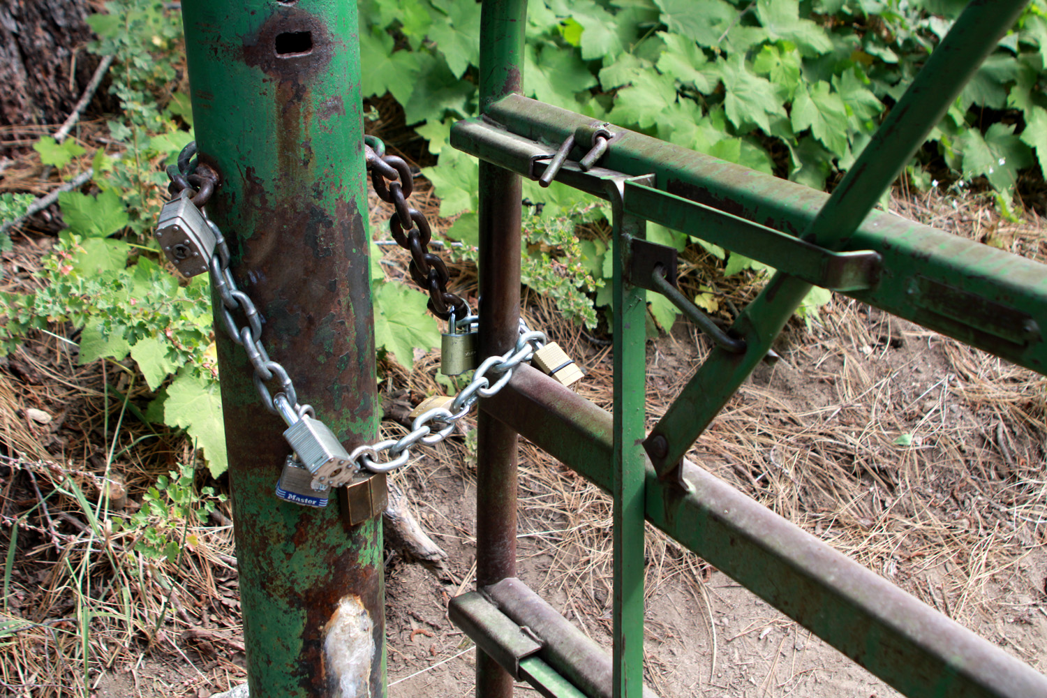
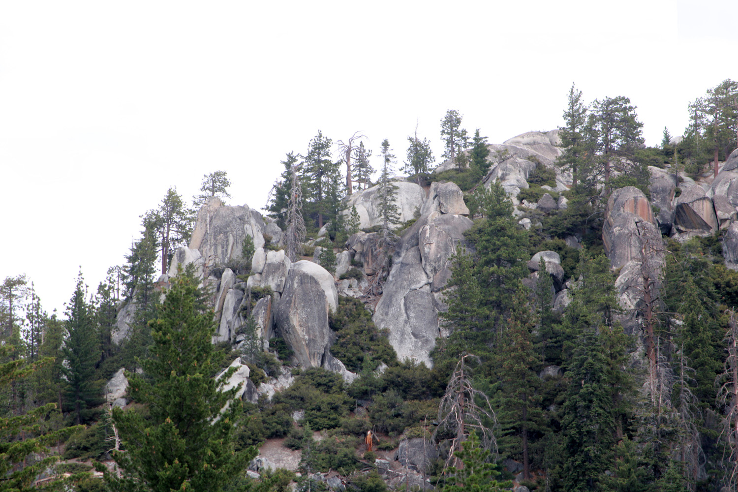
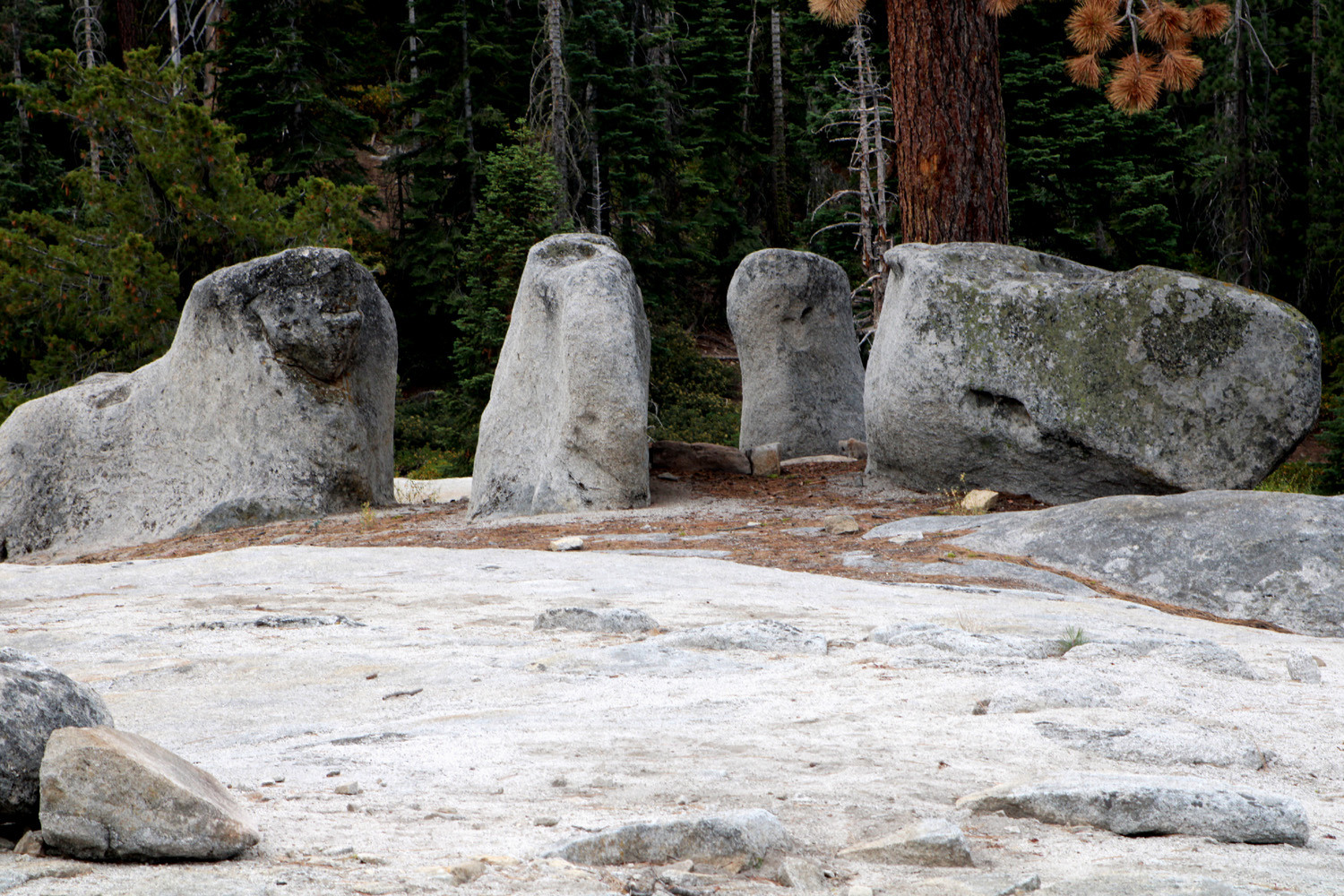
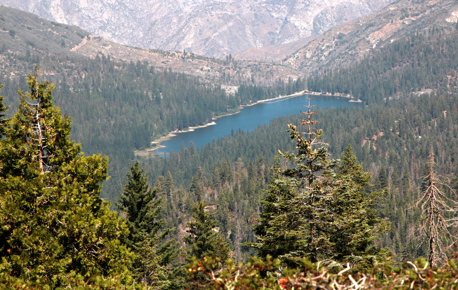
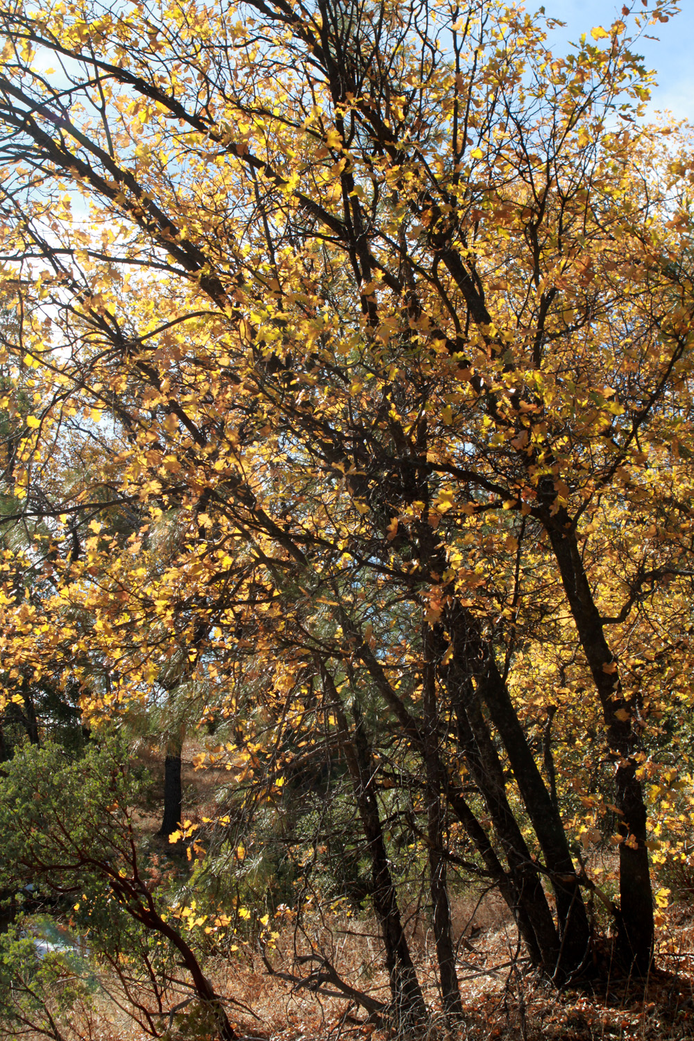
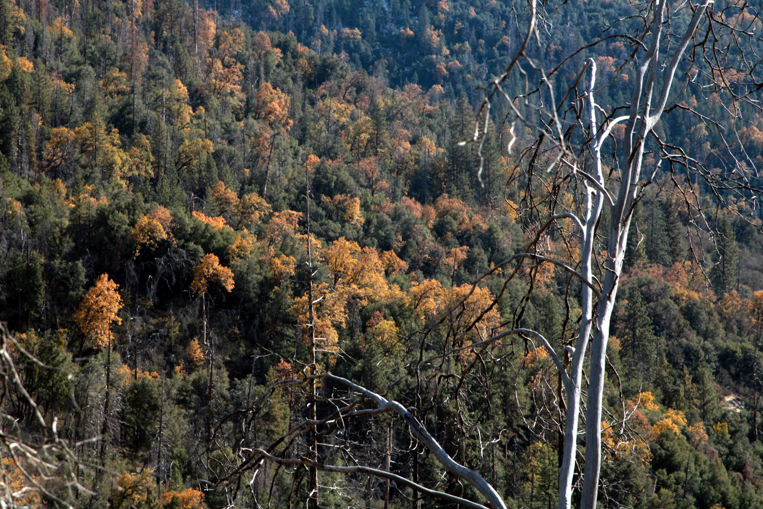
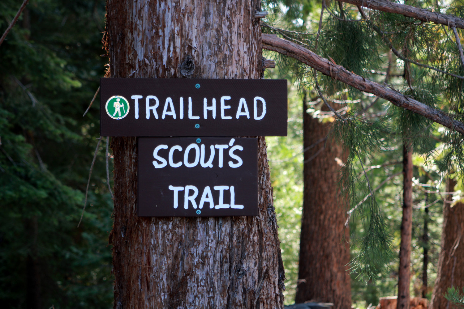
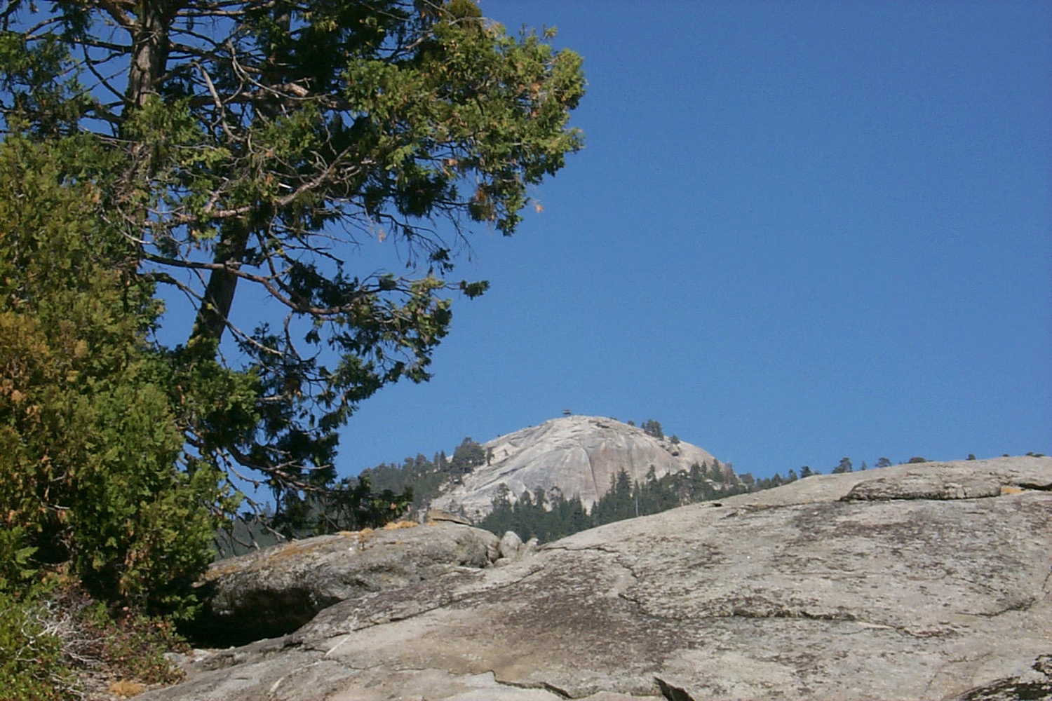
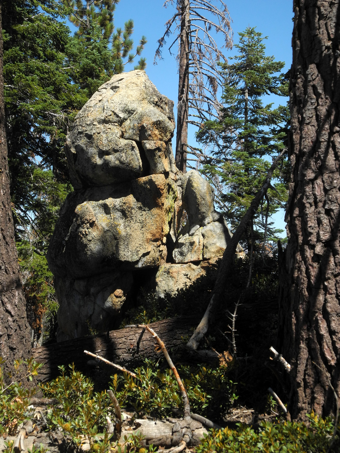
I continued on to Shaver Lake and turned east on the Dinkey Creek Road, which leads to many of my favorite hiking and camping spots, including Courtright and Wishon Reservoirs. At a rest stop just past the last buildings in town, I discovered the trailhead sign for a new trail, Scout's Trail, which will have to be explored someday. Continuing on, I saw a "wonder road," as in "I wonder what's down that road." I parked and walked in about 300 yards, discovering that what was down that particular road was a locked gate, sporting five padlocks. These are inter-connected in such a way that you only need to unlock one padlock to gain access. Key holders typically include the forest service, PG&E, and property owners. About half way between Shaver and Dinkey Creek, the road reaches its high point at Bald Mountain Summit, 6,000 feet in elevation. Bald Mountain itself is granite dome with a now-closed fire lookout on top. There's a trail to the top from this point, but all my visits to the place have been from the other side via 4-wheel drive vehicle. On the south side of the road there is a huge granite outcrop, mostly a gentle slope, so I walked up to the top. I've done this before, but it is not only steeper than it used to be, there is a lot of loose decomposed granite on the rock, resulting in hazardous travel for people of a certain age. From the top, I had a good view of Shaver Lake, and of a rocky ridge on the opposite side of the road, as well as the Oak Fire smoke and the usual Sierra Nevada scenery |
|
|
|
|
 |
 |
| Multi-lock system allows different agencies and individuals to access the gate | Shaver Lake can be seen in the distance, with Oak Fire smoke above |
 |
 |
| The rocky ridge above Bald Mountain Summit | An interesting cluster of granite boulders |
|
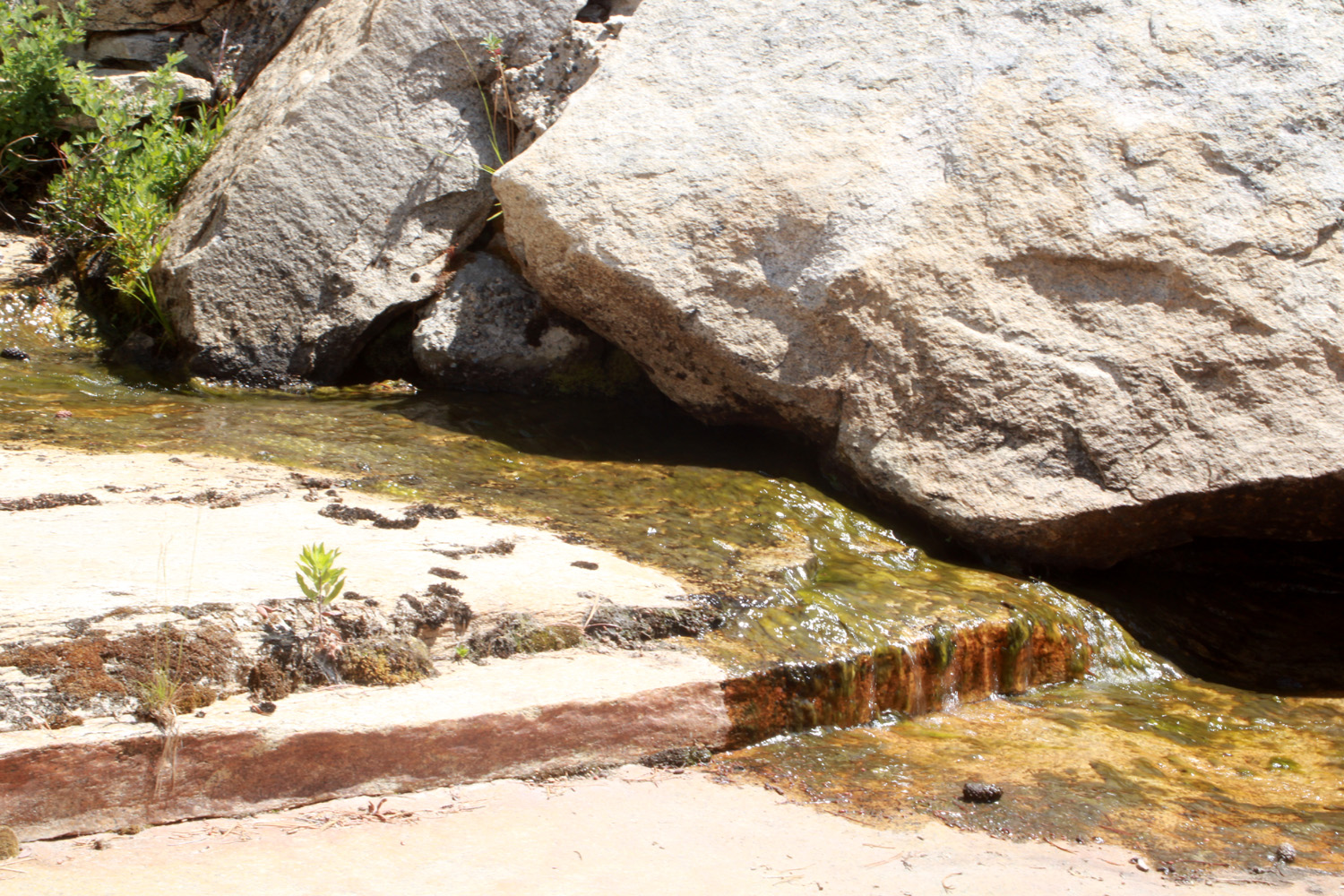
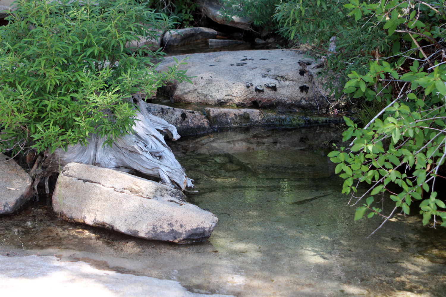
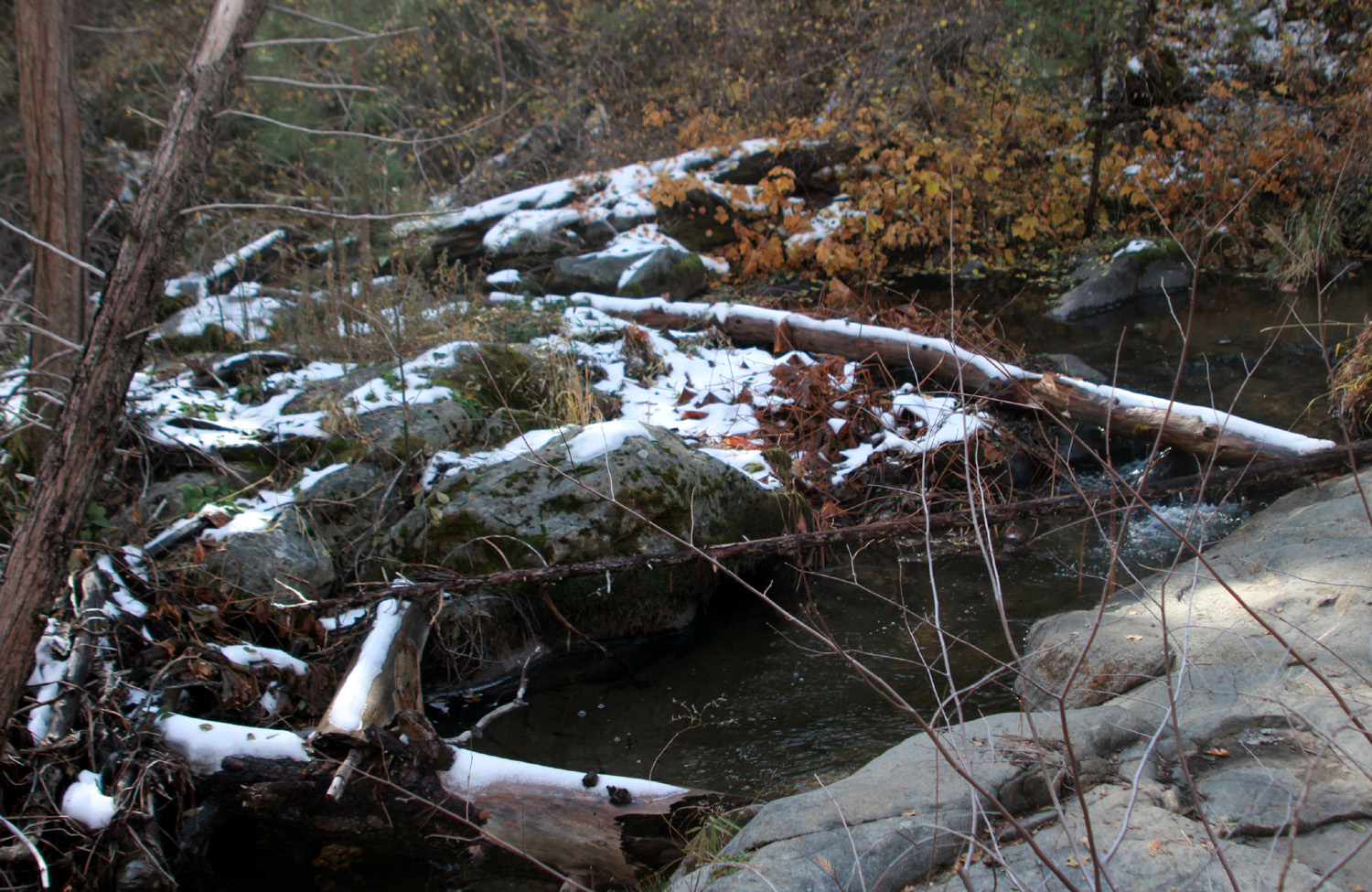
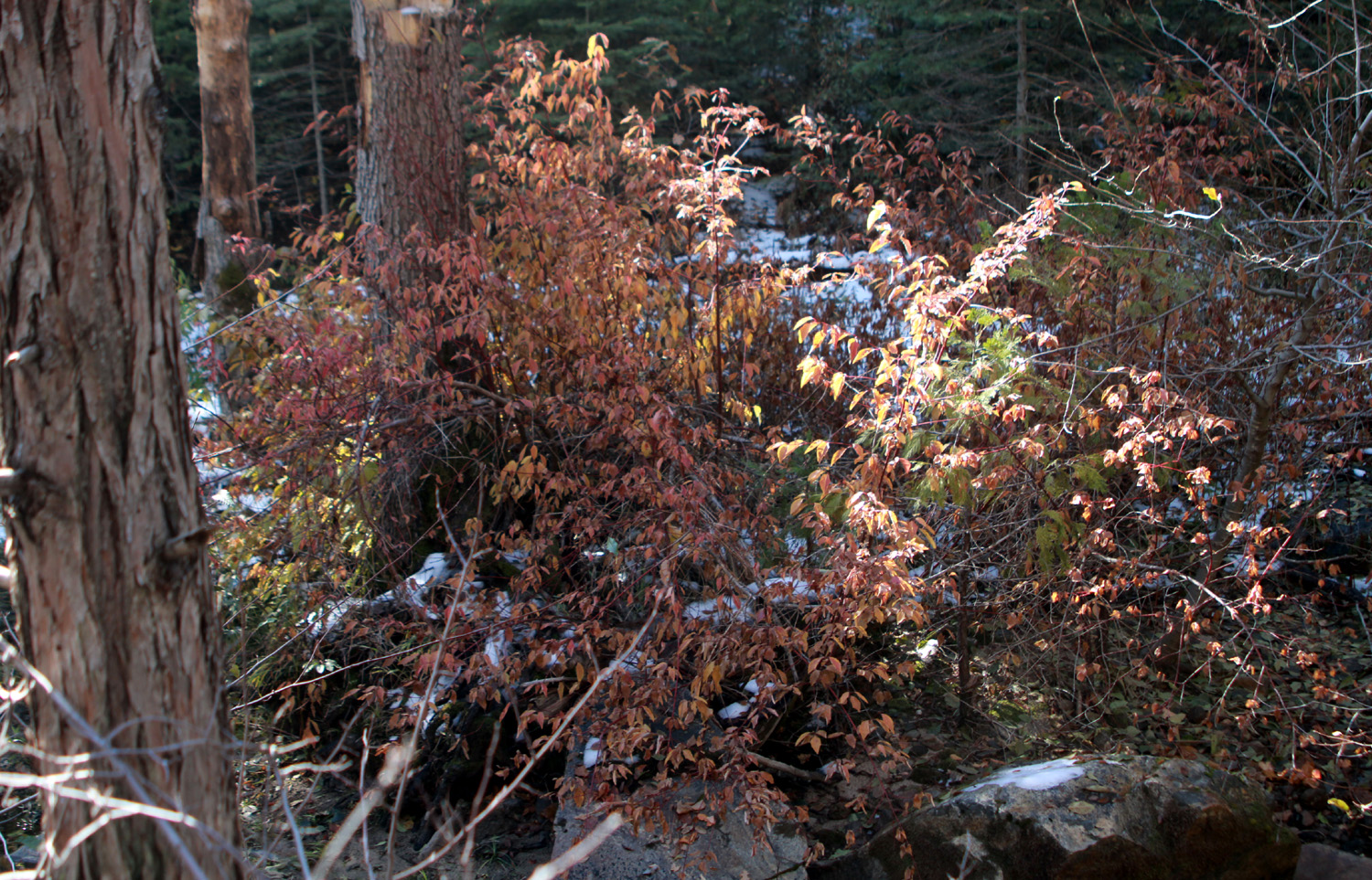
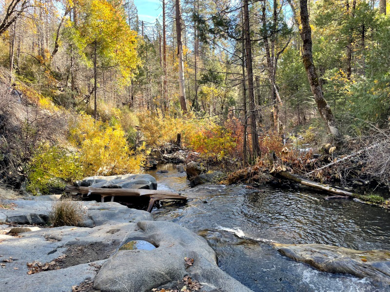
I made it safely back down and continued my drive. At this point I realized that I would get home very late if I stuck to my plan to go to Wishon, so I decided to go into the campground area at Dinkey Creek, after a short jaunt down the Rock Creek Road. This is the route that eventually leads to a favorite camping spot, which we named Stargazer Rock, but is officially the Bald Mountain Base Camp. About a half mile down this dirt road a little creek, Glen Meadow Creek by name, crosses the road. This was my destination, mainly to see if there was any water in this very dry summer. The creek had a little flow of water, and some nice flowers nearby. I made my way down by the creek and enjoyed the rippling stream, the surrounding forest, and the flowers. |
|
 |
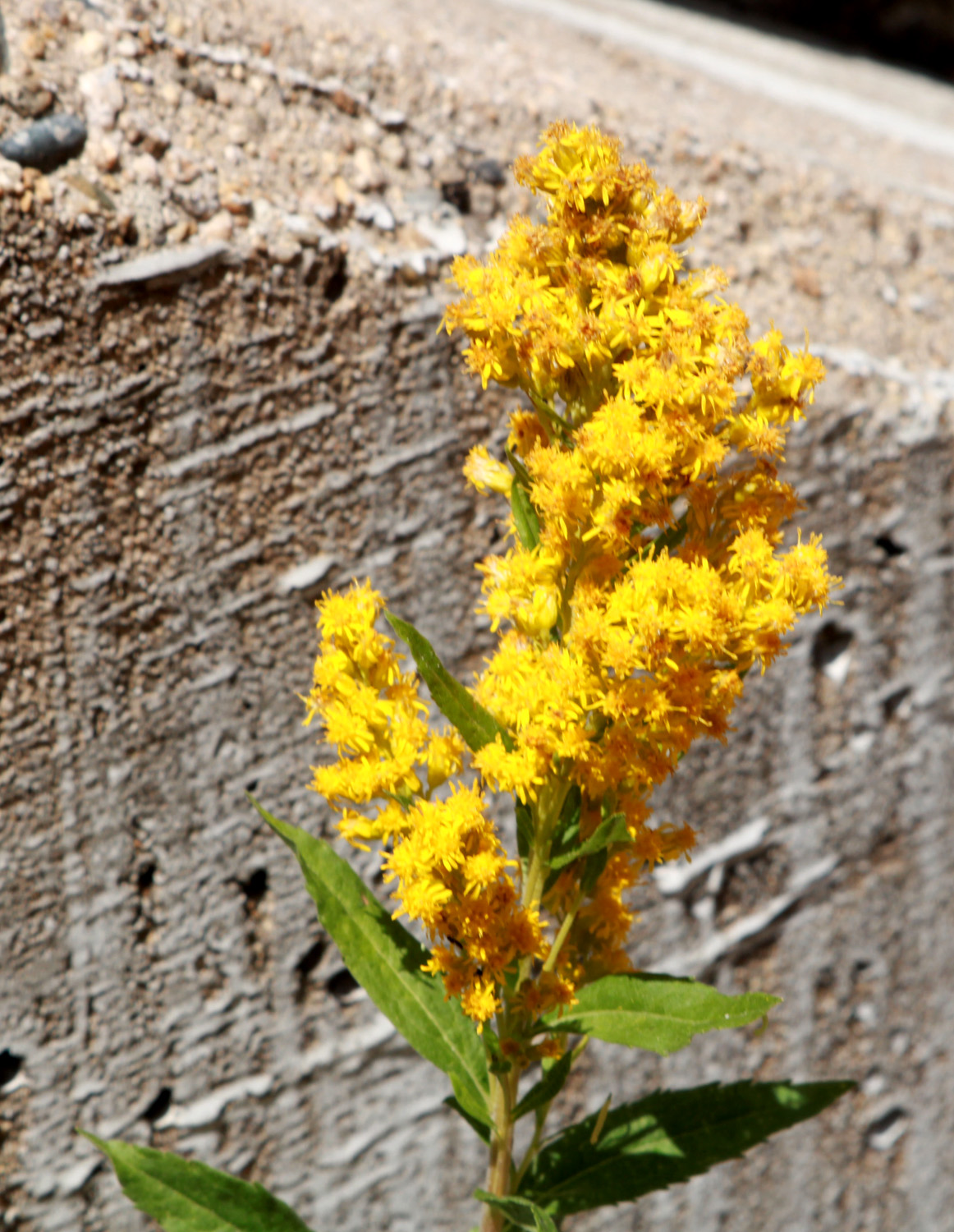 |
| Glen Meadow Creek has a trickle of water | California goldenrod |
 |
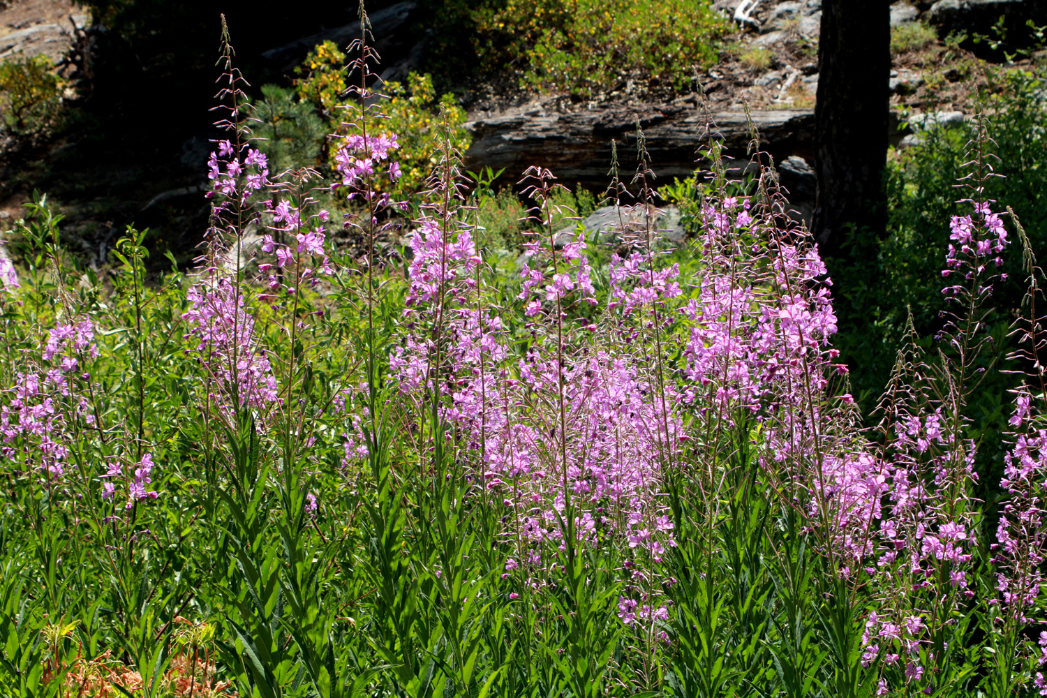 |
| The ubiquitous "daisy-like" flower | Fireweed usually grows near creeks |
|
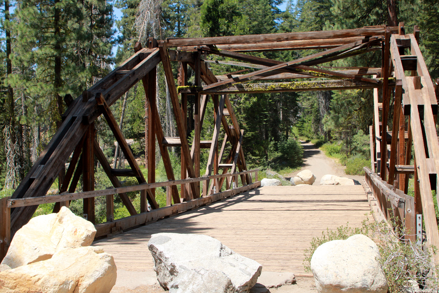
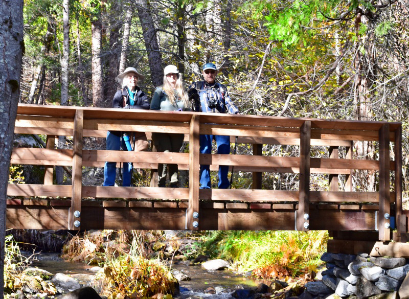
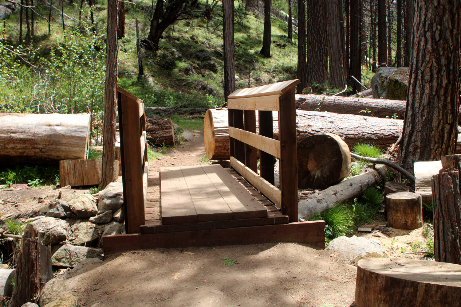
Back out on the main road, I drove toward Dinkey Creek. It's been many years since I went past the McKinley Grove Road that leads to Courtright and Wishon, and my car wanted to turn right at the intersection. I maintained control and drove into "downtown" Dinkey Creek, site of a ranger station, store, campground, and an area of rental cabins, Camp Fresno, owned by the city of that name. I had hoped to eat my lunch in the campground, but when I learned that the entry fee was $10, even for day use, I made a U-turn, went back to the junction, and turned east. Just across the bridge over Dinkey Creek a road led into the Dinkey Fisherman parking area. This location was officially closed, but I saw for the first time and photographed a delightful wooden bridge. It did not look to be in the best condition, and vehicle access was blocked by big boulders at both ends. I started back toward home, but again went down the Rock Creek Road a short distance past the creek to a large open area with level shady spots at the edge. Here I set up my TV table and chair, and relaxed with a "backpacker" lunch of cheese and peanuts, with a few Cheez-Its and cookies for variety. |
|
 |
 |
| Wooden bridge at the Dinkey Creek Fisherman parking lot | Glen Meadow Creek |
|
My return drive to Clovis was uneventful, although the 105 degree temperature that greeted me made me wish I could have stayed in the mountains a little longer. I'll be hiking at 8,000 feet early in August. |
|
|
Grant Grove Camp
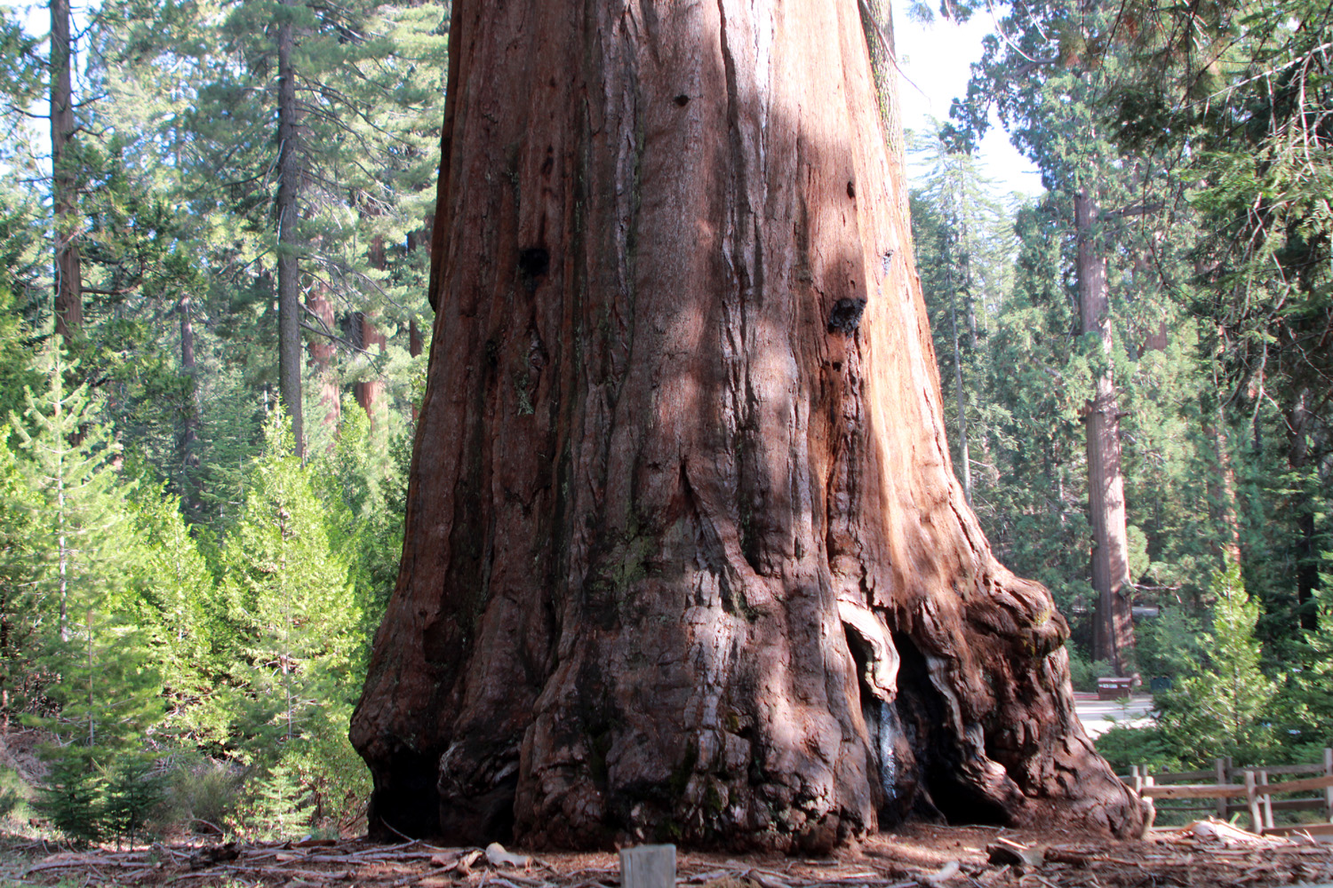
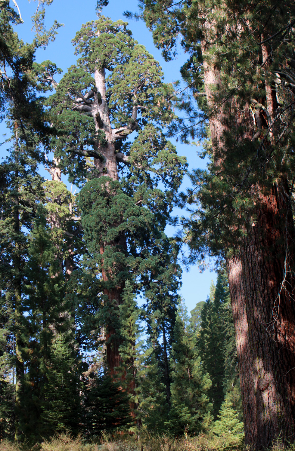
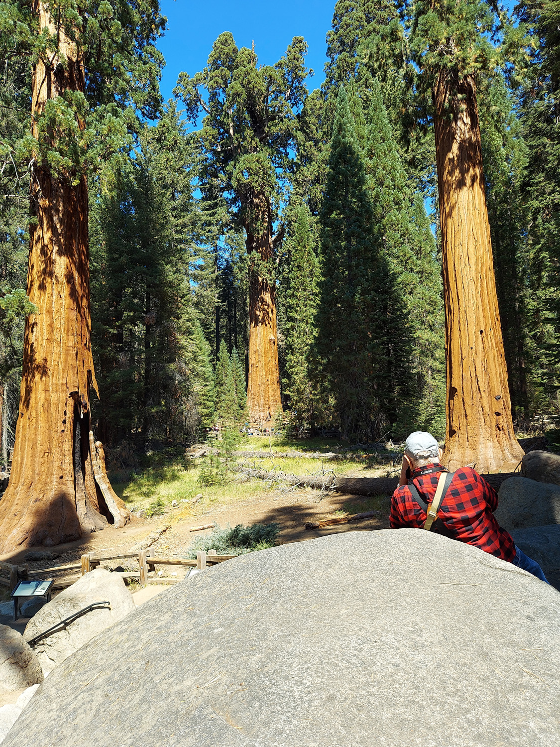
It was somewhat disconcerting to realize that I had gone camping only twice in 2022, both times foothill camping along the upper Kings River. A lot of the forest was closed for long periods in the summer; temperatures were in the triple digits in the valley most of the time. Many of my favorite spots seem to be drawing more and more people, often people who do not respect the outdoors. So when daughter Teri suggested camping at the Grant Grove area of Kings Canyon National Park in mid-September, I was definitely ready. Reservations are required, and Teri got us a site in Azalea Campground. It's one of three, but the only one open, so it was not surprising that it was pretty much full by Friday evening. Teri had to work part of the day, so we each drove up in our own vehicle on Thursday, September 15. I arrived about 11:30 and found our campsite, which was a spot that should never have been designated for camping. It was on a steep hillside, with the table and bear box 30 yards down the steep slope from the parking spot. An area had been partially leveled for a tent site, but the picnic table and fire ring were both on a slope. It was a challenge to find a place where our lawn chairs didn't attempt to dump us forward onto the ground or tip over backwards. Even so, we made the best of it. Teri arrived about 2 p.m. and we carried our ice chests and other items down to the bear box. I set up my cot on the level spot, and Teri decided to sleep in her vehicle, a Toyota Highlander. After we got camp set up, we set off for our first hike, a short drive down from the campground to the Grant Grove parking area, and a short walk on the trail that runs through the grove. Besides the iconic General Grant, named the Nation's Christmas Tree in 1926, this grove contains at least two dozen large sequoias. The Grant Tree is the third largest tree in the world. The 4th, 10th and 15th largest are also found here. |
|
|

|
| Top to bottom view of a sequoia in Grant Grove | The General Grant Tree |
|
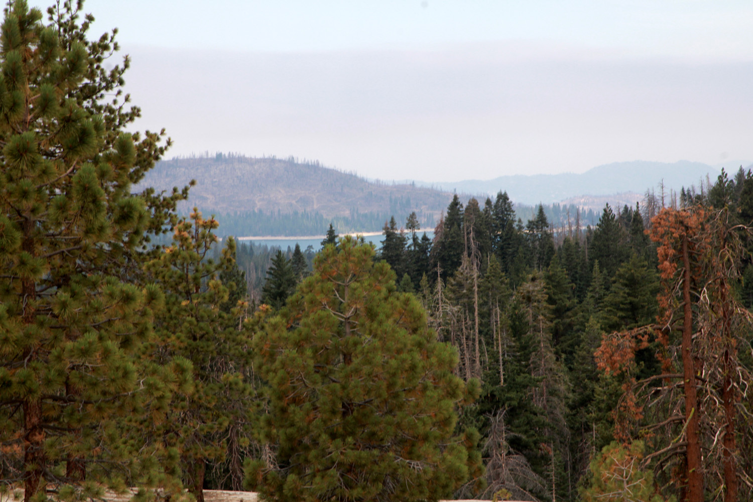
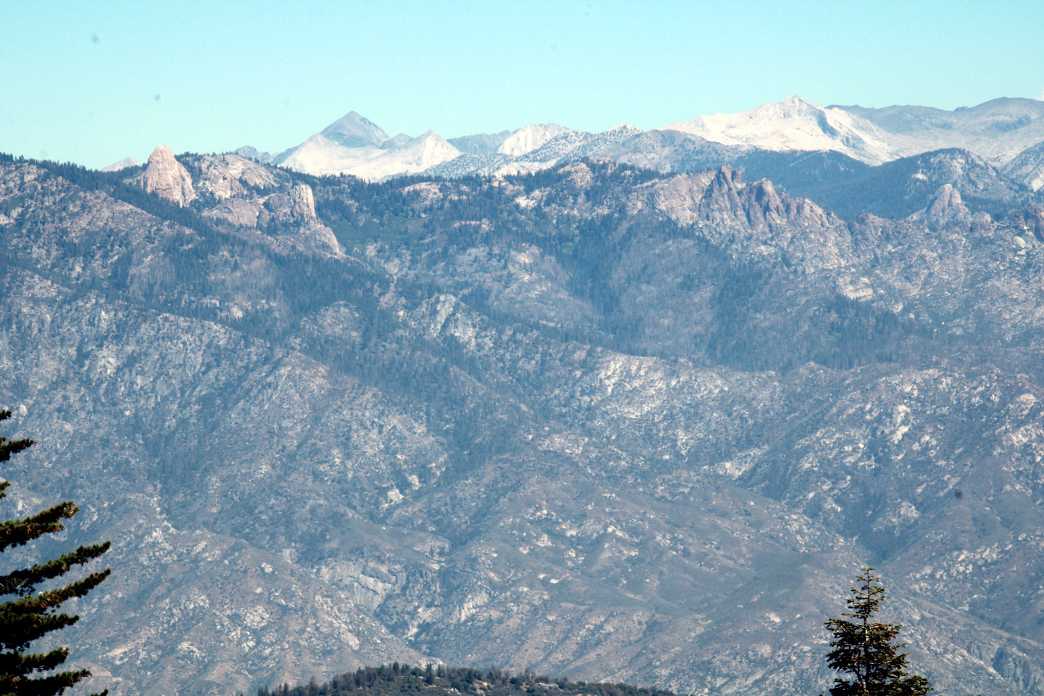
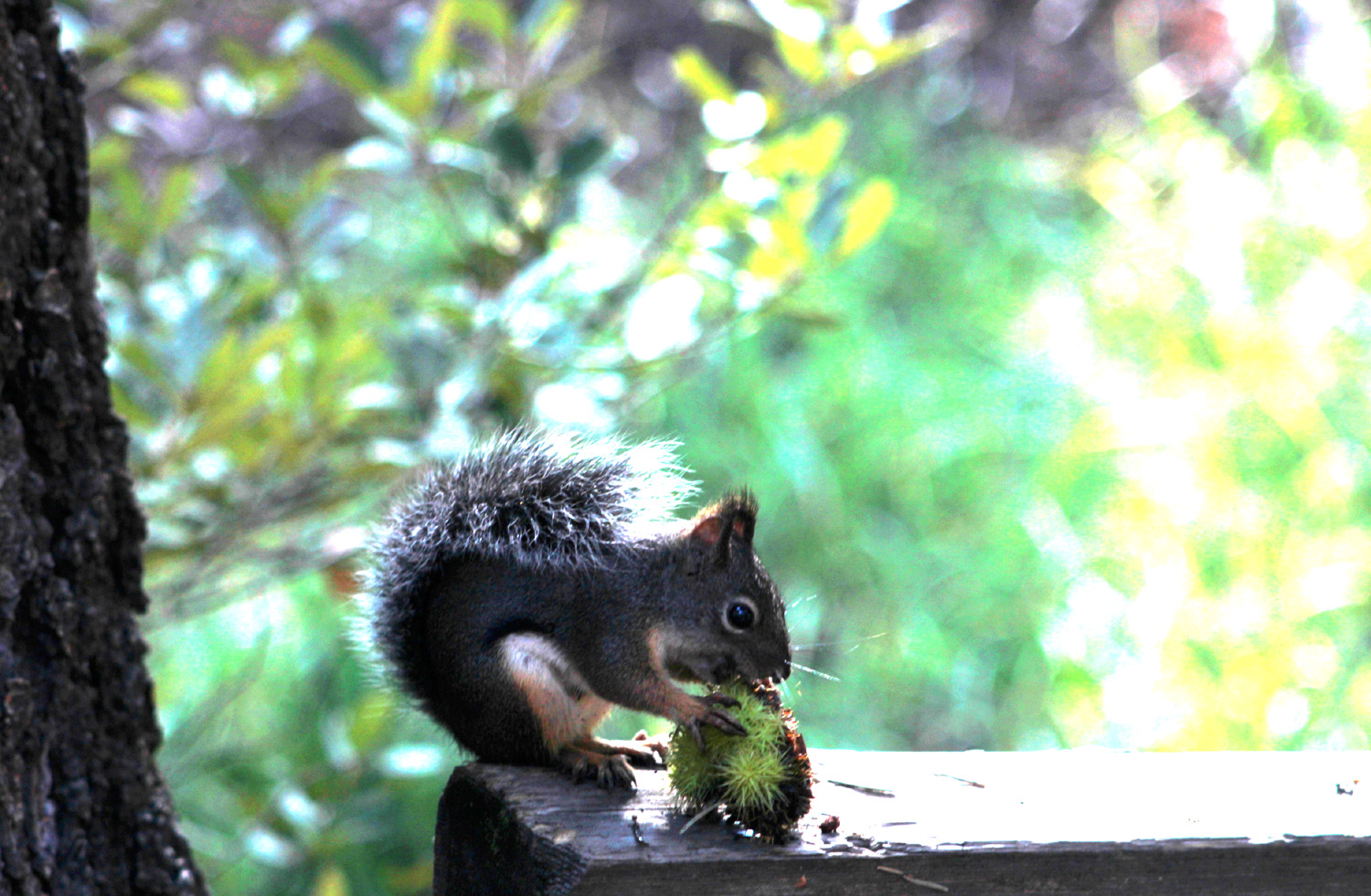
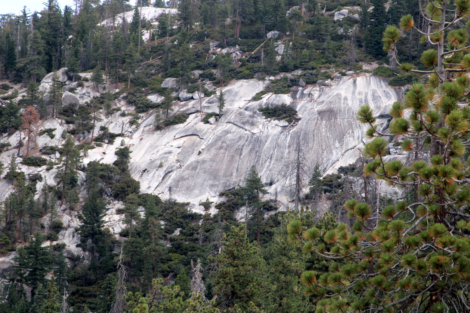
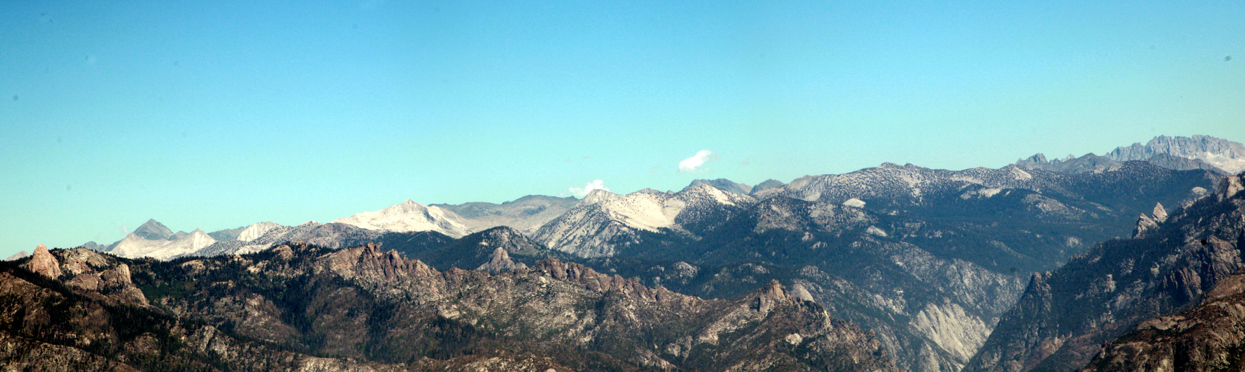
We enjoyed a pleasant walk, before returning to camp for supper, resting and reading. We had brought one box of commercial firewood, barely enough for one evening. We knew where we could gather wood in the park the next day, so did not have a fire that first night. Throughout our time there, chipmunks and Douglas squirrels were busy gathering pine and fir cones for the coming winter. The next day, as we did all three mornings, we started the day with tea then breakfast, before setting off for the day's hike. Our destination was Panoramic Point, a short drive up a narrow road from Grant Grove Village. It has a fantastic view of the Kings Canyon back country, including 13,500 foot Mt. Goddard, Buck Rock, and the unique "bishop's hat" formations above the Tehipite Valley. You can also see Hume Lake, a popular hiking, boating and recreation spot about 2,500 feet lower than our vantage point. |
|
|
|
| View from Panoramic Point - Mt. Goddard on the skyline left of center | Hume Lake, a former mill pond |
|
Although the route from the parking lot to the point is a paved, accessible trail of less than half a mile, you can go past the end of the pavement on the Park Ridge Trail, a typical mountain route with a few easy ups and downs to a fire lookout 2.5 miles away. I had hiked part of this trail with the Ramblers in 2019, but it was Teri's first time going past Panoramic Point. We went a little less than a mile before turning back, but were rewarded with views of the High Sierra, the hazy San Joaquin Valley to the west, huge granite rock formations, and endless evergreens and bushes. |
|
|
|
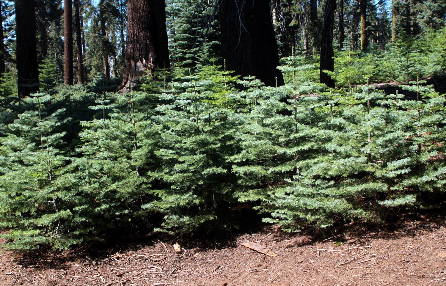
| At this season, manzanita bark begins peeling off | A little forest of fir trees |
|
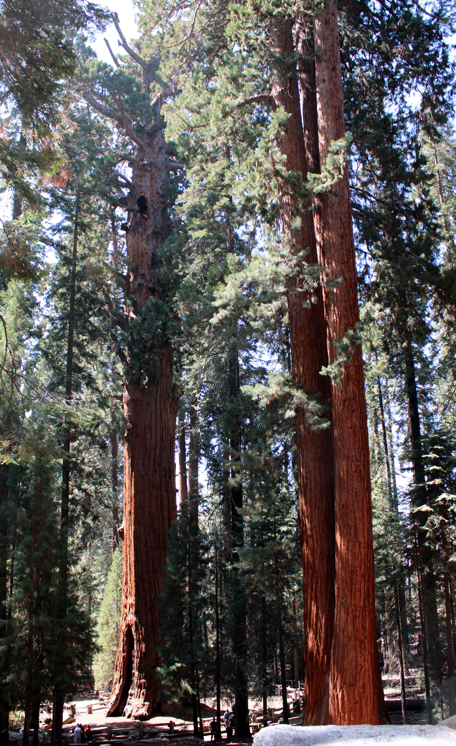
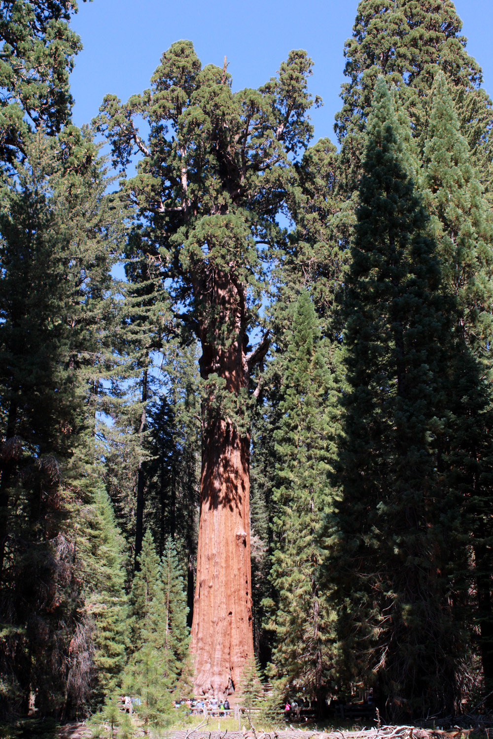
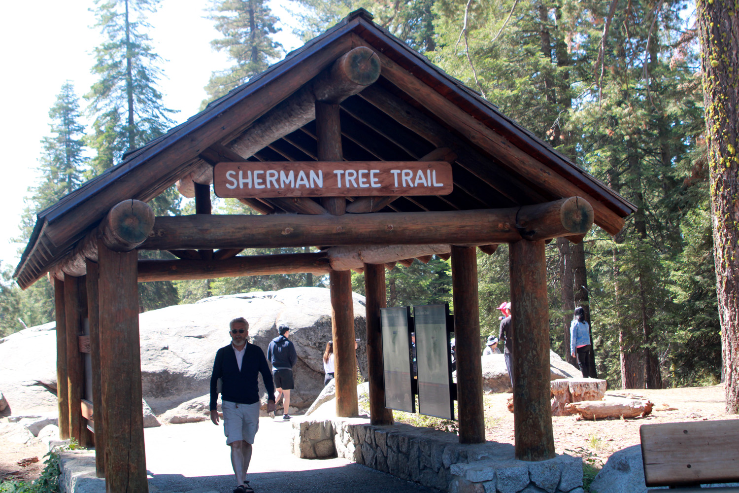
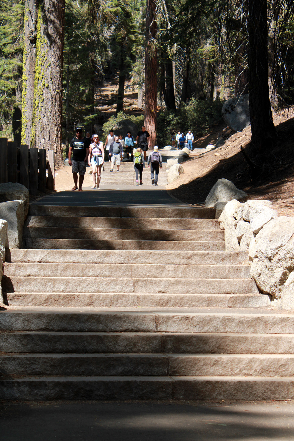
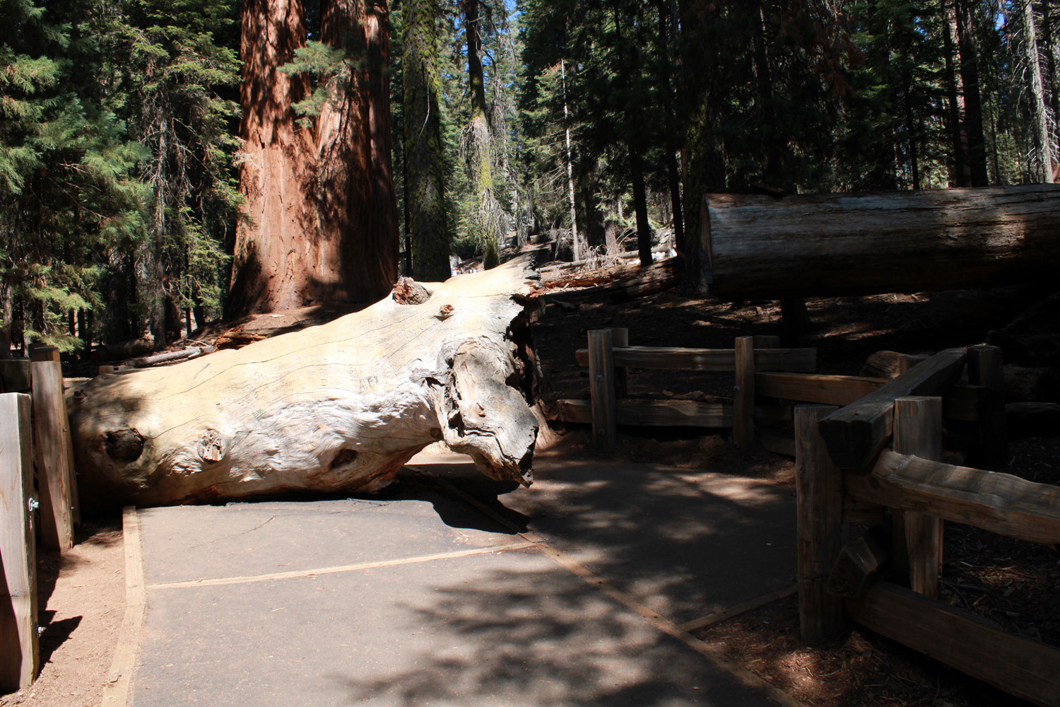
When we got back to my truck, we drove a short distance down the road to a place with a lot of small dead limbs. We loaded up the back of the truck with enough firewood for two nights, supplemented by the box of Hot Wood I had brought. At some point during the day we were discussing the Ramblers hike scheduled for Monday at the General Sherman Tree, about 20 miles south of Grant Grove. The weather forecast made it seem like this hike would get rained out, so Teri suggested we go there the next day "just in case." She had not been there for a few years, and I had not visited the world's largest tree in this century. For many decades, including my last visit (date not recalled), visitors parked in a lot just off the Generals Highway within sight of the tree. In addition, there were stores, motels and parking lots very close to the big trees in other parts of the Giant Forest. It was soon well known that sequoias have a very shallow root system, and that driving, parking and walking close to the trees was compacting the soil and threatening the giants' survival. A number of years ago, probably around 2000, the park service began moving these facilities away from the trees. This included limiting parking at the General Sherman to handicapped only, and moving the main lot about a half mile away, outside the sequoia grove. A trail was constructed from parking area to the tree. It is just under a half mile, and consists of many stair steps, with short level stretches in between, all paved. I had started down this trail in 2013, but I had already hiked several miles on other trails, and decided I needed to do the Sherman trail when it was the only hike of the day. September 17 was that day, so Teri and I drove south on the highway that connects Kings Canyon Park and Sequoia Park. The turnoff to the trailhead is the road to Wolverton, a former ski area and a major back country trailhead. A half mile on a side road takes you to a huge parking lot, and an archway leading to the trail. Young people were blithely skipping down the stairway sections, while kids ran down and up and back down. This old man had to carefully place both his hiking poles on the next level, then step carefully down, come to a stop, and then repeat. |
|
|
|
| A tree in Giant Forest near the General Sherman | The iconic General Sherman Tree |
|
We made it safely down to the bottom, with a view of the top of the tree along the way. Like many old sequoias, the top is dead, something I had never been able to see from the usual view of the tree. There were also signs along the way indicating where we were in relation to the tree's height. The trail actually started about 50 feet lower than the top of this 275 foot tall giant. Due to the dead top, the tree is not growing taller, but like most old sequoias, it IS growing. It adds enough wood each year to make a normal size tree 60-feet tall. |
|
|
|
| The trail to the tree starts here | Typical section of stair steps |
|
Going back up the trail was easier than going down, as far as back and legs were concerned. I still needed a lot of stops to catch my breath. The trail designers wisely provided benches every so often along the route. We had brought a good lunch, our main meal of the day, and drove in to the Wolverton trailhead parking lot. Here we found lots of cars, very few people, and picnic tables in the shade, and ate surrounded by forest beauty. We returned to camp and and eventually had our second campfire. The daytime temperature was around 70 degrees, with lows about 40, so as soon as the sun started going down, it cooled off quickly. While camping in a crowded campground is not my favorite, our location was fairly well separated from our neighbors. We were near a bathroom with flush toilets and electricity, a big step up from my usual camping situations. We also had the convenience of a water faucet outside the building. The hiking and the company were excellent, and it was a special experience to re-visit the world's largest tree with Teri. We had visited both parks when she and Jennifer were little, but I think this was our first time camping there together. --Dick Estel, September 2022 |
|
|
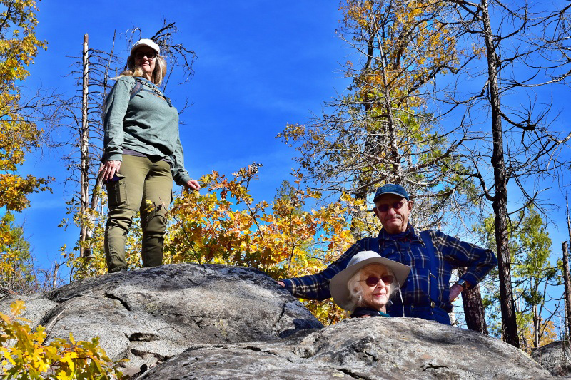
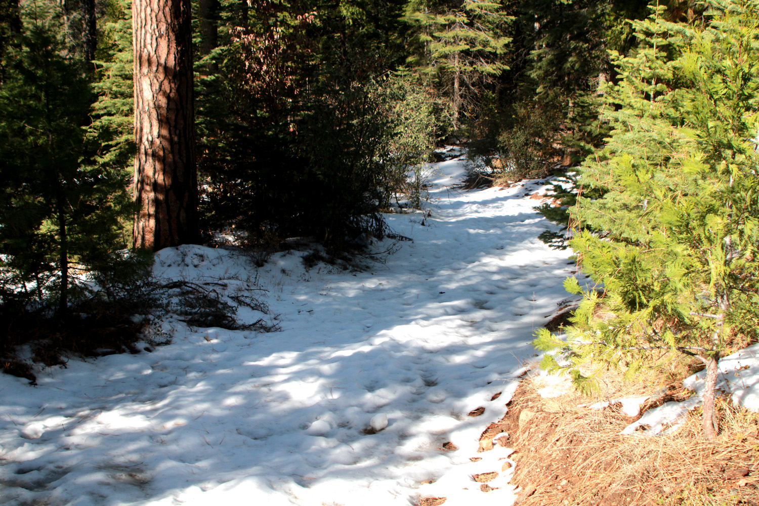
Cat Sitting, Hiking and Sierra Snow (Photos by Wes & Dick) I've been a cat lover all my life, although I only shared space with two cats during my adult years. When the second one died around 1990, I decided not to get a replacement. I was doing a lot of backpacking and camping, and did not really have someone who could step in to take care of a cat while I was gone. The most likely candidates were often with me on those trips. Therefore when my younger daughter and her husband asked me to take on cat-sitting duties for them in 2017, I was more than ready. They usually travel out of town once or twice a year, so I have been able to get my "cat fix" for the last five years. As a teacher, Jennifer has a week free just before Thanksgiving, and most of their trips have been during that time. I stay at their house, at the 3,.000 foot level 50 miles up the highway toward Yosemite. The duties are light, and being in the mountains means I am more than half way to a good hiking location. This year I drove up on November 20, and daughter Teri joined me for that first night. Presently there are three cats - Peanut, who is friendly and loving, Newton, who is somewhat standoffish (bringing thoughts of the song High Falutin' Newton), and Pebbles, who is untouchable and will not let strangers get close, even those who are providing her food. I usually invite my hiking companion Wes Thiessen to join me on the hike, along with any available family members. Wes drove up Monday morning with Teri's mother Jackie, and we then traveled in his car the five miles to the Lewis Creek Trailhead. This location is at 4,000 feet, so it was not surprising to see patches of snow along the first part of the trail, left from a cold storm earlier in the season. Along the creek, where the air is colder and the angle of the sun keeps large sections of the land in shade most of the day, there was even more snow. There was no snow or mud on the trail itself. |
|
|
|
| Snow by the Lewis Creek Trail | And down by the creek |
|
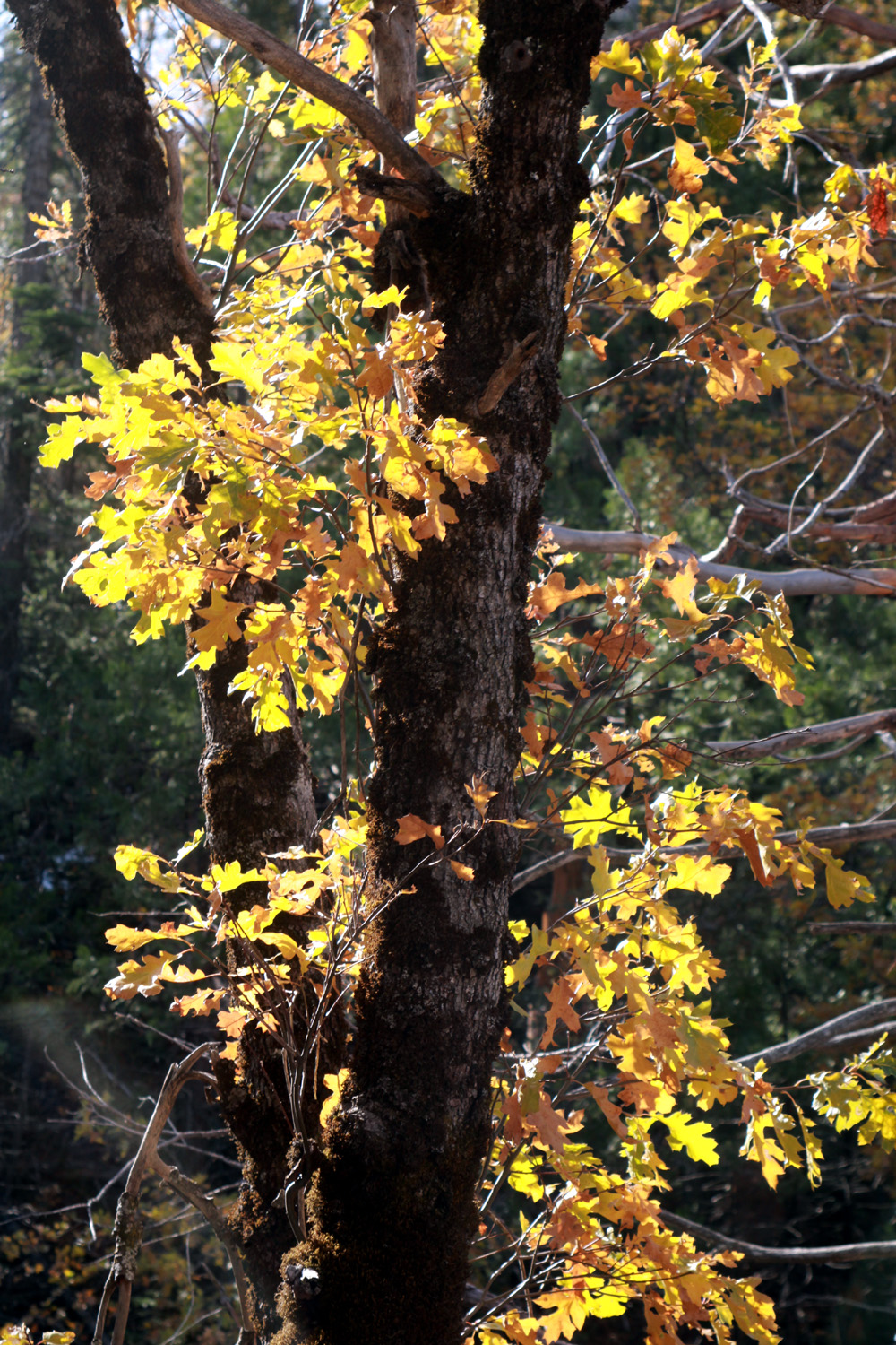
We were happy to see that there were a few dogwood leaves, although they were not as colorful as usual. We speculated that this was because of the extremely hot summer. We also passed by many black oaks with their leaves in fall finery. Pines and cedars make up the evergreen component of the forest at this elevation. The creek was running good and overall, the scenery and the weather were delightful. We went to the place where the trail goes up fairly steeply above and away from the creek, then gradually goes back down. Wes made his way down into the creek canyon to take pictures, while the rest of us sat on rocks or logs and rested. |
|
|

|
| Dogwood leaves were late in changing to their fall colors this year | Wes explores close to the creek |
|

|
| Teri, Jackie and Dick at our resting place | Pines tower above the black oaks and boulders |
|
images/5calif23543.jpg
|
| Black oak, with artistic back-lighting | Log across the creek creates a swirl of foam and leaves |
|
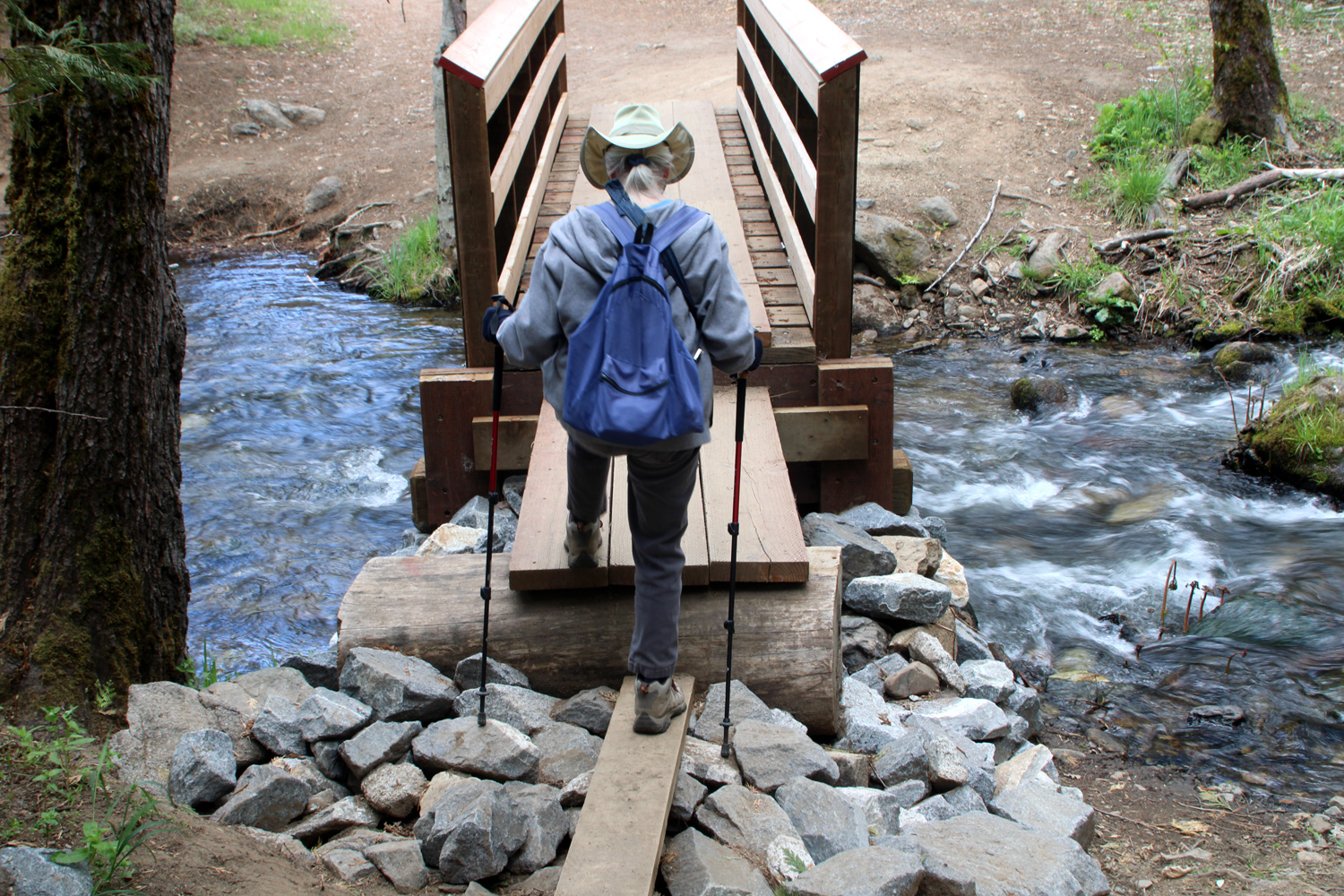
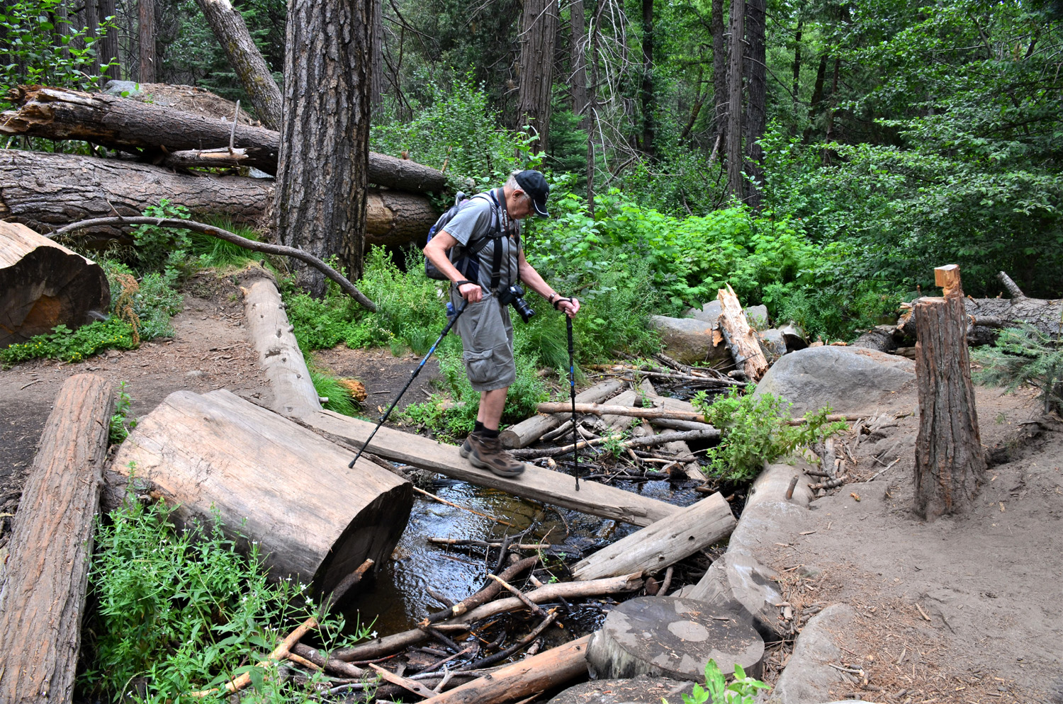
The weather was delightful, cool enough to avoid perspiring, but with bright sunshine and no breeze. This part of the trail has two creek crossings, which can be a challenge if the water flow is more than a trickle. When Wes and I hiked in 2021 the first one had a new bridge, apparently built by grade C engineering students. From July to November, the bridge began to sag and lean to the side. It was replaced by one built by C+ students. Apparently they missed the day when "measure twice" was taught - the new structure is a few feet shorter than the width of the creek bed, ending with a big step down or up, and an eight-inch wide plank the last few feet. The other crossing, over a fair size tributary creek, required a precarious balancing act across a makeshift plank and log crossing in 2021. By May of this year a grade A bridge had been provided at ths location. |
|
|

|
| Jackie, Teri and Dick on the Lewis Creek Bridge | Leaf and snow art |
|
In another tradition for these cat-sitting events, Rod and Jennifer always provide a gift certificate for a local restaurant. After the hike, we returned to the Neely place, and took our own cars to El Cid, an excellent Mexican restaurant that rivals anything in the Fresno area. We enjoyed a delicious lunch and good conversation, after which we went our separate ways - Wes in his Highlander, Teri and Jackie in Teri's Highlander back to the valley, and me in my Honda CR-V back to the Neely place. |
|
|
More Neely and Cat Stuff, and Sierra Snow
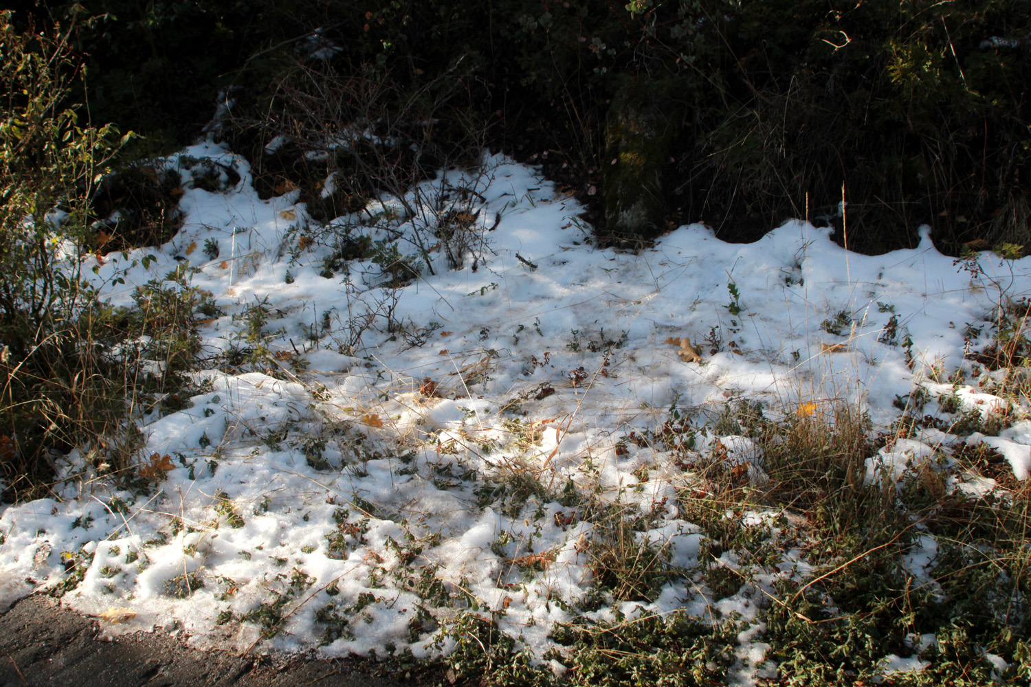
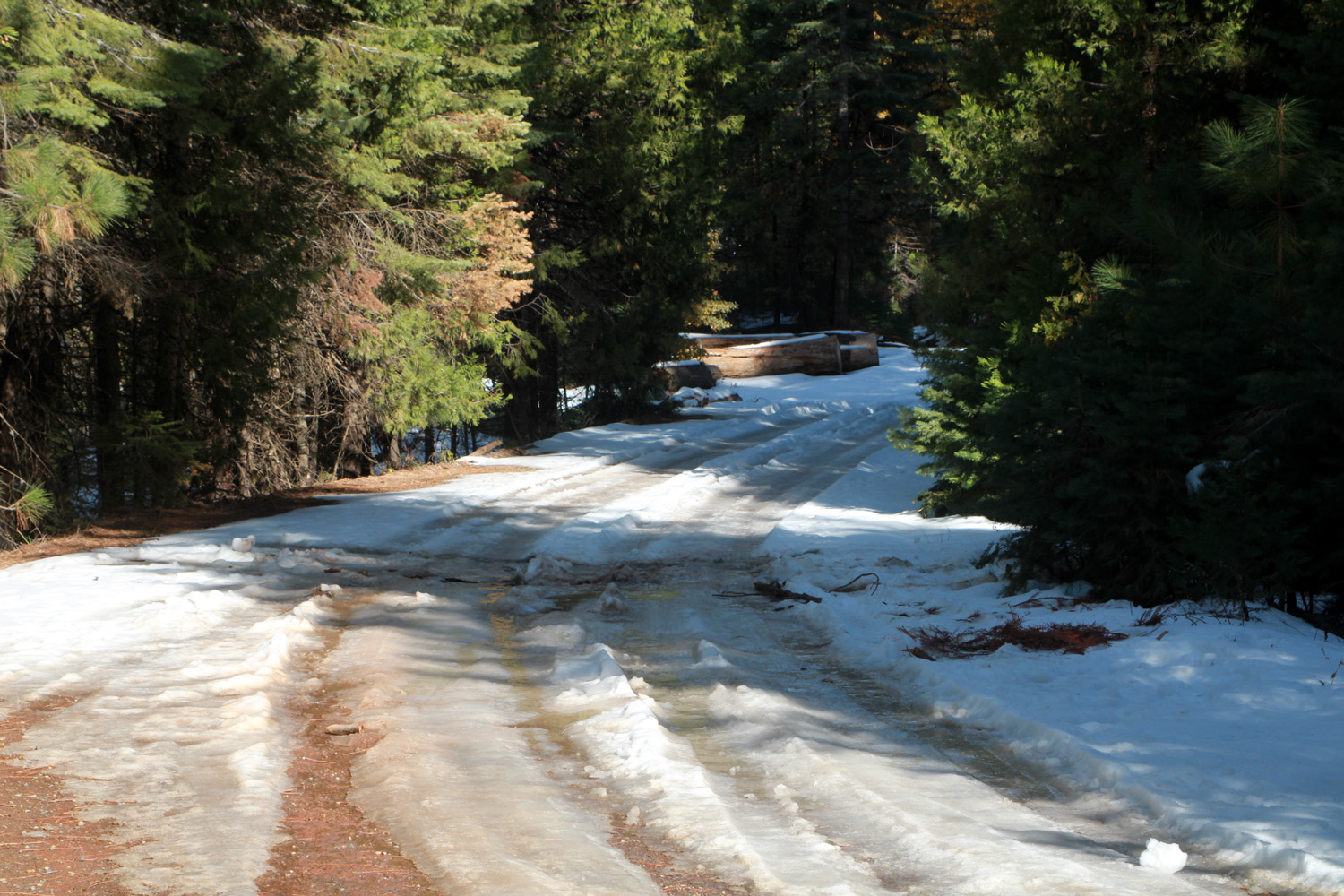
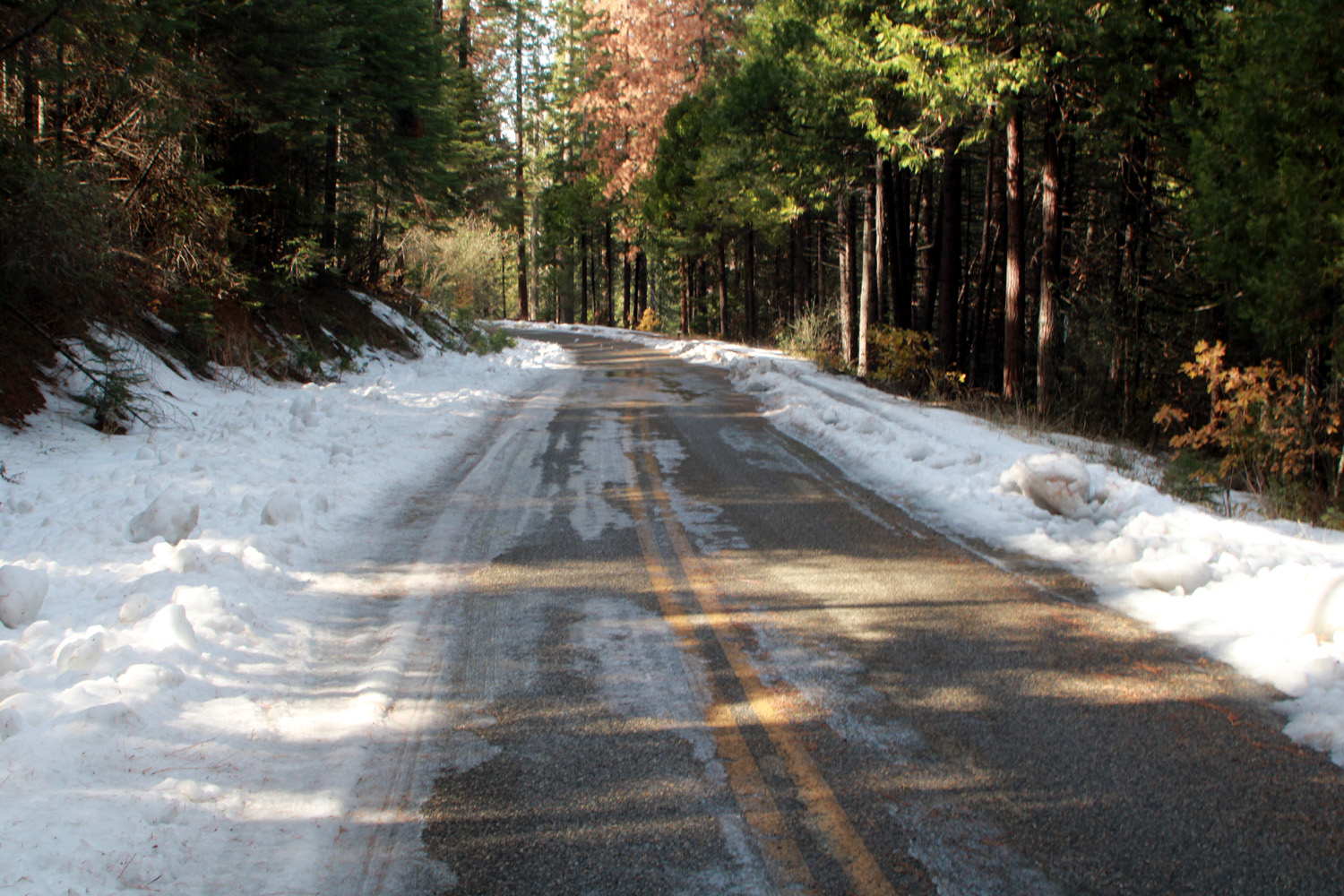
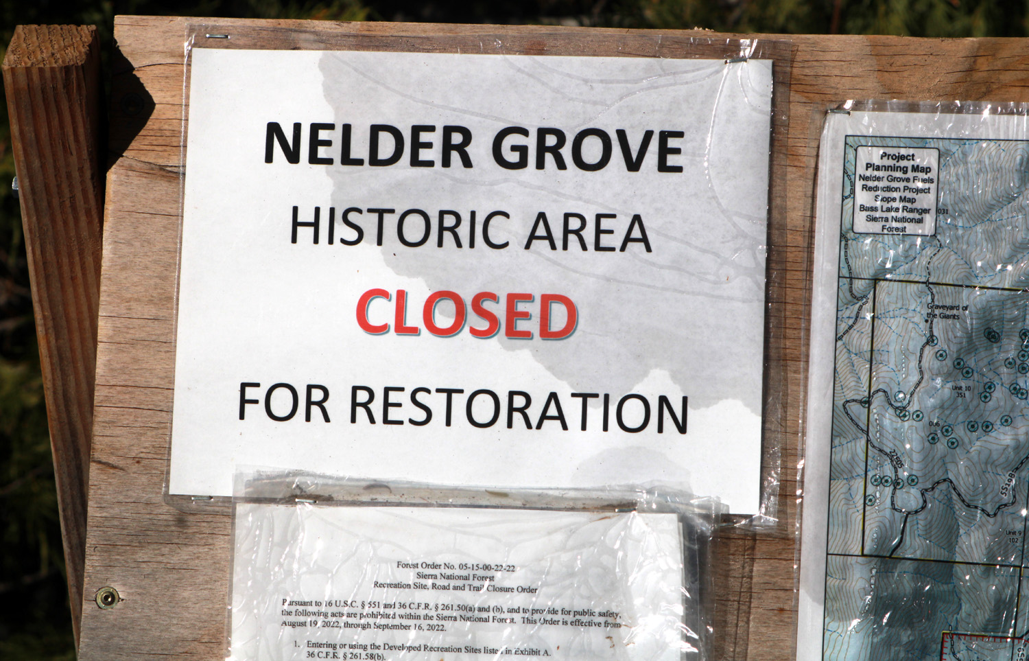
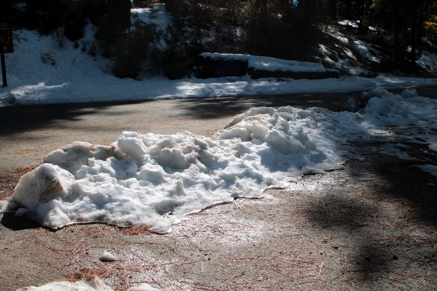
There was one more adventure to be "enjoyed," or perhaps "endured" is the better word. Water for the house is pumped from a well into an 8,000 gallon storage tank. When the tank is full, a float valve causes the pump to shut off automatically. When Wes arrived, he noticed that water was running from the top of the tank, as well as through the electrical controls for the pump. This was still happening after I returned from lunch, so I took photos, and texted and called Rod. We decided to shut off the power to the pump, which eventually stopped the flow. This does not stop water from getting into the house since gravity is adequate to supply a reduced flow. The next morning Rod let me know that he had called the company that installed the system, and that someone should be out to check it shortly after noon. In fact, they arrived in the morning, and by 11 a.m. the problem was fixed and full water pressure was restored. However, it was a problem I certainly did not expect to have to deal with. Keeping the cats in and well fed is enough of a challenge. I had decided to drive up Sky Ranch Road, which leaves Highway 41 about a half mile past the turnoff to the Neely place. This is the road that eventually leads to Nelder Grove, but that place is closed and I was not planning to drive on dirt roads, which could be difficult after the rains we have had recently. Where the road to Nelder leaves the paved road, there is an old logging road, and I thought I might walk on that a short distance, something I have done in the past. This area is probably around 5,000 feet, and not long before I reached the turnoff, there was significant snow along the roadside. The logging road was covered with two or three inches, and there was some snow on the pavement. Since it was sunny and I was dressed for cool weather, I put out my lawn chair and sat by the road reading and enjoying the forest scenery for a while. |
|
|
|
| The snowy road I DIDN'T walk on | The muddy, snowy road to Nelder Grove |
|

|
| The pavement was snowy but not slippery | Looking south into the woods |
|
The road runs through the elevation at which the dominant hardwoods are black oaks. They change to a brilliant orange-yellow in the fall, and I had to stop a couple of times on the way back to take photos. |
|
|
|
| Black oaks beside Sky Ranch Road | The orange of black oaks stands out among the green |
|
The rest of my stay was fairly routine. On Wednesday I went into Oakhurst and got a sandwich at the Pizza Factory. I did a lot of reading, and walked around the property now and then. Pebbles became slightly more friendly, allowing me to be within three feet of her before she would disappear into the back of the house. On Thursday, Thanksgiving Day, I had a leisurely breakfast, then got packed up and drove back down the mountains to Clovis. The next day would be our family Thanksgiving at Greeley Hill, where Grandson Johnny and his family have a mobile home surrounded by more black oaks and evergreens at the 3,000 foot level. --Dick Estel, December 2022 |
|
|
Photos (Click to enlarge; pictures open in new window) |
||
|
Dinkey Creek Drive Grant Grove Camp Cat Sitting & Hiking Sierra Snow |
||
|
Dinkey Creek Drive |
||
 |
 |
 |
| A brand new trail | This is as far as you go on this road | Granite outcrop above Bald Mountain Summit |
 |
 |
|
| Killed trees near roads are cut down for safety | A perfect young cedar by Glen Meadow Creek | No auto traffic allowed on this bridge |
| Grant Grove Camp | ||
|
 |
 |
| Base of a large sequoia in Grant Grove | A cluster of sequoias | Douglas squirrel munches on a fir cone |
 |
 |
 |
| Here's one the squirrel missed | Teri captured Dick
photographing the General Sherman |
This huge limb fell from the Sherman Tree and crushed the fence and the pavement at this spot |
 |
||
| Panorama view from Panoramic Point | ||
| Cat Sitting & Hiking | ||
 |
 |
 |
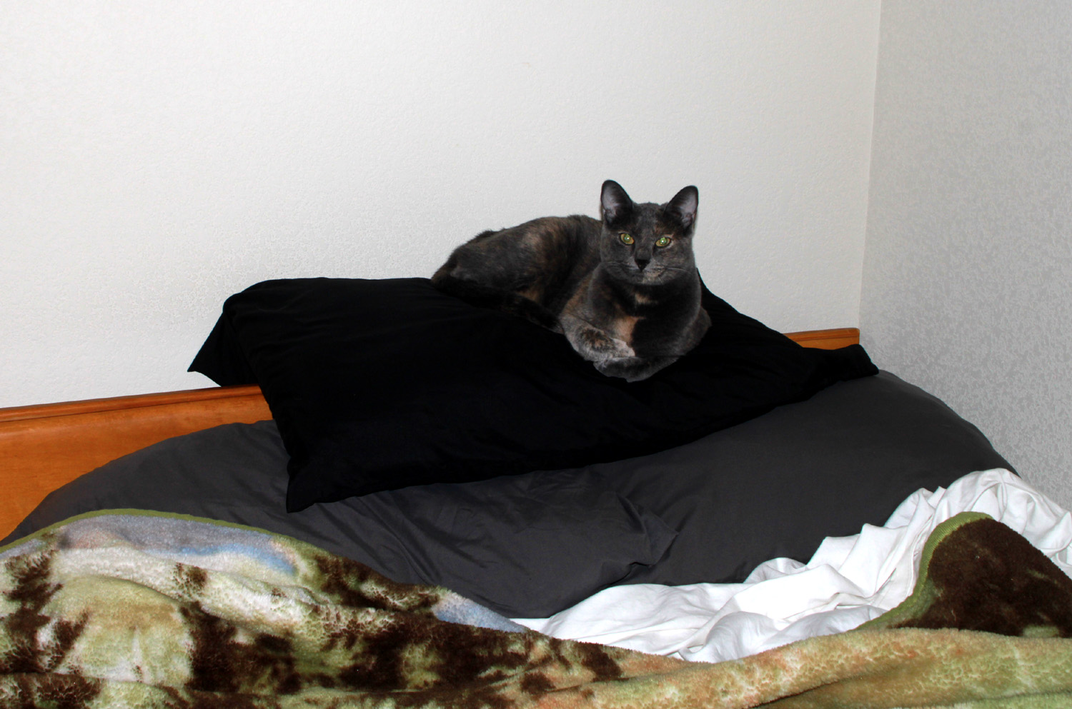
| Newton, looking very self-satisfied | Peanut
immediately claimed this pillow pile as her perch for the day |
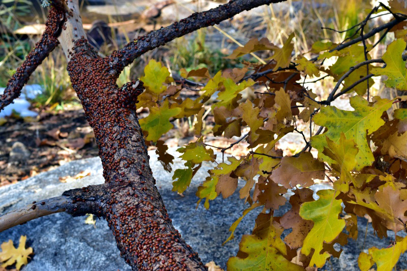
Hundreds
of ladybugs cluster on branches at this season |
 |
|
 |
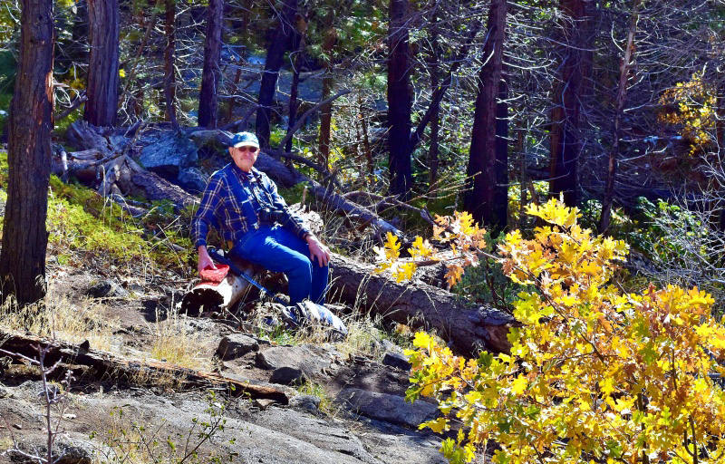
| As usual, Dick finds a log to sit on | Jackie contemplates fall beauty on the trail | The creek in a winter-like scene |
 |
 |
 |
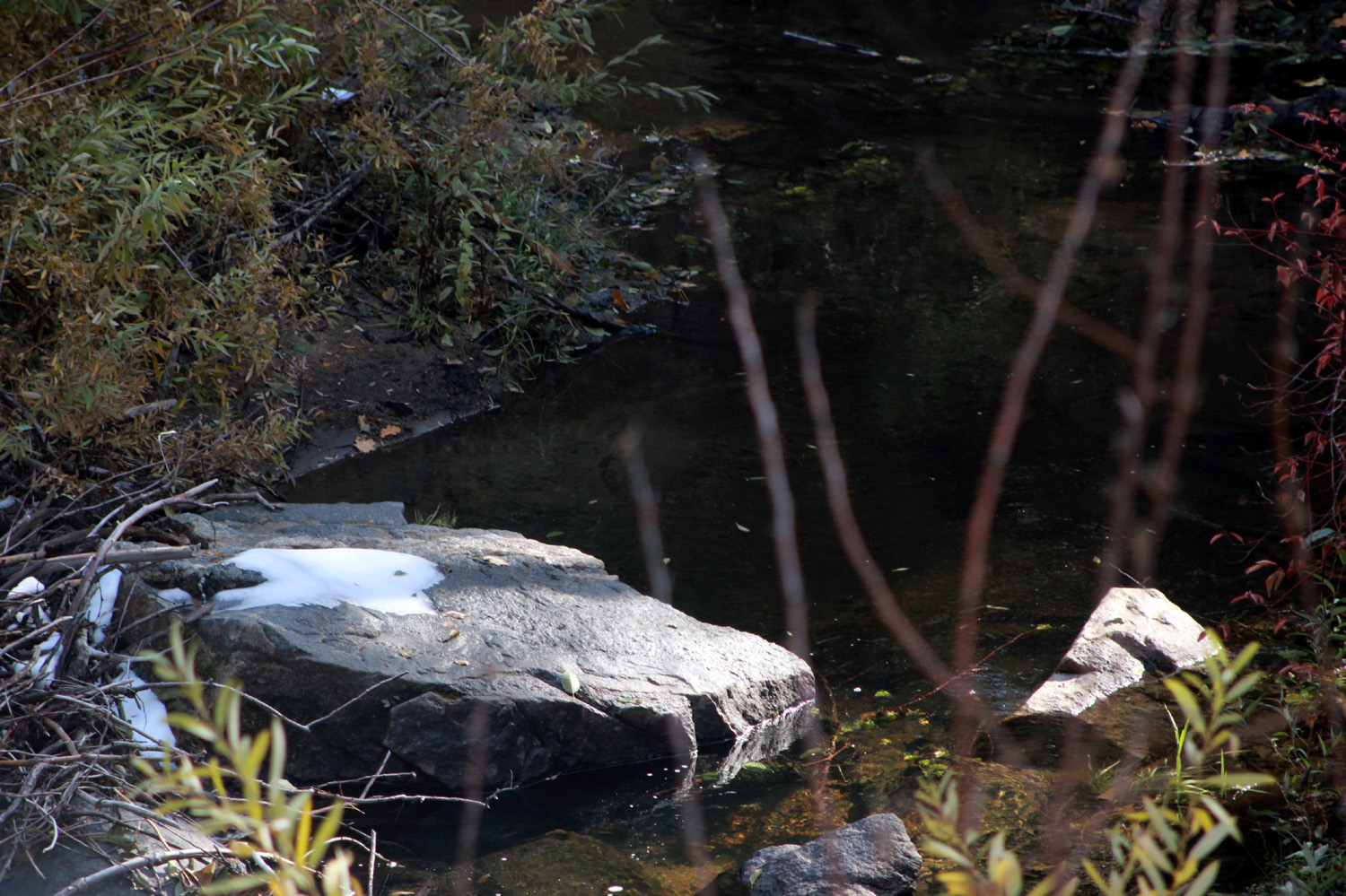
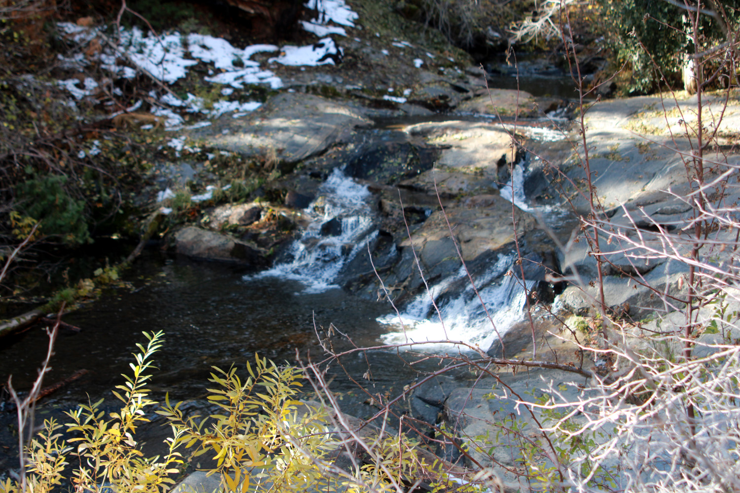
| A double cascade, accented by snow and willows | A rare spot of red | Looking downstream |
| Sierra Snow etc. | ||
|
 |
 |
| Sunset at the Neely place | Fall color by the Neely house | Every
year I line up fallen buckeyes on this retaining wall |
 |
 |
 |
| This tree has outgrown its planter | It's
been closed for two years - maybe waiting for the young sequoia seedlings to mature? |
Snow piled up on Sky Ranch Road |
 |
 |
 |
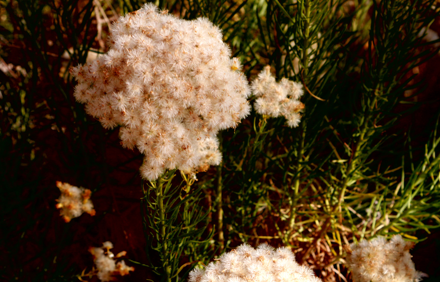
| A fuzzy seed head | I was not tempted to drive up this road | It's
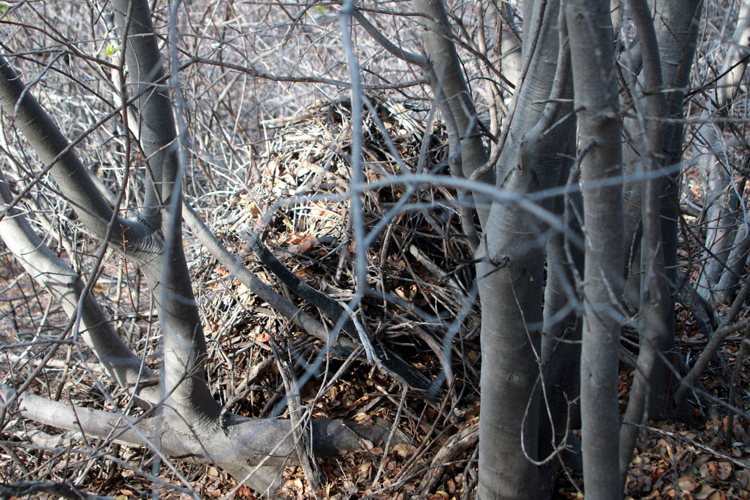
hard to see, but there is a wood rat nest under these liveoak trees |
| Related Links | ||
| Lake Wishon | Bald Mountain 4WD Trip | Bald Mountain Trail |
| Creek Fire 2020 | Oak Fire 2022 | Dinkey Creek |
| Kings Canyon National Park | Grant Grove | Nation's Christmas Tree |
| Mt. Goddard | Park Ridge Trail | Douglas squirrel |
| Giant Forest | Lewis Creek Trail | El Cid Restaurant |
| My First Cat Sitting Assignment | Nelder Grove | Pizza Factory |