
|
Dick's Adventures of 2023 - Part 3 |
|
| Photos Related Links More Travel Reports | |
| Adventures
of 2016 Adventures
of 2017 Adventures
of 2018 Adventures
of 2019 Adventures
of 2020
Adventures of 2021 Adventures of 2022 Adventures of 2023 Part 1 Part 2 |
|
| Sierra Vista Scenic Byway Wawona Loop & Cat Sitting | |
| Sierra
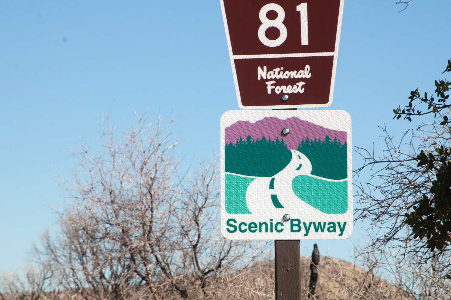
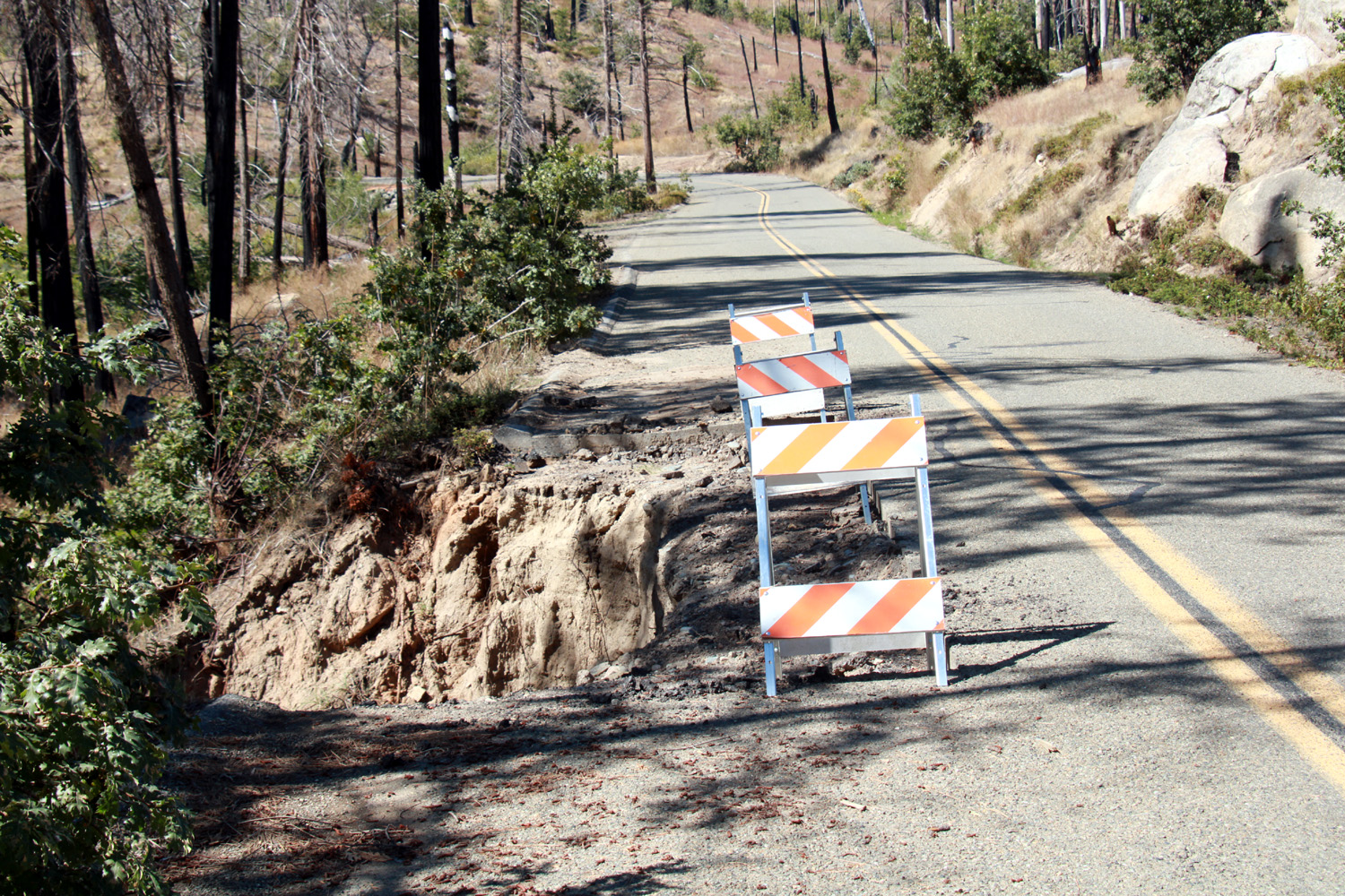
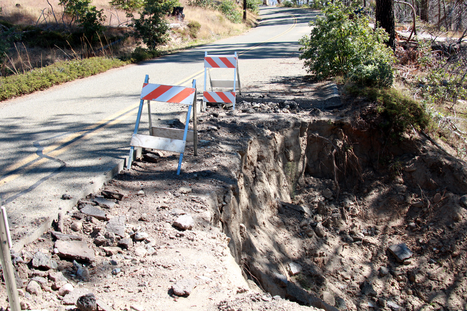
Vista Scenic Byway Having missed the latest Ramblers Hike, and forced to "take it easy" due to cataract surgery, I was getting restless. I was recovering nicely and I wanted to go somewhere, ANYWHERE. I was not really looking to hike, so I mentally reviewed all the locations I enjoy visiting in our amazing Sierra Nevada, wanting a place I have not been to recently, but not overly distant. I finally settled on the Sierra Vista Scenic Byway, which starts two miles out of North Fork, and partly parallels the San Joaquin River, two to four thousand feet above and out of sight of the water. Heading into the heart of the Sierra, it connects to the Beasore Road that comes in from Bass Lake. I knew as I set out that it was not all that short - it turned out to be a 130 mile round trip, with many of those miles requiring speeds of 20 to 30 MPH. I had a decent breakfast and got on the road at 9 a.m. October 3, under clear skies and a temperature in the mid 60s. I drove up State Route 41 toward Oakhurst and Yosemite, but about 25 miles out of the city I took Road 200 toward North Fork. I passed through North Fork, 43 miles from home, at ten a.m. Beyond the town, the road becomes a narrow, winding mountain road, often providing views deep into the San Joaquin River canyon. The route is paved, but suffered damage in a number of places in our severe 2022-23 winter, and repair work is underway at a number of spots along the way. There are also places where repairs have not yet started, and extreme caution is required through several one-way sections. |
|
 |
 |
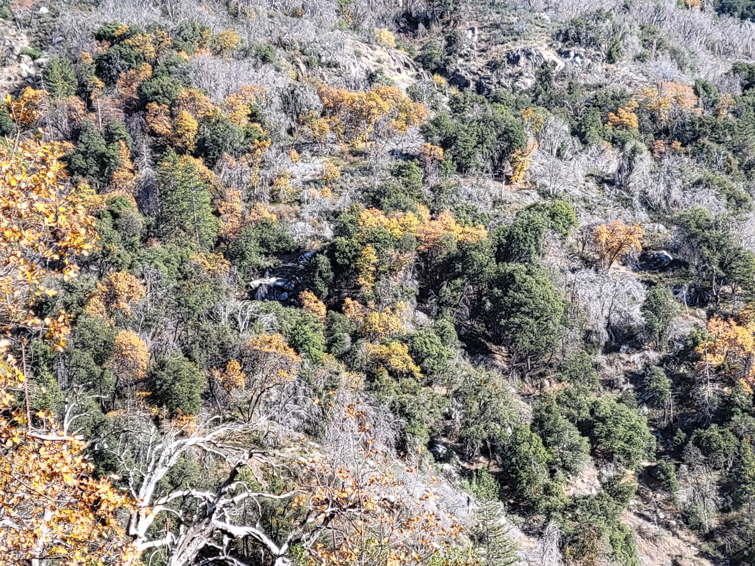
| Despite the fires, there is still a lot of scenery | Rugged, weathered hills above the San Joaquin River |
|
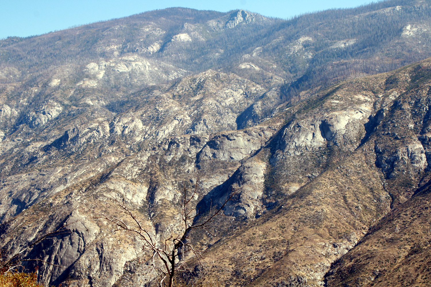
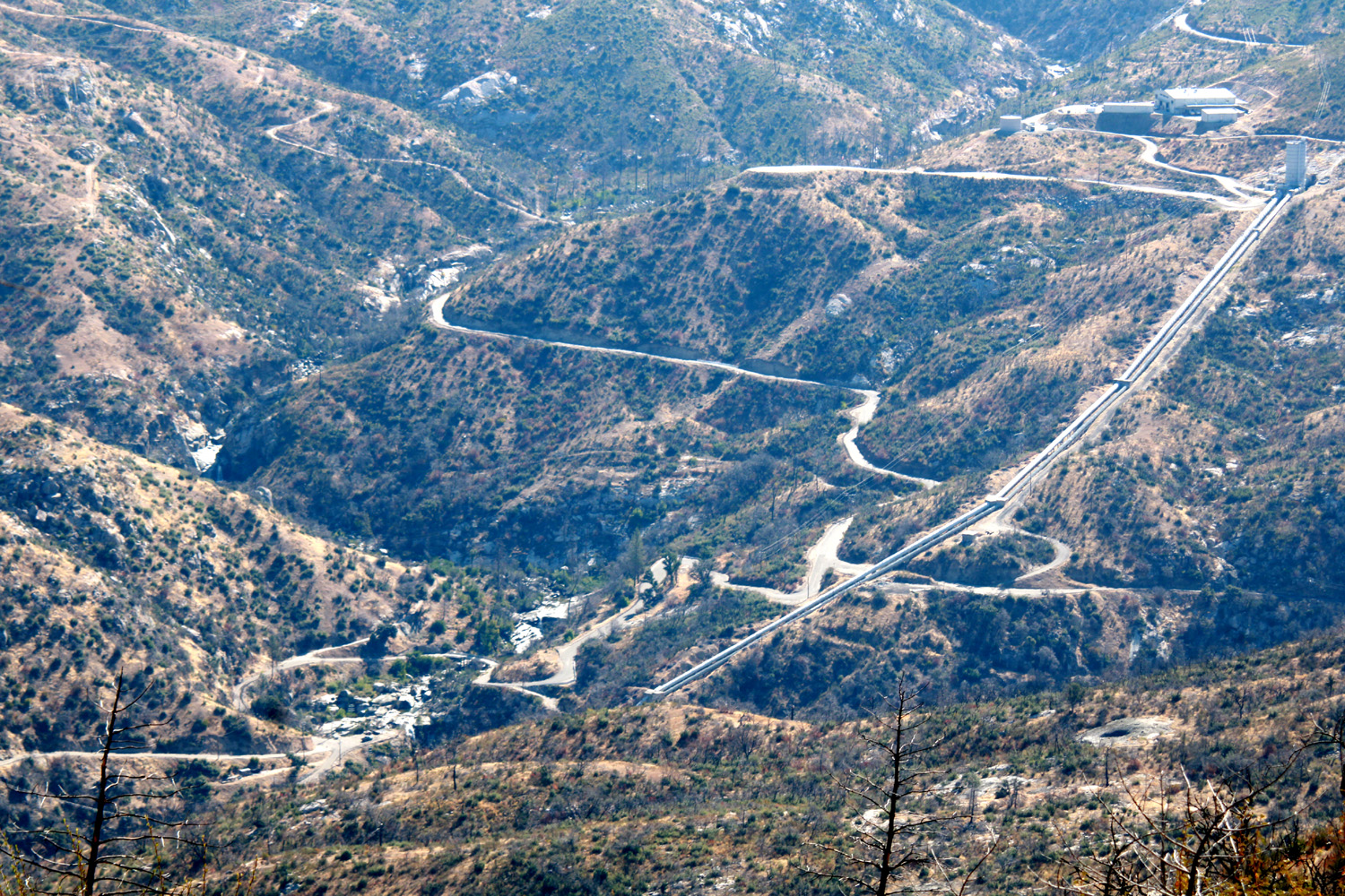
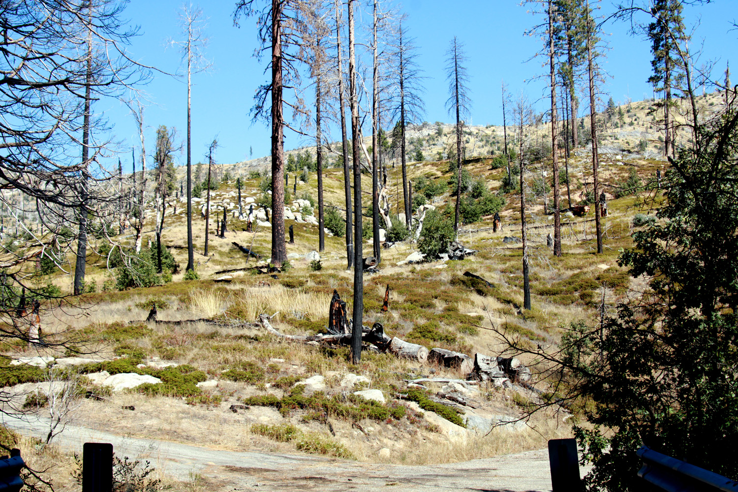
My planned destination was the Mile High Vista, which offers a spectacular view of the Ritter Range (more about that later) and other high Sierra locales.. Along the way are views of infrastructure that appears to be part of the Edison hydro project, a well-preserved pioneer cabin, an apple orchard, forest service facilities, and a vast forest of blackened sticks that were once stately evergreens. This was the legacy of the French Fire of 2016, which burned 14,000 acres. In 2020 the Creek Fire, which started some distance away near Shaver Lake, took out what the French Fire had spared. The Creek was the second largest single fire in California history. Prior to the fires, drought and beetles had killed thousands of trees in this area and throughout the Sierra. Despite these disasters, there was still plenty to see. My first stop was at a road junction 13 miles from North Fork, where a sign pointed to a power house down in the canyon. There were some buildings, penstocks, and a winding narrow road visible, but not the power house itself. It appears that water also runs in from Huntington and Shaver Lake more to the east. They are all part of Southern California Edison's Big Creek Hydro Project. |
|
 |
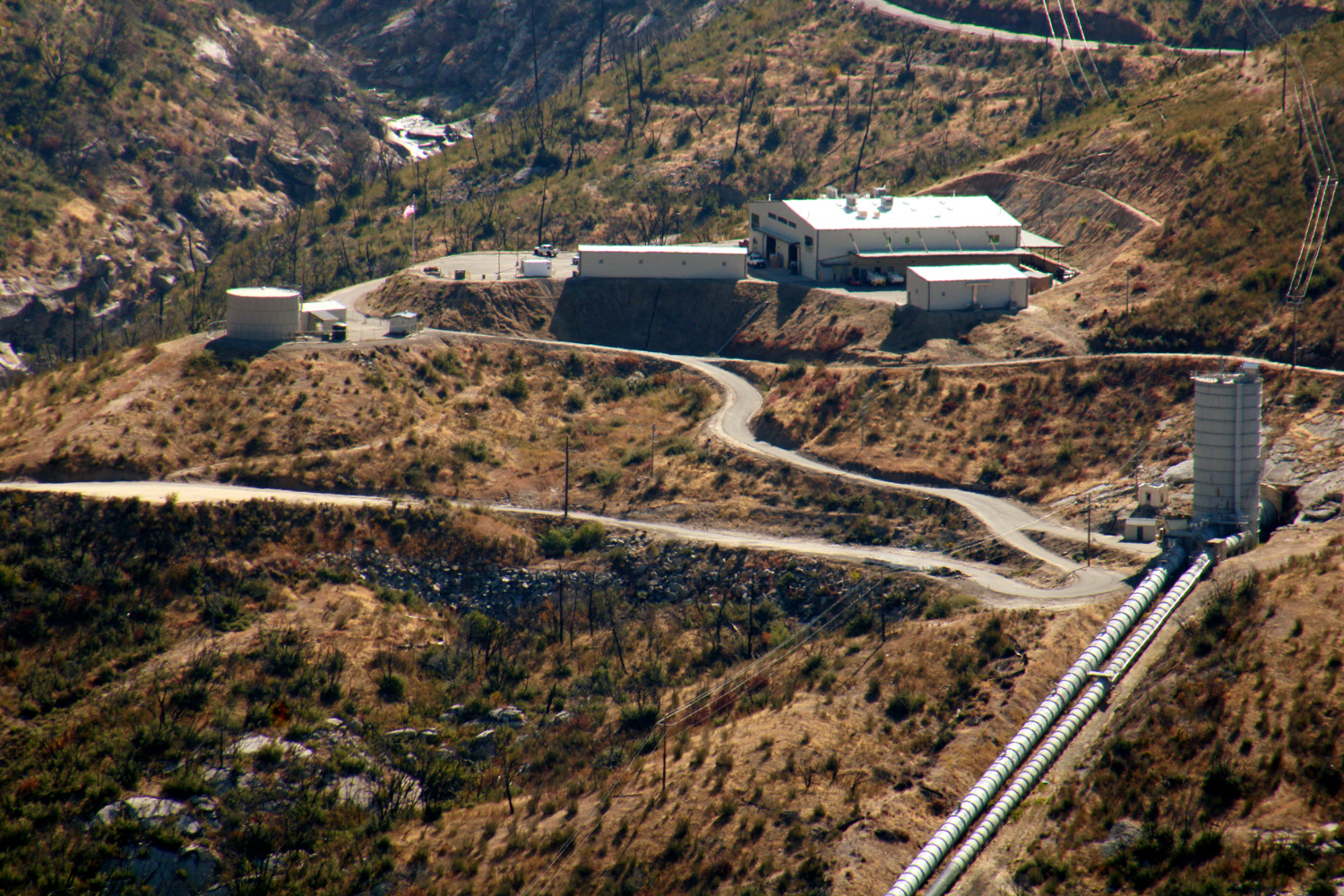 |
| Winding roads and penstocks down in the canyon | The Mammoth Pool Power House is down in the canyon below this stuff |
|
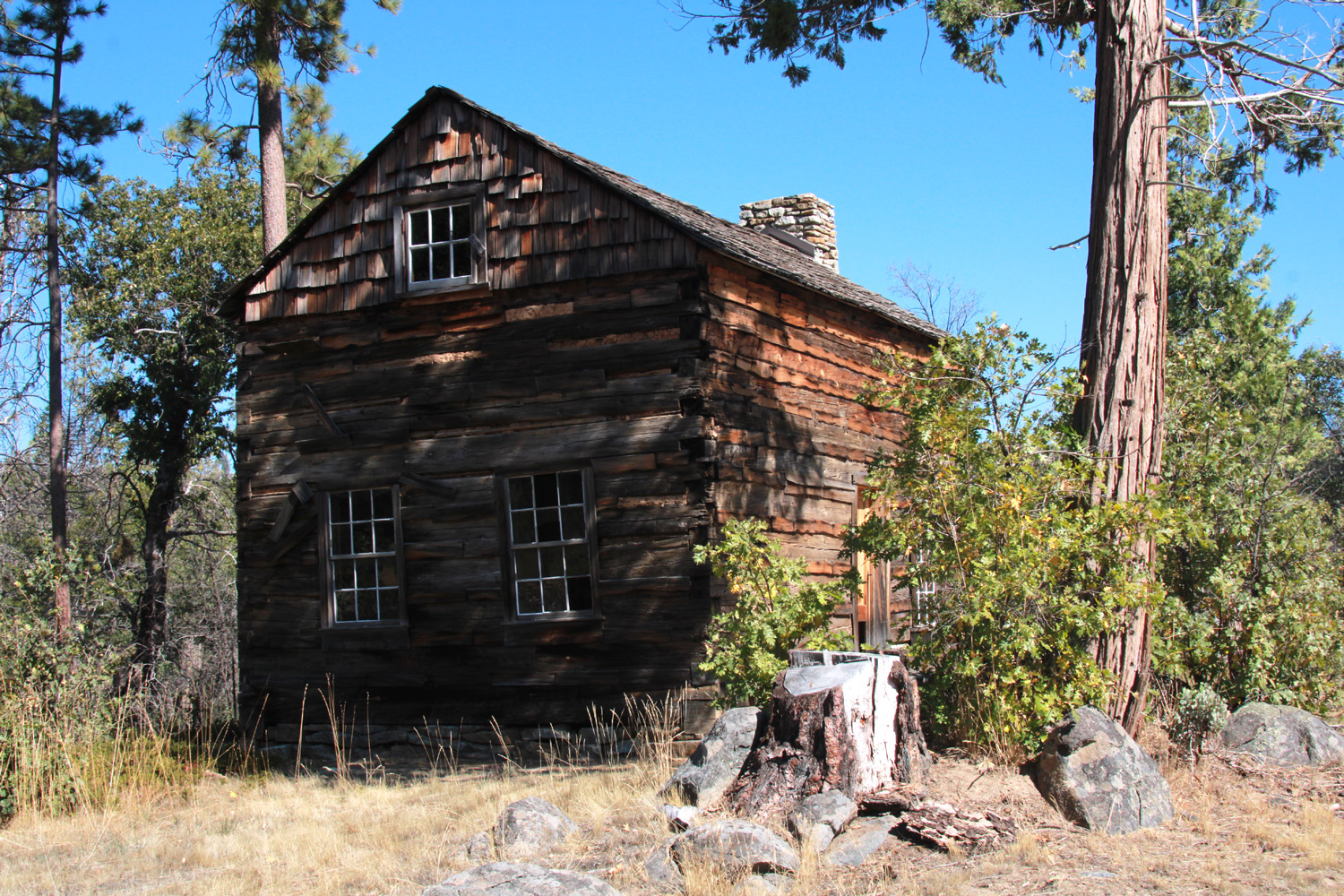
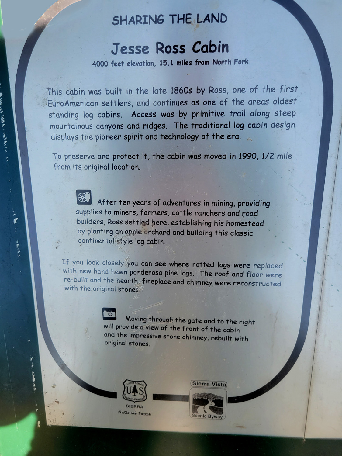
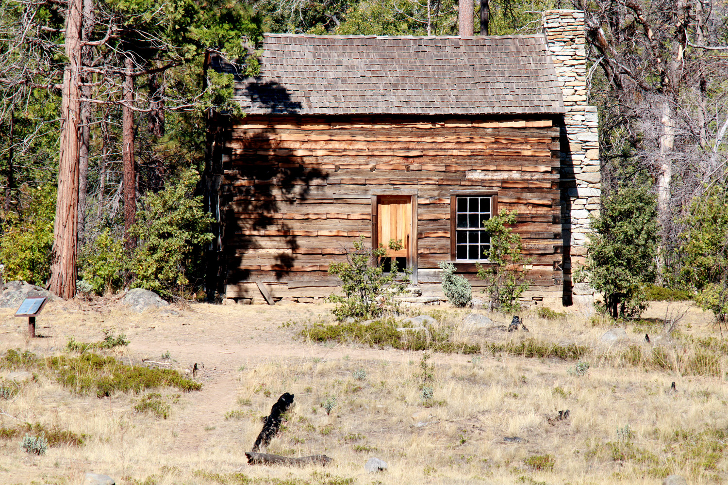
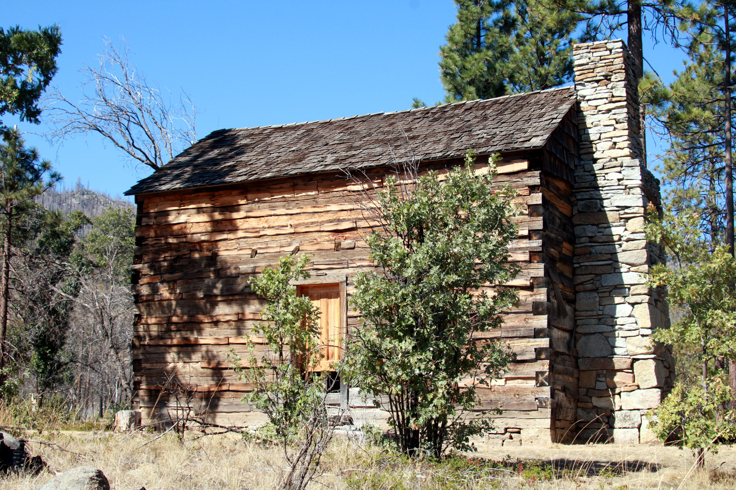
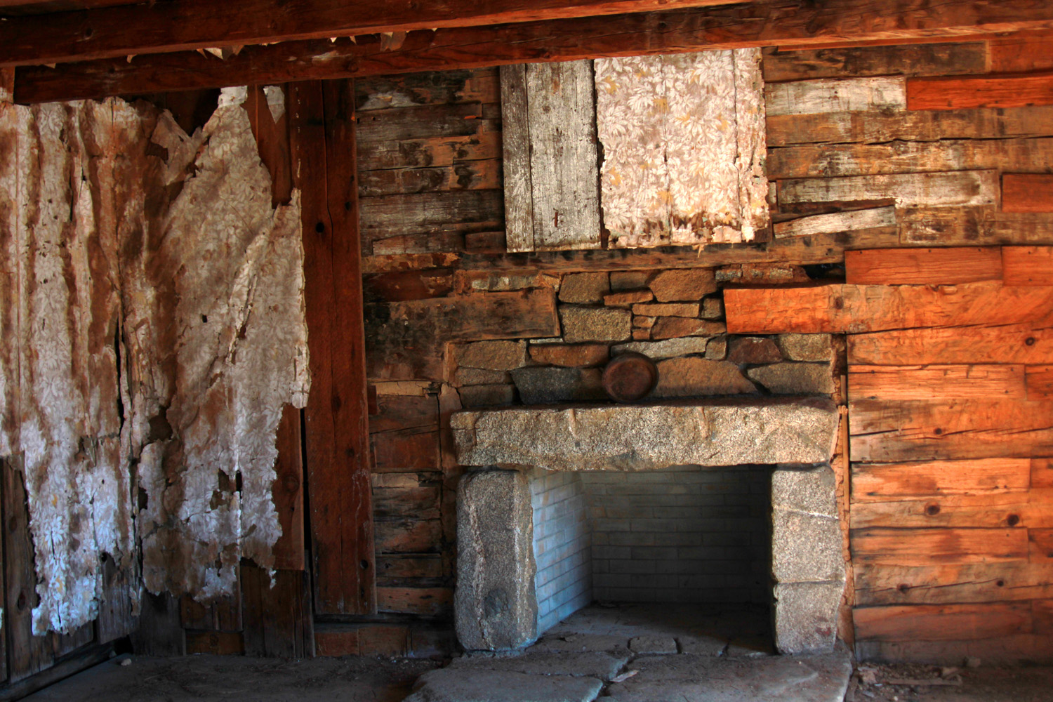
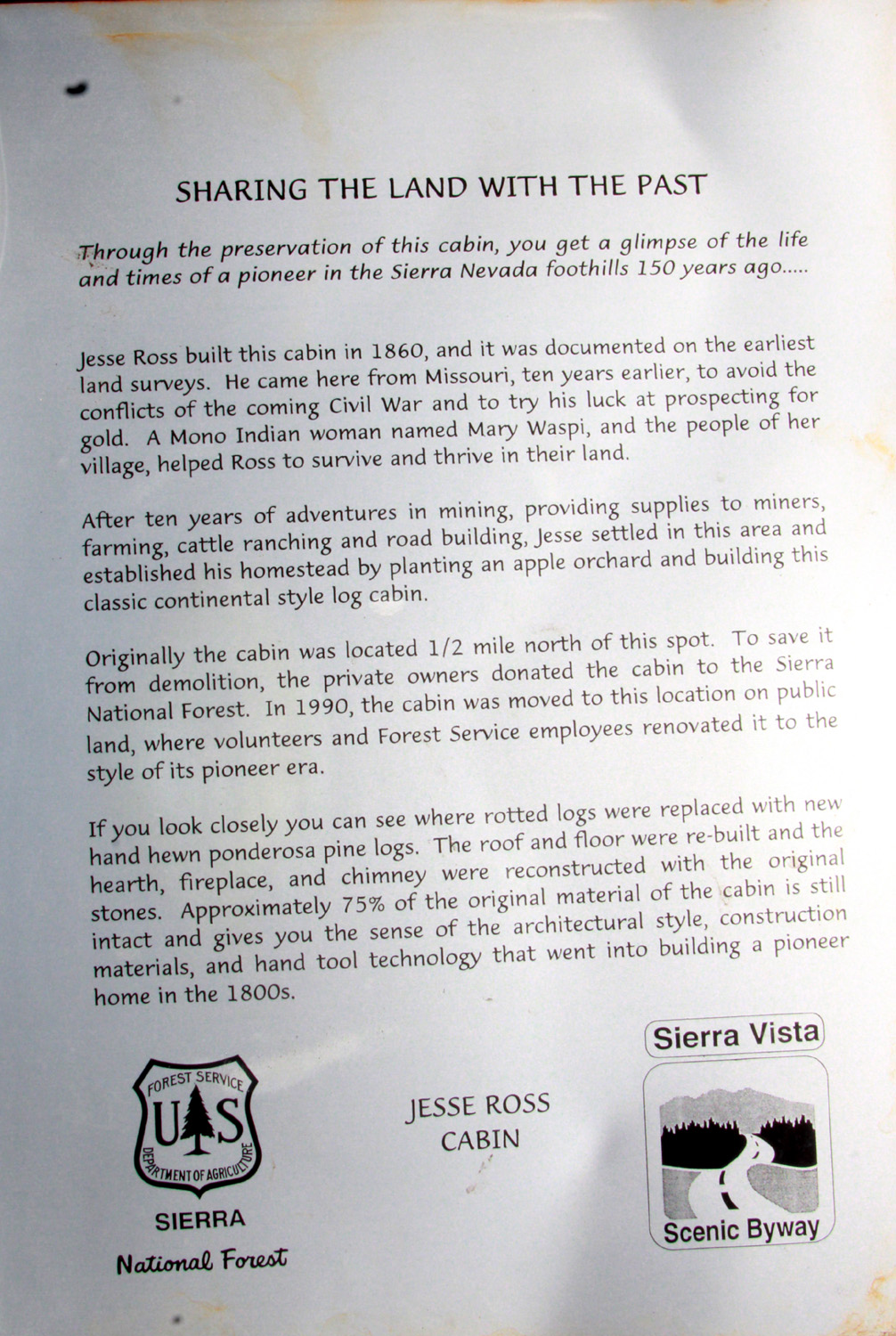
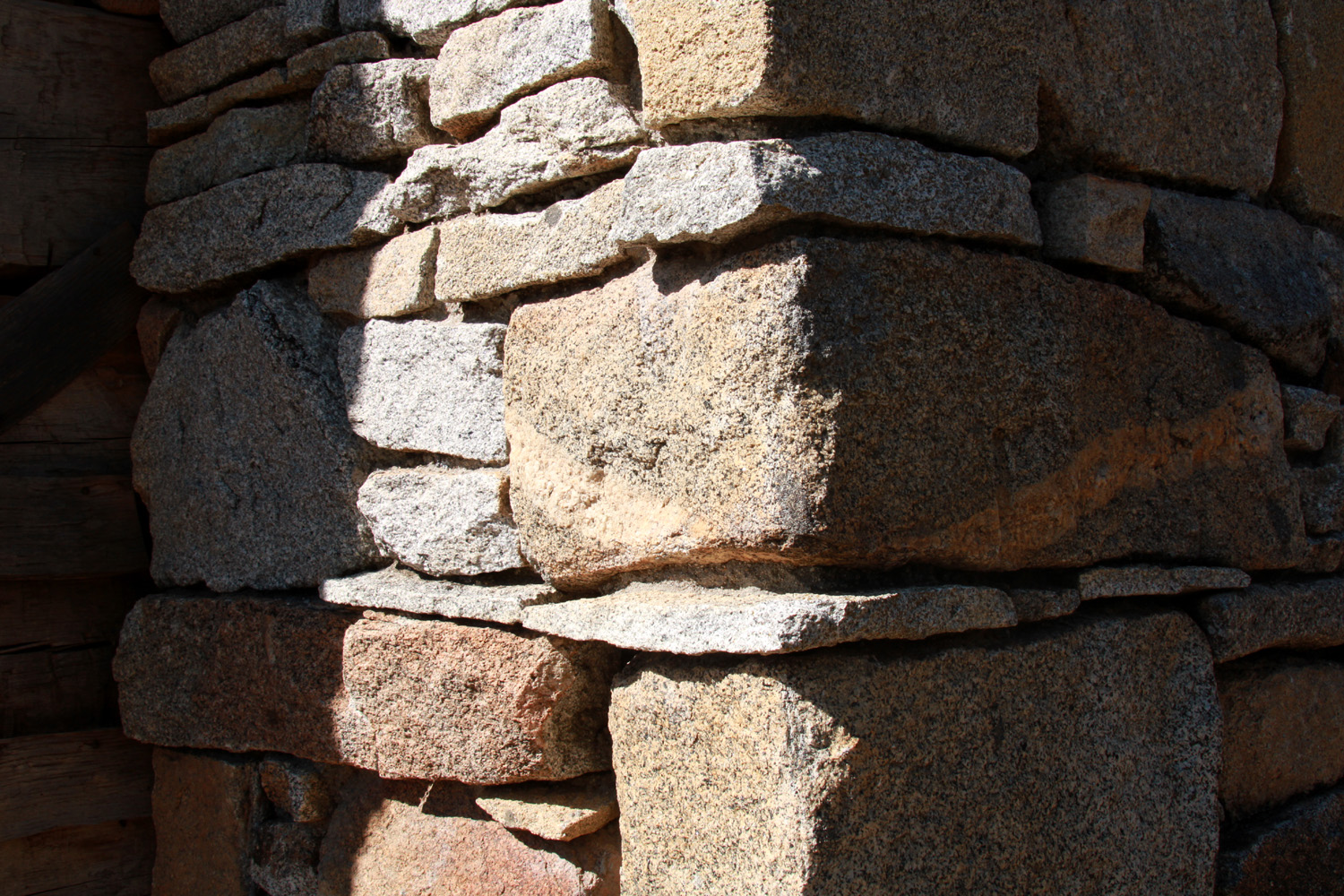
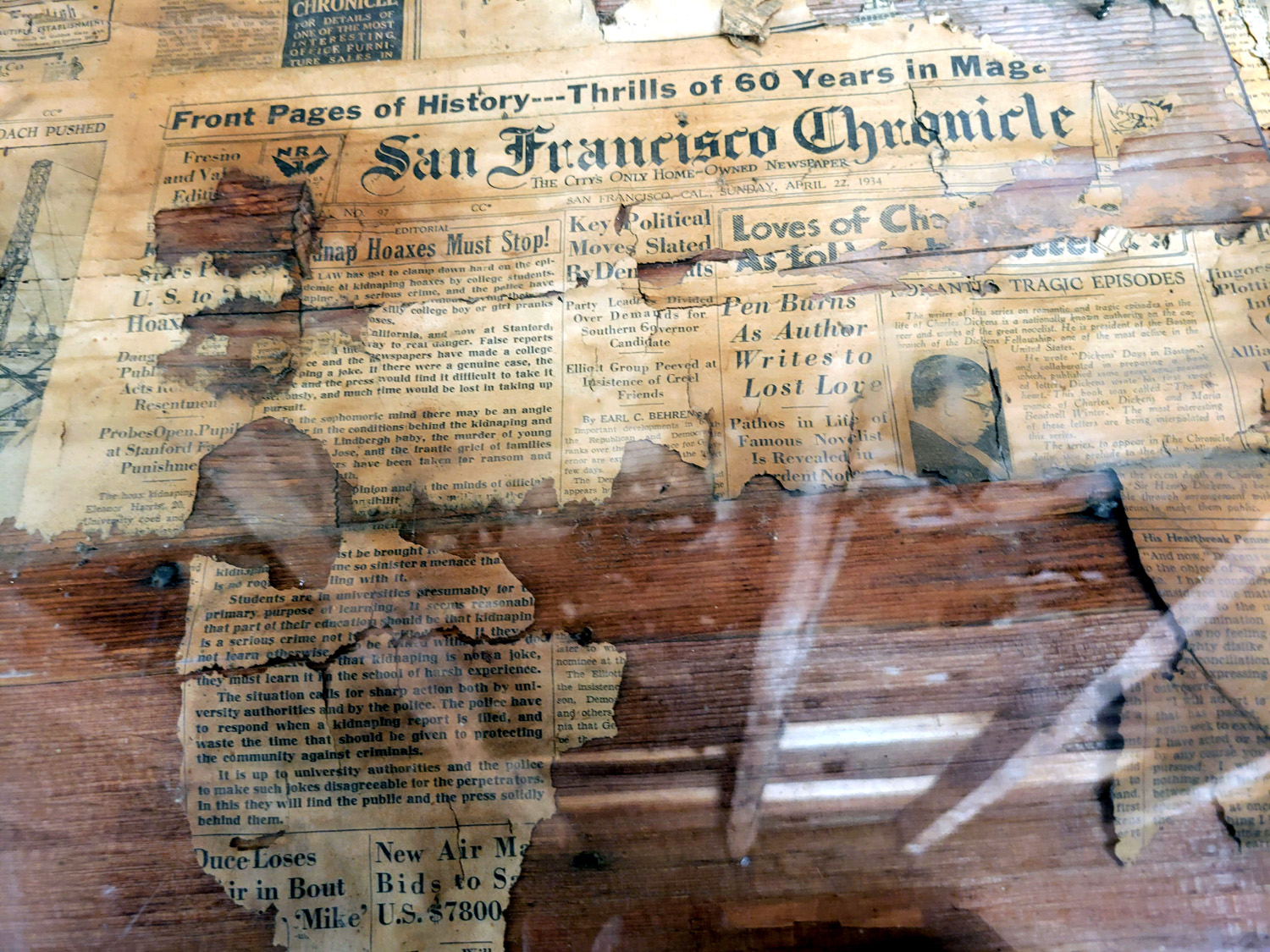
A few miles farther up the road is the Jesse Ross Cabin. Ross came into the area in the 1850s and spent ten years mining, and providing supplies to miners, ranchers and road builders. In the late 1860s , he built a sturdy cabin and established a homestead. He planted an apple orchard, which may still be in existence; at least there is one a short distance from the cabin, which was moved in 1990 a half mile to its present location. Rotted logs and the roof and floor were replaced, using the same tools and methods in existence at the time of original construction. The impressive chimney was re-built with the original native granite stones. The parking area for the trail boasts a very clean toilet. A trail of two tenths of a mile leads to the cabin, taking you down and back up a drainage. The cabin door is not locked, and you can get a good look at the interior, especially the fireplace. Newspapers used to insulate the walls date from the 1930s, but there is no explanation for this. I spent a half hour or more walking to and enjoying this bit of history. |
|
|
|
| Plaque at the parking area tells the tale | The Jesse Ross Cabin |
|
|
| A closer look | Wonder how he lifted that mantle stone into place in the 1860s |
|
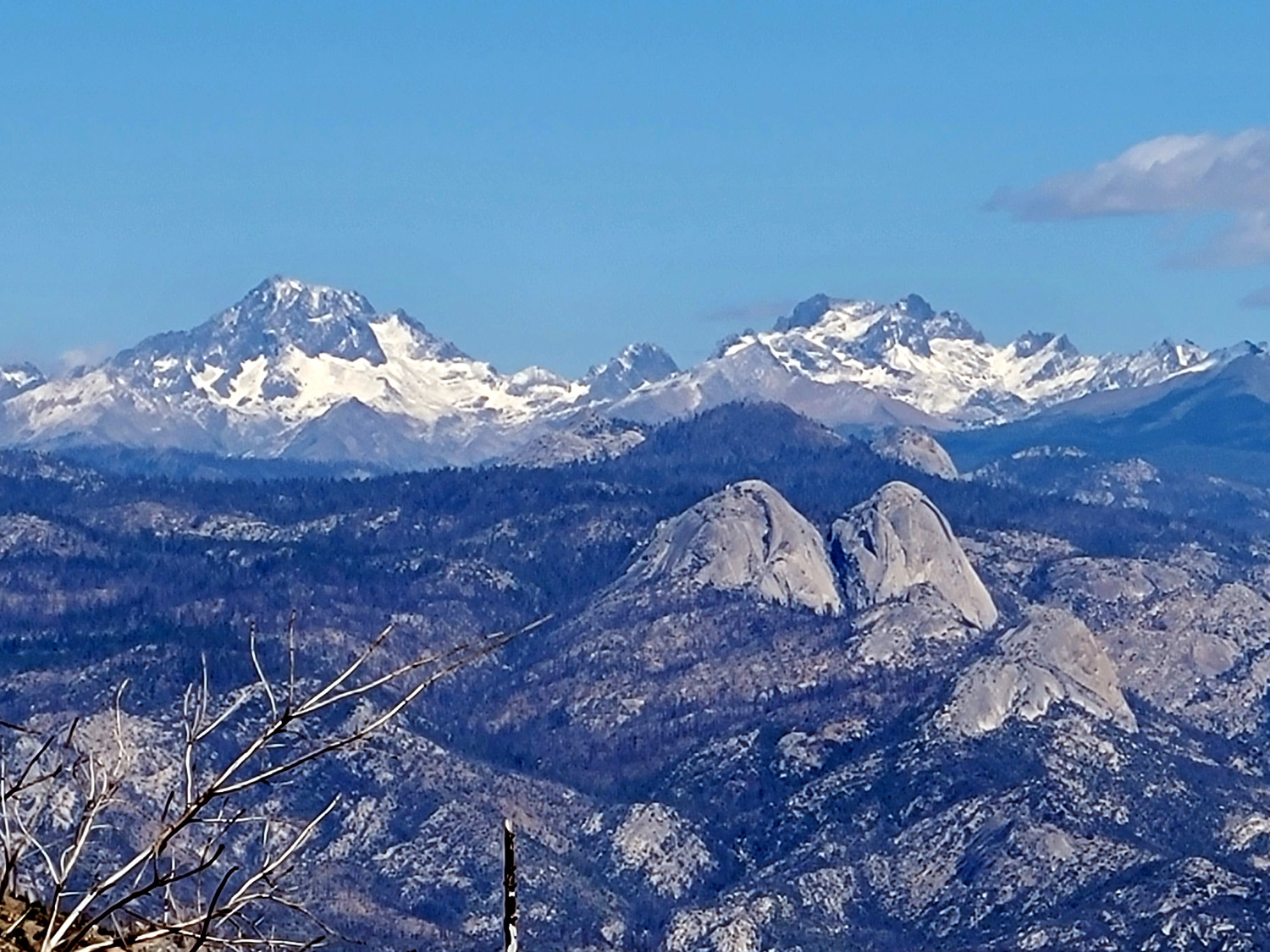
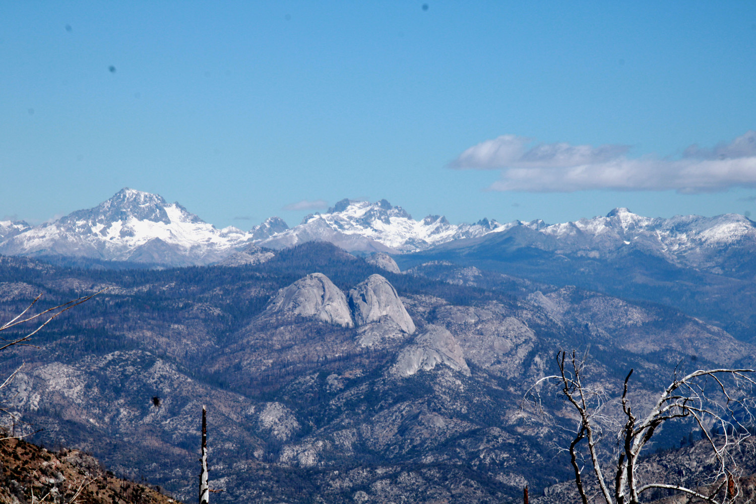
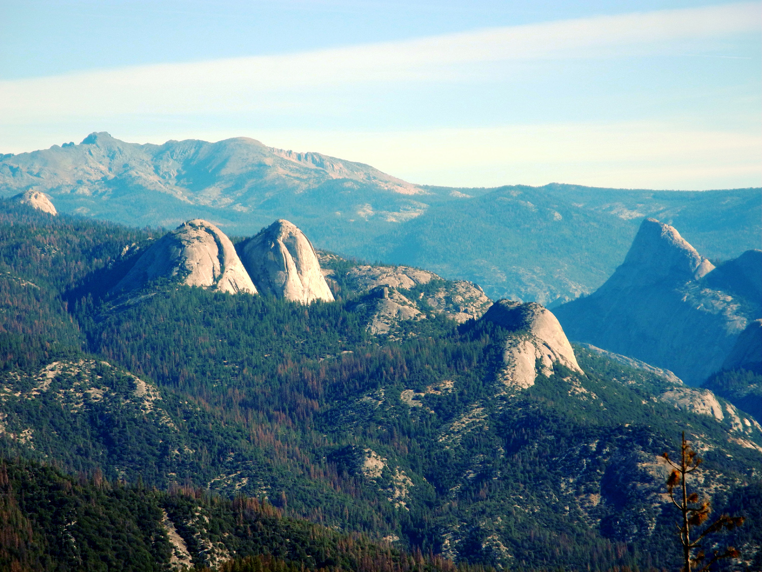
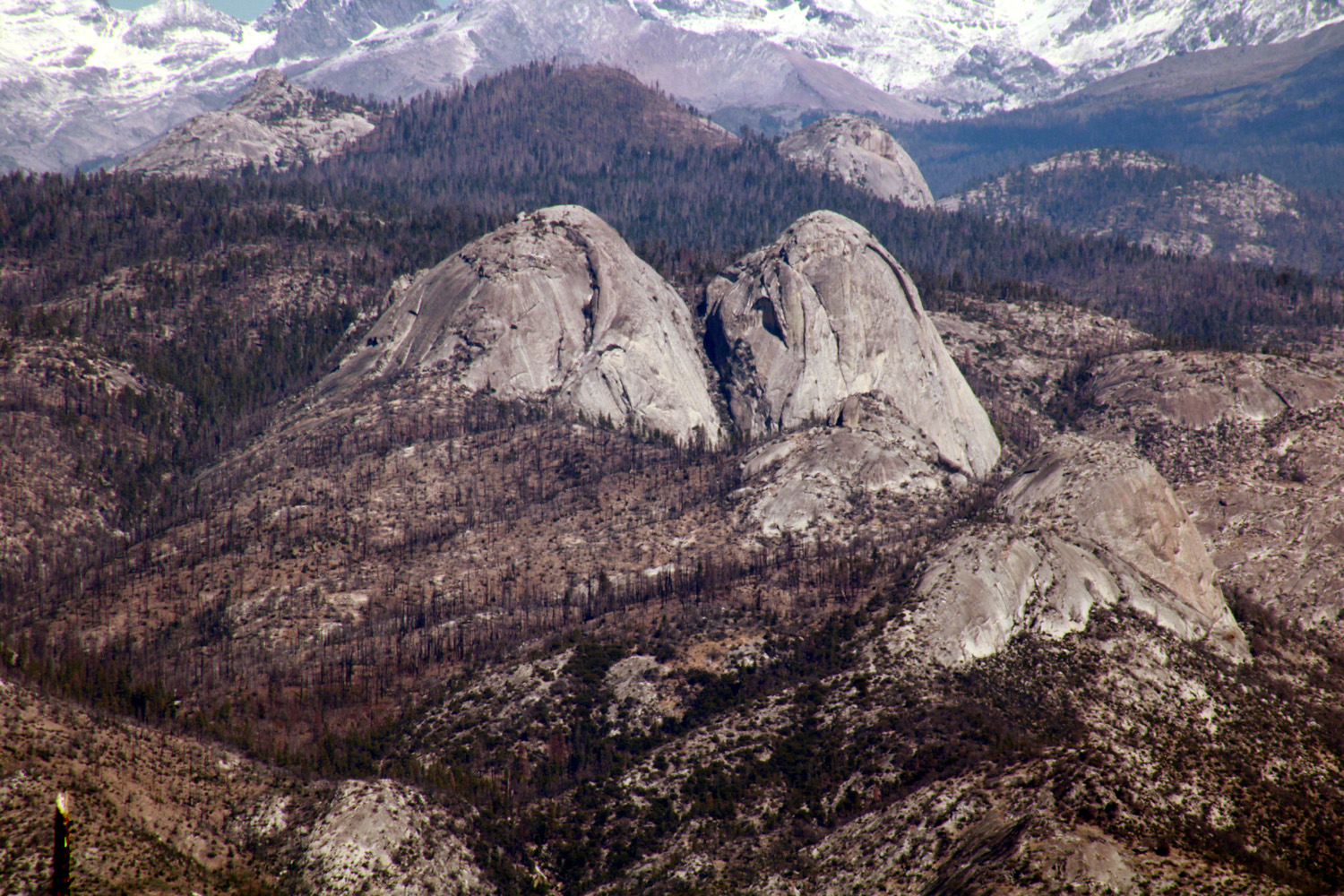
My original plan had been to drive as far as Mile High Vista. This scenic vista offers views of Mt. Ritter (13,143 feet elevation), Banner Peak (12,942), and the Minarets on the crest of the Ritter Range, with numerous domes and other features below, especially Fuller Buttes and Balloon Dome. Miles from that destination, I came over a pass, and there was the main part of the view spread out before me. I was not looking forward to driving this road any more than necessary, so I stopped, set up my tripod, and took a bunch of photos. I marked the location by noting that three very rough dirt 4-wheel drive roads converged on the paved road here, Roads 4S81X, 4S81V and 4S81N. A fourth even rougher road apparently did not merit a number. |
|
|
|
|
Mt. Ritter and Banner Peak retain some of the record snowfall of last winter |
A wider view of the Ritter Range, with Fuller Buttes in the center |
|
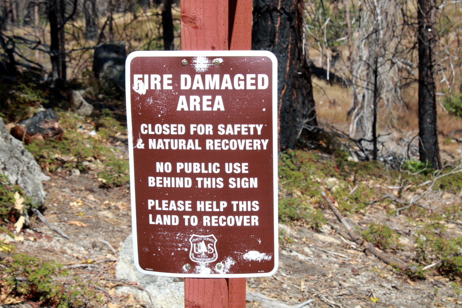
With my thirst for a high Sierra vista satisfied, I decided to go on to Rock Creek Campground. We had camped there many times in years past, and grandson Mikie had some of his best fishing luck in the creek there. When the Ramblers hiked at Mammoth Pool in 2016, the damage from the French Fire was widespread. However, everything was green at Rock Creek, and we walked in to enjoy our lunch at a picnic table. . No more. The Creek Fire took care of what the French Fire missed, and the terrain around the campground is a hellscape of blackened sticks. The area is closed for "natural recovery," which is a hundred year project. The picnic tables, fire rings and toilets have been removed, and the road is blocked by a locked gate. Possibly my great grandsons' great grandchildren will be able to enjoy this location. |
|
|
|
| Sad news about Rock Creek Campground |
The Creek Fire burned nearly 380,000 acres, including this hillside just above the campground |
|
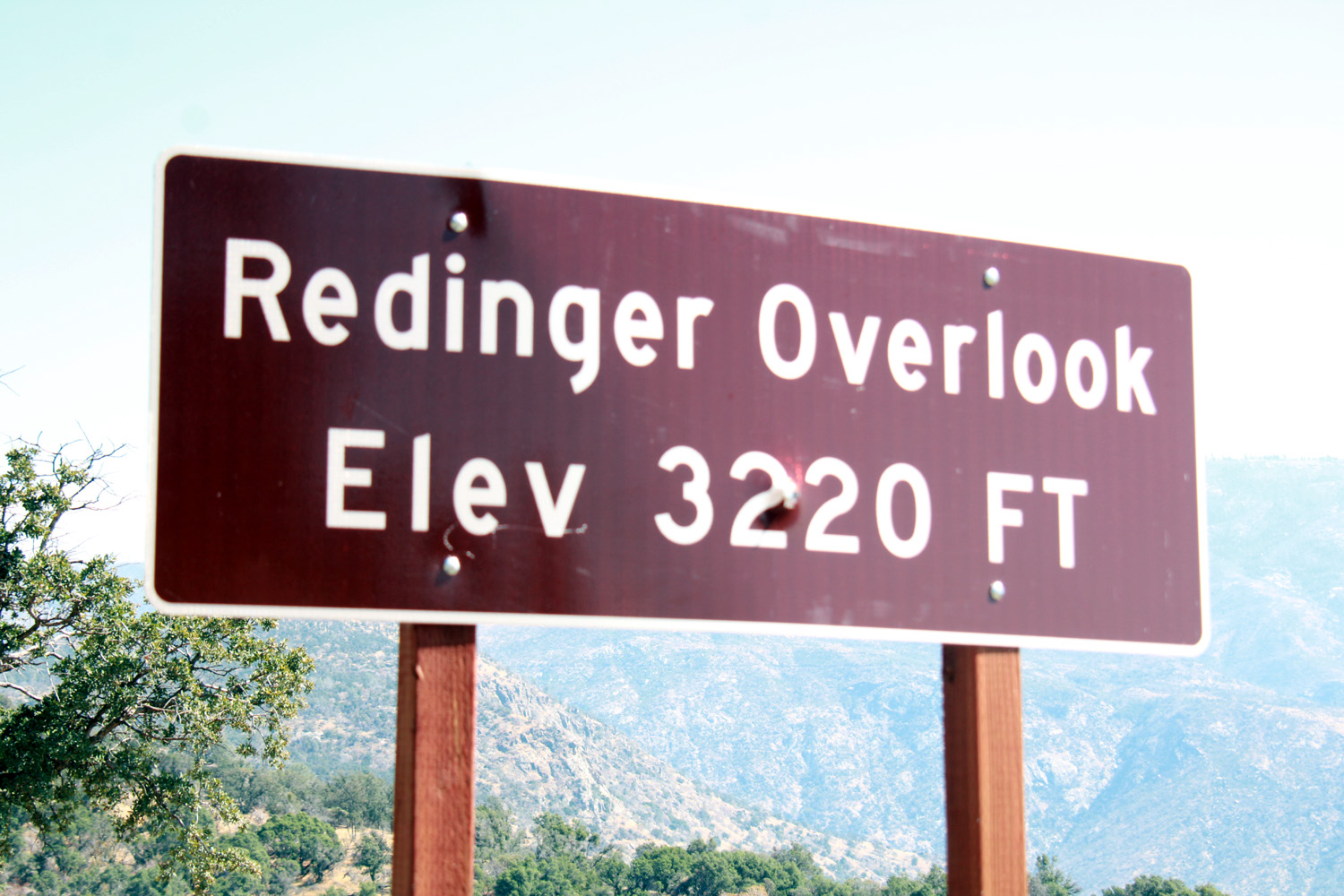
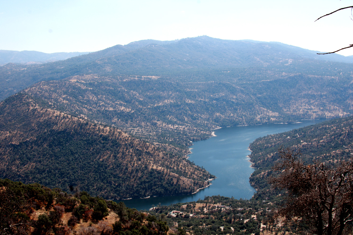
Among the damaged areas is a place where the road is one and a half lanes, with sawhorses warning drivers not to fall into the big hole that remains. In another location there was a one-way section with a flashing red light, where you could see ahead well enough to proceed after a safety stop. There were three or four spots where actual work was in progress, including one where the road had washed out and fallen down into the canyon. The views along the way include Redinger Lake, a small reservoir that is part of the Edison project. Looking up the capacity on the Internet, I found conflicting information: 35,000 acre feet (Wikipedia), and 210,000 (Snoflo). Several other sites gave the 35,000 figure, so I declare that is the correct number. |
|
|
|
| Less than half the road lane remains | Just one of many big washouts on the road |
|
|
| This is just a few miles out of North Fork | Redinger Lake on the San Joaquin River |
|
When I planned the trip, I had visions of having lunch on my way home at North Fork. Driving through in the morning I did not see anything promising, and having had a small snack, I decided to do what I have done on many similar trip - return to Clovis and stop at Colorado Grill, about a mile from my home. I've eaten there enough that they know what I am going to order, and I recommend it without reservation. --Dick Estel, October 2023 |
|
|
Wawona Loop & Cat Sitting
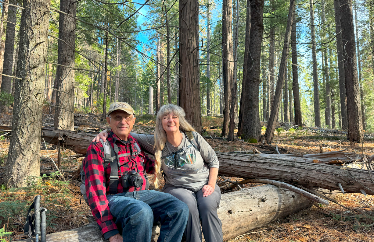
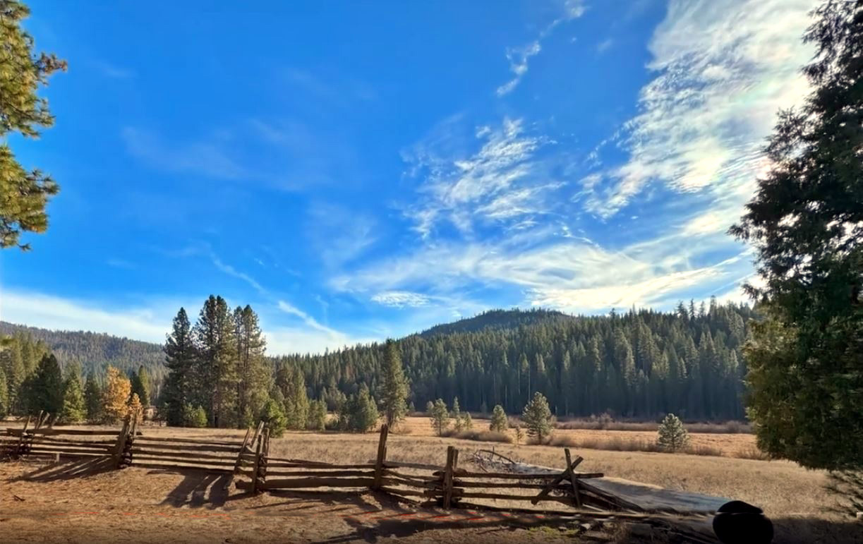
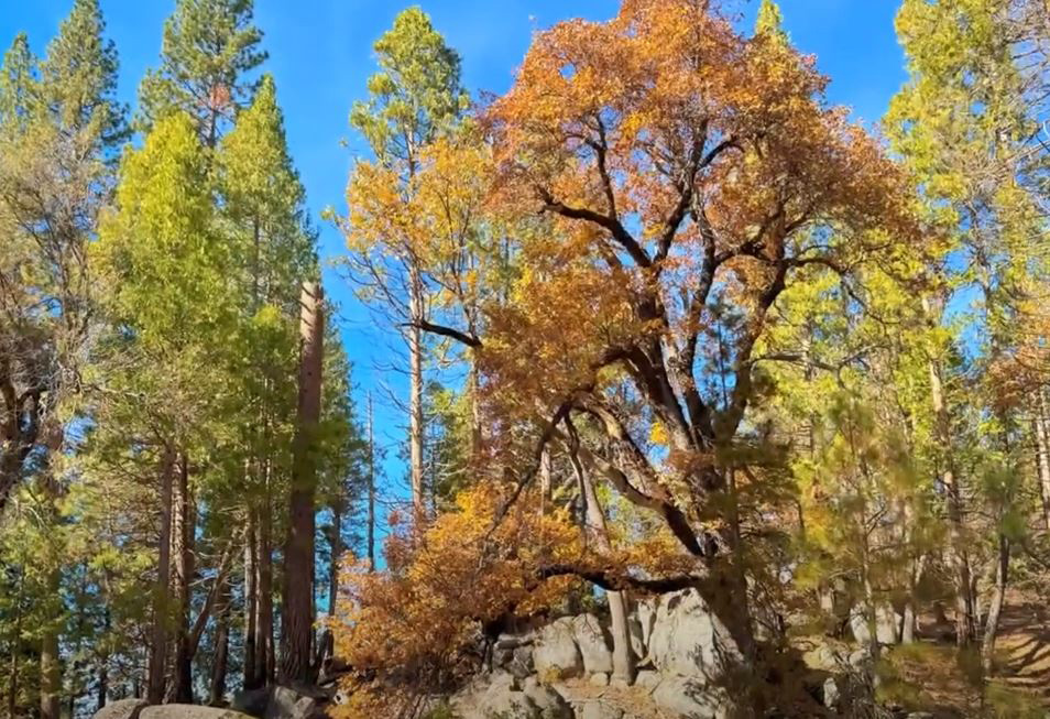
Fate seems to have decreed that I can never visit the Mariposa Grove of Giant Sequoias in Yosemite National Park. I was there with family in 2022, but the shuttle was not yet operating, and no one was up for a two mile hike just to the first trees. This year, the week before Thanksgiving, I was going to be at my daughter's place in Oakhurst to take care of the cats while they went to Tahoe. This is always the opportunity for a hike since it's over half way to many great trails. I always invite my other daughter Teri and friend Wes to join me, and this year we decided to go to Mariposa Grove. We got to the parking lot and shuttle station, just inside the Highway 41 park entrance in mid-morning. There were just a few parking spots left, but more dismaying was the long line of people waiting to get on the shuttle. They run about every ten minutes, but we calculated that we could easily be waiting an hour to board. We don't have that kind of patience anymore, and turned to the same Plan B we had chosen in 2022 - a hike on the Wawona Meadow Loop Trail. We took the short drive up the road, but instead of walking across the northern end of the meadow and taking the trail on the west side, we parked at a small lot on the east side, a quarter mile or so from "downtown Wawona," and hiked from there. As on the other side we had views of the meadow, black oaks with leaves turning yellow, and evergreens, mostly cedar and ponderosa pine. The weather was delightful, and the few people we met on the trail were the same. |
|
|
|
| Dick and Teri found the perfect resting log | Looking west across the meadow |
|
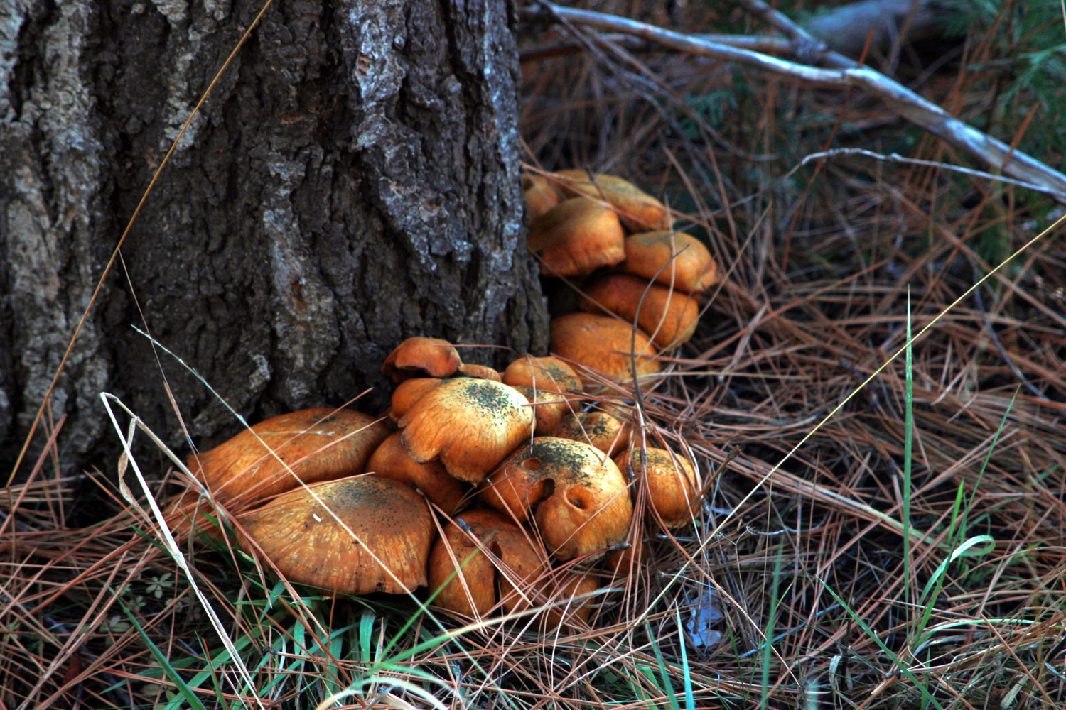
Our round trip hike was almost two and a quarter miles. Looking across the meadow, we could see that the other side was pretty much all in shade, so we were glad for the sunshine on our side. We saw big granite rock formations and small fungus and other stuff that I can't remember now. As usual Wes had some thoughts in an email he sent to me after the hike: "Thanks for starting my Thanksgiving season with a hike in Yosemite National Park. Who would have guessed a long stream of cars entering the park and a equally long serpentine line of people waiting for the shuttle bus at Mariposa Grove. Then came Teri with the suggestion of Plan B. As Robert Frost has said: 'We took the road less traveled and that made all the difference.' Thanks for not having us wait, wait and wait to follow crowds along the path. Instead we were almost alone on the loop trail. And it made all the difference. I used this time to test the camera on my new I-phone 15. I made several adjustments that will help moving forward. I stitched together many of these still images in a short video. And the natural environment is indeed a 'wonderful world.'" |
|
|
|
| Under a pine, in the shade, a hidden delight | Evergreens and a magnificent black oak |
|
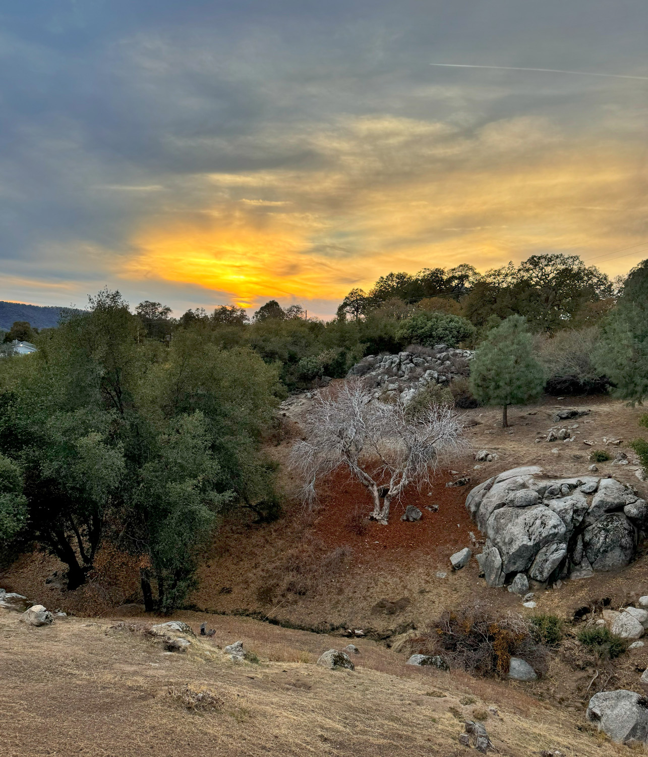
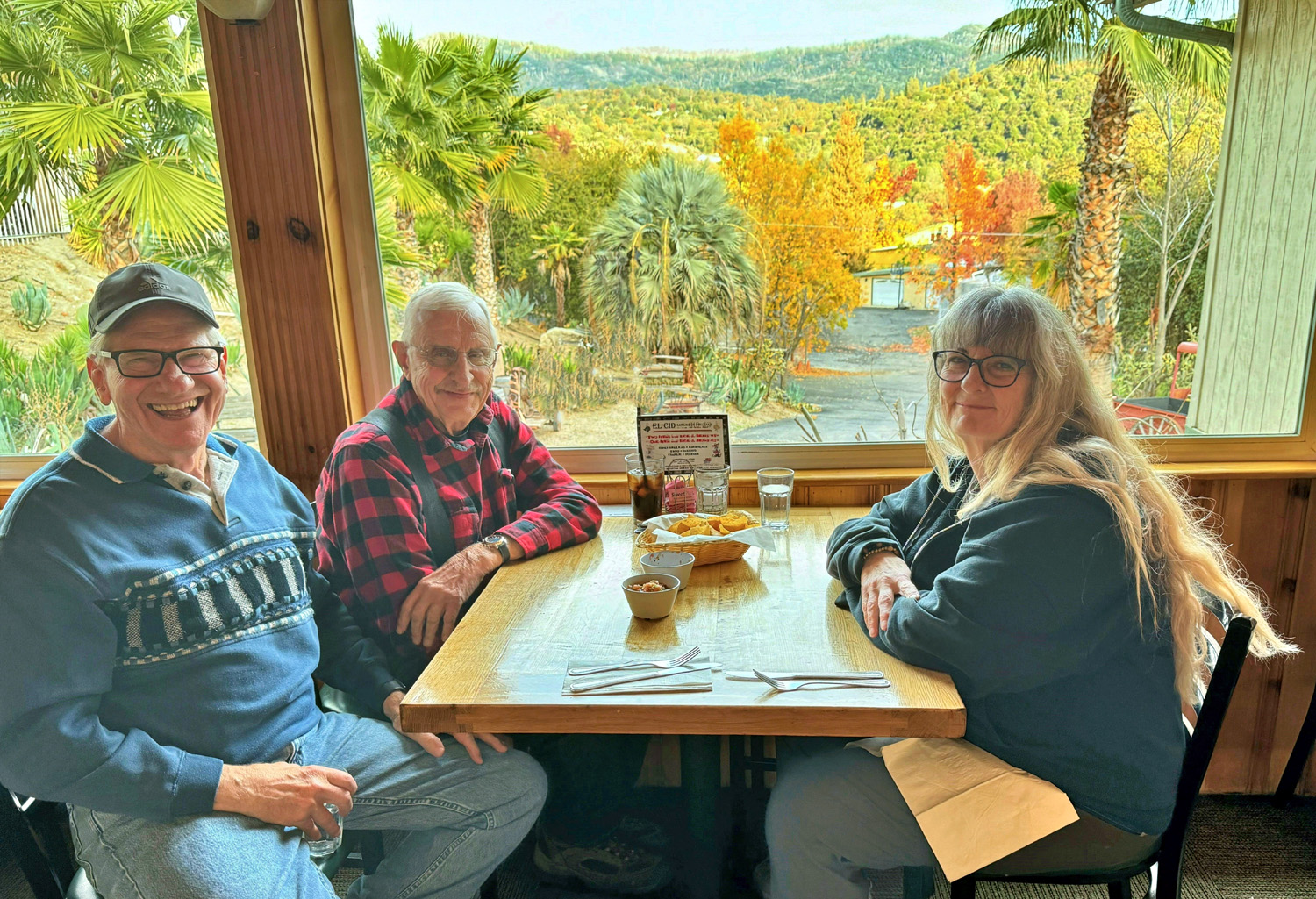
After our hike, we returned to Oakhurst and enjoyed a good Mexican dinner at El Cid, kind of a tradition on these outings. Back at the Neely residence, Wes further tested his new phone with some photos of the lowering sun and the drainage below the house before heading back to Fresno. Teri was staying overnight, and we had further adventures planned for the next day, since the cat sitting duties take up very little time. |
|
|
Teri and I had talked about going to Yosemite Valley the second day, but that was not to be. Teri had some work matters to take care of, and we were pretty sure the crowds at the Mariposa Grove parking area would be repeated in the valley. Remember, this was the week before Thanksgiving, when school is out. We decided to go out to breakfast, after which Teri would head down the hill One of our favorite Oakhurst restaurants has been Pete's Place, a breakfast and lunch operation popular with locals and travelers. The long-time owners retired at the end of 2022, but new owners have taken over. The food was as good as ever, most of the staff were still there, and the only significant change is that the restaurant no longer closes at 2 p.m.; a big sign announces "OPEN LATE." After breakfast we said our goodbyes, and I went to the park and hiked on the Oakhurst River Parkway. This mostly level trail follows China Peak upstream, with several options to get off the path and walk along a street. I probably walked a mile total before taking the five mile drive back to Rod & Jennifer's. After
breakfast the next day I decided to go to the Lewis
Creek Trailhead, about which I have written a number of times. I
did not plan to go down the trail to the south, which goes to the
bottom of Corlieu
Falls There was a good sized log across the creek, not anything I would use as a bridge, but acceptable for younger, more nimble hikers. Two hikers came down the trail and one of them, a young and athletic looking woman, crossed without hesitation. The other woman stepped on to the log, then stepped back and was clearly hesitant to try it. Her companion came back and relieved her of her hand-carried water bottle, and the woman sat down and straddled the log, then inched her way part way across. As she approached the other bank, she got up on hands and knees, and then stood up and walked the last two or three feet. I didn't stay to see how they handled the return crossing. Perhaps they continued all the way out to the trailhead at Sugar Pine. Down stream a short distance a party of about five was crossing on some rocks, none of which offered what I would have considered solid footing. The last hiker was carrying a small dog, but one of the others came to mid-stream and relieved her of her burden. They all finished crossing and headed up the trail. I turned back and returned to my car and back to the Neely place, stopping a couple of places to enjoy the black oaks changing color. There are three cats as usual, and there have been none lost to coyotes for a long time. The two newer cats, Peanut and Newton, are kept indoors unless on a leash, and have passed their second birthday. The senior feline, Pebbles, who is eight, can go out and in, but spends more time inside these days, and seems to be very cognizant of the dangers of outdoors in the foothills. Peanut especially is very entertaining. For much of her life she has played in the bathtub with one of those extra bouncy rubber balls, making much more noise that you'd expect, and sometimes bouncing it out of the tub. This time she did very little playing, but whenever I went into the bathroom she would jump in the tub, then sit there waiting for me to open the curtain and look in at her. In between my hiking activities I read, walked around the property, ate, fed the cats, picked up the mail, and enjoyed the foothill scenery. I had a grilled cheese sandwich for Thanksgiving dinner, knowing there would be better fare at our family celebration on Saturday. On Friday I had a light breakfast, and returned home, thankful that I could get my "cat fix" with my daughters cats, since I have no further desire to keep one of my own. --Dick Estel, December 2023 |
|
|
Photos (Click to enlarge; pictures open in new window) |
||
|
Sierra Vista Scenic Byway |
||
 |
 |
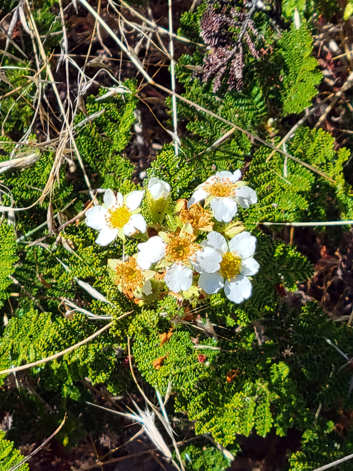 |
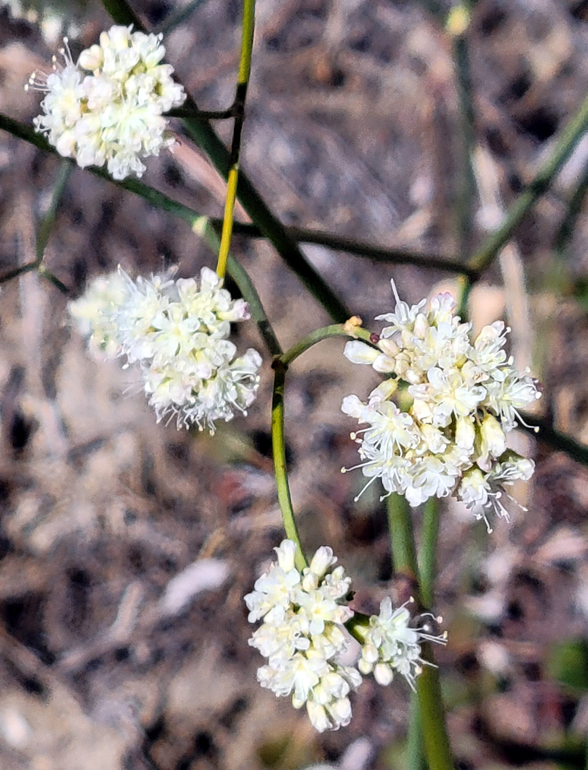
| A closer view of Fuller Buttes | Flowers along the Byway | Bear clover in bloom |
 |
|
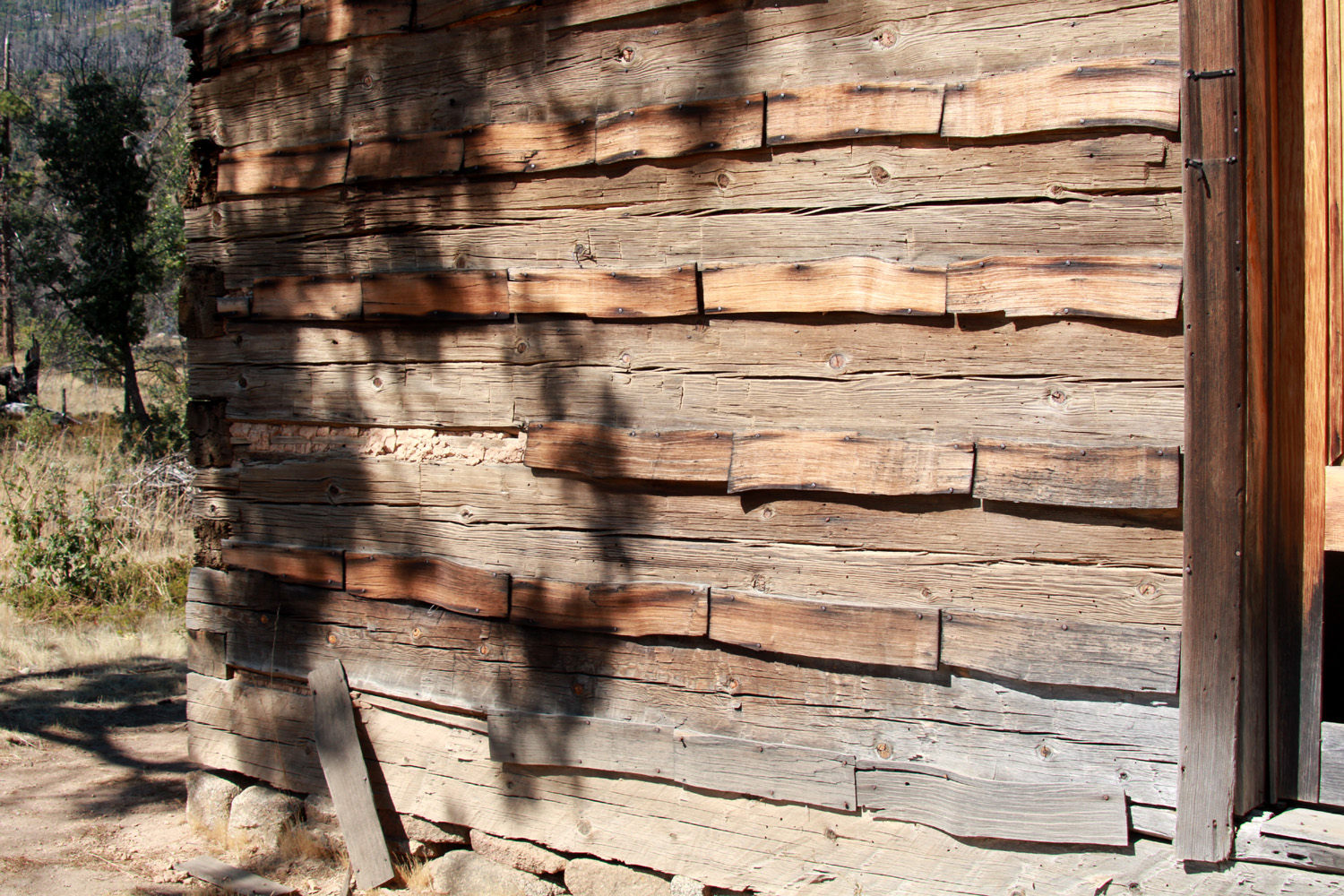 |
| More about the Ross Cabin | Rear of cabin | Close-up of log construction |
 |
 |
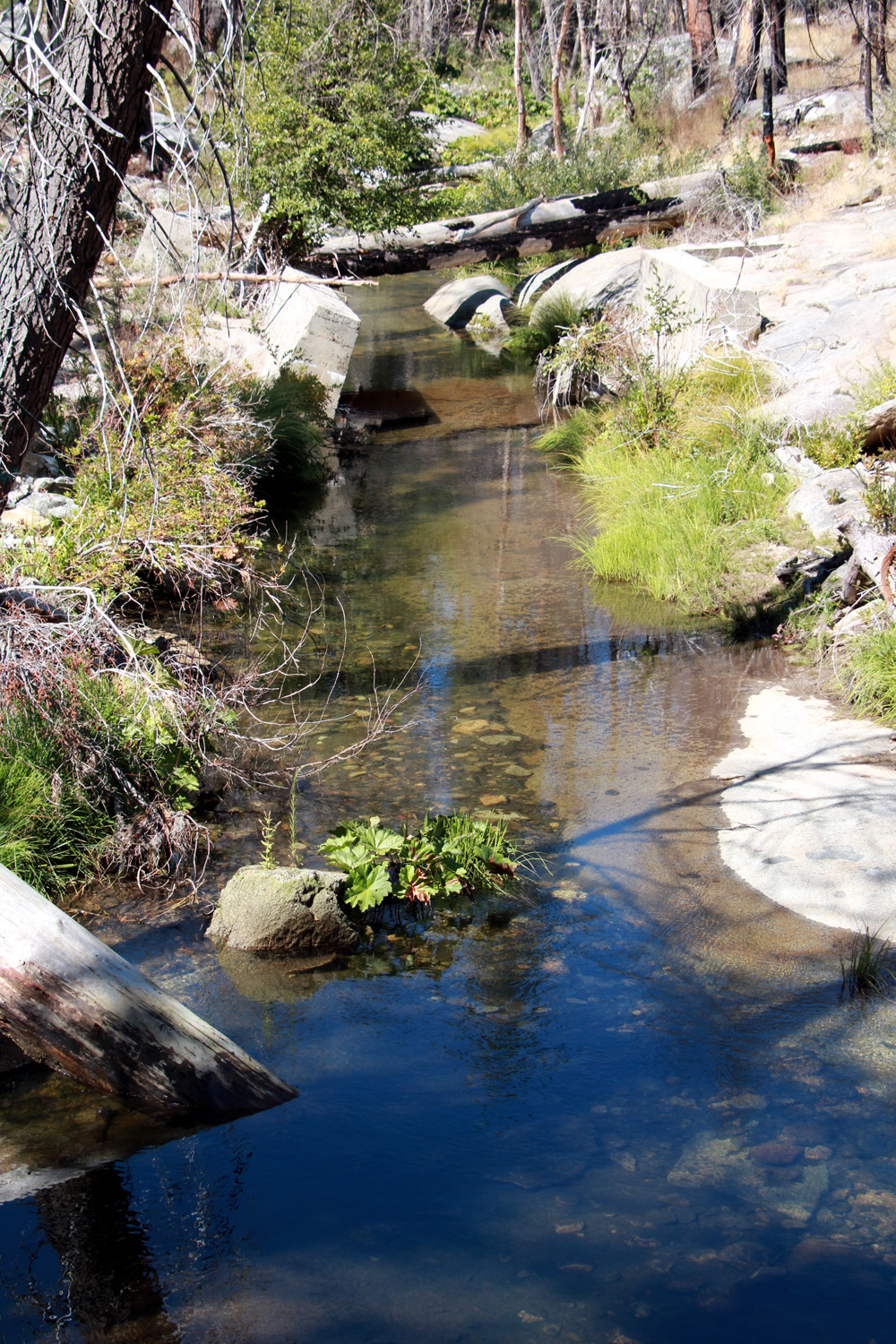 |
| Chimney detail | A common insulation method in years gone by | Despite the fires, Rock Creek still flows |
| Wawona Meadow & Cat Sitting | ||
 |
 |
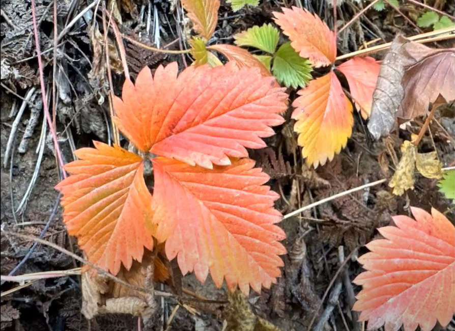 |
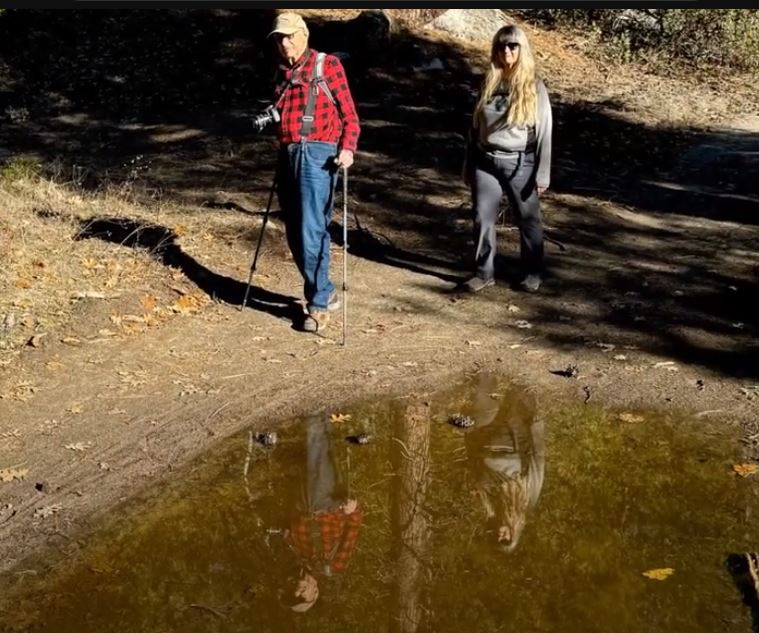
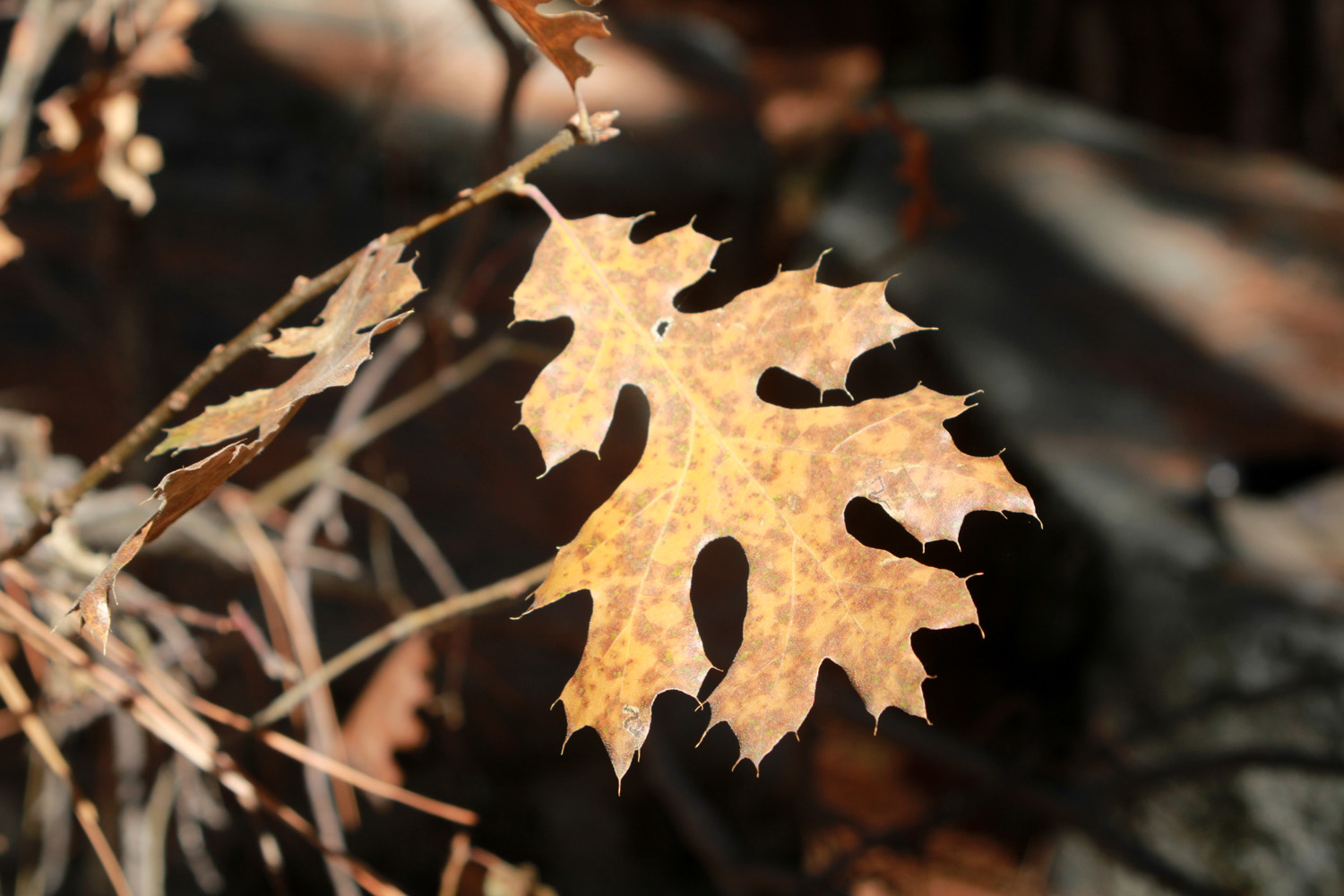
| Hikers reflected in a big puddle | A lone black oak leaf | More fall color |
|
 |
 |
| A rustic fence surrounds most of the meadow | Wes, Dick and Teri at El Cid | Sunset from the
Neely patio (Wes Thiessen photo) |
 |
|
|
| Black oaks changing color on the hill above Lewis Creek |
Peanut hides out in the bathtub | |
| Related Links | ||
| Sierra Vista Scenic Byway | More Sierra Vista Byway | Mammoth Pool Project |
| Ritter Range Photos | Fuller Buttes | Fire and the Byway |
| Jesse Ross Cabin | More About the Cabin | Mile High Vista |
| French Fire | Creek Fire | North Fork |
| Ritter Range | Mt. Ritter | Banner Peak |
| Redinger Lake | Colorado Grill | Wes's Wawona Video |
| El Cid | Wawona Meadow Loop Trail | Oakhurst River Parkway |
| Pete's Place | ||