

|
Dick's Adventures of 2021 - Part 1 |
|
| Photos Related Links More Travel Reports | |
| Adventures of 2016 Adventures of 2017 Adventures of 2018 Adventures of 2019 Adventures of 2020 | |
| Eastman Lake San Joaquin Gorge Bridge Trail Hensley Reservoir | |
| Eastman
Lake I consider Eastman Lake to be the sister to Hensley Reservoir. Both were built in the 1970s in Madera County, both on minor rivers. Hensley is formed by Hidden Dam on the Fresno River, and Eastman by Buchanan Dam on the Chowchilla River. Both are relatively small, Hensley with 90,000 acre feet, and Eastman 150,000. By comparison, Millerton Lake on the San Joaquin is over 500,000 and Pine Flat on the Kings stores over a million acre feet of water. I have camped and hiked at Hensley many times, but only twice at Eastman, in 2016 and 2017. When my daughter Teri and I planned a hike for January 7, I suggested Eastman. It would be her first visit to the location. We've had some foggy mornings, and this one was no exception. We discussed whether we should go to a higher elevation where we could get above the fog, but decided to stick with our original plans. Our route took us north on Highway 41, west a few miles on Highway 145, then on a series of county roads to our destination. Along the way we drove right past the dam at Hensley, and then through the small historic village of Raymond. The trailhead starts just before the road crosses the river and is known as the Lakeview Trail. By the time we got to our destination, at the very upper end of the lake, the fog had lifted enough that we had good visibility, although there was still no sunshine. |
|
 |
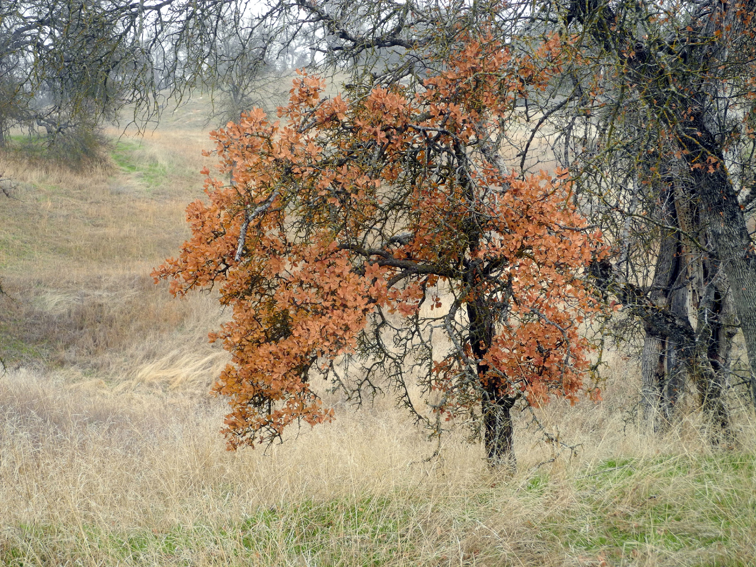 |
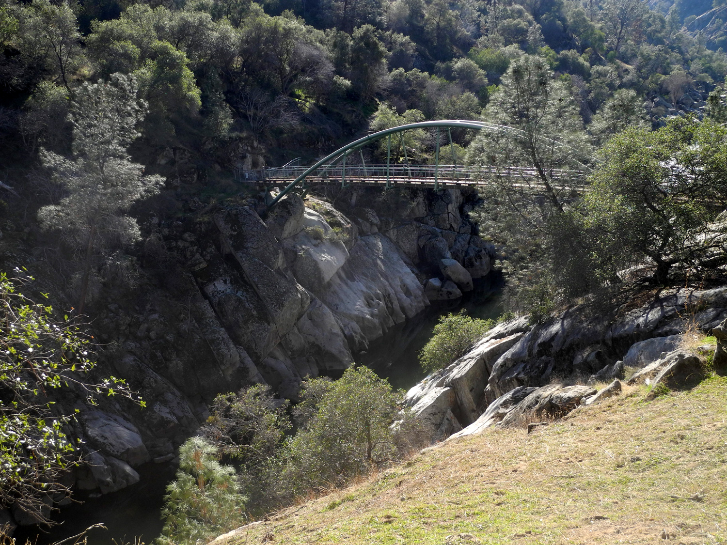
| Bridge across the Chowchilla River at the upper end of Eastman Lake | Leaves are a beautiful shade of brown on this blue oak |
|
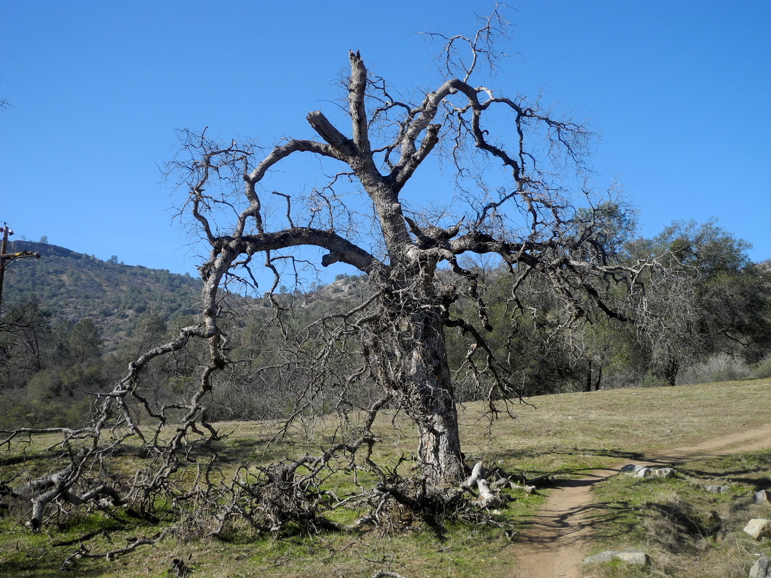
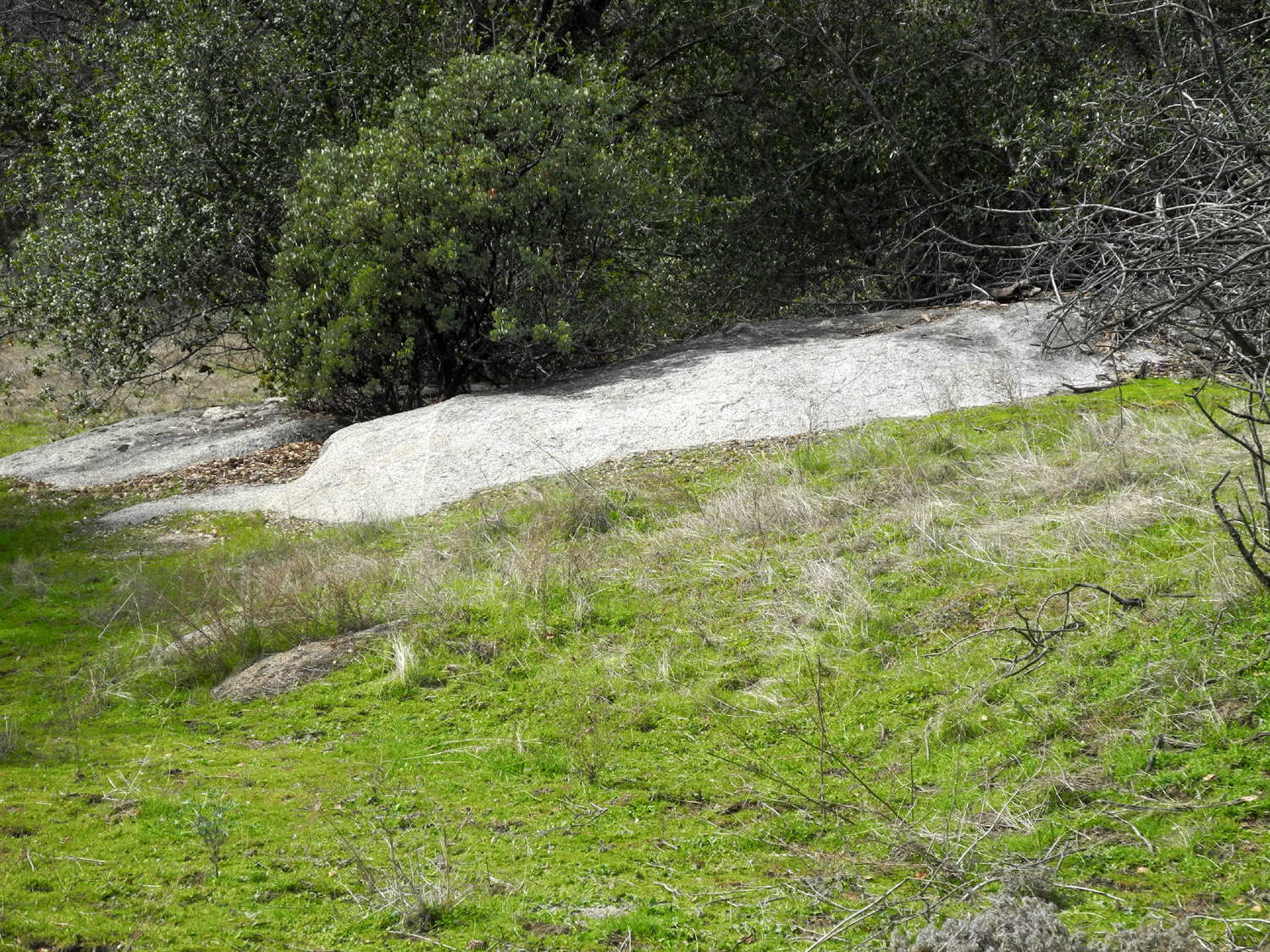
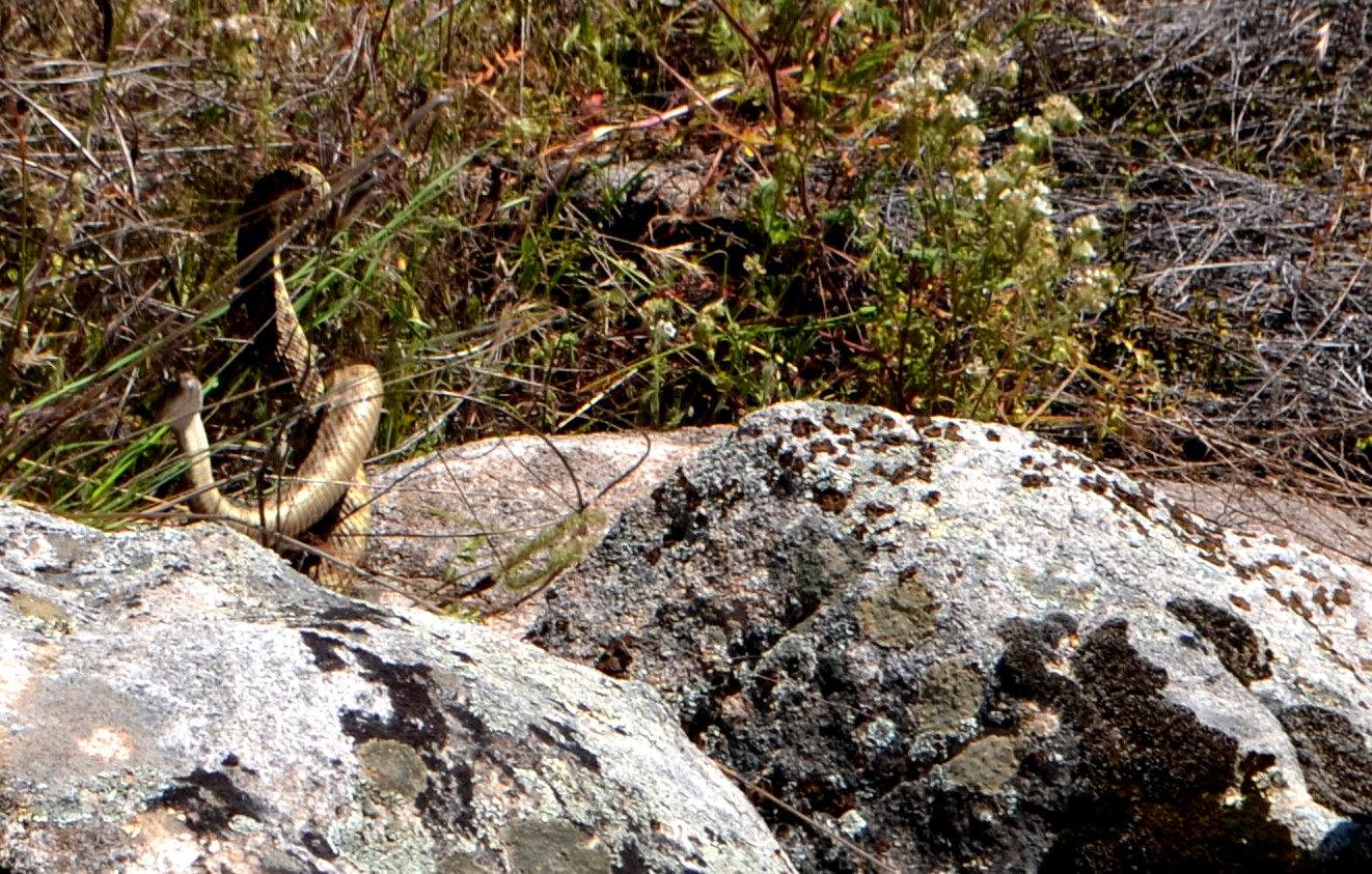
The trail goes over seven miles to the dam, but I no longer walk that far. Our plan was as usual, to walk till we had gone half of far enough. Viewing the lake would have required there to be water in the lake all the way up to our location, but a dry year has left small reservoirs very low, and we were limited to glimpses of short stretches of river in the original channel. The trail goes up and down on a regular basis, so the view of the lake bed was often blocked by the land when the trail went up into the low hills east of the lake. The area is typical low foothill country, less than one thousand feet elevation, with lots of blue oak, bull pines, and various shrubs. On my first visit with Wes we enjoyed a profusion of wildflowers, but it will probably be another month or so before we see them this year. However, the new green grass was getting a good start all through the foothills. There are plenty of granite rock formations, and the area is known for being occupied by many rattlesnakes. Wes saw two males fighting on one of our previous visits. We probably hiked about a mile before finding some good rocks to sit on while we had a snack, then stared back. By the time we reached the car, we had mostly blue sky, and overall the hike was scenic and enjoyable. |
|
 |
 |
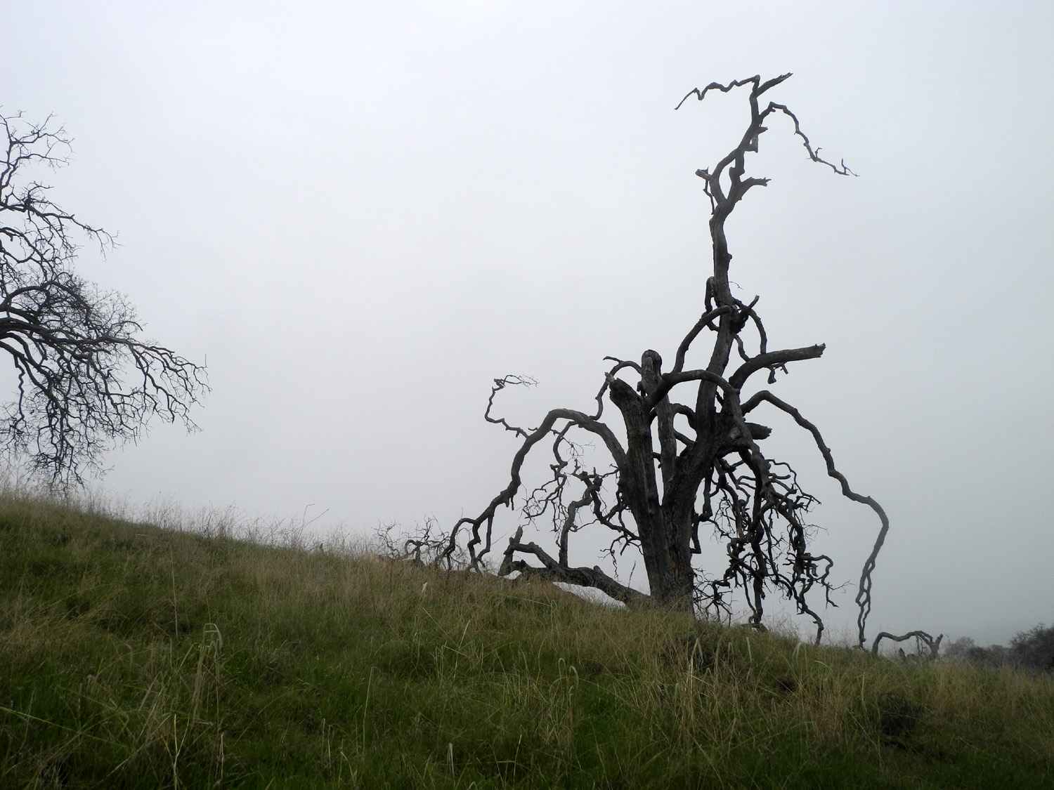
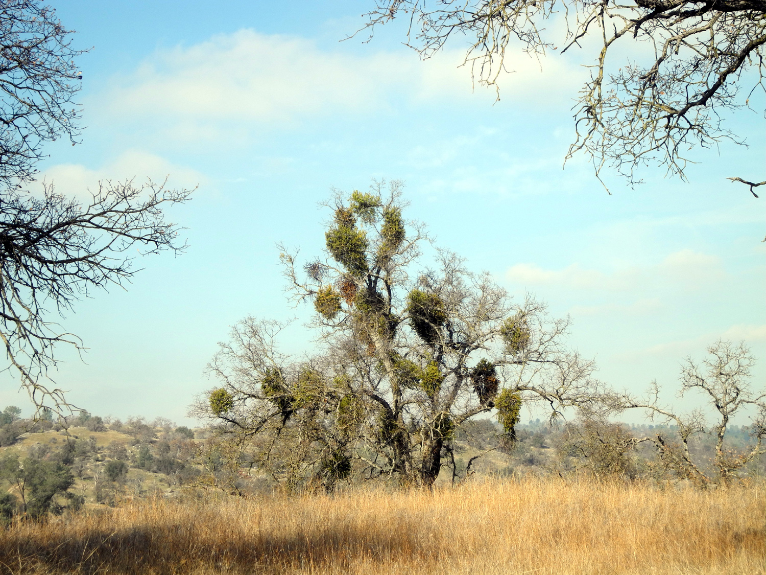
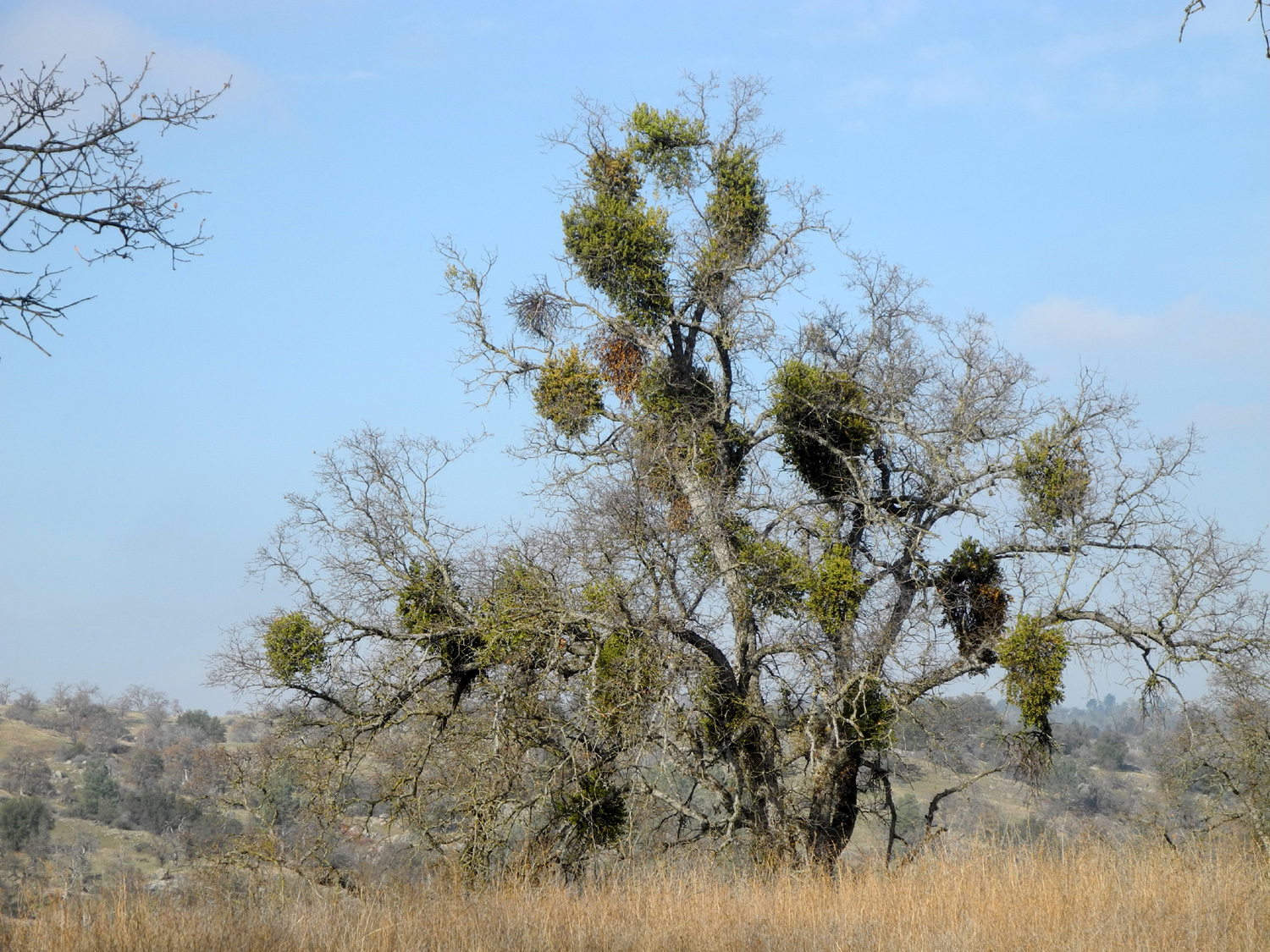
| Massive infestation of mistletoe looks cool, but is killing this tree | After a foggy morning, a few clouds drift over the hills west of the lake |
|
A final note: Although I have not visited this spot very many times, the Chowchilla River has been a big part of my life. It flowed south about a mile from my childhood home in Bootjack (Mariposa County), and through nearby property owned by family friends. We swam in the river, explored various sections of it, and fished in one of the forks. There are three forks that flow across Highway 49 between the Mariposa-Madera County line and Bootjack, with the west fork being the largest. This stream gets its start as Snow Creek, and crosses Triangle Road just west of the Darrah School (AKA Mt. Buckingham). Somewhere between there and Highway 49 it is joined by Jones Creek and becomes the Chowchilla. From the house where we lived a dirt road went back from the main road (now Highway 49) for a mile, where there was a "homemade" bridge over the river. A few hundred yards downstream from this location, I discovered a place where the water went down under some huge boulders, and almost became an underground, or at least under-rock stream. You could climb down into some parts of it, and there were some very deep holes. Like many central California rives, water from the Chowchilla eventually ends up in the San Joaquin. There is no natural outlet to the bigger stream, but a canal carries excess water during flood years. --Dick Estel, January 2021 |
|
| San
Joaquin Gorge (Bridge Trail)
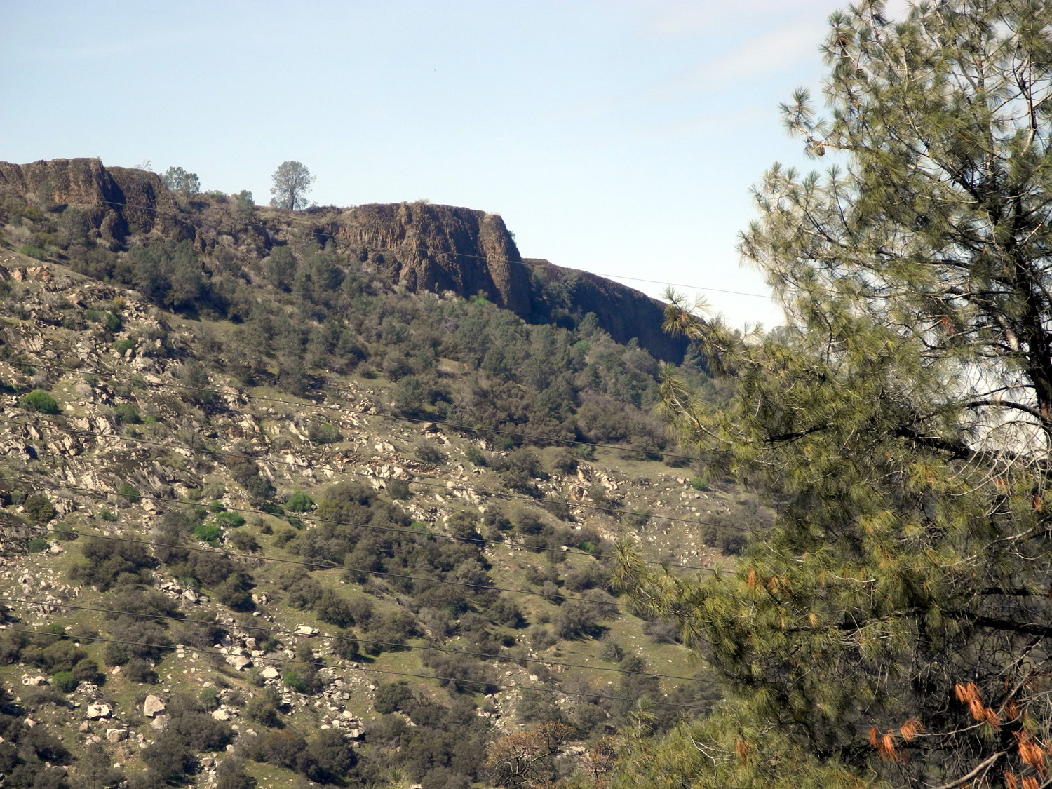
Another year, another series of hikes at the San Joaquin Gorge. My travel index page lists links to over 40 visits to this location, including day hikes, overnight camping, and a few family holiday celebrations. The earliest of these was in 2012, but there were dozens of trips before that, starting about 1980. I would not hesitate to say that I have been there over 100 times. The San Joaquin River Gorge Special Recreation Management Area, originally called Squaw Leap, recently dodged a serious threat. I have previously written briefly about a proposed dam on the San Joaquin River below the Bureau of Land Management property that would drown the visitor center, campgrounds, parking area, and most of the trails. In December we received good news - the reservoir authority returned millions of dollars to the California Water Commission and withdrew an application for additional funding. The debatable need for the reservoir has not gone away, and the desire to turn public land to private benefit will continue to hang over the area. Those who love this place will have to be ready to step forward to protect it. |
|
 |
 |
| Historic photos: Split rock near the L/S Camp; Dick on top of Kennedy Table in 2001 | |
|
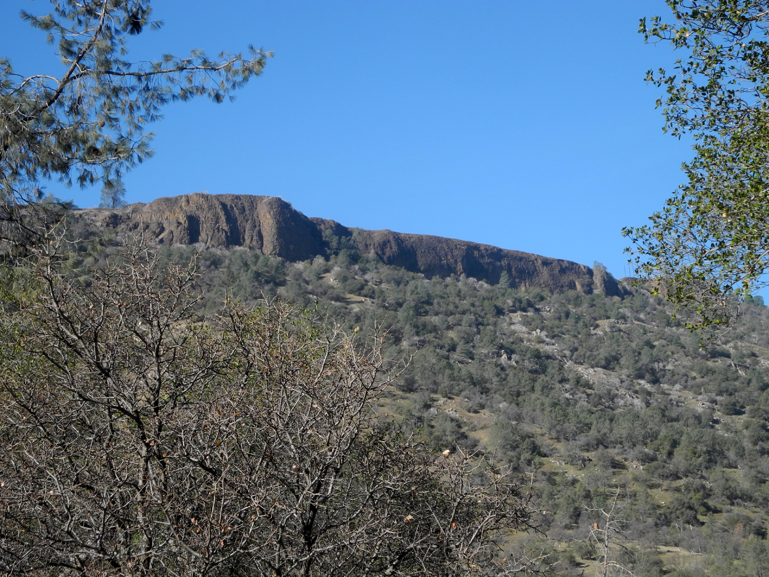
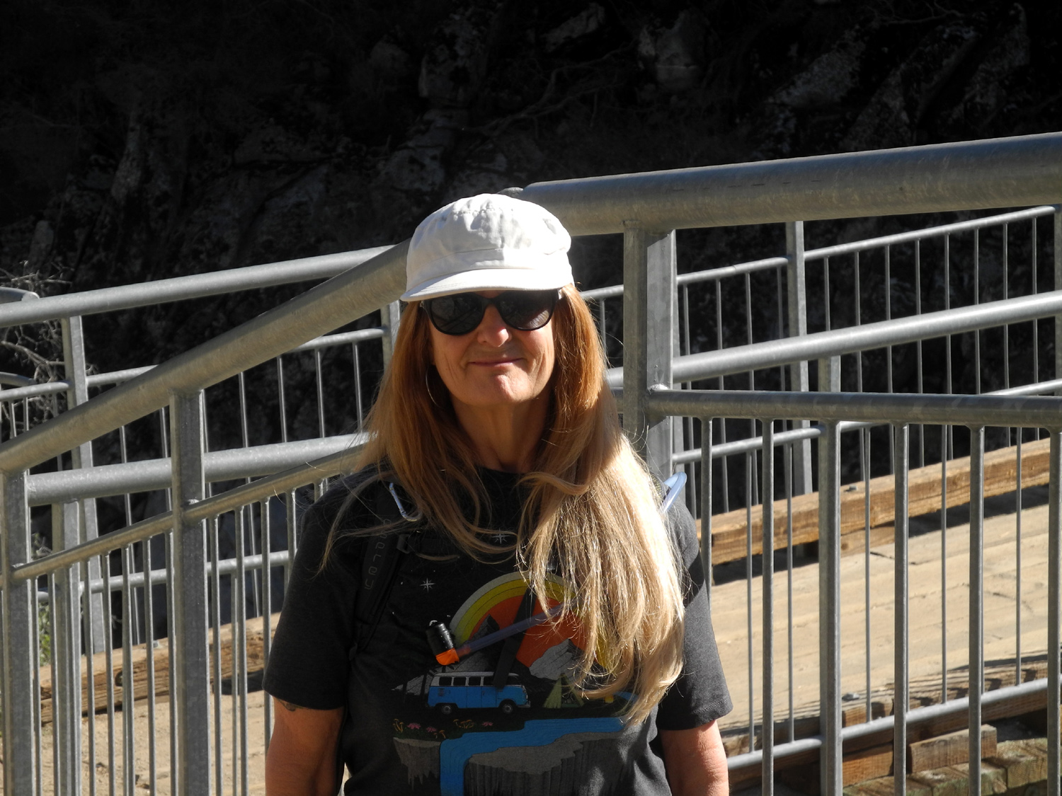
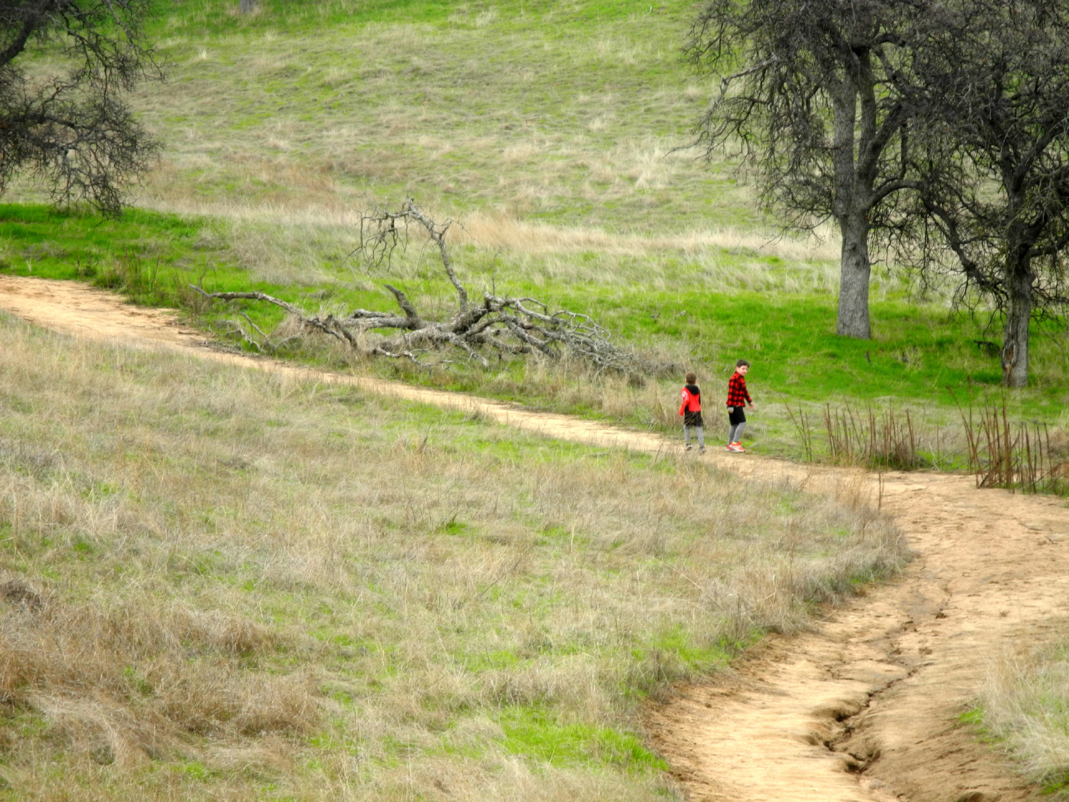
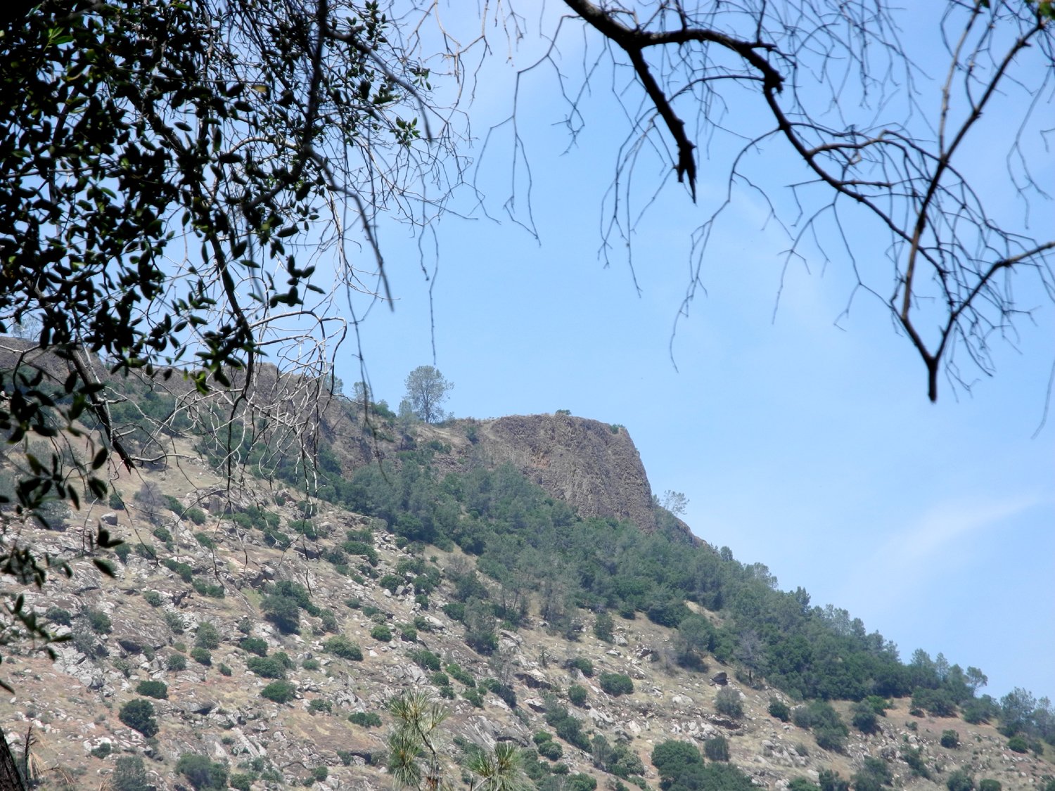
My daughter Teri and I kicked off the 2021 season on January 21, a day when the temperature got up into the high 60s. We started down the Bridge Trail about 10 a.m., planning to cross the bridge to the Madera County side, and hike up the Wuh-Ki'O (River Trail) about 3/4 mile to the L/S Camp site, where Teri's former husband and a friend camped for a week when they were teenagers. Along the trail we had views of Squaw Leap table top mountain, and wandered past hundreds of blue oaks, both alive and dead. It's about a mile to the bridge, mostly downhill, but not very steep. We rested for a while at the bridge, then started up the other side. A short distance past the bridge is a junction, with the right fork, the Pa'San Ridge Trail, going east and then up around a ridge, while the River Trail heads up a fairly steep section to an area of gentle rolling hills. Beyond this point it's another steep climb to where the river trail heads west and down to the San Joaquin River at Lake Millerton. Another fork continues up toward the steep ridge above this spot and joins the Ridge Trail. To the west of the trail is one of the largest table tops in the area, Kennedy Table. As this is written (1/24/21) we are in the middle of a series of significant storms, but before that it has been a very dry year. The new green grass has a good start, but there are no wildflowers yet. Past history indicates that there will eventually be a good display. |
|
 |
 |
| Squaw Leap from the Bridge Trail | Gnarly dead blue oaks are a common sight |
 |
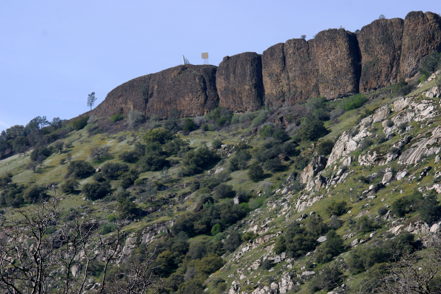 |
| Teri at the bridge | Basalt cliffs of Kennedy Table are about 80 feet high |
|
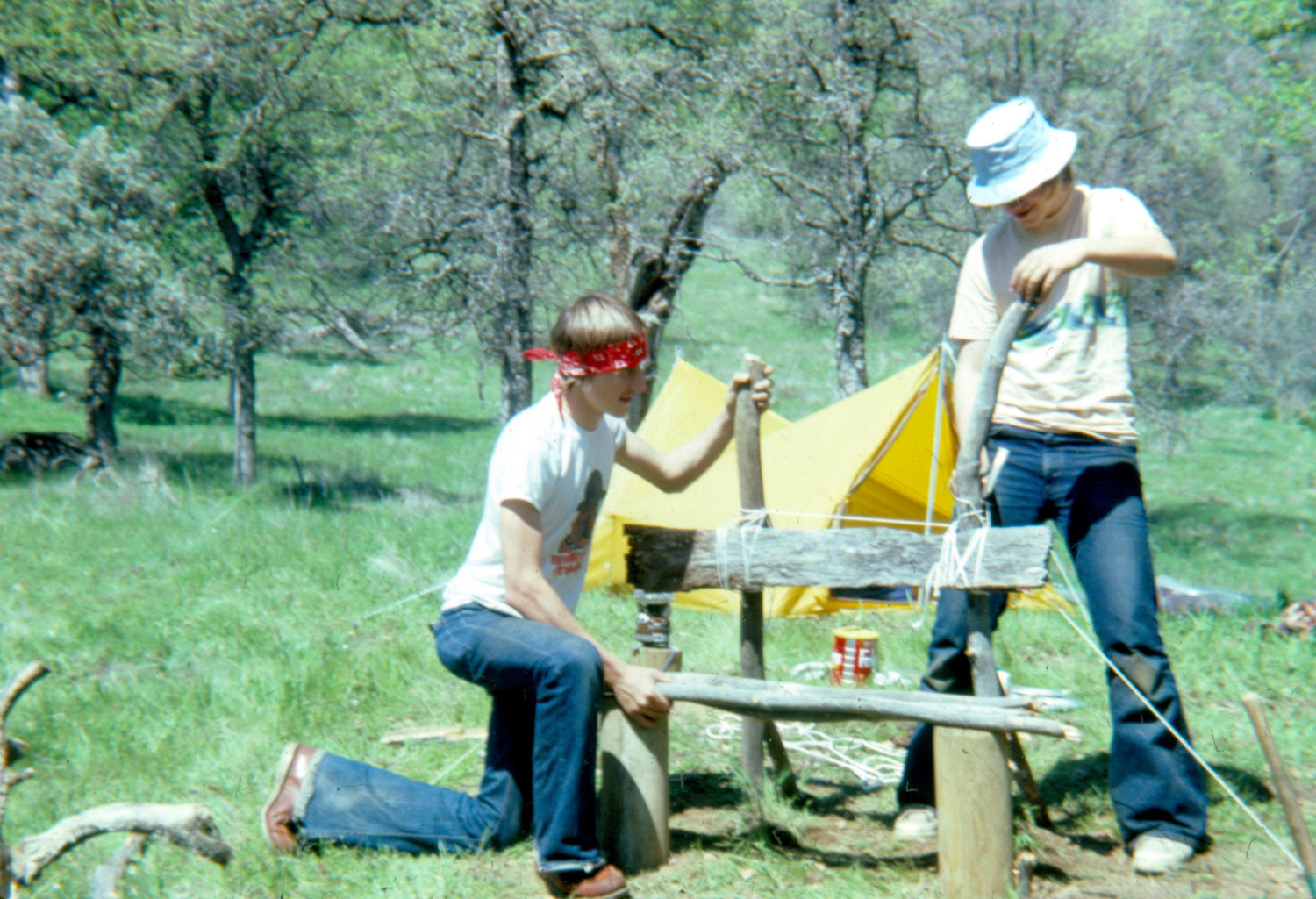
Where the trail levels off we turned right and made our way through oaks, brush and fallen logs toward the L/S camp site, which is on top of a small knoll. We sat on some rocks below the hill and enjoyed our lunch, then walked the final few hundred feet. The only thing left from camping days are two pieces of fence post that were part of a crude bench that we made from the posts and oak branches. |
|
 |
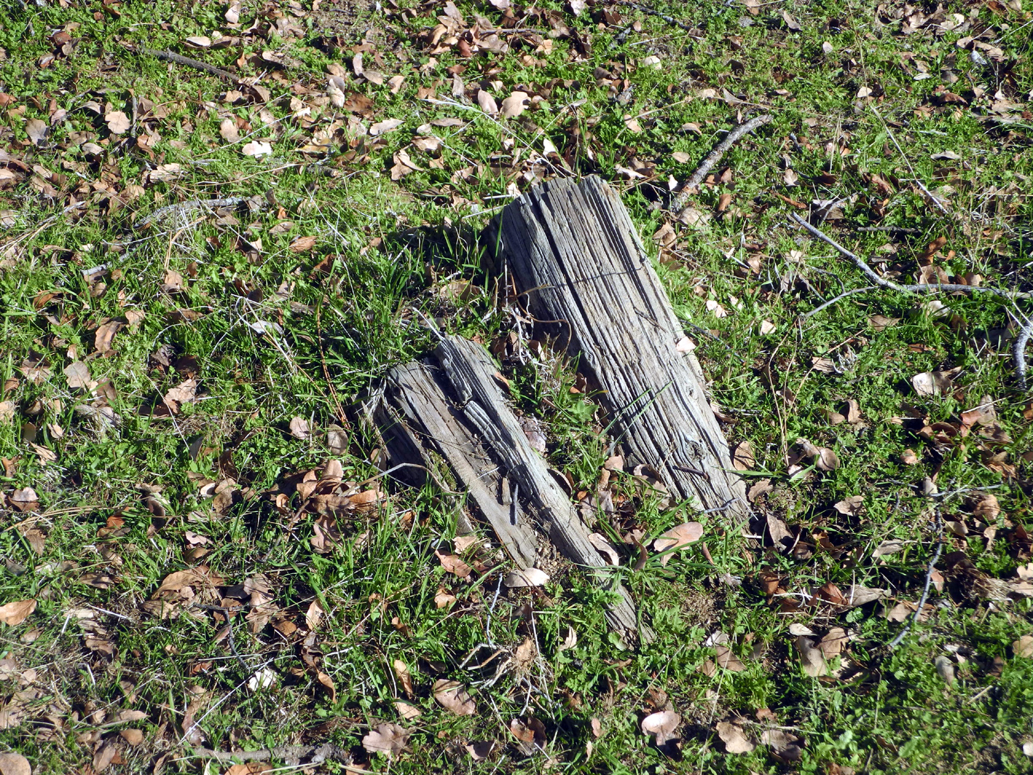 |
| Scott and Tim finishing the bench in 1981 | All that's left of the bench in 2021 |
|
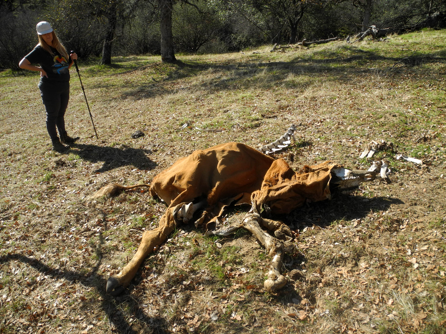
As we explored the camp area we spotted something unusual up the hill a couple hundred yards from the camp. It was the color of a camel, and while we agreed it was probably an unusual rock formation, we both were thinking "dead animal." I saw what looked like a bone sticking out on one side, and Teri detected a possible leg and hoof. When we got closer we saw that it was a former cow, now consisting of just the bones and hide. It was basically hollowed out, and clearly the rest of it had served as food for scavengers. There have always been cattle grazing on this property, and we have seen other more ancient bone piles in a couple of places. We crossed the little creek west of the camp, hiked a short distance through an open field to the trail, and headed back to the trailhead. We saw about a dozen other hikers during the day. Our total hiking distance was 3.4 miles, with over an hour and a half of moving time. We have not done much hiking lately, and near the end we realized that we are out of shape, and we need to get out and hike more. Teri said that she was very tired, and I walked around bent over part of the time the rest of the day. Even so, we had a great time, and were glad to have been able to get out in the country before the arrival of the impending cold storm. --Dick Estel, January 2021 |
|
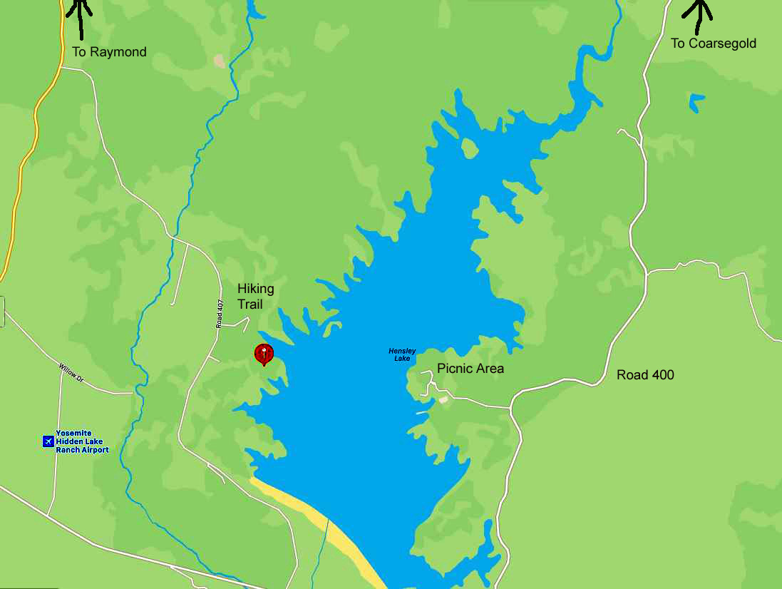
| Hensley
Reservoir
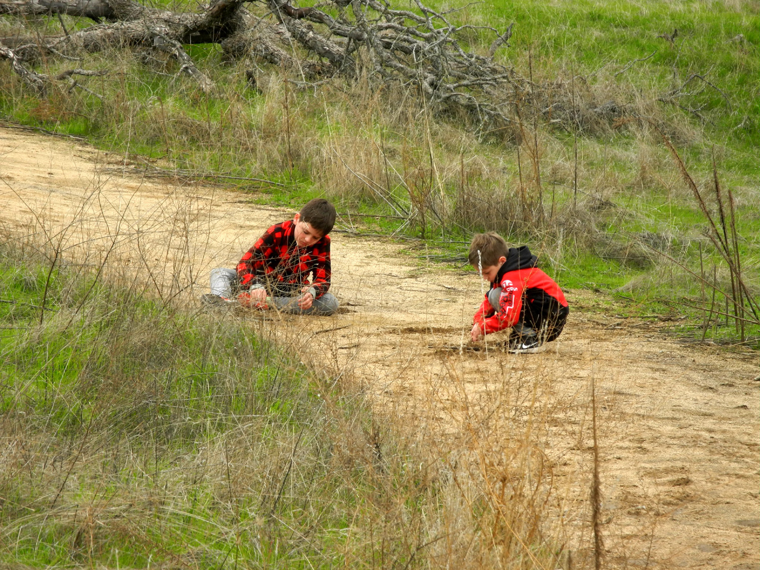
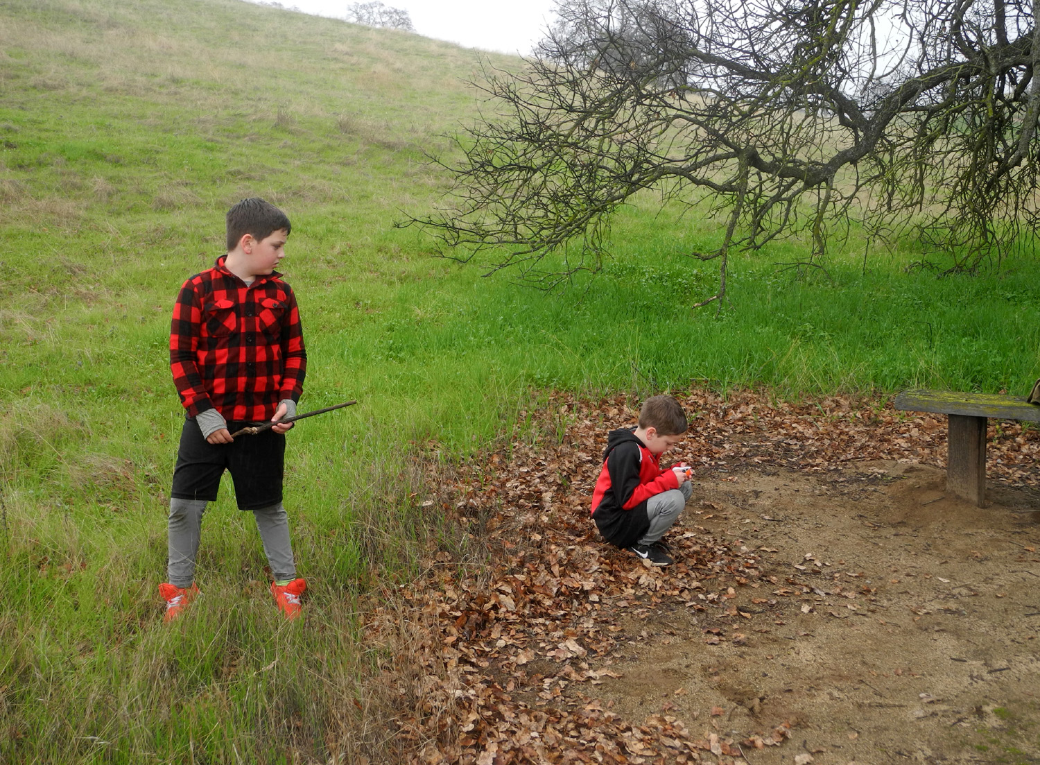
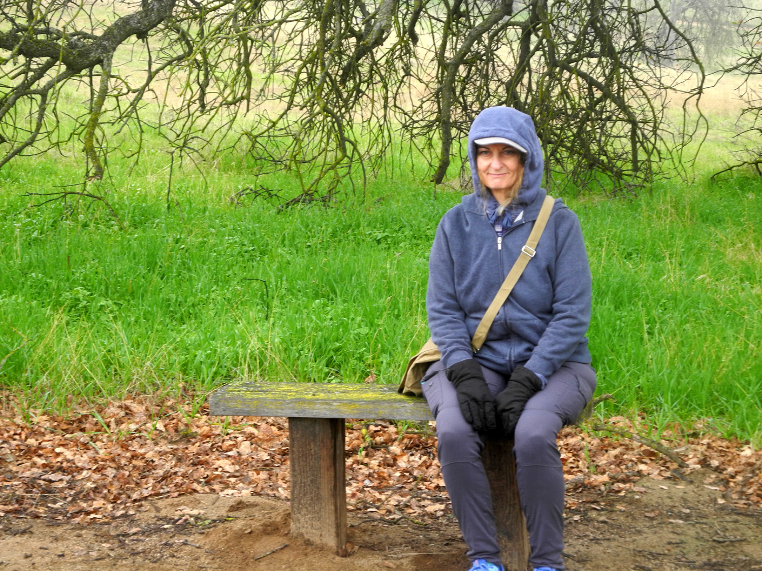
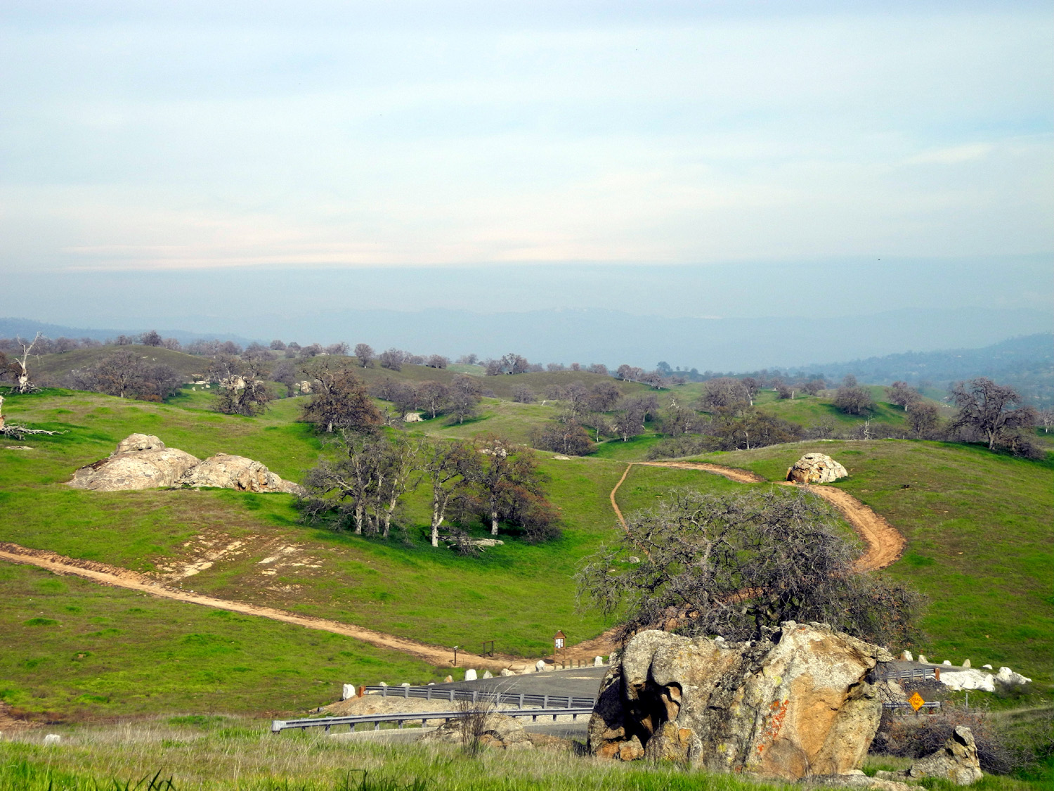
Daughter Teri has started a new job, and great grandsons Colton and Jack are back in the classroom four days a week, but on February 15, President's Day, they were free. Being retired, I never get a day off, but I make the best of it. We decided to visit a place we've all been to a number of times in the past, Hensley Reservoir in the Madera County foothills. Teri came to my place around 9:30, and grandson Johnny brought the boys over a little after that. Colton had been offered the option of going on this trip or staying home with mom and dad, who were working around the house. When we got started he wanted to change his mind and stay home, but it was too late, so he decided to be grumpy for the entire 35 mile drive. We parked at the Pohonichi Trailhead, where you can start the loop clockwise or otherwise. I always go clockwise, but this was not to be. I suggested to Colton that he pretend he was having fun, and possibly he really would. Teri and I did not even have our packs on before both boys had run up the steep hill at the start of the trail, going in the counter-clockwise direction. They ran back down, then up, then down again and up a third time as the adults finally started up. By the time Teri and I had reached the top of the first hill the boys had found sticks and soft dirt to dig in, and although Colton verbally denied having fun, their actions said otherwise. |
|
 |
 |
| Once in
a while Teri and I caught up, but for the most part the boys were way ahead of us the whole way |
Loose sand and dirt washed down by the rains is perfect for digging |
|
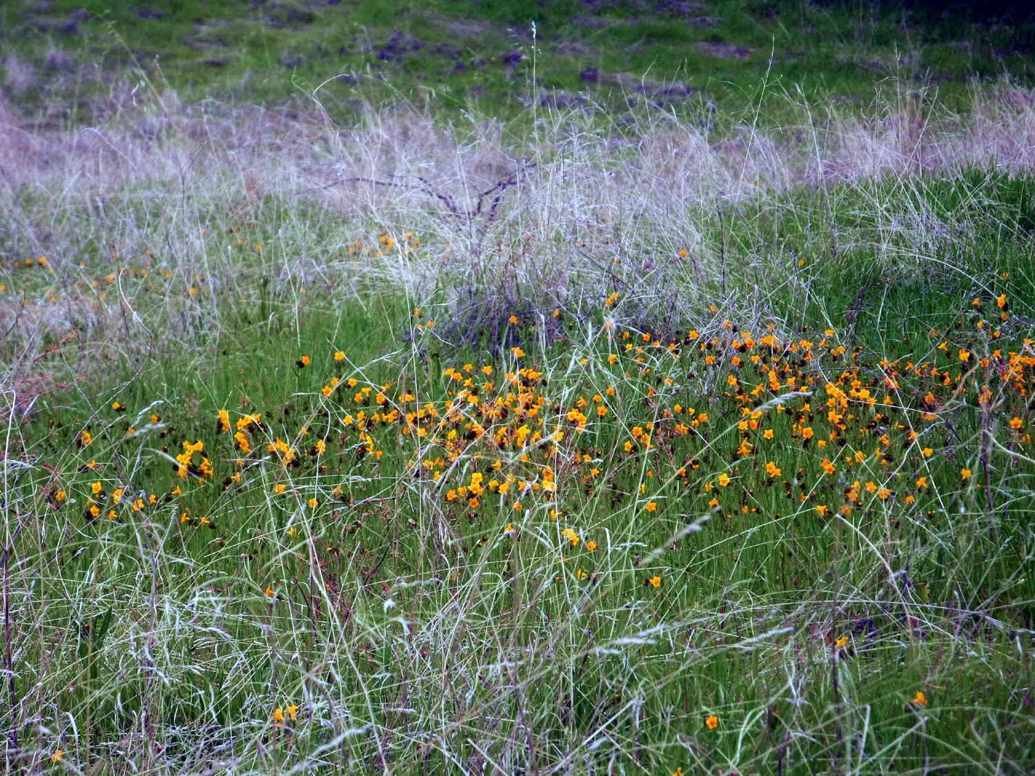
We've had a few rainstorms and the weather is warming up, and we finally saw the first wildflowers of the season, one of the reasons we chose this destination. Fiddlenecks were moderately thick, and there were sparse scatterings of popcorn flowers. We also enjoyed the usual foothill scenery of blue oaks, big boulders and green grass. |
|
 |
 |
| Fiddlenecks brighten up the mix of green and dry grass | Looking toward a rocky ridge northeast of the lake |
|
The entire loop is about a mile, but there is plenty of up and down, with a couple of steep spots. With stops at every resting bench and Colton's project to clear away dry leaves from one of the rest stops, we probably took over an hour to complete the hike. I decided that the counter-clockwise route was a better choice, since we got some of the steeper places out of the way early in the hike. It was quite cool, with a slight chance of rain, and in fact we had very light mist most of the time, not enough to bother us, but such that we kept our warm outer jackets on the whole time. |
|
 |
 |
| Colton's plan was to use his stick to sweep away all the leaves | Teri enjoying her grandsons' antics |
|
We finished our outing by driving to a picnic area on the opposite side of the lake, just off Road 400, which goes to Coarsegold on Highway 41. We were happy to see a large number of bush lupines in bloom along this route. Teri had brought sandwiches for the boys and we both had crackers, vegetables, and other goodies. We enjoyed our lunch with a nice view of the lake. Although the water level is very low, there were people fishing from the shore below us and at least one boat moving slowly out to the middle of the pond. We made the drive back home and delivered the boys to their parents. Johnny always tells us that it's our job to wear them out, but the usual result is the opposite. We went into their back yard and they continued their non-stop action by jumping into and climbing out the their new swimming pool, which is about a week from having water. --Dick Estel, February 2021 |
|
| San
Joaquin Gorge (San Joaquin River Trail)
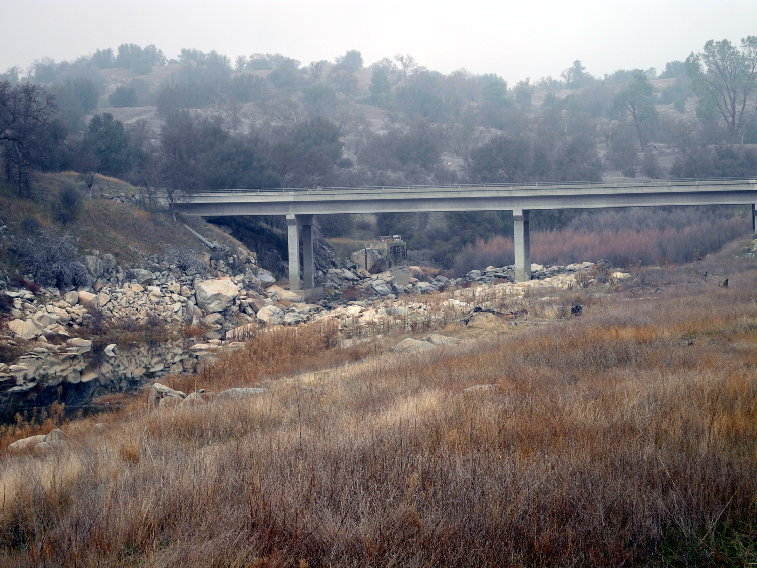
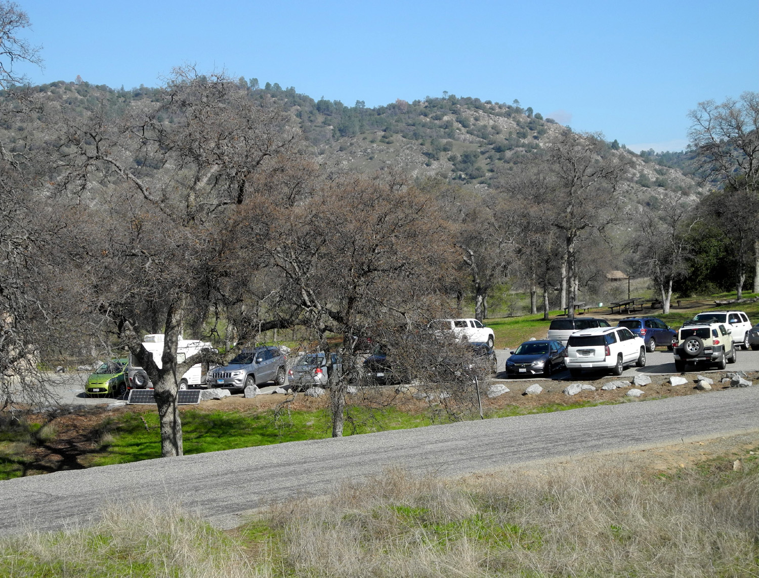
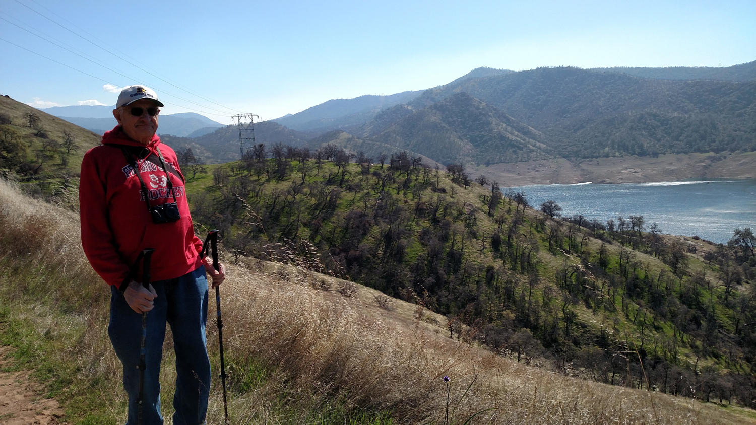
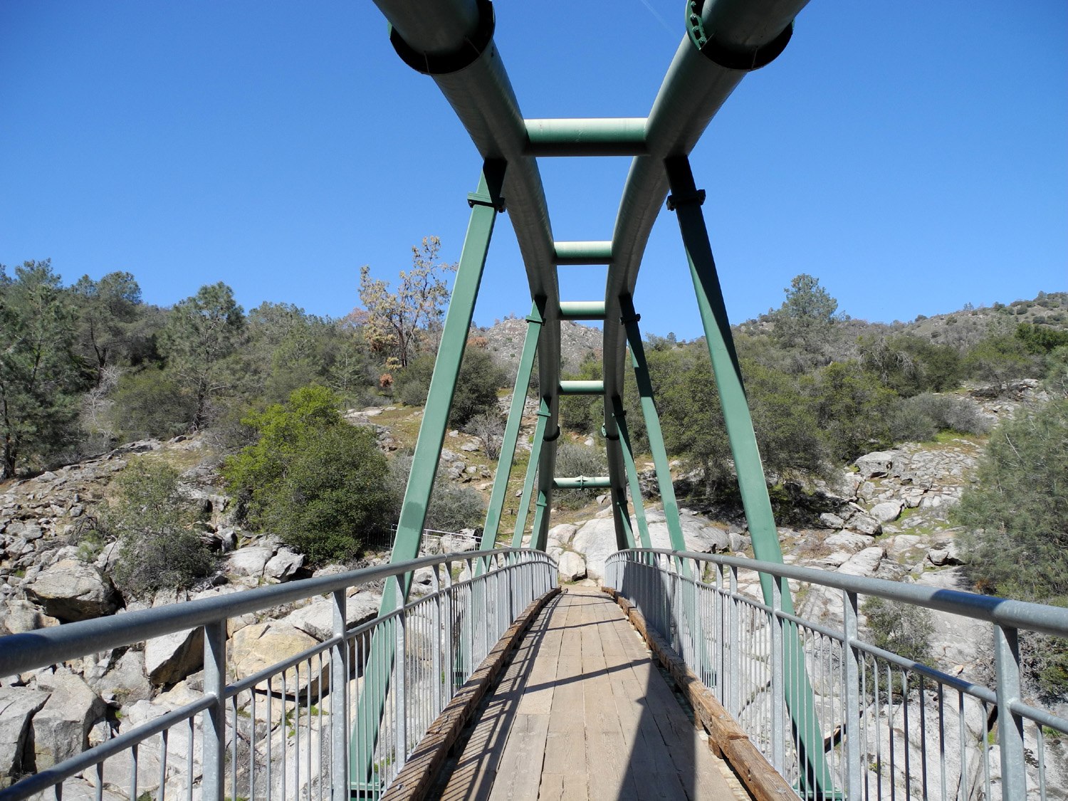
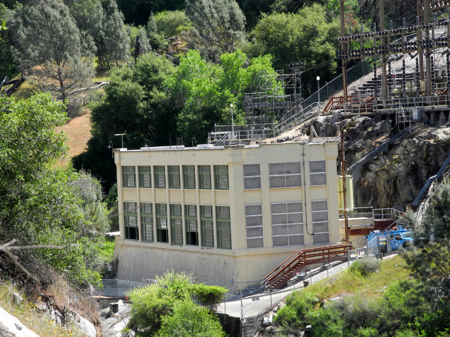
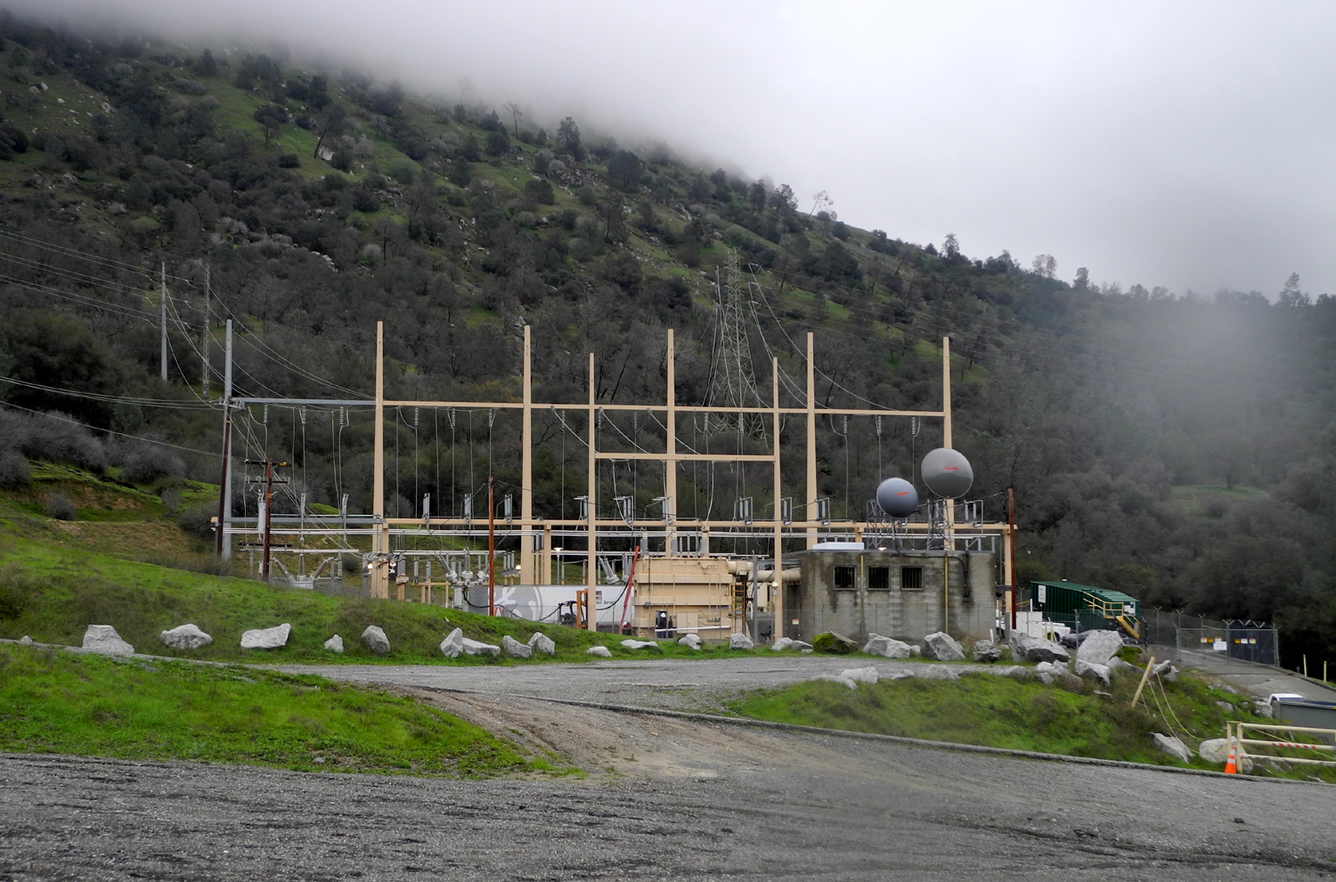
Some time around 1970, I read an article in the local newspaper about the completion of a new foot bridge across the San Joaquin River at a place called Squaw Leap. I had never heard of the place, but not long after that, I made my first visit there. I drove up what is now Highway168, turned off on the road to the little town of Auberry, and a mile or so past the town turned on to Smalley Road. After a few few miles down a narrow, steep, winding road, I arrived at the parking lot and the trail that led down to the river. The elevation at the start of the trail is about 1,200 feet, with a 400 foot, one mile descent to the bridge. It was spring, and the grass was green, wildflowers were out in profusion, the blue oaks were leafing out, and overall it was a delightful place. Just upstream from the bridge is one of PG&E's oldest hydropower plants, built in the 1920s. Not long after that that I returned with daughters Teri and Jennifer and Jen's boy friend. Over the years I introduced the location to my sons-in-law, many friends, and eventually my two grandsons and in recent years, my two great grandsons. Many changes have taken place in the nearly fifty years since my first visit. The road was re-paved and some of the curves eliminated, although no one would consider it a high speed route. A new power house was built about a mile downstream from the parking lot. A new trail was developed high on the Fresno County side of the river canyon, leading about 12 miles to Sky Harbor on Millerton Lake. A campground was developed at the parking lot, with a group camp and equestrian camp a quarter mile away, and an old PG&E residence was converted to an excellent visitor center, operated by the Bureau of Land Management. The wooden bridge railing was replaced by a stronger, safer metal one. The offensive name was changed to San Joaquin Gorge, although the table top mountain that towers over the south side of the area remains Squaw Leap. And I came back again and again, for hiking, backpacking and camping. I have no idea how many times I have been there, but since I started posting these adventures on the Internet, I have reported on 42 trips, starting in 2012. The latest was on February 18 of 2021, a solo hike on the upper trail, officially known as the San Joaquin River Trail. In the early days there would often be only two or three cars present on weekends. Now cars fill the main lot and spill over to the group camp lot. When I arrived, at 9:30 on a Thursday, there was room for only one or two more cars in the lot. A party was camped there with a tiny Casita travel trailer. |
|
 |
 |
| Full parking lot - note small travel trailer with solar panels at the left | The gateway to a great hike |
|
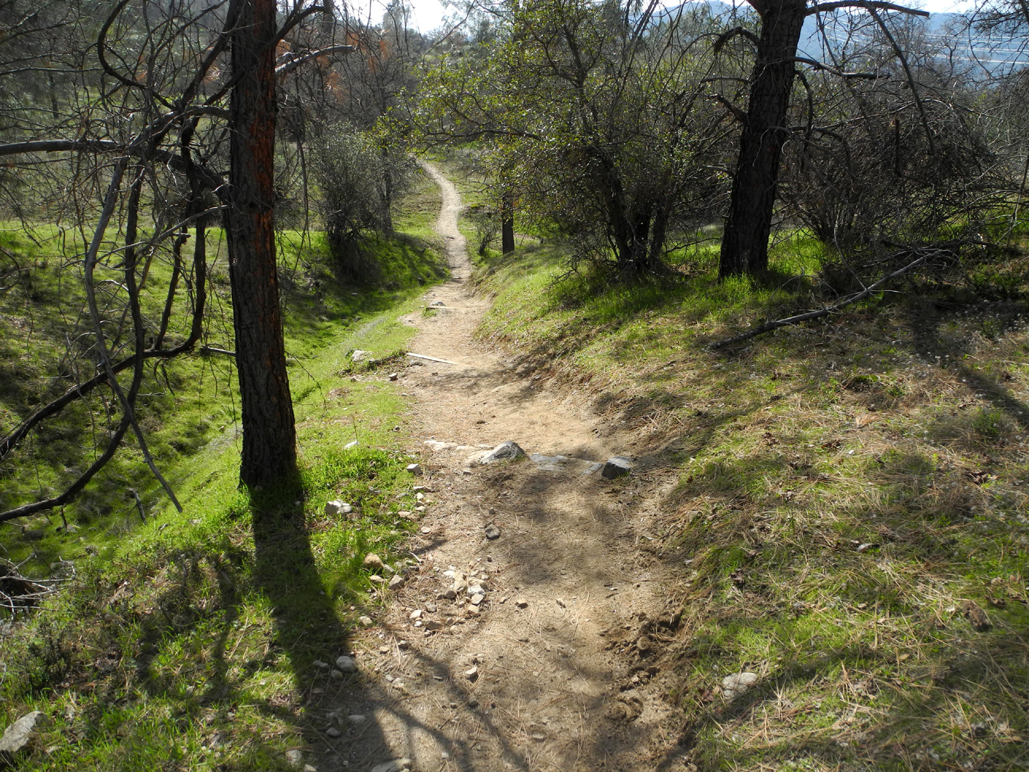
The trail I followed is considered moderate, although a couple of steep spots offer some challenges to older hikers. However, I always use hiking poles and walk slowly and carefully, and had no trouble navigating these spots. |
|
 |
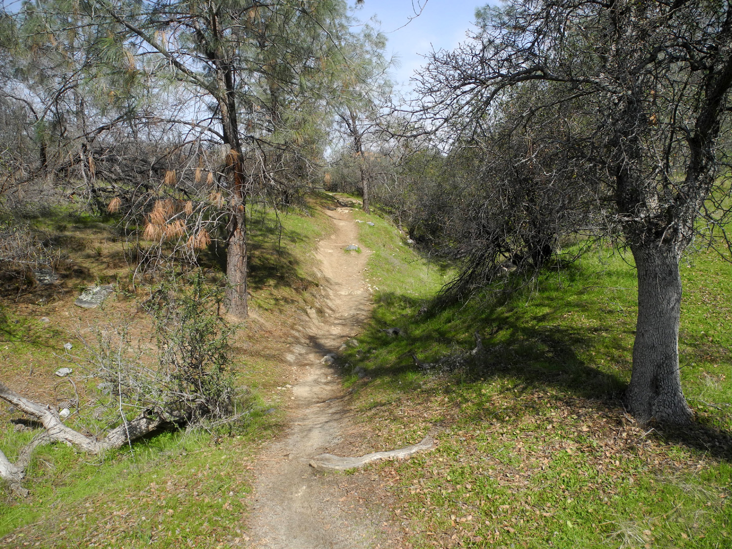 |
| Hiking up, use the dirt path; going down take the steps | Another steep stretch on the trail |
|
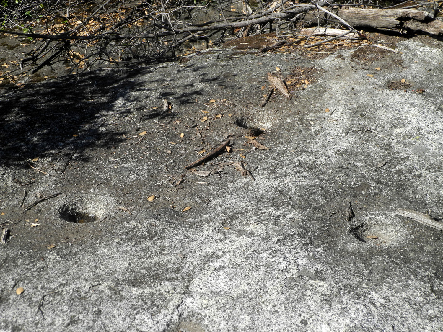
A short distance into my hike I made an enjoyable "discovery." Off to my right was a gently sloping granite outcrop, and something told me it was a likely spot for bedrock mortars, which exist in a number of other areas in the Gorge. I left the trail and was rewarded with the sight of four grinding holes, one of them very shallow. Nearly all such facilities are located near creeks, and there was a small drainage below the rock. Native Americans leached out the bitter tannin from acorns with water, but I don't know how much of this processing took place at the grinding location. Perhaps they were just making sure they could stay hydrated during a long day of effort in the sun. This creek is very small, and runs only in very wet years, but conditions could have been much different a thousand years ago. |
|
 |
 |
| Long ago
a native woman said "That looks like a good place to grind acorns." |
And it was |
|
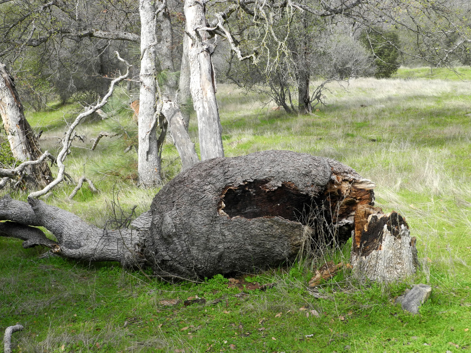
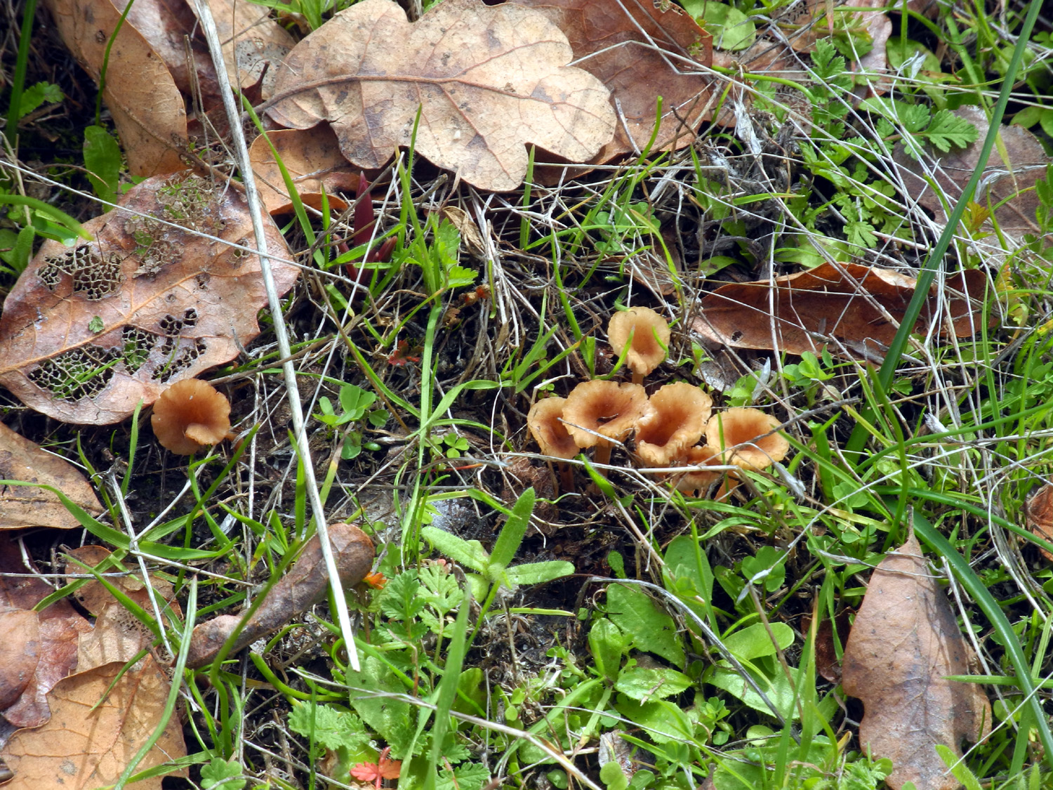
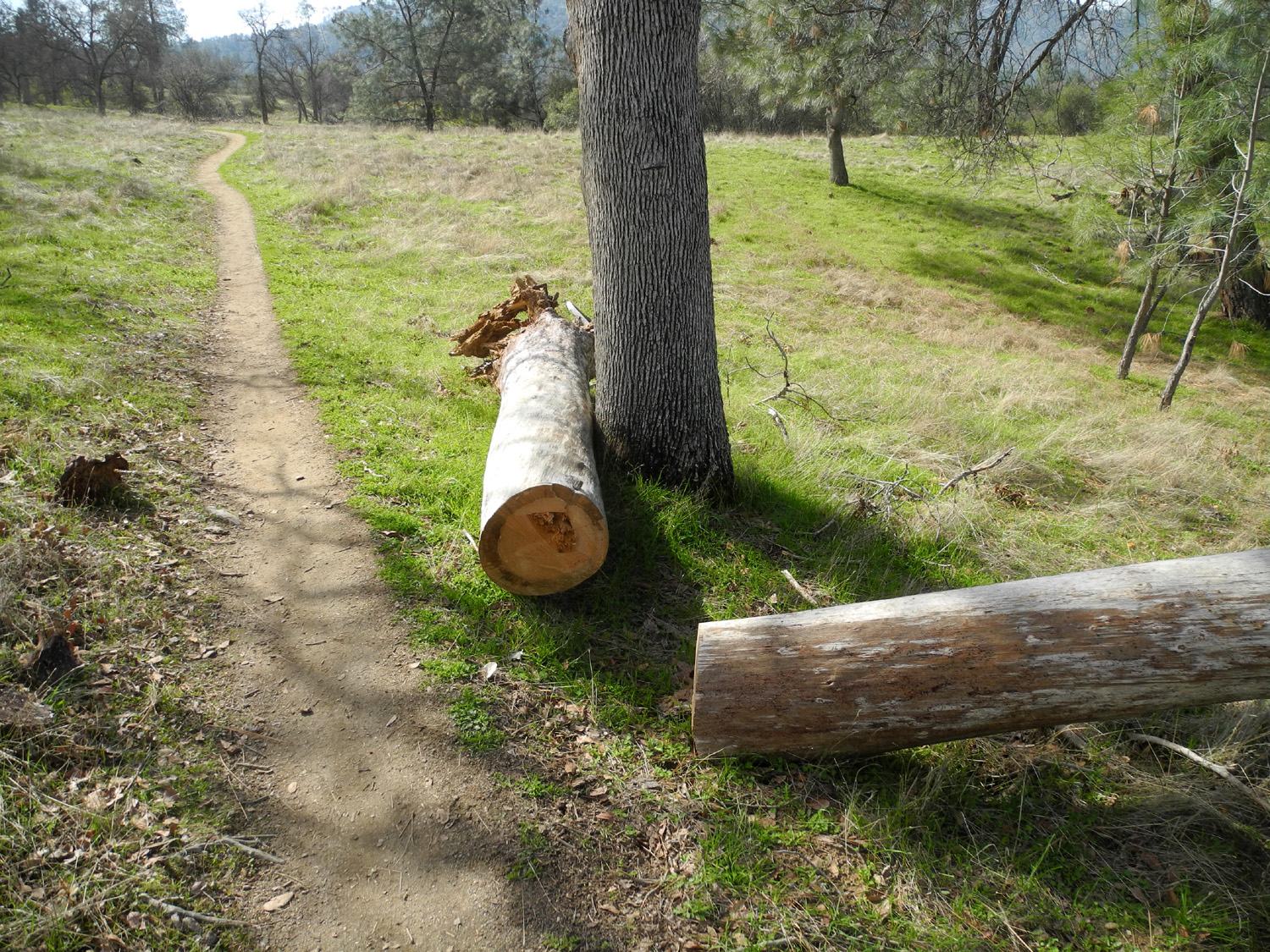
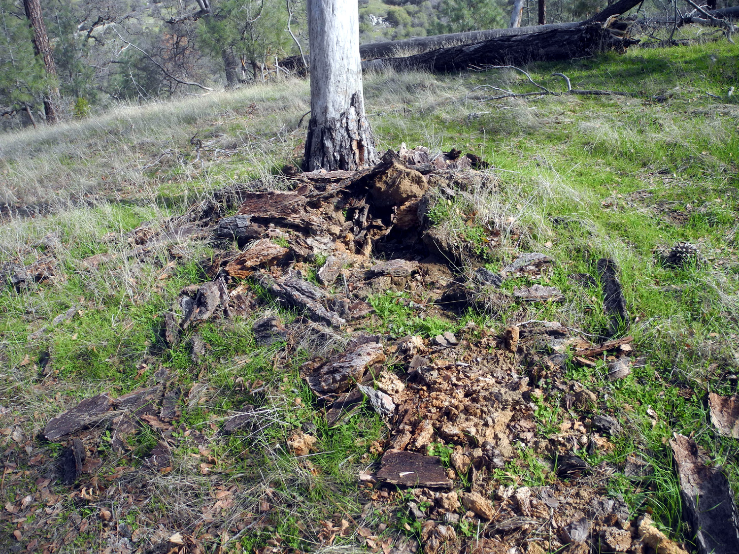
About a half mile into the hike is a special place - a nice resting log, a few bedrock mortars, the biggest creek along the trail, and a blue oak with the biggest burl I've ever seen. As I reported earlier, the tree fell some time in 2019, breaking above and below the burl. Looking at the rotted heart of the trunk, it's lucky the tree stood as long as it did. I make it a point to sit on the log, whether I need a rest or not. Often I am rewarded by the sight of some small item that would be unnoticed if I just walked past. Once it was a tiny frog; this time it was a patch of small, colorful mushrooms. The creek at this spot usually has at least a trickle of water in winter and spring, but despite a couple of good rainstorms, it was completely dry this time, as were all other creeks that cross this trail. |
|
 |
 |
| The fallen giant | New growth, old leaves and a patch of mushrooms |
|
Farther along is the place where a large dead bull pine fell across the trail, first observed when I hiked with Teri in December. The top landed in a nearby blue oak, leaving the dead log propped up at an angle. The bottom six feet or so had been cut away and rolled off the trail, and the force of the fall left the trunk with a huge cracked section. Time and gravity will no doubt bring the log to the ground eventually. I went a little past this spot before turning back. I took a different approach to eating this time. If I eat a real lunch at the far point of the hike, even though it's fairly small, I sometimes feel like I have a heavy load in my stomach when I make the return hike. This time I took a bite or two of a PNB sandwich two or three times. This worked out well -- by the time I got started back down the highway, I was ready to stop at the Pizza Factory in Prather and get an Italian sub. I ate about a third of it sitting in the car in the parking lot, then finished it at home that evening. |
|
 |
 |
| Kudos to the trail maintenance crew | Big cracks testify that the tree was old and dry when it fell |
|
I was sorry that I did not see any flowers, although there were some bush lupines in bloom along Highway168 at a lower elevation. The weather was pleasant -- I started hiking with a sweat shirt over my long sleeve T, but removed it at the first opportunity and was comfortable the rest of the hike with just one layer. We have had enough rain to get the grass and plants growing, and a little warm weather should bring out the flowers soon. I'll be adding at least one more San Joaquin Gorge hike to my list before spring comes to an end.
|
|
| Edison
Point
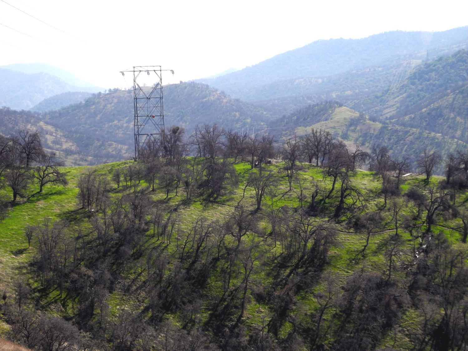
Here we go with another hike at a familiar location. It's such a short hike and I've been there so many times that I took only a half dozen photos. My daughter Teri came over on Saturday, February 27 after getting her first Covid-19 shot. We drove south on Clovis Avenue then east on Belmont. This street goes all the way across the Fresno metro area. When it nears the Kings River and the foothills, it becomes Trimmer Springs Road, and this route follows the river and the shore of Pine Flat Reservoir on the north side to the upper end of the lake and beyond. Where we first entered the foothills, just past the edge of the flat valley, we saw two deer above us, one of the lowest elevation deer sightings I've ever experienced. About two miles past the place where the lake first comes into view is the Edison Point Trail. The first half mile is a narrow, dirt service road that provides access to several of the high voltage transmission towers that carry electricity from the Kings River Power House near the upper end of the lake out to customers in the valley. As we got out of the car at the trailhead, we saw a hawk directly above us and fairly low, just hanging in the air without moving his wings, thanks to a strong breeze. We were able to get a good look at him for a half a minute or more. The first half of the trail goes up steadily, then it levels off as you approach a hilltop where you can see the lake on three sides. This is Edison Point. From here the trail goes down steeply to the level of the high water line, then back up to the trailhead. Due to the elevation change and the steepness of the terrain, the trial has many very long switchbacks, and sometimes you are only 50 feet or so below another section of the trail, but several hundred yards of trail away. I've done the full loop several times, once with Teri, but the trail is blocked by fallen trees near the end, and I now make this an "out and back" hike. |
|
 |
 |
| Hawk having fun with the wind - he's just floating there | Edison Point |
|
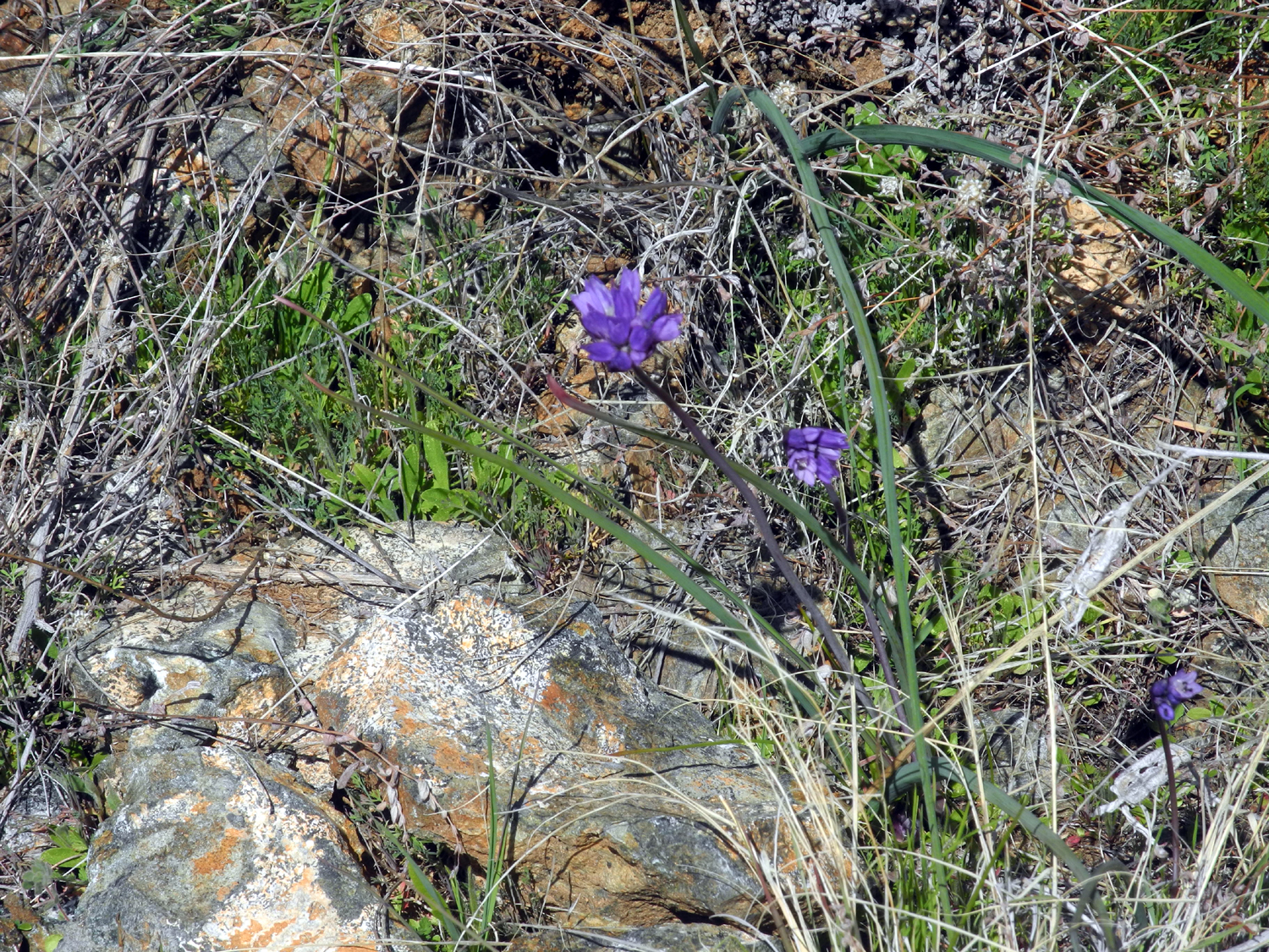
We rested on the concrete base at one corner of the transmission tower, then started down the trail toward the lake, but circled back up to the tower This little "extra" section added about a half mile to our total hike of 1.5 miles. We saw a few wildflowers by the trail and along Trimmer Springs Road, but they are not yet out in great numbers. Species observed included a fair number of blue dicks, fiddlenecks, filaree, and poppies. There were more people on the trail than I've ever seen before, and most of them seemed to be hiking the entire loop. Across the road from the parking lot, the service road follows the transmission line all the way to Trimmer Springs, a distance of at least three or four miles. One couple took that route. I've hiked a short distance on it a few times, including once with Teri/ |
|
 |
 |
| The most common flowers were blue dicks | Dick on the trail (Photo by Teri) |
|
When we got back to the car we drove a little farther on Trimmer to a place where the road bank is covered with bush lupines. They were barely starting to bloom, but we saw some at lower elevations that are better developed. In a year with ideal weather, we would see hillsides covered with poppies and hundreds of other flowers at this time of year. It will take a few more hikes to determine i we are going to have a decent bloom. As usual, I'm ready, willing, and still fairly able. --Dick Estel, March 2021 |
|
|
Photos (Click to enlarge; pictures open in new window) |
||
|
Eastman Lake San Joaquin Gorge Bridge Trail Hensley Reservoir San Joaquin Gorge River Trail Edison Point |
||
|
Eastman Lake |
||
|
 |
 |
| Twisted shapes of dead manzanita | Another view of the mistletoe-infested tree | Blue sky and clouds over the hills |
| San Joaquin Gorge Bridge Trail | ||
 |
 |
|
| Site of the L/S Camp | Literally all skin and bones | The bridge from the Madera County side |
| Hensley Reservoir | ||
|
 |
 |
| I can't resist
photographing the gnarled dead blue oaks that dot the hills by the lake |
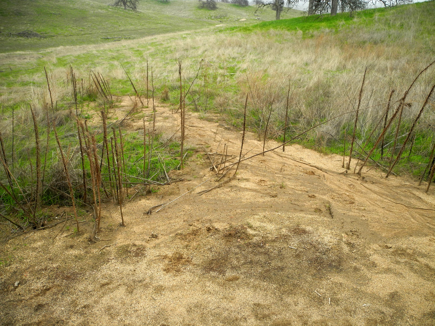
Soil from the trail
has washed into the surrounding grass |
Map of Hensley Reservoir |
| San Joaquin Gorge River Trail | ||
|
 |
 |
| The leaning bull pine | Where it came from | My hiking buddy Wes
was not available, so I had to settle for "Ground Squirrel on the Rock" |
 |
 |
 |
| Squaw Leap table top mountain | Looking down one of
the steep stretches of the trail |
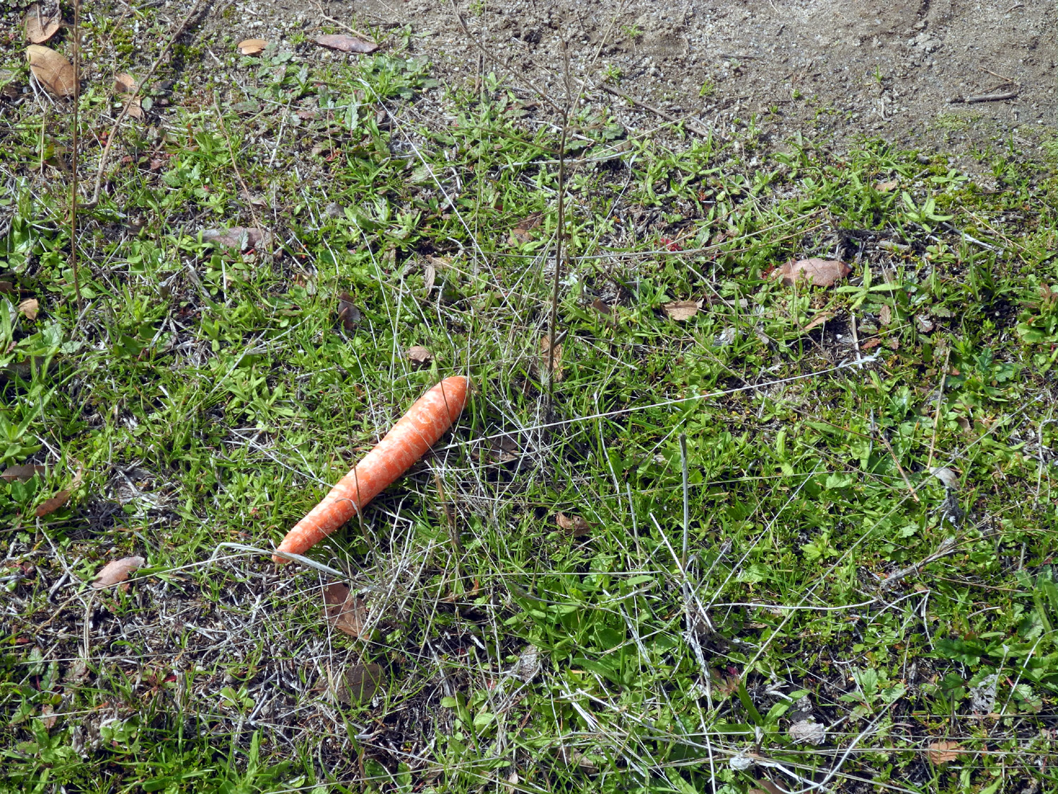
Did someone lose his lunch? |
| Edison Point | ||
 |
|
 |
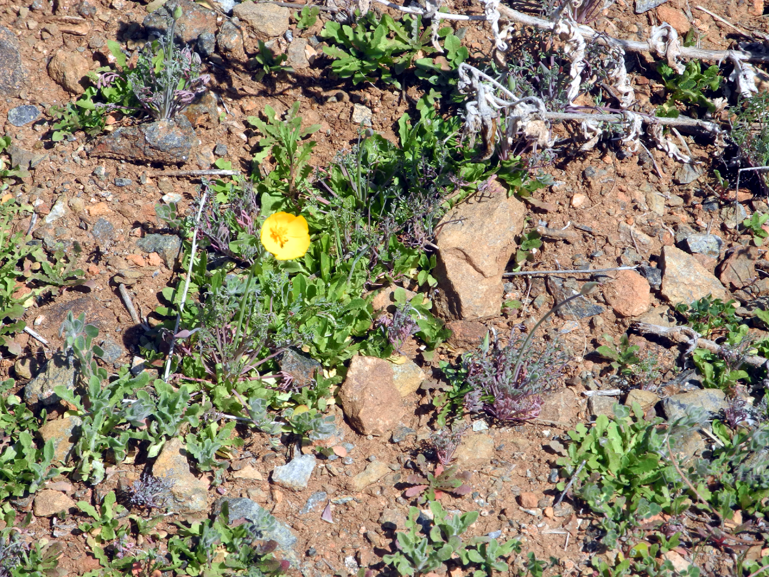
| A lone poppy | This blue oak is half dressed in spring green | Hopefully these
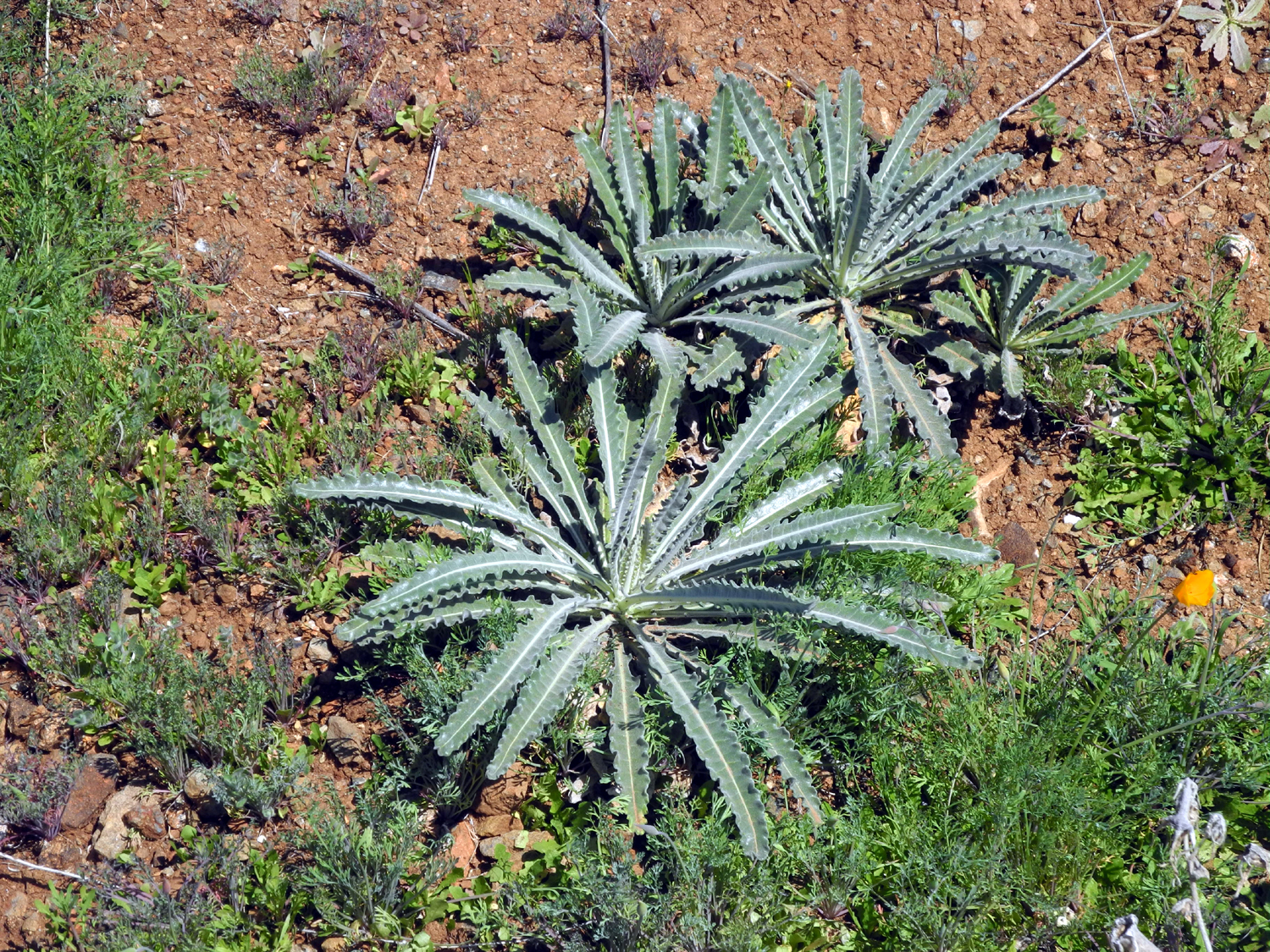
unknown plants will produce spring flowers |
| Related Links | ||
| Eastman Lake | Hensley Reservoir | Lakeview Trail |
| Hensley Lake Trips | Chowchilla River | San
Joaquin River Gorge Special Recreation Management Area |
| San Joaquin River Trail | Blue Oaks | San Joaquin Gorge Photo Album |
| Pine Flat Reservoir | Edison Point Trail | |