|
2023 Rambler Hikes Page 1 |
|
|
Rambler Hikes 2017 Rambler Hikes 2018 Rambler Hikes 2019 Rambler Hikes 2020 Rambler Hikes 2021 Rambler Hikes 2022 2023 Page 2 2023 Page 3 2023 Page 4 |
|
|
Blue Oak Trail San Joaquin Gorge - Bridge Trail Edison Point San Joaquin Gorge - SJ River Trail |
|
|
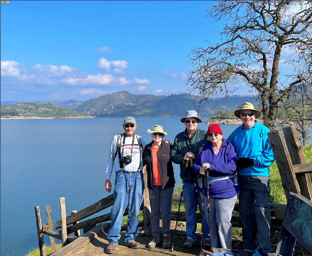
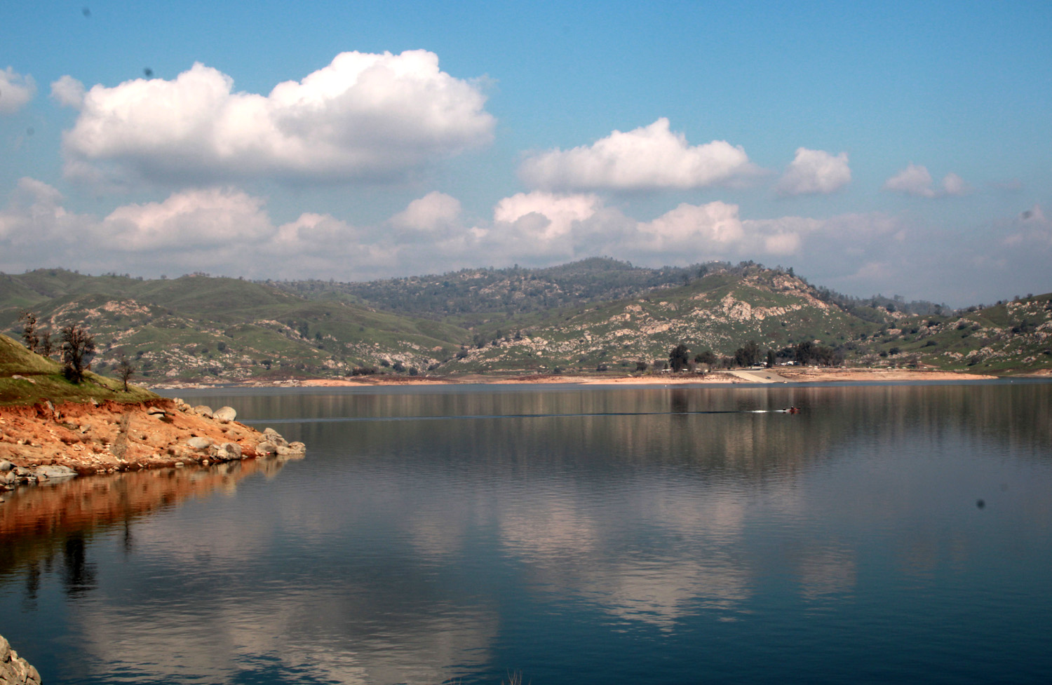
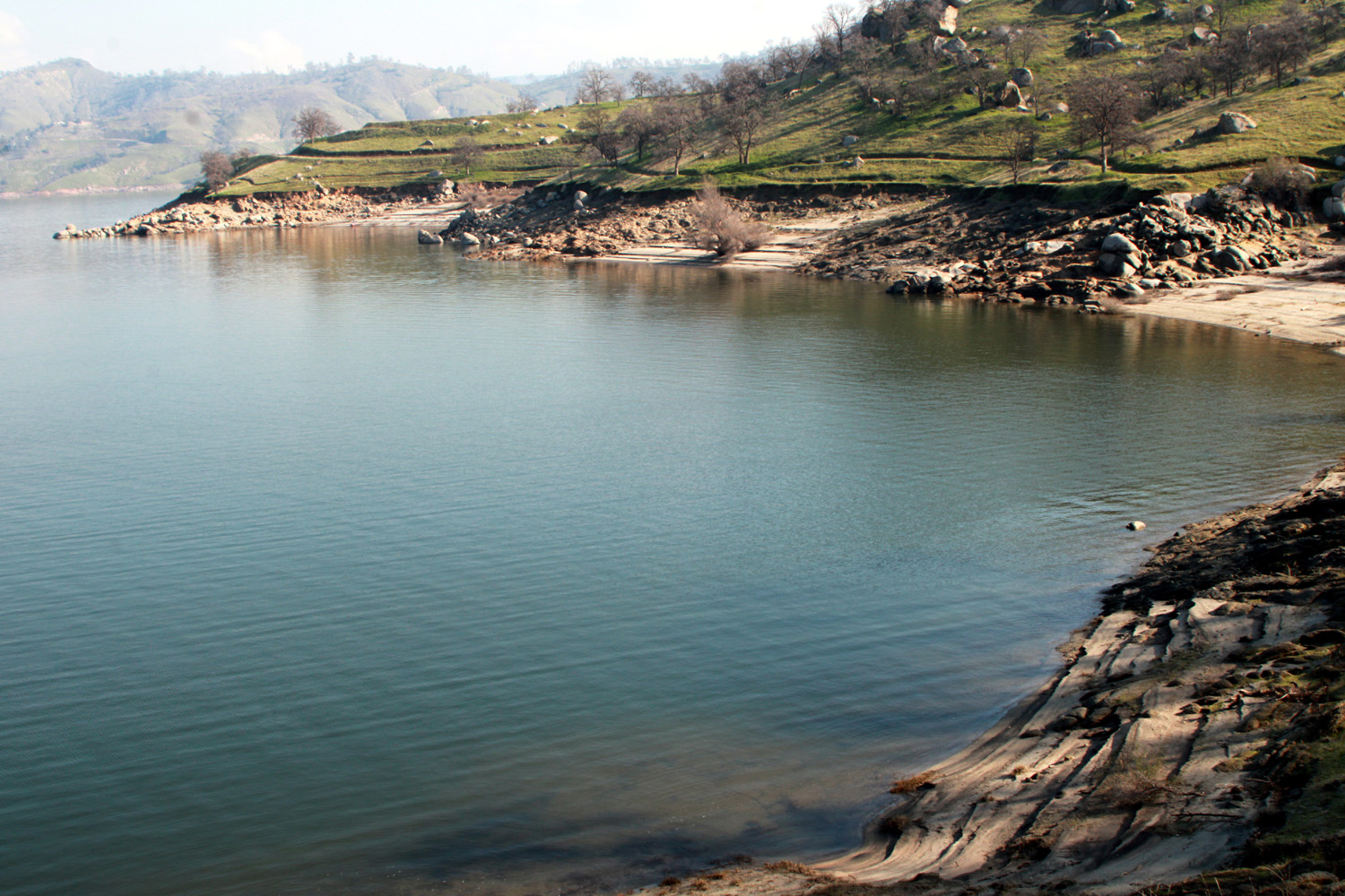
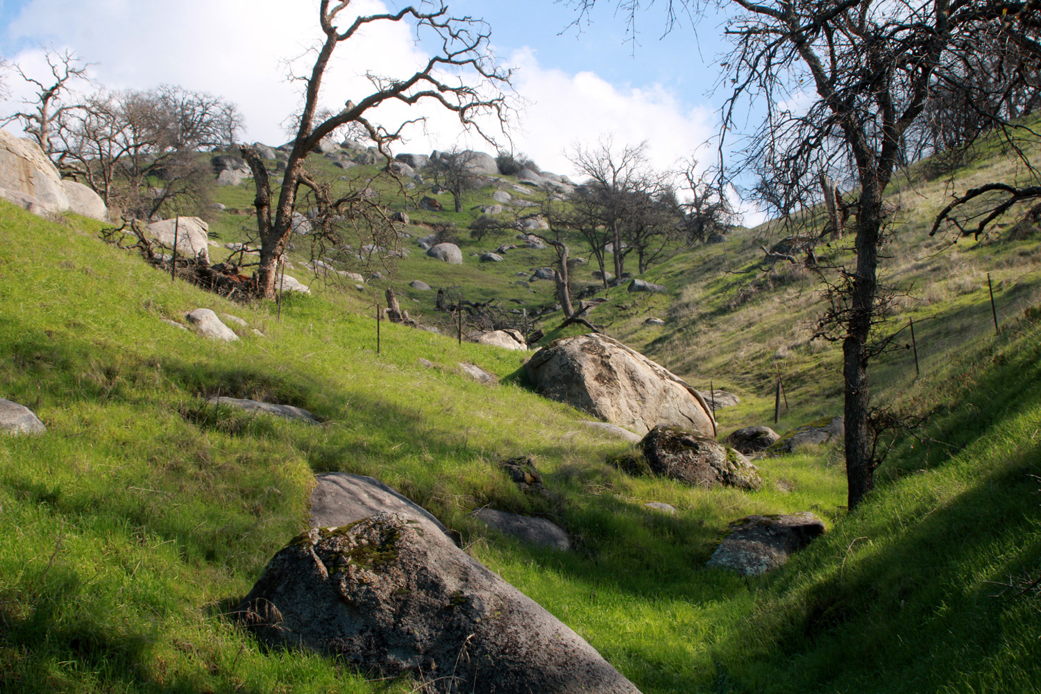
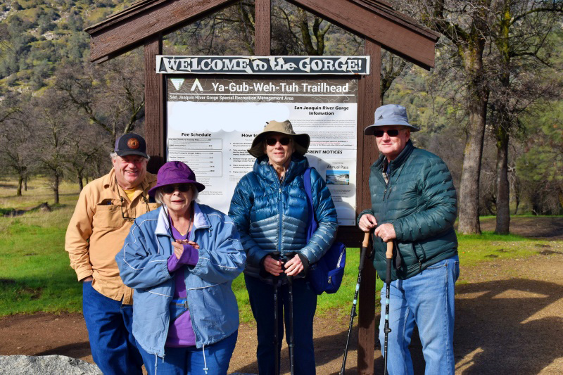
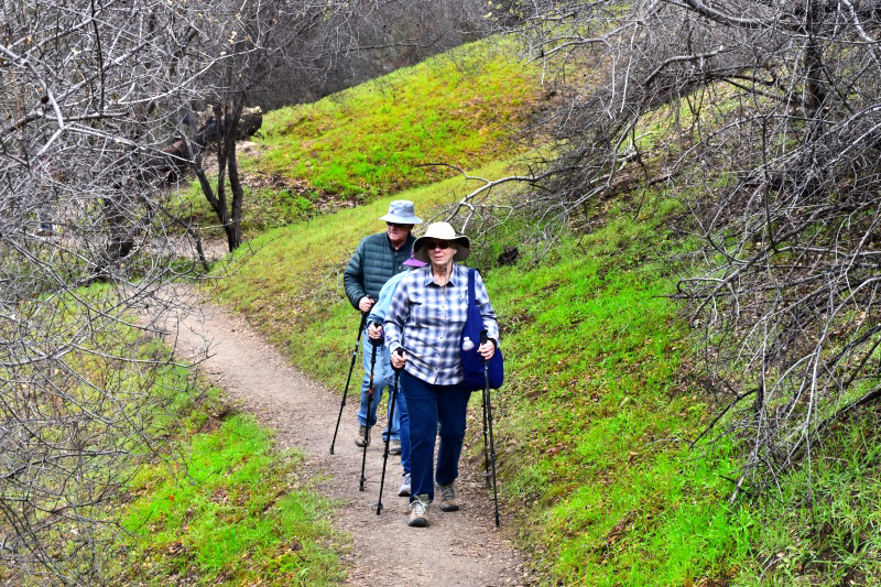
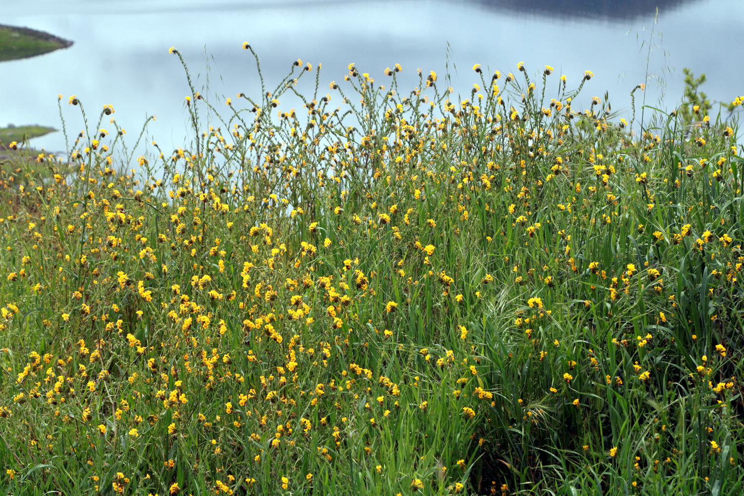
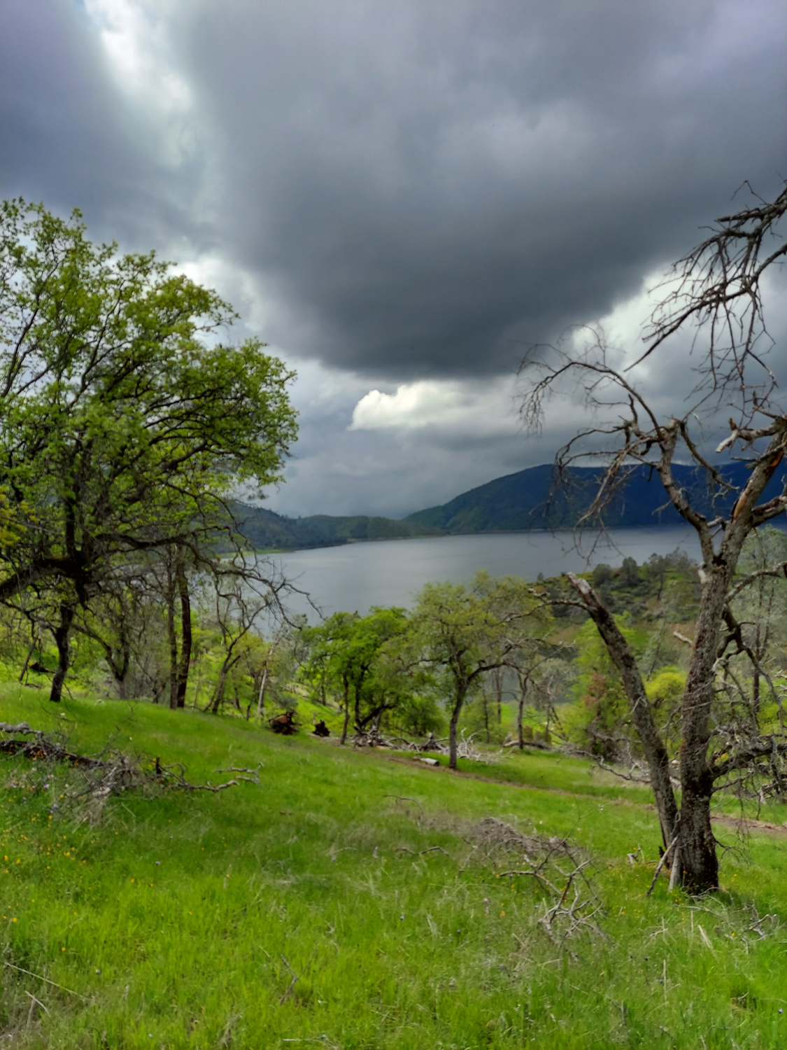
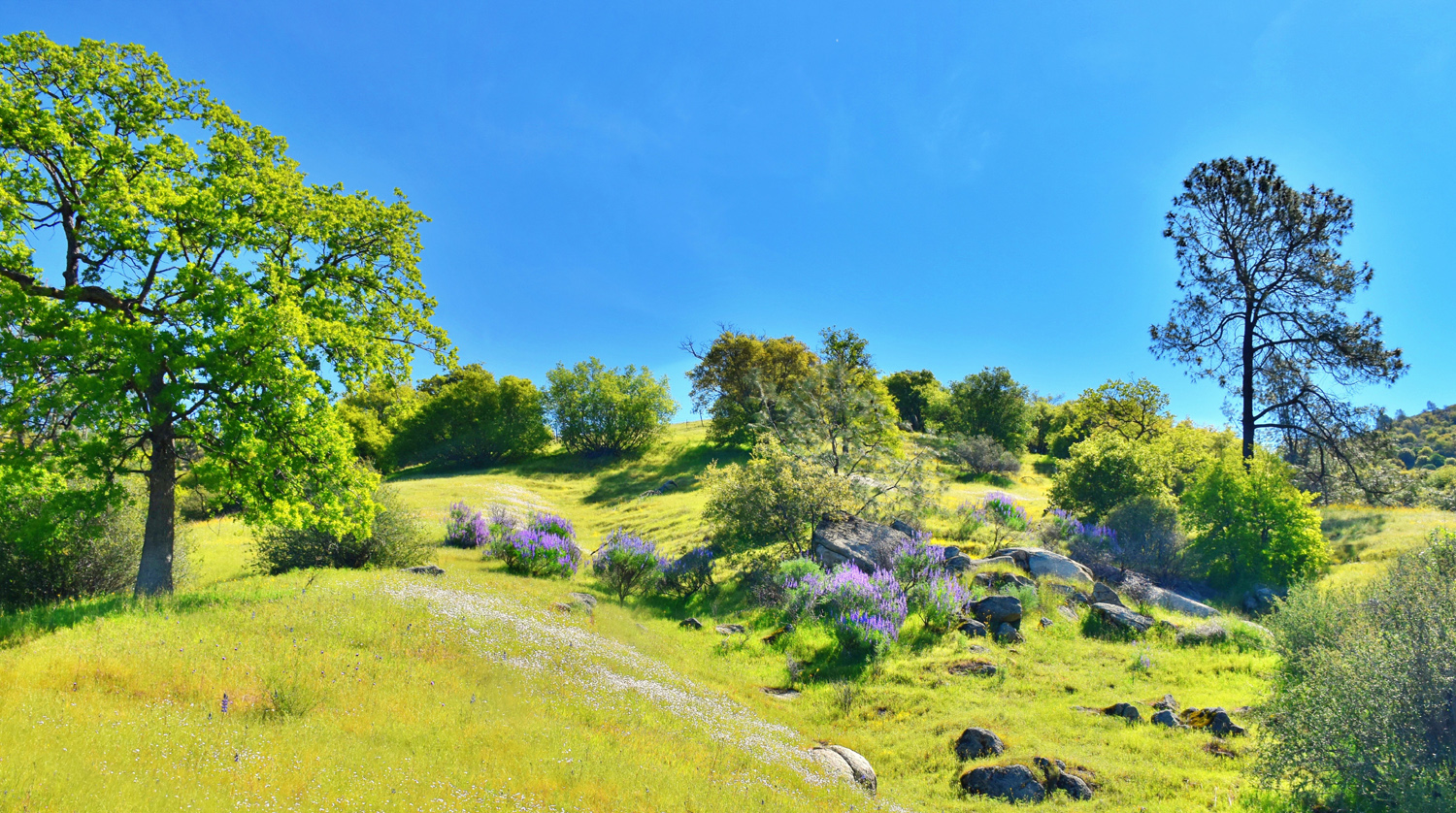
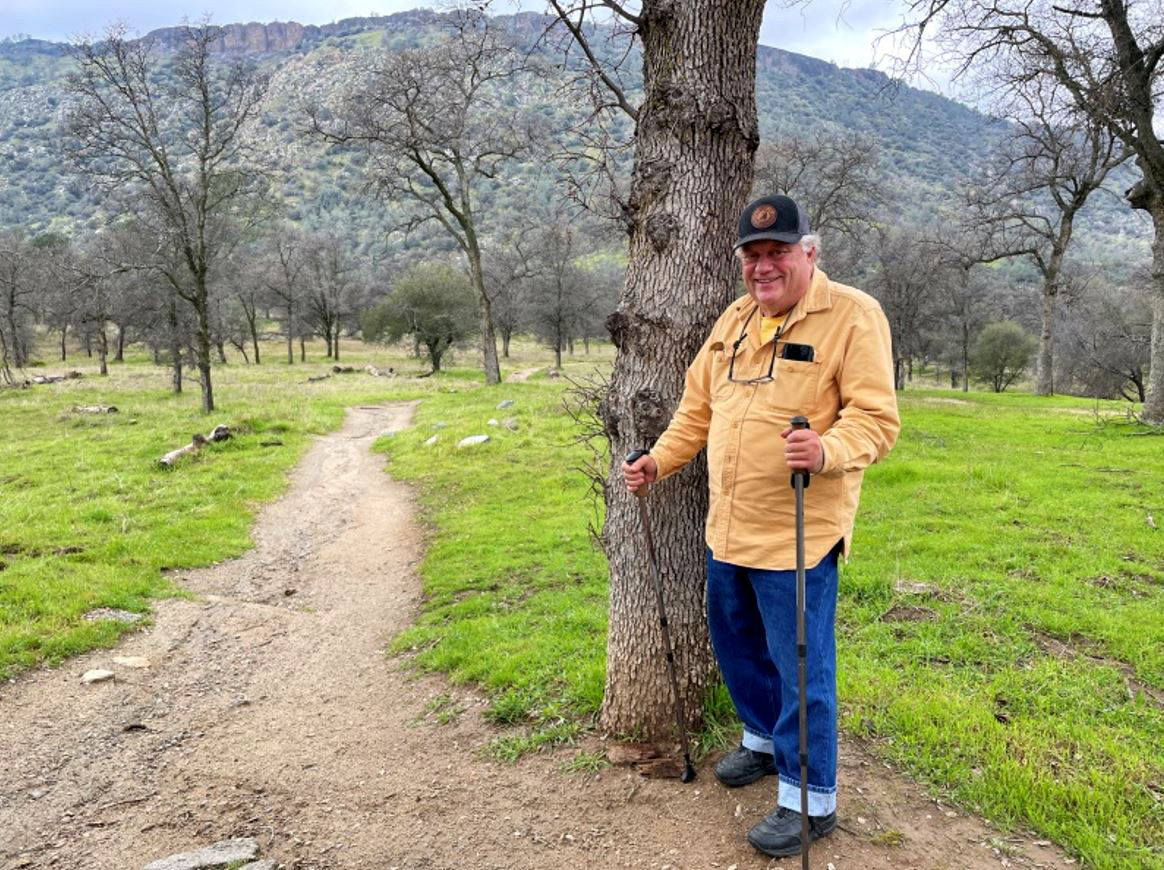
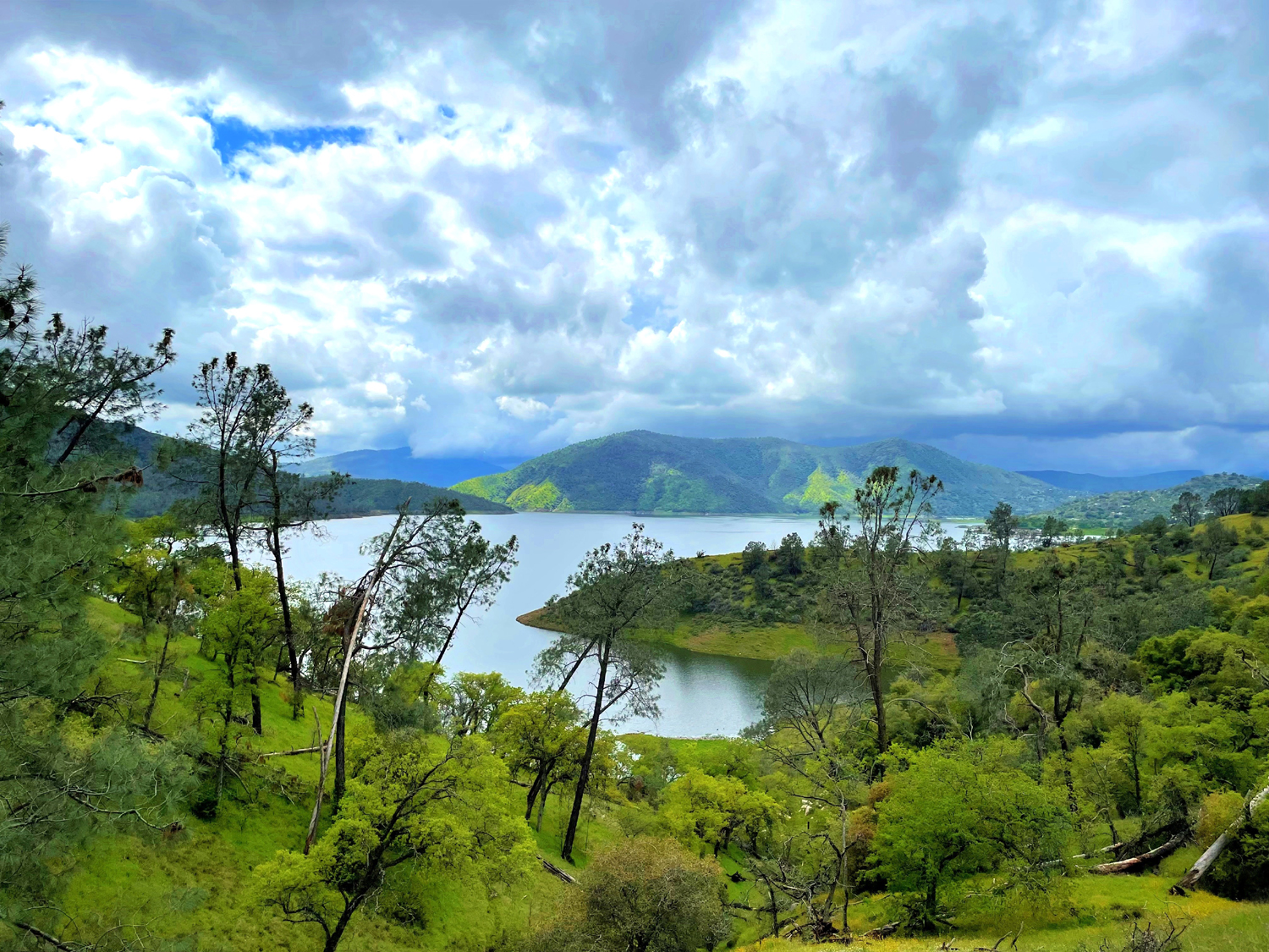
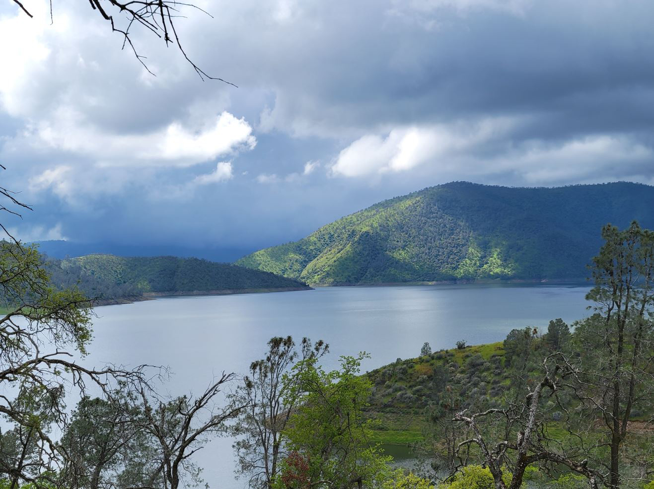
Blue Oak Trail January 2023 came in like a whole bunch of lions, with record rainfall, chilly winds, road closures due to rock sides, deadly flooding in parts of California, and a mid-January snowpack at 250% of normal. However, the 23rd was sunny and cool, with just a few clouds, almost no wind, and a reservoir that had gone from 60% to 80% of capacity since mid-December. Five Ramblers met at the town of Friant, in front of Friant Dam, where Wes, Dick, Carolyn, Allen and Sue squeezed into Wes's Highlander for the short drove into Millerton State Park, to hike the Blue Oak Trail along the edge of the lake. We were delighted to see the water so high, having walked here a number of times when the lake was dozens of yards below the high water mark, with lots of bare soil marked with ridges that recorded the changes in level, as in this photo from 2018.. This trail goes to a marina at Winchell Cove, a distance of a little less than two miles. Most of us are not up for a four mile round trip hike, but at least once in the past we placed cars at both ends of the trail, making for a two mile hike. This is a hassle and requires payment of the $10 entrance fee at both ends. Being retirees on fixed incomes we are frugal, and contented ourselves with an out and back hike that was probably about 1.9 miles. |
|
 |
 |
| Just
under a half million acre feet of winter runoff, ready to water the crops of the San Joaquin Valley |
The lake level is the highest of any Rambles hike |
|
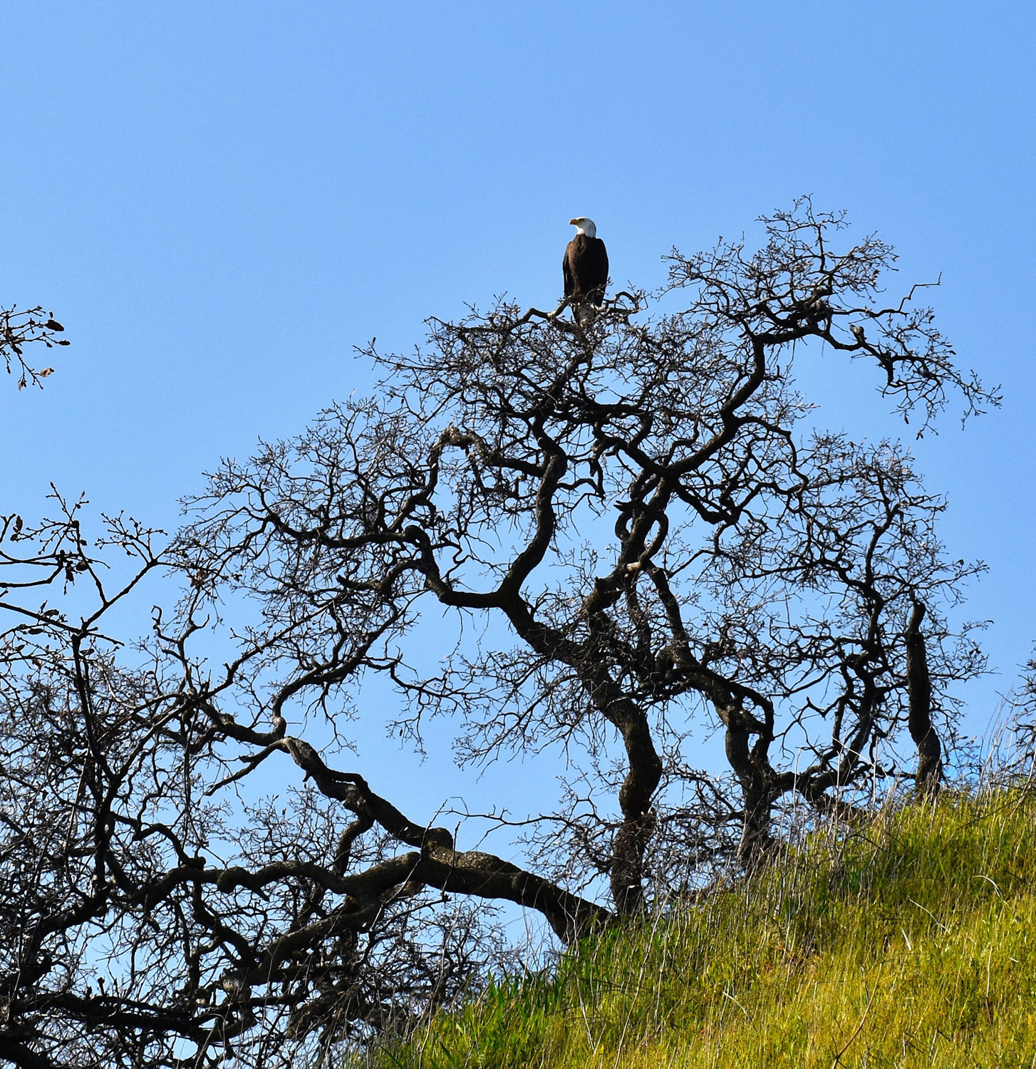
This is alleged to be a prime location for spotting bald eagles, and though we have looked in every tree on previous trips, we had never seen one. This time we were lucky and a huge bird posed in the top of a blue oak for a few photos before soaring off to take care of official eagle business. |
|
 |
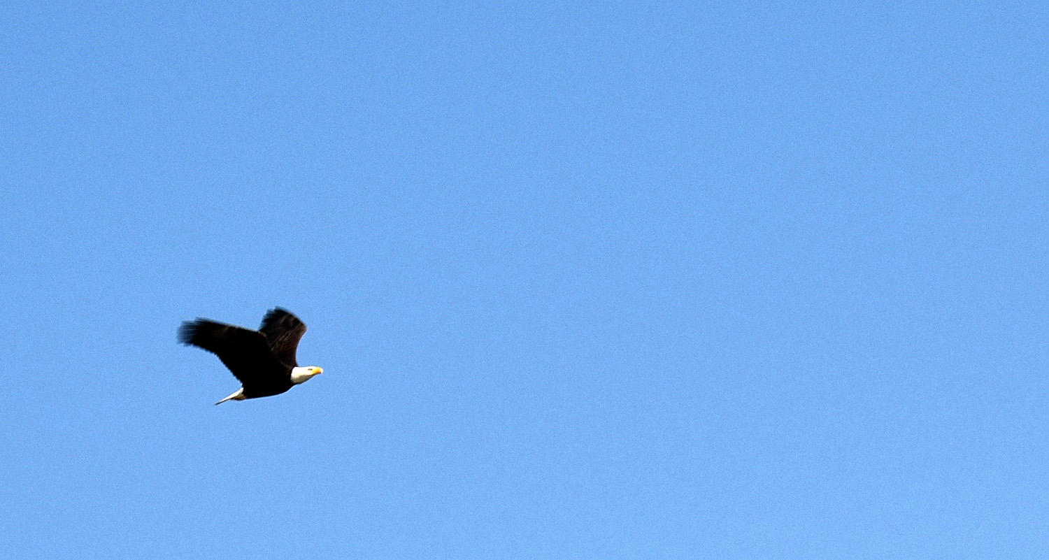 |
| After many hikes with no eagles, we saw two on this outing | He posed for awhile, then took flight |
|
|
|
|
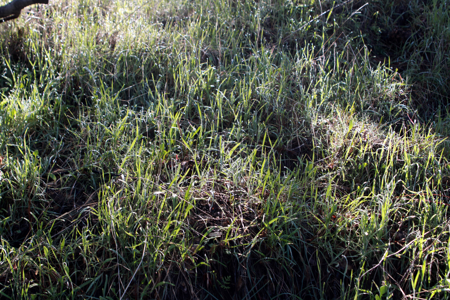
With all the rain, the foothills were a brilliant green, and we even saw a few wildflowers just starting what should be a spectacular bloom. Hawks flew overhead, and ground squirrels scampered among the rocks below the trail. All in all, we could not have asked for better conditions or better companions. What we didn't see were people. We met one hiker on the trail and had our group photo taken by a couple who were sitting on a bench at the trailhead. |
|
 |
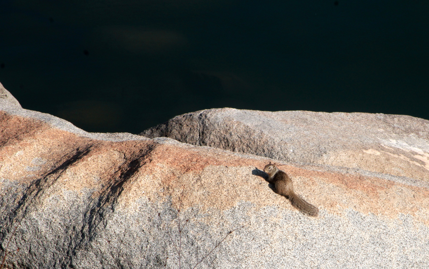 |
| Lots and lots of rain has produced early green grass all over the foothills | One of a dozen or so ground squirrels we saw |
 |
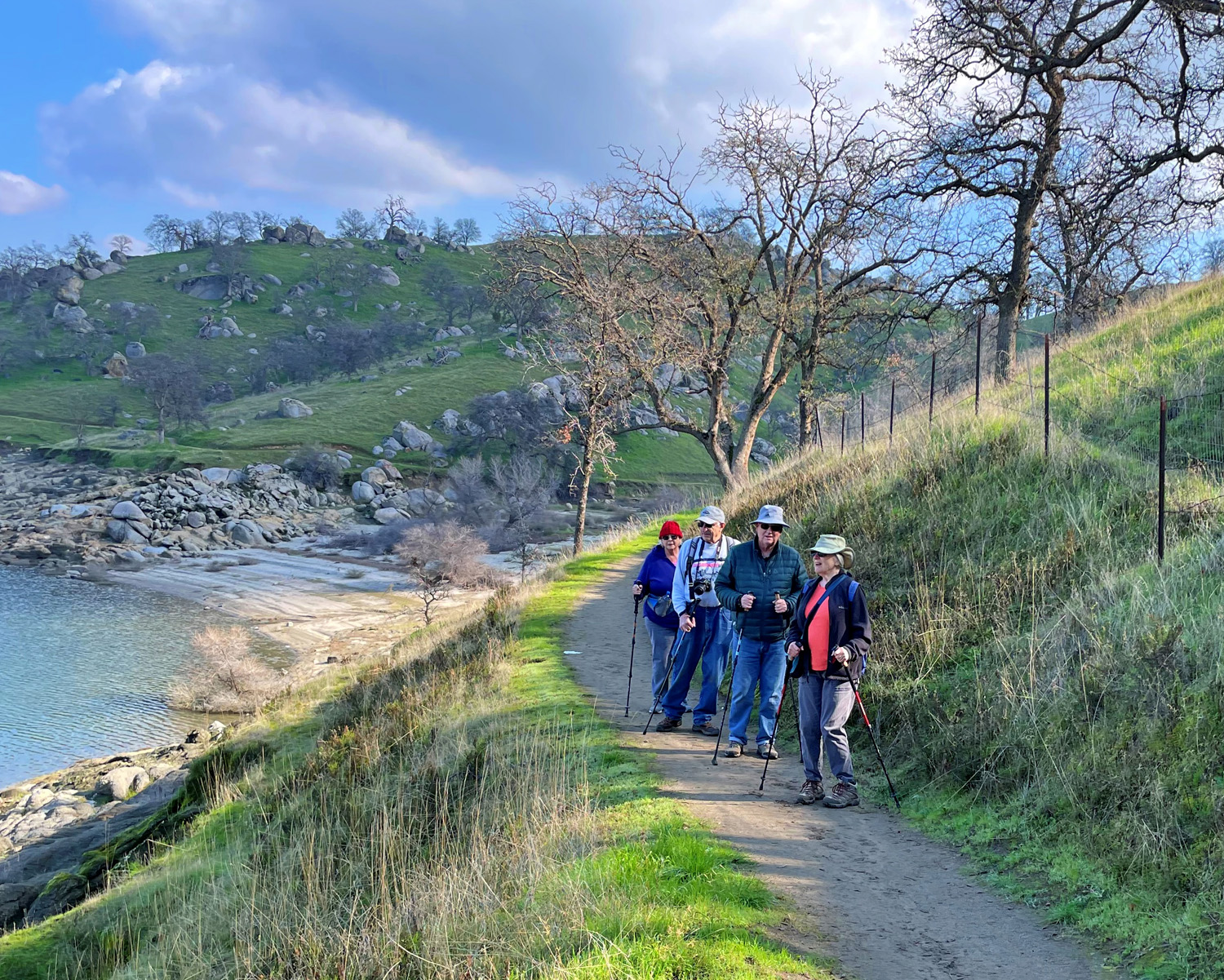 |
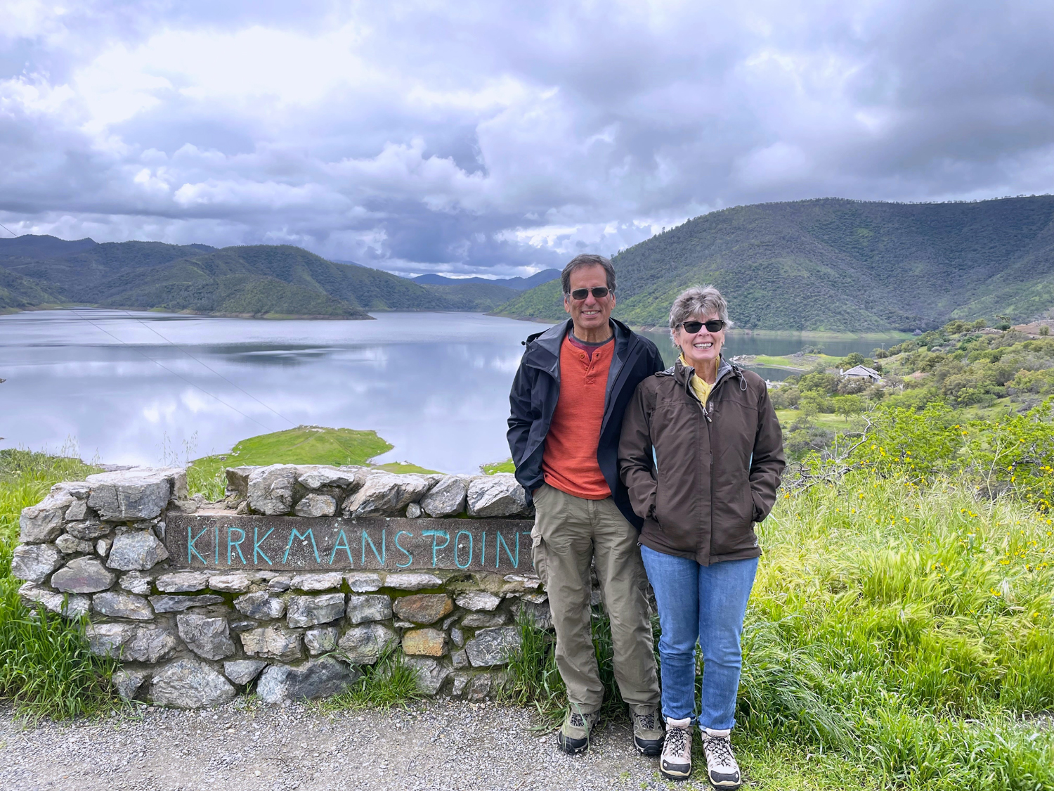
| Ramblers
at the Blue Oak Grill: Dick Estel, Sue Wirt, Carolyn Amicone, Don McClellan, Allan Ward, Wes Thiessen |
Sue, Dick, Allen and Carolyn on the trail |
|
As usual, Wes had a few post-hike thoughts: "Just a few miles from the city, we found a quiet place in the country with very few people around. It was so relaxing I could go back time and again. We finished this adventure with lunch at the Blue Oak Grill at Table Mountain Casino, where Don joined us. I can report we only ate lunch. The 'one armed bandits' did not take any of our hard earned cash (ha!). In a couple of weeks, Dick is taking us to another quiet place in the country. You won't want to miss it." You also don't want to miss Wes's video of the Ramblers on the trail. By the way, if my count is correct, this was our 97th hike, meaning we will hit 100 in March. Stay tuned! --Dick Estel, January 2023 |
|
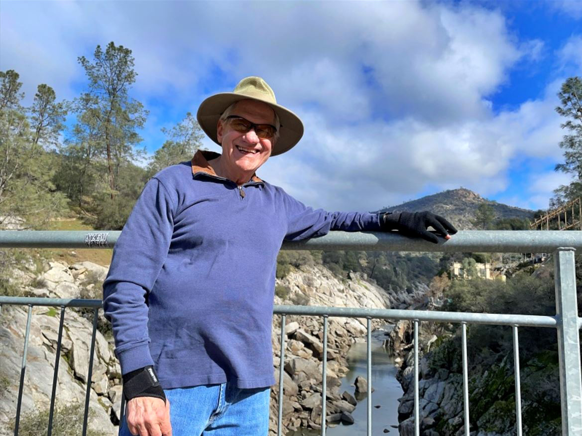
| San
Joaquin Gorge - Bridge Trail
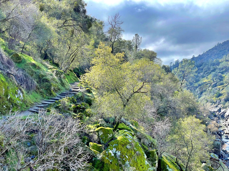
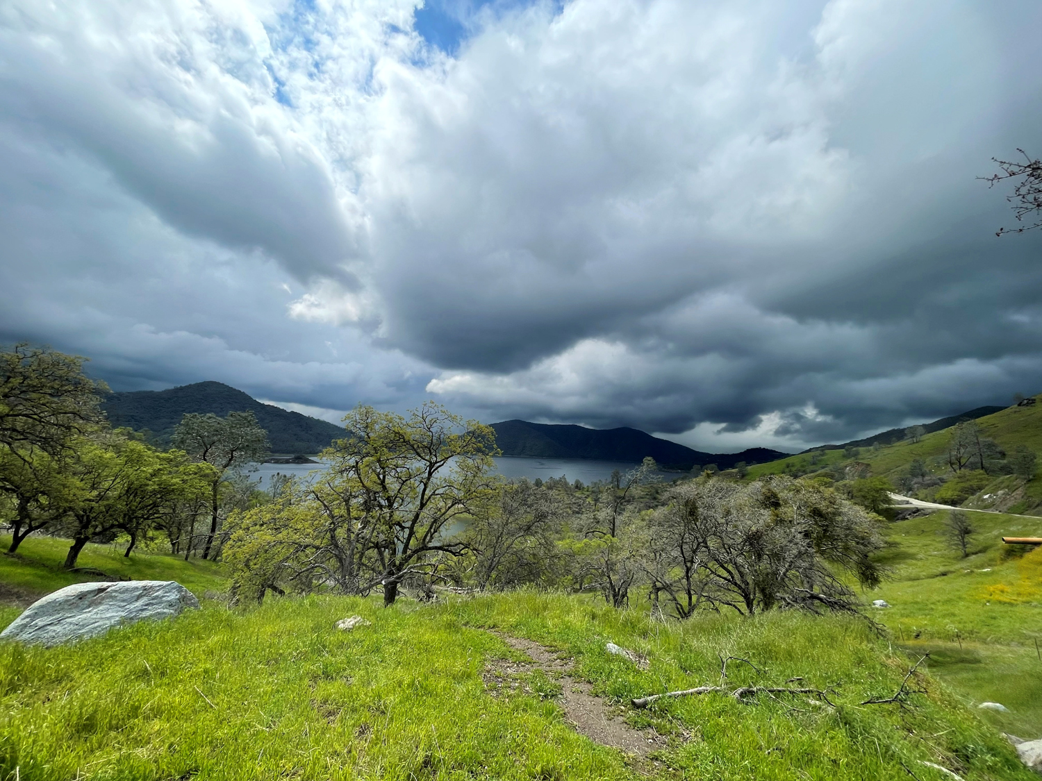
Possibly this destination sounds familiar. The Ramblers have visited the San Joaquin River Gorge at least eleven times. Including Rambling, camping and various hikes, I've been there at least 50 times since 2012, and probably another 50 or 60 before that, going back to the 1970s. Did I mention that we like the place? Originally called Squaw Leap, It's a plot of Sierra foothill territory administered by the Bureau of Land Management, straddling the San Joaquin River just above Millerton Lake. To get there from the Fresno-Clovis area, you take Highway 168 or Auberry Road to Prather. A short distance farther Auberry Road goes north to the town of the same name. When Auberry Road forks right to go up and re-join the highway at the 4,000 foot level, we take the left fork, Power House Road, then turn left on Smalley Road after a mile or so. This road goes down and down to the trailhead and parking lot plus a short distance beyond to a power house. From the parking lot a trail goes down to a bridge across the San Joaquin River, where you cross from Fresno to Madera County. On the north side, a loop trail goes up from the river about eight miles around a ridge. Another trail branches off and goes down to Millerton. On the Fresno County side, the San Joaquin River Trail parallels the river about twelve miles down to the Finegold Picnic Area at the end of Sky Harbor Road. We tend to alternate between going down to the bridge and back, and then on our next outing, hiking a mile or so down the River trail and back. This part of the south side trail winds around the contours of the hills high above and out of sight of the river, then drops down close to it, well past our usual turn-back place. With elevation ranging from 800 feet at the river, 1,200 at the trailhead, and 2,000 on top of the table mountains that rise up on both sides of the river, it's the perfect place to enjoy the brilliant green hillsides and multitudes of wildflowers that decorate the area in springtime. Like all natural crops, grass and flowers require rain and some warm days. So far we've had tons of the former, but not quite enough of the latter to germinate the flower seeds that wait patiently through the baking hot summer. |
|
 |
 |
| Don, Sue, Ardyss and Allen are bundled up against the cool day | Allen and Ardyss on the trail |
|
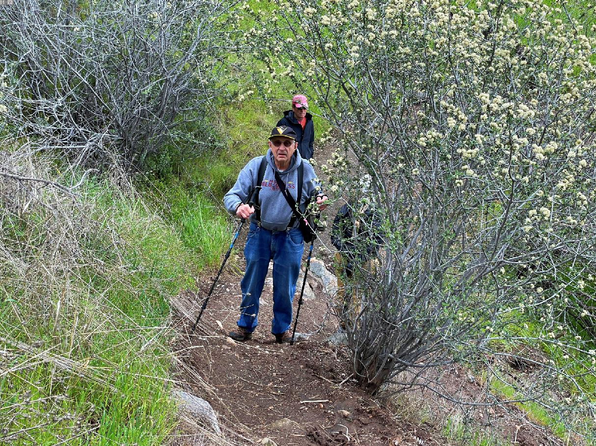
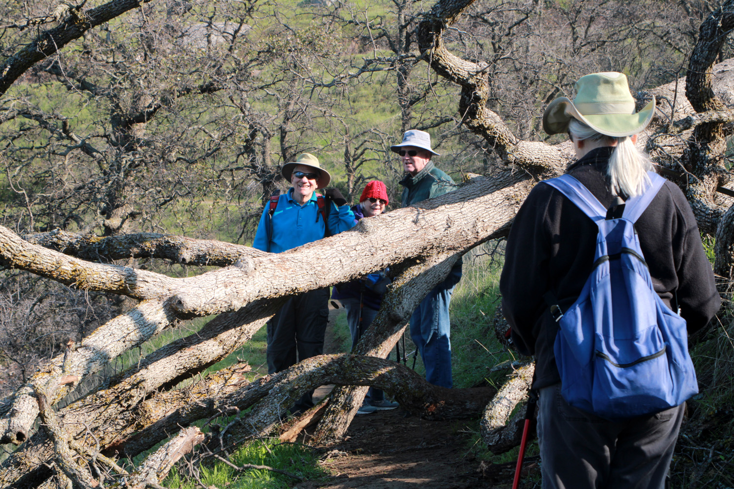
The weather forecast was for scattered showers, but they did not get scattered our way. It was very cool, with a few clouds, which filled in and covered the skies by the end of our hike, but as far as we know, there was no rain there that day. We were a group of six, five hikers, Wes, Dick, Allen, Sue, and Ardyss; and one trailhead explorer. Don has not been able to hike lately, but drove down to the nearby power house, tried to go to the visitor center (gate locked), and checked out the cedar bark shelters erected near the group camp by Native Americans for informational purposes. The Bridge Trail goes pretty consistently down hill, with a few short level or slight uphill stretches. However, it's not really steep except in a a few very short places, and can be enjoyed by hikers of all ages and abilities. Of course, we were on the lookout for wildflowers. We've had copious rain, but not much warm weather, and the "floral display" was limited to a half a dozen shooting stars. Instead, we enjoyed green grass and trees waiting for the arrival of warmer weather to leaf out. |
|
 |
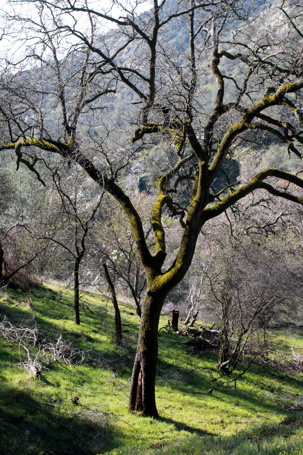 |
| Heavy dew sparkles on the new grass | A leafless oak surrounded by bright green grass |
|
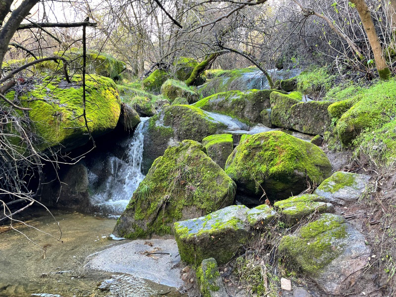
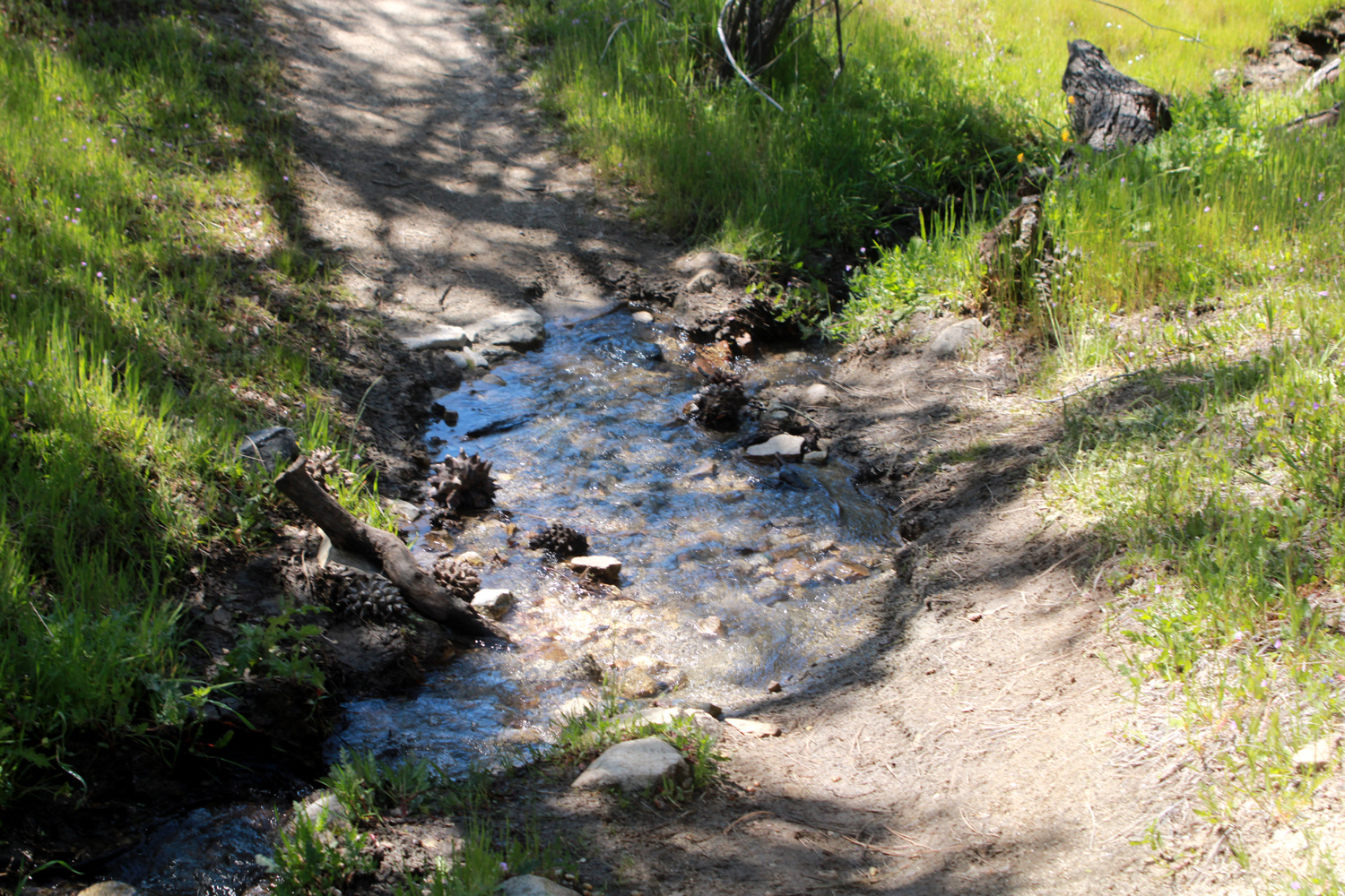
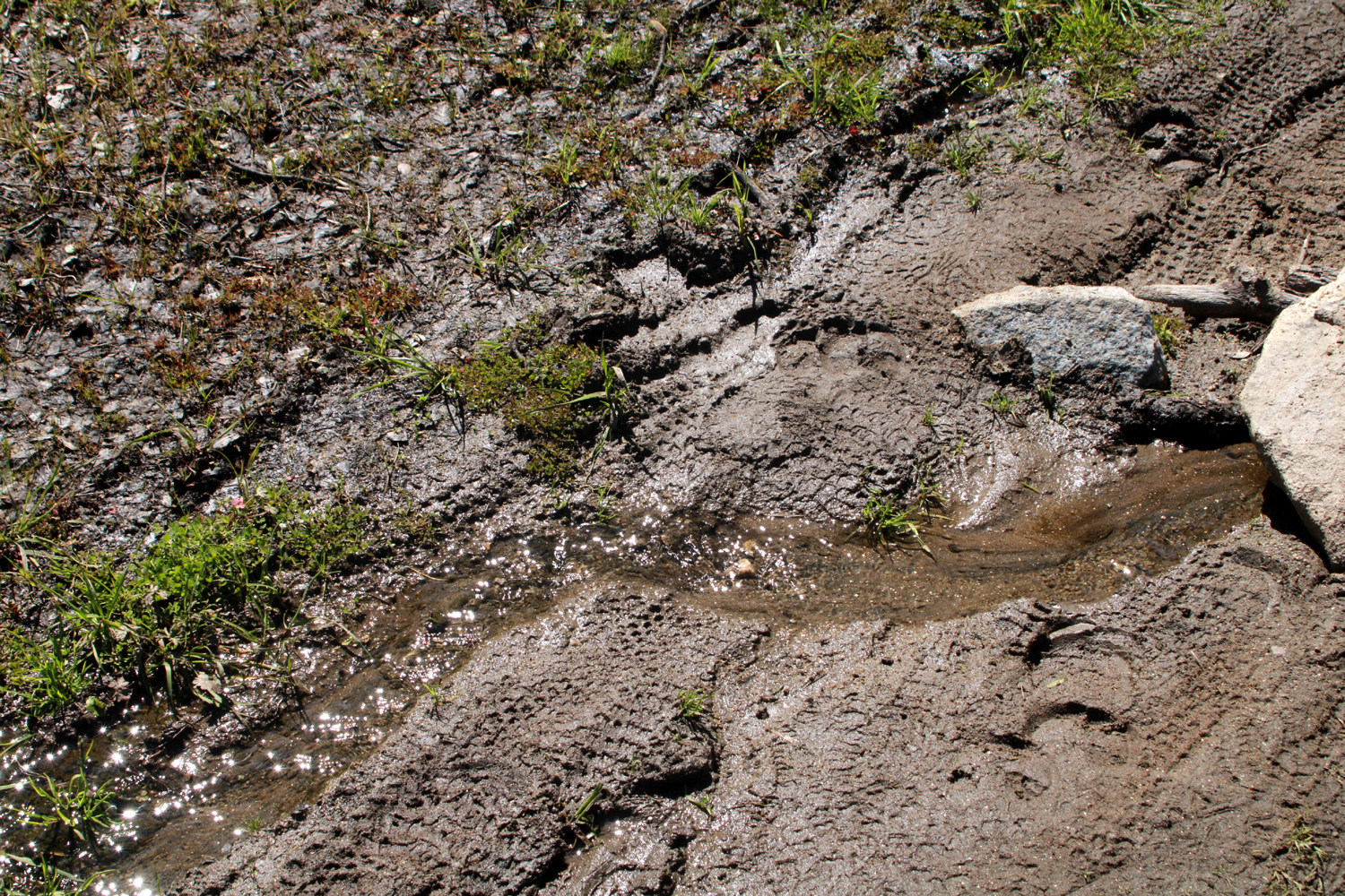
About 3/4 of the way down to the river, a small creek crosses the trail. Even in the driest years, it usually has a little trickle of water. Other seasonal creeks along the route have been dry the past few years, but thanks to our "atmospheric rivers" the first half of January, we saw seven creeks crossing the trail. To meet our definition of "creek," there must be visibly flowing water, so some of them were very tiny, and none presented any danger of flooding the trail. Wes went down into the channel of the biggest creek and got some very impressive photos of its little waterfall. When we got to where we could see the lower part of the river gorge, we observed a creek on the opposite side that cascades down from the ridge above, dropping over several small waterfalls. One of these can be seen from the group camp area near the trailhead. |
|
 |
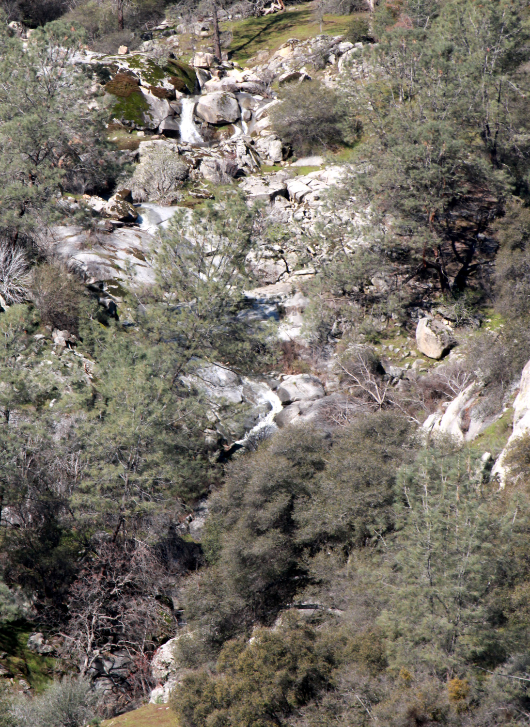 |
| The biggest creek on the trail also offers a nice little waterfall | This creek cascades down from a ridge on the Madera side |
|
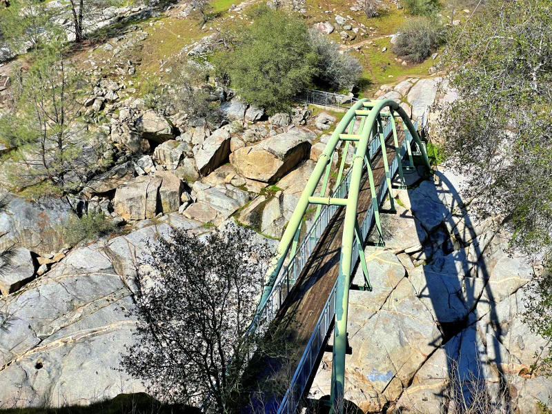
We rested at the bridge for ten or fifteen minutes before starting our trek back up the hill. Actually four of us rested while Wes explored the area looking for a great photo opportunity. From a short spur trail that connects to the road to the old power house, he got a dramatic shot from above the bridge. We also posed on the bridge for our mandatory group photo. |
|
 |
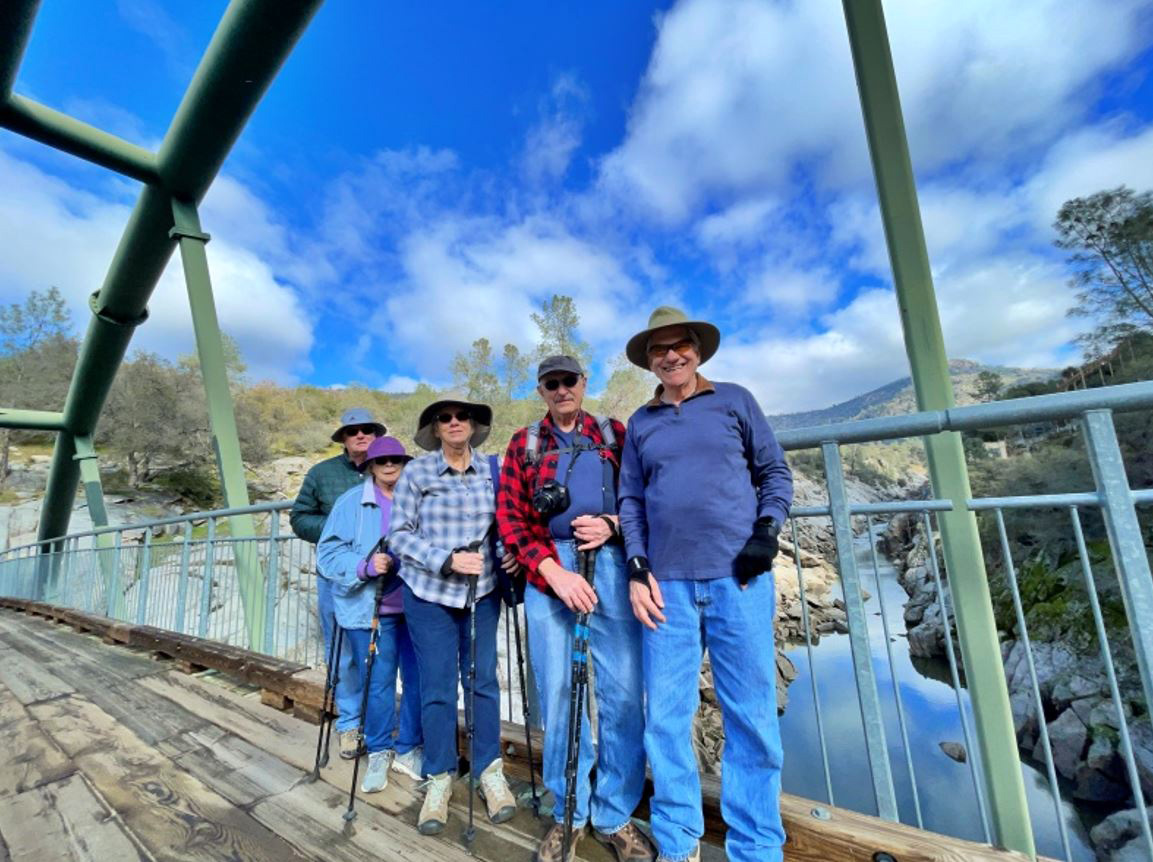 |
| A short walk on a spur trail revealed this dramatic view of the bridge | The Ramblers on the bridge: Allen, Sue, Ardyss, Dick, Wes |
|
With plenty of rest stops, we made it back up to the trailhead, where we met Don coming down the path a short distance to greet us. We followed the paved roads back to the village of Prather, where we enjoyed our usual Mexican lunch at Velasco's. Back in the city, we found blue skies, with a good view of the clouds looming over the foothills, and started making plans for our next outing later this month.. --Dick Estel, February 2023 |
|
|
Edison Point
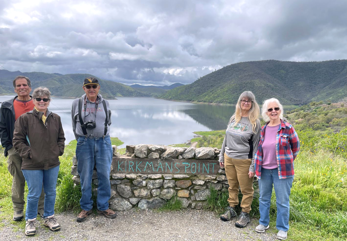
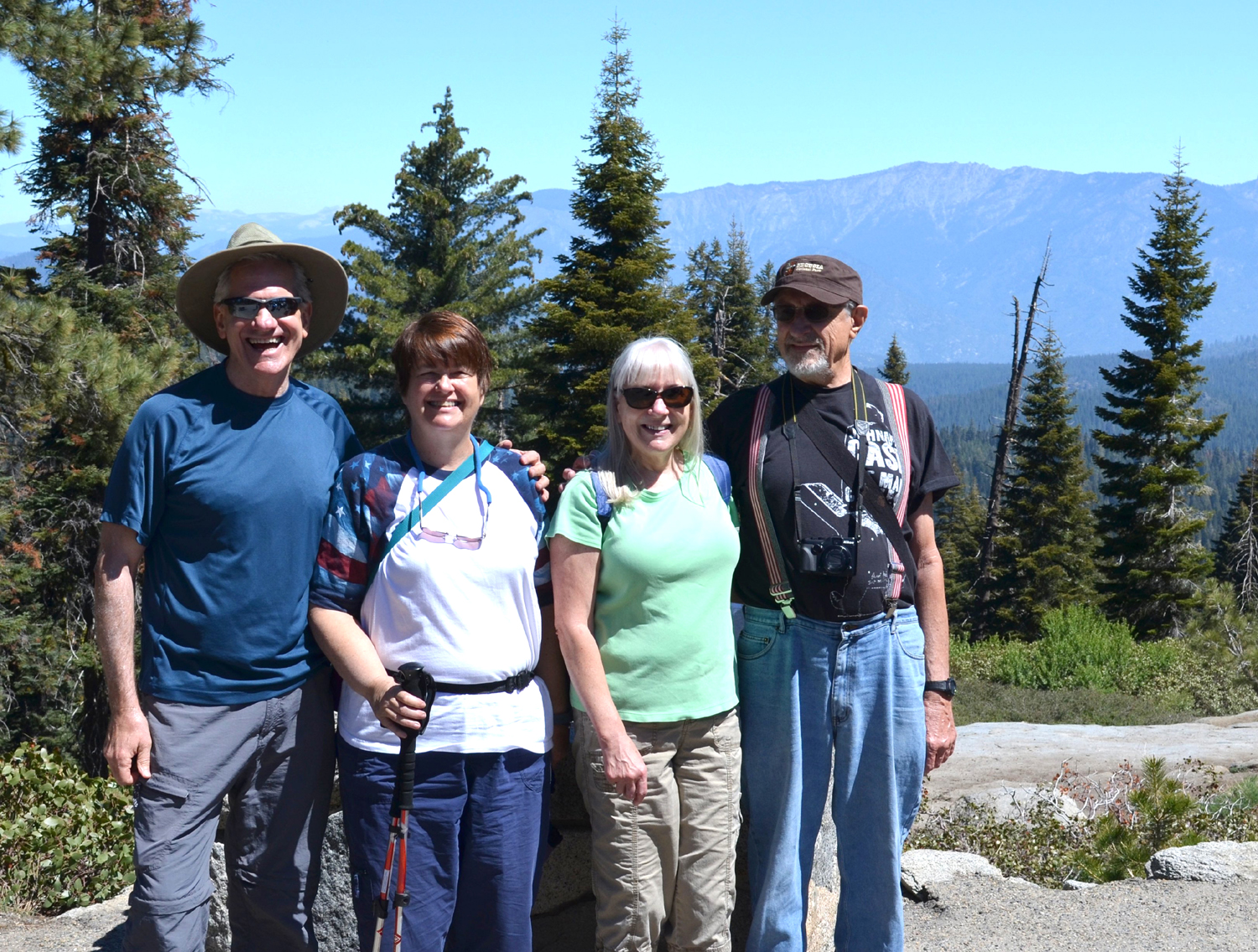
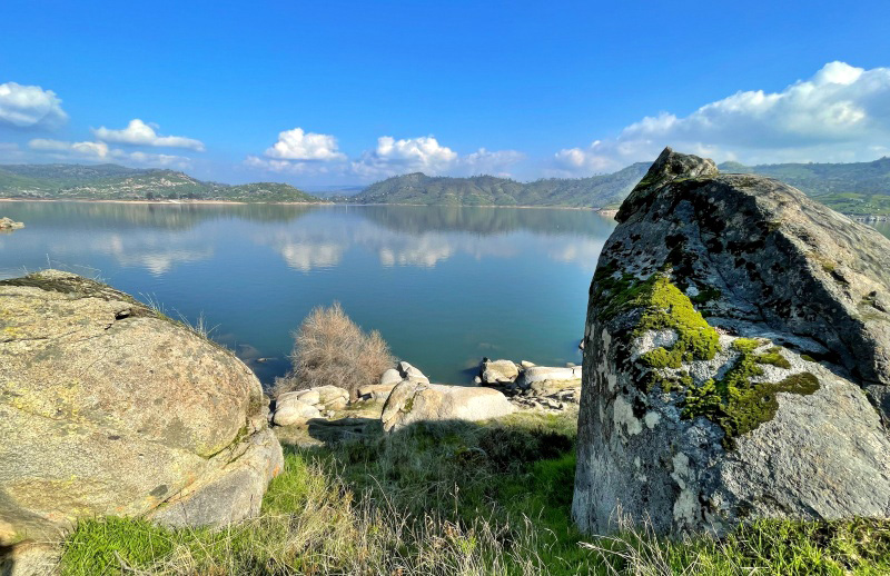
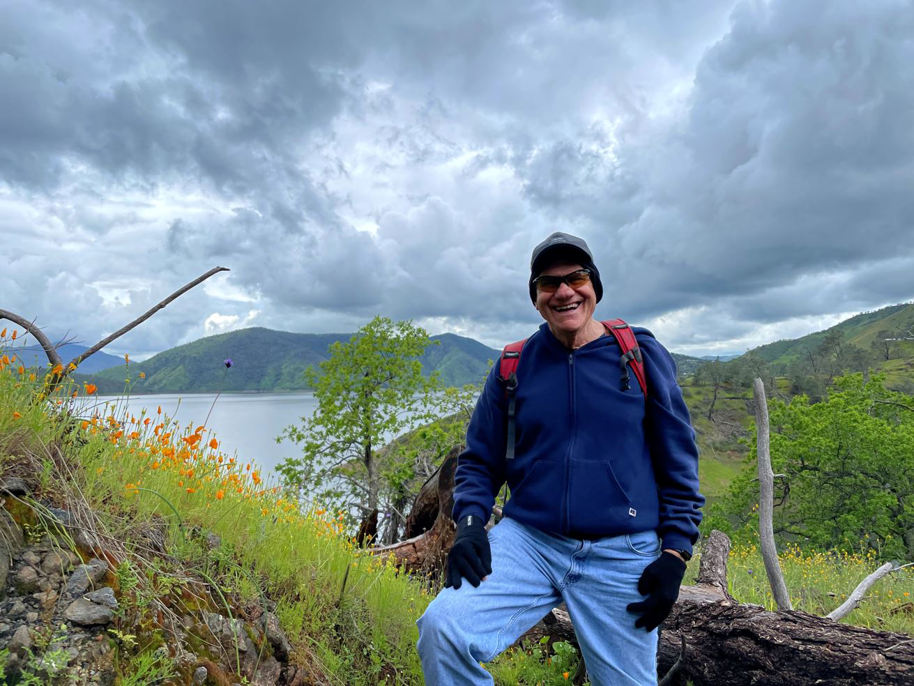
This was a true adventure, which is what you call it when you can't do what you planned but you do something just as good. Driving up from the valley to Pine Flat Reservoir on March 23, we were six in number. My daughter Teri had the day off, and she and her mother, Jackie, rode with me. Wes brought two new Ramblers into the group, Bruce and Susan Vasquez. Bruce and Wes attended elementary school together on the west side of Fresno County, back when buffalo still roamed the plains. Or at least, tule elk. Bruce and Susan have lived all over the world since leaving Fresno, most recently spending several years in Washington state. They moved back to Fresno to get away from the rain. Oops! There was a slight chance of rain, and it was partly cloudy when we started out, but as usual, we were undaunted. We enjoyed amazing views of clouds over the mountains, bright orange and yellow citrus ripening in the many orchards along Belmont Avenue, and enough blue sky to keep our hopes up. |
|
 |
 |
| Bruce and Susan, enjoying their first-ever visit to Pine Flat | The lake from Kirkman's Point |
|
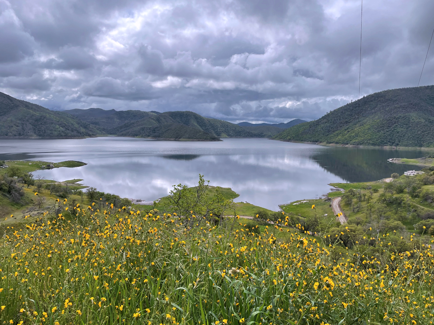
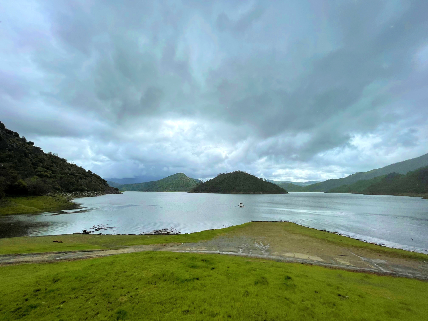
Our destination was the Sycamore Wildlife Area, which consists of three former campgrounds in the hills above the lake, a short distance past Sycamore Creek. We've hiked here a number of times, and we can always count on a nice display of wildflowers. BUT: In this year of record rain all over the west, flooding and slides along foothill and mountain roads are a constant thing. As we neared the lake, we saw sign saying that Trimmer Springs Road was closed at Trimmer Campground, several miles short of our target. We drove on to see for ourselves, and of course, were stopped by barriers across the road at the campground entrance. Wes talked with the driver of a Fresno County public works pickup, who said there were large boulders on the road ahead. Apparently they were beyond our destination, and Wes hinted that we should be allowed to proceed, but no such luck. We drove into the campground to use the facilities and take some pictures, then turned back and parked at the Edison Point Trail, another location we've visited a number of times. As we left Trimmer, it started to rain, but it had stopped by the time we reached the trailhead, and we set off for a short "out and back" hike, going counter-clockwise on the loop trail. |
|
 |
 |
| The lake below Trimmer Sprigs Campground | Due to the cool, cloudy conditions, most poppies were closed up |
|
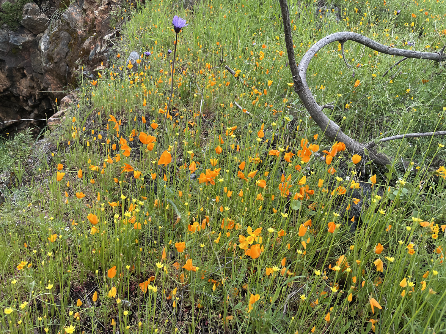
This part of the trail was almost impassible the last time the Ramblers hiked it, with many fallen trees requiring tedious detours on the steep hillside, so we normally just take the transmission line service road out to the point, the start of the clockwise route around the loop. About two years ago, the powers that sometimes do what they should graded the trail and removed the fallen trees, making for a pleasant hike down the slope toward the lake through blue oaks wearing a coat of fresh spring green, as well as lupines, fiddlenecks and other wildflowers. This walk offered plenty of views of the lake and the clouds. |
|
 |
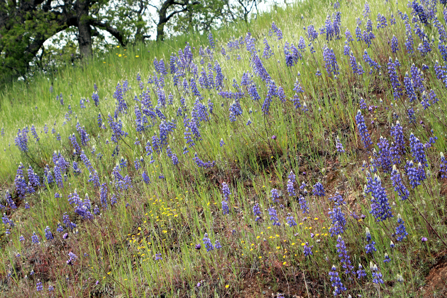 |
| The always plentiful fiddlenecks | Lupines on the road bank |
|
Despite the recent maintenance, this trail is no "walk in the park." A couple of newly-fallen trees and a muddy, slippery slide area offered plenty of challenge, but the natural beauty more than made up for any difficulties. |
|
 |
 |
| Dick coming up a short, steep section of the trail | Susan, happy to be in California |
|
When we finished our hike, we were ready to set out our chairs and enjoy lunch al fresco. It was not to be. The dark cloud we had been nervously watching zeroed in on us, and forced us to eat lunch in our two separate cars. One hapless fellow who did the entire loop came running to his car after the storm had been going for about 15 minutes. Our timing was excellent, as was the day's adventure and the company, and we plan to visit several other foothill locations before hot weather sets in. --Dick Estel, March 2023 |
|
 |
 |
|
We kept wishing this dark cloud away from us, but Mother Nature cannot be controlled |
The combination of clouds and sun created some amazing lighting effects on the green hills |
| Photos are by Wes, Teri and Dick, and there are more here. | |
|
San Joaquin Gorge - San Joaquin River Trail
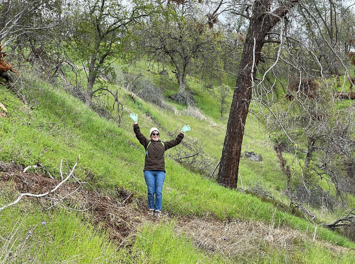
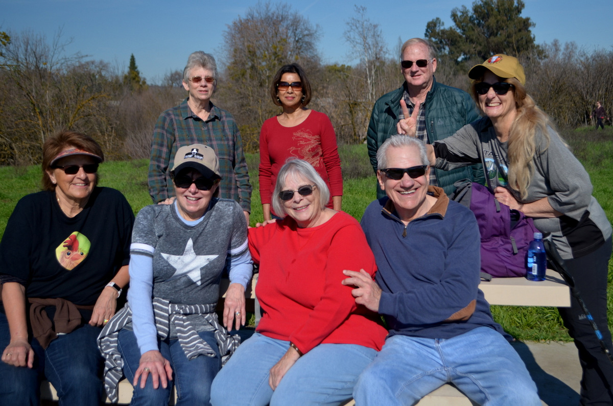
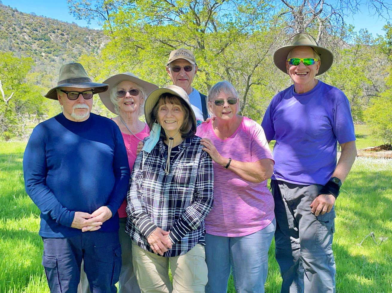
(Hike # 100) (Photos by Wes and Dick) This was a special hike. Partly because we were able to go where we wanted, but more importantly, because it was the 100th Rambler hike. This group started modestly enough on May 26, 2014, when I was joined by Wes Thiessen, Carolyn Amicone and Julie Hornback on a hike to Buena Vista Peak in Kings Canyon National Park. At the time we were just a group of retied Fresno County employees, but another colleague, the late Regina Wheeler, soon gave us the Ramblers name. We did only four hikes that first year, but in 2015 we made a determined effort to hike every month. It was just the original four until October 2016, when Don McClellan became an official member, followed in February 2017 by Sue Wirt. Before that we had a couple of "guest" hikers who join us when their schedules permit - my younger daughter Jennifer, who lives in Oakhurst and is a full-time teacher in Chowchilla, and an old family friend, Susan Crandall, who lives in Mariposa County and keeps very busy even though officially retired. Recently Julie and Carolyn have had health issues and family obligations that have kept them off the trail, but Wes and I have missed only a handful of hikes. Meanwhile we've been joined by a half dozen or so short-term guests and added six whom we consider permanent members. Two married couples, friends of two of our regulars, look promising to be long-term members. |
|
 |
 |
| The first Ramblers hike: Wes, Julie, Carolyn and Dick |
Probably our biggest group: Standing Ardyss
Webster, Elsa Sweeney, Allen Ward, Teri Liddle; seated Berdie Beier, GlorIa Jackson, Sue Wirt, and Wes Thiessen. Marlene Pascua left early and Dick Estel took the photo |
|
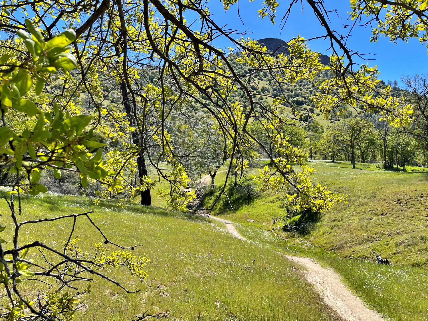
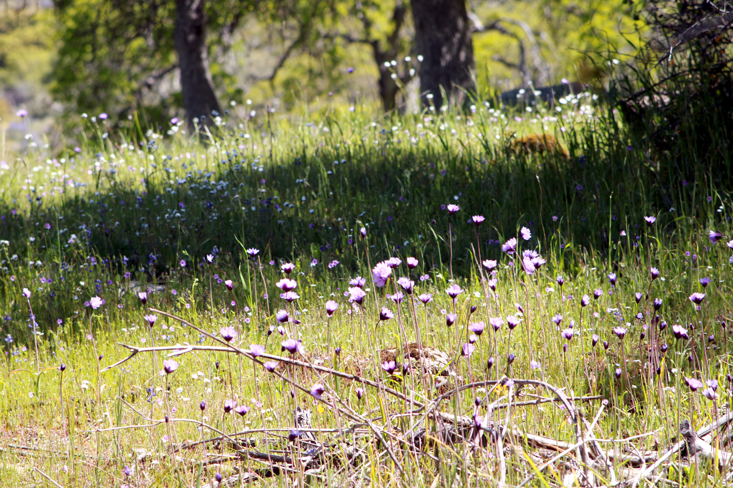
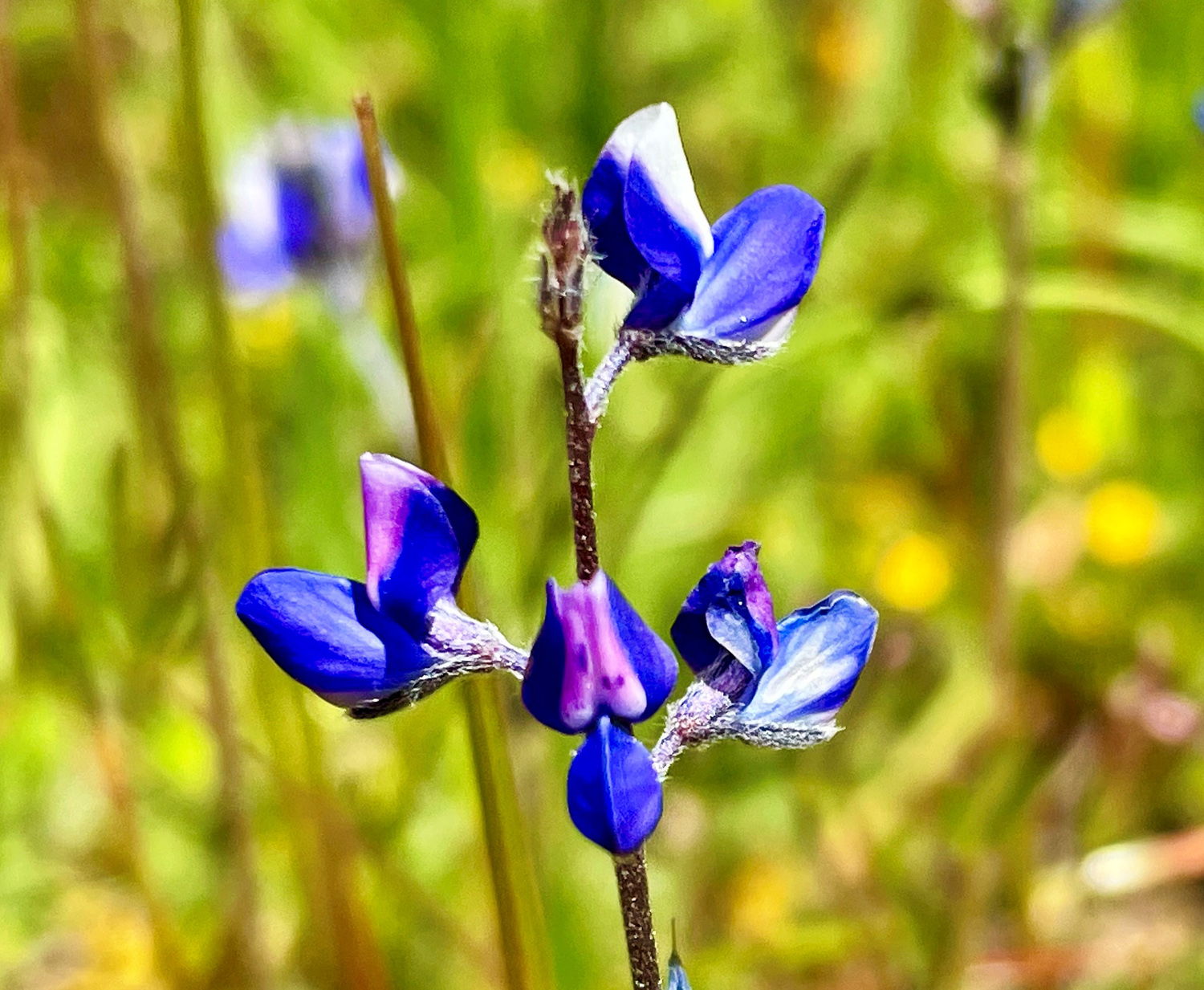
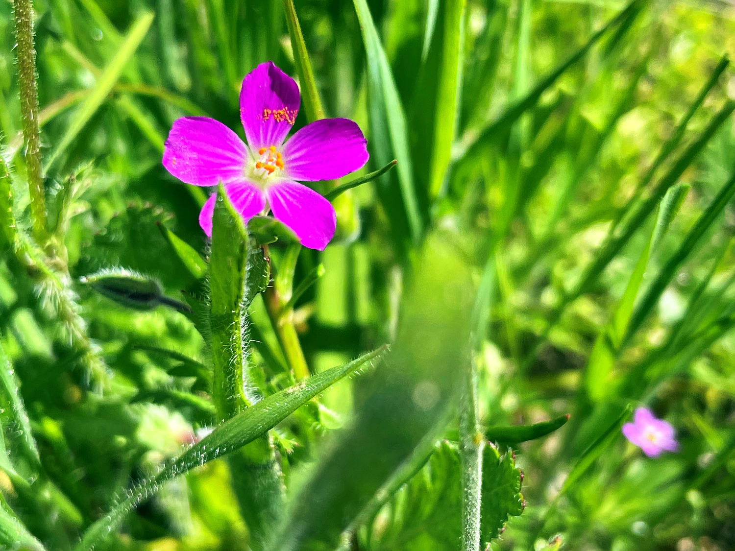
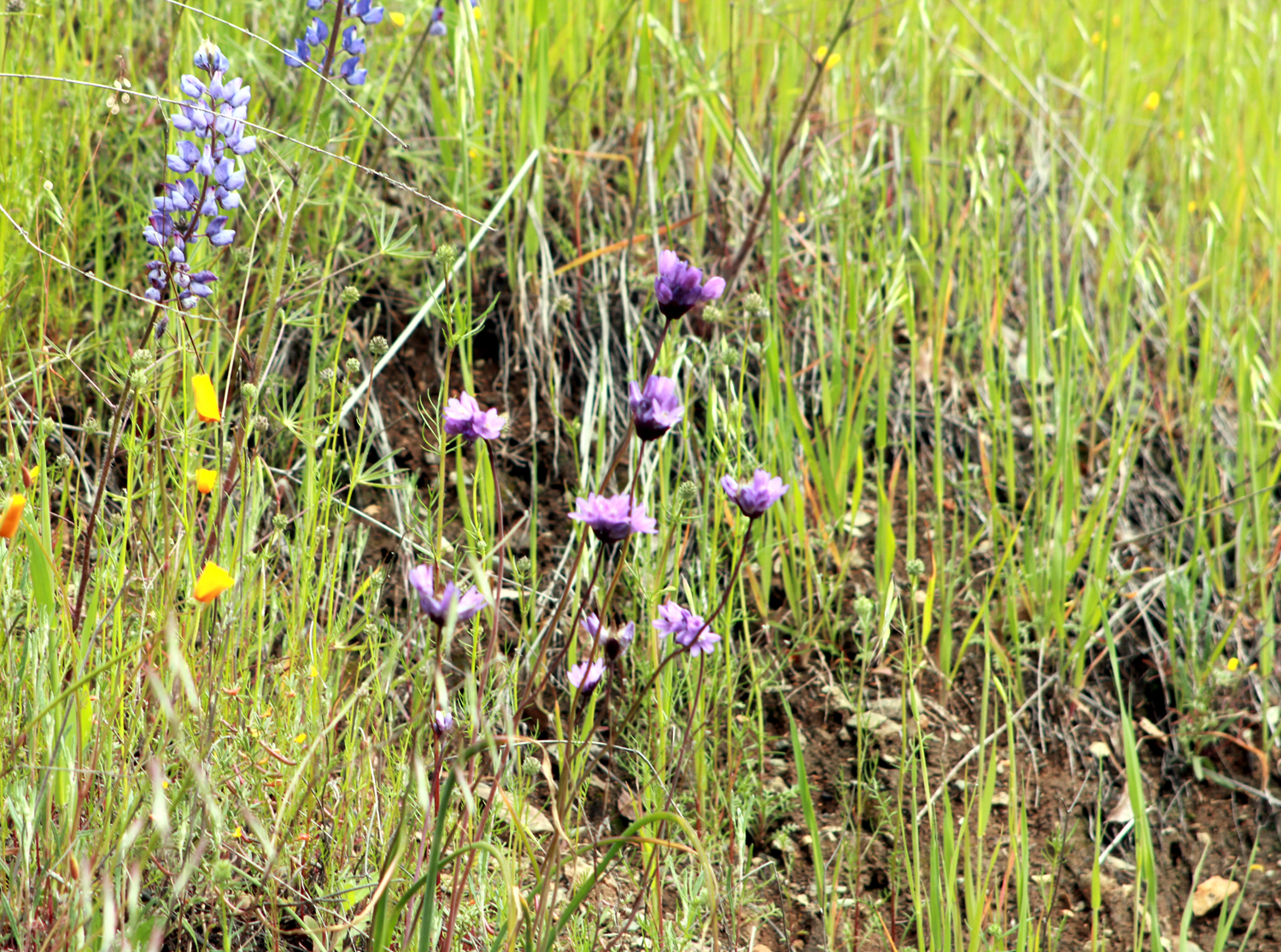
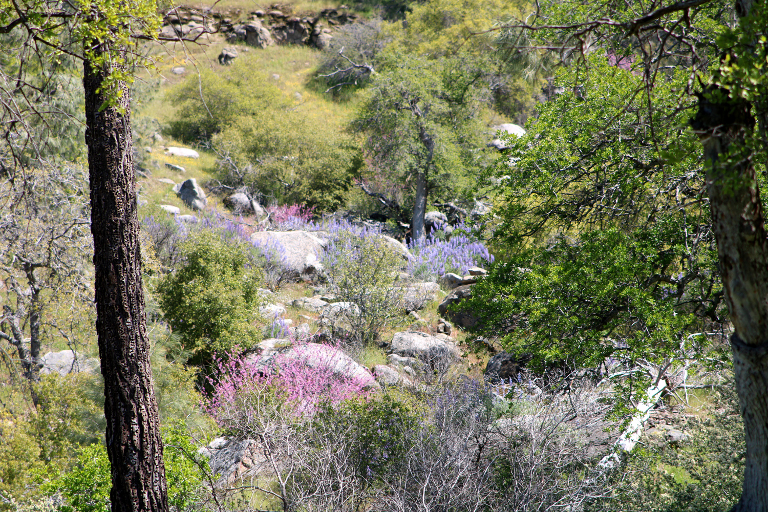
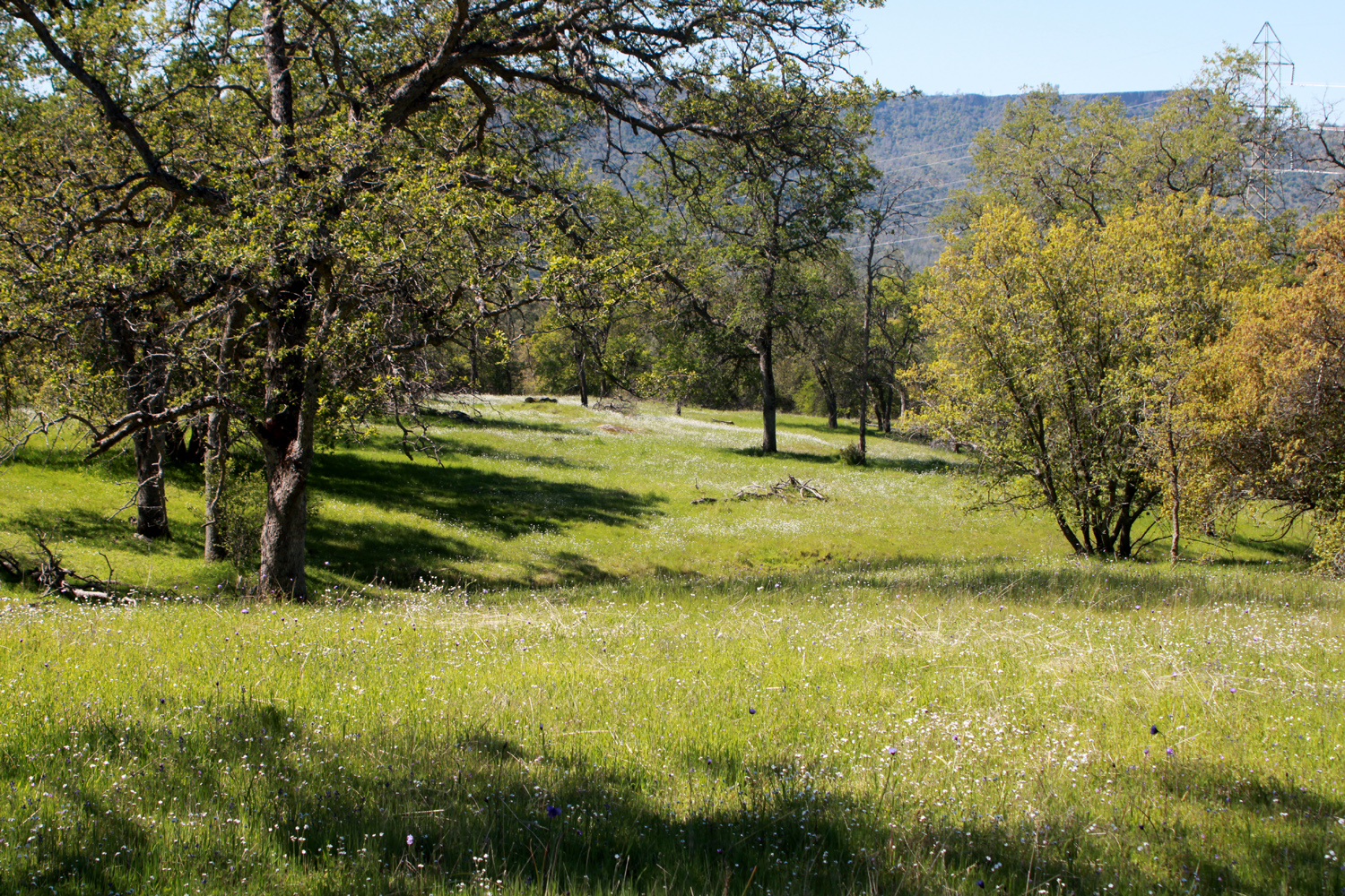
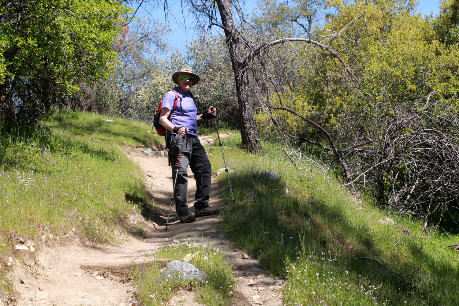
Enough history! What have we done lately? On April 6 we returned to a favorite hiking trail, the upper end of the San Joaquin River Trail, starting from the the trailhead at San Joaquin River Gorge. The trail names here can confuse those not familiar with the area (and some of us who are). The Bridge Trail goes down into the San Joaquin River Gorge where it crosses a foot bridge to the Madera side of the river. The San Joaquin River Trail goes 14 miles downstream to Sky Harbor and the Finegold Picnic Area. We've hiked a mile or two on both ends of this trail, but none of us have done the entire route. To add to the confusion, a half mile from the parking lot is the River Trail, which goes down very steeply to the river about two miles downstream from the bridge. Enough geography! How were the flowers? Well, they were spectacular, although not as thick as they have been some years (and may yet be). More than enough rain and just barely enough sunshine is a recipe for variable and inconsistent amounts of flowers. The bush lupines were spectacular, and Wes captured some nice if somewhat distant views (the best place to see them is on the road into the location, about a half mile before you arrive at the parking lot). The blue dicks, a species of brodiaea, were plentiful along the trail, along with popcorn flowers, fiddlenecks, filaree, some small patches of bird's eye gillia, and various yellow daisy-like flowers. Redbud was getting a start, but flowers were sparse on most of the bushes. |
|
 |
 |
| A classic Sierra foothills view | Redbud was just getting started |
 |
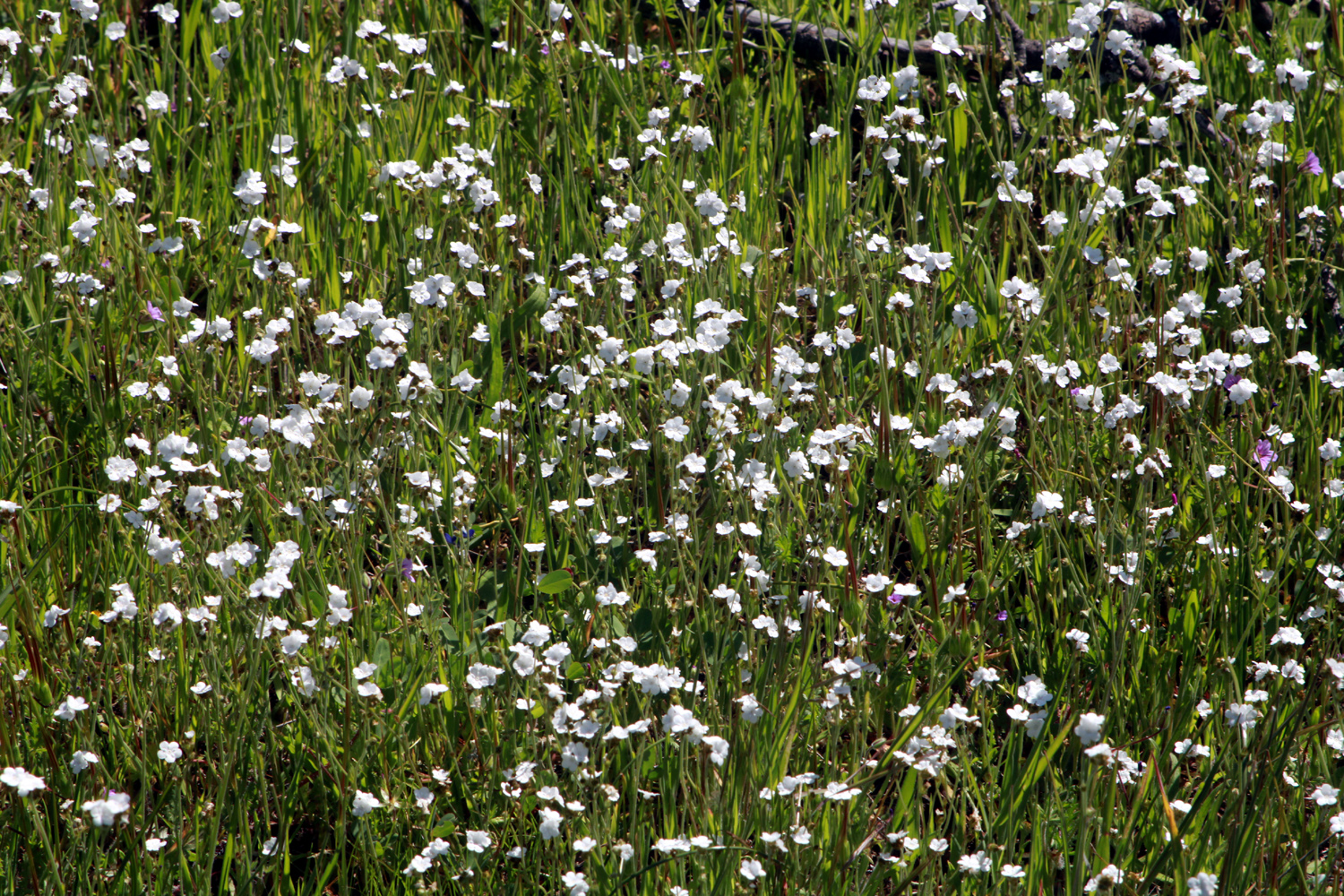 |
| Blue dicks were among the three or four most common flowers | Too many popcorn flowers to count |
|
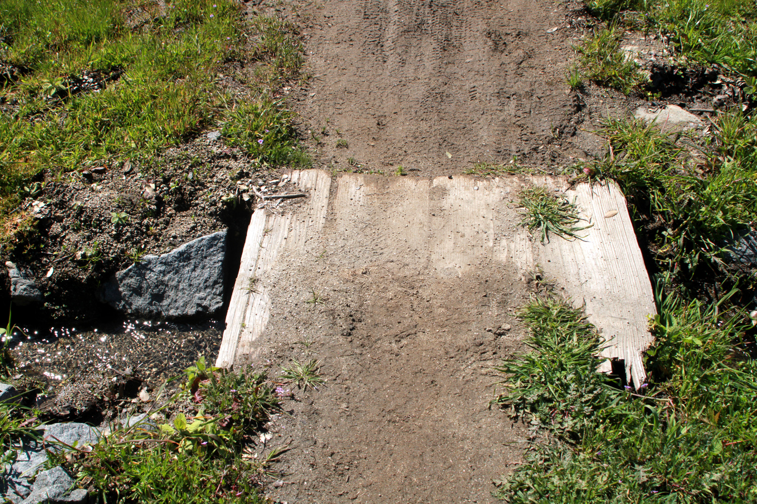
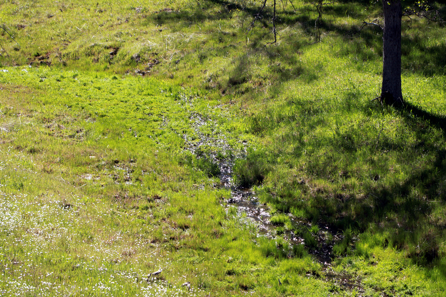
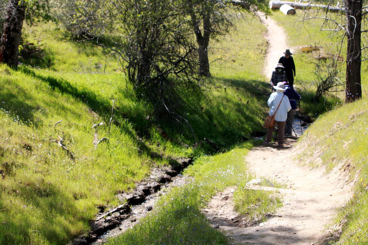
The record rainfall during the first two months of the year has brought back to life a number of seasonal creeks that have been dry in recent years. I decided to take pictures of every creek we crossed, with the total reaching seven. There are some muddy, soggy spots that did not qualify, but if movement of water could be detected, it counted as a creek. Not all of them were particularly photogenic, but it was nice to see evidence of the return of plenty of rain. |
|
 |
 |
| A tiny footbridge across tiny creek Number 2 | Creek Number 6, the one that seems to flow every year |
|
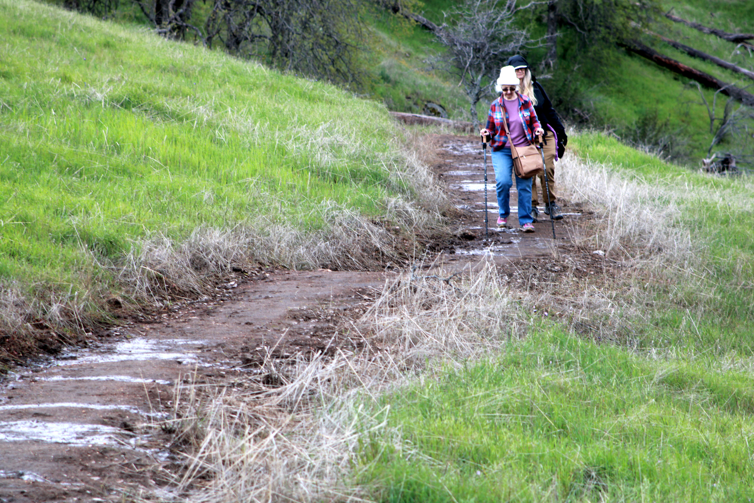
The weather was excellent - not too warm, no clouds, and a slight breeze now and then. It was certainly the best hike and the best conditions of the year. There were a lot of people out enjoying the day - the parking lot was full and we had to go on to an unpaved "overflow" lot about 200 yards farther. We had a group of six, including a couple who are friends of Jackie, and were new to the group. Hikers included Richard and Gayle, Jackie, Sue, Wes and Dick. Richard and Gayle drove their own car in case they decided not to join us for lunch. I guess we passed the test, since they went to Velasco's in Prather with us, and plan to hike with us again. I gave Wes a challenging assignment to use the macro app on his iPhone to photograph some very small flowers, and he came through with flying colors. |
|
 |
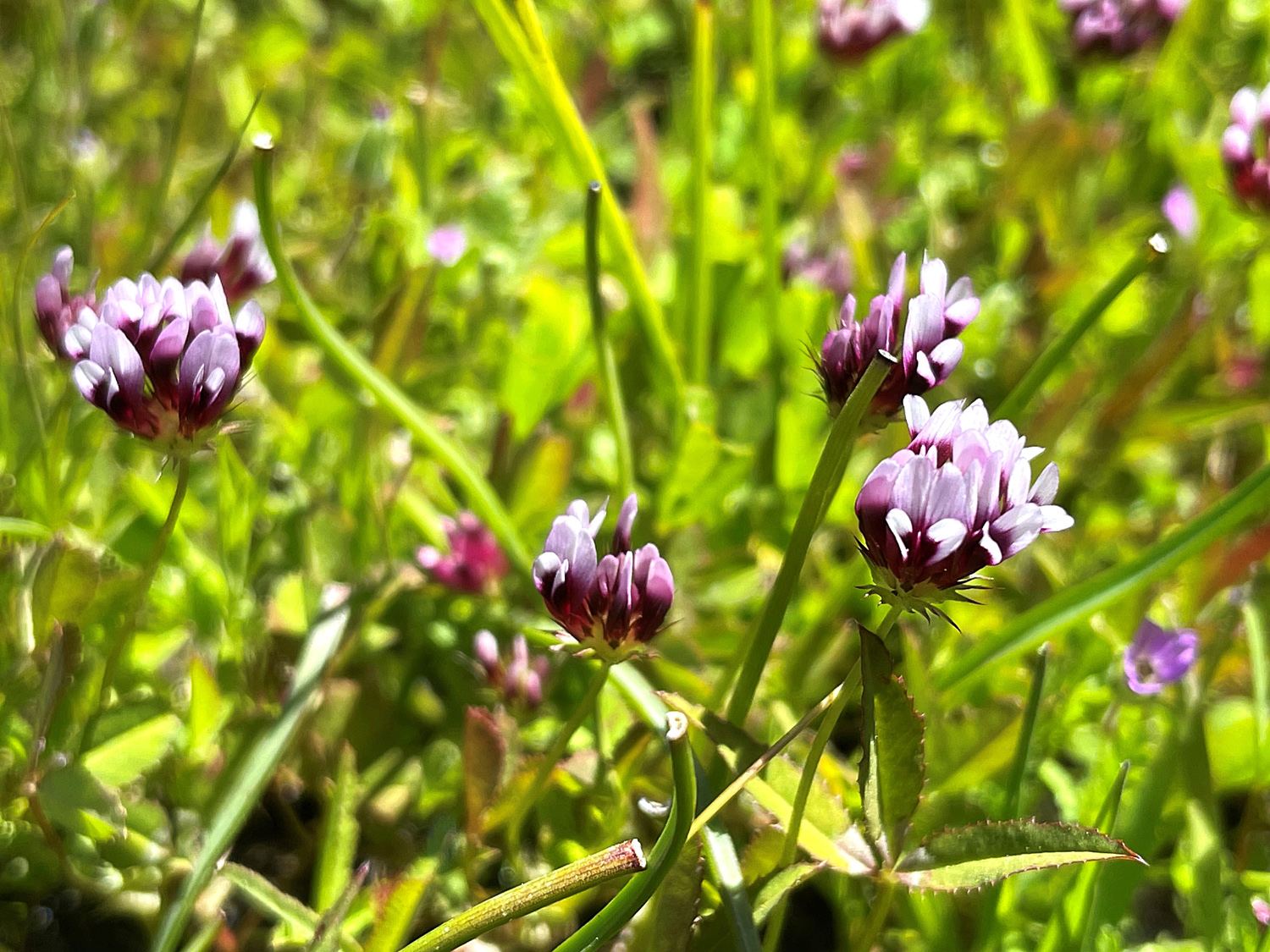 |
| The delicate beauty of the dove lupine | One of several varieties of clover that we see in the Gorge |
|
All in all, we could not have asked for a better day, and we're looking forward to at least a couple more foothill hikes while the flowers are still putting on a good show. --Dick Estel, April 2023 |
|
| Photos
(Click to enlarge; pictures open in new window)
(Photos by Wes & Dick) |
||
| Blue Oak Trail San Joaquin Gorge Bridge Trail Edison Point SJ Gorge SJ River Trail | ||
| Blue Oak Trail | ||
|
|
 |
| The Ramblers, at the end of the hike | Wes captured a beautiful scenic view | Wes, Sue, Allen and Carolyn pause and pose |
 |
 |
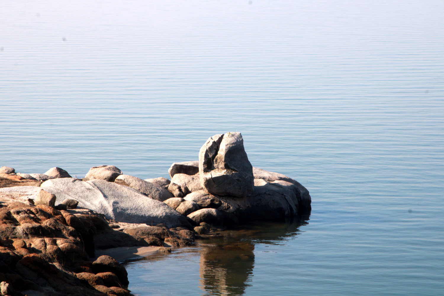 |
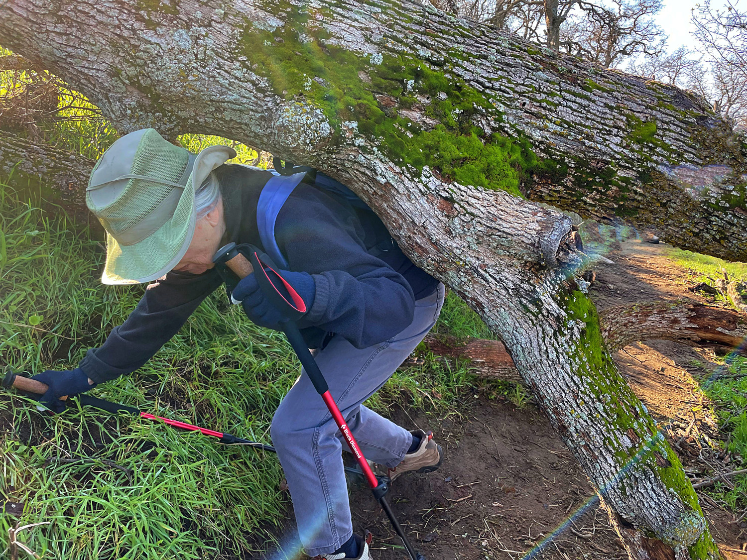
| A common sight - a tree down across a trail | Carolyn makes her way under the barrier | We always enjoy seeing this unusual rock formation |
| San
Joaquin Gorge Bridge Trail (Photos by Wes & Dick) |
||
 |
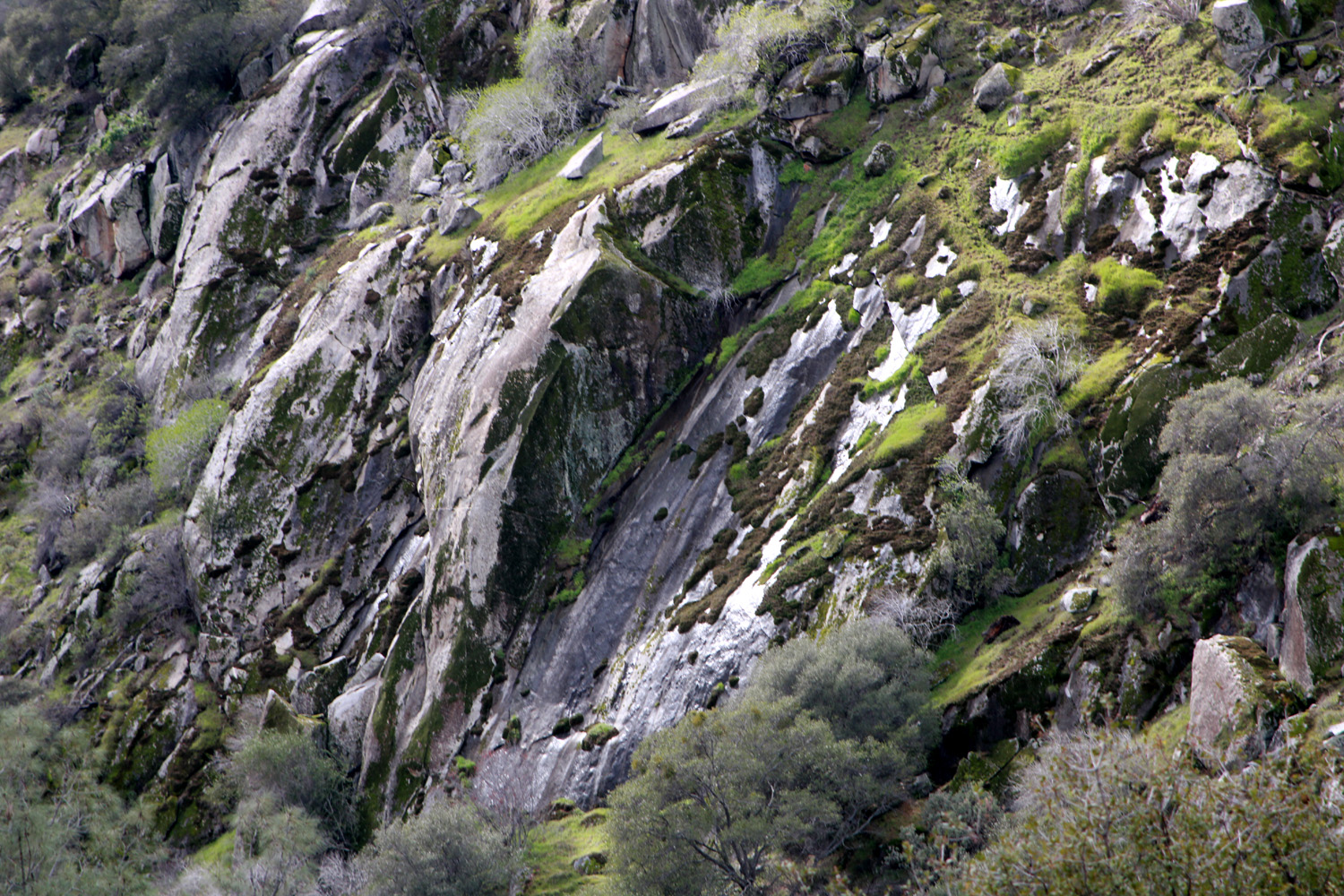 |
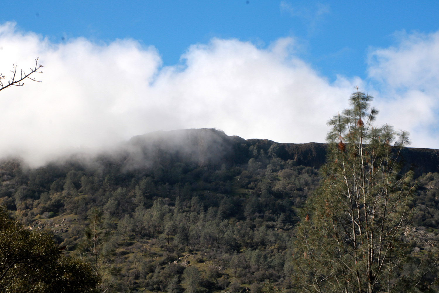
 |
| Drifting clouds hang over Kennedy Table | Just above the river bed, the bank is steep and rocky | Dying bull pine offers multiple colors |
 |
 |
 |
| This tree has been down a while | A little river of sand has washed off the trail | It was cool enough for a flannel shirt over a sweatshirt |
|
 |
|
| A section of the trail just up from the bridge | Wes poses for a selfie on the bridge | Don met us a dozen feet down the trail |
| Edison Point | ||
|
 |
 |
| Bruce, Susan, Dick, Teri and Jackie | Wes, off the trail and happy to be there | Blue dicks and other flowers |
|
 |
 |
| A study in green, blue and white | Jackie
and Teri walking carefully through a wet, muddy section of the trail |
We had
to take more and more photos of the lake and clouds |
| San Joaquin Gorge - San Joaquin River Trail (Hike # 100) | ||
|
|
 |
| San
Joaquin Bluff peeks through the new foliage of a blue oak |
The intense magenta of a fringed redmaid | Boot
prints and bike tracks where Creek Number 3 crosses the trail |
 |
 |
 |
| Creek Number 1 is partly hidden in the grass | Ramblers crossing Creek Number 6 | Pastel
colors of redbud and lupine contrast with shades of green above the trail |
 |
 |
 |
| Richard, Jackie, Gayle, Dick, Sue and Wes | Fields along the trail are a study in shades of green | Wes is
undaunted by this steep, rocky section of the trail |
| Related Links | ||
| Millerton Lake | Millerton State Recreation Area | Millerton Eagle Tours |
| Table Mountain Casino | Blue Oak Grill | Friant Dam |
| Blue Oak Trail Video (You Tube) | San Joaquin River Gorge | San Joaquin Gorge Video |
| San Joaquin Gorge Waterfall Video | Velasco's | San Joaquin Gorge Photo Gallery |
| San Joaquin River Trail | Tule Elk | Pine Flat Reservoir |
| Edison Point Trail | San Joaquin River Trail | San Joaquin Gorge Photo Gallery |