|
Utah National Parks 2019 Arches and Capitol Reef |
|
|
Mojave
Preserve Traveling
East Skyline
& Sand Dune Arches
Windows Section
Arches Vistas & Salt Valley |
|
|
|
|
|
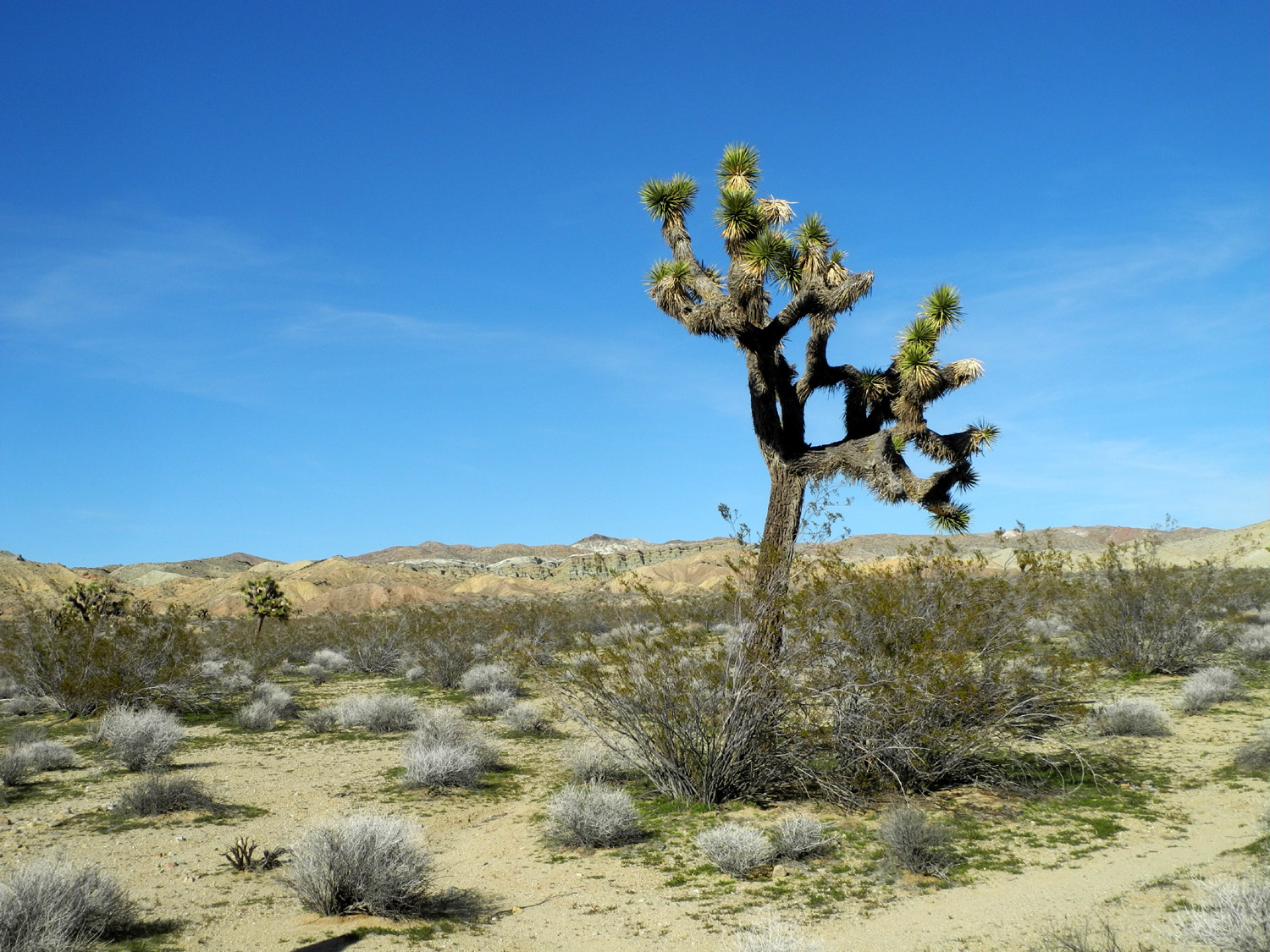
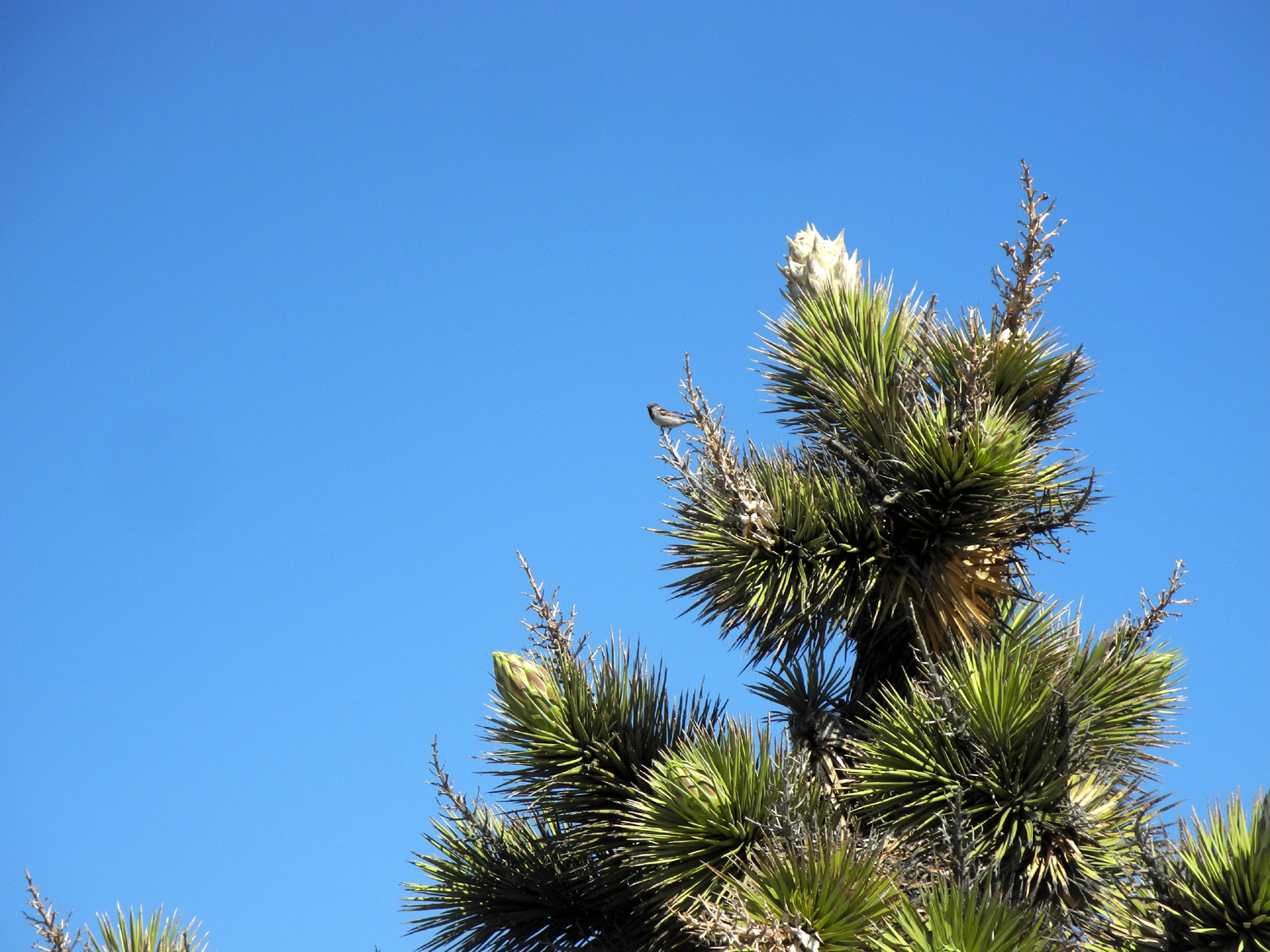
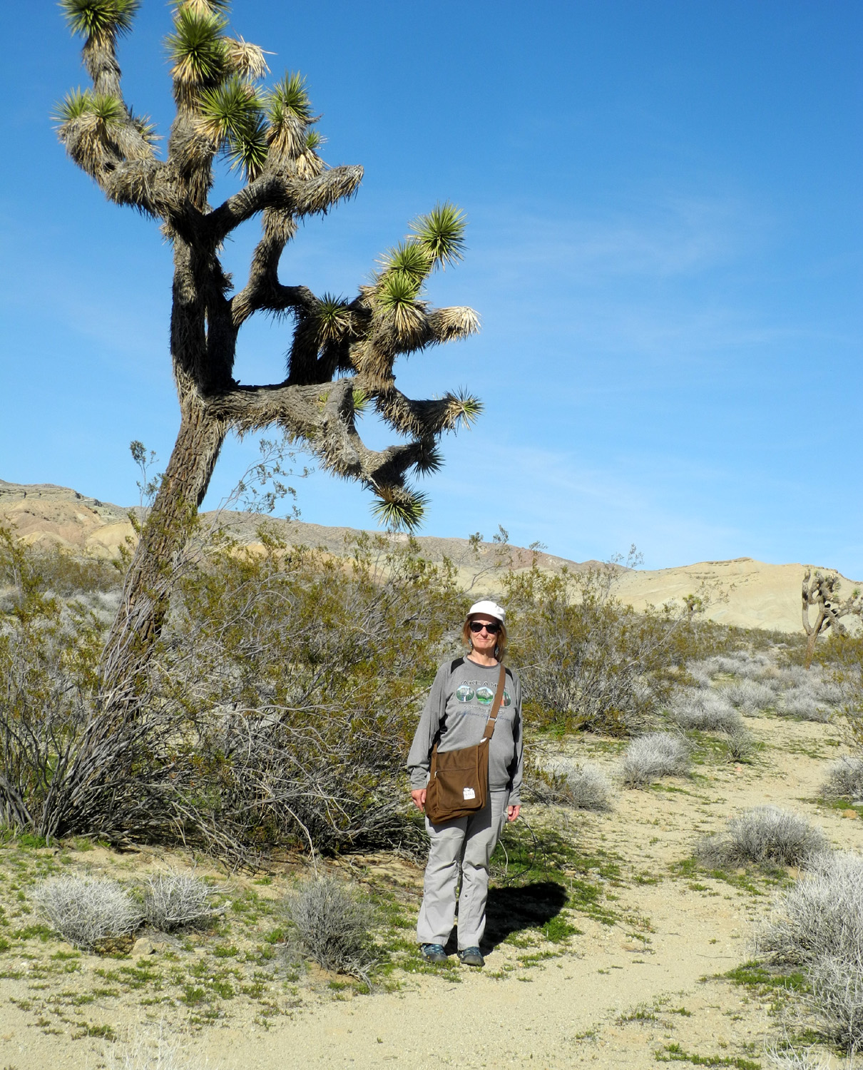
When you have to switch to Plan B, you've had problems. But when you go to Plan C, you know things have really gone bad. My daughter Teri and I scheduled a trip to Utah's Arches and Capitol Reef National Parks several months ago. Plan A was to camp in her motor home in both parks. We left home about 1:30 p.m. on Thursday, March 14, and things went smoothly till shortly before dark. About 30 miles east of Barstow the vehicle lost power, and we coasted to the shoulder, inches away from the traffic racing toward Las Vegas on I-15. We were able to get in touch with a towing service in Barstow, and arrived at the company's repair shop/used car lot, where we spent the night in the motor home. The next day they determined that it needed a throttle body, a $500 part that would not arrive until Monday morning. The prospect of three more nights in Barstow was far from how we intended to spend our time, but we remained positive. We gave up on the plan to go to Capitol Reef, cancelled the first two nights at the Arches camp, and booked spots in an RV park in Moab, just outside the park. Making the best of the situation, we rented a car from Avis and drove out in the desert north of town, visiting Rainbow Basin, where a loop road goes through a canyon with dramatic rock formations. We walked around the desert a little, observing a half dozen tiny wildflowers, and enjoying the twisted shapes of Joshua trees, both living and dead. Some were just starting to blossom. |
|
 |
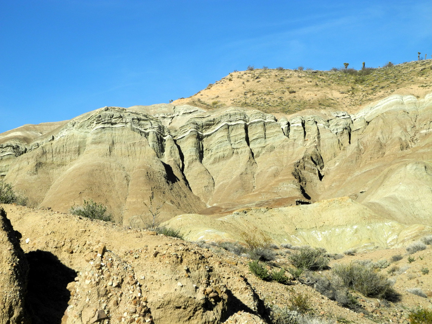 |
| Scattered Joshua trees rise above the desert near Barstow | Weathered rock formations in Rainbow Basin |
|
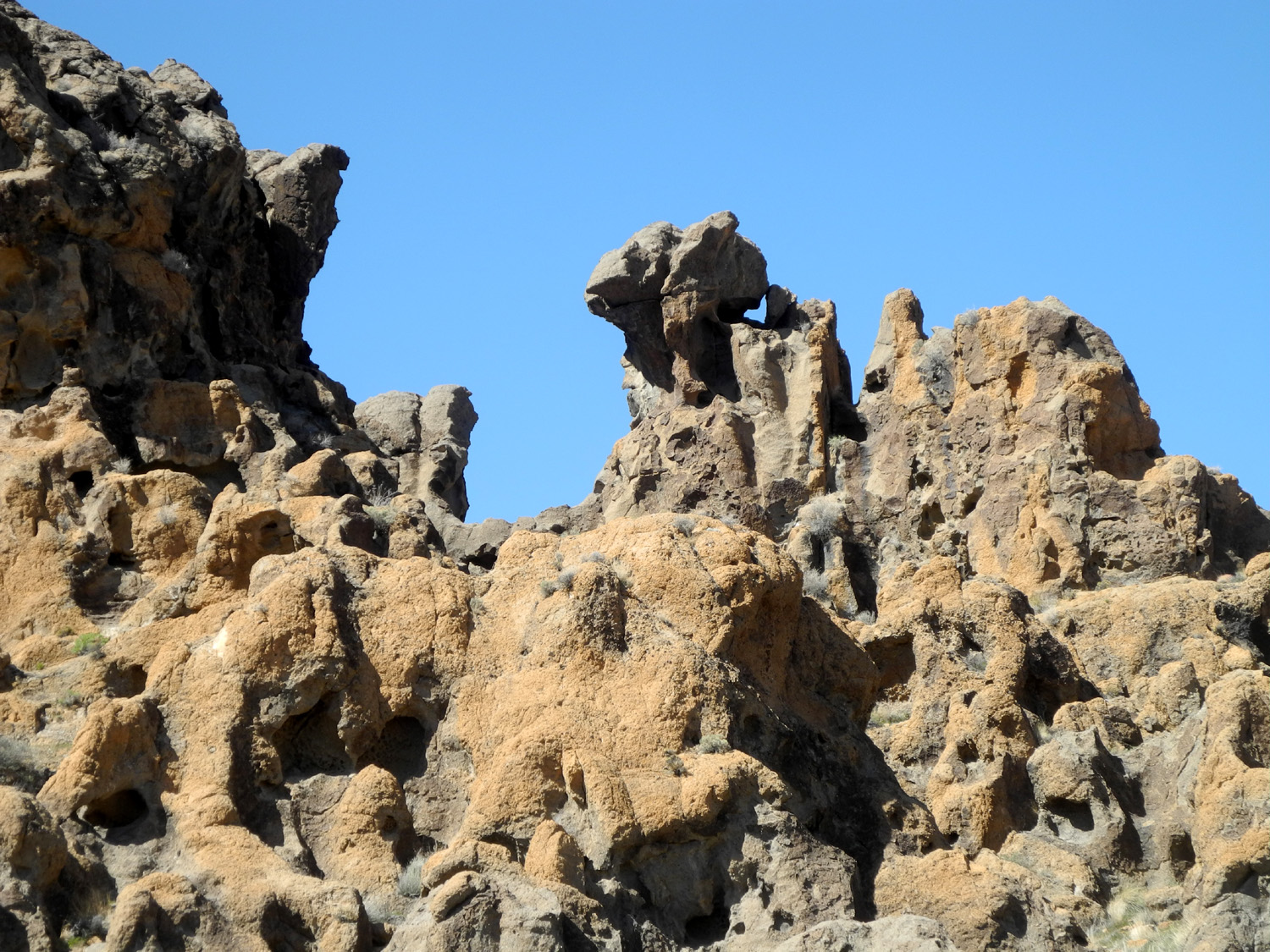
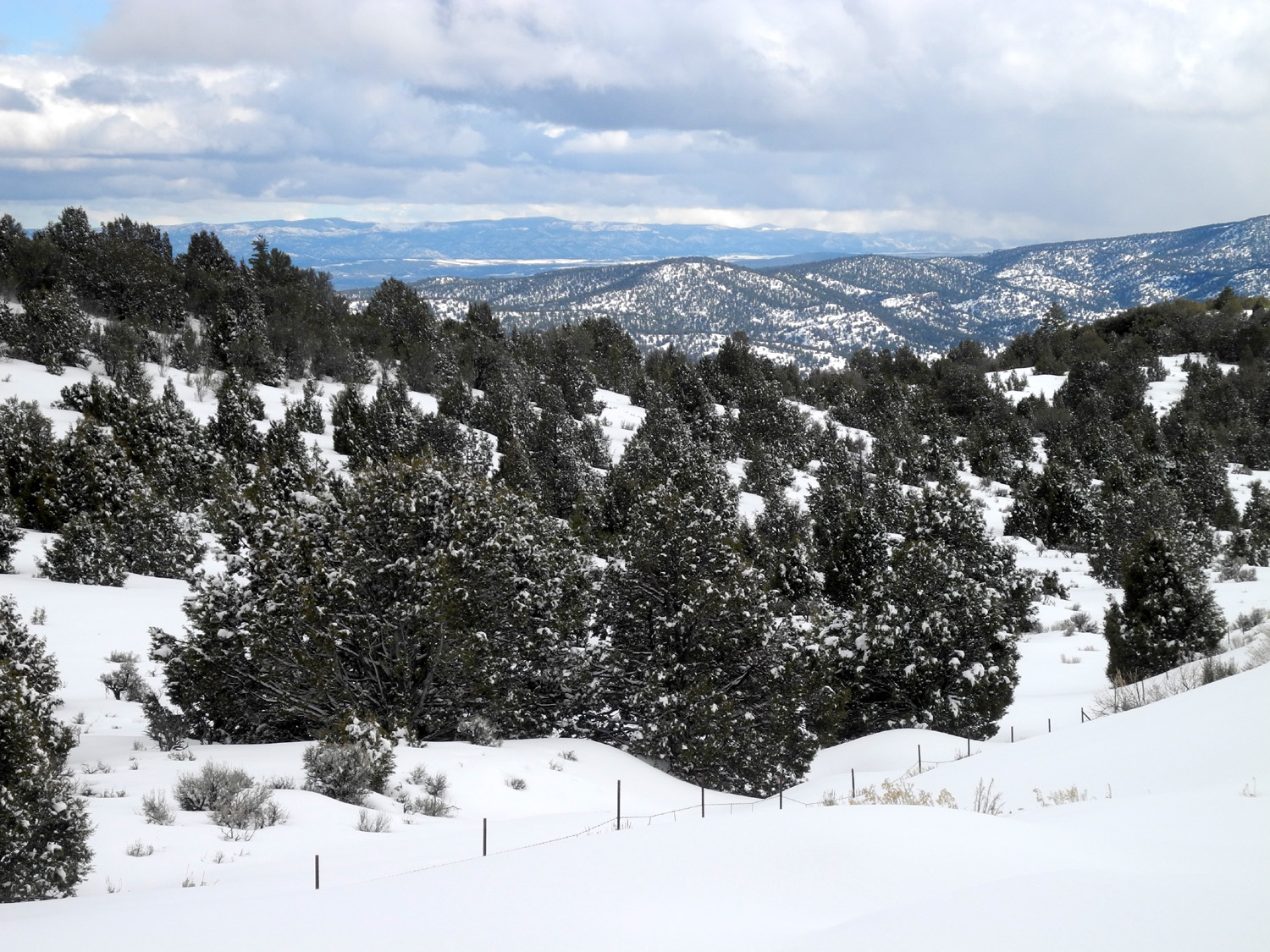
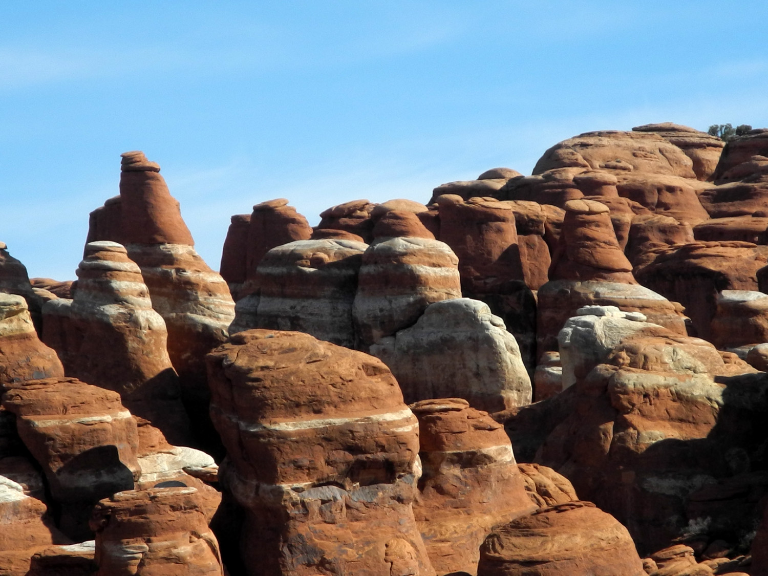
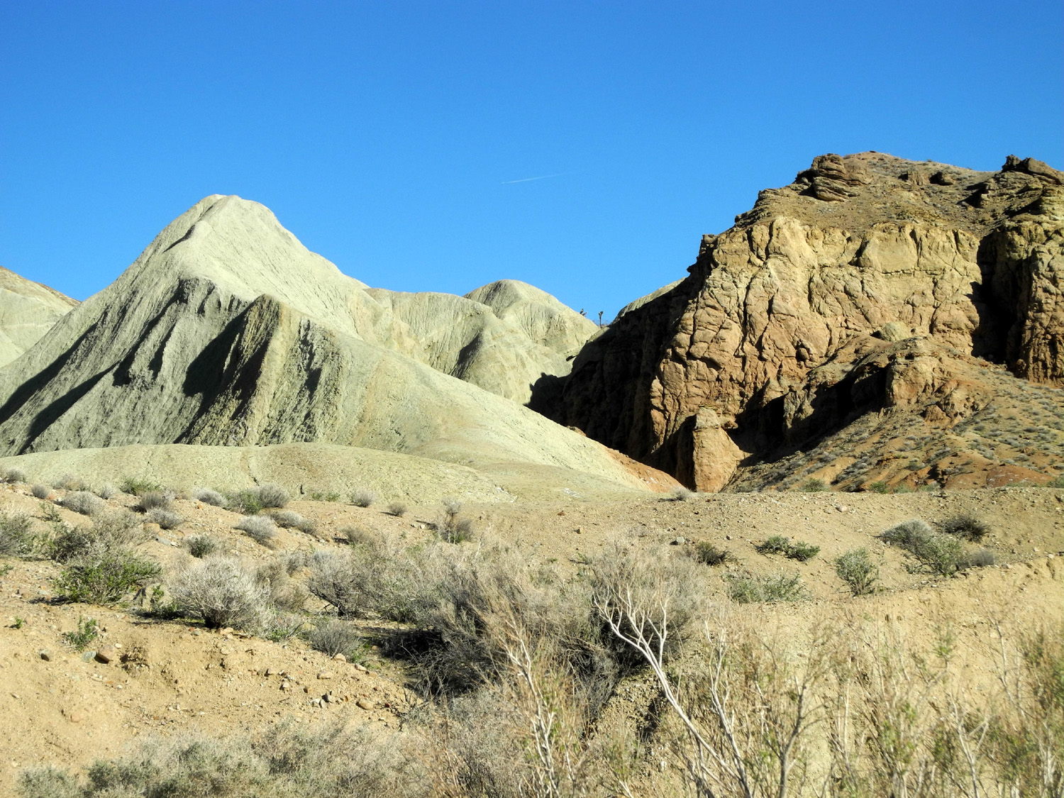
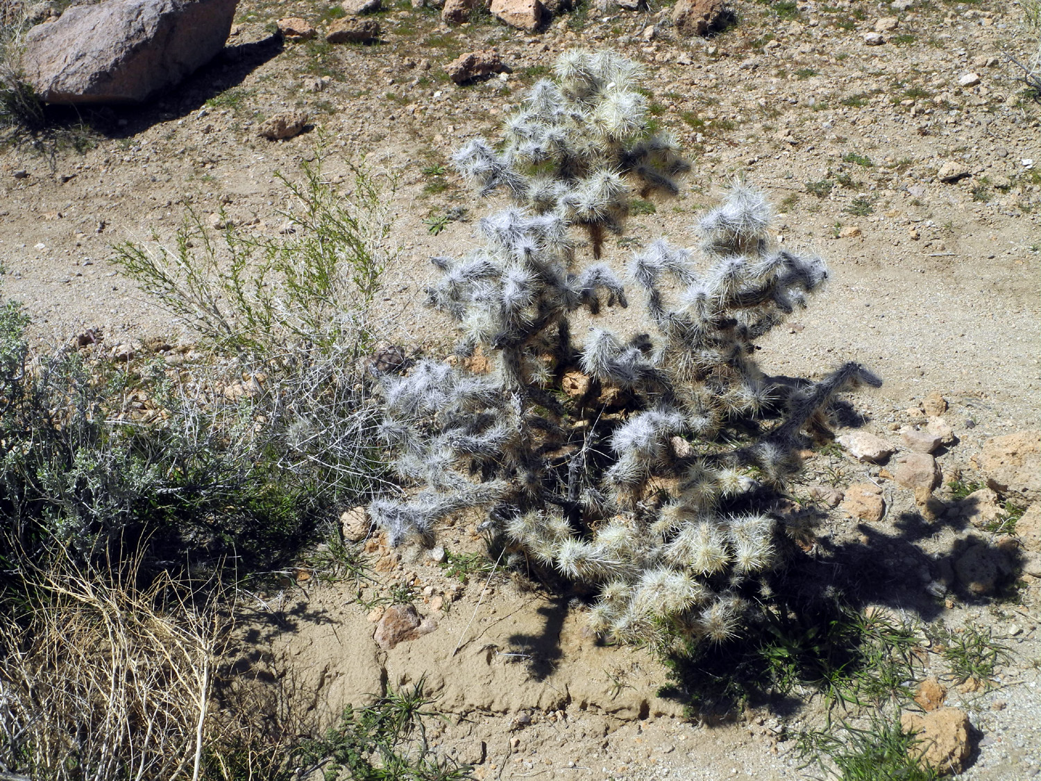
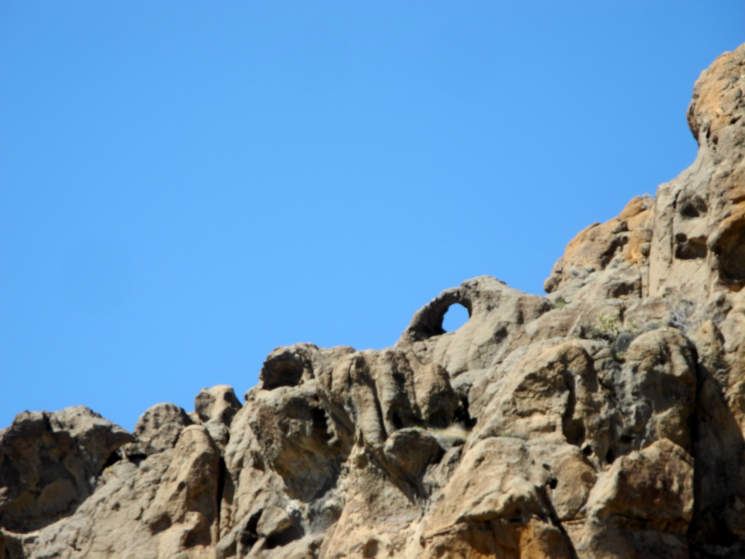
The next day (Saturday) we went to the Mojave National Preserve, a huge tract of desert between I-15 and I-40, a 120 mile drive east on the latter route. I visited this place three times in 2010, first for one night on route to a bluegrass festival, then twice for a multi-night stay, but Teri had never been there. It's the third largest unit of the National Park System in the continental United States, a land of sand dunes, cinder cones, lava flows, rugged weathered mountains, and high desert vegetation, including a dozen kinds of cactus. There are limited facilities, with Hole-in-the-Wall campground being the only one that accommodates RVs. Of course, we were not camping, but this area is also the location of Banshee Canyon and the Ring Trail. The latter is a short but steep passage through the canyon, where rings set in the rock provide assistance going up and down. I had made this hike each time I visited nine years ago, but time has a way of imposing limitations, and I found it too challenging this time. We were still able to walk the trail from the visitor center around to the bottom of the canyon, enjoying a few flowers and lots of cactus, with barrel cactus our favorite. There are also spectacular views of the rugged rock ridge that runs along the west side of the campground. |
|
 |
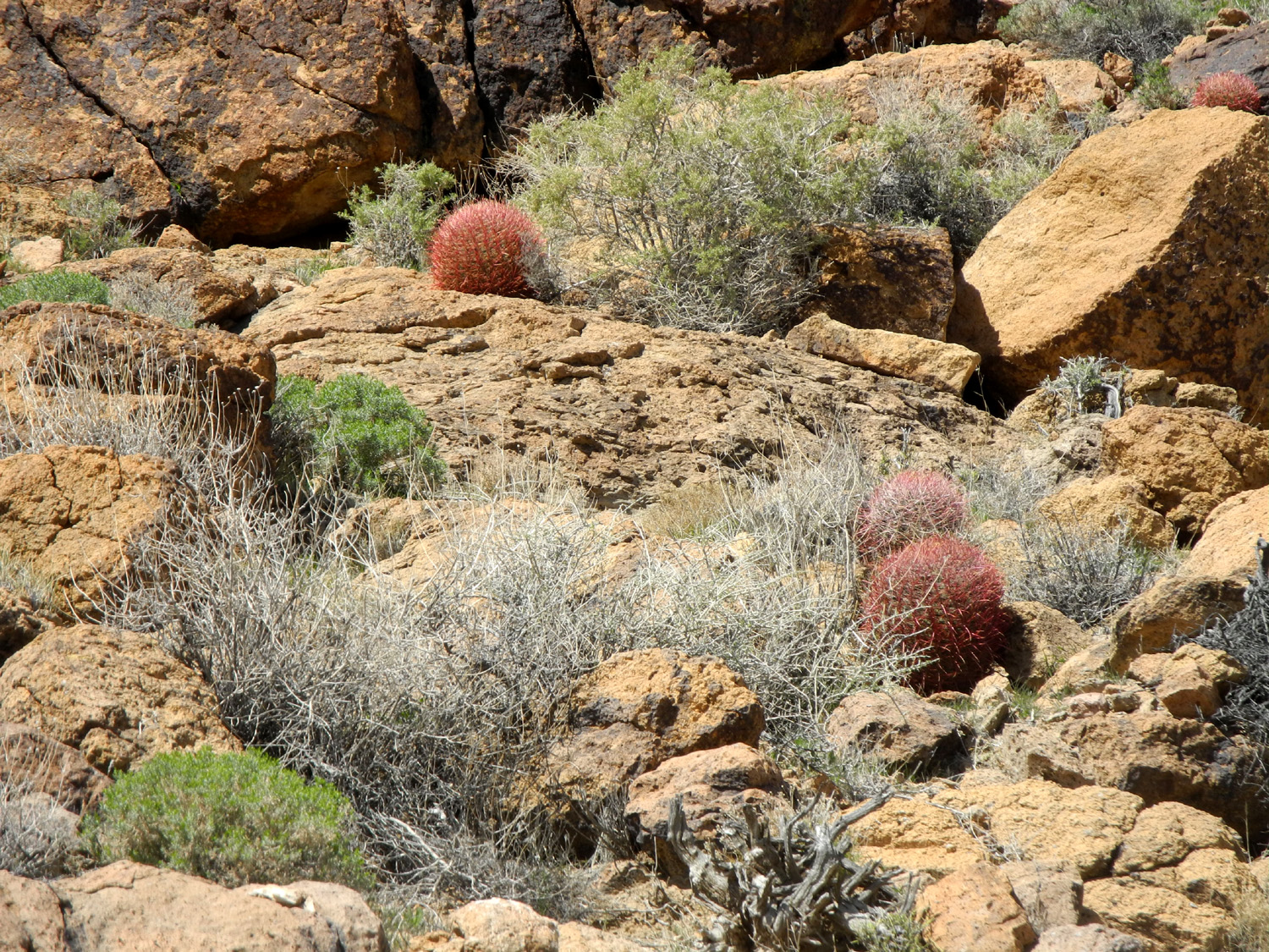 |
| Twisted rock in the Mojave Preserve | Young barrel cactus stand out in the tan landscape |
|
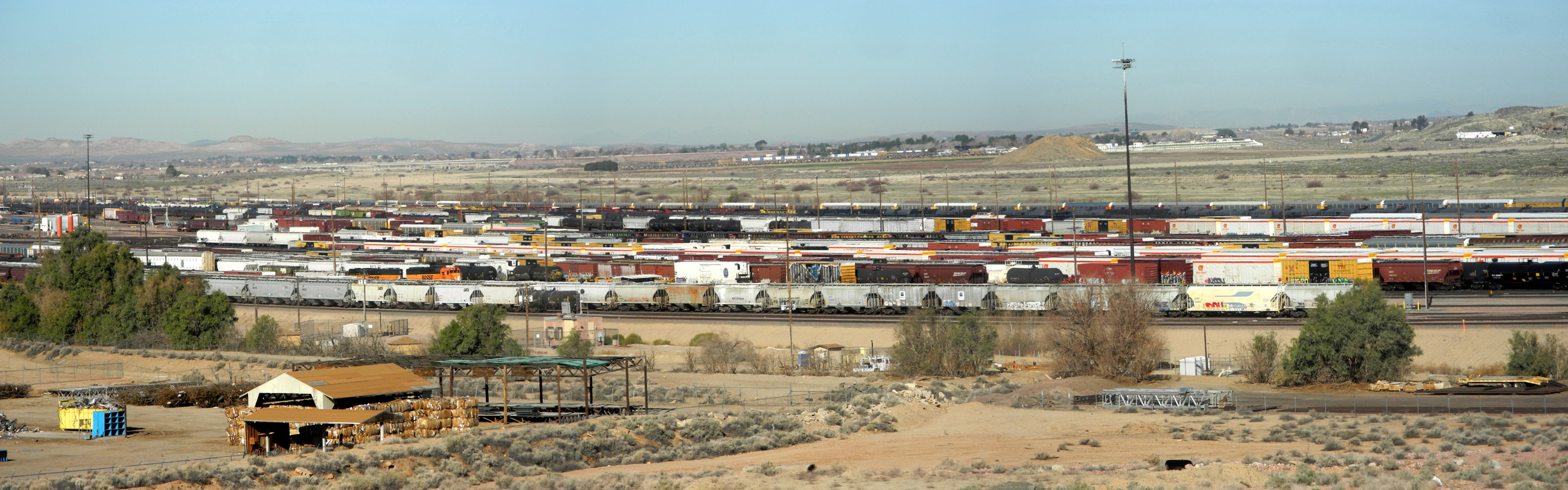
Once we got back to Barstow we turned in the rental car. The next day (Sunday) we walked to the Route 66 and Railroad Museums. Route 66 was closed due to St. Patrick's Day (?) but we enjoyed the old photos, equipment and artifacts, plus engines and railroad cars on display at the other museum. Barstow is a major rail switching area, and we saw trains continually coming and going on the tracks next to the museum. From a hill above the repair shop, we had a good overview of the yards, with hundreds of rail cars lined up on the multiple tracks there. |
|
|
|
|
|
The Barstow railroad switching yards |
|
|
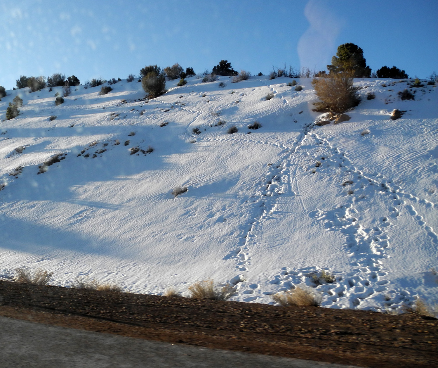
Monday morning we got up and had breakfast, then went to the shop, which opened at nine. After a long wait the repair was completed - but there was more very bad news. The tow truck driver had attempted to disconnect the drive shaft, but was not able to do so. He said it "would probably be OK" as long as he drove slowly. Not so - the transmission had been ruined, and repairs would take a week or two. Of course, the shop accepted liability for this, but for us it meant moving on to Plan C. This consisted of canceling all the RV camping and booking a condo just south of Moab, plus renting a vehicle to get us to Utah. Although we tried Enterprise and Hertz, it was again Avis that came through. We got a Toyota RAV-4 to provide room for as much stuff as possible from the motor home. We were able to take nearly all the food we had, as well as our clothing and personal items, and got on the road around 2 p.m. Monday, March 18, spending the night in St. George, near the Utah-Arizona border on I-15. In the morning we continued north on I-15 and finally started east on I-70. This is one of the most scenic roads I've been on, with lots of vista points. However, due to the delays we'd already had, and since we had both driven this road several times, we stopped only as needed at a rest stop. With Teri driving, I was able to get some pretty fair photos of snow along the highway going through the Fishlake National Forest. Around noon we turned south on Utah 191, with about 30 miles to go before we reached Moab. From this point our troubles were put behind us and we were ready to enjoy the beauty of this fantastic area. |
|
 |
 |
| An improvised snow play area along I-70 | Mountains in Utah's Fishlake National Forest |
|
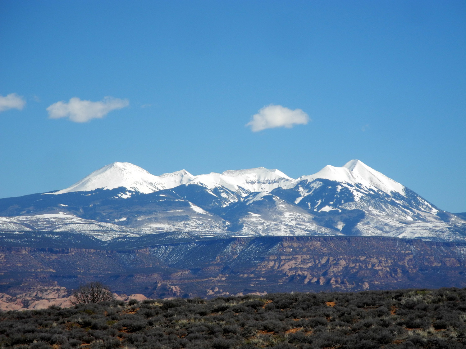
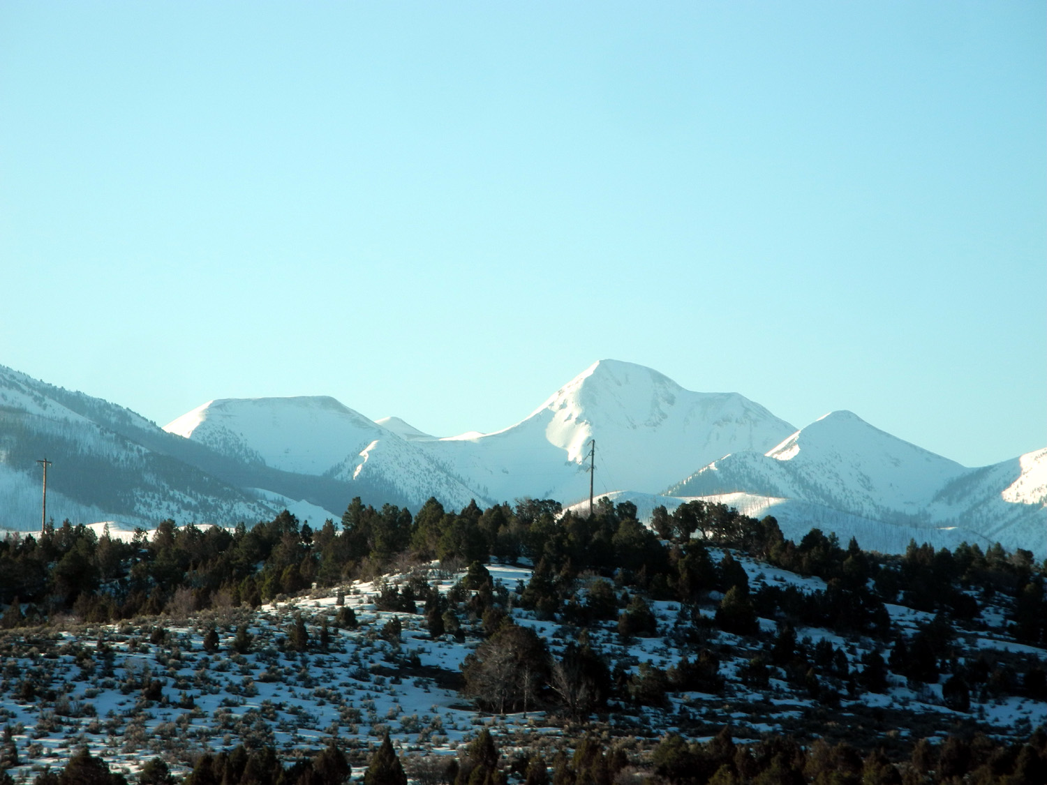
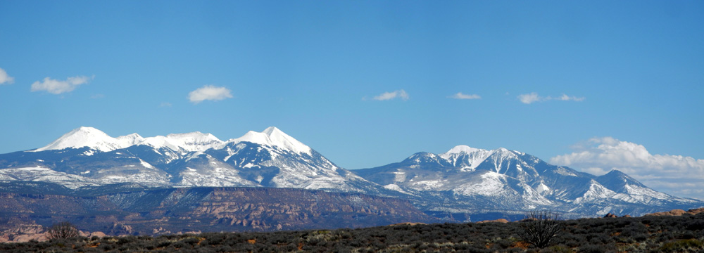
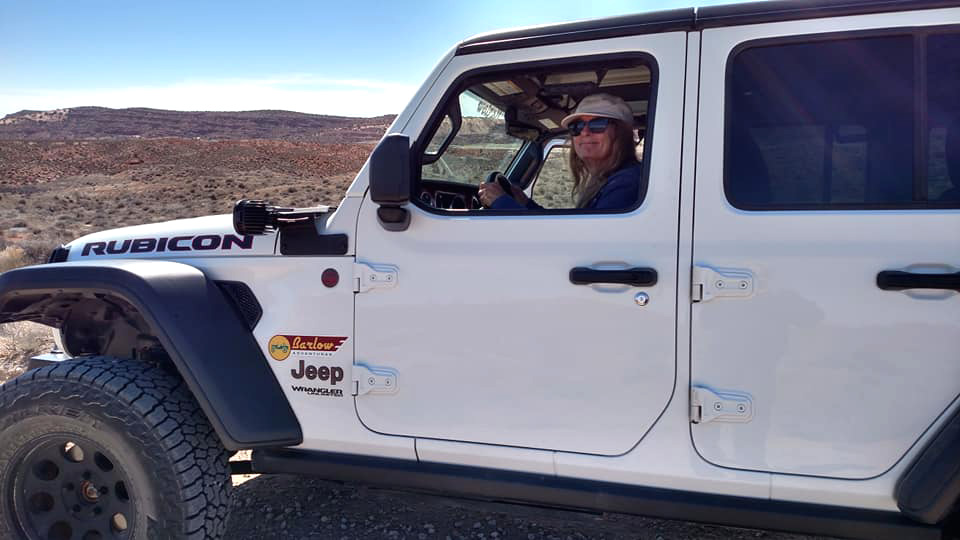
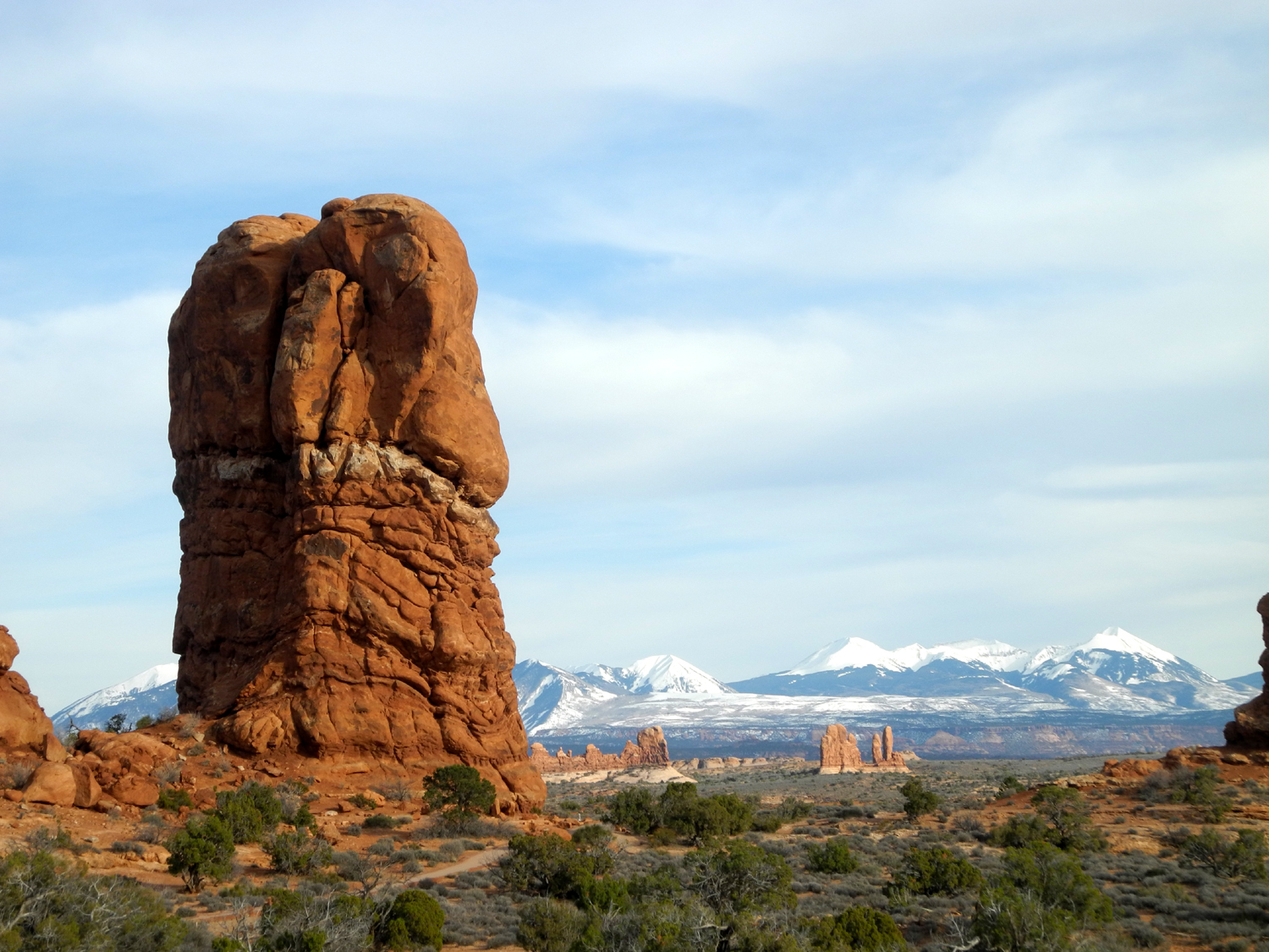
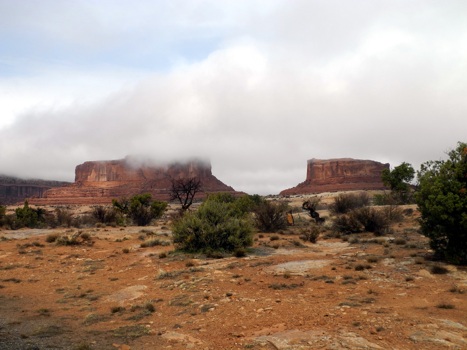
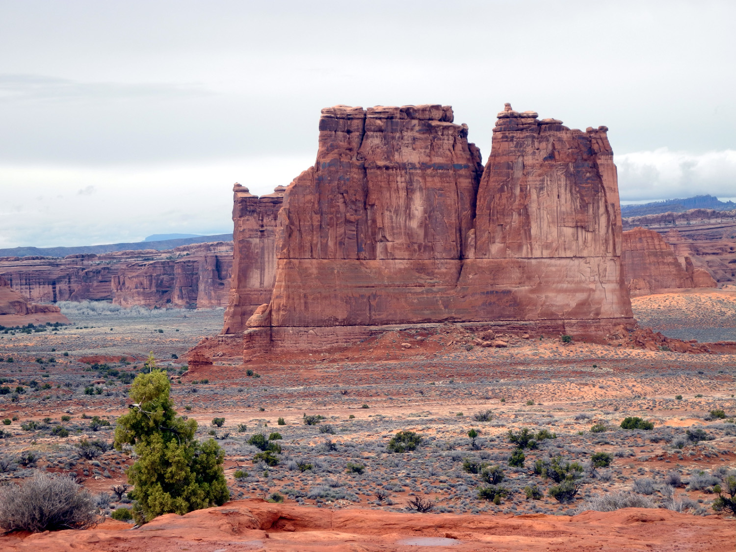
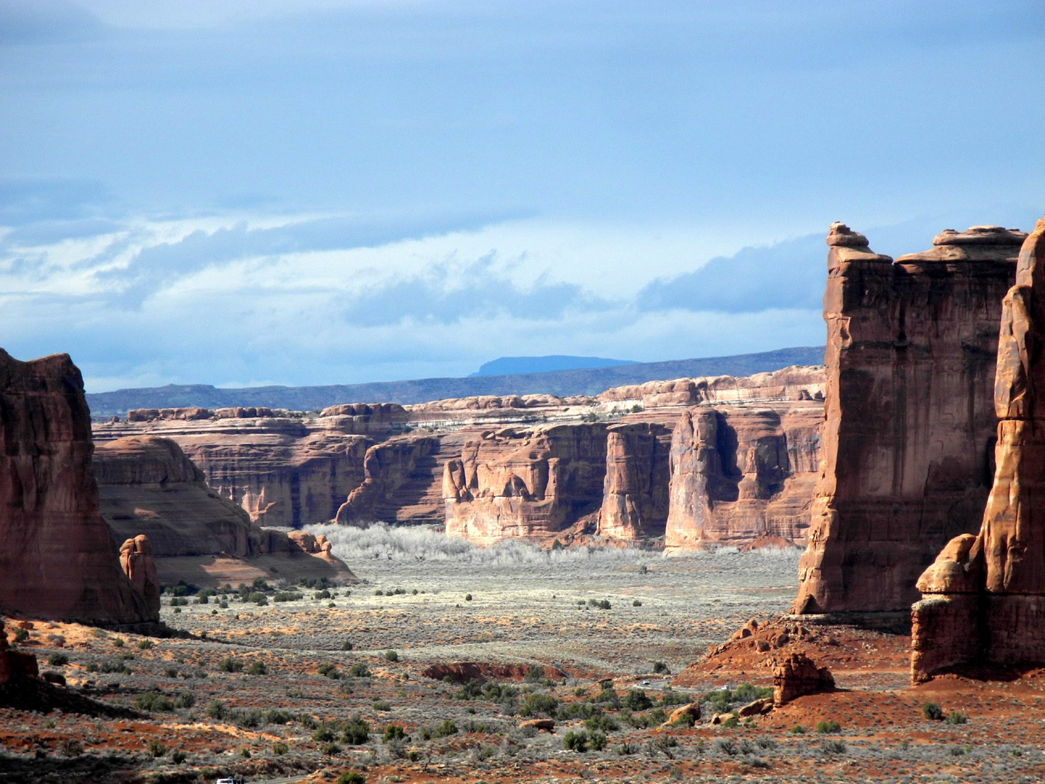
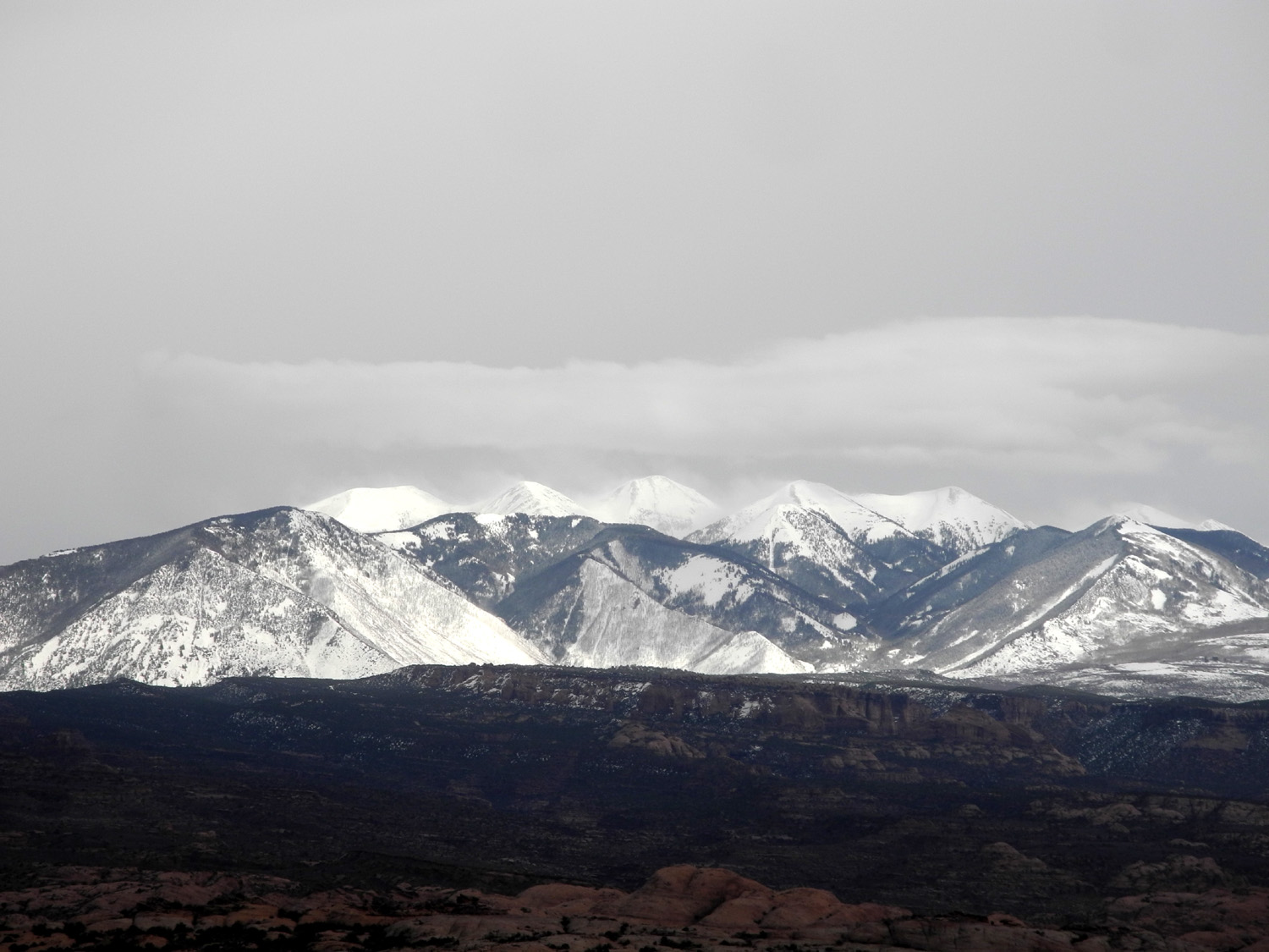
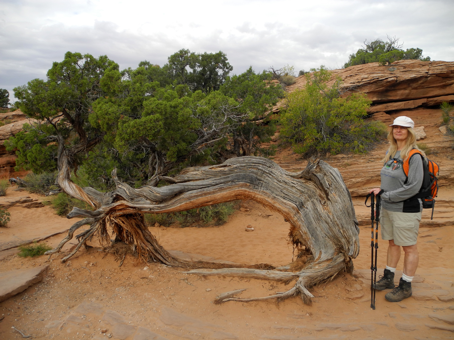
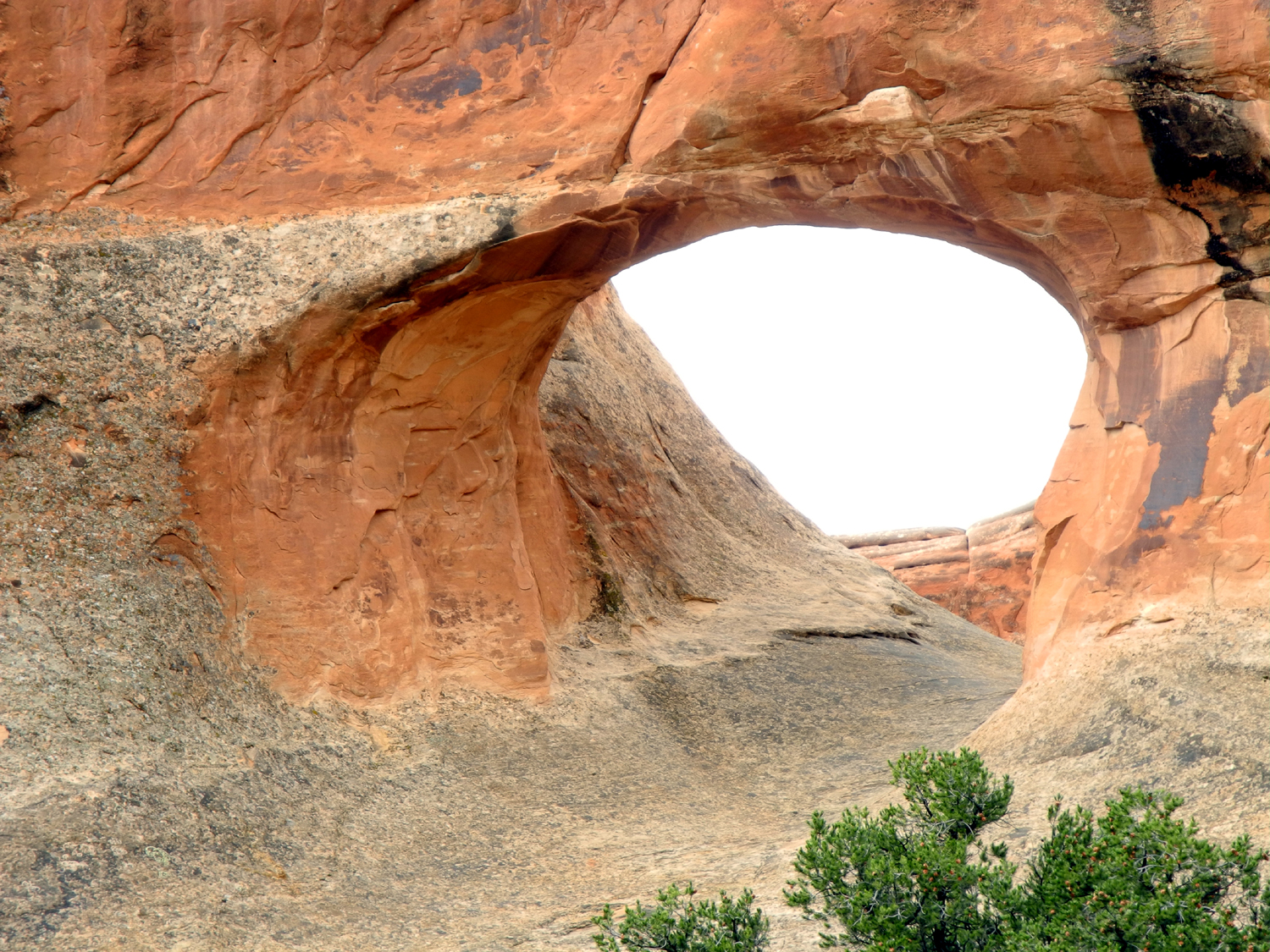
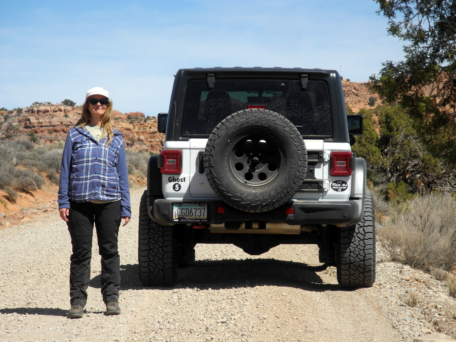
Before leaving home we had made arrangements to rent a Jeep in Moab, to drive the 7-mile dirt road to the Tower Arch trailhead. I had driven this in my Ford F150 in 2002, but it was not a place for motor homes. We decided we did not want to risk a rented car on that road, where conditions can worsen after the rain, and stuck with our Jeep rental plan, although we had to switch from one company (Plan A) to another (Plan C). We arrived in Moab around 1:30 and went first to Barlow Adventures, where we received excellent and friendly service. After completing the necessary paperwork, a young lady gave us maps of several 4-wheel drive trails showing exact mileages between points where it was necessary to shift up or down, and describing the terrain. We then continued to the Red Cliff Condos, about four miles south of downtown Moab. For only $150 per night we had a three-bedroom, two-bath residence with full kitchen and great views. We were on the third floor, so we got some exercise carrying our stuff upstairs, but once we had everything brought in we were ready to head for Arches National Park. Although much of our driving would be on pavement, we decided to make the Jeep our official vehicle for all travel while in this location. Normally we start early and try to get done by late afternoon, but we soon found some benefits of our late start (around 3 p.m.), mainly plenty of parking spaces everywhere we went. Our first stop was a pullout where we had a view of the La Sal Mountains. This range, about ten miles in length and located twenty miles southeast of Moab, has a number of peaks topping 12,000. Of course we had seen them on our previous trips, which were in summer and fall, but we had never seen them buried in snow and sparkling in the sun the way they were on this day. |
|
 |
|
| Panoramic view of the La Sal Mountains | |
|
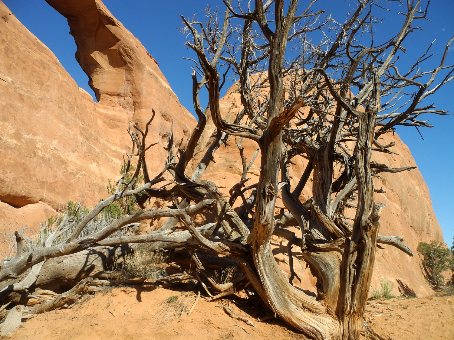
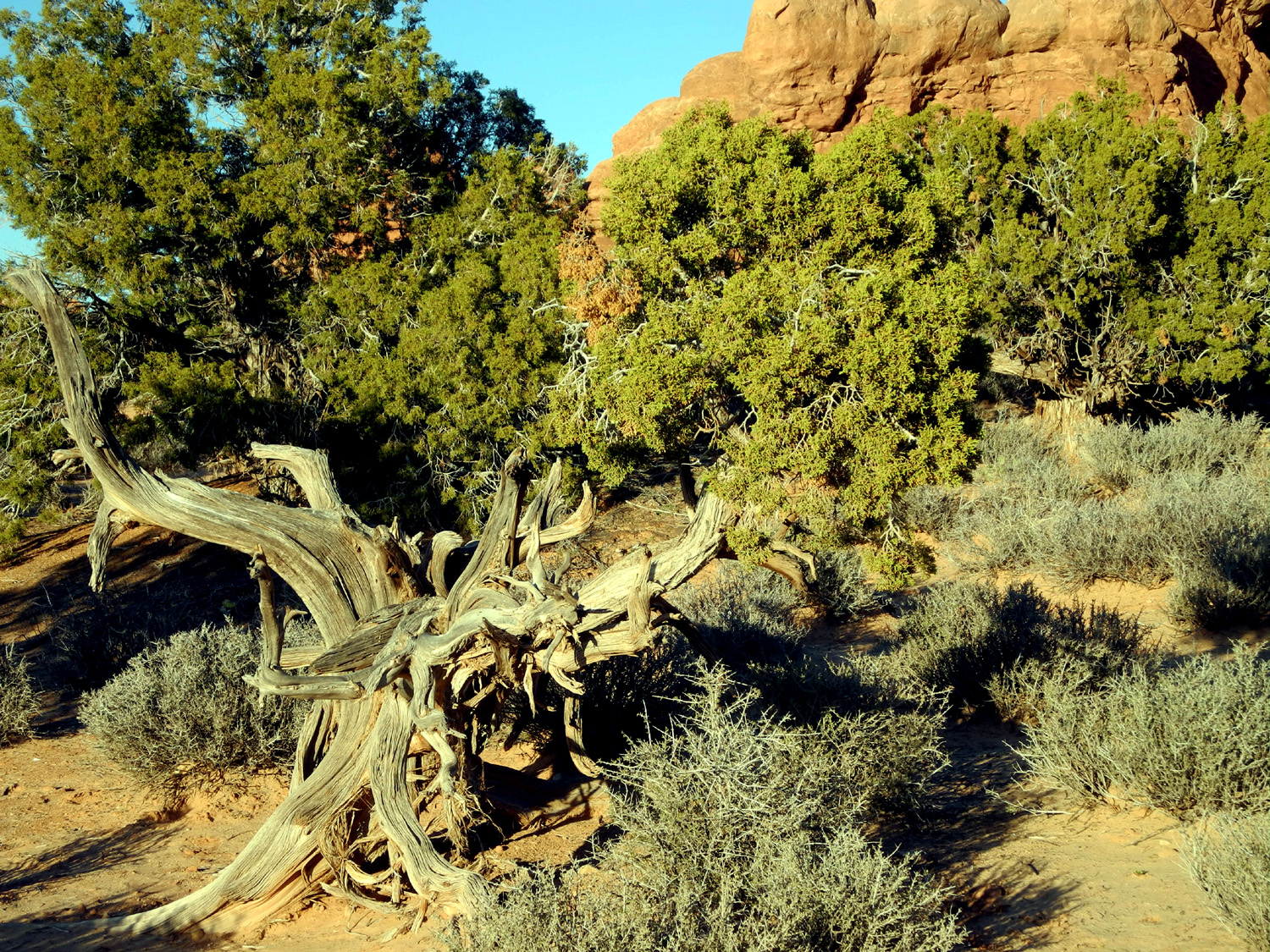
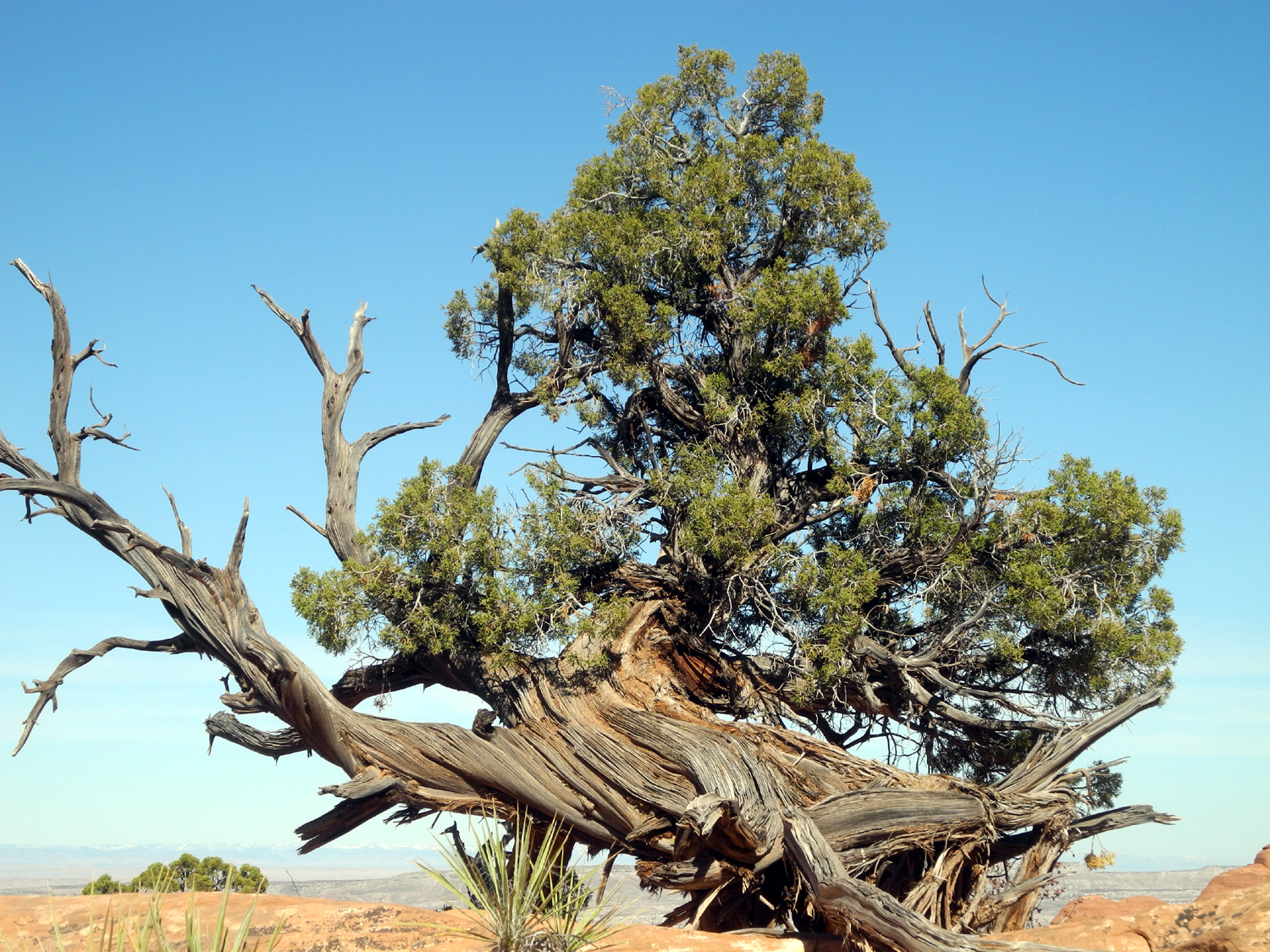
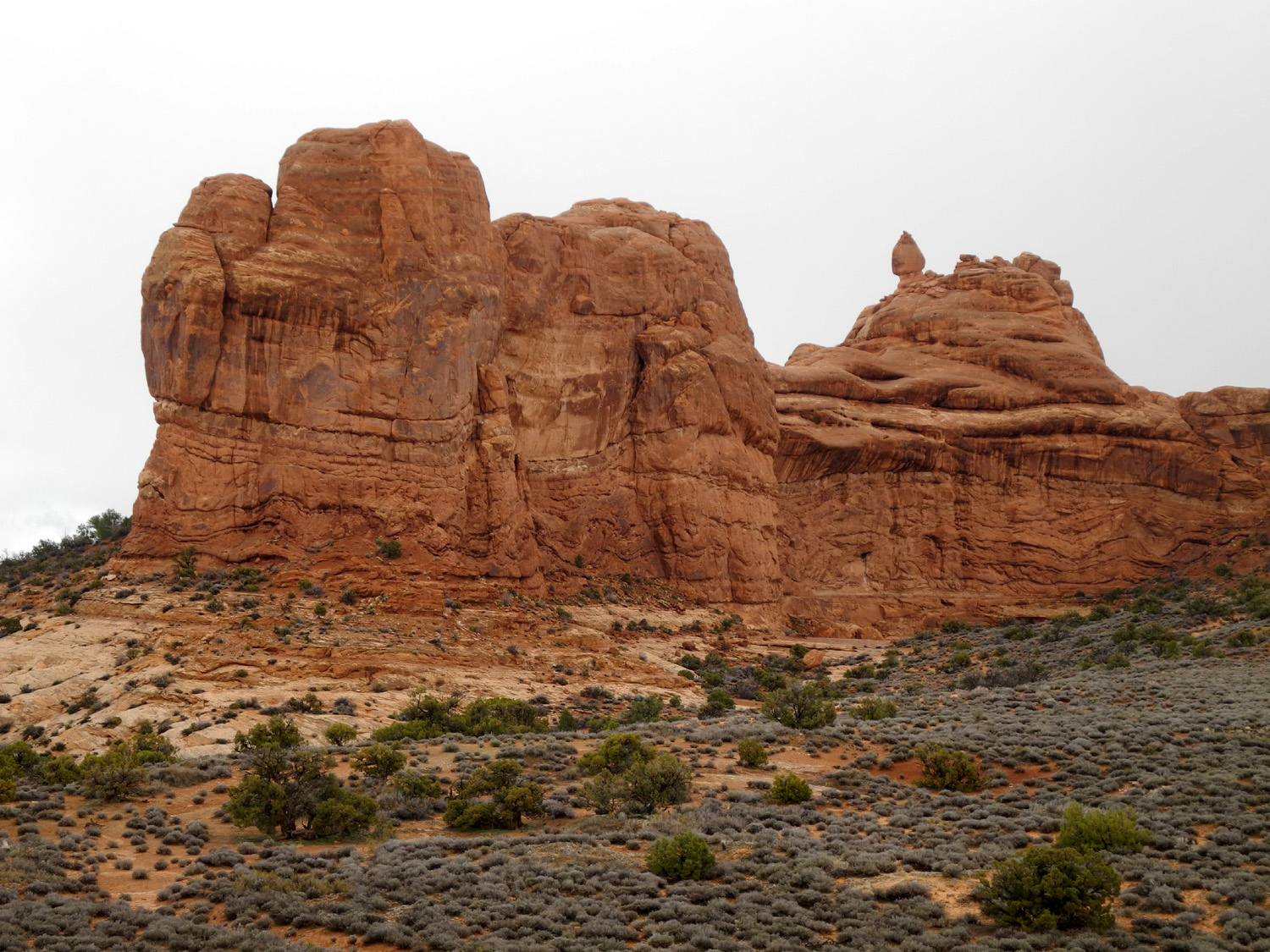
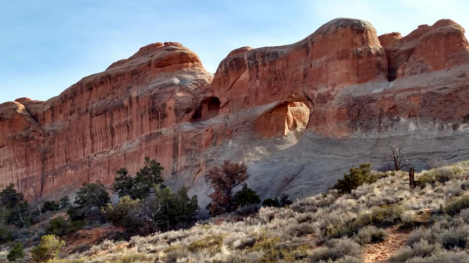
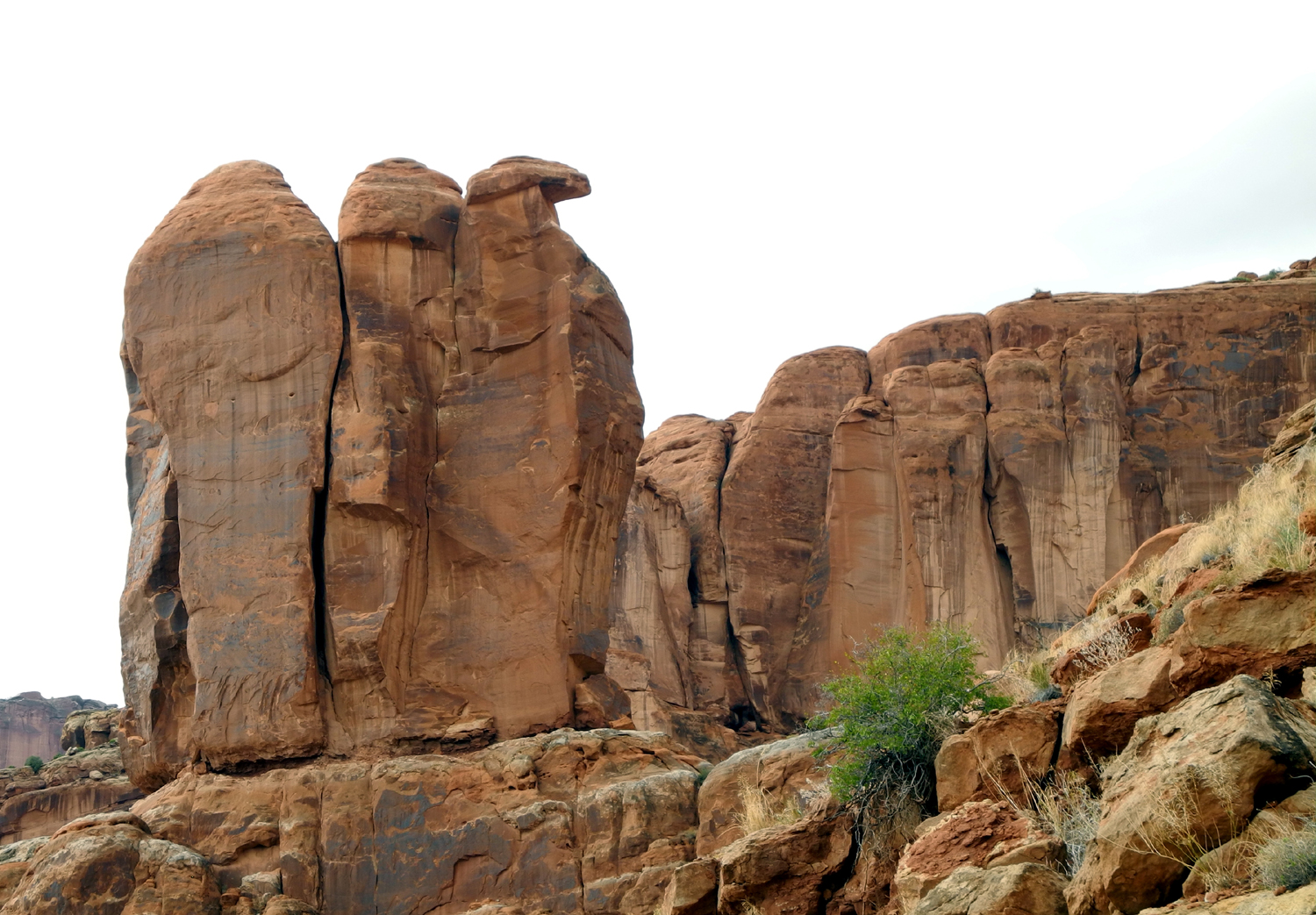
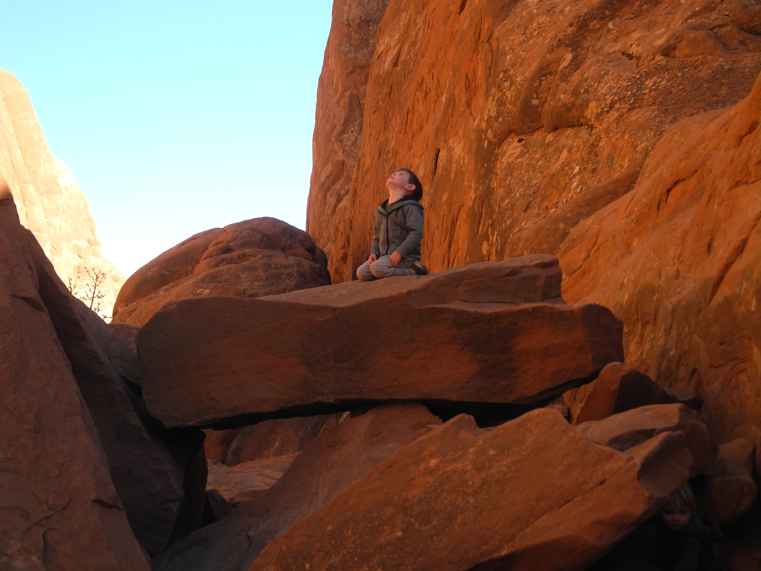
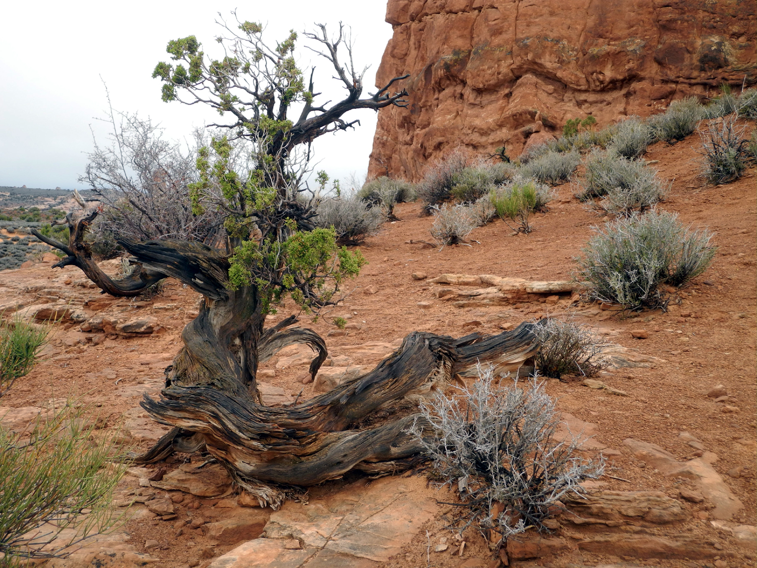
Next we drove to the trail that leads to Skyline Arch. This arch is visible from the road, and on my first two visits I just viewed it from the parking lot. When Teri and I hiked the half-mile trail in 2015, it became one of my favorites. Seeing it up close, I realized that this arch is much more impressive when you are standing next to it. It is located high up in the top part of a large sandstone wall, with a sheer cliff of 50 feet or more below the arch. Piled at the base of the cliff are huge rock chunks that fell from it in 1940, doubling its size overnight. The afternoon sun provided perfect lighting for photography. The trail is very easy, leading through sandstone towers and fins, with juniper and other desert plants along the way. Below the arch, two small boys were climbing around the rocks, making us miss our own grandsons/great grandsons. The older boy, age 3, was quite a climber, announcing that he had "lizard grip." We spent about a half hour in this area, walking around the huge boulders and admiring the twisted shapes of the junipers. On our way back to the Jeep we had another view of the La Sal's with sandstone and junipers in the foreground. |
|
 |
 |
| Skyline Arch | Looking up from the base of the arch |
|
|
|
|

|
| Dead juniper near the arch | View of the La Sal Mountains through sandstone and juniper |
|
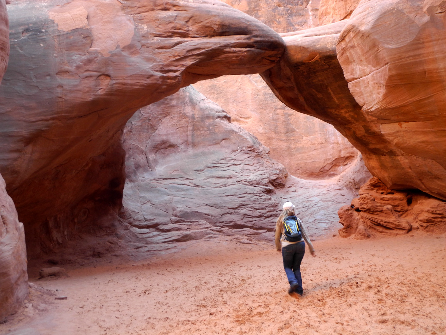
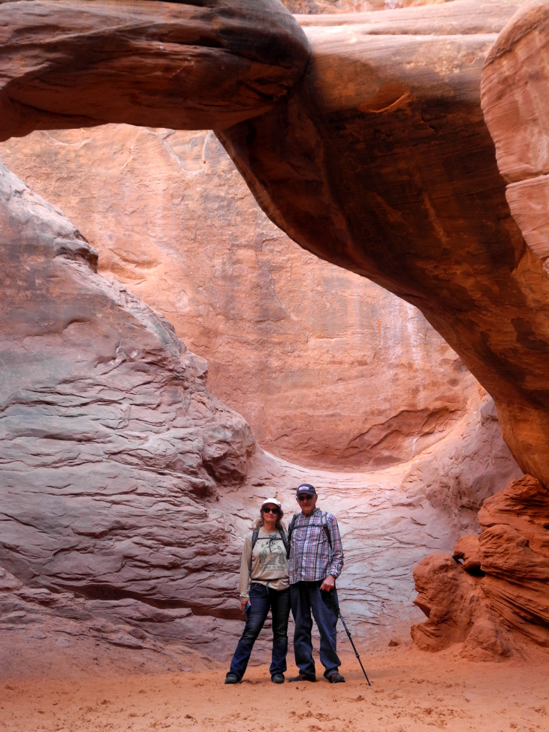
We drove a short distance to another trailhead that leads to Sand Dune Arch and Broken Arch, both of which we had visited on our 2015 trip. Sand Dune is "hidden," and is reached via a trail that goes through a narrow passage between sandstone fins. The passage then widens out with the arch on the right and a high wall to the left. It's possible to continue on past the arch, with some rock scrambling at the end. |
|
|
|
| Teri approaches Sand Dune Arch | Teri and Dick under the arch |
|
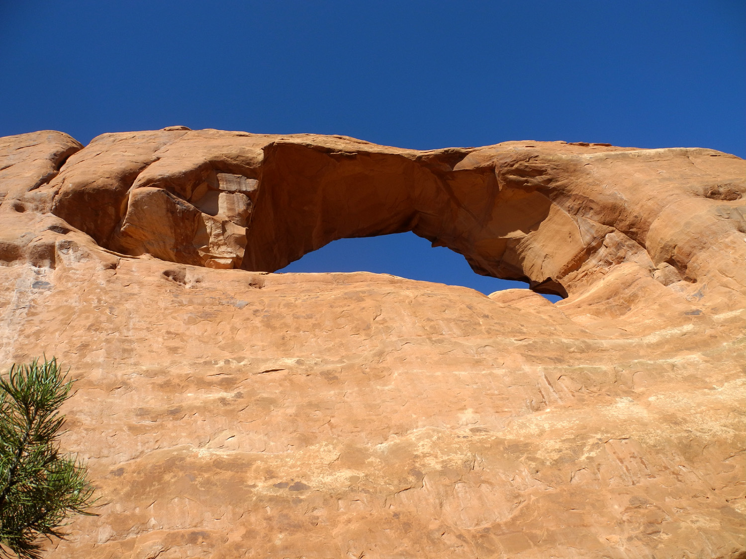
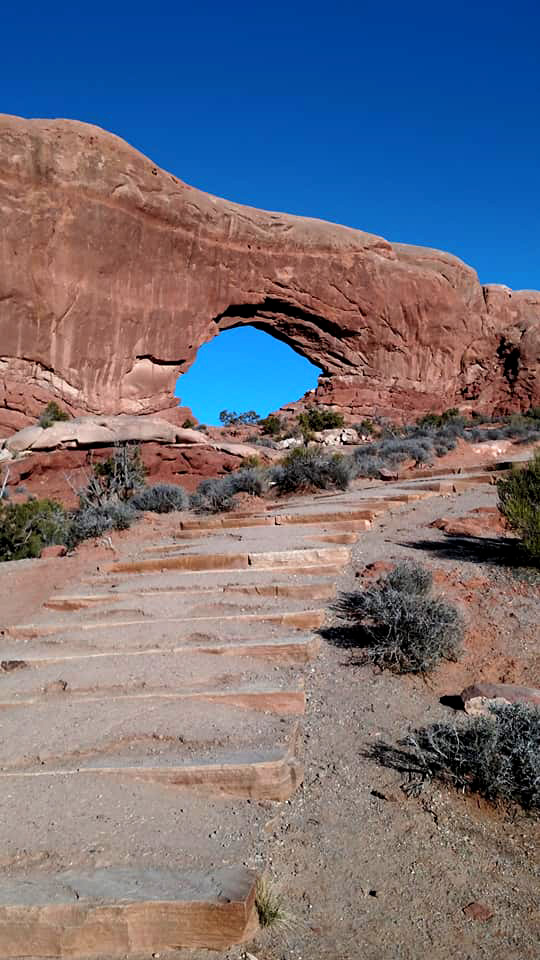
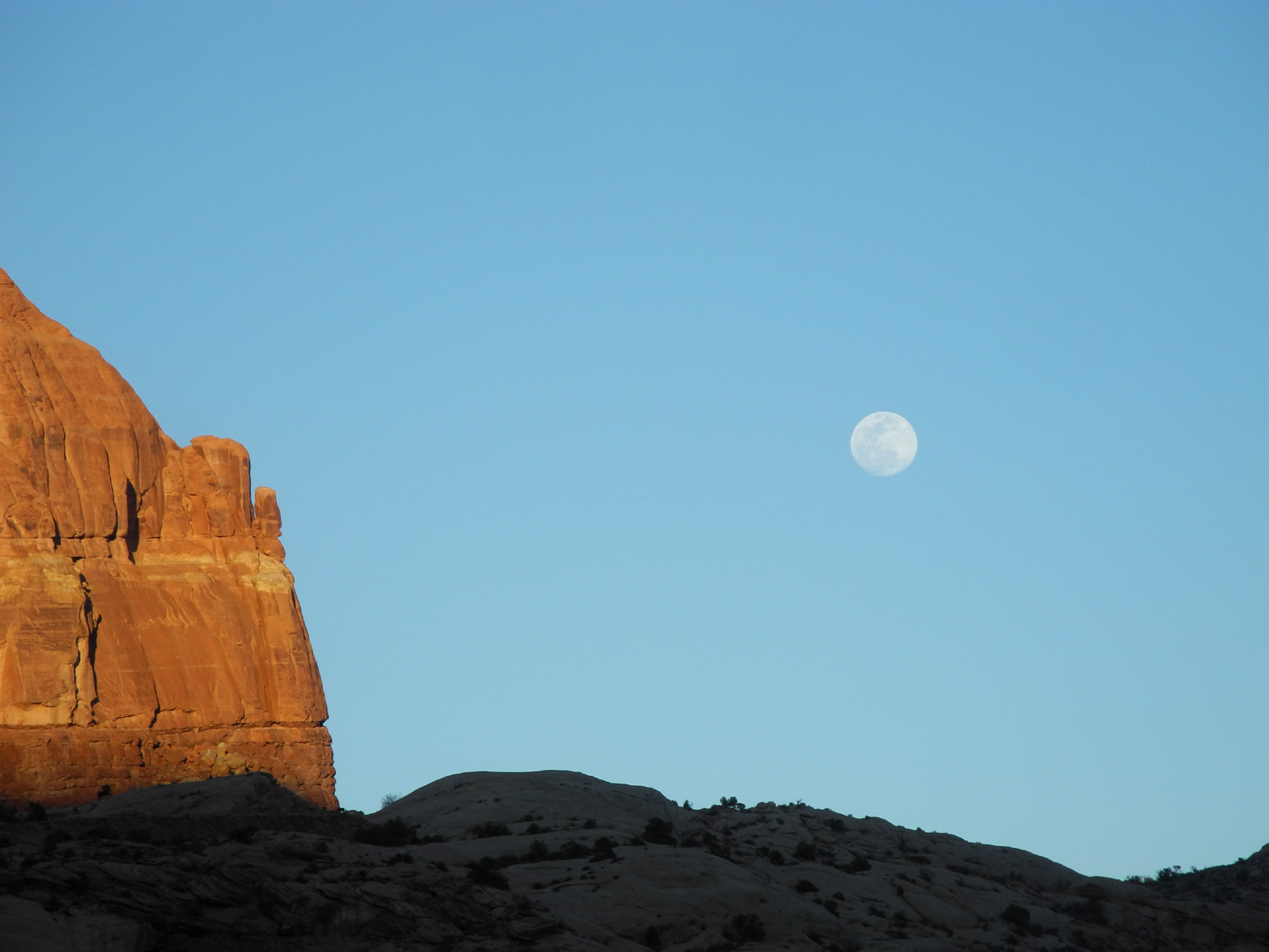
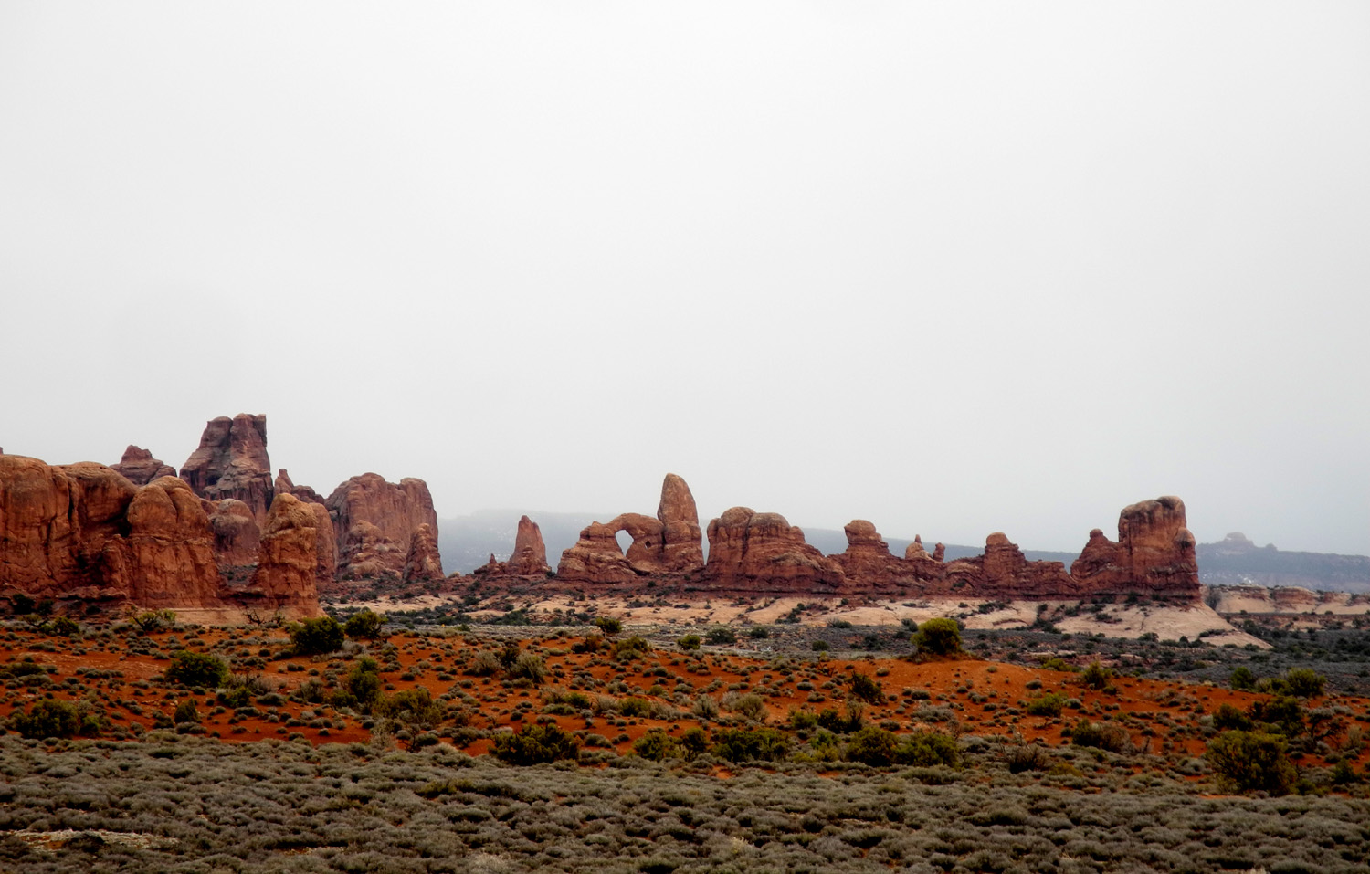
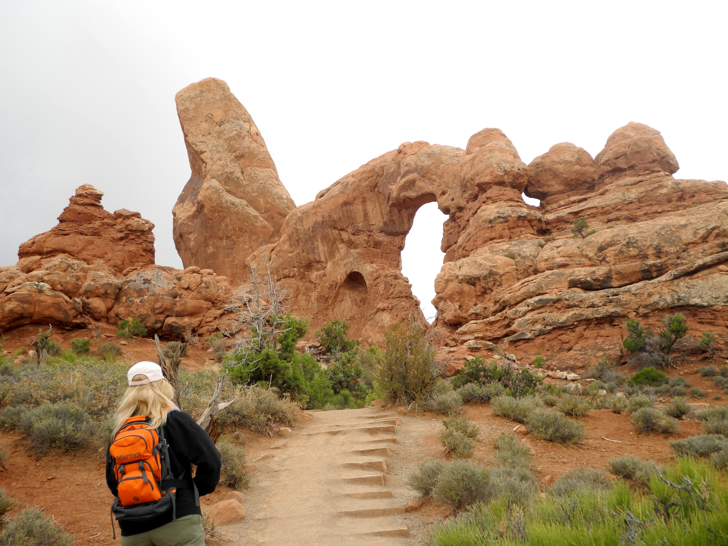
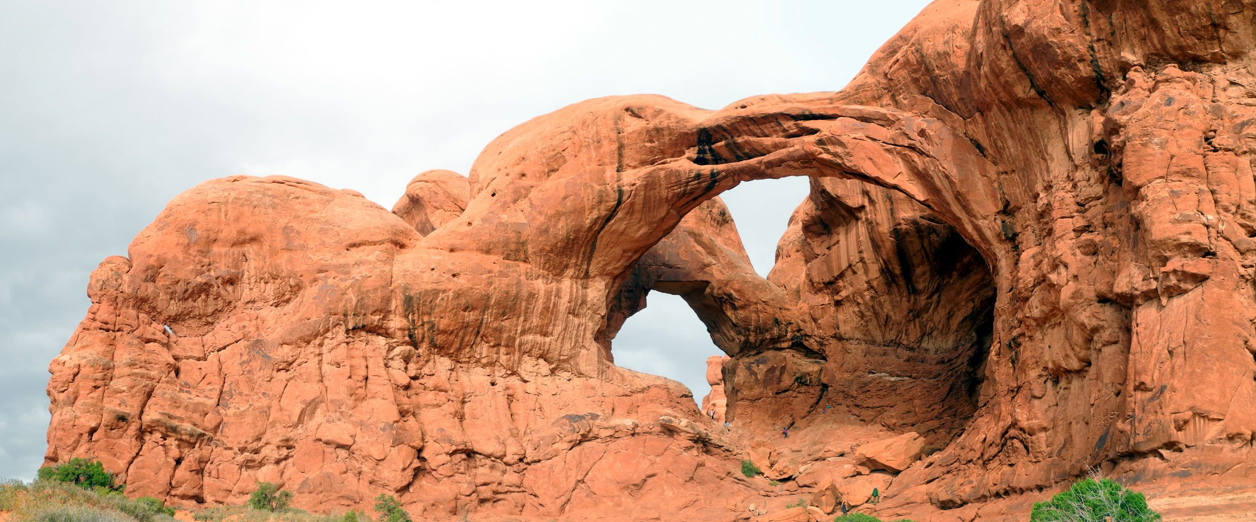
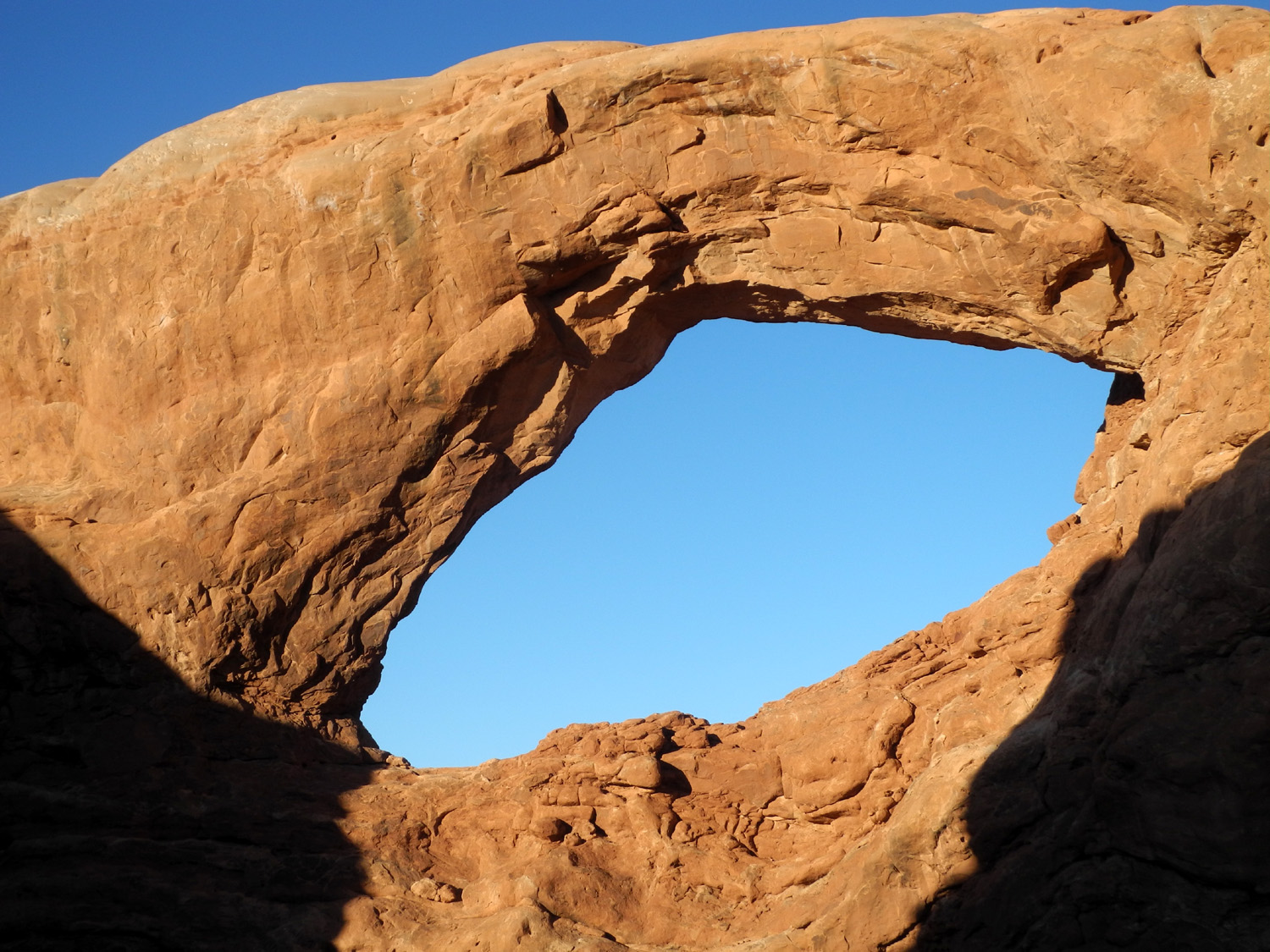
Our last stop of the day was at the Windows Section, an area with several major arches, some nameless ones, and plenty of fantastic sandstone formations. North and South Window arches give their name to the area, and are easily visited by a short trail. They are also visible from various points along some of the local roads if you look in the right direction at the right time. We walked up to both arches, and considered taking the rough trail that goes all the way around them, but decided to pass. We had both done this trail in the past, it was getting late and a cold wind had come up. A side trail leads to Turret Arch, which has a small tower as part of the rock formation, and also a small companion arch. We walked on that trail in 2015 and passed it by this time. A short distance from these arches is Double Arch, a spectacular formation with two huge, adjacent openings with very thick, sturdy-looking rock. This feature was in deep shade at this late hour, and again we had visited it at least twice under better conditions, so we drove past and on back toward our Utah home. Of course, we could not resist photographing some of the picturesque Utah junipers that appear all over this country (some of them probably the same ones we photographed last time). We were fortunate to be there when the moon was closer to earth than usual, and nearly full. Information we read said it would appear full the day before and after the actual date, which was fortunate, since the full moon day was the only one when it was mostly cloudy. Heading back to the condo, we had great views of the moon coming up over the sandstone cliffs and above the La Sal Mountains. |
|

|
|
| Sandstone formations in the Windows Section | Steps lead up to North Window Arch |

|
|
| South Window | Utah juniper by the trail to the Windows |
|
|
| Good timing gave us a view of the moon and sandstone | Also the moon over the La Sal Mountains |
|
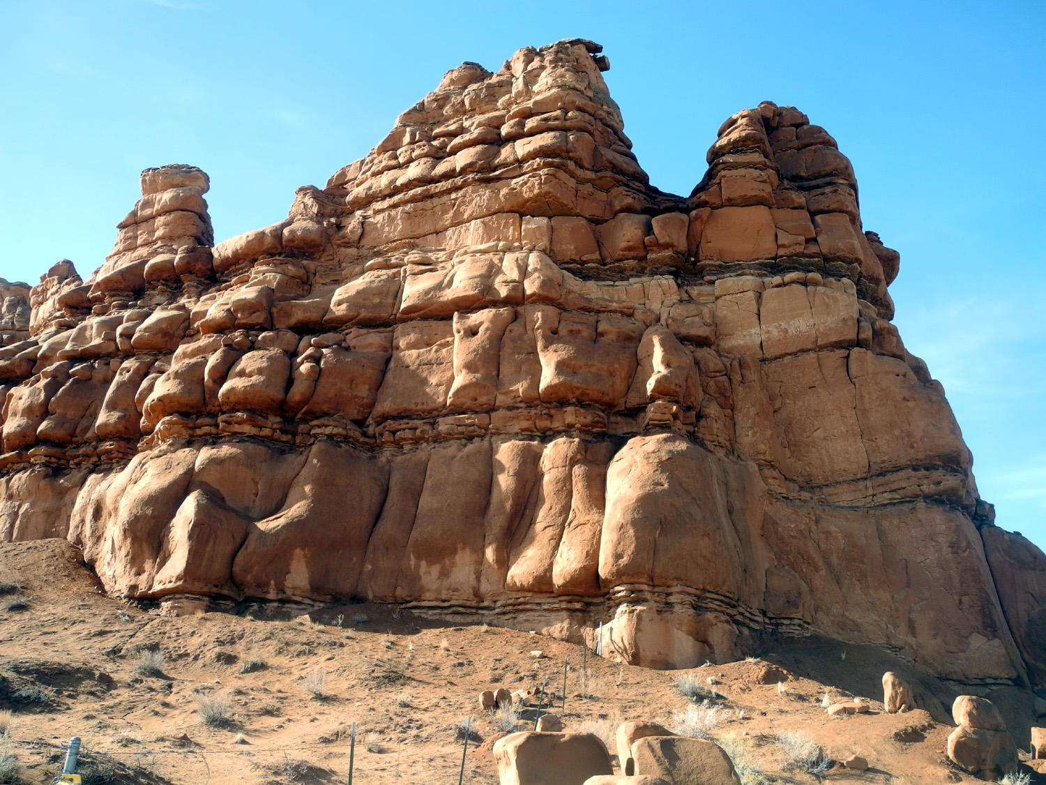
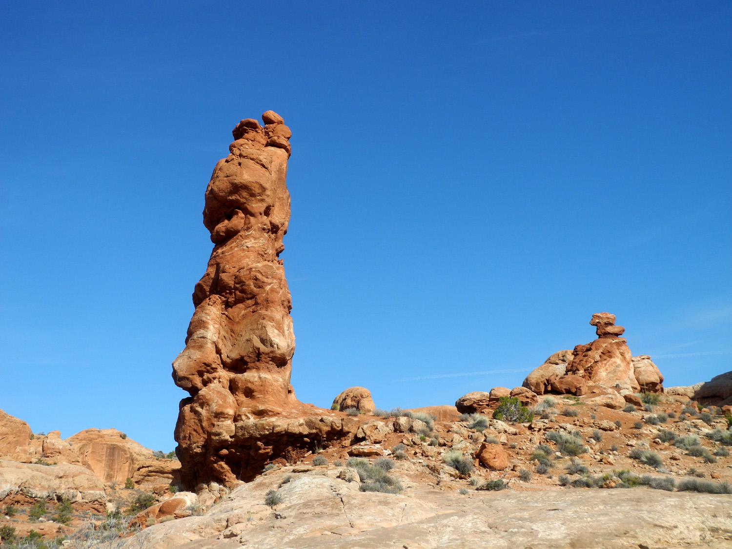
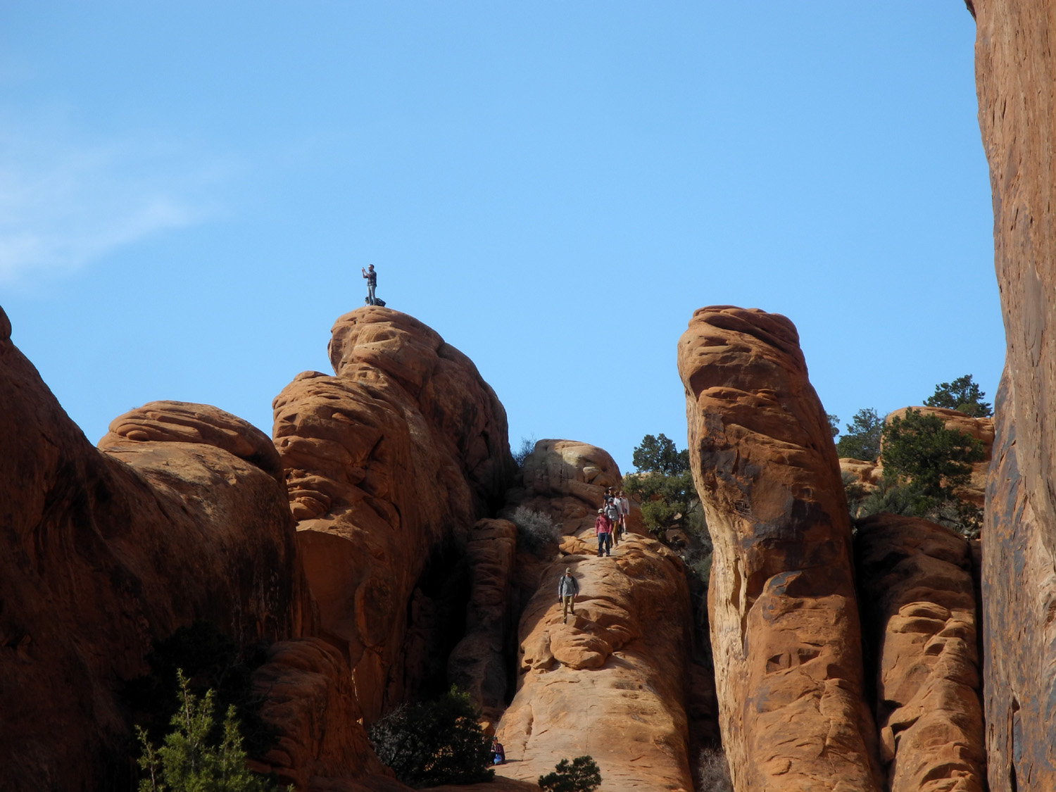
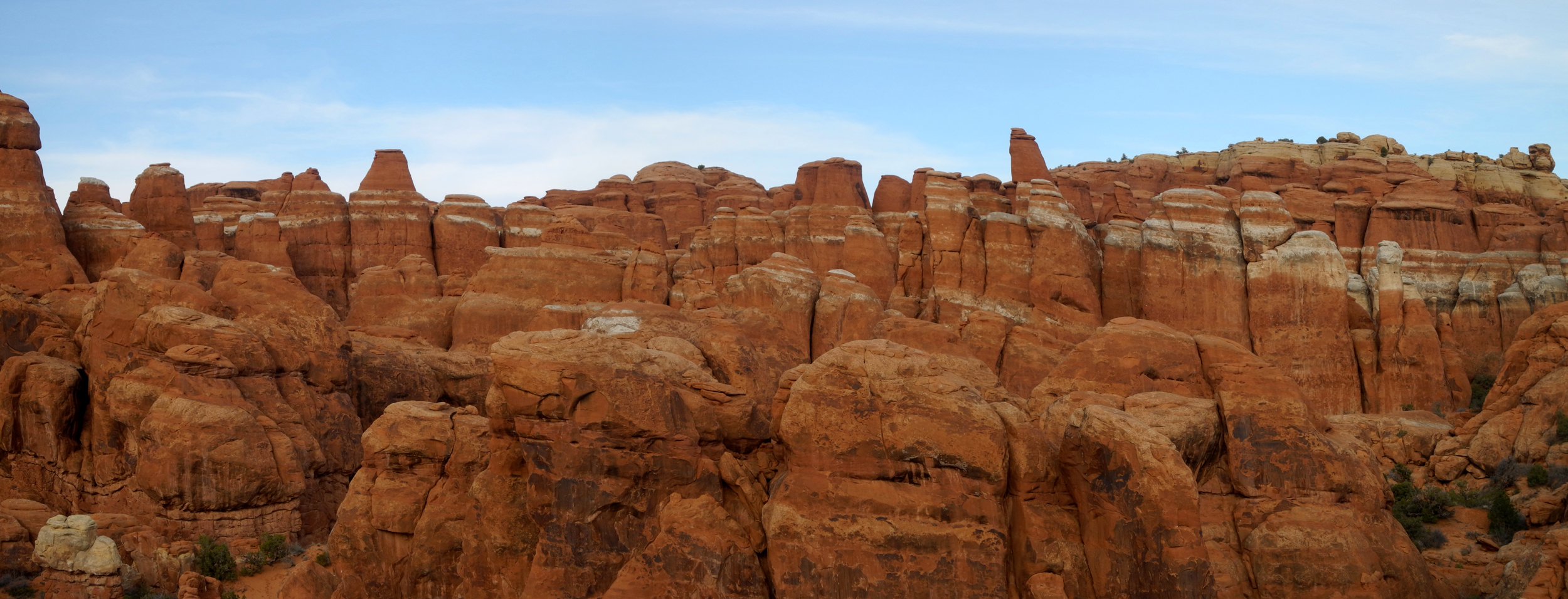
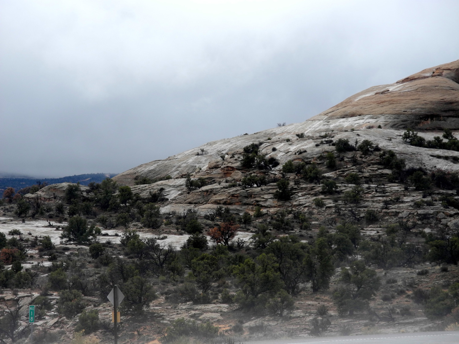
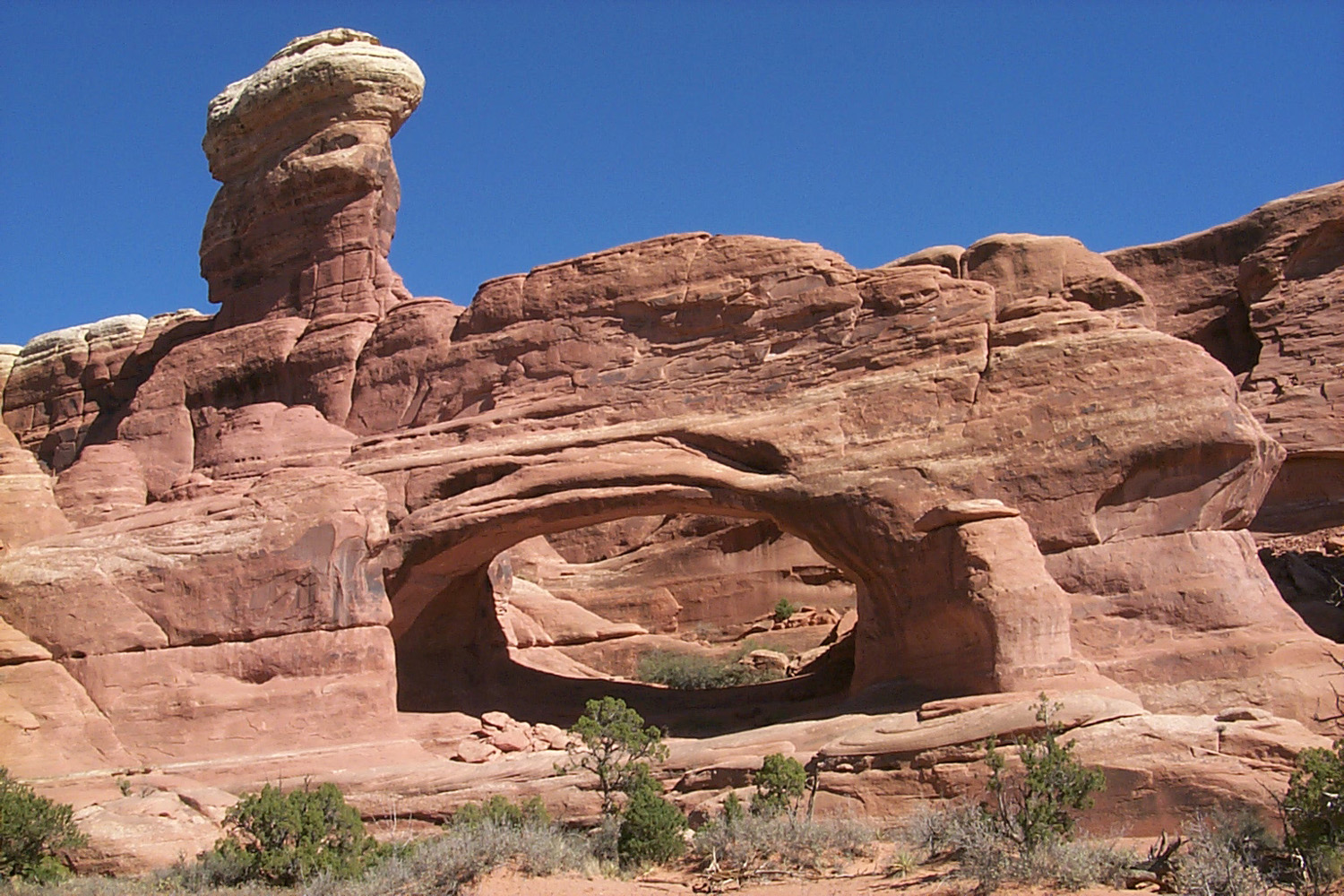
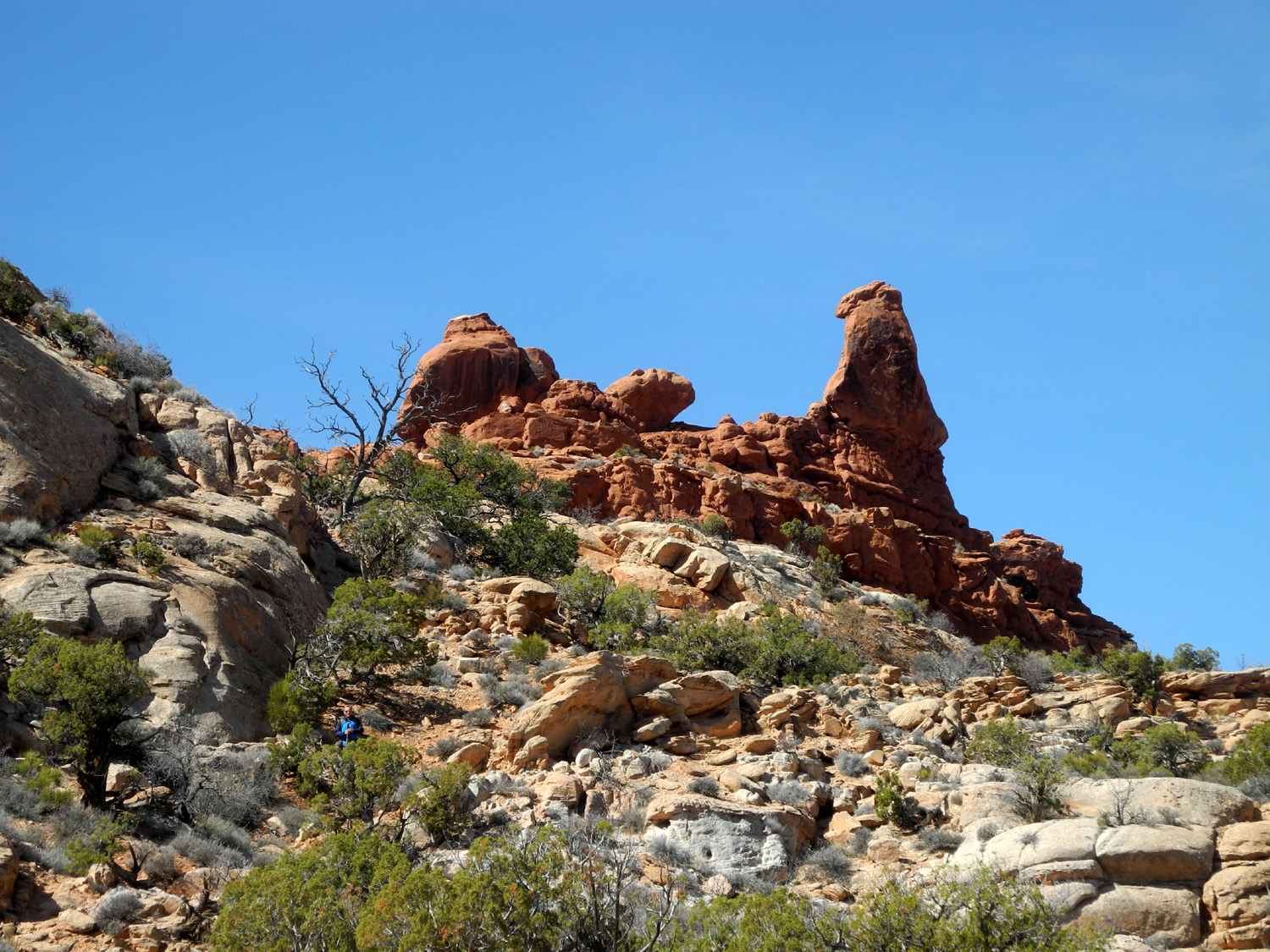
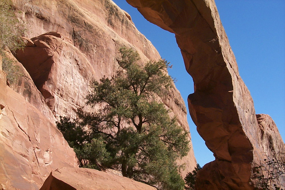
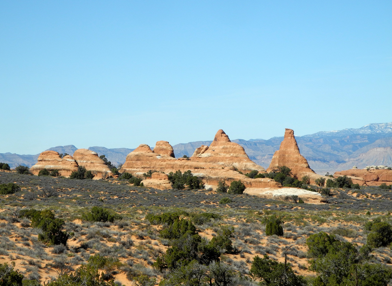
The next day (March 20) we planned our most ambitious hike of the trip - the dirt road through Salt Valley and the Tower Arch Trail. I drove the road in my Ford pickup in 2002 and hiked to the arch, one of the most spectacular in the park. In addition there are many remarkable scenes along the trail, including the Marching Men. Driving through the park to the Salt Valley Road, we stopped several times to photograph some of the fantastic rock formations that caused me to say in 2002 that this would be a worthy national park if there were no arches at all. |
|
|
|
| A typical scene along the road through the park | Isolated towers like this can be seen throughout the park |
|
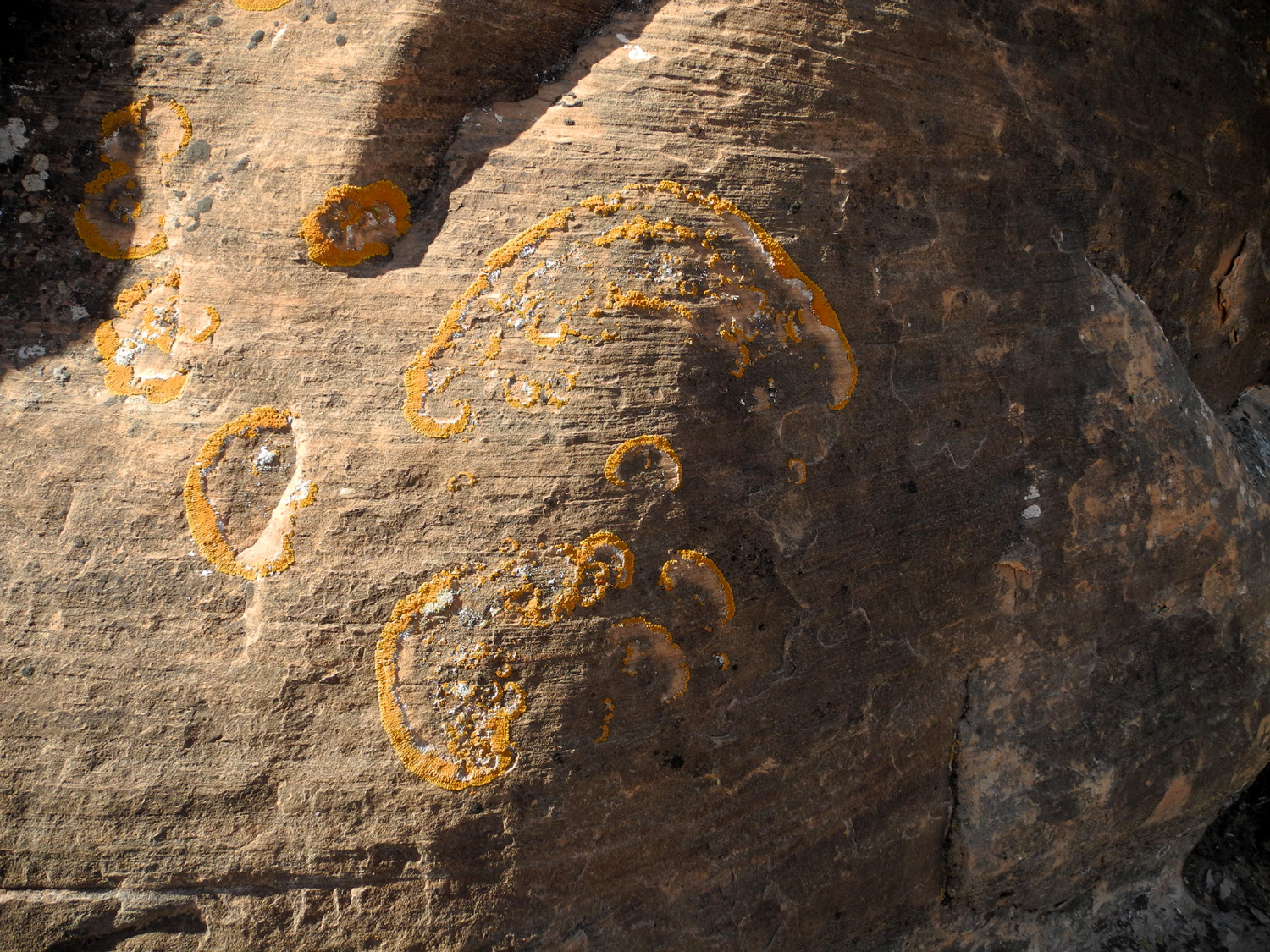
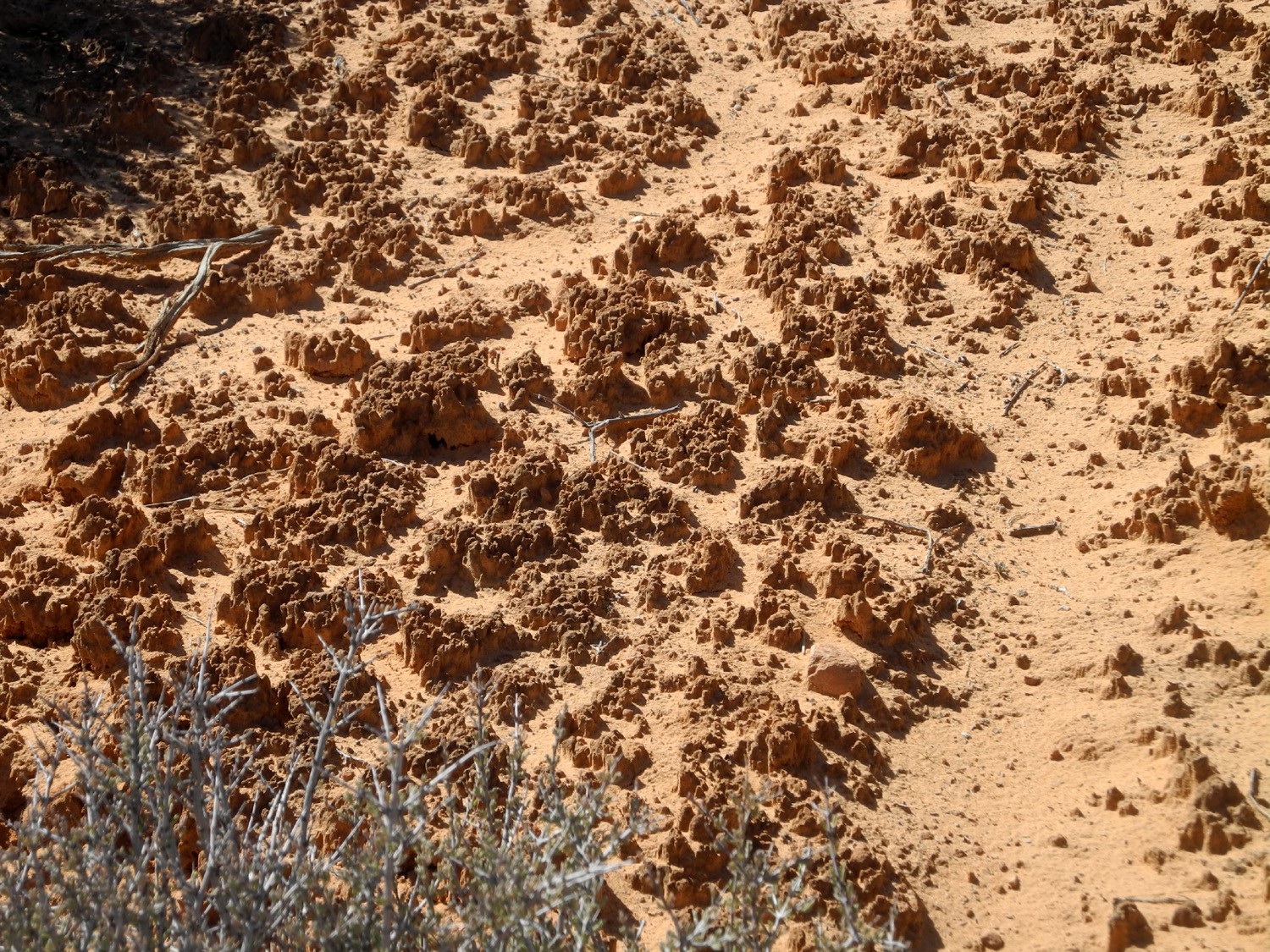
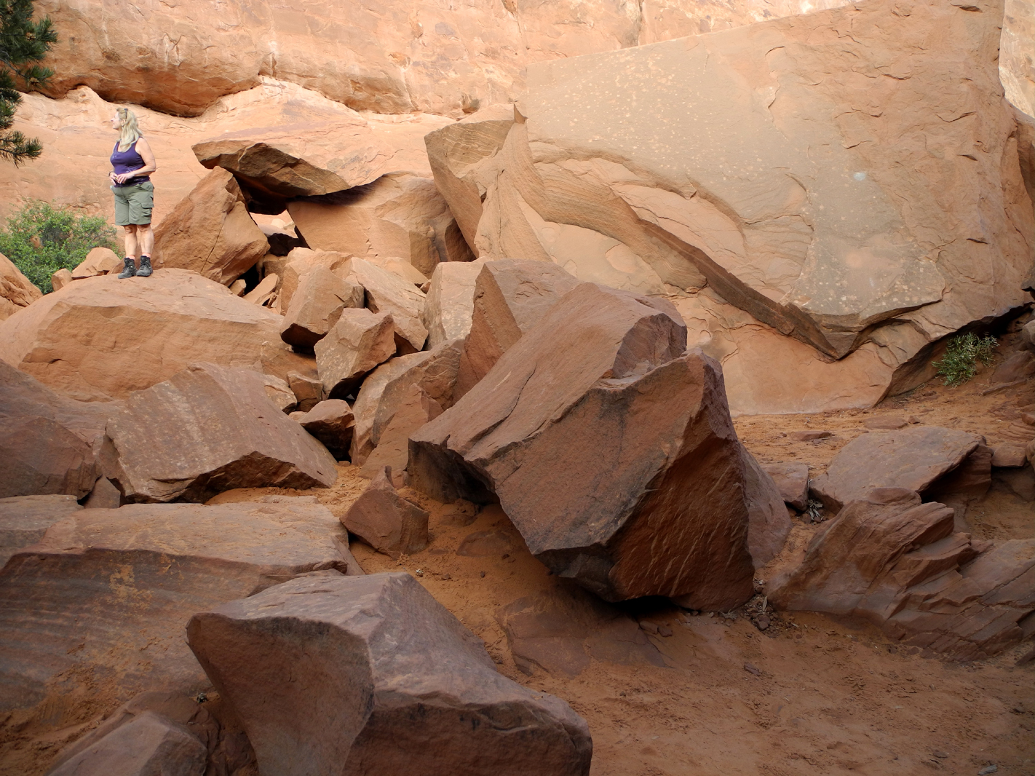
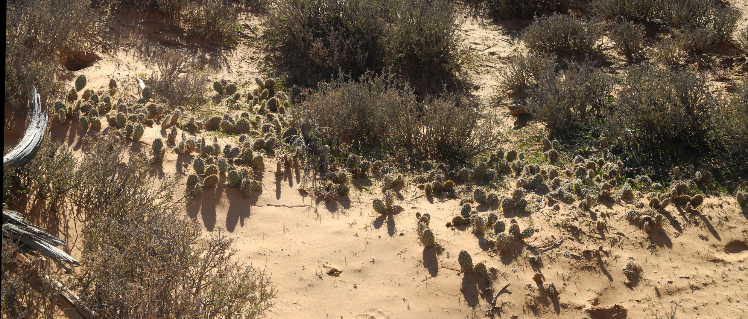
We made it through the mostly flat route to the trailhead without incident, and got set to hike. However, something strange had happened in the 17 years since I made this hike. Either the trail had been turned into a rock pile, or I had gotten older. The first part of the trail required scrambling up through rocks, and I found the going very difficult. Even more concerning than the way up was getting back down, so we finally found a place where we could get down through a fairly easy route to the flat area, and walked through the bushes back to the parking lot. Despite not reaching our intended destination, this was an enjoyable hike. We tried our best to walk in washes and not step in the areas of cryptobiotic soil which occurs in many places in this region. This consists of microscopic bacteria that bind grains of sand together, making a stable location for algae, moss and fungi to grow. This soil traps water and provides a safe place for seedlings to get a start. If the soil is disturbed by feet or anything else, it takes 50 to 100 years to recover. We got back to the Jeep and discussed the possibility of taking the mile and a half four-wheel drive road that ends within easy walking distance of the arch. We drove to the first difficult part and looked at it, while studying the instructions on the map. Teri does a lot of 4-wheel driving in her work, but the terrain in the Sierra foothills and mountains is very different from what is found in Utah. We were responsible for dents or scratches bigger than an inch, and we ultimately decided not to risk learning desert 4-wheeling with a very expensive rented Jeep. |
|
|
|
| This lichen along the Tower Arch Trail resembles native pictographs | The living soil of Utah's canyon country |
|
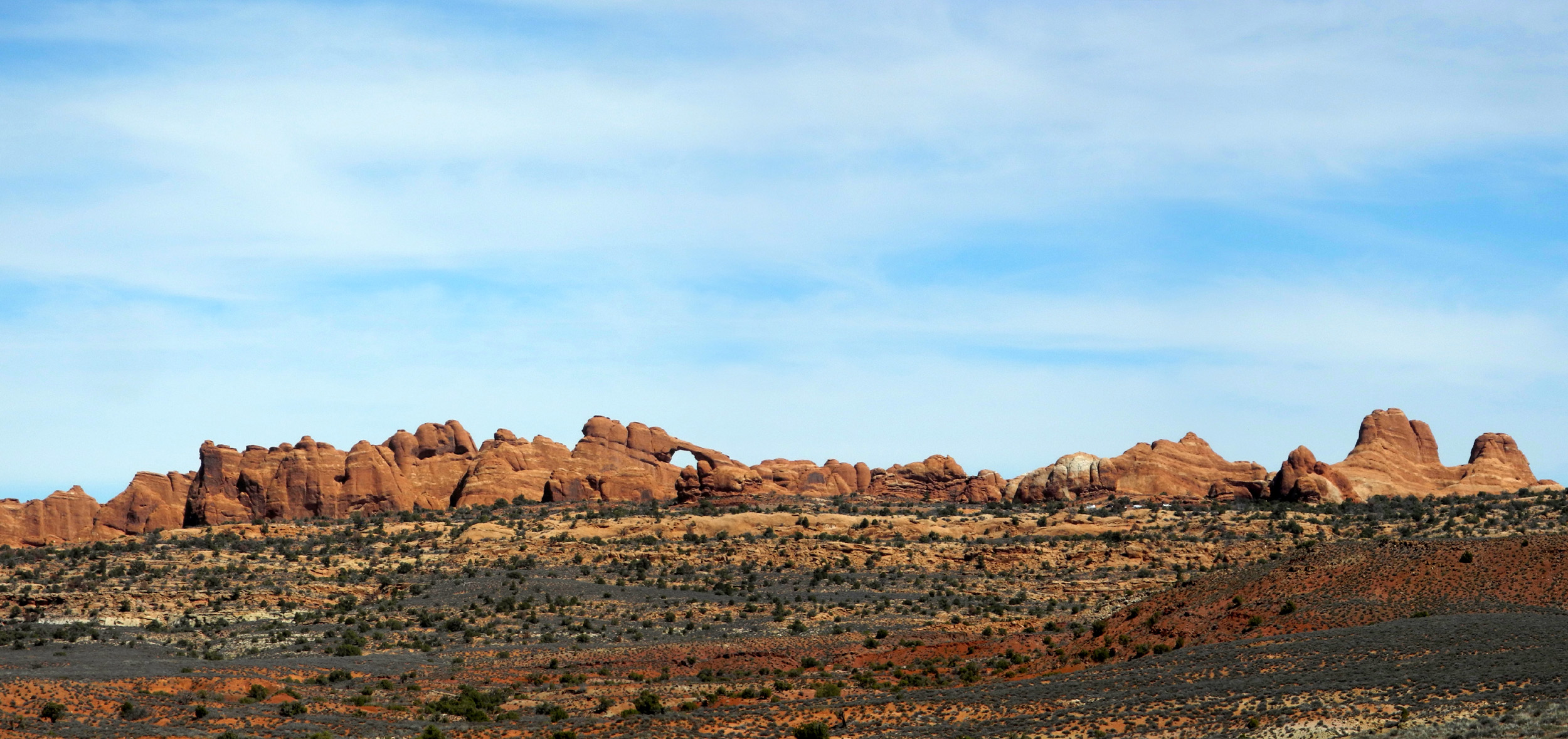
We drove back out the Salt Valley Road, stopping in several locations to take photos. We had views of the La Sal's, and at one point could see a long, dramatic sandstone formation that included Skyline Arch. |
|
|
|
| Skyline Arch stands out in this distant panoramic view from the Salt Valley Road | |
|
Driving the opposite direction, we saw things we had missed driving in, most notably a wash with a multi-colored bank, indicating a variety of chemical elements in the rock and soil. We stopped for photographs, and then, since it was not even noon, we decided to go on to the Devil's Garden area, where trails lead to half a dozen different arches. |
|

|
|
| We named this Rainbow Wash | The Jeep was ready for anything - but we were not |
|
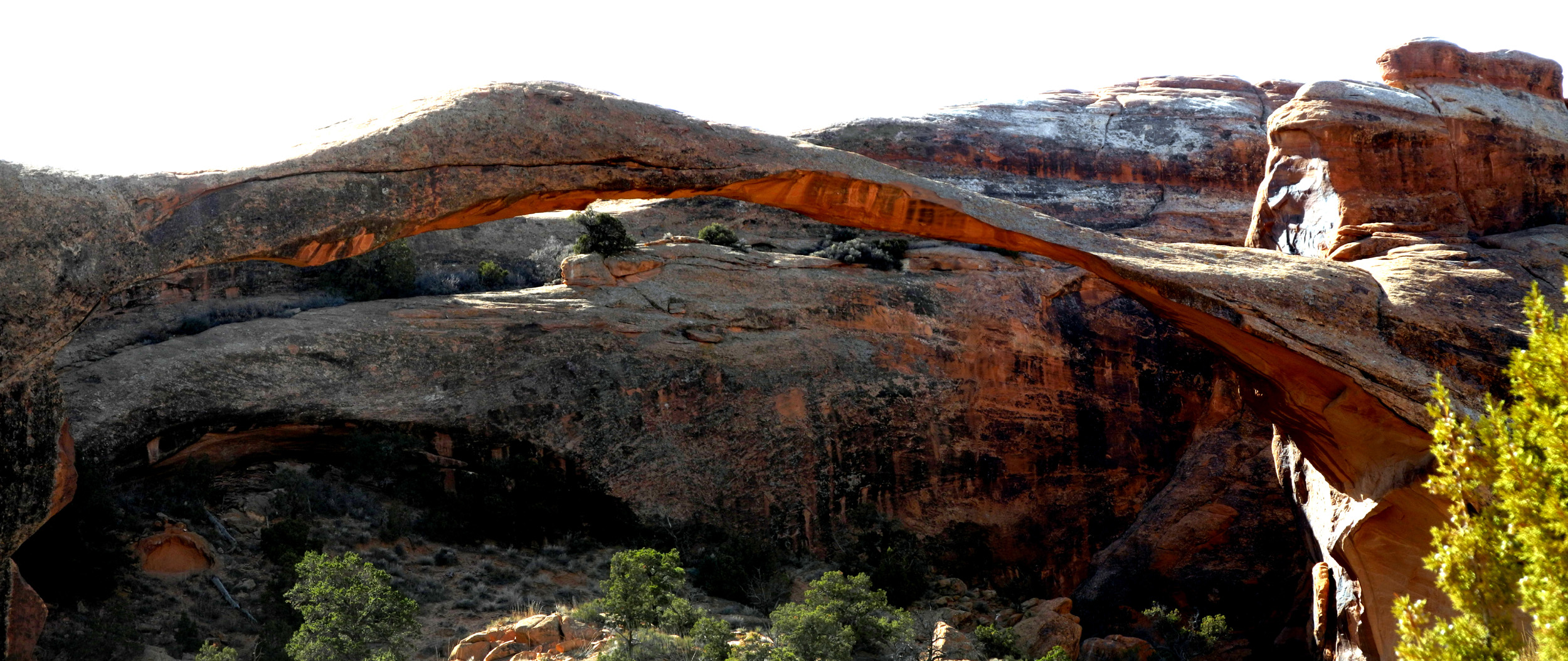
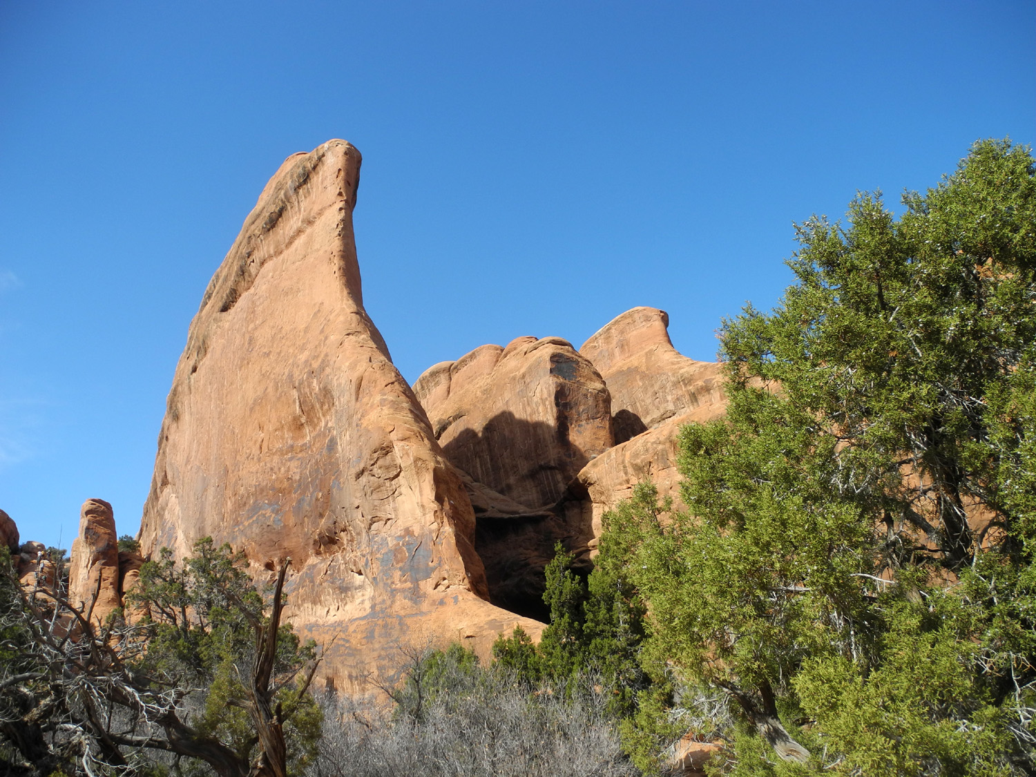
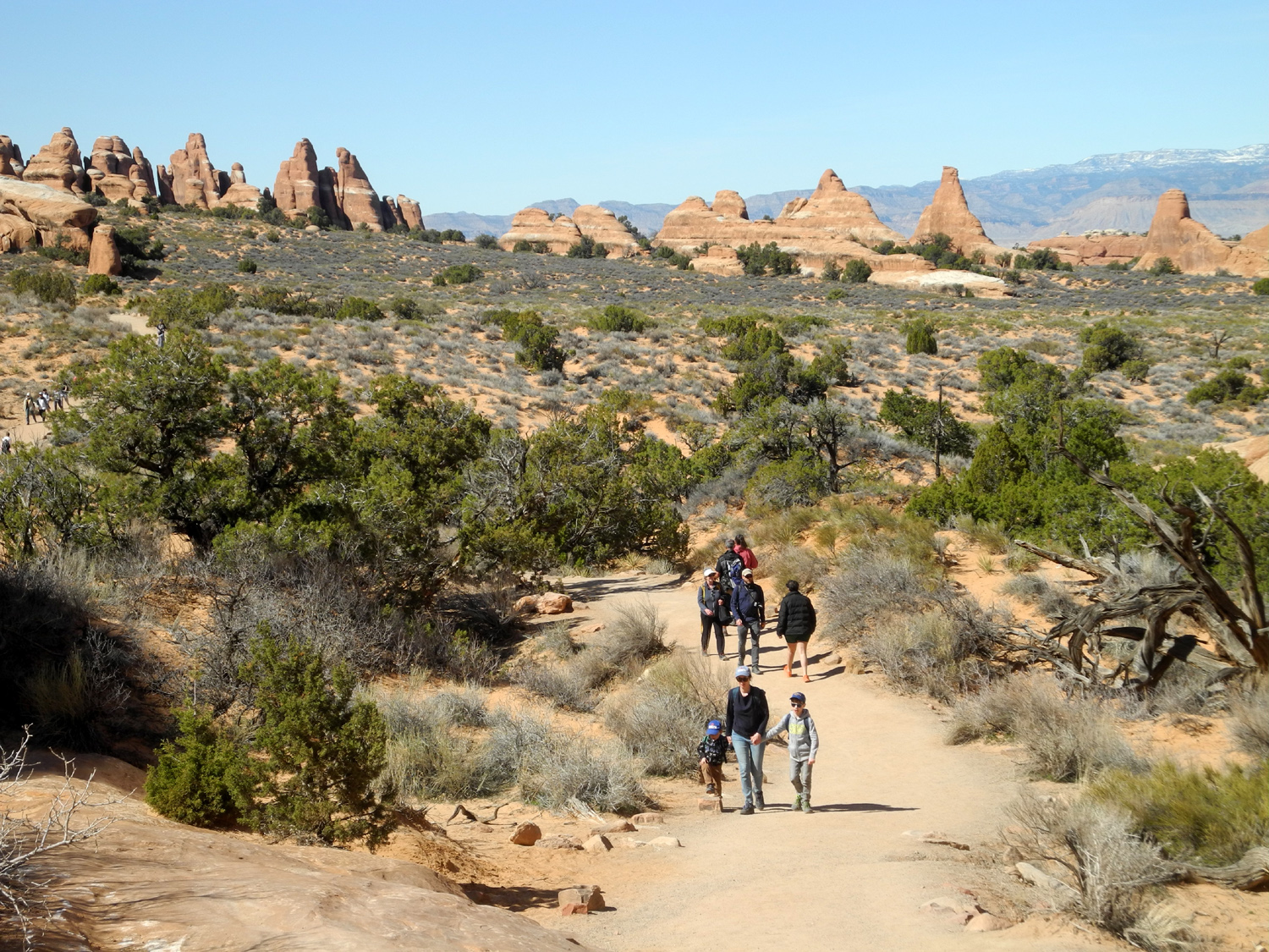
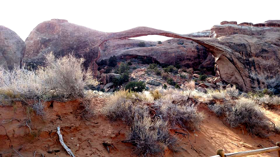
The road through the park ends at the Devil's Garden trailhead. A heavily used area, it has the largest parking lot in Arches National Park. Nearby is the only campground in the park. Trails from there lead to Broken, Tapestry, and Sand Dune Arches, none more than a mile. The Devil's Garden Trail itself leads to Pine Tree, Tunnel, Wall, Navajo, Partition, Double O and Private Arches. The crowning glory on this trail however is Landscape Arch, the park's longest at 290 feet, an easy three quarter mile walk from the start of the trail. Teri and I had both been to Landscape, Pine Tree and Tunnel at least twice. In 2002 I went past Wall Arch and walked the side trails that lead to Partition and Navajo Arches, but Teri had not been past Landscape. Grandson Mikie and I went as far as Wall Arch in 2004, when he was almost seven. However, this arch collapsed in 2008, so it now exists only in photos and our memories. Teri and I had decided to go at least as far as Navajo Arch. On the way back we would decide whether to take the side trails to Tunnel and Pine Tree, which are just a short distance from the trailhead. We got to Landscape, and realized it was better viewed in the morning light. It was shaded in such a way that it was hard to find a good angle to photograph it to best effect. On the other hand, in 2015 we had hiked this trail in a light rain, and the arch was partly obscured by the mist. |
|
|
|
| Landscape Arch, at 290 feet the park's longest | |
|
|
| Dramatic juniper near the start of the Devil's Garden Trail | There are views of the La Sal Mountains in many places on the trail |
|
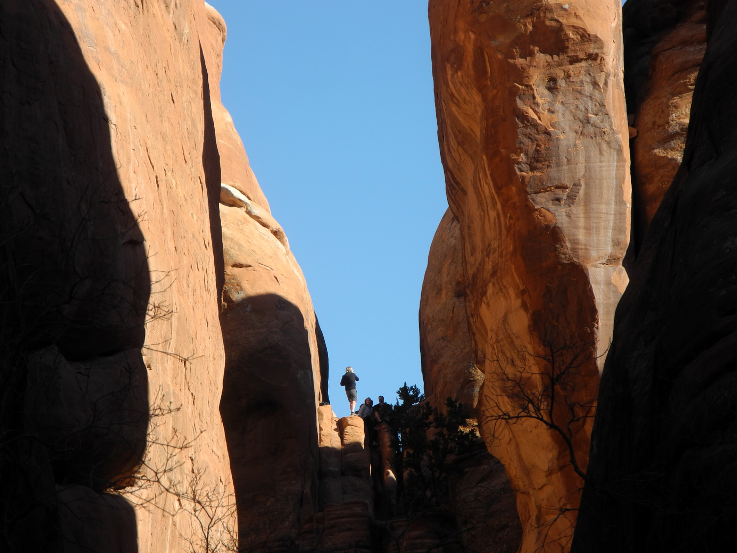
When we were ready to move on from Landscape Arch, time and age again took a hand. The trail is considered "primitive" beyond this point, and goes up a narrow pathway along a sandstone fin. I had no trouble where the rock was smooth, but we came to places where a bit of rock scrambling was required, and wisdom dictated a return to more level ground. We enjoyed the views along this section, and envied the 20-somethings who skipped blithely down the trail. As a consolation, it's possible to see Partition Arch from the trail near Landscape. |
|
|

|
| We were NOT tempted to join this daredevil | Hikers on the trail beyond Landscape Arch |
|
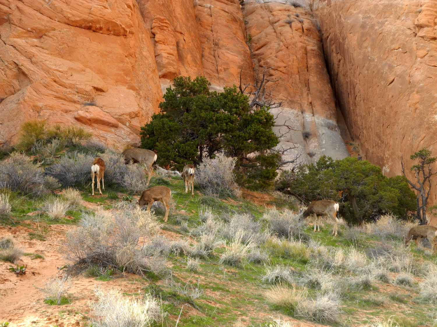
When we arrived at the short trail that leads to Tunnel and Pine Tree Arches, we headed down hill for the short walk to Pine Tree. This is a big, solid arch, with pinyon trees around and beneath it, hence the name. Tunnel is on a short trail off the Pine Tree trail, but I was ready to be done with hiking, so we didn't go on the trail. Teri was able to capture a fairly nice photo just a few feet down the trail. When we got out to the trailhead and were walking on the sidewalk to where we had parked, we were treated to the sight of five deer feeding on the brush right next to a high sandstone wall. This was the first time either of us had seen deer in this park. |
|

|
|
| Pine Tree Arch (2015 photo) | These deer ignored the many tourists snapping photos |
|
|
| A dramatic fin along the Devil's Garden Trail | Another fantastic "growth" in the garden |
|
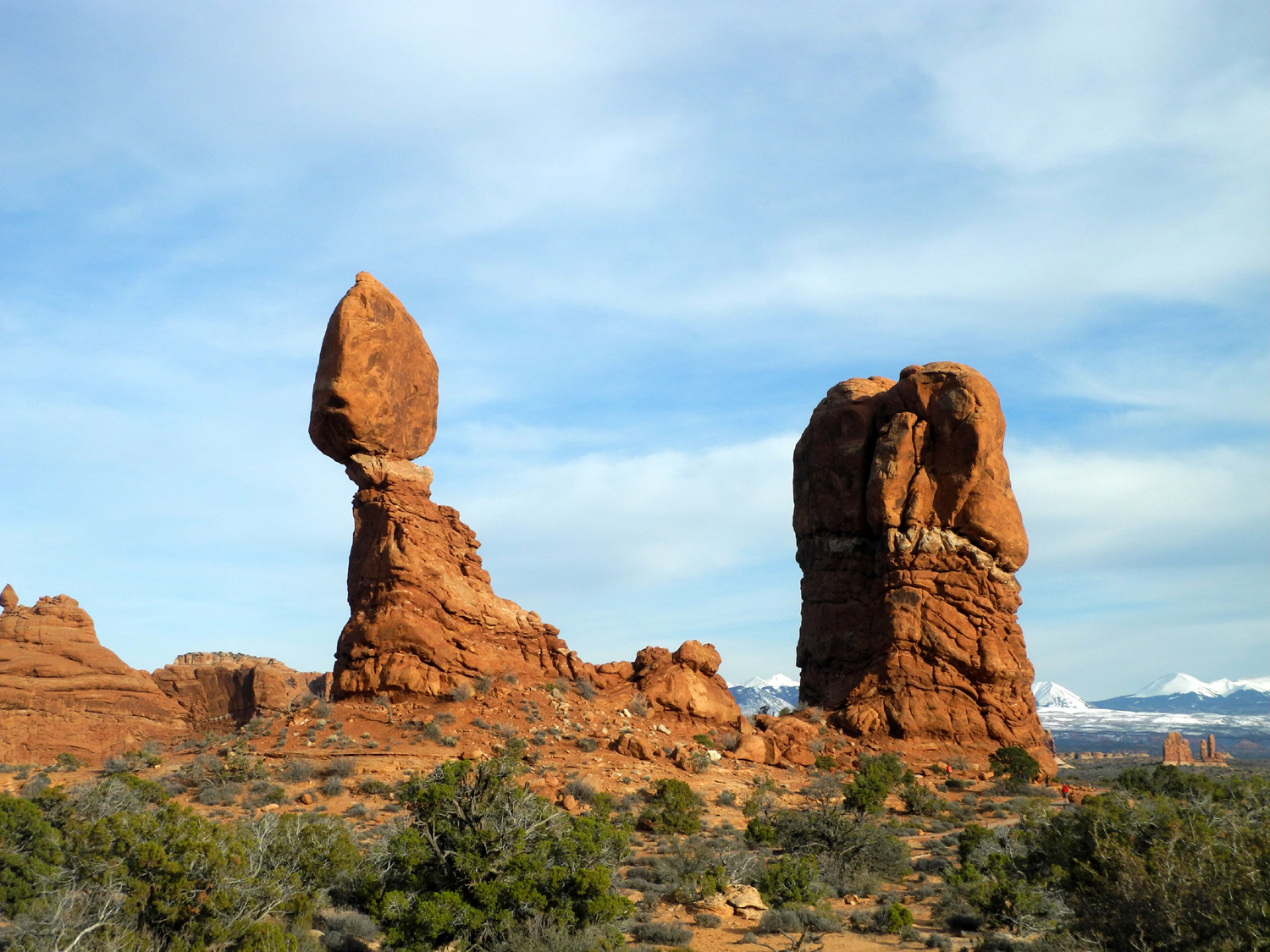
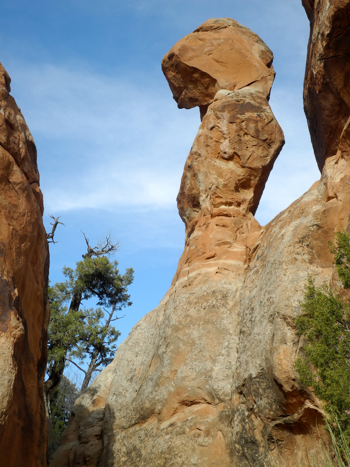
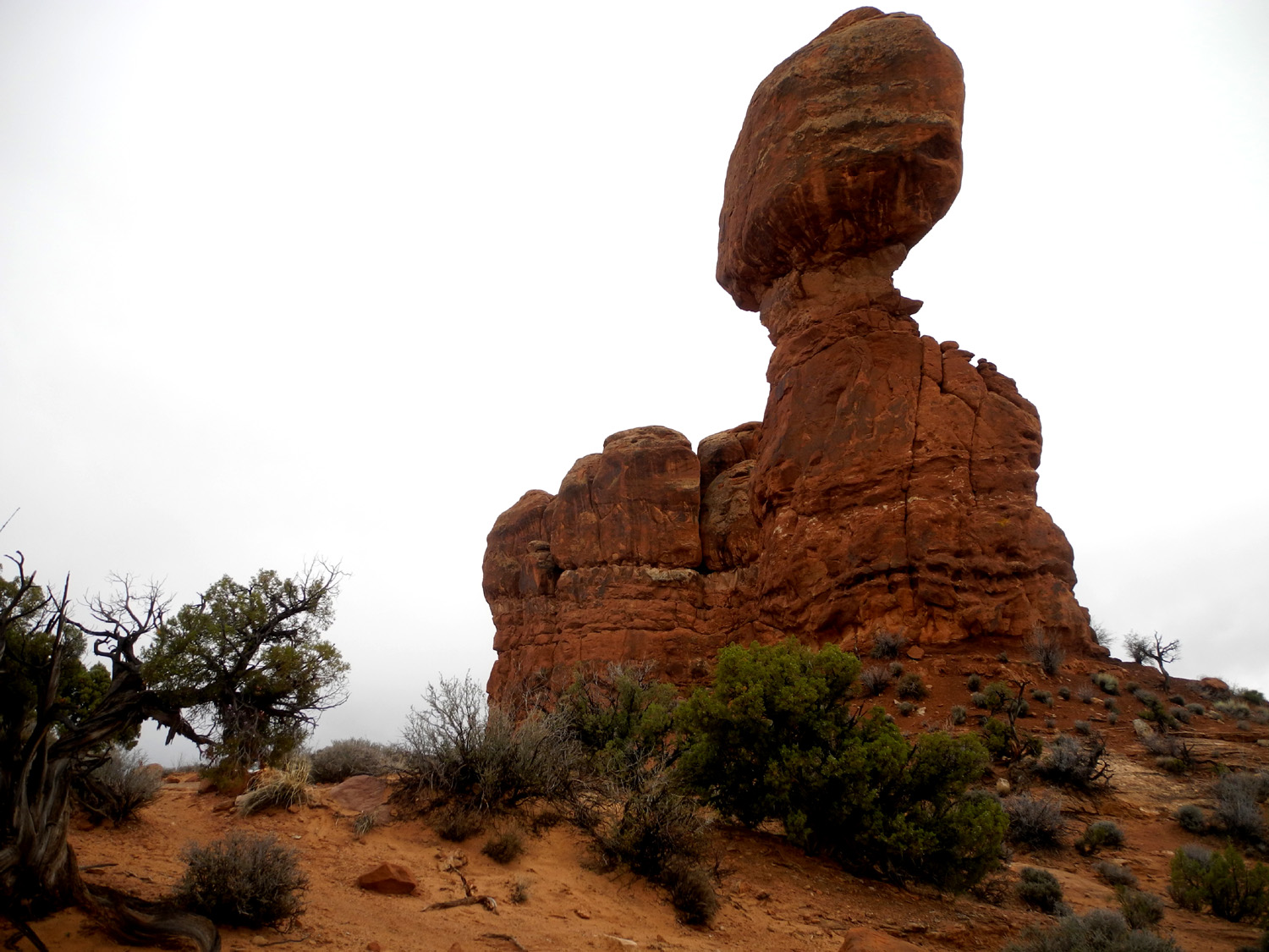
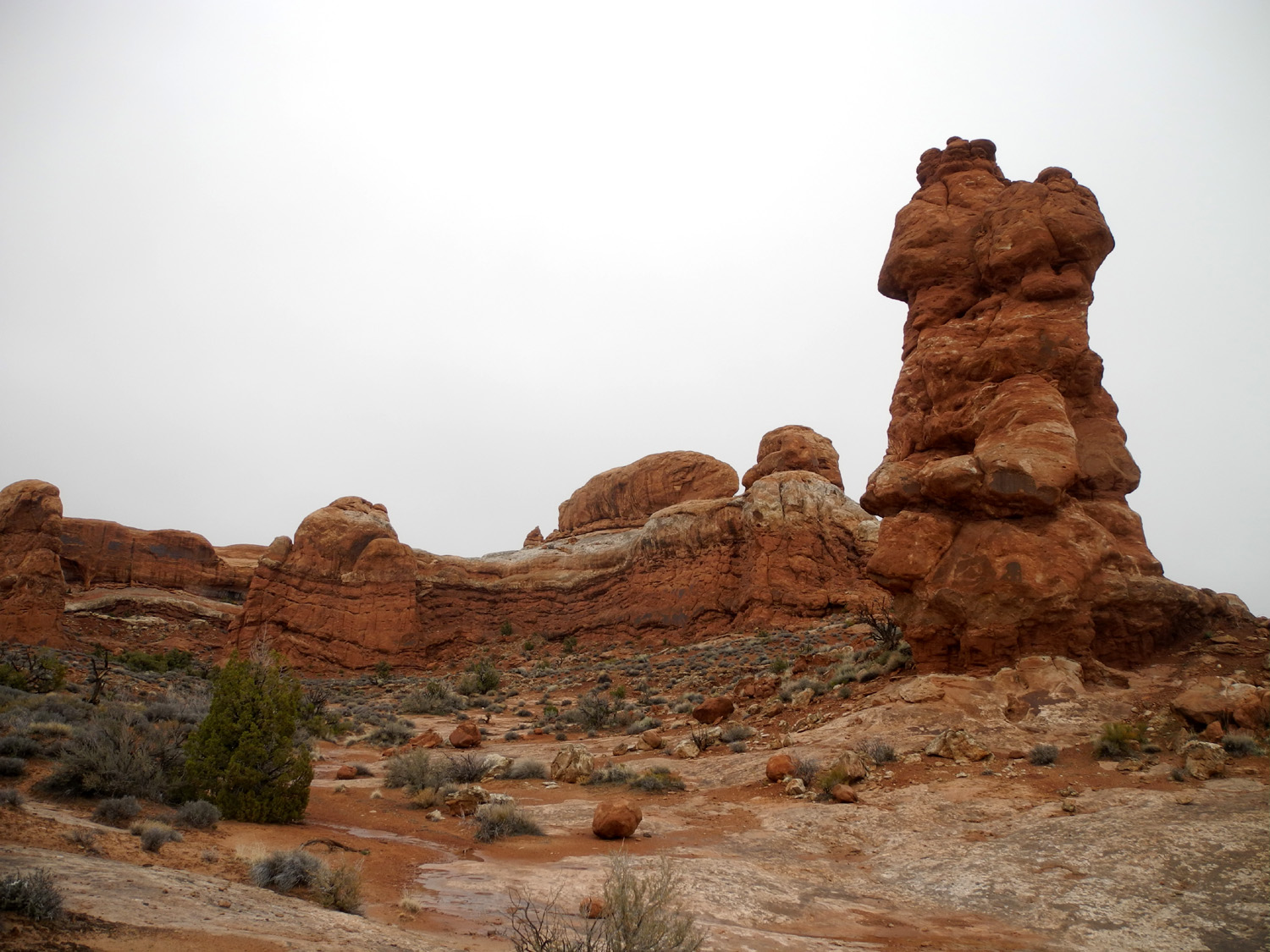
To finish out the day, we stopped briefly at the Fiery Furnace, a natural labyrinth of narrow passages between towering sandstone walls. Due to the lateness of the day we had the parking lot and vista point to ourselves except for a park ranger. Hiking in this area is so challenging that it is limited to ranger-guided hikes or for those who purchase a special permit. Looking down on this jumbled area of white-topped sandstone, it was hard to see how anyone could make their way through it. We made one final stop at Balanced Rock, one of the more distinctive non-arch formations in the park. It consists of a 3,600 ton Entrada Sandstone boulder, attached to an eroding pedestal of Dewey Bridge mudstone. Exposure of these two layers provides ideal conditions for the formation of arches and balanced rocks, and there are many smaller examples of the latter throughout the park. Late afternoon is a perfect time for photographing this landmark, as well as other towers and features in the area. Returning to Moab, we rewarded ourselves for the 3.83 miles of hiking we had done by going to Zax restaurant. This large, popular eatery features all you can eat soup, salad and pizza, with an outdoor patio, indoor dining room, and an upstairs room that can be opened to the air in warmer weather. It is well-staffed and service was excellent. Teri asked if they had a vegetarian pizza, and the server said, "We'll make a fresh one and bring it out to the pizza bar." I had an individual pizza, finishing off all but two slices. Even more adventure would await us the next day. |
|
|
|
| The twisted maze of sandstone that is the Fiery Furnace | |

|
|
| Yes, it WILL fall someday. See it now before it's too late! | This solid looking tower is made of the same material as Balanced Rock, but has escaped the heavy erosion of the latter |
|
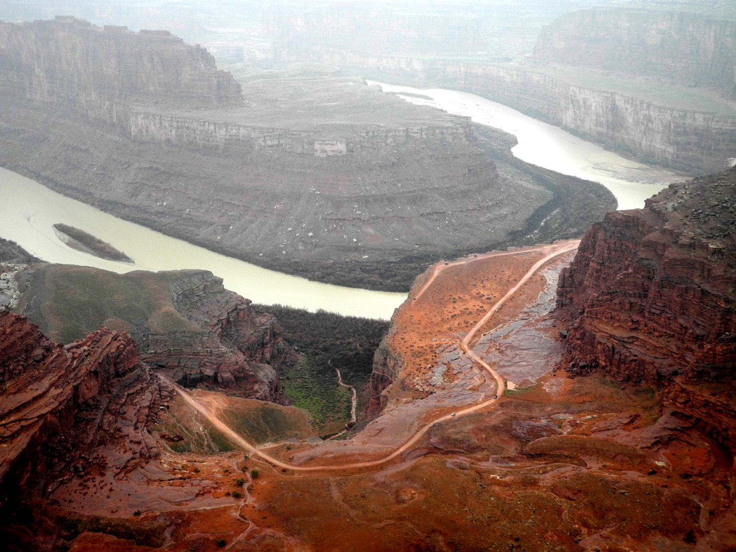
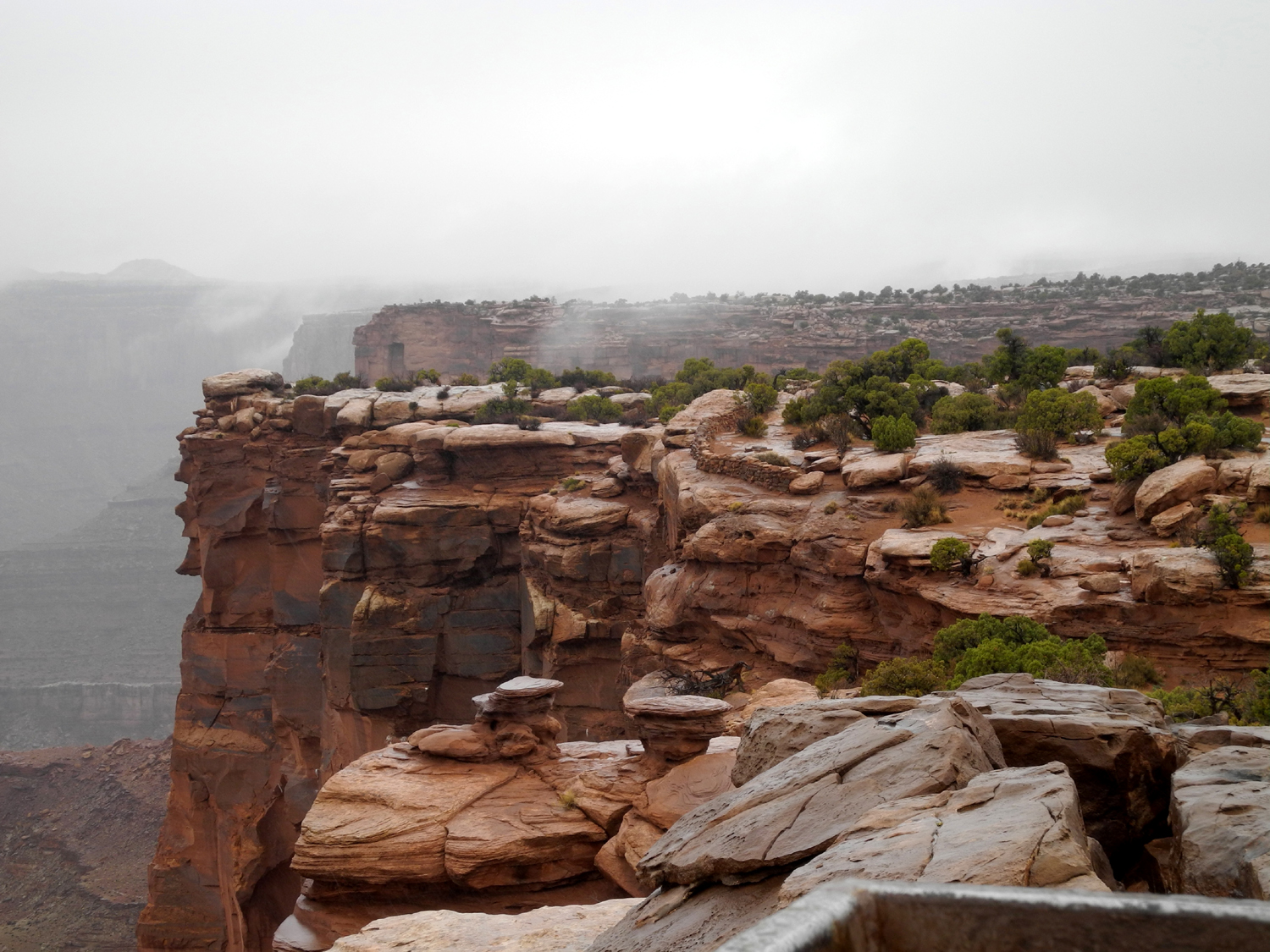
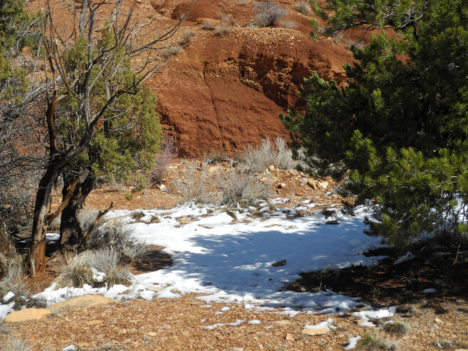
In 2004 Mikie and I went to Dead Horse Point, a Utah state park located about 35 miles from Moab off the highway to Canyonlands National Park. You can read about the legend that gives the place it's name here; I'll just provide a brief physical description. It's a narrow point of mostly level plateau country with views down into the Colorado River a thousand feet below. Hiking trails wind around the rim from the visitor center, and you can take short or long walks with views into the canyon. There was a good chance of rain for March 21, our last day in Moab, so we decided on the state park where we could enjoy the scenery, and hopefully get out between showers and look around. It was Teri's first visit to this location. We drove north on US 191 a few miles past the entrance to Arches and turned left on to Utah Highway 313 This road goes into Canyonlands National Park, but shortly before the park entrance, the highway turns south and goes out to the point. This road rises steadily after you leave the US highway, and before long we started seeing snow on the ground and snow on the junipers, a delightful sight. It was raining steadily at this time, so we did not get any photos. In retrospect, I wish I had braved a minute or so of rain to capture the scene. As we approached the turn-off to Dead Horse, the rain turned to snow, and for a short time, we had big flakes falling on us, making us glad we had a Jeep. The road drops down slightly toward the state park entrance, and we soon got out of the snow, but then it caught up with us at the entrance station. By the time we drove the final mile to the visitor center, it was raining again. As we had finished looking around the visitor center, the rain stopped and we went out to the vista point by the building. However, I realized this area did not offer the best views, and we returned to the Jeep and drove out to the end of the road, where you can see the Colorado River winding through the canyon below. There was a lot of mist in the air, and the views were not really that great, but we still enjoyed visiting this location. |
|
|
|
| The Colorado River from Dead Horse Point | Cliffs at Dead Horse Point |
|
We drove back out to the main road and stopped at a vista point where we had our lunch. It was raining again, so we did most of our observing from inside the vehicle. The main attraction at this place is two buttes across a canyon from the lookout point, that have been named the Monitor and the Merrimac, for two ships that did battle in the Civil War. We were surrounded by areas of light-colored wet sandstone that looked like snow due to the recent rainfall. |
|
|
|
| The Monitor and the Merrimac, seen from Utah Highway 313 | Sandstone glistening white in the rain |
|
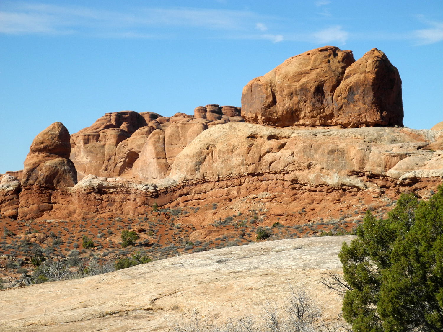
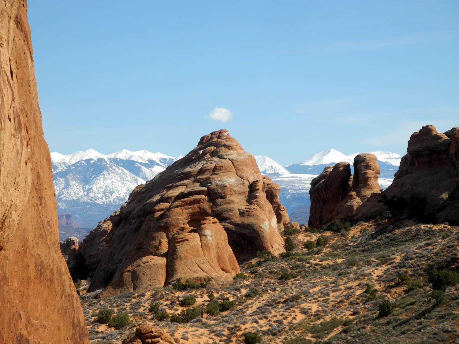
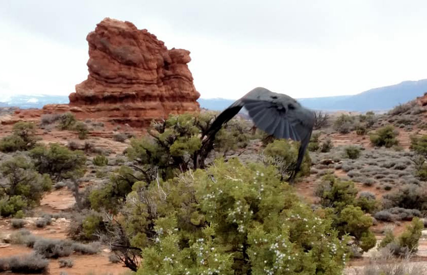
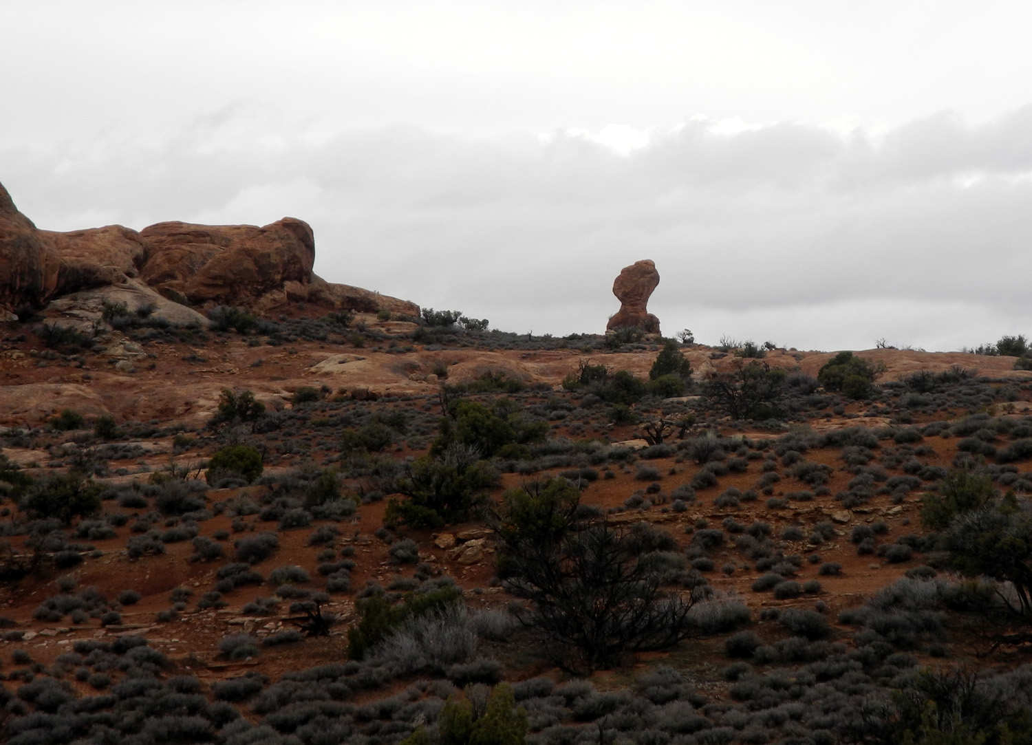
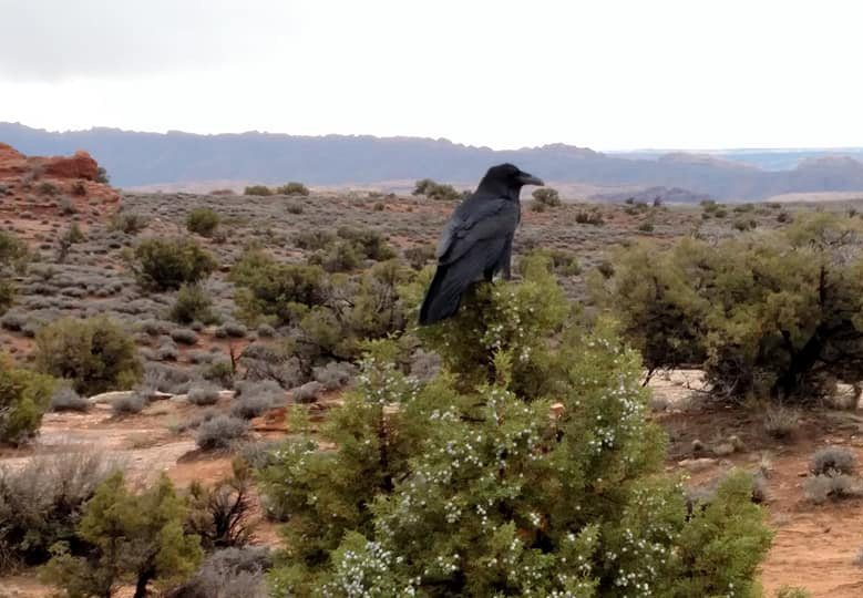
We decided to go into Arches National Park for a final visit. Balanced Rock is less than half way to the end of the road, but we had seen most of the major sights beyond this point so we drove that far, then worked our way back out, stopping at most of the vista points along the way. When we stopped at the big rock landmark the previous day we just looked from the parking lot; this time we walked the trail that goes all the way around, giving various different perspectives and lighting conditions. In the distance across the road we could see a smaller balanced rock, and in the other direction we could see Turret Arch in the Windows section. In a large sandstone formation nearby there's a tiny balanced rock. When we left this area, Teri captured an excellent photo of a raven, including his sudden departure when he decided he'd posed enough for one day. |
|
|
|
| View of Balanced Rock from the east | Turret Arch stands out among these formations in the Windows Section |
|
|
| A mini balanced rock tops this sandstone ridge | After posing for several photos, this raven decided "that's enough!" |
|
We started back toward the park entrance, planning to stop at various vista points. Our first stop was at a place where I could walk up from the road on a sandstone base and get some photos of the various shapes of the rock cliffs north of the road. |
|
|
|
| This nameless tower is part of a sandstone wall north of the main road | Areas like this show the different layers that make up the cliffs |
|
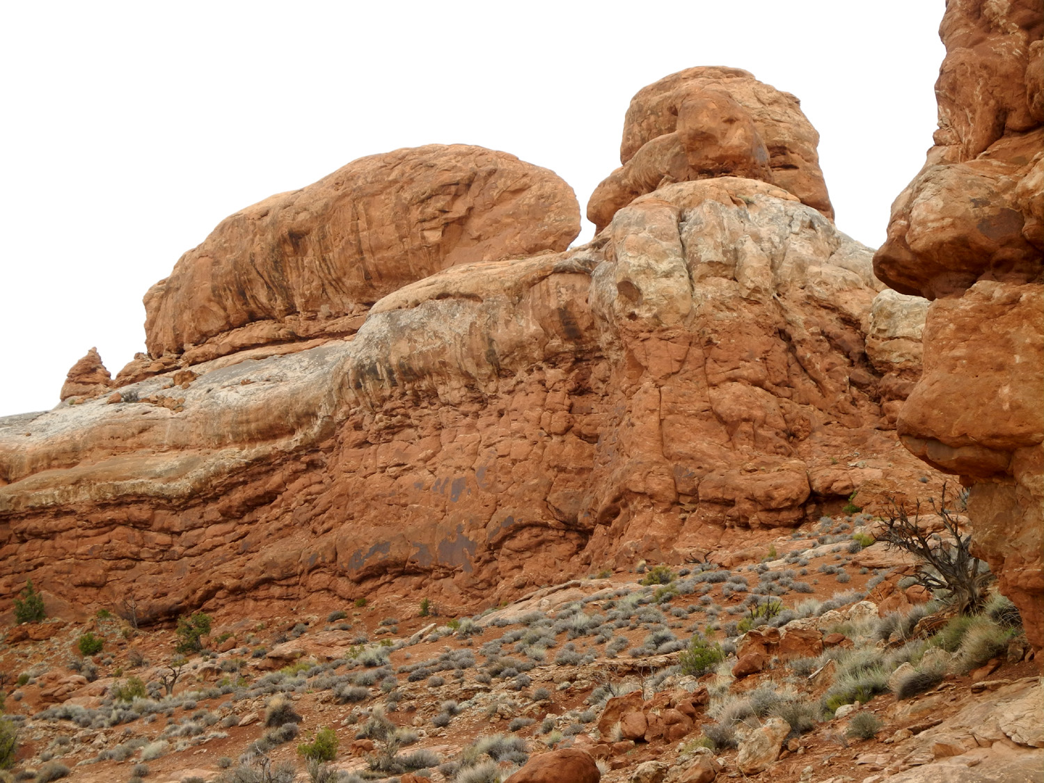
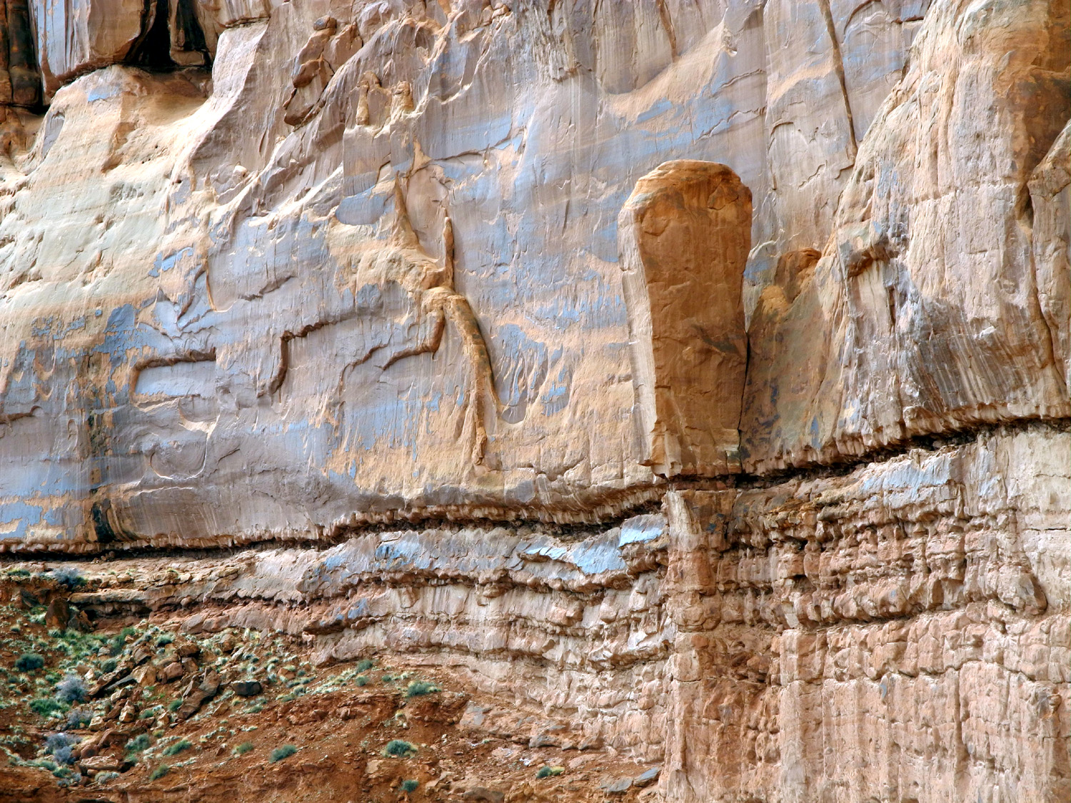
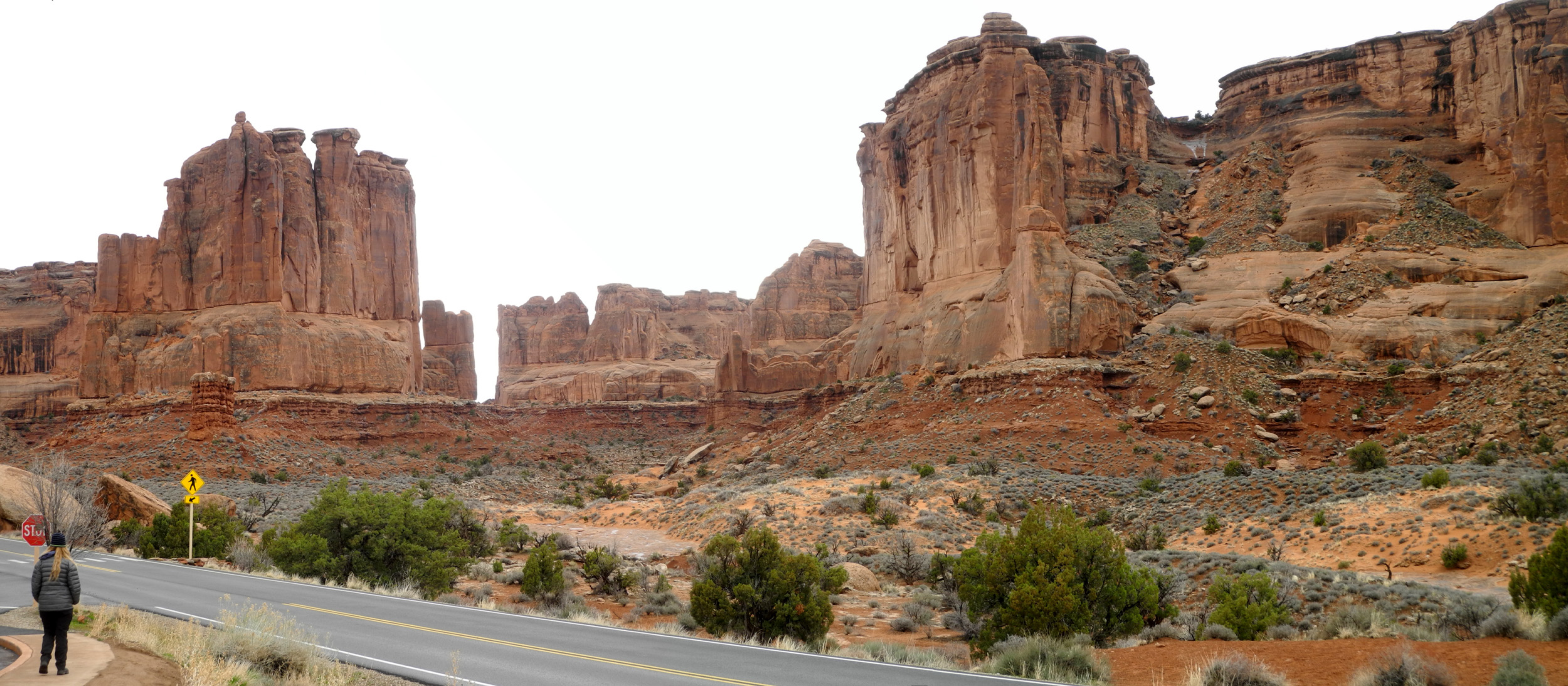
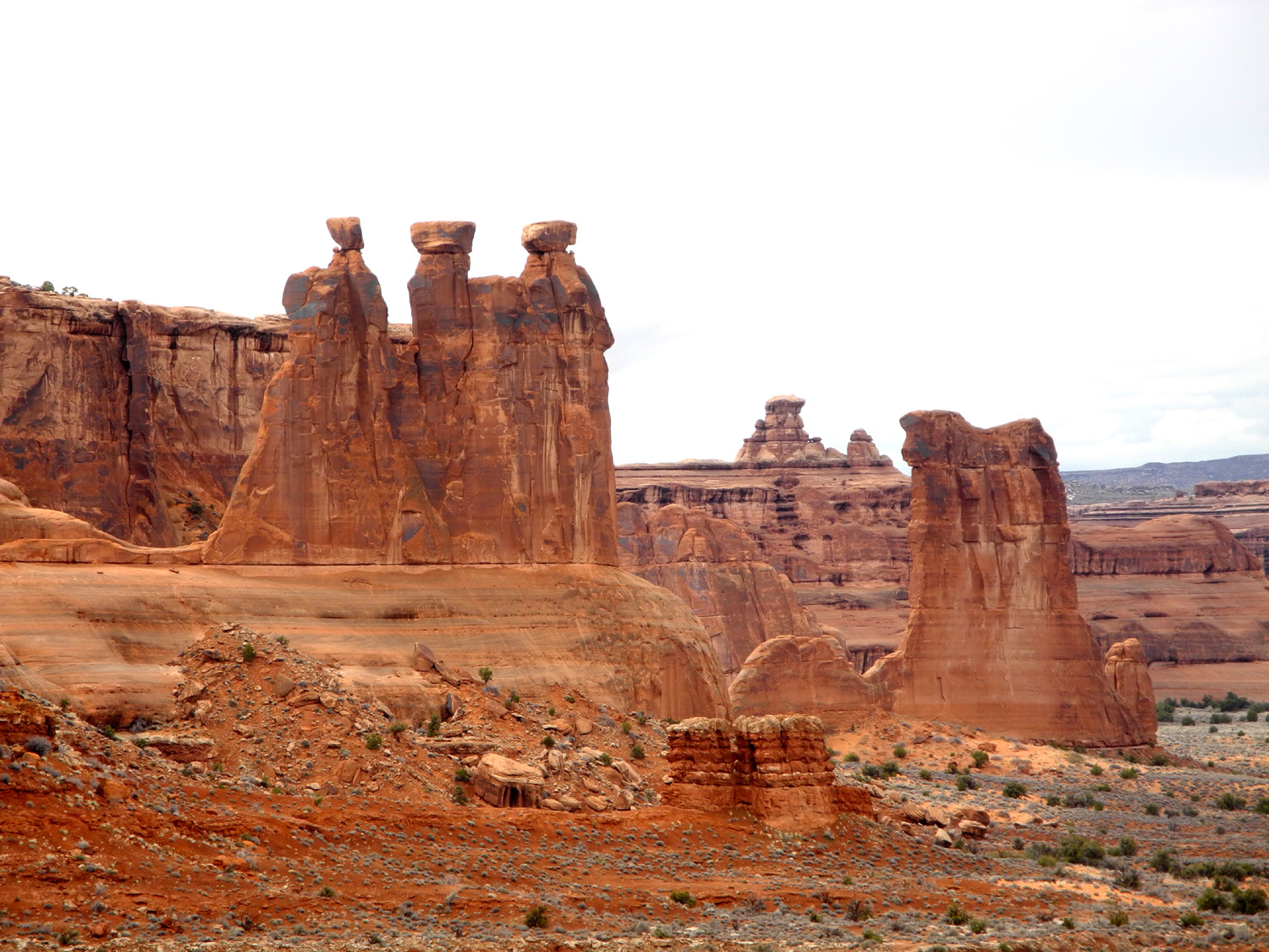
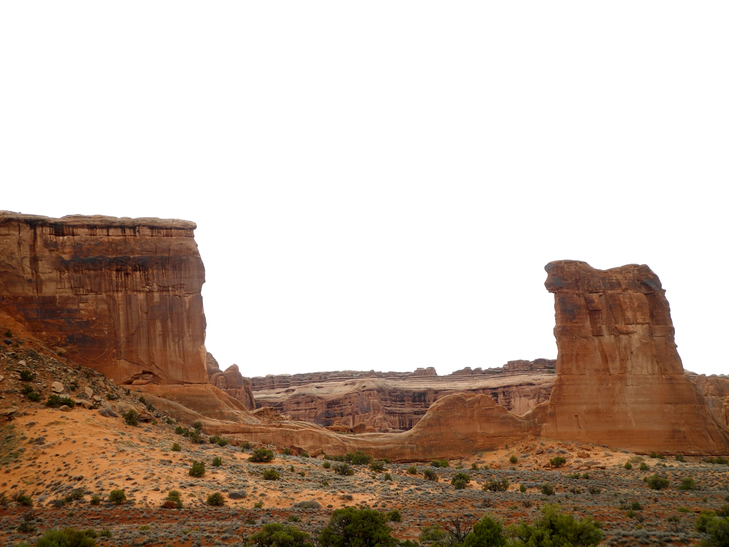
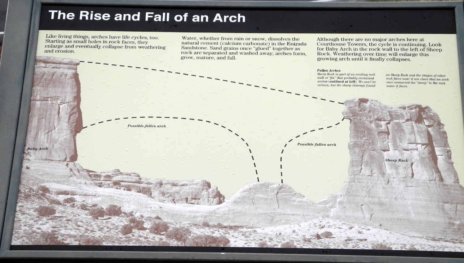
From Balanced Rock the road goes down hill for some distance to Courthouse Wash, a major drainage through the area, then rises back up to Park Avenue. There are no arches here, but this stretch offers some of the most dramatic scenery in the park. We stopped by Courthouse Tower, a huge sandstone monolith, with several other named features nearby. However, the best view of some of these features is obtained from La Sal Mountains vista point, where the road reaches a high point before starting down toward the park entrance. We spent a considerable amount of time here, enjoying and photographing the vistas. The La Sal's did not have the brilliant sparkle we had enjoyed the first two days, but were still very dramatic under the clouds. The next set of photos describe this area better than I can. |
|
|
|
| Courthouse Towers | There are a number of little pinnacles like this throughout this area |
|
|
| Towers, walls and cliffs across from the Courthouse | |
|
|
| The Three Gossips look down on Sheep Rock | View down Courthouse Wash from La Sal Vista |
|

|
| The La Sal's, brooding rather than sparkling | A nameless feature below the La Sal Vista |
|
When we left La Sal Vista we drove down to the Visitor Center for a quick stop, then back to our condo. There are several worthwhile features along this final stretch in the park, but we had seen them several times, and wanted to get back and get ready to leave the next day. Photos from previous visits are available on my Utah Photo Album page, and include Park Avenue, the Balanced Pinnacle, and The Penguins. |
|
|
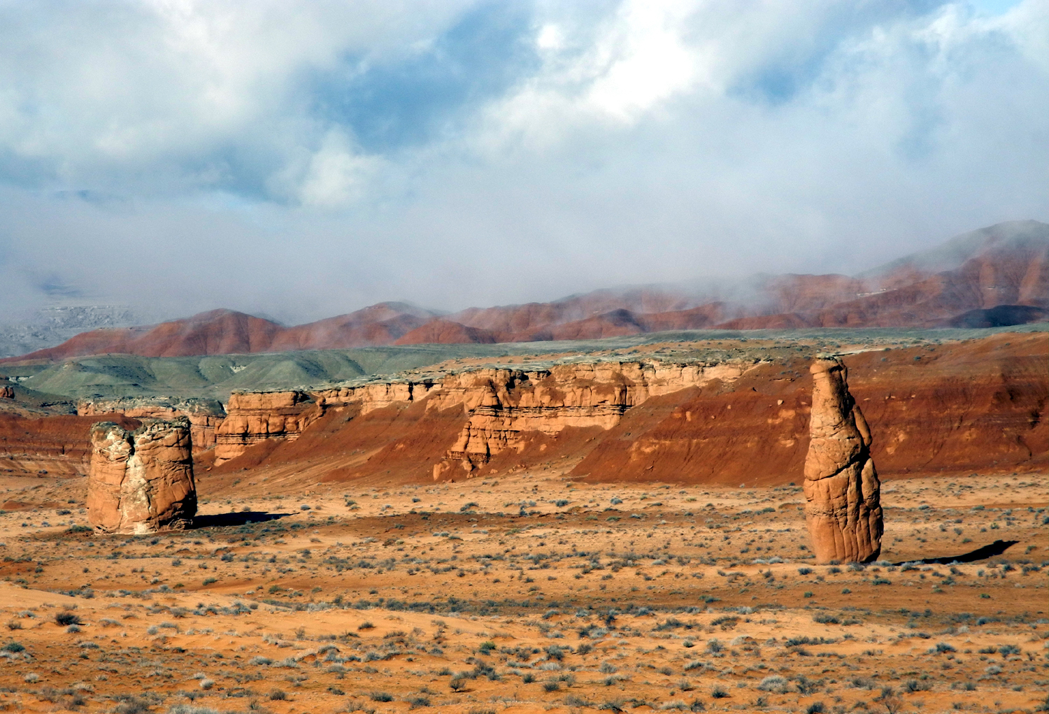
When we rented the car in Barstow, we knew we would have to drive it all the way back to Fresno. We requested a one-way rental, but the agent explained that the daily rate for this was about 50% higher. She suggested we return to Barstow, close out the rental, then rent the same vehicle for one day. During our days of frustration we had given up on visiting Capitol Reef National Park, but we realized we could drive through this area on our two-day trip home, Friday and Saturday. We got everything loaded into the RAV-4, filled the Jeep up with gas and returned it, and drove north on US 191 to I-70. Between 40 and 50 miles west of the junction we turned south again on Utah 24. We stopped once along the way to take photos of the "hoodoos" in Goblin Valley, a layered rock formation east of the road, and another snow-drenched mountain range, the Henry Mountains. |
|
|
|
| Scattered "hoodoos" in Goblin Valley | Snowy mountains south of Goblin Valley State Park |
|
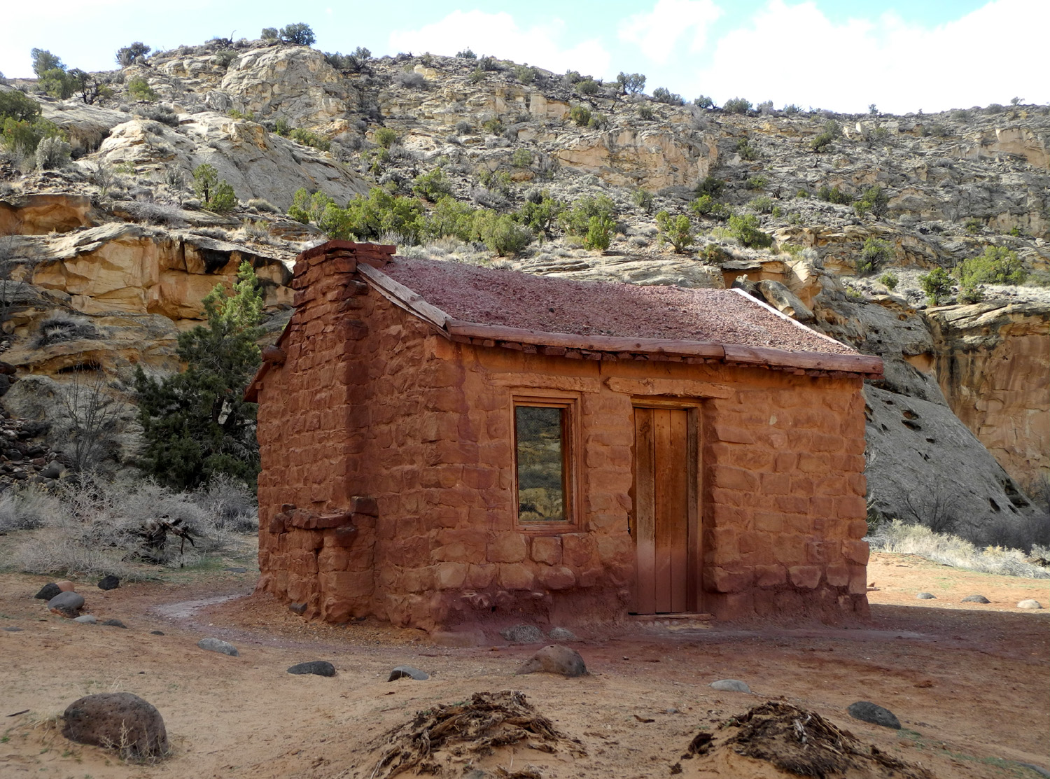
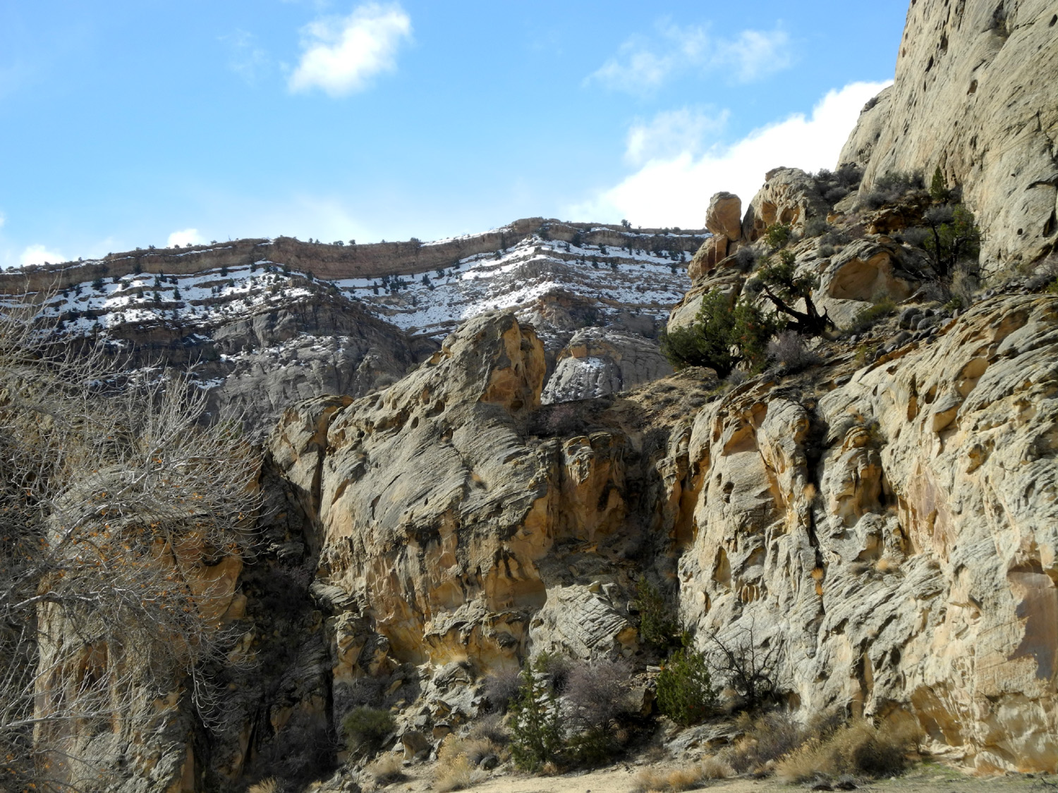
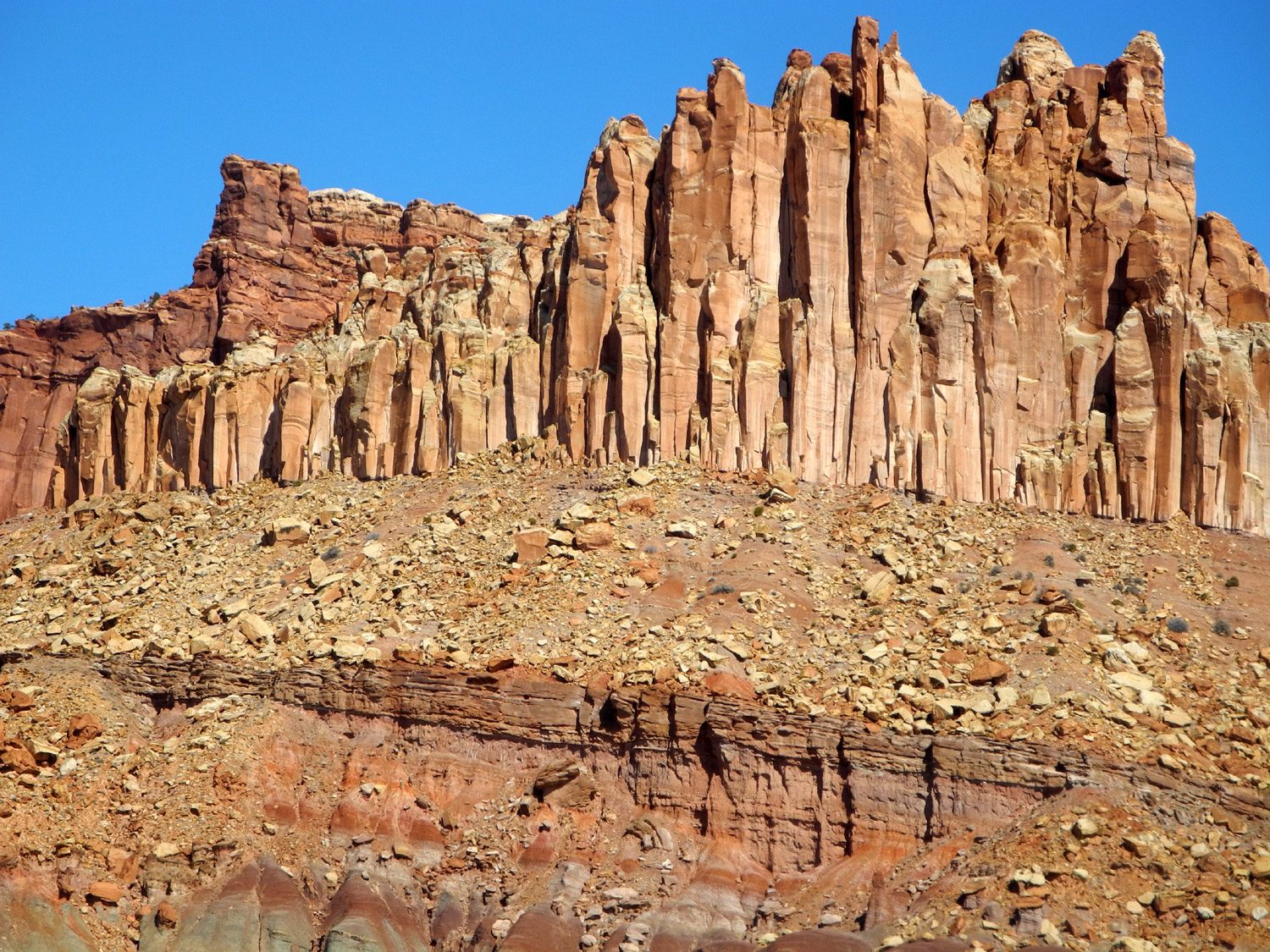
We enjoyed the place names in this area. South of Goblin Valley State Park we turned west at Hanksville, crossing the Dirty Devil River. We then followed the Fremont River upstream for a good distance into Capitol Reef National Park. Teri had been here before, but it was my first visit, and completed for me the string of five parks that range across southern Utah. The first place we stopped after the entrance was the Behunin Cabin, built of native sandstone. A family of Mormon settlers, including 13 children, came here in 1882 and lived in the cabin for a year. Floods on the Fremont River repeatedly destroyed their irrigation system and ruined their crops, and they soon moved upstream to the higher ground of Fruita, becoming one of the first families to settle in that area. The scenic beauty of their chosen spot could not compensate for the ravages of nature. |
|
|
|
| Behunin Cabin, built in 1882 |
Snow near the cabin gives a hint of the flooding that drove the family away |
|
|
| Panoramic view along the main road through Capitol Reef National Park | |
|
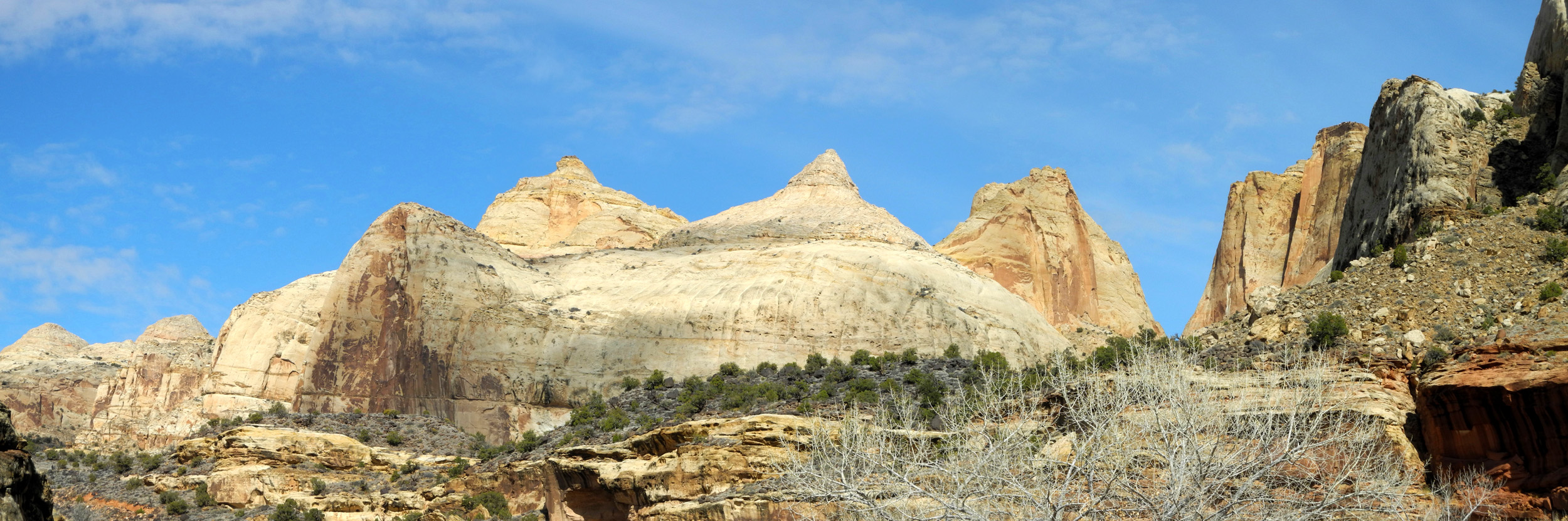
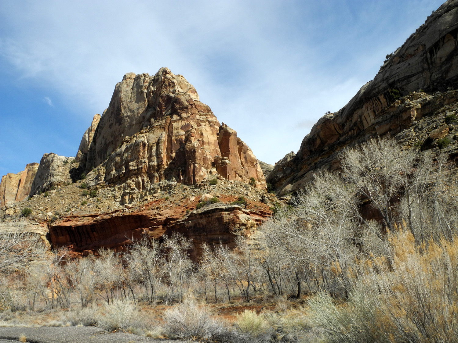
We continued our drive through this scenic canyon, and soon arrived at the historic site of Fruita and the visitor center. We went in and looked around, seeing displays and information about the hardy families who homesteaded in this challenging area. At this location, you can take Scenic Drive south from the main road. This is an "out and back" route, since there are no paved roads through the park except the one that enters and leaves the park as Utah Highway 24. |
|
|
|
| Along the Fremont River near Fruita | Vertical fractures give this formation a unique look |
|
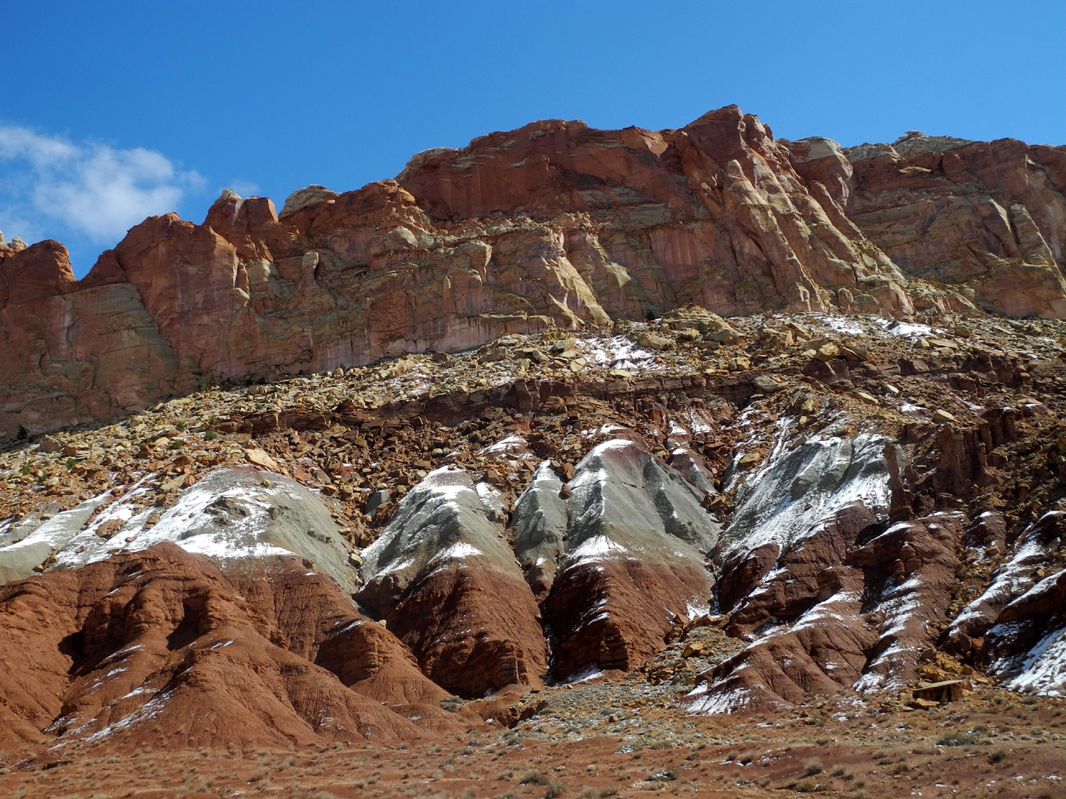
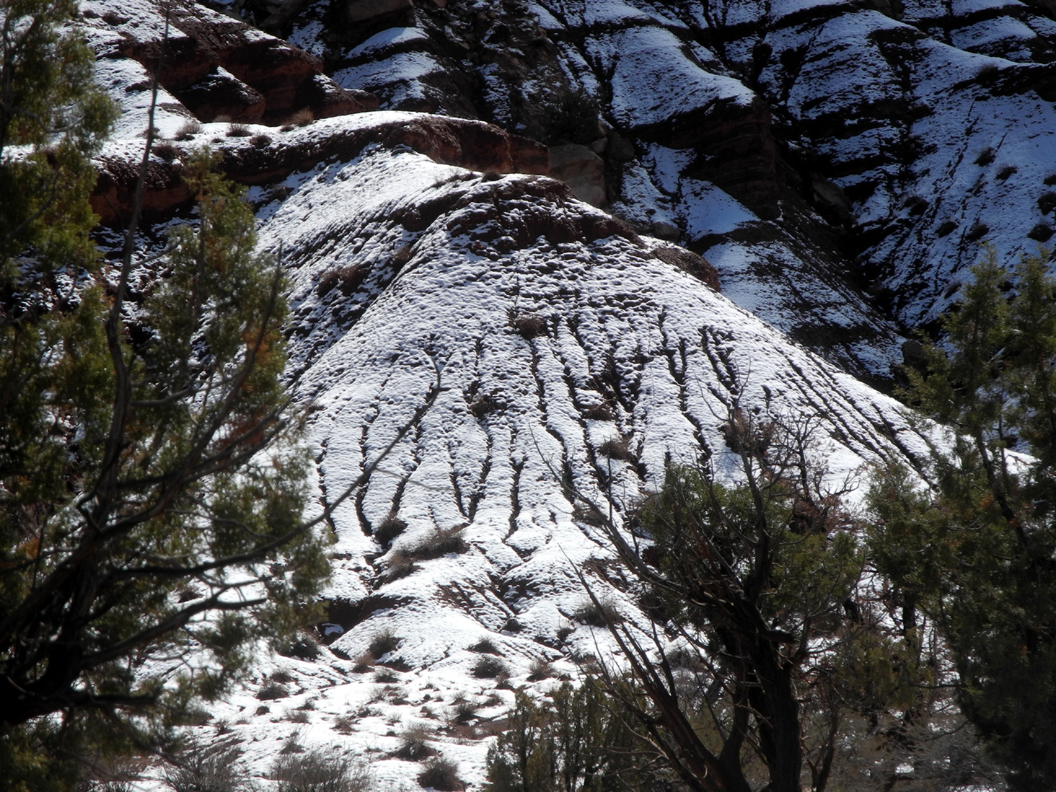
Scenic Drive rises in elevation, and it was not long before we saw snow above us on the cliffs, and then right next to us along the road. We drove in three or four miles, then started back to the highway, stopping at Gifford House, a renovated farmhouse that depicts the typical Spartan nature of rural living in early 20th century Utah. It is also a gift shop and offers coffee and beverages. |
|
|
|
| The snow adds a frosted white layer to the red and gray sandstone | Snow melt water trickling down this hill creates an artistic pattern |
|
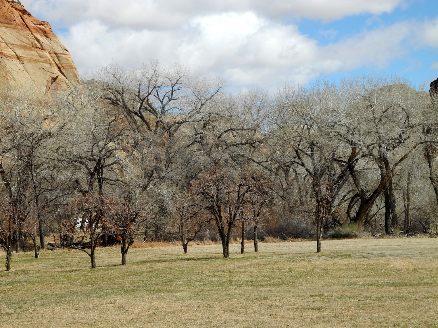
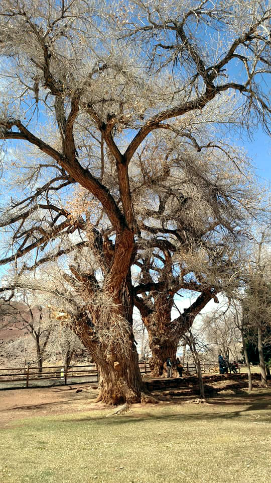
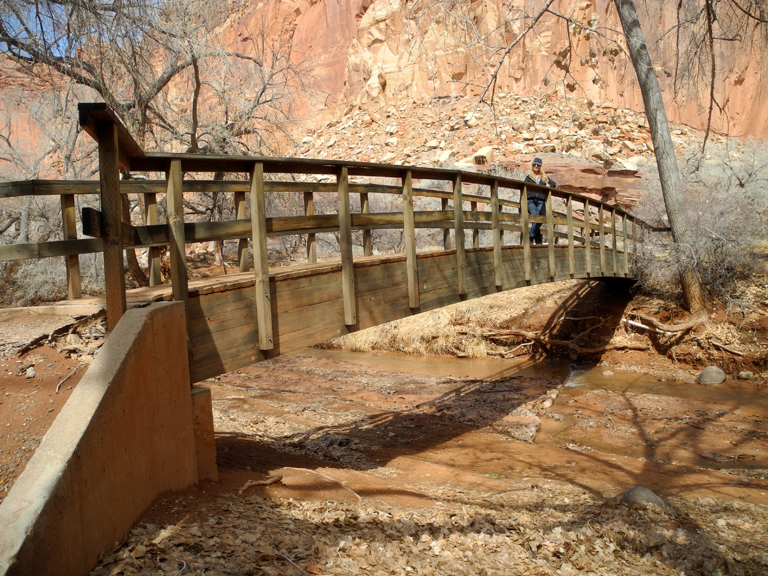
After our visit we parked across the road and ate lunch at a picnic table next to an old orchard, admiring two huge cottonwood trees that grow in this park-like setting. We also walked across the park and over a footbridge above the river, then gathered up our stuff and got ready to head west again. |
|
|
|
| Part of a 19th century orchard | Huge cottonwoods at Fruita |
|
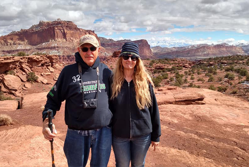
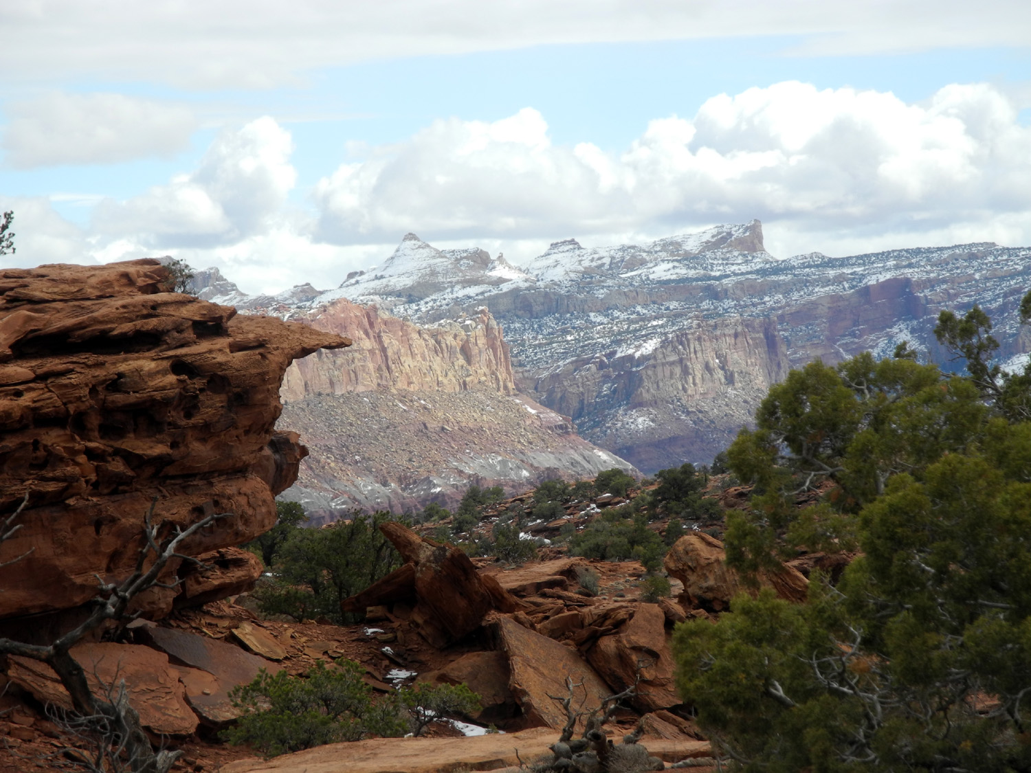
We made one more stop on our way out of the park, at Sunset Point. About a quarter mile off the main road, this spot offers views through the canyons and cliffs with snow-covered mountains in the distance. Soon after this we left the park, both of us agreeing that the visit was too short. Capitol Reef is one of the nation's lesser-known parks, and is fairly isolated. If we had been able to stay here for three days as planned, we would have had time to hike and to have a better appreciation of this incredible place. |
|
|
|
| Dick and Teri at Sunset Point | Cliffs and canyons from Sunset Point |
|
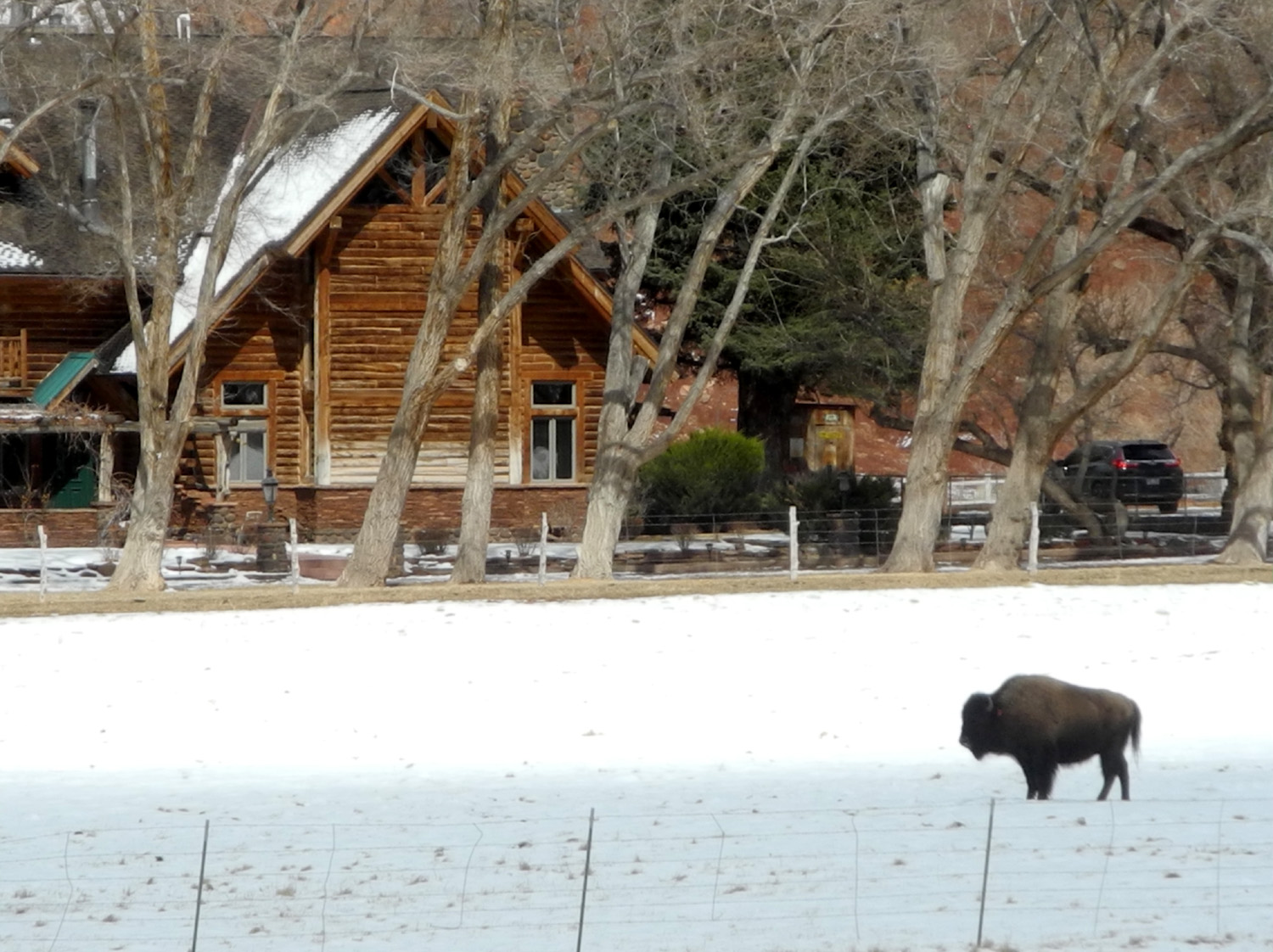
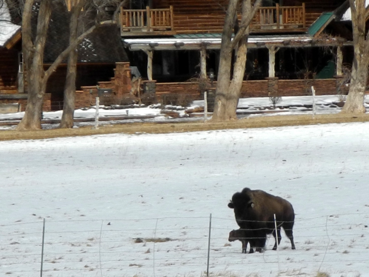
From this point on, the rest of our day's trip consisted of going east, then south, then east, then south, then east and south again, on a series of state, US and Interstate highways. Not far from the park, along Utah Highway 24, we passed a small bison ranch, and had to stop and photograph the magnificent beasts, standing in a snowy field. We were quite a long distance from the animals, but one appeared to have a baby next to it, and thanks to the modest telephoto ability of my camera, I was able to verify this. We had seen deer in Arches and antelope somewhere along the road, so this completed the full "Home on the Range" menagerie. |
|
|
|
| Bison on a small ranch west of Capitol Reef | Big mama, big baby |
|
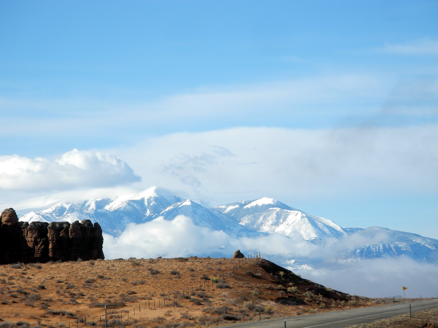
From Highway 24, we went south on Utah 62, which took a sharp turn to the west, connecting with US 89, a scenic route that runs from US 6 east of Salt Lake down into Arizona, crossing the Colorado River east of the Grand Canyon. Past that it goes through Flagstaff, then southwest across the state, terminating at US 60 near Wickenburg, AZ. We only went about 25 miles on 89, before turning west on Utah 20, which took us over a 7,900 foot pass and down to I-15. At the top of the pass we stopped to photograph the surrounding country, entirely covered with snow. |
|
|
|
| Snow at 7,900 feet on Utah Highway 20 | More snow |
|
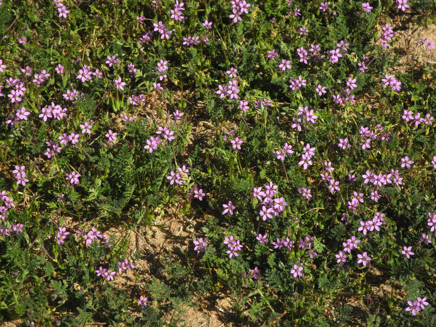
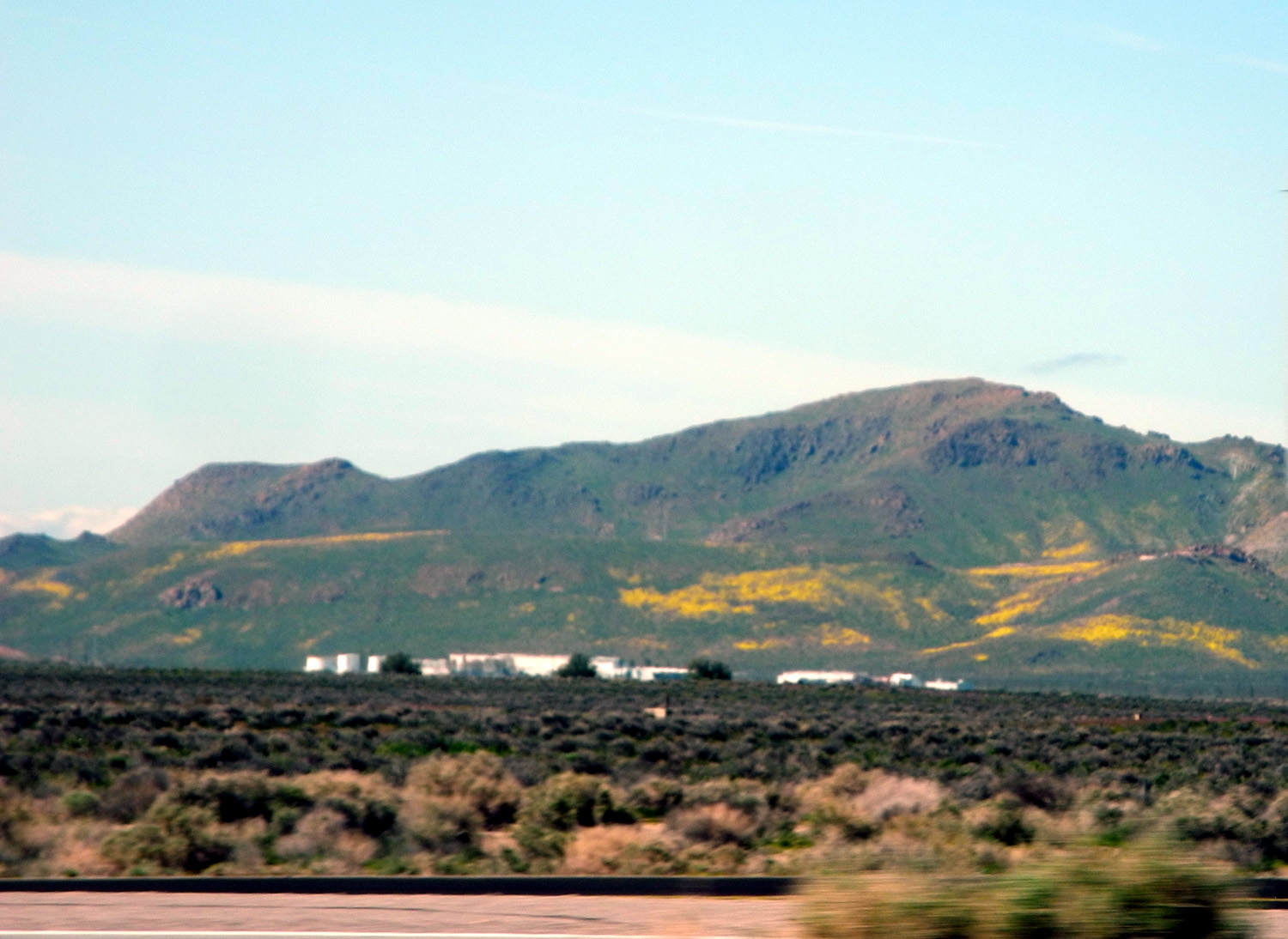
Motels in St. George were filled, so we spent the night in LaVerkin, about 15 miles northeast on State Highway 9. In the morning we got an early start, did our business in Barstow, and continued on home. Driving across the Mojave Desert we saw fields of pink flowers, which proved on close examination to be a small variety of filaree, barely an inch or two high. Joshua trees (a variety of yucca) were starting to bloom, and there were also big patches of yellow flowers, as well as acres of windmills near Tehachapi. If you can recall back to the first part of this report, our journey did not get off to a very good start. However, once we accepted the need for Plan C, everything went smoothly, the weather was great, and we had a wonderful time. We're already planning to return next year, hopefully with Johnny, Brittany, Colton and Jack. That should be a lively time! |
|
|

|
| Filaree in the desert | This is what grows near Tehachapi |
|
Some Final Comments Main Street in Barstow is old Route 66, a fact that is driven home with street signs, murals, and business names. The iconic highway went south from Barstow on what is now I-15, and east on present day I-40. I-15 north goes to Las Vegas, which caused me to wonder how people got to Vegas before the Interstate system was built. A little research revealed that US 466 ran from Morro Bay to Barstow, and on through Las Vegas to Kingman, Arizona, generally following present day State 58 and I-15. The Barstow to Vegas section also included US 91, contiguous with 466. Neither of these numbers, 91 or 466 are in use today, having been replaced by California 58 and I-15.
Somewhere,
some time during the trip we read an article in which the author made
the point that you should try to do something each day that you've
never done before. I'm not sure we did it every day, but we did rack
up a number of firsts. On the down side, it was the first time we had
experienced a lengthy delay due to a vehicle breakdown. I think I used
some words I'd never considered before as we coasted to a stop on busy
I-15. But on the plus side, Teri enjoyed her first visit to Mojave
National Preserve and Dead Horse Point, I went to Capitol Reef for the
first time, and we both enjoyed our short, unplanned tour of Rainbow
Basin north of Barstow. Teri also drove through Salt Valley and at
least to the Tower Arch trailhead for the first time. For next time, I would like to
take some four-wheel driving lessons and try the short
4-wheel drive road that intimidated us this time. You
may remember that we left Teri's motor home in Barstow while we had
fun in Utah and it was still there when we returned home. Only five
days later it was ready to be picked up, so on March 28, one day
before our family trip to Camp Four and a Half Cabin, Teri and I went
to Barstow in my Honda, then drove back home in separate vehicles. The man she needed to
talk to was not in when we arrived, so we went to Denny's for lunch,
and by the time we got back he was there. After considerable
discussion, in addition to the transmission repair, they eventually
covered the cost of the car rental from Barstow to Fresno, gas for our
trip to pick up the motor home, and her lost salary for the day. Now
we are having family discussions about another trip there. Even before
we left Moab, Teri and I discussed the possibility of bringing
grandsons Colton and Jack during spring break next year. Then we
decided to include their parents too. In mid-April Teri checked into
reservations at the condos where we stayed, and was notified that
spring break is Jeep Week in Moab. The landlord described the parks as
crowded and congested, and traffic through Moab as insane. So we are
considering alternatives, and talking about whether we can handle that
kind of madness. Surely it would be better than four nights in
Barstow. --Dick Estel, April 2019 |
|

| Photos
(Click to enlarge; pictures open in new window) (photos by Teri Liddle and Dick Estel) |
||
 |
 |
 |
| Our home on the streets of Barstow | Teri and Joshua | A fallen dead Joshua tree |
 |
 |
 |
| Scenic view in Rainbow Basin | This cholla looks soft and fuzzy - but it's not! | Small arch or window at Mojave Preserve |
 |
|
 |
| These open, sandy-looking patches appeared in several places at Mojave Preserve |
The La Sal Mountains with the Colorado River canyon in foreground |
Teri on the rocks that fell from Skyline Arch in 1940 |
 |
 |
 |
| The boy with lizard grip | Close-up view of North Window arch | Klondike Bluffs and the trail to Tower Arch |
 |
||
| Cactus by the Skyline Arch trail | ||
 |
||
| Panoramic vista - sandstone formations and La Sal Mountains | ||
 |
||
| Dramatic sandstone panorama, with Colorado River gorge in foreground | ||
|
 |
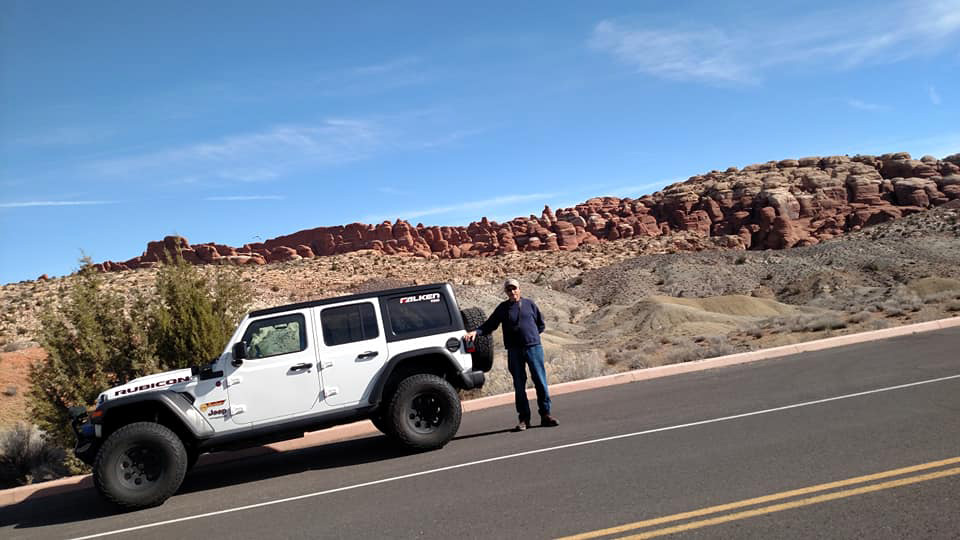 |
| The "frosted" sandstone of the Fiery Furnace | Teri and our Utah ride | Dick and the Jeep Rubicon |
 |
 |
 |
| Imagine what forces created this wrinkled scene | On the Devil's Garden Trail | A wide view of Landscape Arch |
 |
 |
 |
| Not a row of volcanoes | Overlook at Dead Horse Point | Scientists believe there may have been two arches here that collapsed long ago |
 |
 |
 |
| Utah juniper near Balanced Rock | Desert plants and sandstone boulders | Snow under the junipers in Capitol Reef |
|
|
|
|
| Teri on the bridge over the Fremont River | Formations in Goblin Valley State Park | Sandstone formation near Goblin Valley |
 |
 |
 |
| Where we spent the first night of our trip | Joshua tree blooming in the Mojave Desert | Yellow flowers decorate the hills near Mojave |
| Related Links | ||
| Rainbow Basin Natural Area | Mojave National Preserve | Banshee Canyon |
| Ring Trail | Moab Utah | Red Cliff Condos |
| La Sal Mountains | Arches National Park | Tower Arch Trail |
| More La Sal Mountains | Landscape Arch | Zax PIzza |
| Balanced Rock | Cryptobiotic Soil | Fiery Furnace |
| Capitol Reef National Park | Goblin Valley State Park | Fremont River |
| Southern Utah National Parks | Fruita, Utah | Wall Arch collapse |
| Ring Arch Partial Collapse | Natural Arch and Bridge Society | Dead Horse Point State Park |
| Goblin Valley State Park | ||