|
Utah Parks 2022 |
|
| Photos Related Links More Travel Reports | |
| Adventures of 2017 Adventures of 2018 Adventures of 2019 | |
| Getting There Arches Natural Bridges Capitol Reef Bryce & Zion | |
| Getting There | |
|
NOTE: This was a 12-day trip, covering four national parks and two national monuments, so the report is quite long. The "additional photos" that normally appear below the report are so numerous that I have created a separate page just for photos. |
|
|
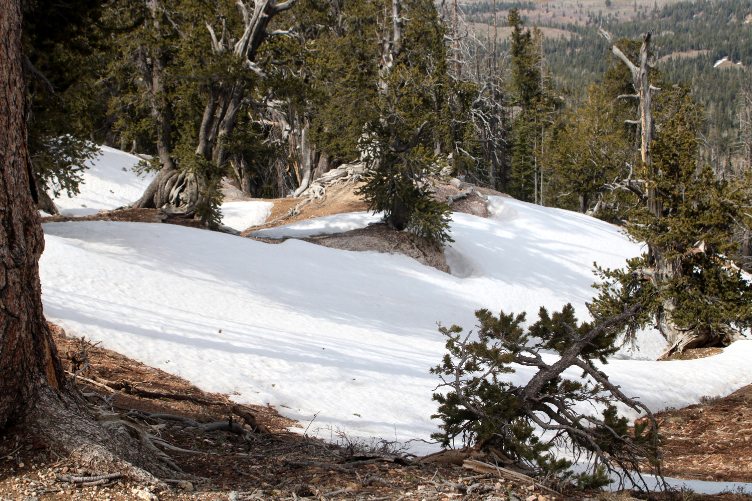
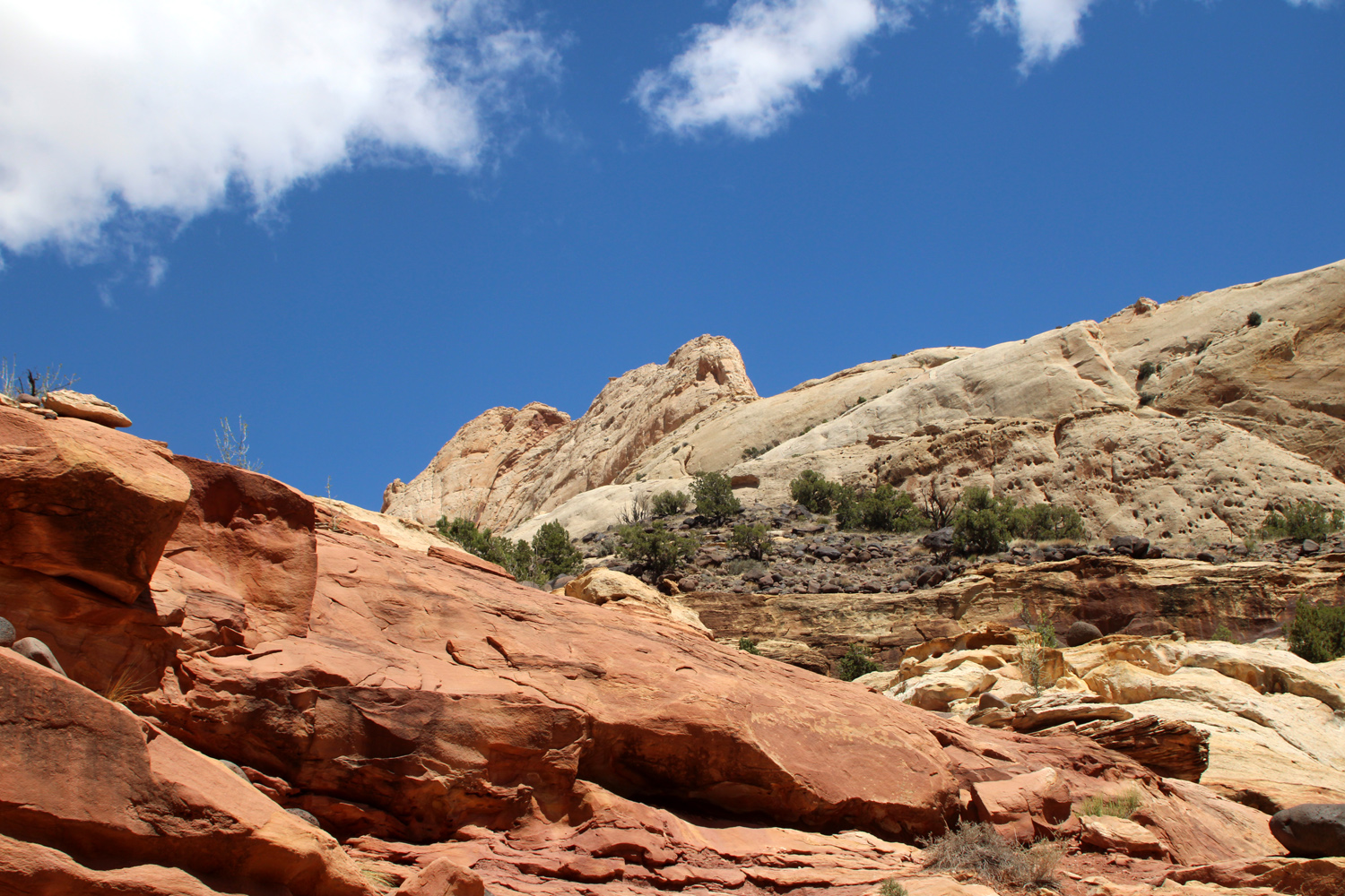
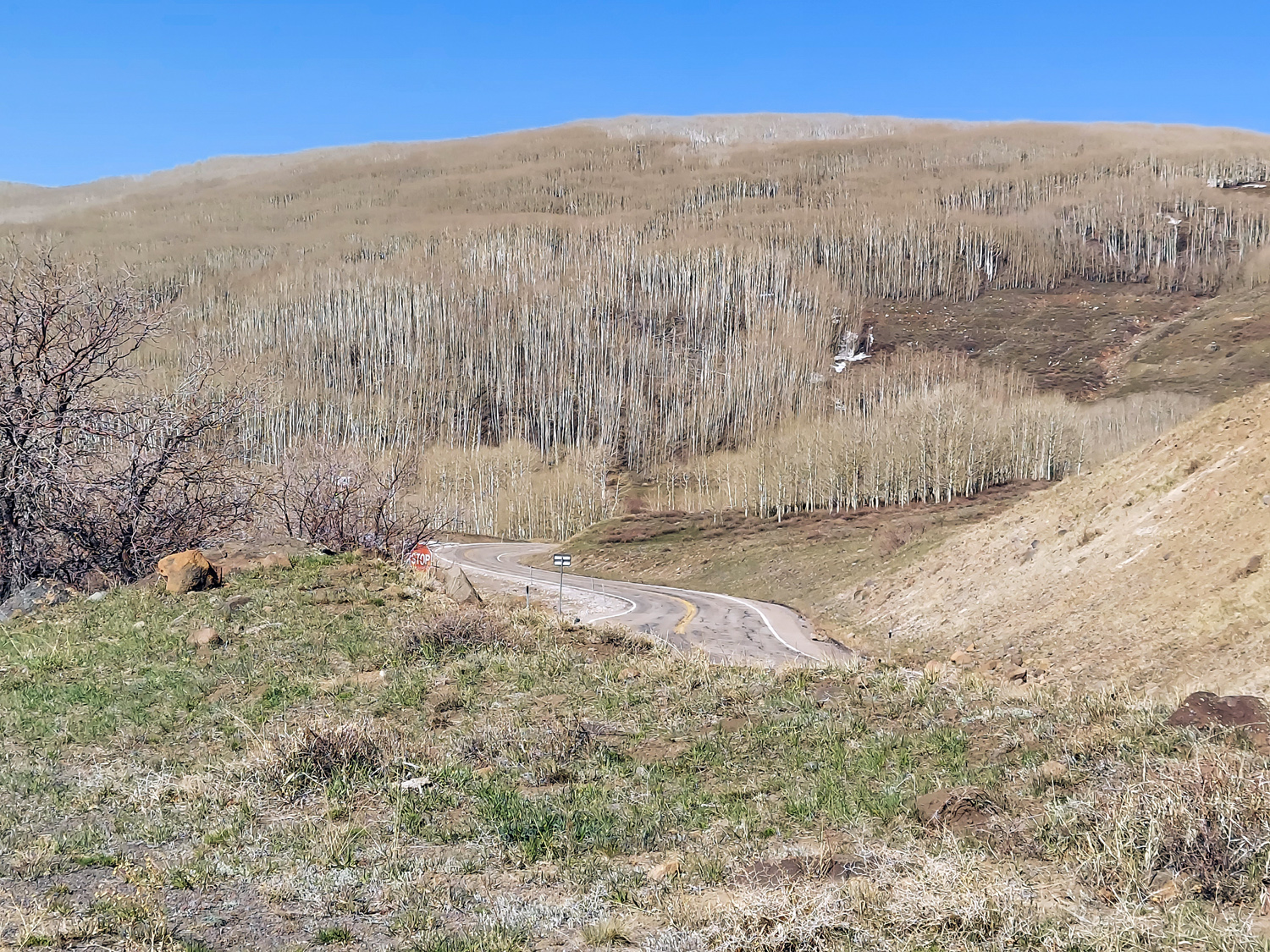
This adventure was supposed to take place in 2020. You know how that went. But the planning we did was still good, we just had to make new reservations for 2022 at each stop. Chief planner is my daughter Teri, who fell in love with Utah's parks on our first trip there together in 2015. We decided on repeat visits to three national parks - Arches, Capitol Reef and Zion, plus our first time at Natural Bridges National Monument. Serendipity also took us briefly to Grand Staircase-Escalante National Monument and Bryce Canyon National Park. Teri came to my house in Clovis very early on April 17, and we loaded up her Toyota Highlander with food, clothing and other necessities for a 12 day journey. We were on the road by 6 a.m., and arrived at our first top, Mesquite, Nevada, in mid-afternoon. One of the main reasons for these trips is to enjoy the beauty of nature, and the good scenery gets a nice start at this location. Mesquite is on the Virgin River and right on the Arizona border, so the surroundings are starting to have that whole southwest/Colorado Plateau look. One jokester says that Mesquite is where the Mormons come to gamble, but I-15 actually cuts across the northwest corner of Arizona for 30 miles before entering the Beehive State. Around ten miles into Arizona the highway enters the Virgin River Gorge, and for the next dozen miles or so you are seeing sandstone cliffs and a deep canyon as the road winds along the river, crossing over and back a couple of times. Next up is St. George in Utah, where red, pink and tan sandstone dominate the landscape. Our first destination was Moab, right next to Arches National Park. From St. George it's about 130 miles to I-70, which would take us east across Utah to US Highway 191, the road to Moab. However, our preferred route is to take Utah state highway 14 at Cedar City, over a 9,900 foot summit and down to US 89. Highway 14 is an especially scenic route, with views to the south down into Zion National Park, and at the highest elevations, bristlecone pines and snow-covered hillsides. |
|
 |
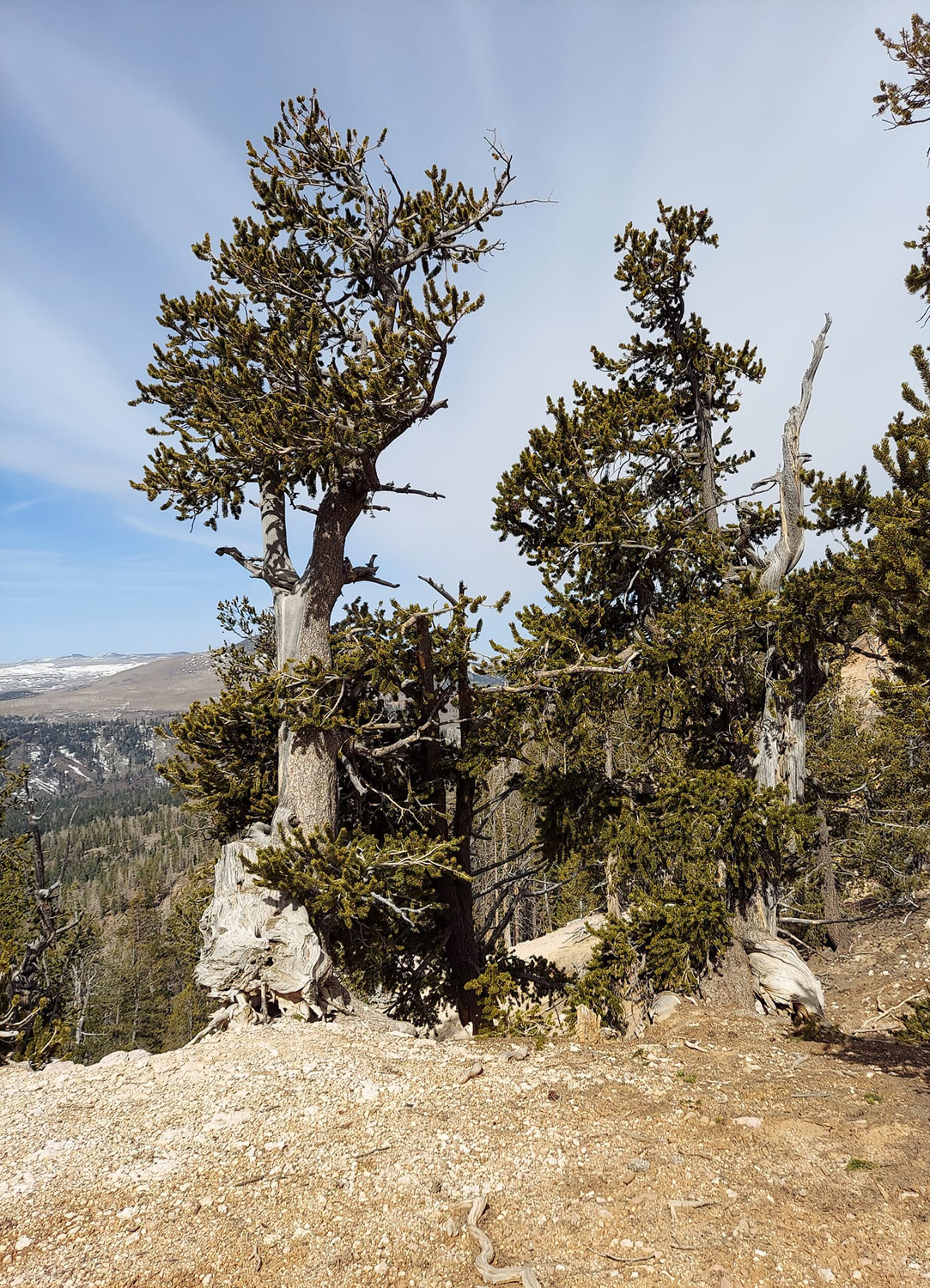 |
| Snow along Utah Highway 14 between Cedar City and US 89 | Bristlecone pines at 9,910 feet on Highway 14 |
|
Highway 89 is also known for dramatic views all the way from its beginning at Flagstaff, Arizona to its end point at the Canadian border. On the section we drove, it followed the Sevier River most of the way, through narrow gorges and green farm and pasture land. After joining I-70 we started up in elevation through the Dixie National Forest, which we would drive into and out of several times on our journey. We made our way across classic Colorado Plateau country, with mesas, canyons and fantastic sandstone formations. We had gone through this route several times, so we stopped at only one of the many vista points and rest stops, being eager to reach our destination. We arrived in Moab around 4:30, and stopped at Adrift Adventures, where we had booked a Jeep tour for the following day. They require registration and payment prior to departure time, preferably the previous day, so our arrival time worked out just right. Then it was four miles south to the Red Cliff Condos, where we had stayed in 2019, on our "Plan C" trip that included an unplanned stay in Barstow CA. The facility was new and not well known at that time, and we were able to get a last-minute booking. This time Teri had called about a year in advance to make sure we could get a ground floor unit. This proved to be one of her many smart moves, as we watched families who had not planned so far ahead arrive with kids, big suitcases and ice chests, looking up in dismay at the stairs to the 2nd and 3rd floors. We brought in our own big suitcases, ice chests and miscellaneous stuff, got settled in and had supper. We got to bed early, looking forward to the Jeep tour of Arches National Park's back country the next day. |
|
 |
 |
| Ghost Rock, along I-70 | Setting sun lights up the LaSal Mountains, southeast of Moab |
| Arches
National Park
Jeep Tour Skyline & Landscape Arches, Fiery Furnace, Park Avenue Delicate Arch, Windows Section, Balanced Rock |
|
|
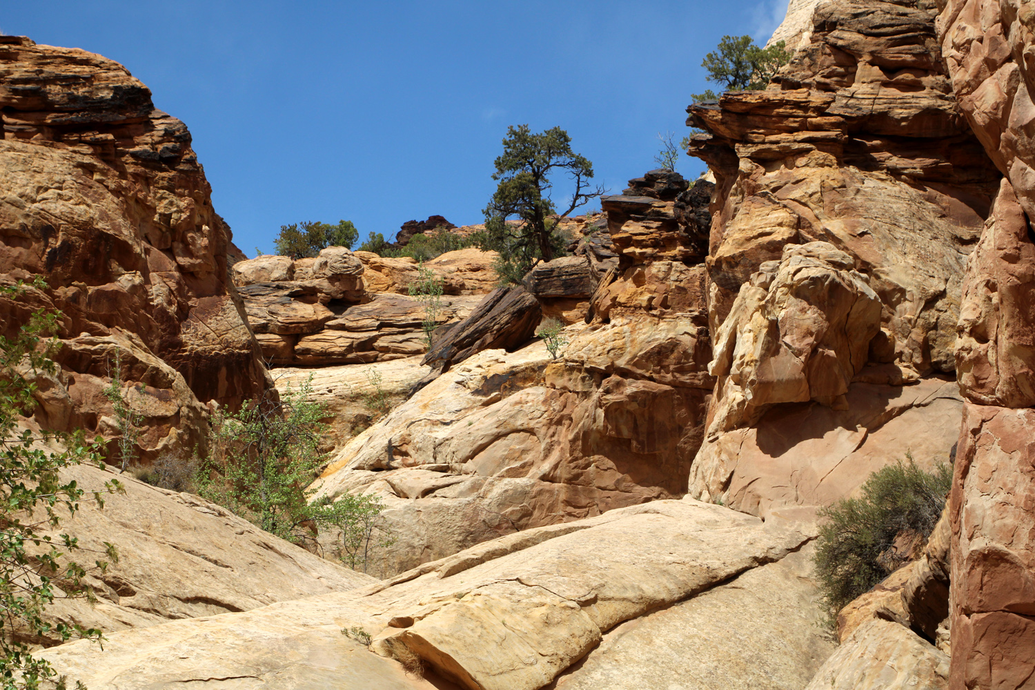
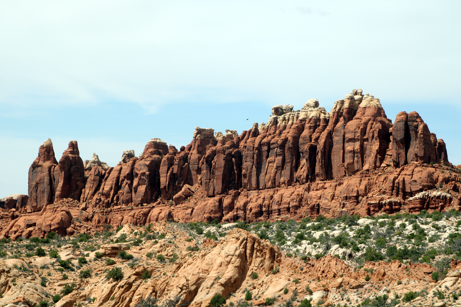
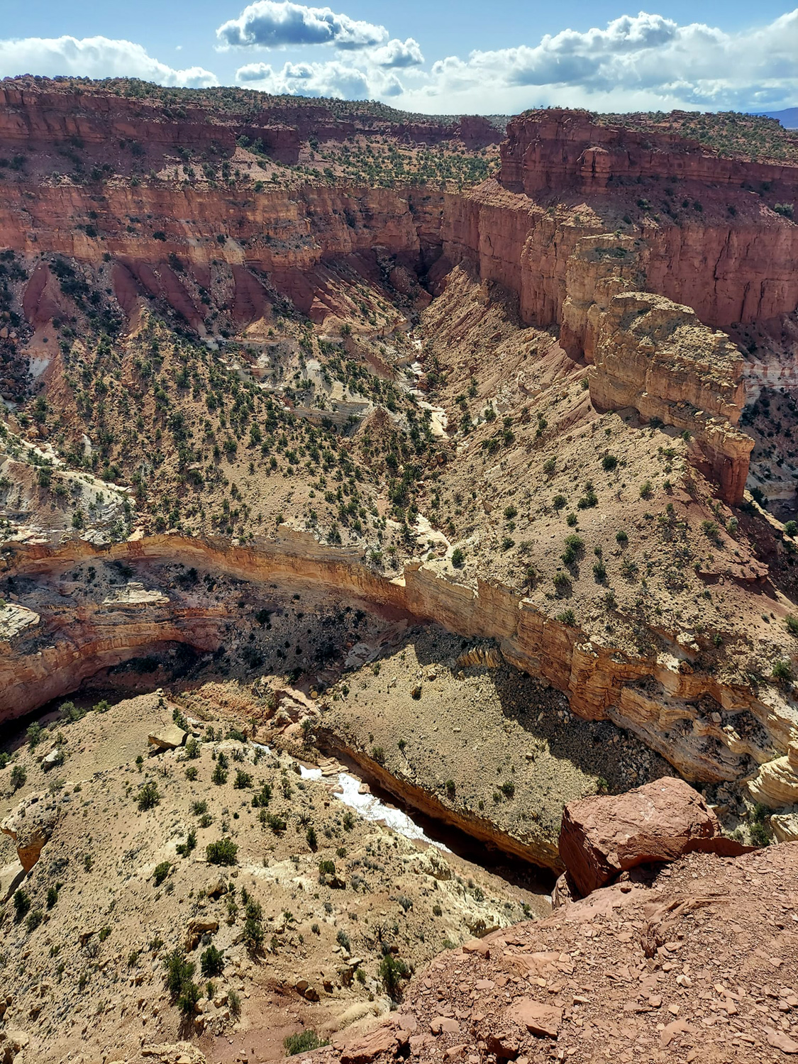
The next day's adventure was one we had been looking forward to since 2019. On my first visit to Arches in 2002 I had hiked to Tower Arch, one of the most impressive formations in the park, and I have always wanted to return. It's a six mile drive on a dirt road to the trailhead, and about a mile and a half of hiking up a rocky cliff, then through loose sand and other desert terrain. Our attempts to hike or go there in a rented Jeep in 2019 did not work out, so we booked a Jeep tour of the park's back country that included a stop at Tower. The tour company, Adrift Adventures, also provides river trips and guided hikes. The company places four passengers in each vehicle, so we were joined by a couple from near Salt Lake City who were on their first visit to Arches, plus our driver-guide Dan, who was knowledgeable, friendly, and experienced and highly competent at navigating the 4-wheel drive roads we traveled on. We went north out of Moab on Highway 191 for 15 or 20 miles, passing by the long lines at the official entrance station, and turning onto a dirt road that went east a short distance, then joined Salt Valley Wash. This road goes south and joins the main (and only) paved road through the park near the Devil's Garden parking lot. At first we were on BLM land, but soon came to a small sign reading "Arches National Park," with no toll booth, no ranger, and no traffic other than another Jeep from the company that was traveling with us. This section is not a 4-wheel drive road, although it is rough in spots and can be impassible in wet weather. I drove it from the other end to the Tower Arch trailhead in my 2001 F-150 in 2002, and people regularly go in with passenger cars. We followed this route for a few miles, then turned onto a road that took us to the Tower trailhead and a bathroom stop, the last official one on our tour. Going back to Salt Wash, we drove a short distance, then turned west on the road to the arch, which immediately provided some true 4-wheeling. The Jeep Rubicon is designed for this type of terrain, with high clearance and a short wheel base. The front and back wheels are closer to the front and back of the Jeep than typical vehicles, to prevent getting hung up when going over big humps. Dan told us they rescue many drivers who ignore advice and drive these roads with vehicles not capable of the task, including a newly-minted and very embarrassed young park ranger this season. Maneuvering over the difficult parts of the trail sometimes requires precise placement of the wheels, following what Dan referred to as the best "line." He had already driven the route about 70 times this season, so was very familiar with the right spots, but he told us that the road will go through slight changes over the season, as rainfall washes dirt from around rocky spots, and wind-blown sand covers others. So he was always on the alert for any changes needed in the line. Along the route, Dan talked about the geology of the area, pointed out cool vistas, identified plants and flowers, and answered questions, all the while providing what Teri and I found to be a beautiful and exhilarating ride. Our first destination was a spot where we had a good view of Tower Arch. Although it's not apparent from this point, the arch and the tower arise from two different fins or thin sandstone walls. We did not have time to hike down and up to the arch, so I was glad I had been able to get that more satisfactory view in 2002. |
|
 |
 |
| A striking landmark along the route, the Marching Men | Tower Arch |
|
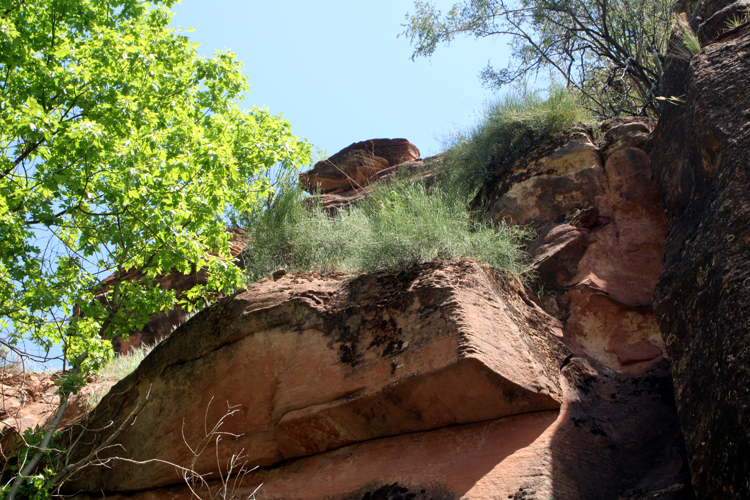
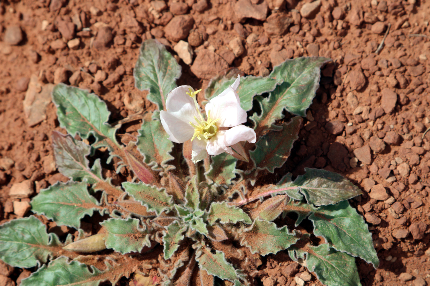
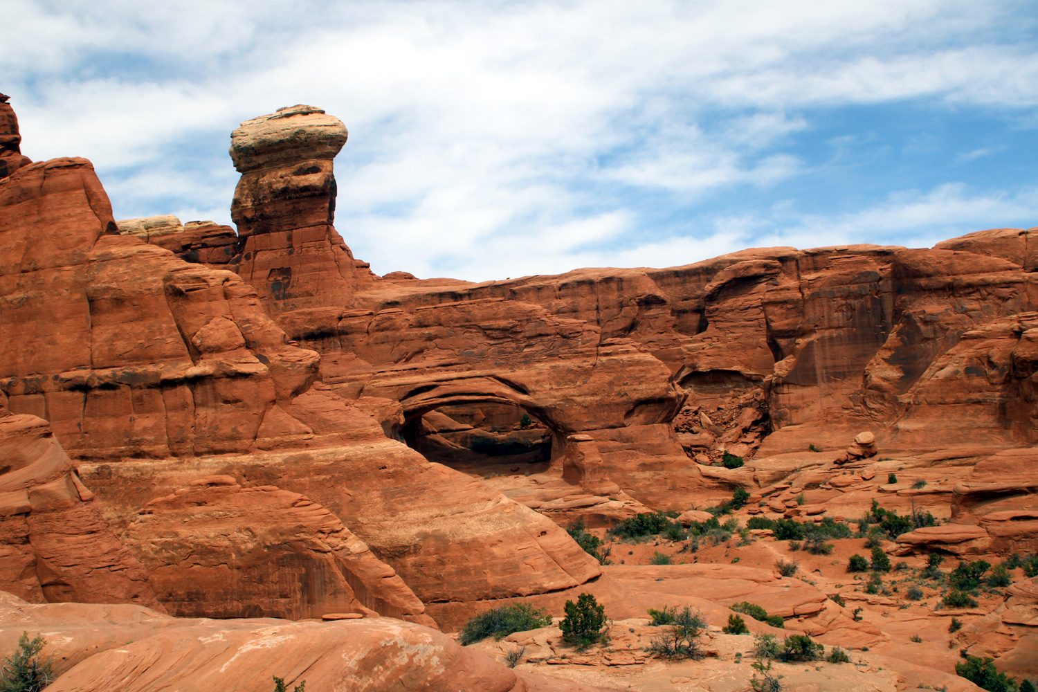
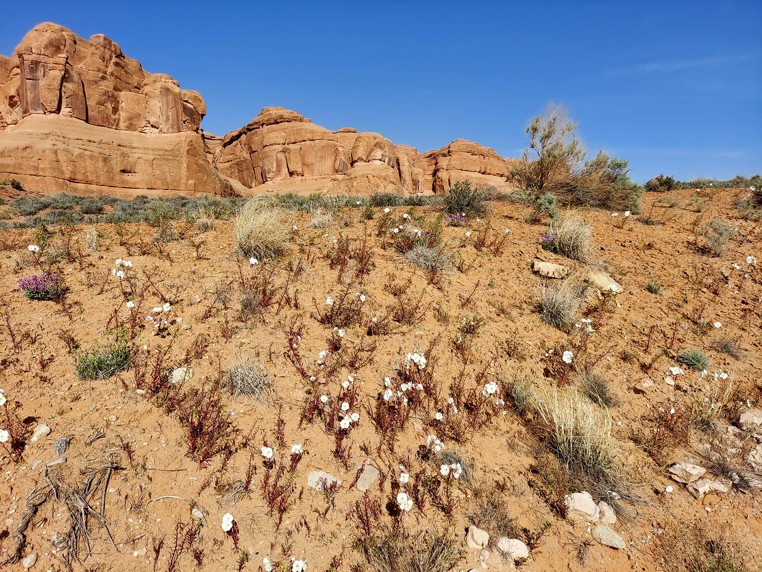
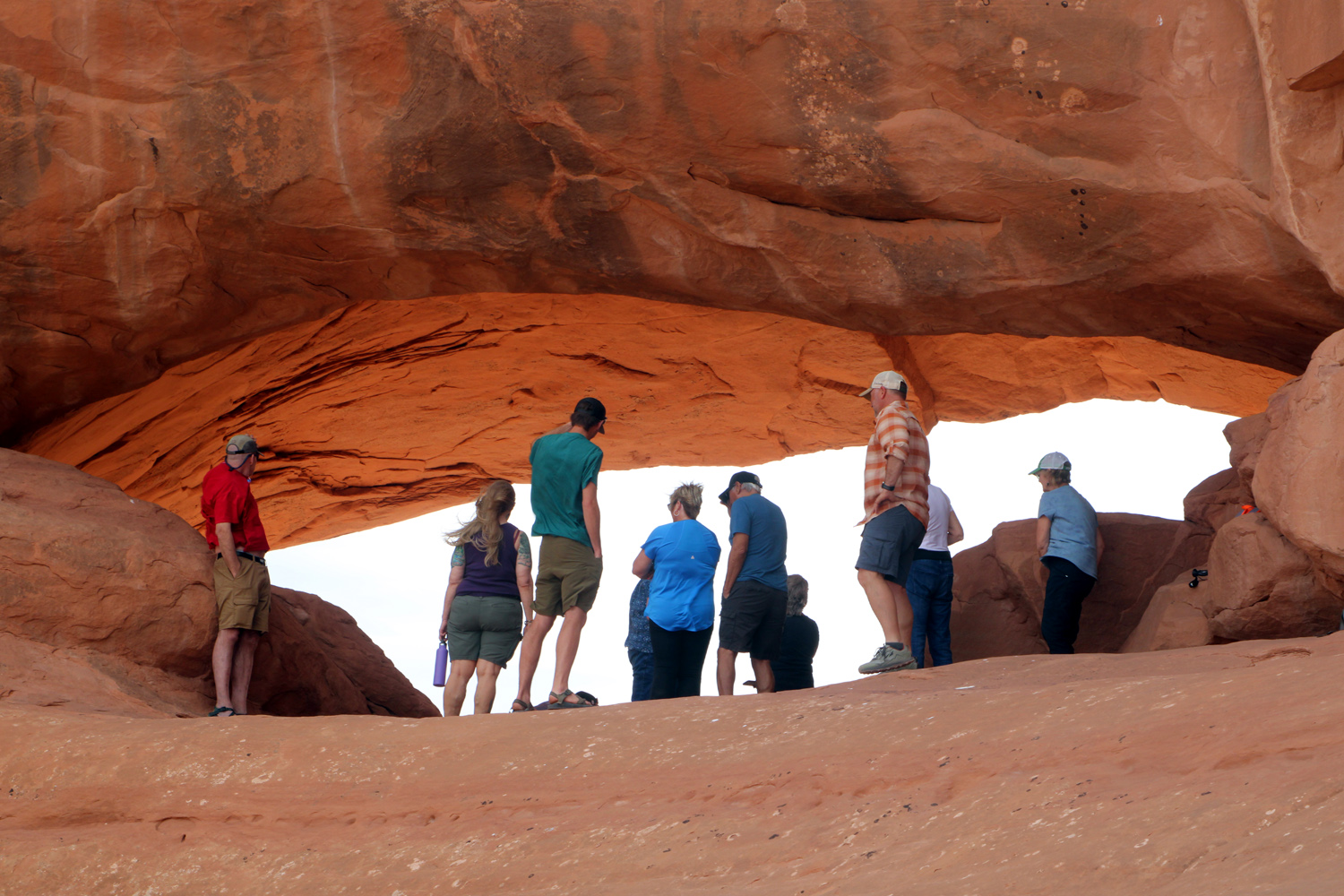
At Tower and our other stops, we were joined by two other Jeeps from Adrift, and we had to do short walks to the view points. The walk at the next stop, Eye of the Whale Arch, was several hundred yards long, and in some spots steep and a bit challenging for older tourists (me). I did not walk up the last 100 feet of smooth, slanted sandstone to the Eye, but Teri did and I enjoyed watching her and the others having a good time inside this formation. Along this trail I noticed some large pink and white flowers, which Dan identified as evening primrose. The pink color was actually on the bottom of the petals as they wilted and ended their short life, and we saw many more throughout our journey. |
|
 |
 |
| Eye of the Whale Arch | A closer look |
|
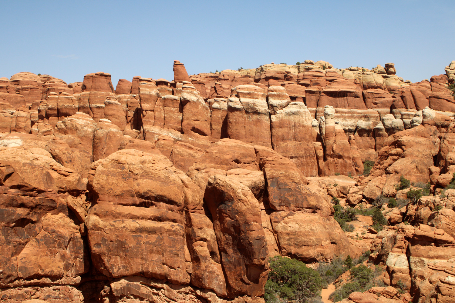
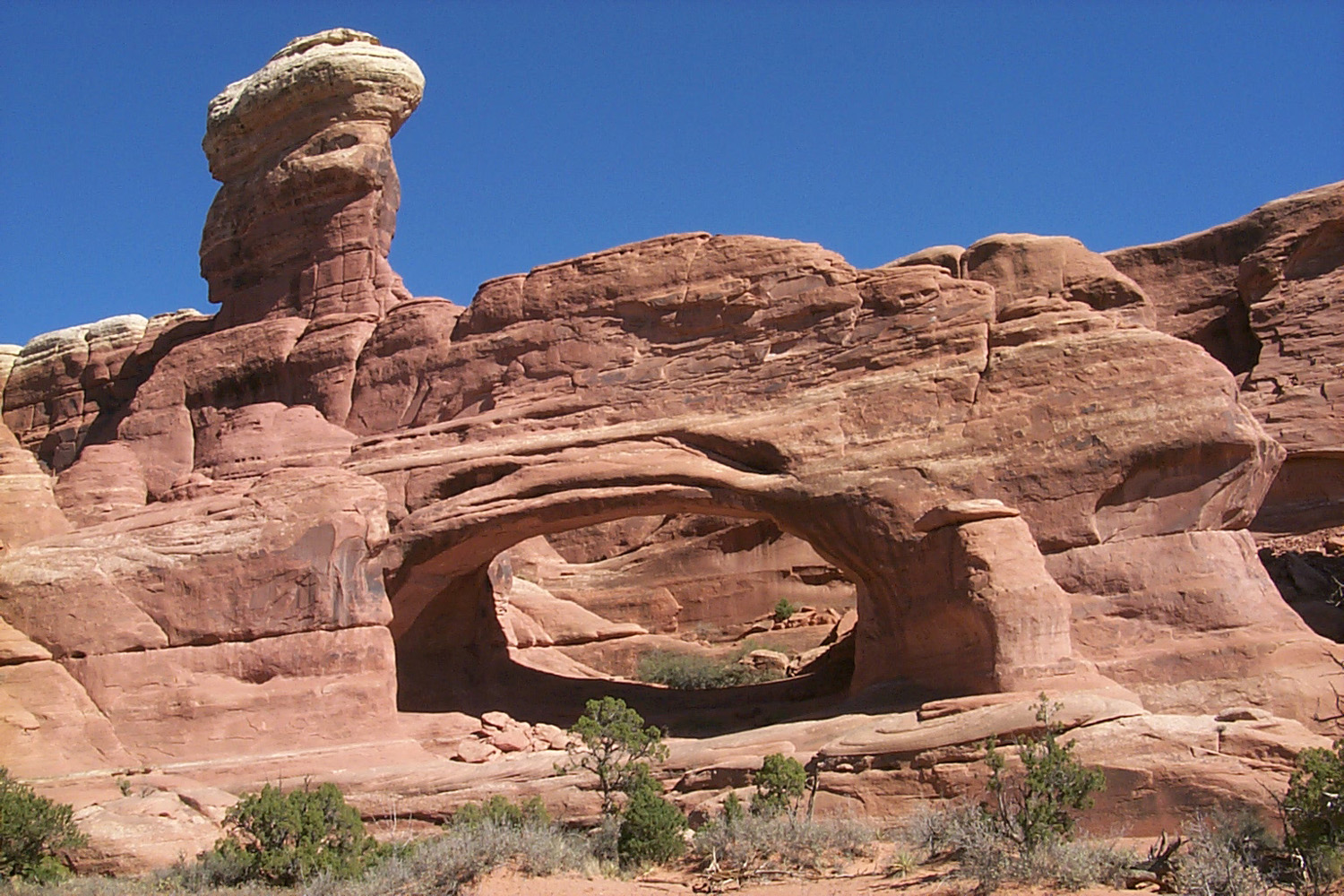
As we drove through this fantastic country Dan pointed out a number of lesser-known arches that did not appear on our maps or in guidebooks. Considering that there are over 2,500 known arches in the park, it's not surprising that some take a back seat to the more impressive ones. We also learned what is required for a formation to be considered an arch - the opening must go all the way through the rock, and must be at least three feet in one direction. There is no minimum for the other axis, so there are some so narrow that you would have to put your eye up to the opening to detect light coming through. Beyond Eye of the Whale, it was not far to the end of our back country tour. We reached the paved road and the welcome sight of restrooms near Balanced Rock. From there we drove out to the main entrance to the park and back to Moab, with more information from Dan on the sights along the way. This company also does tours in nearby Canyonlands National Park, and I hope to go on one of those adventures on my next visit to the area. I would also happily repeat the Arches tour in a couple of years. Teri commented that Dan was not like a "normal tour guide." He engaged us in conversation and shared what he knows. It was more like just going for a super awesome ride with great conversation all the while learning things we did not know. Before returning to our condo, we stopped at Zax Restaurant for dinner. We had eaten there in 2019 and found that some changes have taken place. The all you can eat pizza and salad bar is gone, probably a victim of Covid, but the menu offered plenty of good stuff to choose from. |
|
| Skyline & Landscape Arches, Fiery Furnace, Park Avenue | |
|
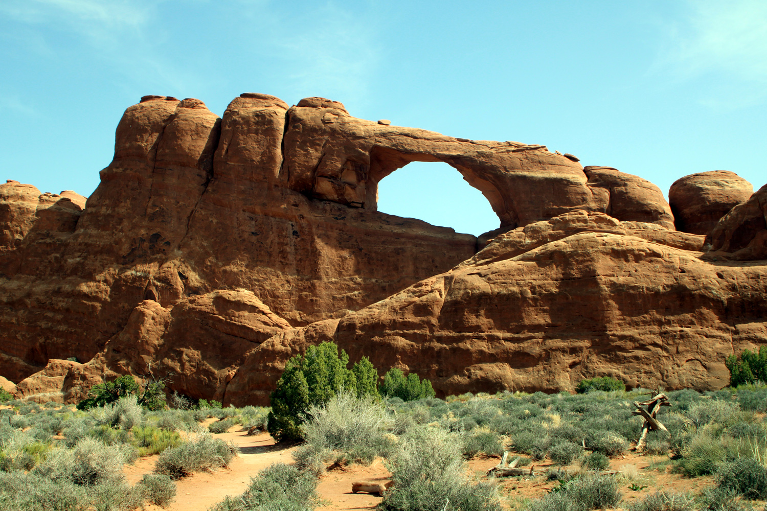
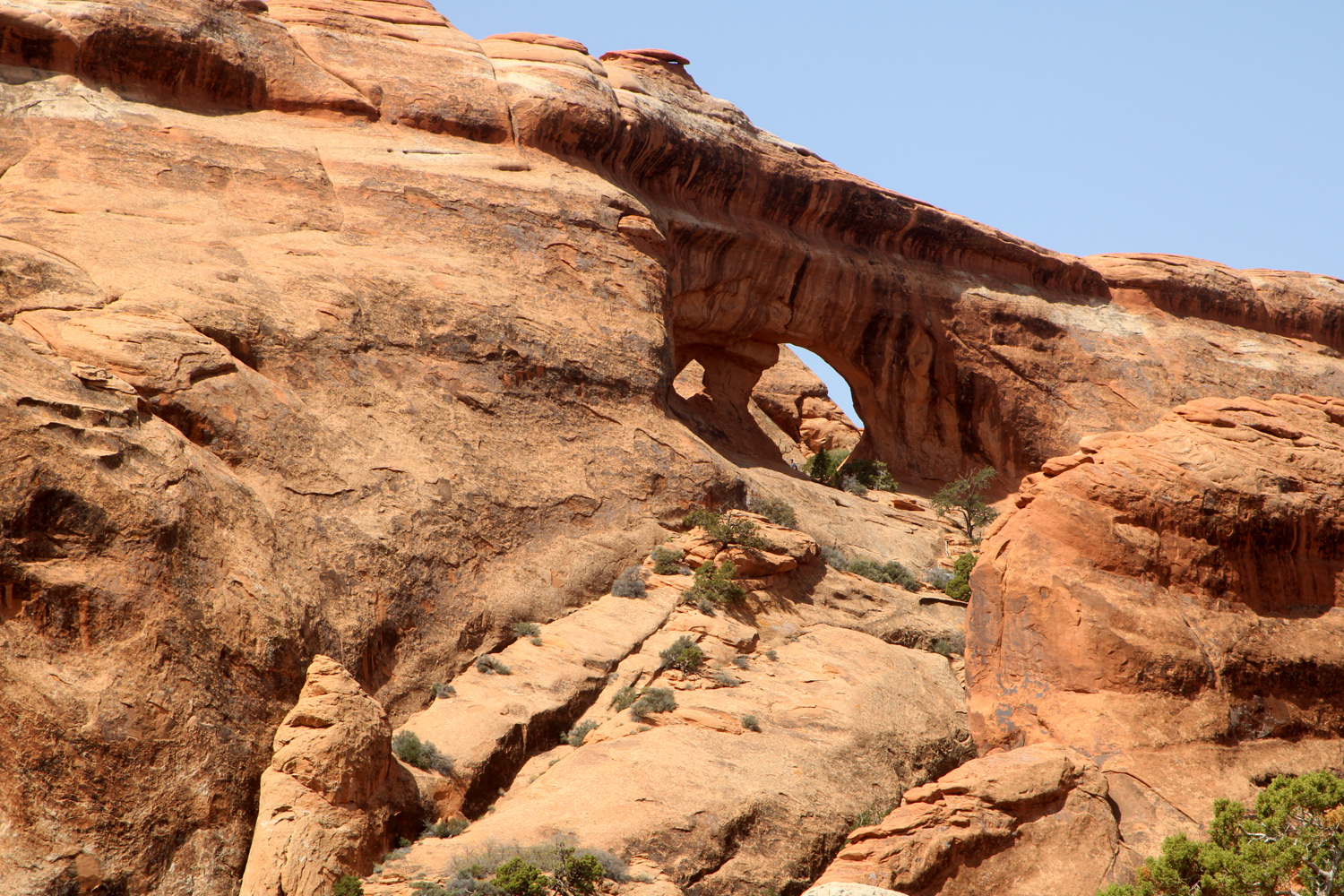
Over the past two decades the popularity of Arches has increased to the point that the visitor experience was negatively impacted. Last year they had to close the entrance several times on many days, as parking lots overflowed and visitor numbers were beyond the capacity of the park's infrastructure. Starting this year a "timed entry" permit process was launched, with reservations available on Recreation.gov. You must choose the hour you want to enter, and then arrive during that 60-minute period. We made our reservations the first day they were available, for 9 a.m. both days (permits are not required for people entering with a tour company). The system worked very well for us. Wait time at the entry station was about five to ten minutes, we were always able to get a parking space, and bathroom lines were rarely longer than a minute or two. Of course, going in at 4 or 5 p.m. would not have worked for us, but people were coming in at those times each day. Make your reservations early! On our second day, I wanted to do the short hike to Skyline Arch, and Teri chose the longer walk to Landscape Arch. But first we had to look at flowers. A couple of miles into the park we started seeing evening primrose, and stopped when we came to a place where they almost covered the road bank. In addition to the showy white primrose blossoms, we saw a number of other flowers in various locations. A flower common to the Sierra foothills, milk vetch, appears on the Colorado Plateau but looks better than our version. Another familiar blossom was filaree, known in Utah as storkbill for the long, pointed seed pod. This name is also used in some references to the California variety. After our floral study, it was on to our first hike. I had observed Skyline from the road on my first two visits, but it was not until we did the half mile round trip hike in 2015 that I realized how special and dramatic this location is. The arch is located high up in a sandstone wall, at least 60 feet above the desert floor with a sheer cliff below. It's worth mentioning that in 1940 this arch doubled in size when a huge mass of rock fell from the left side. The trail goes past typical desert vegetation - pinyon and juniper, Mormon tea and other shrubs, with views of various sandstone formations in three directions and the LaSal Mountains to the south. For the first time ever, there were people up in the arch (highly illegal). We speculated that they had found a way up on the opposite side, since the western face of the cliff looks like it would require technical climbing skills. They soon departed, and we enjoyed the views along the trail and right under the arch. |
|
|
|
| Evening primrose cover the road bank | Skyline Arch |
|
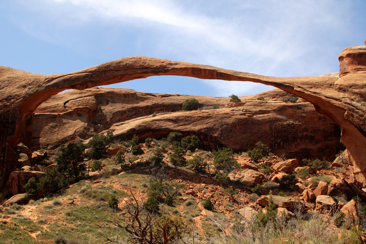
We continued on to the end of the park road and the Devil's Garden parking lot. Nearby is the park's only campground, a picnic area, and a trailhead that leads to at least ten arches, most of them requiring a long hike on primitive trails. Although this large lot was nearly full, we found a spot and set out on the trail to Landscape Arch. At 290 feet it was once considered the longest arch in the world, but a number of longer spans were "discovered" in the last 50 years, mostly in Asia. Longest by far is the remote Fairy Bridge in China at around 400 feet, and Landscape has fallen to fifth place. The rest of the top five range from 300 to 340 feet. Some have not been measured accurately so their sizes are considered approximate but "close enough." Since most of the others are in places few US tourists will ever visit, we can take delight in the easily accessible Landscape Arch, less than a mile from the trailhead. It is considered a "mature" arch, with its thinnest section only only six feet thick, meaning it could collapse today, or 500 years from now. See it while you can! Beyond Landscape the trail is described as "primitive." I hiked in to three other arches in 2002, but gave up my plans for a repeat in 2019 when the trail had become too daunting. The trail goes past the late, lamented Wall Arch, which collapsed after my visit, and two short side trails lead to Partition and Navajo Arches. Partition is visible from the trail near Landscape. Past those points, the trail is even MORE primitive, leading to Double O, Private and Dark Angel arches. Just past the start of the trail there are two short, easy walks to Pine Tree and Tunnel Arches, which Teri and I explored on our previous visits. While you're reading more than you ever wanted to know about arches and bridges, I will digress to mention that a natural bridge spans a place where there is or was at one time a stream. Arches are defined above. After spending some time at Landscape Arch, photographing it and Partition Arch from various angles, we hiked back out to the trailhead and drove to the picnic area to eat our lunch. There were no tables available, so we set up our chairs under a large juniper tree and renewed our energy for the the day's final adventures. |
|
|
|
| Partition Arch (best seen by taking a short side trail) | Landscape Arch, longest in the USA |
|
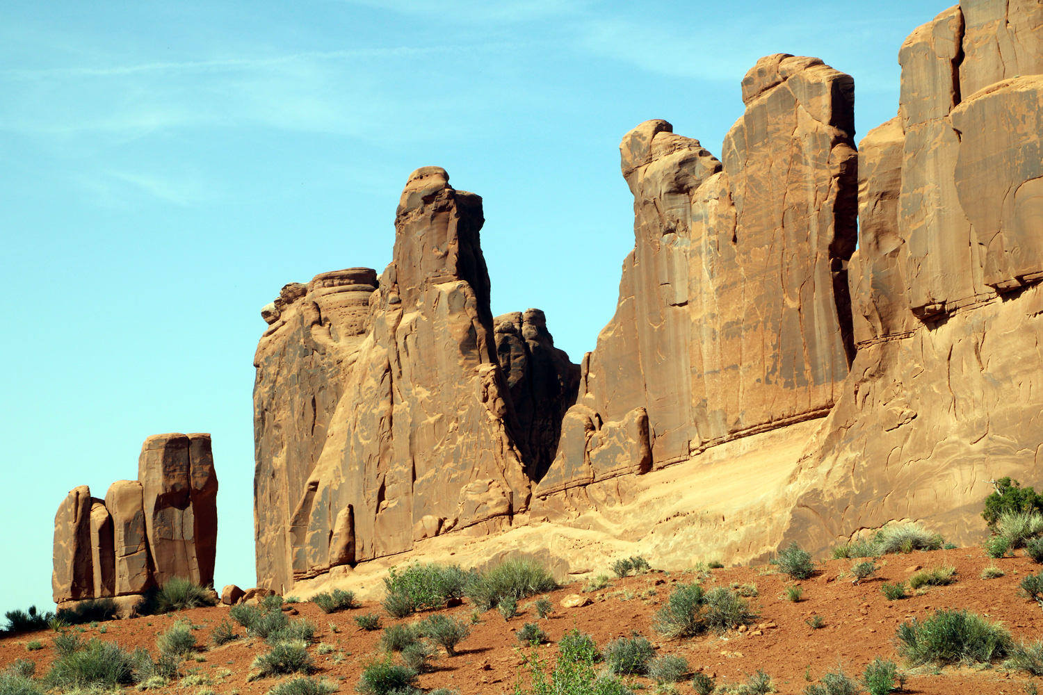
We made a few more short stops as we drove out of the park. First was at the Fiery Furnace viewpoint, an area named for the brilliant red sandstone formations when lit up by the sun. The hike through it takes you between towering, maze-like canyon walls and is difficult and challenging. Entry requires a permit, good physical condition, and the ability to navigate without a trail. First timers are encouraged to sign up for a ranger-guided hike. Needless to say, we took a "look, don't touch" approach, and enjoyed the views from above. In addition to a couple of routine vista points, we stopped at Park Avenue, a series of sandstone fins that reminded early visitors of a city's skyline. From the vista point you are looking down a canyon toward Courthouse Wash, with the namesake wall on the right and other dramatic formations on the left. The lighting was right for the "avenue," but photos of the other features can be found on my Utah Photo Gallery page. Did I mention that as you drive through the park, even if you are not at an "official" feature or vista point, you are always surrounded by amazing scenery, distant views of the LaSal Mountains, and nature's beauty in great abundance? We returned to our condo to have dinner and relax, knowing we had only one more day in this fantastic area. |
|
|
|
| The Fiery Furnace | Park Avenue |
|
Delicate Arch, Windows Section, Balanced Rock |
|
|
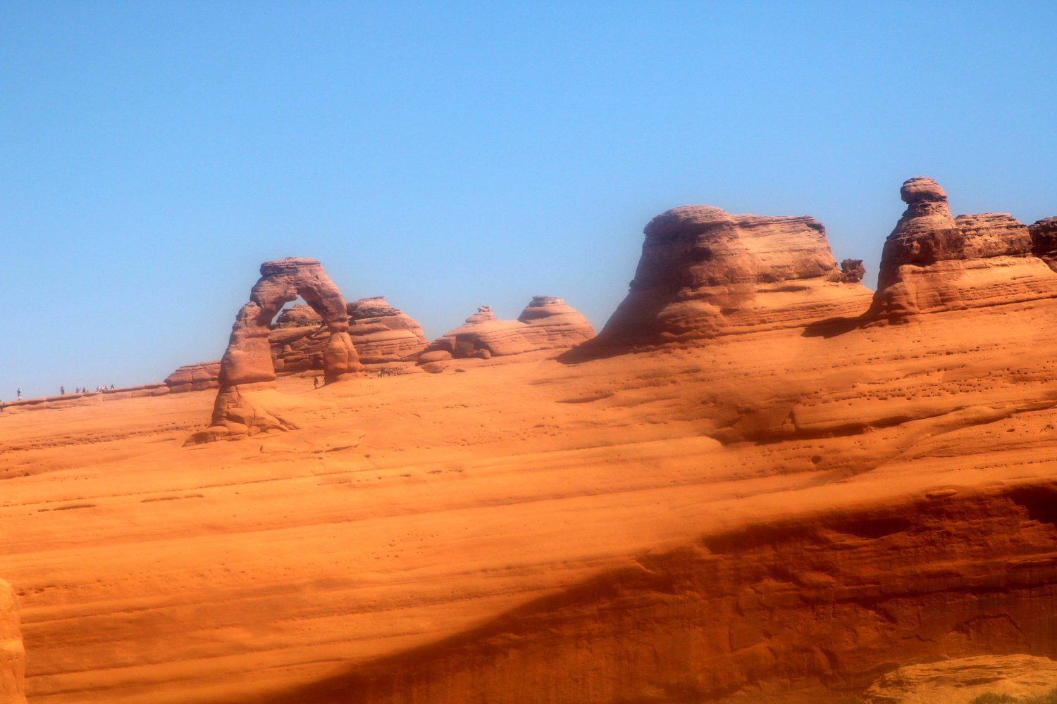
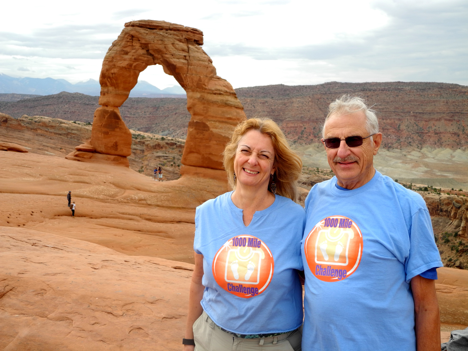
The next day we returned to Arches between 8 and 9 a.m., planning to visit two of the more popular spots in the park. Delicate Arch is the iconic symbol of the park, and also the state of Utah, appearing on license plates, stamps and national park passes. You will see it on almost every web page that has anything to do with outdoor recreation in the state. But of course, the best way to see it is up close and personal, and I did that in 2002, and again with Teri in 2015. I am no longer comfortable on slick sandstone that has more than a slight incline, so we agreed that we would make the shorter hike to a vista point near the trailhead. There is a separate parking lot for the vista and you can choose from two short trails to two different views. One is flat, about 50 yards long, and offers a distant view of the arch. The other is a half mile rocky uphill round trip that is described as moderately difficult. It provides a much better view of the arch, looking across a deep gorge that is not passable. The hike to the arch starts at nearby Wolf Ranch, and is a difficult three-mile round trip with nearly 500 feet of elevation gain. We took the longer vista trail and reached a point where we had a good view of the arch. I stopped there, but Teri went on a little farther, down a steep section and out onto a smooth sandstone ridge where the view was a little closer. Along this trail and most others we saw wildflowers in bloom. Dan the Jeep Guide identified some for us, and fellow hikers helped with others. My favorite new flower name was Canyonlands Biscuitroot. |
|
|
|
| Delicate Arch from the upper viewpoint | Possibly a variety of penstemon |
|
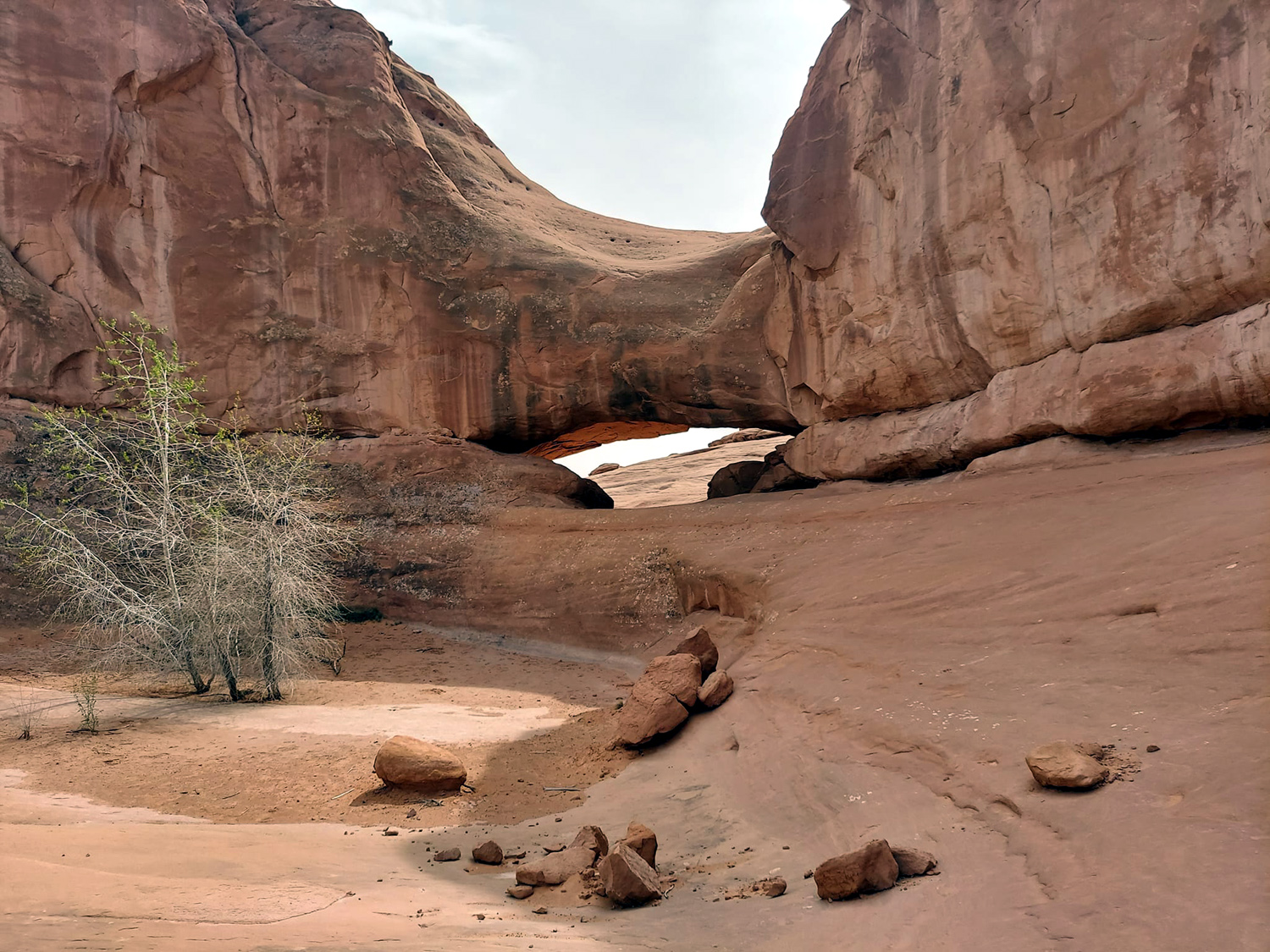
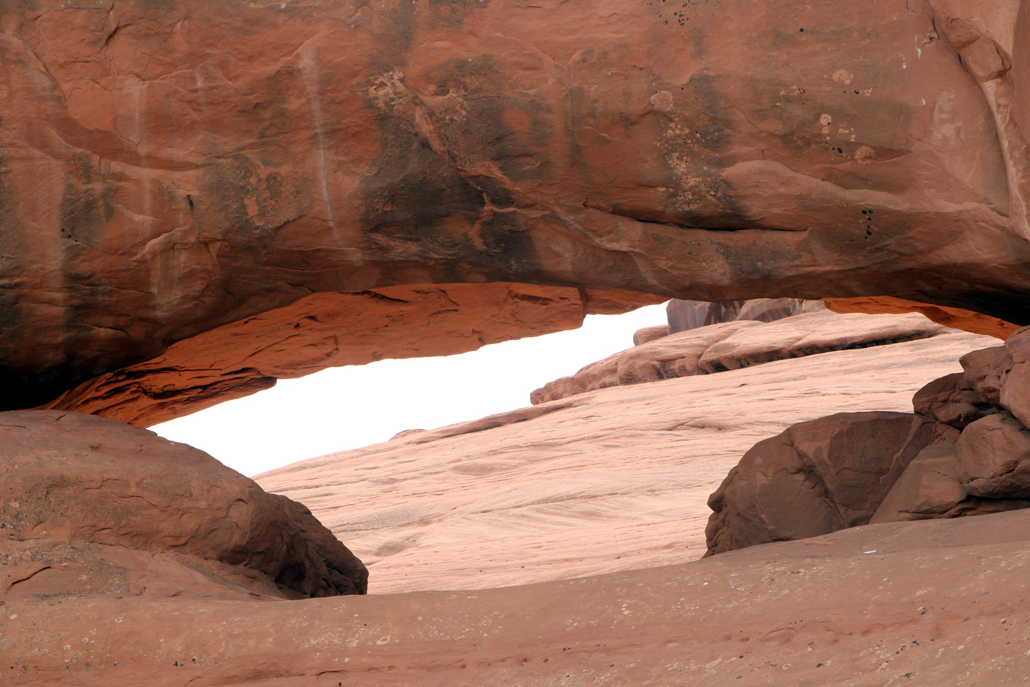
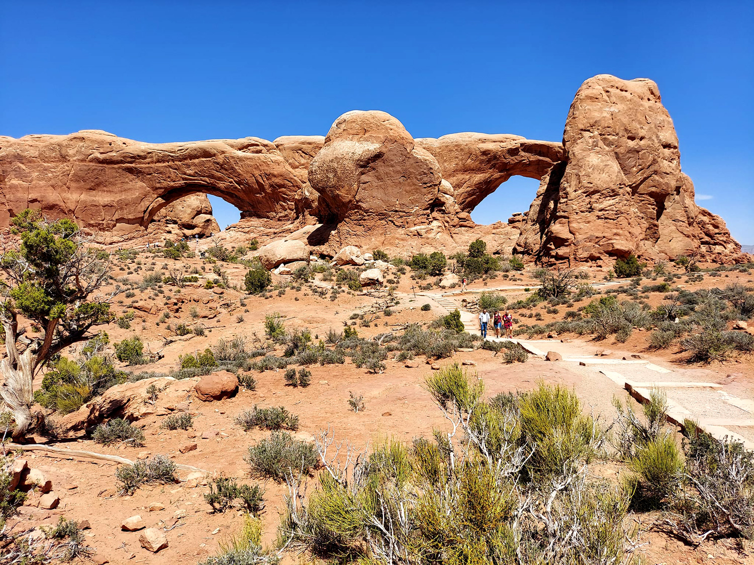
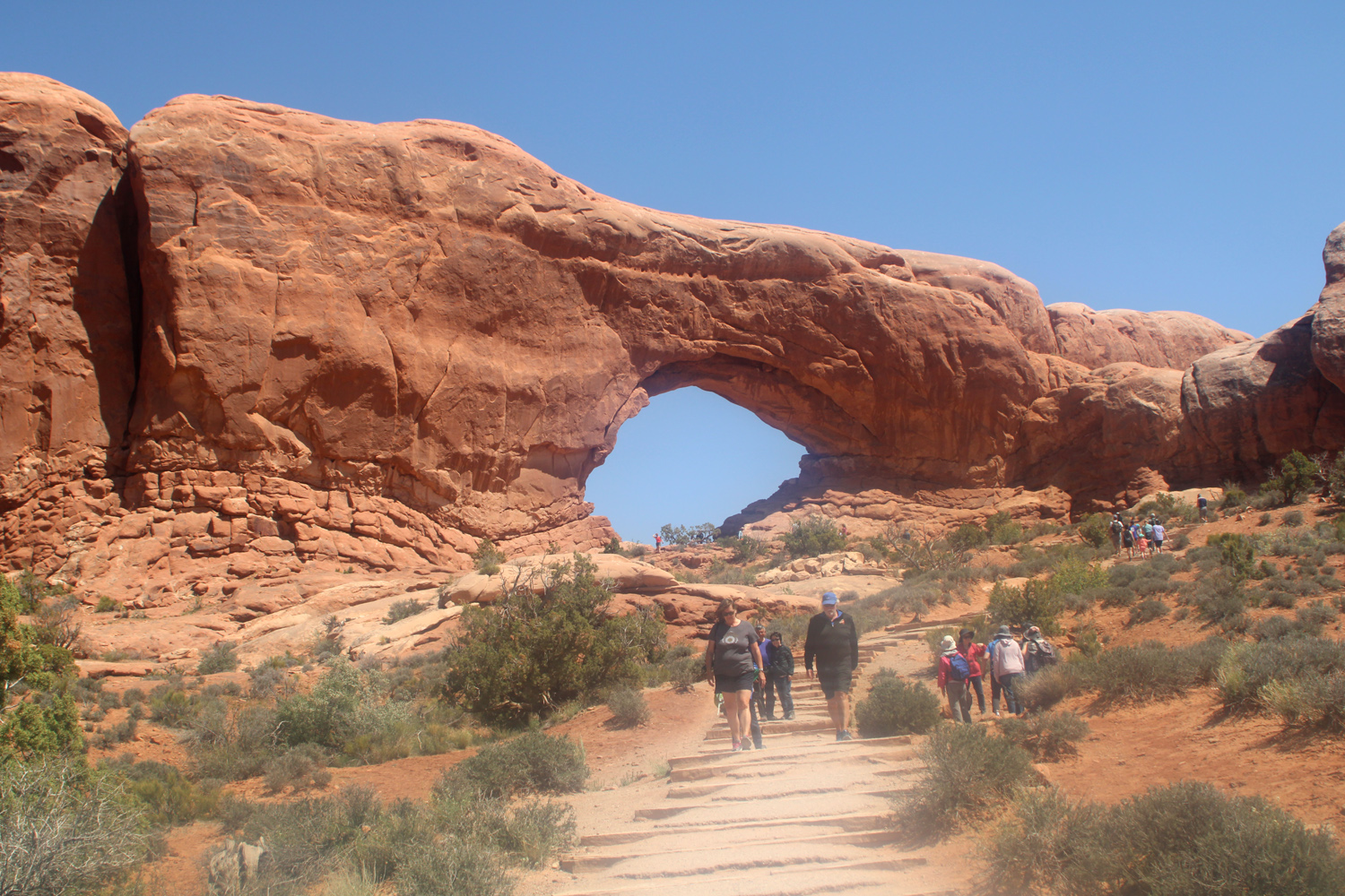
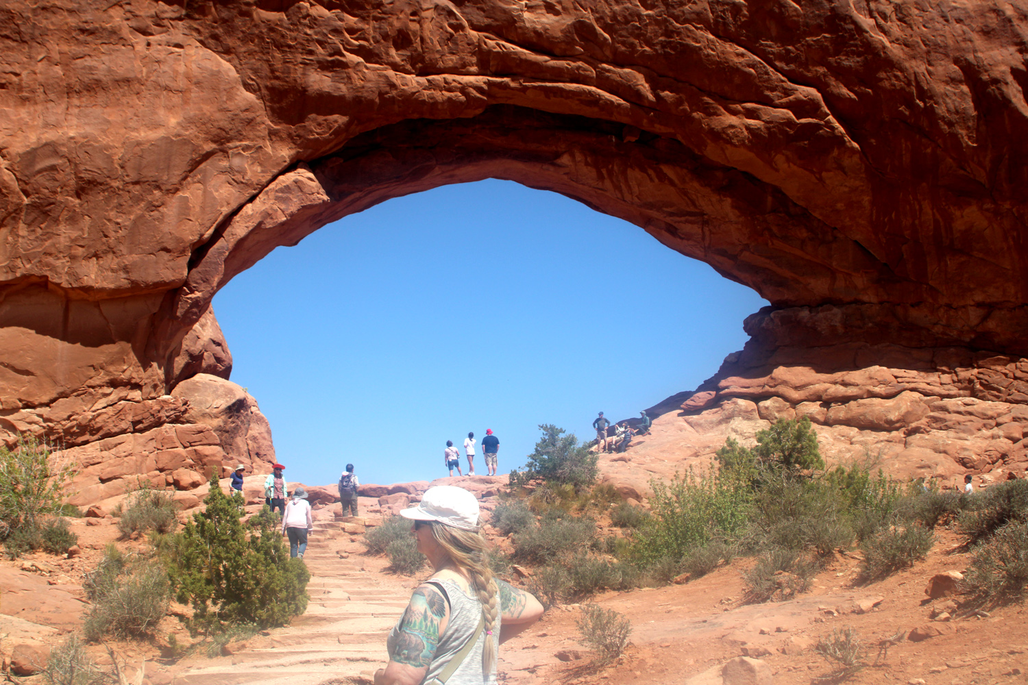
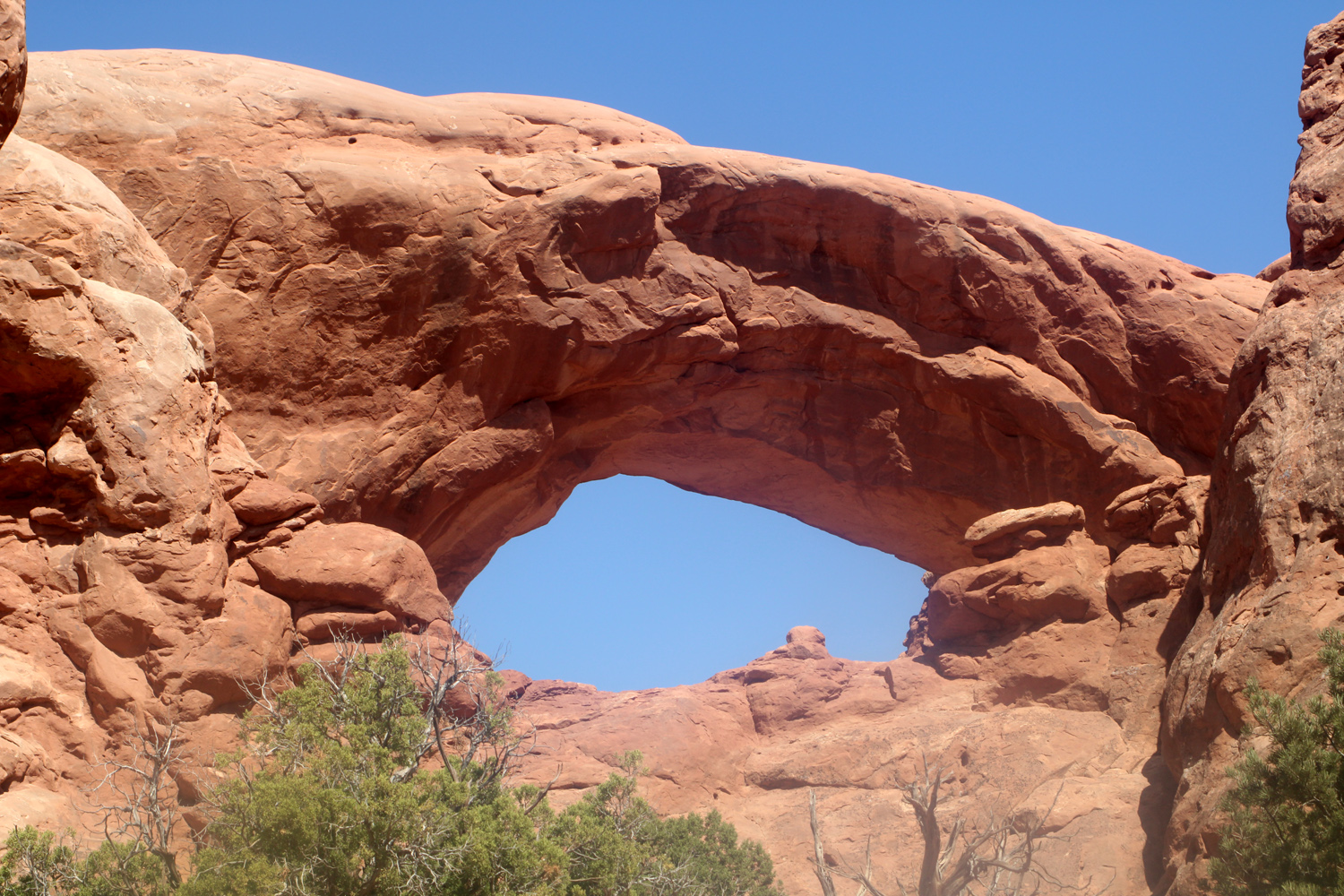
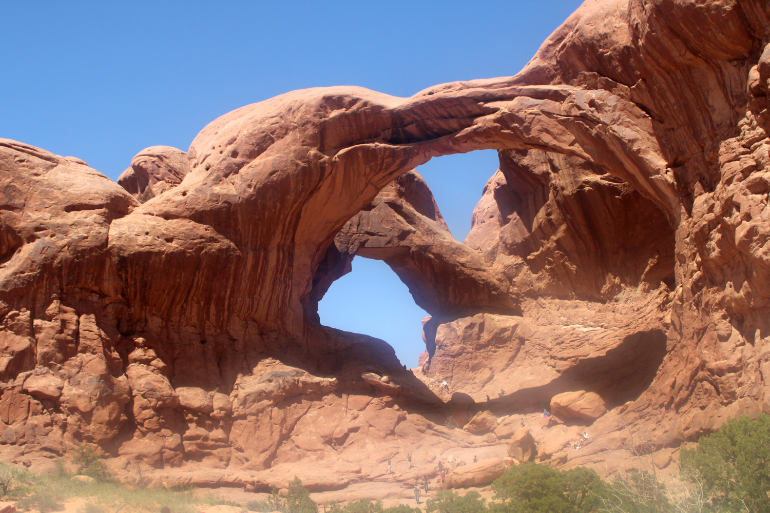
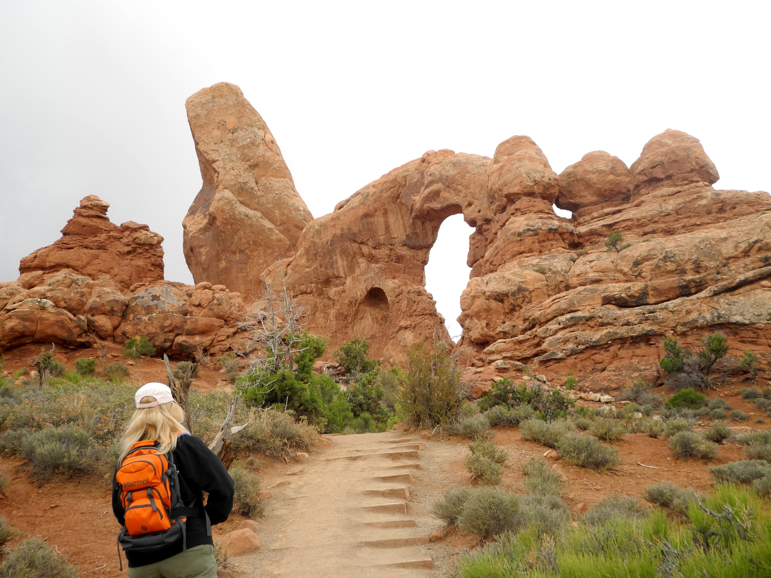
When we finished our visit to the Delicate Arch vista, our next stop was the Windows Section, which features four major named arches, several lesser-known ones, and the usual collection of unique rock formations. This spot takes its name from North and South Windows Arches, also known as The Spectacles for their appearance when seen from a distance. They are visible from Highway 191 north of the park entrance, and several places within the park. Fairly easy trails lead up to both arches, and Teri and I both went to where we were under the North Arch. The South Arch is higher up in the wall, and requires some rock scrambling to get under it, but many visitors do it. |
|
|
|
| North and South Windows, AKA The Spectacles | Trail to North Window |
|
|
| Teri heading for North Window | South Window |
|
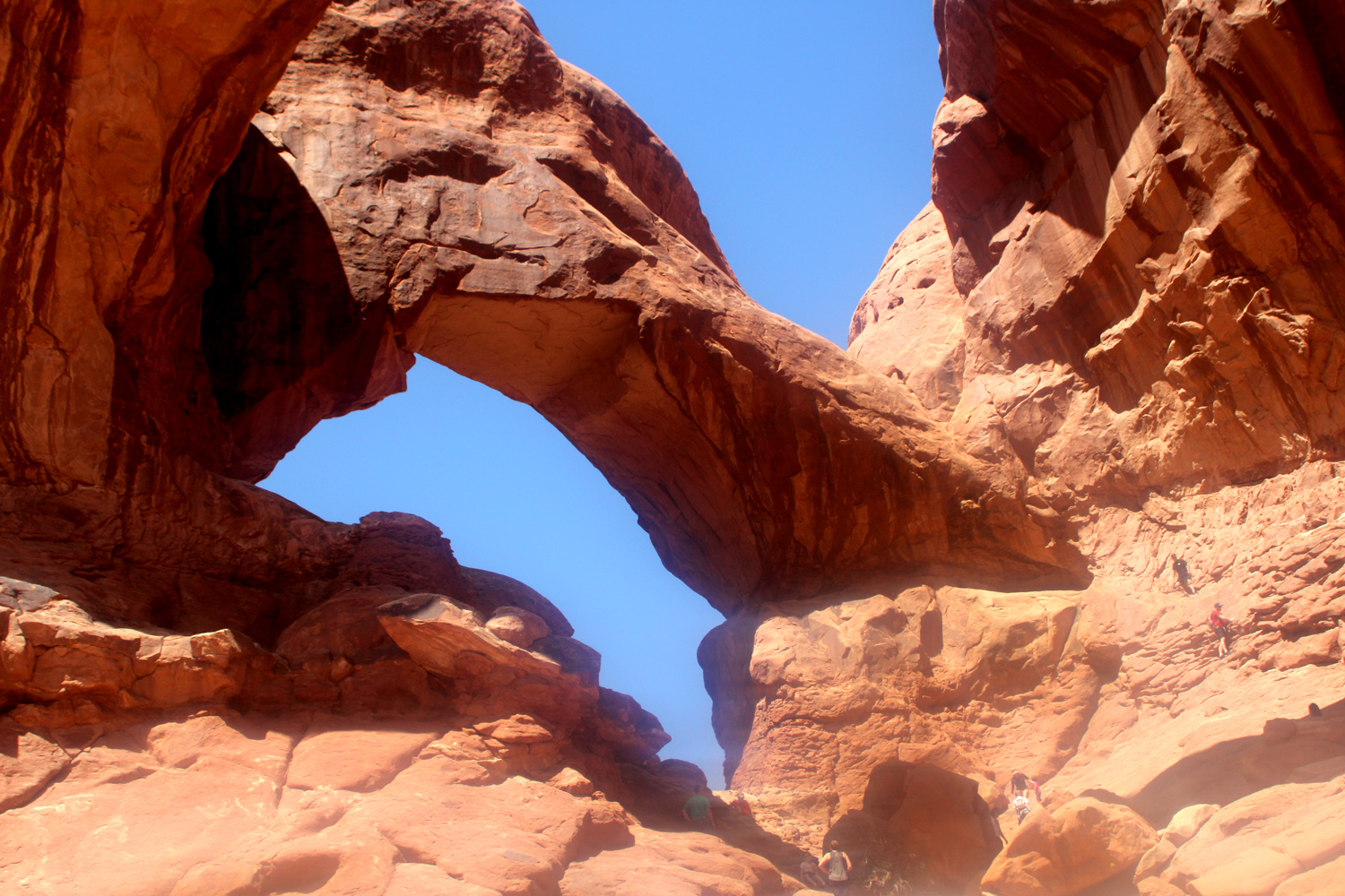
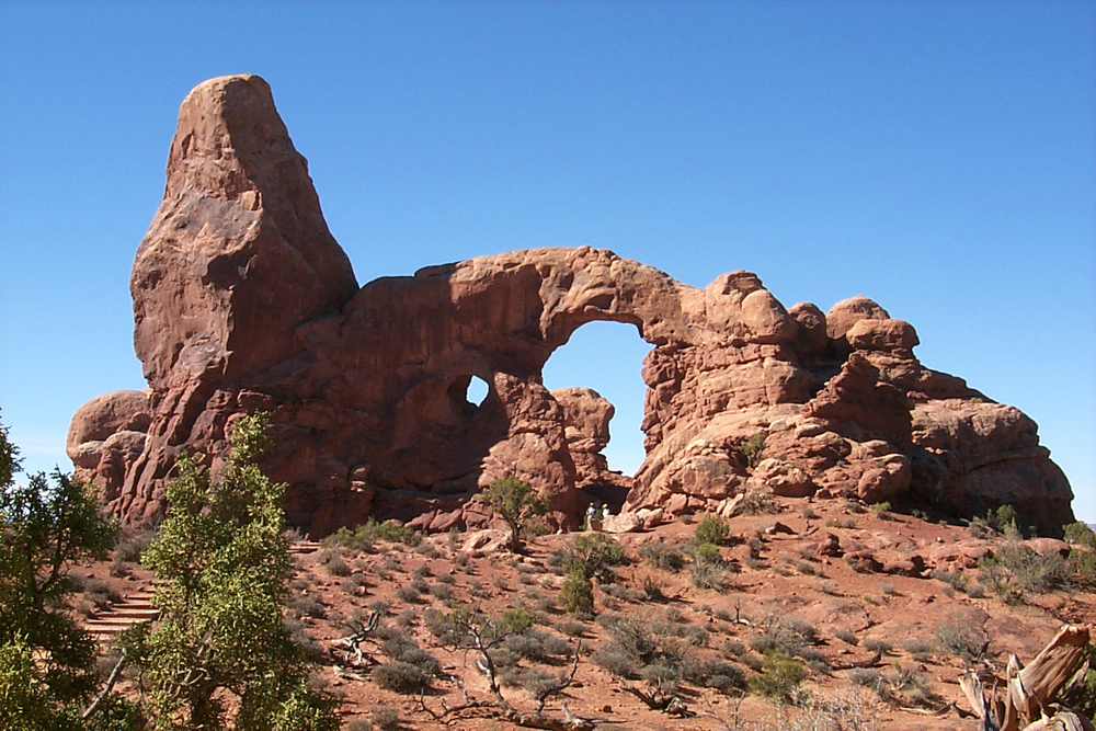
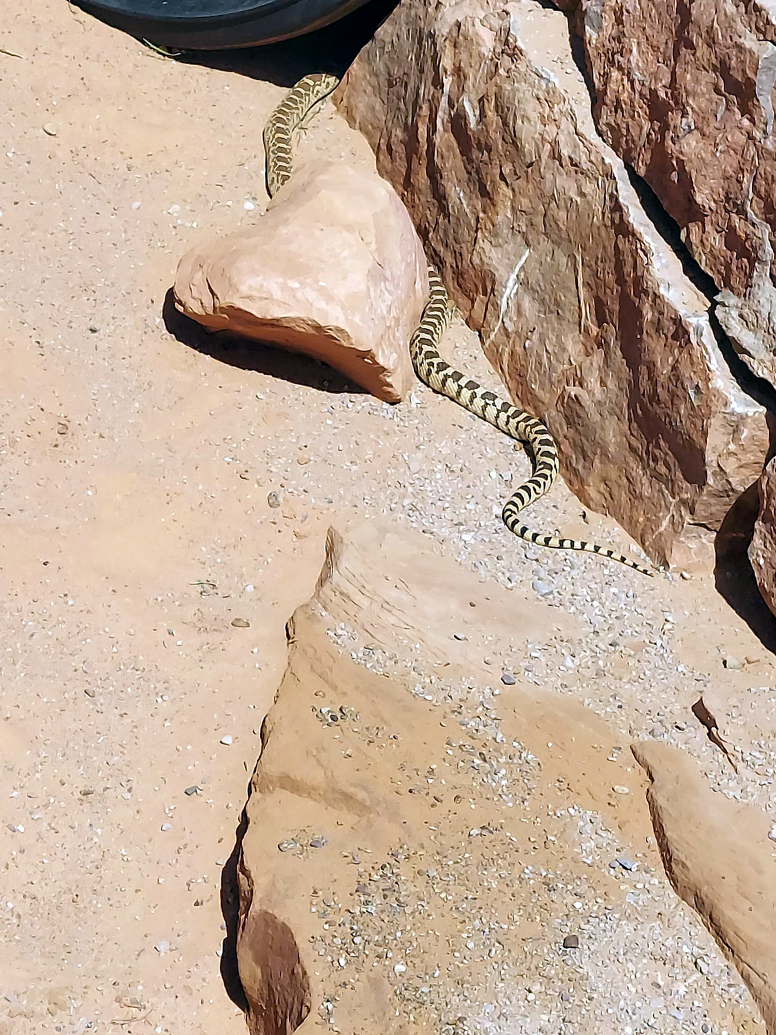
From the South Arch you can follow a primitive trail that goes around the other side of the formation and back to the parking area, or continue on the loop trail that leads to Turret Arch to the west. The lighting was not right for a good photos of this feature, but this photo from 2002 was taken at the right time of day, explains the name, and also reveals a small unnamed arch to the left of the big one. We walked to the front of the arch, but did not go through it, choosing instead to head down the steps and moderate trail to the parking area. The parking area here is actually a large loop, with an upper section, near the Windows, and a lower section. A short, sometimes steep trail connects the two areas. We actually started our visit parking at the lower area, where a mostly level trail leads to Double Arch, which in my opinion is one of the most impressive in the park. It consists of two massive, soaring arches that are joined at one end, and is the tallest and second-longest arch in the park. As we walked along the trail we saw people looking over the side of a place where a culvert runs under the trail. Their object of interest turned out to be a gopher snake, who was very, very slowly making his way into the space between the culvert and the rock. We never saw his head, but he remained visible for at least two minutes. We went up close to the opening, while Teri and many others continued on to where they were inside the arch. A number of more daring (or foolish) visitors scrambled up to the highest points inside the rocks. |
|
|
|
| Double Arch | A closer look (note people in the rocks, center right) |
|
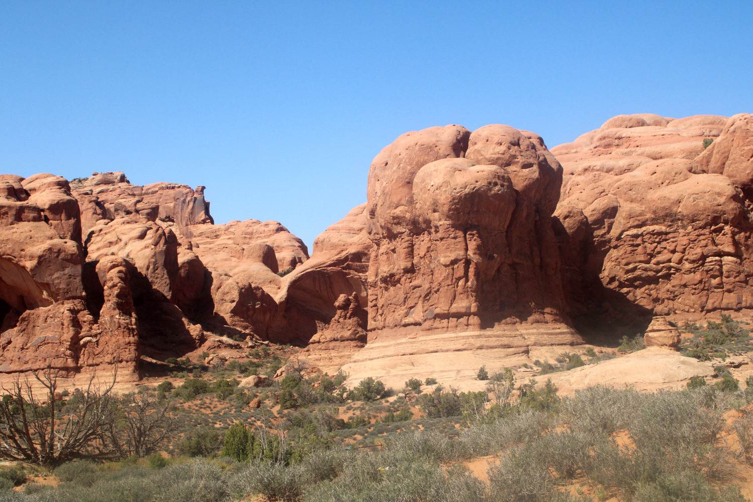
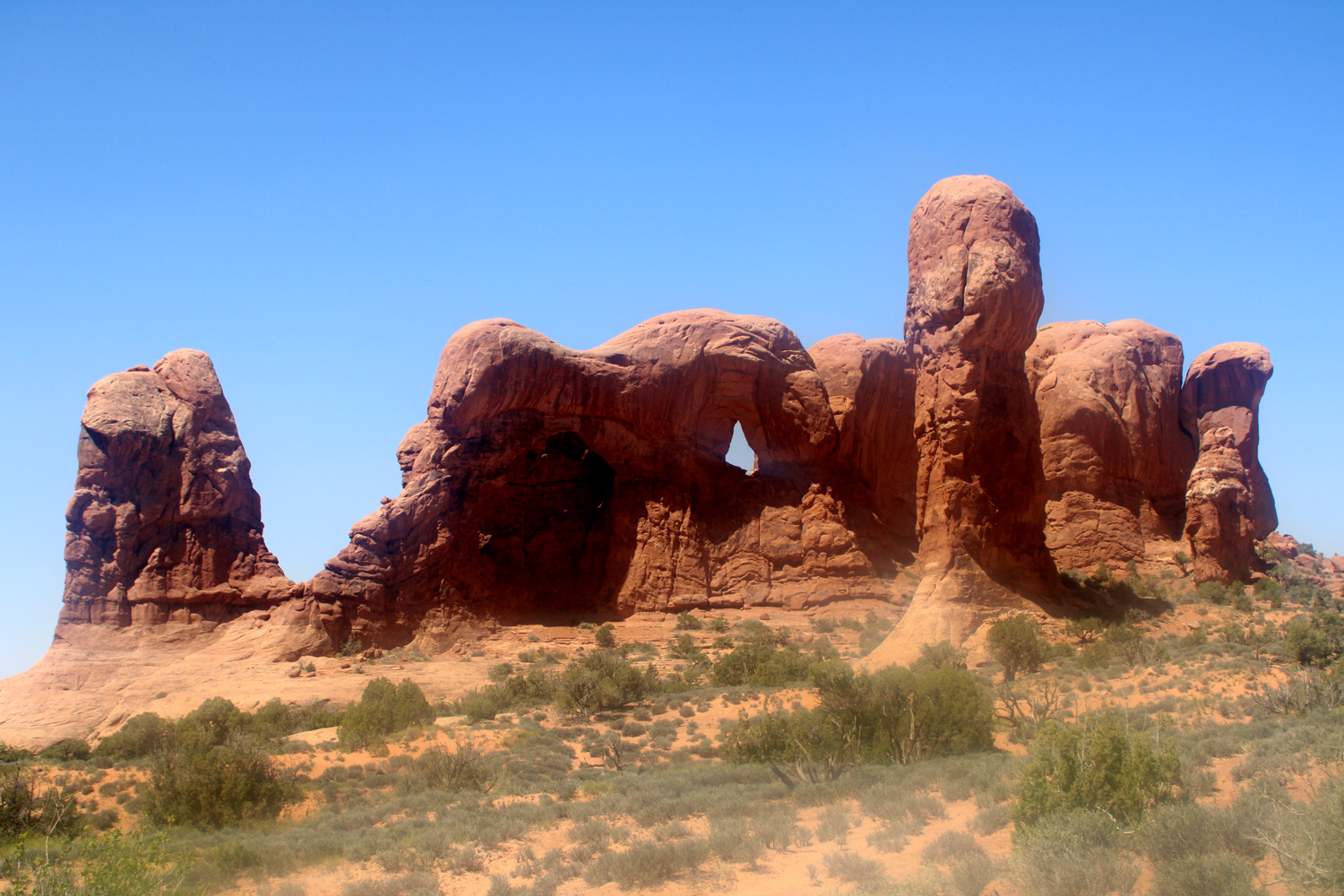
Besides the arches, there are a number of fascinating sandstone formations, some named and some not. We did not photograph everything, but someone has, and Elephant Butte and Parade of the Elephants are worth seeking out on the Internet. |
|
|
|
| I called this "Your brain on sandstone" | From the right angle, there are elephants here |
|
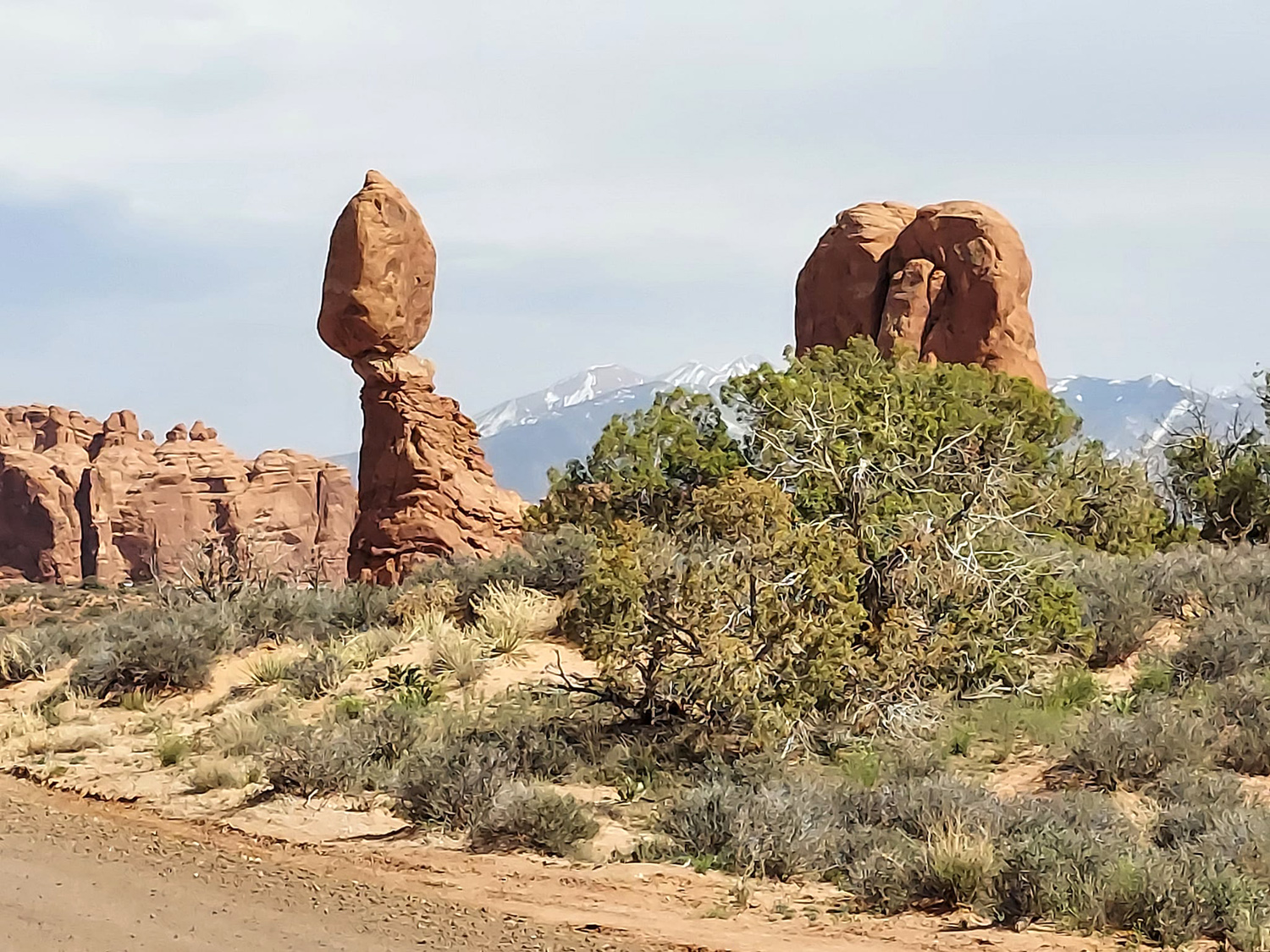
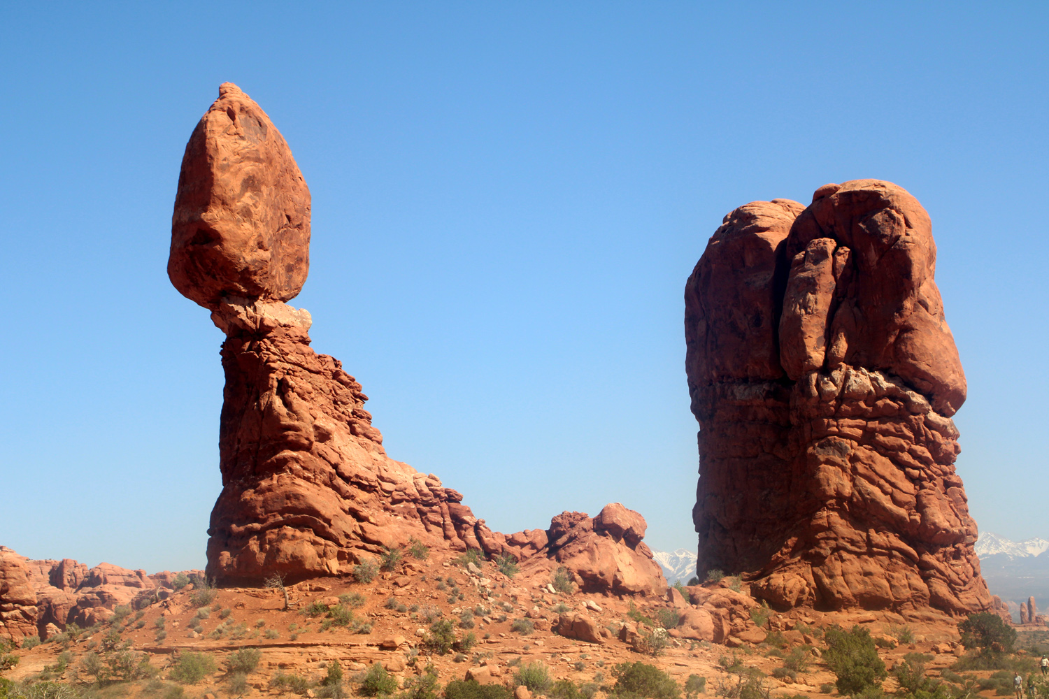
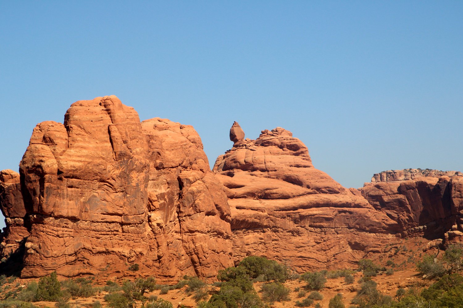
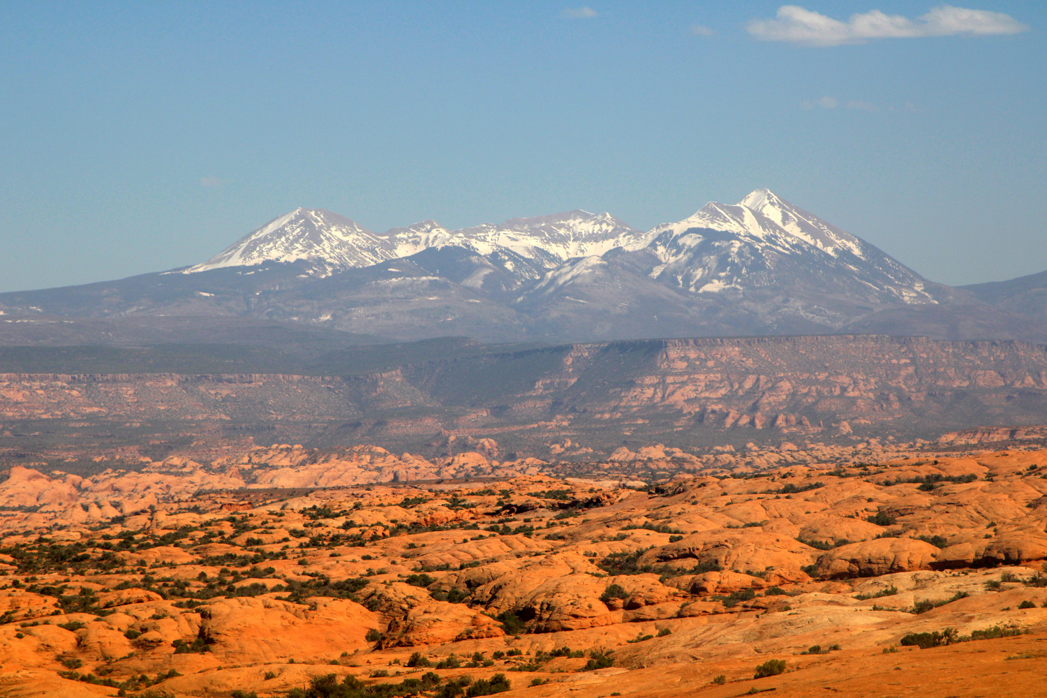
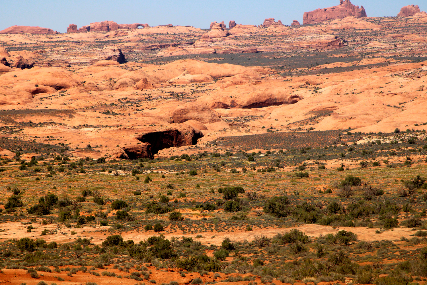
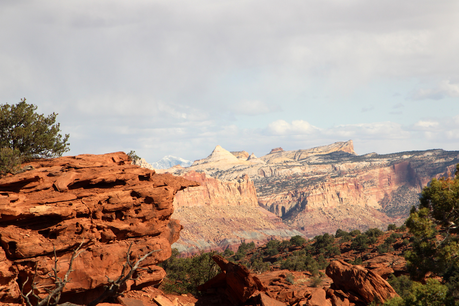
After leaving the Windows Section, we stopped briefly at Balanced Rock, and a longer time at LaSal Mountains Vista, at a high point near Park Avenue. This spot offers not only a good view of the entire LaSal range, but of a deep narrow gorge in the high desert terrain to the east, and the Windows Section in the distance. This stop concluded our time in Arches National Park, and we drove back to the Red Cliff Condos to have a quiet evening and do a little packing for our departure the next day. |
|
|
|
| Balanced Rock (It's really quite solid and stable) | A sort of mini-balanced rock nearby |
|
|
| The LaSal Mountains |
Narrow gorge in the desert floor; one of the
Windows is visible on the horizon, about 1/3 of the way from the left |
| Natural Bridges | |
|
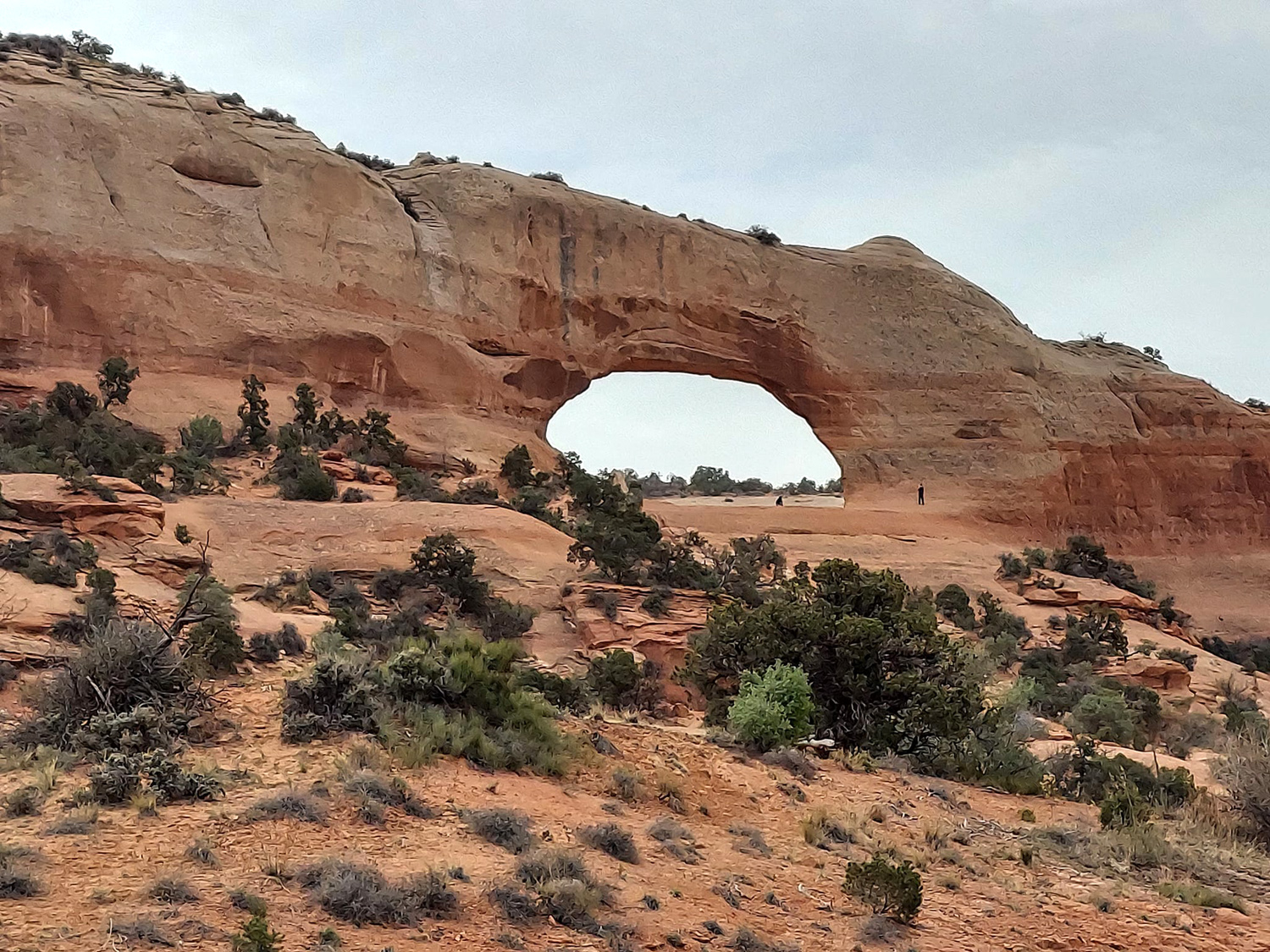
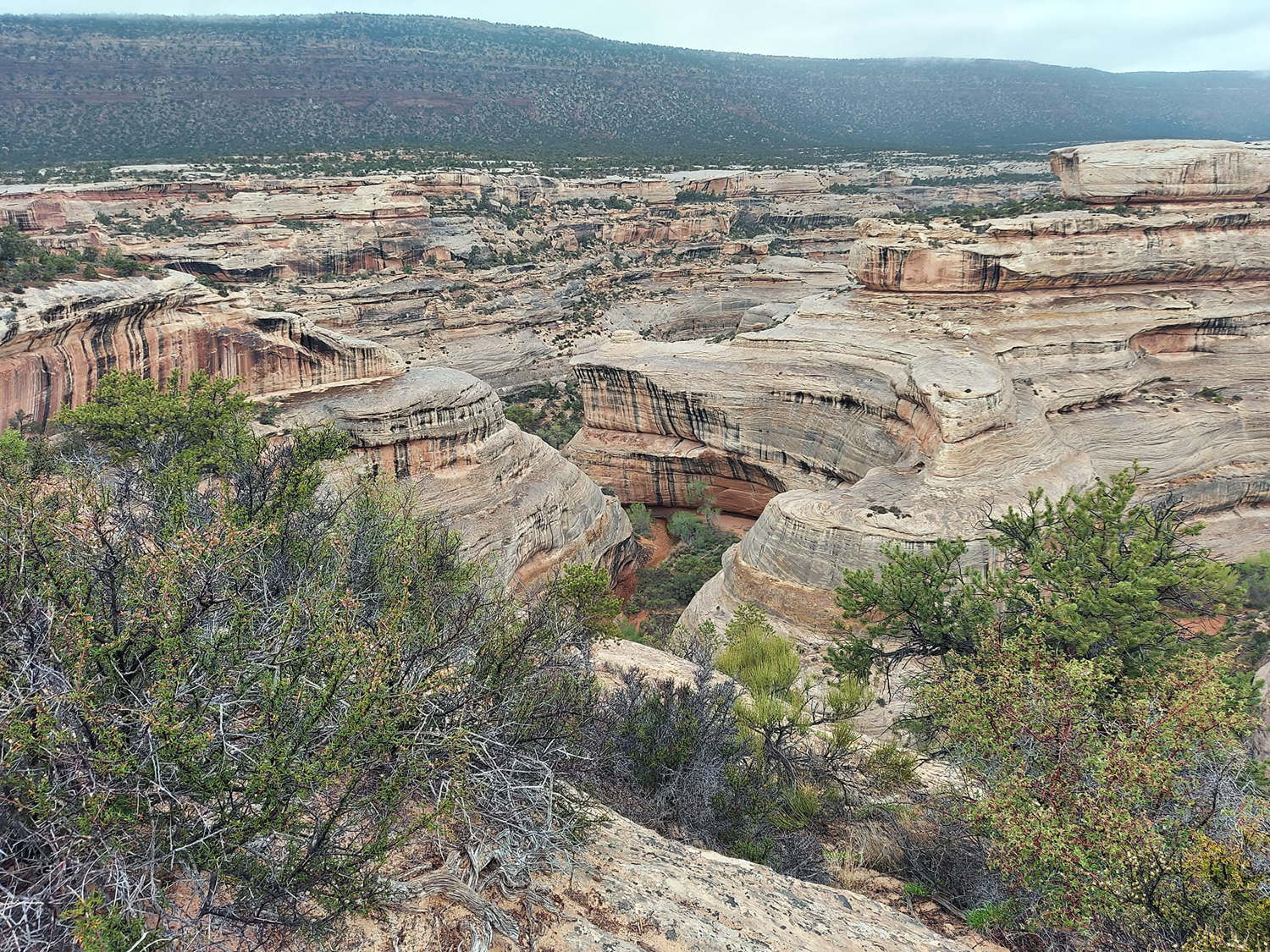
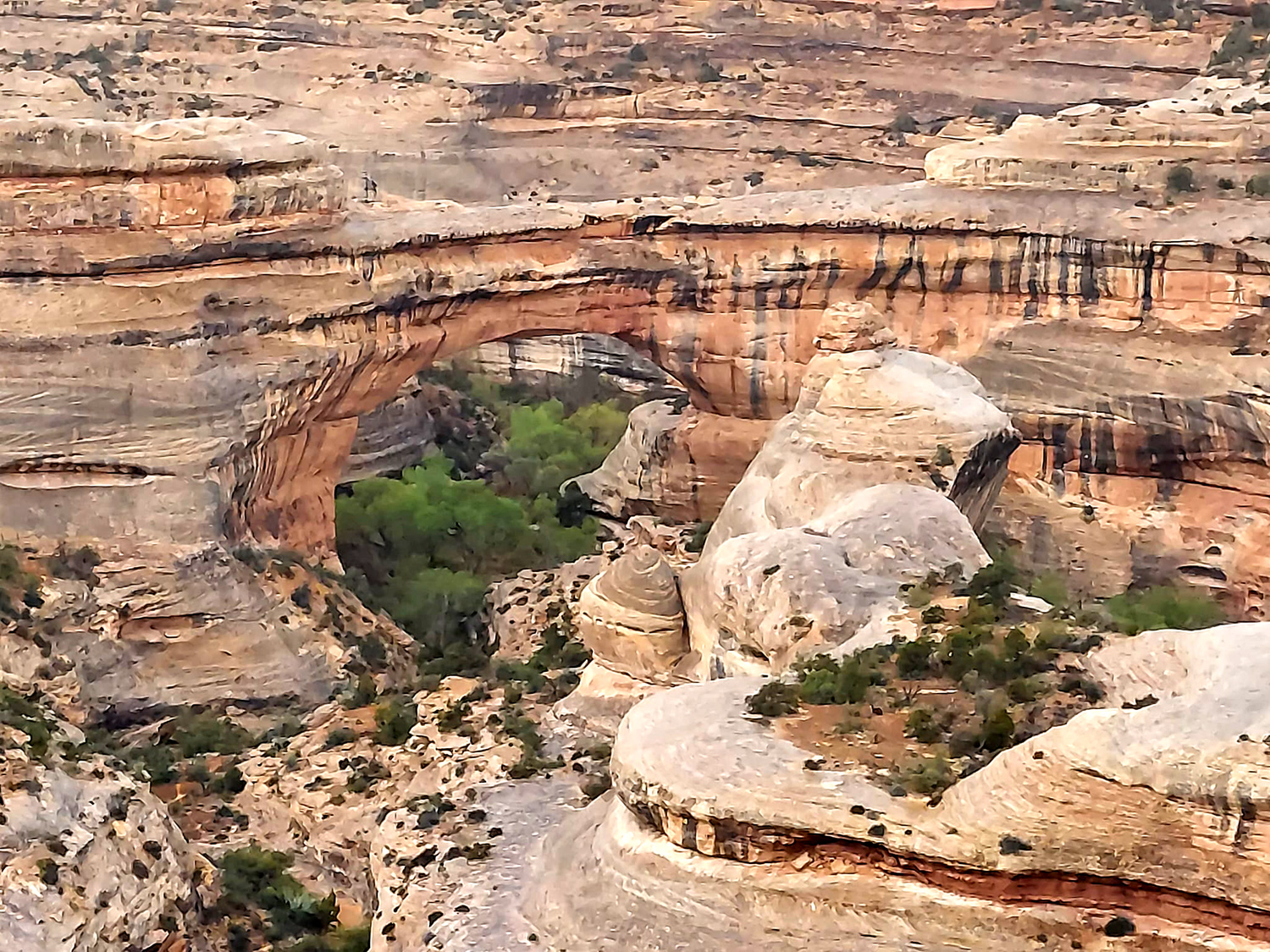
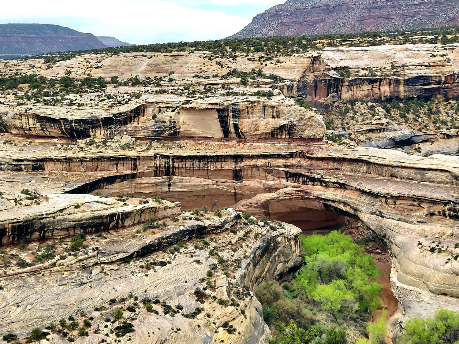
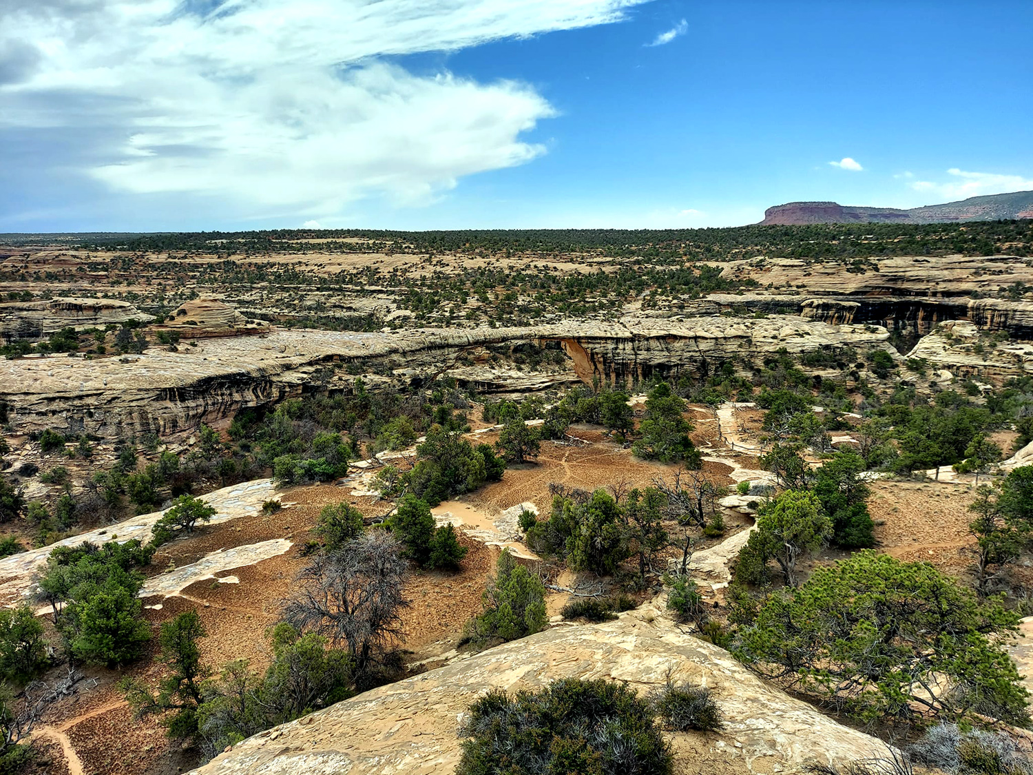
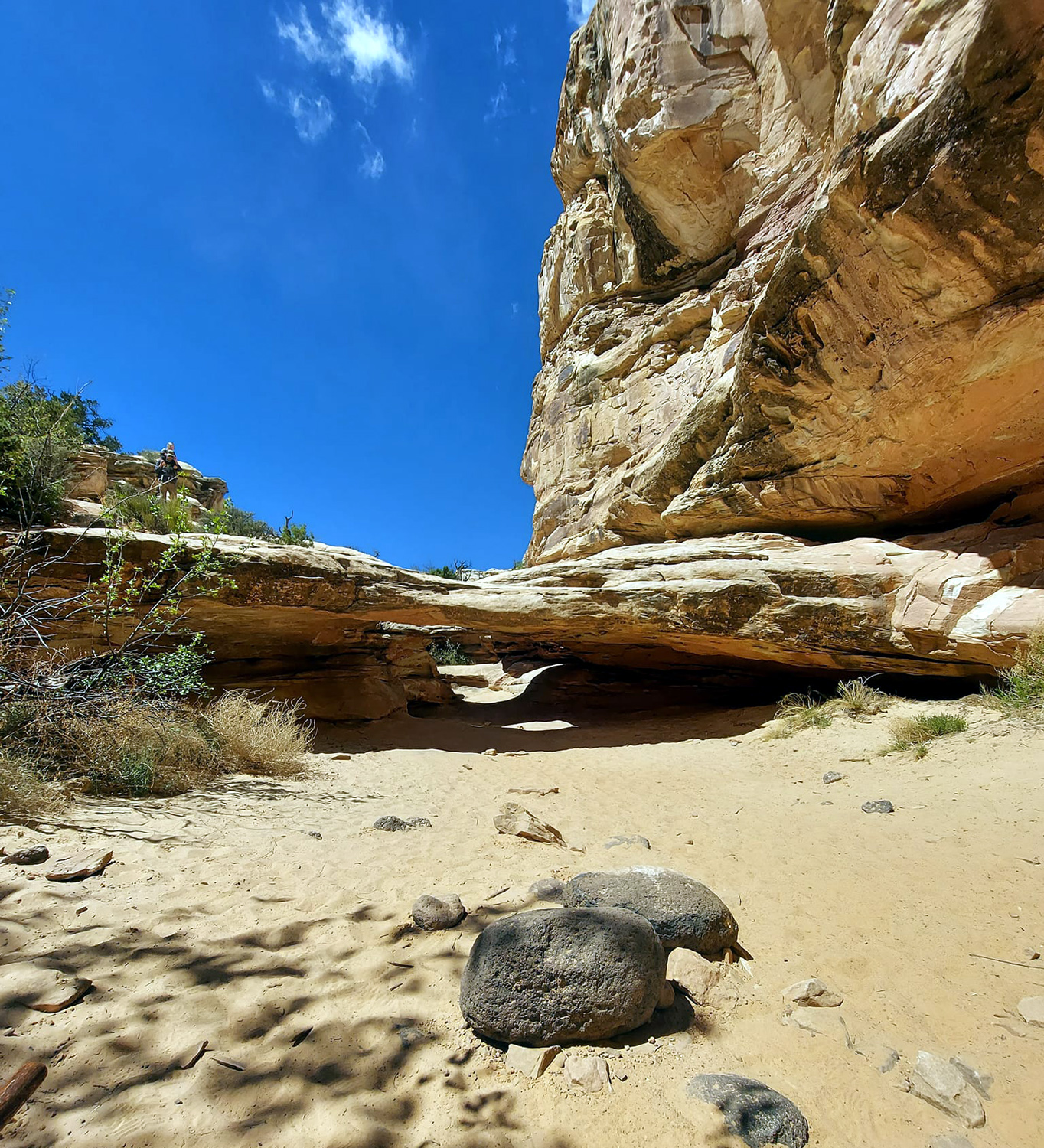
On Friday, April 22 we checked out of our condo and headed south on US 191. Teri had gone this way before but it was my first time. Our destination was Natural Bridges National Monument, which neither of us had visited before. We would visit the monument, then stay overnight at Blanding, about 30 miles from Natural Bridges and 75 miles from Moab on 191. About 24 miles south of Moab is Wilson Arch, a 91 by 46 foot opening on the east side of the highway, easily visible from a turnout there. We stopped for a few minutes to take pictures, but did not take the short hike up to the arch. This was the first day that the weather was uncooperative, and it was windy all the way to Blanding, with tumbleweeds rolling along side and across the road. Just past Blanding we turned west toward the monument. This, like virtually every mile of our travels since leaving I-15, was a scenic drive, despite the threatening clouds. We arrived at the visitor center, and went in to get the obligatory brochure. From this we learned that in 1883 a prospector wandered up from the Colorado River, searching for gold. Instead he found three massive stone bridges. In 1908 President Theodore Roosevelt proclaimed Natural Bridges National Monument, creating Utah's first unit of the National Park system. The main part of the area is a loop drive that goes to each bridge in turn. There is a short trail to a vista point for each, and a longer trail down into the canyon and up close to the bridge. By the time we reached Sipapu Bridge, it was raining steadily. We had ponchos, and made the short hike to the vista point. At each spot we could see that the trails went down fairly steeply, and of course, were now wet and daunting. The same conditions existed at Kachina Bridge, although the ran had slacked off, and I decided that even in dry weather, these two trails would not work for me. |
|
|
|
| Wilson Arch | Canyon in Natural Bridges National Monument |
|
|
| Sipapu Bridge | Kachina Brdige |
|
Continuing on to Owachomo Bridge, we finally got out of the rain. The trail to the bridge was much shorter and less steep than the others, and I decided I could hike it in dry weather. Each bridge is different, not only in its basic shape, but in age and present relation to the stream that cut through it. Kachina is a "young" bridge, and floodwaters continue to enlarge the width of the span. Sipapu is "mature," the widest in span, and while the stream still flows beneath it, the water is far from the base of the bridge, precluding further widening. Owachomo is ancient, and the stream no longer flows beneath it. It's the thinnest, and could fall any time - or stand for centuries. |
|
|
|
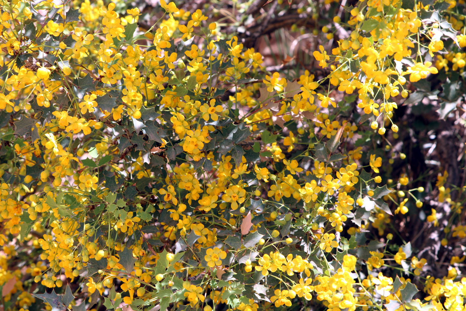
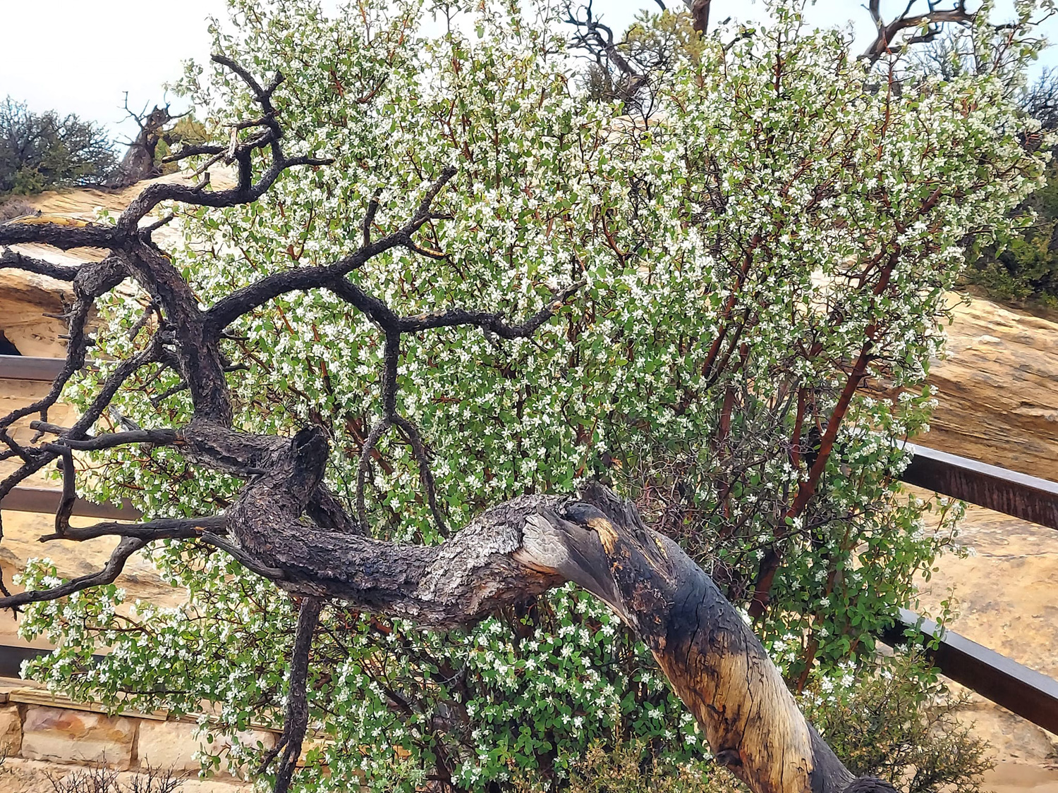
| Owachomo Bridge | Flowering bush in the monument |
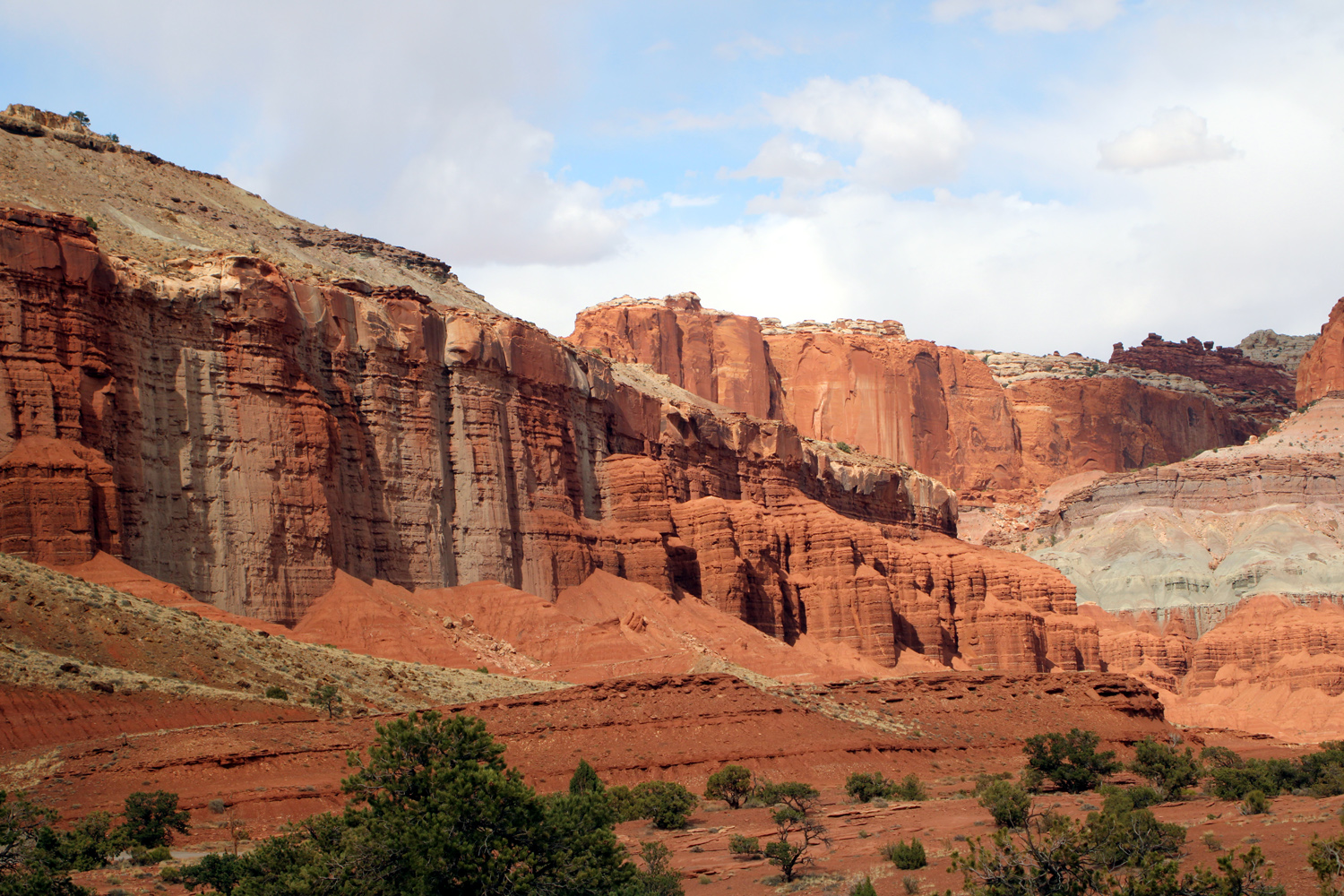
| Capitol Reef National Park | |
|
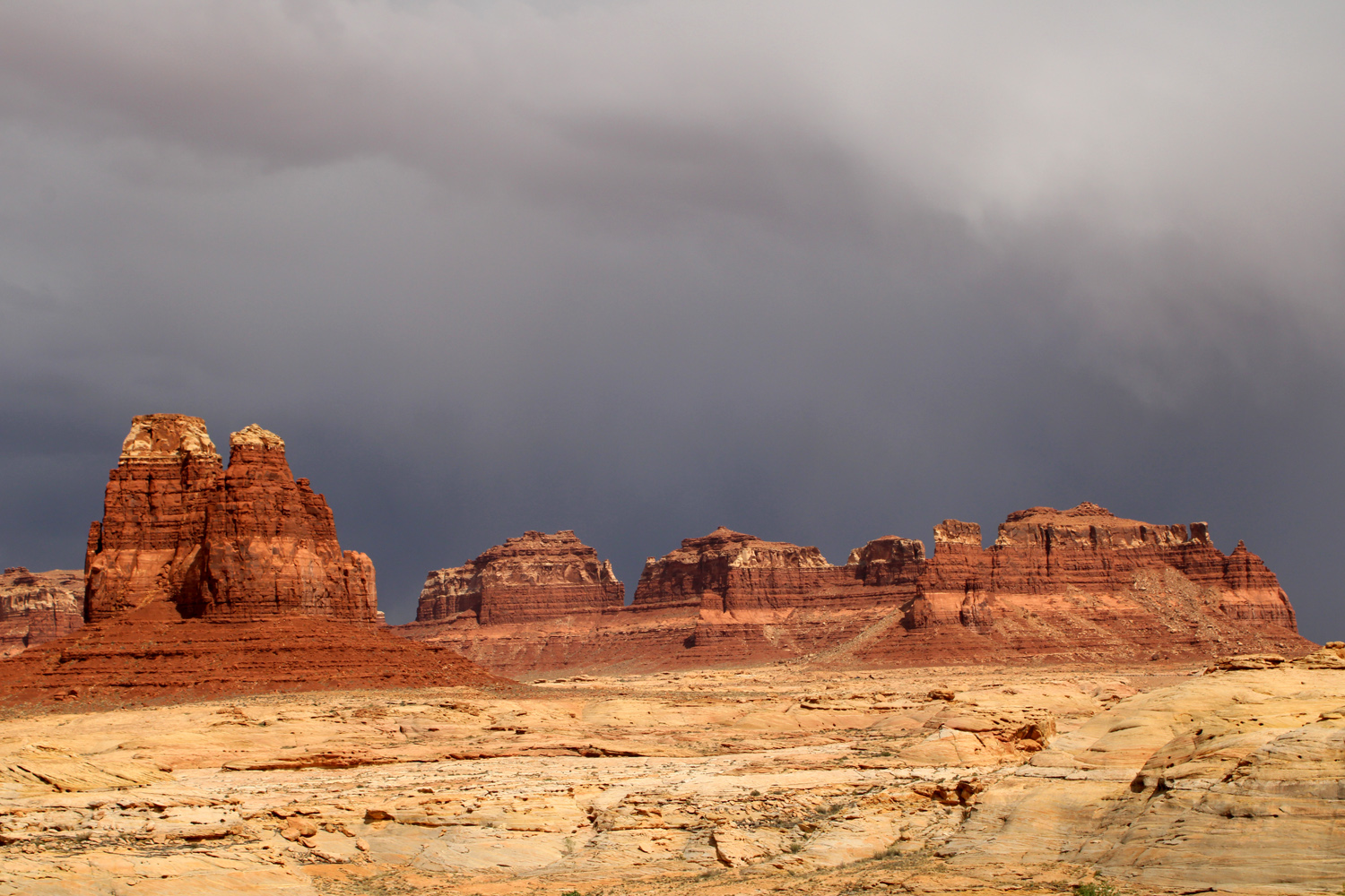
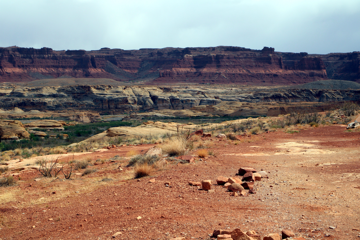
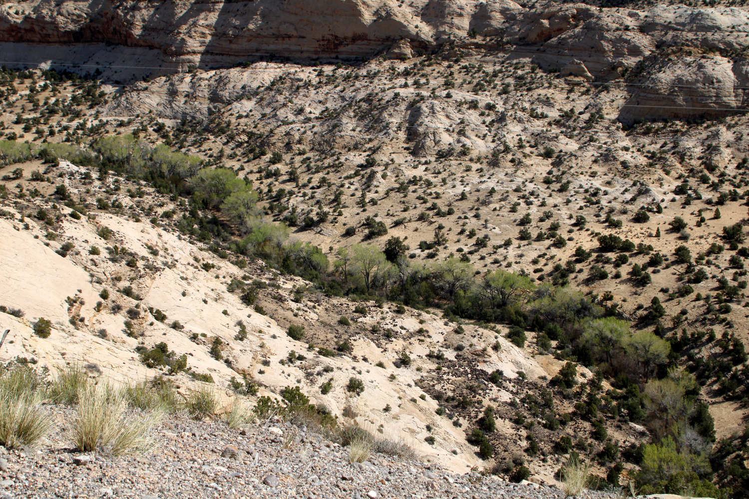
Due to the weather we spent much less time at Natural Bridges than we had expected. If we were to continue on the highway that had led us to the monument, it would take us in the direction of our next stop, Capitol Reef National Park. It would be 30 miles in the other direction back to Blanding, a drive that would have to be repeated the next day, and there was nothing we wanted to do there. We called the motel at Torrey, just west of Capitol Reef, and were able to get a room for that night, so we left the monument and started on another scenic drive. We got back out on to Utah Highway 95, and began making our way north to the junction with Highway 24 at Hanksville. We crossed the Colorado River just above the upper end of Lake Powell, one of the more egregious crimes against nature and the indigenous people of the area. The Dirty Devil River joins the Colorado near the crossing, and runs below dramatic sandstone formations. The skies continued to look threatening, but unless I've suppressed it, there was no more rain as we went north and west. When we arrived at the Capitol Reef entry rest stop, we were approached by a man in trouble His car was broken down somewhere along the road and the keys were locked inside. He asked if we could give him a ride to Torrey. We would have been willing, but the back seat was folded down, and the car was packed with luggage, ice chests and other traveling needs. When he looked in our car, he immediately realized he had to keep searching for help. We were now on Utah Highway 24, the only paved road that goes through the park. We drove across the park and a few miles past the western border to the town of Torrey, where we had motel reservations. Throughout the day it had been cold, windy and cloudy, and when we arrived at the motel and started to take our things in, it began to snow. They were very tiny flakes, not more than an eighth of an inch, and it was over before we finished unloading. |
|
|
|
| Storm over the sandstone along Utah 95 | Canyon along Utah 95 |
|
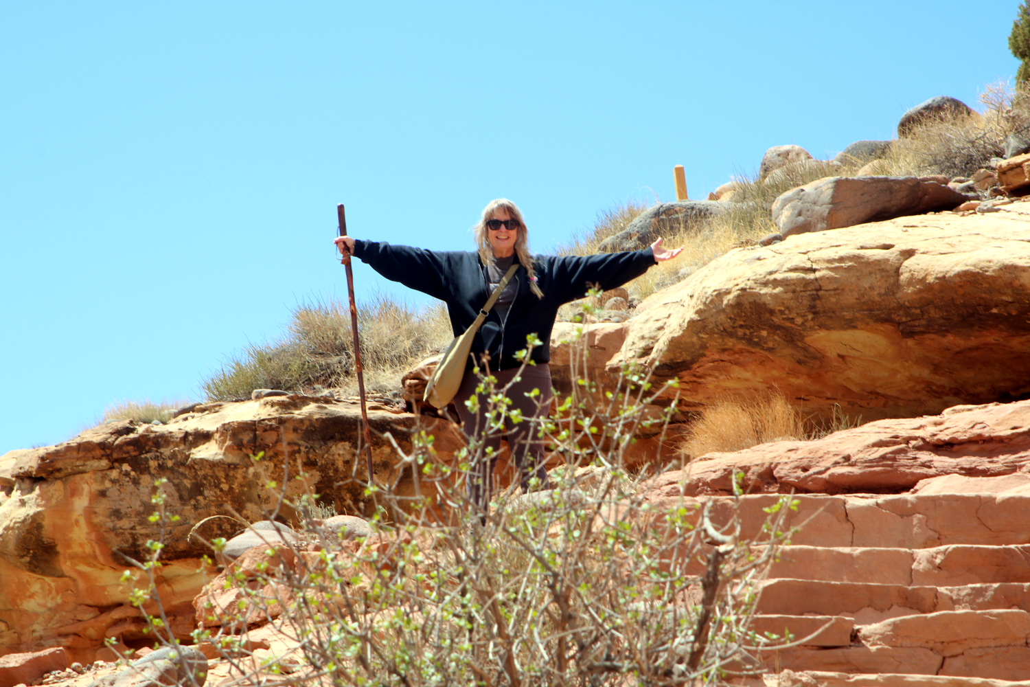
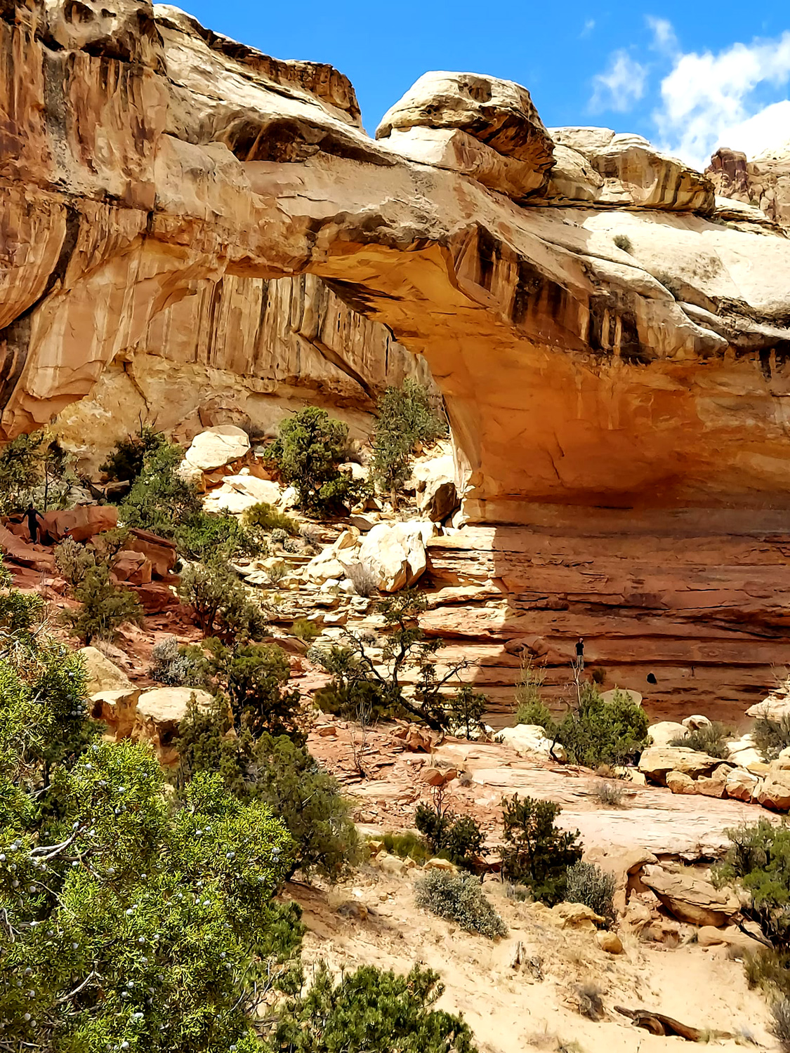
The next morning at 7:30 it was sunny, but still windy and cold (32 degrees), as it would be throughout our time in Capitol Reef. Of course, we had brought clothing for all occasions, and we were undaunted. There are plenty of hiking opportunities in this park, many of them moderate or difficult and longer than I care to tackle. We decided on the Hickman Bridge trail, a moderate two mile round trip hike to a 133-foot natural bridge. It seems that time and arthritis have made "moderate" challenging for me. We reached a point where the trail started up a series of switchbacks and I decided I had had enough. I found a sort of flat rock to sit on, and encouraged Teri to finish the hike. I spent the time watching other hikers pass by, chatting briefly with a few of them. There were two women I talked with and told them why I was sitting instead of hiking. They came back down the trail not long after and told me I had made the right decision. They had reached a point where they were not sure whether to continue, then saw a sign that they still had seven tenths of a mile to go, which settled the issue. I also took way too many photos of the various rock formations, clouds, and individual rocks visible from my location. I moved around to several different sitting rocks, looking for a soft one and never finding it. |
|
|
|
|
Capitol Reef scenery from my stopping point on the Hickman Bridge Trail |
Rocks and stuff on a ledge |
|
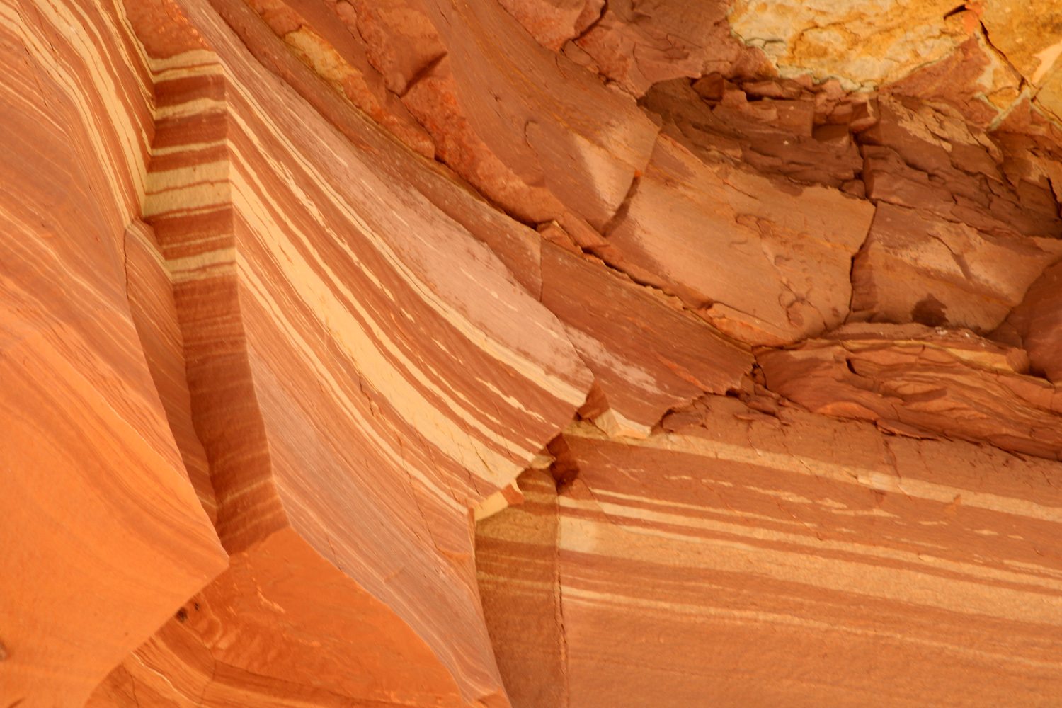
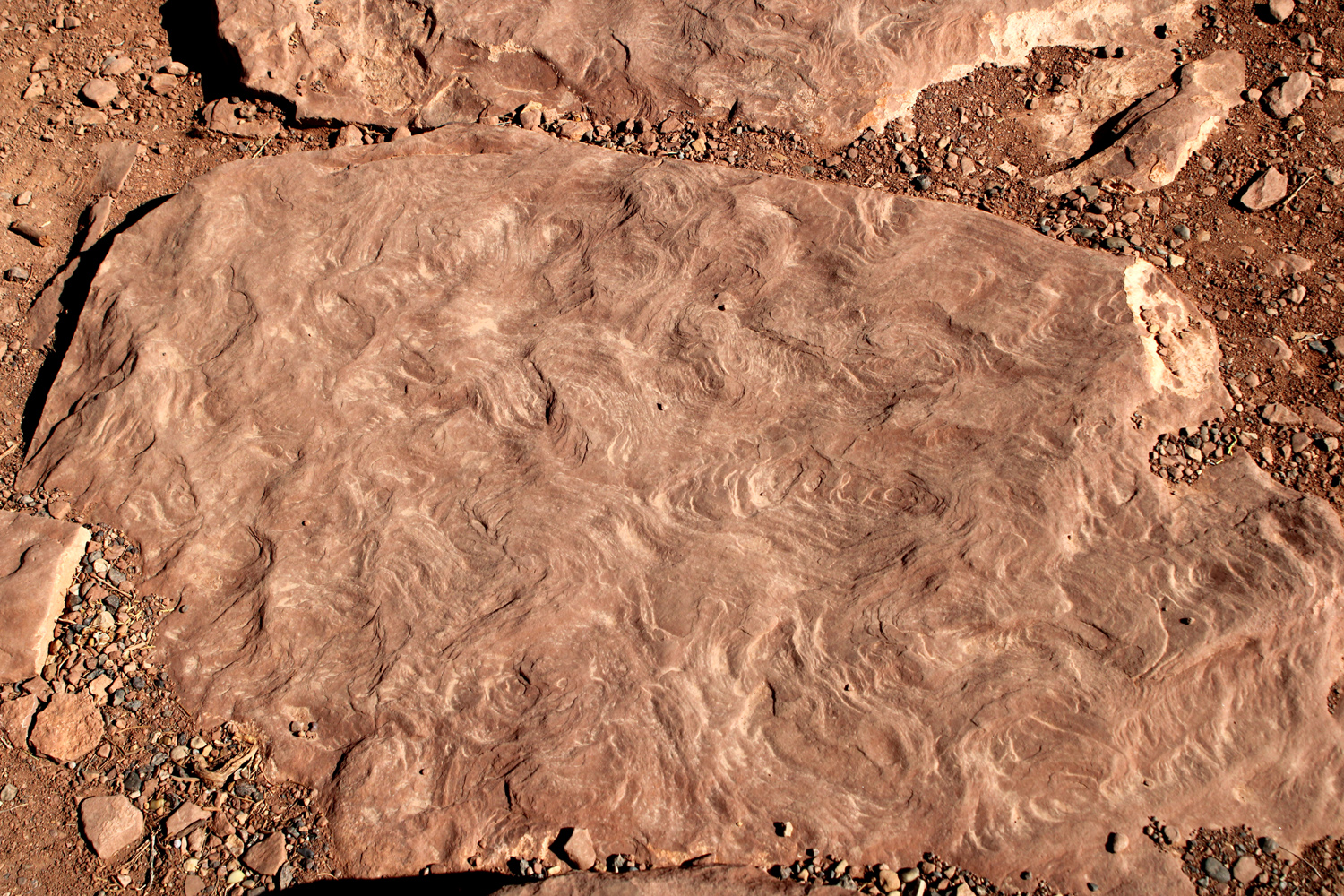
After what seemed like a long wait (but really was not) I spotted Teri coming down the trail in triumph. She agreed that my decision to stop was wise - the trail only got more difficult beyond that point. However she made it to the bridge and also got photos of a small, bonus bridge nearby. When we hiked back to the parking area, we noticed a place where there was a beautiful section of smooth sandstone with stripes in multiple shades of tan and red. |
|
|
|
| Teri returns in triumph from her hike to the bridge | Hickman Bridge |
|
|
| A nearby "bonus" bridge | A picture no artist could paint |
|
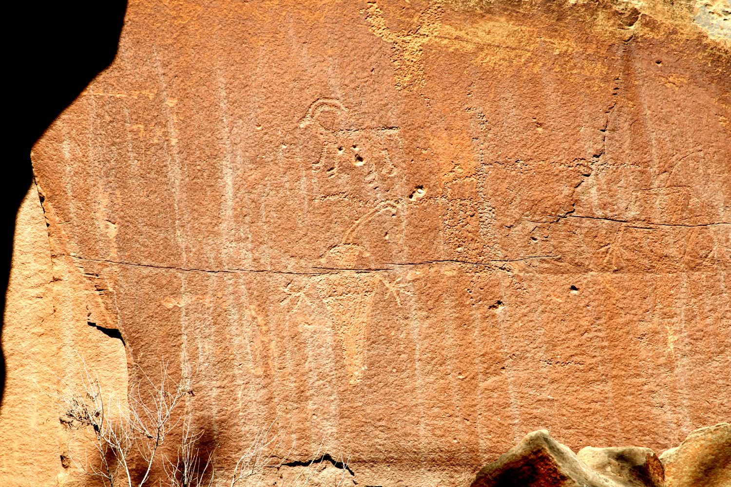
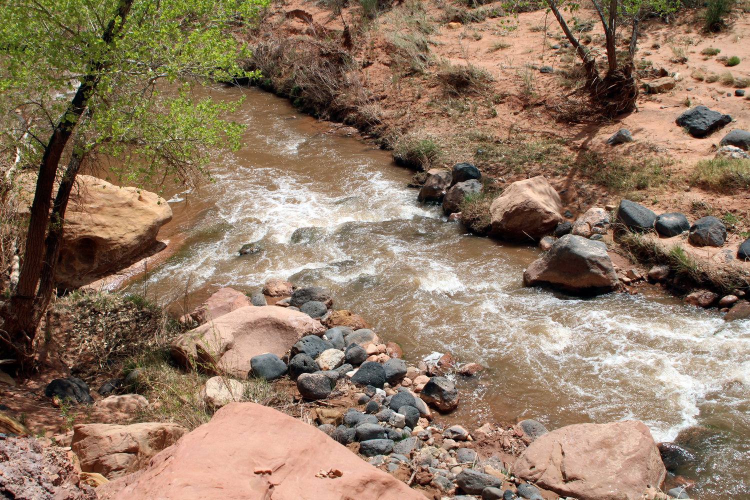
We made two more stops that day - first at a short, level trail between the Fremont River and the cliffs on the north side. The attraction there was what is called graffiti if modern people do it, but if done hundreds of years earlier is a cultural treasure. There were images of people, bighorn sheep, and other animals etched into the sandstone by people of the Fremont Culture, who lived in the area from 600 to 1300 C.E. |
|
|
|
| Petroglyphs above the river | The Fremont River |
|
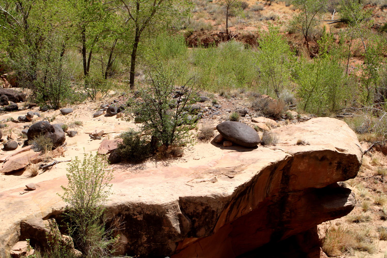
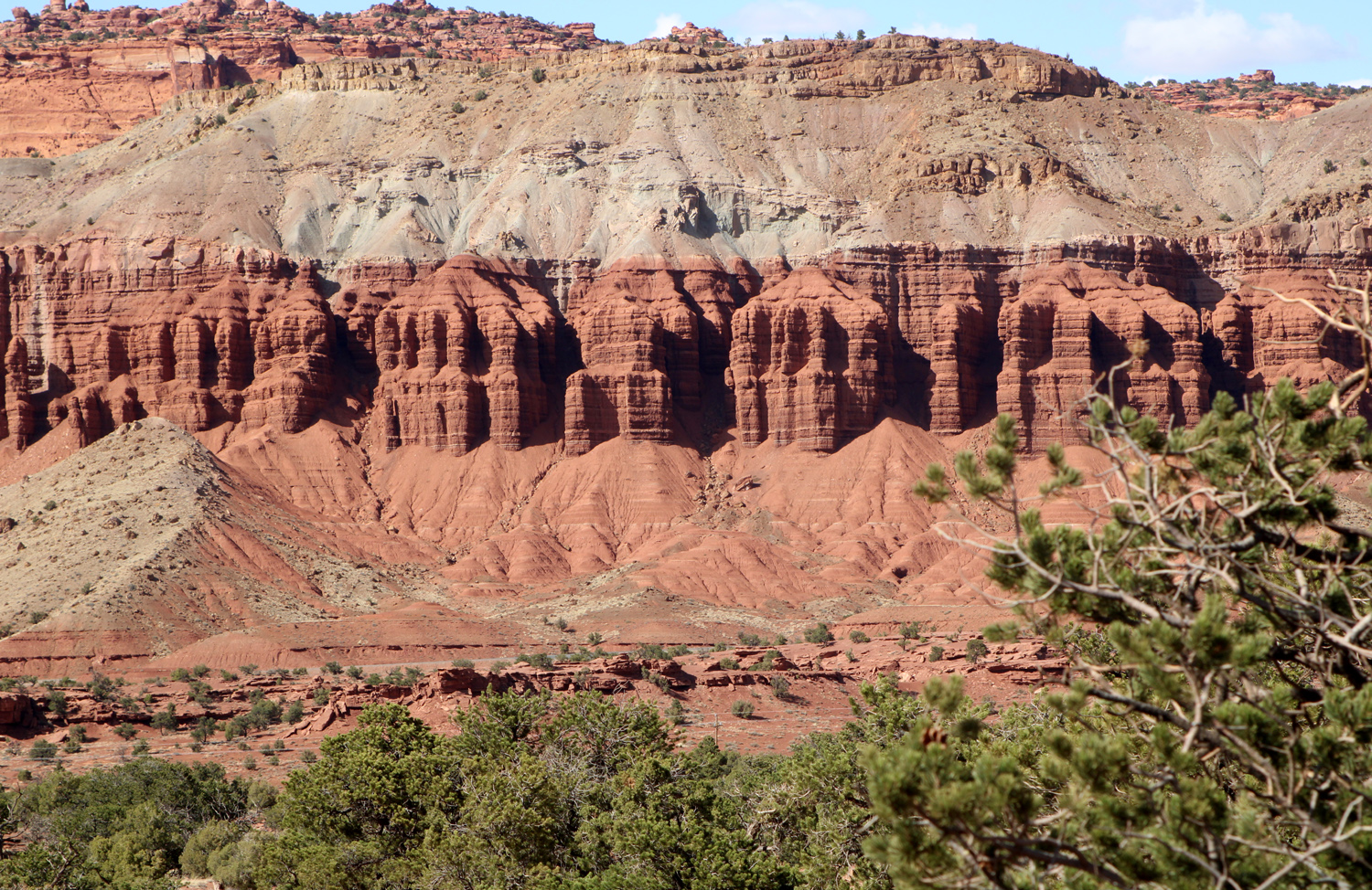
Now it was time for our lunch break. The visitor center and what facilities exist in the park are all located at the site of Fruita, an area occupied by Mormon settlers from 1880 till 1955, when the area became part of the national park. The visitor center offers books, magnets and the usual souvenirs, as well as information and advice on how to enjoy the park. The only real business at Fruita is the Gifford House, which is a museum depicting the spartan living conditions of the early settlers, and a sort of coffee shop offering pies and other pastries, jams and jellies, and ice cream. The pastries usually sell out by early afternoon. We didn't go there this day, but would do so the next day. Surviving artifacts of the homestead also include a barn and blacksmith shop. Justifying its name, the Fruita Rural Historic District was the site of many acres of orchards, with 3,000 fruit, berry and nut trees still alive and producing under park service management. In season you can pick and eat for free, but if you want to take stuff with you, there is a modest charge. Near the orchards is a large park-like area with picnic tables, where we decided to have our lunch. Teri was sitting at a table when I noticed that she was more or less surrounded by small black caterpillars. We had seen them in large web sacks on trees along the trail, and we realized they were in this area also. We quickly moved to another table and had a pleasant and caterpillar-free lunch. Our final stop for the day was the Goosenecks, an area where Sulfur Creek winds through a canyon with many twists and turns. The trailhead is down a dirt road from Panorama Point, near the western border of the park. It's a short but rocky trail to the overlook, where you are looking pretty much straight down two hundred feet. The scenery is enhanced with a view to the east of distant multi-colored peaks and cliffs. To the north and much closer is a perfectly-designed row of sandstone columns joined together in groups of two to five, with other layers above and below. |
|
|
|
| Looking down into the Goosenecks | View to the east |
|
|
| One of my favorite formations in the park | Unique pattern of swirls on sandstone |
|
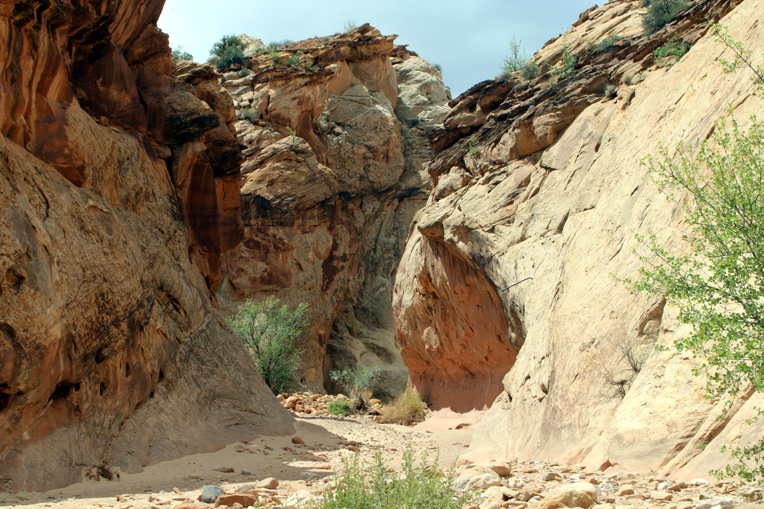
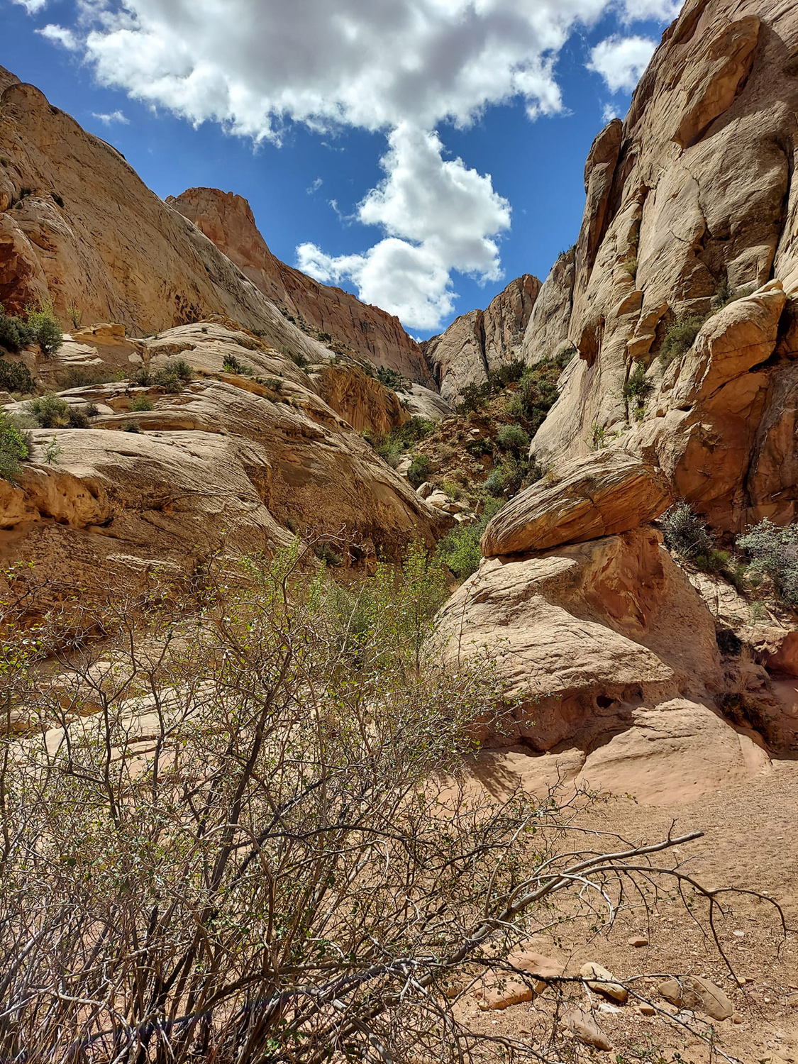
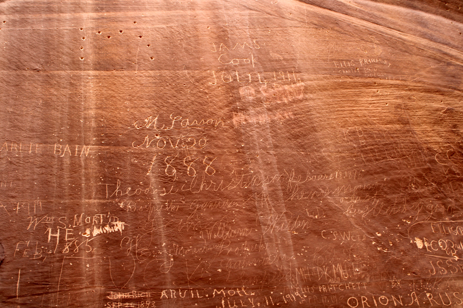
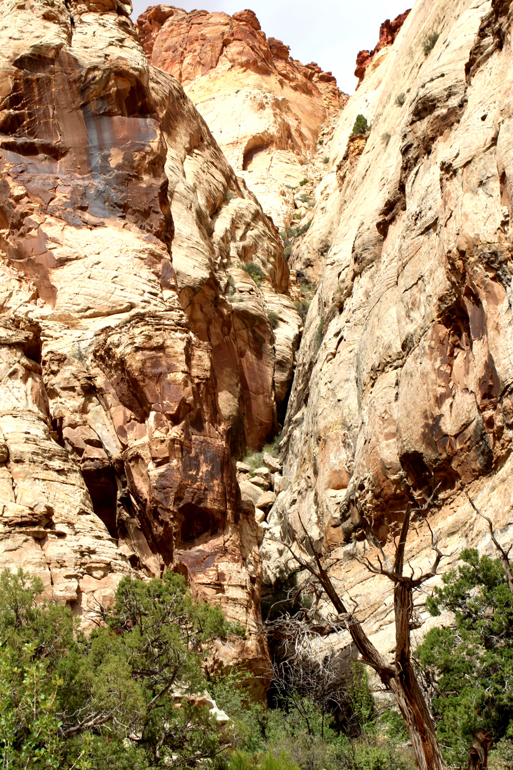
Our stop at the Goosenecks concluded our activities for the first day at Capitol Reef. The next day our plan was to drive on Scenic Drive to the trailhead for the Capitol Gorge hike, listed as a one mile, mostly level, easy hike through a deep canyon with historic inscriptions, ending with a short climb to water pockets. Also known as "tanks," these are areas where erosion has created depressions on relatively flat rock surfaces. A significant amount of water collects in these places, providing support for plant and animal life. Scenic Drive is a paved road that goes south from the visitor center eight miles, with two dirt road spurs leading to hiking trails, Grand Wash and Capitol Gorge. It's an "out and back" route, and does not go all the way through the park. The dirt road was moderate, with the usual few rough and rocky spots, but accessible to most passenger cars. The trail itself goes along the shoulder of the gorge for part of the way, then drops down to the bottom of the dry wash. There are many side canyons, mostly small and steep, lots of eye-catching rock formations, quite a few wildflowers, and marks left by previous visitors. Native Americans created the typical petroglyphs of the area, and more recent visitors in the 19th and early 20th centuries left names and dates in a place now known as the Pioneer Register. It's illegal to add your own name to the list. |
|
|
|
| Entering Capitol Gorge | One of the larger side canyons |
|
|
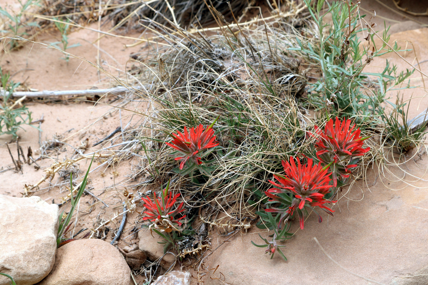
| Fortunately there were a lot of flat rocks to rest on |
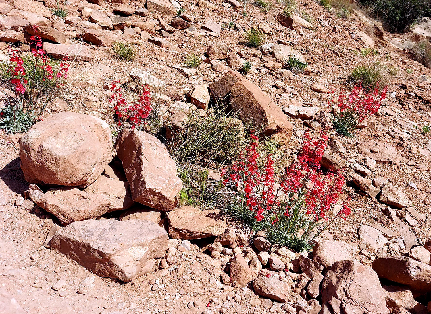
Indian paint brush provides a bright spot among the mostly subdued colors of the area |
|
|
| The Pioneer Register | A narrow side canyon |
|
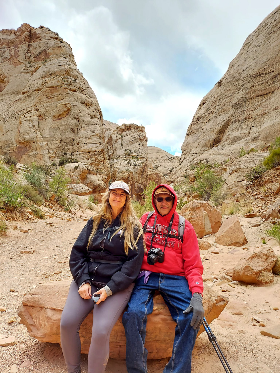
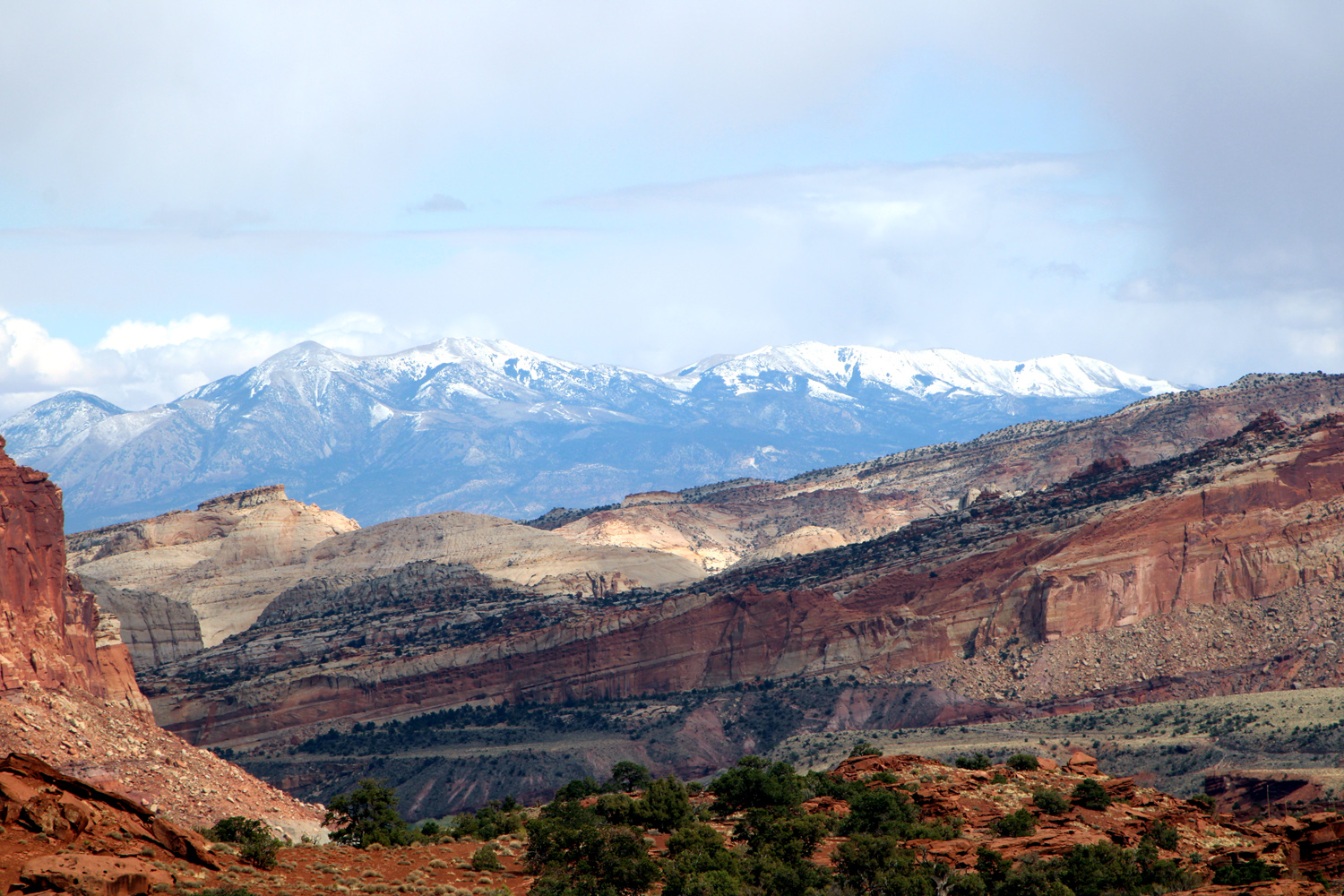
When we reached the point where the trail began to climb up to the tanks, we sat down on smooth, flat rocks and had a snack, choosing to go no further. The trail officially ends at this point, although you could apparently continue to walk through the wash. A sign warns that this will soon take you out of the park and into private land. There were a lot of people on the trail, including quite a few kids. Two of them were climbing up the steep rocks of a side canyon, worrying their mother. We talked with her briefly and she said she was torn between making them stay on the flat and letting them explore and be kids. With two sons and two grandsons, Teri and I fully understood. We hiked back out and drove back to Fruita, this time stopping at the Gifford Homestead. We looked at the artifacts and photos from when it was a private home and ranch, but did not buy anything (the pies were sold out anyway). Heading back to our hotel at Torrey, we stopped at Inspiration Point, which provides good views in all directions and requires only the shortest of hikes. |
|
|
|
| The snow-covered Henry Mountains | Cliffs in the Inspiration Point area |
| Highway 12, Bryce Canyon, and Zion National Park | |
|
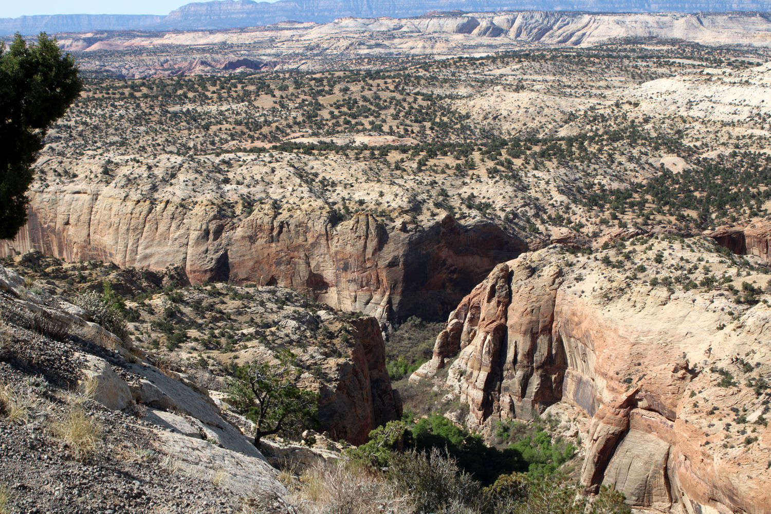
It was time to say goodbye to Capitol Reef, with two more parks and a national monument, one unexpected and one unplanned, next on our route. We got up at a reasonable hour, had breakfast, took all our stuff out of the motel room and drove west a very short distance on Highway 24, then turned south on Utah 12. This is a National Scenic Byway, and lives up to its name from one end to the other, from Torrey to its junction with US 89 a few miles southeast of Panguitch. Our route took us through scenic high desert country then began to rise into forest covered hills, with many leafless aspens. Then we descended into canyon country, and at the town of Boulder we entered the northern end of Grand Staircase-Escalante National Monument. Covering nearly 1.87 million acres, on the map it looks as large as all the other monuments and parks in the state combined. It is a very rugged, remote area, with few paved roads. Travel and exploration within the monument require knowledge, planning and plenty of extra supplies. It is one of the few national monuments managed by the Bureau of Land Management rather than the National Park Service. Near the town of Boulder, Highway 12 twists and turns through the Hogsback, a section of the road where cliffs drop steeply into narrow canyons on both sides of the highway. At one point the road ran along a ridge, sometimes on top, sometimes just below on one side or another, with breathtaking views in either direction. We captured a few of these views, but this web site offers some of the best photos and information. |
|
|
|
| Leafless aspens in the high country along Highway 12 | A line of trees marks the pathway of a stream |
|
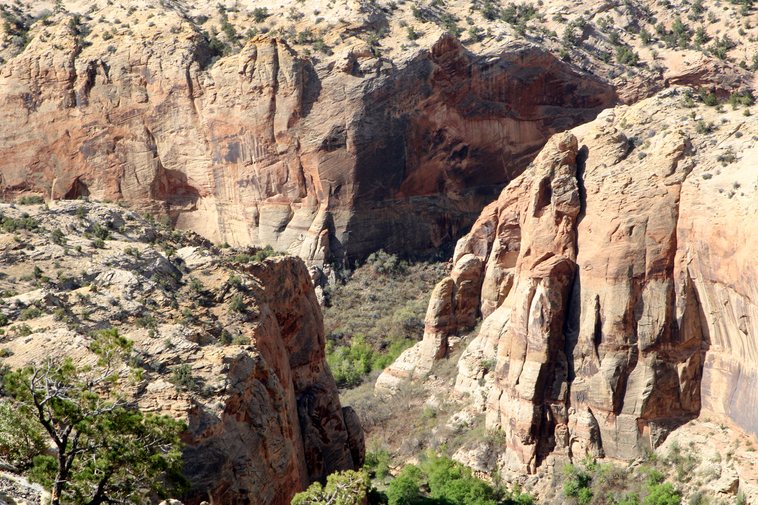
|
| Canyon on the road between Boulder and Escalante | A closer look into the canyon |
|
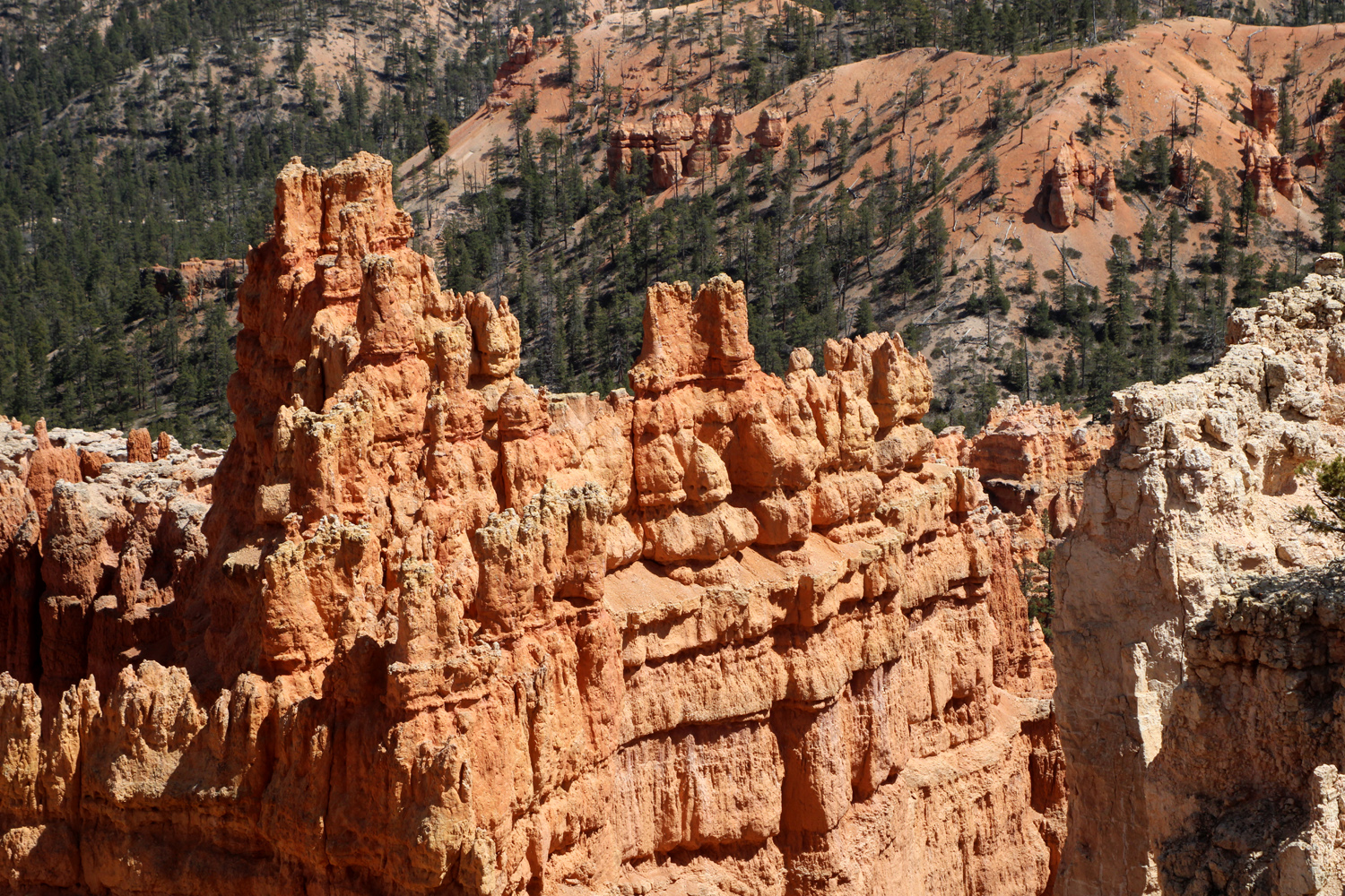
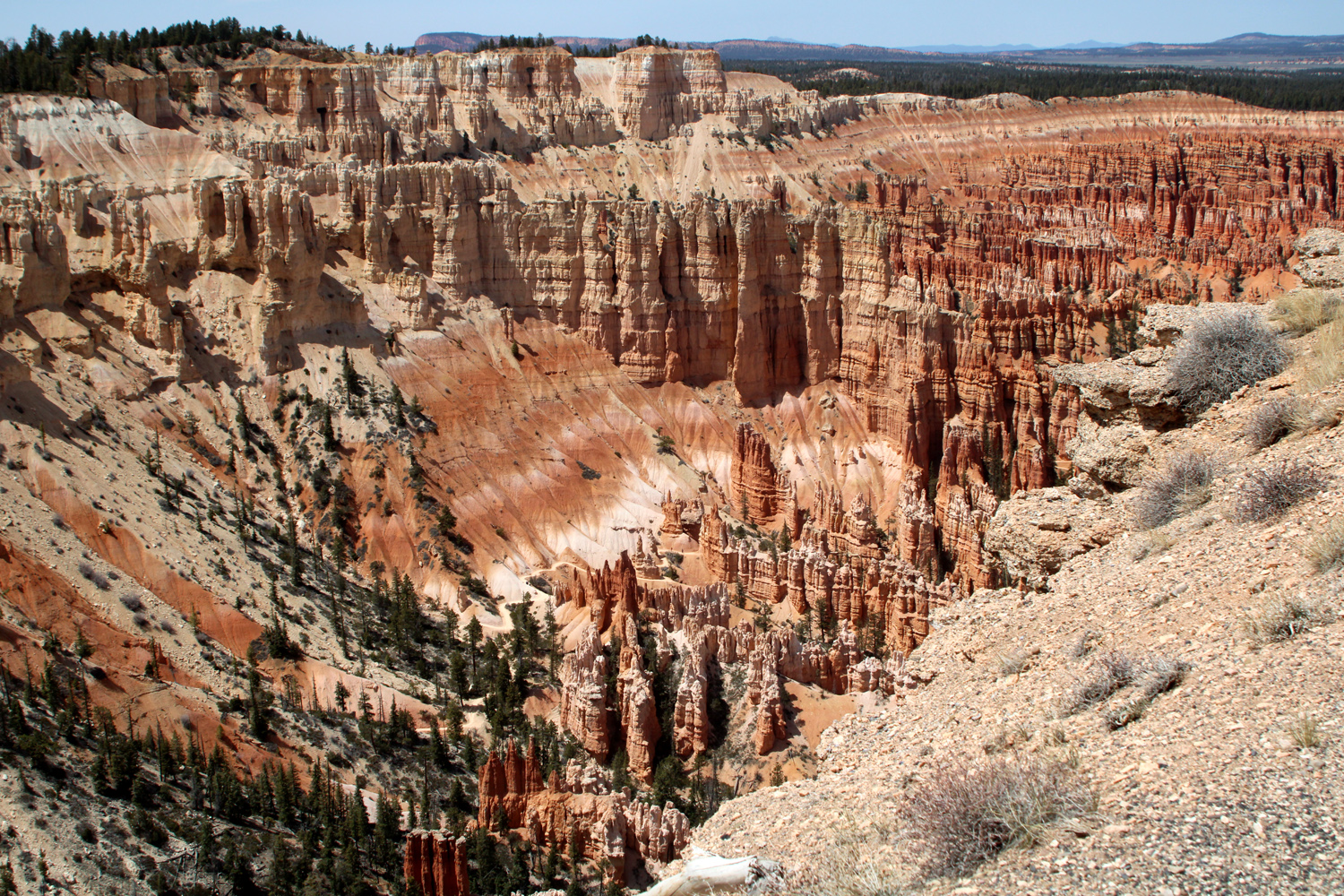
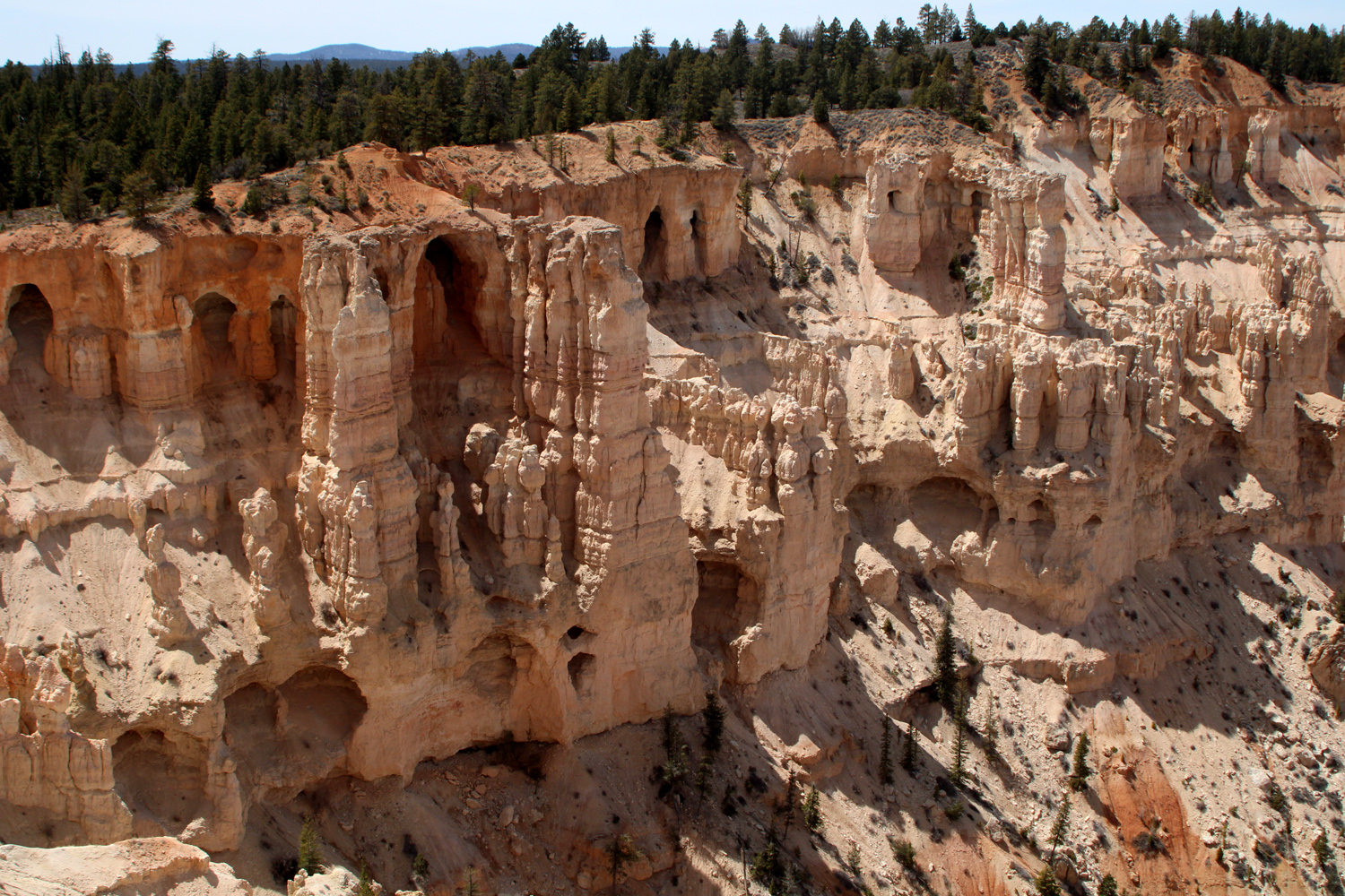
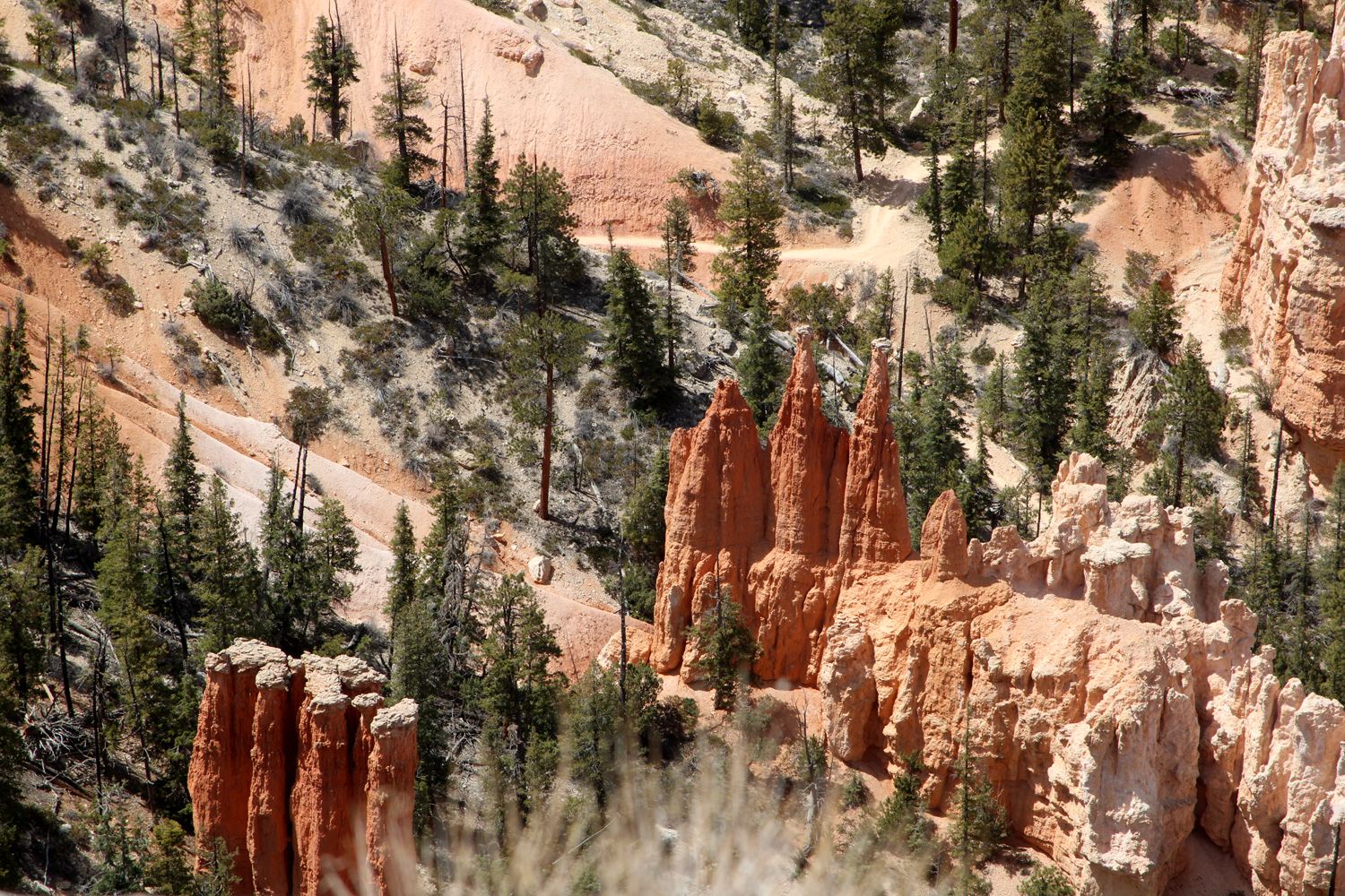
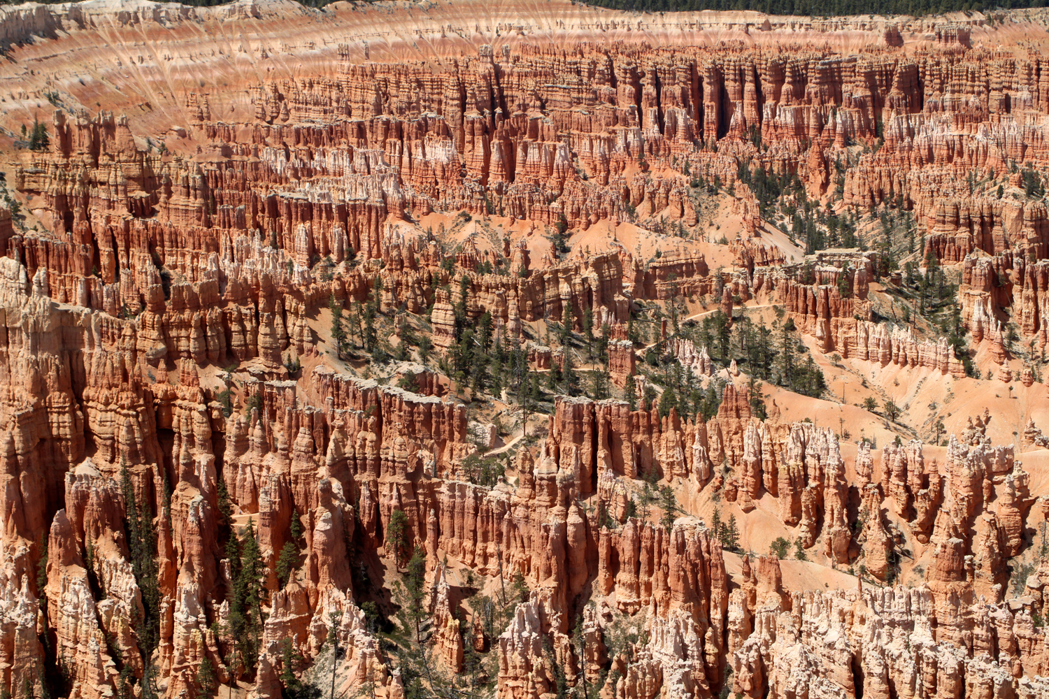
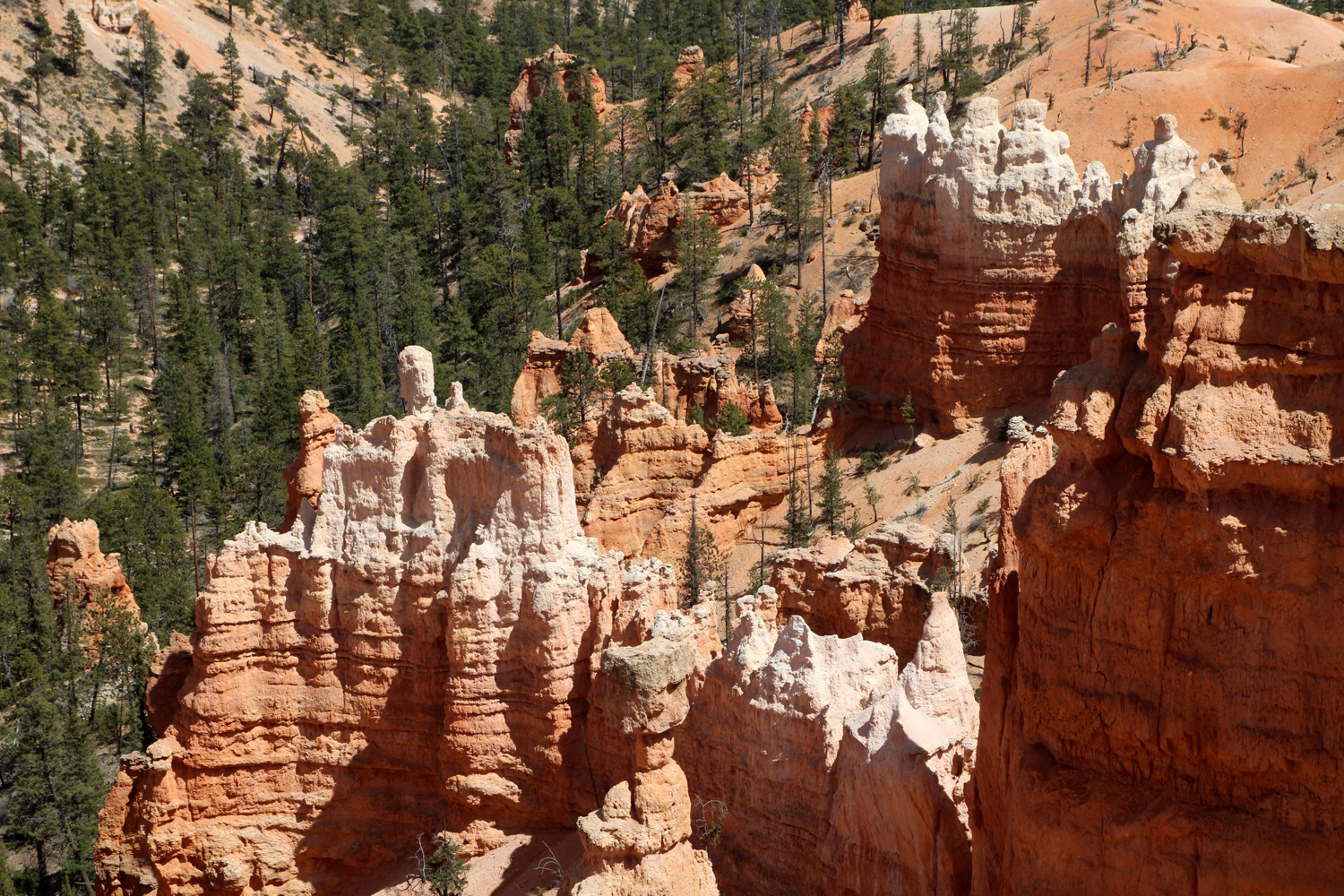
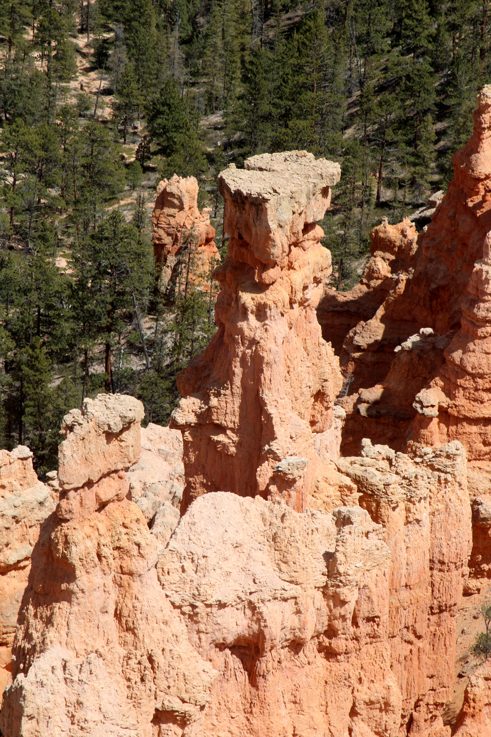
Highway 12 crosses the Escalante River, and near the town of the same name we spotted a visitor center, so we made a stop there. What we saw there and along the highway made us want to return someday for a longer visit to this huge park. Our short jaunt through a small part of Grand Staircase-Escalante was an unexpected bonus, since our planned destination was Zion National Park, which would be our last stop on the trip. At one of our stops we could see into Bears Ears National Monument in the distance. This area has been a battleground between those who would exploit and those who wish to preserve the natural beauty of the Colorado Plateau. Past the town of Escalante the road followed the border of the monument for several miles, going in a generally western direction. As we approached the turn-off to Bryce Canyon National Park, Teri suggested we stop there. At the junction, just before the entrance to the park, is Ruby's Inn (plus Ruby's Diner, Ruby's RV Park and Campground and Ruby's Rock Shop). I had been wanting a burger and fries so we ate there. Despite the server's statement that they had excellent fries, they were just average. The road into the park goes about 15 miles, with no outlet. Along the way are many named vista points with parking lots, and usually a walk of only a few hundred yards or less to the view. There are also trails down into the canyon, and you need to do some hiking there to really get the full impact of this park. After lunch we drove in and made stops at three vista points. We had hiked the Navajo Trail when we were here in 2017. but there would be no hiking this time. Bryce is famous for the "Hoodoos," sandstone pillars by the hundreds. There is no other place that could be mistaken for Bryce Canyon. If you have not been to Bryce, words cannot begin to adequately describe it, so I will just post a few thousand words worth of photos. |
|
|
|
| The famous Hoodoos of Bryce Canyon | It looks like there is statuary in the formation left of center |
|
|
| A closer view of Hoodoos, some pointed, some flat-topped | How many Hoodoos are there? |
|
|
| Frosted red sandstone | Thor's Hammer |
|
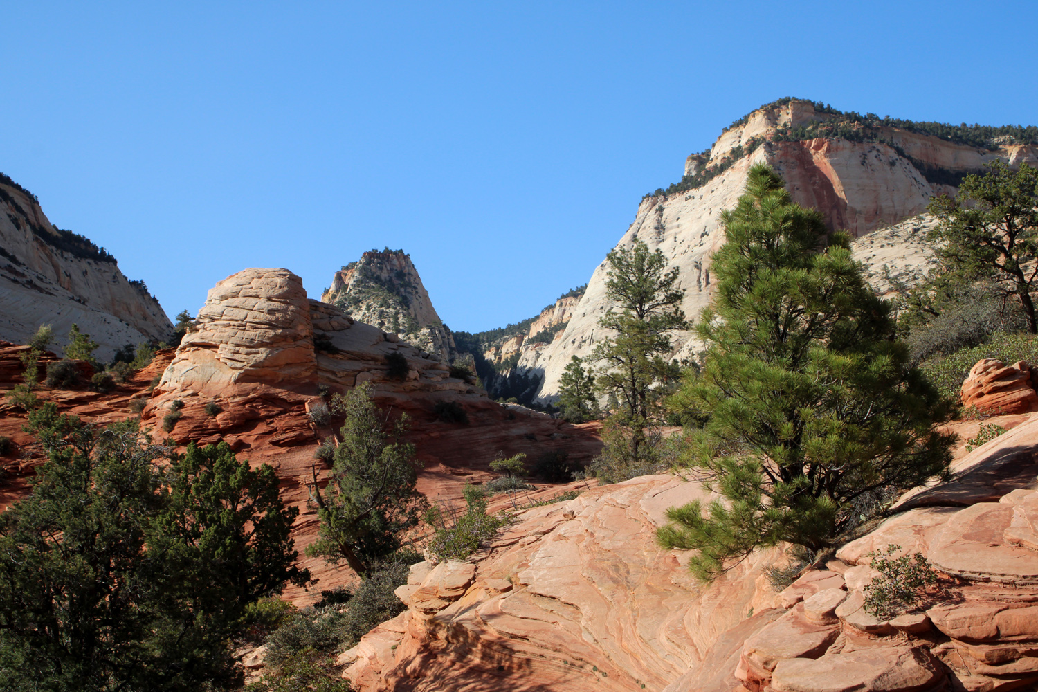
After this unplanned but very worthwhile stop, we continued on toward Zion, turning west on Utah Highway 9. With a couple of stops to take in some of the amazing views on the park's eastern side, we drove into the town of Springdale, and got settled into our motel. |
|
|
|
| Along Highway 9 at the eastern edge of Zion | Another view coming into Zion |
|
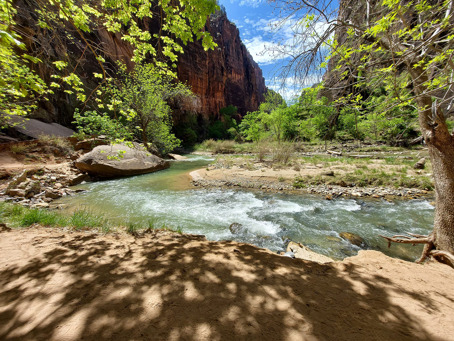
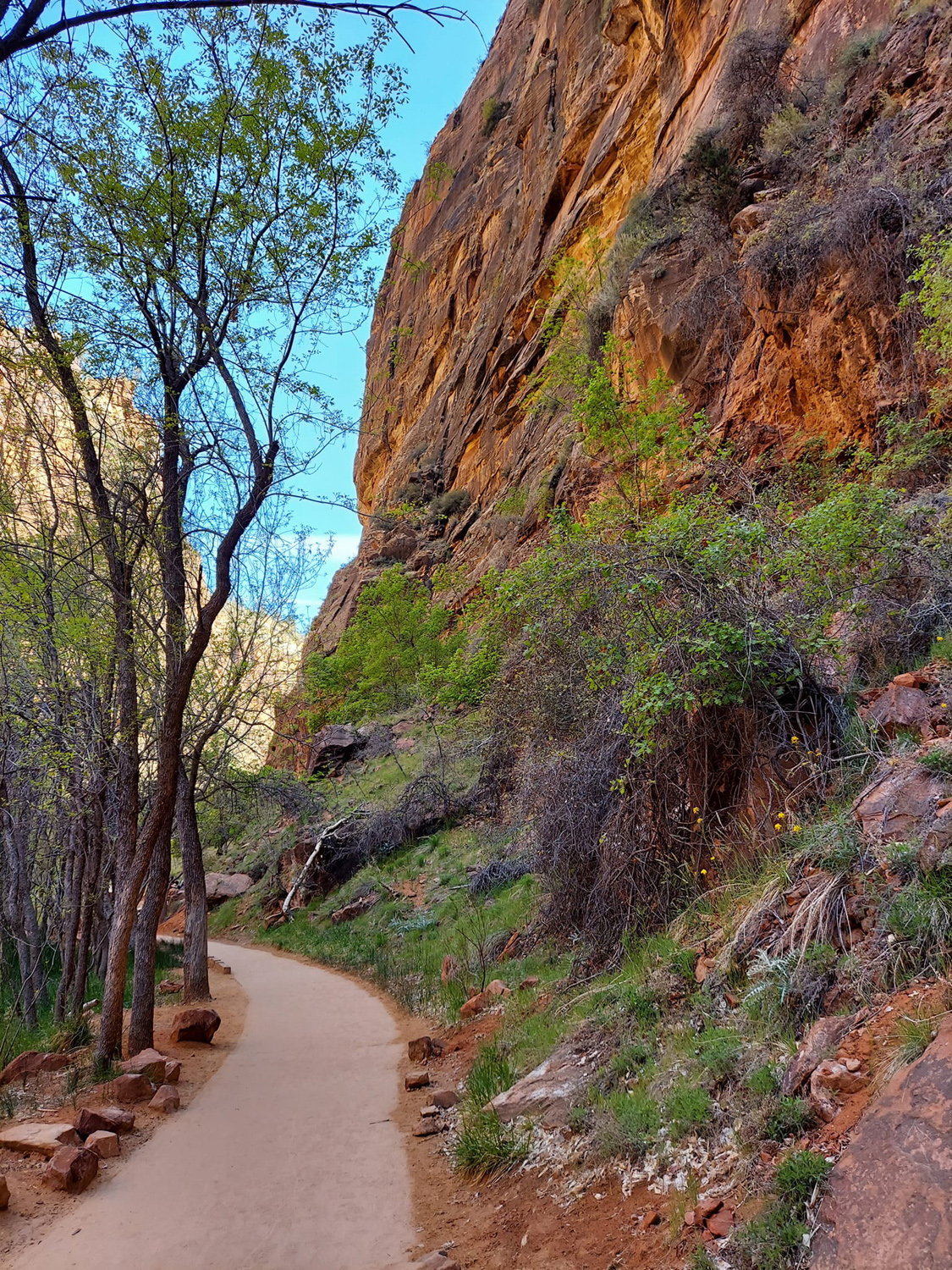
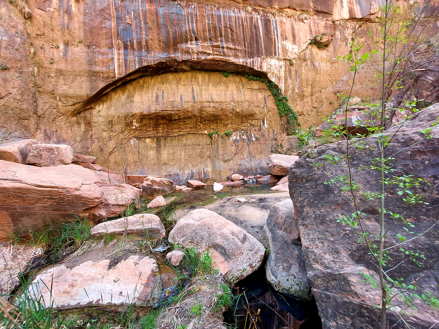
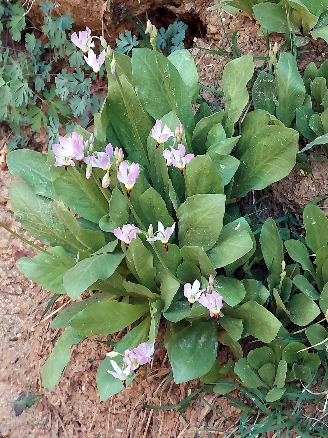
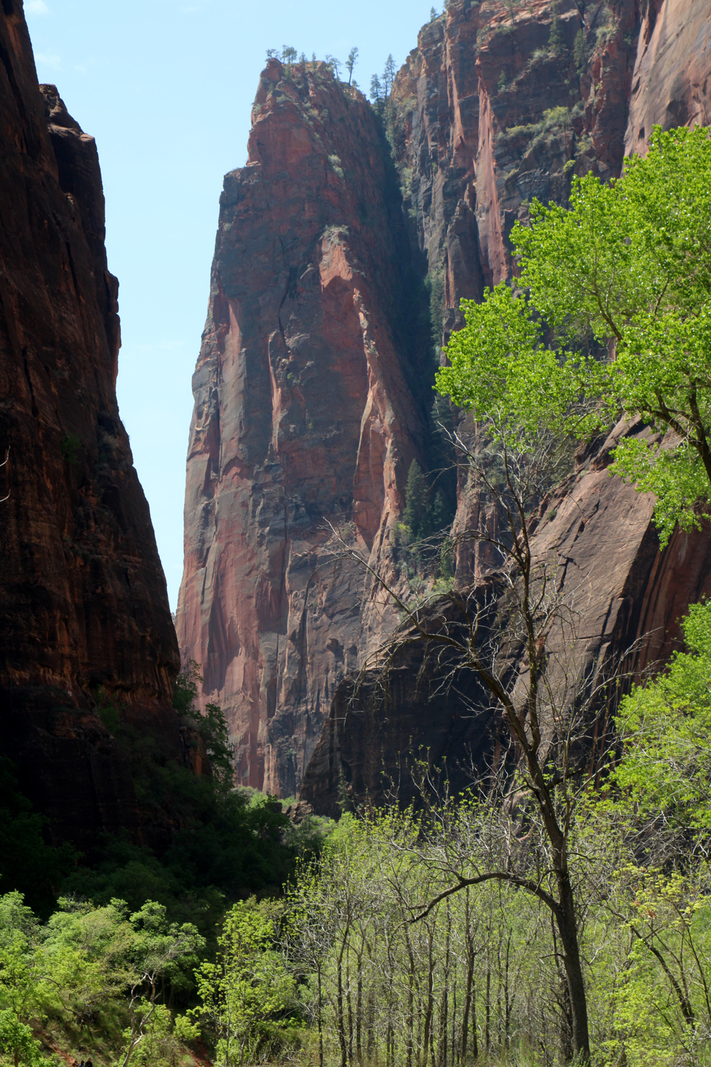
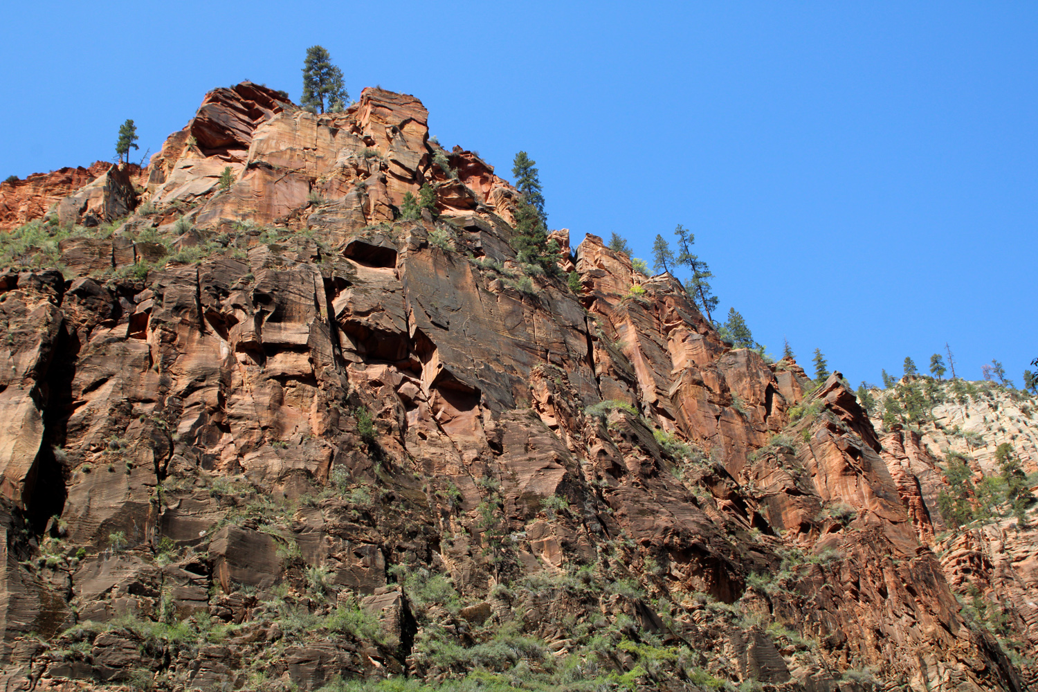
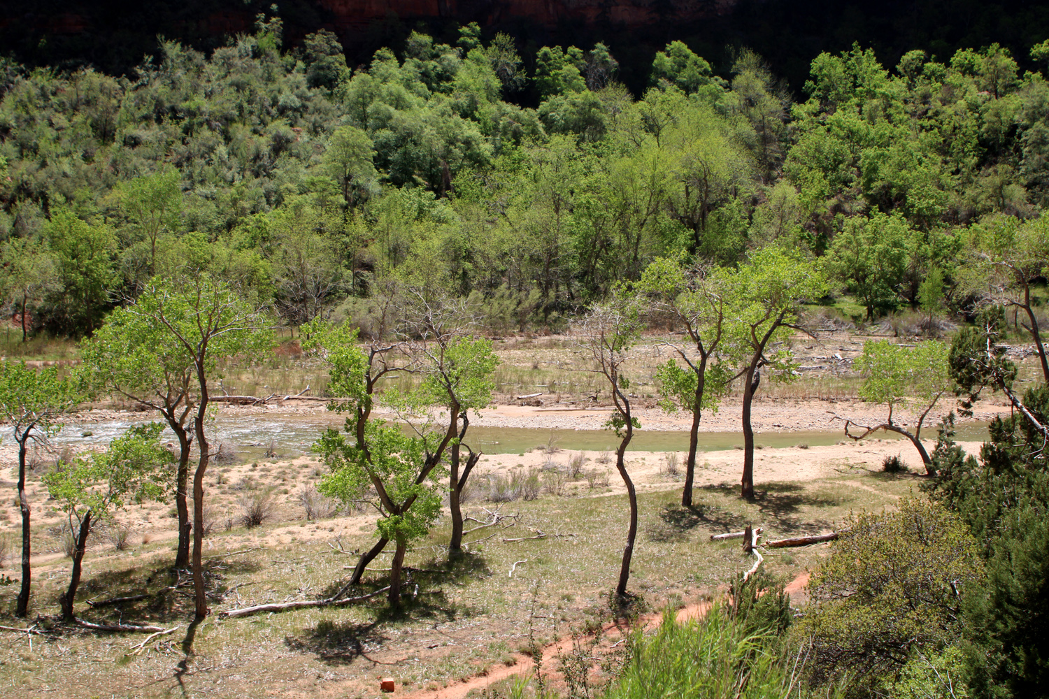
With limited exceptions, private cars are not allowed into the Virgin River Gorge section of the park, which starts just north of Springdale. A free shuttle bus carries visitors from a number of stops in town to the park entrance. At this point, visitors switch to the park-operated shuttle service, which makes frequent stops at a half dozen points of interest. You can get off and hike or sight-see, then ride to another stop, with buses coming about every ten minutes. We did three hikes during our day at Zion, starting off by riding to the end of the line, known as the Temple of Sinawava. The Riverside Walk starts here, and goes along the Virgin River for about a mile to the Narrows. Intrepid hikers can then go up the river as much as four miles, wading in the river much of the time. Teri did this hike in 2017, but I was not tempted. This time I stopped a little short of the Narrows, while Teri continued on a bit farther. Businesses in the town and at park entrance rent waterproof shoes and waders for those who care to venture into the river. Even before the Narrows, the route is through a deep and not very wide canyon, with scenery at every step. Because rainwater seeps into the sandstone walls and flows out through cracks at various locations, the path is lined with "hanging gardens," where bushes and plants have gained a foothold on the canyon walls. There are numerous wildflowers decorating the walk, including a California foothill favorite, the shooting star. |
|
|
|
|
The paved walk along the river toward The Narrows |
A wet spot on the cliffs where plants have got a good foothold |
|
|
| It was a surprise the find these familiar beauties, the shooting star | Not THE narrows, but a plenty narrow spot along the River Walk |
|
|
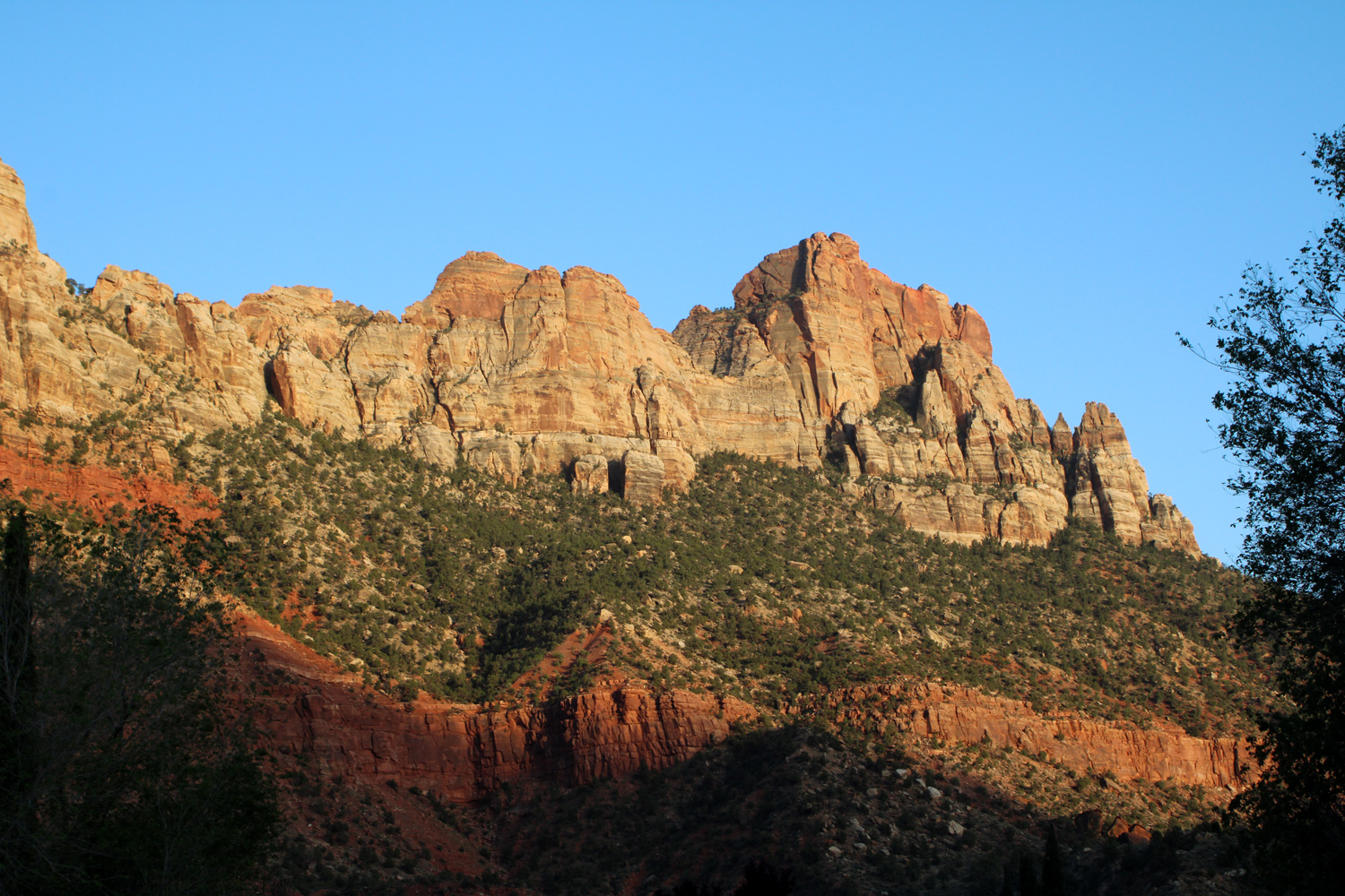
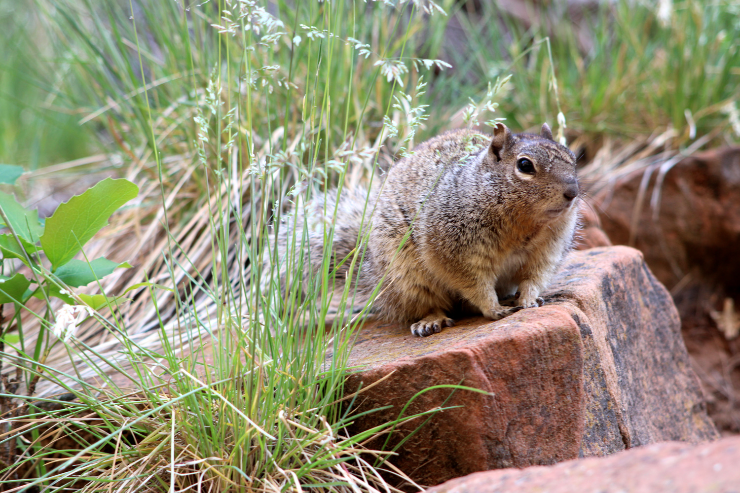
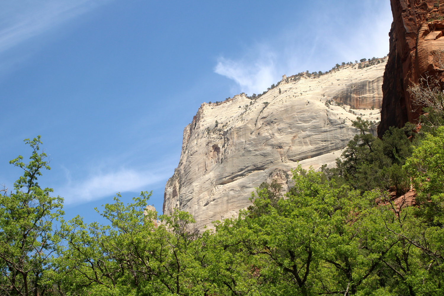
| Sandstone cliffs above the Virgin River | We met this guy and many of his relatives all over Utah |
|
When we finished our river hike, we took the shuttle back toward the park entrance, getting off at The Grotto. A short, mostly level trail starts here and goes to Zion Lodge, where there is lodging, a restaurant and a store. We indulged in a candy bar at this stop. Along the way the trail offered views of the river and the surrounding cliffs. Even though it is very close to the road, there is not enough traffic for this to be a problem. |
|
|
|
| Along the Virgin River near The Grotto | Light tan sandstone contrasts with the red |
|
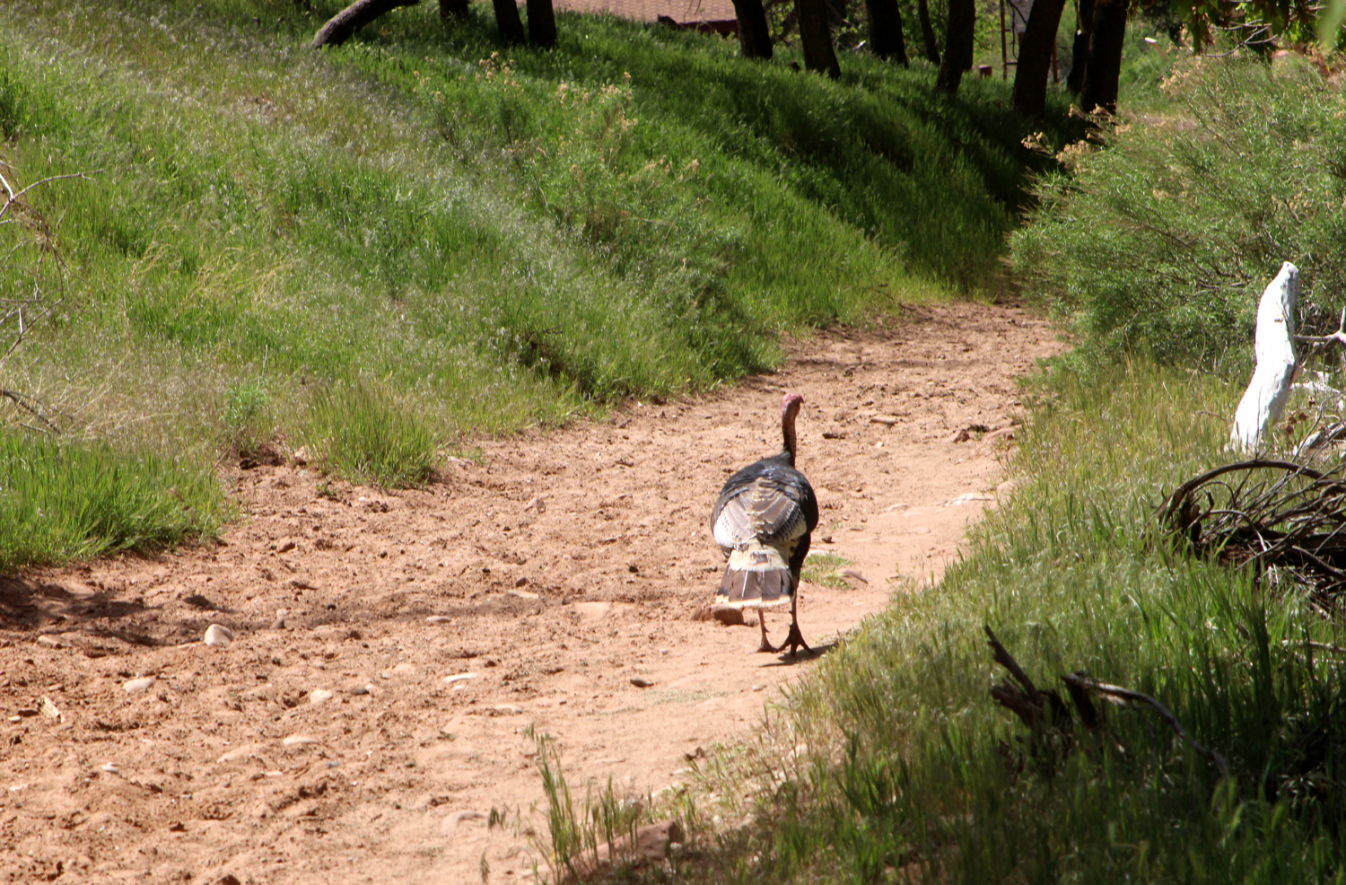
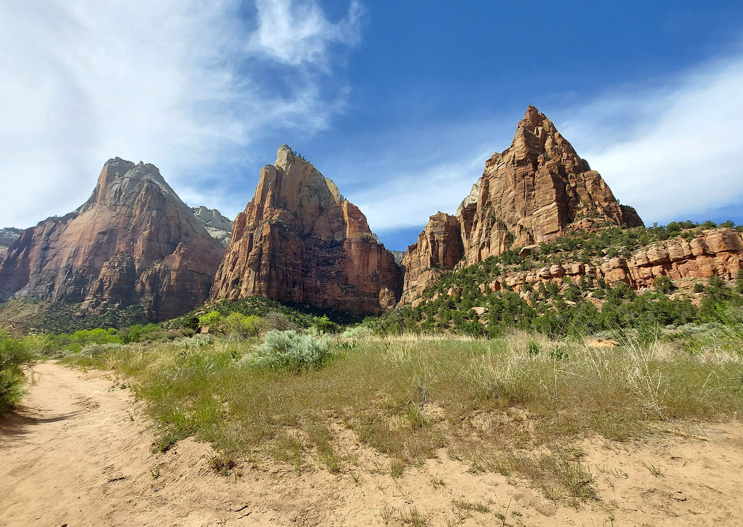
After our time at the lodge, we took the shuttle to the Court of the Patriarchs, so named because three matching peaks on the west side of the gorge made early Mormon pioneers think of the biblical characters Abraham, Isaac and Jacob. We crossed the road and the river and followed a short trail. After crossing the river on a foot bridge, the trail rises up and joins a horse trail that I hiked on in 2017, something I would never do again. Along the way we saw a wild turkey and enjoyed the view of the massive sandstone formations. |
|
|
|
| Wild turkey on the trail | The Patriarchs |
|
We crossed back over the river to the shuttle stop, and rode to the park entrance. Here we caught the Springdale shuttle back to our motel, our Zion adventure and our 12-day Utah trip at an end. All that was left the next day was to take Utah 9 out to I-15 back into California and home on California highways 58 and 99. |
|
|
Final Thoughts Weather: If I had to reduce it to one word, that word would be "windy." For the most part, it was a welcome breeze on the warm days we enjoyed at Arches. Once we headed south, we had a strong wind and cool to cold weather the next three days, at Natural Bridges and Capitol Reef. Arches had received a little snow about a week before our arrival. And as mentioned, we had a few snow flakes our first evening at Capitol Reef. In Zion the weather was perfect for hiking - enough breeze to keep us from being uncomfortably warm, and no need for an outer layer. Weather was nice when we got back home, too.
--Dick Estel, May 2022 |
|
|
Here's where I usually have a link to "More Photos" at the bottom of the page. Because this report is so long, the additional photos will be on a separate page. |
|