2016 Ramblers Hikes Page 1 (January to April) |
||
|
The Ramblers are Carolyn Amicone, Julie Hornback, Wes Thiessen, and Dick Estel, former colleagues at the Fresno County Department of Social Services. Every month or so we get together for a short hike, good conversation, and lunch. |
||
|
2015 Hikes Page 1 2015 Hikes Page 2 2016 Hikes Page 2 2016 Hikes Page 3 San Joaquin River Gorge Stockton Creek Preserve Edison Point Trail |
||
|
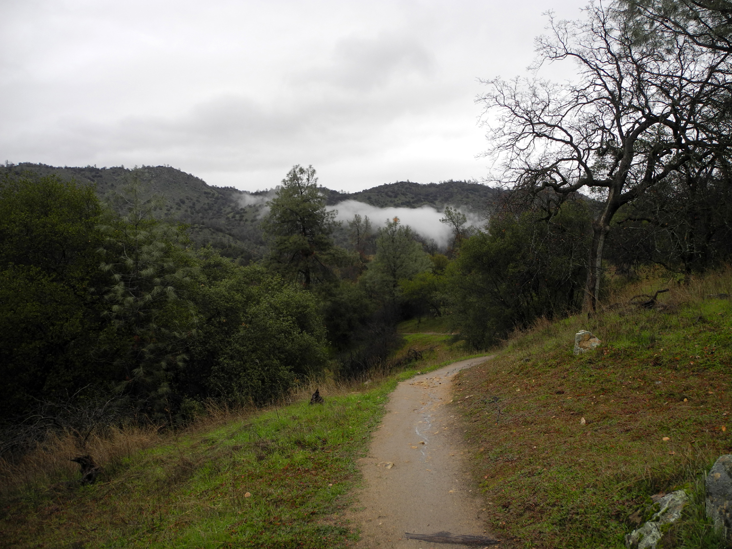
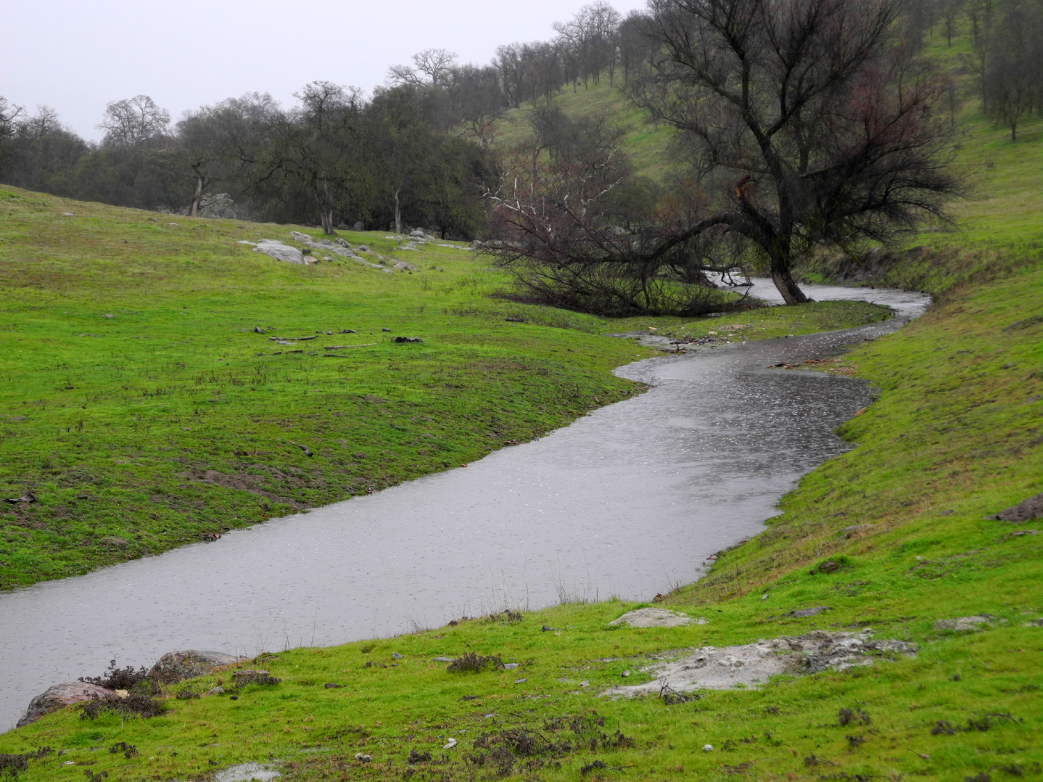
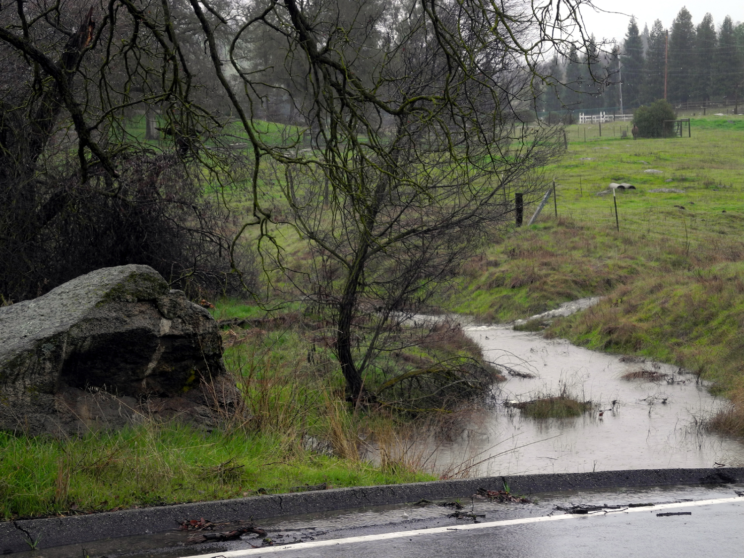
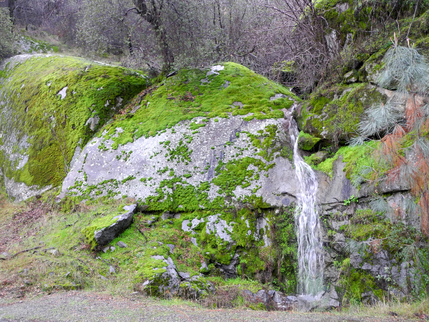
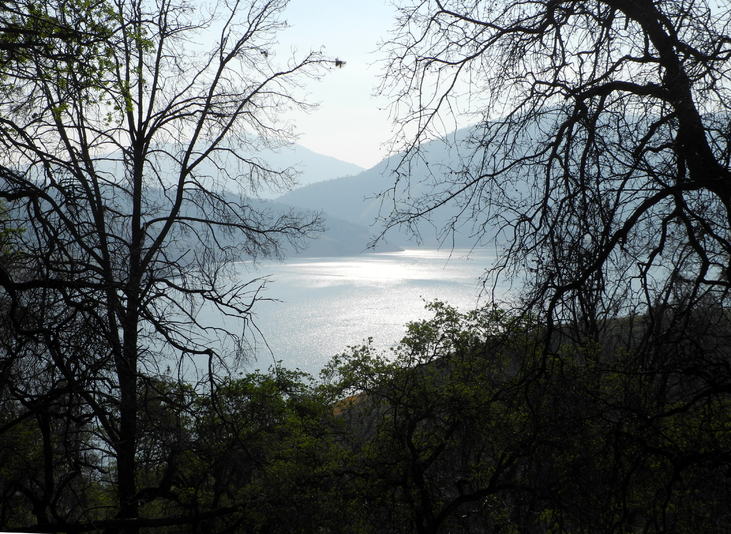
San Joaquin River Gorge The Ramblers have re-scheduled hikes due to weather. Members have missed hikes due to health or other reasons. But we've never completely cancelled an outing. Since we got on a monthly schedule late in 2014, we've hiked every month, and twice one spring month when a single foray into nature didn't provide enough opportunity to enjoy the profusion of wildflowers. Therefore, with rain predicted every day of the 10-day forecast in early January, we were struggling to find a workable date. Of course, it didn't rain every one of those days, but many days it did. We settled on a date after the 10-day period, but a few days later rain was again predicted for the chosen time. Four days before the big day, we discussed what to do. Finally Wes suggested, and we all agreed, that we would go to our planned destination, the San Joaquin River Gorge, rain or shine. If it rained, we would enjoy the green foothills and stop at the visitor center, and maybe get out briefly during breaks in the storm. On January 19 the rain was supposed to start at 10 a.m., about the time we would arrive at our destination. Instead it started at 3 a.m., and continued almost non-stop for twelve hours. We were undeterred, and sticking with our plans, we piled into Wes's Toyota Highlander at Julie's house around 9:30. Once we got into the foothills, we were met with delightful and sometimes spectacular views at every turn. The hills have been green since early November, but with the rain they seemed to have an extra bright shine. Every speck of dust had been washed from the granite outcroppings, presenting clean, white shapes among the grass and trees. There are two main routes from the Fresno area to our destination and nearby locations - State Highway 168 or Auberry Road. Both go through the foothills and come together at Prather, about 30 miles from Fresno, and a few miles before Auberry. The difference in mileage and time is negligible. We went north and east through the city, getting on Auberry Road where it goes straight north. Soon it drops down from the flat valley floor to the broad valley of Little Dry Creek, and we were happy to see this stream running strongly. Nearly every drainage channel had a flow of water being added to the larger creeks. We realized we would not be hiking, so we had plenty of time, and took a slightly out of the way route, leaving Auberry Road and taking Millerton Road more or less southeast toward Highway 168. Along the way we crossed the North Fork of Little Dry Creek, looking ever so scenic. We then crossed the main creek on bridges three times. We understood that the only way we would have a photographic record of our journey was for someone to get out in the rain and take pictures, so I volunteered. We stopped where a bridge went across the North Fork, and I jumped out, took several photos, and got back in the car, not very wet. We came out to Highway 168 and turned left toward the foothill communities of Prather and Auberry, along the way to our destination. Once again we crossed Little Dry Creek. I had taken a picture at this spot last fall when the creek was dry, so I had to get out and get one with water, this time waking a good 100 feet in the rain to get to the right spot. There was one more photo opportunity, on Smalley Road a short distance from the San Joaquin Gorge parking area - a seasonal waterfall, about 15 feet high, running down a cliff surrounded by mossy rocks and greenery. This required only a short time outside, and everyone got a good look since the falls was only a few feet from the car. Wes wisely puts towels on the floorboards of his car to protect the carpet from the mud, dirt and sand particles that get tracked in during any season. By the time of my third venture into the weather, the towel beneath my feet was getting pretty wet, and I was thinking we needed another layer there. We drove past the the San Joaquin Gorge main parking area to where the road ends at the new power house. Here there is a short trail down to the river, which we decided to visit someday, but not this very wet day. We went back toward the visitor center, but were stopped by a gate across the road, even though it was during the hours the center is normally open. Perhaps the BLM staff thought there would be no visitors this day and decided to enjoy a rain day. We went to the main parking lot, and Wes and I got out to use the restroom. We realized that it was not raining, and walked out into the countryside a few feet, then decided to walk down the trail a short distance. Carolyn and Julie did not have their boots on, and feared that by the time they got ready, it would be raining again, so Wes and I set out on the trail. We went perhaps a half mile, maybe less, then started back. We were about 100 feet from the car when it began sprinkling, and by the time we got on the road, it was raining steadily once more. As we drove out and said goodbye to the area, nature sent us on our way with a flock of quail flying low across the road in front of us. Following our usual practice in this part of the country, we stopped for an excellent Mexican lunch at Velasco's Restaurant in Prather, then continued down the road and home. The rain pretty much stopped as we got back to the city, having fallen steadily for twelve hours. Later we were glad our route had not been up state highway 41 toward Oakhurst and Yosemite, since this road was closed from about the middle of the day until after dark the next day by a rock slide.
|
||
|
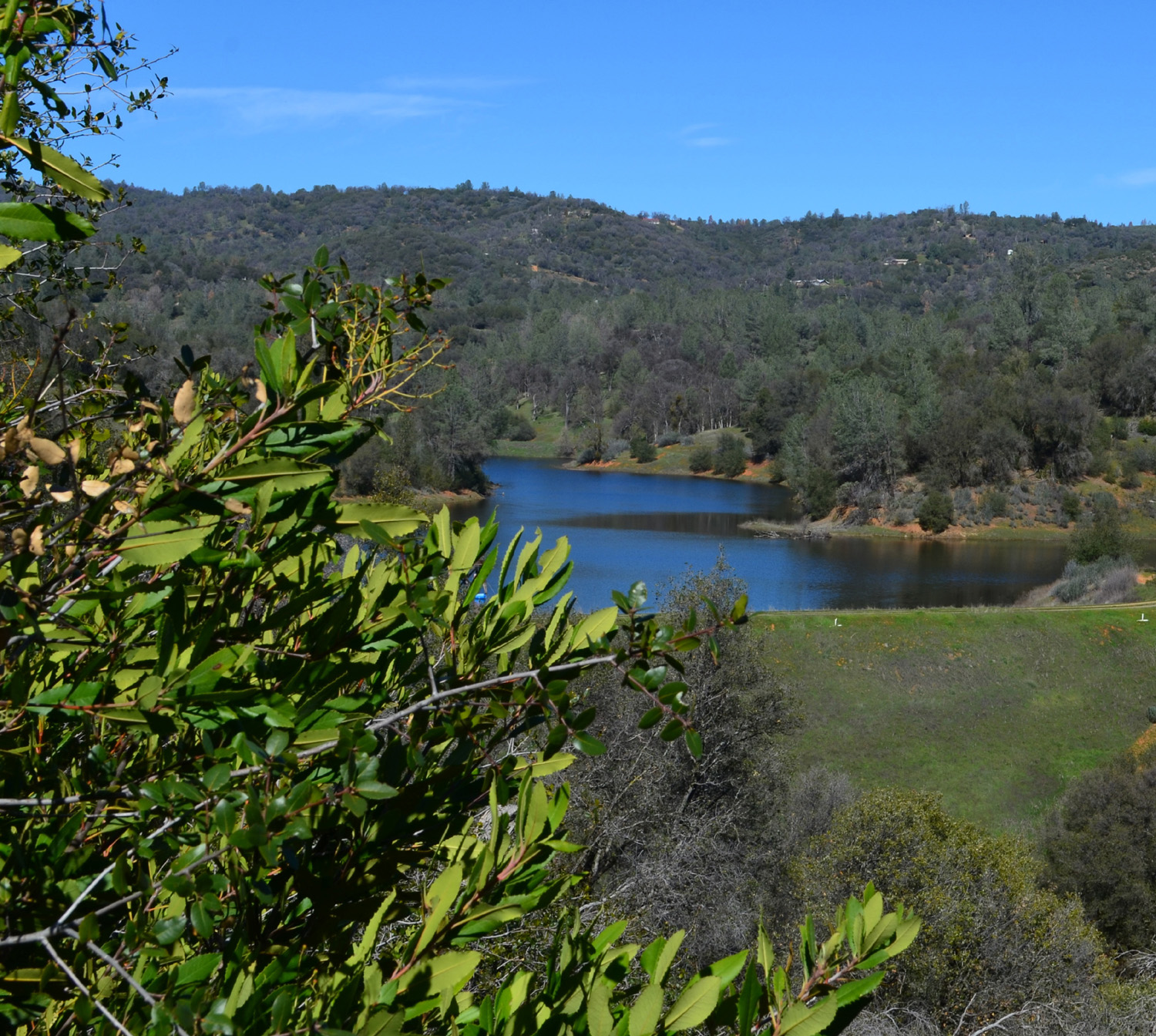
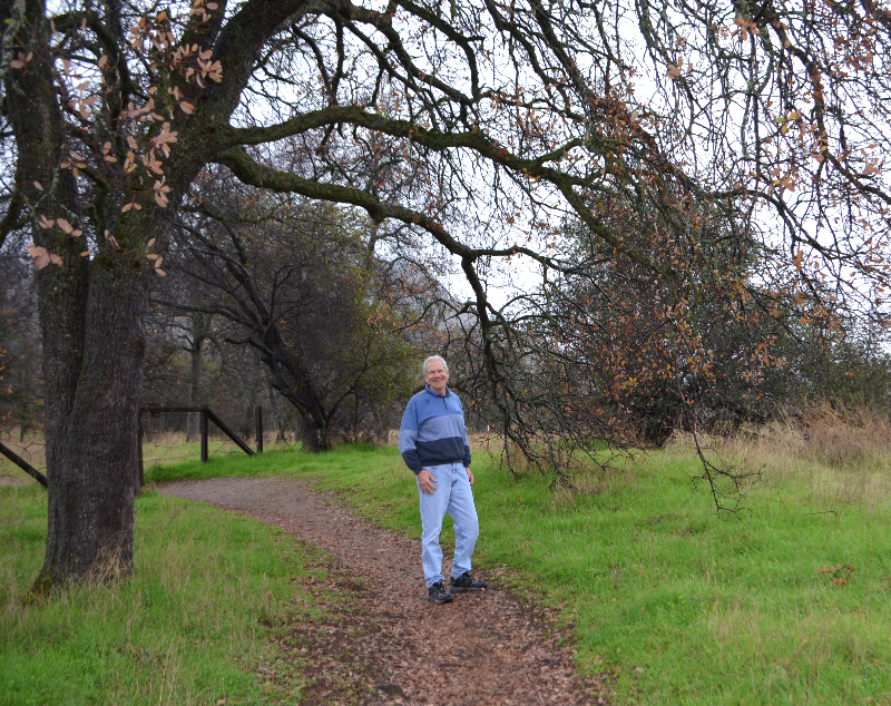
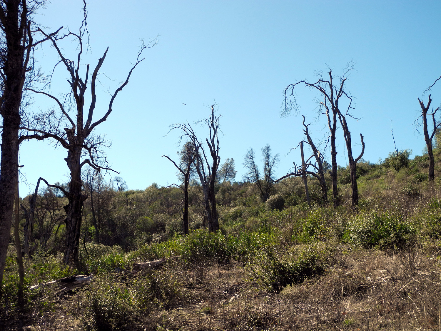
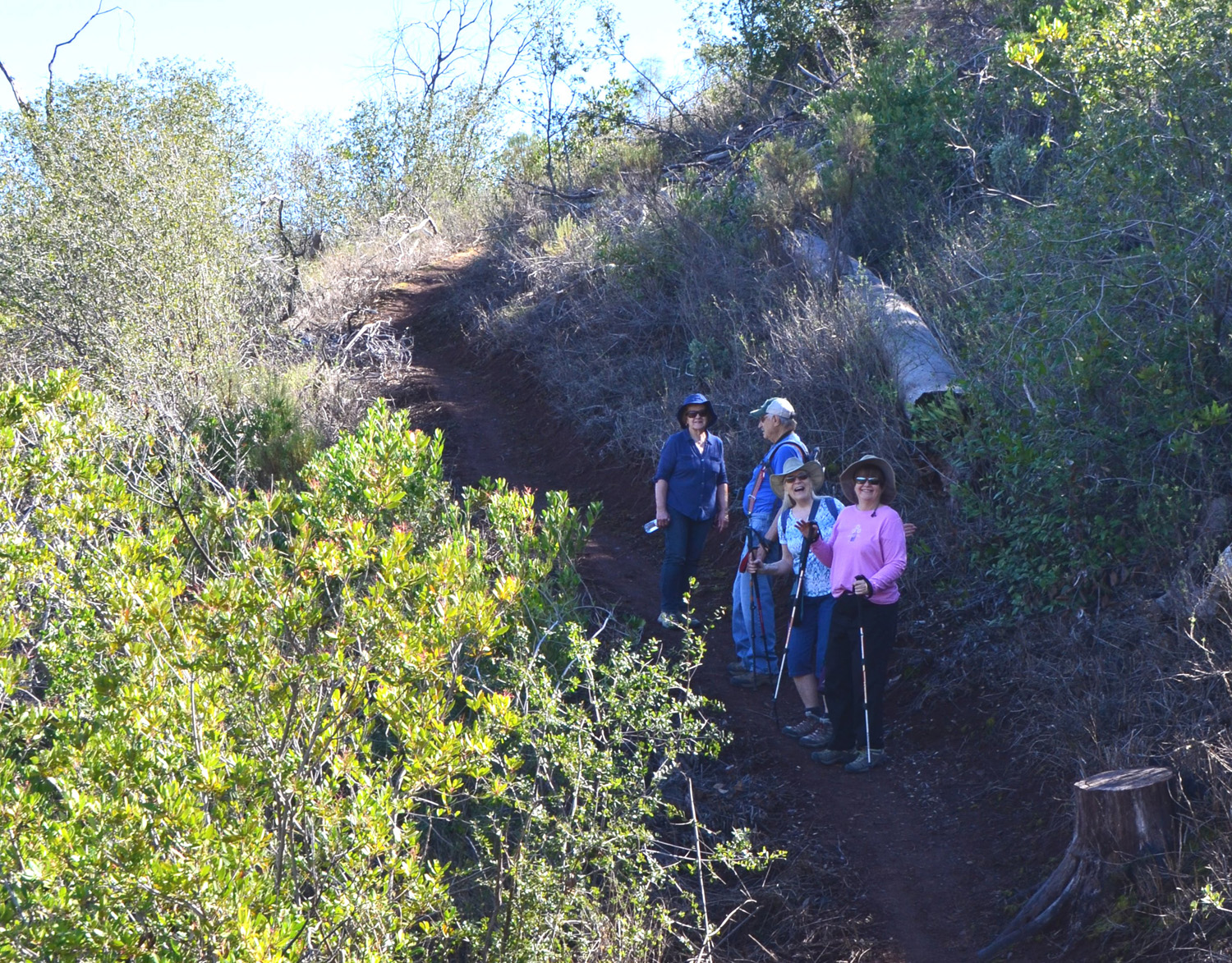
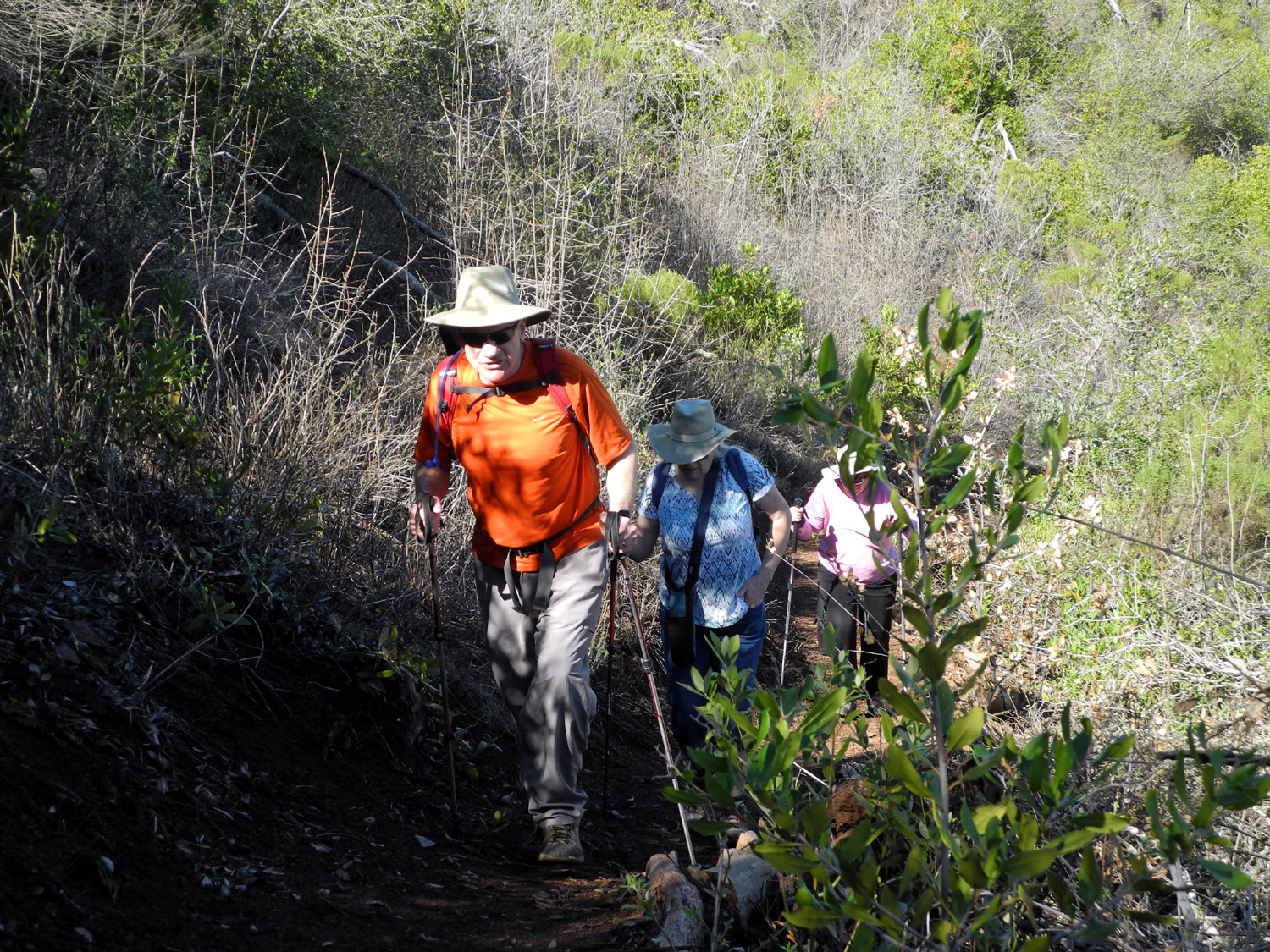
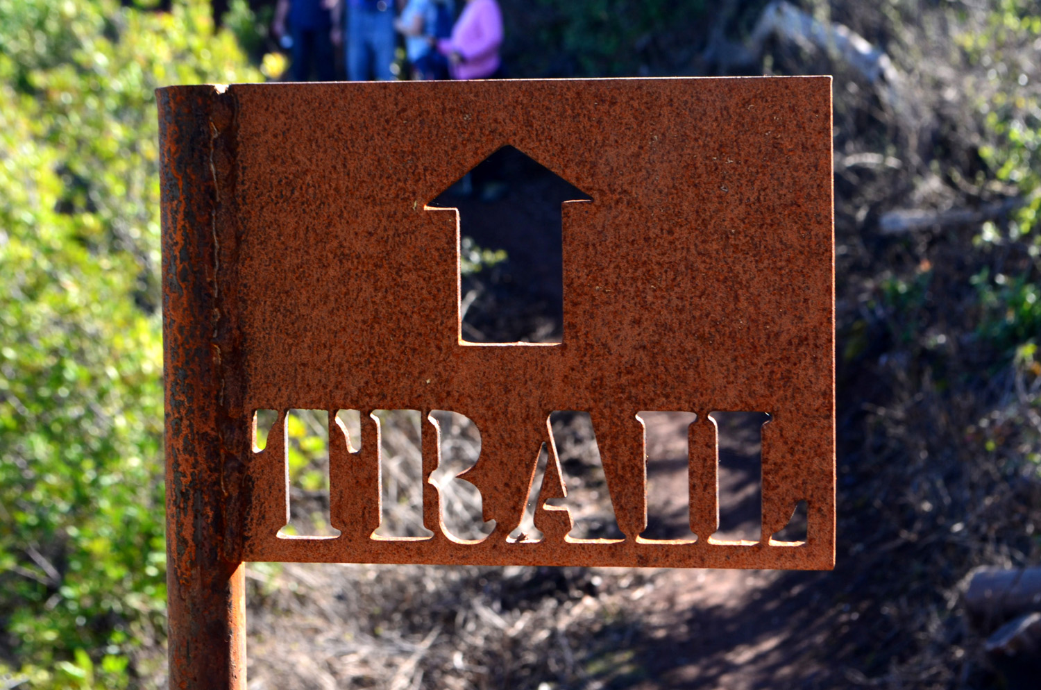
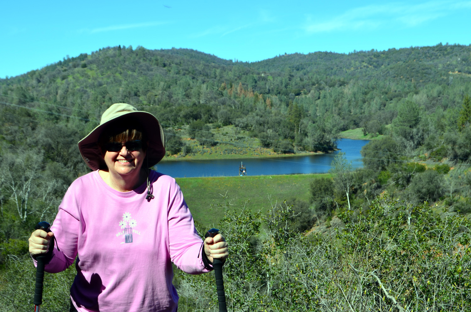
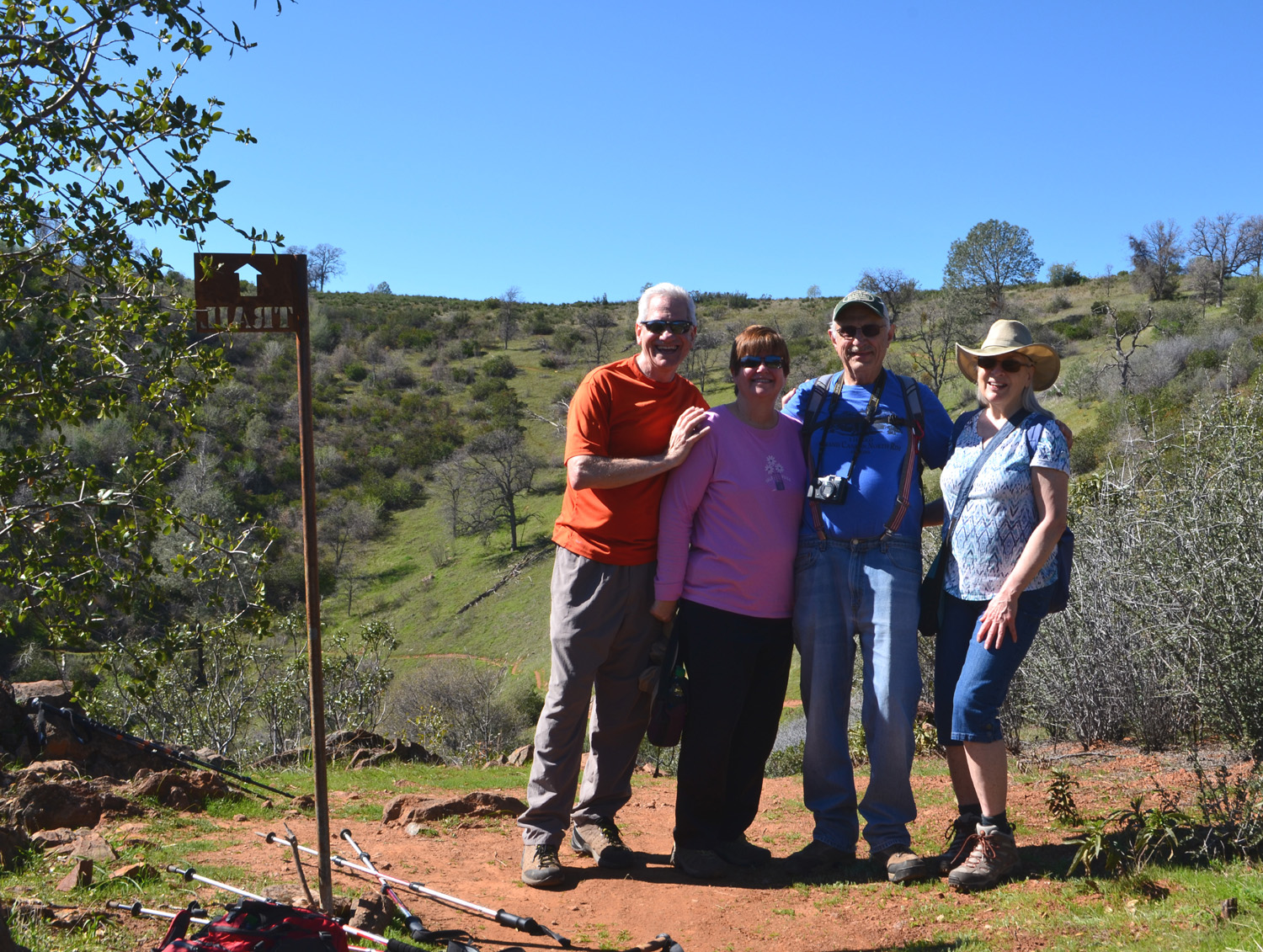
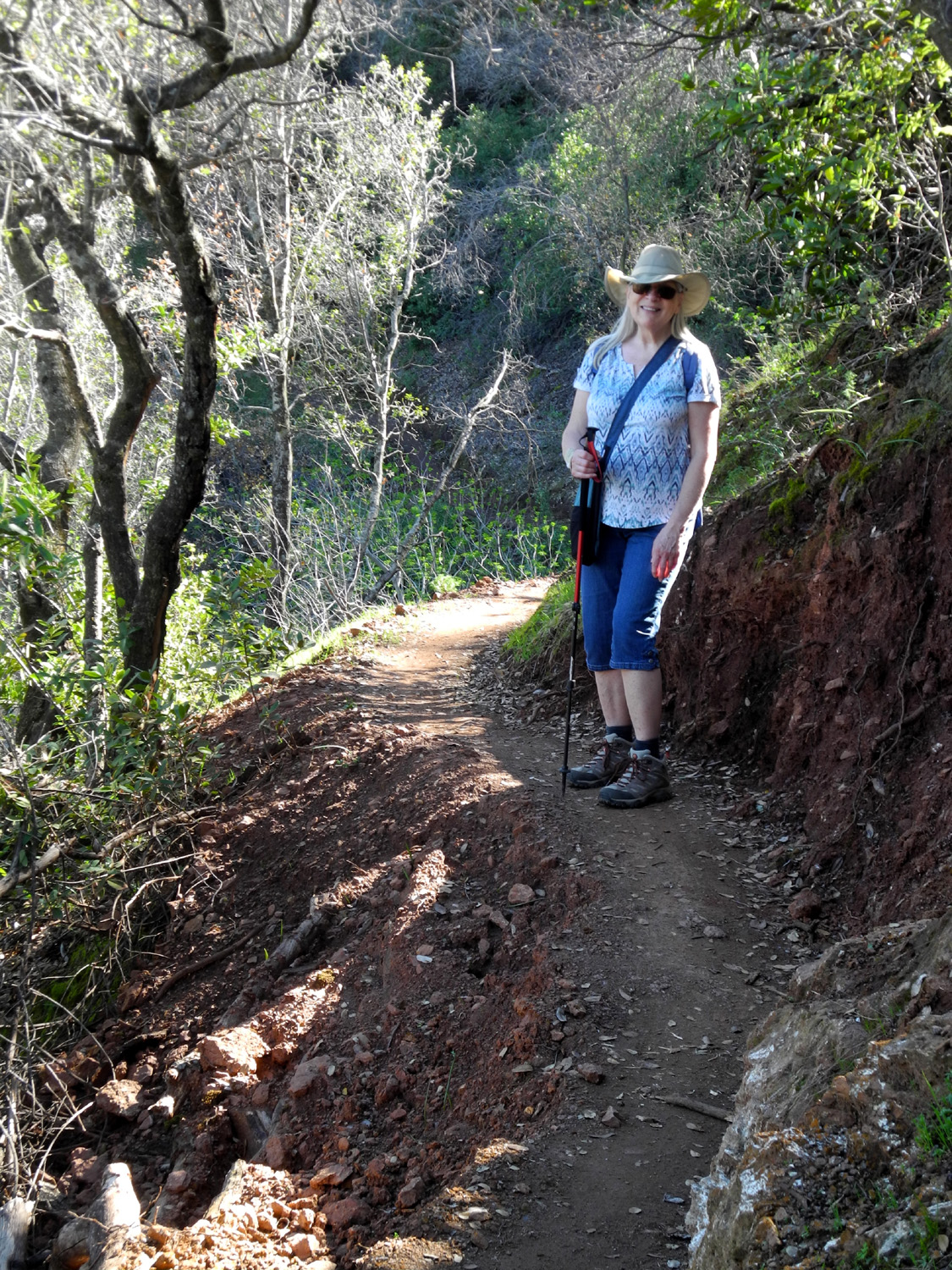
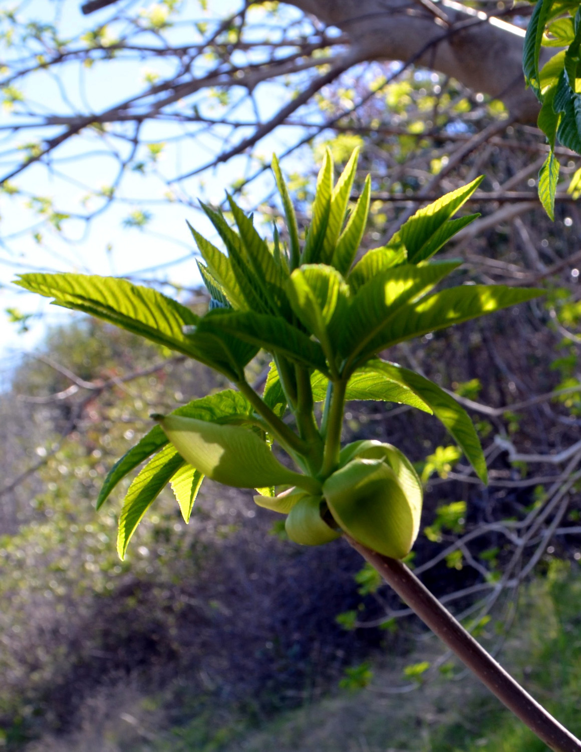
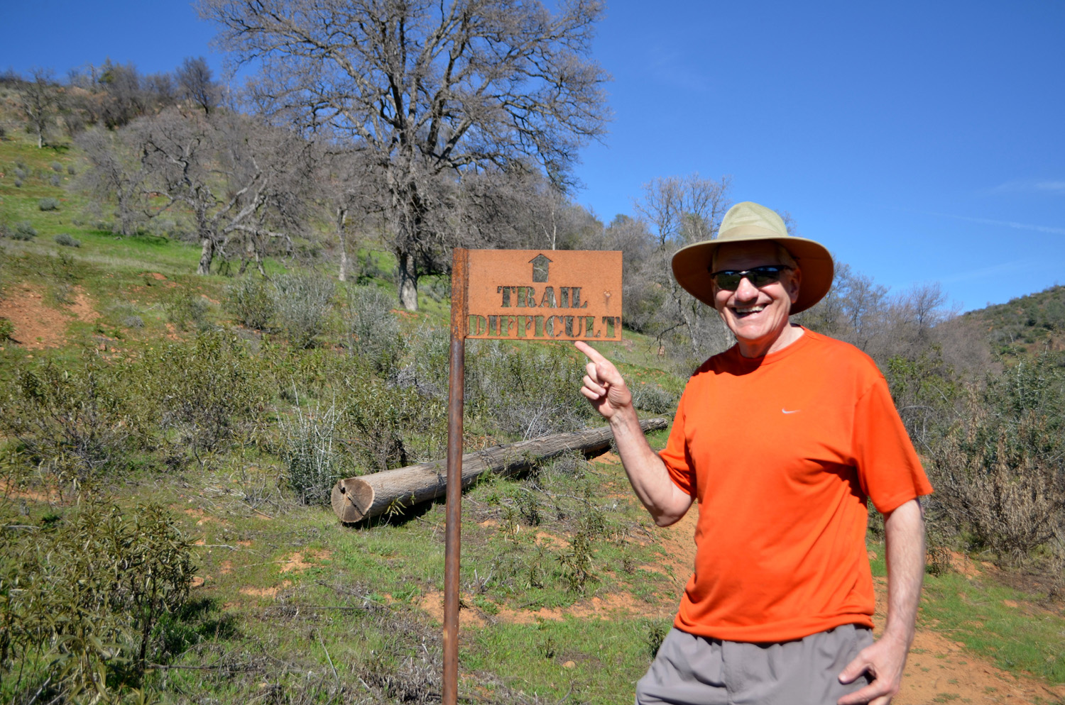
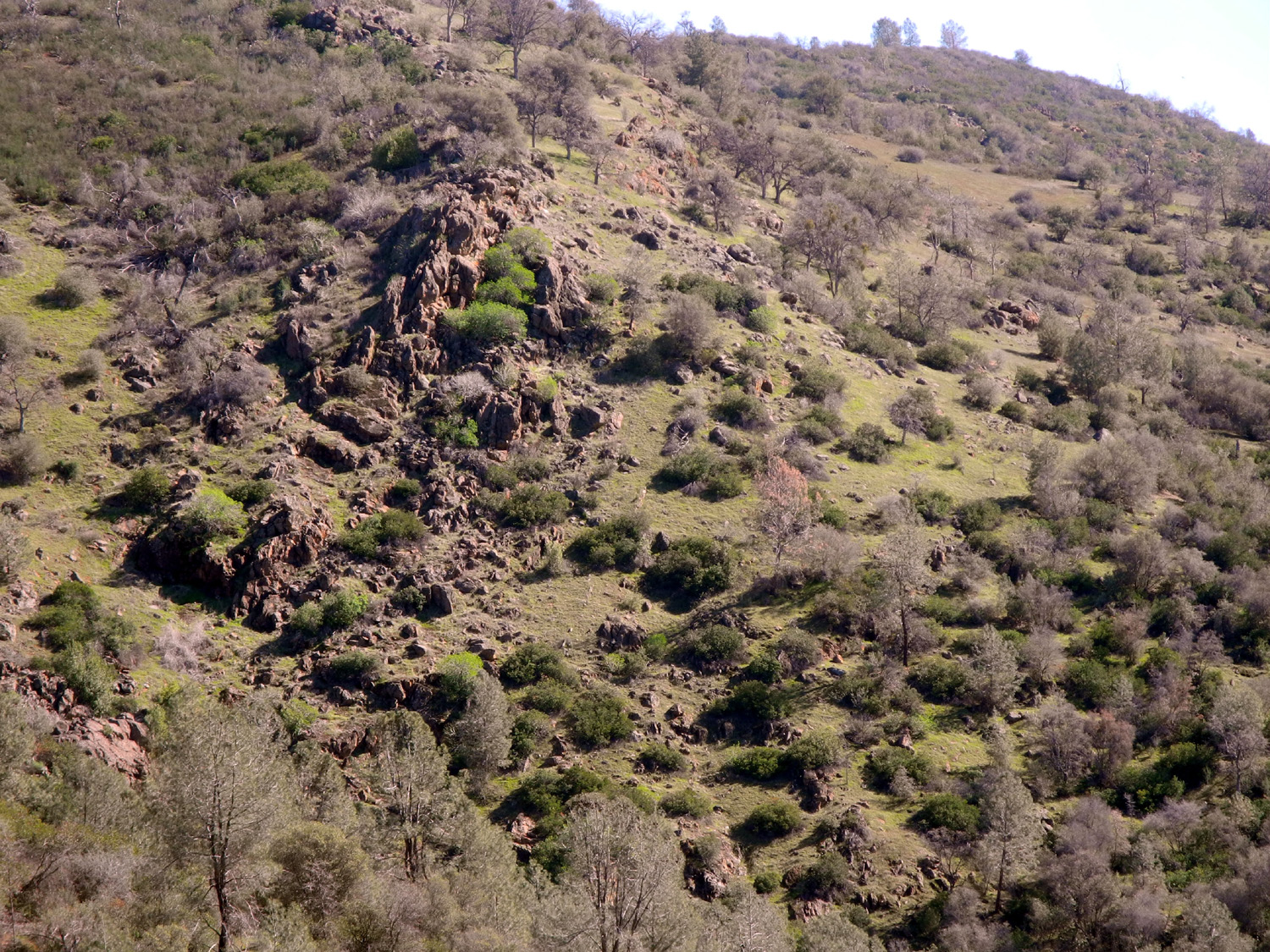
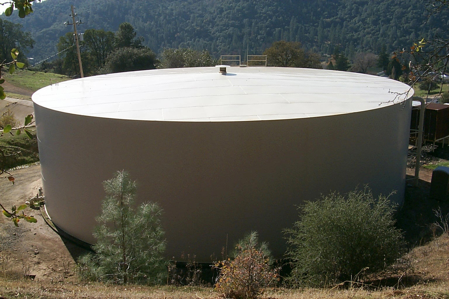
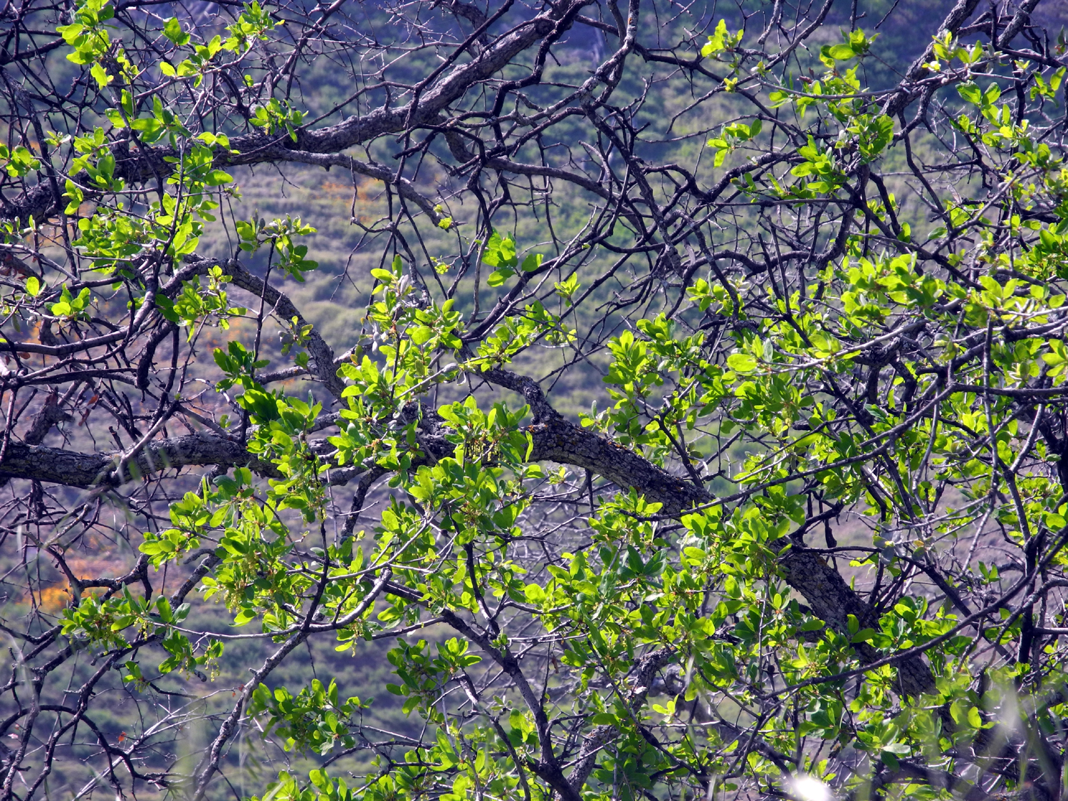
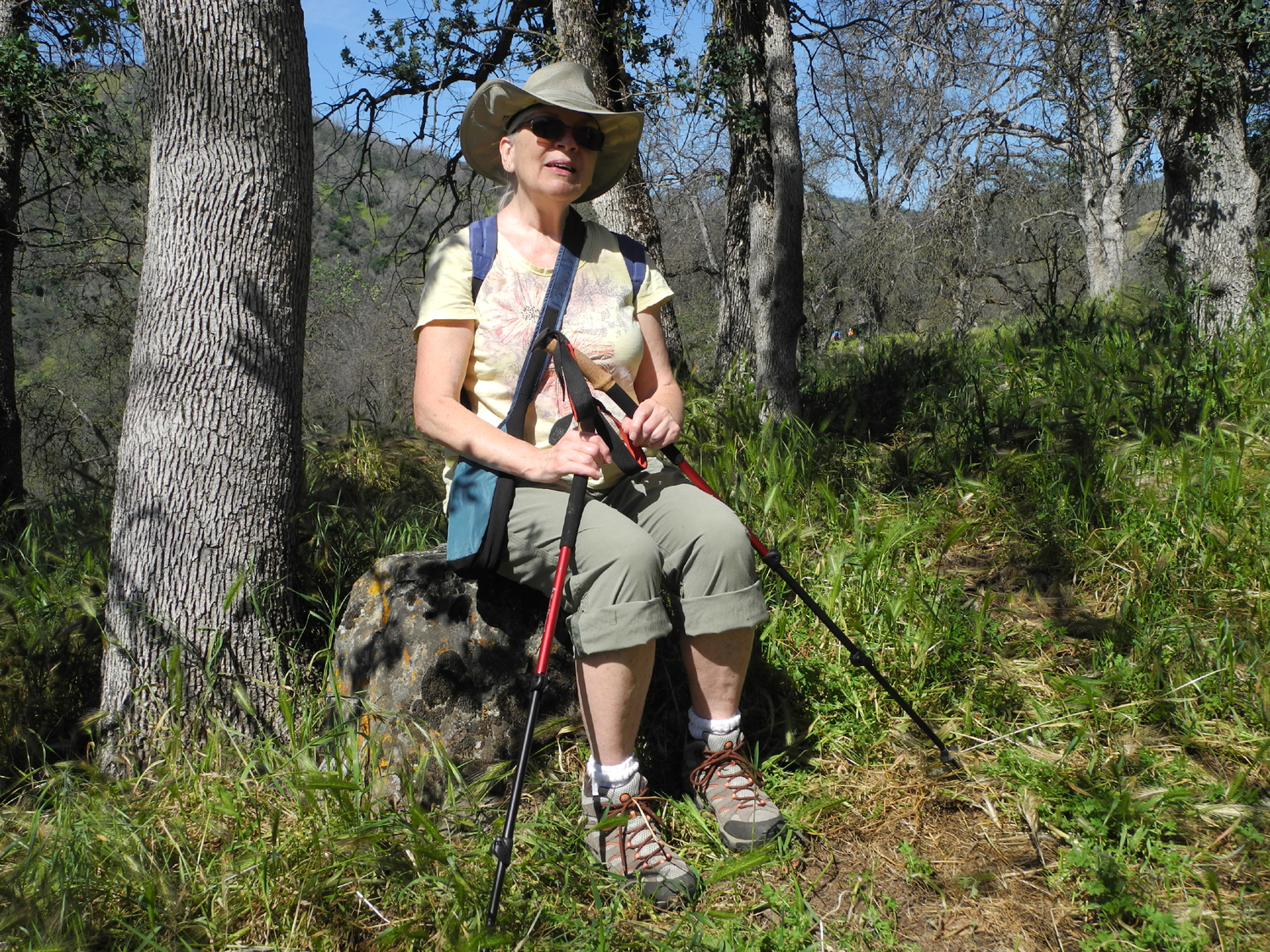
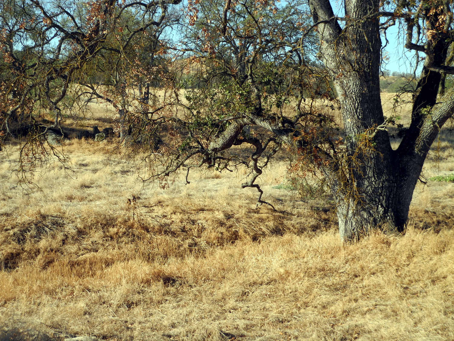
Stockton Creek Preserve In March of 2014 I was in Mariposa with my daughter Jennifer, doing some work on my parents' gravestones. When we finished our task, we decided to walk on a dirt road that goes from Highway 140 north of town to the Mariposa Reservoir on Stockton Creek. We had walked in there a number of years earlier, and it was a short, pleasant hike. About 200 yards down the road we discovered a trail going west and up the ridge that lies between the town and the creek. We walked it a short distance, then left for home. It proved to be a newly developed trail, in an area that had recently been designated the Stockton Creek Preserve. At just above 2,000 feet in elevation, it seemed like a good place for a cool weather hike, so on February 16 I returned there with the Ramblers for our second outing of the year and our first real hike. (Our first trip turned out to be a drive in the rain.) As soon as we settled on the date, I got in touch with my friend Susan Merrill Crandall and invited her to join us. Our family friendship goes back to when our grandfathers were friends as young boys in Ohio in about 1902. She lives on the family property that the Merrill's first moved to around 1940. Susan had a meeting, but could leave any time, so I arranged to call her when we got close to the departure point. Our expected arrival time was 10:30. Susan's meeting ended early and she got to the trailhead by that time, but we were over 30 minutes late. She had returned to town to run some errands, but drove up about a minute after we arrived. After introductions, we started down the trail, which at first is a wide dirt road, with a locked gate preventing unauthorized vehicle access. In my high school days, this was part of the route for our annual "cross country" run. A road behind the school went up to where the water treatment plant is now located, then followed the contour of the mountain, being level all the way to the dam. This road goes back many decades, pre-dating the construction of the dam in the 1950s. At the dam, runners scrambled up a rough trail to the side, then got on a dirt road that went up a fairly gentle slope to Highway 140. Just south of this location, the old highway route, still in use and paved, goes down toward the school. The complete circuit was a little over four miles. Today's trail route follows the road for only a short distance, then turns west up the hill. It's not very well marked, but there is a small metal sign, about two feet high, that reads "trail." On the opposite side of the road, the other end of this long loop trail zig zags down the hill to the road. The trail is divided into two parts, referred to as the upper and lower trails, and on the other end they meet near the water treatment plant, giving road access to both ends. This was the other Ramblers first visit to this area, and neither Susan nor I had walked the entire length of either trail, so we were not sure what to expect. There had been a fire in the area a number of years ago, so the first part of the trail is through very open country, unusual in that part of the Sierra foothills. There are many dead, burned trees. In developing the area for the trail, a lot of brush removal had been done, but there are still many small bushes on the hillside. We came to a place where the trail went down a fairly steep hill, which I recognized as the place where Jennifer and I turned back. This was partly because of not wanting to go down then back up, but mostly because her husband was fixing dinner for us at her house. The Ramblers and Susan were undaunted by the hill and continued on into what was now unknown territory for me. It was quite warm, and everyone was wishing there was some shade, and soon that wish was granted. The trail entered an area the fire had not reached, and there were large oak trees, pines, and buckeyes. All along this part of the trail, we were also treated to views of the reservoir, surrounded by green grass and trees. The trail started back up hill, and we made a fairly steep climb for quite a while. A level trail went off to our left, but it seemed clear that the real trail was the steeper choice. Wes took the alternate route to see what would happen, and soon found himself going straight up the hill to rejoin us on the main route. At this point it became decision time. A sign at the start had said that the upper trail was 1.6 miles in length, and we had gone about half that. Wes went a little further up the trail to where it looked like it leveled out or maybe started down, but it just went up some more. We did not think we wanted to walk the rest of the trail, and then have to retrace our steps. On the other hand, turning back here meant going back down a rather steep section. Susan volunteered to go back to the trailhead and drive her car around to the other end of the trail, then take us back, so we could continue the full trail. We appreciated this, especially since it meant Susan ended up hiking alone, and also would end up spending more time waiting for us. It also meant that no matter what, we had to continue on to the end of the trail. As Wes put it, without Susan's help, "we would have been easy pickings for the vultures." We continued on up, finally reaching a ridge where we could see that we had quite a bit of trail yet to walk, although it was mostly level. At least it looked that way from where we stood, although in reality there were a number of fairly steep sections. These were not very long, and we walked carefully, making use of our poles. We also enjoyed more fantastic scenery, including some interesting rock formations across the canyon of Stockton Creek. We had hoped to see wildflowers, but it was a little too early at this elevation, and we saw only about a dozen individual plants in bloom. We eventually spotted the waterworks equipment and the million gallon storage tank, which meant we had to walk just a short downhill section to reach our destination. Where the trail came down to the old road that goes back to the dam we found a sign that read "Trail - Difficult." Of course, it was difficult no matter where you started, but no one had thought it necessary to post that warning at the end where we began. It also proved to be 1.8 miles according to my walking app. A town road goes up through a fence to the waterworks, but the gate was always locked in the past. The last house on the road is where my parents lived from the mid-1960s, and we had agreed to meet Susan there. I assumed we would have to walk down the very steep road and squeeze through the small opening beside the gate, but it was not locked, and we were very happy to see Susan driving as far in as she could, just below the end of the trail. She had to get back home and take care of various business and projects, so was not able to join us for lunch. She took us back to Wes's car, where we said our goodbyes and our heartfelt thanks for the "rescue." We drove downtown and enjoyed lunch at Castillo's. a great Mexican restaurant that has been keeping Mariposa residents and tourists happy for 25 years, then headed back down from the hills to the valley and home.
|
||
|
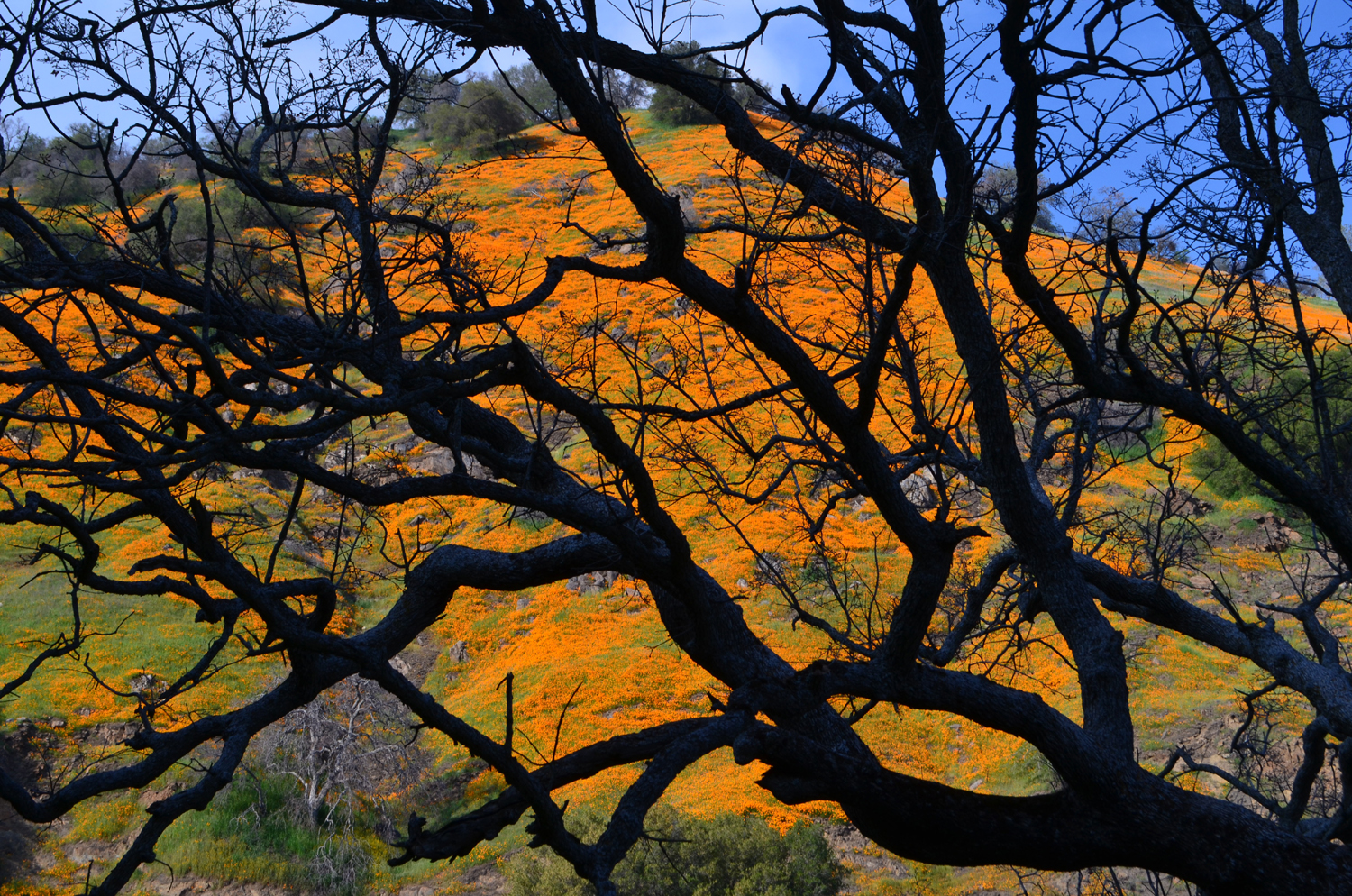
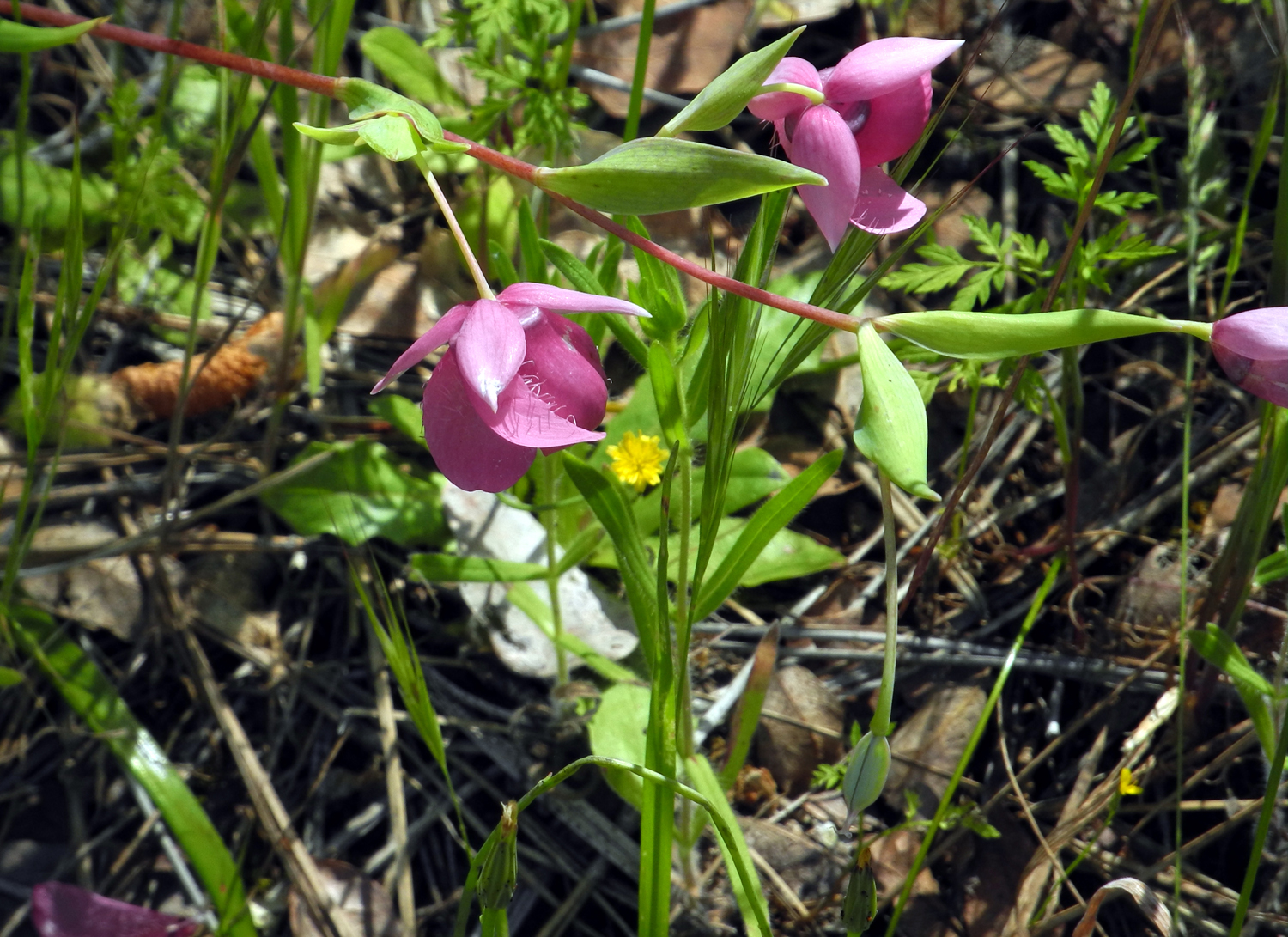
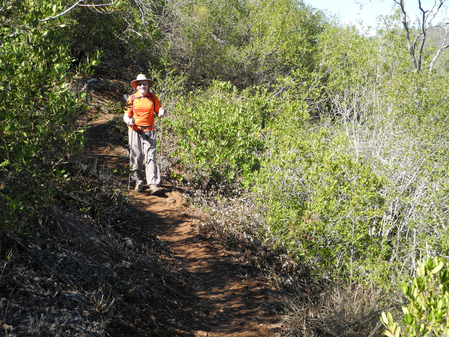
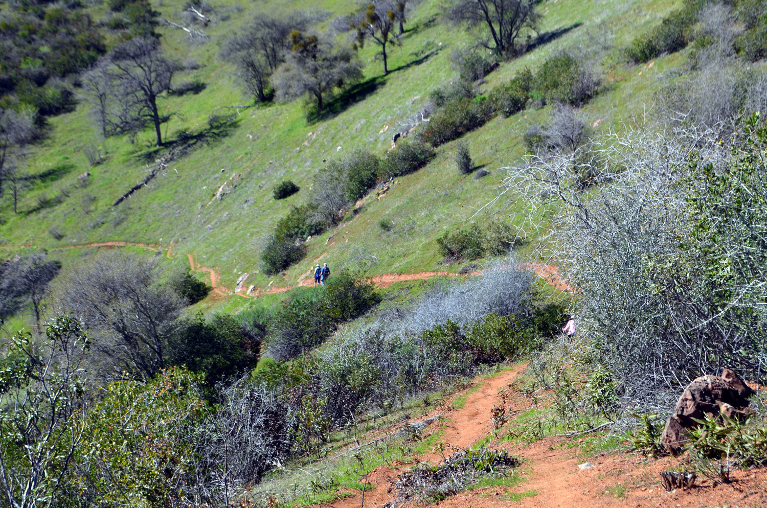
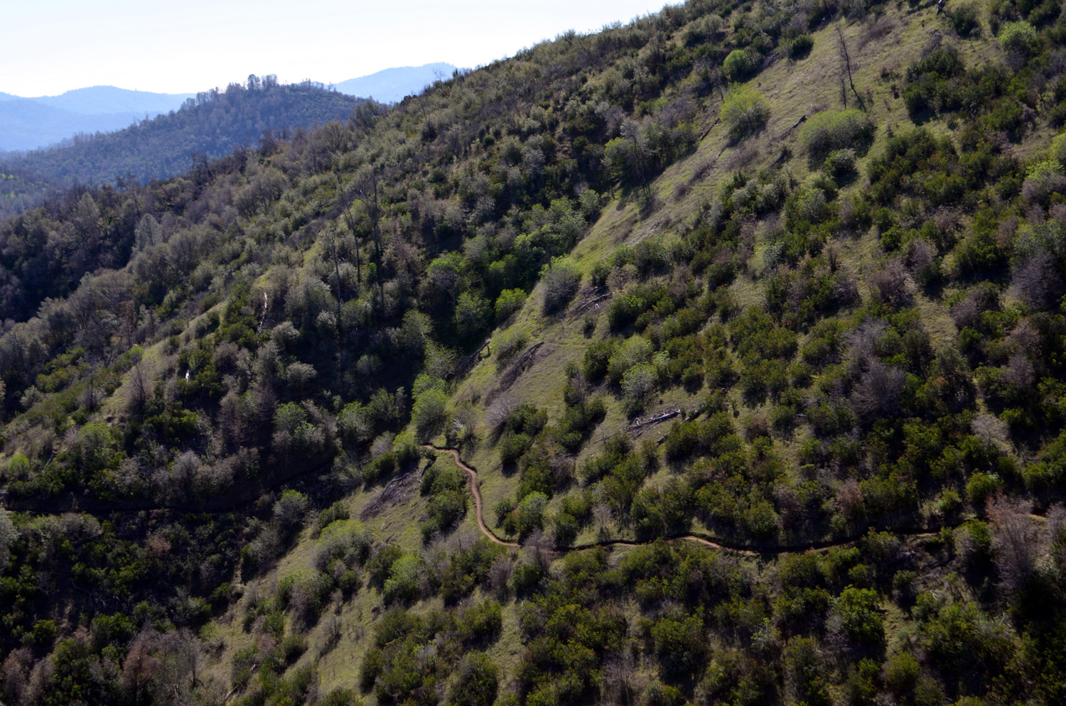
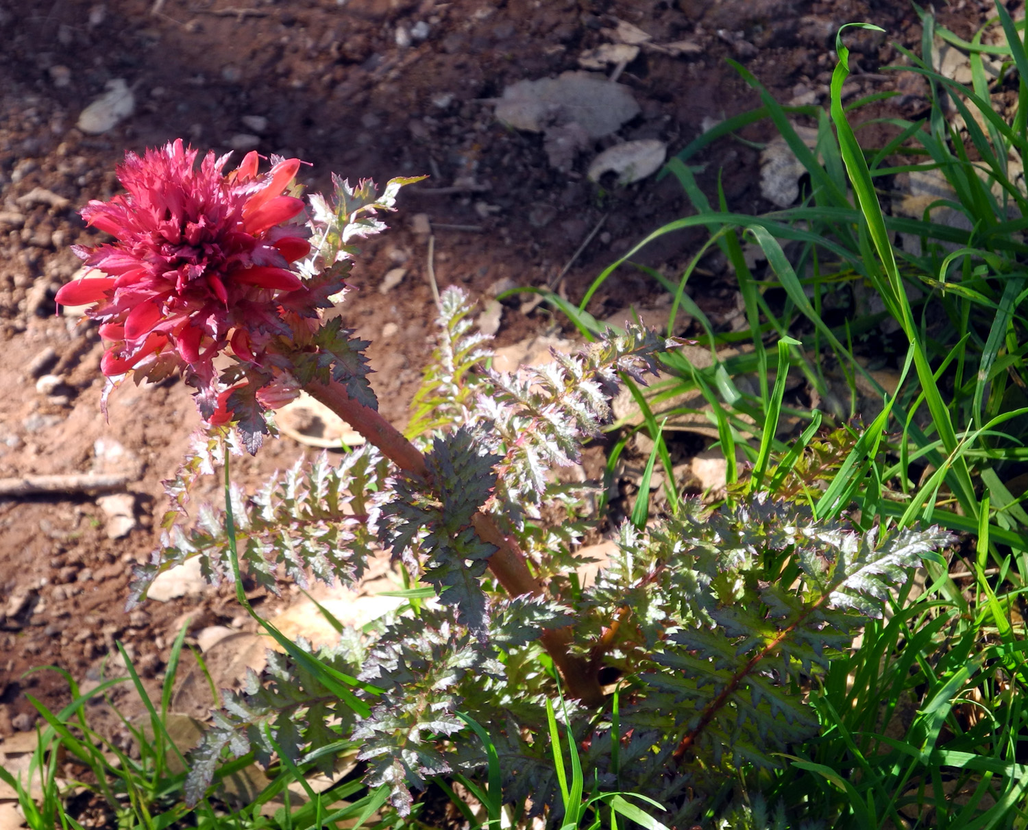
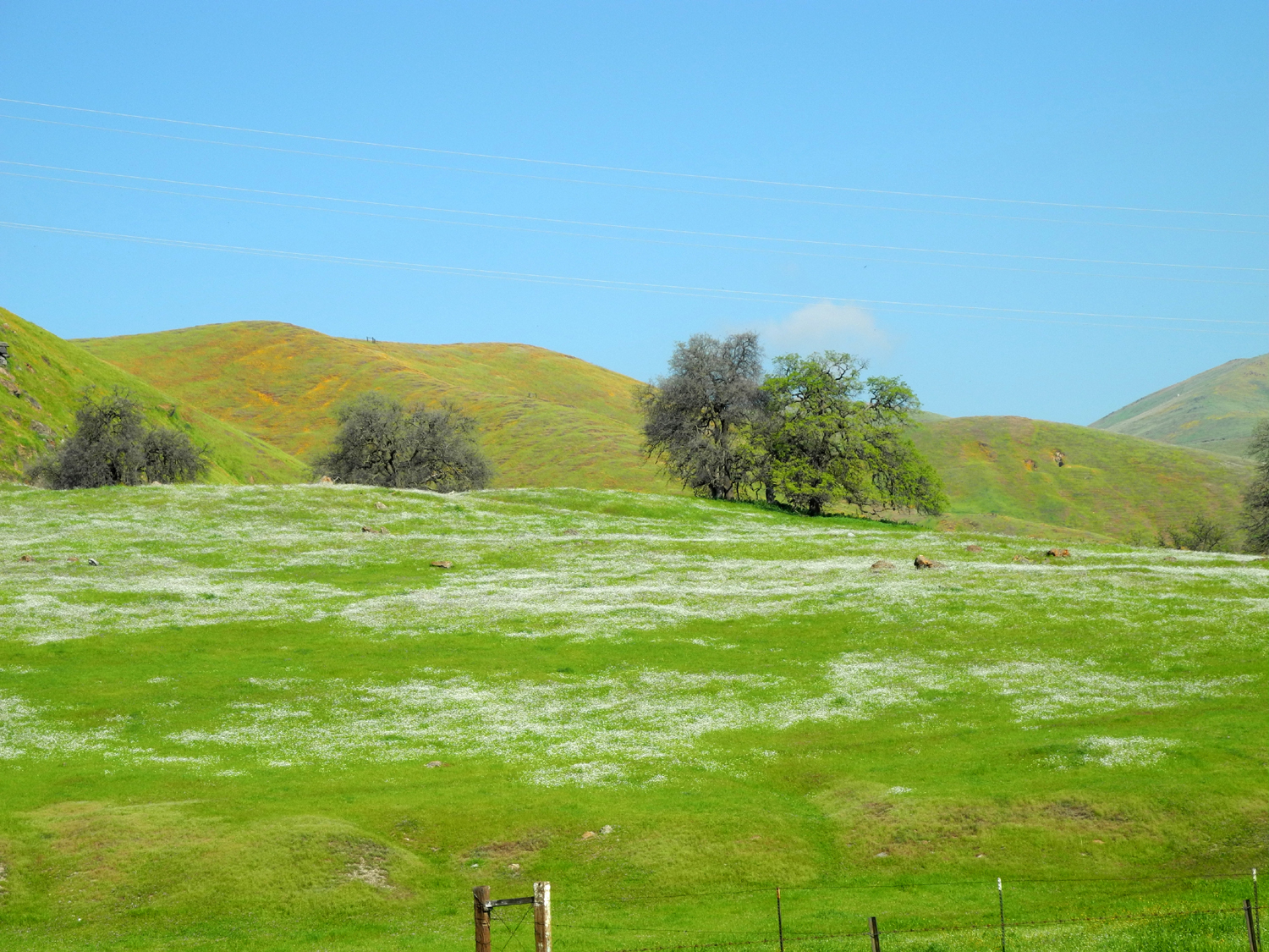
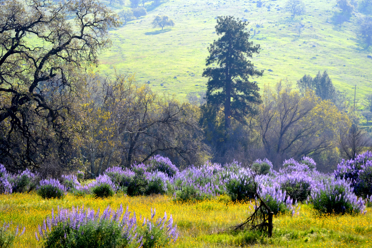
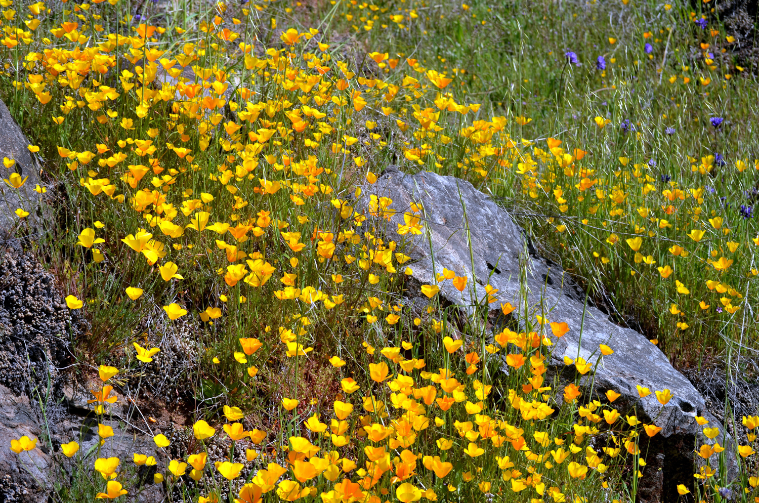
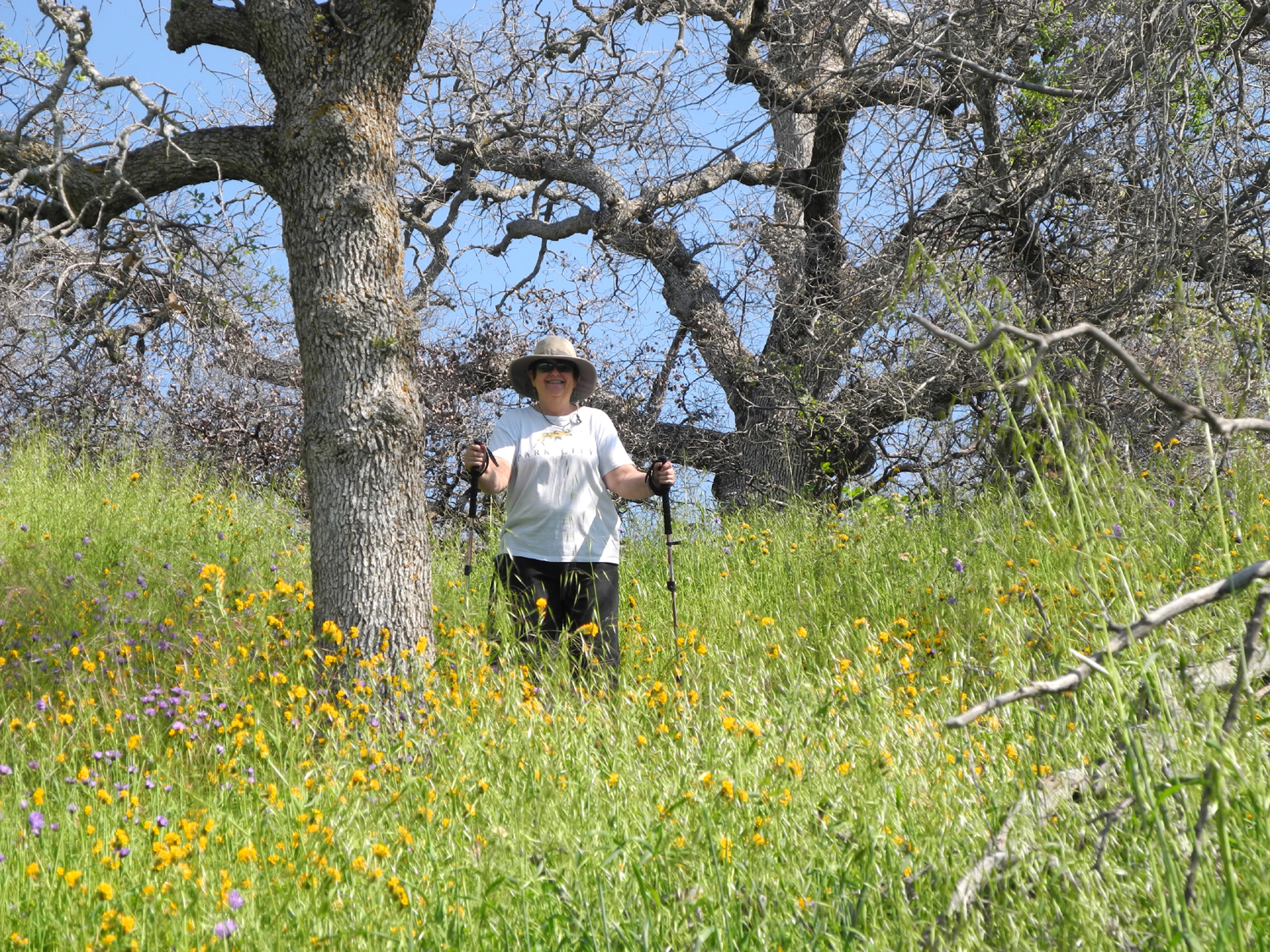
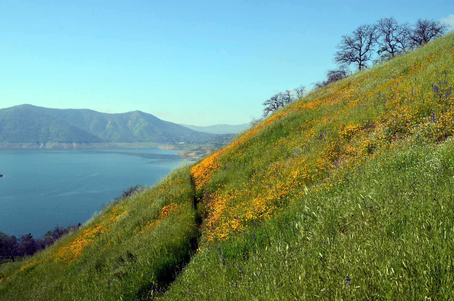
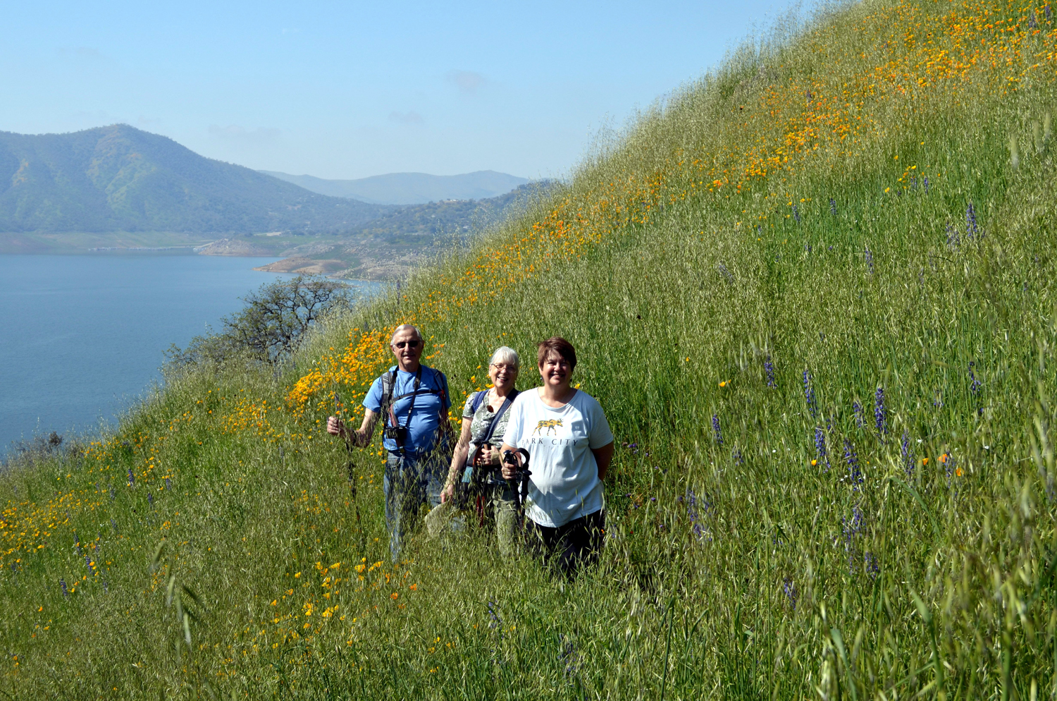
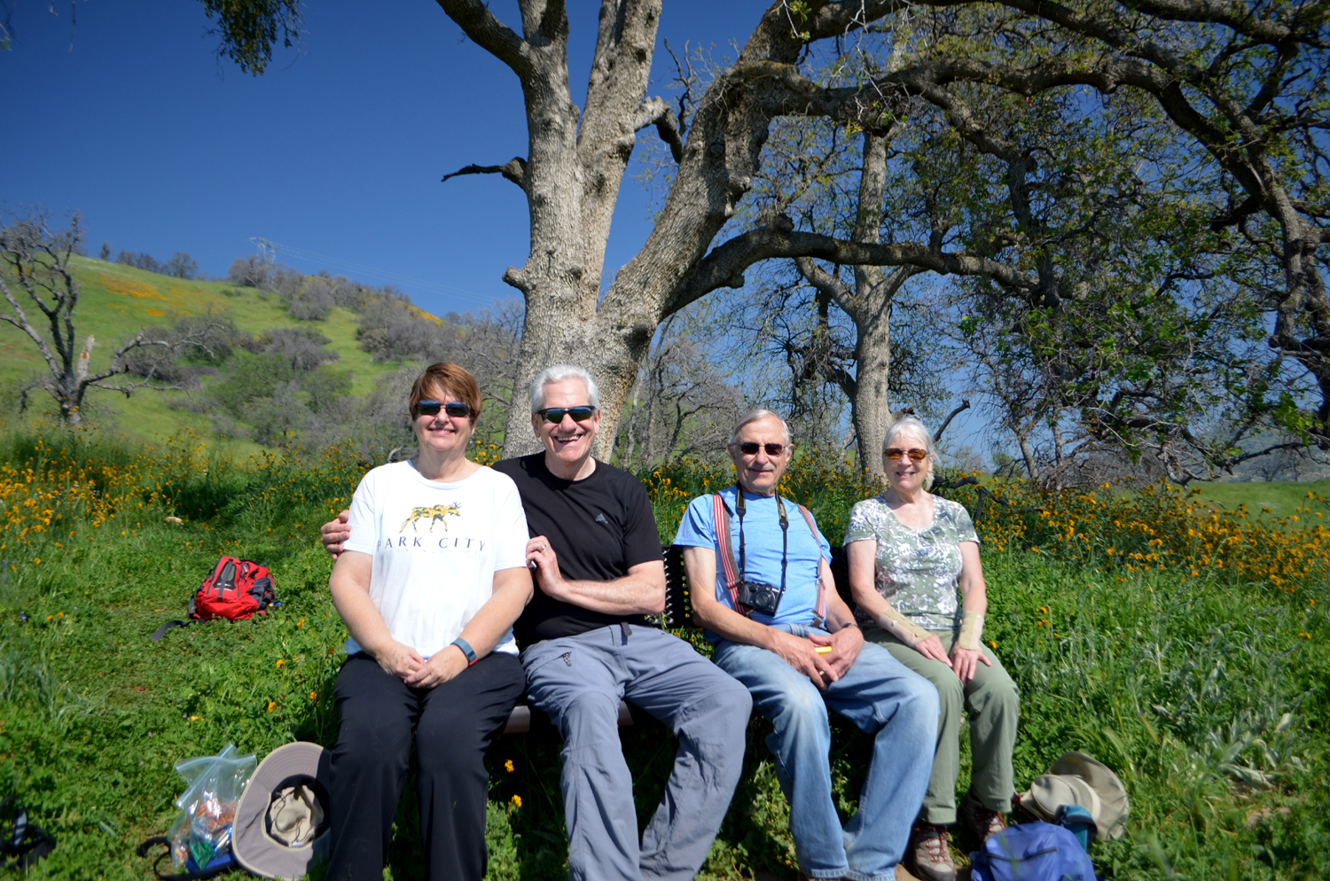
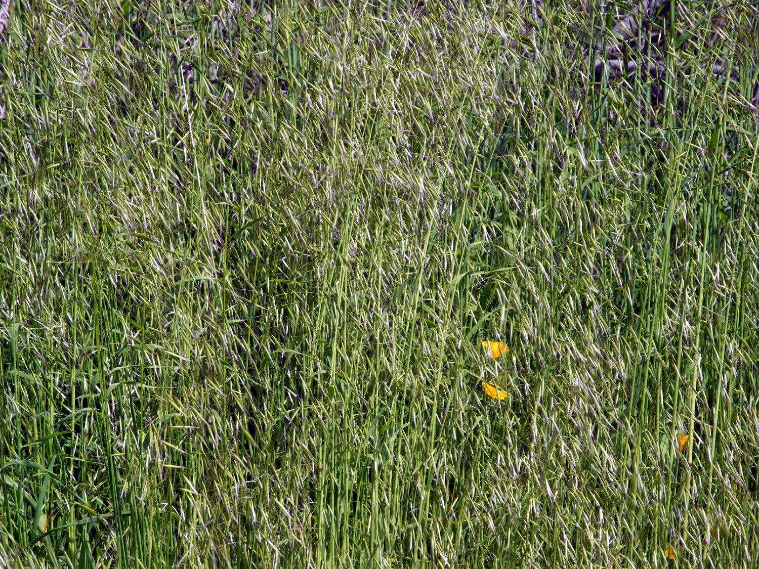
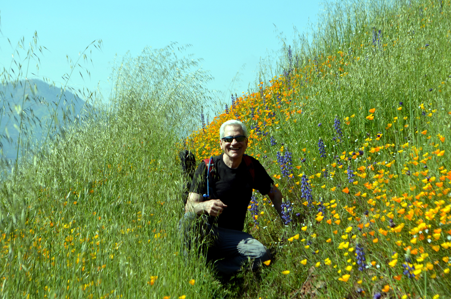
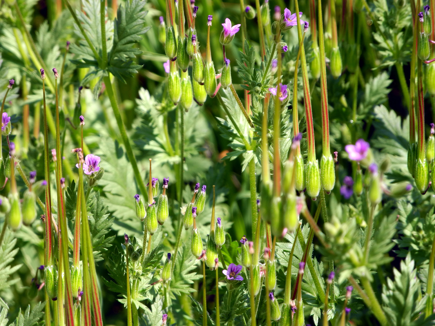
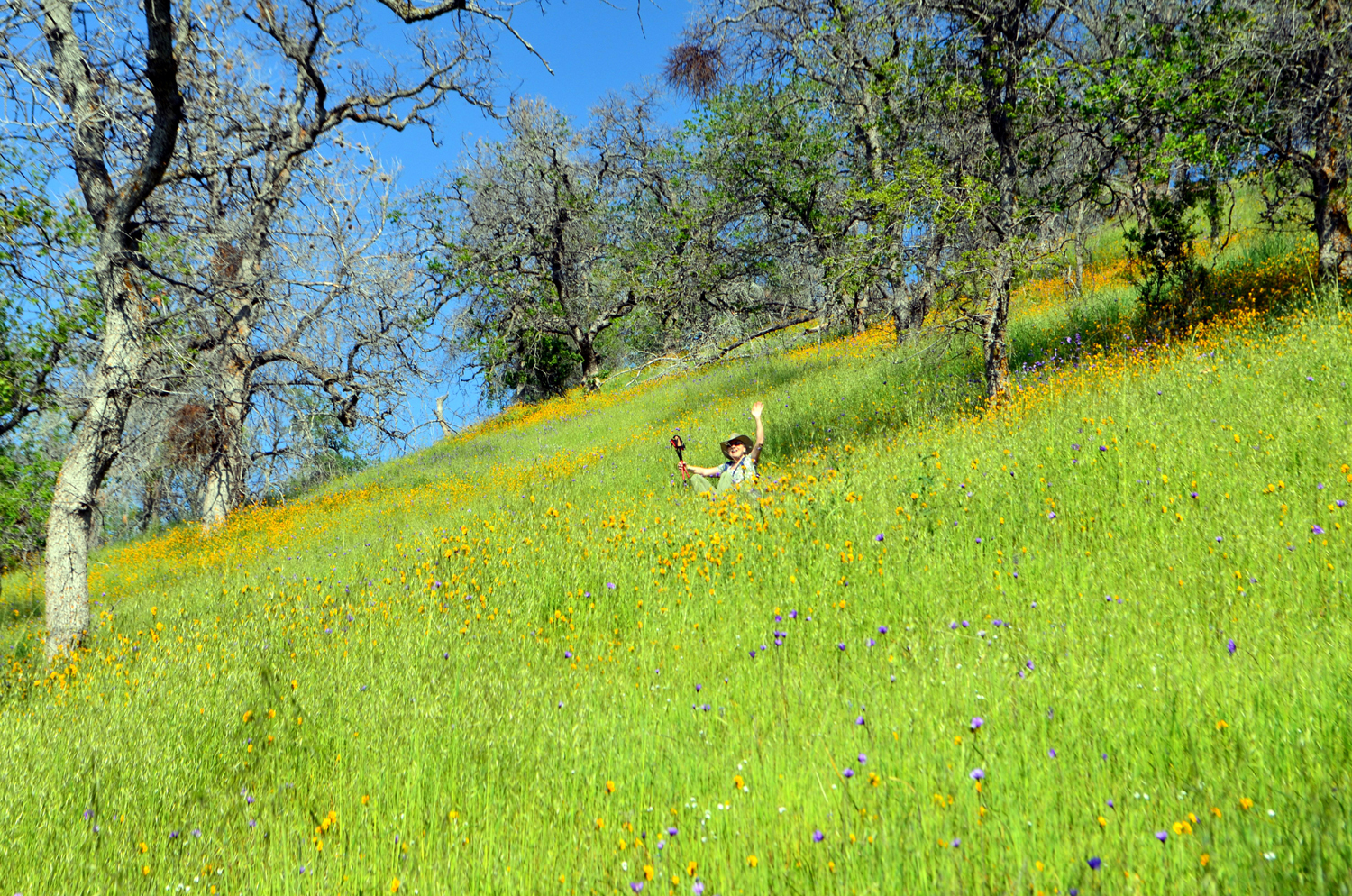
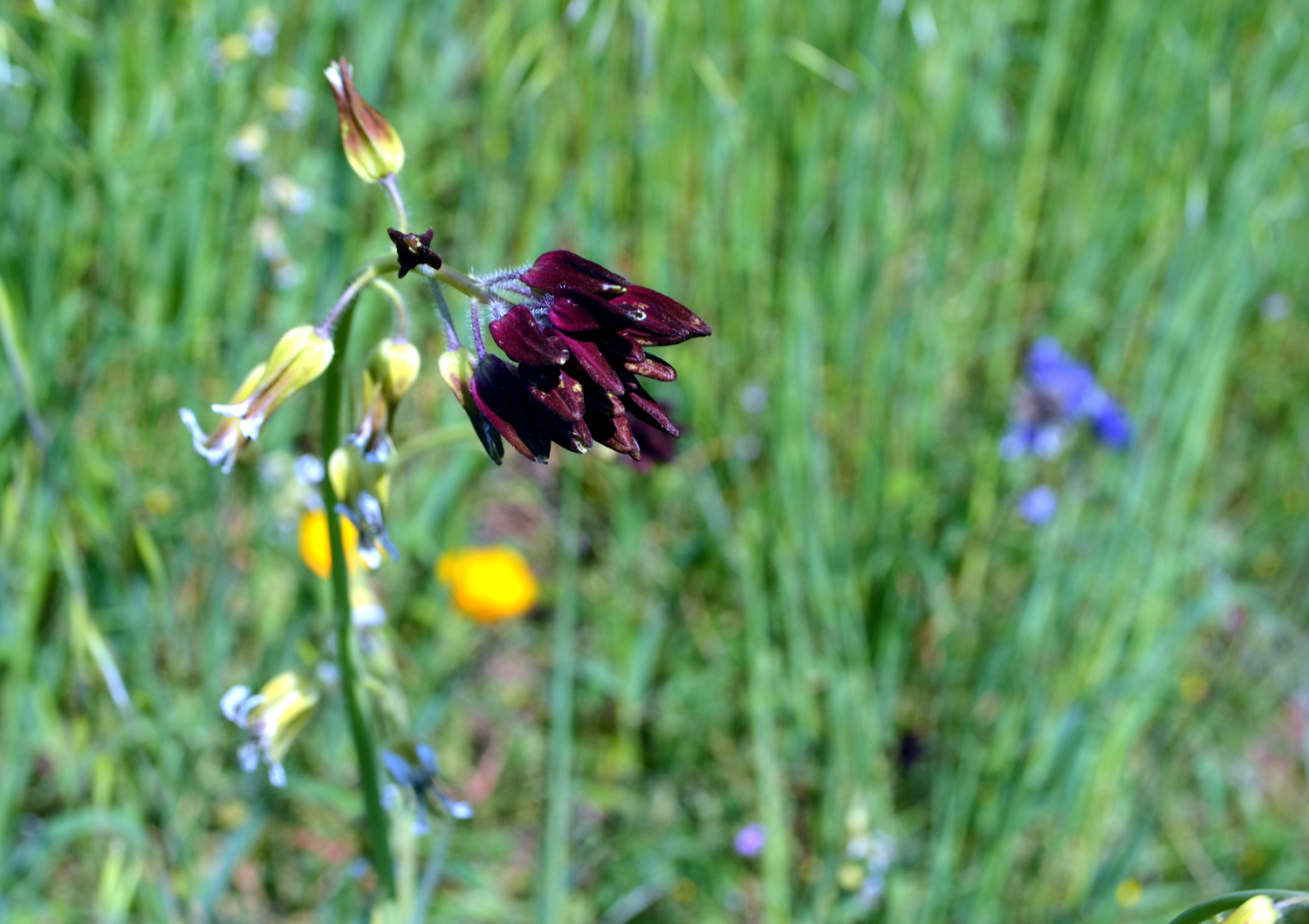
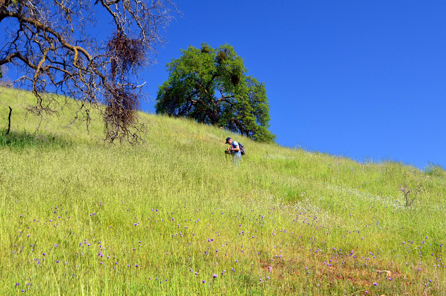
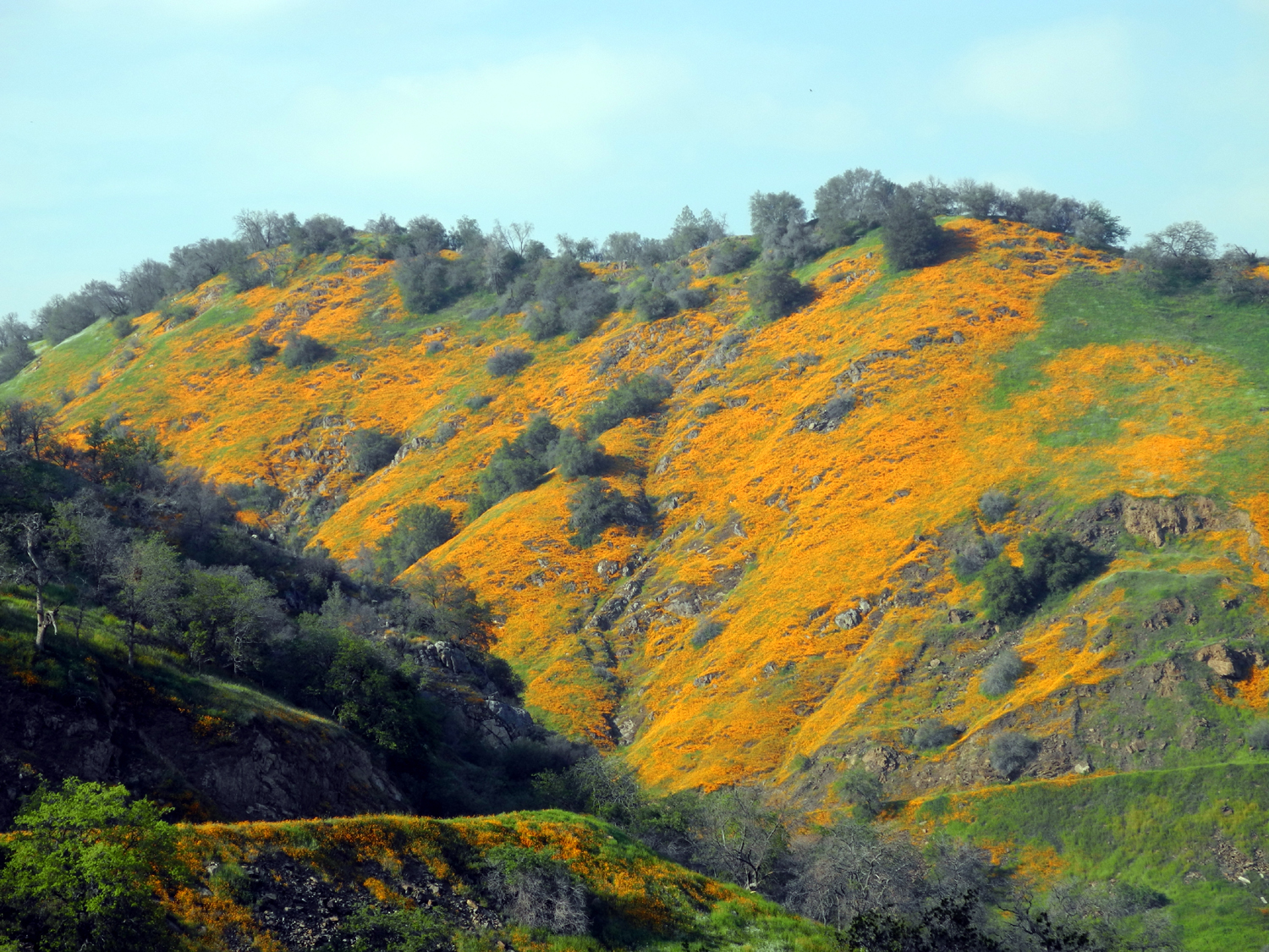
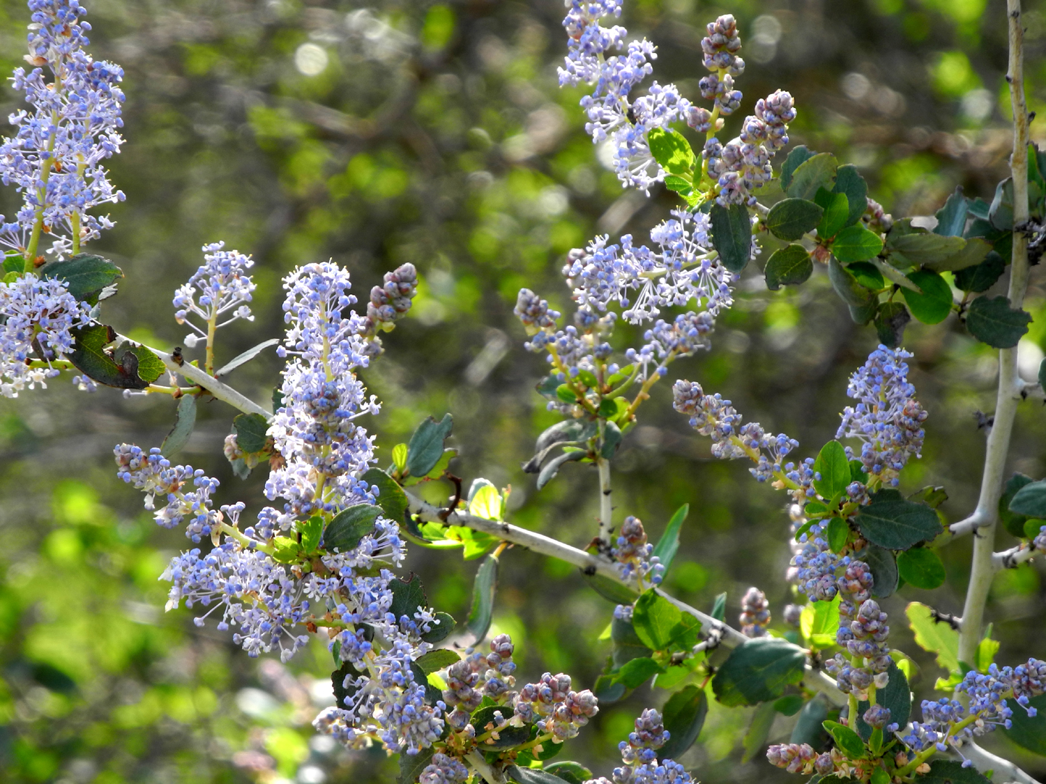
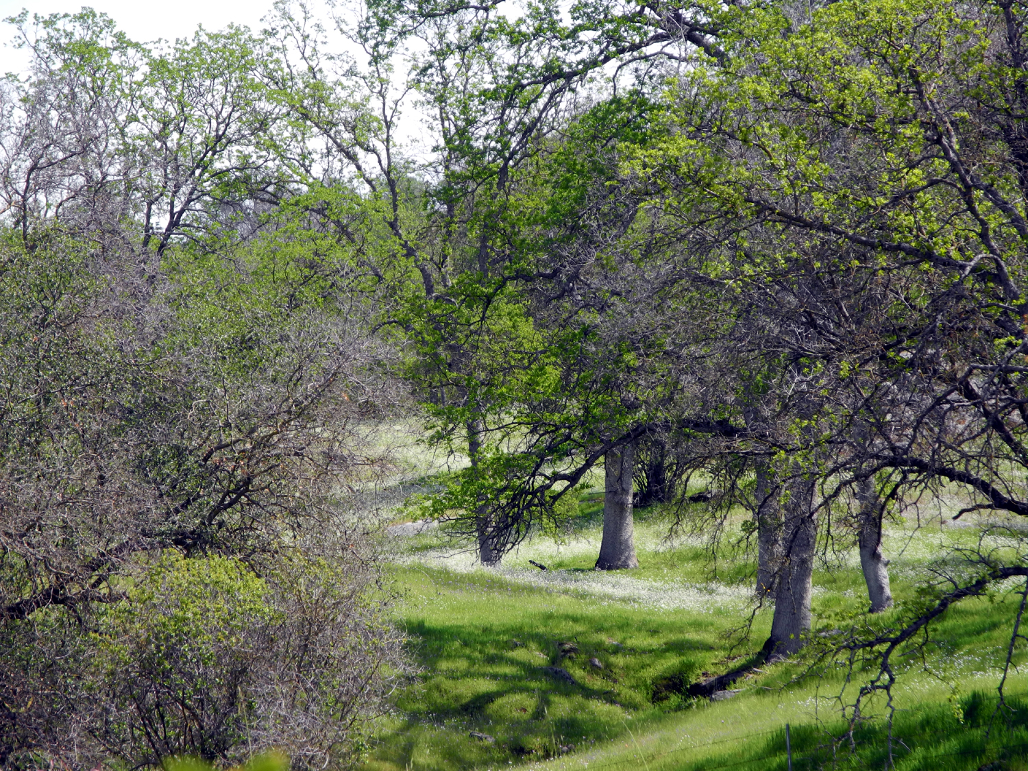
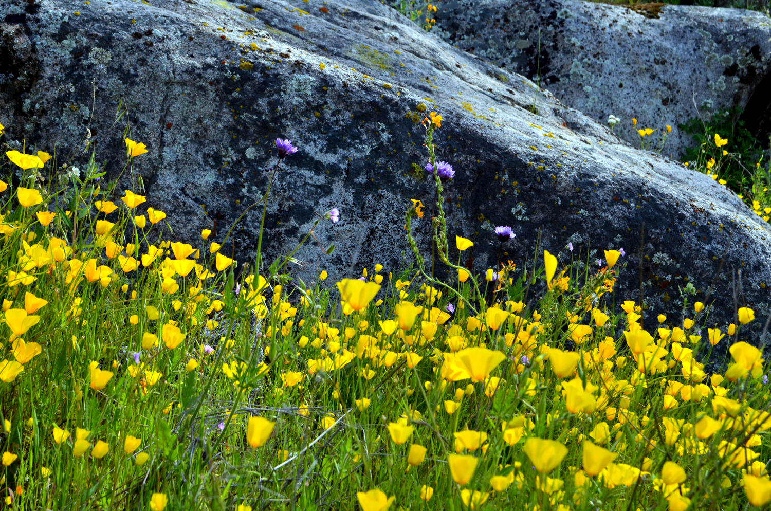
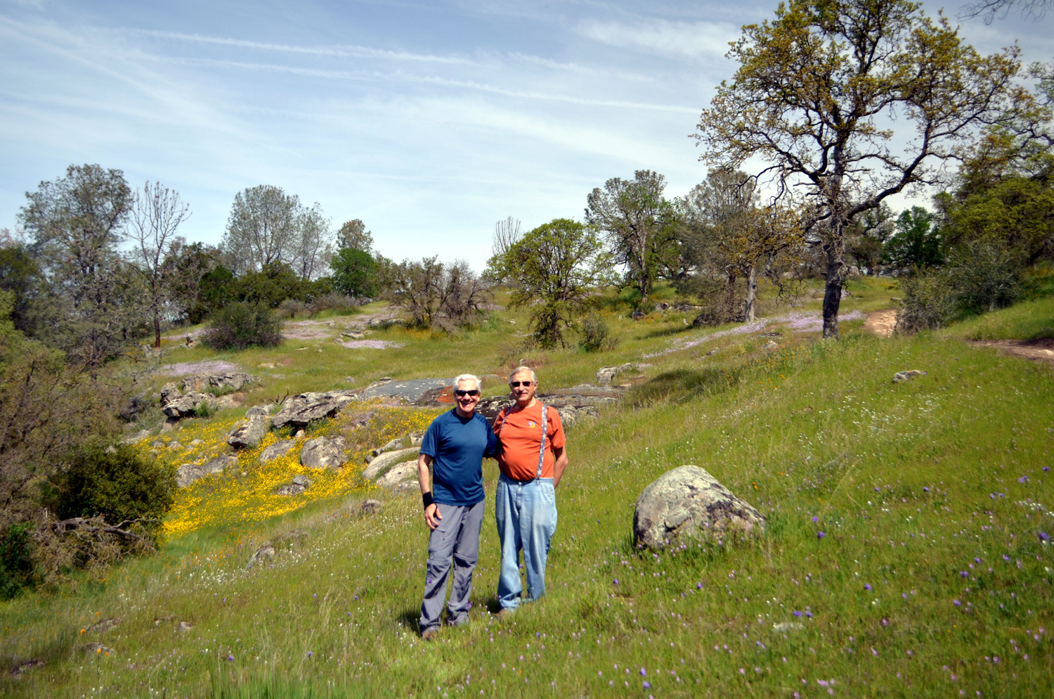
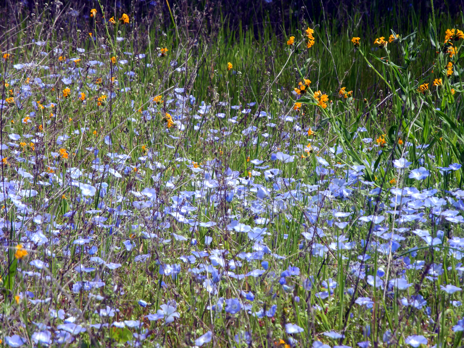
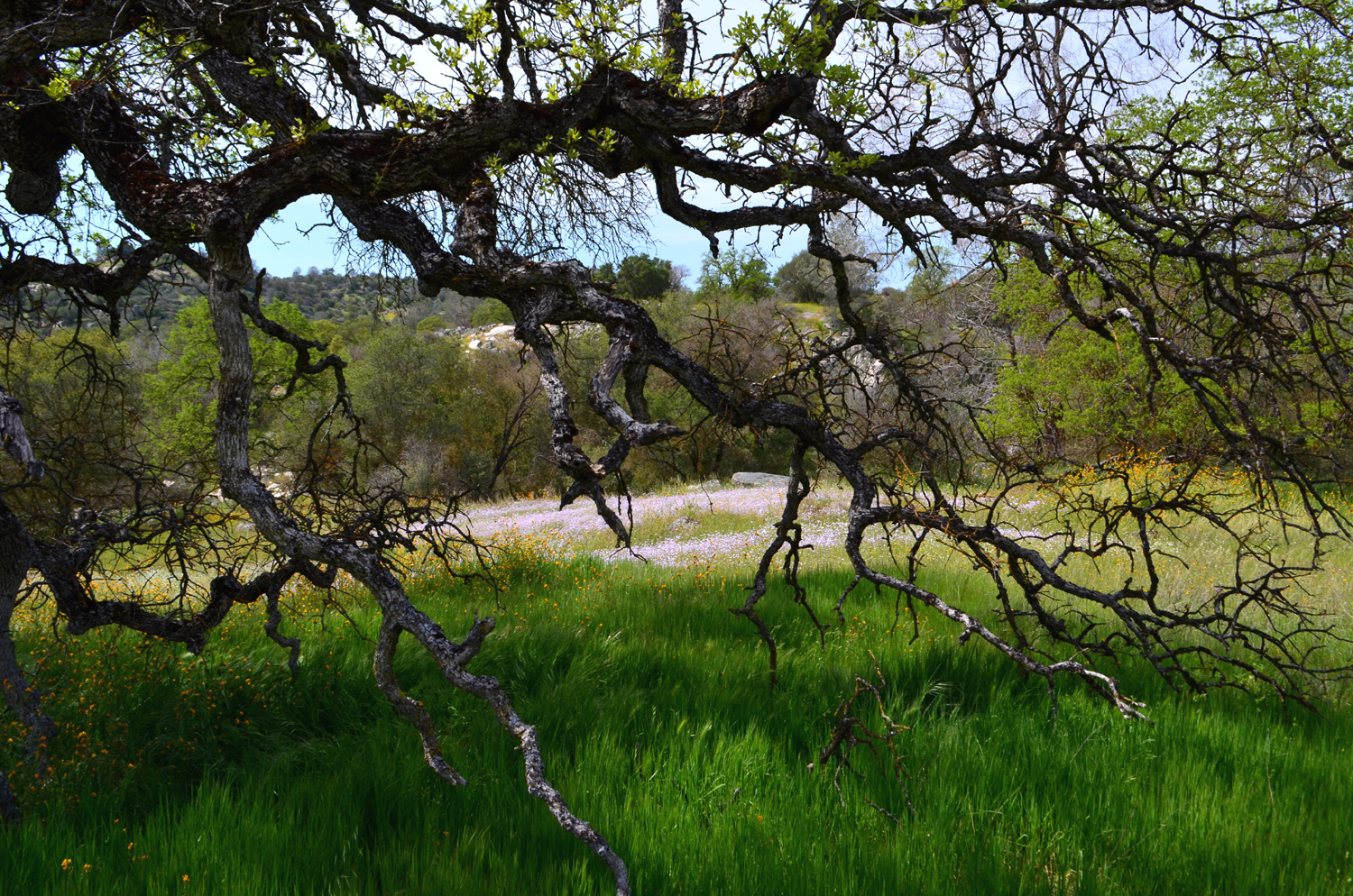
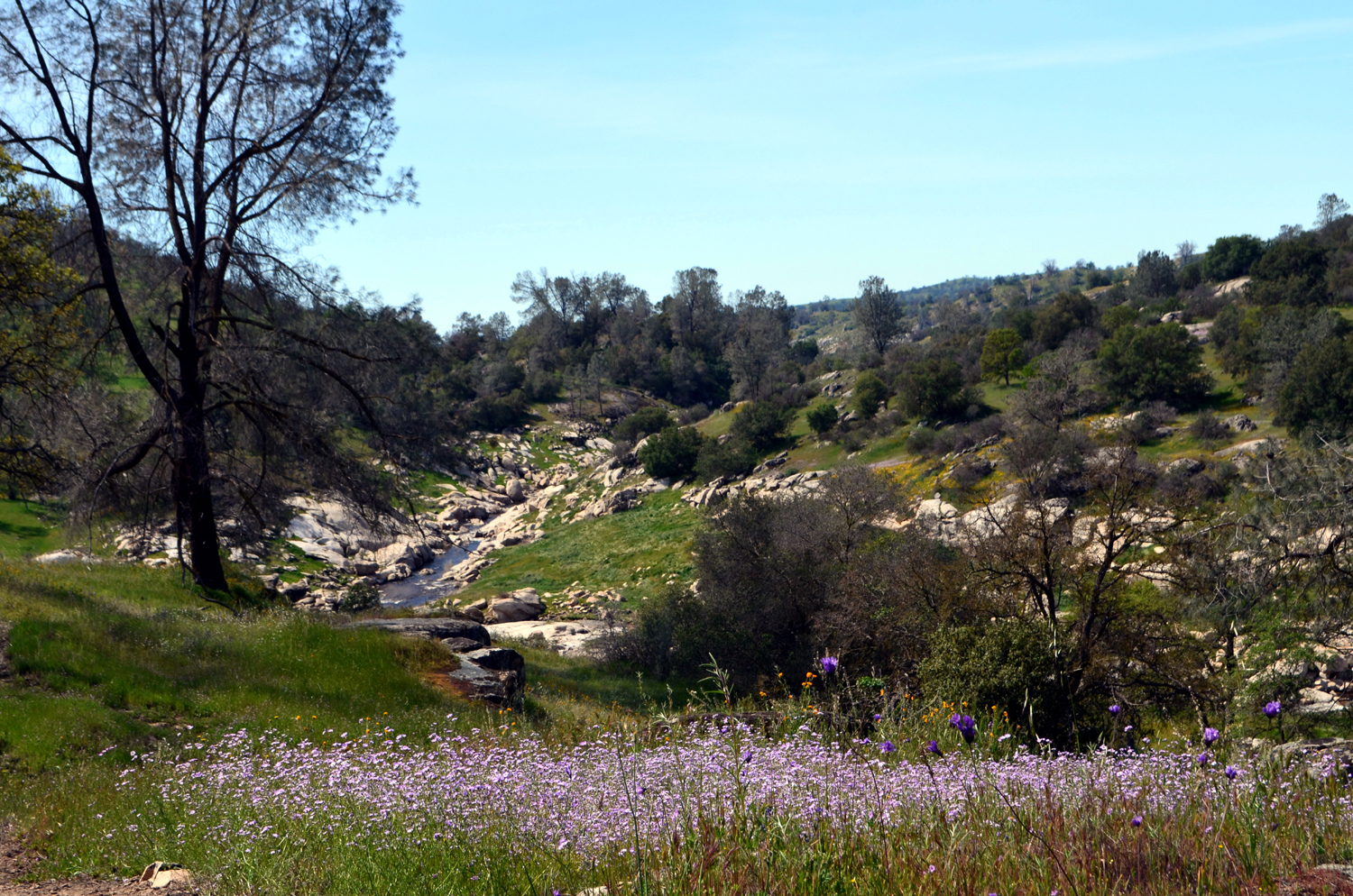
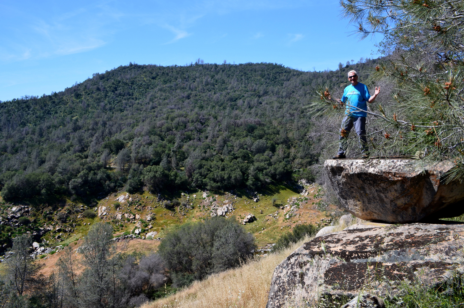
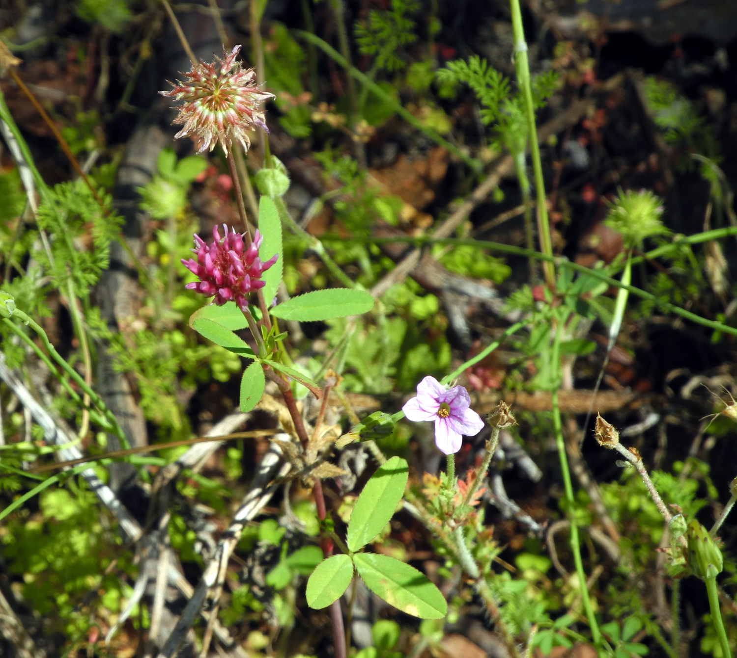
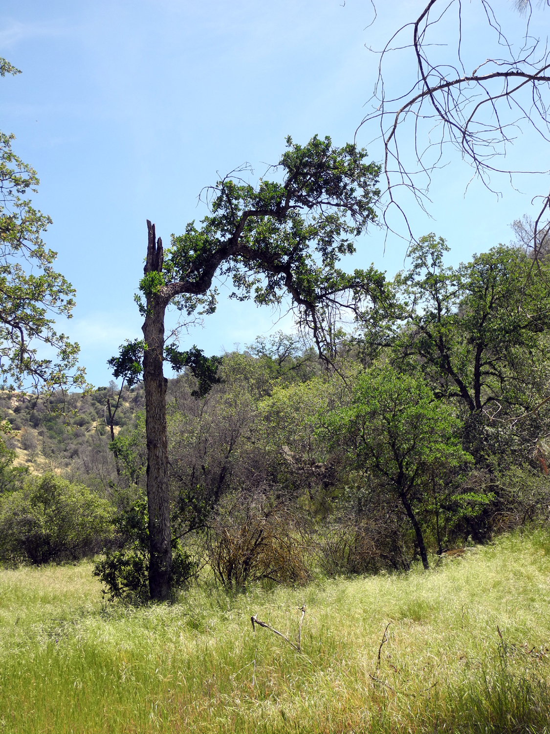
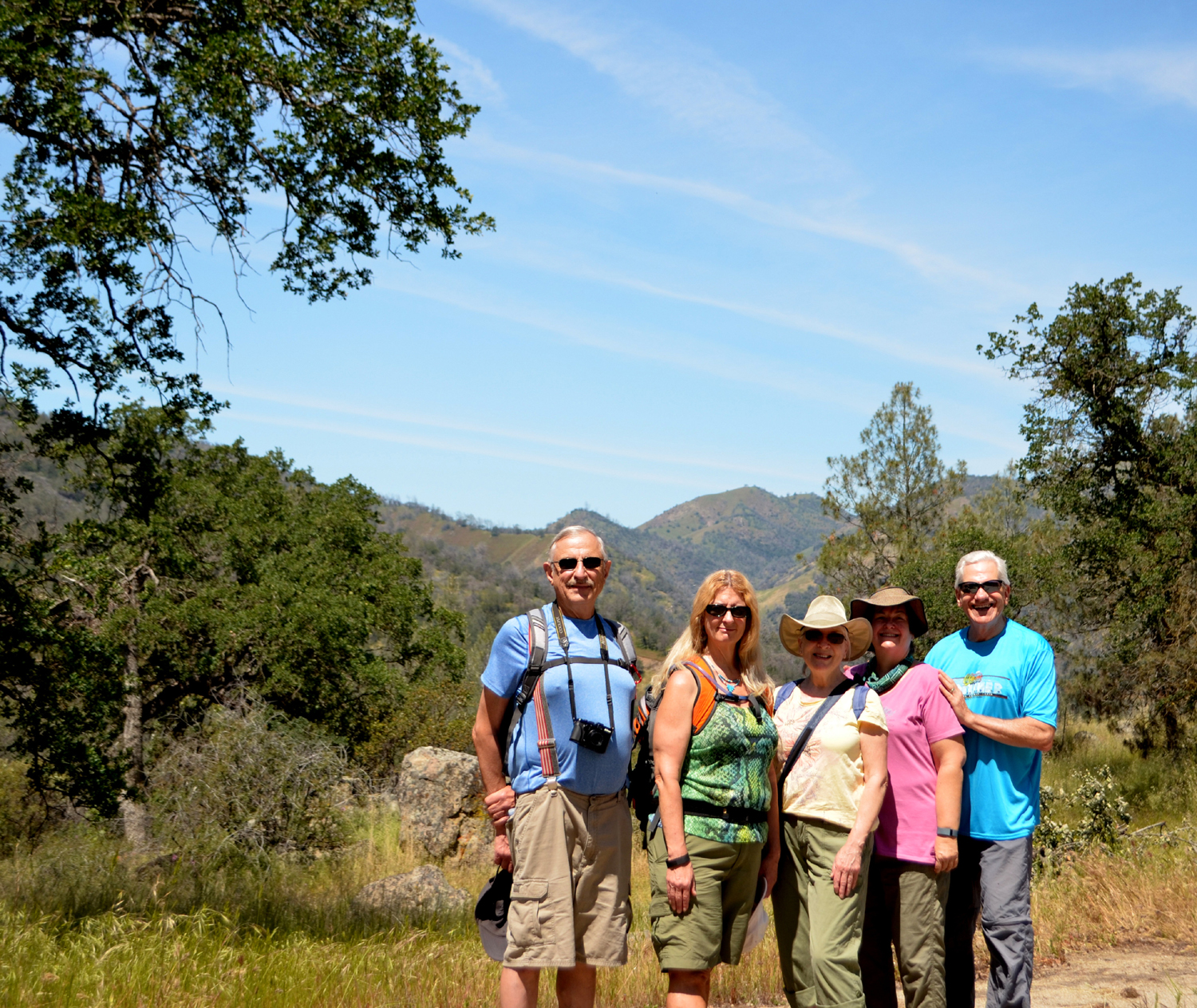
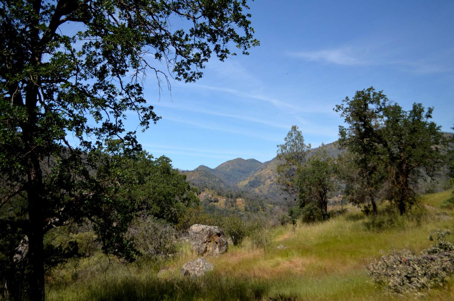
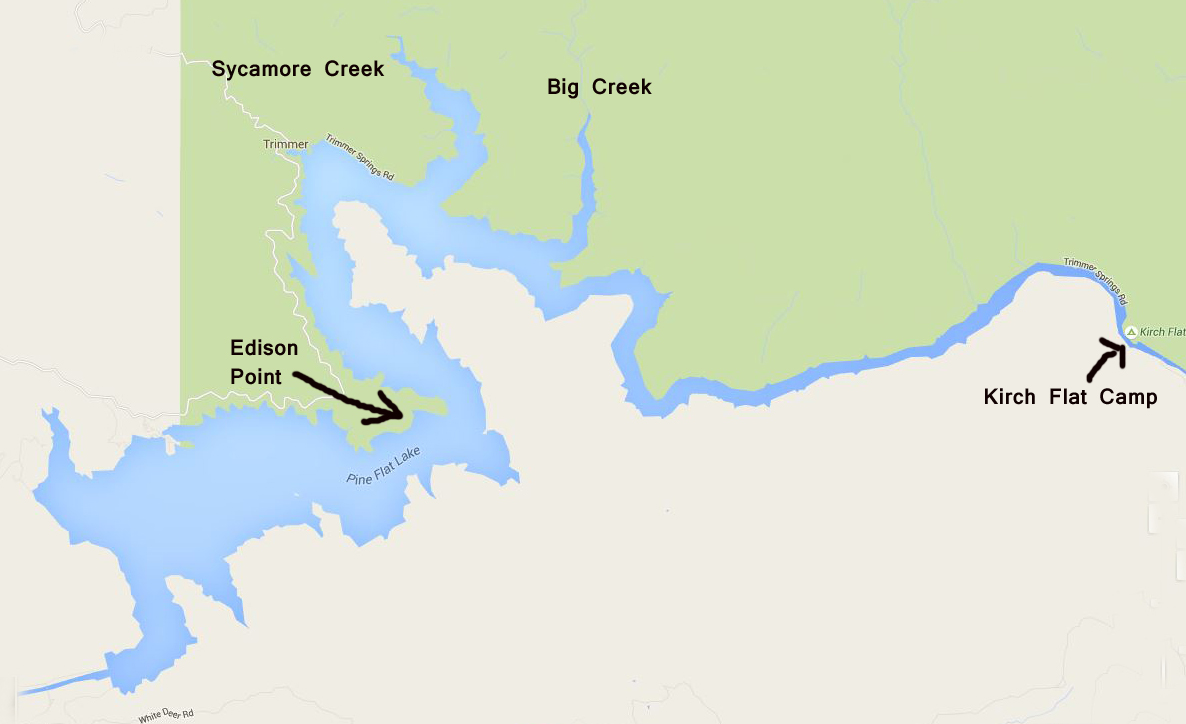
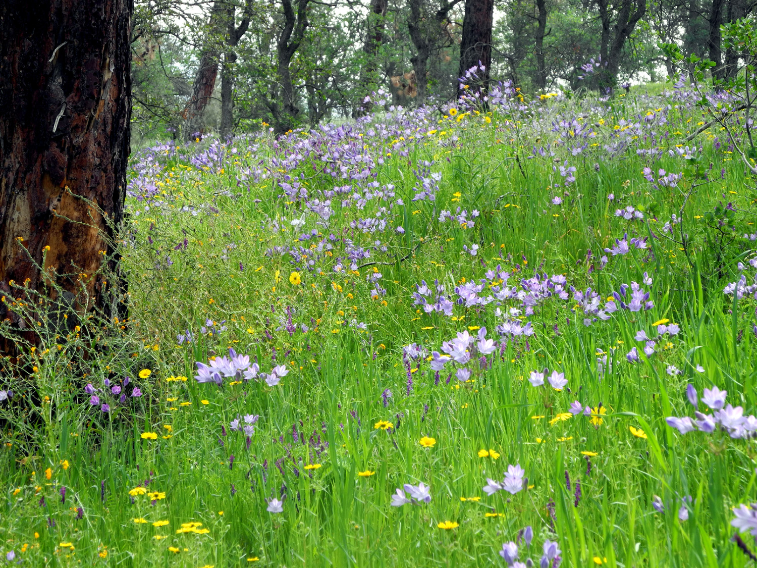
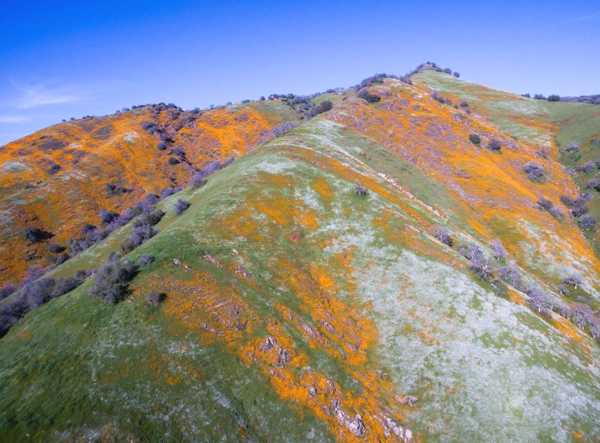
Edison Point Trail The Ramblers hiked part of this trail last year, and I hiked the entire route about three weeks later. The full trail was so much more interesting, scenic and flower-filled than the partial segment that I knew the Ramblers would enjoy it, despite some challenging spots. So we gathered everyone together on February 29, and made the 35 mile drive to the trailhead, off the road that runs along the north side of Pine Flat Reservoir. After a regular series of storms from October through the end of January, we had just one small rainfall in February, and everyone has been worried that the El Nino rains have ended. This has contributed to the warm weather we experienced for this hike, but also to a few areas that seemed to be drying out. Nevertheless, the hills are green everywhere and the flowers are thick. Even before we reached the lake, we stopped at an area below Piedra, where the flat bottom land on both sides of the river is covered with bush lupines in full bloom, and got a number of nice photos. As we reached the lake, we were also happy to see that the poppies look good on the surrounding hills above the lake. There are also lots of fiddlenecks, popcorn flowers, blue dicks, ground lupines, and assorted other flowers, all of which have names, few of which we know. The first part of the hike is just an easy walk on a dirt road that slopes gently up hill. It is actually a service road for maintenance of the electrical towers that run along the lake shore in that area. It ends at a knoll which we assume is Edison Point, and then becomes a narrow path. This was as far as we went last year. From here the trail winds around the hill, more or less level, but then it suddenly goes directly down the slope. It's a bit too steep for comfort, but we all made it, and the worst part is only about 100 feet or less. The trail then becomes a series of swtichbacks, that go a long way in one direction, then a long way in the other, repeating this pattern at least twice before reaching a level spot where there is a bench just above the high water level. You can see the bench from above, and it seems that you are going far away from it before the trail switches back in the "right" direction. However, the hills are covered with tall grass and flowers and there is always something new to see around each bend. The one thing that is hard to see sometimes is the trail, because the grass ranges from waist high and up, and the path is very narrow, usually about a foot wide. You can nearly always see a sort of slot through the grass and we never had any real trouble following the trail. When we reached the bench, we enjoyed a well-earned rest and a snack. If the lake were full, you could take just a few steps down from the bench and touch the water. After a number of dry years, the lake level is quite a ways from full, although it is noticeably higher than it was last year. When we got back on the trail it was more of the same, in reverse - long stretches in one direction that climb up gently, then a switch back the opposite way for another long walk. Again we were walking through poppies, lupines and other flowers. At one place we saw an unusual dark red flower that we did not recall ever spotting before. There were dozens of them above and below the trail for about 100 feet; we never saw them any other place. (Through pure serendipity, we learned that this may be a California Jewel Flower, or at least some closely related species.) I recalled that last year there was a place where I could look down on a section of the trail I had just walked that seemed to be only about 20 feet below me. I contemplated the possibility of a shortcut, even though that would make the walk a little shorter, which is not usually a goal on these hikes. As we were making our way in the general direction of the trailhead, I saw a rough path going up very steeply, and reasoned that it must connect to another section of the trail above. I split off from the group, although of course I could see and talk with them the entire length of my exploration. This shortcut came out at the other bench, a place I recognized from last year. Just north of the bench, the trail came in from below, then made a switchback to the opposite direction. Carolyn decided to take her own shortcut, climbing pretty much straight up from the trail she was on to the area where I was. She found this much more challenging than the official trail, and stopped to rest a couple of times, then ended up sitting by the trail in the shade (the bench was comfortable but in the sun). I was certain that we would soon see Wes and Julie coming toward us, and that we would all then continue the hike to the north together. However, a fair amount of time passed, and we decided they must have found their own shortcut, so we started off on the upper section past the switchback. We soon heard and then saw Julie ahead of us, and caught up with them. They claimed that they had not cut across, but had followed the trail. I know that I followed the zig zag section of the trail to the bench last year, so I don't know what route they found, but I was not about to retrace their steps to figure it out. As it was, we now faced a couple of difficult challenges. Large trees had fallen across the trail in two different places in this area, and it was necessary to go down the steep hillside, and step over branches of the downed bull pines to get through these spots. As it happened, both of the tree "detours" were in the drainages where the trail goes east, then back west on the other side of these little "canyons." These are the cool, shady spots where conditions allow different species of flowers and plants to grow, those that do not like the open, sunny areas that comprise most of the trail. Here is where I saw thick stands of purple brodiaea last year. We were too early for that flower, although we saw one single blossom. Before long we could see that the trail was approaching the road, above and to the east of us, which meant that we were going to make it back to the trailhead. There was still some walking and switchbacks to deal with, but before long we were looking up at the bank of the parking lot. Here people have taken various shortcuts, so it's somewhat hard to see the actual trail, since it hasn't had the foot traffic to keep it open. Despite the temptation of the short, steep shortcuts, I followed the actual trail all the way back, since I knew it would be more gradual, and at this point a slightly longer walk took less energy, something that was in short supply. Julie and Carolyn followed my example, while Wes took one of the shorter shortcuts, but soon we were all back at our starting point, ready to take off our packs, change out of our boots, and just sit down for a while. Although there were plenty of flowers, the overwhelming impression this hike leaves is of a journey through tall grassland, grass tall enough to hide lions and hyenas. However, the largest animals we saw were squirrels and vultures, and we kept moving enough that the latter had no interest in us. In fact, much of this territory is what is known as oak savanna, a word that also conjures images of Africa. In this case it refers to open, grassy terrain with scattered oak trees, although most example photos show relatively flat, rolling terrain, and do not show the savanna clinging to the side of what is in fact a steep river canyon. When we were on the first part of the trail we could see poppy-covered hills farther upstream, so we knew we had to drive up that way a short distance after our hike, just as we did last year. In 2015 we issued the Poppy Challenge between the Kings River and the Merced, with the Kings winning easily. This year it was between the Kings and the Kaweah River drainage, represented by Dry Creek in Tulare County, which Wes and I had visited on a road trip the day before. Both areas were spectacular, with no clear cut winner, although as an unbiased observer I would say that the Kings offered the most intense color, while Dry Creek had an interesting combination of poppies, lupines,, and popcorn flowers. We stopped where the road and the lake go back up a small tributary creek with a deep, wide canyon, and where we had views of poppies all over the hills above us. After taking photos here, we turned the car around and headed for home. Although we only walked a little over two miles, our hike took about four hours, so we did not make our usual lunch stop, but instead headed for our individual homes to clean up and rest. By the end of the day after each hike, Wes always emails us a few of his pictures, plus a commentary on the day's events. Here's what he said about this one: "What an incredible day! Within the two miles we hiked, we saw beauty without limit! Yes, we were exhausted climbing down to the shoreline of Pine Flat reservoir and back up again. In the end, it was well worth it. My camera wouldn't stop clicking. I was like the 'Mad Max' of photography. I almost left poor Julie stranded on a hillside for the sake of getting one more shot. Finally I came to my senses and was a helpful friend once again." Finally, on a website that Wes and I learned about on our excursion to Tulare County the previous day, I found a John Muir quote that should be the Ramblers creed: "I only went out for a walk, and finally concluded to stay out 'til sundown; for going out, I found, was really going in."
PS: Fortunately, March began with a series of storms, bringing lots of rain to the valley and foothills, and more snow to the Sierra. |
||
|
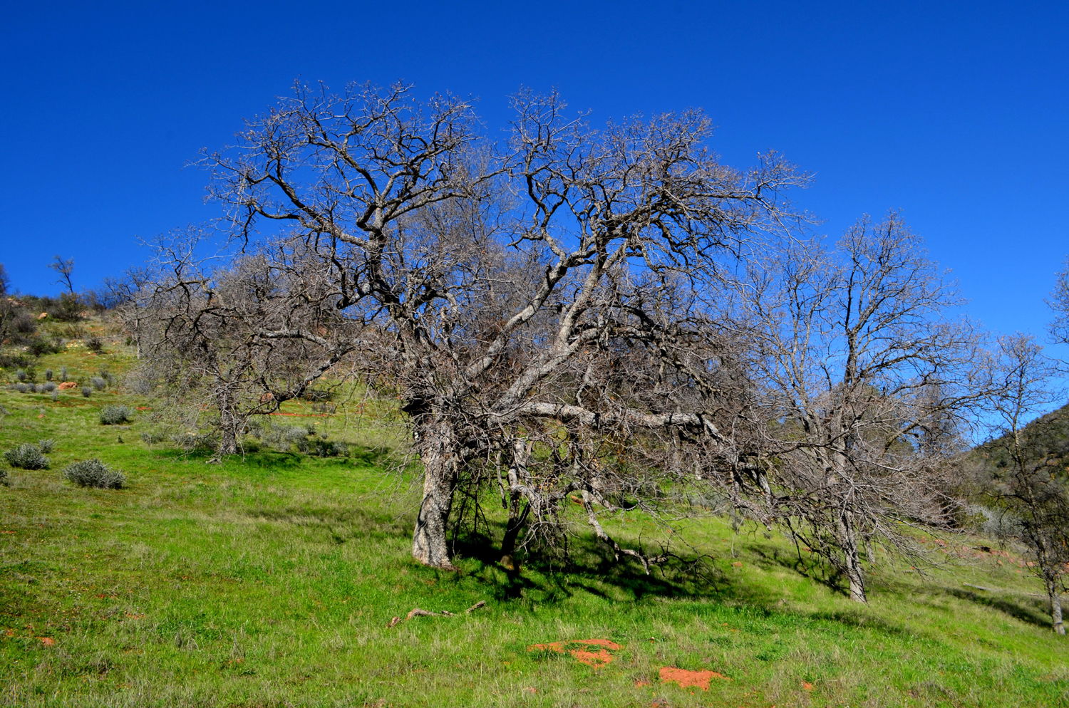
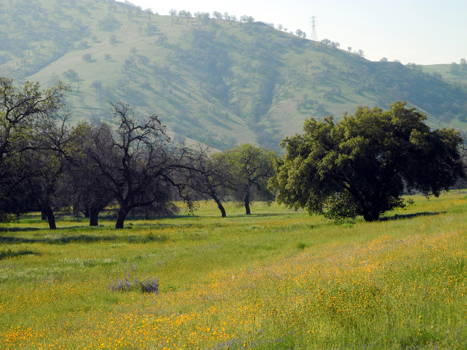
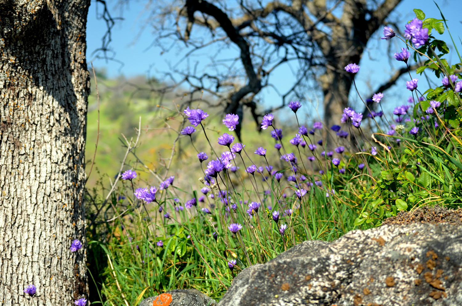
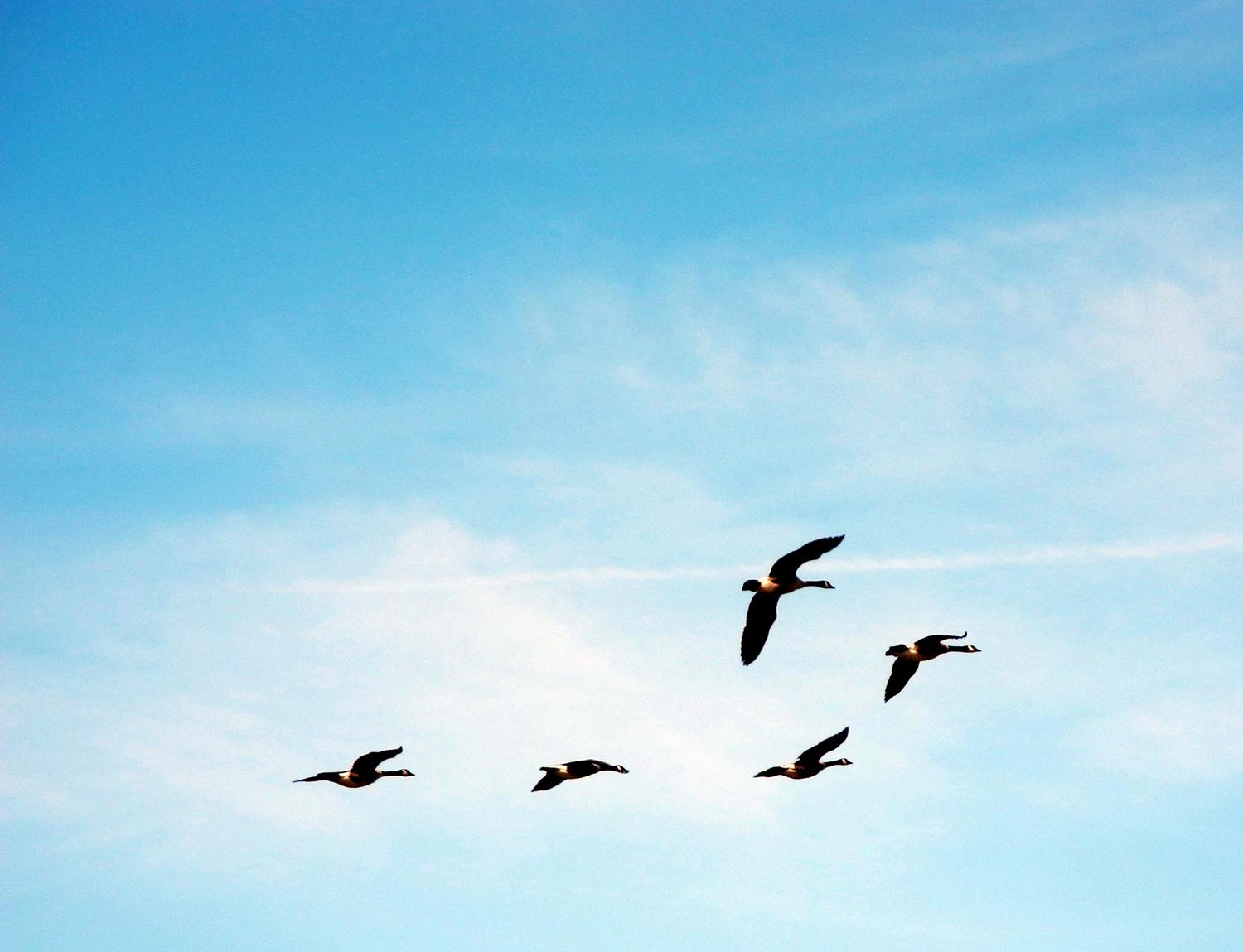
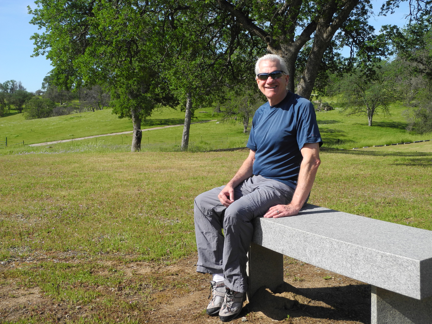
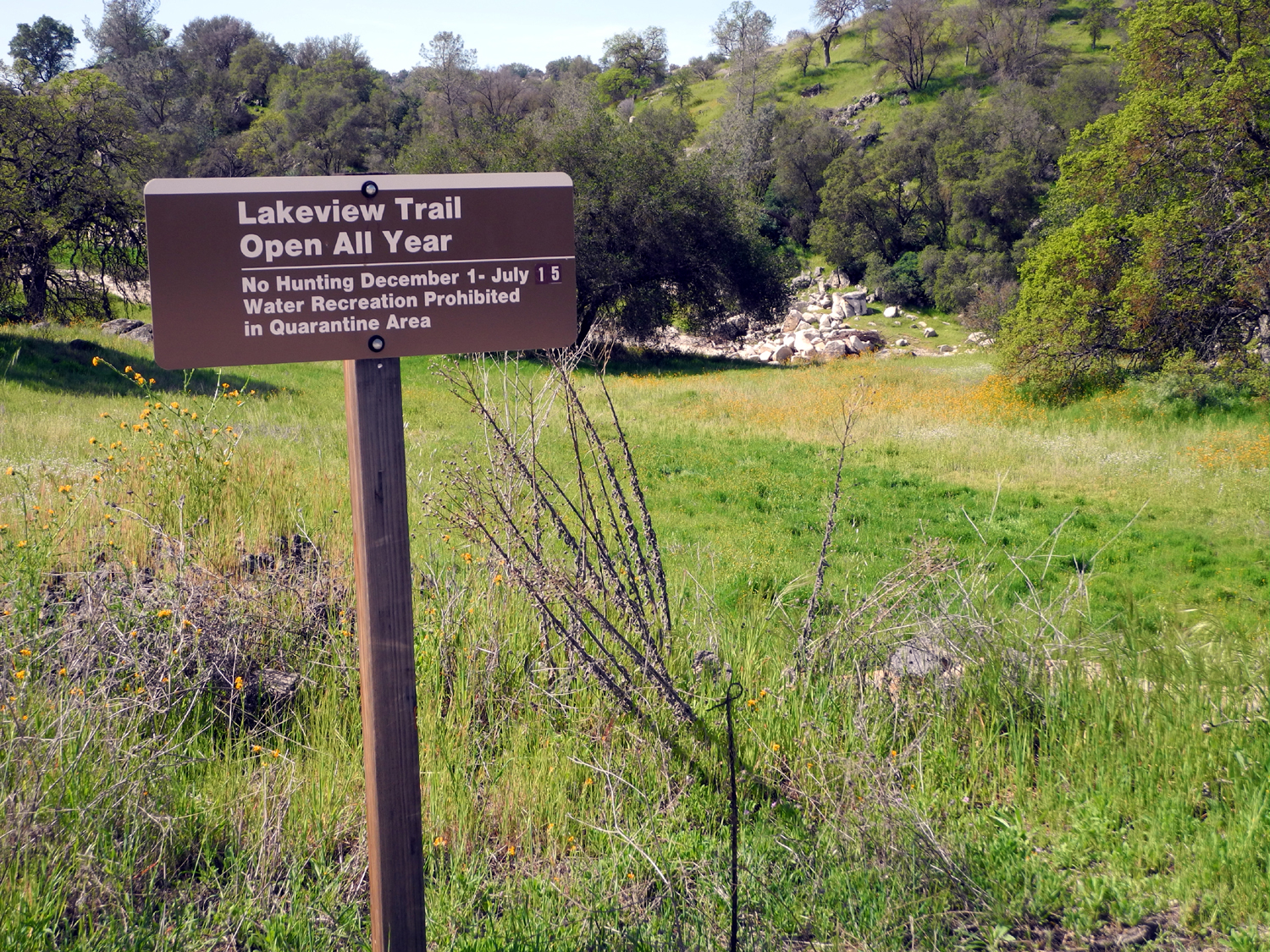
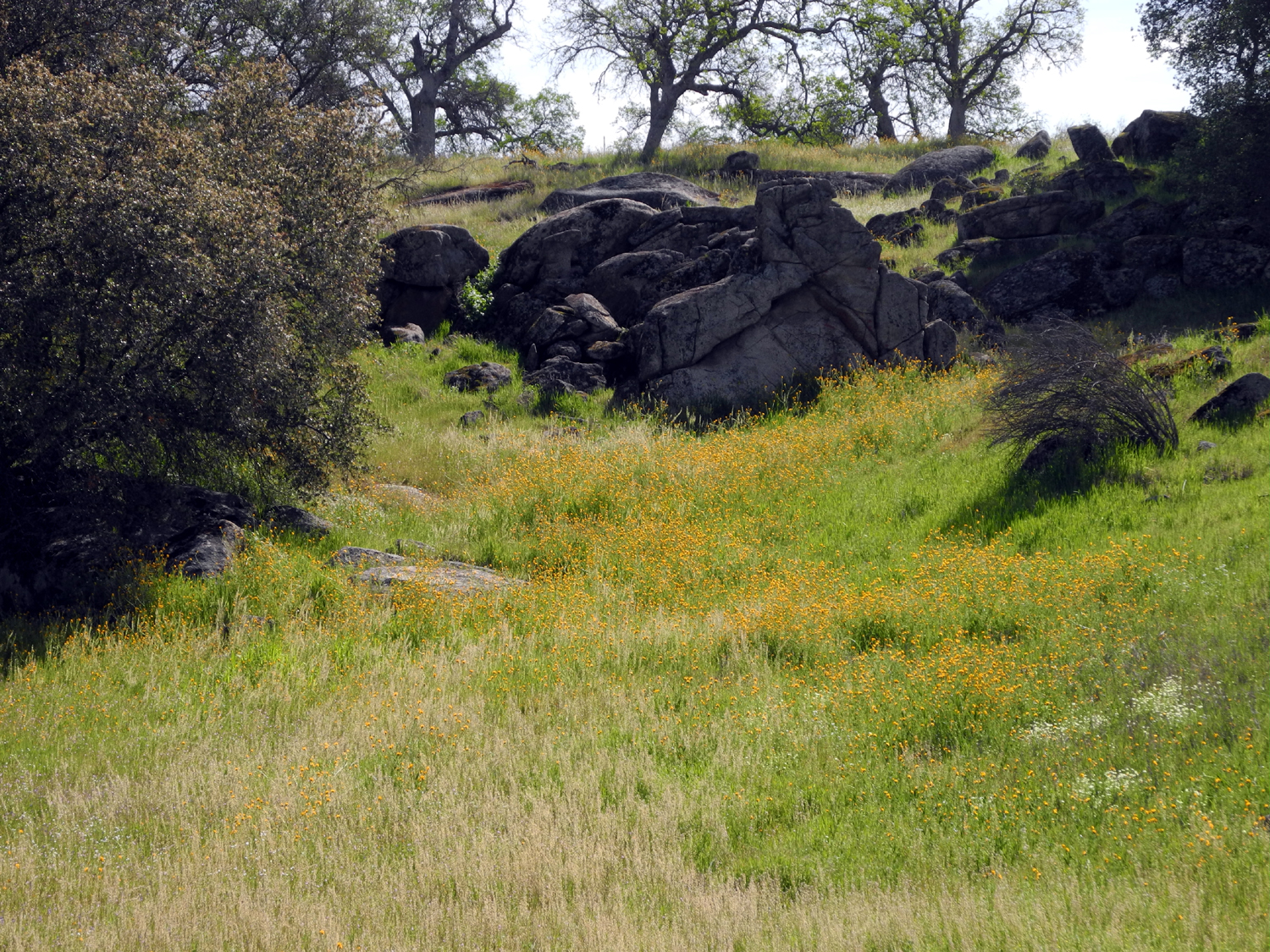
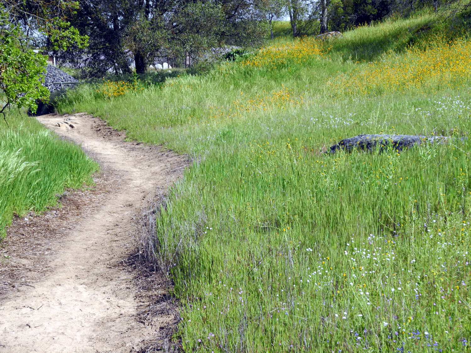
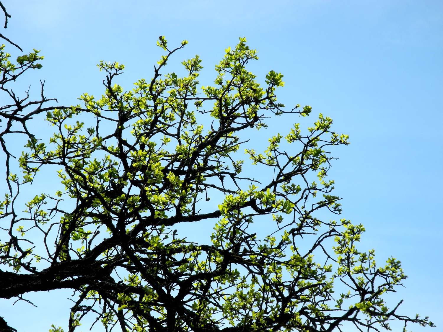
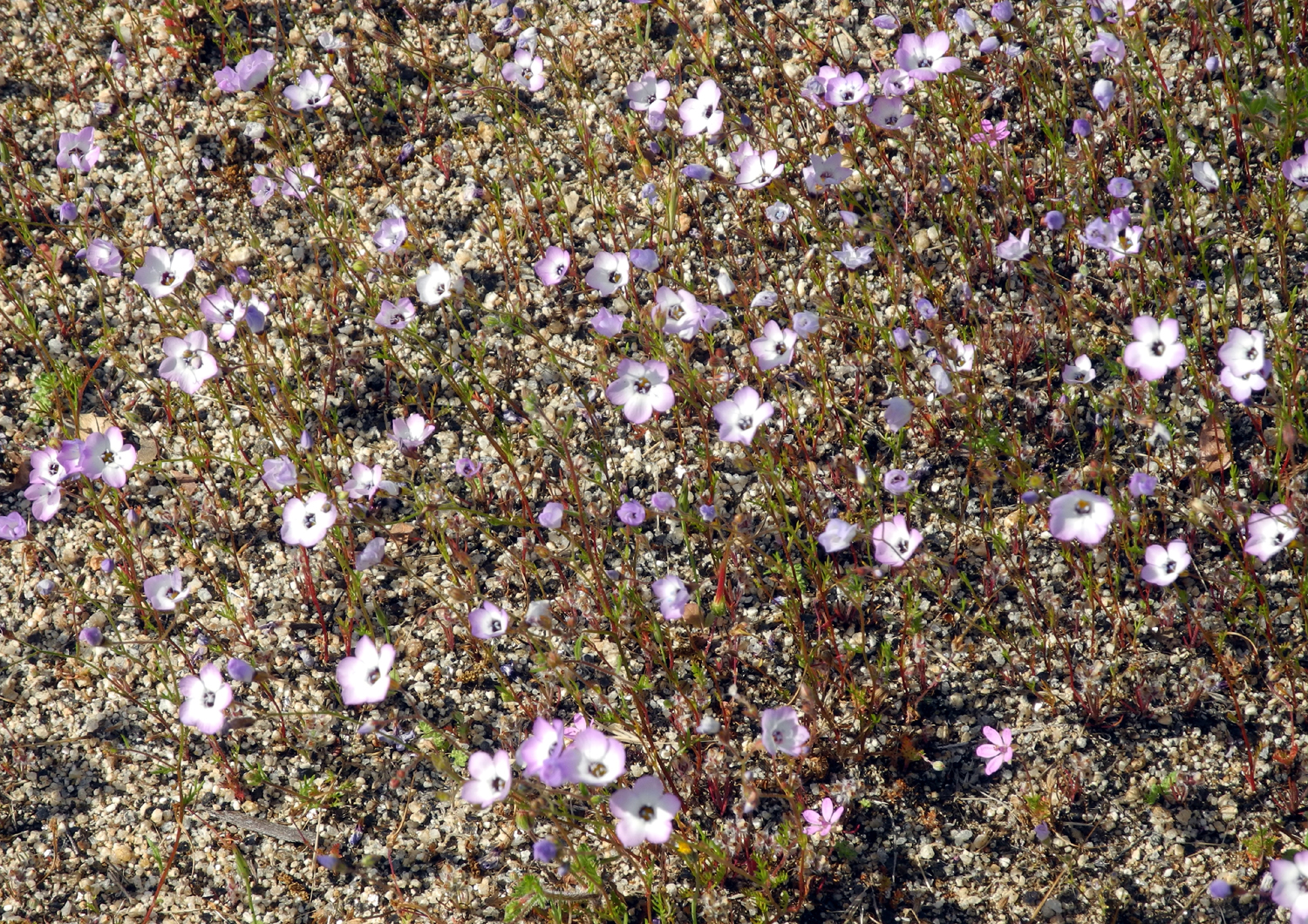
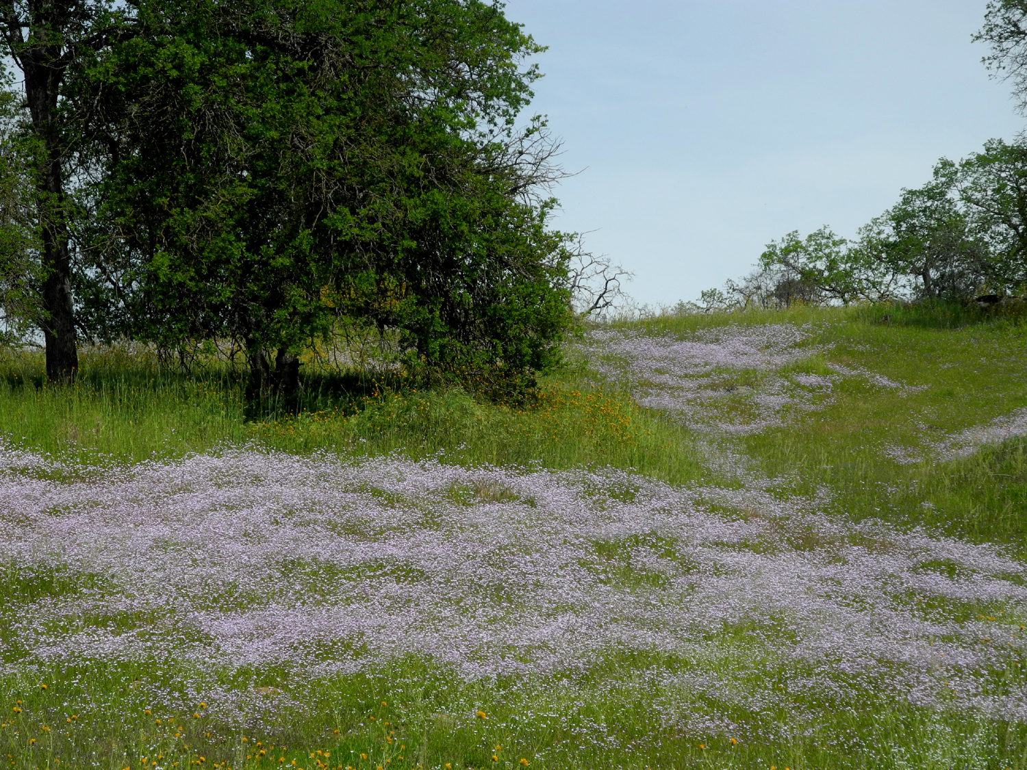
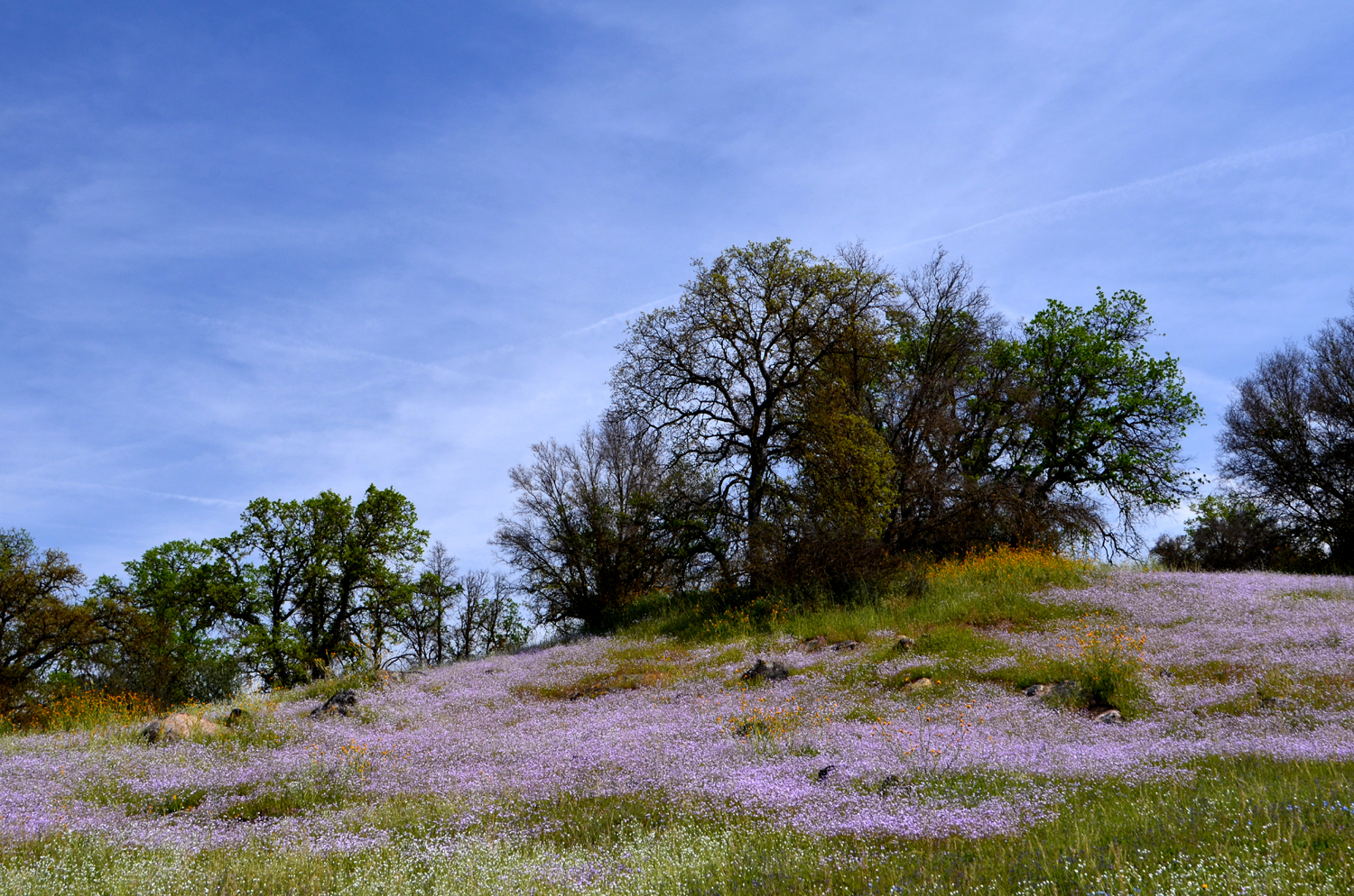
Eastman Lake: We had a guest hiker signed up, bringing our number to five for the March 24th Ramblers hike. Then, like a sports team bitten by the injury bug, Ramblers started falling by the wayside. Julie had to get an injection for a previous knee injury, and was forbidden to do any serious walking. One down. Then Carolyn's parents had health issues and needed her help, and at the same time, she came down with a severe cold. Two down. At the last minute, our guest hiker, Sue Wirt, had to cancel. Three down, leaving just the Old Boys Club, Wes and Dick to make the 50 mile drive to our destination. This was the Lakeview Trail, at Eastman Lake on the Chowchilla River. This is an Army Corps of Engineers project, built at the same time as Hensley Lake on the Fresno River, about ten miles south. Both are relatively small lakes, both just up in the foothills enough to offer nice cool weather hiking, with flowers, oaks, pines and lots of green grass. In fact, we went right by Hensley on our way, and made a brief pit stop there, where we took a few photos, most notably of a flock of geese flying over. About seven miles further is the little village of Raymond. This is now a small, sleepy town with only two or three retail businesses, but at one time it was a stop on the old stage route to Yosemite, and President Theodore Roosevelt passed through here on his famous visit to Yosemite and John Muir. Just before reaching the town, we took a short side trip down Raymond-Knowles Road, to take a look at St. Anne's Catholic Chapel, built in 1922 of native granite, and still in use. We then continued through the town and followed the Raymond Road to where it crosses the river. I have driven this route many times, since it's one of the most scenic routes to Mariposa, where I grew up and where my parents lived till the end of their lives. It's a road best taken in spring time, and we were rewarded with the expected green vistas. Wes had hiked on this trail about 20 years ago, but had started from the downstream end, near Buchanan Dam. I had driven past the trailhead on many of my trips to Mariposa, but this was my first time ever on the trail. However, it was far from my first walk along the Chowchilla River. The west fork of this stream crosses what is now State Route 49 about a mile from where I grew up in Bootjack (Mariposa County), and with various friends I swam in and explored the two or three mile stretch of the river that was within easy walking distance. Just up the slope from the start of the Lakeview Trail, and all around us during our hike, we saw large fields of a flower we later identified as Birds Eye Gillia, also known as Tricolor Gillia. They are fairly common throughout the foothills, but I had never seen them in this mass quantity before. The flowers range from barely over a quarter inch to an inch in diameter, and have a dark blue center, with pale pink petals turning to a darker pink at the edges. There were also a fair number of fiddlenecks and popcorn flowers, species which had been at their peak a month earlier. Probably the most common flower was filaree. These are found all over the foothills, in vacant city lots, and often in your lawn. The plants range in size from two inches to close to two feet high, and have small pink flowers, around a quarter inch across. The size variation seems to be mainly a function of soil quality and moisture. Although there were only scattered poppies along our drive and the trail, we did find one area where they are thick, being the dominant flower in an area of about two acres on a rocky slope above the river. We could also see fairly large patches of them on the hills across the river. It was this area that we decided was our half-way point, so after resting and taking lots of photos, we started back, logging a total of 1.85 miles. As usually, when we reversed our direction on the trail, we noticed things we had missed heading in, or saw them in a different light. The trail had a lot of up and down, none of it strenuous, but more than I had expected. Nearing the trailhead we met and spoke briefly with a ranger. He said that his job keeps him in the office at Hensley Lake most of the time, but he manages to get out now and then to enjoy his surroundings. Wes and I enjoyed every step and every minute of our outing. As always, Wes issued a short summary to the group shortly after he got home: "This may have been the last foothill hike for the Ramblers this season. Unfortunately there are no rain clouds in the skies and the temperature is rising. Soon there will be snakes sunning themselves along the narrow pathways and the air will be full of the scent of ripe poison oak plants. And the Ramblers will retreat to high ground in the Sierra Nevada. But for one last moment, Dick and I walked in the Garden of Eden along the Chowchilla River feeding Eastman Reservoir. We found ourselves in the midst of so many wildflowers we couldn't even identify them all. As we celebrate Easter, we find Springtime alive with new life. And Dick and I saw it all."
|
||
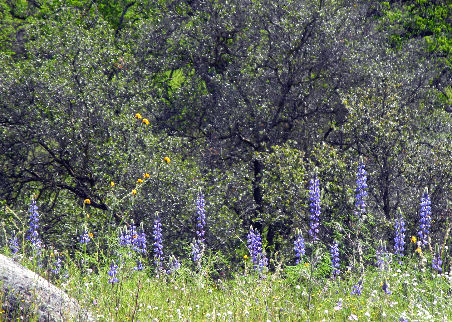
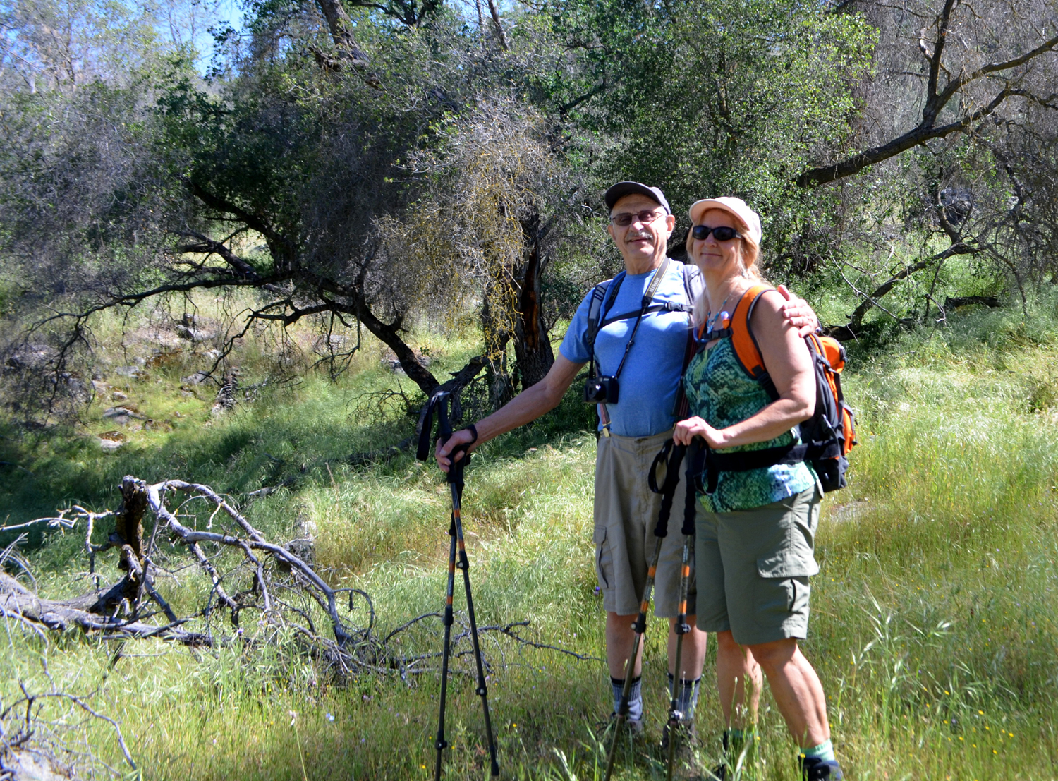
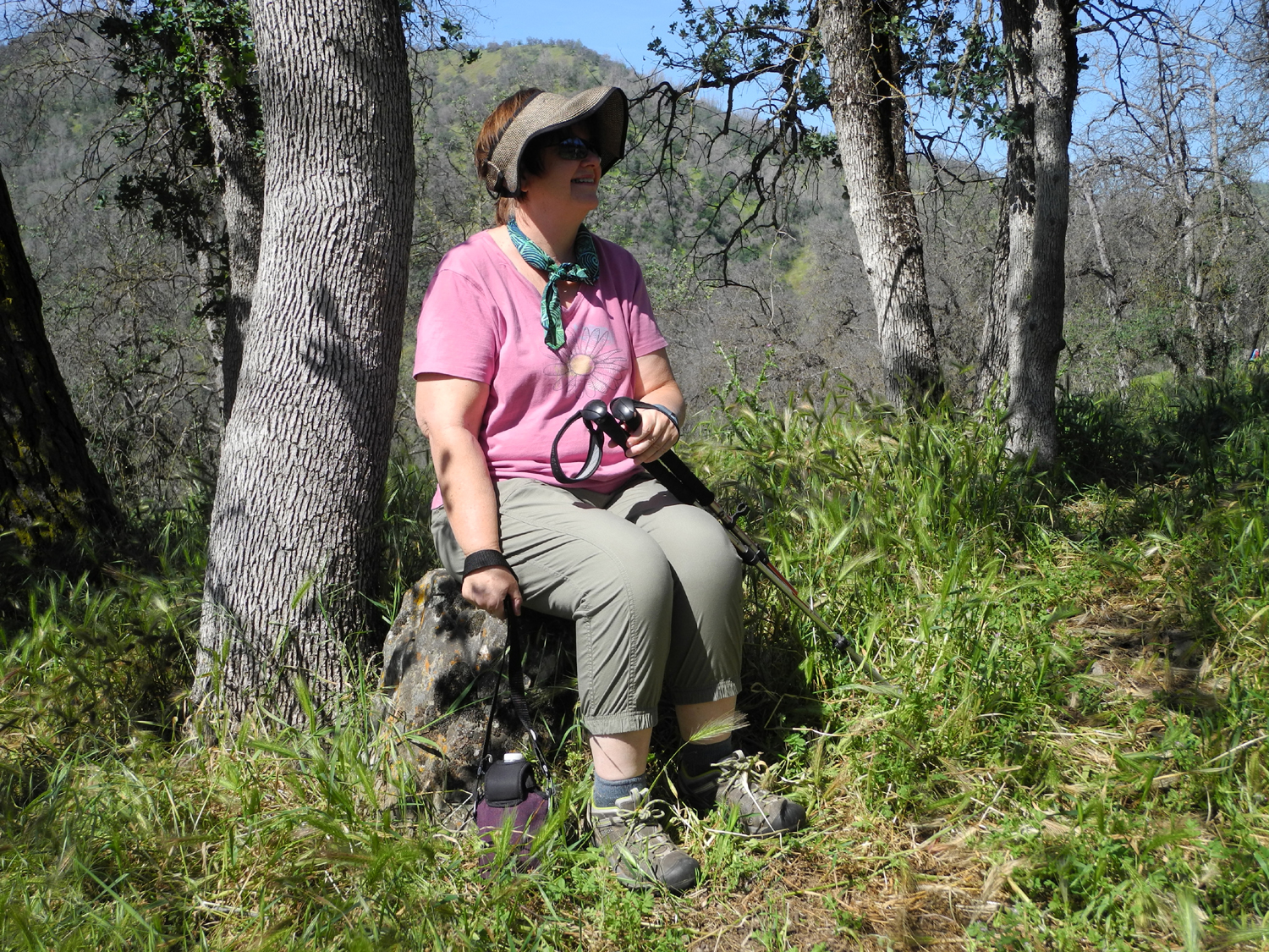
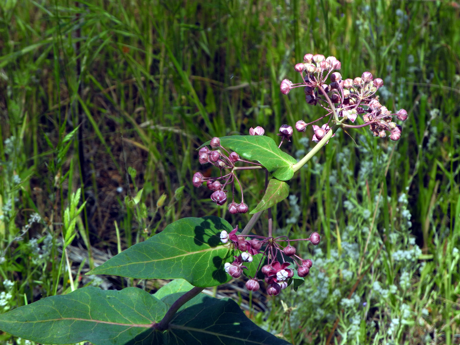
Sycamore Creek Fire Road: The Ramblers were finally back to full strength for our hike on April 18, with an added reinforcement, my daughter Teri. For this outing we planned two fairly short hikes, although the first one offered a few challenges. With five people we decided to take two vehicles, so Wes picked up Julie, while my daughter came to my house and we then picked up Carolyn. Rather than try to caravan through the city, we met where Pine Flat Lake first comes into view on Trimmer Springs Road. Teri had hiked with Wes before, but it was her first time meeting the two lady ramblers. From our meeting place, it was a few miles to the bridge across Sycamore Creek, one of two large tributaries that enter the lake on the north side. Just past the bridge at a cattle guard there is an old dirt road. It has no name on the map, but I believe it was used when there was a fire in the area 25 years ago, so I have named it Sycamore Creek Fire Road. Although it's closed to motor traffic, It has been continually used by 4-wheel drive vehicles, even after the barrier was put up (one reason you have 4-wheel drive is to ignore barriers, right?) At the beginning the road goes up steeply for 100 feet, then dips up and down through the hills a few hundred yards above the creek. The challenges consist of trees that have fallen across the road over the years. In every case, foot traffic has created a bypass, sometimes narrow and brushy, and sometimes requiring a scramble over logs. Drivers have created their own bypasses, usually separate from the foot route, because they have to go farther up or down the hill to get around the entire log. It should also be noted that this route doesn't really resemble a road much of the way. The "road" is so overgrown with vegetation as to be no more than a double, and often single, tire track, with many rough, uneven places. The Ramblers were up to the challenges as always, and we enjoyed the weather and the countryside. The grass is starting to dry out in spots, but is still mostly green. Some of the early flower species were still hanging on with a few token plants, but the late season varieties such as clover, brodiaea and lupines were much in evidence. Filaree was one of the most common, just as it has been since February. The weather was quite warm, with an occasional slight breeze. The road sort of fizzles out as it goes up a steep slope after about a half mile, so we took a rest there. I guided Julie and Carolyn to the perfect sitting rock I had discovered on my previous visit in February, and they each took a turn enjoying the soft moss on its flat surface. Wes and Teri went farther up the hill, where Wes heard the sound of a creek. As Teri returned to the rock, Wes made his way down the hill to see what it was like. We re-grouped and started back out, with plans for another short hike to complete our day. A short distance past the old fire road there are two campgrounds and a picnic ground on the west side of the road, all of which have been closed for decades. The paved campground roads are still in decent condition, and going through one of these facilities makes a pleasant spring stroll. We had hiked in the first one last year, so we went to the second this time. The road here is a bit longer than the other one, and heads down a gentle hill then curves back and up to the start. The road is lined with flowers, grass and various trees, with bright green new leaves on the blue oaks. In all three of these campgrounds the pavement is mostly intact and plants have grown up through cracks. There were always tree branches that had fallen in the road - nothing so bad that we had to go off the road to get past, but still, another obstacle to be aware of. As soon as we started on the old road this time, we started seeing scrape marks in the pavement and in the dirt to the side. We soon realized that equipment had been used to scrape up the branches and push them to the side. Eventually we came to a place where large branches had been piled up in the road, making further progress impossible. At this point we were strung out over 100 yards or so of the route. Wes had stopped to take photos and was far back; Julie and Carolyn were in between, and Teri and I were at the big pile. She and I decided to go through the grass and get around the pile, while the others turned back to return to our starting point. As soon as Teri and I got past the branches, we saw that we had come to the end of the loop, where the road we were on joined the main camp road close to the gate. We walked away from the gate to meet the others, always looking to add a few more feet to our hikes. We met them very quickly, and all headed back toward the cars. Teri got to the gate ahead of the rest of us, and was rewarded by seeing a king snake. Some members of our group were happy not to see the creature, but others were disappointed that we had missed it. Now it was time to head back down to the valley and lunch. Along the road by the lake we saw large numbers of Farewell to Spring and Mariposa Lilies, two flowers that did not appear along our hiking route. Because we had anticipated a warm day, we had left home at 8 a.m. This made it possible for us to try a restaurant we had driven by several times, without having had a chance to eat there. The Blossom Trail Cafe at the corner of Belmont and Academy closes at 2:30 p.m., and we had always driven by it too late for lunch on previous trips. This time we arrived a little after 1 and enjoyed a nice lunch. Leaving the restaurant, the different parties said our goodbyes, and headed back home, looking forward to our May outing at a slightly higher altitude.
|
||
|
Photos
(Click to enlarge; pictures open in new window) |
||
San Joaquin River Gorge Stockton Creek Preserve Photos Edison Point Hike |
||
|
San Joaquin River Gorge |
||
 |
 |
 |
| Little Dry Creek by Millerton Road | Another view of the creek | Even with horsehide
coats, this rain is a bit too much! |
 |
 |
 |
| Little Dry Creek by the Highway168 bridge | Seasonal waterfall
by Smalley Road near San Joaquin Gorge |
Blue oaks, green
grass, |
 |
|
 |
|
No
rock this time, so |
The trail was damp but not muddy |
Wes can enjoy hiking in any weather |
| Stockton Creek Preserve | ||
 |
 |
 |
| Fire left dead trees and a re-growth of brush | Wes heading up the trail | Susan, Dick, Carolyn and Julie |
|
 |
 |
|
Mariposa Reservoir on Stockton Creek |
Entering a shady area | These signs were needed where old trails forked off |
 |
 |
 |
| Dick, looking determined | Julie, enjoying a great day |
The Ramblers at the highest point on the trail |
 |
 |
 |
| Carolyn and Dick far down
the trail, Julie easing her way down |
A long stretch of trail left to walk |
Carolyn on a steep,
narrow |
 |
 |
 |
| Brand new growth on a buckeye | Not sure what this flower is | NOW they tell us! |
 |
 |
 |
| Rocky slope across the canyon from the trail | Storage tank at waterworks | Oaks on the slope near the waterworks trailhead |
| Edison Point Hike | ||
 |
 |
 |
|
Fiddlenecks along Trimmer Springs Road |
Popcorn flowers on the other side of the road |
Where we stopped to photograph lupines |
 |
||
| Bush lupine panorama next to the Kings River | ||
 |
 |
 |
| Lupines and fiddlenecks between the road and the river |
Blue dicks were among the most common flowers |
Of course, poppies held first place |
 |
 |
 |
|
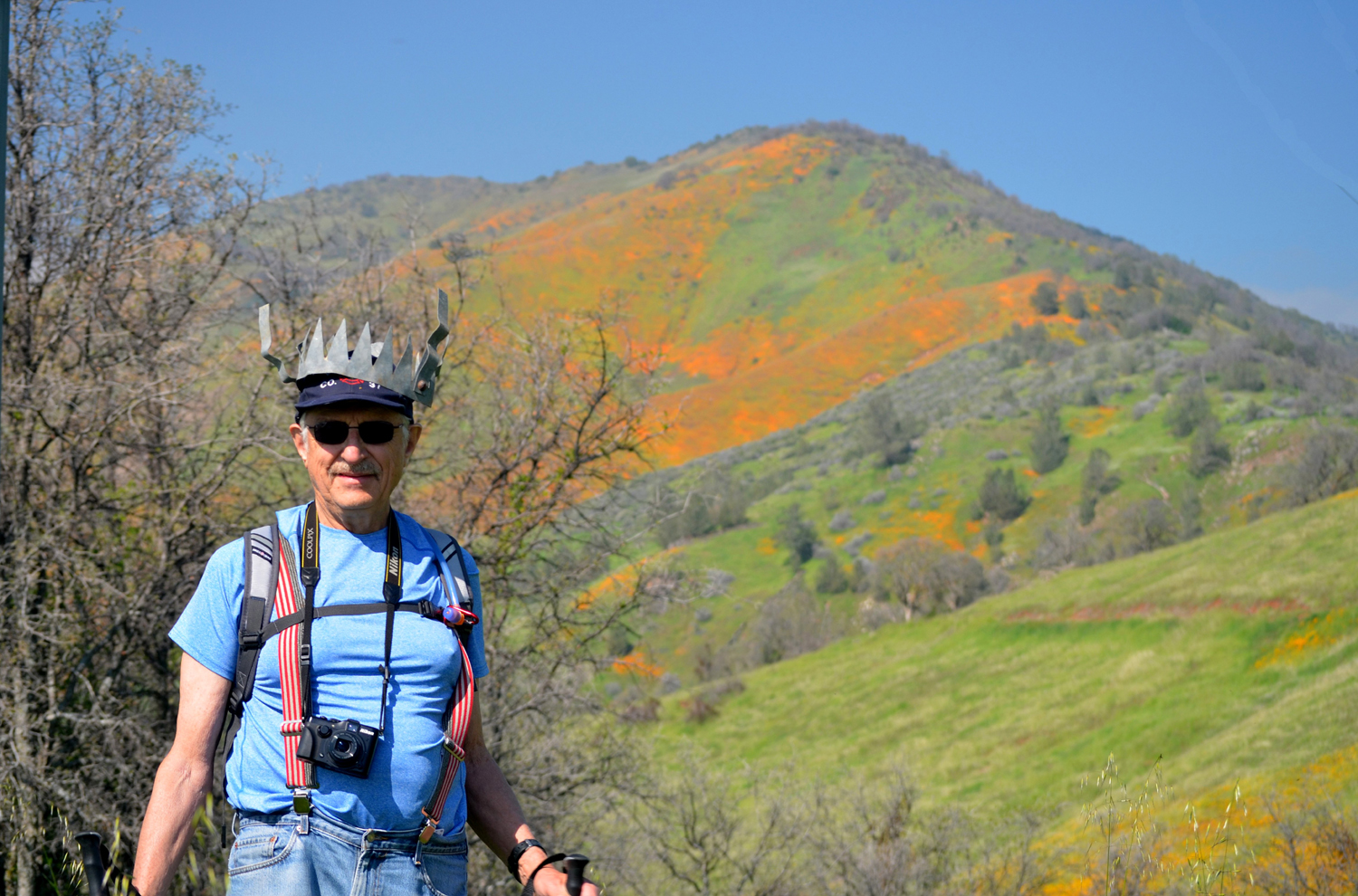
Dick declared himself "King of the Trail" |
Julie makes her way down the hill | The hill top is Edison
Point, but it seemed like a long walk from there to this spot |
 |
 |
 |
| Not hiding in the grass, but actually standing on the trail |
Typical section of the return portion of the trail | Yes, still on the trail |
 |
 |
 |
| A well-earned rest | Acres and acres of tall grass | The grass here is as tall as Wes - over six feet |
 |
 |
 |
| Filaree blossoms and seed pods |
Pine Flat Lake, shimmering in the breeze |
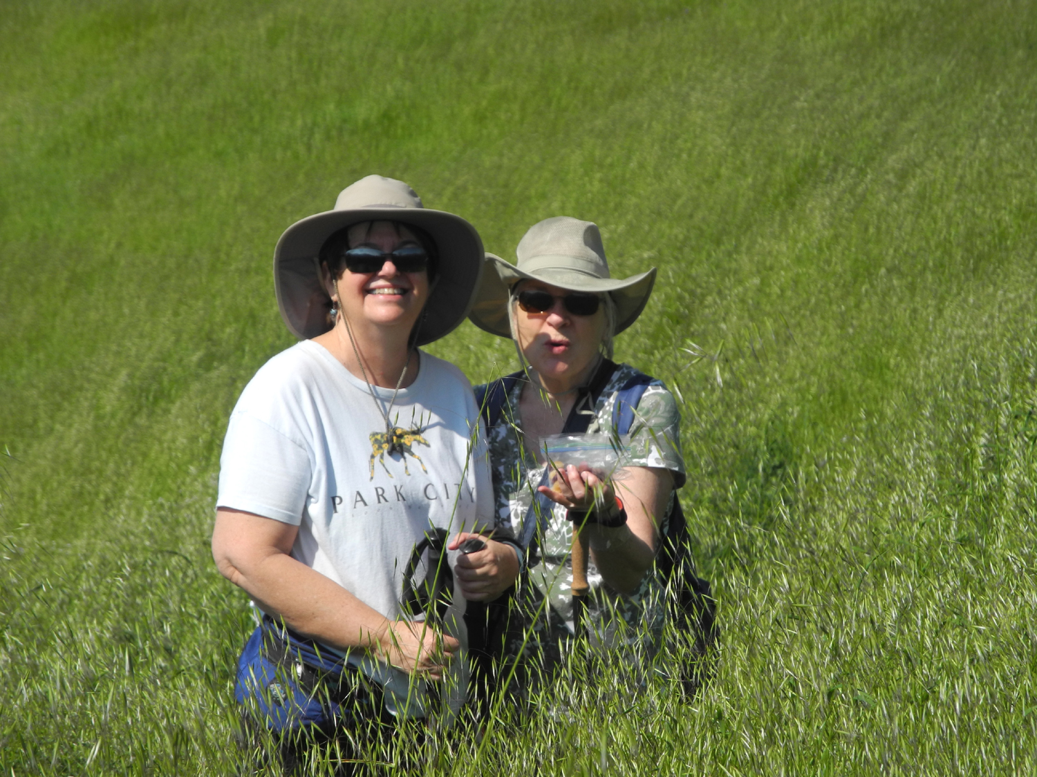
Is Carolyn calling for help, or just waving hello? |
 |
 |
 |
This
appears to be a |
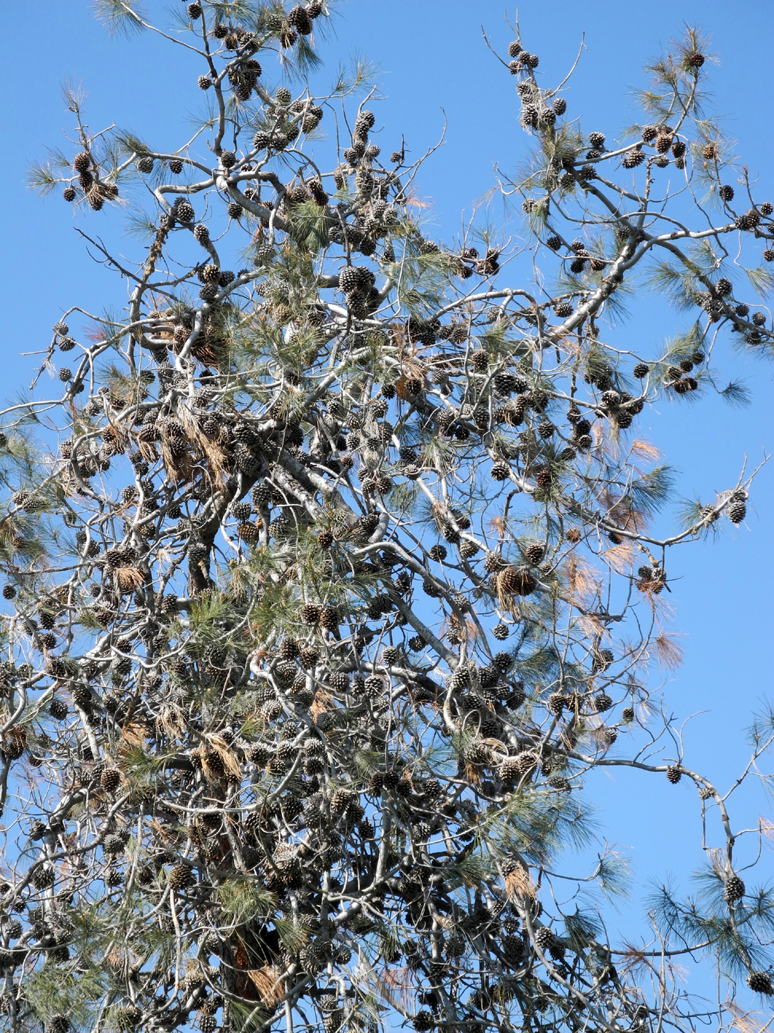
A bull pine with more than enough cones |
Dick and his shortcut |
 |
 |
|
| If you can spot the trail,
you can hike with the Ramblers |
California gold | This leafless tree made
perfect contrast for the orange hill |
 |
 |
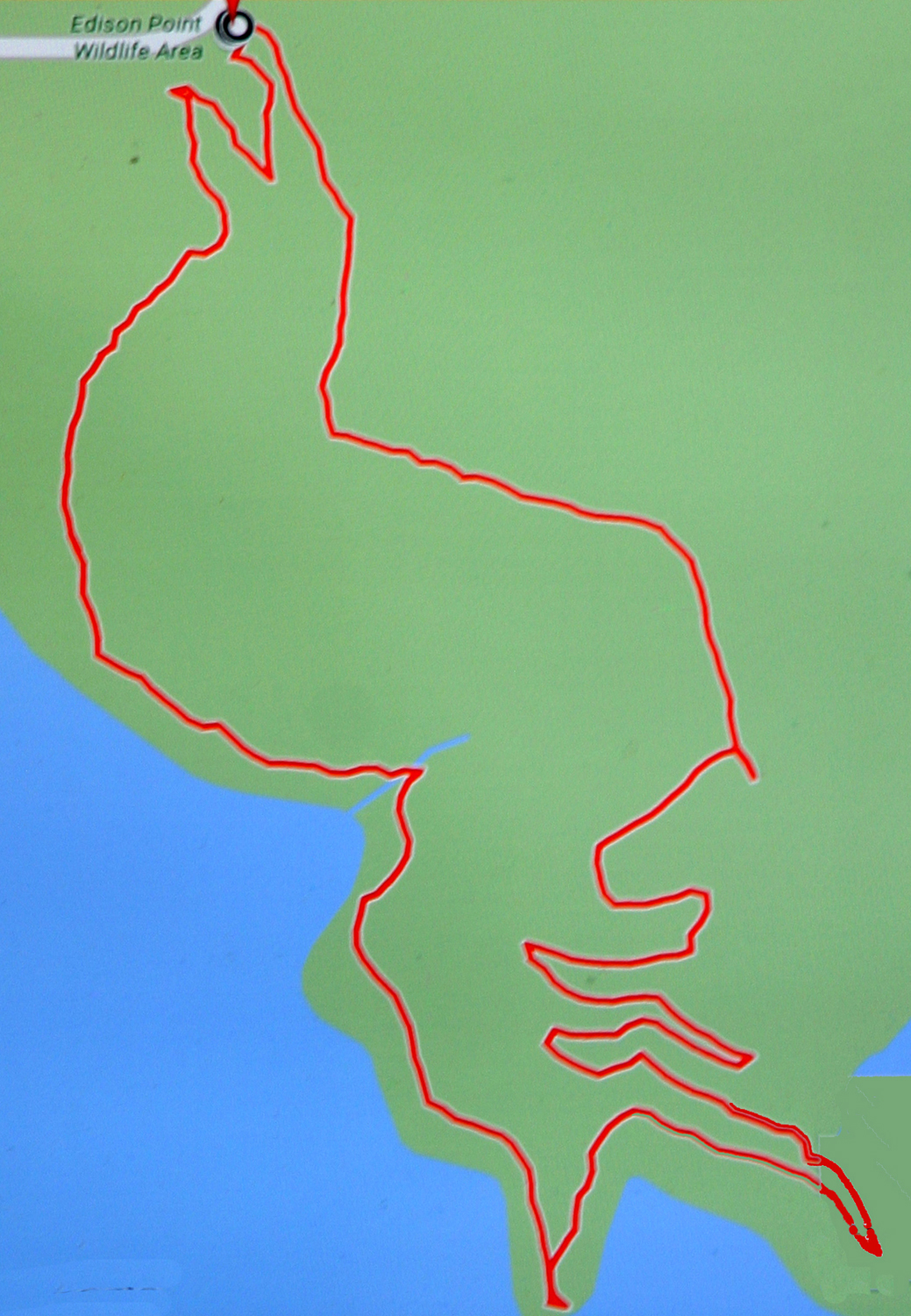 |
| A perfectly designed scene at Edison Point | New leaves on the blue oak | The rambling route of our hike |
| Lakeview Trail - Eastman Lake | ||
 |
 |
 |
| Geese over Hensley Lake | Lupines near the entrance to Hensley campground |
Wes takes a break at St. Anne's Chapel in Raymond |
 |
 |
 |
| The trailhead, where the
Raymond Road crosses the Chowchilla |
The view just above |
There are flowers every step of the way |
 |
 |
 |
| Fresh new leaves on a blue oak |
The debris line in the
foreground |
Popcorn flowers were thick in some places |
 |
 |
|
|
Chaparral is usually
white, |
Everything is green | The tall lupines were just getting a good start |
 |
 |
 |
| A grassy glade | The most common flower was the Bird's Eye Gillia |
We learned just recently that this is phacelia |
 |
 |
 |
| Pink Filaree are still thick throughout the foothills |
Granite outcropping makes a perfect background for poppies |
Half the Ramblers in the
middle of nature's magnificence |
 |
 |
 |
| Another nice foothill scene | The Chowchilla River | Best stand of baby blue eyes anywhere this year |
 |
 |
 |
|
There were huge fields of Bird's Eye Gillia |
More Gillia | At the bend of the trail |
 |
 |
 |
|
Massive blue oak touches the ground |
Dick in the fiddlenecks, down by the river | More Gillia near the river |
| Sycamore Creek Fire Road Photos | ||
 |
 |
 |
| Father and Daughter hike | Julie enjoys the mossy rock | So does Carolyn |
 |
 |
 |
| An
excellent rock above the road for Wes's traditional pose |
Clover and filaree | Milkweed in bloom |
 |
|
 |
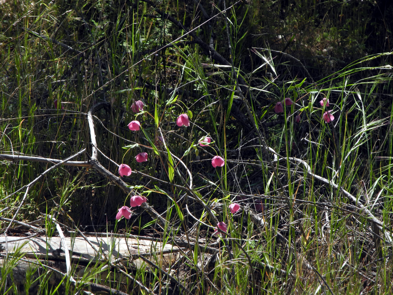
| This rare
and delightful flower is known as Globe Lily |
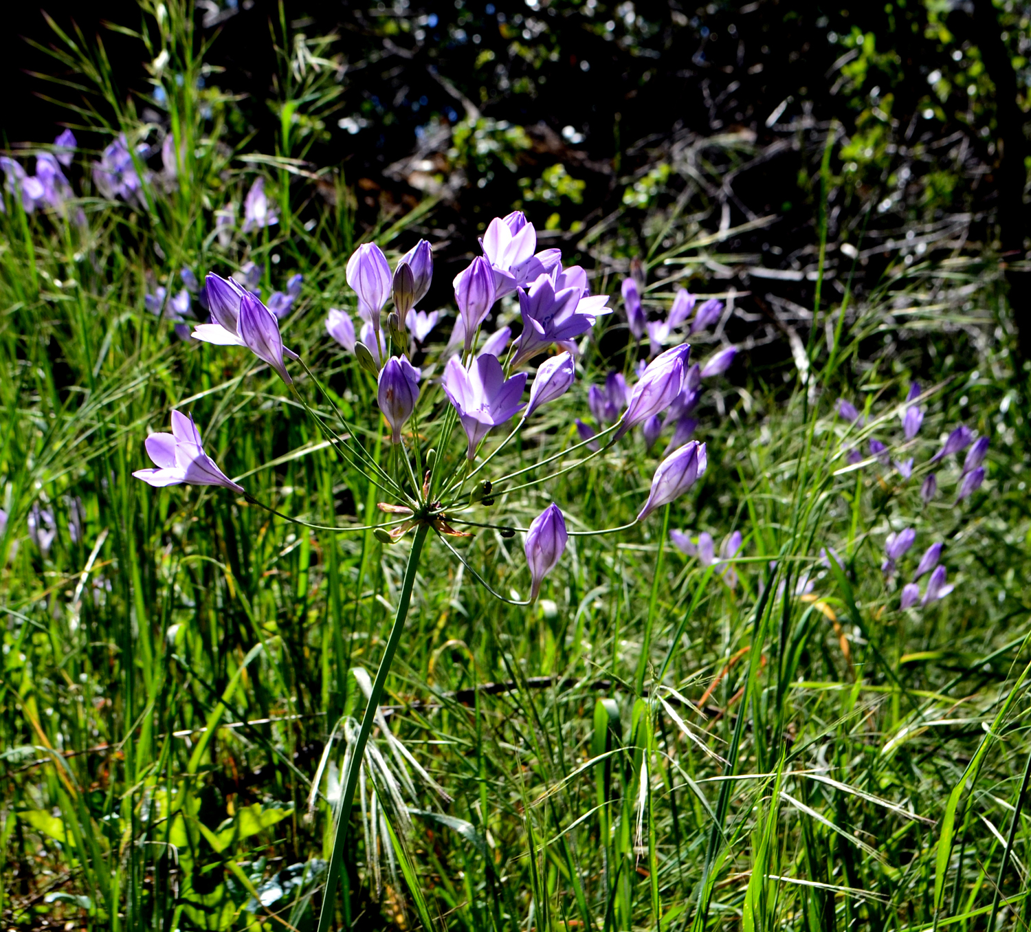
A close-up view | Purple brodiaea are still brightening the hills |
 |
 |
 |
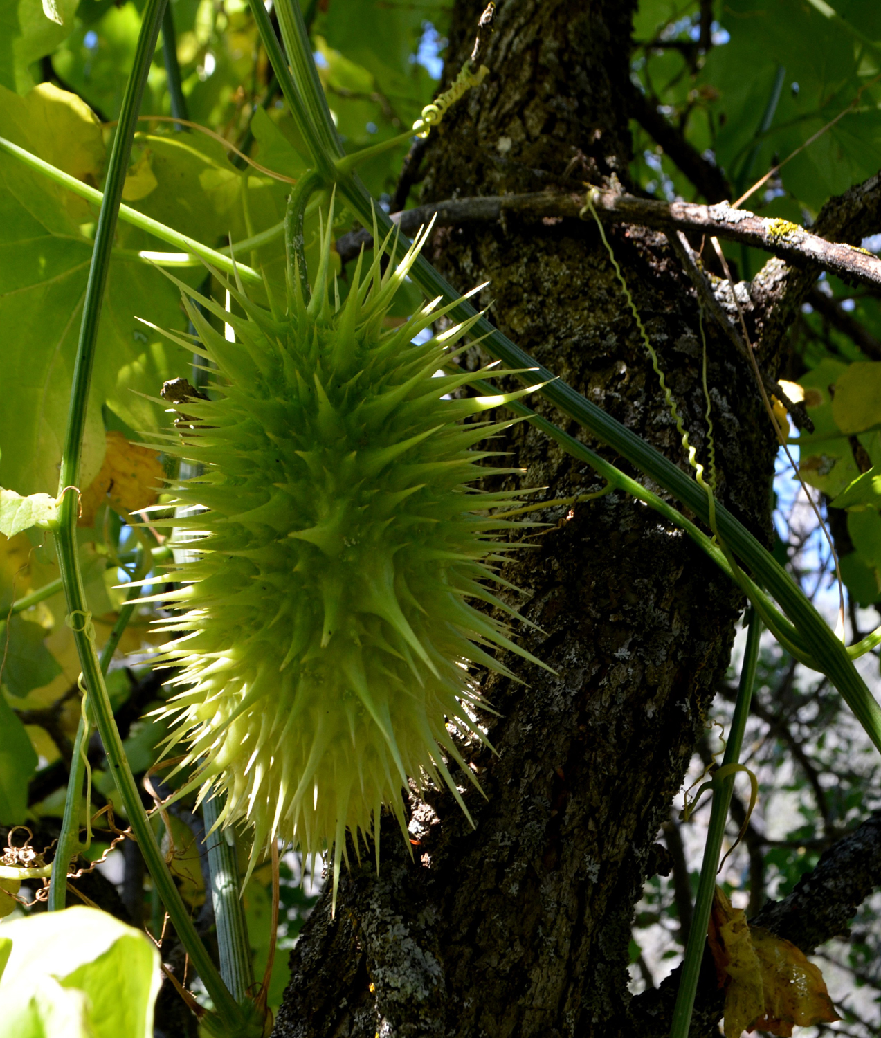
| A very fine wild cucumber (don't eat it!) | A very trail-like section of the "road" | A determined blue oak |
 |
 |
 |
| The Ramblers plus Teri | View through the campground | Where we were |
| Related Links | ||
| San Joaquin Gorge Photo Album | Background
& History of San Joaquin Gorge Area |
|
| San Joaquin Gorge Slide Show | Velasco's Restaurant | Highway 41 Rock Slide |
| Dick's San Joaquin Gorge hike | Stockton Creek Preserve | The Preserve on Facebook |
| Merrill's Sawmill | Edison Point Trail Description | Pine Flat Lake |
| Ramblers Edison Point 2015 | Dick's Edison Point 2015 | Oak Savanna |
| Raymond | Roosevelt in Yosemite | Raymond Granite Quarry |
| Eastman Lake | Chowchilla River | Gillia Tricolor (AKA Birds Eye) |
| Kings River | Blossom Trail Cafe | |