Dick's Adventures of 2018 - Part 1 |
||
|
Photos Related Links More Travel Reports Adventures of 2016 Adventures of 2017 2018 Part 2 2018 Part 3 2018 Part 4 2018 Part 5 2018 Part 6 |
||
|
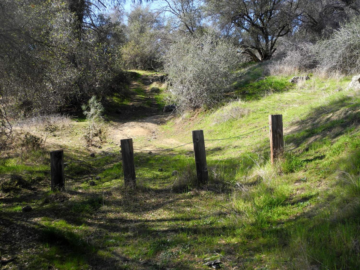
Hensley Camp Bear Wallow Camp Concrete Flats San Joaquin Gorge Camp Finegold Exploration |
||
|
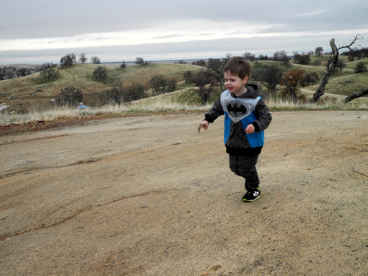
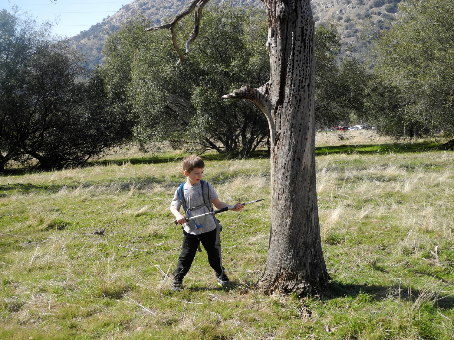
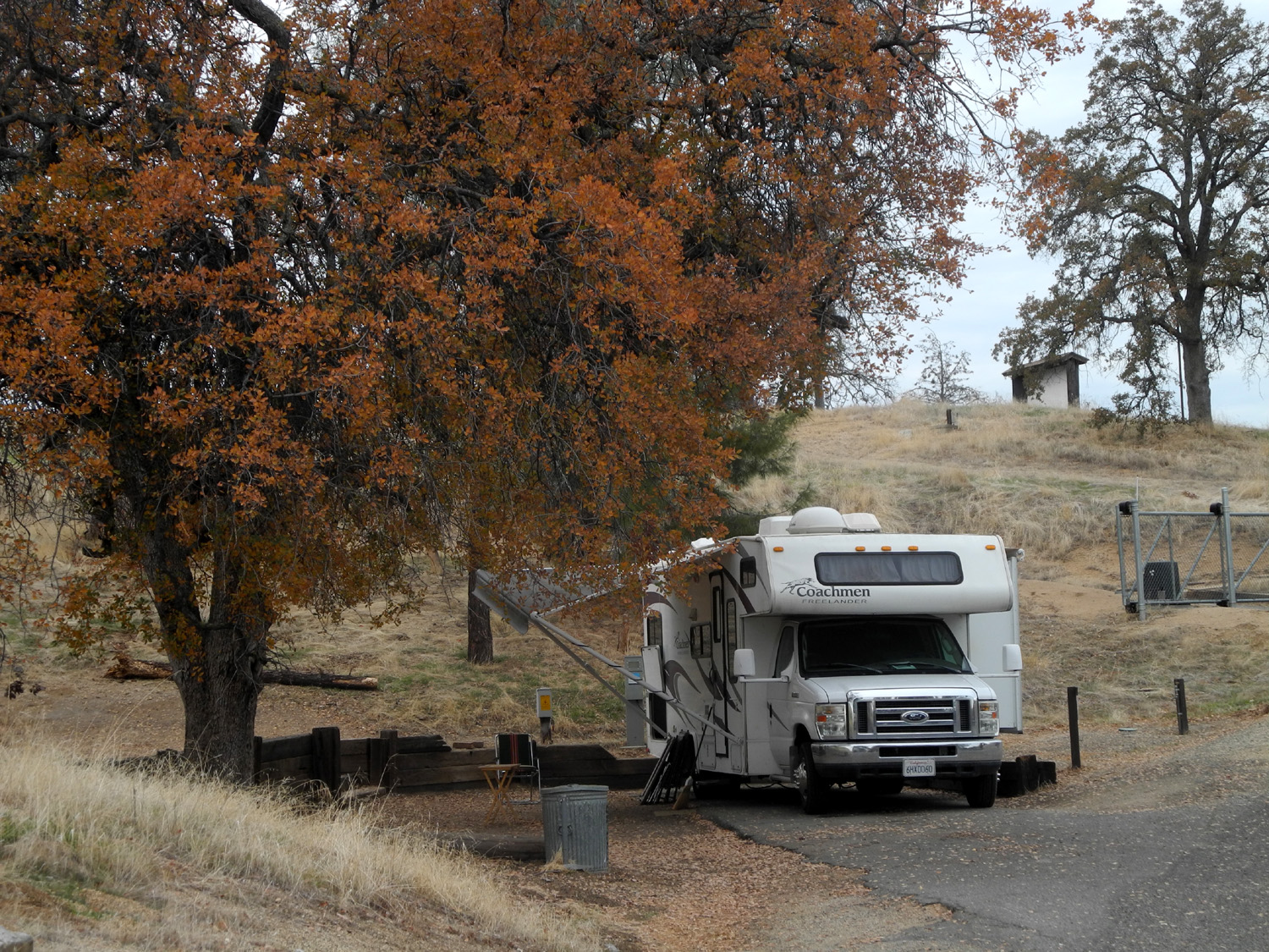
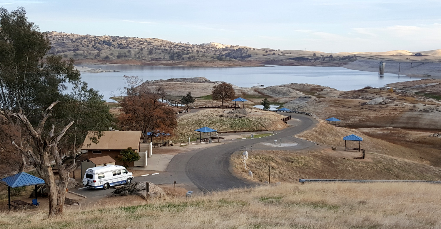
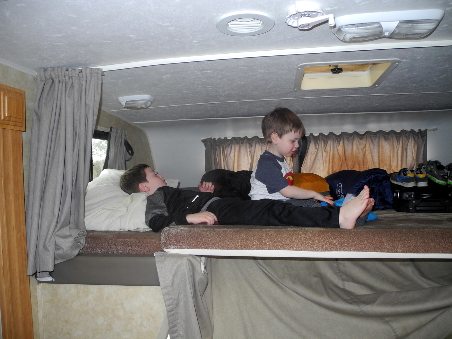
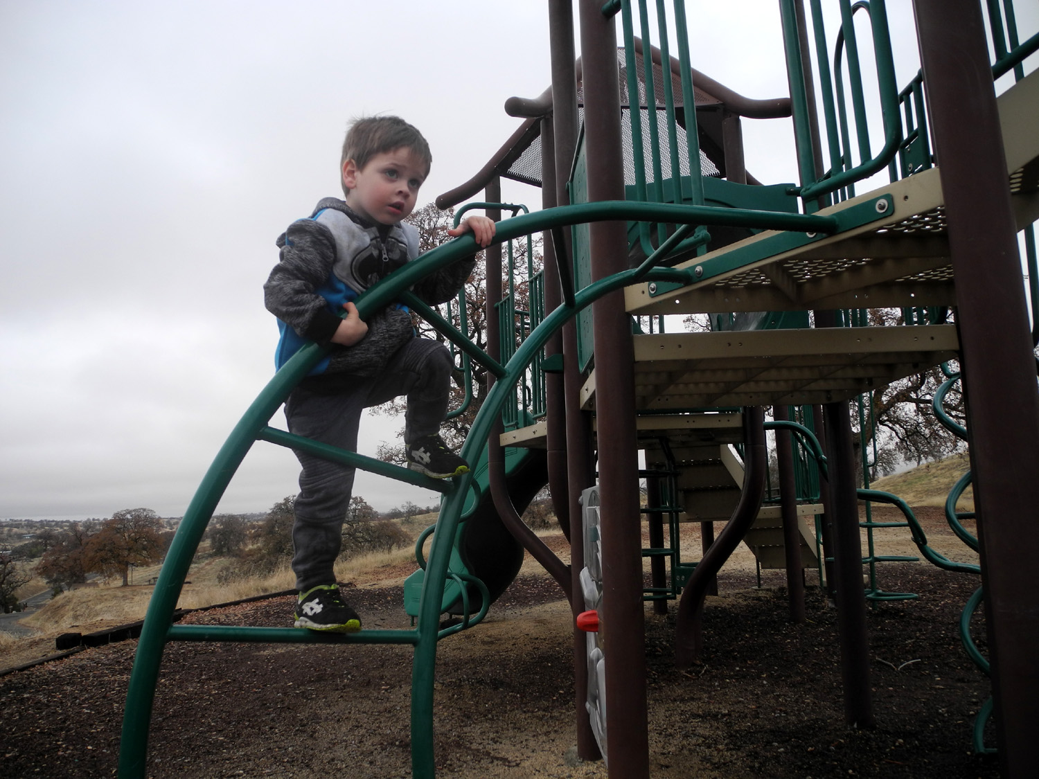
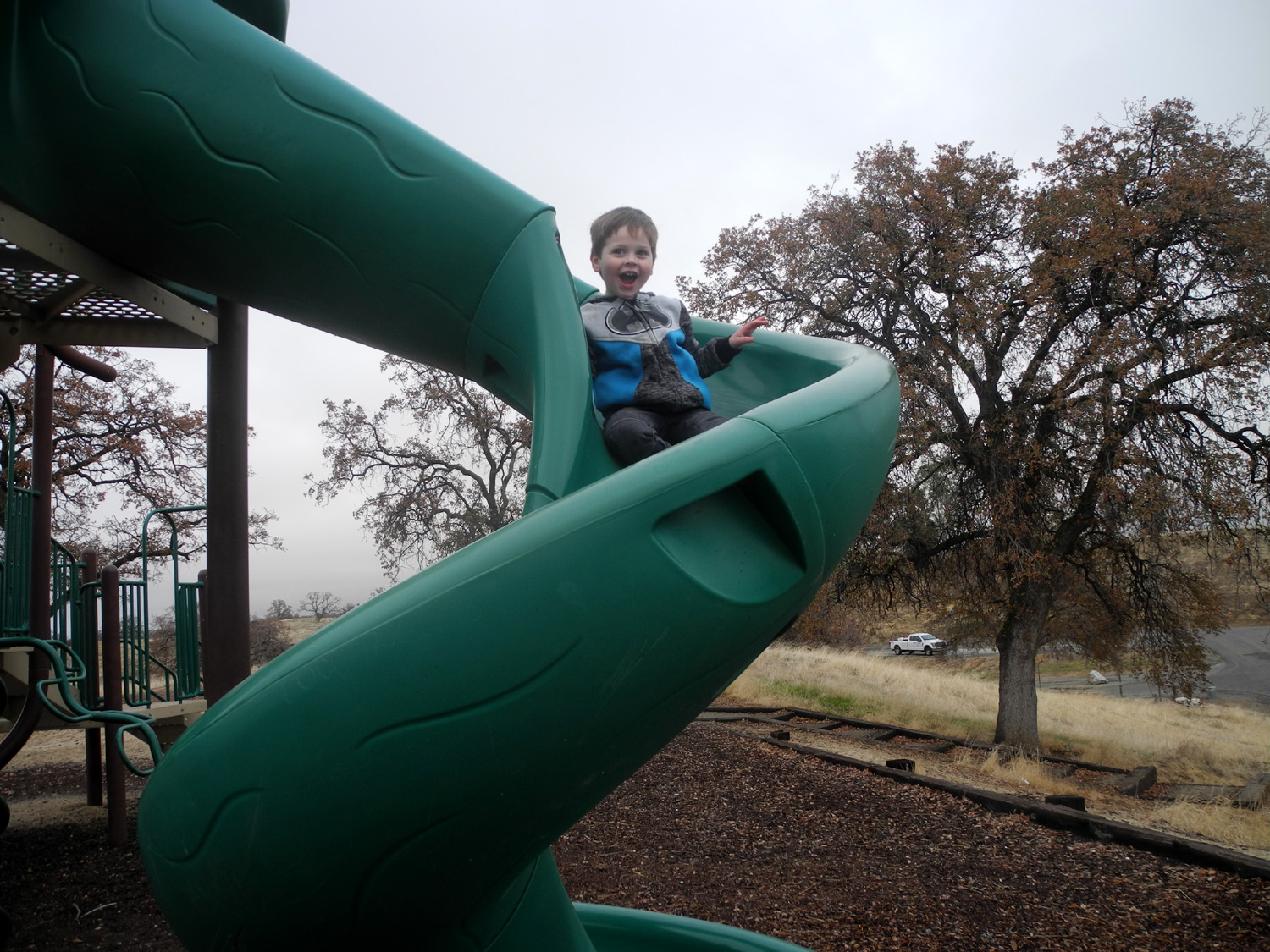
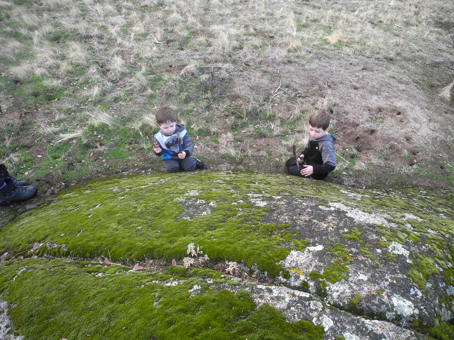
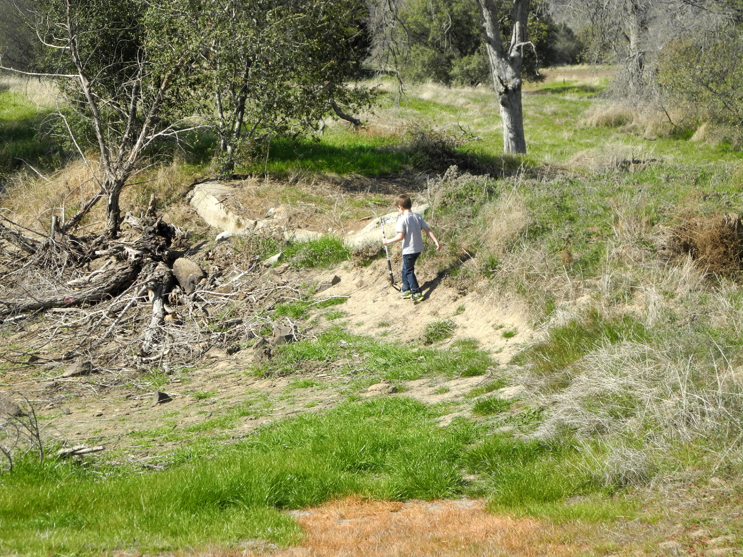
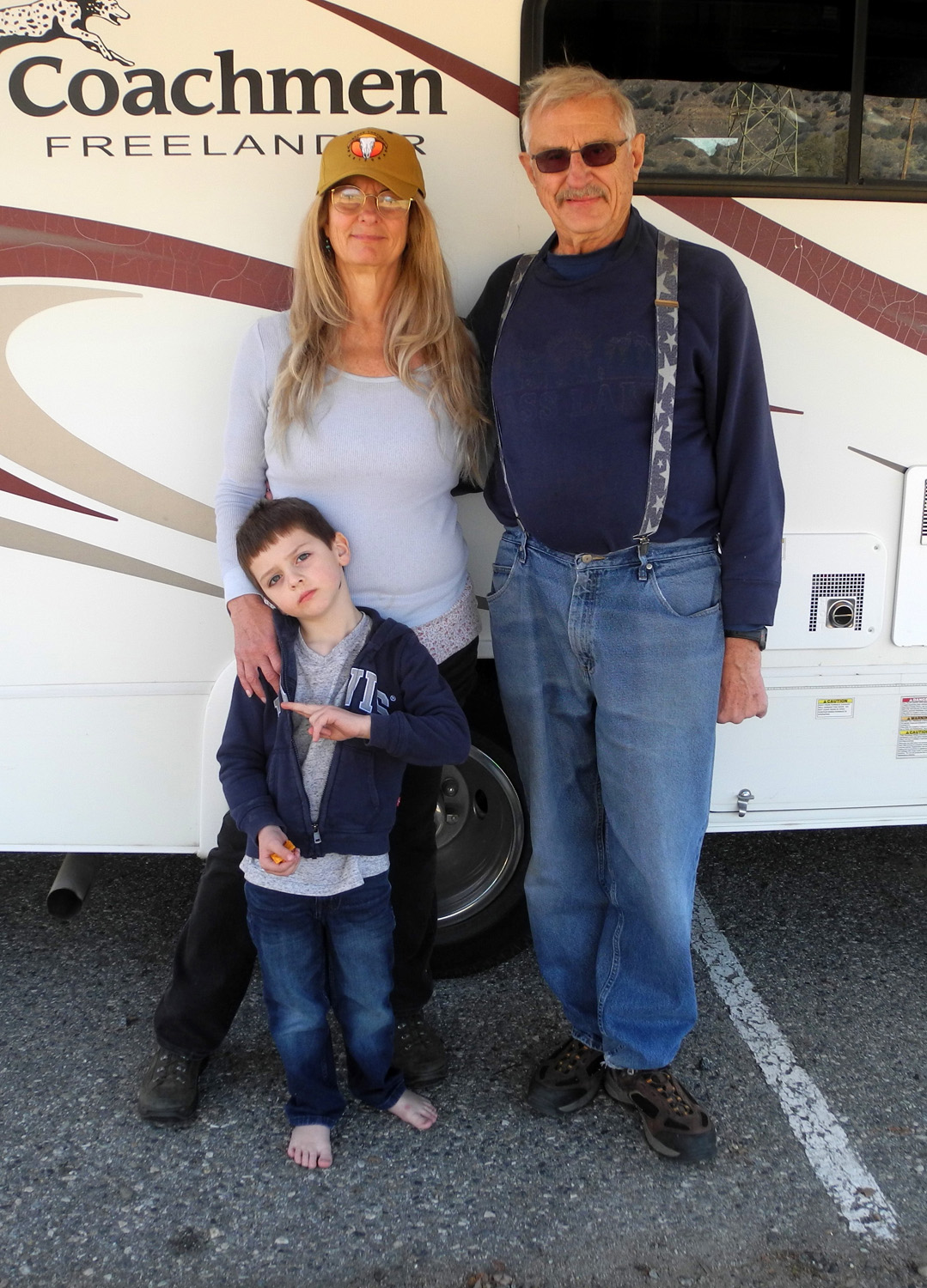
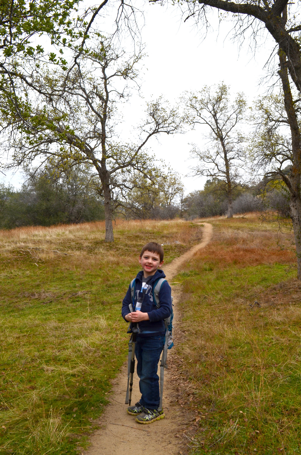
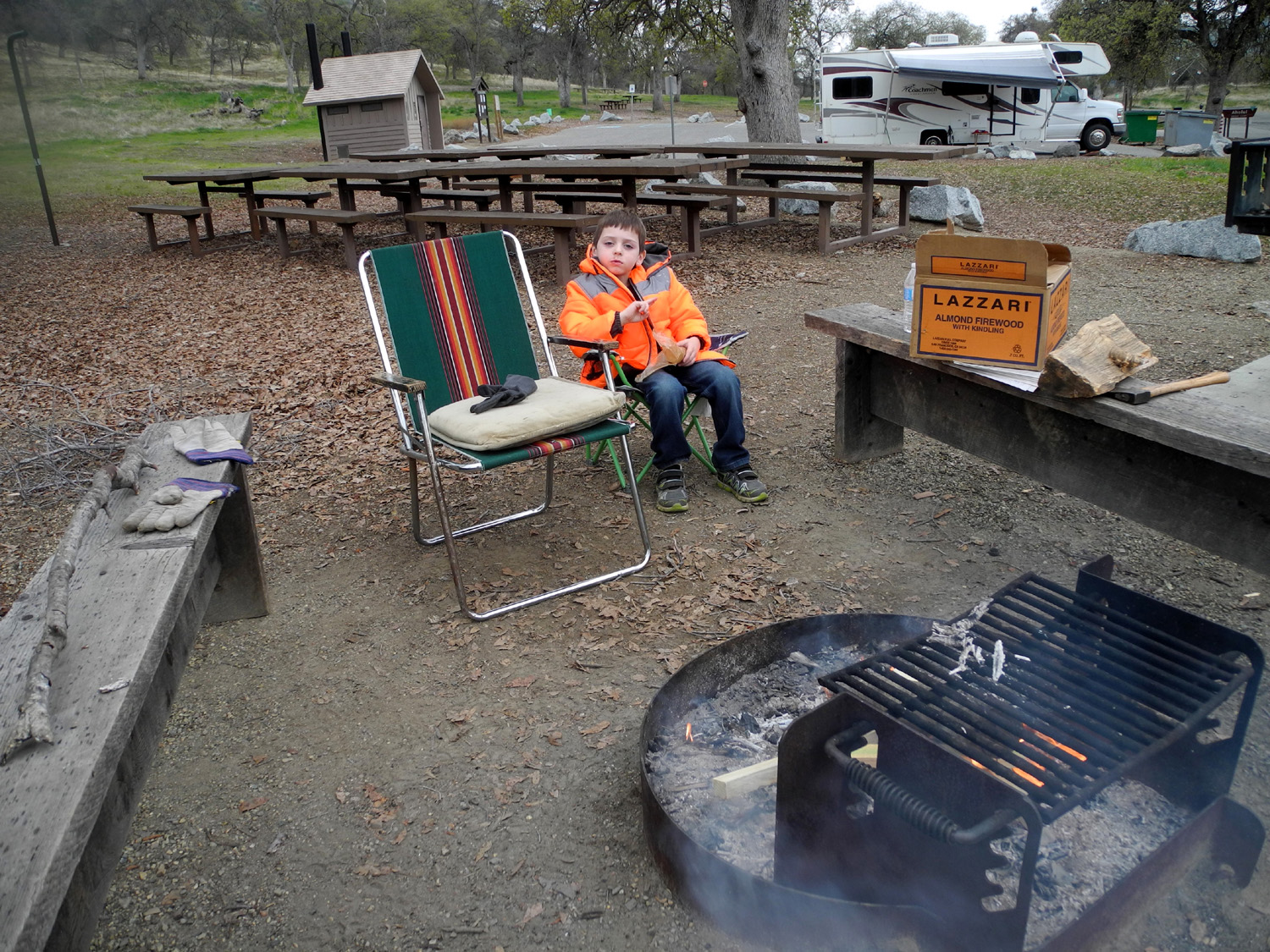
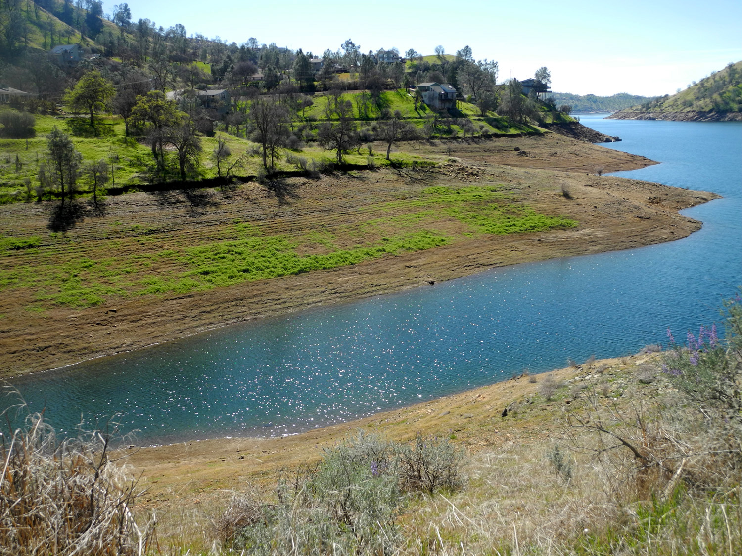
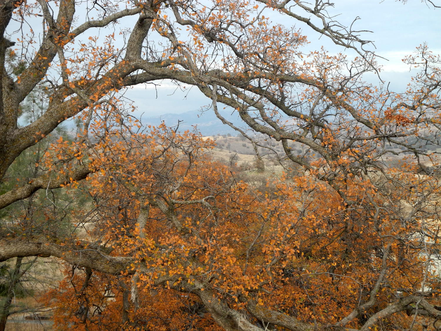
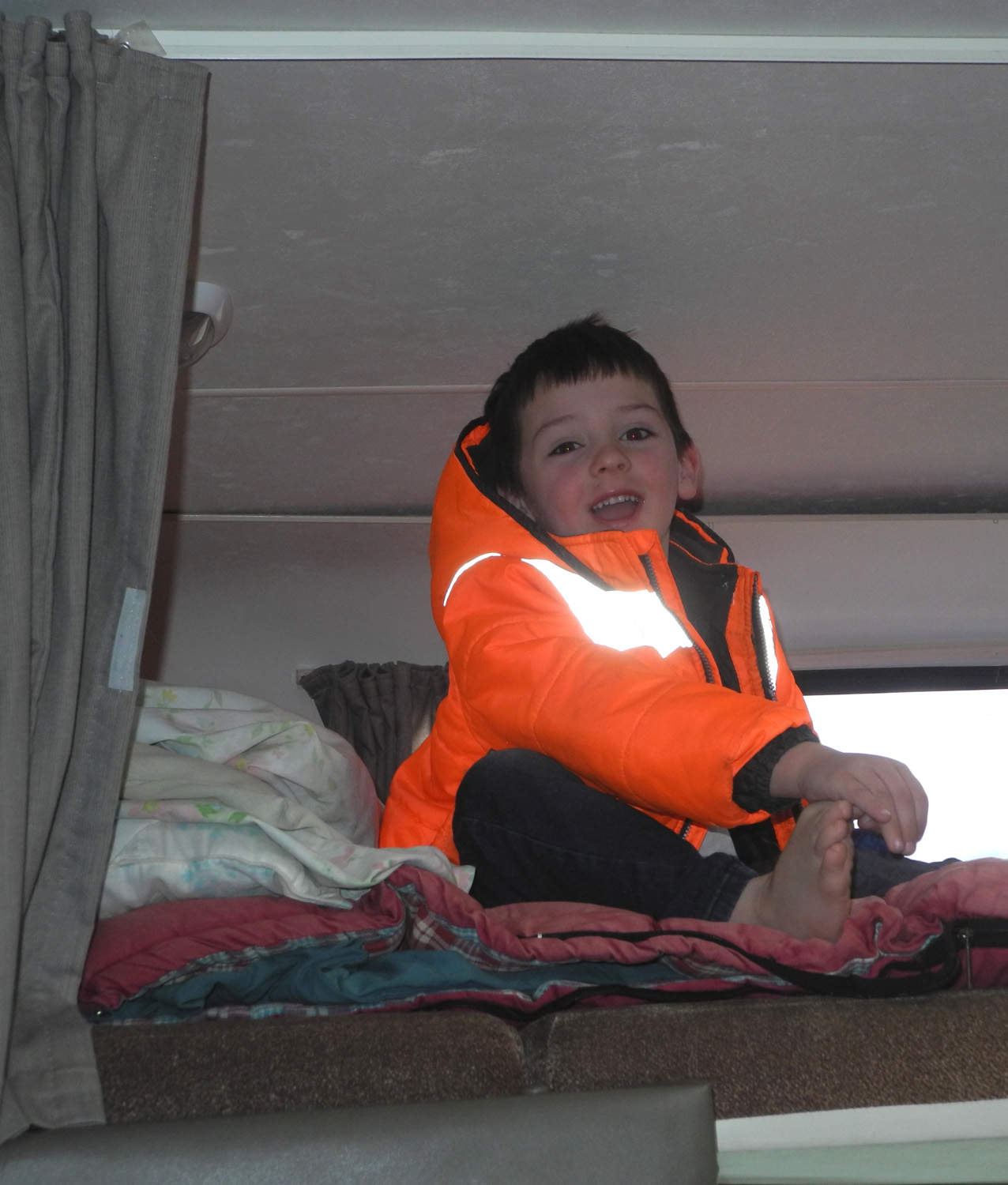
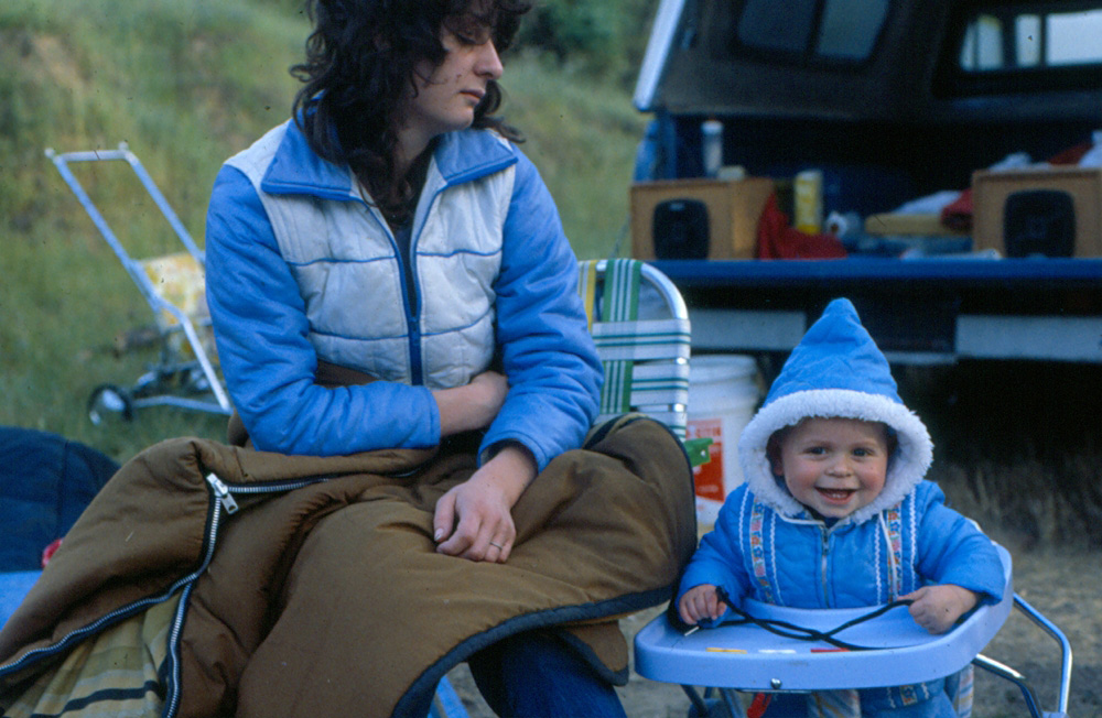
Hensley Camp For the first adventure of the new year, I made reservations for January 5 - 7 at Hensley Lake, on the Fresno River, 35 miles from home in the Madera County foothills. As usual I made sure that the weather forecast was favorable, and as often happens, the actual weather was different. More about that later. My daughter Teri planned to drive out the second day and spend the night, and my older grandson and his family would come for a few hours, with Colton and Jack (age 5 and 3) staying for the night. |
||
|
|
 |
 |
| Blue oaks turning gold |
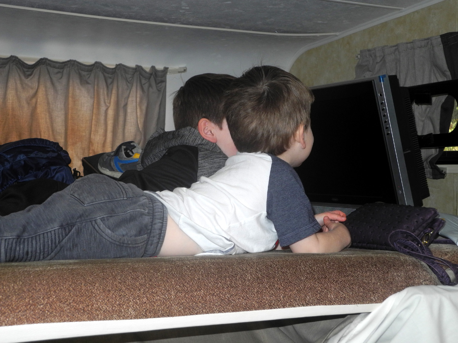
If you can't watch actual TV, pretend TV is the next best thing |
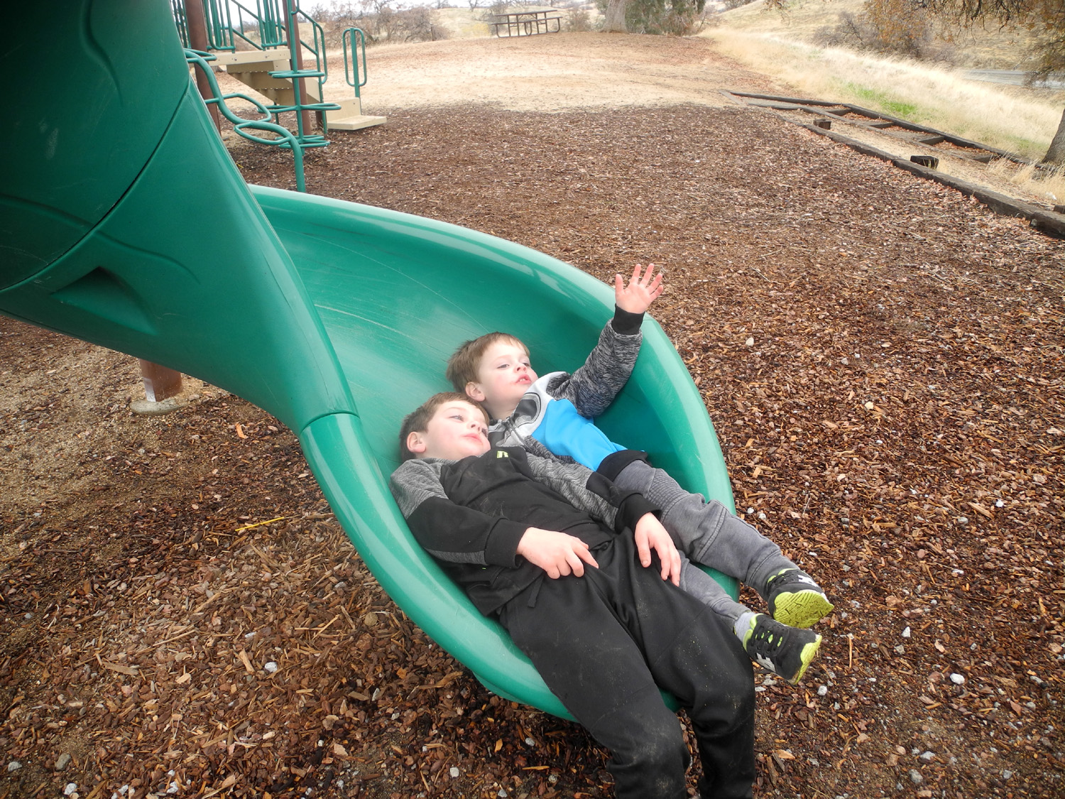
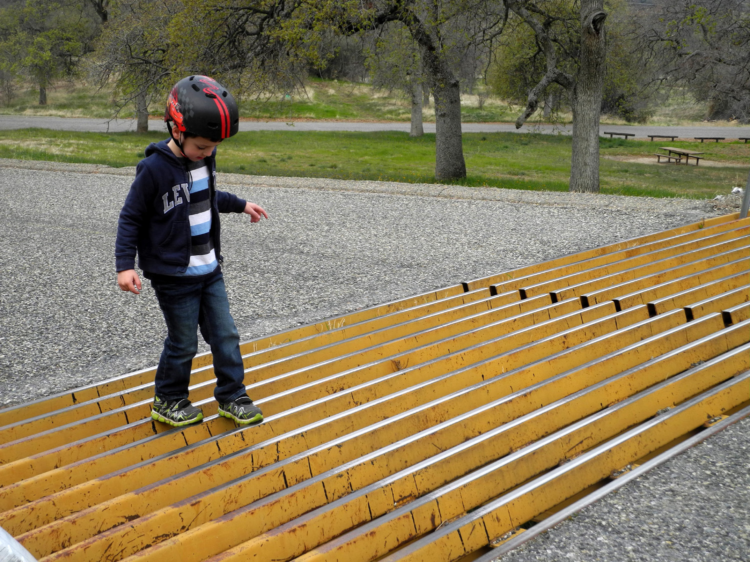
The slide had room for two |
|
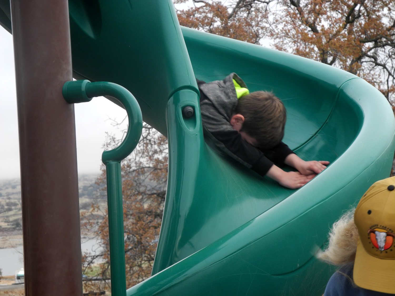
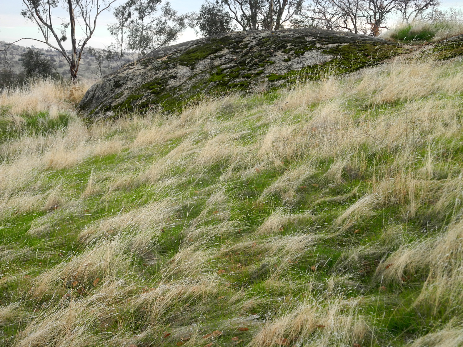
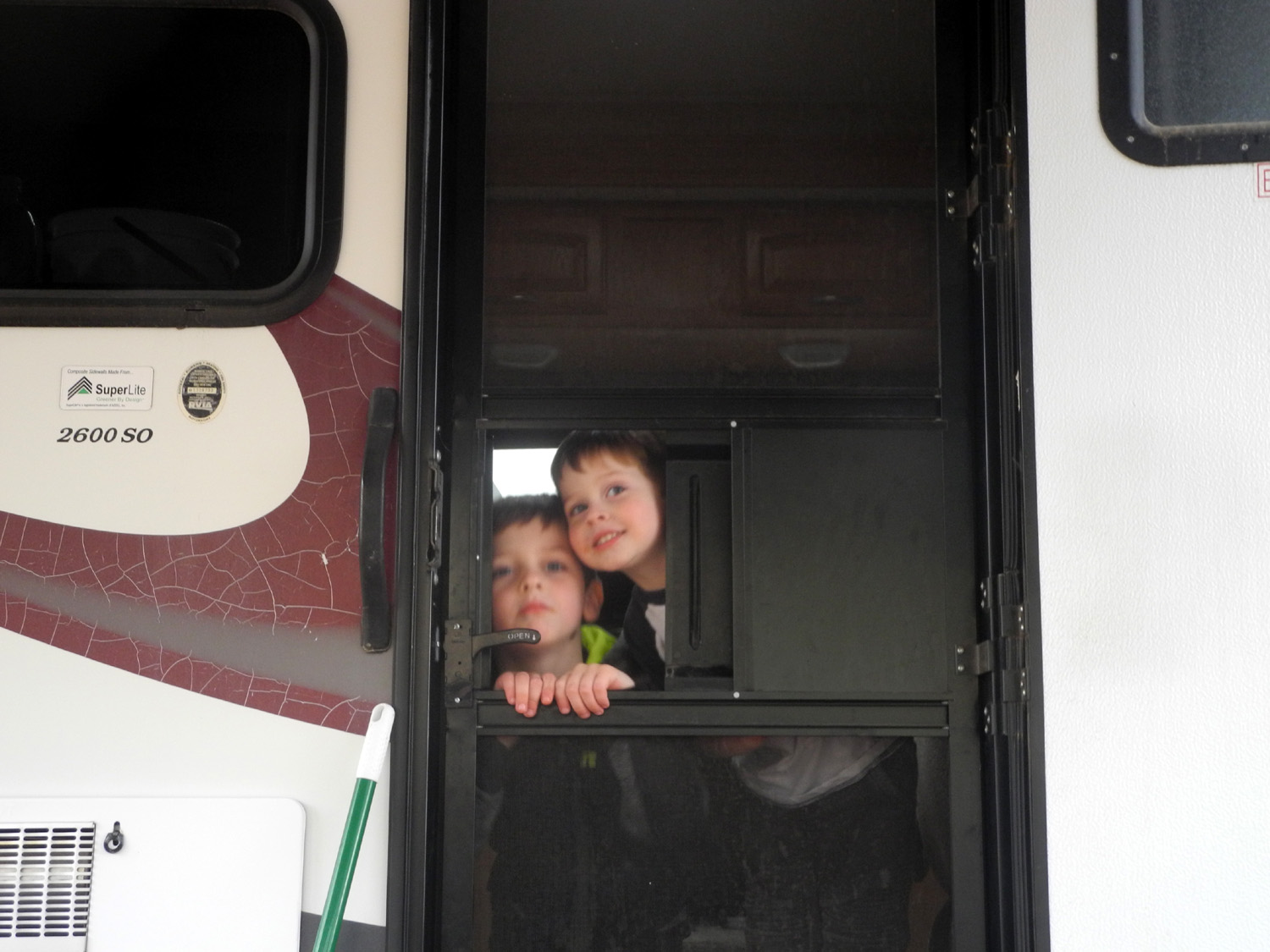
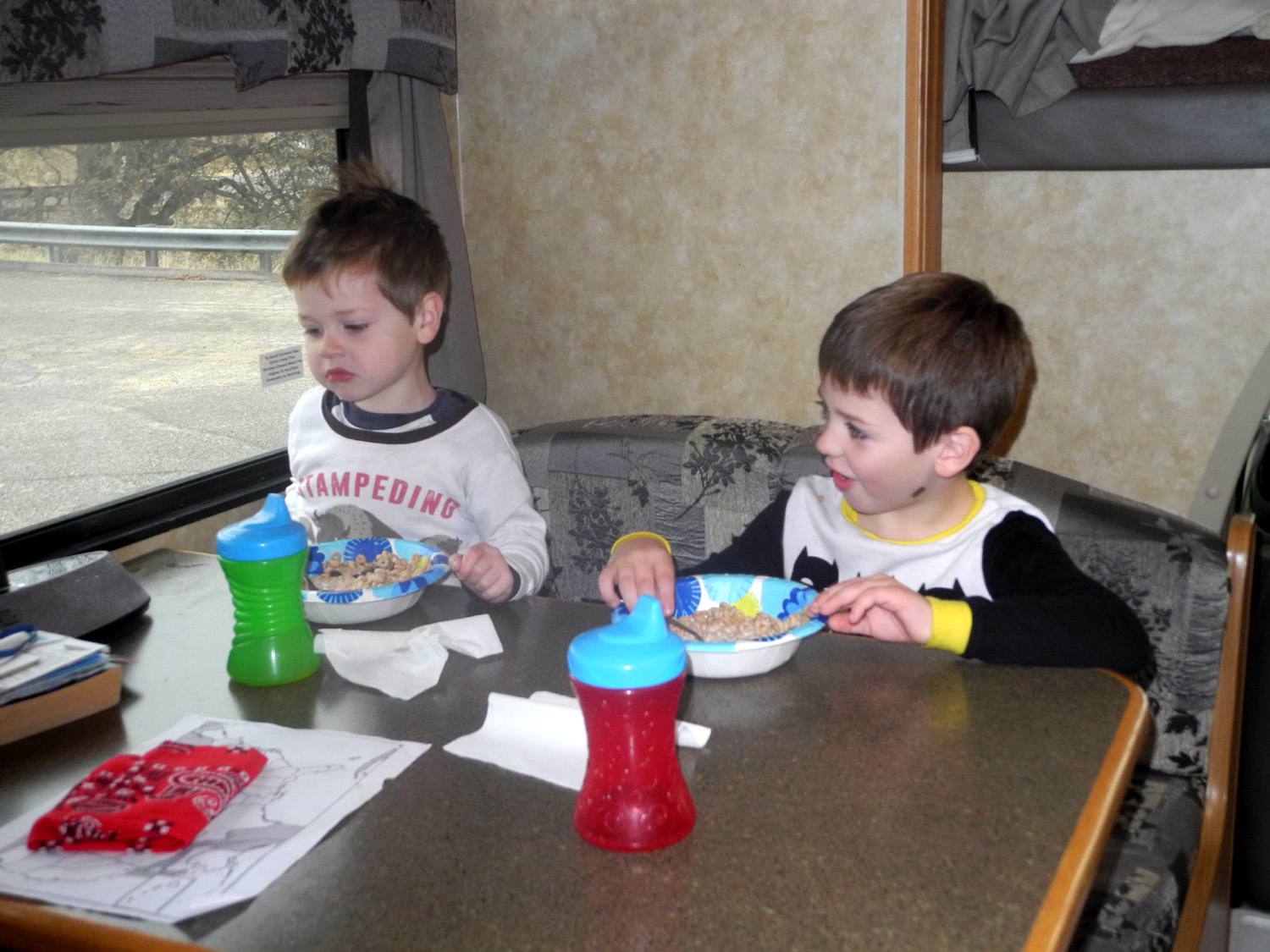
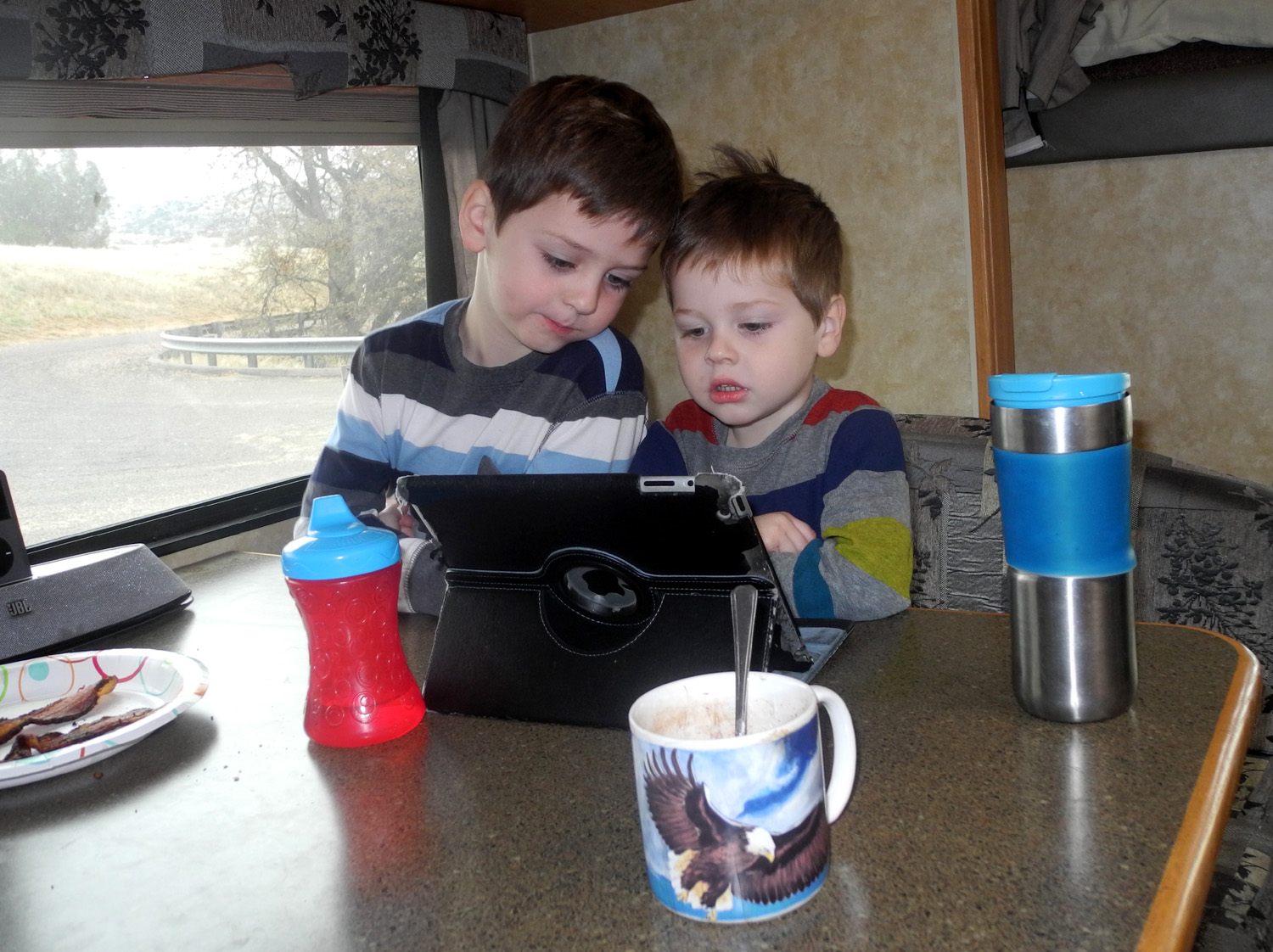
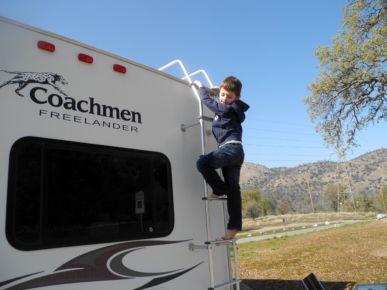
Since it's such a short distance from my house to the lake, I went to my usual Friday lunch with former work colleagues. The motor home was loaded and ready to go, and as soon as I got back from lunch, I got started, arriving at my camp site around 2:30. After getting everything set up, I took my first walk, going up the hill behind my campsite, where there is a good view of the lake and much of the campground. The predominant tree in this country is the blue oak, a deciduous tree that can lose its leaves early, or retain them longer than normal, depending on rainfall. With record precipitation last winter and spring, many of the trees still had all their leaves, but they had changed from the bluish green that gives them their name to a brilliant gold. There are two official trails at Hensley, but I didn't hike either one, since we planned to do the longer one on Saturday with the boys. After my hike I did a few short walks close to camp, a lot of reading, some TV watching, and of course, eating - leftovers for dinner plus popcorn. By the time I left home, the weather forecast called for a short rainfall early the next morning, moving out before dawn. Therefore I was not concerned when a gentle rain started around midnight, and lasted until 2 a.m. I was a little less happy about the harder rain that started about 7 a.m. and continued till about 9. I had put up my awning to protect chairs and other outside items, but the second storm was enough to send water running down the slight slope under the awning. Teri arrived about 10:30, and since no further rain was expected, we decided to walk the shorter trail, known as Shaw'shuck (hawk in the local native language). This is a half-mile route that goes up to the top of a hill, down a saddle, across to another hilltop, and back down to the starting point. After completing the loop we still had plenty of energy, so we walked all the campground loops, giving us a total of just under two miles. Along the way we took a side trip to check out playground equipment on a hill on the opposite side of the campground. We noted that there were water drops clinging to all parts of the equipment, with puddles at the bottom of the two slides. Since we planned to bring the boys here, we knew we should bring a towel. Back at the motor home we did the usual camping activities of reading, resting and snacking. About 1 p.m. Johnny, Brittany, Colton and Jack arrived. One of the first things the boys have to do is climb up into the bed over the cab of the motor home, at least 87 times up and down. Jack had a little trouble getting down at first, trying to come down face first. I had him turn around, guided his foot to the top of the driver's chair, after which he was able to make his way down. He needed no further help. The boys immediately invented a game in which they climbed up, slept, woke up, watched TV, and went to work, each phase lasting about five seconds. Repeat, repeat, repeat. Next we set out for the playground. It is a good quarter mile walk from camp, so of course I forgot the towel. Fortunately I remembered after we had gone only 100 yards, and went back for it. It was well worth the effort - although the breeze had dried off the vertical surfaces of the equipment, the puddles remained in the slides. Brittany swept most of the water off with her hand and I dried the spot as well as possible. The boys took care of the rest, sliding down a dozen or more times each, as well as climbing up the various ladders. After returning to camp, the adults sat outside visiting, while the kids busied themselves in the motor home. At one point I realized that it was very quiet inside - "too quiet," as parents have been saying since the discovery of the two-room cave. I went in to check on them. Although they didn't do any serious harm, they had opened the brief case I use to bring reading material, DVDs, etc. They had taken three DVDs out of their cases and put all three into a single sleeve, losing one of the jewel cases in the process. I asked where it was, but of course, they had no idea. I did not find it until I got home and took out a notepad that I always keep in the briefcase, and found the case at the very bottom. Eventually it was time for Johnny and Brittany to leave. This caused some anxiety on the part of the boys, who decided they didn't want to stay, although both have spent one or two nights camping with Teri and/or me. As mom and dad drove off, Teri distracted Colton by starting up the hill back of camp. He had been part way up several times while playing, and ran up ahead of her, being rewarded with the sight of a rabbit as he neared the top. Jack started slowly walking down the road, following the truck, which by now was well out of sight. I caught up with him and started leading him back. We discussed sleeping in the motor home that night, and when he realized he would be sleeping in the upper deck bed, his face brightened, and soon we made our way up to the top of the hill to join Teri and Colton. After the boys climbed around on the small rock formations on the hilltop, we made or way down to the road north of camp and went to Rabbit Rock. This is a large outcropping of granite boulders mixed with small bushes where I often see rabbits, although our loud approach made any sightings this day impossible. This was no disappointment for Colton and Jack, as they discovered other activities, particularly scraping moss off boulders, and pulling clumps of dried grass up by the roots. Returning to the road, we walked down toward the boat ramp, then off into the rocks and grass to the east, where more moss scraping took place. From here it was a short walk back to camp. Although we had no more rain, it stayed cloudy all day, and was plenty cool for a campfire. While Teri fixed supper, the boys and I got the fire going. The picnic table was right next to the fire ring, and we enjoyed outdoor dining as it grew dark. As it got colder and the fire died down, we moved inside for the night. Then began a fun evening activity. I have a large box of dominoes in the motor home, and the boys play their own version of the game, matching numbers but not worrying about the official rules. This led to setting up rows of dominoes and watching them fall, which led to looking up "dominoes falling" on You Tube on my iPad. Here we discovered a number of videos, some featuring as many as a half million dominoes, and lasting ten minutes. This one is short but impressive. When it was time for bed the skies had cleared, so we all went outside for a good but short stargazing session. The boys then climbed into the deck and played for about five minutes before settling down, and soon were asleep, having put in several hours of vigorous activity during the day. Teri and I soon followed them to dreamland, and a delightful day came to an end. The
next morning I fixed hot cocoa, which Jack and Colton have come to
expect when they have breakfast with me. Teri and I had bacon and
muffins, and the boys had their standard
breakfast of Cheerios, with Jack adding raisins to his. Once
everything was cleaned up and put away, Teri and the boys headed
back to town in her car, and I soon followed. We never got around to
hiking the Pohonichi Trail, the one mile loop on the north side of
the area, so we will have to return again soon. Dick Estel, January 2018 |
||
|
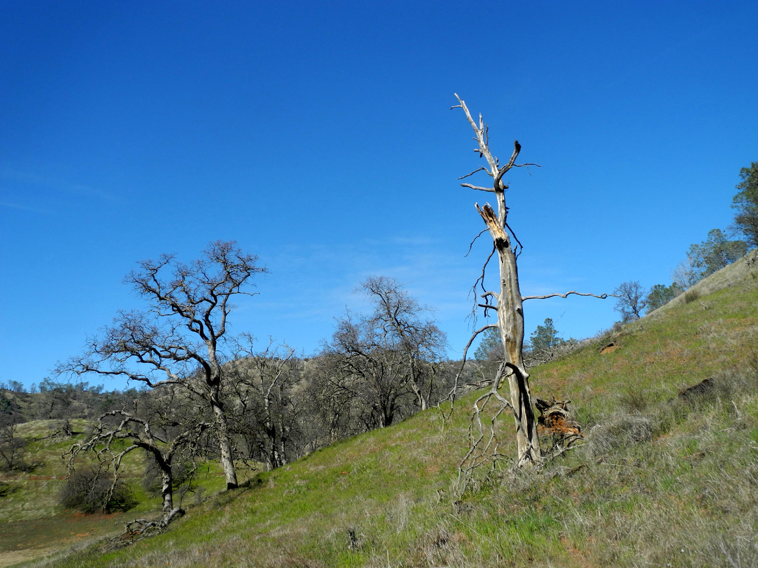
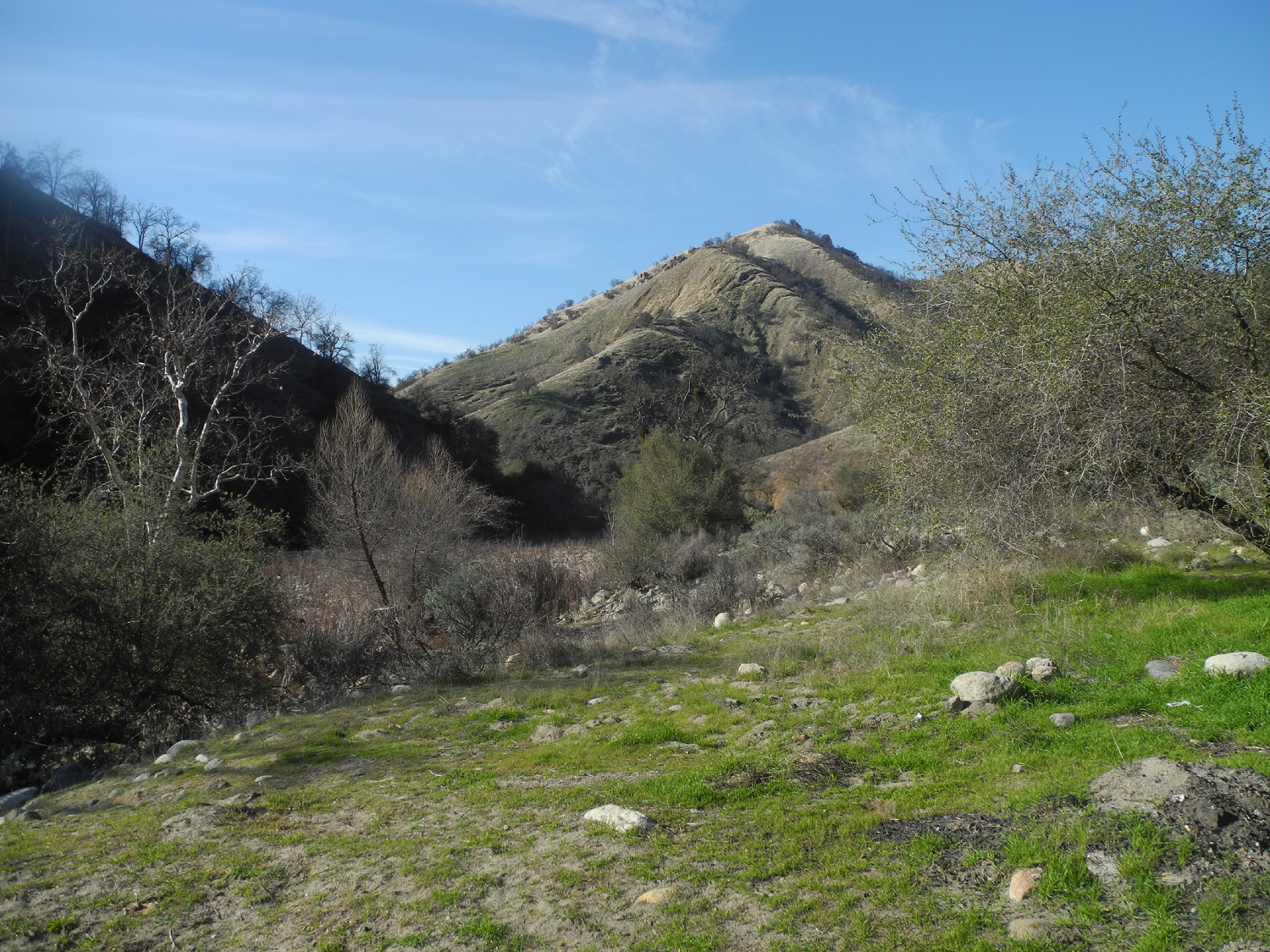
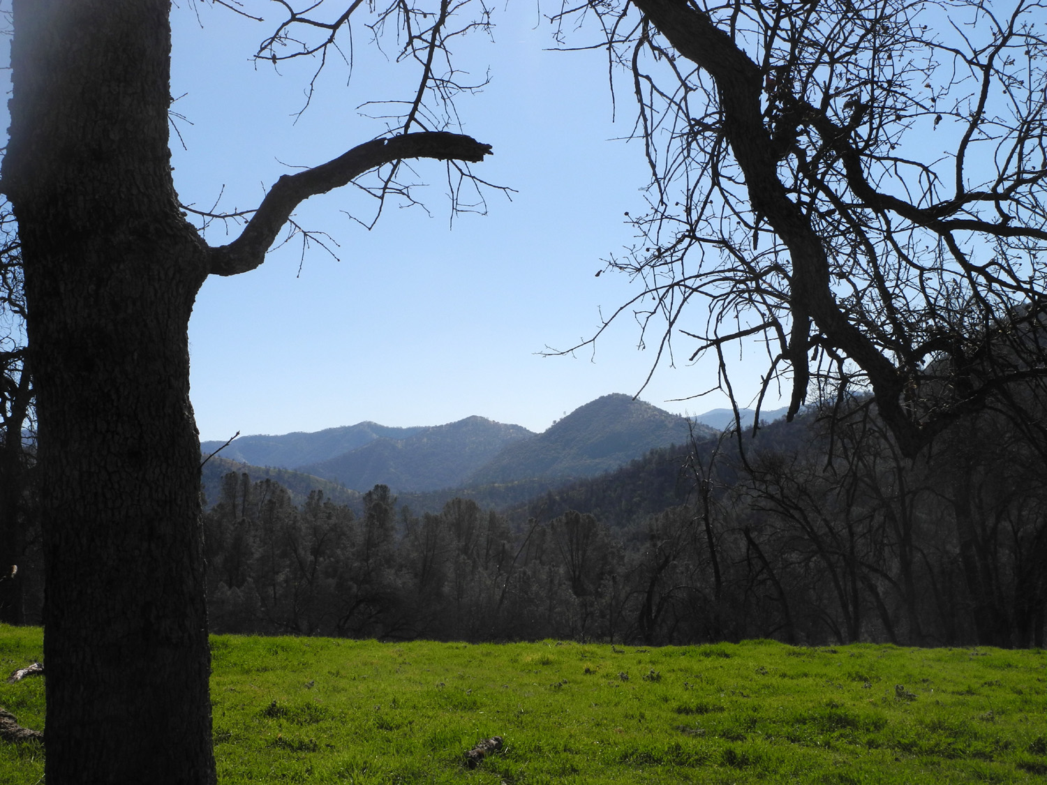
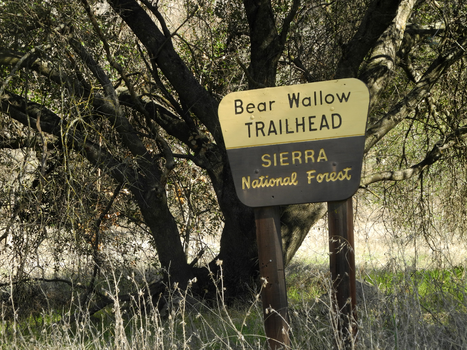
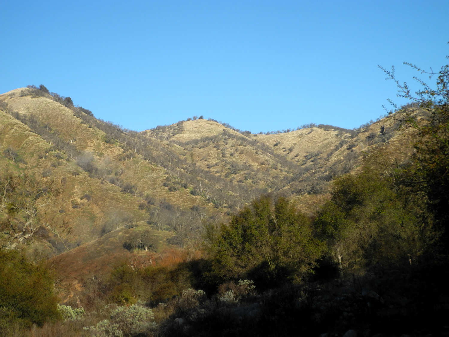
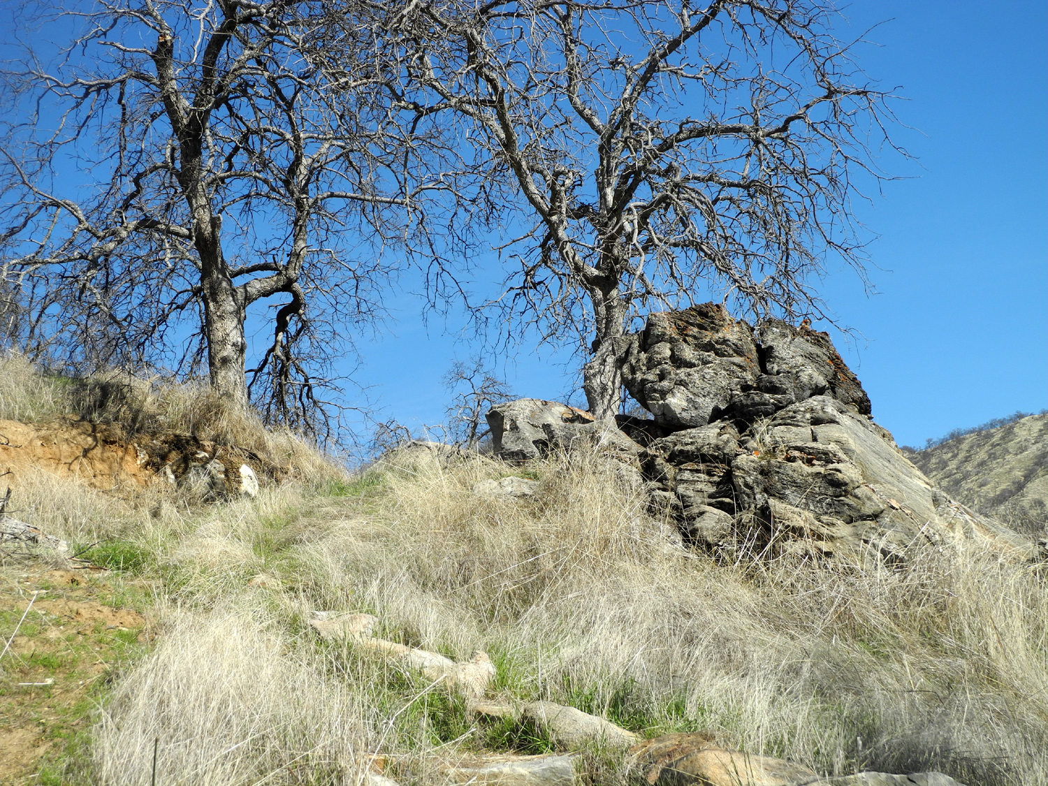
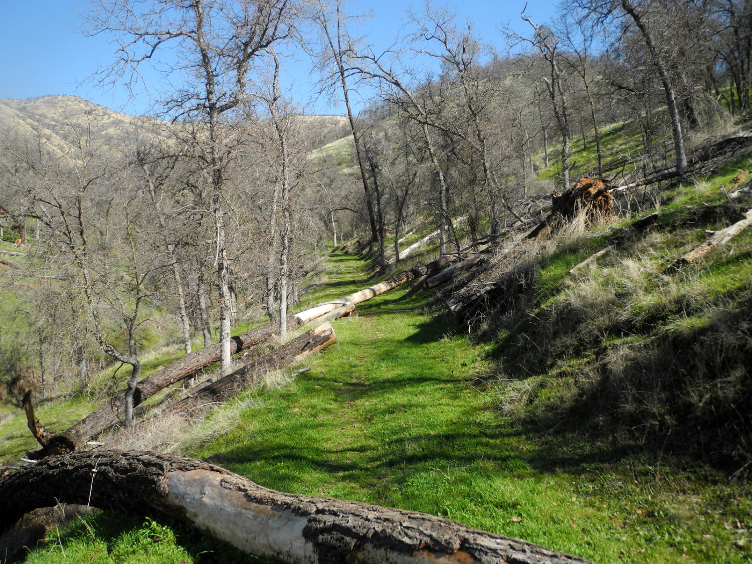
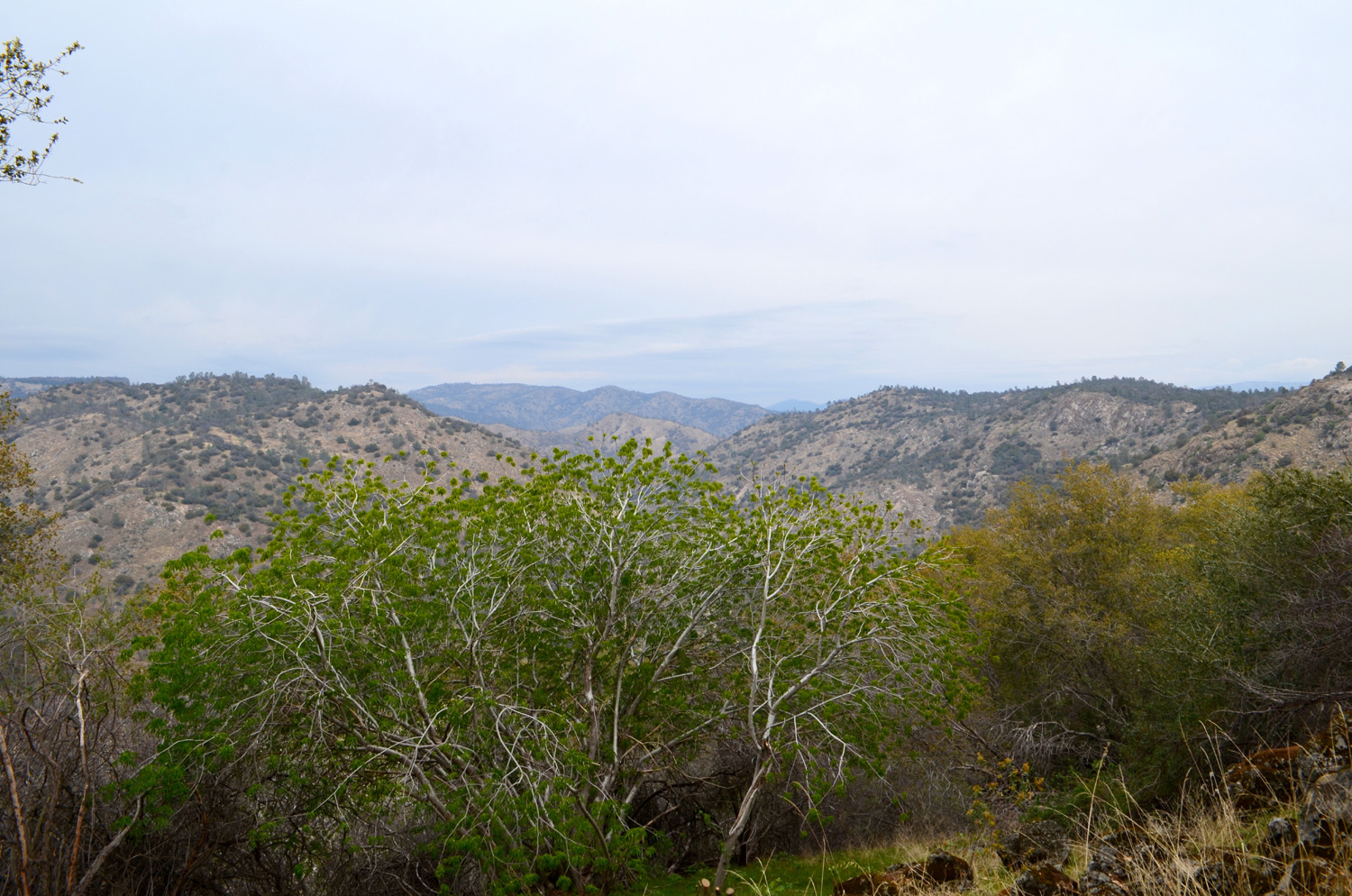
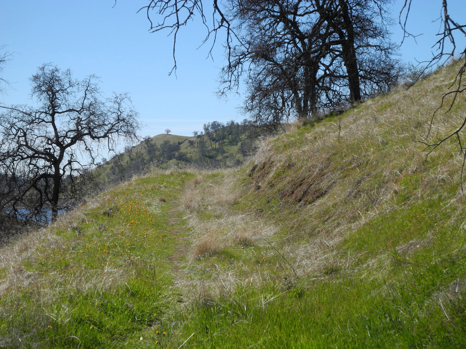
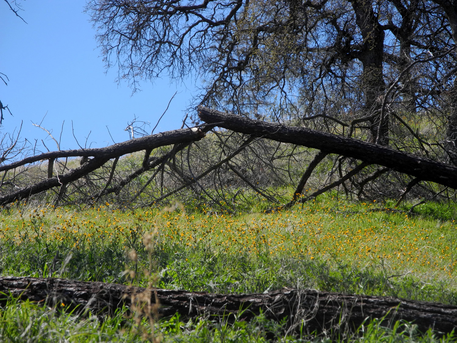
Bear Wallow Camp I made my first hike to Bear Wallow in January of 1980, accompanied by future son-in-law Tim Liddle (now Teri's husband). The starting point is three miles up the dirt road that goes from Trimmer Springs road to Garnet Dike on the north side of the Kings River. The destination is an area where the steep terrain of Rogers Ridge sort of levels out to a huge knoll, with a couple of creeks, and a steep rise to the north. During our six-mile hike (each way), as we passed through a thick grove of trees we startled an owl, which flew very close to us on his way to a safer spot. I made my most recent hike on the trail on January 23 of 2018, with a much more modest goal. The trail appears to have been realigned in spots, and leads to a vista point about a mile and a half from the trailhead, much more in line with my current hiking capabilities. Since nothing has been done to alleviate the steep hillsides that mark this area, I did not get all the way to my destination. But more about that later. |
||
 |
 |
 |
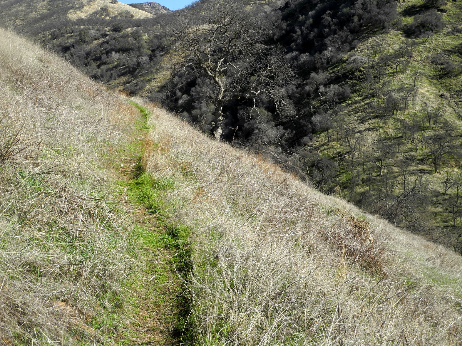
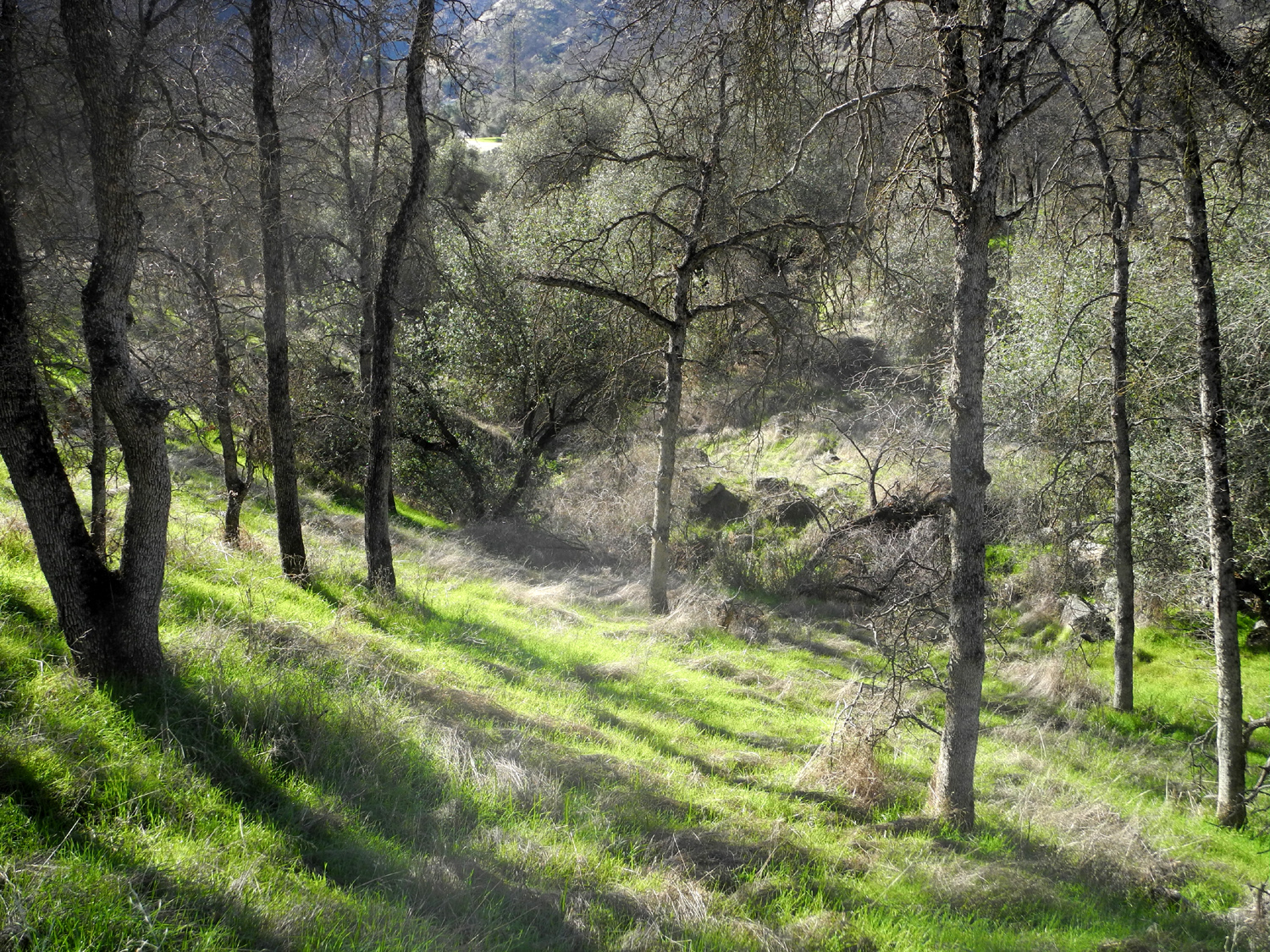
| My camp site is hidden in the trees in the lower center | The trail was a narrow green strip that went up steeply, then wound around the contour of the hills | Looking down stream from my camp site |
|
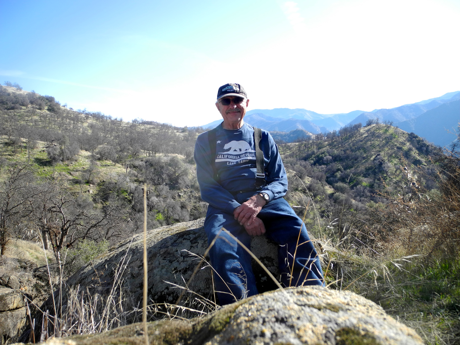
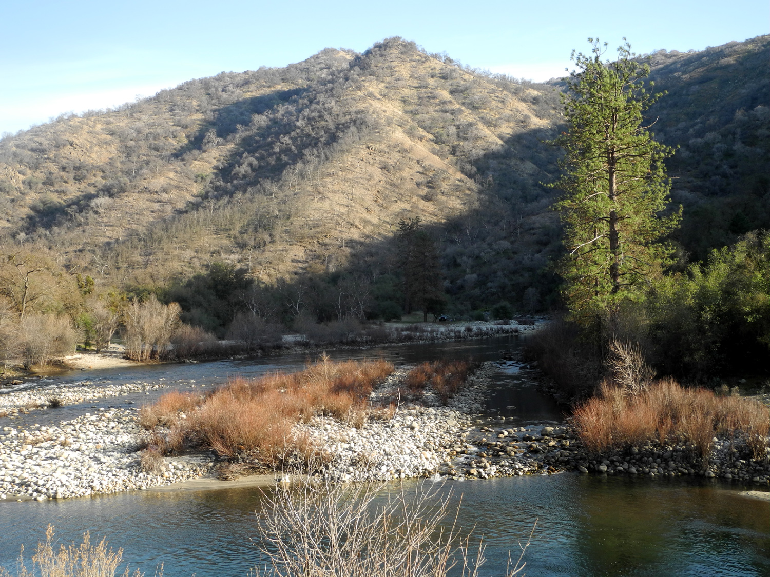
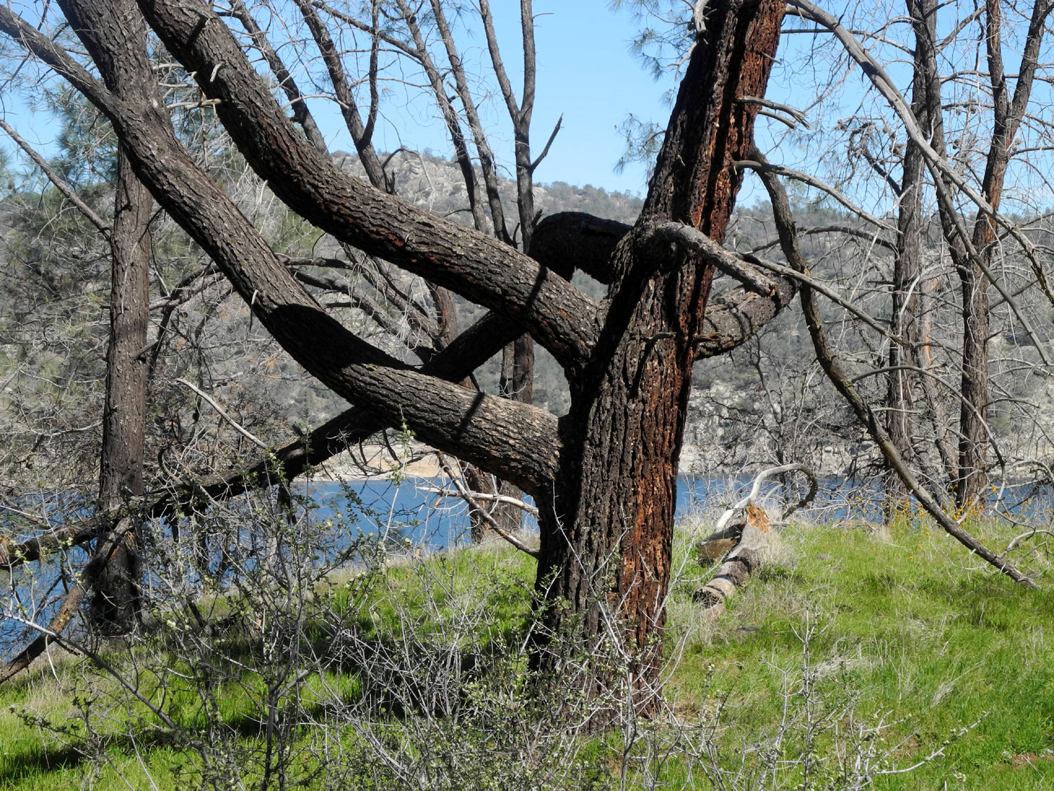
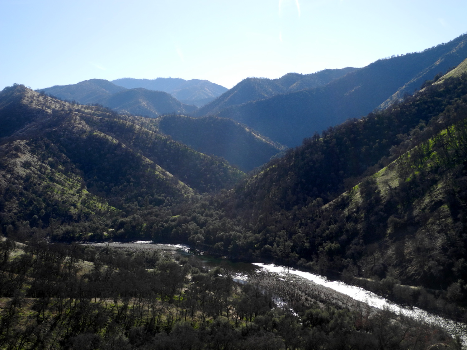
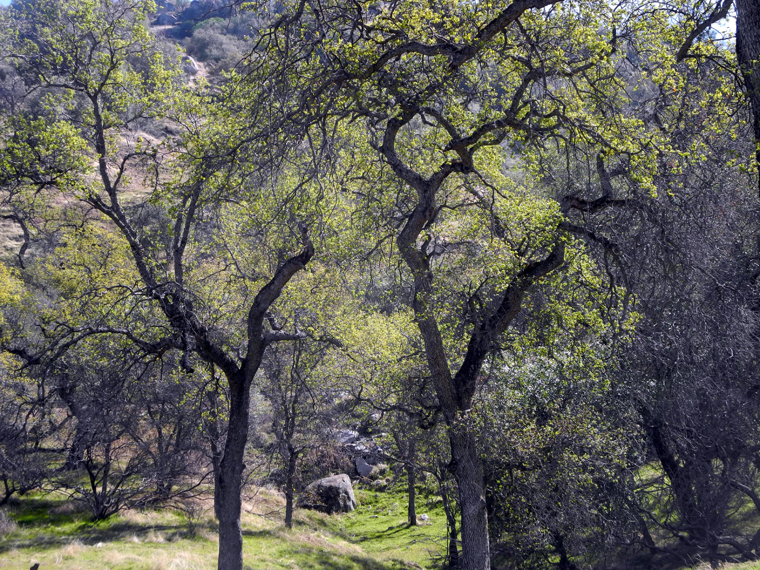
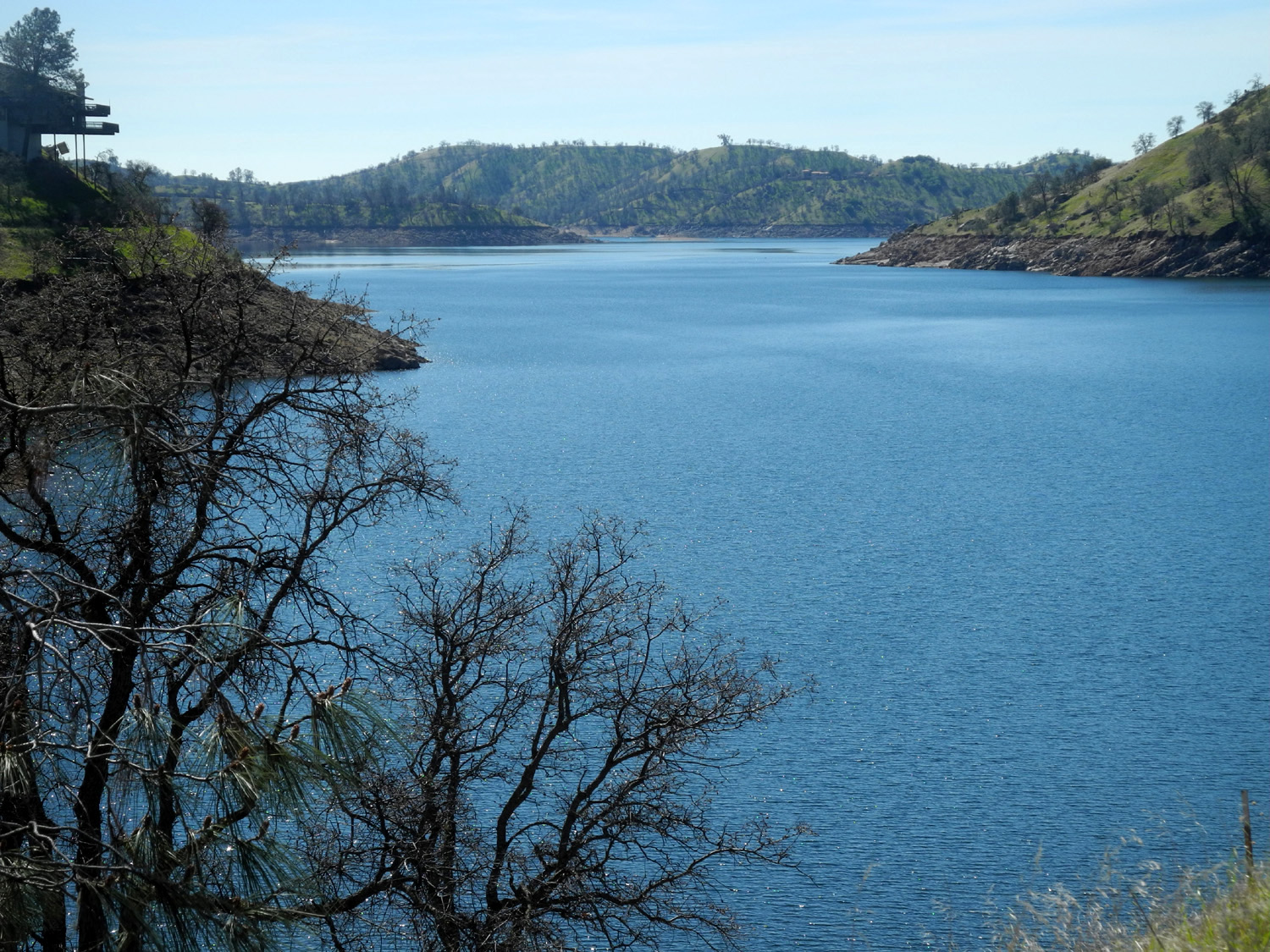
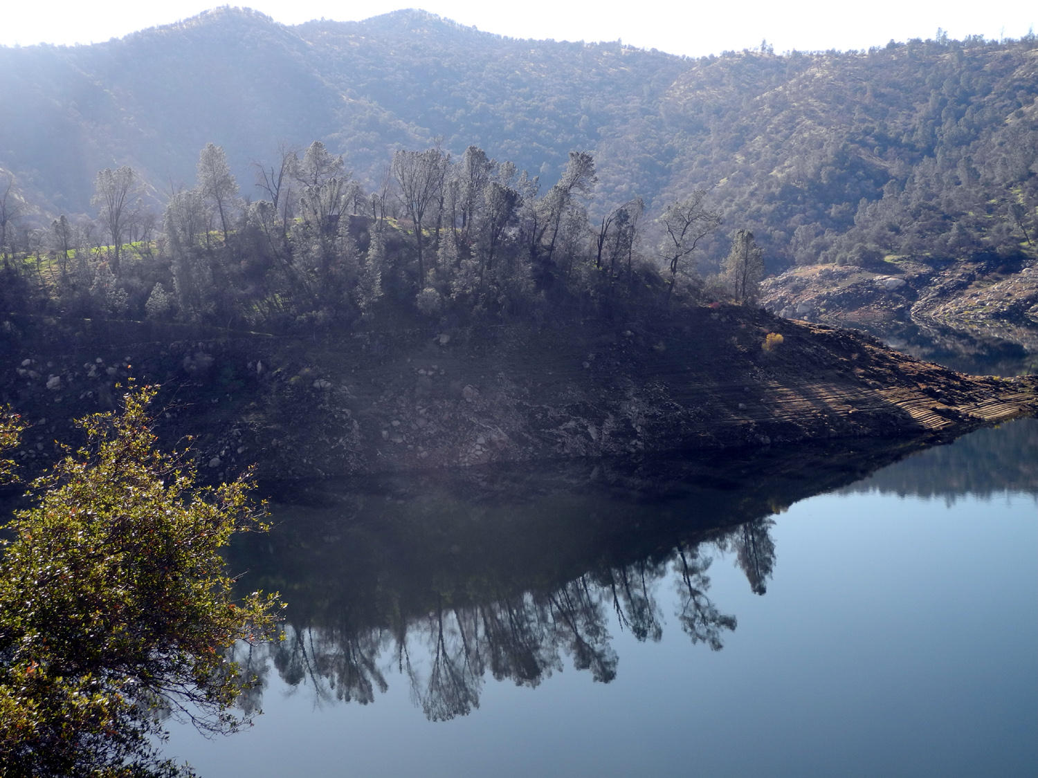
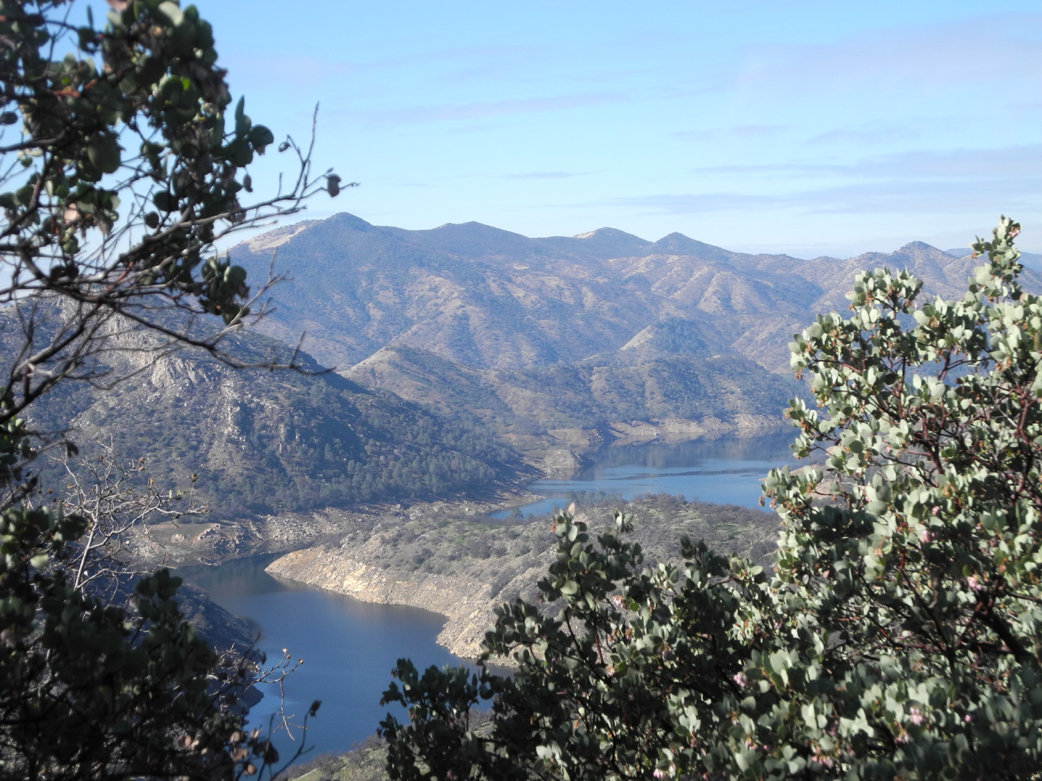
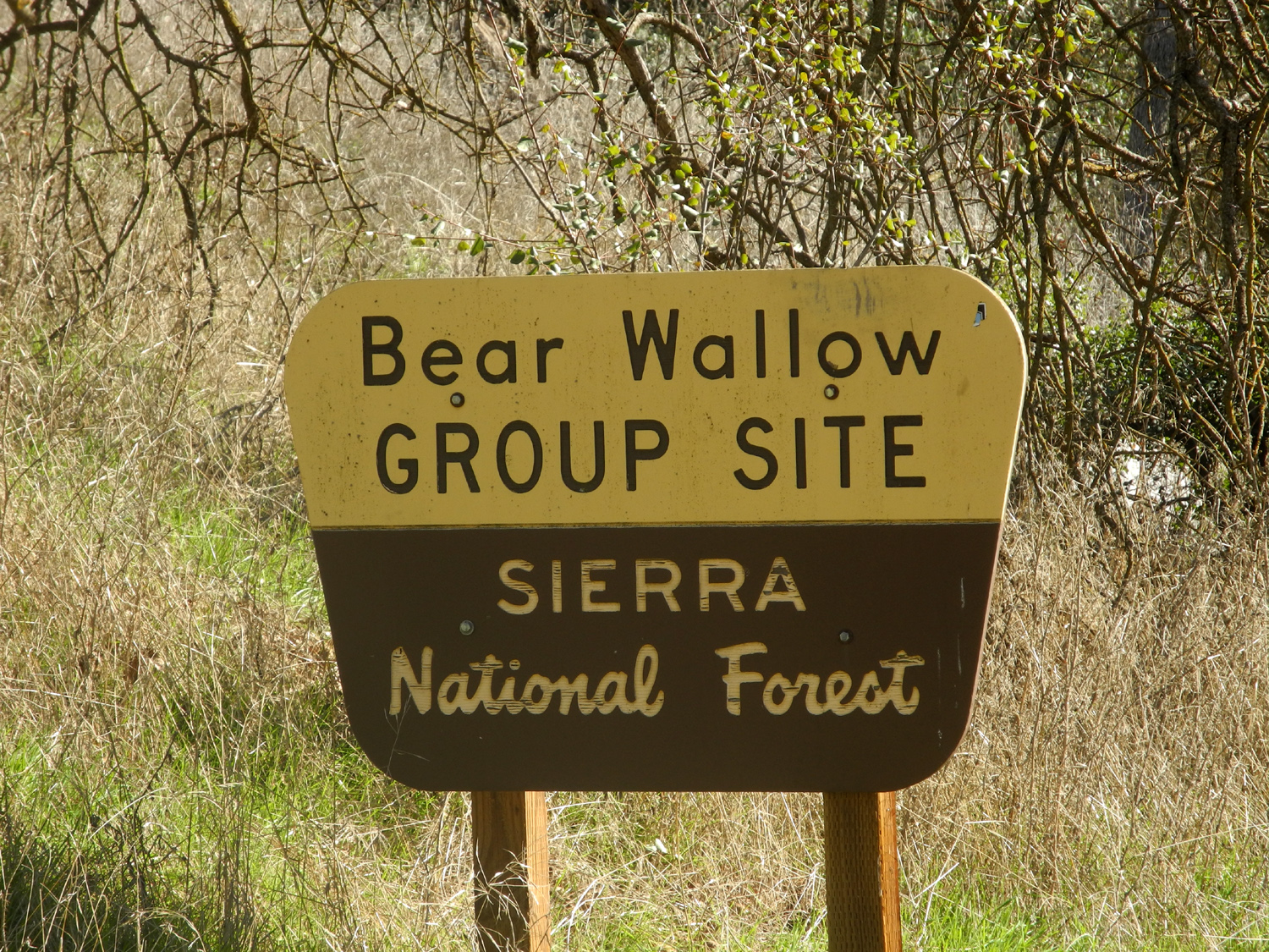
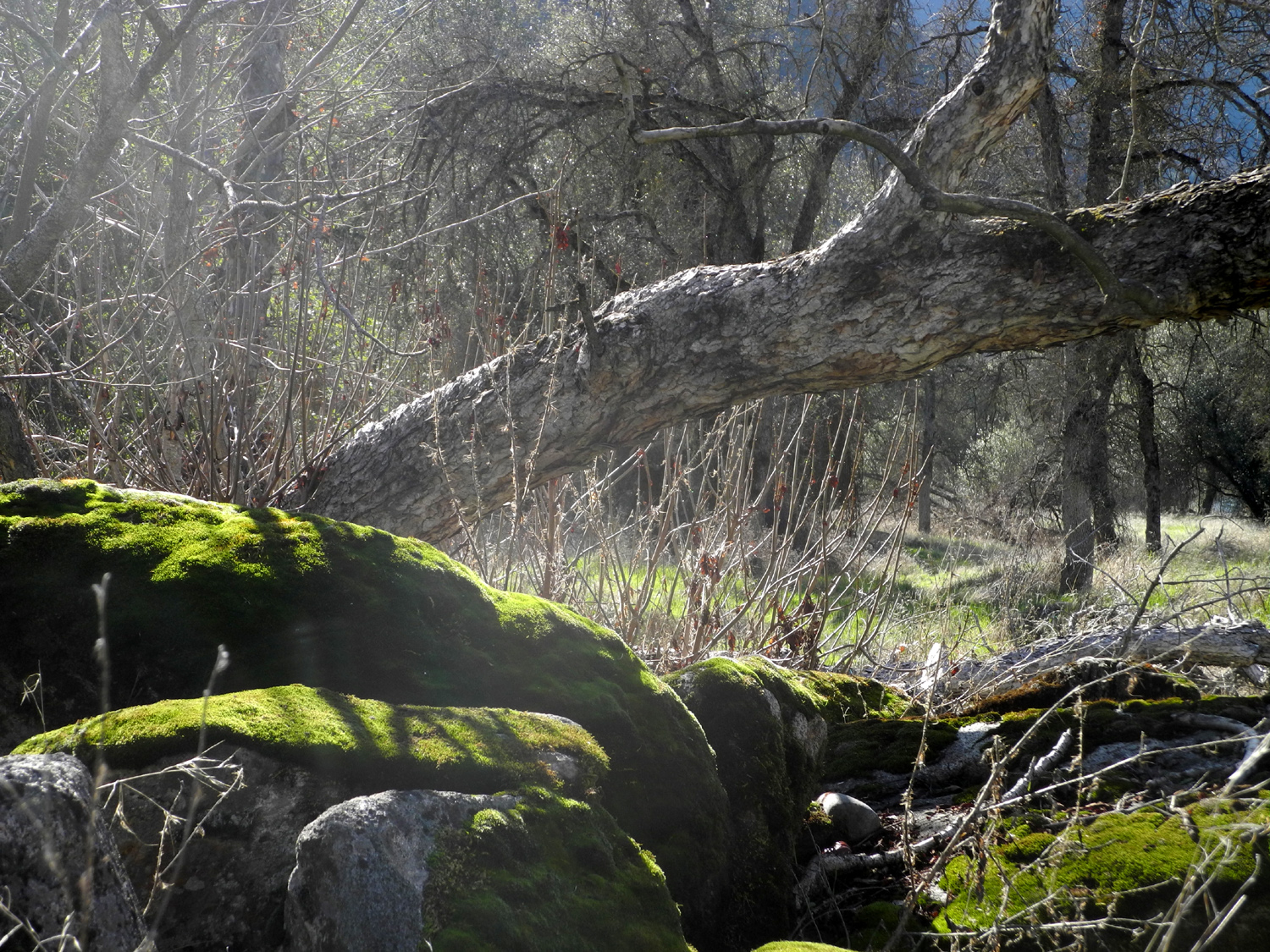
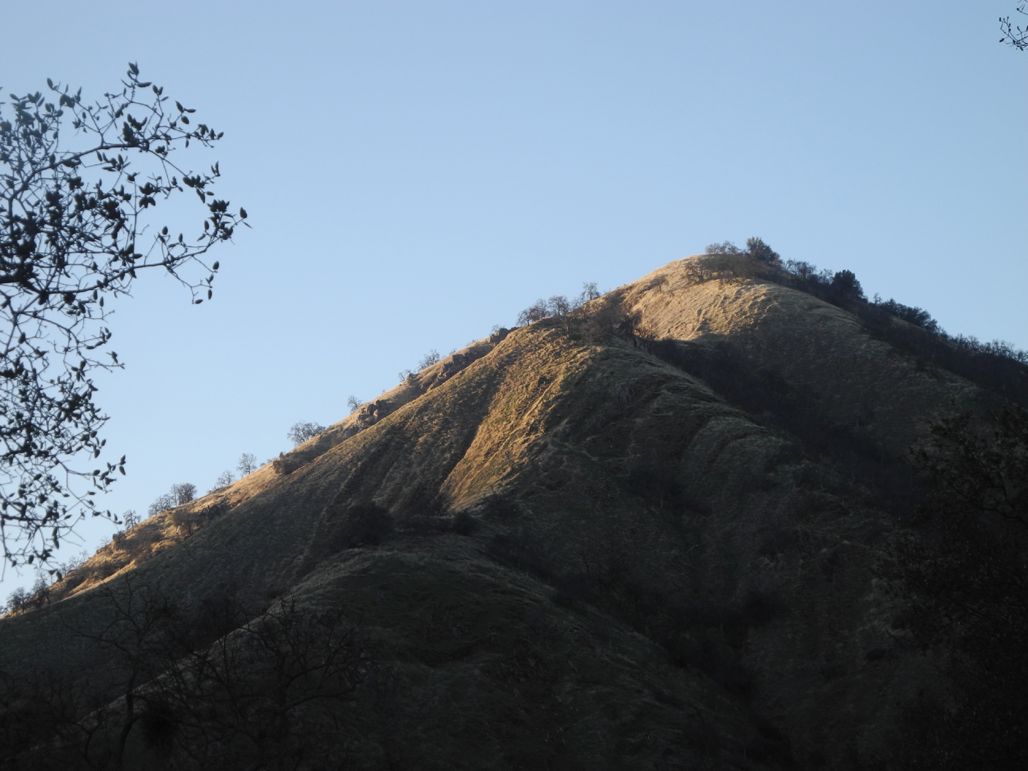
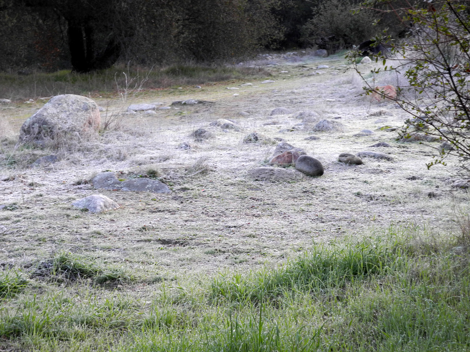
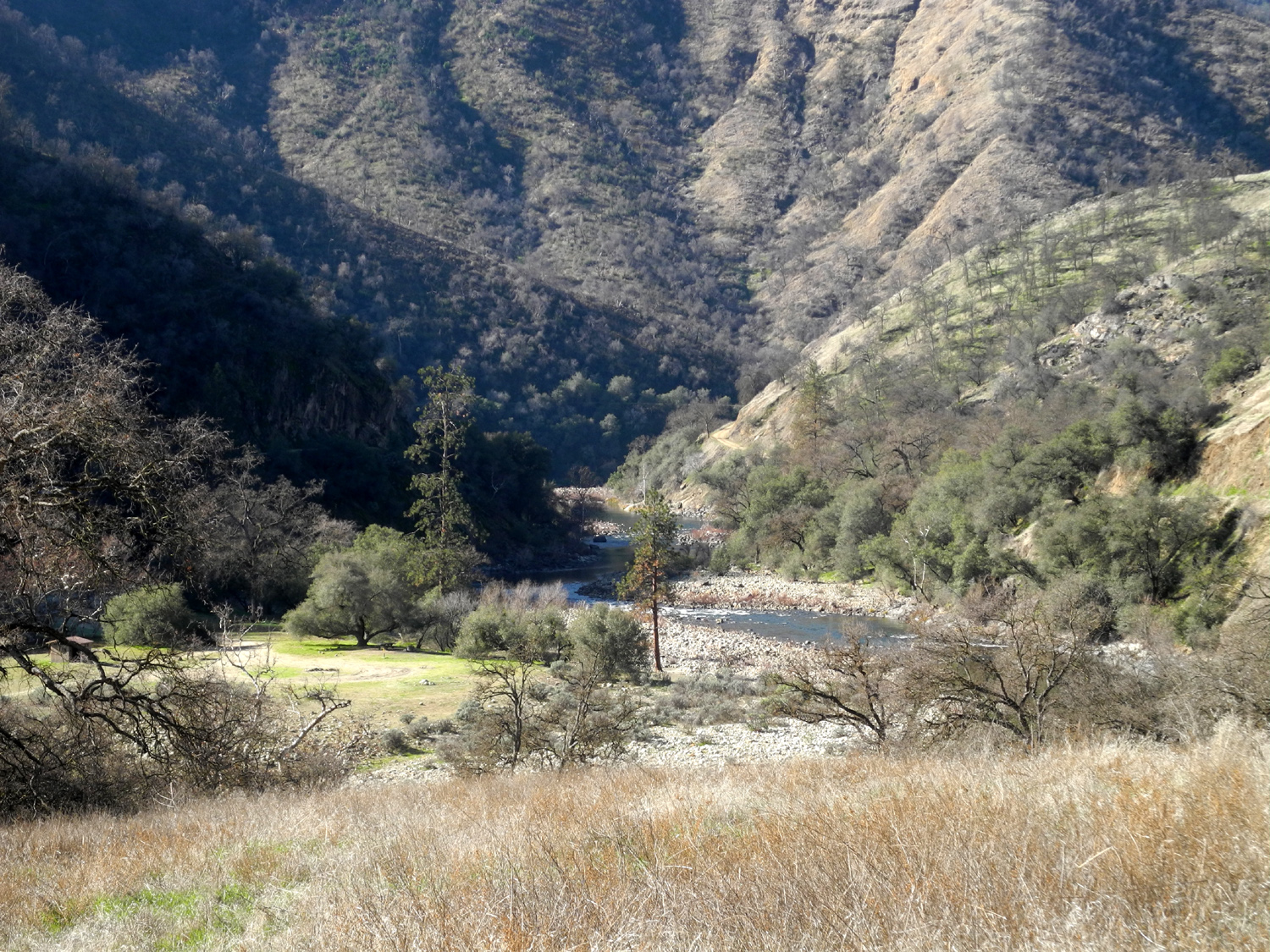
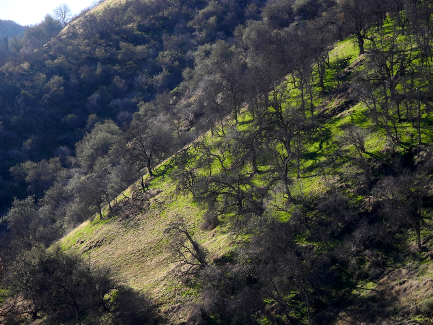
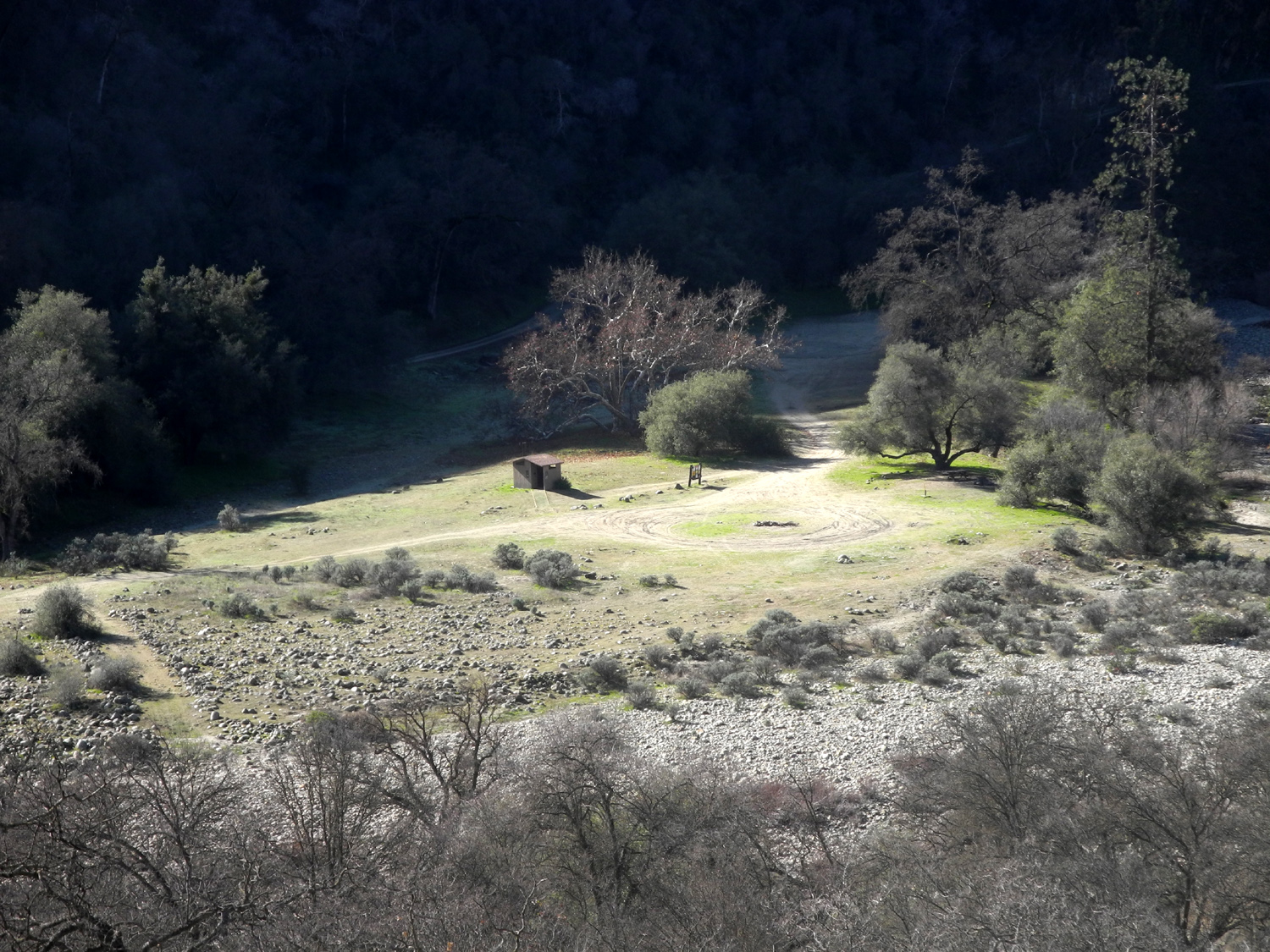
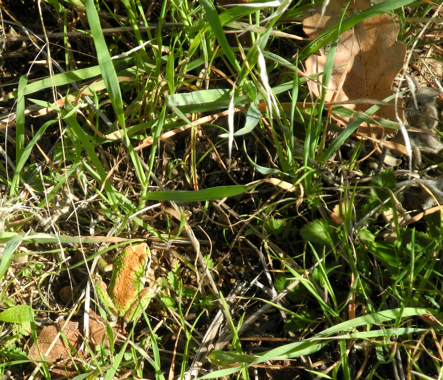
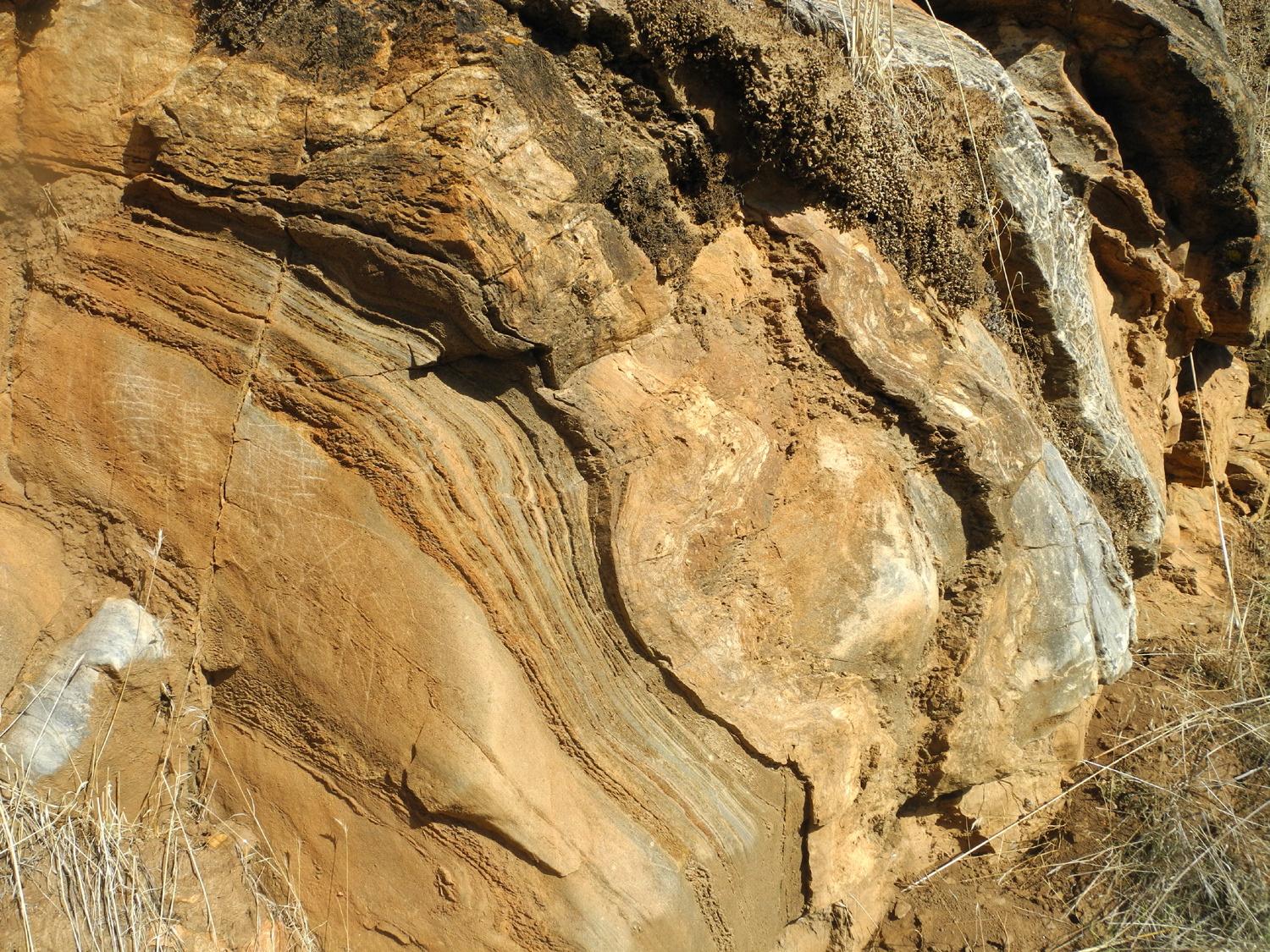
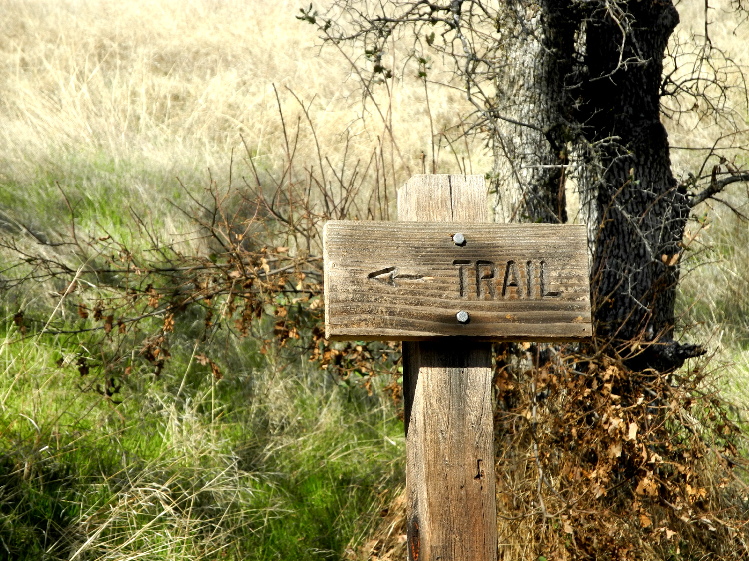
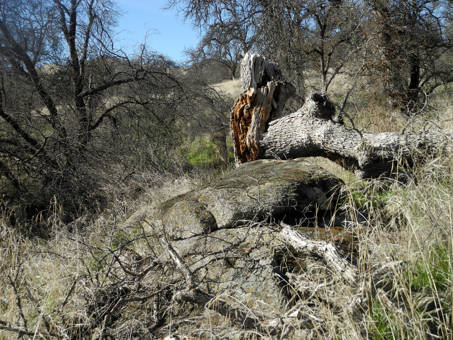
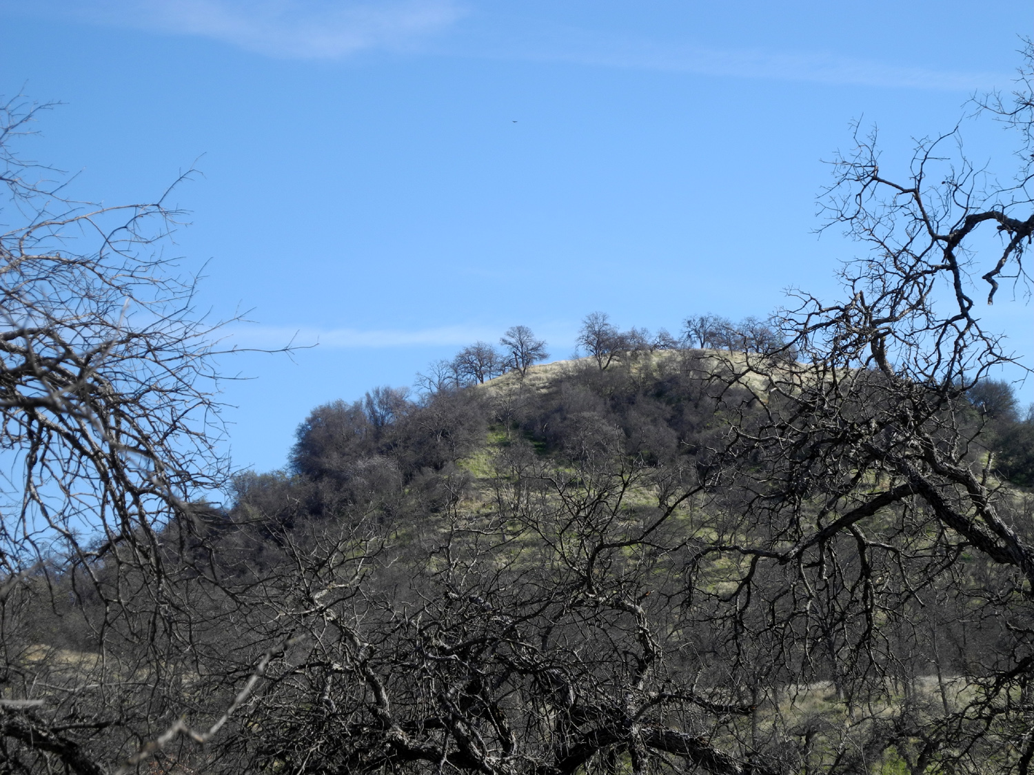
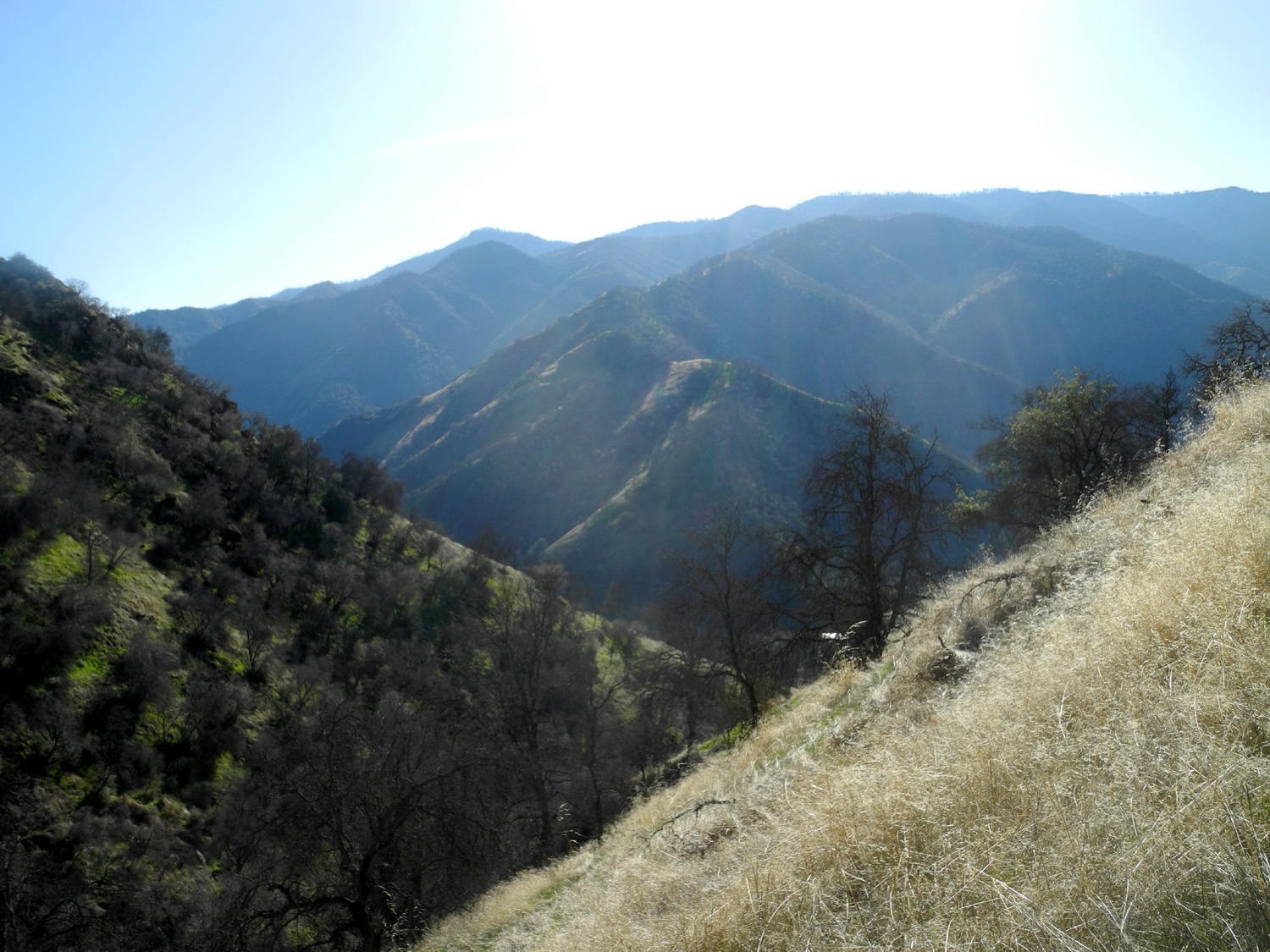
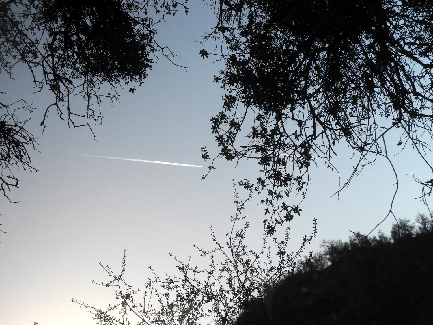
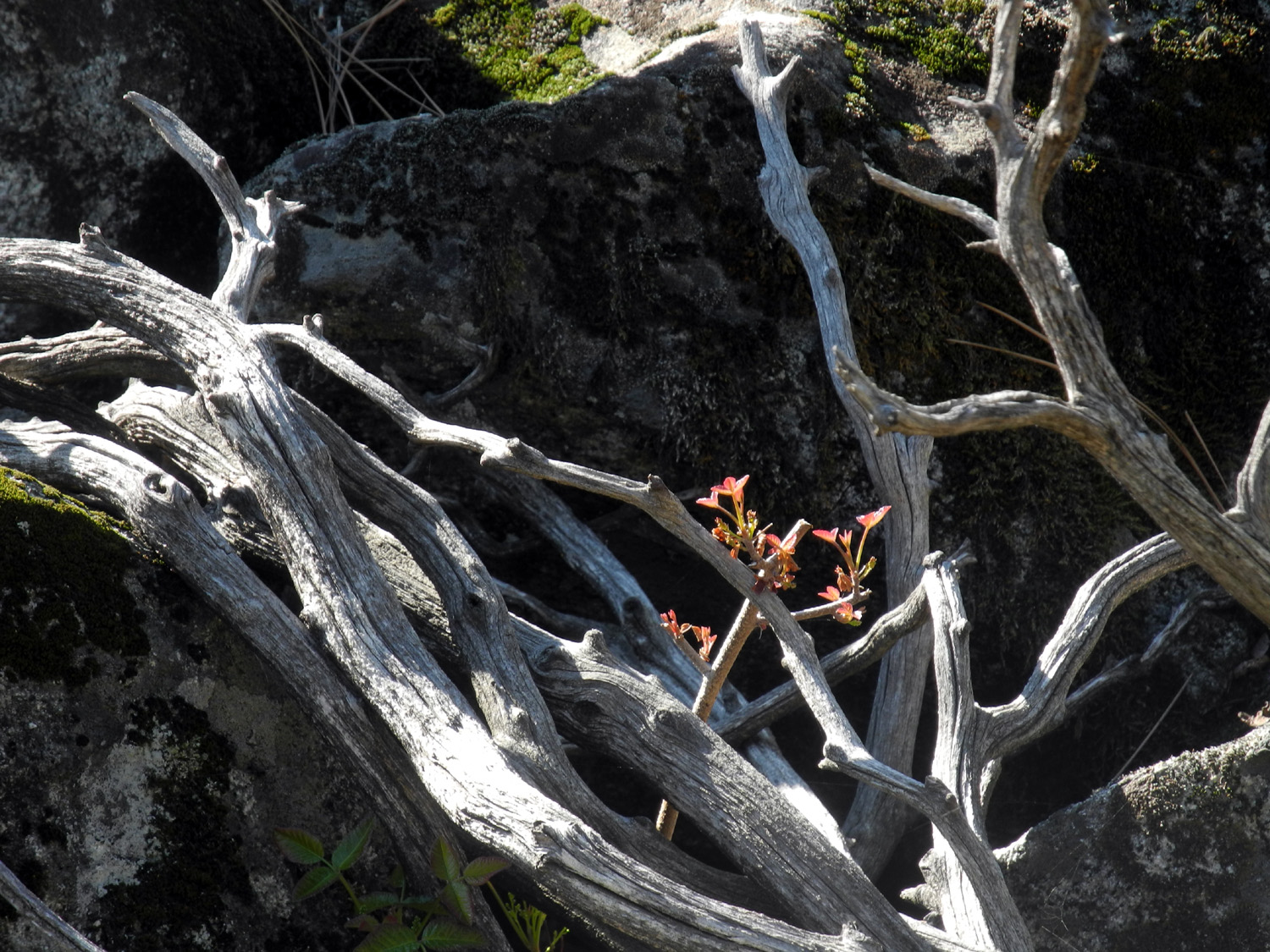
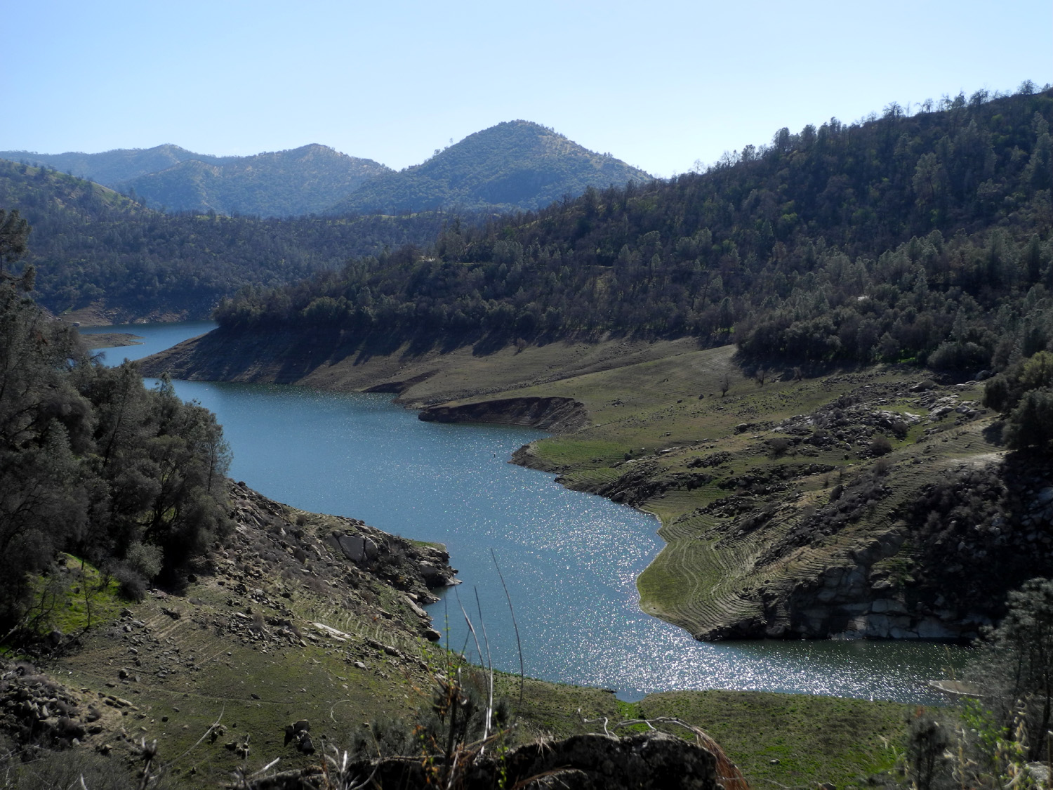
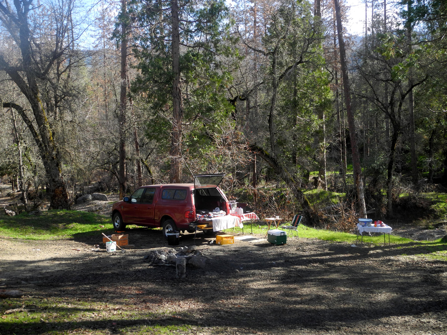
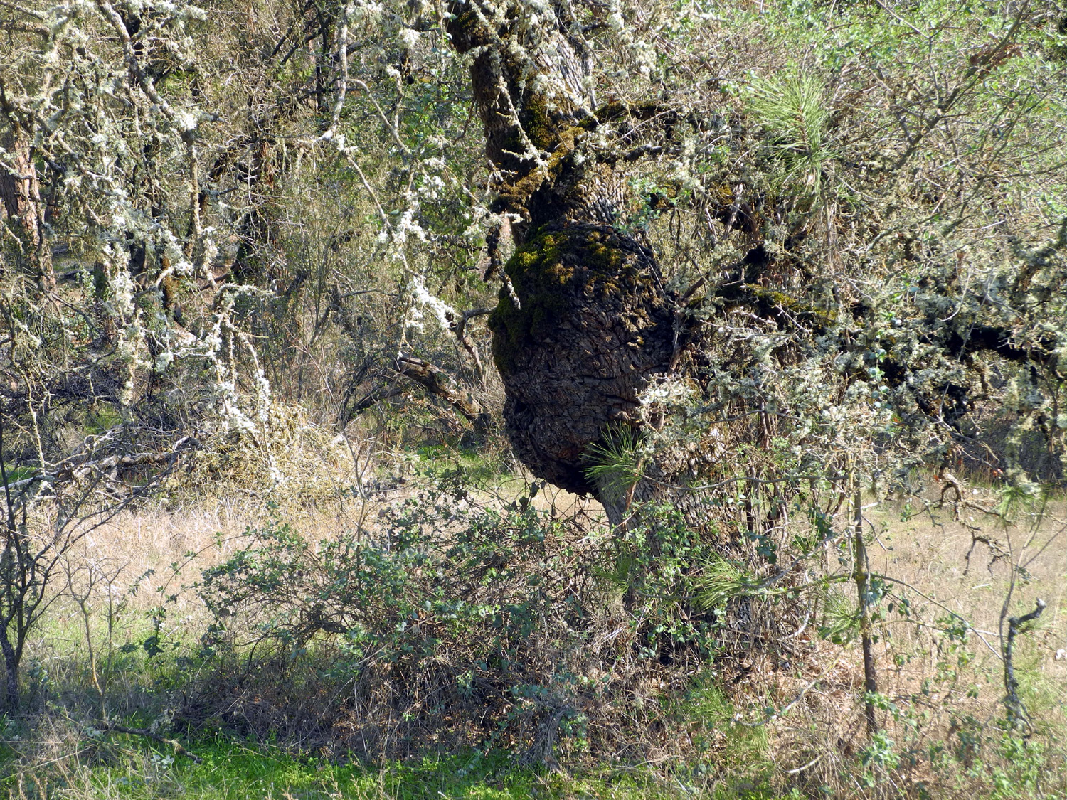
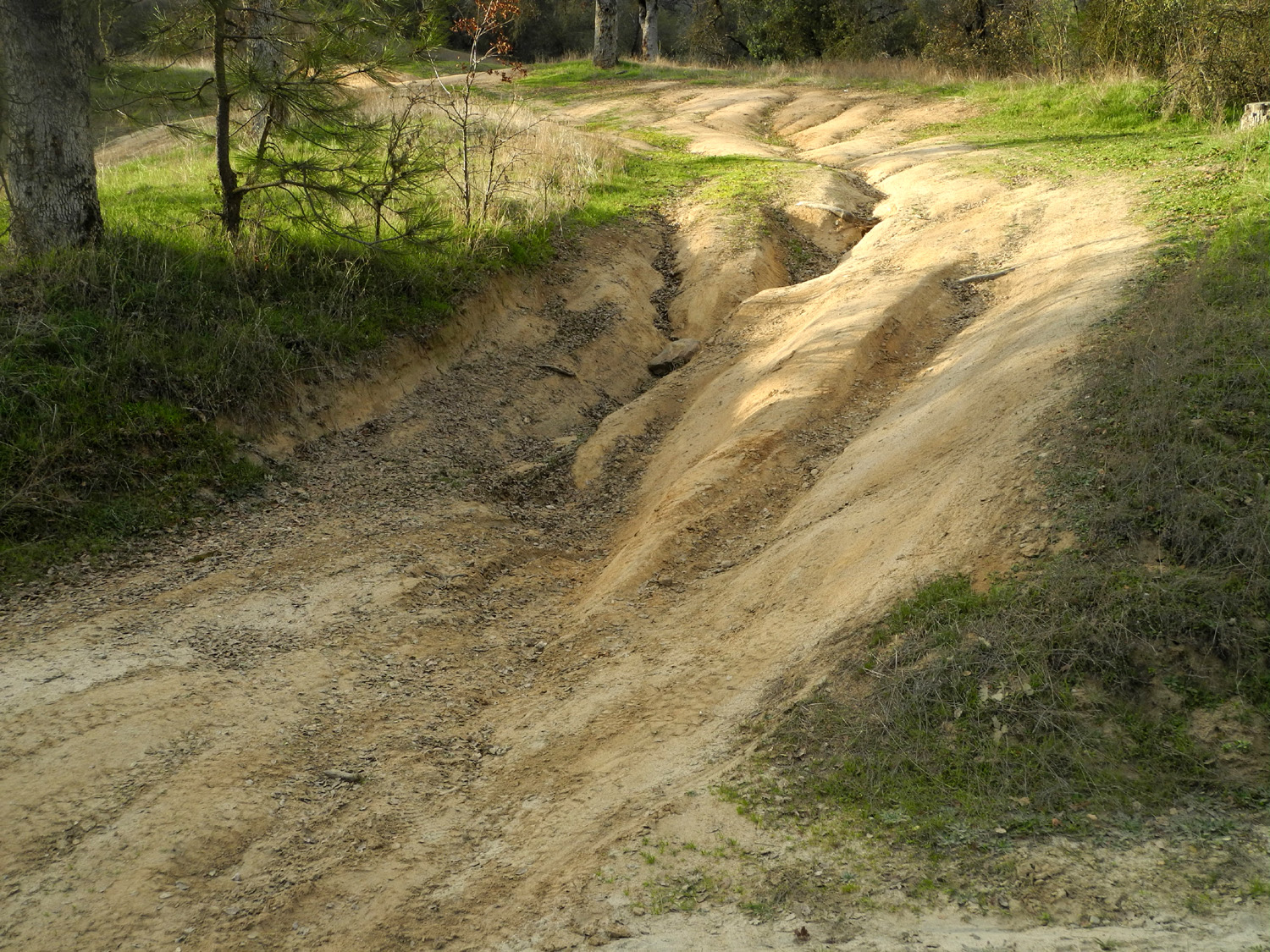
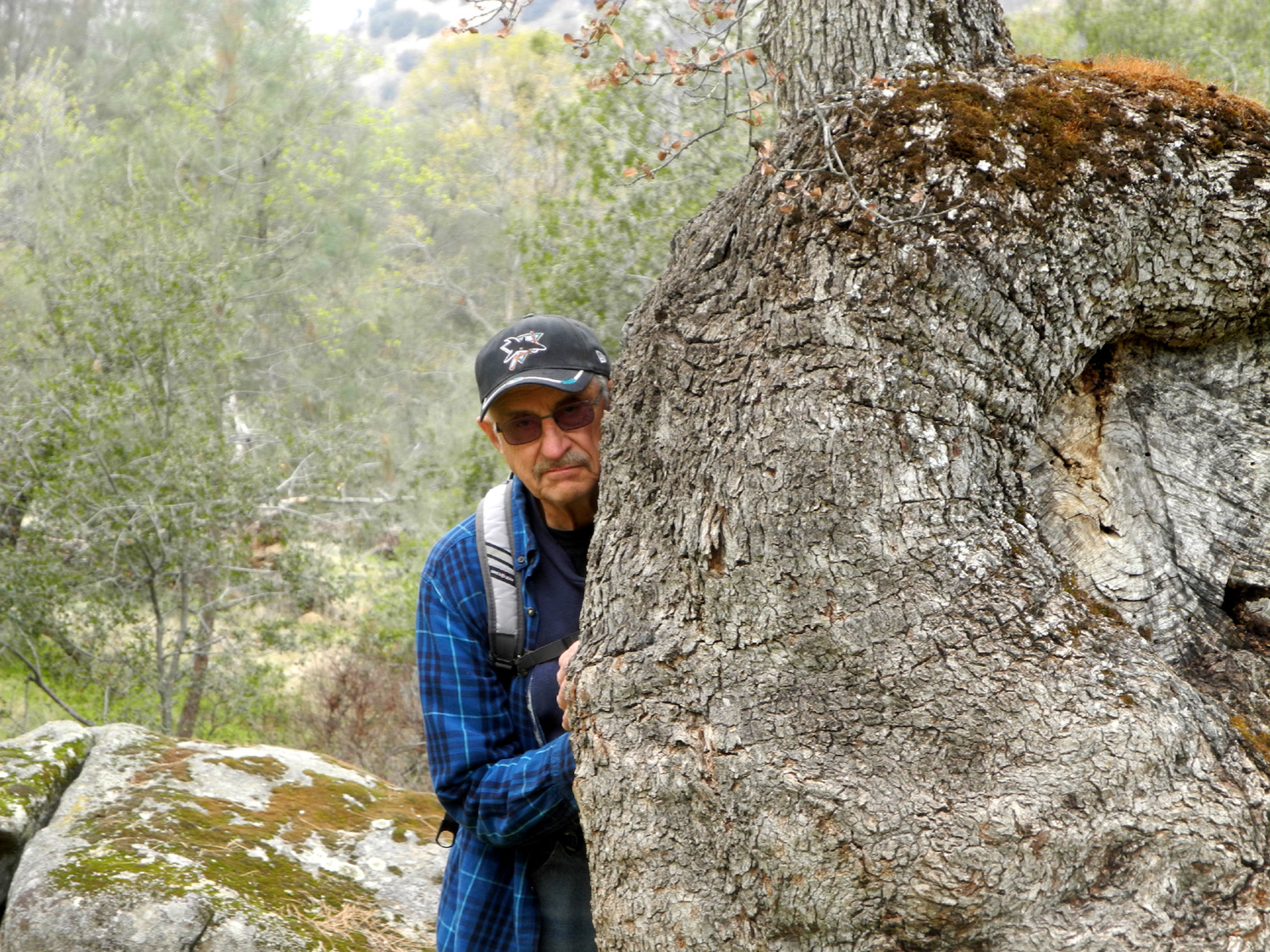
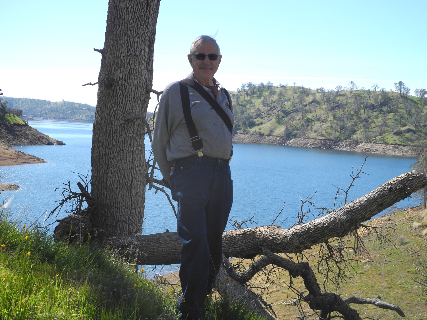
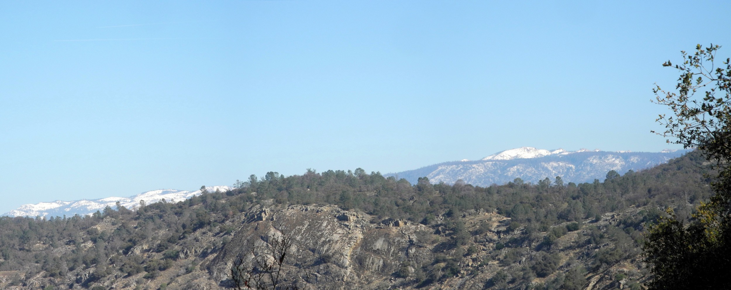
During the week leading up to my trip, I thought I would have to postpone it. The weather forecast consistently called for rain the first and second day. Then the forecast changed, and when it came time to make a decision, a brief rainstorm was expected early Monday morning, with clouds the next two days, but no further precipitation until Wednesday evening. On the morning of departure, the forecast was even better - no rain that day or any other till the evening after I would be back home. As it turned out, not even the clouds materialized, and there were blue skies until just before I started home. The road to my campsite is rough and rocky in spots, so it was to be a pickup camping trip, something I started doing again in late summer of 2016. I got started about 9:30 a.m. on January 22, with the temperature at 47 degrees in Clovis. With a few stops to take pictures by the lake, the 60 mile drive took a little over two and a half hours. Of course, 20 miles or more are on the winding road along the shore of Pine Flat Lake, and the final three miles required low or second gear driving at 5 to 15 MPH. When I arrived it was 61 degrees, which was pretty much the high both days. Back in the day there were no official campsites on the north side of the river until the end of the road, eight miles in. There are now at least two and maybe others beyond where I went. I was at Bear Wallow Group Camp, a group of one, but no one else was around. There are only three campsites, and the metal fire ring on one was tipped over and not usable. The road runs along the Kings River all the way to roads end at Garnet Dike Campground, so I enjoyed the sound of running water throughout my time there. Setting up camp with the truck is a lot more effort than with the motor home. First of all, everything in the bed of the pickup has to be moved somewhere else to make room for my mattress pad. I brought my card table, and set a lot of things on it. Some had to go on the ground, and my camp stove went on the picnic table. Stuff in the passenger areas, such as my brief case, clothing bag, and other odds and ends, can stay where they are. About an hour after I arrived I set out on my first hike, a short exploratory trip to the Bear Wallow Trailhead, which was two tenths of a mile from camp. I walked up the trail about 100 feet, then down across a drainage, up the steep bank, and over a ridge back to the main dirt road, then back to camp, a little over a half mile walk that took 40 minutes (but only 22 minutes of actual moving time, according to my walking app). I had an early supper of crackers, peanuts and vegetables, and did some reading. About 3 p.m. the sun passed behind a high hill on the opposite side of the river to the south, and it was officially sunset at camp, resulting in a quick drop in temperature. It was 56 degrees with a strong upstream wind shortly after the sun disappeared, and 51 degrees at 4:20. By this time I had a campfire going, and I realized I had not brought enough wood. There was nothing but small branches around the camp, and I was wondering if I would be driven into the sleeping bag at 7:30. I wanted to use only half my wood and save some for the next day, but finally decided to keep the fire going as long as I could and deal with tomorrow, tomorrow. What with putting things away a little so they would not get wet from the dew and a walk in the dark to the bathroom (about 300 yards away), it was close to 8:30 before I finally climbed into the back of the truck and got into my sleeping bag. I have to get up several times each night, and every time I did I was treated to a fantastic star display and some very cold temperatures. The final low reading, at 6:30 a.m., was 29 degrees, and it was barely up to 32 when I finally got up at 8:30. I put my chair and TV tray in a sunny spot and had tea and an orange, then fixed breakfast, which I also carried out to the sunshine. By the time I got things put away from breakfast and got my boots on it was close to 10:30, and time for my big hike of the trip. The sign at the trailhead says it is "about" a mile and a half to the vista point. The trail goes relentlessly up hill, with a series of switchbacks leading up several hundred feet in elevation, then a gentler path around the contours of the canyon. Along much of the way I had views of the river and the ridge on the south side, as well as a campsite located on a big flat area on the opposite side of the river. I started out with a long sleeve t-shirt and a sweatshirt, but took off the top layer as soon as I came to a place where I could lean my backpack against a fallen blue oak branch. I didn't check the temperature, but I estimate it got up around 65 degrees. It's been over 30 years since I last hiked on the Bear Wallow Trail, so I don't remember every detail, but it seemed to me that part of it had been realigned - routed around a different side of a knoll or something like that. For a while I was concerned that I had taken a false trail, so I was glad to see a sign with an arrow pointing to the left that read "trail." Eventually I reached a spot with some good rocks for sitting and eating lunch. At this time I realized I had to reconsider whether I was going to try to continue on to my destination. I could see two hilltops nearby that could serve as vista points, and it seemed clear that it would take at least another hour to reach either of them. I realized that I had gone what I call "half of far enough," and decided to start back after eating. This still gave me a respectable 2.48 mile round trip hike. I found a large moss-covered rock that served as a seat for eating and a spot for a brief nap. I walked up a side trail nearby to get a couple of photos, then started back down the trail. A short distance down the trail I spotted an oak tree with a good size burl. I always try to photograph these interesting natural growths, but this one was partially hidden by branches. Even so, the photo turned out better than I expected. The return trip was much easier on the lungs, even though I still had to be aware of my footing on the narrow path. As I got close to the bottom, it looked as if the sun was going to be out of sight in my camp, and since it was just after 3, that was indeed the case. I was not very hungry so I ate the rest of the sandwich I had not finished on my lunch stop, along with some vegetables and orange slices. Then I contemplated what I was going to do about the fact that the temperature was slowly but steadily dropping. I had used all the "store-bought" wood I brought on the first evening, and the pickings for native firewood were very slim. I found a few pieces of dead live oak and blue oak that were thin enough to break, but that meant that they were little more than kindling. I noticed that there were a lot of dead bush lupines in the area, and broke off a couple of them. They consisted of a very bushy top of small twigs, but both had a base close to two inches in diameter and about two feet long. This constituted my wood pile for the evening. I put off starting the fire until it was dark, then added the various pieces, alternating small sticks with my few larger pieces, and managed to have a fairly warm fire till about 7:30. At the end I was sitting as close as I could get, drawing a small amount of warmth from the dying coals. Of course, I was wearing several layers, including a sweat shirt with a close fitting hood that served as my pajama top during the night as well. Both nights I was nice and warm in my sleeping bag. I wore thermal underwear and flannel pajama bottoms, and three layers on top. It was the first time I had slept in the hooded sweatshirt, and from now on it will be regular sleepwear in temperatures like this, since it kept my head covered. I keep a bottle of drinking water next to my bed wherever I am, and the water was much colder than when I take one out of the refrigerator. I would guess that the temperature inside the camper was between 32 and 35. The last morning there was frost on the lower part of my sleeping bag, where it extended out of the camper on to the tailgate. (With a full-size back seat, my truck has a five and a half foot bed.) The terrain here is interesting and a bit unusual. Above Trimmer Campground on the lake, the river enters a narrow, steep canyon. At Bear Wallow trailhead you are many miles into the mountains, but the elevation is very low - 1,100 feet there and 1,700 at the highest point I hiked. The descent of the river is very gradual - about ten feet per linear mile. The river flows in sweeping curves, and over the centuries has created flat areas in many places by the river. Often these support a few ponderosa pines, whose seeds have been carried downstream from their usual 3,000 foot elevation. In these broad gravel flats the river has often created secondary channels, which will have a small flow of water when the river is low. Willows, sycamores and various small shrubs line the banks, with some live oak and a few valley oaks up away from the river bed. On the steep hillsides, blue oaks dominate on the sunny north slope, while the more shaded south slope also includes buckeye, poison oak, and other small bushes, along with a good number of blue oaks. These conditions continue upstream at least another seven miles. At the end of the dirt road, eight miles in from the paved road, a trail goes up river about eight miles. The trail is fairly level for the first two miles, running along the river. Then the canyon becomes so narrow that the trail was constructed to go up along the steep slope in a series of switchbacks. Eventually it reaches a highland, and goes up and down over a series of ridges that run perpendicular to the river. I've backpacked as far as Garlic Meadow Creek, about six miles from the trailhead, but have not gone much past this spot, so I don't know for sure how much farther the trail goes. Given the weather and the isolation, this was a quiet area. While I was there, one vehicle drove into the campground, turned around and left. I saw two or three other vehicles on the main road during the daytime, and one on each side of the river driving out at night. I would not care to drive on either of those roads in the dark. Wildlife spotted included a few squirrels and birds, and a nice green and orange frog about half way up the trail. Although it was not that big a deal that I did not reach my objective on the big hike, it was still annoying. By the time I finished this report, I had come up with a strategy for finishing the hike on my next attempt. Of course, it would be bad luck to reveal it, so watch for another report someday titled "Back to Bear Wallow."
|
||
|
Concrete Flats On this trip I did something I've never done before. On the way to go camping, I stopped to go hiking. Of course, stopping on the way to a destination to look around and take pictures is normal. But this was a "put on boots, pick up the pack, get out the poles, head up the trail" actual hike. In addition, my camping destination was, while not new, a place I have not camped at in decades. If I say the place name to anyone in my immediate family or to certain friends, they know exactly what I'm talking about. But for the general public (including most of you) the place name will be unfamiliar. I'll explain why after you look at these photos. |
||
 |
 |
 |
| The view to the south from Sycamore Fire Road | One of two little waterfalls on Big Creek | Concrete Flats |
|
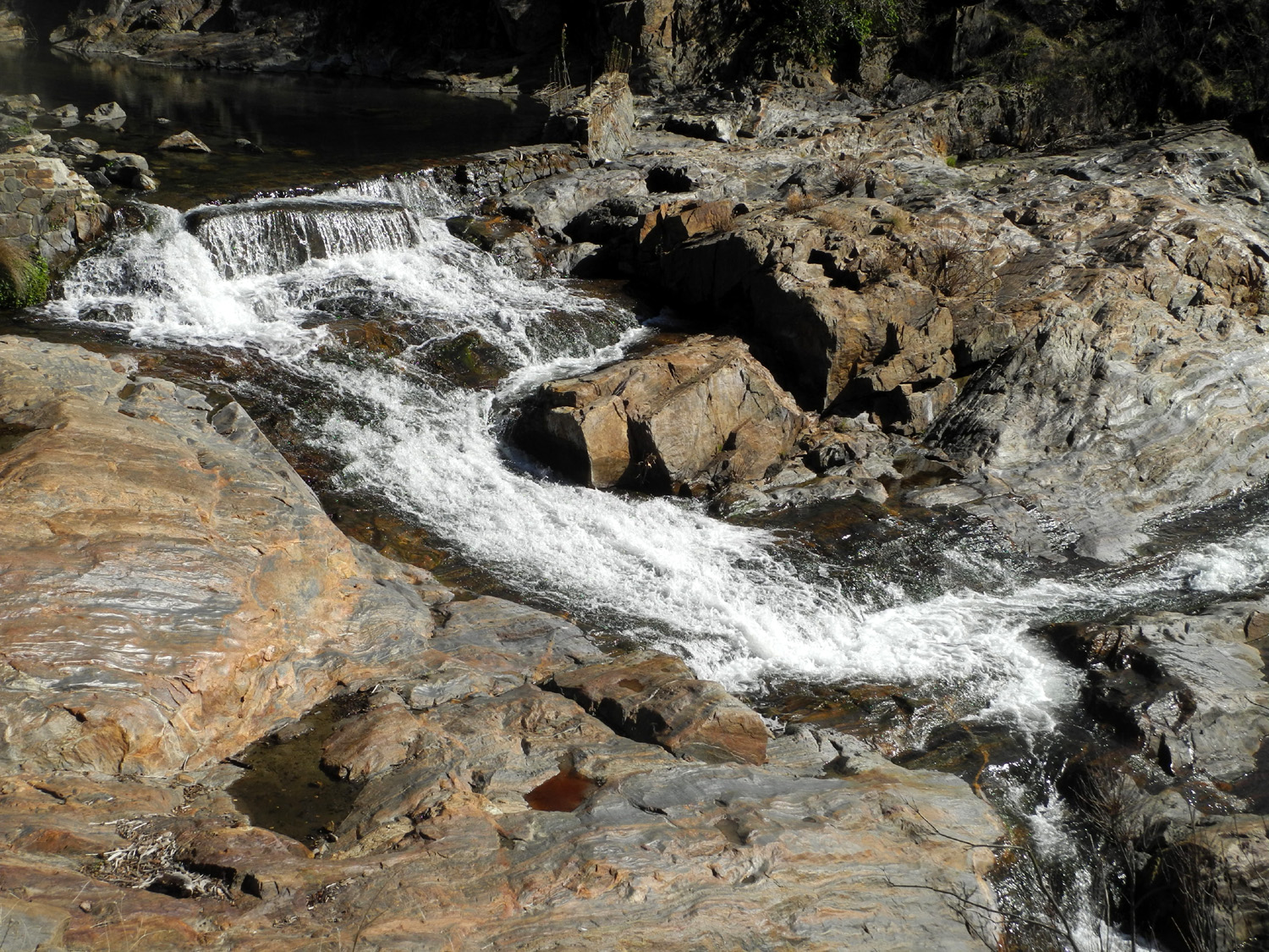
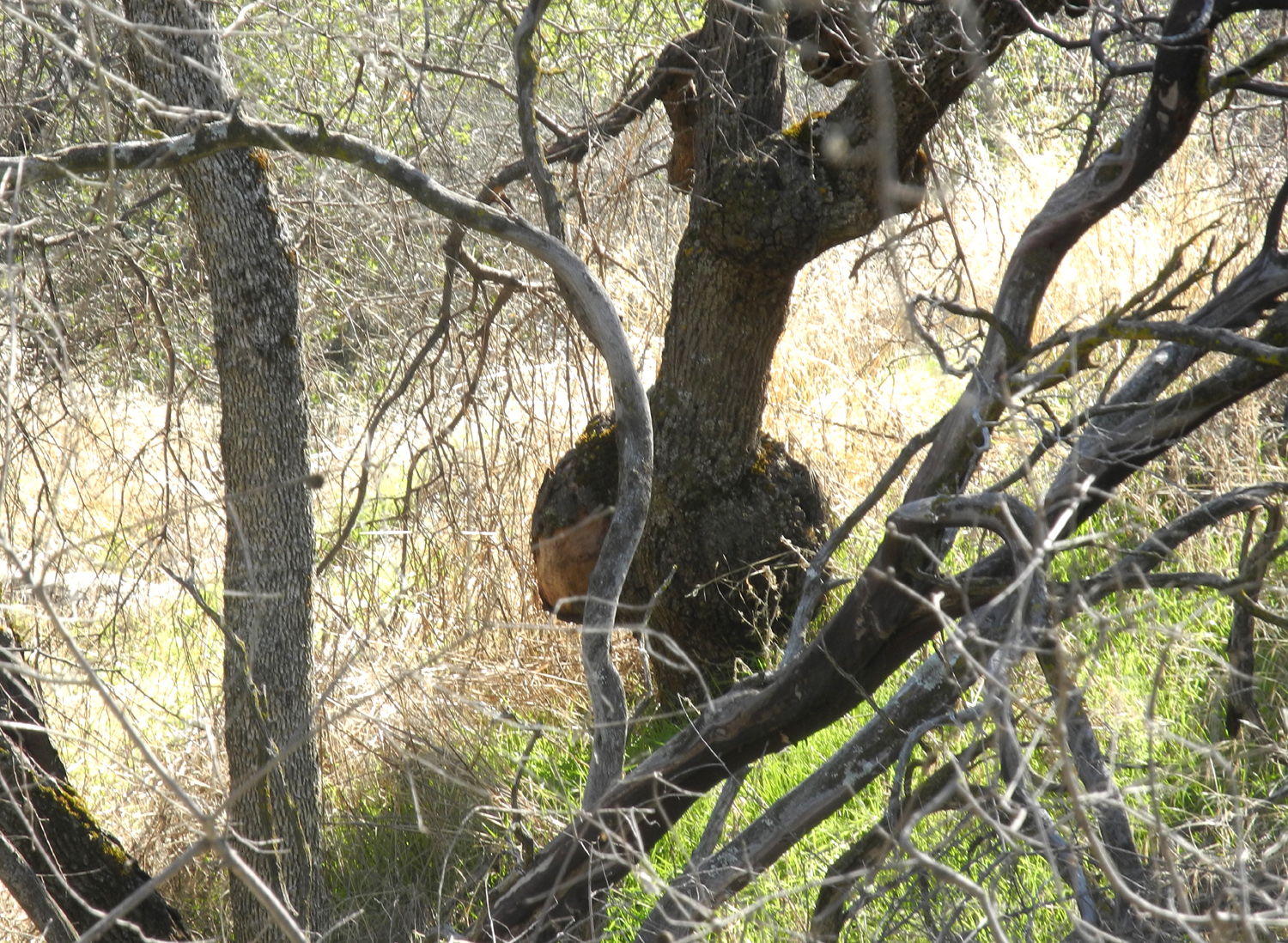
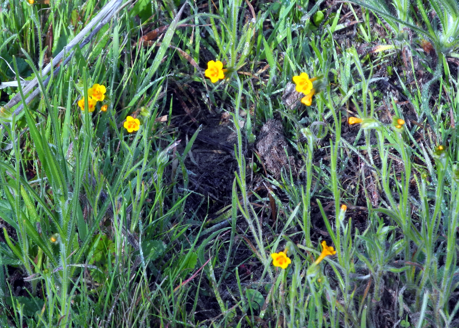
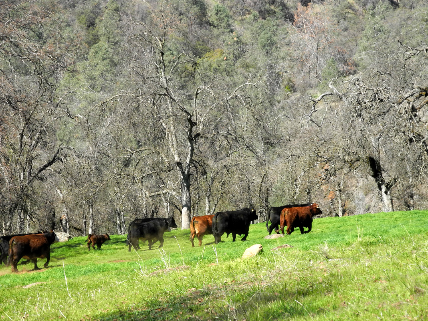
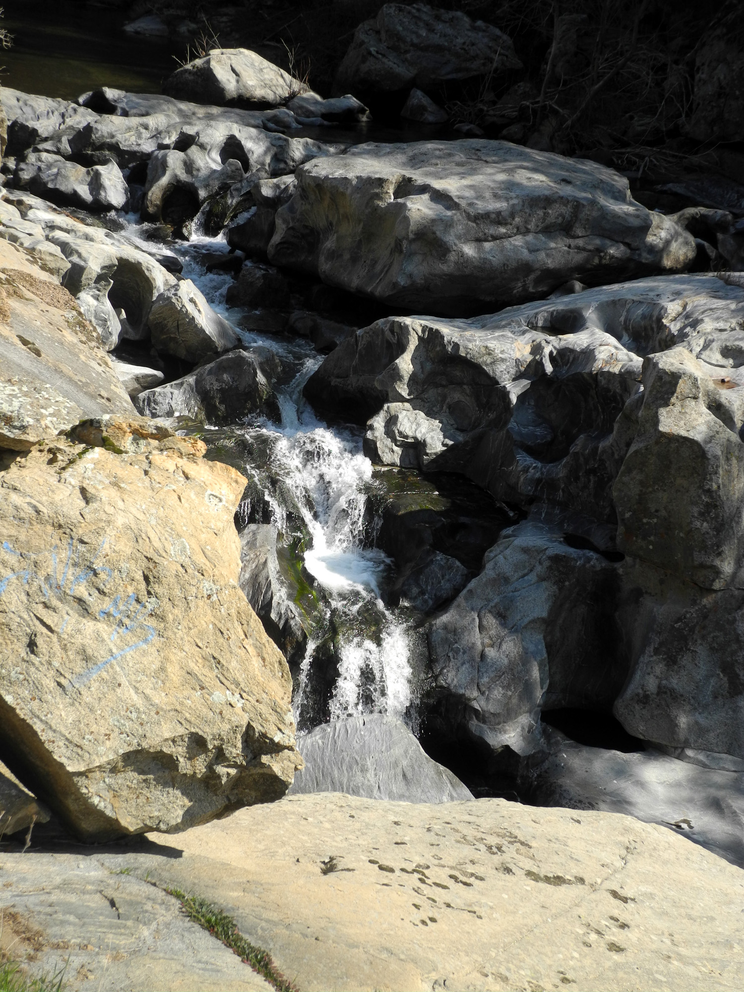
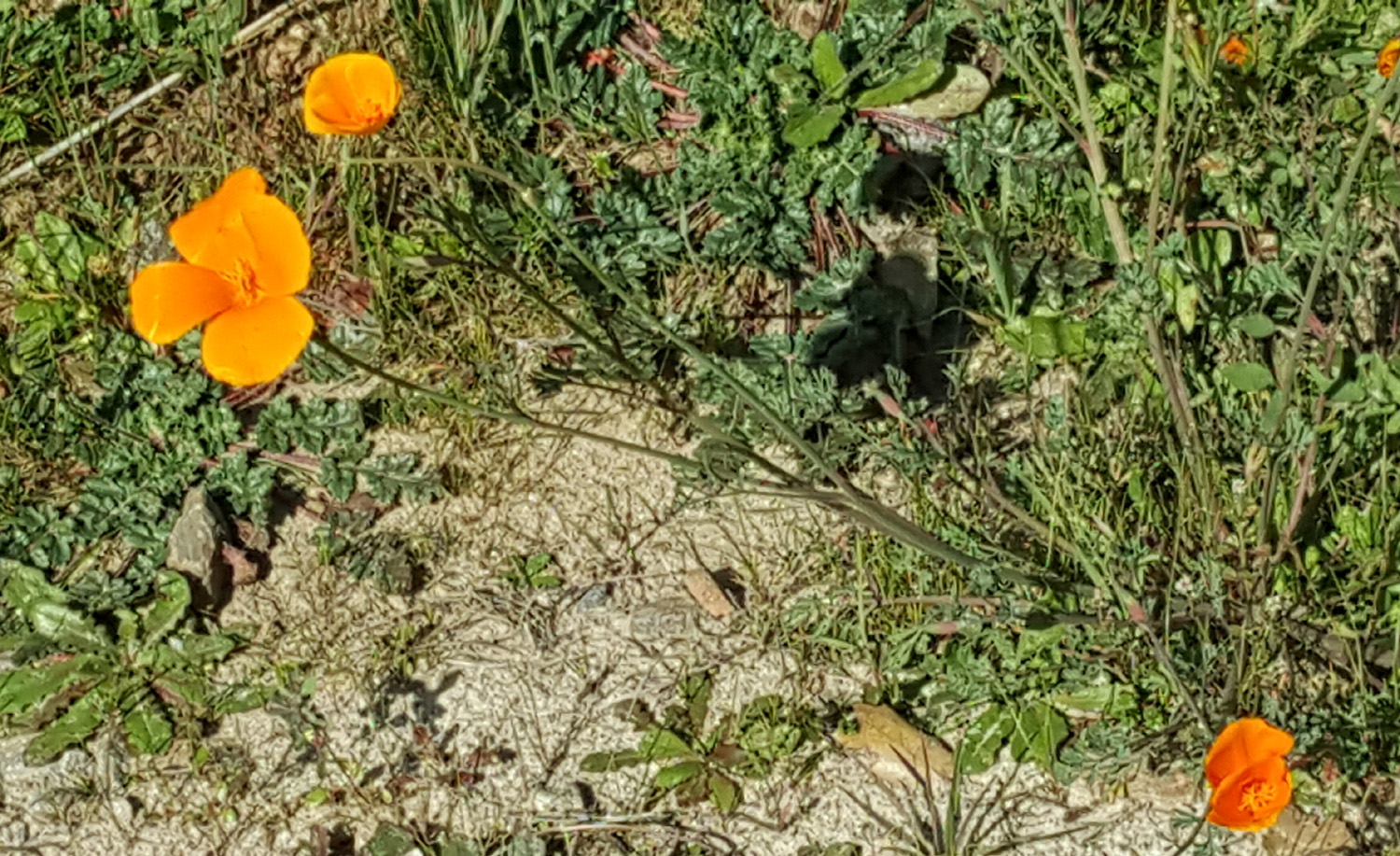
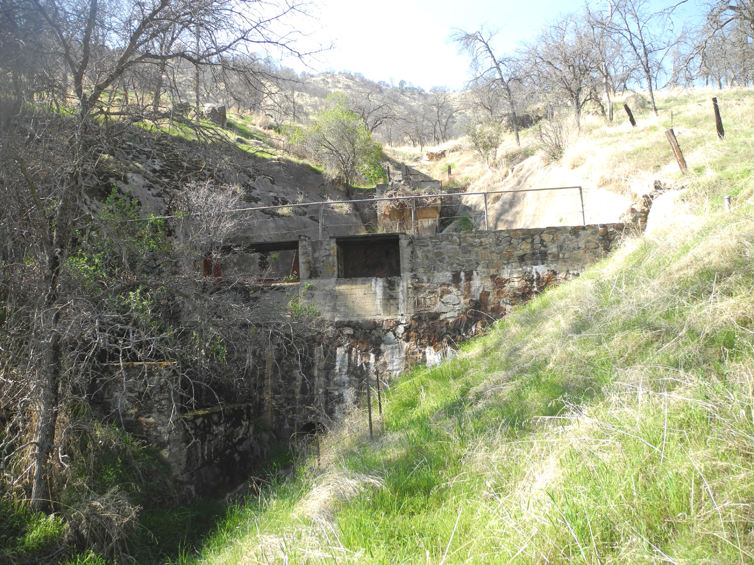
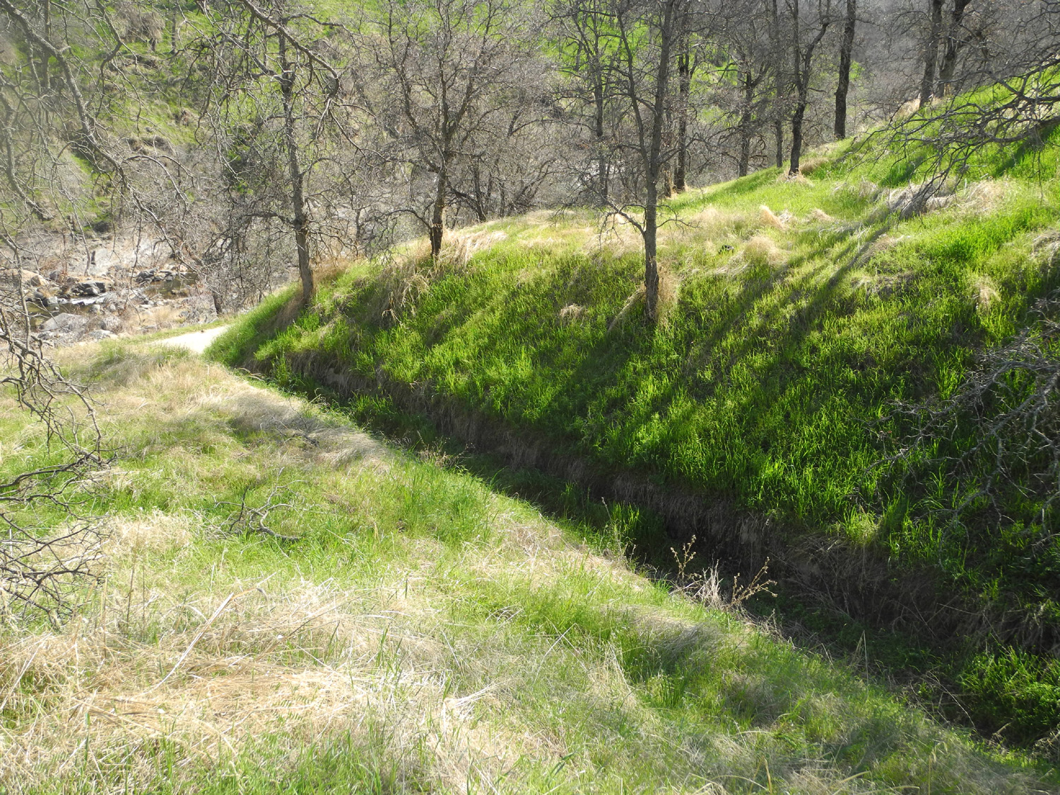
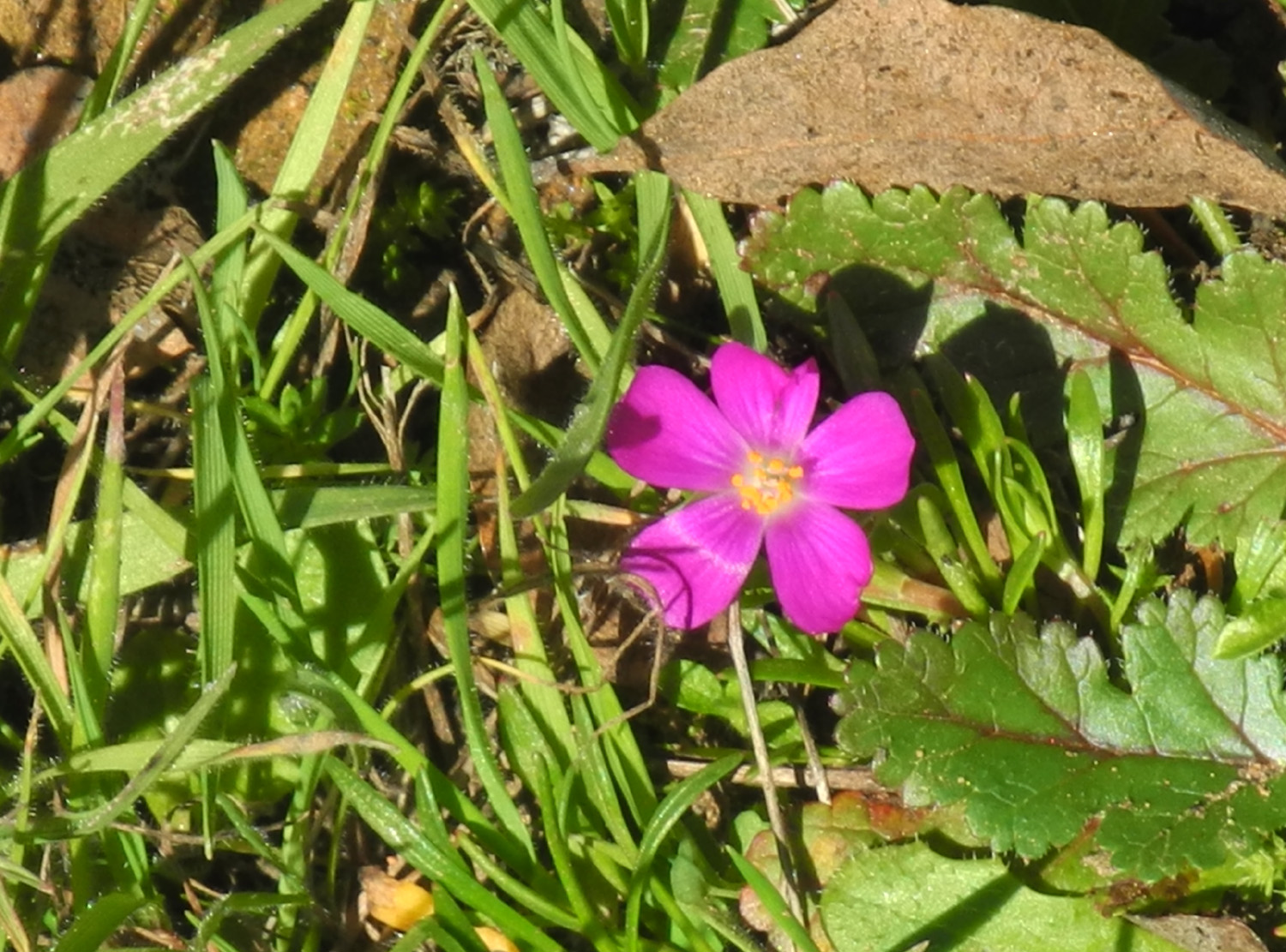
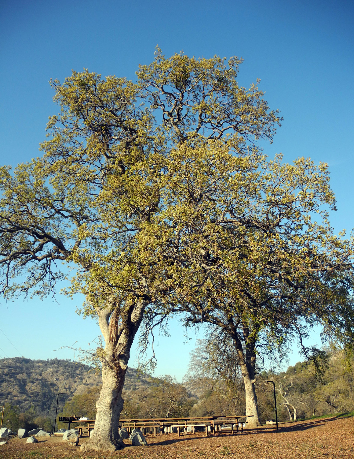
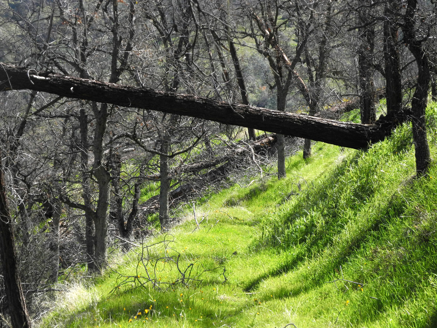
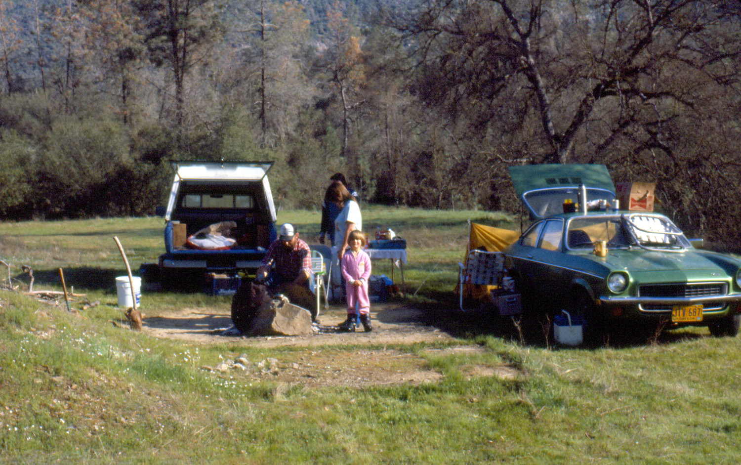
We first camped at the place we named Concrete Flats in April of 1984, but the story starts even earlier than that. The Big Creek Road goes more or less north from Trimmer Springs Road by Pine Flat Lake at about 900 feet elevation, and runs beside Big Creek for several miles to 1,200 feet. It then winds up out of the canyon and eventually goes into the upper canyon of the creek at about 3,000 feet. About a mile before the road re-joins the creek, there is a big gently sloping meadow, part of a sort of shelf about a mile in width. The land drops off sharply to the south of the meadow, and rises up steeply on the other three sides. In January of 1984 my friend Tim and I camped at this meadow, wandered around the hills and trails nearby, and generally enjoyed discovering a new camping place. Then came the wind. As it grew dark, a strong wind began to flow down the slope, eventually becoming so strong that we huddled by the fire and tried to use my Datsun pick-up as a windbreak, with little success. The flames of our campfire became horizontal for the rest of the evening. The weather caused us to name this spot Minnesota Flats. Assuming the wind was an anomaly, I went there again in April, with daughter Teri, first husband Johnny, and Tim coming up to join me the next day. Once again the wind rocked the truck all night as I tried to sleep, and when the others arrived I met them by the road and told them we needed to find a different place for that night's camp. We drove back down the road to a place where people have camped beside the creek, and I'm not sure why we didn't choose that spot. Instead we drove up a rough driveway on the opposite side of the road, where we found a large man-made flat area with an old concrete foundation and some cement piers. There was a fire ring, with a flat piece of metal set up to reflect heat back on the camper. We set up camp here, named it Concrete Flats, and it became a favorite spot for a number of years. Teri was pregnant with my older grandson Johnny at the time, and he also had his first camping trip here in April of 1985, at the age of eight months. Our last attempt to camp here was in March of 1999, one of younger grandson Mikie's first camping trips. The spot by the creek was occupied, and the Concrete Flats site had turned into a disgusting garbage dump, so we found a place a mile or so farther up the road. I have visited this area on day trips since, but that was our last campout. In mid-February I decided it was time to try again, with plans to camp wherever it was suitable. I left home at 9 a.m. on February 12, and stopped first at what we call Sycamore Fire Road for a hike. I've written about this location several times, starting in 2014 and most recently in February and March of 2017. The "trail" is an old dirt road which has not had any kind of maintenance for many years, and which has essentially turned into a trail. It rises a total of about 300 feet in elevation from where I started to the farthest point I have gone, with gentle ups and downs and only a couple of very short spots that could truly be called steep. With the warm, dry winter we've been having, flowers are out early, and I saw a dozen or so species on the hike and the camping trip, but none in large numbers. These included fiddlenecks, popcorn flowers, bush lupine, manzanita, filaree, and fringed redmaids. I spent about two hours on this adventure, enjoying a snack while sitting on a log that has fallen across the road. A short distance past this spot the road crosses a creek and goes up a short steep rise to a big meadow, the farthest I have gone. As I came up into the meadow, I startled a herd of about a dozen cows who took off out of sight at a moderate but steady pace. I got back to the truck and on the road at 12:30, having hiked about a mile and three quarters. It's not far from Sycamore Creek to Big Creek, where I left the paved road for the four and a half mile drive to Concrete Flats. This part of the Big Creek Road is one of the better quality dirt roads, wide enough for two vehicles to pass most of the way, lacking deep ruts, and "smooth" for a forest road. It is rougher and narrower beyond Concrete Flats, but still above average. When I arrived at the camp area, I immediately saw that the driveway up to the Flats was much more rutted and rough than in the past. The original route looked to be impassible except with an aggressive 4-wheel drive vehicle. A new alternate route next to it was not much better, and where they came together just below the top there was another very rough section. I walked up the driveway, which immediately convinced me that I would be in trouble if I tried it in my two-wheel drive Ford F150. The place seemed to be a little cleaner, but still a big mess. There was no evidence of the fire ring we had used, and I doubt that anyone is doing any camping there. On the other side of the road three short driveways go down to an almost level spot about 100 feet from the creek, a place I think we camped at once. None of these driveways was particularly good, but I felt I could drive down any of them, and out on at least one. However, I decided to drive farther up the road to see what things were like. In 1987 we made the acquaintance of Jim Montgomery, who with his brother Loren had a mining claim in the area and lived in a makeshift cabin about a quarter mile back a side road between the camp site and the place where the road crosses Big Creek. The brothers have been gone for many years and their cabin has been removed. I had walked back the road in 2013, but at the time I was not looking for a camp site, so I thought maybe it was usable, and walked in. It didn't take long before I came to two spots that were not passable with my truck, and the cabin site itself was full of trash left by shooters - ammunition cartons, shredded paper targets, clay pigeons (whole and in fragments), beer cans, etc I walked back out and continued up the road, crossing Big Creek and starting uphill. I could not identify the place we camped in 1999 with any certainty, but I think I found it, and it was not useable, a fence having been built that left only a narrow strip along the road. A little farther there is a fork in the road, where going left takes you up to Minnesota Flats, back into the canyon of Big Creek, and eventually out to Highway 168 a few miles below Shaver Lake. Instead I took the right fork which eventually leads to Ross Crossing on Dinkey Creek, where roads go in several directions. My destination was only about a half mile, down to Nutmeg Creek. I had noticed Nutmeg Camp on the map, and I found it easily just before the bridge, but there was a 5th wheel trailer and a tent trailer there, so I drove out and started back to the Concrete Flats area. Along the way I stopped in several places and walked short distances on dirt roads that went oft the main road. Most were impassible for my truck, and none led to any good camping spots. I had already studied the three driveways and was fairly certain I could get out the one farthest south. When I got back to the area, I drove in the northernmost driveway, through the camp, and out the other one, my thinking being that if I could not make it, I had two days to flag someone down for help. As expected, I got out with no difficulty, drove back in, and began to set up camp. I went down by the creek, and was glad to see that it was running fairly good. Then I wandered around the area, mainly looking for firewood. I didn't collect any at this time, but I marked in my mind a spot where there was some dead manzanita, and also some blue oak branches that were not too big to handle. I had brought hot dogs to cook over the fire, but I was ready to eat before I was ready to start the fire, so I heated them on my propane stove and had an early supper. Like at my camping spot in January, the sun went behind the hills fairly early, but a little later in this case, around 4:30 instead of 3:00. The temperature dropped immediately, and continued to do so until the sun came up the next day. In fact, let me tell you about the weather. I was originally going to go on Monday, then it looked like going Sunday would let me avoid a predicted rain storm. As usual the forecast changed, so I ended up waiting till Tuesday. The storm was supposed to move out by then, leaving some clouds with low temperatures around 40 degrees, ten degrees warmer than my last trip. Everywhere I drove and walked, there was no evidence of recent rain, and it was clear night and day. This of course meant colder nights. It was 38 degrees at 6 p.m. and 33 at 8, not long before I went to bed. It cooled off even more during the night, dropping down to 24 degrees at 6 a.m., and still in the 20s when I got up at 8:30. Of course, there was frost all around, and a little ice in my water jugs. My first act each morning after getting dressed was to hurry up to the road where there was sunshine, and stand there warming up. The sun didn't hit my camp for quite a while, so I took my chair up to the road and enjoyed my morning drink with the sun on my back (bloody Mary the first day; tea the second). By the time I finished, there was a sunny spot in camp where I could sit at my card table and enjoy breakfast. It's not healthy to engage in strenuous activity right after eating, and I think starting my hike immediately after breakfast on my last trip contributed to the problems I had going as far as I wanted. After breakfast the first morning, I made several slow trips up the road a short distance (800 feet round trip), and brought back a good pile of manzanita and blue oak. Near where I got the oak, I spotted a blue oak with a large burl, one of many that appear throughout the foothills. There was some firewood at the camp, much of it too big to use without a chain saw, but there were about five pieces of what looked like fruit wood. With this and a box of commercial wood I had brought, I was able to keep a good fire going the first night until it was time to get ready for bed. The second night the fire lasted even longer, with another commercial box plus what I gathered in the morning. Once the wood gathering was finished and the breakfast dishes rinsed, I was ready for the "big hike" of the day. There are no actual trails in this area, so my plan was to walk up the road to the bridge where the road crosses Big Creek. Just upstream from the bridge there is a huge "hanging" boulder that looks to be suspended between the rocky cliff on one side and several smaller boulders below it in the creek. After taking pictures from the bridge, I went up from the road to where you can walk out and look down into the creek and down on the boulder. It's also possible to get down to the creek from this spot, but since I did that when I was much younger, I didn't feel the need to repeat the feat. Instead I found a nice flat rock where I sat and had my snack. I took more pictures, and headed back to camp, stopping along the way wherever the scenery caught my eye, ending up with a hike of a little over a mile and a half. Leaving my pack behind, I then walked up to the actual Concrete Flats location, then up to another flat spot above there where we used to be able to drive. Like all the other roads around the Flats, it was not anything I would try driving on now. In this area, on my hike, and on the slope above the road where I gathered wood I saw a number of wildflowers, including baby blue eyes, fringed redmaids, filaree, and fiddlenecks. Along Big Creek Road and Trimmer Springs Road there were a lot of bush lupines and poppies in bloom. One of the more interesting events was a visit from a hummingbird, who came in and flew around and down into the fire ring during the daytime. He returned the second night when I had the fire going and flitted around just outside the rocks surrounding the fire. I thought perhaps he had been attracted by the bright orange pieces of clay pigeon that were everywhere I went, although there were none in the fire ring itself. The first night I was warm enough all night except for my toes - the pickup bed is only five and a half feet, so the bottom of the sleeping bag, and thus my feet, are outside the camper shell. I put on a third pair of socks around 3 a.m. The final night I put on all three pairs before going to bed, and it helped, although my toes were pretty cold by 6 a.m. Looking at a list of previous camping trips, I discovered that we had experienced lows of 22 and 19 at Concrete Flats in the past, so it's definitely a place that's colder than you'd expect for 1,200 feet. On my trip it was only one degree warmer than Shaver Lake at the 5,000 foot level. On the final morning I repeated my pattern of hurrying up to the road for a a quick sunshine fix, then sat by the road while I had tea and an orange. It was warming up and there was sunshine at camp as I cooked bacon and toasted muffins for breakfast. I loaded things up at a leisurely pace, and started for home about 12:30. It took quite a while to get out to the main road, however. There are a couple of small waterfalls on the creek, and I stopped to take pictures of them, as well as poppies and lupines. I also walked up to one of the concrete and rock structures that appear in at least six of the drainages that run into Big Creek from the west. One of these has concrete steps, and most of them have a large basin, various valves and rock artifacts whose purpose is not obvious. I've heard that they were used to measure water runoff before Pine Flat Dam was built. I walked up one of them that I had not visited before, and found it nearly identical to the one next to it that is more easily accessible via a crude concrete stairway. Trying to account for all the hiking, wandering around, wood gathering and exploring possible campsites, I calculated that I got in 5.59 miles of walking. I enjoyed seeing how many wildflowers are out, and re-visiting an area where I camped a dozen times or so back in the 20th century.
|
||
|
San Joaquin Gorge Camp This was a Rambler Hike, sandwiched into a Dick's Adventure. Although the number of people involved was small, the fun was enormous, and we were undaunted by the threat of rain. I drove my motor home to the San Joaquin River Gorge on Sunday, February 25, and Teri came up with grandson Colton. Teri hiked with us that day, then left for home. The next day Colton and I were joined by Wes Thiessen for the scheduled Rambler hike. Wes's comments below serve as a good introduction and an explanation of why we had so few Ramblers for this favorite spot. |
||
 |
 |
 |
| Everything is nice and green | Colton and Teri hiking up the hill | Two and a half Ramblers at the Big Burl |
|
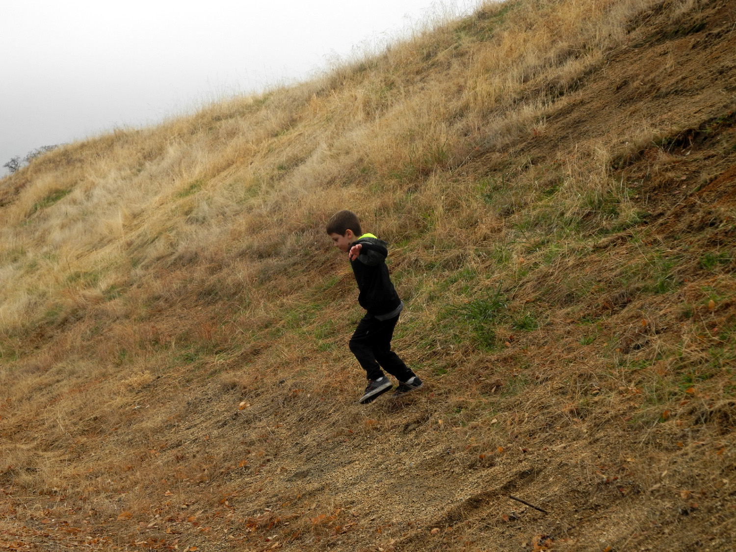
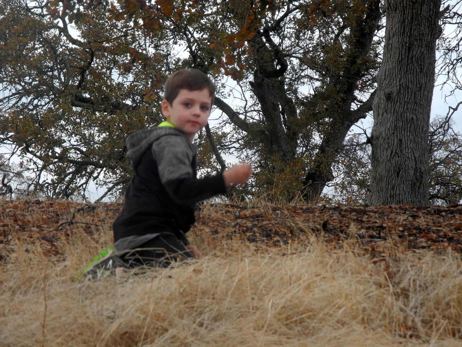
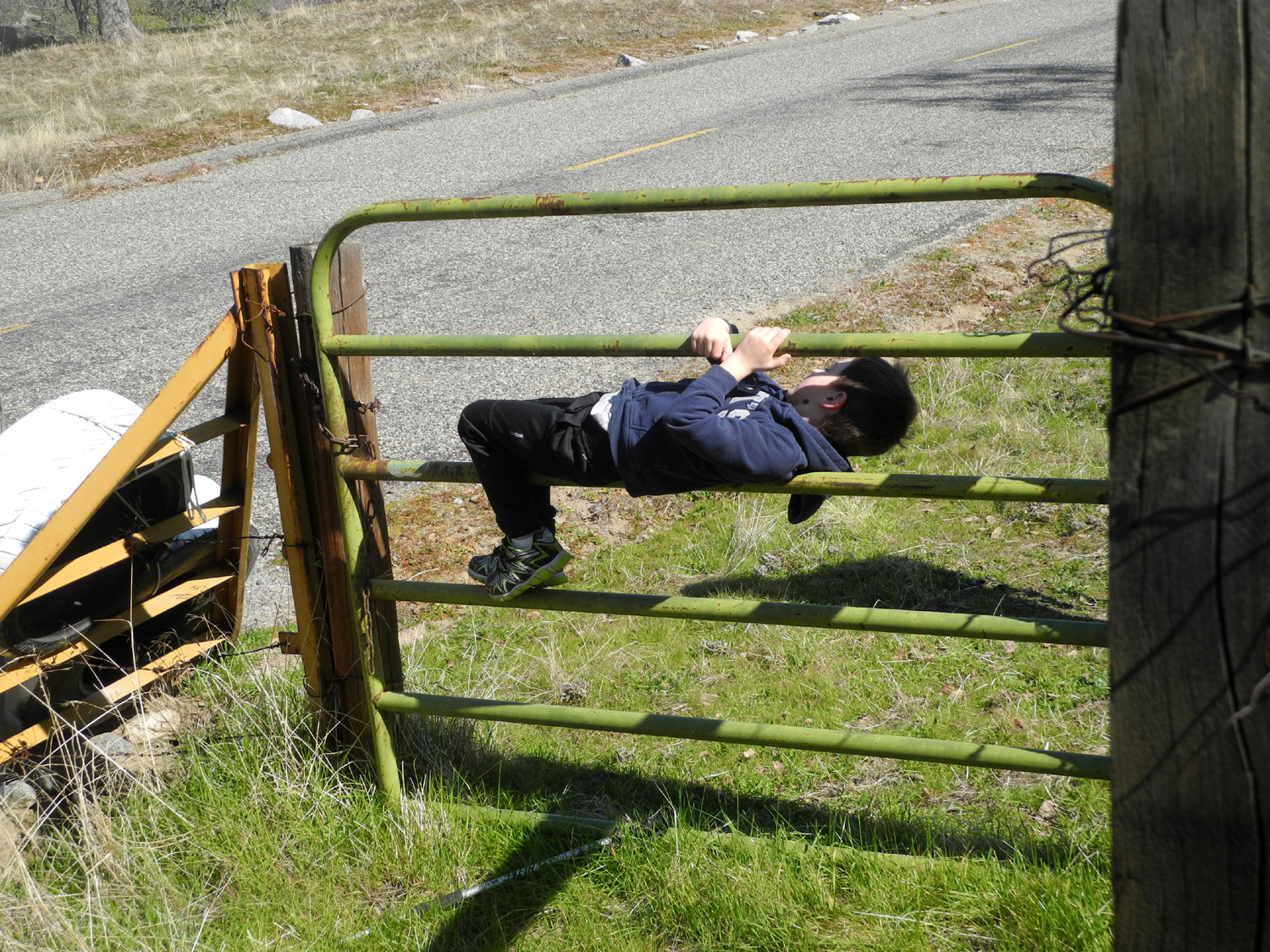
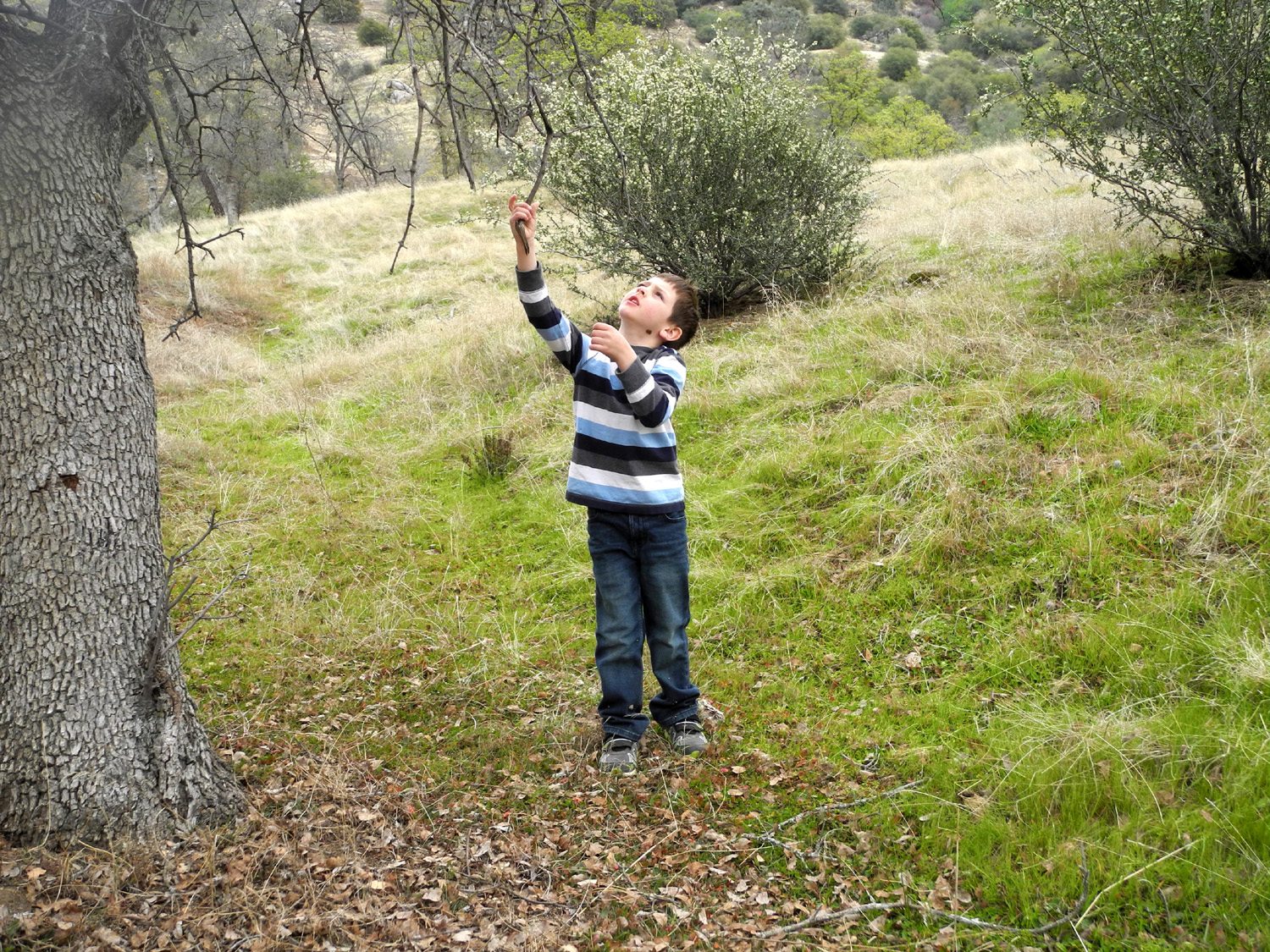
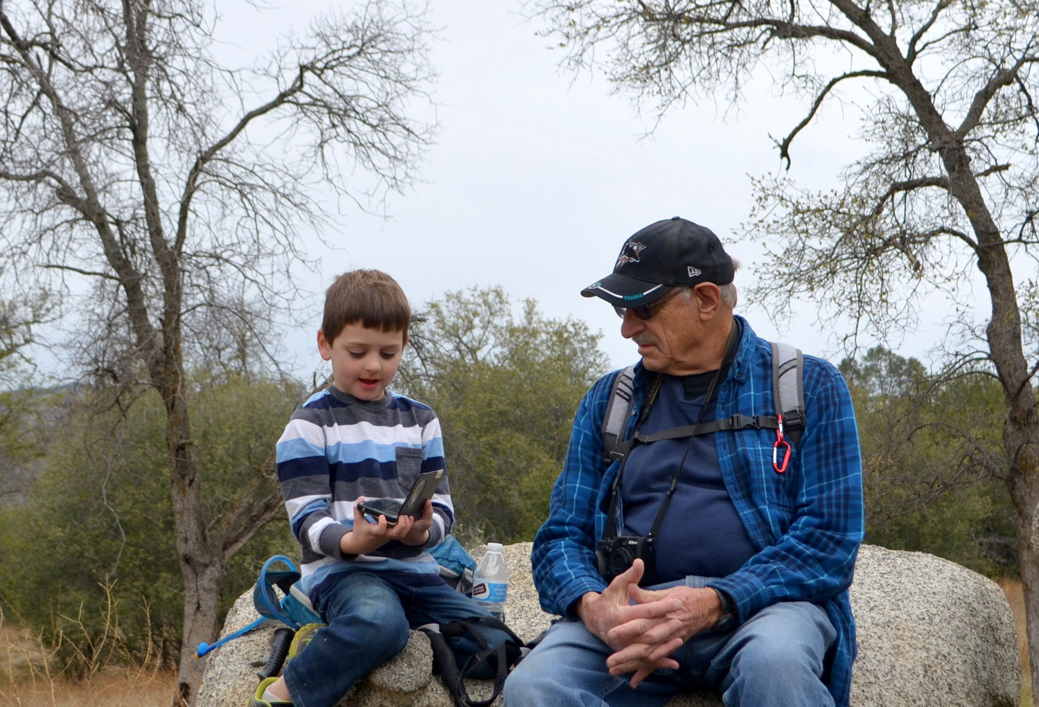
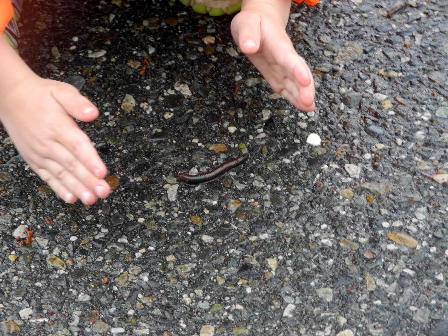
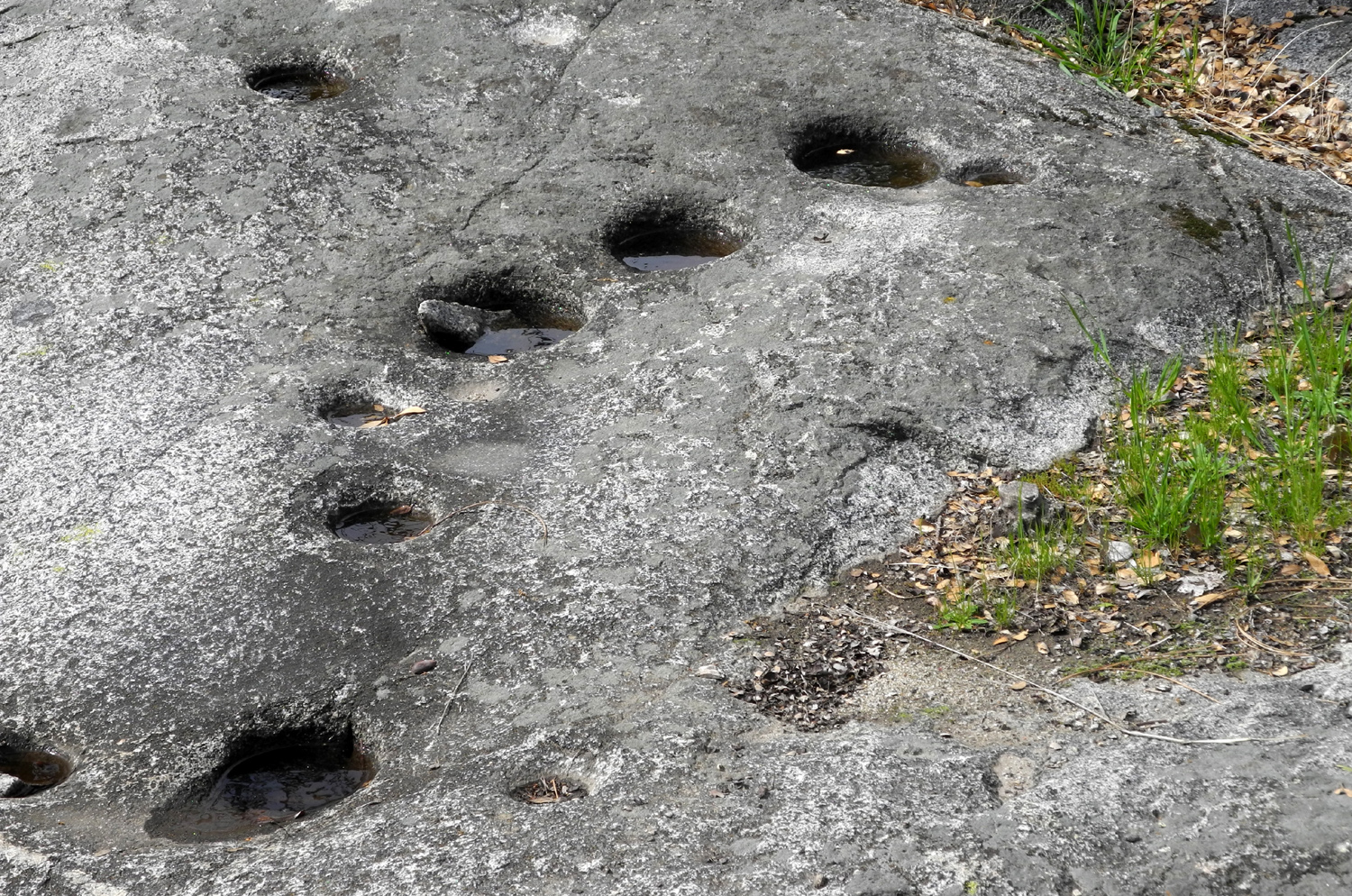
As so often happens with winter hiking and camping plans, I spent a lot of time the week before the trip looking at weather forecasts. Eventually the best we could hope for was mostly sunny weather the first day, with a 30% chance of rain the next day, when we were going to hike with the Ramblers. We liked these odds and decided to go ahead with our plans, which turned out to be a good idea. I got started from home about 9 a.m., stopping along the last stretch of road into the Gorge for a quick look and photo of the snow on the mountains. I arrived at the group camp area at the Gorge a little after ten and had just got started setting up when Teri and Colton arrived. Teri got out his bike and he began riding around the parking lot, while she helped me level the motor home. We then went on a two-part hike, none of it on the "regular" trails at this location. First we went up to the road, across the cattle guard and cross-country up the hill to the south of the camping and parking areas. It's a fairly short, moderately steep walk to the top of a little knoll. Above this spot, the terrain rises very steeply up to a ridge, the sort of place that would leave you out of breath after five or six steps. Wisely we went across the slope to the west, checking out the various trees, bushes and wildflowers. Manzanita and chaparral (AKA buck brush) were in bloom, and we had seen some redbud blossoms along the road coming in. The blue oaks were decked out in brilliant bright green new foliage. Following cow paths, game trails and our finely honed foothill hiking instincts we went perhaps 300 yards before starting downhill through an open area not blocked by brush. This took us to a well-worn cow path along the fence that parallels the road, and back to the cattle guard. From there we walked back to camp, where we enjoyed a well-earned snack. When Colton and his brother camped here with us last year, one of their favorite things was the frog pond, a few hundred yards from our camp, and of course, Colton wanted to check it out next. We went down the shortcut trail between the group and equestrian camps, then through the grass to the pond. It was disappointing to all of us to find that there was not one drop of water, so no frogs or salamanders. We've had a very dry winter, and foothill creeks and ponds tend to be dry. After walking across the pond, we followed a trail that goes toward the road to the visitor center. It joined the road right next to a gate, which was closed, meaning access to the visitor center was by foot only, but it would surely be closed. We stopped to look at a granite outcropping by the road that contains at least 30 grinding holes, indicating this was a place where the natives processed acorns. We returned to camp, and Teri got ready to go, leaving Colton and me to camp the next two nights. We were both willing and able to do some more hiking, so I proposed we go down the Bridge Trail and look for buckeyes. He had become interested in them when he saw them in bloom last spring, and we collected a couple of seeds in the fall. Typically the fallen seeds germinate on top of the ground, and I was hoping to find some with their pinkish-white root showing or at least a place where a bunch of little trees have started growing. Colton declared that he could walk a mile, which would mean turning back before we reached the best spots for buckeyes. However, they are scattered all over the foothills, and I knew we would see some in that distance. We set off on a shortcut trail that starts across the road from the group camp to join the bridge trail a few hundred yards down from the main parking lot. We spotted the first buckeye bush just a short distance farther, about 30 feet off the trail. We made our way down, and I walked all the way around it, but found neither new trees nor seeds. The same thing occurred with two other trees that I could get to, and I am wondering if the lack of rain during the late fall and early winter months meant that last year's seed crop had died. I guess I'll have to go down to the prime buckeye sector before hot weather arrives. We went as far as a spot I call Lupine Point, where several of these bushes were starting to bloom. This ended up making our total hike about one and a quarter miles. Although it was late in the day, after 3 p.m., we saw several groups of hikers just starting down, and met others coming back up. In fact, the main parking lot was full much of the day, and five or six cars parked across the lot from us at the group camp. All were gone by the time it got dark. Along the shortcut trail I had noticed some dead bushes that looked like they might have some good branches for firewood - tiny outer branches for kindling, and some pieces we could break up that were an inch or a little more in diameter. Colton is always very helpful with jobs like gathering firewood, and we picked up a few branches as we returned, then left our hiking poles at camp and came back to the spot for an even bigger load. We also had a box of "store-bought" wood for each night, since it's impossible to find enough local wood in heavily used camping areas. The sun was low when we finished our hike, and the temperature started dropping. We got the fire going, roasted hot dogs over the flames, and enjoyed our supper next to the fire. We had a half moon, so there was a lot of light, and the stars were not as bright as I would like, but Colton is familiar with the Big Dipper which he spotted, and I introduced him to Orion and to Sirius, the Dog Star. We finished our meal with Klondike Oreo ice cream sandwiches for dessert. If you have not tried these, my advice is to stick with regular Oreos or regular Klondikes. Finally we let the fire die down and went inside. I started the generator and we watched an episode of The Simpsons. Colton had never seen the show, and I was not sure how he would like it. Of course, a lot of the jokes were beyond his understanding (fortunately!) but he said he liked it. The proof came when we watched one the next night, and when it ended he said, "Let's watch another one!" These were the exact words used so many times by his uncle Mike when he and I watched the show in his younger years. We then looked at a book about the rain forest which I had picked up several months ago, and which immediately became one of Colton's favorites. It was especially fitting that the cover featured a jaguar, since we had seen those and various other wild cats at Project Survival's Cat Haven a few days before our camping trip. Keeping an eye on the sky throughout the day, I wondered if the forecast of rain would prove wrong. It was sunny all day, and clear all through the night, with the temperature getting down to 29 degrees. Since it's usually about 10 degrees warmer in the motor home, my first act when I got up was to turn on the heater. It works very well, and we were soon very comfortable as we ate breakfast - Cheerios, toast and cocoa for Colton; shredded wheat, muffin, and milk for me. After breakfast we took the first of several walks to the cattle guard, where Colton enjoys crossing carefully and swinging on the gate. A Ramblers hike was scheduled for this date, and a version of this next section appears on the Rambler Hike 2018 Page 1. By late Sunday, various problems had forced all our members except Wes to cancel, but he arrived promptly at 10 a m., ready for another one of our "all-boy" hikes. The notes he emailed after the hike serve as a good start to the next part of this report: Some of you may have watched the television sitcom, Two and A Half Men. Today the Ramblers channeled that comedy with one of our own. Initially we planned for six Ramblers to participate in this hike. One by one this number was whittled down due to illness, disability or family commitment. In the end, it appeared just Dick and I would be hiking. But stepping in to save the day was five-year old Colton, Dick's great grandson. When I heard Colton would join us in the hike, I wondered if he could keep up with the adults. Halfway through the hike my thought changed to: "Will this old man be able to keep up with Colton?" He was like a trail blazing rocket man leading the way. At some point his tanks fell empty and he needed many rest stops to make it back to camp and a pizza lunch. Along the way Colton was very entertaining, marking a big X where hidden treasure could be found and giving orders about which trails to take. In short, our 2 and 1/2 man hike was a hoot! It didn't rain during our hike but the sky was dark and threatening. The sun tried hard but couldn't quite shine through the clouds as you will see in some of the photo images. We were able to see small clusters of traditional wildflowers. But the predominate flower was found on the buck brush which was blooming everywhere. Colton had hiked as far as the Big Burl during our Thanksgiving at the Gorge, but was willing to keep going past that point, especially since it required a creek crossing just down the hill. There was enough water that we had to step on rocks in the creek to get across, and Wes offered to help Colton, who was wearing tennis shoes. Colon scoffed at the idea and crossed with little trouble, instinctively using his hiking pole when he started to wobble a little. In addition to declaring rest stops and marking buried treasure, he also decreed when it was time for our snack. Not long after that he decided he had gone far enough. Wes had already planned to continue on another mile or so, a practice we have been following on Ramblers hikes for the last few months, making the hike length comfortable for everyone. As Wes headed up the trail, Colton and I started back. It would be a slightly longer return hike than going out, since Wes had driven from our camp to the trailhead, saving us about two tenths of a mile of road hiking. We went off the trail to explore a tree that had fallen across a fence, and generally took our time. As usual, Colton spent a lot of time whacking brush and poking trees and the ground with his hiking pole. At one point he picked up several fallen blue oak branches and hung them back on the tree. In fact, our progress was so leisurely that Wes caught up with us a few hundred yards from the end of the trail, so we were spared the extra walk and got a ride back to camp. I had brought pizza, enough for the expected 3 or 4 Ramblers, and Wes provided a veggie tray, so when we got back to the motor home I heated the pizza and we had a nice lunch. The weather was cloudy but free from rain, and our only disappointment was that so many of our fellow hikers could not be with us. Not long after Wes left, I took a short nap; then we decided to walk the Nature Trail. This decision was apparently the signal for the rain to arrive, since we were hit with wind and a cold mist in our faces just as we got to the start of the trail, and thinking it could open up and pour, we turned back. The rain soon stopped, so we decided to have an early campfire, and got it going around 4 p.m. We had a very few drops hit us while we were by the fire, but not enough to really get us wet, so we enjoyed the warmth of the fire for an hour or so, then went inside for the night. We ate supper, watched a couple of Simpsons episodes, and read the rain forest book again. Colton was in bed by 8:30 or so, while I read a while before crawling into my own sleeping bag. Rain started about this time, and every time I got up during the night, it was still falling, never a hard downpour but a gentle shower most of the night. It was clearing off by the time we got up, and the temperature got down to 39 degrees. I went outside to enjoy the fresh air. Two years ago we had seen hundreds of millipedes on the road, parking lot, trails and grass in the evening. Colton was not with us then, so I hoped for a repeat, but we had to be satisfied with three of them. I spotted the first when I walked across the parking lot, got my camera, and took a photo. Colton woke up shortly after this and I asked if he wanted to go out and see it. He declined at first, but once he was fully awake he decided to go out, and spent a lot of time watching it and taking some photos. When he came back in he announced that they have little tiny legs, and I explained the meaning of the name. When I picked up the leveling blocks to put them away, we found two more of the creatures. Breaking from his normal pattern, Colton declined bacon, so I fixed some for myself and he had Cheerios and toast again. I did the dishes, and we slowly got things ready to go. Once everything was put away, we took a final walk to the cattle guard. Actually I walked and Colton took his bike. He can ride nearly all the way up to the road, but it gets a little steep at the end. Of course, he greatly enjoys the ride back down. As we drove home through Auberry, we saw that there was snow on the ridge just above town, no more than 300 feet in elevation above where we were. When we got home we unloaded the motor home, then went for lunch at Colton's Social House, his first visit and my second. He's known about the place for some time and has been wanting to go, and now wants to return with his parents and brother. I posted a positive review on Yelp, and to top off a great time, the owner emailed me, told me the place is named for his grandson, and offered to send me a Colton's t-shirt for our Colton.
|
||
|
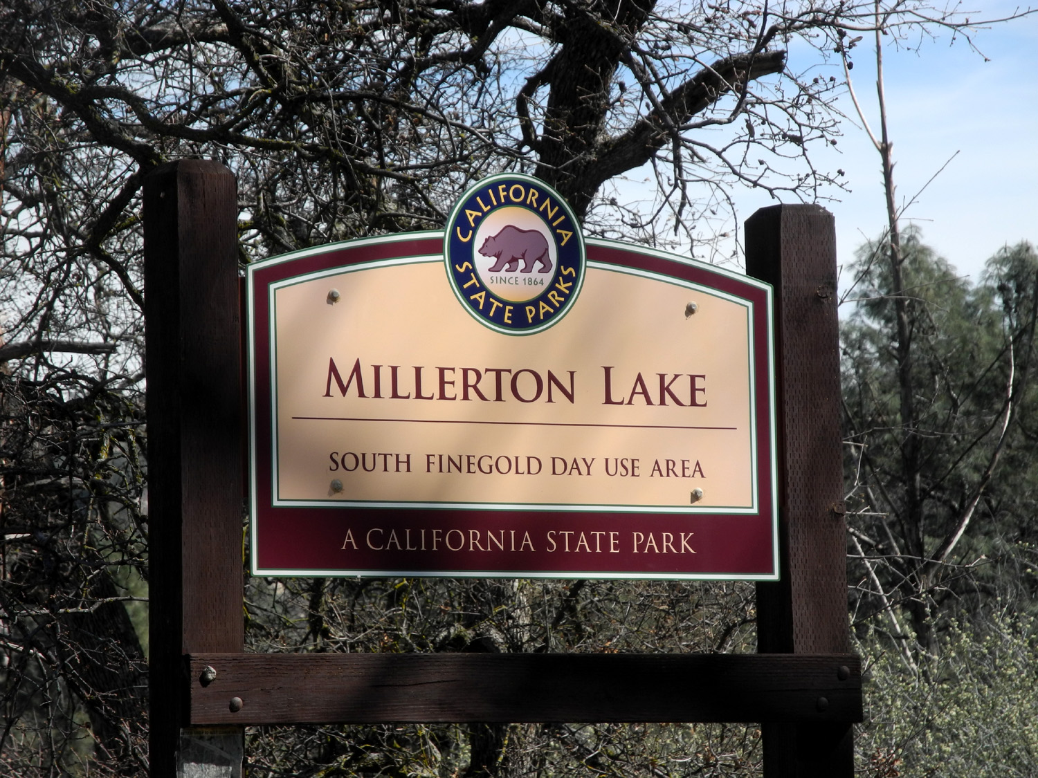
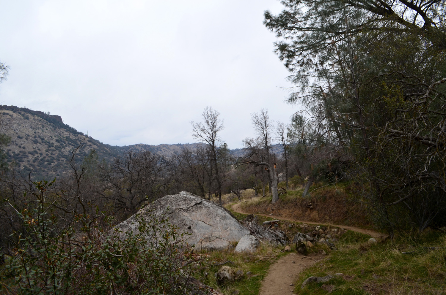
Finegold Exploration The Finegold Picnic area is a handy place, only 23 miles from my house, by Millerton Lake at the end of the Sky Harbor Road. However, the hiking choices are limited. You can go up the western end of the San Joaquin River Trail and hike as far as you feel like. It goes to the San Joaquin Gorge, 12 miles by trail. Or you can ...what? I already knew part of the answer. The road ends in a big turn-around circle, and from here to the west and north, what I call a "fisherman's trail" goes down to the upper end of a little cove. I had gone that far after one of my hikes on the main trail, so on March 6 I decided to see where it went beyond the part I could see. |
||
 |
 |
 |
| Lake Millerton, blue and sparkling | One of many bush lupines in bloom | Snowy Sierra seen through an almond orchard |
|
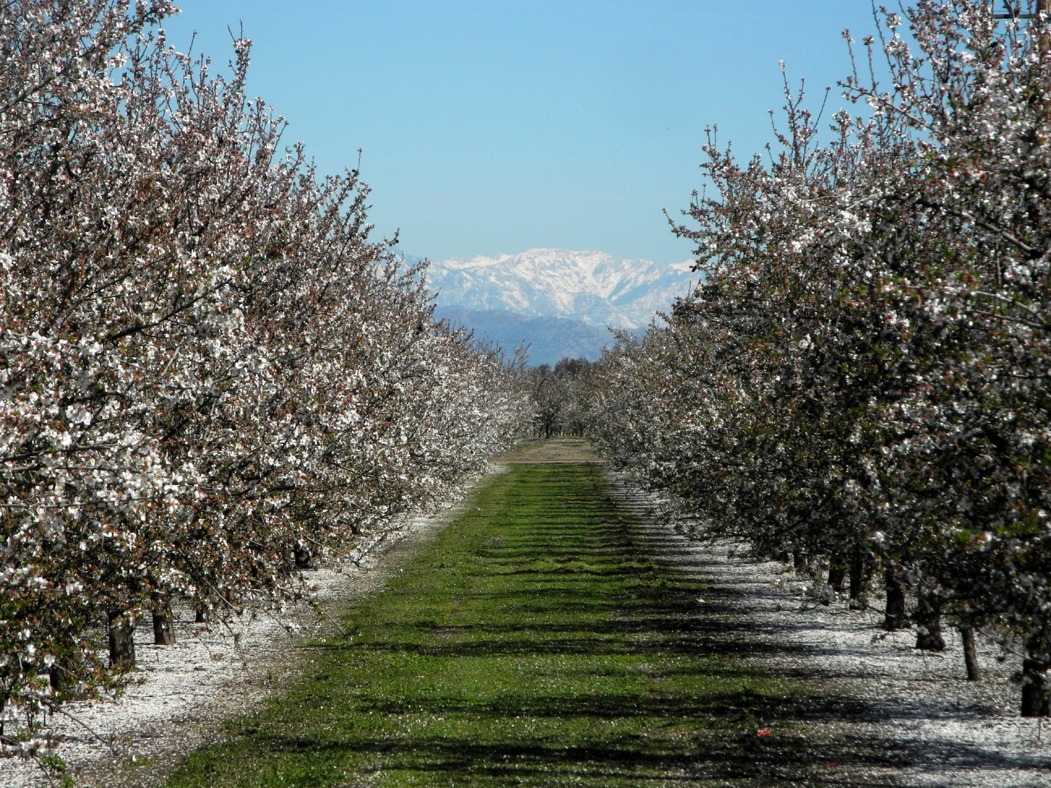
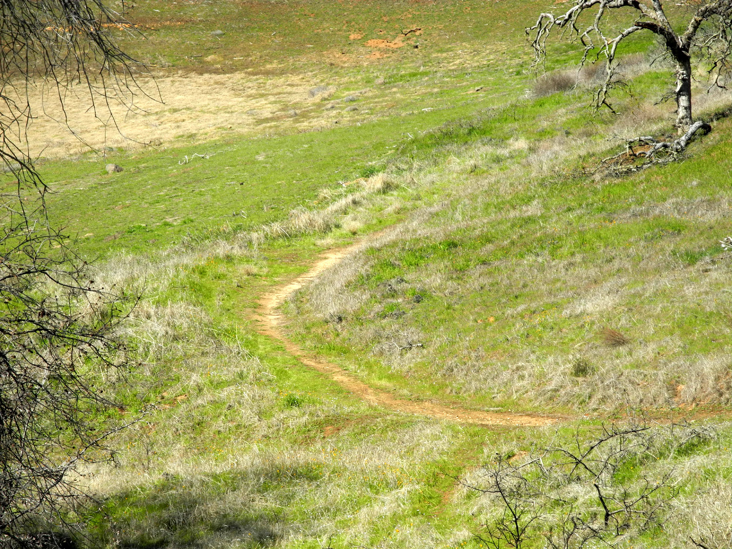
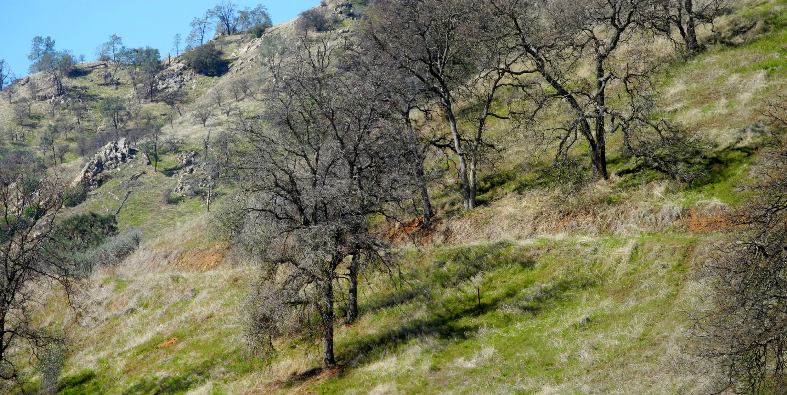
When I arrived at about 11 a.m., there were close to 20 cars parked along the road, a fairly large number for a Tuesday. From the little cove's high water mark, the trail goes up the side of a ridge that separates the cove from the main part of the lake. This is a very short and not at all steep section, and where it levels off there is a junction. You can go over a low saddle toward the main lake, go east around the highest part of the ridge, or west to where the ridge comes to an end between the cove and the lake, the direction I took. At this point the route appears to be an old abandoned road, and it's mostly very easy walking. Along the trail I saw lots of wildflowers in bloom - bush lupines, fiddlenecks, popcorn flowers, poppies, filaree, blue Dicks, and miner's lettuce. I also had good views of the main lake at the western end of the ridge. I continued on around the north side and soon arrived back at the saddle and trail junction. I decided to keep going along the north side of the ridge, although the trail was much less distinct. I came to a couple of spots that at first looked impassible due to pine trees fallen across the trail, creating a brushy barrier. I made it past both of them, but beyond the second one the trail became almost invisible and much more difficult. If I do this walk again I will skip this section. One advantage of so many fallen trees was that there was always a log to sit on and rest, and I went about 20 feet up the hill to sit on one while I ate an apple. From here it was pretty much a cross-country hike, as I traversed the slope back toward the parking lot. I had to look ahead and try to find a route that did not take me into a chaparral thicket or a quarter acre of fallen pines. Both of these options were available, but I finally made it back to the edge of the picnic area and back up to the road. There was a strong breeze when I first started out, but this stopped, and by the time I got back to the car I had rolled up my sleeves and was fully warmed up. Sky Harbor road starts from Millerton Road right next to the Table Mountain Casino, and driving over the top of a hill south of the casino last year we had noticed a striking view of the Great Western Divide, a range of high peaks in Sequoia National Park. On my way back home I managed to find a place to park, and walked about a hundred feet over the top of the hill and got some pretty good photos. Getting back close to home, my route is south on Minnewawa Avenue through almond and other orchards. The blossoms are dropping fast, but they make a nice white carpet under the trees, and if you look down between the right rows, you have some nice views of the snowy Sierra Nevada. Once back in Clovis I rewarded myself with a visit to In-N-Out, a very good and very inexpensive burger chain, and got home in plenty of time for my afternoon nap.
|
||
|
Photos (Click to enlarge; pictures open in new window) |
||
|
Hensley Camp Bear Wallow Concrete Flats San Joaquin Gorge Finegold Exploration |
||
|
Hensley Camp |
||
 |
 |
 |
| Our camp was next to a blue oak with golden leaves | Hensley Lake and part of the campground | The new grass is ready to take over from the old |
 |
 |
|
| A day in the life of Colton and Jack | Being very cute | Colton was into alternate methods of sliding |
 |
 |
 |
| Jack was up to the challenge of any ladder... | ...and was rewarded with an exciting ride down the spiral slide | Uphill or down, Colton has one speed |
|
 |
 |
| Jack on top of the hill above our camp | Exploring what's in the grass | The boys were fascinated with the thick moss |
 |
 |
 |
| A personalized domino game | Breakfast time | Watching videos of falling dominoes |
| Bear Wallow Camp | ||
 |
 |
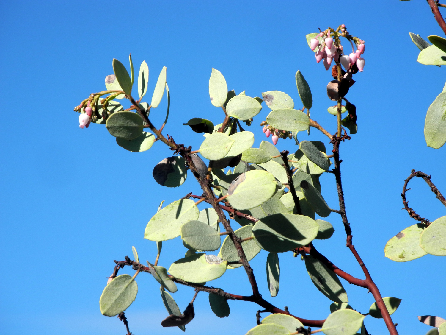 |
| The waters of Pine Flat Lake were amazingly still, reflecting the hills above | Pine Flat from the high point on Trimmer Springs Road | The manzanita did not realize it was still winter |
 |
 |
 |
| A home away from home | My camp site | Mossy rocks and a leaning sycamore trunk |
 |
|
 |
| Drainage near the trailhead | The Kings River near my camp | Late afternoon sun on the hills downstream |
 |
 |
 |
| How cold it was at 8:30 a.m. | Frosty ground | Start of the trail |
 |
 |
 |
| The trail goes up to the right from the center of this photo | River view from the trail | Looking across at the steep south slope |
 |
 |
 |
| Camp site on the south side of the river | Blue oaks and rocks form a gateway for the trail | This frog is the perfect color for his surroundings |
 |
 |
 |
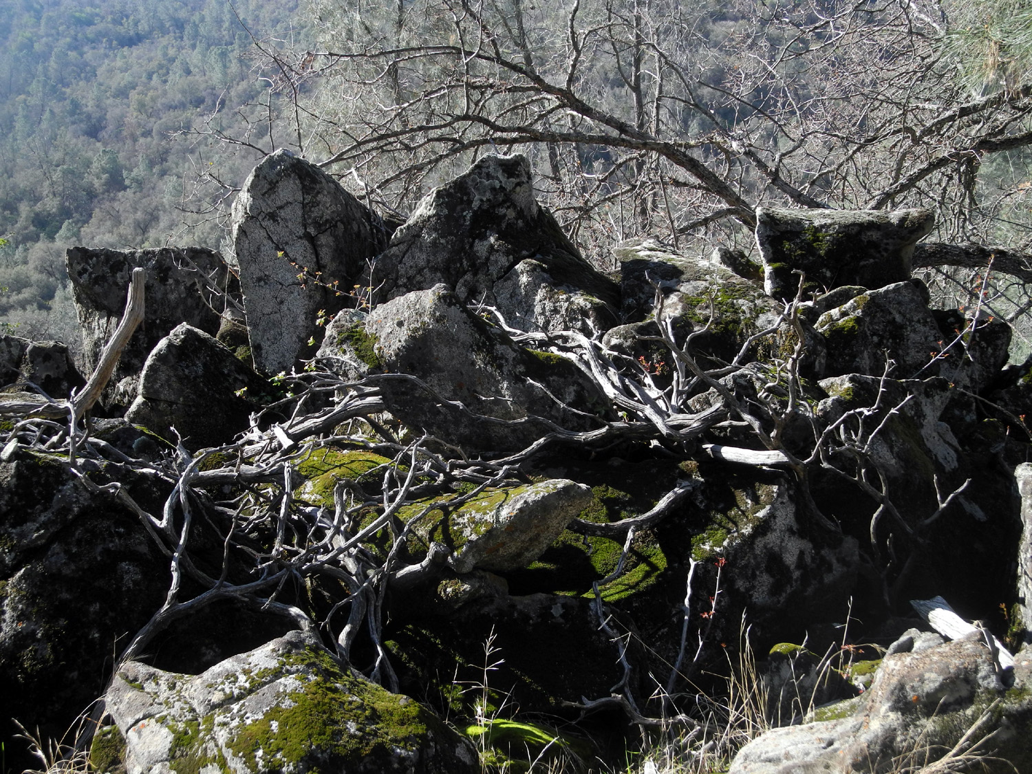
| Rocks that have been under a lot of pressure | A reassuring sign | My lunch spot |
 |
 |
|
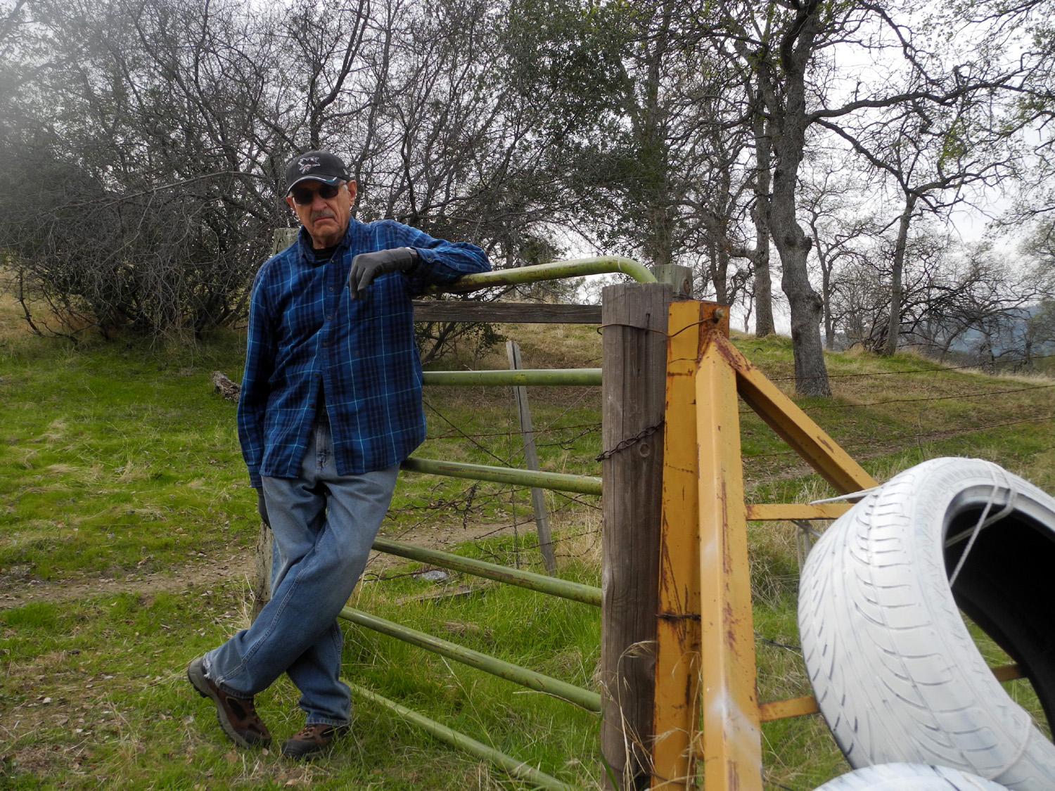
| The probable location of the vista point | A large burl on a blue oak | Dick on the rock |
 |
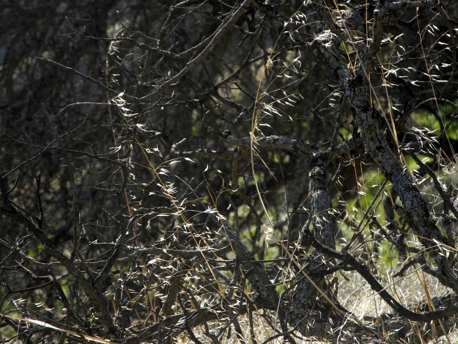 |
 |
| Steep terrain above the river | Last year's record rain produce a crop of tall wild oats | The reflection in the back window of my camper |
 |
||
| White bark of sycamore stands out against the green and brown background | ||
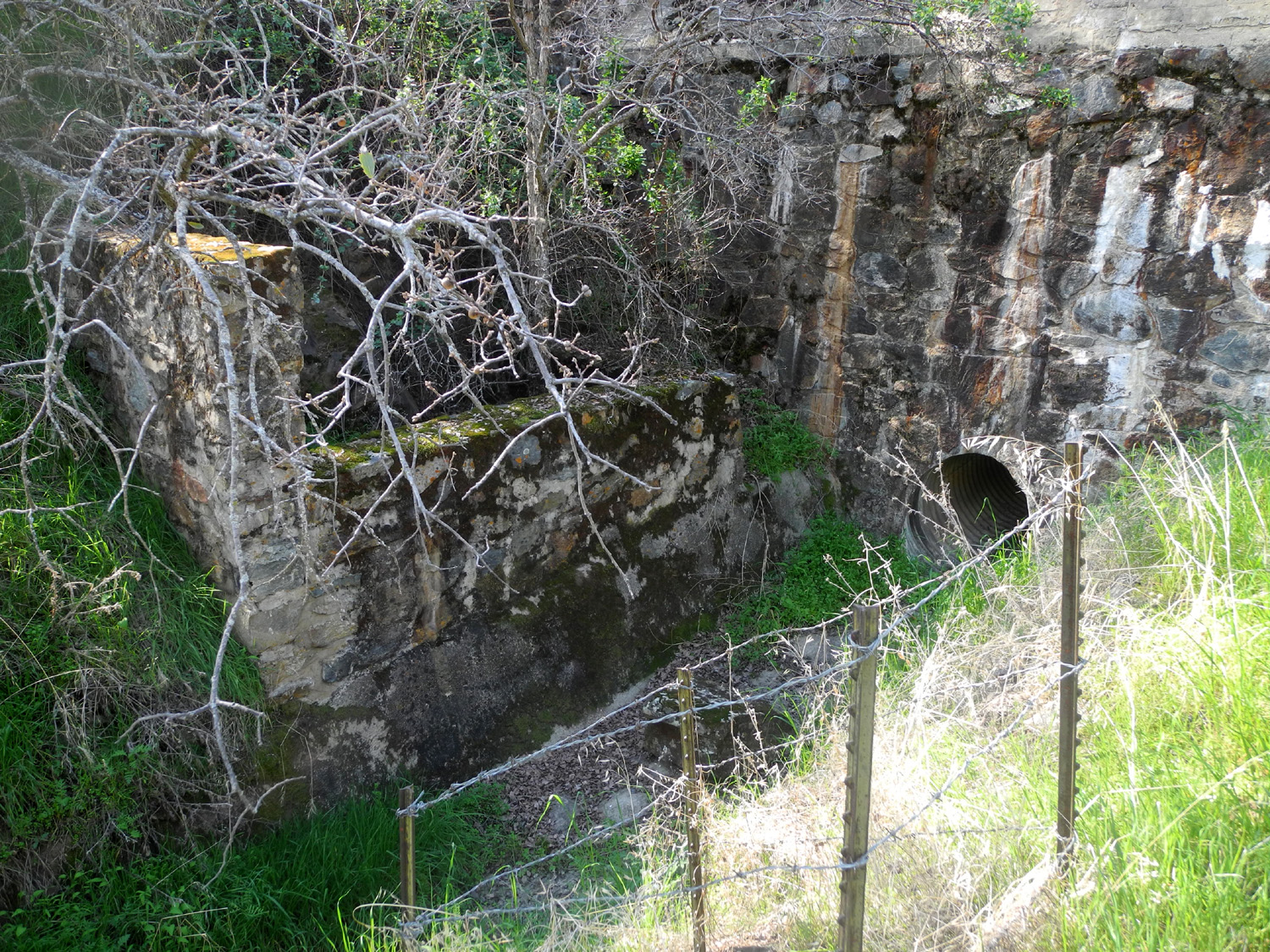
| Concrete Flats | ||
 |
 |
 |
| First fiddlenecks of the season | Dead brush and granite boulders | Logs across the Sycamore Fire Road |
 |
 |
 |
| Cows at the end of the trail | Poison oak leafing out | Sycamore Creek branch of Pine Flat Lake |
 |
 |
 |
| This barrier doesn't stop hikers | My camp by Big Creek | Another blue oak with a burl |
 |
 |
 |
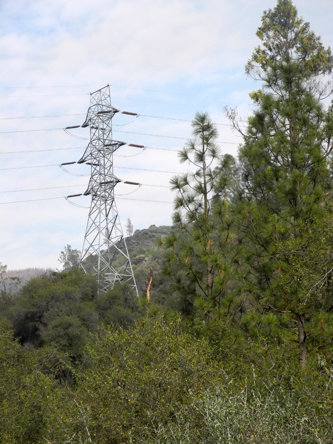
| The road to Montgomery Brothers homestead | Power transmission line from the Helms Creek Pumped Storage Project at Courtright Lake | Along Big Creek Road near the creek |
 |
 |
 |
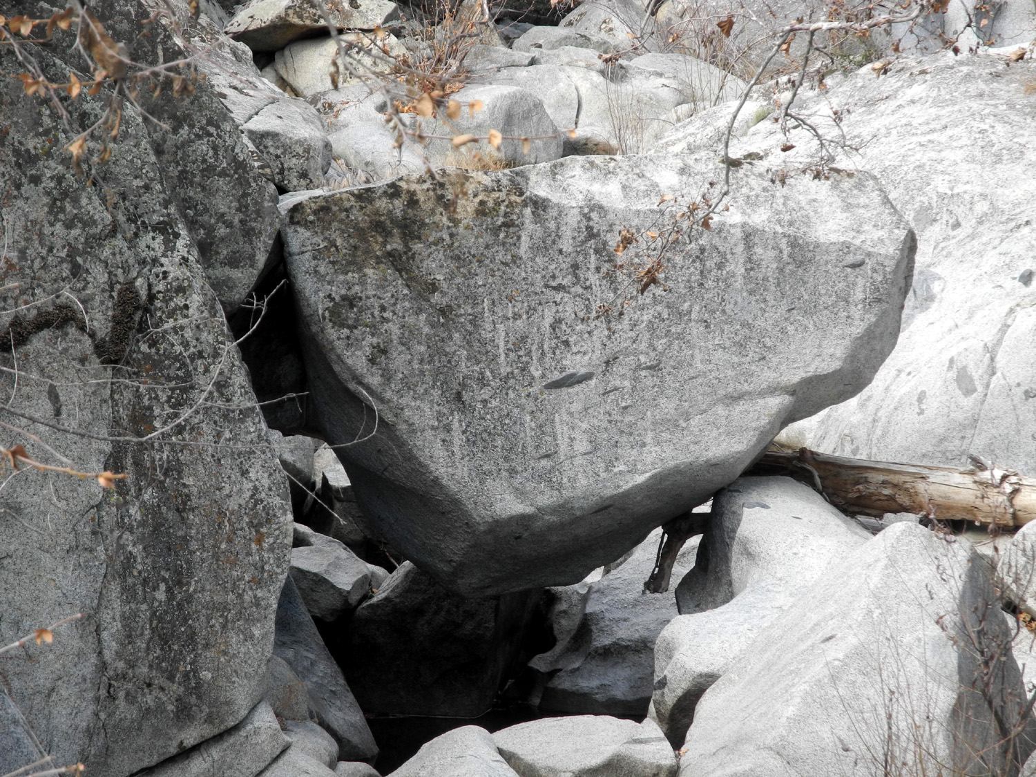
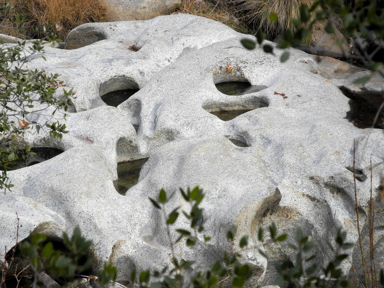
| Big hanging boulder in the creek | Potholes by the creek |
Dick stands near the edge of the cliff overlooking Big Creek |
 |
 |
 |
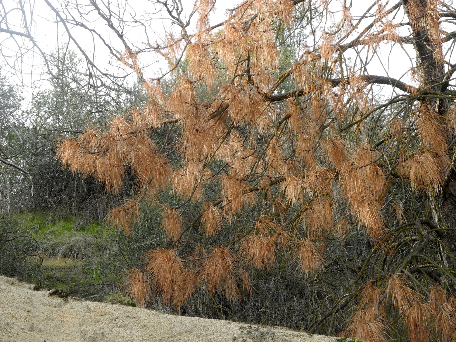
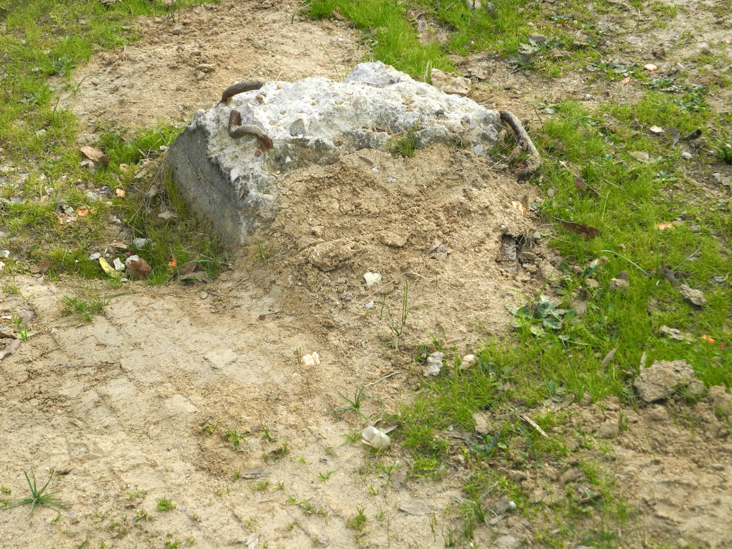
| Dead bull pine | These concrete piers at Concrete Flats were solid when we first saw them in 1984 | The rutted driveway to Concrete Flats |
 |
 |
 |
| One of the falls on Big Creek | Poppies are out along the roads | The second "waterworks" up Big Creek Road |
 |
 |
 |
| Culvert and a mystery structure below the basin | Rock lined channel below the basin | Fringed redmaids were out in small numbers |
| San Joaquin Gorge | ||
 |
|
 |
| Before our hike up the hill, Colton had to climb through the gate a few times | A favorite use of the hiking pole | Colton at the dry frog pond |
 |
 |
 |
| Colton, Teri and Dick | Anything that CAN be climbed WILL be climbed | Blue oaks and the picnic tables |
 |
 |
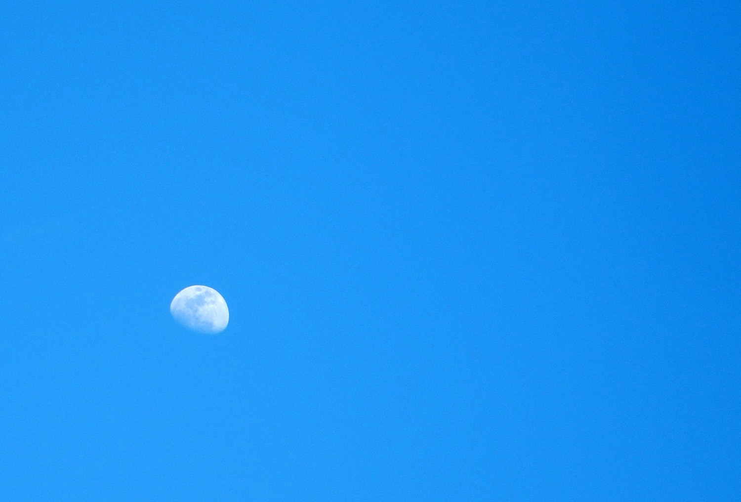
 |
| A nice moon | This is the only place Colton slows down | Of course, Dick never misses a chance to slow down (by Colton J. Upshaw) |
 |
 |
 |
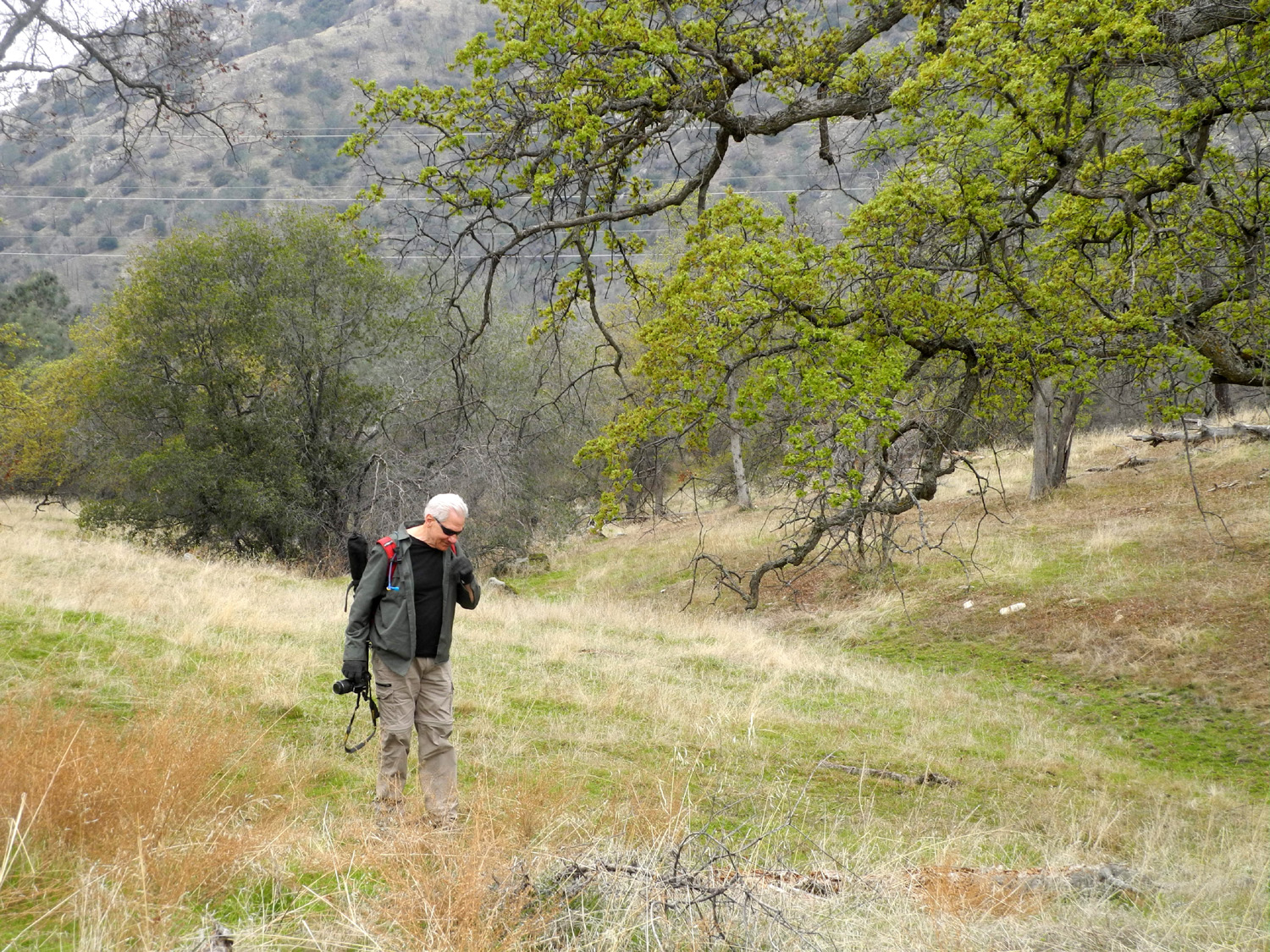
| Wes goes off-trail to get a good shot | Bright green buckeyes and the distant Sierra | Buck brush was in bloom everywhere |
 |
 |
 |
| Bracing to hold up the fence also holds up this fallen bull pine | Colton caught Dick peeking around the burl | He is literally hanging fallen branches back on the tree |
 |
 |
 |
| Colton takes a break to call Dad | Looking cute on the trail |
The sun trying unsuccessfully to break through the clouds |
|
|
 |
 |
| A winding section of the trail | We kept a close watch on the dark clouds | Colton by our daytime fire |
 |
 |
 |
| Counting the legs on a millipede | And taking its measure | We hoped for hundreds, but were happy with this shining specimen |
| Finegold Exploration | ||
 |
 |
 |
| Sign at the end of the road | It was a good day for hiking - over 20 cars | The trail down from the parking area |
 |
||
| The trail runs along the side of this ridge | ||
|
 |
 |
| Dead oak beside the trail | The part of the trail was once a road | The little cove |
 |
 |
 |
| Dick beside the trail | I was not sure I could get past this brushy barrier | But there was no need to duck here |
 |
|
 |
| Fiddlenecks were thick everywhere | A rugged old bull pine | The view looking up |
 |
||
| The Great Western Divide from Millerton Road south of Table Mountain Casino | ||
| Related Links | ||
| Hensley Lake | You Tube videos of dominoes falling | More Hensley Camping and Hiking |
| Kings River Special Management Area | Bear Wallow Camp | Pine Flat Lake |
| Big Creek Area Place Names | Camping at Concrete Flats in 1984 | Johnny's first campout |
| San Joaquin River Trail | San Joaquin River Gorge Special Recreation Management Area | All my reports on hiking and camping at San Joaquin Gorge (Squaw Leap) |
| Millerton Lake | Fiddleneck Flowers | Sky Harbor Hiking |