|
Dick & Mikie's Lake Almanor Trip |
||||
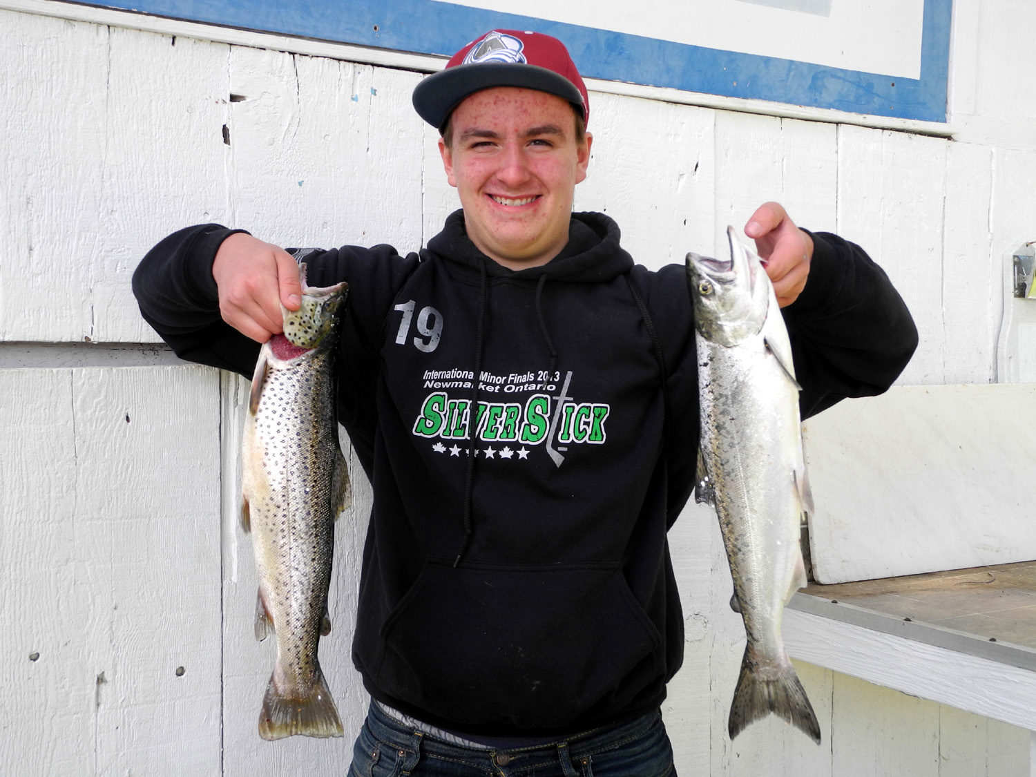
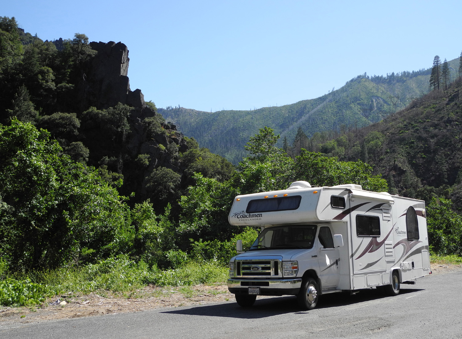
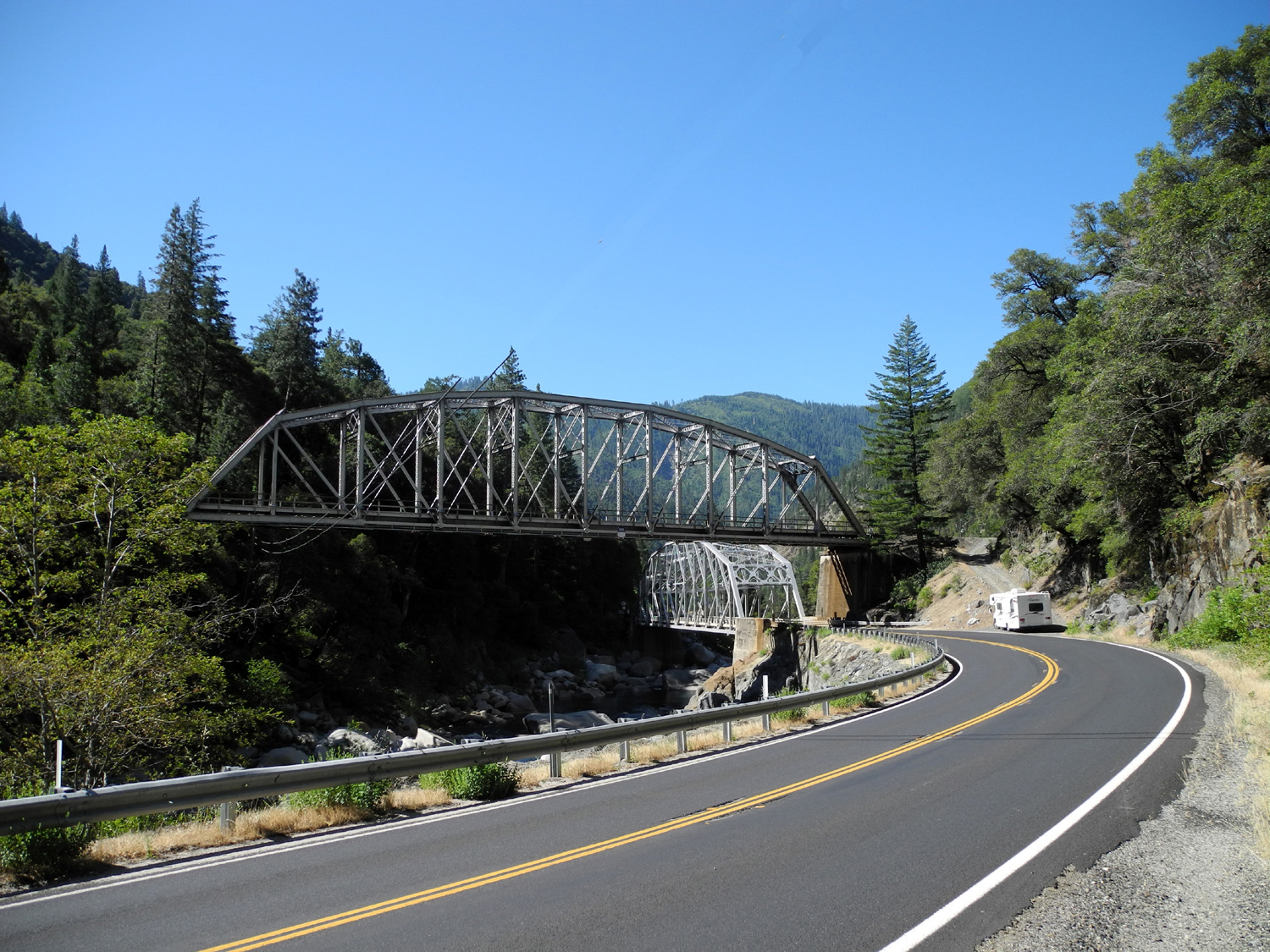
In 2010 my son-in-law Tim, grandson Mikie, and I took a trip to Lake Almanor and Lassen National Park, during which they had a great time and good luck going out with a fishing guide at the lake. When I started discussing a summer trip with Mikie this year he said he would like to return to Lake Almanor, and also stay the first night at Caribou Crossroads, a small resort on the Feather River, where he and his dad caught and released at least a dozen fish. I tried to get reservations at the same RV park at Almanor, but it was full for the summer. Since they had recommended the guide last time, I asked if they had his number. I was then able to schedule a trip with Duncan McIntyre and get reservations at another RV park right across the street. So on Monday, June 17, Mikie and I left my place in Clovis about 9 a.m. and headed up Highway 99. A few miles north of Sacramento we took State Highway 70, which goes through Marysville and Oroville, then heads east into the mountains through the Feather River Canyon. It took a while to get through Marysville, which has 24-hour road construction all over town. The highway route detoured away from the normal alignment, with many stoplights and flagmen and flagwomen controlling traffic in several places. However, we made it through town and continued on to Oroville, where the highway turns east into the mountains. In this area, Oroville Dam on the Feather River creates Lake Oroville, and we stopped at a turnout overlooking the lake to fix lunch in the motor home. The Father River route is very scenic, with views of the river both high up on the canyon side and down close to the water, and many highway and railroad bridges that date back to the 1930s. In one place there is a dramatic pair of bridges where the highway crosses the river from south to north, while the railroad crosses the opposite way on a bridge that is almost right above the highway bridge. In 2010 we were trying to figure out where we could stop for the first night when we came upon the Caribou Crossroads Resort, so this time we planned that for our first stop. We arrived about 4:30, and got registered, and Mikie immediately headed for the river. The North Fork of the river comes in from the north here, while the East Branch flows in from the east and parallels the highway. The two streams are nearly equal in size, so the river's size is doubled below the junction. There's a path from the RV park down under a highway bridge to the point between the two streams, and this proved to be as good a fishing spot as it was last time. Mikie caught and released six, including one trout, one carp and four small mouth bass. The trout came out of the swifter-flowing North Fork. It was fortunate that we did not plan to visit this area in 2012. The huge CHIPS fire burned over 75,000 acres in the area in 34 days, and much of the canyon was evacuated for most of August. There are plenty of scars from the fire visible, including some just a few hundred yards upstream and up the mountain from the resort. Although we got up fairly early Monday, on Tuesday Mikie reverted to his normal teenage summer schedule, sleeping past 11 a.m. After a quick breakfast he did some more fishing, catching another four bass, then we packed up and continued up Highway 70. After 20 miles or so, our route took us north on State Highway 89, following Indian Creek. A short distance on this road brought us to Indian Valley and the town of Greenville, where the terrain opens out into a wide, level valley after many miles of canyon travel. Turning east on State 147, we soon had our first view of Lake Almanor, with snow-covered Mt. Lassen beyond. From here we followed 147 and a series of local roads to Peninsula Drive, which brought us to the Paul Bunyan Resort. After registering and locating our campsite, we got set up, then walked down the hill, across Peninsula Drive, and into Big Cove Resort, where we would meet the fishing guide the next day. We went into the office/store to get some items, and asked the lady on duty if she knew which dock Duncan McIntyre used. "He's got his boat at Dock C - but look, that's him driving up right now." He came in the store and we said hello and made final plans to meet him at 5:30. I explained that I am not a fisherman and it would be just Mikie going out. This seemed to surprise him since he said he thought there were three or four of us. Possibly this was because when I first called him I had mentioned the three of us being there last time. The rest of the day we hung around our campsite, reading, watching TV and just loafing. Not long after we came inside for the evening, we heard what sounded like rain, although the forecast showed 0% chance. It did indeed rain for a short time. Later, as we were going to bed, there was a single flash of lightning, a clap of thunder, and more rain. It rained fairly steady for and hour or so, then off and on till around 2 a.m. When we got up at 5 in the morning the clouds were breaking up, and it was 42 degrees, just as predicted. I fixed Mikie a sandwich and walked down to the dock with him where we found Duncan getting the boat ready. In less than five minutes they were headed across the lake, so I took a short walk around the main roads, then returned to the motor home for more sleep. After getting up for the second time I took a shower, then sat outside and read while I enjoyed a bloody Mary. About 10:30 I was ready for breakfast. I had buttered my toast and was just ready to pour milk on my cereal when Mikie called to say they were back, so I went down to take photos of the fish and pay the guide. Mikie caught four salmon and a brown trout. The smallest was about 12 inches, while the biggest salmon and the trout were about 18 inches. The guide service included filleting the fish, so we were soon on our way back to the motor home with a heavy bag of fish, which spent the rest of the trip sleeping in the freezer. We spent the afternoon enjoying my retirement and Mikie's summer vacation by reading, loafing and watching TV. We had planned to eat out for our main meal, but the resort offers only a "fast food" style burger stand. In 2010 we had eaten at a restaurant a few hundred feet away, but I wanted to try something different. When we first drove in, I had noticed the Red Onion Grill a little over a half mile away, so we decided that the walk would build up our appetite, and the return walk would settle our dinner. This proved to be a typical country cafe, with a decent menu, although not everything was available. My first choice, a three-sausage plate, is no longer served although it remains on the menu. They were out of my second choice, so I joined Mikie in ordering a burger, which proved to be a good call - it was equal to or better than the best burgers found at places like Red Robin or Denny's. For some reason, by the time we made our return walk, they had made the road longer and steeper, but I survived, stopping to rest at the outdoor tables in front of the Paul Bunyan cafe. Mikie, with the endless energy of youth, found a basketball next to a net and shot baskets for awhile before we continued up the hill to the motor home for our evening TV viewing. I often try to introduce my kids and grandkids to movies or TV shows they are not familiar with, and my choice for this trip was Titus. Mikie found it hilarious, and we watched all of season 1, a total of nine episodes. (More about the show here and here.) While
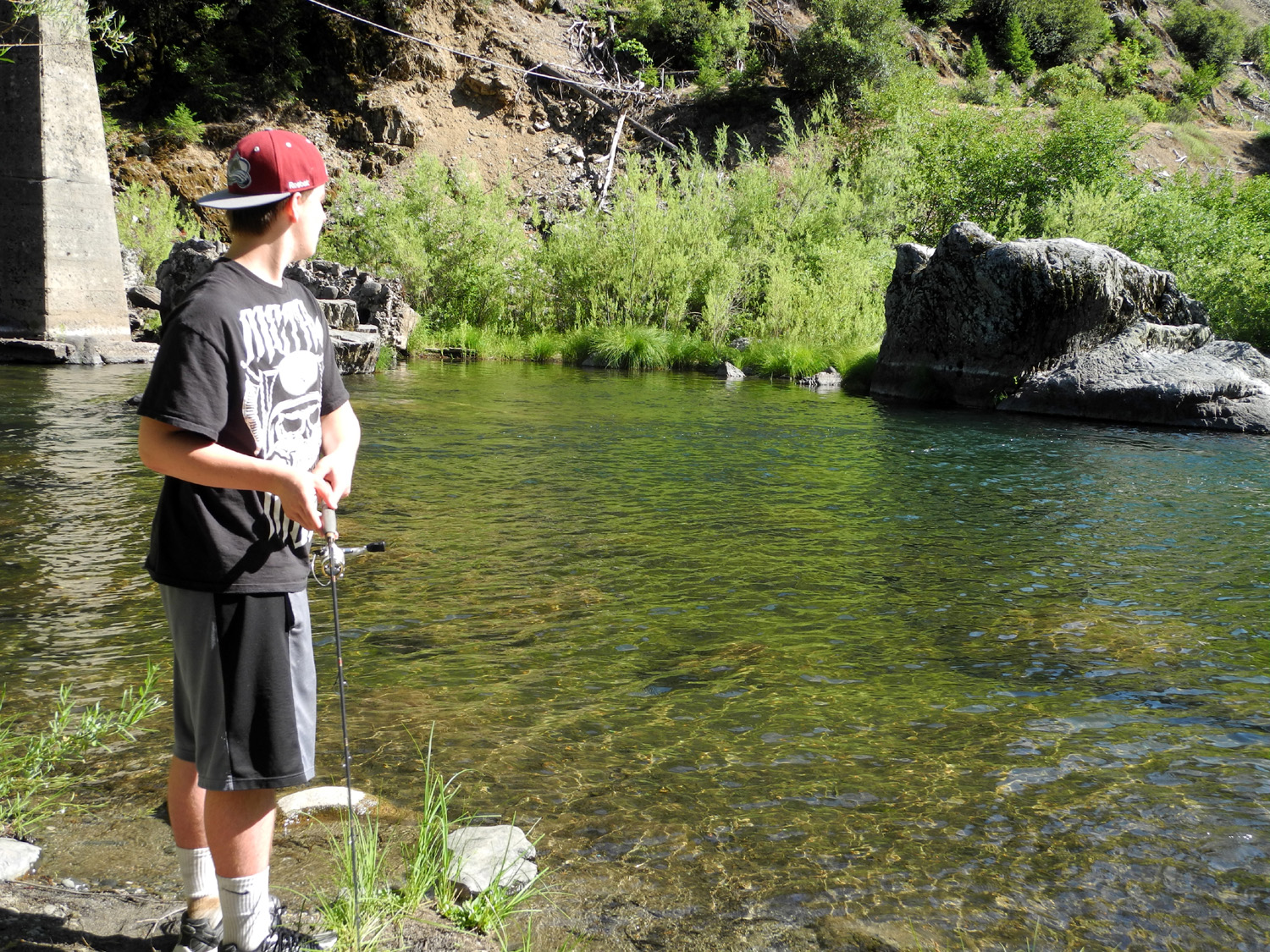
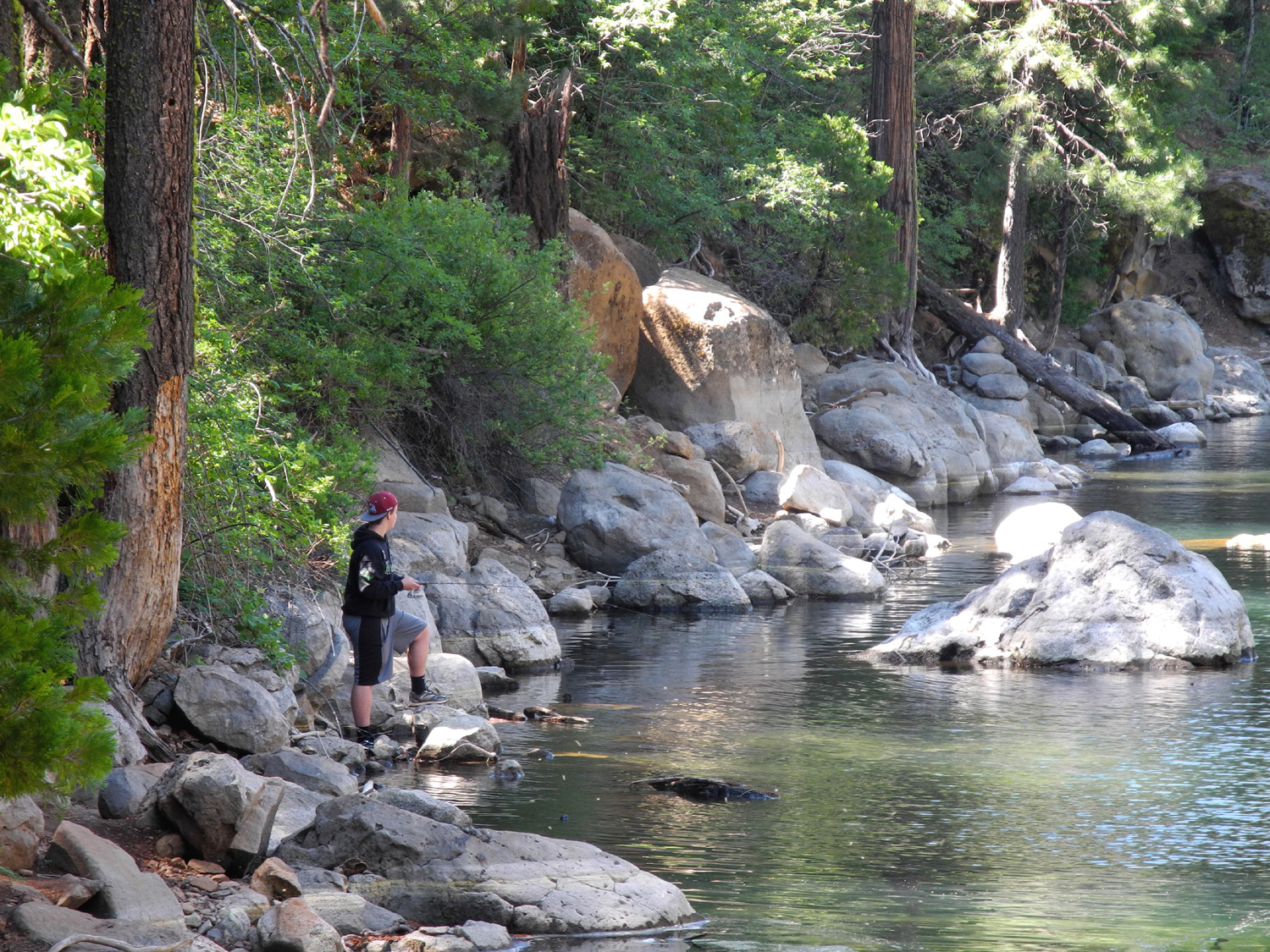
we were finishing up business with Duncan, Mikie asked him about fishing
from the shore of the lake, and he suggested stopping at Hamilton
Branch, which runs into the lake from the north. County road
A-13 crosses the stream just before dead ending at Highway 147.
There is a large parking area with restrooms, and a short, steep
trail down to the
water. Mikie fished here for about an hour and a
half, but got only one or two bites. I accomplished much more,
reading several chapters of my current book, Ken Follett's We had considered various routes back home, with two days to do stuff and travel. Since we got a lazy, late start on Thursday, we decided to head back down the Feather River from the Hamilton Branch stop, and spend our final night back at Caribou Crossroads again. During the drive down the canyon I made a few stops to take pictures. There were several places where the road was several hundred feet above the river, with a steep drop-off just past the edge of the pavement. Unfortunately, there were no good places to stop and take pictures in these areas. Another missed opportunity, again with no place to pull off, was a limestone formation by Indian Creek that had stalactites hanging down from an overhanging cliff. We arrived back at Caribou Crossroads fairly early, about 2:30 in the afternoon. There is a road that goes up the river canyon away from the highway, to the village of Caribou and a small lake. There are several campgrounds along the way, the first one just a quarter mile above the RV resort. Mikie and I walked up the road and checked out the campground, then he went back down to his favorite fishing spot while I explored the area and took some photos. The fishing was not as good this time, as Mikie caught only two small bass, both of which went back into the water to grow some more. We then finished up the day in the usual way, with dinner, reading, and TV. The next day we got our normal mid-morning start, and pointed the motor home west for the 50 mile drive back to the valley. I wanted to avoid Marysville with all the construction, so we took Highway 162 west from State 70 to State 99, passing through the towns of Gridley, Live Oak, and Yuba City, then into Sacramento. The last few miles, Highway 99 is contiguous with Interstate 5. The traffic was so heavy in Sacramento that I could not get over for the Highway 99 ramp off of I-5, but it's just a short drive across State 4 from I-5 to 99 in Stockton. We made our final stop at an In & Out Burger on March Road in Stockton, where you get great service no matter how busy they are (and they were VERY busy). The rest of our trip was uneventful except for a stressful ten miles from Stockton to Manteca, where there is major road work, and there are narrow lanes bounded by concrete barriers that always look like they will scrape the motor home. We got to Mikie's house about 5 p.m., delivered him and the fish, then I went on home, unloaded the vehicle, and began to ease back into my normal lazy life. --Dick Estel, June 2013
|
||||
|
Photos (Click to enlarge; pictures open in new window) |
||||
|
|
||||
|
|
 |
 |
||
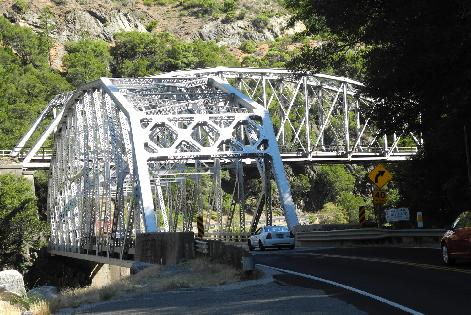
| Highway 70 crisscrosses the Feather River many times |
Most of the bridges are from the late 1930s | Detail of bridge railing | ||
 |
 |
 |
||
| Parked near the bridge; rock formation and burn scar in background |
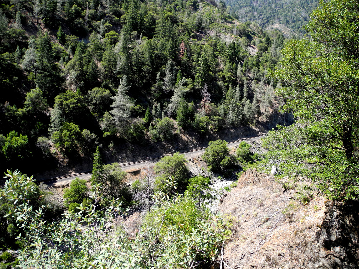
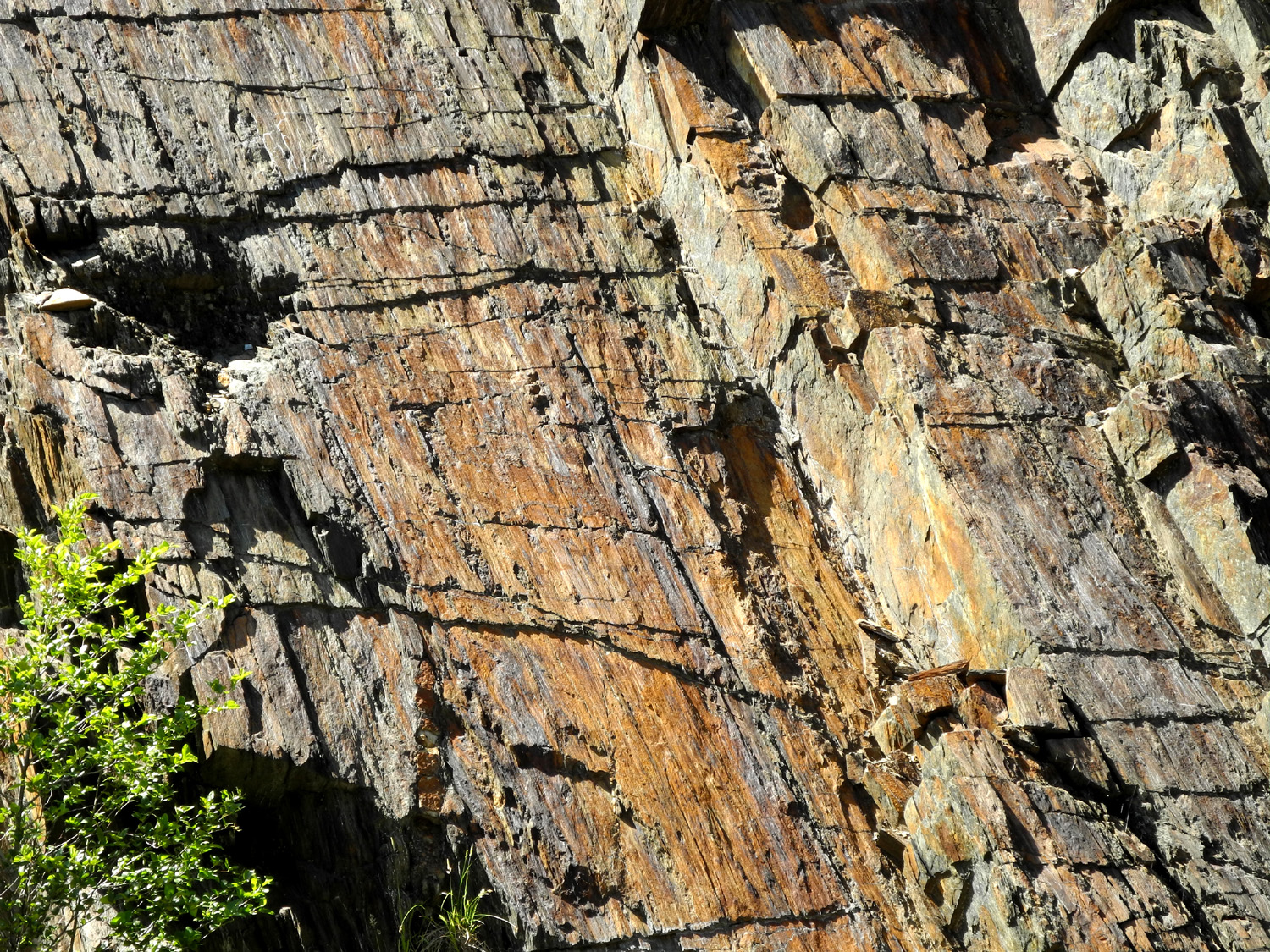
Railroad grade down by the river | Ancient and colorful rock cliff | ||
 |
 |
 |
||
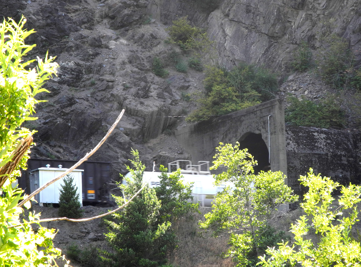
| A train emerges from one of several tunnels along the route |
|
|||
 |
|
 |
||
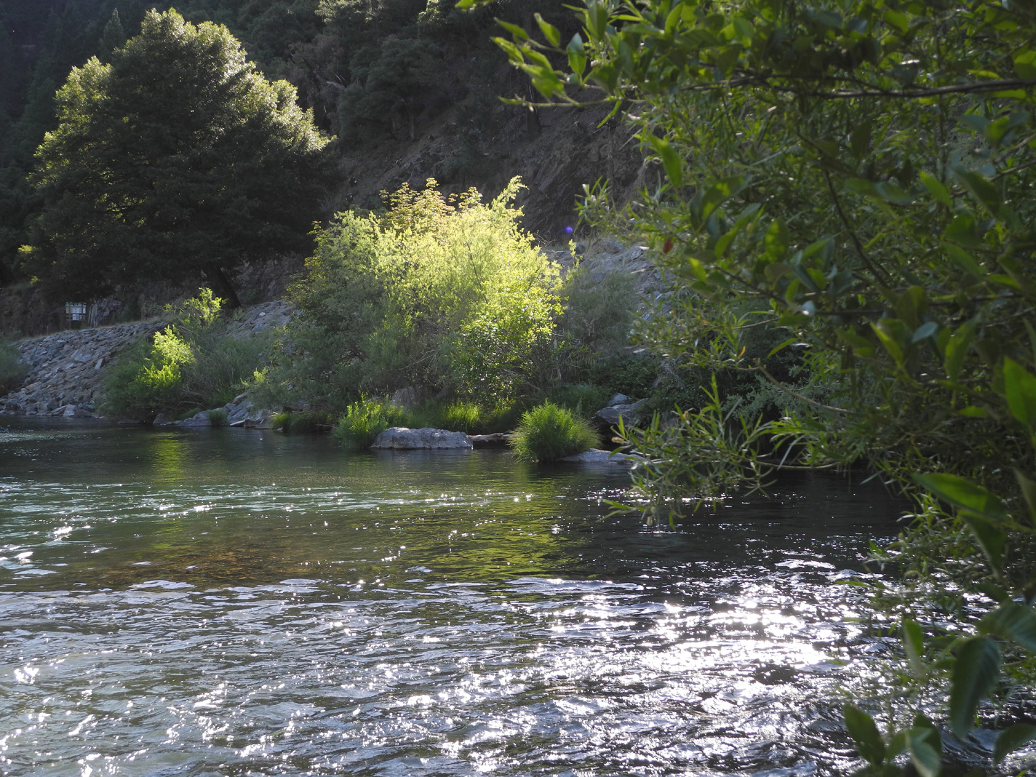
| Rock work under Howell Bridge at Caribou Crossroads |
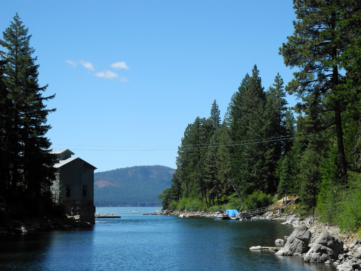
Mikie fishing in the Feather River | Looking downstream from Caribou Crossroads |
||
 |
 |
|
||
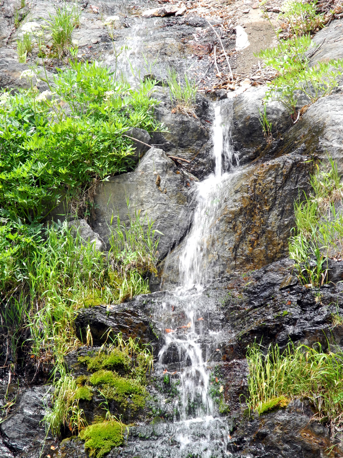
| A spring waterfall along Highway 70, high above the Feather River |
|
|
||
 |
 |
 |
||
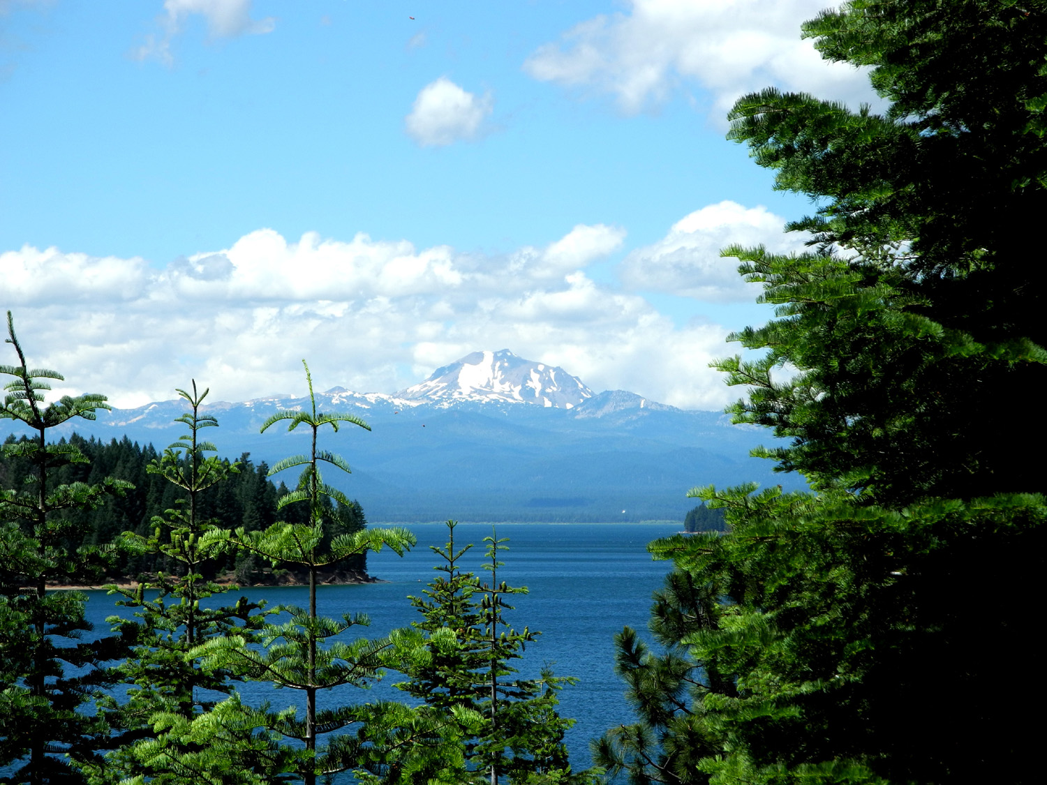
| Mikie got the limit | Fishing in Hamilton Branch | Looking south on Hamilton Branch to Lake Almanor |
||
| Related Links | ||||
| Plumas County Map | Lake Almanor | Caribou Crossroads | ||
| Duncan McIntyre Fishing Guide | Paul Bunyan Resort | Feather River Canyon | ||
| Plumas County | US Highway 99 | State HIghway 70 | ||
| Highway 70 Photos | Marysville | Oroville | ||
| Lake Almanor & Lassen in 2010 | Lake Almanor in 2017 | |||
