


|
Rambler Hikes 2025 Page 1 |
|
|
Rambler Hikes 2017 Rambler Hikes 2018 Rambler Hikes 2019 Rambler Hikes 2020 Rambler Hikes 2021 Rambler Hikes 2022 Rambler Hikes 2023 Rambler Hikes 2024 2025 Page 2 2025 Page 3 |
|
|
Kaweah Oaks Preserve Blue Oak Trail Edison Point Sycamore Wildlife Area San Joaquin Gorge |
|
|
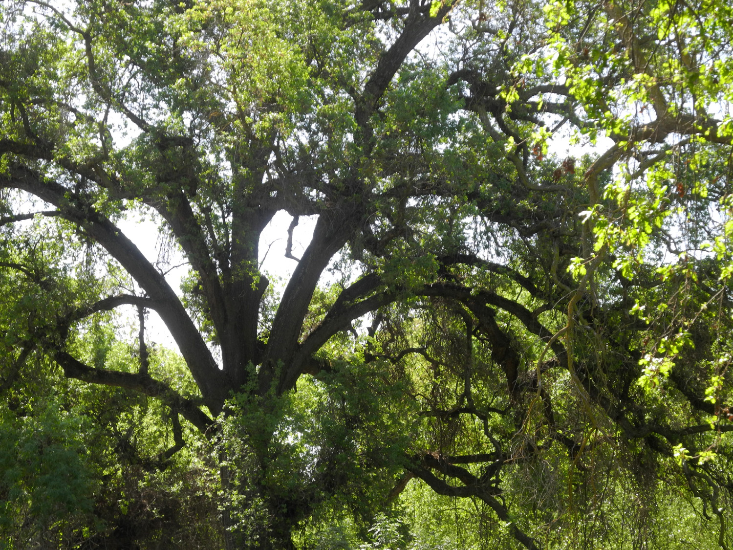
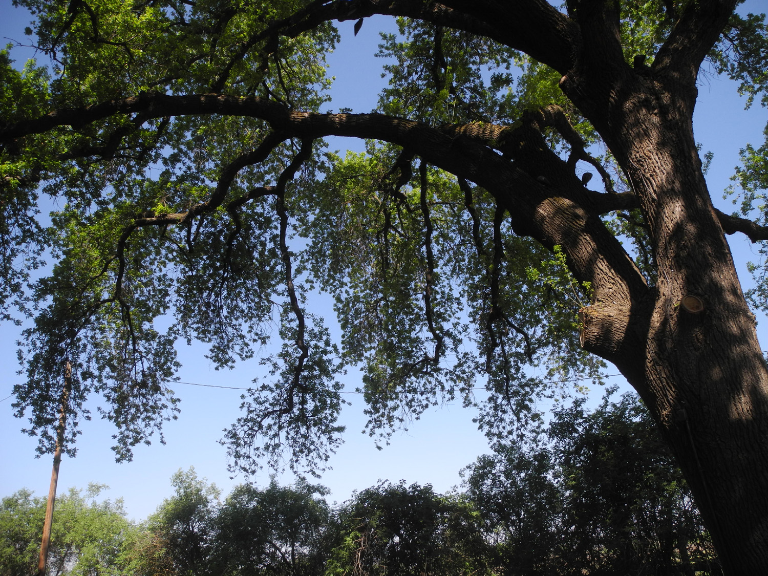
Kaweah Oaks Preserve When our member from Visalia, Allen Ward, hikes with us, he has to drive about 45 miles just to reach our home starting point. So once every year or two we take pity on him and hike in one of the public tracts east of his city. Arriving in several cars from various starting points, an even dozen Ramblers met at the parking lot for the Kaweah Oaks Preserve on January 30. The group included two new hikers, Bruce Nieman, who I know through the computer club we both belong to, and Beth Sohm, wife of one of our regulars, Keith. Laurie, Susan S, and Dave had not hiked with us since May. Others included Wes, Allen, Don B., Bruce & Susan V., and yours truly, Dick, he who foists these reports on an unsuspecting world. The preserve is an area of land much like large parts of the great Central Valley were before the arrival of European and American settlers - a land of rivers, swamps, and endless groves of huge valley oaks. It's just off State Highway 198, about eight miles east of Visalia. We had hiked here once before, in April, 2021. |
|
 |
 |
| The trail is mostly flat and wide | Early winter rains have brought up the new grass |
|
The weather was nice - cool but not cold, and the scenery was as expected, winding trails through tall green grass, thick bushes, big oaks and other trees. The various waterways through the properly were dry, not surprising in a year when we have had well below normal rainfall. There were just a few other hikers, mostly couples or very small groups. Of course, our dozen were scattered along the trail and all together only at the beginning and end of our walk. Adding to the dispersion is the fact that the area is criss-crossed by a half-dozen trails that divide and rejoin at different locations, allowing a variety of walking options. |
|
 |
 |
| Ramblers beneath a huge valley oak | Dare you enter this mysterious tunnel? |
|
|
|
|
After we finished our hike we drove into downtown Visalia to have lunch at the Black Bear Diner, a favorite with many of our group. There is one in Fresno, but it's not in a convenient location for most of us, so we were glad to be able to take advantage of this one, just a quarter mile off our route back home. |
|
 |
 |
| Wes points the way | Ramblers at lunch in the Black Bear Diner |
|
The new people (Beth and Bruce N) both plan to hike with us again, and while I was preparing this report, Sue Wirt told me of a friend of hers who wants to join us. Can a group of 20 be next? Stay tuned! --Dick Estel, February 2025 |
|
| Blue
Oak Trail at Lake Millerton
Once again we chose a winter hike location that was familiar to the Ramblers Hiking Group, the Blue Oak Trail at Millerton Lake, northeast of Fresno on the San Joaquin River. However, it was the first visit for about half the group of 16 that gathered under mostly sunny skies on February 18. These were Keith and Beth Sohm, Ana Lindsay, Dick Estel, Jackie Taggart, Ardyss Webster, Allen Ward, Wes Thiessen, Don Bandoni, Bruce Nieman, Bruce & Susan Vasquez, Susan Silveira, Laurie Fitzgerald, and Dave and Megan Smith (father-daughter). Ana was new to the group; her son is married to Keith & Beth's daughter. |
|
 |
 |
| All the girls: Megan, Laurie, Ana, Susan S, Beth, Ardyss, Jackie, Susan V | And
the boys: Wes, Dick, Bruce V, Don, Allen, Keith, Dave (Bruce N had to leave early) |
|
This location is a state park, with a drive of a mile or so from Millerton Road on a narrow winding road to the trailhead. The state park entry fee is $10 or $9 for seniors. HOWEVER: You can go to any Fresno County Library branch and check out a placard that allows free entry, which several of us did. The placards must be returned within three weeks, just like a book. The trail itself runs along the lake, not far above the high water mark. The terrain is essentially blue oak savannah, with open grassy areas dotted with oaks and a few shrubs. The grass was thick and green, and we saw a number of wildflowers. Fiddlenecks and popcorn flowers were dominant, with a few shooting stars, filaree, lupines, and blue dicks. The lake is constantly in sight, and in many places there are nice views of the distant snow-covered Sierra Nevada Mountains. |
|
 |
 |
| Millerton and the wave-sculpted sandy shore | Shooting stars next to the trail |
 |
 |
| Popcorn flowers and fiddlenecks | Snow-covered Sierra beyond the lake |
|
As would be expected with such a large group, we separated into different clusters, and some hiked farther than others. I arrived late with six fellow hikers, and the others had already started their hike, thinking about going all the way to Winchell Cove, another trailhead with a marina where you can park and begin the hike heading "downstream." About ten members of the group went to within 200 yards of the marina, a round trip of about four miles. I was hiking with Jackie, Ardyss and Allen. Allen went on farther while the the other three of us started back when we reached "half of far enough," which gave us a total mileage of 1.56. Just a hundred yards or so from the start of the trail are some benches that overlook the lake. We sat there for a while as various members of our group reappeared. We saw Wes, Bruce and Susan walking right at the edge of the water (the lake was at 55% of capacity). |
|
 |
 |
| The resting benches are just below the bottom of this picture | Bruce and Susan make their way back up from the lake's edge |
|
We soon all came together, and proceeded to the nearby Table Mountain Casino, where we enjoyed a delicious lunch in the Blue Oak Grill. As far as I know, we all resisted the lure of the slot machines and gaming tables, and returned home with just a small hit to our wallets for the lunch, and richer in experience and enjoyment from out pre-spring outing. --Dick Estel, February 2025 |
|
| Edison
Point
Edison Point, by Pine Flat Reservoir, is another familiar destination for the Ramblers. Its big draw is the profusion of wildflowers that can be seen in the spring, particularly lupines and poppies, and we enjoyed plenty of these flowers on a warm sunny day there on March 26. Since I was not fully cleared to hike after recent skin cancer surgery, I had not planned to go on this outing. However, Wes told me he was going to pick me up and take me along, so I could sit at the parking lot, enjoying the view of the lake and surrounding hills, while also reading on my phone. I found myself looking forward to the event, and I am thankful to Wes for encouraging me to go. |
|
 |
 |
| Poppies were the number one flower | Lupines came in at number two |
|
We had a total of nine Ramblers, two of them new to the group. These were Vickie Klassen and Charlotte Tilkes. Dick knew Charlotte through the county retirement association, and Vickie was also a county employee, though none of us had met her before. The others were Keith, Beth, Dick, Wes, Allen, Susan S., and Laurie.. Both the newbies enjoyed the hike and the company and promised to join us again. |
|
 |
 |
| Back: Wes, Charlotte, Allen, Keith, Dick; Front: Laurie, Susan, Beth, Vickie | The two newest Ramblers, Charlotte and Vickie |
|
This is one of those trails where you can hike a little or a lot. It's a loop trail, somewhere between two miles and four, depending on which website you read. There are a lot of very steep sections, long switchbacks, and places where it's hard to find the trail. If you don't care for this much of a challenge, you can walk the first half mile where the trail is a dirt road that provides access to the electrical transmission tower at the point, then return the same way. Eight hikers set off from the trailhead. At the point, three of them took a look at the steep trail down to the lake and turned back. The other five braved the difficulties of the loop, completing it with varying degrees of comfort. At least two of them will not be trying this part of the trail again. Neither will I, but I am glad I made it all the way at least three times back in my :"younger" days. |
|
 |
|
| The easy part of the trail - Laurie, Beth, Vickie, Allen | Where the trail gets steep |
|
I did not sit idly while I awaited the return of my fellow Ramblers. The first part of the lower trail (the end of the loop) is level for a fairly good distance before it makes its first switchback and starts down. I walked out the level section and back twice, observing five different species of flowers. I also walked up the side of the road, also level, as long a there was a path well off the pavement. These walks added up to a huge total of .56 miles. Coming back from this last excursion I saw Laurie, Susan and Beth coming down the steep beginning of the upper trail. They joined me in watching a few boats drifting on the lake. |
|
 |
 |
| Pine Flat Lake from the trailhead | California's state flower |
|
Keith was the first loop hiker to return, and demonstrated how much effort had been involved by immediately eating some of his lunch. The others soon followed and shared stories of the challenges they had faced on this trail that is subject to erosion and fallen trees. There were places where the trail was hard to find, and the alternative paths they had to take were not ideal. Nevertheless, everyone had a good time, and were all ready to enjoy what they had brought for lunch. We drove in our three-vehicle caravan to the Trimmer Springs Campground a few miles farther up the road to eat. Although this is for camping only, not day use, we took our chances, and were not bothered by rangers or people with reservations, something we had experienced in the past. |
|
 |
 |
| Poppies, and the trail where it comes closest to the lake | Lunch at Trimmer Springs Campground |
|
As we drove back toward home, we were halted in our tracks by carpets of poppies next to a small tributary creek. We had to make one final stop for photos and a final session of "oohs" and "aahs" as we reveled in the good fortune that has allowed us to live within a short drive of such amazing natural beauty. |
|
 |
 |
| A carpet of poppies beside the road... | ...and up on the hillside |
|
A few statistics: The lake holds a million acre feet, and is at 65% of capacity. An acre foot is a bit under 326,000 gallons, the amount needed to cover one acre of land a foot deep. Historically it has been said to be enough to serve the needs of two families for a year. The inflow at Pine Flat is currently 3,051 cubic feet per second, with an outflow of 238 CFS, meaning storage is being built up for the future growing season and other purposes. Current storage is 125% of average for the date, indicating a wetter than usual year. --Dick Estel, March 2025 |
|
| Sycamore
Wildlife Area (Photos by Wes Thiessen and Dick Estel) The profusion of foothill wildflowers, green grass and trees newly leafed out has inspired the Ramblers to try to schedule two hikes per month in the spring. It rarely works out 100% and 2025 was no exception. The weather was either too dry or two wet to do a second hike in February or March. The latter month brought big rain and snow storms to central California. However, we finally planned two outings for April. The first took place on the 10th, and the second is only hours away as this is being written (and took place as planned on the 22nd). On that early date eight Ramblers made the 45-mile drive up along Pine Flat Reservoir to the Sycamore Wildlife Area, at least our seventh visit there. This Sierra National Forest property consists of two old campgrounds and a picnic area that have been closed for decades. The asphalt pavement of the camp roads and parking spurs is still there, making for easy walking, although it has deteriorated quite a bit. You may have to walk around fallen branches, and of course, be careful not to step on the flowers growing up through the cracks. |
|
 |
 |
| Dick, Charlotte, Pat and Jackie navigate the old pavement | Don and Pat |
|
We usually walk in two of the three areas there, and this time we started with the first one, where there is a large sign identifying the Sycamore Wildlife Area. All three areas are closed off with a locked gate, but there is space to get past it and walk in. We were looking for wildflowers and were not disappointed, seeing fiddlenecks, lupines, baby blue eyes, phecelia, filaree, poppies, fiesta flowers, and a few we could not identify. |
|
 |
 |
| Fiesta Flowers | Phecelia up close |
|
We moved on to the old picnic ground, where the big attraction is the possibility of seeing eagles. We have seen them here three or four times, and until recently there was a nest in a bull pine tree about 200 yards below the old road, where we have seen eagle chicks. On this date the nest was gone and no eagles were observed, but we still enjoyed a great walk to the end of the road and then on a faint trail that leads out another quarter mile or so. This area is a ridge between the main lake and the Sycamore Creek branch, so there is water on two sides, and three where the ridge drops down to the lake surface. |
|
 |
 |
| When the road ends, follow this path for more foothill beauty | Laurie, Charlotte and Don |
|
When we finish a hike we are naturally more than ready for lunch, usually going to a nearby restaurant. Since there are no conveniently located eating places in this area, we bring our own lunches, and drive up the road another two miles or so to where Big Creek runs into the lake. A few hundred yards up the dirt road that parallels this creek there is a flat, open area where we set up our lawn chairs and enjoy the sound of the creek and the beautiful surroundings along with our meal. Our hiking contingent consisted of Ardyss, Jackie, Laurie, Wes, Don B, Dick, Charlotte, and Pat Tilkes, Pat was a first-timer as well as Charlotte's husband. |
|
 |
 |
| Charlotte and Pat, living the good life | Ardyss, Charlotte, Pat, Jackie, Laurie, Wes, Don, Dick |
|
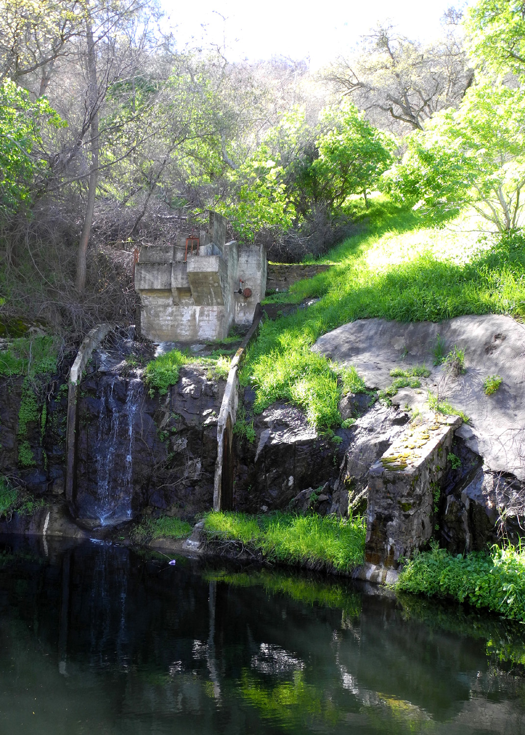
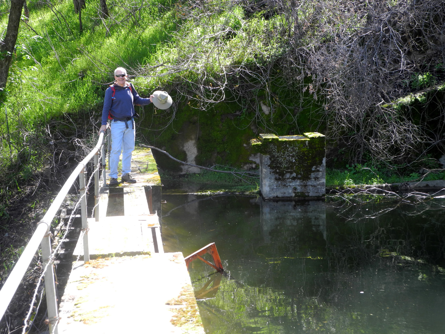
Up the hill in a drainage across from our lunch spot is a series of rock and concrete structures including water gates, valves and a weir across the stream. Worn concrete steps lead up the hill to the height of the weir, and you can walk across from the top to the little dam. I've been up there many times, so I don't have to go anymore. A number of Ramblers have ventured up the steep stairs with Wes in the past, but there were no takers this day, so he made a solo climb. All too soon it was time to head for home, but along the road we were treated to brilliant orange carpets of poppies, with lupines just above water level by the lake. |
|
 |
 |
| Wes carefully makes his way down the old stairway | It was peak season for poppies |
|
If you're not familiar with the Ramblers history, we started in 2014 with four colleagues who had worked at Fresno County Department of Social Services, only two of whom are still active. Over the years we have added other former colleagues, people some of us knew from high school or elementary school, people from a computer club I belong to, and miscellaneous friends from other sources. We now number about 24 more or less regular hikers, along with a few who joined us once or twice but did not stay with it. We always welcome anyone who can hike at least a mile and enjoys getting out into the abundant beauty of the central California foothills and Sierra Nevada mountains. --Dick Estel, April 2025 |
|
| San
Joaquin Gorge
Not since May, 2024 have we had such a small group for our hike as we did on Earth Day, April 22 - just three Ramblers, Charlotte, Allen and Dick. It appears that Bruce made it to somewhere at the San Joaquin Gorge, but not at the parking lot where the trails start, so we did not connect with him. I hope he walked by himself; I have done so many times. Our choice of the various trails in the property was the Bridge Trail, which goes down to the San Joaquin River where a foot bridge crosses over from Fresno County to the Madera County side. It's slightly steep in a few short sections, but goes up and down and levels off now and then, so it's not relentlessly difficult. Our goal in spring is to stroll among the many wildflowers that grace the Sierra Nevada foothills, and in this we were not disappointed. It was the time for the late blooming species to show off. The two most common varieties along the trail were common madea and mustang clover. |
|
 |
 |
| Common madea | Mustang clover |
|
The madea is a large, bright yellow flower that was also thick along the road in spots. The other flower is not a true clover, but is a very attractive blossom, with pure white petals having a yellow center. Some blossoms display a pinkish tinge close to the center. It can be seen in large numbers along the Bridge Trail, and in fairly thick patches along the upper San Joaquin River Trail. Fiesta flowers, which grow as a tangled vine in drainages were also in evidence, along with purple vetch, which was thick in many places along the trail. We also saw a few scattered examples of the earliest flowers, which always seem to hang around as if to remind us that they were once king, most notably popcorn flowers, fiddleneck and baby blue eyes. |
|
 |
 |
| Fiesta flowers | Purple vetch and friends |
|
 |
| Chinese houses | Mostly mustang clover |
|
We went to the bridge, walked across, and rested on the other side for a while. It was Charlotte's first visit to this area, and she was very happy with our choice. The weather has been warming up, and this was the warmest day before a brief cool-down and a late season storm, but it was not burning hot. We were comfortable in short sleeve t-shirts. Still, we were happy to see the cars in the parking lot as we finished our climb out of the gorge. We made our usual stop at Velasco's Mexican Restaurant in Prather for a delicious and well-earned lunch. Allen had brought his own car, and received a phone call from home, making it necessary for him to skip lunch, but Charlotte and I enjoyed our food and a leisurely drive back to the valley. ---Dick Estel, April 2025 |
|


| Photos (Click to enlarge; pictures open in new window) | ||
| Kaweah Oaks Preserve Blue OakTrail Edison Point Sycamore Wildlife | ||
| Kaweah
Oaks Preserve (Photos by Dave, Don and Susan) |
||
 |
 |
|
| Just two of many trails in the preserve | Most of the Ramblers
- Susan, Bruce, Don, Keith, Beth, Dick, Laurie, Bruce N, Susan, Allen, Wes |
Bridges cross the various waterways |
|
 |
 |
| Don, Bruce and Susan V | Keith and Dick | Don, Susan S, Wes |
| Blue
Oak Trail (Photos by Dave and Dick) |
||
 |
|
 |
| The dam with table mountains beyond | View of the lake from the parking area | Megan on the trail |
 |
|
 |
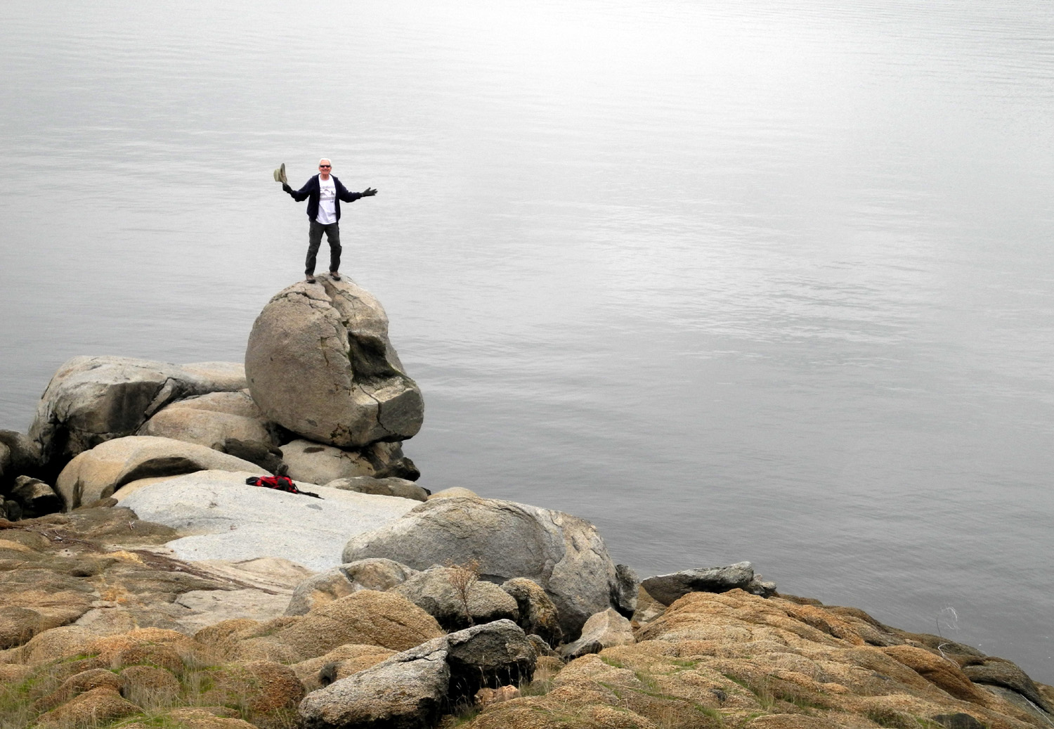
| Wes used to climb on this rock in his younger days | The trail and the lake | Wes explores the lake shore |
 |
 |
 |
| Jackie and Ardyss at rest | There were a few dove lupines out | Popcorn flowers |
| Edison
Point is at 65% of capacity |
||
 |
 |
 |
| Most of the Ramblers at Edison Point | Vickie and the lupines | Susan and the lake |
 |
|
 |
| Dick and Wes, two original Ramblers | Looking down the valley of Little Salamander Creek | A fantastic poppy display |
 |
 |
 |
| Poppies, oaks, and Pine Flat | There were some nice clouds in the distance | Ready for its close-up |
| Sycamore
Wildlife Area (Photos by Wes Thiessen and Dick Estel) |
||
 |
|
 |
| A vulture flew over to check out the visitors | Don, Laurie, Charlotte and Wes | Jackie is happy to be out hiking |
 |
 |
 |
| Laurie can't resist picking a bouquet | Wes lines up a shot | Poppies by the roadside |
 |
|
 |
| The picnic ground road is almost 100% overgrown | Phecelia in the
rocks above the Sycamore Creek branch of the lake |
That thick blue patch above the water is lupines |
| Related Links | ||
| Oak photo from 2021 | All of Dave's Kaweah Photos | Kaweah Oaks Preserve |
| Valley Oaks | More About Valley Oaks | Visalia |
| Black Bear Diner | Oak Savannah | California's Blue Oak Woodlands |
| Millerton Lake | Blue Oak Trail | All of Dave's Blue Oak Photos |
| Pine Flat Reservoir | Edison Point Trail | Edison Point Again |
| Trimmer Campground | Sycamore Wildlife Area | Trimmer Springs Road |
| San Joaquin River Gorge | San Joaquin River Trail | Mustang Clover |