|
Dinosaur National Monument 2023 |
|
| Related Links More Travel Reports | |
| NOTICE:
Due to the large size of this report, the additional photos that normally appear at the bottom of the page are on a separate page Photos by Johnny, Brittany, Jack, Teri and Dick |
|
| On
the Road & Day 1
Day 2 - Fishing, Sound of Silence
Trail & Utah Field House
Day 3 - Flaming Gorge Reservoir
Day 4 - Harpers Corner Road & the Further Adventures of the Upshaw's Heading Home Thoughts & Observations |
|
|
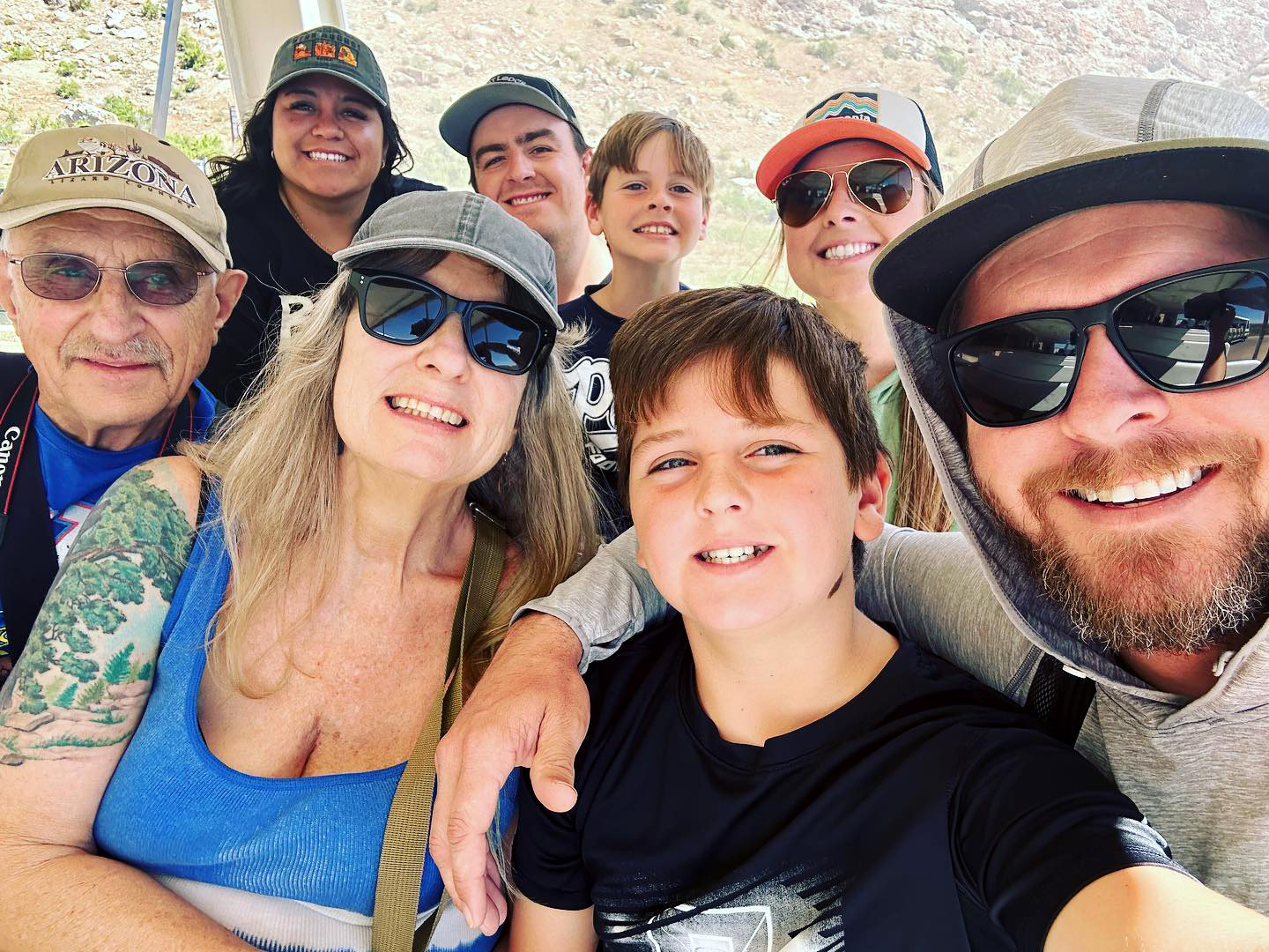
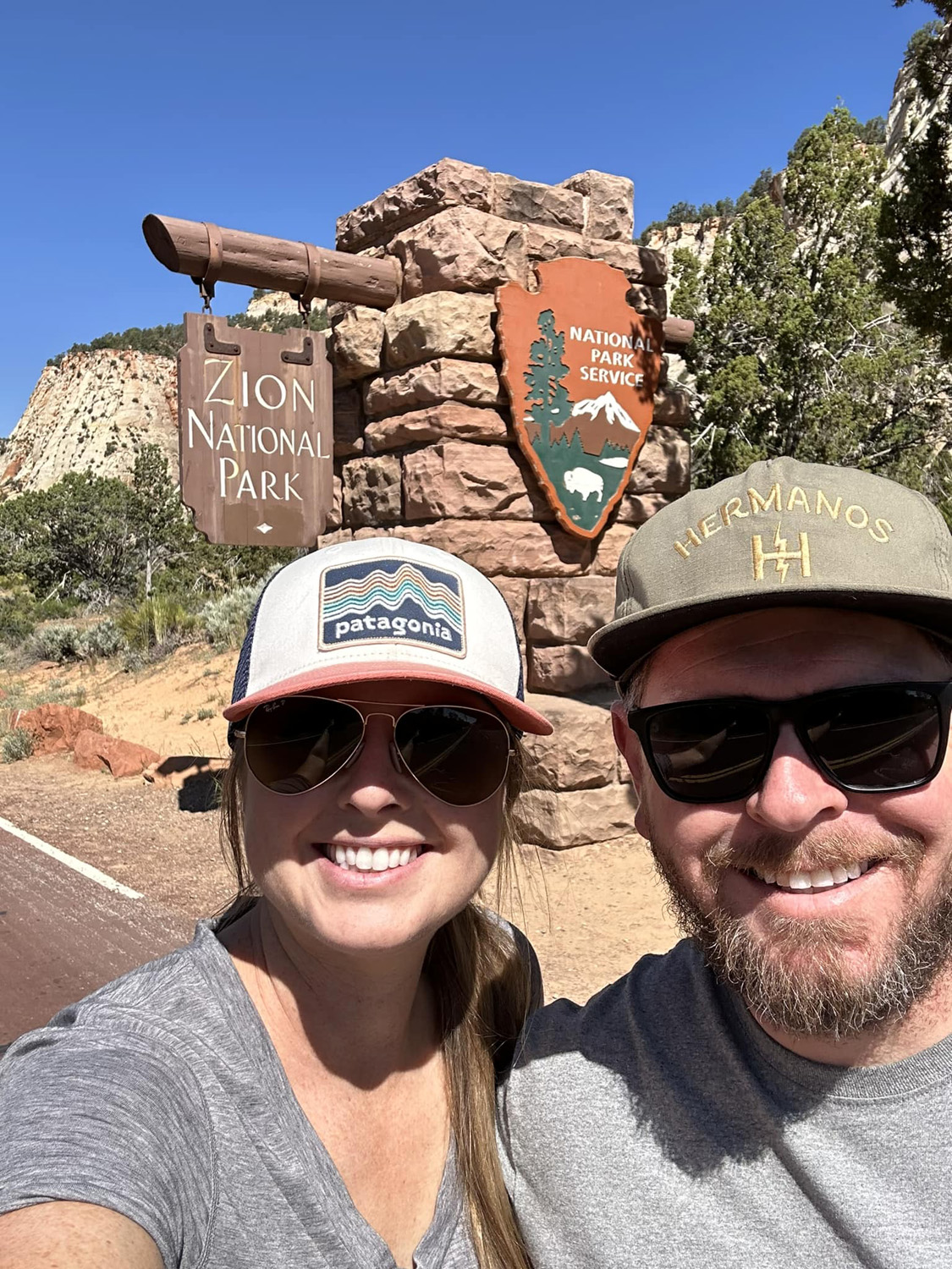
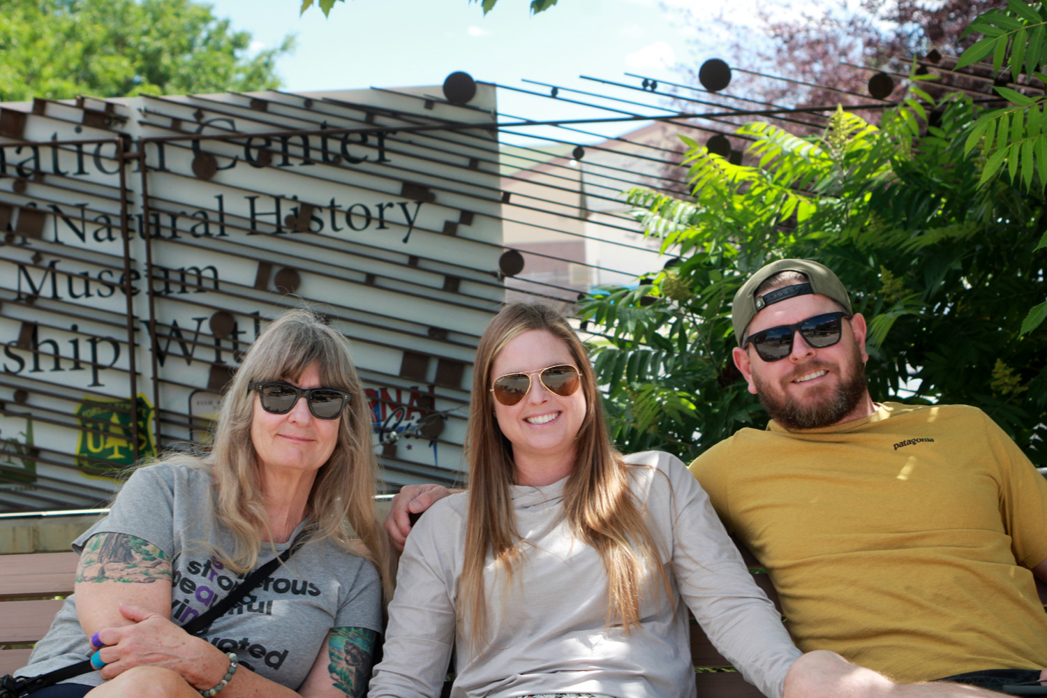
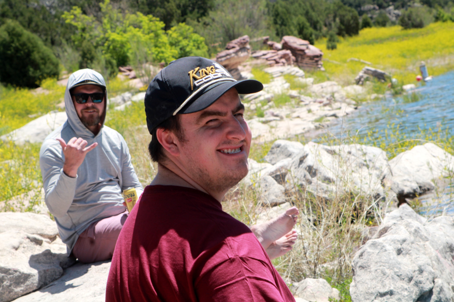
When I visited Dinosaur National Monument in Utah and Colorado in 2014, I knew I had to take family members there someday. June 17 - 24, 2023 were the days when it happened, and we had a trip we'll remember for a lifetime. Making the journey with me were older daughter Teri, her son Johnny, his wife Brittany, their sons Colton and Jack; Teri's younger son Mikie and his girlfriend Hayley. Daughter Jennifer and the girls' mom Jackie were invited, but had other obligations. Mikie and Hayley left a day early and visited Zion National Park. Since it does the boys (and their parents) good to be separated during long drives, Jack rode with Teri and me, and Colton rode with Johnny and Brittany. We got started about 6:30 a.m., going south on CA 99, east on CA 58, and northwest on I-15 through Las Vegas. We met up at the exit for Nevada's Valley of Fire State Park north of Las Vegas. Johnny and Brittany were considering visiting that area briefly, but trails are closed, so they continued on up I-15, all of us heading for St. George UT. Past Mesquite NV the highway goes about 25 miles across a corner of Arizona, and as we crossed the state line, we found ourselves in a huge traffic back-up. Brittany had found a bypass with her GPS, so we followed them on a narrow, winding state road. A bridge on I-15 was being reconstructed across the Virgin River, and we returned to the Interstate right at the bridge, where traffic returned to normal speed. The bypass saved us at least 45 minutes of travel time. Mikie and Hayley had reservations at the same motel in St. George, so we all got checked in, then went out for dinner at a nearby barbecue restaurant. As we were leaving our outside dining area, we noticed the large cooking area, and were invited in for an explanation of the methods used. Instead of direct heat, the fire is in a separate section that opens into the large area where the meat is placed. It cooks for 18 hours, with frequent spraying of a special mix to keep it from drying out. We all agreed that this process had produced a delicious dinner. |
|
 |
 |
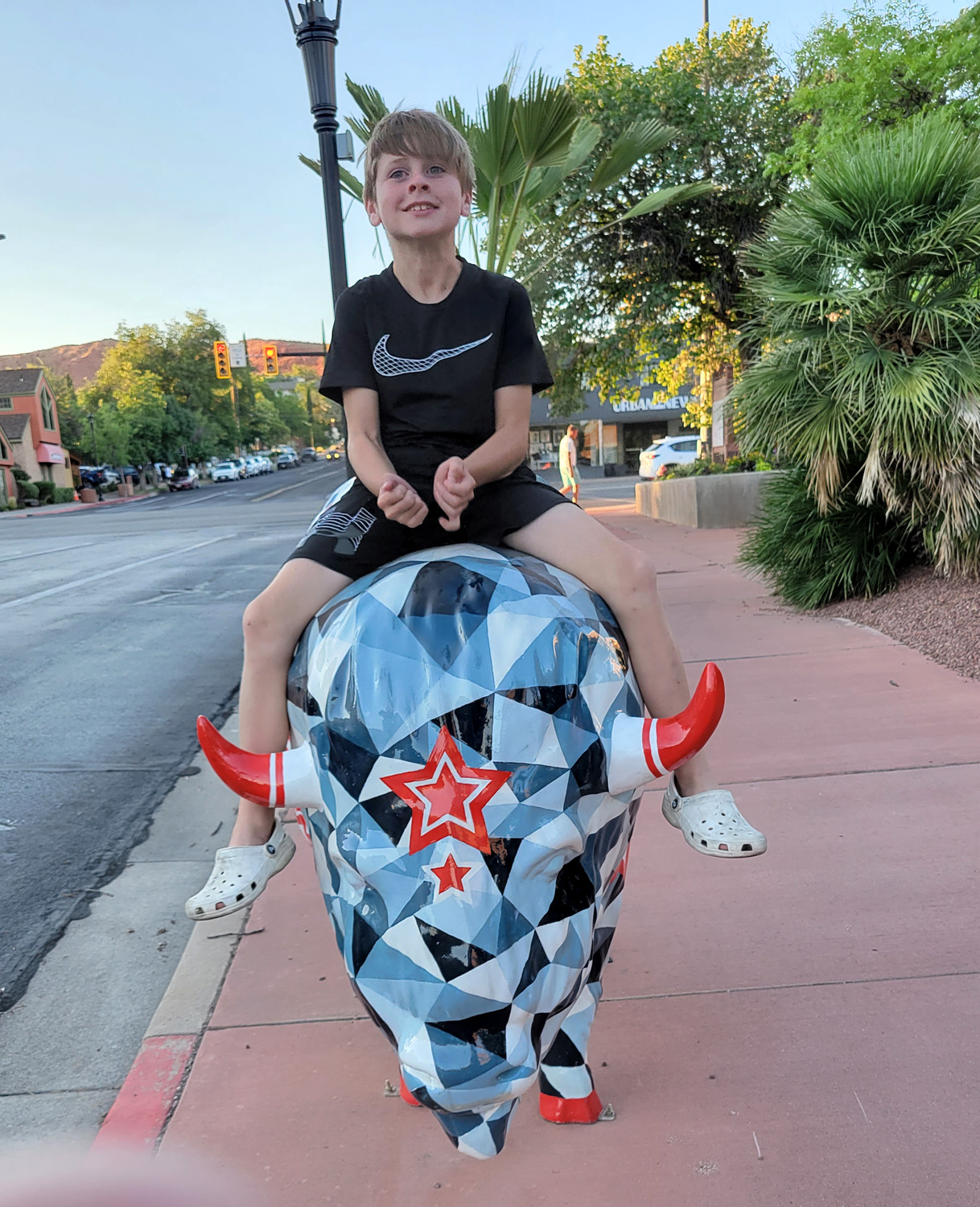
| Jack rides a bull in downtown St. George | Red cliffs above St. George (from 2015) |
|
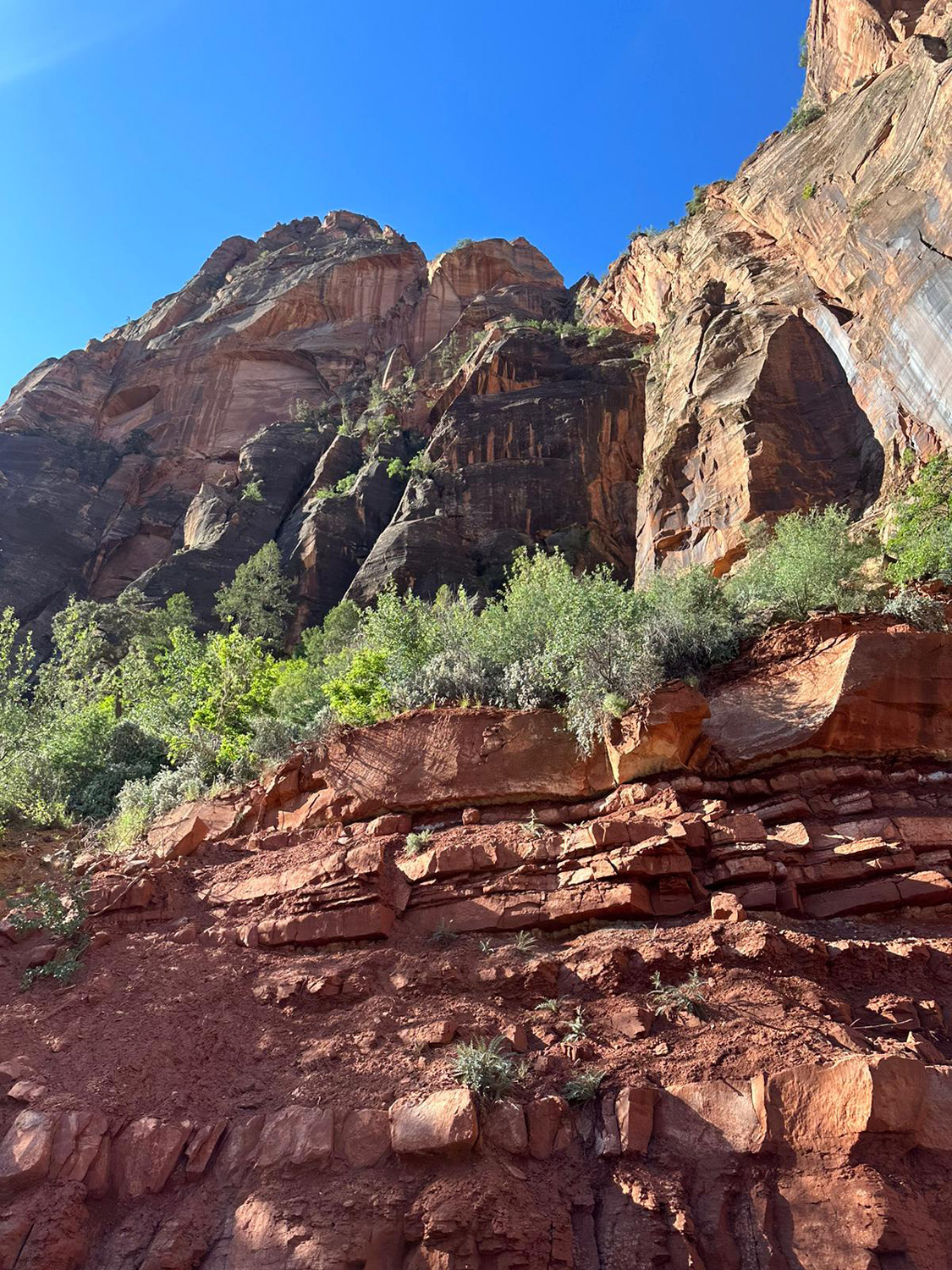
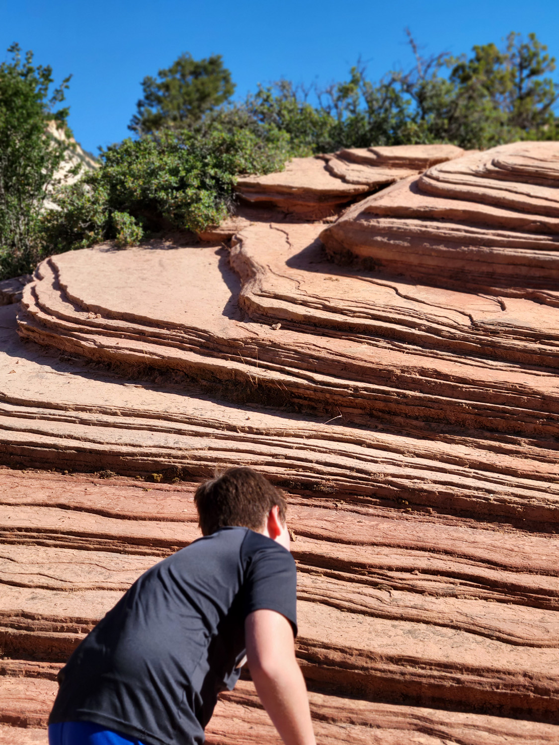
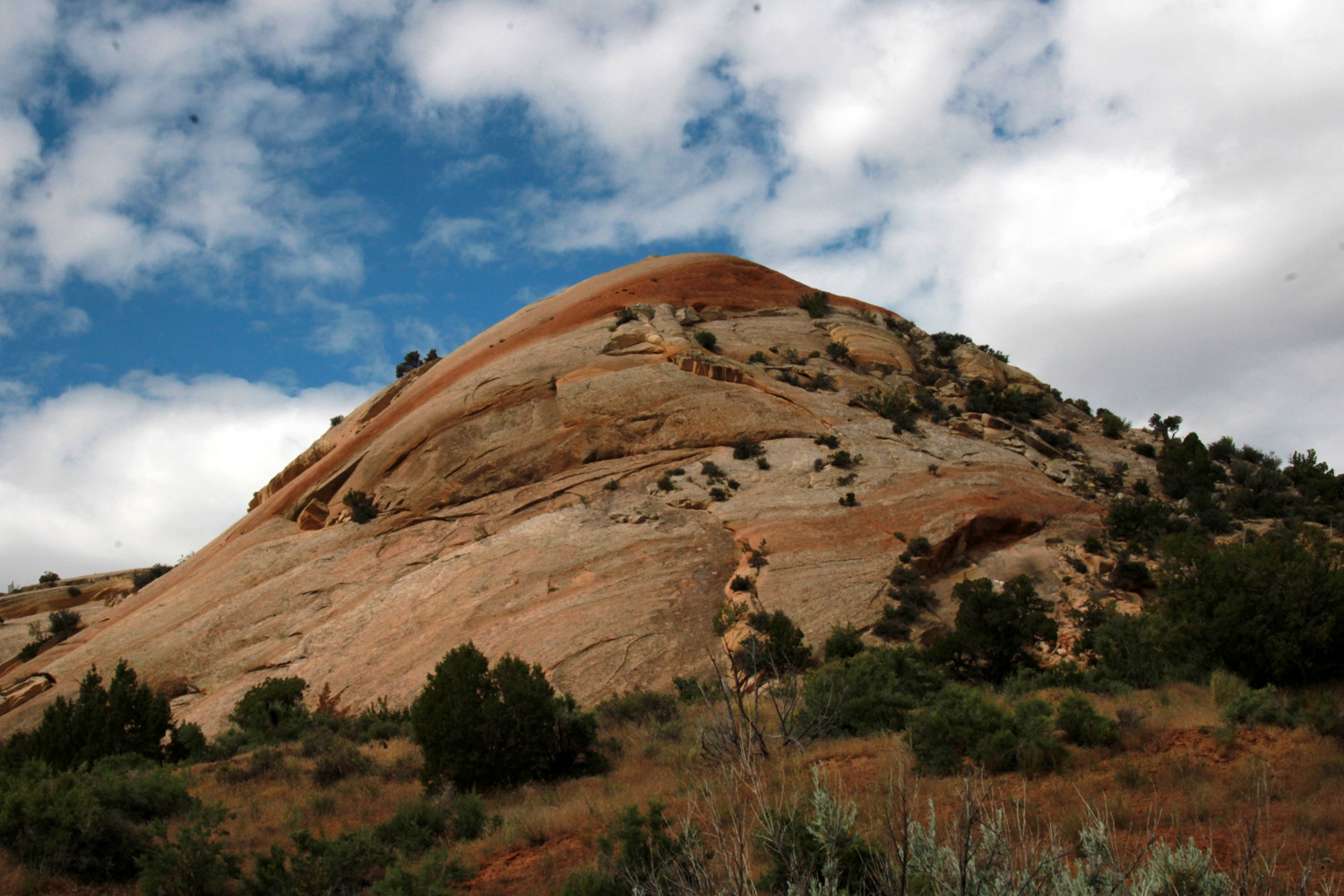
We set out the next day, our final destination being Vernal, Utah, a town of a little over 10,000 close to the monument. Instead of taking the most direct route, we left I-15 on Utah 9, which took us to the town of Springdale and through the southern end of Zion National Park. After crossing the Virgin River, the road climbs up over a pass and through a narrow mile-long tunnel built in the 1920's. How narrow? Motor homes and trailers must make a reservation to go through, pay a $15 fee, and drive down the middle of the road, since there is not room to safely meet and pass other vehicles. Johnny, Brittany and Jack stopped at the Zion Canyon Overlook Trail just past the tunnel and hiked there while the rest of us continued up the road to a parking area with a lot of cool sandstone formations. We walked around there, and then continued our drive, which took us over a pass and down to US 89, which we have followed before. It goes from Arizona at least to the Salt Lake City area, and goes through canyons and crop land, all very scenic. We connected with I-70 and stopped to eat at Richfield UT, then continued on the Interstate until it met up with Utah 10. This route connected to US 191, which took us all the way to Vernal, with part of the route being contiguous with US 6 and US 40. We stayed at the Microtel Inn on the eastern edge of town, which was convenient for our trips into the monument. It was very nice, a multi-story building with an elevator, which was very welcome I have memories of dragging my big ice chest up stairs more than once on previous travels. Our supper was stuff we had brought with us. |
|
|
|
| Brittany and Johnny begin what would end up a tour of four national parks | Near the Canyon View Trail in Zion park |
 |
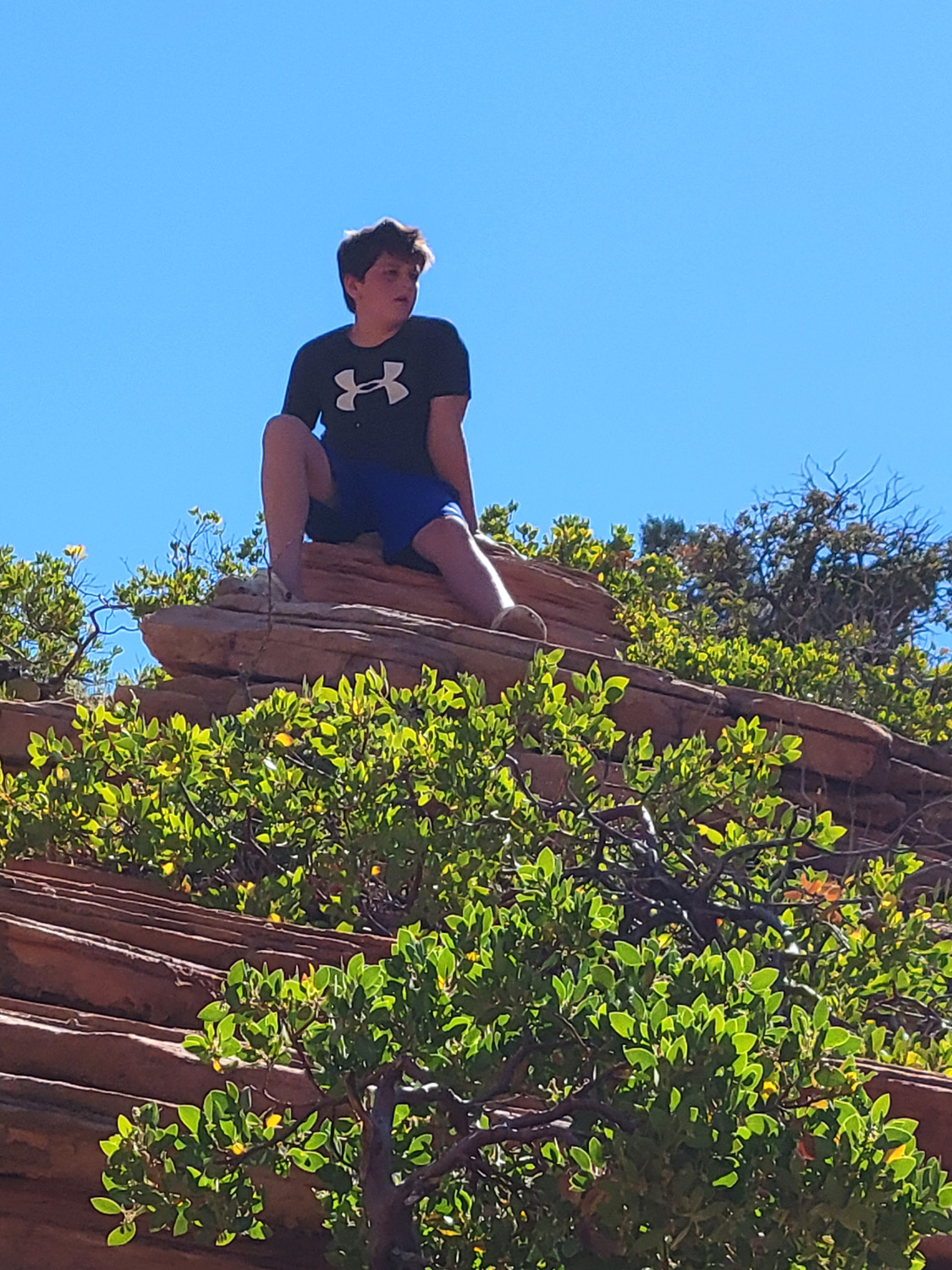 |
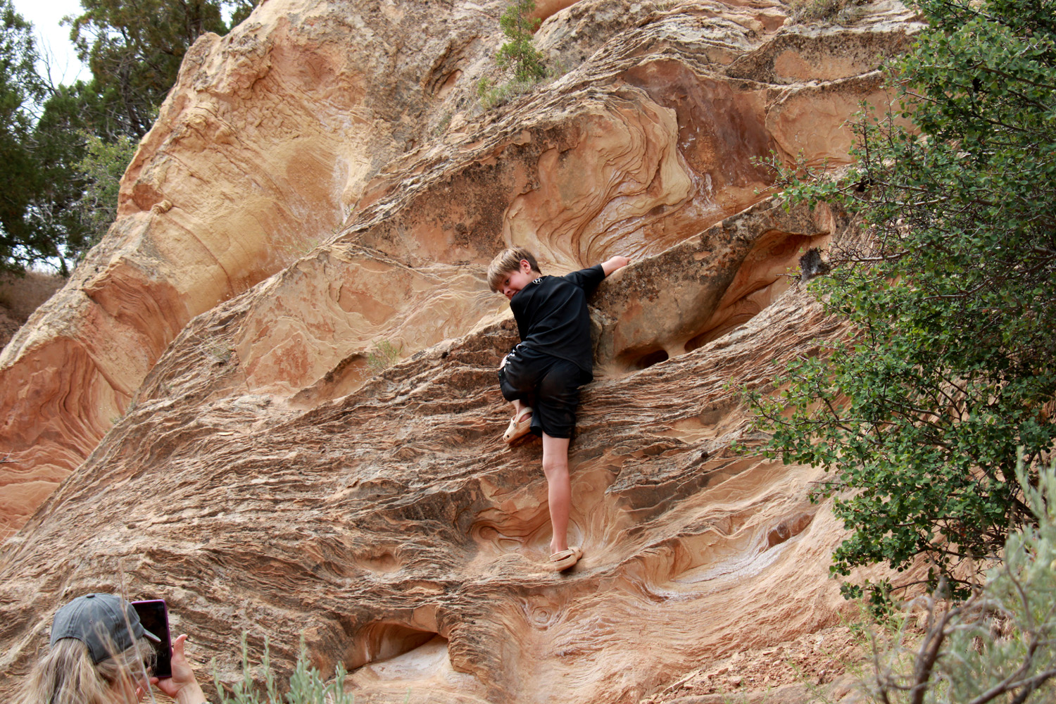
| Colton shows off his climbing skills | Triumphant! |
|
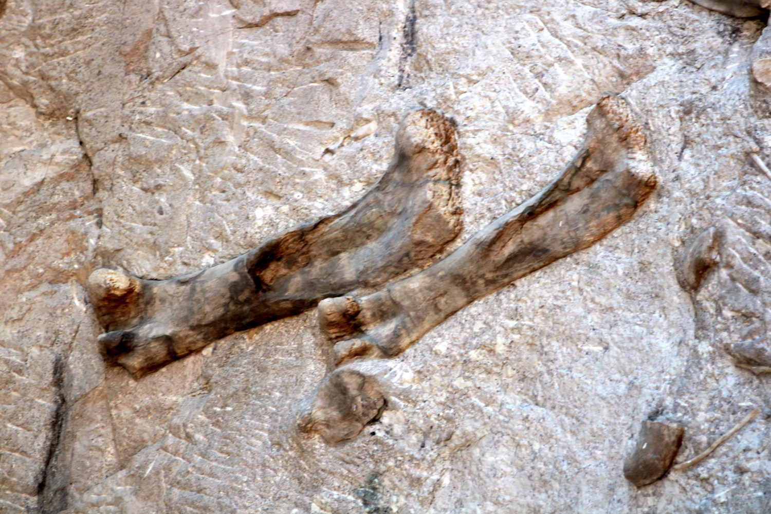
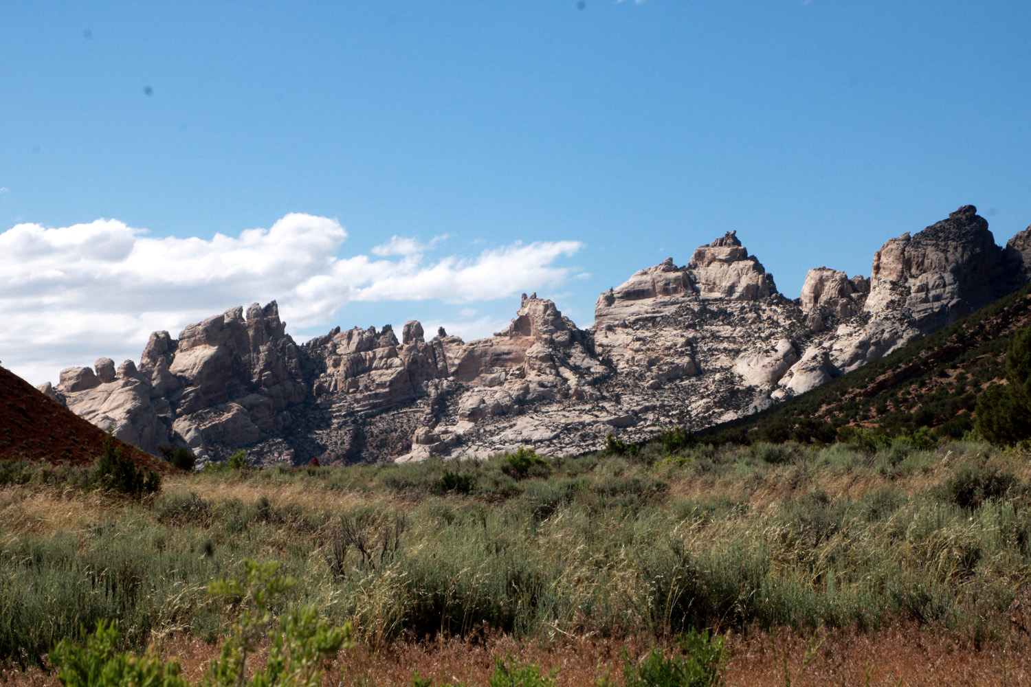
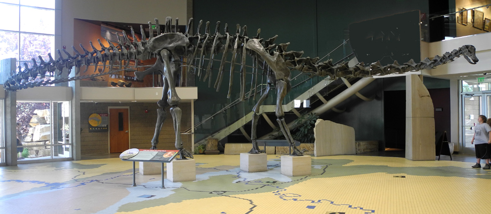
Monday, our first full day there, we first went to see the dinosaurs. Fossils were first discovered here in 1909, and many were removed for study. Eventually over 1500 bones were left in place, and a building constructed against a cliff wall, allowing visitors to view the bones. The monument was established in 1915 The Quarry Exhibit Hall has a glass wall, about 50 feet long and 20 feet high protecting the fossils. There are several places where you can touch real 150 million year old fossils from the Jurassic Period. Most visitors stop at the visitor center and ride a shuttle a few minutes up the road to the exhibit. You can walk back down or take a slightly longer walking route, the Fossil Discovery Trail. Teri, Colton and I chose the shuttle, while the rest walked the trail. Johnny said after their hike that we had made the right choice. Most of the fossils were small clam shells in the rock, and the trail was hot, steep and rocky. However, the shuttle was a big hit with the Notorious Upshaw Brothers, who rode up and back twice more just to ride, not to get anywhere. |
|
 |
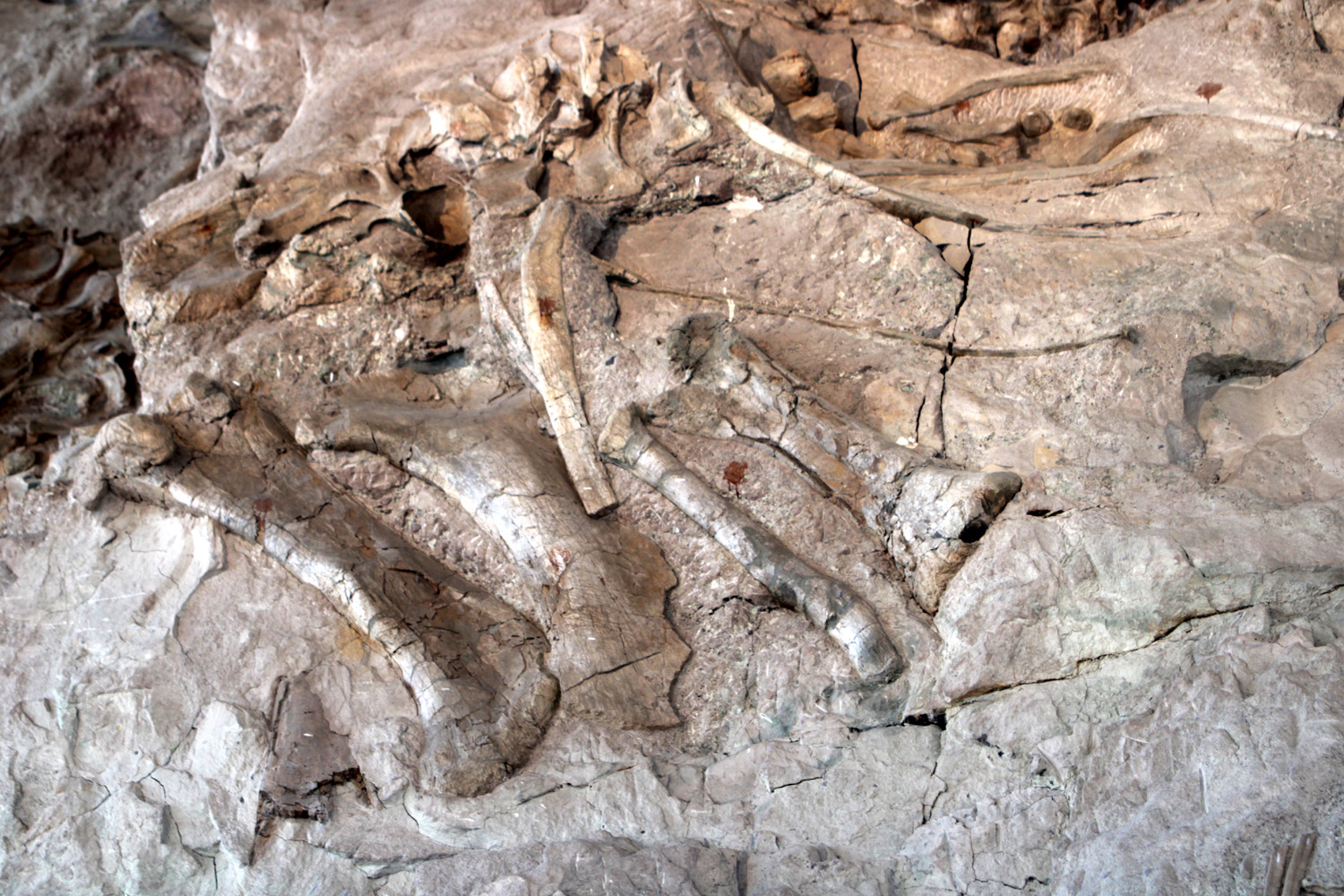 |
| 150 million year old fossils in the quarry at Dinosaur National Monument | |
 |
 |
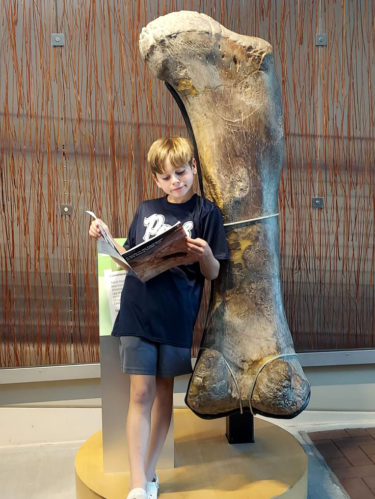
| Jack seems very blasé next to a Camarasaurus femur taller than he is | Jack and Colton at the Dinosaur visitor center |
|
|
|
|
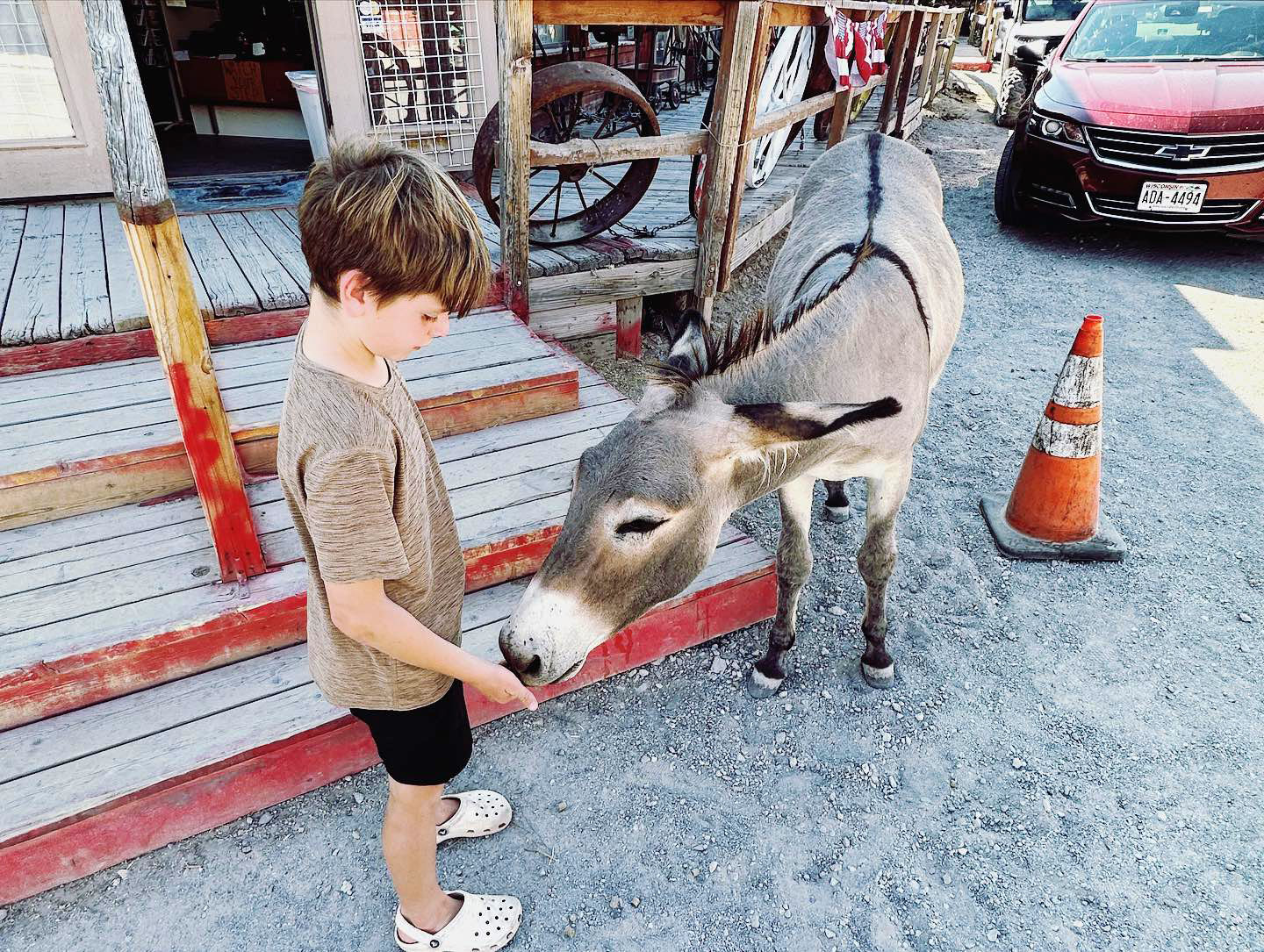
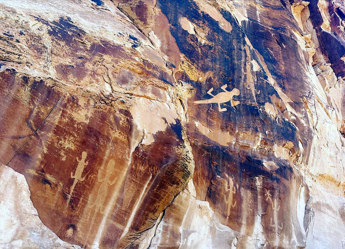
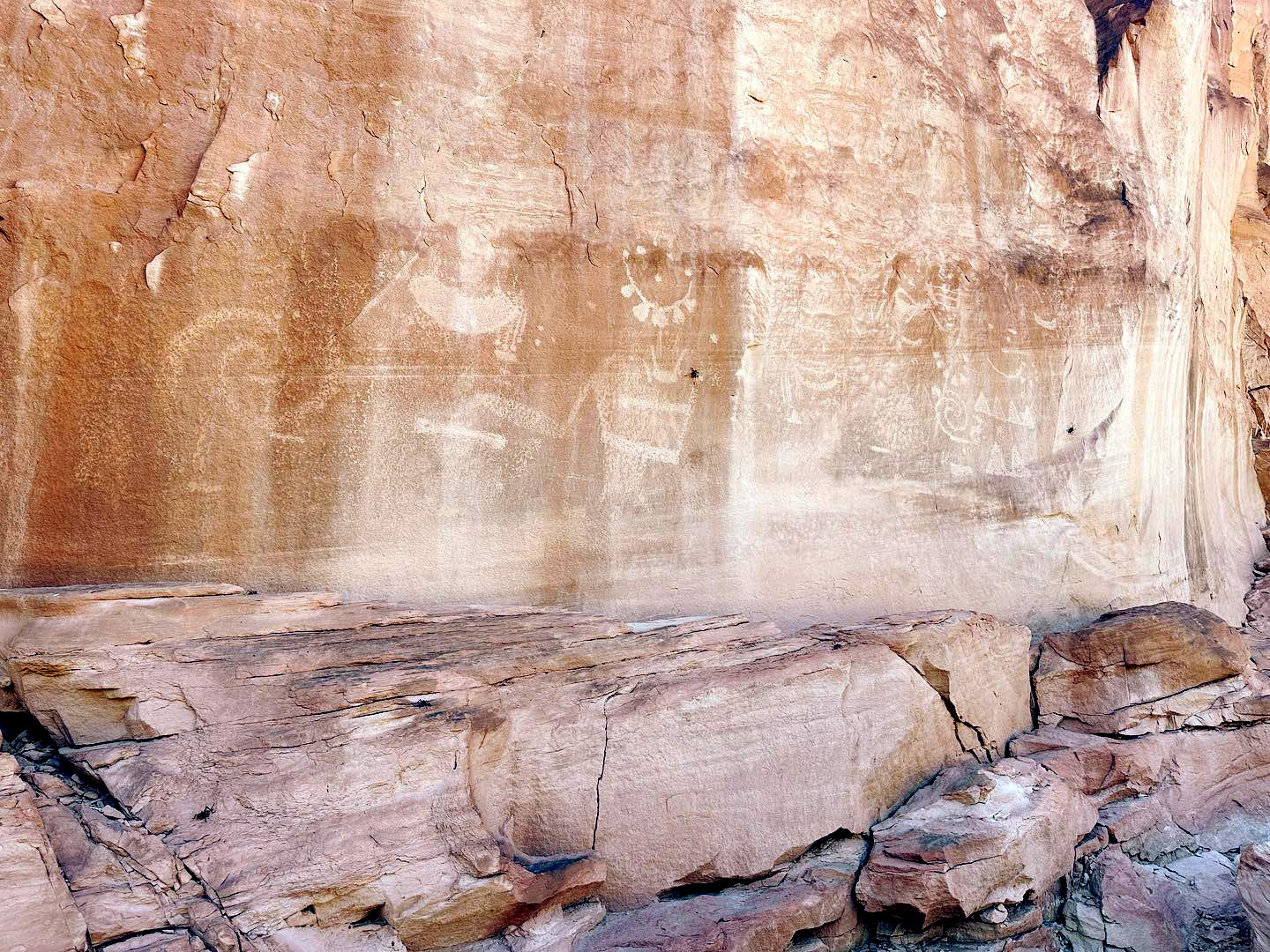
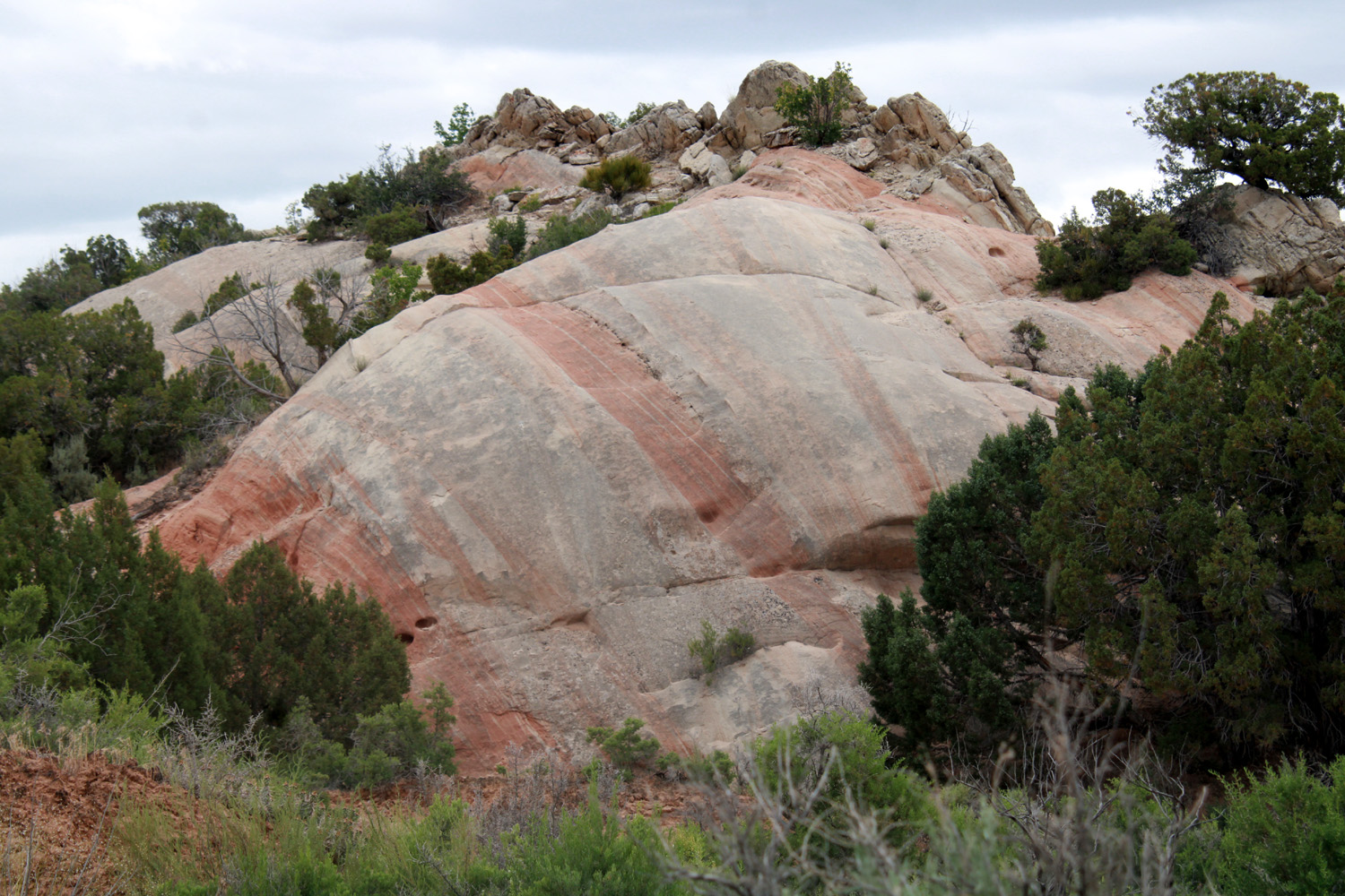
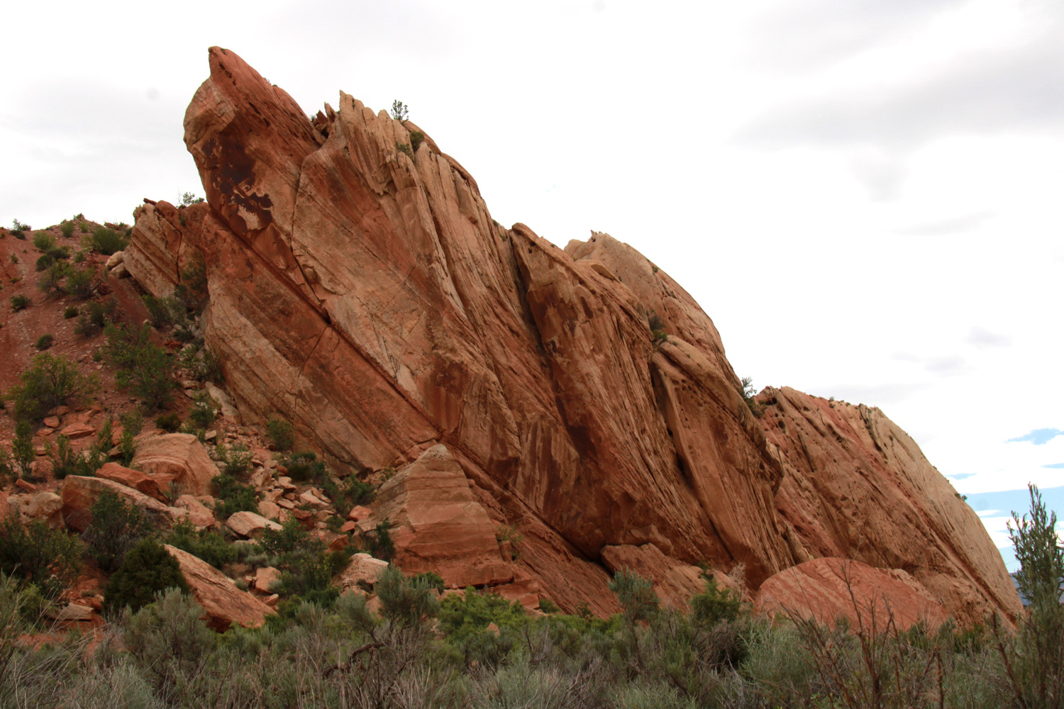
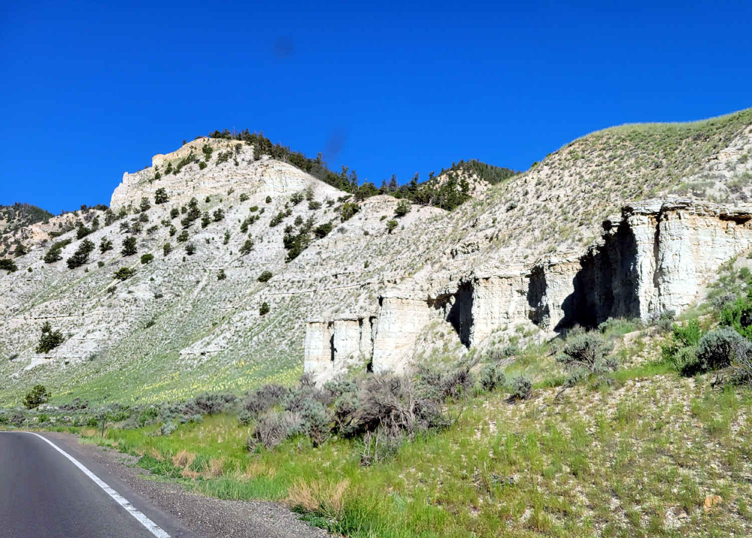
Next we all set off for the other points of interest in the Utah section of the monument, strung out along the ten mile Cub Creek Road. We stopped at the Split Rock Picnic Area by the Green River and ate the lunch we had brought with us. After lunch most of the group walked down to the river, where they reported it was much cooler than at our picnic table. Also along this road are petroglyphs, pictographs, scenic hiking trails, and the Josie Morris Cabin. The last mile or so is a good dirt road, and near the start of this section a short but very steep trail goes up to an array of petroglyphs that date from 800 years ago or more and were the work of people of the Fremont Culture. The most dramatic work of art is a large lizard, pecked into an area of desert varnish, a project that scientist estimate took at least six months. The height of the petroglyphs above the level area below the cliff indicates that they had to use some type of scaffolding to complete their work. On the same wall are other lizards, plus human, animal, and abstract figures. The boys counted nine lizards. I made it up to the lizard wall with difficulty, deciding that it was a little beyond my limits. Brittany and Jack went to the highest point of the trail, while the rest of us stopped at the art-covered wall. It was on this trail that we first encountered an unusual and ultimately disgusting form of wildlife. We began to notice large bugs scurrying and hopping across the trail, and eventually there were always a half dozen or more in sight. We learned that they are Mormon crickets, and that they are in "swarming mode," after a massive population explosion. More about this later. We continued up the road to one of the more interesting man-made sites in the park, the cabin of Josie Bassett Morris, also known as Josie Jensen. The stories told of her in the guide book and in a handout I picked up at the Uinta County Heritage Museum on my previous visit are certainly colorful, and probably contain a mixture of truth and exaggeration. After five marriages, only one of which ended in divorce, she chose to move to this remote area at age 40, in 1913. She built a cabin, which was replaced by the current building in 1924, and lived there till just before her death at age 89 in 1963. She raised cattle, grew fruit and vegetables, and according to the stories, sold moonshine during prohibition to get cash for necessities. She was accused of rustling, and almost certainly butchered a stray cow or two that wandered on to her property, but was acquitted the only time serious charges were brought. You can wander through the four-room, dirt floor cabin, see the fruit trees, and hike two short trails into box canyons where she corralled her cows. I had hiked the shorter of these trails in 2014, but we were tired of dodging crickets, and started back to the motel. On the way we stopped several times to take photos, particularly of Turtle Rock a sandstone formation that has appeared to represent different animals to different people. Looking at a photo, Mikie saw a lizard, but when he saw the formation in person, he agreed with the turtle designation. Driving back west on Cub Creek Road, there were more and more crickets on the road and the shoulder, but as we crossed a bridge over the Green River, the creepy invasion came to an end (temporarily). |
|
 |
 |
| Turtle Rock | Colton called formations like these "riggidy raggedy rocks" |
|
|
| How many lizards can you spot? | Human figure and other stuff |
|
Back in town, we enjoyed an excellent dinner at the Vernal Brewing Company, after which Jack and Colton went mini-golfing with Mikie and Hayley. The rest of us spent the evening reading, resting and planning for the next day. |
|
|
Day 2 - Fishing, Sound of Silence Trail & Utah Field House |
|
|
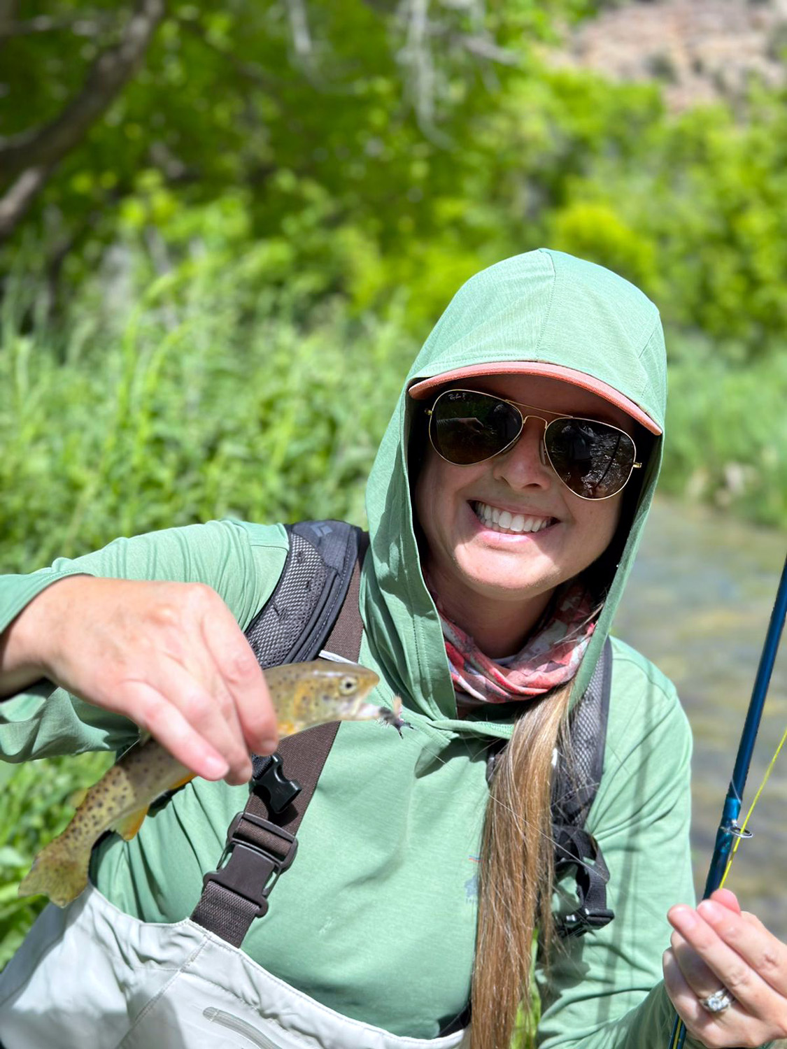
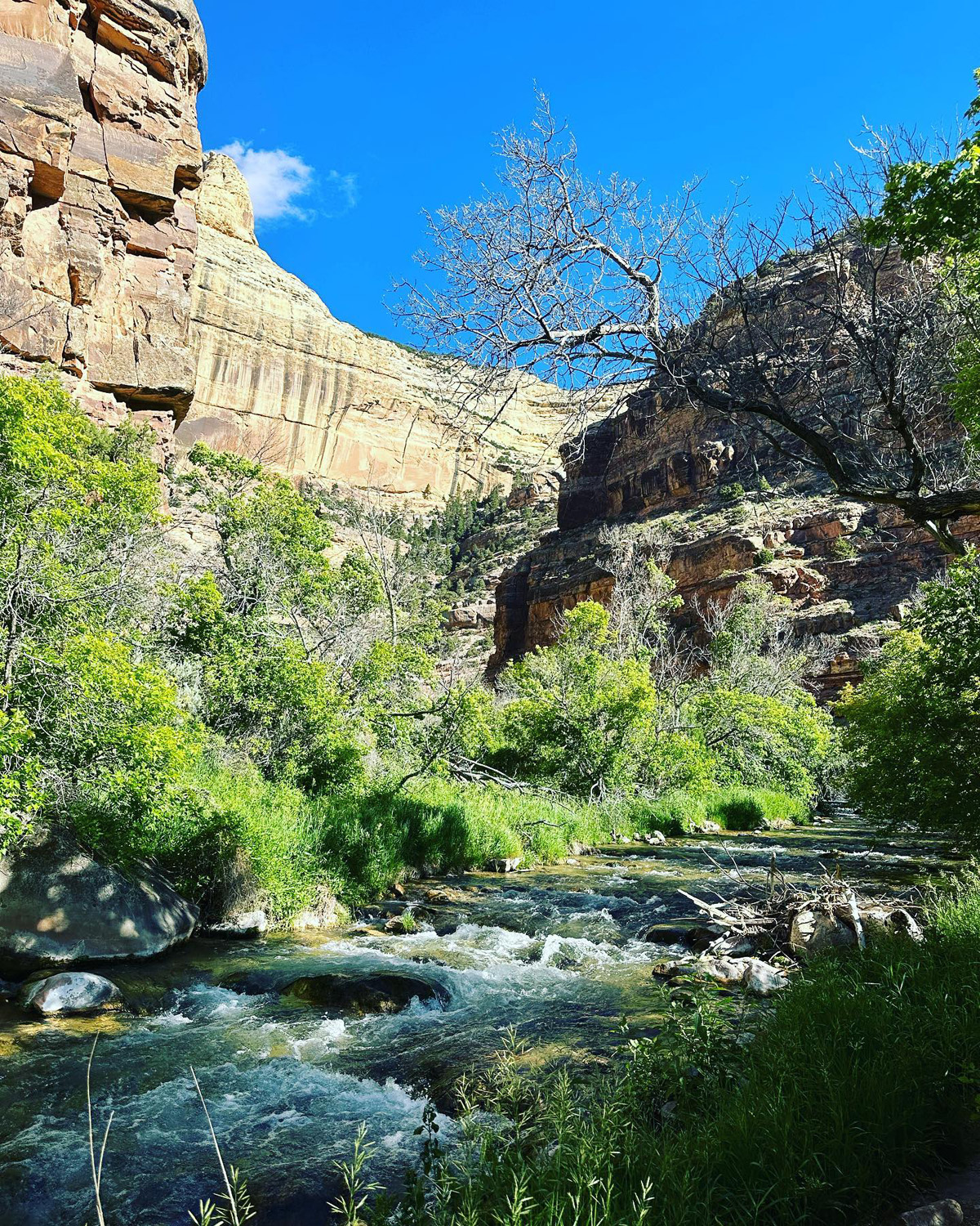
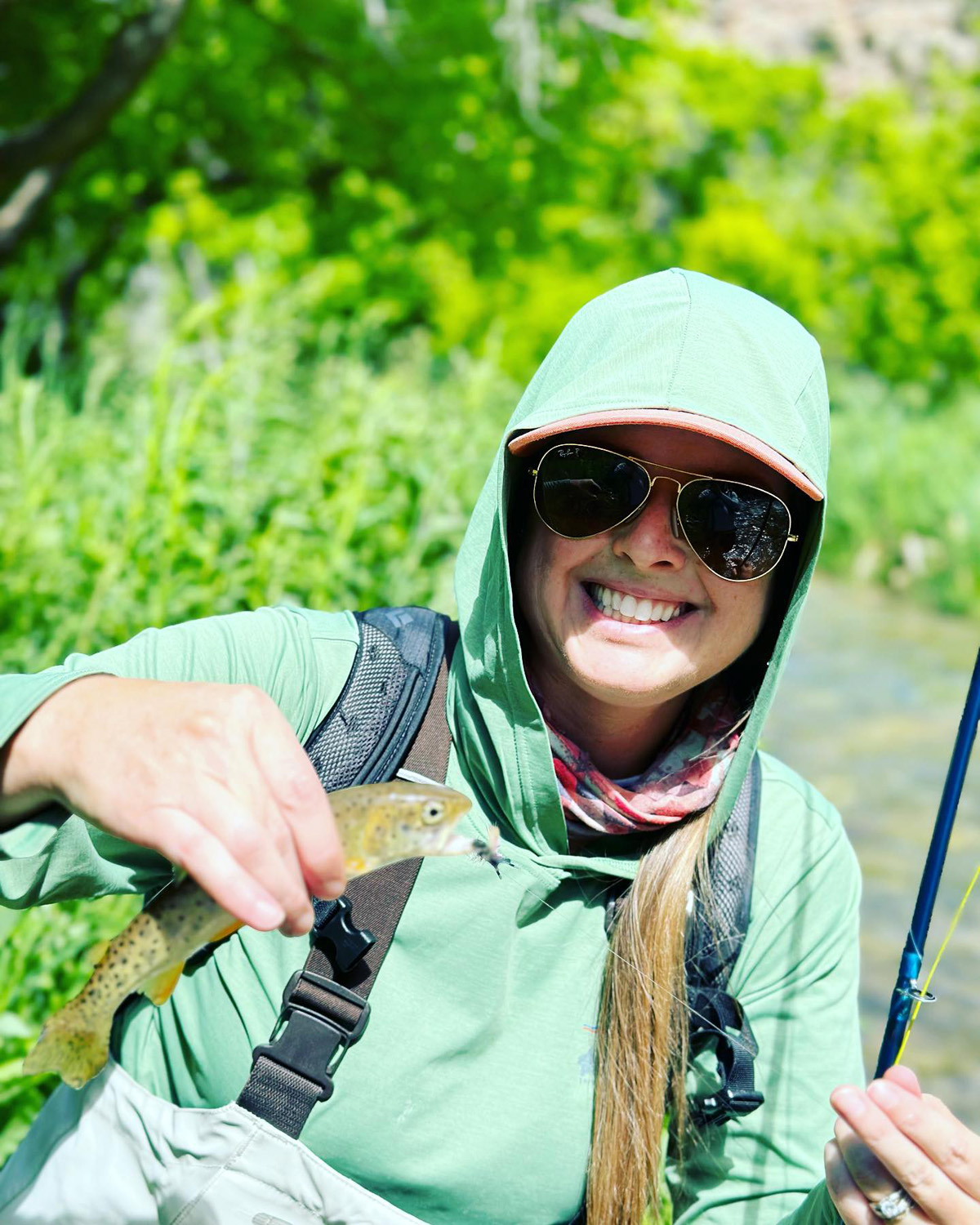
On Tuesday we split into two groups for the morning activity. Johnny has long been an avid fisherman, and has converted Brittany to the hobby, so they set out for the Jones Hole Trail, about an hour's drive away. After parking at the fish hatchery (outside the monument), they followed the four-mile trail that goes into beautiful canyon country and Jones Creek, which eventually flows into the Green River. They had good time and photos prove they caught fish, all of which had to be released. |
|
|
|
|
Jones Creek, surmounted by sandstone cliffs |
Brittany shows off her catch |
|
|
|
|
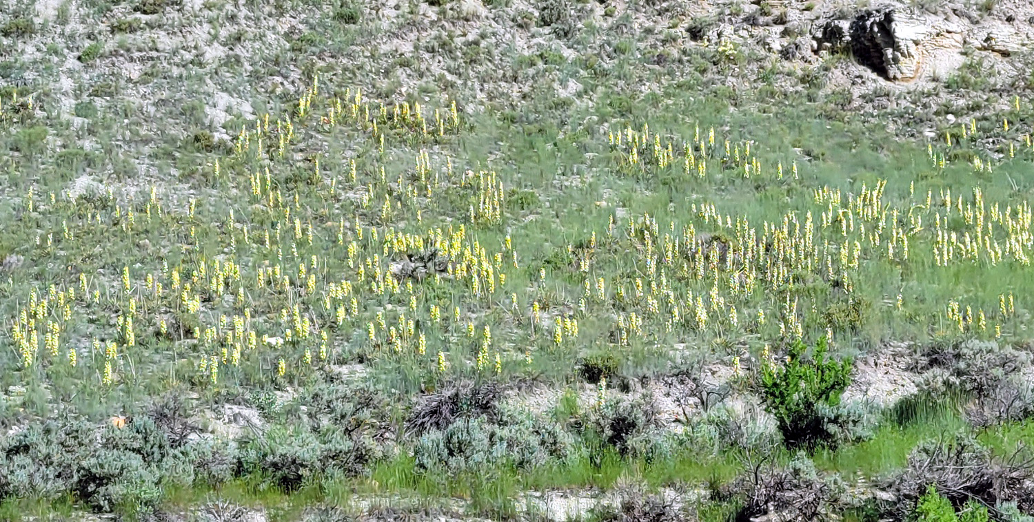
The rest of us drove east on the Cub Creek Road once again, stopping to hike on the Sound of Silence Trail. This is a 3.2 mile loop trail, but we just went in about three quarters of a mile. In 2014 I went a bit farther, being a bit younger and not accompanied by two lively boys, age 8 and 10, who like to stop and explore every hundred yards or so. If you read the web page linked above and in the additional links at the bottom, you will get the impression that this is a much more difficult and dangerous hike than it really is, at least the parts I have hiked. Usually trail descriptions make them sound easier than they are (for old geezers), so this was a pleasant change. After crossing a flat area of sage brush and other desert plants and flowers, the trail enters a wash. It was dry both times I walked it, but it can be wet and muddy after a rain, and probably unsafe if water is flowing. Along the trail there are endless sandstone formations, high cliffs, and sometimes rabbits and other wildlife. |
|
 |
 |
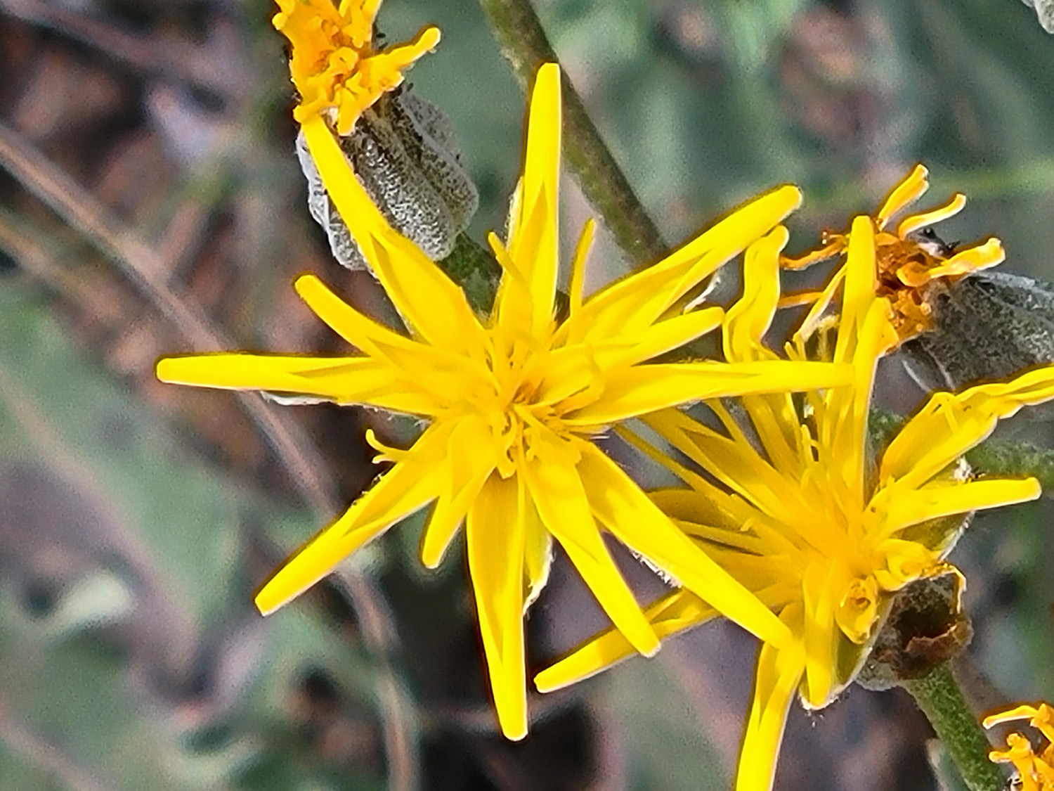
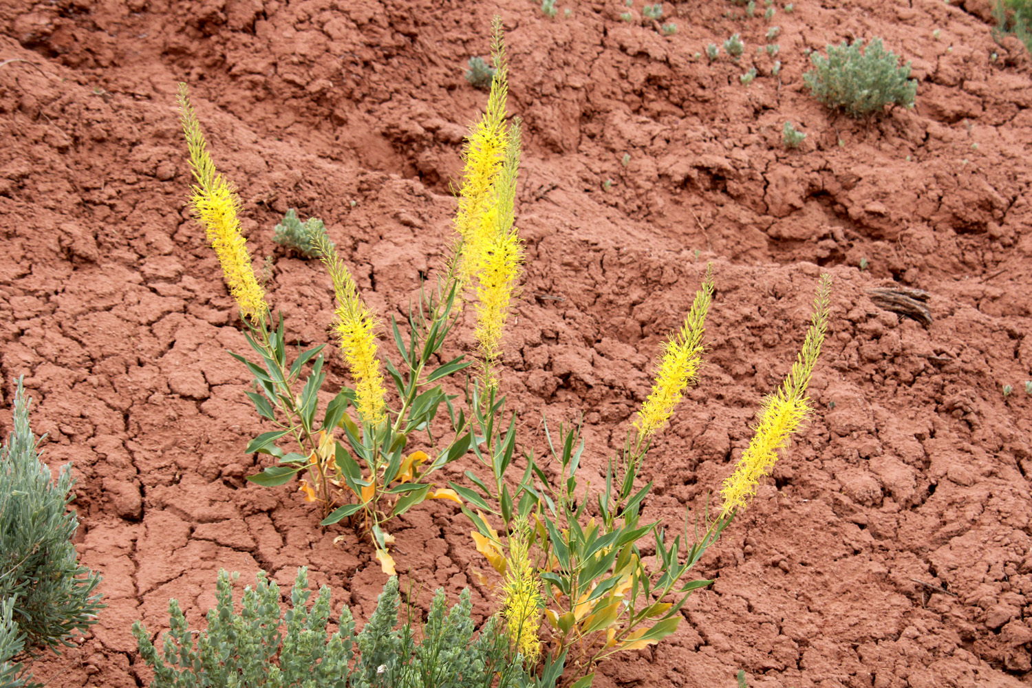
| We saw these yellow beauties all along the roads we drove in Utah | These appeared only at the farthest point we hiked on the Sound of Silence Trail |
 |
 |
| Mikie, Hayley, Jack, Colton and Teri on the Sound of Silence Trail | This rock captivated me in 2014, and did the same for everyone in 2023 |
|
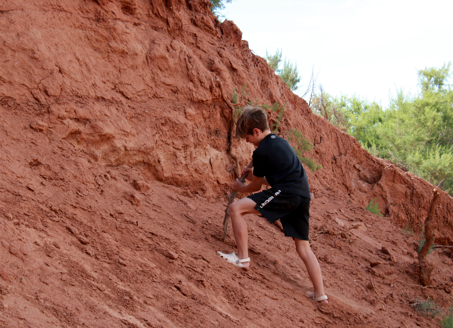
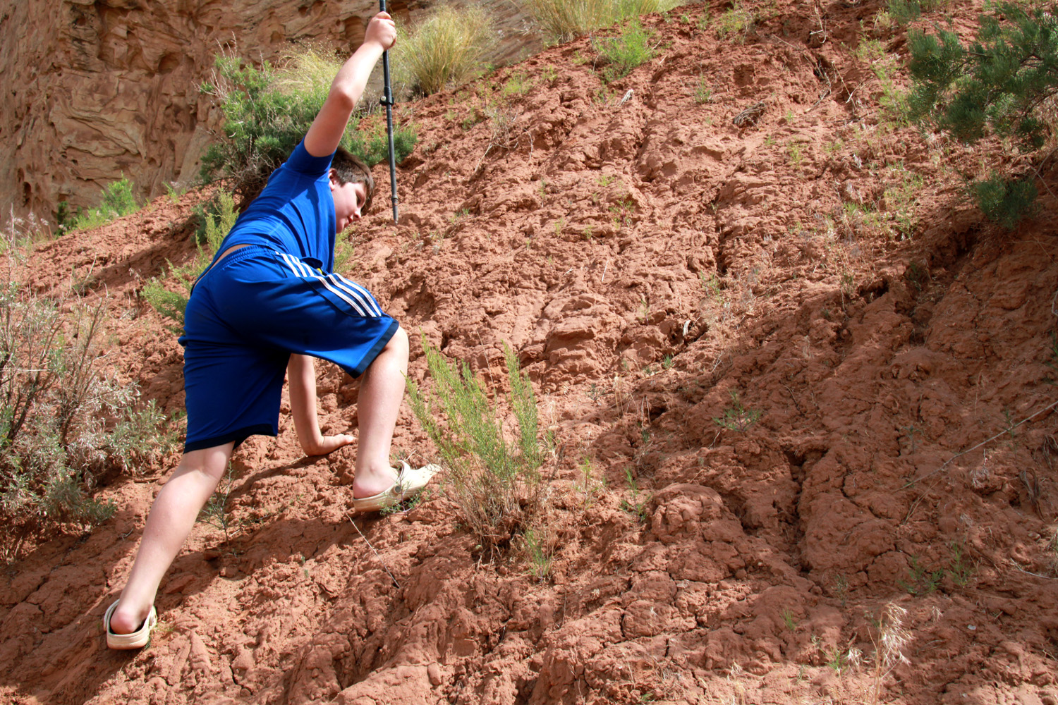
For Colton and Jack, any small elevation change is an invitation to climb, and soon both were working their way up the loose dirt slope along the side of the trail. After successfully navigating this area, Jack was drawn to a more challenging climb up a nearby sandstone cliff. Despite our constant reminders that it's easier to go up than down, Jack reached a point where he was scared and unable to get back down. Of course, he was not very high up, and Teri and Mikie helped him get off the tricky spot. He then decided he needed to do it again and get down on his own, so up he went. This time he made it down without help, although he always had a "safety net" of adult hands a few inches from him, but never actually needing to touch him. |
|
 |
 |
| Jack climbs the loose sandy dirt on the side of the wash | Colton found a slightly more solid spot |
|
|
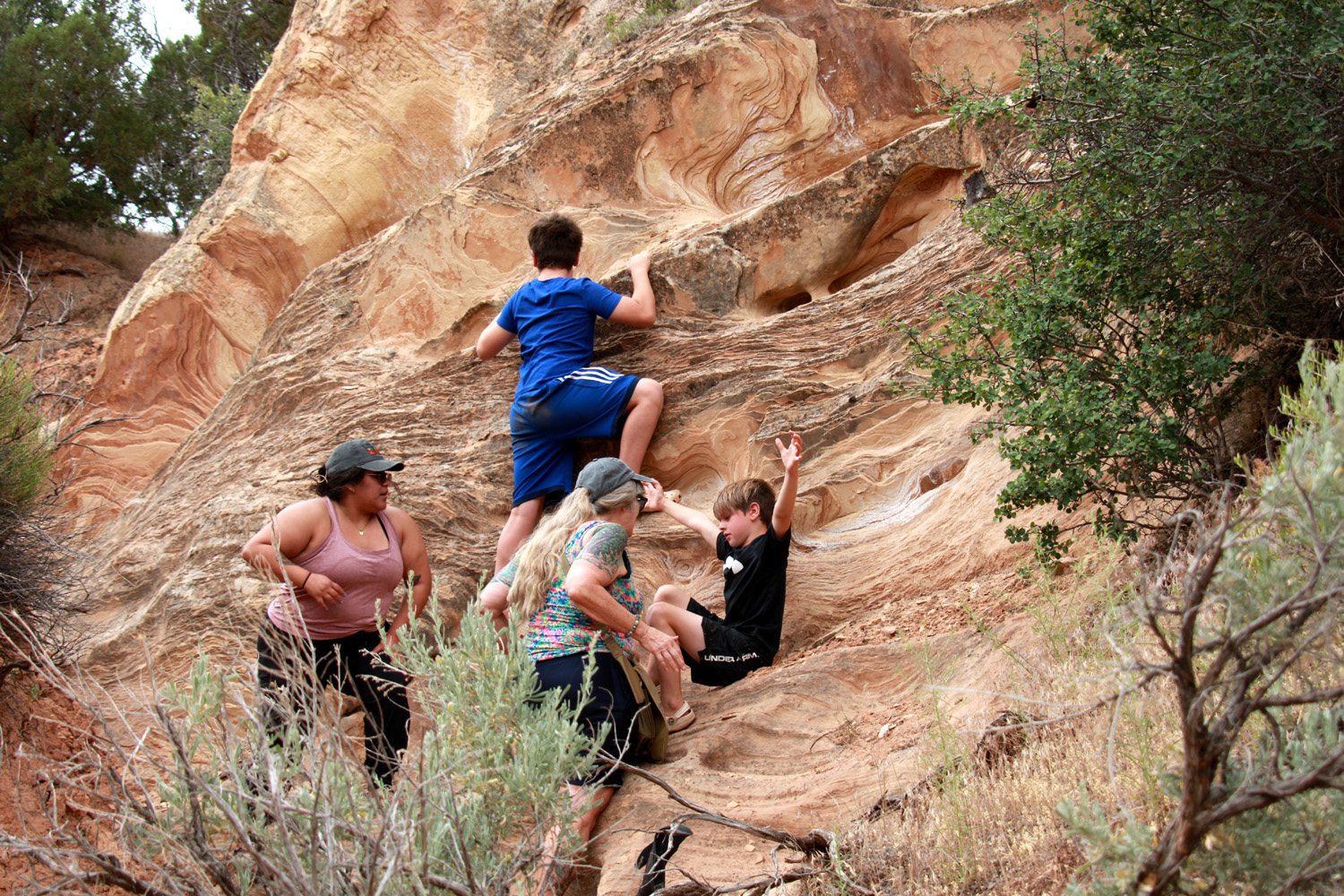 |
| "Ummmm....how do I get down?" | Everyone gets involved in cliff climbing |
|
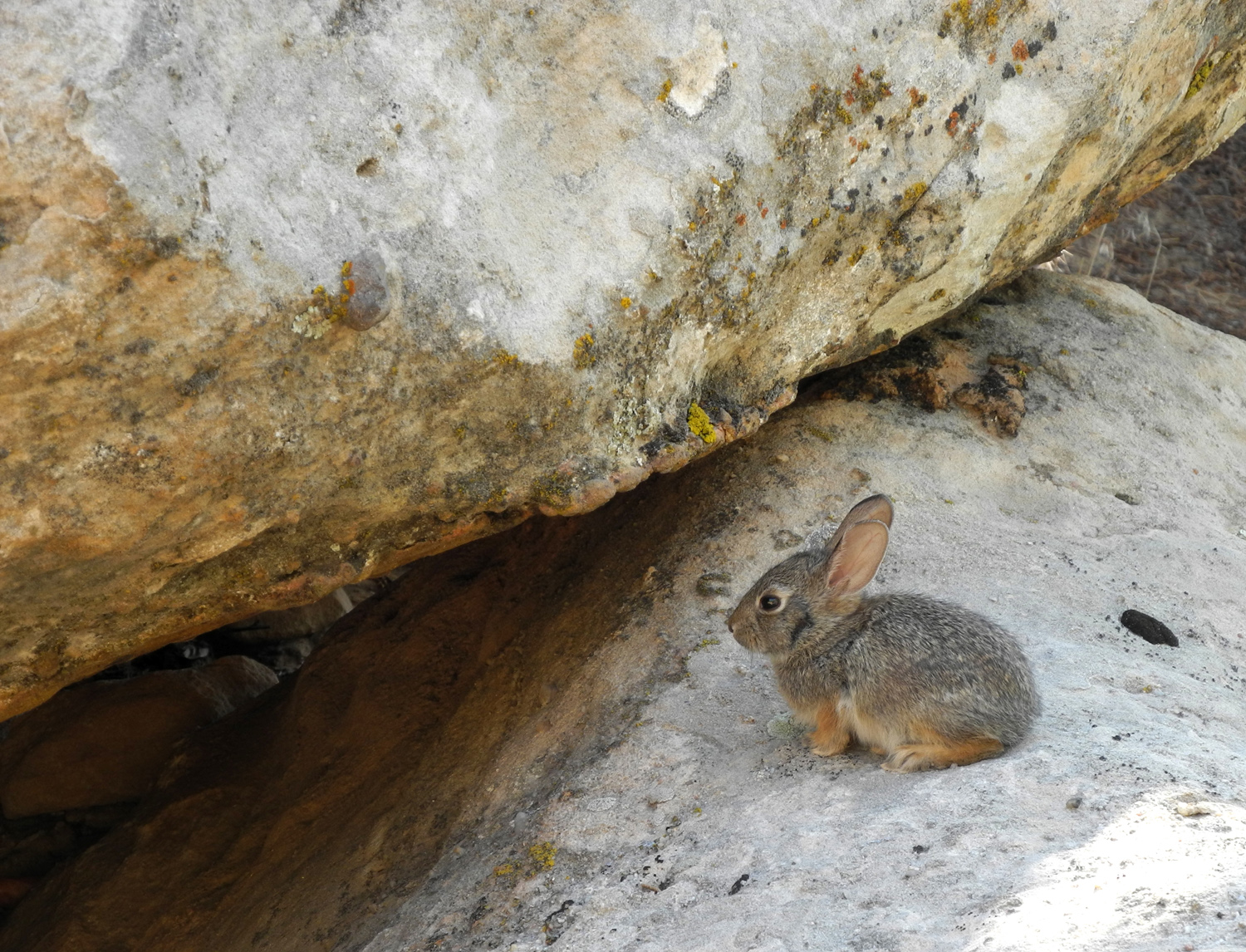
Mikie, Hayley and I walked another couple hundred yards, then we all started back, enjoying the flowers, rugged sculptured rock, and rounded sandstone formations. The crowds found elsewhere in the park were absent here, a family of three being the only other hikers we saw. Our only disappointment was that we did not see any of the pigmy rabbits that had charmed and delighted me on my first visit. |
|
 |
 |
| Sandstone formations were sometimes smooth and rounded.... | ....and sometimes jagged and rugged |
|
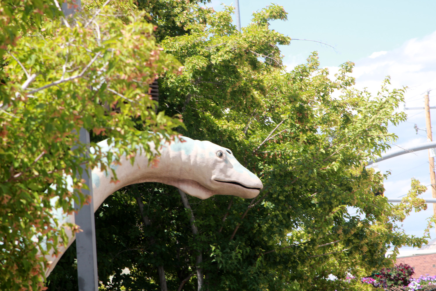
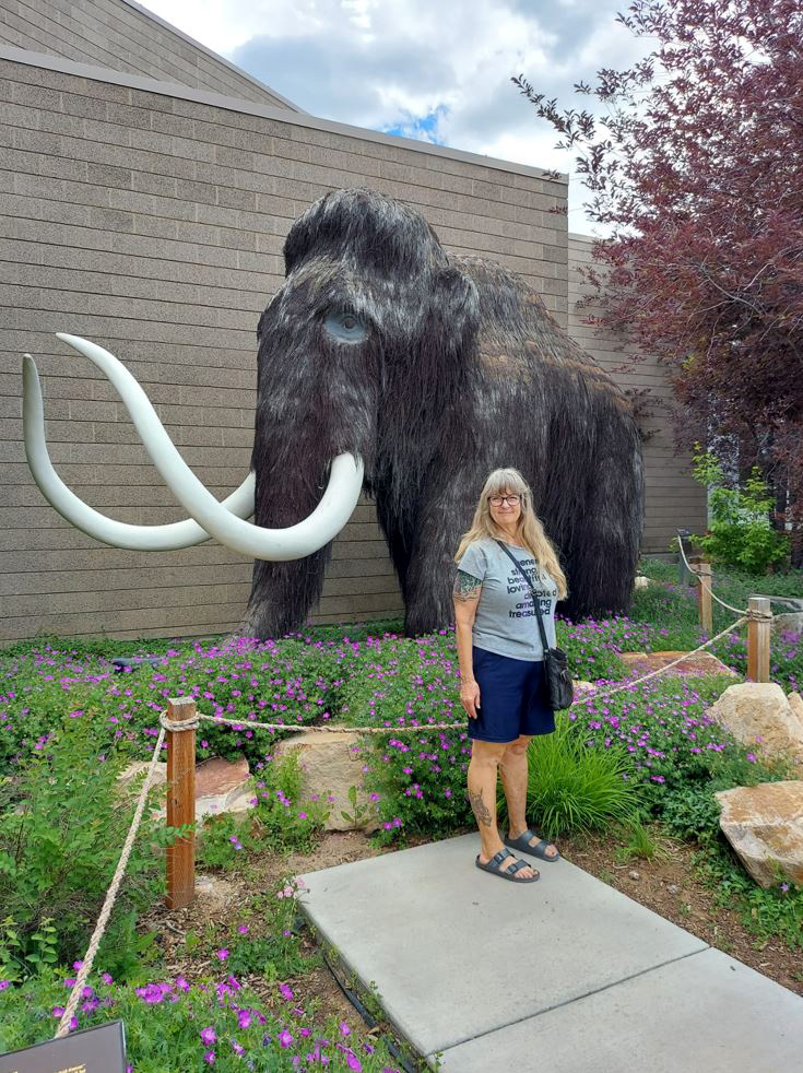
Once we had all reunited, had lunch and rested, the entire party set out for the Utah Field House of Natural History State Park Museum. In the interest of saving time, we just called it "the museum." This is an amazing facility with many rooms of exhibits relating to the dinosaurs that once roamed the territory within an 80 mile radius of the museum. Besides prehistoric stuff, there is information on the native people who first inhabited the area, the oil and mineral history, and more. In the lobby there is a full size model of a apatosaurus skeleton, the huge plant-eater that we used call brontosaurus. You can look into, but not enter, a room where work on fossils and other artifacts is under way. In the museum Colton and Jack spent most of their time playing with toy dinosaurs that were available for the enjoyment of kids of all ages, and showed little interest in the educational exhibits. However, we all walked through most of the building, and found it enjoyable. Our visit did not lend itself to photography inside, but you can find photos from my 2014 visit here. Outside there are large models of a number of dinosaurs plus an excellent and very realistic wooly mammoth. I turned the camera over to Jack who always has a fresh take on what is photo-worthy, including leaves in a gutter and a Wal-Mart sign. However, he did a good job capturing family members at rest among the big ancient beasts. |
|
 |
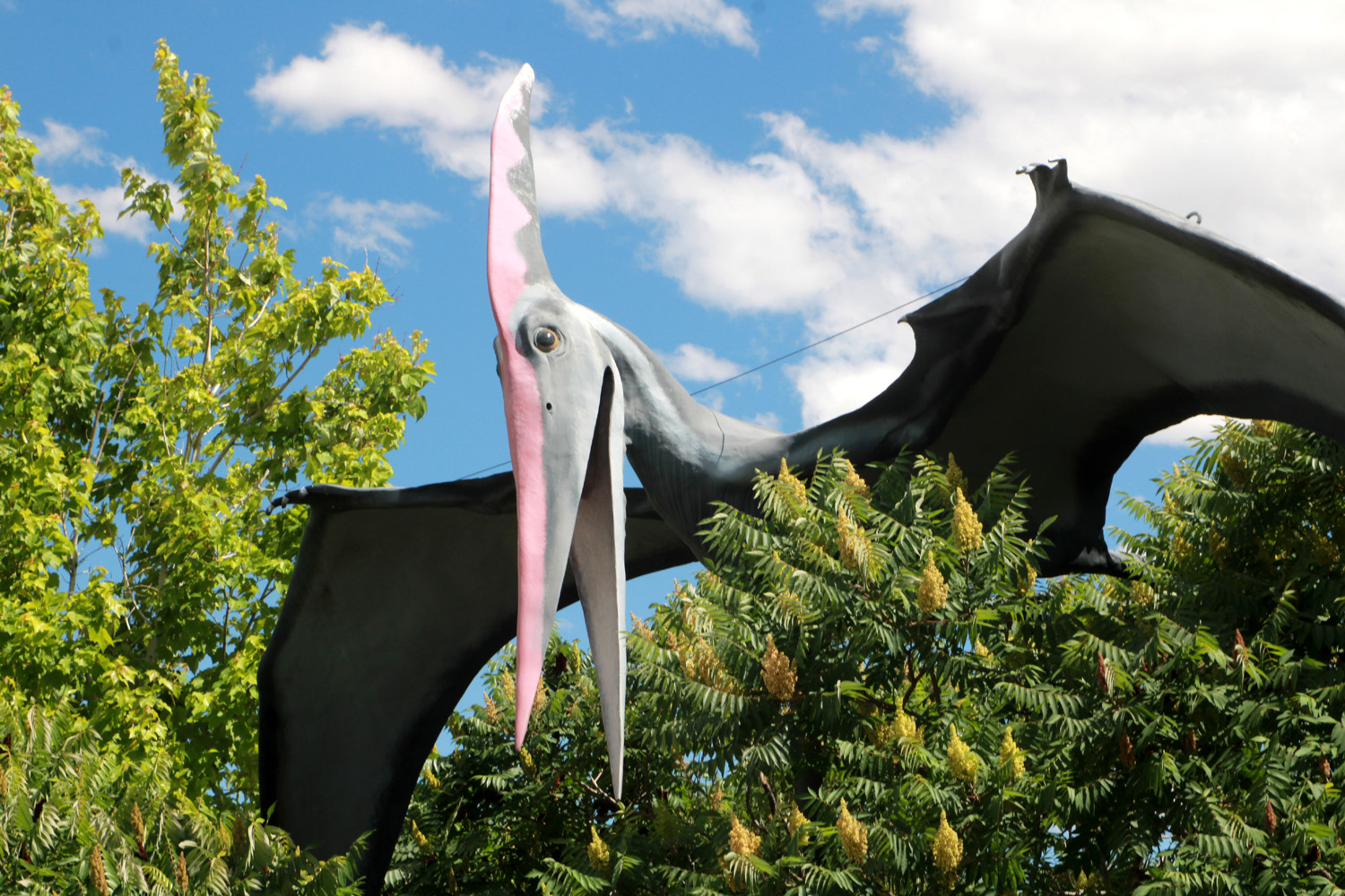 |
| This one reminded me of Alley Oop's pet, Dinny the Dinosaur | The pteranodon, toothless, but still scary |
 |
 |
| Teri, Brittany and Johnny take a break | Teri and a furry friend |
|
When we finished the museum we returned to the hotel, ready for a low-key evening. Teri and I ate food we'd brought with us, although everyone but her also went out to a Cold Stone Creamery for ice cream. Various members of our group also visited the hotel's indoor pool. I went twice. Mikie and Hayley got in a full 18 holes of golf one night. I don't recall which days these events took place, and there is no photographic record. |
|
|
Day 3 - Outing to Flaming Gorge Reservoir |
|
|
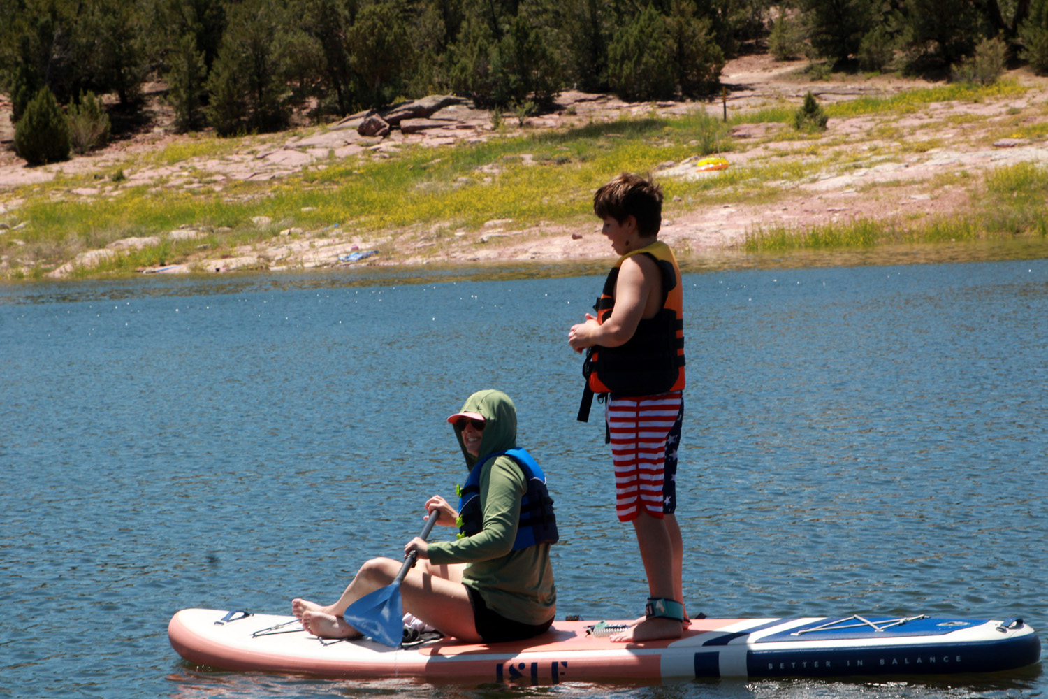
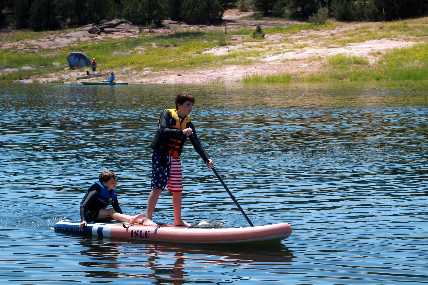
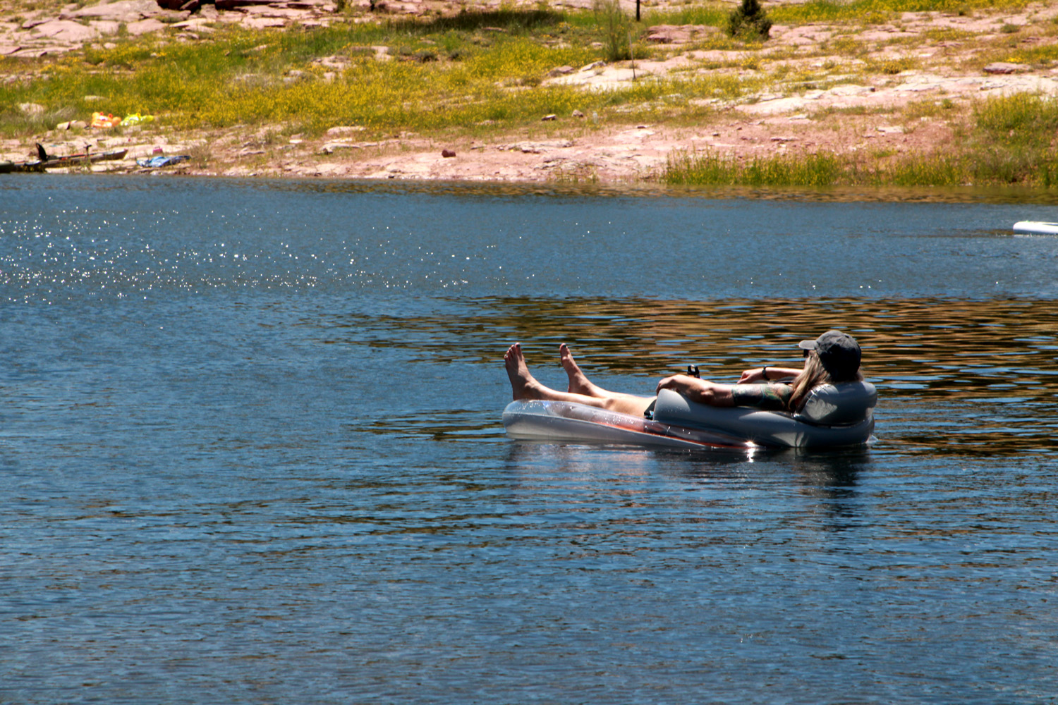
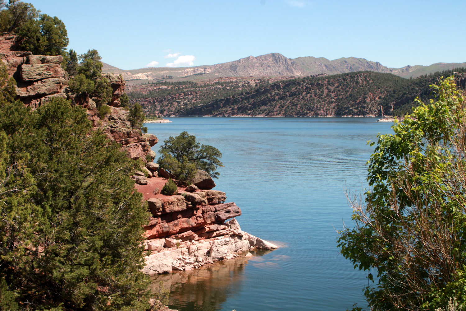
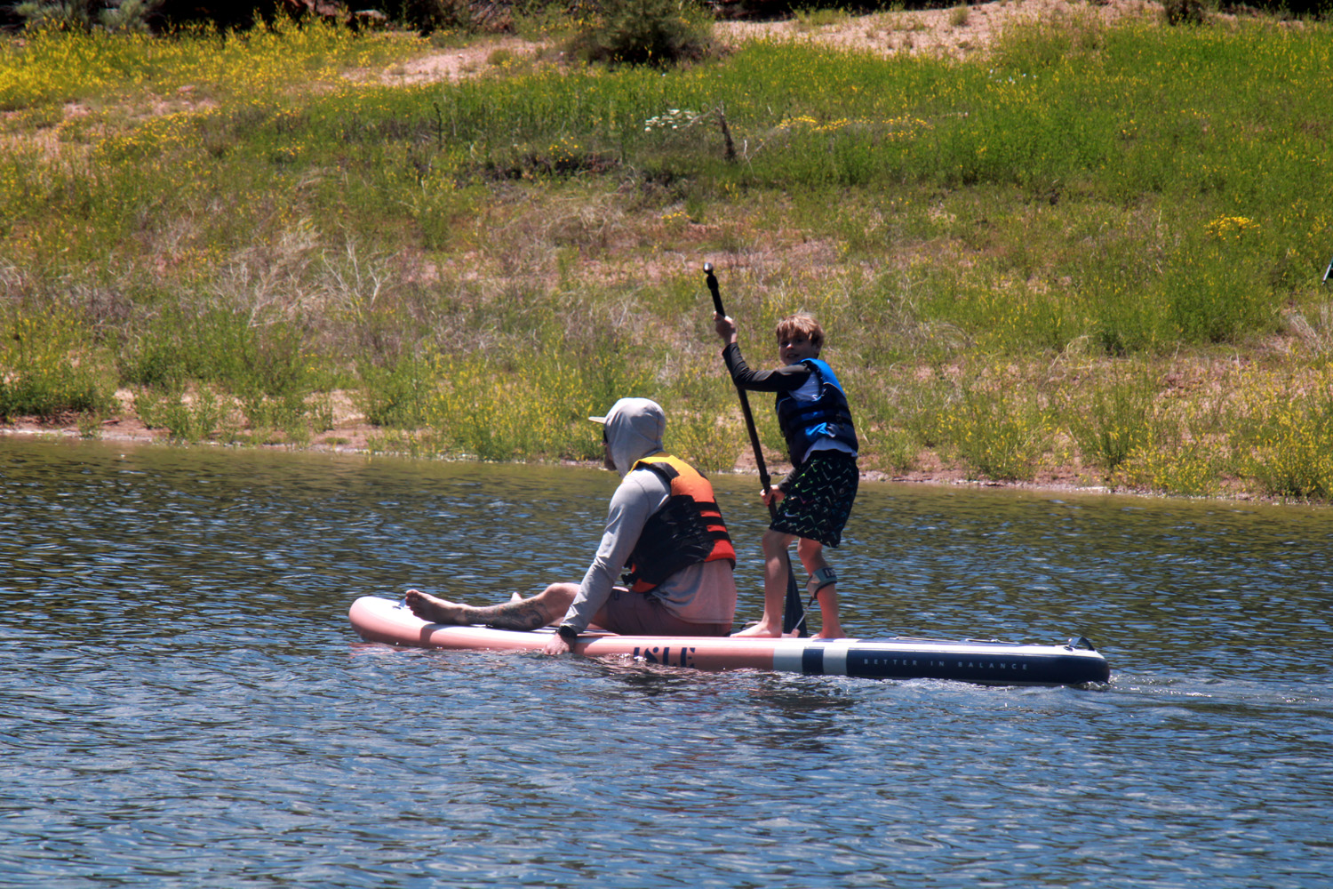
On Wednesday we drove north on US 191 in two vehicles to the Flaming Gorge Reservoir, which dams the Green River and creates a lake about 90 miles long in northern Utah and southern Wyoming. It was a somewhat long but very scenic drive, going up over an 8,000 foot pass with lots of aspens and high elevation evergreens. We were at a quiet cove near the tiny town of Dutch John, population 145. Teri and her sons had brought an inflatable paddleboard and other floating devices. In recognition of my permanent ban on entering any water other than a swimming pool, she had brought a nice folding chair for me. I believe everyone else went in, mostly trying to stay on their floaties and avoid complete immersion in the cold water. It was a short walk from the parking area to a place where we could set up by the water, and soon Colton was piloting the paddleboard into the lake, with Jack as a passenger. Teri was content with floating here and there as the breeze and current carried her. |
|
|
|
| Colton pilots the paddleboard with Jack as his passenger | Teri in her happy place |
|
|
| Johnny Upshaw and Mikie Liddle | Flaming Gorge Reservoir from near the dam |
|
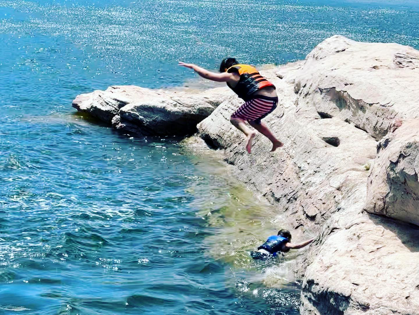
At one point everyone but me went down to a part of the lake where there were rocks from which you could jump into the water. I believe the three boys under 25 years of age all did this. There's an official rule prohibiting jumping from higher than ten feet, but there's some evidence this was enthusiastically violated. Of course, responsible adults made sure the water was deep enough and that there were no underwater hazards. |
|
|
|
|
 |
 |
| Colton is about to make a big splash | Jack takes dad for a ride |
|
We had brought a lunch, and everyone ate whenever they wished. I spent most of the time in my chair, but I did walk around a bit, enjoying the flowers and the rugged rock layers that surround the lake in this area. Eventually it was time to load up and make the long drive back to Vernal. Since it was two days till Teri's birthday, our dinner that night was her celebration, and she chose to return to the Vernal Brewing Company, which everyone had enjoyed Monday night. |
|
|
Oatman, Arches and Grand Canyon; Harpers Corner Road |
|
|
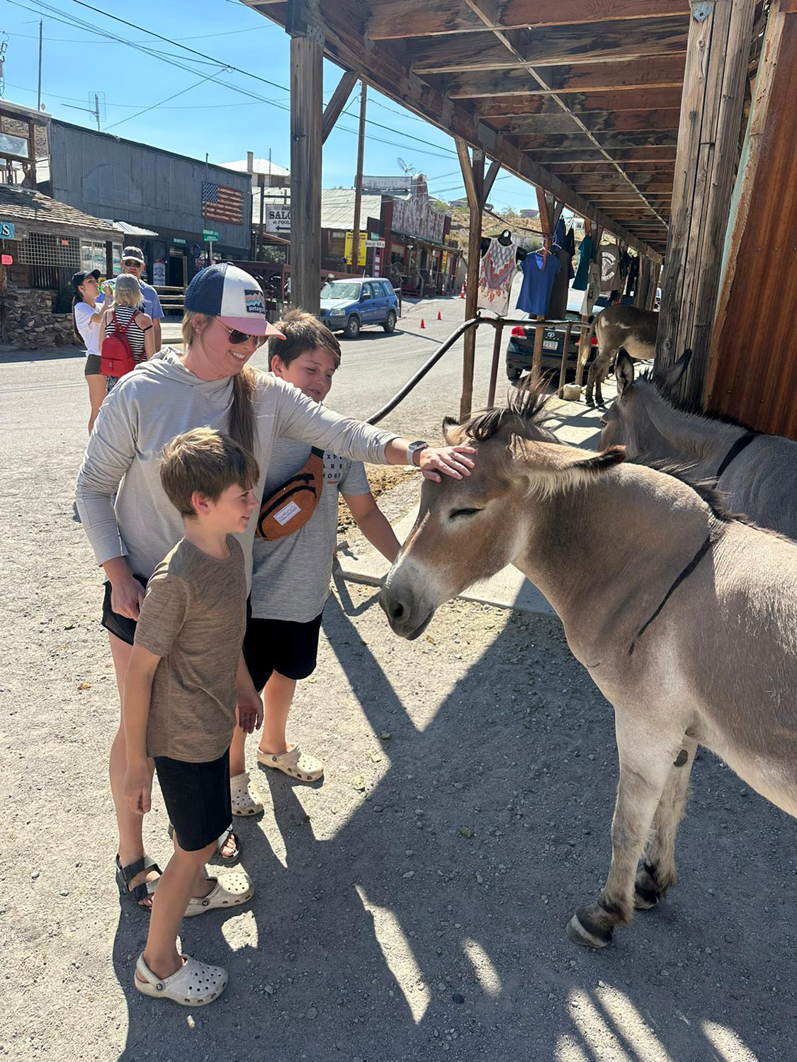
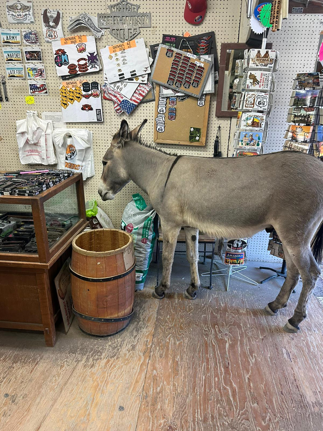
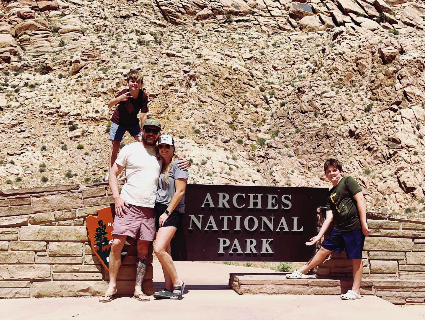
Thursday the Upshaw family checked out, and over two days, embarked on a quick visit to two more national parks plus Oatman AZ, famous for the "wild" burros that wander the streets of the town. Wild is a questionable word, since you can buy food to give to the burros on virtually every street. They went east from Vernal on US 40, southeast on Colorado 64 through Rangely, then south on CO 139.to I-70. There are a couple of possible routes to Arches here, and there is no report of their activities beyond this point. However, Brittany posted this summary at the end of the trip: "What a trip! Roughly 2,500 miles, 5 states, 5 national parks, and memories to last a lifetime. A HUGE THANK YOU to everyone who helped us out, either with the dogs, the boys, or just encouraged us along the way! We had a blast!" They also posted 12,000 words worth of pictures. |
|
|
|
| Meeting a "wild" burro in Oatman | You can see who rules this town |
|
|
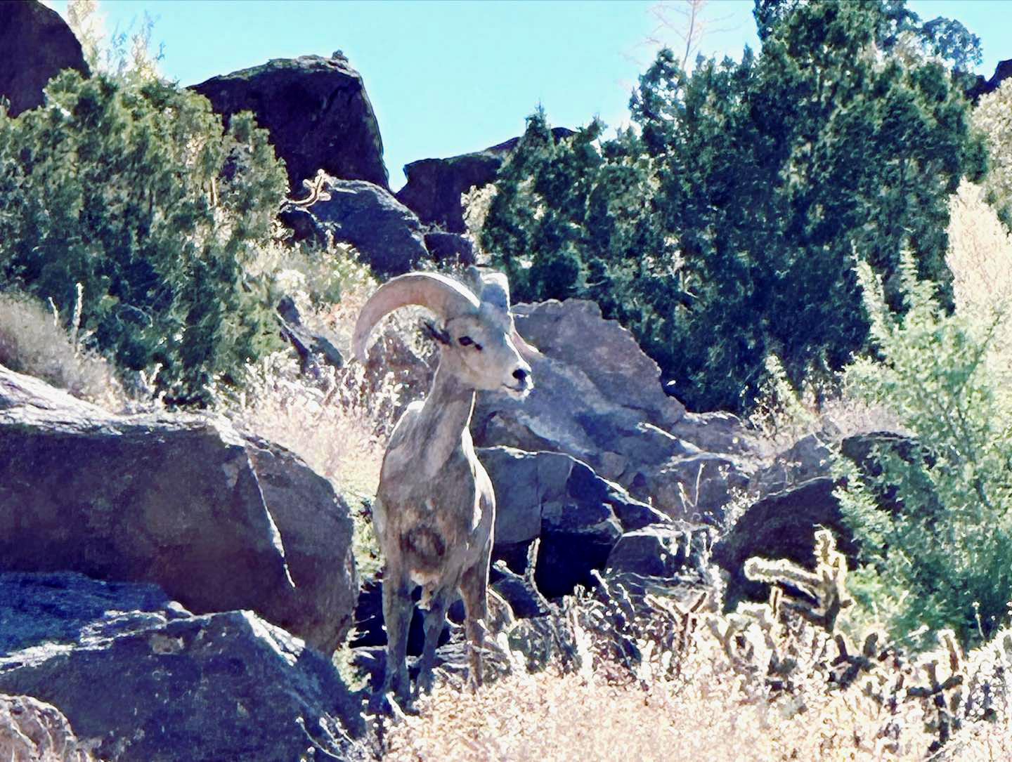
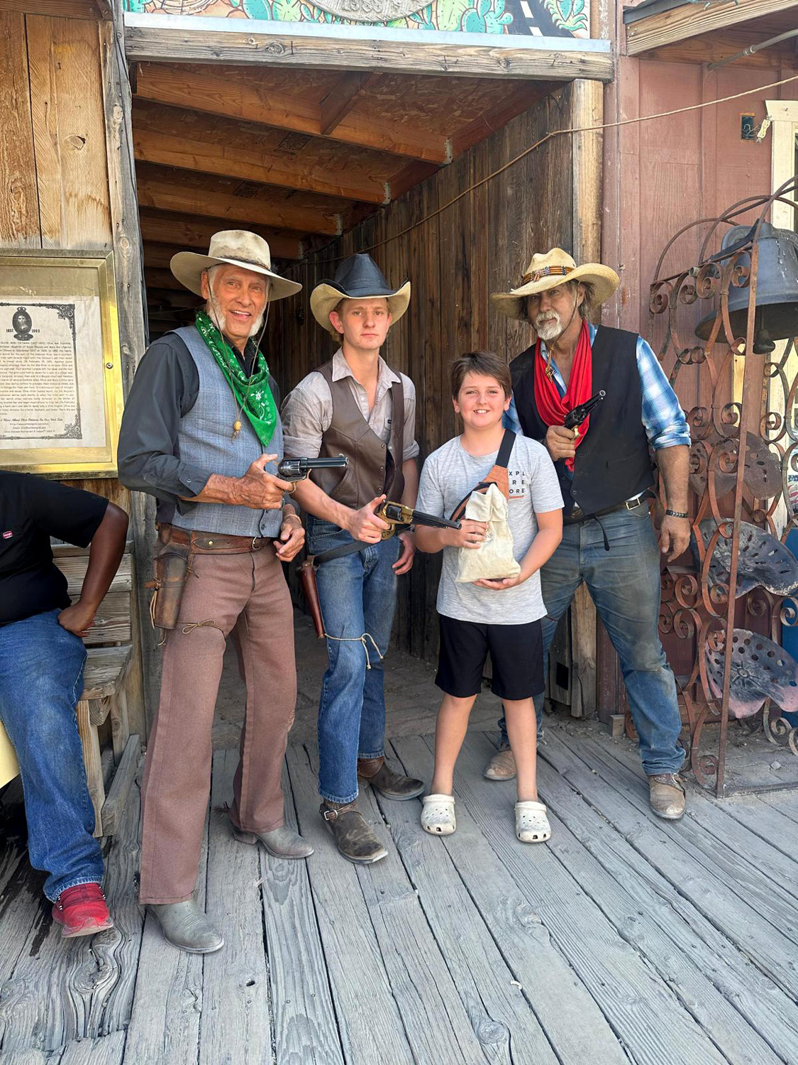
| A rare bighorn sheep sighting | They arrived in time for the gunfight |
|
|
| First visit to Arches | Johnny and Brittany at North and South Windows Arches |
|
|
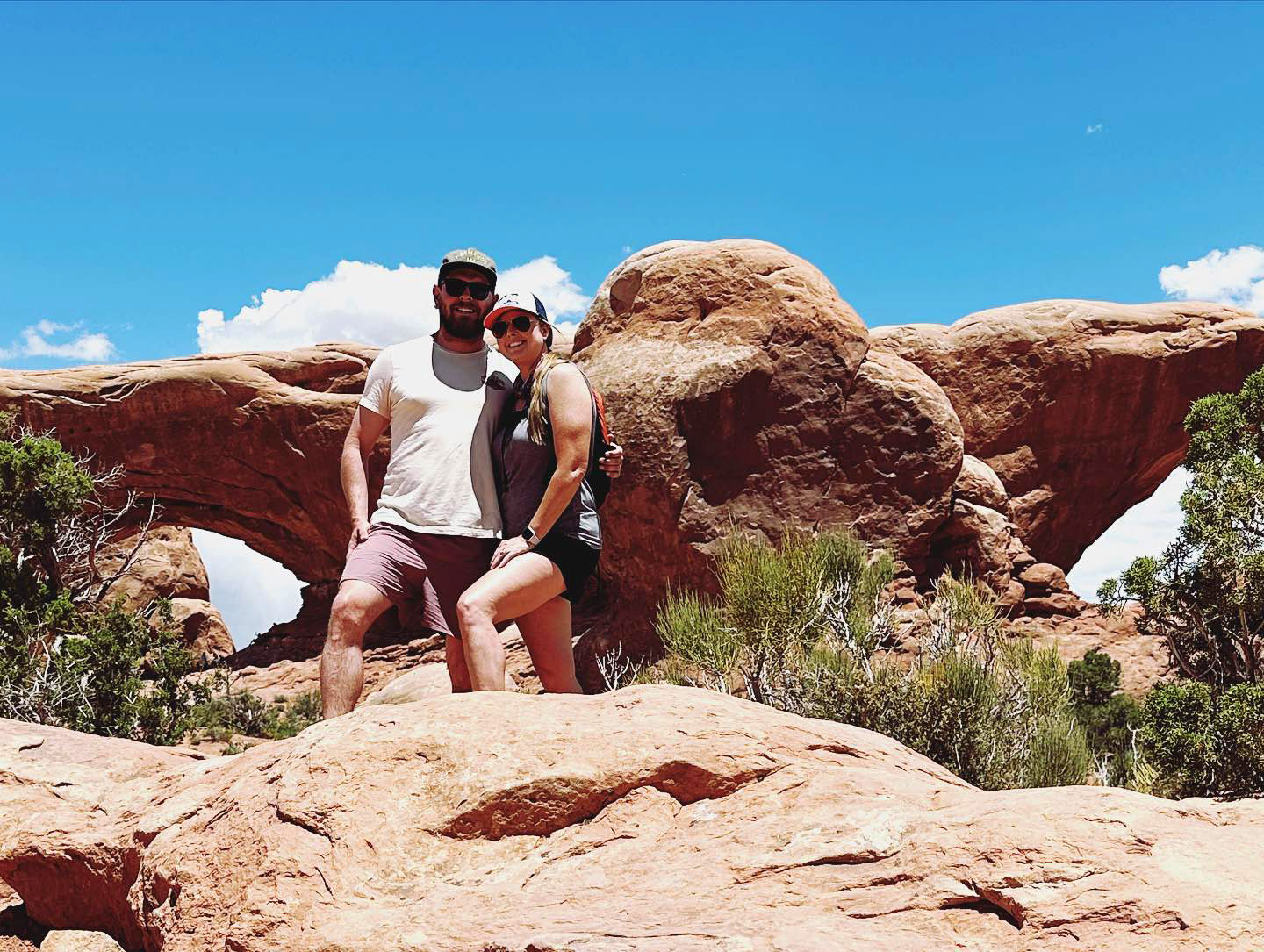
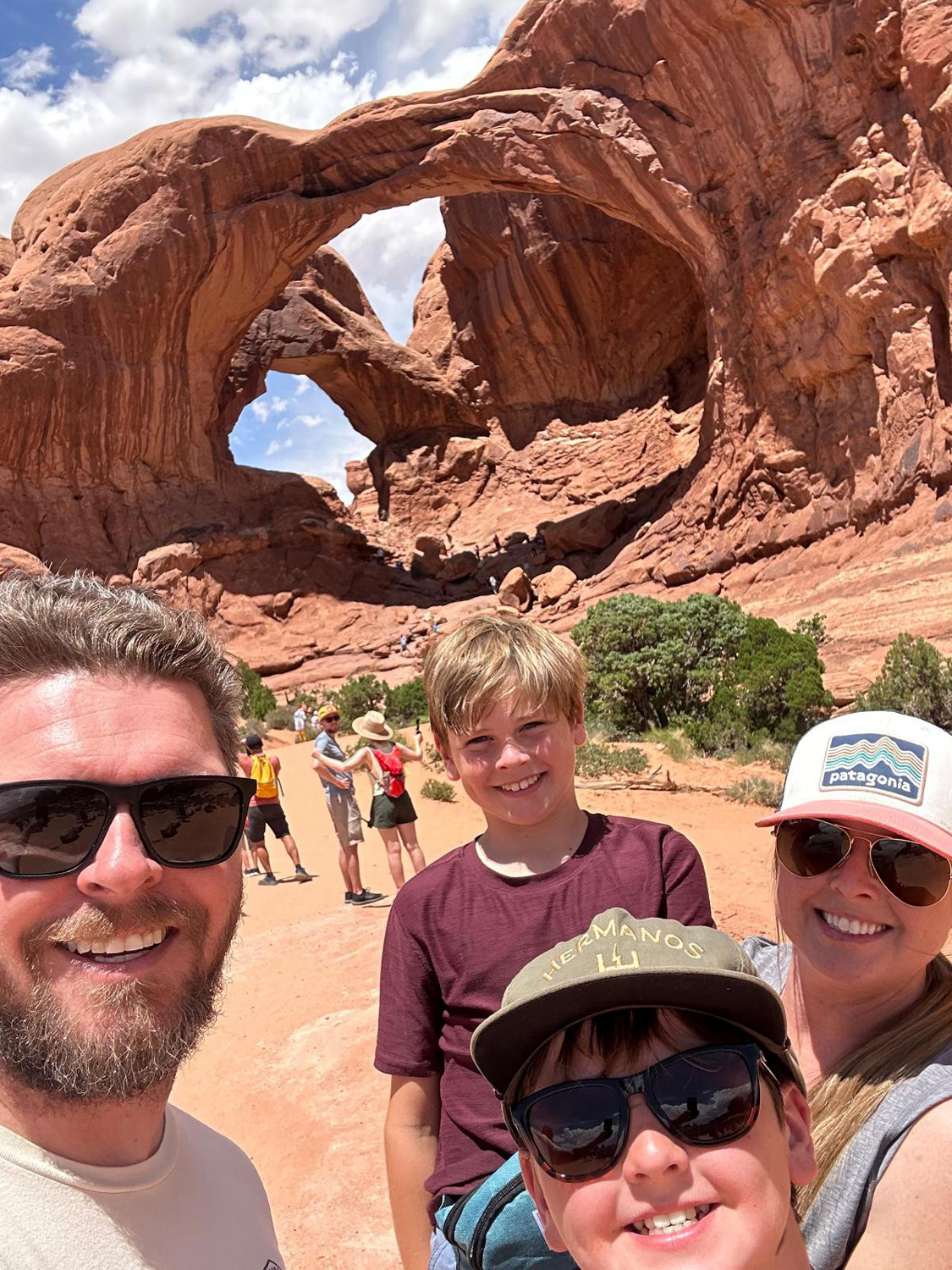
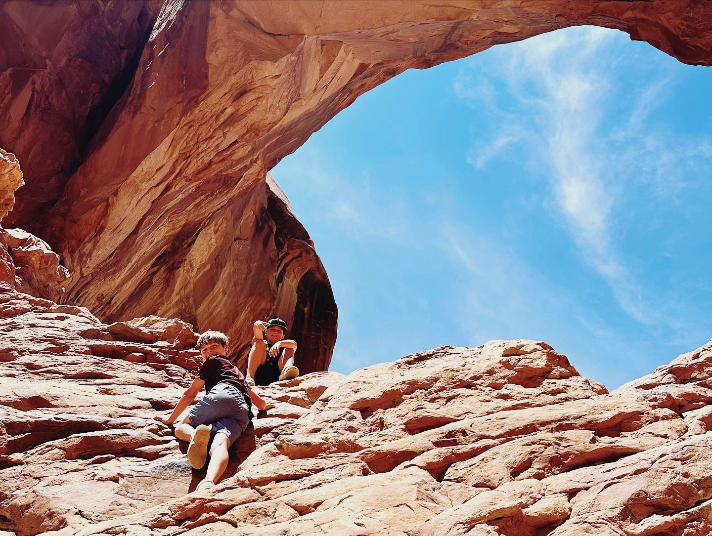
| At the huge, impressive Double Arch |
Jack and Colton, like many adventurous visitors, climb far up under the arch |
|
|
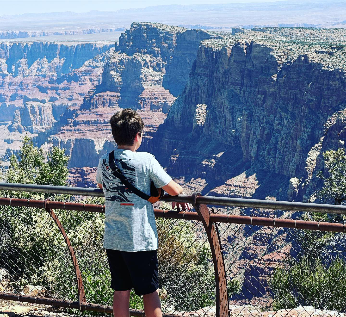
| Looking across the Grand Canyon to the North Rim | Johnny, Jack, Colton and Brittany |
|
|
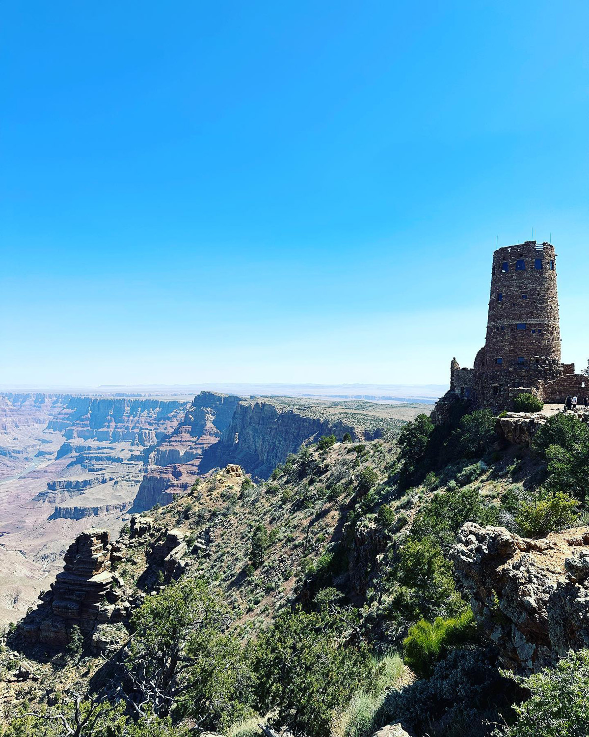
| Colton contemplates the work of millions of years of water | Desert View Watchtower |
|
Meanwhile, back in Utah, Teri, Mikie, Hayley and I also went to Colorado, to the canyon section of Dinosaur National Monument. We passed through the tiny town of Dinosaur, then turned north on the Harpers Corner Road, stopping briefly at the visitor center just off US 40. It was here that we encountered our old nemesis, the Great Mormon Cricket Invasion of 2023. The numbers here and on the road into the monument made our previous contact with them seem like nothing. In the parking lot we had to watch our step to avoid stepping on them (they are BIG and fat - up to three inches long). On the road into the monument, there were times when there were so many on the road that it looked like the pavement was moving. At a couple of stops we enjoyed the scenery through the window rather than get out into that horror movie scene. There were red streaks on the pavement where tires had smashed them by the thousands. A ranger at the visitor center said he had never seen them so bad. Normally they appear in the Colorado section, but usually not in Utah. They seek warmer locations and can travel about a mile in a day. Mikie did some quick research on his phone and learned that they can number in the billions. They eat crops and each other (but not enough of that apparently). Also, they are not Mormon, just got that name because so many Mormons live in the area, and they are not crickets, but a variety of katydids. |
|
|
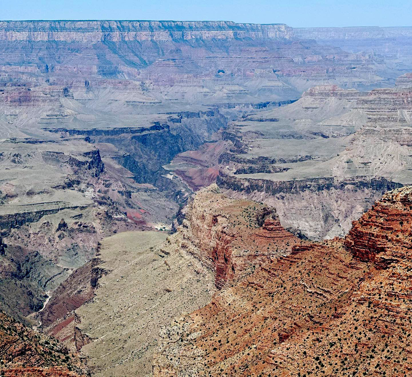
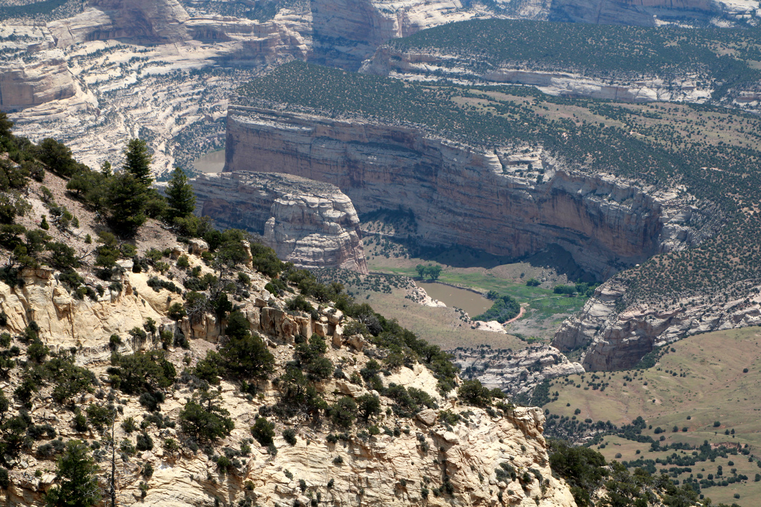
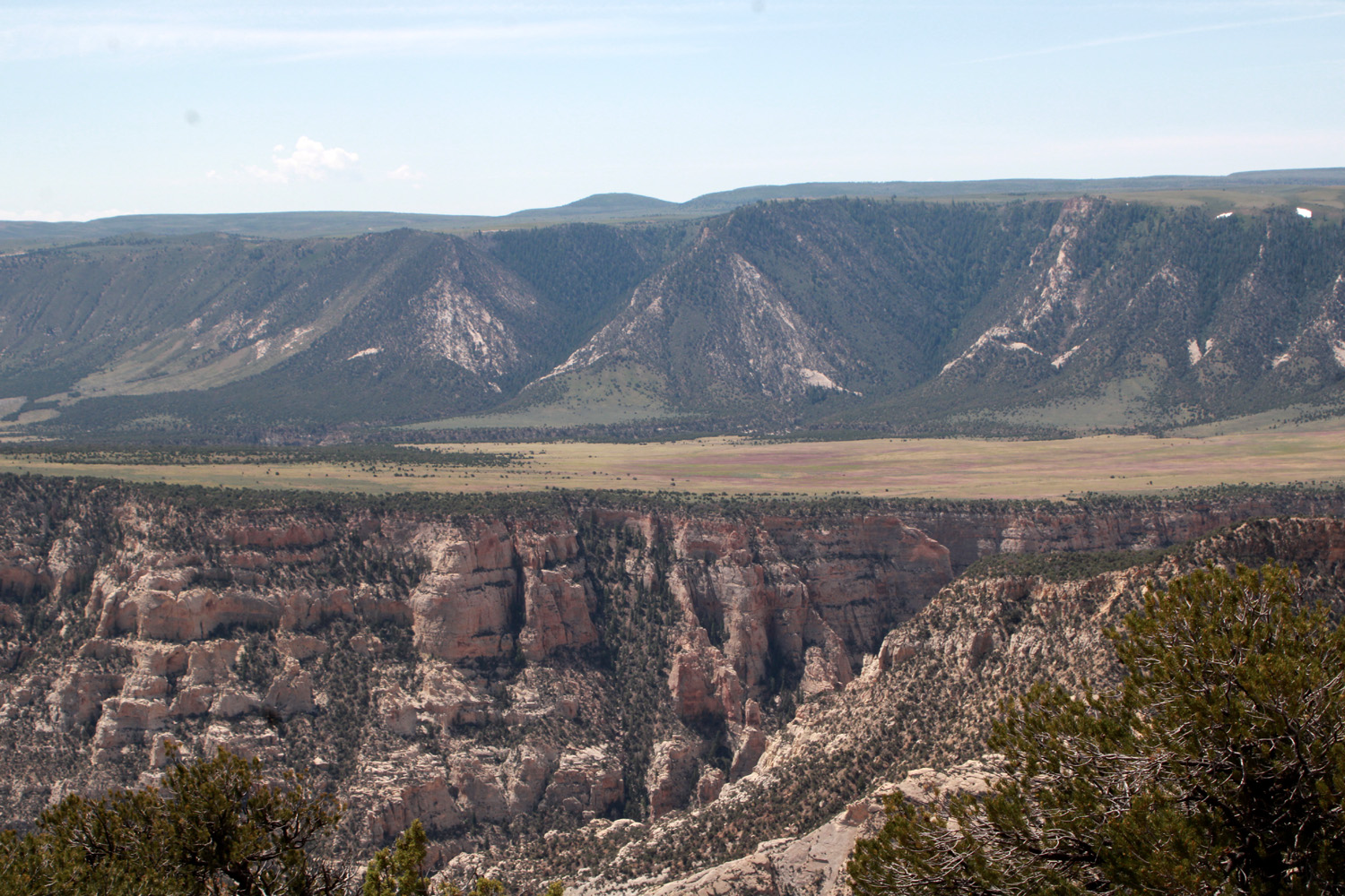
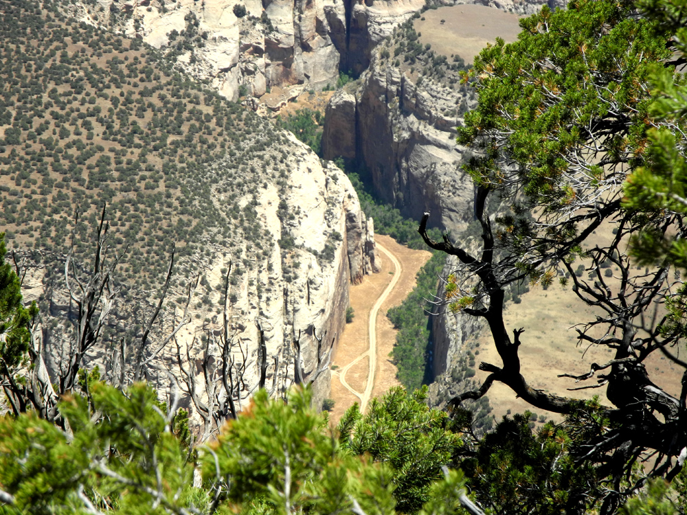
But enough of that. The Harpers Corner Road goes into canyon country, 30 miles from the visitor center, with a number of vista points along the way. Most of them are just off the road, or require only a short, easy walk, and the most dramatic are on the east side where you are looking down into the canyons of the Green and Yampa Rivers, which join in Echo Park. |
|
|
|
| Echo Park, where the Green and the Yampa meet | A plateau between the upper hills and the rugged canyon below |
|
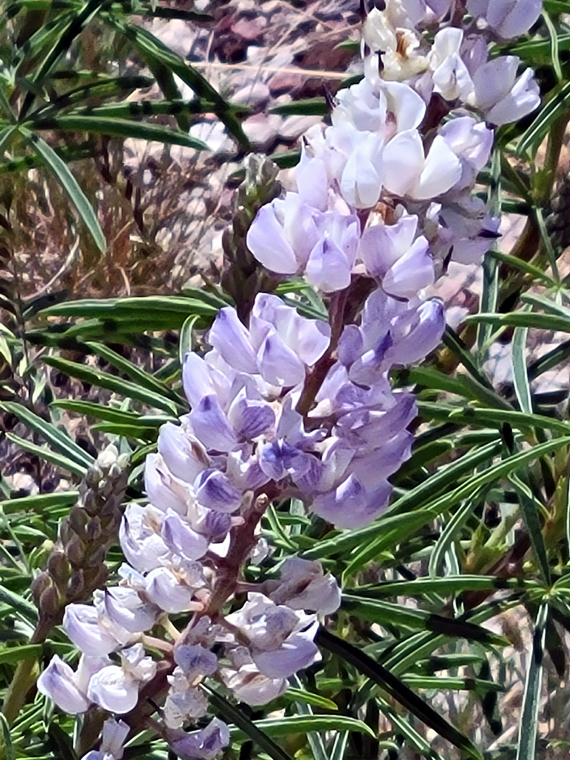
At the end of the road the Harpers Corner Trail goes 2.3 miles into the sage brush and junipers. The best views into the canyon are at the end of the trail. We did not go to the end, but only about a quarter mile (the photo is from 2014). There are really no canyon views until the last part of the trail, but we enjoyed many wildflowers here and everywhere we stopped during this day. Much of the route was high Colorado Plateau country, with occasional cows and acres of sage brush. |
|
|
|
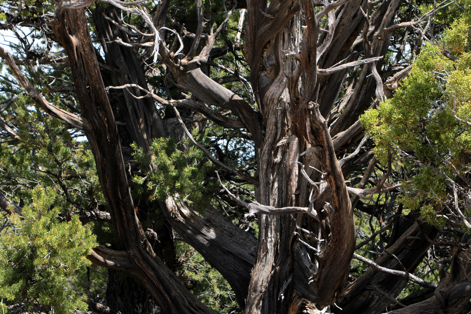
| Twisted Utah junipers are a common sight | Hayley and Mikie at a vista point |
|
|
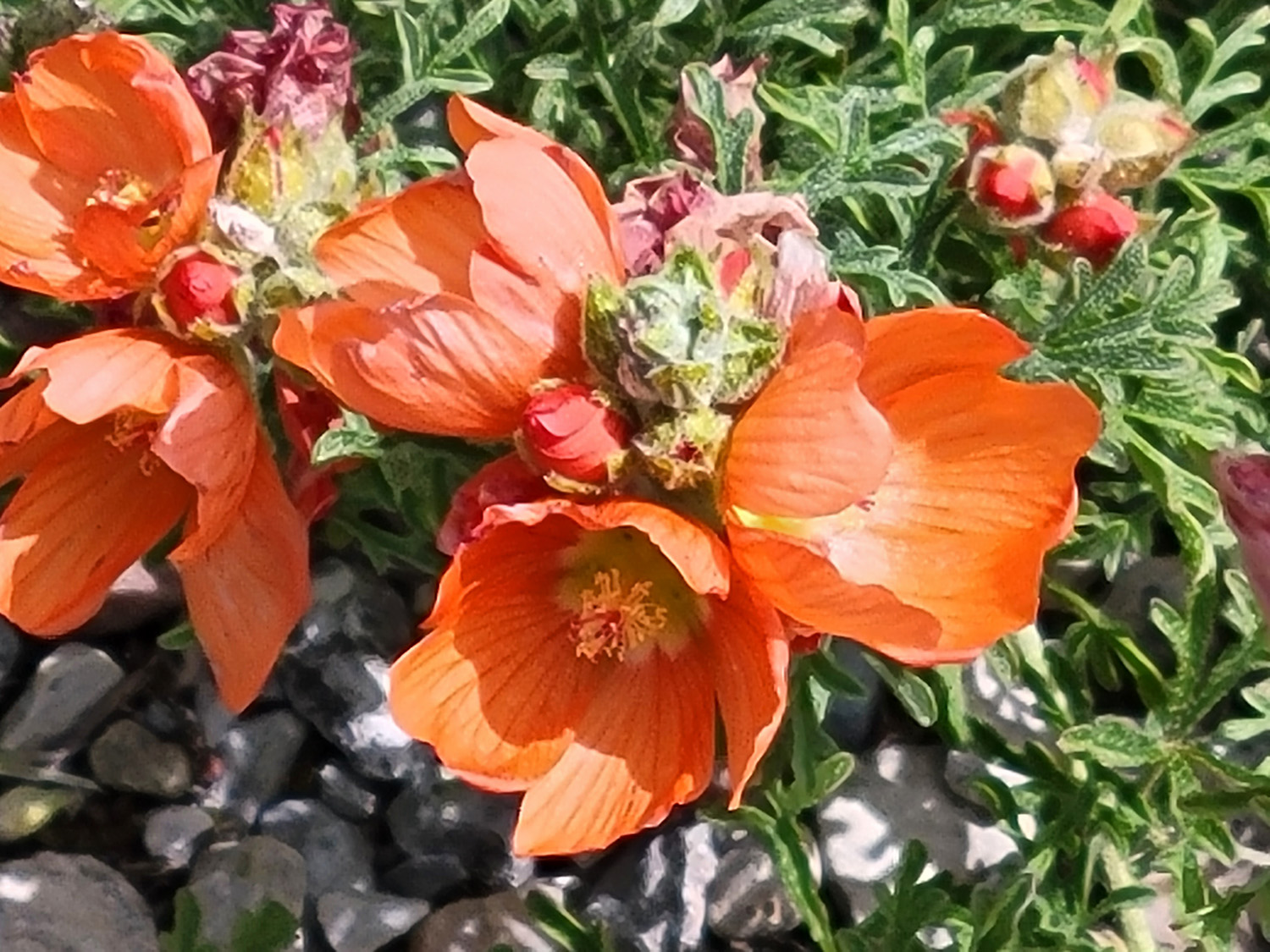
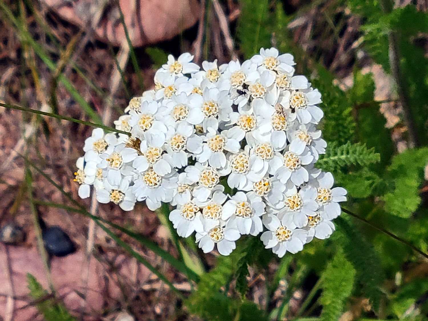
| The Utah Wildflowers site identifies these as scarlet globemallow | The web site did not display this intriguing white flower |
|
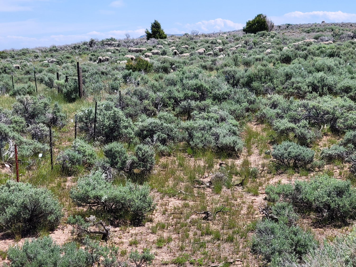
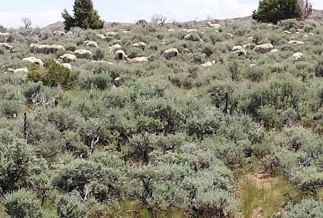
We had our lunch at the Canyon View picnic area, which had very few crickets, and a number of flowers. Driving back out we came to a place where we saw what appeared to be a number of light-colored boulders among the sage brush Then we started to ask ourselves if they were in fact sheep. We had to stop and take pictures to prove to ourselves and others what we actually saw. |
|
|
|
| Boulders in the sage brush? | No, sheep! |
|
We made it safely back through the crickets to US 40 and back to our motel. Mikie and Hayley went golfing, but Teri and I focused on getting ready to leave the next day, after having enjoyed a fantastic trip with family. |
|
| Heading Home | |
|
Friday the 23rd arrived way too soon and it was time to head for home. Mikie and Hayley, like his brother, crammed a few more activities into their final days. They drove on US 40 to Salt Lake City, where they took I-80 to Reno NV and saw a triple-A minor league baseball game between the Reno Aces and the Albuquerque Isotopes (Reno won). The next day they returned to California but went north to Lassen National Park. The road through the park had only been cleared the first few miles, but they visited the boiling mud pots and walked the road a ways. Teri and I had visited the park with Mikie in 2019, and did some walking on that same road in 2017. They finished a very long day with a visit to a friend in Susanville, where Mikie worked for a while, before returning home to Clovis and/or Hanford. Teri and I had decided to get home the shortest, quickest way, no "fun" stops this time. She made reservations at a motel in North Las Vegas. This gave us a very long drive of about 530 miles on Friday, but we were rewarded by a relatively fast and easy trip of about 400 miles the next day. In honor of Teri's birthday Friday we stopped at a Denny's in Beaver UT instead of our usual quick snack of whatever we had in the ice chest. She received greetings from her Mom, Jackie, and sister, Jennifer, and talked with both by phone during stops. Driving into Vernal on US 191 at the start of our adventure we had noticed some spiky yellow flowers along the road, fairly thick in some areas. On our way home I managed to get a good look at them and saw that they were a kind of yucca, with the typical bayonet leaves but unusually short flower stalks. Like most roads in the mountains of Utah, we enjoyed a lot of fantastic scenic views. Heading into the Virgin River Gorge beyond St. George we got an alert that there was slow traffic ahead, which of course would be at the bridge under construction near Mesquite NV. We knew there was no feasible bypass from this direction, but it turned out that we slowed to 50 MPH for about three minutes. However, northbound traffic on I-15 was backed up a couple of miles, just as it had been on our first day of travel. |
|
|
|
 |
|
Short yellow-flowered yucca were thick along one section of US 191 |
We enjoyed lots of scenic views along US 191 |
|
We got up at six a.m. Friday, so it was not terribly late when we arrived in North Las Vegas. The next day we were back at my house in Clovis before 2 p.m. Faithful readers know that we never run out of places to go, and during this trip we discussed an already scheduled visit to June Lake in the eastern Sierra, and a tentative family outing to Arches National Park, probably in 2025. Keep an eye on your In Box. |
|
|
Thoughts and Observations |
|
|
From an on-line review of Harpers Corner Trail: Currently the overview area and parking lot is infested with Mormon crickets. The ground is covered with them. It is like a scene out of a horror movie. I was going to leave like several other motorists but my little bug-loving son insisted on us hiking. They are not as bad as they look. Harmless but creepy nonetheless. Luckily the number of crickets dwindled as we hiked and there were barely any at the end of the trail so we were able to spend a good 40 minutes up there. From a newspaper article: When a large band crosses a road, it can create a safety hazard by causing distracted revulsion on the part of the driver, Could be worse: We saw these creepy little beasts in a largely uninhabited de facto wilderness. They are also invading towns in Nevada, as this video shows: Crickets on You Tube Dinosaur the Town: A very small place, considering the size of the beasts it honors. I wanted to stay there for the second part of my 2014 visit, but could not find a motel on line, and driving through the town, the two facilities I saw were not inviting. It does boast the Colorado Welcome Center, which has some nice exhibits, and friendly staff who steered me to some nearby places I would not otherwise have known about. Microtel in Vernal: This was a very nice facility, with an indoor pool that the boys especially enjoyed. The staff was friendly and helpful, but not trained to deal with billing issues. Like many places, they billed my credit card an extra amount "just in case." They did not tell me they were doing this, and I receive an email every time my card is charged. I received three such messages, with amounts totaling 50% more than the expected total. The front desk staff said I would need to talk to the manager, who would be in "about 9, if he does come in." I was never able to see him, and left a message to call, and also emailed my concerns. It turned out that the charges were "pending" and they had not activated any of them. The manager left a voice mail which I did not see till we left. In the long run, the correct charges were billed, but it made for a bit of frustration. Those damn dams: When you search for "Flaming Gorge Dam" on the Internet, a summary paragraph appears that notes that the project submerged "four distinct gorges of the Green River." One of these was the actual Flaming Gorge, named by John Wesley Powell for the "brilliant, flaming red of its rocks [when the sun shone upon them]." The Wikipedia entry further notes that "The dam and reservoir have fragmented the upper Green River, blocking fish migration and significantly impacting many native species." The dam also stilled the rushing waters that gave the Gates of Lodore it's name, changing a wild stretch that terrified the Powell expedition into a casual raft ride for today's tourists. All this makes me question the wisdom of those projects that "tamed" the Green and Colorado Rivers. Even more problematic is Glen Canyon Dam, which destroyed many cultural areas sacred to the native people of the area. The waters of Lake Powell intruded into the Rainbow Bridge National Monument, "whose 290-foot high natural arch is the highest in North America, and is a sacred site to the Navajo people." Plans to keep the lake level below the monument were eventually scrapped, to the everlasting dismay of the Dineh people and environmentalists. These and other environmental crimes are discussed in a fairly even-handed way in Mark Reisner's Cadillac Desert, which I read early this year. In a dam-building frenzy, mostly in mid-20th Century, the Army Corps of Engineers and the Bureau of Reclamation sought to dam virtually every river, creek and stream. When the economic benefits did not justify the cost, they made up additional "benefits" until the figures came out right. In some cases they started projects that did not yet have government approval, thinking correctly that once they had spent the first few million dollars there would be no stomach to halt the project. They built one dam in a place that engineers warned was unstable and not suitable. Although normal practice is to fill a new reservoir over a few years, they took advantage of heavy rains and let it fill as soon as it was finished. When it washed out, destroying two towns and a number of lives, they shrugged and moved on to the next project. At one time they wanted to build a dam on the Green River in Echo Park, in one of the most dramatically beautiful sections of Dinosaur National Monument. Fortunately this was halted by public outcry. Anything else I have to say on the subject would just shock you with the extent of my knowledge of profanity. Here's what a few others had to say: Drought and the Colorado River Basin David Brower's Deal with the Devil
I did it before and I'd do it again: When I visited Dinosaur in 2014 I knew I had to take family members there someday. It turned out even better than I expected, with everyone getting to do something special to them (fishing, lake swimming), while we hit the highlights together, and also enjoyed several great meals in local restaurants. We're talking about a family visit to Arches, probably in 2025. --Dick Estel, July 2023 Due to the large size of this report, the additional photos that would normally appear at this section of the page are on a separate page |
|