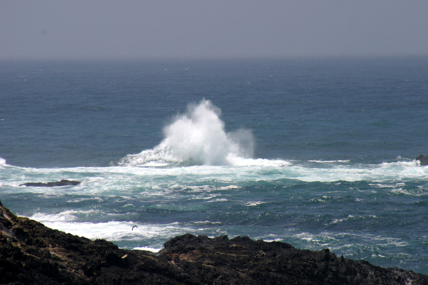
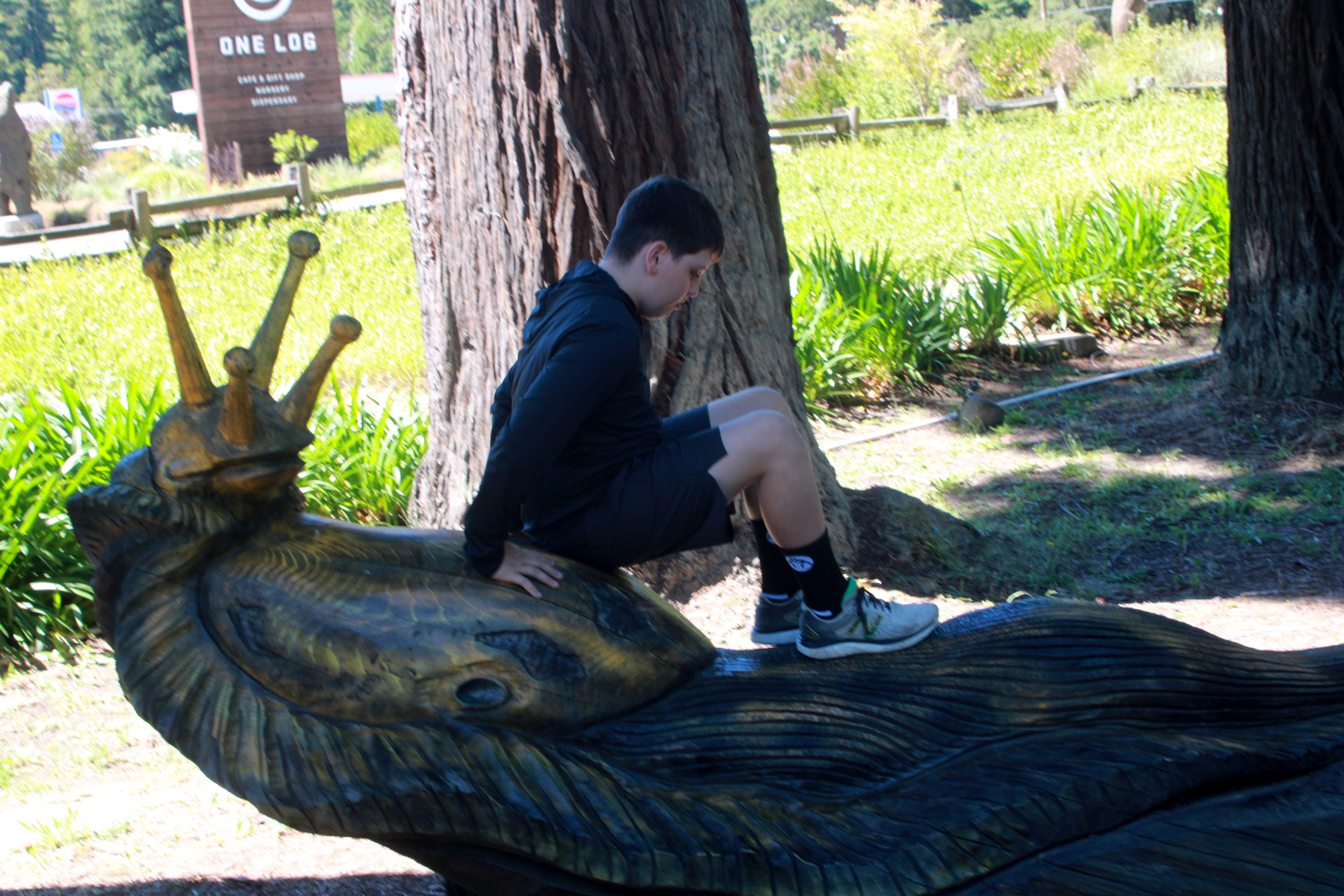
Photo from 2011


|
Mendocino Coast |
|
| Photos Related Links More Travel Reports Other Adventures of 2024 | |
| Russian
Gulch Mendocino Village
Fort Bragg etc.
Avenue of the Giants
Shopping & Skunk Train Jug Handle Reserve & Point Cabrillo Light Station |
|
|
The planning for this ambitious outing started in November of 2023, at which time it seemed impossibly far in the future. Then suddenly it was a month away, then a week, then it was time to pack and go. And all too soon it was over. We're famous for having to switch to Plan B or even C, and this time was no exception. The traveling party was supposed to include myself Dick Estel, older daughter Teri Liddle, older grandson Johnny Upshaw, his wife Brittany, their two sons, Colton and Jack; younger grandson Mike Liddle and his girlfriend Hayley Olivas. Not long after the reservations were made and paid for, Mike informed us that he and Hayley were out, because he had mandatory training at work that week. The motel payment was non-refundable, but Teri and I decided the worst case Plan B scenario was that we could each have our own room. Then the training schedule changed, and Mike and Hayley were back in, but only for Saturday through Tuesday. Meanwhile great grandson Colton became very involved with baseball, which culminated in a week-long tournament that matched up with our week on the north coast. Teri and I would still take Jack with us. As it turned out, Colton's team had a rough season, and they were out of the tournament by Monday, so the rest of the Upshaw's were able to join us on Tuesday. The downside here was that Teri's sons (Mike and Johnny) would not be together for any part of the trip. Such is the world of down-alphabet plans. |
|
 |
 |
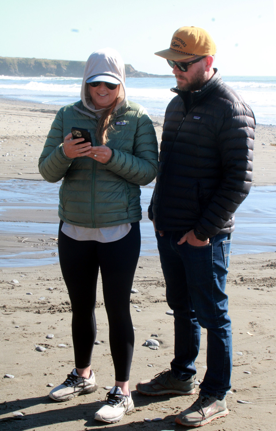
| Hayley, Mike, Jack and Teri ready to hike in Russian Gulch | These tall grass seeds are common throughout the Mendocino Coast |
|
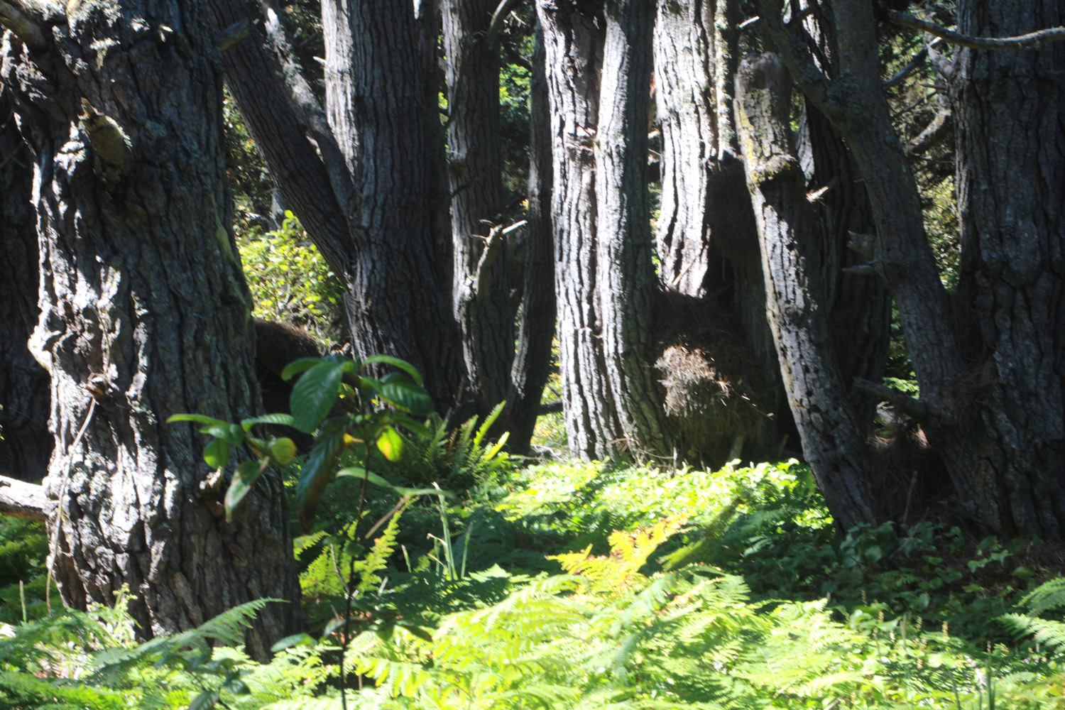
As mentioned, our destination was on the northern coast of California, specifically Mendocino County. We would stay at a motel in Fort Bragg, and visit Mendocino Village, nine miles south, and several beaches and state parks that lie between the two towns. While I'm not a big ocean fan, I had a great time in this area in 2011 and 2012, and was ready to introduce the locale to members of my family, who had either never been there or had not spent any significant time. Teri, Jack and I got an early start in my Honda CR-V hybrid on Saturday, June 22, with Mike and Hayley about an hour behind us. Getting from the middle of the state to the coast north of the bay area is NOT half the fun. Teri found driving in Bay Area traffic very stressful. I've tried several routes, none of them ideal. This time we went north on State 99, then west from Manteca on a series of highways that took us north through Oakland, across the Richmond-San Rafael Bridge, and on to US 101. We met up with Mike and Hayley near Santa Rosa for a short lunch and rest stop. Mike had played travel hockey as a teenager and wanted to show Hayley the famous "Peanuts" rink in Santa Rosa, built and originally owned by Charles Schulz. Jack was interested and rode with them the rest of the way. Teri and I continued up 101, then northwest on State 128, which leaves the US highway at Cloverdale, goes through Boonville and a couple of tiny towns, and joins CA Highway 1 a few miles south of Mendocino. This is a scenic 70 mile drive that goes past farm country with oaks and dry grass, a bunch of wine vineyards, and then through redwood country, with the road often shaded by branches joining overhead. Much of the land along the coast here is a level headland, stretching in from the ocean anywhere from a few hundred yards to a mile, and bordered on the west by steep cliffs above a rocky shore. Mendocino Village, as well as other infrastructure along Highway 1, is situated on this plain, and we turned in on the southernmost street in the town, and drove around the outer perimeter, close to the cliffs. We made a quick pit stop, but did not linger, since we were eager to reach our destination. The road returned to Highway 1 north of town, and we had a drive of just under ten miles to reach Fort Bragg. We had three adjacent ground floor rooms at the Baymont by Wyndham, and went through the fastest and easiest check-in in the history of motels. Teri and I got some of our stuff unloaded, and were soon joined by Mike, Hayley and Jack. On these trips we bring food for breakfast and lunch, and some dinners. The rooms had microwaves, and very small refrigerators, and a limited "free" breakfast. Teri had brought stuff to make tacos, one of Jack's favorites, for that first night, and we enjoyed supper in her room. Before leaving home, we had discussed things we wanted to do, with me posing as an experienced traveler to this area. Sunday morning we drove south about eight miles to Russian Gulch State Park, which like most parks in the area has a segment on the coastal headlands, and extends inland. A trail goes up along a small creek through redwoods, towering hardwoods, and plenty of small shrubs and plants. This is the Fern Canyon Trail, and I learned while preparing this report that it's closed intermittently throughout the summer. It closed three days after we were there, so we were lucky to be there at the right time. |
|
 |
 |
| Top of a coast redwood on the Russian Gulch trail | These thick-stemmed plans look like they came from a planet in Star Trek |
|
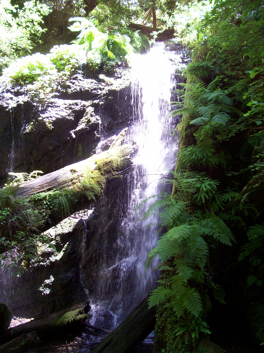
We are always glad to see one of the coastal country's unique creatures, the banana slug, a special treat for Jack, who is a fan of reptiles, amphibians and creepy crawlies. We've discussed why it is that we like these slimy beasts, while we hate the small brown ones that inhabit our gardens at home. My theory is that it's because they know their place and are NOT in our gardens. Jack predicted that we would see five, but in the end we had to be satisfied with four . This was the first time we had seen them up a tree, wedged between cracks in the bark; previously they have always been on the ground. Teri would later see number five on our last day there. We also saw plenty of wildflowers, berries, and other stuff. What we did NOT see was the waterfall that is at the end of the hike. It had become obvious that the distance was more than we wanted to walk, but, as I explained, it's a fairly small although charming fall, as seen in this 2012 photo, so we did not miss much. |
|
 |
 |
| Measuring the slug | Columbine blossom adds a bright red spot among the green |
 |
 |
| Unknown daisy-like flowers | Close view of the "Star Trek" plant's blossoms |
|
One of the more interesting sights along the trail were what Jack called "Grass Trees." These were plants, ranging from a few inches to several feet in height, with long, thin needle-like leaves that resembled grass growing horizontally. These plants appear to be very fragile - Jack pulled one stalk toward him and it did not straighten back up; another one collapsed as soon as he touched it. |
|
 |
 |
| Jack called these plants "grass trees" | Botanist Jack and the plants he named |
|
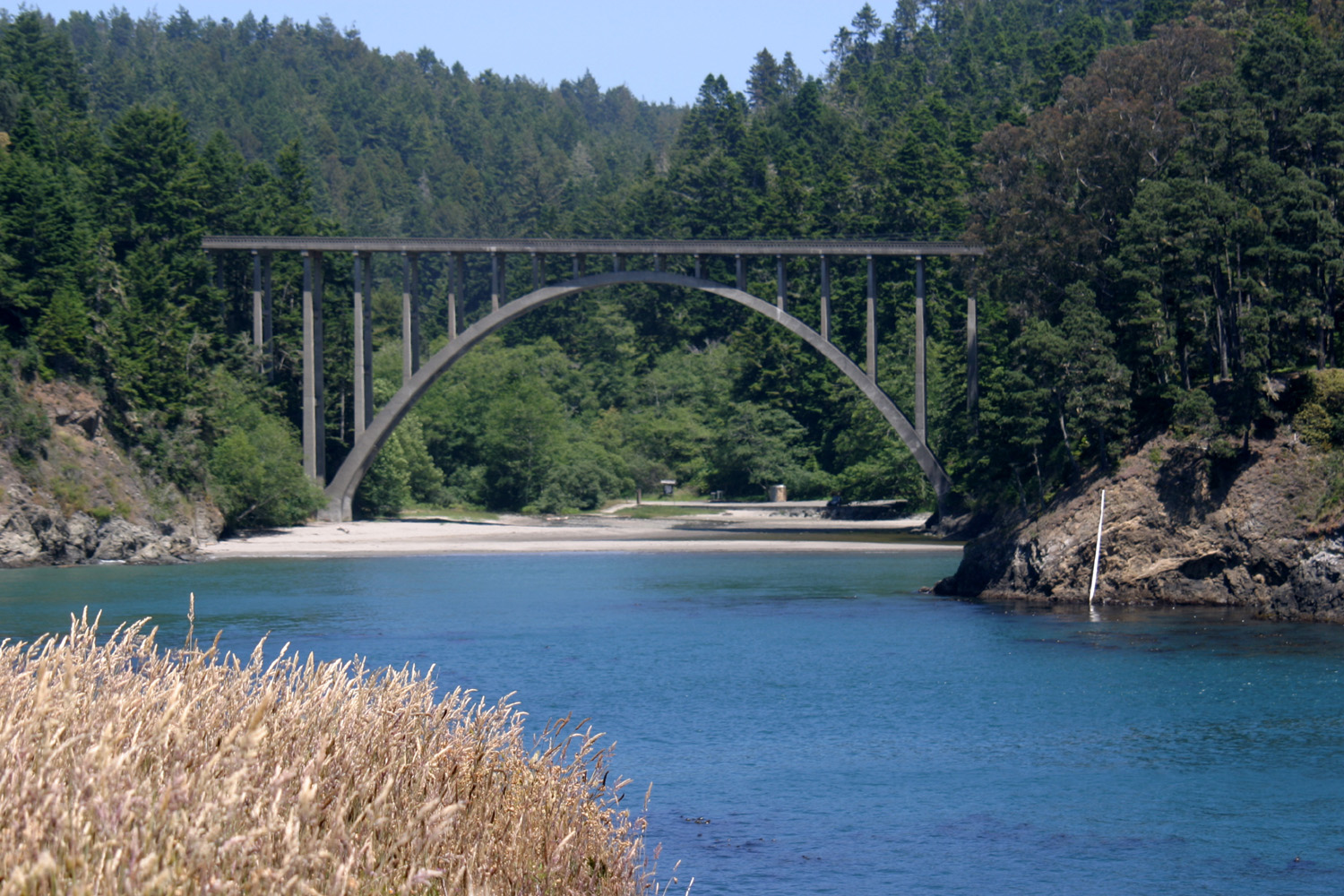
When we got back to our starting point we drove a short distance within the park to a small beach under the iconic Highway 1 bridge over the creek. Getting to the beach from our parking place required crossing the creek, and there was no safe spot for me to cross without wading. I've crossed plenty of creeks stepping from rock to rock, so I don't have to do it anymore. I was content to sit on a retaining wall below the parking lot and enjoy the view. The Frederick W. Panhorst Bridge, completed in 1940, is similar to nearby spans at Jug Handle State Natural Reserve and Hare Creek, and according to Wikipedia, is "a reinforced concrete open-spandrel deck arch bridge." Don't say you never learn anything from these reports. I actually prefer this view looking back inland from the headlands that I photographed in 2011. After a period of fun on the beach, we drove out toward the entrance, but turned west to drive to a parking lot on the headlands, and walked on a trail that winds along the edge of the cliff. There are unofficial trails in several places across the grass-covered plain, and we used one of these as a shortcut back to the parking area, and returned to Fort Bragg, ready for dinner. |
|
 |
 |
| Highway 1 bridge over Russian Gulch | These
subdued colors don't appear till about an hour after the sun dips into the ocean |
|
A week earlier we had celebrated Teri's birthday at her mobile home park, although today was her actual day. Mike announced that he would take us all out to dinner for his mom's birthday, so we went to the Noyo Fish Company, near the harbor. The Noyo River runs into the ocean on the south side of Fort Bragg, and a road winds down to the bottom where there is a harbor, a number of restaurants, and beach access. I don't care much for seafood, so I had a beef dish that was very good, and Jack had a burger, while the others took advantage of the fresh caught menu offerings. We ordered at a counter inside, found seats out where we had a view of the harbor, and enjoyed our food after plenty of exercise to enhance our appetites. We finished the day with a visit to Glass Beach, a place "filled with seaglass," i.e. shards from bottles and other sources that have been worn down by the action of sand and waves. The reality does not match the hype; apparently all the large pieces have been gathered. Nonetheless, Jack, Hayley and Mike had a good time digging in the sand, and returned with handfulls of sand in which you could spot a few tiny bits of glass. Back at the motel, we watched the moment when the sun disappeared entirely into the ocean, and captured shades of purple, pink and blue as the light faded. |
|
| Mendocino Village | |
|
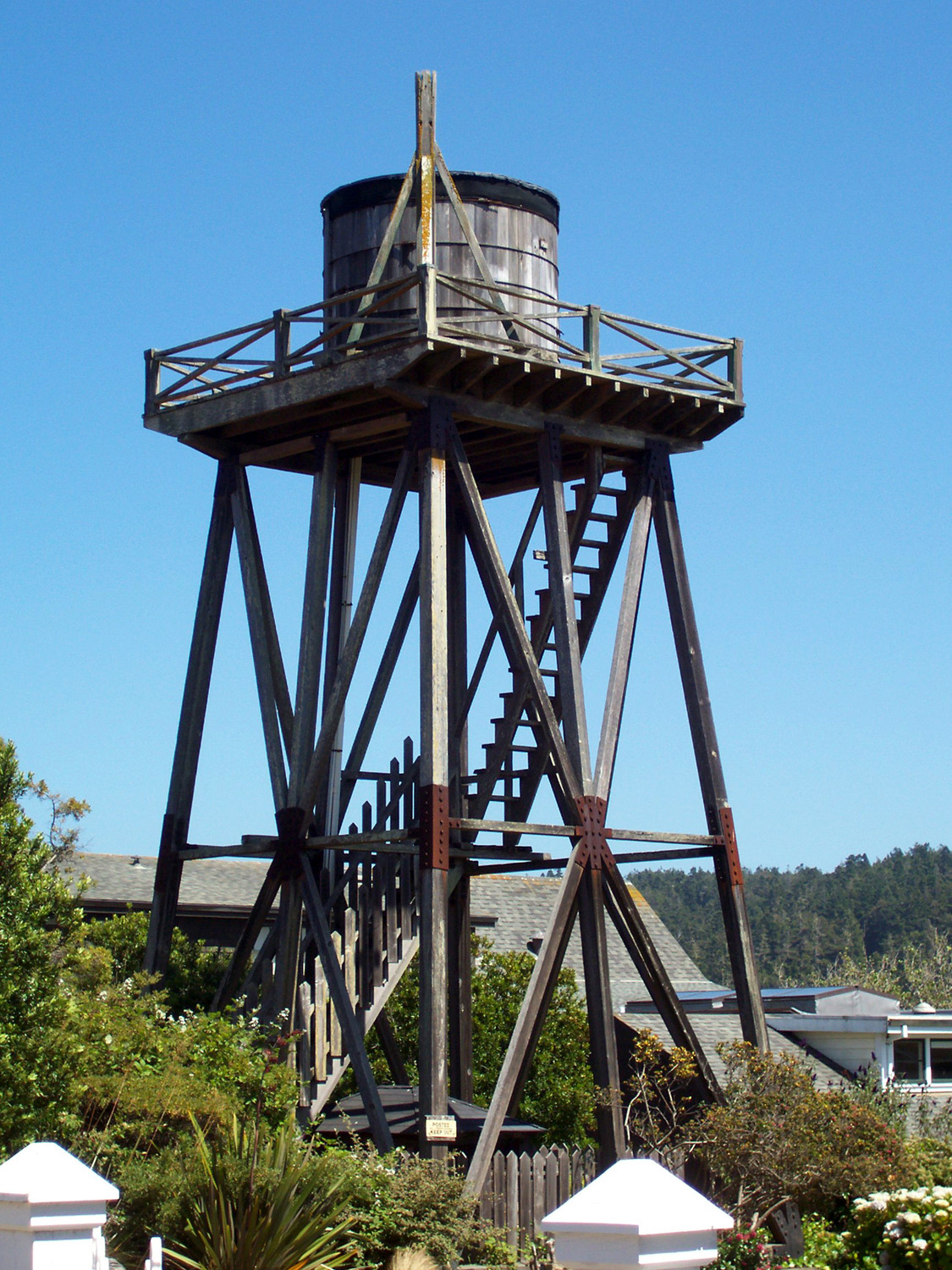
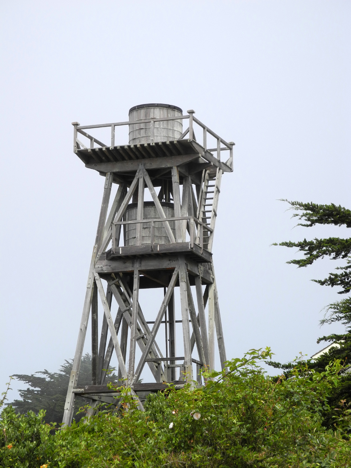
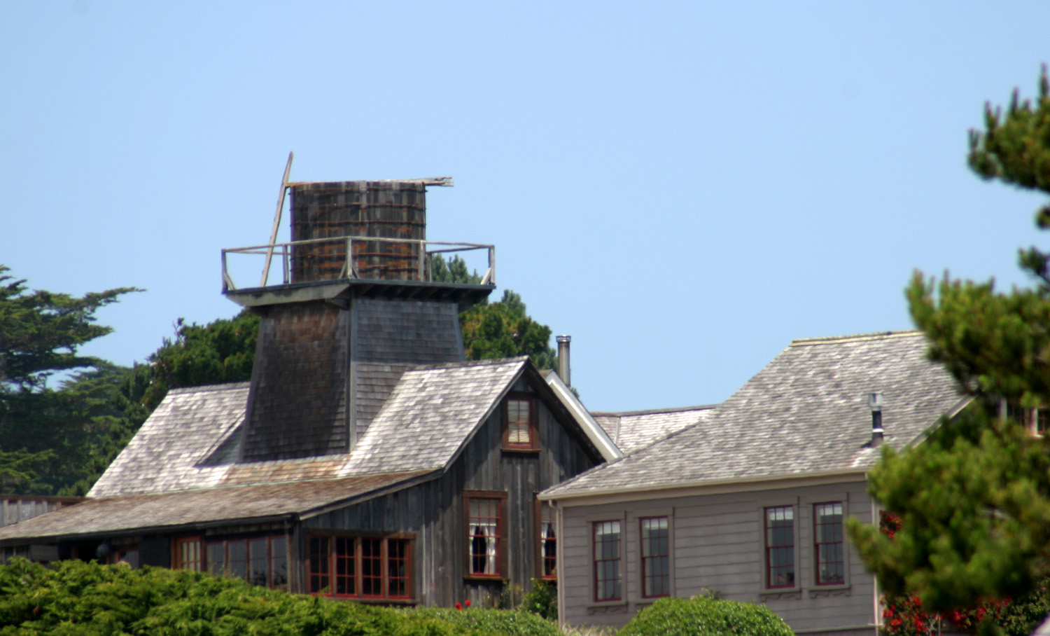
On Monday we drove south to Mendocino Village, nine miles south of Fort Bragg. When I first visited here in 2011, I was struck by two things. First were the many wooden water towers, dating from the days when water was brought down from the hills above, and pumped with windmills into tanks on the towers, providing water pressure through gravity. There were a number of different types, and I took many pictures. |
|
 |
 |
| A superior example of a Mendocino water tower | This one has a great view |
 |
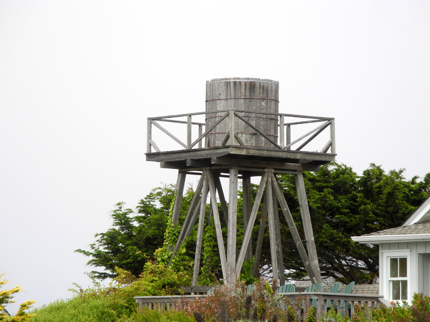 |
| Water tower with double tanks | Mendocino water tower with a very basic design |
|
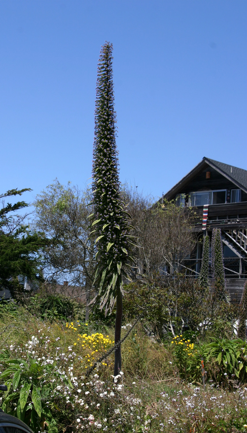
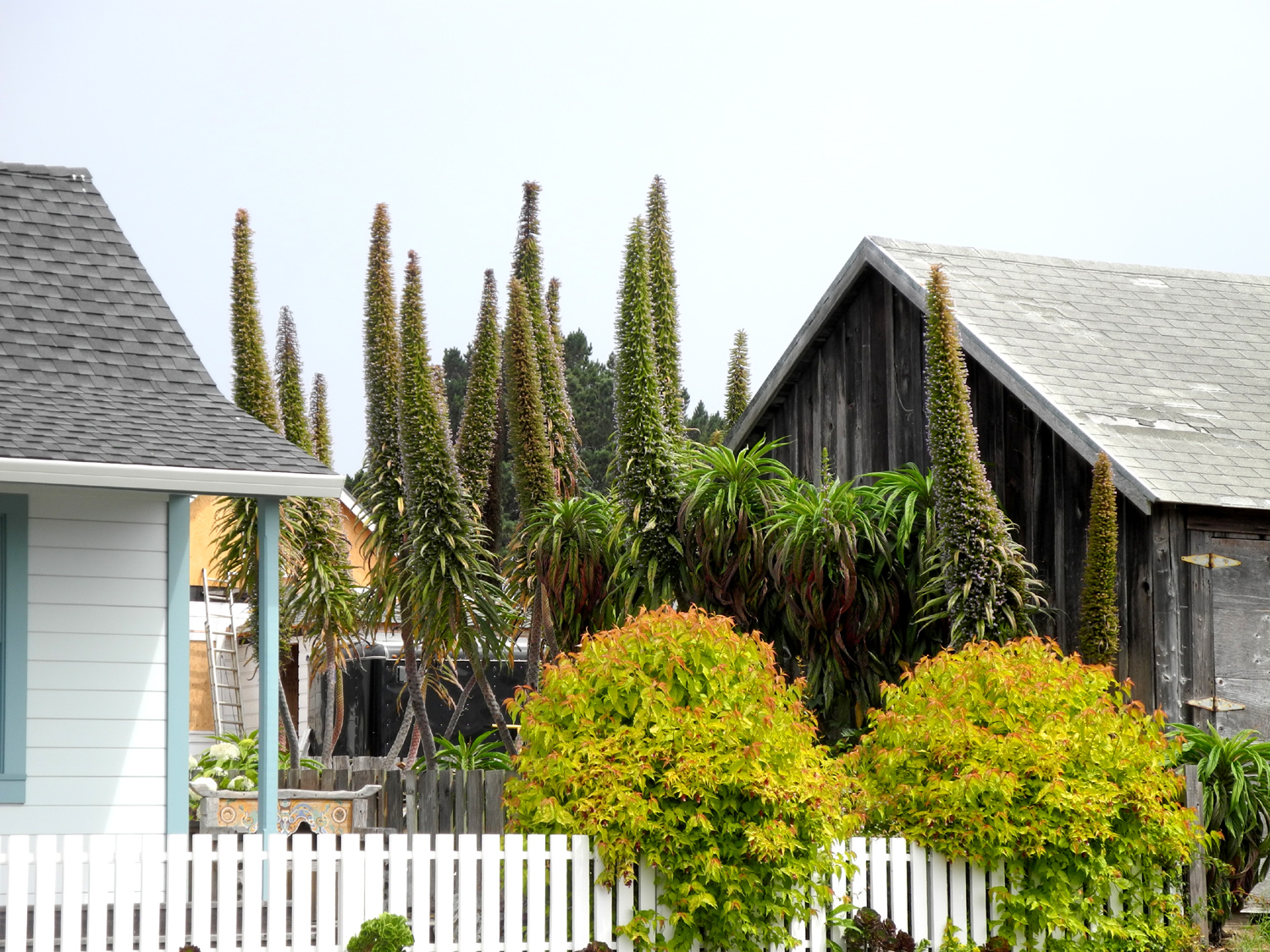
The other thing were some tall, spiky plants that I learned are called echium, with a common name of Pride of Madeira. Although they were very common in Mendocino, eventually I also saw them in various other places along the coast. They are sometimes considered a weed, and grow readily in poor soil, but I found them to be dramatic, delightful, and certainly worth an archipelago's pride. (The water tower and echium photos are all from my earlier visits). We did not see many of the plants in the area of Mendocino we visited this day, but Teri and I saw a lot of them on the route we took through town the first day. The towers, on the other hand, could be seen rising above the village from a number of vantage points. |
|
 |
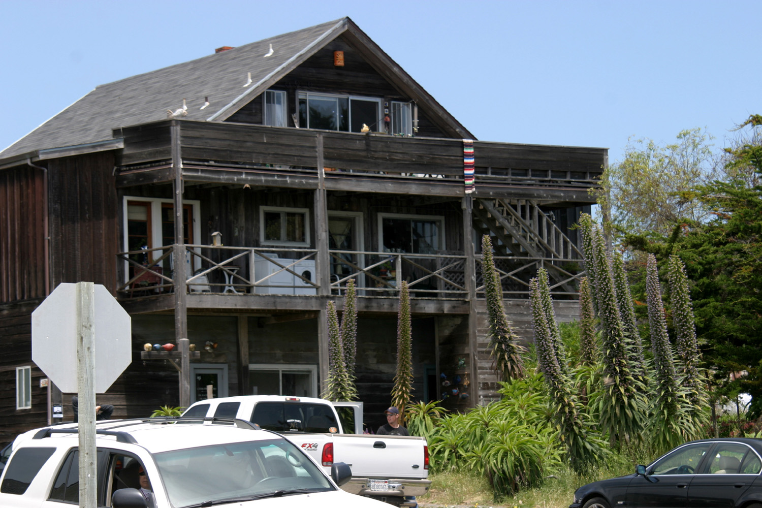 |
| Pride of Madeira (Echium) plant at Mendocino | Pride of Madeira in front of a classic coast home in Mendocino |
|
When we arrived at the village we found parking spots and started strolling around. Jack likes to get souvenirs wherever he goes, and already had a stuffed puppy from the ice rink, one of Snoopy's siblings from his days at the Daisy Hill Puppy Farm. We all enjoyed going through the many shops in Mendocino, and Jack spotted a lot of possibilities, but in the end, did not choose anything, wanting to check out stores in Fort Bragg also. On my earlier visits I had found a zipper front hooded sweatshirt, something that's hard to find, but it disappeared some time ago. I hoped to get a new one, but they either did not have zipper shirts, or they did not have my size. One shop took my name and phone number and said they would call when they got some in. I think everyone else resisted the temptation to buy anything, but we enjoyed looking at the unique offerings in this charming place. We also enjoyed the many flowers growing in front of houses and businesses, not knowing if they were wild or domestic. |
|
 |
 |
| Flowers along the street in Mendocino Village | We named this one the Chinese lantern flower |
|
A few years ago Mike took up golf and became quite enthusiastic about it. He looks for a course wherever he travels, and this trip was no exception. A little after noon we returned to our cars, and Mike, Hayley and Jack left and headed south on Highway 1. Their destination was the Sea Ranch Golf Links, almost 90 minutes south in Sonoma County. Teri and I moved my car to a main shopping street, and went through a few more shops. We were getting hungry, and searching with our phones, we found that we were very close to the Flow restaurant. We made our way upstairs and found a table by the window, with a view of the headland and the ocean. It was fairly pricey, but the food and service matched up well with the cost. I asked if they had Coke, and the waiter said, "We have cola." I ordered that, assuming it was Shasta or some other generic brand. It proved to be something quite different. I can't recall the name, but it was in a fancy-looking seven-ounce bottle, and had a touch of cinnamon. The label noted that it was created for use with whiskey or vodka, but it was also good with my burger. It was an interesting variation, although I would not choose it regularly. We had parked where we could easily get to a path that led out on the headlands, but after lunch we did not feel like any more walking. We went into a couple more shops, then headed back north to our hotel. At about the halfway point back, we turned west at the sign for Caspar, a small town I had not visited on any of my earlier trips .It proved to be a fairly upscale residential compound, with no discernable commercial center. The web site assures us there ARE businesses there. It was once a significant lumber town, and children of the keepers at nearby Cabrillo Light Station attended school there. As we started back to the highway, we were rewarded with the sight of a small group of deer, including two fawns and several does. That evening was game seven of the Stanley Cup Final, between the Edmonton Oilers and the Florida Panthers. None of us had a dog in the fight. My team, the San Jose Sharks, Teri's, the Detroit Redwings, Johnny's, the Pittsburgh Penguins and Jack's, the Minnesota Wild, did not make the playoffs. Mike's team, the Colorado Avalanche, went out in the second round. But when the winner of the cup is being decided in game seven of a best of seven series, every true hockey fan is watching. Florida won the first three games, and looked to easily close out their opponent in the next game (then the next, and the next). The Oilers mounted a fierce comeback to force the deciding game seven, but a team has come back from being down 3-0 to win the cup only once in NHL history, and this was not to be the second time. We were all cheering for Florida, who had been in the final twice previously, but had not won the cup in their 30-year existence. The game was exciting and with the Panthers up 4-3, Edmonton tried right to the last second to tie it up and force overtime. In the end it was the Panthers who raised the cup and skated around in front of their home fans. Mike, Hayley and Jack did not get back till the game was over, but had been checking the progress on their phones. |
|
| Fort Bragg, etc. | |
|
Since our arrival we had enjoyed sunshine and highs in the low 60's. When we got up on Tuesday, we were disappointed to see fog over the land and sea. This day also marked the "changing of the guard." Mike and Hayley had to go home, although they planned a couple of stops along the way, first at the Fort Bragg botanical garden just south of town. Then they would return to Santa Rosa and visit the Peanuts Museum. Teri and I were there with Mike a number of years ago, and were impressed with the various displays. Johnny, Brittany and Colton would be arriving in mid to late afternoon. After breakfast Teri, Jack and I decided to look in some shops in downtown Fort Bragg. One of our first stops was the Skunk Train gift shop, where I had bought skunks for the boys in 2017. Once again I looked for a zipper front hooded sweatshirt. Once again I was told that they will be getting some in "later." Jack was more fortunate, finding a bunch of things he liked. In typical Jack fashion, he took a long time to decide, but finally settled on a fanny pack decorated with the railroad's iconic railroad conductor skunk. Ultimately I decided on a Skunk Train cap, since I only have about 15 caps (some are getting dirty and are probably not washable). Just up the street from the train depot and shop is a mall/museum, with a number of small shops, and two early day steam railroad engines. We did not find anything we wanted here, but would return another day. Teri's brother Mike T has been to Fort Bragg a number of times, and recommended the Cowlick ice cream shop. We had driven by it the first night and saw a line out the door and down the block, but in the daytime it was almost empty, so we all had a nice dessert in between store visits. (Although Ice Cream Month was not till July, we managed to enjoy it four times in Fort Bragg - twice at Cowlick's and twice at Rite Aid, the home of the classic Thrifty brand of ice cream that I used to buy for 49 cents a half gallon). We went into several stores along the main street, including one that offered books, vinyl records and CD's. Although I no longer routinely buy CDs, having more than enough, I could not resist one by John Mayall and the Bluesbreakers, featuring early career performances by Eric Clapton on guitar and John McVie on bass. With no CD player in my 2024 Honda, I had to wait till I got home to play it, and It was well worth the $6.50 I paid. We returned to the motel to await the arrival of the rest of the Upshaw's. After we ate lunch from our supplies, Jack and Teri engaged in a spirited game of Crazy 8's, while I read and watched them. It was not long before Johnny, Brittany and Colton arrived, and after they got settled into their room, we drove to the harbor area, and went out to the beach, which my notes say was dirty and rocky. This was no barrier to the boys, and Jack asked to be buried in sand, something he always likes to do at any beach. Once he emerged from the sand, we went to the Sea Pal Cove restaurant, one of many in that locale. It was very reasonable, and dining was outside on a deck. It was cooling off and a fire was going in a huge fire ring nearby, not close enough to help us while we ate, but very nice to stand by after we had finished our food. |
|

|

|
| Jack rockin' his Skunk Train fanny pack | Brittany, Jack, Colton and Johnny at Noyo River beach |

|

|
| A typical grandmotherly activity | Jack rises from the sand |
|
Throughout the week we usually went our separate ways in the evening, reading, watching TV, or playing video games. We were only a few steps apart if we needed to look in on each other, and we usually went outside to watch the sunset. On this foggy night, the sun was not to be found. |
|
| Avenue of the Giants | |
|
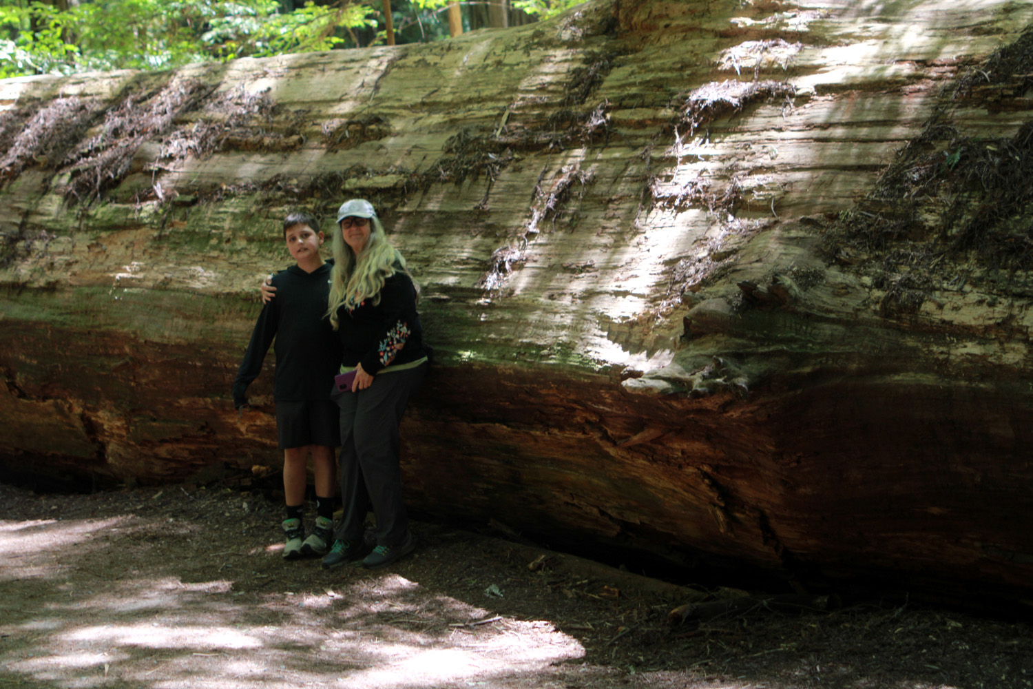
In planning activities for this trip, Johnny's family heard about the Avenue of the Giants, and wanted to check it out. A little ways north of Leggett, where CA Highway 1 joins US 101, the route is known as the Redwood Highway. Avenue of the Giants is a 31-mile bypass that goes into the land of the giant coast redwoods, and is part of the original alignment of the US highway. To get to this point we had to survive the heart-stopping last 20 miles of Highway 1 from the coast in through the mountains. This section of the road is narrow and winding, with many, many sharp curves where the recommended speed is 15 miles per hour and often less. In 2011 I had driven this stretch in my motor home, but I was more than happy to just be a passenger in the Upshaw's vehicle this time. Once we reached US 101, we soon came to the Grandfather Tree, a redwood with a huge, multiple trunk, one of the widest redwoods in the world. It's about a half mile south of Richardson Grove State Park, as well as being a tourist attraction with chain saw carvings and the obligatory gift shop. |
|

|

|
| The multi-trunk Grandfather tree | The tree from the east side |
|

|
| Colton and a very large banana slug | Jack rides the caterpillar |
|
It's a few more miles north to the southern end of the Avenue, just north of Garberville. As soon as we entered the road we saw a sign saying that it was closed ahead. We believed the warning, but drove to the barrier so we would not miss anything. Returning to US 101, we had to go only a short distance to get back on the Avenue of the Giants, which eventually led us to the Founder's Grove in Humboldt Redwoods State Park, where we ended our exploration. |
|

|

|
| Dick and Teri at the park sign | Brittany and Colton by the Dyerville Giant |
|
But first, it was time for lunch. We had brought sandwiches, and drove into Williams Grove, paid the $8 entry fee, and found a picnic table. It was cool, free of crowds, and a delightful place to rest and walk around a bit. Redwood sorrel, a low-growing, clover-like plant, provided an extensive ground cover. Continuing on to our final destination, we parked and walked on a loop trail through the redwoods, enjoying ferns and other plants, as well as the living and fallen giants and old stumps. One of the most impressive sights is the Dyerville Giant, which was the tallest in the world when it fell in 1991. The fall was measured on seismographs, and people who heard it thought at first that a train had crashed. |
|

|

|
| Ferns grow rampant in coastal forests | Redwood sorrel |

|

|
|
Johnny caught Grandpa Dick looking at his phone instead of the impressive scenery |
A big stick of wood |
|
When we finished our walk, we followed a road that took us directly to US101, and made our way back to Fort Bragg. When we reached the ocean we stopped at a wide, sandy beach, where the boys enjoyed wading in the the shallow final few yards of a little stream. It had been partly foggy in the morning, with clouds seemingly drifting away, but it was now sunny, and stayed that way for the rest of our visit. |
|

|

|
| Colton and Jack enjoying the beach | Typical north coast view, with high cliffs above the surf |
|
We agreed we would enjoy another visit to the Avenue of the Giants, when we could spend more time there. However, we would go up Highway 101 all the way, and not approach by way of Fort Bragg. Back in Fort Bragg we enjoyed dinner at the Noyo River Grill, overlooking the river, then spent some time watching the waves from the Pomo Bluffs. |
|
| Shopping and Skunk Train | |
|
Thursday was the last day for the Upshaw's, while Teri and I would stay one more day. When Jack learned that he was leaving the next day, he had a moment of mild panic: "But I don't have all my souvenirs!" Teri assured him that there would be time on this day to take care of that. Teri, Jack, Colton and I had breakfast on the motel's outdoor patio, with a combination of what we had brought plus the "free breakfast." They had a waffle iron, and the boys had a great time pouring the batter into the large machine, closing and latching the lid, and then retrieving their breakfast when it was ready. They have a waffle iron at home, but are not supposed to touch it. For the morning, we separated into three groups. Johnny had a work-related training via Zoom and stayed in the motel, while Brittany and Jack went in search of sand and surf. Teri, Colton and I went to the Skunk Train Depot, where he got a Skunk Train baseball. Just up the street in the museum/mall, he spotted a pair of bear claw slippers, which Teri got for him. Some time during the day I would get him a second pair, and later a pair for Jack. We also paid a second visit to Cowlick ice cream, since our previous visit was before Colton arrived. Among the flavors that caught my eye on that first visit was "candy store floor," which was vanilla with pieces of Snickers, Peanut Butter Cups, Butterfinger, M & M's and other candies, so I decided to try it. It was good, but I would just as soon have coffee or chocolate flavor. |
|

|

|
| Colton rockin' his bright red bear claws | A close-up (his second pair were rainbow colors) |
|
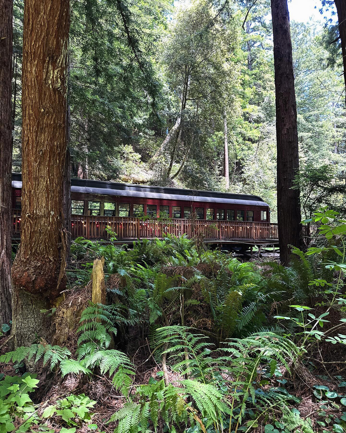
Our afternoon activity was a ride on the Skunk Train. When people hear you have been to Fort Bragg, they are obligated to ask, "Did you ride the Skunk Train?" The California Western Railroad dates from logging days, but in recent decades has been a magnet for tourists looking to capture a bit of nostalgia. The name was bestowed early in its run, a reference to the smelly smoke produced by the wood-burning steam engines of the day. Preparing for the trip, we found that the steam engine was in use only on weekends in August, so we originally decided to forgo this adventure. When I rode it in 2012 there were several options. A train ran from Fort Bragg or from Willits on Highway 101 to the halfway point between the two towns. A few times a month you could ride the entire 30-mile run, but most trips stopped at the half-way point, where the engine was moved to a siding, and then attached to the other end of the train for the return trip to Fort Bragg or Willits. With our entire group back together, we got our tickets, and soon were passing over the several crossings in the town, and then rattling along Pudding Creek among the redwoods and other vegetation. |
|

|

|
| Jack, Colton and Dick looking around the bend | Inside the Skunk Train's vintage passenger car |
|
Surprisingly soon the train came to a halt, and the conductor announced we would be there for 25 minutes before starting our return trip. Something was certainly wrong, or at least different. I started reading the fine print on my ticket, where I learned that repairs were "still scheduled" for tunnel number 1. It seemed that a collapse of the tunnel several years ago had put a stop to the 15-mile run from Fort Bragg, and the three-mile run along Pudding Creek was the best we would get from that end of the route. We made the best of it, walked a short distance on a trail beside the tracks, and enjoyed the ride and the natural surroundings. Of course, I was the only one who had experienced the longer ride, so it was not a big deal for the rest of our party. After our return trip, it was time for a final visit to the beach. Although the seaside land here is mostly level, in the morning Jack and Brittany had found a place with a sand dune suitable for rolling down. This was the place where Pudding Creek joined the ocean, and soon both boys were rolling and laughing and happily covered in sand. My wonderful family carried my lawn chair over to the beach, so I was able to watch and relax in comfort from a vantage point at the top of the dune. For our last supper together, in this land of seafood and specialty dining, we turned to an old favorite, pizza. We have recently found that the Mountain Mike's chain makes an excellent pie, although I had a sandwich. |
|
| Jug Handle State Natural Reserve & Point Cabrillo Light Station | |
|
After Friday morning breakfast, we said a reluctant goodbye to the Upshaw's, but were grateful for the time we had together in this amazing location. They planned to go inland on Highway 20, which leaves Highway 1 just south of Fort Bragg, then drive on US 101 all the way to San Francisco and cross the Golden Gate Bridge, which would be a first for Colton and Jack. Teri and I decided to go to Jug Handle State Natural Reserve, about half way between Fort Bragg and Mendocino. In addition to being a typical scenic section of the coast, Jug Handle offers a scientific look into the distant past. As the website explains, "few places on earth display a more complete record of ecological succession. Each of the five terraces represents one stage in a progression of environmental development. Jug Handle, then, is one of the few opportunities to interpret this aspect of the coastal spectrum of ecological succession and landscape evolution." Among the many features of this property is a pigmy forest, also called a dwarf forest - a place where the soil is so poor that mature trees a hundred or more years old may only reach a height of 15 or 20 feet. This was a three-mile hike, which we were not prepared to do. On one of my earlier visits I went to Van Damme State Park, three miles south of Mendocino. Here you can park and walk just a few feet to a boardwalk that takes you through another pigmy forest. Teri and I were really just looking for a pleasant walk, and seeing the areas that cover the entire history of the land requires another walk of over three miles, which was not in the cards for us. We set off on a trail that led through a deep, shady forest of mostly bishop pines and down under the nearby highway bridge. Just past the bridge the trail becomes a wooden stairway, eventually leading down to the shore. It was a bit too steep for me, and Teri did not want to try it either. We followed a trail that went inland to the east, and eventually found ourselves on the edge of a private plot with a large house. We returned to the parking area, enjoying a number of wildflowers along the way, and set out for our next adventure. |
|
|

|
| Bishop pines in Jug Handle Reserve | Wooden staircase to the sea |

|

|
| Wild iris | Clarkia |
|
On one of my earlier Mendocino coast visits I went to the Point Cabrillo Light Station, and we decided to check that out. It was less than a mile south on Highway 1 to the turnoff, but the approach did not seem familiar to me. But my earlier visit was over ten years ago, and we soon arrived at the parking lot, a half-mile walk from the light station. This route is a dirt road, open to vehicles with handicap permits, or people with reservations at the light house rentals. The busy lumber and fishing trades of the late 19th century naturally led to shipwrecks and a demand for a lighthouse. Construction did not start till 1908, with the lens illuminated for the first time in June 1909. There's more about the facility's history here. In addition to the lighthouse, the grounds contains the lighthouse keeper's house and two homes for assistants. During peak operation all three positions were always filled. The main house is now a museum, restored to reflect conditions in the early 1930's. The other two houses are available as vacation rentals. Two smaller buildings each offer rental space for two persons. Access to the Fresnel lens is limited to guided tours, two weekend days per month through October. We missed out on this, but enjoyed the place, and I bought my final souvenir, a book of photos from early days on the Mendocino coast. We spent some time out near the edge of the cliffs, watching the waves, then made our way back to the car and "home" to our motel. As we reached Fort Bragg, we got gas for the first and only time on our trip. After a fill-up the display showed a range of over 500 miles, more than enough to take us back to Fresno. |
|

|

|
| Point Cabrillo Light House | The surf off Point Cabrillo |
|
We had brought our lunch on the final day's outing, and in the evening we had ice cream at Rite Aid. and ate up some of the snacks we had left. The next morning we got on the road about 8:20, drove a short distance down Highway1 to the junction with Highway 20, and turned east to go over the coastal mountains to US 101 at Leggett. For several miles 20 and 101 are contiguous, and when they diverged we stayed on State 20, going past Lake Mendocino and into Lake County, where we drove along the shore of Clear Lake, a huge natural lake. Highway 20 turns sort of northeast to join I-5 at Williams, but we took State Highway 16, which goes south and east, crosses I-5 at Woodland, and runs into State 99 just north of Sacramento. From here we were on very familiar territory, following 99 south all the way home. We covered 762 miles in my Honda, getting just under 40 MPG. Our drive into the redwoods in the Upshaw Toyota 4Runner added another 175 miles. We all had a great time, and I was very thankful to my family for joining me on this adventure, with a special shout-out to Teri, who drove all the highway miles. --Dick Estel, July 2024 |
|
|
Photos (Click to enlarge; pictures open in new window) |
||
|
Russian Gulch Mendocino Village Fort Bragg & Beach Avenue of the Giants Jug Handle Reserve & Cabrillo Light Station (Photos by Dick Estel and Jack, Brittany and Johnny Upshaw) |
||
|
Russian Gulch |
||
 |
 |
|
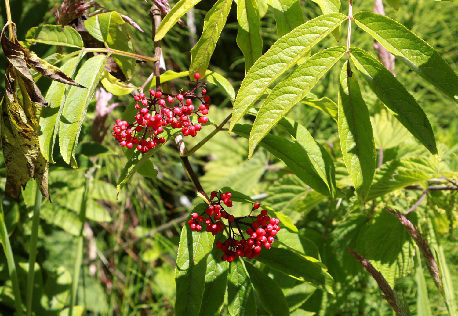
| Unknown berries (don't eat them!) | Wild cucumber (DON'T eat it) | Good banana imitation (don't eat it) |
 |
 |
 |
| Flowers along the Russian Gulch Trail - berry blossom, unknown daisy-like, morning glory | ||
 |
 |
|
| The campground water source | Tide pools at Glass Beach | |
| Mendocino
Village (Photos from 2011 & 2012_ |
||
 |
 |
 |
| Mendocino Village, looking inland | Water tank on a house | Masonic Hall in Mendocino, with a bank on the bottom floor |
| Fort Bragg and Beach | ||
 |
 |
 |
| Breakfast - cocoa with whipped cream | The Upshaw Brothers in the sand | Seagull hoping for a handout at Sea Pal Cove |
 |
 |
 |
| The Baymont Motel on Fort Bragg's main street | View across from our rooms | Each room had a
plaque promoting a local destination |
 |
 |
 |
| Upshaw Brothers on the rocks | A dramatic seascape | Pudding Creek Trestle, now for bikes and walkers |
| Avenue of the Giants | ||
 |
 |
 |
| Jack grabs the slug by the horns | Jack, Johnny & Brittany | Colton in the woods |
|
 |
 |
| Colton with Grandma Teri by the Dyerville Giant | This log split just right to provide a seat | Brittany and Johnny at the Pacific Ocean |
 |
 |
 |
| Colton, Jack and Johnny | Johnny and Colton | Teri and the
Upshaw's, back at Pomo Bluffs by Fort Bragg |
| Jug Handle Reserve & Point Cabrillo Light Station | ||
 |
 |
|
| Unknown, but a unique look | New growth surrounds an old log | Jack called these "rattlesnake plants" |
 |
|
|
| Johnny, Brittany,
Jack and Colton at the iconic Golden Gate Bridge |
A final farewell to the Skunk Train | |
| Related Links | ||
| "Peanuts" Hockey Rink | Boonville | The Skunk Himself |
| Fort Bragg | Mendocino | Russian Gulch State Park |
| Mendocino Coast | Skunk Train | Pomo Bluff Park |
| Banana Slugs | California Highway 128 | Highway 1 |
| Mendocino Headlands State Park | Pride of Madeira | 2017 Short Fort Bragg Visit |
| A Good Pride of Madeira Photo | Avenue of the Giants | Grandfather Tree |
| Richardson Grove State Park | Skunk Train Tunnel Repair | Founder's Grove |
| Humboldt Redwoods State Park | Fall of the Dyerville Giant | Jug Handle State Natural Reserve |
| Point Cabrillo Light Station | Fresnel Lens | Clear Lake |
| Pigmy Forest | Van Damme State Park | Caspar |

Photo from 2011