Dick's Adventures of 2016 - Part 6 |
||
Adventures of 2016 Part 1 Adventures of 2016 Part 2 Adventures of 2016 Page 3 Adventures of 2016 Part 4 Adventures of 2016 Part 5 Adventures of 2016 Part 7 |
||
|
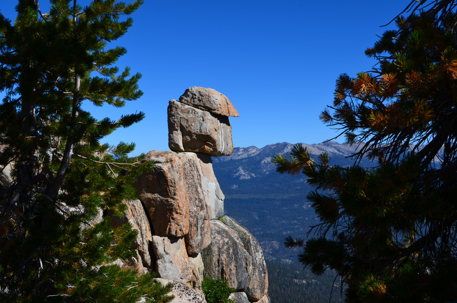
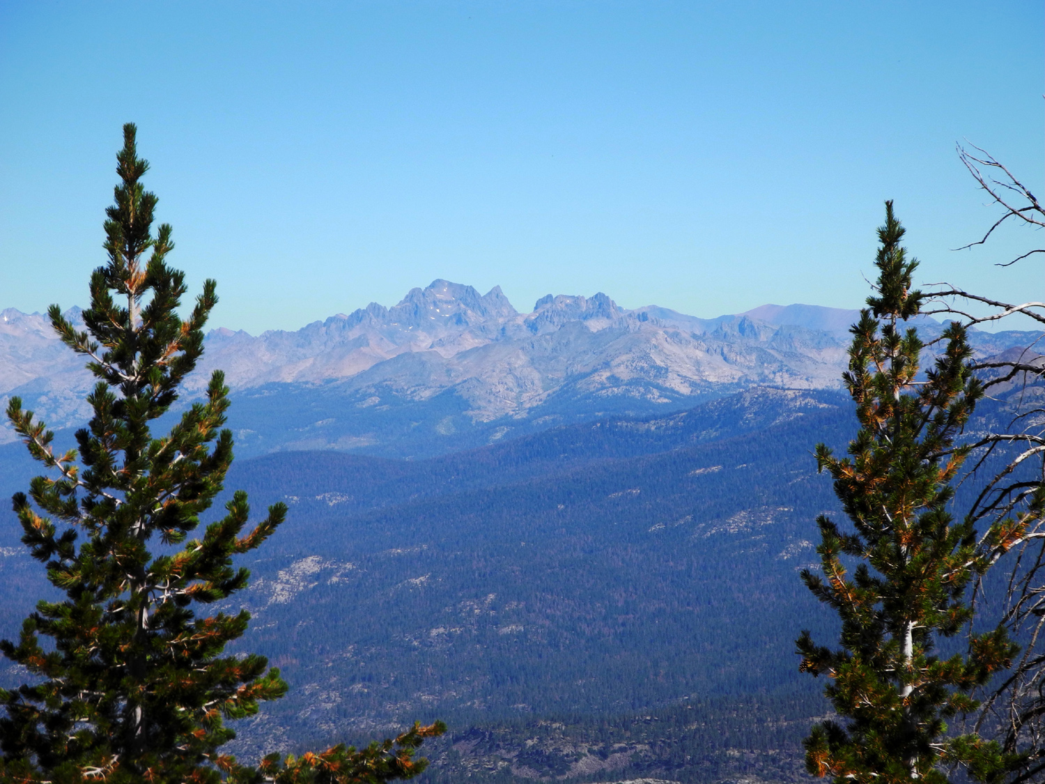
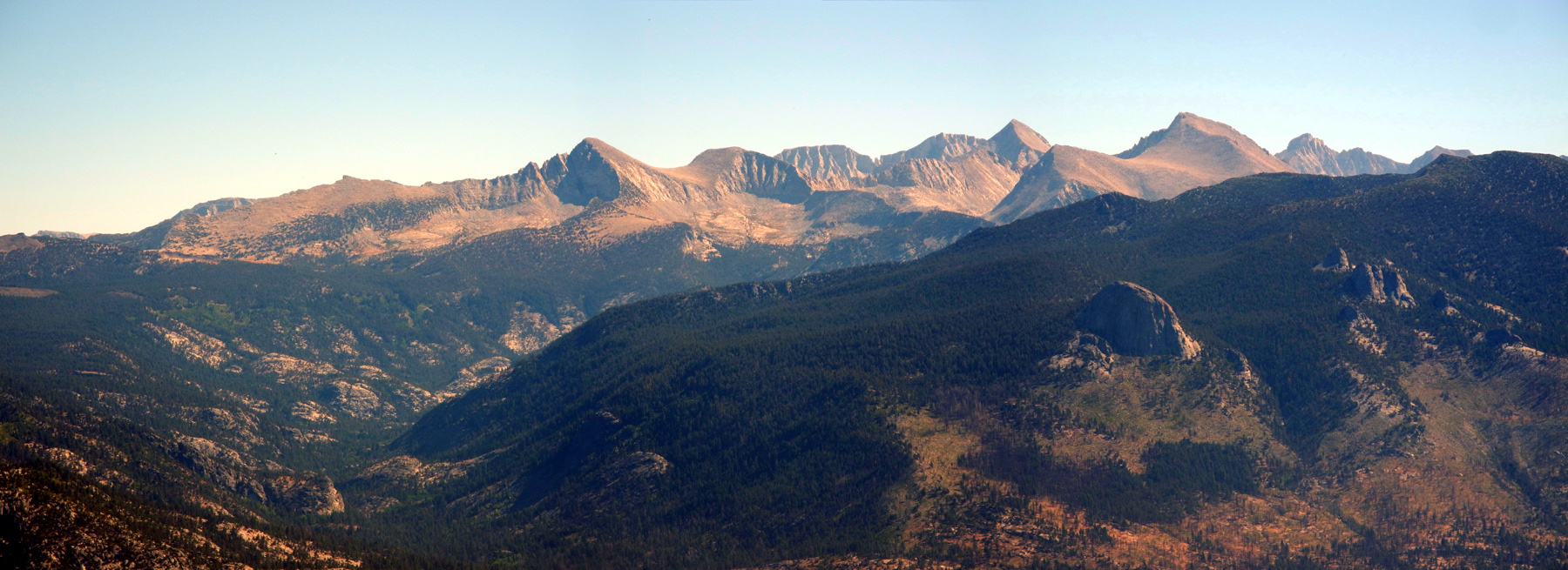
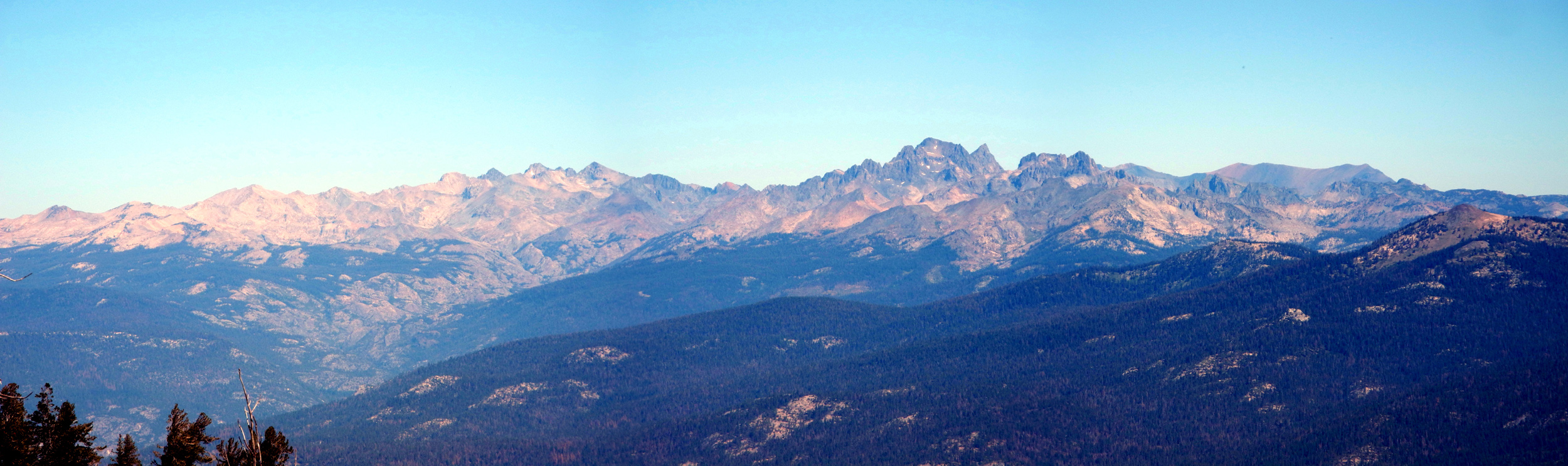
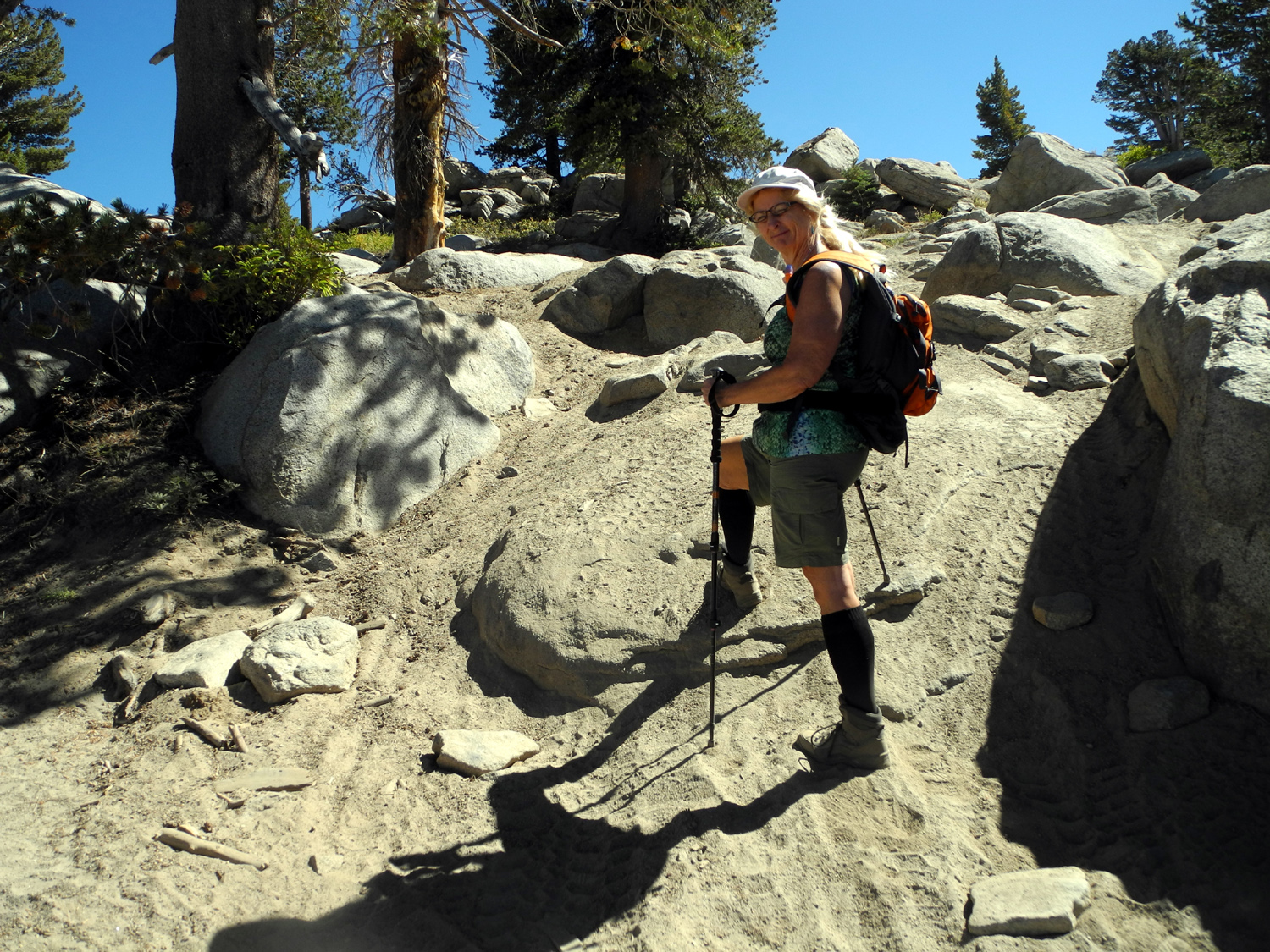
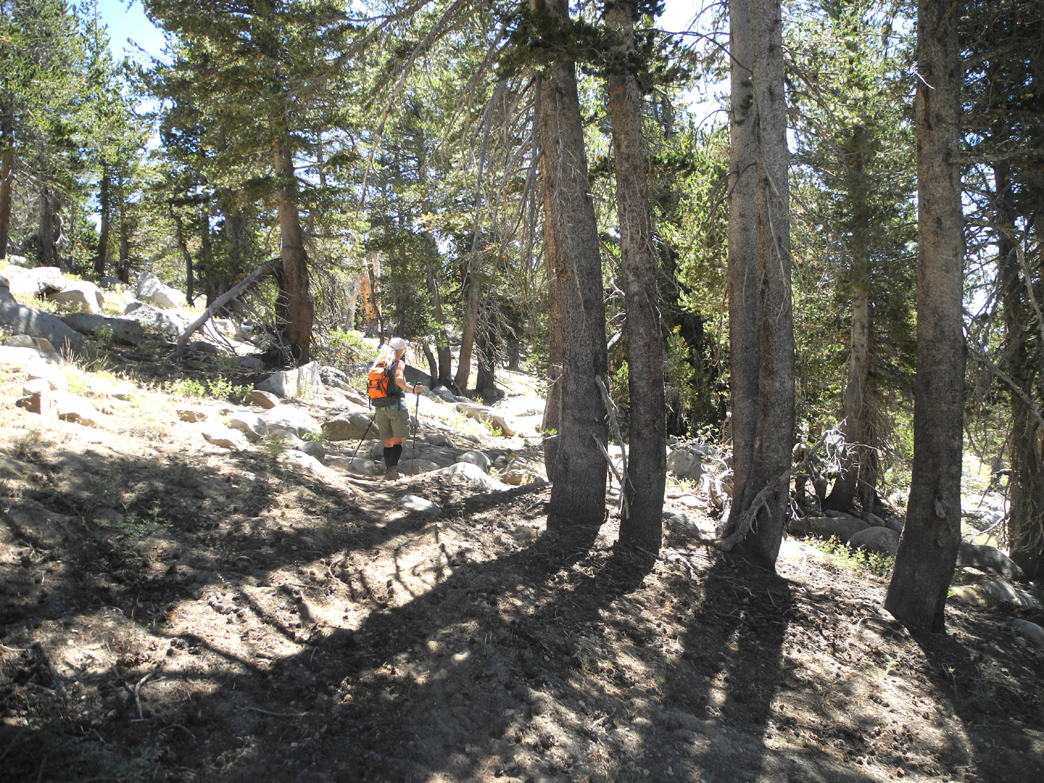
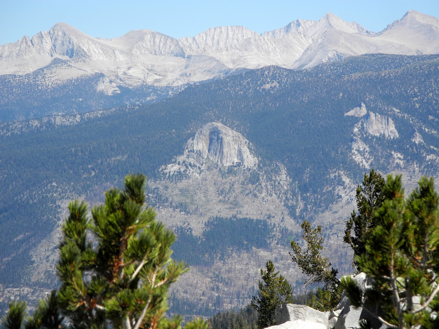
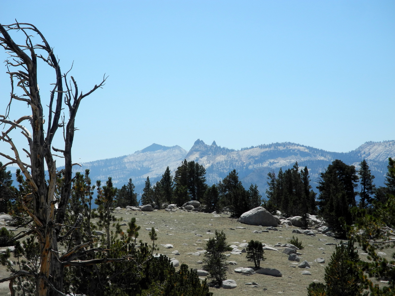
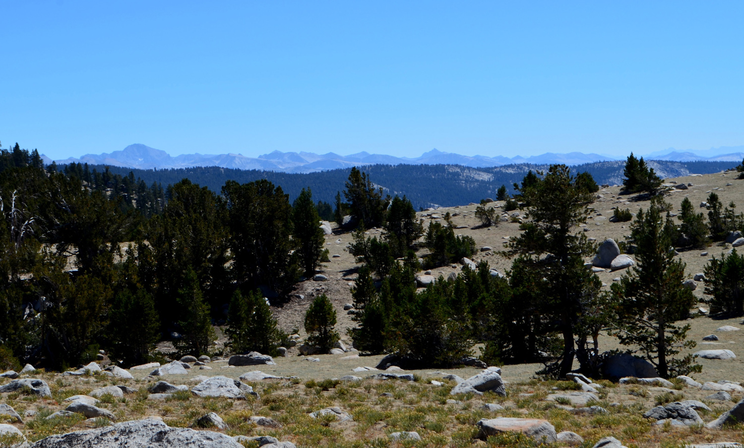
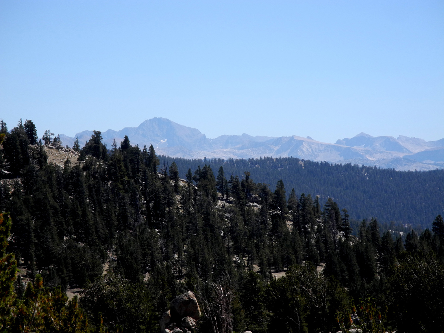
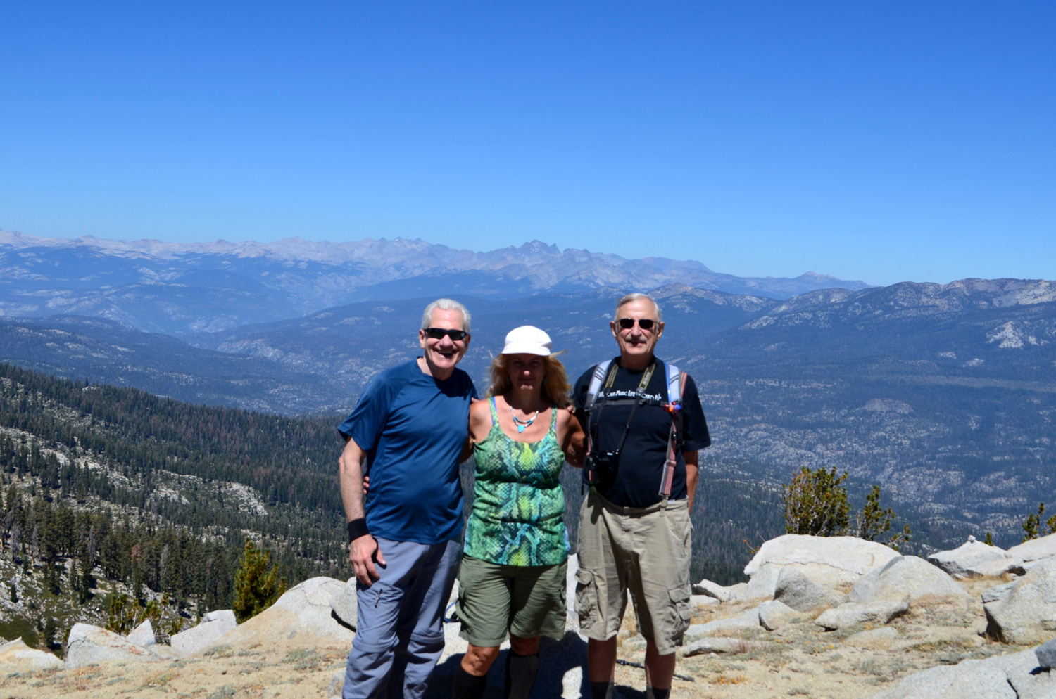
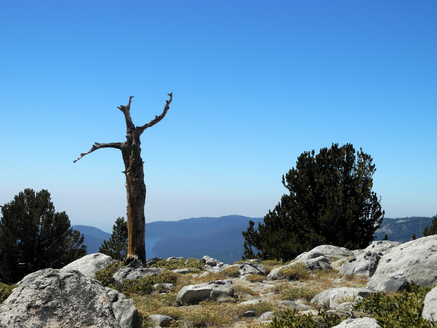
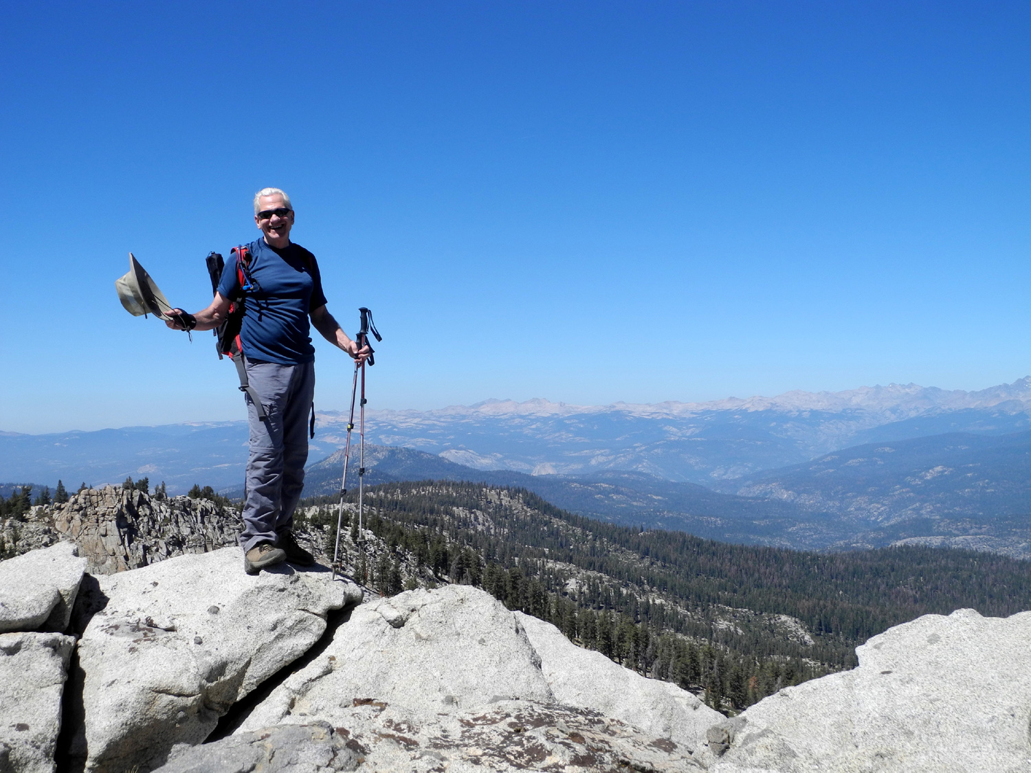
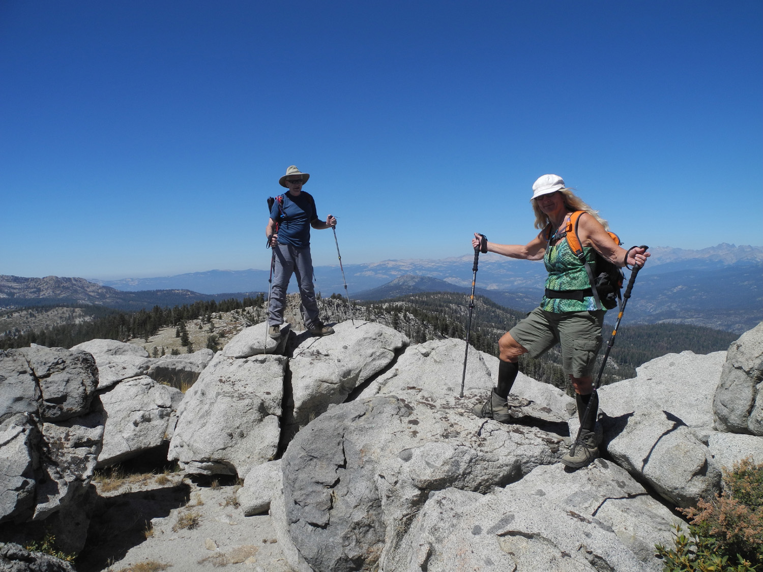
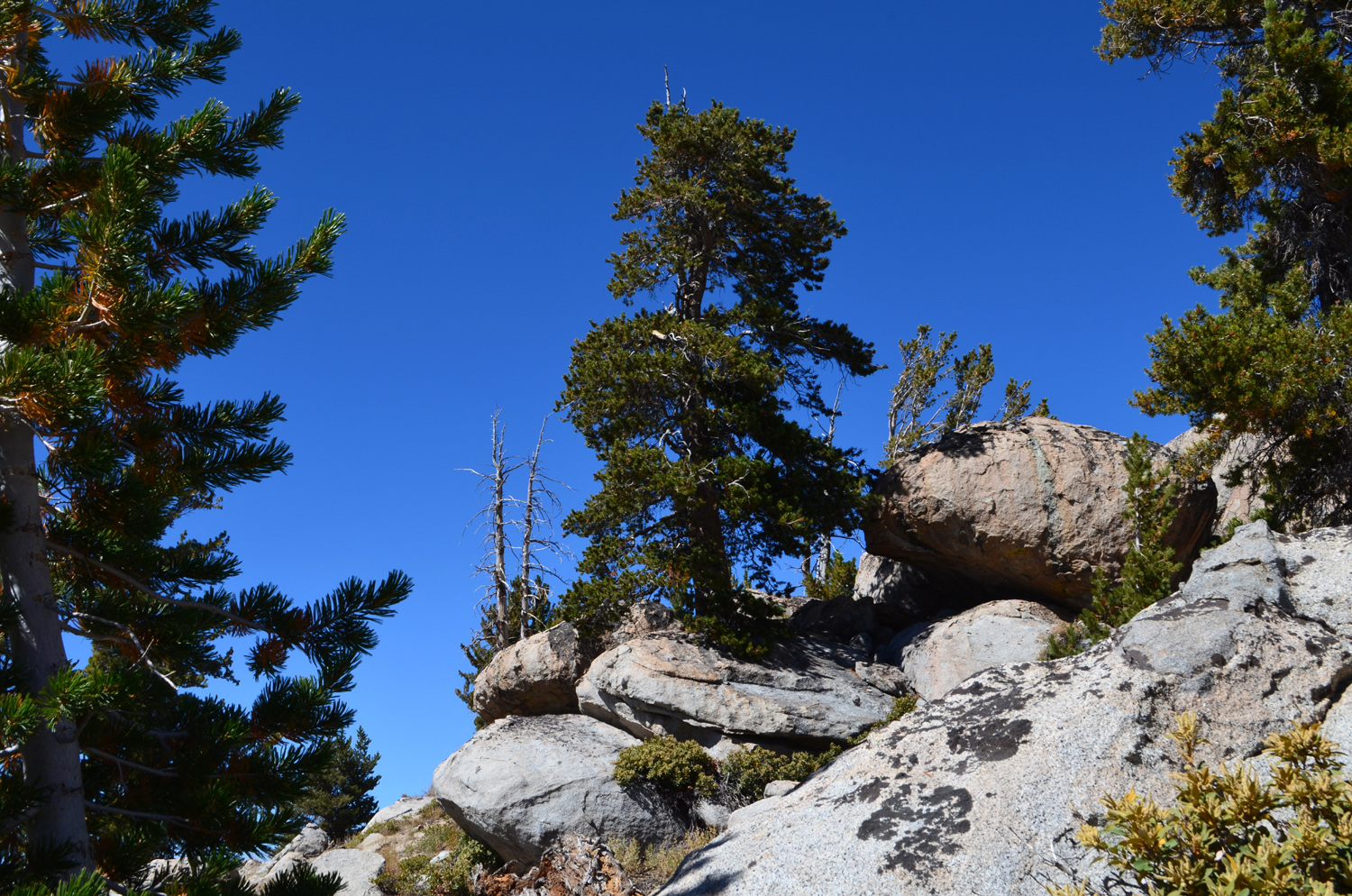
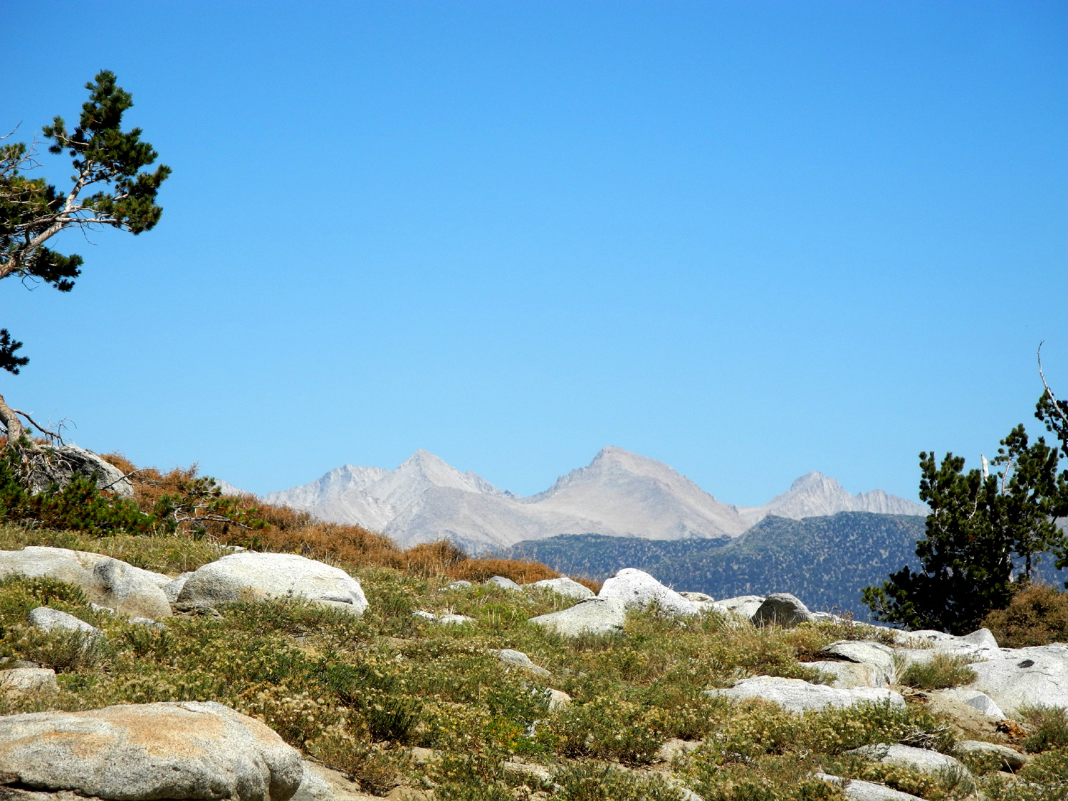
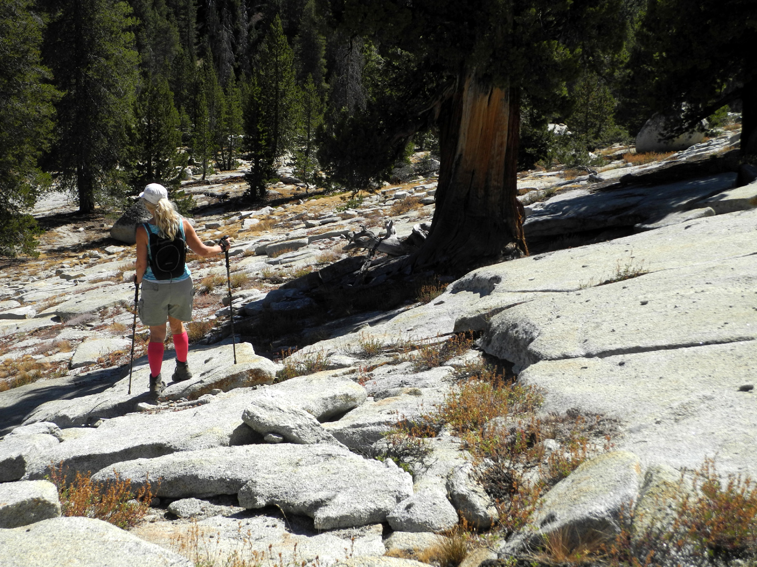
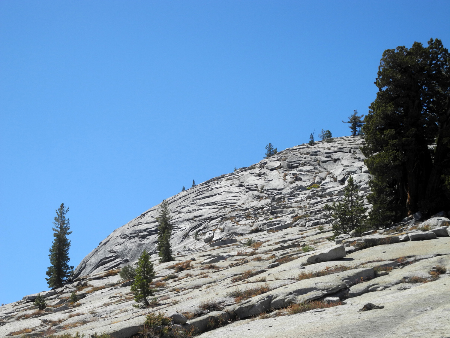
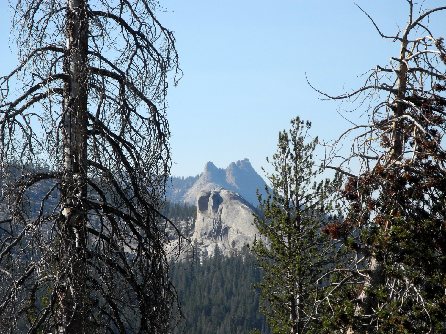
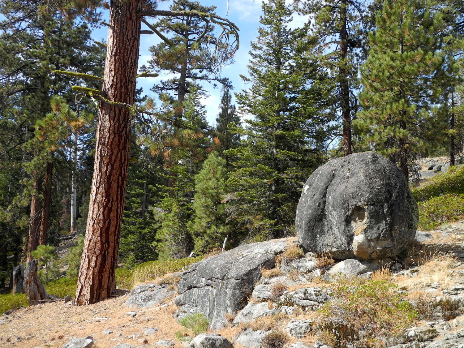
White Bark Vista Hike The White Bark Vista offers one of the best views in the Sierra accessible by motor vehicle. In my opinion it rivals Glacier Point in Yosemite. Admittedly, the final mile of the drive is daunting and I would not take my Honda on it, but I have driven it in my truck several times in the last few years without incident. As you drive up the final 100 yards or so, you come out to the top of a a ridge, and before you lies the drainage of the South Fork of the San Joaquin River. Rising above to the east is a dramatic row of peaks known as the Silver Divide, while to the north you are gazing at the Minarets and the Ritter Range just outside of Yosemite National Park. The blue jewel that is Lake Edison lies in the bottom of the huge basin below you. This area is also the northern end of the Dusy-Ershim Trail, said to be the nation's most challenging 4-wheel drive road. Walking in a mile or so on this road was our goal, as my daughter Teri, friend Wes Thiessen and I gathered at my house at 7:30 on the morning of September 7. The drive is a little over 70 miles, following Auberry Road to Highway 168 at Prather, then continuing on past Shaver Lake to Huntington Lake, where a good two-lane road goes toward Kaiser Pass. About half way up it becomes a narrow, winding road, with a few blind curves and a lot of spectacular scenery. At Kaiser Pass we turned south on a one-mile rough dirt road that climbs steadily up to White Bark Vista, location of the trailhead. Teri and I both hiked this trail twice last summer, with her second visit being a backpacking trip with several other women. We had both been as far as the vista a number of times over the last 40 years or so. It was Wes's first visit to the area. The 4-wheel drive road goes 33 miles to Courtright Reservoir. Recommended travel time is three DAYS, and drivers are admonished to never travel alone, to have a winch, and to carry tools and spare parts. It only takes a few hundred yards on the trail to see what a challenge it is, even for the best-equipped vehicle. There are places where the driver must place a front tire precisely on the right rock, try to avoid the big hole on the other side, and crawl slowly up. Walking it is much easier - you can just choose the easiest one-foot wide strip of the road, or even go off the road in some places where that makes the way easier. Although I hiked in on this road in the early 1970s, I don't remember anything about that hike except that our destination was Lakecamp Lake, two or three miles in. With my two hikes last year, my destination has always been to go out to The Edge. The trail more or less parallels the ridge that goes up from where we parked, and at several locations you can easily walk across to the eastern side of the area and see the same vistas that captivate you at the parking area. My other goal on this hike was to go a little farther than I had gone before. We enjoyed the rugged, rocky terrain around us, the inspiring views of lakes and mountains, and the good company, and before we knew it I realized that we were in a section of the trail that was unfamiliar. We had met goal number one of going a little farther. We walked over to the edge, but did not have as good a view as other edge locations closer to the trailhead. A narrow trail branched off from the road at this location, and above us was a rocky hill. We decided that we could get to the top, and hoped that this trail would lead us there. Looking at the rock strewn north side of the hill, we thought we might be walking through open, sunny territory, but we quickly entered a shady forest, where the trail rose at a fairly gentle angle. After a while, we found we had made our way around the hill to its south side, and began a steeper climb to the top. The trail was harder to see here, but it was not needed, since it was open territory with small rocks, and lots of loose soil. Wes and Teri got up near the top with little difficulty, but I found I had to stop and rest frequently. I would walk for 30 seconds or so, then rest an equal amount of time. Since our starting point was around 9,500, we were pretty sure we had passed the 10,000 foot level, and a look at a topo map on line later confirmed this. I made it to the top, none the worse for my efforts, and we were rewarded with an amazing and unexpected sight. To the north and east, we could see the Minarets, the Ritter Range, and the Silver Divide, views we'd been enjoying from the time we arrived at the parking area. But the southern view opened up to an expanse of mountains we recognized as being on both sides of Courtright Reservoir, and in the far distance we were looking at the back country of Kings Canyon and Sequoia parks. We could just make out the outline of jagged peaks to the far south, but did not really have a clear enough view to identify anything in that area. We enjoyed the 360 degree view, rested and had a snack, and admired the "pointing tree," a dead pine that seemed to say "come on, this way." Of course, we had to take a group photo and a "Wes on the rock" shot. For the first part of our return trip we retraced our steps down the narrow path we had followed to the top. Then we took the semi cross country route that Teri and I had followed on our previous trips. This route keeps you close to the edge, and mostly consists of cow trails that skirt the largest rock formations. When we got back to the jeep road, we were actually within sight of the trail entrance, and it was only a short walk from there down to the truck. Along the way we saw a few flowers, mostly the dried seed heads of an unknown species that appeared in both orange and yellow variations. We also saw one lupine blossom, probably the last one of the year. Most of the trees in the area are lodgepole pines, Jeffrey pines, and at the higher places, western white pine. Despite the name of the vista point, we did not see white bark pines, which normally appear just at the tree line. We had brought fixings to make sandwiches, along with chips, veggies, drinks and dessert. We drove down to the bottom of the narrow part of the paved road where there is a large flat spot beside a stream, and set up my card table and folding chairs in the shade. We enjoyed our outdoor lunch, walked around by the creek a little, and then loaded up for the trip back home, ready for another outing as soon as our schedules permit.
|
||
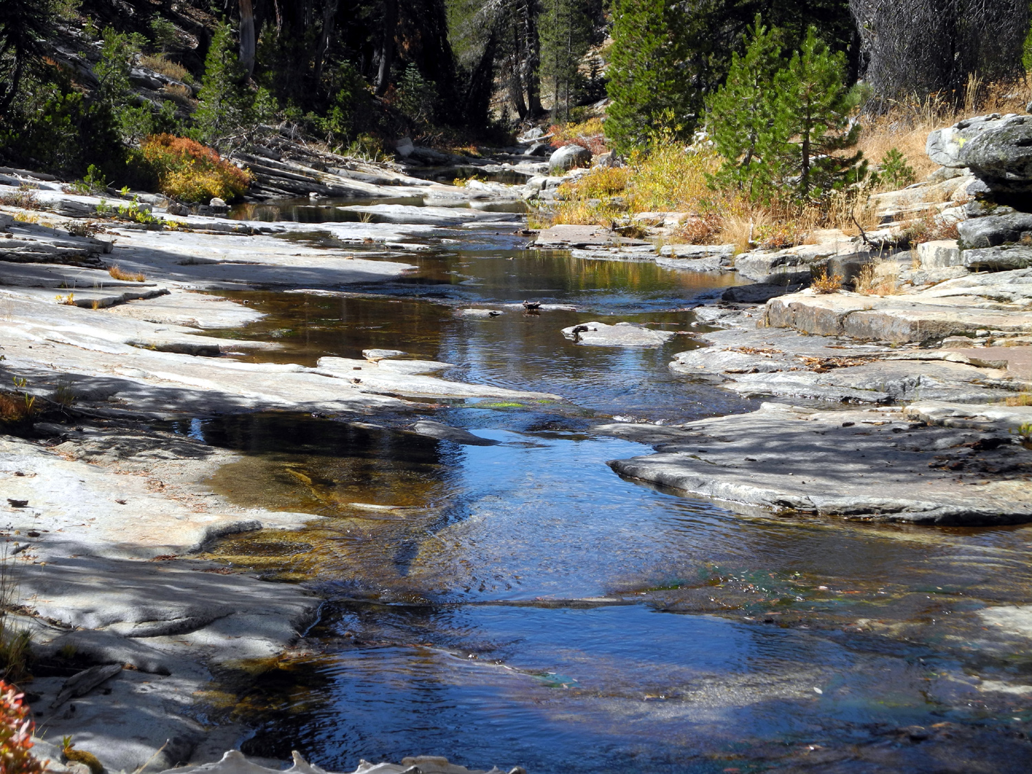
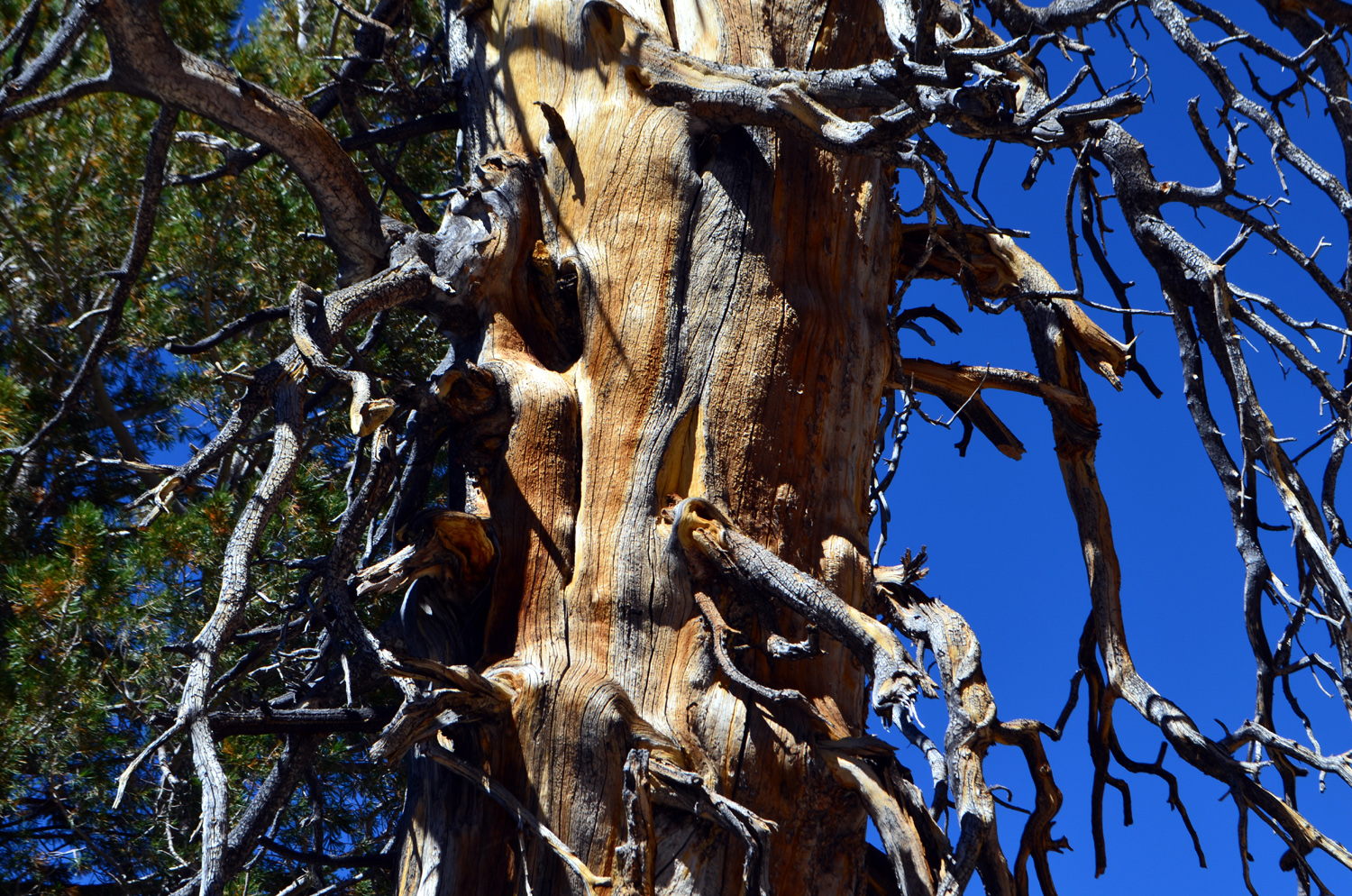
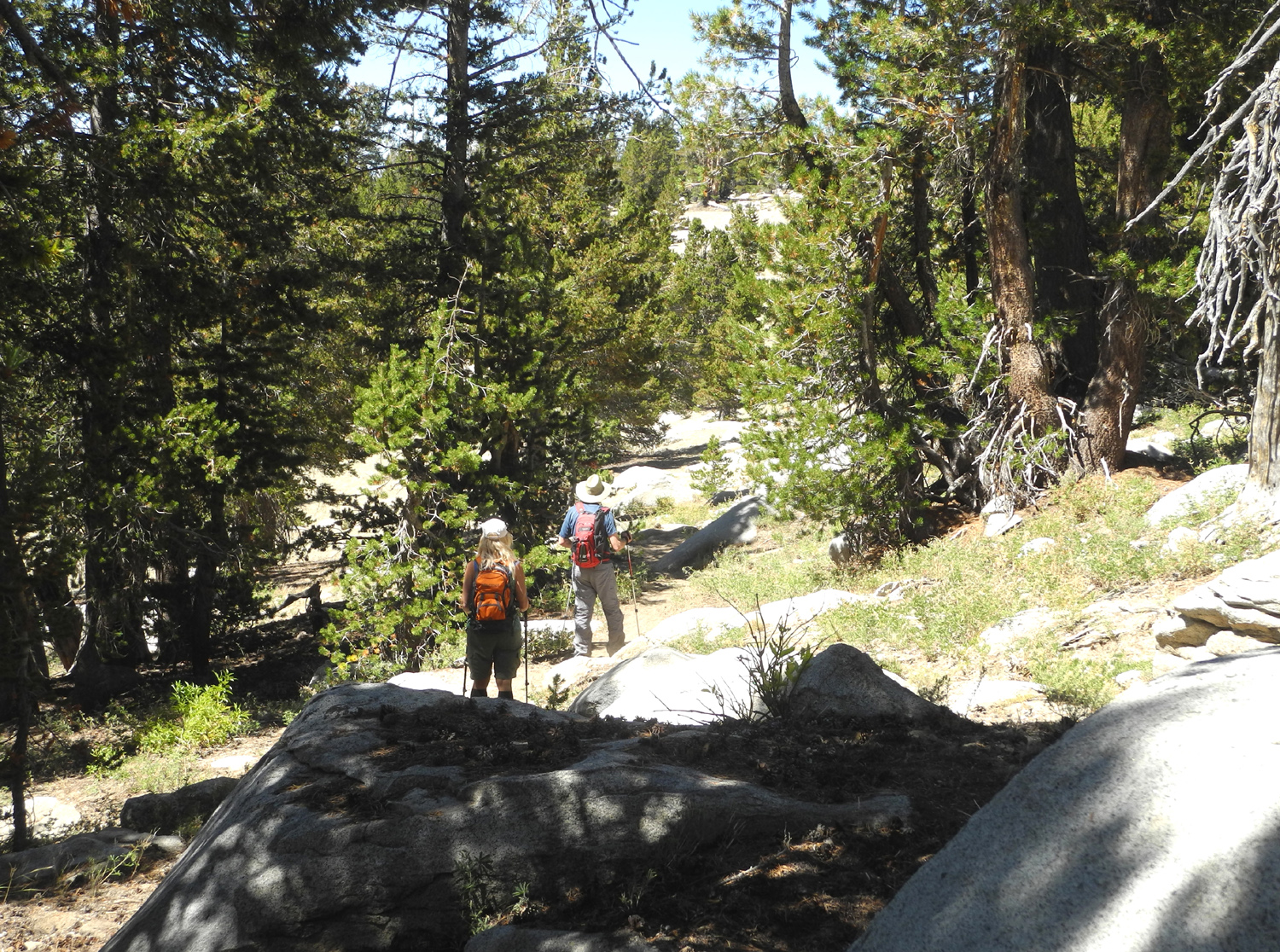
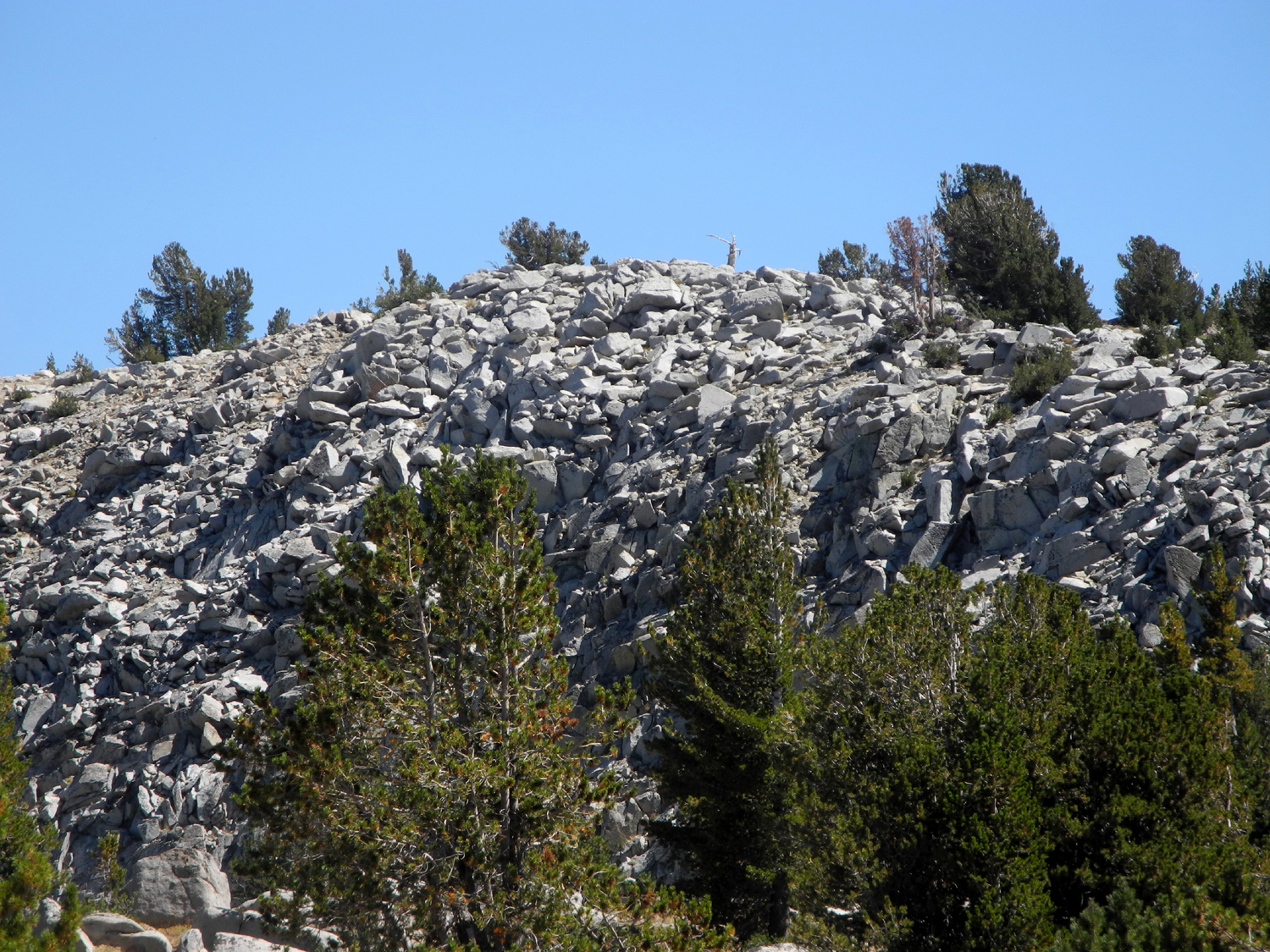
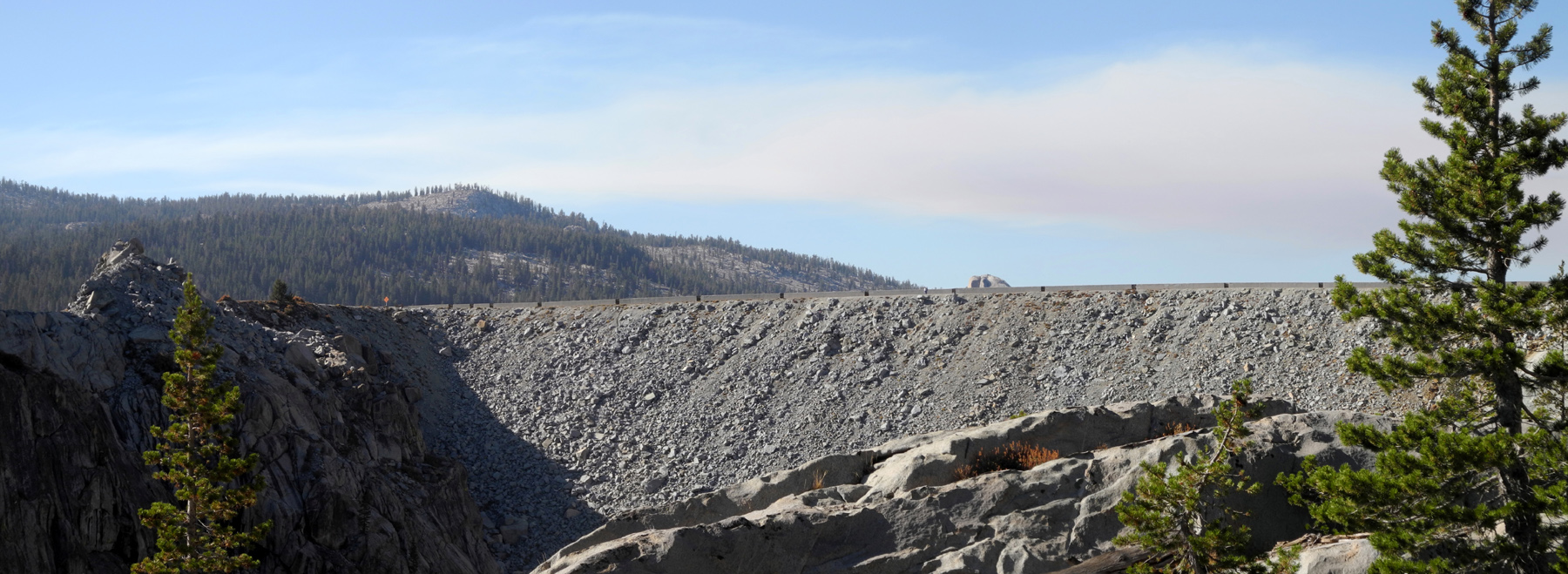
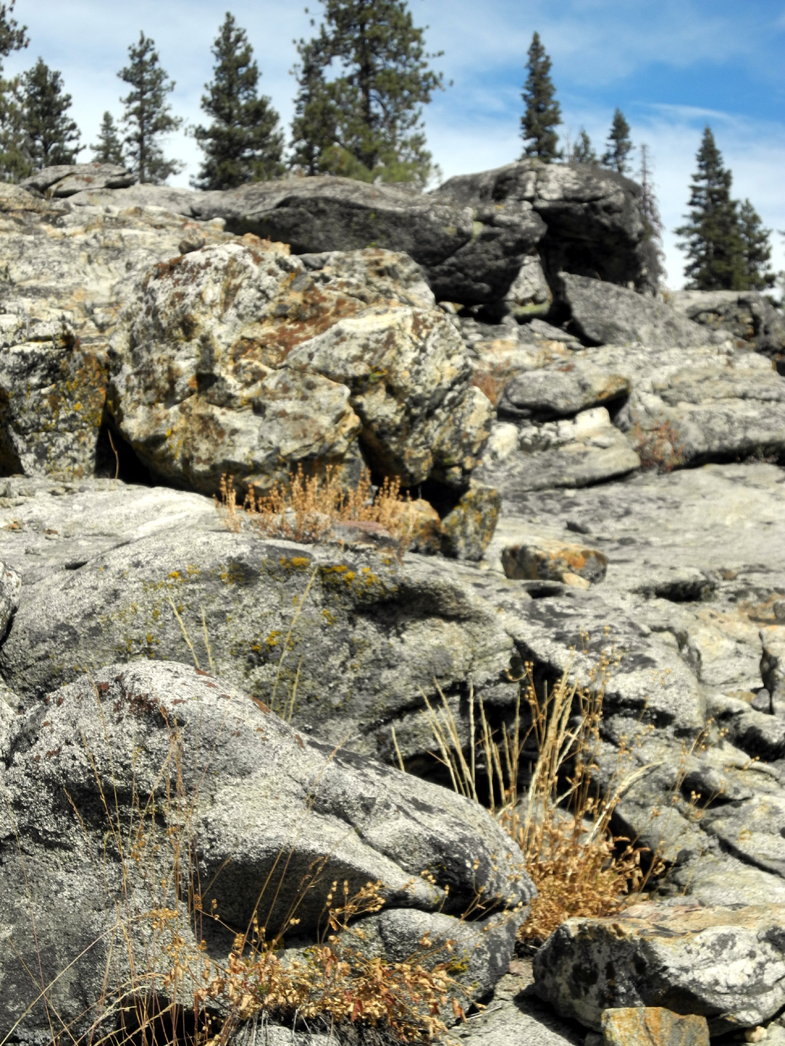
Courtright Camp III No matter what anyone thinks, I DO go to other places besides Courtright Reservoir. But I have to admit that I camped there three times within just over a month, between August 16 and September 19. The latest trip started shortly after noon on Saturday, September 17. At first I was going to go on Sunday for one night. My daughter Teri had decided to backpack from the Maxson Trailhead, not far from where we have camped in the past, and join me on Sunday for hiking that afternoon and Monday. Then I decided to leave on Saturday, but still did not expect to see her until Sunday. I went to my great grandson's soccer game Saturday morning, then went home, finished loading the truck, and got on the road about noon. I made good time, arriving at the trailhead about 2:15. Someone else had taken the big flat rock area where I camped the two previous times, but there is a nice spot across the road from there that Teri had previously used with her motor home, so I set up there. One of the best things about this spot is that it does not look like a viable campsite, so people ignore it, and we can feel smart because we are clever enough to recognize its potential. It IS very close to the road, but with an average of three vehicles per hour on weekends, and four per day during the week, that's not a problem. I had already decided that my first hike would be the Juniper Trail. This is actually more a concept than a trail. It involves walking to the nearest photogenic juniper tree (nearly all of them qualify), walking around it, taking photos from various angles, then moving on to the next tree. Since the boulder-covered rock slope above the camp is the perfect habitat for junipers, I spent a lot of time covering very little distance, but getting more photos than I know what to do with (a few of them can be found here). I wandered across the slope from north to south, up and down in a band between 100 and 200 feet above the road. Of course, I also took shots of the surrounding domes, the rocks, benches, and cliff-like layers on the slope, and other trees and plants. I finally made my way back to the road just where it comes in from the dam, and walked out to the edge of the Helms Creek Gorge below the lake. This took me out of the juniper zone, so I photographed the dam, the gorge, the domes next to the gorge, and a few other things, before walking out to the road at the geological exhibit (see my mid-August report for more on this). I started walking back toward camp, then noticed a nice juniper about 50 feet down the slope below the road. I debated just passing it up and getting back to camp, but could not resist, and was glad I walked to it, since it turned out to have some unique features on the hidden downhill side. I continued along the lower slope parallel to the road, in a strip about 50 feet wide, and finally climbed back up to the pavement right where a young couple had set up their camp. I chatted with them for a few minutes, then noticed an excellent juniper above their camp, one that was lower than my earlier route. I walked up that way, took photos, and headed back to camp across the slope. Of course, I managed to take a few more pictures along the way. As I approached the end of my hike, I saw someone walk through my camp, then disappear behind a large boulder. I assumed that it was my daughter, and as I got closer, I saw that things had been added to my table, a tent had been set up nearby, and she was relaxing on a folding recliner. We shared stories of our day, or in her case, the previous two days of backpacking. She had gone in about eight miles one way, spent the night in two different locations, and had a great time. She also had a couple of very cold nights, waking up with frost on the ground. It was around 6 p.m., and I was ready for my big meal, which I normally eat in mid-afternoon. Of course, I had had a good breakfast, plus a little something just before I left, so I was not starving, but I fixed a ham and cheese sandwich, and Teri ate whatever she had brought. We had a few yellowjackets around, but they did not bother us like they had on our previous visit there. This was to change the next day. For the rest of the evening we mostly relaxed around camp, with a couple of short walks. As the sun began to set, we walked across the road just to the south of our neighbors' camp area, where we had a view of the domes and ridges to the east, caching the final rays. We also both read for a while. Even after the sun went down Teri had her headlamp and I had my iPad, so our reading was not limited by the lack of daylight. In the morning we lazed around for a while, enjoying a cup of tea, walking down to the parking lot restrooms, and eating breakfast out on the rock to the east where we had a view of the surrounding domes. We also had a nice look at the full moon as it dropped toward the ridge above. Around 11 we set out on our morning hike, which we called "Down in the Hole." To understand this hike, it helps to have in mind a picture of the terrain. From our camp site, the road is fairly level, running north to south across a rocky slope perhaps a quarter mile long. The slope rises above the road several hundred feet, and at the top you can look down on the lake to the west. Below the road it goes down a similar distance into a drainage. The camp site marks the northern end of this slope, and at the southern end, near the geological exhibit, the road curves around to the west and back toward the dam. Beyond this curve, south of the road, are the two domes we climbed during our previous trip, and to the west of them, the land drops sharply into the Helms Creek gorge below the dam. The last quarter of the way to the south is a fairly smooth granite slope, but the rest of it has smooth sections, rock shelves one to four feet high, and cliffs consisting of layers of granite, mostly ten to twenty feet high. Traversing this terrain requires careful study of the land to find the route that can be walked without having to scramble up or down the rock. We walked across the road and started down across the granite just south of the big level rock campsite, which was now vacant. We worked our way down toward the bottom of the drainage, taking a few more juniper pictures on the way, as well as seeing and photographing a new angle on some of the closest domes. I had considered the possibility of following the drainage up toward the parking lot, since I'm trying to figure out the configuration of the land there and where a creek by the trail runs out, but there was a thicket of trees and bushes on both sides of the waterway (which was now dry). We took a slightly different direction back up, getting back to the road about the same place I came out the day before. We also walked up on the hill to the west for a short distance, then back to camp, pretty much retracing my footsteps of the day before. For the last 25 years, most of my camping has been with a trailer or motor home, so it's been years since I owned a camp stove. This has meant cold meals at these recent truck camps. However, Teri had her lightweight backpacker's stove, and heated up some chili when we returned from the first hike. As we sat down to eat, we were joined by countless yellowjackets (AKA meat bees), who proved to be so aggressive that we ended up sitting in cab of the truck to eat. After lunch we rested, talked, and read, and about 4 p.m. started our final hike of the trip. During separate trips, we had both gone up to the top of the ridge above camp, where there is a view of the lake. We decided to make this hike again, approaching it in a slightly different direction. We had both gone up and to the left, or southwest, so this time we went up and to the right. This route was a little more difficult, since we quickly got into trees and brush that marked the end of the rocky slope. We actually ended up making our way back to the south and pretty much going up the same way we had each gone the first time. I did veer off to the north near the top of the ridge, where I discovered what looked like a dead, rotting juniper log, that was actually a living tree. We enjoyed the view of the lake, and walked along the top of the ridge to the south, where the land drops down steeply toward the road near the geological exhibit. We had gone down that way on our previous trips, but it's a challenging spot. On an earlier trip Teri and her friend Sandy did some rock scrambling, and I spent a lot of time studying various possible routes to get down the cliff that is the first barrier. We decided we did not want to go to that much effort, and made our way back down the way we had come up, going more or less northeast back to camp. Since we had eaten our main meal between hikes, we just had a light snack for the evening, then enjoyed the sunset and some reading. Teri had set up her tent and had a nice foam mattress for sleeping. I was sleeping in the back of my truck on an air mattress, which had worked out OK the night before. I had slept with my head toward the back of the truck, so I could enjoy the stars and moon, but there had been a cold breeze blowing in the first night. There was a little additional discomfort with my feet against the cold metal back of the cab (even with the sleeping bag), so I decided to try sleeping with my head forward. This proved to be a winning idea, and I enjoyed the best night of sleep of all my three trips to Courtright. The next day we were both ready to head for home, so we did not plan on any hiking. We had our morning tea and our exercise walk down to the parking lot, then fixed breakfast. We ate out on the flat rock again, but this time we had to pay the "yellowjacket tax," putting a couple of pieces of ham out on the rock to draw these annoying pests away from our food. This worked well, and as we finished our meal, the last of the ham also disappeared. With breakfast over, we finished packing, and Teri departed. I stayed about 15 minutes longer to finish the book I was reading in the cool mountains, knowing that the high at home was supposed to be 103. My experiment with three "old school," primitive car camping trips was mostly successful. The sleeping arrangements were OK if not ideal. If I decide to do more of it, I will get a small camp stove. With our location being only a third of a mile from a public restroom, the most difficult aspect of primitive camping was avoided, and I haven't decided what to do about that if I go to a more remote site. The beauty of the area and the relatively few people around made the difficulties seem minor and the positives all I could have asked for.
|
||
|
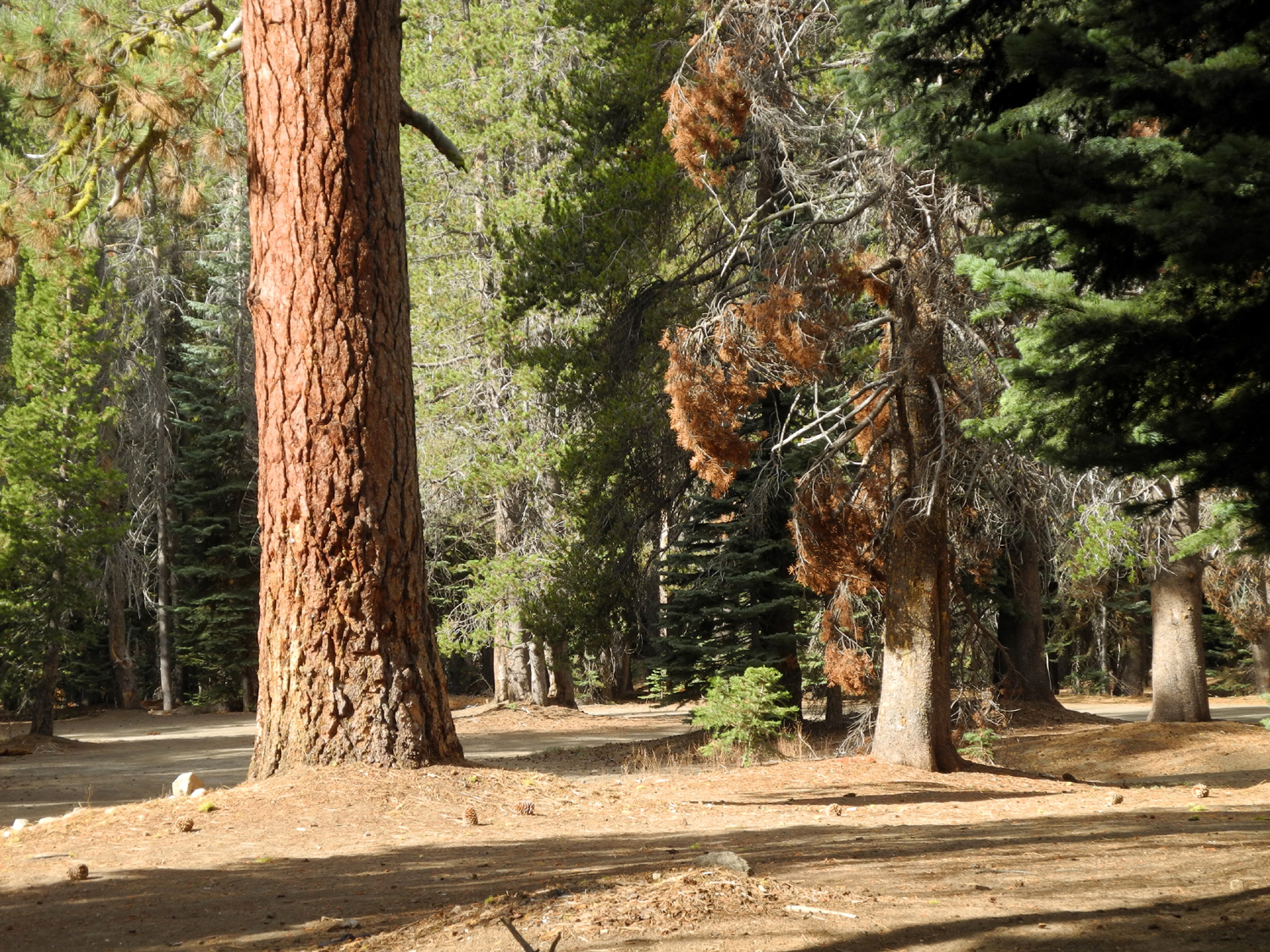
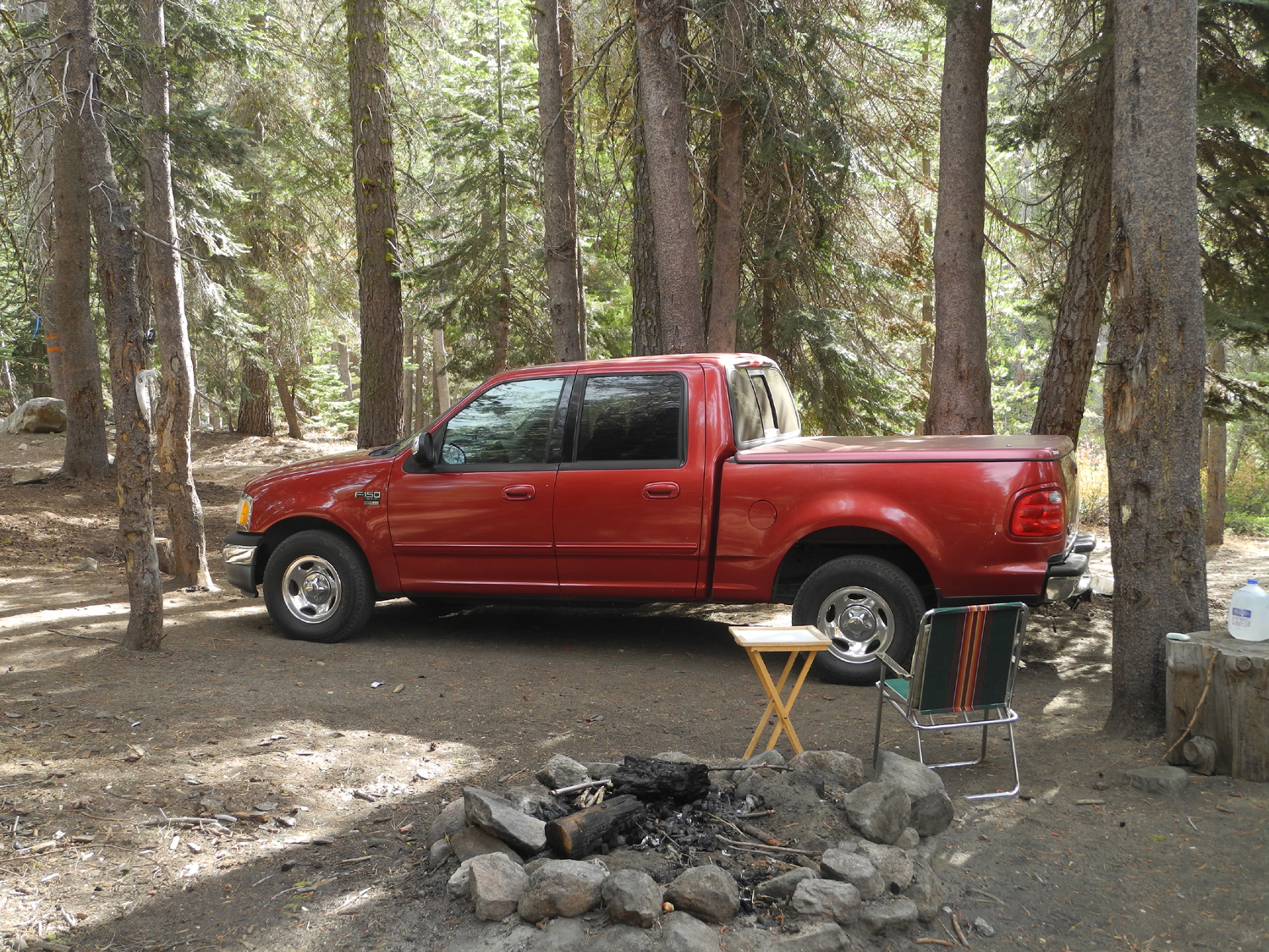
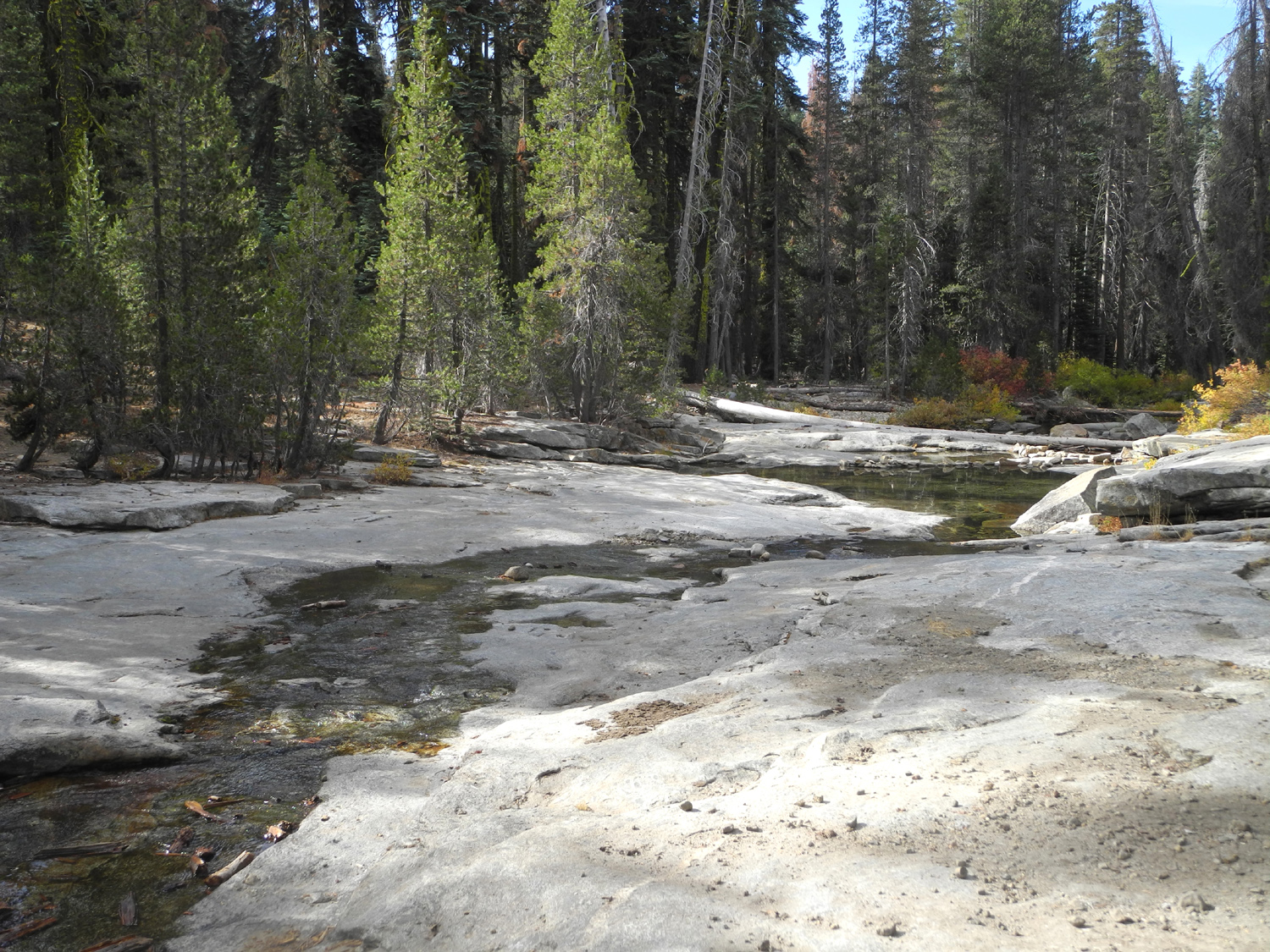
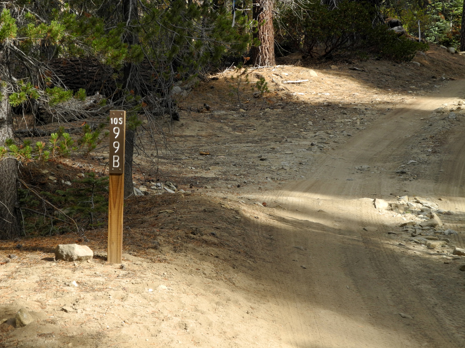
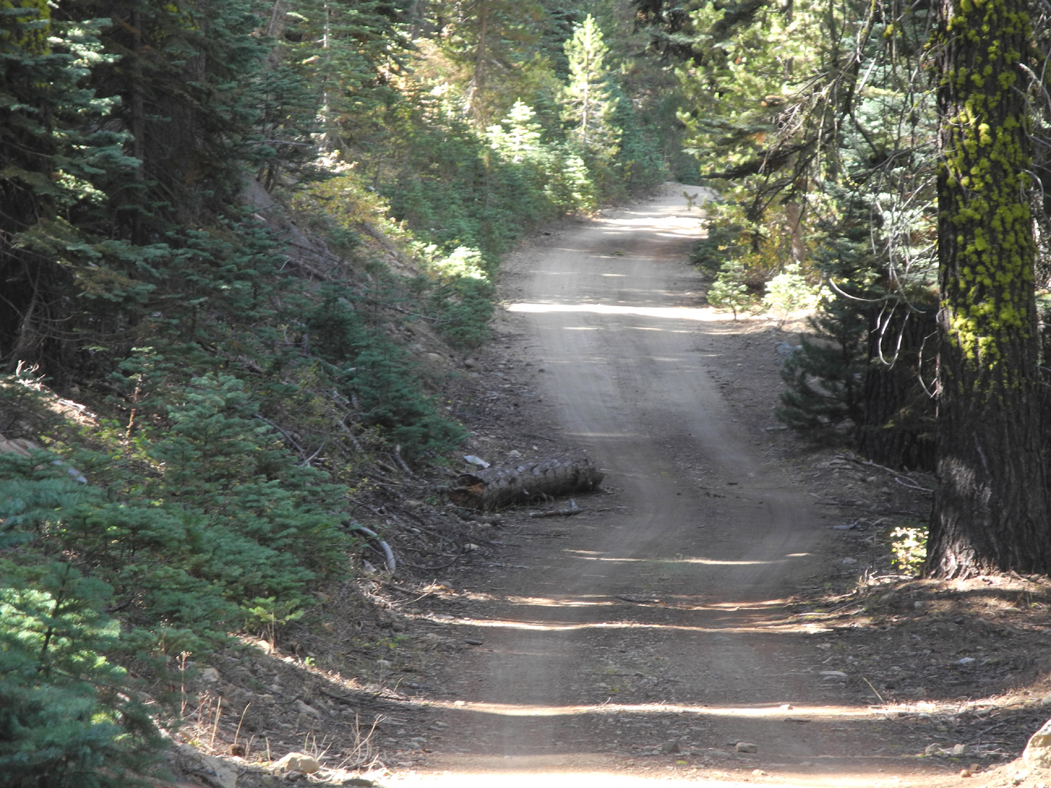
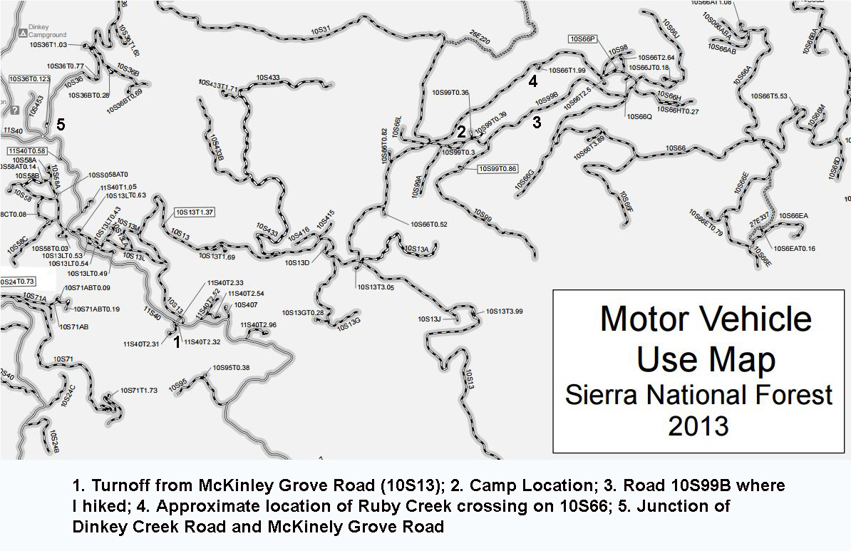
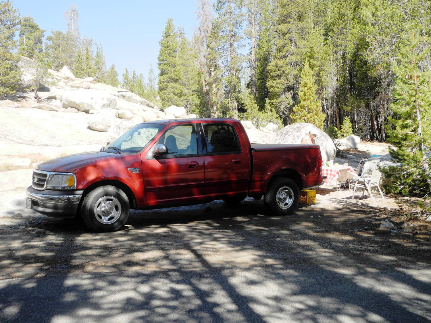
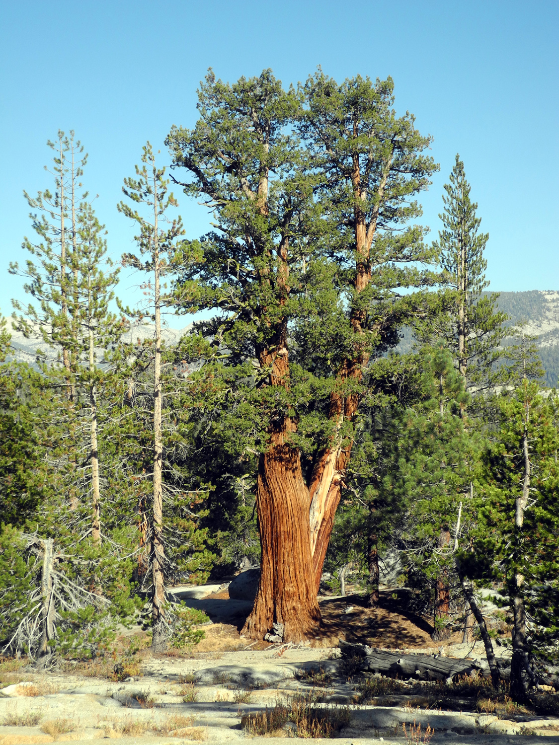
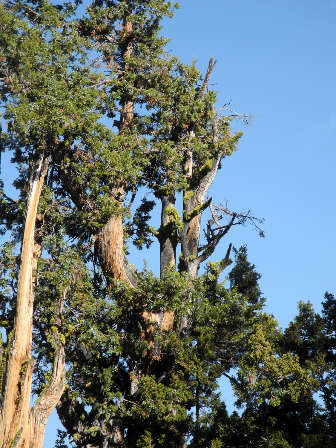
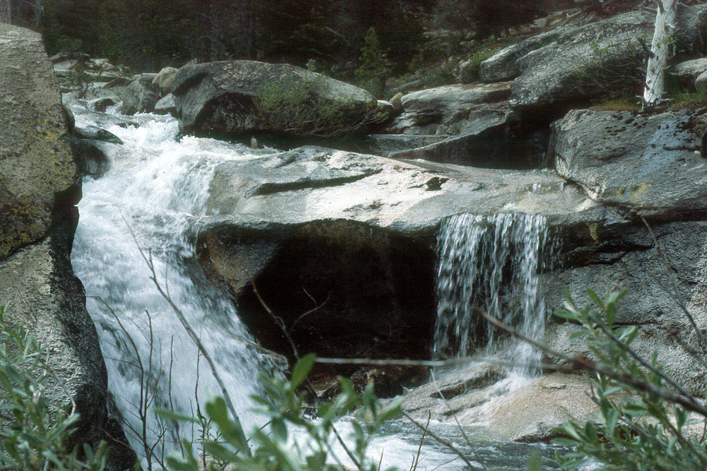
Bear Creek Camp You probably know where Bear Creek is. There are plenty of them, so if you venture into areas where bears live or did live in the past, there's bound to be a Bear Creek nearby. I know of at least four, in Merced, Mariposa and Fresno Counties. Wikipedia says there are multiple locations just in California. The one we're concerned with in this report is in Fresno County above the Dinkey Creek camp area. If you drive into the Sierra from Fresno, you take the Dinkey Creek Road at Shaver Lake, then turn onto McKinley Grove Road at Dinkey Creek. A couple of miles in, two year-round creeks cross the road, first Laurel Creek, then Bear Creek. However, to reach the camp site we have called Bear Creek since about 1975, don't go quite as far as the creek crossings. Instead you turn north on the road to Swamp Lake (Road 10S13). This is a "paved" road, but it has not been maintained, and there are huge potholes, big sections of missing pavement, and it's fairly rough, although people drive it with passenger cars. The road climbs steadily for some time, then drops down to Laurel Creek, where there are a number of nice campsites. A short distance past this spot there is a road junction. If you go right, you can get back out to the McKinley Grove Road at Brush Meadow. But instead, turn left and stay on road 10S66 for a few miles. Another fork in the road has a sign reading Swamp Lake, although it points in between the two forks, so I'm not sure which one to take. It doesn't matter; here is where you are on the home stretch to the camp. Don't take either fork - turn right on road 10S99. This road arrives at the creek, but beyond this point it's 4-wheel drive only. Actually much of the road is in good condition, and could be driven in any car. But the approach to the creek on both sides is too rough for anything but 4-wheel drive. Did I mention that there is not and never has been a bridge here? My first visit to this spot took place in about 1975, and was pretty much a happy accident. I drove up the rough road from McKinley Grove Road, looking for a new place to camp, came to Laurel Creek, and set up my camp. This was in the days of sleeping outside on a cot and traveling in my car, which at that time was a Buick Opel station wagon, a late 60s model. It was always my habit to drive around areas where I camped, and on any such drive you will see roads off to the side, what we call "wonder roads," as in "I wonder where that road goes." I came to a narrow road off the route I was on, and where it went was just under nine tenths of a mile to a crossing on a creek, which I later learned was Bear Creek. There was a camp site with cupboards, a table, and benches made of rough scrap lumber. At this place the creek runs fairly straight for several hundred yards down a rock base which ranges from 50 to 100 feet wide The creek does not fill up that entire width, but there are a number of pools up to 50 feet wide lying crosswise to the direction of the creek. The rock creek bed ends just past the camp in a thicket of willows. Right below the camp site is a fairly deep pool, adequate for swimming and splashing around. The best thing about this creek was that it played the Doors song, "Riders on the Storm." When the water was running high enough, the sounds of the stream and the rocks that are moved around against each other produced a sound very much like the rhythmic background of the song's instrumental break. Lest you suspect hallucinogens, other members of my family agreed with my analysis of the sound. The camp site itself is a long, flat clearing about 80 feet wide with only a few trees. The land rises steeply to the north, and the creek runs along the south side. There was a large campfire ring at the main camping site, but people have camped and had fires in several places around the clearing. Over the years, I camped there a number of times, both solo and with my kids, and we continued to go there occasionally after they were grown up. My last visit there was a day trip from our camp at Stargazer Rock about 15 years ago, when we drove there to swim for a while. Getting back to 2016, I left home at 7:40 a.m. on October 10, knowing that the temperatures would be cool at the campsite, elevation 7,000 feet. It was 47 degrees when I arrived at Shaver Lake at 8:45, and 49 when I got to Bear Creek at 9:40. The daytime high during my visit was about 60, and it got down to 30 just before dawn. I got parked in a fairly flat spot, got out my table and chair, and checked out the creek. It was running fairly good, but not enough to sing "Riders on the Storm." None of the artifacts that were there in the early days remain except for the fire ring. My first hike of the day was to follow the road that crosses the creek, where I planned to continue for as long as I felt like walking. A short distance above the creek another road branches off, but I stayed on the one that appeared most heavily traveled. "Heavily traveled" is a relative term here; I did not see any vehicles or any other people on my entire hike. The road was fairly level for a while, with a view of the creek below, then went up hill for several hundred yards. From my starting point to the highest place on the hike was a 200 foot elevation gain. At the beginning the trees were Jeffrey pine, red fir and lodgepole pine, but in the higher area they were mostly red fir. Along this section the road became fairly rocky, but nothing that a pickup could not have handled. One of the more interesting sights along the road was a fire ring with a ten-foot tall red fir next to it. The lower branches hung over the fire ring, but were not brown or scorched, indicating that the tree grew after the last time the ring was used, probably at least 20 years. When I was ready to turn back, I started looking for a place where I could get down to the creek. There was no really good spot, but after walking most of the way back to the fork, I finally found an opening through the trees that took me to a steep slope, where I carefully made my way down. There are plenty of places where you can step across the creek, and my goal was to go up through the more open, rocky slope on the north side. The bedrock granite on this hill is marked with swirling streaks, possibly indicating the flow of the molten rock when it first flooded the area. Keep in mind that the hardened rock was probably covered with soil and other types of rock, which was then exposed by water and wind. There's no evidence I can see of glacial action in this area. There is also a jumble of cracked and fractured boulders, many with red stains from iron content, and lots of small dark rocks embedded in the granite. I had hoped that my upward climb through this area might take me to the main road, where it runs more or less parallel to the camp road, but after reaching the top of the slope, I was still in the woods. I walked through this forest area, having to work my way around fallen logs in some spots, then started angling down and across the slope. Eventually I found myself entering the camp area from the northeast, and headed to my chair for a well-deserved rest. Next it was time for lunch, reading, and wandering around the immediate area. For simplicity and to counter the yellowjackets, I had a peanut butter sandwich. I had brought hot tea in a thermos, but it's obviously not very good, since I drank warm tea, which became cold tea before I finished each cup. There were a very few yellowjackets, but they did not really bother me. During this time I also got my bed set up in the back of the truck. This involves putting most of the items from the truck bed into the cab (it's a full-size four-door model). The big items are my food box and a large ice chest, but there are also my camera, boots, and a few other small items. Instead of my air mattress, I had borrowed Teri's fold-up mattress, which proved to be more comfortable. Over this went three blankets for extra thickness, then my sleeping bag. After these housekeeping duties, I was ready for another hike. When we first came here, there was a pile of logs higher than my head where the road enters the clearing. They were dry and aged, but still solid. I remembered this, and looked for them from my camp, but they were gone. Hauled out for firewood, perhaps. But when I started my second hike, walking out to the road, I saw that the pile was still there, but mostly rotted away, and not more than four feet high. From the road into the camp, the main road (10S66) continues uphill, and eventually comes to another creek, which we learned back then was Ruby Creek. I thought I would walk out to the main road, and see if I could hike to this spot, which I thought was only a half mile or so up the road. After walking for some distance I decided Ruby Creek was farther than I thought, and eventually turned back and retuned to camp. I did take advantage of this hike to check the distance from camp to main road, and record the road numbers. The road in from "civilization" is 10S66; the road into the camp is 10S99, and the mystery road, which may or may not lead to Swamp Lake, is 10S31. In the photos, I've included a map showing many, many forest roads. Road 10S66 was paved to the Brush Meadow junction, and paved again past the camp road, but full of potholes and very rough. This walk was not especially interesting - hiking on a road, no rocks to scramble over, and thick, small trees along the side. I'm somewhat spoiled by the open granite slopes of Courtright. However, it did provide exercise, the other goal of hiking. The rest of the day I stayed around camp, with a few short trips to the creek and into the forest immediately adjacent to my clearing. I did a lot of reading, some eating, and a fair amount of resting. As usual I went to bed much earlier than I would at home, and had one of the best nights of sleep of any of my four recent camping trips. I give a good deal of the credit to Teri's mattress, which seems to be more comfortable than an air mattress. Before I left home, I also did some work on my sleeping bag, and got the zipper working. The progression of my thermometer was as follows: 6:30 p.m. 50 degrees; 8:25 42; 5:00 a.m. 32; low when I got up, 30 degrees. After daylight, It remained at that level by my truck until the sun reached that area. During the night the moon was about half full, but there was still a good view of the stars, which got better shortly before dawn when the moon went down. I didn't plan any ambitious hiking for the second day, hoping to get home fairly early, although I ended up doing a bunch of little things that added up, and didn't leave camp till after noon. The first thing I did after I got up and dressed was to move my chair and myself and my book to a spot where it was sunny. It was still 30 degrees at the truck, so even in the sun I wore several layers plus my down jacket, and read for a while until I was ready for breakfast. I thought I would eat next to truck, but it was still so cold that I ended up moving my table (actually just a folding TV tray) to the closest sunny spot and ate there. My final hike at that location was down to the creek and upstream for a short distance. The water runs down the rock through narrow passages, into wide pools, a pattern that is repeated over and over along the bedrock channel in this area. Walking along the creek requires crossing back and forth several times, as brush, logs and other barriers block the way on one side or the other. I reached a point below a steep rocky hillside on the south, and at the top I saw what looked like the edge of a road, which would be 10S99B on which I had walked the day before. I crossed the creek and worked my way up, zig zagging back and forth to create a switchback pattern. When I got up to the "road" I was happy to see that it really WAS the road. I walked back down to the creek crossing and back to camp, then got ready for the trip home. But before heading back to McKinley Grove Road, I turned right at the junction, and drove up to Ruby Creek, which proved to be considerably farther than I had thought when I tried to walk there the previous day - 1.7 miles from camp, one way. On my walk I covered 1.21 miles, round trip. The creek was not running, although there was some water in small pools. I walked up the creek bed a short distance, and down a dirt road that ran parallel to the creek, then got back in the truck and started for home. At one point along the forest road I came on a small truck laying nearly on its side off the road. Two men keeping watch said the owner had gone to get a big truck to pull it out. As I drove on, I pondered how it would be possible to drive off the road there. Two possibilities that came to mind - excessive speed, or illegally hunting from the vehicle and not paying attention to the road. I mentioned that I didn't see anyone on my first day hike. Actually I hardly saw anyone at all both days. The first day a vehicle drove into the clearing, circled around and left. On the second day, a 4-wheel drive vehicle drove past me and across the creek. They did not return while I was there. In fact, the map indicates that the road loops around and connects with other routes, so it's not a place where they have only one way in or out. On my hike that didn't reach Ruby Creek, a vehicle passed me on my return trip on the "main" road. A far cry from the six or eight vehicles a day that I saw during my recent trips to Courtright. This is not to say there weren't many people in the woods. It was hunting season, and there were RV's parked at many locations along the major paved roads and the main forest road. There was a travel trailer just off the road about 900 feet from my camp, but it was gone before I left. This was my fourth "experimental" truck camping trip, three of them to Courtright. I decided that this type of camping is something I still want to do, and at times I think of getting rid of the motor home and returning to simpler times. If I did that, I would probably remove the truck's bed cover and replace it with a camper shell. I would also have to get a stove for cooking, and possibly a cot for sleeping. This is a decision for next year's camping season. 12/5/24 Update: I did in fact do all of these things by 2020. --Dick Estel, October 2016 |
||
|
Photos (Click to enlarge; pictures open in new window) |
||
|
White Bark Vista Hike |
||
 |
|
 |
| A
very cool overhanging rock on the edge of the ridge |
Wes wisely posed BY the rock, not on top of it | Two lodgepole pines frame the Minarets |
 |
||
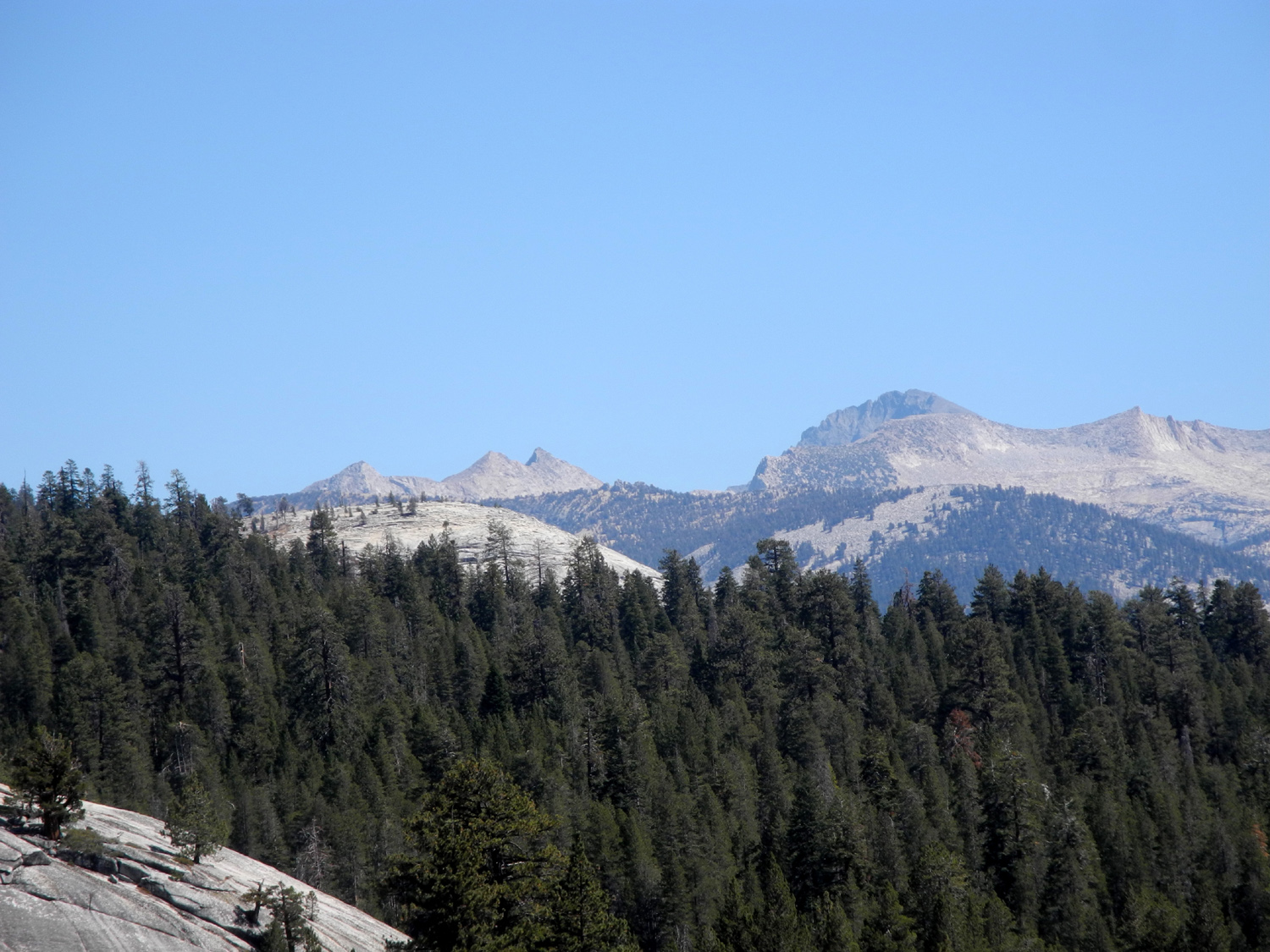
| Rugged peaks of the Silver Divide | ||
 |
||
| The Ritter Range, with the Minarets marked by the sharp peak just right of center | ||
 |
 |
 |
| Lake Edison and Sierra peaks above | To
the west we had a fantastic view of Huntington Lake |
Teri
on a steep section of the trail - easy for us, difficult for Jeeps |
 |
 |
 |
| The
shady trail up to the rocky hill that was our final stop |
Bear
Dome in the middle, with the Silver Divide above |
Dogtooth
Peak in the |
 |
 |
 |
| Mt.
Goddard at the left is the high point of the Goddard Divide |
A closer view of the Goddard Divide | This
granite spur extended out from the peak where we stood |
 |
 |
 |
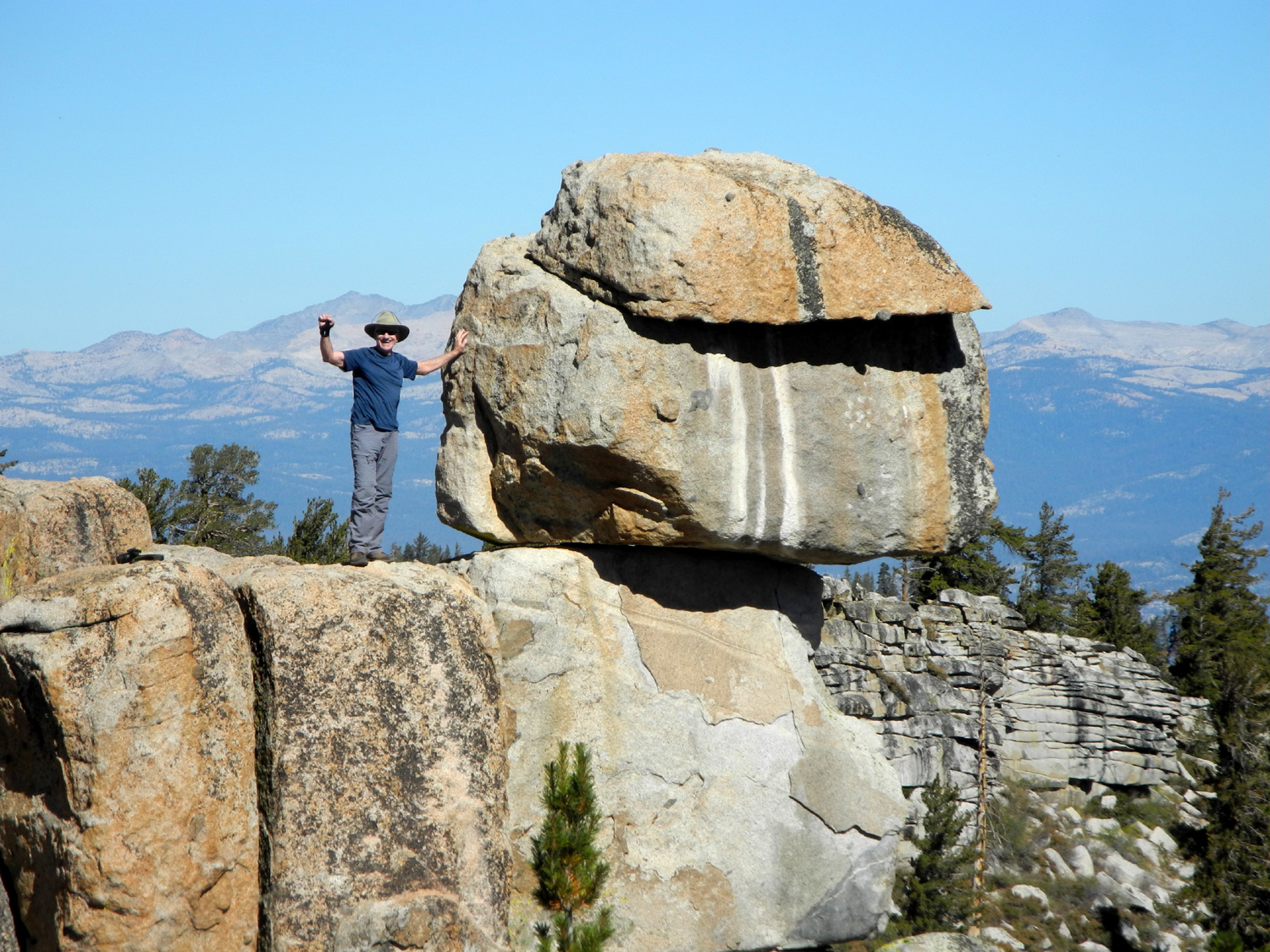
| Wes, Teri and Dick on the rocky mountain top | This tree seemed to say, "come on, go this way." | Wes on the rock |
 |
 |
|
| Teri joins Wes on the rock | Nature
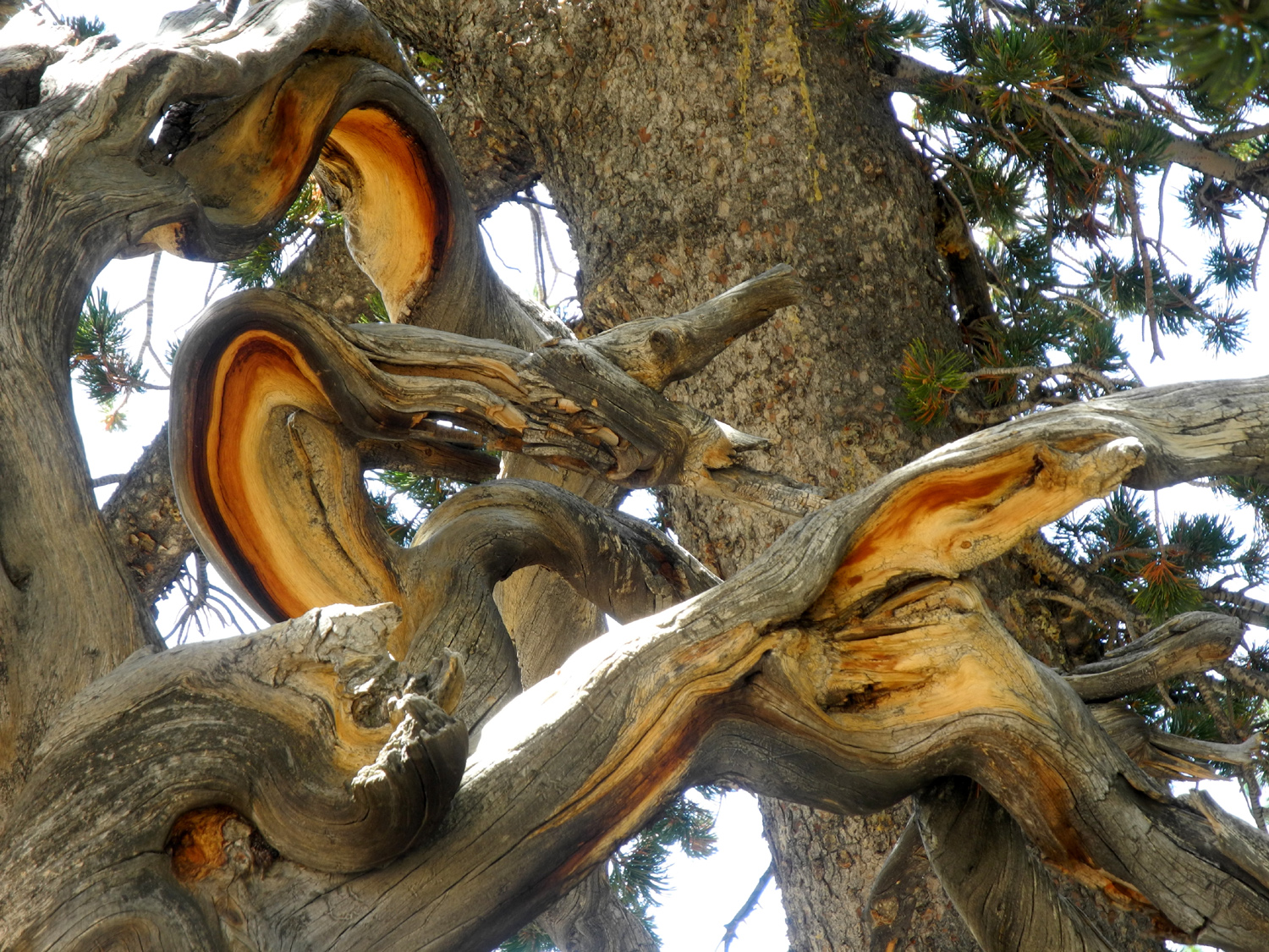
creates a beautiful sculpture in this lodgepole pine |
More lodgepole art |
 |
 |
 |
| Some trees look better in death than in life | Teri and Wes heading down the trail | Cross-country hiking |
 |
 |
 |
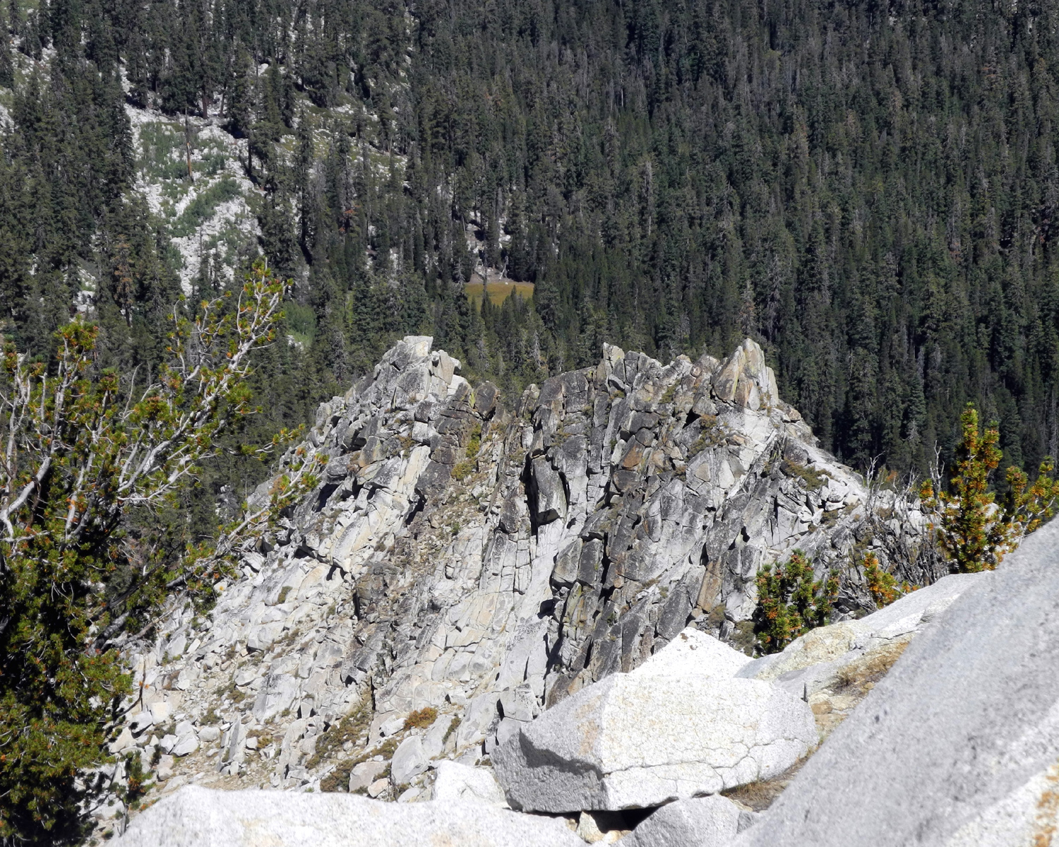
| The rocky top where we were | One
of several striking rock formations out on the edge |
We called this one Potato Rock |
 |
 |
 |
|
A
section of the Silver Divide |
Our
high point was the 10,162 location in the lower right |
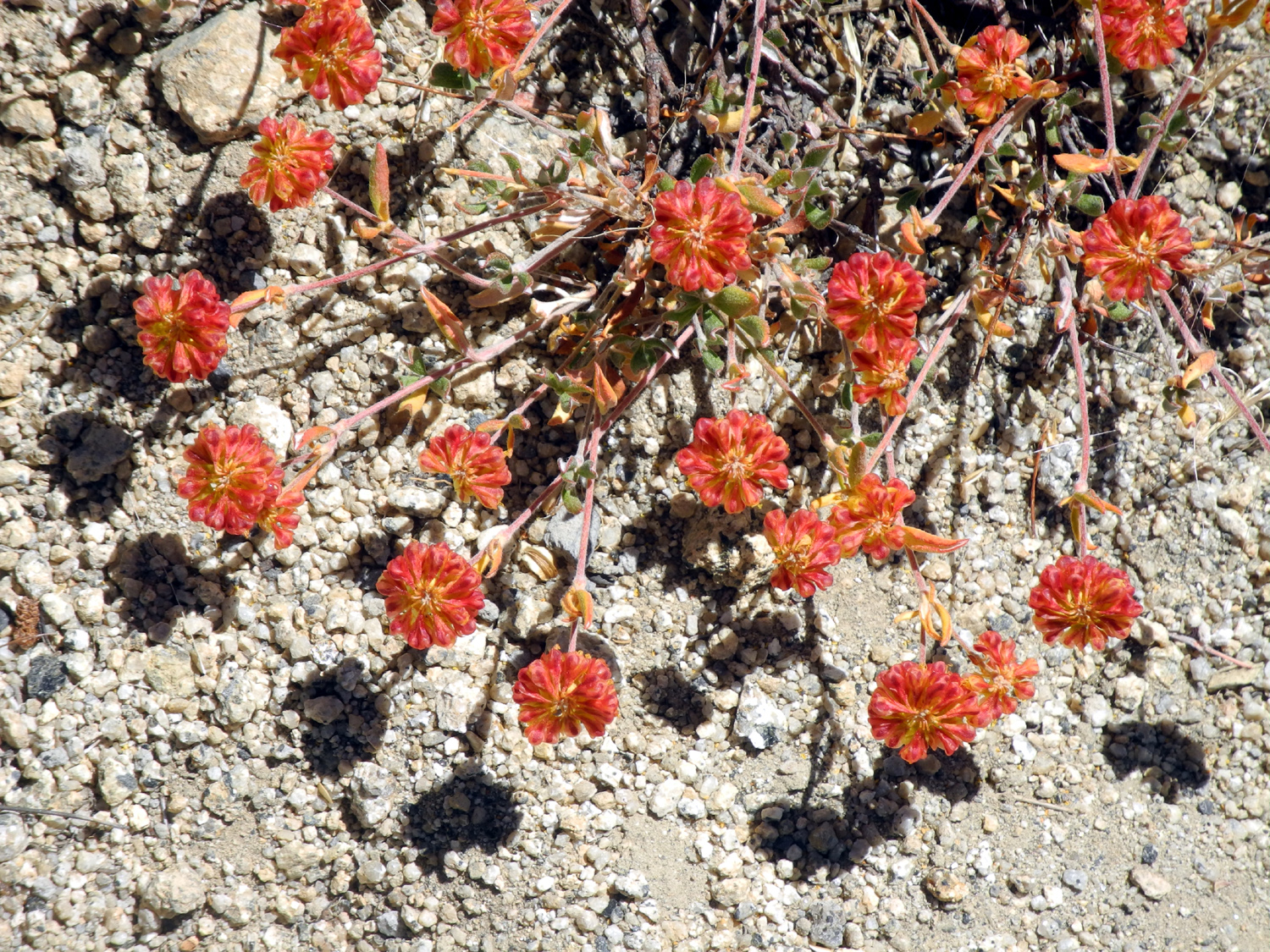
This bush provides a spot of bright color |
 |
 |
 |
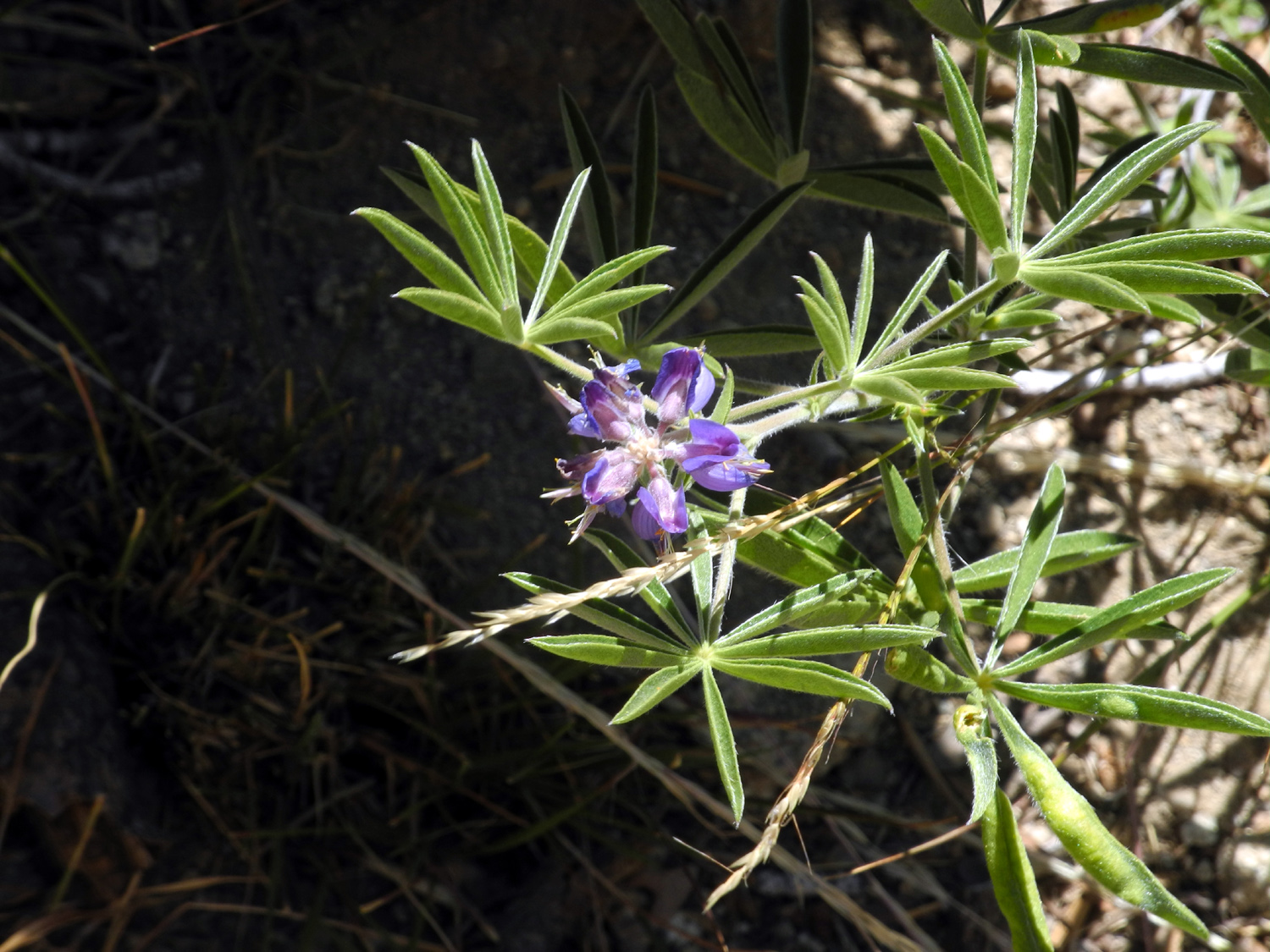
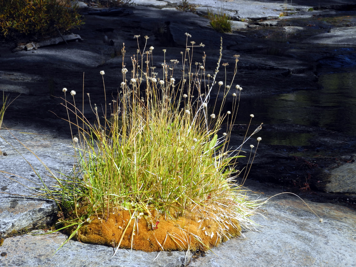
| Dried flower heads | The last lupine | This
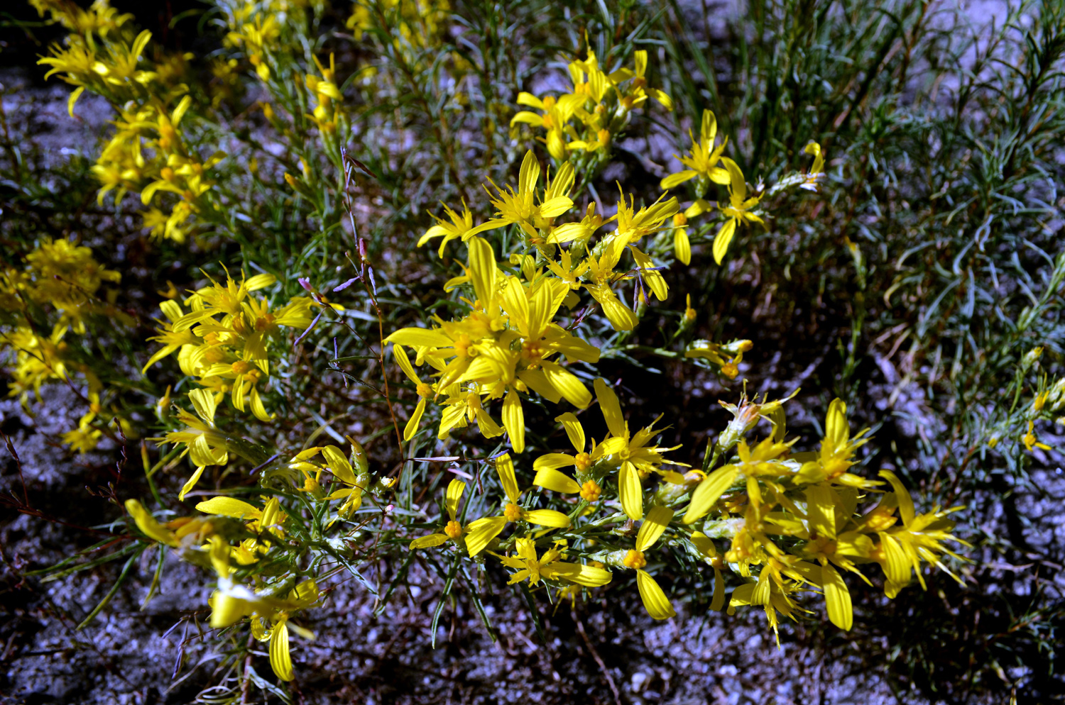
may be rabbitbush, also known as goldenbush |
| Courtright Camp III | ||
 |
 |
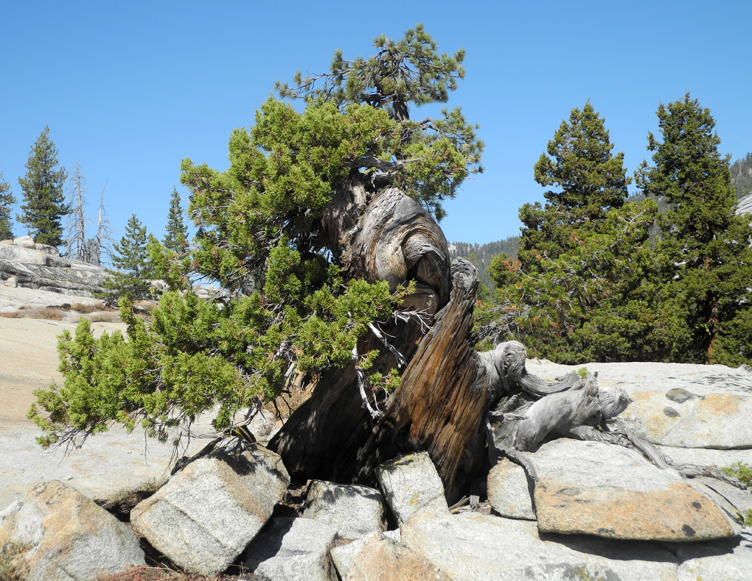 |
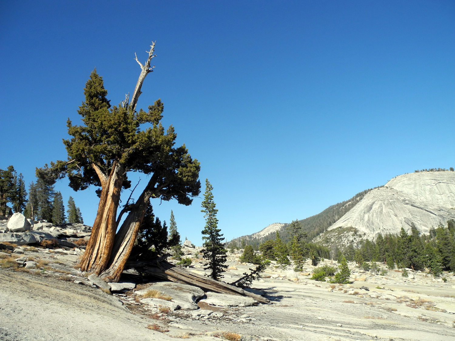
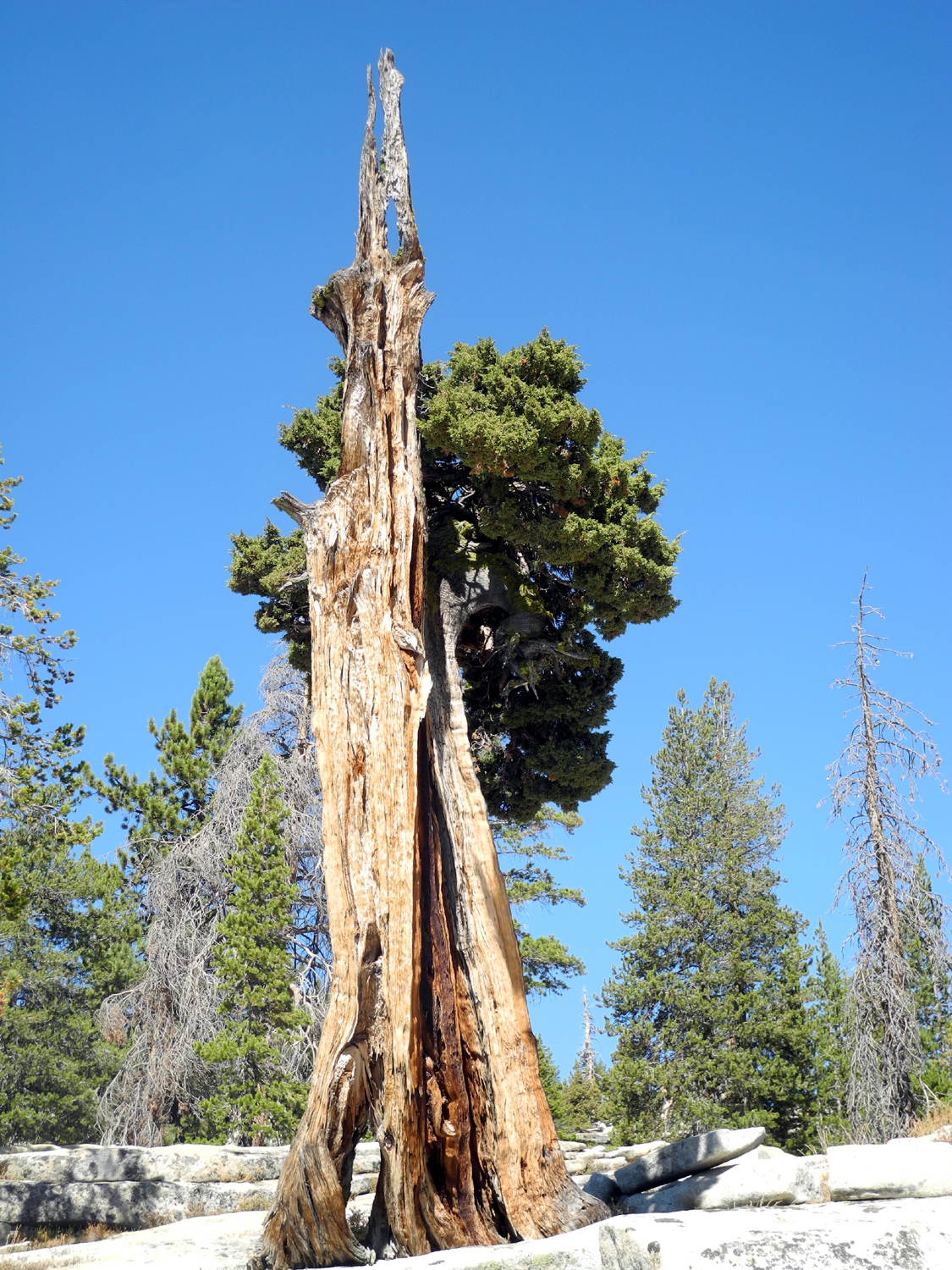
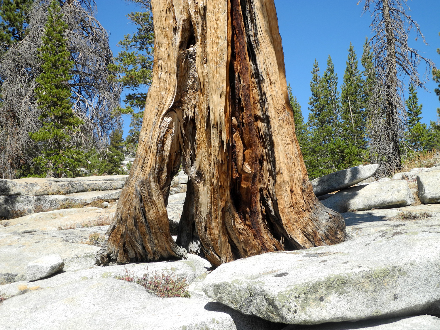
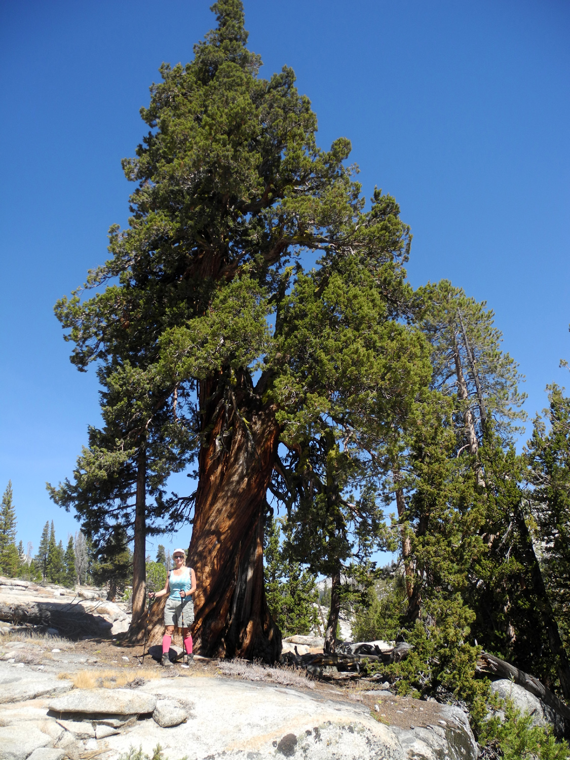
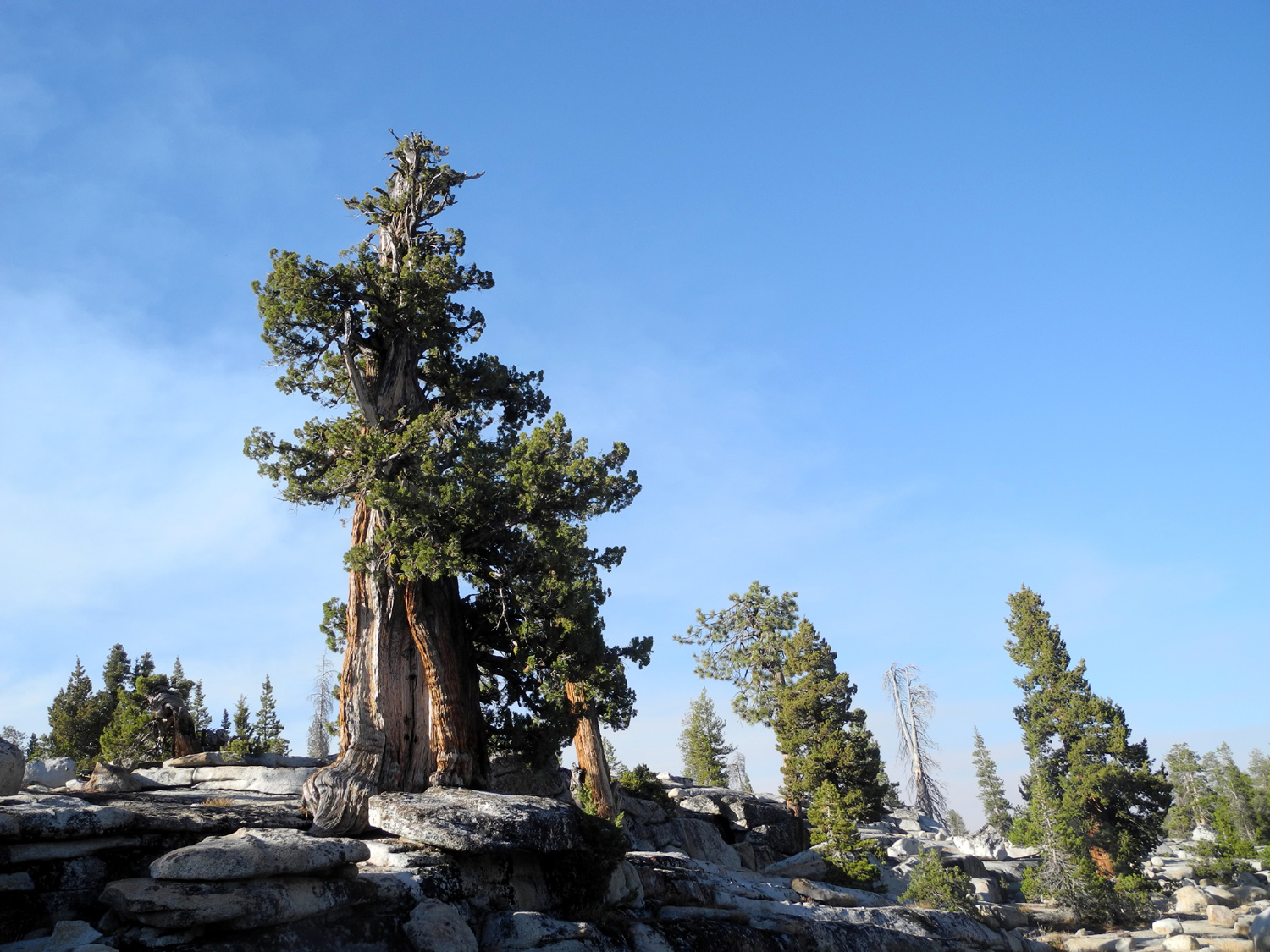
| A
long-time favorite tree that I've observed since 1970 |
It has a hole through the base | This one is small in size, but the trunk reflects many years facing the elements |
 |
 |
|
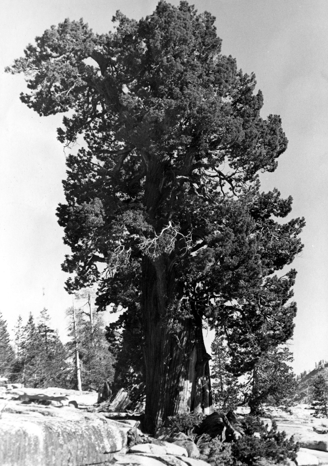
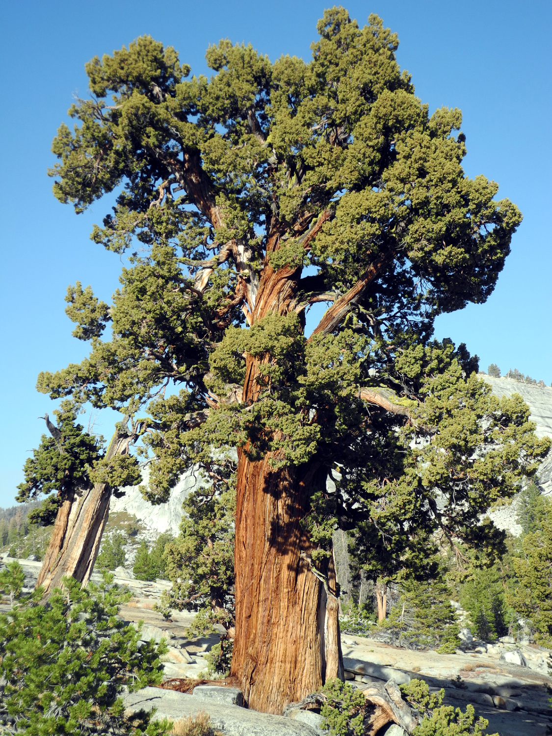
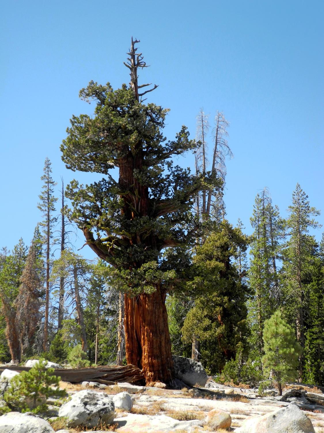
| In
1970 this tree hadn't suffered much "pruning" from the elements |
The
passage of 45 years has thinned the branches slightly |
Dead
top rises above this rugged tree on the slope above camp |
 |
 |
 |
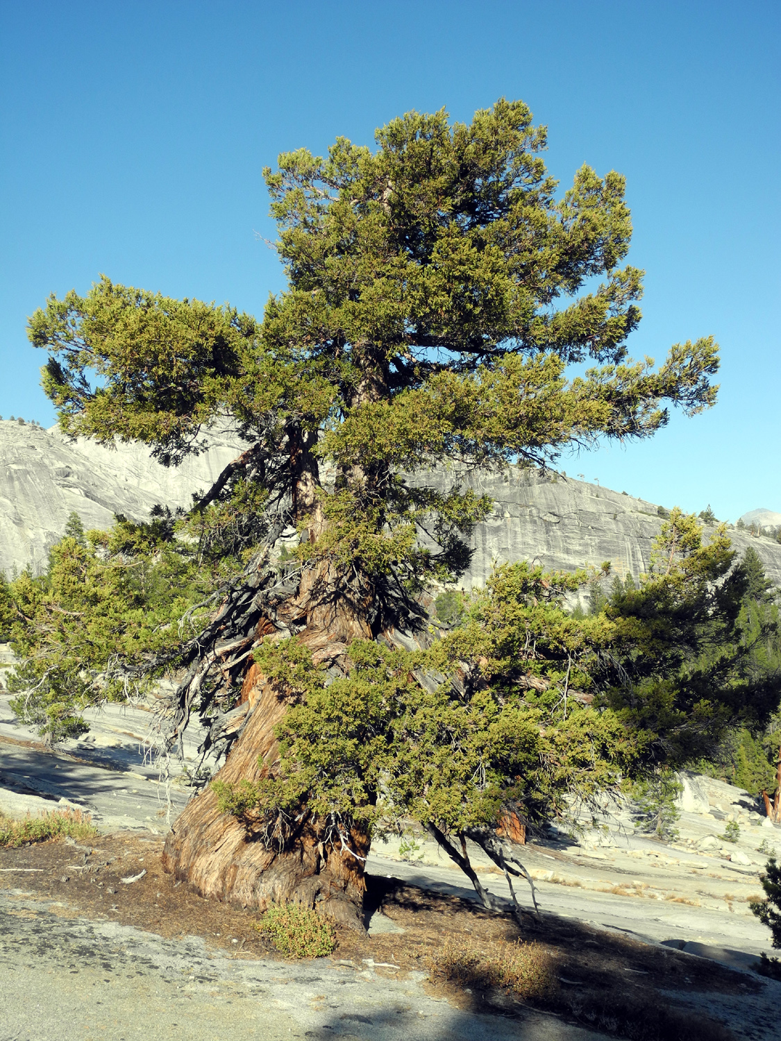
| Not
very tall, but clearly strong against the winter winds |
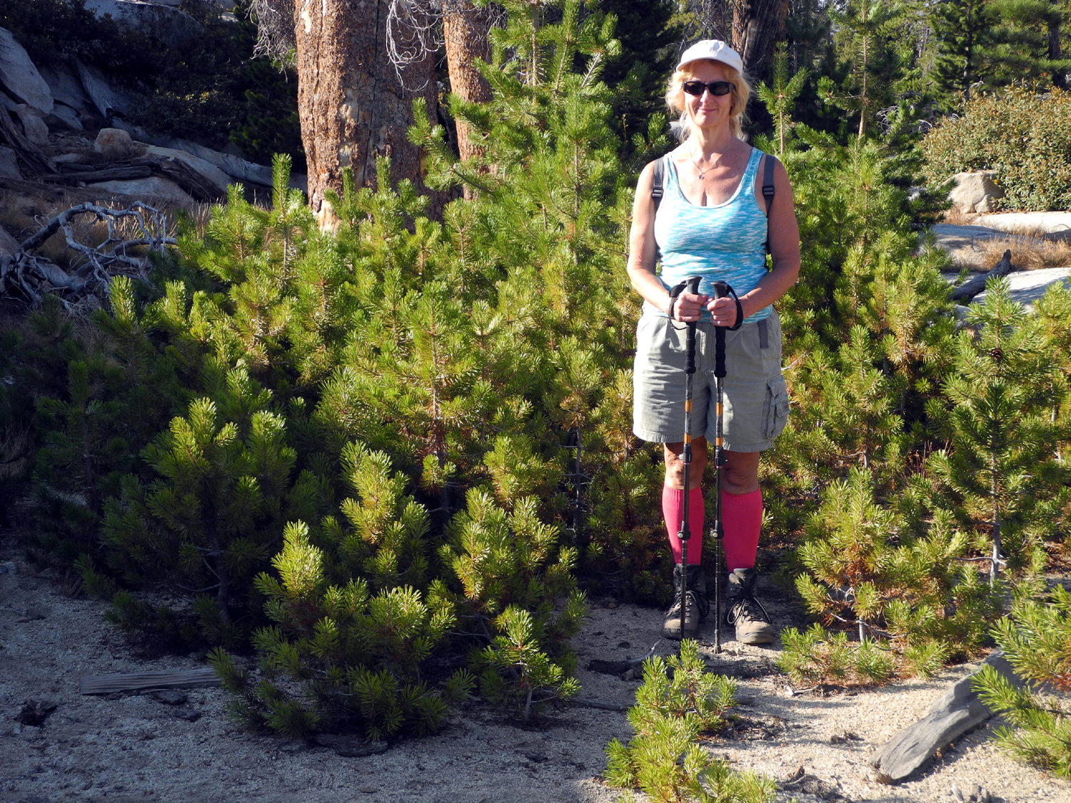
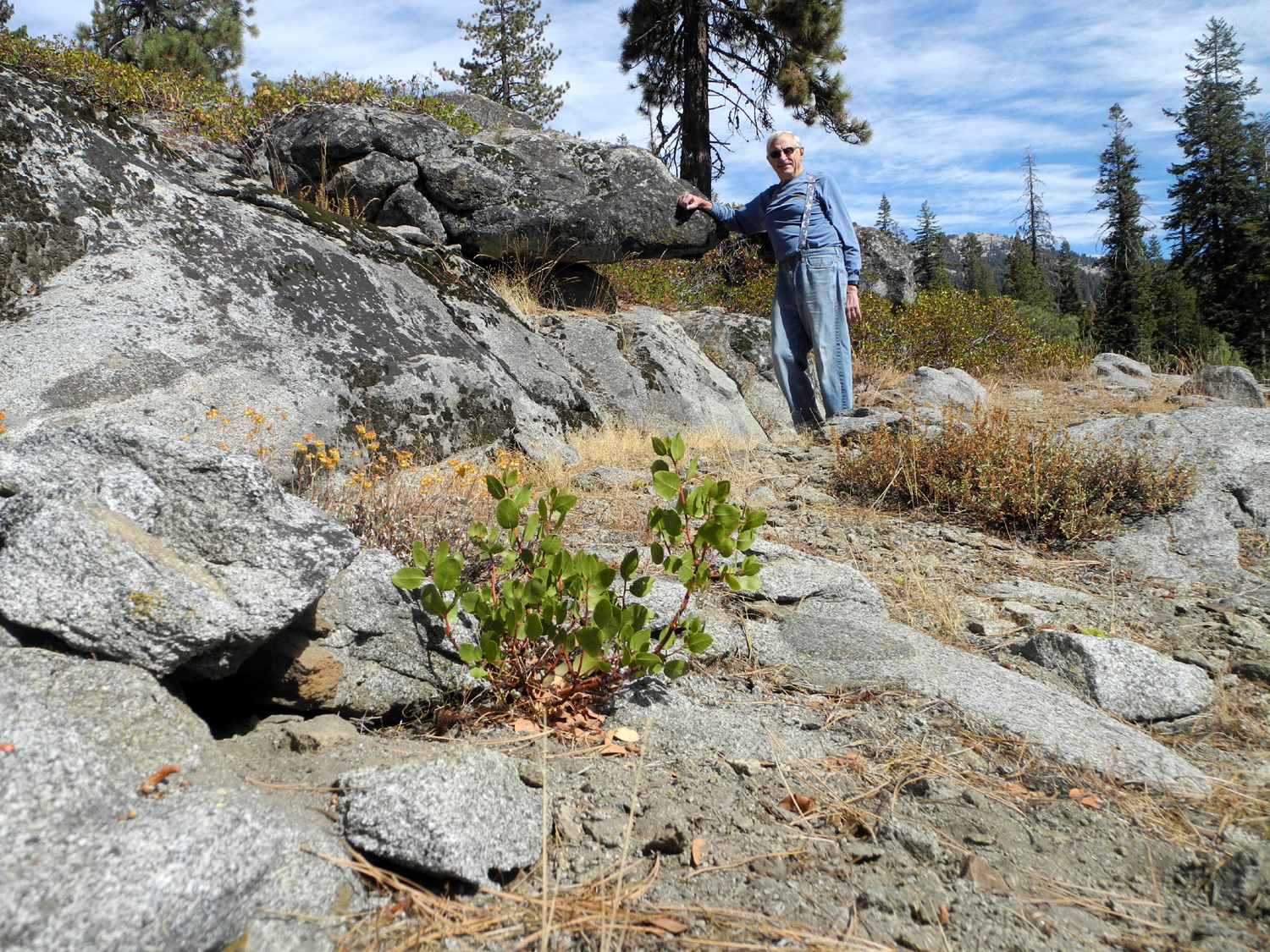
Teri
stands by this tree to give perspective on its size |
A closer look |
 |
 |
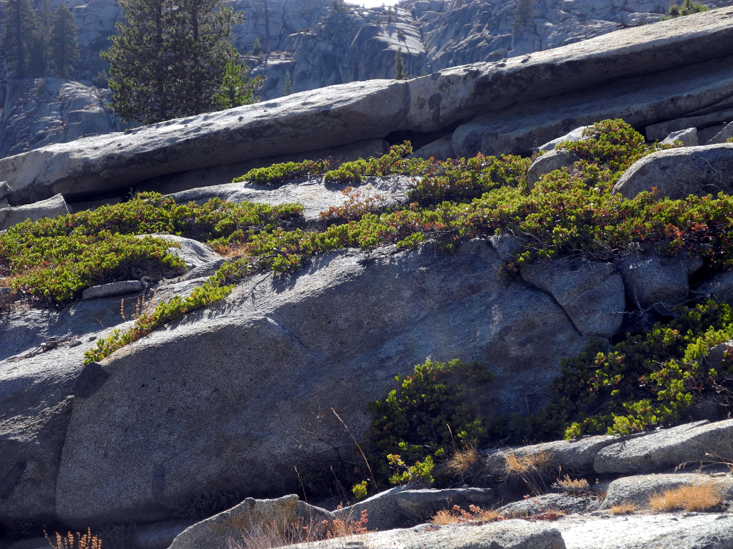 |
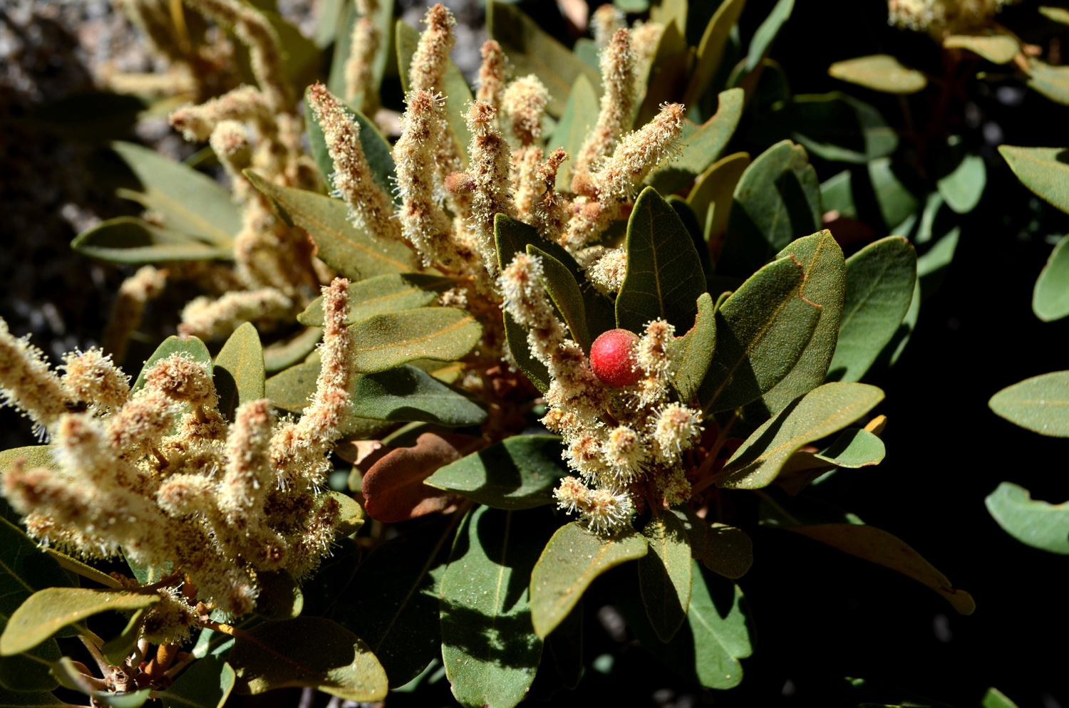
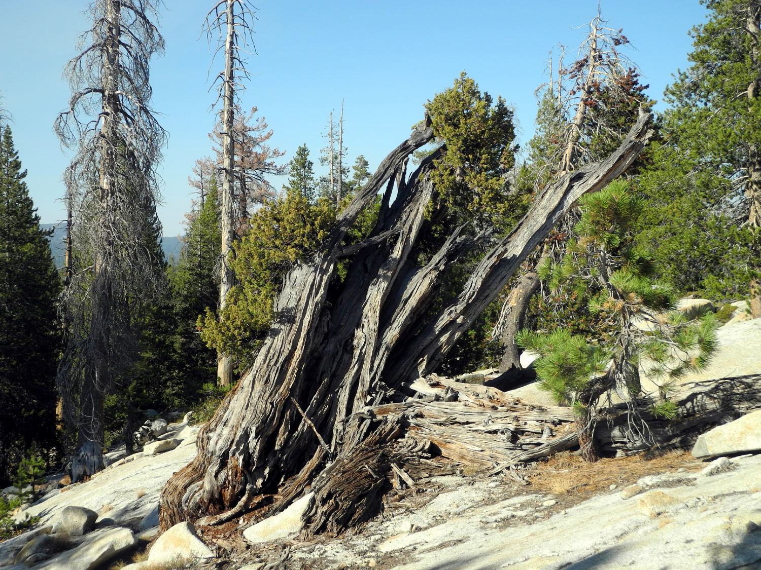
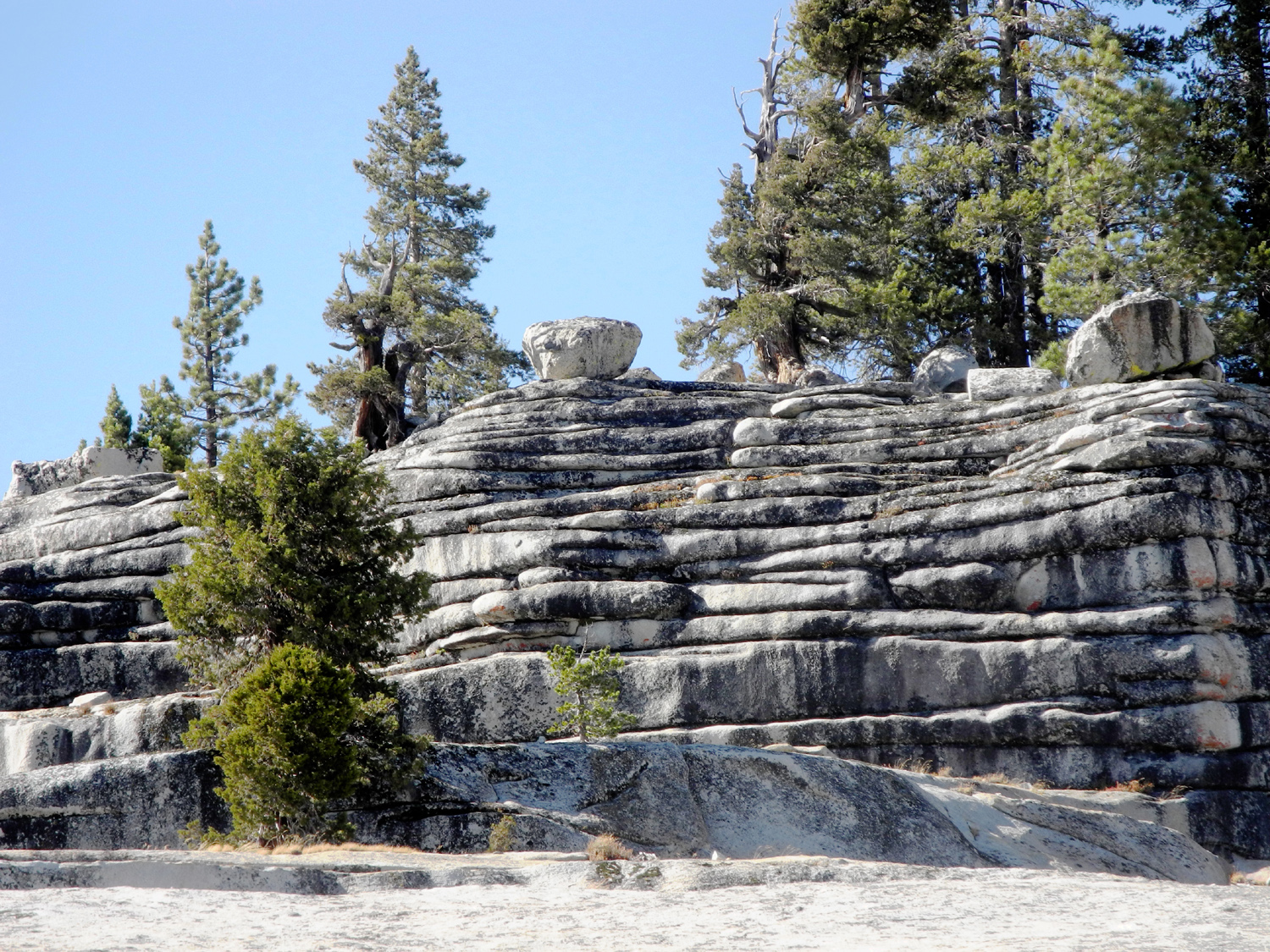
| This "dead, rotten" log is actually a living juniper | Typical layered rock cliff | Pinemat
Manzanita is common in rocky areas |
 |
 |
|
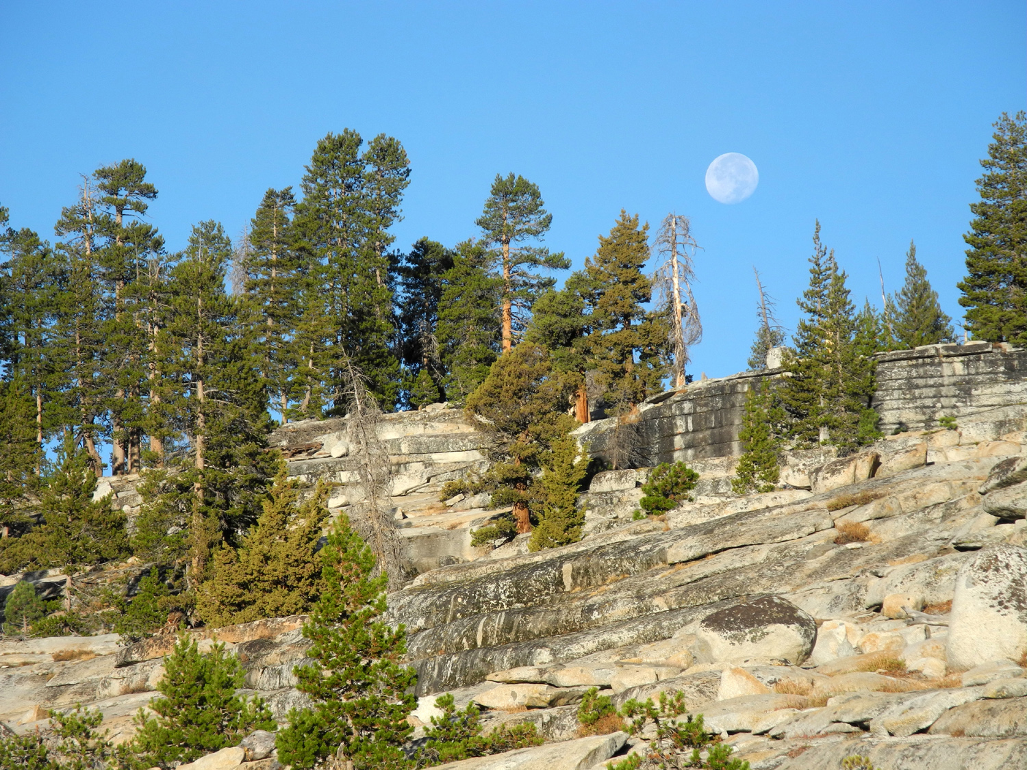
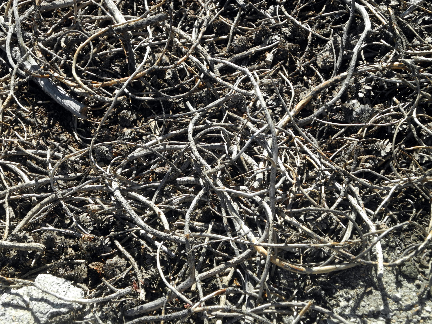
| An artistic natural arrangement of dead twigs | Teri stands in a mini-forest of young pine trees | Moon setting over the ridge above camp |
 |
 |
 |
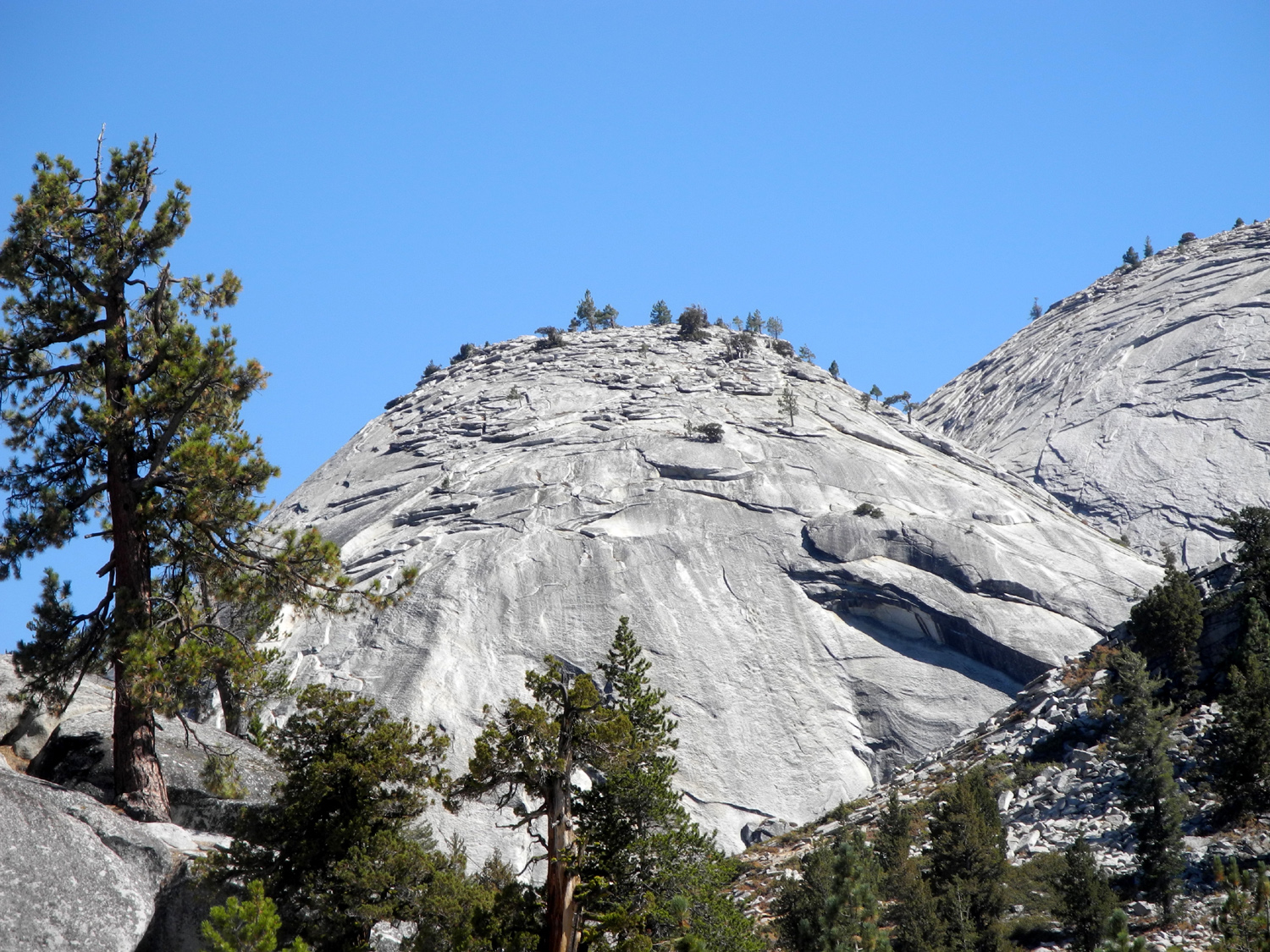
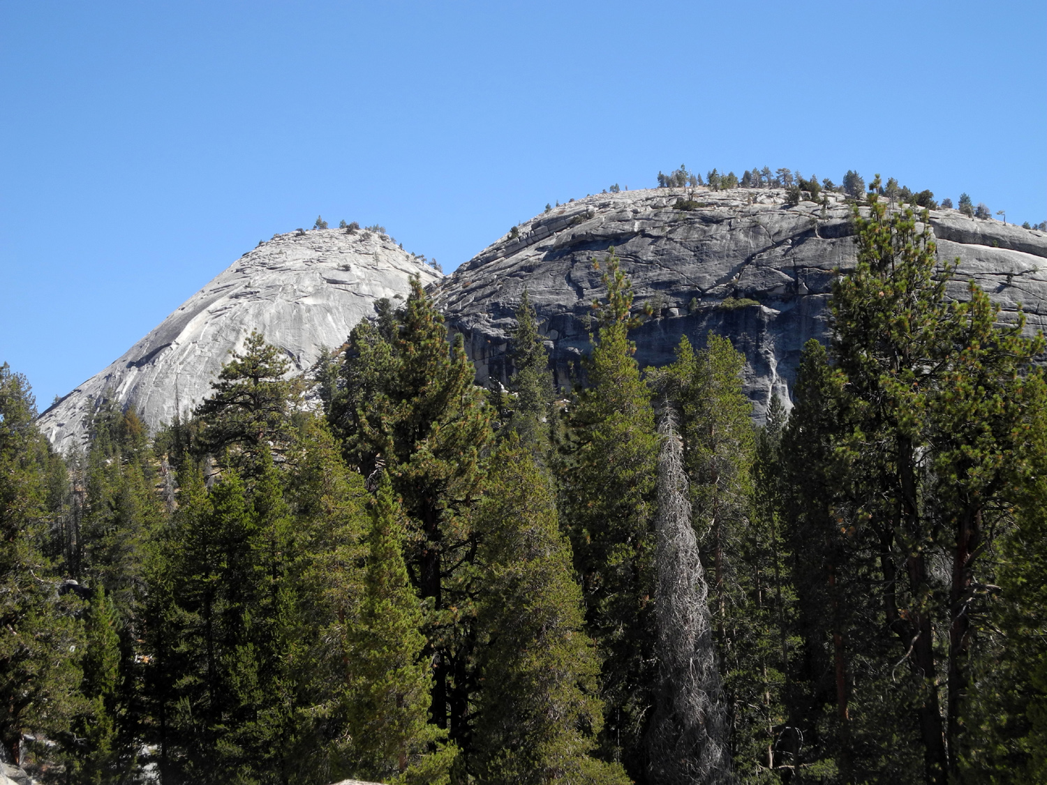
| Lower
part of Double Dome from our route down into the hole |
View of the dome even farther down |
Teri
hiking down the rock slabs below the road |
 |
 |
 |
| The eastern side of Sandy's Dome | Green grass next to the drainage | Rounded
rock slab at the south end of the rocky slope |
 |
 |
 |
|
A steep rocky hill above Helms Creek |
Typical rock ledge along the slope | Where
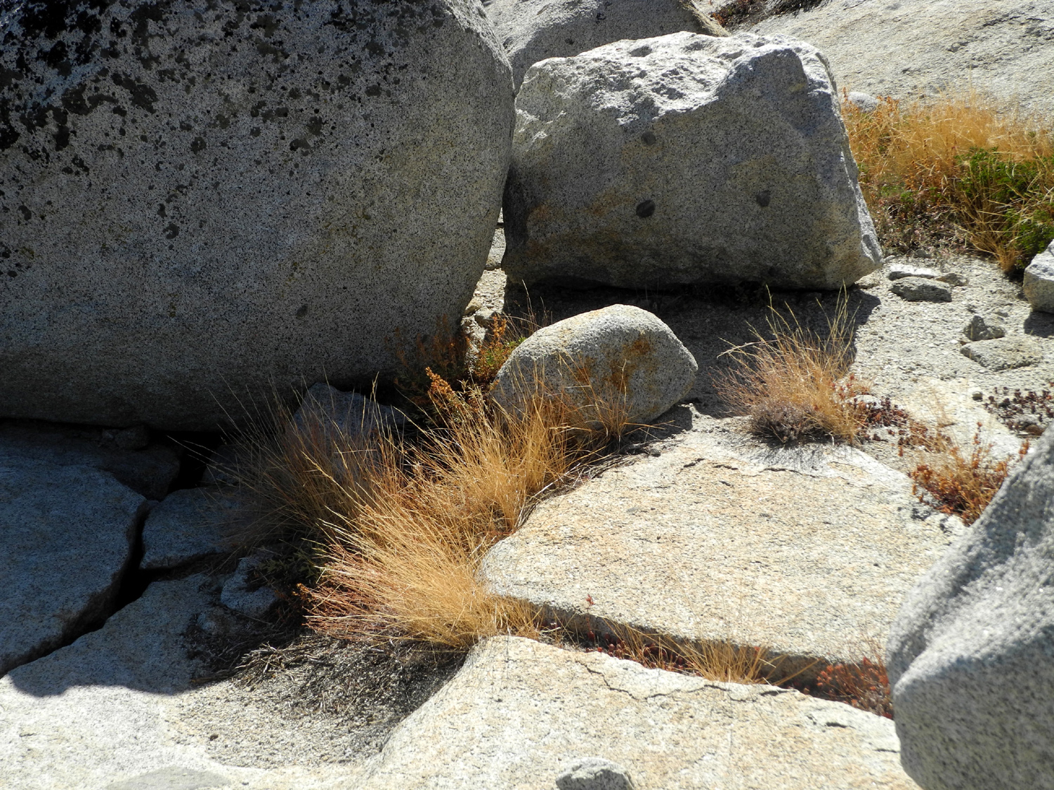
there's a crack in the rock, something grows |
 |
 |
 |
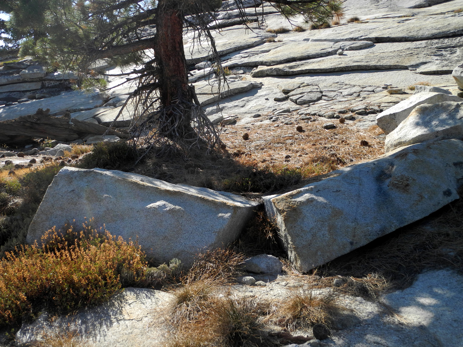
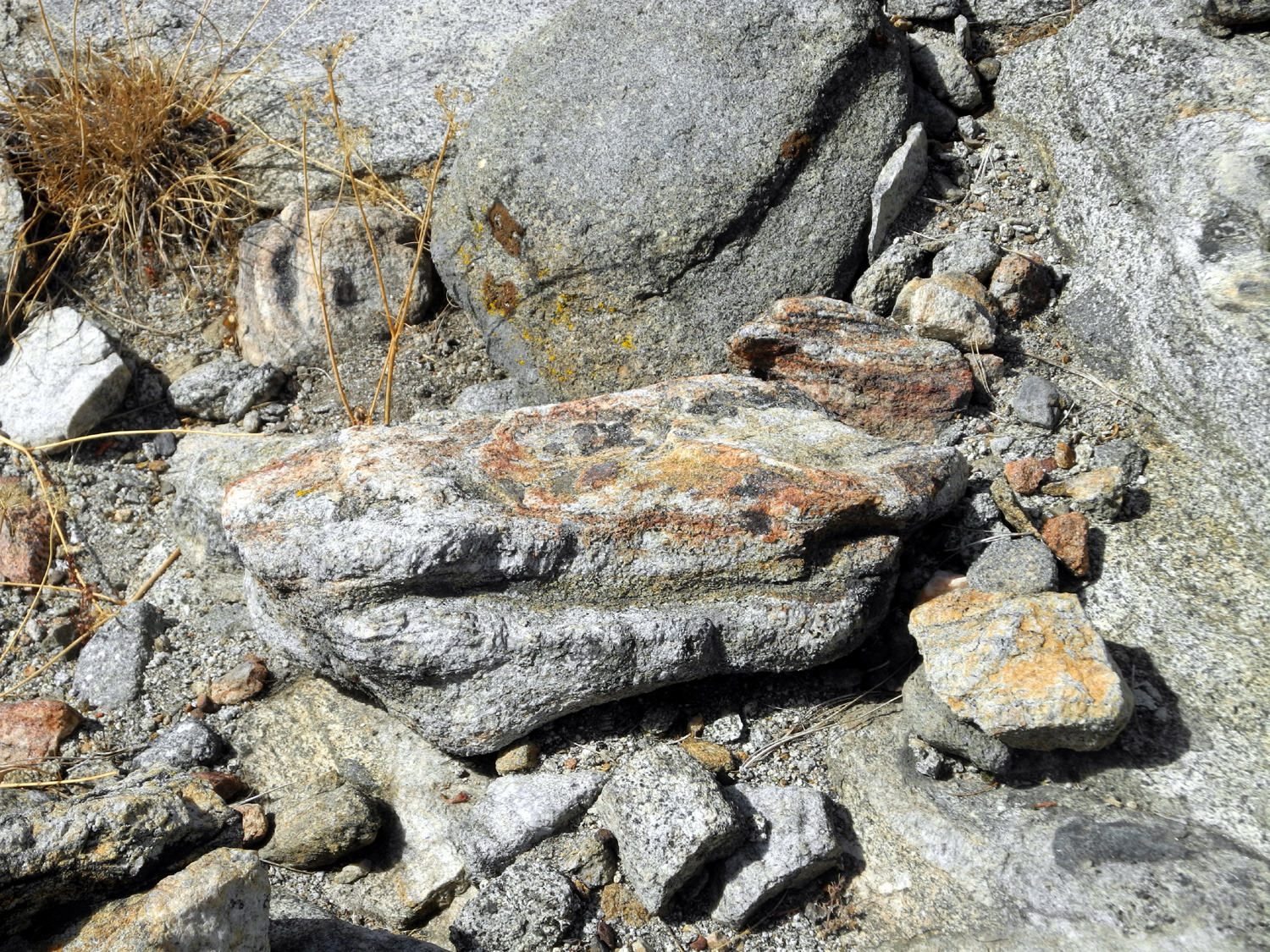
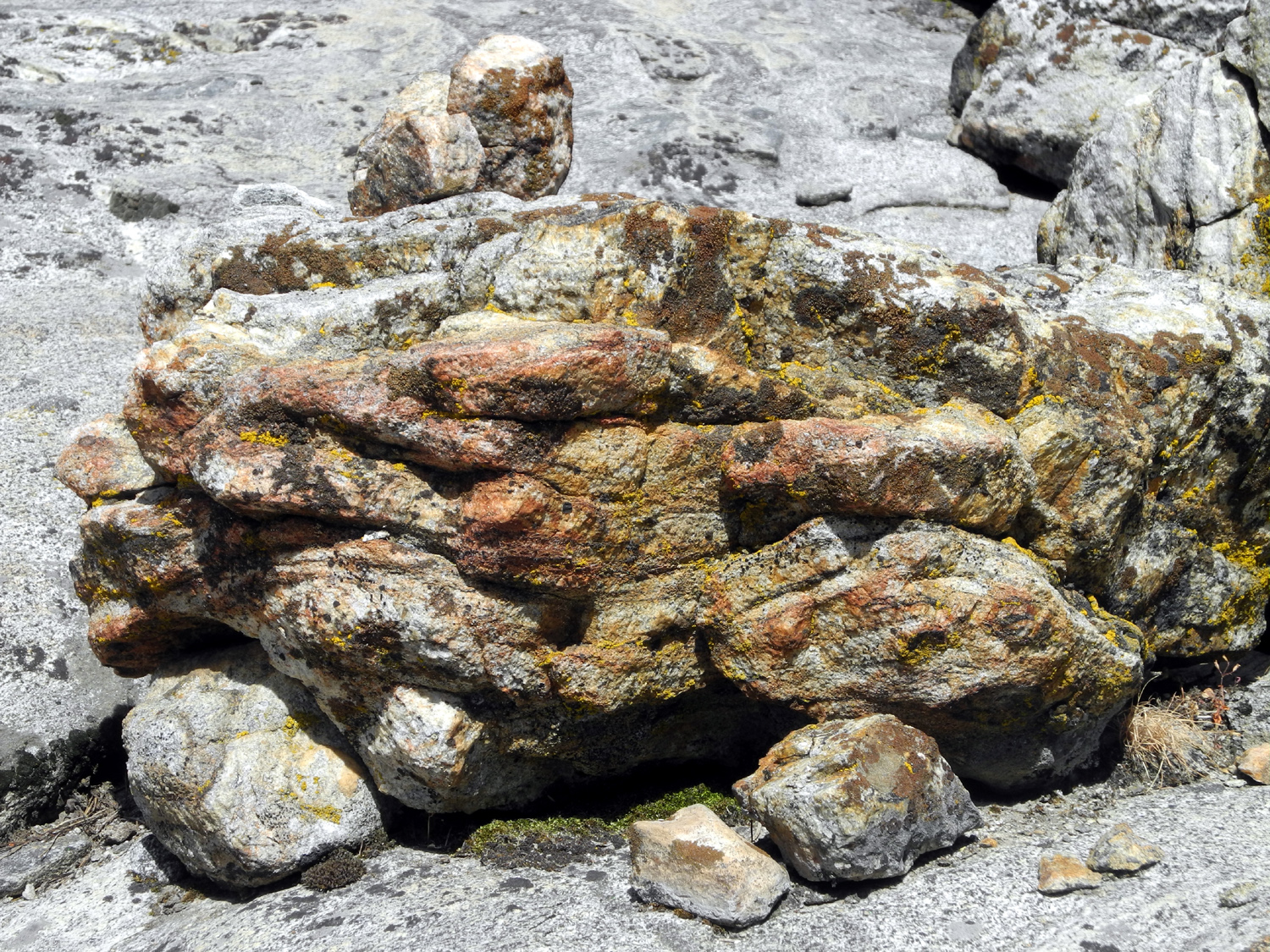
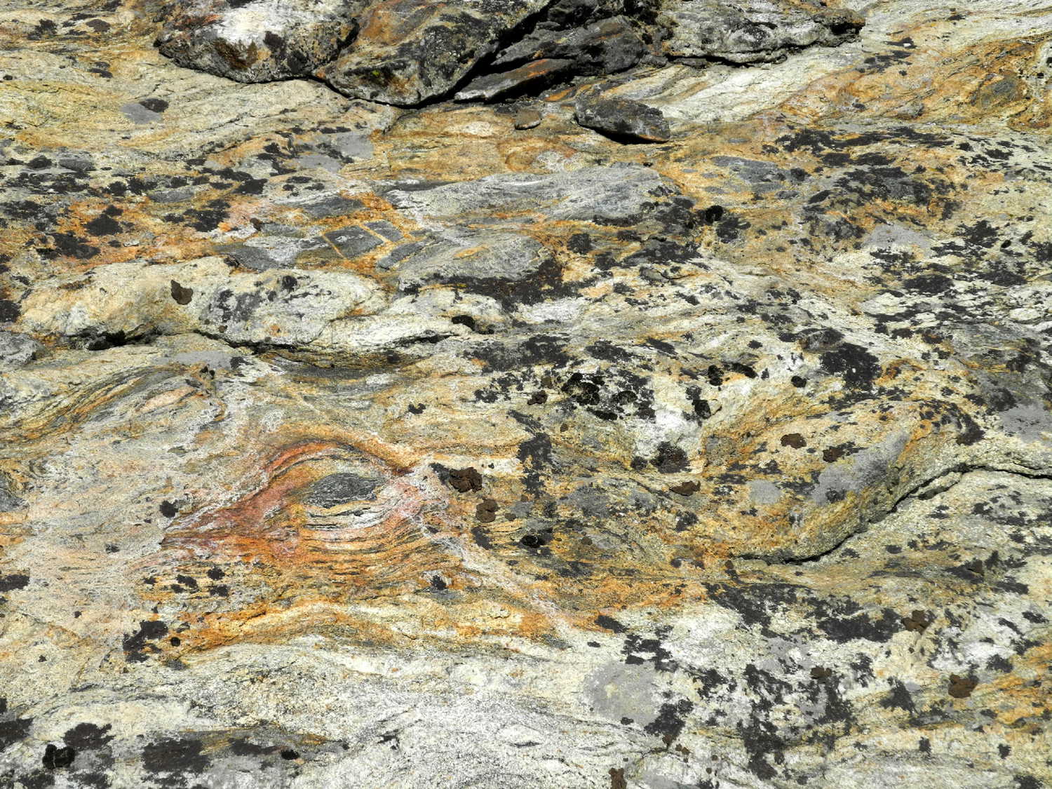
| These two pieces were once one | A
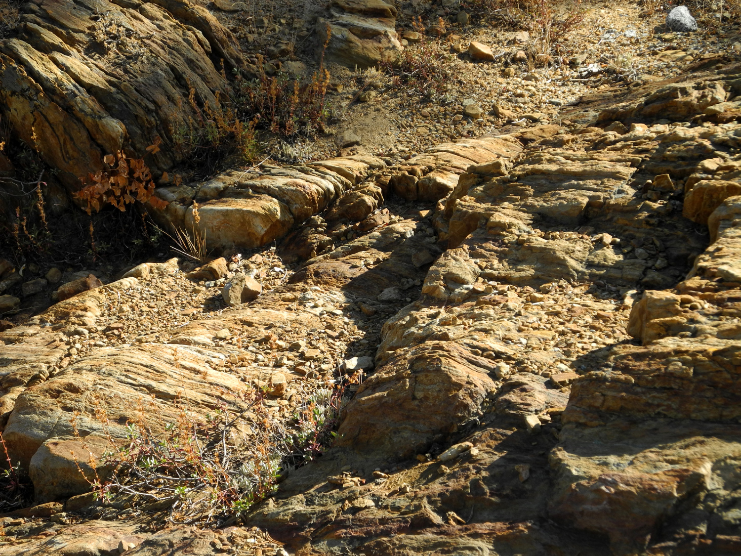
section of metamorphic rock runs through the area |
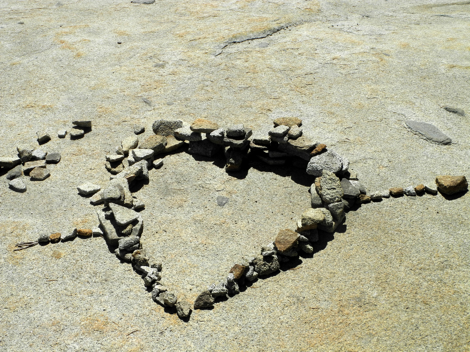
Rock artists have been here |
 |
 |
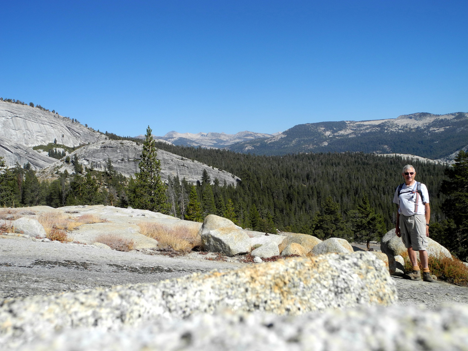 |
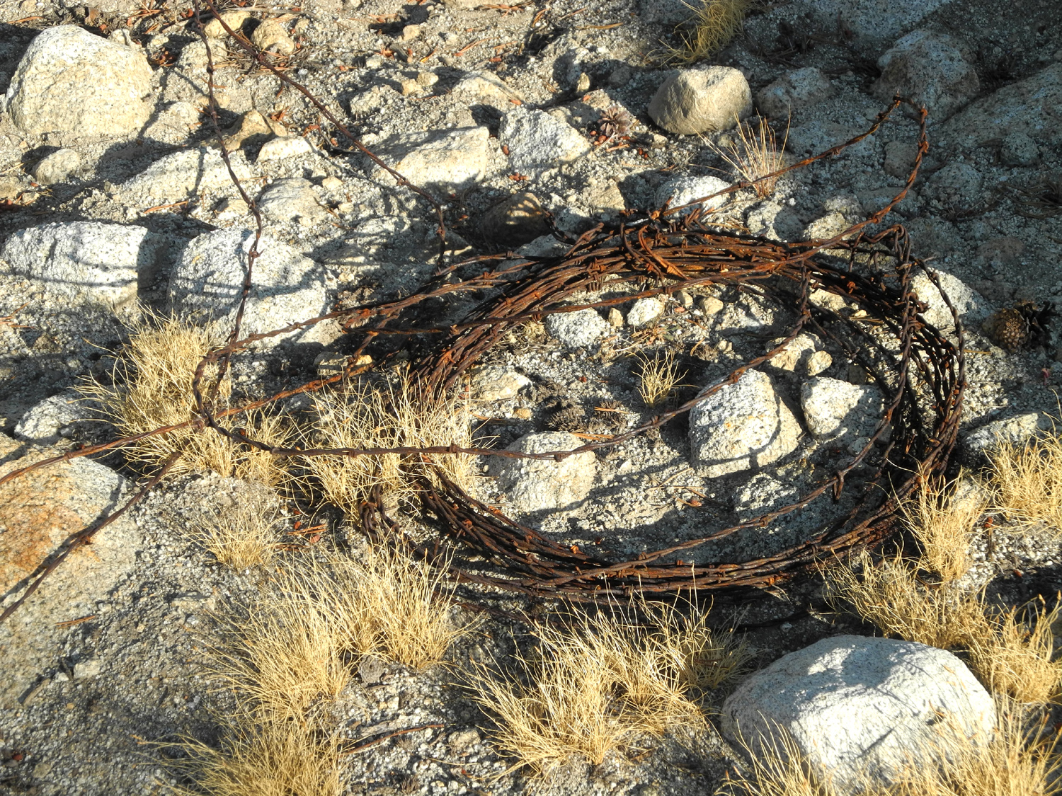
| There are pieces of barbed wire all over the area | Mt. Goddard rises above the Kings River drainage | Dick
with the LeConte Divide in the background |
 |
 |
 |
|
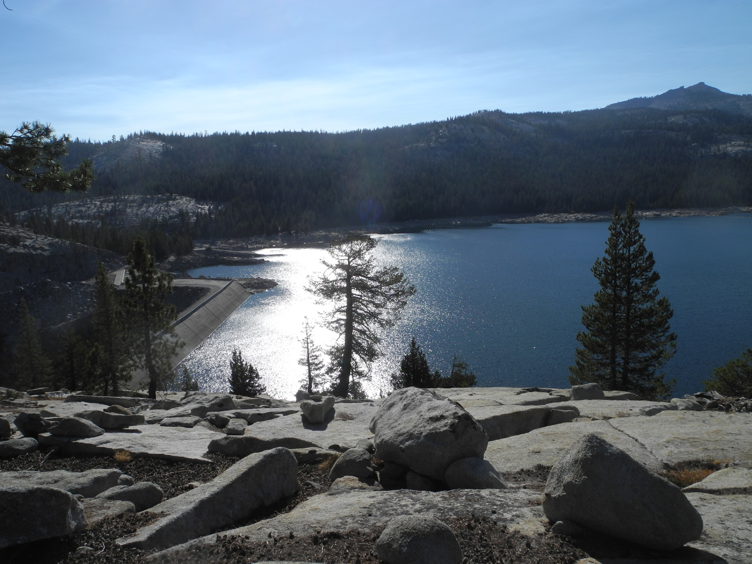
Courtright Reservoir from the ridge above |
Lodgepole pine forest above Helms Creek | The work of water and sand |
 |
||
| Dogtooth Peak in the Dinkey Lakes Wilderness | ||
 |
||
| Courtright Dam, built in the 1950s | ||
| Bear Creek Camp | ||
 |
 |
 |
| Jeffrey pine in the camp clearing | My camp site and my "bedroom" | Bear
Creek looking downstream; camp is to the upper right |
 |
 |
 |
| The
road is easy past this mandatory 4-wheel drive section |
"Highway 99" of the forest | The
rocky slope above the north side of the creek |
|
 |
 |
| Beautiful red firs | Red fir tops | My hiking road (10S99B) |
 |
|
 |
| The
fir tree has grown up since the fire ring was last used |
Typical rock bottom of Bear Creek above the camp | A nice, big, black boulder |
 |
 |
 |
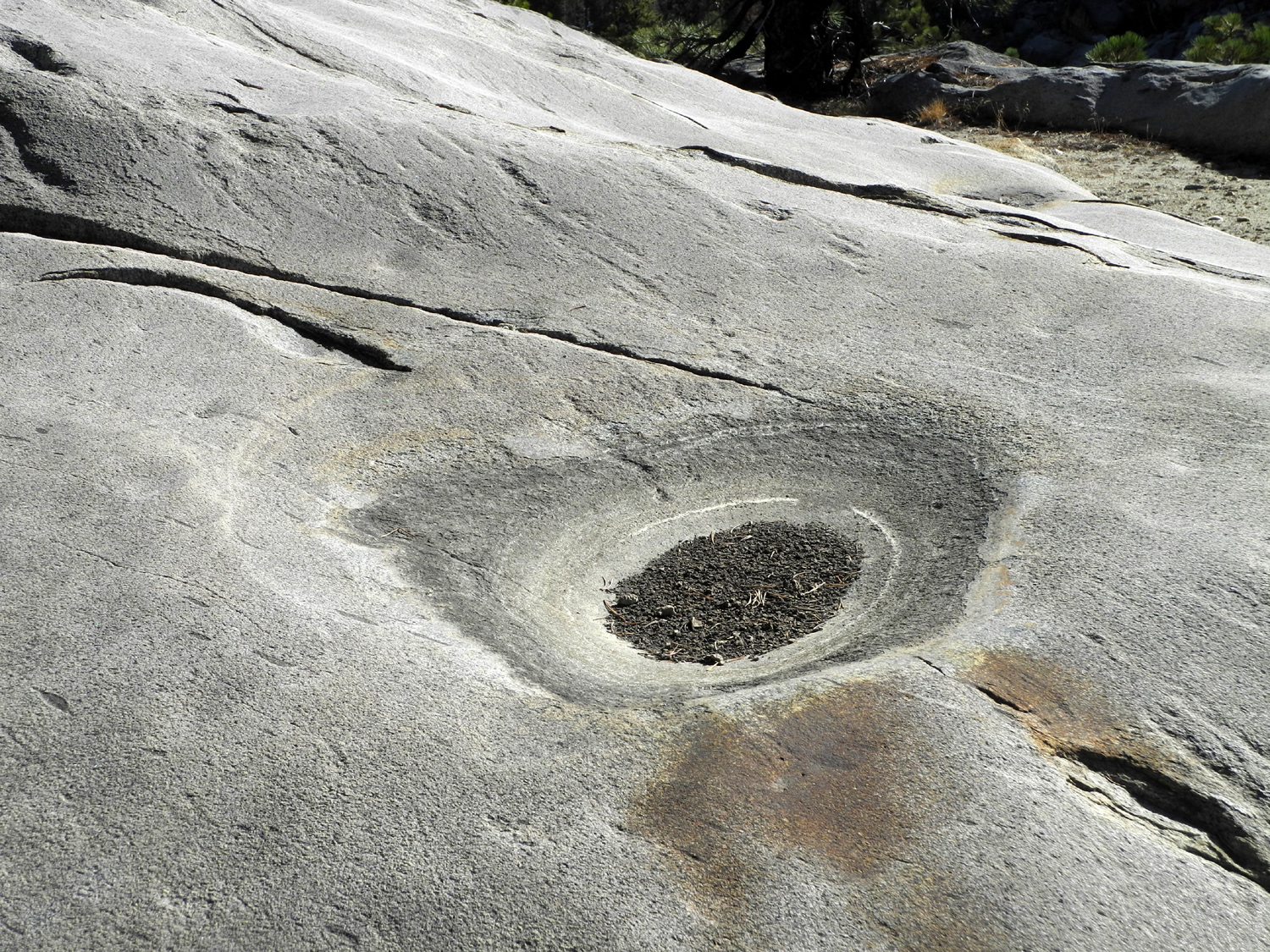
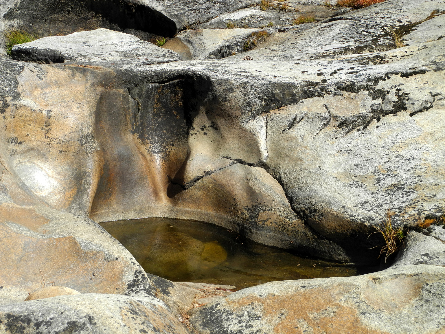
| The colors, markings and shapes of the rock above the creek demanded many photos | ||
 |
 |
 |
| Dry plants in the rocky cliff | Fantastic shapes on the rock | Your fearless hiker/reporter |
 |
 |
 |
| These dry plants add a little color | This was a pile of solid logs in 1975 | Upstream
view with blue sky and white clouds |
 |
 |
 |
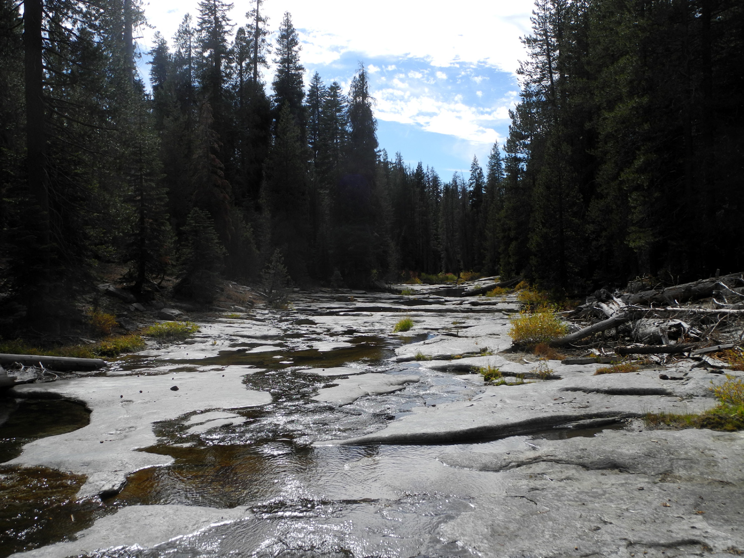
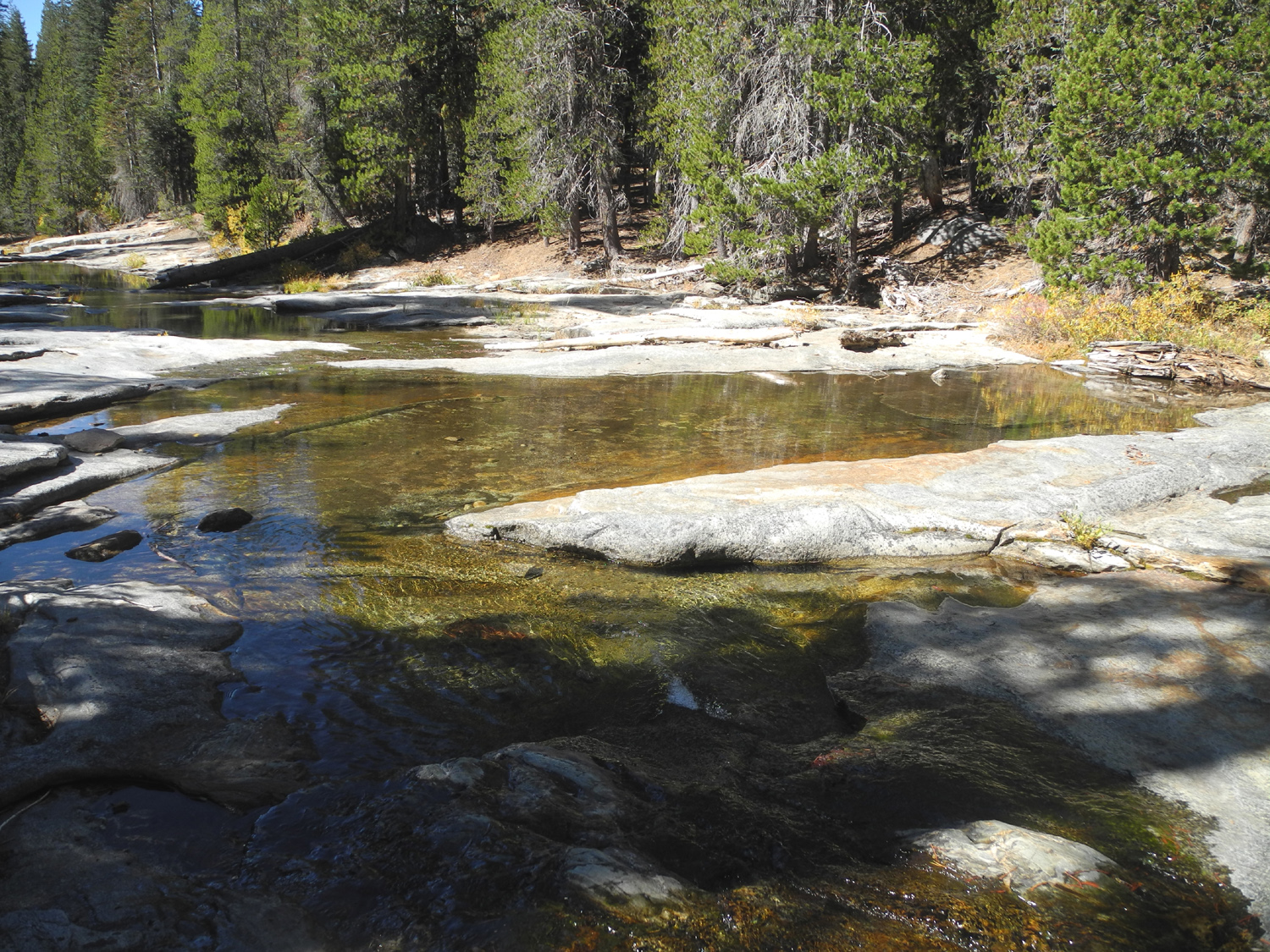
| Wide
pools appear all along this stretch of the creek |
Grass and flowers find a mossy base to grow from | Like
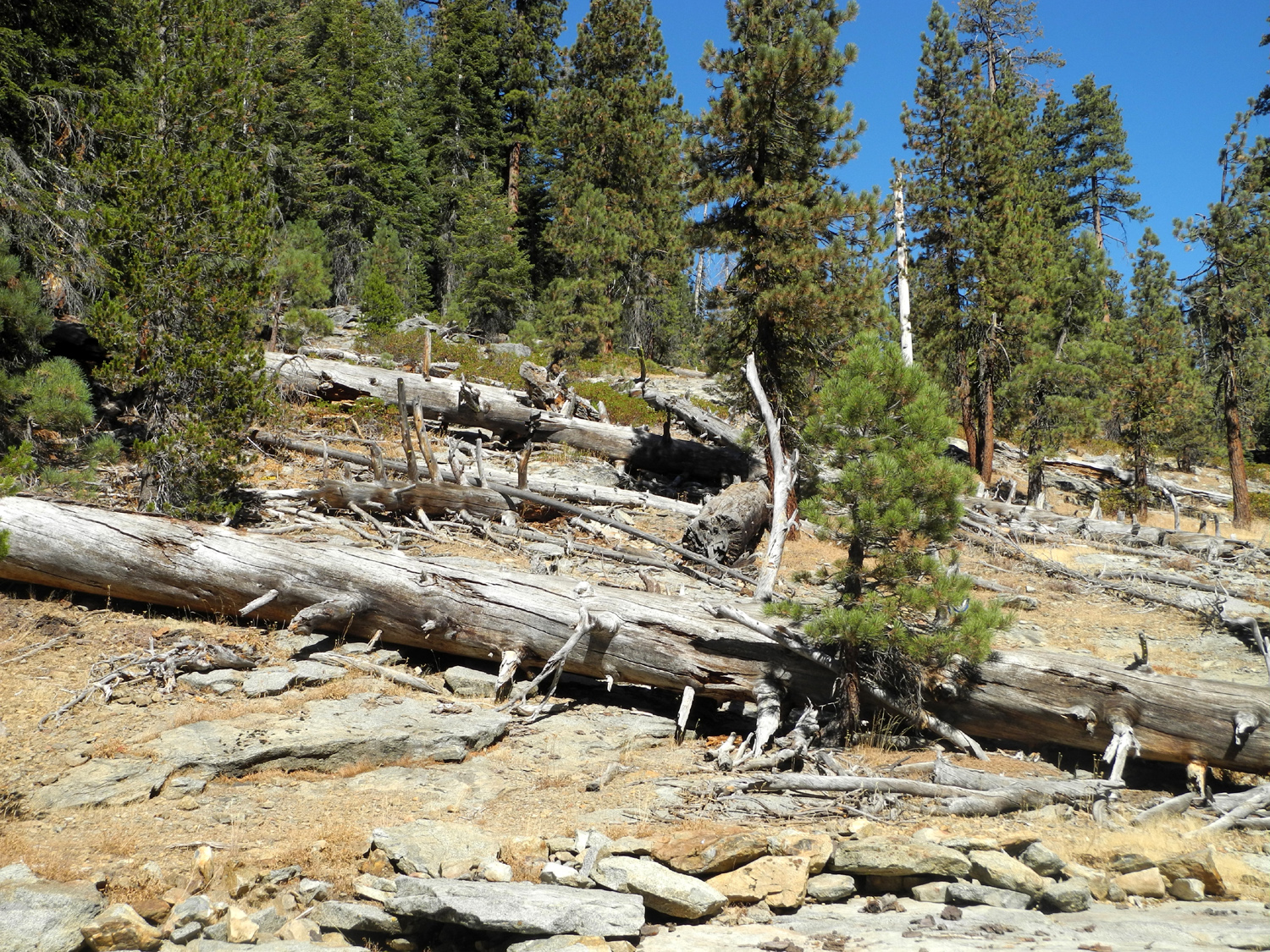
bleached bones, fallen pines litter the hillside |
 |
 |
 |
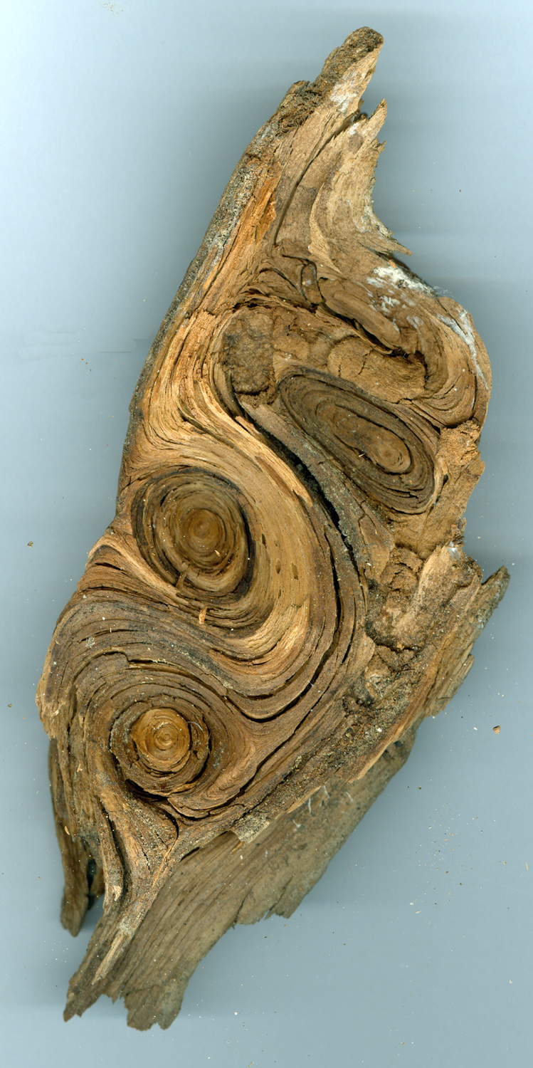
| What's left of Ruby Creek | A fascinating chunk of wood that I picked up | A
tangle of back roads can take you deep into the forest |
| Links of Interest | ||
| Dusy-Ershim Trail | Silver Divide | |
| Minarets | Ritter Range | Courtright Reservoir |
| Maxson Trailhead | Shaver Lake | Dinkey Creek |
| Swamp Lake Trail | Expanded Road Map | Bear Creek Topo Map |
| Another Bear Creek area trip | First Camp at Bear Creek | Ruby Creek with Water |
| McKinley Grove | ||