|
Roundup 2013 |
||
Kings River Bluegrass Festival Buena Vista Trail Hike Hensley Lake Camp |
||
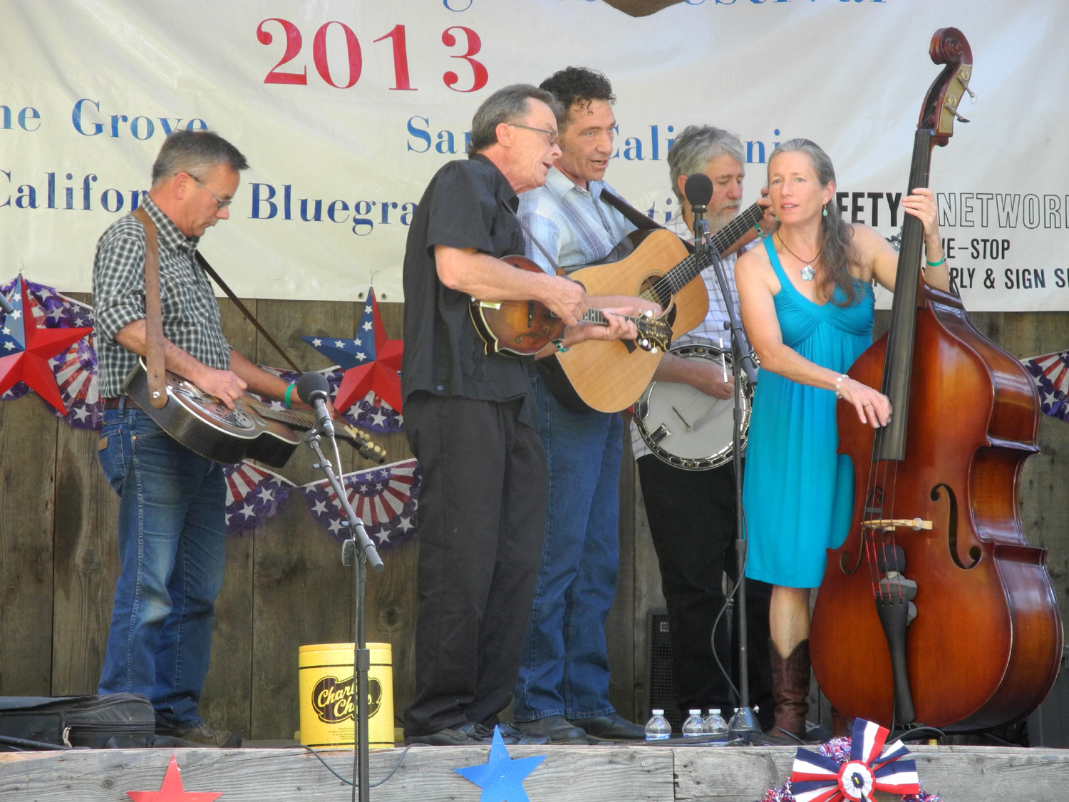
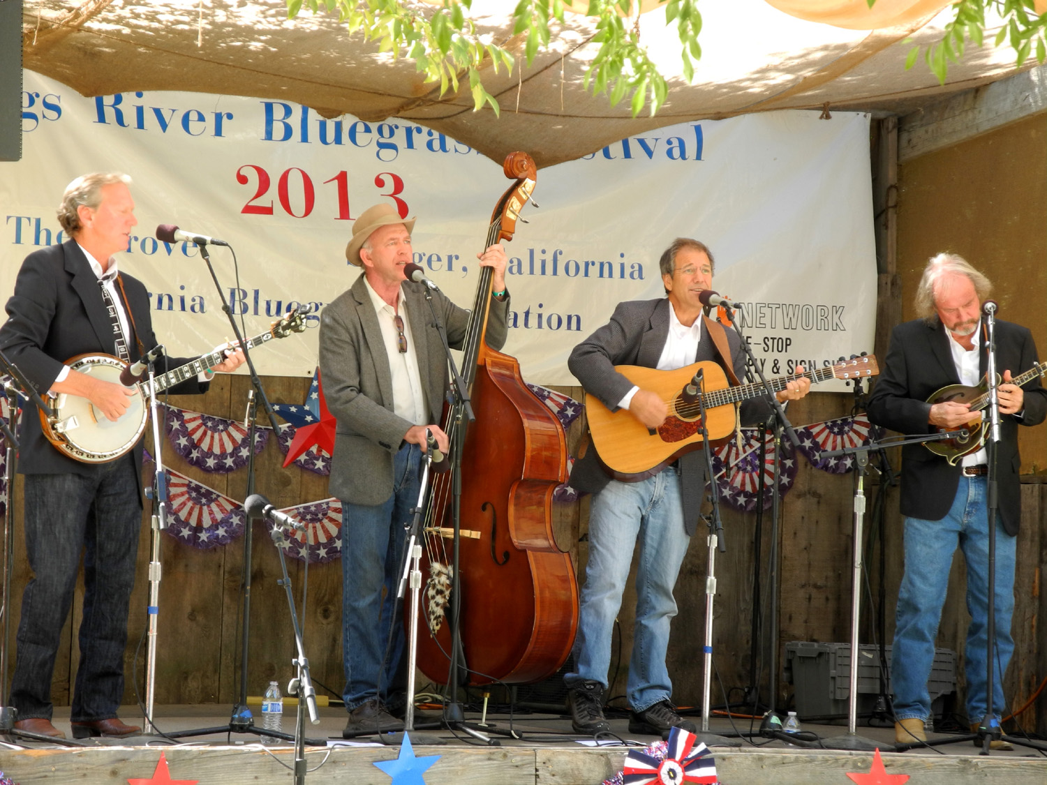
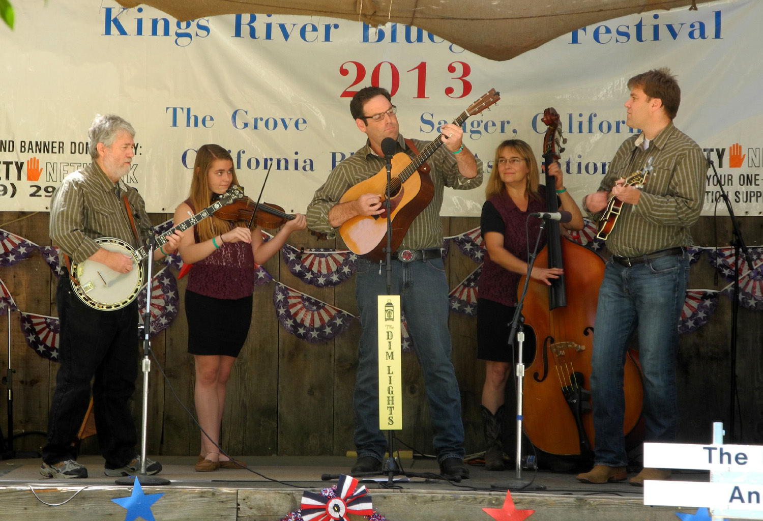
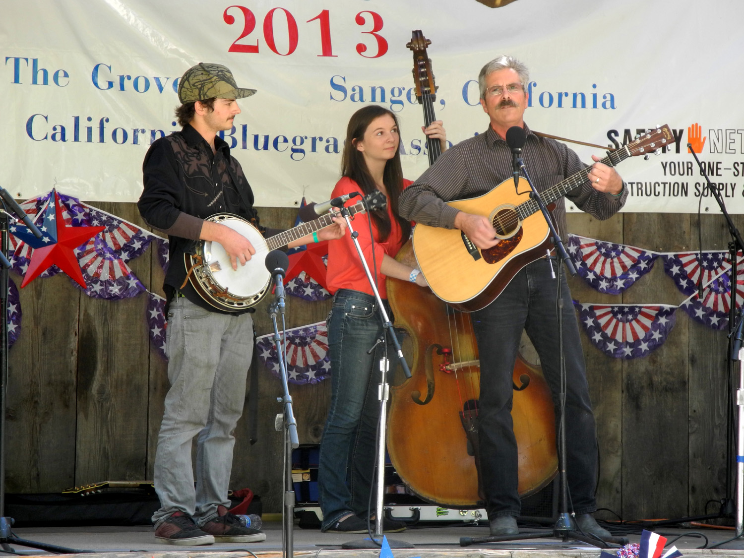
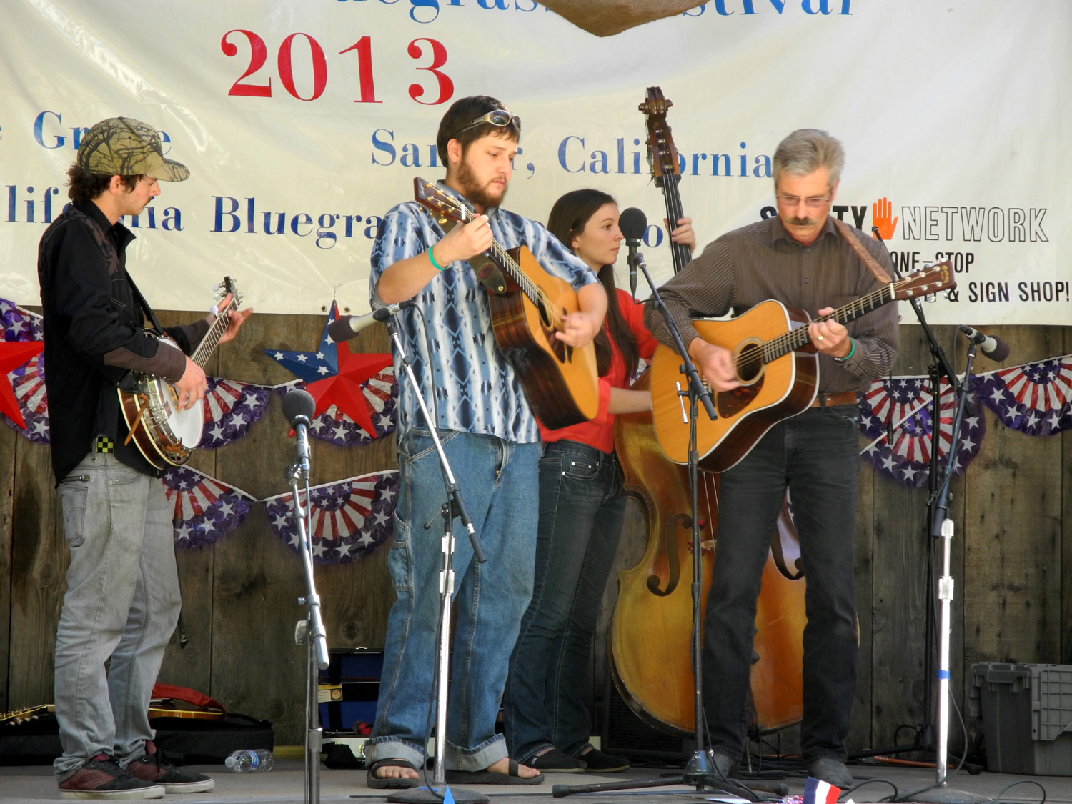
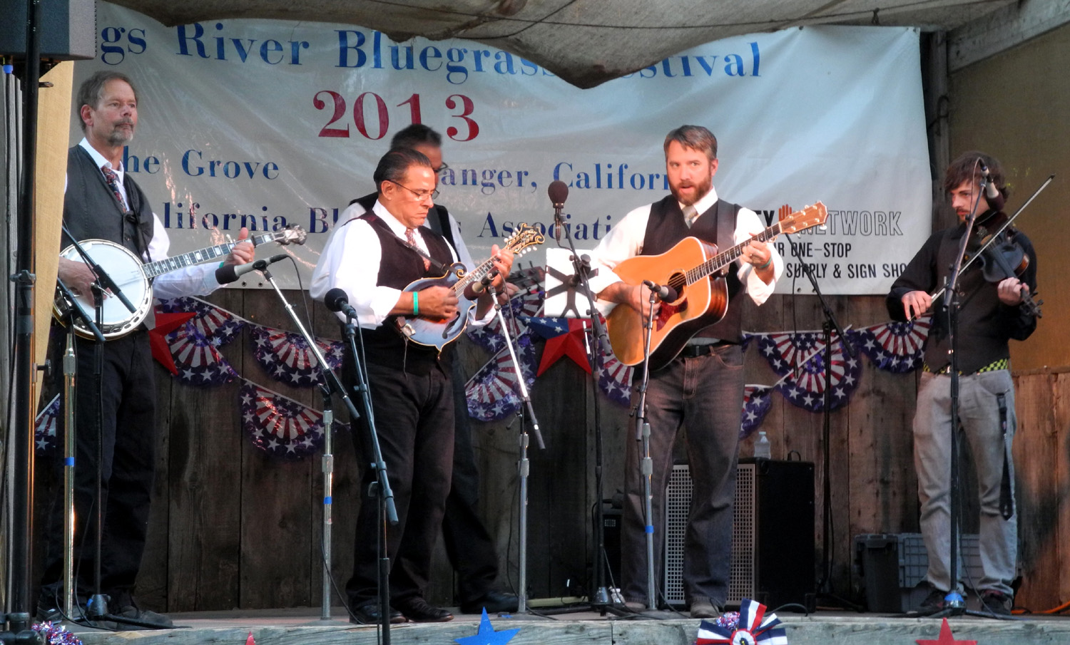
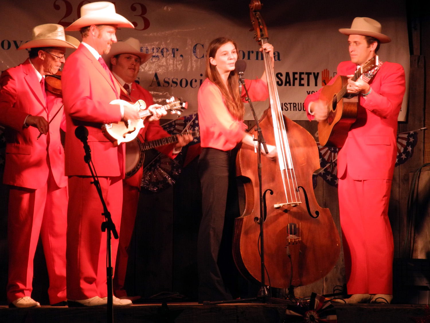
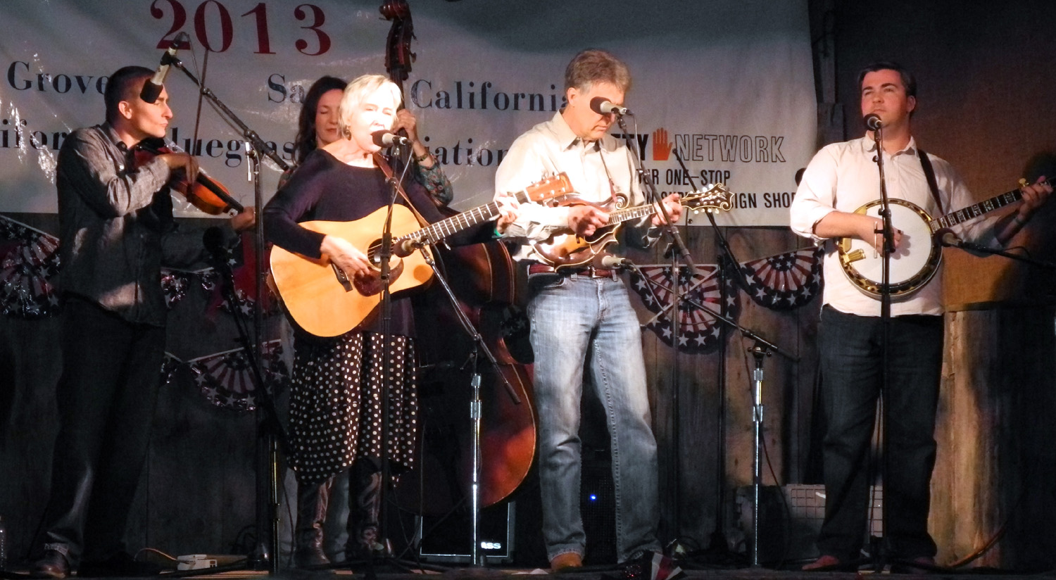
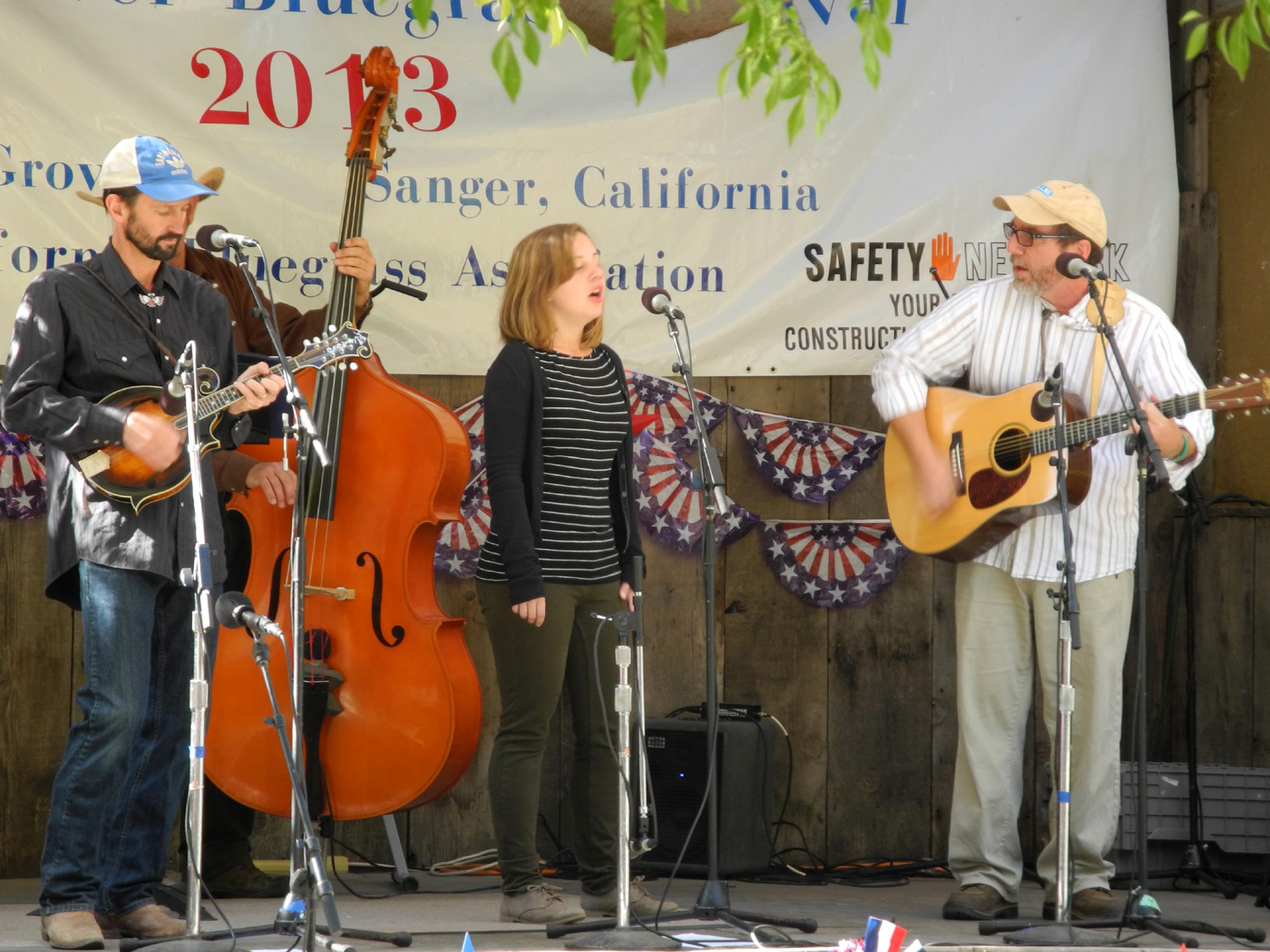
What is a Roundup? Some of my long-time readers have received several of these "roundup reports" in the past - which is what I call it when I combine two or more trips into a single report, because the individual outings are usually short in distance and duration. Since the first trip involves nothing but bluegrass, readers who are not interested in the music may want to skip down to the next section. But what you really should do is listen to the You Tube videos linked below and get with the program. Kings River Bluegrass Festival 2013: The location of the Kings River Bluegrass Festival is about 20 miles from my house, so I have been making it a one-day event with no motor home the last two years. Most of the groups I really want to see play on Saturday, and it makes for a much more relaxed event - none of the hassle of getting the motor home ready, loading and unloading. Since there is no electrical service at this festival, I would have to use the generator, which requires setting up an exhaust pipe to carry the smoke above and away from the vehicle. So on September 28 I loaded a small ice chest, my lawn chair, and extra layers for the cool evening into my Honda, and took the short trip to The Grove (formerly Hobbs Grove), getting there a half hour before the music started. All of the groups on the program are from California, mostly the central valley, central coast, or Bay Area, and I've seen quite a few of them in the past. I'm always looking for a group that stands out and is also one I have not heard before. There wasn't really any band that met this criteria, but a number of them did offer some individual aspect that was above average. For example, the Poor Valley Band, from the Turlock area, included one OK singer and one very good female singer, who goes by the handle "Little Annie," when she does a bluegrass show on the Cal State Stanislaus station, KCSS (available on line at http://www.kcss.net/). She sang an outstanding version of that old bluegrass standard, Summertime, written by the Bill Monroe of Broadway, George Gershwin. One of our local groups that I've seen many times, Grassfire, impressed me with good harmony, and two pretty good singers. Overall they are a solid mid-level band vocally and instrumentally, but did an excellent job on a modern day cowboy song, Night Rider's Lament, which I believe is a Jerry Jeff Walker composition. The final band of the morning displayed the best energy level yet. Dim Lights is essentially a family band, consisting of Avram Frankel, his wife Vicki, and 14 year-old daughter Dana, plus two others. The young lady is very good on the fiddle, not bad vocally but still has that "young kid" sound. She sounded exceptionally good harmonizing with her father. Frankel has played in other bands in the Bay area, and I saw this group at the Good Old Fashioned festival in Hollister in August. The next group, Sagebrush, put the blue back in bluegrass, with some excellent work on a resonator slide guitar (like what is commonly called a National steel, but a different brand). This instrument rings out with a loud; powerful sound. I thought this band overall was better instrumentally than vocally. The Valley Oak Band consists of three Fresno area musicians, Kent and Jack Kinney and Charlotte Allen (Jack and Charlotte both being 17). Her father is the promoter of the festival, and both kids have been playing for a number of years. Jack has become very good on banjo, mandolin, and fiddle, while Charlotte plays bass. Kent Kinney is a good vocalist. The teens still have a bit of the "kid sound" in their vocals, but are developing their talents. Perhaps the hottest guitar player in the valley, Eric Antrim of Snap Jackson's group, joined the band for a couple of numbers. Next up was a northern California fixture that I've seen many times, Bean Creek from the central coast. They had a substitute banjo player since the regular man on that job has some family issues to deal with, but the heart of the band are Pete Hicks and Billy Petrone, both long-time musicians who sing and play at a highly professional level. A special treat was Jim Minton on Dobro; whether he has joined the band or was a temporary substitute was not made clear. We had a lunch break and a dinner break, foolishly scheduled only three hours apart. At lunch time I put an extra lawn chair behind my car, and had a little "tailgate" party as I snacked on cheese, crackers, and vegetables. With the sun low in the south, there was just enough shade for me and my chair. I was not hungry at the dinner break, so I got my evening cool weather clothes and brought them to my chair, along with a few snack items which I ate later while watching the show. The evening program finished out the day with three up and coming bands and one California institution. First was a band mostly from Fresno, the Grasskickers. Lead vocalist Bob Garcia has a nice soft voice, pitched in traditional bluegrass "high lonesome" register. Banjo man Tom Naiman has a unique singing style that fits very well with the songs he sings, including Merle Haggard's Working Man Blues. Dan Stein sings and plays guitar, and is very good; and Bearrr Murray fills out the group on the U-base, an electric bass ukulele. Eric Antrim joined the group for one song. Next up was Red Dog Ash from Turlock, a band that's played at the free Bluegrass in the Park series in Clovis for several years, and which has been steadily improving and getting more attention and more bookings. They did their usual good job, playing a number of songs from their two CDs, a nice mix of originals and standard bluegrass songs. The stage was brightened up considerably the the next band, Central Valley Boys, who are known for their brightly colored matching suits Check the You Tube video for their most subdued look, and my photo for the super red look they presented at Kings River. Their forte is traditional bluegrass, and they are quite good at it. The members are from various locations in California, with mandolinist John Cogdell a Sanger resident and lead singer Youseff Tucker a former valley resident from Caruthers. The festival
headliner, Laurie Lewis & the
Right Hands, finished out the evening, and were scheduled to
appear again the next day. Laurie was a pioneer of the Bay Area
bluegrass scene back in the 1970s and has won national acclaim and
recognition. She's been a favorite of mine since I first saw her in
the late 1990s at the Mariposa festival. Her current band includes
her singing partner of nearly 30 years, Tom Rozum, and one of the
state's finest banjo players, Patrick Sauber, who also plays with Loafer's Glory
and other bands. Patrick provided the banjo music
heard in the movie A
Mighty Wind In addition to her bluegrass recordings and performances, Laurie and Tom perform as a duo, doing more folk oriented material. I have two of her bluegrass CDs, one Tom & Laurie CD, and a whole passel of downloads, and I can recommend everything she does. Although she is a noted fiddler, lately she has mostly played guitar in performance, turning the fiddle duties over to another very excellent player. The final set ended around 10 p.m., so I was on the road in a few minutes and back home by 10:30. In some ways I enjoyed this one-day event as much or more than some of the full three-day festivals. Eating was a little less convenient, and I had to use the porta-potties rather than the civilized full bathroom facilities of the motor home. On the other hand, I did not have to pick up the motor and load stuff in and out. And of course, I had only a 20-mile drive and was home sleeping in my regular bed when it was over. --Dick Estel, October 2013 |
||
|
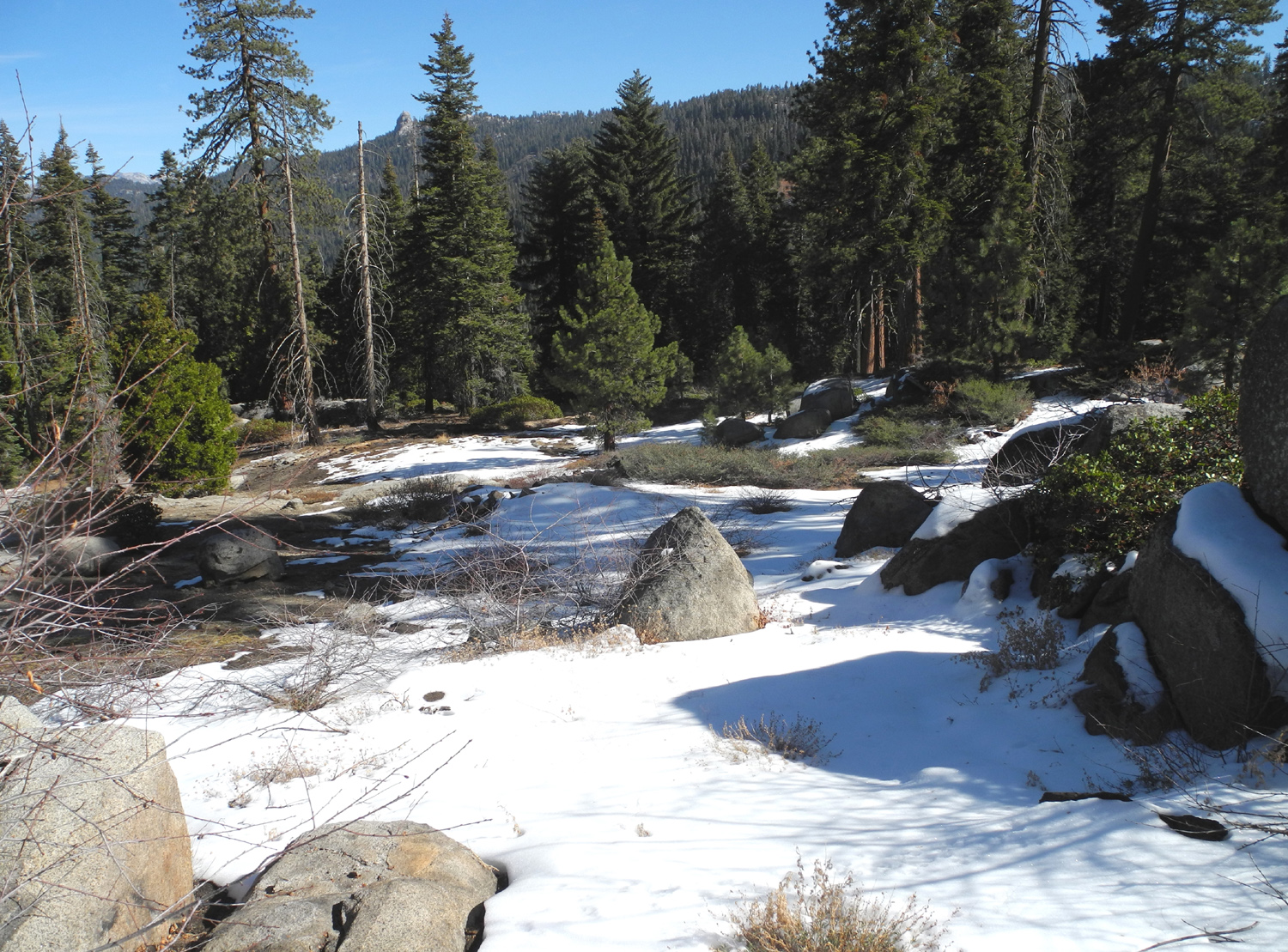
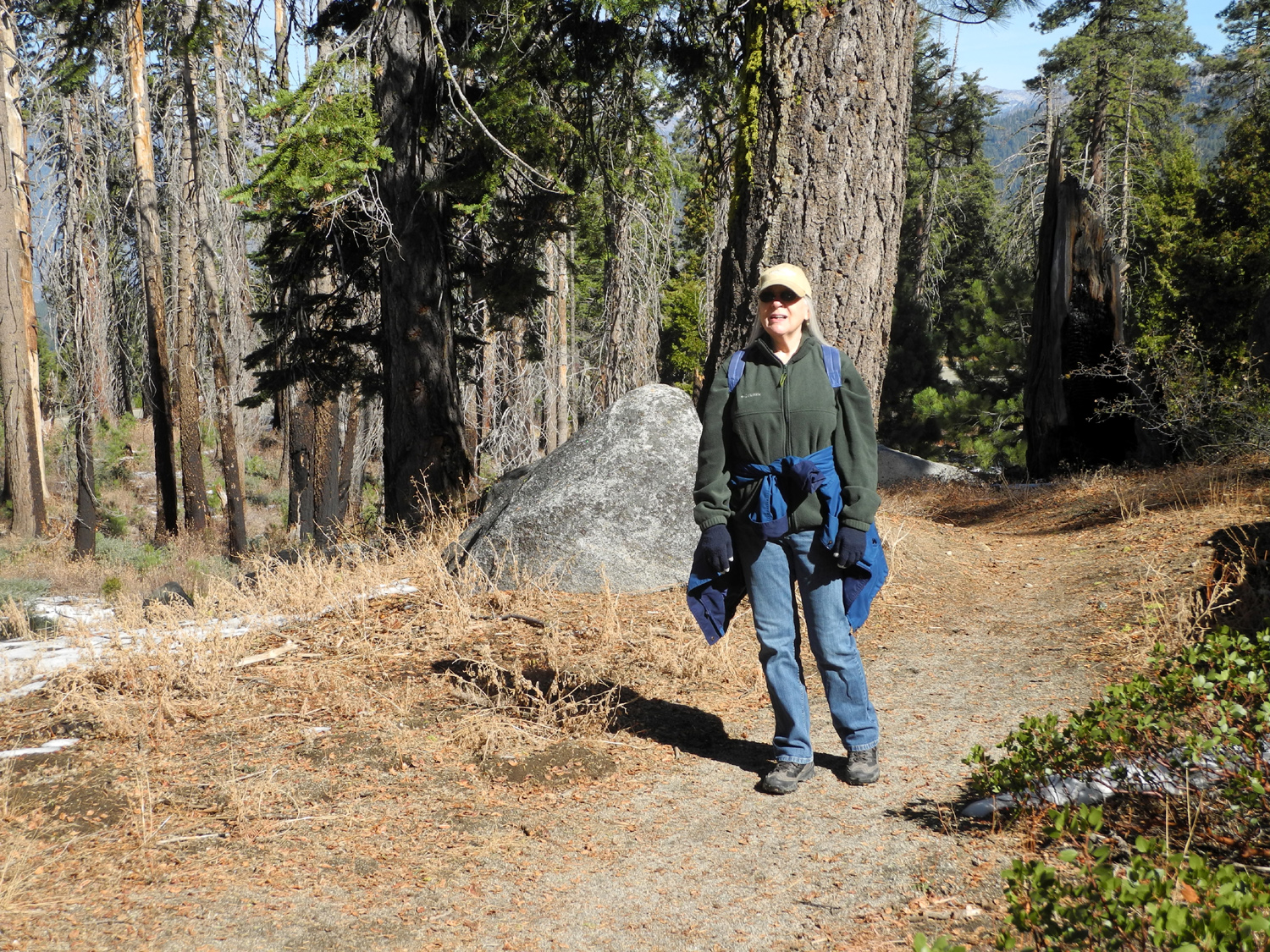
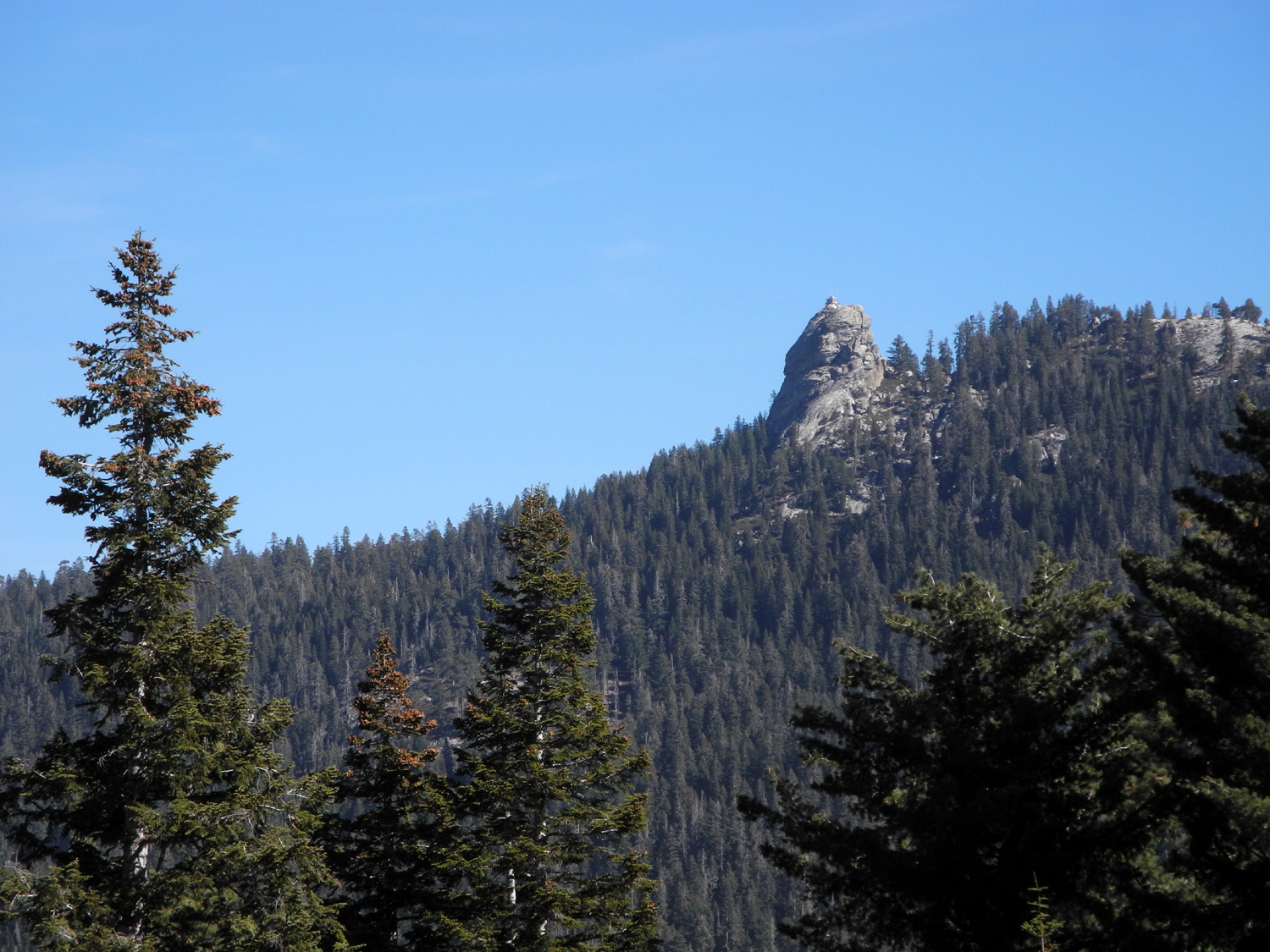
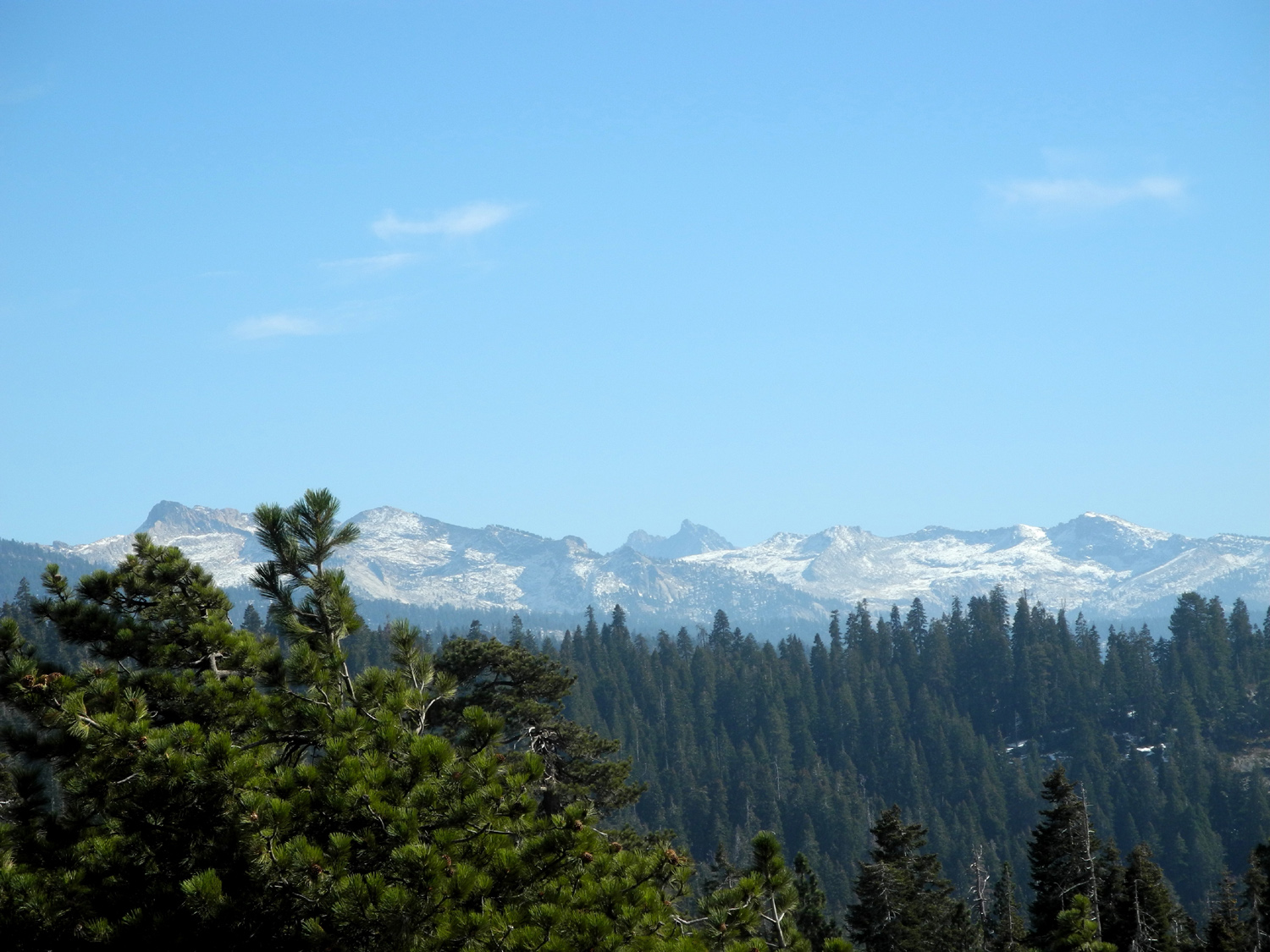
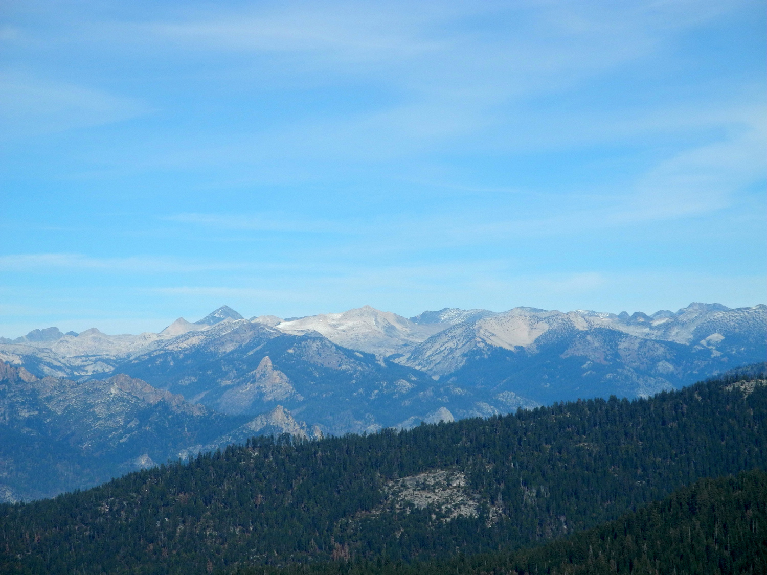
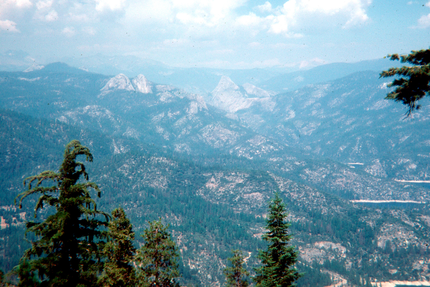
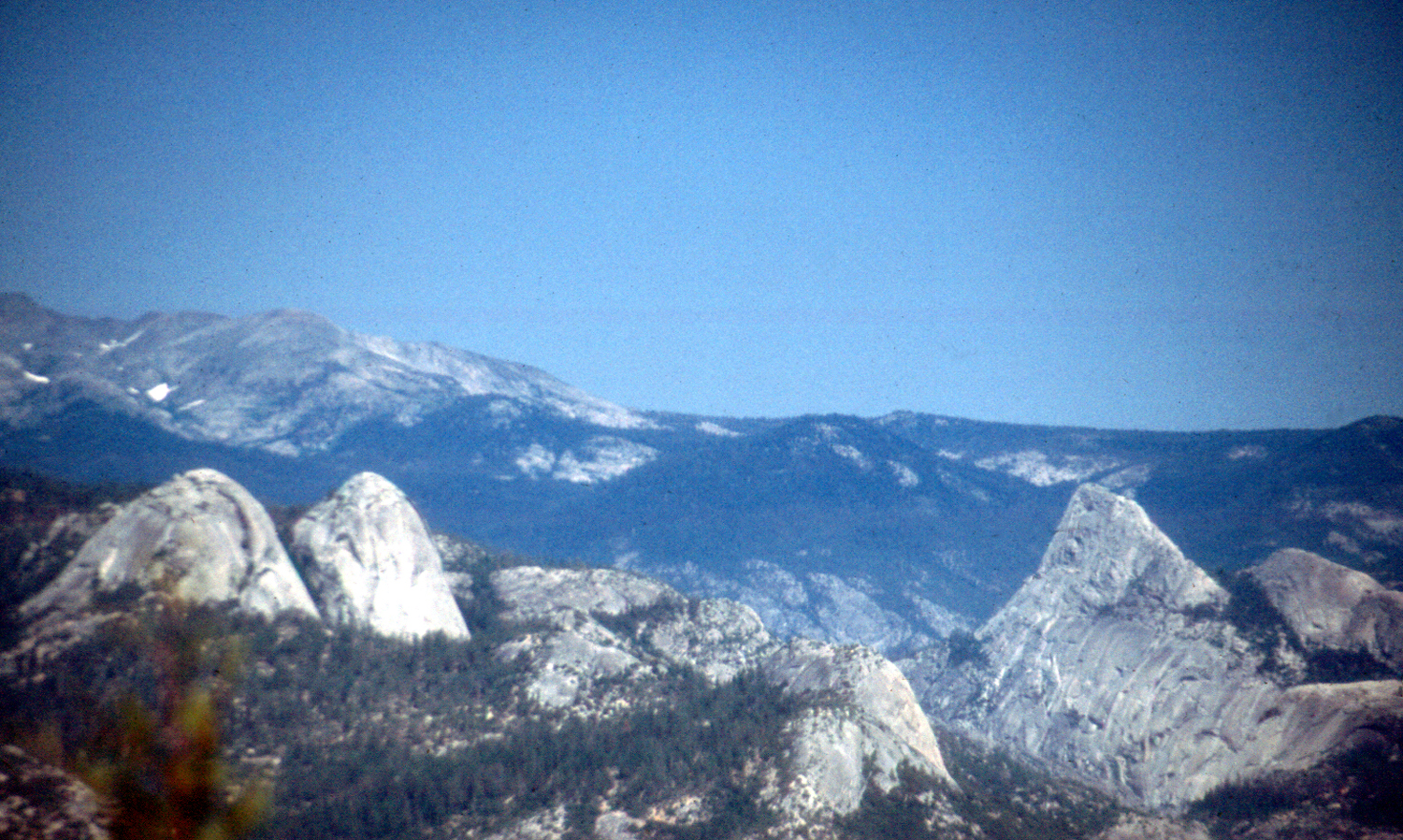
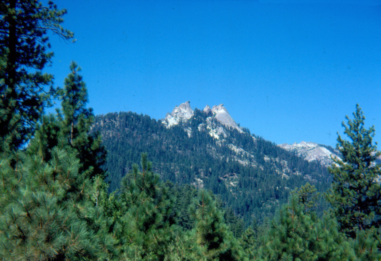
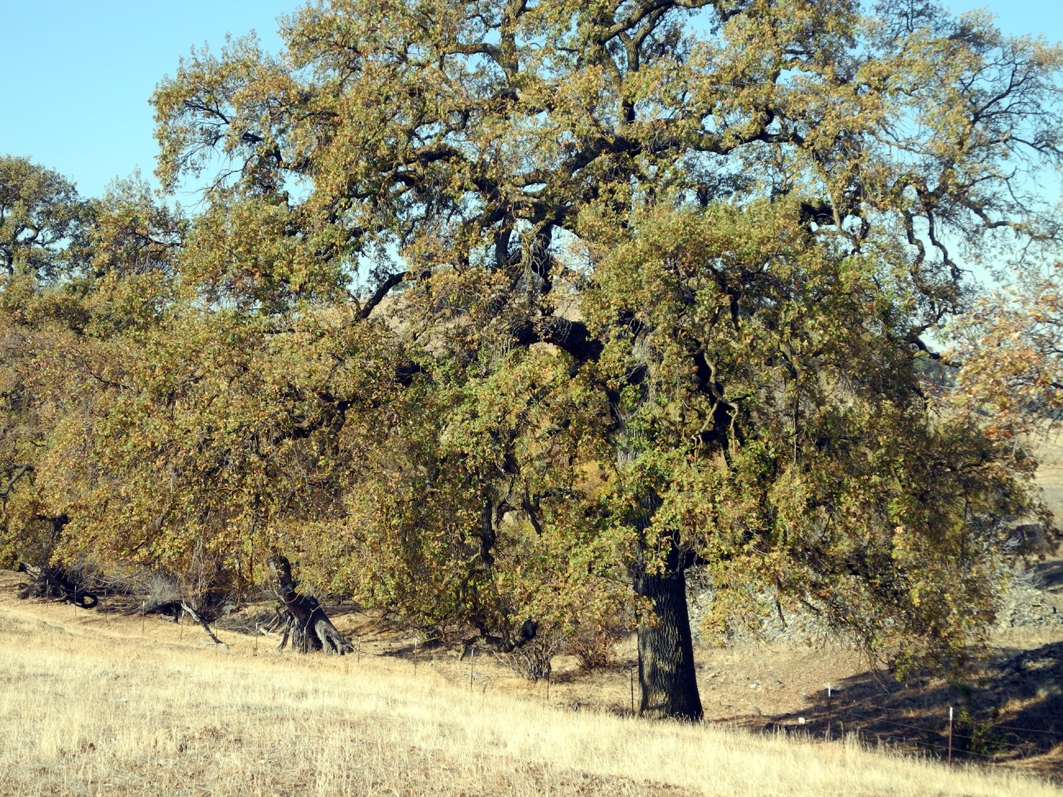
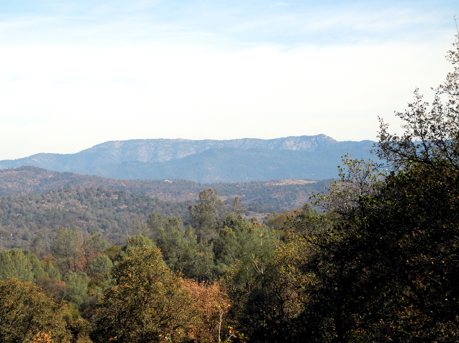
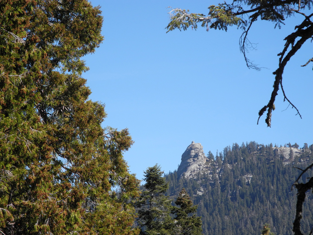
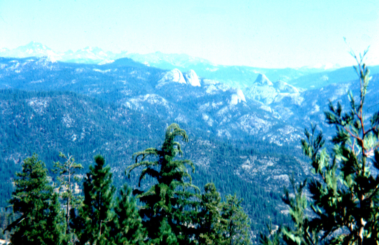
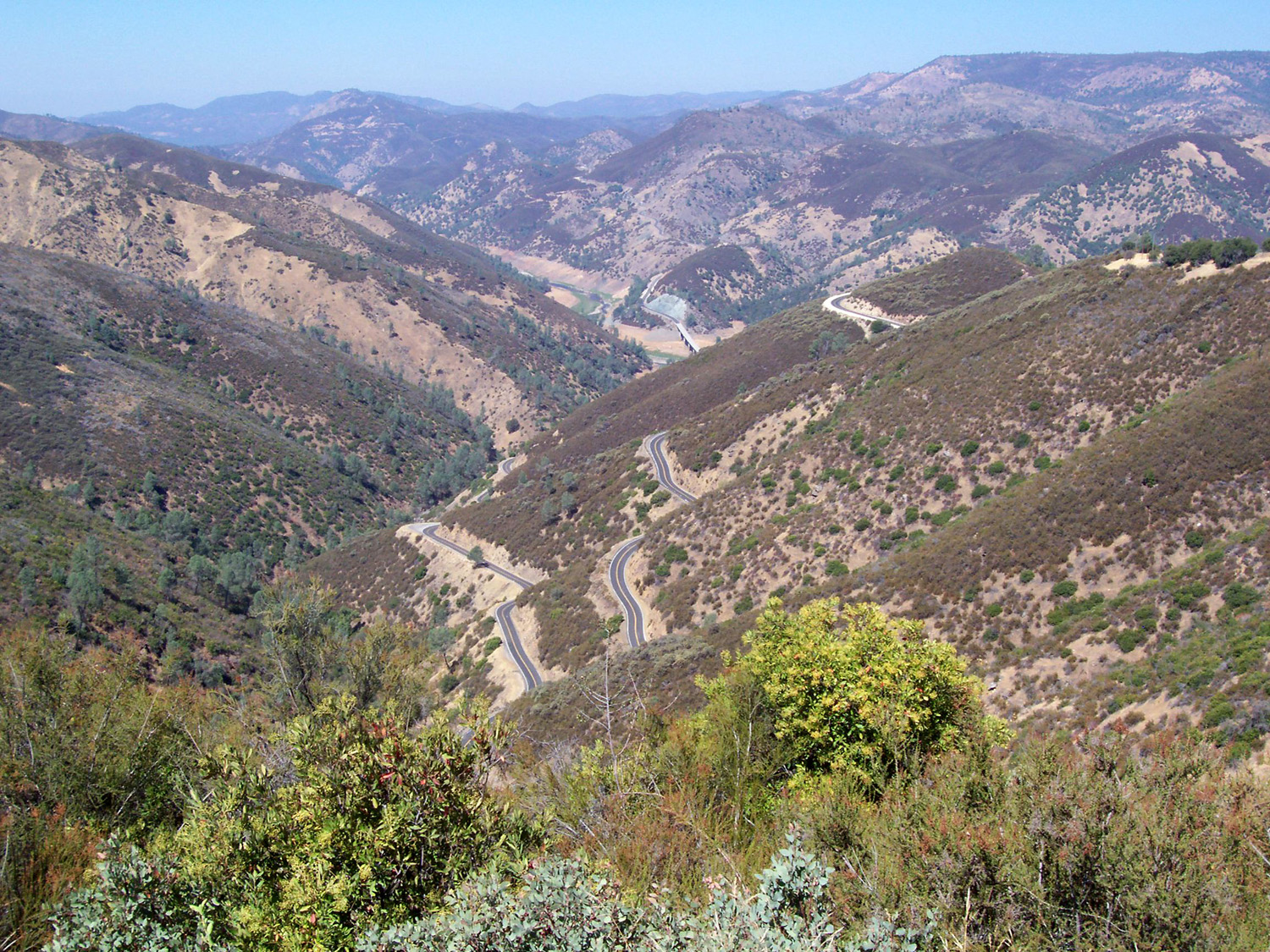
Buena Vista Trail Hike: This hike in Giant Sequoia National Monument was originally scheduled for October 1, but was postponed due to the government shut-down. At the time I wrote, "Hopefully it can be rescheduled before the snows fly." Well, that didn't quite happen. A small storm came through our area October 28. It sprinkled a few times here in Clovis, maybe two tenths of an inch of rain. But throughout the Sierra it left a layer of snow, with about an inch at 5,000 feet. Although I could have easily checked on line, I had the idea that our destination was not over 6,000, so the snow should be nearly all melted a week later. It was not. Around 9 a.m. on November 3, I picked up my friend and former co-worker Carolyn Amicone, and we drove east toward King Canyon and Sequoia National Parks. We were actually headed for a place that lies between the two parks, along the Generals Highway in the Giant Sequoia National Monument. At one point, just a few miles from the entrance to Kings Canyon, there is an overlook which provides an excellent view into the canyon of the South Fork of the Kings River, and the peaks above it. On the opposite side of the road a trail leads up to the top of Buena Vista Peak. Information in the brochure and map given to visitors explained that this one mile trail takes you to the rocky summit at 7,600 feet, where you have a 360 degree view. I stopped here and briefly considered taking this trail when I visited Sequoia Park in early September. However, there was a fire making everything very hazy, so I decided to wait for a time when the view would be better. The day we chose was indeed that time, with clear, blue skies and excellent views anywhere we stopped. The weather was predicted to be about 50 degrees, with 11-mile winds, so we brought several layers, but it turned out we were rarely exposed to the wind, which was much lighter than expected. The main weather obstacle turned out to be snow. We started seeing patches along the road around the 5,000 foot level, and on the trail we were walking through snow about half the time. It was not deep, and was fairly easy to walk through, but we appreciated each time that we came to a stretch of trail that was just dirt. These sections were damp but not muddy except for a couple of very short spots. In some places the snow was packed down and a few spots were icy and slippery, but we could walk in the softer snow beside the trail in these places, and that made for relatively easy, and much safer, walking. The elevation change is 420 feet in one mile, so the trail is mostly uphill, but rarely steep. We were very careful when we came to the bad spots, and of course, we were in no hurry. With careful hiking, and stops to rest, take pictures, or just enjoy the surroundings, we took a little over 90 minutes to get to the top. The trail goes through forested land for a while, then comes out into an open area where you are walking on granite. Of course, the open areas were welcome because the snow had melted there. After that section, the trail again enters the forest, and throughout the hike there are huge sugar pine, Jeffrey pine and fir trees. At various places and of course on top, you can see 10,000 foot Spanish Mountain to the north, where it forms a steep cliff that plunges over a mile to the Kings River below. To the east and much closer is Buck Rock, a thimble-like granite dome with a fire lookout on top. South of Buena Vista Peak is Big Baldy Ridge, which ends in a granite dome slightly higher than Buena Vista, and accessible by a two mile trail that starts a few miles further down the Generals Highway. The land drops off sharply to the west, where you are looking down on Redwood Mountain, location of the largest Sequoia grove in existence. The top of the peak is actually more like a dome, with plenty of room to walk around. To reach the very top, you have to climb up on one of two large boulders, neither of which looked inviting to people of retirement age, so we contented ourselves with a slightly lower and smaller boulder and took photos to commemorate the event. There was a strong, cool breeze blowing from the west, so we found some fairly flat rocks where we could sit out of the wind, and had a snack of apple and orange slices. We probably spent at least a half hour on top, enjoying the views in all directions and congratulating ourselves on our safe arrival. We knew that going down would not be a fast trip, considering the many slippery spots that required careful foot placement, but we made it down in about 45 minutes, very glad to change out of our boots to tennis shoes and sit down in the comfort of my Honda. We had considered going to Panoramic Point, which would require a short quarter mile hike, but by the time we got settled in the car, we realized the only walking we wanted to do after that was from car to house. I didn't take as many pictures as I would have liked - it took all my energy to keep from falling. There is a batch of excellent photos at the bottom of the trail web site. For those who like connections, the first two parts of this roundup fit together in this way: The day after the Kings River Bluegrass Festival (September 30), performers Laurie Lewis and Tom Rozum hiked at Redwood Mountain, beating the government shutdown by one day. --Dick Estel, November 2013 |
||
|
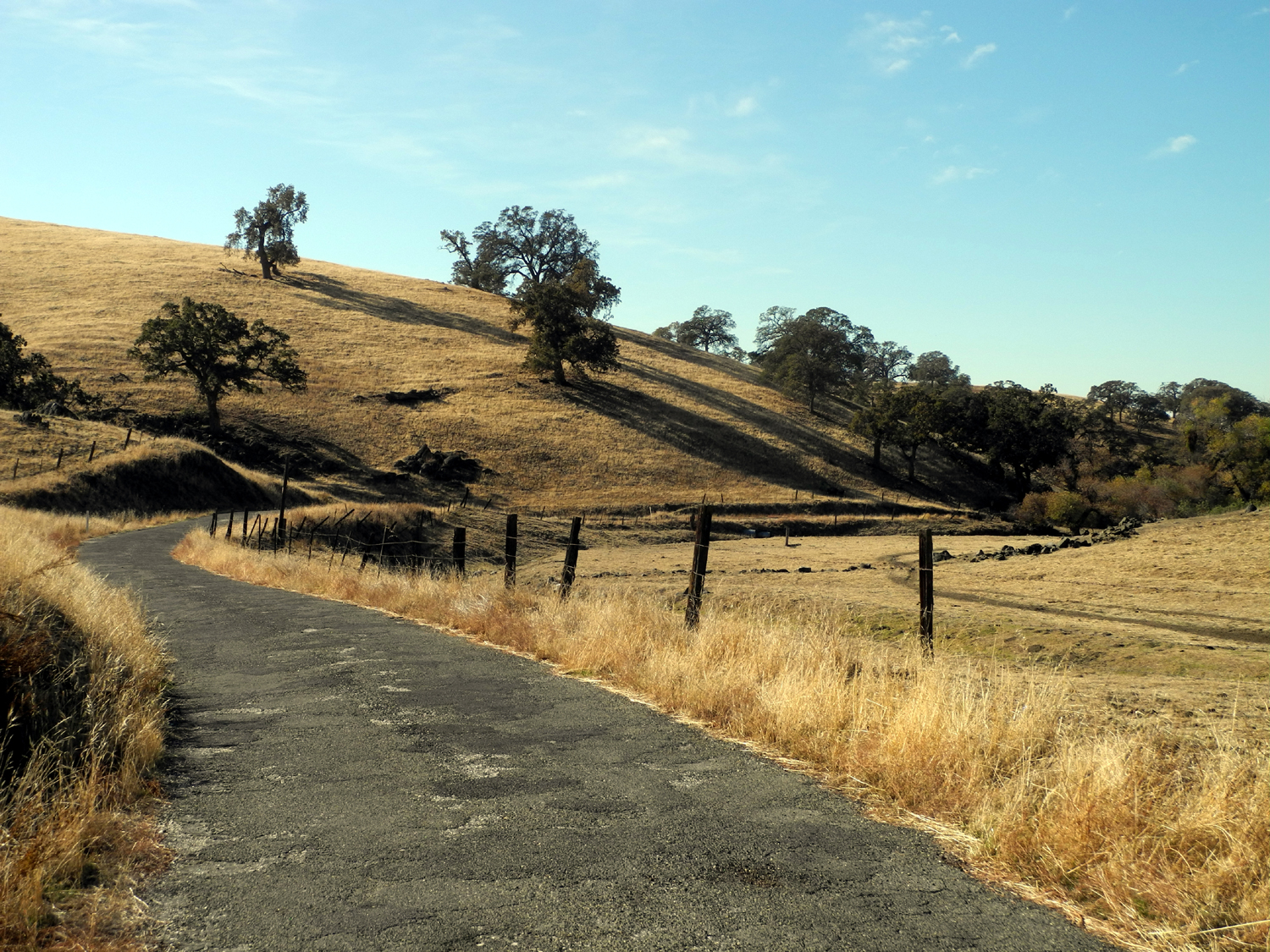
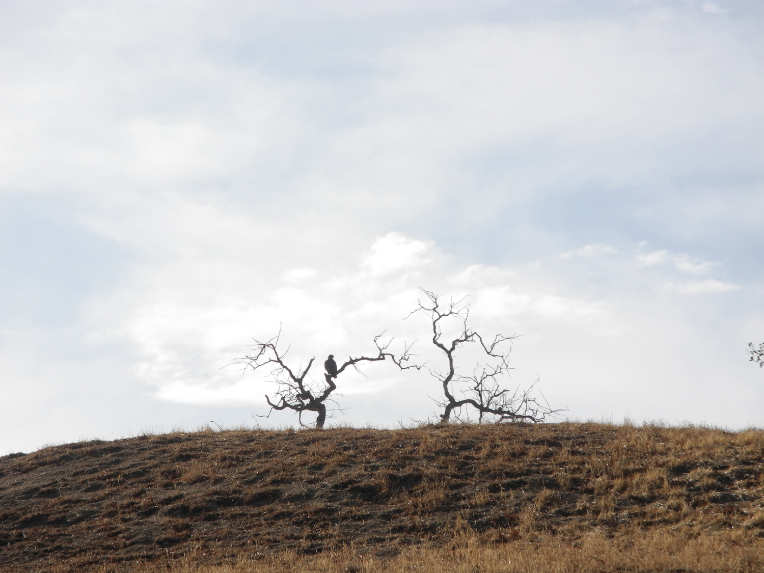
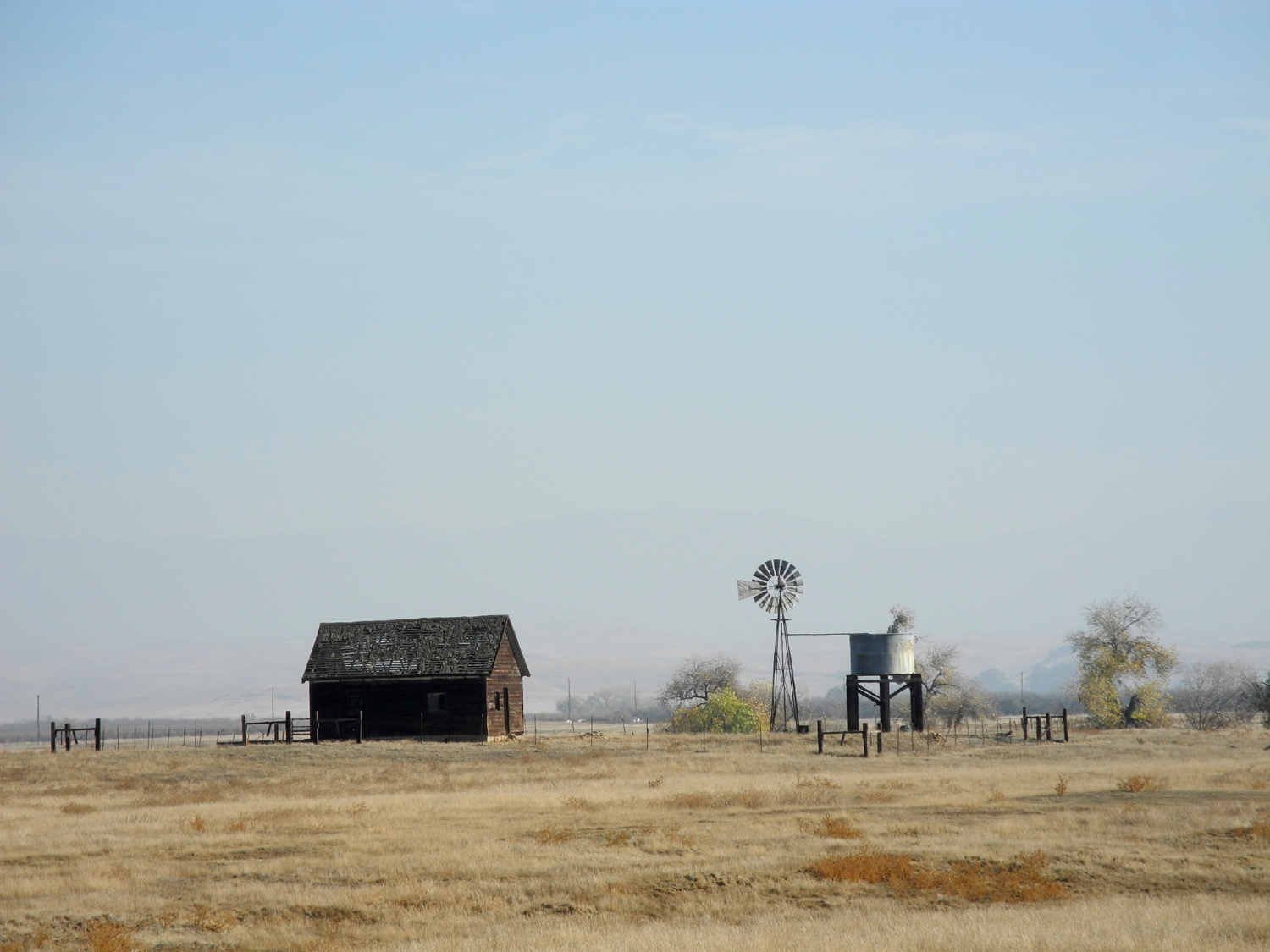
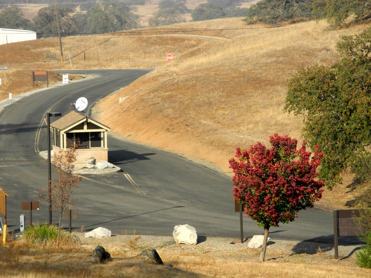
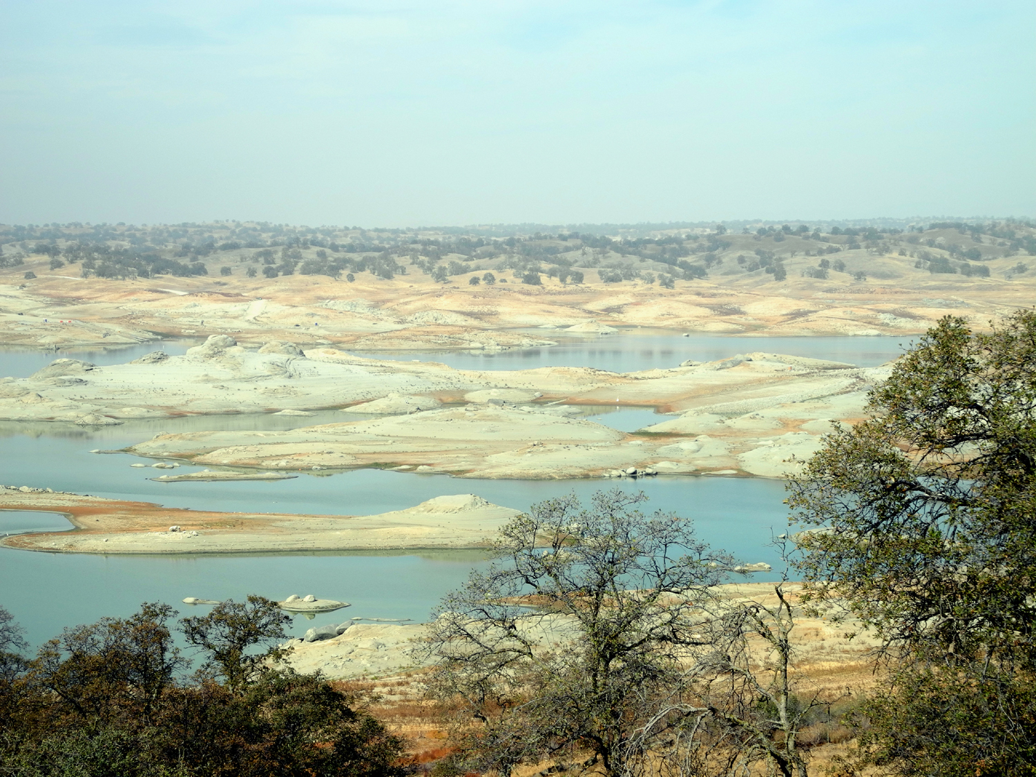
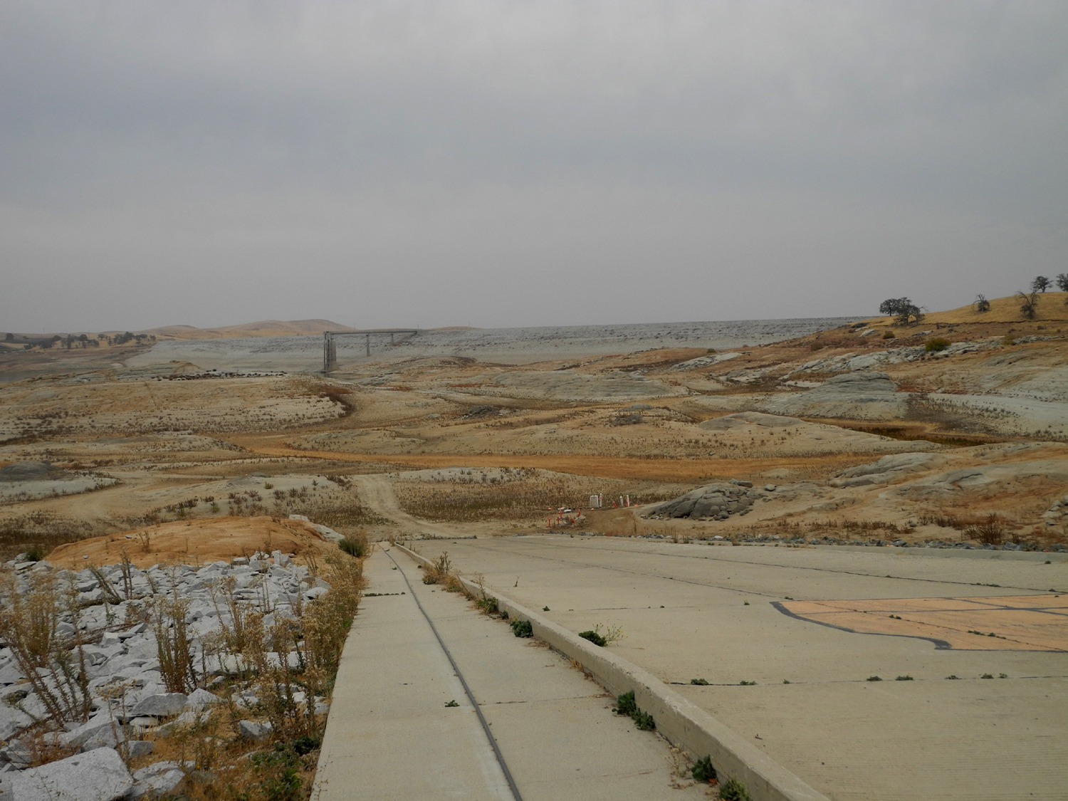
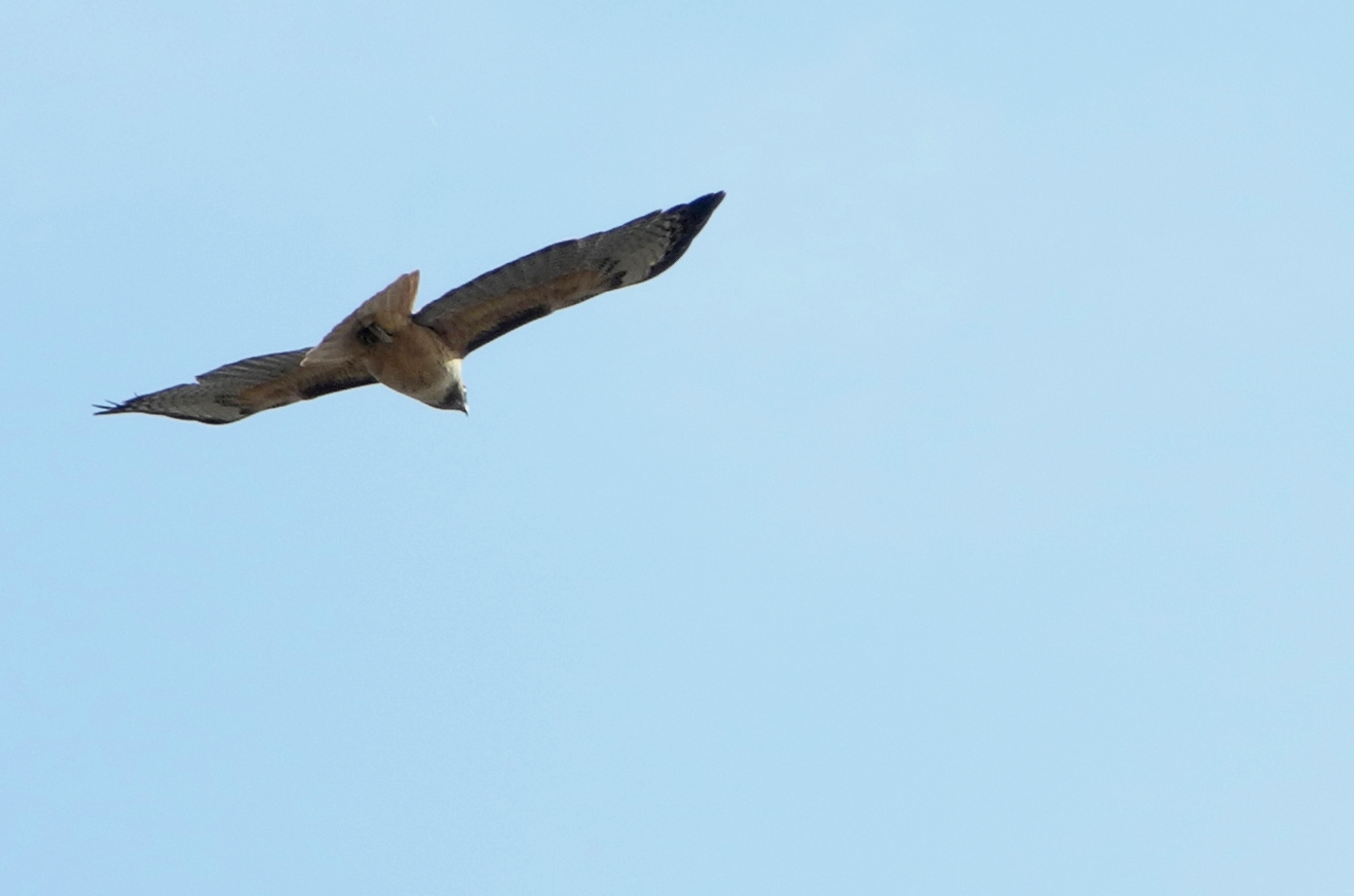
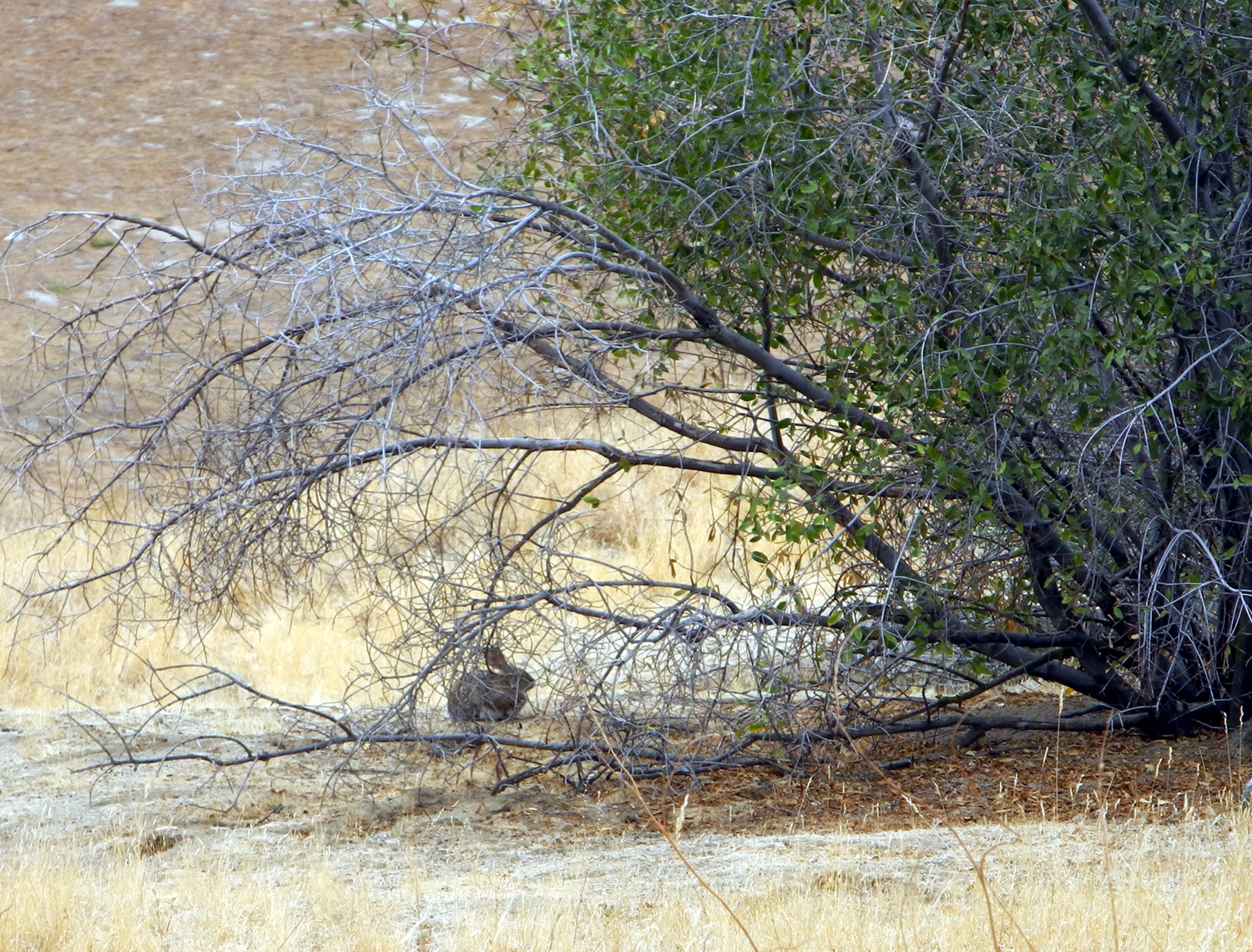
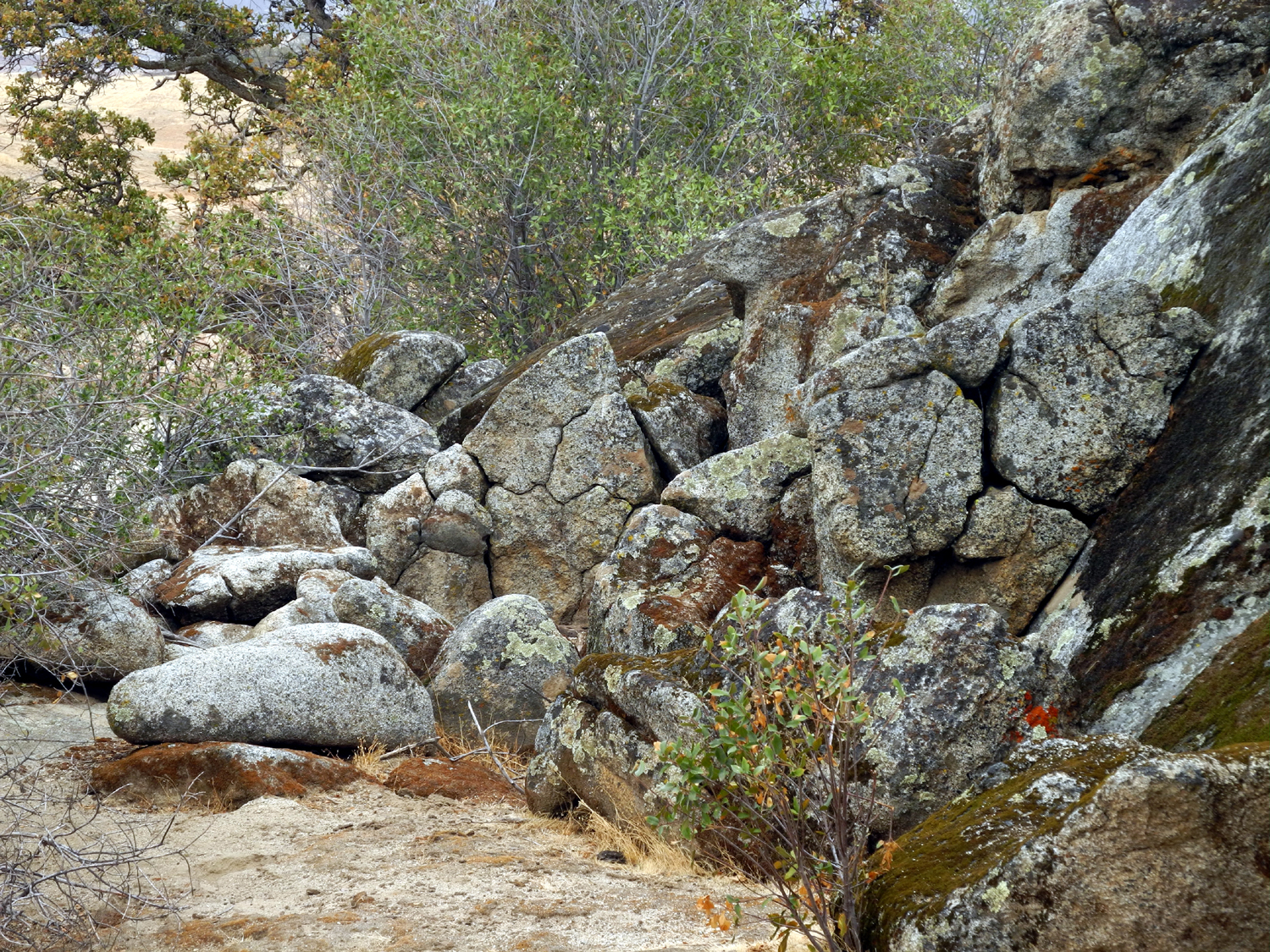
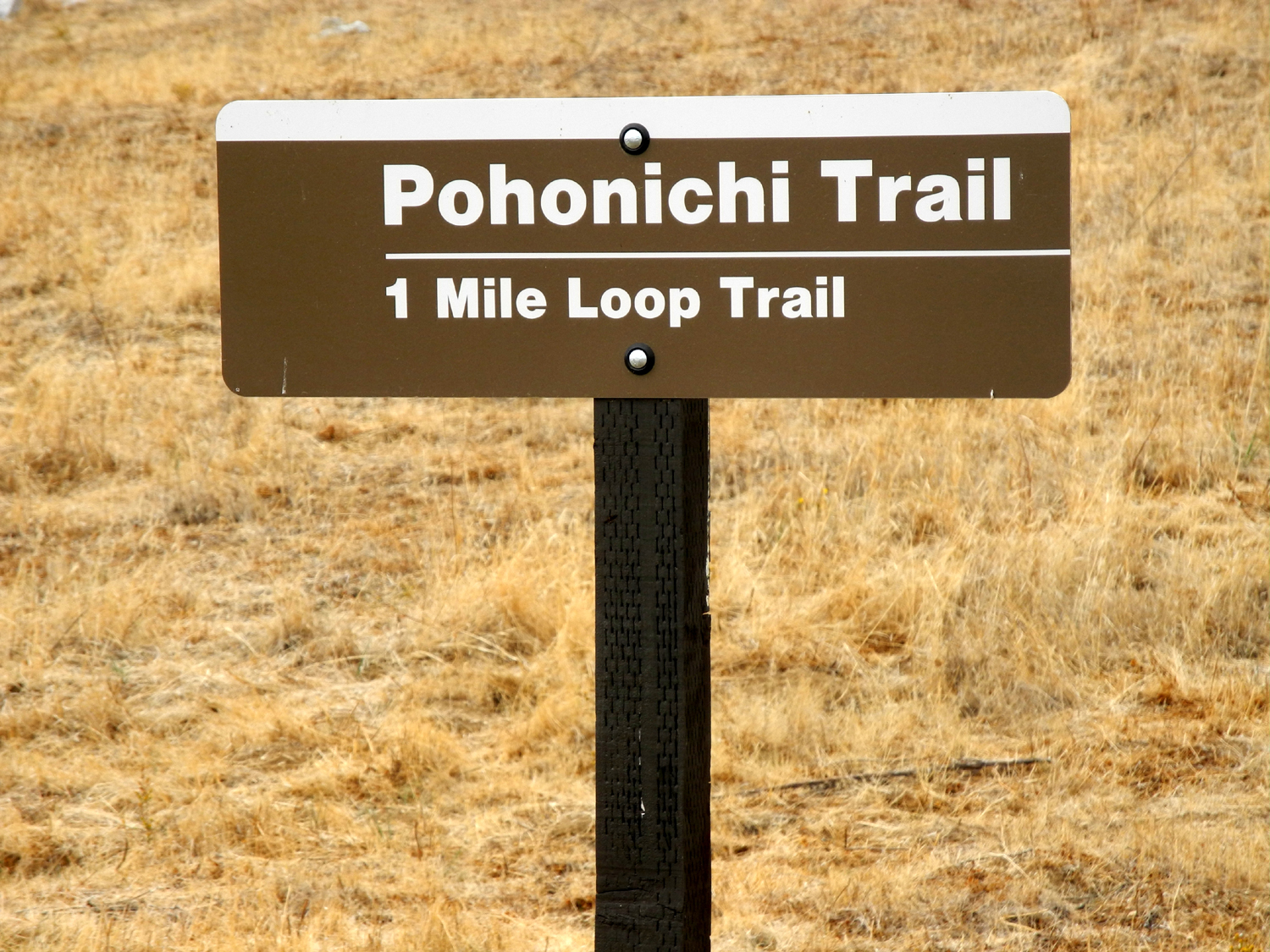
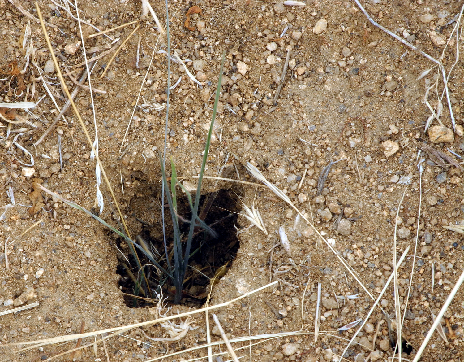
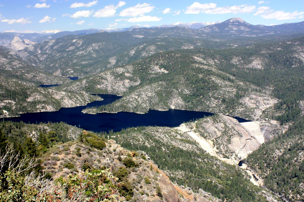
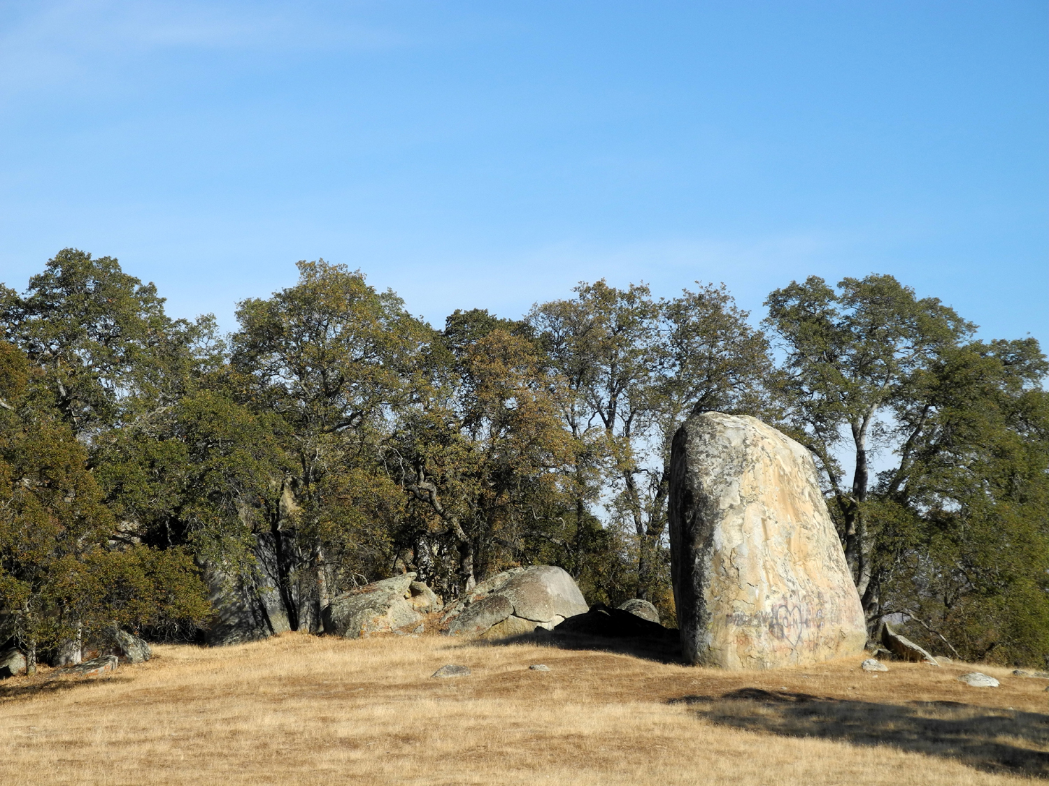
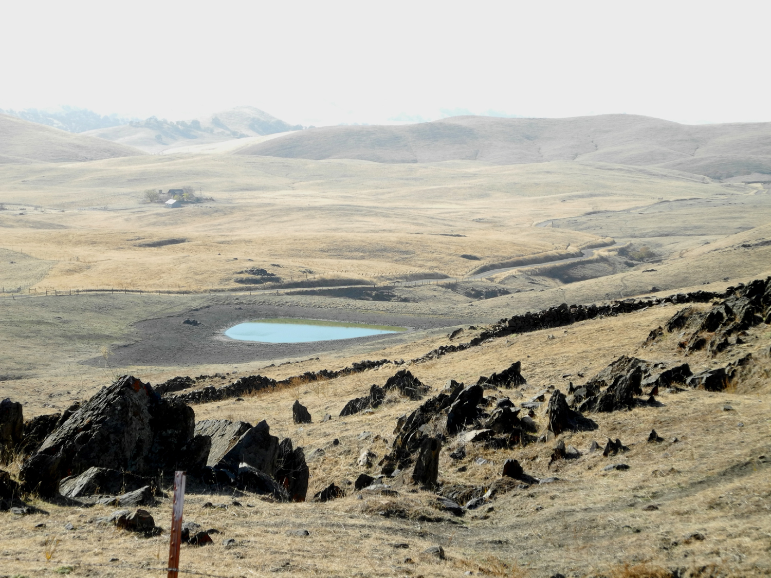
Hensley Lake Camp: I've reported on this location so many times that I'm not sure I have anything new to say. I was tempted to just list the links to previous reports, but that would be the easy way. The Hensley Lake recreation area has several attractions for me. First, it's less than 40 miles from home. It's low in elevation, making it a good winter camping spot. When we have good rainfall, it's nice and green by January, sometimes even by mid-November. It has a nice one-mile loop trail that goes up and down over ridges and through low spots, just right for my kind of hiking. And of course, for those who are interested, there is a lake and fish. When I started to make my reservation a few days ahead, I realized it was the end of a three-day weekend, so for a few moments I was concerned about the park maybe being very busy. However, my favorite spot was available for as long a I wanted it and more. Then I saw a notice that the boat ramps are closed, and I immediately suspected that there would be very few people there. This proved to be the case. Unfortunately, we have had two years of below average rainfall, leaving the foothills brown and dry, and the lake at such a low level that there is more dirt than water. I left home about 11 a.m. on November 11, and when I arrived at the lake, there was just one other party camped there. Reservation signs still in place at several sites showed that three or four other parties had left that morning. Although there were a few day visitors there during the time I was there, I was the only one to spend the night Monday and Tuesday. There is a day use area/vista point on the opposite side of the lake from the campground, so before turning on to the road that crosses the river below the dam, I continued on the additional two miles to check out this spot, where I had not been for maybe eight years. There is a nice view of the lake from the parking area, and it was immediately clear that our two years of low rainfall have taken their toll. The water was anywhere from 100 to 500 feet below the bottom of the various boat ramps. I also learned that there were greater than usual water releases, to aid farmers impacted by the drought. After a short time at the vista point, I drove back to the junction, then continued on to the camp ground. Camping at this location was also an opportunity to get in some extra exercise, so shortly after I get set up I went for the first of several walks. The campground has three fairly big loop roads, and I went around the two that were farthest from my camp site, taking about 40 minutes. Along the way I checked for occupied sites, with the following results: One site is set aside for the Campground Host (this person left for an extended absence the next day); one site is set aside for the Campground Volunteer, and one site was occupied, but was vacated later that day. The campground has 52 numbered sites, but this figure is somewhat misleading. The host and volunteer sites are not available to the public, and at least one site is subdivided into a, b, c, and d (these are all small tent sites). Most of the sites have electrical and water hook-ups, with up to 50 amp service available. My motor home requires 30 amps, but the giant motor homes and 5th wheel trailers use 50. Most campers carry adapters so they can use 20 amp if necessary, but this will not run an air conditioner and may have other limits. I also have an adapter for the 50-amp outlet, since a few campgrounds only offer this. If you're ever considering camping at Hensley, you can make reservations on line here. The system allows you to enter the number from your senior pass if you have one and get a 50% discount. For the first time, I got an email asking me to do an on-line pre-registration form, which I could print out and bring to speed things up at the gate. Since no one was on duty, this worked exceptionally well - I just barely slowed down at the gate. A ranger always comes around and checks, but they apparently had information in the computer, and didn't ask to see the form. Well, that's probably more than you wanted to know about the Federal Recreation Reservation System, so let's move on to the weather report. The forecast was for highs near 80, lows in the 40s, and a very slight chance of rain Tuesday. Monday it was cloudy and hazy much of the time, but very nice. At night there was an elliptical formation of broken clouds all across the sky, with the moon in the middle. As I watched, the clouds drifted nearly off the moon. Later the clouds coalesced and covered most of the sky, but the moon was still visible, and still later there was a huge ring around the moon, followed by more broken clouds. The second night there were scattered clouds which gradually broke up, with almost complete clearing toward morning, and it was very cold, probably in the 40s. Orion rose in the sky, and at various times Venus was extremely bright in the west, then Jupiter high in the sky. In the daytime it was perfect weather for sitting, and just a little bit warm for hiking. Tuesday I took a brief morning walk, followed by my official camping Bloody Mary and breakfast. I may have fitted in a nap also, because it was close to 1 p.m. by the time I started my "big hike," the allegedly one-mile Pohonichi Trail. Actually I think this is a mile of uphill, plus a little downhill. Whatever the actual trail mileage, it is a pretty good walk from the camp to the trailhead. There is a road which I have taken when I had my bike, but on foot it was easier to just take a cross-country route. This probably added an additional half mile to the total trip. Some of this walk was through dry grass, but there are narrow game trails all over this country, and I was able to follow one of these through the thickest part. This is a nice hike, with plenty of up and down, through open blue oak woodland, but of course, it's a little nicer when it's green. The only green grass I saw was next to a large rock formation, where I think water running off the boulders provided enough extra moisture to get about three square feet of grass started. My doctor recently told me I need to exercise more, so I've been keeping track of my daily walk time. The trail hike was about 85 minutes, after deducting rest stops, but probably still counting brief stops to take pictures. As I mentioned, although it was around 75 degrees, walking warmed me up quickly. I started with a long sleeve T-Shirt and a sweat shirt, but the latter came off before I was half way. During my various walks, as well as along the roads, I saw many, many ground squirrels. At times there were three or four in view at once. I also saw another common foothill dweller: Not far from my camp is large rock formation, with brush all around it, which I have named Rabbit Rock. As I walked around it, a rabbit ran out and around to a presumably safer spot, something that had happened several times before at that location. I saw the rabbit at least three times during my visit (or maybe three separate rabbits). Coming back from one of my walks, I saw a hawk in a dead tree on the hill above camp. I quietly asked him to stay there while I got my camera, and he obliged, but flew as soon as I took the first picture. I got several shots of him flying, only one of which was worth keeping. Completing the wildlife report, when I went out to look at the stars Tuesday night, I heard an owl, maybe two of them, since the second hoot seemed to be deeper and/or farther away. I heard him again just before dawn. Wednesday morning I walked all the loops, which still took me only about 40 minutes. Since it was morning I probably walked a little faster. Along the way I stopped and chatted for about ten minutes with the volunteer, who was trimming some tree branches that hung down into the fish cleaning area. When I got back to the motor home, I had breakfast, washed the dishes, and got ready to leave. The campground has a dump station, so I took care of that chore and got on the road around 11 a.m. and was home in less than an hour. --Dick Estel, November 2013 |
||
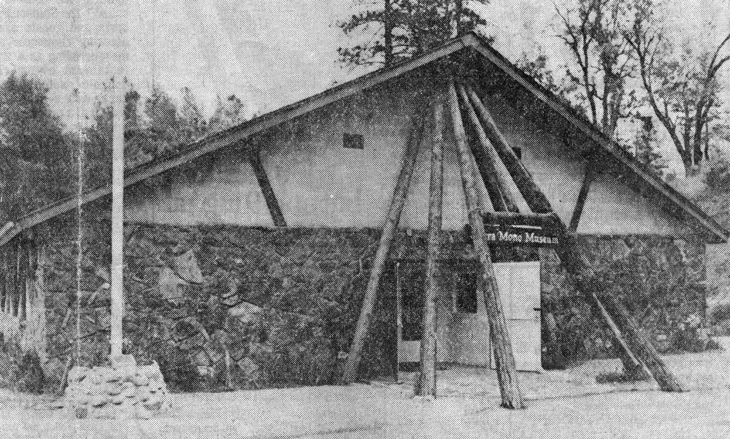
North Fork and Mono Museum: This was a short day trip to a place I've been wanting to visit for a number of years. The Mono people of North Fork incorporated in 1966 to form the Sierra Mono Indian Museum, which was opened to the public in 1971. I have a clipping about the museum from The Fresno Bee dated 1978. I don't think I saved it from that time myself, I believe it was in the many newspaper clippings and other things my mother saved, so I probably first read it in late 2007. Among other changes since the article was written, the museum is now open Tuesday through Saturday, 10 a.m. to 3:30 p.m. Better late then never, I set off on November 16 with friends Janell and Ken, driving north on State Highway 41 to the junction with Madera County Road 200, also known as the North Fork Road. The route goes east through the community of O'Neals, which has an elementary school and not much else. North Fork itself is a small town of about 3,000, at the 2,600 foot elevation. For many decades it was the site of a large sawmill, but this closed in 1996. Since then the town has been reinventing itself as a tourist destination. Going east out of town you will be on the Sierra Vista Scenic Byway, which goes many miles into the mountains, with some spectacular views of Mammoth Pool Reservoir on the San Joaquin River, and the domes and other granite formations seen from Mile High Lookout. The museum is a few hundred feet off the main road, and we found it after going a quarter mile down the wrong way. There is no required admission fee, but a donation of $7 is suggested, and it's well worth it. There are probably a thousand or more baskets, covering not only the Mono culture, but many other Indian groups. Many of these are of recent vintage, but made by native people using traditional materials and techniques. There are also hundreds of arrow and spear points, many of them in very fine condition, as well as mortars, pestles, cradle boards and numerous other artifacts. There are also several dozen stuffed animals or mounted heads, representing all the major animals of the area, as well as some from other locations. Some of these are displayed in small dioramas. The exhibits are not well organized, and many of them are not labeled, but this does not detract from the enjoyment of the amazing craftwork and beautiful designs. Although photos are not permitted within the museum, there are some very nice pictures here, which I trust were taken with permission. Disclaimer: Some have nothing to do with the Mono Museum. We spent about an hour at the museum, then went into "downtown" North Fork and stopped briefly at the visitor center. We asked about places to eat, and were given the names of four or five restaurants, only one of which could be considered a "chain." The Pizza Factory is really a bunch of locally owned franchise restaurants, mostly in smaller towns and cities, and always very good. However, we walked about 50 feet down the road to Slim's, which proved to be a good choice. We had the meathead sandwich, was a very large meal, with lots of meat, cheese and green goodies, in a triple layer like a club. We said our farewell to North Fork and drove back toward State 41, but about a mile before reaching the highway, we turned left and took the "back roads," including Roads 210, 211, 145 and 206, crossing the San Joaquin River at the town of Friant. This town is located right below Friant Dam, which forms Millerton Lake on the river. From here we headed back into the metro area on Friant Road and Willow Avenue, which goes into Clovis a mile west of my house. --Dick Estel, November 2013 |
||
|
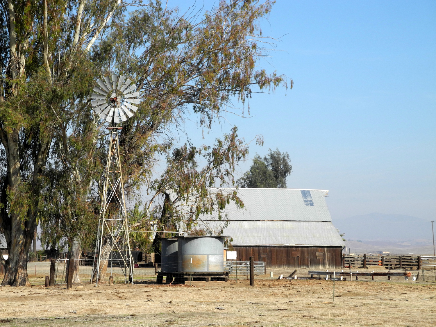
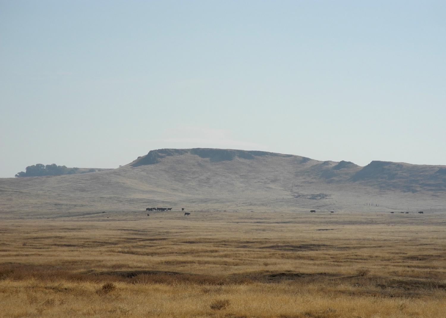
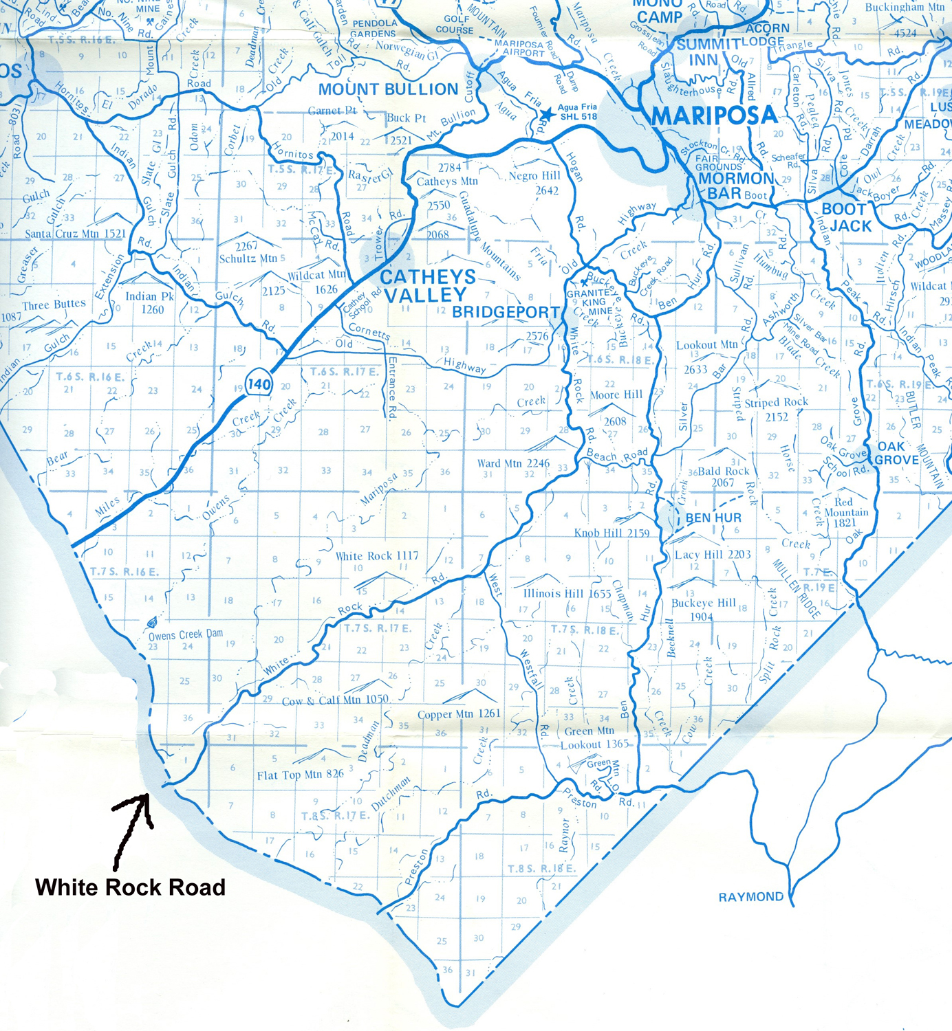
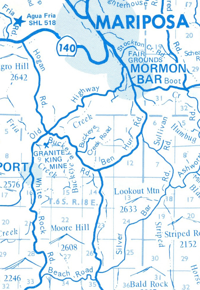
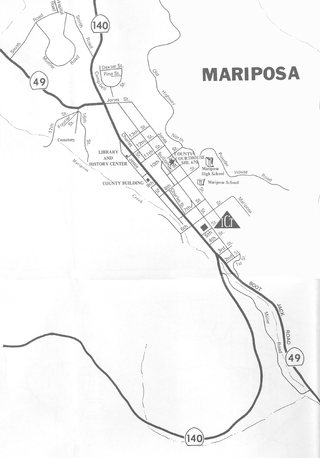
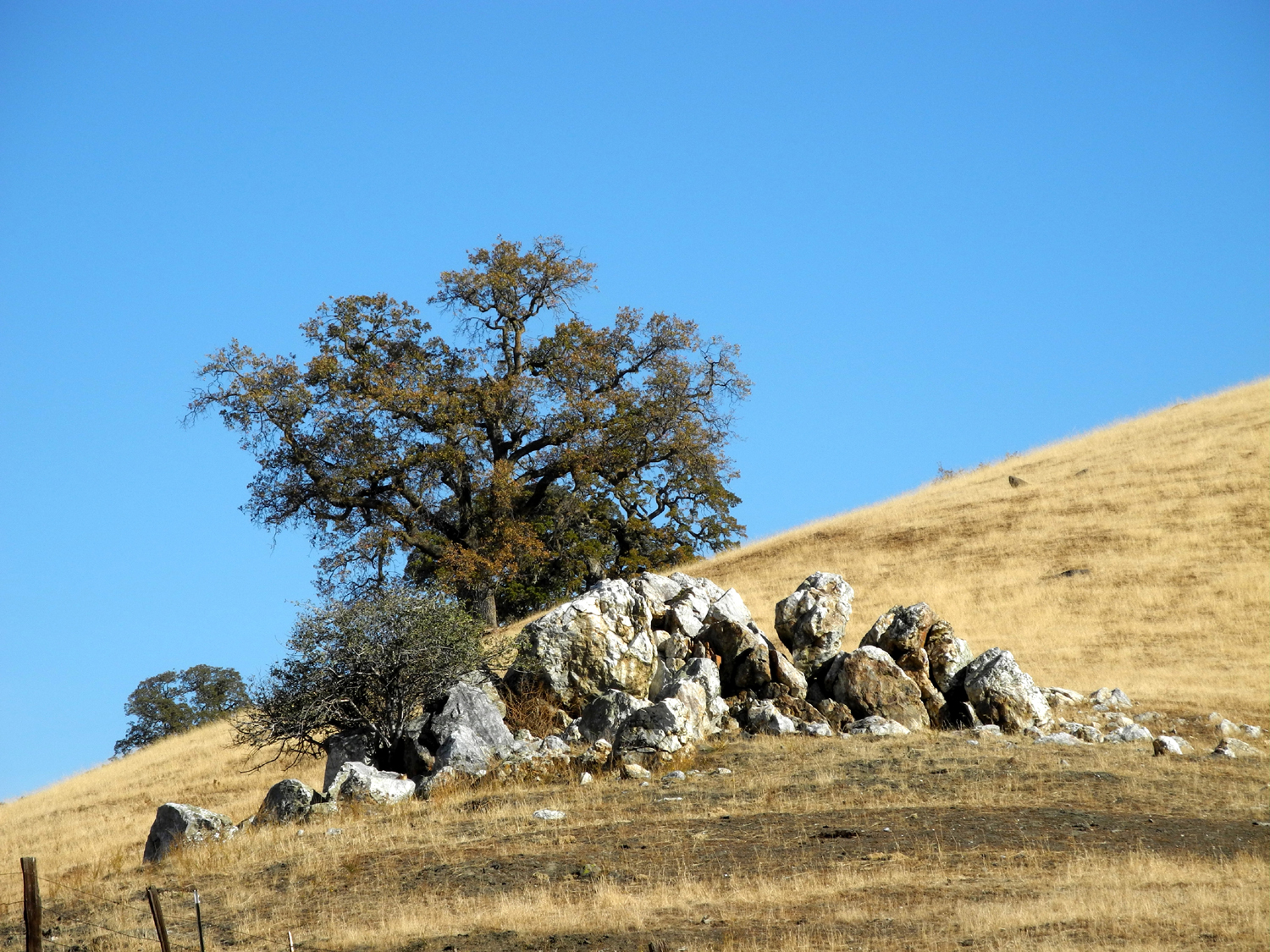
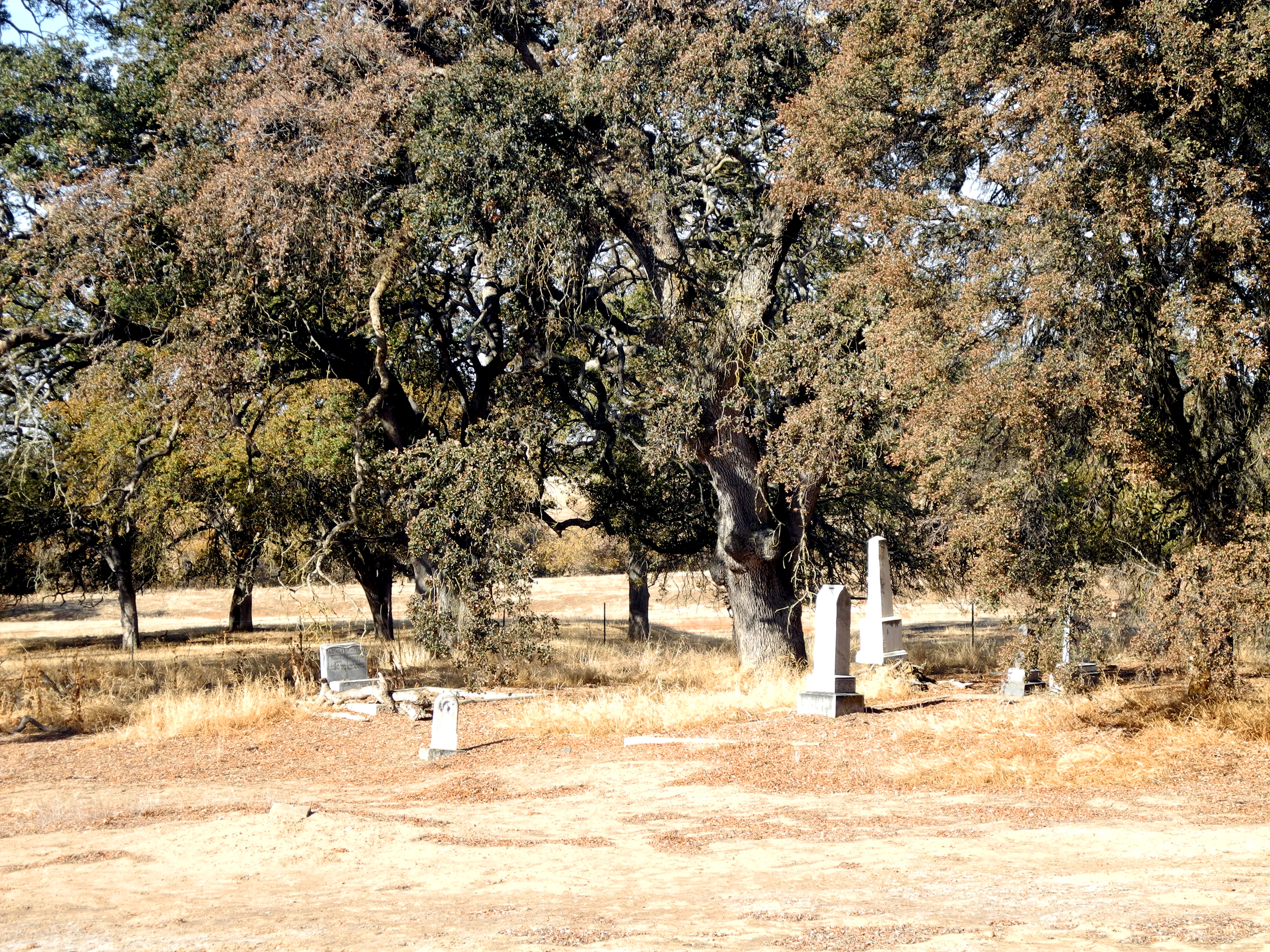
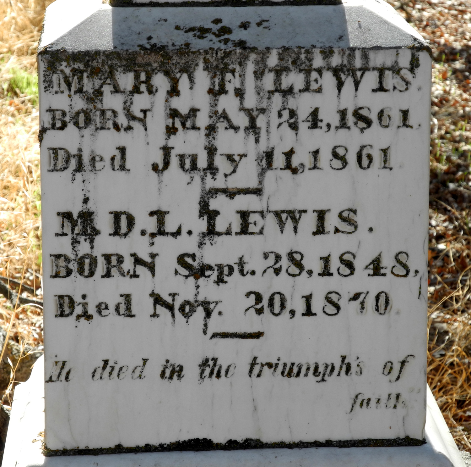
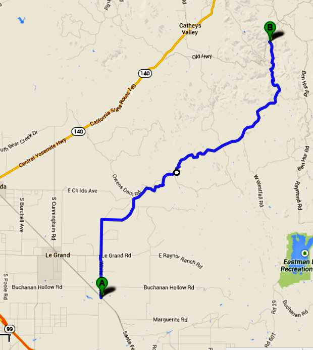
White Rock Road: Some time in late November, 2013, someone posted a photo of the Lewis School on the "You Know You're From Mariposa" Facebook page. I had never heard of this school, so I asked where it was, and learned that it was "back off the White Rock road heading toward Le Grand, down past the Cemetery." My friend Susan Crandall chimed in with the fact that the Lewis families were thick in the White Rock area at one time (her mother was a Lewis). I realized that although I grew up in Mariposa County and have been back there a couple hundred times, I did not know where the White Rock Road was, so I looked it up on the map. I immediately decided that next time I went to Mariposa (which is rare these days), I would take that road. Then Sunday night, December 1, I was looking at my schedule for the week and saw that I had nothing till Friday. I felt like I should take advantage of the situation and do something or go somewhere. With our parents' house sold and the undeveloped land parcel taking care of itself, I no longer have any reason to go to Mariposa, but a realization hit me - since I have no reason to go to Mariposa, I could go there Monday for no reason, and explore the White Rock Road. I sent an Email to Susan asking if she and Andy (her husband) would like to get together for lunch, although I was not optimistic, due to the late notice and the fact that she is a very busy person. It turned out that she was available, although Andy was starting a project and he could not get away. We agreed that I would call her when I got close to Mariposa and we'd decide where to meet and eat. The next morning I threw some water and an apple in a small ice chest and got on the road about 9 a.m. To get to the White Rock Road I would have to go up Highway 99 past Madera, then take county roads through northern Madera County into Merced County, where I would be on Santa Fe Avenue, which parallels the railroad tracks and goes through the small town of Le Grand. A ways south of Le Grand White Rock crosses the tracks and Santa Fe, and here I turned north. The first mile or so was terribly bumpy, with the car bouncing around even at 40 MPH, but I was certain it would get better, and very soon it did, about where it crosses Le Grand Avenue, which runs east out of the town. Not far past this point White Rock turns directly east toward the foothills. Off to the right as you leave the valley floor are some table-top hills, similar to those along the San Joaquin River between Fresno and Madera County, but lower and smaller. In this area the road approached and briefly paralleled Mariposa Creek before rising away from it. Then the country became a bit more hilly and the road started to follow creeks and go through narrow canyons. There are not a lot of trees in this area, mainly valley oaks along the waterways. It is cattle country all the way, but cows are fairly scattered, probably because of two dry years. This has given ranchers the tough choice of paying high prices for hay or reducing their herds, and the latter is usually the most economically viable. After a few miles of this fairly open country, the road comes out into what I would describe as a large, semi-level rolling bench, with open oak woodland being the most common sight. This is the most scenic part of the drive, with some nice rock formations, but the road soon rises again into steep country where there is not a single tree or bush on the hills. Once you get on the White Rock Road, there are few opportunities to get off. After Le Grand Road, the first road junction is West Westfall Road, which leads toward the town of Raymond. This is in the area just before the climb into bare hills. After another good climb up a canyon, the road goes over a ridge, and the contrast in vegetation is dramatic. The northern slopes get more moisture, and there is once again a thick growth of trees, mostly blue oak and live oak, with a few bull pines. This stretch was also the location of a few miles of dirt road, but it was well graded, and I could go up to 40 MPH when the curves permitted. A long down hill stretch here takes you down to and across Mariposa Creek, then up again. Before I reached this point I observed a small burial ground, the White Rock Cemetery. I stopped to see if there were any familiar names, and found a couple of Lewis family graves, as well as several in the Gann family, which was widespread in Mariposa County in my youth. There were a couple of other names that sounded familiar, but most interesting was a very new headstone, but not a new burial, of a civil war soldier. About the time I crossed Mariposa Creek I remembered that my "pay as you go" dumb phone does not work on Verizon's extended network, which is what you get in Mariposa County. The iPad will work sometimes, so I stopped and tried to send an email to Susan to arrange a meeting, but I didn't have any service in that area, so I realized I would have to find a phone in Mariposa after I arrived. Throughout the trip from Santa Fe Avenue to Old Highway, a distance of about 25 slow, winding miles, I met only two vehicles. This road is one of the most remote and lonesome roads I have been on - the "backest" of the backcountry. In the San Joaquin valley it passes two or three ranches. Once it enters the foothills, signs of human activity are few and far between. Finally, I turned on to Old Highway, one of several stretches of the original Highway 140 alignment that are still in use, and was immediately back in civilization. This is a fairly well-traveled road, with houses visible almost all the time. It joins Highway 49 half way between town and the fairgrounds, and I've driven this route a number of times. At the other end it runs into Highway 140 at Cathey's Valley. Wanting to travel another road I had never been on, I soon turned left on Yaqui Gulch Road, which runs across to Highway 140 a few miles west of town. This road did not exist when I was a kid, or if it did, it was a dirt track, but it is now the best road I had driven on all day. The distance across was not very long, and soon I was heading into Mariposa on the "all year highway" that runs from Merced to Yosemite. Phone booths are a rarity these days; I don't know where one is in Mariposa, and I usually don't carry change. So I headed for a familiar location, the Senior Center, where my parents ate lunch for many years, and where I often went with them. There was no one I knew on duty, but they were very willing to let me use the phone, and I arranged to meet Susan at Castillo's, an excellent Mexican restaurant on 5th Street, in about 15 minutes. I refer to Susan as my "unrelated cousin" - our families have been friends since the early 1900's, and one of her dad's cousins is married to one of my mother's cousins (all being originally from the same area of northwest Ohio). Susan and Andy had driven the White Rock Road a time or two recently and had also stopped at the cemetery, so we discussed the road, the isolation of the area, and lots of other things. After a good dinner and conversation, we said our goodbyes, and I set out to do a couple of other things. First was to visit Leroy Radanovich, who has documented the history of the county in words and photographs for a number of years. He lives just a block up the hill from the restaurant, and as I drove up there, it felt like I might have a low tire. I parked next to his house and got out, and sure enough the right front tire was obviously in trouble. I knocked on the door, planning to ask Leroy for help, but he was not home. I took a look at the spare, one of those emergency spares that you are not supposed to drive over 50 MPH on, and decided that my tire changing days are over. Since my cell phone would not work, I could not call my roadside service, and I did not have the slightest idea where to go for tire service. A quick check on my iPad for auto repair in Mariposa produced no results, which I knew was not possible, so I considered wandering through town looking for a shop, and realized my best bet was to go back to the restaurant and seek help. Holly, our waitress and also the owner of the cafe suggested Mariposa Tire, looked up the phone number, and let me use their phone to call them. They came over within ten minutes with a compressor, and got the tire aired up enough that I could drive to their shop. Despite a missing wheel lock socket, which was in a tool box that I had removed from the trunk a few months ago, they got the tire off, fixed it, and I was on my way within a half hour. This type of service and the helpfulness of folks in Mariposa is typical of what I have found in small towns around the country, and something that others in difficulty have written to the local newspaper about in the past. I never thought I would be in such a position, but I was not surprised at the kindness that helped me get on my way with a minimum of hassle. I had planned to do a couple more things in Mariposa, but by this time I was not up to any more adventures in the hills, so I headed south out of town on Highway 49 to Oakhurst, then down Highway 41 to Fresno, Clovis and home.
If you ask someone in Mariposa how to get to the Old Highway, they will probably ask, "which one?" There is a short section of the old route still in use on the northeast side of Mariposa, running from near the high school out to Highway 140 about a mile outside of town. This was the "go to" place for teenagers to park back in the 1950s (or so I've heard), but it would not be very satisfactory for that use now, since a number of houses have been built along the road. Highway 140 was completed from Merced to Mariposa in the 1920s, extending to Yosemite Valley by 1926. It was first known as the "All Year Highway." Other routes into the park pass through much higher elevations, and usually experience some snow closures during the winter. Highway 120 from the east, from Lee Vining on US 395 over 9,400 foot Tioga Pass, is closed roughly from Thanksgiving to Memorial Day. The "all year" designation may have been a bit optimistic, since there were several lengthy closures from the opening of the Merced river route through the 1960s due to floods that washed out sections of the roadway. But for the most part, the highest point, 3,000 foot Midpines Summit, gets moderate snow and is quickly plowed, making this the road of choice for winter visits. I looked at several old Mariposa County maps that my parents had, and found that Yaqui Gulch Road was once known as Hogan Road. Since the Hogans are a long-time Mariposa family, I wondered how they were displaced by an Indian tribe located in Arizona and Mexico. The road does not appear at all on some of the old maps, and on others it looks like it was probably a dirt road. Further research has disclosed that a group of Yaqui Indians prospected in the area during early gold rush days. Mining: I assumed "white rock" referred to quartz, the silica based rock that makes up much of the gold-bearing formations in the Mother Lode gold country. It turns out that the original white rock was indeed a quartz formation that rose 100 feet above the surrounding terrain. The mining was not for gold but for the silica itself, for use in aluminum production. The Kaiser Aluminum operation basically turned the outcrop into a hole in the ground, but small formations still exist. More information can be found here. I also noticed on my old map the site of the Granite King Mine, near where the Old Highway meets Yaqui Gulch and Ben Hur Roads. This was one of two gold mines where my father worked briefly in the 1940s. The other was the Pine Tree Mine, near the top of Bagby Grade a short distance north of Bear Valley. My research into mining in the area also revealed that there were a number of copper mines, information that was new to me. Most of these were off White Rock near West Westfall Road. ---Dick Estel, December 2013 |
||
|
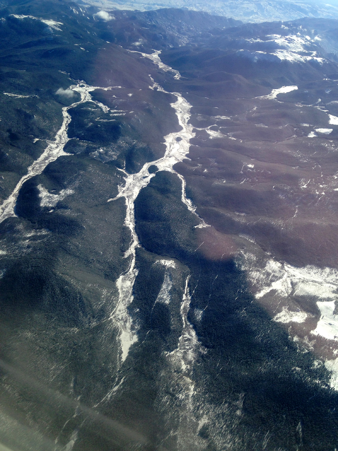
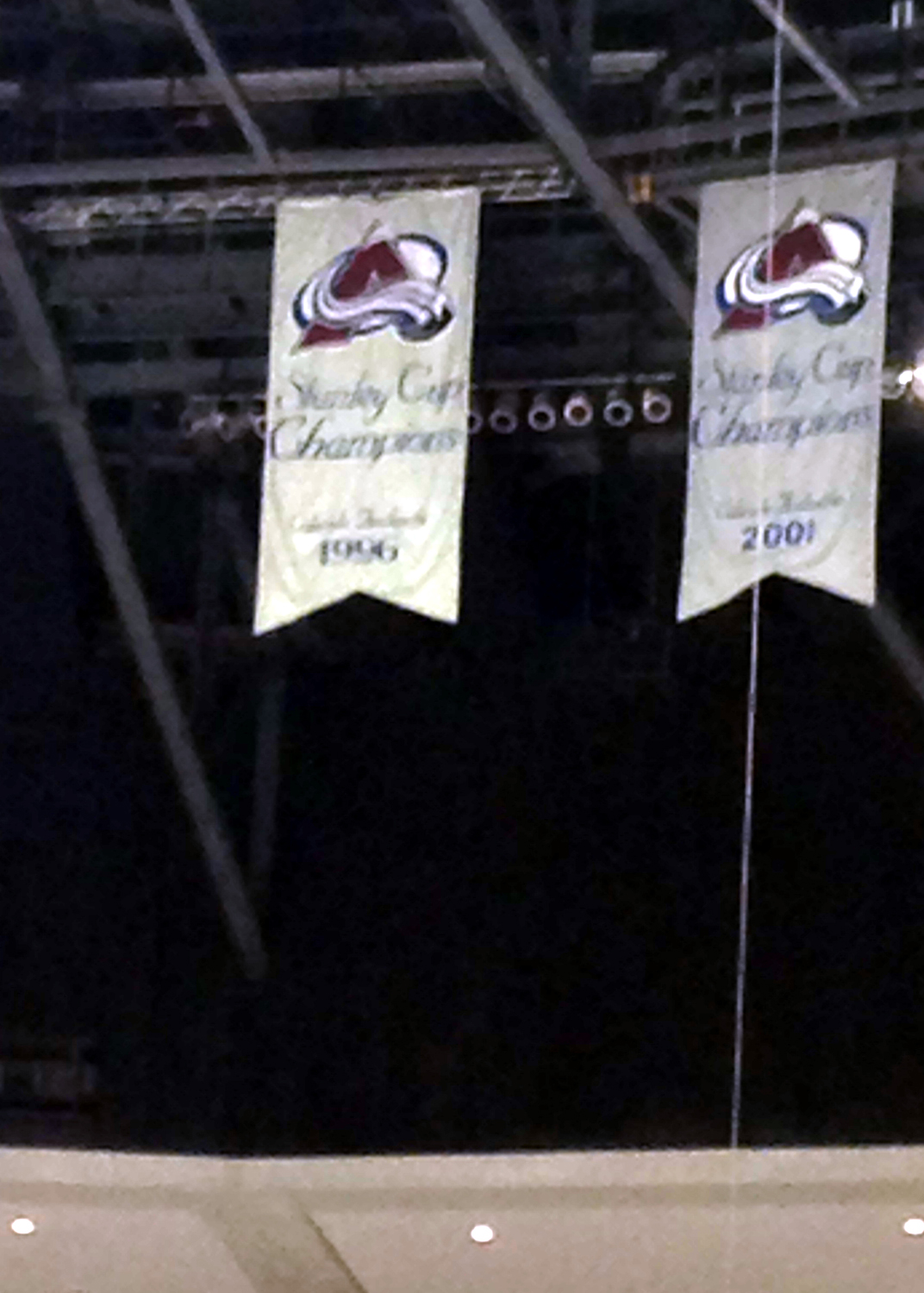
Hockey in Denver: My 16-year old grandson, Mikie, started attending hockey games while still in the womb. In his early years, he went to minor pro Fresno Falcons games, and enjoyed watching his older brother, Johnny, in his youth hockey activities. Eventually Mikie followed in Johnny's skate marks, and having gone through the various levels, now plays on the Fresno Monsters youth hockey team at the oldest level, Midgets (ages 15 through 18). He really got interested in watching pro National Hockey League games on TV during the 2001 playoffs, when the Colorado Avalanche won their second Stanley Cup. He's remained a fan of the team through their many ups and downs, including a dismal season last year when they finished next to last in the league. He has seen the team live a couple of times, playing in San Jose against my favorites, the Sharks, but he's always wanted to see a game in Denver. In 2013, his wish came true with a special Christmas present from Grandpa Dick - a plane ride to Colorado and tickets to the Avs game against the Winnipeg Jets on December 29. It is a good year for the Avs - they started the season with six straight wins, and have held a playoff position throughout the season, now at the halfway mark. In keeping with established rules, attempting to fly anywhere from Fresno is punishable by inflated ticket prices, inconvenient flight times, and long layovers. Actually our Fresno to Denver flight was not that bad, leaving at 7:30 a.m. and getting us there in a little under two and a half hours. We had some great views flying over the Sierra, including rugged rock mountains, snow, and ice-covered lakes. I had been watching the Denver weather forecast for several days, and the final prediction was for light snow showers during the night, ending before we even left home. This proved to be accurate, so we had more scenic views over the Rockies, and as we landed we could see a long stretch of the range, brilliantly covered in new snow with the skyscrapers of downtown Denver between us and the mountains. I had already decided to rely on local transportation rather than renting a car, since I am thankfully not used to driving in snowy conditions. It was actually sunny and the roads were clear, with about a one inch layer of snow along the road during our 25-minute cab ride. We got checked in to the Hilton Garden Inn in downtown not long after noon, and I tried to take a short nap, since we had got up at 6 a.m. I couldn't manage to fall asleep, and having skipped breakfast, we decided to go out for lunch. I had looked up nearby restaurants on the Internet, and we chose the Yard House, about four blocks away, but also planned to be open minded if we saw a place that sounded good on the way. After the first block we noticed a large indoor mall with many shops and restaurants. We came to the directory, and decided on the Hard Rock Cafe. It was just upstairs from us, but when we got there it was closed. None of the other restaurants in the mall sounded right, so we went out and down a different way to the street. After we crossed the street heading in the direction of the Yard House Mikie said, "There's another Hard Rock right there. It looks open." It was indeed, so we went in. We had some very good hamburgers, and enjoyed looking at the guitars, costumes and other memorabilia on the walls. The waiter informed us that all the items displayed were used at concerts in the local area, many of them at Red Rocks Amphitheater. Although the chain is quite familiar to both of us, neither Mikie nor I had ever eaten at a Hard Rock, but we decided to add it to our list of good places to go. After lunch we walked around downtown for a short time. One of the more intriguing and certainly unique sights in downtown Denver was the 40-foot high sculpture of a big blue bear, standing on his hind legs, and peering into the glass-walled Colorado Convention Center. A Google search for "giant blue bear sculpture Denver" will bring up a lot of information and photos. One of the best pictures is found here. When we got back to the hotel we had about two hours before time to leave for the arena. Mikie watched football, while I read and tried to nap. The game was at six, so we left the hotel at five, planning to walk the mile or so to the Pepsi Center. After about two blocks we saw a pedi-cab, so we took that the rest of the way. Mikie was very happy and excited to be in the Pepsi Center once again. We visited there in the summer during our cross-country trip in 2004, but of course, there was no ice and no hockey then. The arena was close to sold-out, and the visiting Winnipeg Jets had a lot of fans present. It was a close, intense game, with no scoring in the first two periods. A little more than half way through the final period, the Jets got the first goal of the game, but the Avalanche answered 30 seconds later. Regulation play ended in a tie, leading to a 5-minute overtime. There were chances for both teams, but Winnipeg put in a goal with two seconds left to take the win. Due to the regulation tie, the Avalanche got one point in the standings, but of course, a loss still feels like a loss. We had hoped to get a cab back to the hotel, but we didn't see any outside the rink. We walked a couple of blocks to an intersection so we could give our location and called a cab company. We stood on the cold, windy street corner at least five minutes waiting for the "next available operator," then started walking toward the hotel. About this time the operator answered, but when I learned it would be 20 minutes before they could get a cab there, I decided it would be much warmer, and nearly as fast, to walk. We had come out of the rink through a different entrance than we went in, and we were going more or less parallel to the route we should have taken. I had asked Mikie to download the Google Maps app to his smart phone before we left home, so we opened that and got our directions right, and made it safely back to the hotel, although we probably went two or three extra blocks before we started using the map. In any case, it was a good walk, making up for the fact that I could not do my usual morning walk that day. We got a snack at the front desk - ice cream for me and chips and Gatorade for Mikie, and relaxed in the room for a short while before getting to bed. We had to get up at 4 a.m. (3 a.m. Pacific time), so it was a short night, and I didn't sleep very well. There was a taxi stand across the street from the hotel, and the cab driver we rode in from the airport with assured us there were always cabs there, which proved to be the case, so we were soon on our way back to the airport, about a 25-minute ride. We had received boarding passes for the home flight in Fresno, so we went directly to the security line, which was long but moving fairly fast. We were diverted to a quicker line where we did not have to take off our shoes, although the heavy metal clips on my suspenders set off the alarm, and I had to take them off. By the time we got through security and made the LONG trip (by tram and foot) to our gate, it was time to board for our 5:50 a.m. flight, so we had no idle time there. The homeward flight went through Los Angeles, and there is apparently a rule that any trip through LAX requires at least a 90-minute layover. We spent much of that time dozing or reading, but the time went fairly quickly and we had a very nice flight in to Fresno. Once we got over the San Joaquin Valley we had a sensational view of the snow covered high Sierra, probably a stretch of 80 miles or more. We arrived in Fresno around 10 a.m., and with no checked baggage, we were soon on our way out of the airport. We went to one of our favorite burger places, the Colorado Grill (very fitting) about a mile from my house. Once we got back to my place, we said our goodbyes and Mikie hopped in his pickup for the drive back home on the opposite side of Fresno. Despite the result of the game, he was happy with the hockey and the trip, and I was delighted that the weather cooperated and made it a smooth and enjoyable trip. --Dick Estel, January 2013 |
||
|
Photos (Click to enlarge; pictures open in new window) |
||
|
||
Kings River Bluegrass Buena Vista Trail Hike Hensley Lake Camp |
||
Kings River Bluegrass |
||
|
|
||
|
|
 |
 |
| Poor Valley Band | Grassfire | The Dim Lights |
 |
 |
 |
| Sagebrush | Valley Oak Band | Valley Oak with Eric Antrim |
|
 |
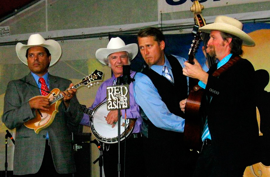 |
| Bean Creek | Grasskickers | Red Dog Ash (RDA Photo) |
 |
 |
 |
| Central Valley Boys | Laurie Lewis & the Right Hands | Festival program cover |
 |
 |
 |
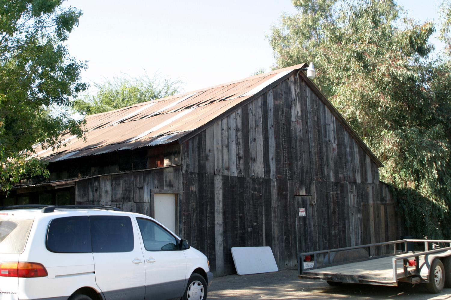
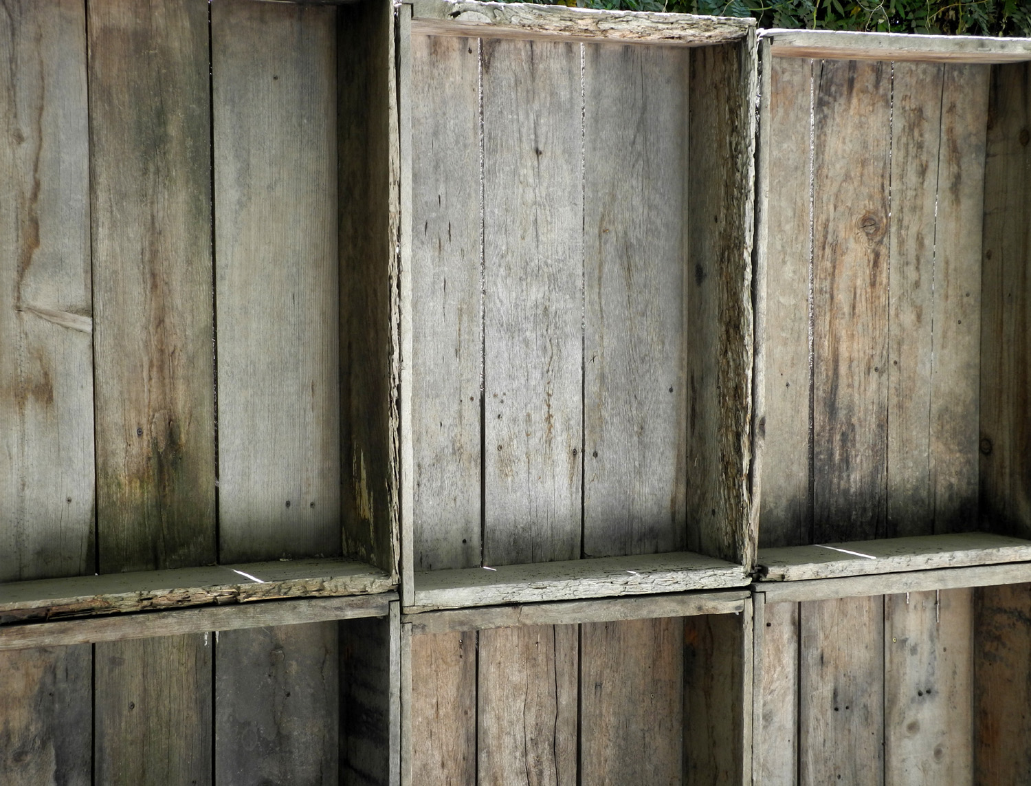
| The old barn (2009 photo) | Wall made from field lug boxes at The Grove | View east of camping area (2009 photo) |
|
Buena Vista Peak Hike |
||
 |
 |
 |
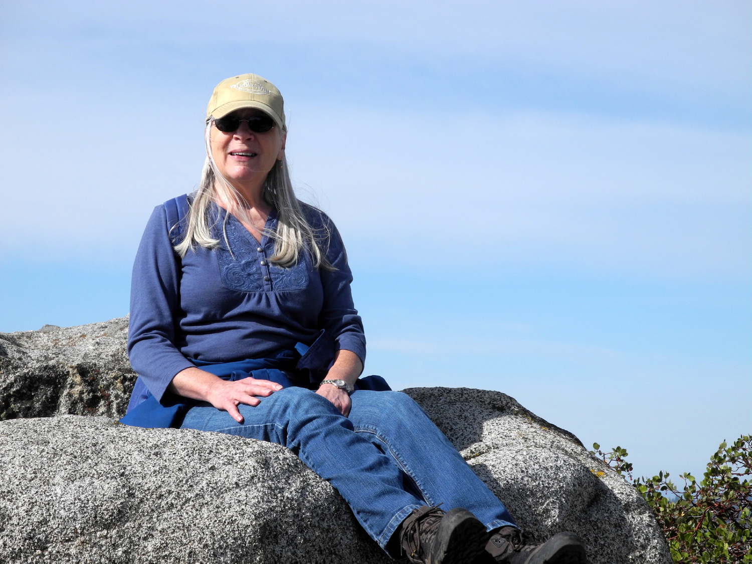
| Carolyn on the trail | Dick enjoys a snow-free section of the trail | Nature does some fantastic landscaping |
 |
|
 |
| Buck Rock with fire lookout on top | A typical scene along the trail | Big sugar pine, loaded with cones |
 |
 |
 |
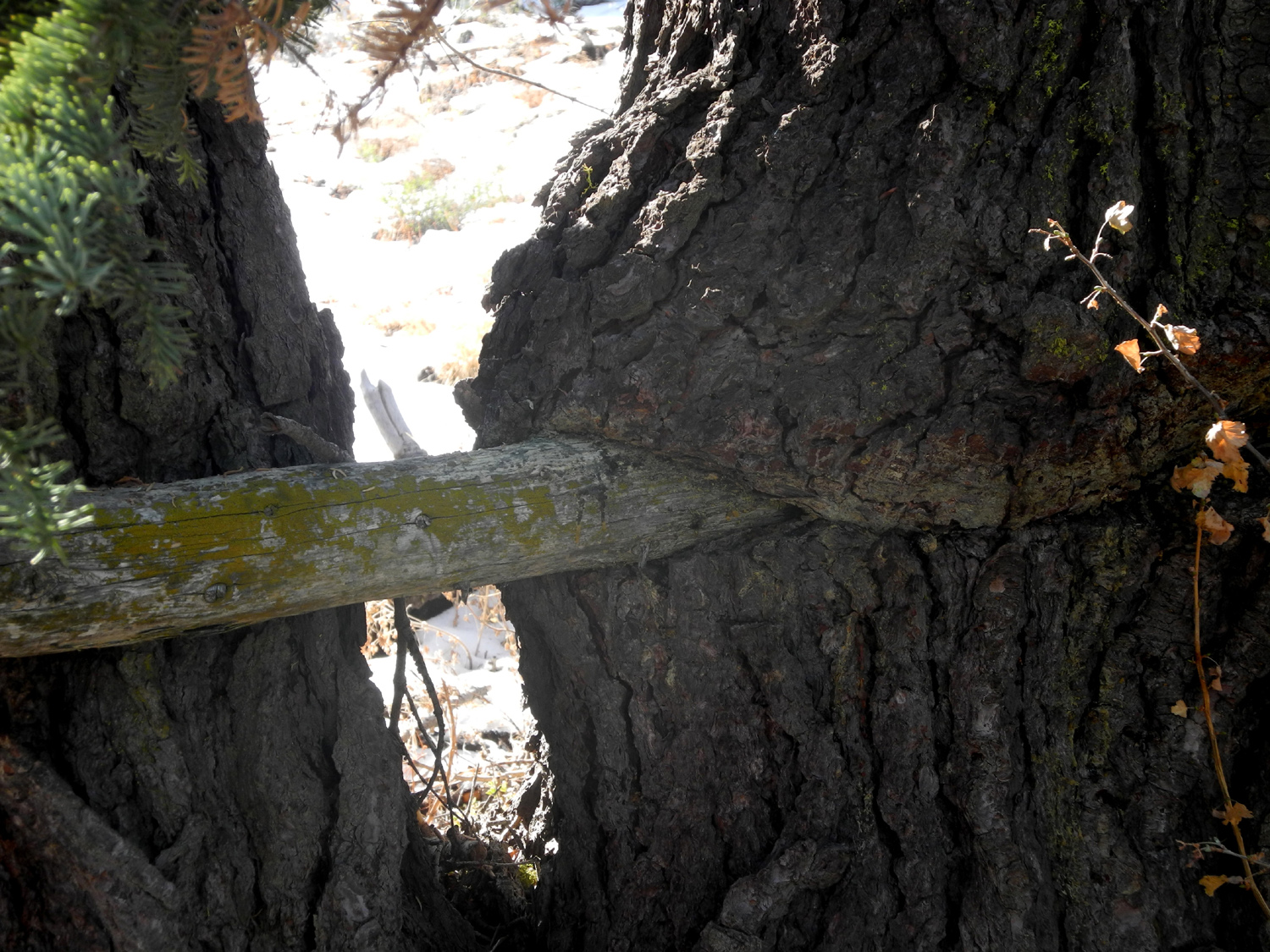
| This tree has adapted to a pole probably nailed to it decades ago |
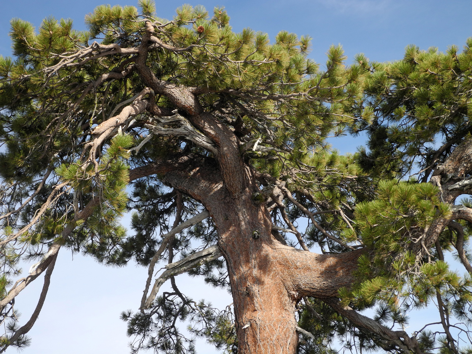
Jeffrey Pine shows clearly which way the wind blows |
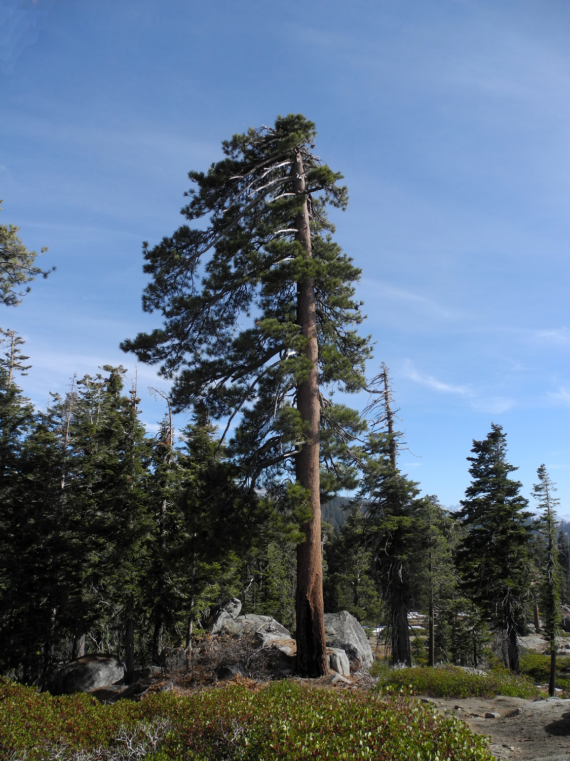
Tree near top of peak survives despite harsh conditions |
 |
 |
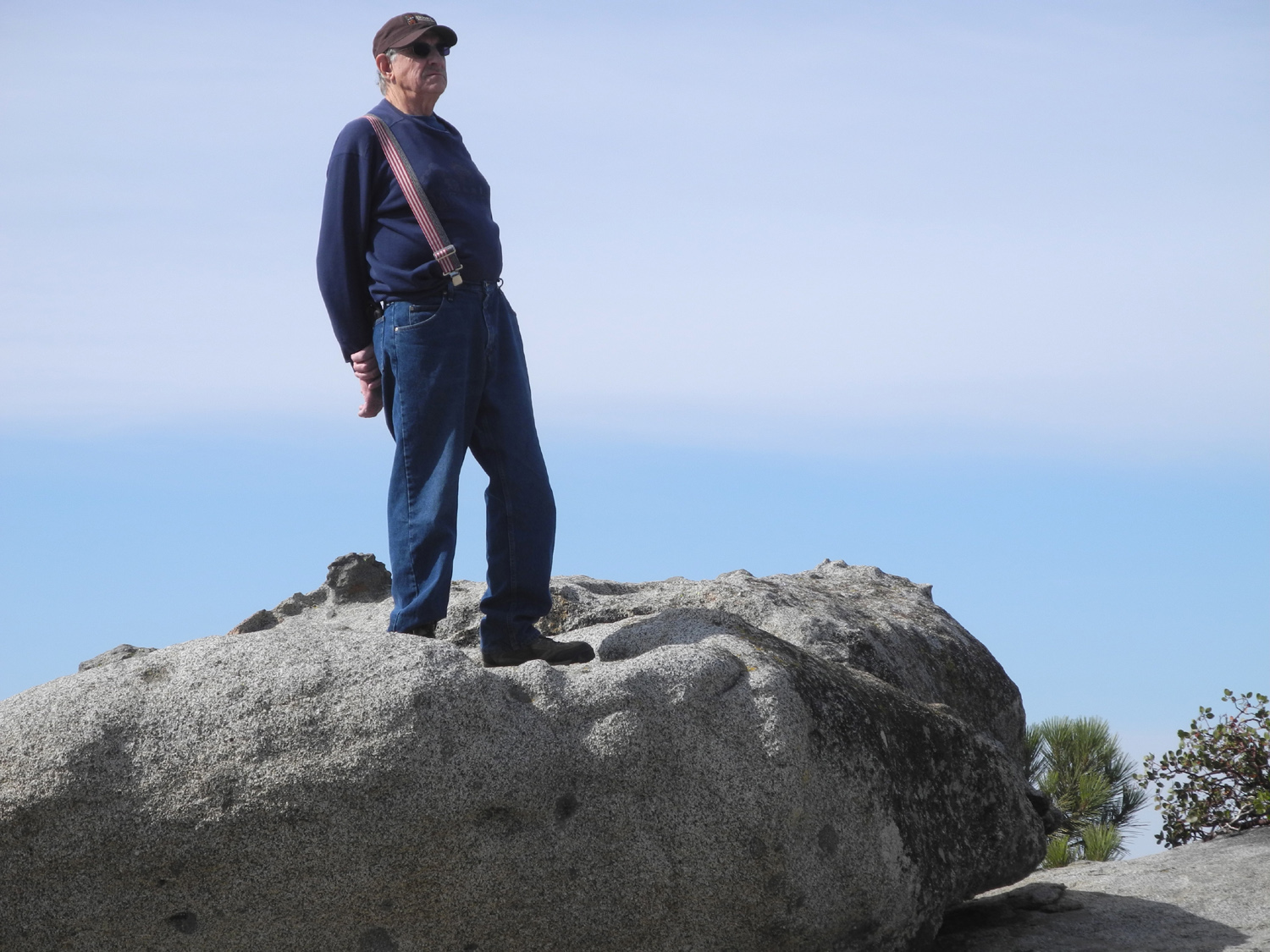 |
| Looking southeast from the top | Carolyn enjoys a well-earned rest | Dick surveys the scene |
 |
||
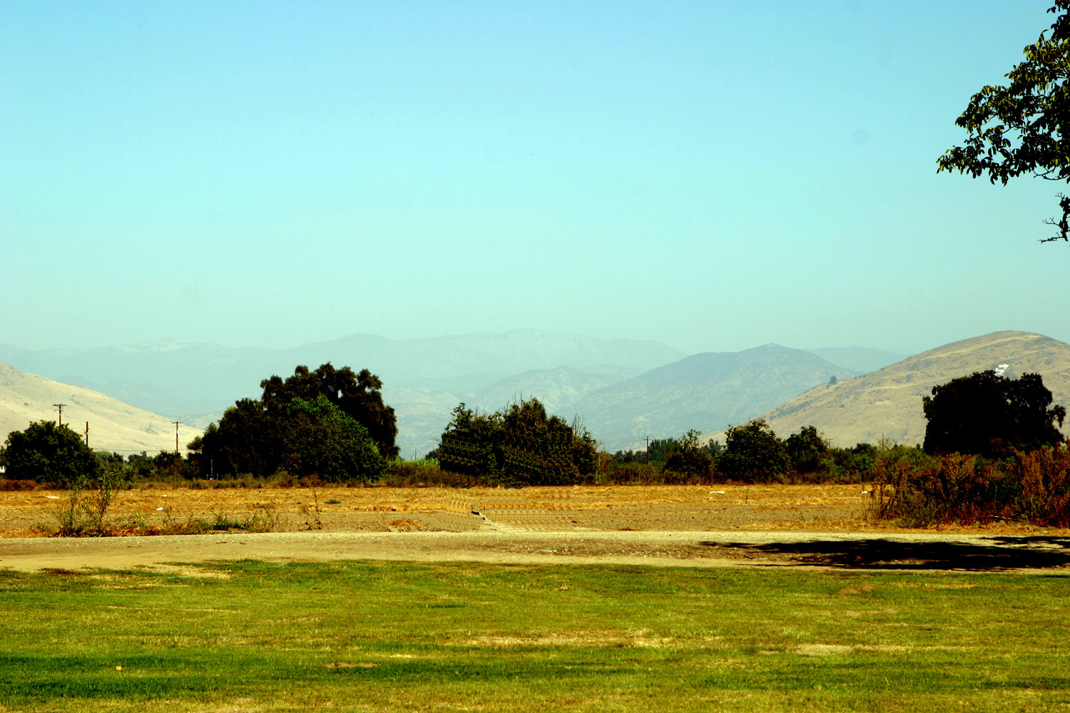
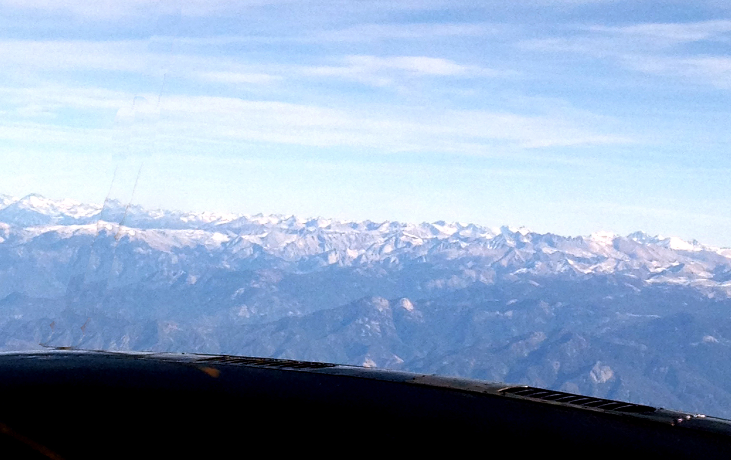
| Kings Canyon and the rugged peaks above it | ||
| Hensley Lake Camp | ||
 |
 |
 |
| Campground entrance | New islands | Almost like a lake |
 |
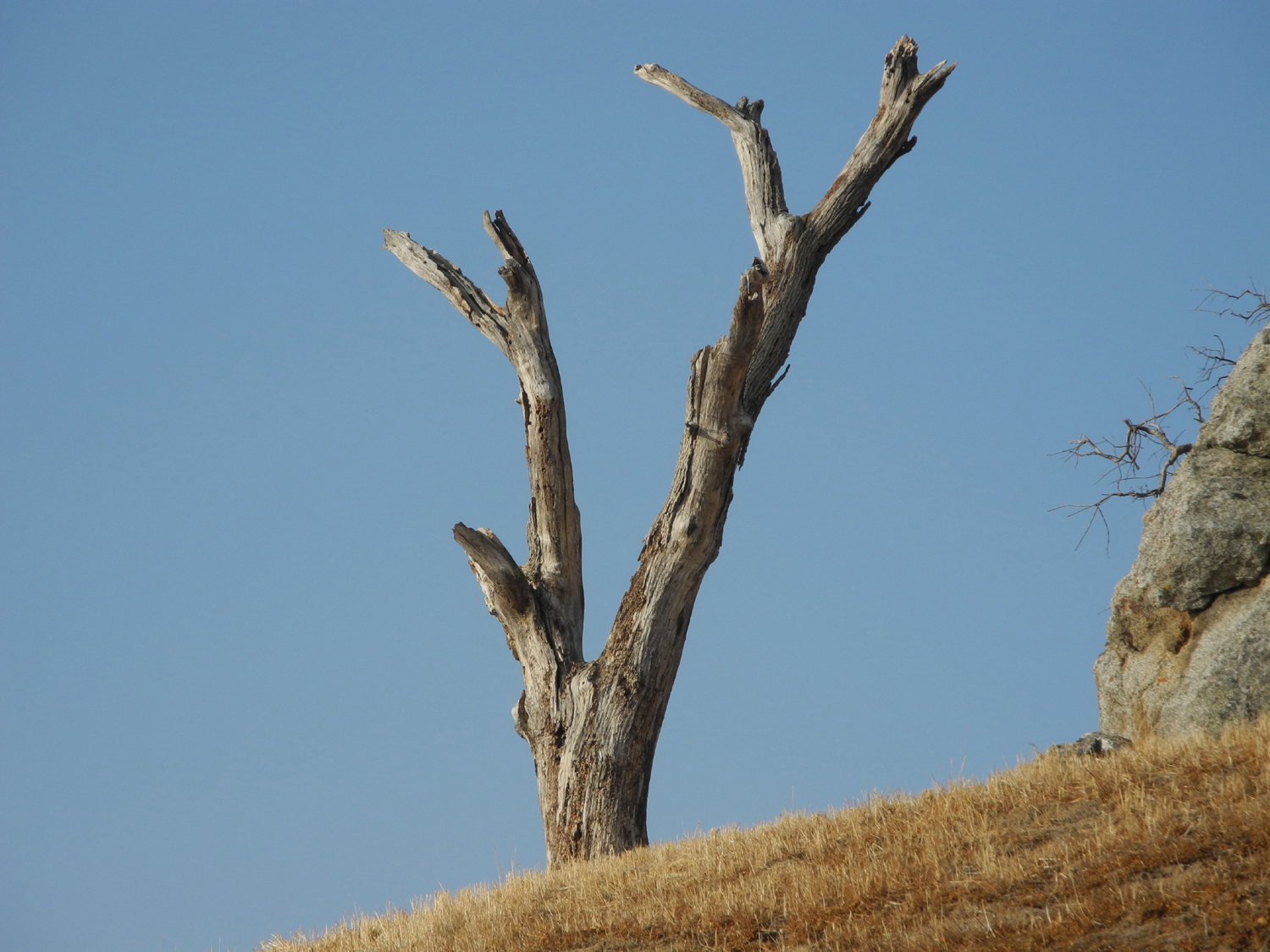 |
|
| Boat ramp to nowhere | Hillside sentinel | Waiting for the next ground squirrel |
 |
 |
 |
| Airborne | Rabbit hiding in the brush | Where he really hides |
 |
 |
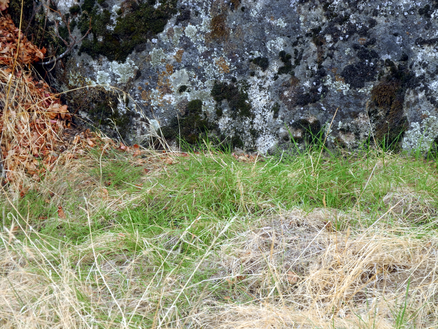 |
| One mile my aching back! | A sheltered growing spot | The biggest spot of green in the whole area |
 |
 |
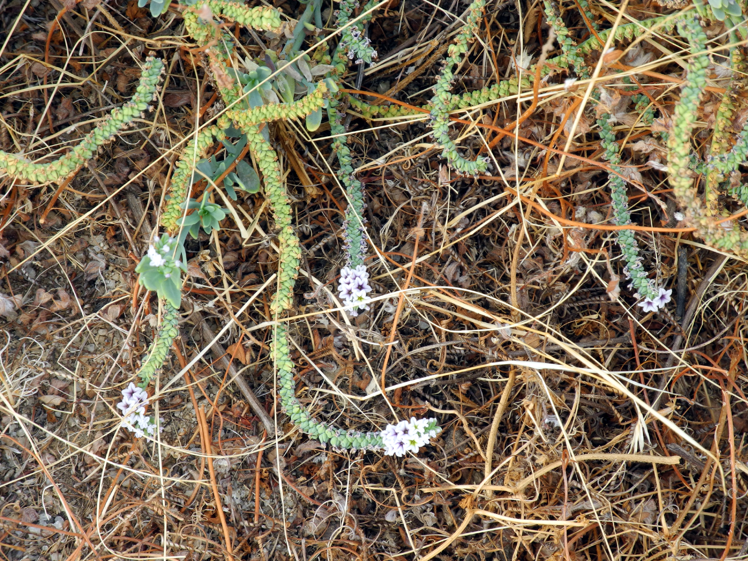 |
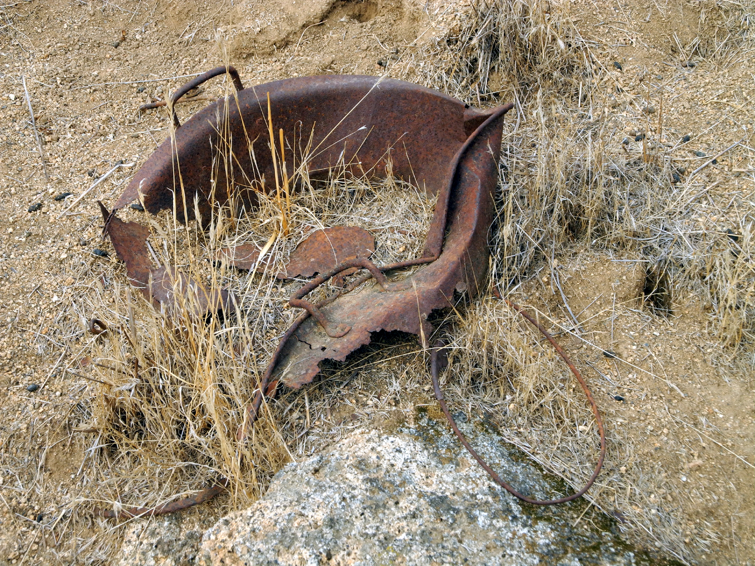
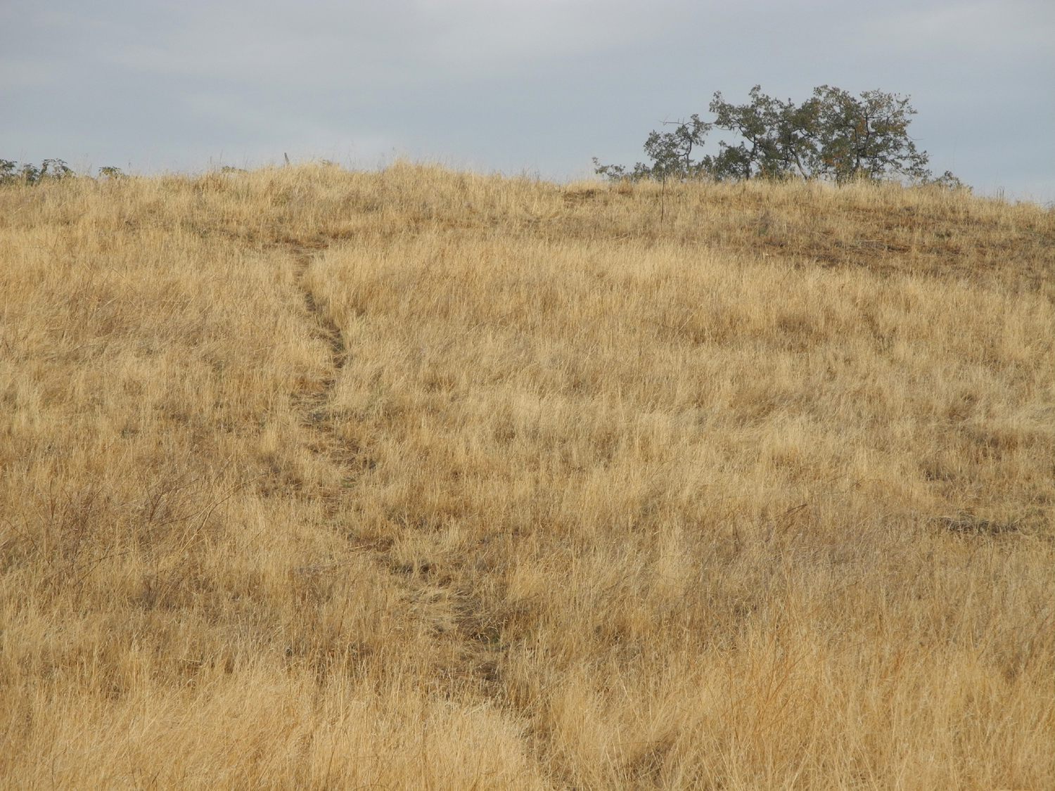
| Abandoned artifact | Game trail | A snaky plant |
| North Fork Area | ||
 |
 |
 |
| View from Mile High Vista | Fuller Buttes and Balloon Dome | The Eagle Beaks |
 |
|
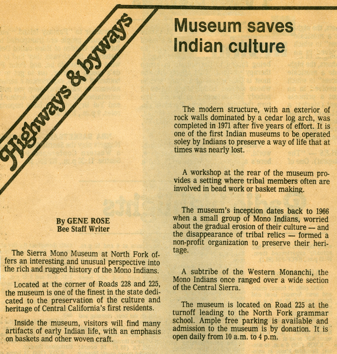 |
| Mammoth Pool Reservoir (Susan Crandall photo) | The museum in the 1970s | Fresno Bee article about the museum from 1978 |
| White Rock Road | ||
|
 |
 |
|
Windmill and shed don't
make |
Another windmill with the barn |
Basalt topped hills
southeast of the road as it heads up from the valley |
|
|
||
|
|
|
|
|
The long, lonesome road |
Valley oak along Mariposa Creek |
Is this the original white rock? |
|
|
||
|
|
|
|
|
Another typical stretch of the road |
Trees and rock formations
make this the most scenic area of the drive |
Nature's landscaping |
|
||
|
|
|
|
|
Old rock walls are common
in |
Looking back where
the road |
A Mariposa County
landmark, Signal Peak |
|
|
||
|
|
|
|
|
The White Rock Cemetery |
Weathered stone marks
site of |
Not a new burial, but a new stone to honor a soldier |
 |
 |
 |
| White Rock Road through southern Mariposa County |
Section showing White
Rock-Old Highway Junction and Hogan Road (now Yaqui Gulch Road) |
Mariposa town map,
Old Highway North in upper right |
| Hockey in
Denver (All photos by Mikie Liddle) |
||
 |
 |
|
| Flying in to Denver over the Rockies | The street in front of our hotel | A fresh bowl of snow |
 |
 |
 |
| The Avs' Stanley Cup Banners | Avalanche warm-up | The sunny, snowy Sierra |
| Related Links | ||
| Bluegrass You Tube Links | ||
| Dim Lights | Valley Oak Band | |
| Bean Creek | Grasskickers | Red Dog Ash |
| Central Valley Boys | Laurie Lewis | Laurie and Tom |
| Bluegrass Band Links | ||
| Bean Creek | Grassfire | Grasskickers |
| Red Dog Ash | Central Valley Boys | Laurie Lewis |
| Other Links | ||
| Kings River | Northern California Bluegrass Society | Bluegrass Info |
| California Bluegrass Association | Central Valley Bluegrass | Dick's Bluegrass T-Shirt Photos |
| Dick's Bluegrass Odyssey | Fresno Folklore Society | International Bluegrass Association |
| Buena Vista Trail | Giant Sequoia National Monument | Generals Highway |
| Big Baldy Trail | Big Baldy Photos | More Buena Vista Photos |
| The Mono People | North Fork Rancheria | Sierra Mono Indian Museum |
| Museum Photos | Town of North Fork | Mammoth Pool Reservoir |
| North Fork | Sierra Vista Scenic Byway | Friant Dam |
| O'Neals | Millerton Lake | Hensley Lake |
| E. Howe's White Rock Photos | Another striking photo by Howe | Le Grand |
| White Rock Silica Mine | Highway 140 | |
| Castillo's | Leroy Radanovich | Cathey's Valley |
| Colorado Avalanche | Stanley Cup | Hard Rock Cafe |
| Denver, Colorado | The Big Blue Bear | Colorado Grill |
 .
.


