| Dick's Backpacking Trips | |||
| Photos Related Links More Travel Reports | |||
|
Half Dome 1 Post Corral Meadow Paradise Valley 1 Logistics Garlic Meadow Creek 1 Squaw Leap 1 Rodgers Ridge Garlic Meadow Creek 2 Cabin Meadow Paradise Valley 2 Half Dome 2 Sheep Crossing 1 Sheep Crossing 2 Devil's Postpile Chilnualna Falls Garlic Meadow from Wishon Cathedral Peak Nelder Grove Garlic Meadow Creek 3 Mill Flat Creek Bear Wallow L/S Expedition More Squaw Leap Hikes (1981 - 1982) Hell-for-Sure Pass Don Cecil Trail/Roaring River/Sphinx Creek Wishon to Cedar Grove Squaw Leap 1982 & 1983 Cora Creek & San Joaquin North Fork Hell Hole & Granite Gorge Squaw Leap 1984 - 1993 Cow Wallow & Nelder Grove Half Dome 3 Johnny's Camp The Last Hike Day Hikes An Invention |
|||
NOTE: I worked on this report on backpacking trips for upwards of five years. Mostly that work consisted of creating a dummy page that said "coming soon." I got a few paragraphs done early in 2011, but during the last week of October of that year I got on a roll, and worked on it steadily until it was done. Creating this report meant digging through a lot of hazy memories, covering events that happened between ten and 32 years ago, so I can't guarantee that everything is 100% accurate, but there are no serious intentional lies. First, a little general information about the areas where I did most of my hiking, so that I won't have to repeat these details every time (pay attention because there WILL be a quiz): I live in the Fresno Metro Area, in the city of Clovis, in the middle of the San Joaquin Valley in central California. East of us are the Sierra Nevada Mountains, and to the west, quite a bit farther but still within an hour's drive, is the Coast Range. There are two major river systems running from the Sierra through Fresno County. The San Joaquin is north of us, and for a good part of its length in the lower elevations, forms the border with Madera County. It flows west out of the mountains, then turns north and runs into the San Joaquin River Delta near Stockton, and eventually into San Francisco Bay. The Kings, to the south, splits into two branches in the valley, with the water all going to irrigation. Both rivers have a North, Middle and South Fork in the mountain area. There is no road access to the North Fork of the San Joaquin or the Middle Fork of the Kings. There are various small dams on both rivers, and two major ones, Friant on the San Joaquin, forming Millerton Lake, with a half million acre feet capacity; and Pine Flat on the Kings, forming the million acre foot Pine Flat Lake. Most of my backpacking trips were in the north and middle forks of the San Joaquin, and all three forks of the Kings. The main road access that I used was as follows: >San Joaquin North Fork: Highway 41 north to the Minarets Highway (North Fork Road), then past the village of North Fork to Granite Creek trailhead. >San Joaquin Middle Fork: Same. >Kings North Fork: Highway 168 east to Shaver Lake; Dinkey Creek Road east to Dinkey Creek; McKinley Grove Road east to Wishon Reservoir or Courtright Reservoir (these two lakes are about the same distance from Dinkey Creek, with Courtright to the north on Helms Creek, and Wishon on the Kings). >Kings River Middle Fork: Same route to Wishon. >Kings River South Fork: Highway 180 east to Grant Grove, down into the river canyon, and up to Cedar Grove and Roads End. Of course there are a few
other routes to hiking trailheads, but these are the ones I used. I
did a lot of hiking in the San Joaquin Gorge (Squaw Leap) BLM area,
which is on the main stem of the San Joaquin below where the two
forks split off. I also did some hiking in Yosemite National Park,
which is in the drainage of the Merced and Tuolumne Rivers. Although I did a lot of hiking and camping throughout my life, it was not until I was nearly 40 years old that I first tried backpacking. A sensible person, especially one who had done little exercise in the previous ten years, would have started with a short, easy hike. Instead, my chosen destination was the top of Half Dome in Yosemite National Park, a hike of over eight miles one way, with an elevation gain of nearly 5,000 feet. It wasn't really my fault. My very good friend, the late Ron Reed, stopped by one day and announced that he and several others were going to hike to Half Dome, spend the night, and return the following day, and I was invited. I protested that I was not really in very good shape, but he was not swayed - "just do some jogging every day for the next two weeks," he said; "you'll be fine." So in July, 1979, less than a month short of my 40th birthday, I joined Ron, his son Scott, and Scott's buddy Larry for the drive to Yosemite. There we met up with our friend Randy Westmoreland, whose father worked for the park concessionaire and who had grown up in Yosemite Valley. He would be our guide and inspiration, and at age 20 or so, would make us realize how physically unprepared we were for the effort. We spent the night at their home, then got up early and started out. Although it is possible to drive to within a mile or less of the trailhead at Happy Isles, we walked from near park headquarters across the valley, adding at least a couple of miles to our journey. The trailhead at Happy Isles is also the start of the famous John Muir Trail, and if you're really ambitious, you can stroll the 212 miles to the top of Mt. Whitney. Our plans were much less ambitious. The hike to Half Dome is fairly strenuous, but does not involve any technical climbing, and is accomplished by thousands of park visitors every year. (In 2010 the route had become so popular that the park service instituted a permit requirement, to limit the impact of too many people on the fragile environment, and the dangers of too many people on the cables.) The first part of the trail is the famous Mist Trail, which parallels the Merced River and passes close to Vernal and Nevada Falls. Tens of thousands hike as far as the top of Vernal, and it's possible that a million or more hike to bridge that crosses the river about a quarter mile below the falls, offering the iconic view of this unique park feature. The Mist Trail is truly misty in August, leading the hiker through droplets of water that splash up from the 320 foot high, 80 foot wide drop of Vernal Falls. It's a cool and refreshing experience. However, in June of a year with heavy precipitation, a walk up the Mist Trail results in a cold soaking. The trail is not so close to Nevada Falls, but still provides excellent views. For those on horseback, or just seeking a trail that is less steep, the Horse Trail leads from the trail head at Happy Isles up through the woods, drops down to the river at the top of Vernal, then zig zags up the canyon on the opposite side of the river from the other trail. The Mist Trail also features a lot of stair steps, which kids enjoy but which are hard on adult legs, especially going down. Above Nevada Falls the trail levels out and goes into Little Yosemite Valley, a relatively flat area that is only a vague approximation of the real thing. One notable feature is Half Dome, seen from the "back side" and appearing as a rounded cliff rising about 2,000 feet above the surrounding area (from the top of the dome to Yosemite Valley is a distance of nearly 5,000 feet). Past Little Yosemite the John Muir Trail continues on along the river, while the Half Dome Trail heads north and up, with many switchbacks, and almost constant elevation gain. (Articles at some of the links in this page make reference to a backpacker's camp in Little Yosemite; this did not exist at the time of my three hikes.) It was here that youth and conditioning beat out age and laziness. Randy and Scott were continually a quarter to a half mile ahead of Ron, Larry and me most of the way. They would stop and rest until we caught up, then head out again, which seemed quite unfair. We also learned about the validity of the Kingston Trio song "Everglades" - "better keep movin' and don't stand still; if the 'skeeters don't get ya, then the gators will." We didn't have to worry about alligators, but if we stopped to rest in the shade, mosquitoes immediately attacked us for a meal. As long as we kept moving, or rested in the sun, they left us alone. Since the trail trends generally north from the Merced River, it is crossing the divide between the Merced River and Tenaya Creek Canyon, and at one point the trail goes very close to the edge of the canyon. This also provides some excellent and "new" views of familiar Yosemite Valley features, such as Mt. Watkins, North Dome, and Basket Dome. If you look at the face of Half Dome more or less straight on, you will notice a smaller dome to the east (left side when viewed from the valley). Arriving at the base of this dome, those of us who were new to the trail thought that some climbing aids would be needed, but the trail zig zags up through loose rock, pines and junipers, and is actually fairly easy going. From the top of the lower dome, it's quick walk down to the saddle, a narrow passage about six feet wide, with a long steep drop on each side, and the famous cables. The cables are anchored to steel posts set into the rock, are just far enough apart to comfortably hold on to each cable There are 2 X 4 boards laid across the pathway above each set of posts to help with footing and provide short rest stops. Although the rock is quite steep at first, it becomes a little more gentle, and rounds off to an easy slope at the top, and is not difficult or scary at any point (I would not take children younger than ten or twelve, however). The climb IS steeper than it looks in most photos of the cables. People have died on this trail, not because it is difficult or scary, but because they attempted the hike in adverse weather conditions. If a thunderstorm is approaching, do you really want to be hanging on to a metal cable on a high exposed rock? Once we reached the top, 8,842 feet above sea level, we set up a makeshift camp and Randy brewed some tea. It was literally the best thing I had ever tasted, just the exact right beverage to restore mind and body after our 8.2 mile, 5,000 foot elevation hike (and following his example, I made tea at rest stops and at the end of the day on virtually all my subsequent backpacking trips). The top of the dome is plenty big enough to walk around, and big enough for quite a few people to camp overnight without being too close to each other - I believe it's about seven acres. Of course, it slopes down in three directions, and goes out to a sheer cliff with about a 2,000 foot drop to the first ledge. With reasonable care, you can safely walk very close to the cliff, and some of us lay down, looking over at the sheer drop below us and the flat valley below. Camping on top is no longer allowed, due to the serious impact from the large number of hikers now making the climb. Since Half Dome is higher than most of the valley rim, there is a view not only down into the valley, but of the domes, forests and higher peaks around in all directions. One of the most striking scenes was of the shadow of Half Dome, a perfect outline cast on the lower cliffs to the east as the sun set. Another aspect of high, open places like this is a fairly strong wind at night. Over the years people had built walls to create a wind break, and we set up our camp on the downwind side of one of these. The next morning we headed back down the long trail. Although gravity works somewhat in your favor on the downhill trip, it is still important not to get in a hurry, since a rapid descent, especially on the steps, can take quite a toll on your legs. Once back in the valley, we headed for home, with Ron and I very aware that we had used muscles that had been idle for a number of years. By the way, a gentleman I
went to school with made his first trip to the top of Half Dome when
he was over 70, along with his sons and grandsons. Post Corral Meadow/Kings River (September 1979) Despite the physical demands of the Half Dome trip, I enjoyed it immensely, and decided I wanted to do some more backpacking. Having learned my lesson, or at least ONE lesson, I started a daily exercise program, which consisted of walking and jogging along the canal bank near my home. Although my commitment sometimes wavered over the years, I soon worked my way up to a one and a half mile run every morning, preceded by a few stretching exercises. A little less than two months after my first hike, I headed out for a slightly longer, but somewhat less demanding hike on a trail that starts at Courtright Reservoir, east of Dinkey Creek and Shaver Lake in Fresno County. It's around 70 miles from Fresno, starting out on Highway 168. The Maxson Trailhead there, at 8,000 feet, is the jumping off point for an extensive system of four wheel drive and foot trails, and the first four miles or so is really a jeep road. This section of the trail passes through a small glaciated valley reminiscent of a mini Yosemite, and goes by a large, sloping granite base marked with glacial polish, and covered with large and small boulders left behind when the last ice age ended. My first destination was Post Corral Meadow, about 7.5 miles in. From the boulder field the trail climbs up and over a fairly steep ridge, then up and down through forested terrain. The meadow itself was occupied by cows, and if you camp there, try to get upwind from the cattle. I set up my first night's camp away from the meadow a ways and enjoyed a well-earned rest. I also contemplated another lesson learned - I brought too much stuff. Although I had been camping many times, most of the time I was around 4,000 to 6,000 feet in elevation. I remembered a time when I camped just below the 9,000 foot level, and it was cool enough that I had to sit in the sun to read. Much of this trip would be around 8,000 feet, so I brought two or three sweat shirts, along with other warm clothing. However, the thin atmosphere at higher elevations lets plenty of warm sunshine through. Hiking in the daytime, I was comfortable in shorts and t-shirt. It cools off a lot at night of course, but by the time it got dark, I was ready for bed, and I found I didn't need much more than shorts and t-shirt in my sleeping bag. So I knew I could lighten my load in the future, always a good thing when you are carrying everything on your back. The next day I headed
down the trail, which followed a small creek in a fairly deep,
narrow channel. I was heading downhill, towards the North Fork of
the Kings River, probably a good thousand feet lower than my
starting point the previous day. Where the trail met the river,
there were a number of fire rings, indicating fairly heavy use
(heavy for the backcountry). I found a place to cross (this was in
September, when the rivers are very low), and set up camp a hundred
yards or so from the stream. Writing this 32 years later, the
details are hazy, but I believe I made the return trip back to the
trailhead in one day. This would have been about 11 miles, a lot for
me even in those younger days, but I have no memory of camping
anywhere else, so I'm going to let that stand as the official
record. Paradise Valley 1 (October 1979) Approximately a month later I made the first of two trips to Paradise Valley, which is about six miles up the South Fork of the Kings River from Roads End. This is a few miles up from Cedar Grove, and the stretch in between is a glacier-carved valley, a little smaller than Yosemite, with no major waterfalls, and not as many high, sheer cliffs. This entire hike was within Kings Canyon National Park. I think it was this trip that I started the practice of "night before camping" - meaning I drove to or near the trailhead the evening before my hike, and slept in the camper (I had a 1977 Datsun with a camper shell). It was dark by the time I got close to my destination, and between the park entrance and where I spent the night I had the experience of seeing owls swoop down across the road in front of me. I stopped somewhere on a dirt road that led off the highway near where it drops down to join the river, descending from about 6,000 feet at Cherry Gap, to a little over 2,000 feet at the river. The next morning I drove on to Roads End and set off on my hike. The trail follows the river generally east for about two miles. At this point a large tributary, Bubbs Creek, joins the river from the east, while the Kings turns north. Another two miles up this trail is Mist Falls, which drops about 50 feet in a series of cascades. The trail to Paradise Valley follows a common sequence in the Sierra - a stretch of relatively flat walking (along the Kings to Bubbs Creek), a climb of varying steepness (about four miles up past Mist Falls), then another fairly flat valley - usually carved by glaciers, always with a waterway of some type running through it, and higher cliffs on the sides. At this second flat area, Paradise Valley, I walked a mile or so, then set up camp where there was a bear cable. No, you do not use it to tie up your bear. This one is on a pulley and can be lowered so that you can tie your food bag to it, then raise it up to prevent theft by bears (they call it "free market.") I wandered around the valley during the rest of the day, climbing up a dry wash on one side a pretty good distance. At one point, I heard what sounded like rocks crashing down from a cliff, but didn't see anything, not even a dust cloud that would normally accompany an event of this type, so it was probably some distance away, and out of sight around a bend in the valley. Early in the morning I got up and needed something from my food bag. I left the bag tied to the cable, but didn't raise it back up, since I would be getting up for the day soon. Here was another lesson - bears are not the only animals that like human food. A small rodent or similar creature snuck up, chewed a hole in the bag, and helped himself to some granola. With the conclusion of
this third hike I had experienced a wide variety of different
terrain and hiking conditions, and realized that I could be a
backpacker any time I wanted. Logistics may not be exactly the right word, but I want to pause here and talk about planning, preparation, food, water, sleeping, and other aspects of every day living that must go on, whether you are at home or sitting on top of a 10,000 foot ridge. Equipment: As far as I can recall, I did not acquire any new equipment for my first hike. I wore some old "waffle stomper" boots that I'd owned for years, and got by with what was actually a day pack, and whatever sleeping bag I had at time time. By the time of my second or third hike, I had invested in some good hiking boots, a lightweight, extra warm sleeping bag (good down to 25 degrees or so), and a nice backpack. Over the years I had two different camp stoves, one that used small propane canisters, and one that burned white gas (like a typical Coleman stove). I used a small pot that I got at a yard sale, and a frying pan with a folding handle (read how it sometimes folds itself here). I had a knife, folk and spoon set that fitted together, made specifically for backpacking. I took basic first aid supplies, plastic bottles for water, etc. Getting There: While maybe not half the fun, getting to the trailhead was often a nice experience in itself. For example, the road in to Courtright Reservoir is 30 miles of pine and fir forest, with some nice views of high peaks, particularly the LeConte Divide, and dramatic canyons and domes near the lake. Food and water: Water is heavy - a pound per pint. This means you can't carry enough for an overnight trip unless you are a mule or you carry nothing else. Since any stream in the world is subject to pollution, boiling or purification is a must. I did use the boiling method once or twice, but it's a pain in the butt to spend time boiling, then it has to cool, and of course, it uses up stove fuel. The common solution when I first started backpacking was iodine water purification tablets. These work fine, but impart a slightly brownish color and slight taste to the water. Later a two-tablet package became available - the first to purify, and the second to remove the color and taste. These days, most backpackers use a lightweight pump filtration device. On our Half Dome hike, Randy brought steaks, his philosophy being that it was OK to sleep in primitive conditions, but there was no reason why you couldn't eat well. And for a one night trip, it's not that big a deal to carry the extra weight. Meat well wrapped, then wrapped up in your extra t-shirts, is insulated from spoiling in the course of a day. When I started traveling on my own, I bought some freeze-dried food, but this proved to be unsatisfactory - not very appetizing, and another one of those pains in the butt to prepare. Eventually I depended on simple things like cheese and peanuts. I also would bring a couple of hot dogs for the first night, along with a small plastic container of mustard, ketchup and chopped onions mixed together. The dogs could be easily cooked on a campfire, reducing stove fuel usage (however, I never begrudged the resources necessary to fix hot tea). Other foods included apples, oranges, candy bars, and granola. More often than not, I fixed instant oatmeal for breakfast, although bacon and eggs were on the menu once in a while. On my final trip, my grandson and I had pork chops. Sleeping: I've been used to a comfy, queen size bed for many years. On the trail, my first thought was an air mattress. However, the products available in those days were not very comfortable, and if a leak develops, you're a long way from a replacement. I eventually settled on a thick section of foam, about three by six feet and four inches thick when it was new. I always carried vinyl tarps, and put one under the mattress. My sleeping bag took good care of me even on nights when I would wake up to find a light layer of frost on the outside of the bag. Although summer rain is common in the Sierra, I was lucky and got rained on only once, which was good because I did not want to carry the extra weight of a tent. That one time I was camping in the foothills with a friend and we did have a tent, which protected us from a very light sprinkle during the night. Unfortunately, it did us no good when a steady rain started as we were hiking out and still two miles from the trailhead. Photos: I am slightly somewhat semi-well-known for taking lots of pictures on the trips I report about. This was not always the case. I did not take a camera on my first few trips, but it soon became an essential piece of equipment. I also carried a tripod a few times, so I could get shots of myself with fantastic scenery in the background. Throughout my backpacking career these were slides, and I've been scanning them into the computer sporadically over the past few years. Some of the photos on this web page were not taken on hikes, but they represent the area well. For later hikes, most of them are from the actual trip. Miscellaneous: Weight is always a consideration when everything goes on your back. There are a lot of specialty lightweight items designed for backpacking, but unless you are doing really long trips, the difference between these expensive goodies and the common everyday stuff that's lying around the house is negligible. Stove fuel was a fairly heavy item - the propane canisters I used were metal, about five inches long and three inches in diameter. Liquid fuel is similar in weight to water. However, backpacking stoves are efficient, and I never carried more than two pints of liquid fuel, or two or three canisters. The "official" guideline is that a healthy person can carry up to a third of their weight. I never got close to that amount, and my pack always seemed heavy. When we weighed them a time or two, we never went much over 30 pounds. A well constructed backpack puts the bulk of the weight on your hips, making it much easier to carry. I have known, and met on
the trail, people who think you need to walk as fast as possible, so
you can "get there." My philosophy is that once you step
onto the trail, you are "there," and the rest of it is
just walking around, enjoying your surroundings. From my first solo
hike I developed what I call "the indolent saunter." To
observe what this is like, watch the next time a group of teenagers
crosses in front of your car at a pedestrian crosswalk. I found I
could keep up this slow but steady pace for an hour with only a
couple of short stops, then after an hour I would take off the pack
and sit down for a rest of anywhere from two to fifteen minutes.
Occasionally I made tea at these stops, which probably extended them
to 20 or 30 minutes. Garlic Meadow Creek 1 (December 1979) This was my first winter backpacking trip, although in California we have the luxury of mild weather in winter, and some situations where it's downright warm. We have a lot of winter fog in the San Joaquin Valley, where I live, but the nearby Sierra foothills are often warm and clear, and very pleasant on sunny winter days. It was such a time when decided to hike to Garlic Meadow Creek, a spot at about 2,000 feet in elevation, above the Kings River. Not only was this my first winter hike, it was the first hike where I was not familiar with even the road in to the trailhead. For a few years I'd been enjoying winter camping at low elevations during sunny periods, so I had been studying my maps for suitable hiking locations. This hike starts with a drive up Trimmer Springs Road from the valley floor to Pine Flat Reservoir, around the lake, up the paved road to where it crosses the river, then eight miles up a dirt road on the north side of the river to Garnet Dike, where the road ends.. From here, a trail goes along the river, eventually zig zagging up the side of the canyon to where a creek runs down from the 10,000 foot ridge above, through a small, open canyon, and over the cliff to the river. The date was December 15, 1979, and the weather was cool enough to be wearing a flannel shirt over my t-shirt when I started out. The first two miles of the trail are fairly level, staying close to the river, with slight ups and downs. Along this stretch I saw a deer, and thought to myself that this country was much like it was when her ancestors were the only living creatures around. A fair size creek comes in from the north at the two mile mark, and the river canyon narrows. This forces the trail to go up and away from the river, and the exertion soon had me removing the top layer. Along the way I was looking down into a stretch of the river canyon that was so narrow that the sun, crossing low in the southern sky at this season, did not shine on the bottom, and the rocks along the river were white with frost, while I was wet with sweat. At one place I came across the remnants of a building, likely the cabin of a miner or possibly someone who ran cattle in the area. The trail had been coming up by way of a series of switchbacks, but just past the old cabin, the trail seemed to disappear. I followed a washed out runoff channel pretty much straight up the hill, and again came to a "normal" trail. It soon reached the top of a ridge, and from here I had about two and a half miles of up and down hiking. By this time I was fairly tired, and hoped each downhill stretch would lead to the creek that was my destination. On top of one ridge I made my way out to the edge where I could look down into the river. I also noticed that I was so far east into the mountains, that I could see redwood trees on the high ridges on the other side - probably part of the Grant Grove area of Kings Canyon National Park. Late in the afternoon a final downhill stretch brought me to Garlic Meadow Creek, which runs down from above through a small, steep canyon. There was a fairly level stretch where people had camped before, and here I set up my camp. This involves laying out the tarp and unrolling my foam pad and sleeping bag, getting out cooking gear and other items, and usually gathering firewood. Wherever I stayed, I ended up with things scattered around on a second tarp or placed on rocks, and I would often look at it and wonder how I had managed to carry all that, and how I was going to get it all back into a compact bundle that I could carry with me. A big part of camping for me has always been the opportunity to sit around reading while I enjoy the peaceful beauty around me, so I always included a book or two in my load. Except for one trip, which I'll get to later, I have no memory of what I read on any of my journeys. The trail continues past the creek, so I explored a short distance, as well as going up and down the creek as far as I could. With steep rocky cliffs upstream, and a sharp drop off to the river downstream, I was confined to a relatively small area, but it was quite striking. To the east, across from where I was camped, there was a cliff with yuccas growing at the top, as well as the usual Sierra foothill trees and plants. One tree I was happy to find was manzanita. This common foothill tree almost always has dead, dry branches than can be broken off; it is very hard and hot-burning, and my first choice for campfire wood if available. As it got dark, I spread my foam pad across a spot in the rocks where I could lean back comfortably and look at the stars. This is when I was fully rewarded for my efforts. Unknown to me, December 15 is the date of the annual Geminids meteor shower, so I enjoyed a very unexpected free light show. Later I learned that this meteor shower is usually one of the best of the year, especially if it's a moonless night. I don't recall if there was a moon early in the night, but I'm pretty sure it came up during the night. At one point something caused me to wake up, and I saw two skunks right next to my sleeping bag. I did not panic, but without thinking I quietly said "skunk." I guess they thought I was trying to insult them, because they turned and wandered off into the bushes, and never made another appearance. These were not the skunks I had seen in the foothills all my life, with a head that is mostly black and a single stripe down to the nose; these guys had two narrow stripes all the way down their face, and seemed, with the brief look I had, to be somewhat smaller and with sleeker fur. The next morning I
started down the trail, determined to return to this beautiful spot
again. I had been making short day hikes in the Squaw Leap Bureau of Land Management area for a year or two, so I decided it was time for an overnight trip. At 800 to 1500 feet along the San Joaquin River, the weather on March 1 and 2, 1980, should have been perfect. I know "squaw" is a word that is now considered inappropriate, but that was the name of the place when I first went there. It is now called the San Joaquin River Gorge, but I don't know what they are going to do (if anything), about the table top mountain also called Squaw Leap that overlooks it, and gave us the legend. Briefly summarized, an Indian woman was distraught over the death of her mate, and leapt into the river below, where she turned into a fish. Researching this, I found several stories related to the area, but they seem to be even more fanciful than the story I described, as well as having been written by non-Indians. The trailhead is off Smalley Road, about eight miles from the town of Auberry. This town is at around 2,000 feet elevation, and the river is about 800, so the road drops down in a series of switchbacks. From the trailhead to the river is about a mile. I first heard of the place around 1980 when a footbridge over the river was completed, just below a Pacific Gas & Electric Co. (PG&E) power house. On my first backpack trip there I was accompanied by 16-year old Tim Liddle, who was my younger daughter's boyfriend, and is now my older daughter's husband (they all had different boyfriends/girlfriends and even another husband in between, so everyone is happy with the present arrangement). We drove to the trailhead the night before and slept in the pickup camper. In the morning I was not happy to see it had clouded up overnight, but we hoped it would burn off and not cause us any problems. For this relatively short hike we took Coke in bottles (!) and ice cubes, along with the more normal backpacking stuff, including a tent. A few hundred yards past the bridge, the trail forks, with the Ridge Trail to the right and the River Trail to the left. We knew we didn't want to go downstream along the river to Millerton Lake, so we took the Ridge Trail, which made it quite a bit longer hike than necessary, since the trail loops around and joins the other section. We went uphill quite a ways, then along the side of a ridge, finally locating a likely camping spot a little below where the trail starts back down. After setting up camp, we did quite a bit of walking around, going out along a fairly level cow trail below Kennedy Table, the biggest table top mountain in the area. It was during this time that we heard the whooshing sound of something going very fast through the air, and saw a hawk diving from a high spot nearly to the ground, seeking dinner. In reaching our spot, we had actually left the trail and were following an old road, but didn't know it. We walked up the road to where it went outside the BLM area and over a ridge, were we saw a blue heron take off from a small pond. We had a few raindrops in the afternoon, but nothing to worry about. However, the next day there was a little rain off and on as we packed up and started back, taking the shorter route down to the River Trail. About halfway down to the river, the rain picked up, and started raining harder and harder. By the time we reached the bridge, we were too wet to worry about finding shelter, so we slogged on up the hill to the parking lot, arriving wet on the outside and damp from sweat under our clothes. Despite
our bad weather experience, we enjoyed all the rest of our trip, and
would make a number of day and backpack hikes to the area over the
next few years. This was the only backpack trip I took with my sister, Linda, who lives in Duluth MN. With lots of great hiking and camping country around there, she had done some backpacking and even a wilderness canoe trip. Part of the time the canoe carries you, and part of the time you carry it - plus all your other stuff. She came out to California for a visit in March of 1980, and our initial plan was to start where Mill Flat Creek runs into the Kings River on the south side, cross Mill Flat Creek, and hike a trail that goes up the canyon several miles. This location is about three miles up a dirt road from where the paved road crosses the Kings above Pine Flat. Right now I am very confused about the order of events. I thought I made this same hike with Tim BEFORE Linda and I tried it, but my notes say otherwise. These hikes are both in 1980, and my initial notes must have been handwritten, since I didn't have a computer until 1987. The originals are long gone. Anyway, attempting to wade this large creek in the spring proved to be a challenge we could not overcome, and in retrospect, the attempt was foolish and dangerous. We decided to drive back to the paved road, and up toward Balch Camp, to take a trail that goes up Rodgers Ridge, the divide between the main river and the North Fork. We were able to find what appeared to be the start of the trail, but after a half mile or so, there were so many cow trails that it was impossible to know if we were on the "real" one or not. We hiked up and down a while, and found a nice spot along a creek. We explored the area, ate dinner, spent the night in the tent, and returned the next morning. The
two things that stand out most about this hike are doves and cow
manure. This is National Forest land, where cattle grazing has been
allowed for many decades, and we were constantly dodging
"pies," not always successfully. Most of this country is
open oak woodland, with mostly blue oaks. Each time we approached a
good sized tree, a flock of doves would fly out, and head for the
next tree, only to have to fly again and again and again as we progressed.
It's not surprising that this is prime dove hunting country in the
season. Garlic Meadow Creek 2 (probably April 1980) Since I've described this are in detail above, I'll discuss only things that were different this time. It seemed obvious that the creek had to drop over a cliff to the river. In fact, at some point in time I found a place on Highway 180 between the Grant Grove and Cedar Grove sections of Kings Canyon National Park where I was able to see the falls where it drops down to the river. I'm not sure if that was before or after this hike, but I decided I needed to spend two nights, so I would have a whole day for exploration, without having to also hike in or out with my pack the same day I explored. Other
than the fairly level area where I camped, this country is quite
steep, but I found I could follow the trail past the creek, then
make my way down to the slope where I could get a glimpse of part of
the falls. I have a memory of traveling over terrain that might
challenge a mountain goat, but it was probably not that difficult.
There's a photo
on line that someone took from the river a ways above the falls,
and it is a much better view than what I got as a reward for my
12-mile round trip. This was a hike that backpacking purists would sneer at, but we DID backpack, and we enjoyed it. There is a road that goes from the Sky Ranch Road to the Sugar Pine Road, which leads in to Nelder Grove. Where this road crosses California Creek, a dirt road goes in a short distance to a small meadow. The end of this road, long since barricaded by the Forest Service, was our trailhead, from which Tim and I hiked in less than half a mile to another meadow that had the remains of a falling-down cabin at one end. We named the place Cabin Meadow; later I learned that the official name is Nichols Meadow. We called this the Cabin Meadow Candy Ass Backpack Trip, and made plans to repeat it annually, which we did at least once. Like most such areas, there were cows grazing in the meadow, and as we sat around watching them, we noticed that they worked their way slowly from one end of the meadow to the other, then back, over the course of an hour or so. We described this as "cow soccer," because it was just about as slow and boring as the real thing. We did have a bit of an adventure when Tim stepped into an area of almost but not quite quicksand, and had to work a little to pull his foot out. Many Sierra meadows are composed of sandy soil carried downstream over the centuries, and there had apparently been some heavy rains earlier in the spring. This particular section of the meadow was saturated, and was essentially a thick, gooey soup of sand and water. We also studied how the main creek and other channels cut through the meadow, often creating a small, narrow gorge, ranging from a foot to four feet deep. One time when Tim and I were at the first meadow, there were hundreds of ladybugs flying around. One flew into his ear, causing some consternation, but it quickly came back out. I don't recall whether this was during one of our backpack trips, or just during a day hike. I know we made at
least one other pack trip into this area, and walked in and out as a
short day hike several times, but I can't recall any details, so
I'll just say that we made the hike out without getting hot, tired
or sweaty, and let this be the only entry on this area. I camped
near this area in 2014 and hiked in to both meadows, only to observe
many changes. This hike, also with Tim, was far more ambitious than any of my previous hikes except Half Dome and Post Corral Meadow. I've described the area in general previously, so again I'll concentrate on what was new and different. Although Tim was a strong, young teenager, I think he suffered more on this hike than I did, because I picked him up after his all-night shift at a mini-mart, drove to Kings Canyon, and prodded him up six miles of trail under some challenging conditions. Our trip took place at the height of spring runoff in a wet year, so the Kings River and its tributary creeks were running high. This presented no problem along the level two miles to Bubbs Creek, but when we started up hill we soon came to places where the river was up over the trail, and we had to find our way around these spots through the trees and rocks. Many of the tributary creeks were too large to cross easily, and more than once we had to go upstream away from the trail until we found a log across the creek, or some other aid to crossing. I'm not sure if we spent the first night in Paradise Valley, or continued on up the trail. Either the first or second day, we followed the river to where the trail crosses it, heading east. There was no bridge, but there was a fairly large log across the river. The secret to crossing a raging river on a log is to walk carefully but steadily, look where you are stepping, not at the river, and cross your fingers and hold your breath. We met a group coming down that included a young girl wearing thongs - that's NOT one of the secrets to safe crossing. We took the water temperature, and it was 41 degrees. If you fell in, even a strong swimmer would be chilled and swept downstream before he could swim to safety. Would I cross that log today? Not in a million years! On the east side of the Kings River, we followed Wood Creek for a number of miles. Again I can't recall if we stayed two nights or three, but we were trying to get to the point where our trail joined the John Muir Trail. Eventually this proved to be too far for the time we had available, but we did meet a young man who was hiking either the entire Pacific Crest Trail (Mexico to Canada), or at least the complete JMT. Most people who do hikes of this length (the JMT is 212 miles from Yosemite to Mt. Whitney), take side trails out to where they meet friends bringing them additional supplies, and taking away items they no longer need. This gentleman had started out when the high passes were icy and his equipment included an ice axe, but he had since sent that home. We
retraced our steps back to Roads End, dealing again with the same
creek crossing issues as our uphill route. At one place we crossed a
fairly large tributary on a makeshift log bridge that people had
made. While the water was spectacular, I would suggest that most
people would enjoy the hike more a little later in the season, when
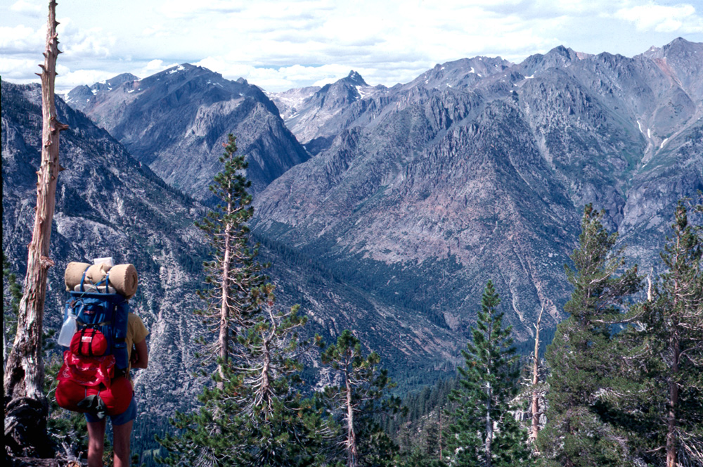
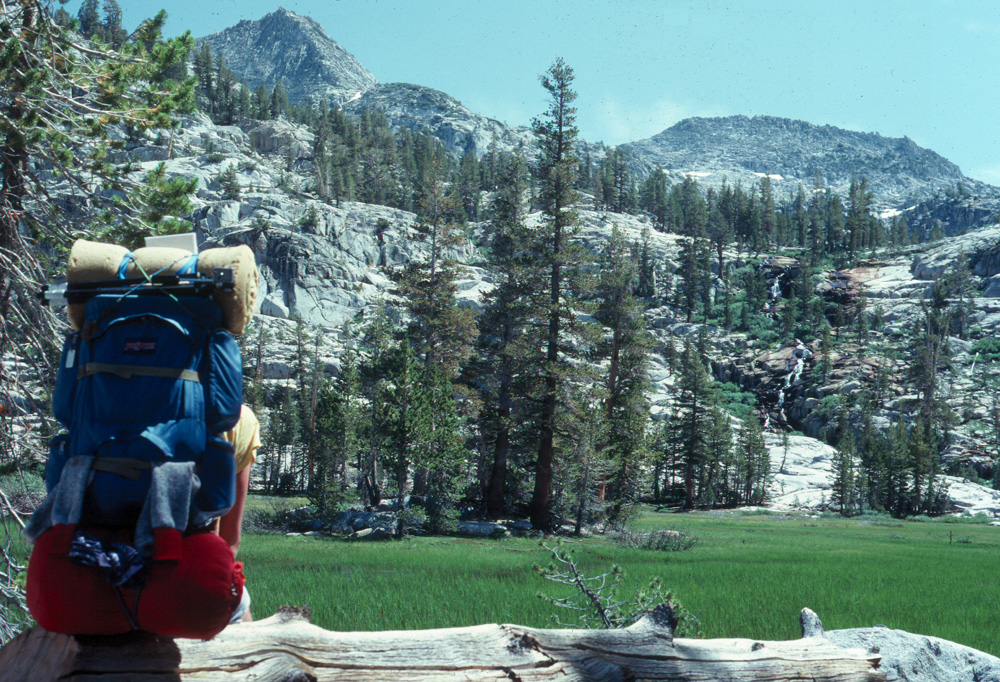
there would not be so many detours around flooded spots. This was by far the most adventurous of all my backpacking trips. The parties were my older daughter Teri, Tim, his friend Lyle Scott (known as Scott) and myself. I was the only one who had previously gone to the top of Half Dome, but the others were 16 and 17 years old, young, strong, and in good health, so we didn't anticipate any problems. This time we spent our first night in Little Yosemite Valley. There is an official backpacker's camp there now, with permits required, that did not exist in 1980, although many people camped there before heading up to Half Dome or up the John Muir Trail. Near the end of the forested part of the route, before you get close to the edge of Tenaya Canyon, there is a fairly level area that has been used by campers over the years. Nearby is an excellent spring where hikers can re-fill their water containers. We stopped here to get water, then continued up the trail. Shortly before we reached the bottom of the cables, we met people coming down, who told us a thunderstorm was coming, and we should get down off the rock. We headed back down the lower dome, arriving at the camp area just as the rain hit us. While we were still on the open rock, we saw lightning hit an evergreen tree far across the canyon from us. We saw the entire trunk glow brightly for a moment, then crash to the ground. This gave us extra incentive to get out of the open area. We set up a makeshift shelter using tarps, since we had not brought a tent. The storm was over fairly quickly, and we were treated to a spectacular sunset adding color to the lingering clouds, and a great view of Mt. Clark and Mt. Starr-King. Aware that we were in prime bear country, after supper we set out to hang up our food. The official process is as follows: Locate a tree with a live branch that extends at least ten feet from the tree. Tie one end of your rope around a rock and throw it over the branch. Tie half your food and other attractive items (bears like he scent of most toiletries) to one end of the rope. Pull this up near the branch, then tie the other half so that when hanging from the branch, each bundle will be 12 to 15 feet above the ground. With a long stick, push the second bundle up till they are both well above ground. The analytical mind will immediately detect several flaws in this process. The most difficult task is finding a rock that you can tie a rope around; and finding an appropriate tree is next. In most cases, a reasonable compromise is achieved, so that your efforts along with a great deal of optimistic hope protect your food to the extent possible (in recent years, bear-proof metal containers have been placed in many frequently used areas of the national parks and forests. Light-weight bear-proof canisters are also now available, and mandatory in some areas). In our case, suitable materials proved elusive, so Tim hung his pack right against the trunk of a tree. The problem with this is that cubs can climb trees, and are very obedient. When mama bear says, "Climb up and get me that pack, Junior," they are quick to obey. A dead branch on a tree can be broken by these strong animals. And the original method of putting everything in one bundle and tying off the end at ground level just gave bears the chance to show how quickly they can chew through a rope. Perhaps the least successful method of protecting food from bears is to keep it close by your sleeping area, assuming the bear won't come that close to a human being. This was the method chosen by our neighbor Bob, who was on his first ever backpack trip, with rented equipment. Bears that frequent well-used camp areas have no fear of humans, and the wise human will not challenge a bear who tries to steal his food. So all this leads up to our nighttime adventures, or perhaps it would be more accurate to say the time when all hell broke loose. Around 1 a.m. we were awakened by Bob's cry of "F*&%$n bear's got my backpack!" We quickly got out of our sleeping bags. The details are hazy, but during the next hour, we were up and down two or three times. A very large bear came out of the woods, but didn't really get too close to us. Teri grabbed a big stick and prepared to do battle. Bob rescued his backpack from where the bear left it a couple hundred yards down the hill. One pocket was torn loose, and there was no food left. A climbing cub tore a hole in Tim's pack, opening a bottle of pancake syrup which left his pack slightly sticky for a long time. Although the rest of the night was bear-free it was far from restful. And I learned another lesson - no matter how difficult, follow the food-protection rules. The next morning we had breakfast, and gave some extra food to Bob. Teri did not feel up to going back up the mountain, so she stood guard over our packs, while Scott, Tim and I set out for the top of Half Dome. It was amazing how much easier it is to climb the cables without a heavy pack on your back, and we made it to the top, spent some time enjoying the view, and came back down without further problems. Arriving back at the Merced River in Little Yosemite Valley, the three kids decided to cool off. I checked the temperature of the water, which was 59, and decided to stay hot and dirty (I had previously discovered I could handle water as cool as 63 degrees, but anything lower was just too cold for me). After
their swim, we gathered up our stuff and headed for home. Sheep Crossing 1 (Date unknown; probably August 1980 or earlier) The starting point for this hike was the farthest from home of all my hikes. Up state highway 41 about 27 miles is the North Fork Turnoff, AKA Road 200, which goes about 17 miles from the highway to the small town of North Fork in Madera County. A paved US forest road, known as both Minarets Road and Sierra Vista Scenic Byway, goes beyond this point over 50 miles, to a campground and trail head at Granite Creek. From here trails head both north and east. My route today was the eastern trail, which goes over rolling country about two miles, then another two down into the canyon of the North Fork of the San Joaquin River. Here a wooden footbridge crosses the river, at a site called Sheep Crossing, from the purpose it was used for in the late 1800s. Most of the second half of the trip is a long downhill stretch with a couple of switchbacks, after which the trail arrives at the bottom. I walked upstream on the west side of the river a short ways and found a place to set up camp where some boards and rough shelves provided a place to set stuff. For the remainder of my day I explored the area, including an informal trail that went up the river on the west side. I went only a short distance up the trail, but I was destined to become much more familiar with it in two future hikes (Sheep Crossing 2 and Cora Creek). The next day I made the relatively short, though partly steep, return journey back to my car and the long drive home to Fresno. I
just noticed that my notes indicate that the date listed above was my second
hike into that area. If so, I have no idea what the date of the
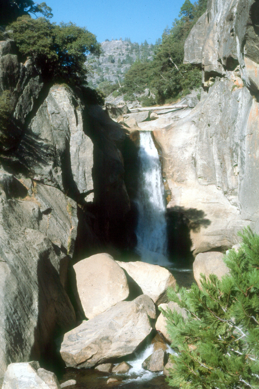
first one was, but what I described is my first hike. Sheep Crossing 2 (August 1980 - date uncertain) On the second hike I was accompanied by Otto Trachtenberg, an experienced hiker. His wife was in the same unit I was in at work, and arranged for us to get together. It was a mismatch. Otto was one of those fast hikers that you meet, making long, fast strides, arms swinging, covering as much ground as possible - and not seeing most of it. He was disappointed how short the hike was to where we stopped, but we made up for it with a long side trip. Leaving our packs, we followed what is usually referred to as a "fisherman's trail" up the river for some distance. Along the way a rattlesnake crossed our path and continued on into the brush. We looked at him and talked about rattlesnakes as we continued on up the trail, till we heard a loud roar of water that indicated a fall or major cascade up ahead. We continued on and came to a 50-foot waterfall, with a mostly vertical drop, coming over a cliff set back in a recessed portion of the bedrock. I don't know if this fall has a name, so I just identify it as "falls on the North Fork of the San Joaquin River." I would return to this falls three years later. Again we
stayed just one night, and made a quick hike out and home the next
morning. Devil's Postpile (August 28 - September 1, 1980) This was one of my more ambitious hikes, as well as one of the most scenic. After I started backpacking, I started acquiring USGS topographical maps. These have contour lines to show the ups and downs of the land, usually with lines marking each 500 feet in elevation. If the lines are spaced far apart, it indicates a gentle slop; a bunch of lines very close together means a cliff. Between hikes I studied these maps to see where there were trails, where they went, and to find interesting destinations. At one point I realized that Devil's Postpile National Monument, which I had never seen, was fairly close to Granite Creek, and could be reached at my leisurely pace with two stopovers. So late in August I drove to the campground to spend the night, planning to get an early start the next morning. To cut a couple of miles off this long trip, I drove my truck across the creek at the shallow crossing place, which gave me access to a rough but passable road that led out to the edge of the canyon of the North Fork of the San Joaquin River. For the third time, I arrived at Sheep Crossing, but for the first time, I kept on moving. I traveled another few miles before making camp at a spot close to the trail. Soon after crossing the river, I had met a couple coming from Devil's Postpile, and I asked them how the hike was. Their description was that it was nice if you enjoy wildflowers, but didn't offer many good views. At the end of the hike I could only conclude that this couple had their eyes on the ground all the time, because there were many views of forested mountain ridges and high rocky peaks; long vistas down the canyons, and generally, just an endless array of good stuff to see, including the promised wildflowers. I'm reasonably sure that I spent the second night in a place where rocks and soil had built up a series of terraces above a meadow. While I was enjoying the view, a deer wandered out into the meadow and nibbled at some brush for a short while. I cooked up something in my pot (photographic proof), and got a good night's sleep in preparation for the final push to the Postpile. My starting point was high on the south side of the North Fork canyon; my route went over the divide between the south and middle forks, and down into the middle fork. The trail winds up and down across the broad divide, then drops rather steeply to the river. The trail here parallels the river for several miles, and the Postpile is right by the stream, on the east side. Although I had seen photos, like most places, there is nothing like seeing the real thing, and I was duly impressed. The first thing I learned was that the "posts" are bigger than they appear in photos. Broken sections lie in a pile at the base of the cliff that forms the feature, and the typical post is a foot in diameter. Broken pieces up to ten feet in length were common. The other great feature of this hike, a first for me, was a store, since there is a road into the area from Mammoth Lakes on the eastern side of the Sierra. I bought a couple of cold beers at the store, hiked down the trail out of sight of "civilization," and set up camp between the river and the trail, where I enjoyed my purchase. That night was one of those that tested the quality of my equipment - my thermometer registered a low of about 23 degrees, but I was very comfortable and warm inside my bag with just shorts and a t-shirt. The bag I got was not the typical down bag many hikers used at that time, but was instead filled with "hollofil," an artificial fiber that is essentially a bunch of small tubes. The holes in the fibers trap air and provide excellent insulation. Starting around this time I did carry a down jacket that could be stuffed into a small bag about six by eight inches. I found I didn't need to wear the jacket very often, but I would carry a pillow case, and put the jacket inside that for a pillow at night. Once the temperature warmed up a bit in the morning I was up and fixing breakfast, ready to continue down along the river to the other dramatic feature of the area, Rainbow Falls. The flow of volcanic basalt which makes up the postpile created cliffs along the sides and across the path of the river, and at Rainbow Falls it drops 101 feet. I spent a half hour or so enjoying the view and resting, since my plan was to cross the river and head cross-country back to the trail, following a route that was shown on the map as an old trail. In practice, it was a fairly easy route, but with no signs of a trail. However, I knew by keeping to the northwest I would have to intersect the trail I came in on, and around mid-day I found it, and turned west. One other feature in this area deserves mention - the Minarets, a series of jagged peaks in the Ritter Range. They are readily seen from many locations, and I had a great view from my trail. The route winds its way around the southern end of the range, offering views of the Minarets from both east and west. There is also a striking man-made feature, the 88 Corral, about half way between the North and Middle Forks of the San Joaquin. I'm not 100% clear on the story, but I believe a group of stockmen and their animals had to hole up here during the severe winter of 1888. The site has makeshift tables, benches and shelves, but also had too much horse poop to make it an attractive place to stop overnight. I
think I stopped overnight two nights on the return trip, but I would
not want to have to swear to it in court. It seems that I made it to
Sheep Crossing the last night, giving me a fairly short hike up the
canyon to where my truck was parked the last day. Although I always worry about
driving down roads that are close to 4-wheel drive conditions,
especially when a creek crossing is involved, I made it back to the
campground and across the creek without incident, and headed for
home. Chilnualna Falls (September 6 - 7, 1980) This was the only hike I took with just my older daughter Teri. We had hoped to go to Glacier Point and hike in to Illilouette Falls, but a forest fire had closed that trail. Instead we turned off at Wawona, a small settlement inside Yosemite National Park along Highway 41, which goes to Yosemite from Fresno. The trail here leads up Chilnualna Creek to a small falls. It's a mostly uphill hike with lots of switchbacks. It was a warm day, and the elevation there was fairly low, so we enjoyed it when we crossed a drainage, because the air rises during the day, and the funnel effect of little creeks provides a nice cooling uphill breeze. The falls itself is 20 or 30 feet high, dropping over from the edge of a pool. We ate lunch here, rested, walked around a bit, and headed back down. I guess we stayed overnight, but I am not 100% sure; it was a short enough hike we could have done it all in one day. I
have since learned that we did not really complete this hike. There
are several different cascades, and it is 8.4 miles to the main
falls. We certainly did not hike that far, and we probably just
went to the first cascade. Garlic Meadow from Wishon (September 16 - 17, 1980) You've read about Garlic Meadow Creek twice before, but this is the place where the creek starts down from the high ridges at the top of Kings Canyon. I can't say with certainty that I was actually close to Garlic Meadow Creek, but I certainly covered a lot of trails on this trip. My starting point was near Wishon Reservoir, on the North Fork of the Kings River, and this was another of those hikes where I was never sure I was on the "right" trail. The first mile or so was fine - the trail led into Statum Meadow, the site of a cow camp where there are some cabins used by stockmen when they move cattle to or from lower elevations. Leading out from the meadow there were trails in every direction, so I picked one that went more or less south, since my goal was to get out on the edge of the canyon. Eventually I was rewarded with some nice views down into the canyon. I sat by a side canyon and enjoyed the sunset as it turned the granite around me to gold and purple. This was one of those hikes where I had a little trouble finding water. I ended up setting my cooking pot where a tiny trickle dripped down, waiting at least a minute or two for it to fill up. On
the hike out the next day, I followed various trails and even some
jeep roads, and eventually made my way back to the trailhead, with
some great
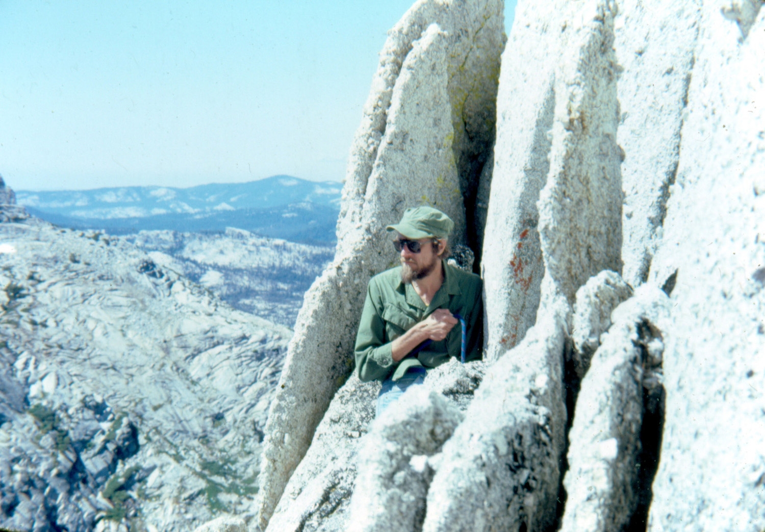
photos to show for my efforts. Cathedral Peak (September 19 - 20, 1980) This hike was my only experience with actual mountain climbing, and though I'd like to think otherwise, it was a fairly mild climb. Cathedral Peak is in the Yosemite backcountry, but not far from Tuolumne Meadows, a popular camping spot with a store, post office, etc. Once again I had an experienced hiker/climber as my guide and companion, with most of the planning and preparation being done by Randy Westmoreland. He and other kids in Yosemite had taken advantage of their location by trying to climb the big boulders around the valley with clothesline rope and tent pegs as their only climbing aids. When their parents and/or the rangers caught them, instead of punishment, they encouraged them to take lessons and learn to climb the proper way, which is relatively safe and certainly far safer with the right equipment. We hiked in to Cathedral Lake where we camped overnight before setting out for the mountain, only a mile or so away. With Randy's guidance, and the fact that he chose a relatively easy route, I had no trouble getting up to the top. Most of the way I was able to work my way up without relying on the rope. On top we had a good view of the surrounding peaks, meadows and lakes. Our hike back down was done without equipment; we just followed an easy walking route on a less steep side of the mountain. By the time we
were heading down the trail back to the road, it was getting dark,
but we made it out OK, and drove down to the valley and Randy's
house, where I spent the night before heading back to the lowlands. Nelder Grove (November 8 - 9, 1980) Nelder Grove is not usually thought of as a place to backpack, and in fact, the hiking part of this trip was very short, probably not a half mile. Back in those days the road from the campground up to where the Old Granddad Tree is located was still open and drivable. About half way up a dirt trail leads into a meadow and an area where there are a half dozen large redwood trees. We called this Redwood Glen, and had hiked into it many times. This time Tim, my daughter Jennifer, and I parked where the trail leaves the main road, and walked in the short distance to where we wanted to camp. I had previously determined that it was possible to hike cross-country from this spot to the Old Granddad Tree, which was a mile or two by road. The cross-country route was marked only in my memory, and we soon realized that we were not getting to our destination. Along the way we had spotted foot prints, which we have always been referred to as "following the old man's footprints," although I don't recall actually seeing a man of any age. In any event, after a few twists and turns we reached the old logging road that goes out past the Granddad Tree to the road that comes up from camp. This area is known as "The Graveyard of the Giants," because of several big dead redwood snags, a couple of large living trees, and about a dozen stumps of big redwoods that were cut down in the 1890s. We enjoyed the scenery here, and followed the road back down. However, I have to confess that the first night we did a very non-backpack type thing - we drove all the way out to the highway, went to the nearby village of Fish Camp for some needed supplies, and drove back, driving all the way in to our campsite. I believe this was also the trip that ended in an adventurous way. The clamp that held down the battery in my Datsun pickup came loose, and electrical arcing caused some of the wiring to catch fire. We had no extinguisher, but killed the fire with dirt. We then discovered that it had burned through the accelerator cable so that the wire broke. Tim was already developing the mechanical skills that would be his long-time profession in the future, and tied a bootlace to the accelerator pedal, with the other end controlling the gas, and we made it almost home with this temporary fix. The last few miles through town, Tim had to operate the gas manually by pulling on and releasing the shoelace, while I took care of brakes and steering. Thankfully
I've never had to deal with a problem quite like that again. Garlic Meadow Creek 3 (November 22 - 23 1980) I've written about my first and second hikes previously, so I won't repeat information that you can find there. This section will cover my final two Garlic Meadow Creek hikes. Once again I convinced Tim to hike mostly uphill for six miles, with the promise of seeing "a really cool place." One of the "fun" things about this hike is that you think you're almost there when you're not. Once you start up out of the lower river canyon, you are crossing a series of ridges and drainages. Since you know the end of the trail has to go downhill to the camping spot, each downhill stretch brings hope that the end is at the bottom - only to disappoint you with another uphill stretch. Despite all this we made it to Garlic Meadow Creek, and were very soon greeted by a very big rattlesnake. Actually he didn't so much greet us as disdain us, crawling into the rocks. Although there are people who will kill rattlesnakes on sight, I don't believe that's right, and it doesn't really accomplish much in the long run. Nevertheless, we debated killing this one, since it was so close to where we would be sleeping. The snake ended our discussion by simply disappearing and never showing himself again. Of course, we didn't stick our hands into any holes down between the rocks. Tim enjoyed our trip despite the long, steep trail, but I notice that he never volunteered to go to this spot again. I made one more trip to the area, with Tim's friend Scott, at the wrong time of year. I have long been aware that no matter how much rain there is, the green grass turns brown and stickers develop, and this transformation reaches its final stage by June. Scott and I went on June 3 - 5 of 1982. Although the trail is well marked, the tall grass can't be avoided. When we returned from this hike, I started to remove the stickers from my socks, took a good look, and threw them away. The other
memorable event of this hike was meeting some other hikers coming
down the trail. They "warned" us that the trail was washed
out and impassable ahead of us, but I was pretty sure they had come
to the area where you just have to tough it out and hike straight up
the hillside till you get to the trail again. We kept going, and the
trail was just like it had always been. As a bonus, the area was not
populated by people who give up easily. Mill Flat Creek (December 14 - 15, 1980) This is the trip that I thought preceded the hike my sister and I took, but my notes say otherwise. The route was this: Drive to Mill Flat Creek Campground, cross Mill Flat Creek, hike up the south side of the Kings River, spend the night, and return. As
is typical with river trails, the route parallels the river,
sometimes staying close to the stream, and sometimes climbing up
over ridges and down. Hiking back out, we kept hoping that this bend in
the trail was the one that led to Mill Flat Creek, only to have
another ridge to cross. Overall it
was an interesting hike, although I really can't recall any details,
except that we did safely cross Mill Flat Creek, unlike the time
Linda and I attempted it.. I did several day trips and short overnight hikes, as well as a couple of longer excursions in this area, but the trips were often very similar, so I'm going to combine them all into one section. The trail head is on a familiar route, the dirt road that goes up the north side of the Kings River above Pine Flat Lake. About half way to the Garnet Dike trailhead, a trail goes up the side of the canyon, and eventually in to a place called Bear Wallow. The trail that Linda and I tried to be on comes in from the west here. The area is a large, open rounded hilltop, with higher mountains to the north, and a couple of creeks. Early in 1980 Tim and I did a day hike all the way in, but this first hike of 1981 was supposed to be a more ambitious overnight trip, although it eventually turned out to be shorter than planned. Joining me were Jennifer, Tim, and Scott, and we started out strong. But once we made it up the first long, uphill stretch, and went another mile or so, no one felt like hiking another four miles, so we decided to just explore that area, and made our camp on a small knoll off the trail, overlooking the canyon. Of course, with less hiking we had more time for other activities, which included rolling rocks down the steep hillsides. Eventually Tim and Scott made the return trip by just heading cross country down the steep, grass-covered slope, getting down to the road in about a third the time it took Jennifer and me to hike the trail back. On the first hike with Tim, we were going through a thicket of brush and live oak, sort of a tunnel through the greenery, when we disturbed an owl, which flew across the trail in front of us and into the woods. On February 20 and 21, 1982, Teri and her then boyfriend Johnny Upshaw and I did the full Bear Wallow hike, probably six miles each way, and spent the night. We camped in an area that had no fire ring or other sign of use, so I carefully dug out a circle of green grass and set it aside. We built our fire there, then in the morning put the ashes in a plastic bag and replaced the grass, watering the area well. At the very end of 1982, I went to Bear Wallow with Rod Neely, my younger daughter's boyfriend (they have been married since 1984). We observed New Year's Eve sitting on the side of a big green field, looking at stars, probably with a campfire, and knowing Rod, some fireworks. This
was my last hike all the way in, but Rod and I made a partial hike
in January of 1985, during which we had a few sprinkles of rain, and
built a very hot manzanita fire. L/S Expedition (March 27 - April 6, 1981) This started out to be one of the longest trips I've been associated with, although circumstances changed before it was over. Tim, Scott and I made a day trip to the Squaw Leap area, taking my camp stove and fixing a lunch of "cup of noodles." Among the many things we discussed was the idea of spending a month (!) camping there (not for me - I was working full time). Eventually it was decided that as soon as equipment and food could be acquired, we would all return on a Saturday, hike in and set up camp. I would leave Sunday, then come back the following weekend with additional food and whatever else might be needed. Thus was born the L/S Expedition (for Liddle & Scott). When the big day arrived we drove up to the trailhead, and headed down the trail, across the bridge, and up the River Trail. Once we were past the trail junction a half mile or so, we started looking for a camp site, and after a bit of wandering around off the trail, we saw a small knoll with a little creek on one side. The ground sloped down quickly on two sides to small creeks, while the "back" side of the area was an open, gentle slope, leading to a steep hill. The route in from the trail, the "front" side, was also a gentle slope, but covered with quite a lot of trees and brush. We actually made at least two hikes in from the parking area (about 3 miles round trip), bringing many items that were not normal for backpacking, including ice chests and possibly folding chairs. On the first trip in we were all carrying things in our hands (like the ice chest) in addition to our full packs, so we probably looked like a very soft bunch of wimpy hikers (in reality we were quite manly). That first weekend we got camp set up, including a cheap tent, and explored the area around the site. While there is a lot of steep terrain, much of this land is gently rolling hills, and it's possible to wander around a fair distance in three directions without a lot of uphill hiking. Nearby are some small cliffs of decomposing granite where there are "holes" into the rock, creating an overhang. On Sunday afternoon I said my goodbyes, wished the boys well, and hiked out to the parking lot for the drive home. It's probably good that we did not have cell phones in those days, since I would have surely received a call mid-week asking for a rescue. When I arrived to bring food for week two of four, I was quickly informed that they were ready to come home after this weekend. They had spent their time exploring just about all the land between the river and the steep slopes north of the camp as well as the table top; drawing detailed maps of the area, and catching butterflies. This may sound like a rather mild activity for a couple of energetic 17-year olds, but their method of capture was to throw their leather vests over the insects, often stunning them (sometimes past the point of no return). The ones that survived were eventually rewarded with their freedom. They also endured a couple of hard spring rainstorms, which confined them to the small tent. There were also the inevitable conflicts when people spend too much time in close quarters. In retrospect (in fact, immediately) it was obvious that the quiet, pastoral life of camping in the Sierra foothills was not going to be satisfactory for very long. When I arrived, I noticed a hole in the mesh front of the tent. Dick: What happened here? Tim: I threw the .22 rifle through the tent. Dick: Why? Tim: To keep from shooting Scott with it. We
stayed overnight that final weekend, making a couple of trips out to
the truck to get everything packed out, and enjoying a couple of
beautiful sunny days. And though I think it was the last camping
trip Tim or Scott made to that area, I would return a dozen times
over the next twenty years. More Squaw Leap Hikes (1981 to 1982) Once I realized how quick and easy backpacking to Squaw Leap could be, I went there quite a few times in the next few years. It was a little over an hour's drive to the trailhead, and roughly a mile hike to the bridge. From there, it was probably not more than a half mile to L/S Camp, as we named the spot where the boys camped. During that trip and my next trips, we made a number of improvements to the site. We of course built a fire ring during the first weekend of the Expedition. We found some short sections that had been cut off of fence posts, cylindrical, about six inches in diameter, and 18 inches long. We set these into the ground, and laid several branches across to form a crude bench. I think I brought in a hammer and nails and improved it during a later trip, including the addition of a back. Eventually I carried in an old folding aluminum chair, used it during my campouts, and hid it in some rocks in the area for the future. When I made my first visit to Squaw Leap for a day hike, it seemed that the road in from Auberry was very narrow and winding, with lots of switchbacks. When Tim and I drove in for our hike, the road had been realigned. Although still steep, there were fewer switchbacks, with longer downhill stretches between curves. PG&E was building a new power house by the river downstream a ways from the bridge and existing building, and as part of the licensing agreement, they paid for the realignment of the road. The construction company set up headquarters, with several temporary buildings, in a flat, open area near the trailhead parking lot, so for several years there was always quite a bit of activity there. Once the project was completed, the buildings were removed, and the area they had occupied was converted into picnicking and camping sites. There were no official camp sites at the original parking lot, but there was a toilet, several picnic tables, and some shooting benches, which were used for a while by a local muzzle-loading club. My first trip after the L/S Expedition was only two weeks later, April 16-17, but I don't remember many details of that or most of my subsequent hikes, so I'll combine the next few Squaw Leap trips together in this section. I didn't go again until the next year, when I enjoyed a more ambitious hike, with unusual but fascinating weather conditions. The weather in the Sierra foothills on a sunny winter day can be very pleasant, and I had already discovered the joys of truck camping in the winter. My first hike of 1982 took place January 22 - 24, 1982. We had a little rain in Fresno the day before, but that just freshens the vegetation, and clears the air for better views. Driving up from the San Joaquin Valley, the route goes through the small town of Auberry, and just past town there is a series of wide, flat meadows. I was not shocked, but a little surprised, to see a light layer of snow in this area, probably not over an inch. This location is at 2,000 feet, but the road quickly drops down quite a ways, and as soon as I started down Smalley Road, I got below the snow level. However, there were little spots of snow all the way down the river, at 800 feet. A series of table top mountains runs along the San Joaquin River on both sides from Squaw Leap down to the country below Millerton Lake. The biggest of these is Kennedy Table, on the north side and overlooking much of the country we hiked and camped in. Tim and Scott had gone up to the top of the table, and I wanted to do the same, so I made this a two-night trip, giving me a full day to do the extra hiking. In addition to the trails, there is an old dirt road in the area that comes over the ridge near the table mountain, and down the hill to a spot near the river. Part of this road is used as the trail, but most of it is separate. After breakfast on the second day, I headed up the trail and picked up the road where it went over the ridge. From there I hiked cross-country toward the "back" or northern side of the mountain, where it was possible to work my way up through the broken basalt rock at the edge. Out on the eastern and southern sides of the mountain, the rock cliffs at the edge were 80 to 100 feet high. Once I reached the top of Kennedy Table I had good evidence that I was back up above the 2,000 foot level, since there was a dusting of snow on top. It was easy enough to walk around, although the ground is quite rocky most of the way. From the edge, I had a view of my tent, looking very tiny down in the woods, as well as the bridge and the trail up to the parking lot, and the old power house and road leading to it. Since
the hike to the table top involved an elevation gain of close to a
thousand feet, as well as making my way through some brushy areas
via cow paths and game trails, allowing a full day in between the
hike in and out proved to be a good idea, and I made one or two
other three-day trips later on. My next trip was in May of that
year, a one-night visit that I have no memory of. And because of
some dramatic events that will be recounted later, I am going to
save the final 1982 Squaw Leap hike for later. Hell-For-Sure Pass (June 20 - 25, 1981) This was kind of a farewell hike for Tim and Scott, who had joined the Navy, and would be leaving for basic training in September. The pass is east of Courtright, and is in high country with many small glacial lakes. Although I am not a fisherman, Tim and Scott were, and took along fishing equipment in addition to all the usual stuff. The first part of the hike matched my second ever trip, from Courtright to Post Corral Meadow, where we camped for the first night. The next morning was when we learned about the self-folding frying pan that I mentioned in my report on the "logistics" of backpacking. At a camping store I had bought a frying pan that had a folding handle for easier carrying. It was not well designed, and if the pan was at an angle when you picked it up, it would fold and tilt sideways. Tim was cooking eggs when this happened, the eggs went on the ground, and his comments on the subject cannot be repeated here. We found something else to eat and set out on a trail that went east from the meadow, rather than the trail south that I had followed previously. This took us in the direction of Hell-for-Sure pass on the LeConte Divide. Our first stop was at one of many small lakes in the area, possibly Fleming Lake or Rae Lake, where the boys did their first fishing. Over the next few days (not sure how many), we spent quite a bit of time at other nearby lakes, and set up camp at Hell-for-Sure Lake. The boys caught many small trout, which they cleaned and cooked over the fire, so we were eating them the day they were caught, the only way to ensure really good, fresh taste. At one point we had to chase away a marmot who took an interest in our frying pan, although I'm not sure this rodent is a meat eater. We did a day hike to the top of Hell-for-Sure pass, which still had quite a bit of snow. Tim and Scott had a fun time sliding down the east side (only a hundred feet or so) on their butts. When it was time to head for home, we continued on a loop that would take us down to the Kings River, and out the same trail I followed on my first hike in the area in September 1979. We did some cross-country hiking heading for the Devil's Punchbowl. A contour map is essential for this kind of enterprise, since it shows whether you're heading for a cliff, or a gentler, more passable slope. We did not stop at the Punchbowl, but continued down hill toward the Kings. Along this stretch we went past a number of meadows, all patrolled by voracious mosquitoes, who kept us busy slapping, shooing and scratching. Applying insect spray provided about 15 minutes of relief, then they were back. One meadow was occupied by hundreds of dragon flies, who dine constantly on mosquitoes. We tried to figure out how to get a cloud of the dragon flies to accompany us, since we didn't get a single mosquito bite when we were passing this meadow. We
spent our final night where the trail reached the Kings, then hiked
all the way out the next day, an eleven mile slog which wore us down
pretty good. We did not go home that night, but instead found a
place off a dirt road where we could camp overnight, then drove home
the following day. Don Cecil Trail/Roaring River/Sphinx Creek (August 1 - 5, 1981) Up to this point my backpacking trips had followed an established pattern: Drive to the trail head, hike in, hike around and look at stuff, hike out, drive home. But trails don't just go in and stop - they connect to other trails, they form loops, they go anywhere and everywhere. When I started thinking about a loop trail trip, I realized that it required either two vehicles or two drivers, or possibly both. For this hike, which took place mainly in the high country south of Kings Canyon at Cedar Grove, I used two vehicles, but operated both of them. The one driver, two-vehicle method was very suitable for hiking the Don Cecil Trail, which goes up out of Kings Canyon from Cedar Grove. The first part of the route heads mainly south, then it turns east and generally parallels the Kings River, dropping down into Bubbs Creek, which joins the Kings about two miles east of Roads End. Before I started hiking, I parked the truck at the Roads End trail head and rode my bike six miles back to Cedar Grove. The bike ride was mostly down hill but I had to do some pedaling on flat stretches. I had left my backpack at the ranger station, so once I arrived there, all I had to do was lock my bike to a tree, pick up my pack, and step off on the trail. The Don Cecil Trail follows Sheep Creek up from Cedar Grove, just across the road from the ranger station and campground, and rises from 4,000 to 7,300 feet in six miles. The first day was one of the roughest hiking days I have ever had. It was more than 95% uphill, some gentle, some steep and some just tedious switch backs for what seemed like miles. Besides all this, I hadn't been sleeping well and woke up about 4 a.m.; didn't eat a good breakfast, and didn't eat much on the trail. By the time I stopped I felt worn out and a little sick, and it was a major effort to fix supper and set up camp. I made two mistakes on this hike. First, I assumed that the meadow that was my planned destination would have water available. Second, I passed up the chance to fill my water containers when I crossed a creek, because I didn't want to go to the trouble of getting out the purification tablets, and I was close to the meadow. However, there was no running water of any kind at the meadow, which meant another mile and a half uphill to get to a creek. Despite these troubles, I got settled in, got some water, started a fire, and cooked my hot dogs. I got a good night's sleep, and started out on day two feeling much more normal. I had some steep hills and a lot of down hill, and stopped earlier in the day at a nice campsite with a table and log chairs and bench at Williams Meadow. There was a tiny creek with quite a few fish, up to six inches. Although I had hiked a total of about 14 miles, I was only five miles as the crow flies from my starting point. The next day's hike was mostly easy and up and down, never gaining or losing much elevation, and with lots of nice scenery, about which I remember very little. I do know that I passed through a place called Sugar Loaf Valley, which had a small granite dome at one side, similar to the typical "sugar loaf" mountains found in a number of locations. The most famous one guards the harbor at Rio de Janeiro in Brazil. After about eight miles of hiking, I camped by the Roaring River. This river flows down to the Kings, and ends with a short but dramatic waterfall that is only a few steps off the road between Cedar Grove and Roads End. There was a backcountry ranger station nearby, and in my camp area were about 14 boy scouts and their leaders. I had seen two people the first day and none on day two, so it was quite a change. The scouts were headed for Mt. Whitney, so we went in opposite directions the next morning. I had a nice conversation with the ranger, about cows and pine trees. When I camped at Williams Meadow the previous night, I was surprised to find it occupied by cows. This is normal in the national forests, but should never happen in a national park. The ranger explained that when this area was added to the park system in the 1950s, the family that had grazing rights there retained them until the last permit holder died. Since this person was a woman in her 90s in 1981, I am assuming that cows no longer pollute Kings Canyon National Park. The ranger also mentioned that he had spent much of the previous day pulling small lodgepole pines out of a nearby meadow. One of the hallmarks of a good meadow is that it is too wet for trees to grow. Over time, conditions will be right for a tree or two or three to get established at the edge of the meadow. They will consume some of the water, allowing the edges to dry out, and give more trees the chance to grow. The natural progression of a Sierra meadow is that it is eventually taken over by forest. The ranger said he had mixed feelings about interfering with this natural process, but there is also value to preserving meadows. The elevation at Roaring River was about 7,000 feet, and I had about 14 miles to go to get back to where the truck was parked, but I still had to go up and over 10,000 foot Avalanche Pass to get there. I don't recall much about this part of the hike, and my notes pretty much end when I left Roaring River, but I probably took two days to finish, and the dates of the hike agree with this. The final leg of the hike was a lot of downhill, mostly following Sphinx Creek, followed by a couple of level miles to finish it off. Other
than the short, overnight hikes, I always met other
people on the trail. Everyone says "hello" and often we
stopped to talk for a minute or two about what's ahead on the trail.
However, on this hike I encountered a person who didn't
want to follow this protocol. Walking through a fairly
flat, open area past the Roaring River, where I could see several
hundred yards ahead on the trail, I saw a woman coming my way,
hiking alone. About 100 feet before we met, she went of the trail a
little ways, turned her back to to the trail, and lowered her head.
It was obvious that for whatever reason she did not want any contact
with others (well, at least with me), so I went on by without a
word. Wishon to Cedar Grove (August 29 - September 5 1982) (Updated February 2019) This was probably my favorite hike of all time. This time I used one vehicle and two drivers, with my friend Gary Reed accompanying me to the starting point, driving my truck home, then meeting me at the other end. This was my "three rivers" hike, starting near Lake Wishon on the North Fork of the Kings, going up, across and down into Tehipite Valley on the middle fork, and finally over Granite Pass on the Monarch Divide to the South Fork and the Roads End trailhead in the Cedar Grove section of Kings Canyon National Park. Although time had erased many of the details of this hike, in February of 2019, eight years after completing this report, I decided to update it, adding not only detail but some of my thoughts about the experience, both at the time and in retrospect. I don't recall for sure, but we probably camped somewhere near the starting point, since Gary enjoyed camping and had previously joined me on a number of camping trips (not hikes). In any event, fairly early on the first hiking day I watched Gary drive away in my blue Datsun pickup. Previous hikes had been "out and back" or a loop. If something went wrong before the half way point, I could return and find my vehicle waiting. In this case, there was a 50 mile "walk in the woods" before I would reach my ride, with no way to make contact for five days. This was long before the era of cell phones, but even today it is rare to find service in the mountains of the Sierra. I didn't really give any thought to this as I prepared to take my first step. I had hiked on part of this trail in 1980, but went more or less south out to the ridge above the main stem of the Kings. This time when I reached a junction a mile or so in, I turned left, going east and up on to the divide between the north and middle forks. Some of the first day's hike led through Crown Valley, above which is Crown Rock, a small dome with a crown-shaped formation on the top. At one point I hiked through a mile or so of level territory, where there were many fallen trees. All along this area I saw chipmunks running along the downed logs, which I defined as "the chipmunk highway." I also went past an old cabin, something that is common throughout the Sierra, dating from mining and stock grazing days. This one had a Yukon Jack bottle (empty of course) sitting on a little shelf above the doorway. As I was thinking about stopping for the night, the section of the trail I was on ran along a creek in a deep channel, with 20-foot high banks. I found an easy route down and began setting up camp. Something made me look up, and I saw a huge buck with a large rack of antlers looking over the bank at me. Satisfied that I posed no danger, he turned and casually wandered off. Early in my backpacking efforts I realized that freeze-dried food was barely edible. I usually got by with cheese, raisins, peanuts, and Cup o' Soup, with instant oatmeal for most breakfasts. However, I found a way to have a "feast" at least one night on the trail. Hot dogs are well-preserved and could be safely brought along for the first night. Before leaving home I mixed mustard, ketchup and chopped onions in a small plastic container. I would build a small fire and cook the dogs, apply the condiment mix, and then get rid of the plastic container in the fire. My main purpose on this hike was to see the Tehipite Valley, a "Yosemite style" valley carved by glaciers, and featuring grante cliffs, interesting rock formations, a couple of waterfalls, and the gem of the area, Tehipite Dome, the largest dome in the Sierra. Approaching the valley from the north, you can see the "back" side and top of the dome, and while it's a cool-looking rock, it is not all that impressive from this view. From the floor of the valley however, it is a high, spectacular example of the granite domes that appear throughout the mountain range, and the photo reminds some viewers of Darth Vader. The second day of my hike, the trail turned toward the south and the deep canyon of the middle fork. The section down to the valley from the divide between the north and middle forks was one of the most challenging stretches of trail I have ever attempted. It was no surprise, when I reached the upper rim of Tehipite Valley, that the trail went down the side of the canyon in a series of switchbacks. A LONG series of switchbacks. And it was ALL down hill. This may sound like easy hiking, but down hill travel is rough on the knees, even though it's easier on the lungs. Most long switchback trails have some sections where the trail levels out or goes up hill for a short distance, which relieves the constant stress of down hill hiking. Of course, if you're going up, the sections where the trail goes down for a ways are equally welcome. However, the Tehipite trail was 100% unrelieved down hill for probably four miles. In addition, during the last two miles or so, the trail was composed of loose broken rocks, and occupied by 74 billion annoying little flies. These are not house flies or big horse flies, but instead a small but very determined insect that is constantly trying to land on your face. Throughout this section I was continually shooing flies away with a bandana. After a total descent of 3,500 feet, I reached the valley, set up camp within a few feet of the trail, and more or less collapsed for a while. My camp site was close to the river, so I refilled my water containers, then fixed supper and enjoyed a well-deserved night of rest. The next section of my journey would take me east along the river to where a branch of the trail turns south and goes up the side of the canyon to the top of the divide between the middle and south forks. When I wrote this report in 2011, I thought of this as a one-day hike of about six miles. But thinking about it for an update in 2019, I realized that I spent a total of three nights beside the river. Therefore it had to be a two-day trek, and it could have been anywhere from eight to ten miles. I never had any interest in putting in long miles in a day, and I considered six miles to be my preferred maximum. Since I stopped frequently to take photos, rest, or look at the scenery, I could very well have gone only four miles that third day. Along the way there was much to see. Tehipite Valley is similar to Yosemite in general appearance - level, a mile or so wide, and a river runs through it, the middle fork of the Kings. It is dominated by Tehipite Dome, but there are many striking rock formations, including some turret-like shapes that I thought looked like a bishop's mitre. Early in the day I came to a fairly large stream running in from the north. There are various opinions on how to cross creeks that are too big to just step over. My first choice is a large log that provides a bridge, but nature does not always cooperate. Years later I heard a talk from a hiker who waded across in his socks, with his boots tied together and slung around his neck. Just hearing it made my feet hurt. My choice in this case was to just wade across in my boots, then take them off, empty the water, and get out dry socks before putting them back on. Just past the creek I saw that there was a nice nice waterfall tumbling down the cliff from the north. I walked up along the stream to get a closer look and take some photos. It was during this brief side trip that I made an important discovery. I got where I could get a good photo, snapped off several shots, then started back to the trail. Then it occurred to me that no photo would match reality, and I should just take a few extra minutes to enjoy the actual view before continuing my journey. Some nature lovers even deliberately do NOT take a camera to force themselves to absorb the experience more fully. As I continued my hike, I noticed that there were many huge old growth trees along the way. Although the area has had National Park status only since 1965, its remoteness has provided additional protection from logging and other development. The river itself offered many scenic views, including a waterwheel falls, which results when a rock ledge across the stream bed creates a small plume as the water is deflected away from the rock face. Although it was late summer, the river had a large volume of water. After walking "enough" for the day, I found a place to camp for night three. At this stop I took a pretty good "sponge bath." I don't think I actually got into the water, but if I did it was a quick dip, since Sierra rivers tend to be very cold. The next day was my last in the middle fork canyon. The following day I would start the long climb up over the Monarch Divide between the middle and south forks. Since I was on the north side, I knew I would have to cross the river at the trail junction. The map showed a bridge there, but backcountry bridges on major rivers have a tendency to get washed out, so as I hiked, I spent some of my time worrying about how I would cross if this had happened. It was also on this stretch that I met a young couple who were doing a very extensive hike. It was his first time, but she had been over many trails all over the Sierra. She said that she thought the section of switchbacks down into the valley was the roughest section of trail she had seen. I've often wondered how he fared doing such an ambitious hike on his first outing, and whether this relationship was long-lasting. Sometimes it seems that people who love to hike and camp marry partners whose idea of outdoor fun is the walk between the parking lot and a luxury hotel. When I arrived at the crossing, I found that my worries were for nothing, and there was a fairly new, sturdy-looking foot bridge. (In March of 2019 I was informed that this bridge has washed out and that many sections of the trails I walked are no longer maintained.) I camped on the south side of the river, although I don't recall anything else about this spot. My two day hike from the beginning of the Tehipite Valley had not seemed steep at all, but of course it was upstream and gradually rising. A study of the map shows that I went up from 4,000 feet to 6,000, over a distance of about eight or nine miles. The next day's hike would be very different. By this point, the rock walls had given way to steep slopes on both sides of the river, and the canyon was V-shaped, instead of the U-shape of a glaciated valley. The trail up the south side would eventually reach the 10,000 foot elevation at Granite Pass, the high point on the Monarch Divide. I continued my hike the next morning, following a trail that was mostly uphill, with a series of switchbacks that were much less onerous than the trail down into the valley. I saw a location on my map that sounded like a perfect place to camp, the Lake of the Fallen Moon. However, it turned out to be some distance off the trail, hundreds of feet lower in elevation, with no apparent trail. Instead I camped in a fairly level forested area along the trail. At this location, I was pestered by a deer that had no fear of humans, and which kept hanging around my camp. I finally managed to shoo her away. It was somewhere on the trail from the valley to Granite Pass that I met the only other hikers I would see until I got close to civilization on the last stretch of the hike. As far as I can recall, this party was two or three young men, and we had a short conversation about safe drinking water, as well as the joy of the hike in general. Early in my backpacking endeavors I learned that one of the big rewards is getting to see sights that can only be enjoyed by those willing to walk some long miles. The effort required makes these vistas even more enjoyable. The following day, as I made my way higher and higher, I had some spectacular views of the Middle Fork Canyon, some of its tributaries, and the rugged mountain peaks that surrounded me. One of my favorite pictures of all time was taken along this stretch of trail, showing a hiker (me) looking at the jumble of canyons, cliffs, peaks, and rock formations below. I carried a fairly heavy 35 millimeter camera on most trips, and a tripod on some of them. Selfie sticks were far in the future, so if I wanted to take a photo that included myself, I had to take off my pack, set up the tripod and camera, trigger the self-timer, and get into position. These photos were on 35 mm film, so there was no way to know if the picture came out right until it was developed much later. Apparently I was able to compose the photo and get into it in the right spot most of the time. As I reached the higher altitudes of the divide, I realized that although it was September, it was spring at this elevation. Shooting stars and other flowers seen as early as February in the foothills were just now in full bloom. Trees are limited and small here, but the shining granite, small lakes, and lush meadows make it a place of beauty. At the top of the pass I stopped to take pictures, have a snack, and rest, before starting down into the south fork of the Kings. I could probably have made it all the way out to Roads End that day, but my ride would not arrive till the next day, so I stopped a little earlier than usual. The area where I camped was where the trail goes down a long slope and was not a very attractive camping spot, but I did manage to find a fairly flat place to lay out my sleeping bag. At least the trees were mostly red firs, which rank in my top five list of "best trees." Because of the terrain I was not able to hike around the area as much as I normally would have done, but I did some reading, and took some extra time to properly hang my food, since it was near a frequently used area and bears were a likely possibility. It was good that I did, since I woke up in the night to see two bear cubs in my camp, meaning mama bear was close by. Someone had given me some so-called Mexican firecrackers, which were about the size of a little finger, and exploded with a very loud noise. I had them with me specifically to set off in case of bears, so I got one out and lit it. Both cubs ran up trees but immediately came down and ran off, and I did not have any further trouble. Continuing on down the trail the next day, I had some great views of the high country on the south side of Kings Canyon, particularly Sphinx Crest. I was only a short distance from the end of my hike, and got to Roads End fairly early. I now had a wait of two or three hours for my ride, but I spent the time reading and walking around a little. Despite some difficult sections of trail, I enjoyed every day of this hike; however, I was still glad to see Gary drive up in my blue pickup. I loaded my pack into the back and relaxed for the drive home. When I updated this report in 2019, my older grandson, now an avid backpacker himself, calculated that the distance I hiked was about 47 miles, with a total 14,000 feet of elevation gain. As I indicated at the start of this section, this was a very special hike for me. The first time I ever heard of the Tehipite Valley was when I was involved in an environmental project at a TV station where I worked. A man who was working with the group said in the course of a conversation, "I saved the Tehipite Valley" (from being dammed up). Probably he should have mentioned that others helped, but if you're trying to save the world, it doesn't hurt to have a lot of self-confidence. In any case, this piqued my interest and as I read about the place and saw pictures, I wished I could go there. Once I started backpacking years later "going there" was an obvious goal. This was also the longest hike I did, both in miles and days. By this time I'd made several three or four night trips, so I had a good idea on how to plan for this one. It was the only hike where I had drop-off and pick-up service, and I'm grateful to Gary for helping to make this hike possible. Finally, I got to see much more than I had expected in the way of fantastic scenery. A couple of the photos linked in this report provide a good example of what I saw, although the photo is always just a pale imitation of reality. My first backpack took place shortly before my 40th birthday, and the last one when I was 61. At 79, my backpacking days are behind me, and a five mile day hike is a challenge. I am forever grateful to Ron Reed for prodding me to take my first hike, and many memories of my hikes remain vivid and an important part of me to this day.
Squaw Leap (December 1982 and May 1983) Here is where I must address a matter not directly related to backpacking, but important to the story of my next two hikes to Squaw Leap. In the summer of 1982 some people were picnicking at the upper end of Millerton Lake, below Squaw Leap. After cooking lunch in a small hibachi, they set it down in the dry grass away from their picnic table. For some strange reason, the dry grass caught fire. The ultimate result was a major wildfire, which burned significant acreage on both sides of the river, mainly in the Squaw Leap BLM area. Firefighters brought in a bulldozer and other equipment over the rough dirt roads that enter the BLM land from the north, pretty much destroying the half mile of trail between where the road joins it and the junction of the Ridge and River Trails. The fire went through the L/S camp area, burning part of our bench. On the other side of the river it went up the side of the canyon through the parking area, destroying the shooting benches, picnic tables, and a number of fence posts. It also partly burned or killed a number of trees, although for the most part a grass fire like this burns fast and does not permanently harm the vast majority of trees. In the long run, the fire was beneficial. Natural fires have burned throughout the foothills and higher elevation forests for tens of thousands of years. The 100 or so years of suppressing all fires had the unwanted side effect of increasing dead brush and other fuel, leading to more damaging fires. The Squaw Leap fire burned all the dead brush and fallen logs, as well as the thick layer of old dead grass that accumulates year by year. Some big patches of chaparral were burned to the ground. It was fascinating to visit the area over the next few years and observe how the area recovered and see some of the other after effects of the fire. I'll discuss this in relation to my next two trips to Squaw Leap. December 1982 My first visit to Squaw Leap after the fire was in December of that same year, when I was joined by future son-in-law Rod Neely. We did the usual stuff that I usually did in that area, venturing into some places I had not fully explored in the past. In a brushy area next to a small creek we discovered a wild grape vine that wound through the trees and bushes for at least 100 feet. Green grass had started to grow over all the burned area, and some trees killed by the fire had fallen over. My favorite thing was a dead bull pine that had fallen so that it balanced across a blue oak tree. But the biggest effect of the fire would not be visible until my next visit. May 1983 May is a little late in the season for foothill camping, but I was very glad I made this trip. The fire had burned off not just the standing dry grass, but the layer of dead grass that accumulates on the ground over the years. However, it did not burn the seeds lying on the ground, and I think virtually every one of them sprouted. With plenty of sunshine warming the earth, and a good rain year, the wild grasses were close to six feet tall. I had to walk around in a little circle stomping down grass in order to make an open place to put my tent and other stuff. I also worried a little about cows grazing nearby, realizing they could sneak up on me without me noticing until it was too late. Fortunately, they were only interested in eating the lush grass. I made a number of other hikes into the area over the years, and as time went by, conditions became more and more like they were before the fire. Within a year or two, the chaparral that had burned to the ground began to grow up from the roots. I saw it when it was just inches high, then knee high, then eventually back to its normal six to ten feet. As well, trees lost
branches, bushes died, and trees fell over. Within about ten years
it was hard to find evidence of the fire, and now it is impossible.
Also, the BLM rebuilt and realigned the section of the trail that was
torn up by fire fighting equipment, making the climb a little more
gradual. Cora Creek and North Fork of the San Joaquin Unless my notes are wrong, this was the last hike I made that was more than overnight. It was my 33rd backpack trip, and I would reach a total of 45. But it was hard to find anyone willing or able to take the time for longer hikes, and I guess I just lost my taste for being out in the wilderness alone for extended periods. This hike started at the Granite Creek Campground, the same jumping off place as my Sheep Crossing and Devil's Postpile hikes, but went in a different direction. The trail I had taken before goes east across Granite Creek, through rolling country about two miles, then down into the North Fork of the San Joaquin. Another trail goes north, connecting with various other trails. A few miles from the trailhead, there is a junction where a trail follows Cora Creek east down to the San Joaquin. My plan was to take this route, follow the river downstream "cross country" to Sheep Crossing, and then take the trail that comes in from Granite Creek back up to my starting point. Everything went more or less as planned. As far as I can recall I made it to the junction of Cora Creek and the river the first day and spent the night in that area. When I set out the next day, I expected to find "fisherman's trails" at least part of the way along the river to the bridge, and in fact, this is what happened. However, the first part of the cross-country hike was fairly rugged. The river canyon is steep, and there was really no place to walk next to the river, so I ended up working my way fairly high up on the right bank for the first mile or so. Eventually I arrived at the falls that I've described previously, where I took a long rest stop, just enjoying the falls and doing some reading. Throughout this trip I was reading Clan of the Cave Bear, the first book of Jean Auel's "Earth's Children" series, for the first time. The setting is 25,000 years ago, and deals with contact between Neanderthals and Cro Magnon people, so the book and the setting made me feel very primitive. I continued on to a spot
maybe a half mile from Sheep Crossing, where there was a very nice
camping area, with primitive shelves and a bench, making for a
little more comfortable camping than usual. The next day I hiked
down to where the other trail crosses the river, then uphill to my
starting point. Hell Hole and Granite Gorge (August 1984) Maybe I need to re-think my earlier statements about the most difficult hike, since this one is definitely a contender. Granite Gorge and Hell Hole are part of the canyon of the North Fork of the Kings River, a short distance below Lake Wishon. From the dirt road above, you can look down into this steep hole and see a nice pond and a waterfall. If you don't have good sense, you can also hike down there, although there is no trail. I thought long and hard about attempting this hike, but the beauty of the place was irresistible. I talked to a man who was familiar with the area who said there was a trail up the river from below, but he did not really know where it started, so I took the direct route. After driving past Shaver Lake and Dinkey Creek, I took the dirt road that goes to Sawmill Flat Campground. Just past this a very rough road heads back toward Wishon. Right at the start is an area that was used for the disposal of rock and soil that were dug out during the construction of tunnels that carry water to various power houses as part of Southern California Edison's Big Creek hydro project. The material was brought out through tunnels dug for that purpose, called adits. From this flat spot, you can make your way down the rock debris, and then down the canyon side. I had to do a bit of detouring to get past some extra steep areas (some would call them cliffs), but I was careful and of course, I could not get lost as long as I kept going down hill. It did not take all that long to reach the river, and I spent a delightful day swimming in the very cold pond (made more enjoyable by the presence of an air mattress I found by the water), and exploring the area up and downstream a few hundred yards. The hike out the next day probably took twice as long as my descent, but it was not as bad as I had expected. In later years I learned that many people make their way down to Hell Hole, and my grandson Johnny and his fishing buddy Curtis are planning a trip soon. I'm afraid I will have to decline their invitation to join them. November 2013: Johnny
and a different friend, Dustin, went to Hell Hole on November 1,
less than a week after a pretty good storm left snow all across the
Sierra. Dustin had been there before, but they discovered as I did
that there is no easy route. Their trip was made more challenging by
the fact that they were walking through snow a lot of the way down.
Did I mention that lack of good sense is a pre-requisite for making
this hike? I'm going to wrap up all the rest of my Squaw Leap hikes except the final one in this section. I don't have any notes and don't remember many details, so I'll just touch on each one briefly. In January of 1984 I camped overnight with a friend from work, Randy Morrison. This was a warm-up for a much more adventurous hike the following year. In March 1985, I hiked in to the L/S campsite, but found it occupied by a very large bull. Although range cattle generally are more scared of people than the reverse, I decided to take no chances, and went back to the trail, and out on a ridge toward the river. In this area I found a red cap, so I named this spot Lost Hat Camp, and had a nice time exploring a part of the countryside that I had not been in previously. In January and February I made two more trips, both overnight. While walking around the area above camp on the first one, I ran across some drip irrigation tubing and other evidence that someone had been gardening in the foothills. You can probably imagine what their crop was. In March 1990 and in
April 1993, I made the first two of three hikes to Squaw Leap with
my grandson Johnny, who was born in 1984. On the first hike I
carried my stuff, his stuff, and part of the time, I carried Johnny.
By the next trip he was nine and I was not about to carry him,
despite his requests. Both times we camped at the expedition site,
and spent our time on short walks around there. We saw a lot of
interesting things on the 1993 hike, including Johnny's first
meeting with woolly bear caterpillars. In a little runoff pond
beside the old dirt road, we almost saw some kind of very
fast water bug - it moved so fast that we could only detect the
movement, but could not get any kind of idea of what the creature
looked like. We also encountered coyotes (audio only), cows, and
little frogs. These were both short hikes, with no particular distinguishing events. Cow Wallow was the name we gave to a spot where Rod and I camped in January 1985, by which time he was married to my younger daughter, Jennifer. This spot was a knoll along the trail to Bear Wallow. In July, 1987, Johnny and
I went to the place I've described previously as Redwood
Glen. This is a hike for lazy people or
3-year-olds, requiring less than a half mile of walking from the
car. After the easy warm-up of our Squaw Leap hike two years earlier, Randy Morrison and I decided we were ready for something more ambitious, so I made my third and final trip to the top of Half Dome. We drove to Nelder Grove the night before our hike and camped there. The next morning we drove on into Yosemite Valley, parked as close to the trailhead as you can get, and set off on an 8 mile hike, with a 4,800 elevation gain. I don't remember many details, meaning everything went smoothly. We spent the night on top, then hiked all the way back the next day. Coming down the
switchbacks and stair steps near Vernal Falls we went too fast in our
eagerness to get to the car, and we paid for it the next day, with
wobbly legs and pain all over. Nevertheless, Randy greatly enjoyed
his first visit to Nelder Grove, and his first hike to the top of Half
Dome Johnny's Camp (October 3-4 1986) This was my grandson Johnny's first backpack trip, and as this picture shows, he carried his own pack. Of course, on most of the trip, his dad carried Johnny. We went to Garnet Dike, trailhead for my previous Garlic Meadow Creek hikes, but only walked in about a mile. We set up camp at a flat, sandy spot not far off the trail, and explored the area - hiking up the trail a little further without a load, checking out the Kings River, and just enjoying outdoor living. There had been cattle in the area, and there were a number of dried cow chips around. We explained to Johnny that they could be burned in our campfire, and he had a good time gathering up a pile of fuel, exclaiming as he found one, "cow chip, cow chip!" Since he was two years
and two months old, he probably has little if any memory of this
hike. But he and his fishing buddies still like to go up that trail
for the acclaimed fishing in the Kings River. The Last Hike (March 30-31 2001) Since I made so many trips to Squaw Leap, I guess it's fitting that it was the destination for my final backpack trip (so far). Once again I was joined by grandson Johnny, now 17 and able to carry his own pack. It had been 22 years since my first backpacking trip (to Half Dome), and eight years since the most recent one, also with Johnny to Squaw Leap, in 1993. This time we camped in an entirely new place. A quarter mile up the river trail from the junction the trail turns west, but we went mainly north on the old road that comes in over the pass below Kennedy Table and winds down to this spot. It's not open to vehicles, and would only be suitable for 4-wheel drive if it were. At one point the road gets very steep, then levels off. Once when I was here I came up this road to discover about a dozen buzzards on the flat. This time we saw them flying, but not on the ground. This road drops down through a small level spot near where a couple of creeks come together. We stopped there and named this spot Hilltop Camp and made it our base of operations for the weekend. That night we had a dark sky with thousands of bright stars. I don't recall anything about the temperature, but my notes say that the weather was nice and evening photos show Johnny in shorts and a T-shirt, so it was pleasant at night too. I believe we fixed pork chops in the frying pan for supper. We had musical accompaniment, provided by frogs in the nearby creek. We looked for them with a flashlight, but could not see them. Based on later experience, I think they were the tiny frogs that puff out their throat and make a very big croak. The next day we hiked to the top of Kennedy Table. I had not been up there for nearly 20 years, and had trouble finding the best route, so we had to do some brush crawling, but we made it, and enjoyed the experience, the environment, and the view. We went back down to
camp, packed up, and hiked out that same day, which was a bit more
effort than I was prepared for. I could not convince Johnny to
return the favor of 12 years earlier and carry me; instead he
marched on ahead, getting back to the parking lot 15 minutes ahead
of me. Despite the effort involved, I enjoyed this trip, especially
since my grandson could be with me as a real hiker. Writing this has brought back many wonderful memories, and as I wrote, more and more details came back to me. In fact, I am kind of sad that I am done with this report. At age 72, it is not likely that I will do any more backpacking, although I think I could make it in to Squaw Leap one more time. Over a period of 22 years I made 45 hikes. You may have noticed that they were more frequent in the early years - 24 of them in 1979, 1980 and 1981. After 1982 there was only one year when I did more than two hikes, and three of the four that year were dangerously close to the "candy ass" definition. I still enjoy all the places I've visited and the places I've yet to visit, but my camping these days is in a 26 foot motor home. The R/V is just a kitchen/bedroom; I still do some walking everywhere I camp. And just as there was truck camping before the R/V camping, there was day hiking before the backpacking. I define a "day hike" as one that lasts long enough that you have to take a lunch or a good snack along. My first such hike, other than 4-H camp hikes as a kid, was with two colleagues from work, Lew Koch and Wil Heath. They had done quite a bit of hiking together, and invited me to join them for their first visit to Courtright Reservoir. From the trailhead we hiked in maybe three miles or so, along the way discovering a place I would return to many times. The lake is at 8,000 feet, in an area of small, glacier-carved valleys, with many domes and other rock formations. Along the trail, about two miles in, we came to a place that I referred to as the giant marble game. It actually is a big, gently sloped area of flat granite, with lots of examples of glacial polish, and boulders large and small that were left behind when the ice receded. We went another mile or so past this point, enjoyed our lunch, and hiked back out. I'm not sure if it was this hike or another one, but one time as we were hiking out from this location, a rainstorm came up just as we reached the dam. Heading out, in the opposite direction from us, was a party of about six or eight hikers, already wearing their ponchos, and I could not help but be delighted that I was not going with them. On another hike I remember in this area, with Lew and maybe Wil, we hiked back past the granite slab, then went cross country about a half mile to the lake. Here Lew inflated a small rubber raft he had brought along, and paddled it back to the dam, while I (and maybe Wil) followed the trail back.
The most difficult day hike I ever experienced, harder than any of the hikes in Yosemite when I was young, was to Alta Peak, east of Wolverton in Sequoia National Park. It's been around 40 years since this hike, so the following from SummitPost.org explains it better than I can: [From Wolverton], follow the well-beaten trail for around two miles, where the trail splits. The path less taken is the Alta Peak Trail (right), although the Pear Lake trail (left) is an important one for winter travelers. After another mile or so, you come to Panther Gap, with its nice views into Kaweah Canyon and of the Great Western Divide. The trail traverses the canyon wall for another couple miles, until you hit Merhten Meadow at 9,000 feet elevation. From here, the climb gets steeper, as you wind around the very prominent Tharps Rock. From 10,000 feet to the summit, the climbing is even steeper, passing through a pretty high alpine forest, with sparse but massive red fir trees. The true summit of Alta is not terribly prominent, but obvious, and requires a bit of class two-ish scrambling on granite slabs. I don't remember any "scrambling," but the last part of the hike was through loose rock, where I could go for about 30 seconds at a time before I had to stop and catch my breath for another 30 seconds. The trip was worth the effort, with unbelievable mountain vistas, including a rare view of Mt. Whitney from the west. Also near the top we saw a number of foxtail pines, which grow in only a very few places in the Sierra. I believe some of the links referenced here regarding Alta Peak misidentify these as fir trees. The hike was seven miles each way, with an elevation gain from around 7,000 to 11,000 feet. We were pretty wobbly when we got back to the car, and it was late enough that we stopped to call our wives and let them know we were still alive. This photo (not mine) identifies many of the landmarks mentioned in connection with this hike. There are more photos of the area here.
Another time Lew, Wil and I took that left hand trail on a day hike in to Pear Lake. We also hiked to Mallard Lake out of White Bark Vista above Huntington Lake, and did a hike out of Lake Edison, deep into the Sierra. These hikes with Lew were between 1966 and 1973.
In December of 1979, on a very sunny winter day, I went to Sequoia Park, and hiked on The High Sierra Trail that leads out of Giant Forest. Although it was cool and forested for the first mile or two, I soon came out into the open, high up on the side of the Kaweah River Canyon, and was very comfortable in jeans and a T-shirt. On the trail I met and talked with a man from Buffalo NY. He was very glad to be in the mountains of California, since Buffalo was snowed in by a blizzard, with no transportation in or out.
Jumping ahead to 1982, Tim, Scott and I enjoyed a nice hike in Yosemite just before they left for their Navy service. They were instructed to learn the eleven general orders of a sentry, so I drilled them on this as we walked. Our destination was Taft Point, along the south rim of Yosemite Valley, reached by a 2.2 mile round trip trail from the Glacier Point Road. The area is marked by deep fissures in the rock wall of the main canyon, as well as smaller ones within the larger fissures, best explained by the photos below. For the most part, the trail is not steep - it goes up and down but there is no significant change in elevation between the trailhead and the point. In addition to the unusual rock features, Taft Point offers views of Yosemite from a different angle than I had seen before. It's about the same elevation as Glacier Point, but maybe a mile west, and of course, you can drive to Glacier Point. It's not as scary as it looks in some of my photos, but this advice from Yosemite Hikes must be heeded: "The dropoff at Taft Point is steep, and a fall would be not just fatal, but squish-you-like-a-bug fatal. The fall is so far that your friends, waving their teary goodbyes and hoping you didn't have the only set of car keys, would lose sight of you before you reached the ground. So be careful."
Probably my most recent day hike was with Rod and Jennifer to the upper part of Nelder Grove. In October, 2008, I decided I wanted to make at least one more trip to the Old Granddad Tree, located in the upper part of the grove. This location is accessible now only by foot on the old, abandoned dirt road that was still drivable on my early visits to the area in 1970s. Now it's a six mile round trip hike. The Old Granddad is one of the most rugged giant redwoods I have ever seen, located on a gentle slope above the road. After a short walk up an old roadbed, one could see the entire tree from near the base to its unique top. It was surrounded by a number of young redwoods, none over 15 feet tall, and marked by a sign that read “Old Granddad and the Grandkids.” It had probably been about 20 years since I was last there, but I was not prepared for the changes that had taken place all over the area. We parked near the campground and started up the old road. After a fairly steep climb, the road levels off, but until we reached that spot I did not realize we had gone that far, because several landmark trees along the way were hidden by new forest growth. I am talking about giant redwoods that were clearly visible from the road during my early years going to Nelder, that are now almost impossible to spot. You have to know where to look, then you can see glimpses of the big red trunk or the top through the trees that have grown up around the giants. It was even worse at the Old Granddad Tree area. When I first drove into that area I came around a bend and saw a small basin below the road with six or eight big stumps, a huge dead redwood snag (100 feet tall or so), with another equally large snag above the road on the opposite side. Arriving there this time, I did not recognize anything until we came to the upper snag, after we had passed by the other landmarks. Again I was finally able to pick out the stumps, the lower snag, and another large snag through the trees. There was a sign pointing up a new narrow trail to the Old Granddad, but I walked right past the giant tree at first. Jennifer and Rod were ahead of me and had seen a broken sign that some other hikers mentioned to them, that read “and.” Looking at it, I realized it was all that was left of the sign that had been there nearly 40 years earlier, that used to read “Old Granddad and the Grandkids.” Well, the kids are all grown up, and you can only get a look at the top of the Old Granddad, and not that good a look. It was very disappointing to me, but a good lesson in how the forest recovers from fire, cutting and other events. The stump basin had been burned over a number of years before I first saw it, and was full of small trees and brush, so it’s not surprising that it is now full of trees that are 30 feet tall, and obscure the view. There will probably not be any more backpack trips, but there will surely be some day hikes. All my travel reports, including later hikes, are linked at the bottom of this page. --Dick Estel, October to
December 2011 An Invention:
Early in my backpacking career I created, but of course did not patent,
a clever invention. A number of years earlier I had read Frank Herbert's
Dune I realized I could re-create this with a recycled plastic juice bottle and some plastic tubing I had left over from my beer and wine making days. I placed the bottle in a pocket of my backpack, and ran the tube under a strap near my head where I could drink from it. About now you may be saying, YOU didn't invent that, you can buy them in any camping store. Well, when I made mine, you couldn't. So I will claim the cleverness to invent it, but not the wisdom to patent and market it. |
|||
|
Photos |
|||
|
Yosemite Squaw Leap/San Joaquin Gorge Sheep Crossing/North Fork San Joaquin/Devil's Postpile Courtright/Hell-for-Sure Pass Wishon to Cedar Grove Miscellaneous |
|||
|
Yosemite |
|||
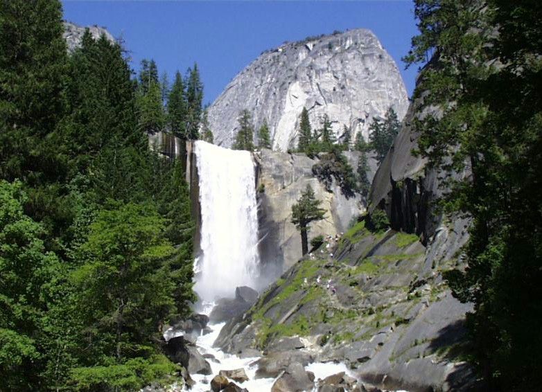 |
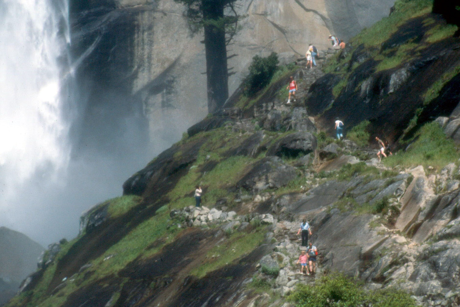 |
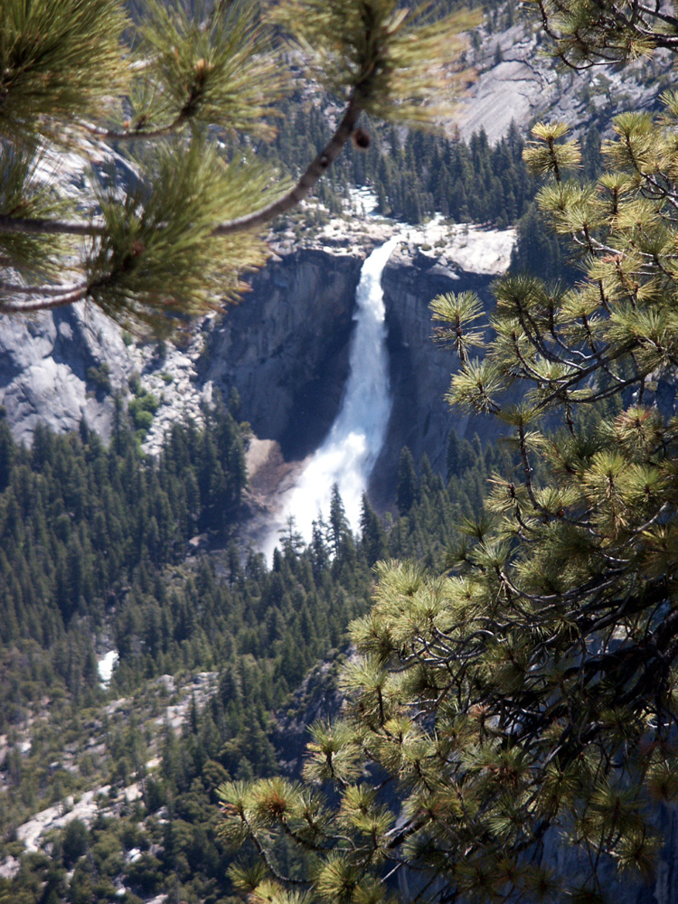 |
|
| Vernal Falls from the bridge | On the mist trail (Vernal Falls visible at left) | Nevada Falls from Glacier Point | |
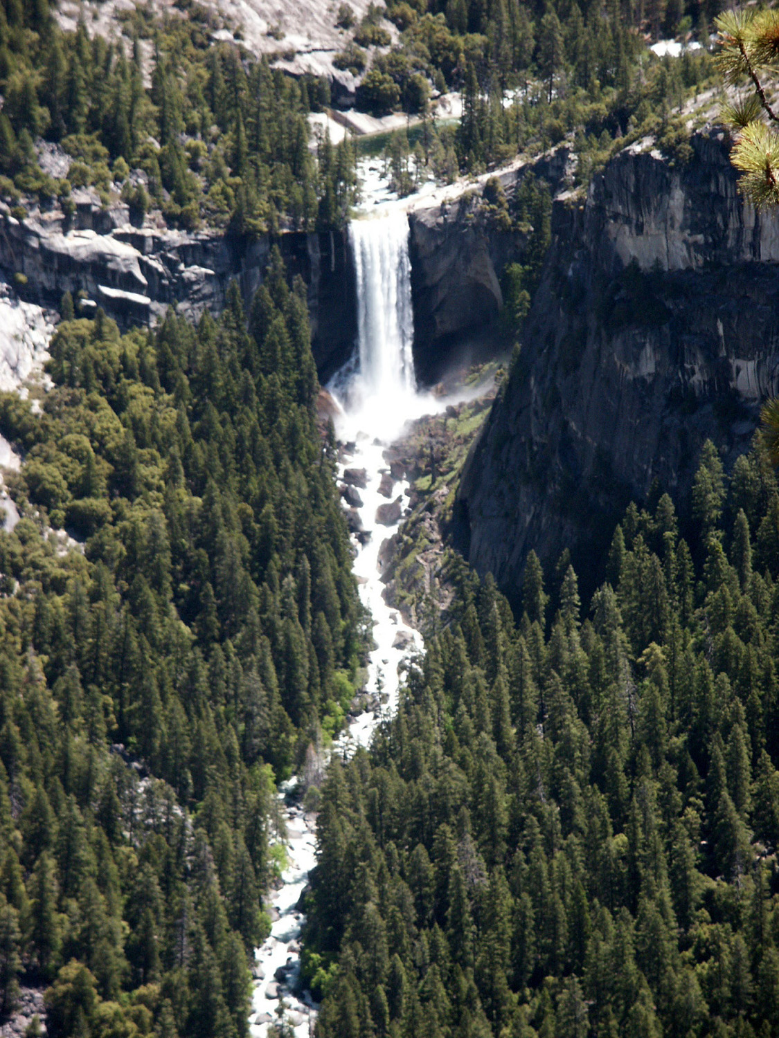 |
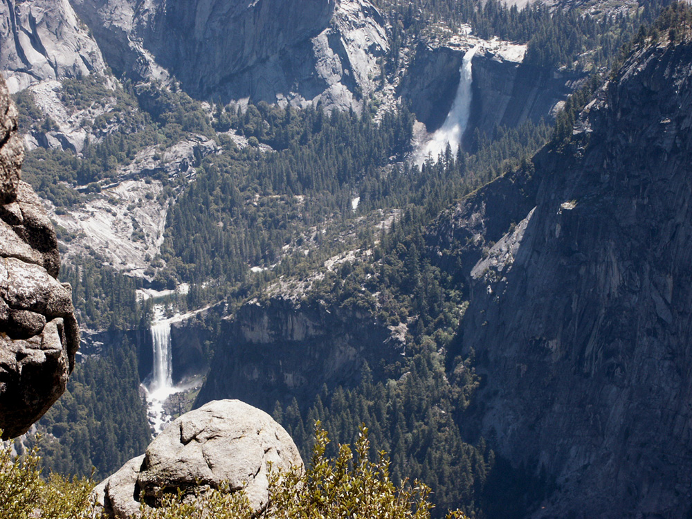 |
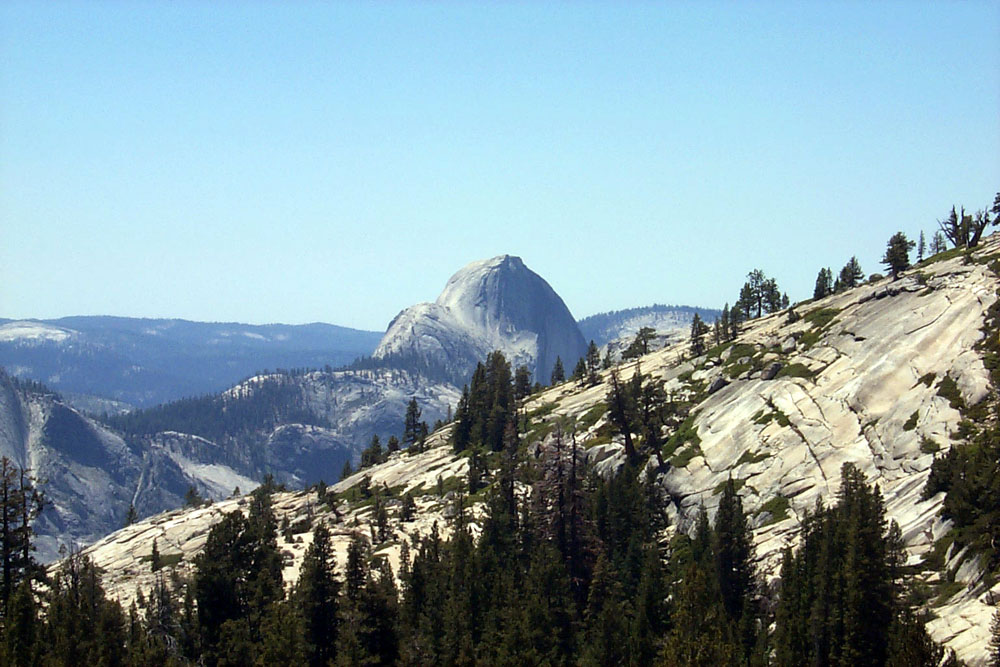 |
|
| Vernal Falls from Glacier Point | The Giant Stairsteps | Half Dome from Olmstead Point on Tioga Pass Road |
|
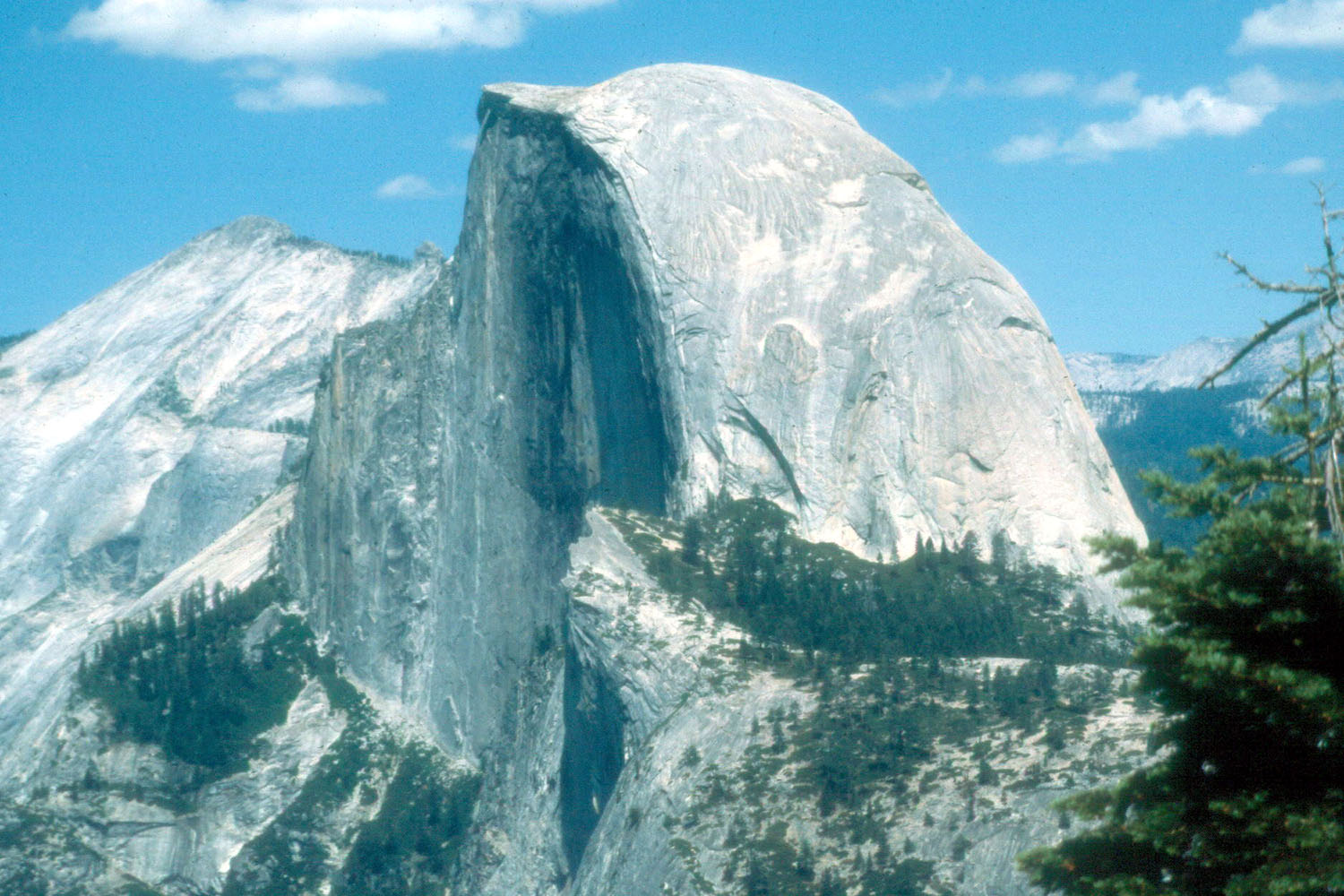 |
 |
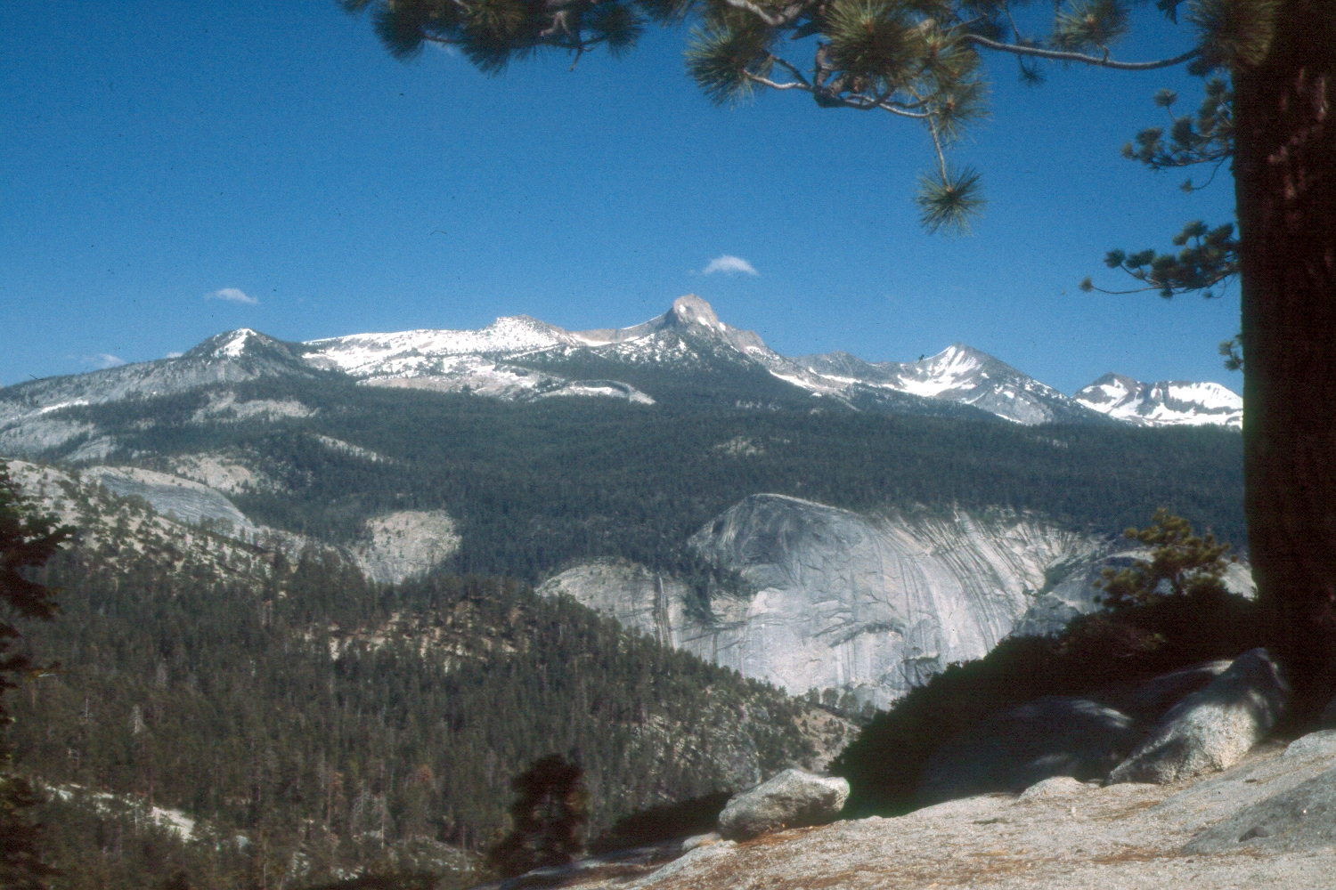 |
|
| Our destination | Back of Half Dome from Little Yosemite | View from trail below Half Dome | |
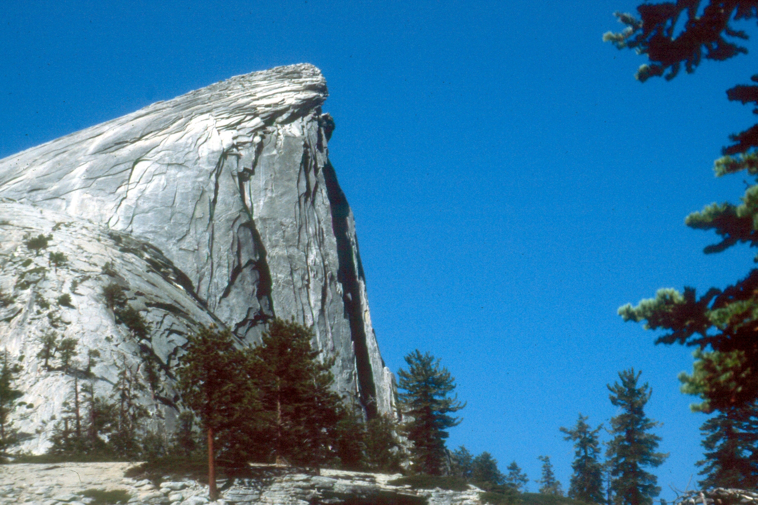 |
 |
 |
|
| Getting close | Looking down on Mt. Watkins from Half Dome | Ron Reed on the hike to Half Dome | |
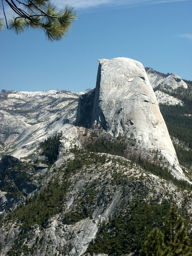 |
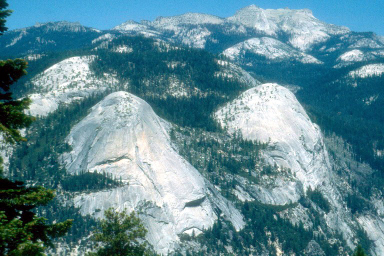 |
 |
|
| Half Dome in Profile (from Washburn Point) | North Dome and Basket Dome from Glacier Point |
Cathedral Peak near Tuolumne Meadows | |
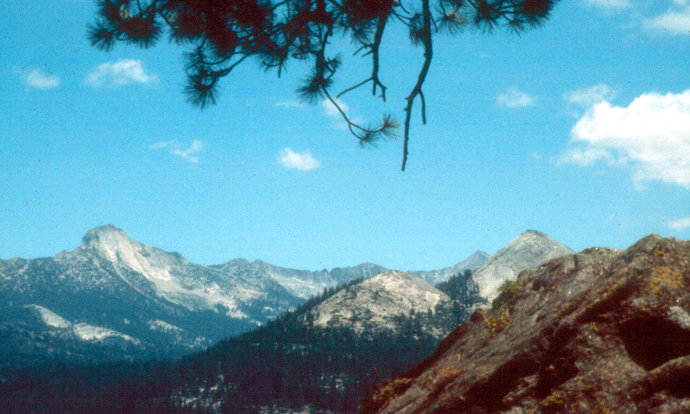 |
 |
 |
|
| Mt. Clark and Mt.
Starr-King from the trail to Half Dome |
Resting on the climb up to the top of Half Dome |
Glacial polish on granite in Yosemite |
|
 |
 |
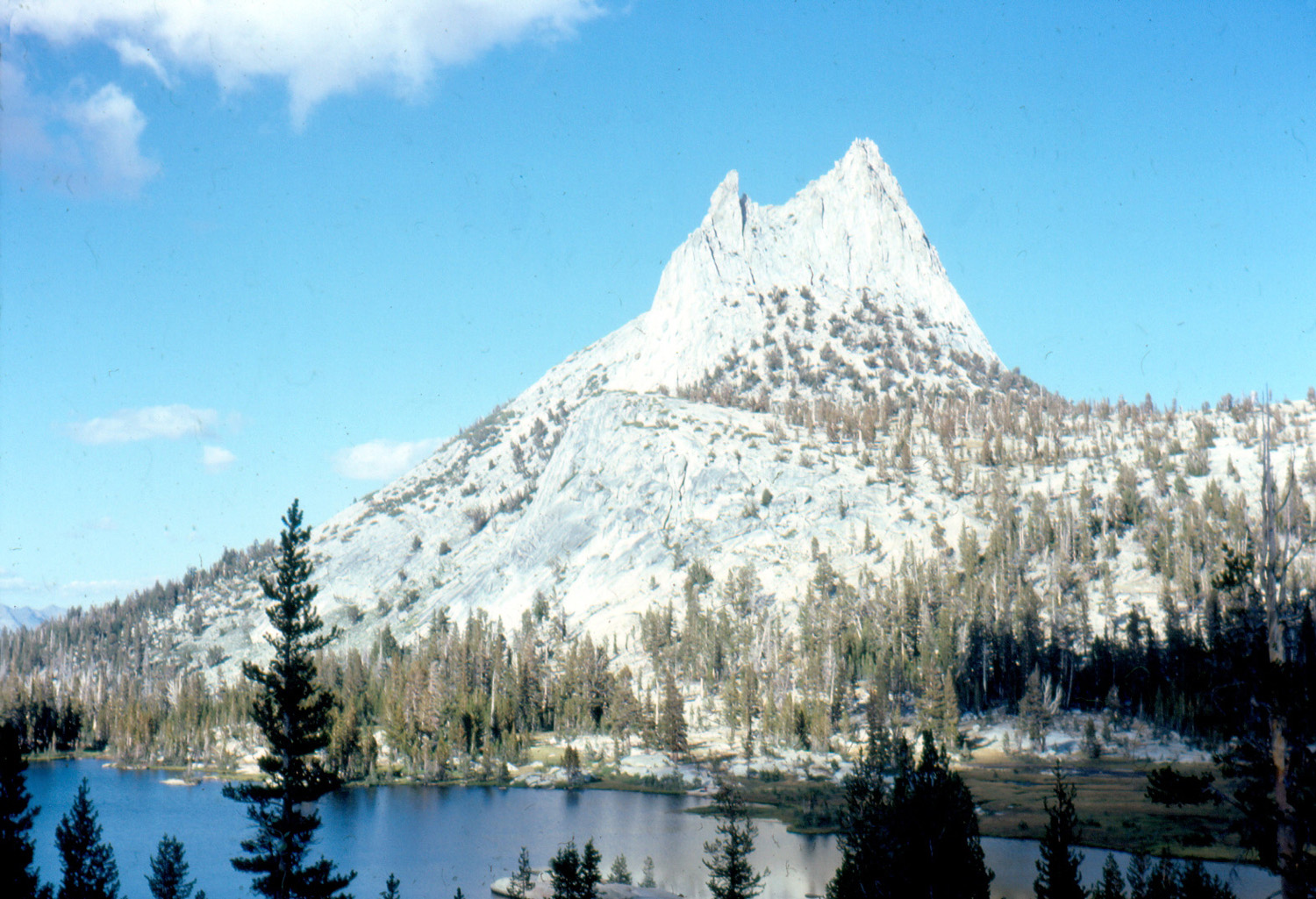 |
|
| Randy Westmoreland's pack shows signs of plenty of use |
Dick on the trail to
Cathedral Peak; Tenaya Lake below |
Our destination - Cathedral
Peak, near Tuolumne Meadows |
|
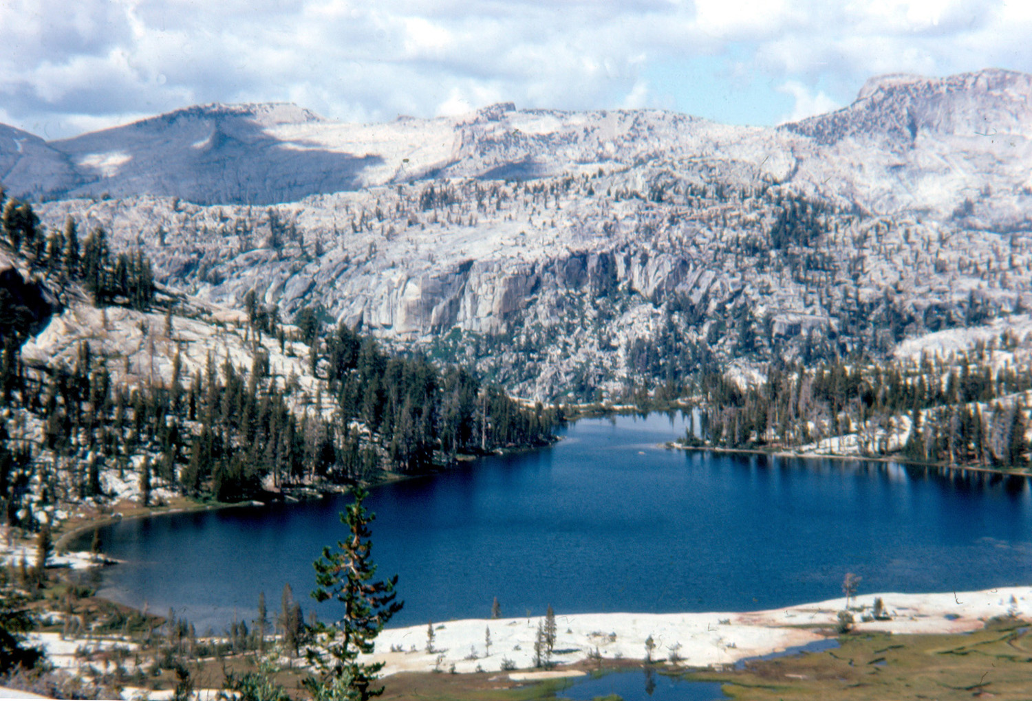 |
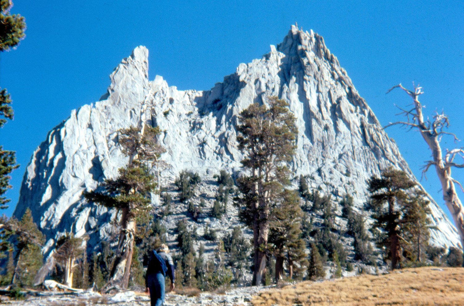 |
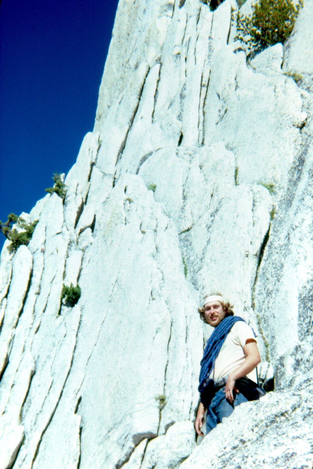 |
|
| Lower Cathedral Lake | Approaching the big rock | Ready to climb | |
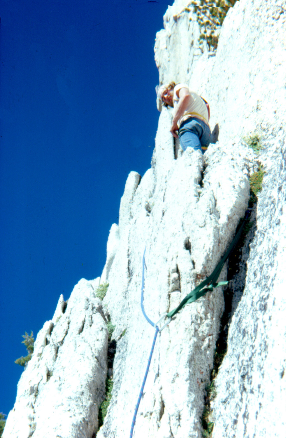 |
|
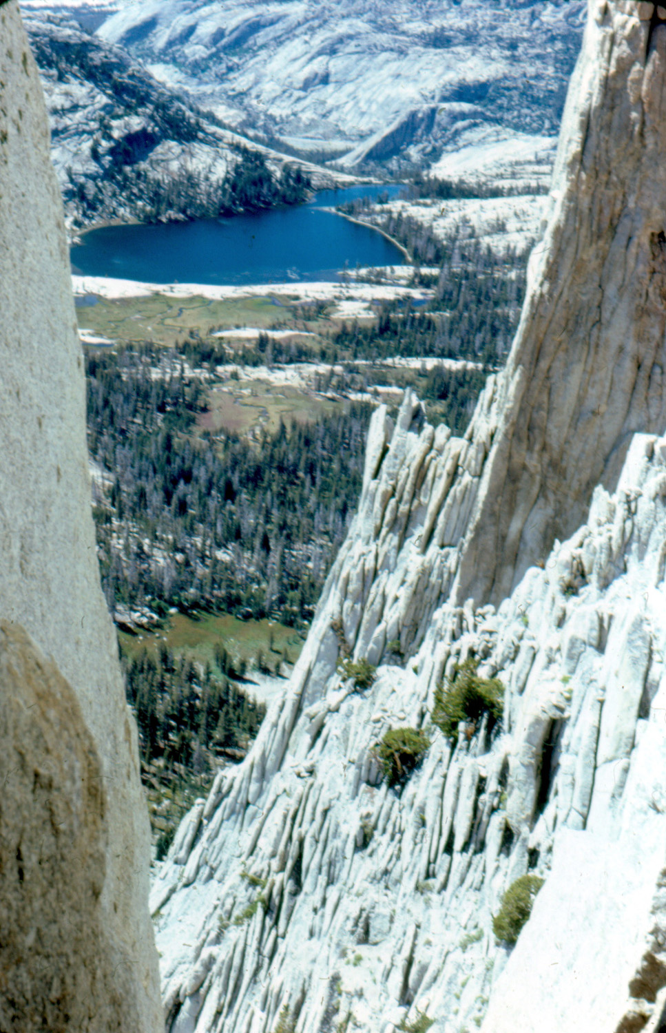 |
|
| Up we go | How did I get HERE? |
A spectacular view of Cathedral Lakes |
|
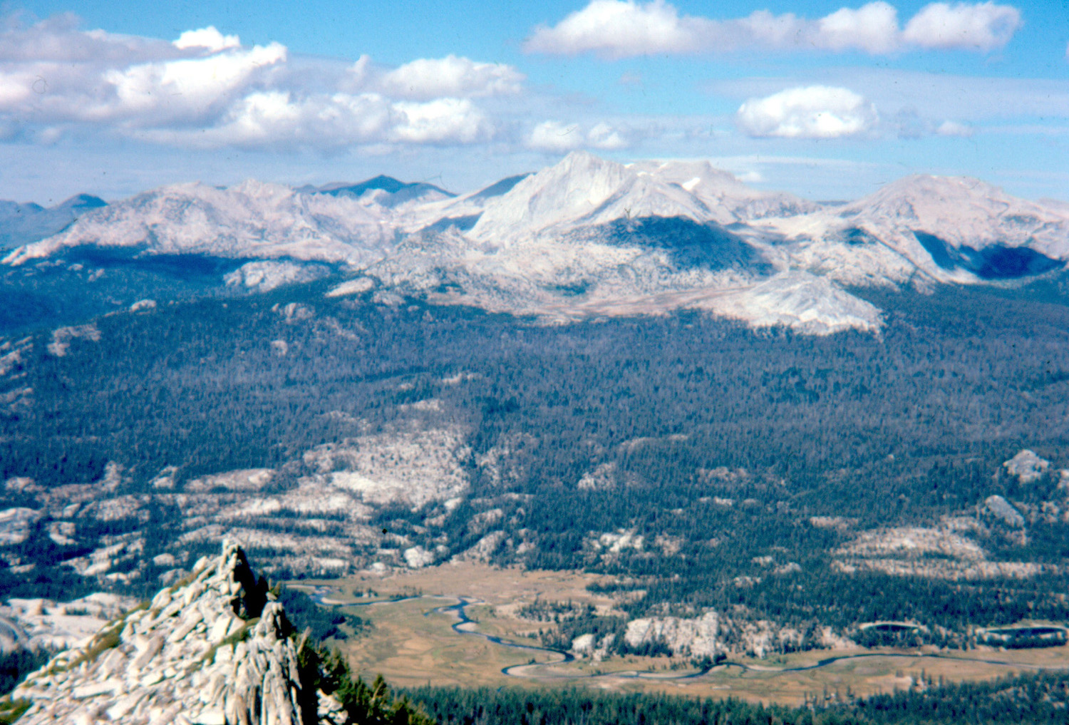 |
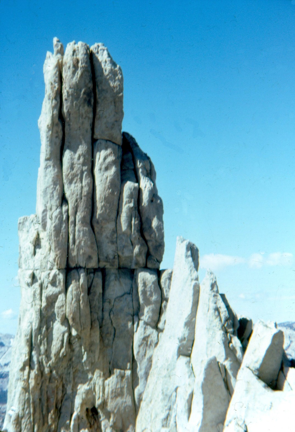 |
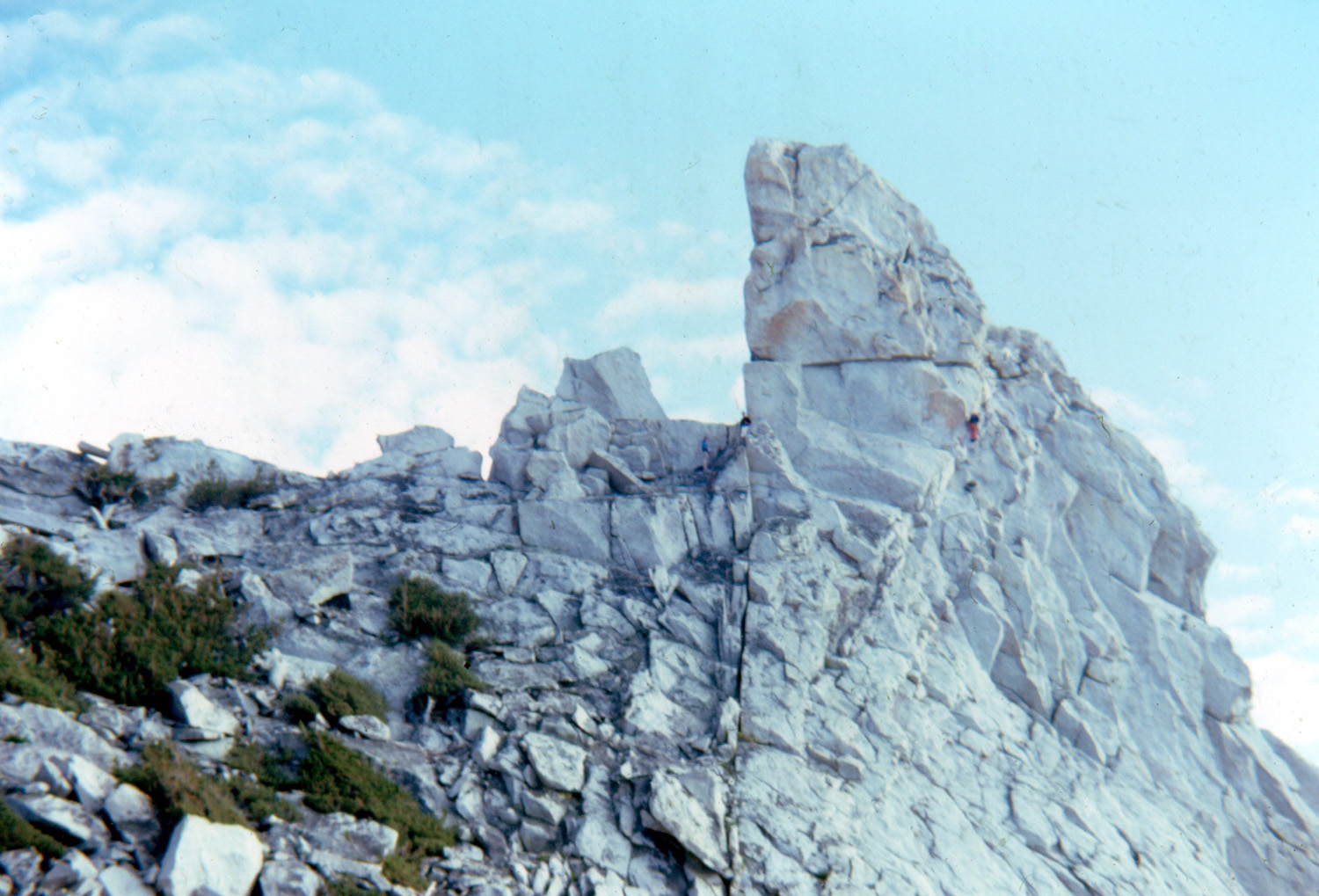 |
|
| Mt. Conness, with Tuolumne Meadows below | The western spire of the peak | Climbers on the spire (click here for more) | |
 |
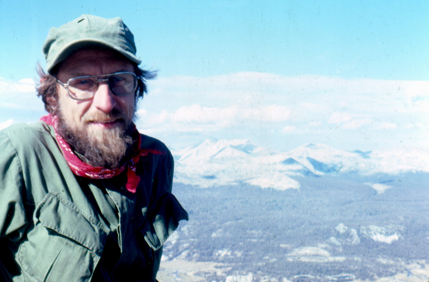 |
 |
|
| Echo Peaks and the Clark Range | Dick on top | Randy at the summit | |
 |
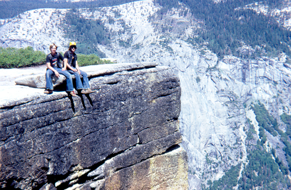 |
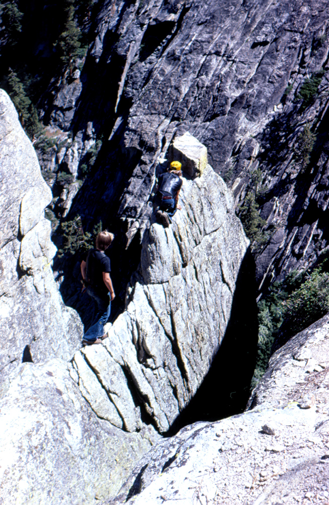 |
|
| Hung over at Taft Point | Tim & Scott at Taft Point | Ignoring all the warning signs | |
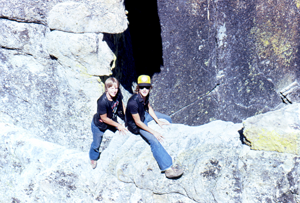 |
 |
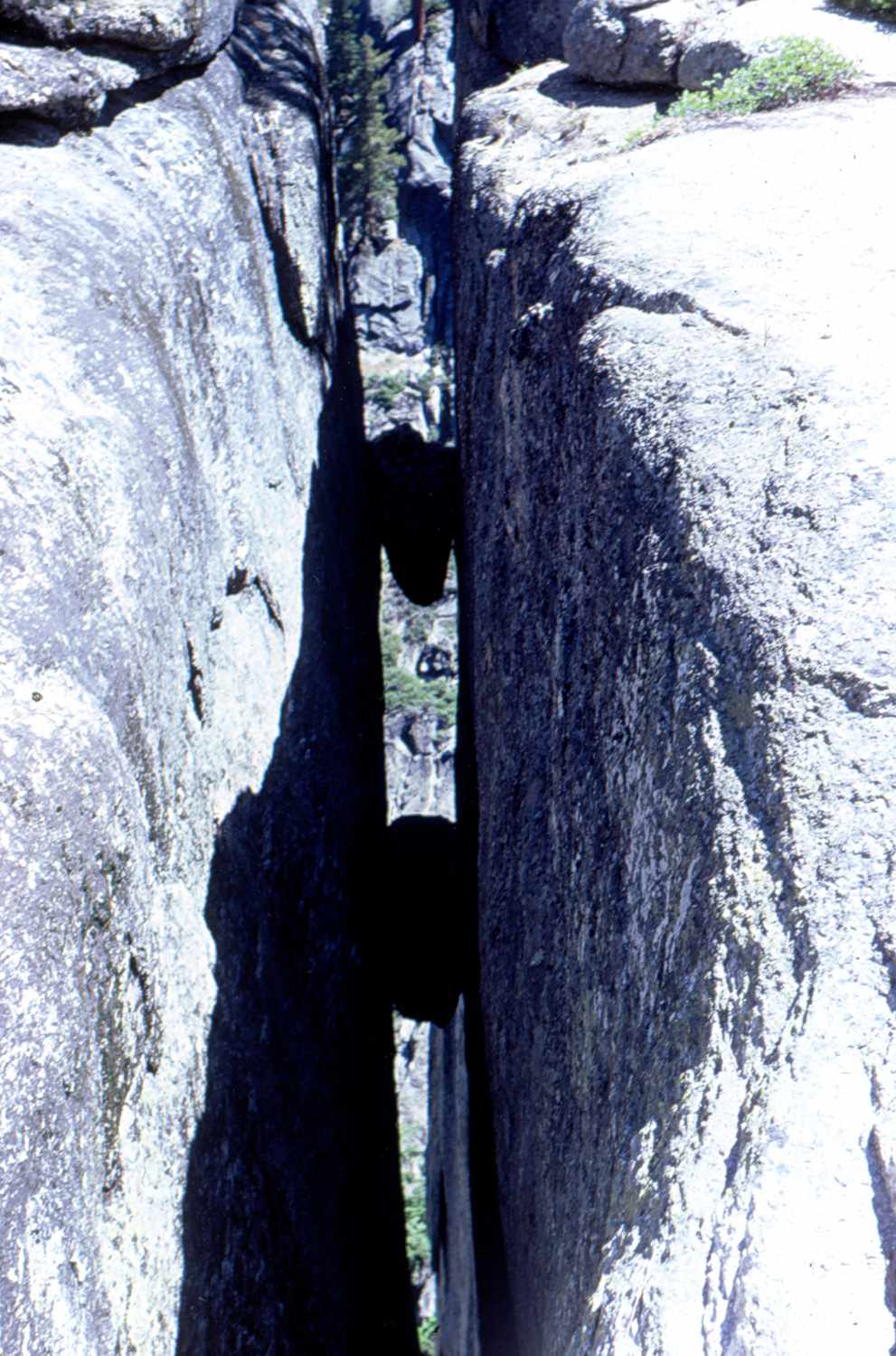 |
|
| It looks safer from this angle | A fissure within a fissure | Boulders trapped in the fissure | |
| Squaw Leap (San Joaquin Gorge) | |||
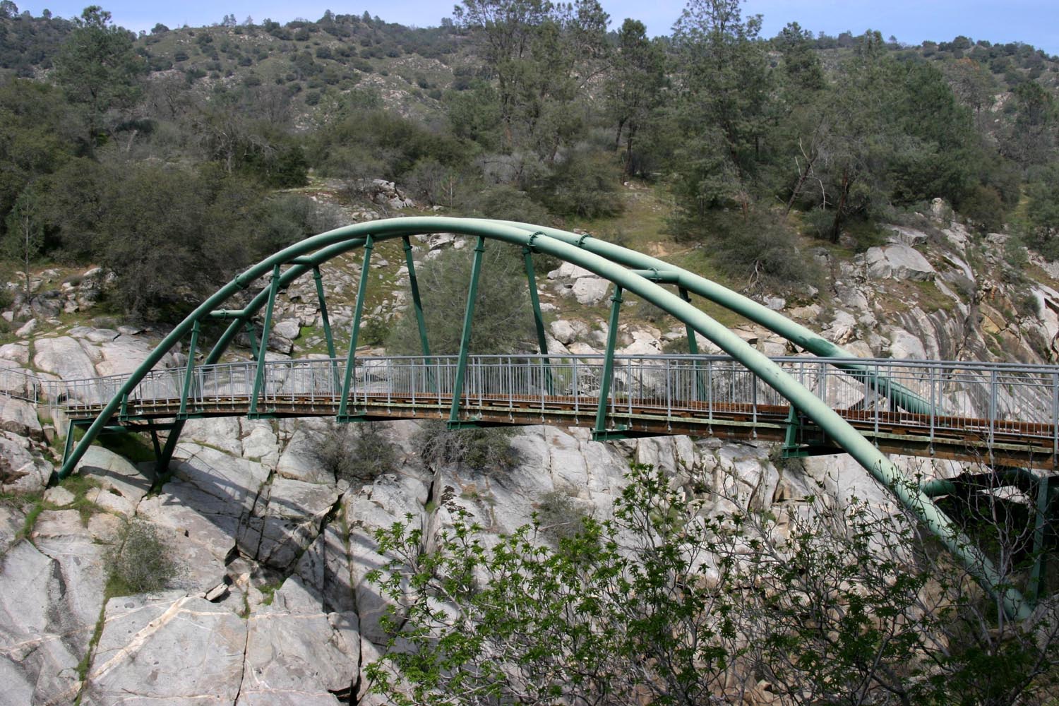 |
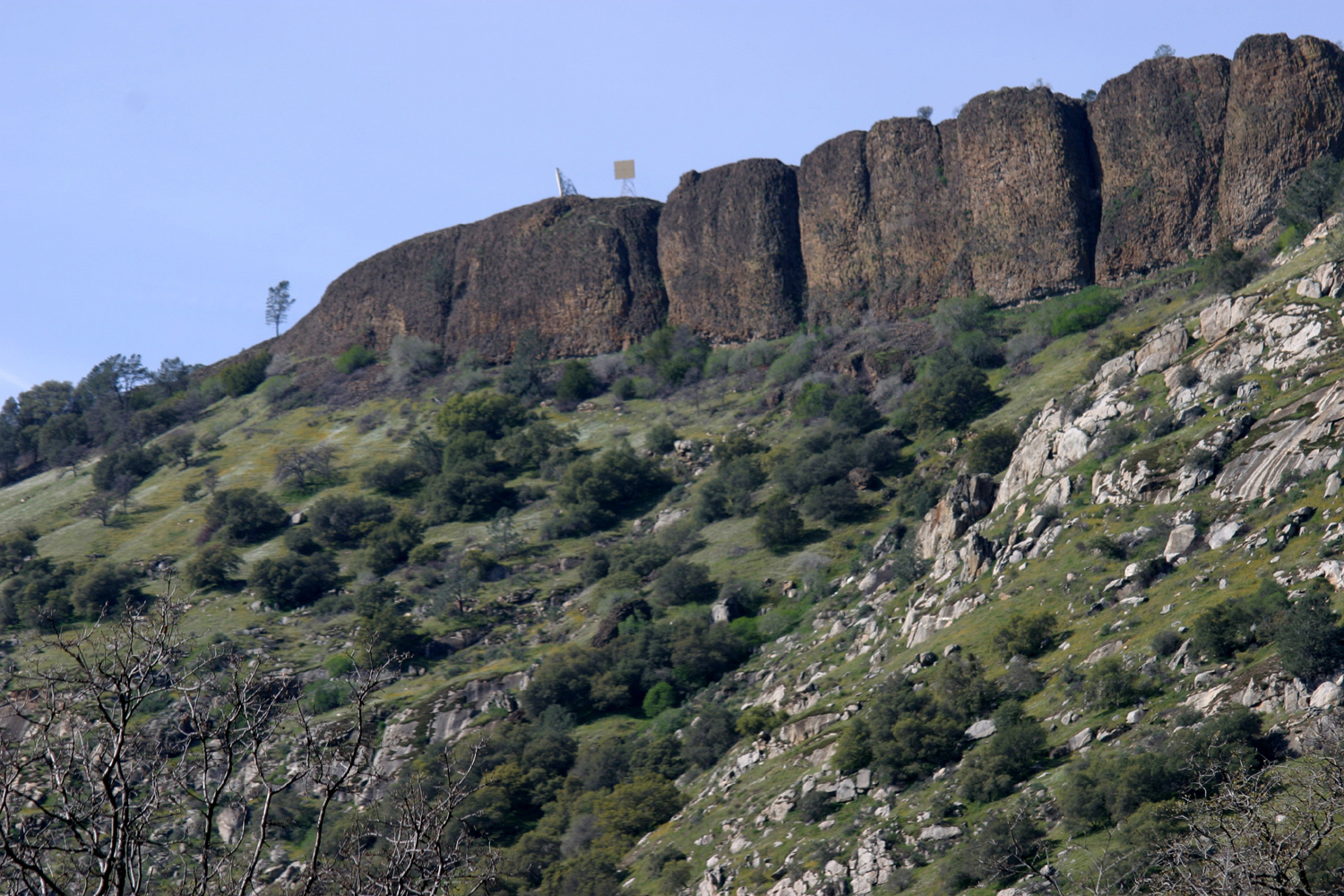 |
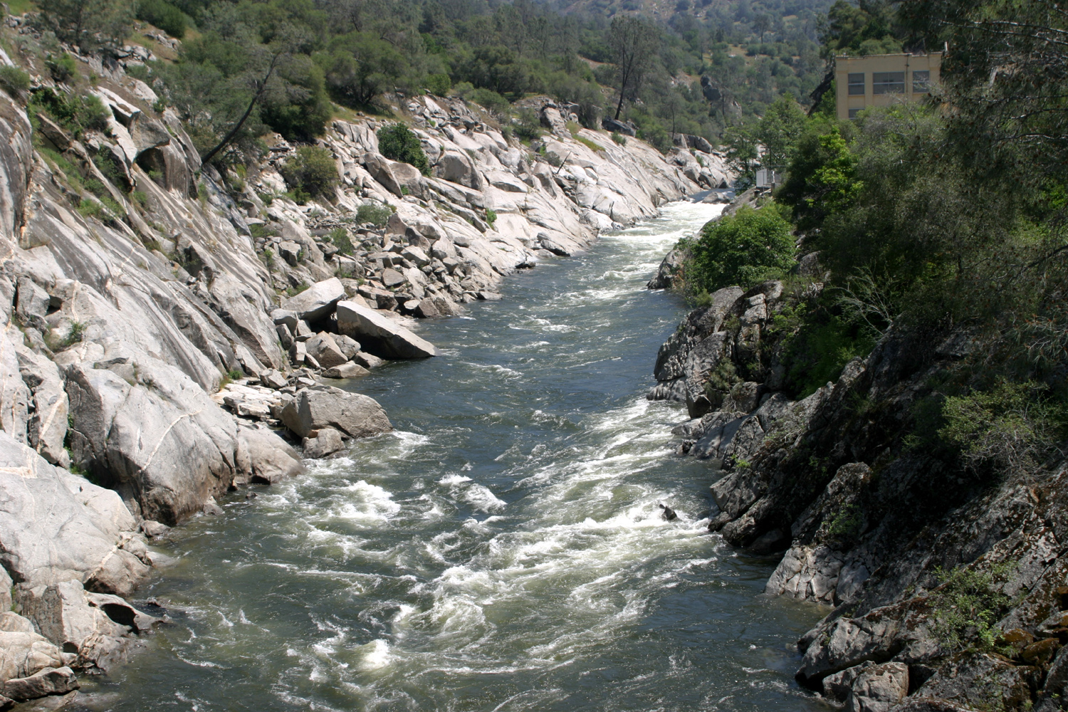 |
|
| The bridge at San Joaquin Gorge (Squaw Leap) |
Kennedy Table, above the San Joaquin River | San Joaquin River and power house from Squaw Leap bridge |
|
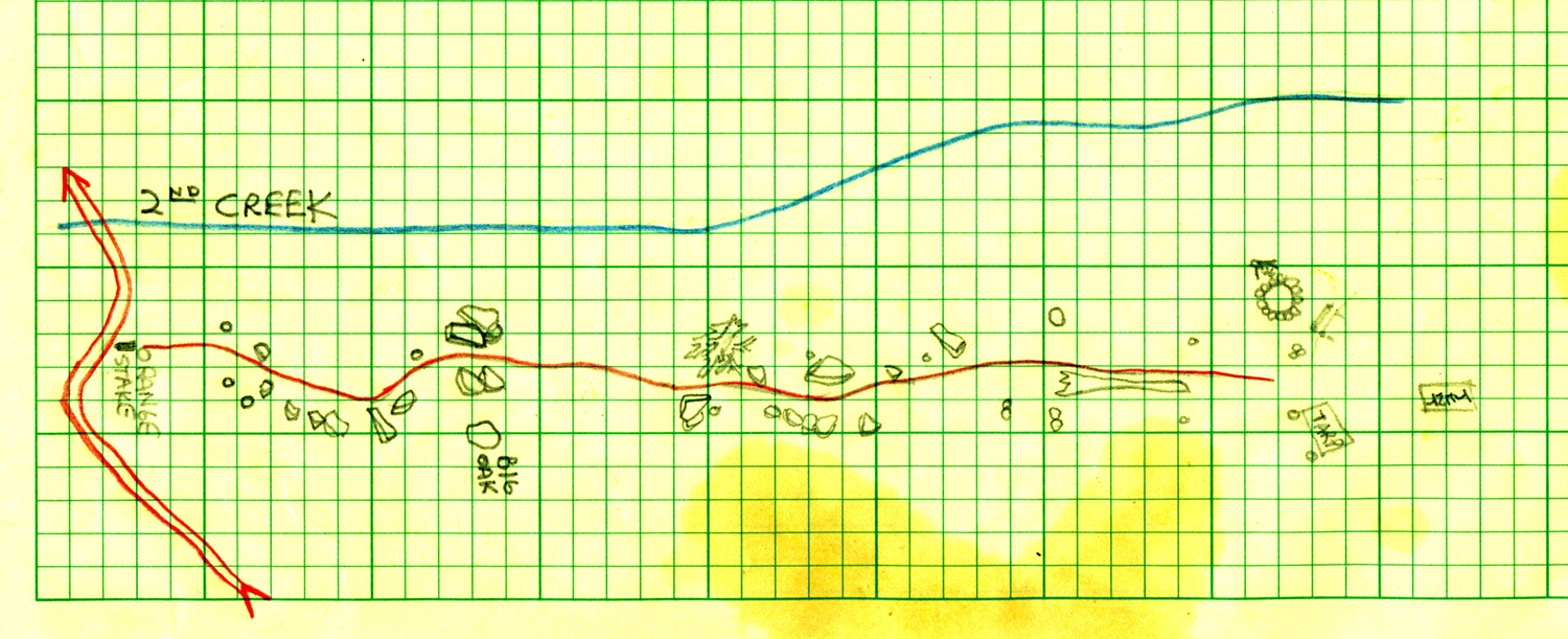 |
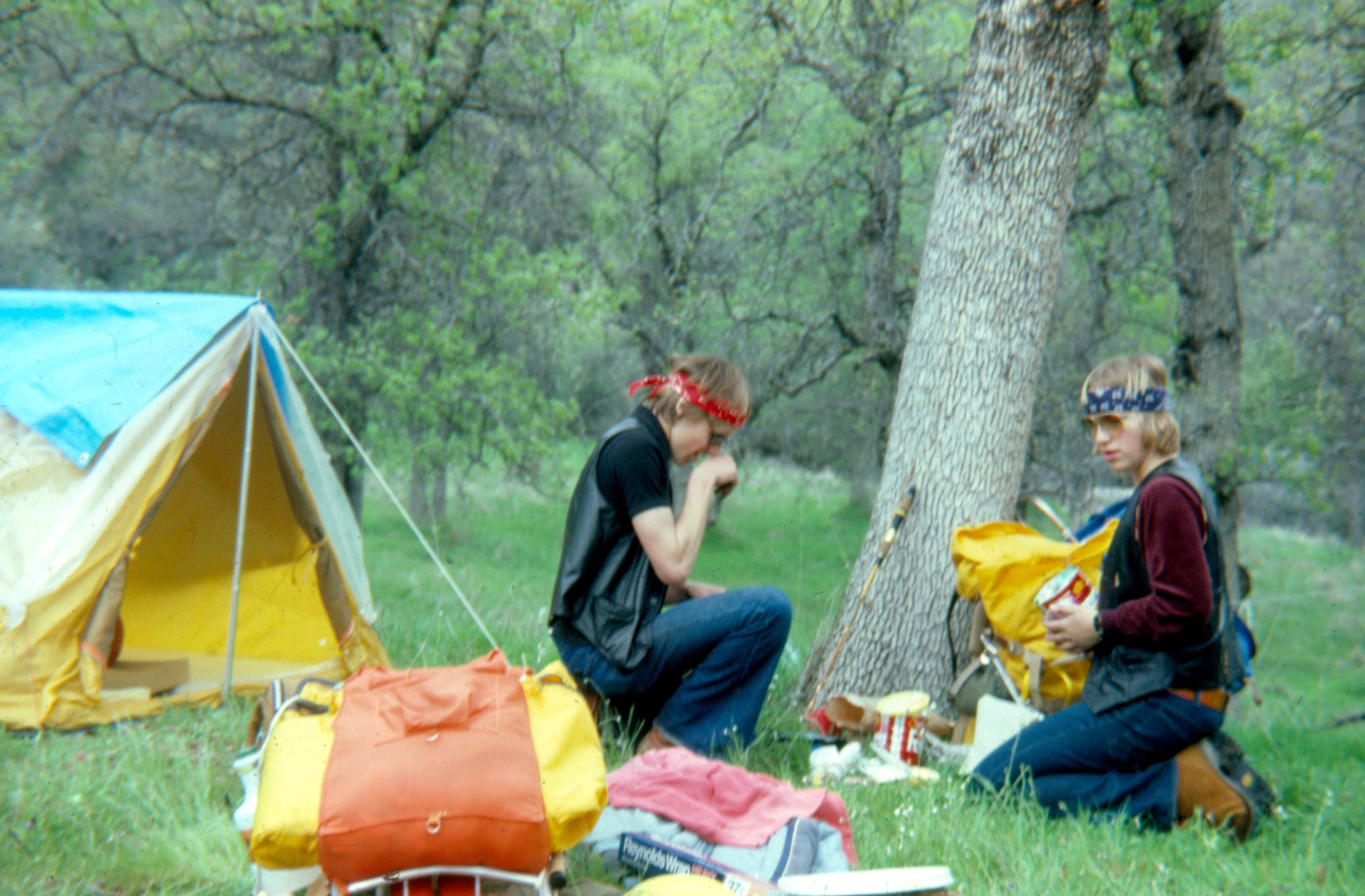 |
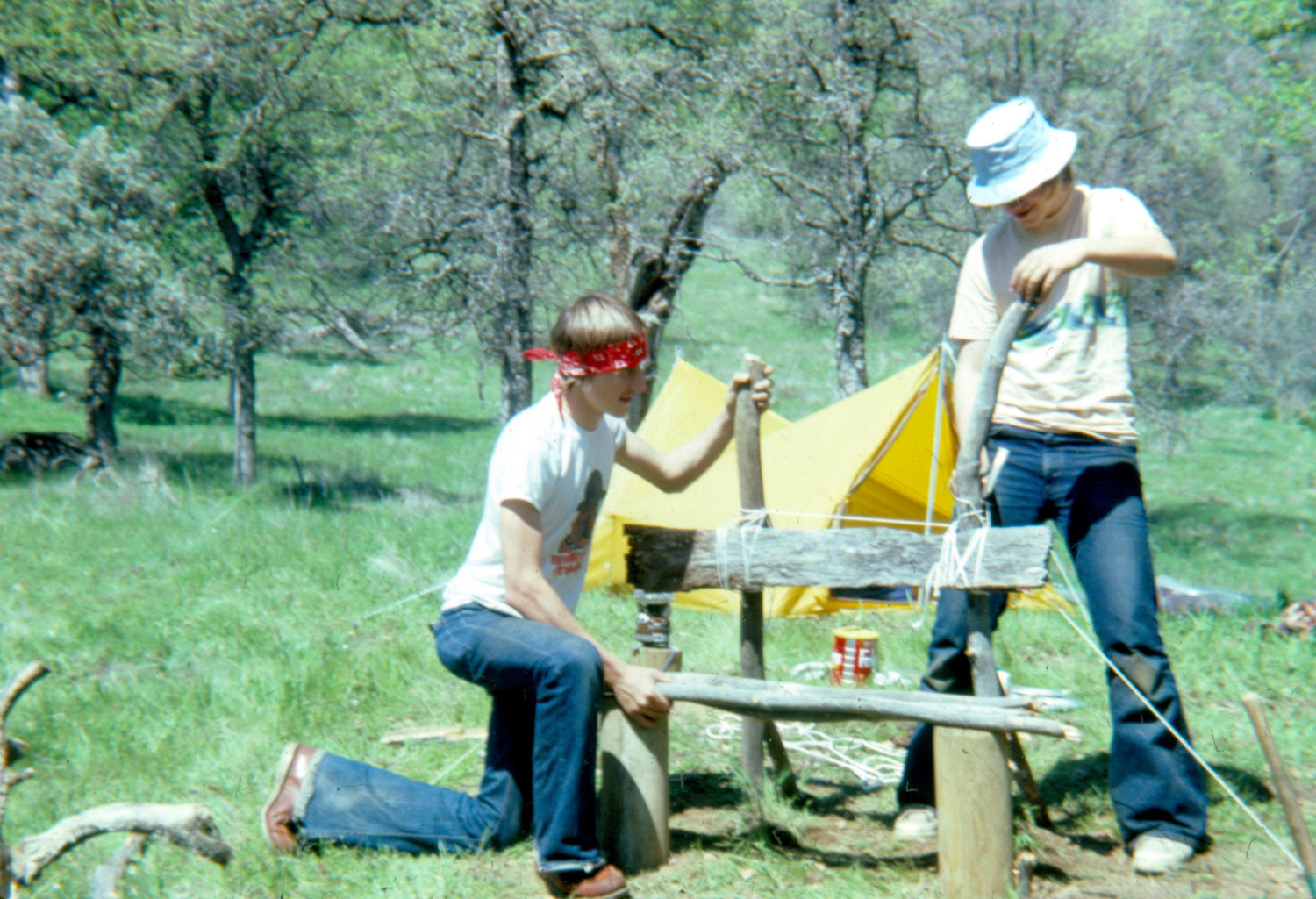 |
|
| L/S Expedition Map (expanded map) |
Scott & Tim setting up camp | Building the bench | |
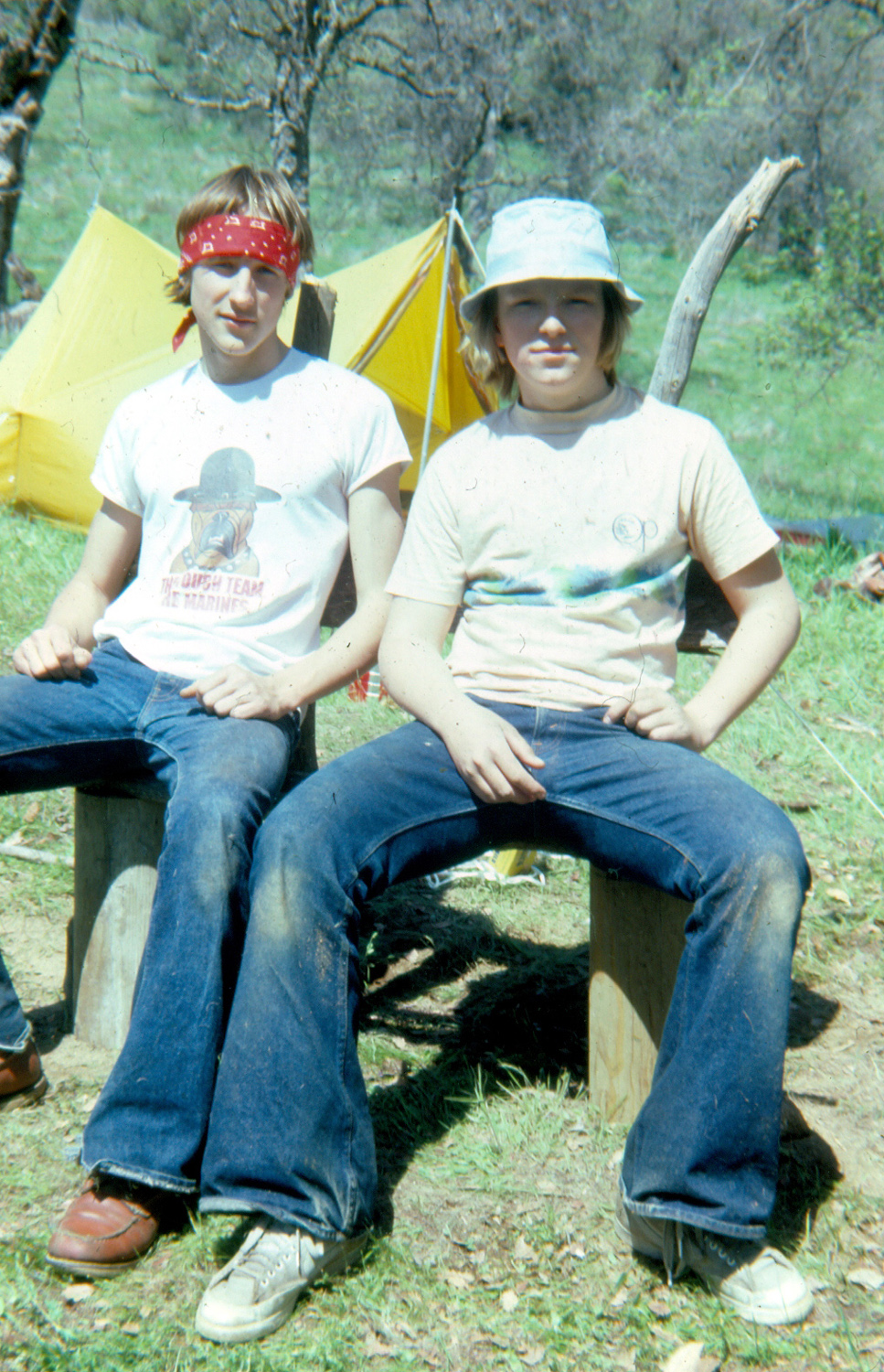 |
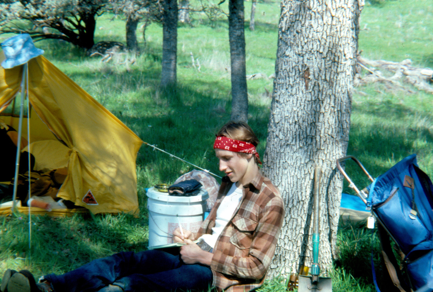 |
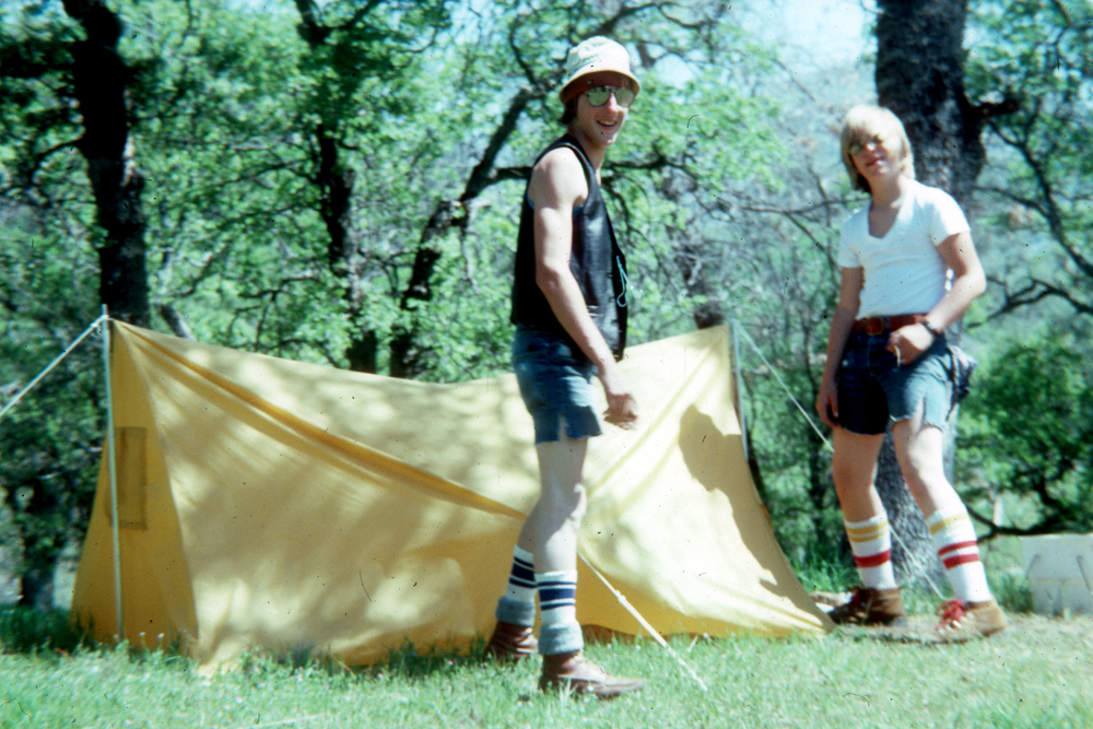 |
|
| Enjoying the bench | Scott writing in his journal | Getting ready to pack up | |
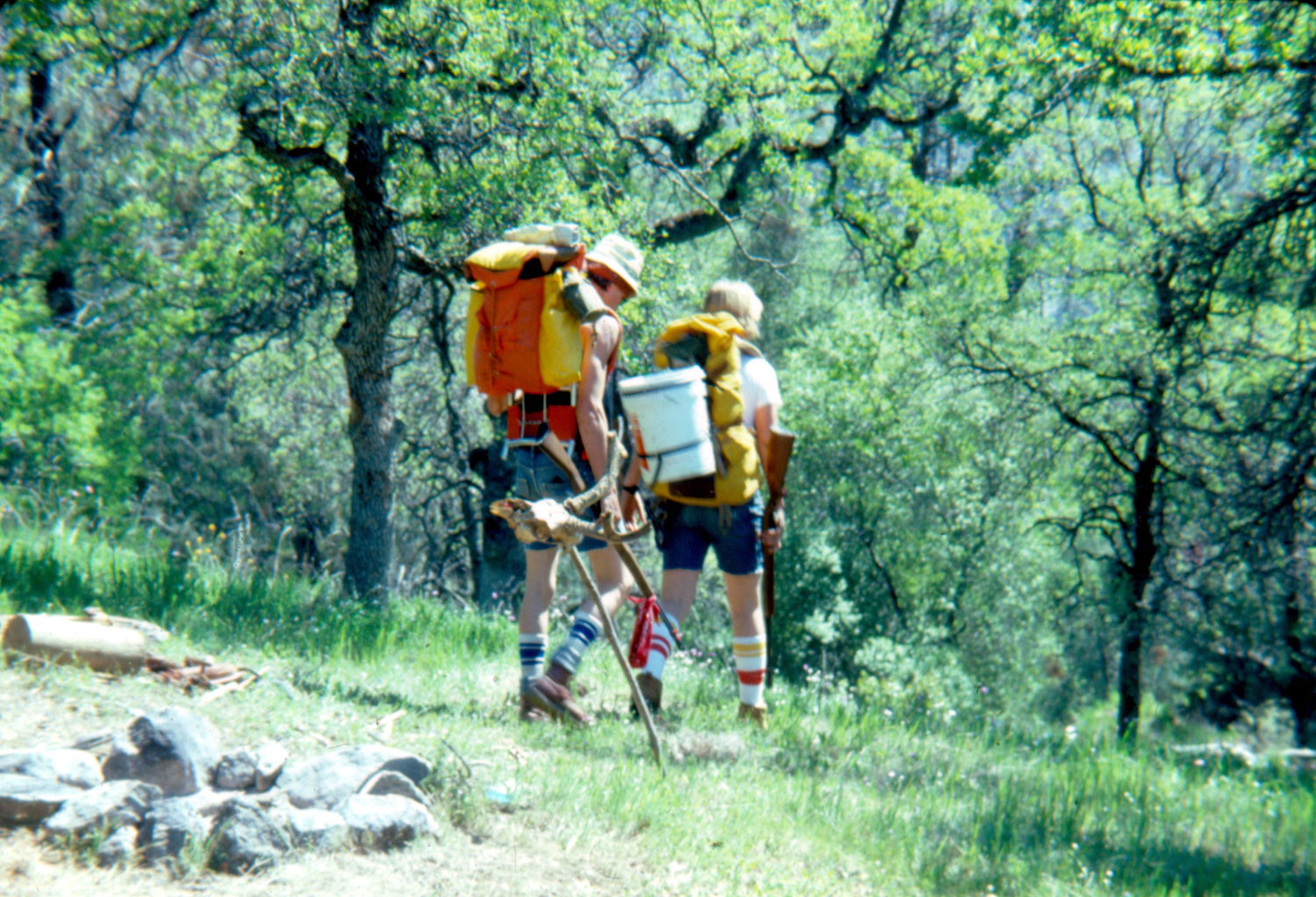 |
 |
 |
|
| Heading home |
The bench the first year after the fire |
|
|
 |
 |
 |
|
| Dick examines the tangle of burned trees | Perfect balance | A few months later | |
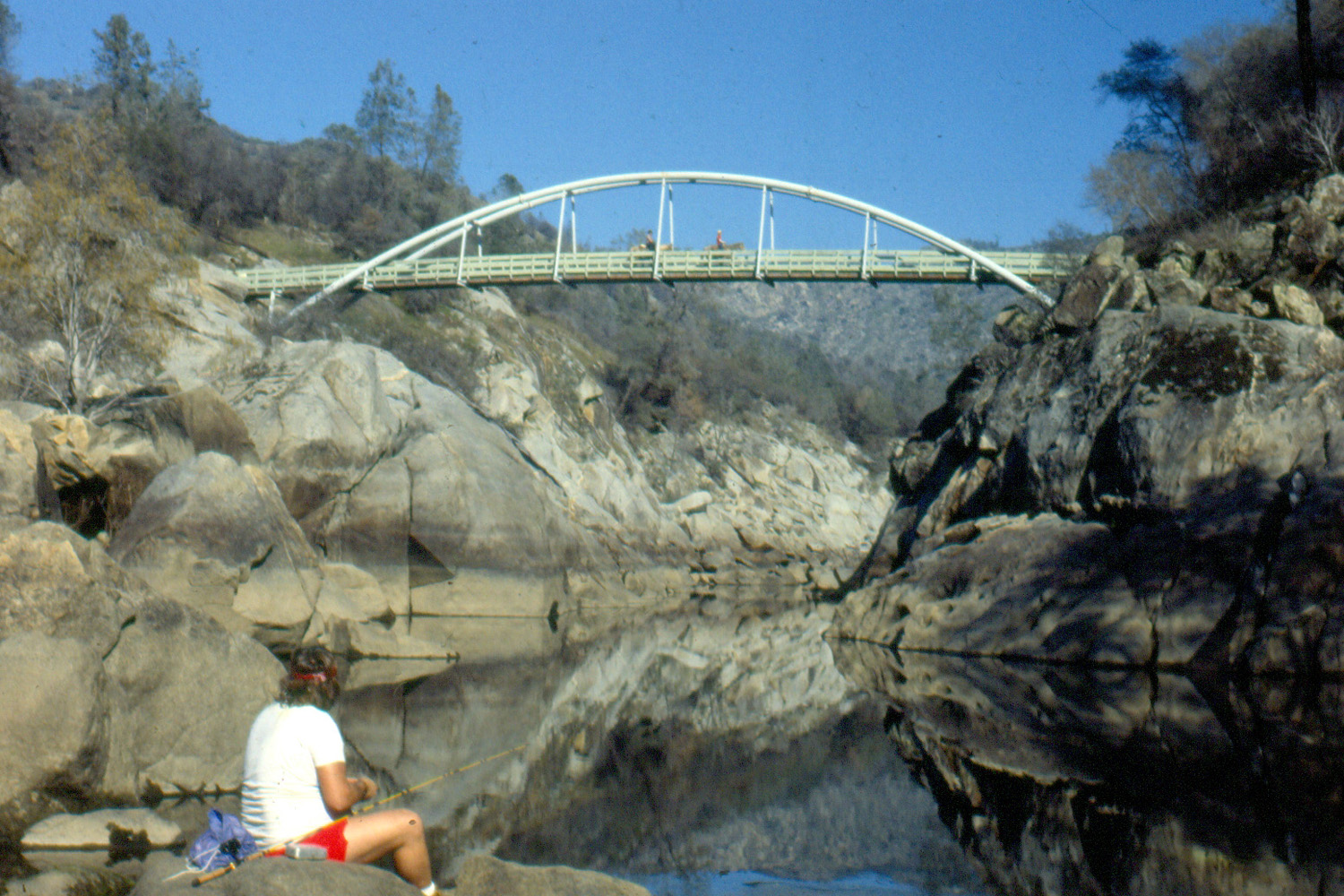 |
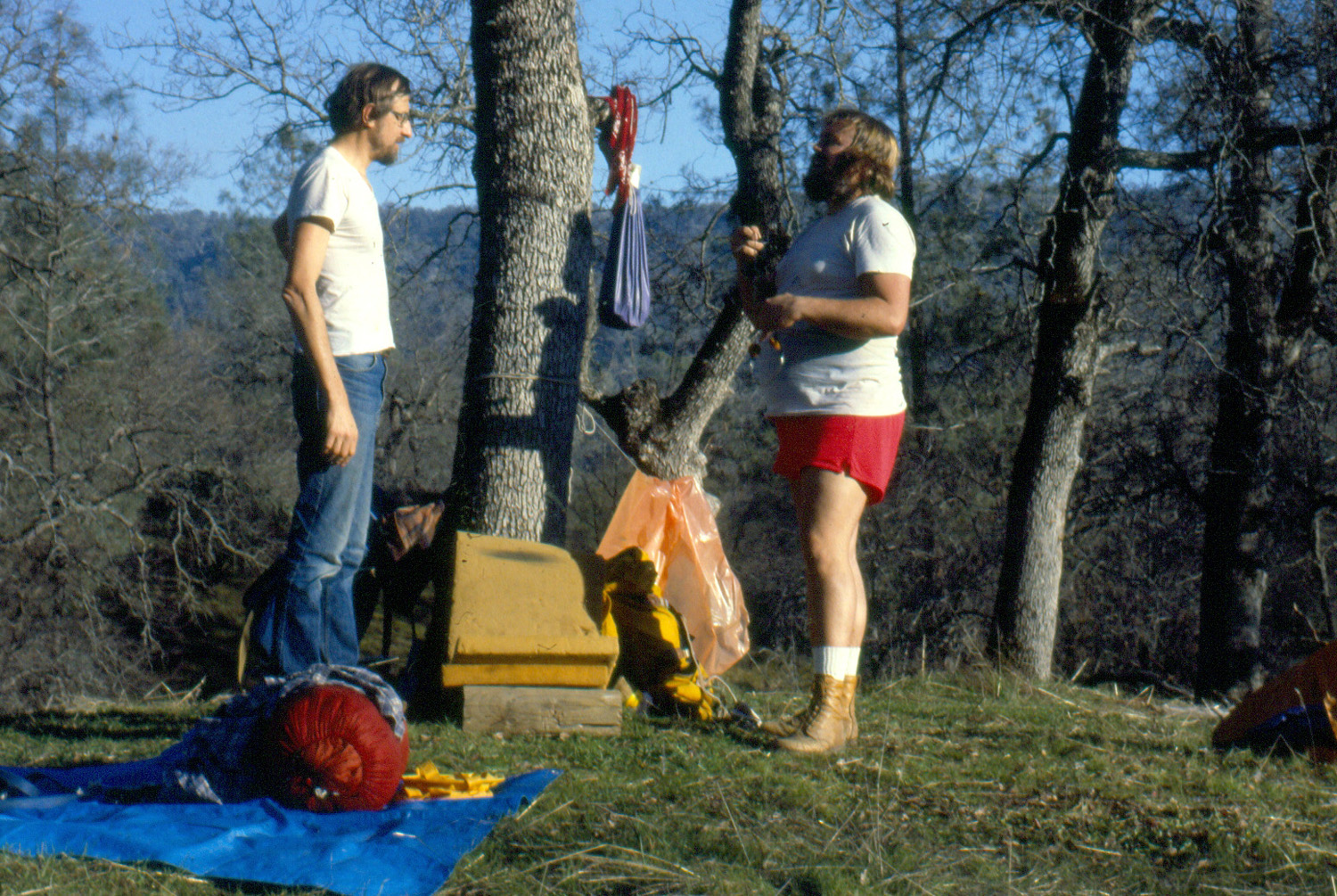 |
 |
|
| Randy Morrison fishing
below the bridge, January 1984 |
Dick with Randy Morrison at L/S camp site | Remains of the L/S camp bench (2010) | |
 |
 |
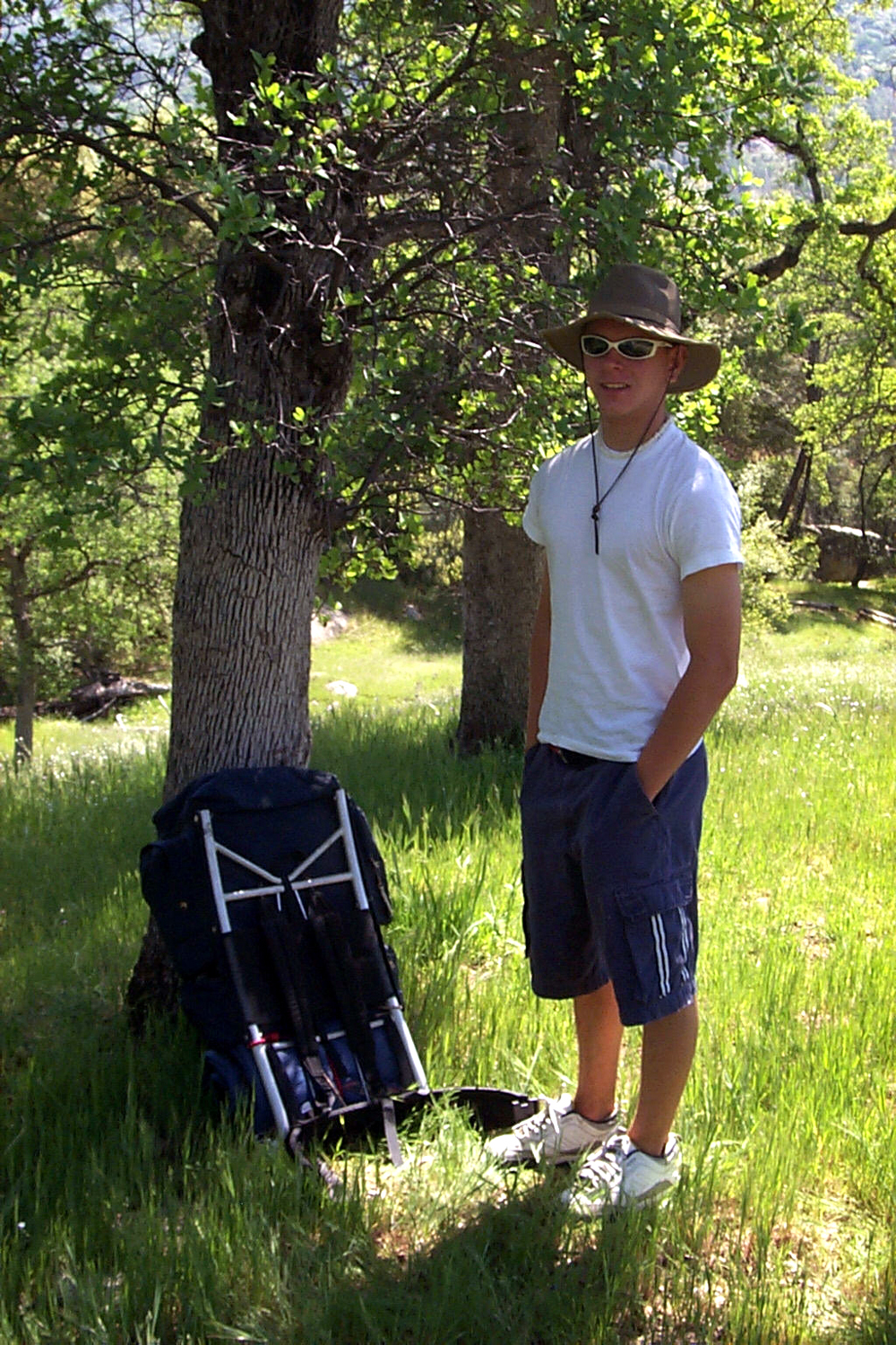 |
|
| This tree was still
standing when we first saw it in 1981 (2010 photo) |
Hilltop campsite, 2001 | Johnny at Squaw Leap, 2001 | |
 |
 |
 |
|
| Bridge, power house, roads and trails from Kennedy Table |
The big cliff at Kennedy Table | Johnny on the rocky top of Kennedy Table | |
 |
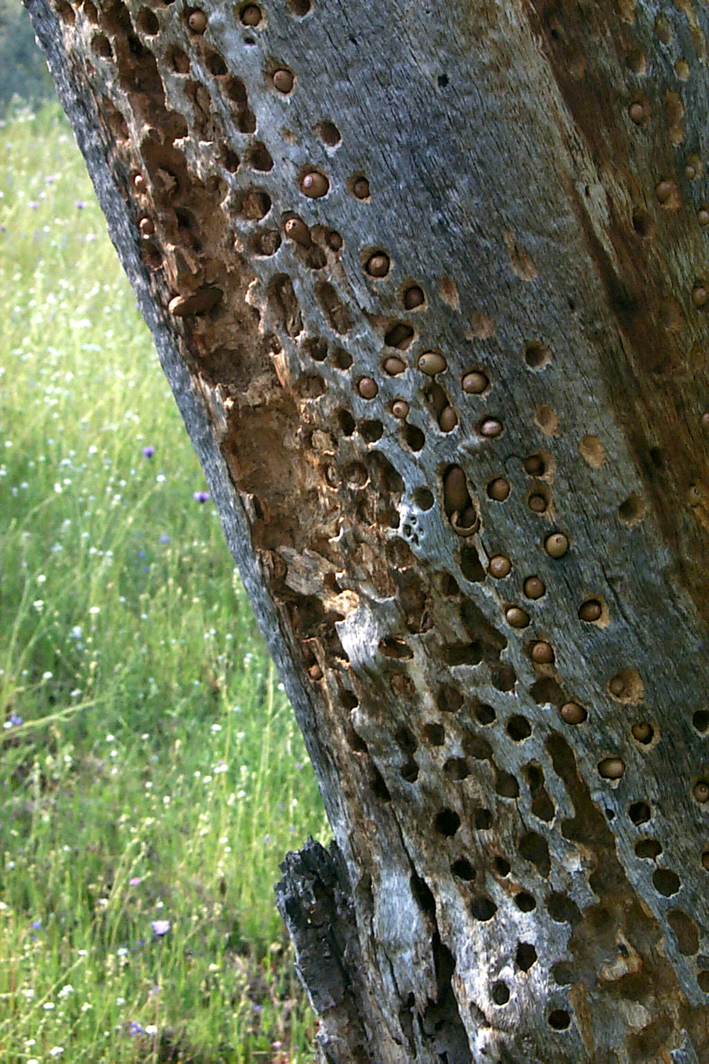 |
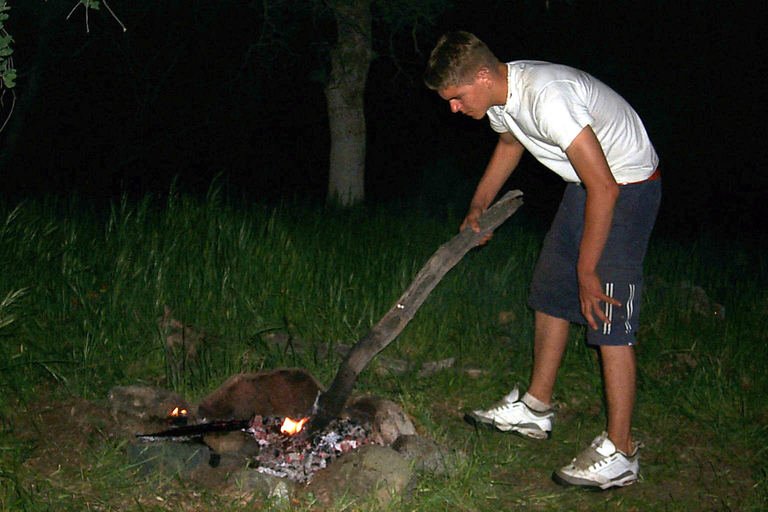 |
|
| Dick & Johnny on the edge | Woodpecker acorn storage tree | Johnny wields the world's biggest fire stirring stick |
|
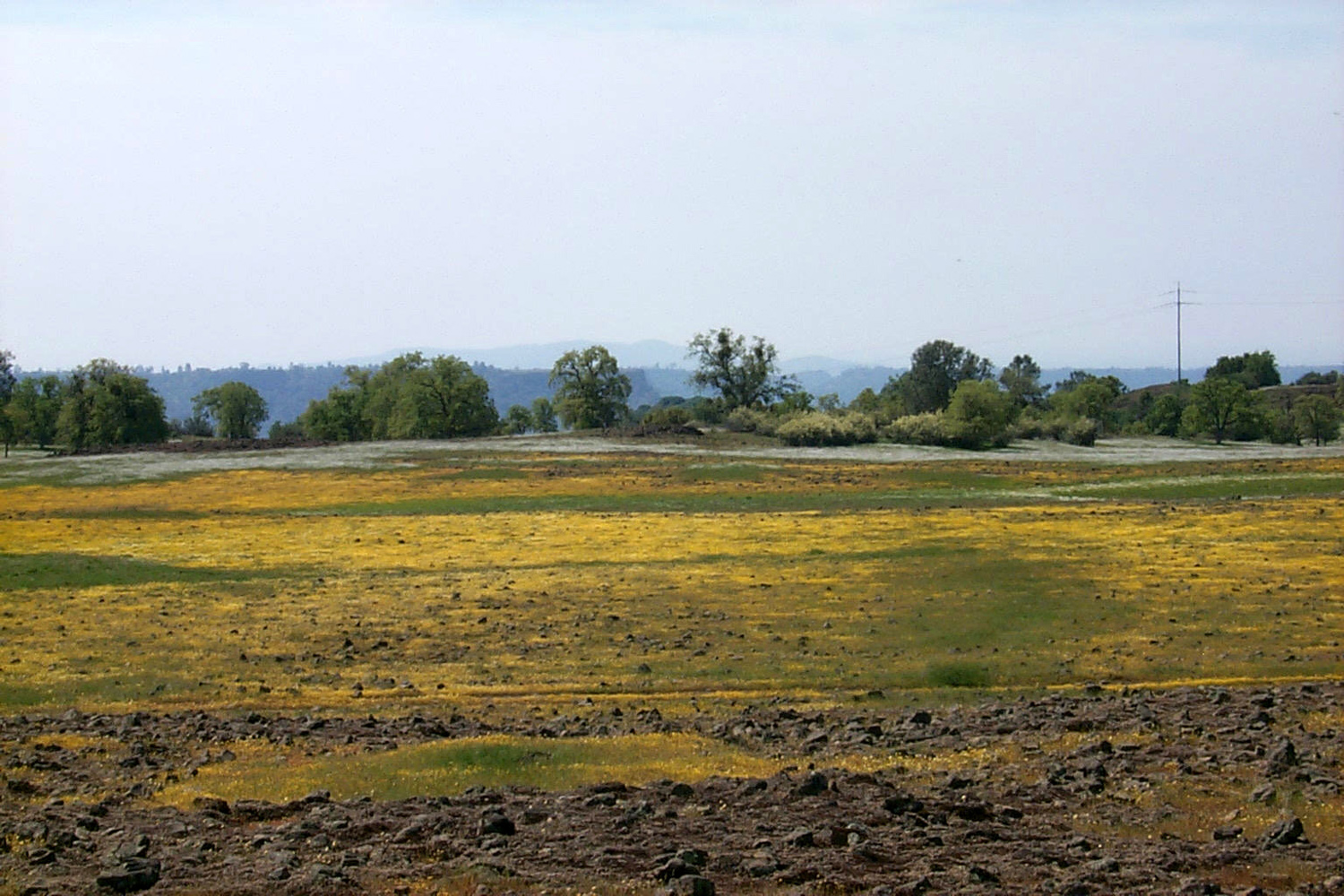 |
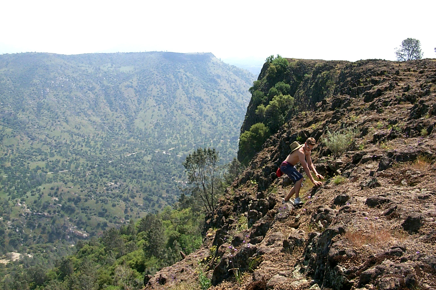 |
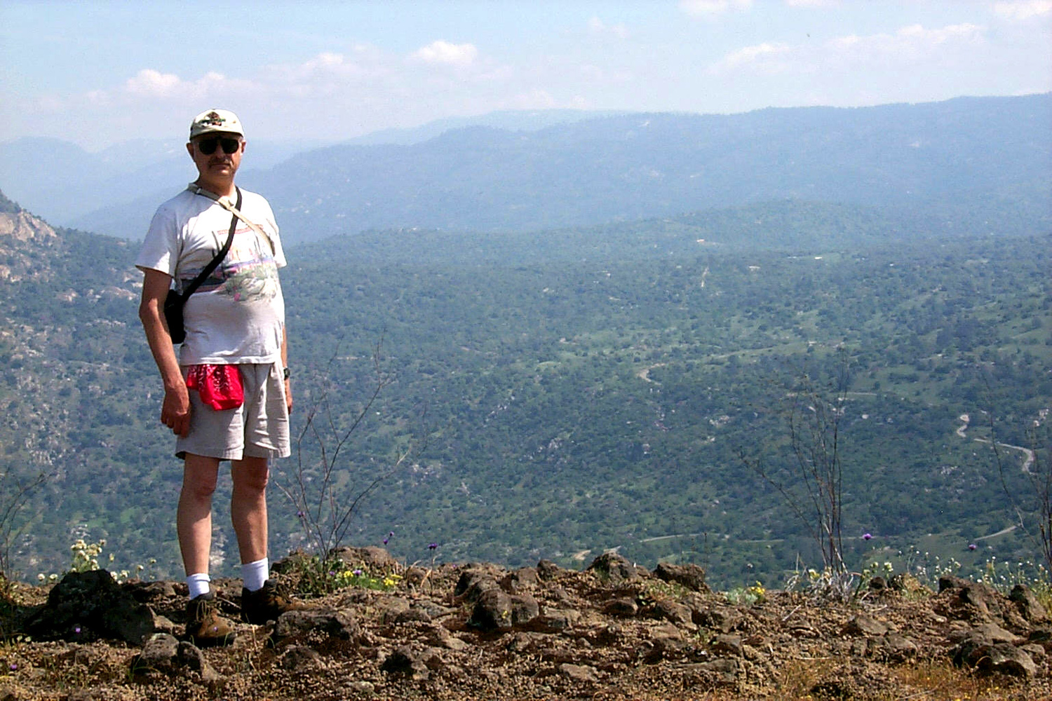 |
|
| Wildflowers paint the top of Kennedy Table | Johnny scrambles up the basalt rock on Kennedy Table; Squaw Leap cliff in center background | The view is worth the effort | |
| Sheep Crossing - North Fork San Joaquin - Devil's Postpile | |||
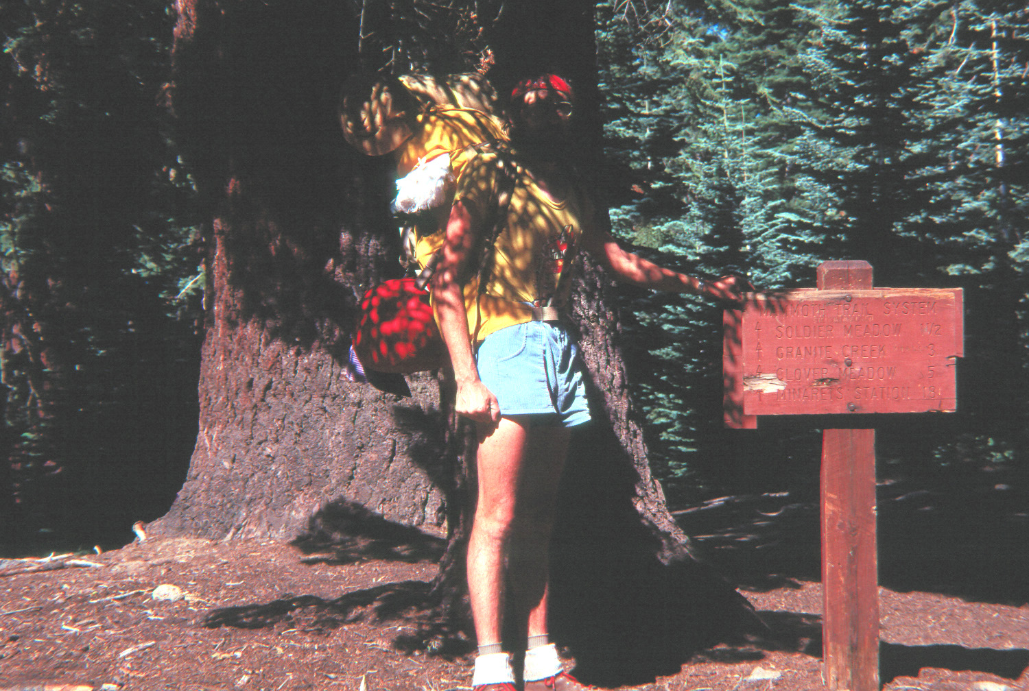 |
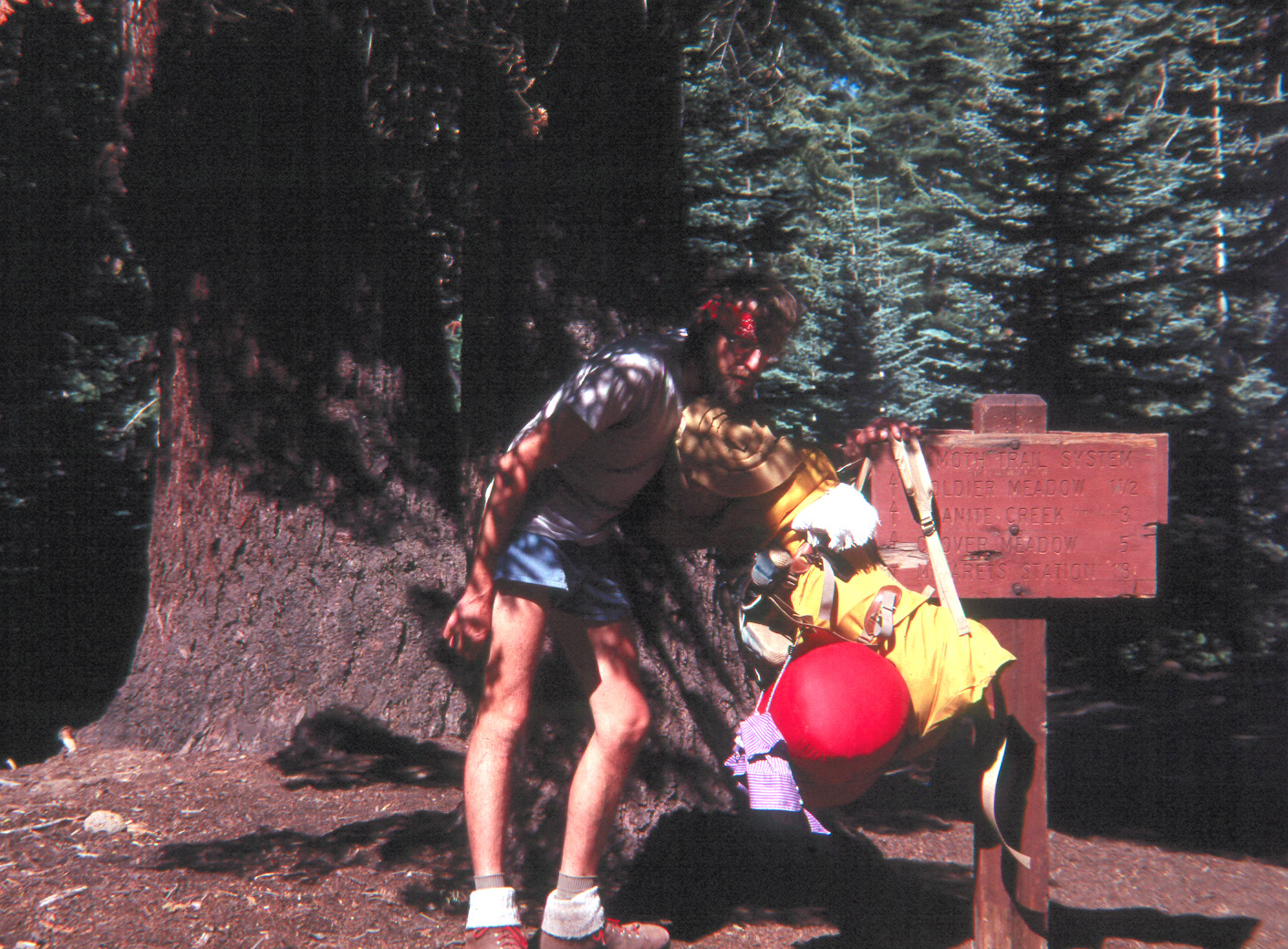 |
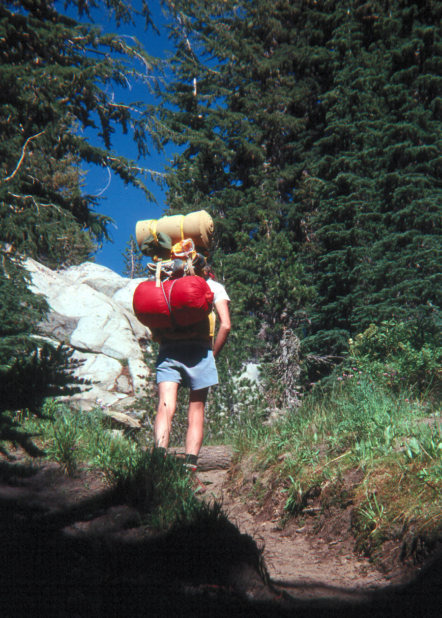 |
|
| Before.... | ...and after my Postpile hike | Heading up the trail | |
 |
 |
 |
|
|
Looking into the north fork, |
Stepping off the bridge and ready for anything | A well-earned rest at 88 Corral | |
 |
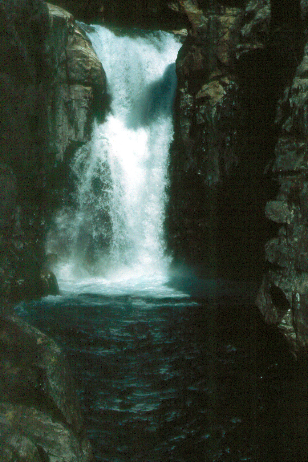 |
 |
|
| Backcountry camp at the 88 Corral | Falls on the North Fork of the San Joaquin, above Sheep Crossing |
Fine dining on the trail | |
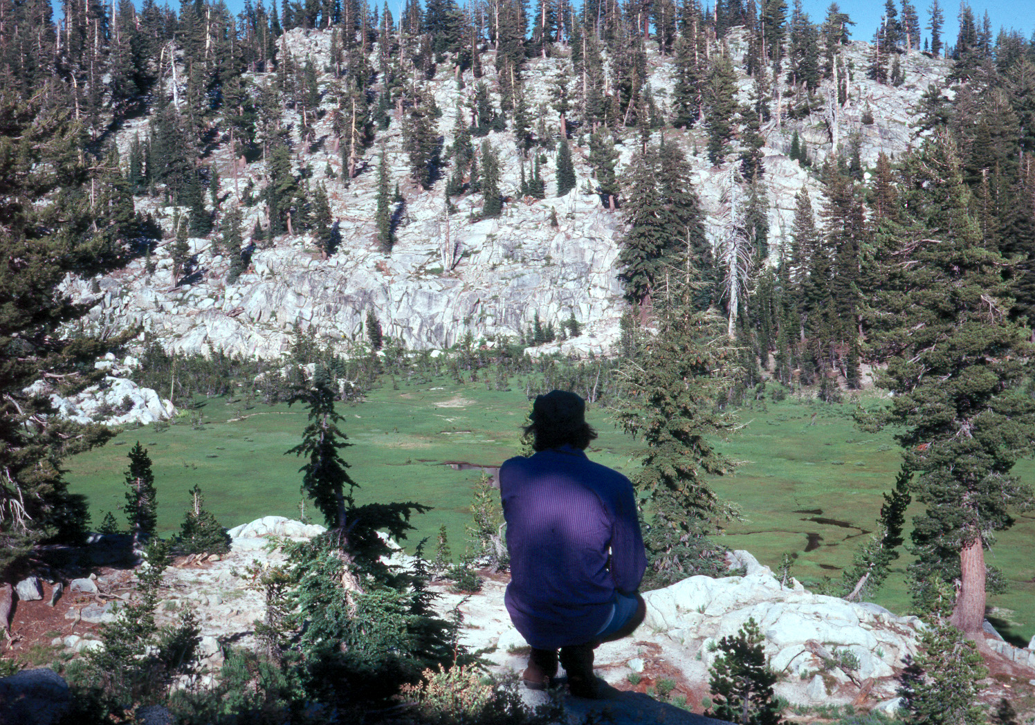 |
 |
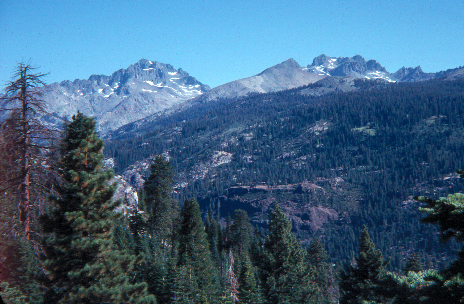 |
|
| Looking over the meadow | A cozy camp in the rocks | Mt. Ritter & Minarets
above San Joaquin River (north fork) |
|
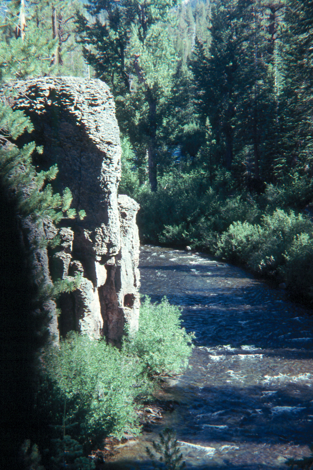 |
 |
 |
|
|
Middle Fork, San
Joaquin River, |
Rainbow Falls, middle San Joaquin River | Devil's Postpile | |
 |
 |
 |
|
| Hexagonal formation on top | Front view of the Postpile | Mikie and a big broken post | |
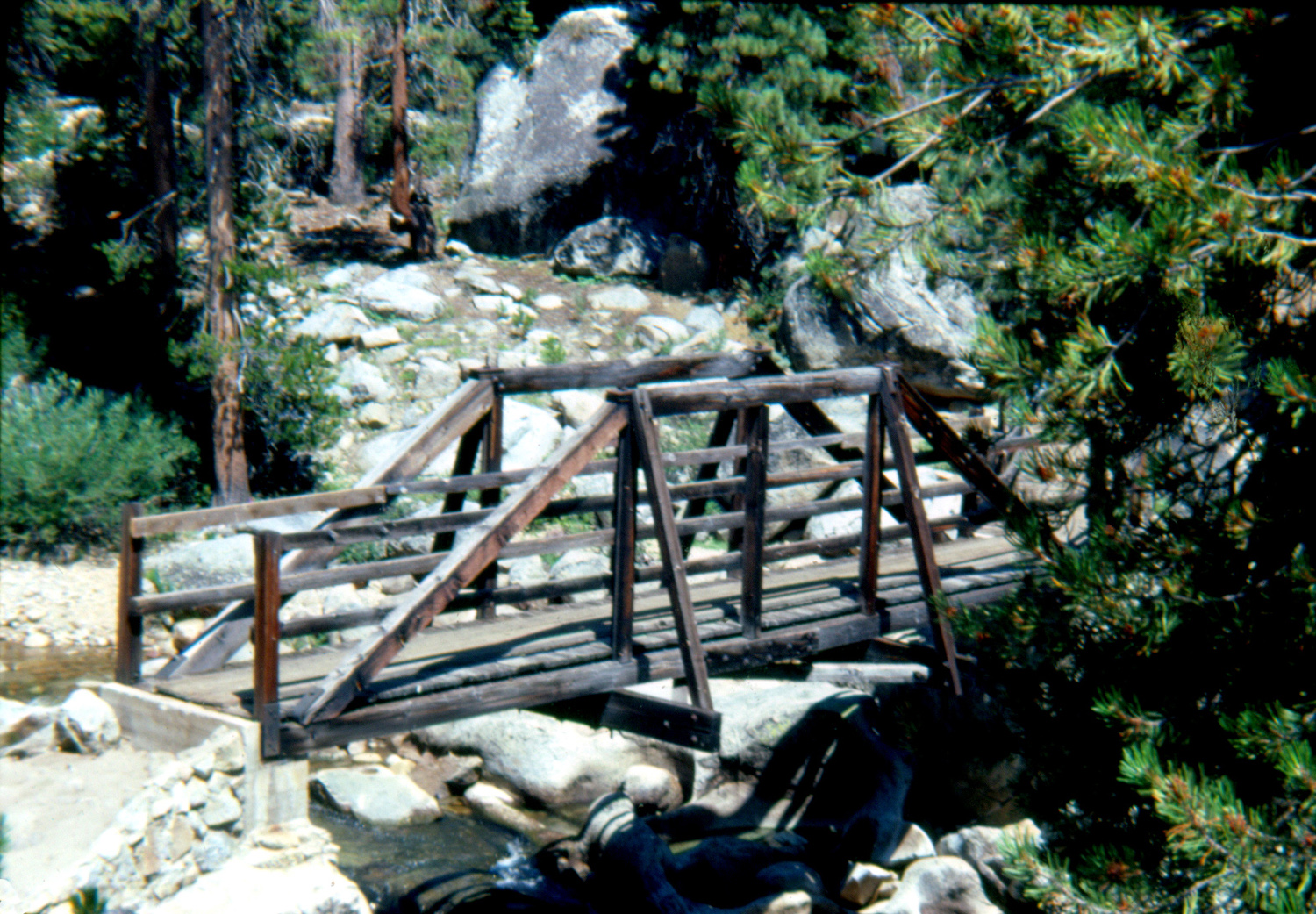 |
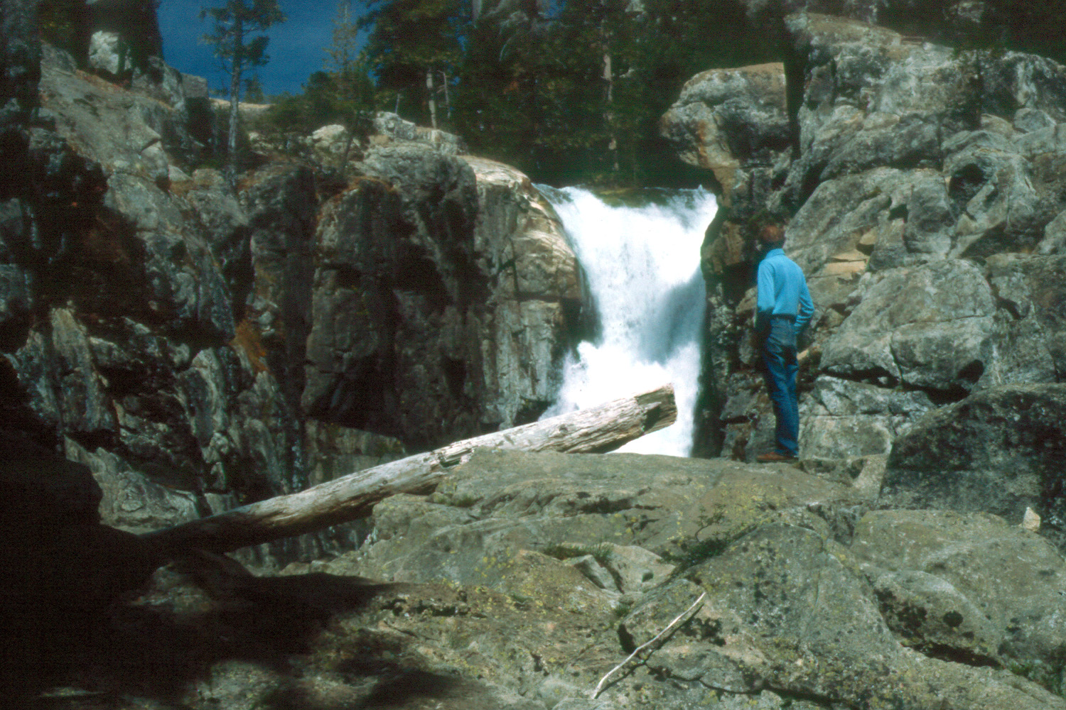 |
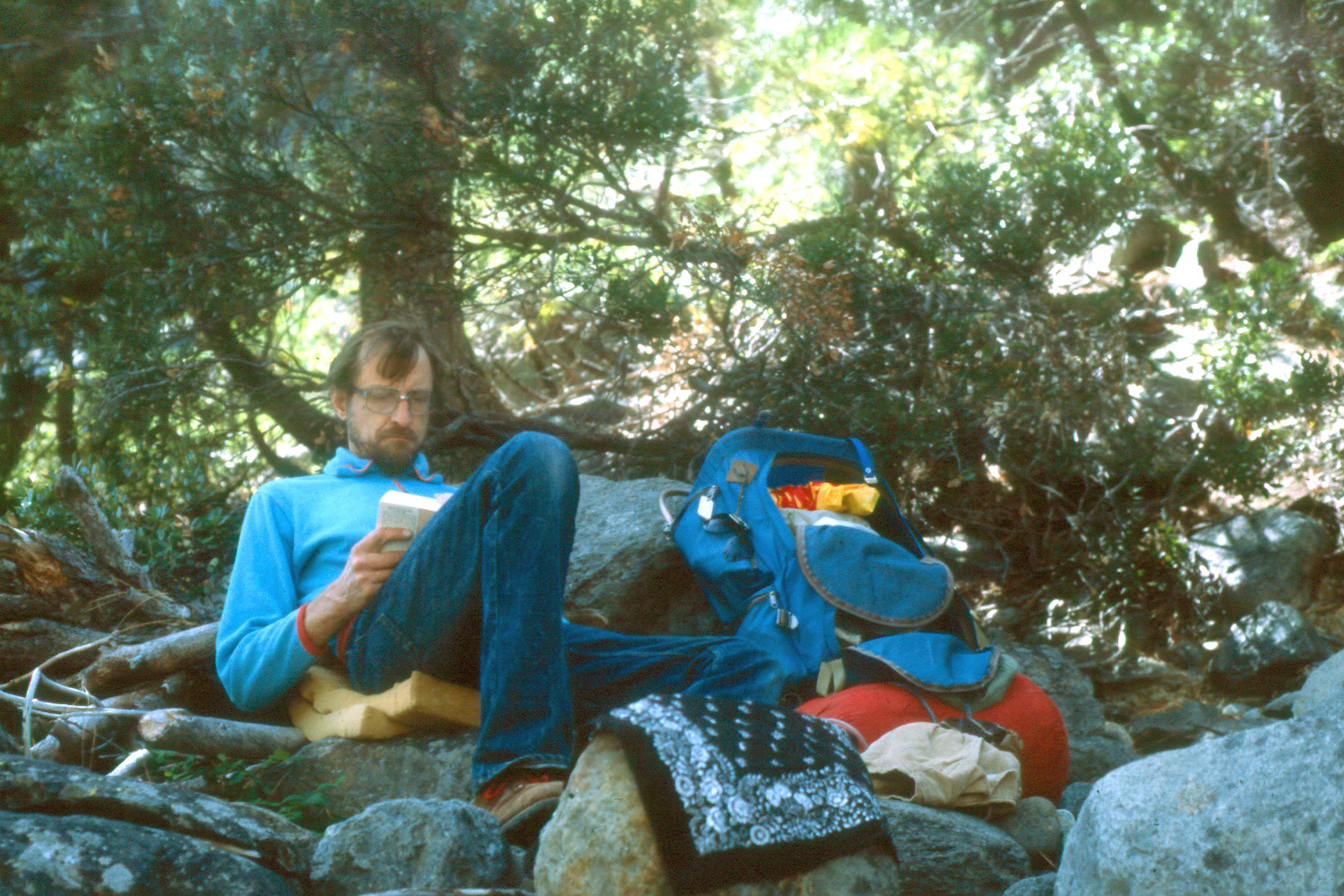 |
|
| Sheep Crossing bridge, NFSJR | Dick at the falls on the NFSJR | Reading Clan of the Cave Bear and feeling very primitive |
|
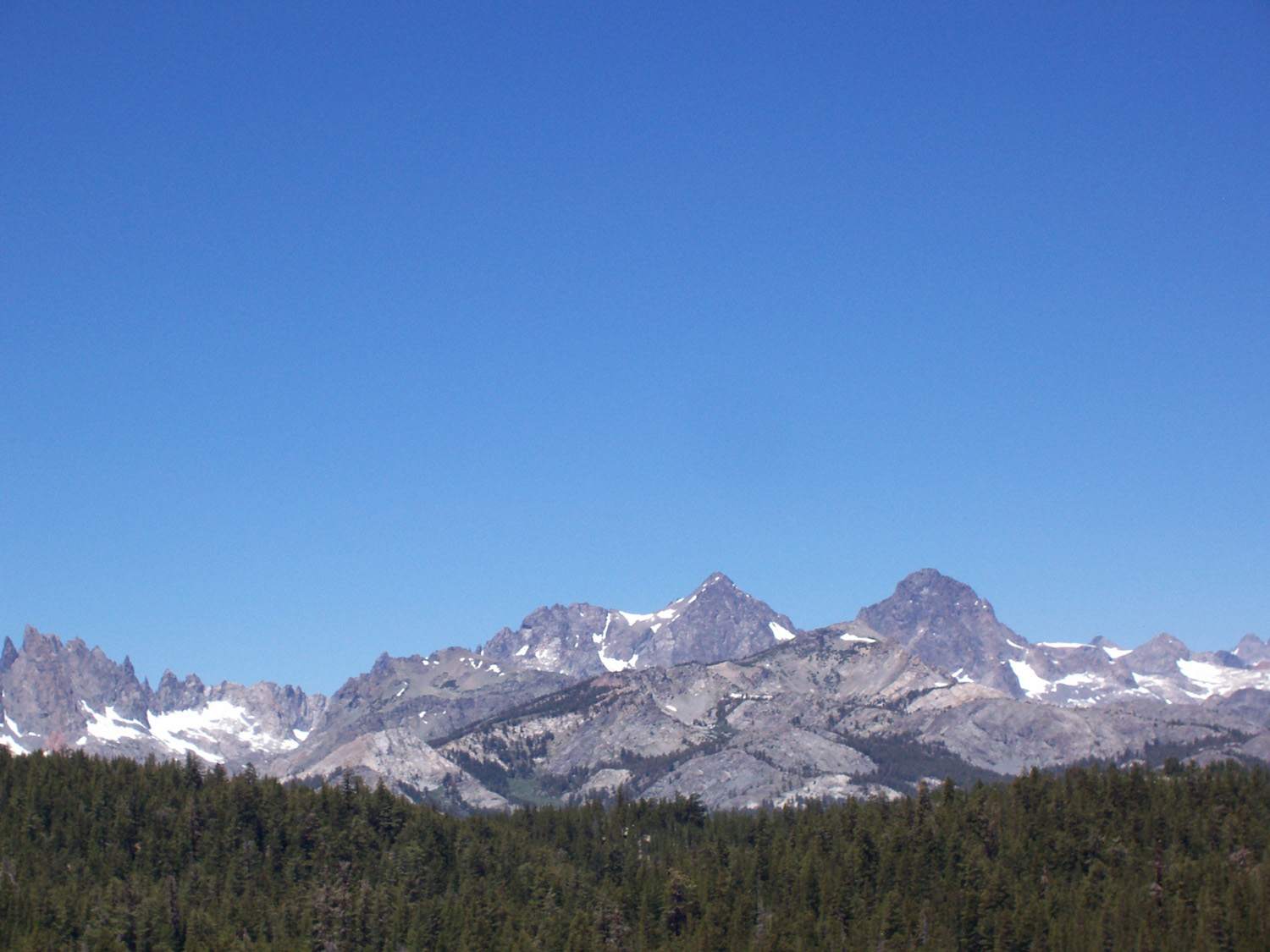 |
 |
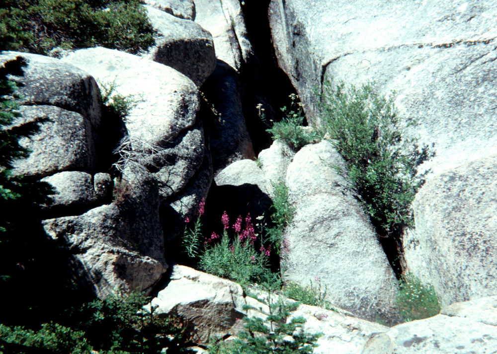 |
|
| The Ritter Range - Minarets, Mt. Ritter & Mt. Banner |
Another view of the Minarets | Flowers near one of my campsites | |
| Courtright - Hell-for-Sure Pass | |||
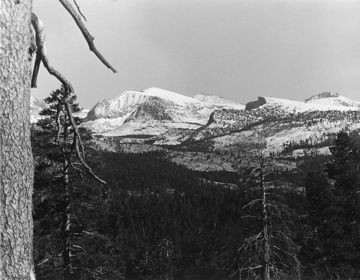 |
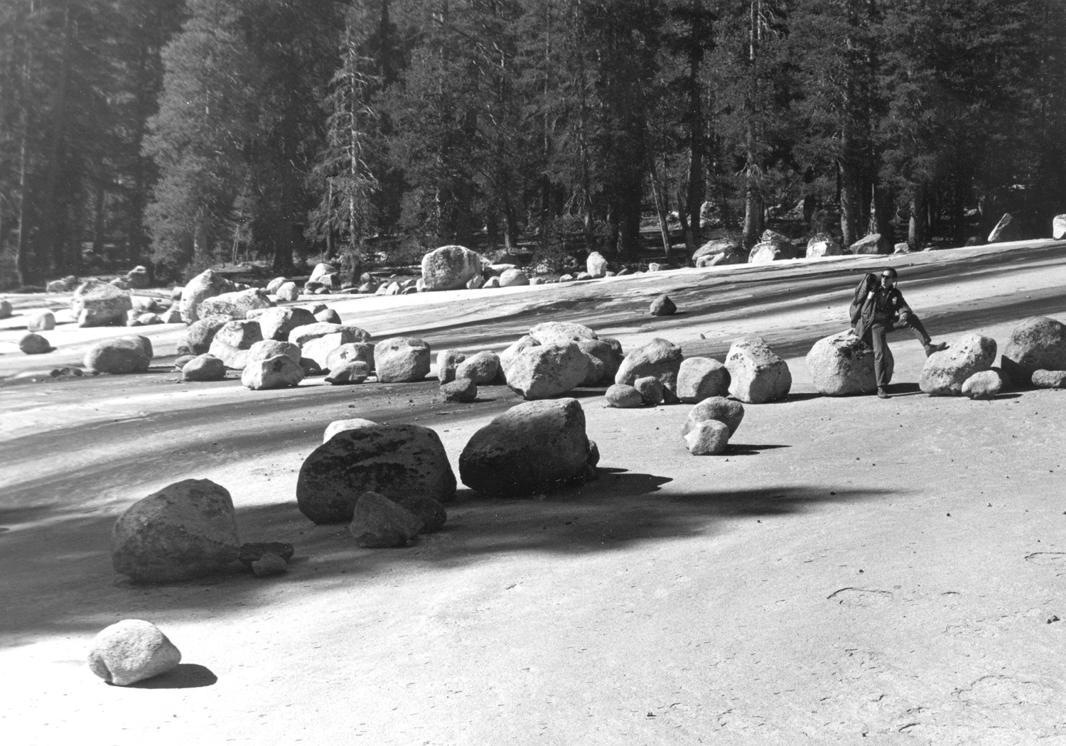 |
 |
|
| LeConte Divide from Courtright | Boulders left by glacier east of Courtright Reservoir |
Courtright Reservoir | |
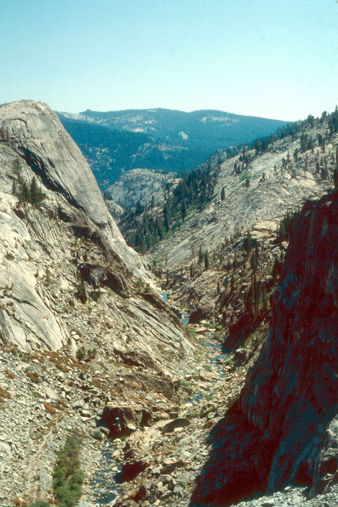 |
 |
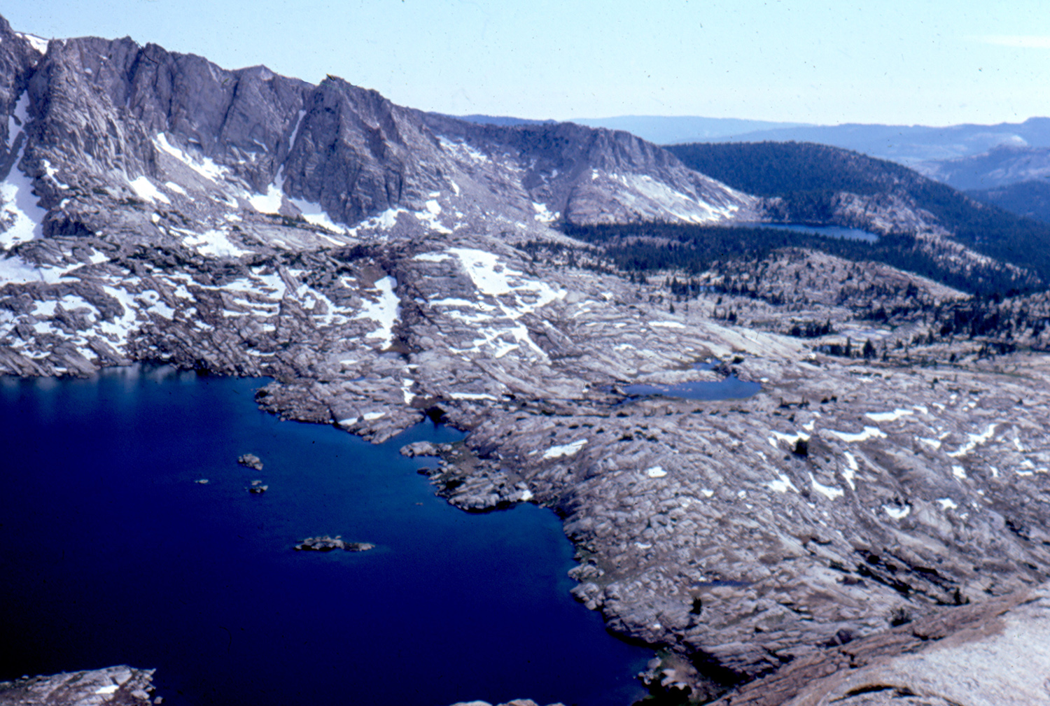 |
|
| Downstream from the dam at Courtright | Courtright Reservoir | Hell for Sure Lake
& Devil's Punch Bowl from Hell for Sure Pass |
|
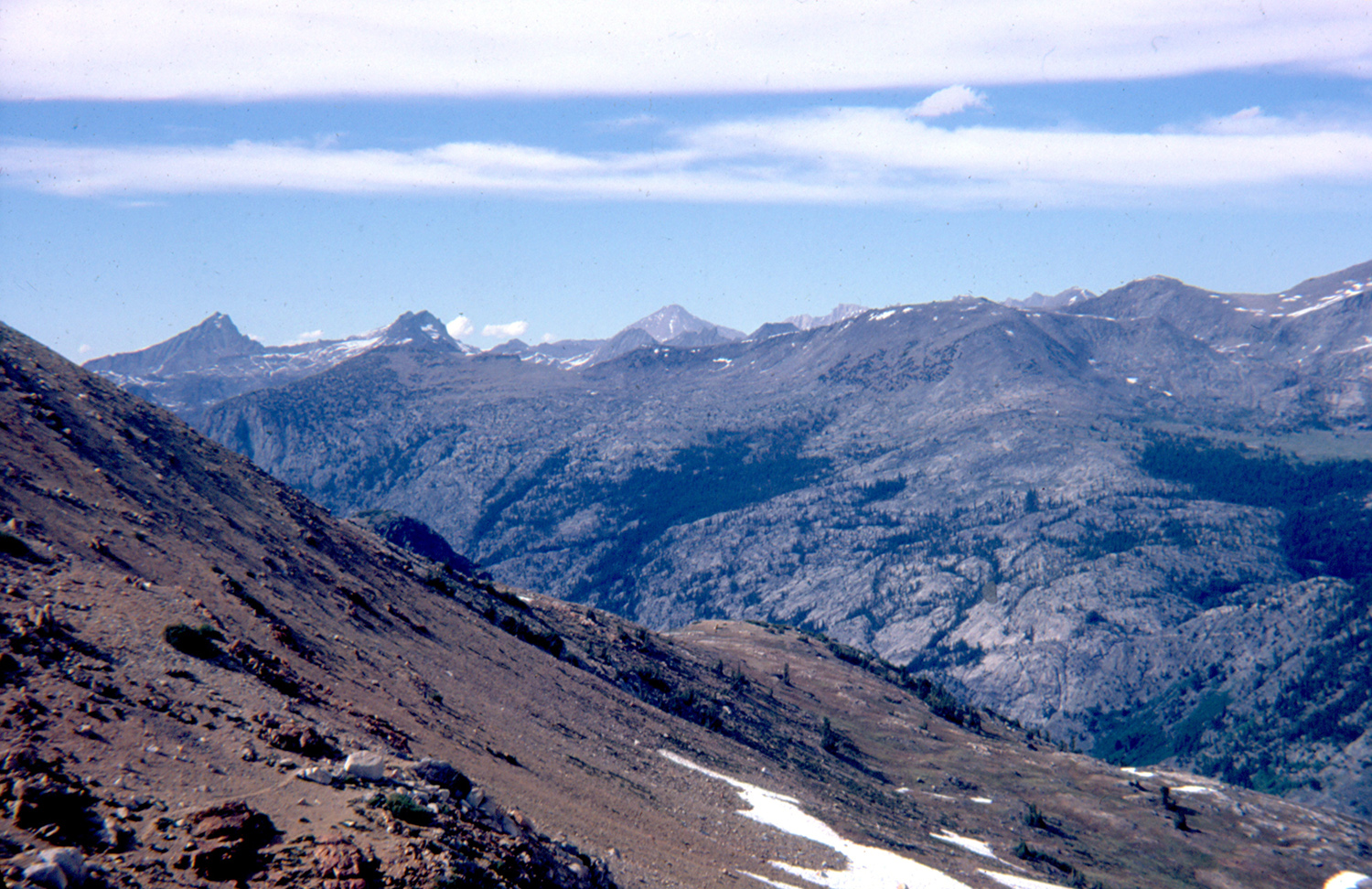 |
 |
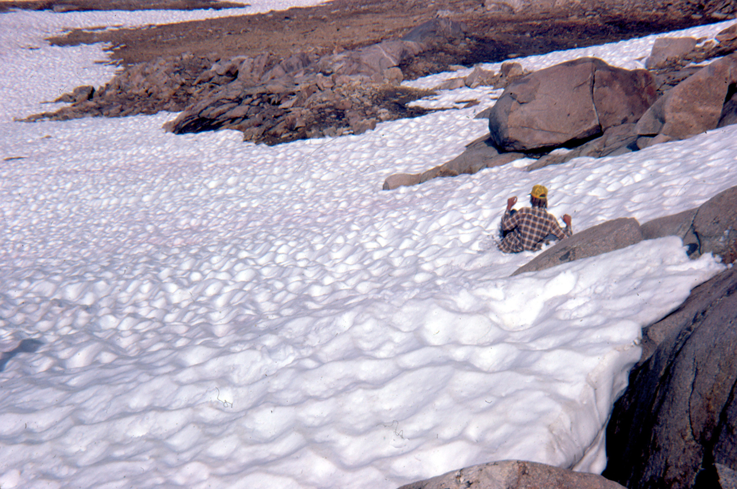 |
|
| Along the trail to Hell-for-Sure Pass | Tim, Dick & Scott on
the trail to Hell-for-Sure Pass |
Scott slides down the east side of Hell-for-Sure Pass |
|
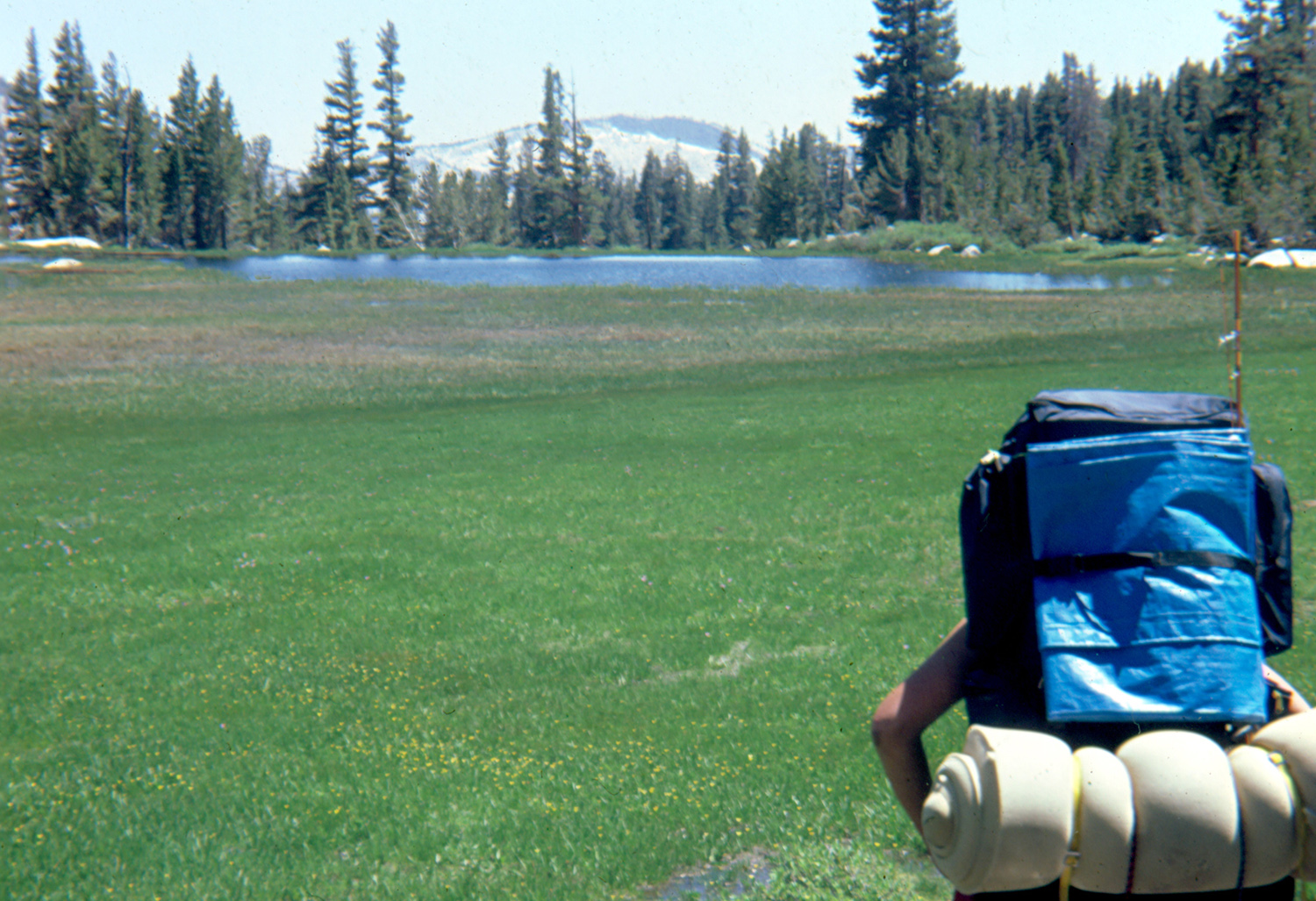 |
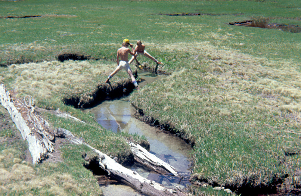 |
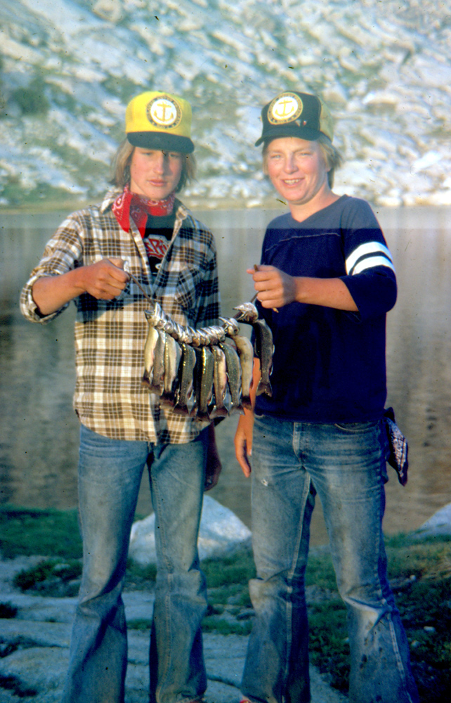 |
|
| On the trail between
Devil's Punchbowl and Kings River |
Trying to catch fish by hand | Best meal ever - freshly caught mountain trout |
|
 |
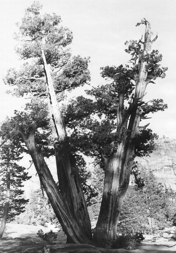 |
 |
|
| Trail map showing our route | Juniper photographed on my first Courtright hike in 1969 |
The same tree, photographed in August 2016 | |
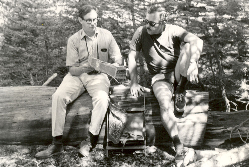 |
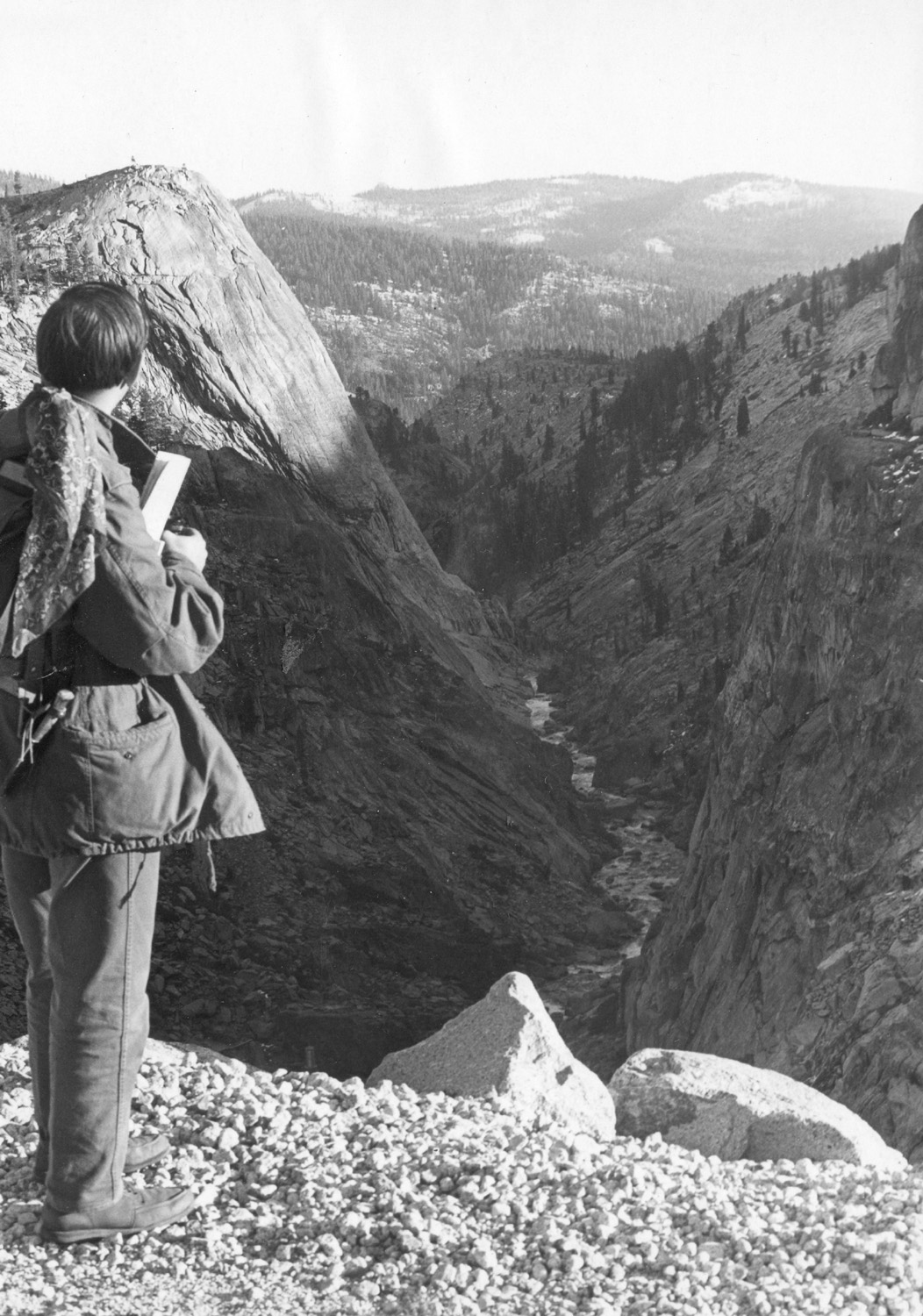 |
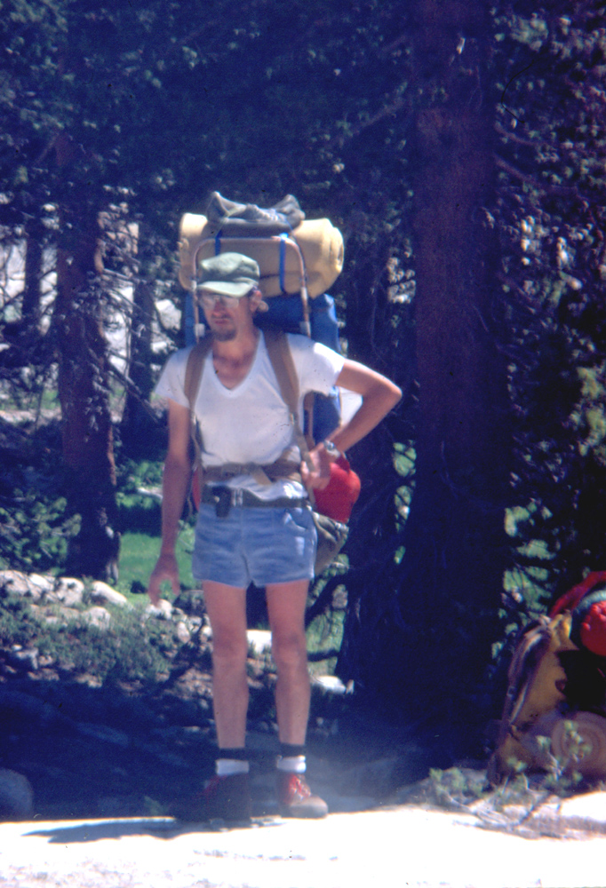 |
|
| Lew and Wil study the map | Lew on the dam at Courtright | Fully loaded | |
| Wishon to Cedar Grove | |||
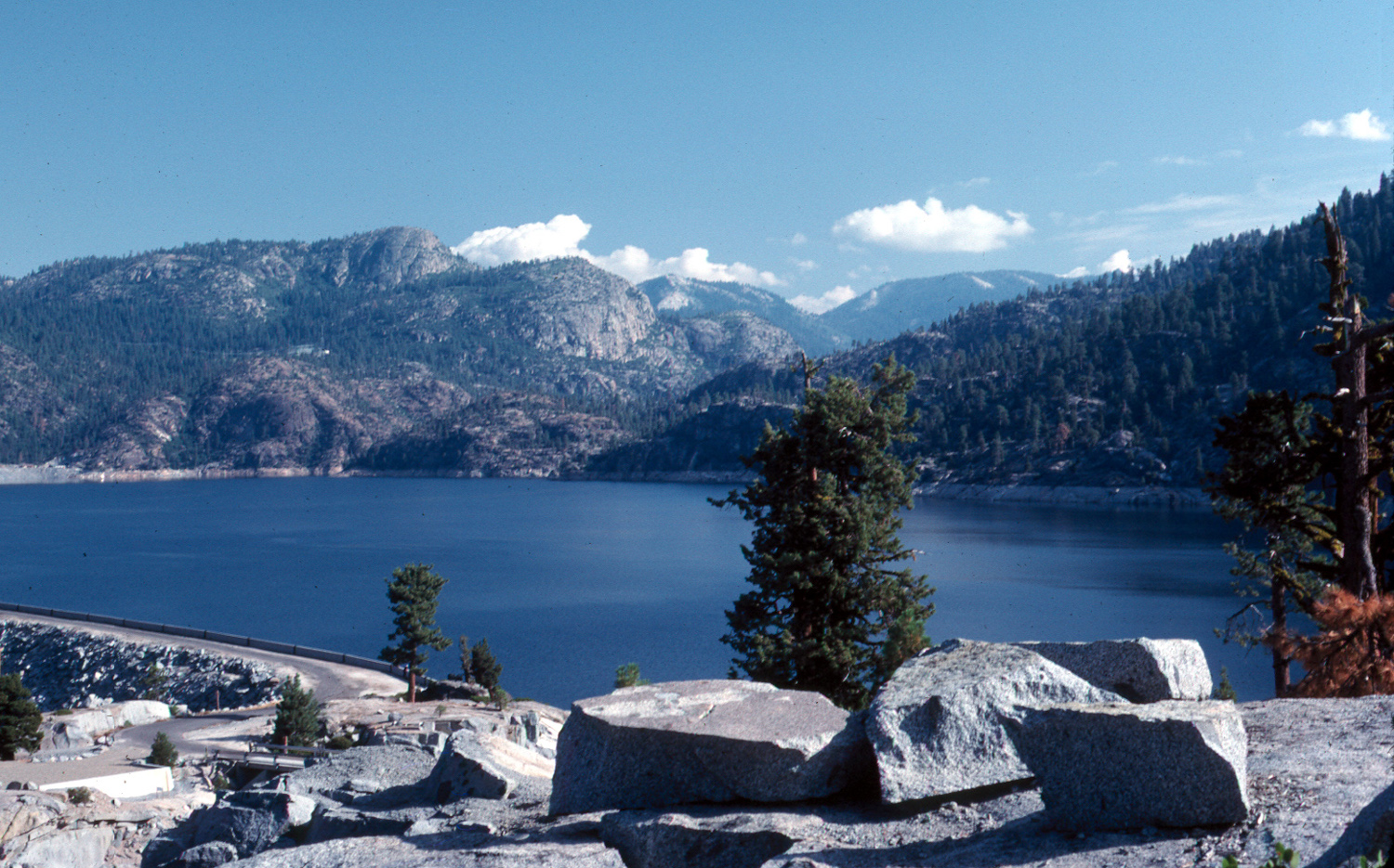 |
 |
|
|
| Wishon Reservoir, my starting point | Gary Reed drives off, leaving me to hike home alone |
I set off on a 50-mile, 3-river hike | |
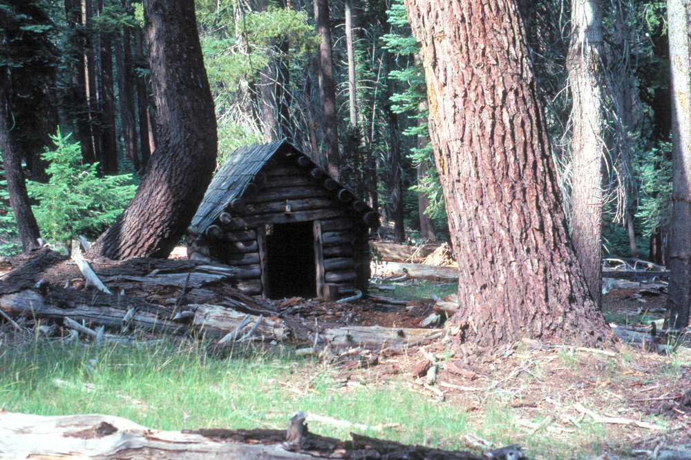 |
 |
 |
|
| Cabin near the "Chipmunk Highway" | Red firs along the trail | Falls on the north side of Tehipite Valley | |
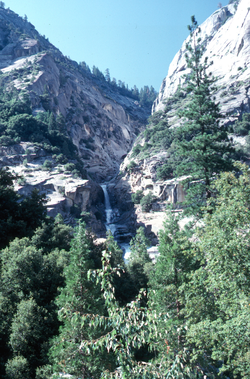 |
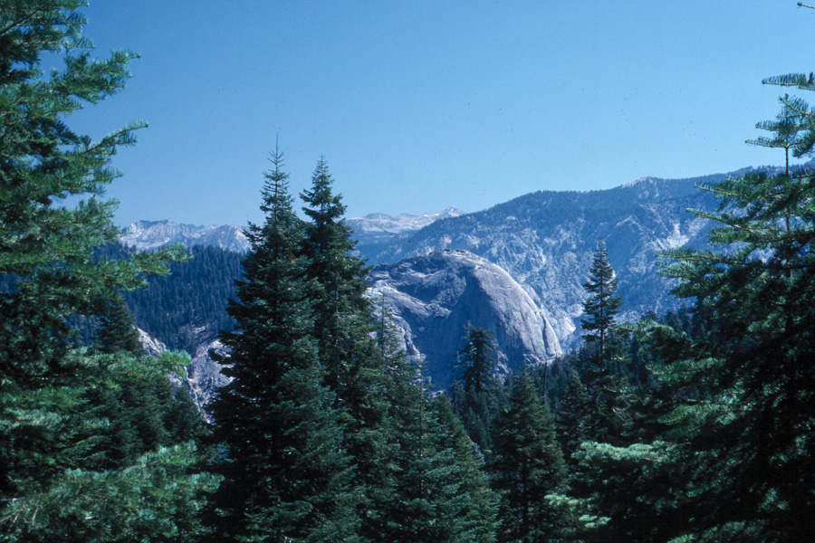 |
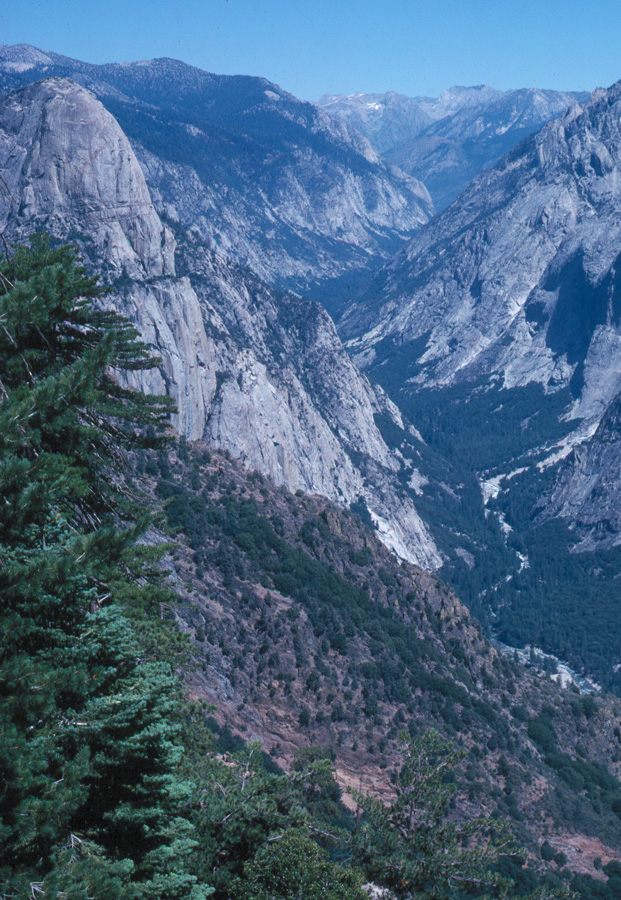 |
|
| Another Tehipite Valley falls | Tehipite Dome from south | Tehipite Valley (Kings River, middle fork) | |
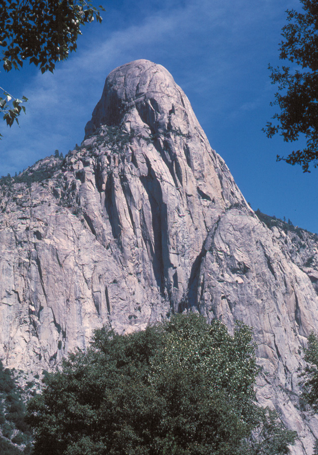 |
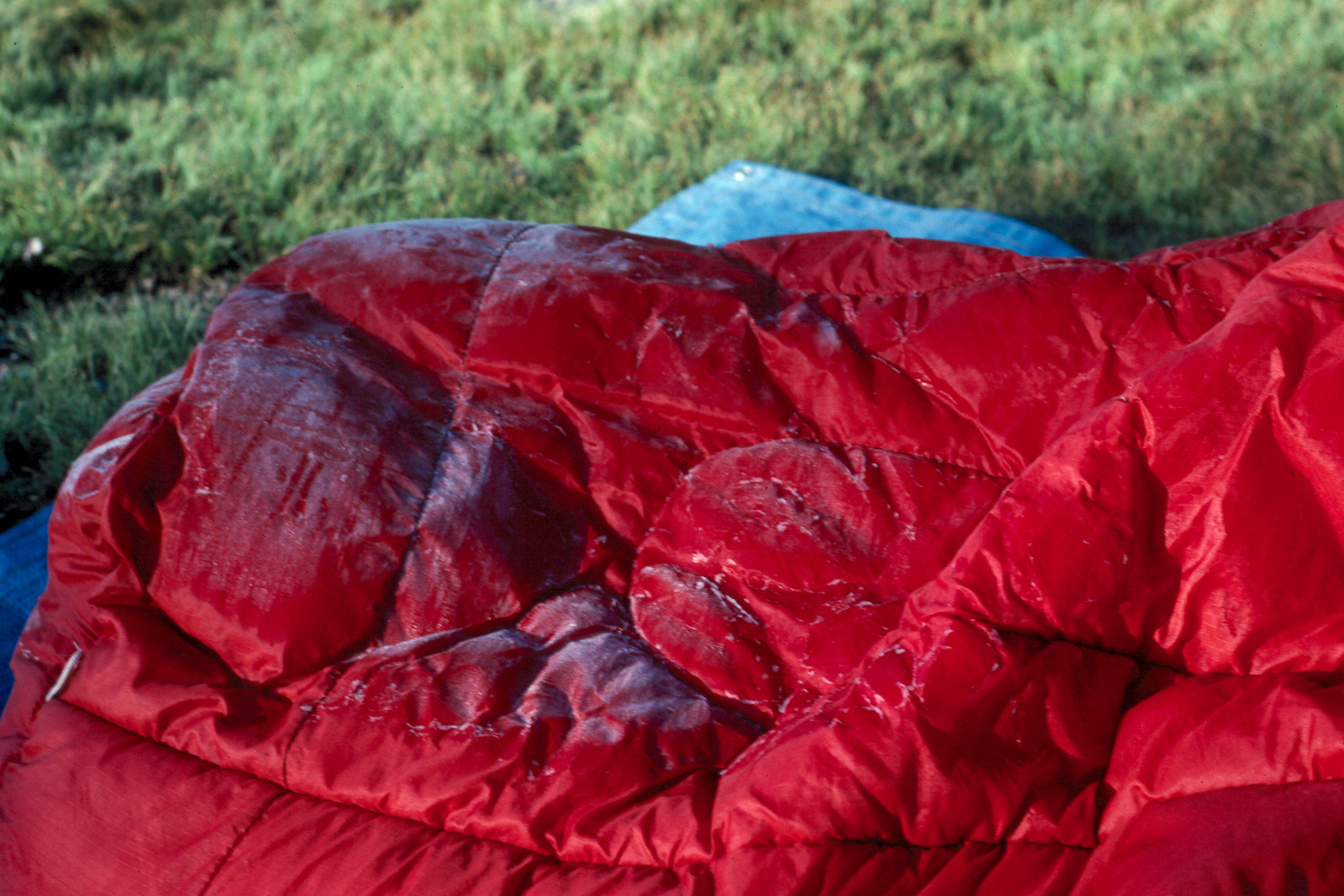 |
|
|
| Tehipite Dome | Frost on my sleeping bag | View from the trail over Granite Divide, between middle and south forks of the Kings River | |
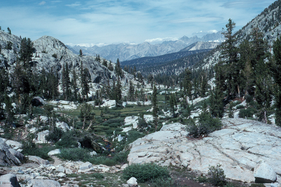 |
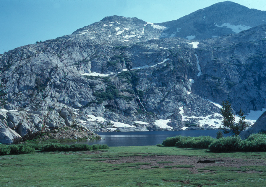 |
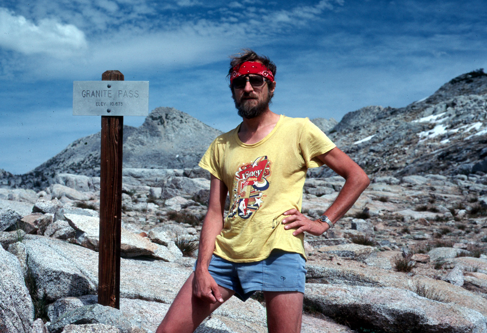 |
|
| Looking north from Granite Pass | Granite Lake, on the divide
between north and middle Kings River |
At the top of Granite Pass | |
|
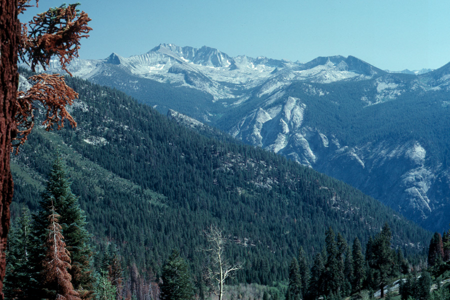 |
 |
|
| Looking at a high sierra meadow | Sphinx Crest above Kings Canyon | My camp the last night | |
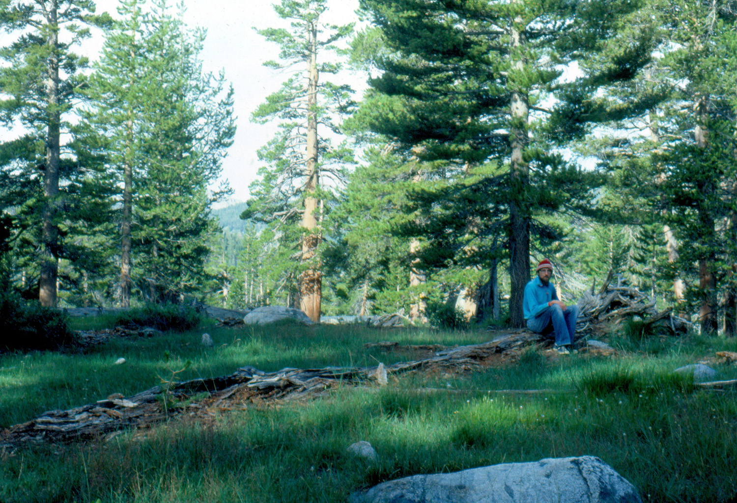 |
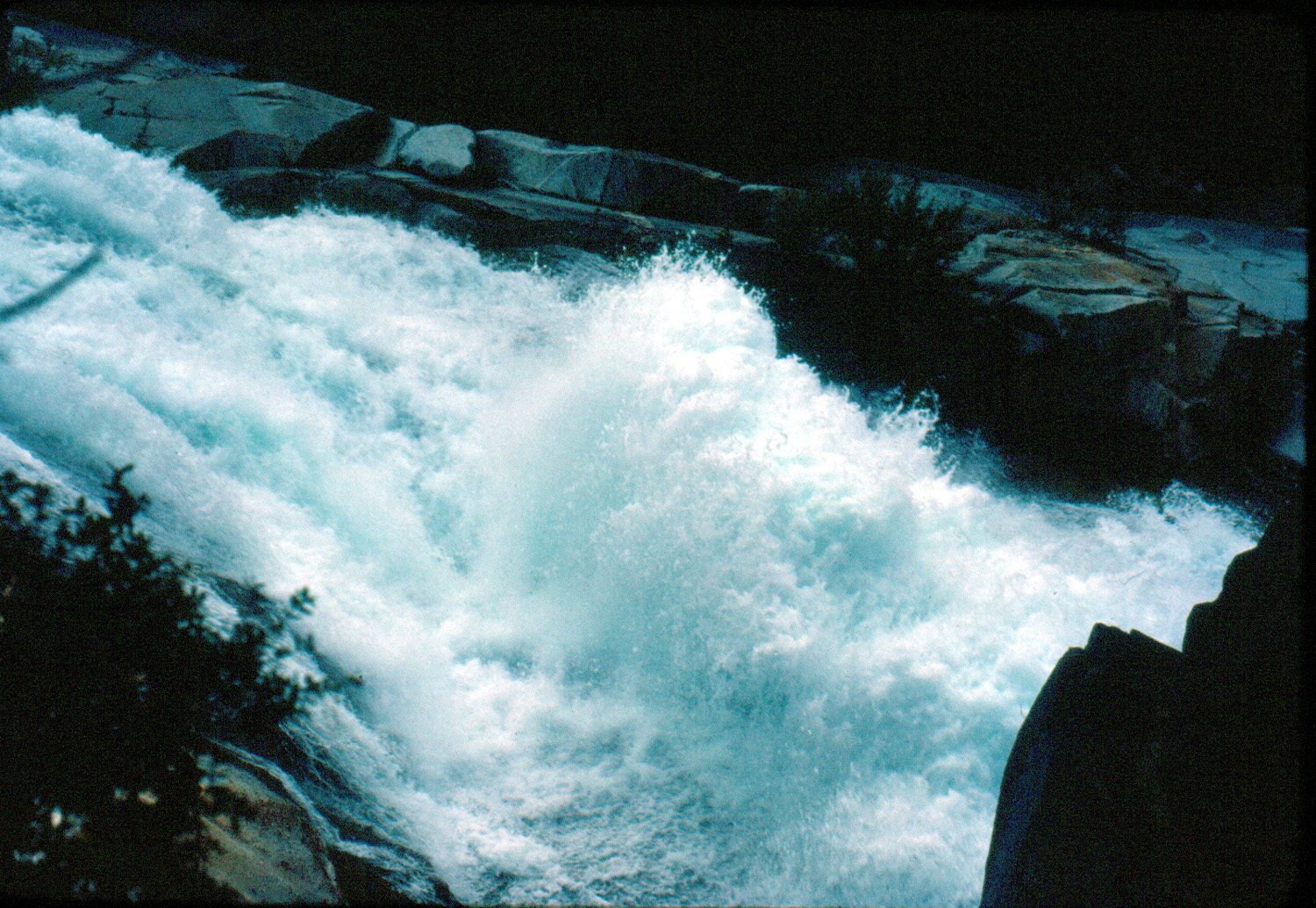 |
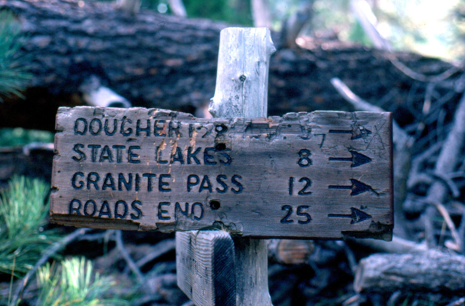 |
|
| Relaxing in a high mountain meadow | Powerful rapids on the
Kings, along the trail out of Tehipite Valley |
Granite
Pass was the highest point on my hike; I reached it the next to last day |
|
| Miscellaneous | |||
 |
|
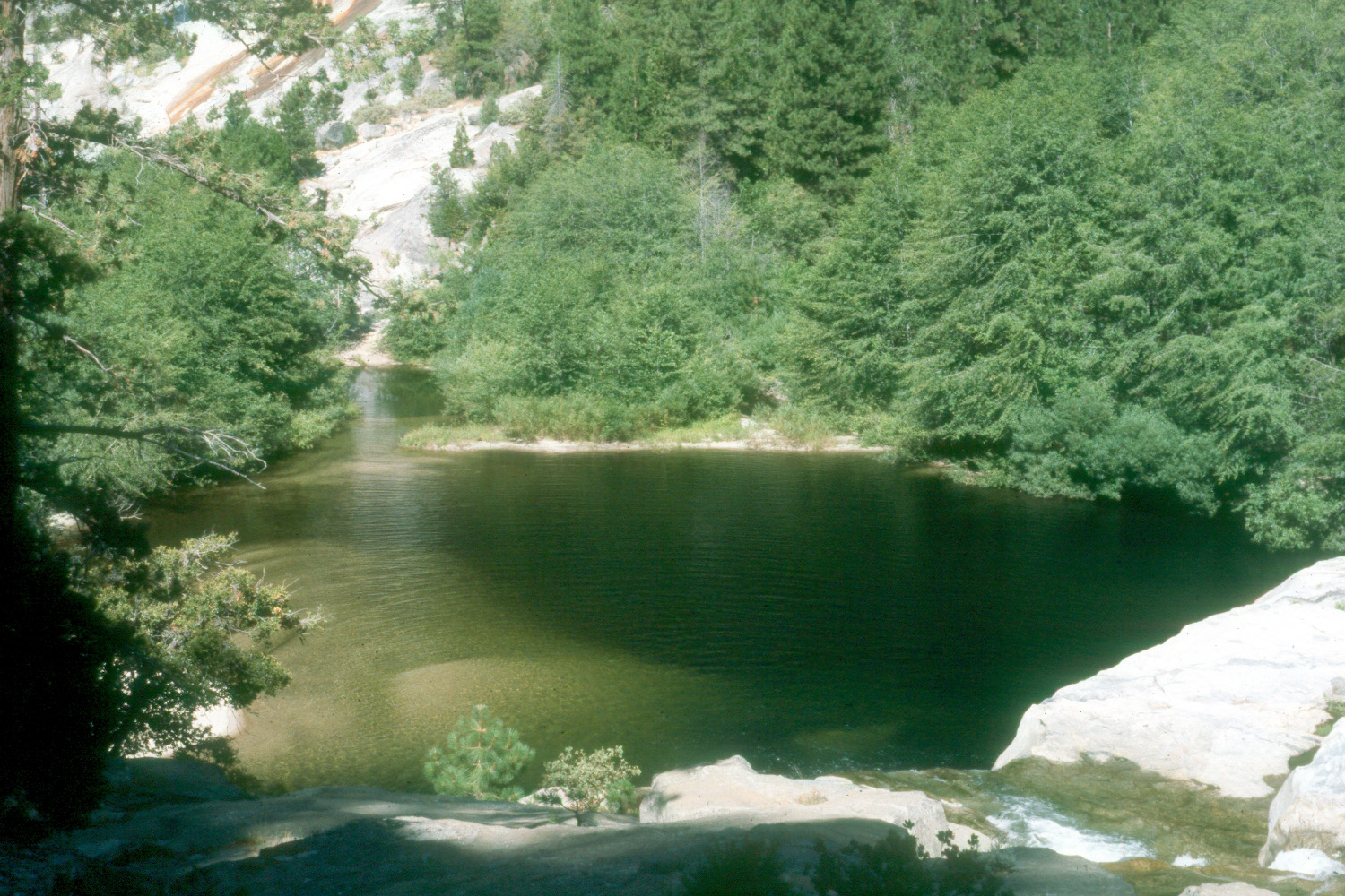 |
|
| Kings River North Fork, below Lake Wishon | Falls in Hell Hole, North Fork, Kings River | Pond in Hell Hole, Kings North Fork | |
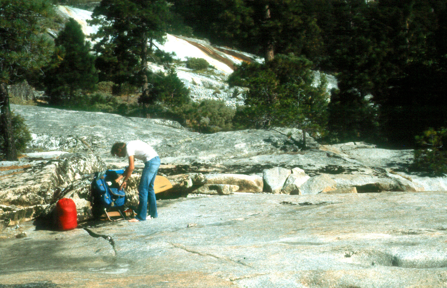 |
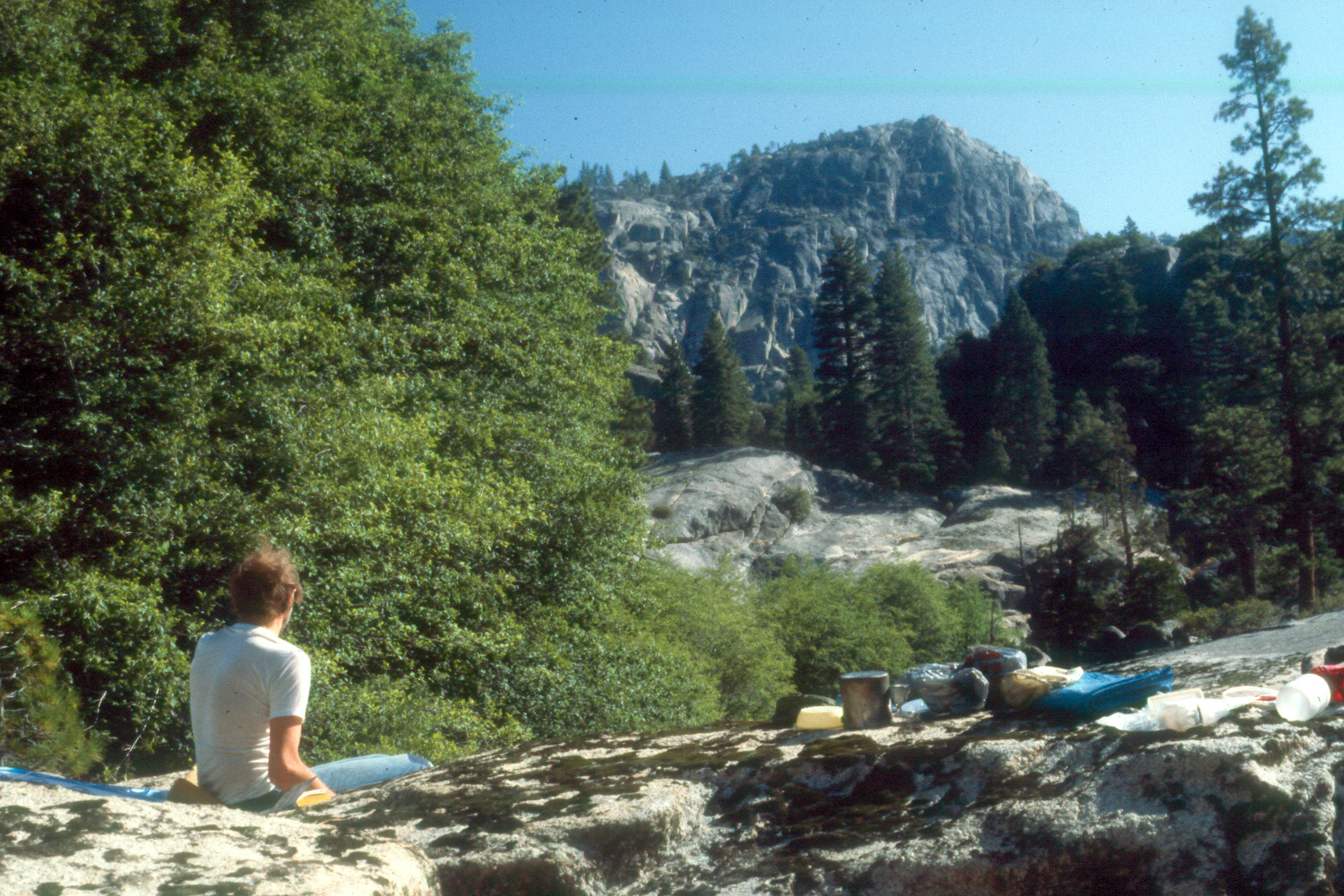 |
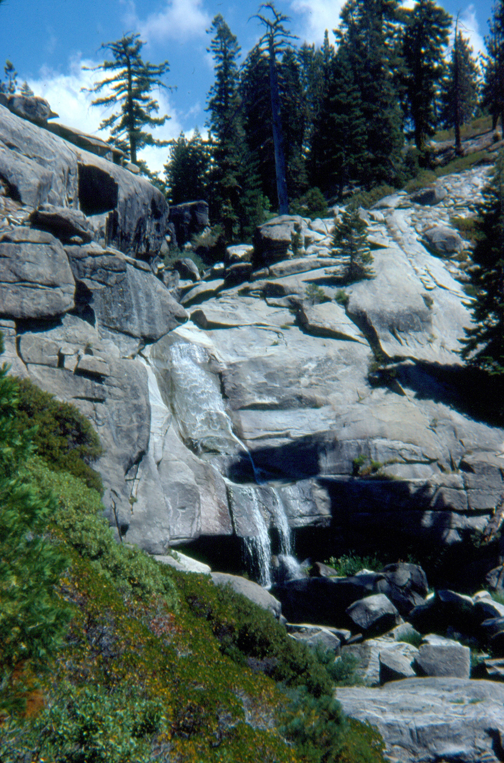 |
|
| Dick unpacking at the bottom of Hell Hole | Enjoying the view | Chilnualna Falls near Wawona | |
 |
 |
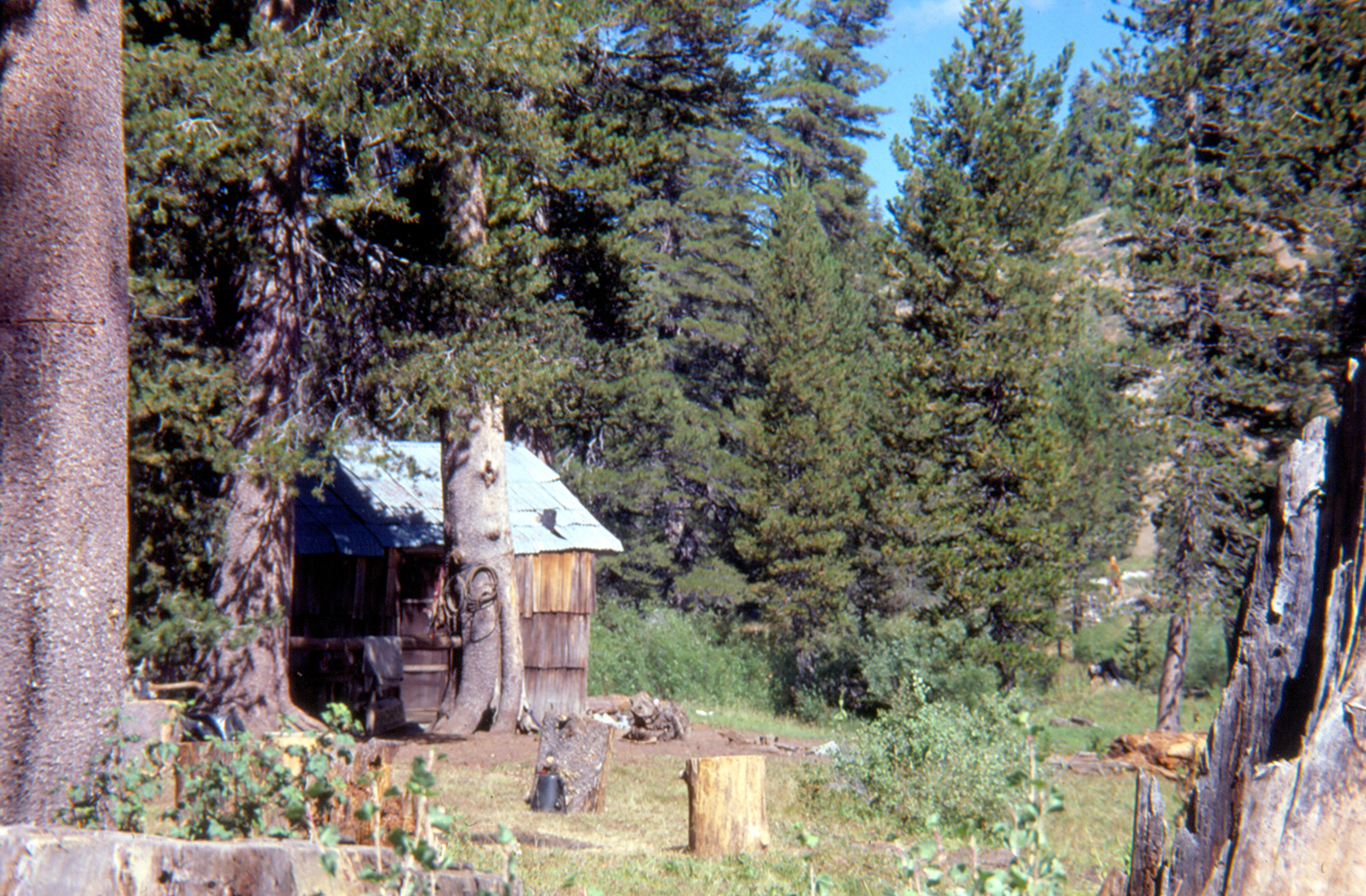 |
|
| Kings River from the start of the Bear Wallow Trail |
Lupines with evergreens in the background | Cabin in Statum Meadow | |
 |
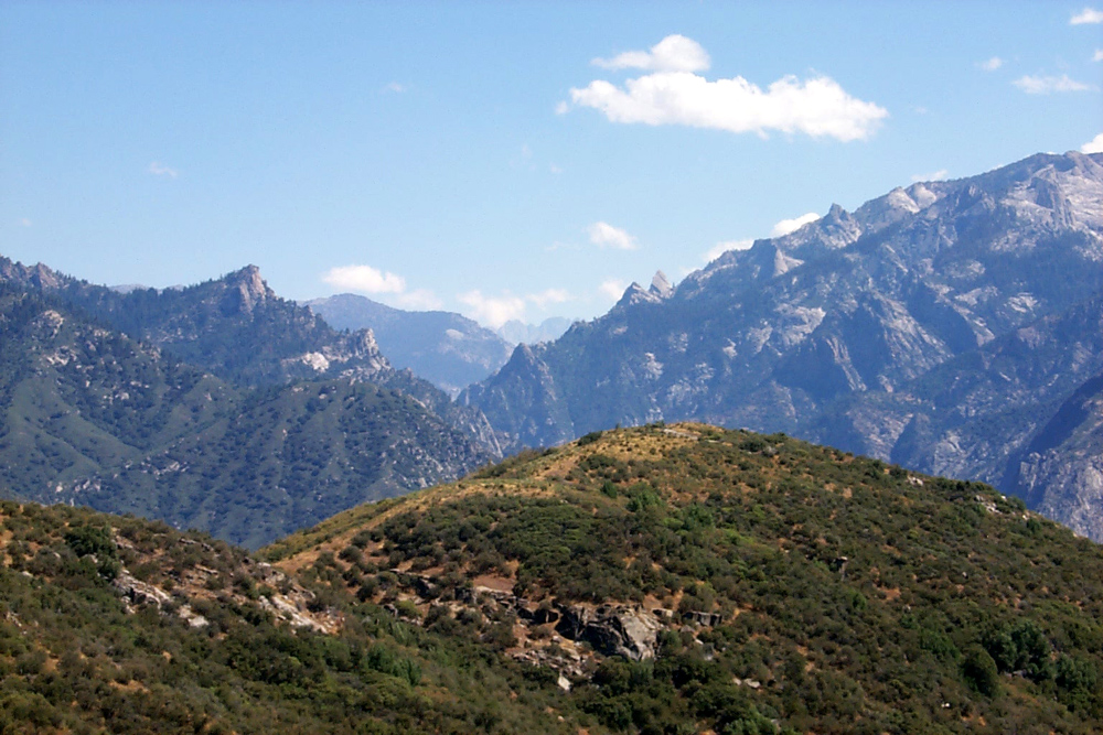 |
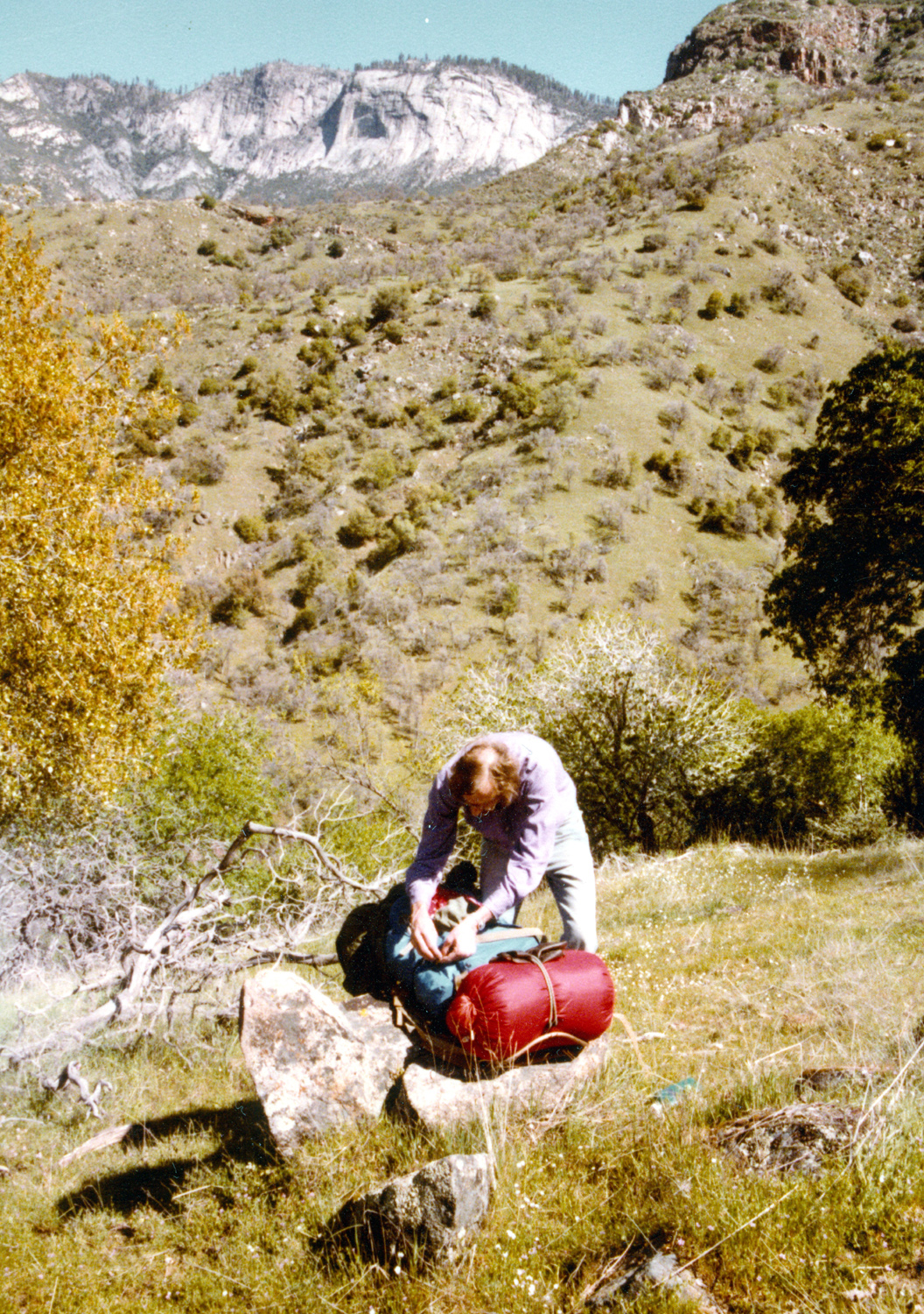 |
|
| Road down from Grant Grove to Kings River South Fork |
Canyon of the Middle Fork, Kings River | Adjusting the pack on the Rodgers Ridge hike | |
 |
 |
 |
|
| Looking out over Kings Canyon from the canyon rim |
Sunset above Kings Canyon | Hail the purple and gold! | |
 |
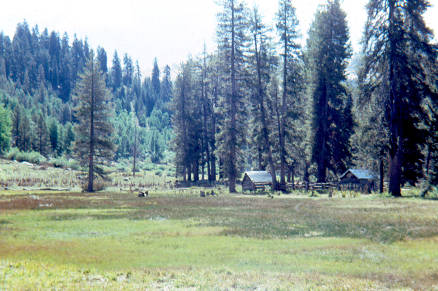 |
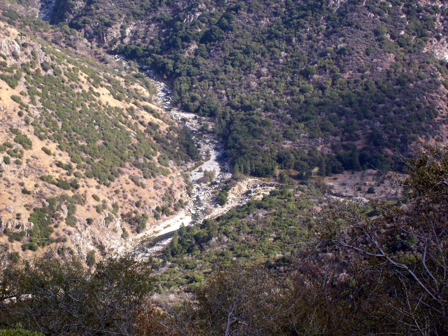 |
|
| Last light |
|
Yucca Point - where the
Middle and South forks of the Kings River come together |
|
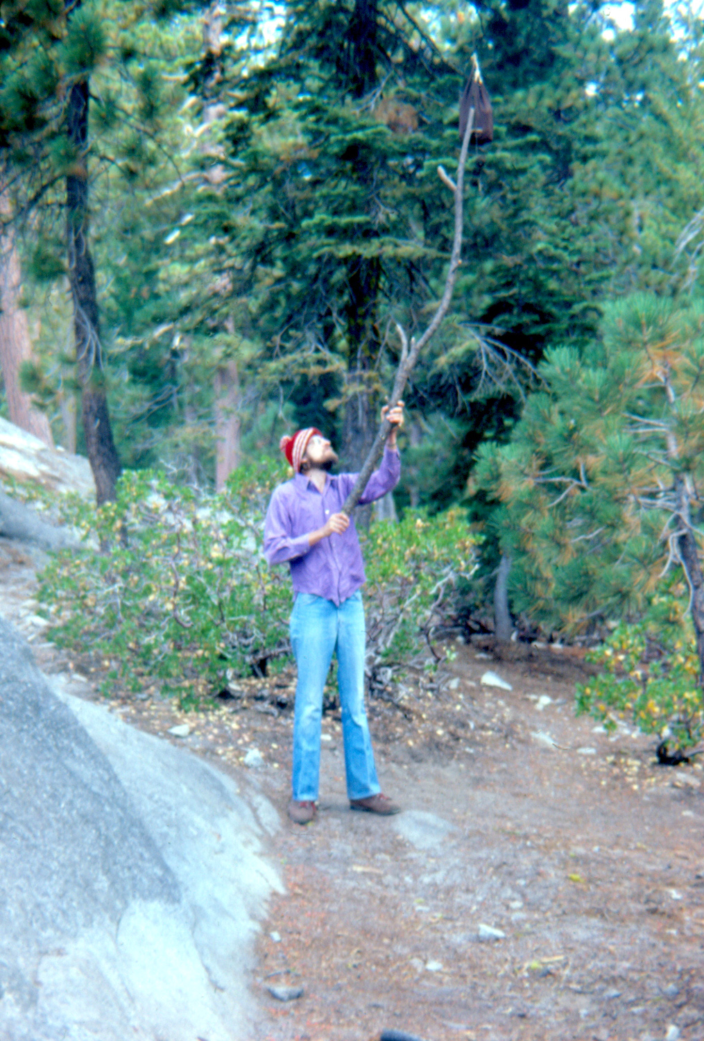 |
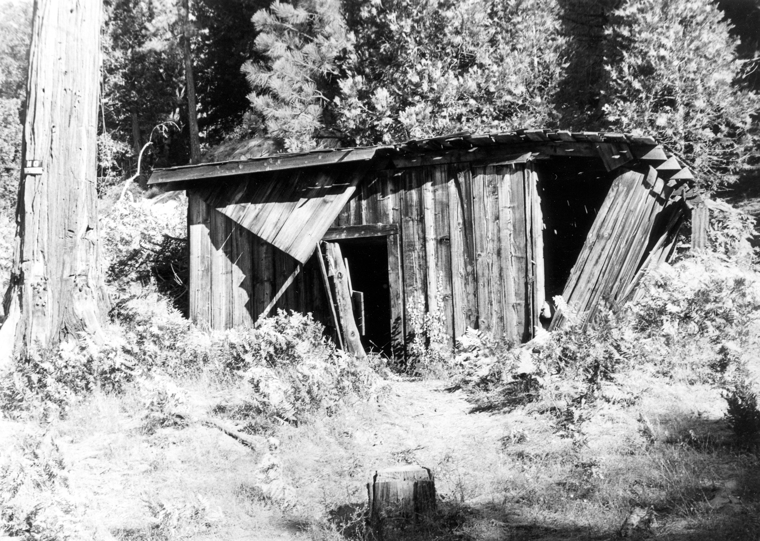 |
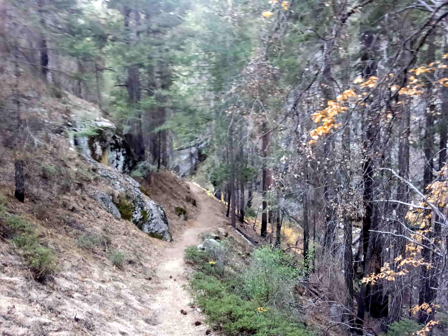 |
|
| Hanging food bag to foil the bears |
The Cabin at Cabin (Nichols) Meadow |
Don Cecil Trail | |
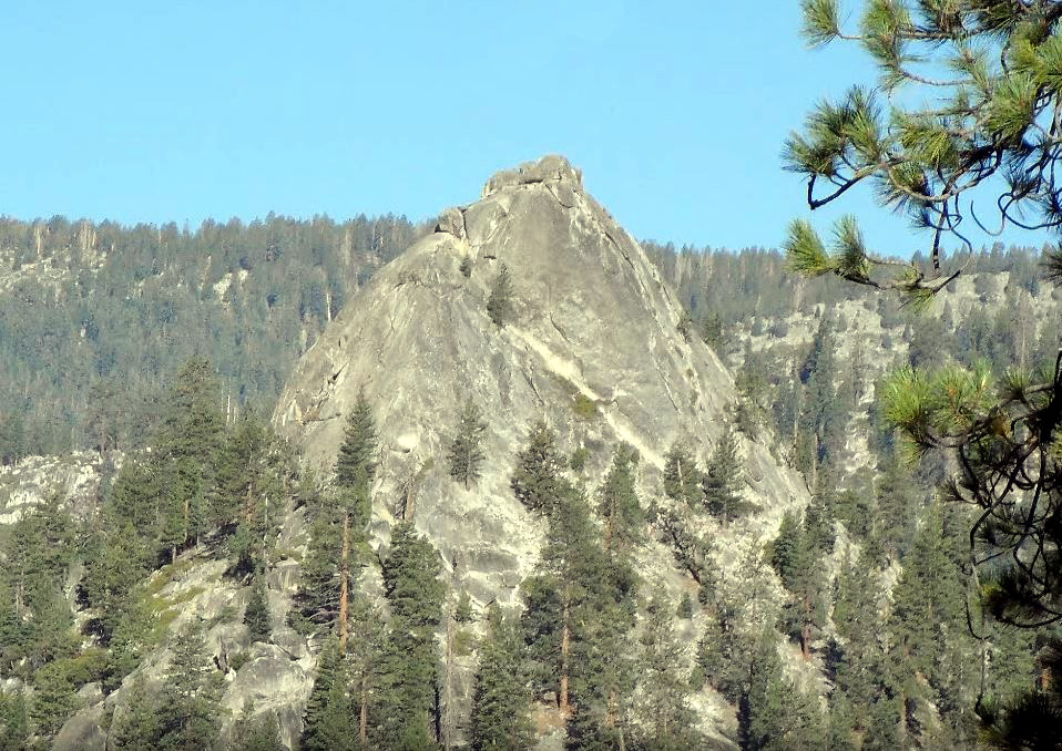 |
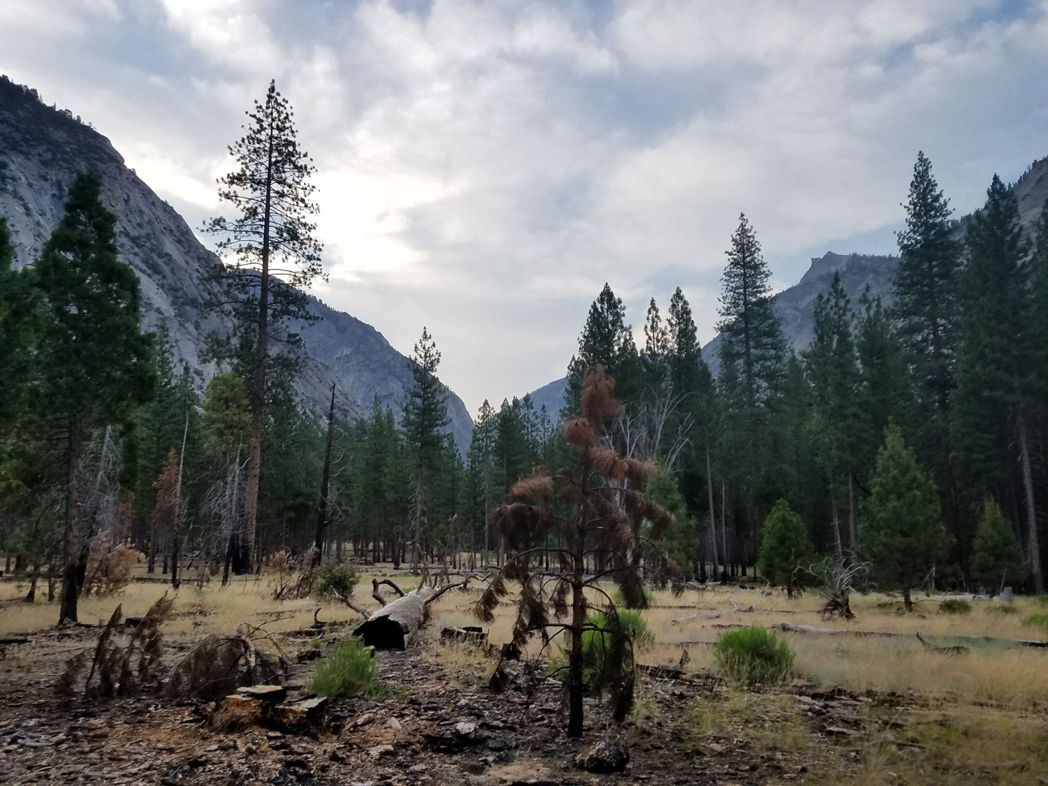
|
NOTE: Don Cecil, Sugar Loaf and Avalanche Pass photos were found on the Internet | |
| Sugar Loaf in Kings Canyon Park | Avalanche Pass Trail east of Roaring River | ||
| Images of John Muir Trail | Half Dome Photos | Vernal Falls | |
| Nevada Falls | Vernal Falls, very dry year | More about Tenaya Canyon | |
| Monarch Divide Photos | Great Western Divide | Tehipite Dome | |
| Kings Canyon Park | More about KC Park | Tehipite Photos | |
| Monarch Divide Photo | Alta Peak Trail | Foxtail Pine Photos | |
| More About Alta Peak | Nelder Grove | Taft Point | |
| Climbing in Tehipite | Tehipite Valley Topo Map | San Joaquin River Gorge | |
 , the first in a series of sci-fi novels set on a desert planet.
The native people traveled through the desert on foot, wearing what
were known as "stillsuits" - a space age product that
protected them from the heat and recycled perspiration and other wastes into drinkable water as one
walked. Near the shoulder was a tube through which the wearer could
get a drink.
, the first in a series of sci-fi novels set on a desert planet.
The native people traveled through the desert on foot, wearing what
were known as "stillsuits" - a space age product that
protected them from the heat and recycled perspiration and other wastes into drinkable water as one
walked. Near the shoulder was a tube through which the wearer could
get a drink.
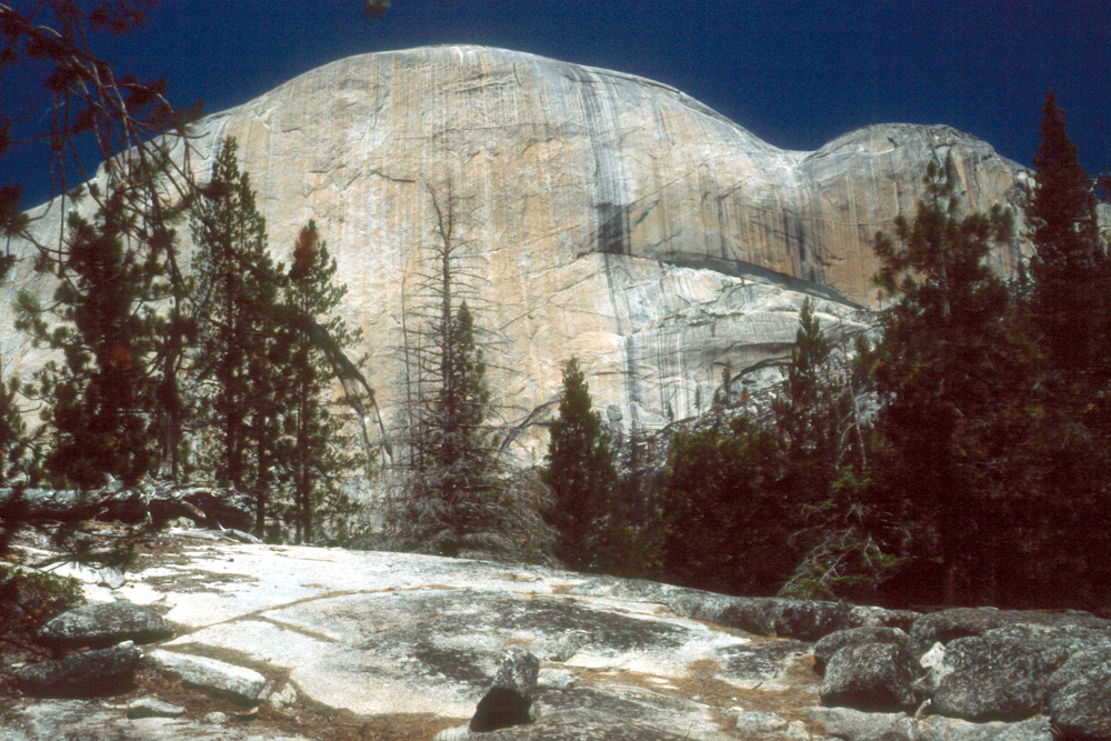
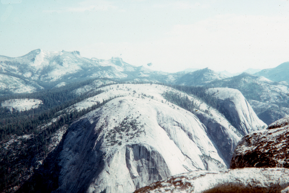
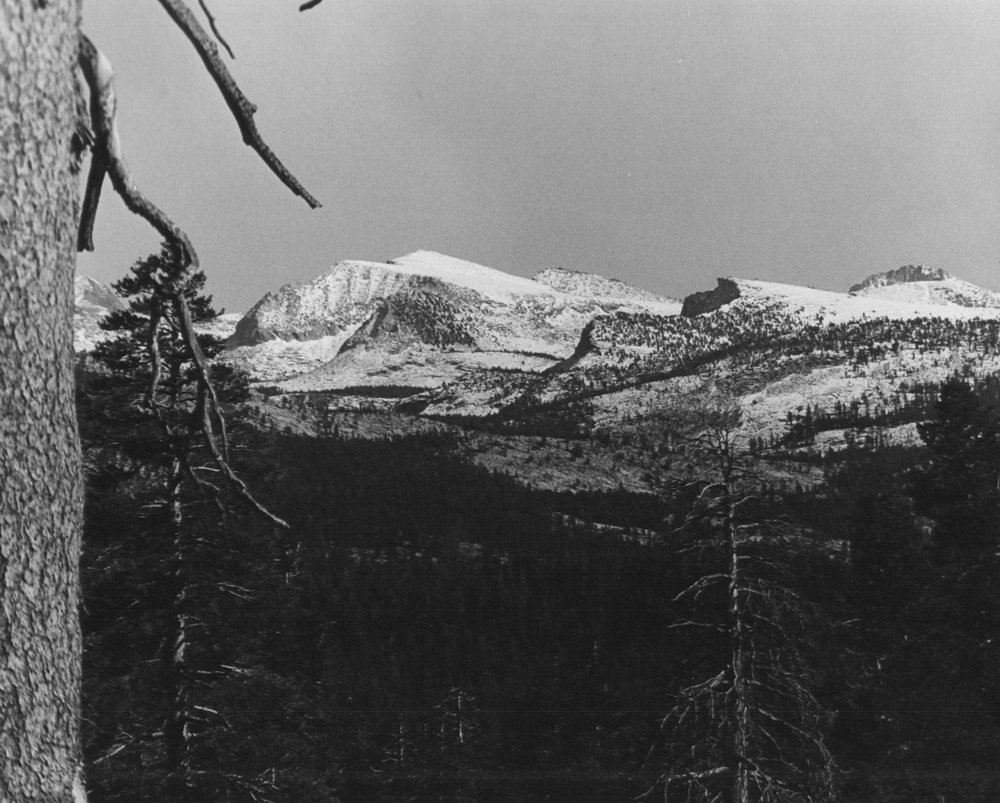
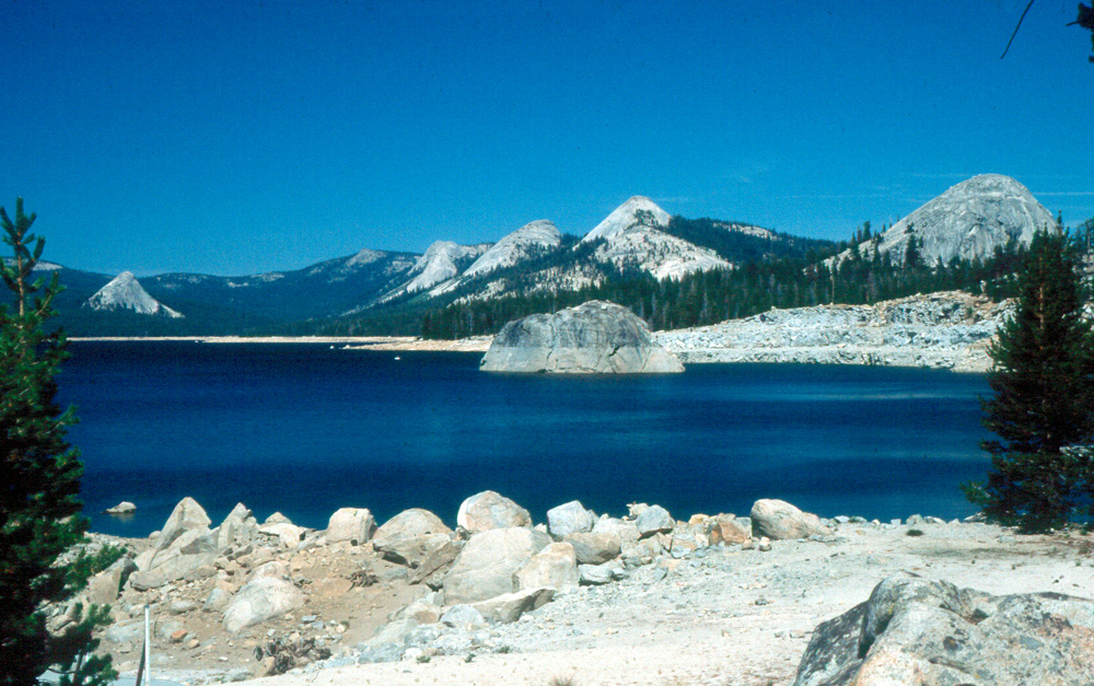
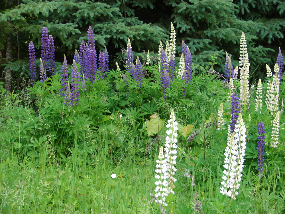
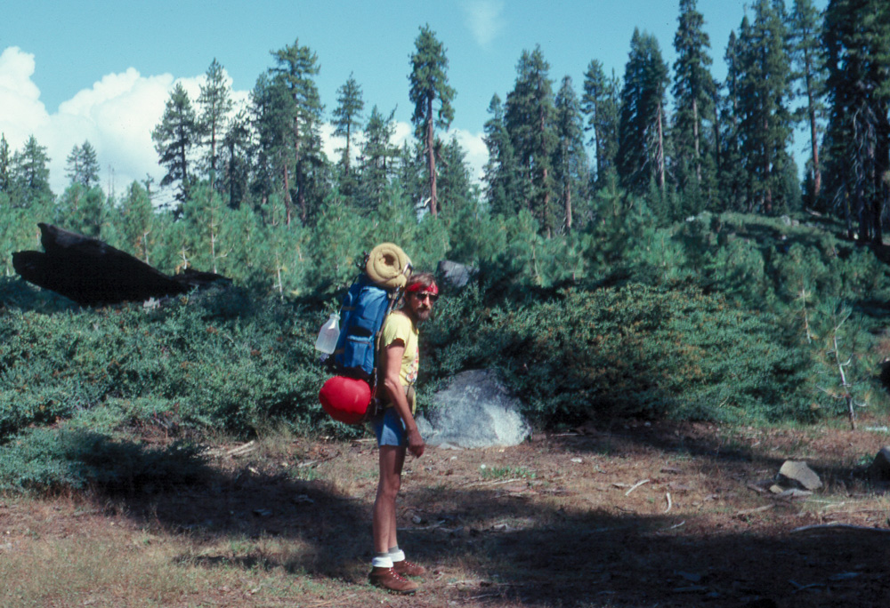
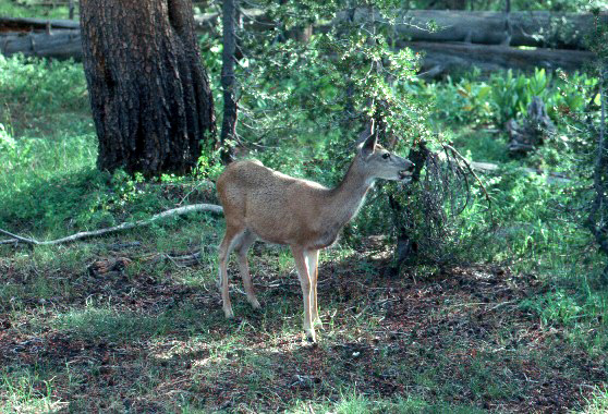
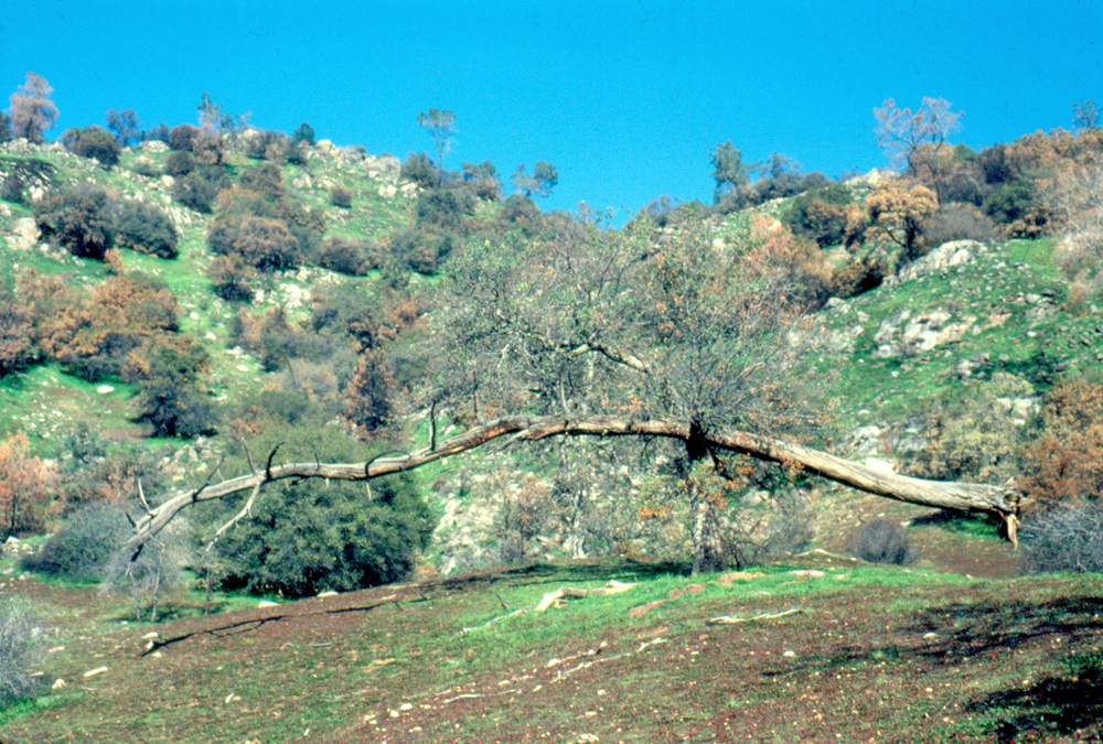
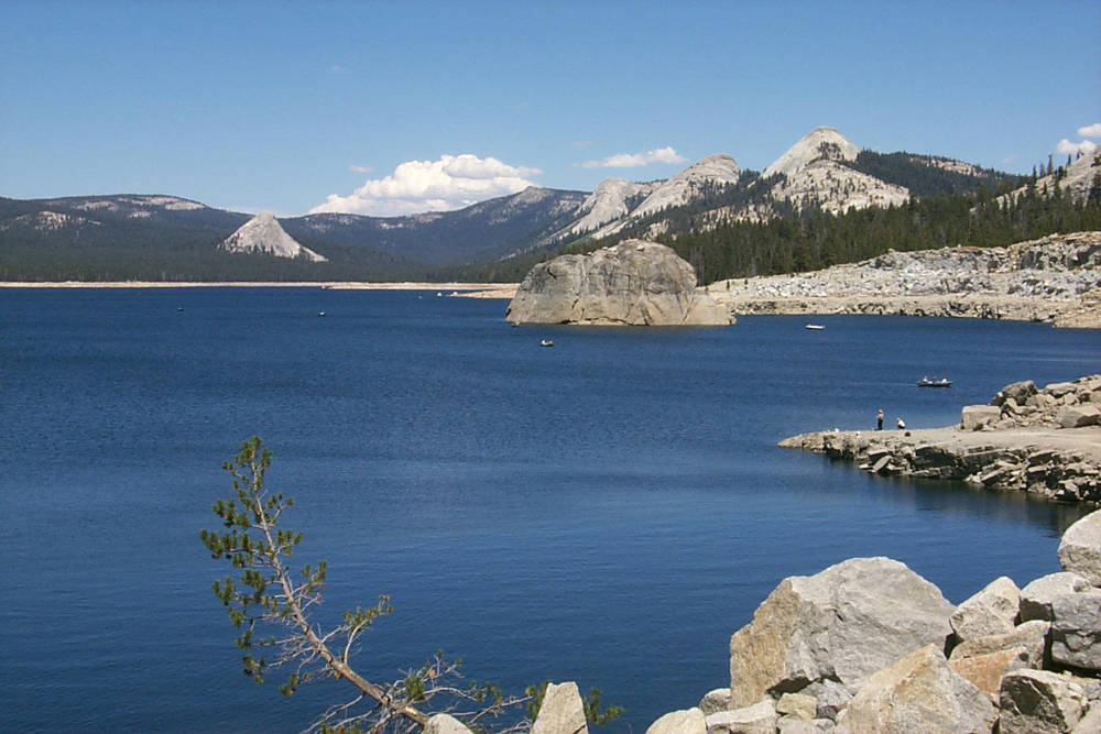
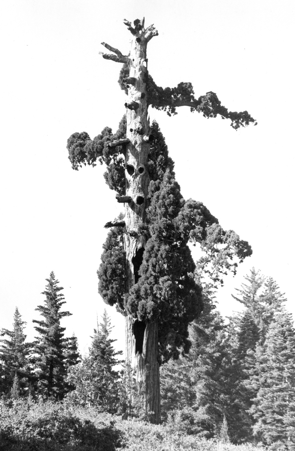
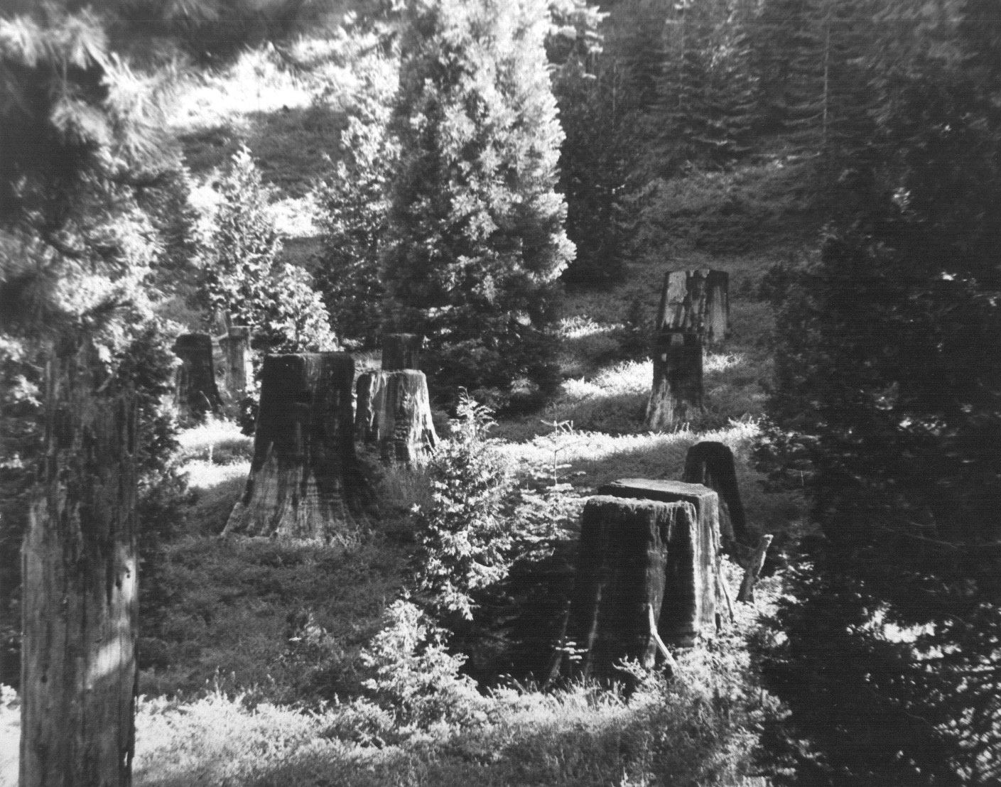
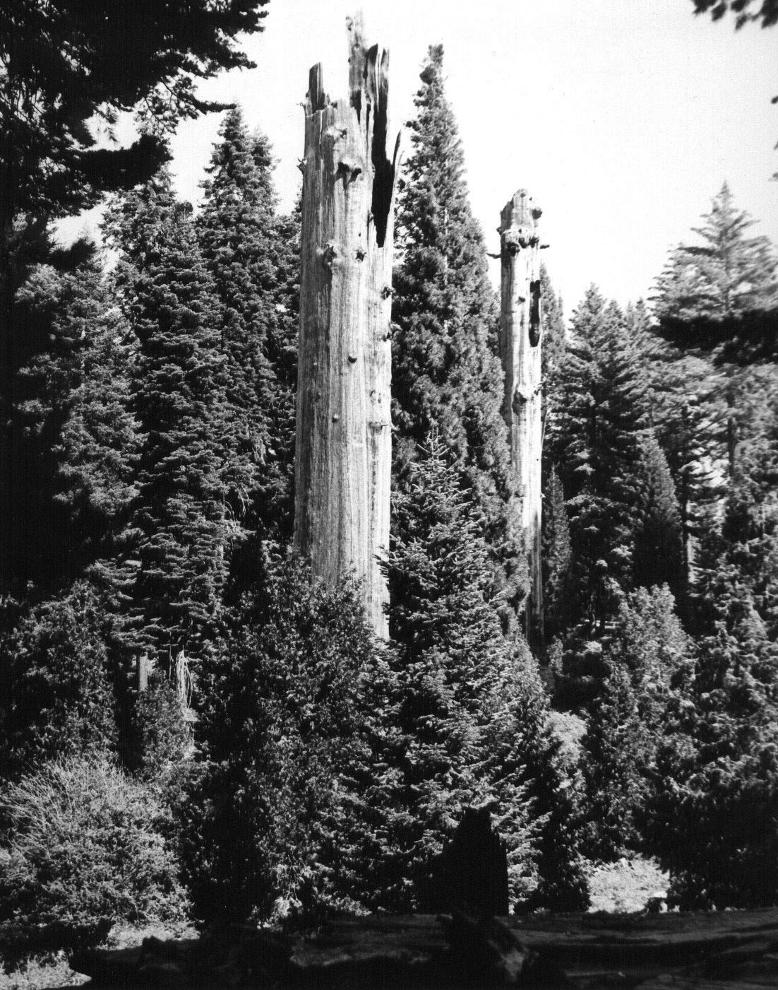
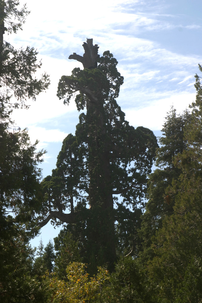
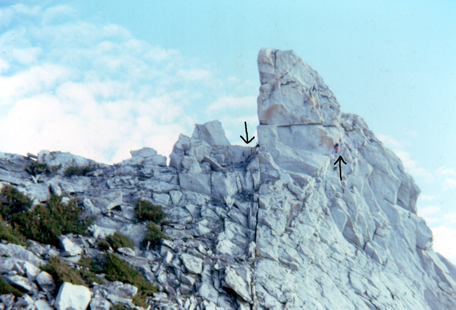
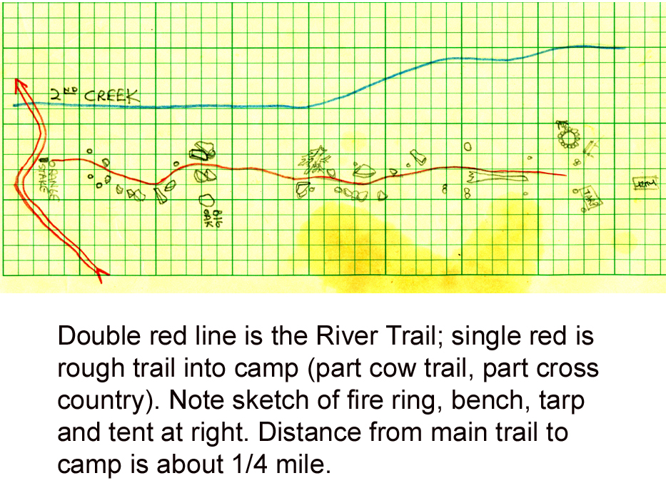
