
| Grand Canyon & Logandale Bluegrass 2003 | ||
| Photos Related Web Sites More Travel Reports | ||
Breaking with the tradition of trying to capture the first two or three days' events after the fact, I am giving fair warning that I will be heading for the north rim of the Grand Canyon about 6 a.m. Friday, then going to a bluegrass festival in Nevada (the same one I attended last year at this time). It was
warm in Logandale last year (it’s 60 miles from Las Vegas), but
the North Rim ranges from 7,000 to 8,000 feet in elevation, so any
kind of weather is possible, including snow. The visitor center
there closes October 15, although the road is open all year, weather
permitting. Although it’s cooling off in I will
be making a long run the first day, to North Las Vegas, since
there’s no place to stop sooner that’s not too soon. This will
give me a fairly short second day of driving to my destination, The return trip will start with an even shorter drive from there to Logandale. It’s been a hectic time leading up to this trip, with more stuff scheduled on my return. My father was ill and in the hospital at the beginning of September, and I have made a number of trips to my parents' home in Mariposa. He’s feeling pretty much normal, at least as normal as you can be at age 89. I have
a doctor’s appointment the day before I leave, and the retired
employee association lunch the day after I return.
October
2: Everything is ready except for the last-minute items. The
trailer cupboards, refrigerator and water tank are full, and the
holding tanks are empty. I plan to get up at
October 3, 2003: The trip was smooth until I got to I left
about I got
to the Hitchin’ Post RV Park about The
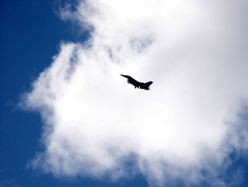
park is actually in I did have a brief noise pollution problem when five or six jets came in and landed at Nellis Air Force Base, which is nearby. They came in low over the park, so I grabbed my camera, and got a couple of photos that look pretty good. The
weather was mostly warm, dropping to 65 in Tehachapi and about 70 at Today’s drive was way too long, over 400 miles. I like to limit my daily mileage to about 250 miles, which gives me time to sleep late, stop and rest as needed, and arrive at my destination in mid-afternoon. Tomorrow won’t be so bad, only 222 miles according to my Rand McNally trip planning program. However, there will be a significant elevation gain to around 7,000 feet, and I don’t know what the road is like. Apparently there was a storm that closed the road into Grand Canyon, but it was supposed to re-open yesterday. The North Rim is subject to cold and stormy conditions any time after the beginning of fall. I’m expecting to make use of my long sleeve flannel shirts.
It rained here yesterday, but the RV park hosts said today started out clear. It was quite cloudy when I arrived, but most of the clouds are gone. I’m hoping it stays storm-free and not lower than the 50s. That’s a good hiking temperature, but I wouldn’t mind if it warmed up just a bit. I don’t know what the temperature in the trailer is, but it usually registers about 10 degrees warmer than outside. I haven’t taken off any layers yet, so it’s best not to know. Today’s
trip was smooth in all ways. A few miles past Las Vegas I-15 becomes
a nice smooth highway, and the various state highways I traveled on
were also good. I-15 goes across For the
record, I left I-15 a few miles past St. George, on At the
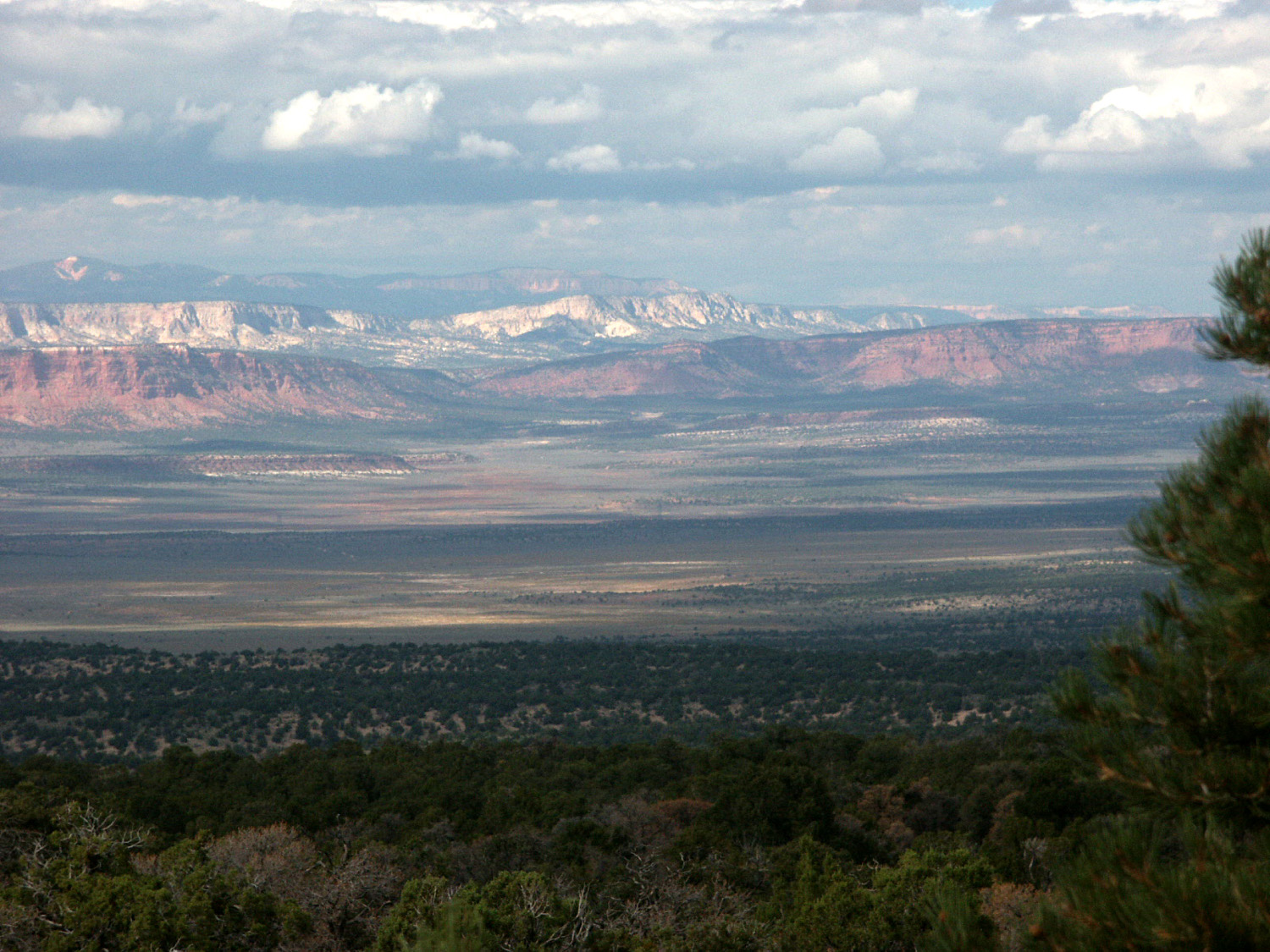
town of About half way between Fredonia and Jacob Lake is the LeFevre Overlook, which offers a view of the Grand Staircase, a huge sequence of sedimentary rock layers that appear as ever higher cliffs on the Colorado Plateau. Bryce Canyon and Zion National Parks are both part of this dramatic land mass. When I
registered, the park hosts informed me that a ranger would be giving
a talk on the area at It’s now 7:30. The heater is on, the sweatshirt is off, and the outside temperature is 40. By the way, today’s travel included temperatures up to 90, but most of the time it was in the mid 80s. Tomorrow
it’s on to the
October 5, 2003
: Today I exercised and went on my morning walk, just as I do
most days at home. It’s a nice walking area – I followed the After
breakfast I headed south toward the The
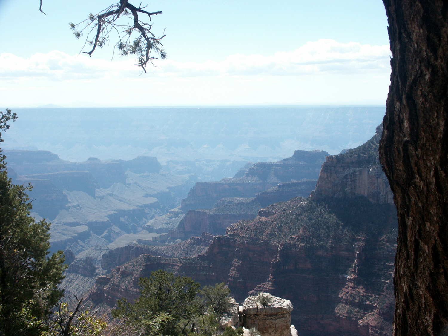
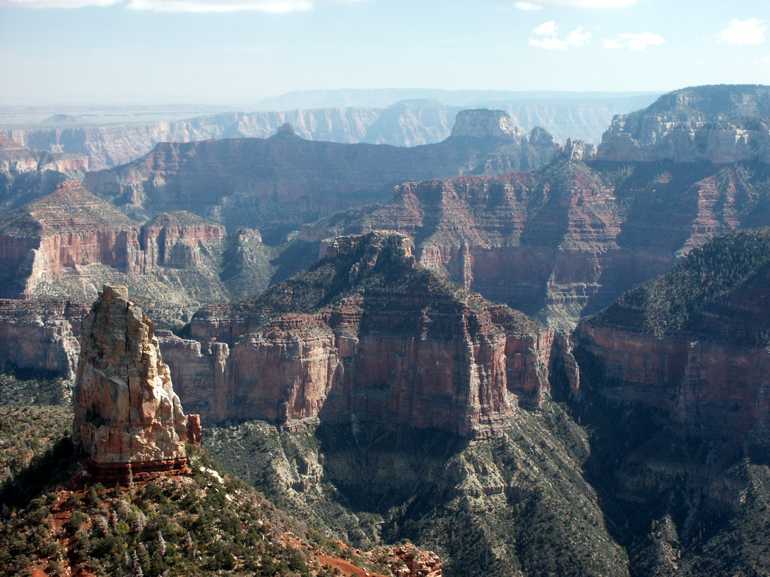
entrance station is about 30 miles from After a return to the visitor center to buy some books, I headed for Point Imperial, about 15 miles away, the highest point on the north rim. I thought the view here was more impressive. You can look northeast toward the Vermillion Cliffs and see the gash in the earth that is Marble Canyon, which the river runs through before the canyon opens up and becomes “Grand.” To the south and southwest you can see a wide expanse of the canyon and its multi-colored layers and striking features. At the
lookout point, a man was taking a picture of his wife, and I offered
to take a picture of them; then he took a picture of me. We got to
talking, and it turned out he is Chuck Hoover, a cameraman for
Channel 30 in The weather was everything you could ask for – if you asked for sun, clouds and rain. It was clear this morning and is clear at camp now, but there were scattered clouds over the canyon area. Driving home, I had a few tiny drops from one big cloud that looked like it could produce rain. However, throughout the day it was nice enough for shorts and a T-shirt, although when a cloud went over the sun late in the day, it felt like it dropped about ten degrees. Most of the time while driving, the thermometer in my truck registered in the 50s, but I think it was warmer at the rim. It is more open, and subject to warm air rising from the canyon. Coming out of the park I had to stop while a flock of wild turkeys crossed the road, and I saw another bunch later outside the park. They are native to one side of the canyon (I forget which), but did not cross the canyon to the other side. However, they have now been “planted” on the other side too. I also saw a deer on my way home. They are reported to be quite thick in this area. In the nineteen teens, the government began killing off the predators, primarily mountain lions, to “help” the deer. The predictable result was overpopulation and massive winter deaths of deer. After various equally foolish attempts to fix the problem, including flying the excess deer to another location, nature was allowed to take over again. After I got back to the trailer I sat outside and read for a while. With a T-shirt, flannel shirt, and quilted flannel shirt, it was quite comfortable at 50 degrees. It began to feel cooler and cooler, and when it hit 45 I headed inside and started the heater. Tomorrow I plan to hike on the Kaibab Trail, which goes down into the canyon. There is a destination about two miles in, which will be as far as I will go. I suspect there will be lots of uphill hiking on the return trip. Monday, October 06, 2003
: The North Kaibab Trail goes down 14 miles to the However,
a few hundred yards down the trail (and down means steep
uncomfortable walking), I decided I did not want to dodge and smell
mule shit for four miles, and face a two-hour uphill hike after I
was tired. So I turned back, got into my truck, and headed down the
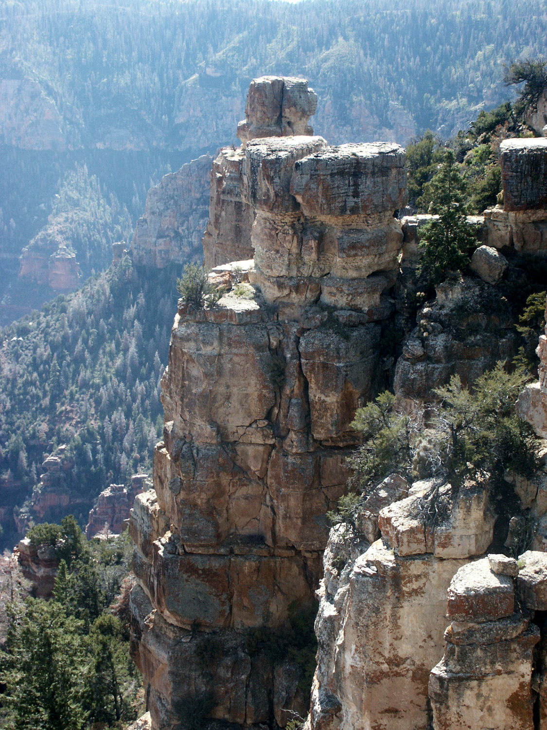
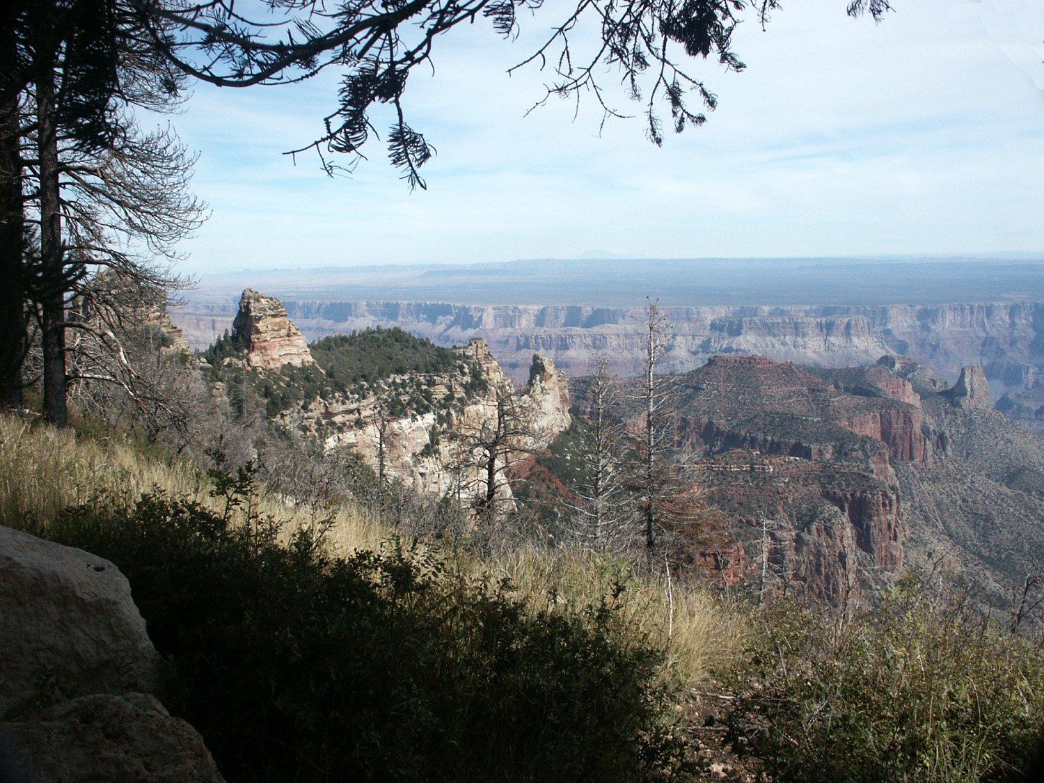
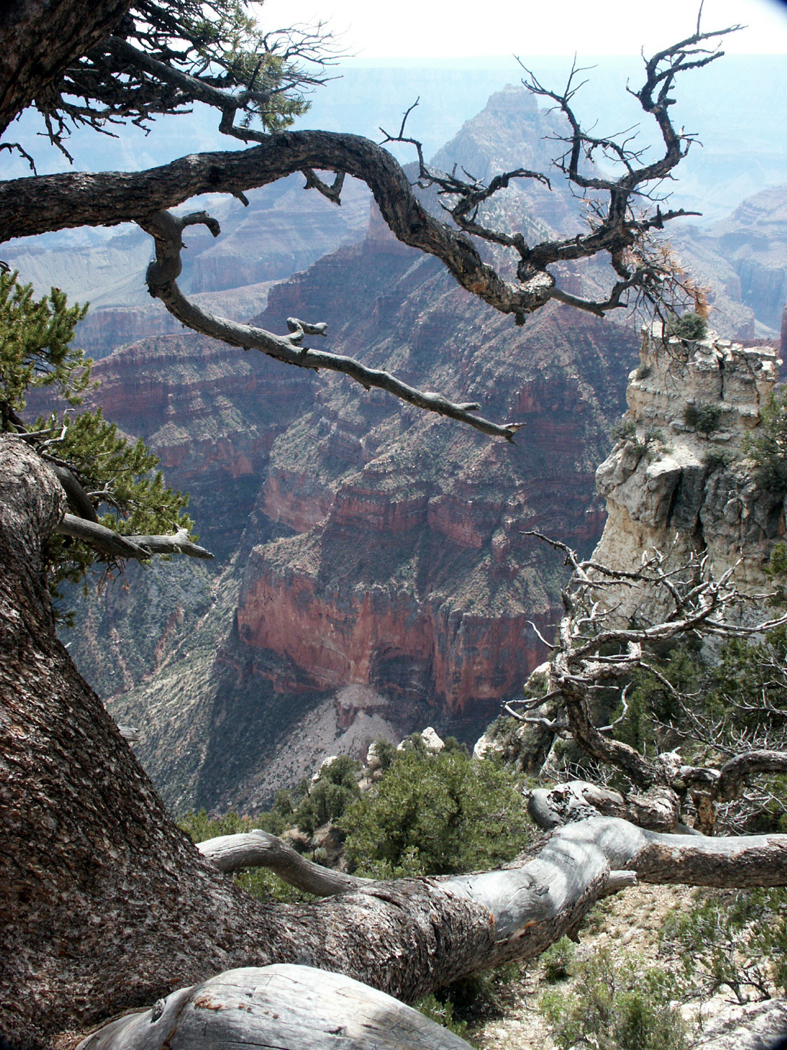
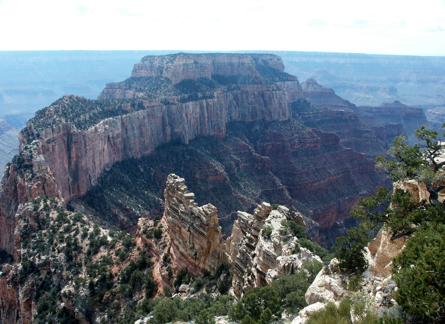
road to The road drops down through pure ponderosa forest; at the rim it turns to juniper and piñon. The trail at the end of the road leads out to several viewpoints, all of which I thought were more impressive than yesterday’s stops. The point is on a peninsula of land that runs out into the canyon, so there are views on both sides. A particularly good stopping point is Vista Encantada, which I went to on the way back. Later in the afternoon the lighting is better and the colors are deeper, and this was my favorite spot of the entire trip. It might not look as good in the morning when the section of canyon it overlooks is in shadow. Walhalla
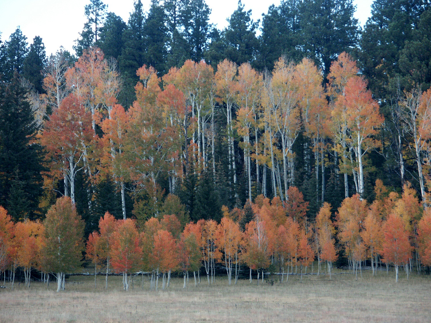
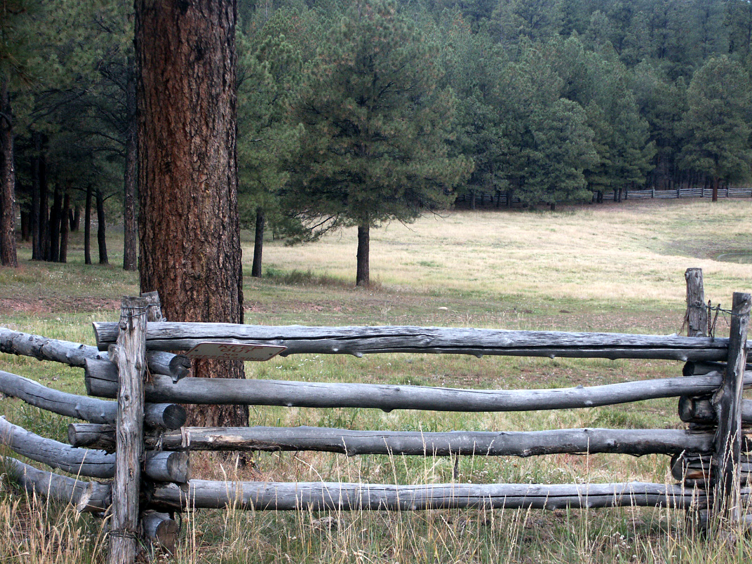
Overlook provides the first view of the In addition to scenery, I saw: one deer and one flock of wild turkeys on the way in; and four deer and four flocks of wild turkeys on the way out. Yesterday I mentioned driving through meadows. These are long narrow stretches – one runs three miles and another six miles. The road runs along the edge with gentle curves and gentle hills, and you can easily drive 60 MPH during these sections. Other parts of the road are winding and marked by hairpin turns, but there is little elevation change. Tomorrow
I plan to stay in camp. There is more to see at the Canyon, but I
went to the major points, it is a hundred mile round trip from
my camp, and I
would like to check out the Jacob Lake area. There is a visitor center nearby
for the By the way, Jacob "Lake" is really a pond less than 100 feet across. The rocky soil of the Kaibab Plateau does not retain water, and there are no significant streams here. All water for domestic use is trucked in. There are a few "lakes," where there is a section of impervious soil that keeps the water from draining away. Tuesday I will be heading for Logandale, the Clark County Fairgrounds, and the Southern Nevada Bluegrass Festival.
October
7, 2003: Although the day started out cloudy and cold, it turned
out to be the warmest so far – a little above 60. There were some
dark clouds and it was cool to sit outside and read this morning at
10, and of course it’s cool again now at After I
got up at I did
some things around camp to get ready for tomorrow’s departure, and
will do a few more later. I hope to get up at 7:30
tomorrow, and be on the road by 9, although experience tells me I
won’t get out of here quite that soon. The trip is only 177 miles,
and as I recall, last year they did not let people into the
fairgrounds till about
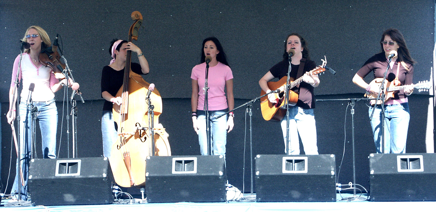
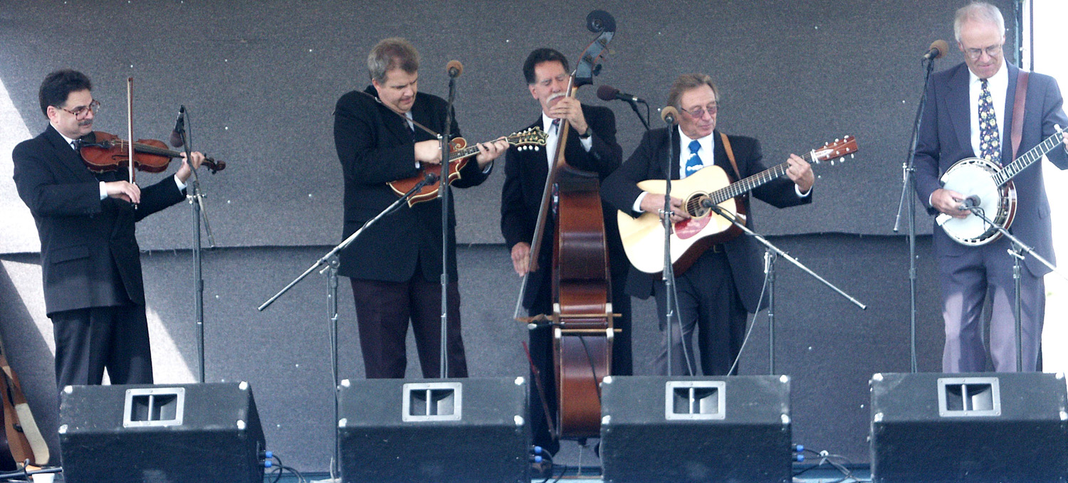
October 9, 2003 : I got started about 9:30 Wednesday, and arrived in Logandale at 2 p.m. Dropping down from nearly 8,000 feet to under 2,000 was a big change, and I haven’t been cool since. Actually, last night was quite pleasant, and it’s not bad in the shade when the breeze is blowing. Danny
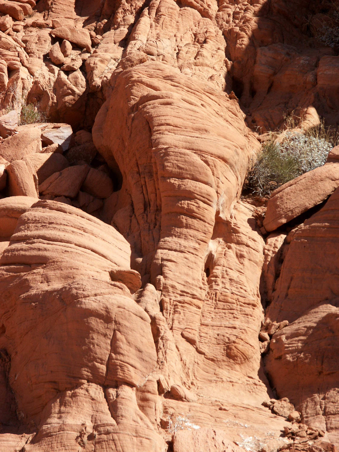
and Sherry from Since Thursday is a “dead day” (no performances), like last year, I made a trip to the Valley of Fire State Park. I went on a 1.5 mile loop trail that goes out from the entrance station, past a lot of dramatic rock formations, including several that look like animals or faces. For the first time in my life I saw a horned toad (actually a lizard). I saw something that looked like a big bug zipping across the trail, and when I knelt down it took me a while to find him. He sat completely still while I studied him and took a picture. He was quite round, about the size of a quarter, with a tail that seemed more like a turtle than a lizard. He had spines on the side of his body and across his brow. It was about 93 degrees, so after I finished my walk I spent some time at the visitor center, ate lunch, and came back. I’m writing this in the trailer with the air conditioner on, but I still have not cooled off. October 13, 2003
: The festival is over and I’m on my way home. There was no
time or energy to write during the event. As always, I had a great
time. I played and sang a little with the people from The
on-stage line-up was one of the best aside from the Huck Finn
Jubilee. Each festival I see new groups and usually find one that I
really like. This time both of my new favorites were bands from Old
favorites included I also
heard a bunch of songs I had never heard before, both on stage and
in the parking lot jams (if I had heard them before, they hadn’t
registered). It always amazes me how people come up with great,
unfamiliar songs that have been done by well-known artists such as
Flatt & Scruggs, Hank Williams or Waylon Jennings, as well as
obscure great songs by obscure artists (Examples: Waylon’s
“Wrong,” Hank’s “I Told My Heart a Lie,” and in the double
obscure category, “Roseville Fair” by It’s
about 440 miles from Logandale to They have built a freeway bypass around Mojave on Highway 58, but the off ramps are not all finished yet. There are supposed to be three ramps, but only the north one is open, so I had to bypass the town and double back. The merchants here are furious with CalTrans, who closed both ends of the old road, then didn’t do any work on the new ramps for two weeks. Even the one ramp that is open has cones and barricades and is confusing and dangerous. For me, the end result, getting to the RV park in “downtown” Mojave, was not worth the effort. If it’s not the worst park I’ve stayed in, it’s in the bottom five. I had considered going on to Tehachapi, only another 20 miles, and now I wish I had. There are planes, trains, barking dogs, and until I removed it, there was something left behind by a dog right in front of my door. Another traveler’s note: If you’re in this area and want to eat, skip the Denny’s and McDonald’s in Mojave and Barstow, and try the Roadhouse Café at Kramer Junction (where US 395 crosses California 58). It has good food and good service, and while you’re at it, you can buy gas on all four corners. I will
end this report here, since there is not much to say about driving
from Mojave to |
||
 |
 |
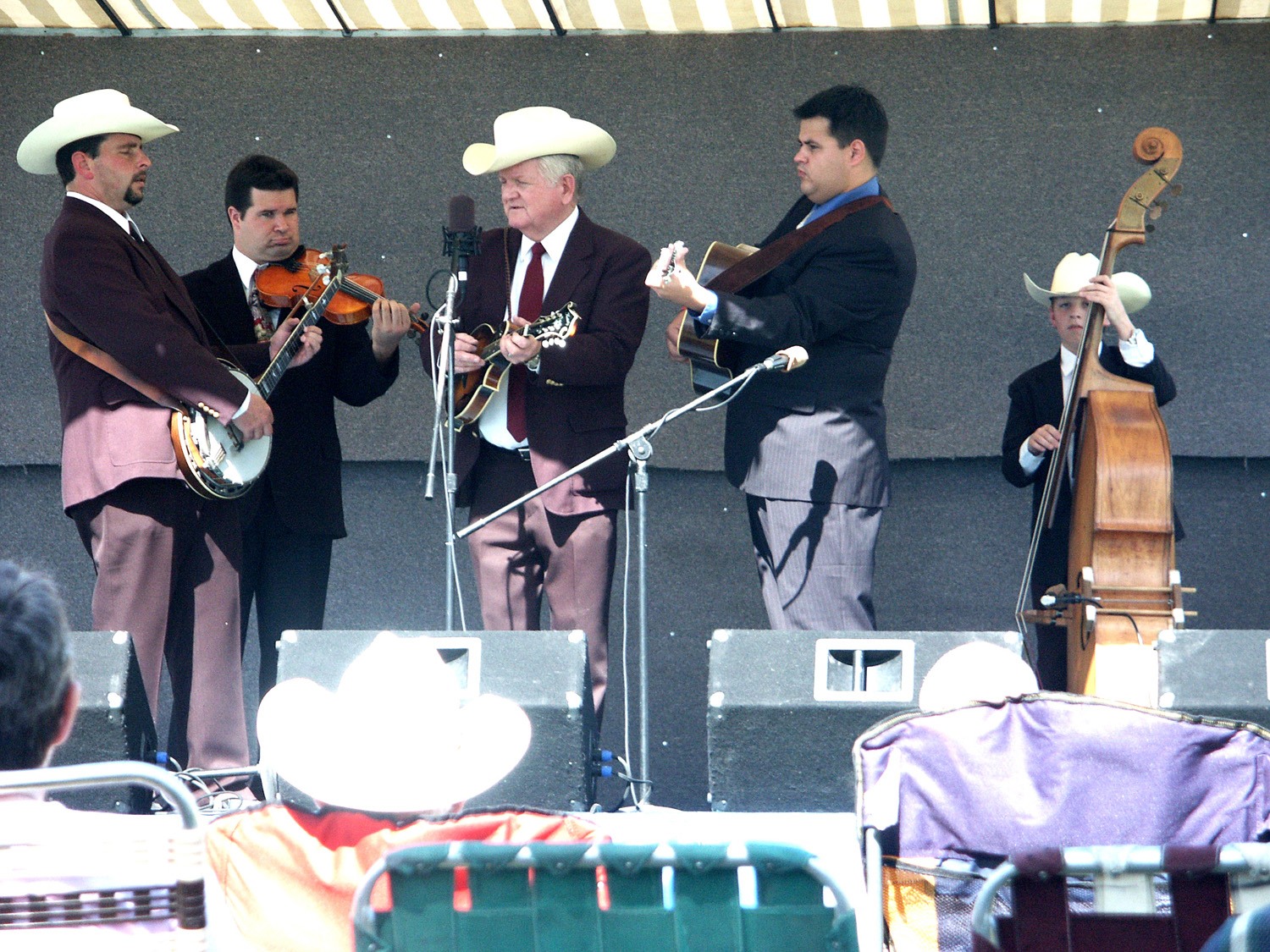 |
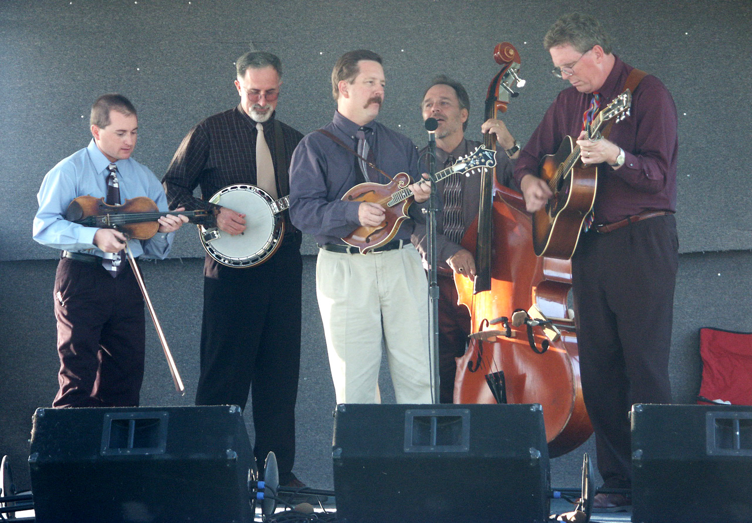
| Silver City Pink | Lost Highway | Liberty Bluegrass Boys |
 |
 |
 |
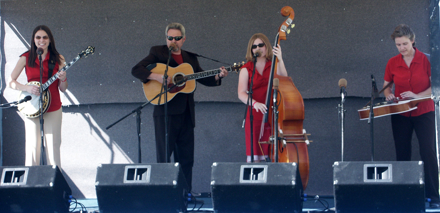
| Lampkins Family | Open Road | Stormy Mountain Boys |
 |
|
|
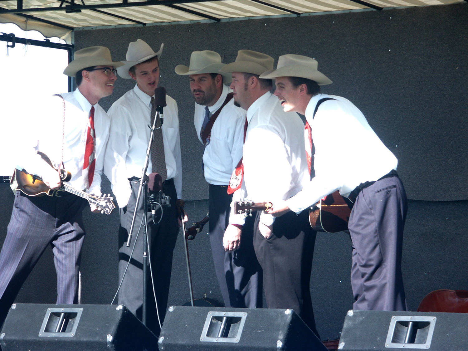
| High Plains Tradition | Aspen-lined meadow on road to North Rim | View
at Bright
near Grand Canyon Lodge |
 |
 |
 |
| View from Point Imperial area | Another Point Imperial view | View from Roosevelt Point |
 |
 |
 |
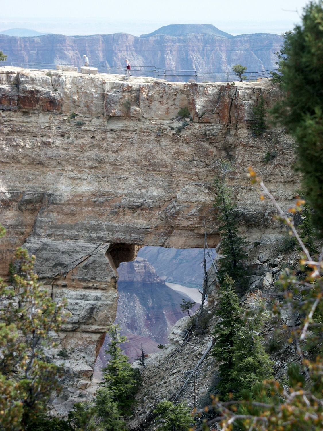
| View from Walhalla Overlook | Angel's Window at Cape Royal | View from Cape Royal |
|
 |
 |
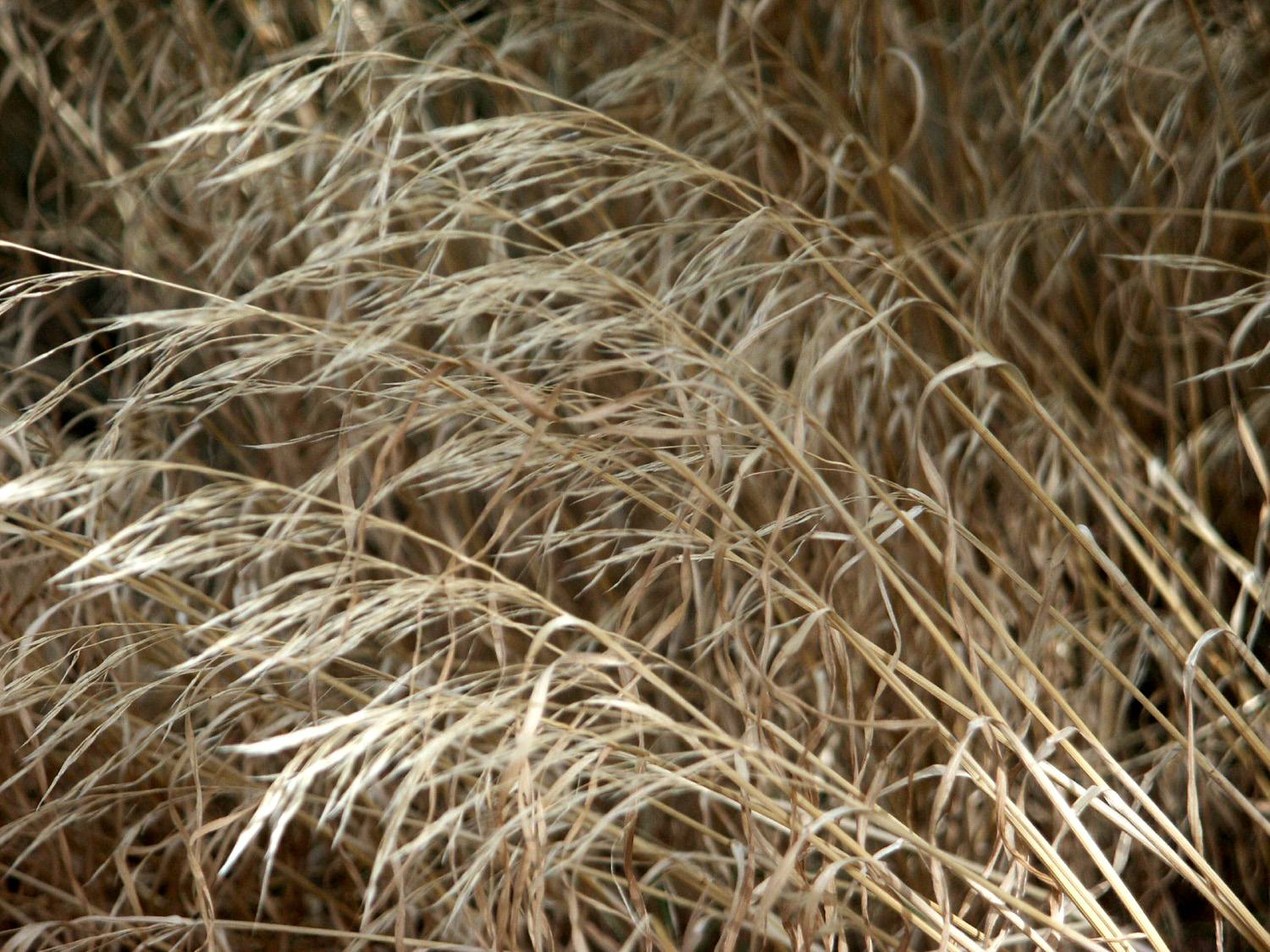
| Another Cape Royal View | Wild Grass at LeFevre Overlook, on the road north of Jacob Lake |
Grand Staircase from LeFevre Overlook |
 |
 |
 |
| Meadow at Jacob Lake | Jet at Nellis AFB, Las Vegas | Weathered sandstone in Valley of Fire State Park |
 |
 |
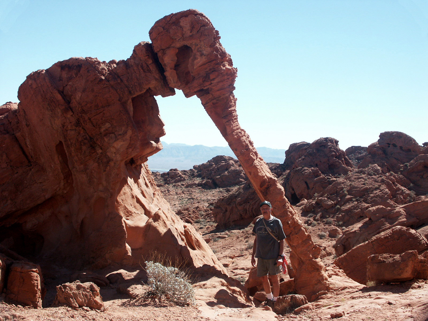 |
| Horned Lizard | A common weathering pattern in the park | Dick at Elephant Arch |
| Recommended CDs, DVDs, Books | ||
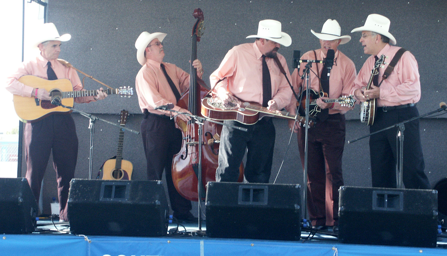
| High Plains Tradition | Liberty Bluegrass Boys | |
| Lampkins Family | Logandale Festival | Lost Highway |
| Open Road | Moapa Valley | Southern Nevada Bluegrass Society |
| Valley of Fire | Dick's Bluegrass Links | Dick's Travel Links |
| Grand Staircase | Dick's Bluegrass T-Shirt Photos | LeFevre Overlook |
|
|
||
