|
Roundup 2011 |
||
|
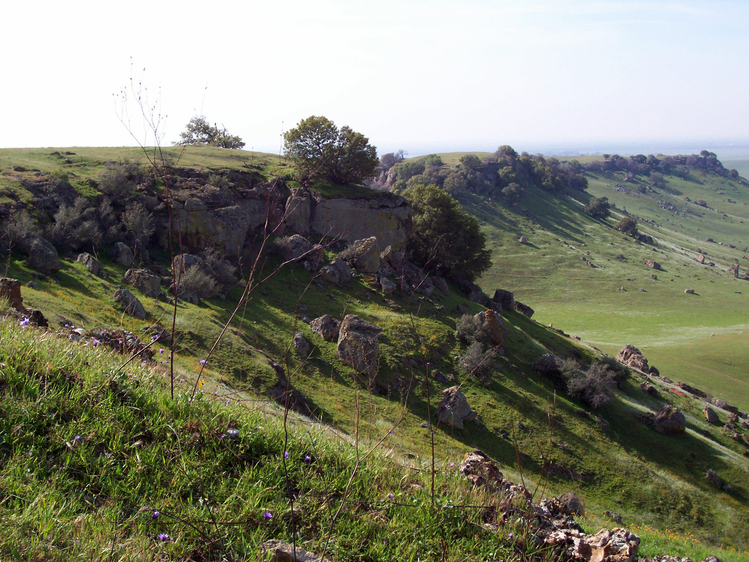
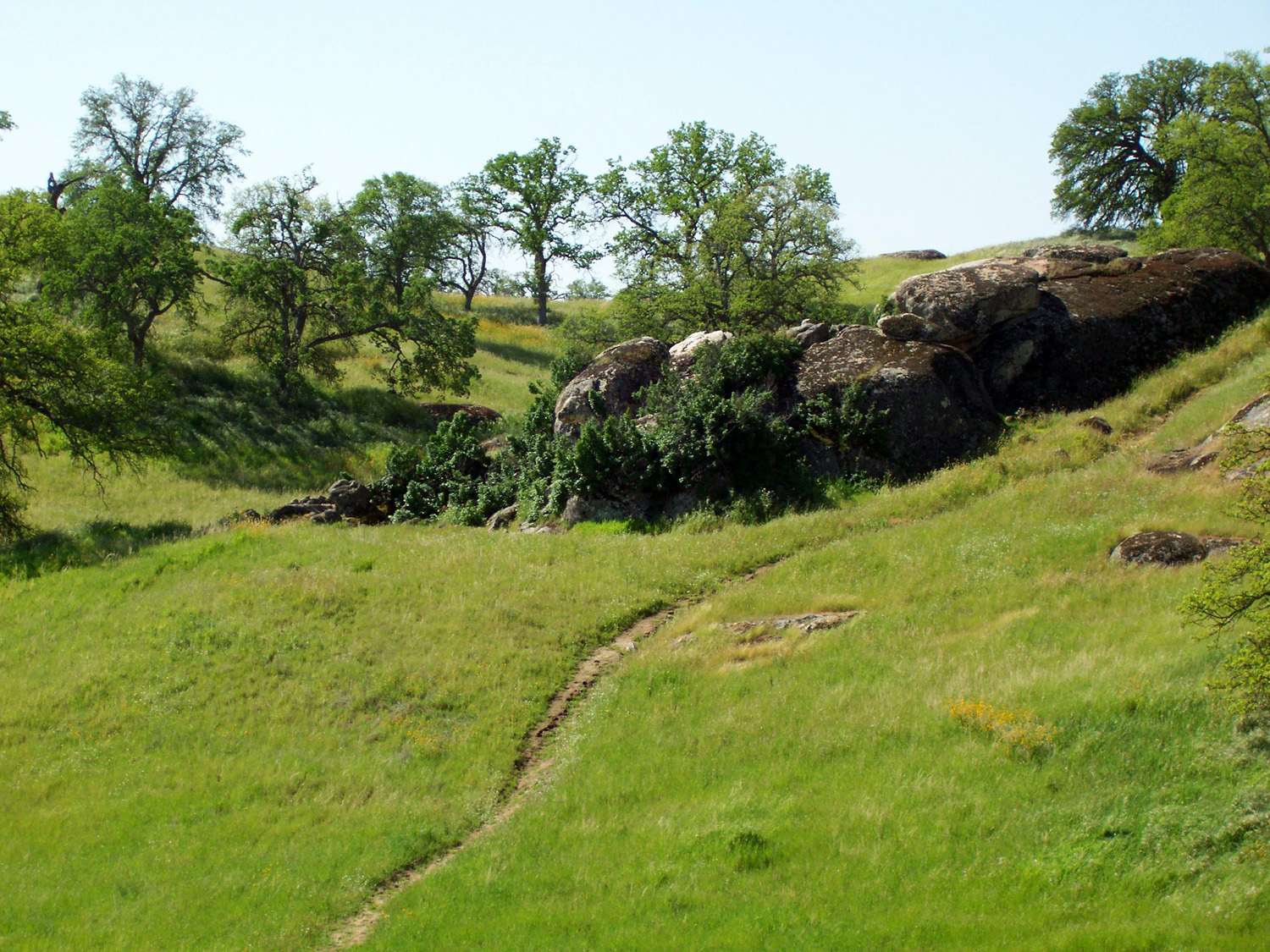
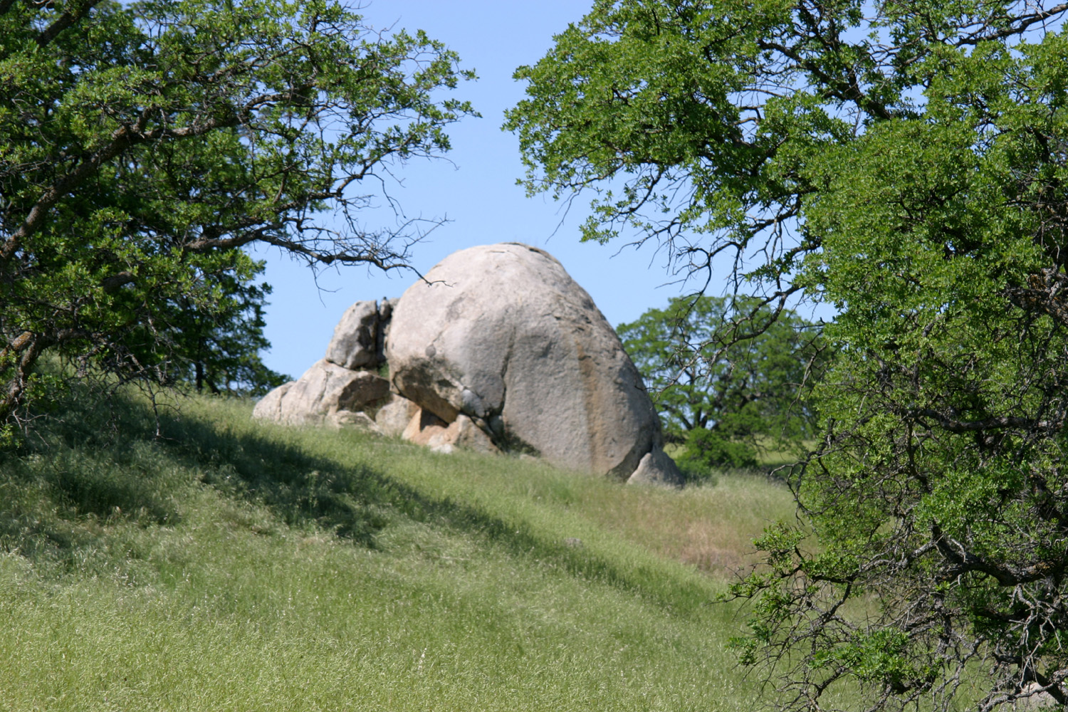
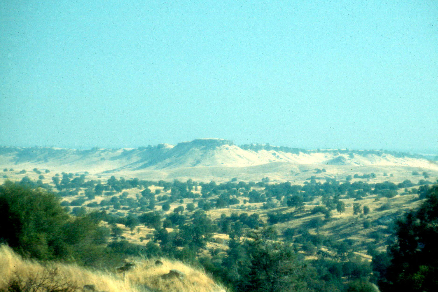
This structure was at the bottom where the receding waters flowed and each layer of sediment gives an idea of how much water was flowing by the size of rocks held in the individual layer. The larger rocks were tumbling down when the melt was great and the smaller rocks mean that it was not flowing so much. There are a number of large boulders at the bottom of many of these hills, which I assume tumbled down as the material eroded. Areas of lava in both areas protected the softer underlying soil, so that the table top hills remained after erosion had worn down the surrounding lands. This site has a good aerial view of the topography of Little Table Mountain and the adjacent tables; here are some photos and a topographical map. The
weather was overcast and windy when we started out, and I was
comfortable wearing a T-shirt, sweat shirt, and flannel shirt. The
weather remained cool, but there was no threat of rain. On a similar
hike two years ago, Mark got sick and didn’t make it to the top, so
he was eager to go all the way this time. On top
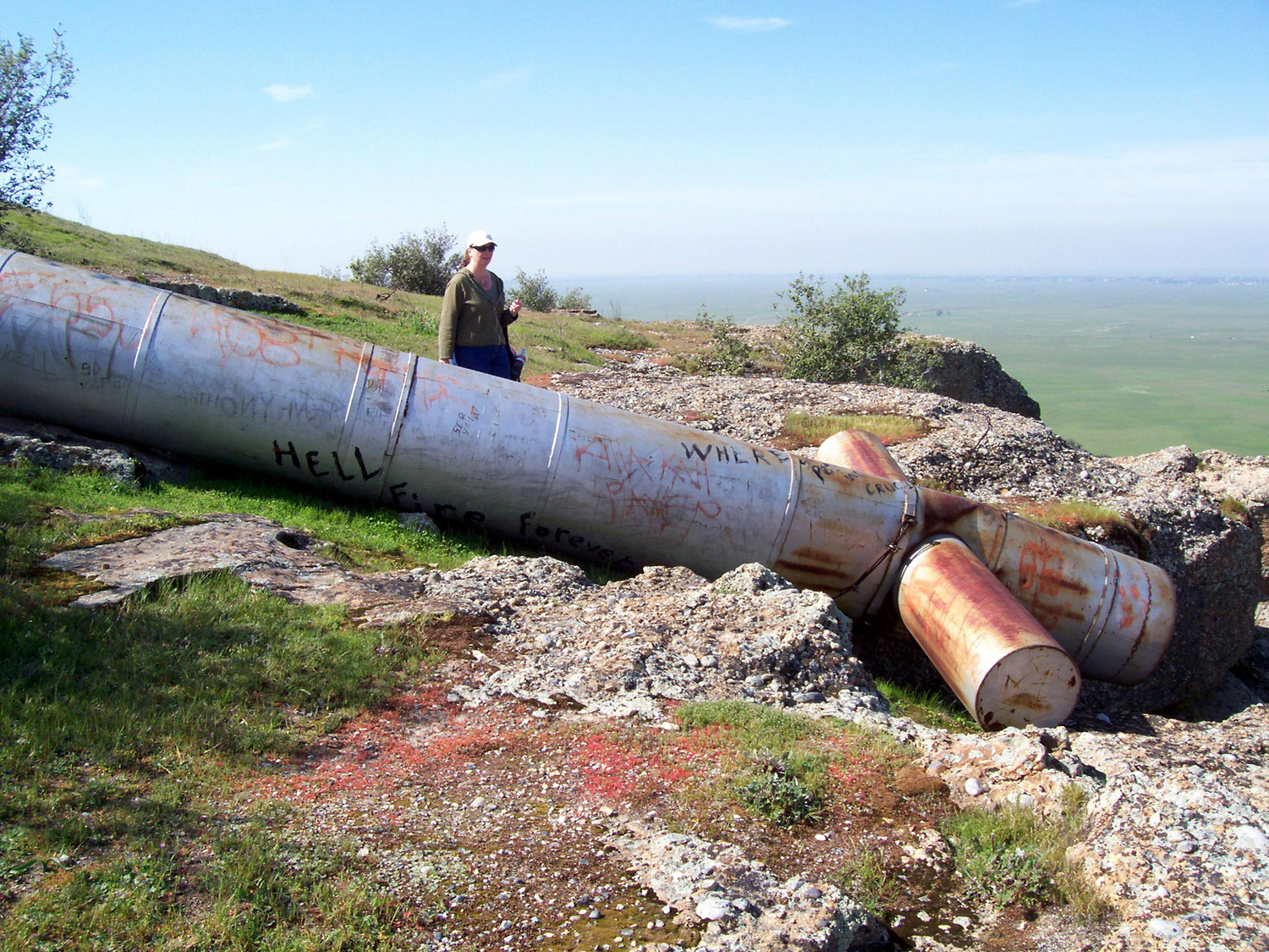
there is a big metal cross that used to be standing but has been
down since at least 1983. Since it fell, people have been scratching
and painting their names and the dates into the metal, and Mark was
anxious to add his. The top
of this table is probably close to a half mile long, and several hundred yards
across. We went all the way to the south end, then down and across a
drainage to an area I call From
here we could see two groups of cows, which eyed us warily. At one
point, one herd all began walking in the same direction, but
eventually they drifted back to their original location. The closer
group was right on our path back to the car, and started moving
across in front of us to the right, so we drifted to the left. Then
they turned around and all ran back the opposite way and out of
sight, so we followed our original path.
On
April 4 and 5 I finally got in my first “winter” camping trip of
the season. Whenever I’ve had time to go, it’s been rainy or
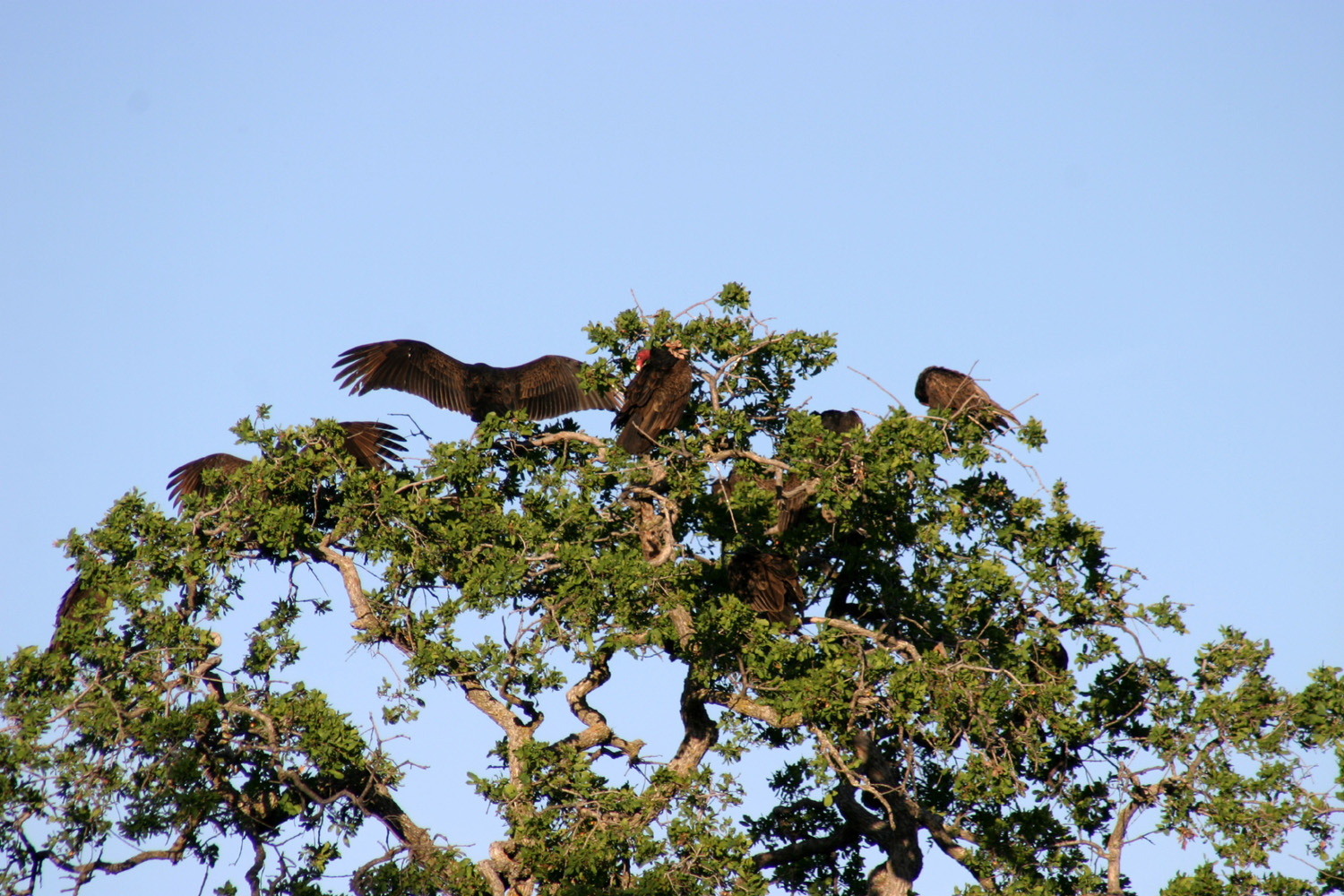
cold or windy, or a combination of two or three of the above. I got my favorite spot, which is somewhat private, got set up, and had a drink. After the ranger came by to collect the camping fee, I rode my bike to the trailhead of the Shaw'-Shuck trail, one of two trails in the area. This one goes up and around the top of a hill and back down, about a half mile. On Monday evening Janell, her daughters Nichole and Jessica, and their dogs Copper and Tinkerbelle, came out for a while. Shortly before they arrived, about ten buzzards (AKA turkey vultures) landed in a tree right across the road from me. They had disappeared by the time Janell arrived, but as we walked up the hill behind my camp, we saw them above us in a dead tree. There were soon enough that they needed two trees. This particular hill actually has the best views in the campground, so it was a nice walk. Copper thought he smelled a ground squirrel, and did a bit of digging, He would dig, sniff, then move forward and dig some more, until he had made a shallow trench about two feet long. The next day I took the longer trail, the Pohonichi, which is supposed to be about a mile. It goes up and down several times, which makes it a perfect hike in my opinion. On both hikes there are nice views of the lake, as well as the snowy Sierra. Besides these "official" hikes, I did a lot of walking and bike riding, and just generally enjoyed the beauty of the area. On Wednesday morning I lazed around, slowly getting ready for the trip home, and got started around 11 a.m. for the 35 mile drive. This is a fairly brief report, but for a fuller description of the area and more pictures, you can check out my previous camping trips here and here.
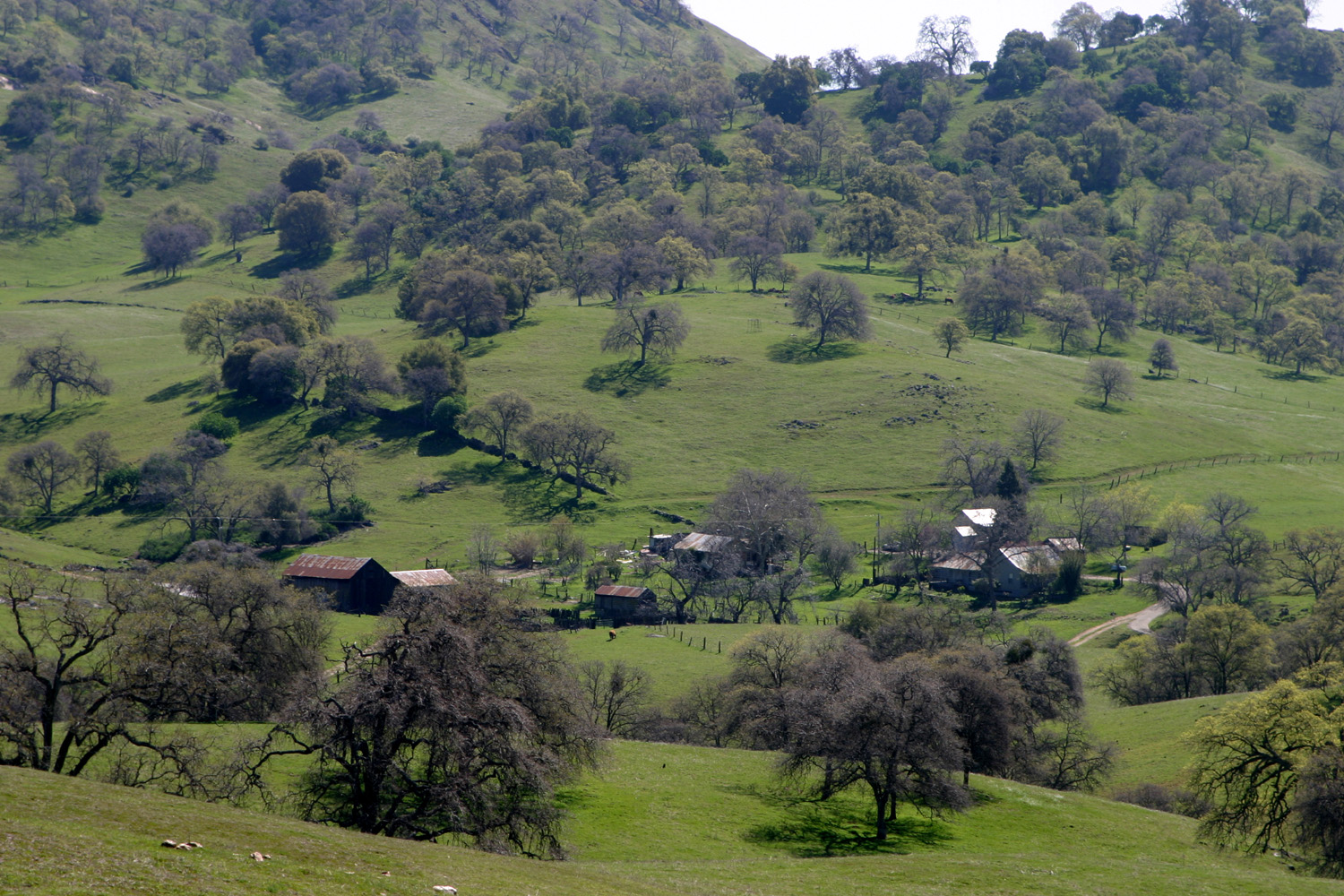
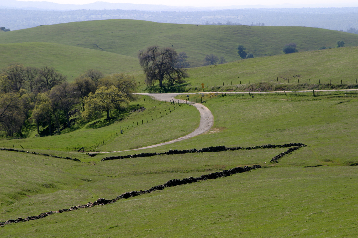
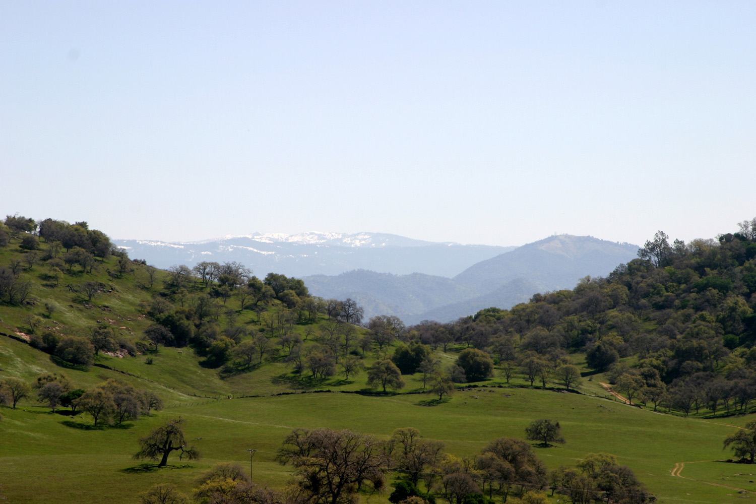
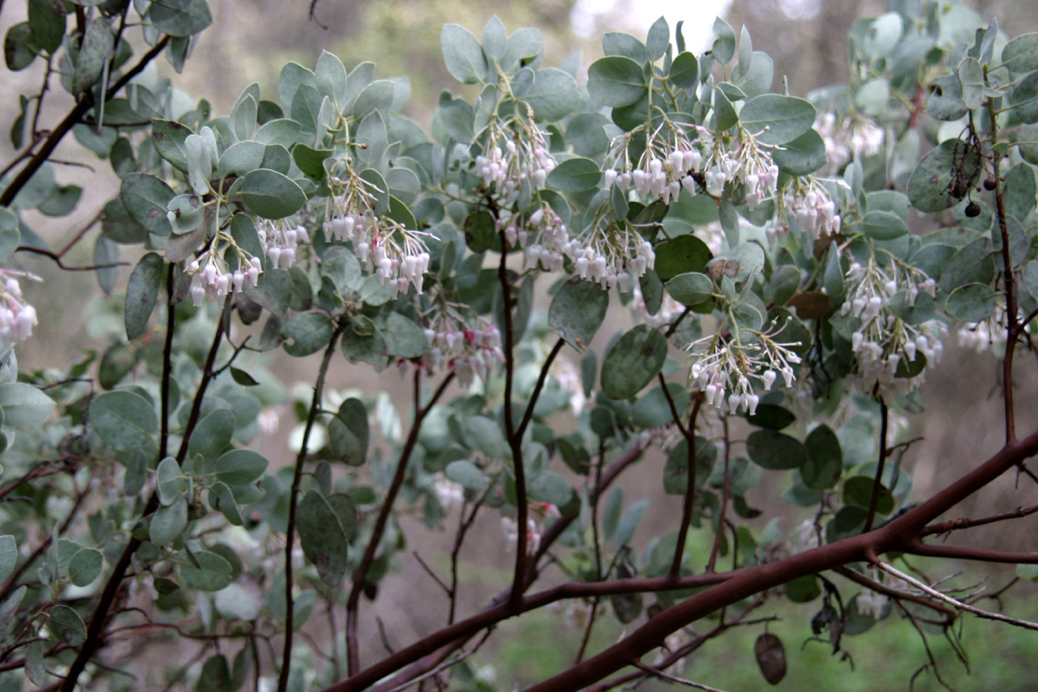
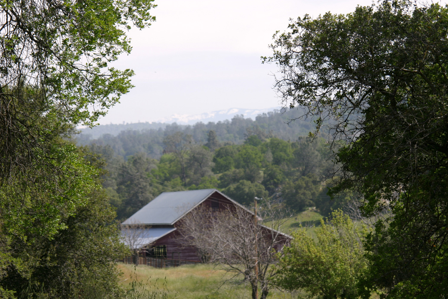
On April 16 Janell and I took a trip to Mariposa (my childhood home town). We went up Highway 99 to Madera, then through town to the Raymond Road, which goes through the rolling hills between the valley and the foothills, to the tiny town of Raymond. Although there are only a few businesses still in operation, this was at one time a busy stage stop on the route to Yosemite, and is still the site of the Raymond Granite Quarry, which provided building stone for many of the major buildings in San Francisco, as well as elsewhere around the state. Knowing my interest in photographing old barns, Janell suggested we go down the road toward the quarry, where there is a nice looking barn, and nearby, the local Catholic church, built around 1922 from local granite. We took several pictures in this area. Two main roads leave Raymond to the north. One goes northeasterly and joins Highway 41 at Coarsegold. The other connects to the Ben Hur Road in Mariposa County, and leads eventually to Mormon Bar (location of the fairgrounds, two miles from town), and to Mariposa. The road crosses the Chowchilla River just above the upper end of Eastman Lake, and goes through beautiful, green foothill country, gradually climbing up to the 2,000 foot level. One of the most striking areas along the way is the Quick Ranch, established in gold rush days by Morgan Quick, who was one of the few miners who actually made a fortune through his efforts. There was an old house on the property, but Quick built a new home and outbuildings, and commissioned the construction of a series of rock walls. Four miles of rock fence, four feet high and two feet wide at the base, were built at a cost of $1.75 a rod (16.5 feet). Quick provided the Chinese coolie masons with their daily pork and rice, buying a great herd of hogs at about a cent and a half a pound, to feed the men. The Chinese captain kept strict accounts of the progress of his workers, sitting on a chair under an umbrella, clicking off each foot of fence on an abacus. The coolies pushed forward rapidly, for each had to lay a rod and a half a day or forfeit their day's pay of twenty-five cents. The fence was completed in a year at a cost of $6,000. (Details here were gleaned from the Quick Ranch web site, which contains an article by Woody Laughnan for The Fresno Bee.) Quick prospered a second time raising cattle on the ranch. He was from a well-to-do family, and lost no time in having fine furnishings sent around the horn to stock his new home. When his sons were old enough to take over the cattle operation, Morgan Quick retired from cattle ranching, bought property near Watsonville, and made another fortune raising apples. The property remained in family hands, and in 1890 a post office was established under the name Ben Hur. The ranch is still owned by the Quick family, although part of the property has been sold, and much of it is leased to another long-time Mariposa county cattle rancher. One thing Janell and I have noticed during several foothill trips this spring is the shortage of wildflowers, which seems counter-intuitive, since we have had near record rains this winter and spring. However, it has also been unusually cool, with heavy snow down to very low levels in March. I suspect the cool weather inhibited the development of flowers, and once it warmed up, it was too late in the plant's life cycle. There are flowers here and there, but they are scattered - no big orange patches of poppies or white and blue fields of popcorn flowers and lupine blossoms. But boy is it green! The rest of our trip from the Quick ranch into town was a scenic delight, with the new bright green of deciduous trees, tall native grass, unique rock formations, and occasional views of higher snow-covered mountains. Janell is trying to fill in some missing pieces from several sets of dishes, and had found some for sale in Mariposa, so that was the "official" purpose of our trip. We got that job taken care of first, visiting briefly with the seller, who is related to a long-time Mariposa family that I'm acquainted with. We stopped next at the Mariposa Cemetery to visit the graves of my parents and grandparents, and to see who else I knew was there, then parked downtown and enjoyed the walkway along Mariposa Creek, before heading to the many shops that line the old main street of town. I was looking for a birthday gift for my grandson's wife, and with information from him and a little guidance (well, OK, a lot of guidance) from Janell, I found a bracelet that seemed right. Having a 70-year familiarity with Mariposa County, I had a long list of places to show Janell, but we realized we couldn't get them all done on this trip. We wanted to see a little of the countryside close to town, so we drove up the Old Highway, a section of the original State 140 alignment that runs from near the high school for about two miles to connect with the present day road a mile east of town. We enjoyed the pines, blue oaks and bright green grass along this route, then returned to town for lunch at the Red Fox. At least 30 years ago or more my parents purchased a seven-acre tract of land several miles from town on Carlton Road. Although there was a pole for an electric meter and a well on the property, they never used it for anything except a source of firewood. It is a fairly long, narrow strip, with trees, brush and plants of all kinds, and I wanted to see if any trees had been broken off by the heavy snows, so we went toward Yosemite on Highway 140, then turned right just past Midpines Summit on Triangle Road. The first part of this road goes through rolling, tree-covered fields, then arrives at a high point where you can see a big part of central Mariposa County, specifically the Bootjack basin and various hills and mountains beyond that I've been familiar with since childhood. Shortly past this point we turned right on Carlton Road, which eventually goes across and connects with State Highway 49 about a mile west of "downtown" Bootjack. Our property is a short ways down this road, so we parked and walked the entire length of the land. Although the heavy snow brought down many limbs large and small at slightly higher elevations, there were none here. We did enjoy looking at the huge, four-trunk canyon live oak that is the property's outstanding feature (the one tree Dad said he would never cut down), as well as manzanita blossoms, a few other flowers, and the old, falling-down barn that was on the property when we bought it. With our explorations here finished, we returned to Triangle Road and continued east, following the road through several more miles of green, scenic countryside, to its junction with Highway 49 near the Usona Cal-Fire Station. Highway 49 ends at Highway 41 in Oakhurst, where we turned south and headed back home to Clovis and Fresno.
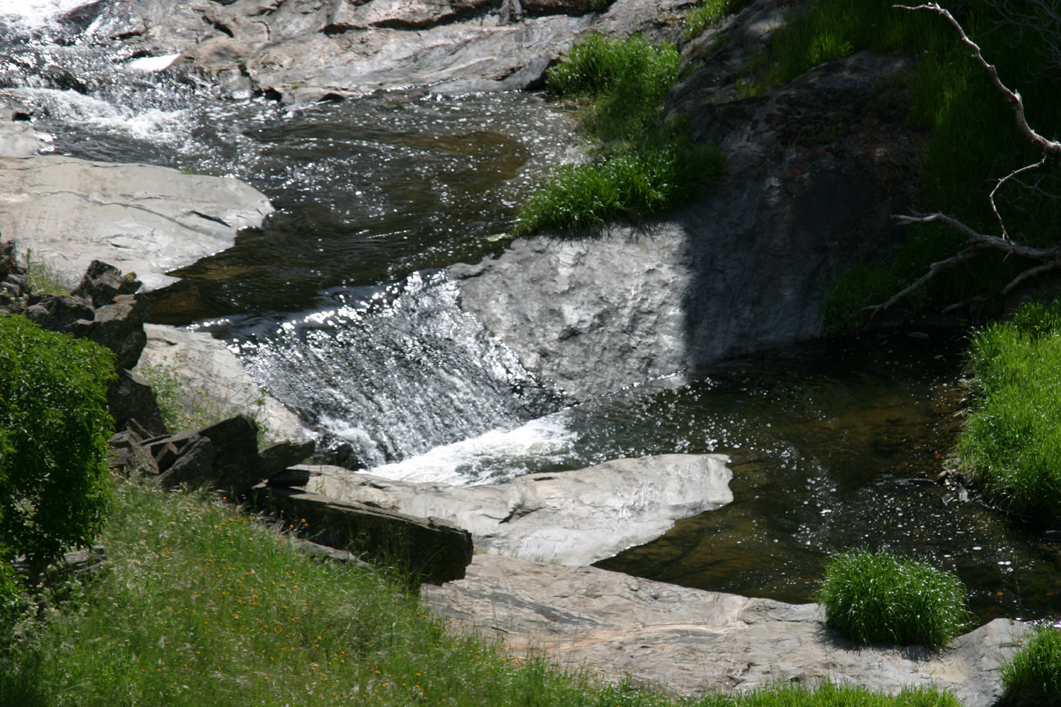
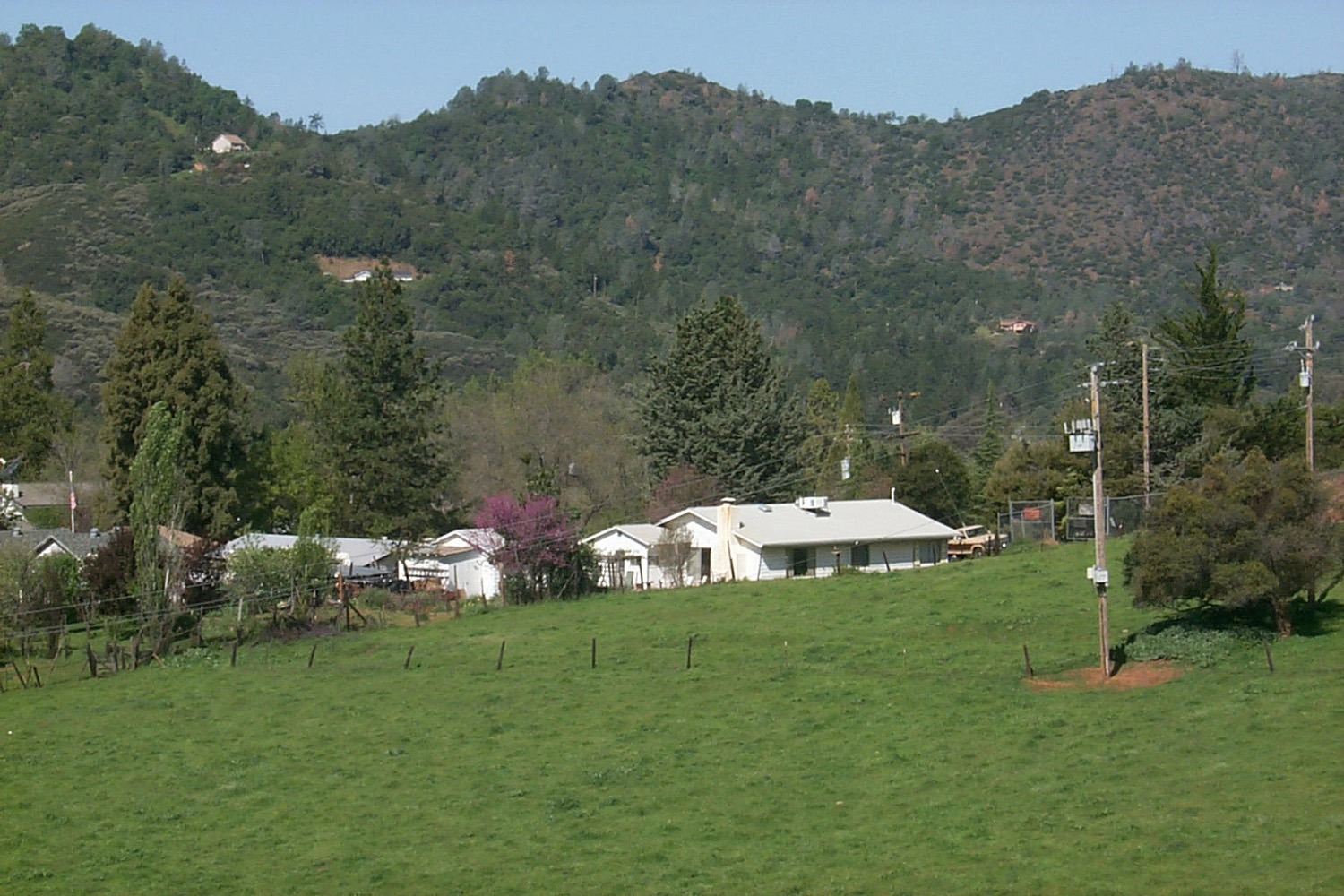
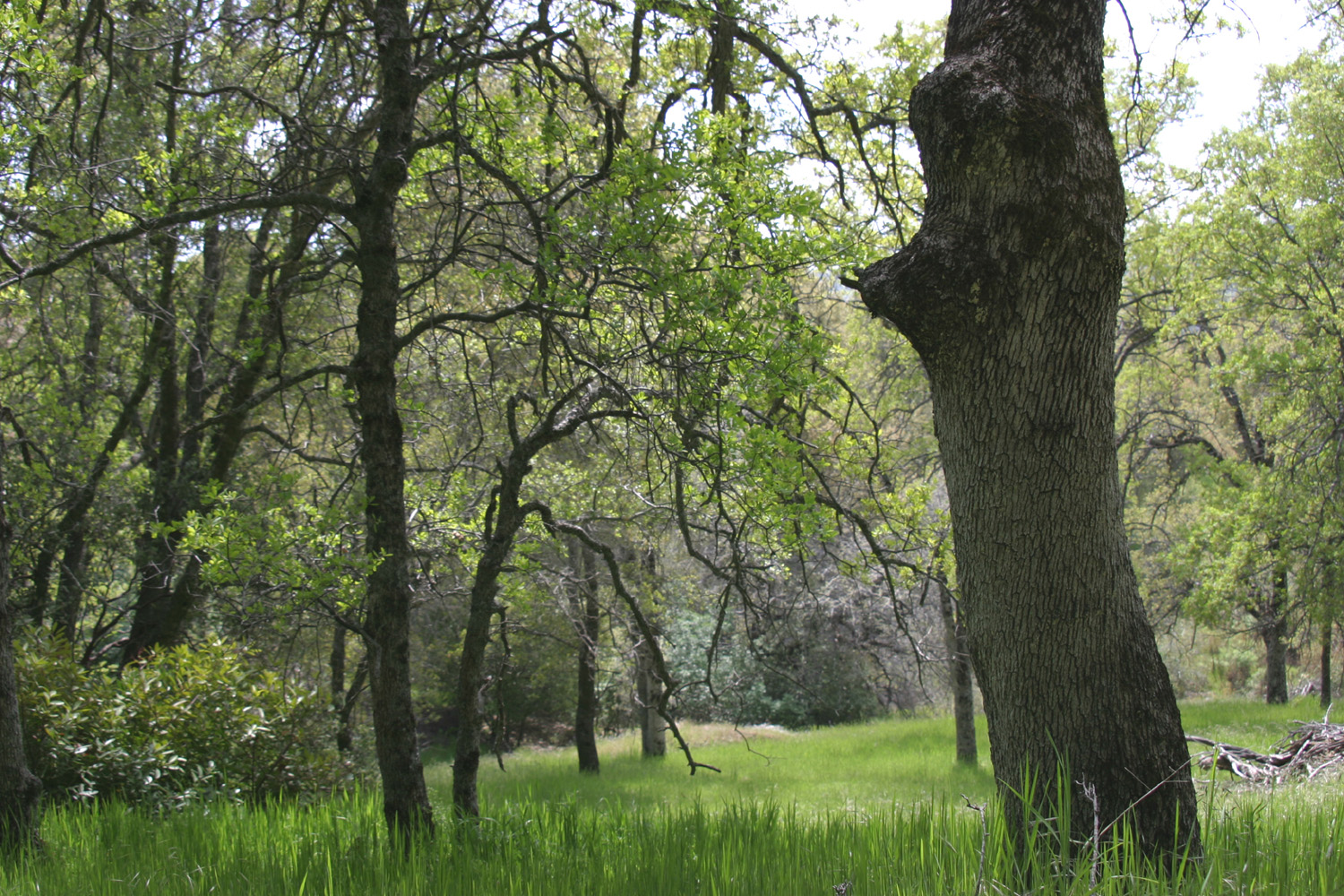
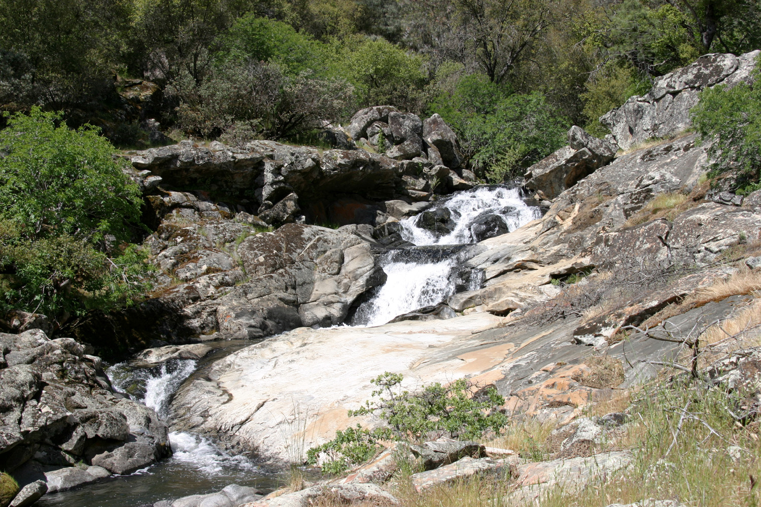
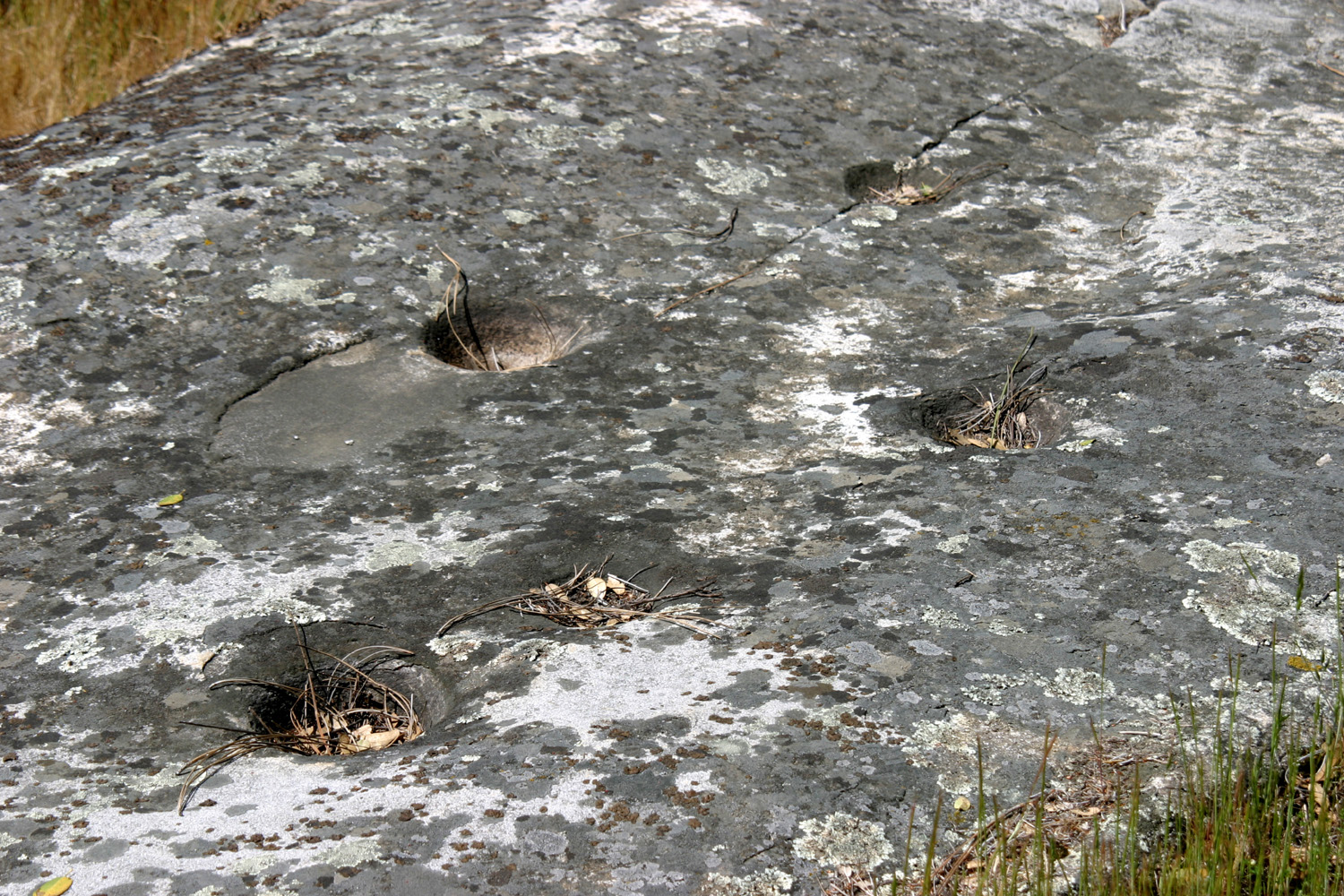
Having enjoyed our trip to Mariposa, we decided to do it again April 30, so we could visit a few other places on my list of really cool things to see in Mariposa County. Our first stop was at the Bootjack Volunteer Fire Department station, where they hold a pancake breakfast every three months to raise funds for various expenses. I'd been there a few times several years ago, and have been wanting to go again, so finally made it. Janell and I both enjoyed our pancakes, eggs and sausage. There were several people there that I knew, so I had a brief visit with them. My chosen destinations in Mariposa County seem to fall into two categories - places I've never or hardly ever been, and places I've been to many times. After breakfast we began our explorations with one of the latter. Barely a half mile from the "town" of Bootjack is the house I grew up in. In between is Pegleg Creek, which flows mainly south into the Chowchilla River about a mile downstream from Highway 49. A short walk below our old house is a small waterfall, in a very scenic setting with a cliff on one side, large boulders and granite bedrock on the other, and several Indian grinding holes at the upper end of the rock. Coming into this area from the highway, we were able to follow some paths that the owner of the land has mowed, which made walking through the tall grass much easier. After we had looked at the falls from above and made our way down below it, we started up the creek bank (moderately steep, but quite walkable) about 100 yards below the falls. Janell noticed some chairs ahead of us, and when we arrived we found a very well-constructed deck (or viewing platform as we called it), with a small table and three chairs. It has been placed so that there is a perfect view of the falls, so we sat a while, enjoying the view, the nice weather, and the surrounding flowers and trees. We left a brief note on the table to say how much we enjoyed "borrowing" the deck, and briefly describing my history in this area. We joked that next time we return, we'll probably find another note that says "stay the hell off our land!" Following mowed paths most of the way, we made our way back to the highway and drove a short distance to Pegleg Road, which goes past the house I grew up in. In those days this road went back one mile, where it crosses the Chowchilla River. Our house was by the main road; there was one house at the end, and none in between. Now there are 20 or more mail boxes at the start of the road. We drove back as far as the bridge. There are lots of houses along the road, which now continues on to the right along the river, with other side roads along the way. We returned to the highway and drove into town, a distance of six miles. A band was playing somewhere, and virtually every parking space all over town was occupied, but our destination was the road that goes up above town past my parents' house (now owned by my sister and me and used as a rental). The house is literally the last one on its street before you get to the "country," and the road leads past it to the town water purification facility, then runs high along the bank of Stockton Creek to the town reservoir. The waterworks includes a million-gallon tank, a pond, and a building that houses equipment. Part of the pond, separated by a cement wall from the other half, has only a little water, but about a million cattail plants, which are a favorite perch for red-winged blackbirds, and this was the time of the year that they were active in the area. Just above our house we parked at the gate that blocks public access to the dam road and walked back the road toward the dam a few hundred yards. We did not take the full walk, which is well over a mile. In the other direction from the waterworks an old road goes out along the ridge that is the divide between Stockton Creek and Mariposa Creek. This road goes out well over a mile, and was so overgrown with grass that we sometimes had trouble staying on track, so we went only few hundred yards, found a place to sit and rest, then headed back down the hill. We were ready for lunch, but with the large crowds in town, I suspected that every restaurant would be crowded, so we left town via Highway 49 northbound, which eventually goes through all the old gold rush towns, well into northern California. Our first destination was the town of Mt. Bullion, which was the site of a mine and milling operation during gold rush days, but is now best known as the location of the county airport. There is also a small cafe there, the Airport Bar and Grill, where we planned to stop for lunch. Stepping into this establishment was like going back in time 30 or 40 years. Patrons were smoking. The waitress was smoking. And in the next room, a raucous game of dice poker was underway, with piles of money on the table. Actually, the gambling was part of a fund raiser for someone who was ill, but going back to the "old days" of smoking in a restaurant was a bit of a shock. Although I could smell a little smoke at first, I didn't notice it after that, so I think the place was well ventilated. And the food was very good. From here we continued on Highway 49 to Bear Valley, another Gold Rush town that has no commercial enterprises at all, but at one time was the headquarters for John C. Fremont, who owned a large section of land in Mariposa County, and operated mines for a number of years. For several miles before this point, there are lush green fields along the west side of the road. We drove past Bear Valley to a point that overlooks the Merced River and the notorious Bagby Grade, a winding section of the highway that drops down from around 2,000 feet to the canyon probably a thousand feet below. The highway crosses the upper end of Lake McClure at the river, and continues on to still another small Mariposa County mining town, Coulterville, that still has a few stores. We did not go that far, but instead drove down about a half mile to the site of the Pine Tree Mine, where my father worked briefly around 1940 (this mine was originally part of Fremont's holdings). Across the road from the mine site you can walk out on the ridge about 100 yards and get a view of Yosemite Valley. I had heard all my life that you could see Yosemite from this area, but it was not until about five years ago that Mariposa historian Leroy Radanovich described the exact location to me. I was there a few years ago, but it was quite hazy that day. This time we had a good view, and the snow on the mountains helped define the features. You can clearly see the upper part of El Capitan, Cloud's Rest and Half Dome. After enjoying the view, we headed back to Bear Valley, then turned west on Bear Valley Road, which goes to still another old gold rush town, Hornitos. Started by Mexican miners, the town is said to have had a population of 5,000 and a reputation as a wild and wooly place. It's also known as one of the hideouts of the bandit Joaquin Murrieta, whose exploits, mostly thought to be legendary, terrified honest citizens until he was caught and killed by a posse. The town contains a building that housed the store where the Ghirardelli company, famous makers of chocolate, was started in the 1850s. Hornitos now has only one active business. Another point of interest is St. Catherine's Catholic church. Although regular services are no longer held here, it is the location of an annual Day of the Dead observation each November 1. From Hornitos we took the Indian Gulch Road, which goes out to Highway 140 at Cathey's Valley. This was the only place on today's itinerary I had never been, and it goes through the site of still another old gold rush town. If there is anything left of the town today, it's not visible from this road. As far as I know, the last surviving public building was moved to the museum in Mariposa at least 30 years ago. It was clear this road is little-used, with grass growing down the center instead of a white line. As we got closer to Highway 140 the road surface improved, and turned to a good two-lane blacktop for the last couple of miles. Once on Highway 140, we made our way back to Fresno and Clovis via Cunningham Road, through LeGrand (a small farm town in Merced County), and south on Santa Fe Avenue. This route more or less parallels State Highway 99, and joins this freeway a few miles north of Madera. I like going this way because it misses a lot of the traffic found on other routes. We had a great time on our two Mariposa trips, and we still have a long list of places to see there. --Dick Estel, May 2011 |
||
|
Photos |
||
(Click to enlarge; pictures open in new window; some photos are from earlier trips) |
||
Table Mountain |
||
|
|
|
 |
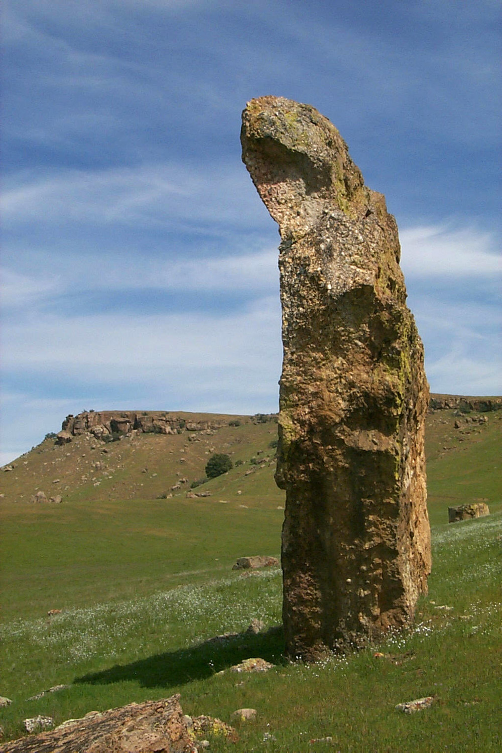
| "Stonehenge"
with Little Table Mountain in the background |
Little Table Mountain from the north along Highway 14 |
Cows keep a wary eye on Mark |
 |
 |
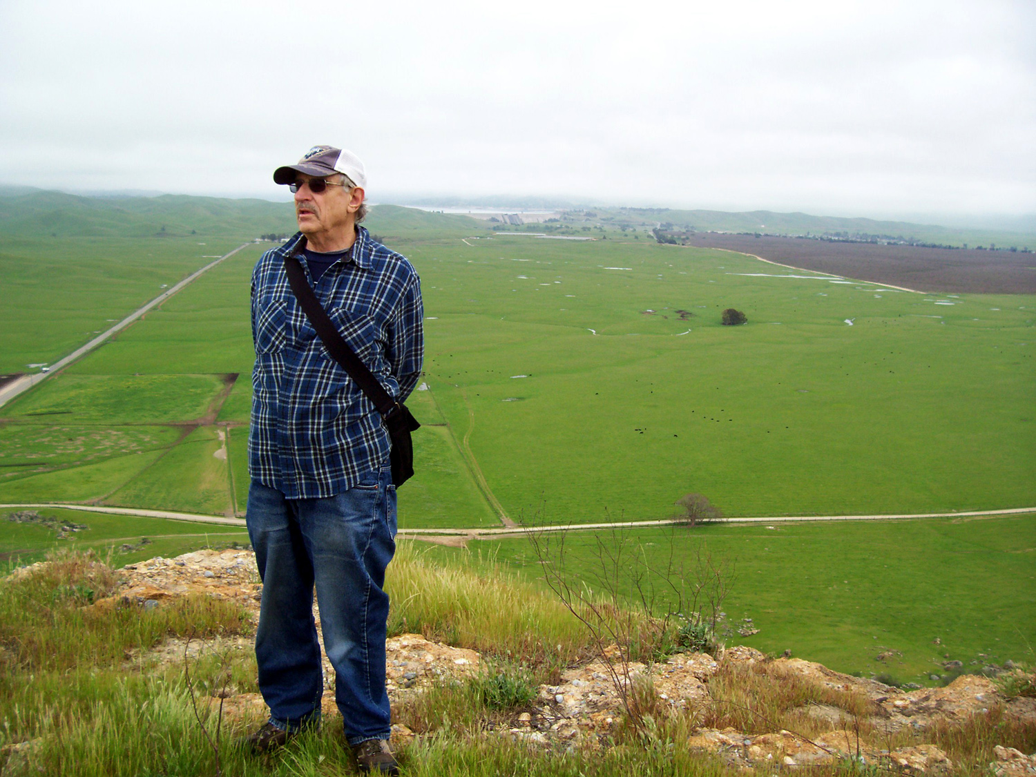 |
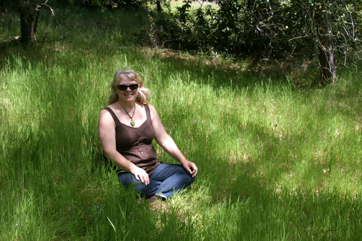
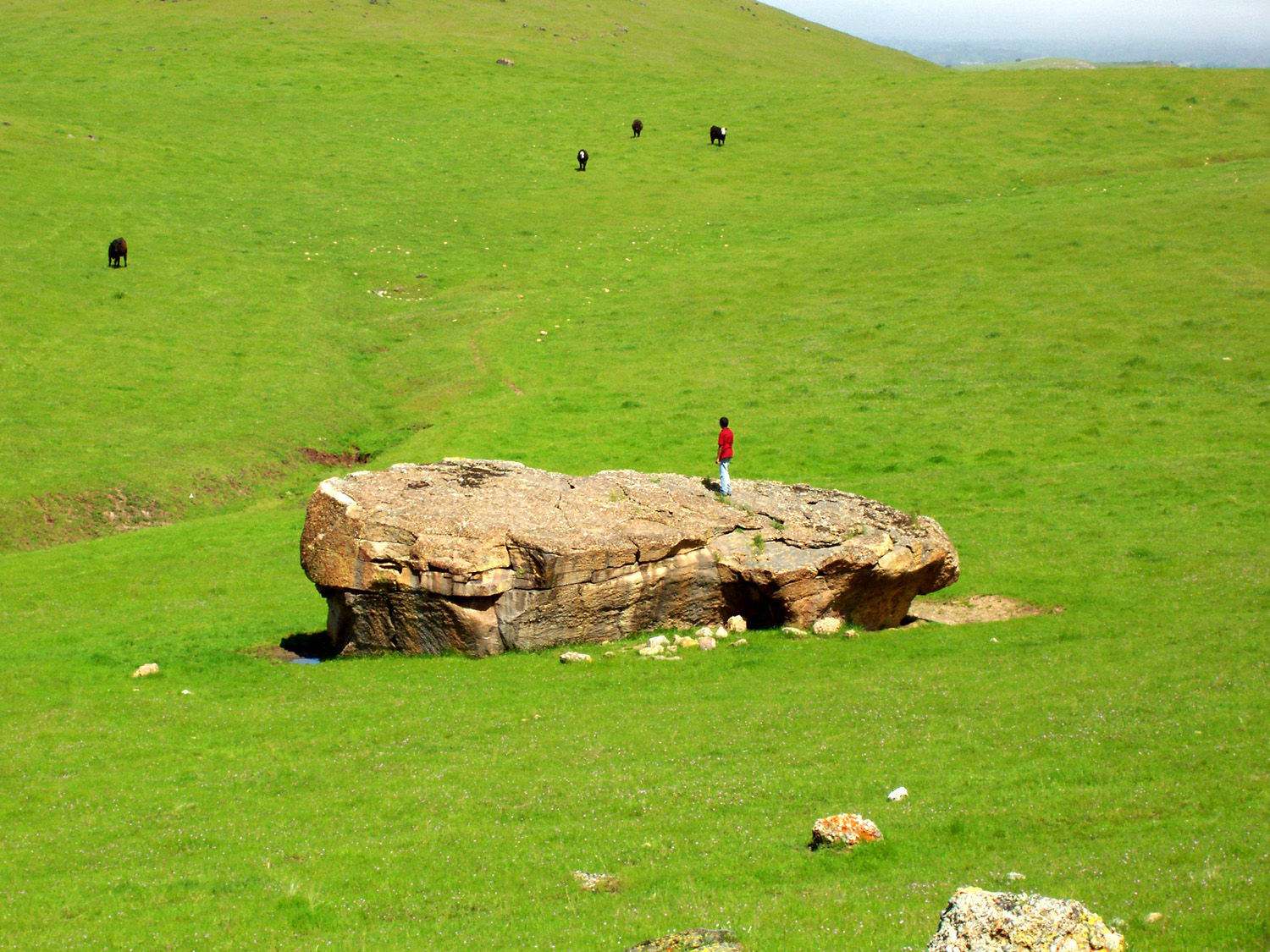
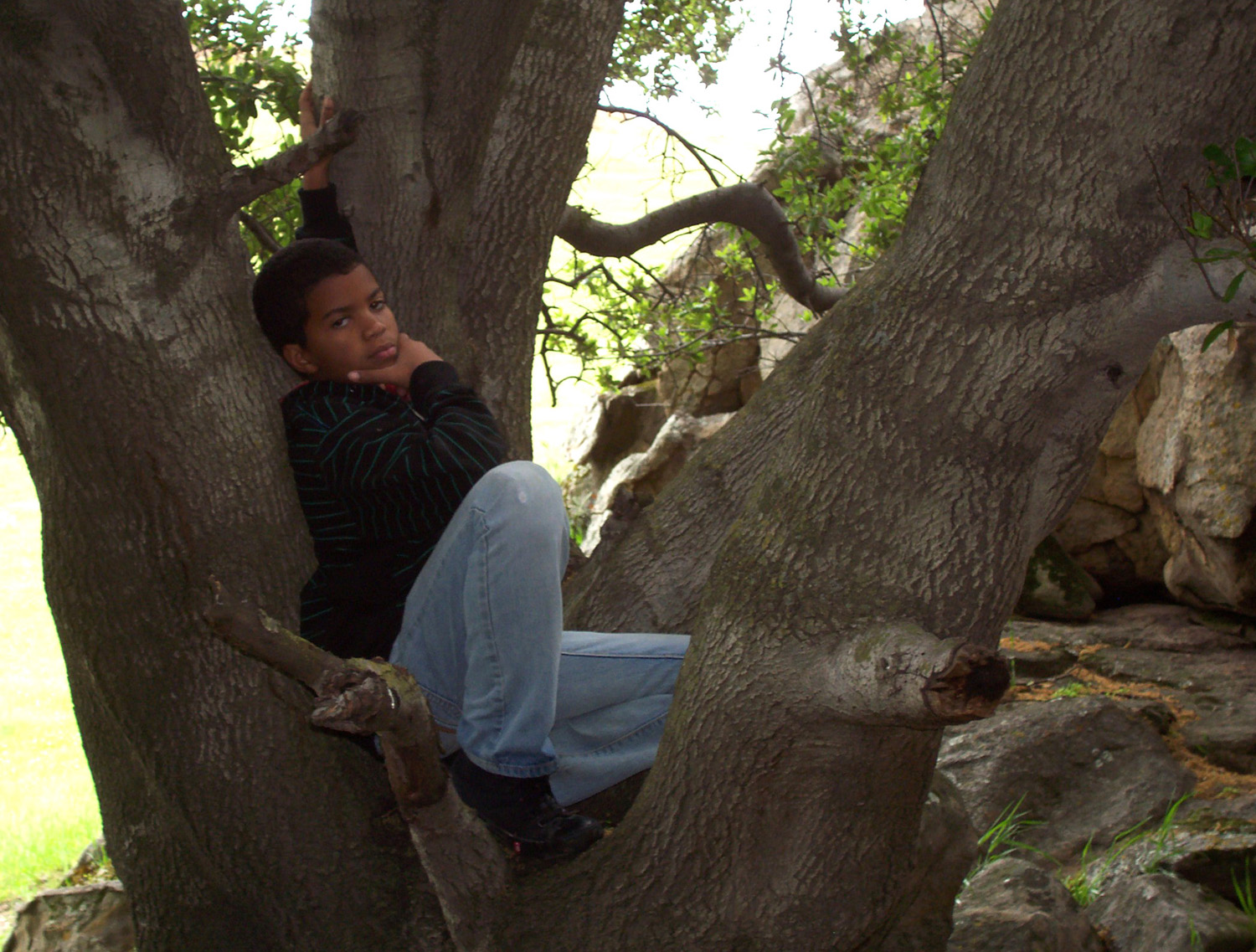
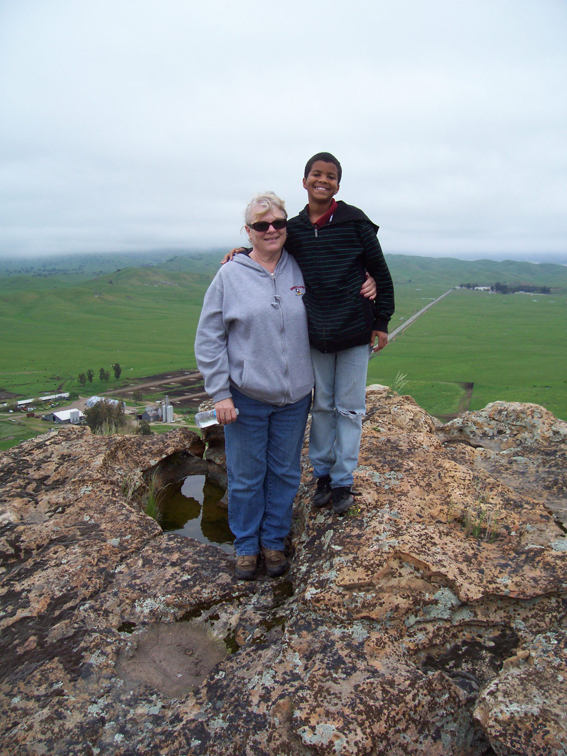
| Mark contemplate life in a tree | Janell and Mark on the edge | Dick at the table top |
 |
 |
 |
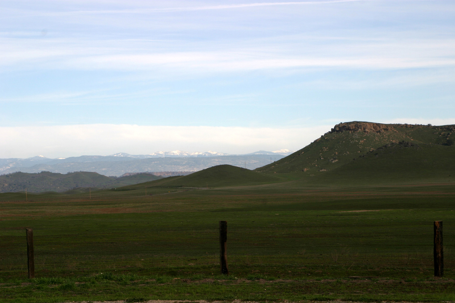
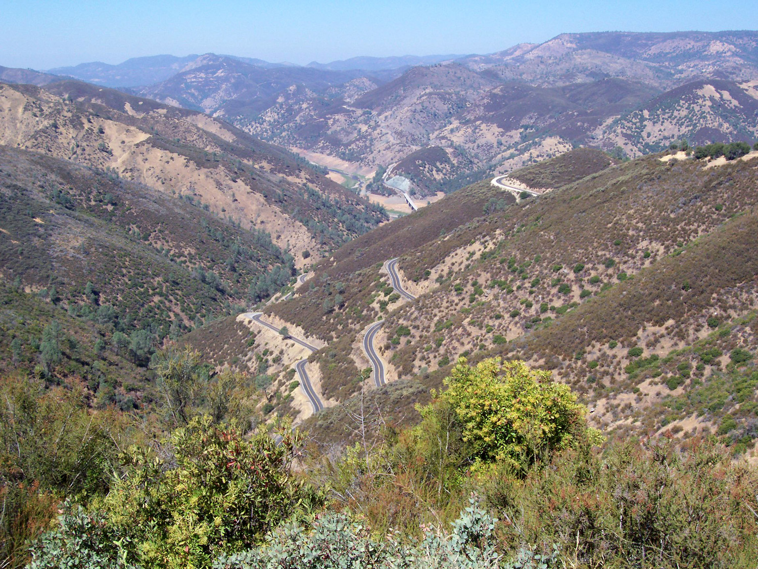
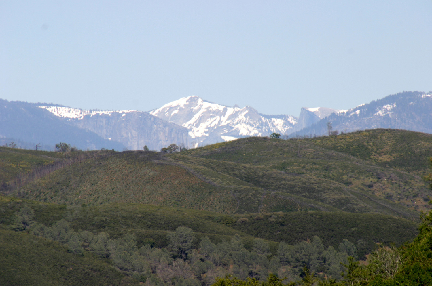
| Little Table Mountain and Sierra from Highway 145 |
Basalt with embedded river rock on top of Little Table Mountain |
Top edge of Little Table Mountain with other tables in background |
 |
 |
 |
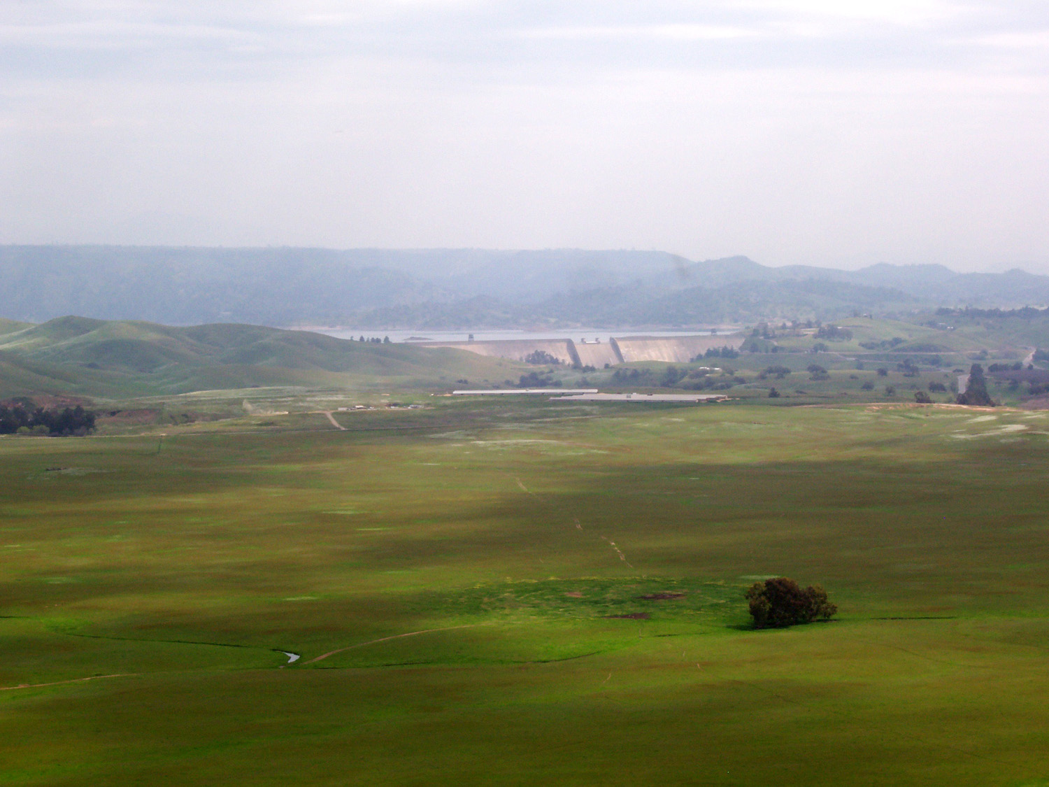
| The graffiti-covered cross | Friant Dam and Millerton Lake from the top | Mark takes a look at the view below |
Hensley Camp |
||
 |
 |
 |
| Hensley Reservoir and mountains from hill above campground |
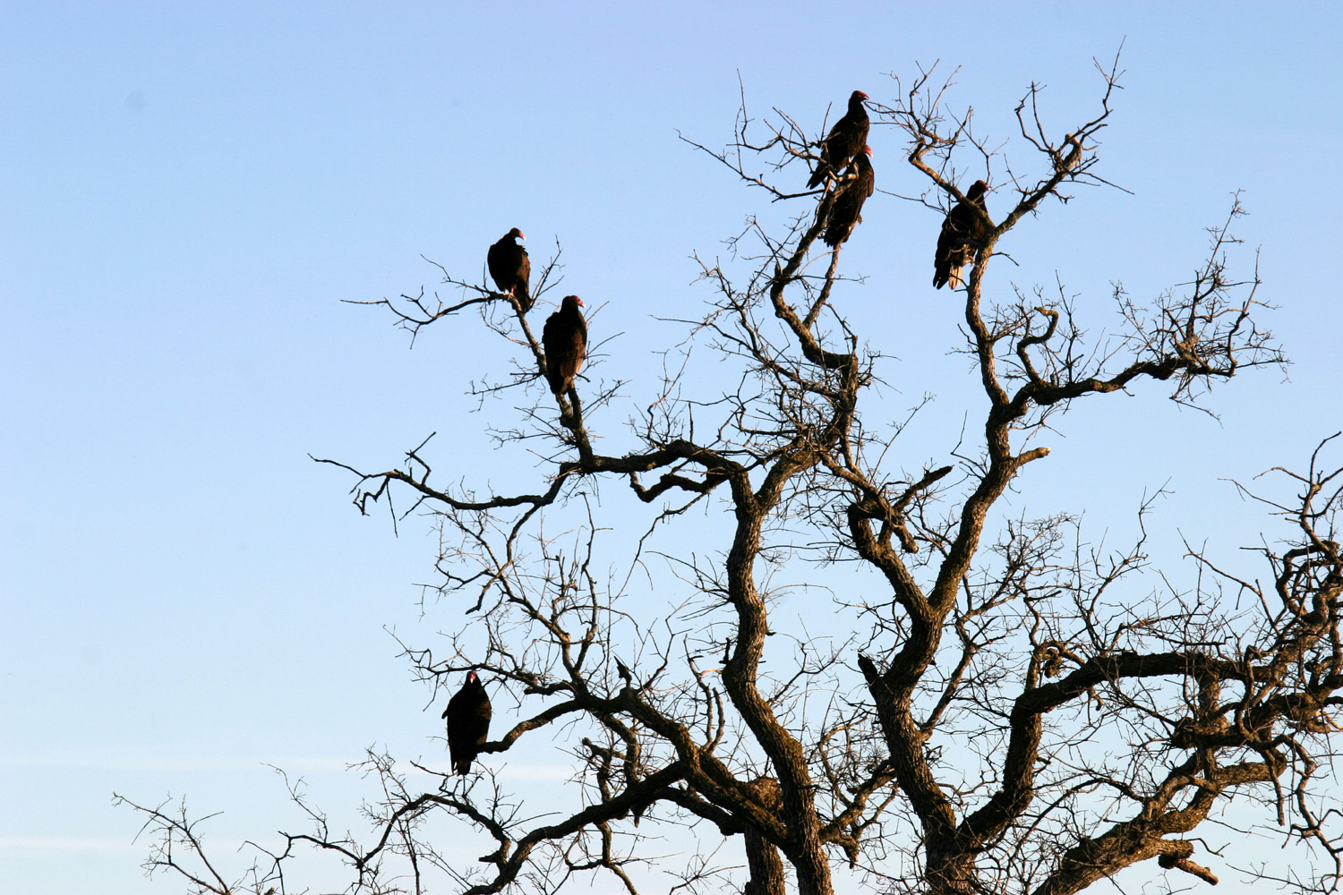
More lake and mountains | Buzzards (aka turkey vultures) coming home to roost |
|
 |
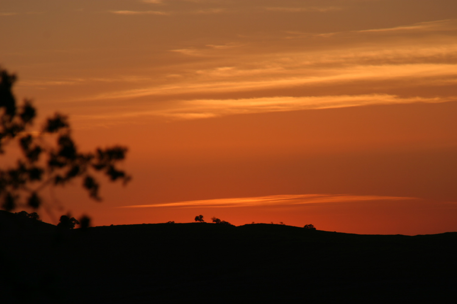 |
| Buzzards decorating a dead tree | Blue oak at sunset | Sunset at Hensley |
 |
 |
 |
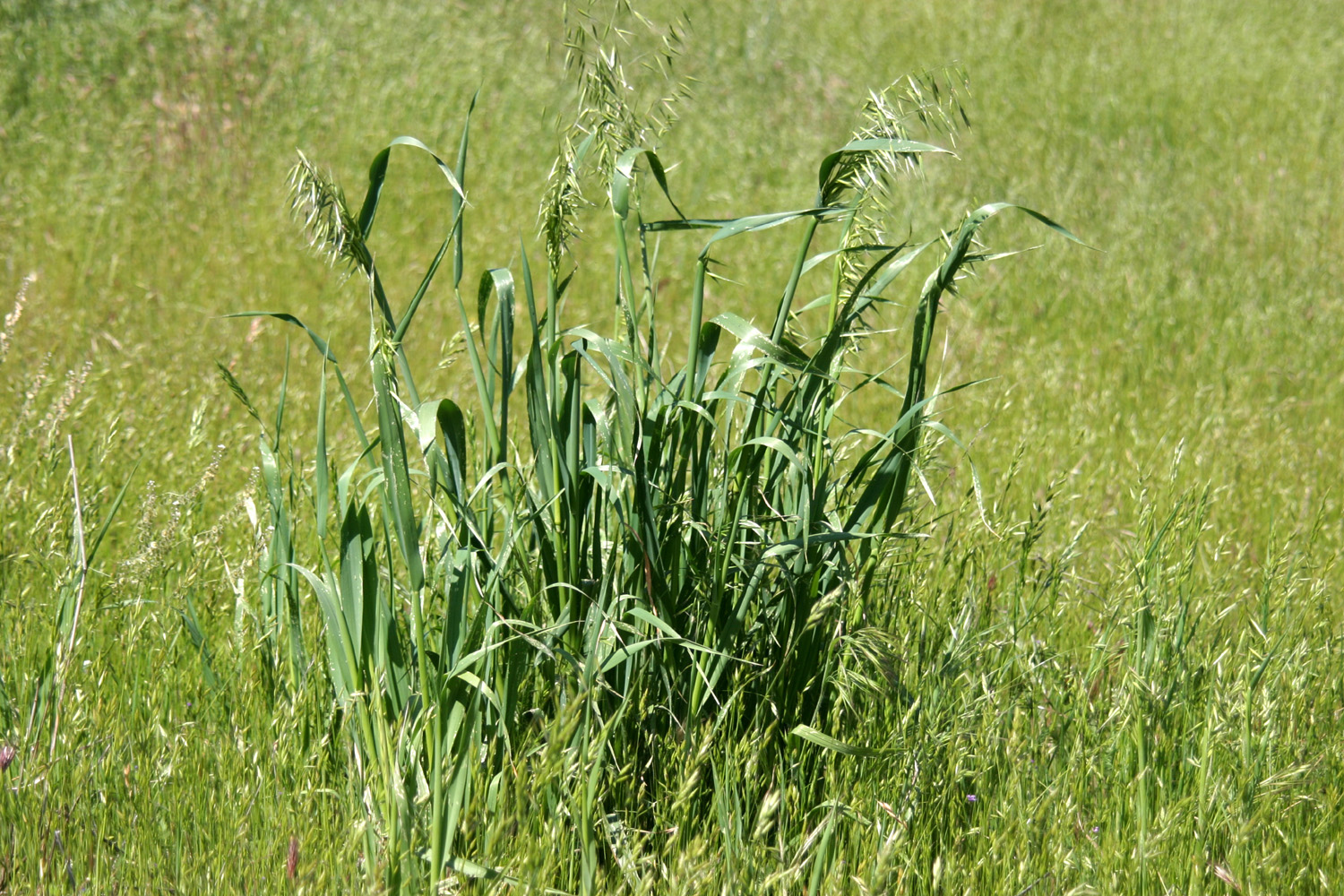
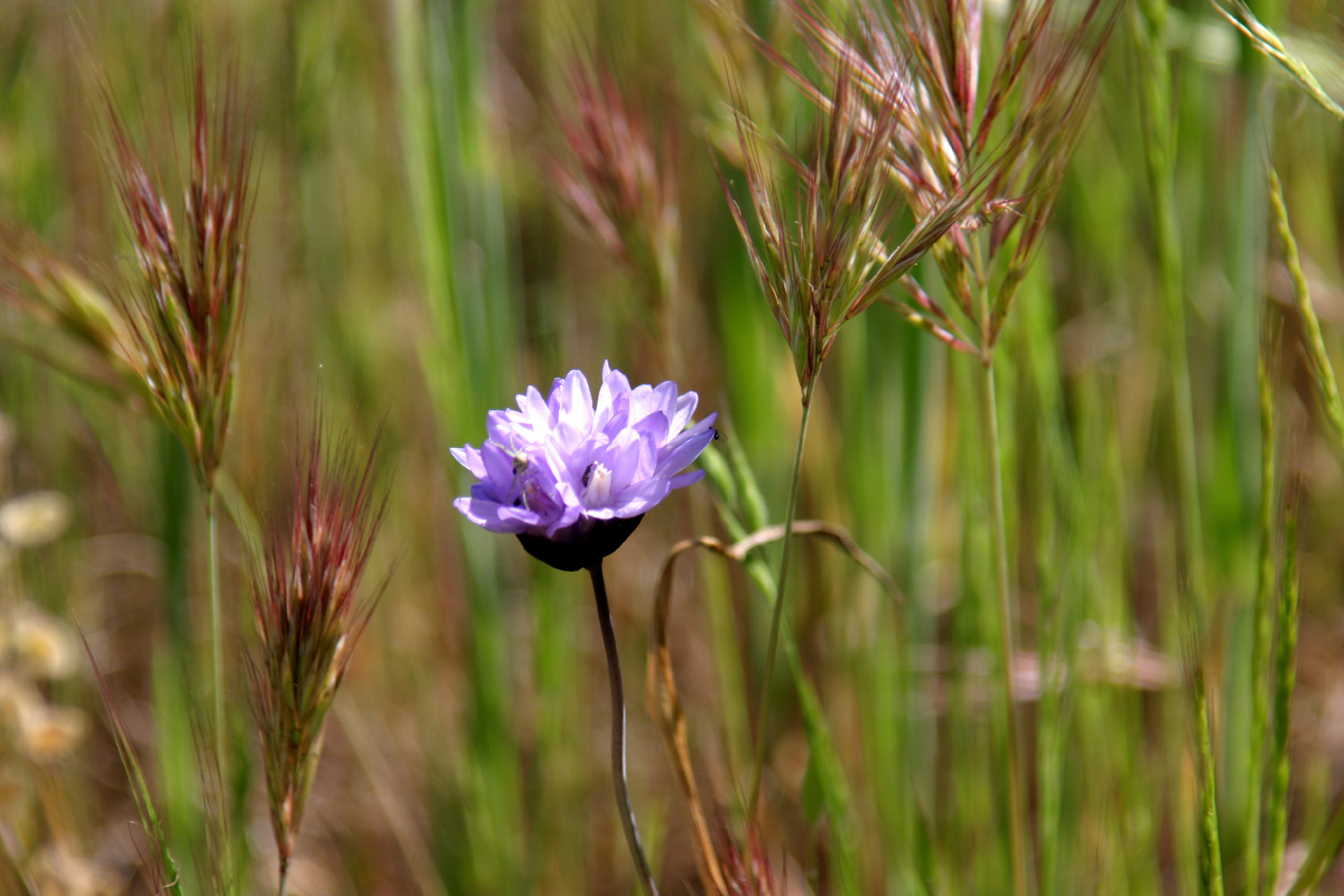
| Wild oats | Blue Dick and wild grasses | Backlit seed pods |
 |
 |
 |
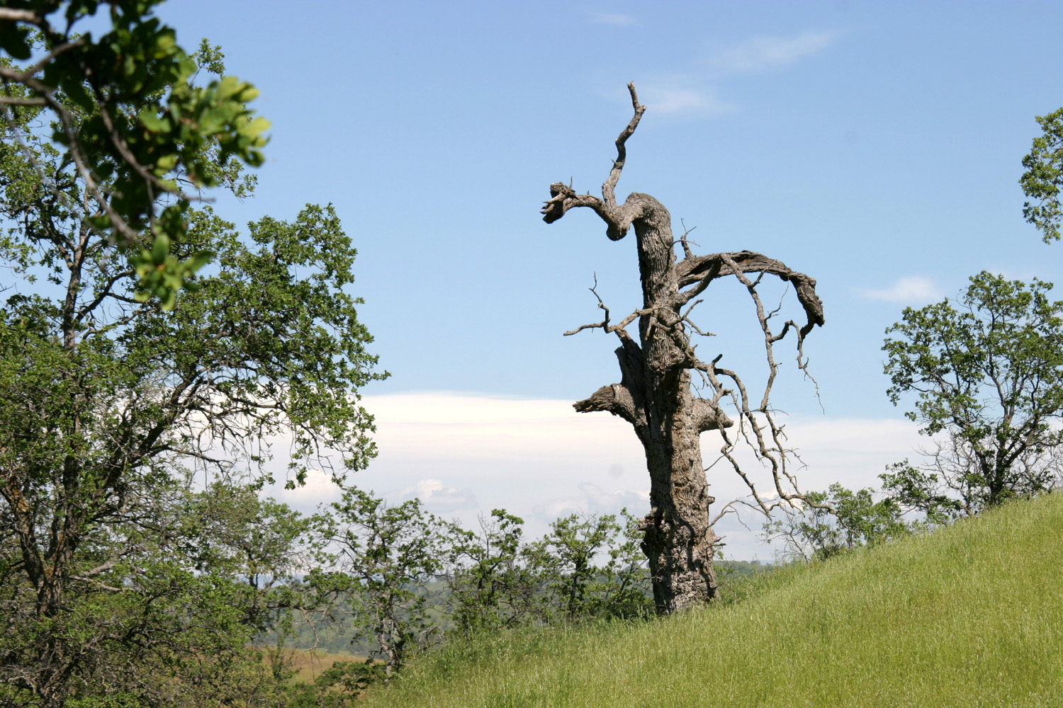
| Lone dead oak along Pohonichi Trail | A section of the trail | Dome-shaped rock near trail |
| Mariposa Trips | ||
 |
 |
 |
| Barn on Raymond-Knowles Road (Madera County) |
Granite Catholic church in Raymond | Becknell Creek, next to Ben Hur Road |
 |
 |
 |
| Buckeye and lichen-covered rock by Becknell Creek |
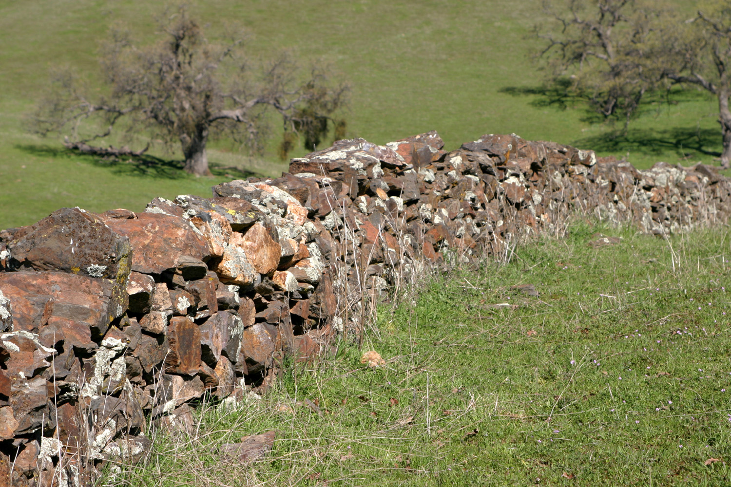
The Quick Ranch | Rock wall and ranch road |
 |
 |
 |
| Looking east from the ranch | Rock wall on Quick Ranch | Oaks and grass near Old Highway, Mariposa |
|
 |
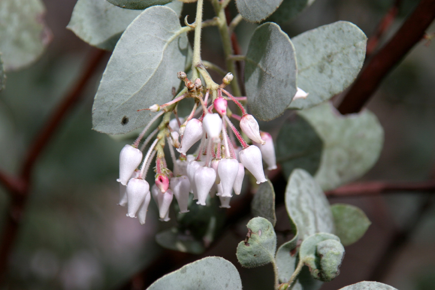 |
| Janell next to Old Highway | Manzanita on Carlton Road | Close up of manzanita blossoms |
 |
 |
 |
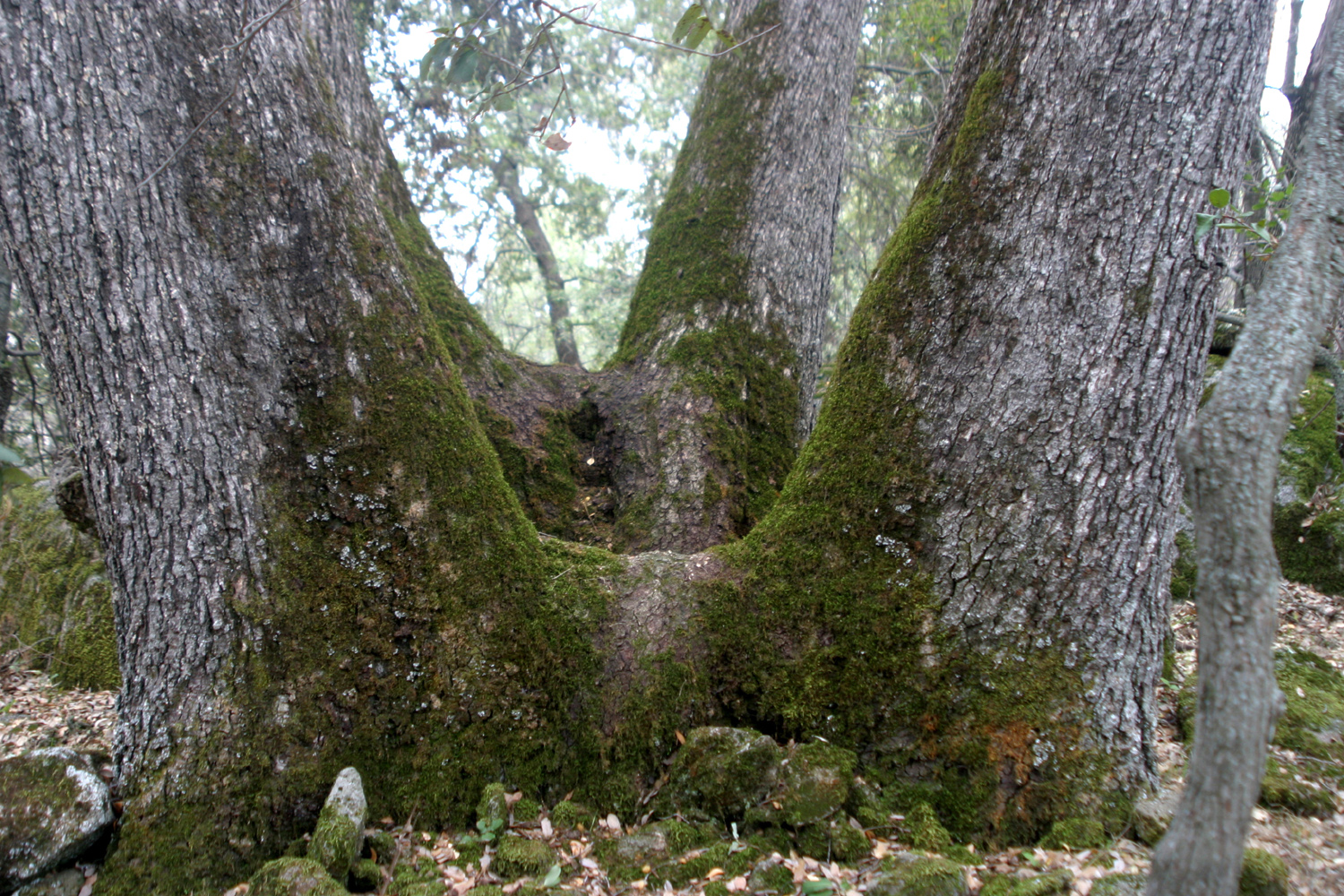
| Canyon live oak on Carlton Road property | Indian grinding holes in granite above Pegleg Falls |
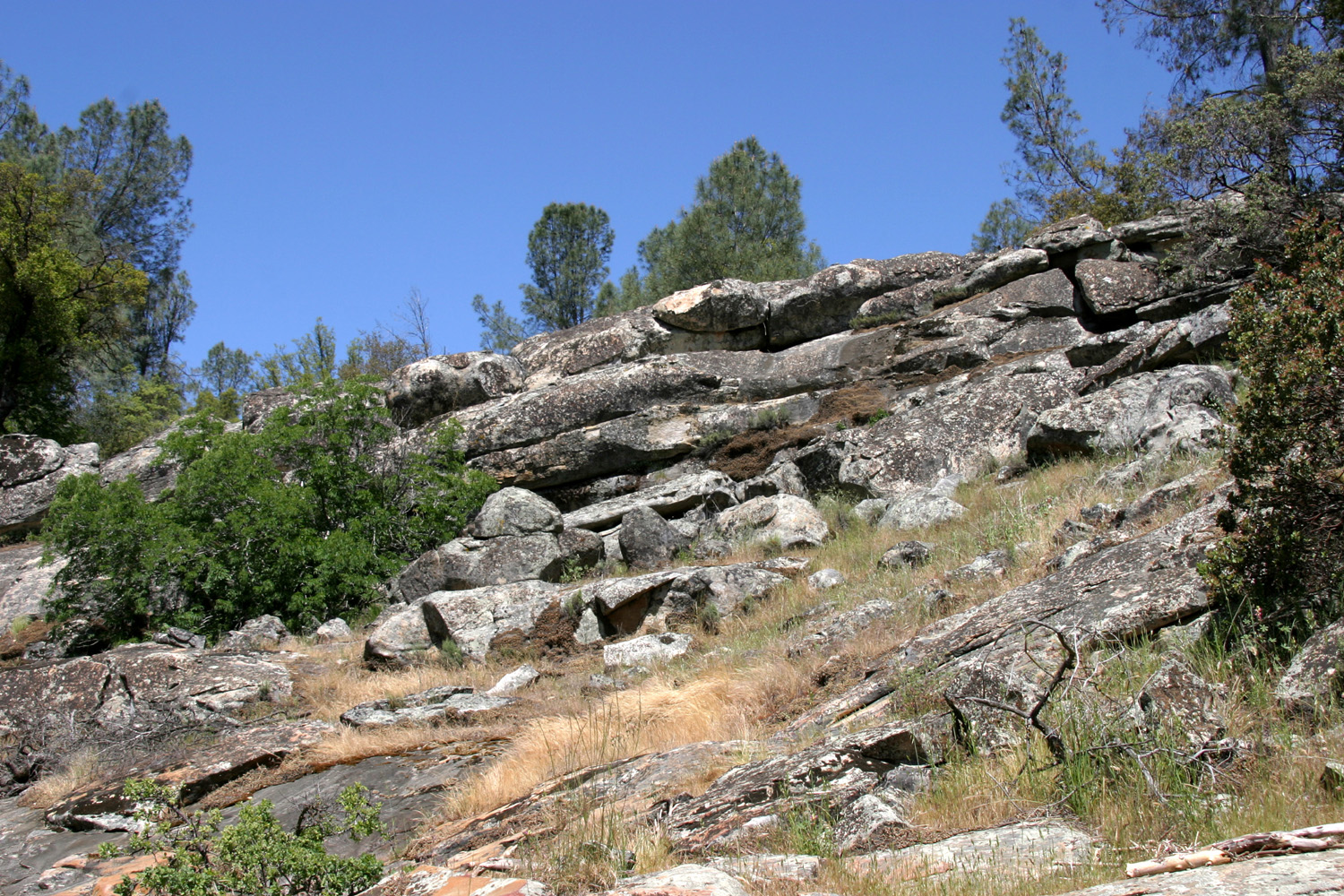
Rock formation above the falls |
 |
 |
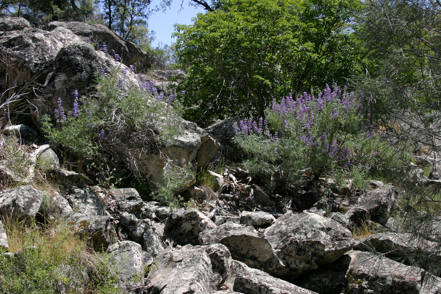 |
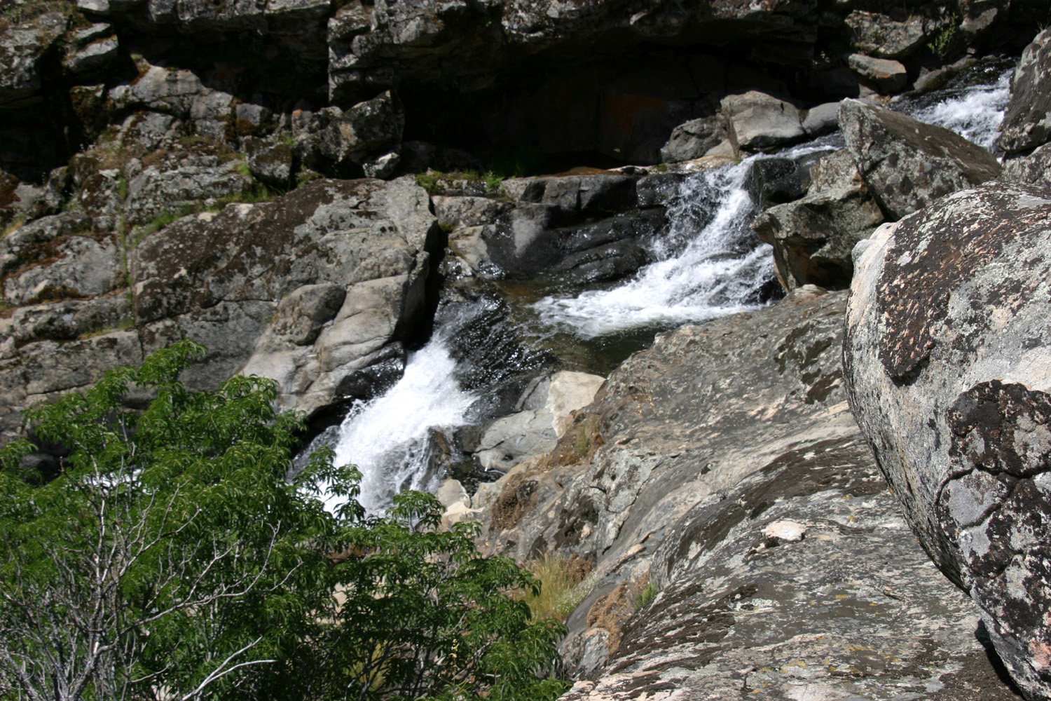
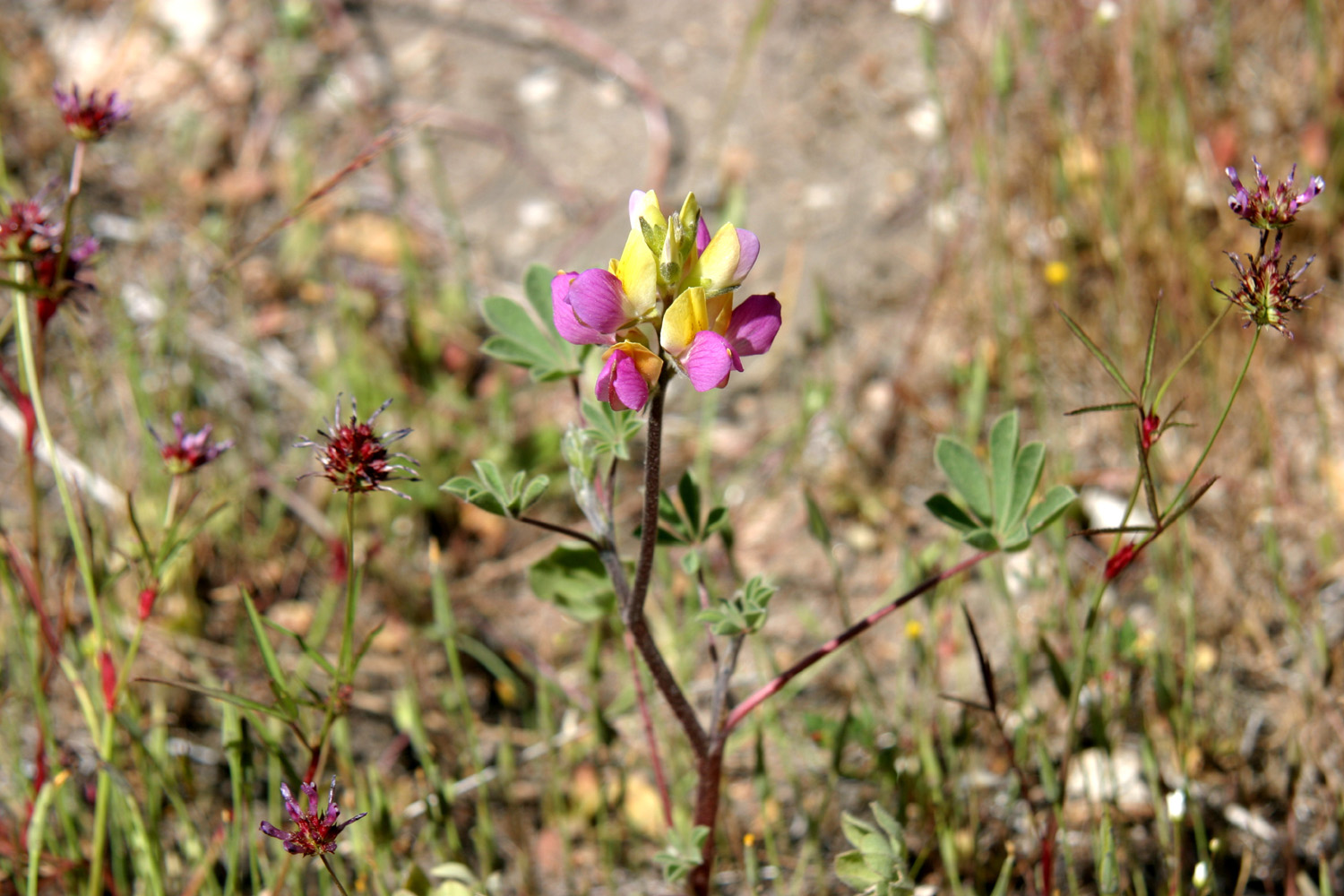
| Falls from above | Pink and yellow lupine near falls | Bush lupines in the rocks |
 |
 |
 |
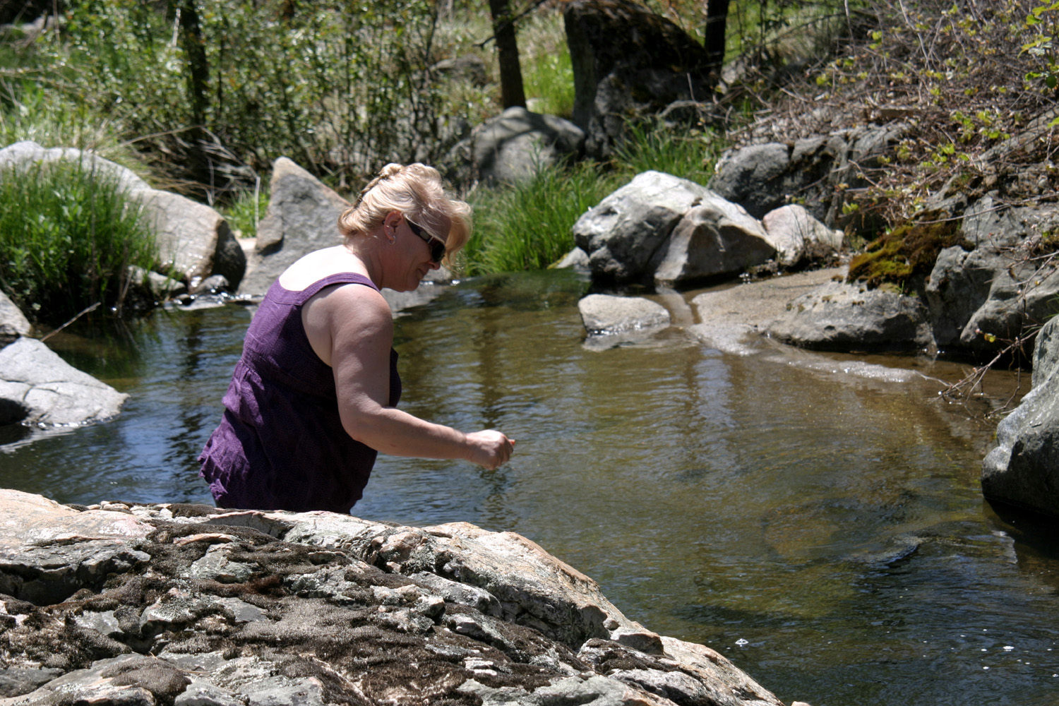
| Janell checks out the creek | Falls from the viewing platform | Estel home from the hill to the east |
 |
 |
 |
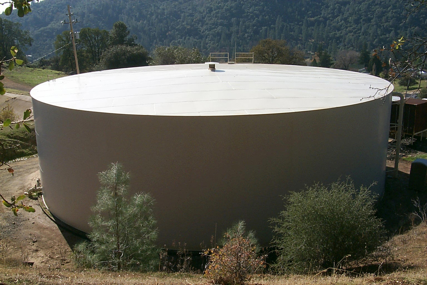
| The million-gallon water tank | Yosemite Valley from Highway 49 north of Bear Valley |
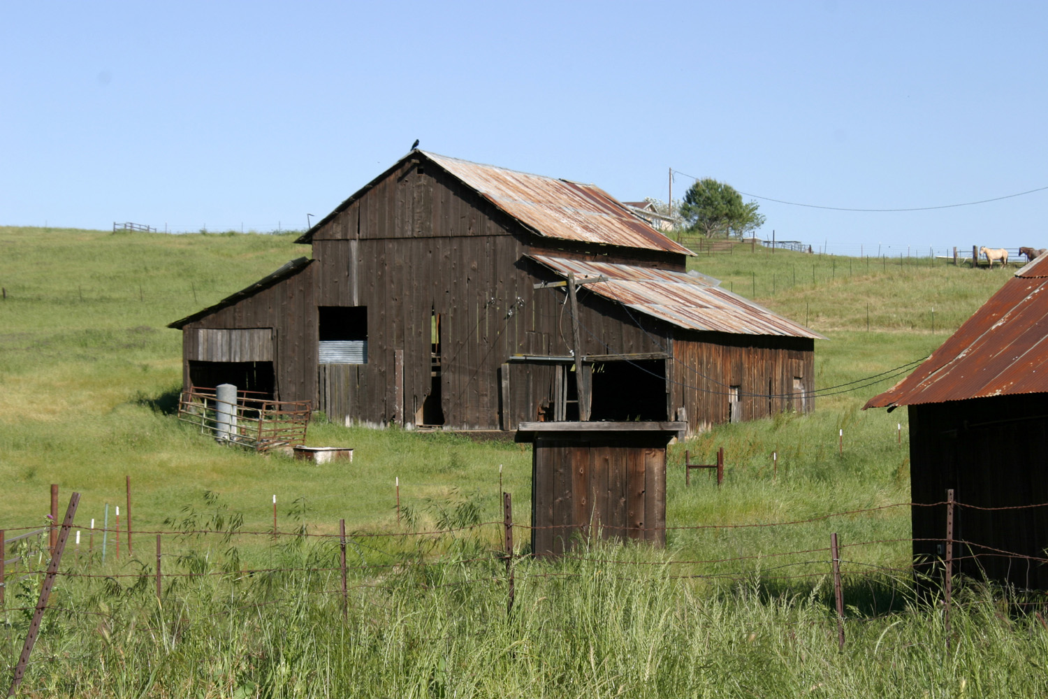
Old barn in Hornitos |
 |
 |
 |
| Bootjack basin, with Miami Mountain on left; Indian Peak 2nd from right |
Bagby Grade, bridge and upper end of Lake McClure visible at bottom |
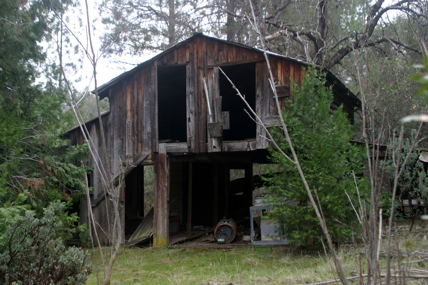
This is the barn Dick
owned half of until the property was sold in 2014 |
| Related Links | ||
| Little Table Mountain | Madera County | Basalt |
| Millerton Lake | Golden Chain Highway (49) | Hensley Reservoir |
| Sierra Nevada Mountains | Turkey vultures | Pohonichi Trail |
| San Joaquin River | Mariposa | Raymond |
| Ben Hur Road Trip | Joaquin Murrieta | All about rods |
| Coarsegold | Quick Ranch | Mormon Bar |
| Bootjack | Mormon Bar Again | Chowchilla River |
| Hornitos | Mariposa Public Utility District | Bear Valley from Wikipedia |
| Yosemite | Mt. Bullion | John C. Fremont |
| Las Mariposas Grant | Merced River | Coulterville |
| Eastman Lake | Cathey's Valley | |
All photos copyright © 2002-2011 by Dick Estel or other photographers as indicated. Permission granted for personal use only; commercial use prohibited.