
|
Sequoia Park Hiking |
||
|
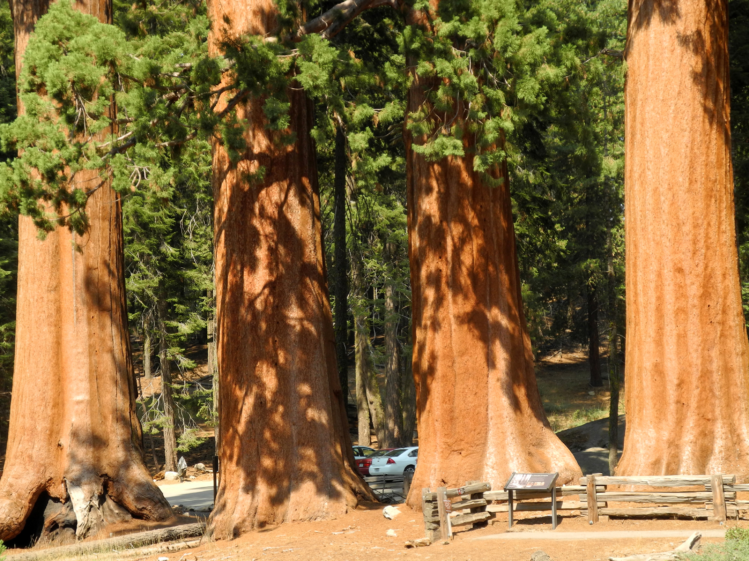
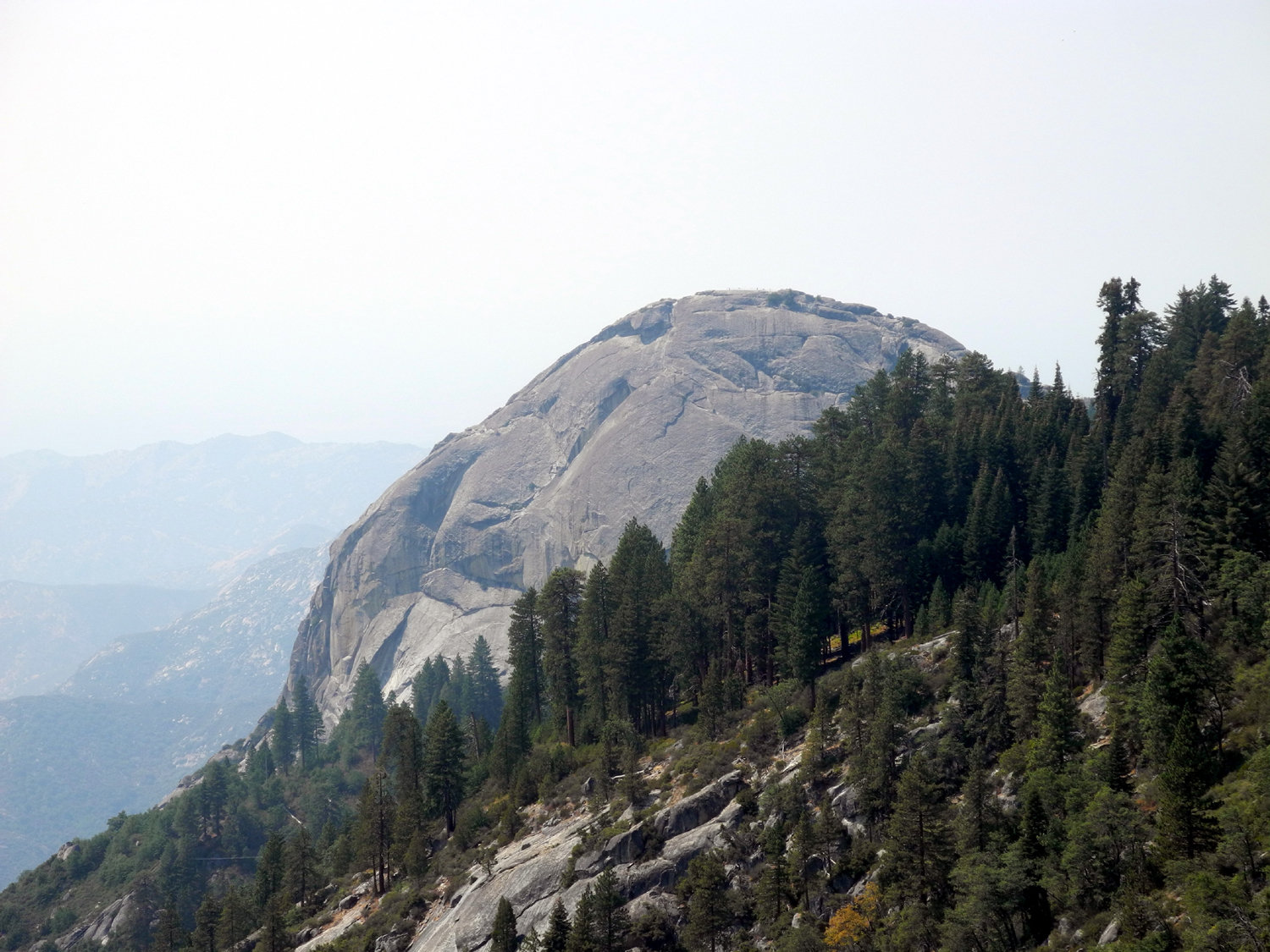
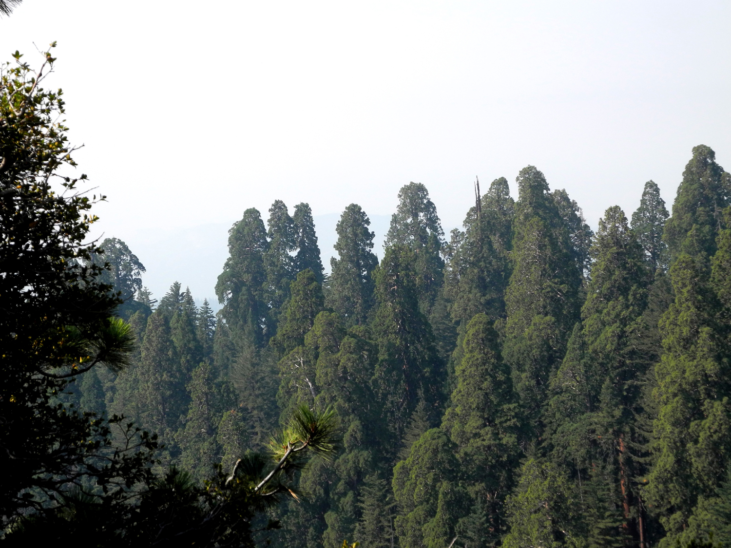
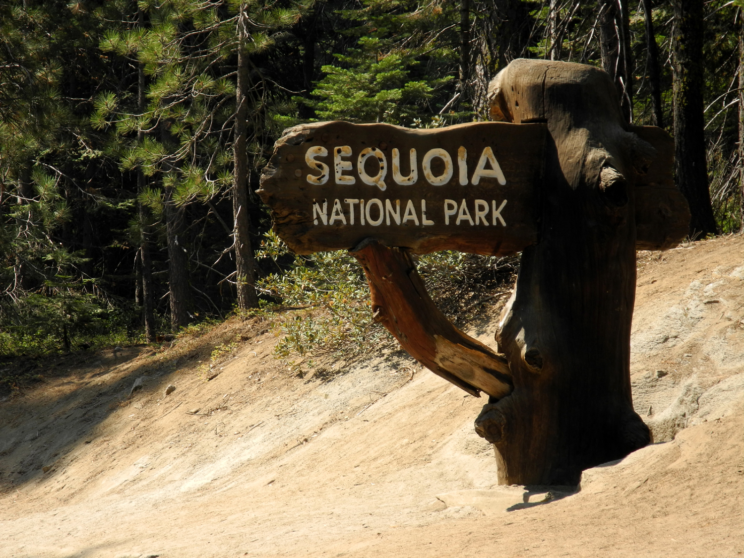
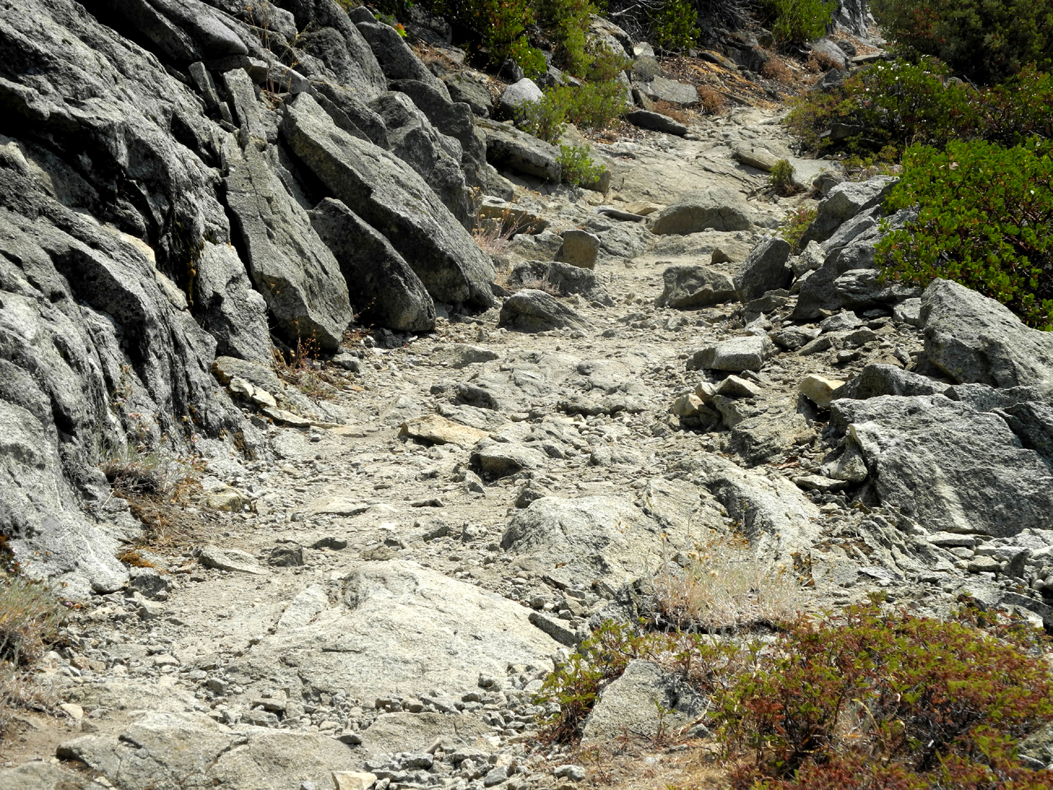
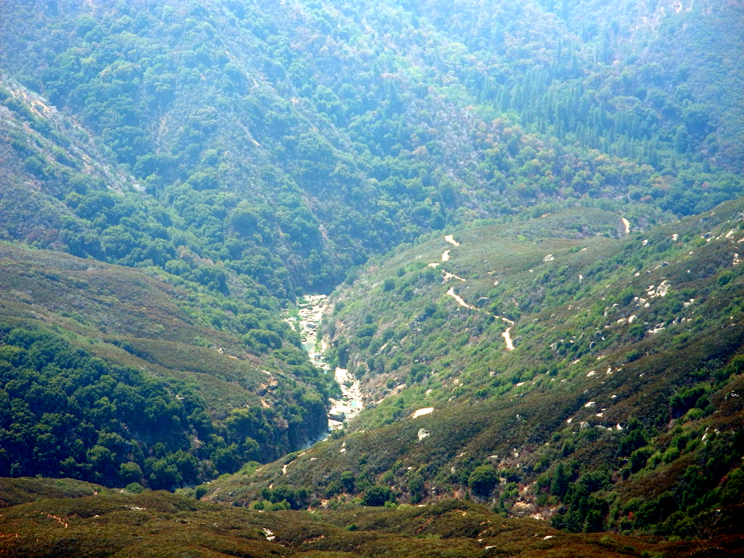
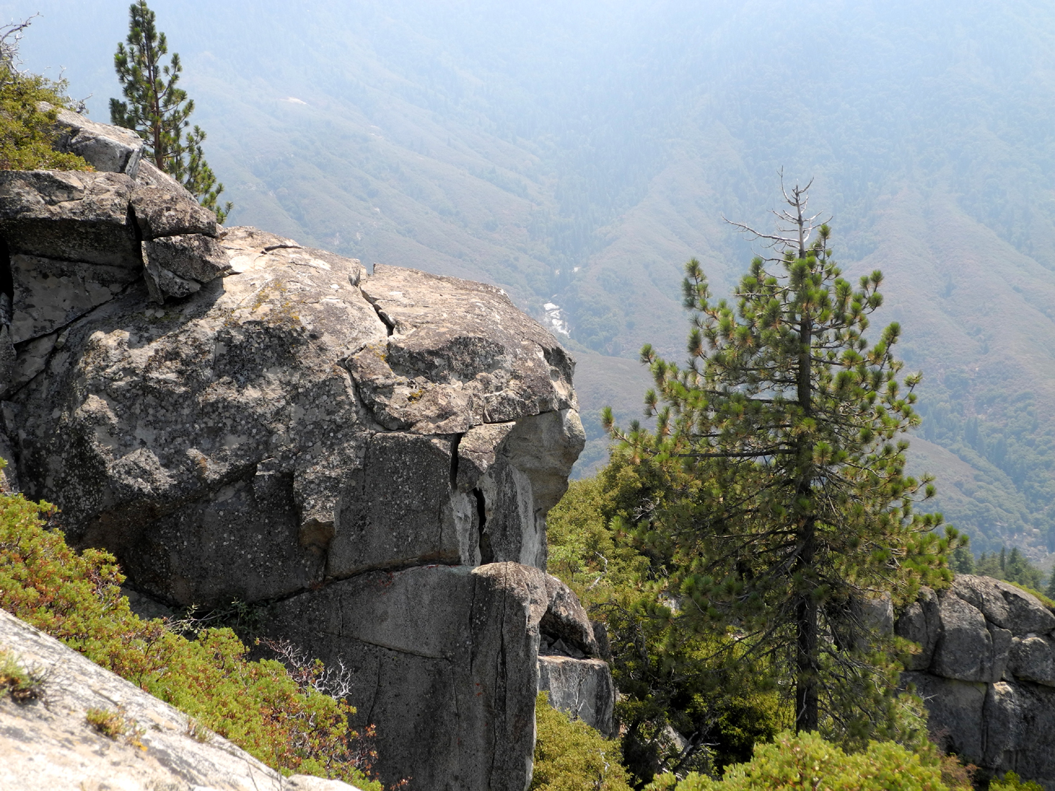
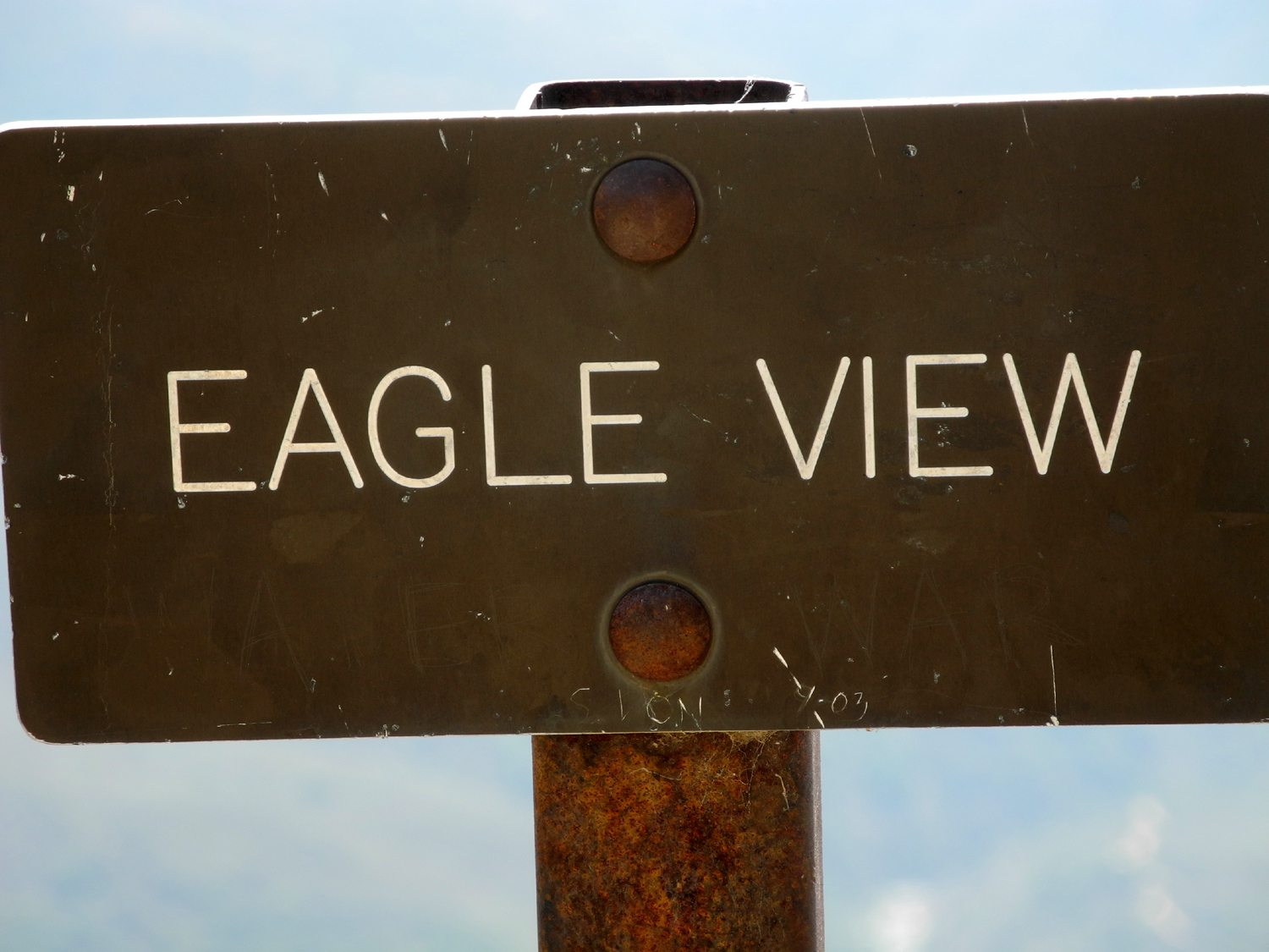
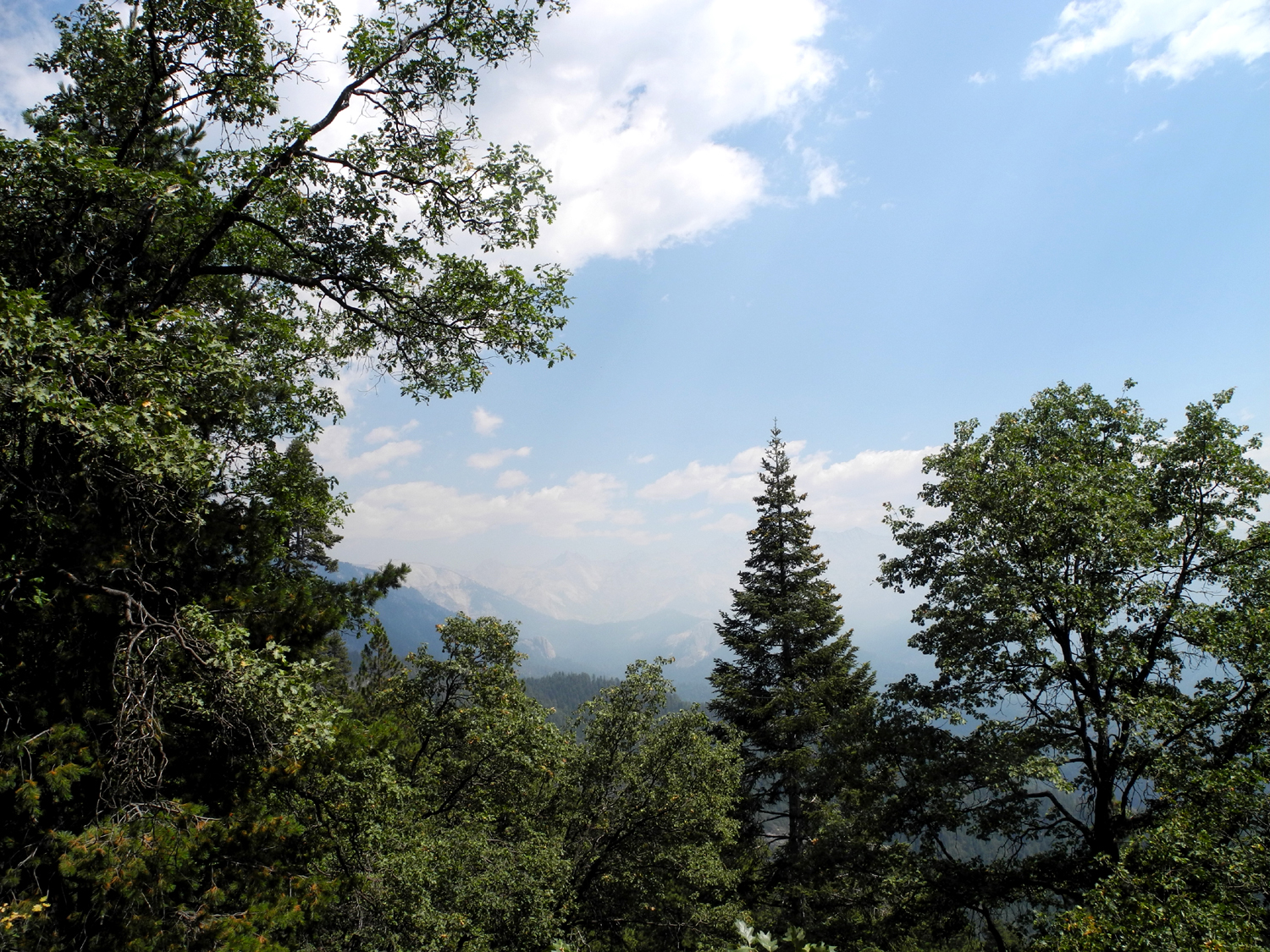
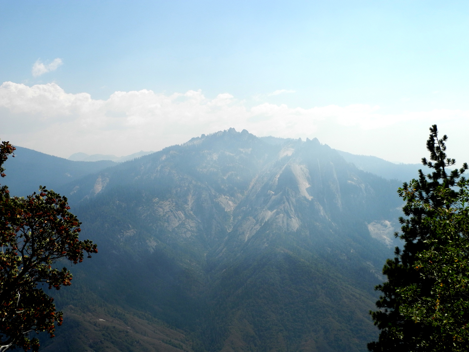
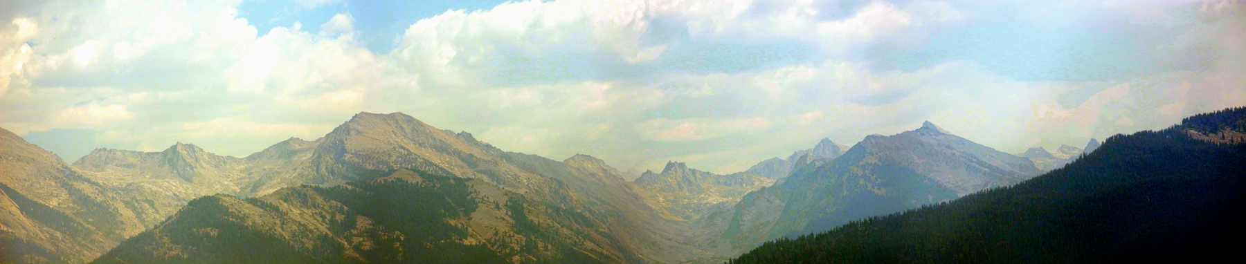
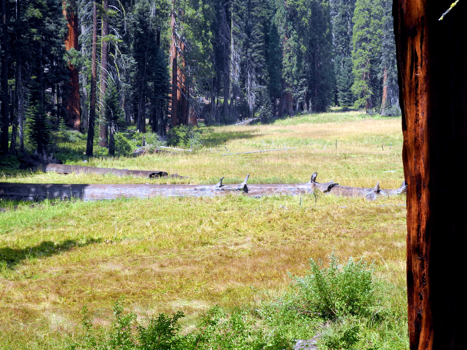
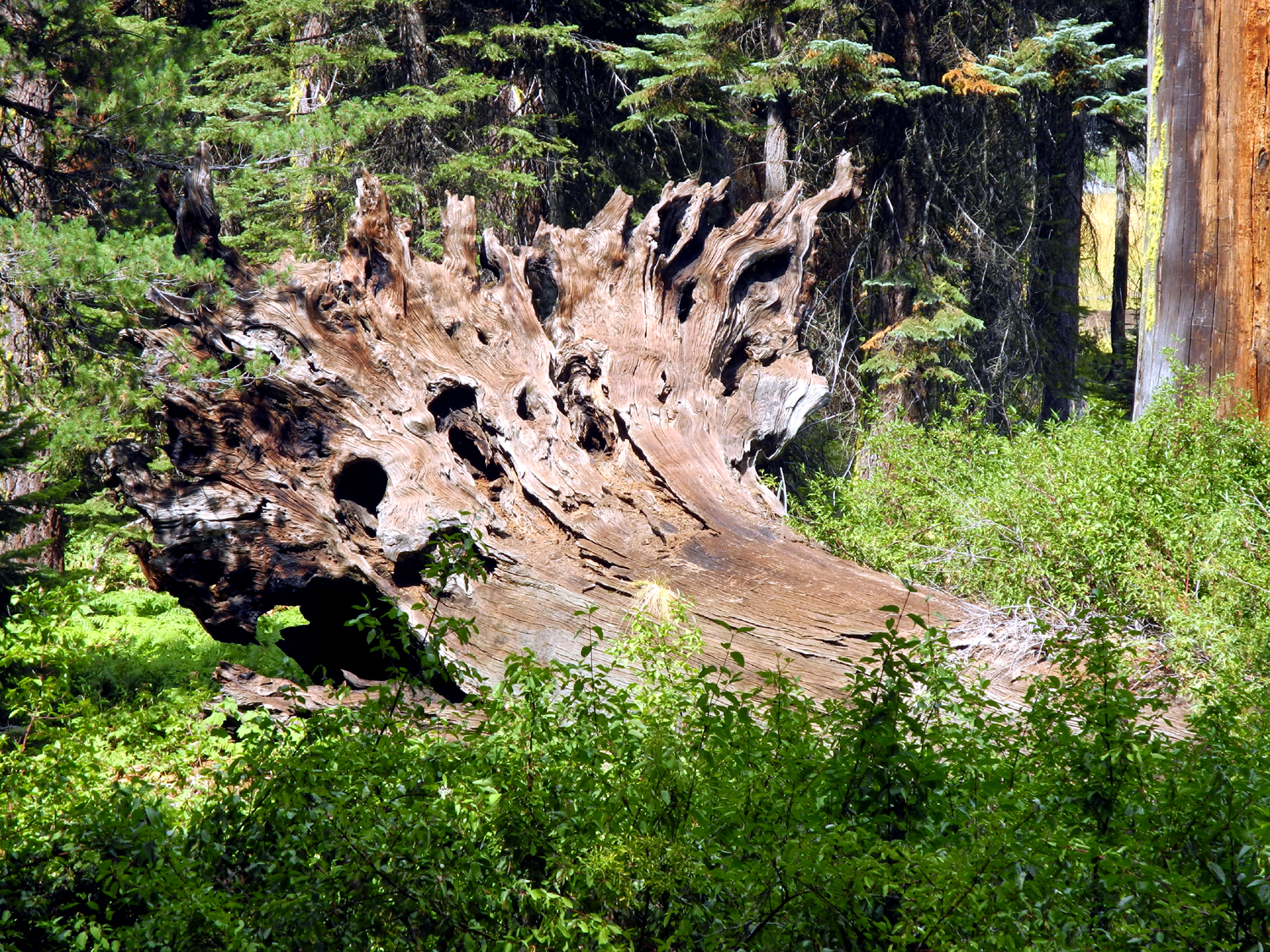
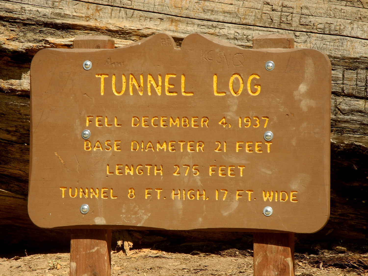
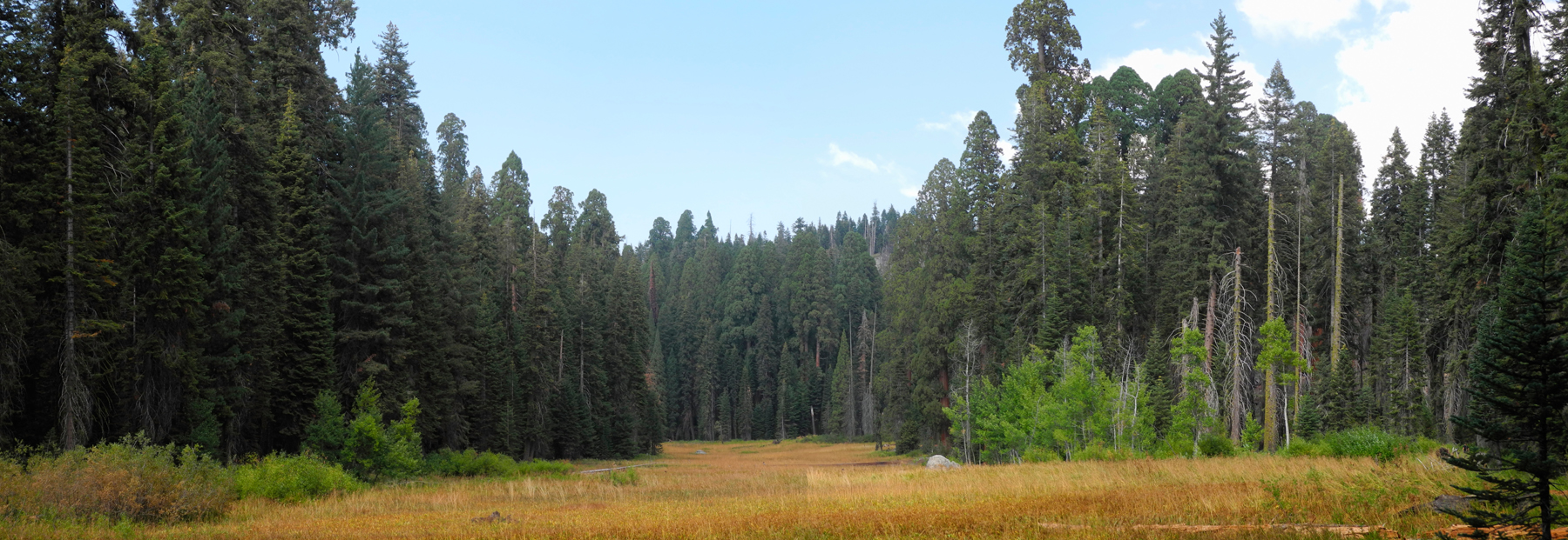
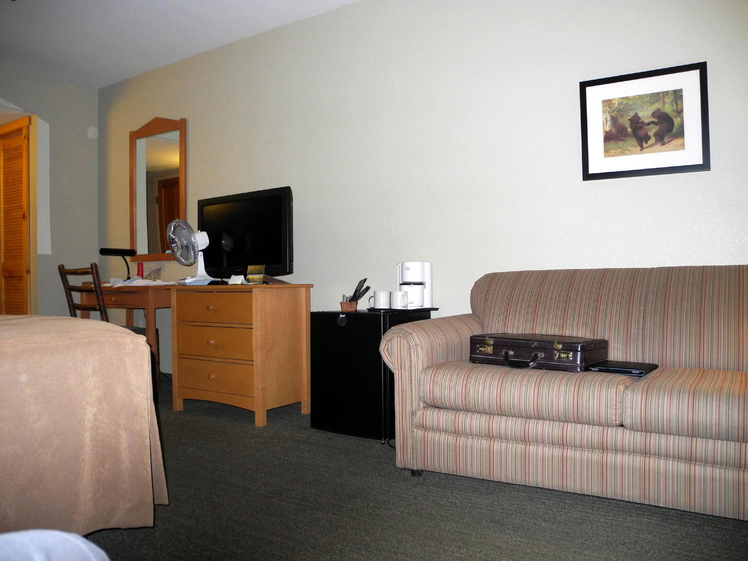
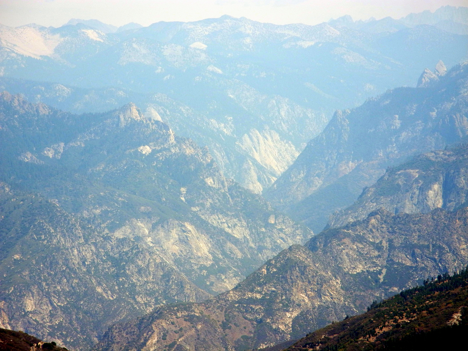
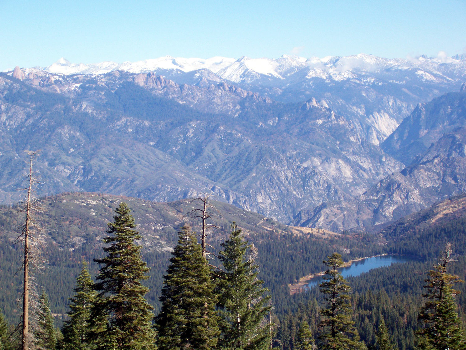
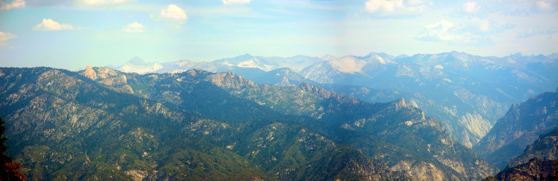
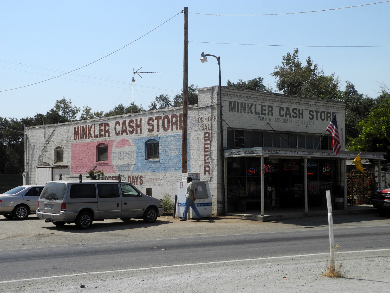
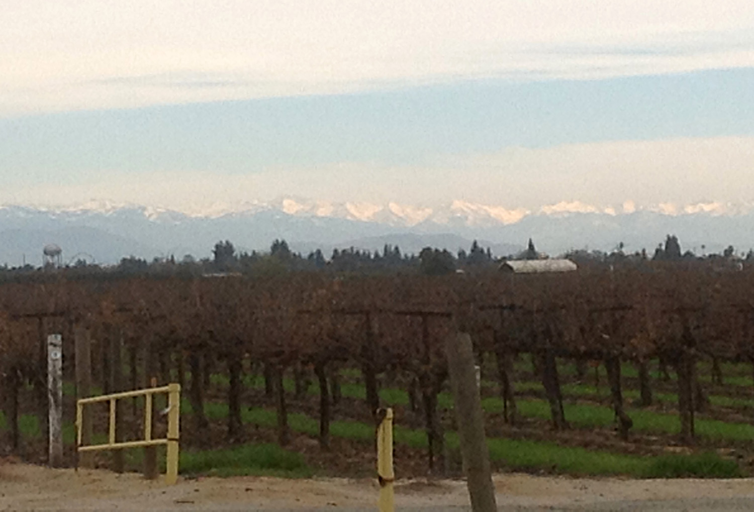
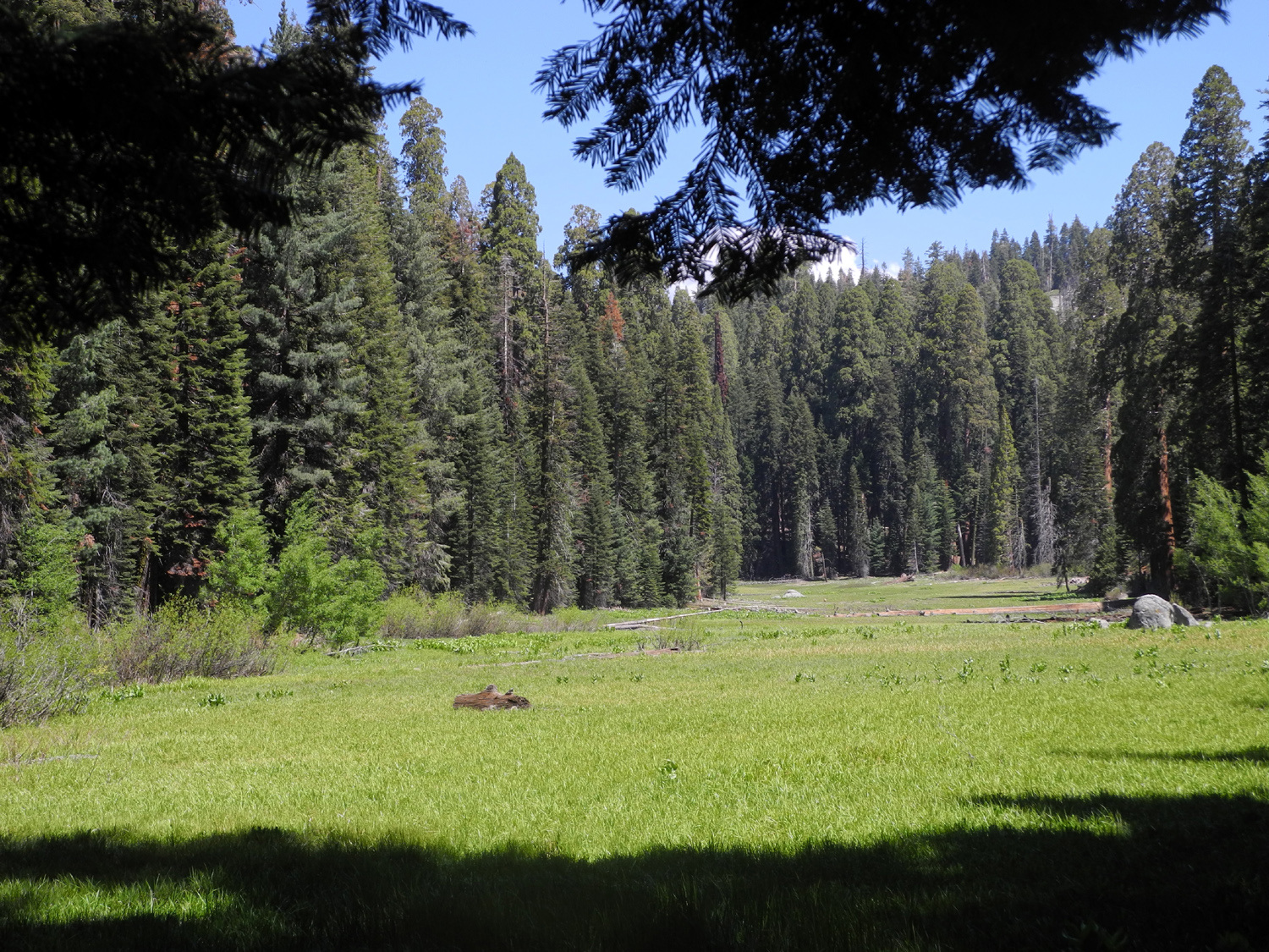
My doctor recently told me I should get more exercise, so on September 9 (Admission Day) I went to Sequoia National Park and hiked for two hours, which is four days worth of prescribed exercise. But I should start at the beginning, or even before the beginning. In July I thought about going to Sequoia National Park and hiking out a ways on the High Sierra Trail. This trail starts at Crescent Meadow, and after a short way leads out to the north side of the middle Kaweah River Canyon, high above the river (It's pronounced kah-WEE-ah). The first major landmark on the way is Bearpaw Meadow at 11 miles, but of course I had no intention of going that far. Ultimately you can go to Mt. Whitney, a trek of about 75 miles, again something that's not on my to do list. As it turned out, my daughter Jennifer was available for a day hike, but didn't want to travel as far from her home near Oakhurst as Sequoia Park, so we went to Nelder Grove, about 15 miles from her house, and walked a couple of trails there. In early September I realized I had a few days free, so I made a reservation at the Wuksachi Lodge, where I would spend the night after carrying out my hiking plans. Decades ago I had driven to the park, hiked that trail, and gone back home all in one day, but I prefer a more relaxed schedule now, and an overnight stay would give me the chance to visit a few other points of interest. I got started a little before 9 a.m. on September 9, but turned back a mile from home to get my map of the park. Although you can get a map at park entrance stations, the entrance into Kings Canyon is often unmanned, and I wanted to make sure I had the map. This delayed my departure by only 10 minutes, and I made the 100 mile drive to Giant Forest with only a couple of stops along the way. The road from the Fresno-Clovis area is State Highway 180 all the way to the entrance, passing through the towns of Centerville and Minkler in the valley, and Squaw Valley in the foothills. The road enters Kings Canyon National Park, which is jointly administered with Sequoia. My first stop was the Big Stump Picnic Area, where there is a bathroom (newly remodeled since I was last there) and a large redwood stump from logging days. There is also a very nice, easy, short trail that loops around the meadow and forest nearby, past a number of large trees, stumps, and the remnants of a shake splitting operation from the early 20th century. I have hiked this trail a number of times, so didn't want to spend any more time there than I needed for a quick pit stop. About two miles from Big Stump, the road divides, with the left fork (North) going to the Grant Grove area, then through Sierra National Forest land down to the South Fork of the Kings River, and up to Cedar Grove, a glacier carved valley somewhat like Yosemite, but with no major waterfalls. The road to the right (South), which I took, goes through a short section of Kings Canyon park, then into Giant Sequoia National Monument, and finally into Sequoia park. The road from Grant Grove to Sequoia is known as the Generals Highway, basically linking the General Grant tree in the north to the General Sherman tree in the south. A short drive on this road brought me to my next stop, the Redwood Mountain Overlook. West of this area is the largest stand of Sequoia trees in existence, on Redwood Mountain and Redwood Canyon. A dirt road leads into the canyon and there are several hiking trails, but again, this walk was not on my schedule. I've driven down there, but only walked a short distance on the trail, so it's something I'd like to investigate some day. The Redwood Mountain Grove has 15,800 sequoia trees more than a foot in diameter at the base, and several thousand of them are much larger. There are 2,172 giant sequoias over ten feet in diameter in this location. There are a number of other nice places to stop and look and take short walks along the way, but I wanted to get the hardest hike of the day done first, so I continued mostly non-stop to Giant Forest, the heart of the redwoods. At what used to be Giant Forest Village, the building that is now the museum was once a store. There were also two gift shops, a cafeteria, three motels and dozens of cabins scattered among the redwoods nearby. Heavy traffic near these giant trees is hazardous to their health because of the shallow root system, so starting about 20 years ago all the commercial operations were moved away from the redwoods. Of course, there are still trails and roads with trees right beside them, but the changes have vastly reduced human impact. I went into the museum briefly, took some pictures of sequoias near the parking lot, then took the side road that leads to Moro Rock, Crescent Meadow, and trailheads that will take you into the forest and mountains by a number of different routes. This narrow, winding road is about two miles long and goes through the Tunnel Tree, which fell in 1937, at which time Civilian Conservation Corps crews cut a tunnel through the fallen log. There is a bypass for vehicles higher than eight feet. From what I can tell the road is closed to private vehicles in the peak summer months, requiring a trail hike or shuttle ride to get to Crescent Meadow, so I was glad to be able to drive it (and lucky I didn't go in July as planned). I parked at the Crescent Meadow Trailhead and walked the quarter mile to the meadow. The vast majority of visitors hike the short trails that circle around the meadow and lead to Tharpe's Log, a dwelling that is half hollowed out redwood and half cabin, dating from the 1860s, and occupied by Hale Tharp, said to be the first non-Native American to enter Giant Forest. About 100 feet from where the trail first meets the meadow is the fork that leads uphill and becomes the High Sierra Trail. This route had its origin after the park was expanded in the 1920s to take in the country from the redwoods all the way to the Sierra crest. Superintendent John White saw that auto access to the high country would be the wrong approach, and put into effect his vision for a "High Sierra Trail" from Giant Forest to Mt. Whitney. He set forth two criteria: minimal damage to the land, and as few ups and downs as possible. Despite the steep, rocky terrain, trail crews met the challenge, and the trail avoids most of the seemingly endless switchbacks that make many hikes a chore. I had gone up the trail only about 200 yards when I saw a young bear. He was about 100 yards away, just up hill from the trail, close enough for me to get a couple of pretty good photos. Looking for the easiest route, he walked up a fallen log, moving steadily but in no hurry. When he got to the end of the log, he walked a short distance to another one and continued on up the hill out of sight. He paid no attention to me, although I am sure he saw me before I saw him. It's only a little over a half mile from the start of the trail till it goes over a saddle and you are looking down into the Kaweah Canyon. The elevation throughout this area is close to 7,000 feet, with the river a mile lower. A short distance from the saddle is Eagle View, where you get a dramatic view of the Great Western Divide and the Kaweah Peaks. That is, you get that view if a forest fire has not filled the air with enough smoke to turn the mountains into a barely visible outline. The divide is a dramatic range of mountains that separates the Kaweah, Kings and Kern Rivers, and contains several peaks that reach above 13,000 feet. A Google search for images will give you a bunch of views much better than I was able to capture on this trip. By the way, on a really clear day you can get fairly good views of these peaks from various locations in the San Joaquin Valley. The blaze causing the problem was the Fish Fire, burning in the Golden Trout Wilderness. This was a fairly small fire, mostly contained by this time, but the evening flow of air down the canyons carried smoke throughout the park. When I tried to take a picture of the Divide, my camera could not find anything to focus on. On my way back, the smoke had cleared somewhat, and I was able to get some acceptable photos which I then tweaked with PhotoShop to make them usable. From Eagle View, I continued on probably another three quarters of a mile, on a trail that had few ups and downs, just as Superintendent White had requested. The trail is literally carved into the side of the canyon, with a steep slope on the downhill side, and virtually impassible cliffs and thickly wooded slopes above. Because of the openness in this section, the vegetation is mostly hardwoods, with a few conifers, mostly cedar and Jeffrey pine. Black oak, smaller scrub oak, and manzanita make up a large percentage of the vegetation. Just over the saddle back toward Crescent Meadow, are large firs, pines and sequoias. Of course, the temperature was much warmer in the open sections, but not unpleasant. As an example of what this area is like, the last time I hiked here was a sunny December day, and I took off my long sleeve shirt and hiked in jeans and T-shirt along the entire stretch. Also thick along the trail is lots of bear clover AKA mountain misery. This plant forms a thick, widespread ground cover in much of the western Sierra between 2,000 and 7,000 feet. The leaves secrete a pungent sap that can be smelled while walking, even without disturbing the plant. It is not really a clover of any kind, but a member of the rose family. There's no evidence that bears have any interest in it other than something they have to walk through when there are no logs lo use as a trail, but deer will eat it in the winter, when rains have washed off the sap, and other vegetation is scarce. Since the trail is in the sun a lot of the time, it was pretty warm walking, but anywhere there was a depression in the canyon wall, like a drainage channel, I would get a cool breeze rising up from below. This is caused by warm air rising, pushing the cooler air ahead of it, so inevitably there came a time when these updrafts were sometimes warm, but then there would be a cool one 50 feet further on. As I walked the trail I was mostly enjoying the views down in the canyon, then I thought about the bear and decided I should look up hill once in a while, in case of lurking cougars. When I decided I had walked far enough, I started looking for a flat, comfortable rock to sit on, and made do with an almost flat, moderately comfortable one. Here I ate an apple, drank water, and read the information on my map. After a rest of at least 15 minutes, I started back, stopping at Eagle View to enjoy the improved view, then heading over the saddle and back into the forest. The hiker has a choice here - return by the same path, or take a steep but short tenth of a mile path down to Log Meadow. I chose this one, and at the next fork, turned left toward Crescent Meadow. Log Meadow is a demonstration of why shallow-rooted trees should not grow at the edge of a swampy area - there are three or four large sequoias that have toppled into the meadow because their shallow root system could no longer maintain a hold in the wet soil. In fact, because of their resistance to fire and insects, this is the most common cause of redwood death. The Log Meadow trail joins the Crescent Meadow loop trail about a half mile from the parking lot, and I took this route back to my car, stopping to sit and contemplate the place John Muir called "the gem of the Sierras." It was somewhat less gem-like in mid-September, with the meadow grass and plants tall and turning brown, but at the right season is is indeed an emerald. Heading back out, I stopped at the tunnel log to take a few picture, but passed by the short spur road that goes to Moro Rock. This is a typical Sierra dome, with a trail to the top that consists largely of steps, rising about 300 feet. The view from the top is spectacular (on a clear day), but is essentially the same as that from Eagle View, which is a more gradual climb. I stopped again at the museum parking lot, first walking out a short trail on the other side of the road that leads to the Beetle Rock Education Center. The building was obviously closed, but the rock itself, consisting of two gently rounded humps of granite about 100 feet in diameter, provided a view of the Sierra foothills to the west. Nearby features were easily visible, and on a clear day you would be looking at a large section of country. I then went back into the museum and looked around briefly. I bought a Sequoia Park magnet to add to my ridiculously large collection of souvenir magnets. I also considered but rejected a bandana with a glow in the dark star map, and got on the road heading generally north on the Generals Highway toward my hotel. I wanted to stop at the General Sherman Tree, the largest in the world by volume. In the past you could park near the tree, and get to it by a short, easy walk. Now the close parking is for handicapped only (and even that is not as close as it used to be). All others must continue up the highway, turn at the road to Wolverton, a trailhead and one-time ski area, then take a half mile drive south to the new parking area, which of course is completely outside the redwood grove. The trail is a half mile, very steep, with an elevation drop of a little over 300 feet, and including many stairs. I started down, but when I reached a point where I could see the trail ahead very far below, decided that this was a walk I should take when I had not already hiked for two hours. I probably went no more than a tenth of a mile, but it still took quite a while and a rest stop at a bench to get back up to the parking area. At this point I realized that a new parking mode is needed - one for people who are "half handicapped." It's one thing to walk across from the far side of a supermarket parking lot, and quite another to make a half mile climb at 7,000 feet above sea level. I went on to my next stop, the visitor center at Lodgepole, where there is camping, a market, deli, snack bar, gift shop and post office. The visitor center is the first facility, so I did not go beyond it. All of the visitor centers have been updated to put the emphasis on preservation. In the past, national park visitor centers often had displays of rocks, stuffed wild animals, sections of trees, etc. Now about the only thing you see are photos and text - informative but very different from the "good old days." Of course, there are always books, magnets, T-shirts and other souvenirs, and I succumbed to temptation and bought a new cap. I had eaten a good breakfast at home, but had just my apple during the day, so by this time I was ready to check into the hotel and dig into the "backpacker's supper" I had brought in my ice chest - cheese, crackers, peanuts, bell peppers and grapes, washed down with Coke and topped off with two See's chocolates. The hotel, built in 1999, is off the highway about a half mile or so, and is not one single building, but rather a main building and three lodges. I had to park a few hundred feet from the registration building and walk up a gentle slope to register, then drive to the lodge area, park a few hundred feet from the building, and take my luggage up another gentle slope to the building. Luckily I was on the ground floor, since there are no elevators, and three floors total. There are luggage carts in the parking lot, and they will provide free luggage assistance if desired, but I will wait till I am old to request that. In the lobby there was a sign that Southern California Edison would be shutting off the power the next day from 8 a.m. to 2 p.m., and "sorry for any inconvenience." I suggested to the clerk that this was an inconvenience that should result in a rate reduction. His reply indicated that he sort of agreed but couldn't do anything about it. I got checked in, parked and into my room, put a towel on the small table, laid out my supper, and dug in. After I finished I felt like I had probably eaten too much or too fast, so I took a short rest on the bed, then got up and went out to walk around a little. The light exercise proved to be just what I needed, and I felt much better when I returned. As soon as I stepped out of the lodge, I saw a buck right by the service road that runs along the back of the three buildings. He pretty much ignored me, although when I walked past him, he moved a few feet in the opposite direction. The most amazing thing was that he was EATING BUCK BRUSH! Foothill residents don't believe deer eat buck brush - they eat tomatoes, grapes, rose bushes, and pretty much anything else planted by man. I guess in the true wilderness areas, they have no choice but to do as nature intended. Since he obviously had no fear, I thought maybe I should have some, so as I passed I was telling him that I was not going to bother him and he shouldn’t bother me. I had to pass him (as far on the other side of the road as possible), and when I got beside him he started walking the other way. I walked for at least 20 minutes, exploring the roads leading in and out of the lodge area, and taking quite a few pictures where I had views of the rocks and cliffs above the Marble Fork of the Kaweah River. When I got back to the lodge, my deer friend was still there, having moved about 30 feet from where I first saw him, and up hill off the road about 10 feet. I went out to check about a half hour later, but he had moved on. Then just before dark I went out and took a short walk down the service road, and there he was just below the road about 100 feet from the building. I again suggested he just mind his own business, and after I passed him, he went up the hill about 30 feet, which was the last I saw of him. Once it got too dark for outside walking, I spent the rest of the evening reading and making notes for this report. My room was much more expensive than any of the hotels I have stayed in recently, and only slightly better. Of course, there are few choices, and they are charging for the location, even though that was already there with no effort on their part. The room was larger than most rooms, with a couch and easy chair, but the usual dim lighting, so I did most of my reading on the iPad. The weather at night was very pleasant, and I would have liked to leave my window open, but it is well known that bears can get through a screen, so I shut it. When checking in I was told to bring all food, toiletries and anything with an odor inside (bears can also break into vehicles). I also had to initial a form saying I would do this, and there were signs around the complex with the same instructions. These rules are not groundless; bears are active around virtually all camping and hiking areas. At the Crescent Meadow trailhead and elsewhere there are a number of bear-proof lockers where hikers are encouraged to leave anything that might interest a bear, instead of challenging the bear to open the parked car. I had paid extra for breakfast, and had thought I would have to drive to the registration parking area in the morning, but during my first walk I discovered a trail that led from the lodge parking area to the main building. What seemed to be a somewhat long drive turned out to be a short walk. After I got up I did some exercises and walked a little, since I was not quite ready to eat. Then I walked over the restaurant, and enjoyed an average motel breakfast buffet. Checkout time was 11, but I did not intend to stay that long. I walked back to my room and laid down for a while, then got up at 10, got everything packed up, and departed a little before 10:30. By the way, the electric power never went off. I had planned to make a few stops on the way home, and possibly do a little more walking, although most of the places I stopped didn't require more than a short stroll. The first stop was a quick one, along the roadside at Halstead Meadow. When the road was first built across the meadow in the 1930s, a dirt base was constructed with two culverts. The unforeseen natural consequence of this was the development of deep gullies into the meadow. Now the meadow is being "repaired" and the culverts have been replaced with a bridge to allow the natural flow of water through the entire meadow. Next up was the Lost Grove, which is not really lost, since it lies on both sides of the highway in plain view. There are only a few trees visible from the parking area, but one of the largest was perfectly lighted, and everyone who stopped was getting a photo. There's an especially large tree on the other side, up the hill from the road, but a fence discourages close approach. Just past this spot is the park border, where you re-enter the non-park land between Sequoia and Kings Canyon National Parks. This territory is either Sequoia National Forest, Giant Sequoia National Monument, or possibly both; the signs are not entirely clear. In any event, virtually all of the big redwoods in the entire area are protected in one of these preserves. Along this area there are several resorts and campgrounds, and just before the road goes back into Kings Canyon National park is the Kings Canyon Overlook. On a clear day this gives a view of the Kings River gorge below the junction of the middle and south forks, with Spanish Mountain rising above the river. The elevation change from river to mountain top is about 7,000 feet, creating the deepest canyon in North America. Across the road from the overlook is the Buena Vista Trail, a one mile, 420 foot elevation climb to the top of Buena Vista Peak, where you get a 360 degree view. It's a trip I would like to make when the air is clear and I have not had a a two-hour hike the previous day. My last stop was Panoramic Point. Among easily accessible places, it offers one of the best views you can find of the south and middle forks of Kings Canyon, with the high Sierra in the distance. Along with new photos, I've included one taken in October 2007, when the air had been washed by a storm the night before, and the peaks were sporting a dusting of new snow. Panoramic Point has very limited visitation, although it's a short distance from bustling Grant Grove Village. I almost hesitate to reveal its location, but if you promise not to go in there with a caravan of crazy friends and relatives, I'll give you a hint. Drive into Grant Grove Village past the visitor center, and follow the road as it curves to the left. A short distance past this is a sign pointing to Panoramic Point to the right. There are several roads into residential areas, but these have signs. The road is paved, very winding and narrow, and ends at a parking lot about two miles in. From here there is a short trail uphill to the vista point. The view here ranges from Spanish Mountain above the main stem of the Kings River, through the middle and south forks, to the peaks in the far southern reaches of Kings Canyon park. Once I finished this walk and photo session, I was ready to head home, heading south on the Generals Highway to the junction with the road that leads out of the park and becomes Highway 180. The trip home was uneventful, other than the fact that the temperatures became continually warmer as I dropped down from 7,500 feet to the 500 or so in the valley.
Are sequoias and redwoods the same? The trees of the Sierra and the coast redwoods were once considered two varieties of the same species. Now they are seen as two separate species. The terms "sequoia" and "redwood" are normally used interchangeably by laymen for the species that grows in the Sierra, but the scientific term is Sequoiadendron giganteum. They are sometimes called "Sierra redwood" or just "big trees." The coastal species, Sequoia Sempervirens, are commonly called redwoods or coast redwoods. No one calls them sequoias. The sequoia grows between 5,000 and 7,000 feet on the western slope of the Sierra from Placer County to southern Tulare County. There are said to be 68 separate groves, only eight of which are north of the Kings River. They reach a bigger diameter, bigger total bulk, and greater age, while the coast redwoods grow taller. Sequoias grow only from seeds, while the coast redwoods can reproduce from seeds or from sprouts around living or dead trees, and even stumps. They grow in a narrow belt in cool, moist regions near the Pacific, stretching 470 miles from southern Oregon to the Big Sur country in Monterey County. A third redwood species, Metasquoia, known as the Dawn Redwood, is native to China. It is deciduous and was discovered in 1944. They have been successfully planted in many areas throughout the world. Although not as large as its American cousins, it grows to at least 200 feet. I had the great fortune many years ago to hear a talk by a UC professor who went on an expedition deep into China to see the trees shortly after their discovery. There are examples planted in several California redwood parks, including Henry Cowell Redwoods north of Santa Cruz. The foliage resembles that of the coast redwood.
On my first camping trip out of Bakersfield in the 1960s, I observed something that I had not previously been aware of, although it immediately seemed natural and obvious. The trees that grow at a certain elevation in one area, will grow at different elevations in higher or lower latitudes. For example, one of the most common pine species, the Ponderosa, appears from 3,000 to 5,000 feet in areas east of the central Sierra, such as Yosemite, the Huntington Lake area, etc. In the southern Sierra above Bakersfield they do not appear till you get to about the 6,000 foot level. Even in the relatively short distance from Yosemite to Sequoia parks, the difference is noticeable. In the far northern parts of the state, these trees are found at much lower elevations.
The size of the sequoia and coast redwoods seemed to arouse in early observers a need to chop a hole through the tree, or to hollow it out as a residence. The Tunnel Tree in Sequoia park was at least down and dying before it was turned into an unnatural tourist attraction. The most famous of the tunnel trees was the Wawona Tree in the Mariposa Grove of Yosemite National Park. The tunnel was carved through an existing fire scar. After 88 years of vehicle passage, this tree fell during the severe winter of 1968-69. Contributing factors besides the big missing chunk of its base were heavy snow and saturated ground. Before this, it was photographed countless times. There are three surviving "drive through" trees.
I usually mention the mileage of my trips, and I know you're waiting anxiously for this information. From my condo near Shaw and Villa in Clovis, it was a 200 mile round trip, which included the various side trips I described above. Without these it was probably around 95 miles from home to Giant Forest. Sequoia Park is also accessible from the south via State Highway 198 from Visalia through Three Rivers, where the park headquarters is located. From Three Rivers the road is steep, narrow and winding, and off limit to vehicles longer than 22 feet. It's 35 miles from Visalia to the low elevation Ash Mountain entrance station; and about 15 more to Giant Forest. --Dick Estel, September 2013 |
||
|
|
||
|
|
 |
 |
| Downtown Minkler | Redwood Mountain | Sequoia Park Entrance |
 |
|
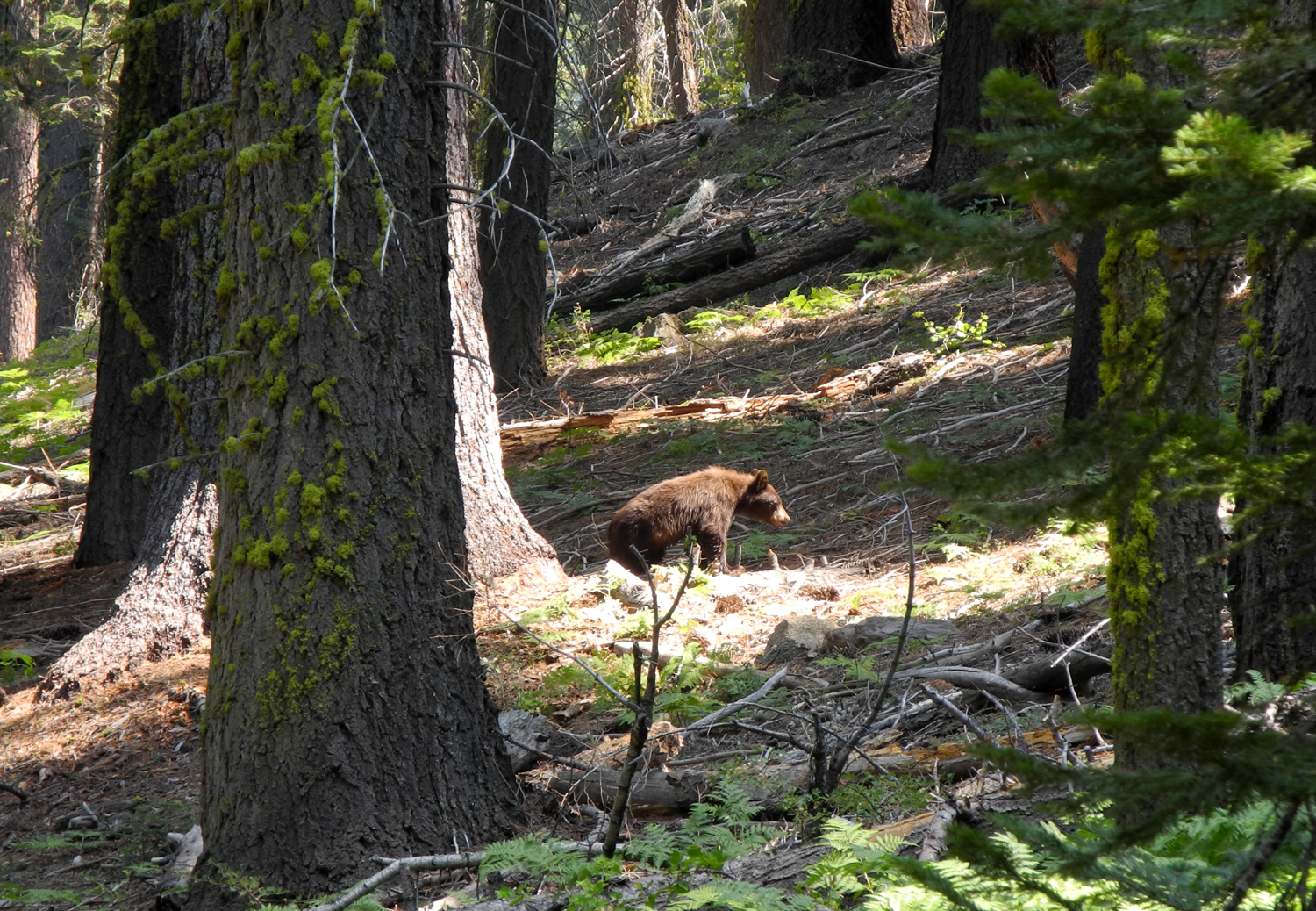 |
| Giant Forest Museum | Trees across from the museum | On the prowl |
 |
 |
 |
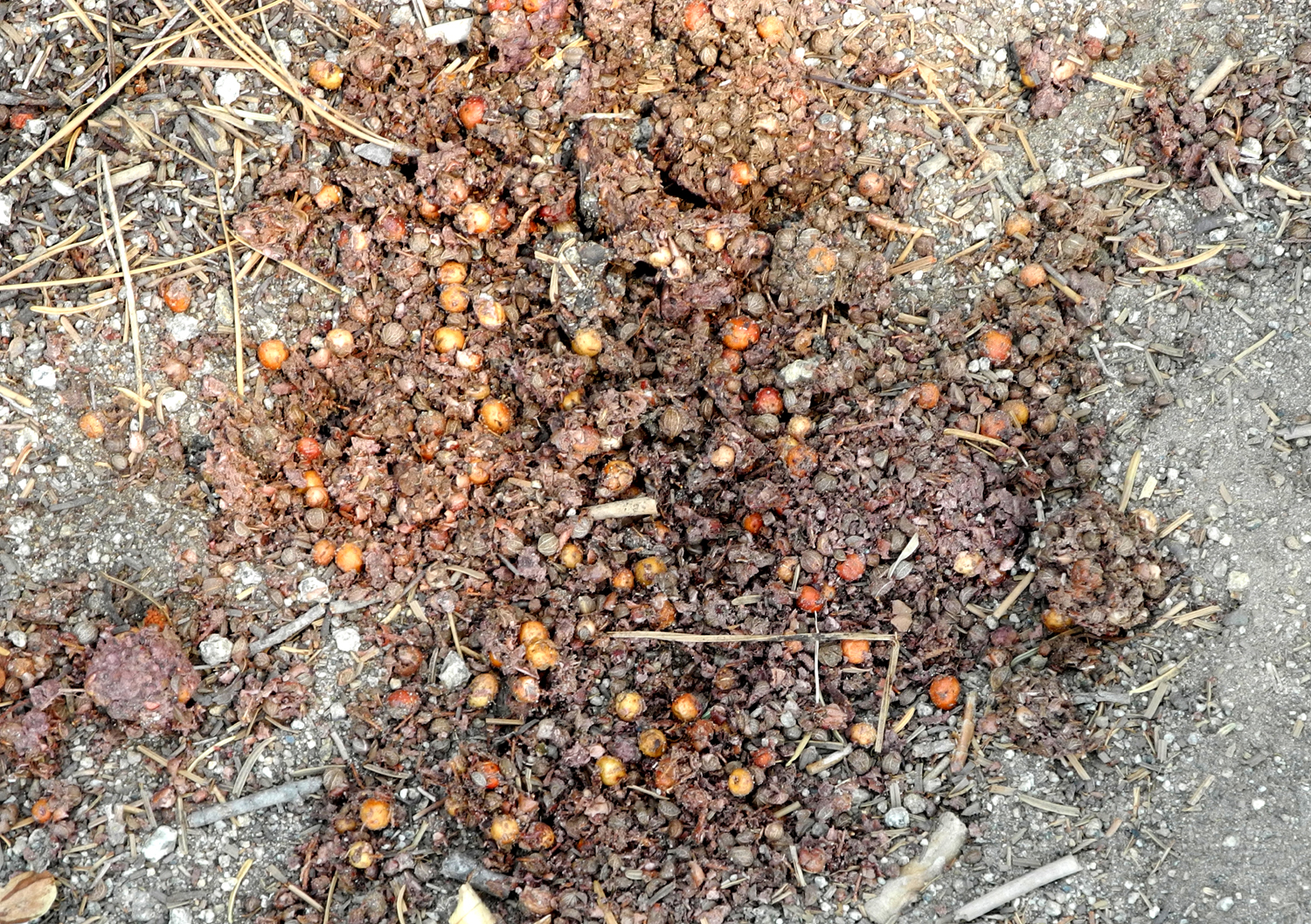
| Bear droppings - mostly berries | The trail is rough but fairly level | Kaweah Canyon and trail from Buckeye Flat between Three Rivers and the park |
 |
 |
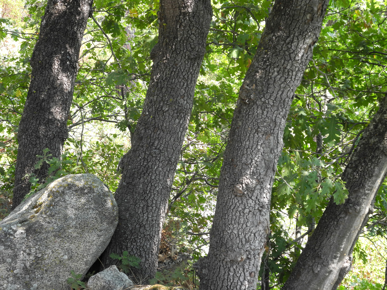 |
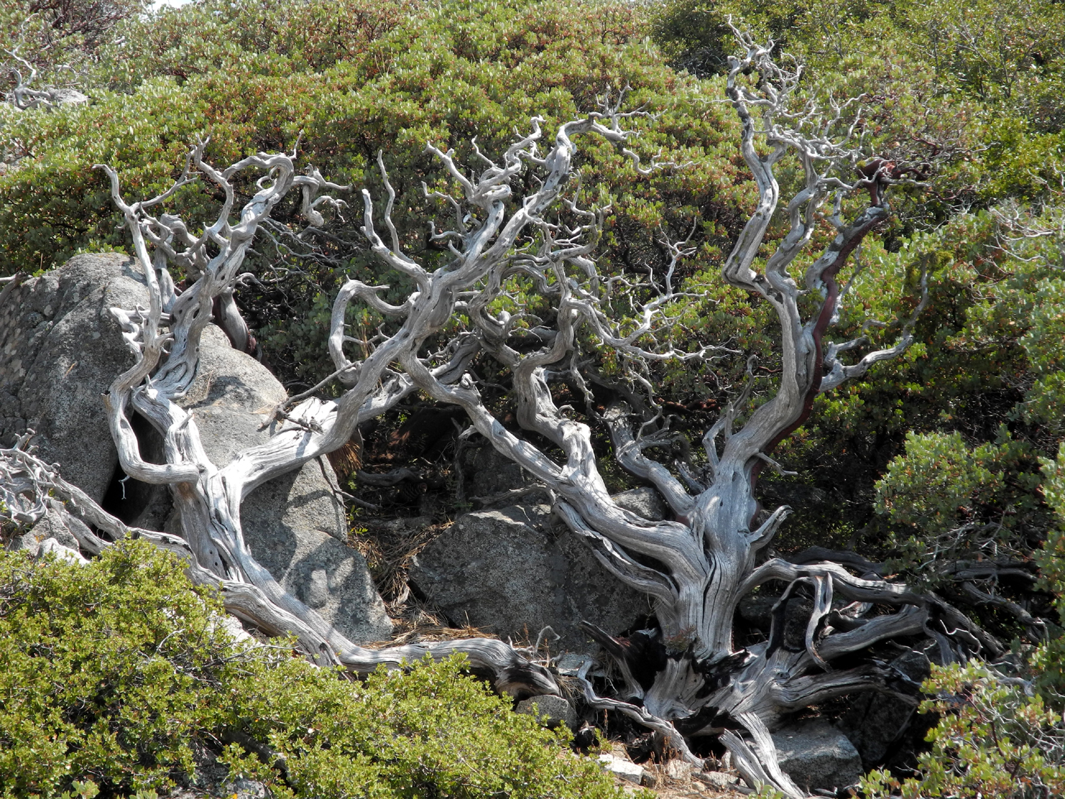
| Rocks and trees along the trail | Dead and live manzanita | Black oak trunks |
 |
 |
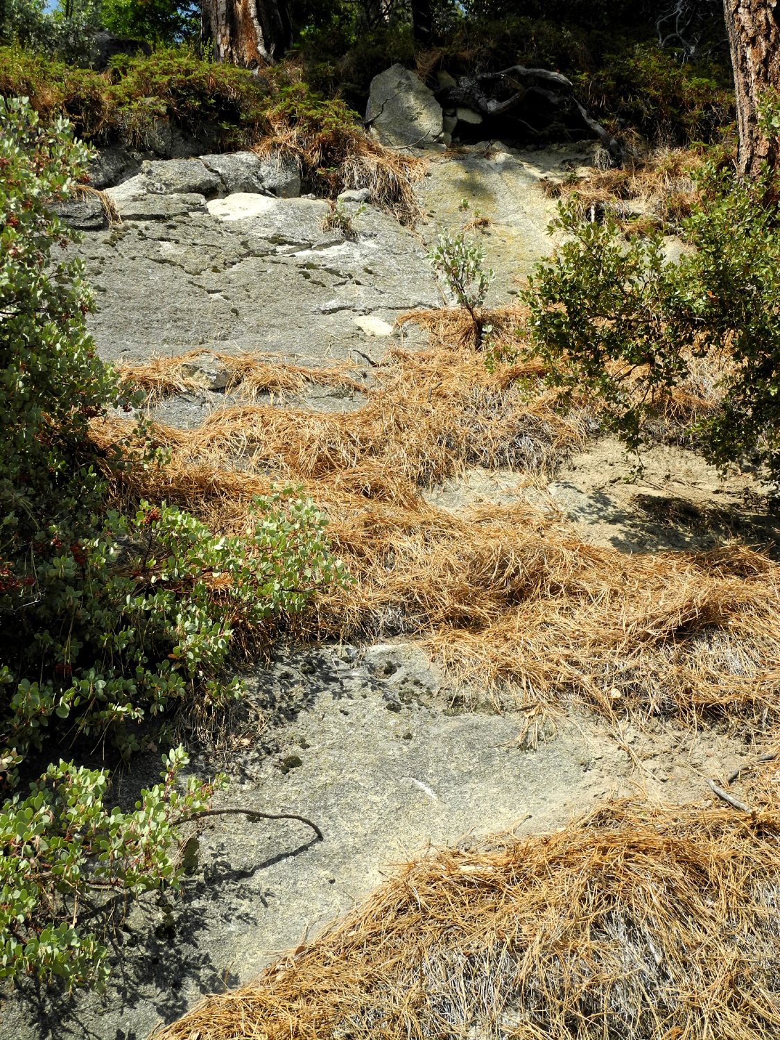 |
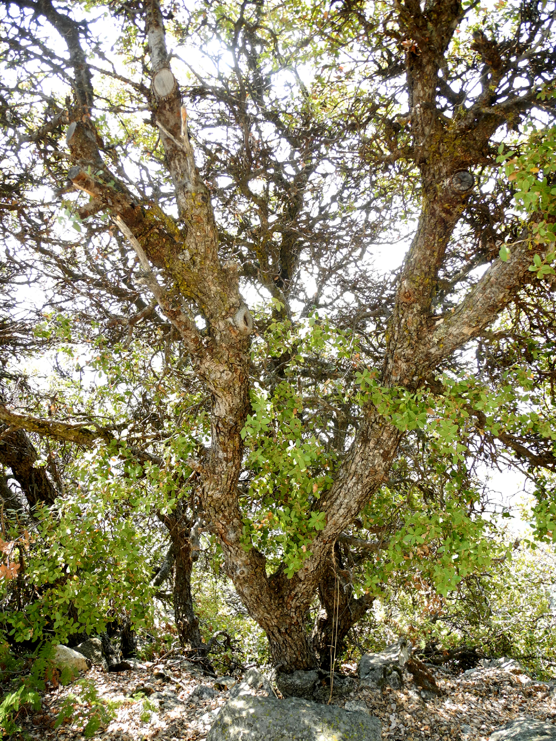
| Scrubby oak is common | Tree vs. Rock | Pine needles caught in the cracks of rock above trail |
 |
 |
 |
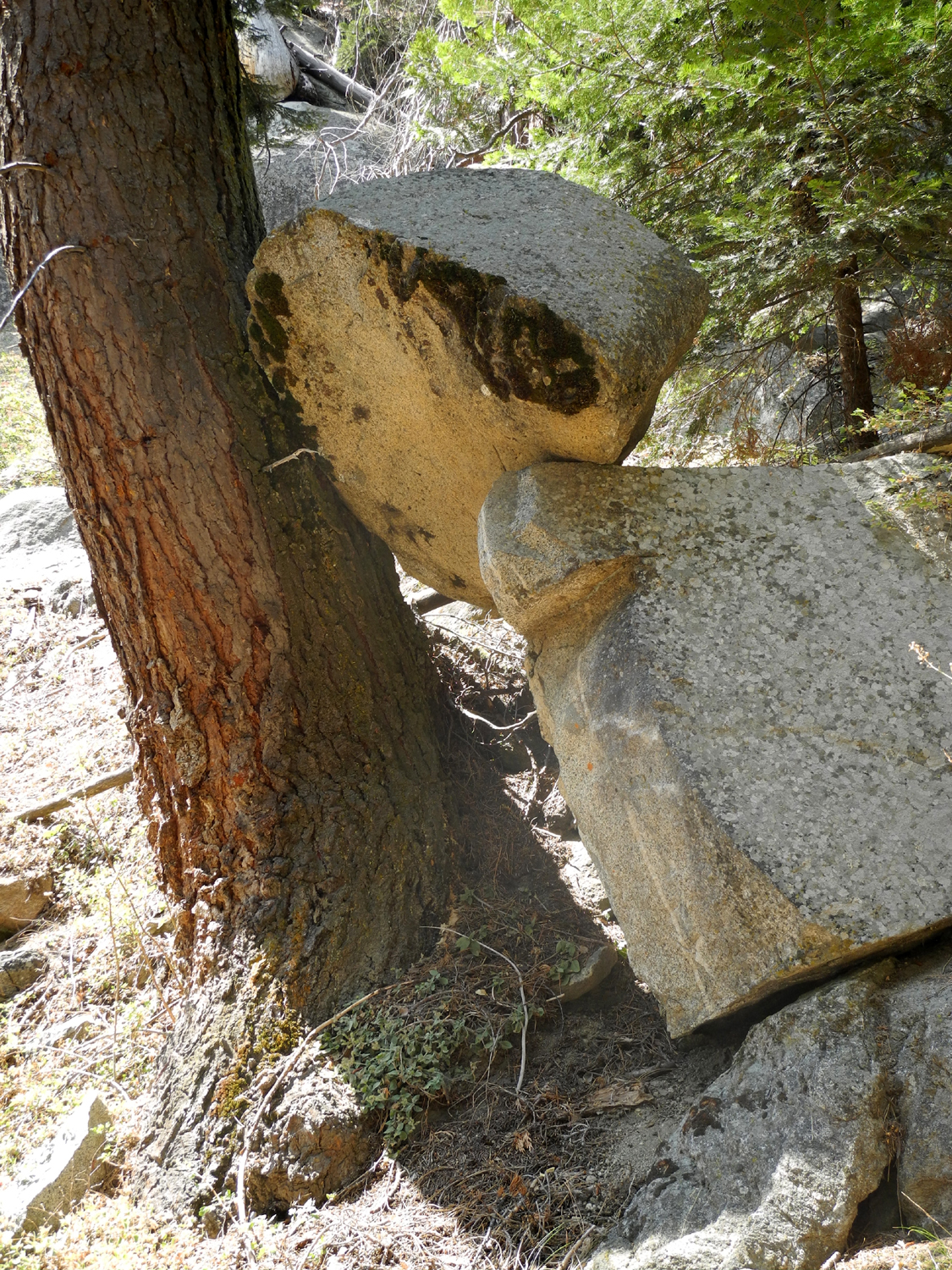
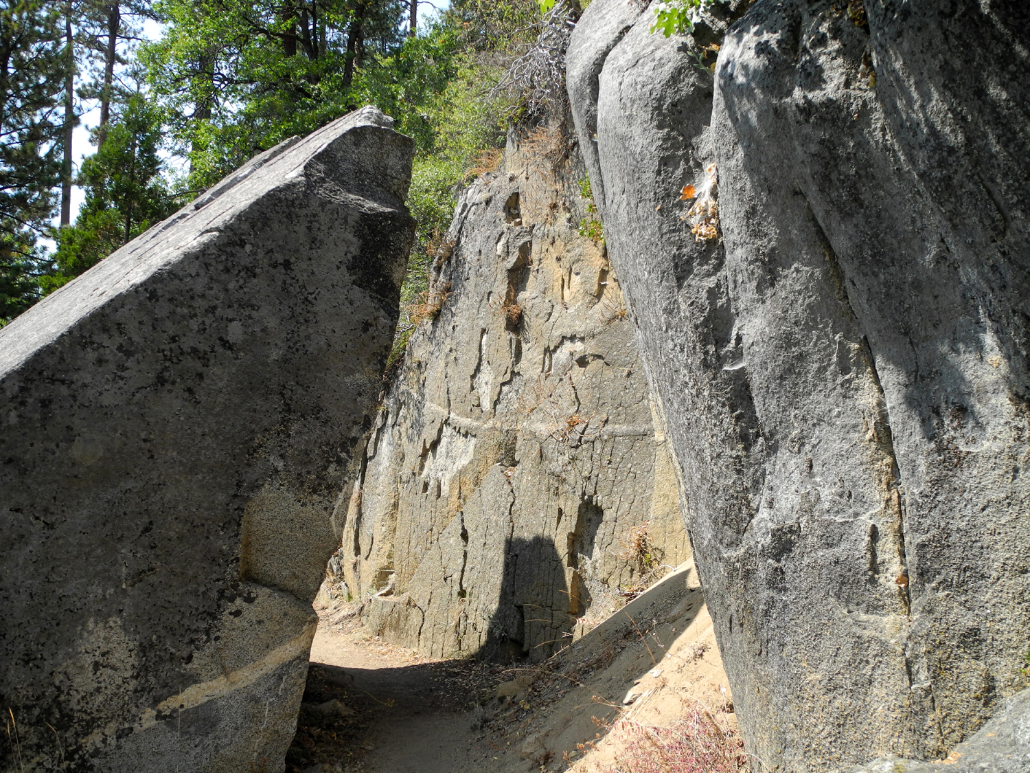
| Boulder on left split off from the flat
area to make a perfect passage for the trail |
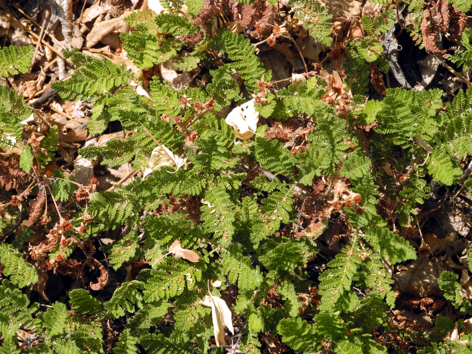
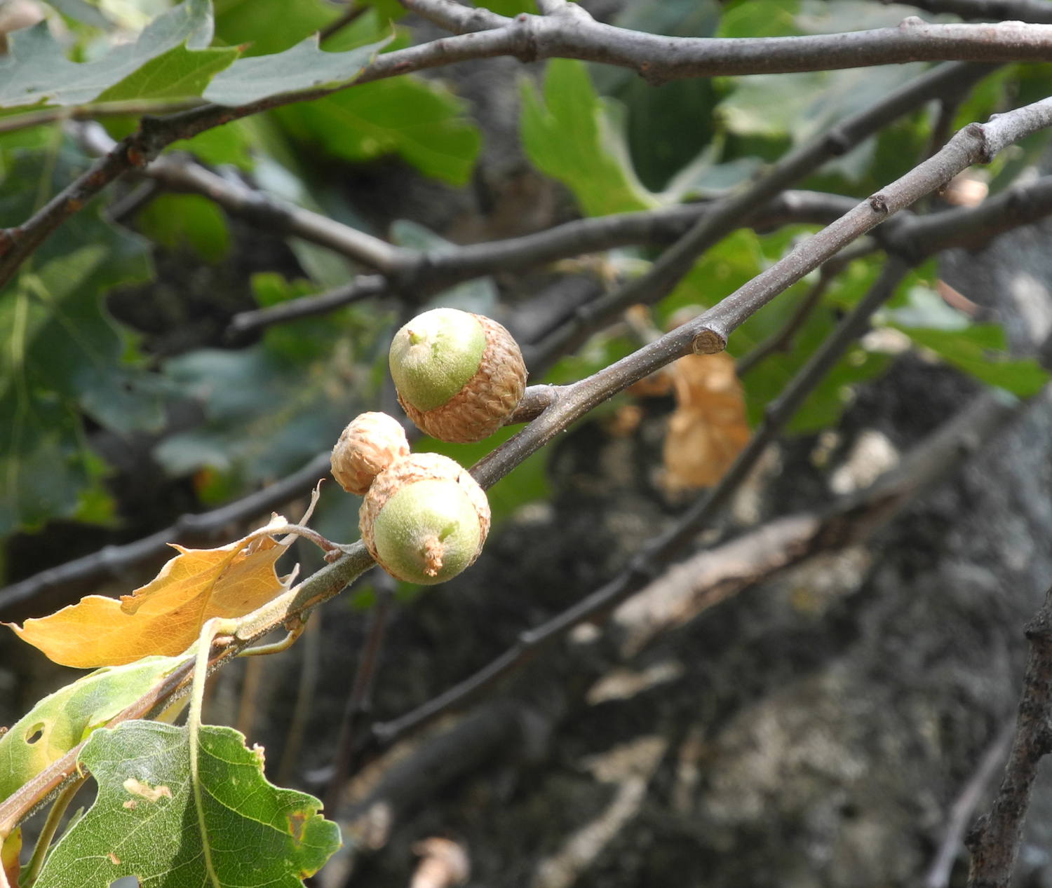
Bear clover (Mountain misery) | Black oak acorns |
 |
 |
 |
| A great view on a clear day | Looking east toward Kaweah Peak | View across Kaweah from trail |
 |
 |
|
| The Great Western Divide | Log Meadow | |
 |
 |
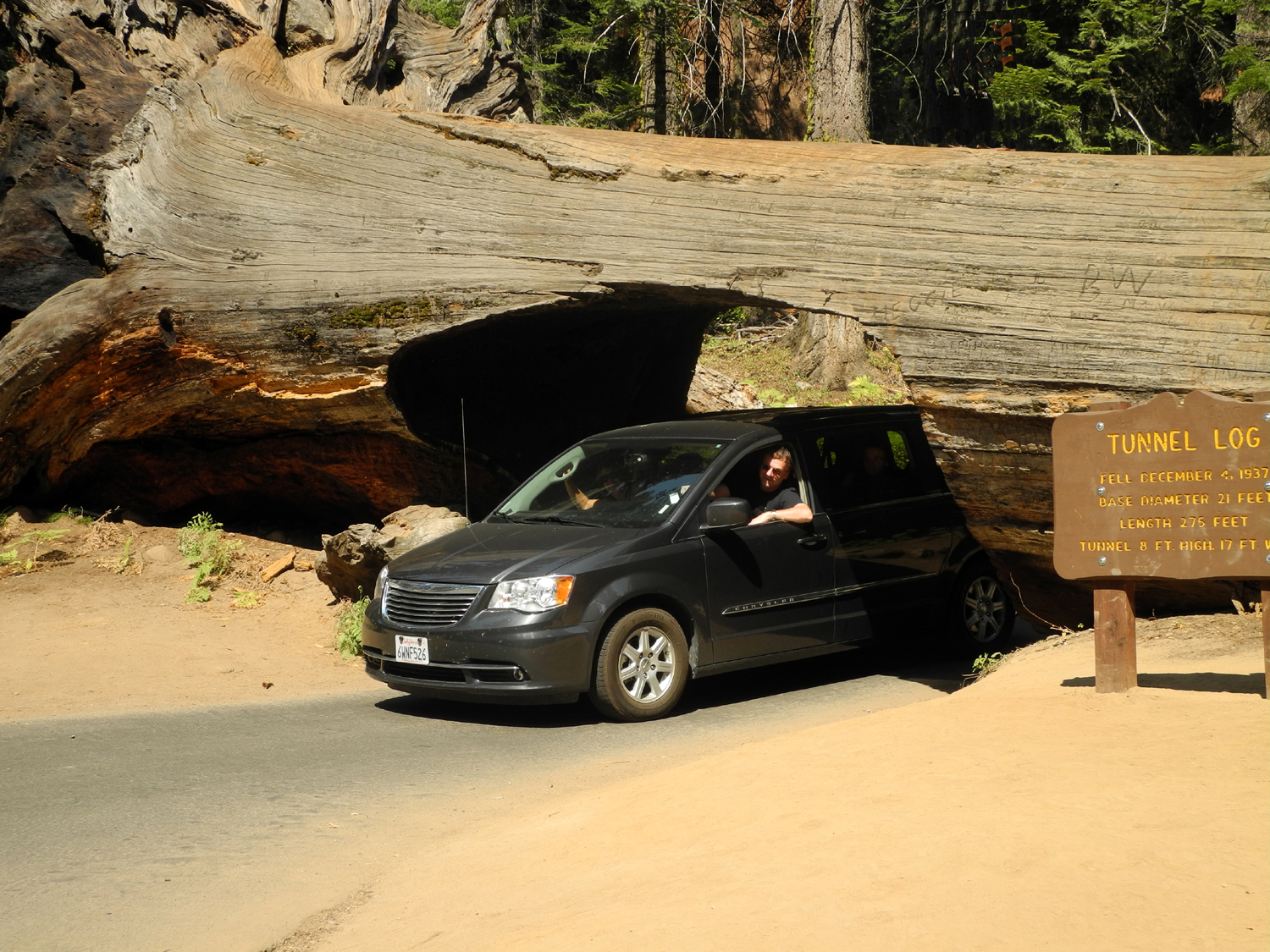 |
| Roots of a fallen giant | Sign at Tunnel Log | The ultimate drive-through |
 |
||
| Crescent Meadow, "The Gem of the Sierra" | ||
|
 |
 |
| Moro Rock | Wuksachi Lodge | In my room |
|
 |
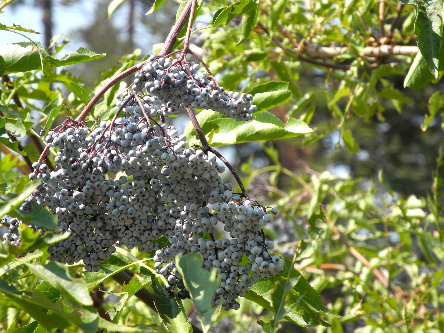 |
| Dinner along the road | This is what he's eating | Elderberries are enjoyed by birds, bears and humans |
 |
 |
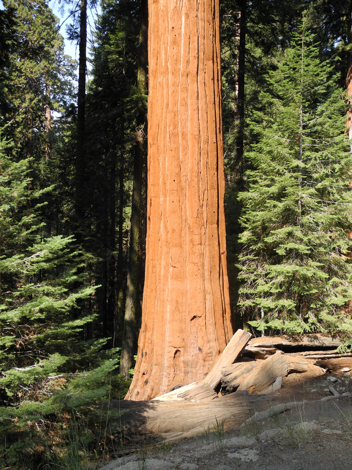 |
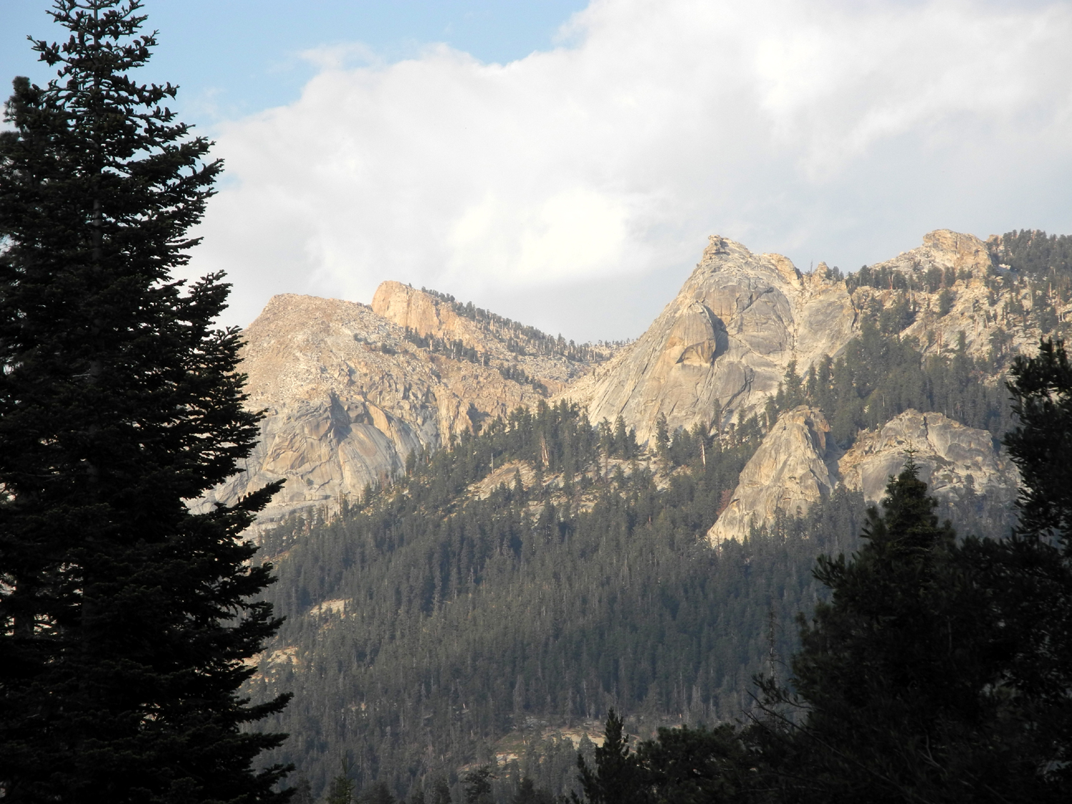
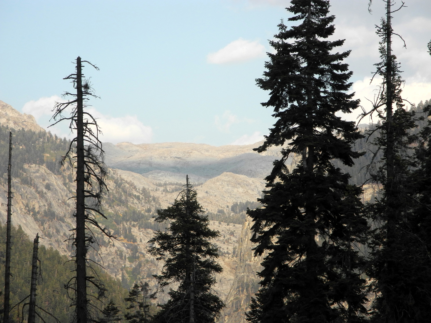
| Views of rocky peaks from the lodge | More rocky cliffs | Sequoia in Lost Grove |
 |
 |
 |
| Middle Fork of the Kings River, right in the center | Hume Lake from Panoramic Point | View from Panoramic Point, October 2007 |
 |
||
| Panoramic Point in September 2013 | ||
| Related Links | ||
| High Sierra Trail | Tharpe's Log | Great Western Divide |
| Crescent Meadow Pictures | Sequoia National Park | More High Sierra Trail |
| Crescent Meadow | Kaweah River | Wuksachi Lodge |
| Kings Canyon National Park | Grant Grove | Cedar Grove |
| Redwood Mountain | Giant Forest | Moro Rock |
| Lodgepole | Panoramic Point | Kings Canyon Overlook Photos |
| All Kings Canyon Park hiking trails | Giant Sequoia Video | Giant Sequoia National Monument |
| Sequoia National Forest | A Grant Grove Trip | Panoramic Point map |
| Very nice photo collection | Dick's Redwood Gallery | Spanish Mountain |