


|
Dick's Adventures of 2017 - Part 4 |
||
|
|
||
| Photos Related Links More Travel Reports | ||
| 2017 Part 1 2017 Part 2 2017 Part 3 2017 Part 5 2017 Part 6 | ||
| McKenzie
Preserve Herding Cats & Hiking
Highway 33
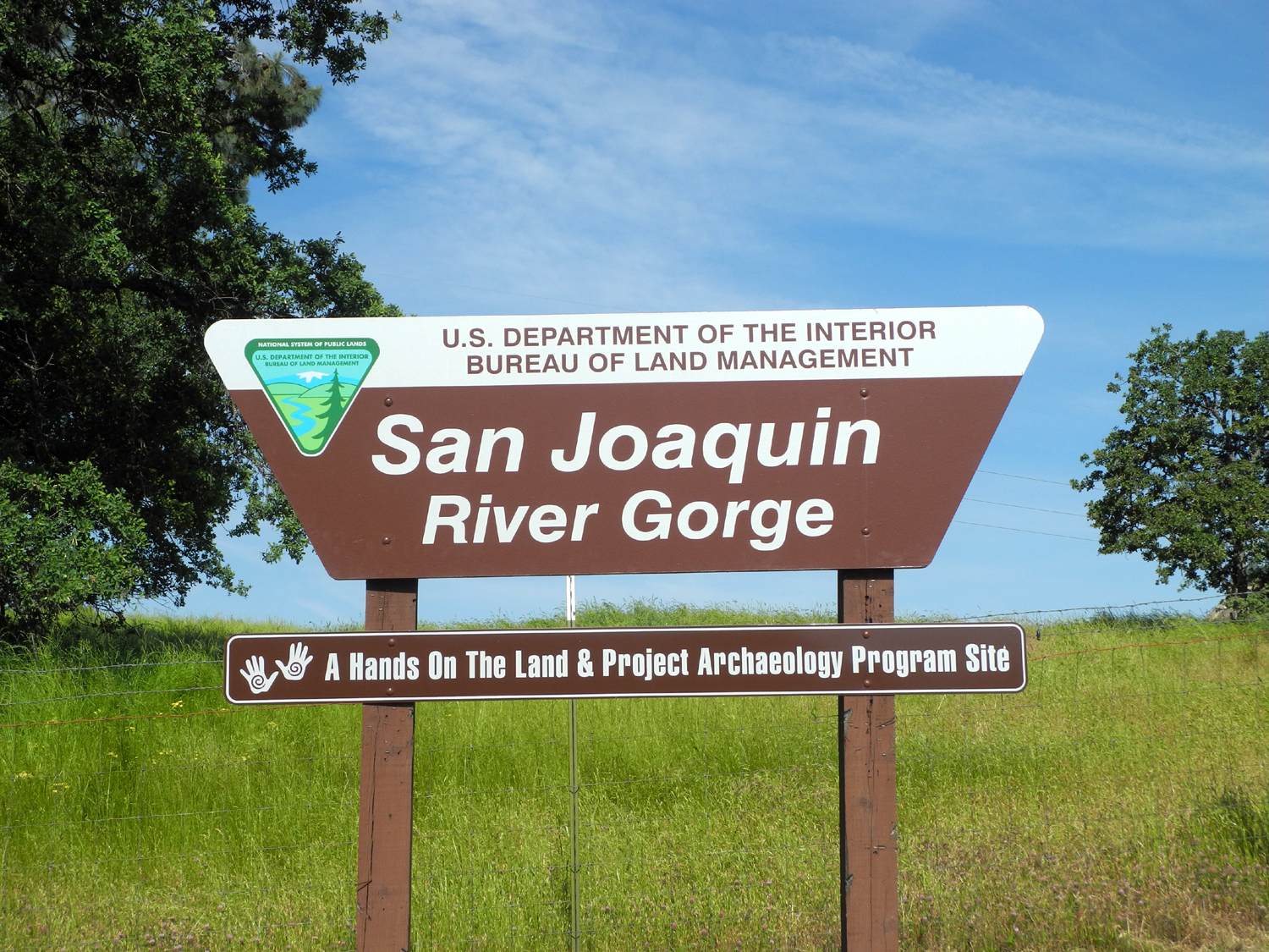
San Joaquin Gorge with Linda & Anne Edison Point Trail Hot Hike at the Gorge |
||
|
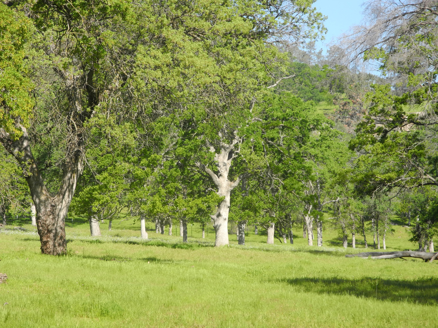
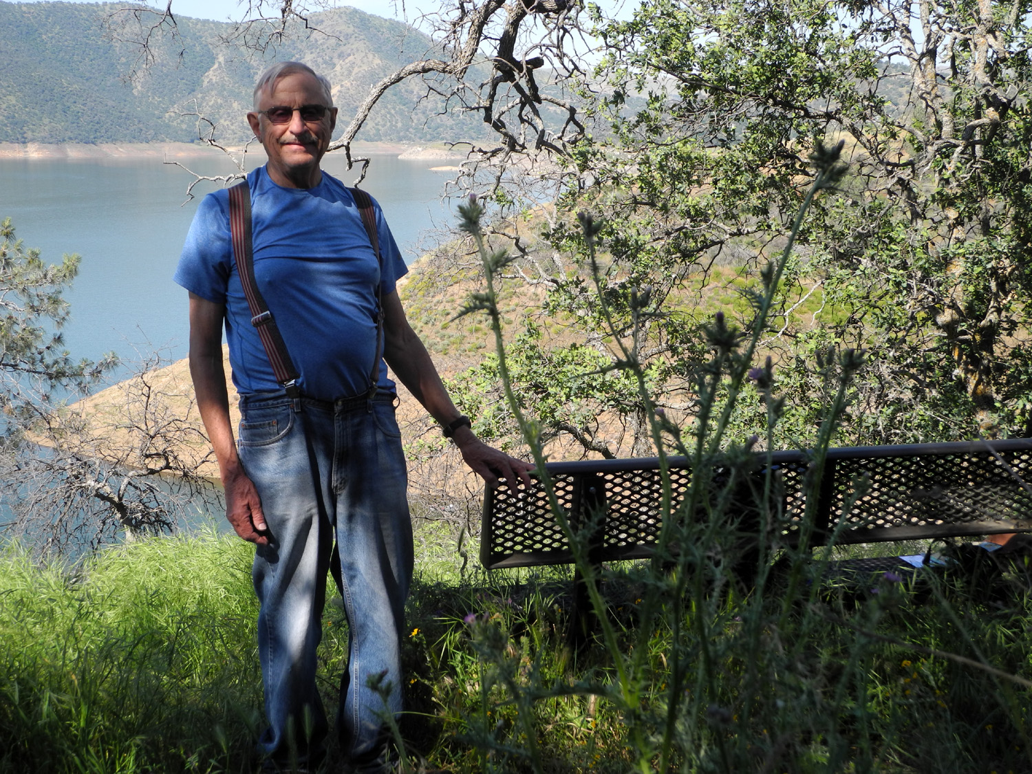
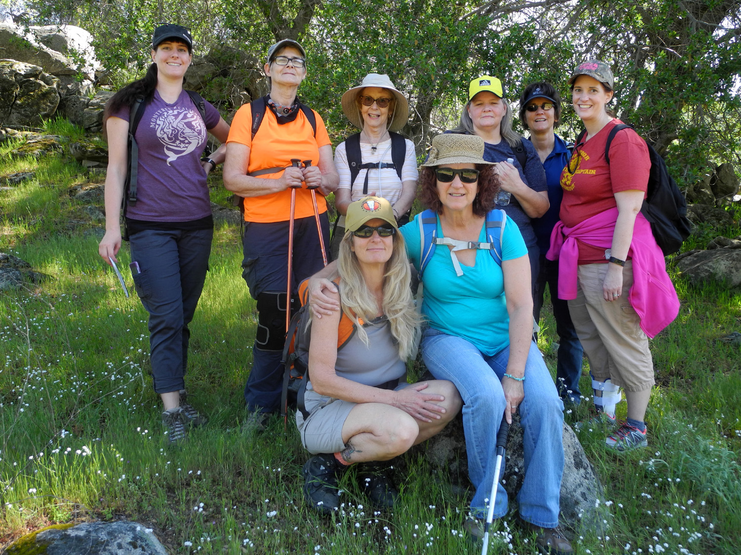
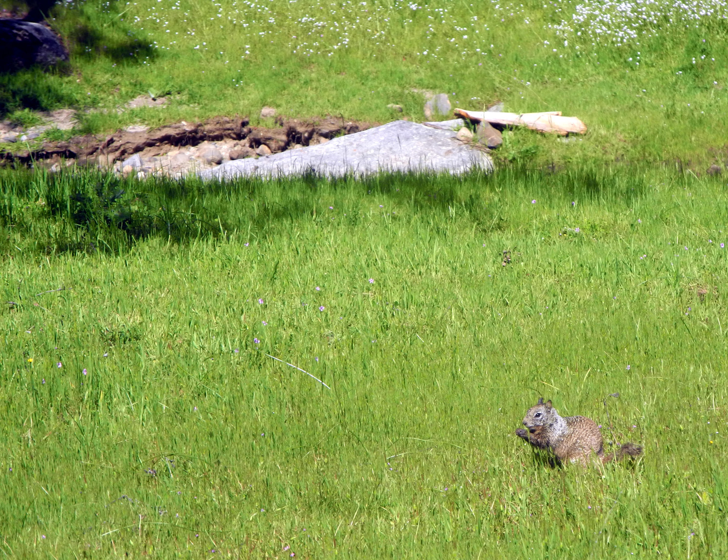
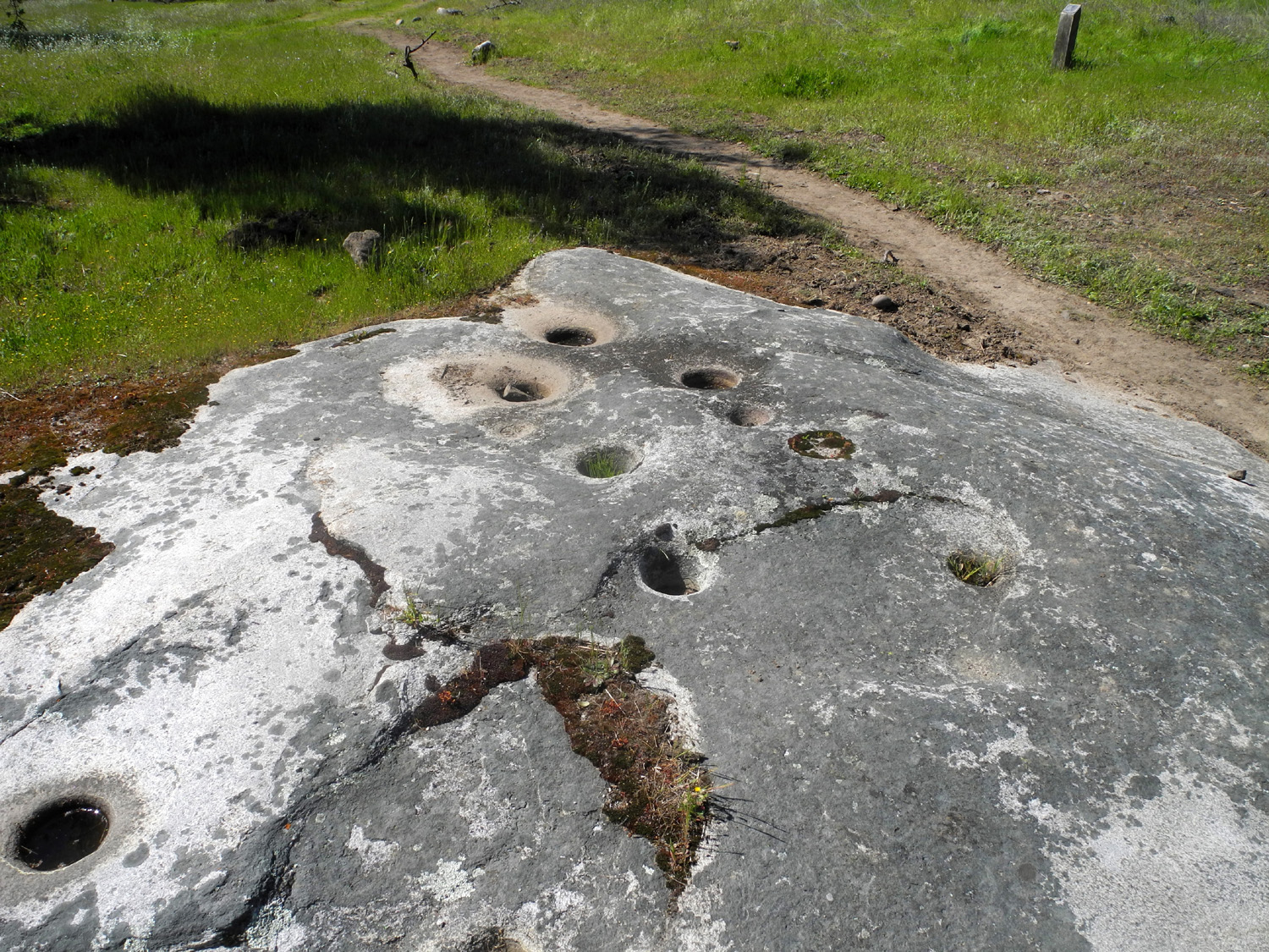
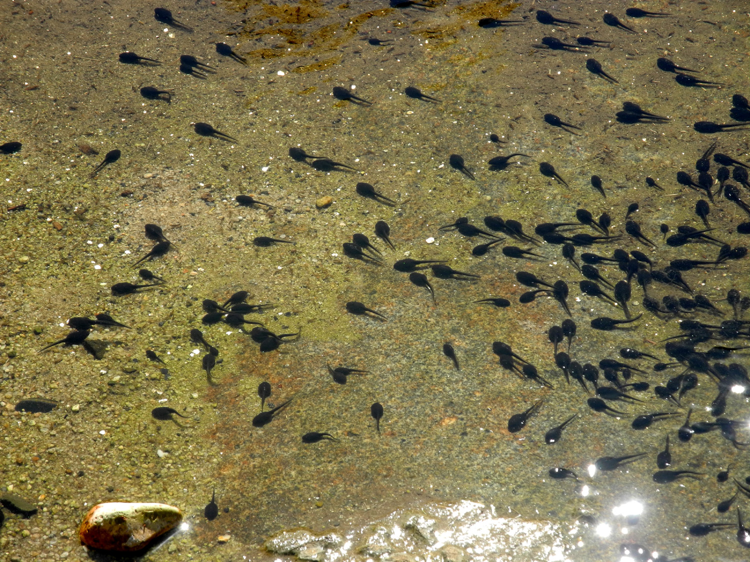
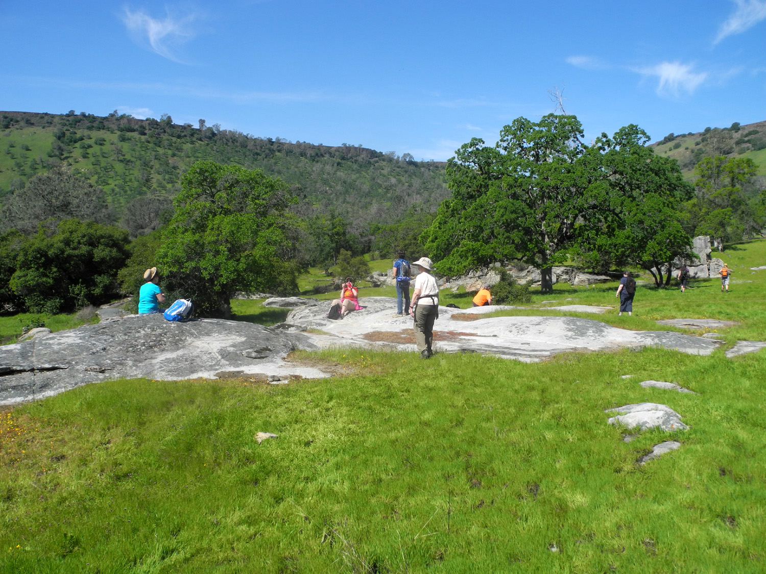
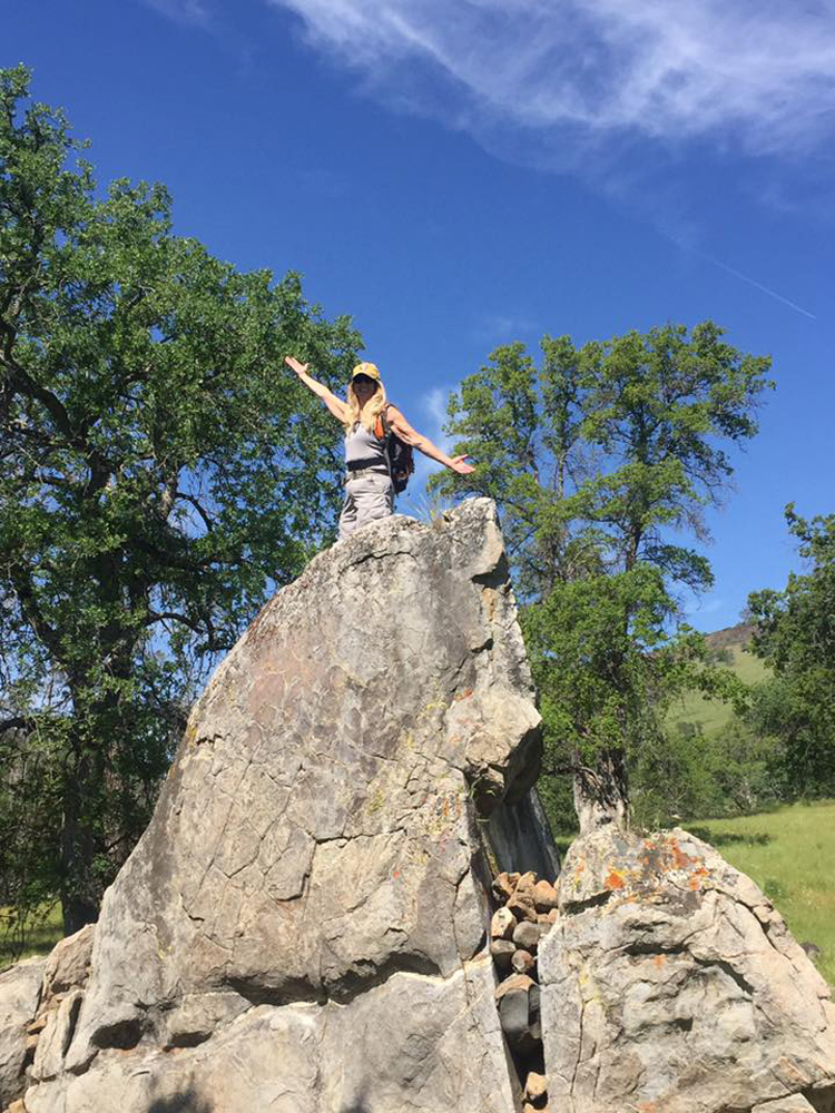
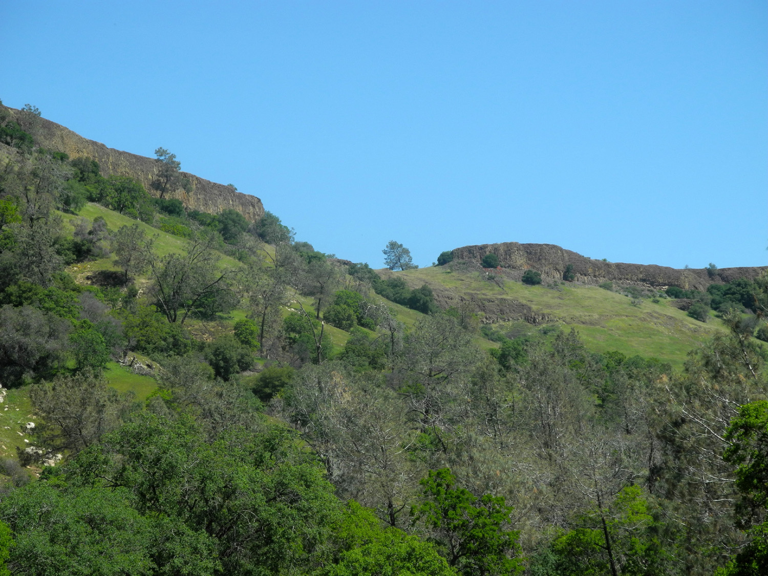
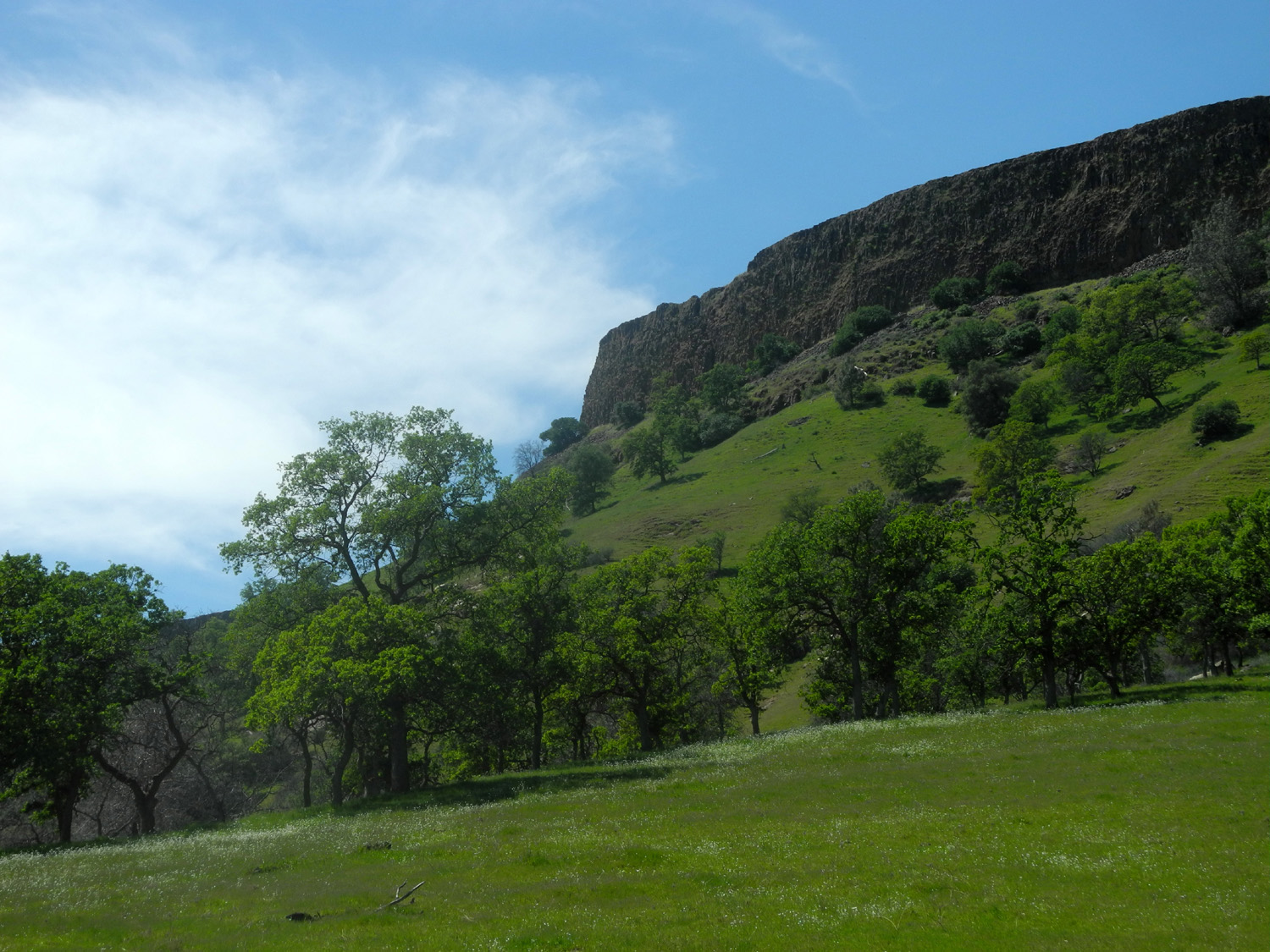
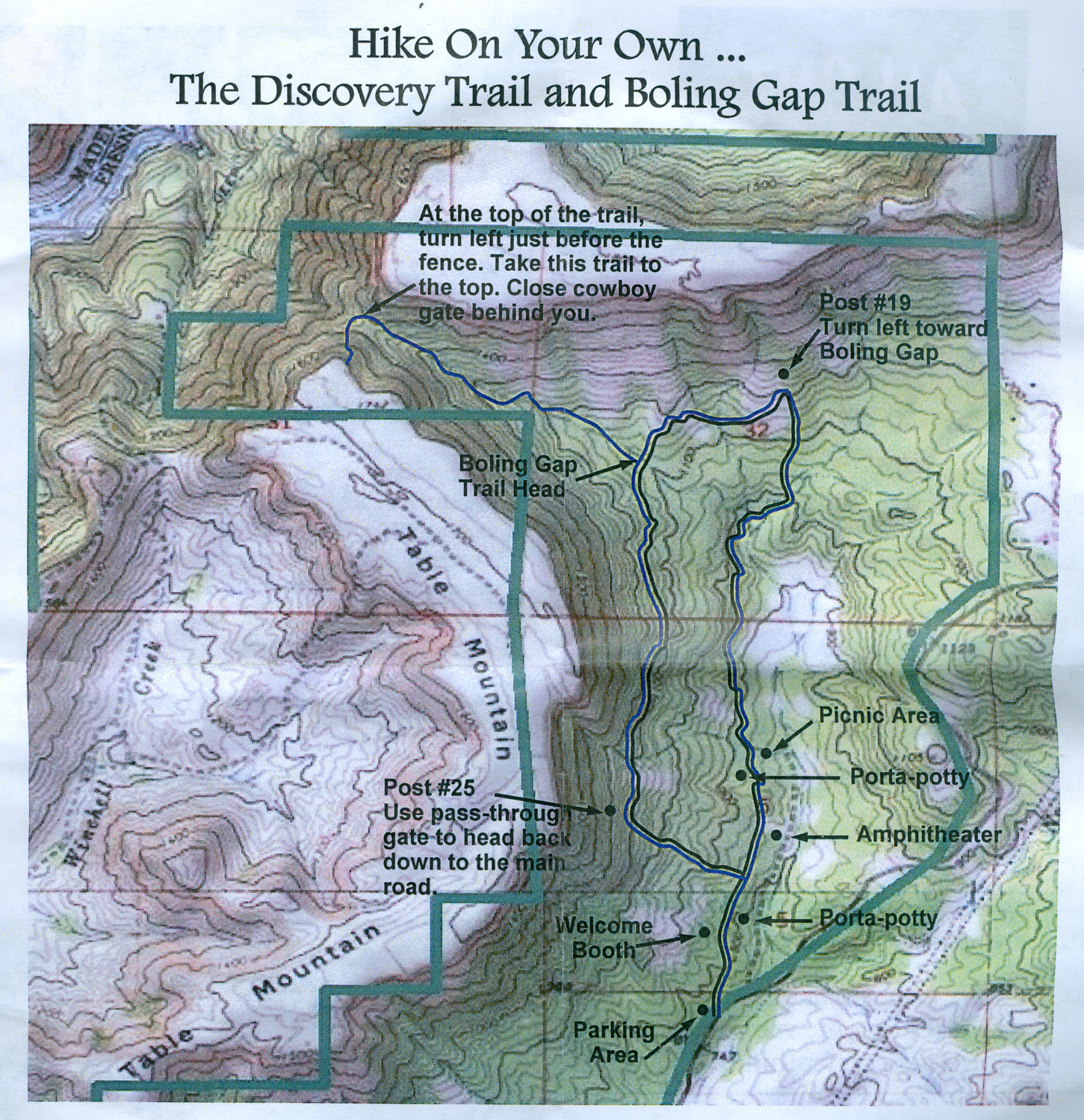
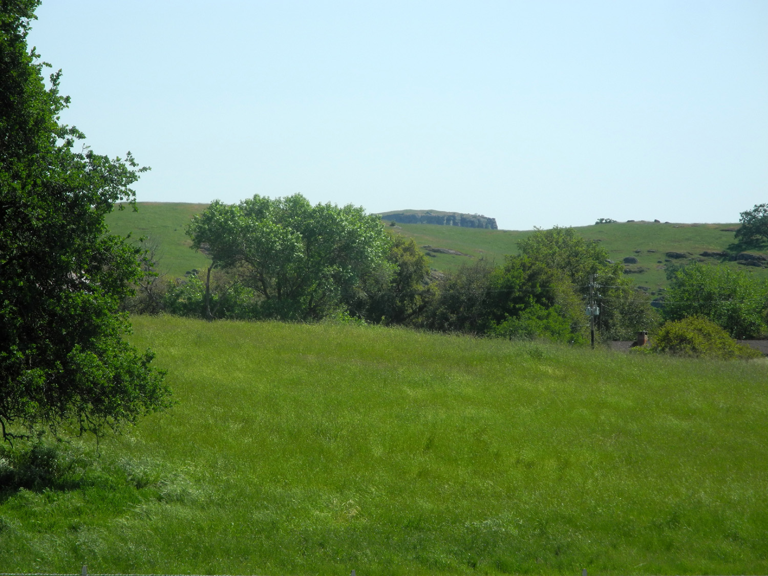
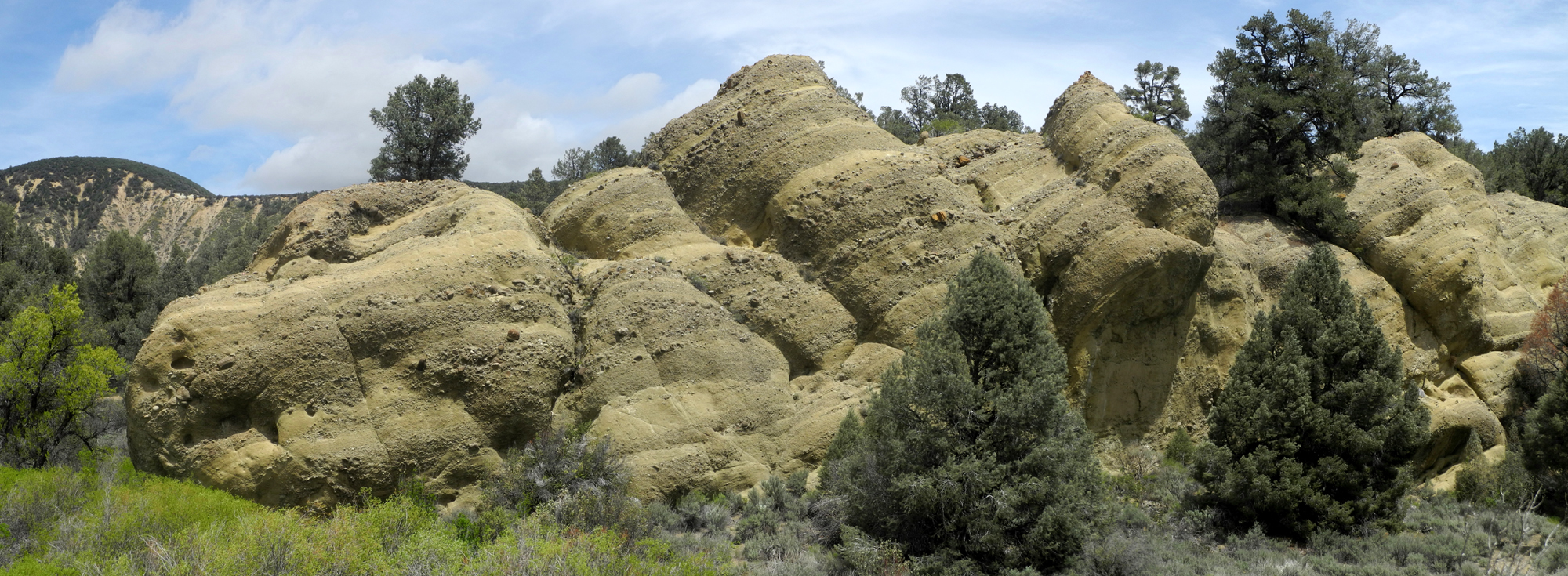
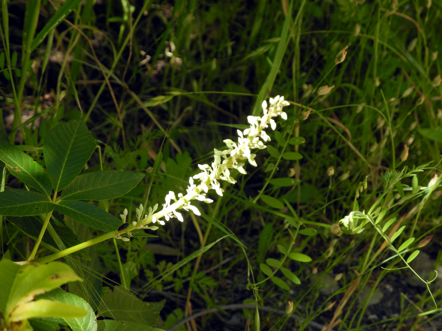
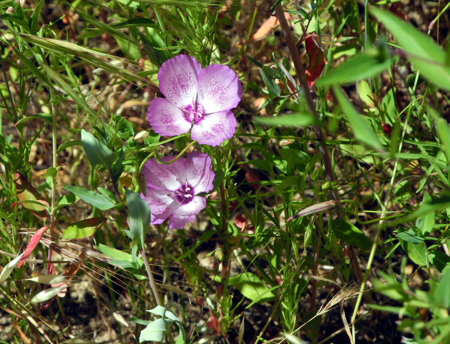
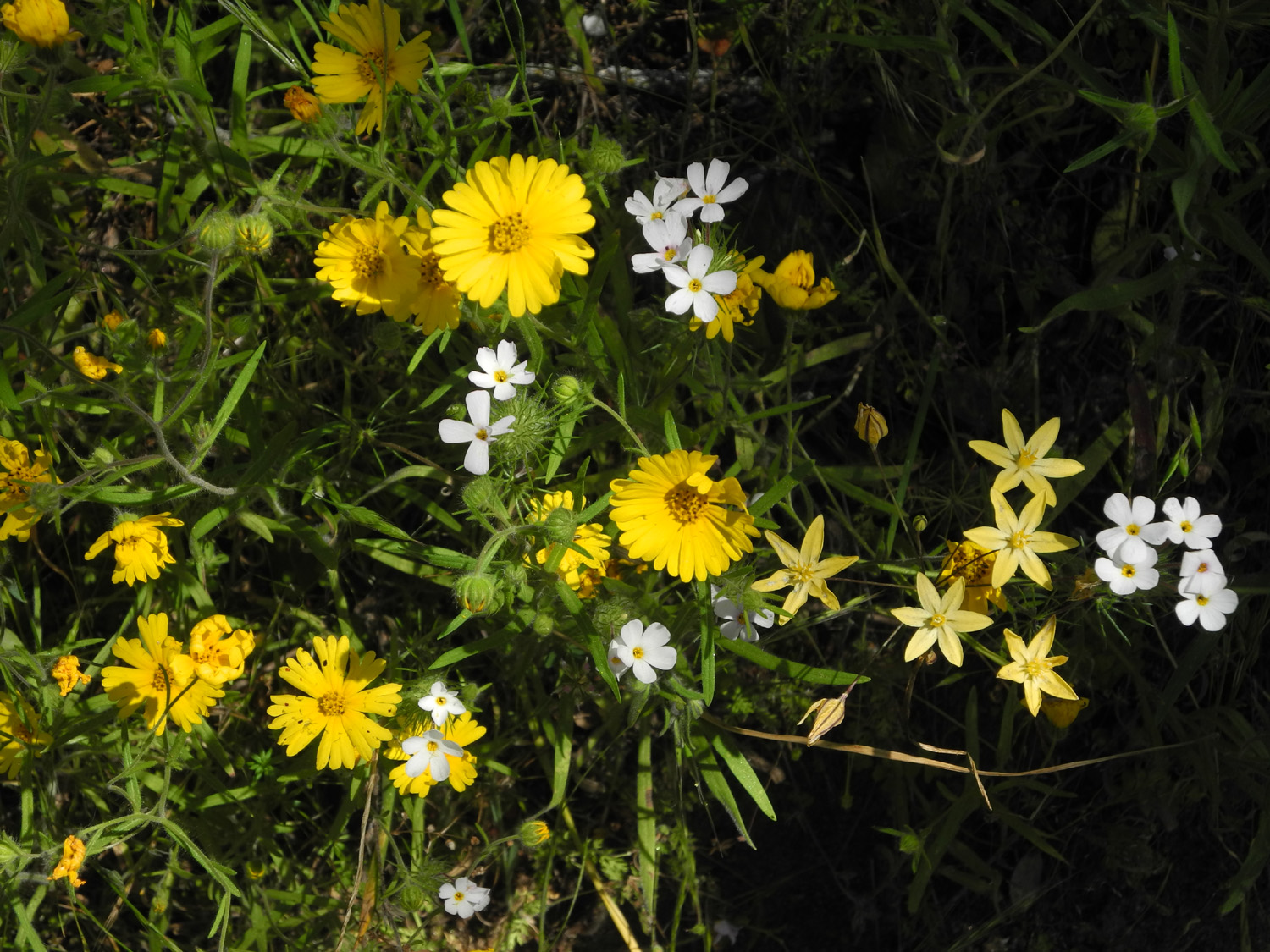
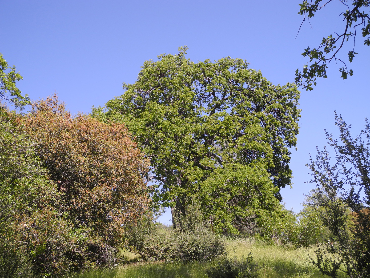
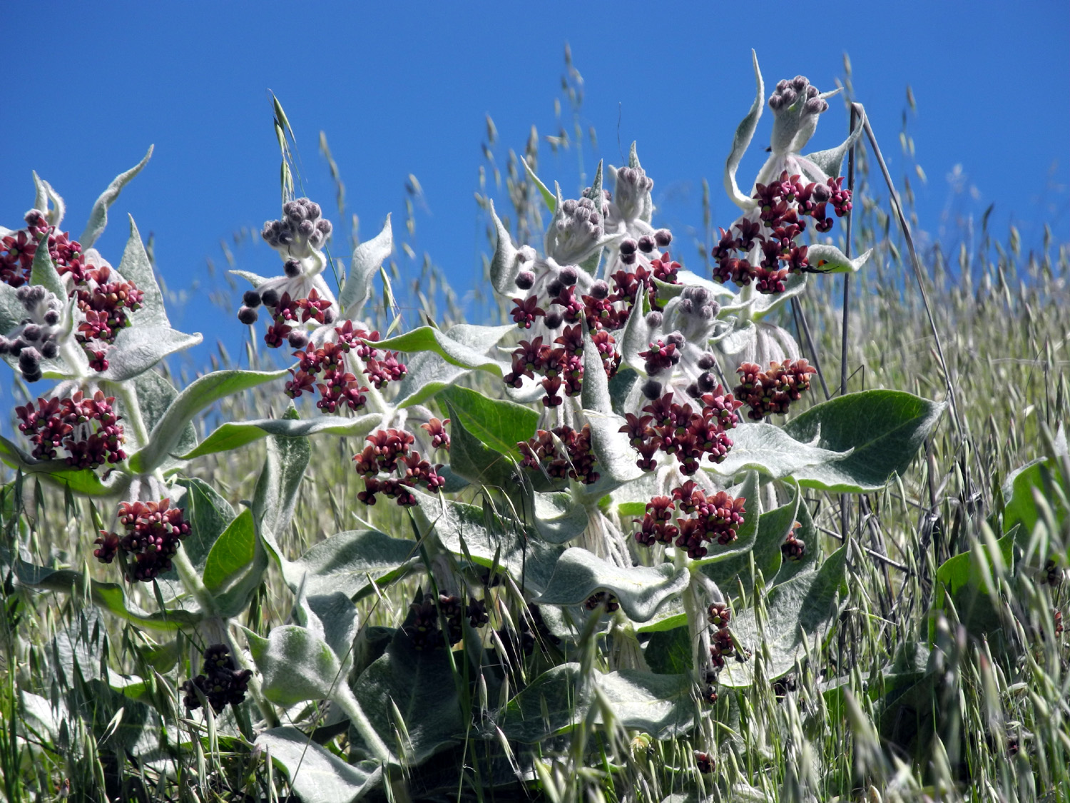
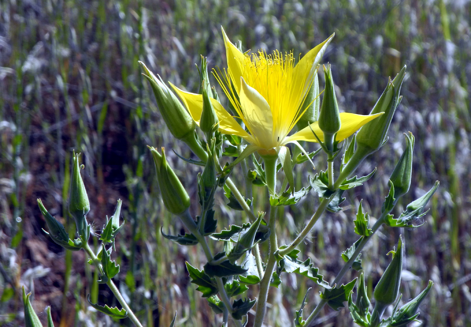
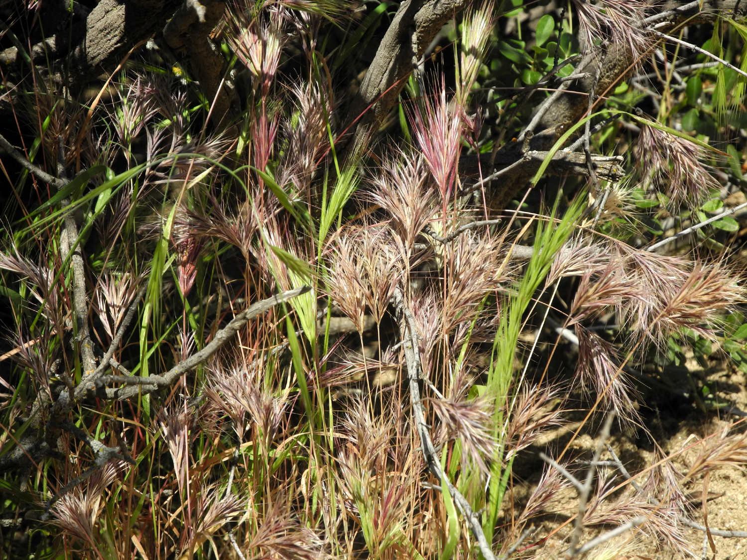
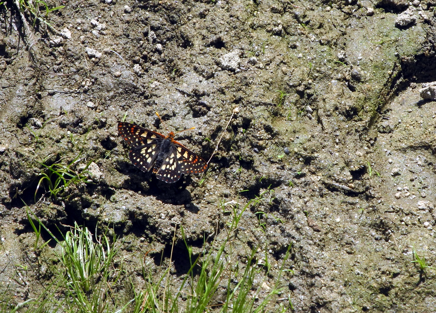
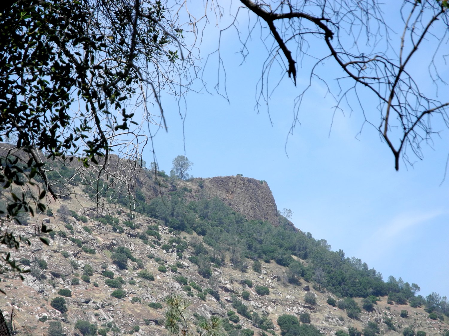
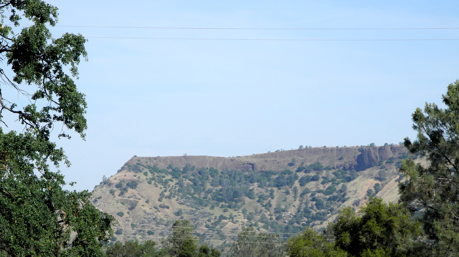
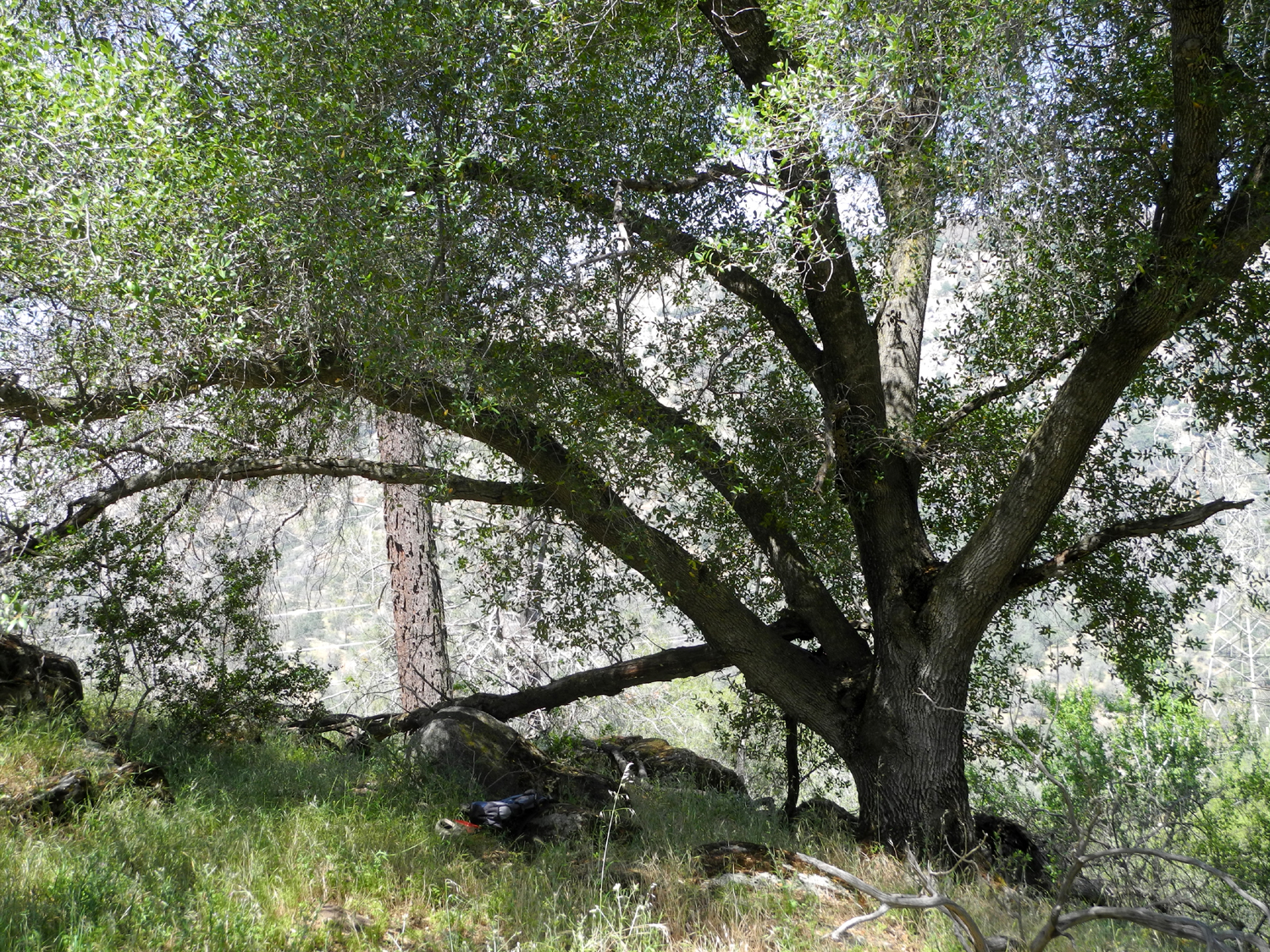
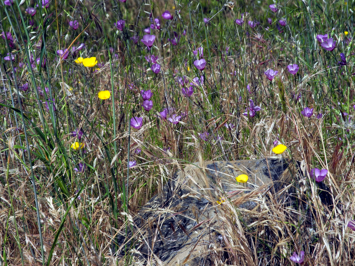
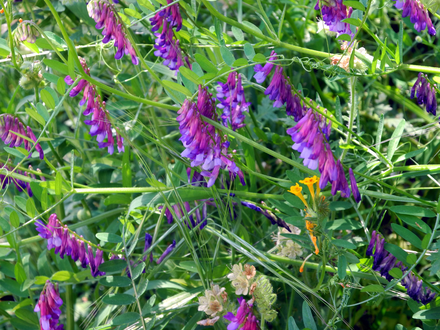
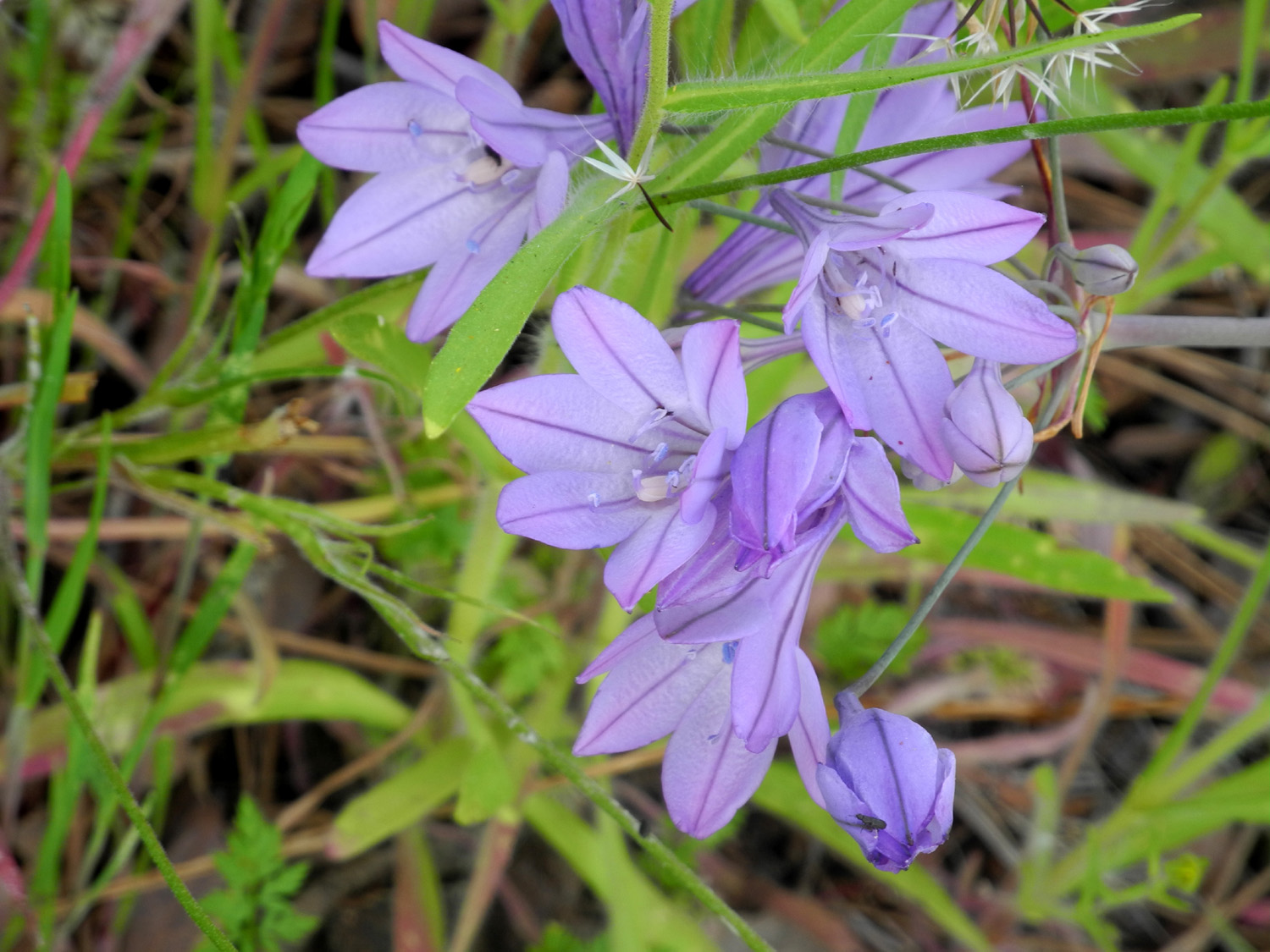
McKenzie Preserve When you travel on Auberry Road, around 20 miles from Fresno you will notice a long series of table top mountains north of the road. The San Joaquin River lies on the other side, and the tables are in fact the ancient bed of the river. Seeing a sight like this of course makes you want to get up on top, but until recently I believed that all of it was private property and inaccessible. However, it turns out that a part of it is open to the public on a limited basis. This is the Ruth McKenzie Preserve, administered by the Sierra Foothill Conservancy. This organization conducts guided hikes in a number of foothill areas in Fresno, Madera and Mariposa Counties, including a six-mile round trip to the top of McKenzie Table. Reservations are required, and hikers must stick together with the guide. Looking at the schedule, I could see that the mileage and the time allotted put most of these hikes beyond my capacity. They go two miles in an hour; I take two hours to go a mile. However, once in a while they have an "open day" at McKenzie, when visitors can wander at their own pace. One of these events was scheduled for April 1. My daughter Teri shares my fascination with this area, and she has created a private Facebook Page, Sierra Nevada and Foothills Hiking Group. Via this medium, she invited friends and friends of friends to join us at the preserve on April 1, and shortly after 9 a.m. on that date, a group of nine arrived at the location in several cars. This included Teri's mother, Jackie, several women I've hiked with previously, and some who were new to the group and more or less new to this type of exercise. However, we were all undaunted as usual, and soon Kristi, Jessica, Laura, Dick, Teri, Jackie, Sandy, Monica, and Emily were strung out along the trail in groups of two to four, marveling at the dramatic cliffs atop the table mountains, pausing to study flowers large and small, and just enjoying the wonders of this low foothill domain. Although hiking this day was not organized, the Preserve was, and in a very useful way. First, there was a man at the entry of the parking area who guided us into a spot. With one car after another arriving at the 9 a.m. opening time, I wondered if there was room for everyone, but he told me later that they have had 75 cars there, and 67 came in this time. Without guidance, you could never get that many vehicles into the space available. A short distance from the parking area was the entry table, where we signed in and received a guidebook which explained features at a series of numbered posts along the way. We also signed out when we returned, since the area is fenced and locked up at the end of the day, and they wanted everyone out safely. To everyone's relief, there were port-a-potties at three locations in the first quarter mile, one near a gathering spot that also had picnic tables. Several of the women took turns reading the descriptions from the guide book, at least one of them enhancing the story with her own entirely false but humorous fable about bobcats making their den at the base of "blue pines." What was real included a dead oak, the oldest in the preserve, that looked as if it had been through every storm for the past 500 years. We were also glad to find ourselves walking beside a little creek, which eventually crosses Auberry Road and joins Little Dry Creek. In one place it had dozens of tadpoles, and one large granite outcropping boasted a number of bedrock mortars. One of our party had been told that each inch of depth in the hole represents 100 years of use, which would mean some were used for up to 400 years. Since there were people in this area as long as 8,000 years ago, these artifacts could be considered "modern." Not far from this point the guidebook directed us to the site of an old ranch cabin, about 100 yards off the trail. A few of us walked over, and were able to observe a level area with rocks across the front as part of an old embankment. This area also provided the perfect "Teri on the rock" photo opportunity. The trail is actually an old ranch road, which climbed very gently for two miles from an elevation of 700 feet to 1,000. At this point it joins the roadbed of the San Joaquin and Eastern Railroad, built in 1912. The rails are long gone, but the roadway is still in good condition, and is nearly level. The trail follows the old road for a little more than a mile. Along the way we stopped where a little creek crossed the road, found nice sitting rocks, and enjoyed our lunch. The day was warm and the elevation low, so we welcomed the shade. The site of our lunch stop was also the trailhead for the Boling Gap Trail, which takes hikers to the top of the table mountain. Since this would have been a six mile round trip, our group had already decided to limit our efforts to the four-mile Discovery Trail. This wouldn't be a Dick Estel report without a mention of wildflowers, and we saw a lot of them. What we are seeing this year is a lot of different species, although there are not a lot of solid fields of color. With the exception of milkweed, just budding out, all the flowers we saw were ones I had spotted elsewhere earlier this spring. Traveling along the railroad bed, we passed several ponds containing more tadpoles, and also saw few very tiny frogs at the edge, including some that had not fully lost their tails. Other wildlife included ground squirrels, lizards, ravens, and a pair of redtail hawks that flew over the parking lot just after our return. Although the elevation change was minimal, it was particularly noticeable on the final stretch of the trail, which dropped down 300 feet in about a half mile from the railroad to the parking area. Flowers seen included birds eye gilia, ground lupines budded but not blooming, bush lupine in one area, fringed redmaids, lots of popcorn flowers and filaree, quite a few fiddlenecks and blue dicks, purple clover, yellow clover, unidentified 10-petal pink flowers, daisy-like blossoms, a few baby blue eyes right at the start, buck brush, yellow brodiaea, and milkweed. Although some parts of the trail presented a challenge for a couple members of our party, everyone is looking forward to getting out on another trail soon.
|
||
|
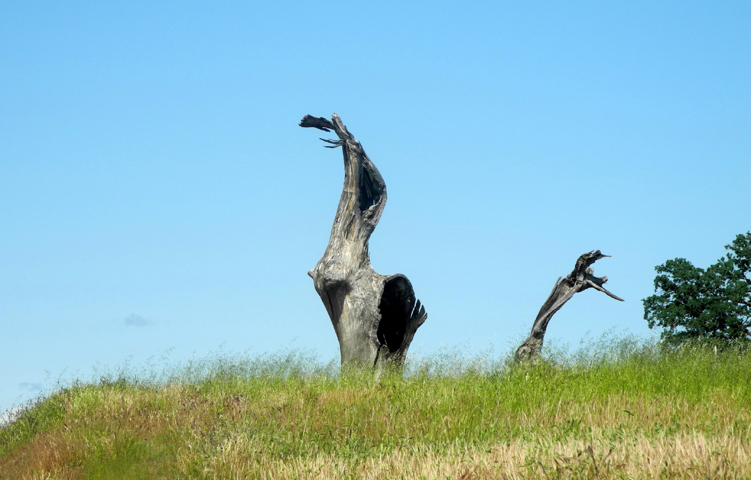
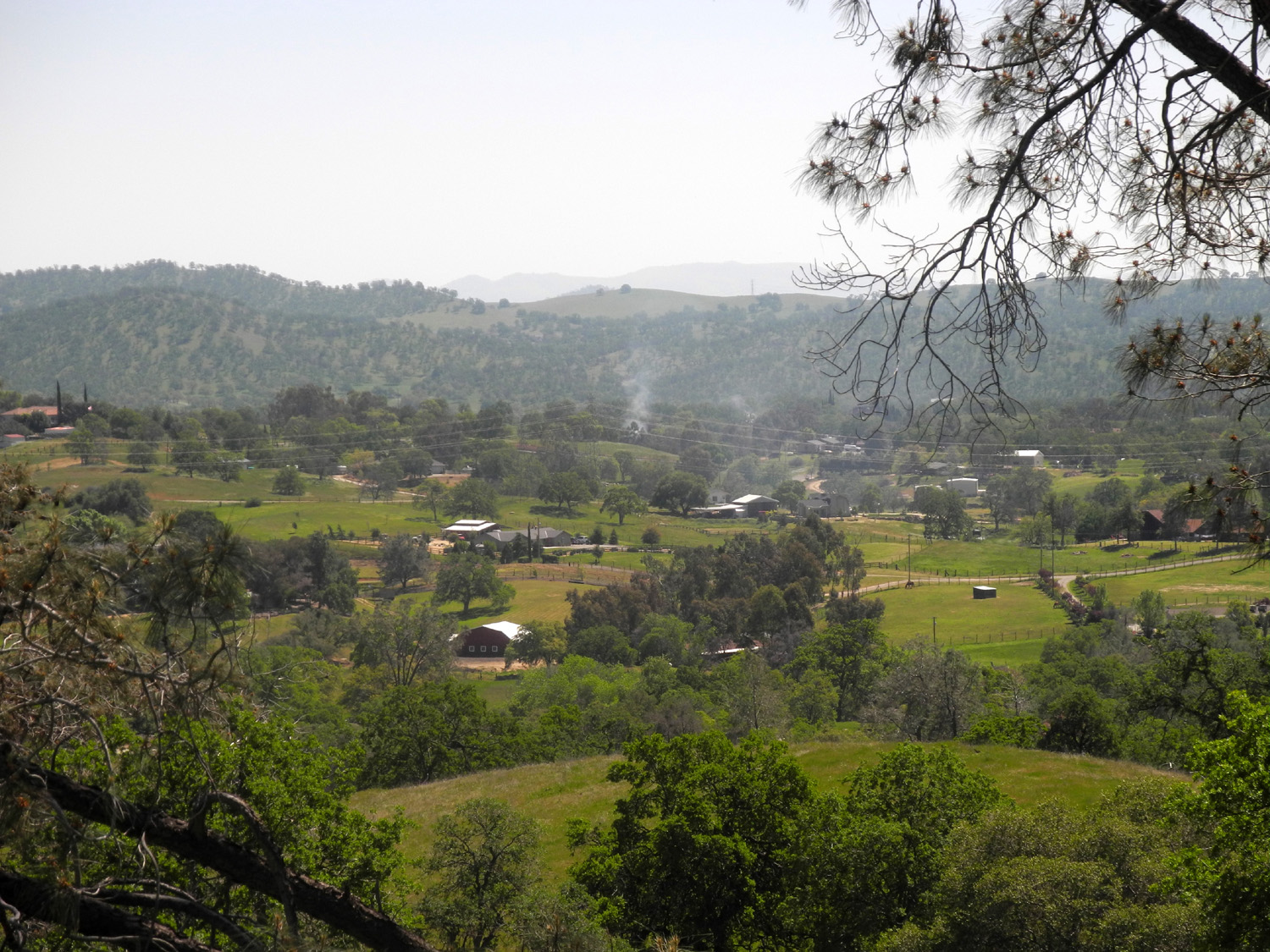
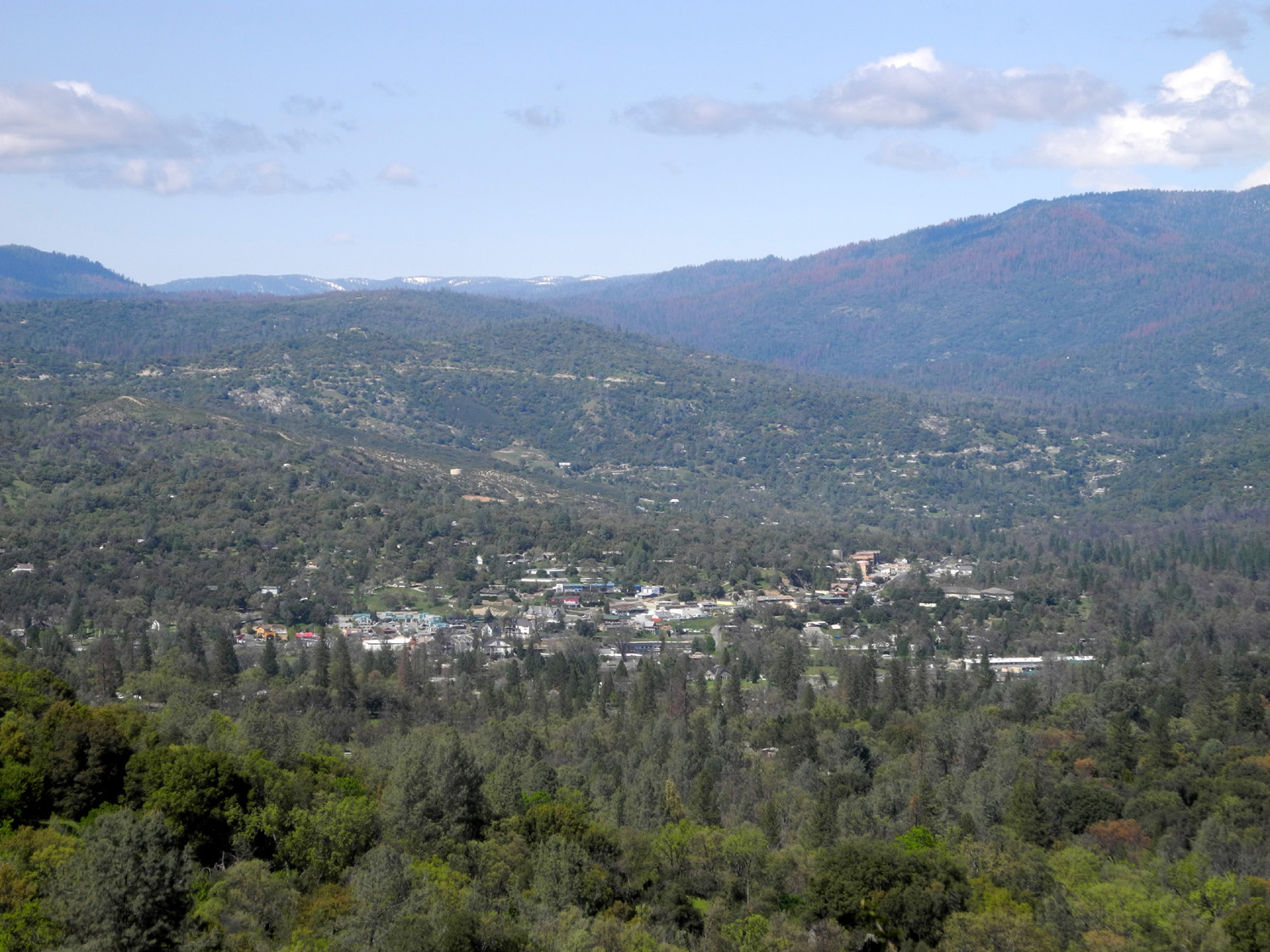
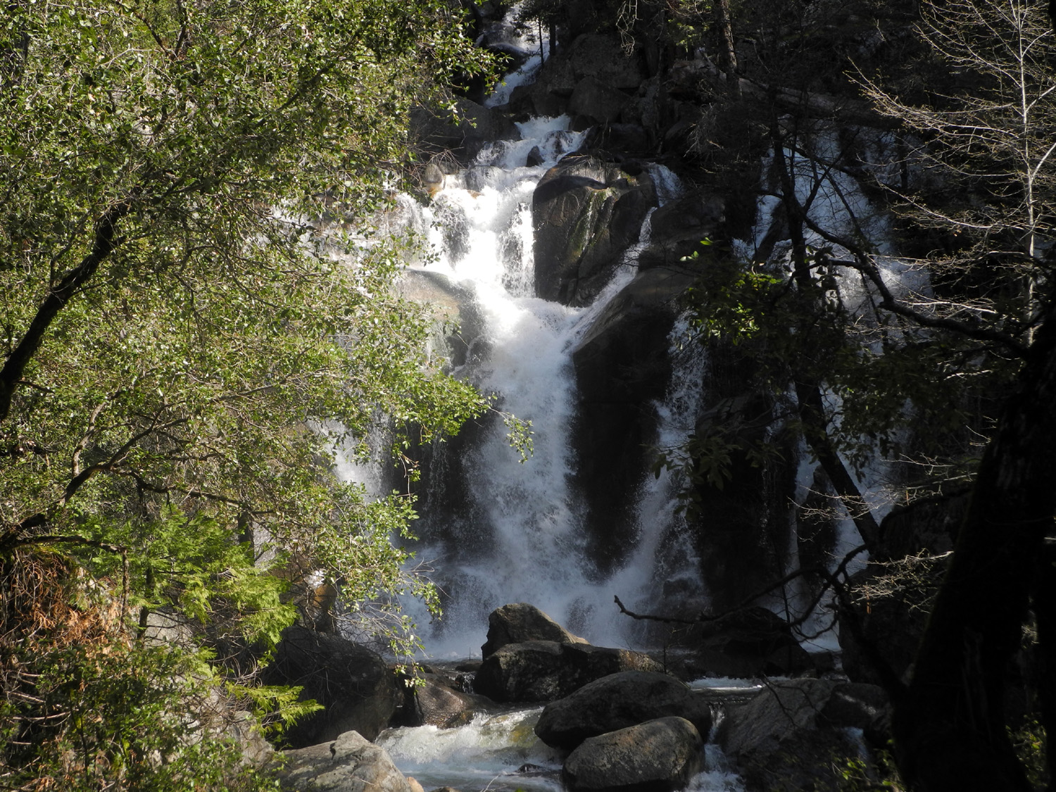
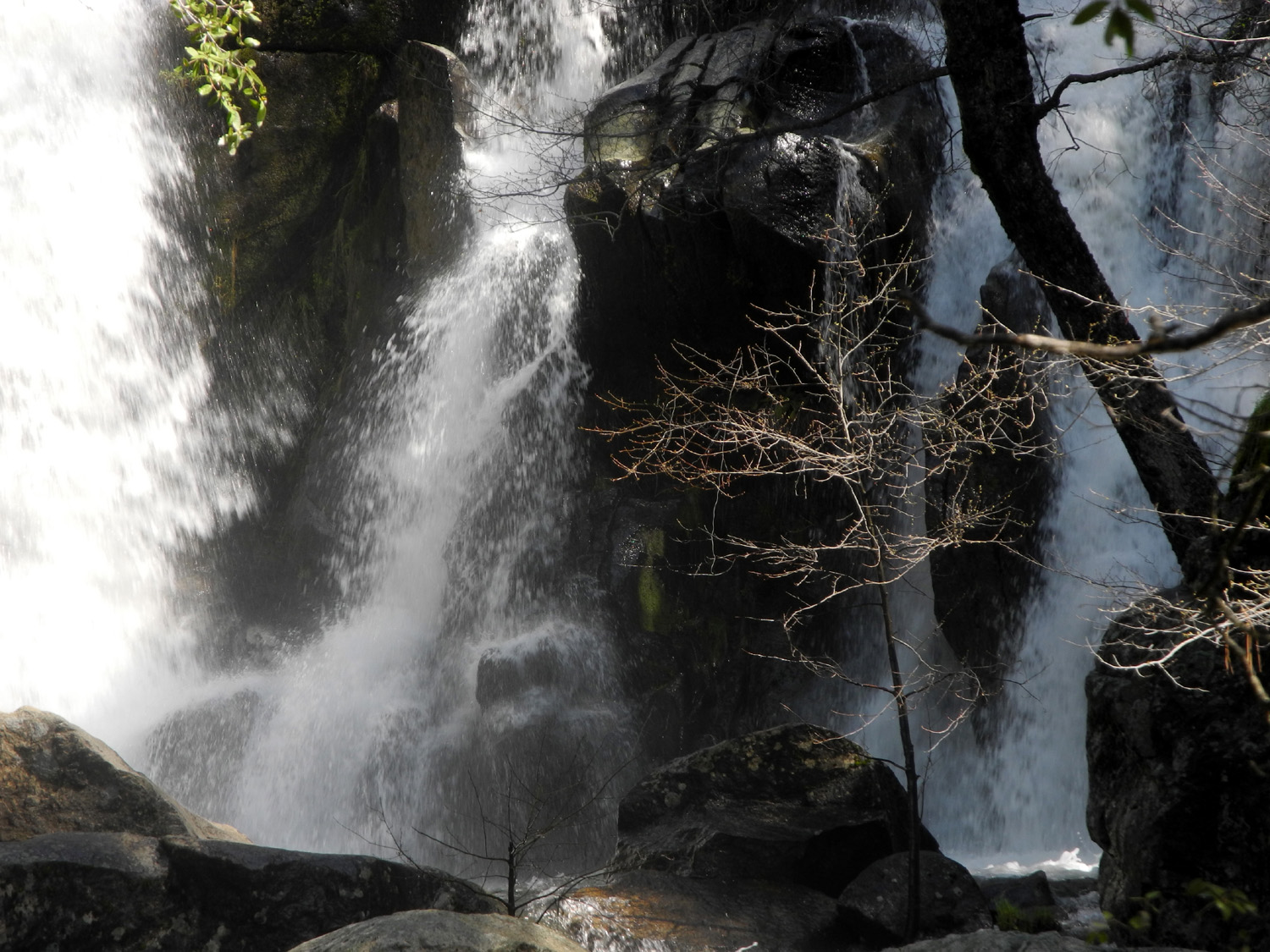
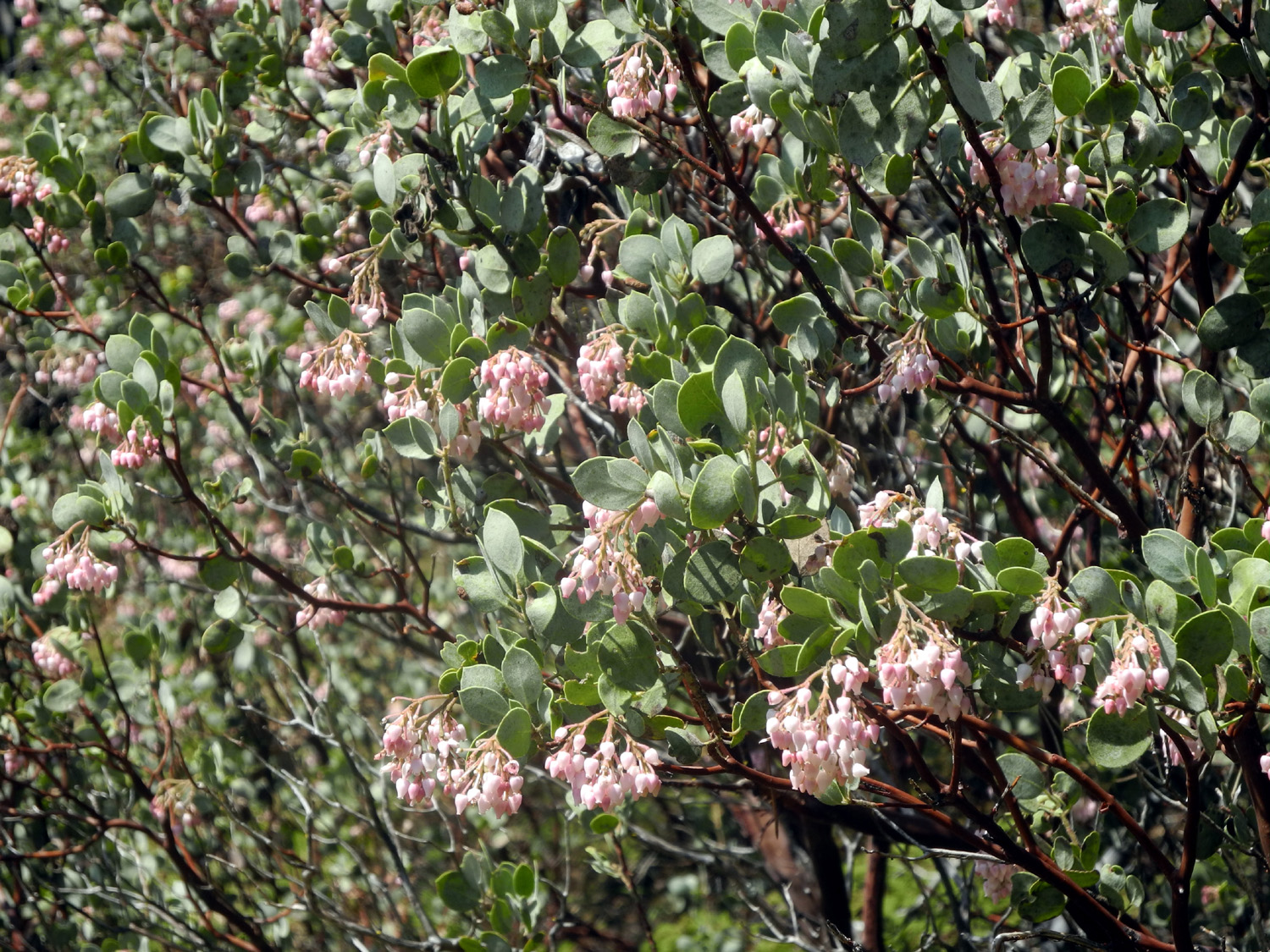
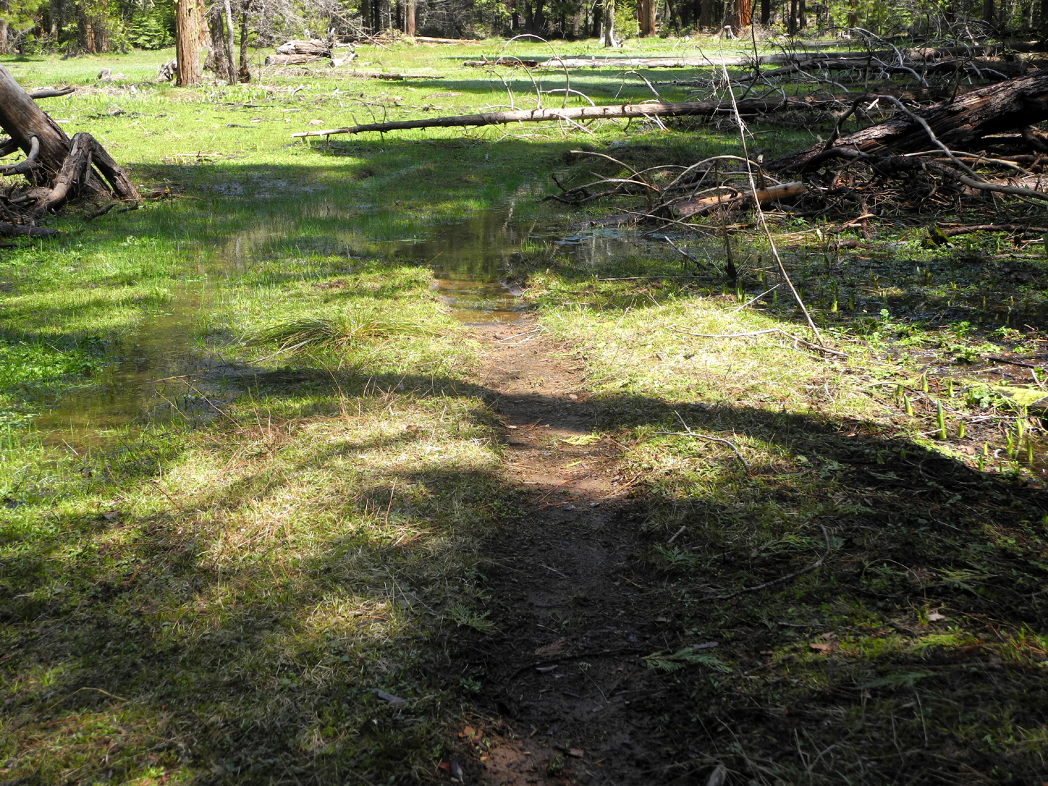
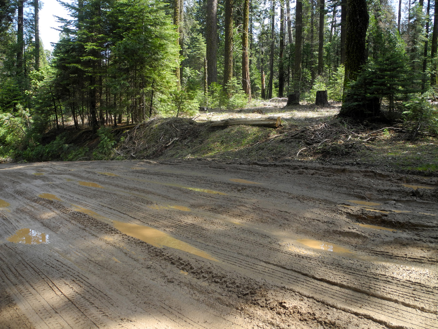
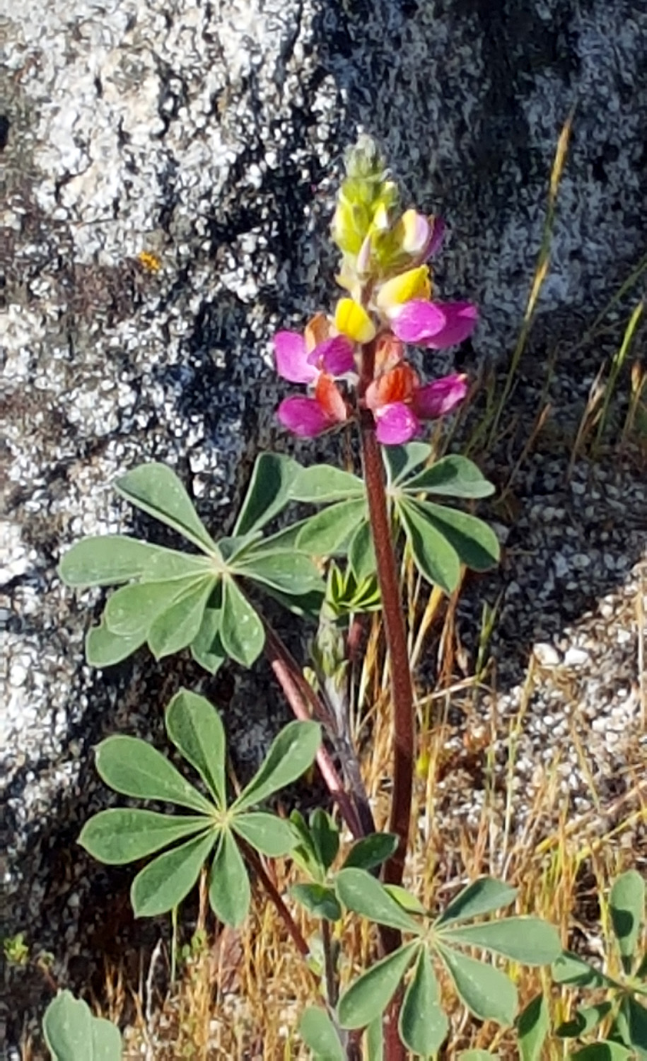
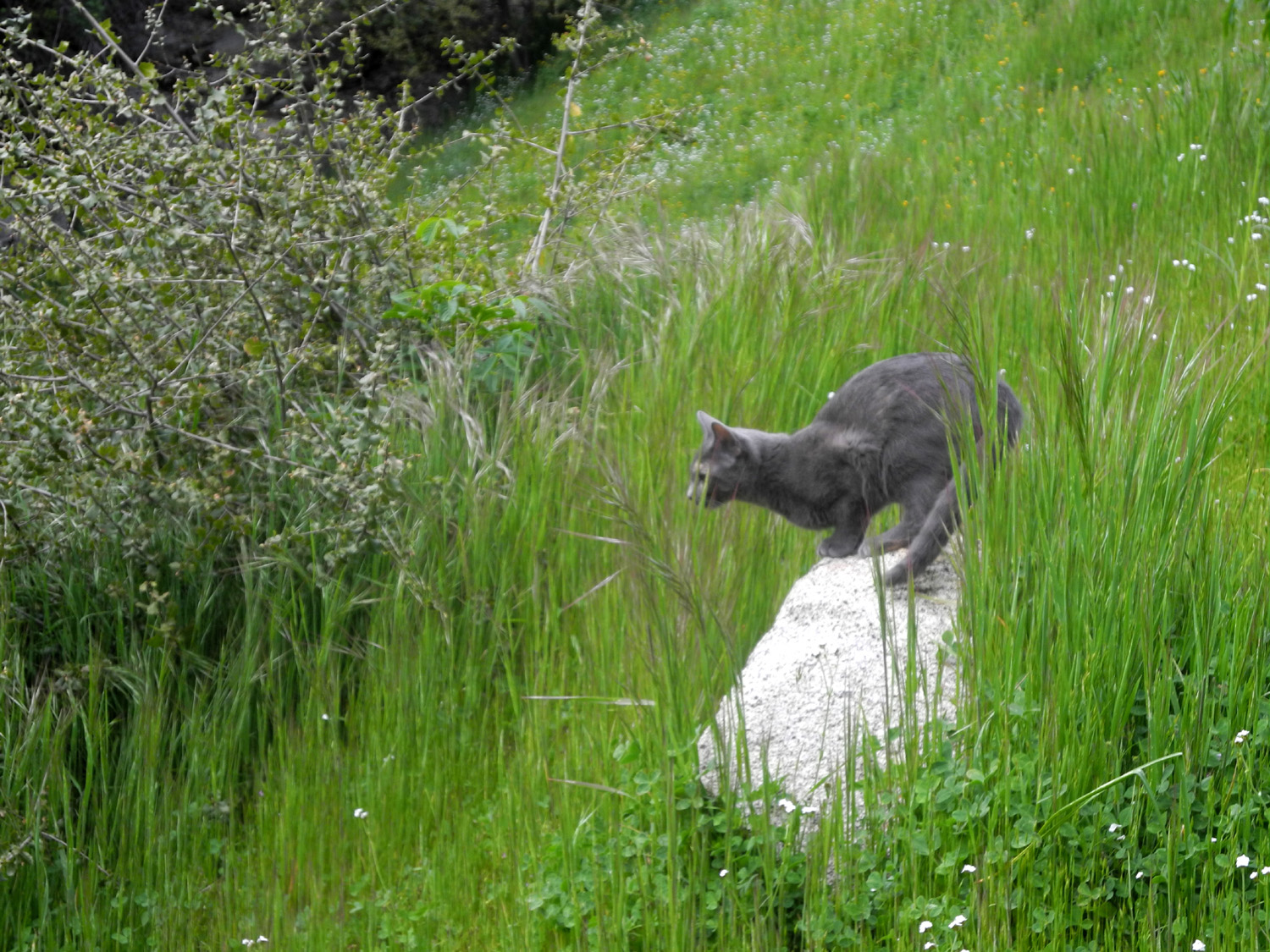
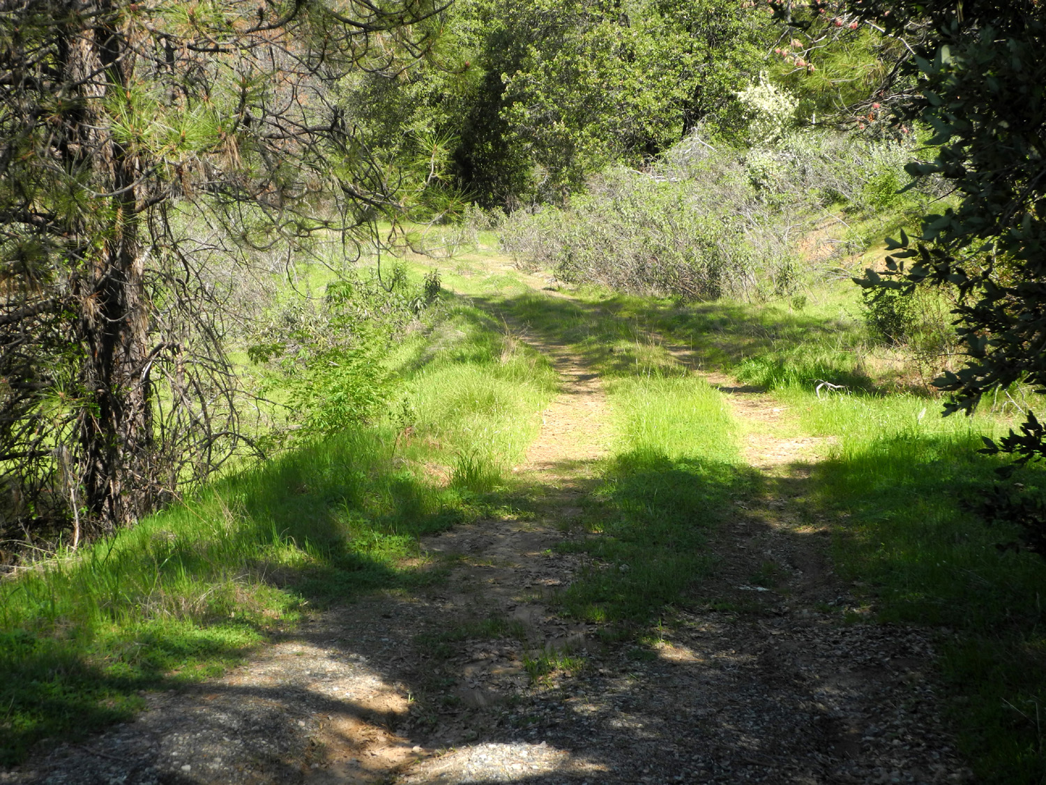
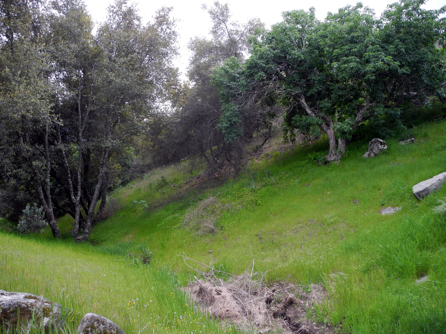
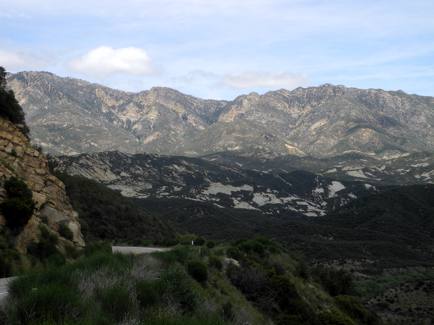
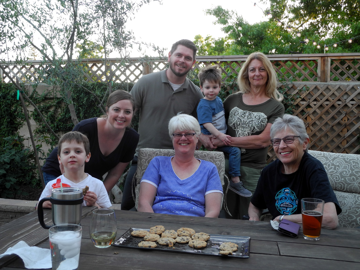
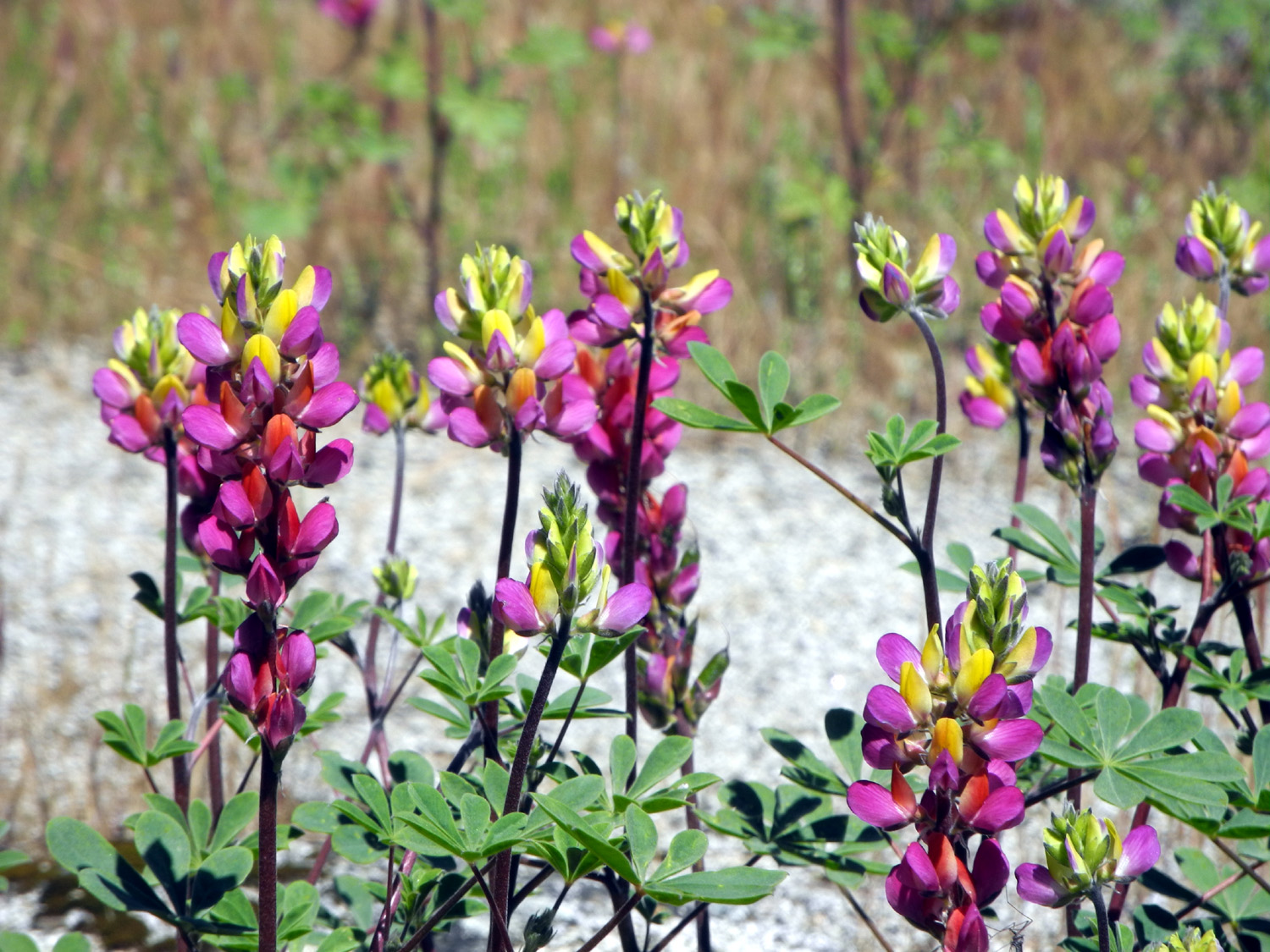
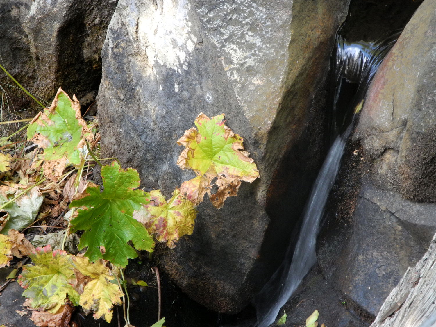
Herding Cats & Hiking There are a few paragraphs before you get to the hiking, but please bear with me. My younger daughter Jennifer is a teacher, and she and husband Rod like to go to Tahoe during spring break. They have four cats that need a baby sitter during these trips. For many years Rod's brother Ron handled this duty, but he retired last year, and my other daughter Teri and I have taken over. One of the perks of this job is staying at their house, on five acres north of Oakhurst. This means we are half way to Yosemite, and very close to other hiking and recreation areas. When Teri was there last year, she hiked one day with her mother and the next day with me. This time any hiking I did would be solo. I had a computer club meeting Sunday morning, April 9, and left from there about 2 p.m. for the hour drive to Rod & Jennifer's. Actually it took longer than an hour, since I stopped for photos a couple of places. The first one was by an ancient dead blue oak along Highway 41 about 25 miles north of Fresno. This tree is a favorite of regular travelers on this route, and has been called the Dinosaur, the Bird and the Dragon by different observers. Several years ago, when Caltrans built passing lanes along this area and put fencing around the tree to protect it, a bunch of uninformed people with computers started a hysterical Facebook campaign to "save" the tree, which was the agency's plan in the first place. This area is the very beginning of the foothills, and with everything still green, gave me some excellent photo opportunities. My other stop was at a big turnout on the grade going down Deadwood Mountain just above Oakhurst. There is a great view from here of the basin where the town is located, as well as parts of the Sierra. The dominating feature seen here is Shuteye Peak, an 8,000 foot dome with a fire lookout on top. There's a four wheel drive road to the top, and I've been up there a few times. When I got to the Neely place, I received a cautious greeting from Jasper, their newest family member. She stayed about six feet away from me for the first hour, then decided I was acceptable. After that I could pet her, pick her up, and carry her around any time I wanted. Things were not as friendly with the other two indoor-outdoor cats, Pebbles and Bam Bam. In the two years or so they've been part of the household, I have never been able to pet them, and rarely see them. Bam Bam ventured out from under the bed, watched me from ten feet away, and beat a hasty retreat when I took a step toward him. The fourth cat, Hombre, the "old man" of the group, has known me for years, and will accept petting if he's in the mood. He lives outside (with garage access) due to a bad habit of spraying in the house. There is also another "visitor" cat, Garfield, who is a bully and skittish, but not shy about eating available food. The big challenge with this job is to try and get the three indoor-outdoor cats inside for the night, although they have all spent nights outdoors in the past. I thought I would accomplish this when Pebbles came to the door, but would not come in. I had just set down the plate of wet food the cats get every evening, and it was obvious she wanted her share. I devised a fool-proof plan to get her in. I would disappear from sight through the kitchen, out through the garage, come around the patio and close the sliding door while she was enjoying supper. Unfortunately she had other ideas, and as soon as she realized I was approaching the patio door, she ran out, accompanied by Bam Bam. Neither of them came inside again the entire three days I was there. However, they still got fed. The dry food dish in the garage is kept supplied for Hombre, and the others are known to dine there sometimes. Rod and Jen normally put any leftover wet food outside at night, and whoever comes by can eat it. Hopefully Pebbles and Bam Bam got most of it during my stay. So where's the hiking, you may ask? I had already decided that I would definitely go to Corlieu Falls, on the Lewis Creek Trail, a place I have written about several times previously. The trail starts on Highway 41 about five miles past Road 620 (the turnoff to Jennifer's), so a short drive for me this time. A few hundred yards in, the trail divides and goes north to another, smaller falls and eventually to the community of Sugar Pine, while the other fork goes downstream past Corlieu Falls and eventually into Cedar Valley, another small mountain residential area. The distance from road to the falls is only about a quarter mile, but the trail is very steep in places, and mature hikers such as myself are well advised to use poles. I arrived at the trailhead around 9:40 a.m., the first car at the trailhead, although another vehicle arrived before I got on the trail. The falls is a series of cascades, between 80 and 100 feet high, and with the heavy rain and snow this year, it is roaring. The trail is lined with big cedar and ponderosa pine trees, as well as live oaks and many other smaller trees and bushes. There were a few flowers, but the big attraction here is the water. After enjoying the falls and taking photos from the viewing platform, I continued down to where the trail and creek start a gentle descent toward the ocean, and walked maybe a quarter mile or so. By this time other hikers had come down the trail, and as I passed the falls on my way out, two groups arrived, totaling at least 25 people. It was time to head for a less populated area. I drove back down Highway 41 and turned east on Sky Ranch Road, barely a half mile from Road 620. This is the route to Nelder Grove, and my plan was to drive on this paved road to the dirt road that goes toward Nelder, and go as far as seemed wise, considering the possibility of muddy spots. After a short distance this road crosses California Creek, probably about two miles downstream from where it runs through the Nelder Grove Campground. This is where Teri and I camped in November. I was barely off the pavement when I came to a very wet, muddy section, and usually this means there is worse ahead, so I turned around and parked at the road junction. I walked down an old logging road that Teri and I had walked on, and eventually made my way over to the creek where the water goes over a small falls. It was just a gentle stream in November, but this time I was delighted to see that it had become a roaring cascade. There were several small patches of snow in this area. I started following the route upstream toward our camp site, but was soon stopped by an endless series of marshy areas, where water was running out from a meadow. When I backtracked and followed the trail that we had walked on coming out of the meadow previously, it disappeared into several inches of water. I turned around once again, and made my way back to the car on the old logging road. Although I could not get everywhere I had wanted, I was well-satisfied with this second adventure of the day. I had intended to hike again the next day, but it was very cold and windy in the morning, so I ended up staying around the property. I did do quite a bit of walking, exploring parts of their five acre plot that I had never been on before. When they first moved in, Rod built a rough trail that goes in a loop around part of the property, and I walked on that several times. I also explored "The Drainage." The property, like most of the foothills, did not have any level spots, so a building pad was bulldozed out, creating a steep hill just west of the house. Runoff from higher up had created a drainage below this spot, which is now a typical foothill landscape of brush, wildflowers, and trees. Although they have been there since about 2005, I had never gone down in the drainage until a few weeks earlier, when I went with grandson Johnny and great grandson Colton. At that time I did not really explore the area, so in between cat monitoring duties, I made my way down several times. It's steep enough that I made sure to take my hiking poles, and I went downstream as far as I could go without crawling through brush, then back up and out the other side, a climb almost as steep. On one of these excursions, Jasper accompanied me the entire way. Eventually I discovered a place along the trail where it was just a very short hike down to the bottom, and went in that way twice. About a mile down Road 620 from their driveway, a private paved road goes up the hill to a place that was subdivided several years ago, but never sold. There is a paved turnaround that is becoming overgrown with Yerba Santa, which has the ability to push right up through the asphalt. From here an old dirt road goes steeply up the mountain and loops around. I had ridden with Rod and Jen on this road in their Jeep years ago, but had never walked it, so I made the short hike up and down that area for the first time. It's a very attractive spot, with some big manzanita bushes and black oak trees leafing out, and it's a mystery why no one has bought any of the lots there. Perhaps the price was too much. There were many of the usual foothill flowers in the places I walked, including dove lupines, tall blue ground lupines, filaree, blue dicks, popcorn flowers, fiddleneck, manzanita, white thorn, clover, various unknown species, and the rare pink and yellow harlequin lupines, which I have seen in only four places over my seven decades of wandering in these hills. Both live oak and black oak were covered with their blossoms, known as catkins, thicker than I have ever seen them. When I was not hiking, exploring, herding cats or sleeping, I was eating - sometimes at the house and sometimes at a restaurant in Oakhurst. Rod and Jennifer have typically thanked their cat-sitters with gift certificates to local restaurants, so on Monday I tried Southgate Brewing Company, a fairly new brewpub. I had a very good sandwich, and my annual beer. On Tuesday my destination was Pete's Place, where I have eaten a number of times with the Neely's and with the Ramblers. I normally eat a good, late breakfast, and have my main meal between three and four p.m. When I arrived at Pete's, I found that it was closed. Checking the sign on the wall, I saw that the place closes at 2 p.m. Monday and Tuesday. I decided to stop there on my way home Wednesday afternoon, but again the doors were locked. This time I saw the OTHER sign on the door that listed winter closing time as 2 p.m. Monday through Friday. I was tempted to leave a note pointing out that winter had ended over two weeks earlier, but instead I decided to just head for Clovis and have a later than usual lunch at the Colorado Grill. Although I did not get in as much hiking as I had wanted, I walked just about every place on the property that is accessible, enjoyed seeing flowers, trees leafing out, bushes in bloom, and of course hanging out with my new buddy, Jasper.
|
||
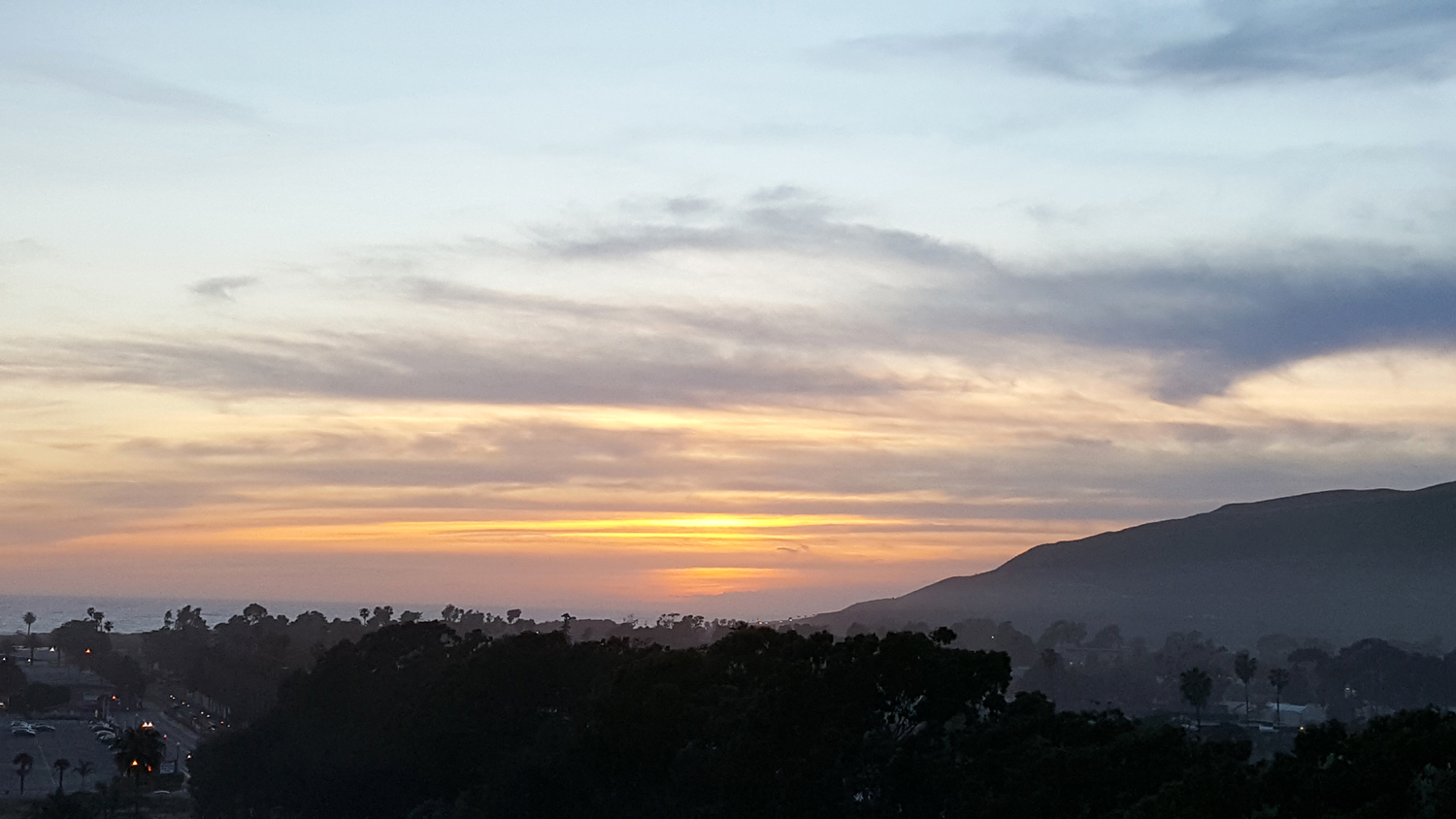
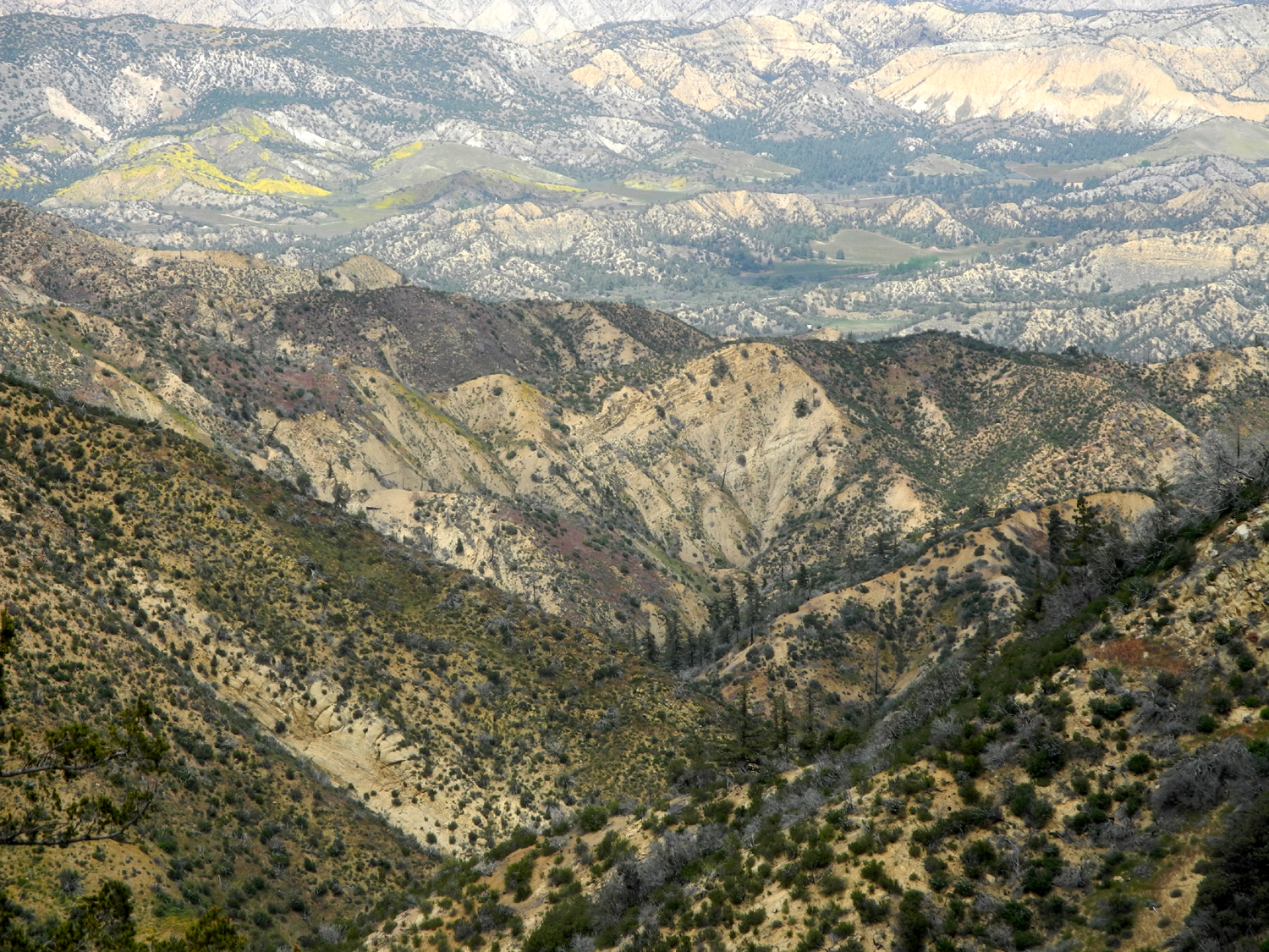
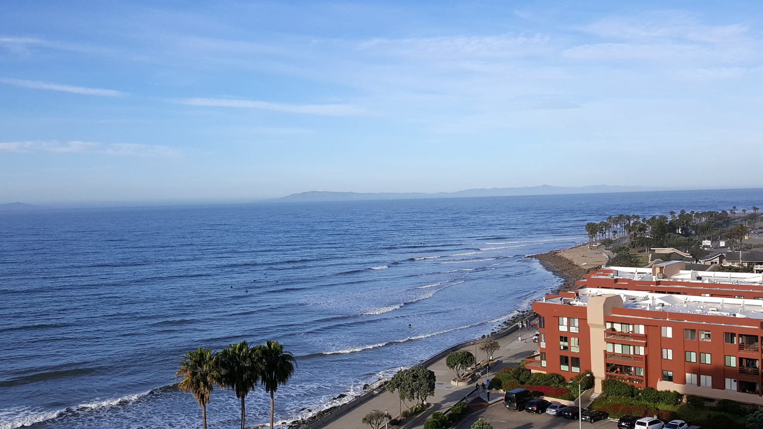
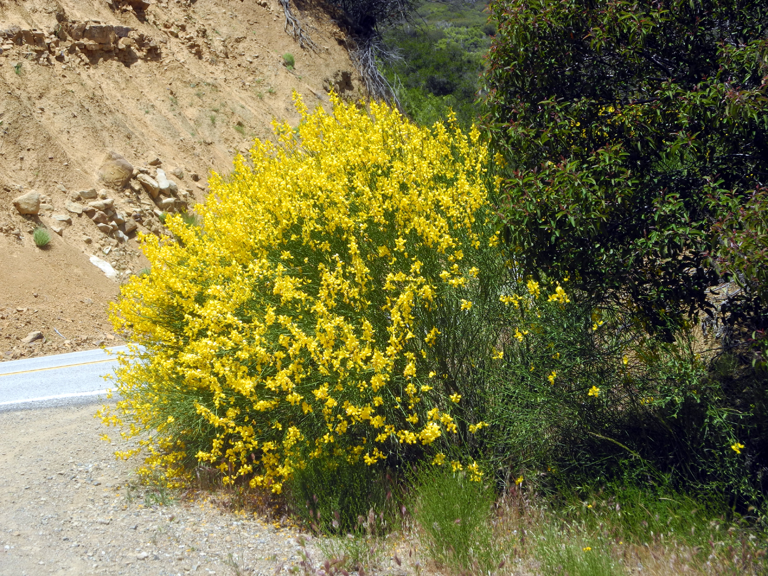
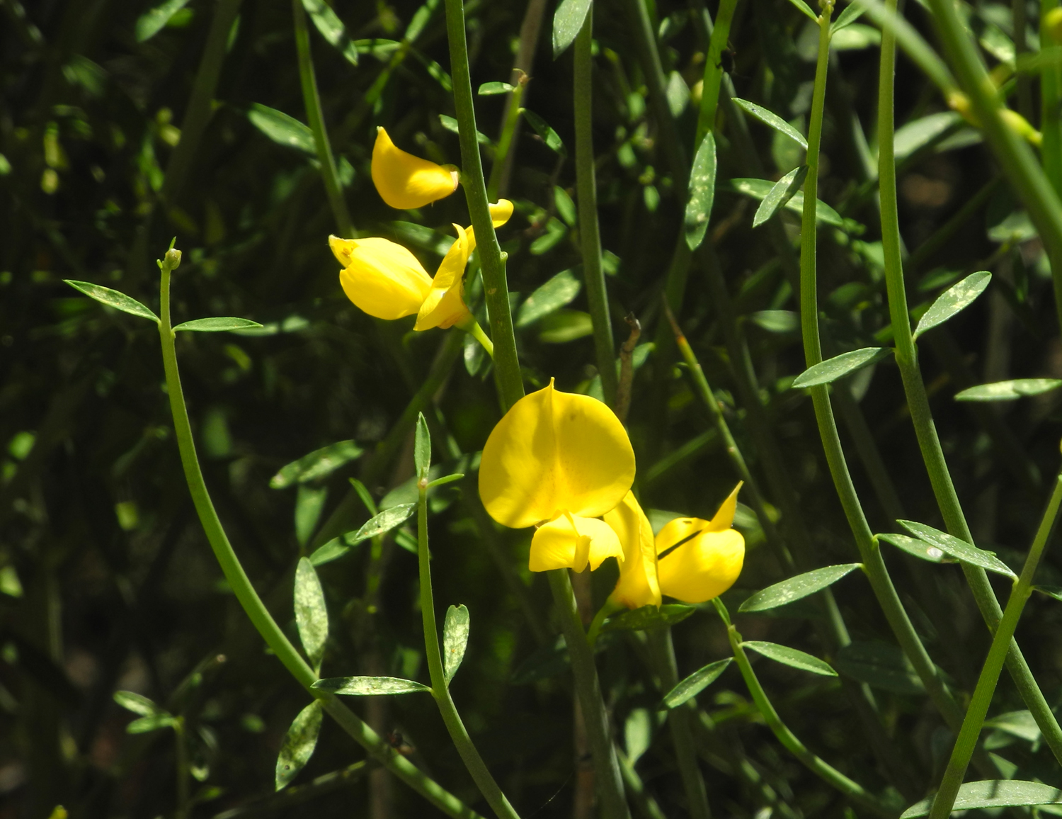
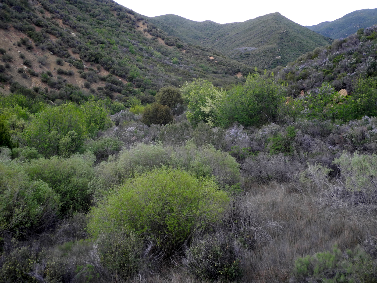
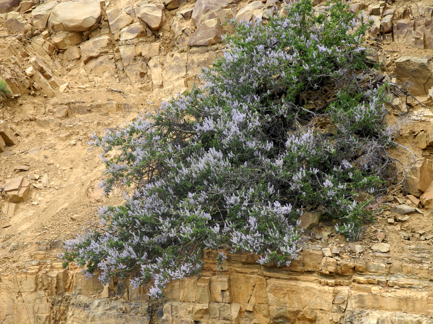
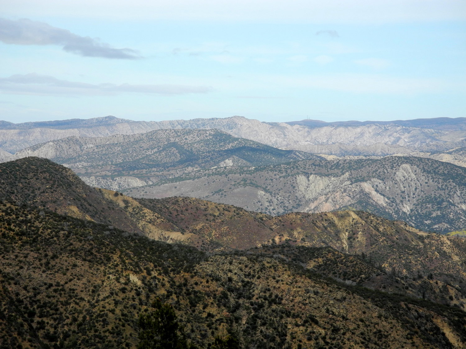
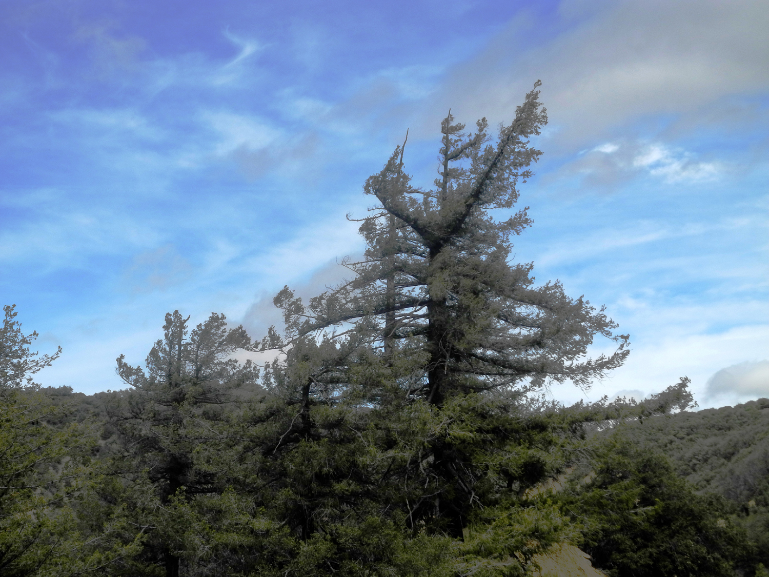
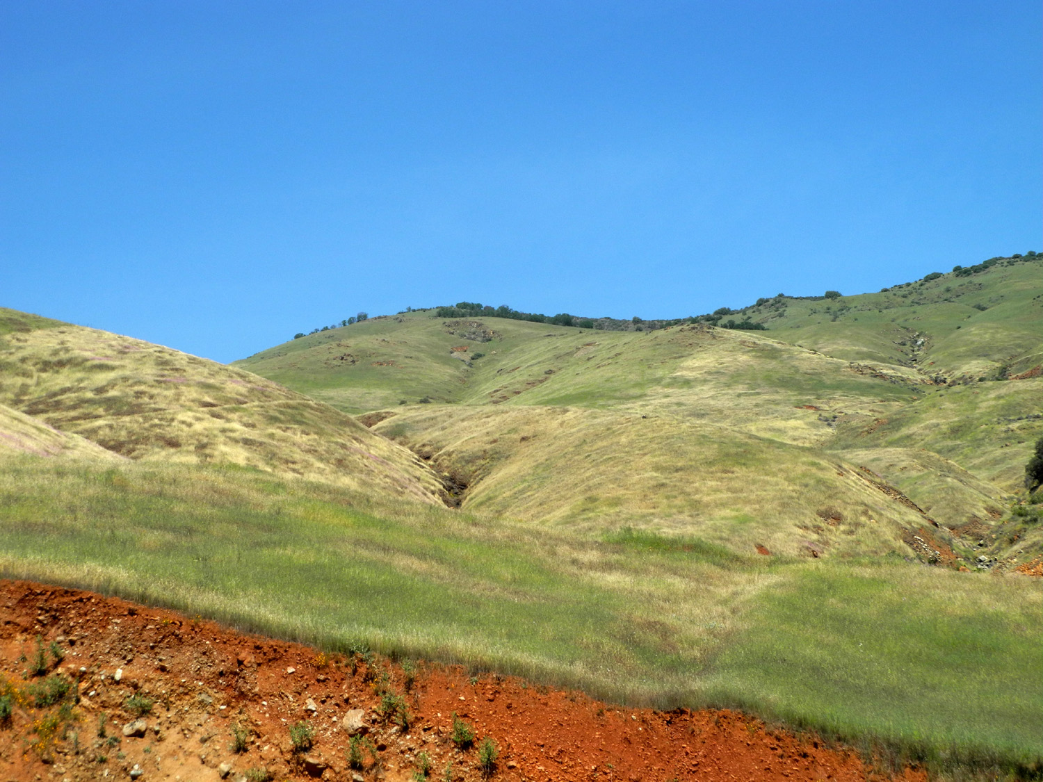
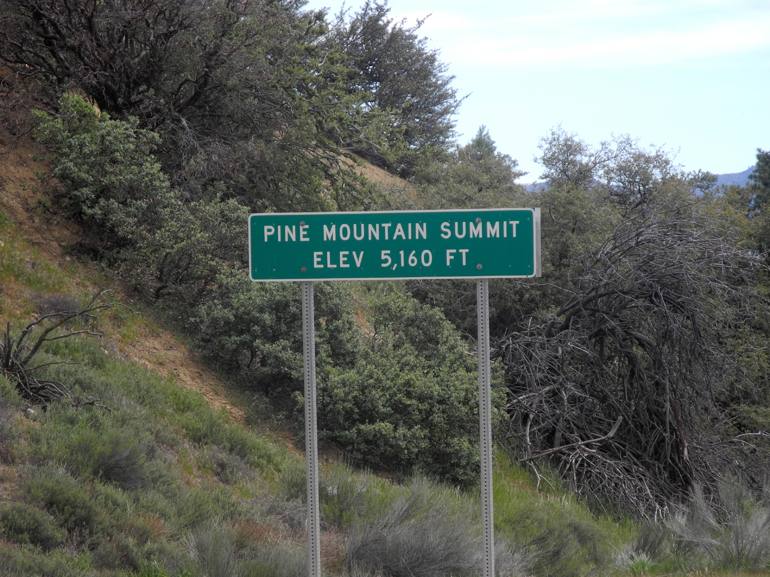
Highway 33 I don't have a lot to say about this trip, but I took some nice photos I'd like to share. On April 24 through 26 I attended a conference in Ventura, representing the Retired Employees of Fresno County (REFCO). My grandparents lived there from around 1940 to 1965, and we made many trips to visit when I was a kid, so I was interested to see how it had changed. But the part I was most looking forward to was driving home up State Highway 33, which runs north from Ventura through the Los Padres National Forest, and comes back into the San Joaquin Valley at the little oil town of Maricopa in western Kern County. I drove down CA 99 and I-5 to Castaic Junction (on the edge of Santa Clarita), then west on State 126. Much of the route across to Ventura is still pretty rural, with citrus and other crops. Two of the towns along the way, Piru and Fillmore, are small, but Santa Paula has grown to 30,000 people or so. Past this point, the road becomes a freeway and merges smoothly into US 101 coming in from the south. The conference was in a hotel right on the beach, and very close to the pier, where we always came when we visited. Now there is a long concrete walkway along the beach, with access by steep stairs in a number of places. It’s easily accessible from the hotel, and I walked along parts of it several times. Wednesday, the last day of the conference, was a short business meeting. I got everything loaded up and checked out before the meeting, and when it ended around 11 a.m., I got back on Route 101 and drove north a short distance to the Highway 33 exit. The first few miles are freeway, but once it leaves the city, it becomes a two-lane route the rest of the way. It passes through the small city of Ojai, population 7,600, and beyond that there's really no development for the next 70 miles. And these are slow, scenic miles, a 90-minute drive according to Google, and longer for someone in sight-seeing mode like me. Before long the road enters a very narrow canyon, Wheeler Gorge. I stopped for a while at a campground by this name, the last outpost of civilization for much of the route. Beyond the campground the road is a series of switchbacks, climbing up steeply, and I was soon up to 3,000 feet, having started my journey about ten feet above the ocean. There are quire a few flowers along the highway, the most common being a bush that ranged from three to eight feet in height, covered with bright yellow flowers. At various places I also saw blue dicks, yucca, lupines, poppies, and lots of the variety of chaparral that has blue blossoms. There are plenty of places to pull off the road, and I made many stops. These mountains are rugged, covered with brush and small plants, and look to be fairly dry. At higher elevations there were a few evergreens that were not familiar to me. These were usually concentrated on the shady side of steep drainages. At the highest point there were a few fairly large trees. Two of my stopping points stood out, the first being an old building whose purpose was not apparent, surrounded by a chain link fence. The second was a rock formation that appeared to be weathered light brown sandstone, and looked as if it could have been transplanted from the Colorado Plateau country of Utah. I also noted a couple of trailheads along the road, something to consider if I run our of places to hike closer to home. I did not see any elevation signs after 3,000 feet, so I was somewhat surprised when I arrived at Pine Mountain Summit and found that I was above 5,100. The view from this point was a jumbled landscape of mountains and canyons, dotted with small bushes and with sections of open rock. When I got out of the car for photos, there was a very strong wind, and it was quite cool. Going north over the pass took me into the Cuyama River watershed, and eventually I dropped down into the valley of the same name, where there were crops and ranching activity. Looking out from the pass, I realized I was still quite a good distance from my lunch stop at Maricopa. I also got a geography lesson on this drive. Starting in Ventura County, I drove across a corner of Santa Barbara County and into San Luis Obispo County. When the road turned east to take me to Maricopa, it entered Kern County somewhere along the way without benefit of a sign. I experienced a wide range of temperatures on this drive - 84 at Wheeler Gorge Camp, below 2,000 feet; 69 at 4,000 feet, 58 at Pine Mountain Summit, and back to 84 at Maricopa. After eating lunch at the Subway in Maricopa, I had planned to follow Highway 33 all the way to the junction with Highway 41, just west of Kettleman City. After a short time, I found myself behind slow farm trucks, and wished I had just gone east to Highway 99, which is freeway all the way. Apparently my GPS felt the same - after a few turns that seemed to be taking me away from 33, I realized that I was approaching 99 about half way between Bakersfield and Delano. From there it was a fast and easy ride back home.
|
||
|
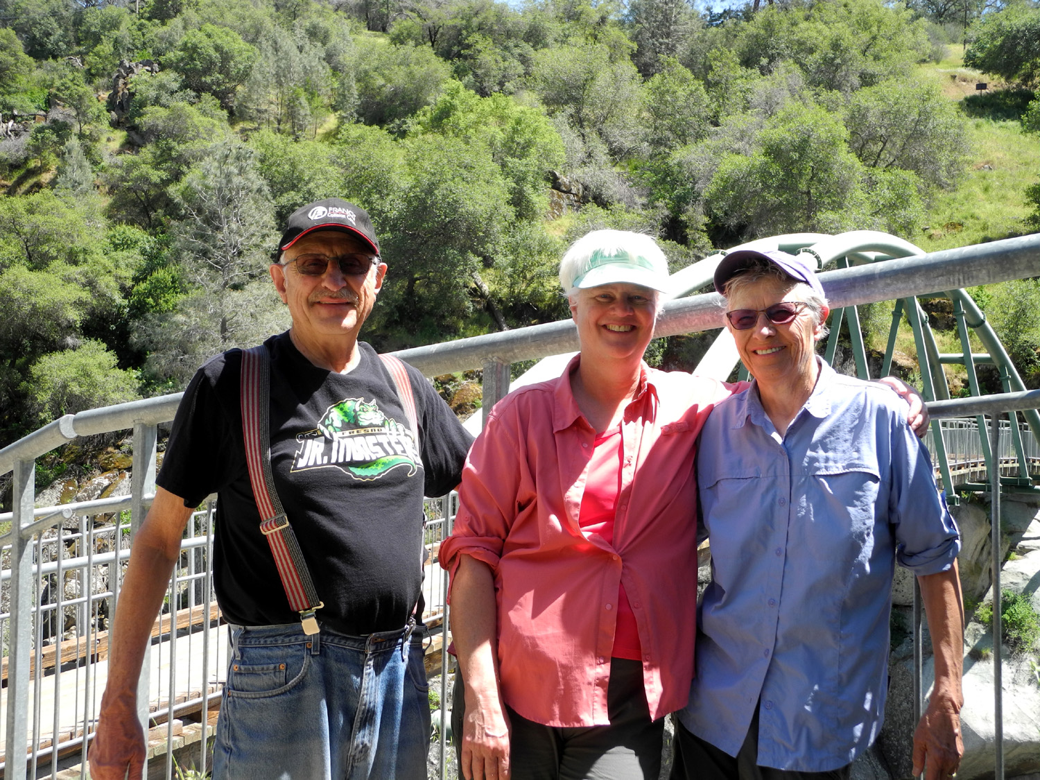
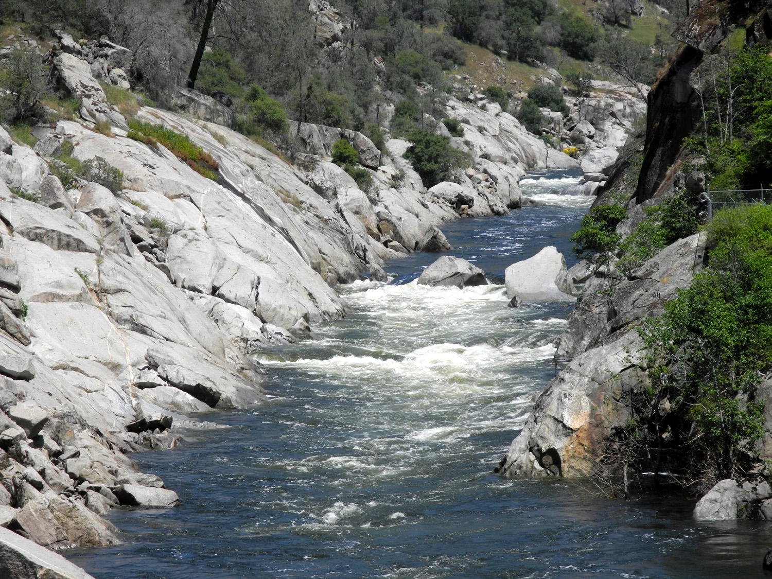
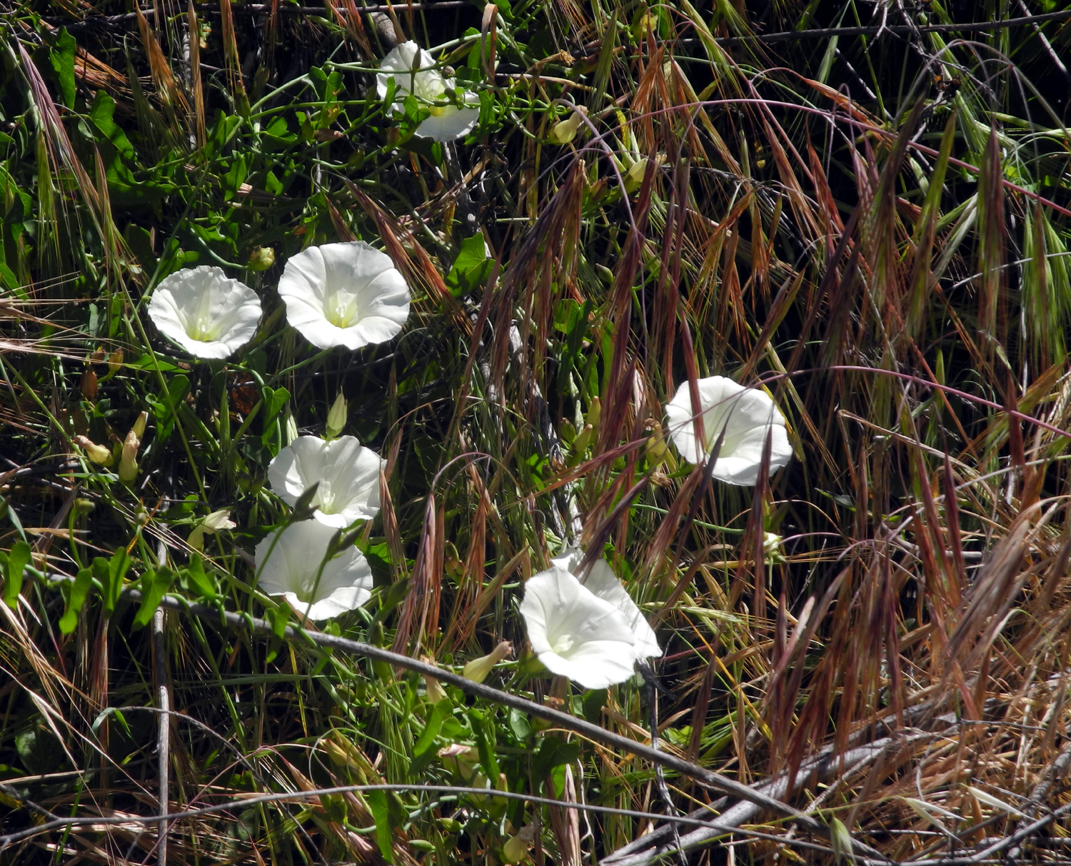
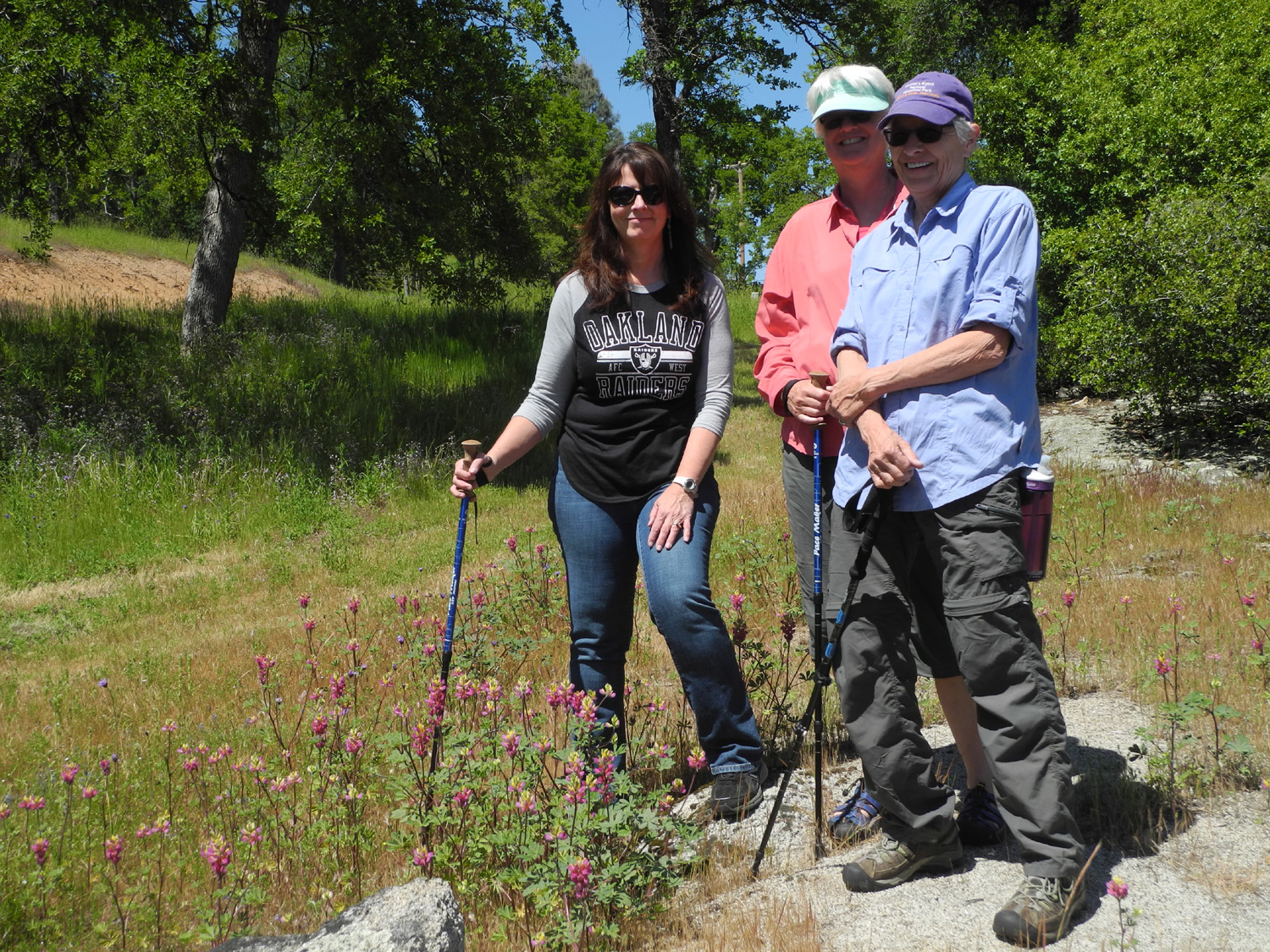
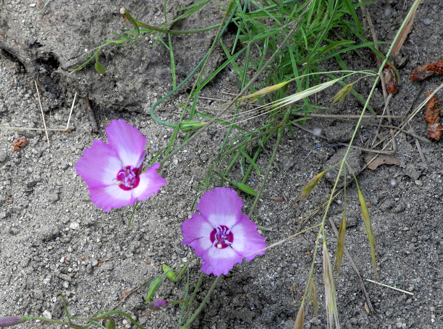
San Joaquin Gorge Bridge with Linda & Anne I've been hoping to go to the San Joaquin Gorge two or three more times this year, but a busy schedule delayed my latest visit until warm weather arrived. I still plan to go again, but I am prepared for it to be hot. My sister, Linda and her wife Anne came from Duluth MN for a visit the last week of April and on the 30th I took them for their first visit to the Gorge. They are not novice hikers by any means, but most of their recent walking was on relatively flat trails in southern Florida, where they spent the winter. Well, they spent OUR winter there; in Duluth there was an ice storm the day after they left, and six inches of snow fell there while we were enjoying a clear, sunny California day. It was a Sunday, so there were a lot of people on the trail, including more bicyclists than usual. The parking lot had one space available when we arrived. The car next to us left, and that spot was immediately taken. We went down the Bridge Trail, which is a little over two miles round trip, mostly down going in, and mostly up coming out. It was warm, but there was a nice breeze much of the time, and the weather was quite pleasant for me; perhaps a bit warmer than residents of northern Minnesota would have preferred. There is still a surprising variety of wildflowers, although very few huge masses. The late-season mustang clover and daisy-like common madia were the dominant blossoms, but some of the very early season flowers still lingered, including popcorn flowers, blue dicks, baby blue eyes, and fiddlenecks. Ground lupines and Chinese houses were getting a good start, and there were purple vetch, birds eye gillia, foothill gillia and yellow-throated gillia. By the trail there was a scattering of farewell-to-spring, but we saw large masses of them on the banks of the road in several places. The pale yellow harvest brodiaea were common along half the trail, and we saw a single purple brodiaea and several climbing brodiaea. Finally, among the rocks just past the bridge were large numbers of yellow poppies. Owl clover is often thick along trails in this location, but we saw only a few plants. Elderberry and buckeye bushes are starting to bloom. Although it is very warm and dry compared to earlier this year, there were still three creeks running across the trail. We rested and had a snack at the bridge, and I walked up the trail another 100 yards or so, looking for a flower that had appeared there two years ago, but they were not in evidence - either too early, too late, or conditions were not right. We had talked about stopping for lunch at Velasco's in Prather on our way home, but we got a better offer - a taco dinner at my daughter Teri's house. We had all got together at grandson Johnny's on Friday, then on Saturday Teri went with us to daughter Jennifer's place in Oakhurst, so just about everyone in the family got to see each other. Linda and Anne were heading for Yosemite and Mariposa the next day, then back to San Francisco for their flight home, hopefully taking some of our warm weather with them.
|
||
|
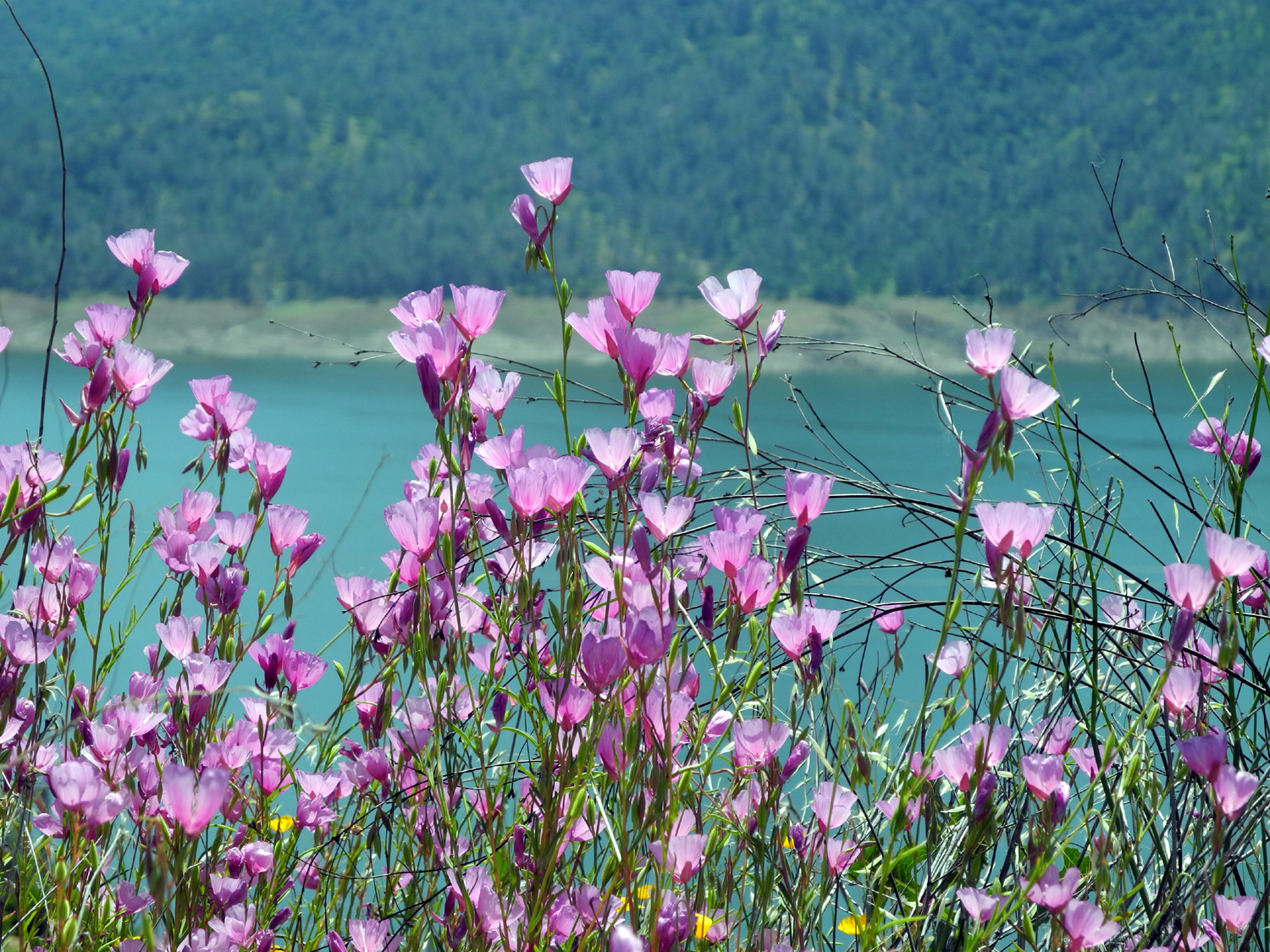
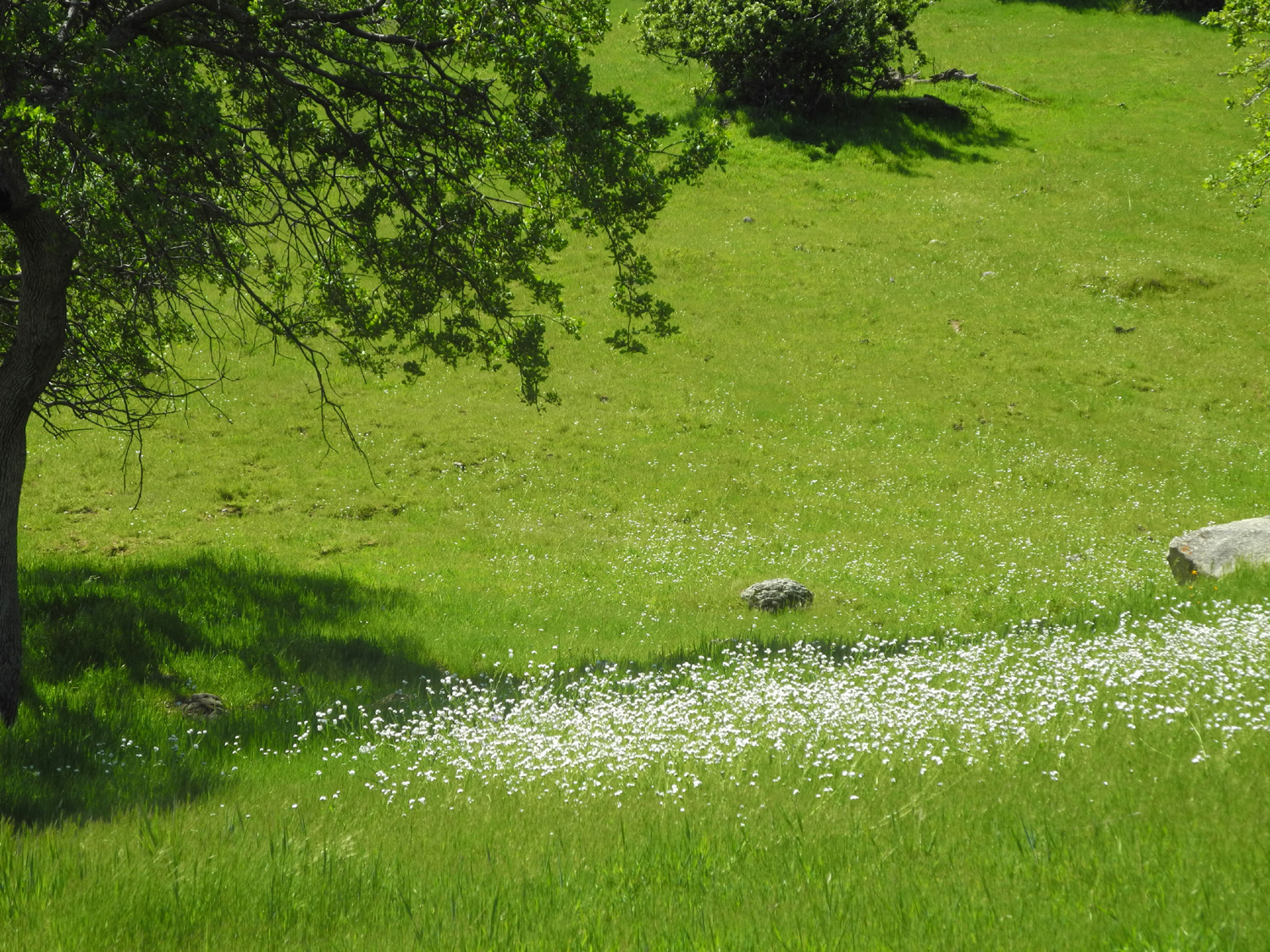
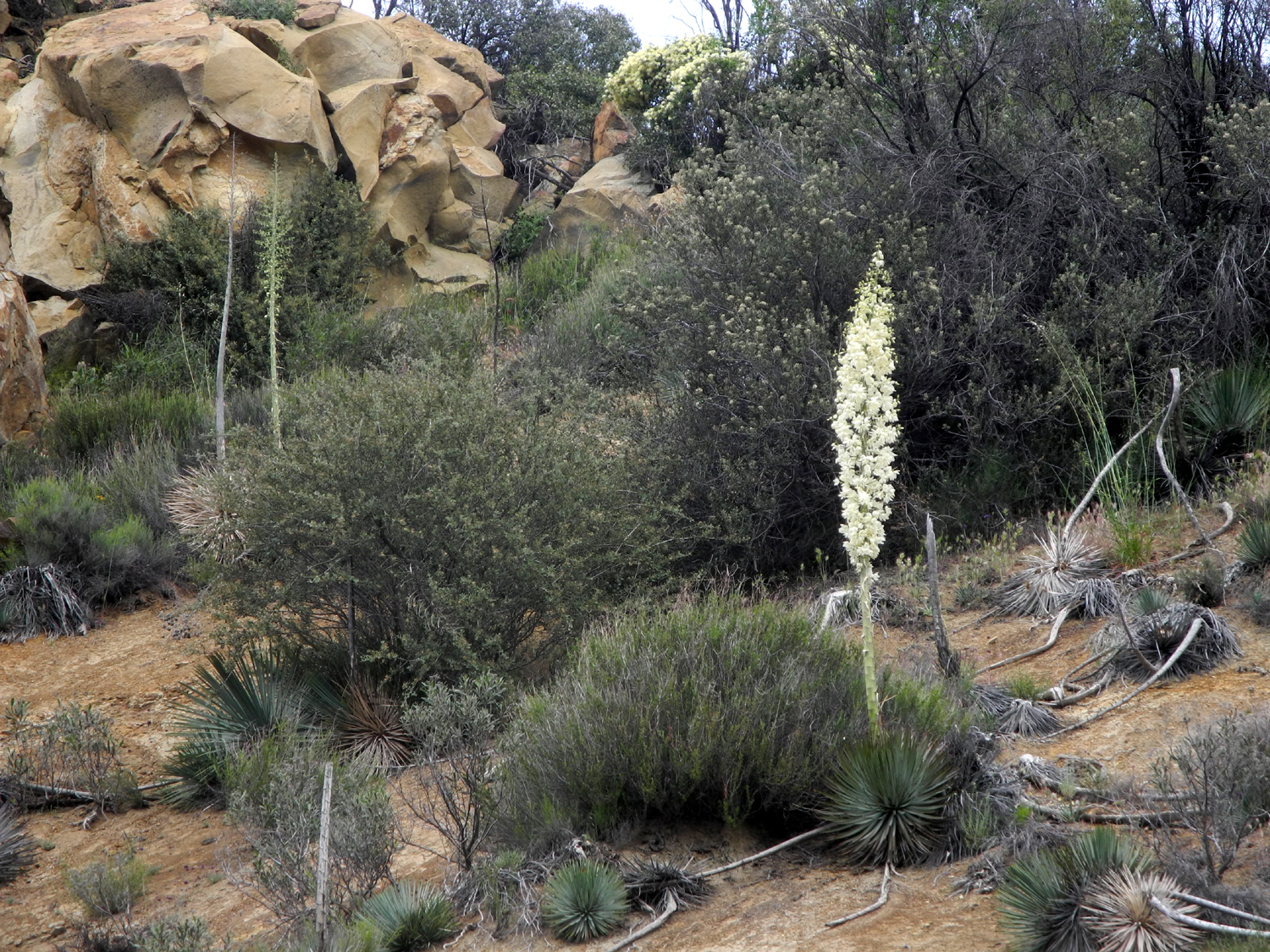
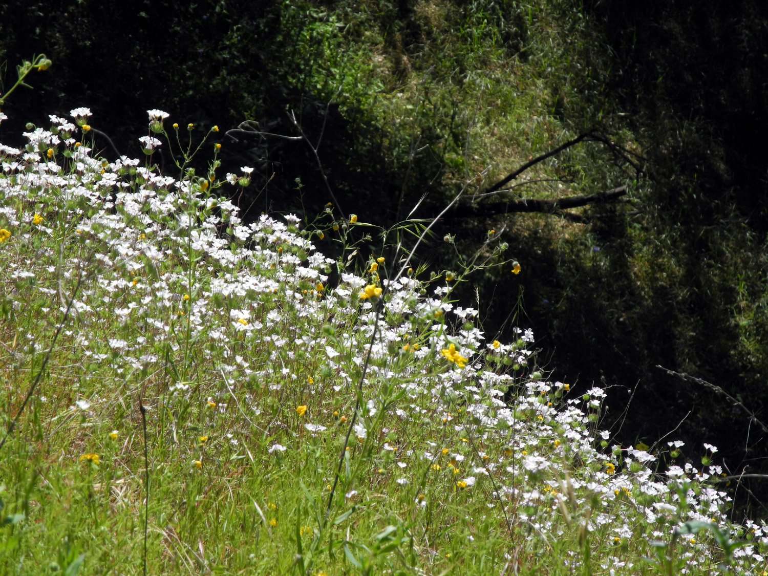
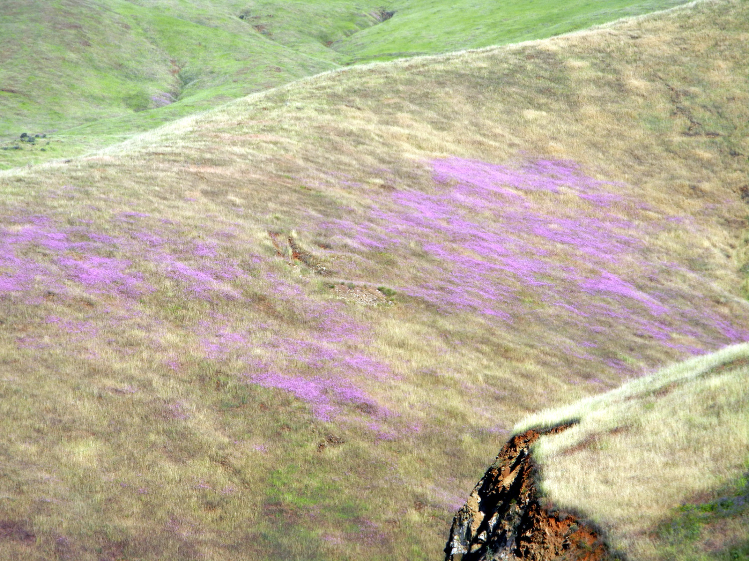
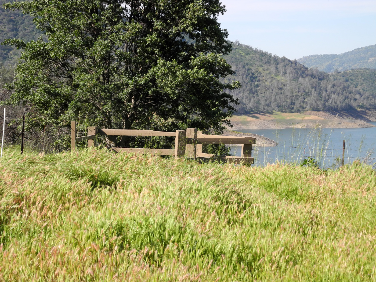
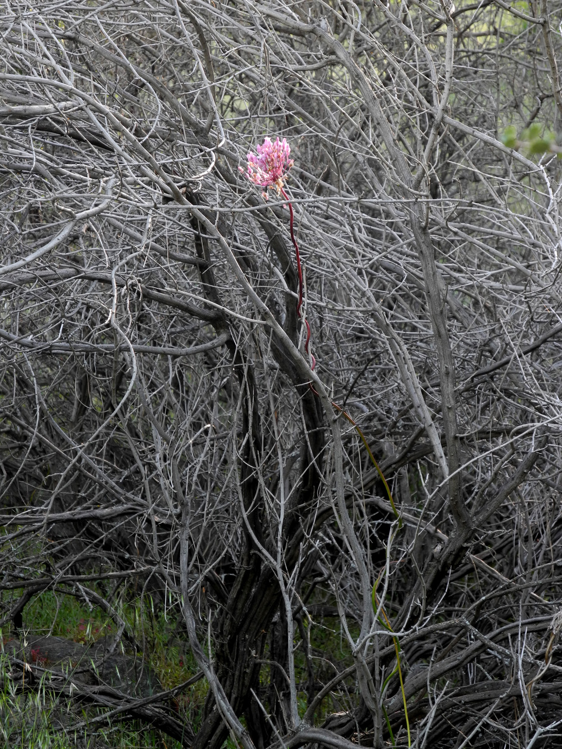
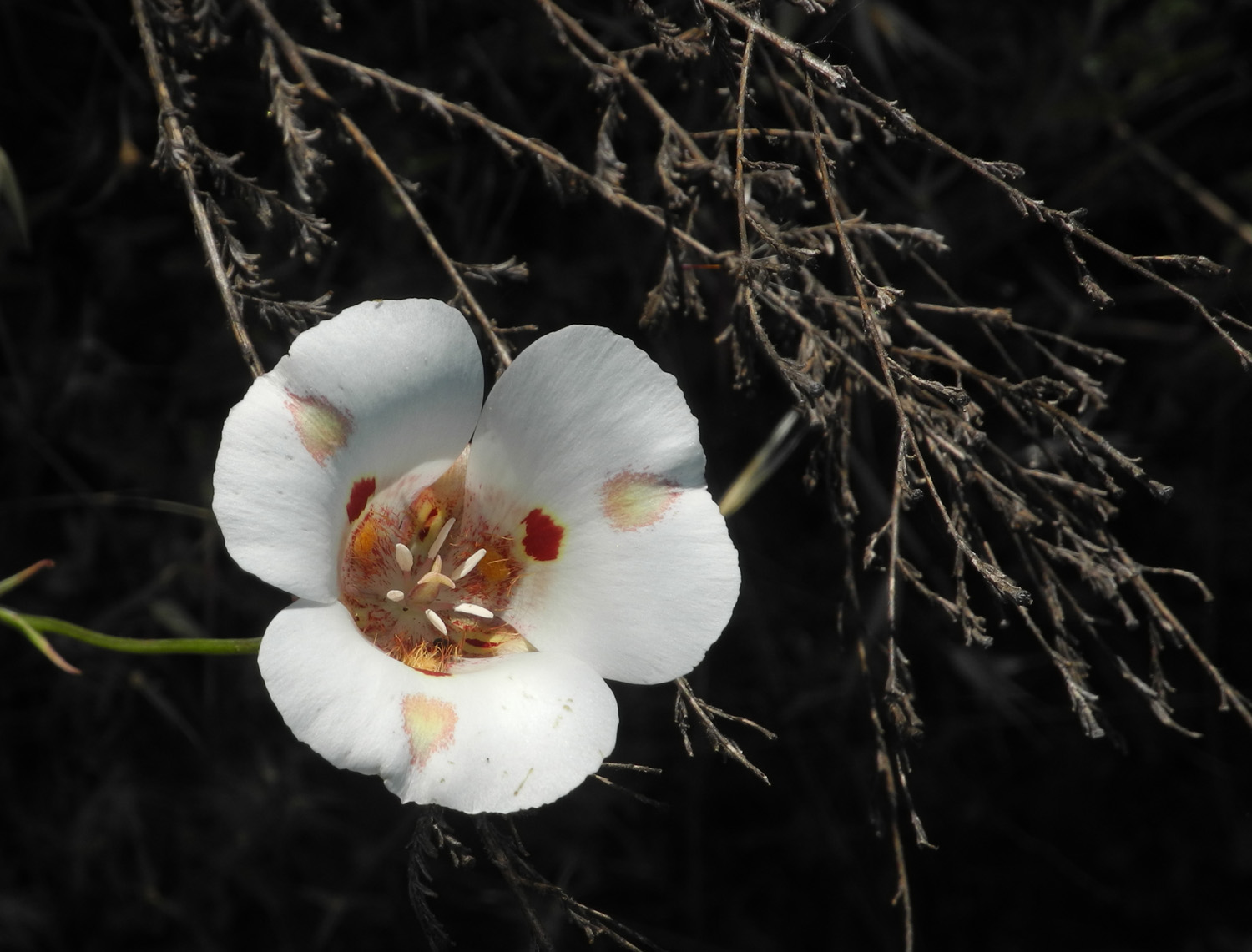
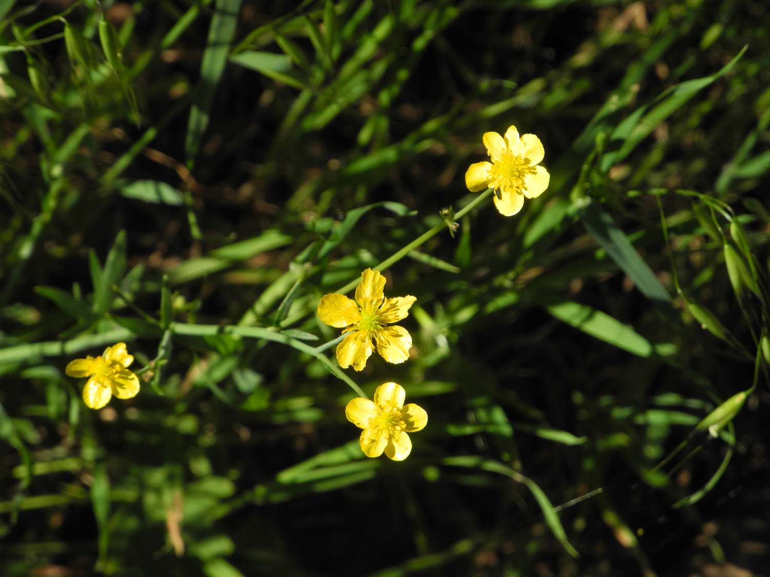
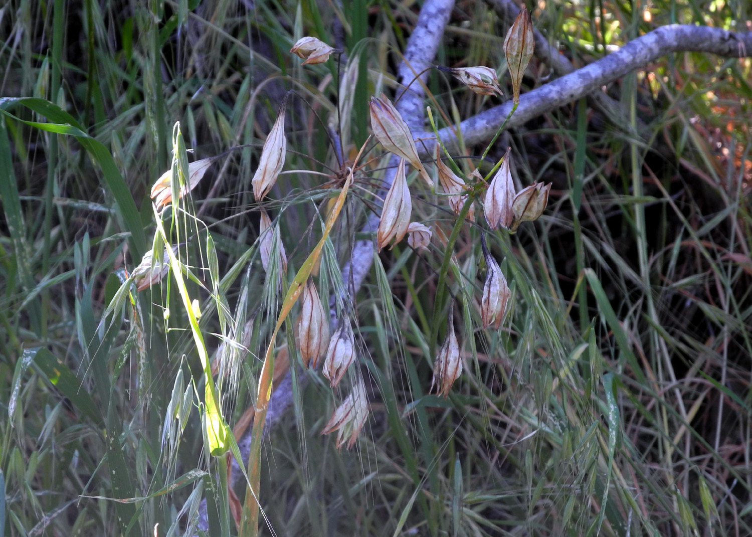
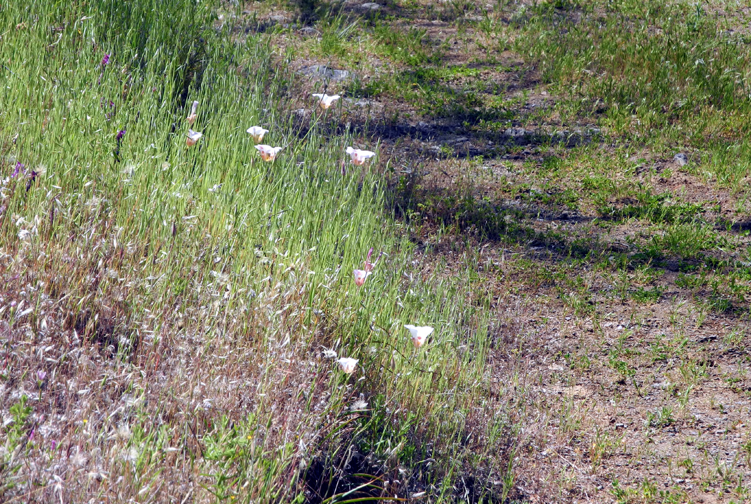
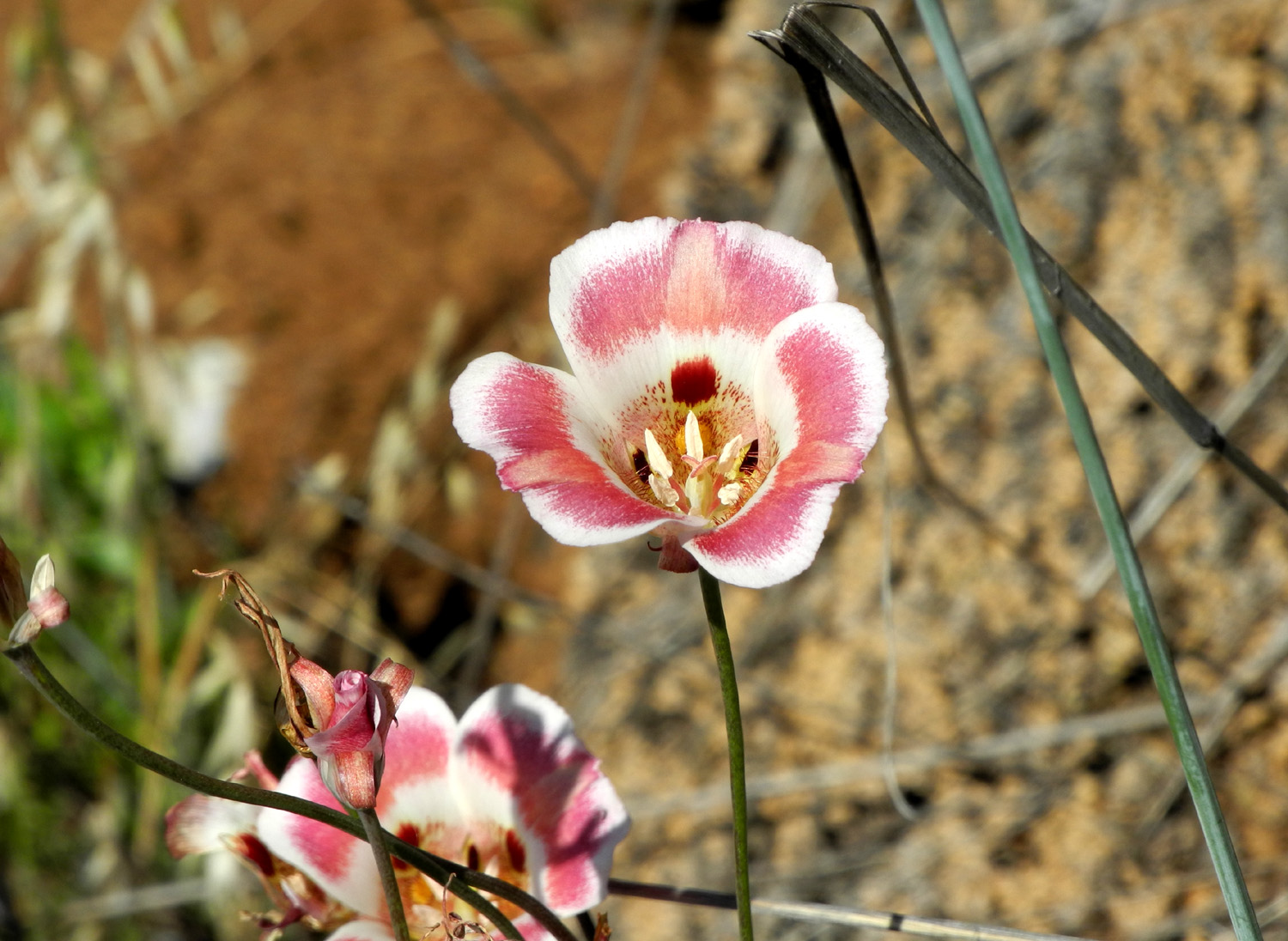
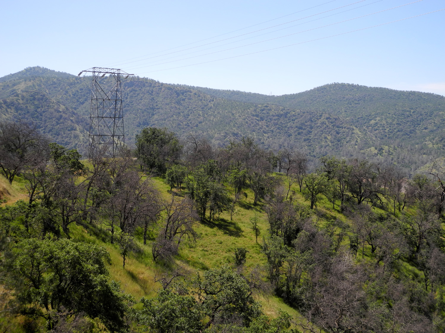
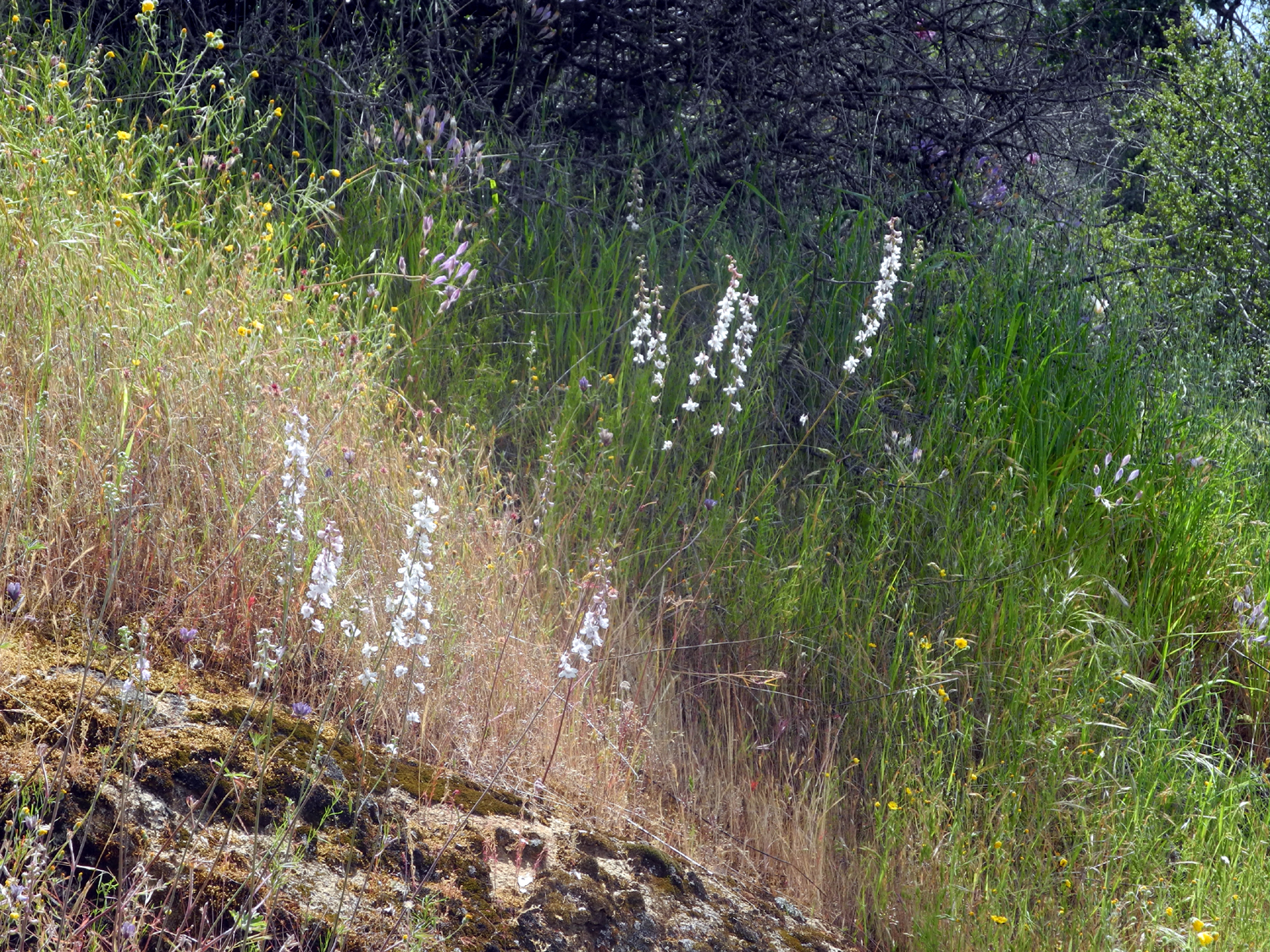
Edison Point Trail With spring rapidly turning to summer, based not on the calendar, but rather on weather, I've been trying to schedule one more hike at several of my favorite foothill areas. One of these was the Edison Point Trail at Pine Flat Reservoir, a place I've hiked and written about several times, and this was my destination on May 2. With temperatures at home pushing up toward 90, I knew that it would be warm and probably fairly dry at this location, less than 1,000 feet in elevation. Therefore I was glad to see that there was still a lot of green grass along the road as I got near the lake. On the eastern slope of the hills along this route, the grass was decorated with hundreds of yellow daisy-like flowers, probably common madia. Once I got by the lake, there were some good patches of pink color on the steep hillsides and on the road bank, created by a very good bloom of farewell-to-spring. This flower does not care that calendar spring started only ten days earlier. Although it is not very long, the full Edison Point loop trail is fairly challenging, and I was pretty sure it would be even more so this year due to heavy rains. Therefore I planned to hike in the "wrong" way, or counter clockwise, hoping to see the thick stands of purple brodiaea that had been so spectacular the previous two years, and then retrace my steps. It was immediately clear that my concerns about the trail were well-founded. It is badly overgrown, and it was hard to find where it went in places. During the wet season, cows had walked on the trail, creating deep, lumpy sections that were difficult to hike on. And of course, there were the bull pines. When we hiked this trail in the past, we had to struggle up the steep slope then back down to get around several pines that had fallen across the trail. This time there were two or three new deadfalls to challenge my hiking skills. However, as always I was undaunted, and soon reached the shady drainages were the brodiaea were thick in the past. They were indeed there this year - but every single plant had gone to seed. However, there are always flowers, and the best and biggest display on this hike were the Mariposa lilies, one of nature's finest floral designs. There were dozens and dozens along the trail where I walked, and more to come later. Purple vetch was thick in spots, and I saw one faded blossom on a yellow brodiaea plant and a couple of buttercup flowers. As on other recent hikes, some of the earliest flowers continue to have a presence, including fiddlenecks, filaree, and poppies. There was also a spot with quite a few climbing brodiaea, a vine-like variety of this species that twists around grass, brush and each other, with stems that can be five or six feet in length. Despite the poor condition of the trail, I reached my intended goal, the upper bench. not to be confused with a bench near the water line in the middle of the loop. The bench had fiddlenecks, purple vetch, phecelia and grass growing up through the mesh seat, making sort of a natural cushion, so I rested there and enjoyed views of the lake and the many foothill trees, looking healthy after getting well watered in January and February. The round trip distance to this spot was barely three quarters of a mile, and on the way out I started thinking about where I could go for another short hike. Once I got back to the trailhead, my brain began to function properly, and I realized I could just walk in on the other end of the trail (clockwise), and go the half mile out to Edison Point itself, walking on the dirt service road that provides access to the power transmission line that runs along the lake. I got out my chair, ate an orange and rested, then began part two of the day's hike. This section is easy and short, and goes about a half mile to a point where you can see the lake on three sides. There's an electrical transmission tower there, and a cluster of oak trees with some rocks underneath, providing a shady place to sit and rest. Once I ventured off the road to the knoll, I was again walking through tall grass. As I approached my chosen sitting rock, I poked into the grass all around it with a hiking pole, just to alert any rattlesnakes of my presence. I sat there and ate my peanut butter sandwich, enjoying the view and a cool breeze. Once again the frequent flowers in this section of the trail were Mariposa lilies. There were literally hundreds of them peeking up above the grass on both sides of the road. As far as I can recall, I have never seen so many in a small area in my life. Although in some areas in years past I have seen purple ones and yellow ones, all those I've spotted in my later hiking years have been the white ones. However, there was one plant, possibly a mutant, that had a broad section of pink across the middle horizontal half of each petal. There is also a short stretch of the trail lined with blazing star, a tall, stickery-looking plant with spectacular yellow flowers about four inches across. The only other places I've seen these flowers is along Trimmer Springs Road, and in Sequoia National Forest between the Grant Grove and Cedar Grove sections of Kings Canyon National Park. There were of course other flowers, including a few poppies, a small patch of lupines, thistles, clover, milkweed, and an unidentified white flower that almost looks like a dandelion seed head until you bend over and take a closer look. Although I did not see the flowers that had brought me to this location, I was well satisfied with the Mariposa lilies and other flowers. The total hike was only 1.72 miles, but I felt I got in a lot of exercise working my way up and down the hill to get around the fallen trees. Considering the condition of the lower section of the trail, I would probably not hike it again nor recommend it to others until there has been some serious maintenance work.
|
||
| Previous Edison Point Hikes | ||
| Ramblers 2015 Point Only | Solo Loop Hike 2015 | Ramblers Loop Hike 2016 |
| Loop with Teri & Monica 2016 | Solo Point Only 2017 | Point Only with Janell 2017 |
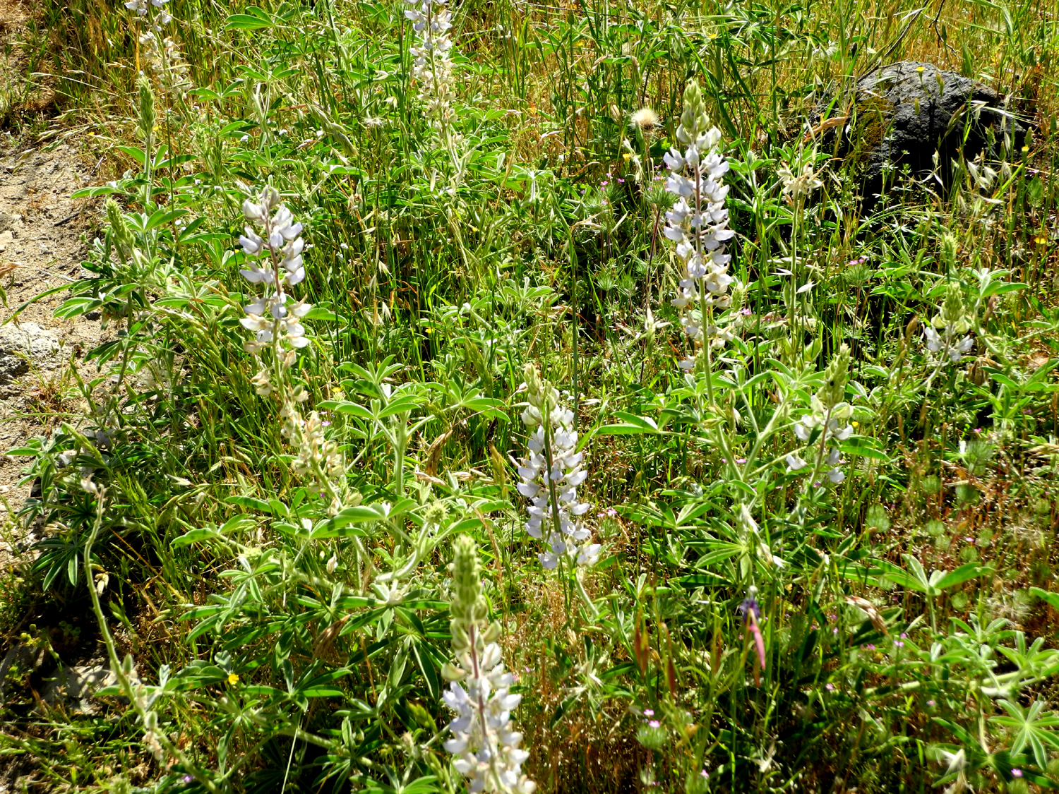
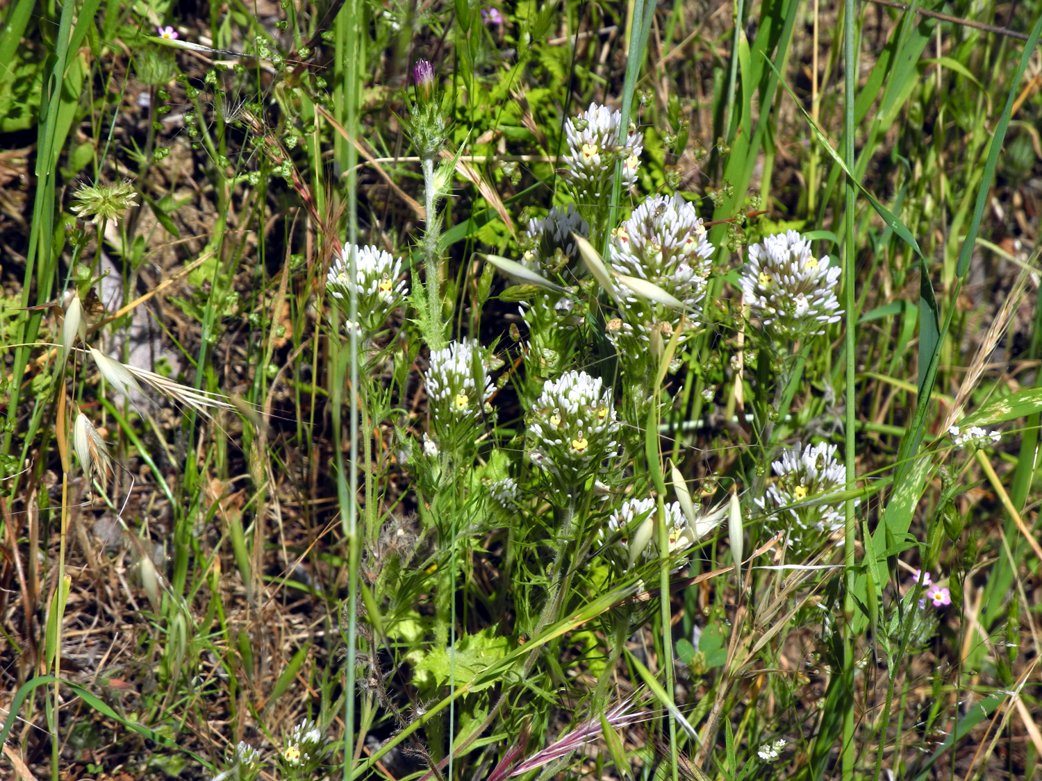
Hot Hike at the Gorge With a record rain year, foothill hiking has been spectacular. On the other hand, rainy days have prevented some planned hikes and made it hard to get in as many outings as I had wanted. Undaunted as always, I went to the San Joaquin River Gorge on May 9 for the seventh time this year, and hiked the San Joaquin River Trail. I've written about this trail enough times that I'll just quickly mention that it is the upper end of a 12-mile trek that starts at Finegold Picnic Area, next to Sky Harbor on Millerton Lake. With temperatures having recently hit 100 degrees in the valley, and climbing back up after a brief cool-down and light rain, I expected hot and dry conditions. The lower foothills have turned brown, and higher up, it's about half and half. On the San Joaquin River Trail, averaging 1,000 feet in elevation, there was quite a bit of green, although much of it was tall, late season plants, not grass. It was obvious that going off-trail would result in socks and boot laces full of stickers. When I arrived at the parking lot, there was just one other car there. When I finished my hike, there were two other vehicles, but I didn't see another person at the trailhead or on my trail. Based on a hike in May last year, I expected a fair number of certain flowers, but there were very few along the first half mile. After that they started to appear - not only the late season varieties, but plenty of others too. In fact, of all the flowers I've seen on the trails in 2017, all but a very few were still represented during this hike, although in very small numbers. The big show belonged to farewell-to-spring, which created a few bright pink patches on the slopes nearby, and were plentiful along the trail. They were also out in great quantities along the main roads on the way to the Gorge. Next in number were the Athurial's spears, a variety of brodiaea that looks very much like the lighter purple variety that grow in cool, shady areas. These are a darker purple, and grow amid the dry grass, making a nice color contrast. And in a few places mustang clover was plentiful. The other outstanding flower display, and a special treat, was provided by Mariposa lilies. For the first time in maybe 20 years, I saw the yellow variety of this beautiful flower, and in fairly good quantities. The more common white variety was also blooming along the trail, usually intermixed with the yellow. On the road into the Gorge I saw a lot of yellow or harvest brodiaea, and patches of a tall, spike-like white flower. We saw one of these down by the bridge on my late April hike with Linda and Anne. It was 72 degrees when I started, and close to 80 when I returned, so with the exertion of walking, I was getting out my bandana and wiping the sweat from my forehead fairly often. The uphill sections on the return walk seemed more tiring than usual, probably due to the temperature. There was a welcome breeze at times, but it was inconsistent. The app I use to measure my walks has been flaky lately, so I was trying a new one, which has not proved to be all that great so far. I have another one which seems to work OK, but is not nearly as elegant as my favorite. I used all three, and each one gave me a slightly different reading, ranging from 2.57 to 2.7 miles. Dilemma: Should I claim the average, or just assume that the longest is correct? Despite the dryness, there were still ten running creeks along the section I walked, some of them complete with butterflies. Two were barely trickling, but the others all had a true flow of water. Since all of these creeks start around 2,000 feet or lower, it's likely that most of them will be dry in another month. Despite the warm, dry conditions, I was glad I made this final spring hike. There are a few late season flowers that don't come out till May, and it was eye-opening to see how many early season flowers were still blooming in small numbers. Along Auberry Road on the way to the Gorge, there are several places where you can see the "back" side of Squaw Leap Table Mountain, which is to say, the side opposite the Gorge. I've been wanting to take a photo from that angle, but could not find a place to pull over safely. I stopped at the US Forest Service station in Prather to get a fire permit, and as I walked back to my car, I realized I was looking across the parking lot right at Squaw Leap, so I finally got my photo. For my own reference, and you can read it if you want, I recorded this list of flowers: Birds eye gillia (about a dozen quarter-inch blossoms), white owl clover, phecelia, mustang clover, harvest brodiaea, a tall dandelion-type flower, filaree, Athurial's spear, yellow and white Mariposa lily, red clover, yellow clover, buckeye, thistles with large and small blossoms, yellow throated gillia, foothill gillia, farewell-to-spring, snap dragon-like flower, climbing brodiaea, popcorn flowers, fiddlenecks, pale blue lupine, tall blue ground lupine, white lupine, vetch, rattlesnake plant, poppies, common madia, and that old favorite, several species of "unidentified."
|
||
Photos (Click to enlarge; pictures open in new window) |
||
| McKenzie Preserve Herding Cats & Hiking Highway 33 Bridge Trail Photos (plus) Edison Point Hot Hike | ||
| McKenzie Preserve | ||
|
 |
 |
| Lots of blue oaks | Emily, Sandy, Jackie, Kristi, Laura, Jessica, Teri, Monica | The oldest oak in the preserve |
 |
 |
 |
| This little guy was too busy eating to notice that he was having his picture taken | One of those unidentified flowers | Cultural artifacts, dating back at least 400 years or more |
 |
 |
 |
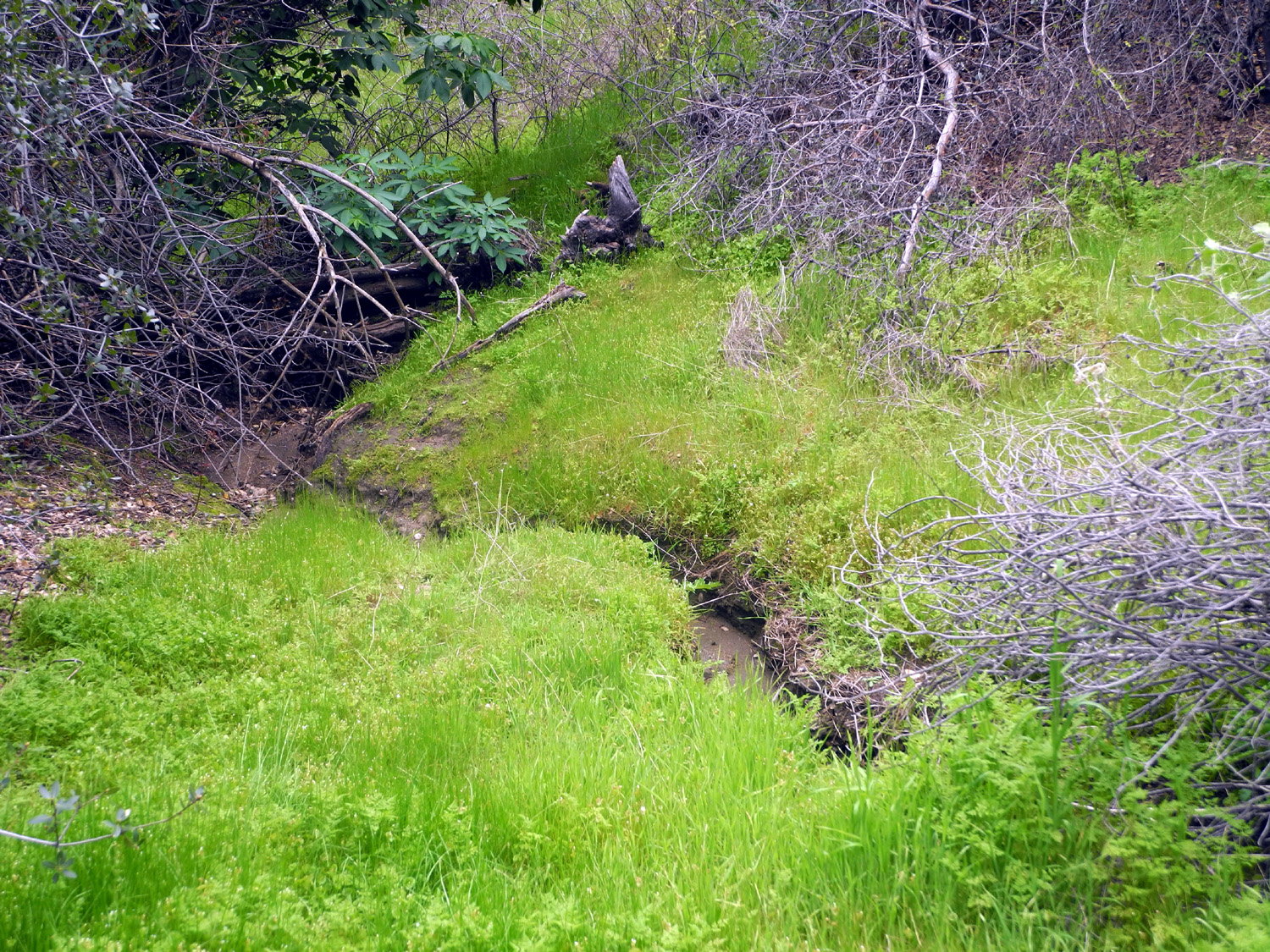
| Frogs of the future | An excellent resting stop, with Indian grinding holes, a creek with tadpoles, and green beauty | Teri on the rock |
 |
 |
 |
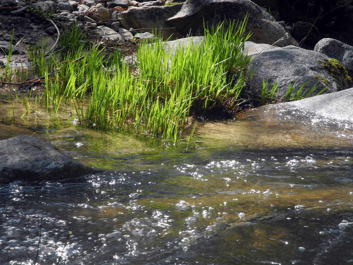
| Walking along the San Joaquin & Eastern Railroad grade | A patch of popcorn flowers | Ranch across Auberry Road from the preserve |
|
 |
 |
| Various view of the table tops | ||
 |
||
| McKenzie Preserve trail map | ||
| Herding Cats & Hiking | ||
 |
 |
|
| Little Table Mountain peeks over the foothills | Blue oak woodland is bright green this year | The Bird (Dinosaur? Dragon?) |
 |
 |
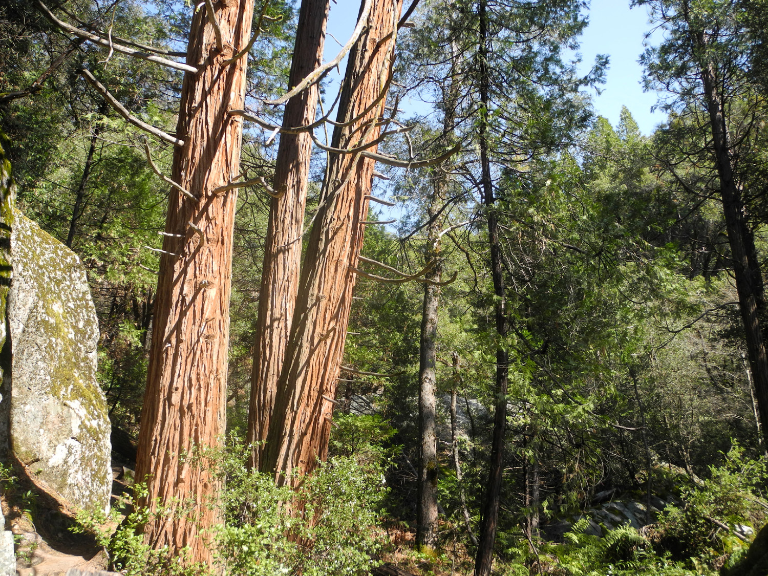 |
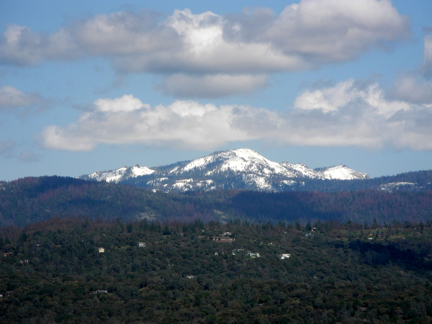
| View of Oakhurst from Deadwood Grade | Shuteye Peak | Cedars along the trail to Corlieu Falls |
 |
 |
 |
| The multiple cascades of Corlieu Falls | A close-up view | Massive canyon live oak below the falls |
 |
 |
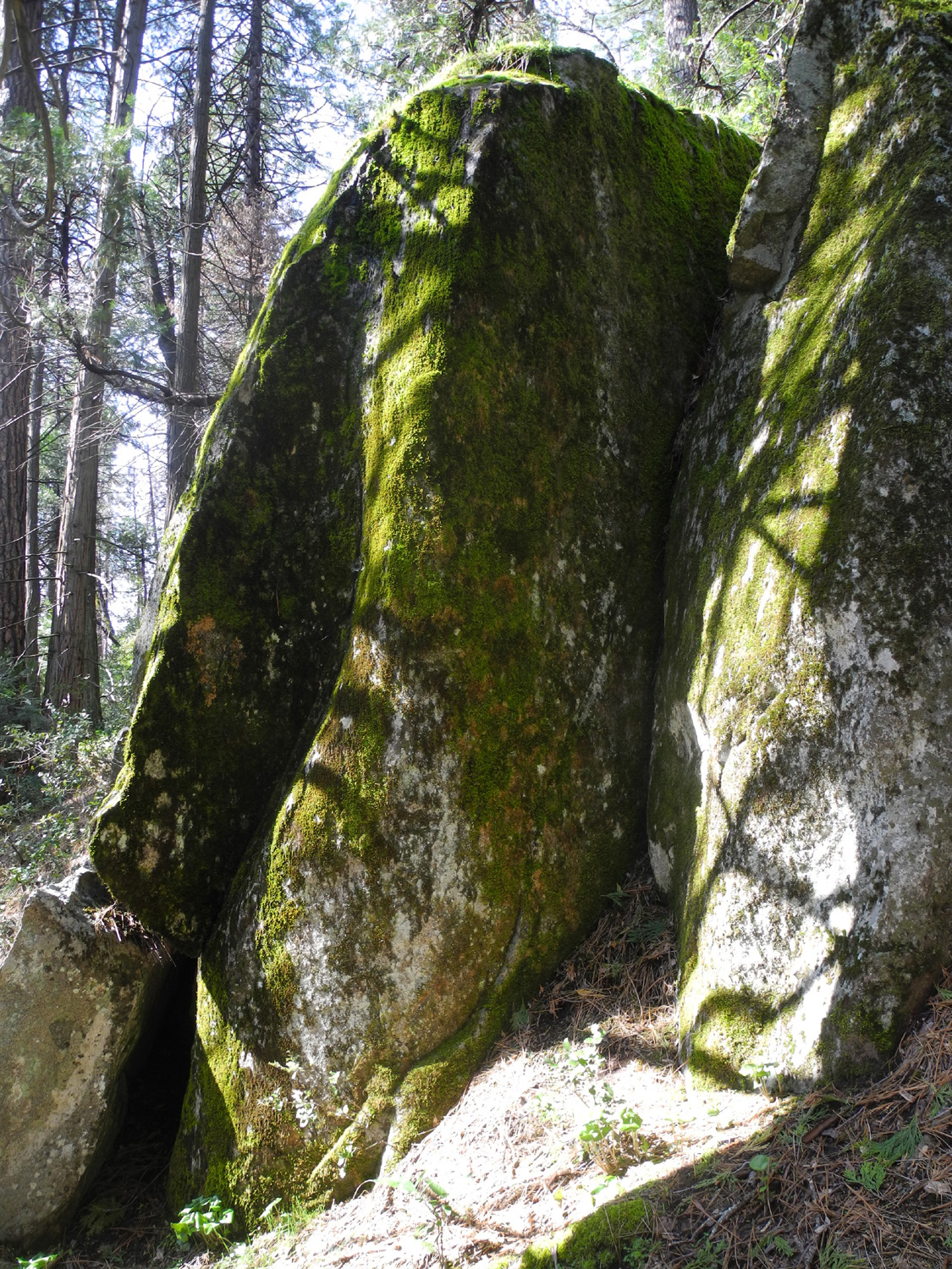 |
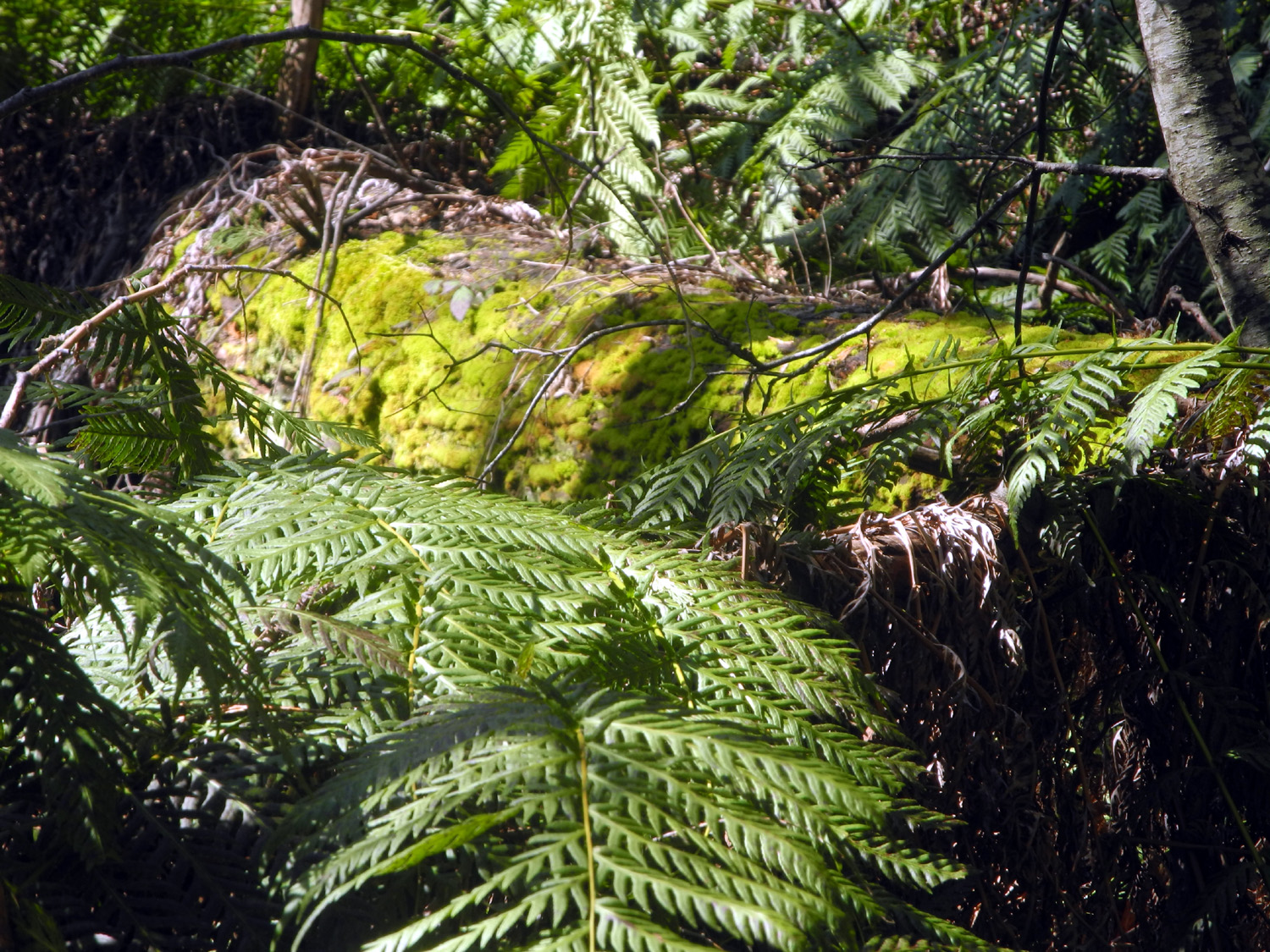
| A rare quiet section of Lewis Creek | Ancient mossy log and large ferns | Granite boulders dominate the trail in places |
 |
 |
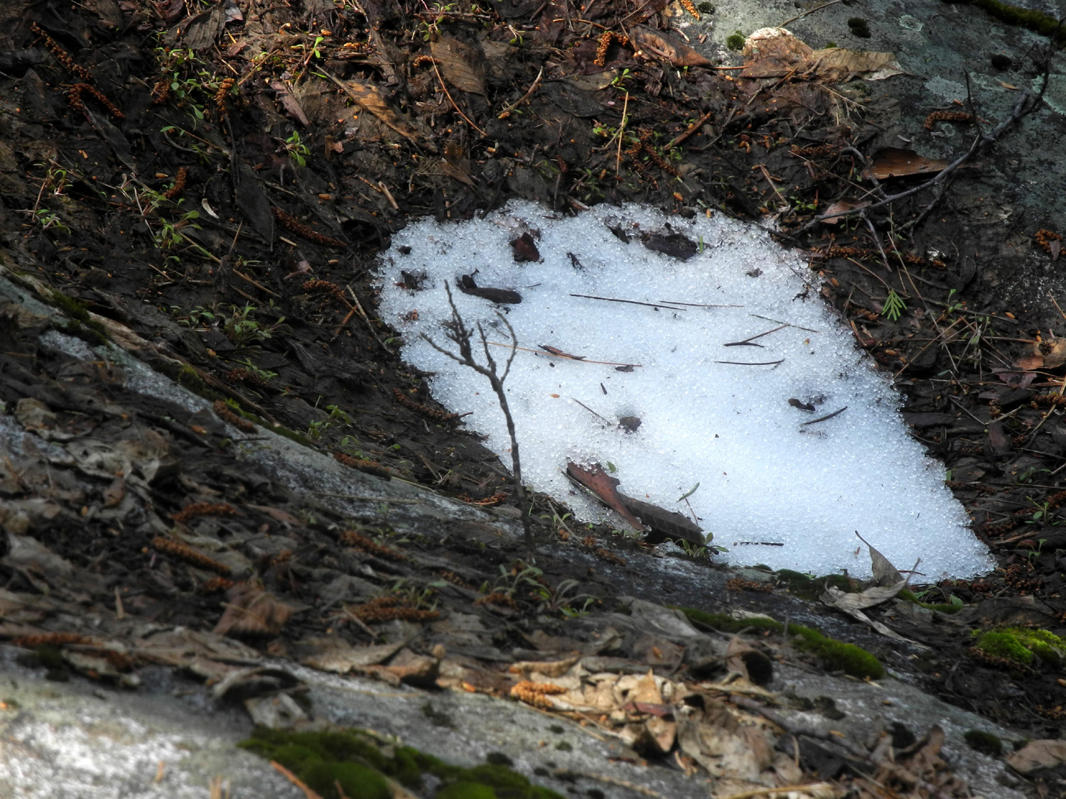 |
| The pink bell-like blossoms of the manzanita | Thousands of dead trees have been removed, including three that stood here | The last patch of snow of the winter |
 |
 |
 |
| Falls on California Creek below Road 6S47Y (Compare October 2014) | The trail we walked
on in November is under water in April |
Here's where I decided to turn my car around |
 |
 |
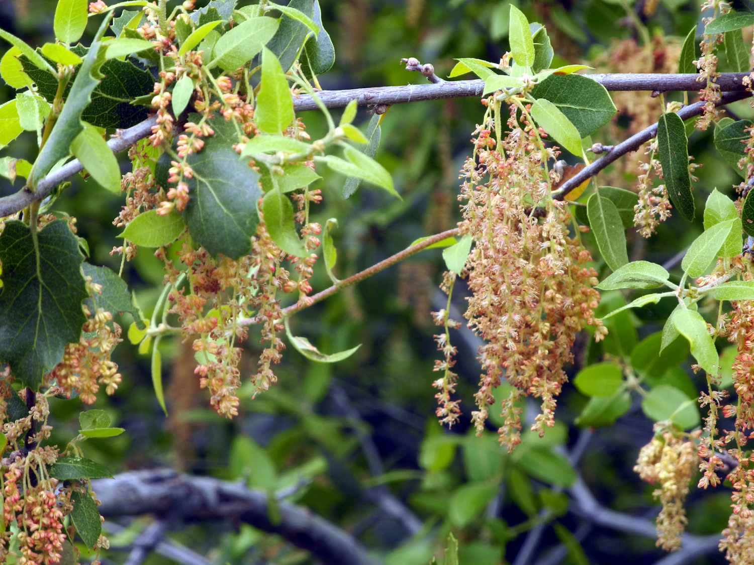 |
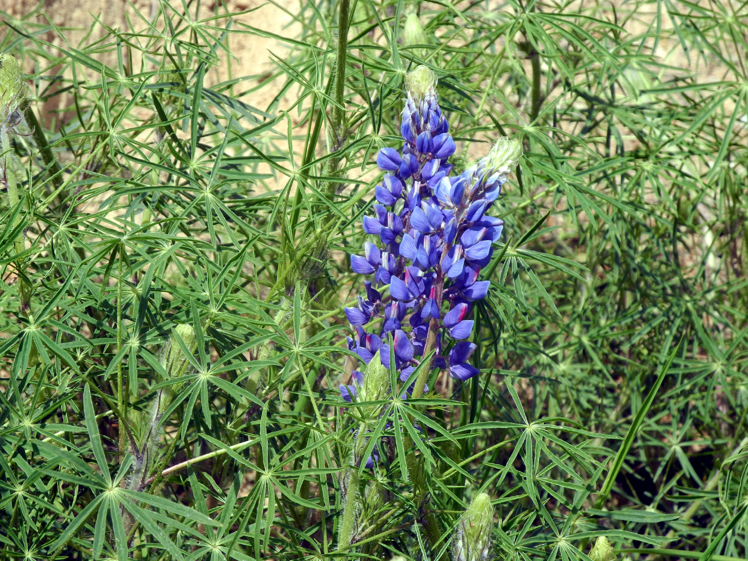
| Blue lupine along road 620 | Harlequin lupine on the Neely property | Live oak catkins (blossoms) |
 |
 |
 |
| The old road on the back of the property | The farthest point you can walk down the drainage | Buckeye and boulders |
 |
 |
 |
| Foothill beauty | Jasper on the alert | Helping me explore the drainage |
 |
|
 |
| The old road by the unsold development | Black oak, red with catkins | Looking down the drainage from the upper section |
 |
 |
 |
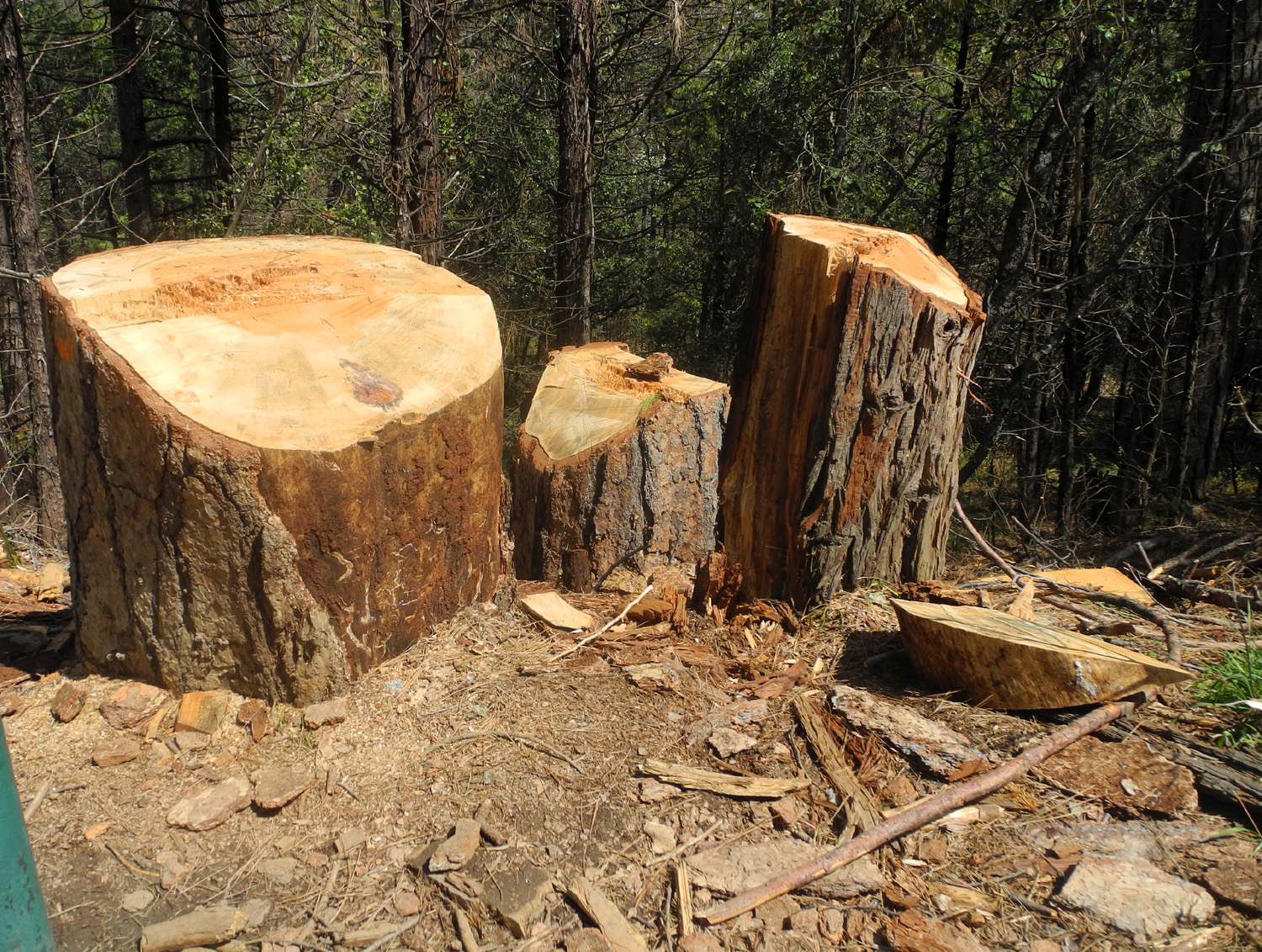
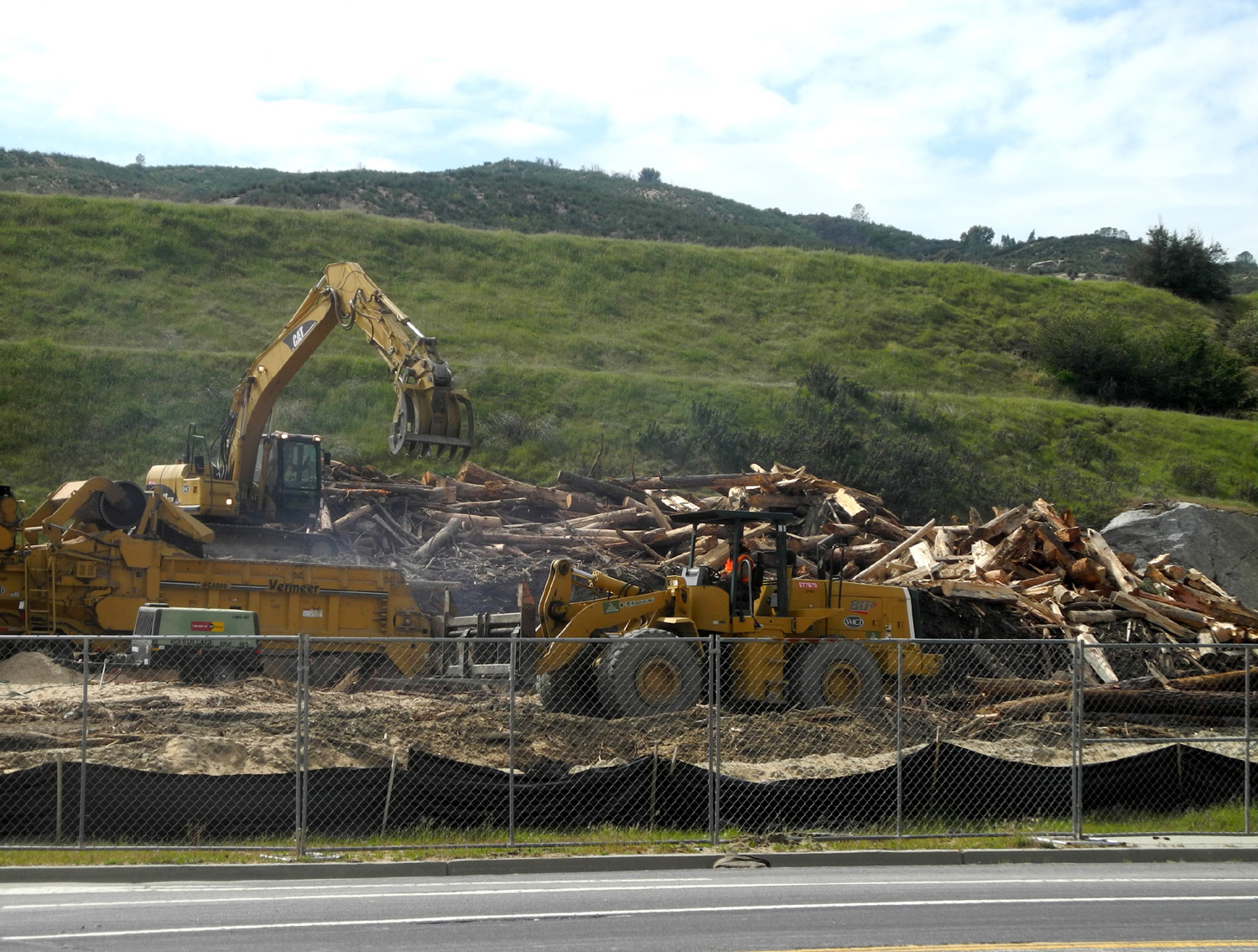
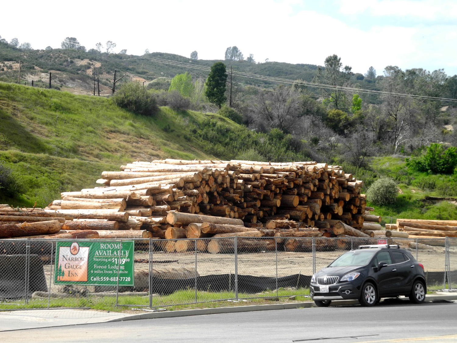
| Log chipping operation in Oakhurst | Log deck | Hombre near the start of the Neely Trail |
| Highway 33 | ||
 |
 |
|
| The pier at Ventura | View from the Crowne Plaza Hotel | Ventura sunset |
 |
 |
 |
| Matilija poppies at Casitas Springs |
These flowering bushes were thick along the southern part of the highway |
A close-up look |
 |
 |
 |
| A typical section of the highway | Looking up Tule Creek Canyon | Evergreens on a ridge |
 |
 |
 |
| Blue flowered chaparral | Yuccas were few in number but very eye-catching | An abandoned outpost |
 |
||
| Weathered rock formation looks like it could be in Utah | ||
 |
 |
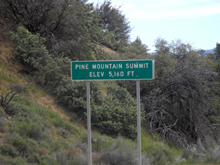 |
| The light colored sections across the middle are exposed bedrock | The heart of Los Padres National Forest | The high point on the journey |
 |
 |
|
| The view from just over the pass | I could not tell what kind of trees these were | The rugged northern side of the mountains |
| San Joaquin Gorge Bridge Trail Plus | ||
 |
 |
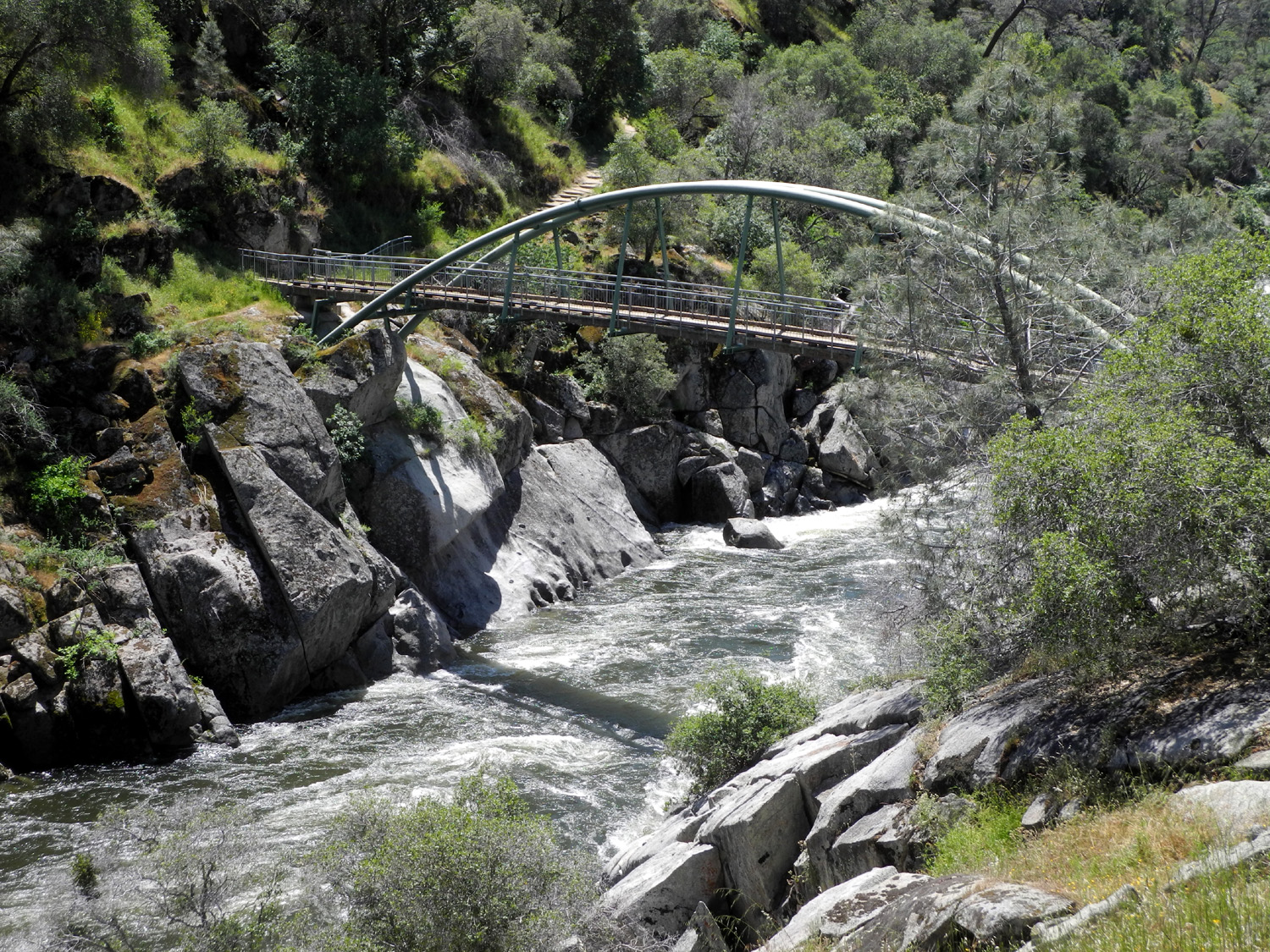 |
| Mustang clover was the dominant flower at the Gorge | Anne and Linda admire our local wildflowers | The bridge over the San Joaquin River |
|
|
 |
| The river was higher than it's been in years | Dick, Anne and Linda near the bridge | Buckeye blossoms were just getting started |
 |
 |
 |
| Ten days into spring, farewell-to-spring is making its first appearance | Yellow flowers mixed in with mustang clover | This natural bouquet includes madia, mustang clover and harvest brodiaea |
 |
 |
 |
| In the back yard at Upshaw's - Colton, Brittany, Johnny, Anne, Jack, Teri and Linda | Harlequin lupines, the pride of the Neely property, are thicker than ever this year | Jennifer, Anne and Linda on the 'Neely Trail" |
 |
||
| Live oak and blue oak above the trail | ||
| Edison Point | ||
 |
 |
 |
| Farewell-to-Spring paint the hillside pink | Where the hike starts | Tall grass at the trail entrance warns of what's ahead |
 |
 |
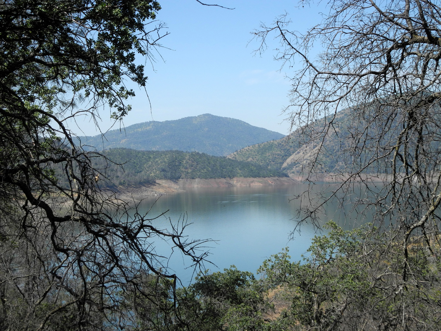 |
| Climbing brodiaea twines around dead brush | Nature's masterpiece, the Mariposa lily | The water level at Pine Flat has been lowered to make room for the coming snow melt |
 |
|
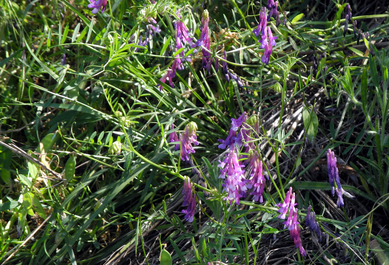 |
| Vegetation threatens to cover the bench | Dick at the bench | Purple vetch is thick all over the foothills |
 |
 |
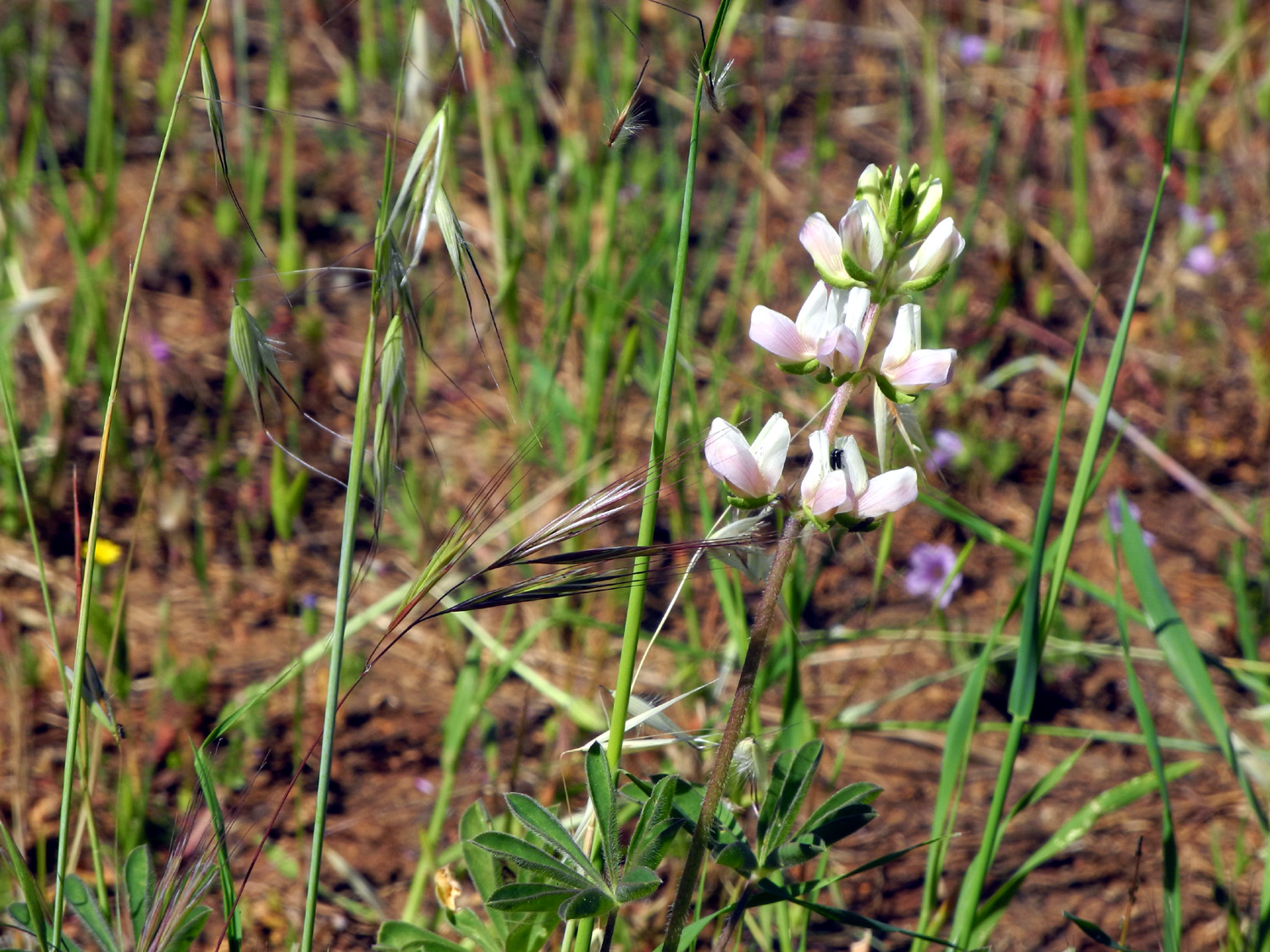 |
| The lone buttercup seen on the hike | Purple brodiaea, gone to seed (Here's what I hoped it would look like) | A pinkish white lupine |
 |
 |
 |
| From a distance these flowers look like a dandelion seed head | Mariposa lilies along the upper section of the trail |
A never-before-seen mutant variation of the Mariposa lily |
 |
 |
 |
| Milkweed | The spectacular blazing star | View of Edison Point from the trail |
|
 |
 |
| Farewell-to-Spring along Trimmer Springs Road | A closer look | The green hills are rapidly turning brown |
| Hot Hike at the Gorge | ||
 |
 |
 |
|
The sign where you turn off from Power House Road to Smalley Road |
Bright yellow of madia against the dark green of live oak |
The brodiaea species known as Athurial's spear |
|
 |
 |
| The rare yellow variety of Mariposa lily | King of the late season flowers, farewell-to-spring | A closer look |
 |
|
 |
| Climbing brodiaea were thick in some areas | A few places still had a lot of green grass |
This lupine plant produces a lot of of pale blue flowers on one plant |
 |
 |
 |
| White owl clover, not really a clover | Much of the grass has gone to seed | Butterflies where thick around several of the creeks |
 |
 |
 |
| Squaw Leap table top mountain | The other side of Squaw Leap from Prather | I had my rest and snack under this huge live oak |
 |
 |
 |
| This delightful flower is the yellow-throated gillia | There were still a few poppies among the farewell-to-spring | This unknown species was thick along Smalley Road |
| Related Links | ||
| Sierra Foothill Conservancy | McKenzie Preserve | San Joaquin and Eastern Railroad |
| More about SJ&E RR | A Hike to the Table Top | Blue Oaks |
| Dragon by the Road (Song) | Corlieu Falls | Lewis Creek Trail |
| Southgate Brewing Company | Oakhurst | Black Oaks |
| Deadwood Mountain Fire Lookout | Tree Removal | San Joaquin River Gorge |
| Common Madia Photos | Edison Point Trail | Los Padres National Forest |
| State Highway 33 | Maricopa | Mariposa Lilies |
| San Joaquin River Trail | San Joaquin Gorge Photo Gallery | |