

Dick's Adventures of 2016 - Part 2 |
||
Adventures of 2016 Part 1 Adventures of 2016 Part 3 Adventures of 2016 Part 4 Adventures of 2016 Part 5 Adventures of 2016 Part 6 Adventures of 2016 Part 7 Adventures of 2017 Pincushion Peak Hensley Lake Hike Dry Creek Canyon Edison Point Trail San Joaquin Gorge Camp San Joaquin River Trail West |
||
|
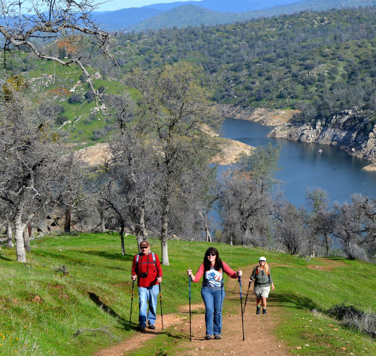
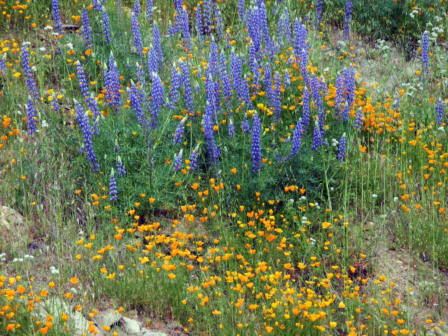
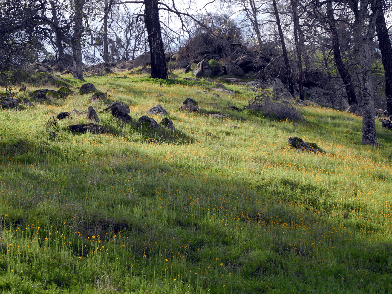
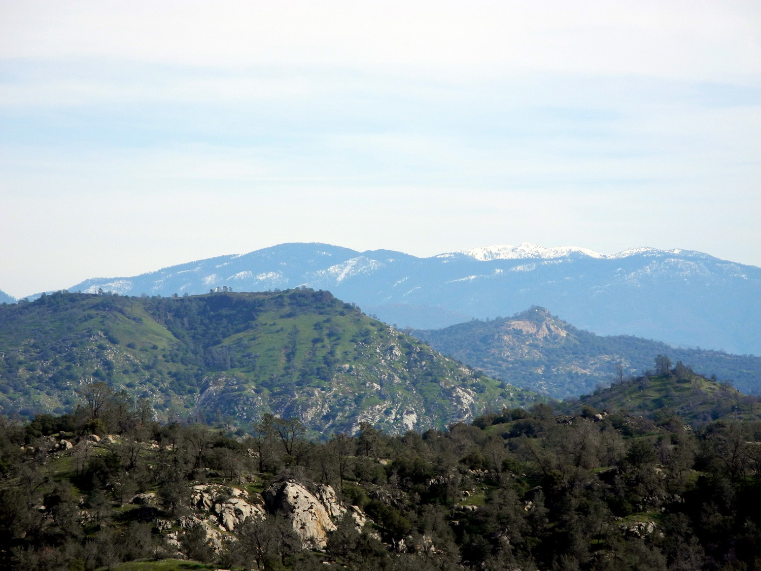
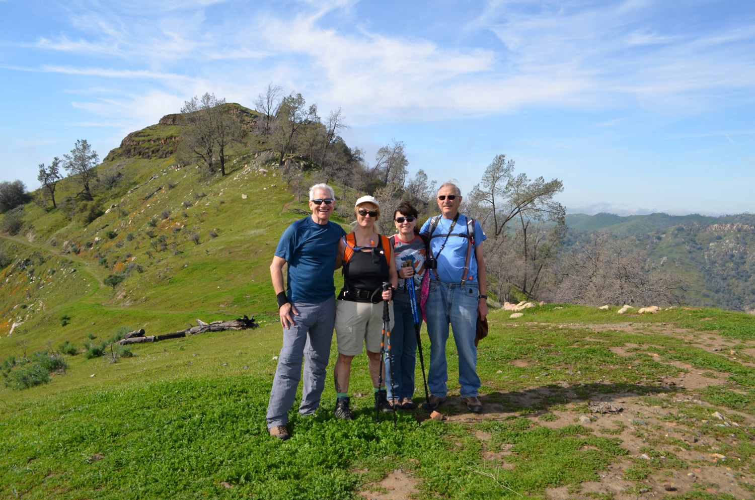
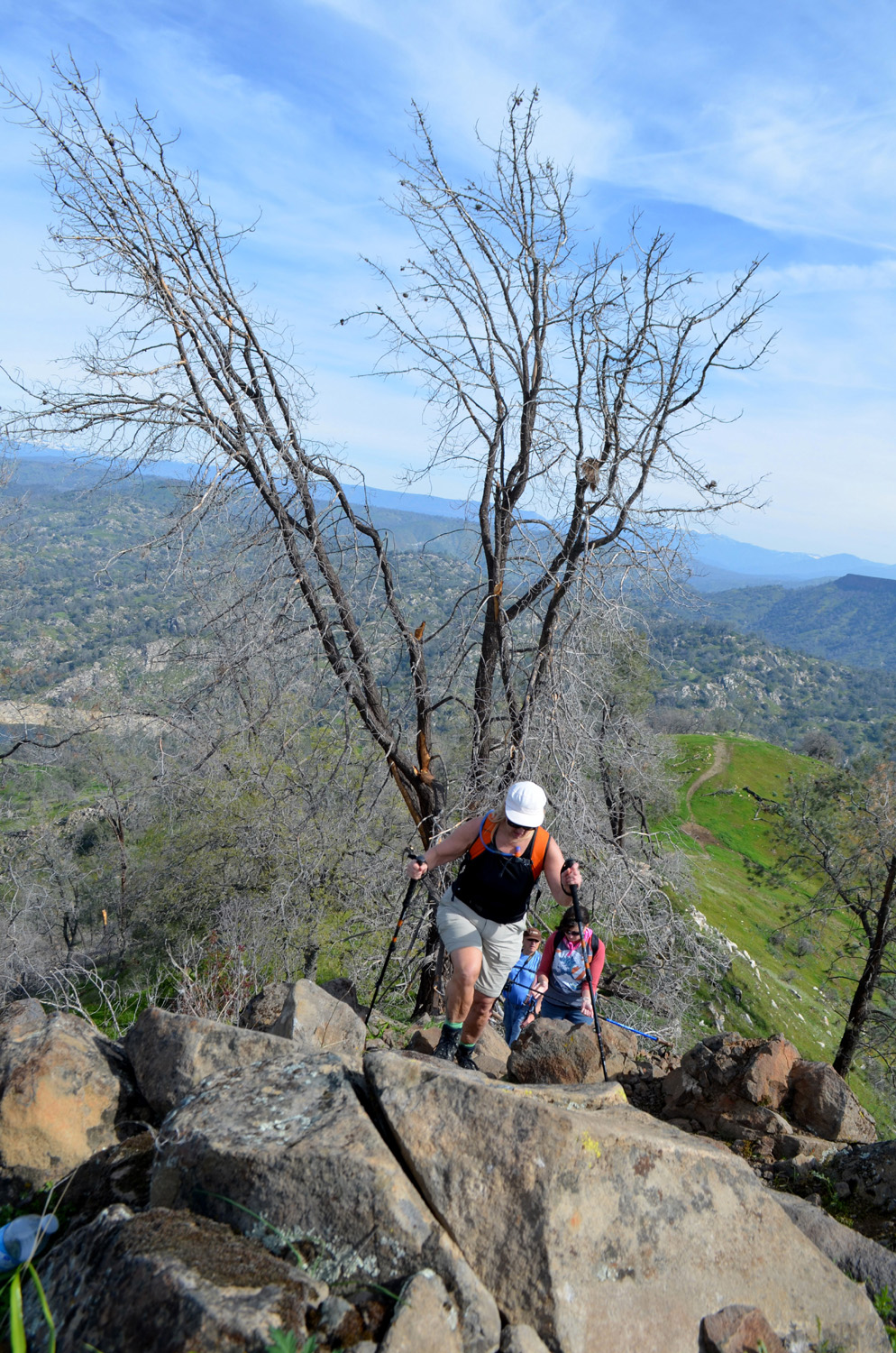
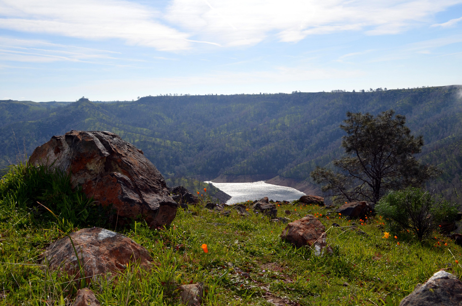
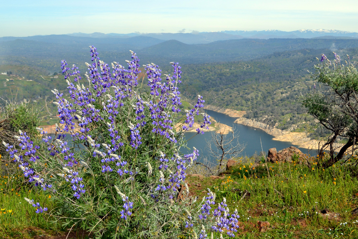
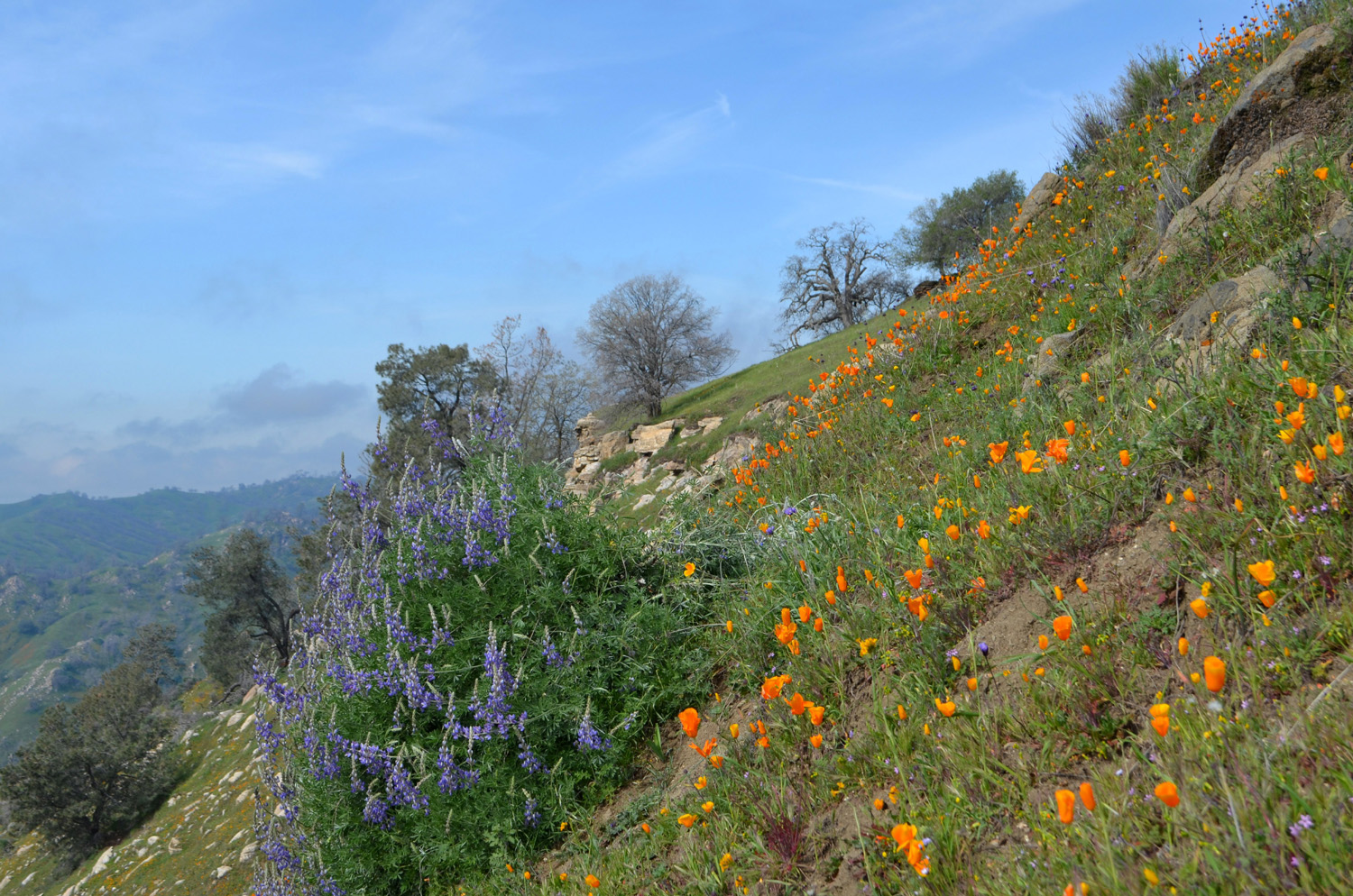
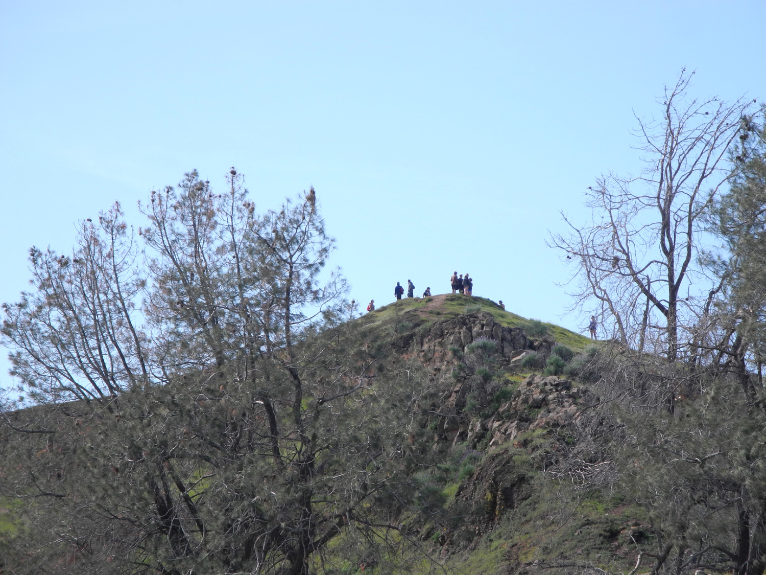
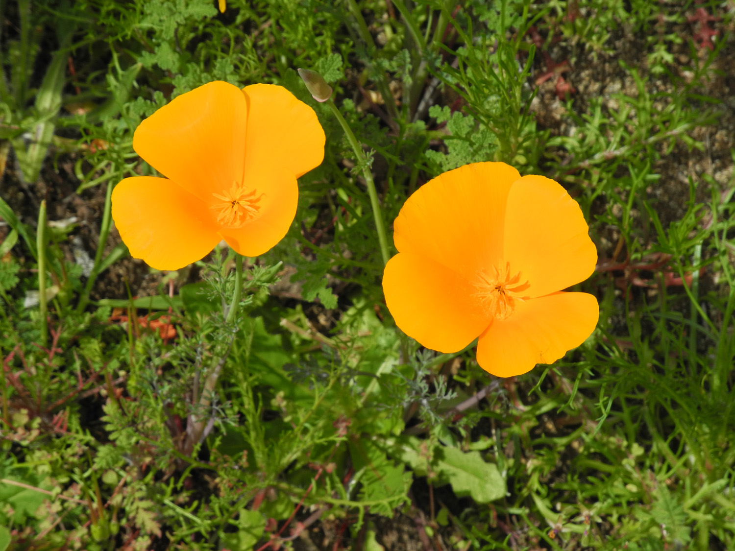
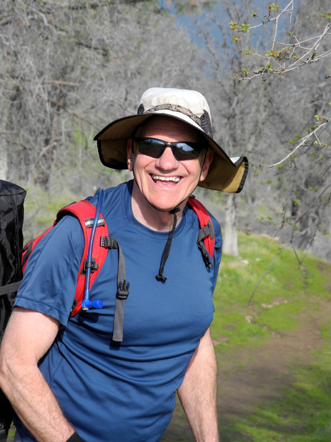
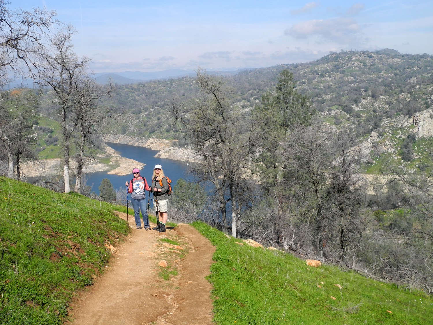
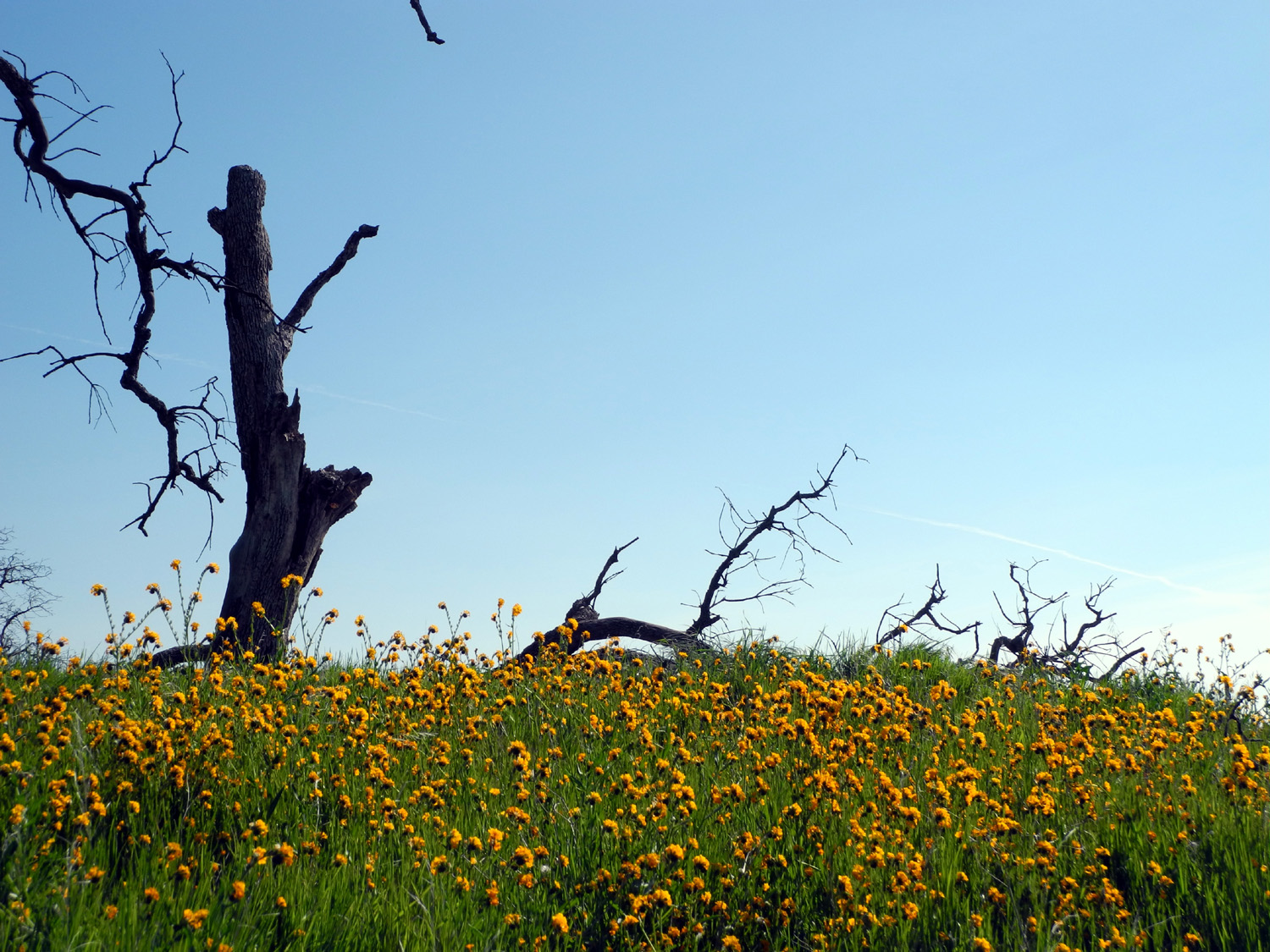
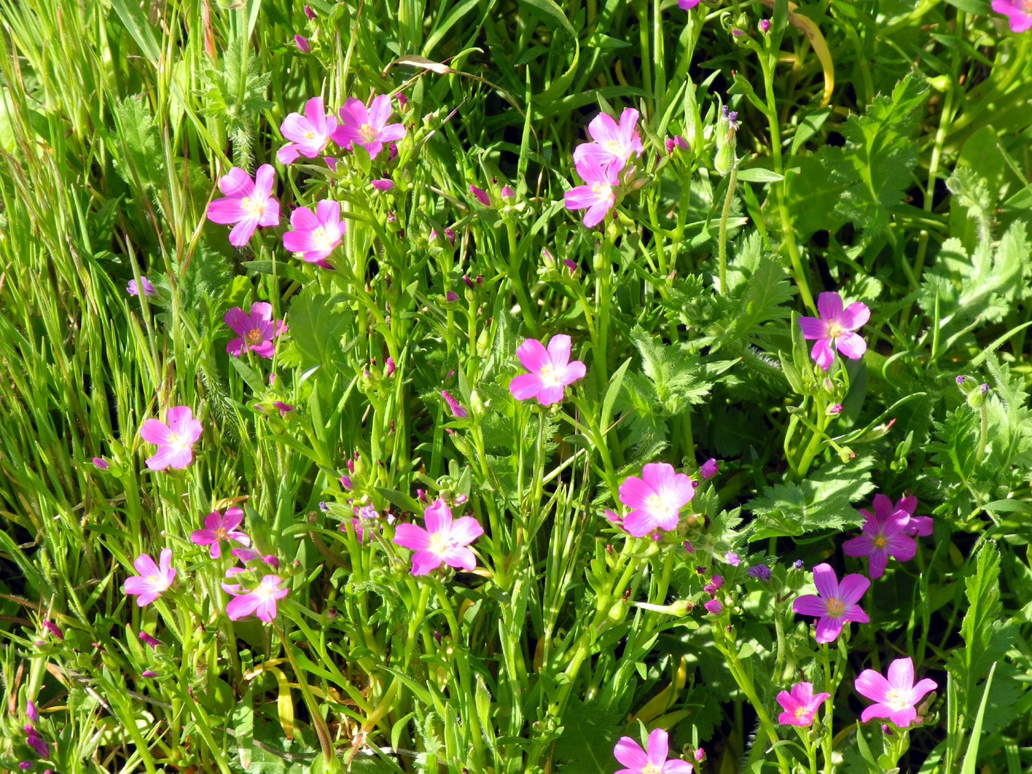
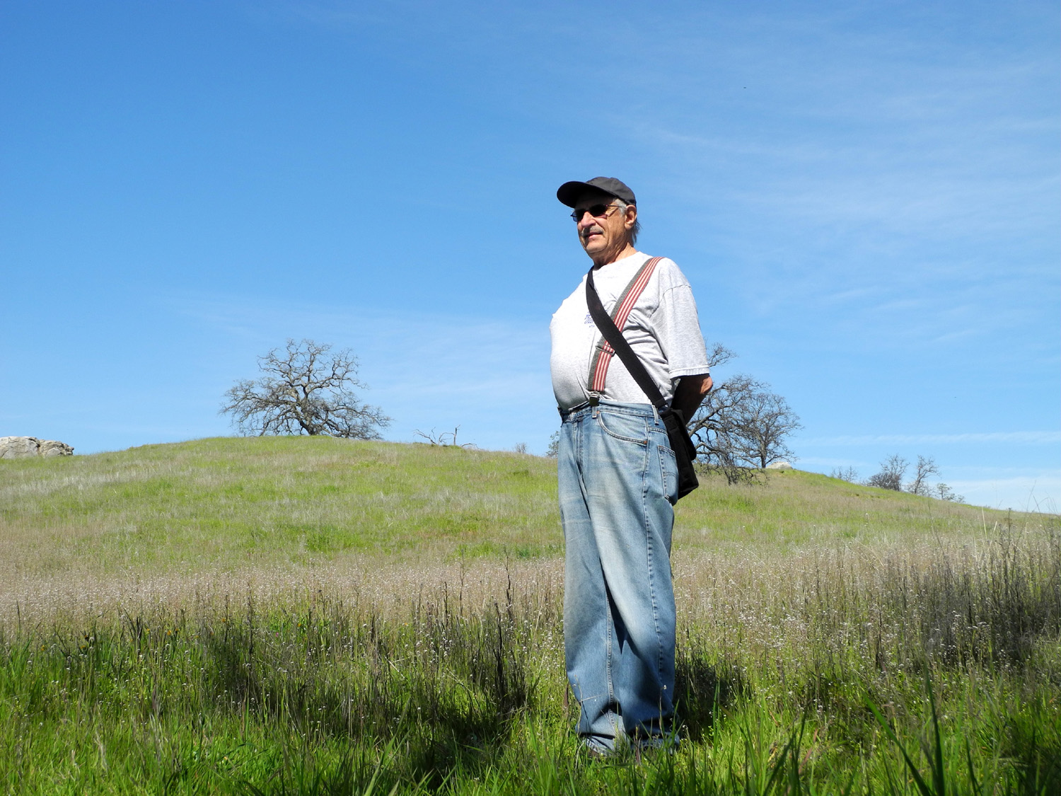
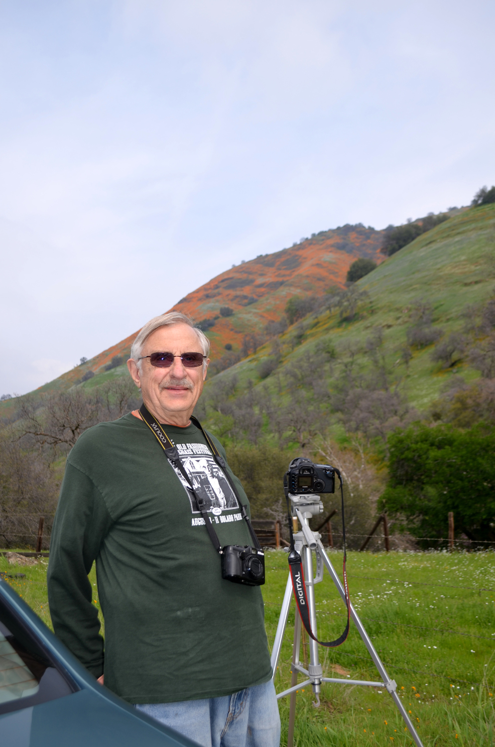
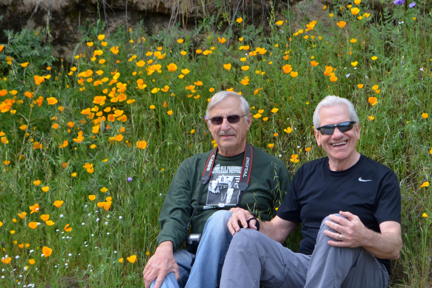
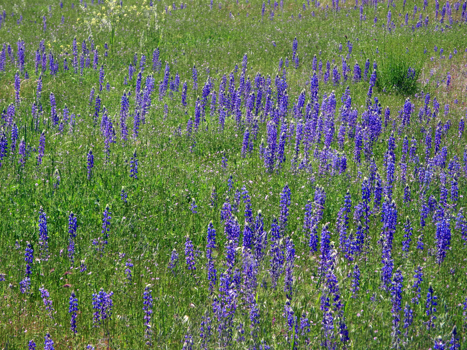
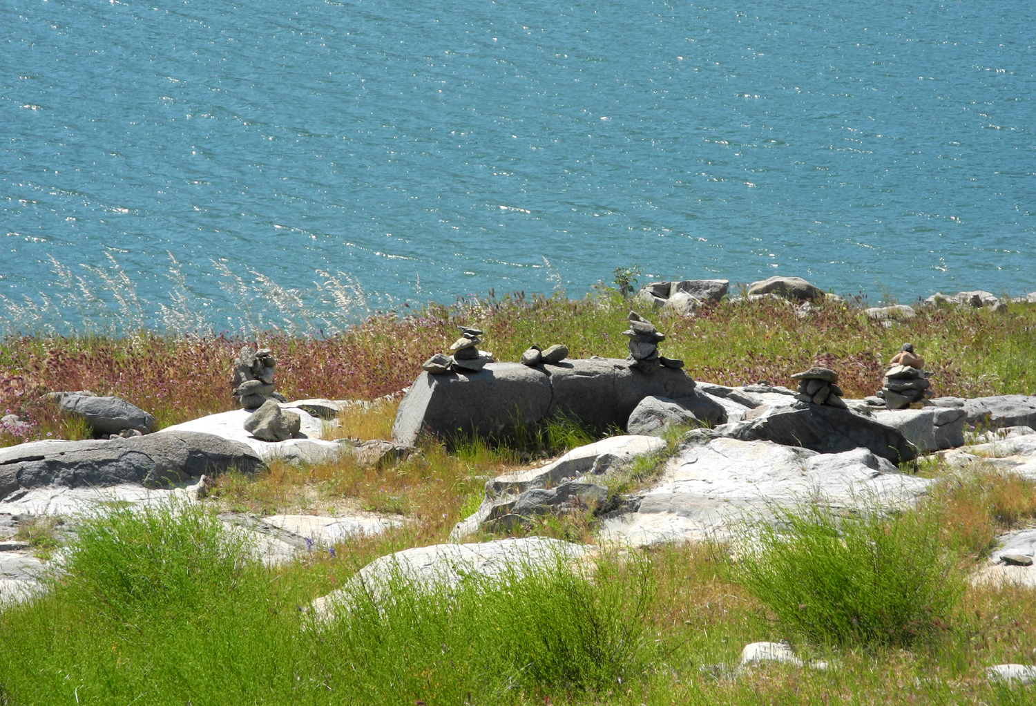
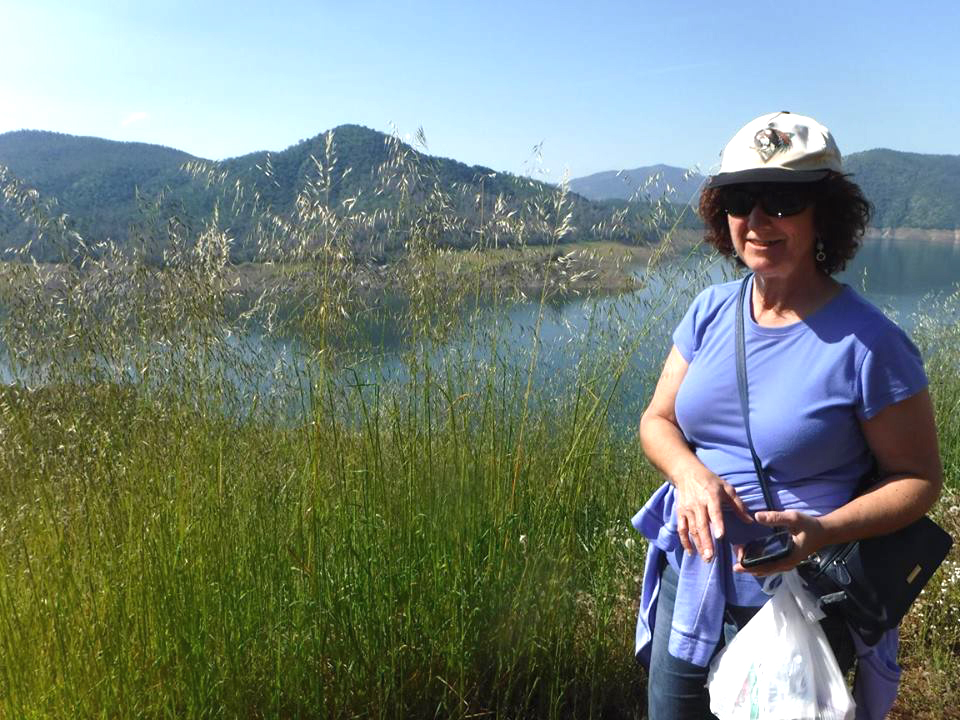
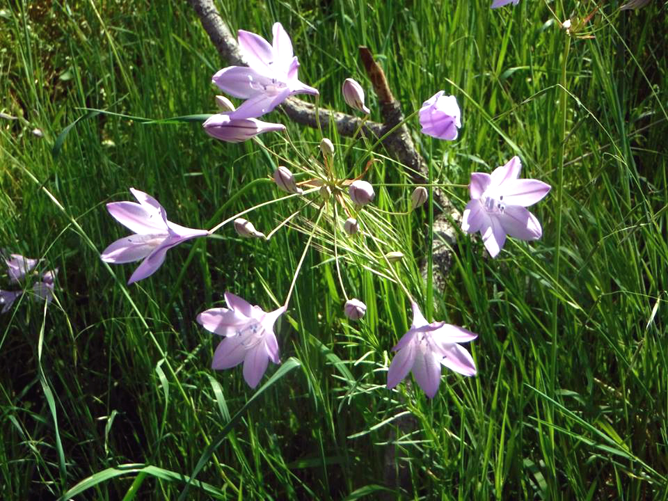
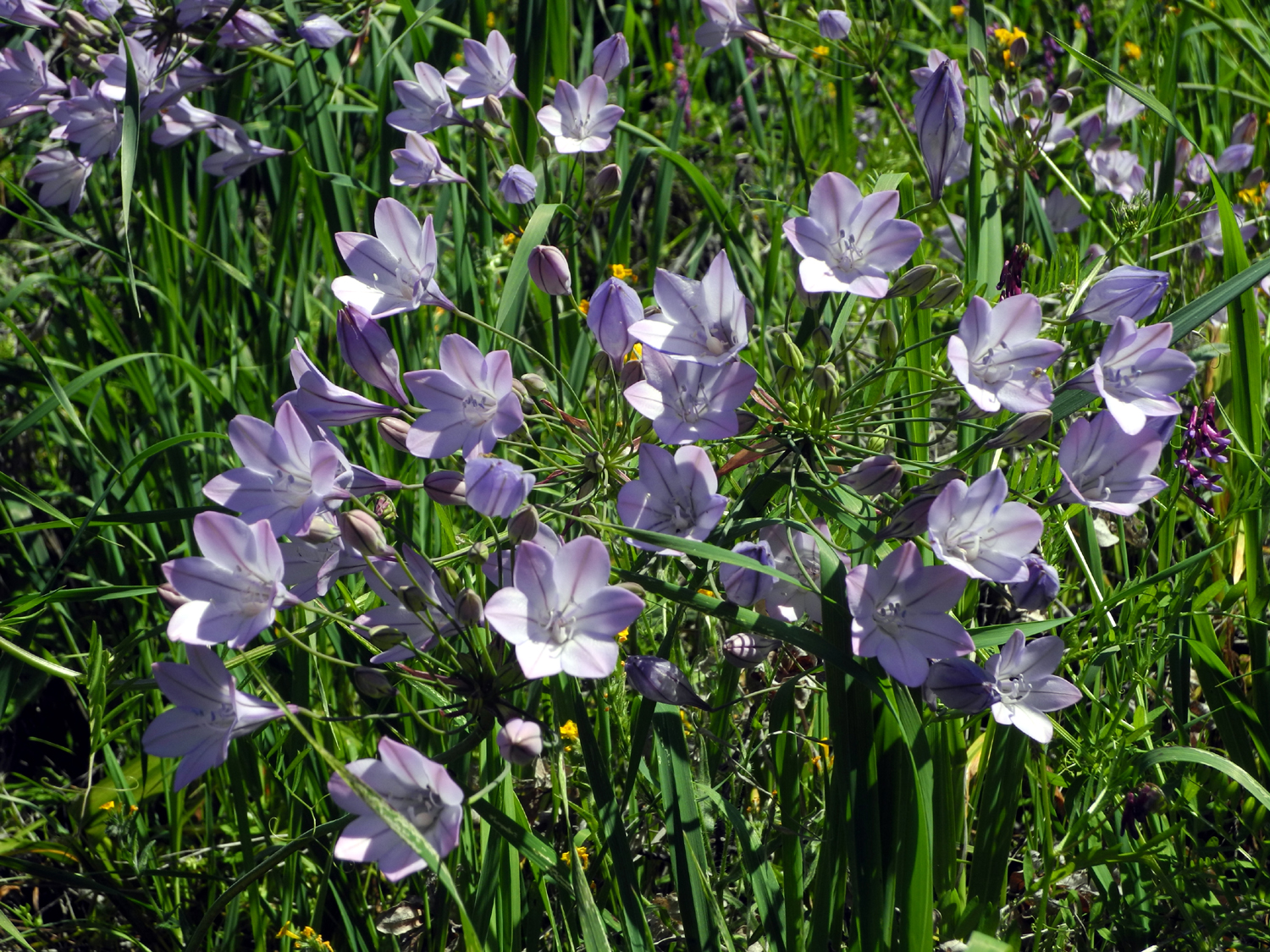
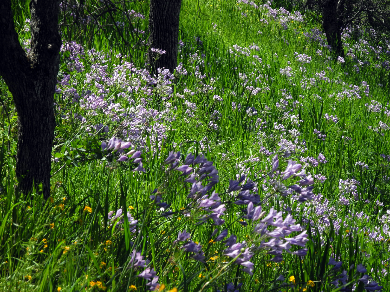
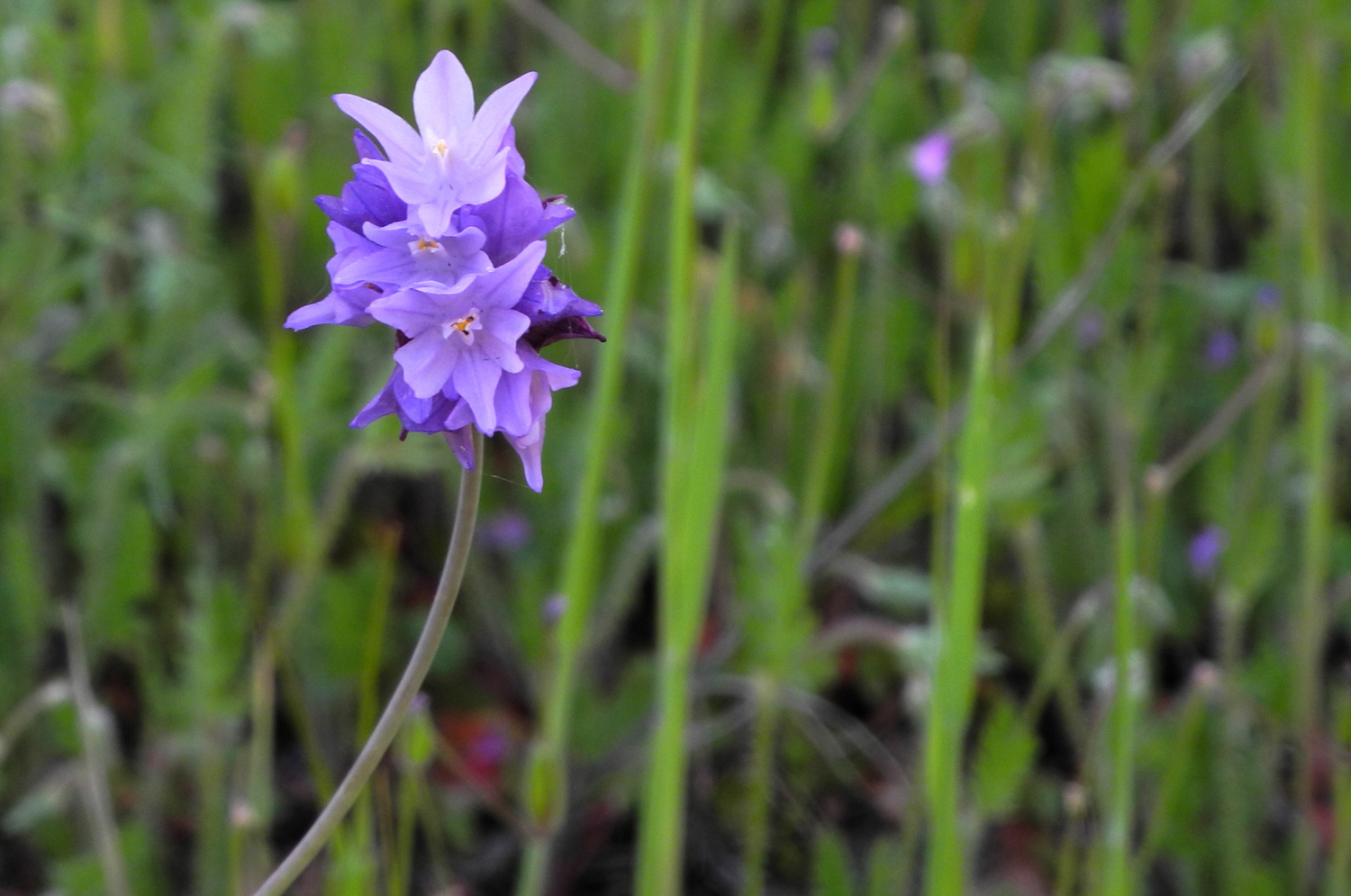
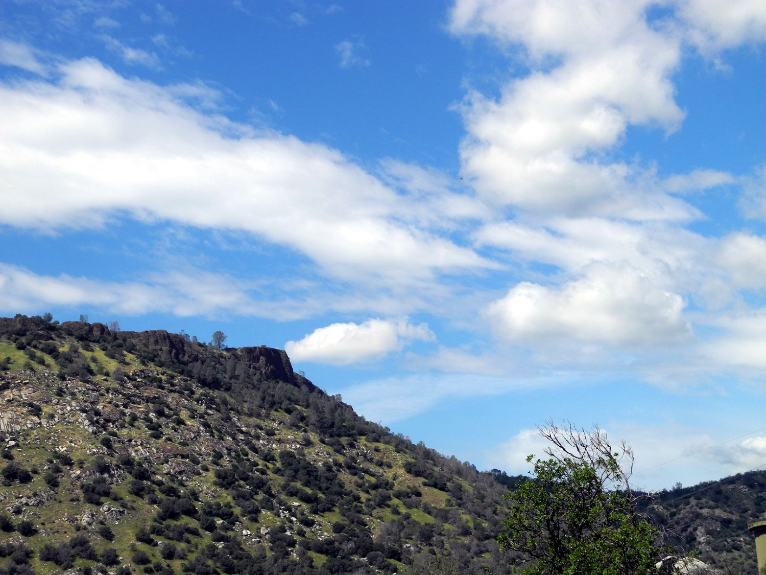
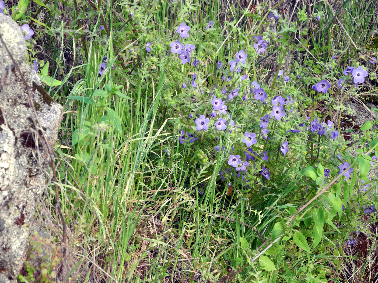
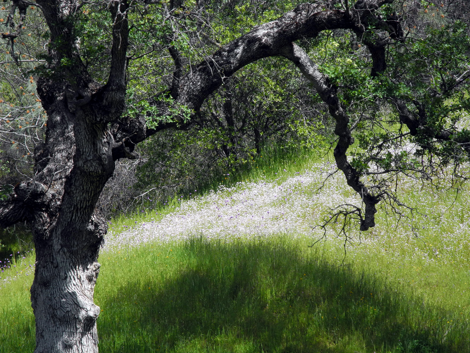
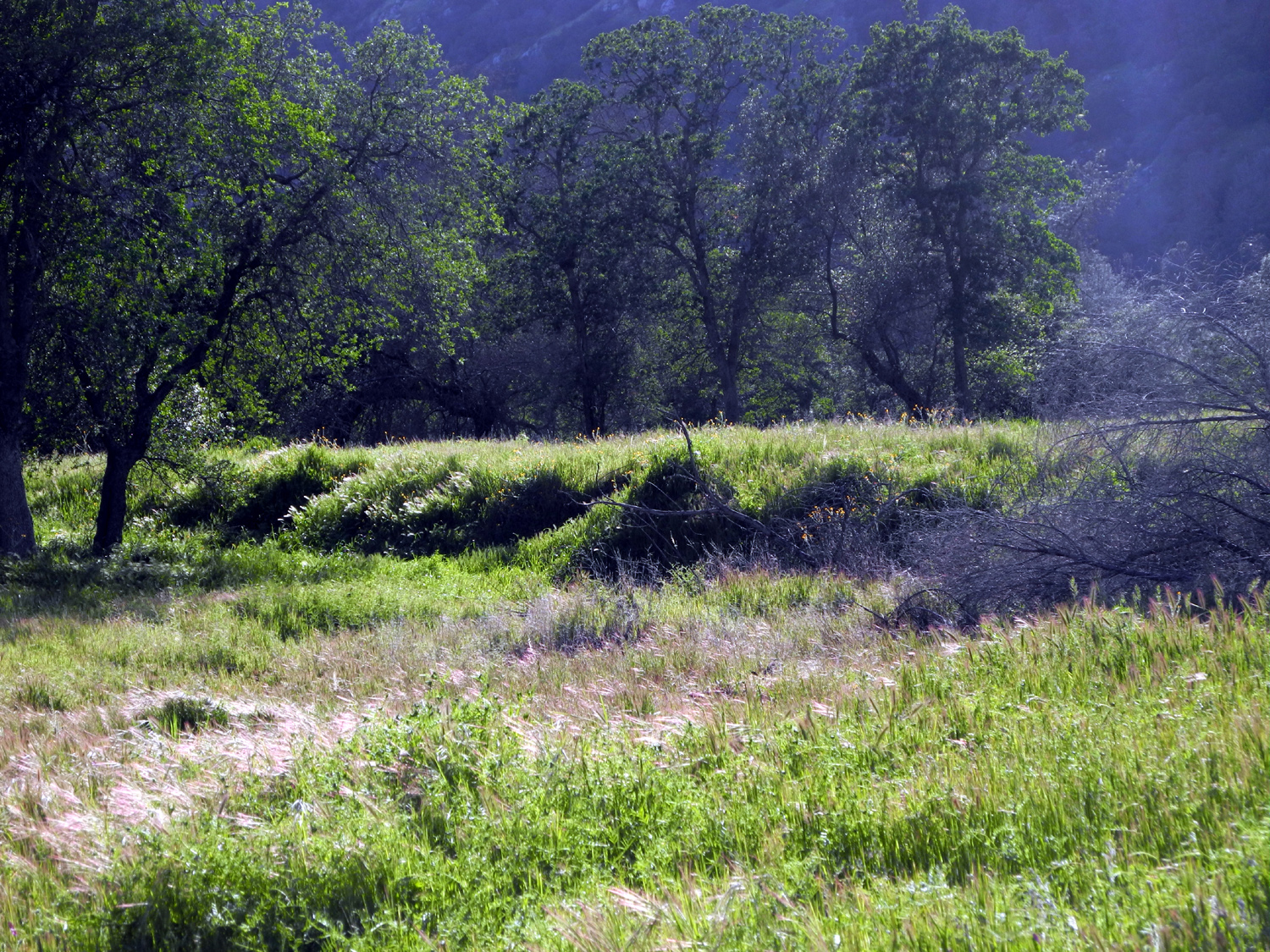
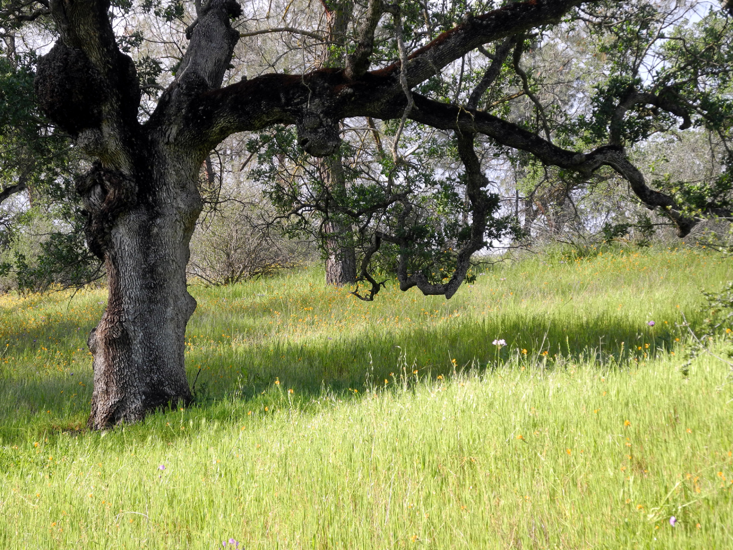
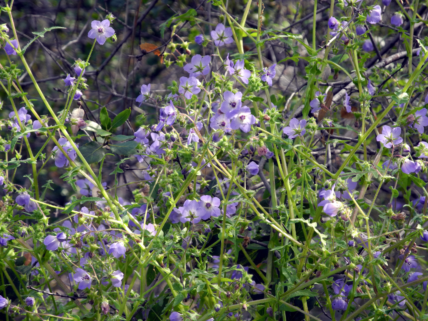
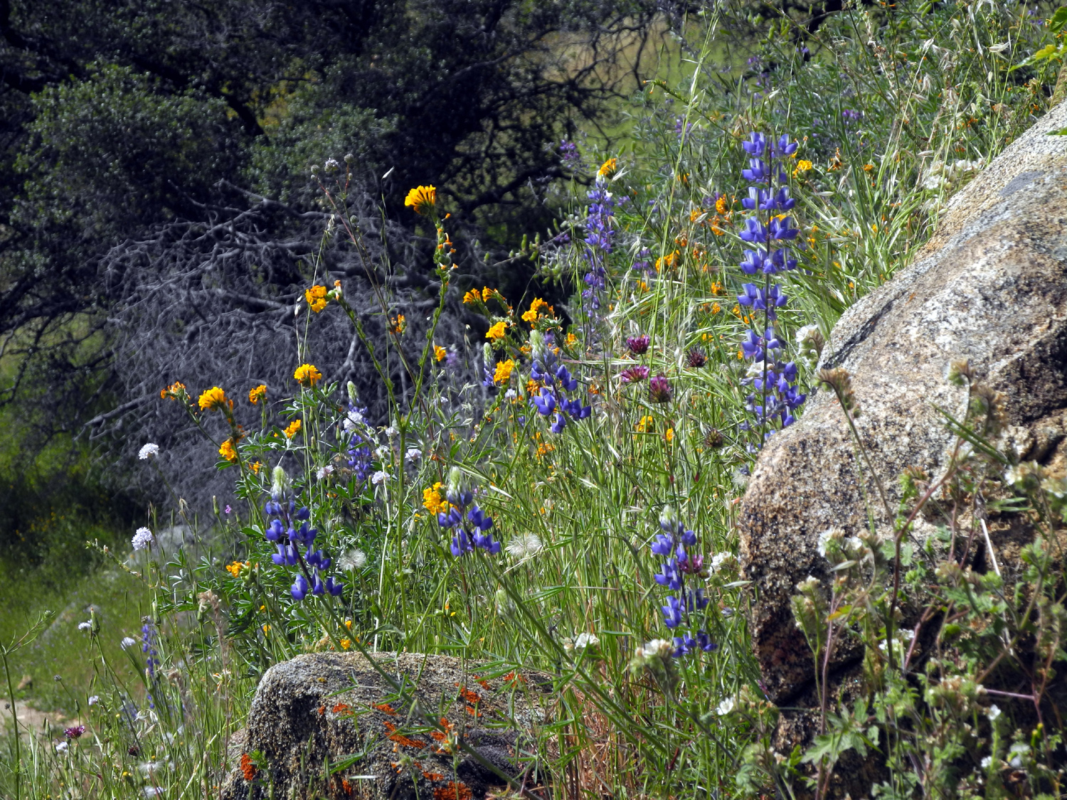
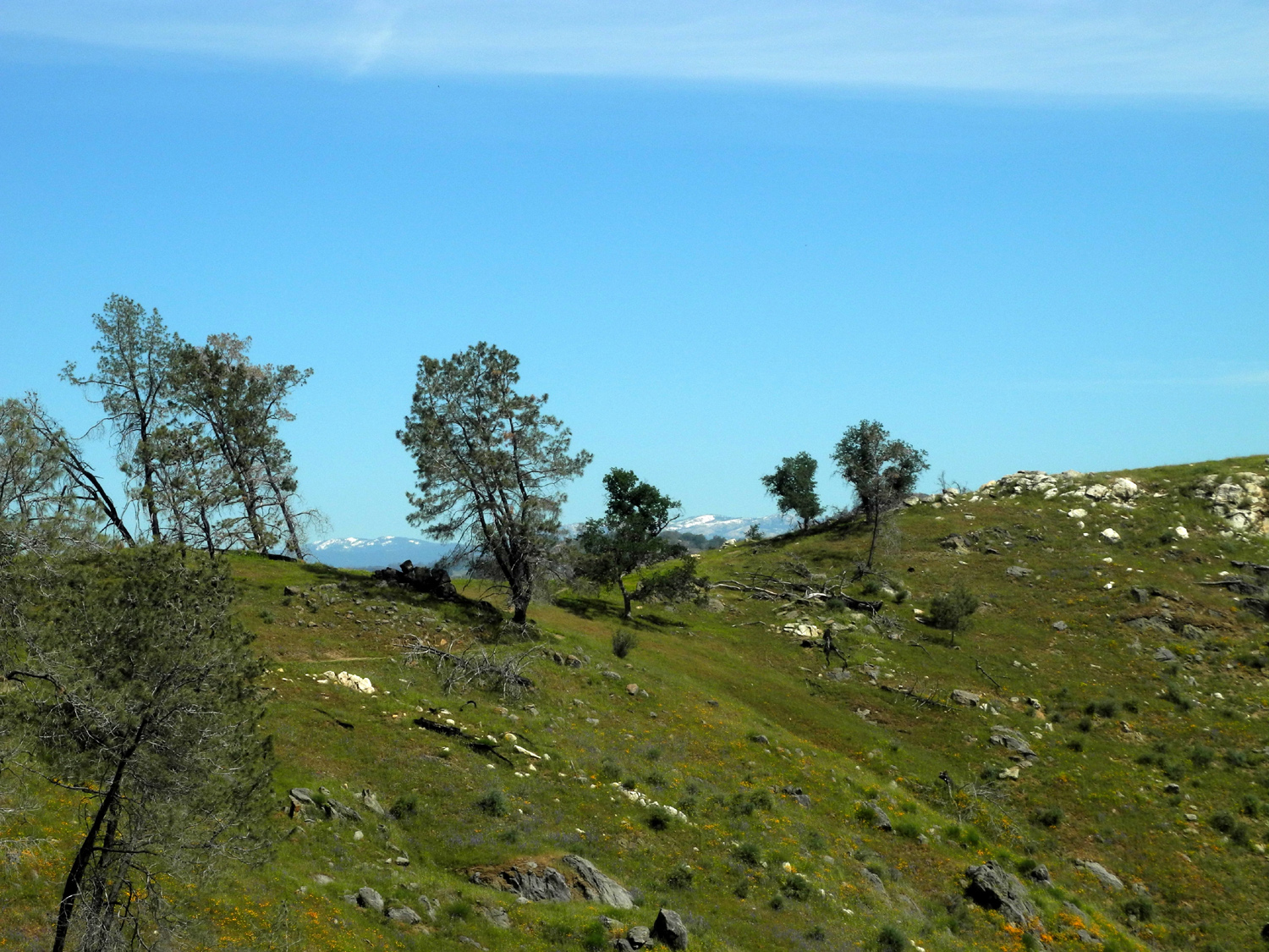
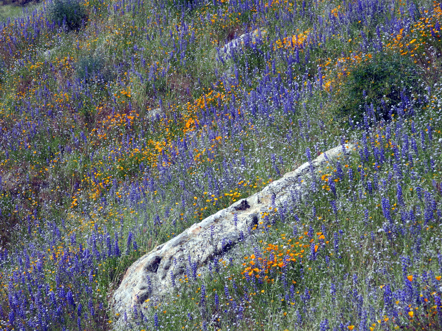
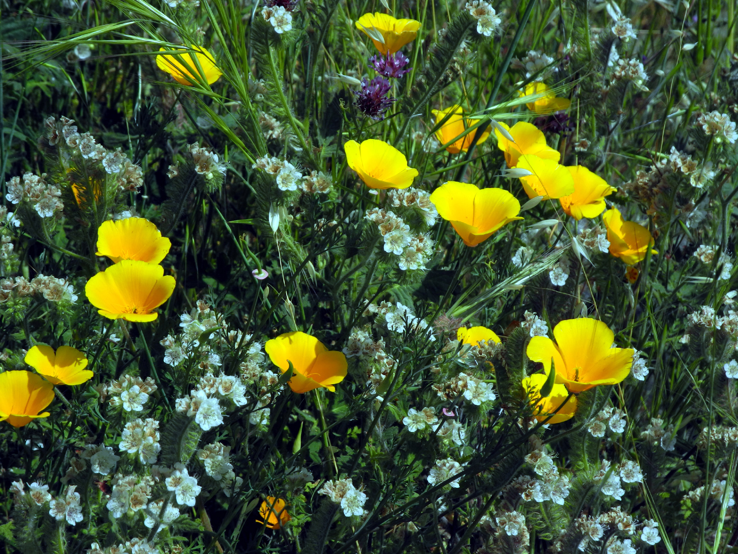
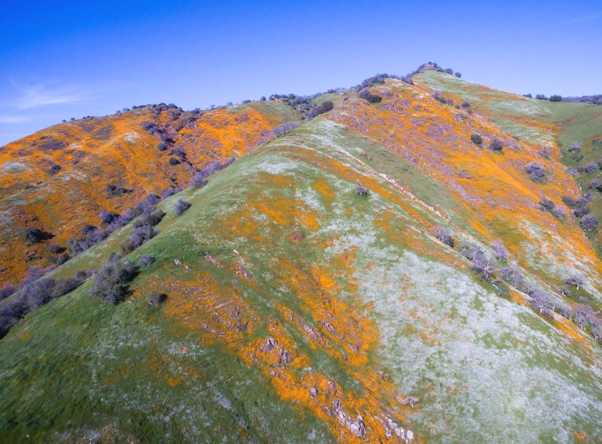
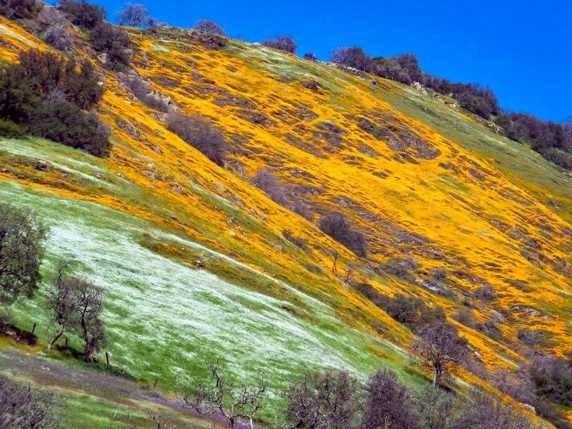
Pincushion Peak This was a hike I've been wanting to do for a year or two, and while it was worth waiting for, it was definitely one of the most difficult hikes I've done in recent memory. It was also very special because both my daughters, Teri and Jennifer, were able to join me, along with Wes Thiessen of the Ramblers hiking group. Jennifer lives in Oakhurst, and she and Teri both work, so it's difficult to schedule any kind of activity with both girls at the same time. In the fall of 2012 I made the first of a number of hikes on the western end of the San Joaquin River Trail, starting at the Finegold Picnic area trailhead. About a mile up the trail, it crosses over a saddle, which is usually my farthest hiking point. Here unofficial trails go in both directions perpendicular to the main route, and of course I wanted to find out where these side trails went. To the east, it's just a short walk up to a hilltop, and from there the terrain drops steeply down to the lake where it passes through a narrow section of the river gorge. The trail to the west goes up a fairly steep hill to the top of a knoll, and I made a couple of trips to this point. However, this only whetted my appetite for further adventure, because from this point you are looking up at a rocky hilltop, similar in formation to the various table top mountains in the area. This proved to be Pincushion Peak, and I vowed someday I would get to the top. Wes had made this hike in the past, and advised me that it is a fairly rugged climb, but that I should be able to do it if I took it slow and easy. This is the way I always hike, so - no problem, especially with Teri, Jennifer, and Wes for moral support - all of them younger and better hikers than I am. On February 20, 2016, Teri came to my house, and we drove to the trailhead, where we met Jennifer, arriving from Oakhurst, and Wes, who had a tight schedule for the day and needed to have his own car there for a quick return home. Wes and I had hiked in Yosemite with Jennifer last year, but it was the first meeting for Wes and Teri. After introductions, we got started up the trail. Between October and the start of February we've had a lot of rain, so the grass is green and flowers are coming out in good numbers. It was a moderately warm day, with a slight breeze, which became very strong and very cool on top of the first knoll, and on top of the peak. Rather than going up to the saddle, we took a trail that splits off about half way up, and goes up to the first knoll, becoming steeper as you get farther up. From this spot, there is a trail down across a saddle to the base of the peak, with another route splitting off to the left and going around the base where you can come up the west side. Wes advised us to take the more direct route, which was steep but not difficult at first. Then we came to areas where it was more a matter of rock scrambling than walking. After we made it safely through this section, we had another short, steep hike up an easier trail to the top. All along the way we saw many varieties of wildflowers, with some especially thick stands of poppies and other species along the southern side of the ridge. The top of the mountain rewarded us with views of Millerton Lake, snowy Sierra peaks, basalt topped table mountains, and foothill terrain covered with trees, grass, flowers and shrubs. The breeze was strong enough on top that I got out the long sleeve t-shirt from my pack and put it on. We chatted briefly with another hiker who had arrived there ahead of us, and he graciously took our group photo. After enjoying our accomplishment and the view for a short while, we took the "back" trail down. It proved to be very steep in spots, but without the rocks of the other route. We still had to make careful use of our hiking poles until we got down to the level trail that ran along the base of the peak to the lower knoll. Looking back, we saw that the top had become crowded as a large number of people made their way up just after we started down. Teri, Jennifer and I continued down the trail that goes steeply down from here to the main trail at the saddle, while Wes said his goodbyes and returned by the route we took coming up, to get home in time to get ready for a party at his home that evening. Just above the saddle, we found some rocks with places to sit, and enjoyed sandwiches and snacks that I had brought. From here we went on down to the main trail and started back to the trailhead. At the end of the hike we felt like we had put in a hard day's effort, having covered 3.3 miles. Everyone agreed that it was probably the most difficult hike they've done in the last five years, but we were all ready to enjoy another outing together soon.
|
||
|
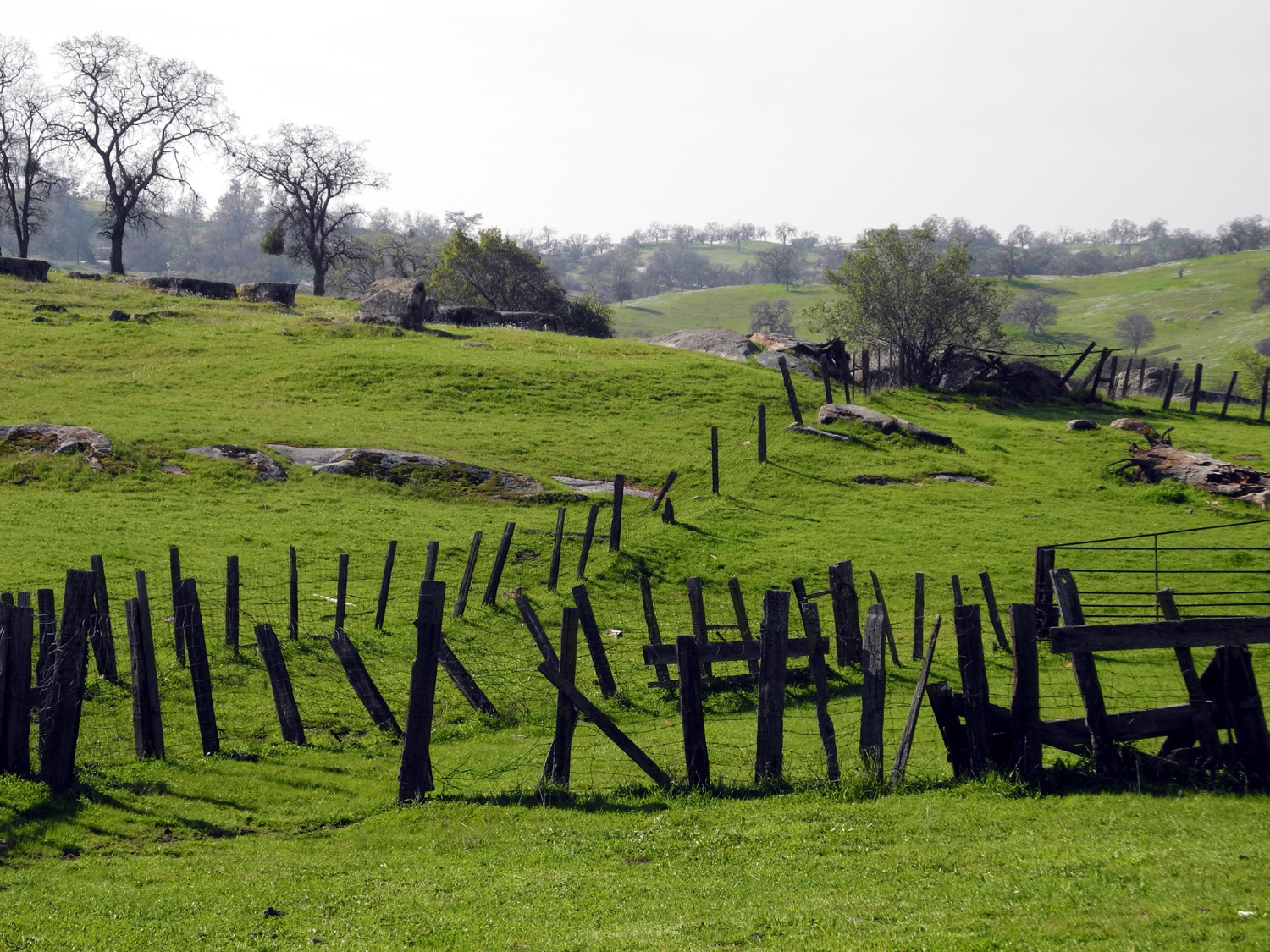
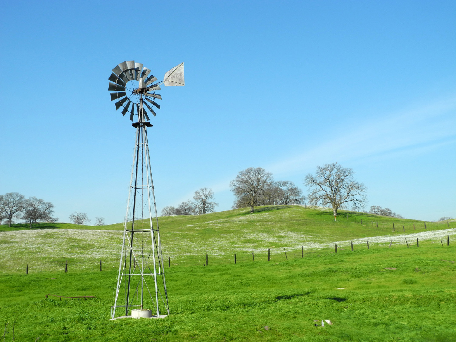
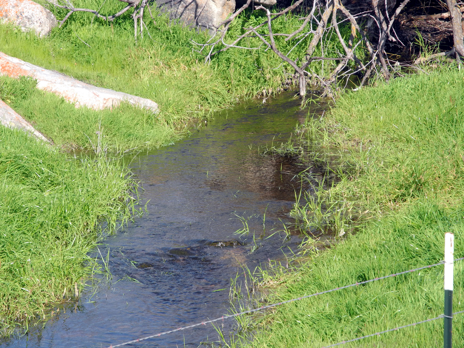
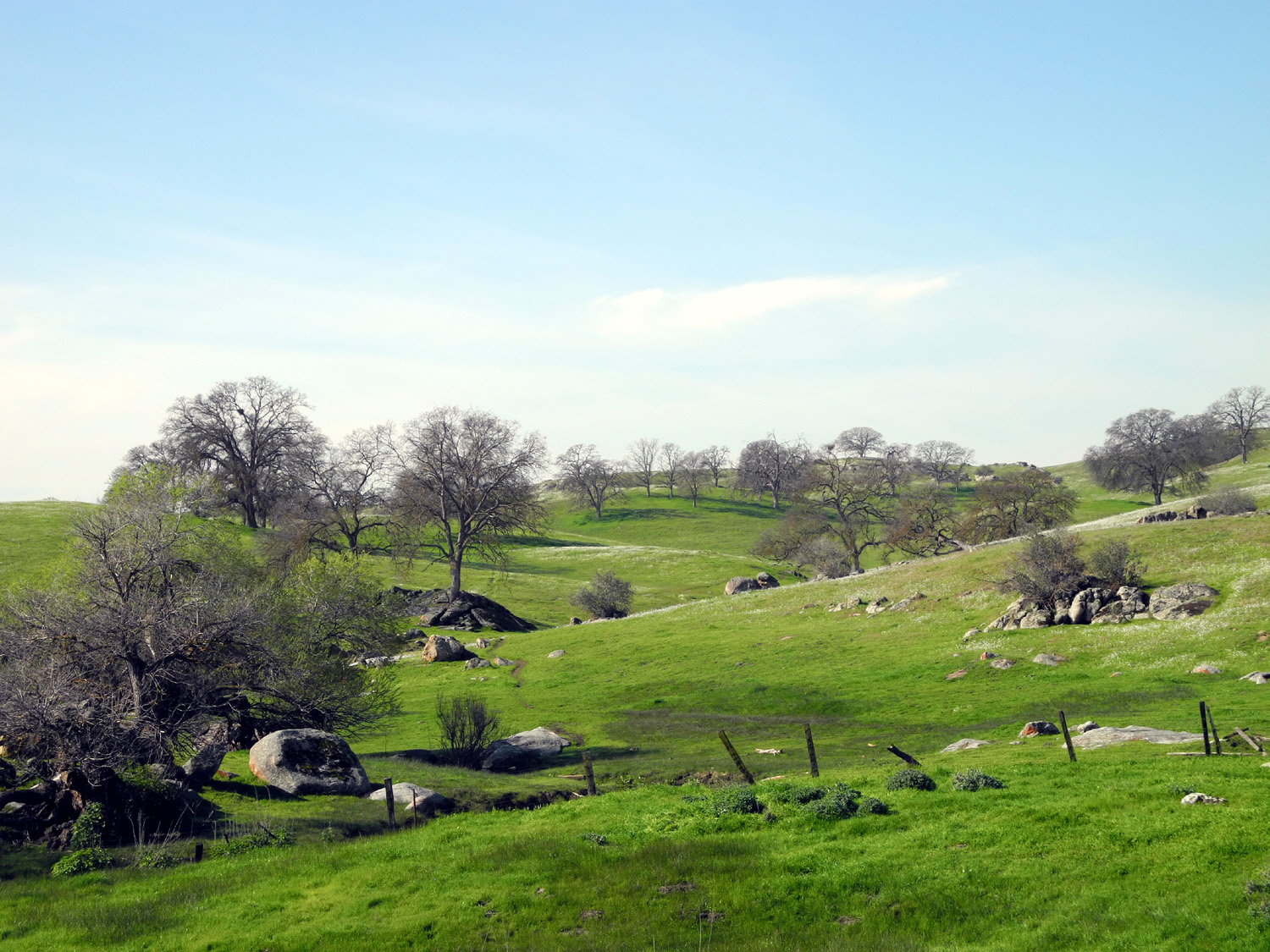
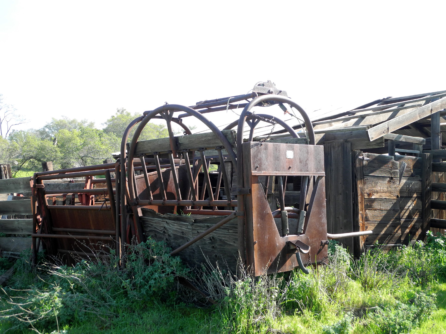
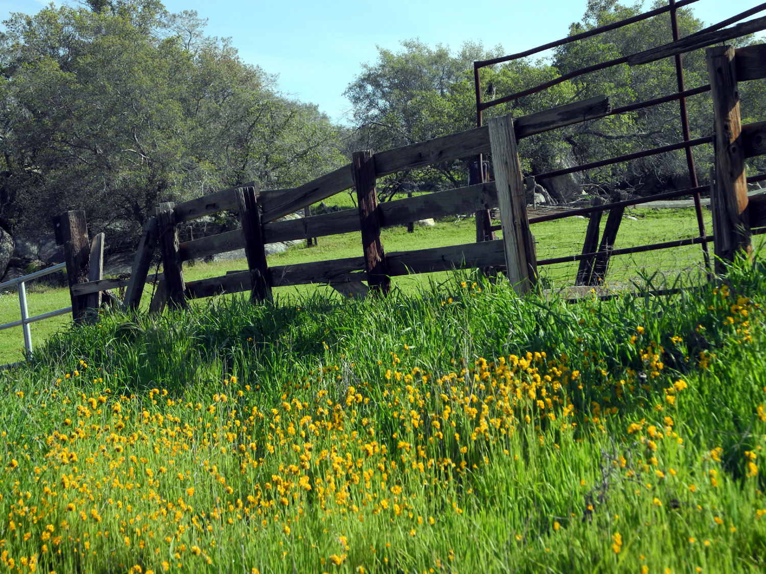
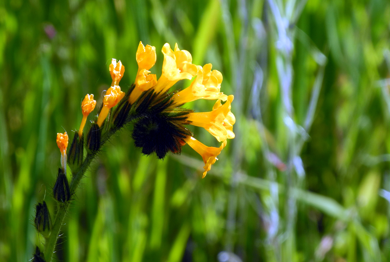
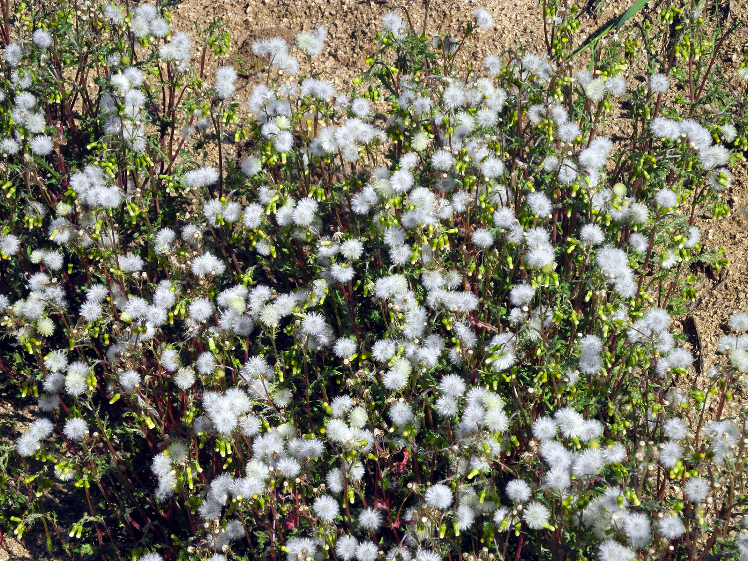
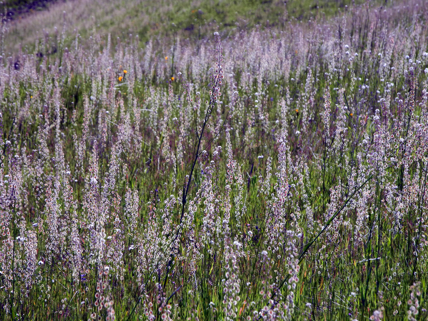
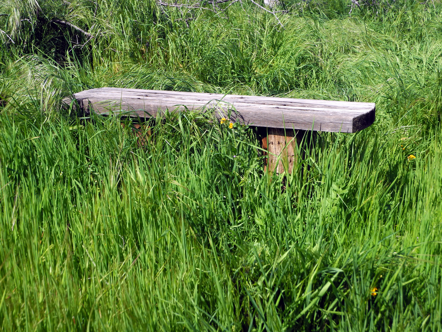
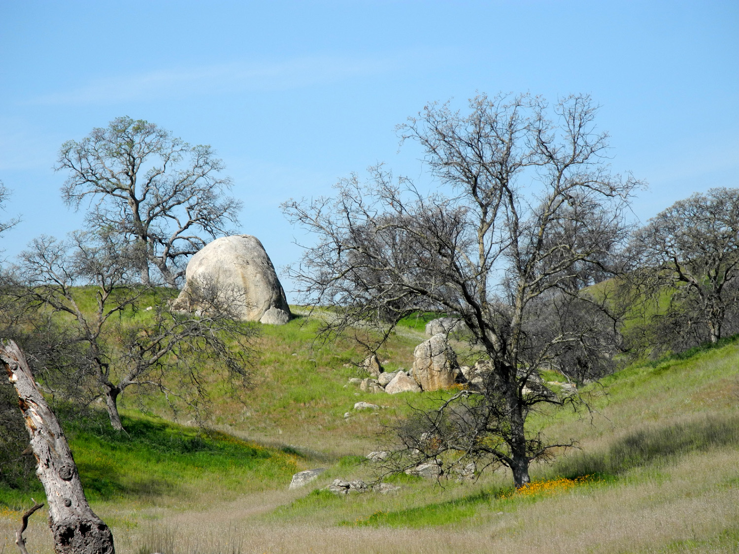
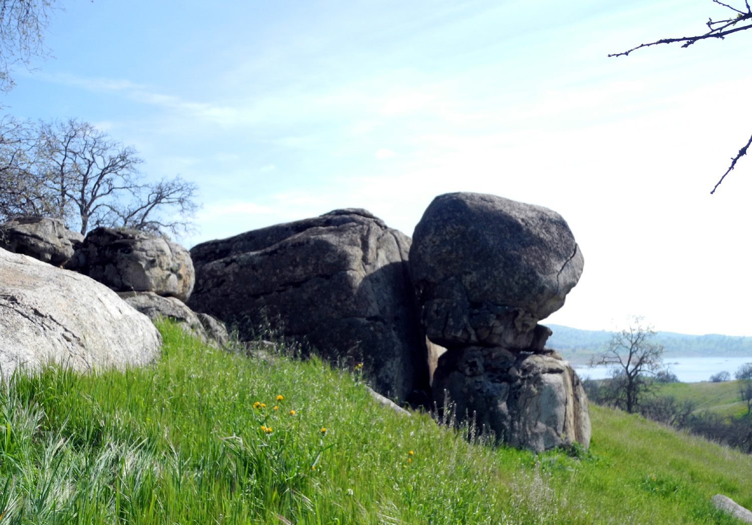
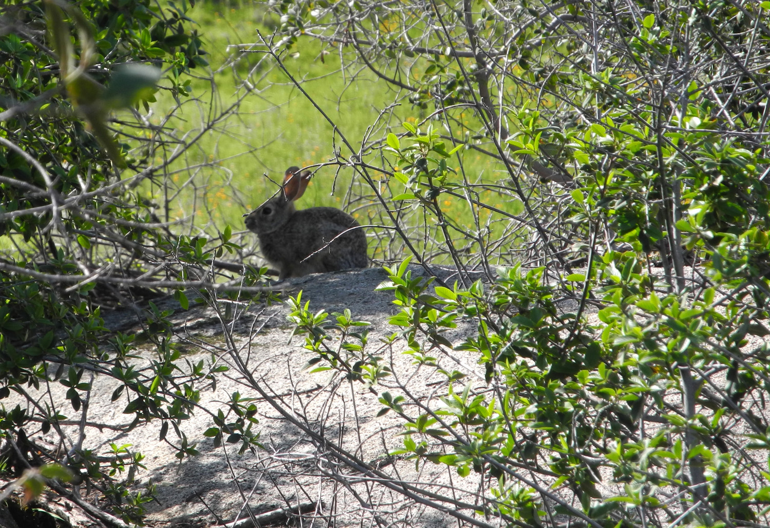
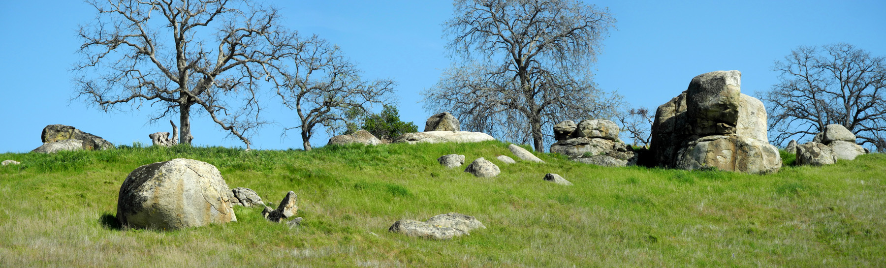
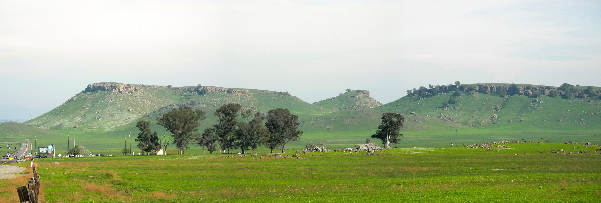
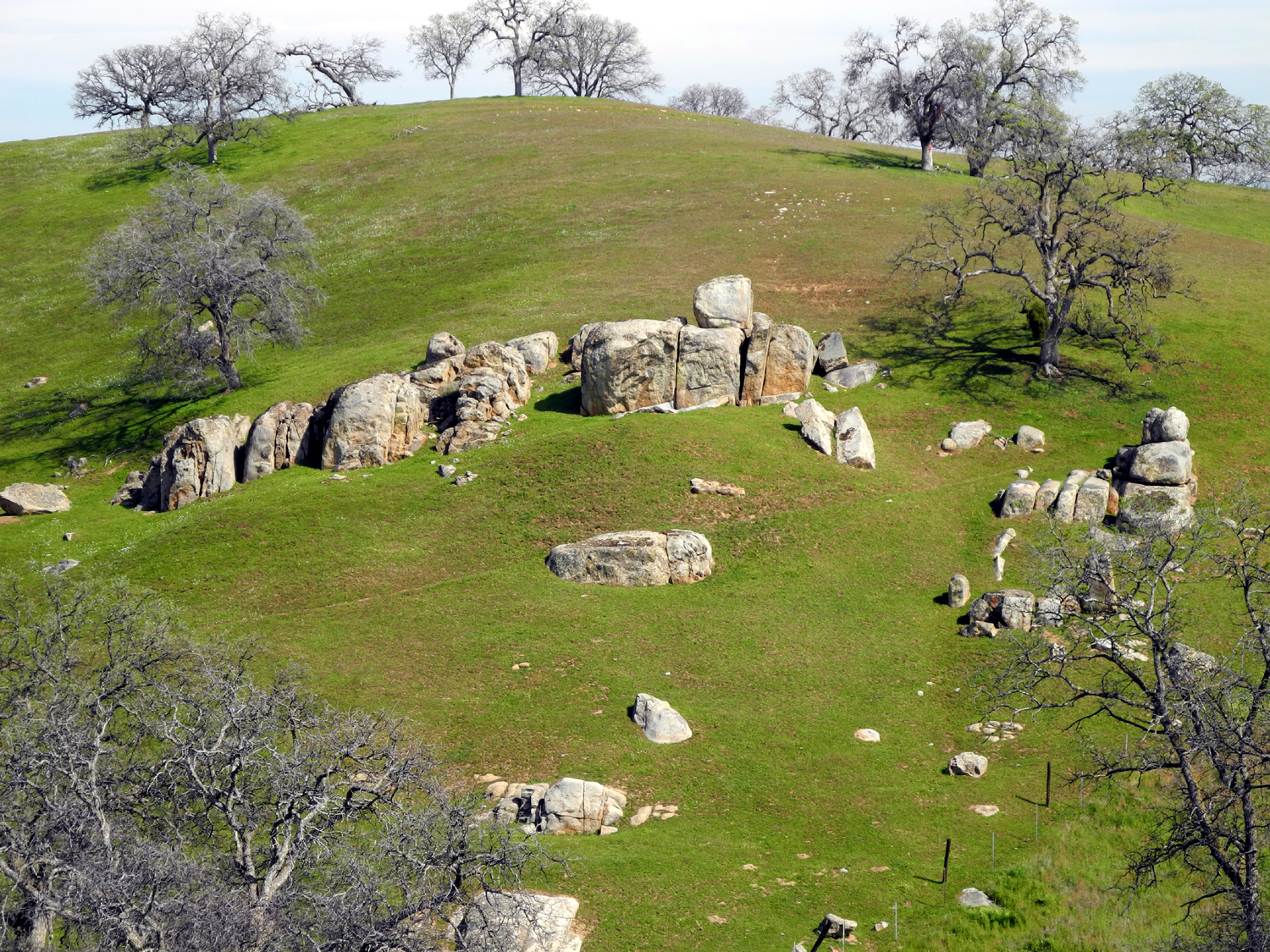
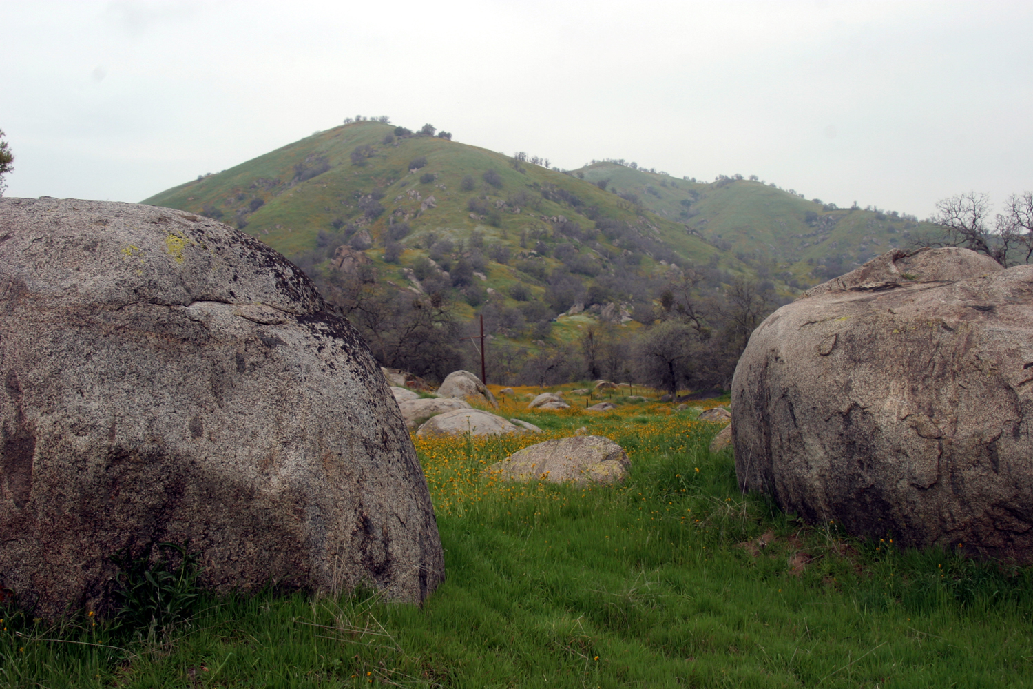
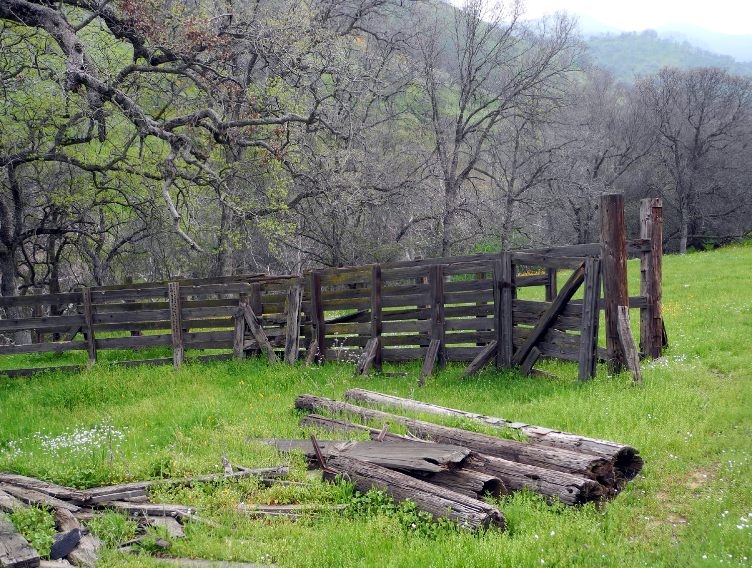
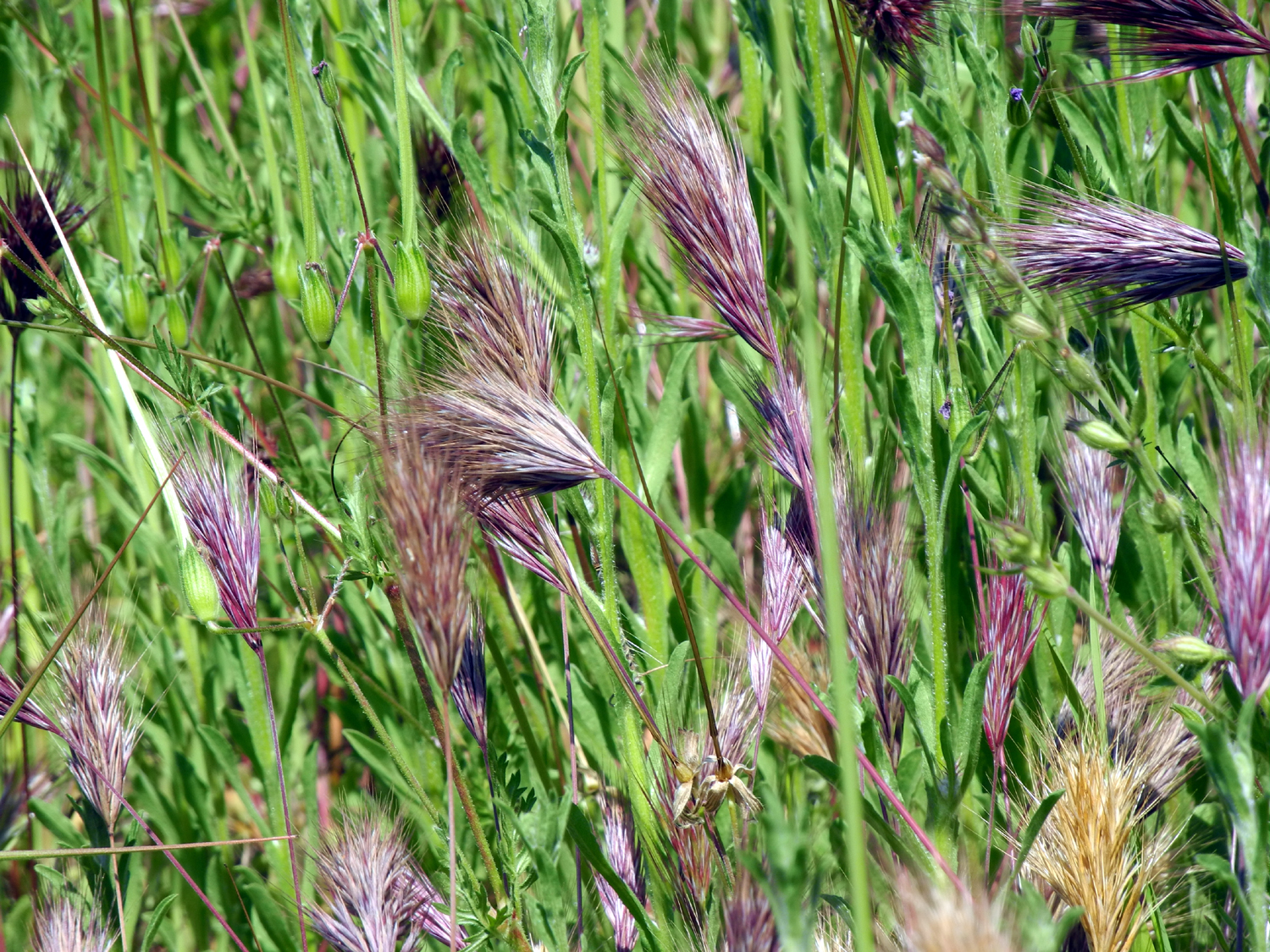
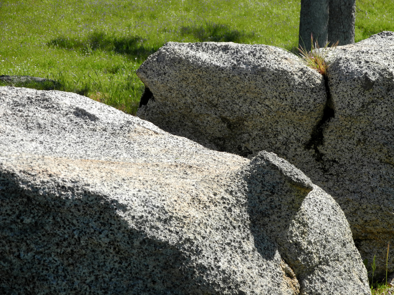
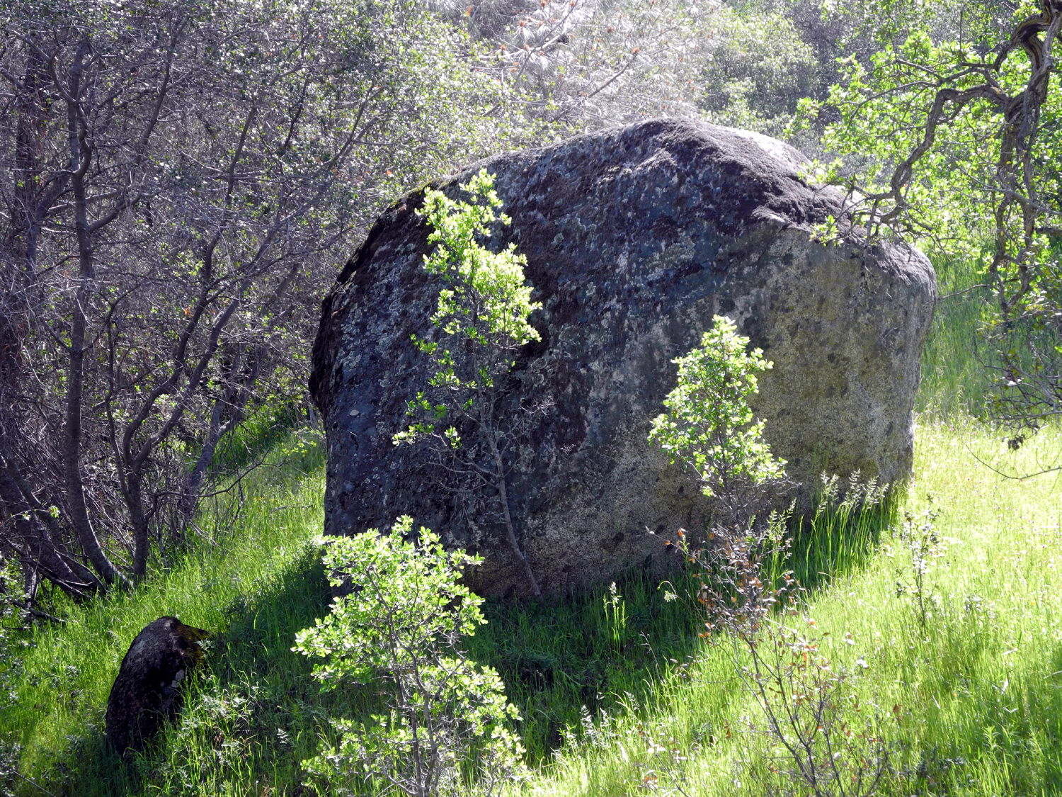
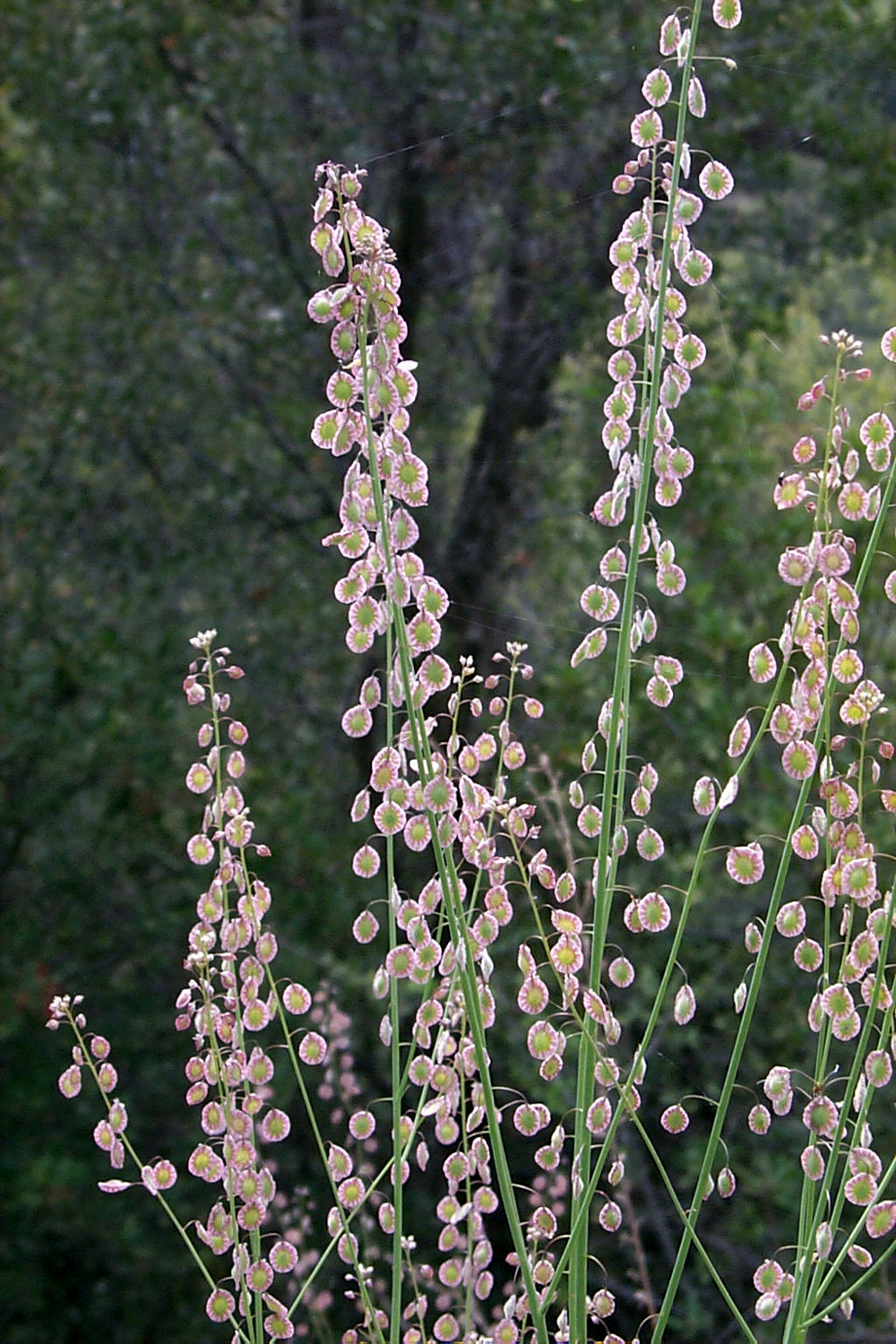
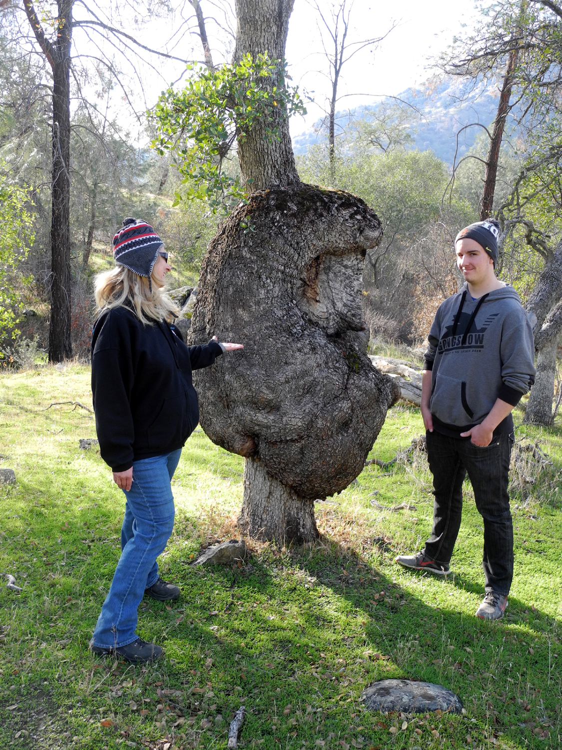
Hensley Lake Hike Every year I try to do some camping and/or hiking at Hensley Lake, on the Fresno River in Madera County. Most of the time it's camping, accompanied by short and long walks around the area, including the two official trails. Last year I camped there and the Ramblers came out for the day and we hiked the Pohonichi Trail. I didn't want to be gone from home for several days, so on February 23 I drove out there for a day hike. Instead of my usual route, taking Highway 145 off Highway 41 and then a series of county roads, I stayed on 41 another mile or two to the 22 Mile House, where Road 208 crosses the state route. Here I turned west on a narrow, winding paved road into the low foothills. Road 208 goes only a short distance in this direction before coming to a dead end at Road 209. This road comes out to Highway 41 between 145 and 208, and I had observed that they were doing construction at the junction about a year ago. I soon found out that they had re-paved the road for some distance. It was now a wide two-lane road with a center line and very smooth, although still with enough curves to keep the speed down to 40 MPH or so most of the time. A project of this type in remote areas usually means someone living there has a friend on the board of supervisors, but this was not the case here. The new pavement ended at the site of the Madera Quarry, and had obviously been improved due to heavy truck traffic from that location. I stopped once along this road because I can't resist photographing windmills, and the one I saw was in a very nice setting, next to a creek and surrounded by oak-covered green hills. Past the quarry the pavement is old and slightly rough, but not really bad, and the road ends at Road 406 a mile or so from the quarry. I turned right on Road 406, which was a dirt road going north. I had been over this route a few years ago, so I expected a dirt section. Only a short distance up this road, I saw an old corral with fences, cattle chute, and a shed, demanding to be photographed. The surrounding green fields, covered with fiddlenecks, also caught my eye. I spent about 15 minutes there, and when I got back in the car, I thought it might be a good idea to double check my map. This proved to be a VERY good idea, since I was on the right road, heading the wrong direction. This was a good thing, since I got to see the old corral, but I made a four point turn on the narrow road and went the opposite way. A turn like that was also no problem, since this road had no traffic. In fact, on the entire distance from Highway 41 to Hensley, I probably saw fewer than ten cars. Road 406 in the right direction was paved, and went for several miles through more foothill scenery, dropping down in elevation as it approached the next road. As it went down, the trees also disappeared, and I was back in open valley grassland. I came to the dirt stretch that I had remembered from previous trips, where a sign warns that the road is impassible in wet weather. I have actually driven this route on a day when we had snow in Mojave, and Highway 41 required chains near Coarsegold, and we got through the one or two slightly muddy places with no trouble, but I would not drive it during an actual rainstorm. The dirt road continued another mile or two to Road 400, the familiar route that I usually follow most of the way after leaving Highway 145. After a few more turns, I arrived at the park, paid my day use fee, and drove to the trailhead. The Pohonichi trail is officially a one-mile loop trail that goes up and down over several ridges. Going clockwise, it goes more or less east, turns south, then turns back west, but of course, the foothill terrain dictates that at one time or another it goes in every direction possible. I've walked the trail a half dozen times or more, and always go clockwise, up a steep stretch, then over a ridge and down, then more ups and downs till it returns to the parking lot about 50 feet from the starting point. The day was sunny and warm enough that I hiked in a short sleeve t-shirt. I had gone over the first ridge when I started wondering if I had got off the trail. I did not pass a unique rock formation that I thought was just over the first hill, and as I came down to a low spot, I did not see the big blue oak tree with a bench under it that should be there. Since this was ranch land, there are many old roads and cow trails, and the main trail is quite overgrown, with very tall grass along many parts. Eventually I spotted a landmark that confirmed that I had gone off the trail. I cut across to the "other end," a section of the trail near my normal end point, and started to follow it going counter-clockwise. This was no problem, since I could continue this way and only retrace my steps down the last hill (which of course, was also the first hill). However, I had already planned to make an off-trail excursion. East of the farthest stretch of the trail there is a ridge with some big boulders on top which I have named Far Rocky Ridge. Traveling the "wrong" direction, I spotted an old road which led down to the base of a ridge, and I thought I could follow it and make my way up to the top of Far Rocky Ridge. As I got to the bottom, I saw a fence across the slope above me. In my younger days, a barbed wire fence did not slow me down, but they make them tighter these days, and getting through usually requires assistance, so I cut to my left up the drainage, back to where I thought the trail would be. As I neared the top of the hill I was climbing (mostly following cow trails and game trails), I realized I was coming up on the back side of Far Rocky Ridge, so once again a "wrong turn" led to a good result. On top of the ridge I found a flat rock to sit on while I had a snack, rested and took lots of photos. I had also planned to go north off the trail and around a big round boulder that I have named Dome Rock. However, I had been there before, and recalled that it was not particularly interesting up close, so I went down the ridge and had just a short walk up to the trail where it made its turn and started west toward the parking lot. Throughout the hike there were lots of flowers, with fiddlenecks being the most prominent. There was also an unusually profuse growth of lace pods, a plant that usually grows about a foot high, with small thin seeds on both sides of the stems. This year they were two to three feet high, growing in patches a hundred feet or more across. Because of the slightly tan color of the seeds, in this quantity they looked like dry grass from last season, but a closer look revealed the truth. I made it back to the trail and the parking lot, although not without another unintentional detour. This one just took me around one side of a bunch of rocks, in a place where both the real trail and the fake one were both fairly steep. From the trailhead parking lot I drove around to the road that goes to the boat launch pad and parked next to but outside the campground. Here I walked into the area north of the road and around Rabbit Rock, a pile of granite boulders with various bushes and trees growing in them, where I almost always see rabbits. This time was no exception, and a flock of quail hopping through the rocks added variety. I also saw hawks and squirrels. Nearby there is a small forest of bush lupines, which were mostly in bloom, so I walked over there and took pictures, then started for home, following my normal route. Where State Highway 145 comes into Highway 41, I stopped and took a number of photos of Little Table Mountain, which lies east of 41 and south of 145. Even with all my
wandering the hike only amounted to one and three quarters mile, but
I had plenty of hours of exercise, and the pleasure of being out in
the green foothills. --Dick Estel, March 2016 |
||
|
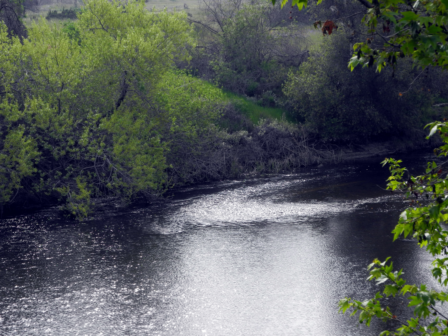
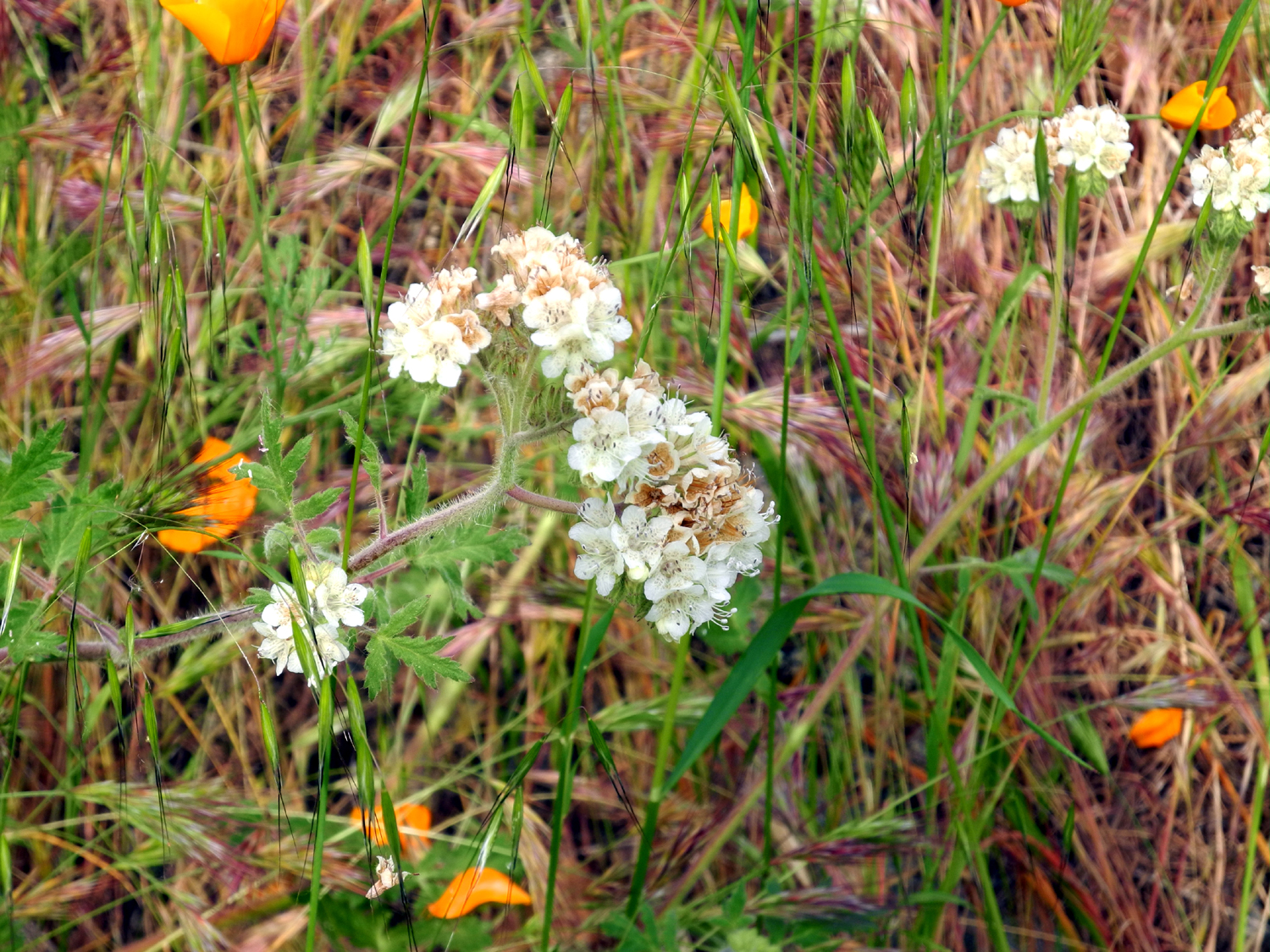
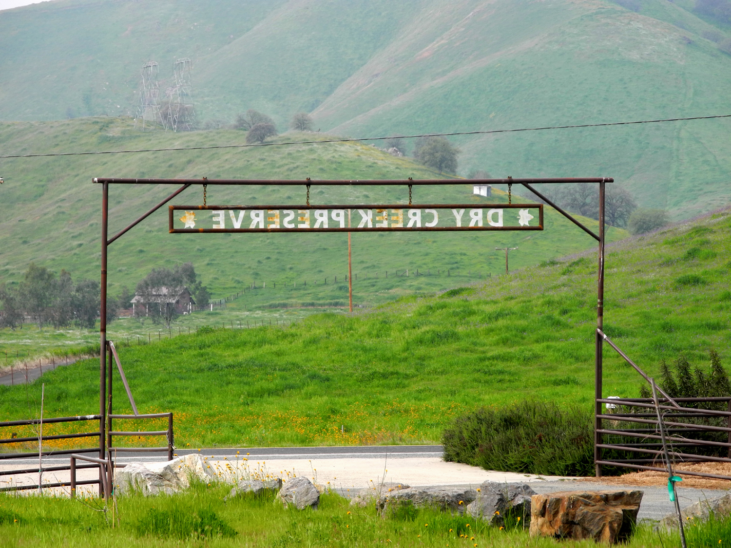
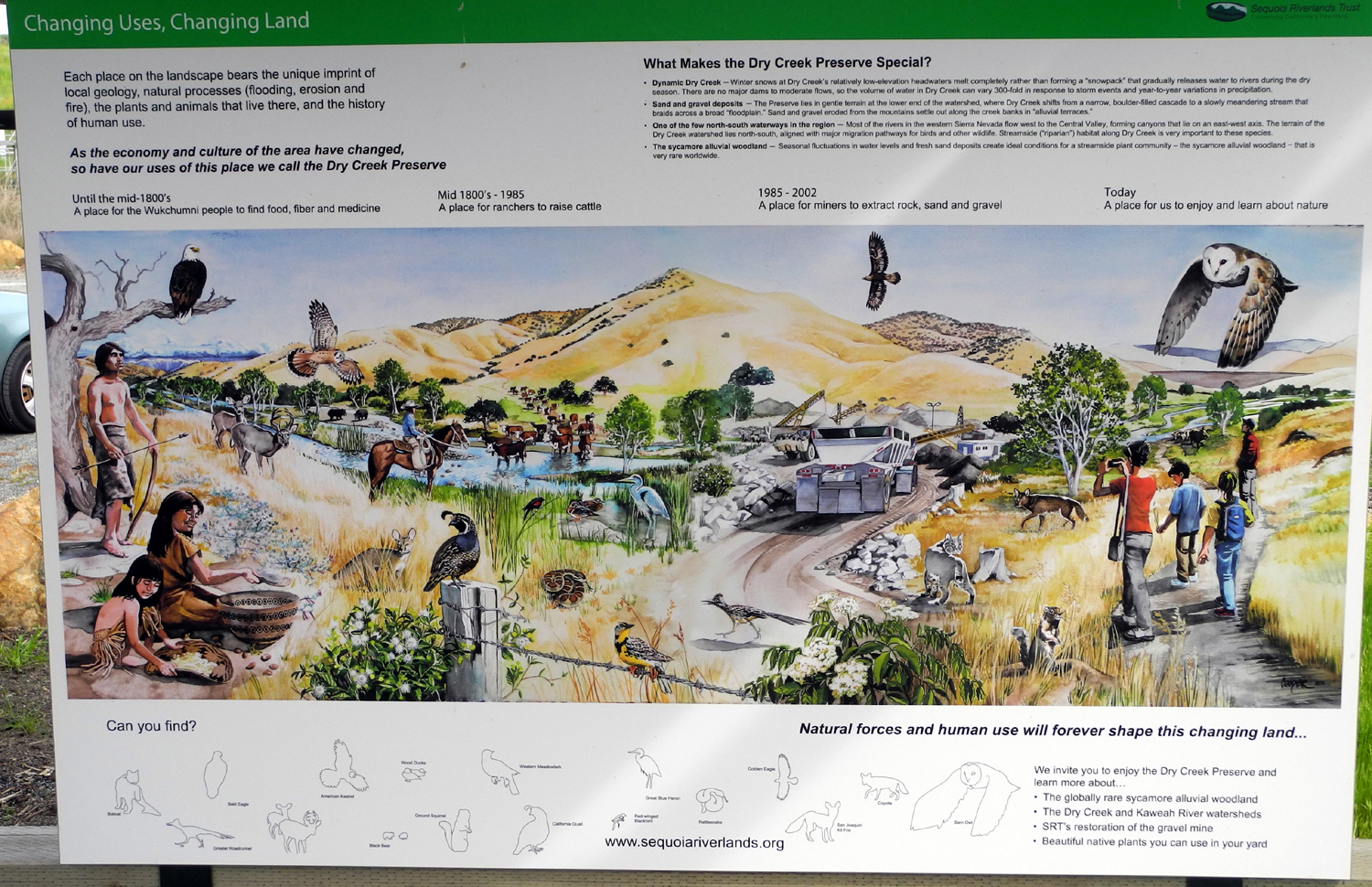
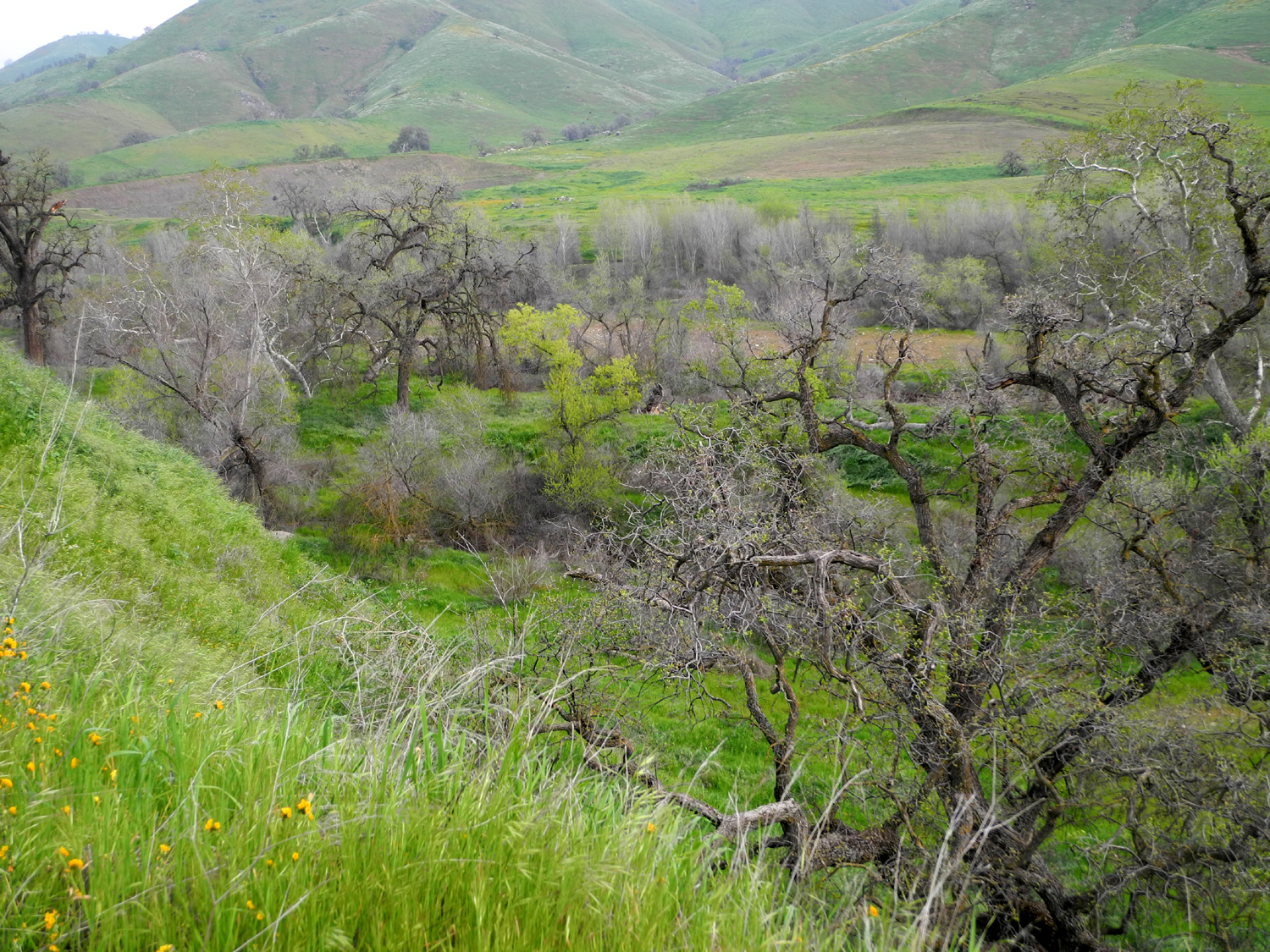
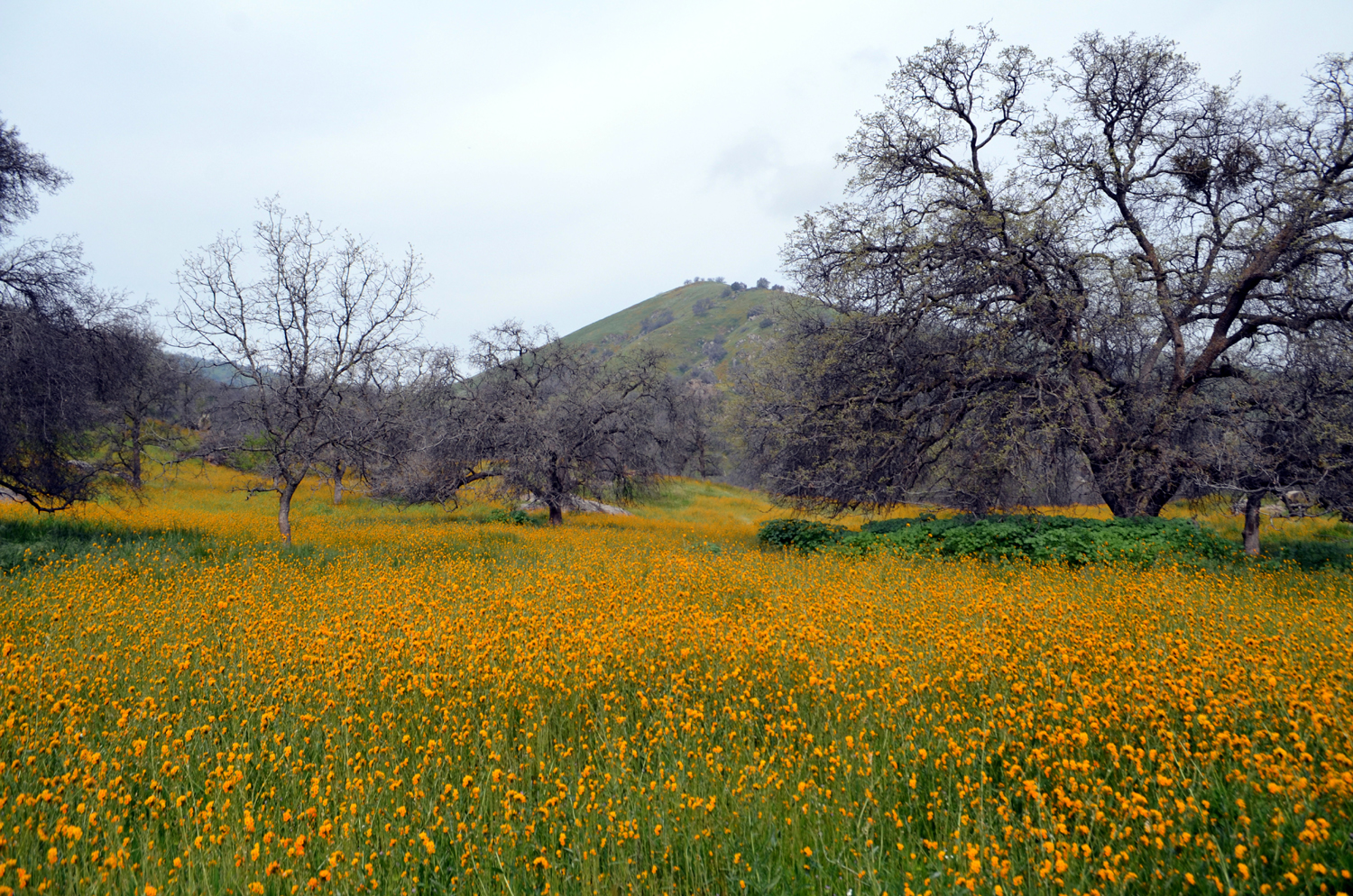
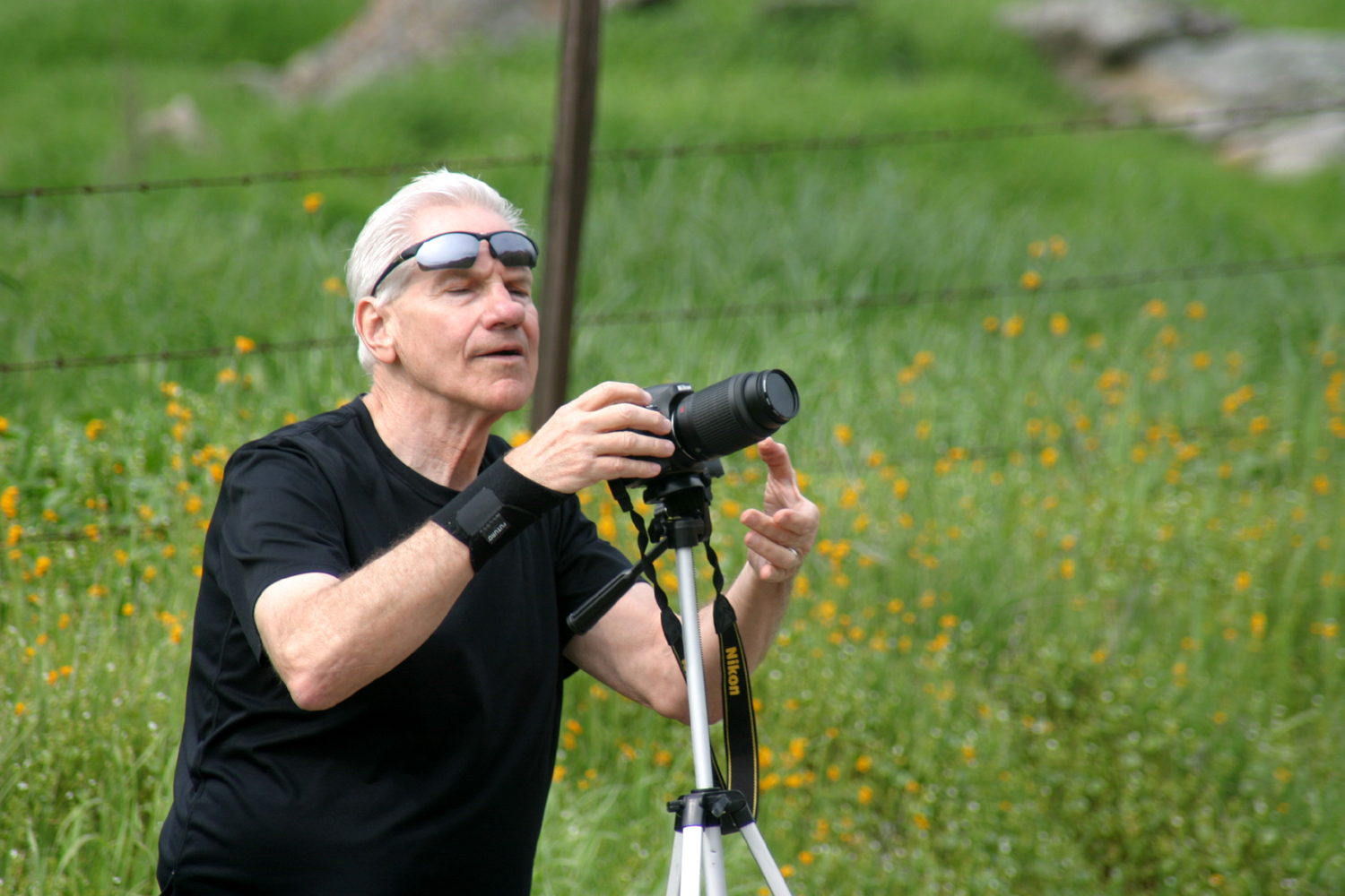
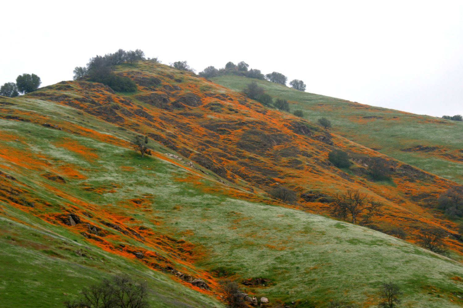
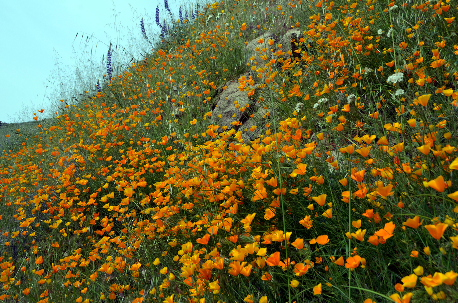
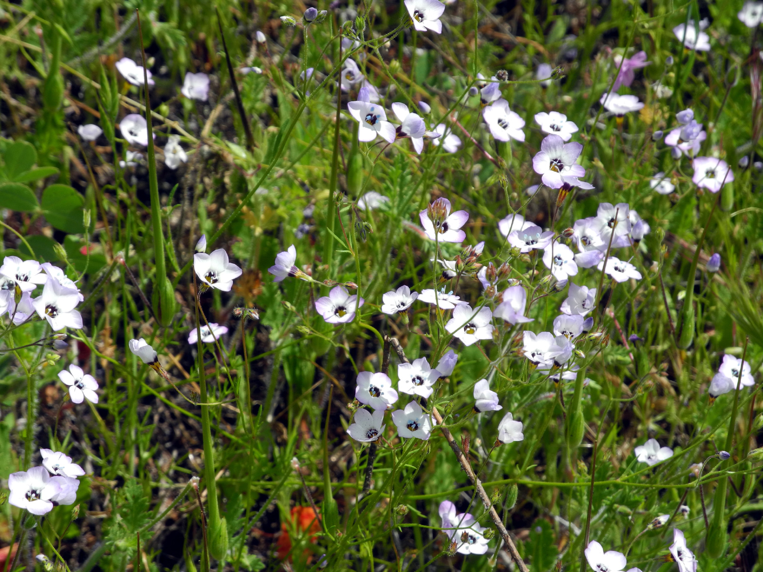
Dry Creek Canyon (Tulare County) In early February an old Bootjack elementary school classmate, Larry Jordan, started posting some nice poppy photos on Facebook. People asked where the pictures were taken, and the answer was, "along Dry Creek." I asked for further information, and Larry gave me exact instructions on how to find the spot. I had shared the photos with my Rambler hiking companions, and Wes Thiessen suggested that we take a drive to the location on February 28. NOTE: The Dry Creek discussed in this report should not be confused with the Dry Creeks of Fresno County, which are in the San Joaquin drainage. Our trip was to Dry Creek in Tulare County, a tributary of the Kaweah River. Wes arrived at my house at 8 a.m., and we drove south on State Highway 99, then east into Visalia on Highway 198. We stopped in this busy city for coffee, then continued to the tiny town of Lemon Cove, population 308. If you stay on 198 from this point, you will soon pass Lake Kaweah, go through the village of Three Rivers, and eventually climb up into the Sierra and enter the southern end of Sequoia National Park. However, we turned northwest onto State 216, crossing the Kaweah River within a mile, then east on Dry Creek Drive, also known as County Road J21. From here it is 20 miles to the town of Badger, where Larry lives, about eight miles from the southwestern border of Kings Canyon National Park. We were not going that far, since the prime poppy location was half way between Lemon Cove and Badger, and of course, we would make many stops to take pictures. We had only gone a short distance on the county road along the river when we spotted a hillside of poppies and lupines, with a convenient parking spot between the road and river. While we were taking photos, another car stopped, and two women got out and joined in the picture taking. As he always does, Wes offered to take a photo of them together, using their camera, and also asked them about some white flowers that we could not identify. It turned out that this was one of those fortuitous meetings that add to the adventure - one of the women was an amateur botanist and knew the names of several flowers we had not been able to identify in the past. The particular specimen in question here was Phacelia, a white, somewhat fuzzy looking flower that we see all over the foothills. The ladies also gave us some additional important information. First they told us that just up the road was Dry Creek Preserve, which was worth a stop. Beyond that was another point of interest, the Homer Ranch Preserve. And one of the women was in charge of the web page, Tulare County Treasures, which documents Tulare County conservation efforts over the years. We soon arrived at the Dry Creek Preserve, which overlooks Dry Creek near where it runs into the river. The preserve was reclaimed from a former gravel mine, and lies just below Terminus Dam, which forms Lake Kaweah. There are several short trails that wind around through the property, with plaques explaining the various trees and plants, as well as a mural showing use and occupancy of the land over the centuries. We walked around and took photos, then got back on the road for the short drive to the Homer Ranch Preserve. Here there are loop trails that cover about a half mile between the two extreme ends, but which offer a mile or more of hiking, along the creek and in flower-covered low foothill territory. This location marked the start of several miles of road with fiddlenecks thick on both sides, and it is a certainty that individual fiddleneck plants in the Sierra foothills must number in the high millions, maybe billions. At the Ranch we got some excellent photos of green fields covered with fiddlenecks and other flowers, nicely set off by granite outcroppings and oak trees. As we entered the valley of Dry Creek, the hills above us were party obscured by mist, and we were concerned that it might not be the best day for photography. We continued up the road, entering the hills that were orange with poppies, where Larry took his photos. Although it would have been better to have bright sunlight, we still took many pictures at our turnaround point, about ten miles up the road from Lemon Cove. Wes observed that we were looking up at the poppies from a fairly low angle, while Larry's pictures seemed to have been taken from somewhere higher on the hillside. I speculated that as a resident of the area, he knew about all the back roads, where he might find a better spot to shoot from, but I later learned that he has a drone to take his camera up where the view is better. I've provided links to two of his photos below. Larry had told me he might be driving down "poppy way" but when he saw the fog down the canyon and clouds around him at 3,000 feet, he went up into the national park instead. As for the intrepid adventurers from Fresno, we were trying to get back in time for something I had scheduled, so we finished up our photos and headed down the hill and back to Visalia. We enjoyed lunch at In-N-Out, then got back on the freeways and back home. Our trip was about 80 miles one way, but close to two hours of driving due to the narrow, winding condition of Dry Creek Drive. Despite the fog and mist, we saw acres of flowers, discovered some new places we had not known existed, and enjoyed a fantastic drive in the country.
|
||
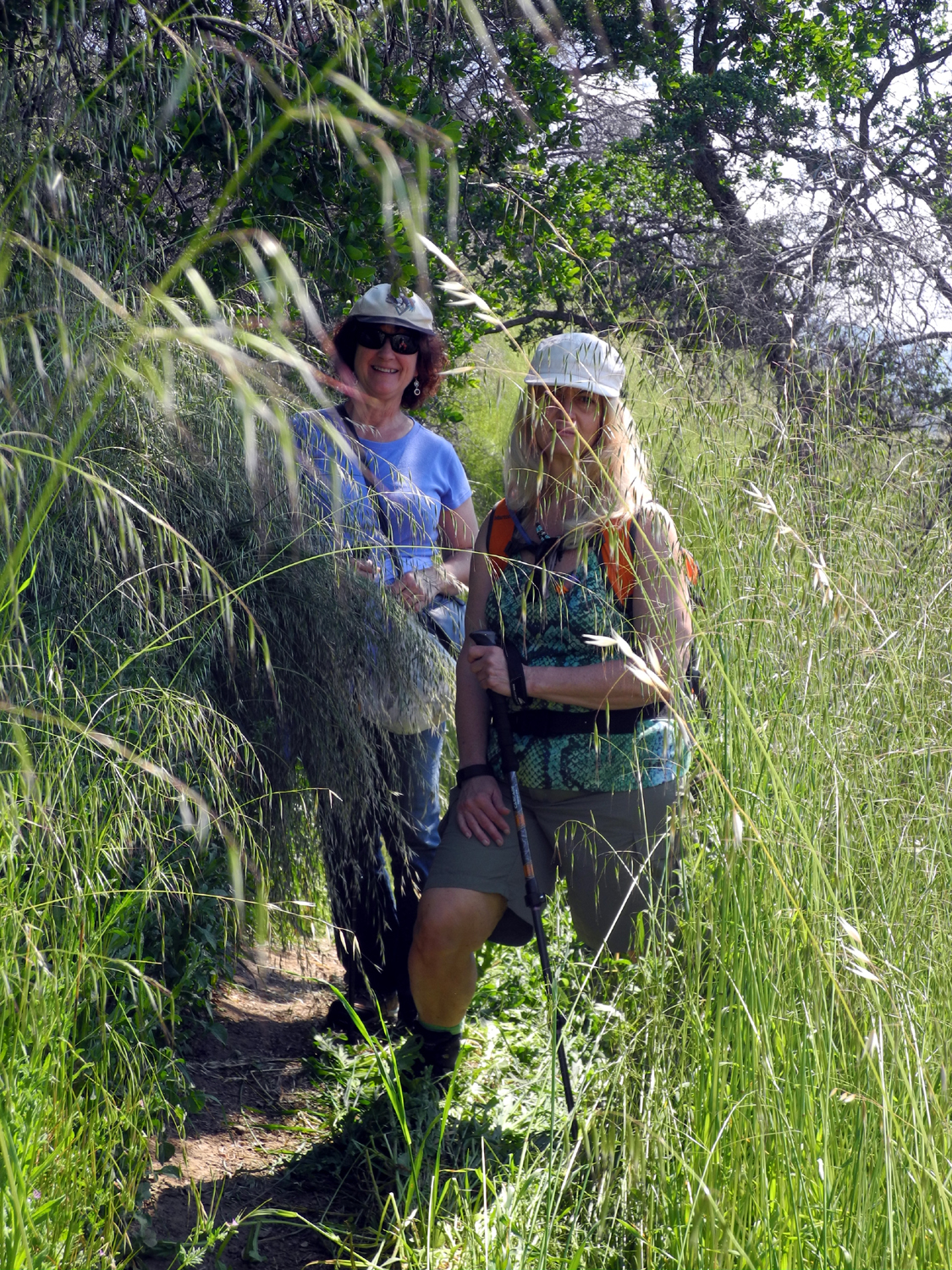
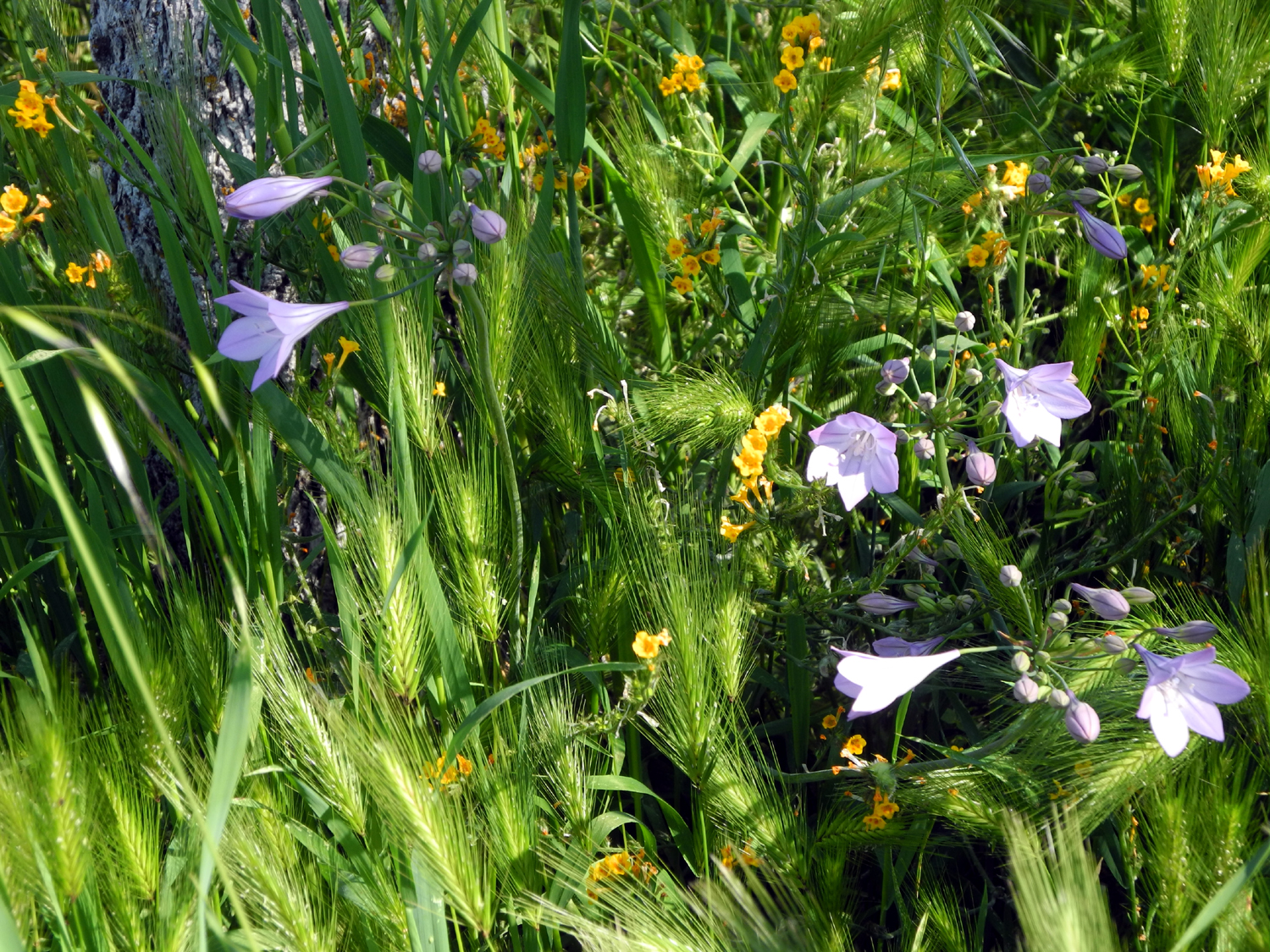
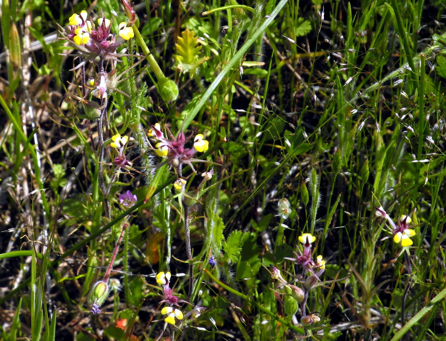
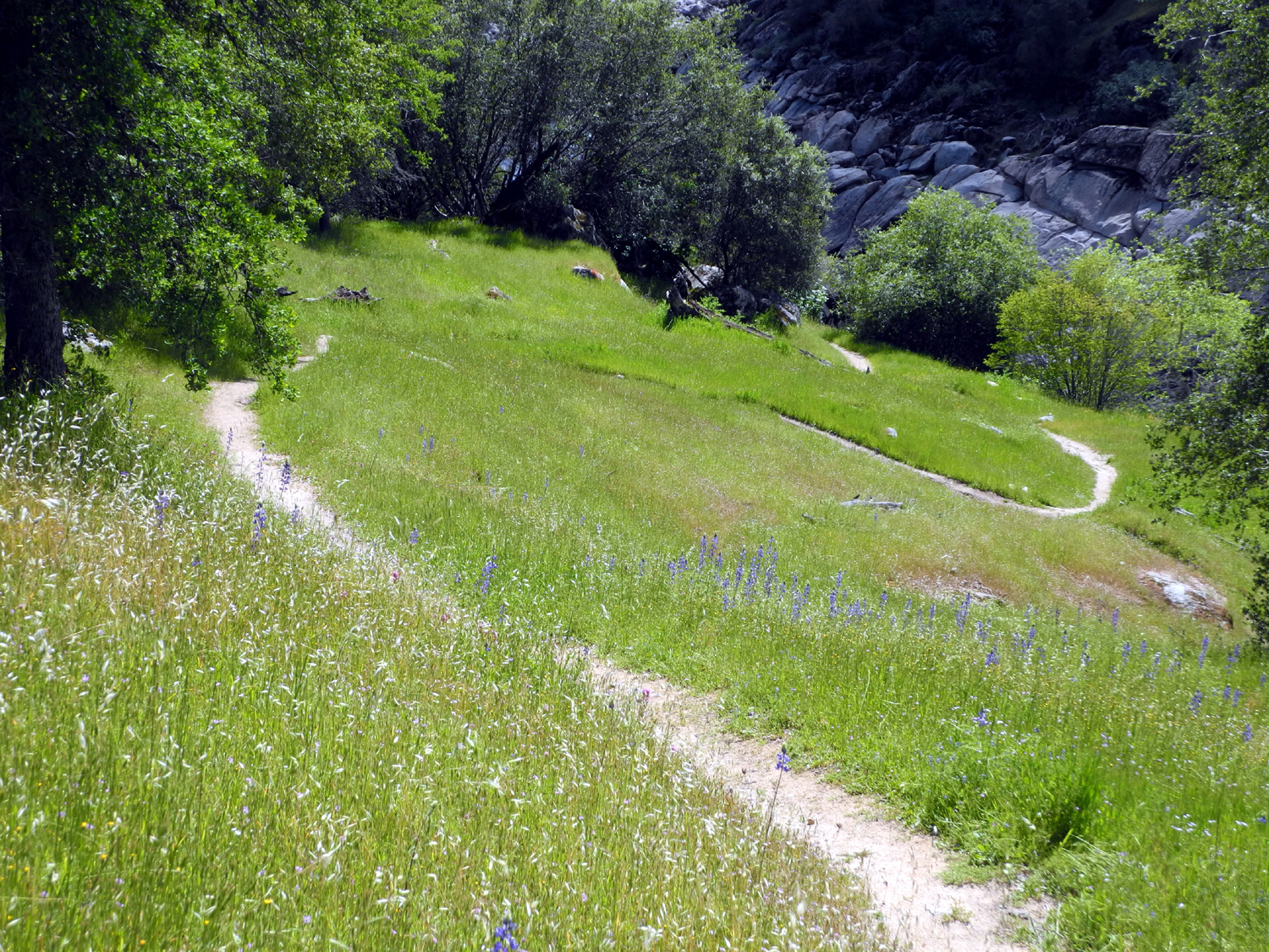
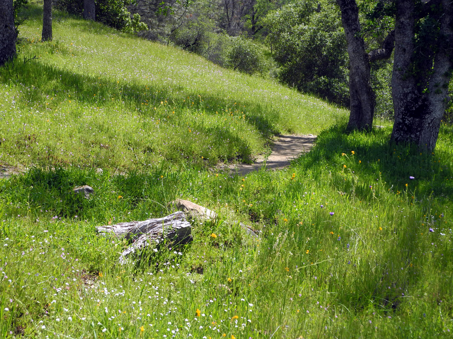
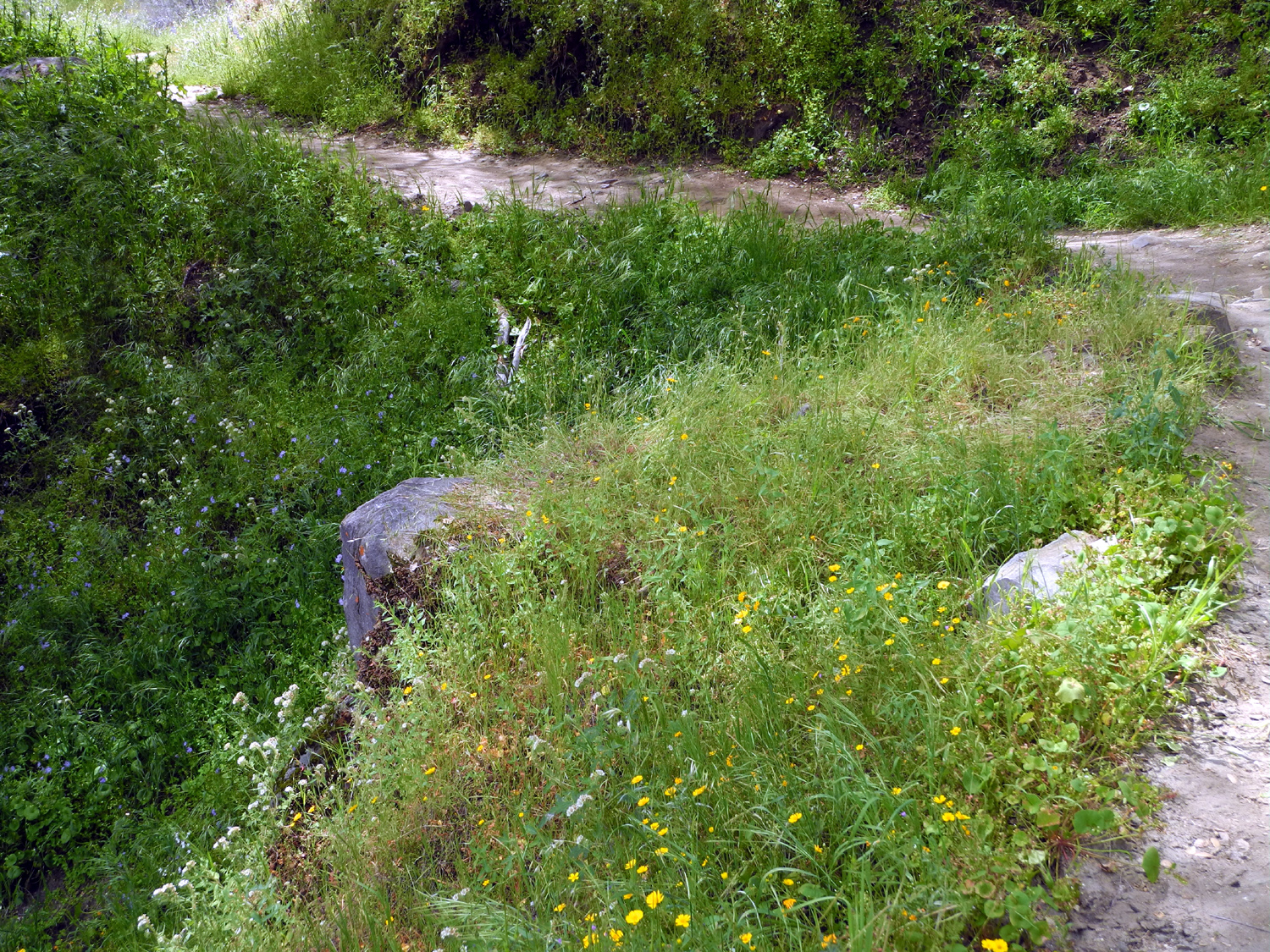
Edison Point Trail: In 2015 I hiked on the Edison Point Trail twice, each time enjoying a different batch of wild flowers. The first hike was with the Ramblers, and we made the hike again this year, completing the entire trail instead of the shortened version that we accomplished last year. For the Ramblers on February 29 there were masses of poppies on the hills and along the trail, as well as a dozen other flowers in large numbers. What was missing was the purple brodiaea, which was thicker than I had ever seen it on my solo hike last year. Therefore, I knew I had to make a second hike this year, allowing another month for the development of the flowers that thrive later in the season. For this hike, on March 26, I was joined by my daughter Teri and her friend Monica. Neither had been on the trail before, and Monica had not been hiking much recently, but was in good condition and an outdoor enthusiast, and both were up to the challenges of this trail. The first part of the route is an easy, gentle walk up a dirt road, leading out to Edison Point, where you get nice views of the lake Of course, there were various wildflowers along the way, but the real treat was yet to come. From this high point, the trail goes around the point, then straight down the hill for about 100 feet before settling into a long series of switchbacks down to a bench at high water level. Although the crow's flight distance from the point to the bench is fairly short, the long switchbacks make the trailhead to bench distance more than half the 2.2 miles total. During most of this section, we were walking through very tall grass, just as the Ramblers had a month earlier. However, since that time cows have bedded down in the grass, creating many small "islands" where the grass is flattened down. In some areas this has caused places where it is easy to lose the trail and wander through one of the flattened areas. In most cases, it was immediately apparent that we were going off the trail, and we could quickly make a course correction. However, in at least two places we got off the trail for some distance, and had to work our way down the hill to a lower section of it. Along the way we saw many wildflowers, including varieties that had started blooming in early spring. It seems that many flower species are having a particularly long season this year, perhaps related to the high rainfall levels in the first few months of the rainy season. However, the best were yet to come. After our various cross-country missteps and the long back and forth travel on the switchbacks, we were all ready for a rest when we finally reached the bench. Since my visit a month earlier, grass and flowers had grown up through the metal mesh of our resting place, but this only added to the enjoyment of our break. Teri had brought sandwiches for herself and me, and Monica also had a light lunch. We probably stayed there a half hour, getting a good energy boost for the final part of the trail. The energy would be needed as we followed the long, looping switchbacks back to our starting point. The trail ran parallel to the lake and fairly close to the high water line for quite a while, but finally started up, with the tall grass continuing to challenge us. I looked for a "shortcut" I took last time that got me up from one leg of the trail to a higher one, saving a few hundred steps, but did not see it. Instead we came to the place that Wes and Julie had to navigate last month, where we had to walk straight up the slope for about 50 to 100 feet. However, we were soon to be rewarded. As the trail went into a shady drainage, we began to see what I had come for - large fields of purple brodiaea. They were thick just like last year, and Teri and Monica were duly impressed. There were small scattered patches in a number of places, and at least four large fields, all on the shady slopes of the terrain. The brodiaea and other flowers, including many lupines, a few poppies, fiddlenecks, and unknown varieties, made the challenges of the trail worthwhile. These included having to go around and over logs that had fallen on the trail in three different places. After a journey of around four hours, but just over two miles, we came to the last short uphill stretch to the parking lot, and enjoyed another snack and the good feeling of getting out of our hiking boots. We drove on a short distance past the trailhead to where there had been massive poppies on the hillsides a month earlier. These were fewer in number, but there were still some big orange patches for our enjoyment. And to make up for the missing poppies, we saw and stopped at a place where bush lupines in full bloom covered the bank above the road. The weather was warm but pleasant, and storm clouds over the distant hills to the east never drifted close to us. Overall it was a delightful day, and I plan to return again next year, hoping the rain and the flowers cooperate to put on another great display.
|
||
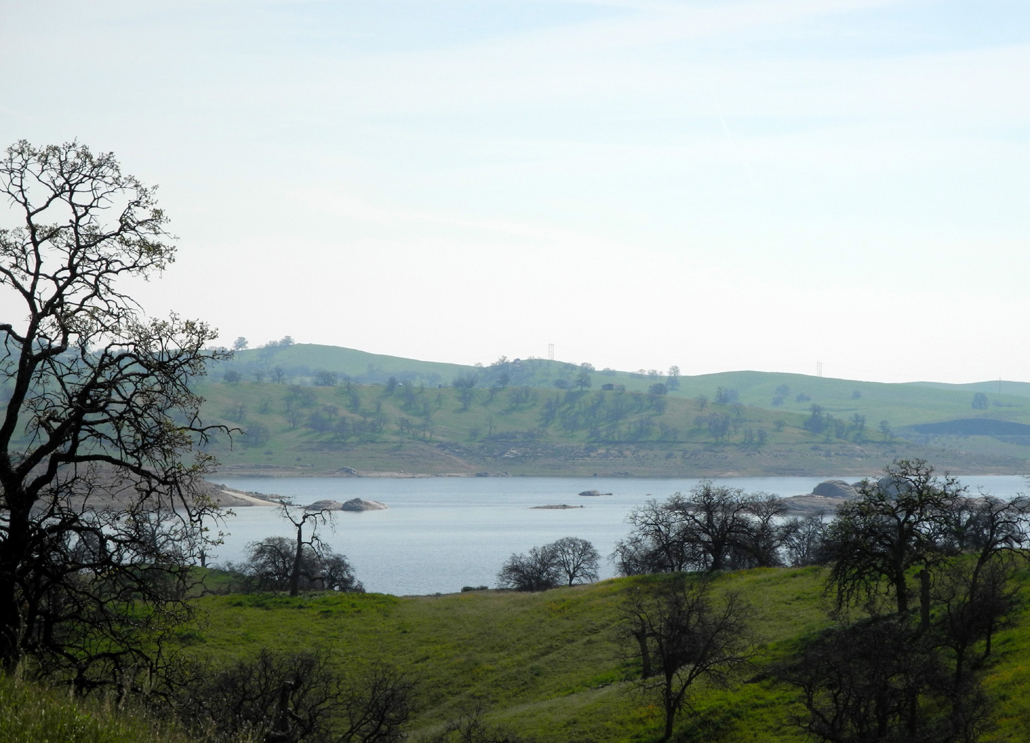
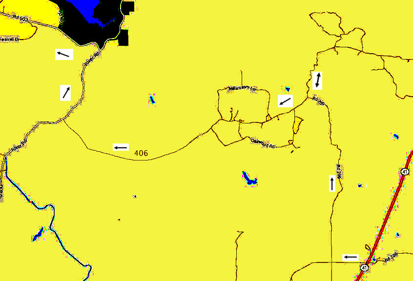
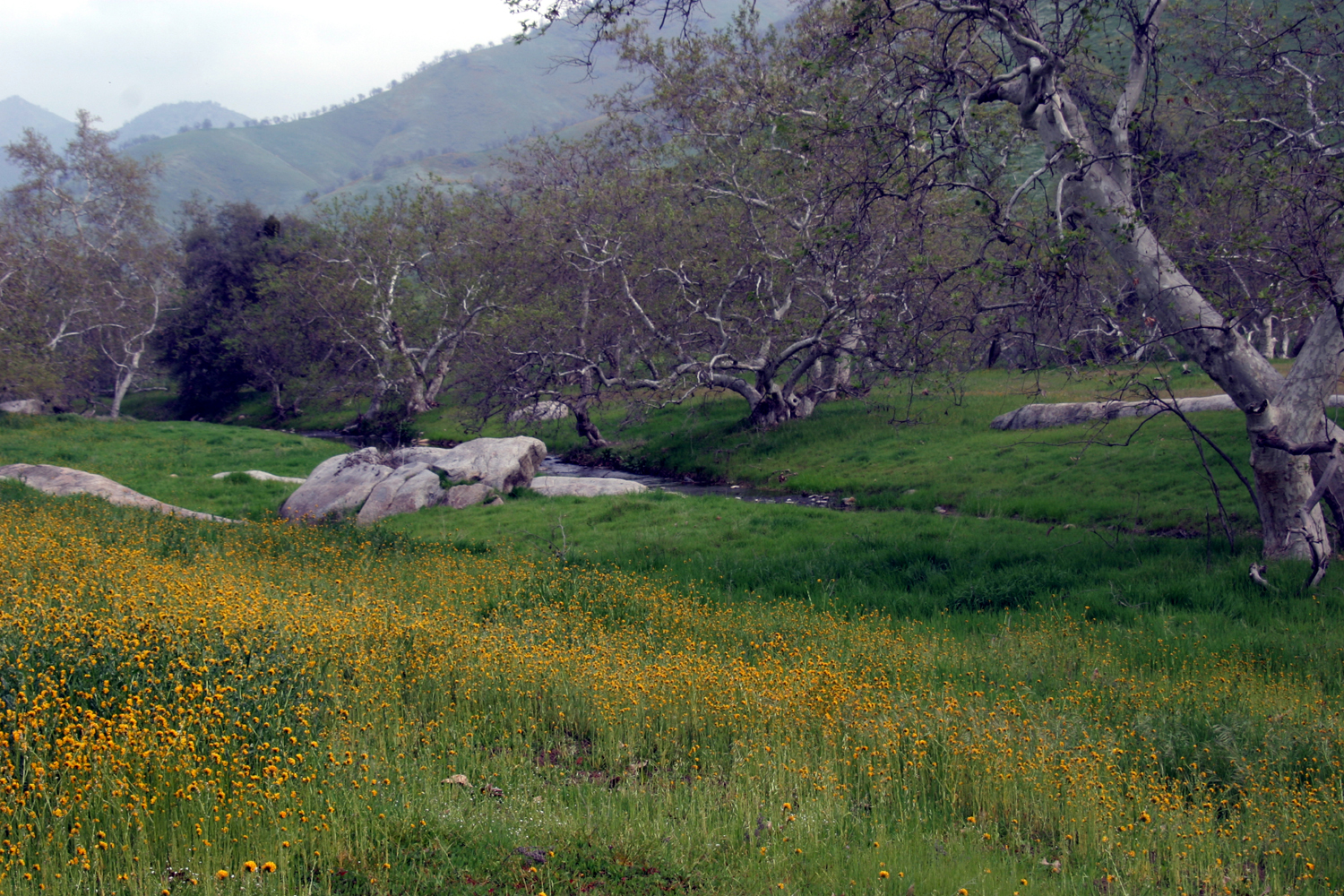
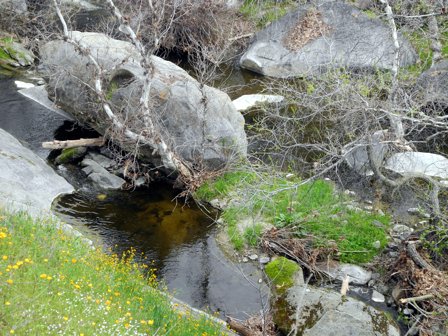
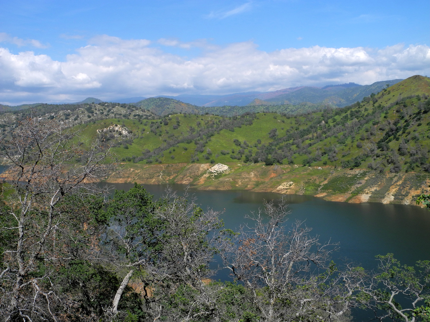
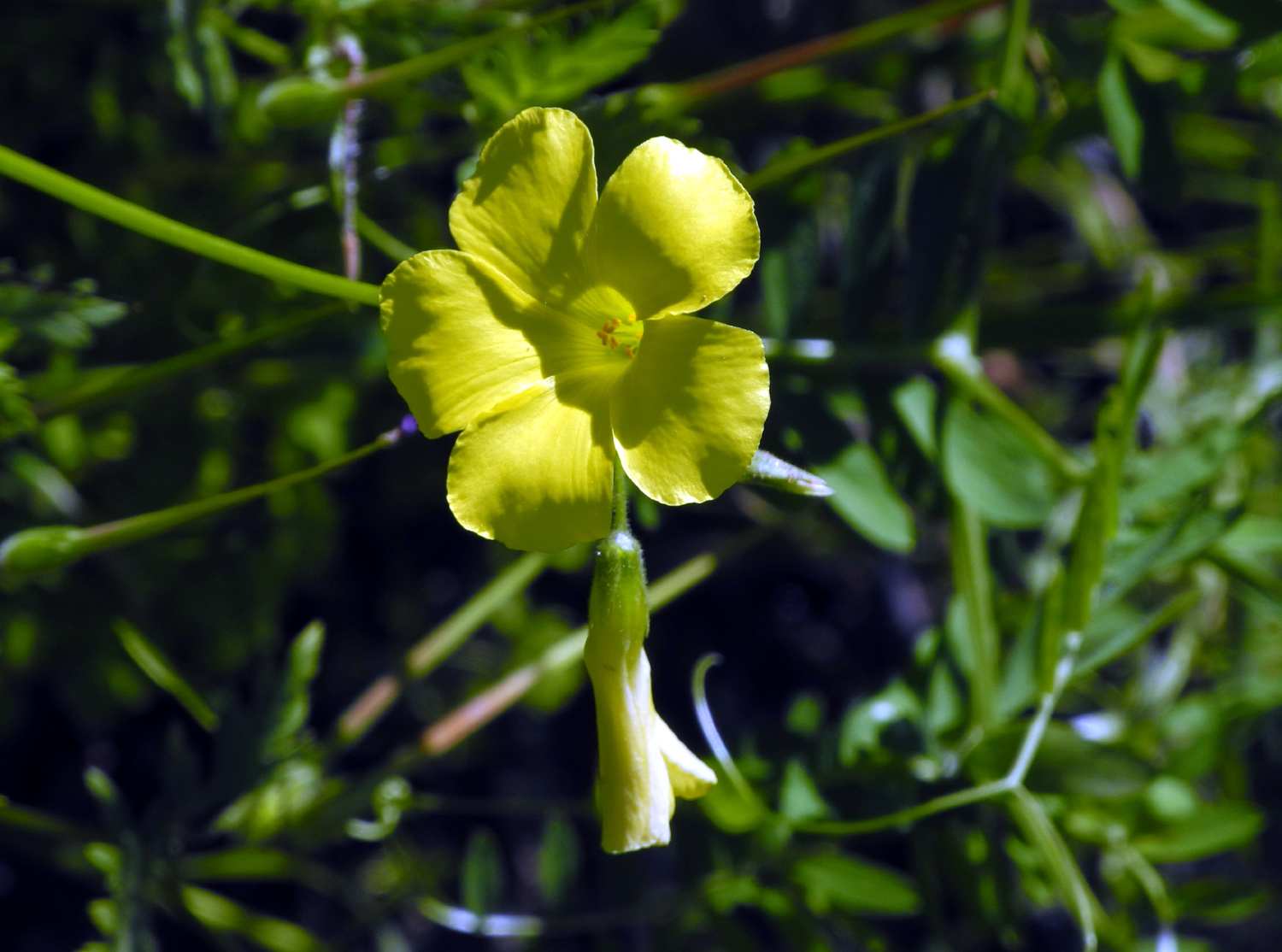
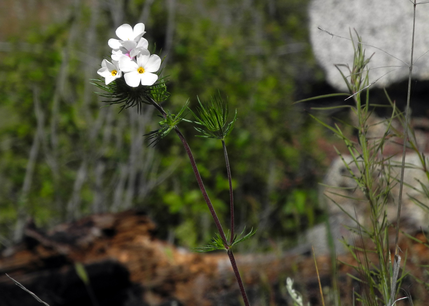
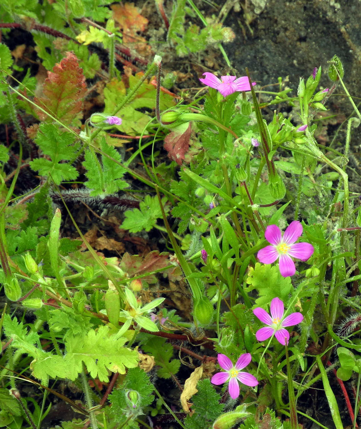
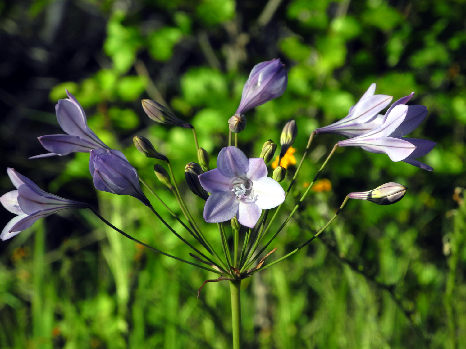
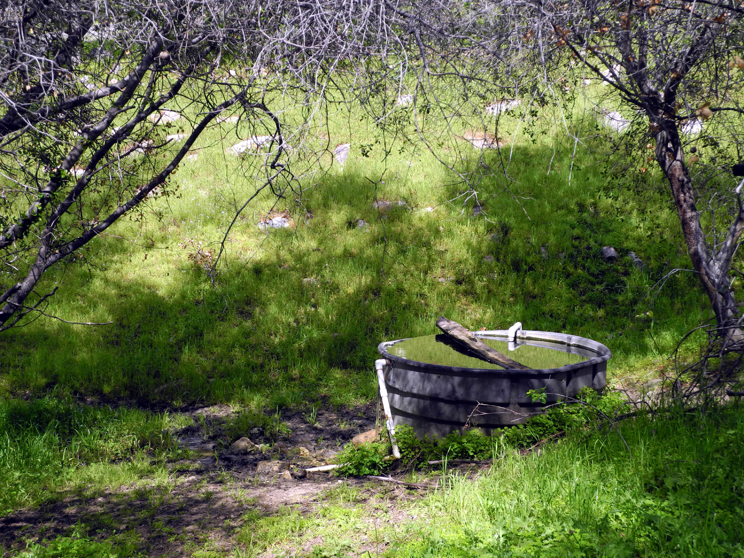
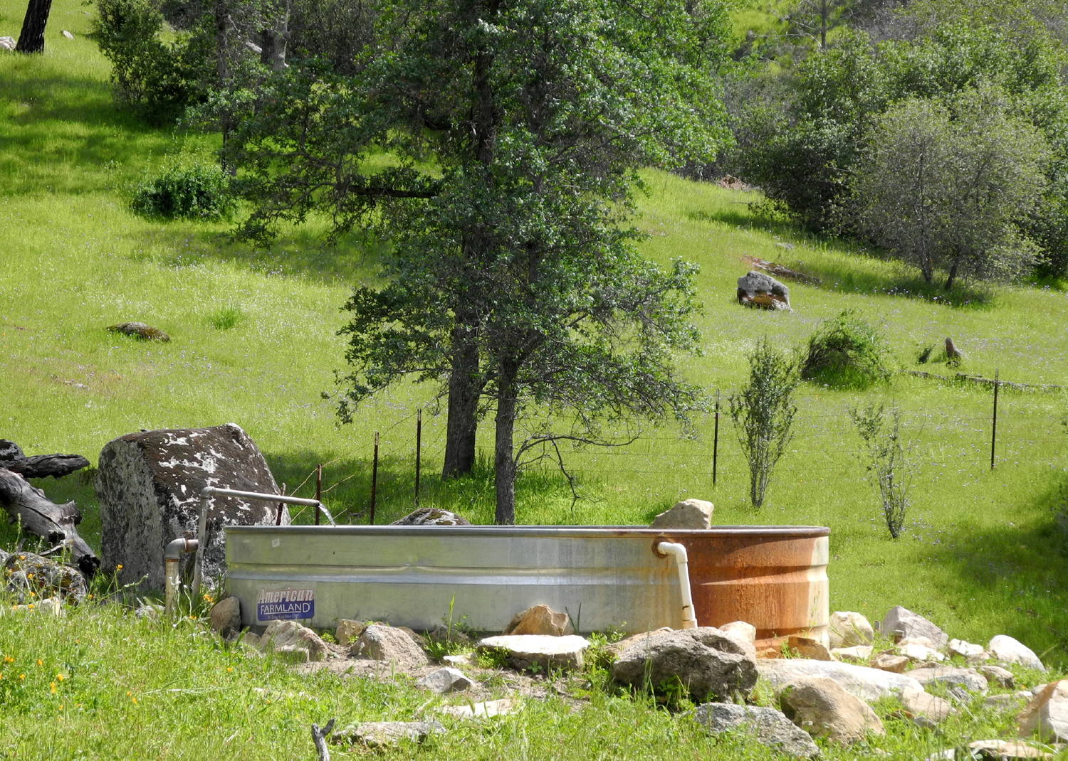
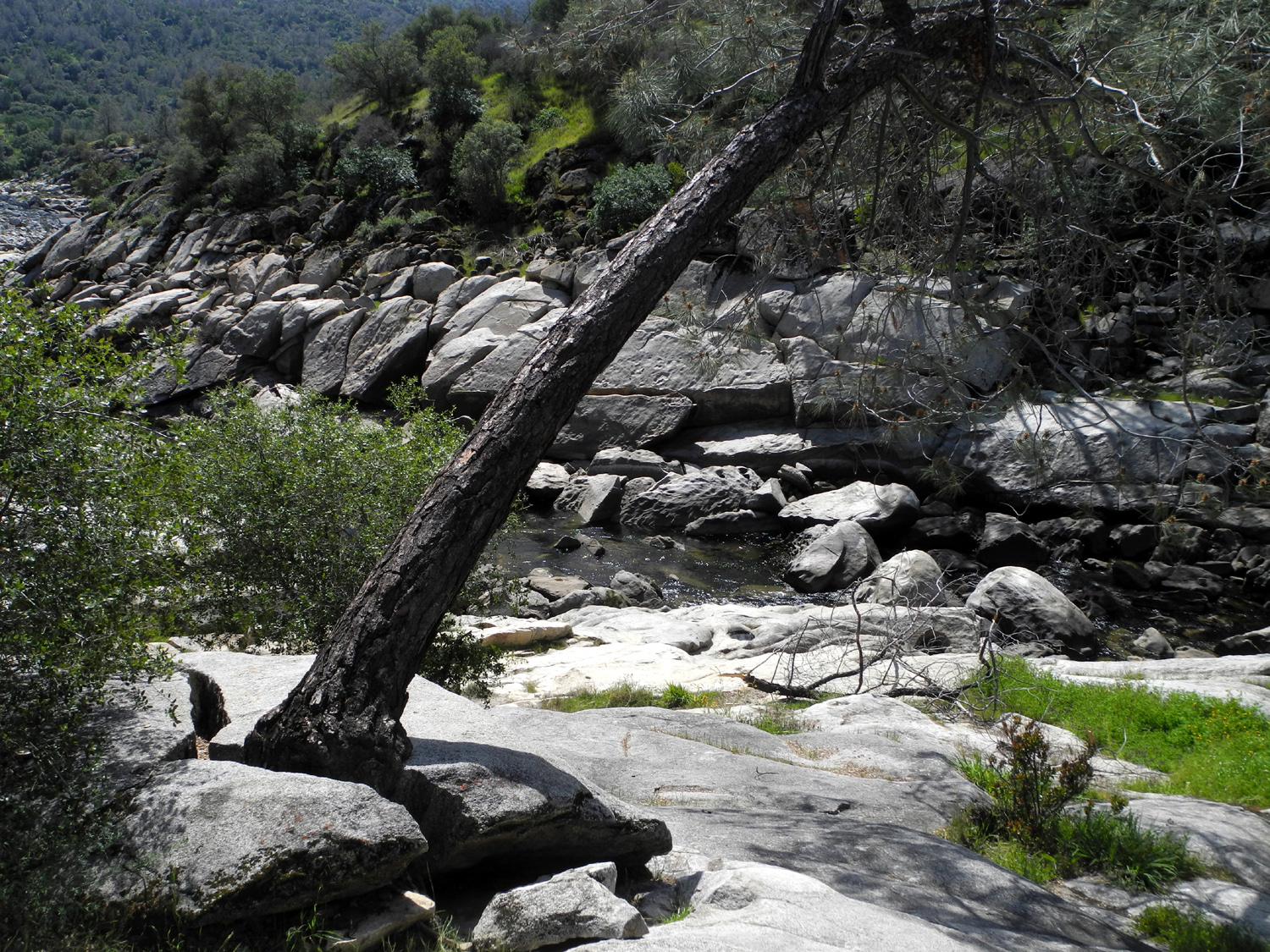
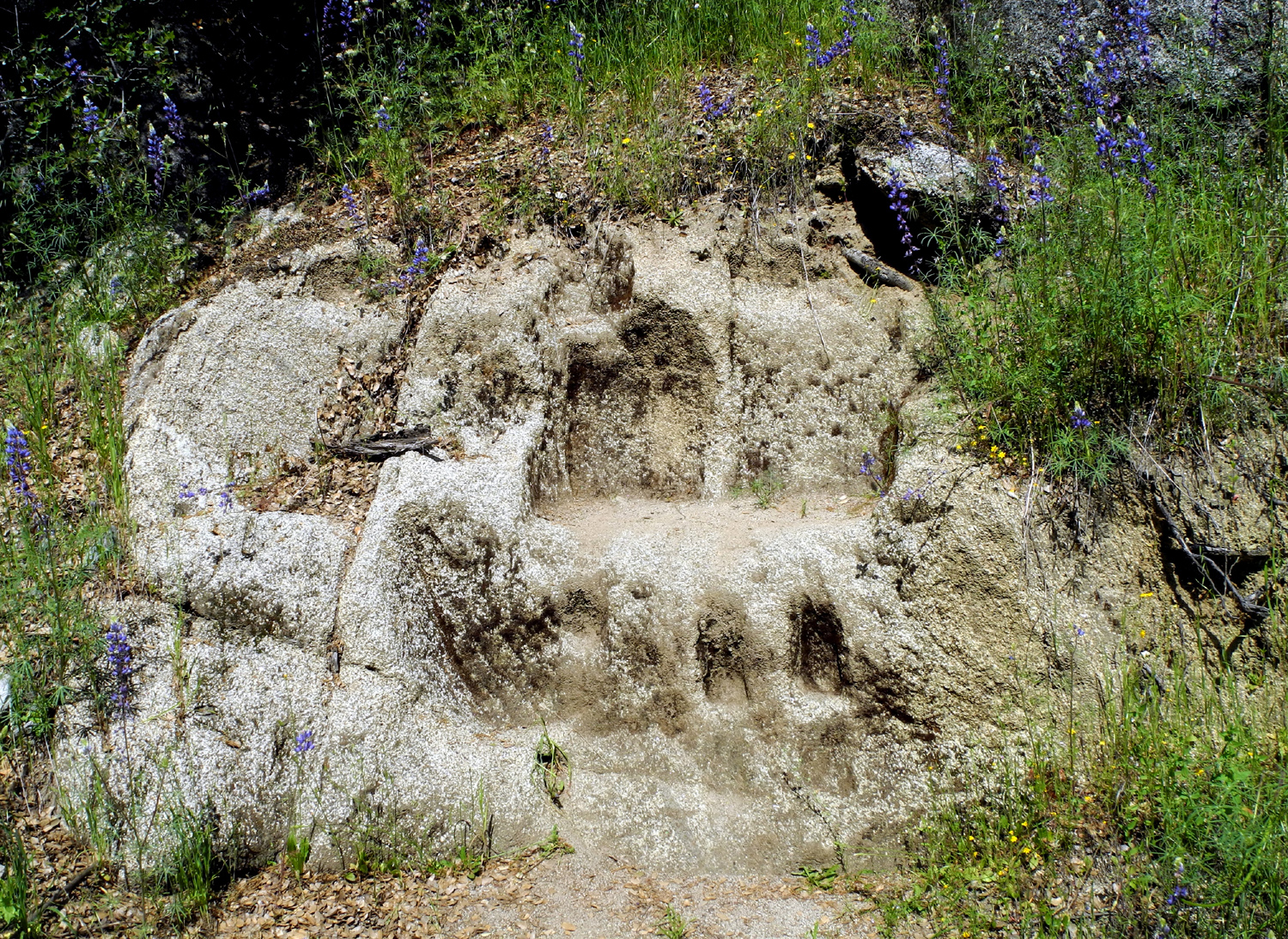
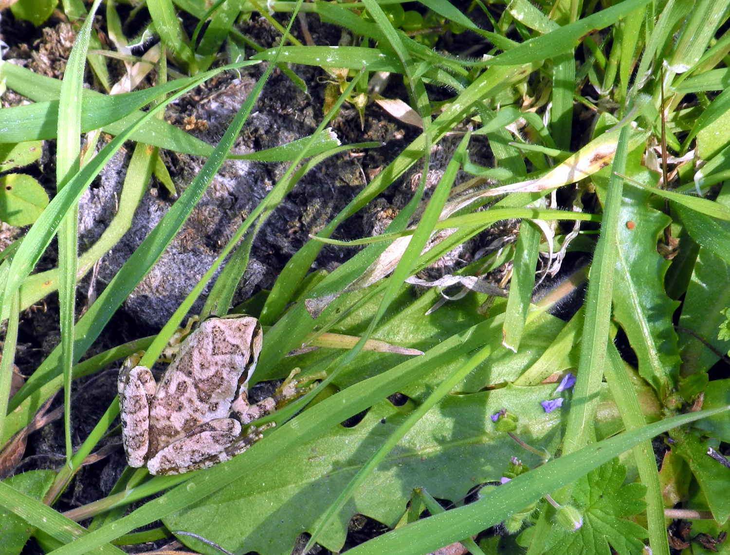
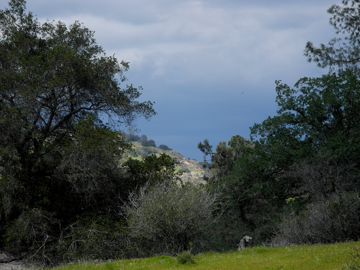
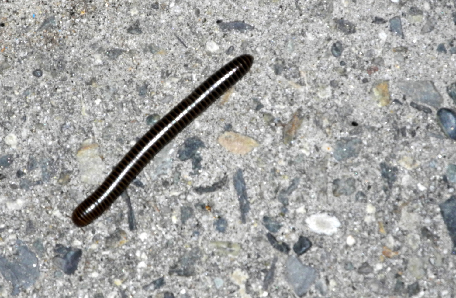
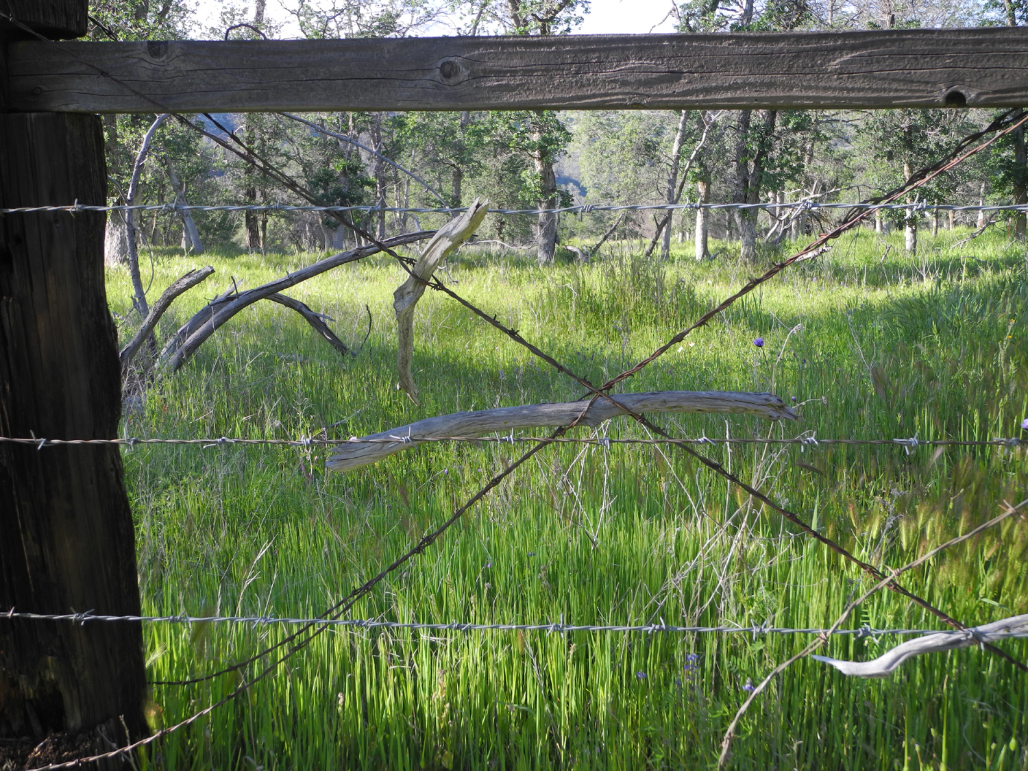
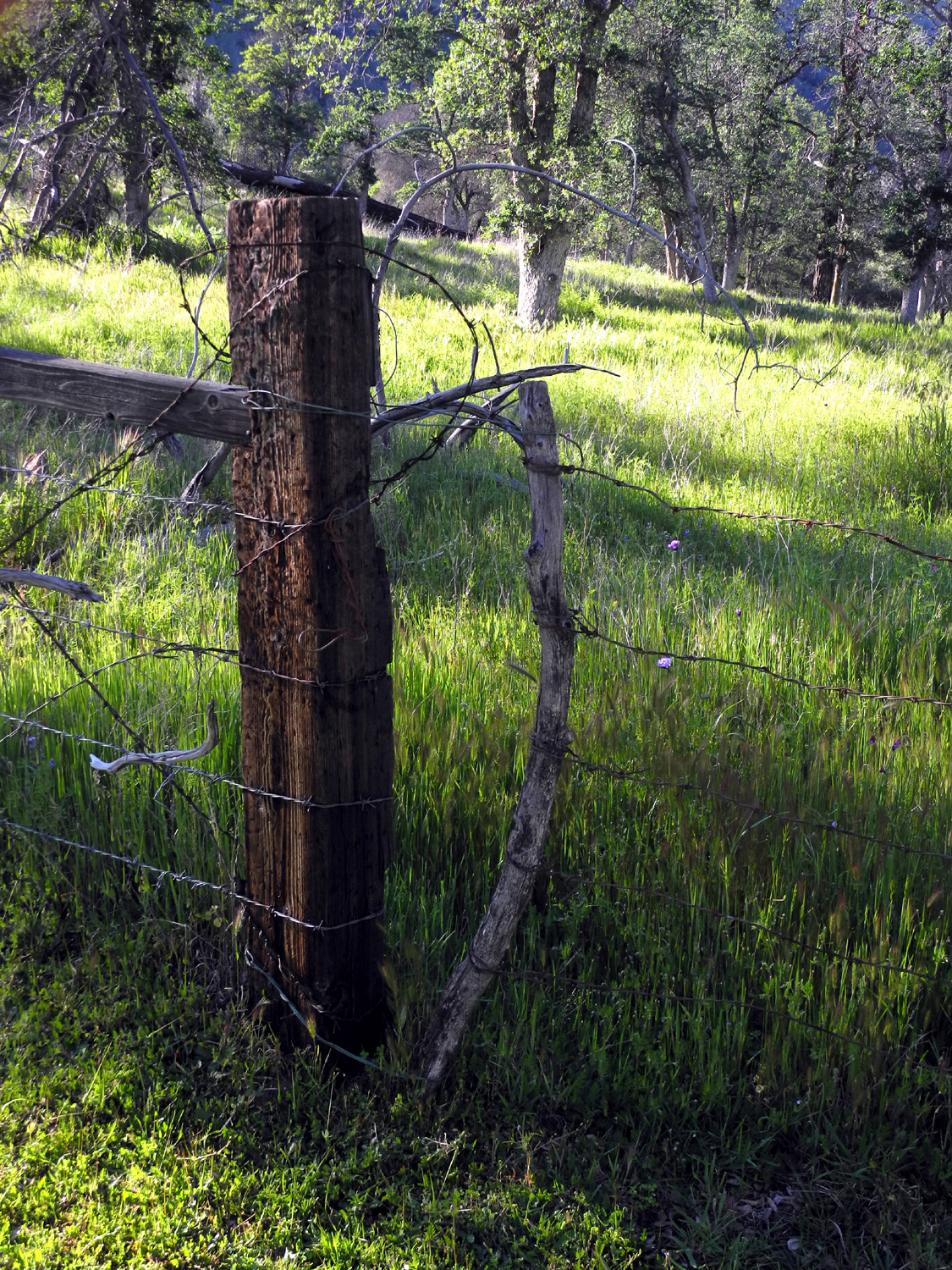
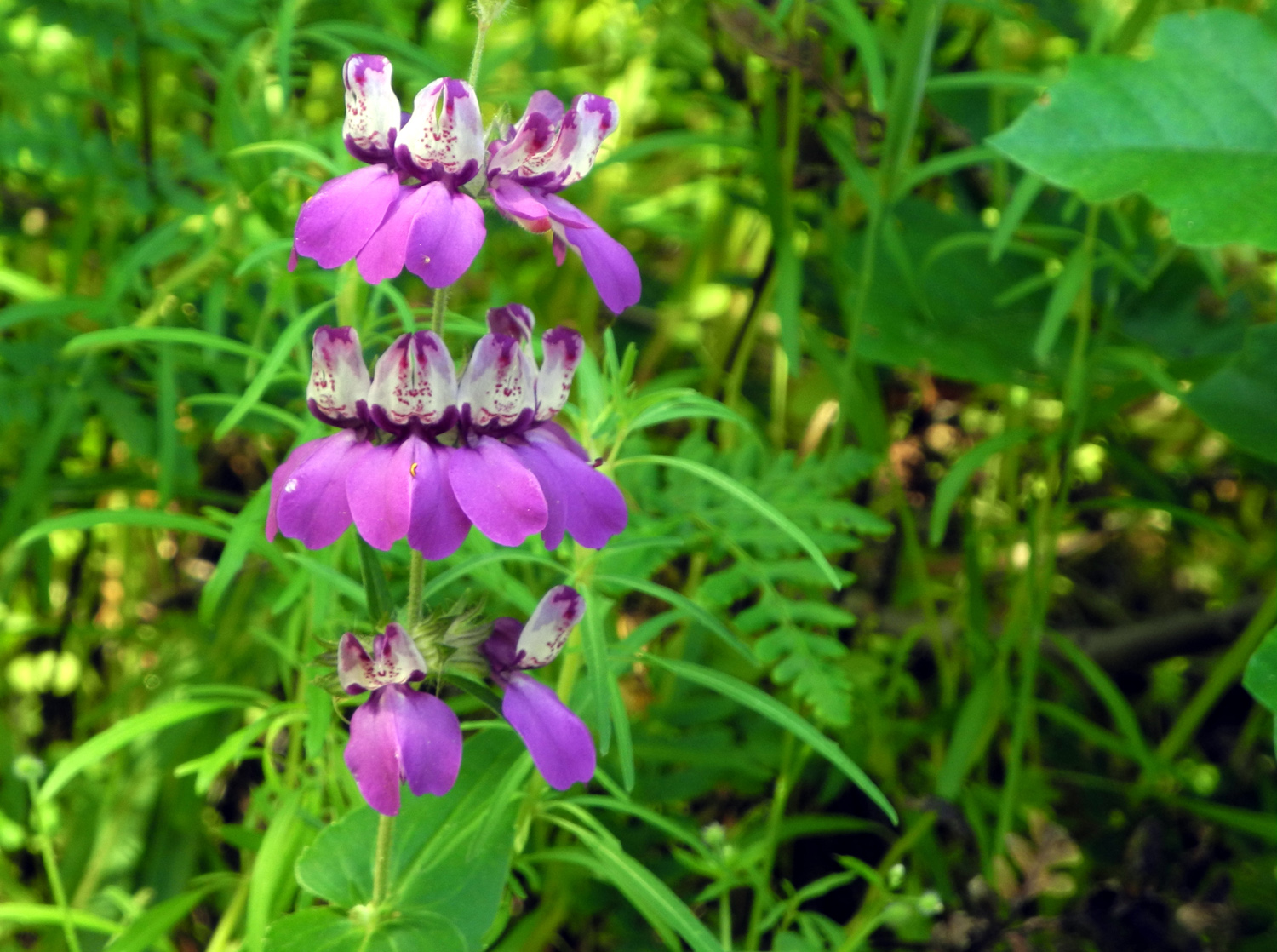
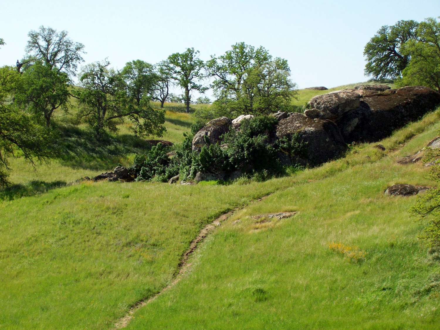
San Joaquin Gorge Camp: I've lost count of how many times I've been to the San Joaquin Gorge, since my visits there started around 1980. I've even lost count of how many time I've camped there with the motor home, although I could research it via my various travel reports. I do know that the most recent camping trip was March 29 through 31, and that it was a good one. Before going there to camp, I always call to make sure the group camp is not reserved, since it's the only place where it's convenient to put a motor home. I called every day for a week, and never got an answer, and when I arrived at the location, I found out why. There was a power outage and some damage at the visitor center, and they have not been able to use it since late February. Shortly after I arrived Tracy, the park manager, came by, and I got a cell phone number for future use. I also learned that there were no conflicts the next two days while I would be there, but that about 150 people were arriving on the weekend for a mountain bike race. However, I was there for more relaxing activities, mainly reading and hiking. Once I got everything set up, I decided to explore the only trail I have not walked on in the area - the River Access Trail that starts by the new power house, about a mile down the paved road from the campground and main trailheads. Since I don't move my motor home once it's set up, I had to walk the road before walking the trail. This is not my idea of good hiking, but at least I was surrounded by green grass and flowers all along the road, and there was almost no traffic. I had walked a few feet on the trail several years ago, and knew that it went down fairly steeply to the river, so I was prepared for the conditions. As I hiked, I made a note on my cell phone of all the flower species I encountered, coming up with an even dozen. These included red and white owl clover, purple brodiaea, bush lupine, baby blue eyes, two shades of tall ground lupine, and several I could not identify. The "official" trail actually ends at a sloping rock outcrop and does not go all the way to the river, but it's only about 50 feet of easy scrambling to get there. I have outgrown my scrambling days, so I sat on the rock and had a snack and rested for a while, then started my return hike. I did two or three additional short hikes that day, the main one being a tour around the Nature Trail. This has signs explaining various trees and plants, listing the common name, scientific name, and the name used by the natives who have lived in the area for 8,000 years or so. The most common flower along the trail was a vine-like plant with one-inch blue blossoms that spreads out over fairly large areas. One flower identification web site describes these as fiesta flower. There are several unofficial trails and various routes that I have walked on over the years, and I covered two of these. One of them was actually new to me - I noticed a good clear man-made trail running south along the east side of the camp area to the fence that parallels the road. This short trail then turns west and follows the fence line to the junction of the main road and the road that runs by the camp. I saw that I could then go up the main road a short distance, cross over, and follow a cow path along the fence on the upper or south side of the road, and added that walk to my "to do" list for the next day. All together my various walks the first day added up to 4.19 miles. In addition to my physical efforts, I managed to fit in some napping, some loafing, some eating, and a lot of reading, followed by TV watching after dark, when I normally run the generator. During the day it was fairly warm and sunny with a few clouds, but around 4:30 a wind came up and it cooled off. There were dark clouds up river to the east, but it never became fully overcast. During the night the clouds mostly dissipated, and there was a good view of the stars, with no moon. Late in the night, actually closer to 6 a.m., the temperature got down to 37 degrees. The longest trail in the area is the San Joaquin River Trail, which runs about 12 miles to the South Finegold Picnic Area on Millerton Lake, at the end of Sky Harbor Road. I will never walk this entire trail, but I've been trying to go farther on it each time. I set a new record walking the trail with my daughter Teri in February, and I decided this time I would go past the farthest point we reached. The next day I got up and had a good breakfast, then read and rested while it digested a bit before starting on my journey. The SJR Trail is not strenuous except for a few very short stretches, but it offers lots of up and down. It heads south away from the trailhead a short distance then turns west, and from then on mainly parallels the river, but high up above it for the first two miles or so. At first it goes through gentle hills but after a mile or so it is built into the side of a steep slope. I started my walk by taking the trail that runs by the camp, then went into the field above the road and walked on the cow trail. I knew there was a fence between where I was and the main trail, but there is an unlocked gate. This trail sort of fizzled out as it approached the fence, as cow trails often do, and I cut across toward the gate and got on the real trail. All along my route there were flowers large and small, and I again made a list. I saw many of the same flowers that I had noted on the River Access trail the previous day, but also quite a few new ones, including poppies, vetch, gillia, blue dick, tiny lupines, filaree, fiddleneck, harvest brodiaea, redbud, phacelia, mustang clover and elderberry. One of my favorite finds was a flower that used to be common in the foothill area where I grew up, but that I have not seen much of lately, ham & eggs. These have reddish foliage and egg-yellow asymmetrical blossoms. The most common flowers were the daisies and the gillia, which covered large sections of the grassy hillsides in many areas. There were also plenty of unidentified flowers, which are listed in my notes with such descriptions as "like blue dick but white and different foliage," "1/4 inch almost star shaped," "white 1/8 inch," "5-petal yellow," and "tiny yellow." After a fair amount of walking, I recognized the point that Teri and I reached in February, and kept going for a few hundred yards more. My goal was to walk a total of at least three miles, so I checked my cell phone hiking app to make sure I had gone half that amount before starting back. There are numerous interesting things to see close to the trail, but also some intriguing things off the trail that you can't see in detail without leaving the path. One thing close to the trail, but visible only because I stopped to rest on a log, was a tiny frog in the grass. A little less than a mile from the trailhead, I took a detour up a slope to where I could see a water tank (a low, open tank used for livestock). When I got closer I saw that the tank was surrounded by a fence, although it was open on one side. It also turned out that there were FOUR tanks in the area, at least one of them bent and cracked and not usable, and one of them filled with grass. I took an indirect route back to the trail, and before long arrived back at my motor home, with 3.06 miles on my personal odometer. After a rest I did a little more walking, over to an old dam that I had noticed a year or two ago a few hundred feet north of the camp. From there I walked cross country toward the main parking lot and down along the fence on the west side. This walk brought my total for the day to four miles. The next day was March 31, my last day. Since it's a very short distance to home, I was in no hurry to leave, and had breakfast and read a while before doing my final hike. This consisted of a meandering walk along the trail next to the camp, through the field above the road on the cow trail, and down along the fence west of the main parking lot. I went through the fence at a place where some wires were missing, through the fields to the Bridge Trail, and then back to camp on what I call the Equestrian Trail - a shortcut path that goes more or less directly to the road across from my camp, avoiding the main parking lot. There is an official Equestrian Camp about 100 yards from the group camp, and the trail I was on is used by riders who plan to head down the Bridge Trail to the river. This walk was 1.04 miles, giving me over nine miles for the three days. Although there were a lot of people around, especially for mid-week, for the most part no one was around my camp area. A truck and travel trailer drove in the first evening and parked on the opposite side of the parking lot, but left after a half hour or so. The main parking lot was pretty close to full a couple of times when I went by it, but I saw very few people on the trail. When I arrived there were several riders with horses at the equestrian camp. They rode by my camp, but were gone when I returned from my walk. During our stay in February, we saw hundreds of millipedes on the road, trails and grass each night. Teri was here a few weeks ago and saw only one or two, and I also saw just one. I asked the ranger about it; she had seen a few around, but was not aware of the mass numbers we experienced. She speculated that it might be some type of migration. When I returned from my walk the final morning, I got everything ready for the return trip. When I camped with a travel trailer, I had to deal with the hassle of hitching and unhitching, but preparation for departure with the motor home mainly consists of three things: Making sure anything that can fall or slide around is securely in place, bringing in the slide-out and closing the vents, and driving off the leveling blocks and loading them up. I got underway around noon, heading home with memories of the beauty of the California foothills, and about 250 photos to sort through. --Dick Estel, April 2016 |
||
|
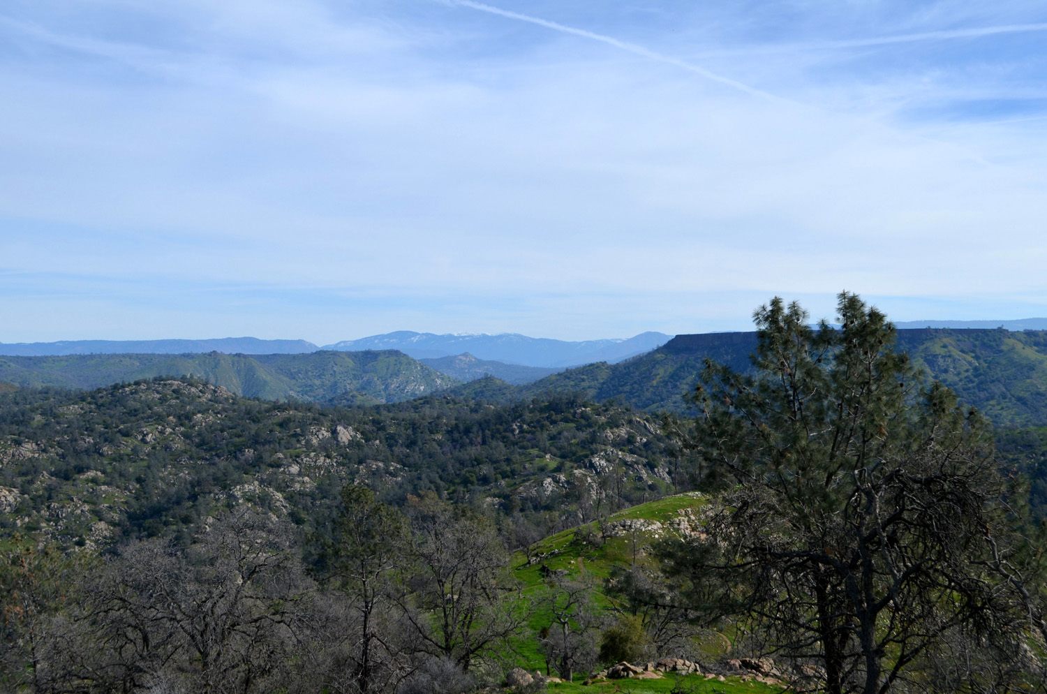
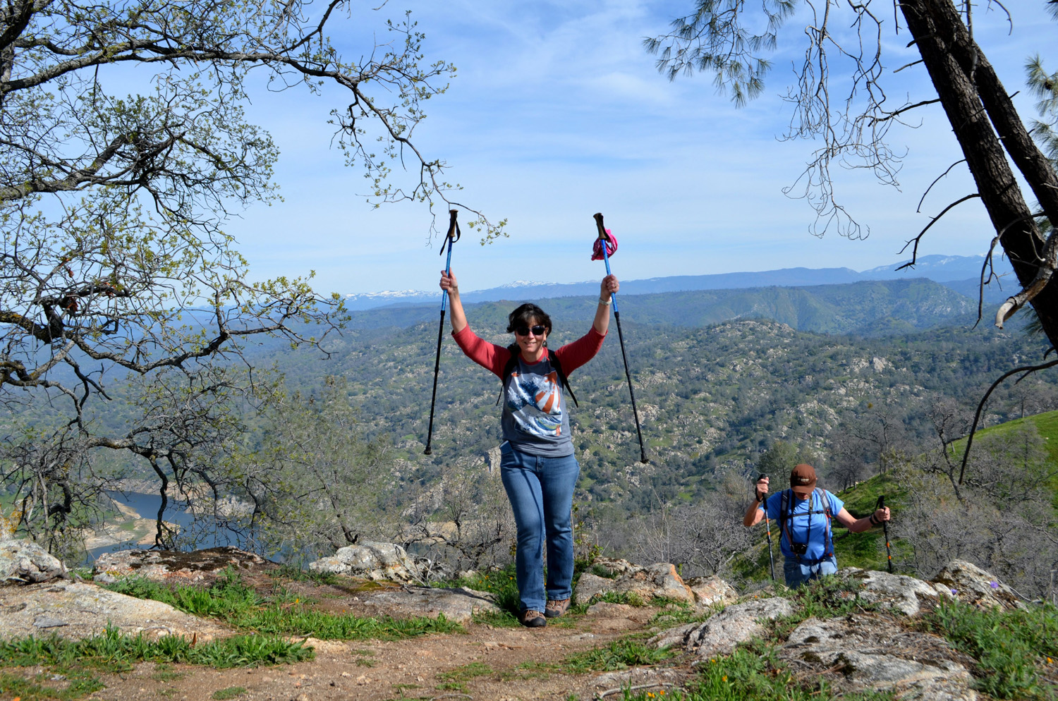
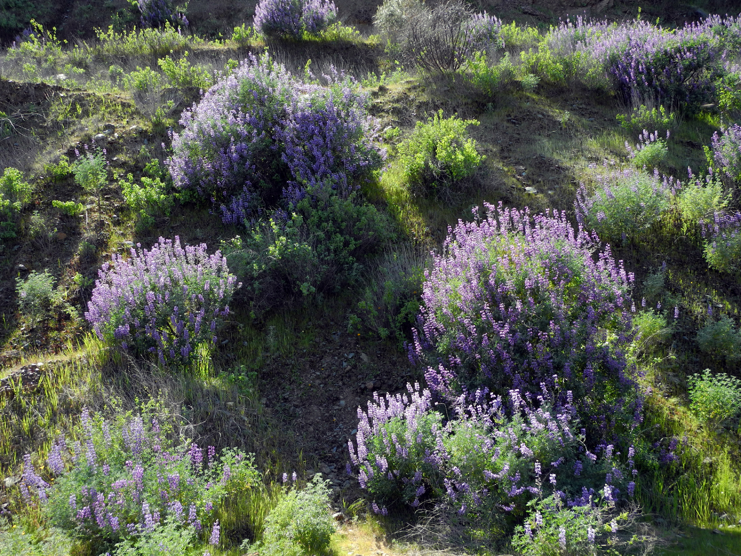
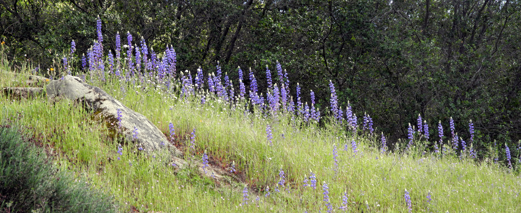
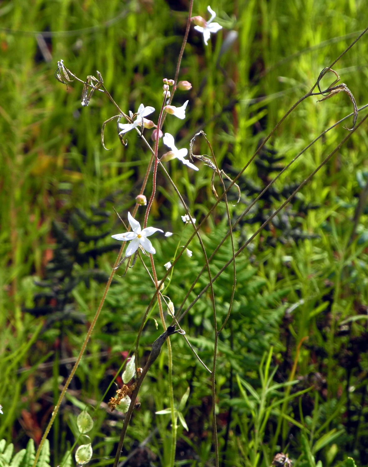
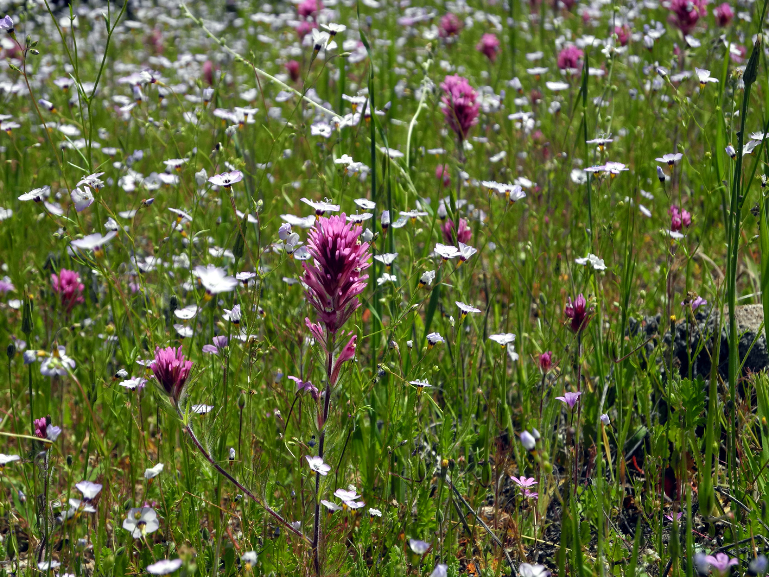
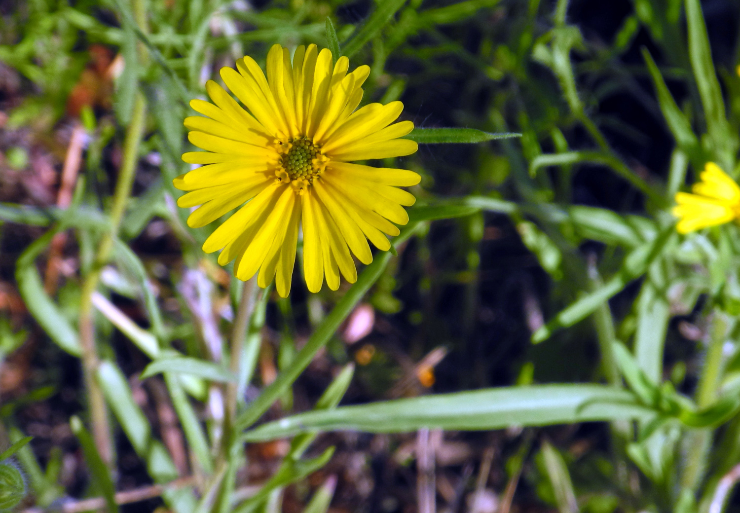
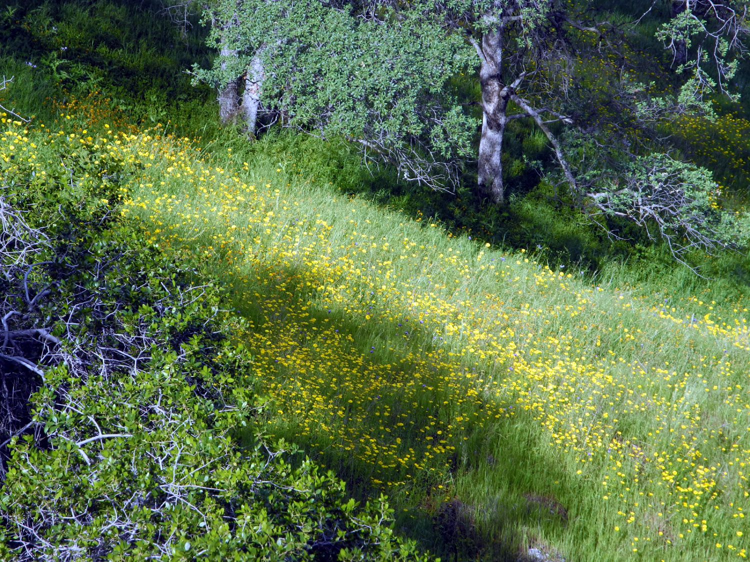
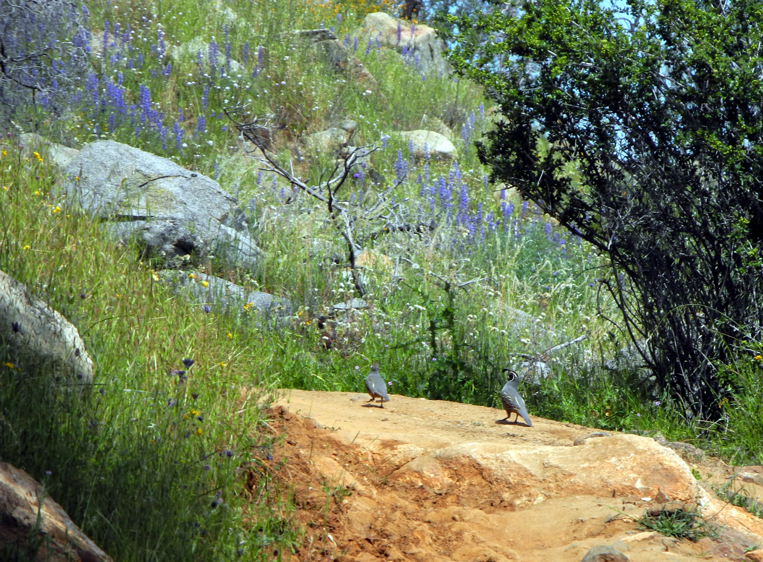
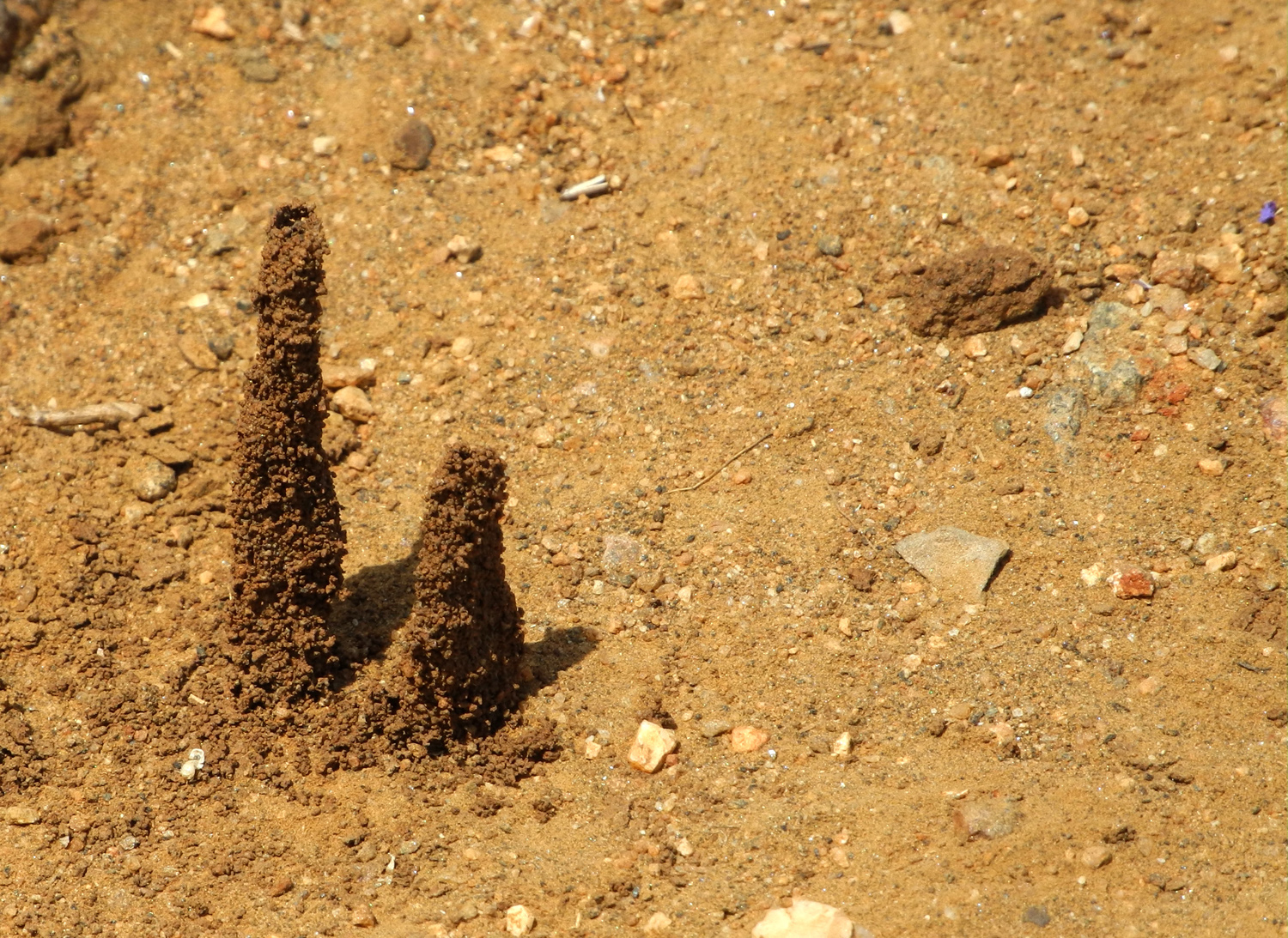
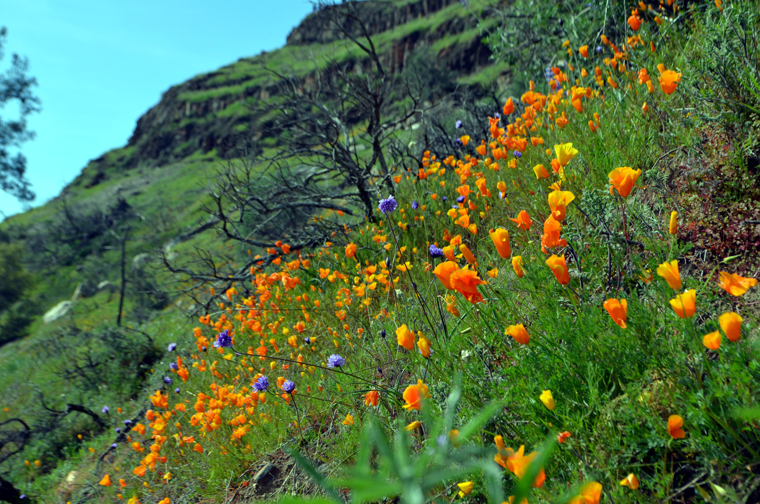
San Joaquin River Trail West: I've written about this hiking area a number of times, so I'll try to keep this short and focus on aspects that were new this time. My most recent walk here was on February 20 with my two daughters, Teri and Jennifer, and fellow Rambler, Wes Thiessen. We completed the somewhat arduous climb to the top of Pincushion Peak, a short distance west of the main trail. On April 6 I had no thought of repeating that hike, but instead had a new goal in mind. The trail winds mostly uphill for close to a mile, crosses a saddle, and continues on to the San Joaquin River Gorge Special Recreation Management Area, a total of 12 miles. Of course, I don't expect to ever hike that distance again, but I had decided I would go past the saddle at least a little farther than I had ever gone before. I went about a quarter mile beyond several years ago, and knew that the trail was fairly level for some distance. On the first part of the trail, which is on the north side of the slope, there were plenty of flowers, which I once again listed on my phone. Species that had been dominant earlier were reduced to a few individuals here and there, and the most common now were several types of yellow daisies, which appeared in patches large and small, sometimes covering a quarter acre in bright yellow. Let it be said that I have no certain knowledge that "daisies" is the correct name for these flowers. It's the name I apply to any yellow flower that is more or less an inch in diameter and not known by me to have some other name. There seem to be several species that look the same until examined up close. Looking at my photos, it appeared that there were three different flowers lumped in the "daisy" category. I've placed photos of each side by side in the photo section of this report so you can judge for yourself. When I reached the saddle, I rested and took some photos, and chatted with two men who rode up on bikes. They had done an 8-hour ride the previous day, and wanted to test their ability to go out and do a second grueling ride. As I continued my walk, the trail went around to the south side of the ridge, and was in full sun nearly all the time. The weather was just starting to warm up, so it was not terribly hot, but there was no doubt that cool days were coming to an end. The different conditions on this side provided a real treat - an entirely different batch of flowers, with poppies and lupines crowding the trail on both sides, and covering the hillside above and below. Poppies had been at their peak two months earlier, and I thought they would be all gone, but there were still large numbers. There were also a lot blue dicks, another flower that had appeared in large numbers early in the spring. It appears that some of the early species are having an extra-long season this year. Whether this is due to the good rainfall we had or other factors, I don't know, but it certainly adds to the delight of foothill hiking. Other flowers that appeared in fairly large numbers included purple brodiaea, fiddlenecks, phacelia, yellow (or harvest) brodiaea, popcorn flowers, owl clover, and the usual "unidentified." One of the most interesting things on the trail, something I have not seen before, were tall, thin ant hills, somewhat resembling the ones you see in Africa, but very small. The tallest was about two inches, but most were barely a half inch. All were about a quarter inch in diameter. I also saw and managed to photograph several quail that were making their way across the trail. As I walked through this sunny, flower-strewn area, I began to wonder if would find any shade or any place to sit and have my lunch. Then, about a half mile past the saddle, the trail went up a drainage, and there were two big live oak trees, one above and one below the trail, creating a nice shady area. As a bonus there was a flat rock jutting out from the bank just below the trail, and I was able to sit there, with my legs dangling over into the drainage, and enjoy food and rest. After a good lunch break, I started back down the trail, enjoying the flowers and green hills a second time. There were a lot of other people on the trail for mid-week, probably taking advantage of the excellent spring conditions we've enjoyed this year.
|
||
|
Photos (Click to enlarge; pictures open in new window) |
||
Pincushion Peak Hensley Lake Hike Dry Creek Canyon Edison Point |
||
|
Pincushion Peak |
||
|
 |
 |
| Father-daughter day on the San Joaquin River Trail |
Fiddlenecks, green grass, pines and oaks |
Grassy hillsides and Sierra snow |
 |
 |
 |
| View of table top mountains on both sides of the San Joaquin |
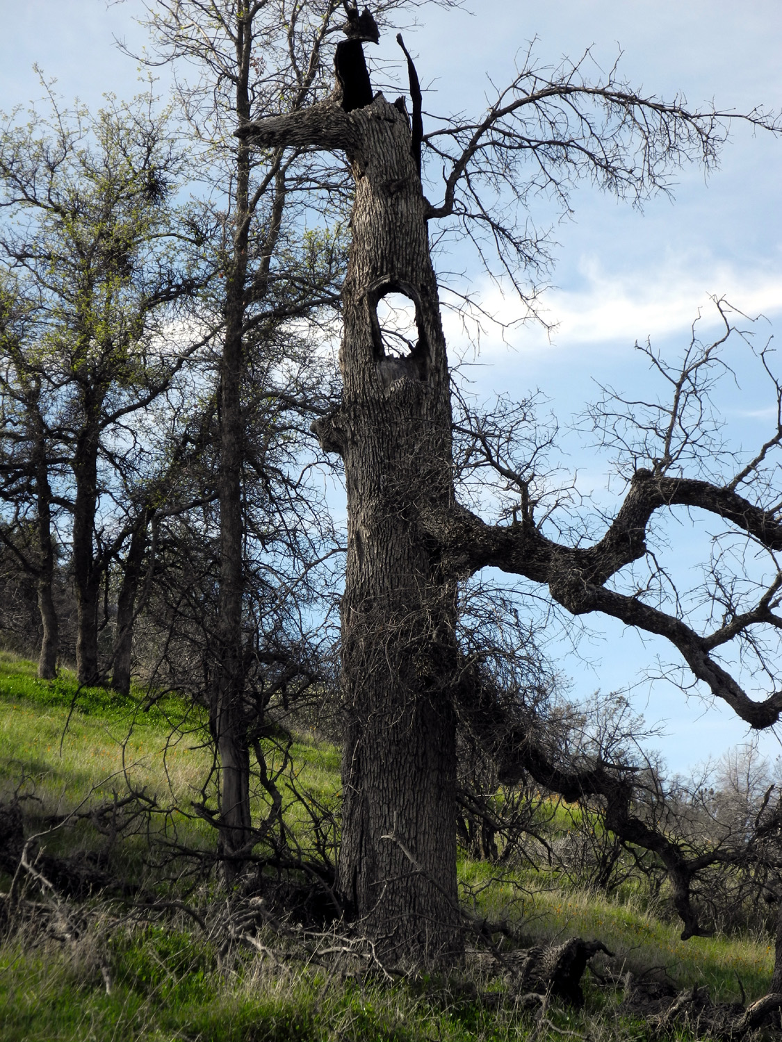
A rugged dead blue oak | Wes, Teri, Jennifer and Dick with their destination beyond |
 |
 |
 |
|
Careful steps are
required |
The rocky top of Pincushion |
Jennifer, triumphant; Dick, still determined |
 |
 |
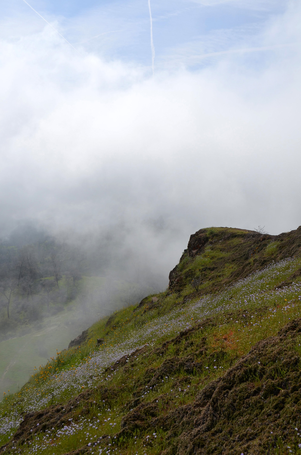 |
| Teri and Jennifer | We made it! | Fog drifts across the saddle below the peak |
 |
 |
 |
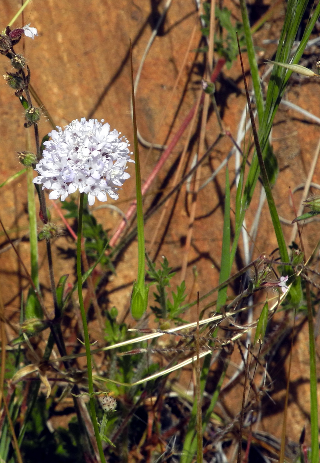
| Wind-blown lupine |
Lupines and poppies on
the |
Looking west toward Millerton Lake and Friant Dam |
 |
 |
 |
| It got crowded after we left | Poppies are getting a good start | Dead pine branches and live poppies |
 |
 |
 |
| Wes seems to be having fun | A look back up the trail before heading to the bottom |
At the start of the
trail, |
| Hensley Lake Hike | ||
 |
 |
 |
| Windmill on Road 209 | Creeks are everywhere this year | Along Road 209 |
 |
|
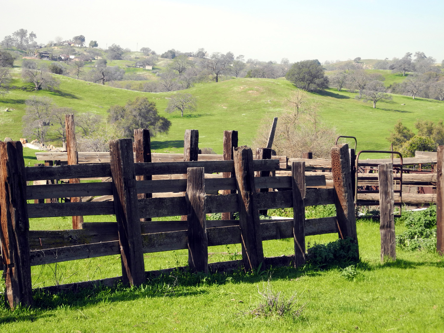 |
| This tree has seen better days | Fence on Road 406 | Remnants of ranching days |
 |
 |
 |
| Cattle holding device in the corral | Fiddlenecks are thick this year | Ready for its close-up |
 |
 |
 |
| Heed this warning! | The end is sudden | Fuzz balls along the Pohonichi Trail at Hensley Lake |
 |
 |
 |
| Still more fiddlenecks | Fringed
redmaids were thick throughout the foothills |
Lace pods in unusual profusion |
 |
 |
 |
| The lake is up from last year's level |
The bench is almost
hidden |
Dome Rock from Far Rocky Ridge |
 |
 |
 |
| Boulders on the ridge |
Ancient tree and
boulders |
Game trail through the lace pods |
 |
 |
 |
| Enjoying a fantastic spring day | A resident of Rabbit Rock | Bush lupine forest |
 |
||
| The top of Far Rocky Ridge | ||
 |
||
| Little Table Mountain at Highways 41 and 145 | ||
 |
 |
 |
| My route, more or less | Lace pods, close up |
What was on the other side of the fence |
| Dry Creek
Canyon Photos (photos by Wes Thiessen and Dick Estel) |
||
 |
|
 |
|
Kaweah River near State
216 |
The first poppy patch, |
At last we have a name for this flower - Phacelia |
 |
 |
 |
|
The view from inside |
Occupancy and usage of the area through the centuries |
View from the preserve into the valley of Dry Creek |
 |
 |
 |
| The story of Homer Ranch | A massive field of fiddlenecks | Dick, looking like a pro |
 |
 |
 |
| Gateway to paradise? |
Dry Creek at Homer Ranch Preserve |
Cattle chute along Dry Creek Drive |
 |
 |
 |
| Dry Creek from along the road | Wes sets up for the perfect shot | The massive poppy bloom |
 |
 |
 |
| The poppy-covered hills above Dry Creek | ||
 |
 |
 |
| One of millions | A brilliant shot by Wes | Resting by the road |
| Edison Point Photos (Photos by Teri Liddle and Dick Estel) |
||
 |
 |
 |
| It's a good year for the lupines | Foxtails, brodiaea and fiddlenecks | The grass is staring to dry out in some areas |
 |
 |
 |
| Teri and Monica on the bench | Someone with extra energy did some rock work here |
Monica in the tall grass with the lake beyond |
|
 |
 |
|
Staying on the trail
was |
Forging ahead against all obstacles | Brodiaea flower cluster |
 |
 |
 |
| Lots of brodiaea | Even more brodiaea |
This is climbing or twining brodiaea |
 |
 |
 |
| A bank of lupines | The blossoms glow in the late afternoon sun | Storm clouds in the distance never threatened our hike |
| San Joaquin Gorge Camp | ||
 |
||
| Lupines by the River Access Trail | ||
 |
 |
 |
| Blue Dick | Can you identify this one? | Mustang Clover |
 |
 |
 |
| Sierra Star | Ham & Eggs | A pale blue lupine |
 |
 |
 |
| We finally identified these as fringed redmaids | Purple brodiaea | Birds Eye Gillia |
 |
 |
 |
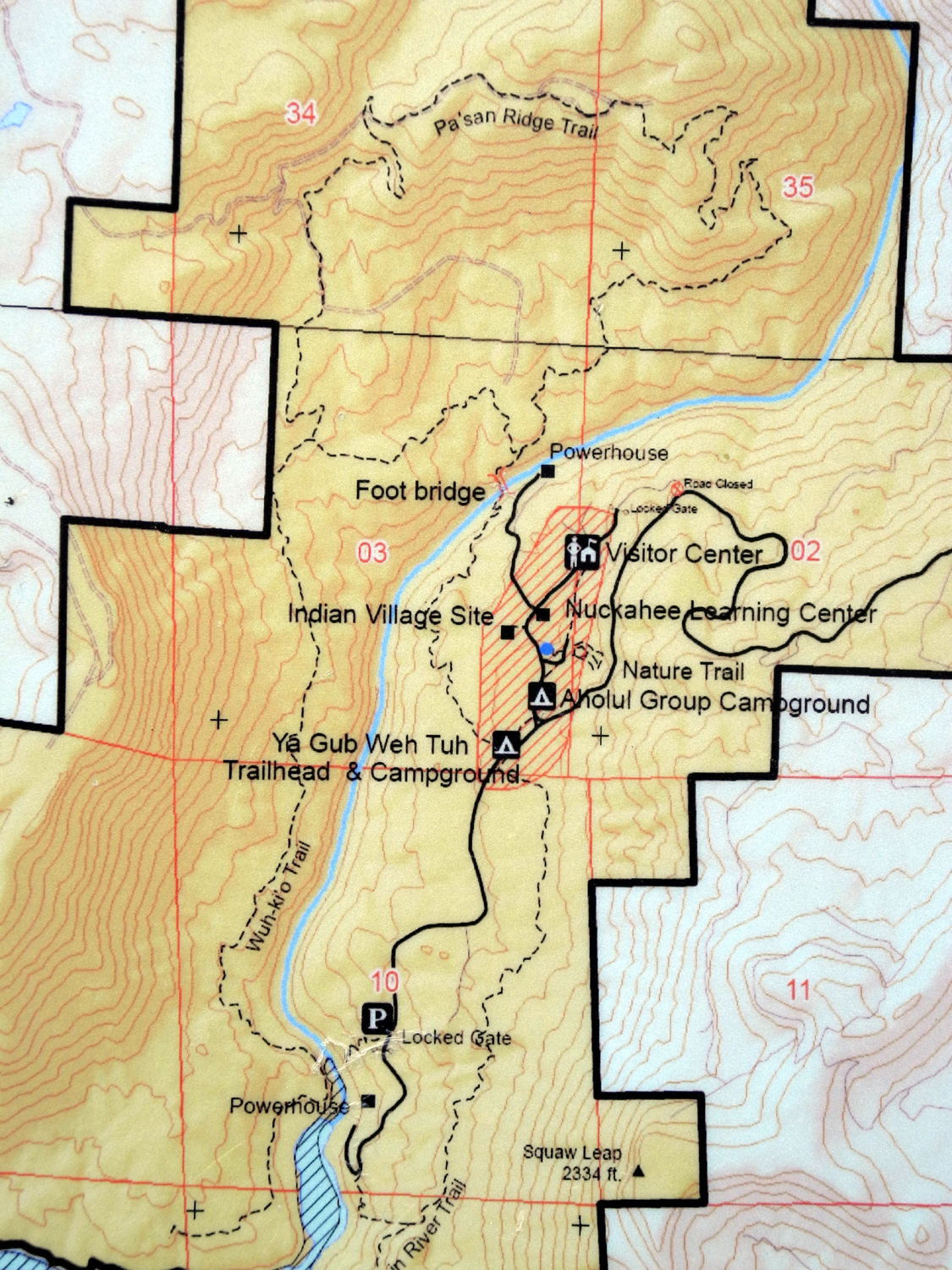
| San Joaquin Gorge Trail map | What the Bureau of Land Management does |
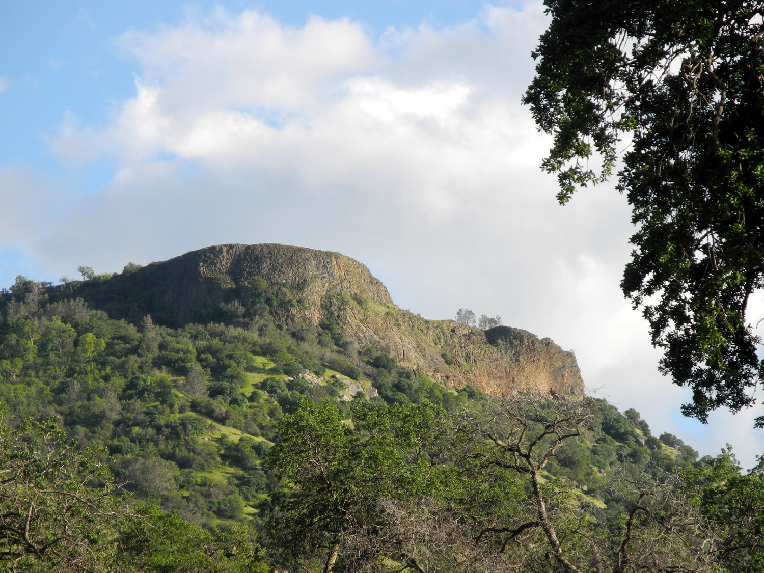
The mountain known as Squaw Leap |
 |
 |
 |
| This tank has become a planter | This one appears to be functional | Kennedy Table, on the north side of the river |
 |
 |
 |
| Blue Dicks remain one of the more common flowers |
The River Access Trail winds down the hill | Leaning bull pine anchored between the rocks |
 |
 |
 |
|
Did nature create this granite throne? |
Fiesta Flowers were
thick |
I call this "Knob Rock" |
 |
 |
 |
| Young blue oaks against a big granite boulder | This was my farthest point on the San Joaquin River Trail |
Big patch of gillia |
 |
|
 |
| Owl clover surrounded by gillia | A nice section of the trail | The frog by the log by the big burl |
 |
 |
 |
| Dark clouds up the river | Old dam near the campground | The last millipede |
 |
 |
 |
| Blue oak serves as a fence post | Here's how to tighten barbed wire to stabilize a fence |
Classic wire fence gate |
| San Joaquin River Trail West | ||
 |
 |
 |
| Oak on a peaceful hillside | Fiesta Flower | Chinese Houses |
 |
 |
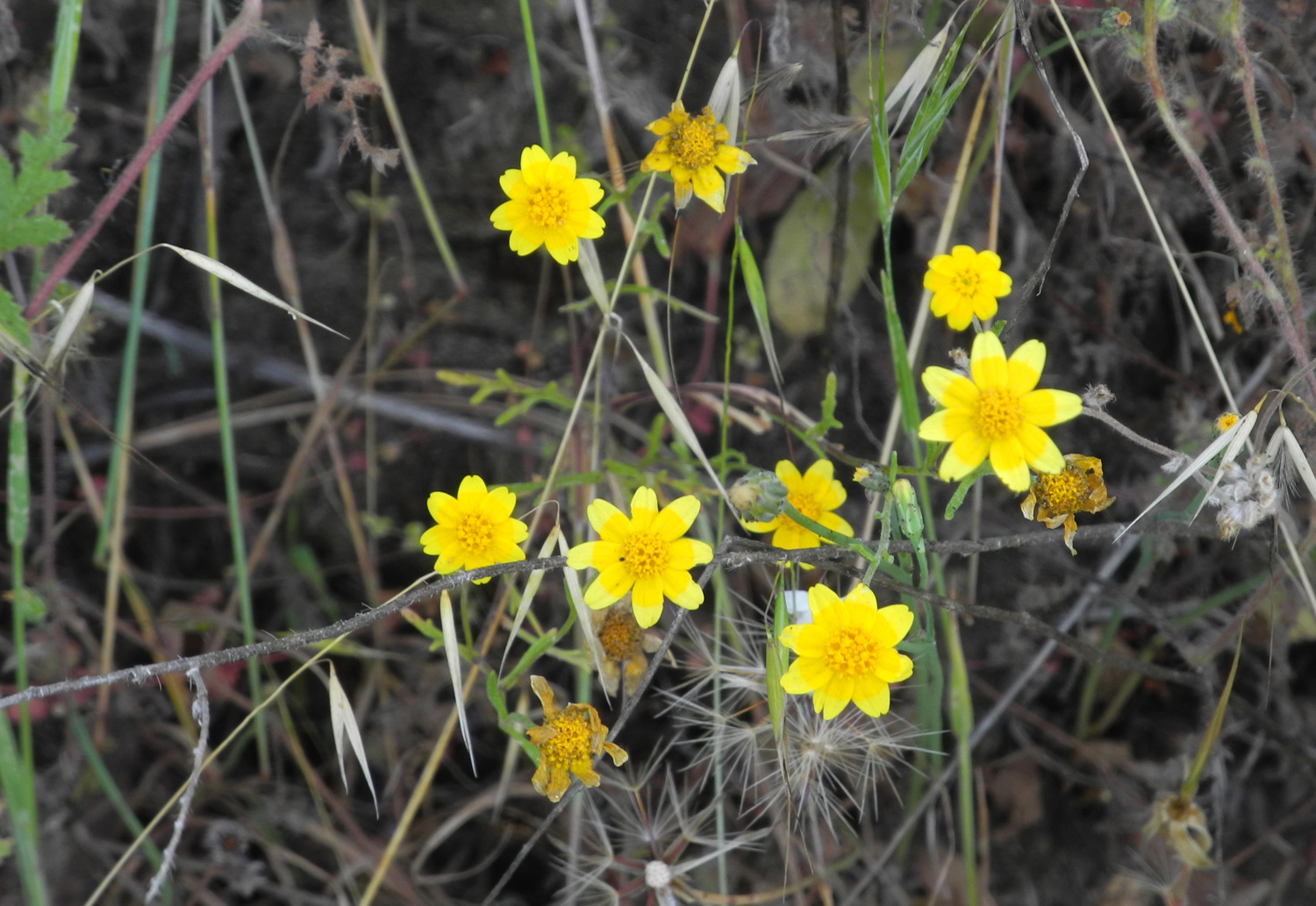 |
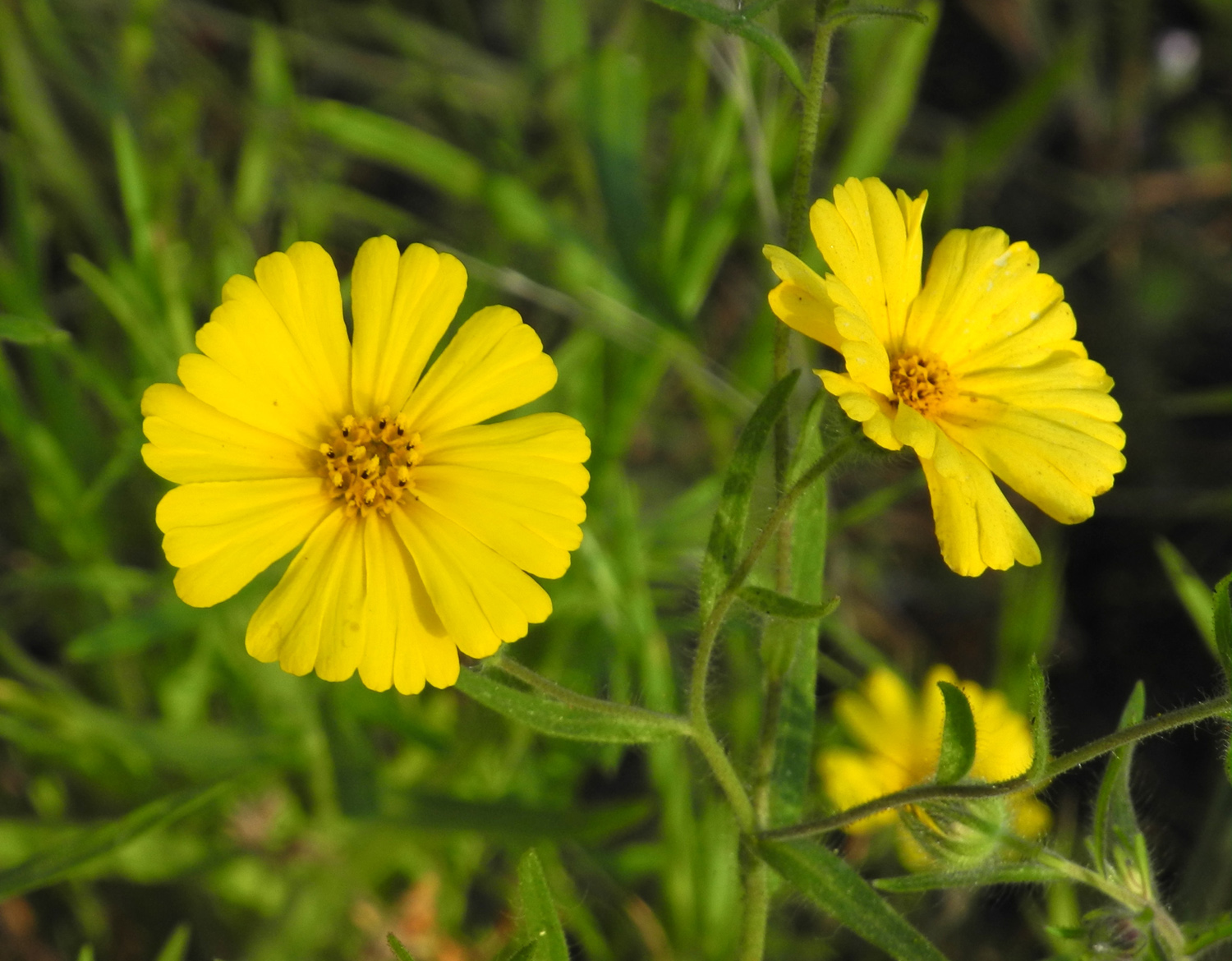
| Each of these flowers appears to be a separate species - I call them all daisies | ||
 |
 |
 |
| Phacelia | Natural monument next to the trail | A field of daisies |
 |
 |
 |
|
Once
unidentified, we now |
A few fiddlenecks make
a last stand among the lupines |
The trail crosses this ridge between the pine trees |
 |
 |
|
| Dick on a rock beside the trail |
My shaded lunch spot,
complete |
Lupines and poppies covered the hills and crowded the trail |
 |
 |
 |
| Quail crossing | The tallest of these ant hills is about two inches high |
Pincushion Peak from Millerton Road near Auberry Road |
 |
 |
 |
| More lupines and poppies | Poppies outshine the smaller phecelia flowers |
Miner's Lettuce blossom
and |
| Related Links | ||
| San Joaquin River Trail | San Joaquin River | |
| Hensley Lake | Madera County | Highway 145 |
| Lemon Cove | County Road Designations | Visalia |
| Dry Creek Preserve | Homer Ranch Preserve | California Poppies |
| Poppies by Larry | More poppies by Larry | Tulare County Treasures |
| Edison Point Trail Description | Pine Flat Lake | San Joaquin Gorge Photo Album |
| San Joaquin Gorge Slide Show | San
Joaquin River Gorge Special Recreation Management Area |
Dick's Edison Point Hike 2015 |