|
October 8, 2002
: It seemed like time for another vacation, so here I am in
Barstow, on my way to a bluegrass festival and a visit to a national park.
Tomorrow
I will arrive at
Logandale
NV, about 60 miles northeast of
Las Vegas
and a few miles south of Interstate 15. The festival, sponsored by
the Southern Nevada Bluegrass Music
Society, will run Friday
through Sunday, so I will need to find something to do on Thursday.
Since I brought tons of back reading material, I can sit in my chair
and read all day, explore the area, or a combination of the two,
which is most likely. Since I’m 35 miles past the half-way point
between home and my destination, I should arrive fairly early, and
will probably have quite a bit of free time after I arrive
Wednesday.
On
Monday, October 14, I will head for Arches
National Park in southeastern
Utah, which is at the top of my list of places to go. There are five
national parks in southern
Utah, so I may get to some of the others. I will definitely get to
Canyonlands, which is near Arches. I will be close to
Zion,
Bryce
Canyon
and Capitol Reef, but won’t try to get to all of them on this
trip.
Leaving
home was an adventure in itself this time. A week or so ago we
received a letter from the county informing us that drainage and
street repair work would begin September 30. The first phase was the
installation of new drain pipes on Bond, at the west end of my
block. This caused no problems; I just had to go the other way when
leaving.
On
Saturday the paving contractor came by and asked me to move my
trailer by Monday morning. Since I was leaving on Tuesday, this was
not something I wanted to hear, but I was prepared, having asked a
neighbor around the corner for permission to put it in her driveway.
This meant I had to get as much as possible loaded on Sunday.
Then
Monday they removed a section of paving about 4 feet wide on both
sides of my street, as well as the concrete around all driveways,
leaving a drop of about 10 inches. I got my truck out with the help
of some 2 X 8 boards a neighbor had, although one broke in the
process. Now I had to park my truck around the corner also, meaning
all last minute items had to be carried about 300 yards. This
morning I headed down the street pulling the little red wagon
(actually the little rusty wagon) that my 18-year old grandson has
had since he was about two.
It will
all be worth it if the drainage repair actually works; they have
worked on it before, but water from lawn watering and storms always pools up in the intersection. Even so, getting real driveways will
make it worthwhile; many of us have poorly made driveways, about a
foot across, with just a steep incline, instead of the usual gradual
one. (As it turned out, the drainage and paving
jobs were excellent. Water still pools on the west side of Bond,
which is in the city, but the really bad part, which we called Lake
Bond, is gone. The city paved their half of Bond a year or so later,
and their pavement is starting to break down already, while ours is
still almost like new.)
I got
loaded up and hitched up OK, and got on the road about
8:40. I arrived here in Barstow around 3, and found a nice park well away from the
freeway and train yard. There are a lot of trees around my spot, and
there is a good breeze. So even though it’s about 90 degrees,
it’s very pleasant outside my trailer.
For
those of you not familiar with this area, my trip involved about 100
miles of travel through the flat southern San Joaquin Valley, then a
climb over 4,000 foot Tehachapi Pass. From the town of
Tehachapi you drop down a short distance to the high
Mojave desert
and the town of
Mojave. The route from there to
Barstow
is mostly level, with a few gentle ups and down.
Barstow
is a connecting point for Interstate 40,
California
58, and Interstate 15, as well as a major railroad switching center.
It’s about 150 miles from here to
Las Vegas.
October 9, 2002
: Since I drag my house behind me, I like to stop when I want
to, not when the state sees fit to offer a rest stop. Sometimes I
pull off on an exit road, pull over to the side, then get back on
the freeway. However, not every exit lets you do that, and heading
northeast on Interstate 15, I chose one that did not. It did have a
passage under the freeway and a ramp for the southbound lane (the
wrong way). Fortunately I only had to go back about two miles before
there was an interchange that I could cross on.
I
arrived at Logandale about
2 p.m.
A whole flock of trailers had been waiting outside the gate in the
fairground parking lot, and they had just started letting them in as
I arrived, so I eased into line. I got a spot with water and
electricity, although I had expected no hookups of any kind. At 4:30
p.m. most of
the available hookups are already taken, and people who arrive tomorrow or Friday will have to dry camp. I
was prepared to do that myself, but I prefer not to. It would mean I
would have to run the generator about two hours each day to keep the
batteries charged. Water is not really a problem; one person does
not use that much and my tank holds enough.
Logandale
is a tiny town of about 1,000, and three miles south is Overton, a
slightly bigger town. I did not feel like fixing dinner, so I went
looking for a restaurant. I did not even find any real business
district in Logandale, although there is stuff way off the highway
so there might be one. Overton had a McDonalds, so I felt like I was
back in
America
again.
These
towns are located in the
Moapa
Valley, through which runs the Muddy
River, although I have not actually seen the river to verify its
condition. There is quite
a bit of irrigated land, which seems to be mostly hay and pasture.
The valley is bordered by eroded cliffs and mesas.
Trailer Life: When I mention getting set up in camp, or hooking
up to go, it involves a lot of stuff. (If you already know this (or
don't care), click
here to skip down.)
First
is the attempt to level the trailer, which must be done while the
truck is still connected. Here the ground is fairly level, but in
some areas it may mean pulling the trailer up on blocks of wood on
one side or the other.
Remove
the power plug that allows the trailer brake and lights to function
when you activate the truck brake and lights. Unhook the safety wire
that activates the trailer brakes in the event it comes loose from
the truck (thankfully I’ve never had that experience).
Next,
remove the cotter pin that holds the leveler bar hook in place, and
release the bar. This involves using a piece of pipe that fits onto
a little shaft that sticks up from the hook. There is a lot of
weight being released, so hang on tight so the bar does not spring
loose and whack you in the shin. The bar bends at a right angle, and
the short end slides into a hole in the hitch, where it’s held in
place by a little catch. On one side, this catch came loose and the
bar fell out while I was driving. On the other side, the catch has
been getting harder and harder to release, and today it failed to
release at all. (This problem
kept getting worse, and I eventually had to buy a whole new hitch
assembly.)
Then
you unlock the hitch and crank down the jack stand that is built
into the trailer tongue. Keep cranking until it lifts off the ball
hitch, then drive the truck forward a little, and crank it
again to level it front to back.
Remove
the hitch from the receiver on the back of the truck, and put it in
the storage compartment, along with the bars. When the bar is still
stuck in the hitch, they’re a little harder to handle than when
they are separate as they should be.
What
happens after this varies with terrain. Sometime at this point I
will use a couple of scissors jacks to raise the trailer slightly on
one side or one corner if necessary.
Once
the trailer is fairly level, I lower a stabilizer foot on each
corner and tighten it with a bar provided for that purpose. This is
not to raise or level the trailer, just to reduce the amount of sway
as you walk around inside.
Hitching
up is pretty much the same in reverse, with one important exception.
Raising the leveler bars requires more strength than I have or have
ever had, so I use a bumper jack to get them up where I can attach
the chain to the hooks on the trailer tongue.
Camp
setup also includes putting down some kind of mat in front of the
door. I have a couple of welcome mat size carpet pieces, a standard welcome
mat, and a 6 by 8 foot vinyl mat. What I use depends on the ground
surface, how long I will be there, what I am going to be doing
(hanging around the trailer a lot vs. watching a bluegrass concert
most of the time), etc. Here I have just the two carpet pieces out.
At dry
camps that will last more than a couple of days, I usually unload
the generator. This is a two-person job, or a struggle with a set of
ramps for one. I will not unload it here; in fact, it looks like it
will get little if any use on this trip. I’d rather have it and
not use it than be without it when I need it. (Later
I purchased a smaller generator that
still did the job and could be handled by one person.)
Most of
the time I set up the awning, which is attached to the trailer.
There is a special tool, which is a simple metal rod bent at the
end, which is used to pull forward a locking latch, and also to hook
into a loop which unrolls the awning. Then it’s a matter of
sliding it up to the desired level on self-locking supports. Taking
it down is simpler; the tool is not needed.
Finishing
touches include setting up a card table or other folding table, lawn
chairs, TV tray, and putting up a flag. And for large scale mountain
camping like we did last August, we would also set up water jugs for
outdoor washing, a clothesline, unload ice chests and other gear,
and whatever else is needed.
It
sounds like a lot, but it gets done gradually over a period of hours
and the end results are always worth the trouble.
It’s
now
9 p.m.
As some of my readers know, jam sessions, or “pickin’ in the
parking lot” are a standard part of any bluegrass festival. I’ve
been listening to a couple of different groups for the last two
hours or so – one a very professional sounding bunch, and one that
is more fun (they actually let me sing with them). I’ve been
talking a lot with Danny & Sherry from
Salt Lake City. He used to play and sing professionally (while keeping his day
job). He quit music 20 years ago, and just re-discovered the fun of
playing with other singers and pickers; this is in fact his first
bluegrass festival. It’s interesting to get such a different
perspective. He played country music, so he knows a lot in that
area, and bluegrass musicians often adapt standard country songs. He
knows and plays with some of the people here who have a much deeper
bluegrass background.
I will
probably wander around once quickly to hear what is going in, then
read a while and go to bed. I need to save myself for the big stuff
ahead.
October 10, 2002
: Temperatures: 57 low this morning; 65 at
8:15
; 90 at
1:30.
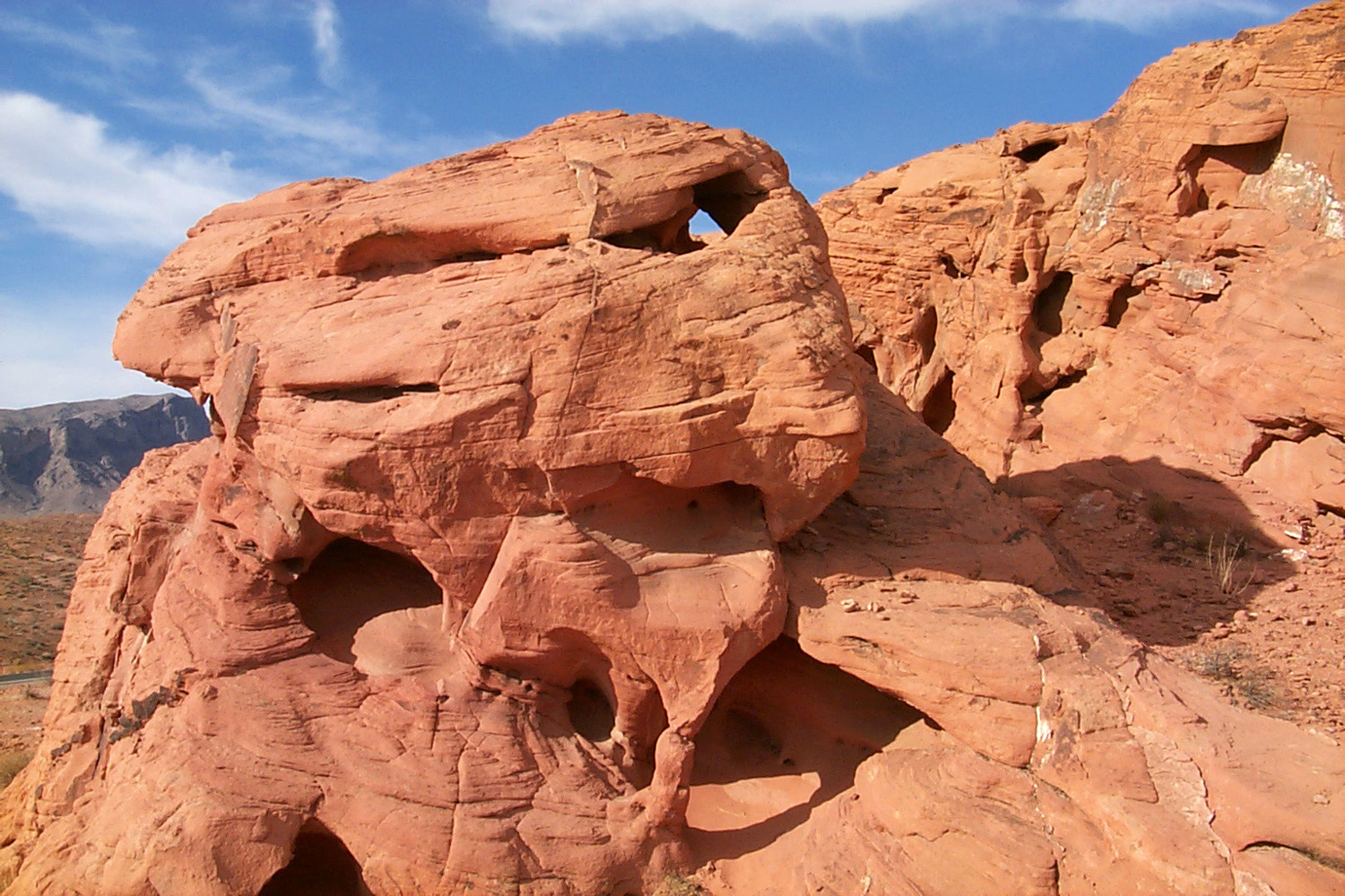
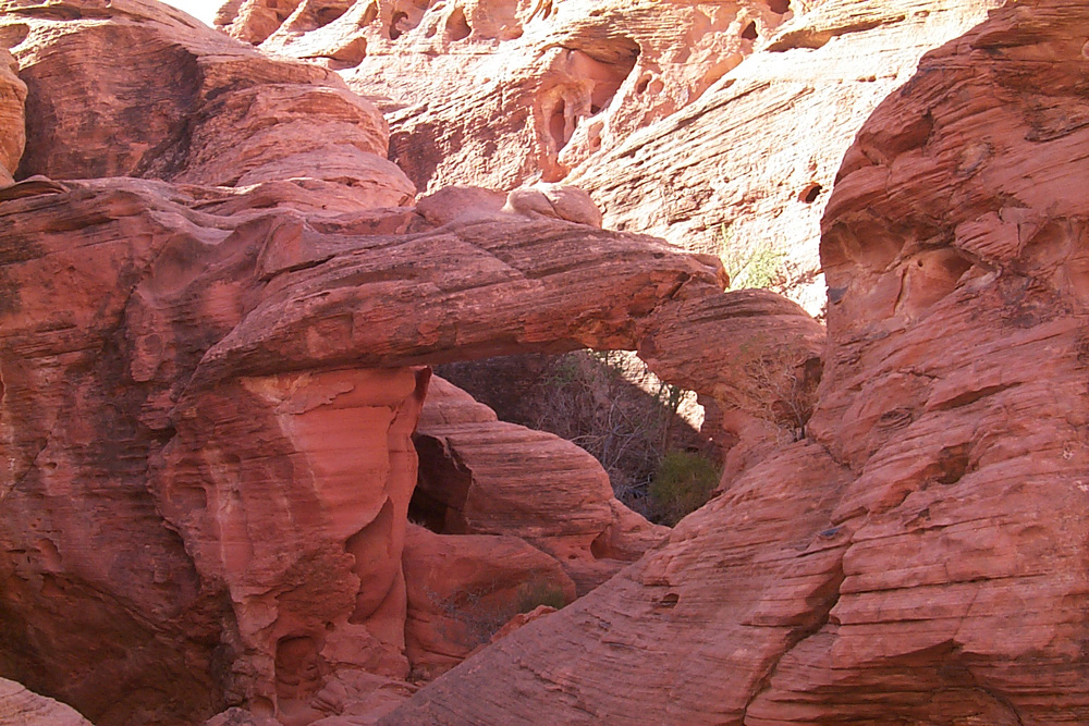
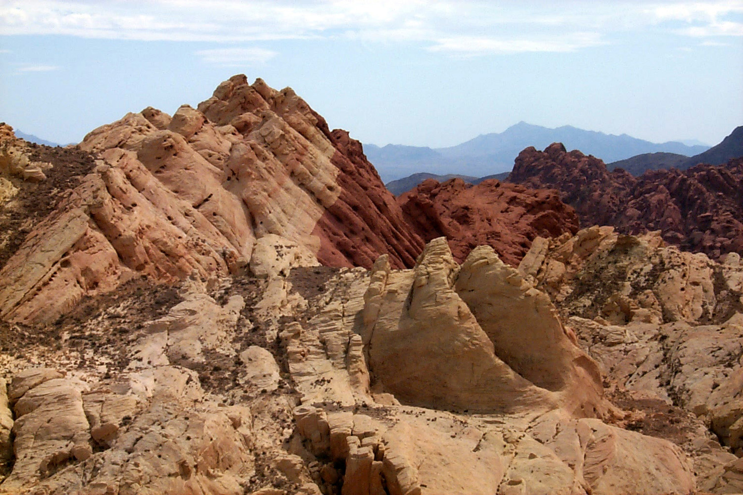
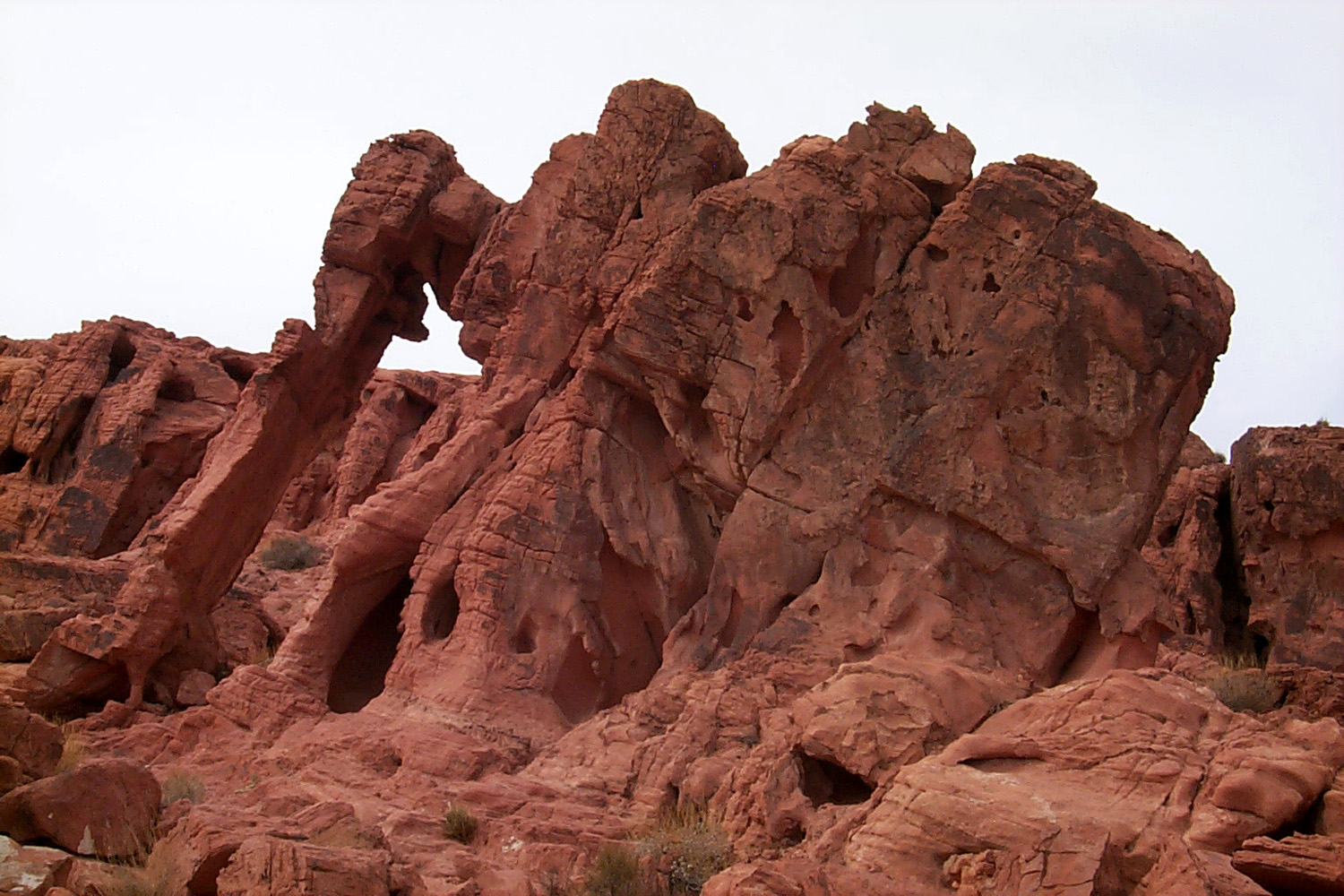
Today I
went to Valley
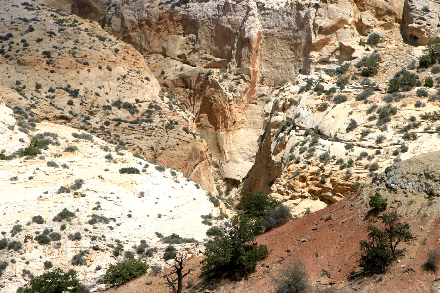
of Fire State Park, about 20 miles from here. It is
an area of red sandstone formations, with lots of windows through
the rock, some small
arches, and endless dramatic formations
sculpted by wind and weather. There are petroglyphs in many places.
I did a little hiking on one of the trails that goes up a dry wash
through a canyon. It’s the kind of place where you say “look at
that” as you go around each bend. It was pretty warm, but there
was a breeze much of the time.
This
afternoon the wind came up pretty hard, so that I had to put
something heavy on my carpet door mats, but it has died down to a
nice breeze now. It’s
7 p.m.
and pretty dark, although the camping area is lit by bright arc
lights, so it’s light enough to walk around and check on the jam
sessions.
October 13, 2002
: Temperatures: 54 low this morning; 80 at
1 p.m.
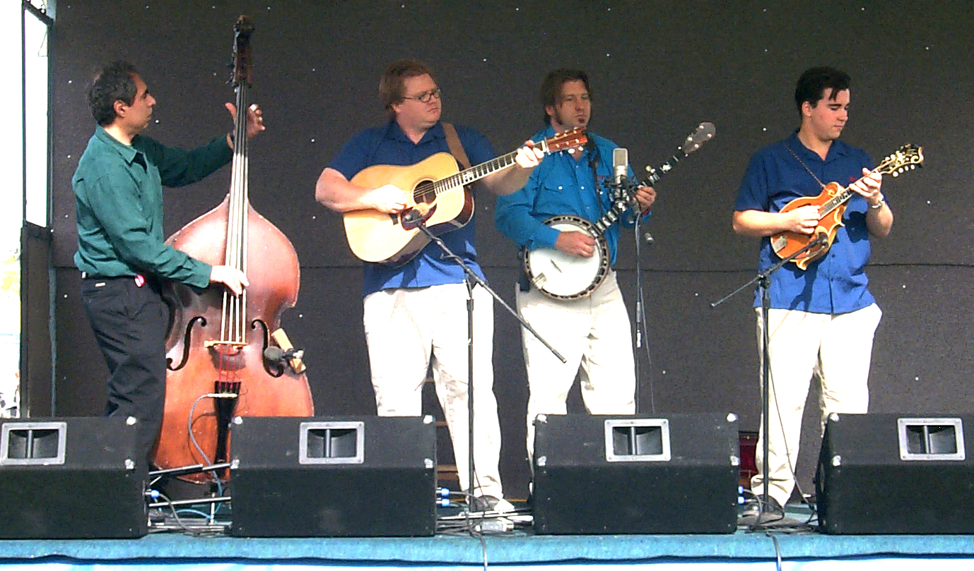
We’ve
had excellent music, good weather, and nice people to hang around
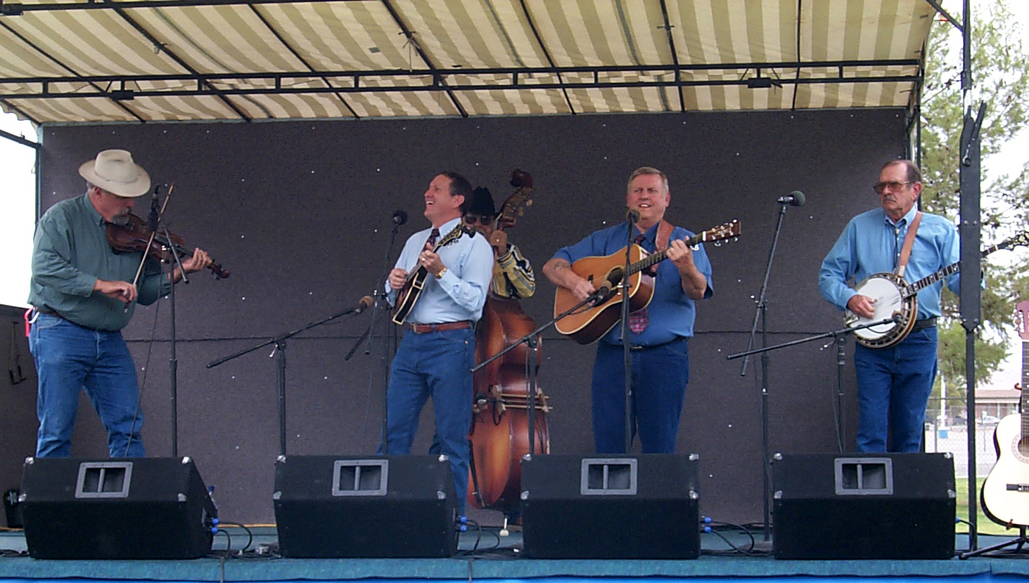
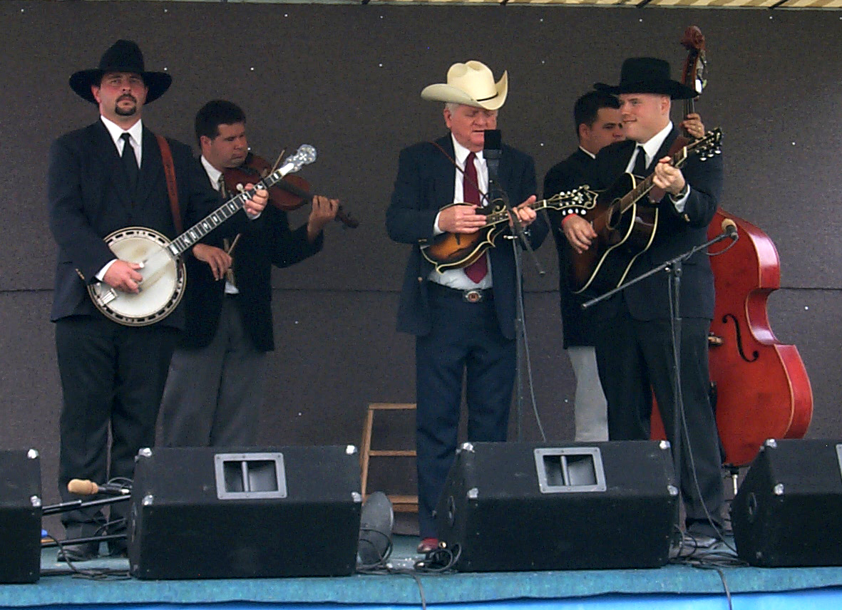
with. The formal show on stage has been great, with some very
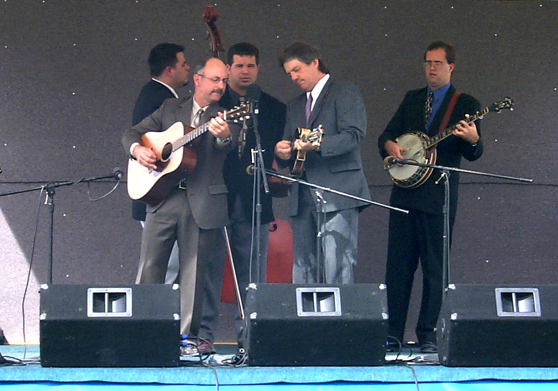
traditional sounding bands; no group was below average. My favorite
was the Liberty Bluegrass Boys from
Texas, followed by Arizona Tradition. I also got to hear Cliff Wagner and
Old Number 7, a new band that has become very popular in southern
California.
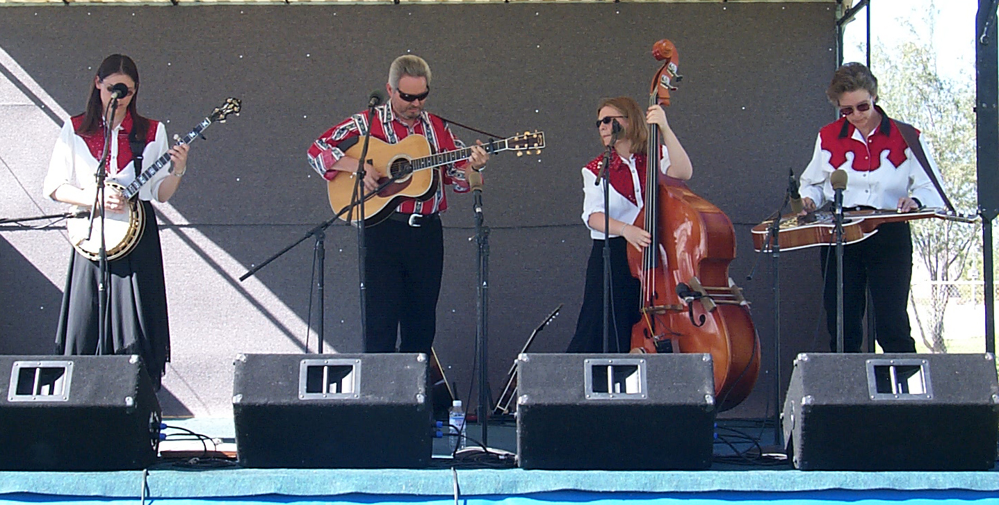
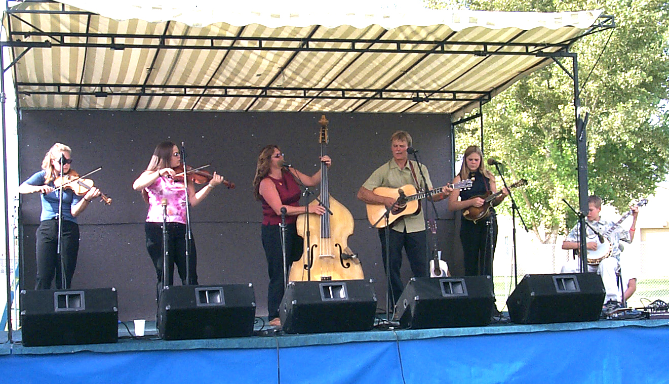
There
were also two family bands. My favorite was the Lampkins Family from
Las Vegas, consisting of father, mother and teenage daughter, and
her best friend. They performed lots of fast, hard-driving numbers.
Not quite in the same league was the Burnette Family - mother,
father, three daughters and a son. They were competent, but nothing
special.
I could
not stay up for jamming last night, but Friday night I was out till
1 a.m.
(the show ended at 8). Thursday night I sang and played with the
people I met from
Salt
Lake
area – Danny & Sherry, Lonnie & Halene, Jim & Barbara,
and Ed from Hurricane, near St. George,
Utah. Ed has forgotten more old country songs than the rest of us
together know, but can’t play much any more due to arthritis.
There are quite a few people staying over tonight, so there will be
jam sessions this evening, but probably not extremely late, since
most everyone will want to get going in the morning.
I will
head up Interstate 15 and probably stop at Zion National Park for a
short look, then go on to wherever seems like a good stopping point.
Tuesday I’ll go on to
Moab, where I’ll stay for a few days while I visit Arches and
Canyonlands
National Parks.
October 14, 2002
: I got started around
8:30
or 9 this morning. I decided not to stop at
Zion, and to save that for another time. I would only have been able to
do a short in and out trip.
Interstate
15 passes through the northwest corner of
Arizona
for about 30 miles, so I have been in three states today. The first
part of the trip was through country with rugged but barren-looking
hills. Actually there is a lot of brush along the route, nothing
much over three feet. In the
Arizona
section, the road went through the
Virgin River
Canyon, which had a lot of dramatic rock formations, plus glimpses of the
river from time to time.
Once I
entered
Utah
and got past St. George, the road began to climb into mountains with
red rock and bigger trees, mostly juniper but an occasional pine of
some kind, and some irrigated fields. Approaching Cedar
City, I went through a high valley with horses, cows, hay and
pastureland, all lined by mountains on both sides. At a rest stop
near Kanarraville, it was very windy, and I could see bigger trees
on the higher mountains. There were also a lot of small oak trees,
mostly 20 feet tall or less. They appeared to be black oaks. At
11:40
(Mountain Daylight Time) it was 69 degrees.
Instead
of taking Interstate 15 all the way to I-70, I turned east at Cedar
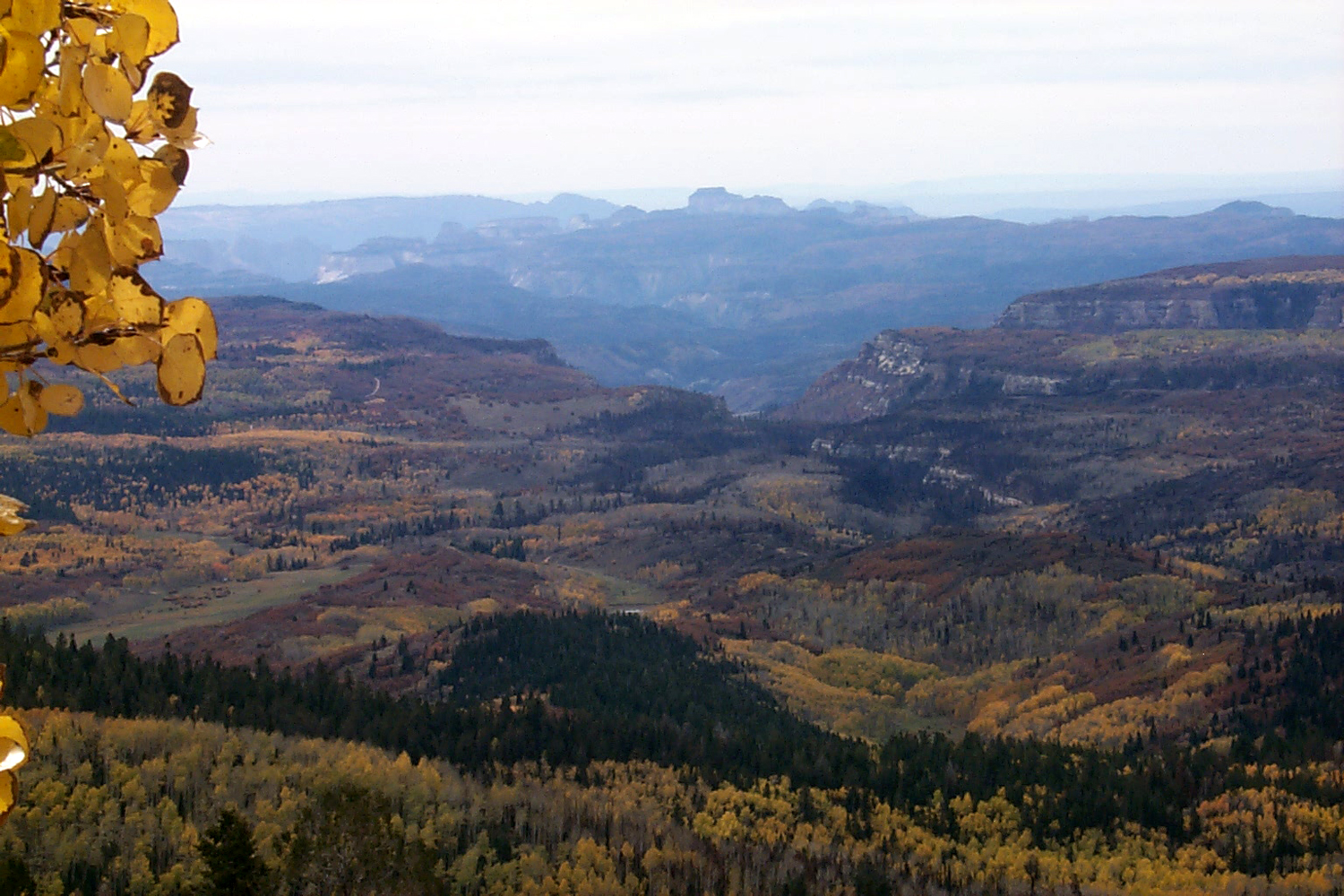
City on Utah Highway 14. This road went up to
9,900 feet, and almost
immediately offered views of dark, tall evergreens, with yellow
aspens for contrast. There is a view into
Zion
National Park
where you can see plateaus, canyons, and large
forests of evergreens with aspens mixed in. There were patches of snow along the
road at some places, and at one flat, tree-covered area, good size
snowfields. At one point the road went through lava fields for a
couple of miles, mostly covered with trees. In the Duck Creek area
at 2:30
the temperature was 60 degrees.
The
road dropped down to around 5,000 feet, where I took
US
89 north. Most of the way this road follows the Sevier (pronounced “severe”) River through valleys with some farming,
and weathered mountains on both sides. A few places it narrowed and
there were rock spires and other formations close to the road.
I am
staying tonight at
Richfield, on I-70, a few miles east of the junction with
US
89. It was 65 degrees when I got here at
5:15, and now at
8:30
it is about 45. This is still in the
Sevier
Valley, and there is snow at the top of the mountains adjacent to the
valley. The elevation here is about 5,200 feet.
At
9 p.m.
it’s 39 degrees.
October 15, 2002
: Except for Thursday night, it was cool enough each night in
Nevada
to put on a light-weight long sleeve shirt after dark. However, the
days always started with shorts and a T-shirt. Today started with
jeans, a T-shirt with a long sleeve flannel shirt, and the heater
on, in both the trailer and the truck. The low last night was 24
degrees, but it was up to the mid-50’s by the time I left
Richfield
at 9:30. A couple of hours into the trip, the flannel shirt and the heater
were off, but I never used the air conditioner.
The
stretch I traveled today was one of the most scenic of my two trips this year. Other
spots have been as good or better, but none offered the dramatic
scenery that I enjoyed throughout the entire trip today. I followed
Interstate 70 most of the way, going though canyon country with
views of mesas, cliffs, towers and other
shapes, in red, tan and
gray rock. There were times when the road would drop down into a
large level area and I would think it was not going to go any lower,
then the land on one side or another would drop off into a canyon.
At one long flat stretch, I came to a sign warning, 6.5% downgrade
ahead; trucks use low gears. More canyons and cliffs would follow
every stretch of flat land.
I
turned south off I-70 on US Highway 191 into
Moab.
Moab
is a little more than one third of the way up from the southern
border with
Arizona, and about 30 miles west of the
Colorado
border. It is the jumping off point for Arches and
Canyonlands National Parks. The entrance to Arches is about 10 miles north of where I am
staying.
The
elevation here is about 4,500 feet. Although lows matching last night
are unlikely, it was 51 degrees at
6:30
and it was obviously time to be inside for the night. It was not
quite dark, but by 7 it was. There is a view of the snow-capped La
Sal Mountains (11,000 feet at the highest point) to the southeast, a
cliff of sculpted rock to the west, and red hills with scattered
houses to the east. Above the hills, but not visible here, are
smooth sandstone cliffs.
October 16, 2002
: I don’t really know when I first looked at a picture from
Arches
National Park
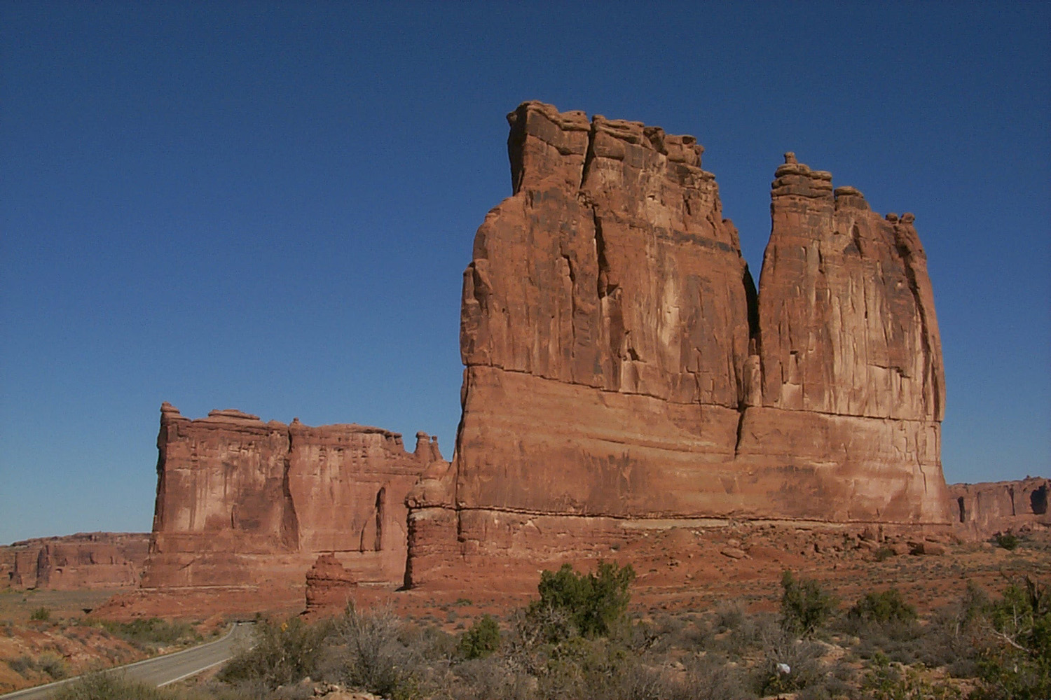
and decided I wanted to go there. I do know today is the day I
finally did it. It exceeded all expectations. Words and even
pictures can’t adequately show the dramatic sandstone walls, weird
shapes and the arches. Let it be sufficient to say that if the park
had not a single arch, it would still be worth seeing.
There
are lots of places to stop and see things with no walking or a very
short walk; and of course, lots of longer walks. My “big” walks
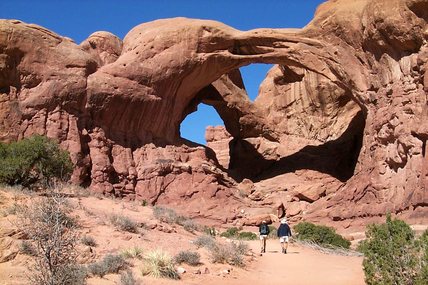
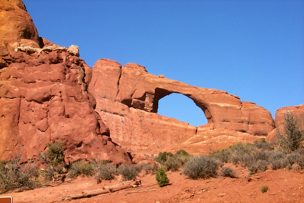
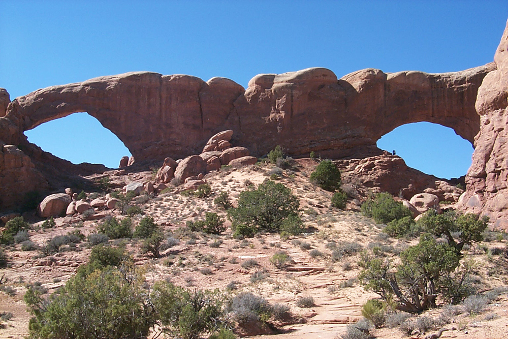
for today were at the Windows area, where you can see a number of
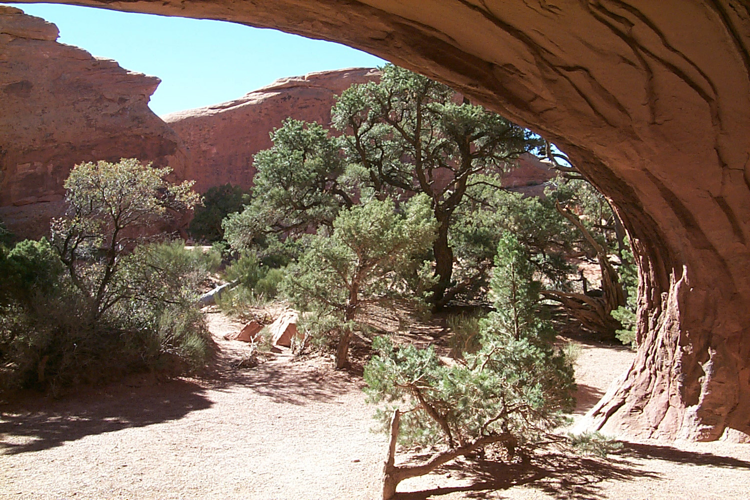
arches, and go all the way around the North and South
Windows. From
the same area, it’s a fairly short walk to Double
Arch. There are
a number of smaller arches, which were not identified on the map or
along the trail. The park has several thousand arches, and they
could not think of names for all of them.
I then
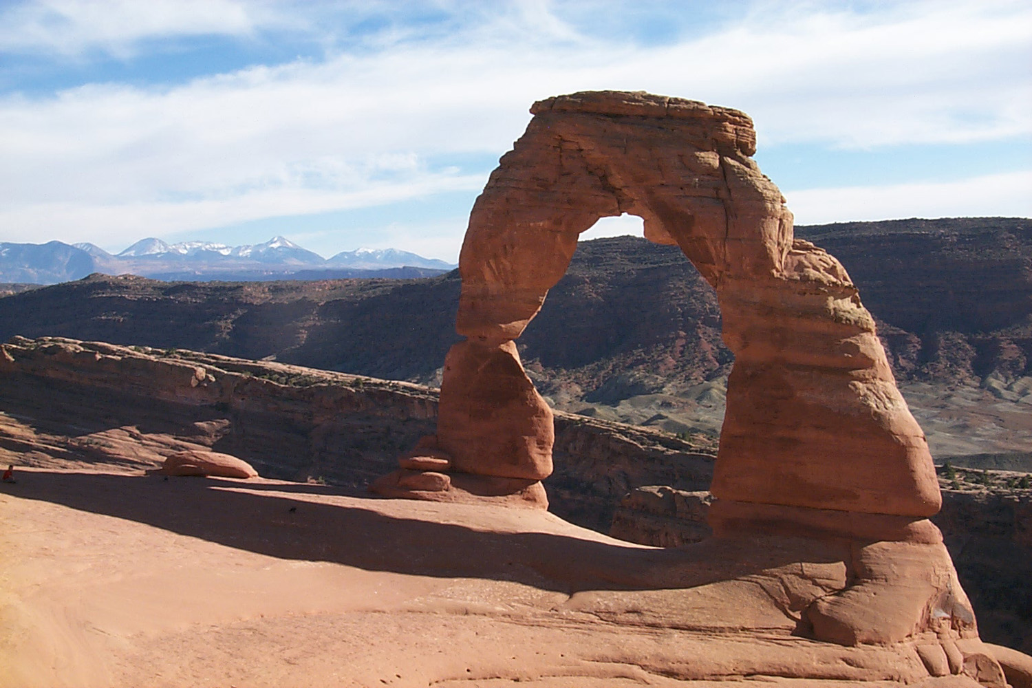
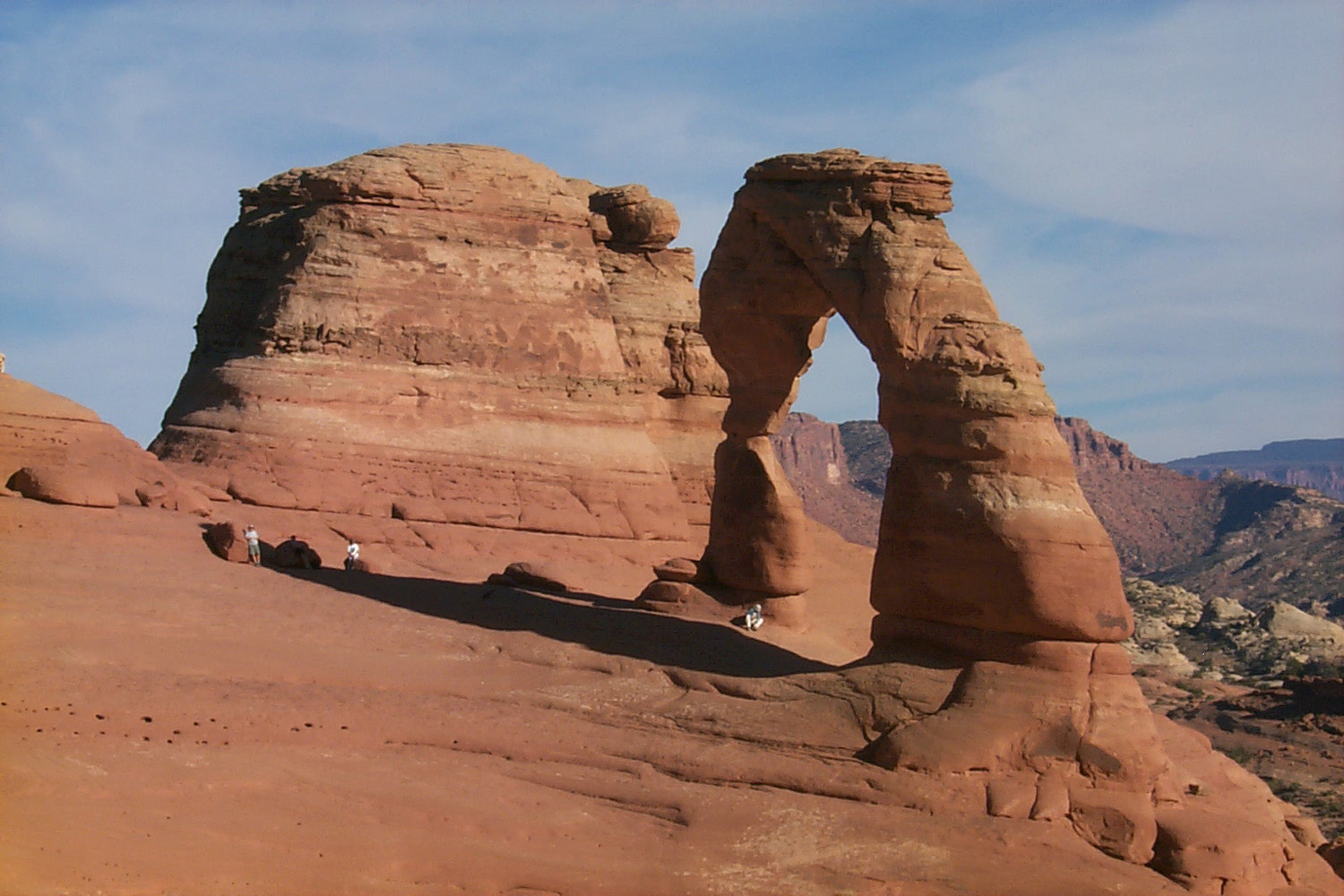
went to the area of the park’s most famous feature, Delicate
Arch.
I did not make the three mile round trip to the arch today, but
instead took a steep half mile walk to a viewpoint at the edge of
the canyon opposite the arch.
Tomorrow
and Friday I will go to Delicate Arch, and hopefully Tower Arch,
both requiring hikes of three miles or more round trip. I also
want to go to the Devil’s Garden area, where about three miles of
walking will take you to a half dozen major arches.
October 18, 2002
: It’s just after
6 p.m.
(MDT), the sun dropped out of sight behind the ridge about five
minutes ago, and at 60 degrees it’s too cold for me to sit
outside. Of course, I’ve sat out in much colder weather, properly
dressed and with a campfire, but when the trailer is warm and handy,
it’s too much trouble to create the necessary conditions for
sitting outside.
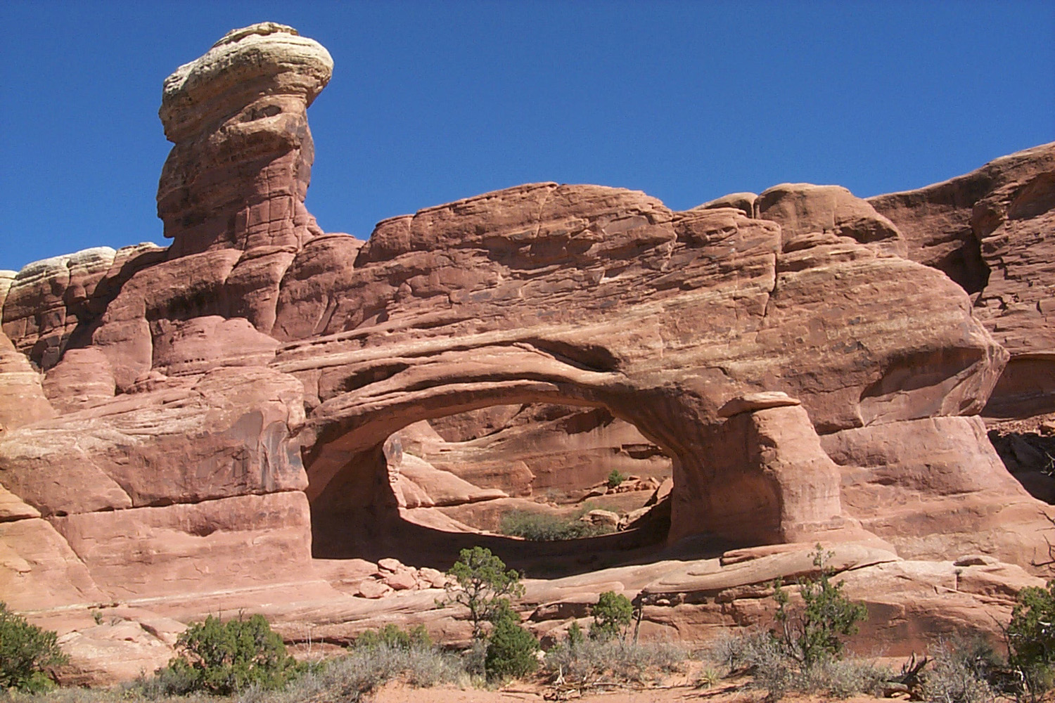
Yesterday
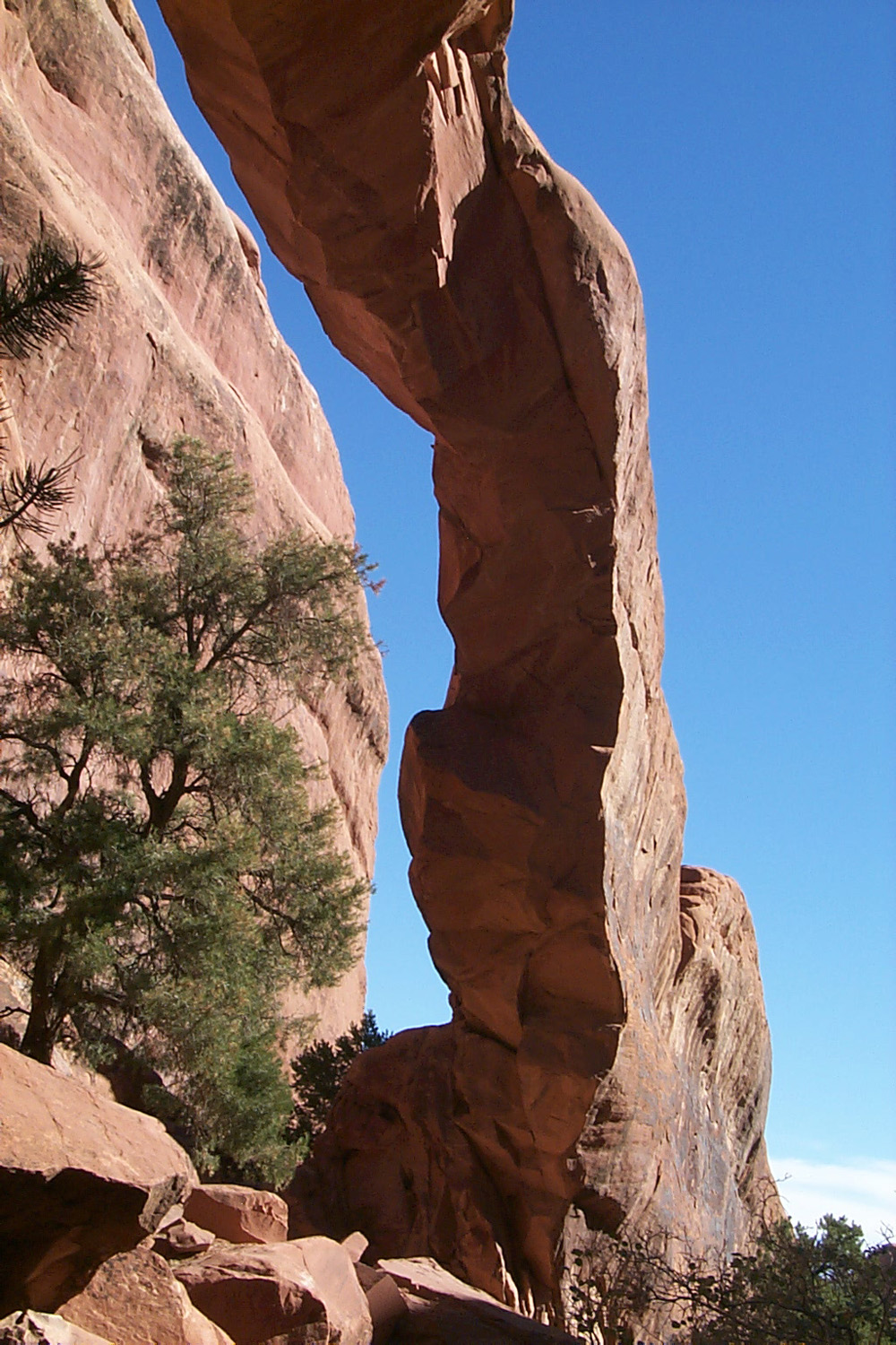
I went to two of the major attractions in Arches – Devil’s
Garden and Delicate Arch. The Devil’s Garden trail goes through an
area of striking sandstone walls, spires and arches. The main part
of the trial leads to Landscape
Arch, the longest in the park. In
1991 a large chuck of rock fell from this arch, causing the park
service to close the trail that goes under the arch. From this area
a more primitive trail goes another mile and a half to Double O
arch, with side trails to Partition Arch and Navajo
Arch. Having
seen pictures of all these, I was most interested in getting to
Navajo, so I skipped the extra two mile round trip to Double O and
went to Navajo and Partition. Along the trail you pass by Wall
Arch,
and short side trails lead to Tunnel Arch and Pine Tree Arch. This
walk was about three miles or so round trip. (In 2008 Wall Arch
collapsed, and is an arch no more. See photos on my Utah
Photo Album page.)
After a
break to eat lunch, I headed for Wolfe Ranch, the starting point for
the trail to Delicate Arch. (Wolfe was a Civil War veteran and the
only person known to have established a permanent residence in the
territory now covered by the park). Delicate Arch is the signature
visual symbol of the park, as well as
Utah’s national parks and the state itself. It appears on the current
Utah
license plates.
The
trail is three miles round trip, with quite a bit of up and down,
and a long stretch across open sandstone. There is no real shade on
the entire hike (the biggest trees in the area are usually 10 feet
tall or less), and it’s considered “fairly strenuous.” I took
my time, and just like when I’m driving down the highway with my
trailer, nearly everyone passed me – but I still reached my
destination. The usual pictures of Delicate Arch make it look like
it is on a fairly level area, but in fact it is perched on the edge
of a deep canyon, and it is not possible to get to the lower side of
it. Even so, you can walk all around the upper area, and get a
number of good views.
I had
hoped to also go to Broken Arch, but I decided not to add another
mile through open country to my workload, and saved it for another
day.
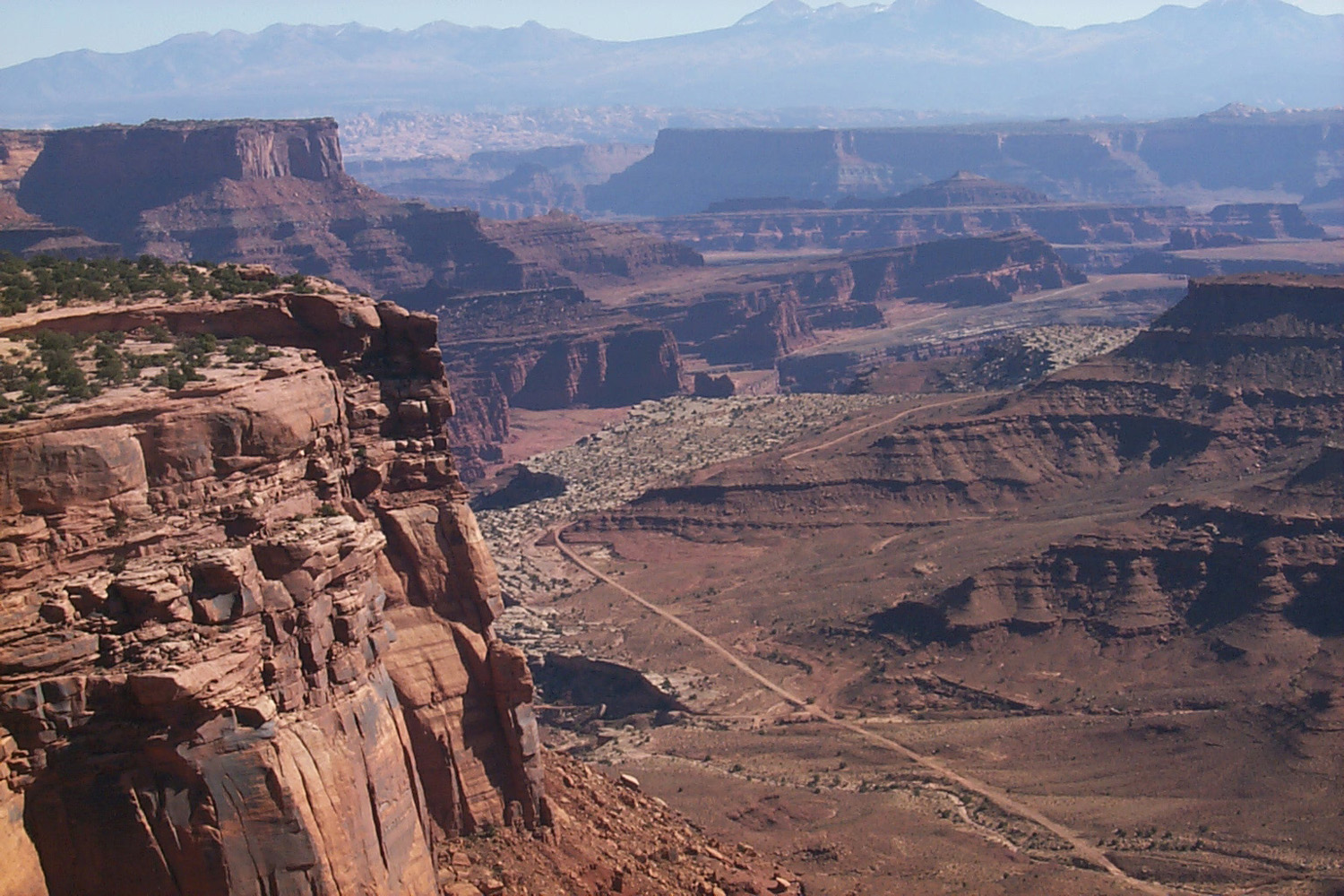
Today I
went to
Canyonlands National Park, which is west of Arches. It’s about 20 miles from
US191, up
Utah
313. It is a vast area of canyons and plateaus, covering over
300,000 acres, and includes the confluence of the Green and the
Colorado
Rivers. The area I visited is called
Island
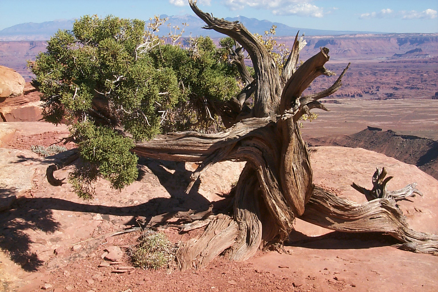
in the Sky, which is a vast mesa at 6,000 feet, with views into the
Green River,
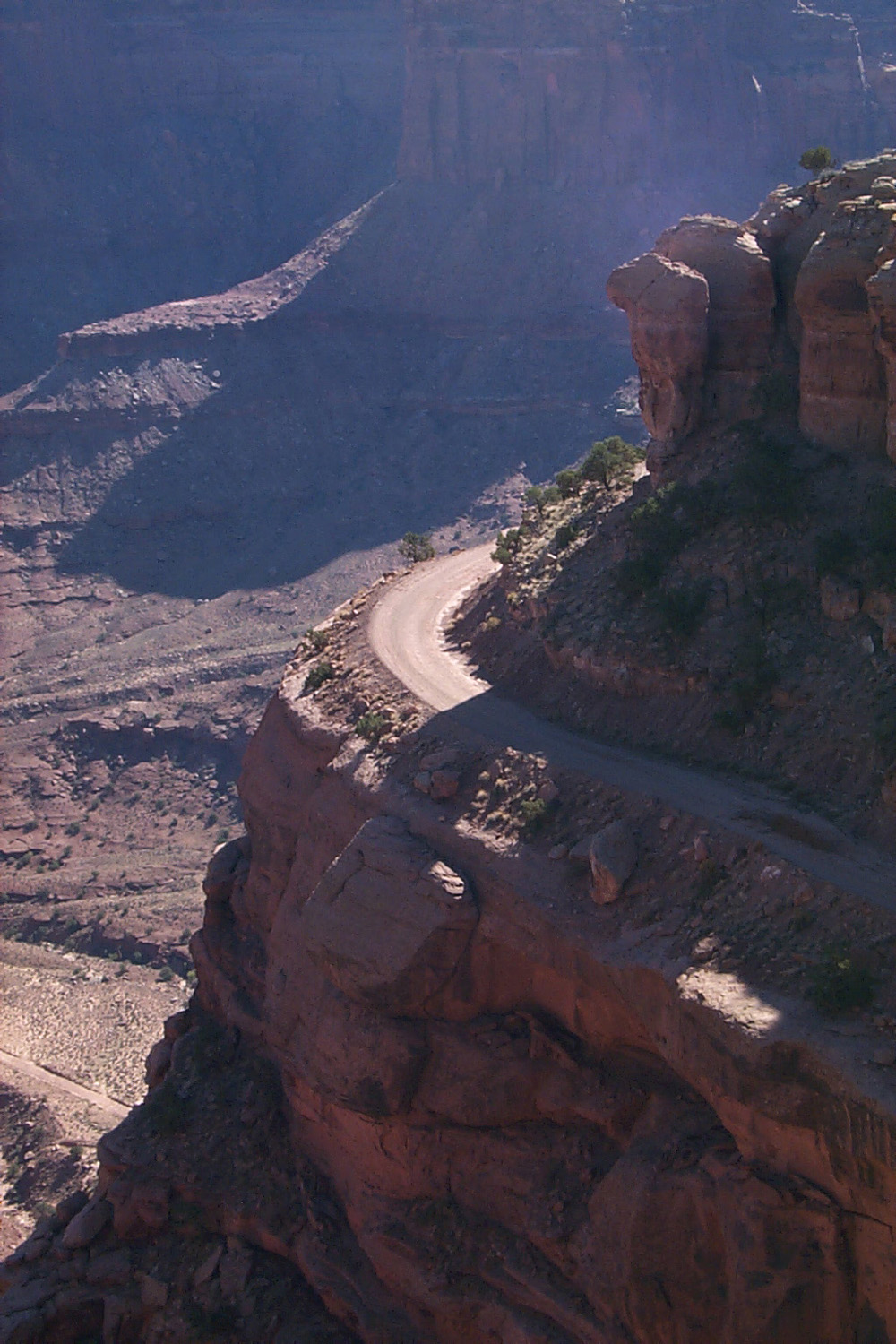
Colorado River, and many other canyons. There are many vista points, as well as
hiking trails and four-wheel drive roads. The area was relatively
unknown prior to the 1950’s, when roads were built for uranium
prospecting. It became a national park in 1964. Below the
“island” there is a large area called the White
Rim, at 5,000
feet, cut by numerous lower canyons. The big rivers meet at the
4,000-foot level. (To read about an early exploration of the Green
and
Colorado River
canyons, I highly recommend The Exploration of the Colorado River and its Canyons
by J.W. Powell.
(2011 update: An even better book is A Canyon Voyage by Frederick Dellenbaugh - it covers the second
Powell expedition; Powell's account includes events from both
voyages, without distinguishing which is which.)
by Frederick Dellenbaugh - it covers the second
Powell expedition; Powell's account includes events from both
voyages, without distinguishing which is which.)
When I
got back to camp, I realized I could not do everything I wanted to
do in the scheduled remaining time. I decided that
it would be foolish to pass up the few places in Arches that I have
not yet seen while I am right here, so I paid for another night at the RV park and will
stay until Sunday morning. I intend to come back, but
nothing in life is guaranteed.
October 20, 2002
: I have a number of photos from the Internet, mostly of
Delicate Arch, and a screen saver with a lot of nice pictures. None
of them show the effort required to get to the locations in the
pictures.
Saturday
I went into the park, with Tower Arch as my destination. A couple of miles into the park, I stopped to take some
pictures, and discovered that the batteries in the digital camera
had run down. I have a bag with extra batteries and other
accessories, but I had foolishly left it in the trailer. I debated
going on and just not taking pictures, but I realized what a bad
idea that was, and headed back to town. I was going to stop at the
first store and buy some batteries, but once I got to town, it was
only another mile to the RV park, so I got my bag and retraced my
steps. This was the best "extra mile" I have ever gone,
since I would have missed out on taking photos of Tower Arch and
everything along the trail.
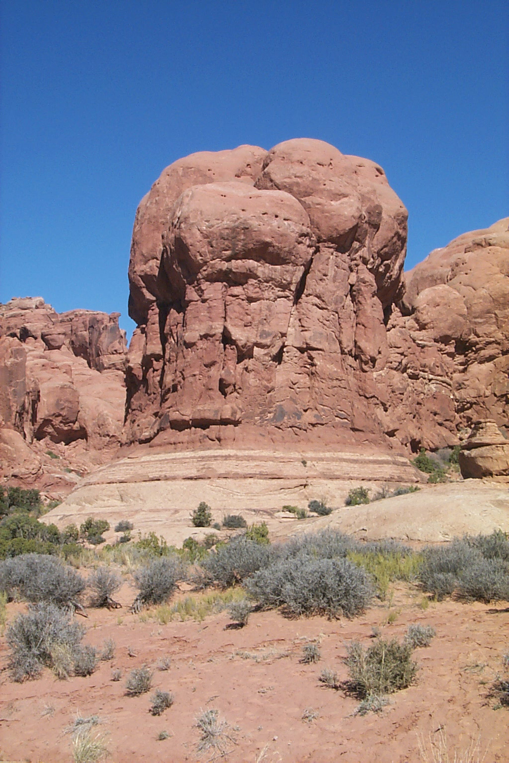
Once
back in the park, I took the rough 8-mile dirt road to Klondike
Bluffs. Where the road ends, a two-mile (one way) trail starts to
Tower Arch. The trail leads up a rocky ridge, across a fairly level
area, then down into a large basin, with huge sandstone formations
on several sides. Most of the last half mile of the trail is uphill
through loose sand, but the view of the arch is worth the trip, and
the hike was enjoyable, through some beautiful high desert country.
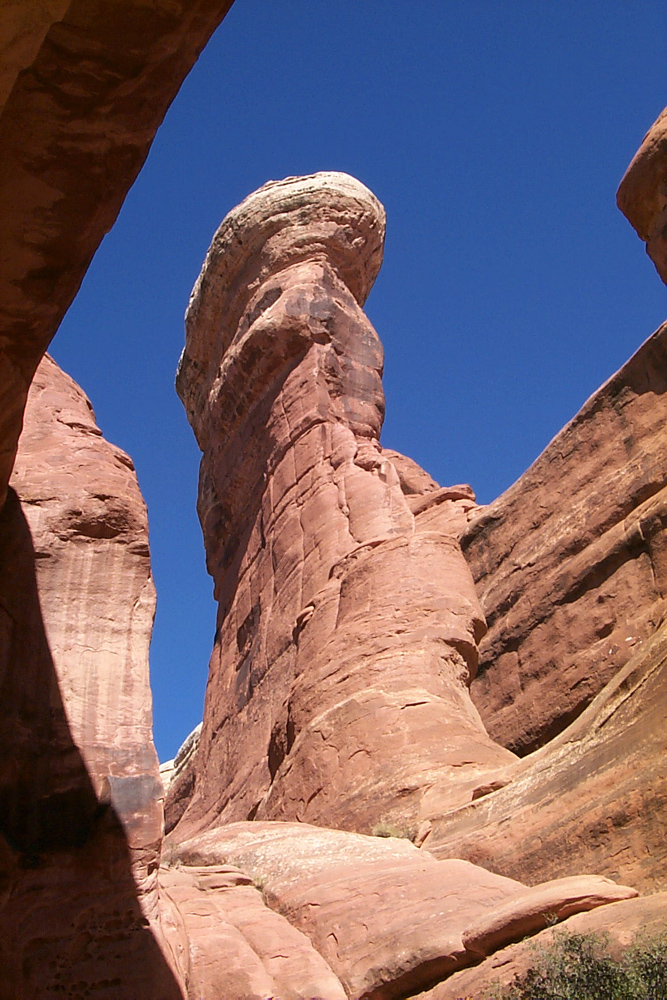
Tower Arch is a fairly good sized one, with the upper part at least
30 feet deep horizontally, and 40 feet high. Above the arch, on a
separate wall of sandstone, is a dramatic tower with a bulging top.
When I
got back to the truck I had a snack, then went to Broken Arch, a
one-mile round trip, mostly across open level ground. The best thing
about the arch is that it is not broken, but has a large crack and a
dip in the center. There was a couple from
Mexico
there, and he had climbed up on top of the arch. I got a good
picture of him, and arranged to send it to them via Email.
I got
started home about
9:30
this morning, but I did not check my map carefully, and did not turn
off Interstate 70 when I should have. This resulted in my going
south quite a bit farther than I needed to, and having to double
back on Interstate 15 and some county and state highways to get to
US 50. I had hoped to get a little farther, but stopped for the
night at
4:30
in
Delta
UT. This area is a large, flat valley with a lot of farming, but with
mountains visible in most directions, including some very snowy ones
to the southeast, probably the
Tushar
Mountains in
Fishlake
National Forest, which reach an elevation of over 12,000 feet.
It was
fairly warm when I got here; I could sit outside in the shade in
jeans and a T-shirt. It soon got cool enough to move to the sunny
side and put on a long-sleeve shirt; by
7 p.m.
it was down to 51 degrees, and well past my time to come inside. The
elevation here is a little above 4,600 feet.
I am
hoping to go home by way of Tioga
Pass.
I will call Yosemite
National Park
tomorrow to check on the weather. Then at Ely
NV
I will either take US
6 to California
120, or stay on US 50 and go over Donner
Pass.
Stuff
about Utah:
Moab
appears to be the mountain bike capitol of the world (and you
thought it was
Auberry Road). There were always bikes on the road and vehicles carrying bikes,
and on the way to my RV park was a sign pointing to the
Slick
Rock
Bicycle
Park. There was a banner across
Main Street announcing the Fat Tire Festival the week I was there. I first
thought this was some sort of 4-wheel drive event, but after seeing
dozens of cars with anywhere from two to six bikes, I realized it
was for bikes.
Many
states have strange ideas about liquor, and
Utah
is one of them. You must buy bottled booze in a state-owned store (and
California
thinks the lottery is a good money maker). You can’t buy the mix
there – just liquor. You are not allowed to drink in a bar, but
you can drink in private clubs. What this means is that you go into
a building that looks exactly like a bar, and someone you've never
met before who is already
a member sponsors you. You sign your name on a piece of paper and
you’re a member, and they happily serve whatever you desire.
October 21, 2002
: I got an early start, about 7:45
Mountain Time, with a thermometer reading of 27 degrees at
8 a.m.
just after sunrise. Driving on US 6 is like having your own highway.
At one point, I measured 60 miles during which I met just five cars.
During one stretch of 30 miles, there were none. I went 93 miles
without anyone passing me (I drive 55 or a little more, and the
speed limit is 70).
This
part of
Nevada
is more scenic than what I saw along Interstate 80 last summer. Most
of the day consisted of straight stretches across basins of 10 to 30
miles, followed by mountain passes. The first two were over 7,000
(one was 7,700), and the others all topped 6,000. The elevation is not
marked in the basins, but I doubt if I dropped down more than a
thousand feet from the passes at any point. The scenery consisted
largely of sagebrush, juniper and piñon pine.
I
stopped for the night at Tonopah, which is 279 miles from
Fresno,
according to my trip planning program. Since the cost was quite a
bit lower than usual, I gave them another $11 in the slot machines.
I stopped about 3:30, but it was
4:30
Utah
time and I had been on the road for nine hours, so it was time. It
was windy all across the state, and cooled off quickly here, at
6,000 feet.
October 26, 2002
: The last day of my trip was uneventful, but very scenic. As
I drove out of Tonopah on US 6/95 I saw guys picking up trash along
the highway at
7:30 a.m.
in 34-degree weather. Think about this if you don’t like your job.
US 6
departed from 95 about 40 miles from Tonopah, and went over some
high passes, into territory covered by single-leaf piñon pines.
After a few standard
Nevada
basins and passes, I entered
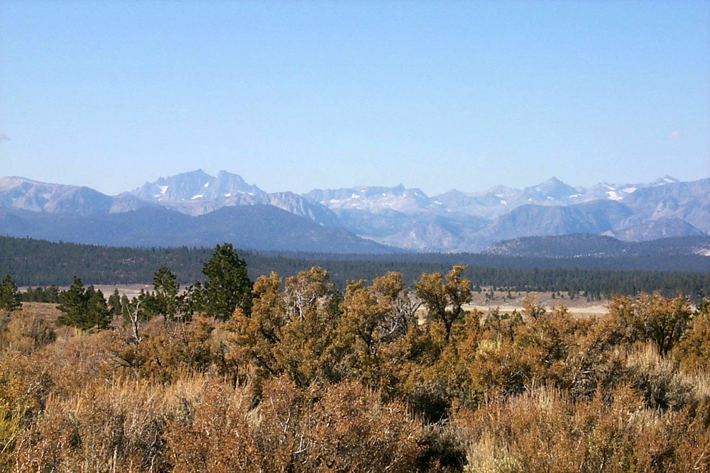
California. At the town of Benton, I took California 120, which goes over the
8,000 foot Sagehen
Summit, then drops down to join US 395 about five
miles south of Lee
Vining. There were some interesting rock formations along the road,
and a great view of the eastern Sierra from the top of the pass. It
was 42 degrees with bright sunshine around 11 a.m.
From
Lee
Vining I went over
Tioga
Pass
(9,900 feet), entering
Yosemite
National Park. There are some management fires along that road, so the views were
hazy but still beautiful. The road drops down to
Yosemite Valley
at 4,000 feet, then goes back up close to 6,000 at Chinquapin, before
gradually leading down to the
San Joaquin
Valley
at the 400 feet level. So the day had its ups and downs.
I got
home around
3:30
to find my street still torn up, and my driveway inaccessible. So
once again I parked the trailer several hundred feet away and hauled
stuff to my house with a grocery cart that someone left in front of
my house last summer. The next day the ditch was filled in and after
cleaning the trailer and putting it in storage, I was able to get
into my driveway to finish unloading.
I left
Fresno
with temperatures in the 90’s and returned to find them in the
70’s. Nights are still a lot warmer than the 34 typical of
Moab. I was totally happy with my decision to put
Arches
National Park near the top of my “places to go list,” and I definitely plan to
return.
(Read about my return
visits to Arches in 2004 here, in 2015 here, in 2019 here,
and in 2022 here.
--Dick
Estel, October 2002 |


