|
Dick & Janell's Death Valley Trip |
|||
|
Day 1 - March 29: People were asking me when is my next trip, so I decided it must be time to take one. That explains why on March 29, 2013, Janell and I were camped at Lone Pine, right underneath Mt. Whitney and a few miles from one of the several far-flung entrances to Death Valley National Park. It was the first time here for both of us, so we were not entirely sure what to expect, but we both enjoy the rugged beauty of the desert, and Death Valley has that plus mountains, canyons, and a ton of other stuff to see. We left Fresno a little after 8 a.m., and made good time, getting here and set up by 3:30. Our trip included a quick stop for a snack in the motor home at Tehachapi, and another stop at Ridgecrest, where we rented a car. Although it's 70 miles away from Lone Pine, it was the closest place to rent unless we continued north, then backtracked. The first part of the route is one I have taken many times, south to Bakersfield, and east through Tehachapi to Mojave. Here we turned north on California 14, a route I have driven on only once before. The highway goes right through the middle of Red Rock Canyon State Park, where we stopped to take photos of the multi-colored sedimentary cliffs. Eventually 14 merges with US 395, but shortly before that we took California 178 12 miles through Inyokern and into Ridgecrest. We then backtracked as far as 395 and drove the final 70 or so miles north to Lone Pine. The Boulder Creek RV Park is about four miles south of town, and after we got set up we drove to Lone Pine to check out the Visitor Center. It serves visitors enjoying various federal lands in the area including National Park, National Forest, and Bureau of Land Management. We got some useful advice on places to see in Death Valley, and a personal tour to the end of the building, where the ranger pointed out Mt. Whitney, visible through a large picture window. As we expected, the weather in Death Valley is supposed to be quite warm - mid 90s throughout the weekend, although where we are is about 3,700 feet, so it's between 70 and 80 here.
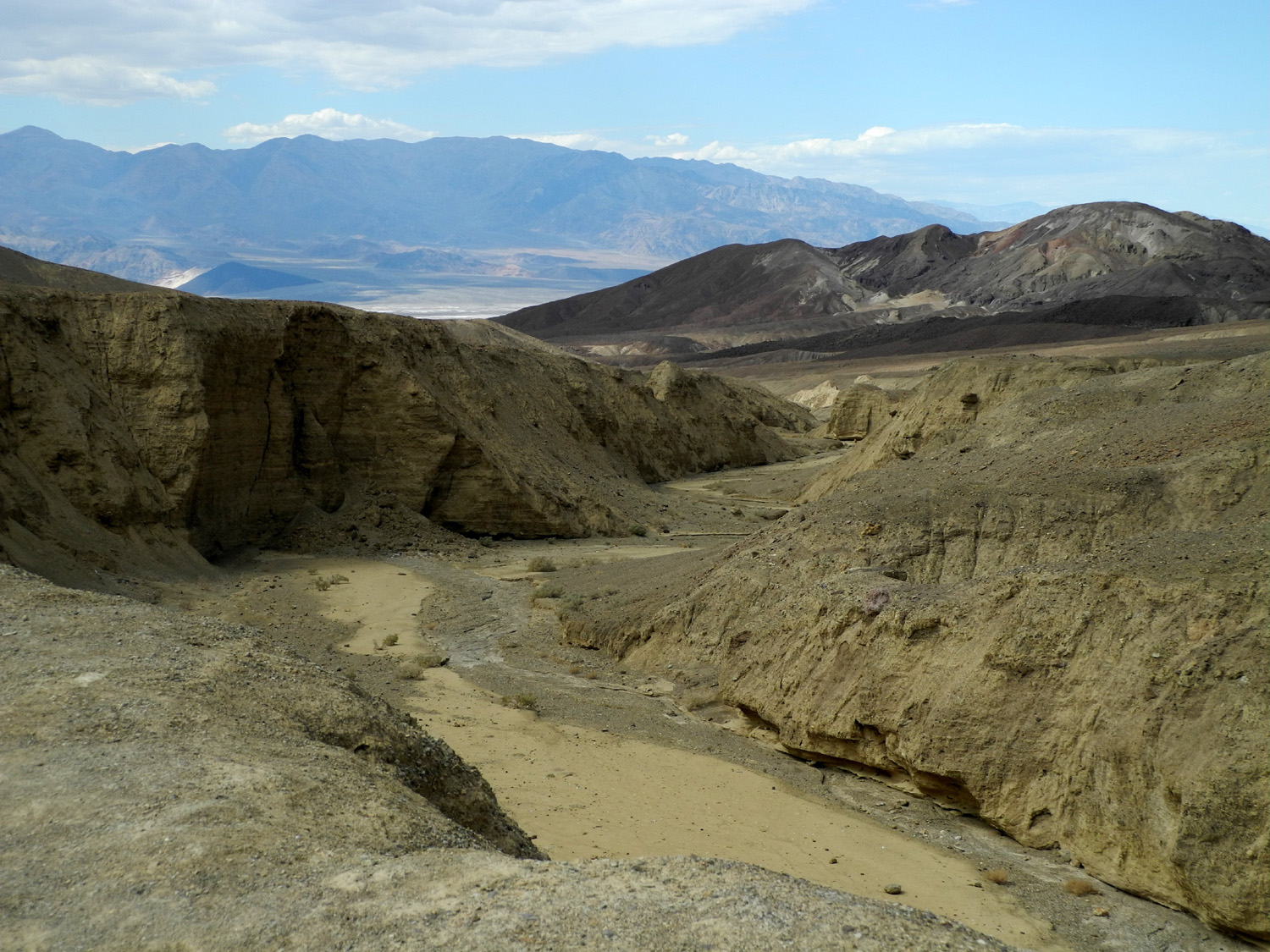
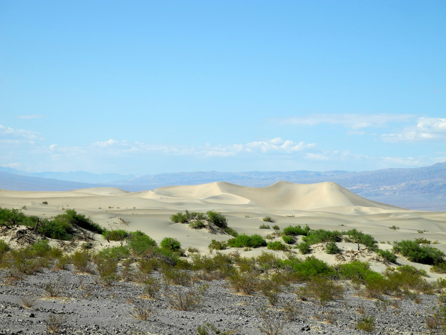
From Lone Pine we took State Highway 136 for about 20 miles, where the road becomes State 190, which comes in from US 395 to the southwest, and is the main highway across the park. We actually made our first stop a half mile or so before the vista point, when we saw an interesting-looking row of large black boulders which stood out from the lighter colored soil and rocks around it. I walked along the line of boulders, getting some nice pictures, while Janell wandered toward a canyon on the other side of the road. The walk was over fairly level ground, with some rocks but not hard going, so when I turned around, it seemed that the car had gotten much smaller and farther away than I expected. I tried to go to the end of the boulders, but the formation dipped down a hill before dwindling down to nothing, so I started back. Meanwhile, Janell cautiously made her way to the edge of the canyon to take some photos. She was a bit annoyed when we stopped at the vista point a half mile down the road to realize that she could have waited and seen the same canyon ten feet from our car, but I pointed out that she got a different view so her efforts were not in vain. The drive this far had been over more or less level terrain, at about 4,000 feet elevation. From the vista point the road became steep and winding as it dropped down 3,000 feet to the Panamint Valley. The valley is 65 miles long, stretching to the China Lake Naval Weapons Station south of Ridgecrest, with the northern portion lying in Death Valley National Park. Panamint Springs, at the foot of the grade, offers food and lodging. We continued across the valley, entering its low point which took us across a mile or more of flat, white terrain, probably heavily alkaline. Although low spots like this can be wet or muddy, we stopped and walked out onto what turned out to be firm, hard-packed sandy soil. From here we continued over the Panamint Mountains through 4,900 foot Towne Pass, and then down into Death Valley itself, where we saw the first elevation signs along the road indicating that we were at or below sea level. Two paved roads head south from Highway 190 along this stretch, one of which leaves the park and goes back out to Ridgecrest. The other leads into Immigrant Canyon and is limited to vehicles under 25 feet. There are a number of points of interest along Immigrant Canyon Road, but we did not go into this area. We continued on to Stovepipe Wells, a "full service" village about 30 miles from Panamint Springs. There is a visitor center, general store (combination gift shop/coffee shop/souvenir shop), camping, gas station, motel and cabins, and a bar and restaurant here. We looked around the visitor center, then went to the store for coffee. Fortunately we did not need gas, since the price was $5.50 per gallon. A short distance past the village and north of the highway are some 100 foot high sand dunes, which we enjoyed from the road, stopping to take a few pictures. There's no trail, but it's an easy two-mile cross-country walk to the highest dune. A few miles farther is a major road junction. Heading northwest takes you to Death Valley Scotty's Castle and other points of interest, including the western end of the Titus Canyon Road. From the castle this road goes northeast through Mud Canyon, over the Amargosa Range and into Nevada. From the
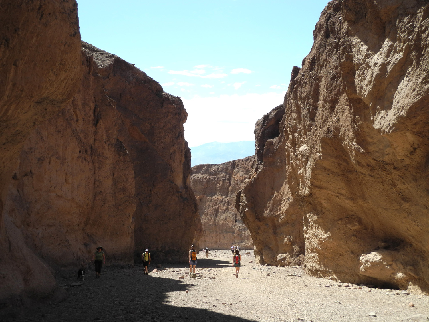
junction, continuing in the northeasterly direction takes you to
Hells Gate and on out to Beatty NV. We took Highway 190 to the
southeast, which also goes out to Nevada, but we did not plan to
leave the state. We went past Furnace
Creek, another major resort
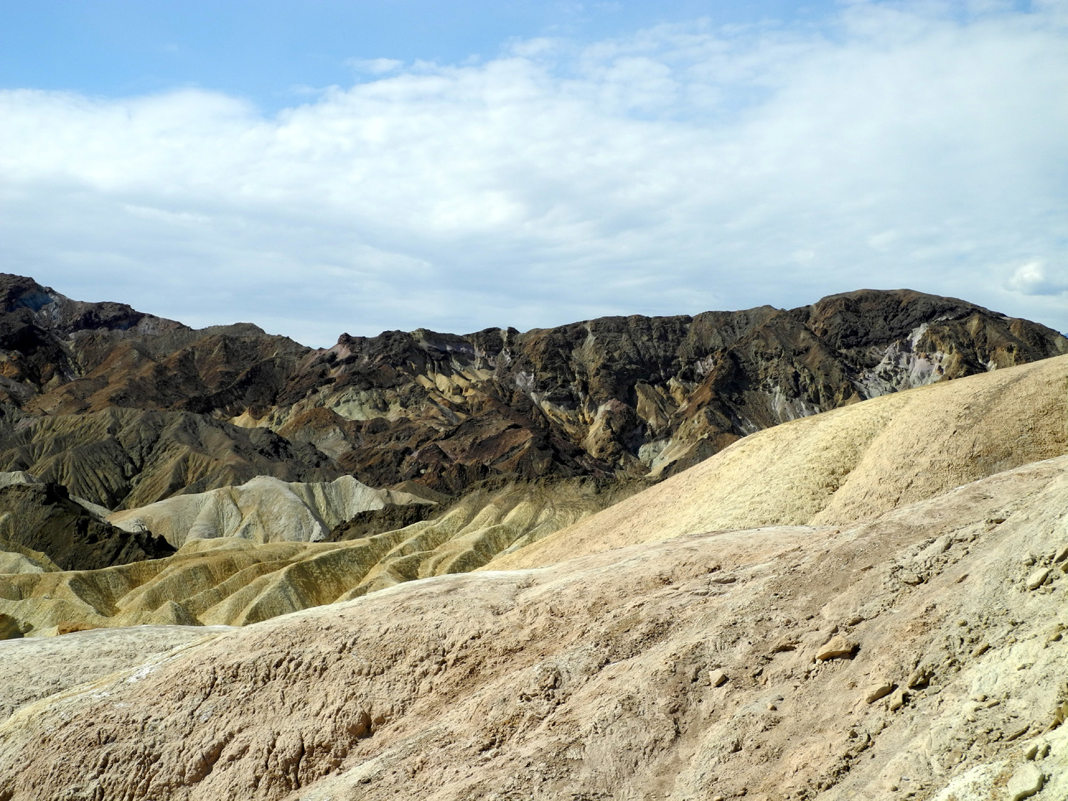
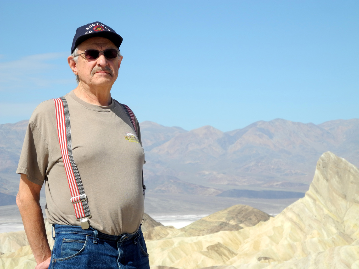
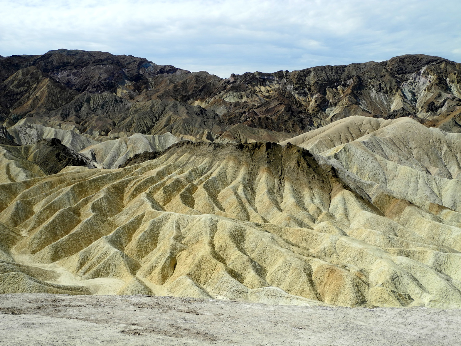
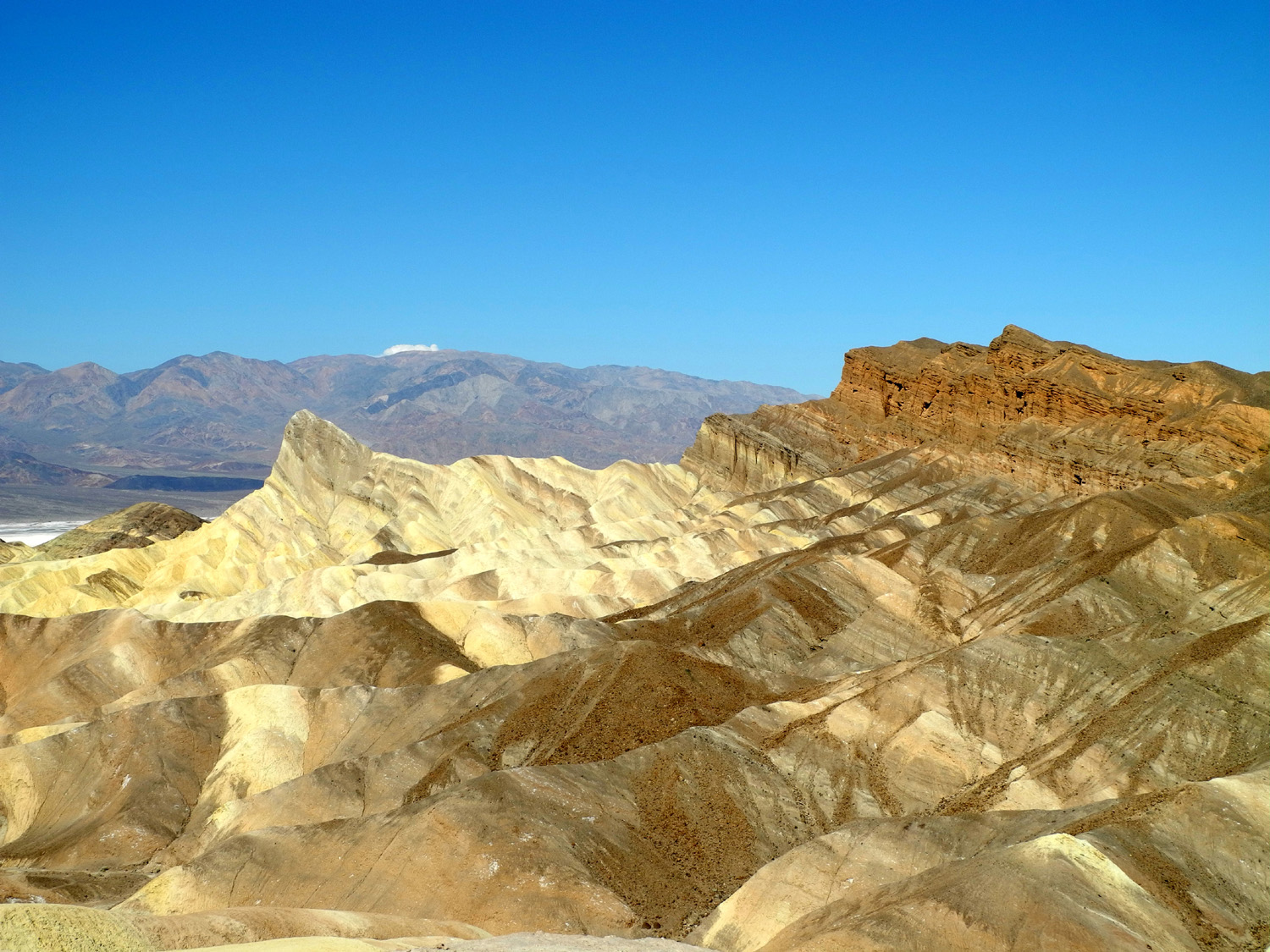
area, and on to Zabriskie
Point, one of Death Valley's most noted
vistas. I had heard of this location before I even knew it was
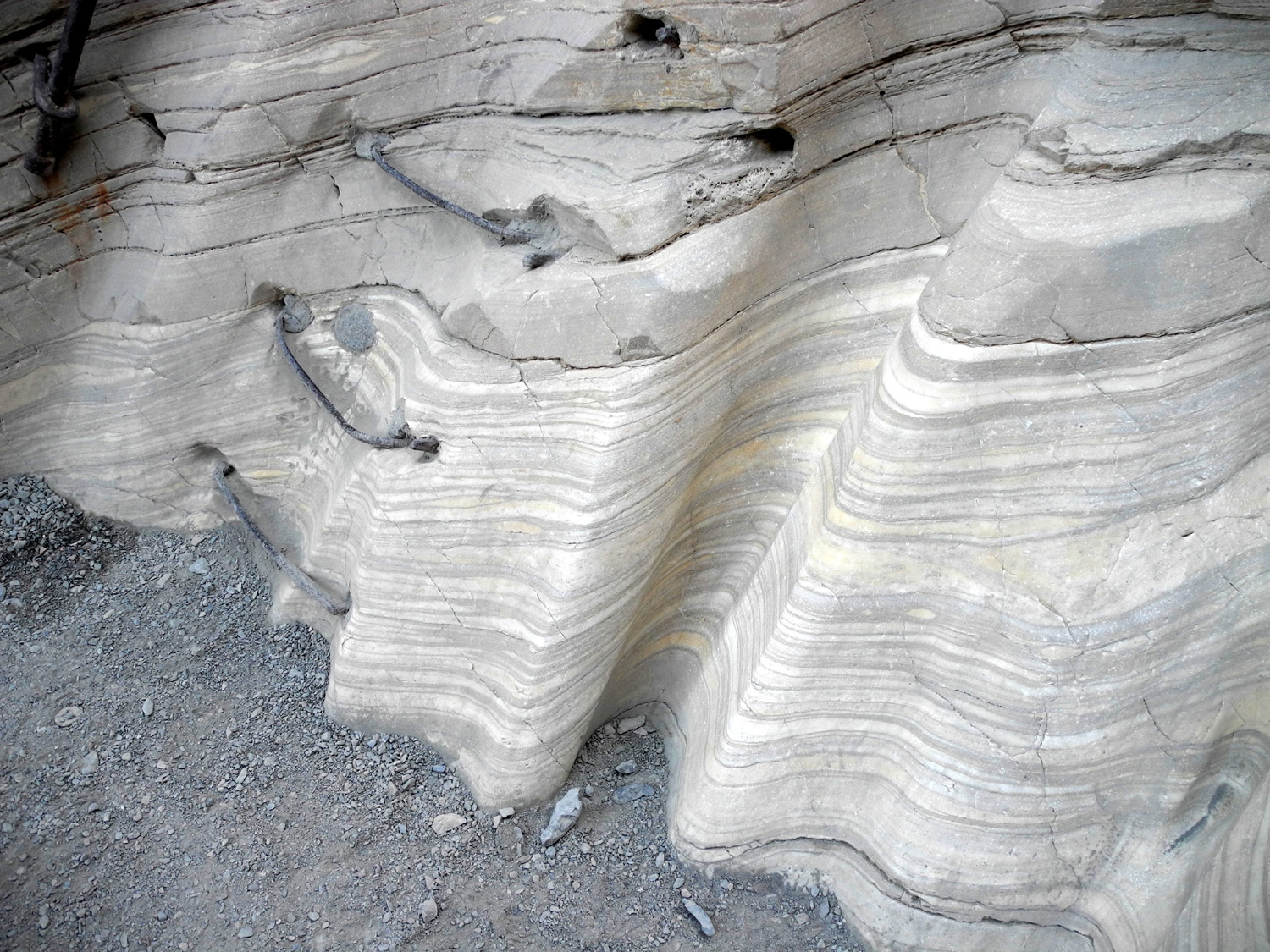
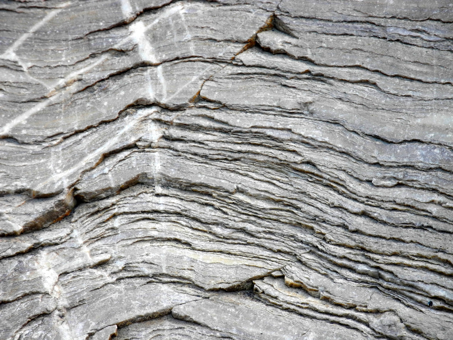
in Death Valley, due to the 1970 movie Zabriskie Point The movie gets lukewarm reviews, but the point itself is spectacular. The area is a surrealistic mixture of weathered ridges, eroded gullies and rock formations in various colors. It's virtually impossible to describe adequately, so I've included a number of photos below. A short walk from the parking area takes you up to a point that overlooks Death Valley below, and of course the mountains beyond. From here we continued on Highway 190 for about six miles and took a road that goes 13 miles up to Dante's View, where you can stand at the 5,400 foot level, and look down at the valley and Badwater, the lowest point in the United States, more than a mile below you. It's a dramatic view, but not really as spectacular as Zabriskie. You can hike a half mile or so to a higher point, but we could see quite well from where we were without any more uphill walking. We backtracked to 190 and the junction with Badwater Road, about two miles from Furnace Creek, and drove south as far as the road to Natural Bridge. The parking area for this short hike is 1.5 miles off the paved road on a very good dirt road, and the hike to the bridge is about a half mile. The trail continues another half mile past the bridge, and is located in a steep sided canyon about 50 to 100 feet across. Along the way, as well as in other canyons, there are chutes carved out by temporary waterfalls during periods of heavy rain. Heading back to Highway 190, we decided to investigate Artists Drive, a nine-mile, one-way narrow paved road that winds through hills and canyons east of the main road. This proved to be one of the park's most scenic areas, especially the Artists Palette, an area of rock stained with various colors. When we got back to Furnace Creek we parked by a picnic table near the road and ate the snack items we had brought. We also had an "official discussion" regarding what to do next and whether to head for the RV park and return the next day, or do some more sight-seeing. One thing to consider was the fact that we were now over 100 miles from Lone Pine, close to a three-hour drive. Since we had got such an early start, it was not all that late, so we headed back to Stovepipe Wells, and just beyond drove up the dirt road to Mosaic Canyon. This proved to be one of our three favorite spots, the others being Zabriskie and Artist Canyon. The road is fairly smooth gravel, two miles from the highway to the trailhead. From there you can walk as far into the canyon as you wish, up to two miles. However, there is plenty to see in the first half mile, which is about how far we went. The canyon walls are made up of all kinds of rock, including areas where there are many large or small rocks embedded in what was probably mud at one time. There are also sections of layered marble, and lots of fantastic shapes and rock formations. After finishing this hike, we continued the long drive "home," stopping in Lone Pine for gas, and getting back to the motor home a little after six - a good twelve hour day.
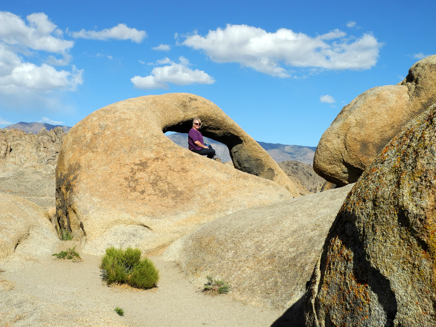
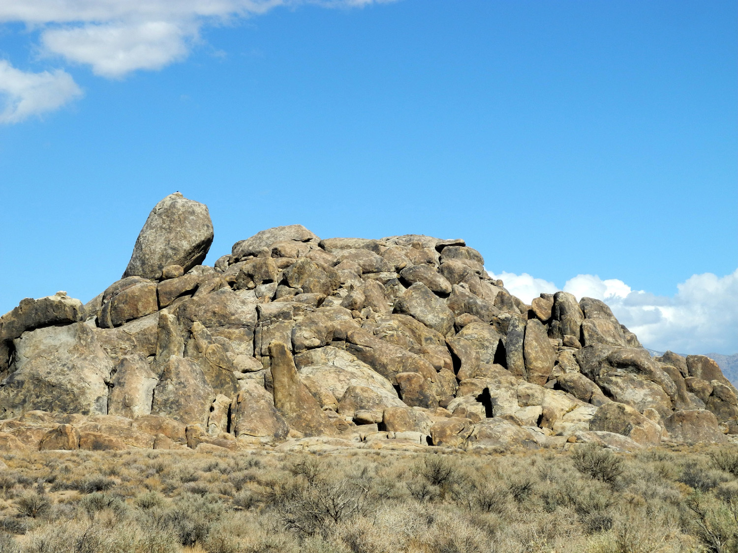
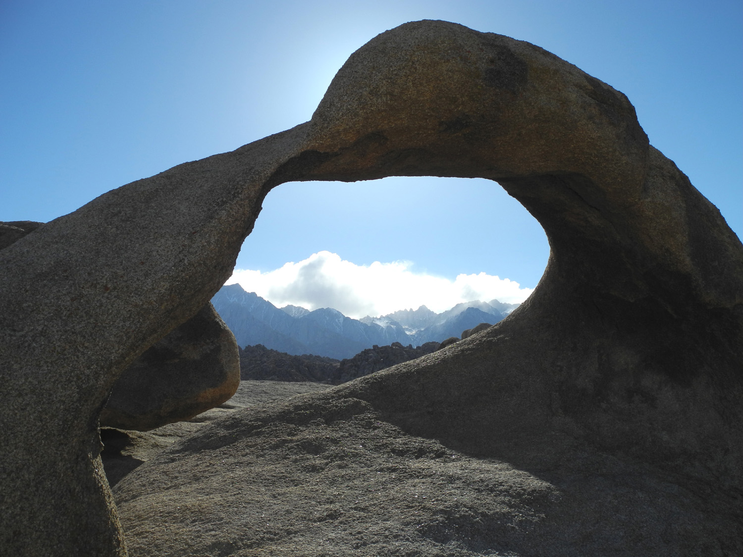
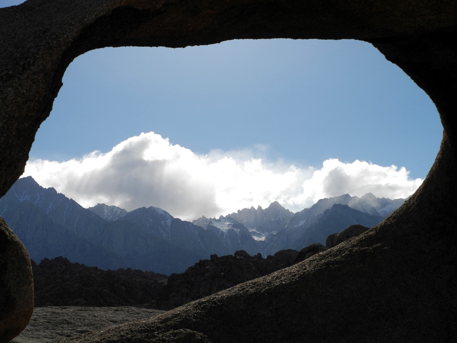
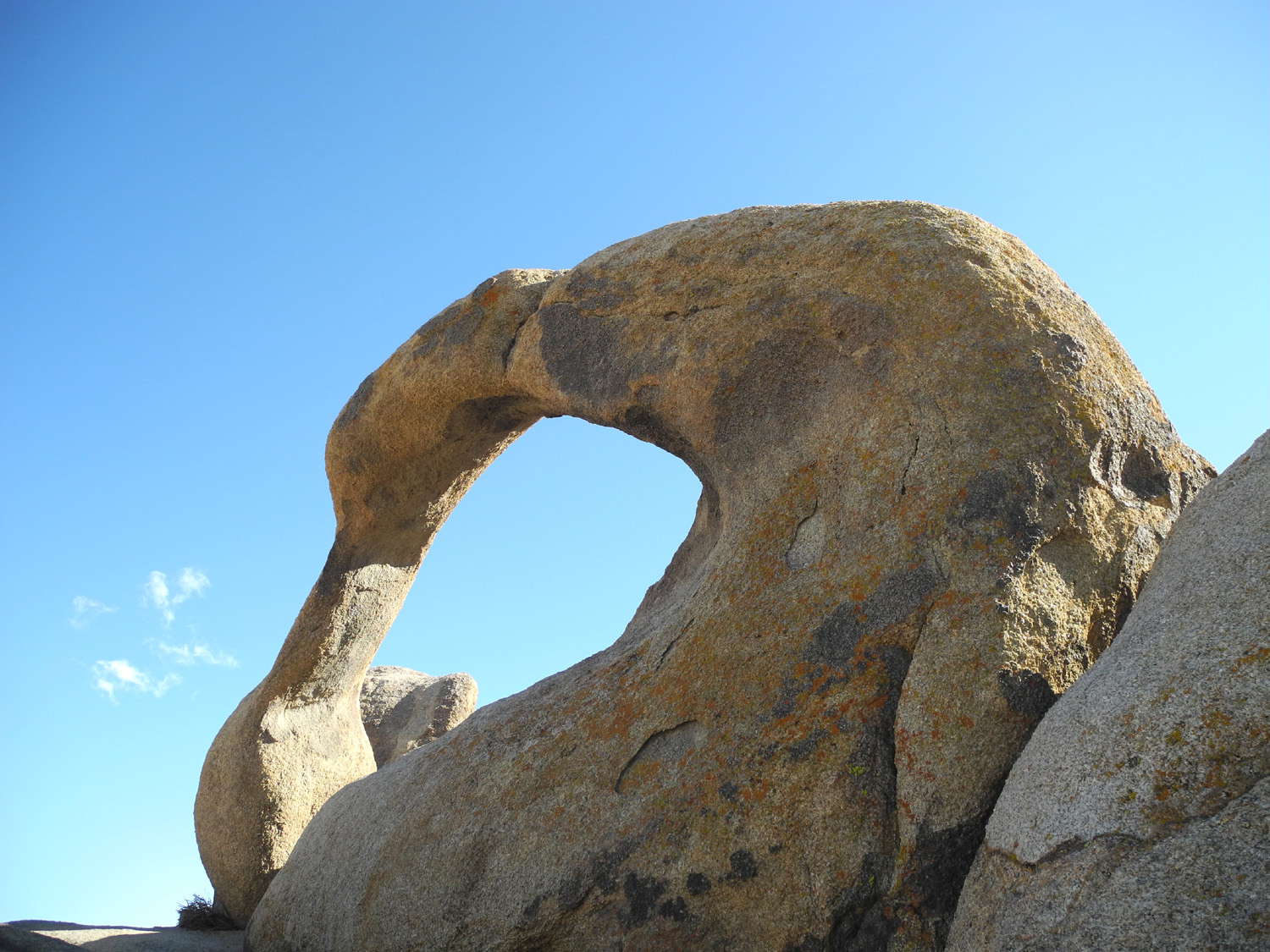
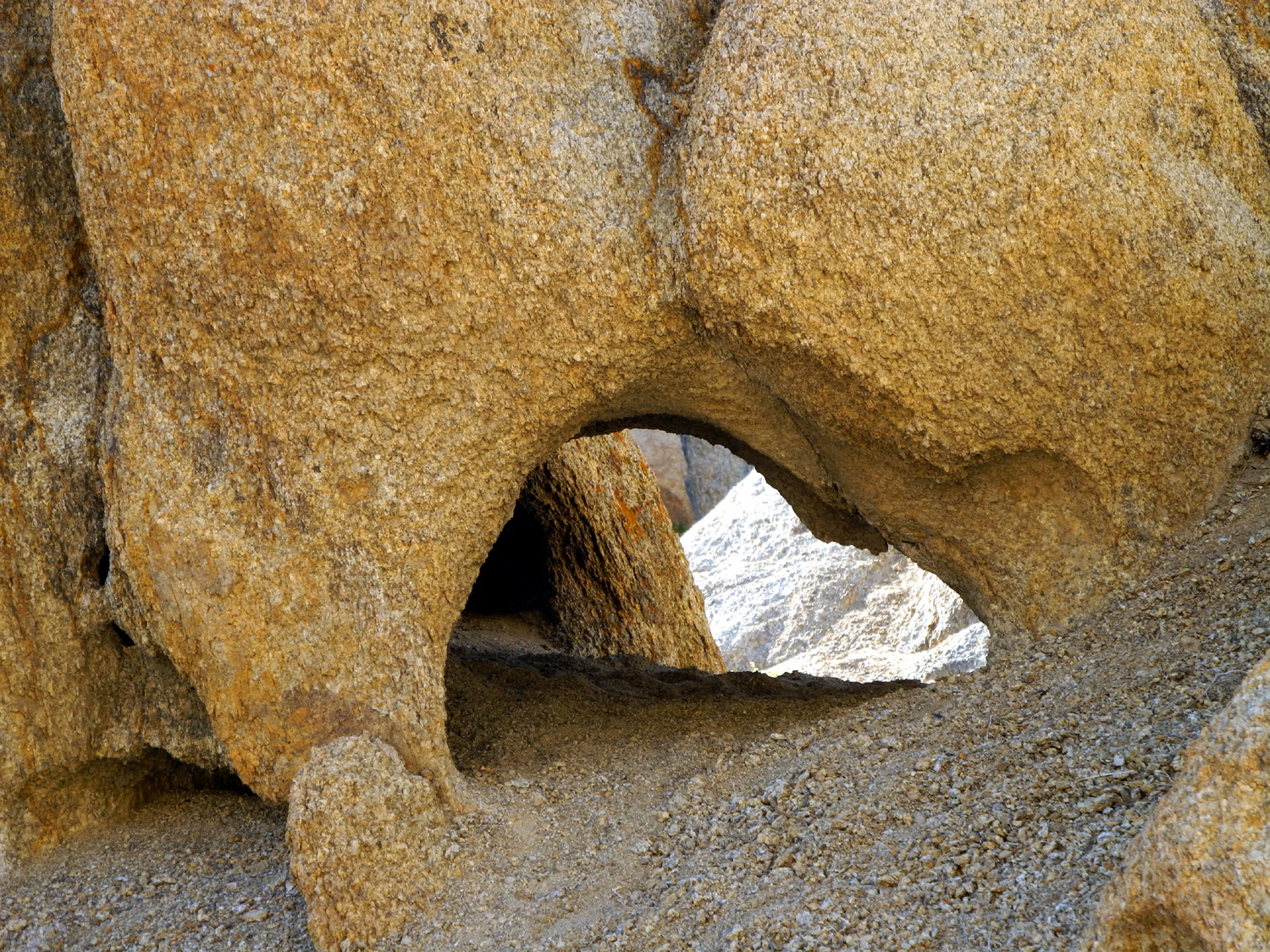
The low, rounded Alabamas are strikingly different from the sharply sculpted Sierra peaks above them, but they are still considered part of the Sierra Nevada. From the east, in town or at our RV park, they looked like low, rounded and fairly uninteresting brown dirt hills. However, a short drive into the area revealed a strange and wonderful place that we enjoyed as much as Death Valley. As if to make up for our early start the previous day, we did not leave the motor home until around 3 p.m. Janell was not feeling well, so after breakfast she climbed back into the upper deck, and ended up sleeping for quite a while. I read, walked around the park, and had a good nap myself. Eventually she felt up to resuming our explorations, so we drove into Lone Pine and turned west at the only traffic light. About two miles up Whitney Portal Road I realized I had forgotten my camera. We both agreed that I would regret it if I did not take pictures, so we went back to the RV park, got the camera, and began our journey again. Instead of going into Lone Pine on our second attempt, we drove out of the park straight across US 395, and into the hills on Lubkin Canyon Road. We immediately began to see why this area has been used as the location for many movies, especially westerns. The jumbled rock formations give the impression that Gene Autry or Roy Rogers could come riding up a canyon at any time, in hot pursuit of rustlers. Indeed, there are some cattle in the southern end of the area, as well as a few homes and small ranches. At one point the road is barely one lane wide as it goes through one of the ranches. Beyond this point, the road joins an east-west route that has no name on my map, but is an extension of the Tuttle Creek Road to the north. A left turn here will take you to Horseshoe Meadows Road, which goes into the Sierra to a huge meadow at the 10,000 foot elevation. There are campgrounds in the area, and trails lead into the Golden Trout Wilderness and Sequoia-Kings Canyon National Parks. The area is normally closed until May, but we had no intention of heading in that direction anyway. Instead we turned right, and stopped at a location where we walked into the rocks and explored for a while. These formations include boulders large and small, in all kinds of fantastic shapes. In many places it's possible to climb up on some of the rocks, always keeping in mind that neither of us are as young as we once were. The granite is what I call "sticky," which is to say, it's very rough and firm, so you get a good grip with your boots. The opposite would be the smooth granite found along creeks where centuries of water-borne particles have ground off the rough surface. The granite is also slightly tan in color, compared to gray and white colors that dominate in most of the areas I've visited. Both the structure and the color of the rocks reminded me of those in Joshua Tree National Park. Having read about the area on-line and in an Eastern Sierra Travel Guide we picked up at a visitor center, we had a definite destination in mind, Mobius Arch. From our first stopping point, we followed Tuttle Creek Road which goes northeast down a canyon and joins Whitney Portal Road just west of Lone Pine. We turned west and continued to Movie Road, which goes through locations used by many films through the years. It started in 1920 when Fatty Arbuckle came to Lone Pine to film The Round Up, and includes the location of Under Western Stars, Roy Rogers' first starring role. It was also here that John Wayne made his last appearance before a camera, filming a commercial. If film history is a special interest, you can follow mileage information in the tour guide to visit the exact location of a number of movies. There is also a film history museum in town. A drive of a mile and a half on Movie Road leads to a parking area at the trailhead for the short loop trail to the arch. Like most areas with arches, the surrounding scenery is just as interesting as the arch, and this location would be special even without the arch. Mobius Arch is fairly small (especially if your picture of what arches should be like has been formed by visits to Arches National Park), but its location permits dramatic photos of Mt. Whitney thorough the opening. There are also a number of "windows" or holes in rocks throughout the area. Whether you start your hike on the east or west side of the parking lot, the trail immediately goes down into a wash, then it's up and down and through rock formations all the way. As we came over a rise and down into a wash coming back to the parking lot, we were a little tired and not really happy to realize that there was another short climb and descent into a second wash before the final section of uphill trail back to the parking lot. When we resumed our drive we continued north on Movie Road to Hogback Road, which is a slightly rough dirt road that leads out to US 395 about two miles north of town. We stopped in Lone Pine and had dinner at the Totem Cafe, one of many choices in this small town of a little over 2,000.
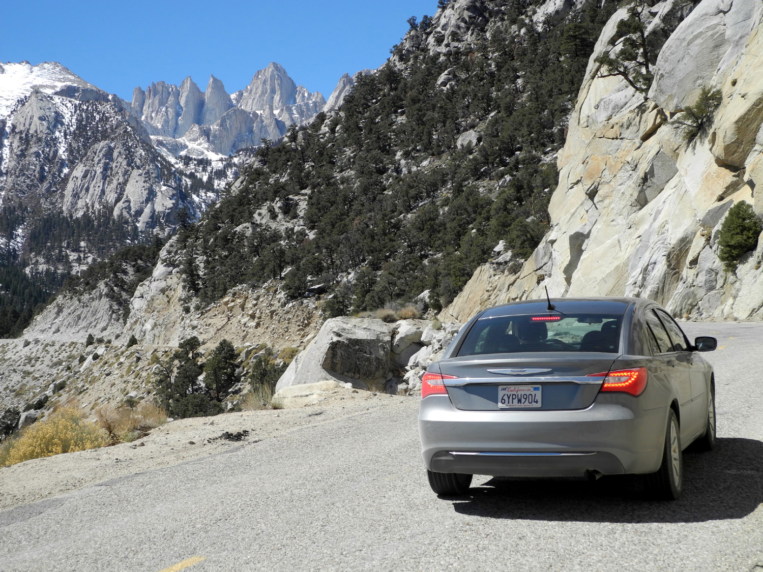
My walk turned into a bit more of an adventure than I had intended. While Janell went one way, I went another, then just kept going, making my way up into the rocks where it was easy to climb. Eventually I decided that I could probably keep going the way I was headed and come out on the other side, but it took a lot of effort. I had to backtrack several times, repeating the same backtrack twice in one case. I considered going back the way I came in, but by this time I had gone far enough that I was not sure how to do that, so I kept going and had to do a little scrambling to get down out of the rocks. Eventually I came out quite a ways from where I had started, on the other side of a fence that ran across the open land but not into the rocks. Meanwhile Janell was calling me, but of course, I was too far away to hear with all the rocks in between. She also came out on the wrong side of the fence, but much closer to where we had started. In case anyone thinks I should curtail my adventures, I would like to emphasize that at no time did I feel that I was lost or in danger. There was still plenty of time left in the day, so we decided to see what there was to see up Whitney Portal Road. Where this road ends, the hike to the top of Mt. Whitney begins, but we had no desire to visit this highest point in the continental US. We were happy to discover that we could drive all the way to the end of the road, where there was a small amount of snow, several campgrounds, and a beautiful little creek rushing down the rocks, with snow and icicles for decoration on the sides. We spent about an hour here, resting, taking pictures and eating a snack. The total distance from Lone Pine is only about 12 miles, with an elevation gain of either 4,100 or 4,600, depending on which Wikipedia entry is correct. We followed the road back down and walked around town, going in a few stores and just enjoying the last few hours of our trip. The next morning we got up when we were ready, had breakfast, and started south on US 395. We returned to Ridgecrest to drop off the rental car, then continued our trip home, with a desire to return some day and see more of Death Valley and do further explorations in the Alabama Hills. As I was putting this report together, I realized I did not take any photos of the hills from the eastern side. I did a Google search, and it looks like virtually nobody takes pictures from the east. The best I could find was a painting, and as I reviewed this page in 2020, it was no longer available.. If you have plans to visit Death Valley, there is a large-scale map available from the American Automobile Association (AAA), which shows the entire region. It goes from Las Vegas/Lake Mead on the east to Tulare/Bakersfield on the west. From north to south it has Sequoia/Kings Canyon National Park at the top and Mojave National Preserve at the bottom. And you can read another Death Valley travel report and see photos at Clayton and Melinda Walkers' blog. There are many places we did not visit, and some of them are covered in the Walkers' report.
I always take my laptop PC, my iPad, or both, with the intention of writing my report as it happens. Sometimes I am partially successful. If there is a lot of "down time," as there was during our hockey trip to Canada, I can get most of the report done on the road (that one was 95% complete when we arrived home). But if I'm involved with a lot of activities, or just traveling with a friend, there never seems to be time to write. Although typing on the iPad is far from ideal, the laptop now seems big and cumbersome. It does have one big advantage - I can create the report in its final HTML format. With the iPad, I can use a text editing program with limited capability, then transfer the document to my PC after I get home. In Canada I used the iPad for part of the report, but wrote most of it in Word in my daughter's laptop and Emailed it to myself. Then I paste the text from Email or a word processing program into my web design program. It still requires a little tweaking; for example, pasted text has an extra carriage return between paragraphs, which I have to remove one by one. Most of the time I find myself doing a lot of the report after the fact. I wrote part of the first day's events on the laptop the evening that we arrived in Lone Pine, then never touched the computer again. Fortunately, I can recall enough detail to complete the writing at home. I rely on photos to remind me of things, and I consult maps, travel brochures and Internet resources to fill in gaps in my memory. And of course, only my traveling companions know if I left out something important. --Dick Estel, April 2013 |
|||
|
Photos (Click to enlarge; pictures open in new window) |
|||
Death Valley |
|||
|
|
|||
|
|
 |
 |
|
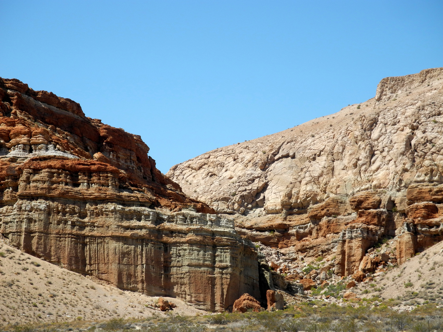
| Along State Highway 14 - Red Rock Canyon State Park |
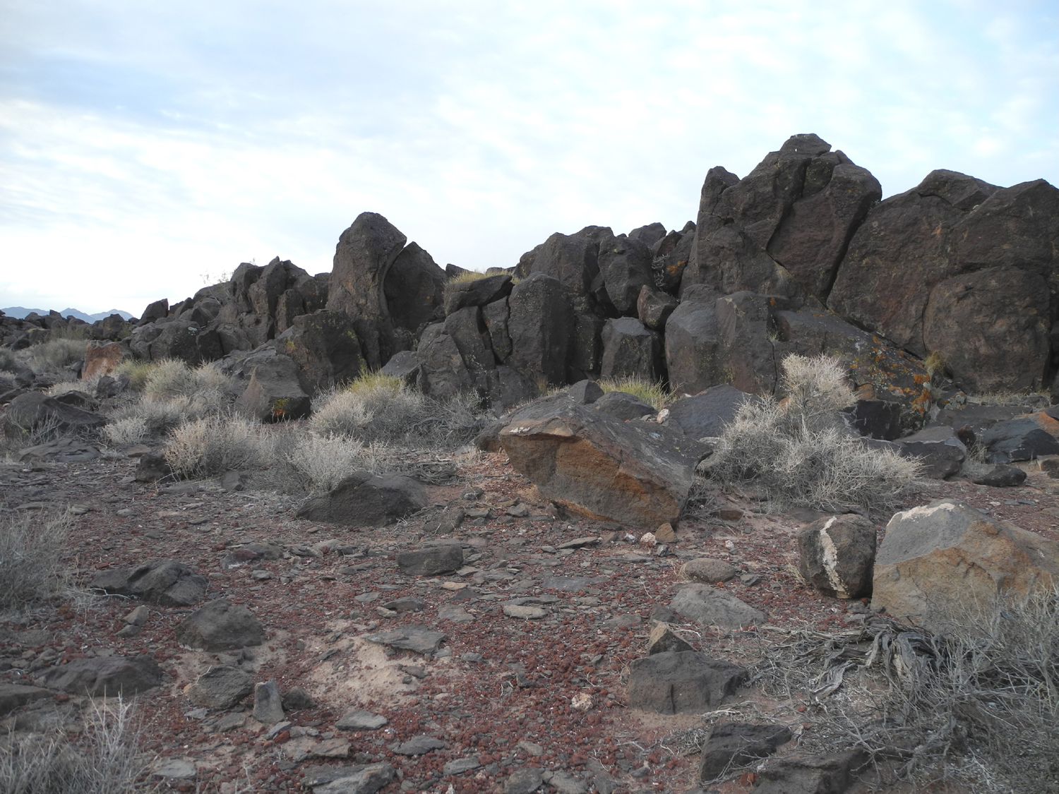
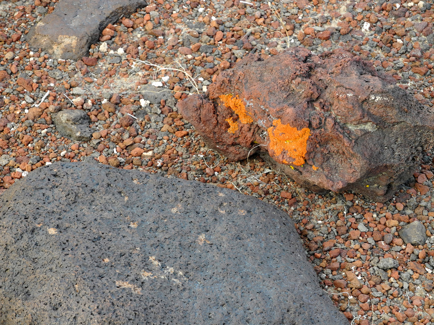
Another view | Black rocks near the western border of Death Valley Park |
|
 |
 |
 |
|
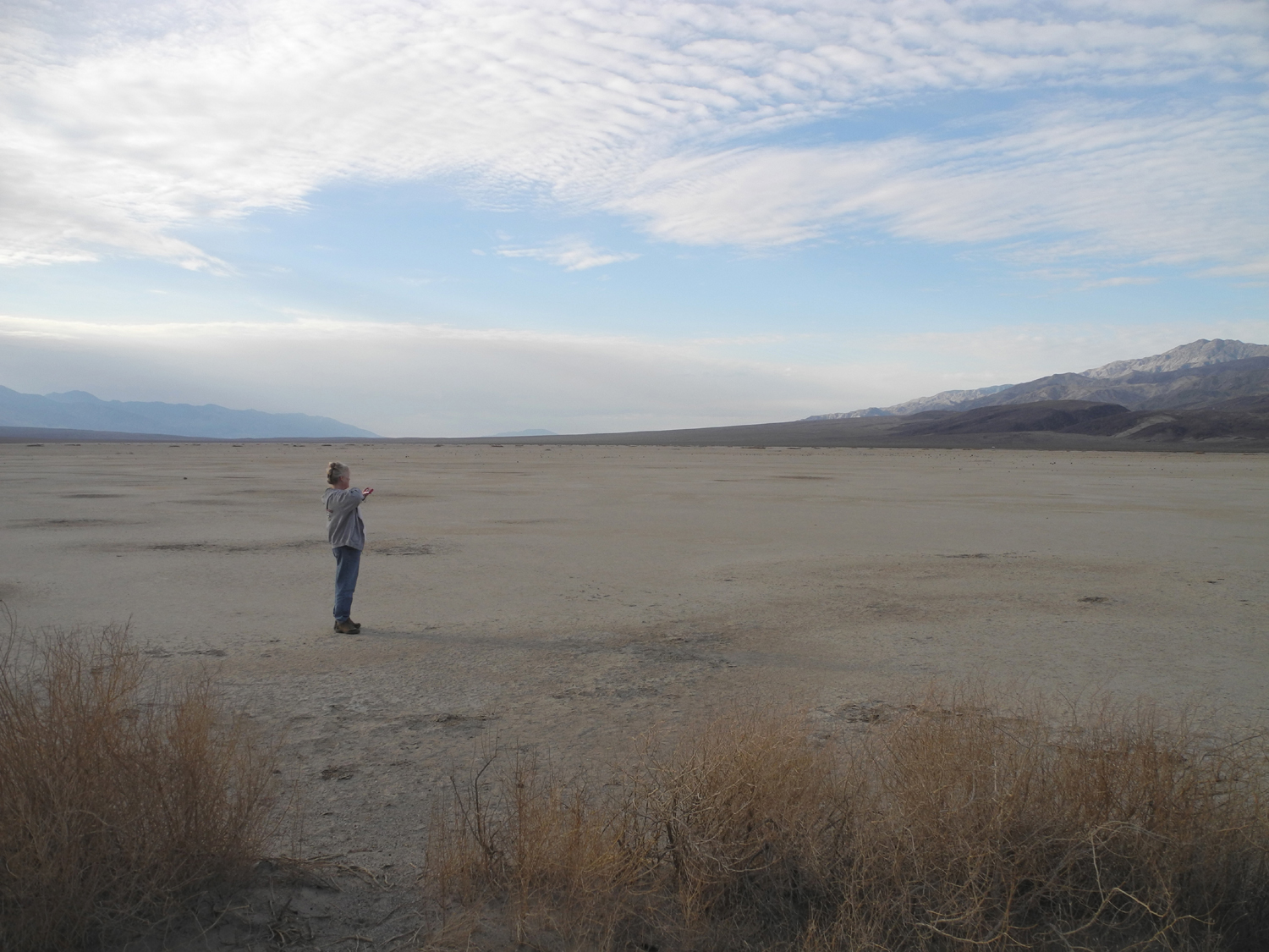
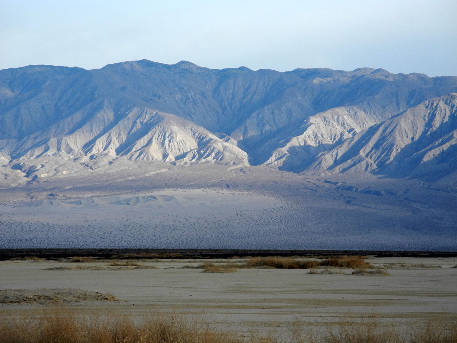
| Ground next to black rocks is covered with red pebbles | Panamint Valley from Father Crowley Vista | Janell in the Panamint Valley | |
 |
 |
 |
|
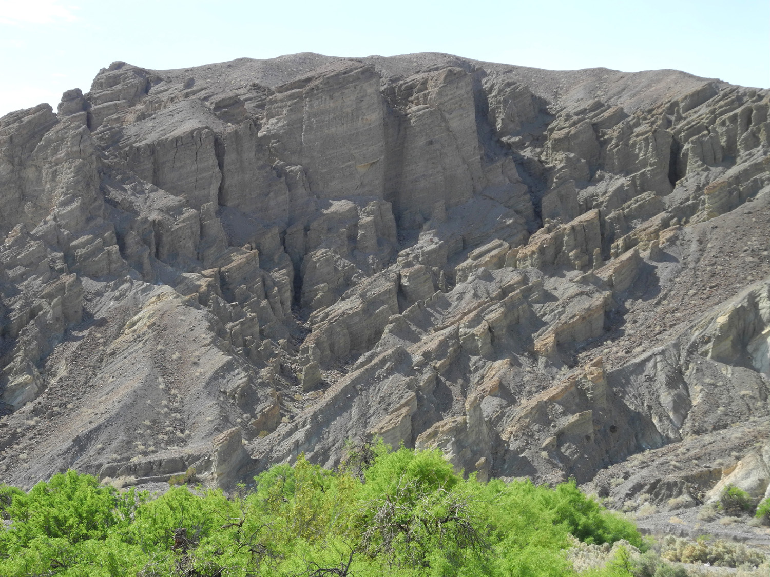
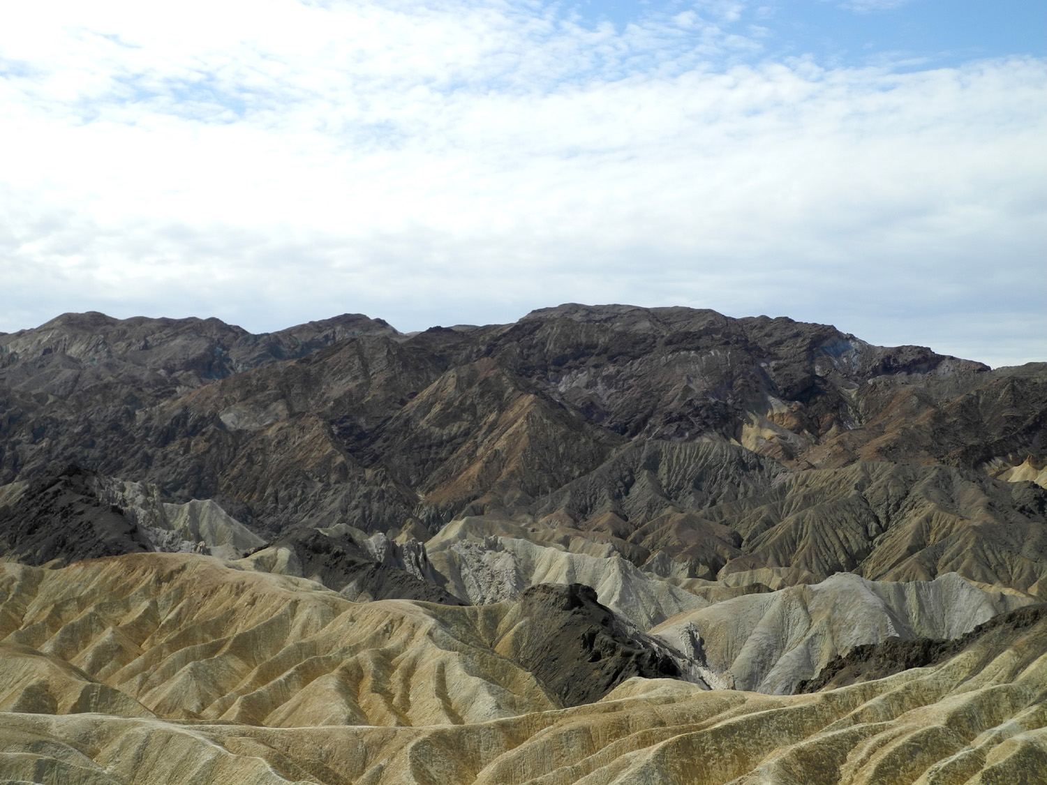
| Panamint Valley and Mountains | Gray cliffs near Zabriskie Point | View from Zabriskie Point | |
 |
 |
 |
|
| Dick at Zabriskie | Fascinating formations at Zabriskie Point | A closer look | |
 |
 |
 |
|
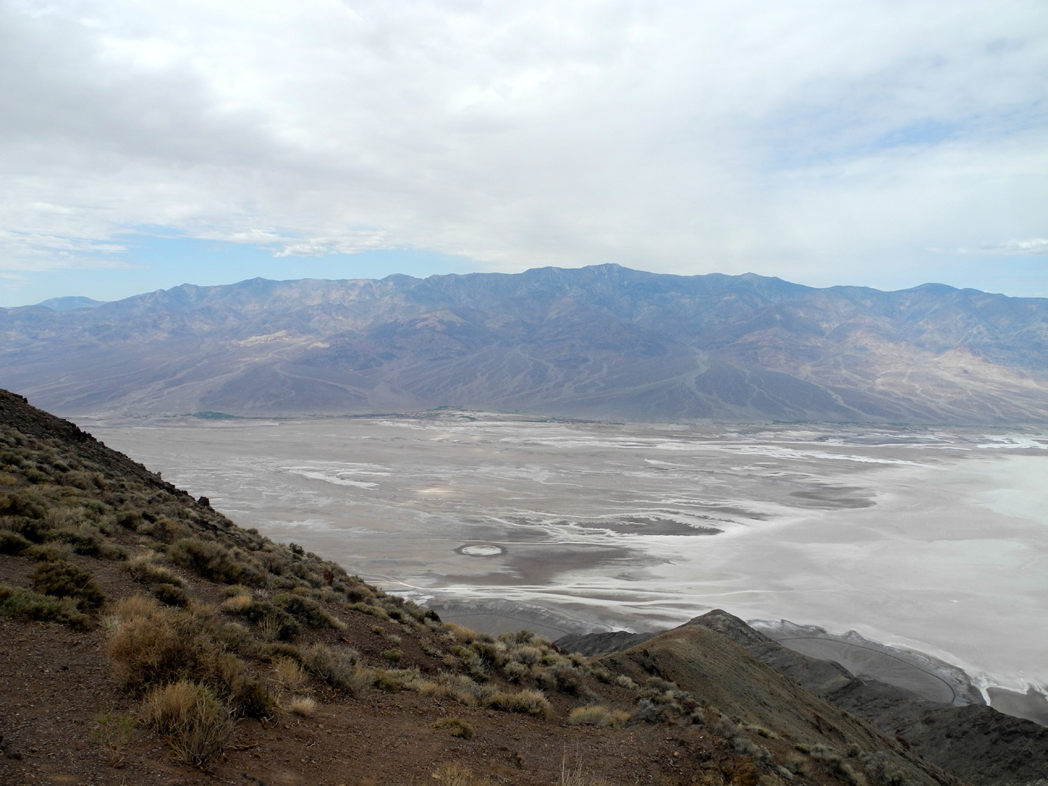
| Another Zabriskie Point view | Read about the geology of Death Valley here | Looking at Death Valley
a mile below from Dante Lookout |
|
 |
 |
 |
|
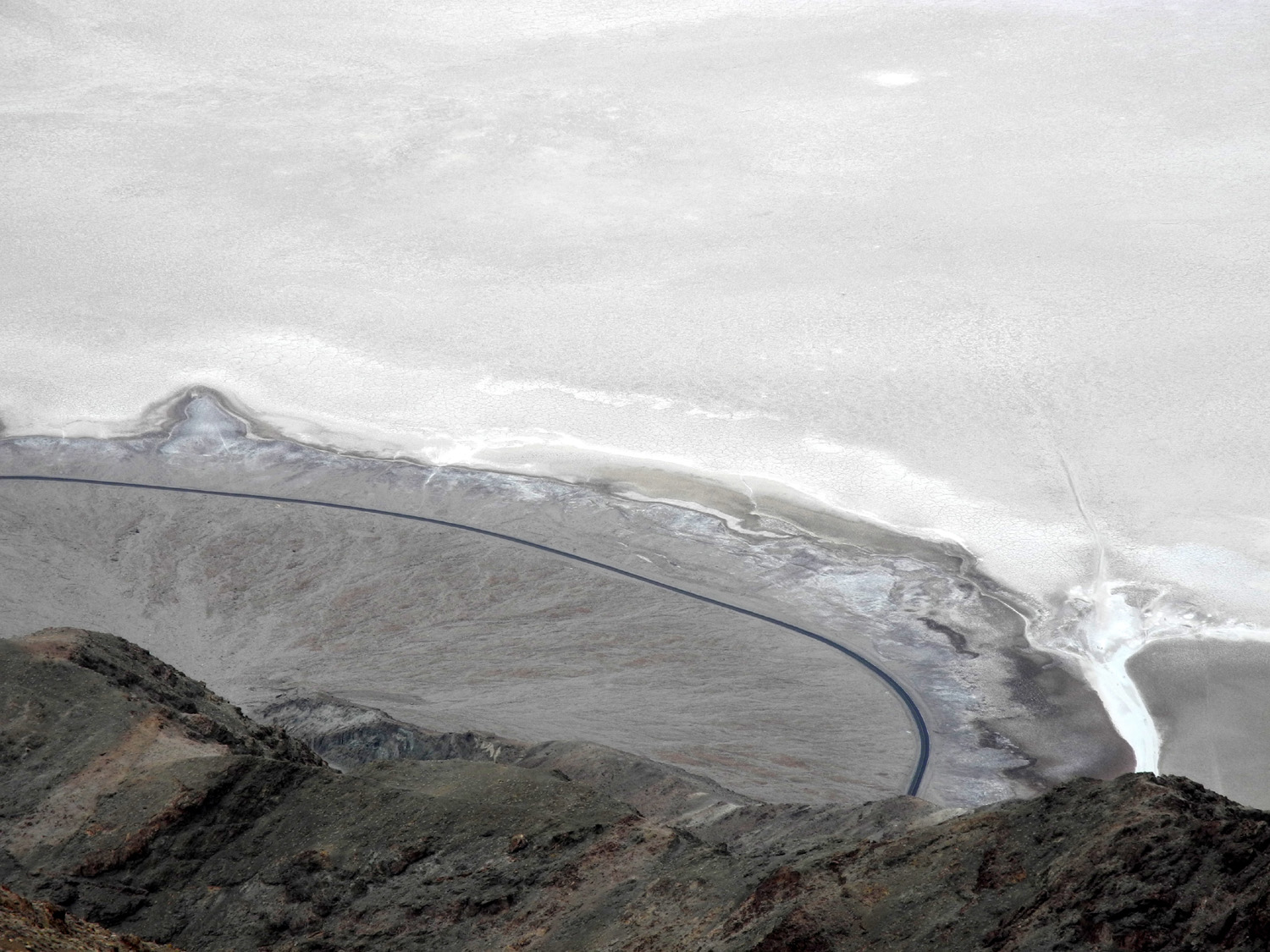
| We had to use binoculars to determine that the curved line is actually a road |
Another Dante Lookout view |
|
|
 |
 |
 |
|
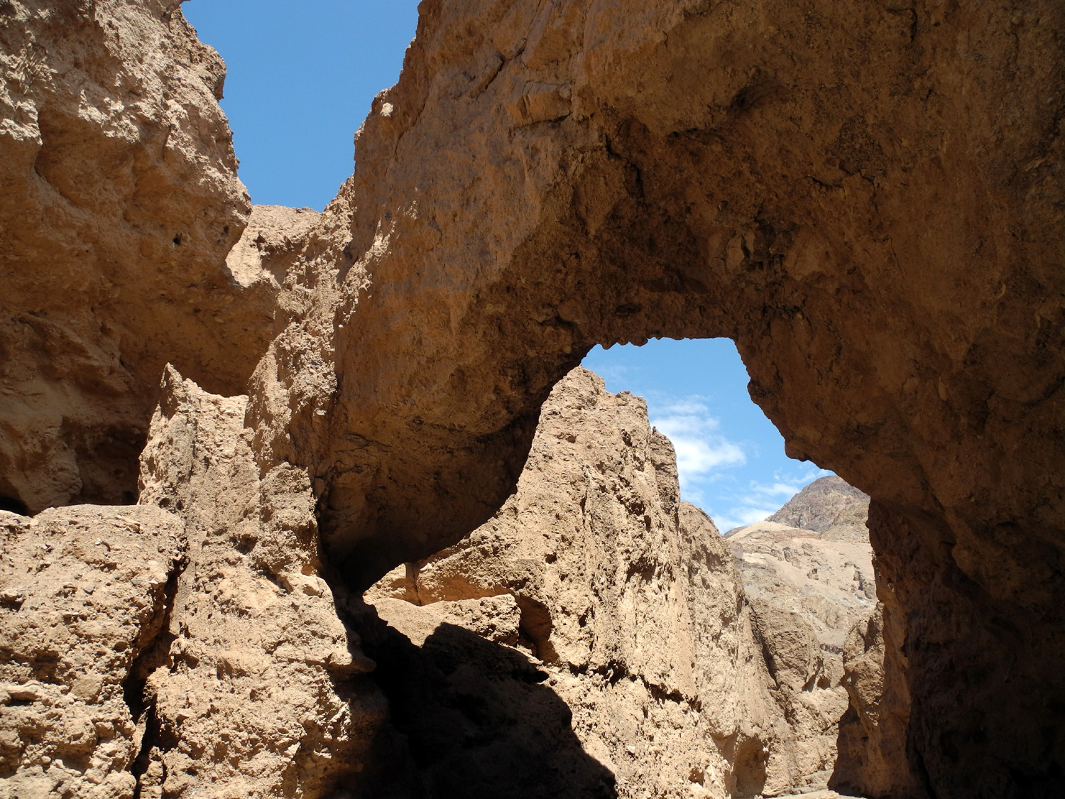
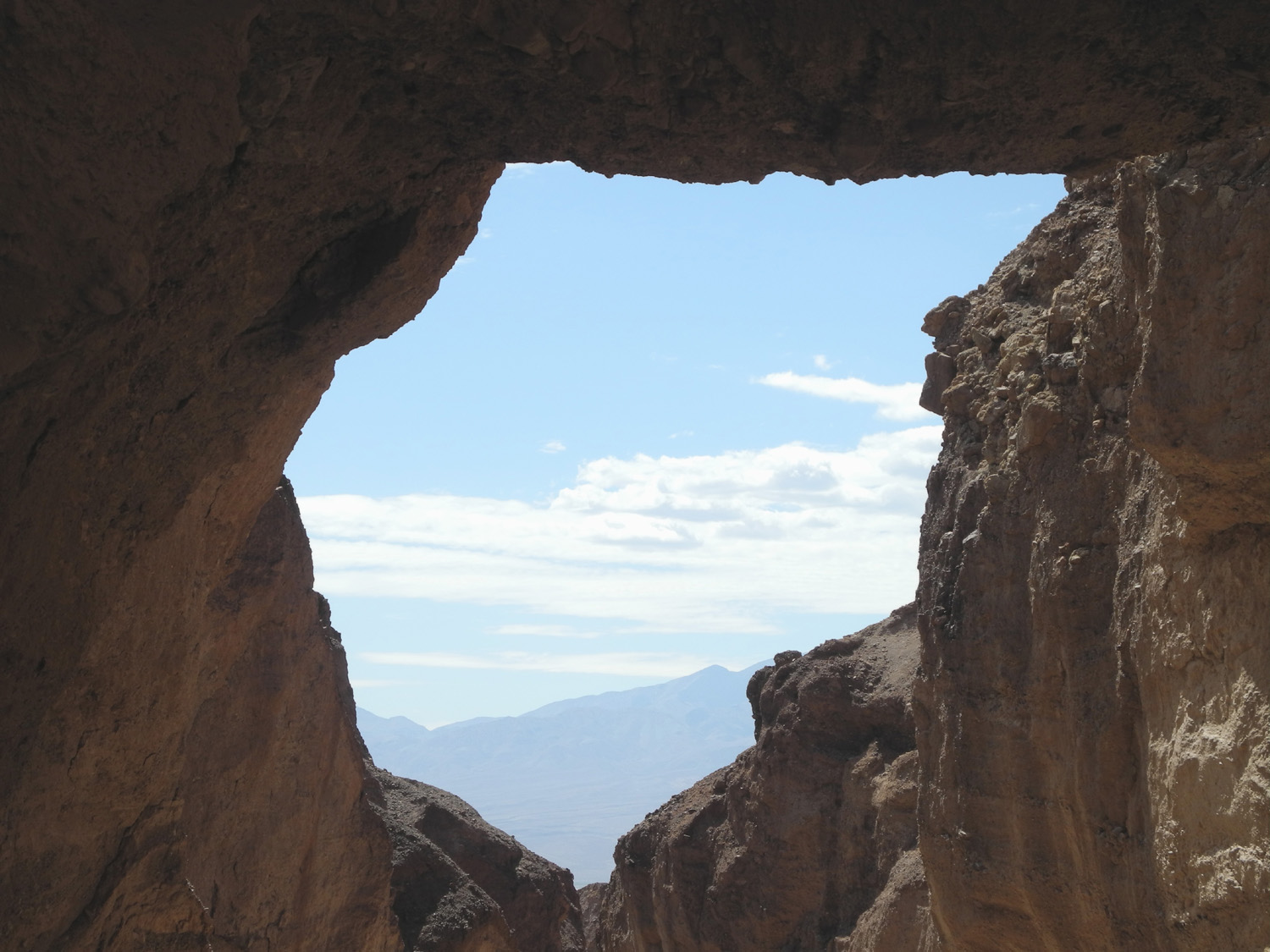
| The bridge | Looking toward Death Valley through the bridge | Chute created by seasonal waterfall near Natural Bridge |
|
 |
 |
 |
|
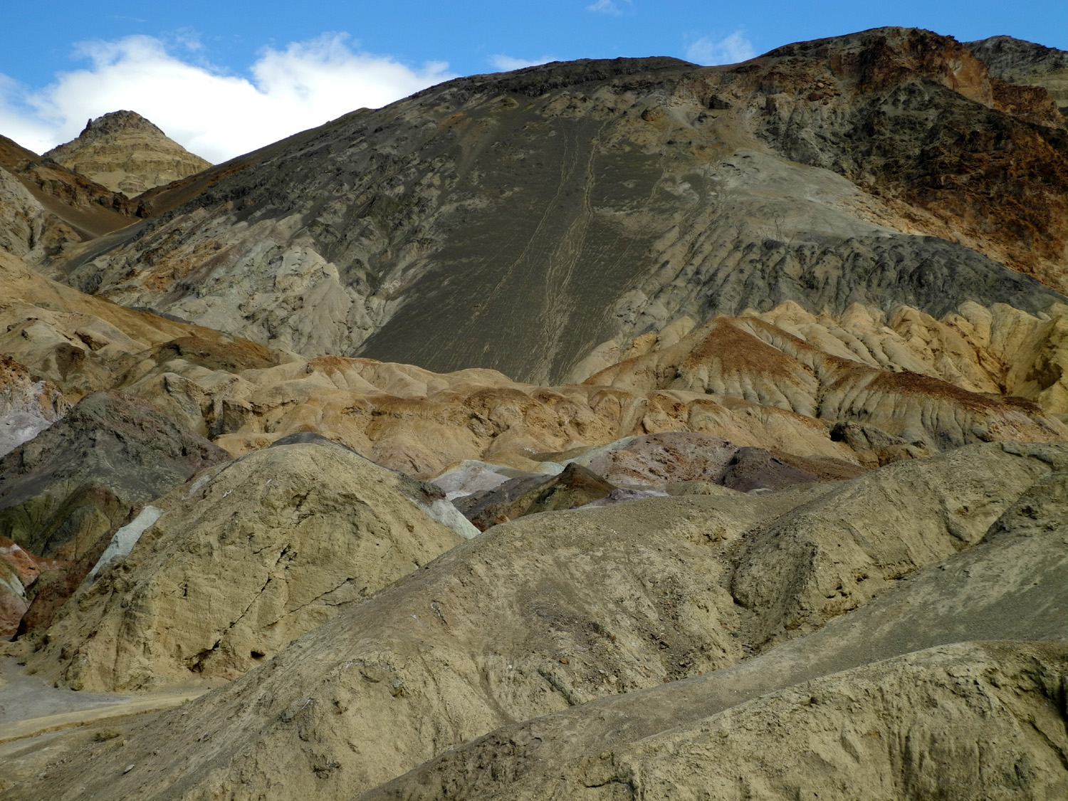
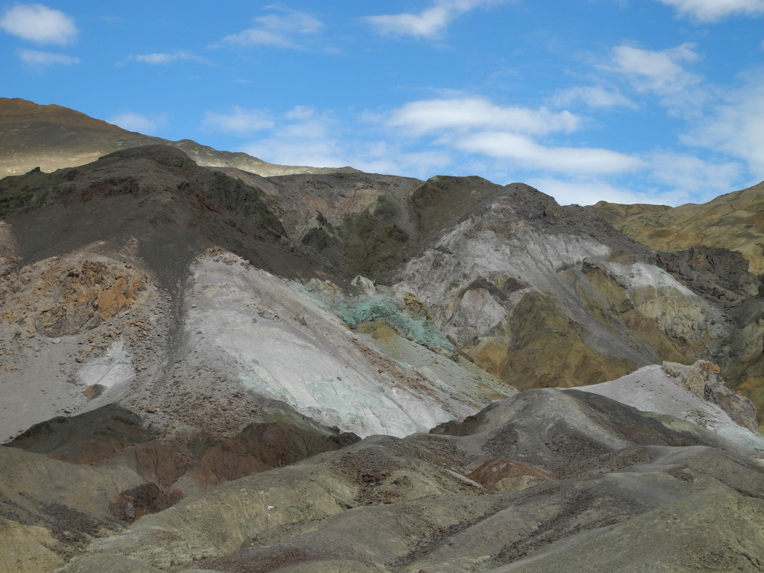
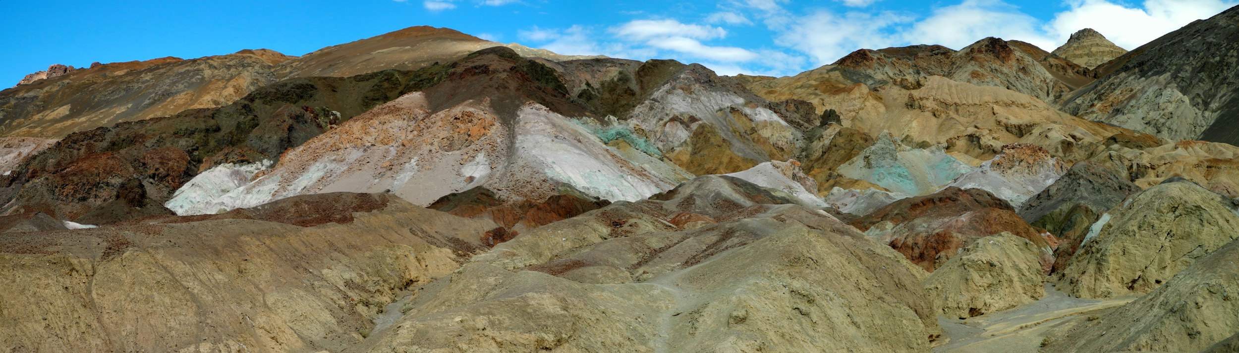
| Along Artist Drive | Artist Palette | Another view along the drive | |
 |
 |
 |
|
| Dunes east of Stovepipe Wells | Mosaic rock in Mosaic Canyon | Layered marble in the canyon | |
 |
 |
||
| Looks like ancient mud flows | Looking toward the opening of the canyon | ||
 |
|||
| Panoramic view of Artist Palette | |||
Alabama Hills/Whitney Portal |
|||
 |
 |
 |
|
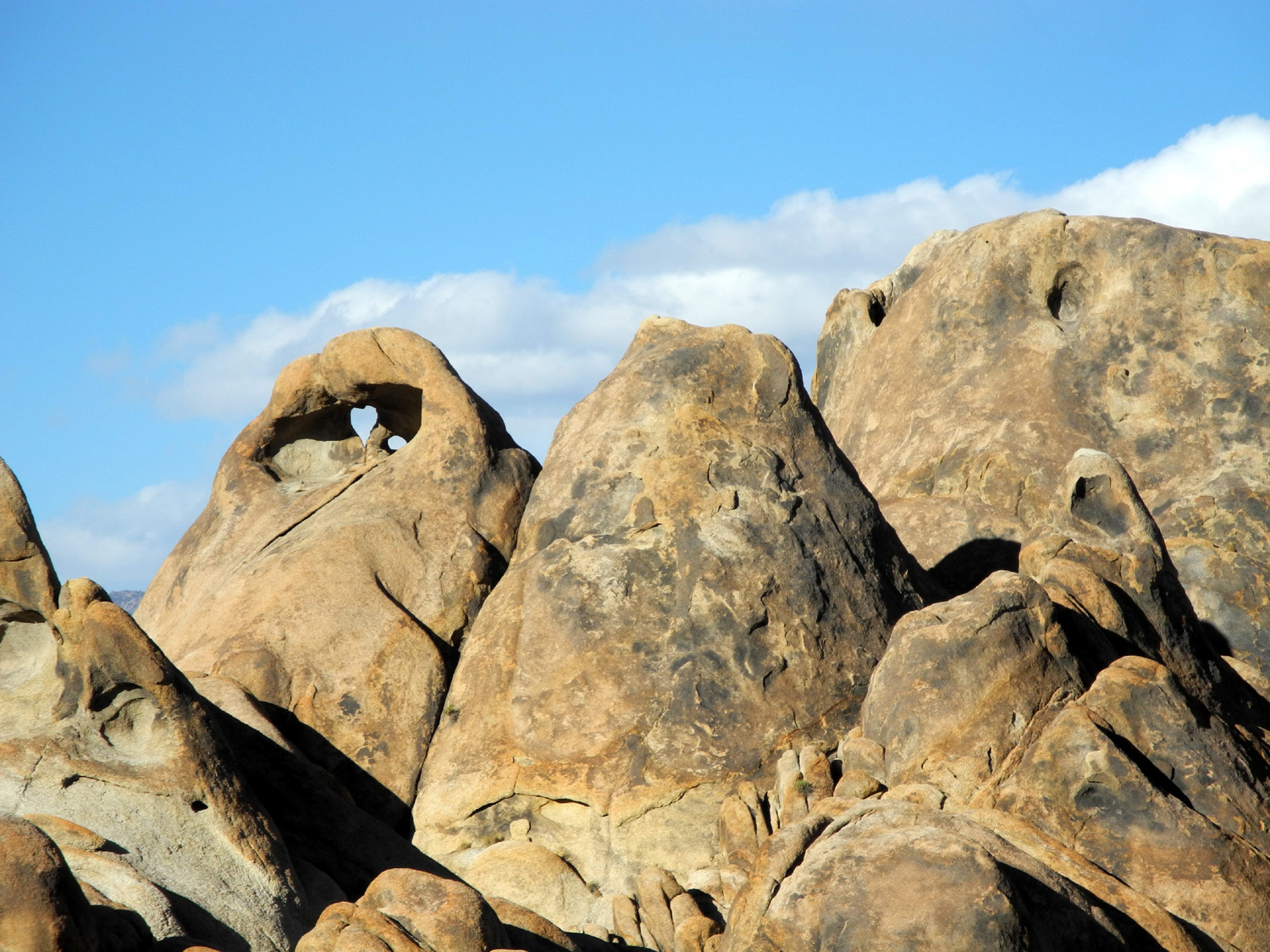
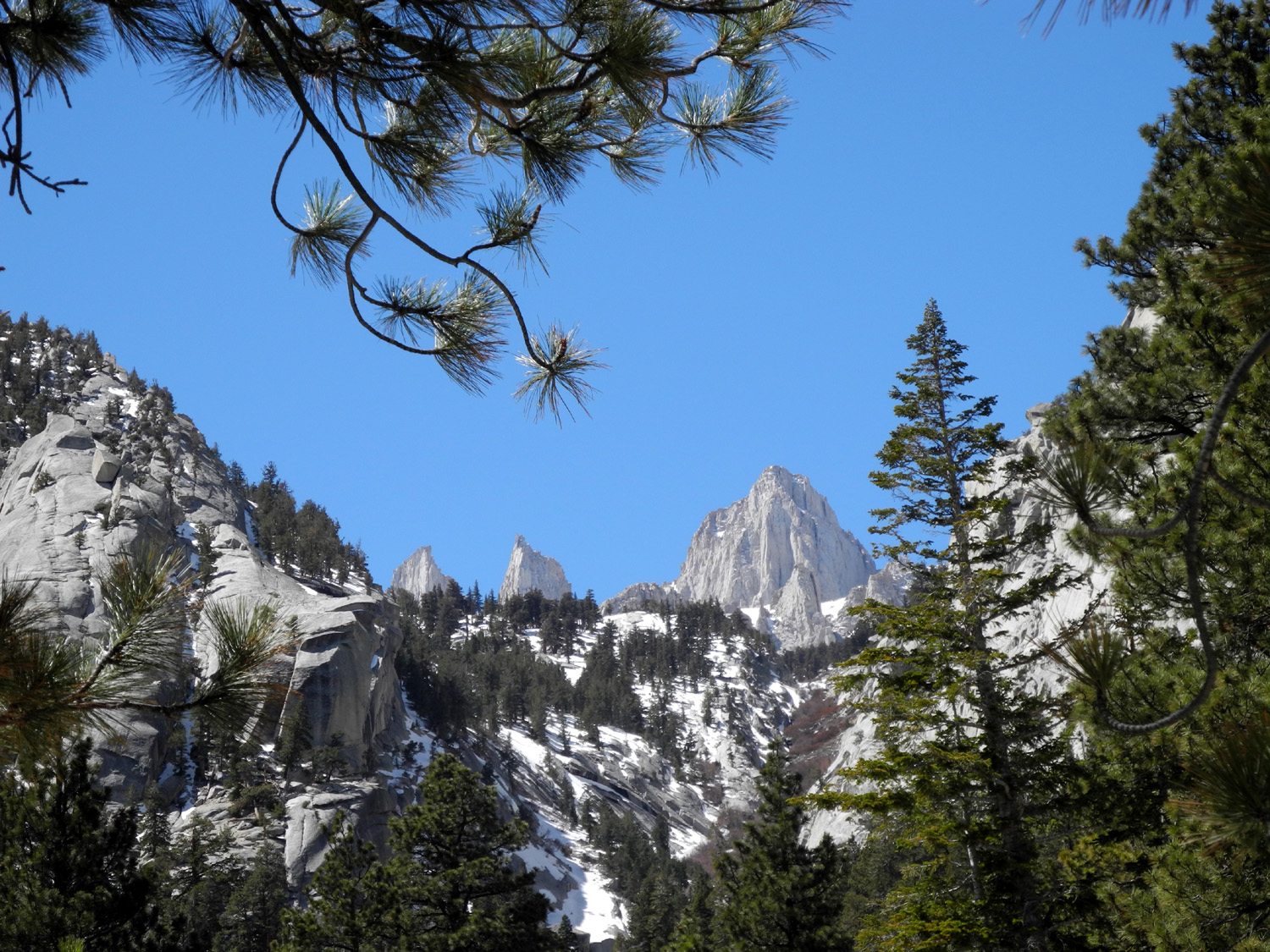
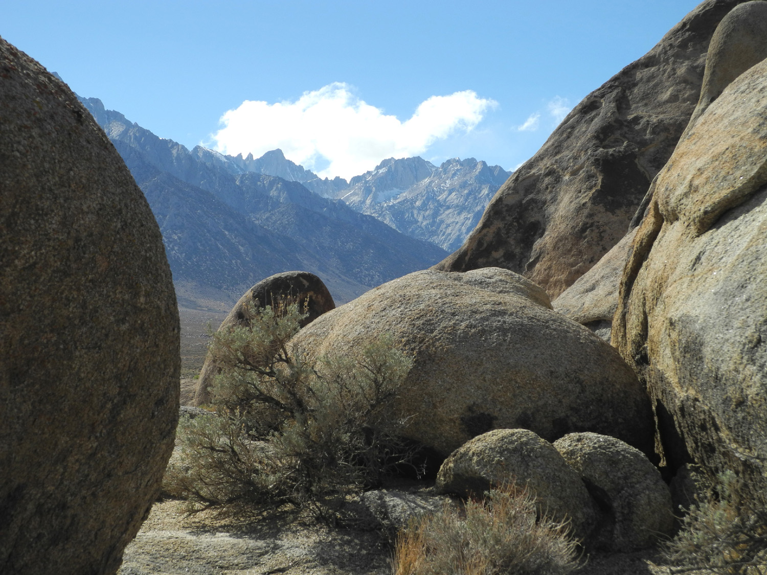
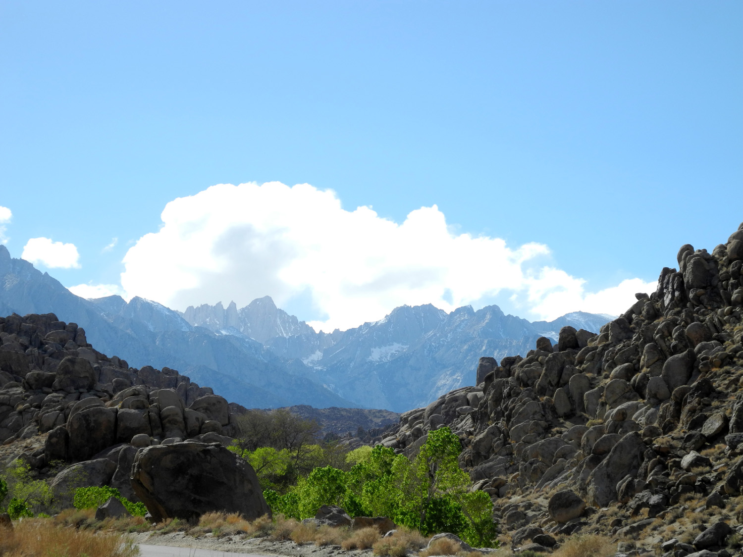
| In the Alabama Hills | Boulders with Mt. Whitney beyond | Another Mt. Whitney view | |
|
 |
 |
|
| Janell in Mobius Arch |
|
A closer view | |
 |
|
 |
|
| View from another angle | Windows in the rock | The work of water and wind | |
 |
 |
 |
|
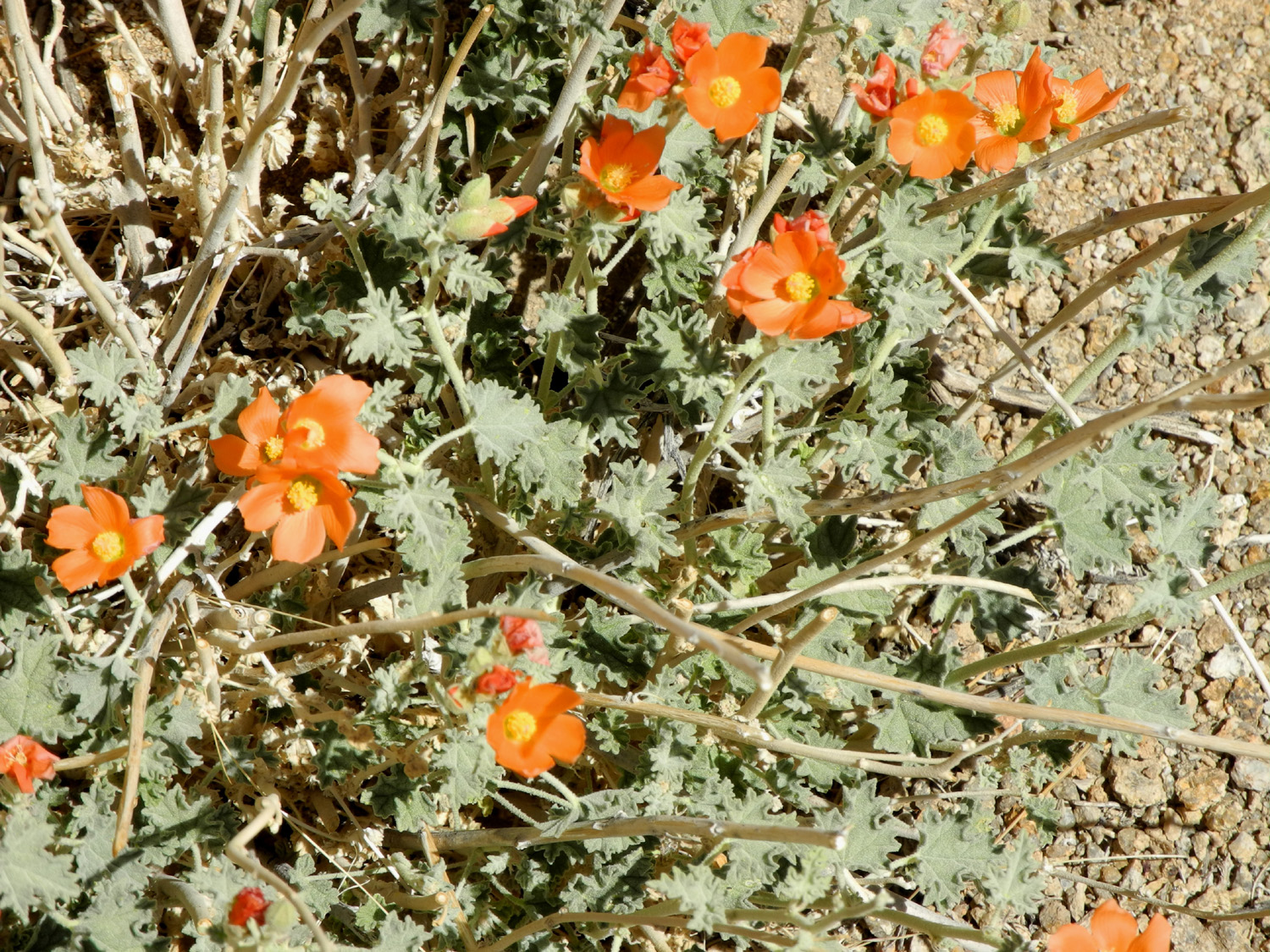
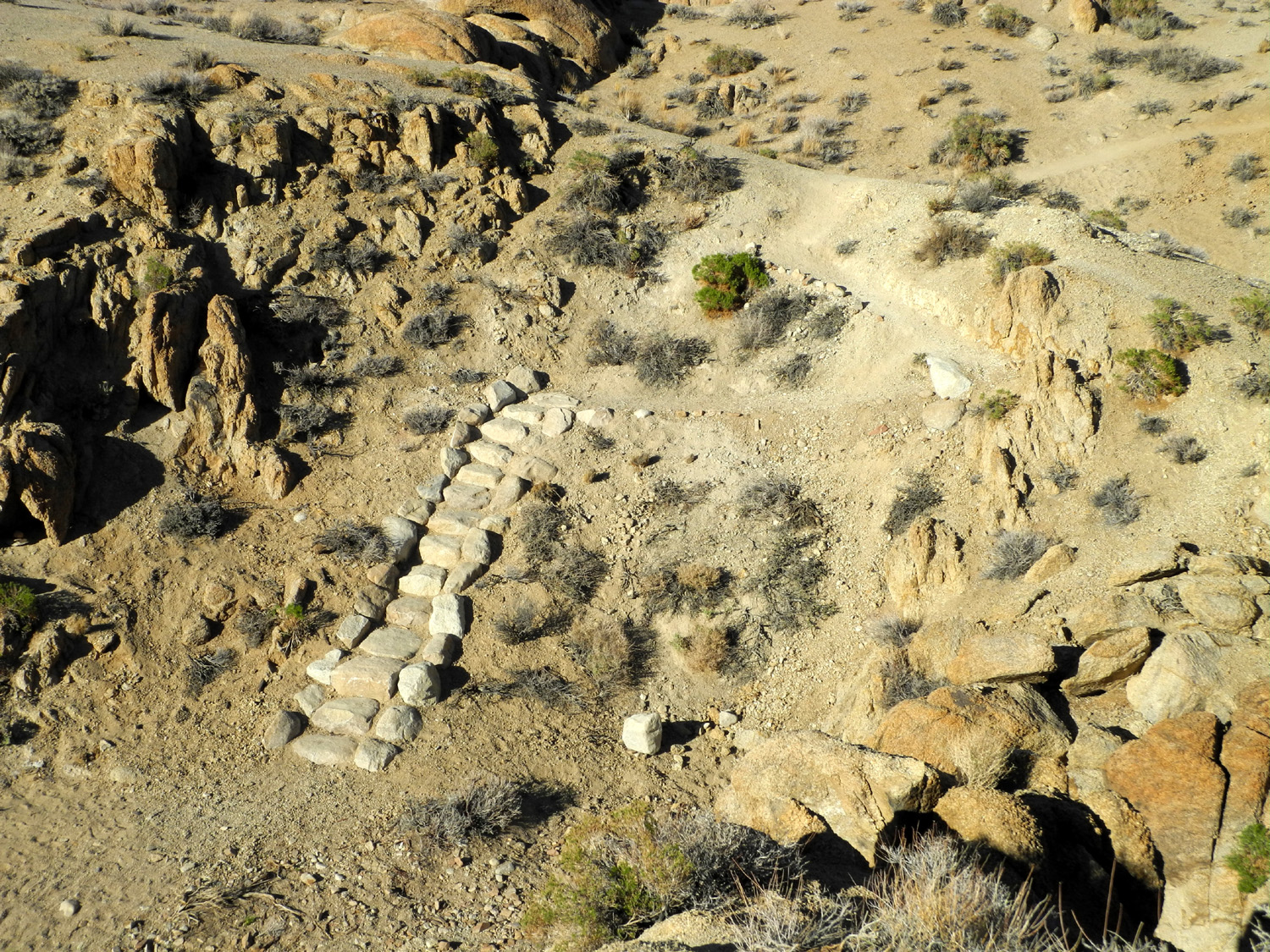
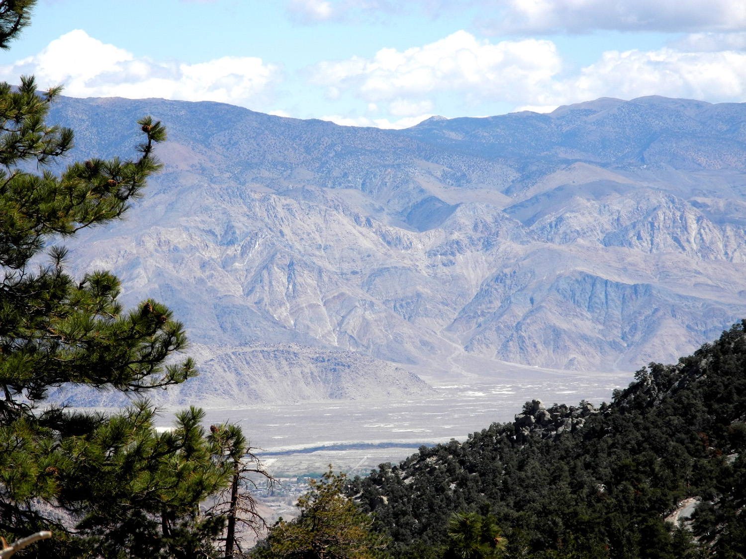
| Flowers in the desert | The last few steps back to the parking lot | Looking down on Owens Valley
and Lone Pine from Whitney Portal Road |
|
 |
|
 |
|
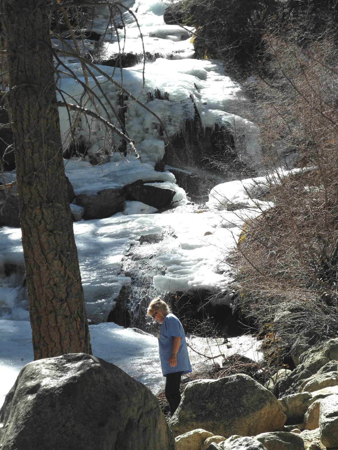
| The road to Whitney Portal | Getting close! | Snow covered creek | |
 |
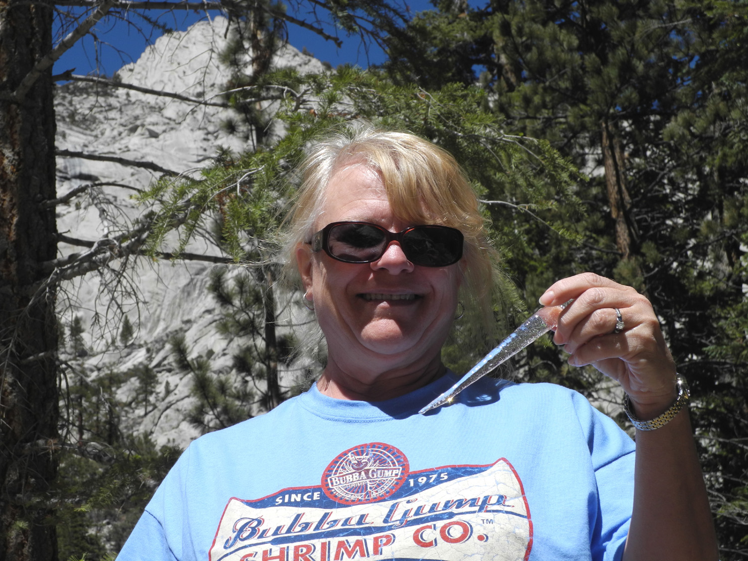 |
 |
|
| Icicles decorate the creek | Janell harvests a nice, fresh icicle | A last look at Mt. Whitney from our RV park | |
 |
|||
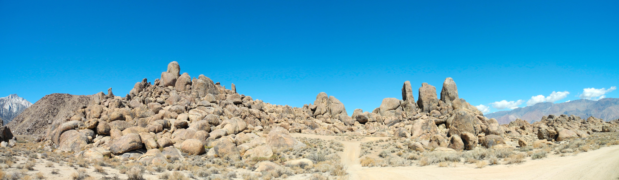
| Panoramic view of Alabama Hills formations | |||
| Related Links | |||
| Death Valley National Park | Ridgecrest | Stovepipe Wells | |
| Furnace Creek | Zabriskie Point | Mosaic Canyon | |
| Panamint Valley Photos | Alabama Hills | Movies Filmed in Alabama Hills | |
| Alabama Hills Movie Museum | Whitney Portal | Walker Family Death Valley Blog | |
| Mt. Whitney | Hiking to Mt. Whitney | Zabriskie Point
|
|
| Under Western Stars
|
Red Rock Canyon State Park | Panamint Valley | |
| Death Valley Scotty's Castle | |||