

Dick's Adventures of 2017 - Part 6 |
||
|
2017 Part 1 2017 Part 2 2017 Part 3 2017 Part 4 2017 Part 5 2018 Part 1 |
||
|
Grant Grove with Colton Cedar Grove Campout Back to Grant Grove San Joaquin River Trail West Thanksgiving at the Gorge II (Acorn Camp) Cat Sitting Again Canal Walk with Jack San Joaquin Gorge Bridge Trail Grant Grove Day Trip New Year's at Neely's & Wawona |
||
|
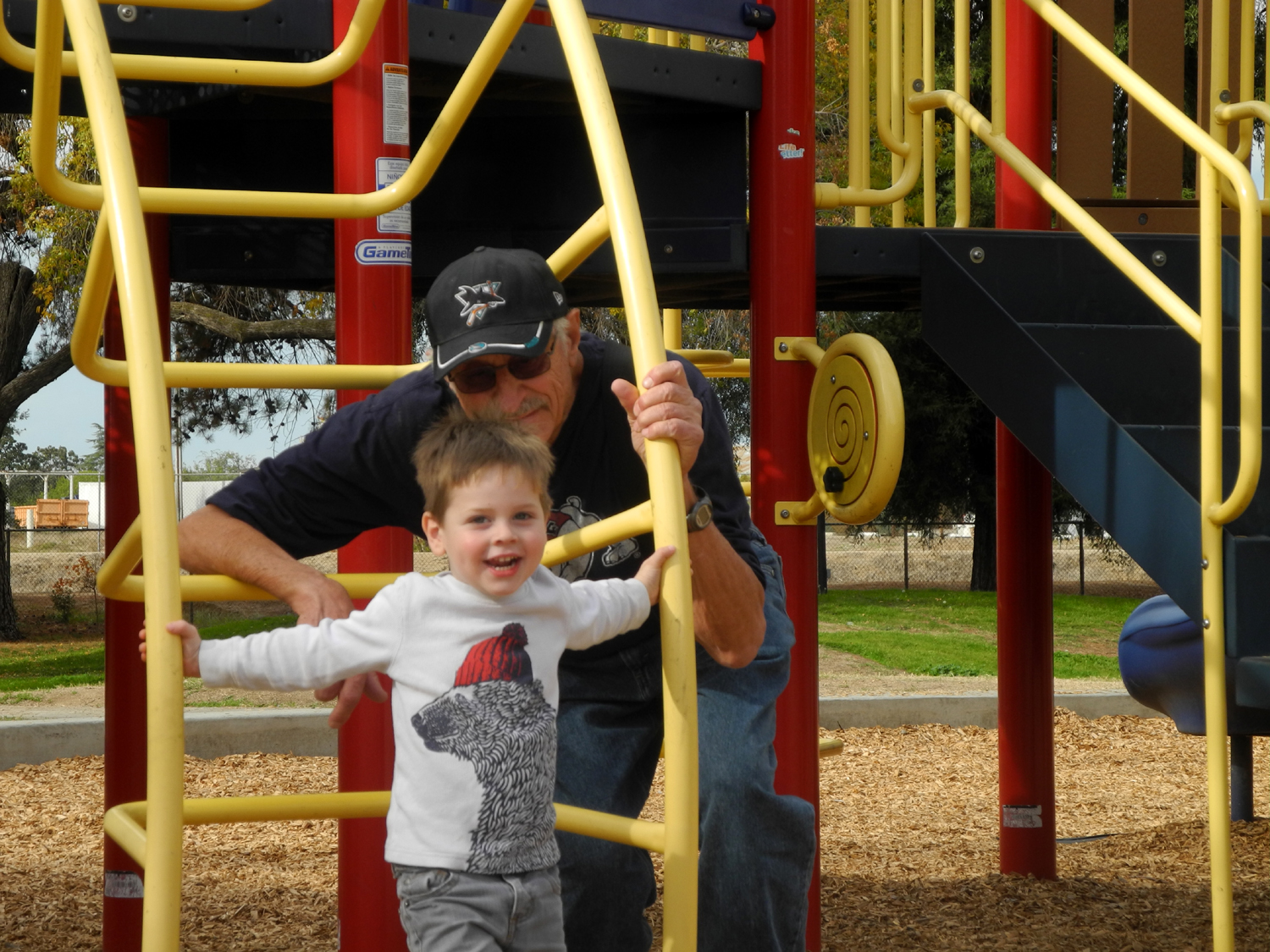
Grant Grove with Colton |
||
 |
 |
 |
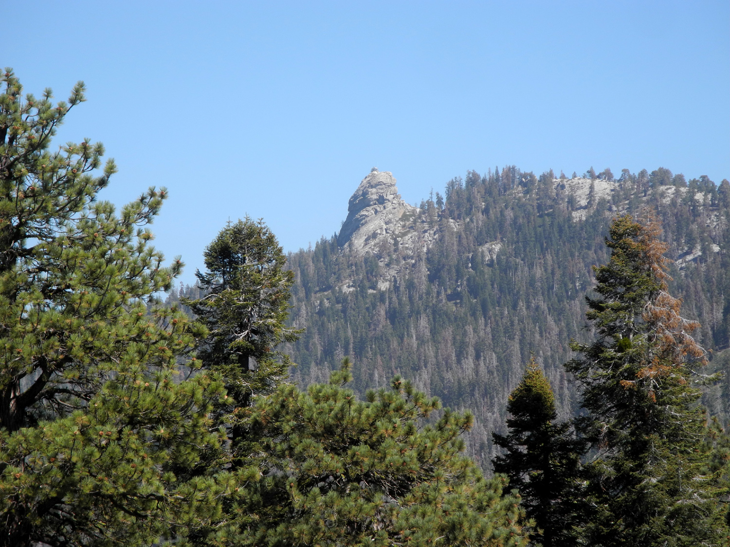
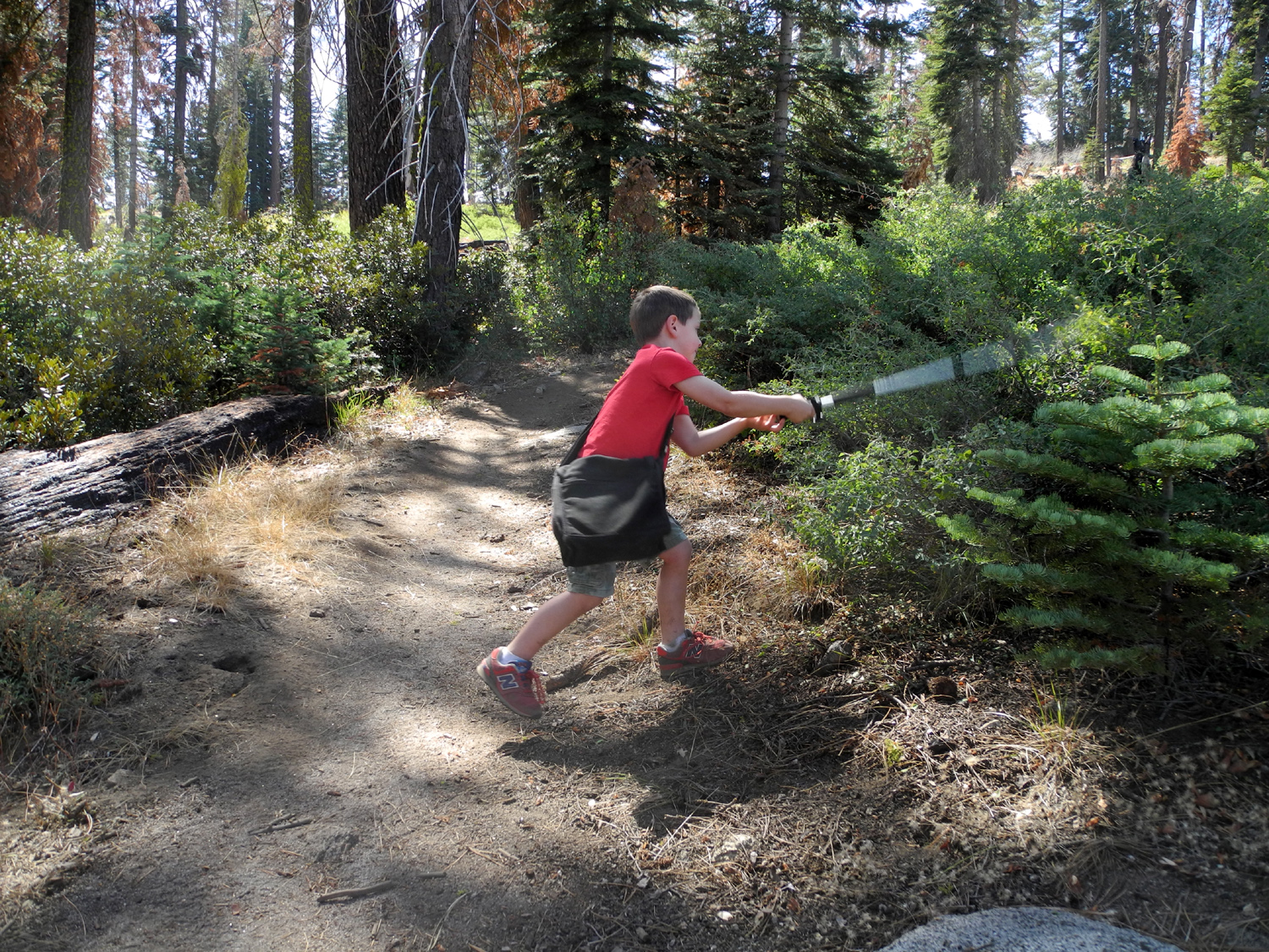
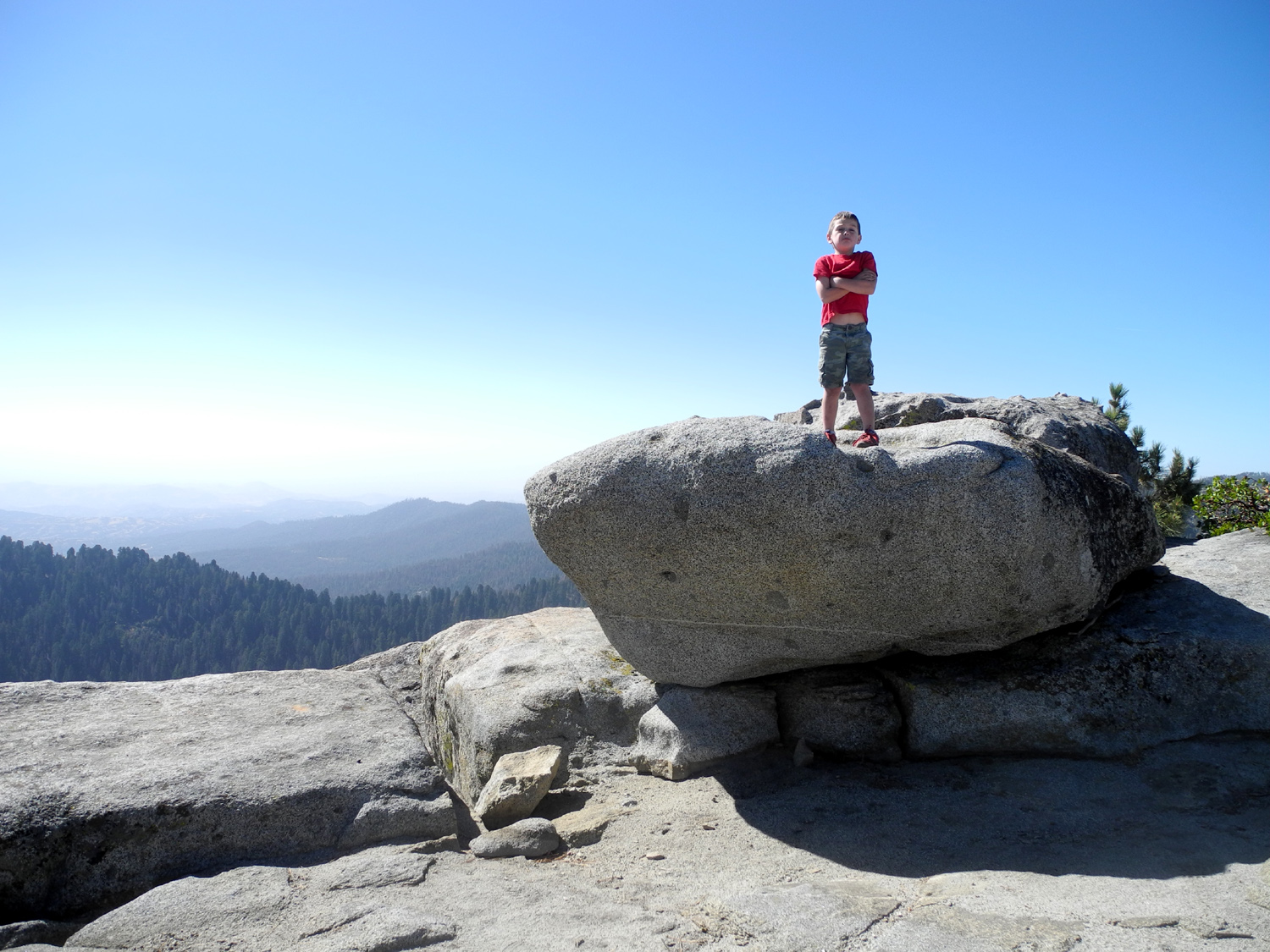
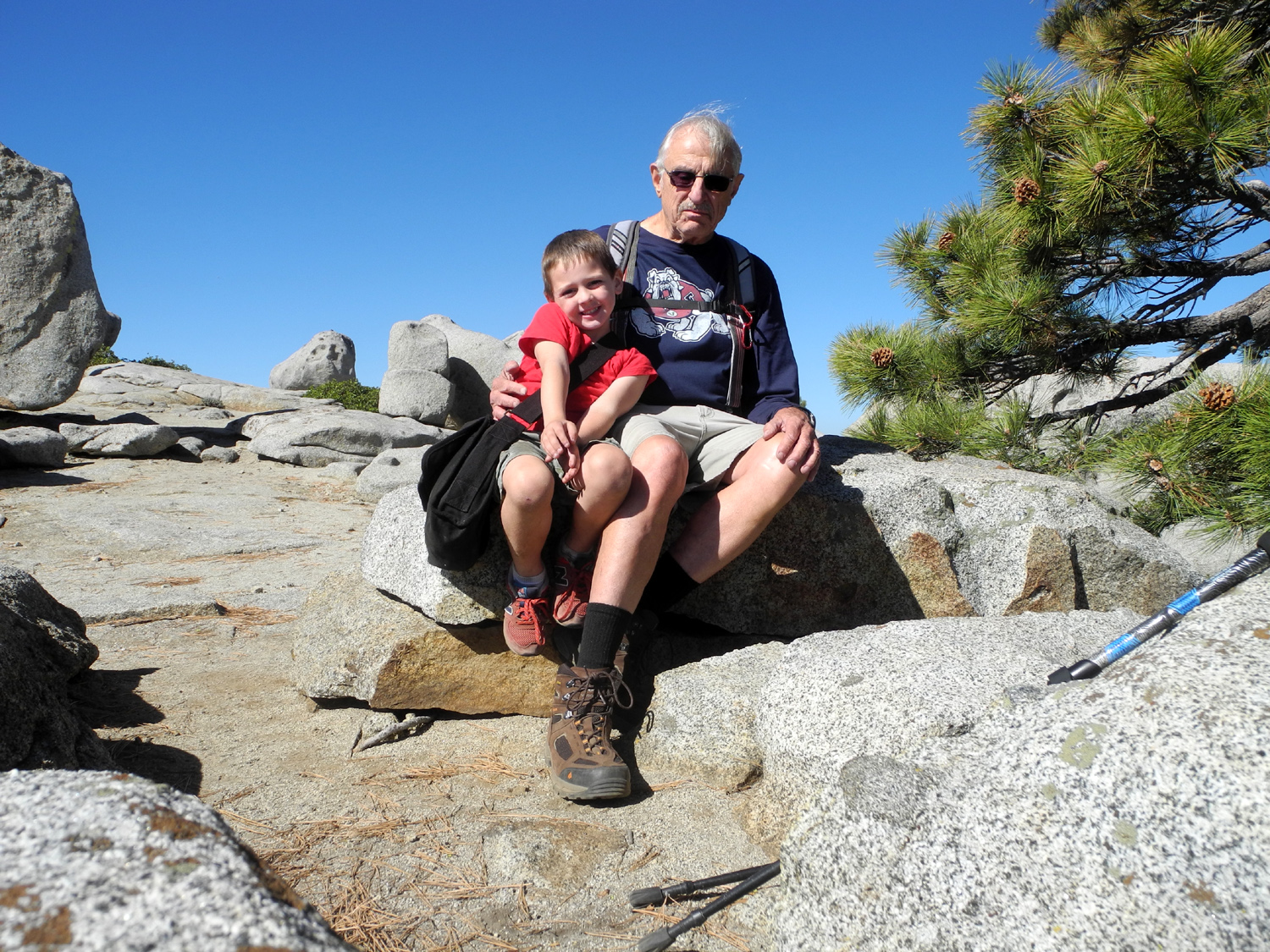
| Colton taking a break | Sequoias at Grant Grove parking area | Colton and the rock sculptures at the Kings Canyon Overlook on Generals Highway |
|
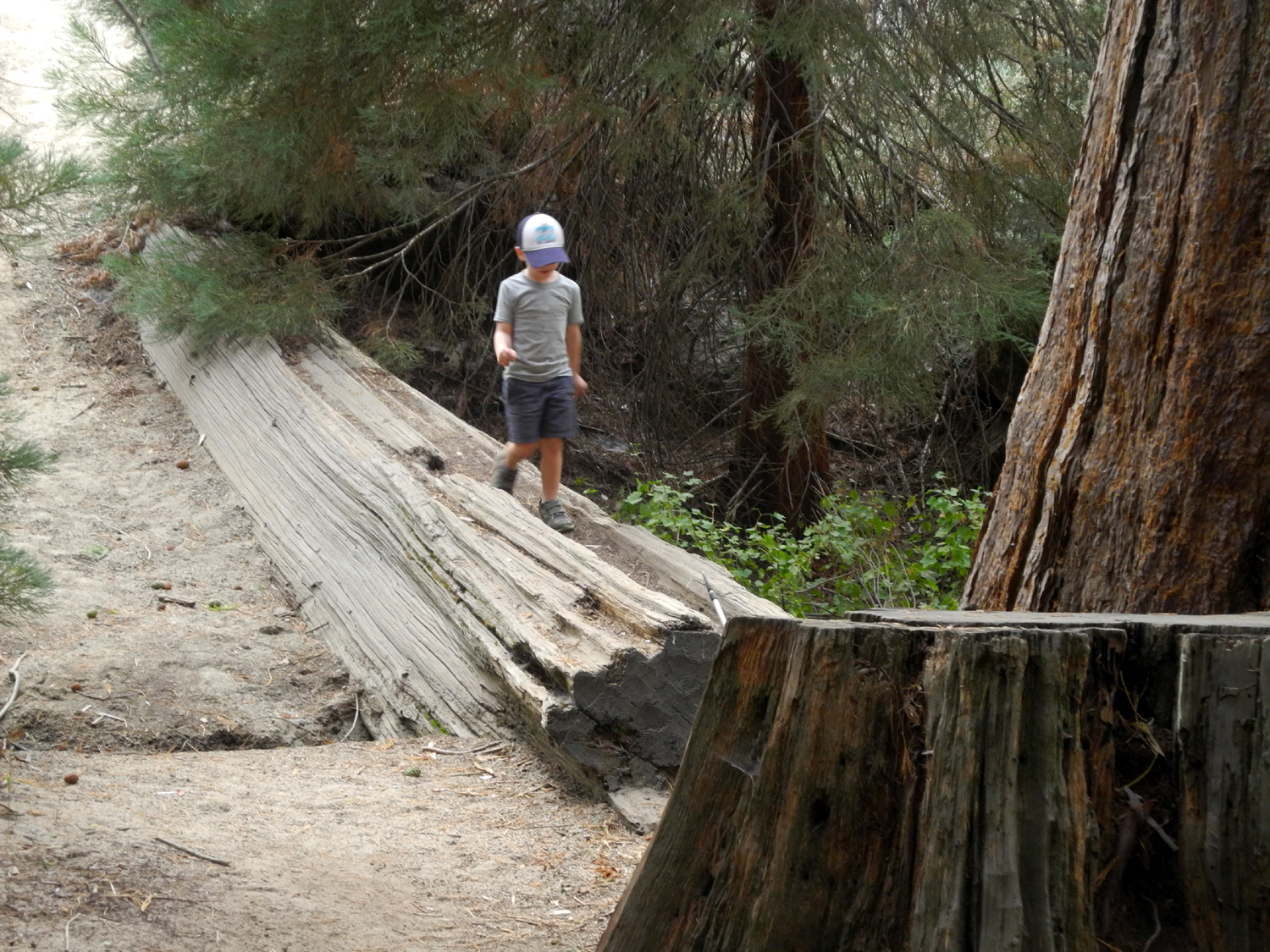
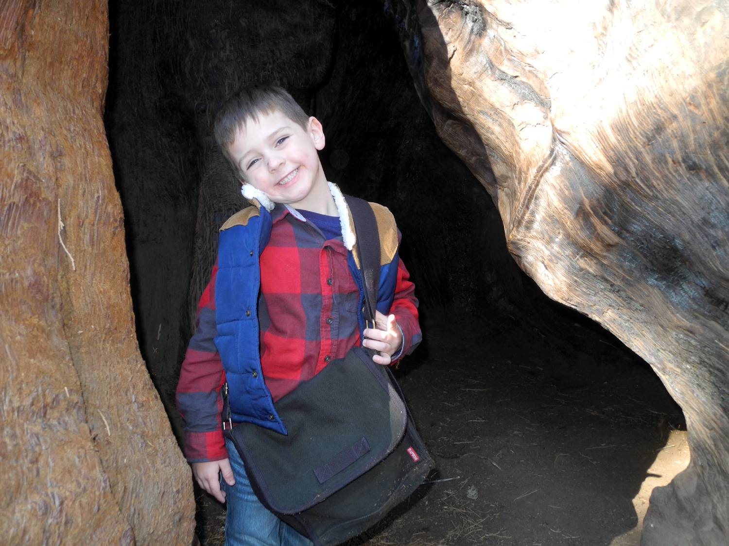
I've been looking forward to this trip since December 12, 2012, the day my first great grandson, Colton James Upshaw, was born. On the last day of our trip he was four years and nine months old. When his dad, Johnny, was that age, I was 49. When my second grandson, Mikie, was four, I was 62. Now I am 78, so a few weeks ago I started asking two questions: Is Colton ready to go camping by himself with his great grandfather? Is his great grandfather ready? He and brother Jack have been with me on other trips, but my daughter Teri and/or their parents were also there. I knew without thinking about it very much that it could only be with one boy, and of course, it would naturally be the older. It takes a minimum of two adults to keep track of two lively young boys when they're away from home. Next I asked my daughter, Colton's grandma, for her opinion. She basically asked what I thought. I asked Colton, and he said "yes," but it was obvious he did not give it any thought. So finally I asked the final arbiters of such an event, his parents. After a few days of thought, they said yes. This set off a series of emails between us about what equipment he has, what he likes to eat, and similar matters. Finally everything was arranged, and around noon on September 10 I arrived at the Upshaw residence. Johnny installed the car seat in the back seat of my pickup, we loaded up Colton and his stuff, and set out for the 60 mile drive to Grant Grove in Kings Canyon National Park. Although there are still lots of visitors, the National Park Service had closed all but one campground in the area. However, there were plenty of spaces and we were able to set up where we had no close neighbors. What we did have were a lot of logs, since drought and beetles have killed thousands of trees in the Sierra, and those in danger of falling are being cut down. The advantage of this was a big stump in our camp site which proved useful as an auxiliary table. As I unloaded stuff, I set Colton's little folding chair on the stump, planning to get it down when it was needed. A short time later I looked over and saw him sitting in the chair, on the stump, looking like King of the Camp. Once we got organized, we did our first hike. The campground is close to the visitor center at Grant Grove Village, and close to the General Grant Tree in the opposite direction. I had thought we might do both hikes, but it was late enough that I decided to go to the Grant Tree first and then decide whether to do more. The trail that runs from the village to the grove was just down the hill from our campsite, so we made our way down, then followed the trail. Colton's hiking includes poking his pole or a stick into the ground, into trees and into fences, so his pace is just about right for me. After crossing the road, the trail offered a couple of points of interest for Colton. First was a fallen log with one end up on a stump, creating kind of tunnel. A family with four boys was coming up the trail, and all the boys went through the tunnel, and of course Colton did the same. A little farther on was a log across a creek, just off the trail, and he walked across the log and back (and repeated these actions when we returned). The trail goes past a huge sequoia that fell in 1933 , and arrives at the General Grant a short distance beyond. We took a number of photos along this section, most of which involved Colton being a kid rather than looking at trees. The trail passes a number of large sequoias, but of greatest interest is one which is on the ground and hollow from roots to the top, creating a tunnel that anyone can walk through. This was his favorite part of the hike. The trail comes out to the parking lot, then goes into the woods toward the fallen log, so we made our way back to camp. We had eaten a snack when we arrived, but it was now time for a more formal meal. I had brought fire wood and hot dogs, and stopped down in the foothills to cut a roasting stick from a live oak tree. We soon had the fire going, waited about a half hour for it to burn down, then cooked the dogs and had our supper. Colton brought his bike, which worked out very well. The camp roads are paved, and we were right next to a spot where the road went down into a dip and back up. He could ride hard down hill and get momentum to ride quite a ways up the other side. He was also very helpful, taking stuff across the road to the recycle bin, and getting water from the faucet a ways away. I gave him a three-gallon bucket and asked him to get as much as he could carry. This turned out to be only two inches, but that was enough; in fact, the fire burned itself out and I did not have to put water on it after all. The back seat of my truck folds down in two sections, divided into one third and two thirds the width, and the wider section was just about right for his "sleeping nest." I was trying out my new folding foam mattress for the first time, and it proved to be significantly better than the air mattress I've used on other truck camping trips. The next day we established a regular morning routine, starting with tea for me and a snack for Colton to keep him until "official" breakfast was ready. All food and "smelly" items have to be stored in the bear box provided, and Colton quickly learned to open it. Shortly after he got up he went to the box and got out our waste basket and brought it over by the table. I fixed sausage, English muffins and cocoa for our breakfast the first day. I had purchased a camping toaster that sits on a stove burner, and it worked very well. I had introduced both boys to cocoa with whipped cream when they had breakfast at my house a couple of months ago, and Colton immediately asked if I had whipped cream, which of course I did. Since Colton was missing two days of pre-school, I told him that he was going to learn some things, and discussed parent, grandparent and great grandparent relationships. Although he has a number of grandparents, he did not really understand that I was his dad's grandpa. We also looked at a map of the USA, which he recognized. He could not pick out California, but I showed him which it was. Two days later at home, with no further review, he picked it out immediately. For our activities the second day I had decided we would hike the Big Stump Trail first, then play it by ear for the rest of the day. This trail, which Teri and I hiked last year, starts at a large parking lot/rest stop just past the park entrance. It goes through an area that was heavily logged in the early part of the 20th century, so there are 15 or 20 large stumps, a few big sequoia trees, and some fallen logs, particularly at an old mill site. Of course, any stump is an invitation to climb for an active young boy, but most of them are too tall to get up on. We finally came to one 20 feet off the trail that was just right, and Colton was soon wandering around the top of it. A young couple came along, and it was obvious the man also wanted to climb the stump, so I said, "Go ahead, you know you want to," and up he went. I knew that we would eventually come to the stump that anyone can climb - it has a stairway. But first, we came to another feature that was probably Colton's favorite. It is a broken off sequoia with many jagged spires reaching up as high as 30 feet, leading him to name it The Castle. It is hollowed out in the middle, and has openings on two sides that permit easy climbing, and he was soon going up and out through upper "windows," exploring one of the lower spires that was easy to climb, and just generally having a fantastic time. All too soon I got him back on the trail to what is for most people the highlight of this walk, the Mark Twain Stump. This huge sequoia was cut down in 1891 so that sections of its 16-foot diameter trunk could be displayed in New York and London, partly to prove that such huge trees did in fact exist. A photographer captured the felling of the tree, and the photo is displayed on a plaque near the stump. We climbed the stairs and enjoyed a light snack while we sat there and thought about what the area might look like had there been no logging. (It would have looked like a Sequoia forest.) The Mark Twain is on a spur trail that runs out from the main loop, just past the Castle. When we started back and came to the continuation of the loop, Colton wanted to go back to the Castle, so we made a 50 yard backtrack for a little more climbing. After this point, the trail only goes by one special feature, the Shattered Giant. This is a big sequoia that broke into pieces when it fell, making it useless for lumber, not an unusual occurrence. In pre-national park days some shingles were cut out of the fallen giant, but most of it is still there, and to Colton's delight, the trail goes up through the pieces of log. Not far from here we finished the loop and were on the trail back to the parking lot. Here we had the first of a number of light sprinkles and a little thunder, but it never rained hard enough to get us wet. We took our lunch over to a covered picnic table beside the parking lot and restored our energy for the next adventure. From the Big Stump parking area we went back toward our camp, but turned right at the junction. The road to the left goes to Grant Grove and on to Cedar Grove in the Kings River Canyon. The right fork leads to Sequoia National Park and eventually out to the valley via a narrow, winding road through the foothills. Our destination was only a few miles - the Kings Canyon Overlook, although we stopped briefly at another vista point where you can look down into Redwood Canyon and across at Redwood Mountain. At the Overlook we had a good view of the high peaks above the Kings River, lit dramatically by the sun peaking through clouds. However, Colton was much more impressed by the two hundred or so rock piles or sculptures or whatever you want to call them that people have built just below the overlook. In addition to rocks, they also include sticks, moss and pine cones. These were not present when Wes and I stopped here in May, so we saw them for the first time when we hiked the Buena Vista Peak Trail on August 30. As we made our way down to the rock field, I instructed Colton not to move any rocks or knock them over, and he walked among them, as sure-footed as a mountain goat, without touching them. Of course, he wanted to build his own, and this I encouraged. He made one, mostly of rocks, and one of sticks. Next we drove about 200 feet to the Buena Vista Trailhead, and parked there. Earlier I had thought we might go to the top, but I knew by this time that I did not feel like that much additional hiking, and I was pretty sure Colton would not be up for it either. Instead we hiked up about a quarter mile to a place where there were some big rock formations that Colton could climb on safely. There were several large piles of Jeffrey pine cones in this area, and I suggested that he make a row of cones along the trail. He liked this idea, although he kept building the line out into the trail, and I kept explaining that someone would come along and just kick them out of the way. Then he converted the cones to another project - a pine cone human. It actually had some resemblance to the type of stylized figures some Native American cultures create. When he placed the final cone he explained that it was a wiener, because it was a boy human. Thinking back to the alien creatures his dad drew on a sandy beach in Oregon at age 15, this seemed a normal progression of the Upshaw family artistic genes. When we got back to the truck, we made one final stop, at Grant Grove Village. We went into the Visitor Center, where Colton literally ran through all the rooms in about 30 seconds. He said this allowed him to find the best room, which was one where animal sounds were being played. We only spent about five minutes more there, because national park visitor centers have changed, and at least in Kings Canyon and Sequoia, don't have much to offer. Colton had been disappointed that I did not bring buns for our hot dogs the first night so we went to the store to get some. We also got a snack - a large ice cream cookie for him, and and Snickers ice cream bar for me, which we ate at a table on the porch. One more adventure awaited us when we got back to camp. We were not ready for supper, so he rode his bike, I did some reading, and we just puttered around camp. About 7:30 we both needed to visit the bathroom, so we decided to walk the nearly half mile to the nearest facility. Just like our earlier walks, a few drops of rain fell on us as we made our way up and down the hilly road. Unlike previous walks, it began to rain harder and harder, with thunder and lightning, and we got very wet by the time we got back to camp. I had left the tailgate down and the camper door up, and a two foot section of my bed was damp. We climbed in, leaving our muddy shoes outside, and huddled in our little "cave" until the rain slacked off. I got out, got dry clothes for both of us (pajamas actually), as well as some food - veggies, salami, cheese, and crackers. By this time there was no possibility of cooking hot dogs or anything else, so this was our supper. We had a few more sprinkles, and finally I got Colton moved into his nest in the back of the cab, and I closed the camper door, put towels over the damp area, and went to bed at about 9 o'clock. The clouds cleared away during the night, but the next morning there was mud and water on the stuff that head been left out in the rain. Most of the things were unharmed, although the cardboard box my lantern goes in was quite wet. I had a rag and towels, and was able to get everything in shape for breakfast and packing up. I ended up with a large plastic bag containing my jeans and several towels, all very wet. On the other hand, the world overall was fresh and clean. Breakfast was Honey Bunches of Oats, which Colton had not had before. He is usually good about trying new things, but not this time. His mom had sent Froot Loops and other stuff he likes, so I substituted those. I put raisins in my cereal and Colton likes them, so I suggested he try it with the Froot Loops First he put one raisin on a spoonful, then added a handful. To finish off, he added extra raisins to his raisin muffin. After breakfast we slowly gathered up everything and got it loaded into the truck for our return home. Just before we left we took a final walk for me and bike ride for Colton around the campground loop road nearest our camp. Despite the rain the temperatures had been relatively warm, around 55 at night and 75 in the daytime, so it was not surprising to see the thermometer reading above 90 at home. Once again Colton was very helpful, carrying things into the house, and more importantly, climbing into the back of the truck to hand things out to me. It would be a few hours before his parents got off work, so we had already made plans for swimming, and once we had everything unloaded, we were ready to cool off at the pool. Finally, we had our hot dog dinner complete with buns, cooked in a frying pan rather then over a campfire. When his mom arrived with little brother Jack, they played with their favorite toys at my house, two dump trucks and two loaders and a few dozen marbles, while I showed Brittany the photos from our trip. Commenting on a Facebook video of Colton's first birthday party, family friend Cheri Nelson Putler wrote: " He will embrace every part of his life and enjoy it all." On this camping trip, he fulfilled that prophecy in every way. As for me, while I enjoyed the hiking and being outdoors, spending some quality time with my first great grandson brought joy beyond all description.
|
||
|
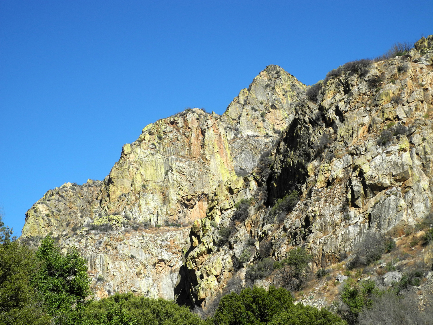
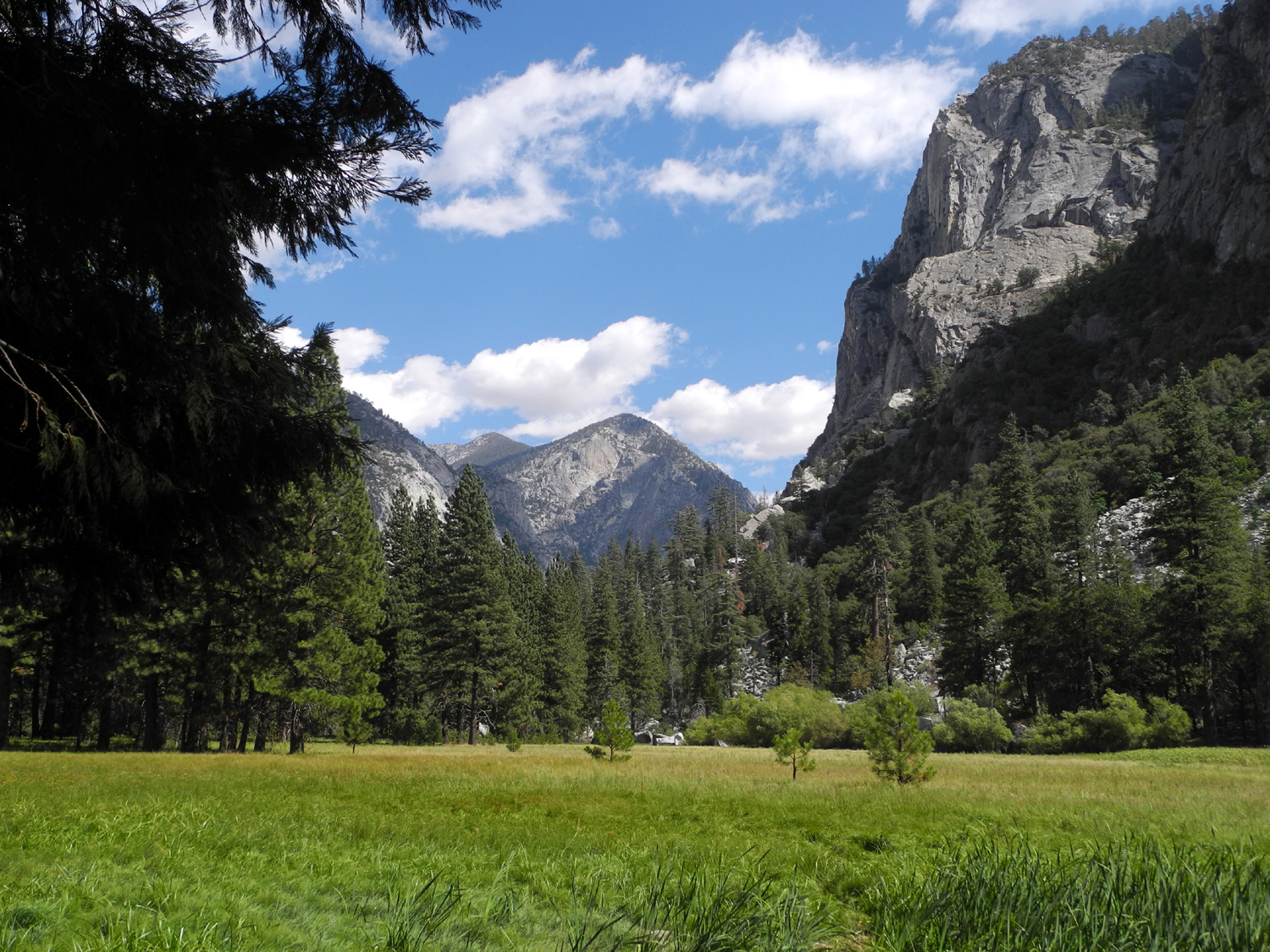
Cedar Grove Campout |
||
 |
 |
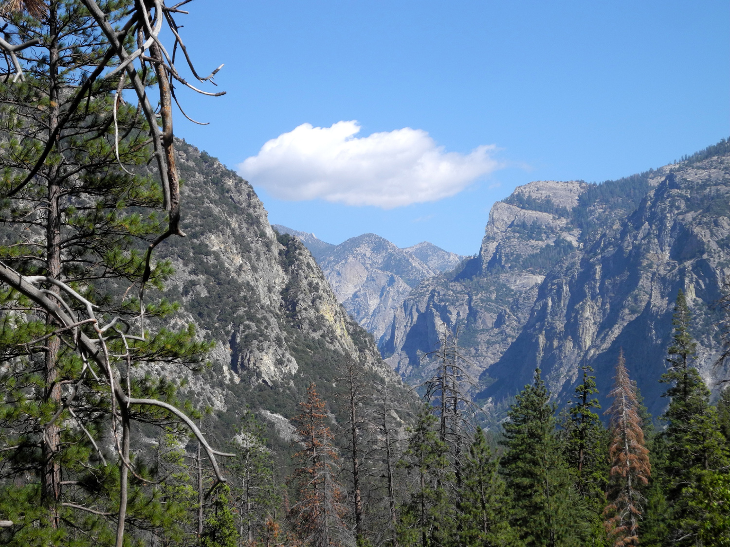 |
| Cliffs above Kings River near Convict Flat | Looking up Kings Canyon at Zumwalt Meadow | View up Kings Canyon from Don Cecil Trail |
|
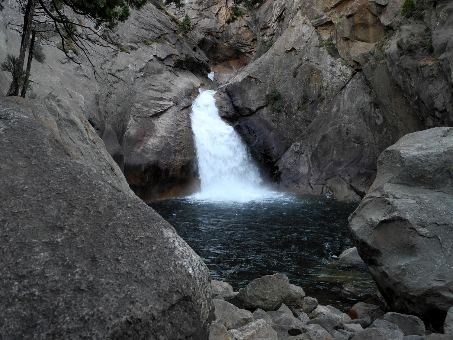
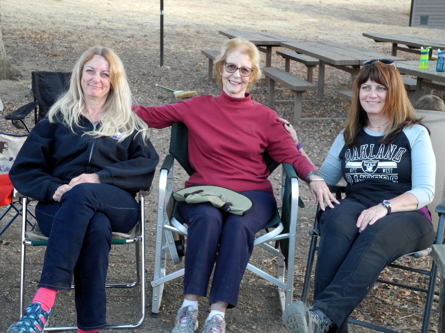
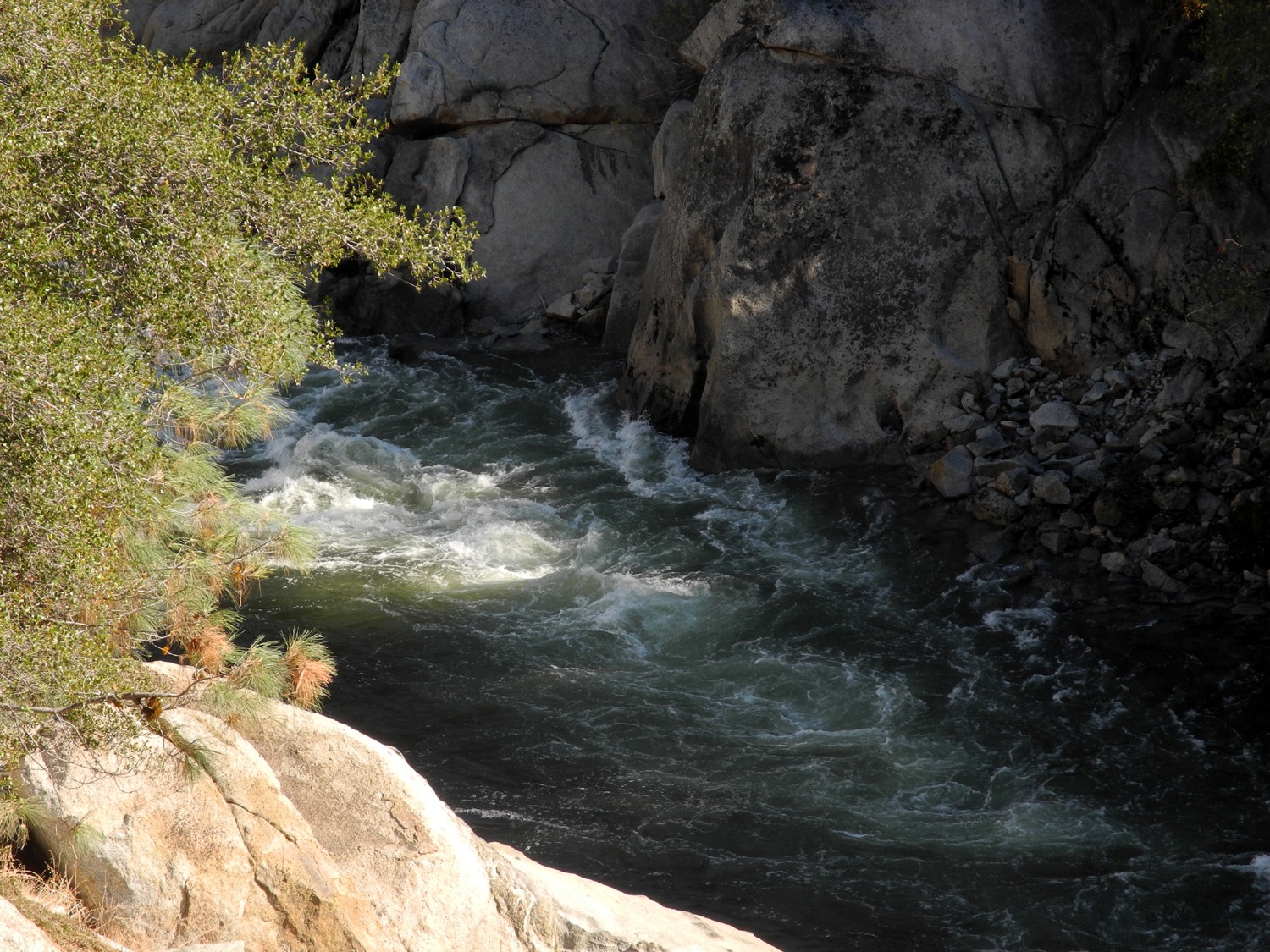
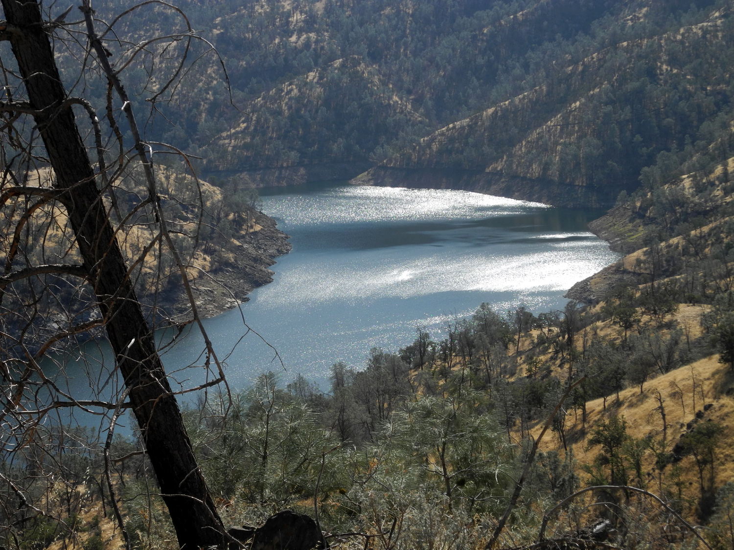
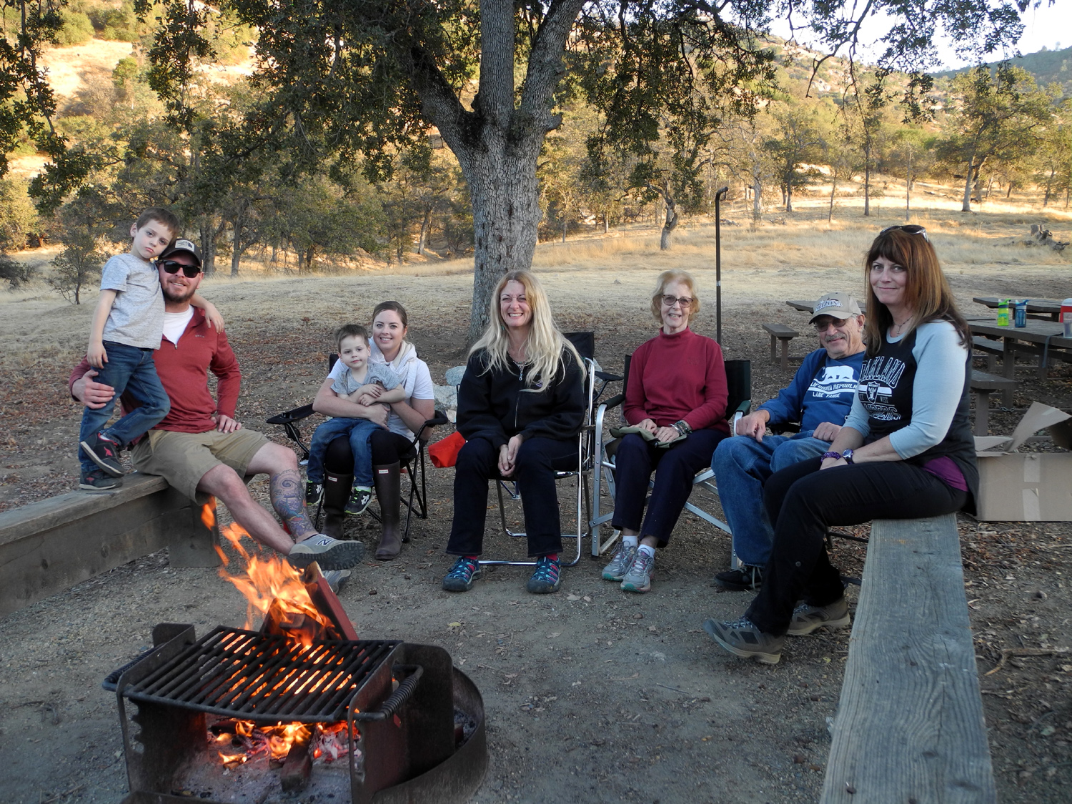
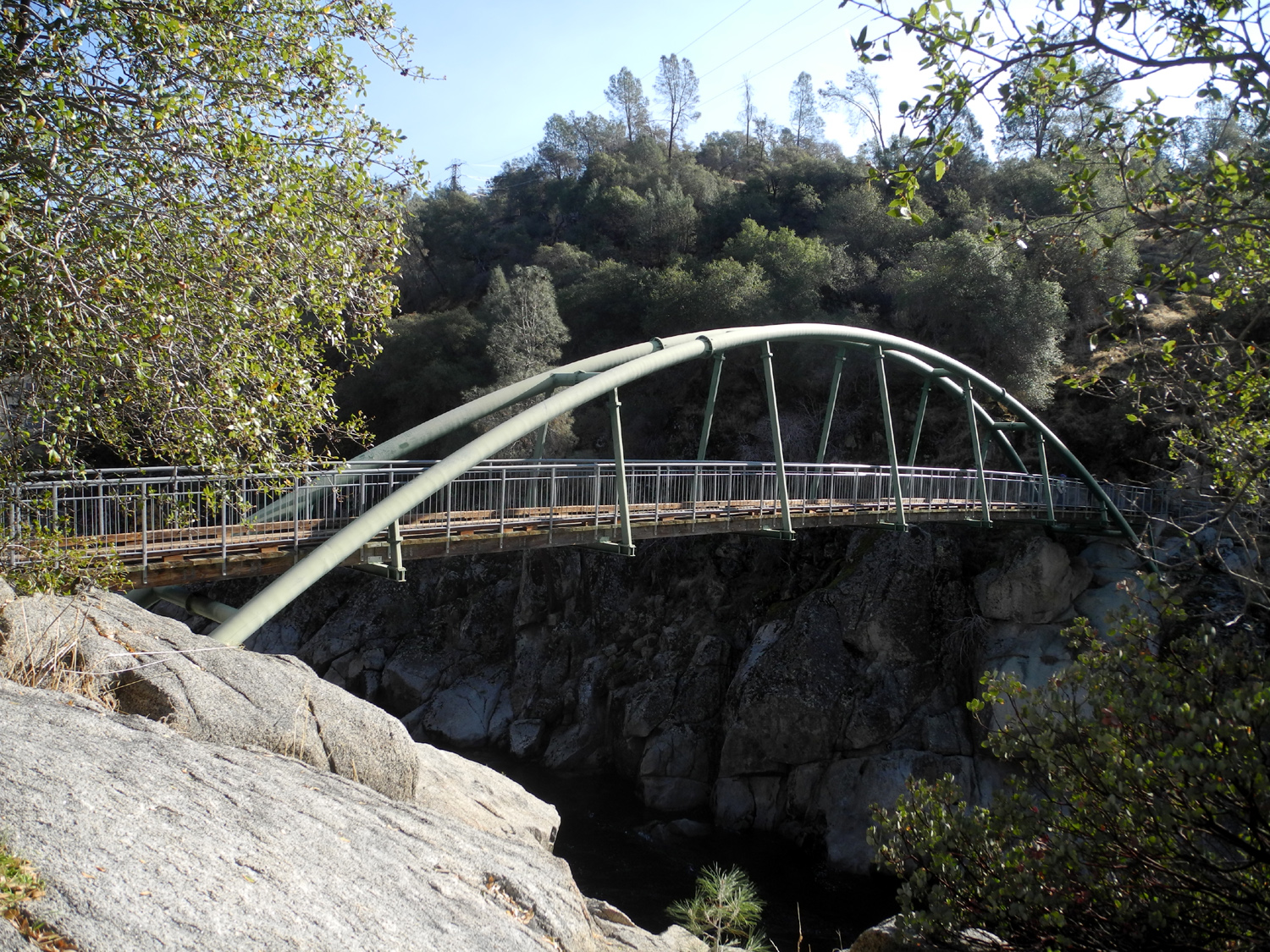
My daughter Teri has a special ability to control the weather. She organizes a big group hike or campout, and immediately severe weather heads for that area. The latest example was this trip, which was originally scheduled for Courtright Reservoir at 8,000 feet. When the forecast was for a chance of rain and snow, highs of 45 and lows of 25, we set our sights lower - to Cedar Grove at 5,000 feet. The route to this location from the Fresno area is east on State Highway 180 into Kings Canyon National Park, north through Grant Grove, and out of the park into the Sequoia National Forest. After going over 6,800 feet elevation, the road drops down into the Kings River Canyon, and follows the river upstream and back into the park at Cedar Grove, where there are campgrounds, a ranger station, visitor center, and stores. The total distance from home is around 90 miles. Teri and I camped here early last year, and we were both here separately in the spring of 2017. The trip provides a wide variety of scenery - giant sequoias, sugar pine and Jeffrey pine at the high elevations through the Grant Grove area; and foothill trees and brush at the lowest spots. Built by convict labor in the 1930s, the road descends to the river via a series of switchbacks, doubling back on itself in several places. Along the way there is a striking view of the confluence of the Middle and South Forks of the Kings River, as well as the rocky cliffs above. The road goes up the South Fork; the Middle is accessible only by trail. Teri drove up in her motor home on Thursday, September 21, got set up, and explored the campground. She said that the next morning there was a hint of frost in places, but the daytime temperatures were pleasant. The next day Teri's friend Sandy came to my house, and we drove up in my pickup, arriving about 11:30 after a stop at Grizzly Falls, just outside the park. Sandy set up her tent, and I arranged the truck for sleeping in the camper. Teri's mother Jackie arrived shortly before us, and would sleep in the motor home. We had hoped my grandson and family (Upshaw's) would be able to come up for the day, but business matters got in the way, and I know they were not enthused about a 180 mile round trip in one day. After visiting a while, we enjoyed an excellent chile relleno dinner that Sandy had brought. We all agreed that she should go around to all Mexican restaurants in Fresno and explain to them how to make superior chile relleno. We then set out in Jackie's car, with Teri driving, to tour the area, with major hiking planned for the next day. The valley here is somewhat like Yosemite, in that it was carved out by glaciers, and has a major river running through it. However, the rock seems to be much more fractured, so that there are fewer sheer, solid granite walls. Instead the canyon sides are marked by smaller rock cliffs, lots of vegetation, and small canyons through which creeks descend without going over waterfalls. The floor of the valley is much more uneven than Yosemite's, which was formed by the filling in of a lake that backed up behind the debris left when the glacier melted. Being farther south, it is also dryer, and the difference in vegetation is quite noticeable. There are many large cedars, ponderosa and sugar pine trees, lots of shrubs, and one small but impressive waterfall. We stopped at several points of interest, where walking was minimal. These included Knapp's Cabin, built in the 1920s as a storage shed for fishing and camping expeditions conducted by George Knapp, a wealthy Santa Barbara businessman. It's the oldest building in the canyon, and still in good shape after over 90 years. Zumwalt Meadow, close to the upper end of the canyon, is a moister area, and thus greener and more "scenic" than the rest of the valley floor. We planned to do the loop hike around the meadow the next day, but at this time we just walked down by the river, noticing how much lower it is than when we were here during the spring. Automobile access ends at Road's End, location of a ranger kiosk where back country permits are issued. Teri led us on a short trail to the river where we went out on Muir Rock, a large granite boulder right at the water's edge where John Muir is said to have delivered talks back in the day. Although I have been to Road's End a dozen times or more, I had not heard of this feature, and it was my first visit. Finally, on our return trip, we stopped at Canyon View, one of the few places where you can get a good look up the canyon and see some of the more vertical cliffs looming over the river. By the time we got back to camp it was time to start a fire. During the day the ladies had discovered a large pile of dry, small branches up the hill and across the road from the campground, and we had carried down a good pile. I brought boxed commercial firewood, but as it turned out, we did not need it. As we so often do when camping, everyone went to bed fairly early. I managed to stay up till about 9:15, then got into the camper, with the temperature at 44 degrees. It would drop to 33 during the night. Our morning routine at camp is to get up when we feel like it, have coffee or tea, and ease into the day, fixing breakfast when we get around to it. After that, it's non-stop action till....OK, maybe we stop a little, but we do try to hike every day. On Saturday Teri's friend Monica arrived in time for breakfast. She could not stay overnight, so got up early and made it in time for the day's activities. Teri, Monica, Sandy and I drove up to the Zumwalt Meadow trailhead, while Jackie elected to stay in camp and do some low key walkabouts. This trail is mostly level, with a section that goes through the rocks at the base of the southern side of the canyon. There is some uphill hiking in this part, but it's probably not more than a quarter mile total, and what goes up must come down, including this trail. After the "hard" part is over, the trail goes beside and around Zumwalt Meadow, a beautiful spot that may rival Crescent Meadow in Sequoia Park, which John Muir named "the jewel of the Sierra." Zumwalt is right next the river, and the last part of the trail runs by the stream, then back toward its starting point on a boardwalk. Last spring the water was up over the boardwalk, to the extent that I did not venture on to it, although some people crossed it, getting water up over their toes. Looking at the water level beside the boardwalk, we estimated that the river had been about six vertical feet deeper in the spring. Driving back, we were getting ready to stop at the Canyon View parking area when someone spotted a deer. Teri and Sandy walked back to try to see it, but I was pretty sure it would be long gone, so Monica and I checked out the view. This was a mistake - when the others got back to the car they reported they had seen three young bucks not far from the road, and were able to watch them for half a minute. Most of the rest of the day involved the usual "around camp" activities - eating, resting, reading and gathering more wood. Also we said goodbye to Monica who left around 4:30. The rest of us drove over to the village nearby, and walked down by the river for a while. We went into the store, where Sandy treated us to ice cream as a thank you for the ride and the camping. We then drove past the other facilities, including the laundry and shower building, then out on North Side Drive to the main road and back to camp. The next day we had decided to hike up the Don Cecil Trail to Sheep Creek Falls, a round trip of about three and a quarter miles. Both Jackie and Sandy stayed in camp. Like nearly every trail starting from the canyon, this one goes UP for some distance before reaching a leveling off point. However, it is built into the side of the slope and has only one or two fairly steep sections. Eventually it enters the canyon of Sheep Creek and reaches the creek just above a short but very attractive waterfall. We had seen it during spring run-off in 2016, and I thought it might be fairly unimpressive in this late season, but there was a good flow of water going over the rocks. As we ascended the Don Cecil Trail, we had a good view across the valley at the rocky peaks above it, and eventually, higher mountains beyond. This terrain is part of the Monarch Divide, a long, high network of peaks and plateaus that separate the South Fork from the Middle Fork of the Kings. The latter runs through the glacier-carved Tehpite Valley, which offers even more dramatic rock formations than the south fork valley, and several waterfalls. When Teri and I got back to camp, Jackie and Sandy had decided to head home after dinner. Teri and I had already decided to spend just one more night instead of the scheduled two, since that would allow her to work Wednesday and have Saturday off. We had a delicious meal, then said our goodbyes, leaving just Teri and I in camp. There was one place that was on our list that we had not yet visited, so we took my truck and drove to Roaring River Falls, a small but very scenic falls on the south side of the canyon. The river pours down through a rock channel then drops about 15 feet into a large pool. There are trails from the road to vista points on both sides of the river, each offering unique views, so we hiked both of them. We had a campfire, finishing up most of the wood we had gathered, but never having to open the commercial box I had brought, leaving it for another time. Thanks to Sandy we discovered the best form of kindling available in the area, sugar pine cones. These were thick under the trees near camp, and covered in pitch. A very small amount of paper and two or three cones was all it took to get a good fire going. In the morning we did our usual leisurely job of breaking camp, and started down the road. We both stopped at Grizzly Falls, which Teri had bypassed on her way in. The rest of the trip home was uneventful except for a control burn in progress near the park entrance. Fire trucks were parked in the Big Stump lot, and it was closed to visitors. There was quite a bit of smoke along the road, and firefighters were on duty keeping an eye on the burn. A few miles out of the park I pulled off where there is a wide dirt area next to the road and took a short nap, since I had worked hard and missed all my naps for the three days of our campout. This was enough to keep me alert the rest of the way home, and on the way I was mentally planning a return to Grant Grove with my great grandson.
|
||
|
Back to Grant Grove |
||
 |
 |
 |
| Green and gold along the Panoramic Point Trail | Colton on the rock | Colton and Dick on top of Buena Vista Peak |
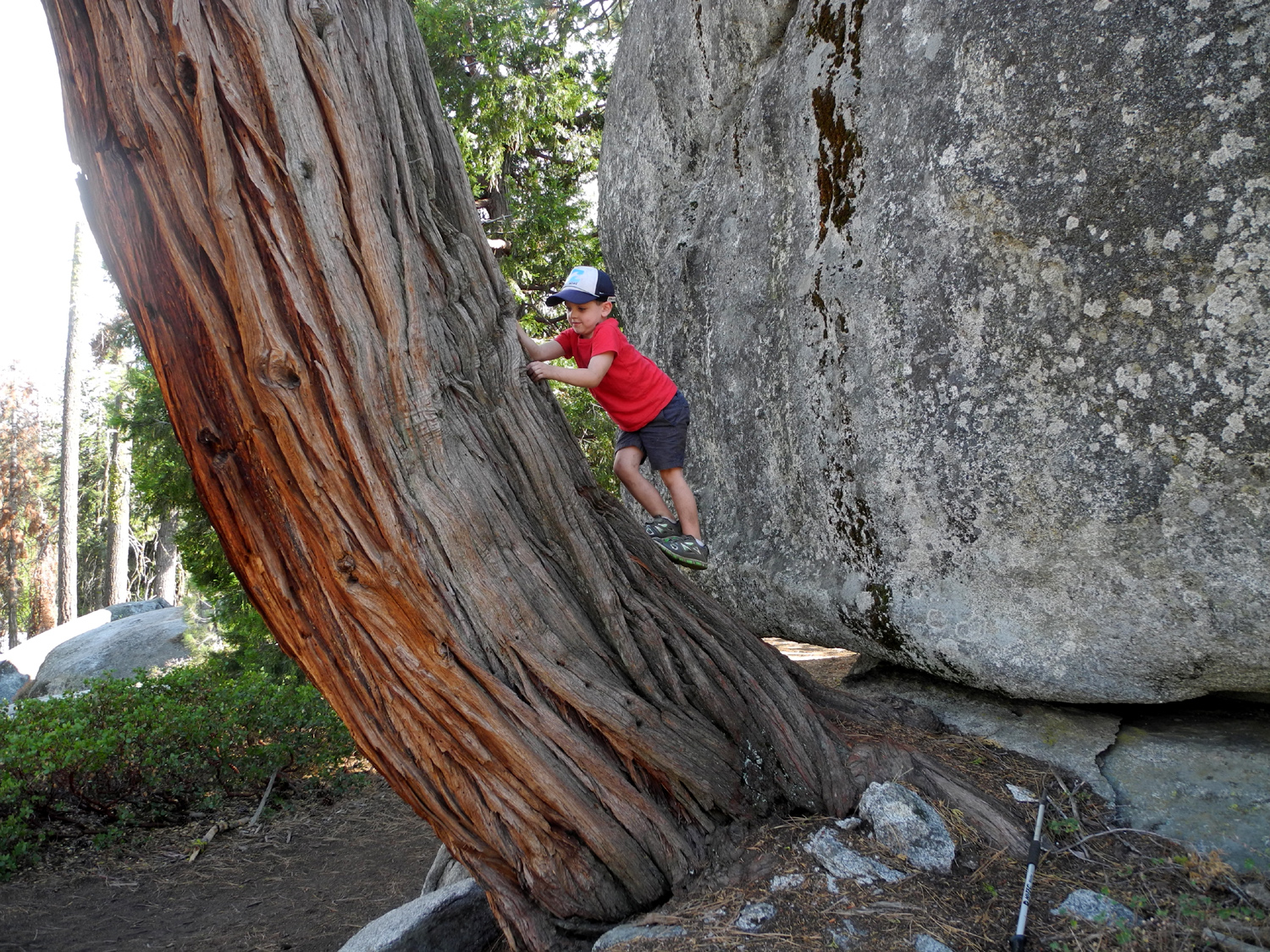
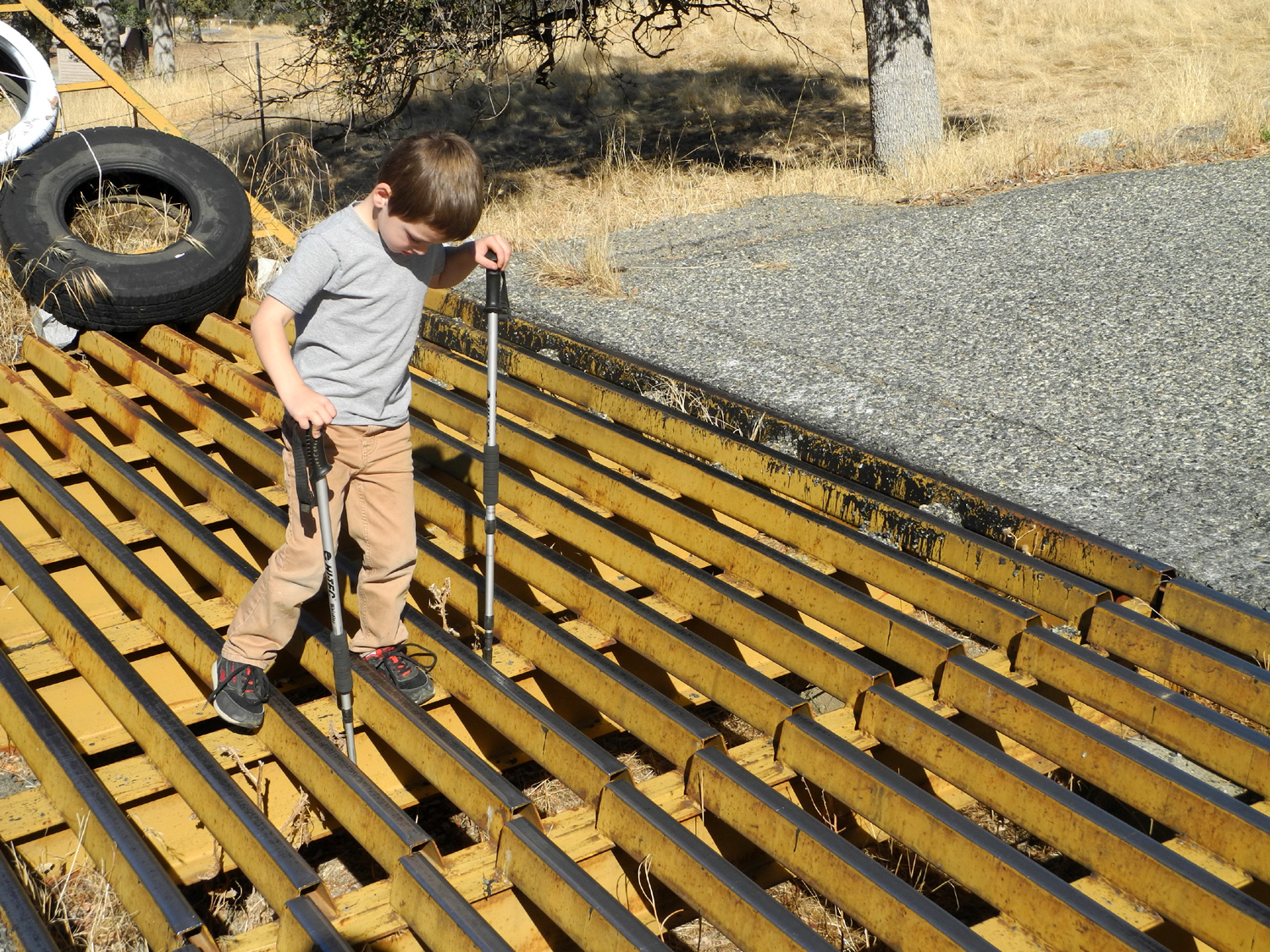
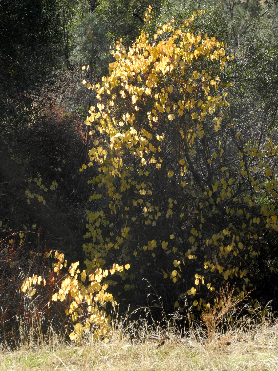
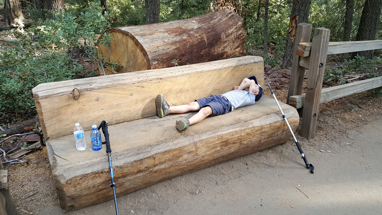
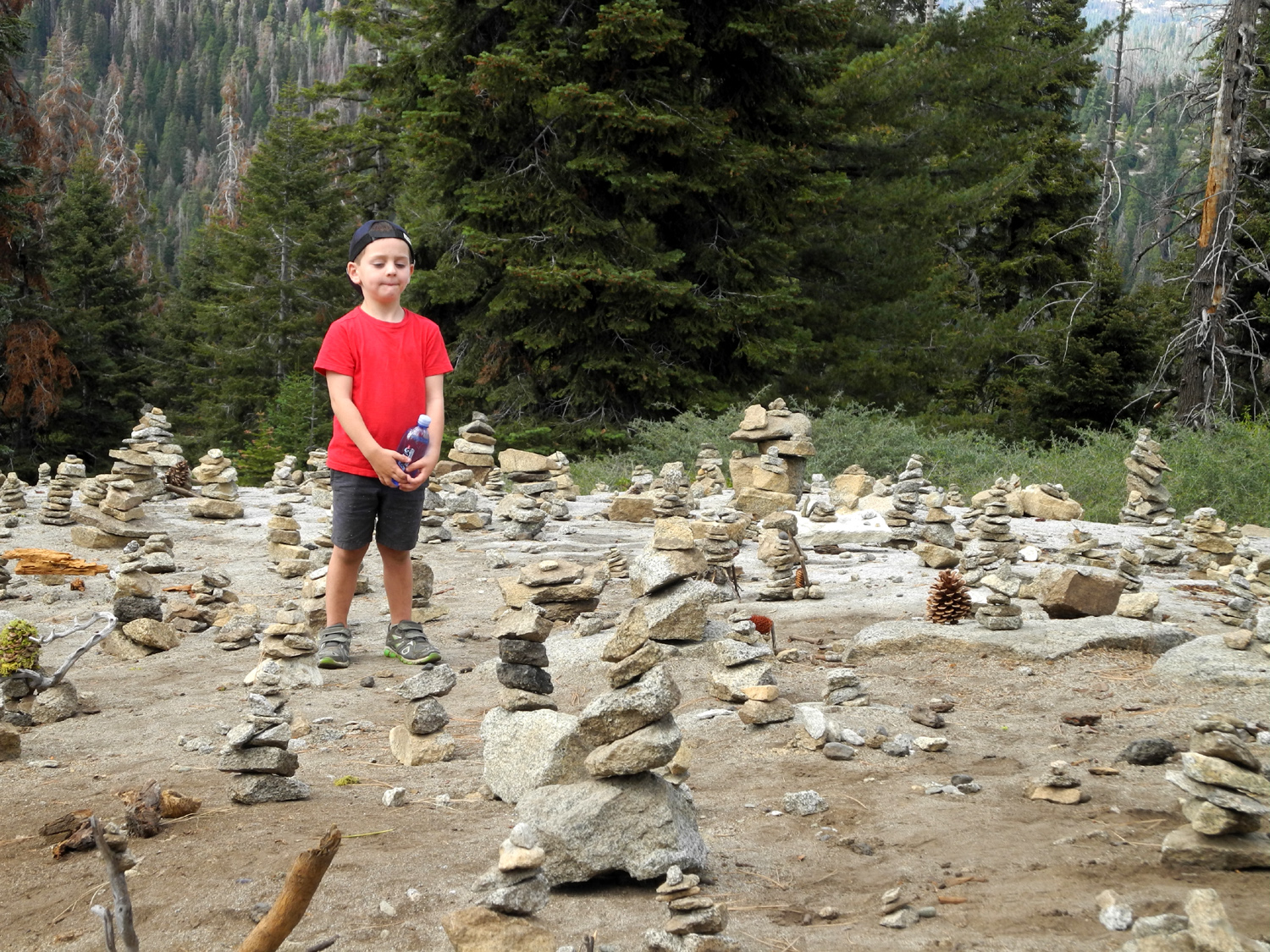
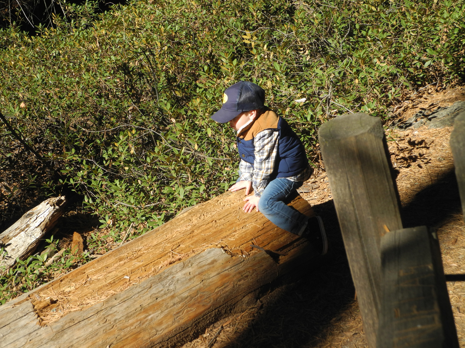
I had such a great time on my camping trip with Colton in mid-September that I knew I could not wait till next year for another one. So we did our second trip just a few weeks later, on October 1, 2 and 3. It was most heart-warming that Colton was also eager to go again. He and brother Jack spent Saturday night at Grandma Teri's, and she brought him over about 9 a.m. Sunday. We made the drive up to Kings Canyon National Park that I've done at least six times this year, and drove into Azalea Campground, hoping to get the same spot we had before. This was not to be, but we set up two spaces away, a site that proved to be better in several respects. We had even less privacy this time than before - there were at least twice as many people in the campground than before, perhaps getting in one last campout before winter. We got things set up and had a lunch of crackers, cheese and salami plus vegetables and grapes, all stuff Colton likes. Since we had left earlier than the previous time, we had time for a good hike, although it was not really a long one. There is a road through Grant Grove Village that eventually goes up a narrow, scenic, two mile road with constant switchbacks, leading the the Panoramic Point Trail. This is a very short walk, about a half mile round trip, but it leads to one of the more spectacular views you can get to by car. Below in the foreground is Hume Lake, once a lumber mill pond and now the location of a Christian camp, hiking trails, and other recreational facilities. To the north is Spanish Mountain, a 10,000 foot ridge that drops down to the river 8,000 feet below, making it the deepest canyon in North America, and in the distance are the high Sierra peaks of the national park back country, in a vista that spans at least 120 degrees of the circle. Colton had a great time here, climbing around on the rocks and asking questions about the informational signs that show the layout of the peaks. He also became a photographer, first using two sticks as his "camera," and then taking several photos with my camera. I've observed that kids will have new and unexpected perspectives on things when you hand them a camera, and he did a fairly good job. We returned to the trailhead and drove down the road a short distance where we stopped to gather wood. Colton is always willing to help with this project, and will hold out his arms to be loaded up with sticks. Learning from my experience in Cedar Grove, we made sure to include some pitch-covered sugar pine cones in our firewood stash. Back at camp we did some bike riding. Since our earlier trip the training wheels had been removed from Colton's bike. He had no trouble riding, but had been having some trouble learning to use the pedal brake. I gave him some lessons, riding with him down a gentle slope, then telling him when to start braking and finally stop. He's a quick learner and soon had the idea down pretty well. Of course, stopping is not particularly fun, especially when there is a hill where you can get going fast and feel the wind against your face, then ride up the opposite side a fair distance. After a few lessons I let him switch to that spot. I kept an eye on him as I got the fire going, and eventually we repeated our dinner from the previous trip, with two exceptions. In place of the live oak sticks used previously, I had bought a marshmallow roaster with ten prongs, and it proved equally useful for hot dogs. His dad had said he liked hot dogs with or without a bun, but Colton had other ideas, and was disappointed about the lack of buns in September, so we had them this time. At camp, Colton is usually ready for bed around 8 when it is getting completely dark, so I got him settled into his "nest" in the back seat of the truck, and sat by the fire reading for a while. I usually go to bed earlier than usual, so I was tucked in by 9 p.m. I had a more ambitious hike planned for the next day, one I knew Colton was capable of and would enjoy. But first there was breakfast and snack preparation. I got up by 7:30 or so, despite the 32 degree temperature, and made tea. I sat and read, and wandered around camp a little. Since it did not appear that Colton would be up any time soon, I fixed our peanut butter sandwiches for the hike, his with jelly and mine plain. I cut his into quarters and wrapped each piece separately so I could hand them out as needed. Around nine I opened the front door of the truck to get something, and saw the kid peeking out from his sleeping bag, after at least 13 hours of sleep. At least he would be well-rested for the day's activities. I fixed bacon, hot cocoa and raisin muffins, all of which he had enjoyed last time. This time the muffins were "yuck," but cocoa and bacon are favorites and probably always will be. By the time we ate, cleaned up and put things away in the bear box, it was close to noon when we left for our hike. We drove to the Buena Vista Trailhead, where we had walked up a quarter mile on our previous outing, and where he had constructed the pine cone human. We were both anxious to see how it had held up during the intervening three weeks. All the pine cones were still there, but had been moved around enough to lose any resemblance to his artwork. Squirrels? Other hikers? Or what? A hint would come later on. The Buena Vista trail is a little over a mile each way, mostly uphill, but nothing strenuous. Colton led the way nearly all the time, both up and down. At one point he got mad at me and started crying (it turned out I was "mean" to him, and his dad was too). This lasted much too long, although eventually the crying was more just a matter of making a noise to make sure I knew he was still mad. We went through a section where some buck brush, a low, thorny chaparral bush, brushed against our legs. At this point his anger turned toward the plant world, and he began whacking nearly every bush with his hiking pole, often with a powerful, two-handed blow. Of course, this eventually turned into fun, and soon all was well. Near the final approach to the top, a snack was needed, and we sat on some rocks under a big sugar pine. I didn't eat anything, but Colton was happy to get the first quarter of his PBJ sandwich. I mentioned that I also had raisins, and he said "Be sure to save some for Jack. Jack LOVES raisins." (They also fight like brothers, but overall, Colton is a very good big brother.) A short distance below the top, the trail comes up into a saddle where you can see across to the other side, including distant, hazy views far to the south and west, and Colton immediately noticed this and wanted to walk over toward the edge and check it out. After a few minutes we made the final climb up to the top of the peak. At one point the trail becomes several well worn paths, and it's easy to get on the wrong one, although also easy to get back on track. As part of his continued education, I showed him how to look for a distinctive tree or other landmark to help us find the right path when we came back down. The 7,500 foot top of Buena Vista offers a 360 degree view, with the Kings Canyon high country in the distance, various other rocky peaks nearby, sequoia trees on Redwood Mountain, and the long stretch of foothills to the west. His favorite feature was Buck Rock, a thumb of rock that sticks up from the mountains directly east, and has a fire lookout on top. We had seen a close-up photo of it at Panoramic Point, and it becomes visible a short distance up the trail, and at many places thereafter, and he was always on the lookout for it. It's one of the few fire lookouts in the Sierra that is still staffed, and Colton wants to go there someday, a trip that will require someone else to be with him, given that the final approach is via 172 steps suspended from the side of the rock. The top of Buena Vista is covered with large boulders, some of which are suitable for climbing and which have been used for the Ramblers famous "Wes on the Rock" photos at least twice. Of course, there was no question that it was now time for a younger generation, and Colton was only too happy to climb up and pose for the first ever "Colton on the Rock" picture. He also insisted on taking a picture of me, and only part of it was covered by his thumb. We found a flat rock to sit on while we had our lunch, Colton finishing off the rest of his PBJ. There was a strong breeze, and soon he was down in a little protected spot with a rock blocking the wind. After a half hour or so on top, we started back down, with a stop at the saddle where he constructed a rock and stick structure. On our previous visit, across from the trailhead at the Kings Canyon Overlook there were a hundred or more rock "sculptures," some with sticks, pine cones and moss. He had made a couple of his own the previous time, and was reluctant to leave when it was time, so I had promised we could spend at least a half hour there so he could build some more. We hiked down the trail and drove the hundred feet or so to the Overlook parking area, only to see that most of the rock piles had been scattered. I suspect it was done by park staff, since these were not "natural." There were only about ten good ones still in existence, so Colton went to work on some new ones. At one point I made a small circle of rocks with a rock in the middle, and he immediately declared it was a fire ring. He then proceeded to create an entire camp site, complete with my motor home, his dad's and mom's cars, and Grandma Teri's car. There were also a picnic table, bear box, and other structures, all made of rocks and sticks, and best described as "abstract." We had decided to have dinner at the Grant Grove Restaurant, but it was only 4:30 and I was not hungry. Colton also was not ready to eat and wanted do some bike riding before we ate, so he finished up his artwork and we drove the few miles back to camp. I rode with him a little, then started doing chores around camp while he continued his ride. While I was working I heard a crash followed by crying. He was riding uphill but when he turned into our camp, instead of staying on the pavement, he cut across and apparently skidded in the loose dirt. He had a bad scrape on his arm, and re-opened and expanded the scrape on his knee from a crash at home. He would not let me put first aid cream on the wounds, but I managed to get a wash cloth on the knee and soak up the blood. It took a long time for the crying to end, but eventually the incentive of going out to eat and making a phone call to mom and dad seemed to do the trick, and we drove to the village. He had macaroni and cheese, while I had veggie tacos with chicken added. I knew the mac and cheese would be quite different from the boxed product he is used to, but he loved it and shoveled it down. It didn't hurt that it was topped with bacon. My choice was less enjoyable; they were nothing like what I consider a "normal" Mexican taco, and I would not order it again. However, I ate there with Wes in September, and there are plenty of items I DO like. After dinner we went to the store for an ice cream dessert, just as we had done on the previous trip. It was dark and too cold to sit out on the porch to eat ice cream, so we sat in the truck with the heater going, then drove back to camp. Not surprisingly, he was ready for bed, so I got him tucked in and sat up reading for a while. With no fire, there was a limit to how long I could do that, and soon I was also tucked in. The weather had been predicted to be cold and very windy. It was definitely colder this second night, down to 32 by 12:30 a.m. When I got up it was 30 degrees and there was ice in a water jug I had left out on the table. It was not frozen solid; I could still pour the water I needed for tea. Other than on top of Buena Vista, there was never more than a light breeze. When I first woke up, I looked out the back of the camper and spotted a deer next to our camp. I got up, got dressed, then walked toward the direction he had gone to see if he was still in sight. He was, along with two companions, one of which was licking the neighboring picnic table where something tasty had obviously been spilled. We did our usual slow but steady departure routine, starting with Lucky Charms for Colton and berries for me. We got everything loaded up and started for home. I had planned to stop at Cat Haven, an animal park sanctuary for the preservation of wild cats along Highway 180 near Dunlap. Unfortunately, winter hours were in effect, and it was not open on Tuesdays. Someday I will return with both great grandsons.
Because he is skipping pre-school on our trips, I try to have a few short educational sessions. With some topics he's immediately intrigued and we have a good talk; with others he loses interest after a sentence or two and we move on to something else. At one point he was answering "yes" or "no" questions with hand gestures that I did not necessarily understand. I asked if he was using sign language, then explained what it was. We went on to something else, then he said "teach me." Teach what? "Sign language." I had to tell him that I didn't actually know even one sign. My phone has an altimeter app, and I try to check the elevation at the low and high points of our hikes. I explained the concept of sea level and altitude, and this subject caught his interest. He later asked several times how high a place we were in was.
Back home, after we unloaded the truck, we rode our bikes around the roads through my condo complex a couple of times. Colton wanted to ride more, so I sat in my folding chair in the door of the garage and kept watch on him. One of the things we discussed at camp was the concept of ice cream sundaes, so after he finished riding, we went in and had chocolate ice cream with whipped cream. Not long after that his dad arrived to pick him up, ending another delightful outing with my older great grandson.
--Dick Estel, October 2017 |
||
|
San Joaquin River Trail West |
||
 |
 |
 |
| Concentrating on the rock formation, I didn't see the squirrel till I looked at the photo back home | A nice, moderately gnarly blue oak | This spot nearly always shimmers from a breeze |
|
With the weather cooling off, and having missed a lot of days of walking, I decided to do a slightly more ambitious hike on November 6, and drove the 25 miles to the Finegold Picnic Area by Millerton Lake, and the start of the San Joaquin River Trail. I've hiked and written about this trail many times, and there's not much new to say. I think I'm even taking the same photos over and over each time. Perhaps there is a tree down along the trail that was not there before, or an unfamiliar flower, or the level of the lake has changed. None of these earthshaking things happened on this hike, but I did get in a good two and a half miles of walking on a cool, sunny day. Sometimes on this trail I try to go a little father than I've ever gone before, but as you can imagine, there comes a time when that just doesn't work. This time my plan was to go to the place I turned back the very first time, where the trail goes up over a saddle. To the west an unofficial trail leads up to a knoll two or three hundred feet higher, with an additional steep trail to the top of Pincushion Peak. I went there in February, 2016, with my daughters and Wes, and never have to do it again. East of the saddle a trail goes up to a low hill about 30 feet or so higher, and since I went there the first time, I did so again. There are some good sitting rocks near the top with views of the lake in two directions. You can also see the very top of Pincushion and the people standing there (if any) and several segments of the trail that go past the saddle. Eventually this trail arrives at the San Joaquin River Gorge (formerly Squaw Leap), but I will not be making that 12-mile jaunt in my lifetime. While sitting on my resting rock, I enjoyed an apple, then walked a little past the top to where I could see the section of the lake that goes through the very narrow canyon below the ridge, becoming slightly wider as it curves around what I think of as Horseshoe Bend and out of sight. Actually I'm not 100% sure of that place name; it might be something else. In any case, the lake winds around the ridge so that it surrounds three sides of my hill. There were a few other hikers, most of them apparently headed to or from Pincushion. At the bottom I chatted with a man carrying a kayak back to his car. He said the lake was smooth when he started out, but had become choppy later. This fit with the fact that I had a nice breeze during the final part of my downhill stretch. I made the hike in jeans and a long sleeve t-shirt, getting a little warm during the last few hundred feet up hill, but otherwise enjoying a very comfortable day. Driving up Auberry Road just into the foothills, I was happy to see that Little Dry Creek is still running, after going dry in late spring the previous five years or so. It was also nice to see a couple of tiny patches of green grass, despite the fact that we've had only a small amount of rain so far. I'm looking forward to a green, flower-covered view at this location next spring. Among the non-human animals, I saw two lizards and several squirrels. However, I DIDN'T see the one squirrel I took a photo of. He was sitting on a rock formation and I didn't know he was there till I looked at the photo at home. There were also ravens, quail, and assorted "little birds." There are a few live oak trees along the trail. One characteristic used to identify which species you are looking at is whether the leaves are smooth-edged or prickly. However, some species can have both. I saw and got a fairly good photograph of two clusters of leaves, one smooth and one prickly, within three feet of each other on the same tree. Speaking of oak trees, there were some places on the trail where acorns were thick on the ground, meaning a good crop. A few statistics for the number fans among you: Elevation at the start of the hike - 540; at the hill above the saddle - 1,175. The top of Pincushion is 1,519. Although I try to walk about 2.5 miles on the Clovis Trails several times a week, those are flat, easy miles and it takes me about 50 minutes. The same distance hike up the San Joaquin River Trail was about 100 minutes.
|
||
|
Acorn Camp AKA Thanksgiving at the Gorge II In 2015 we had our family thanksgiving at the San Joaquin River Gorge Special Management Area, which many people still think of as Squaw Leap. It was November 27th, and the high temperature was about 48 degrees, so we enjoyed a fire right from the start. Several of us also kept warm by hiking a short distance on the San Joaquin River Trail. This year the only date that worked for everyone was November 11, and that proved to be a good choice, since the weather was sunny and just over 60 degrees. Attending this year were my daughters Teri and Jennifer, grandson Johnny, his wife Brittany, and their sons Colton and Jack; Teri and Jen's mom Jackie, and me, Dick Estel. Teri's husband Tim, son Mikie and girlfriend Lizzie had to work, and Jennifer's husband Rod had to meet a repairman at their house. Jackie and Jennifer had not been with us the previous time. |
||
 |
 |
 |
|
The day was warm, but late in the day a campfire felt good (click here for names) |
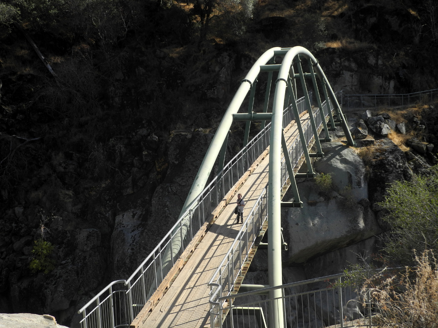
Colton's first visit to the Bridge at the San Joaquin River Gorge |
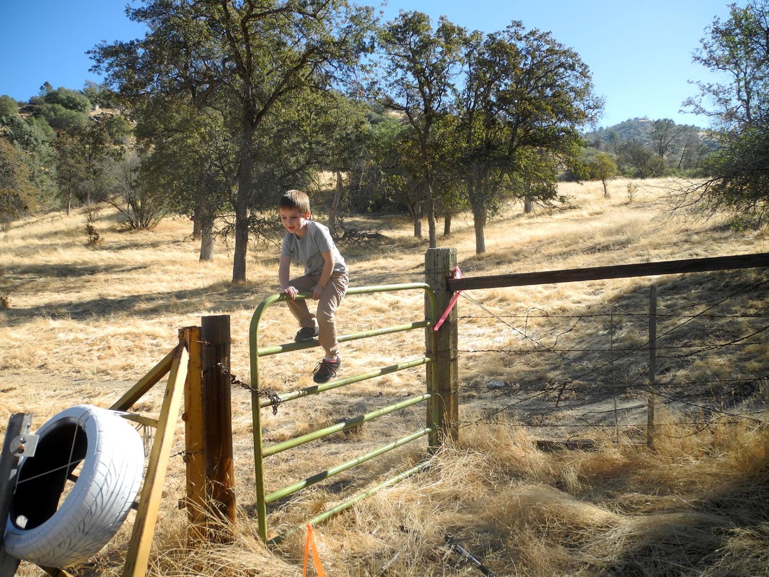
What's more fun than climbing and swinging on a gate? |
|
Our previous gathering had been a one-day only event, but this time I decided to take my motor home and stay for two nights. Great grandson Colton would also stay. I got an early start, leaving home at 8:25 and arriving at the group camp at 9:20. I got the motor home set up, then took a walk around the perimeter of the camp, with Jennifer arriving just as I came back to the motor home, about 10:30. The others were not expected until between 11 and noon, so Jennifer and I walked the Nature Trail that starts behind the Equestrian Camp, about 100 yards from where we were camped. This is a short, double loop route that goes up and down a small creek drainage. There are signs describing various trees, bushes and plants, with the common name, scientific name, and native American name. After I first walked this trail a few years ago, I created a photo album with pictures of the signs and of each item described. We have had no significant rain this season, and the foothills are dry, so some of the plants were not present yet, and others were in a leafless or dormant state. However, it was an enjoyable hike, about eight tenths of a mile. As we returned to camp, we heard voices, and found that Teri and Jackie had arrived. We set up our chairs next to the motor home and had a nice visit. The weather was right on the border of "just right." In the shade, when a breeze came up, some of us added another layer, while others tried to sit on the line between sun and shade. Of course, that line moves frequently. Before long we saw the Upshaw's new red Toyota Tacoma turn into the campground, with a barbecue sticking up from the bed. We helped unload and greeted everyone, then got ready for a hike. Teri was not feeling well, so stayed in camp, but the rest of us set out to walk the San Joaquin River Trail for a short distance. On our last Thanksgiving outing we had gone as far as the place where there is a blue oak with a huge burl, and this was our destination again. Jennifer and the Upshaw's had never been on this trail, so it was fun to show them the various points of interest along the way. Near the tree are a few bedrock mortars where the original inhabitants of the area ground acorns. There is also a long-dead fallen oak that makes a perfect resting spot. As we returned on this 1.4 mile round-trip adventure, Jennifer, Jackie and I, who were lagging behind, saw a tarantula. It's common to see them on roads and trails at this time of year, as the males go out in search of mates. By the time the stragglers got back, Johnny had the barbecue going, and we were soon enjoying our Thanksgiving burgers and hot dogs, with lots of side dishes and pies from Marie Callender's. As the sun got low in the sky, it cooled off quite a bit, and Johnny got a fire started. The rest of the day passed quickly, and soon Jennifer, Teri and Jackie left. The Upshaw's stayed till well after dark, but soon Johnny, Brittany and Jack packed up and got ready to leave. Colton and I would be staying for two nights, with an ambitious hike planned for the next day. Both boys did a lot of bike riding around the parking lot. Jack has a scooter bike, and the lot had just enough slope to give him a nice ride coasting down to the entrance. There is a fairly large section of dirt and grass between the parking lot and the picnic tables, with two good-sized blue oaks. At least one of these was having its big production year, and the ground was covered so thickly with acorns that you could not walk across this area without crunching them underfoot. This led Colton to give this outing the name of "Acorn Camp." We also walked through several areas along the trail that were covered with the seeds. There was some overcast and a slight breeze during the night, so the low was only 46 degrees, still cool enough that Colton and I were happy to get into our sleeping bags by 8:30 or so. Actually Colton prefers to cover up with a favorite blanket, but after he fell asleep I put the sleeping bag over him as well. He regularly sleeps through the night, but I have to get up several times. Of course, I checked on him each time, but he stayed covered and slept at least 11 hours. I had brought pre-mixed cocoa powder and sugar to make real cocoa, one of his favorites. Our breakfast also included bacon and English muffins, although he declined the latter and asked for a piece of plain buttered bread. While breakfast was cooking I made our usual hiking snack, a peanut butter and jelly sandwich for him, and plain peanut butter for me. I cut his into quarters and wrap each piece individually, so that he can have a snack on the trail at any time the need arises. Our destination was the bridge over the San Joaquin River, about a mile hike each way. Colton had never been there, but is a big fan of bridges, especially foot bridges, and I knew he would enjoy being there. As we went down the trail I pointed out and named various trees and bushes. His favorite at this elevation is buckeyes. He first noticed them in the spring when they were in bloom. They are thick along some foothill roads, and they produce showy white blooms, which caught his eye. As we've gone through summer and fall, I've called his attention to the changes that buckeyes go through. The blossoms become a round seed, close to golf ball size, with a leathery covering. As the seeds form in the early spring, they are not that noticeable, but in summer the gray of the seed pods stands out, with most bushes showing 20 or more seeds. In late fall they drop from the tree, the outer covering splits, and the red-brown "buckeye" is revealed. On a future trip, he will see what they look like when the seeds germinate while still on the surface of the land. We also looked for oak trees with lots of acorns, and saw a few. The lesson also covered pines, manzanita and wild grape. There is a section where the grape vines have climbed high into the tops of blue oaks and other trees, so we named this area Grapevine Gulch. There are several seasonal creeks that cross the trail, some of which did not run during the recent drought. There's one that's bigger than the rest and always runs during the rainy season. This year it still had a little trickle running, a good sign of how much rain we had last spring. We also enjoyed seeing animal life. On the way down, Colton walked past a tarantula without seeing it, but I stopped him and we got a good look and a good picture. Later at the bridge Colton was first to spot our second tarantula of the day. This one made its way up the trail and into some rocks, but never posed for a really good photo. On the way down we were passed by two riders on horseback, to Colton's great delight. He has been interested in horses since he was very small, but had never seen people riding up close and in person. We had more horse entertainment later, which I'll get to at the appropriate time. At the bridge we had our official snack and took pictures of the boy and the bridge. We went past the bridge to where the trail splits, and I asked Colton to pose by the trail signs. They were off the path in the dry grass, and at first he was hesitant. However, he realized the could jump from one rock to another, and made several circuits around the area. As we walked back to camp I asked Colton if he'd like to do another short hike later. His answer at that time was NO. In fact, about three quarters of the way back he sat down in the trail and announced that he was out of energy. Another quarter of PNB sandwich worked to get him going again. We had made plans to reward ourselves with chocolate ice cream sundaes after the hike, and that gave him enough energy to walk some more. We went to the Nature Trail and walked around the loops there, discovering another blue oak with a large burl that I had not noticed on previous hikes. We finished this outing with a visit to the cattle guard on the main road a short distance above the turnoff to the group camp. On the east side of the camp area there is a mowed path which turns west along a fence and goes up to the road. From here it's about 30 feet to the cattle guard. Colton has always been fascinated by these artifacts, and likes to walk across them. The rails are far enough apart that he could slip through, so he walks on the frame, stepping carefully between each rail. While we were back at camp, two other riders went by on horses. They had a fairly short ride, and returned before dark. We walked down by the road into the Equestrian Camp, and Colton enjoyed watching the horses being loaded into their trailer. For our dinner we had my go-to kids' meal, hot dogs. I didn't want to build a fire, and we had electricity available via the generator, so I brought along my hot dog cooker. If you've never seen one of these, it's like a toaster, with a place for both dogs and buns. It's kind of a weird product; probably belongs on Dave Barry's Christmas Gift List. It works fairly well, but you have to put the dogs through two cycles. As usual after a good hike, Colton was quite hungry. In addition to the hot dog, he ate five slices of salami, chips and crackers. I had picked up some second hand children's books for when the boys are around, so we finished out the evening with some reading, and got to bed before nine. The sky was clear all night, and the morning low was ten degrees cooler, down to 36. In the morning we got everything ready to go, and took one final cattle guard walk. Nearly all cattle guards have a gate next to them in case cows need to be driven through from one side of the fence to another, and we discovered that the gate was not locked. Colton had fun unfastening the chain, climbing over the gate, and swinging on it, before we returned to camp and started for home. Since our previous campout at Grant Grove Colton has wanted to take pictures, so I hand him the camera every once in a while. So far his enthusiasm exceeds his skill, but about one out of five of his photos turn out pretty well.
|
||
|
Cat Sitting, Hiking, and Glacier Point In April 2017 I had my first cat-sitting assignment for my daughter Jennifer, while she and Rod enjoyed a well-earned vacation. A teacher, she had the week of Thanksgiving off, and wanted to do their annual trip to Tahoe. Once again I got the call to stay at their house in the mountains above Oakhurst and feed the cats. This duty takes very little time, so the obvious thing for me to do is take advantage of being an hour closer to the mountains and do some hiking or other outdoor activity. I walked around the property, hiked at a campground above Bass Lake, and went to Glacier Point. |
||
 |
 |
 |
|
Black oak at County Road 620 and Old Yosemite Road |
Falls on Willow Creek near the junction with Chilkoot Creek |
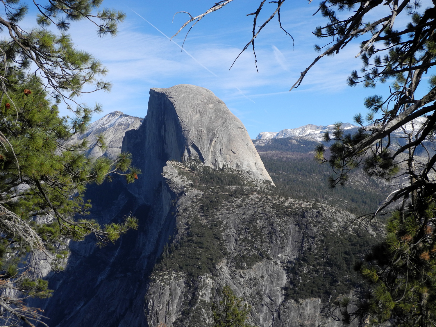
Half Dome from Glacier Point |
|
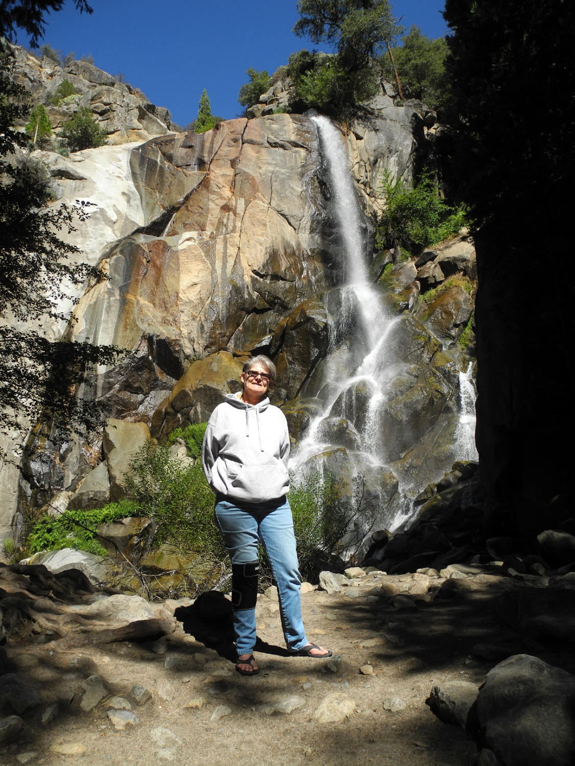
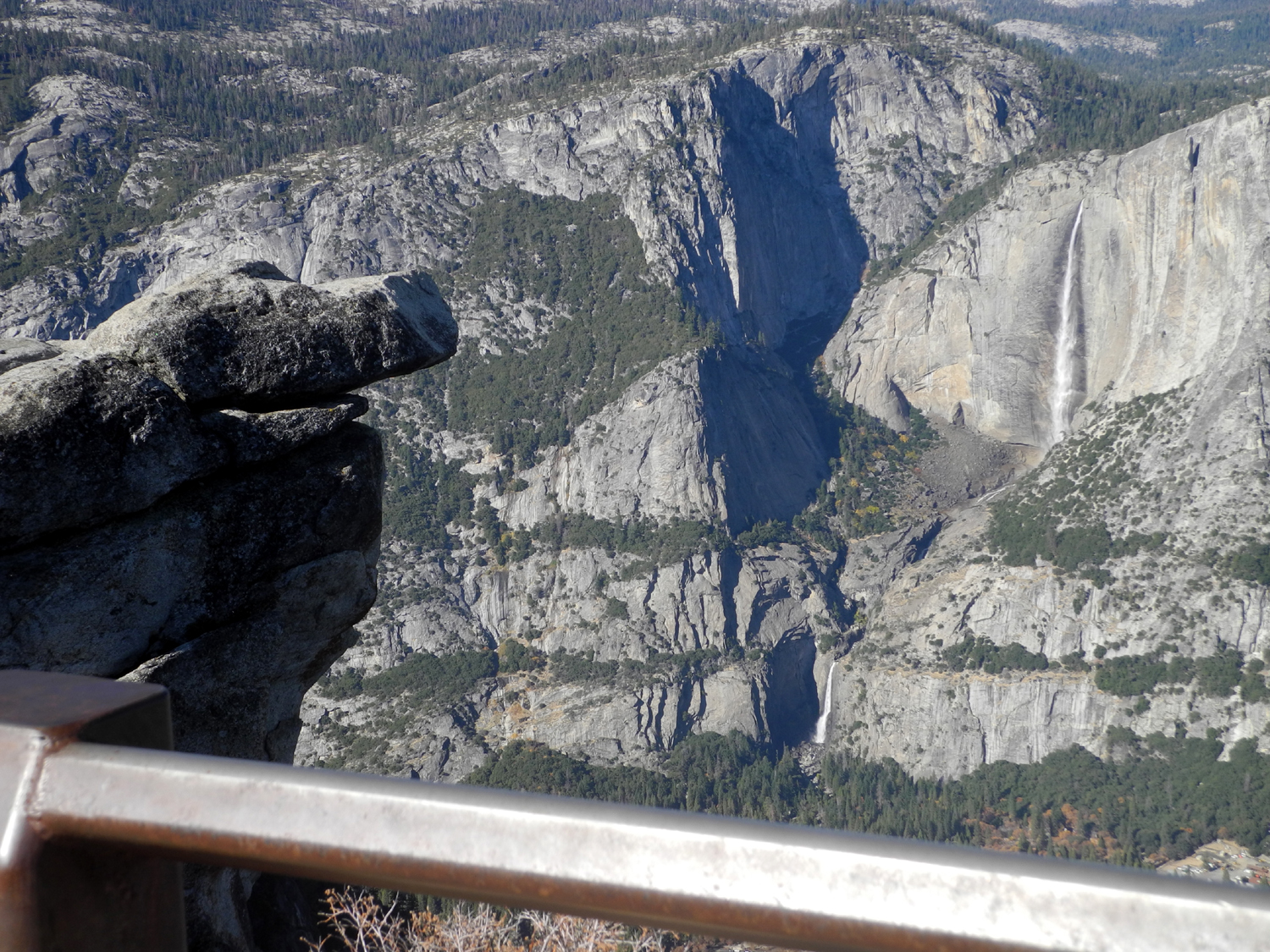
They left Monday morning, November 20, and I drove up in the afternoon, arriving about 3 p.m. I was immediately greeted by Miss Bojangles (usually called Bo), their newest and friendliest cat. Unlike Pebbles and Bam Bam, Bo allowed me to pet her and pick her up during the first minute. The other two rarely even let me get a glimpse of them, although this time they were willing to eat as long as I stayed at least ten feet away. Hombre, who is now Senior Cat, lives outside and sleeps in the garage. He will allow me to pet him if he feels like it and if he happens to stop by for a bite of "indoor food." After I got my stuff brought in and put away, greeted Bo, and checked the level of cat food and water, I hiked the Neely Trail. This is a short path down through the drainage from the level spot where the house sits, up a hill through oak, pine and various small bushes, and back along a route a little farther up the slope. From the mid-point you can also walk up to a paved road that leads to their street, Old Yosemite Road, and from there out to County Road 620. This was the route I followed, enjoying the changing leaves of the black oak, the evergreen of bay and live oak, and the drying seeds of various annual plants. I crossed Road 620 and walked up a short path to where there is a plaque commemorating Bissett Station, a stage stop on the old road to Yosemite. This walk added up to a little over 9/10 of a mile. On Tuesday I drove to Bass Lake, then turned on the Beasore Road and stopped at Chilkoot Campground, about four miles in. I've camped there a number of times; as far as I can tell the most recent was in August of 2011. There was an area along the road where logging was underway, probably dead tree removal. The road was littered with bark and other similar trash for a half mile. I spoke briefly with the flag man, who said mine was the third car to go up the road that day. There is an old logging road that runs from the camp down to Chilkoot Creek, a walk of about a half mile, with a little bit of a scramble the last 50 feet or so. If you can cross the creek, it's a short walk over a ridge to Willow Creek and a nice waterfall. Although the creeks were running good, I managed to get across, and spent some time enjoying the waterfall, and looking around the area where the creeks come together. After returning to the campground, I drove up the road a short distance to where Chilkoot Creek crosses. There is a rough path along the creek and not far up is a small waterfall, about eight feet in height. Near this area someone had built a crude shelter. There was a dead fir tree leaning out from the hillside, and pole-like branches had been leaned against it. Fir branches, the needles now brown, completed the project. I drove back down Beasore Road to the Bass Lake Road, and parked where a dirt road left the pavement just inside the national forest border. I walked on this road a short distance, to where a network of 4-wheel drive paths went off in both directions and circled around again to the road I was on. Although I don't want or expect anything for my services, Rod and Jennifer always leave a couple of restaurant gift cards, so I went into Oakhurst and had a great calzone at DiCicco's Italian Restaurant. I visited an antique shop, buying a book for the great grandsons and a Yosemite magnet, then went to a grocery store for ice cream. Back home I hiked the Neely Trail again and walked the route of Old Yosemite Road that runs south on their property. This road comes up on internet maps, but it does not actually go through anymore, ending at the property line. Meanwhile, Bo was a perfect cat, coming in the house before dark each night. The other cats stayed outside, but had access to food in the garage. They all came in for a few bites once or twice during my stay. As the day ended I sat out on the patio and watched the sunset, taking photos every so often. There was a nice sequence of color changes through the final half hour of daylight. I had previously checked and found that the Glacier Point Road in Yosemite National Park was open with no restrictions, so I decided to go there my final day, the Wednesday before Thanksgiving. My last November visit to this 7,200 foot destination was years ago with future son-in-law Tim. We were bundled up in heavy coats and had a few flakes of snow before we left. This time I was wearing a t-shirt and flannel shirt, but many visitors were in shorts and t-shirts, and it was an absolutely fantastic day. The air was crystal clear, giving a great view of the valley, the nearby features like Half Dome, Mt. Clark, and Mt. Starr-King, and the high Sierra peaks with a light layer of snow. There had been one storm that brought a little snow to the highest elevations, and it looked as if there was none lower than 9,000 feet. It also appeared that snow was heavier to the north. Mt. Hoffman, situated beyond the Tioga Pass Road on the north side of the park and 10,850 feet in elevation, had snow well down the sides, while 11,522 foot Mt. Clark, much farther south, looked to have a thinner layer. I first stopped at Washburn Point, about a half mile before Glacier. A lot of the views of the domes and mountains here are the same as from Glacier Point; however, you don't have a view into Yosemite Valley. One notable difference is the profile view of Half Dome, while at Glacier you see some of the face of this iconic feature. Most visitors drive right by Washburn, but I highly recommend making a stop there. If you had not been to Glacier Point in the summertime, you would have thought there were a lot of people there, but the difference was dramatic in the parking lot. In the summer you sometimes have to circle through the two levels of the lot two or three times to find a parking space. This time there was almost no one parked on the upper level, and I found a spot within the first 100 feet or so. From Glacier Point you can see Yosemite Falls down the valley, and both points have a view of Vernal and Nevada falls on the Merced River to the east. I was happy to see that the falls were all flowing fairly well, much more than the last few years at this time of year. There's also a great view up the Tenaya Canyon which runs northeast past the "front side" of Half Dome. Not far from the end of the road is a trailhead that leads to Sentinel Dome and Taft Point, both places the Ramblers have visited in the last few years. When I drove up, there were about four parking spaces open at the trailhead. When I came back out, they were all full and five or six cars were parked along the road in each direction. Obviously quite a few others beside myself had decided to take advantage of a golden opportunity to visit Yosemite during the late fall. A few miles from the southern park boundary on Highway 41 is Wawona, which I've written about several times in the last few years, most recently in October. Part of the meadow was converted to a golf course decades ago, and this day I saw a half dozen deer grazing there. This used to be a common sight, but I had not seen deer on the golf course for 20 years or more. The sun was in the wrong place to get a good photo, but at least I got a bad one. On returning to Oakhurst I had dinner at El Cid, an excellent Mexican restaurant, then returned to the house for my final evening. I did some reading, TV watching, and cat wrangling, and enjoyed a good night's rest. In the morning I moved at my usual leisurely pace, eating breakfast, loading the car, and making sure the cats were fed and safe for their owners return that evening. The weather was all one could ask for. It was mostly cloudy the first day, and not all that cold. However, Rod had laid wood and kindling in the stove, so I had a fire that night. On Wednesday the forecast was for 80 at Oakhurst. Rod and Jen's place is about a thousand feet higher, and I don't think it was quite that warm, but it was certainly Indian summer weather.
|
||
|
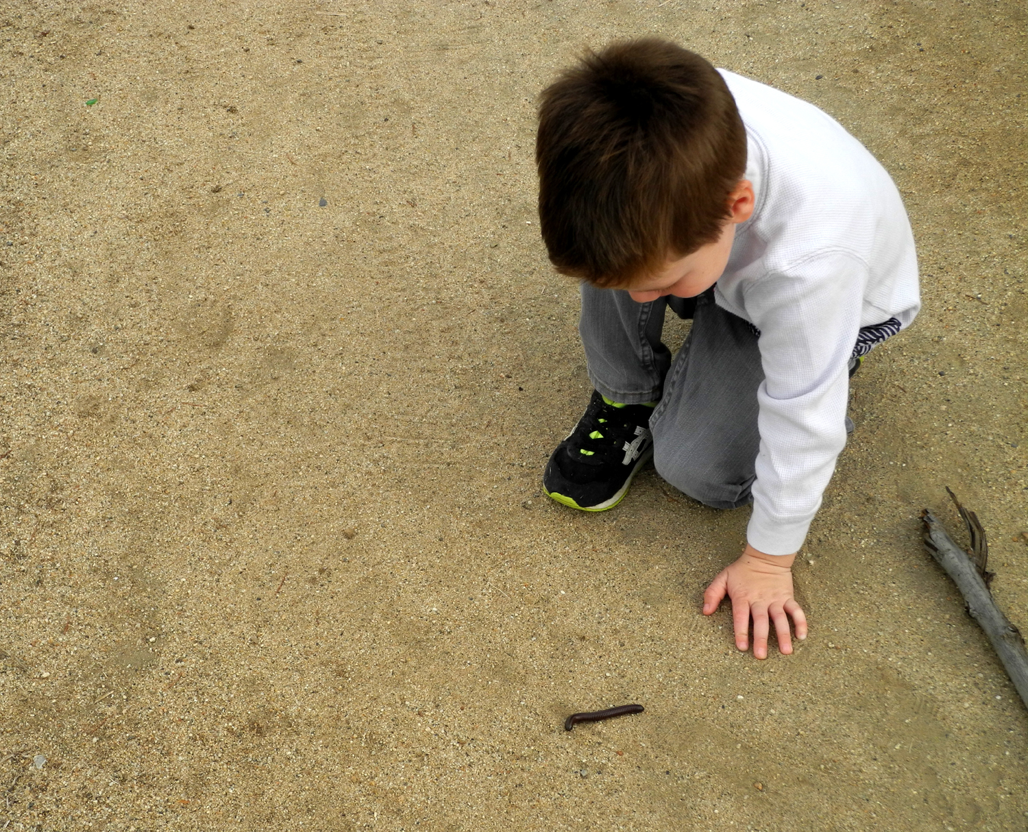
Canal Walk with Jack I've taken my older great grandson Colton camping three times this fall, so I wanted to do something with his younger brother Jack. At age three, Jack is not ready for one-on-one camping with me, and is not a hiker, so I decided on a walk along the canal bank near my house. |
||
 |
 |
 |
| Jack, just being his cute self | A great discovery - a live millipede | It's great being a great grandpa |
|
I picked him up around 9:30 the morning of November 26 and we drove to where the Dry Creek Canal crosses Villa Avenue. From here I normally walk southwest along the canal bank, then go west on the Helm Canal to where it disappears under the freeway, and back along the opposite side of both canals, a total hike of about 1.7 miles. Of course, walking with Jack is not an exercise walk, and I knew we would not cover that much distance. As soon as we got on the bank he saw water and rocks, and if you know anything about kids you know that throwing rocks into water is an important part of developing their motor skills. So it was five minutes before we moved past that point. He quickly found a fine stick which he carried all the way home, using it as a drawing tool on the canal bank. He was quite interested in the stuff people throw in the canal, which I discussed near the beginning of my Canal Walk page. We saw a wooden kitchen chair, a tire, and that post-Halloween favorite, a pumpkin. Of course there was plenty of uninteresting trash - bottles, cans, food wrappers, and chunks of concrete. Early in our walk he saw a dead millipede and he asked what it was. To our great good fortune, a few minutes later we saw a live one, the first one I've ever seen on the Clovis trails or canals. He was fascinated with the creature and watched it for several minutes as it made its way to the dry grass at the edge of the canal bank. I had seen about 30 ducks in the canal a few weeks earlier, so we were hoping they would still be there, but the water was very low in the Dry Creek and non-existent in the Helm, so the birds had apparently moved on. The millipede and some doves were the only wildlife we saw. On
the east side, the canal runs beside Letterman
We spent quite a bit of time at the playground where he went up and down ladders and slides, then walked to the nearby skate park and watched kids riding scooters for a while. I asked one kid how old he was, mainly to gauge how long Jack has to wait till he can do that sort of thing. The kid was nine, but informed me, “You can do it at any age.” I didn’t bother to explain the need to develop the skill, motor control, and recognition of potential danger that he had clearly acquired without realizing it, and which Jack has yet to achieve. When we got back to the car, we went to Colorado Grill where Jack ate my French fries and ignored his hot dog. Back at home we had ice cream and rode bikes around the complex, and he played with trains, trucks and marbles until his dad arrived to pick him up.
|
||
|
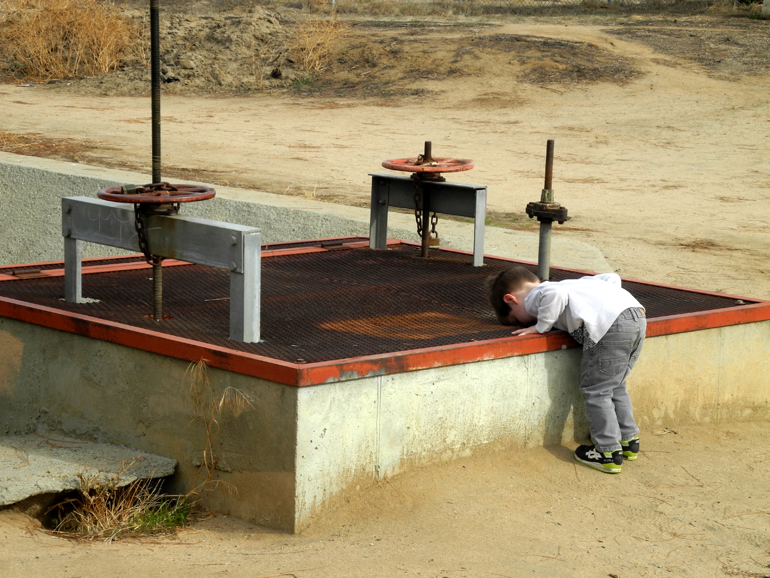
San Joaquin Gorge Bridge Trail When we're expecting a week of cool, clear, crisp days, I'm tempted to get up early and take off for a hike in the hills. Sometimes I just roll over and go back to sleep till the temptation goes away. But on December 5 I packed a snack and drove the 35 miles to the San Joaquin River Gorge to hike the Bridge Trail. |
||
 |
 |
 |
| The iconic bridge at the San Joaquin Gorge |
These rocks provided table and chair for my snack break |
Young bull pines glisten in the afternoon sun |
|
Since I was just there in early November, and have written about it many times, I'll try to keep this short. When I arrived I went first to the Group Camp area to photograph acorns (doesn't everyone?) We had named our November campout Acorn Camp because there was a thick carpet of the seeds on the ground between the parking area and picnic tables. Then it occurred to me that I should have taken a photo. I was able to get a pretty good shot of the trees and the huge crop of acorns they produced this year, and they have been added to the Acorn Camp photo section. The weather was quite cool (see temperature info below), but I was comfortable in a long sleeve t-shirt and sweat shirt. There was a strong breeze in a few places, but for the most part the hills protected me. When I was ready to start my hike back up the hill, I found it necessary to remove the sweat shirt. There were two things that had changed noticeably since my earlier trip. Most of the leaves on the wild grape vines along the trail had dropped to the ground. And the river was running quite a bit higher, thanks to a couple of short storms that went through our area in late November. My original plan was to go past the bridge and walk a half mile or so on the Ridge Trail, but I decided instead to do some cross-country exploring. I have been off the trail in a lot places at the gorge, and can find my way back with no trouble. The only drawback to this kind of hiking is that there is inevitably some steep uphill terrain to get through. After crossing the bridge I scrambled over some rocks to the south to get a low level view of the bridge. Then I left the main trail where there is a cow path and where others (including myself) have walked in the past I went up a ridge then down into a little creek that comes down the steep slope to the river. The creek had a fairly good flow of water. Years ago with some friends we heated water in my backpacking stove here and had a lunch of Cup o' Noodles, so I named it Cookpot Creek. I made my way up out of the drainage and connected with the River Trail near where it starts down to a couple of creek crossings. I then turned toward the bridge and walked back down, stopping to eat my snack at a spot with rocks that provided both table and chair. It took me 35 minutes to walk from the parking lot down to the bridge, and 50 to go back up. Of course, I spent a lot of time just looking around, taking pictures, going off the trail for very short distances to look at interesting stuff, and resting. During my hike I saw only four other people on the trail. There was a couple leaving the parking lot as I arrived, and another couple camping overnight there. In other words, just the right number of people. When I left Clovis a little after 8:30 it was 42 degrees, warming up to 47 at Auberry, the high point on the road. Down at the gorge, it was back to 42 (cooler air sinks, remember?) When I got back to the car from my hike at 1 p.m. it was close to 60 degrees, but was 55 up at Auberry. I stopped at one of my favorite foothill restaurants, Velasco's in Prather, and enjoyed an enchilada and taco, then drove the rest of the way home, getting back around 3:30.
|
||
|
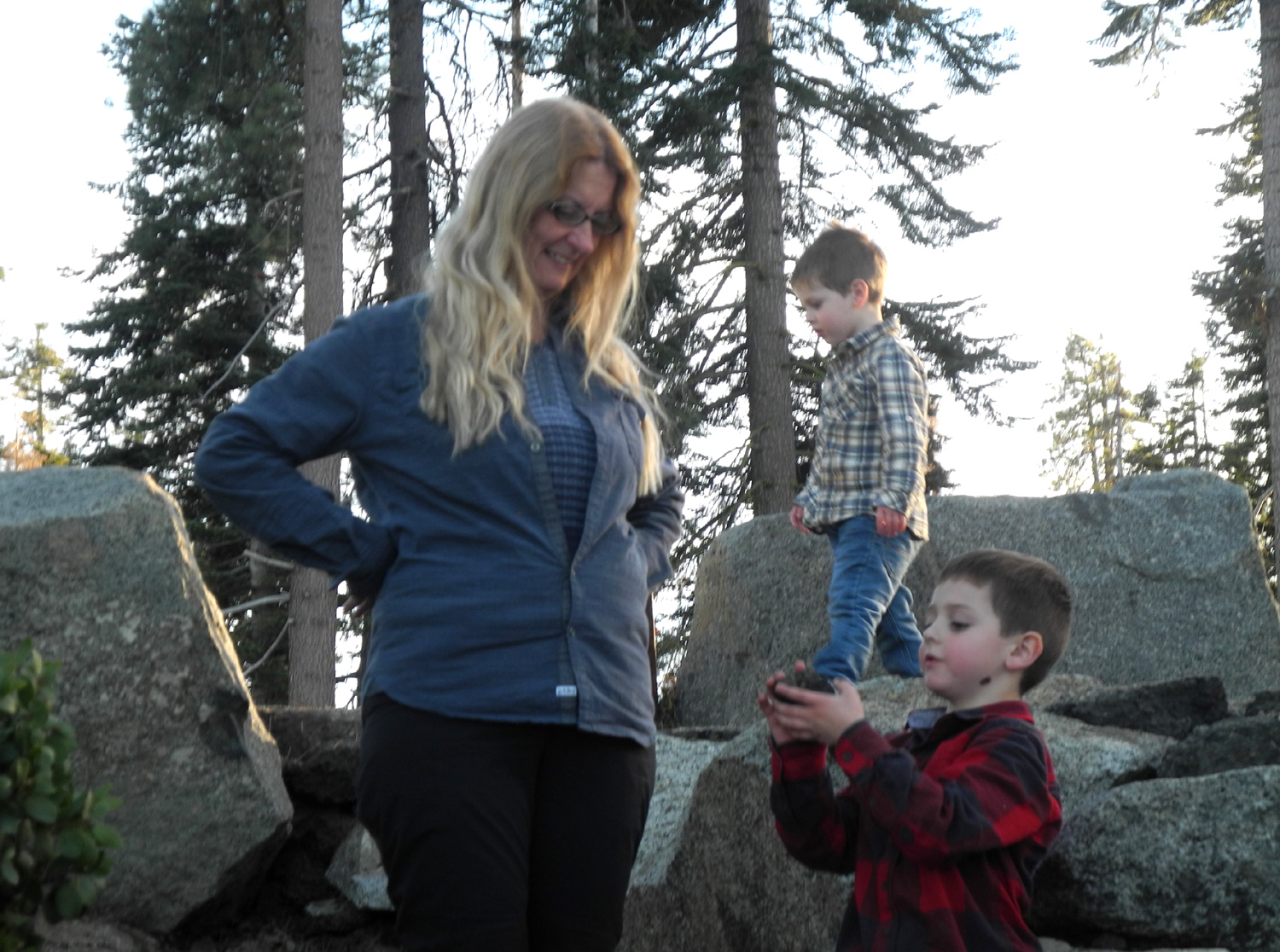
Grant Grove Day Trip On December 8 Teri, Jack, Colton and I went to Grant Grove. Our plan was to hike a little on the trails there, eat at the Grant Grove Village restaurant, and then finish up at the Kings Canyon Overlook, where Colton had previously enjoyed adding to the rock piles that other visitors had built there. It was a nice, sunny day, with patches of snow here and there starting at the park entrance. |
||
 |
 |
 |
| Colton emerges from a tree you can walk through |
Not the log we were looking for, but Jack enjoyed it anyway |
Teri, Jack and Colton at Kings Canyon Overlook |
|
We
stopped first at the Azalea campground where We
then drove down to the Grant Tree parking lot and walked up the
trail that eventually goes to the visitor center. In September The creek was running this time, and the log formed a dam that diverted the water around it and through the path to the log. There was no way get on the log without wading, and it was not the right weather for that. However, it WAS a good time to throw sticks into the creek. We walked back down the trial and took the fork that goes past the General Grant Tree, where we took a number of photos. The boys were also interested in the informational signs by the tree, so Teri read some of the text for them. The next point of interest on this trail is the
Gamlin
Cabin, built
in 1872 by Israel Gamlin, who had a lumber and cattle operation in
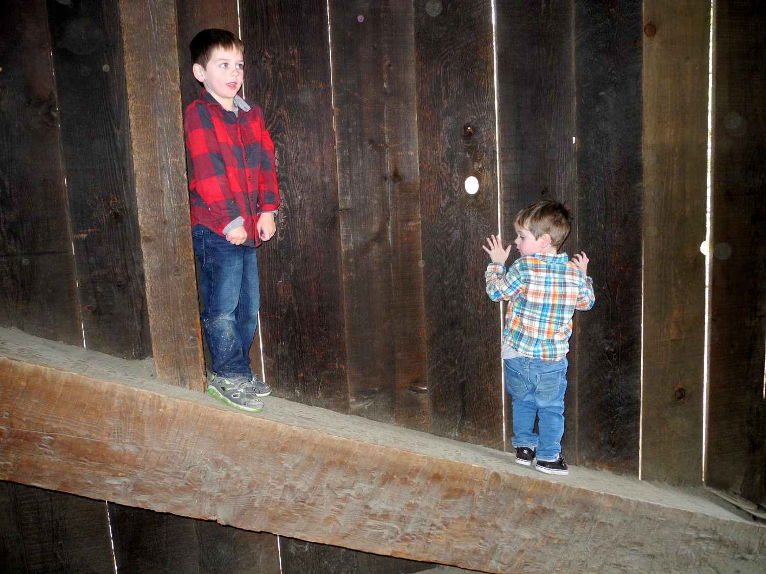
the area. Beyond the cabin is a fallen sequoia that you can walk through lengthwise. Again Jack was required to to approach with his eyes covered. I’m not sure he understood that he was inside a tree, but it was also a tunnel, and both boys had a great time going through it three times. From the log it was a short walk back to the car, and a quick drive
to the Grant Grove restaurant, where When we finished our lunch we still had time to visit the Kings
Canyon Overlook, about five miles away on the General’s Highway.
This is where There are two paths from the parking down to the semi-level
place below
the vista point. After I helped Jack out of the car, I saw him
disappear into the bushes next to where we were parked. Meanwhile, we had one of the best views I’ve ever enjoyed from this location. The late afternoon sun provided perfect lighting for the snow dusted high Sierra peaks in the Kings Canyon wilderness area. With the low sun, the temperature was dropping, and we decided it was time to head home in hopes of arriving before dark. As we drove away from the vista point, the boys began arguing and even punching each other. Teri and I both admonished them, then she said “they’re asleep.” Less than a minute from when we got into the car all was peaceful, and they napped until we arrived at their house.
|
||
|
New Year's at Neely's & Wawona For a number of years my younger daughter and her husband, Jennifer and Rod Neely, have played host for a New Year's Eve family gathering at their home above Oakhurst. In recent years it was sometimes just me, plus usually a friend of Jennifer's who lives in nearby Bass Lake. Last year and this my other daughter, Teri, and her grandsons Colton and Jack came to the party. Since we stay overnight, we took my truck to have room for bedding, luggage, etc. In fact, we had a ridiculous amount of stuff for one night, but with young boys, more is sometimes just enough. |
||
 |
|
 |
| Climbing inside the Covered Bridge | A great climbing log | Jack, Colton & Miles - waiting for midnight |
|
We decided that we would first go to Wawona in Yosemite National Park, and do some hiking. We left Clovis around 10:30, and got to our destination about noon. As usual, the boys were ready for a snack when we arrived, so we parked by the Pioneer History Center and had a snack at a picnic table there. Next we walked across the Covered Bridge which dates from 1879, with the boys having a good time climbing a short distance up the slanted beams at the side. Across the bridge are a number of cabins from pioneer days, which I had never seen before. You can’t go inside them, but we looked at and through the windows of most of them. We then drove the two miles to a trailhead and walked through pines and cedars to where a Swinging Bridge crosses the South Fork of the Merced River. Along the way was a partly rotted log which proved perfect for climbing. The bridge has no protective barriers other than a cable to hold on each side, so we made sure each kid held the hand of an adult while crossing. Although both boys were a little nervous, they made it across and back and enjoyed the experience. On the opposite side it was necessary to go down by the river, an easy climb down the bank. There was some disappointment, as rocks for throwing were scarce, but we managed to find a few. On the way back we made two wonderful discoveries. The first was a still section of water below the bridge that had ice on it. We made our way down and the boys threw rocks which slid across the top of the surface. Larger rocks were found which proved more satisfactory as they broke through. Teri then pulled out several large sheets of ice which the boys smashed on the rocks, to their great delight. The next find was a fallen log which had been rolled up to stand on four "legs," resembling an animal that could be ridden. All three younger “kids” climbed aboard while I took pictures. Now it was time to head down the hill to Jennifer’s. Not long after we got there, Jen’s friend Mamie and her son Miles also arrived. Although Miles looks to be around nine or ten, he is actually only one year older than Colton. All three boys played well together throughout the day and evening. Their first activity was a Stomp Rocket. This is a device with a small bellows connected by a flexible tube to a vertical hard plastic tube that accepts a toy rocket. Stomping or jumping on the bellows launches the rocket high into the air, or far across the land, depending of course on one’s stomping ability. Not surprisingly the older kids (including some of the over 50 kids) achieved greater distance, but everyone had a good time. (There are numerous videos of the toy in action on You Tube.) A brief game of Frisbee was next, although for Rod, playing with three kids age six and under, it was more like “chase the Frisbee.” We then gathered everyone together to walk the Neely Trail. Not long after they moved in, Rod and Jennifer cleared out a short trail on part of their property. When I walked it in November, it had become so overgrown that I would not have known where the trail was if I had not walked it many times. Rod and Jennifer had put in a few hours with a chain saw and leaf blower earlier in December, and had restored the trail to its original glory. We all enjoyed walking past live oak, manzanita, bay leaf, and rock formations. At the highest point on the trail it is close to the road that goes on the west side of the Neely property, and the boys demonstrated their hiking skills by making their way up the steep bank to the road. The weather at Wawona was warm enough to hike with just a light sweatshirt, and at Neely’s, just above the 3,000 foot level, it got up to 70 degrees. In the dry foothills, no sensible person sets off fireworks for the 4th of July. However, wetter weather allows this type of celebration on New Year’s, and Rod always gets a nice selection when they are available in July. With darkness, we went outside for the first of several trips to the back yard and the lighting of a colorful fountain. Last year Colton was entranced by his first experience with fireworks, but Jack did not really enjoy them. This year Colton’s enthusiasm was even greater, and Jack also got into the spirit, staying close to Grandma Teri, but showing no hesitation to watch each time we went out. Everyone but Jack managed to
stay up till --Dick Estel, January 2018 |
||
|
Photos (Click to enlarge; pictures open in new window) |
||
|
Grant Grove Cedar Grove Grant Grove II San Joaquin River Trail Acorn Camp Hiking & Glacier Point Photos Canal Walk San Joaquin Gorge Bridge Trail Grant Grove Day Trip New Year's |
||
|
Grant Grove Camp |
||
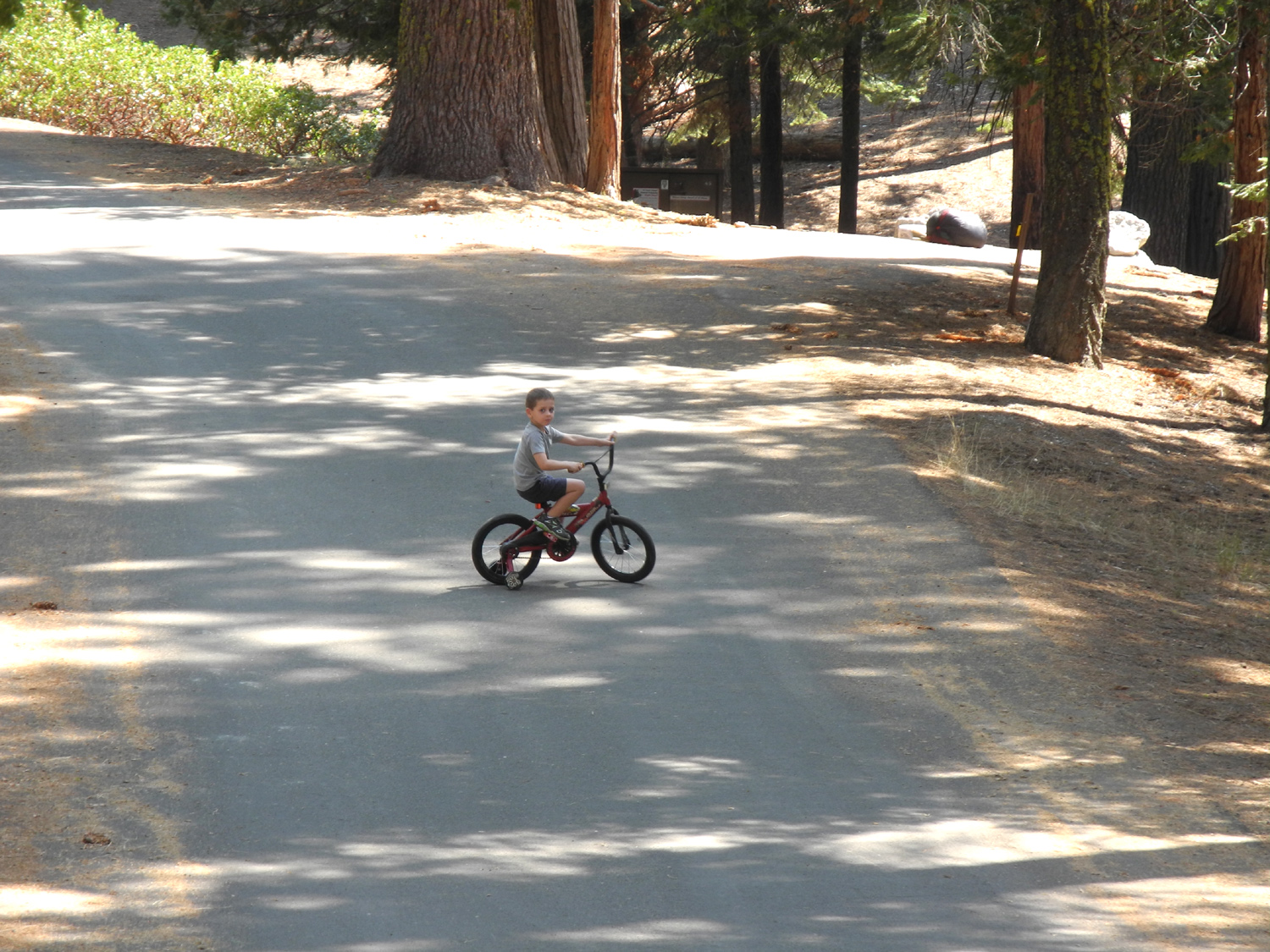 |
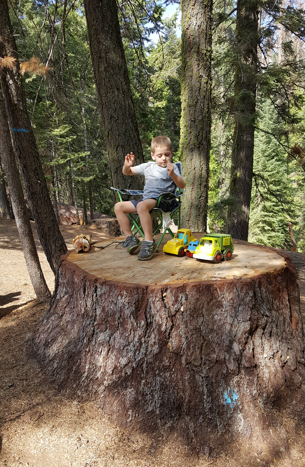 |
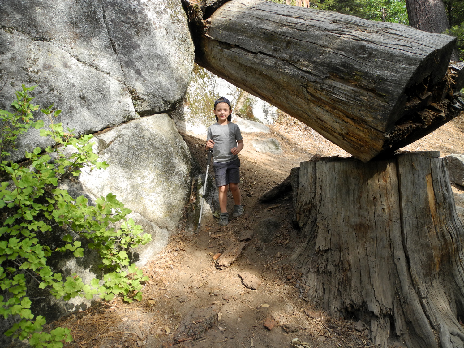 |
|
The camp road offered just the right amount of up and down |
King of the Campground | Going through the "tunnel" beside the Grant Grove Trail |
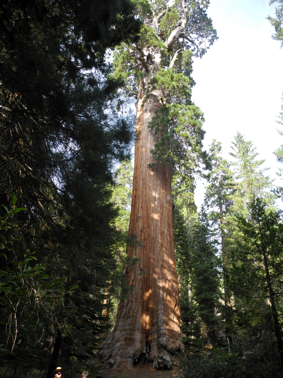 |
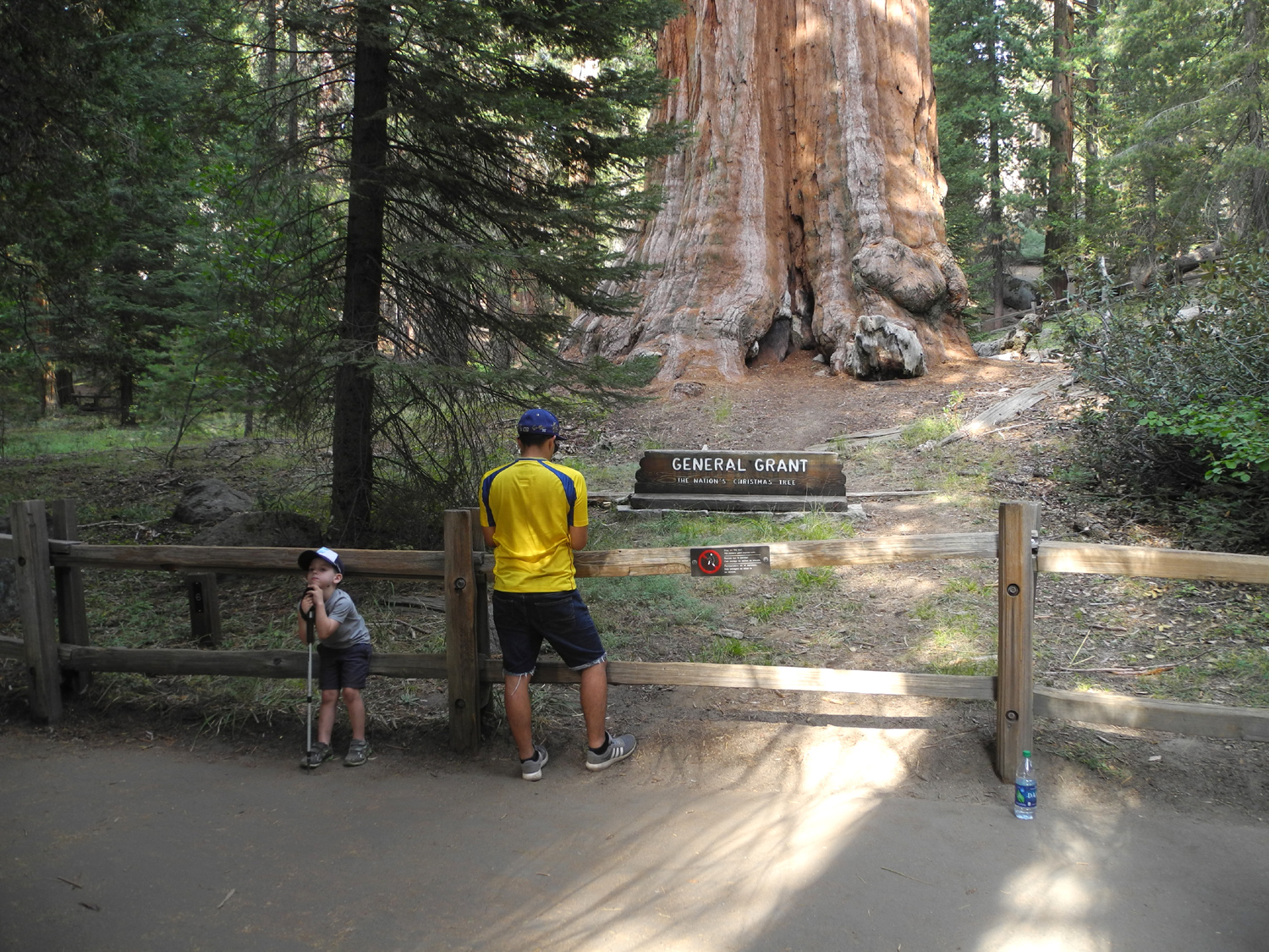 |
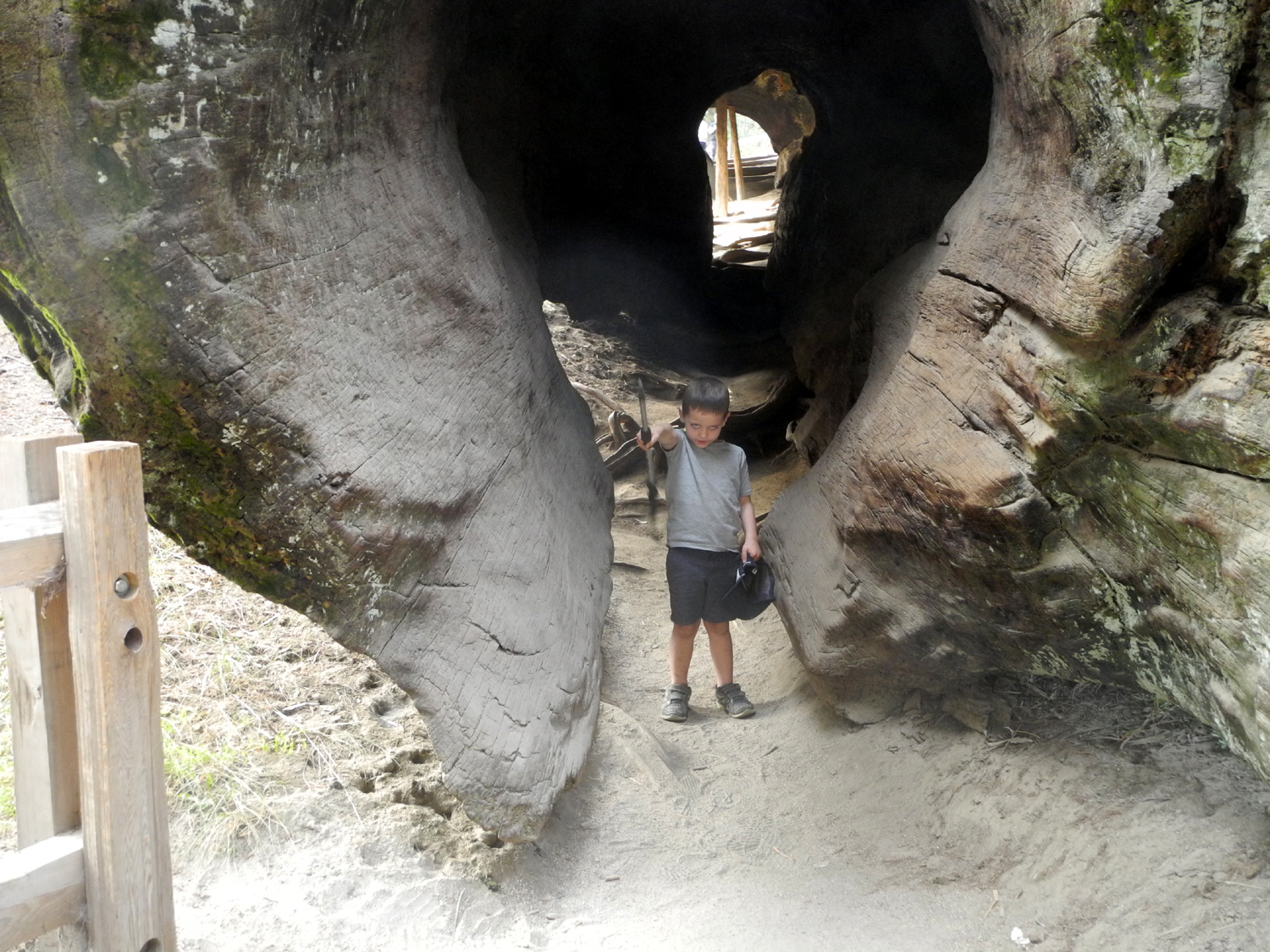 |
| The General Grant Tree | Colton and the General | Coming out through the log tunnel |
 |
|
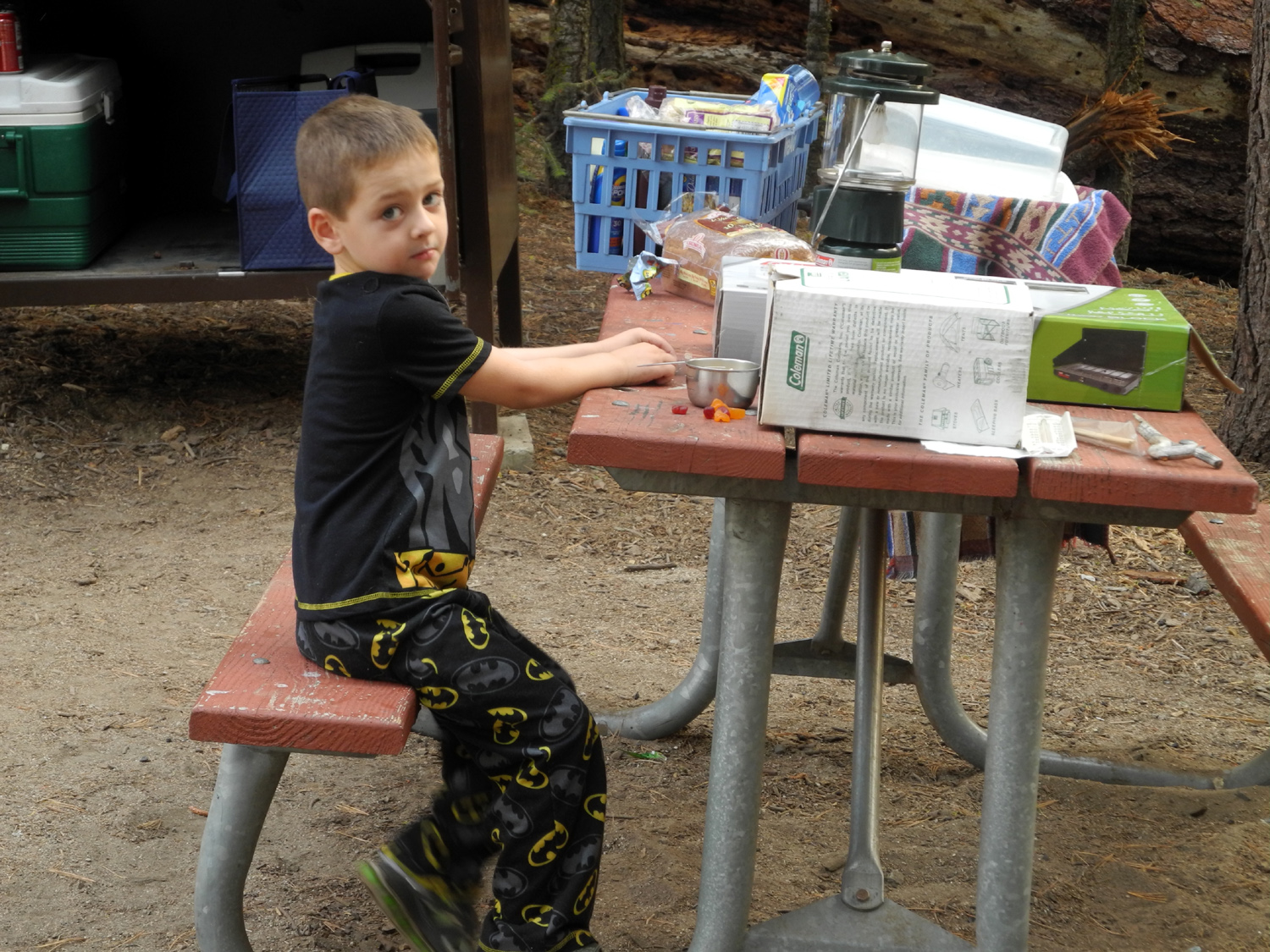 |
| This big sequoia fell in 1933 | One of the many attractions beside the trail | Having a pre-breakfast snack |
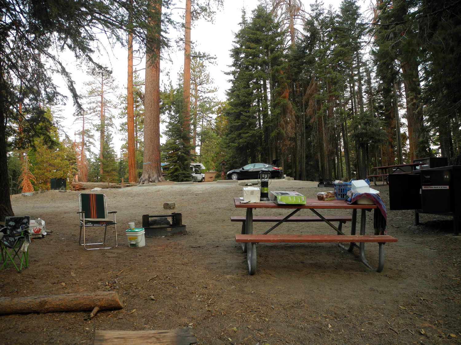 |
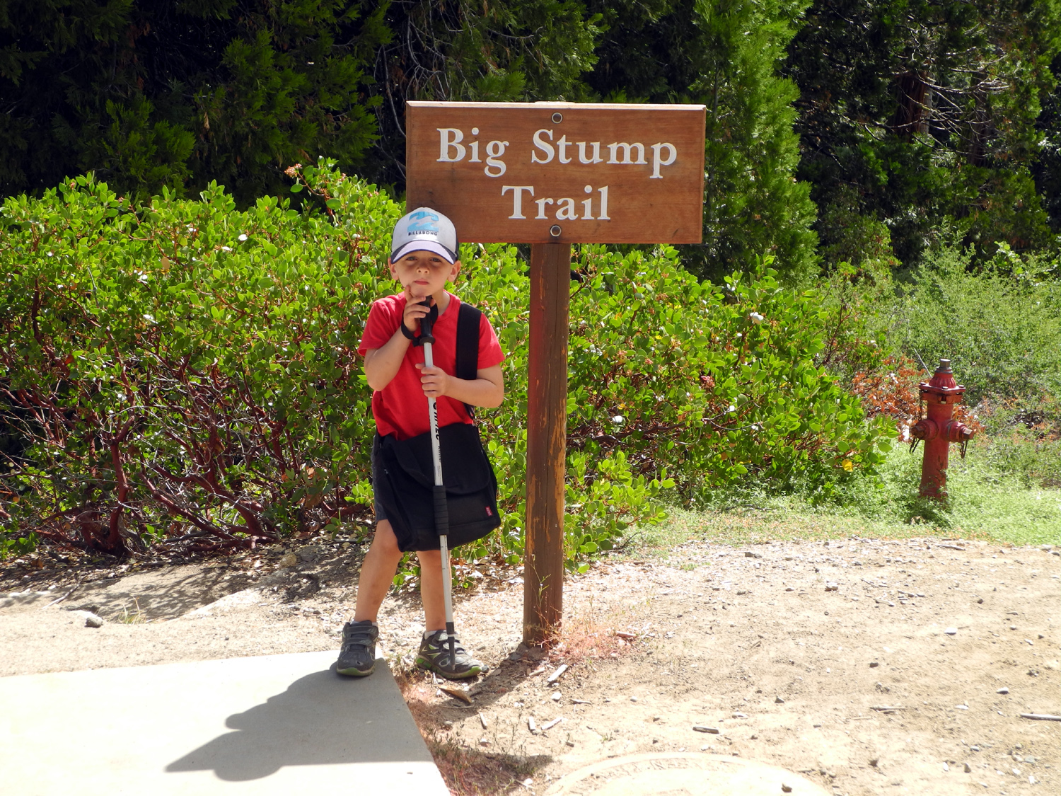 |
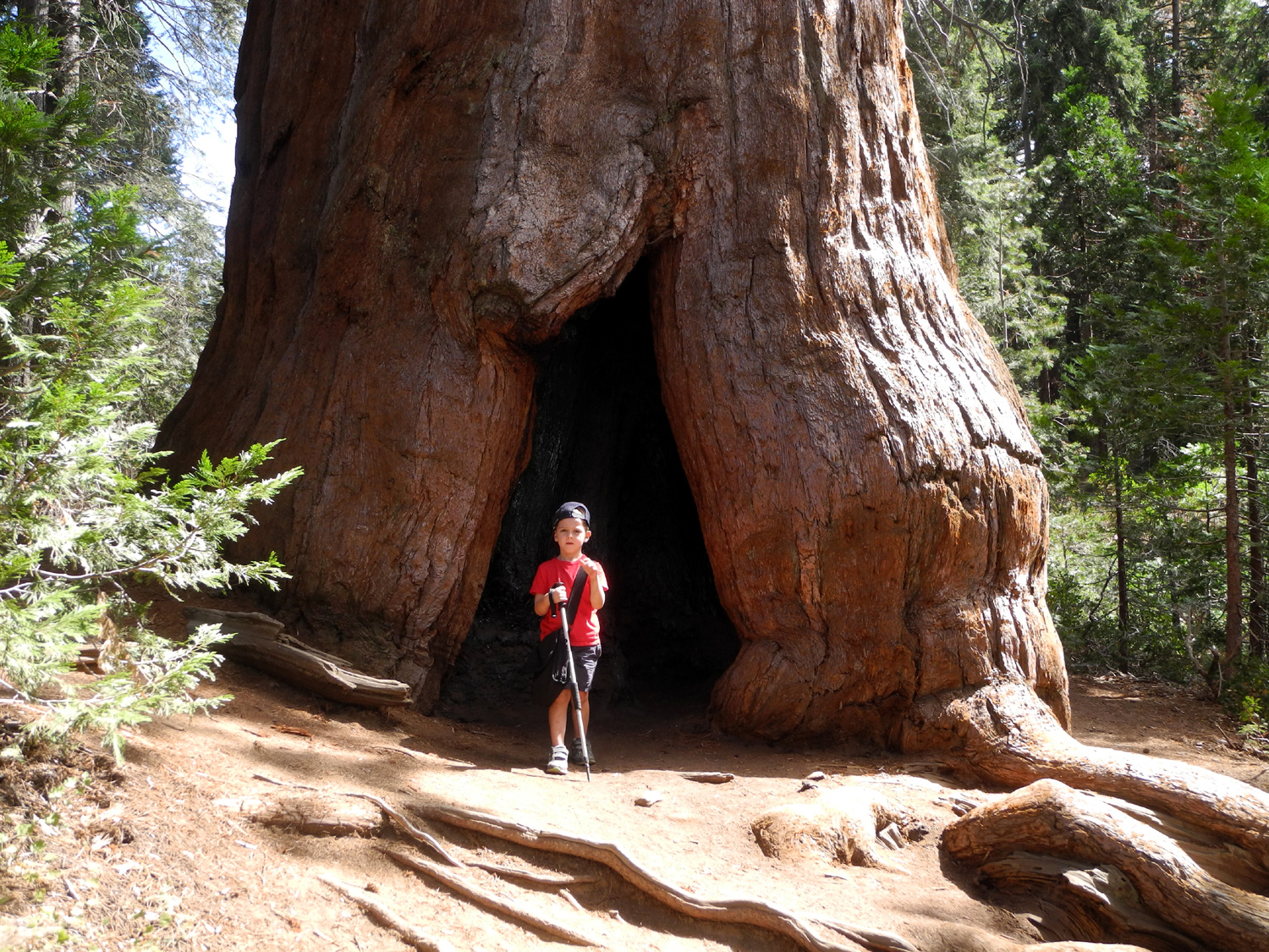 |
| Our camp, Space 46 | Ready to hike | Colton and the big sequoia at the start of the trail |
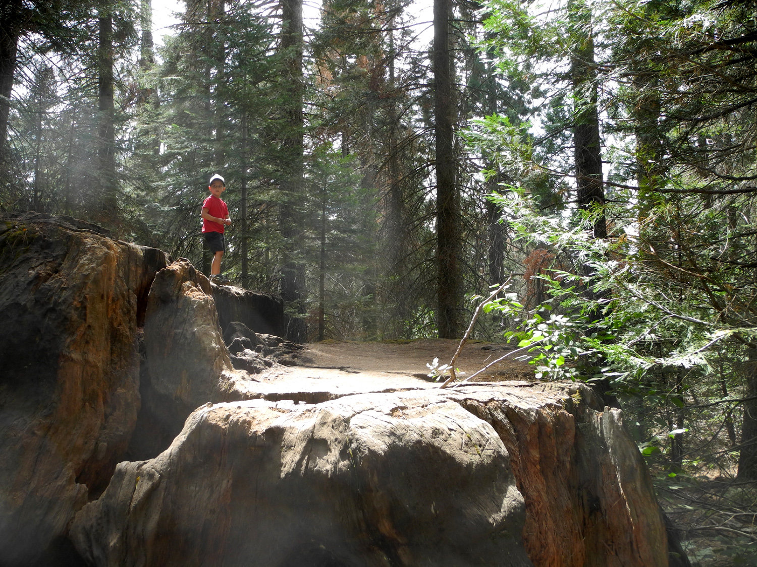 |
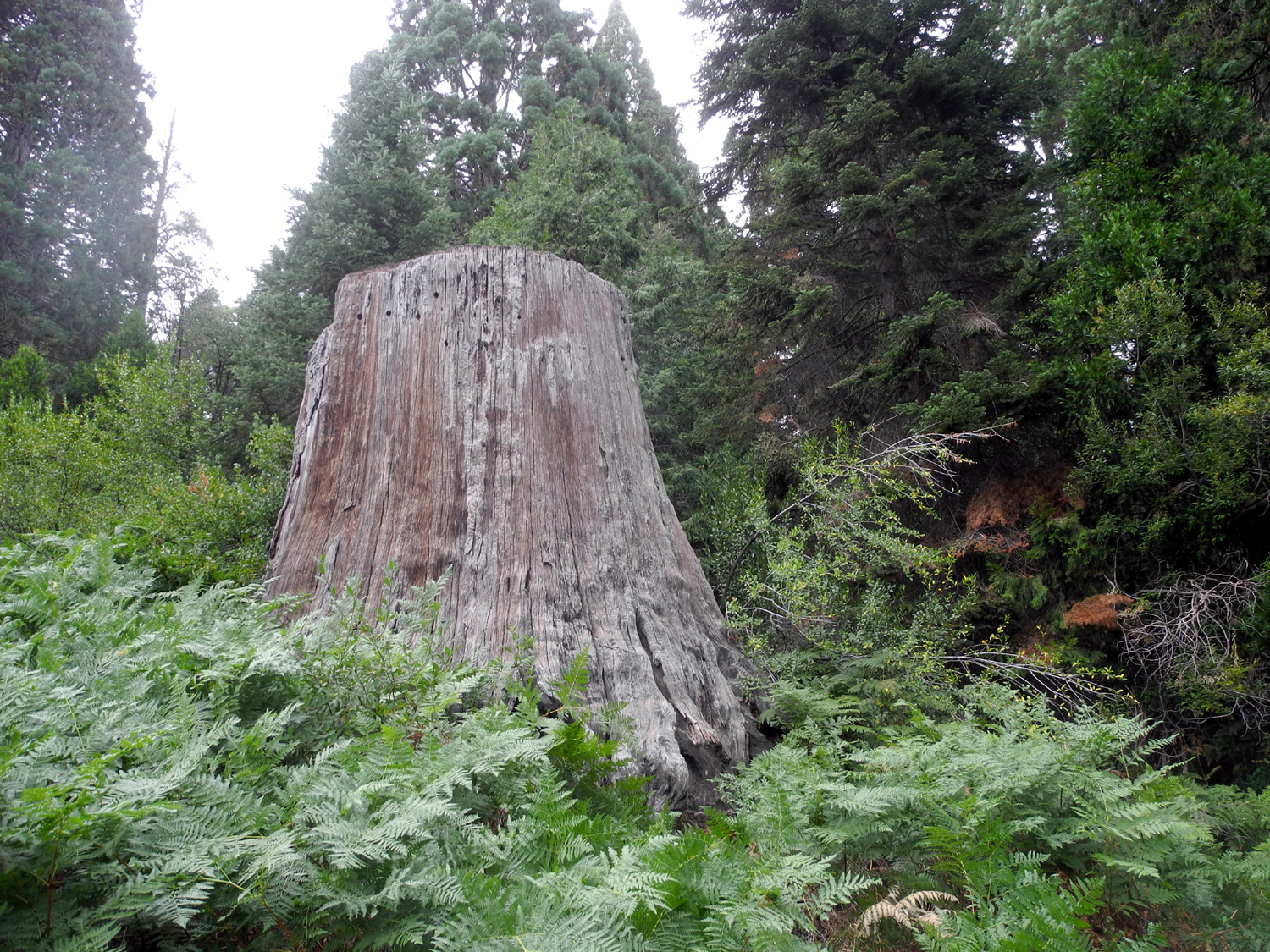 |
 |
| A low stump for easy climbing | This is one of the tallest stumps in the basin | "The Castle," a broken off sequoia |
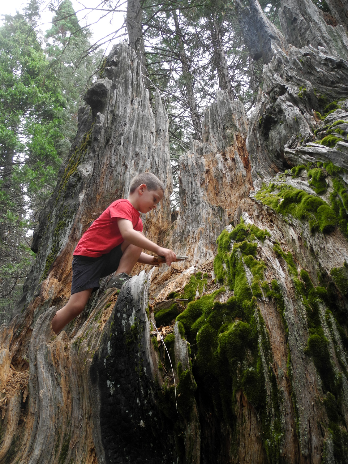 |
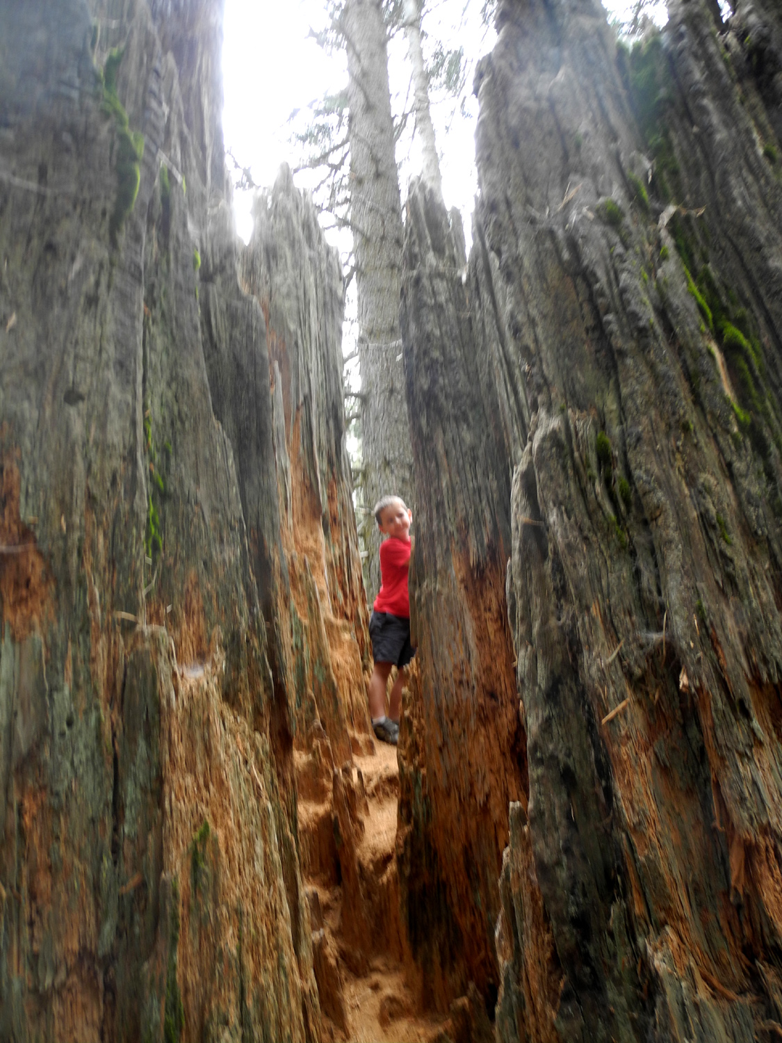 |
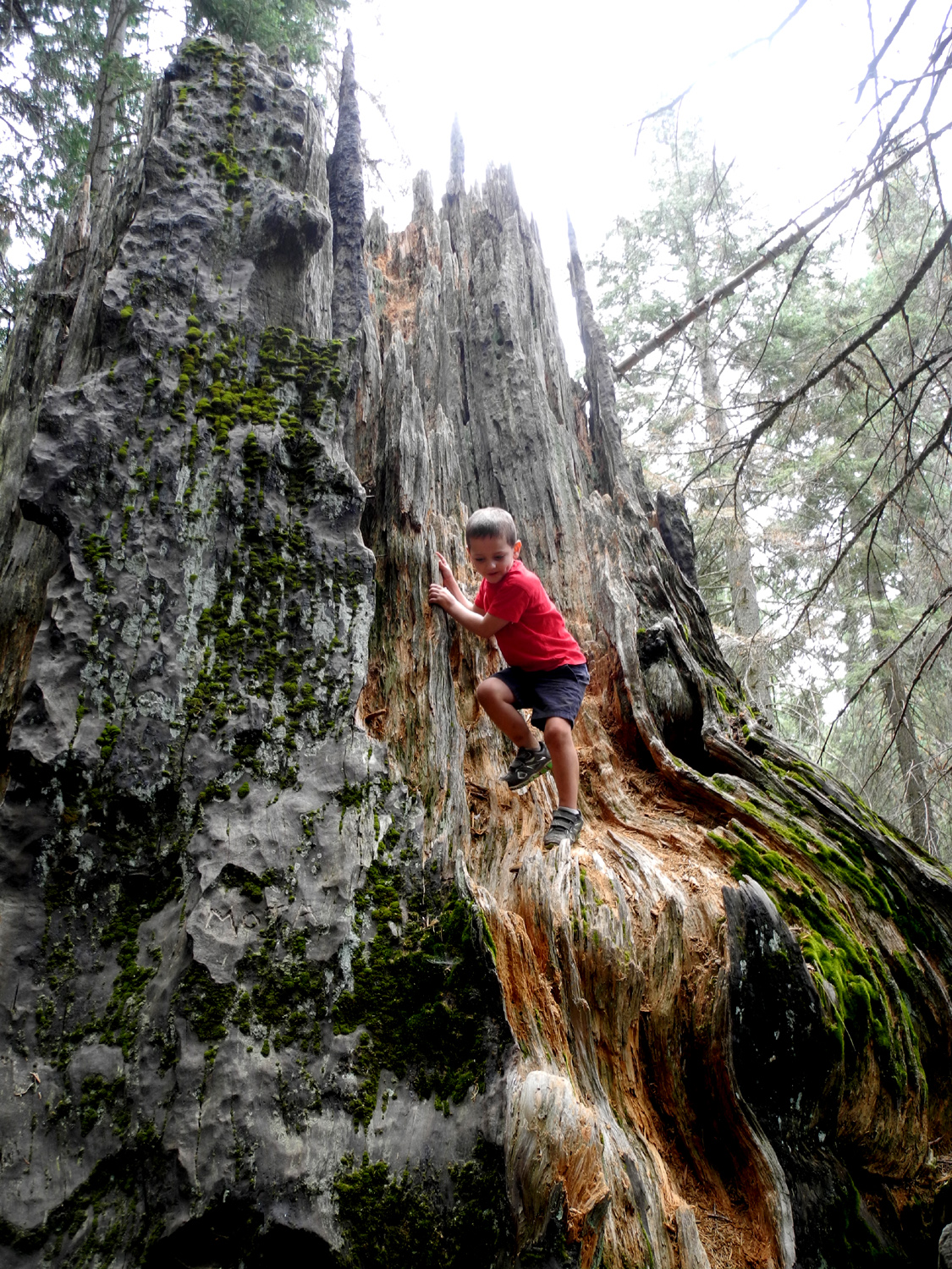 |
| Colton explores The Castle | ||
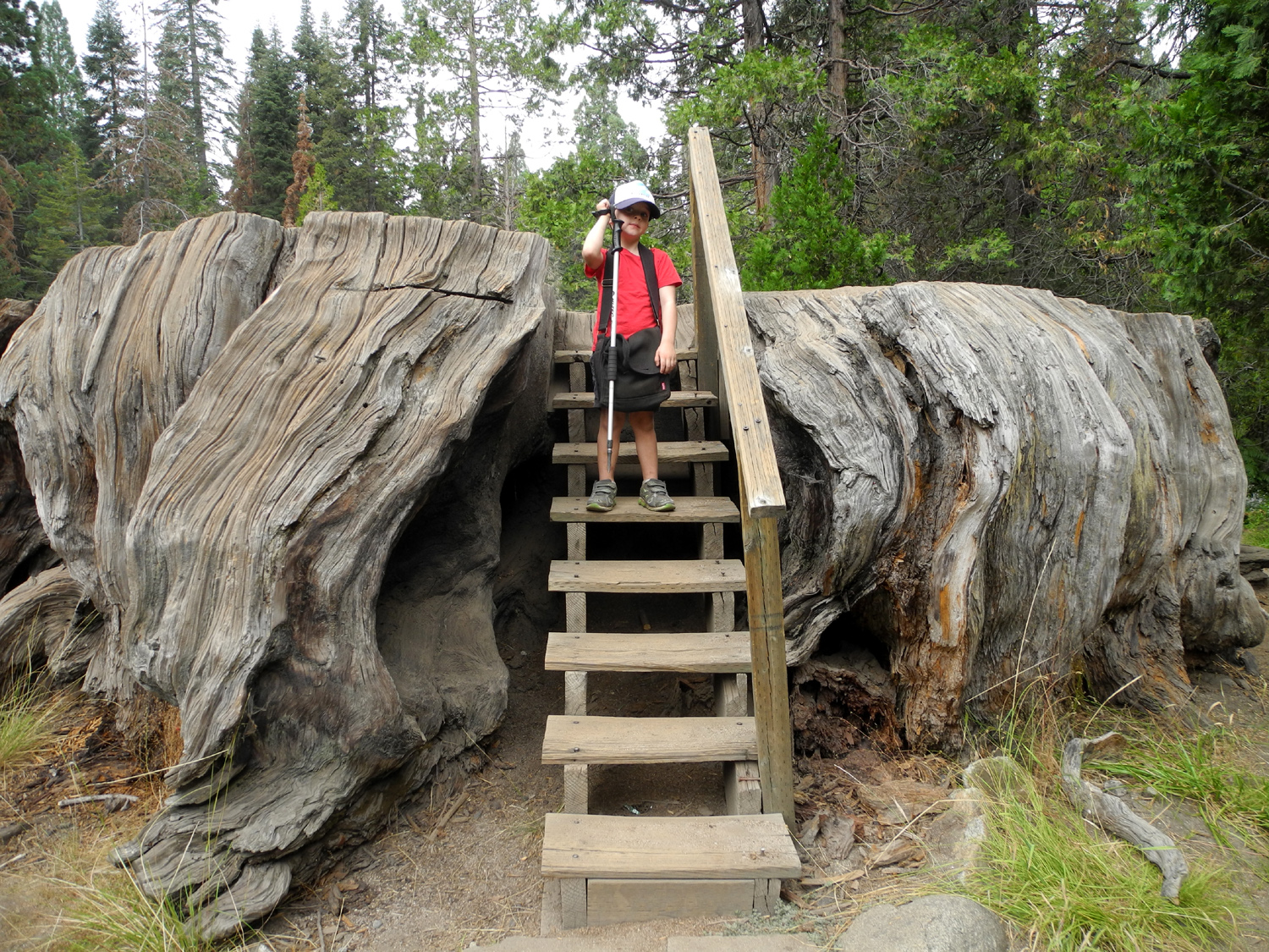 |
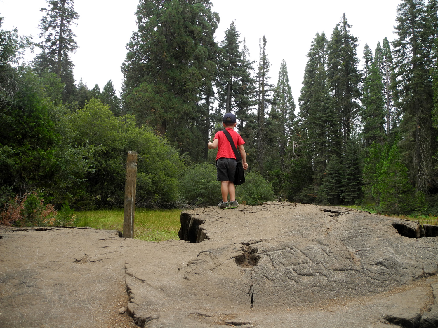 |
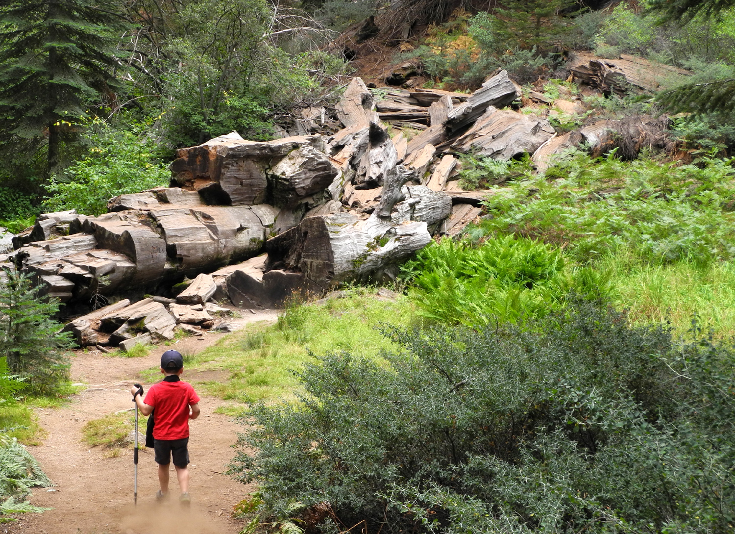 |
| At the Mark Twain Stump | There's lots of room to run around on top | The trail goes right through the Shattered Giant |
 |
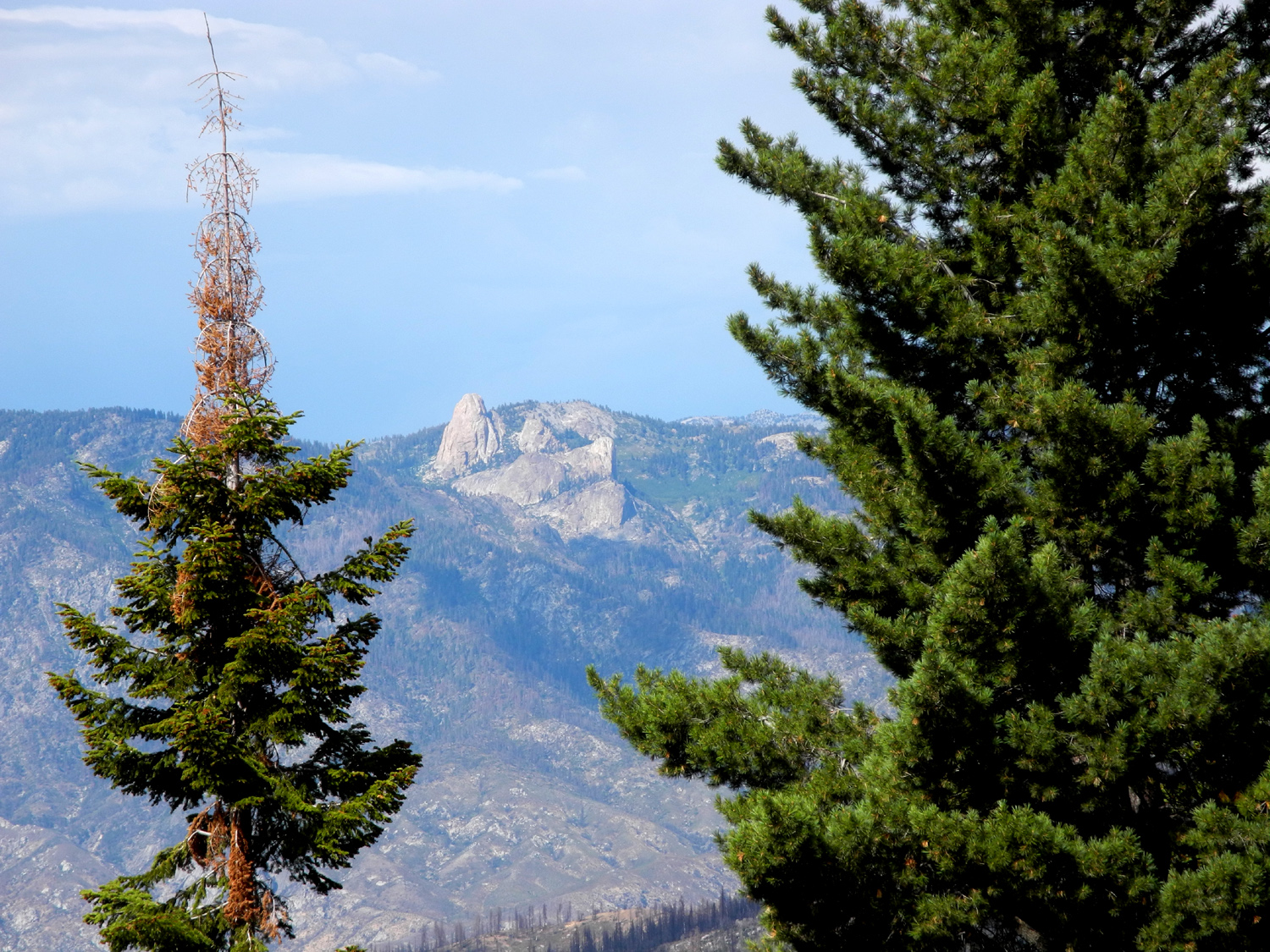 |
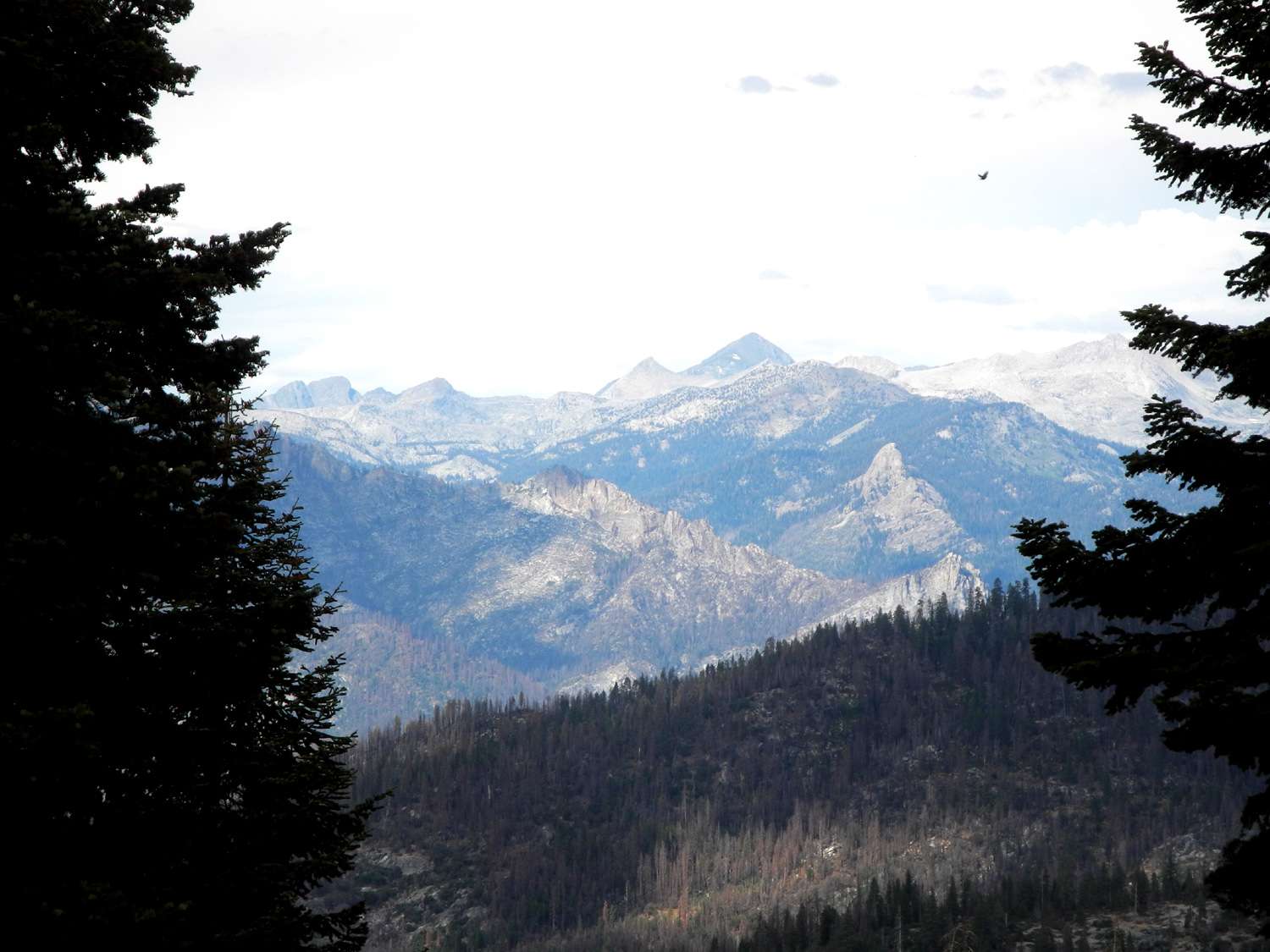 |
|
Clouds at Big Stump parking area after a brief thunder shower |
View from the Kings Canyon Overlook | High peaks in the northern part of\ the park |
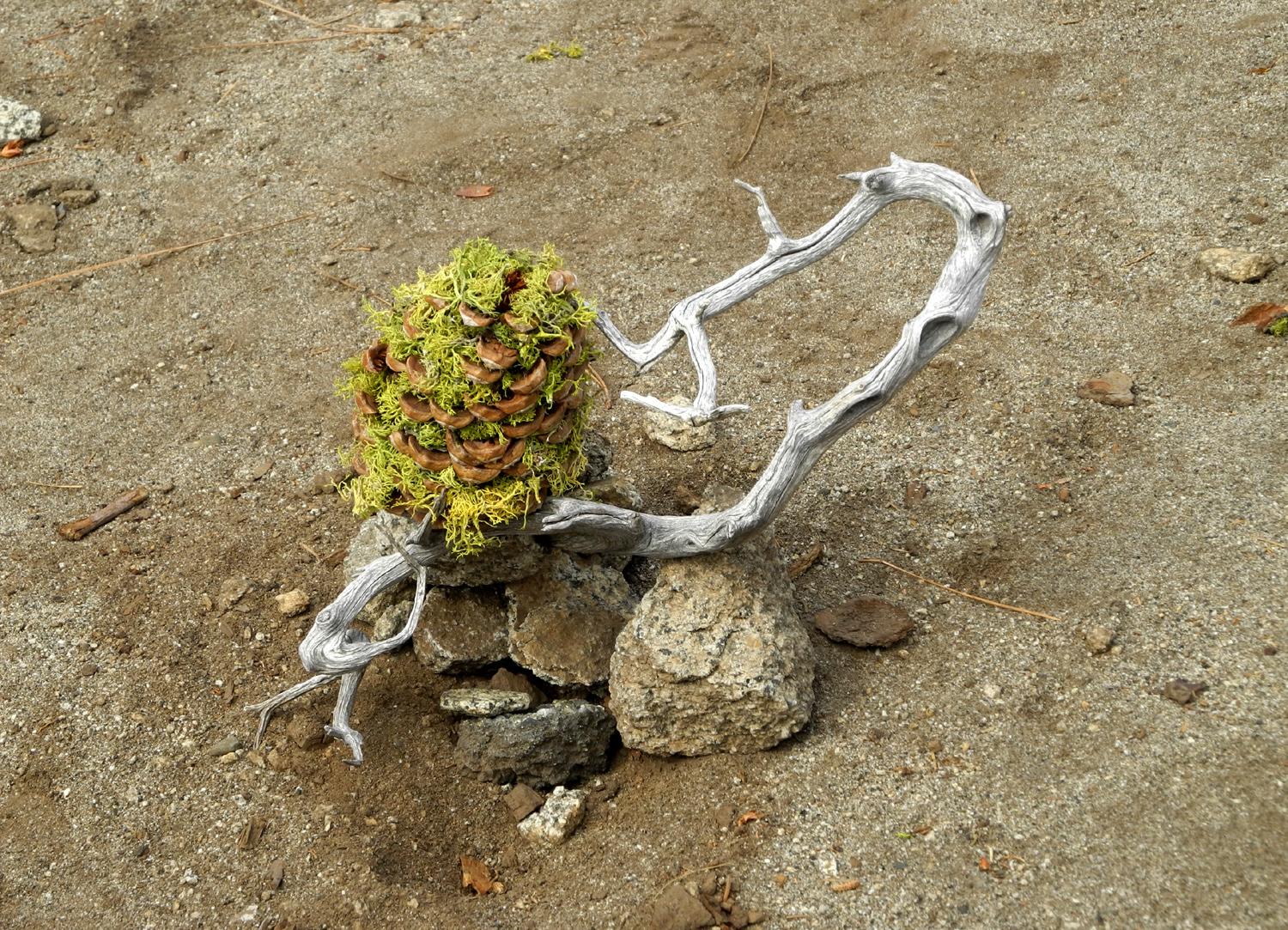 |
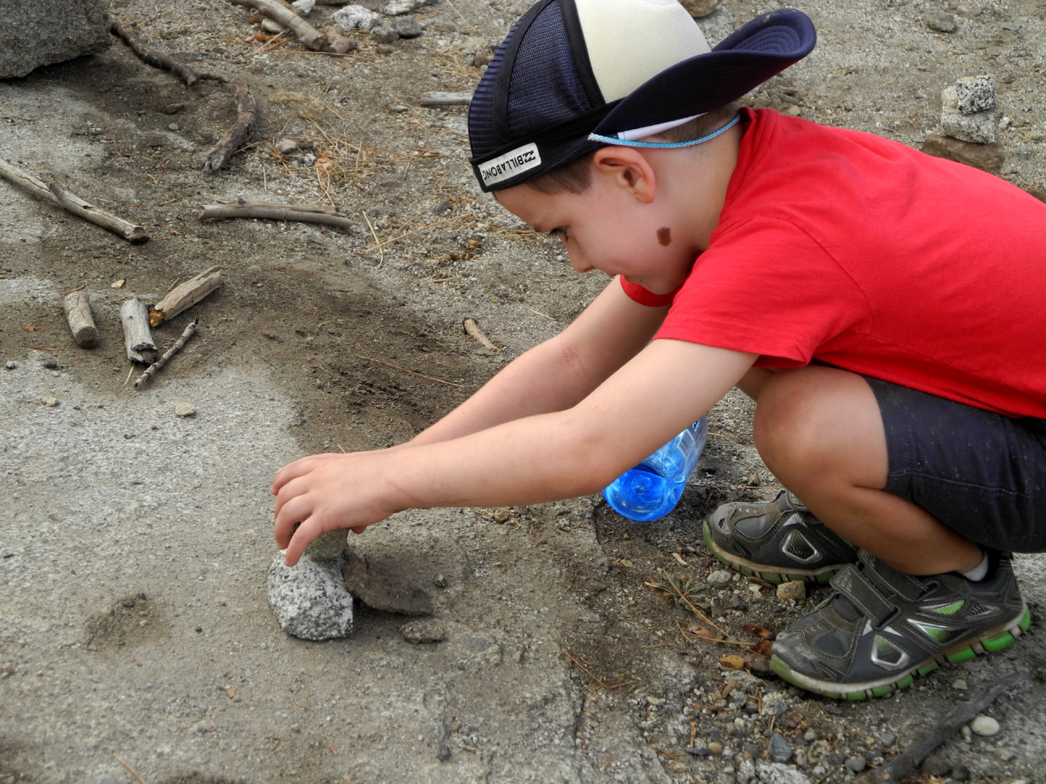 |
 |
| One of the more interesting rock sculptures | Colton creates his own | The finished project |
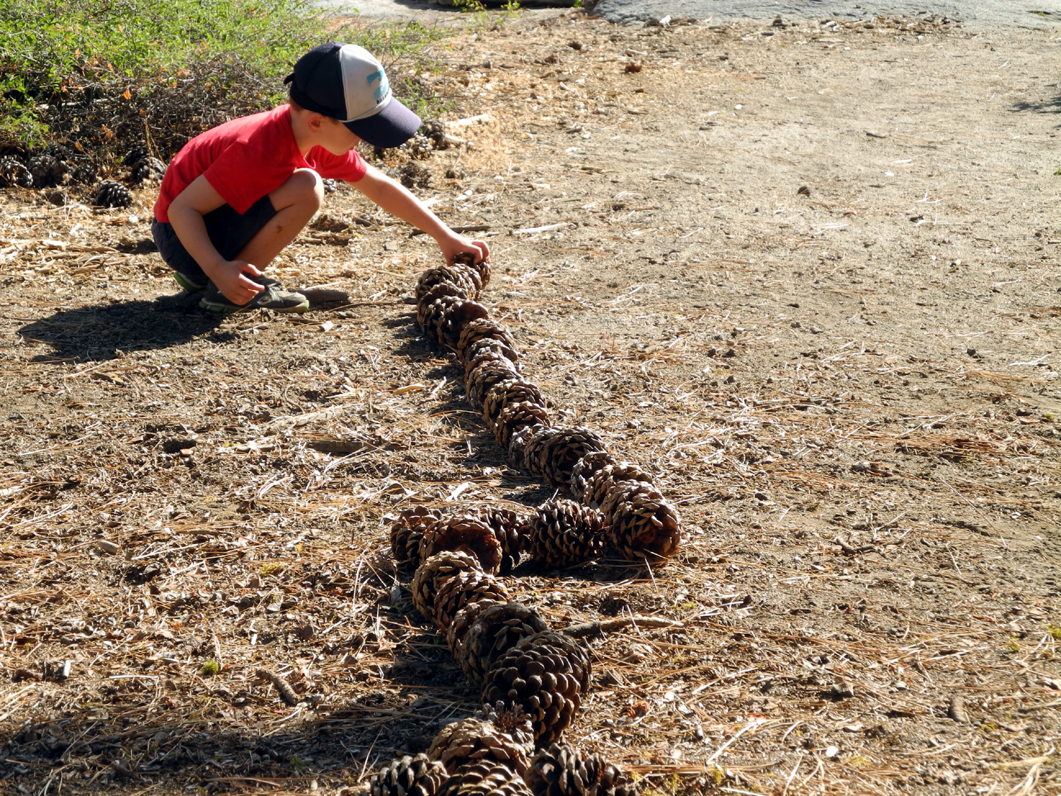 |
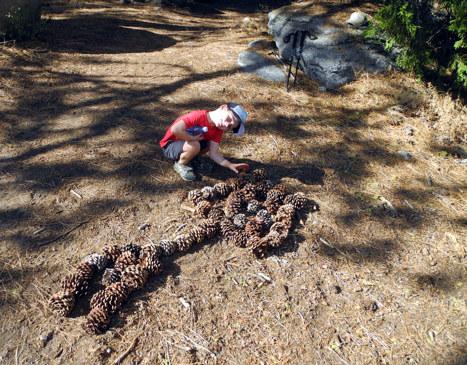 |
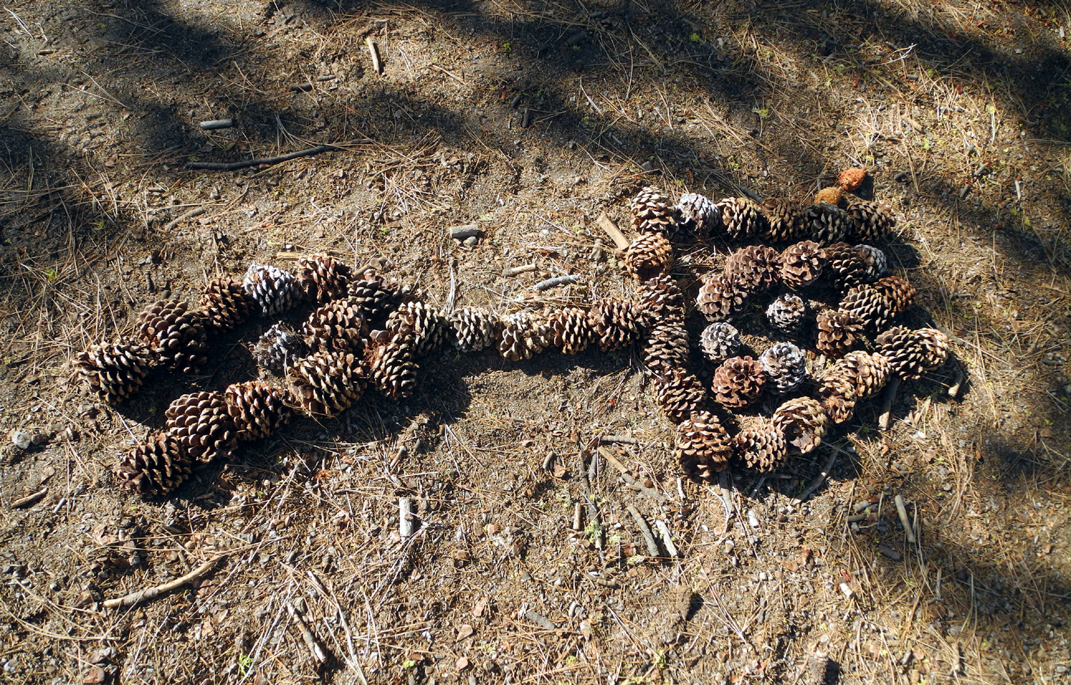 |
| Lining the trail with pine cones | The line was converted to a pine cone human | Following in Dad's footsteps to create interesting temporary art |
|
||
| This leaning cedar cries out to be climbed | ||
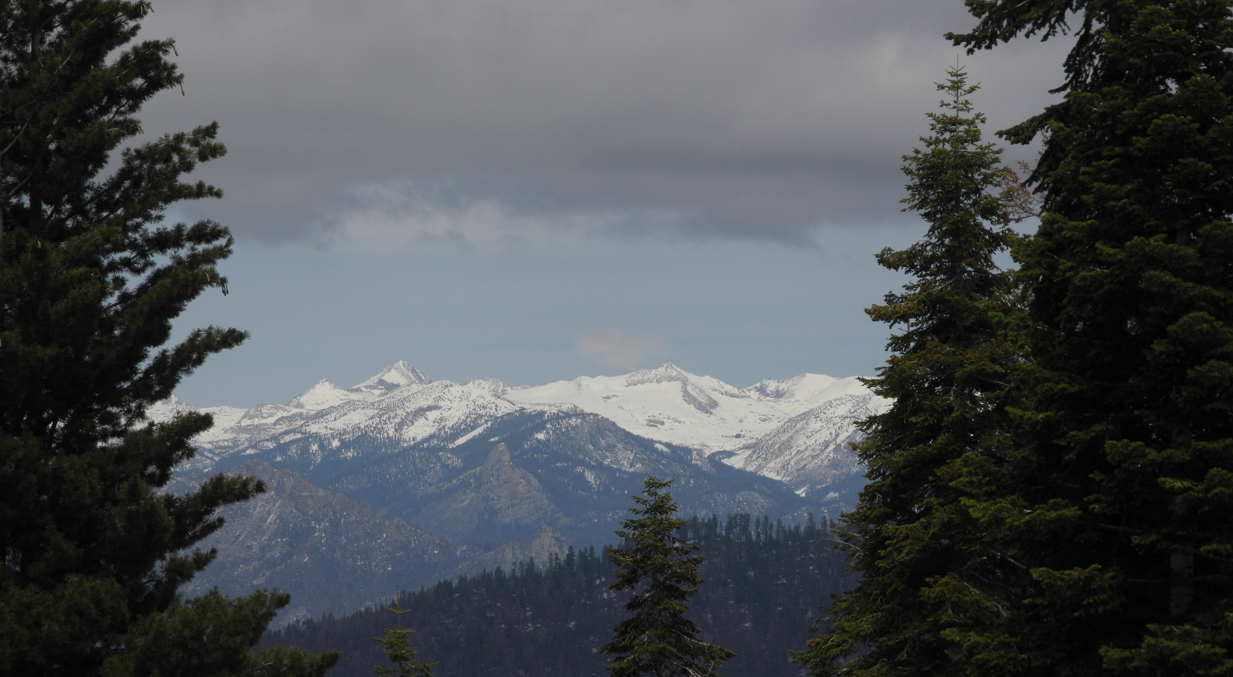 |
||
| High Sierra from Kings Canyon Overlook on the General's Highway | ||
| Cedar Grove | ||
|
 |
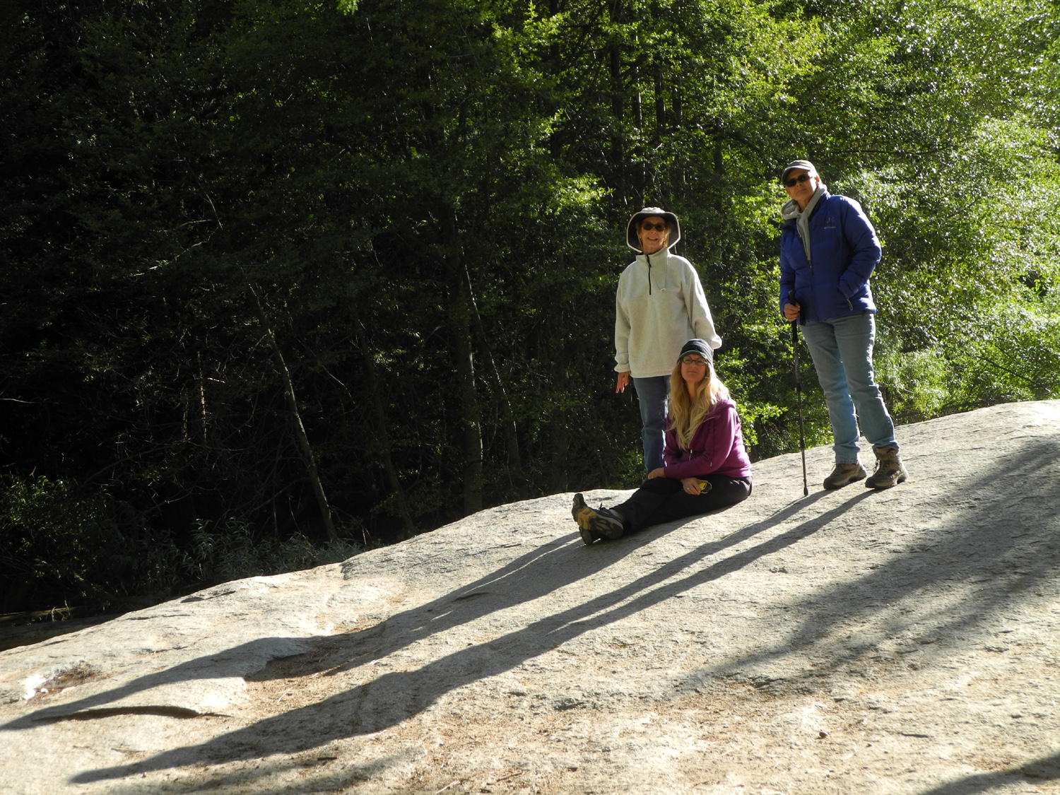 |
| Sandy at Grizzly Falls (Compare June 2017) | Upper Kings Canyon from Canyon View | Jackie, Sandy and Teri on Muir Rock |
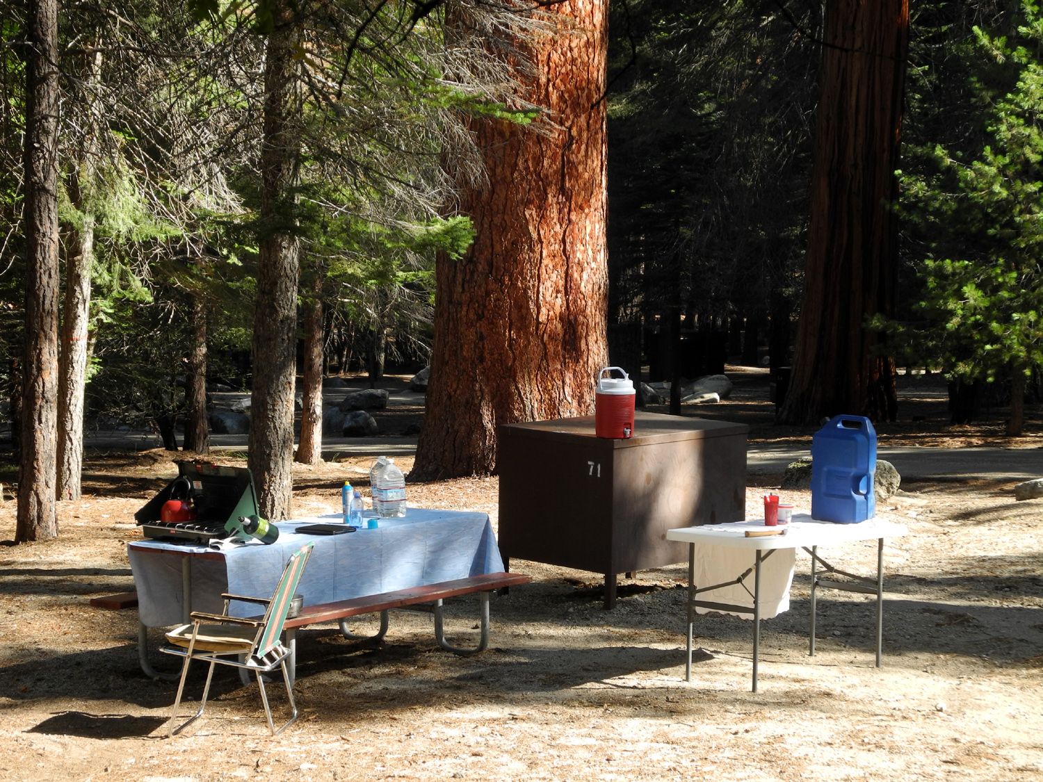 |
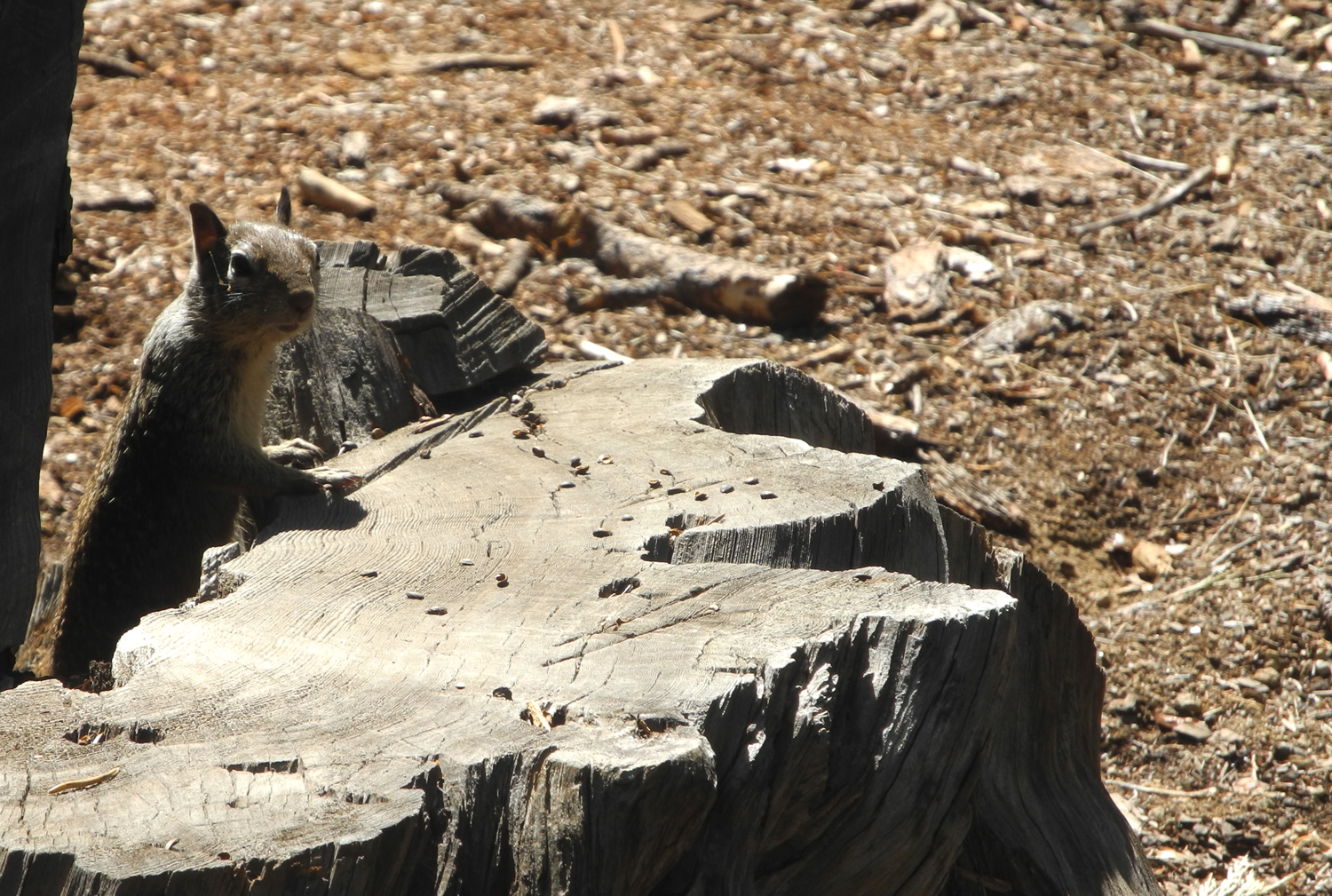 |
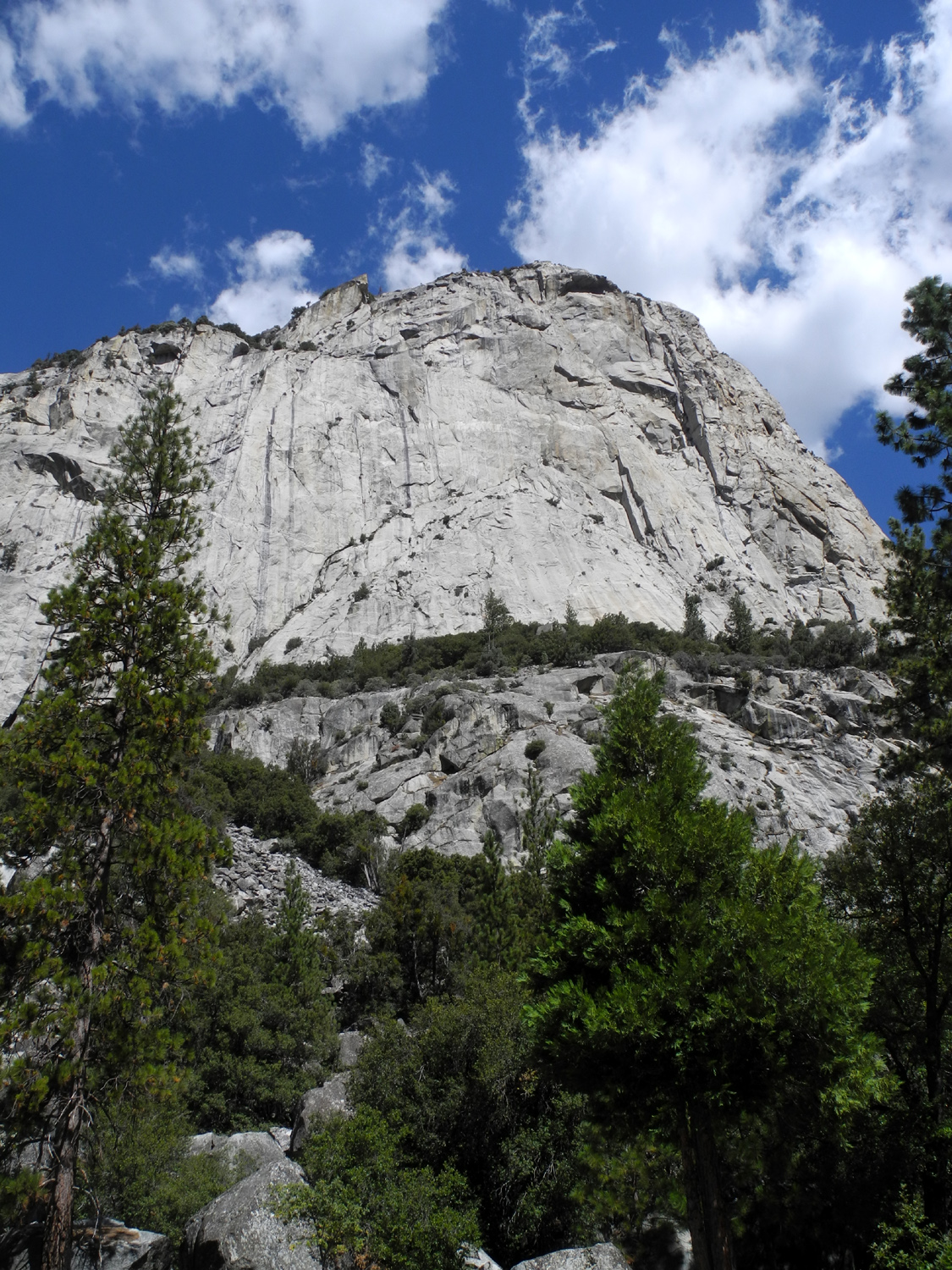 |
| Our camp | One of our neighbors | Cliff across the road from Zumwalt Meadow Trailhead |
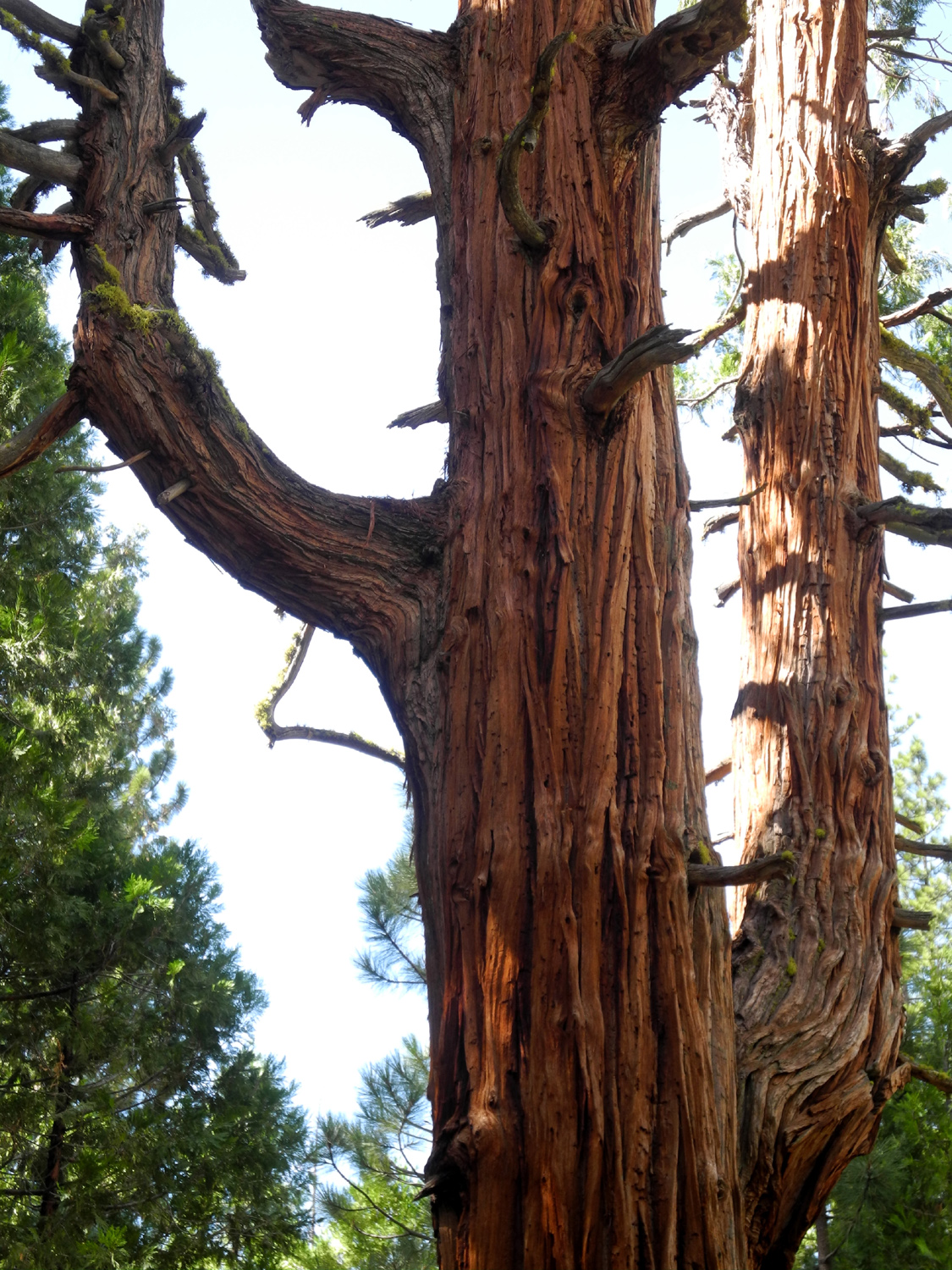 |
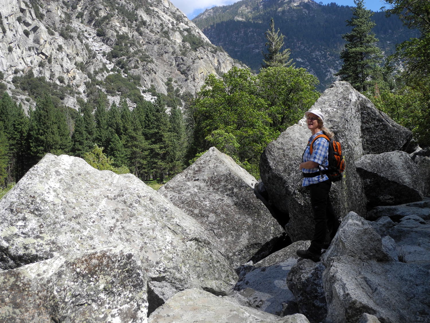 |
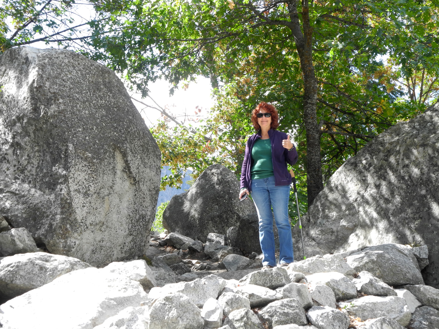 |
| A "saguaro" cedar tree | Teri in the rocky section of Zumwalt Meadow Trail | Monica on the trail |
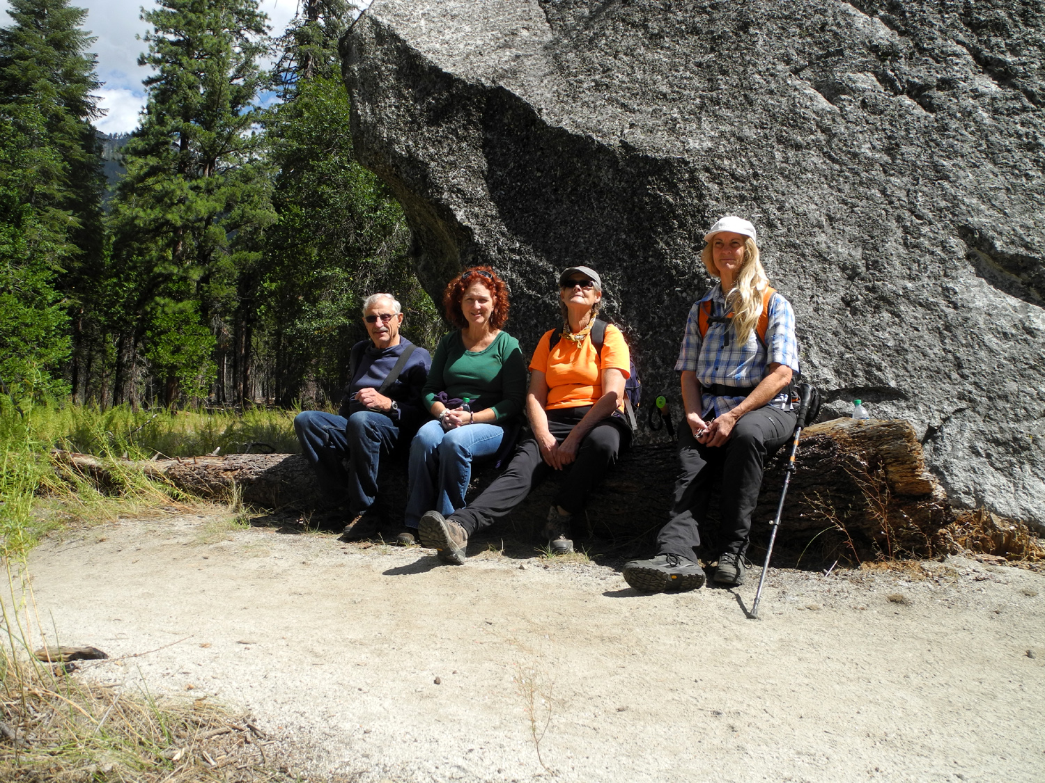 |
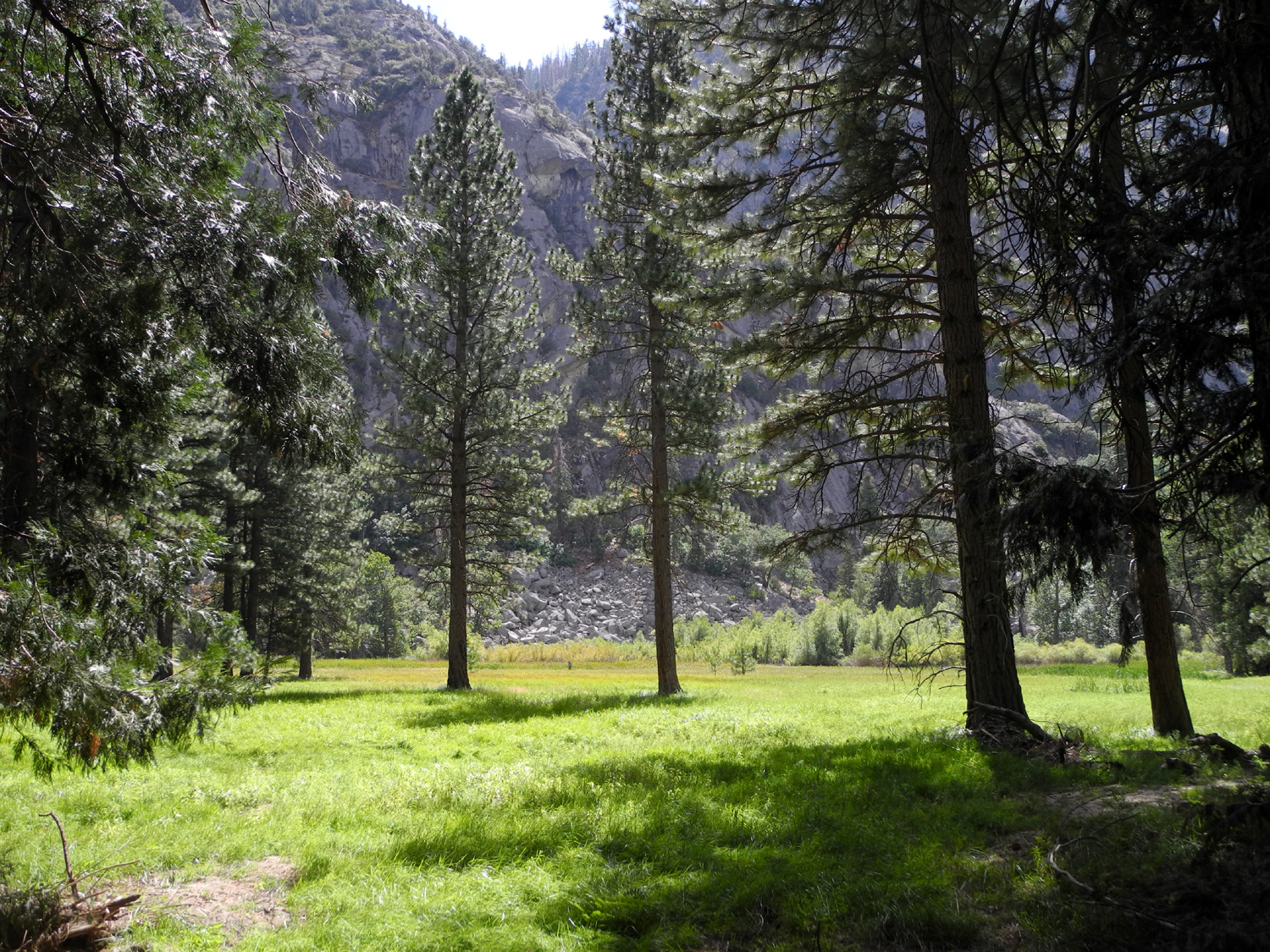 |
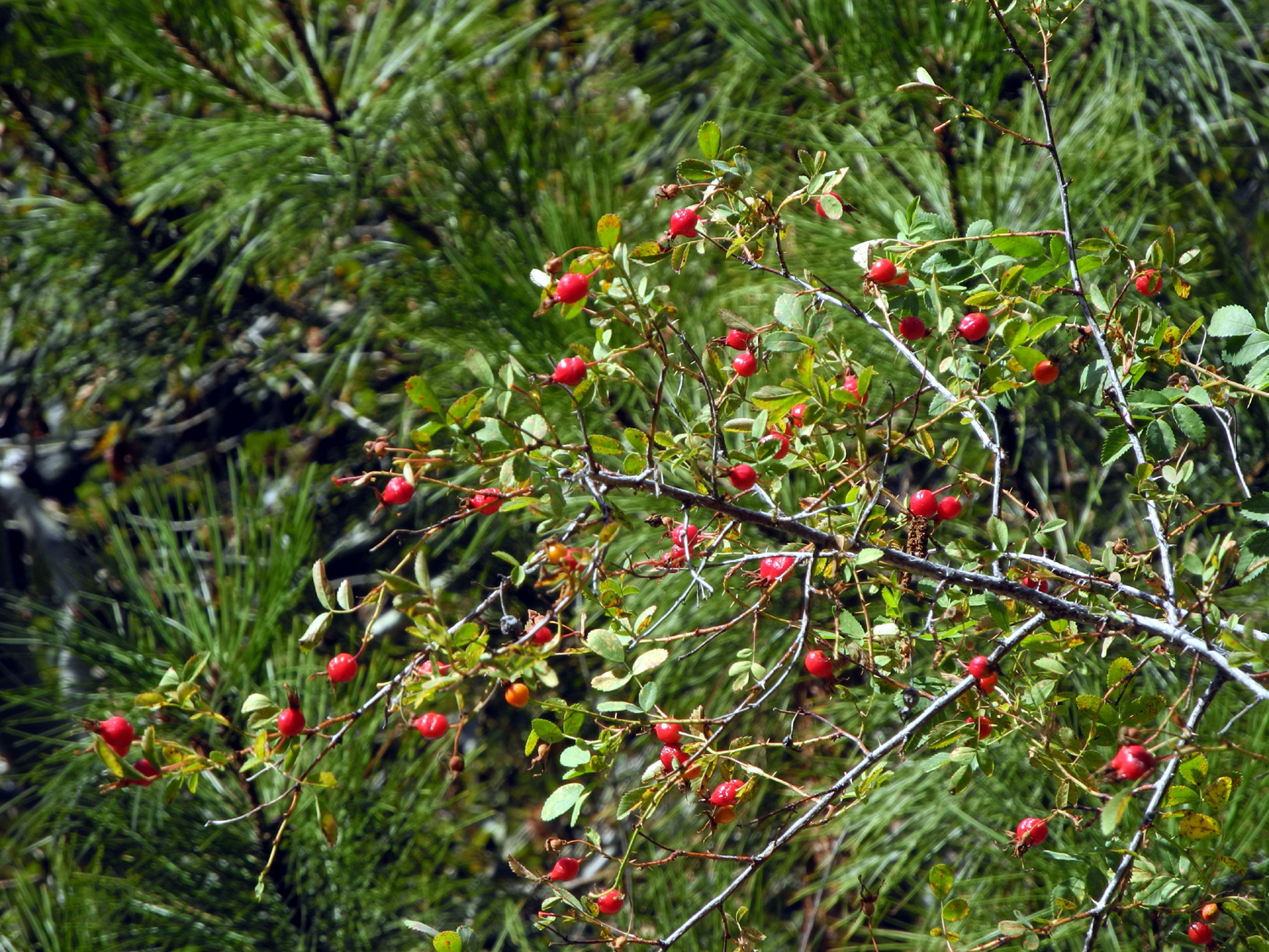 |
| Dick, Monica, Sandy and Teri by huge boulder left behind by the glacier | Zumwalt Meadow | Wild rose hips |
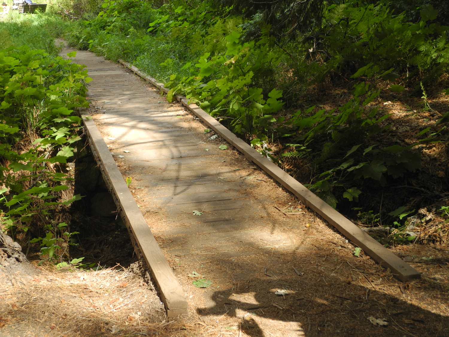 |
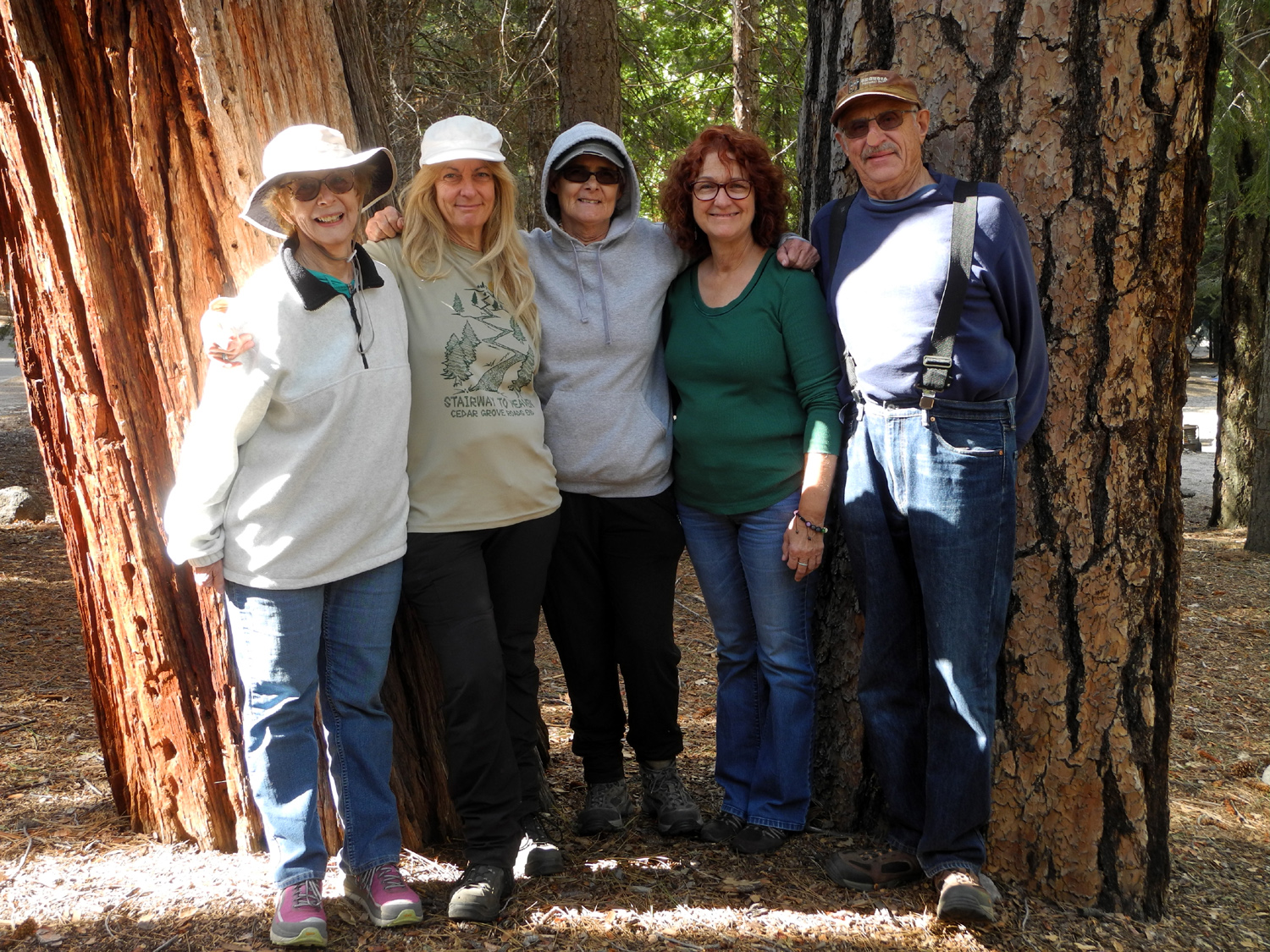 |
 |
| The river was up over this boardwalk last spring | The whole camping group: Jackie, Teri, Sandy, Monica, Dick | View from Don Cecil Trail |
 |
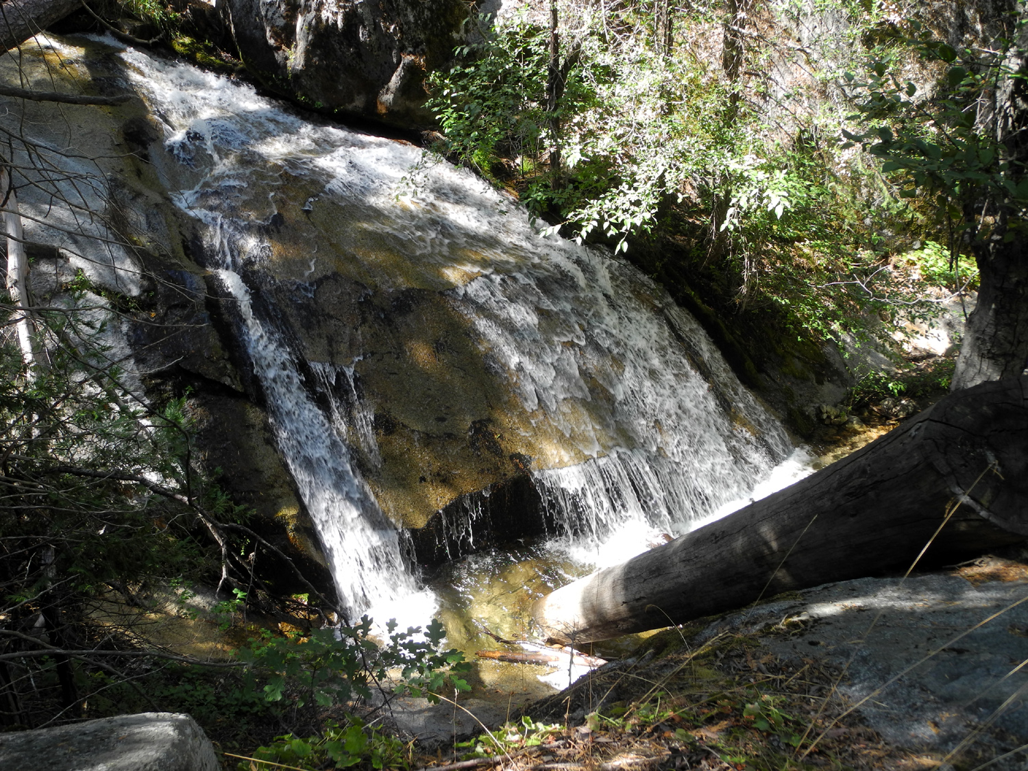 |
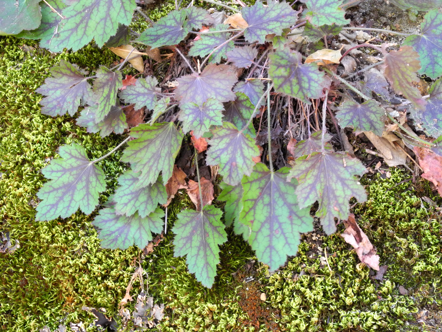 |
| Bark peeling from dead oak tree | Sheep Creek Falls | Leaves changing color for fall |
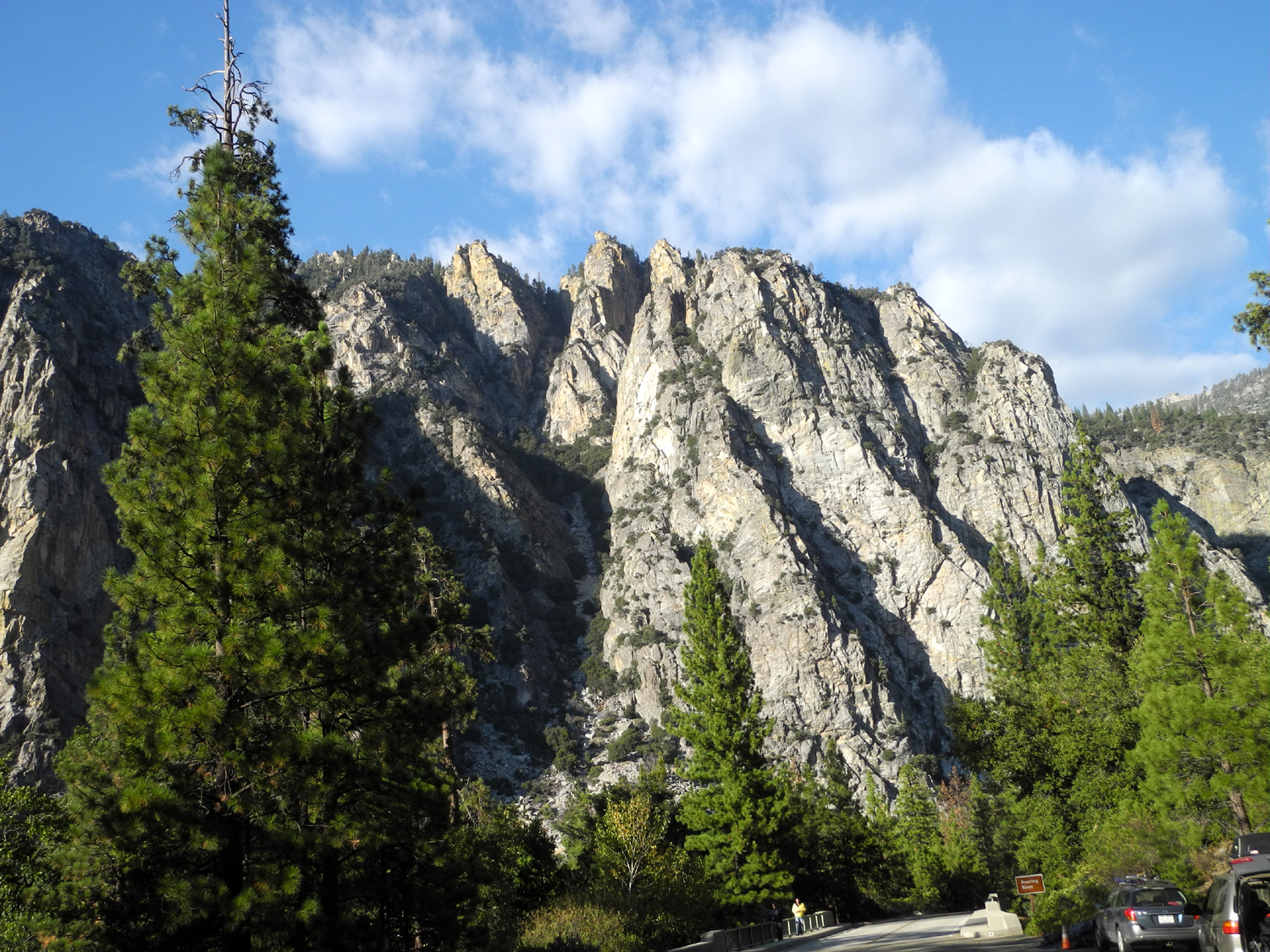 |
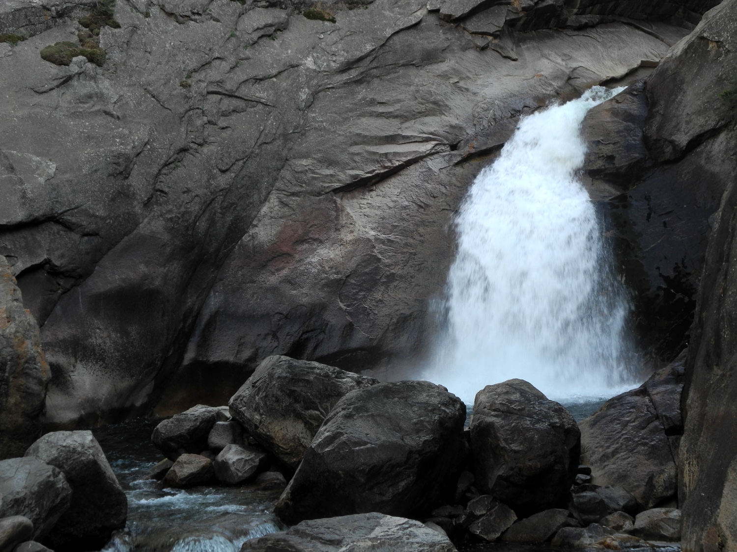 |
|
| Rock formation on north side of the canyon | Roaring River Falls from the west side | And from the east (Compare June 2017) |
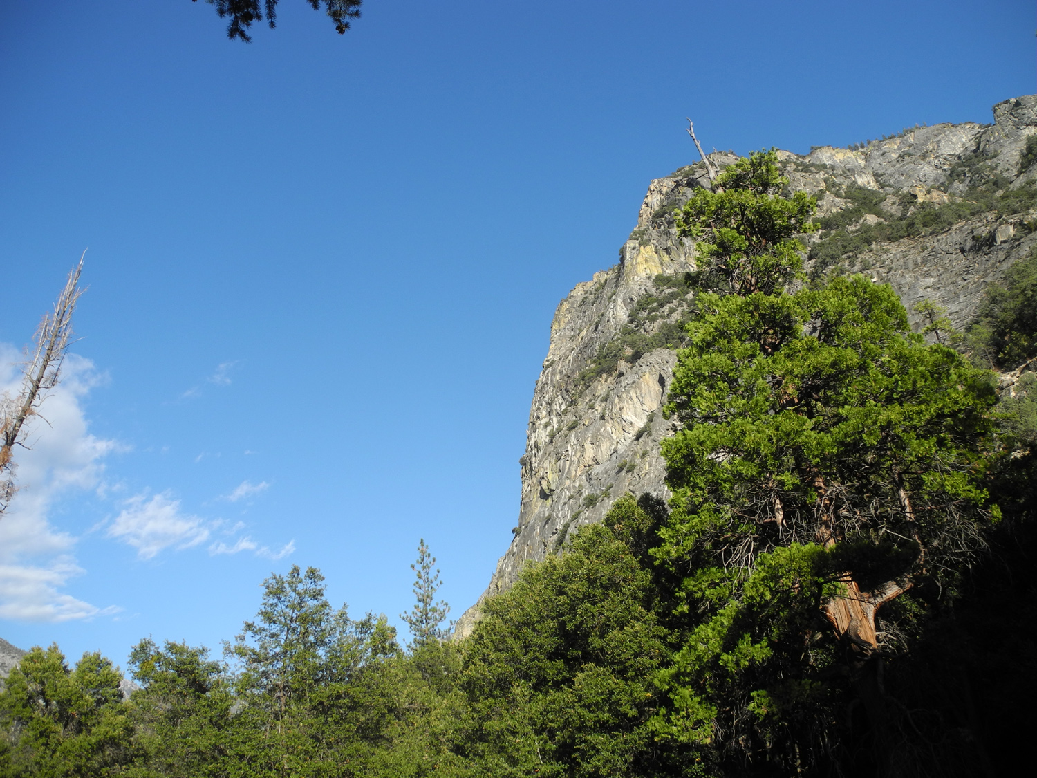 |
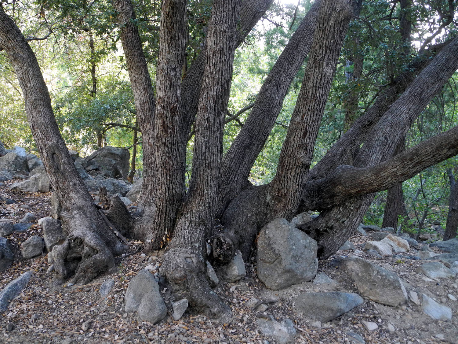 |
 |
| Cliff just east of the Roaring River canyon | Canyon live oaks along the falls trail | A breathtaking ride |
| Grant Grove Camp II | ||
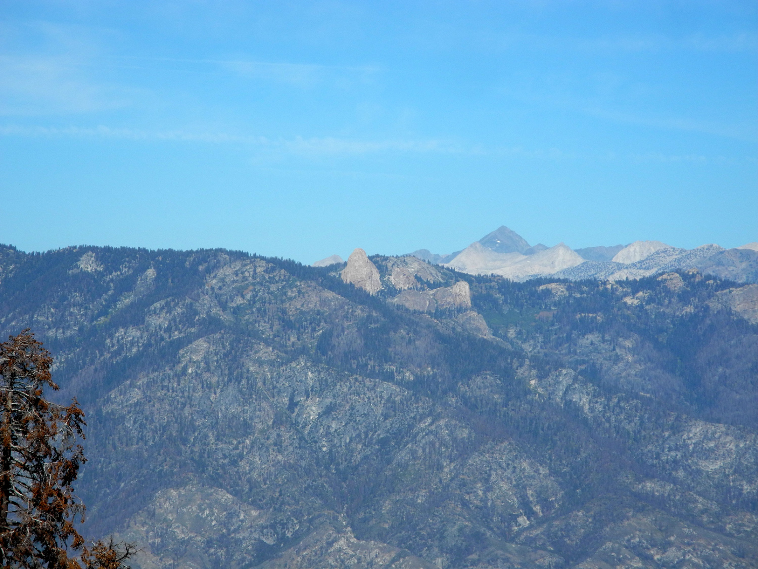 |
 |
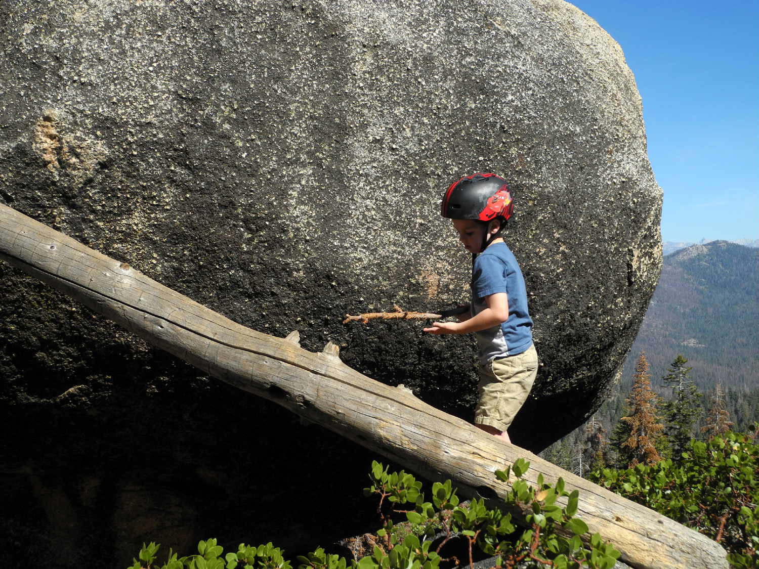 |
| Mt Goddard from Panoramic Point | Colton having fun at Panoramic Point | Exploring a huge boulder |
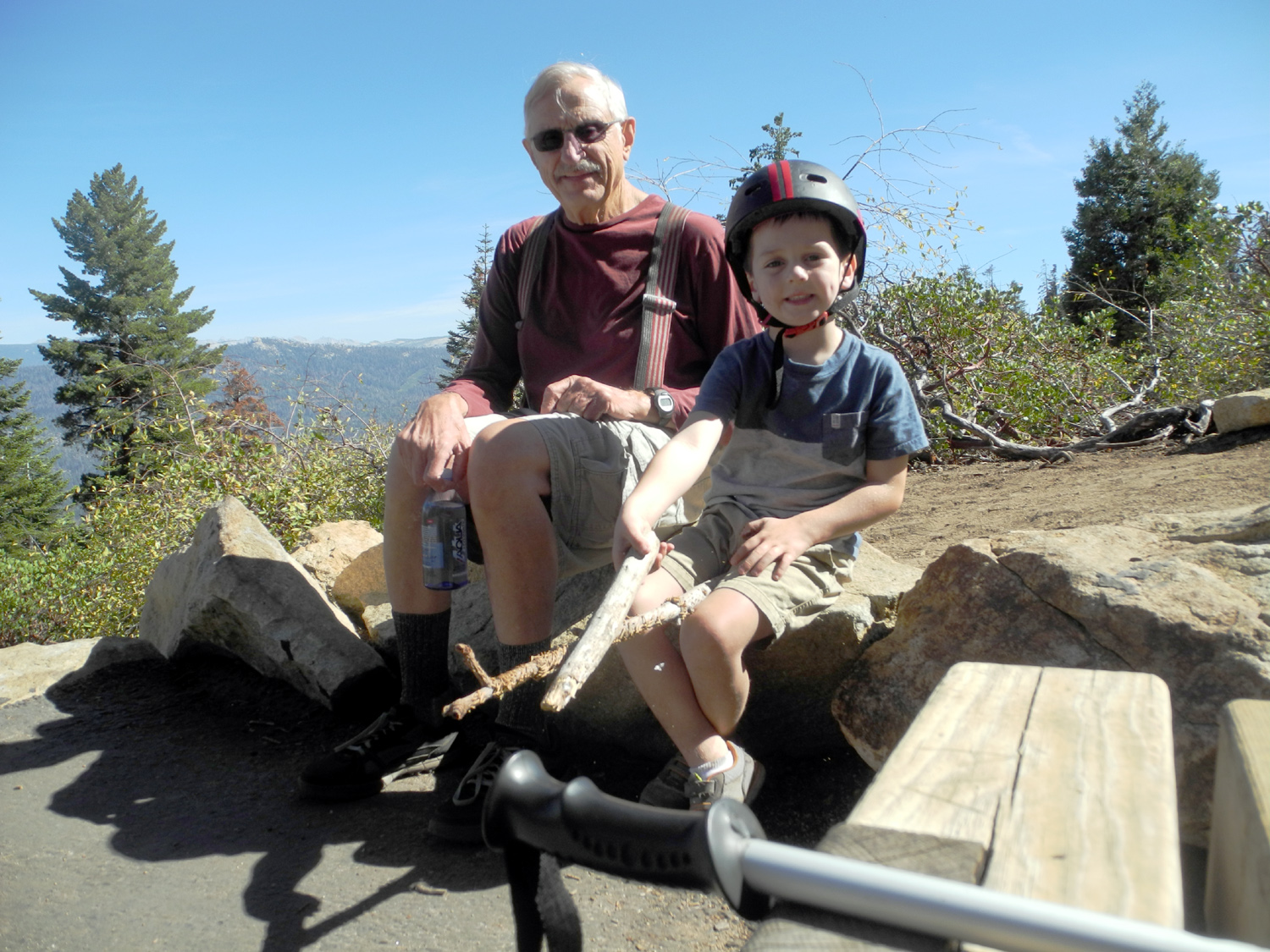 |
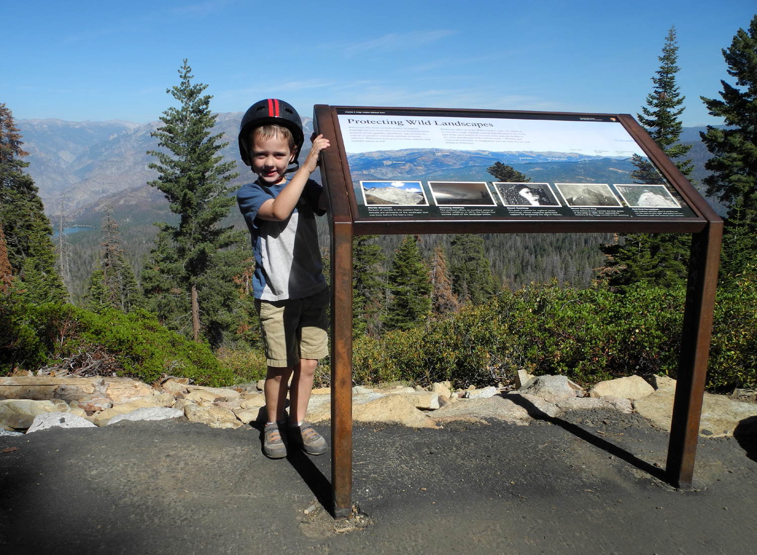 |
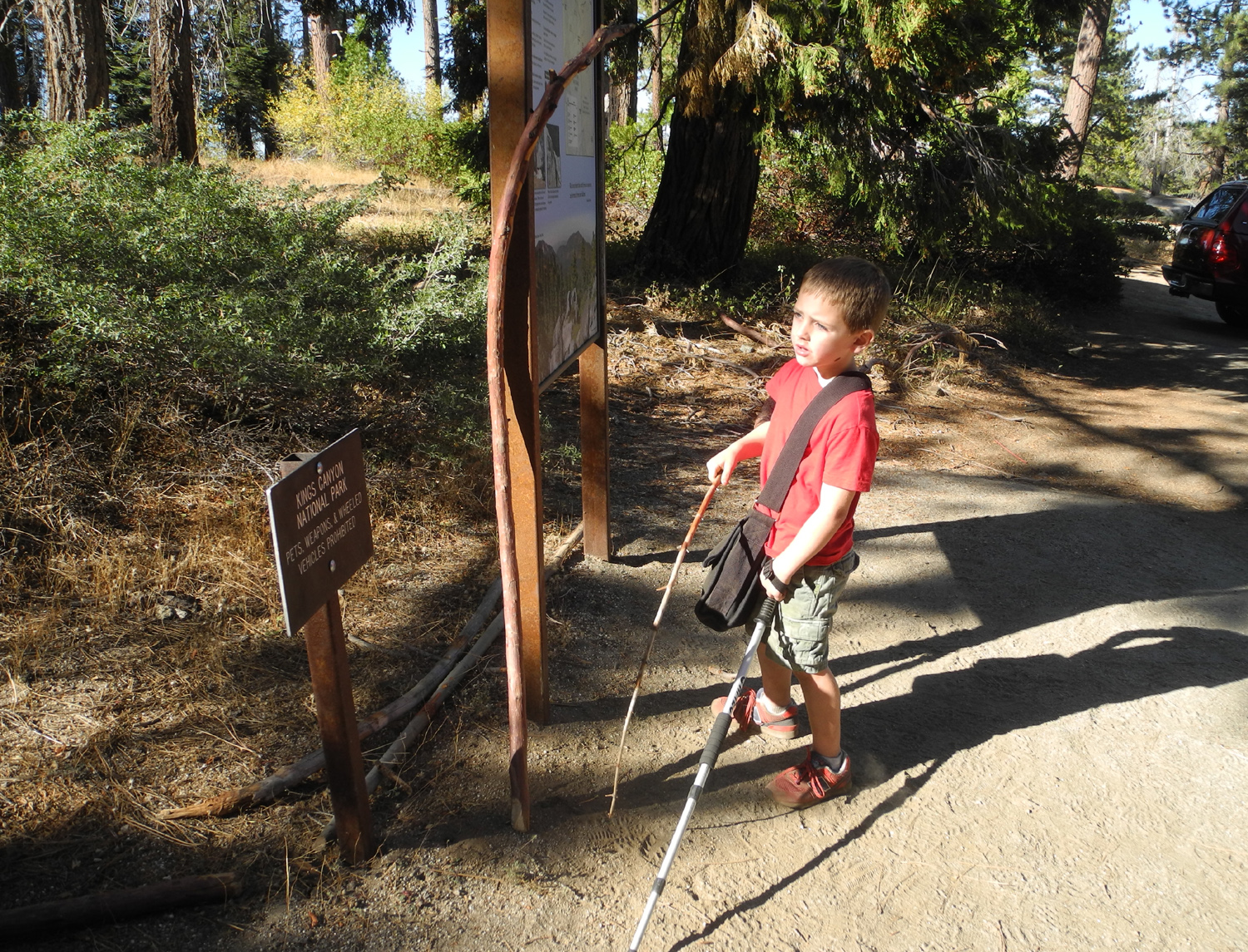 |
| Great grandpa, great grandson at Panoramic Point | Colton was fascinated with the informational plaque | Ready to hike the Buena Vista Trail |
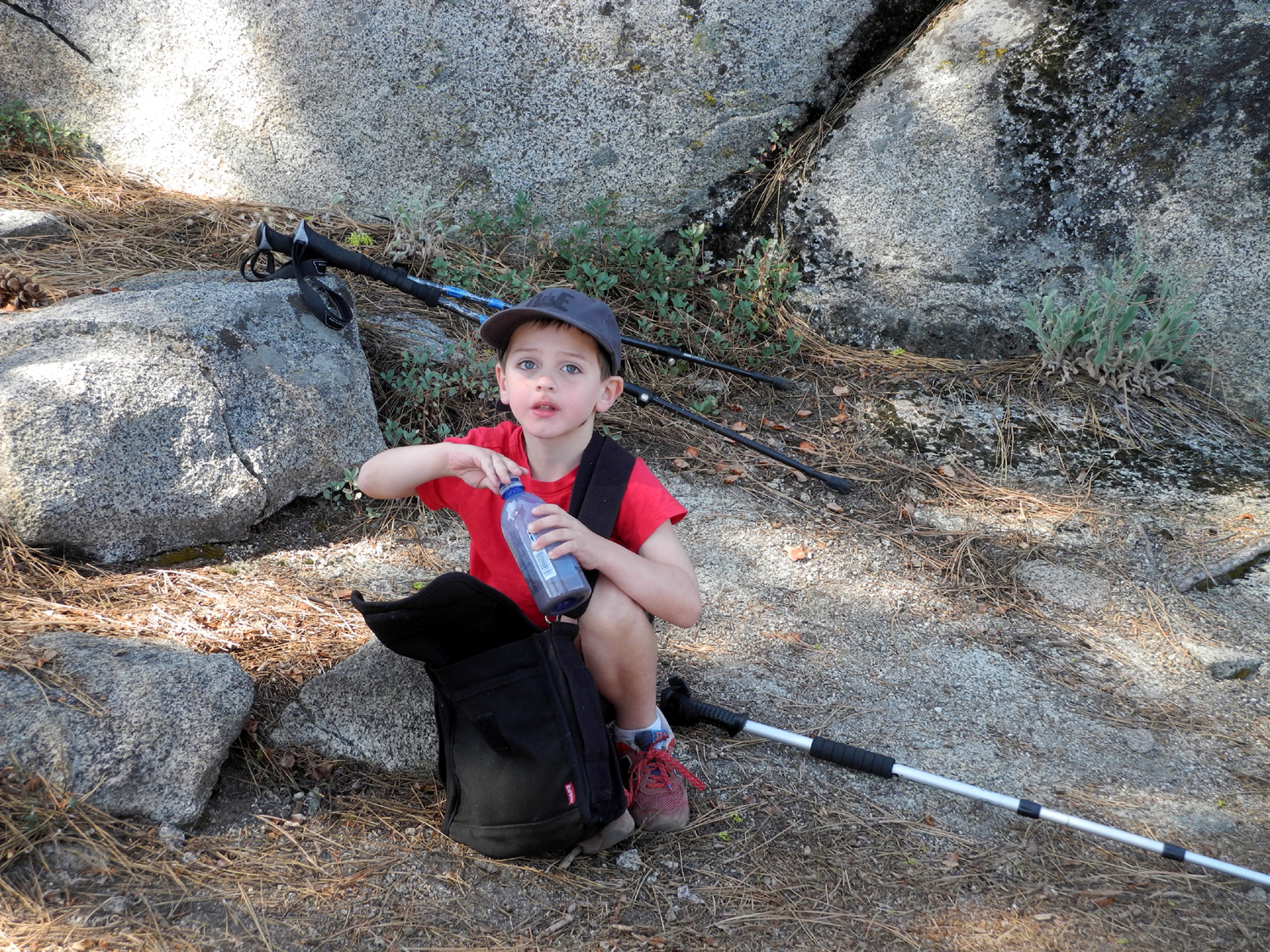 |
|
|
| Hydrating with cocoa | Buck Rock, Colton's favorite | Bush whacking, literally |
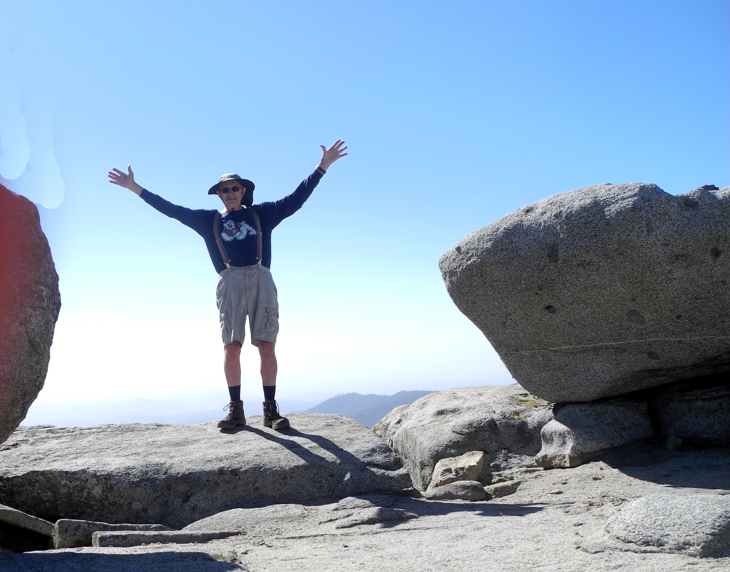 |
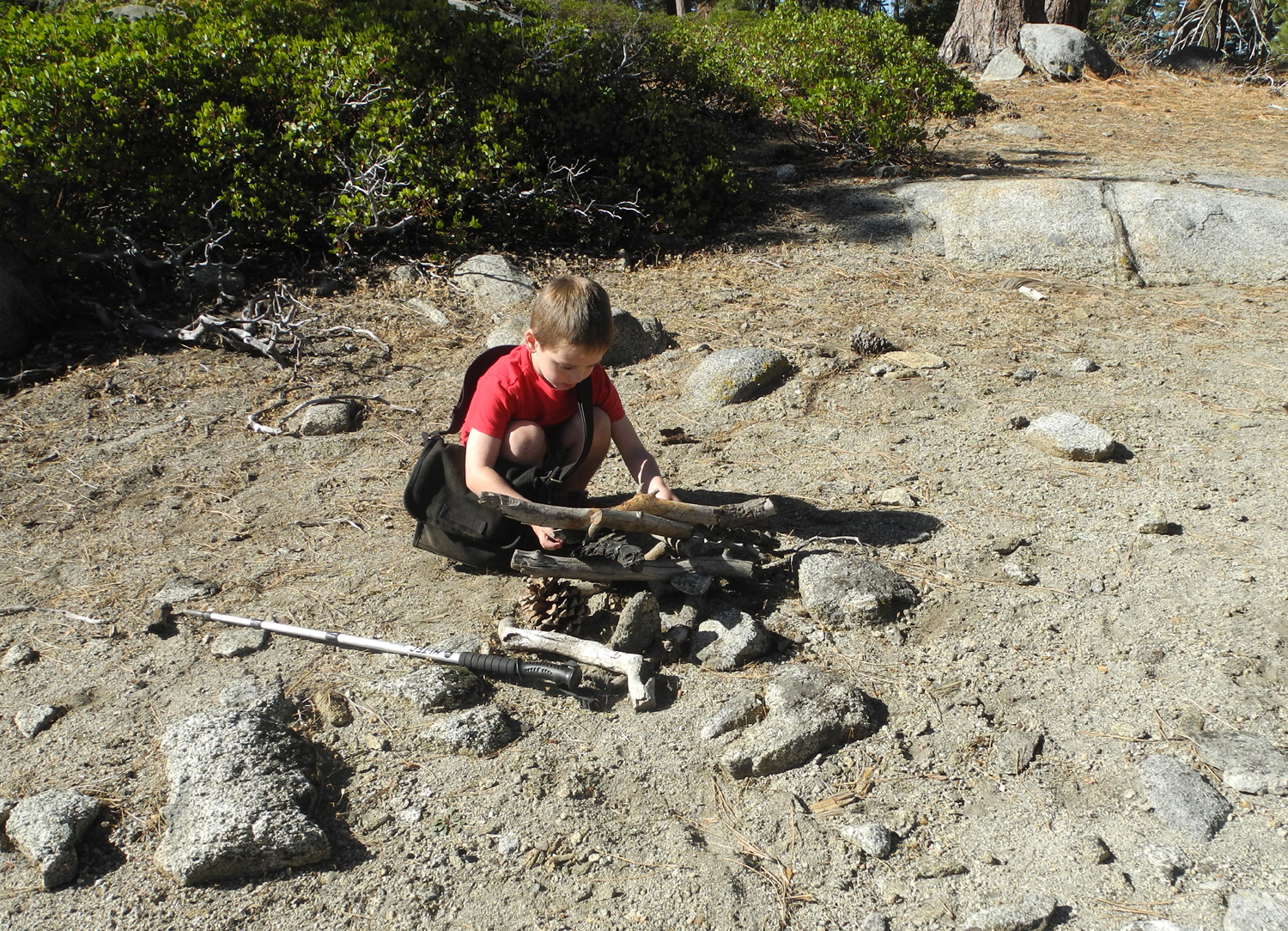 |
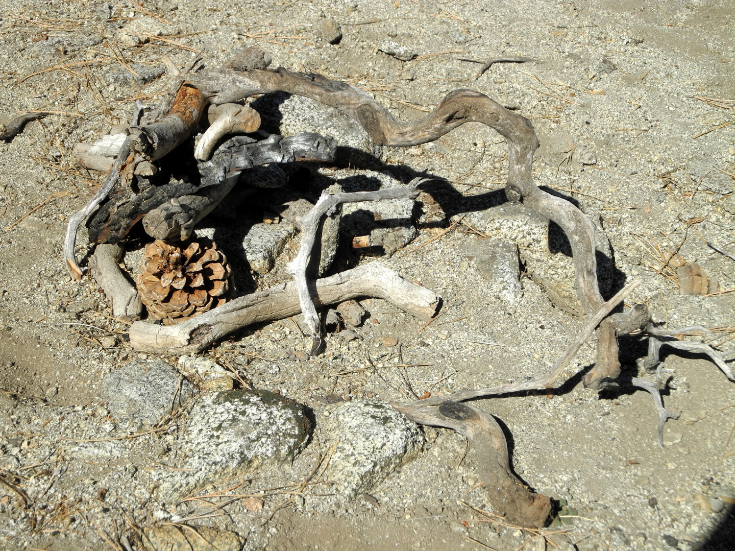 |
| Dick on Buena Vista (photo by CJ Upshaw) | Creating art with found objects | The finished product |
 |
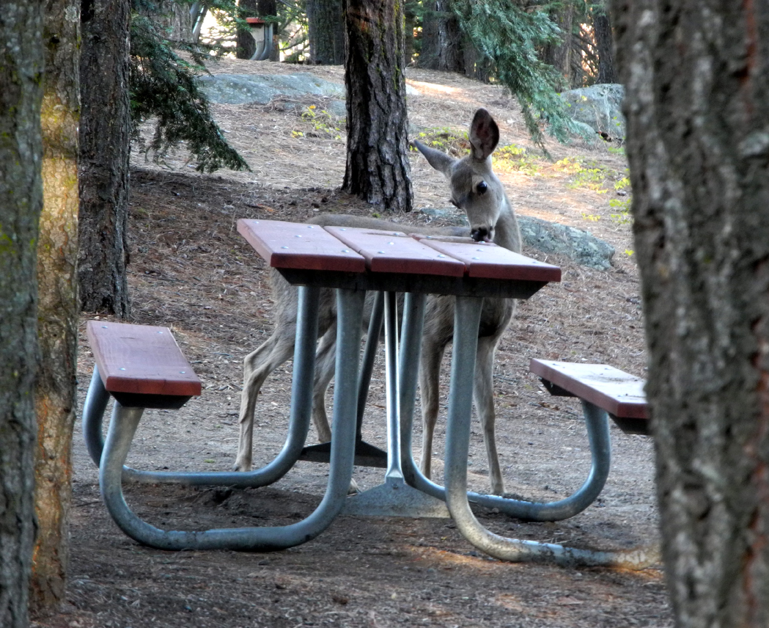 |
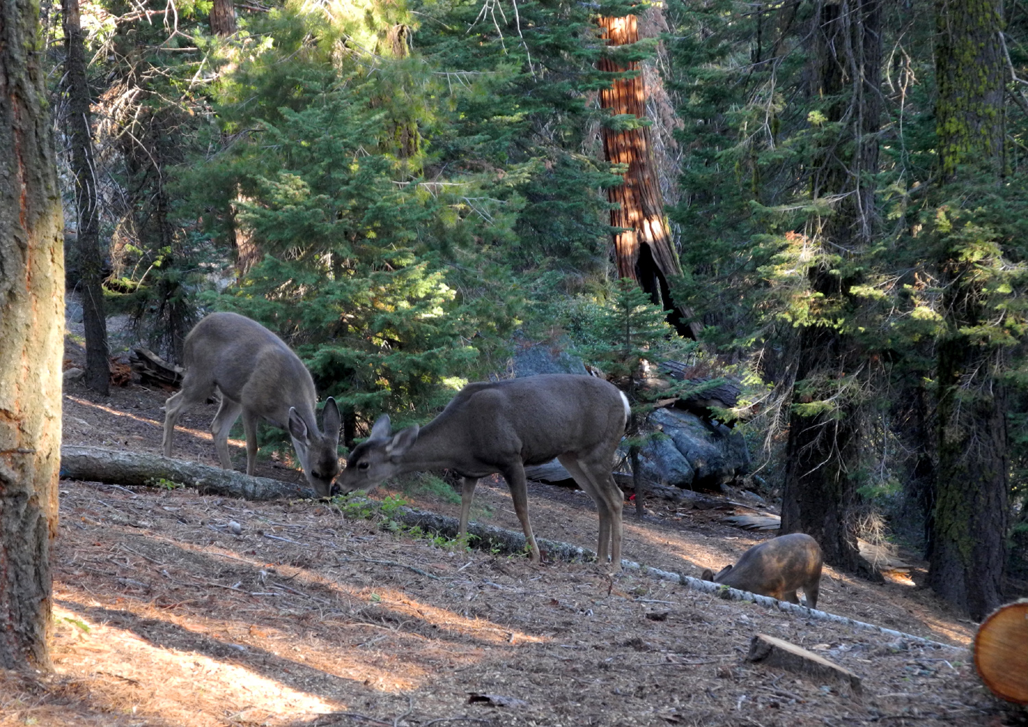 |
| Rock work | Something good was spilled on this picnic table | The three deer that visited our camp |
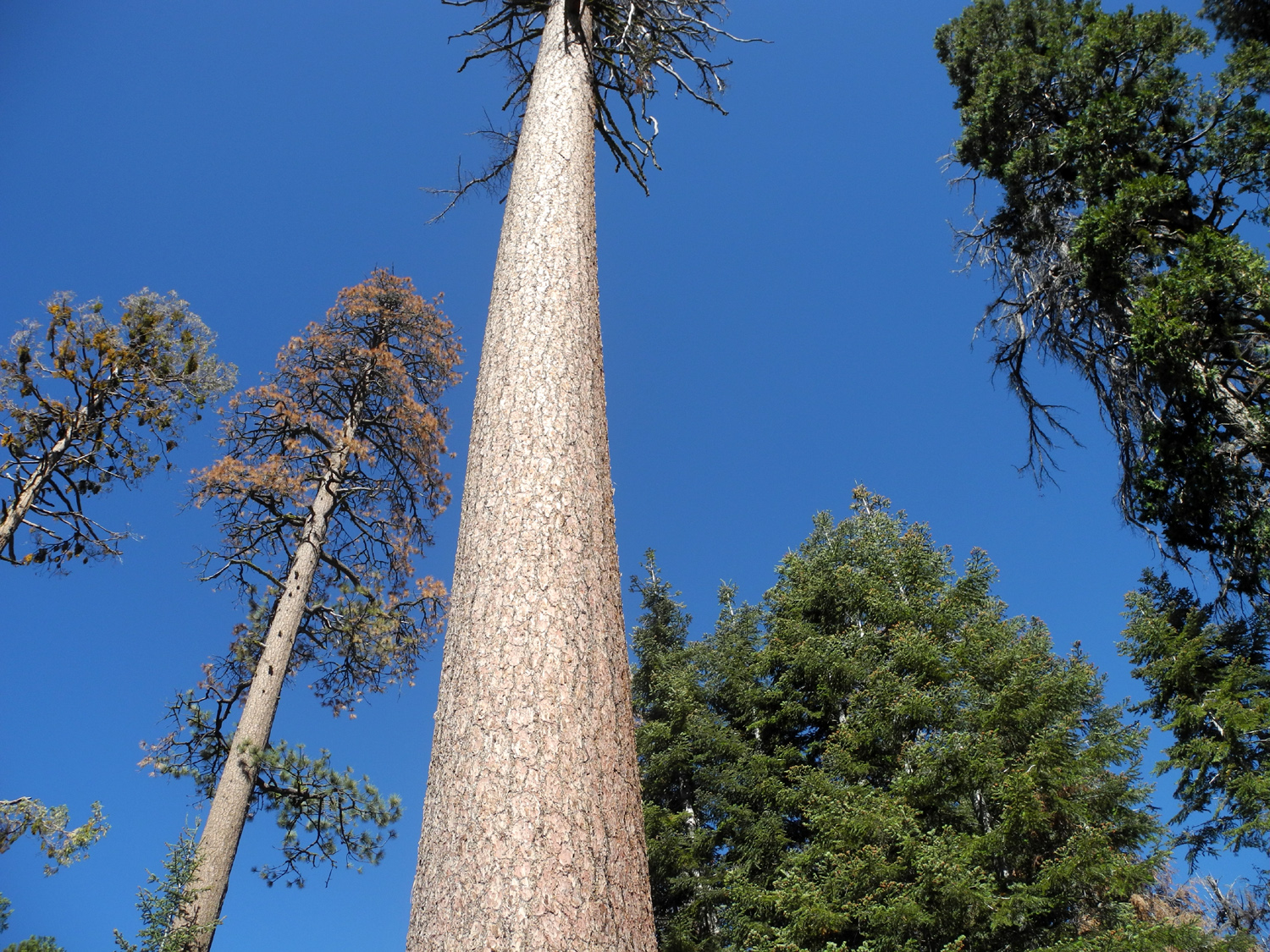 |
||
| A Colton's eye view of the big sugar pine by our camp | ||
| San Joaquin River Gorge West | ||
 |
|
 |
| The first green grass of the season | These two leaf clusters appear less than three feet apart on the same tree | |
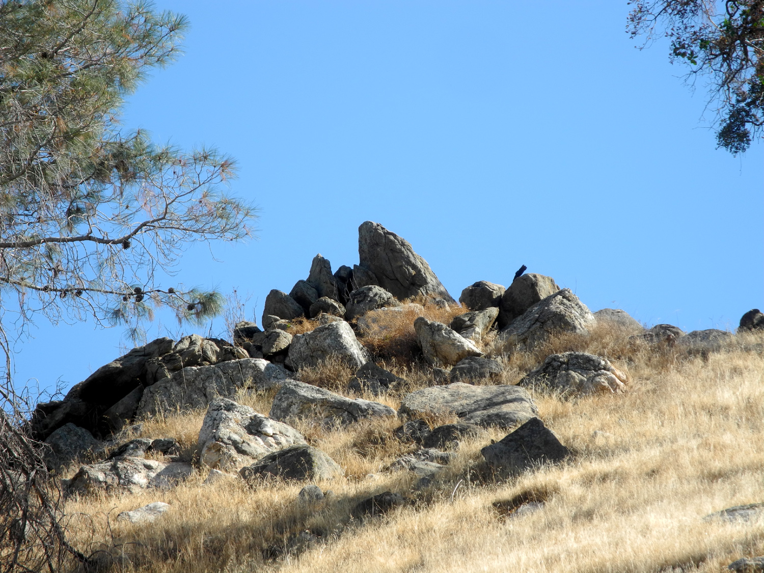 |
|
 |
| Some jagged rocks above the trail | I always have to photograph the Finegold Creek cove | There's a good crop of acorns this year |
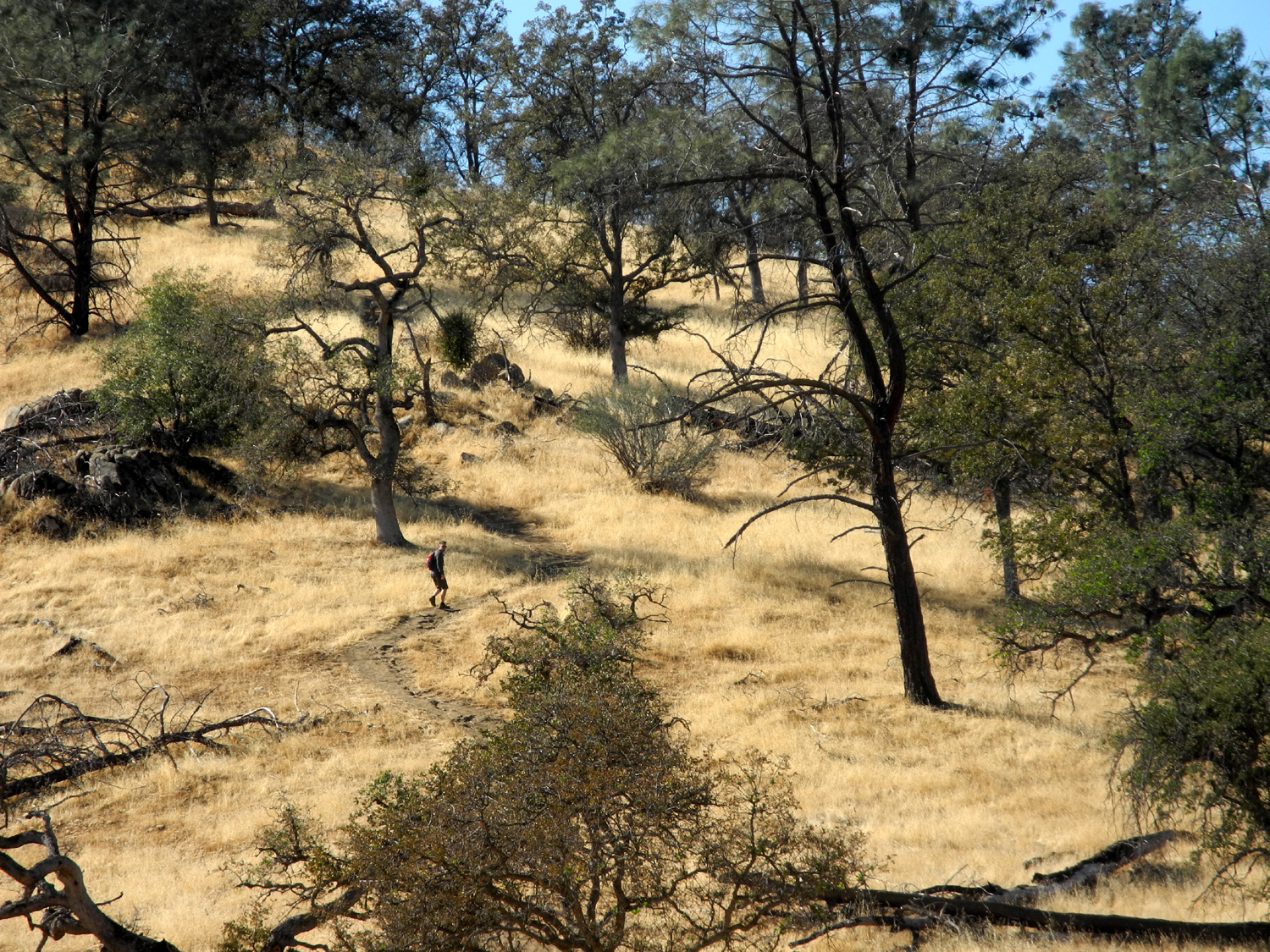 |
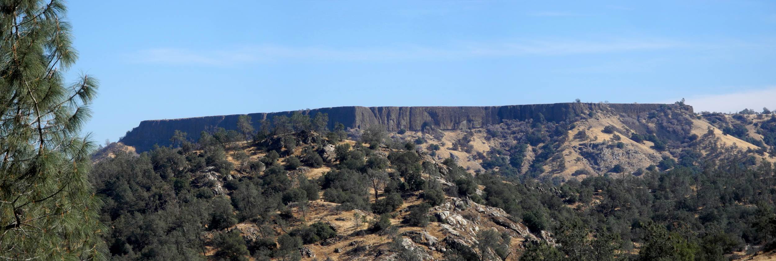 |
|
| Hiker heading for the top of Pincushion Peak | One of several table mountains seen along the San Joaquin River | |
| Thanksgiving at the Gorge II (Acorn Camp) | ||
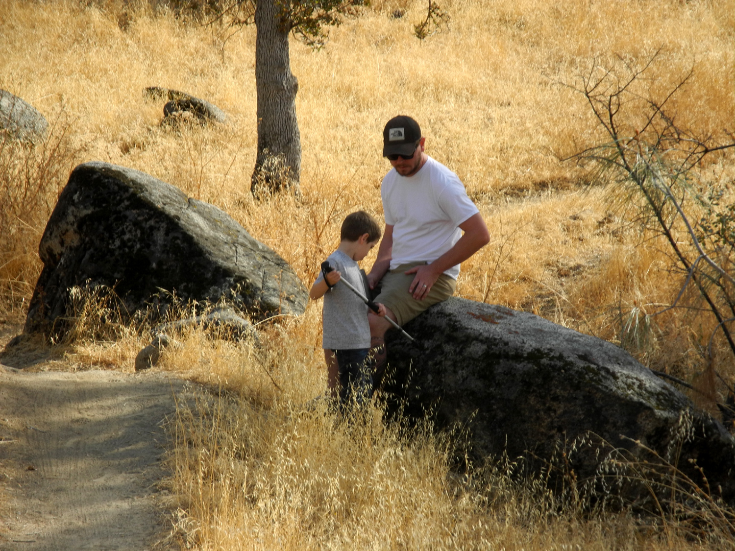 |
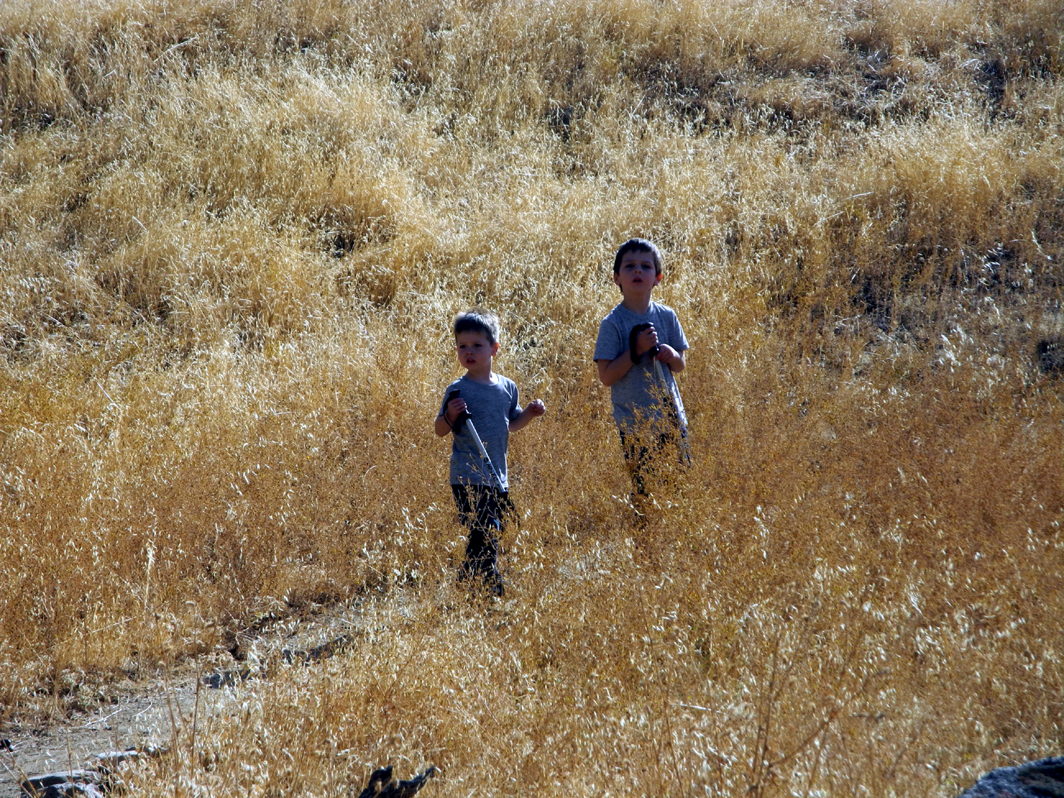 |
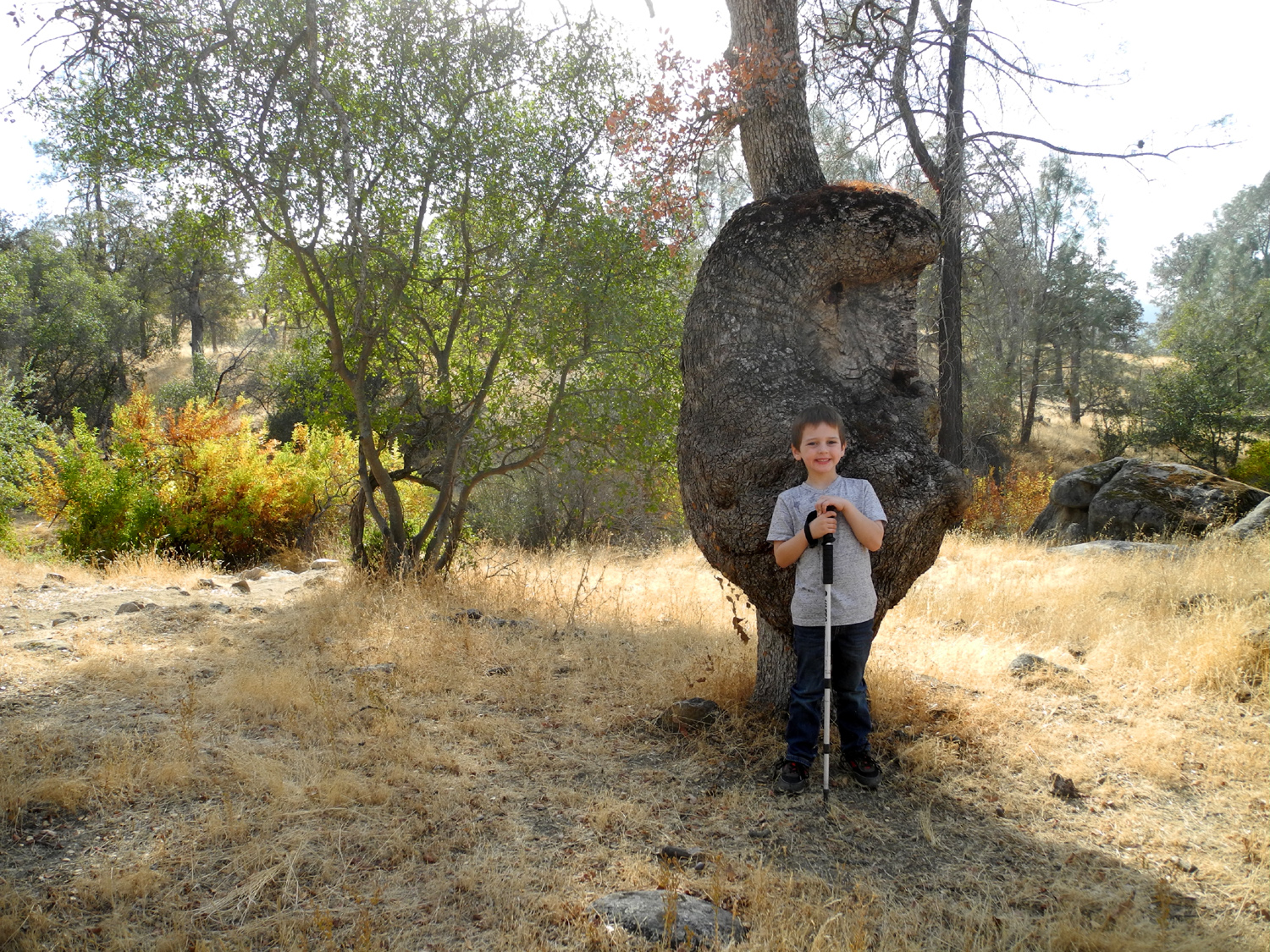 |
| Colton and Johnny on the San Joaquin River Trail | Jack and Colton | Colton at the Big Burl |
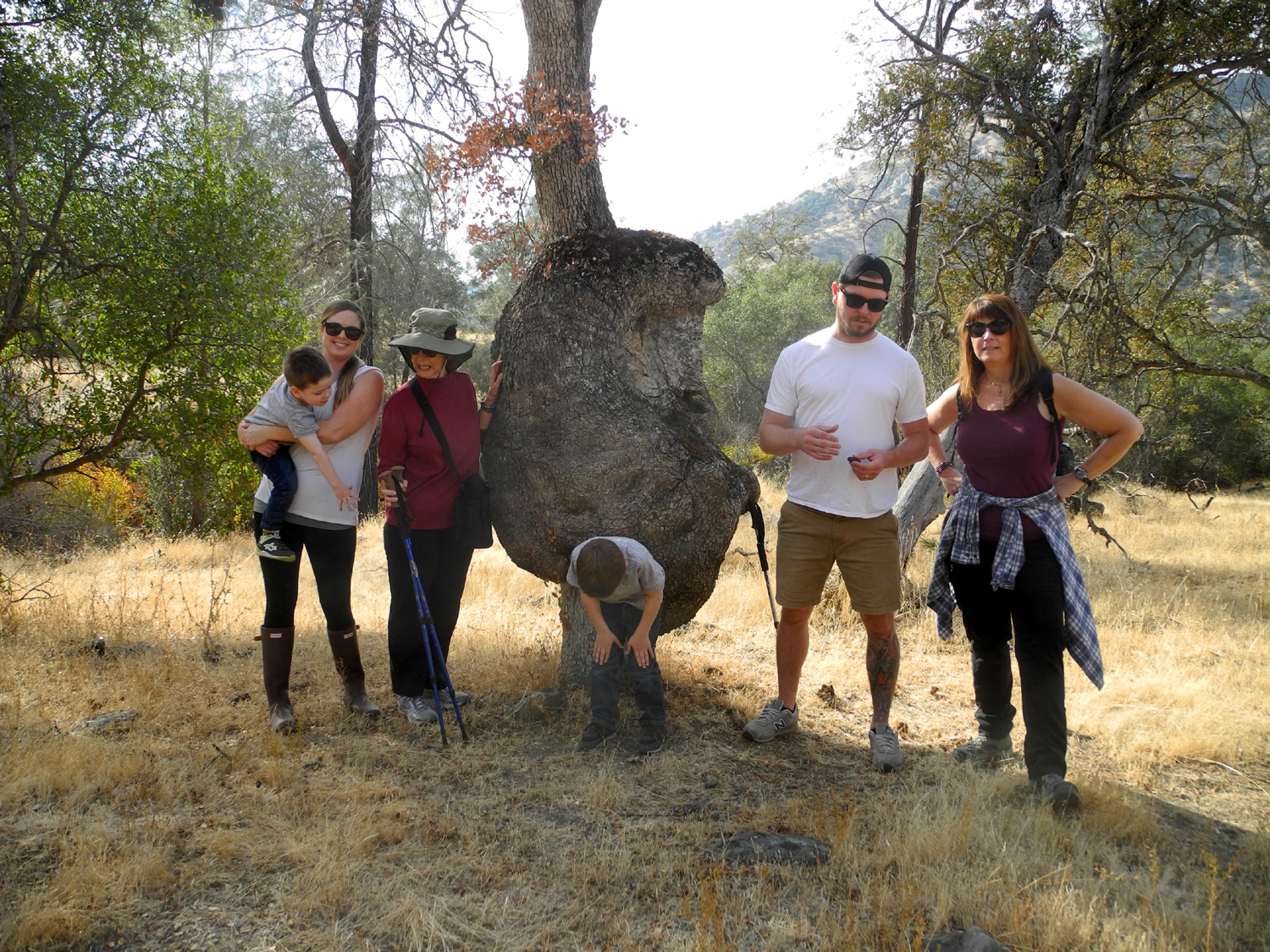 |
|
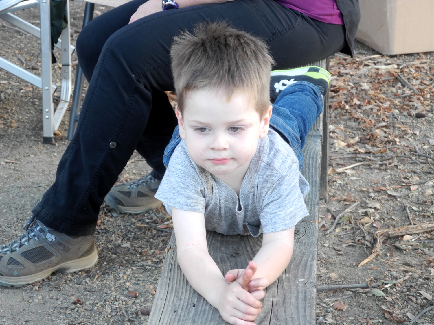 |
| Jack, Brittany, Jackie, Colton, Johnny and Jennifer at the Big Burl | Mother and daughters: Teri, Jackie, Jennifer | Jack on the picnic table bench |
 |
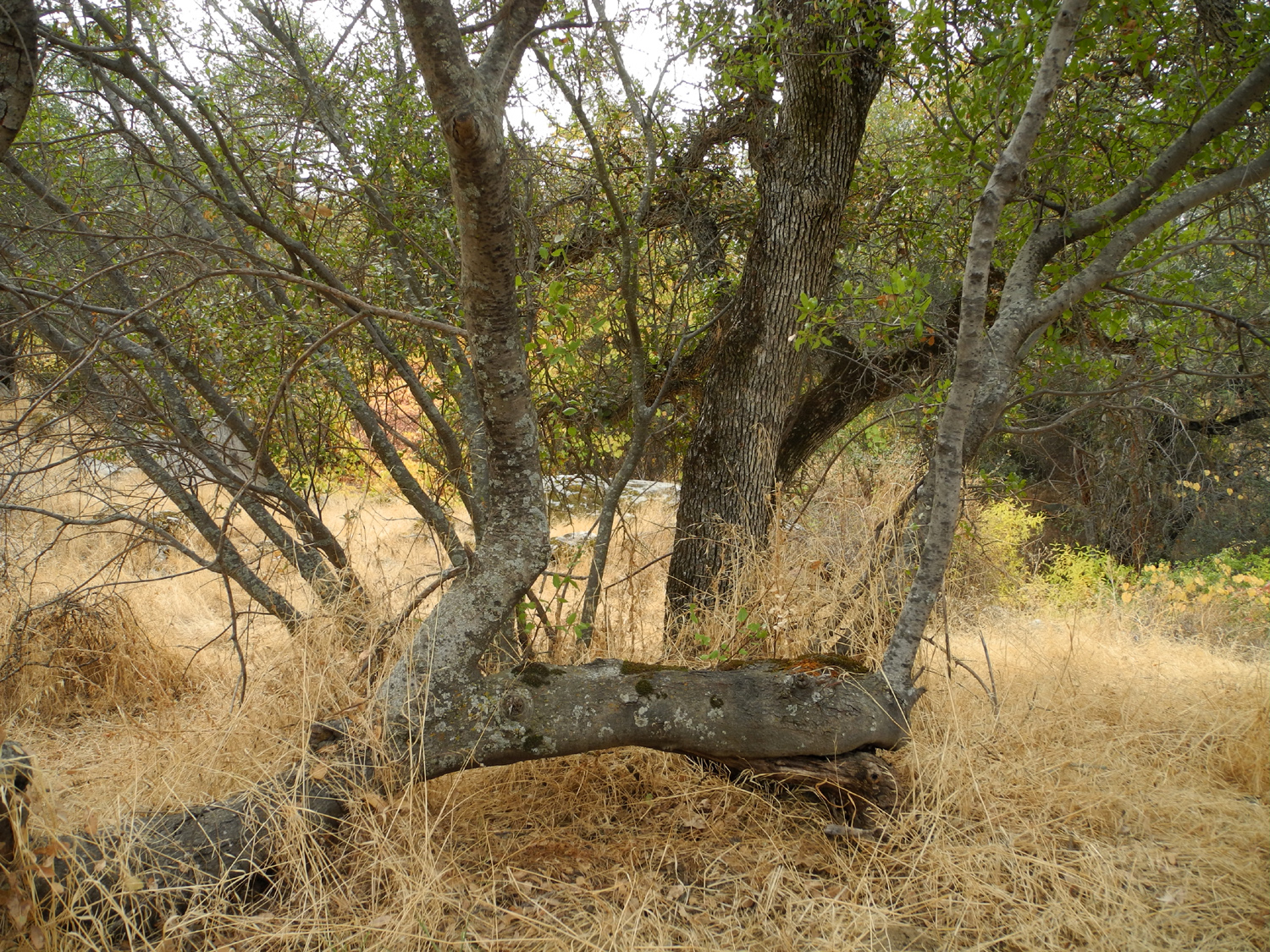 |
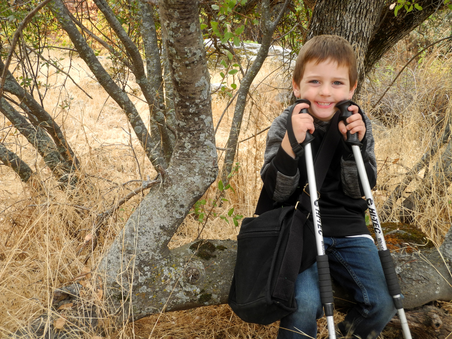 |
| Tarantula on the Bridge Trail | Nature designed this tree just for us to sit on | Colton at the Resting Tree |
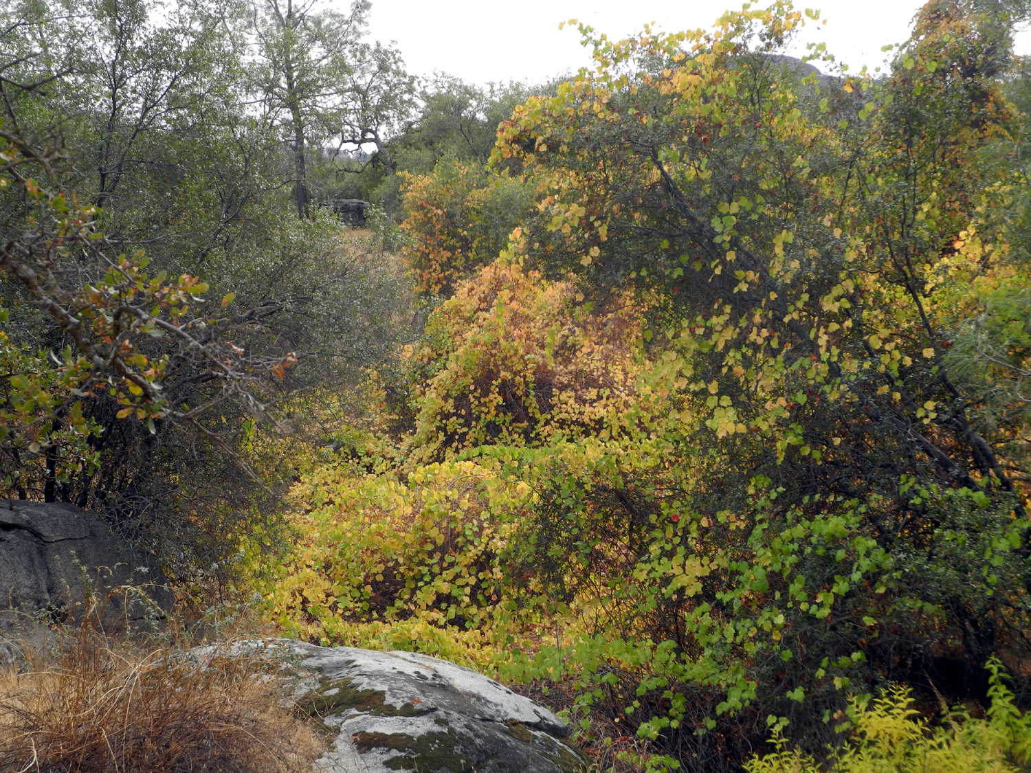 |
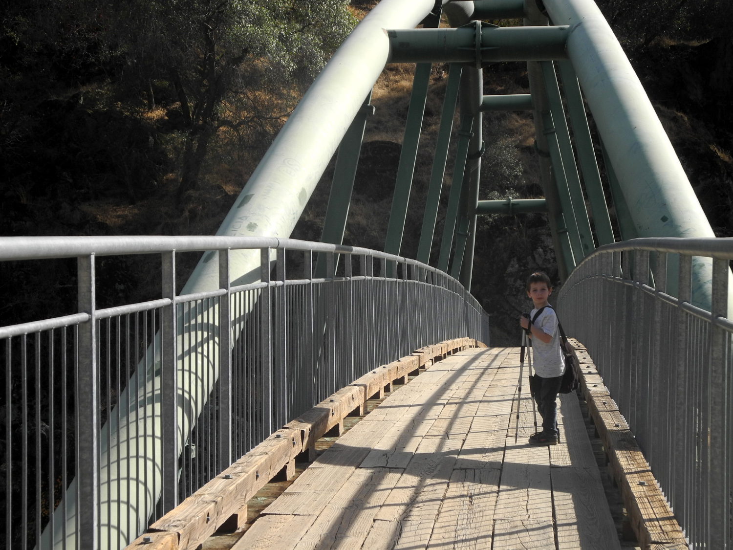 |
|
| Grapevine Gulch | As we first approached the bridge, Colton thought the suspension beams were a slide | A little boy and a big bridge |
 |
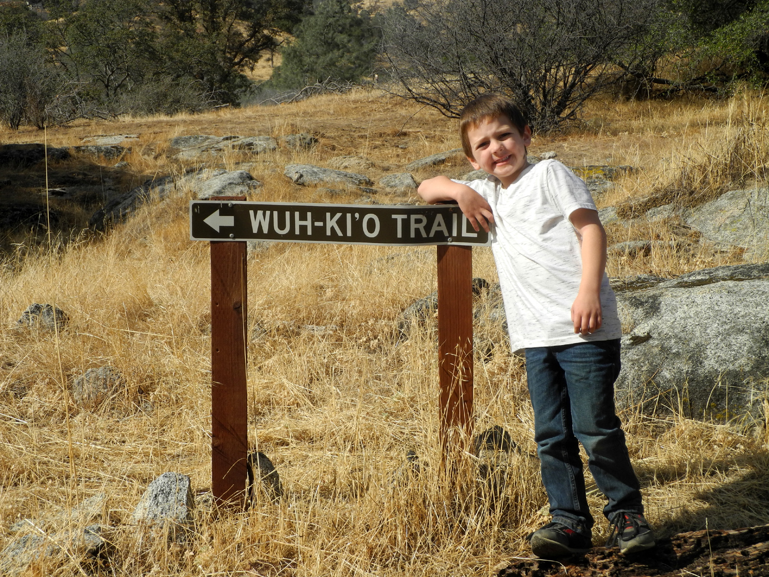 |
 |
| Snack time at the bridge | At first, Colton did not want to walk through the weeds to pose by the sign... | ...but he was soon jumping from rock to rock and made the circuit several times |
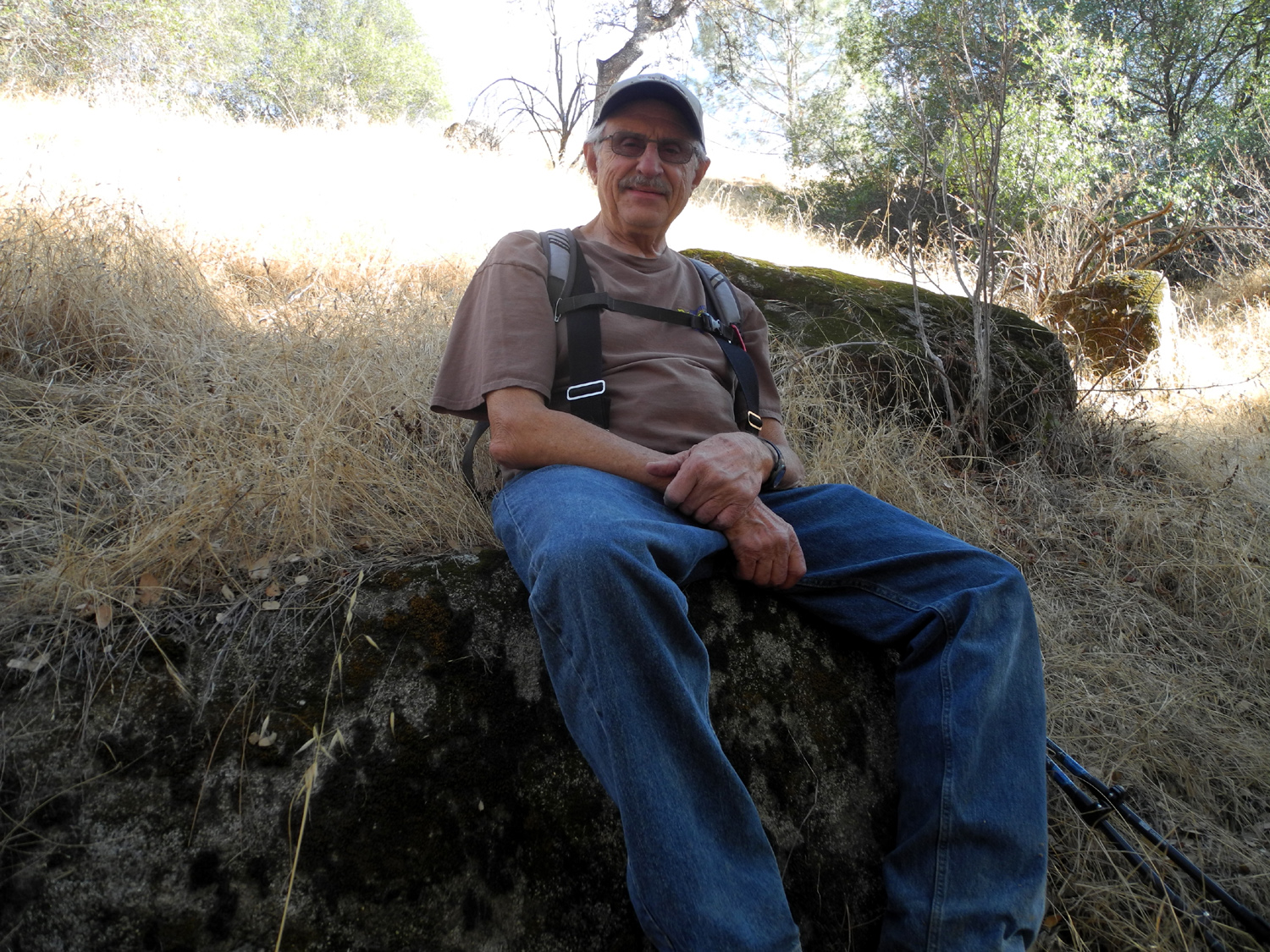 |
 |
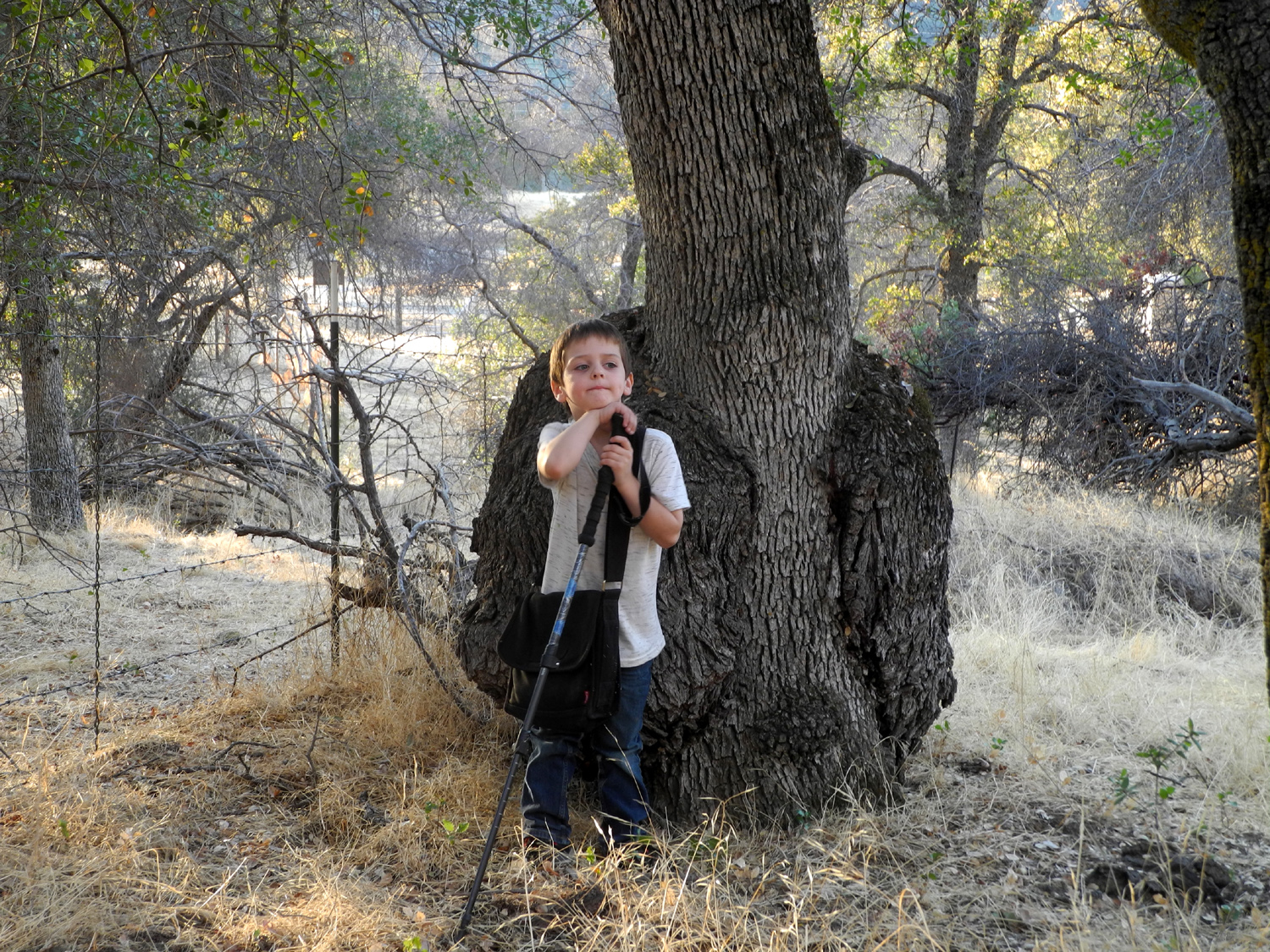 |
| Colton captures Grandpa Dick resting by the trail | Emergency snack stop |
We discovered another fairly big burl near the Nature Trail |
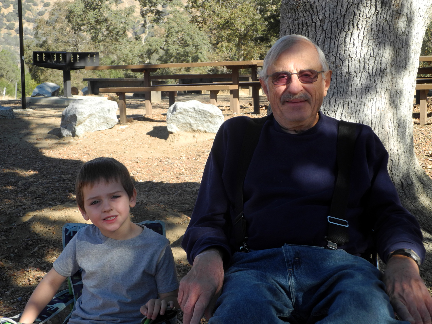 |
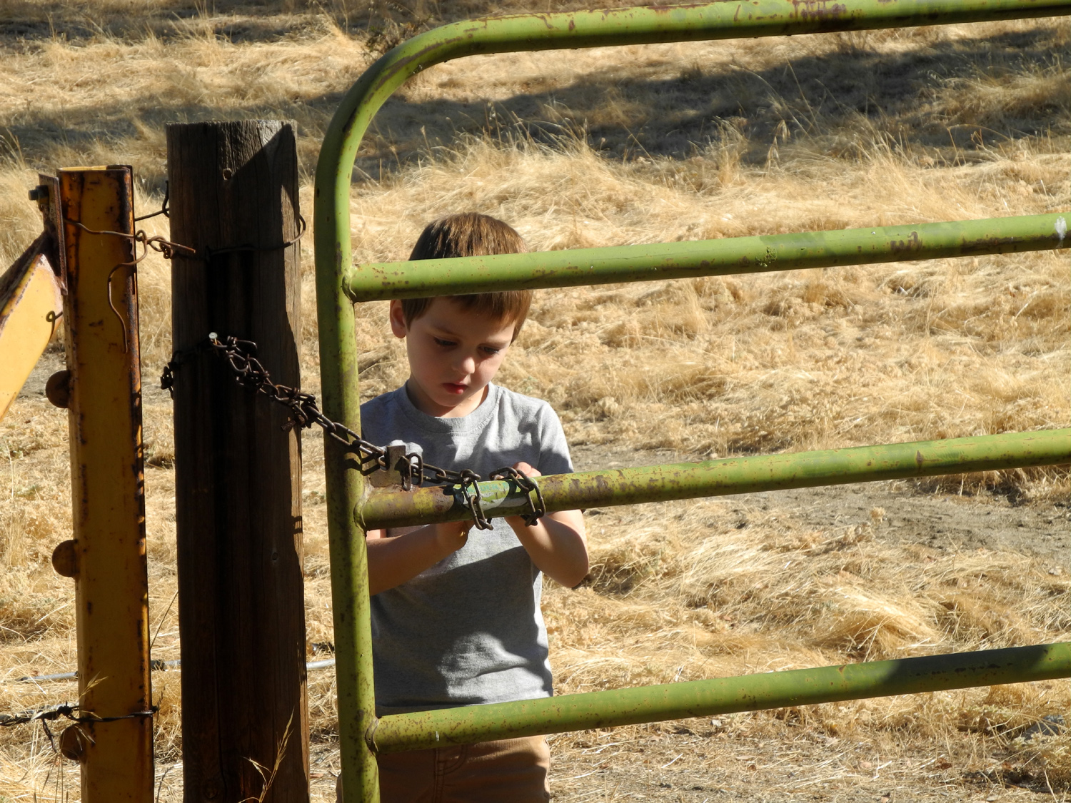 |
|
| Colton and Great Grandpa Dick in camp | Colton had a great time opening, climbing on, and swinging on this gate |
He's been fascinated by cattle guards since he was a toddler |
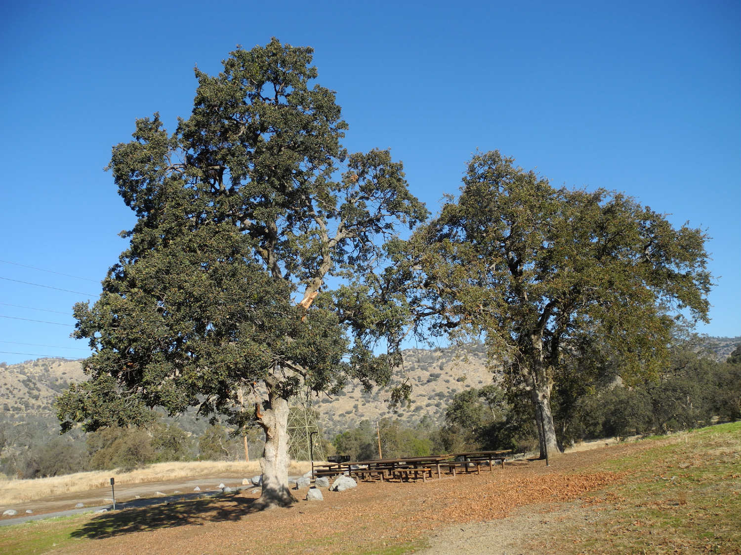 |
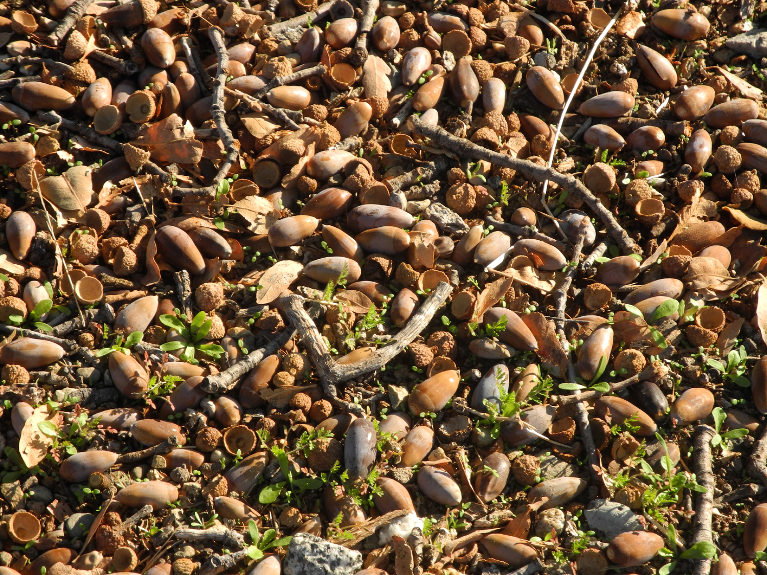 |
|
| Blue oak trees in Group Camp area | And the acorns they produced | |
| Cat Sitting, Hiking & Glacier Point | ||
|
 |
 |
| Bull pines and black oaks from Deadwood Grade on Highway 41 above Oakhurst | Bay tree by the Neely Trail | Dry mullein stalks by Old Yosemite Road |
 |
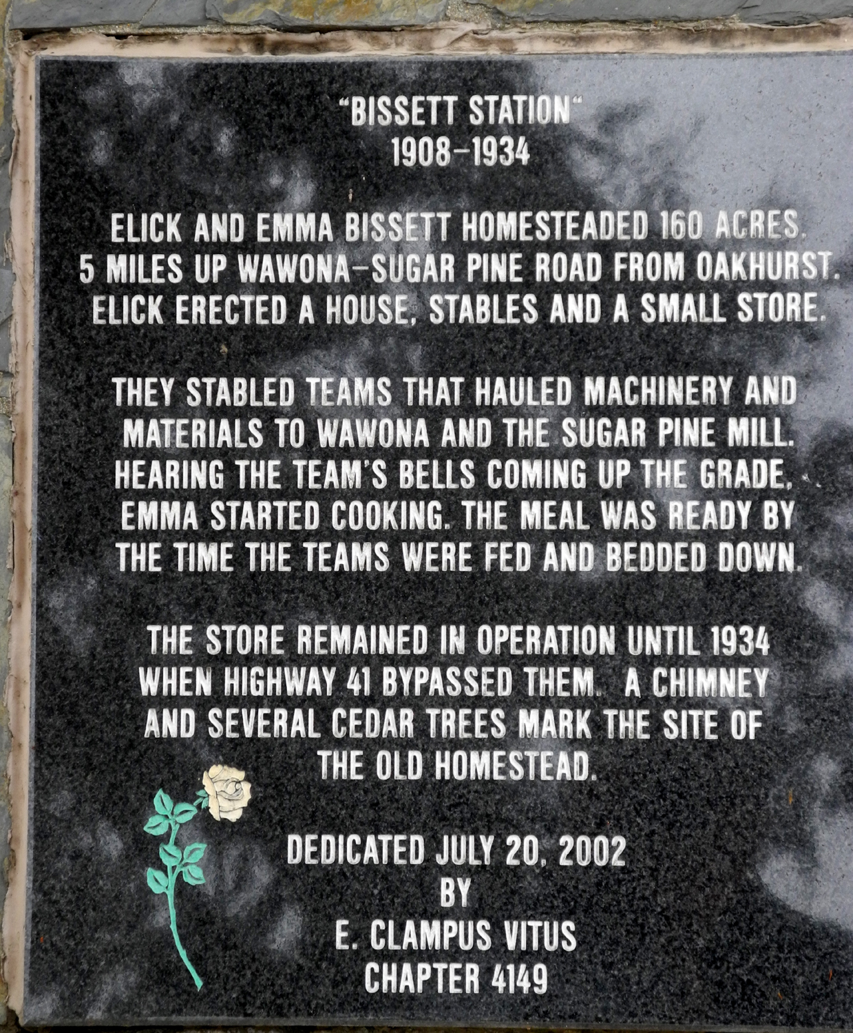 |
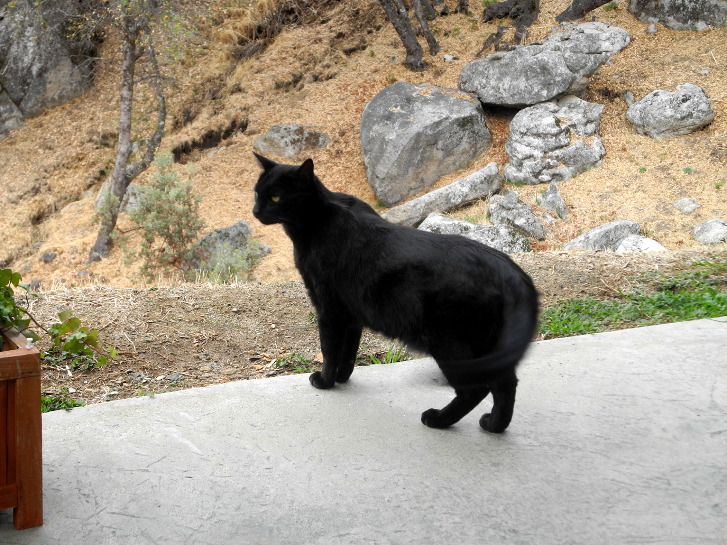 |
| An inter-species relationship | Marking history at Road 620 and Old Yosemite Road | Hombre, Senior Cat, surveying his domain |
 |
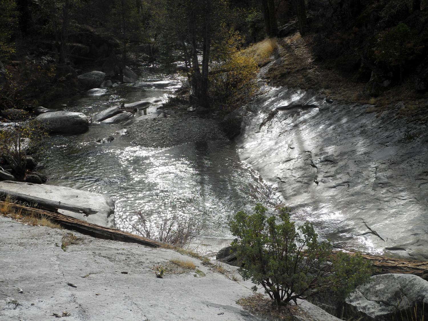 |
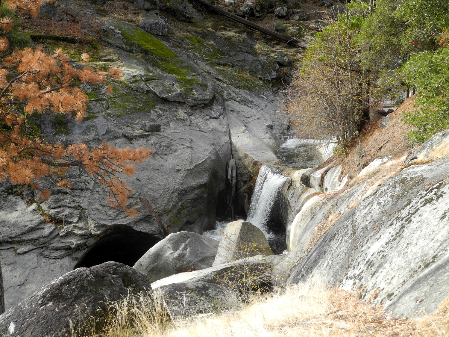 |
| Mossy stump near Chilkoot Camp | Where Willow and Chilkoot Creeks come together | I call this Willkoot Falls |
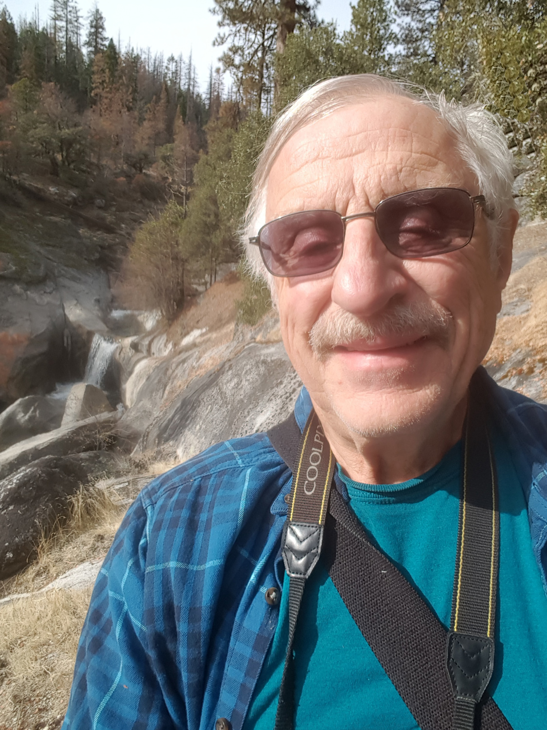 |
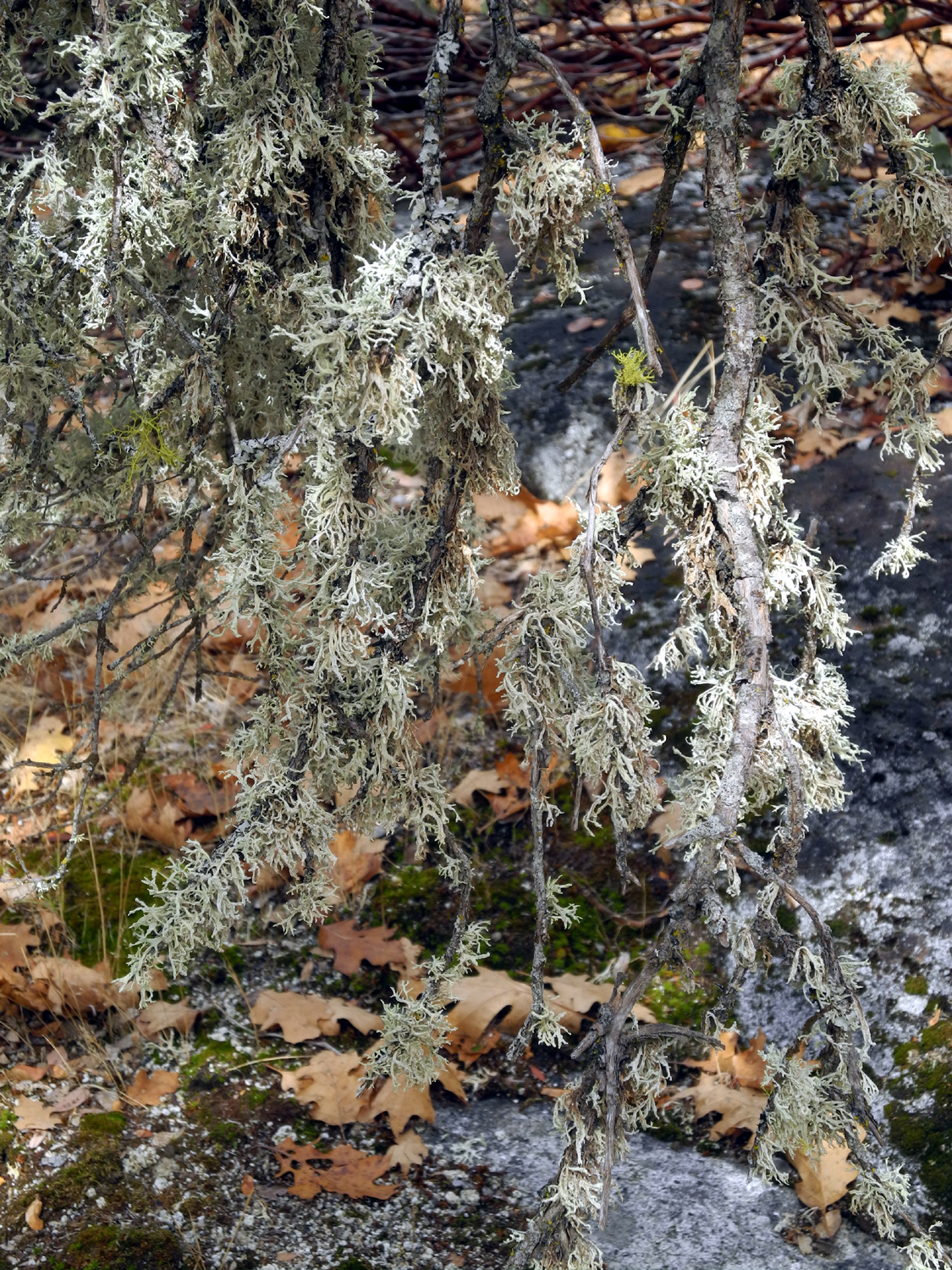 |
 |
| Dick and the waterfall | Spanish moss on tree by Willow Creek | Pothole beside Chilkoot Creek |
 |
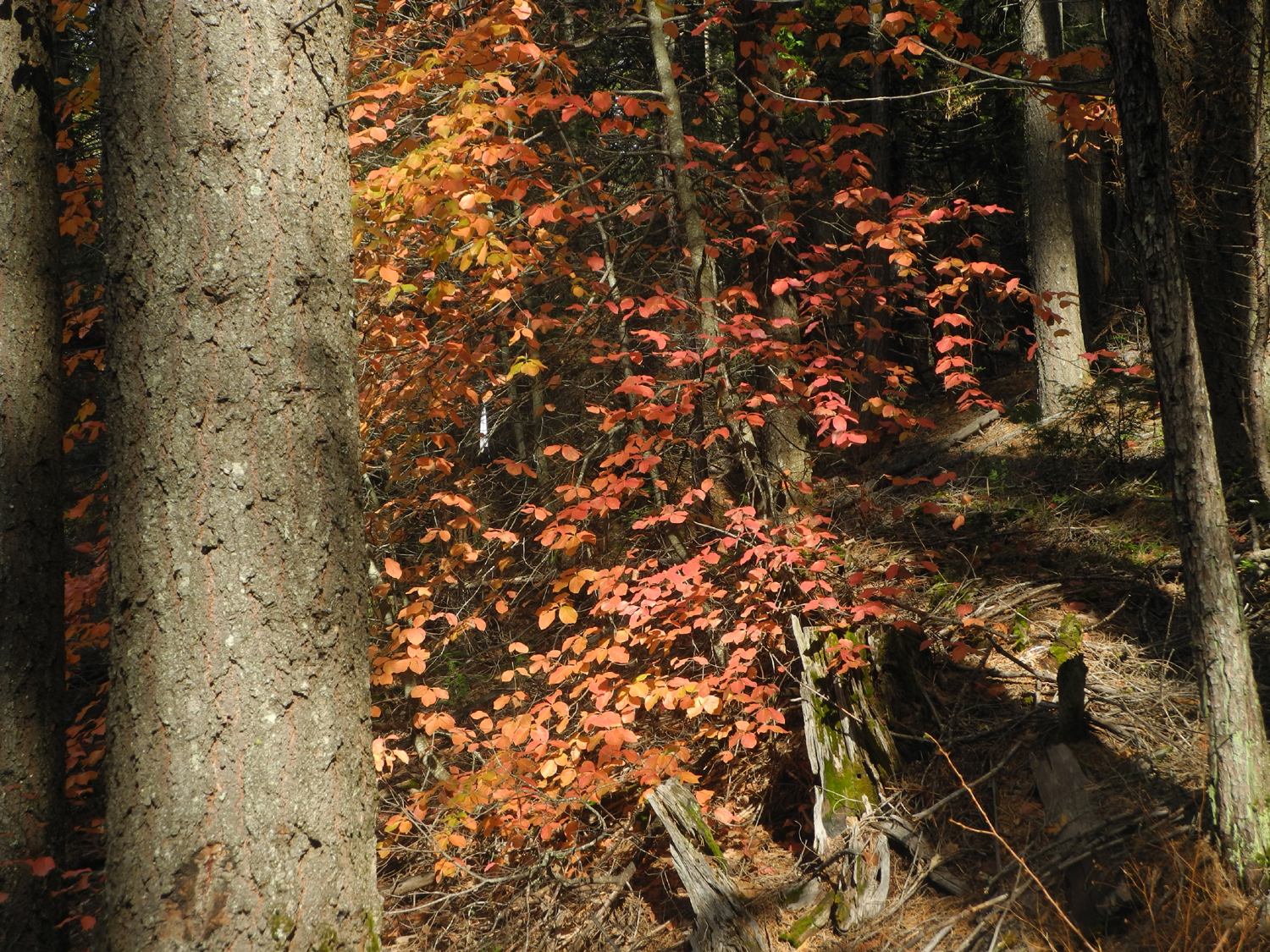 |
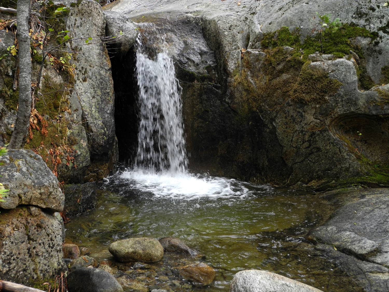 |
| Chilkoot Creek and black oak leaves | Dogwood along Beasore Road | Eight-foot falls on Chilkoot Creek |
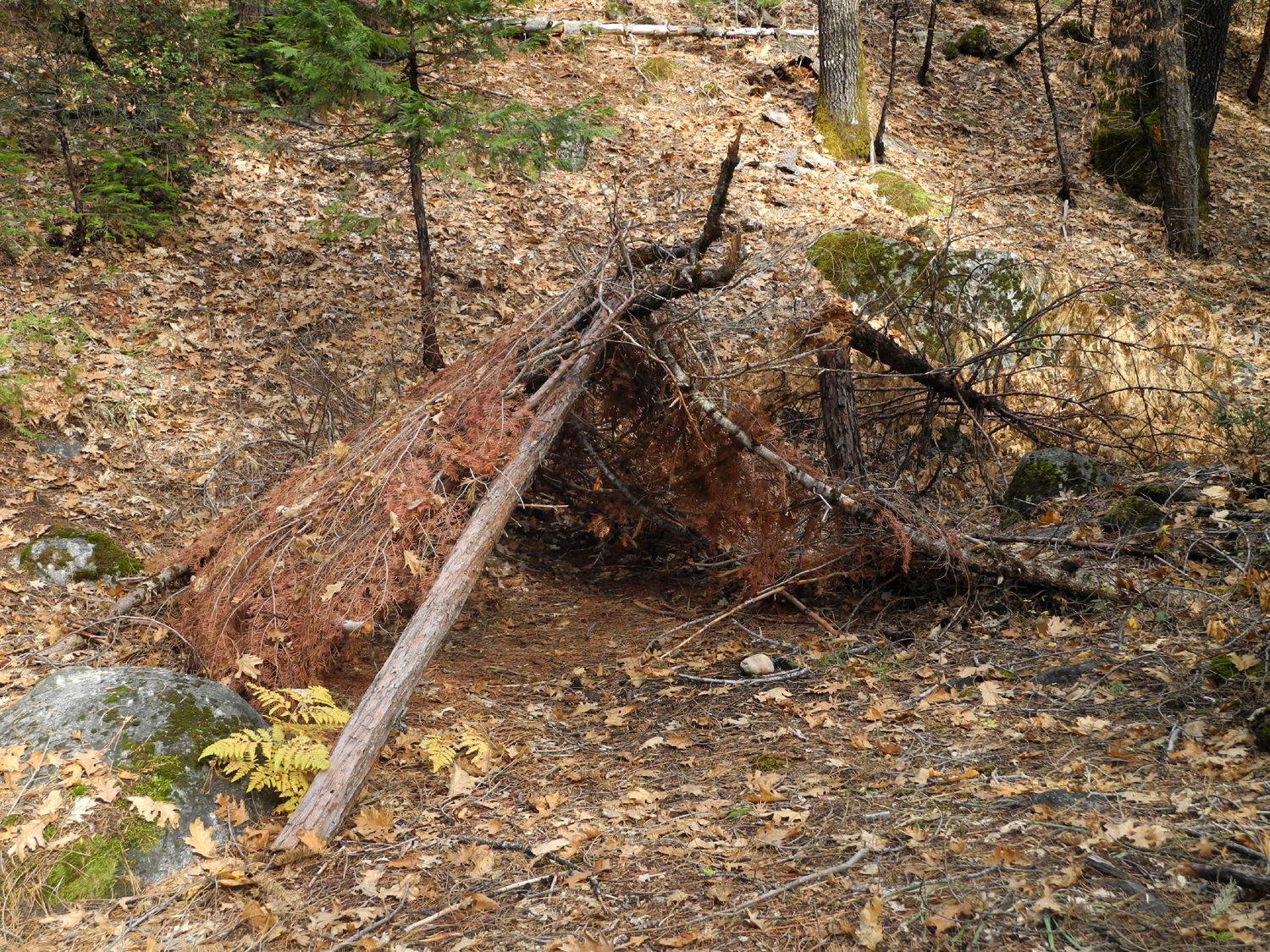 |
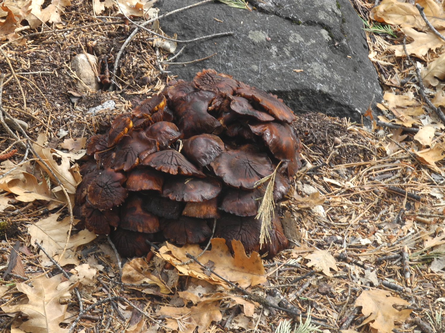 |
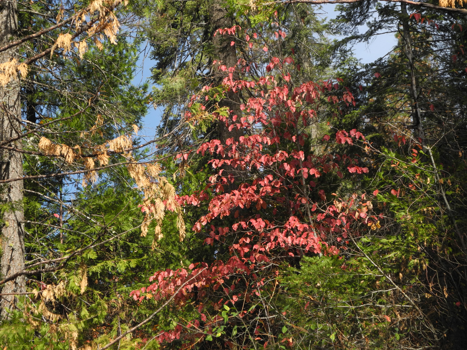 |
| Someone went native | A big clump of mushrooms | Dogwood leaves against green cedars |
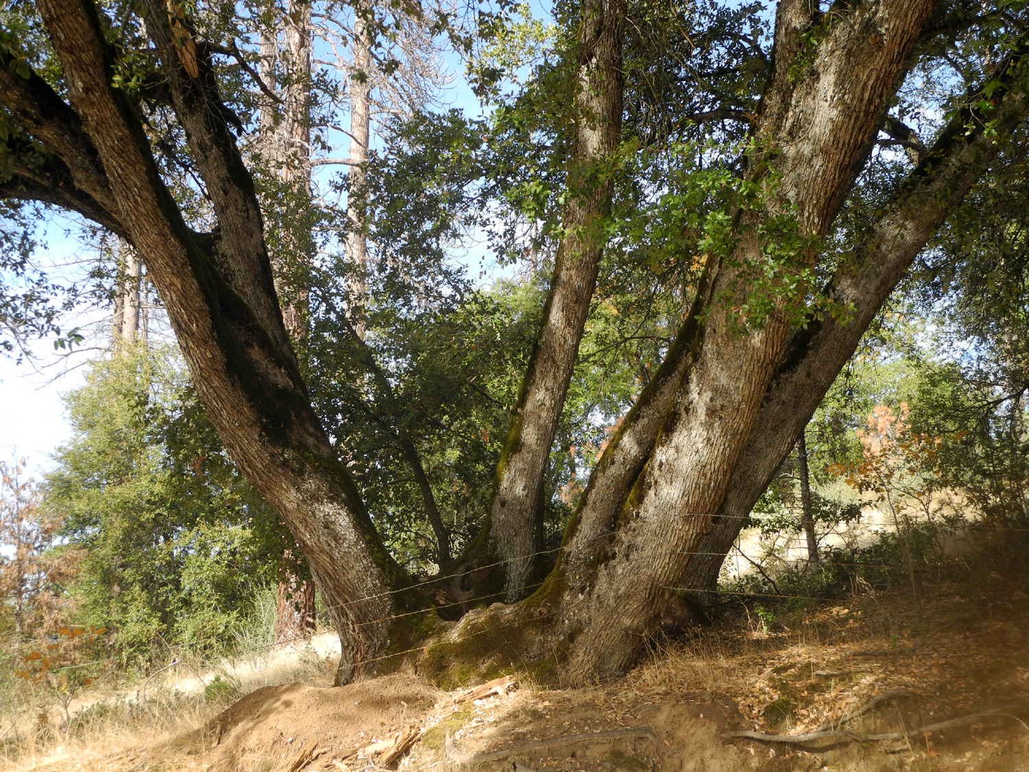 |
 |
 |
| Canyon live oak near Bass Lake Road | The Neely's buckeye crop | Sunset from the Neely patio |
 |
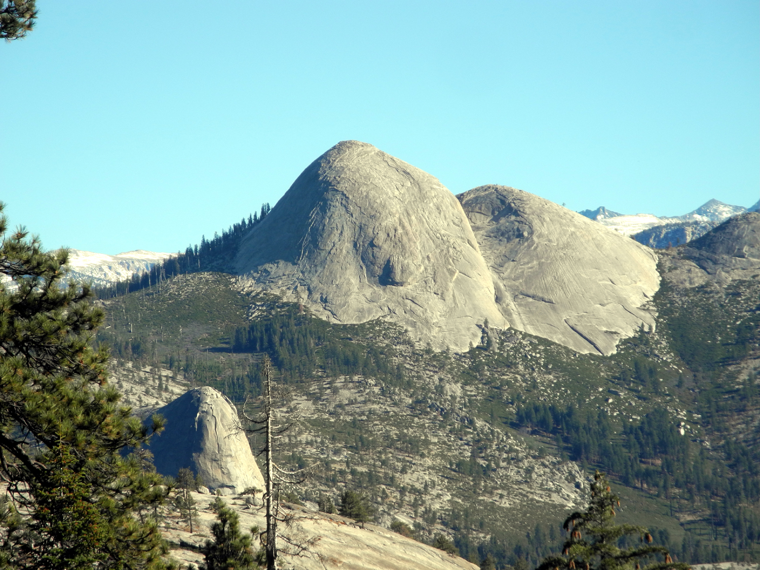 |
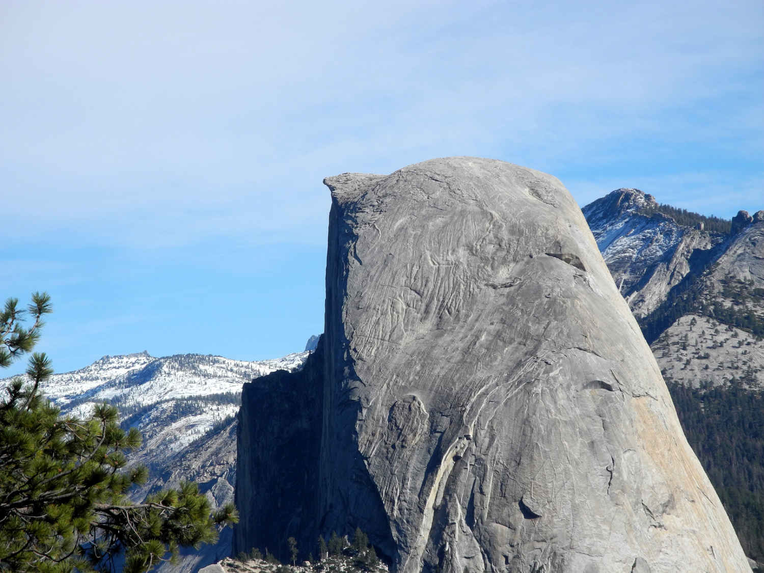 |
| Mt. Clark from Washburn Point | Mt. Starr-King | Half Dome profile from Washburn |
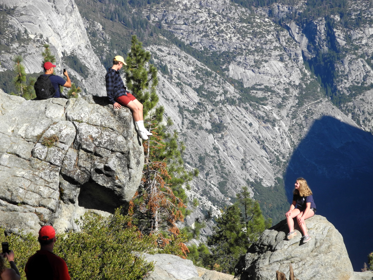 |
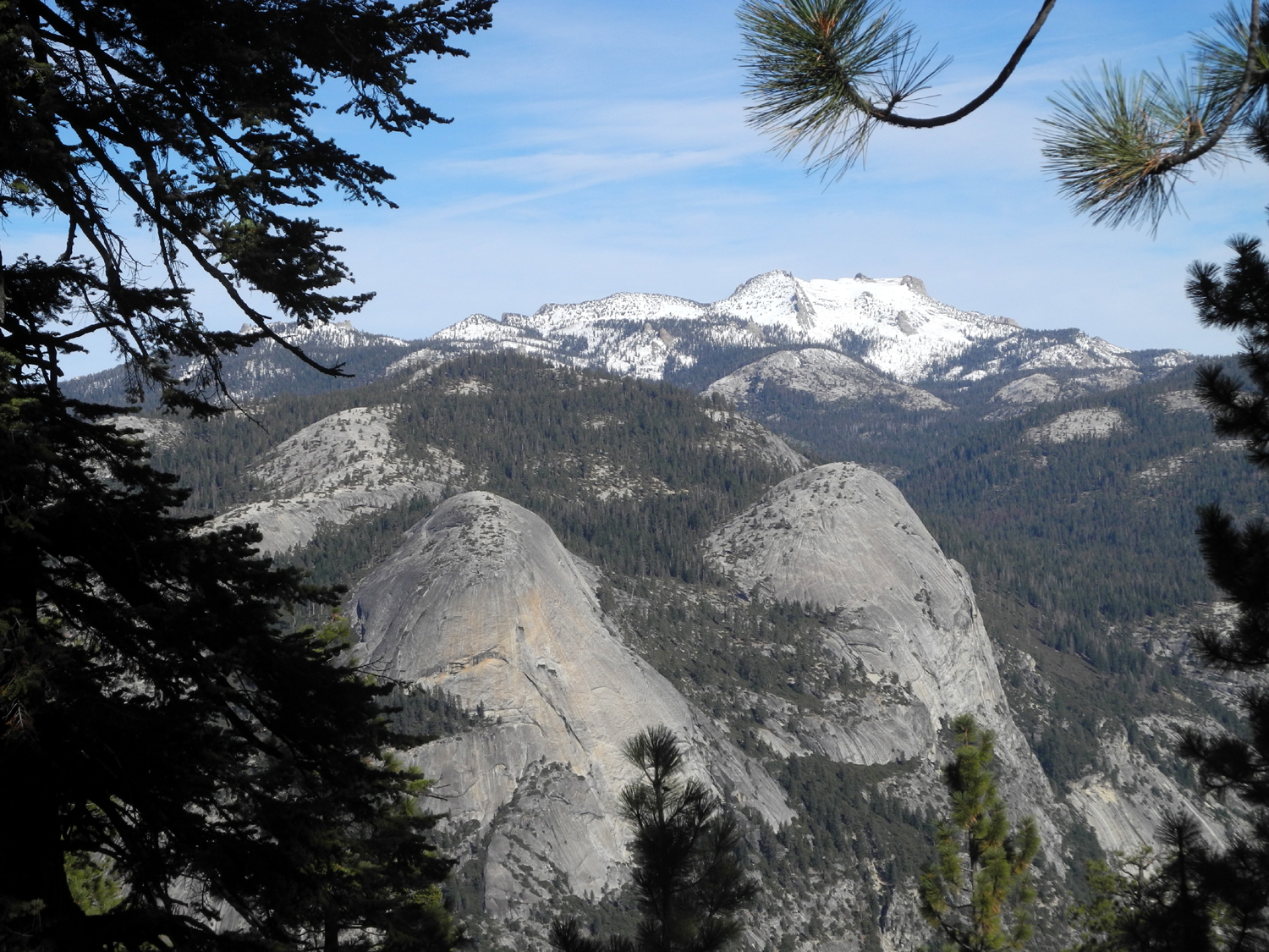 |
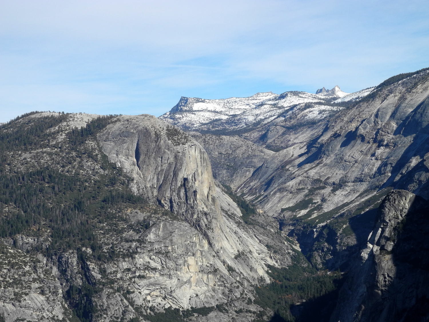 |
| Everybody on the Rock at Glacier Point | North Dome, Basket Dome, and snow-covered Mt. Hoffman on the horizon | Tenaya Canyon; Mt. Watkins at left |
|
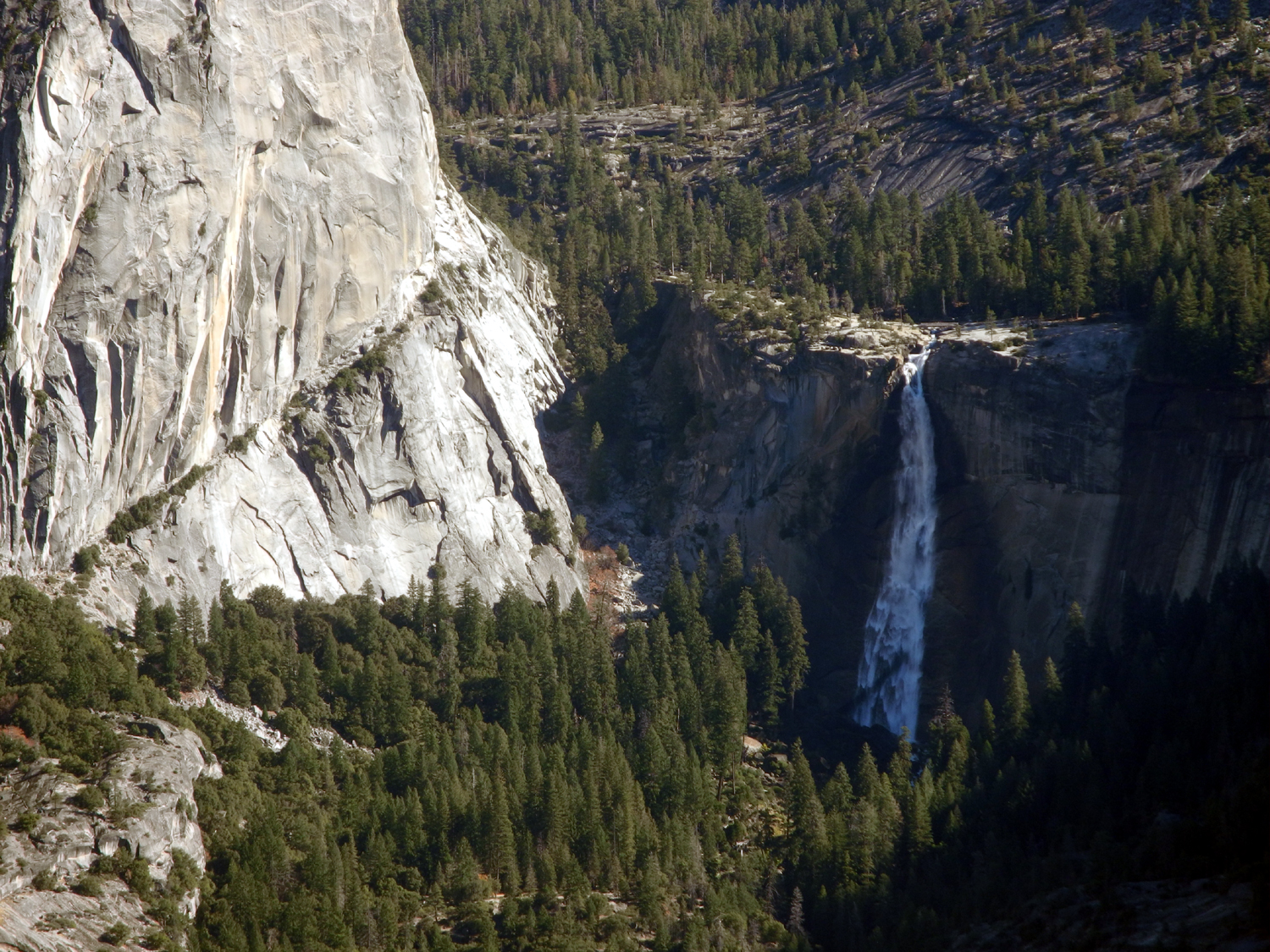 |
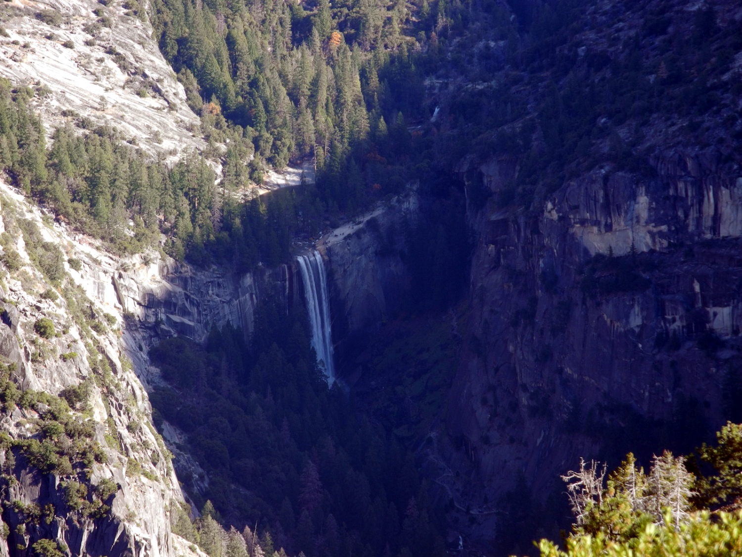 |
| Glacier Point's famous Overhanging Rock and Yosemite Falls | Nevada Falls | Vernal Falls |
 |
||
| Panoramic view from Glacier Point of Mt. Clark (11,522 feet) and Mt. Starr-King (9,052 feet) | ||
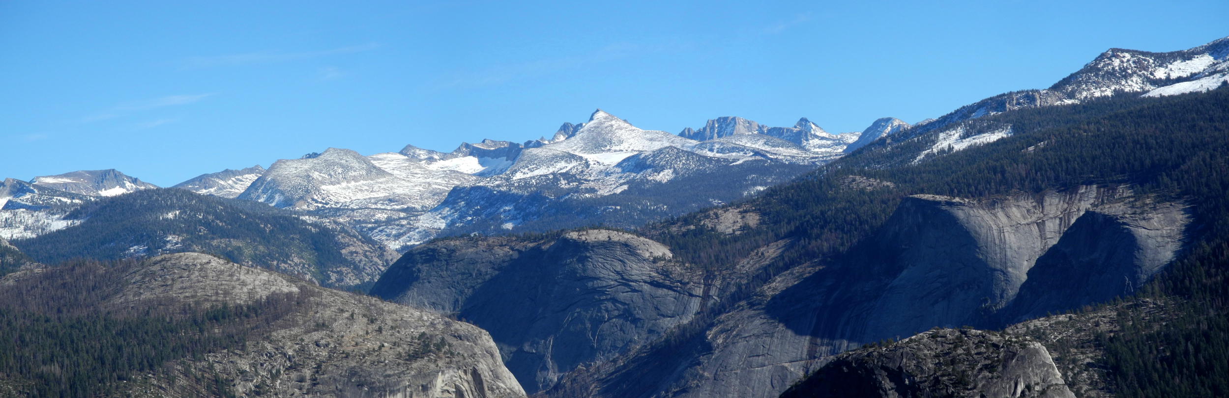 |
||
| High Sierra panorama above the Merced River drainage | ||
| Canal Walk with Jack | ||
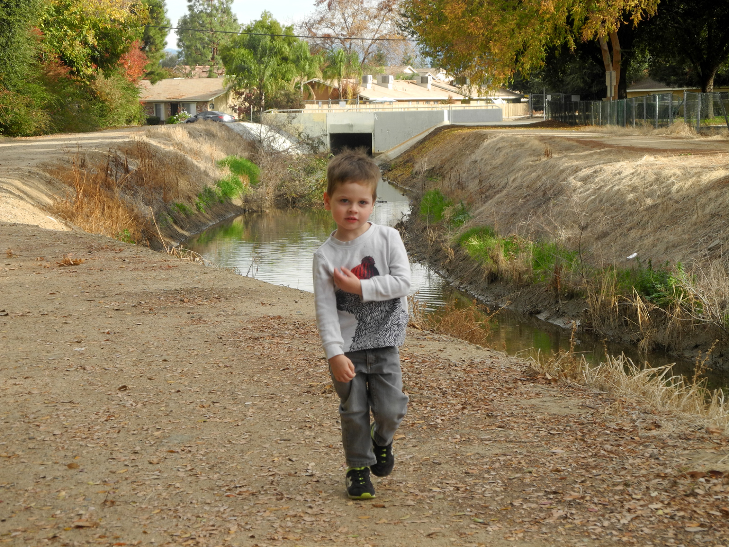 |
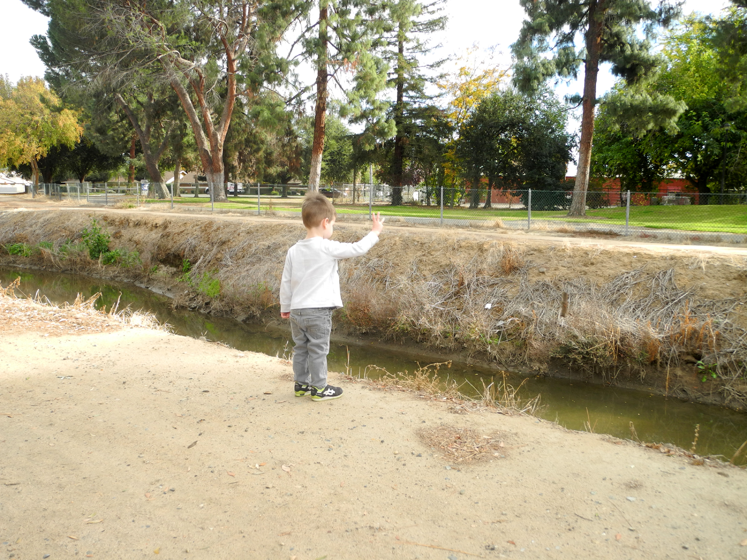 |
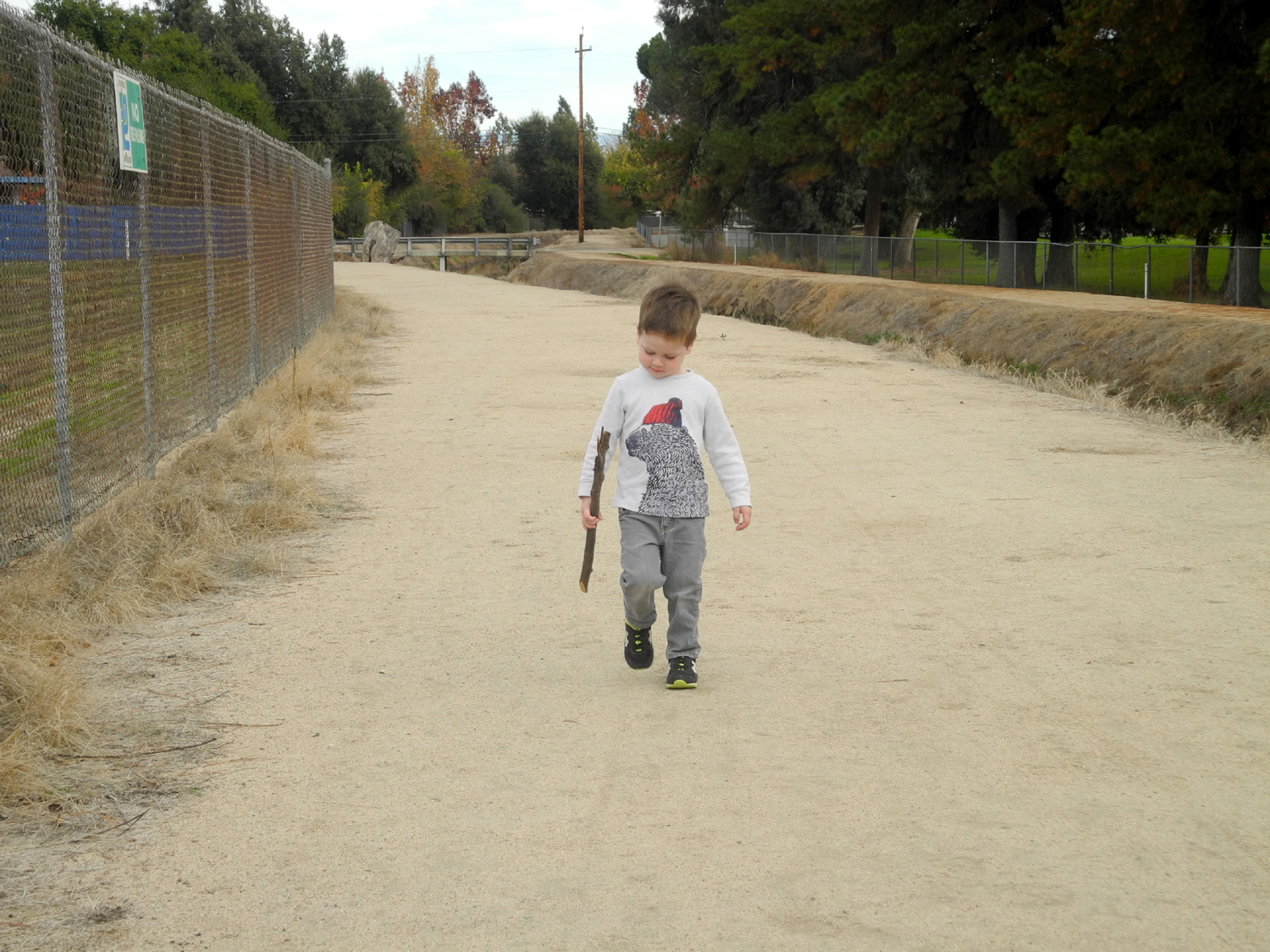 |
| It took 20 minutes to get this far | The main purpose of water - to throw rocks in | Of course, he managed to find a magnificent stick |
|
|
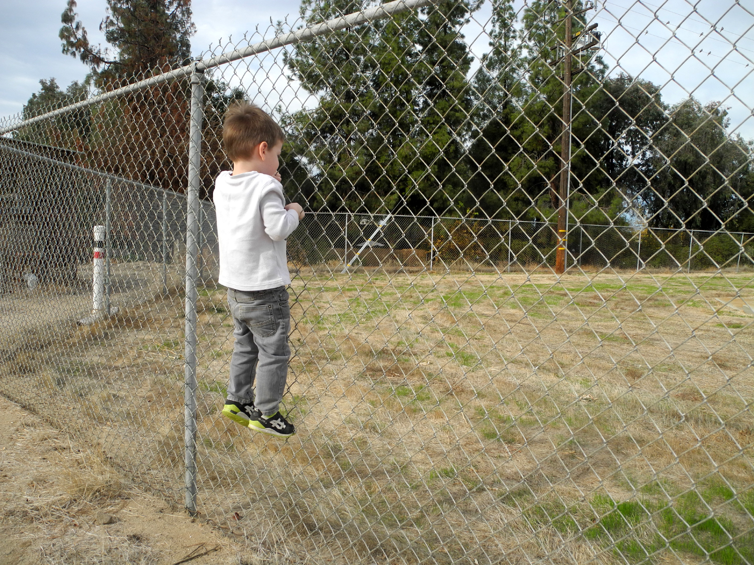 |
| Observing the millipede | A place of great fascination | I challenged him to climb the fence |
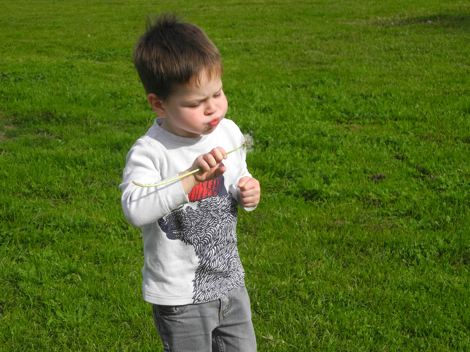 |
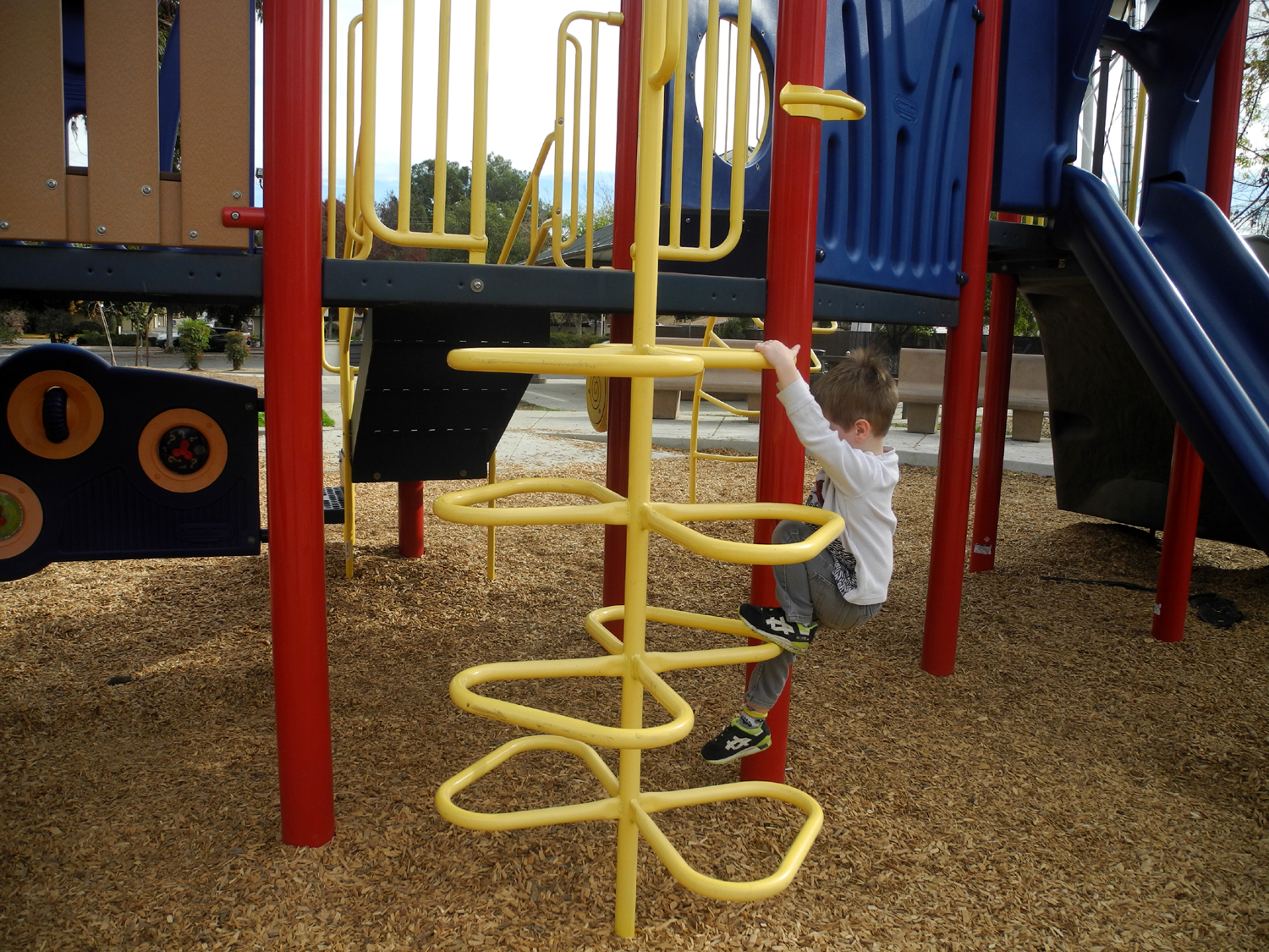 |
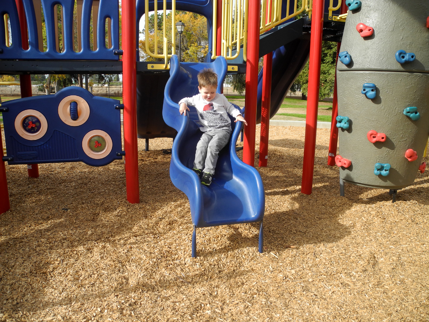 |
| Dispersing dandelion seeds in the park | The best part of the canal walk for Jack | This
slide drops you down in three rather sudden bumpy steps |
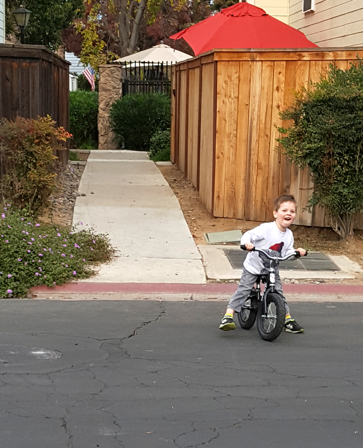 |
||
| Bike riding in my condo complex after our walk | ||
| San Joaquin Bridge Trail | ||
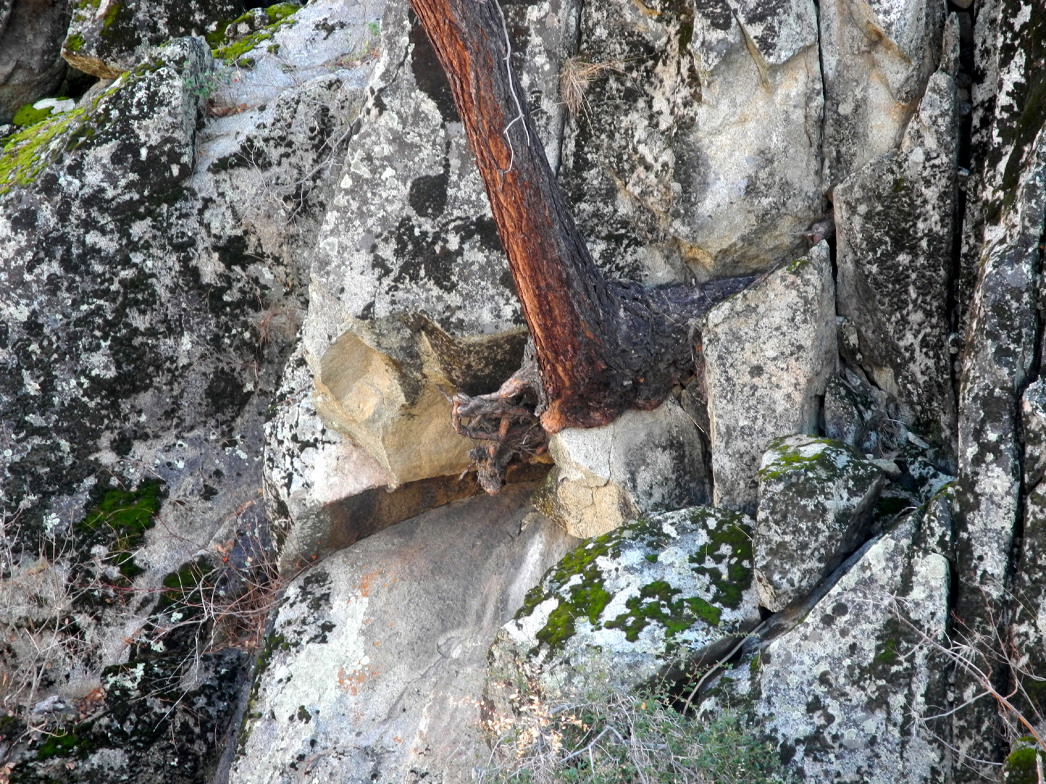 |
|
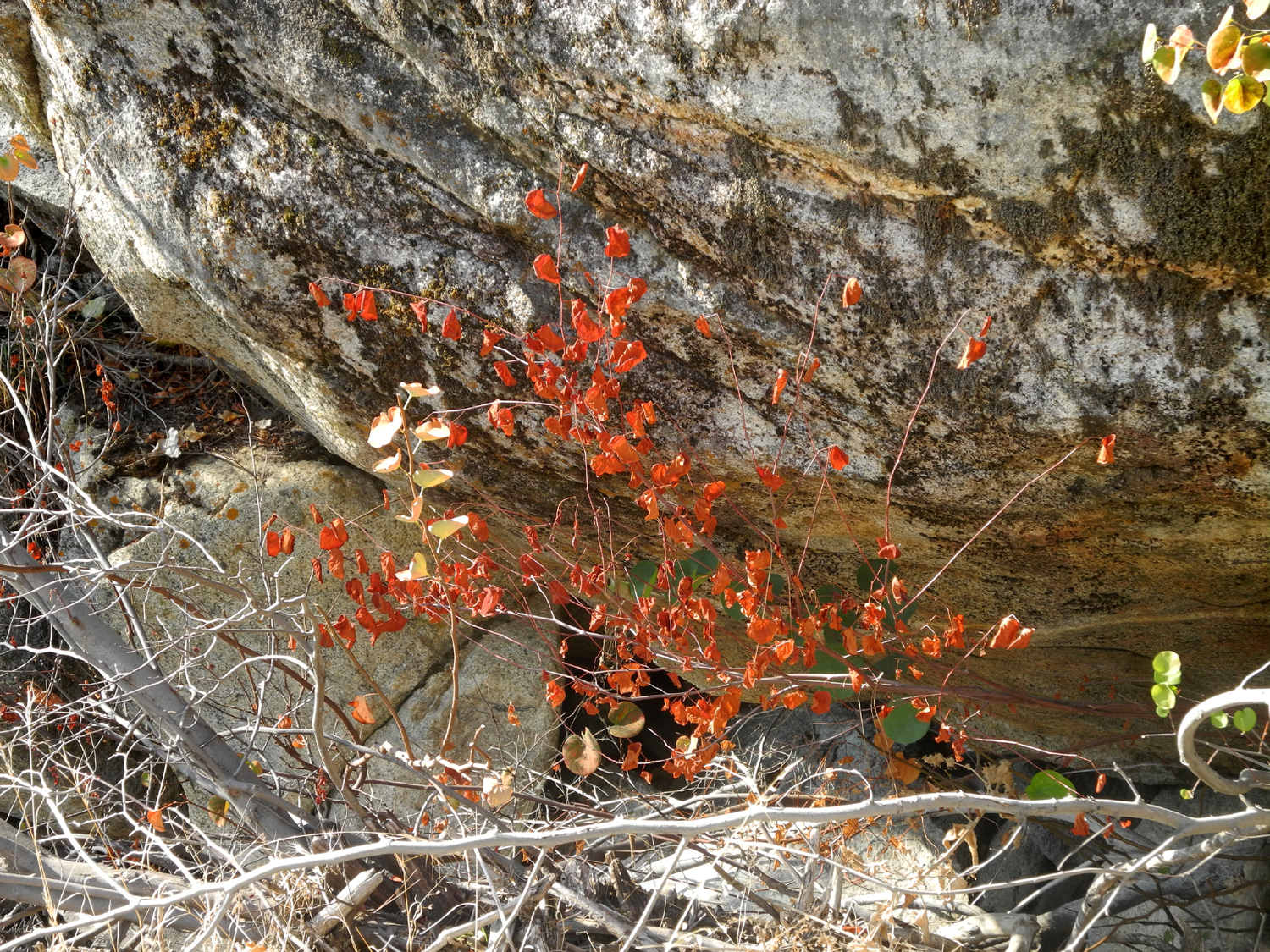 |
| This pine seems to be standing on a rock pedestal | The San Joaquin River was running high | Bright red leaves in a little creek drainage |
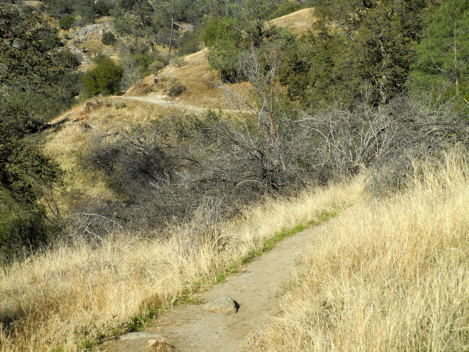 |
|
 |
| View along the trail | One of the few wild grape vines that still had its leaves | View of the river down stream from the bridge |
| Grant Grove Day Trip | ||
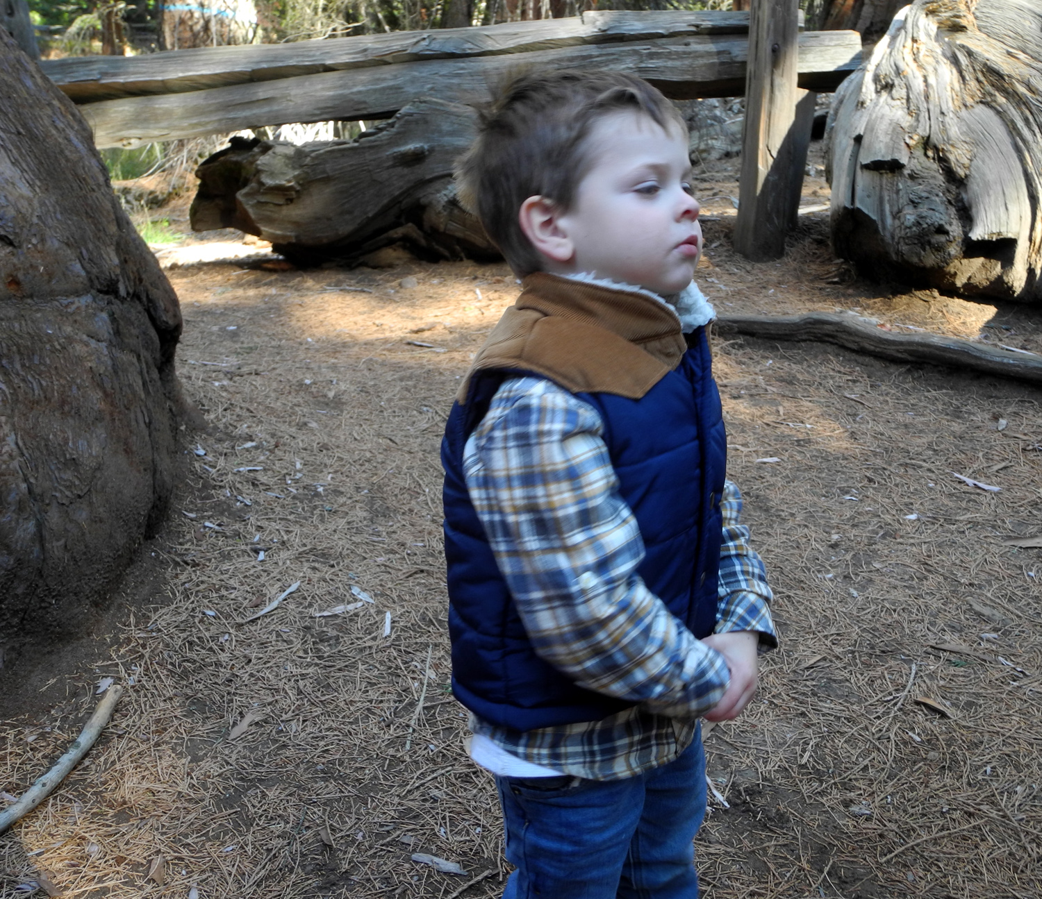 |
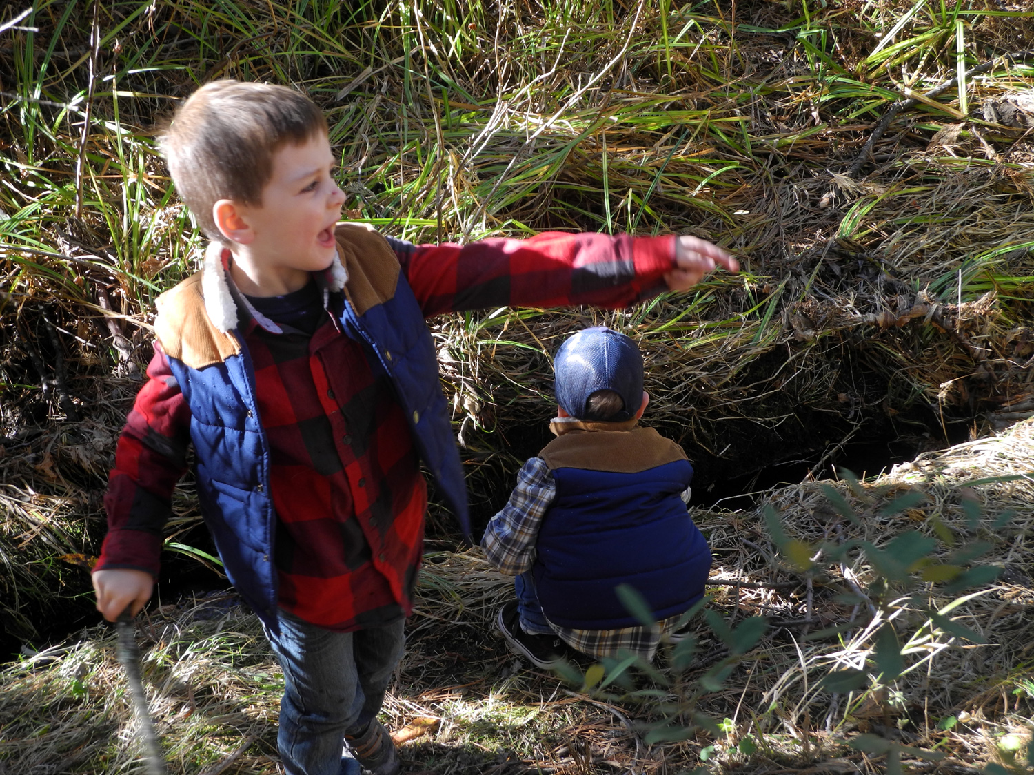 |
 |
| Jack on the trail | Colton, throwing stuff in the creek | Colton practices his printing |
 |
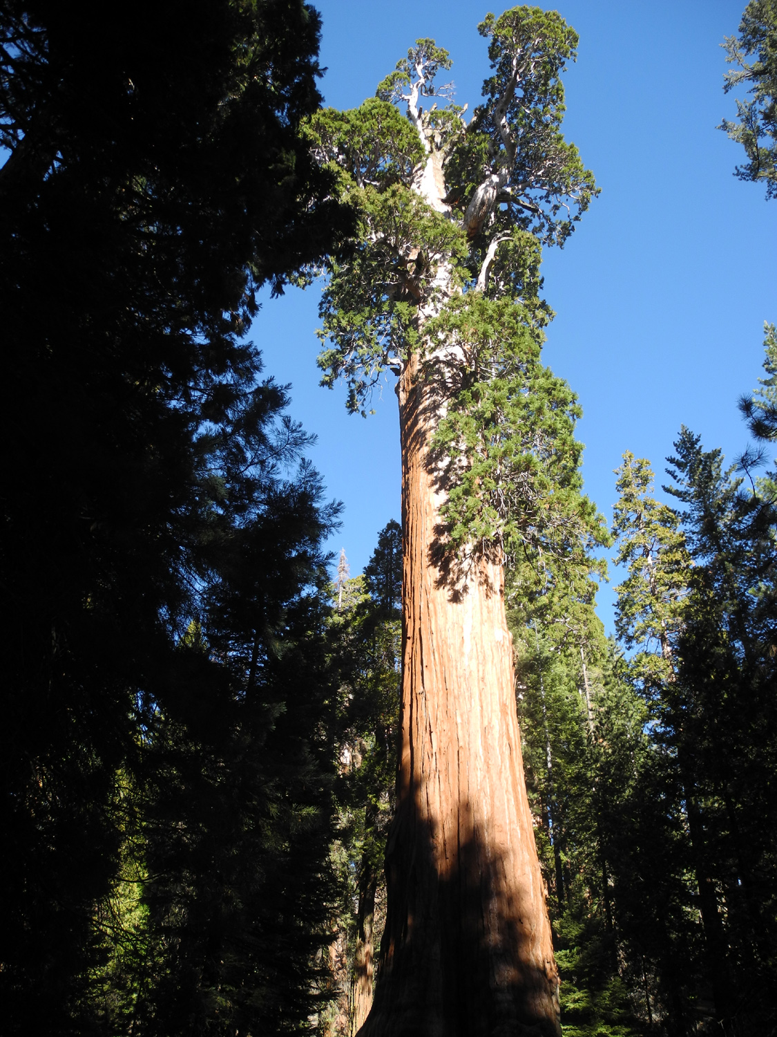 |
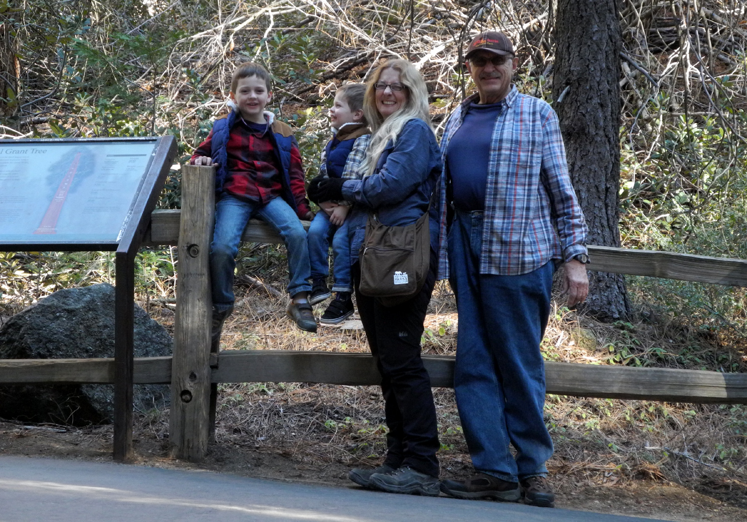 |
| Teri, Jack and Dick (photo by Colton) | General Grant, the Nation's Christmas Tree | Posing at the General Grant |
 |
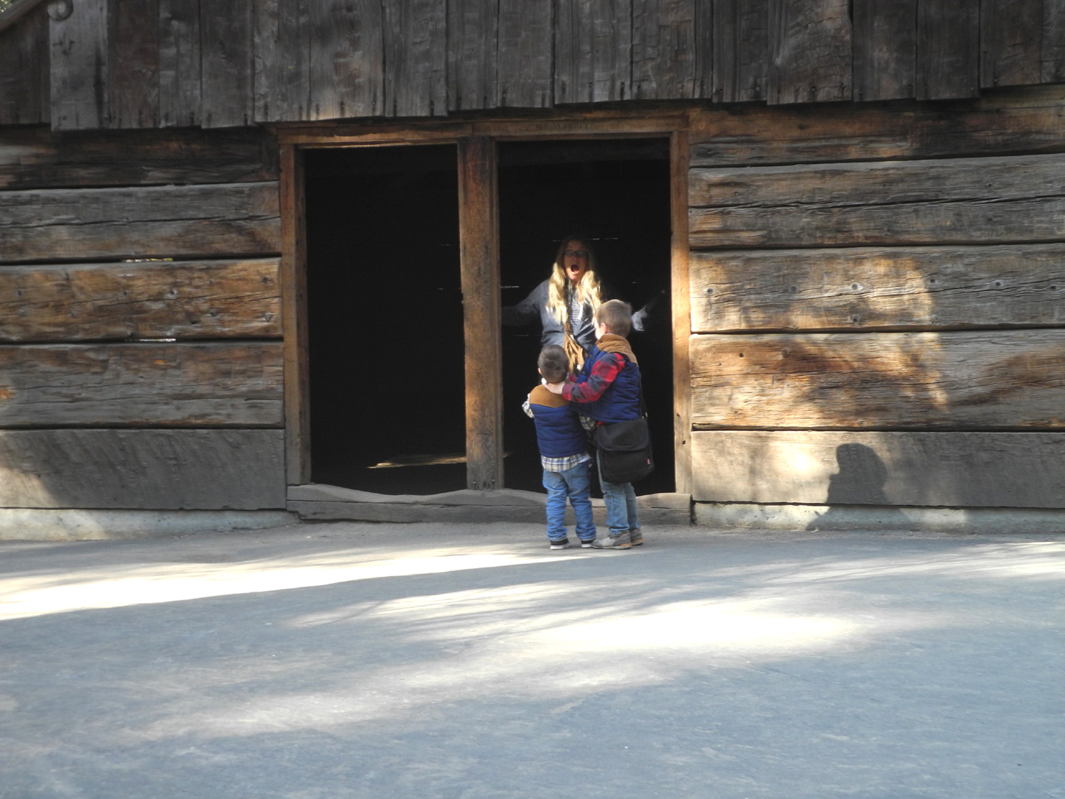 |
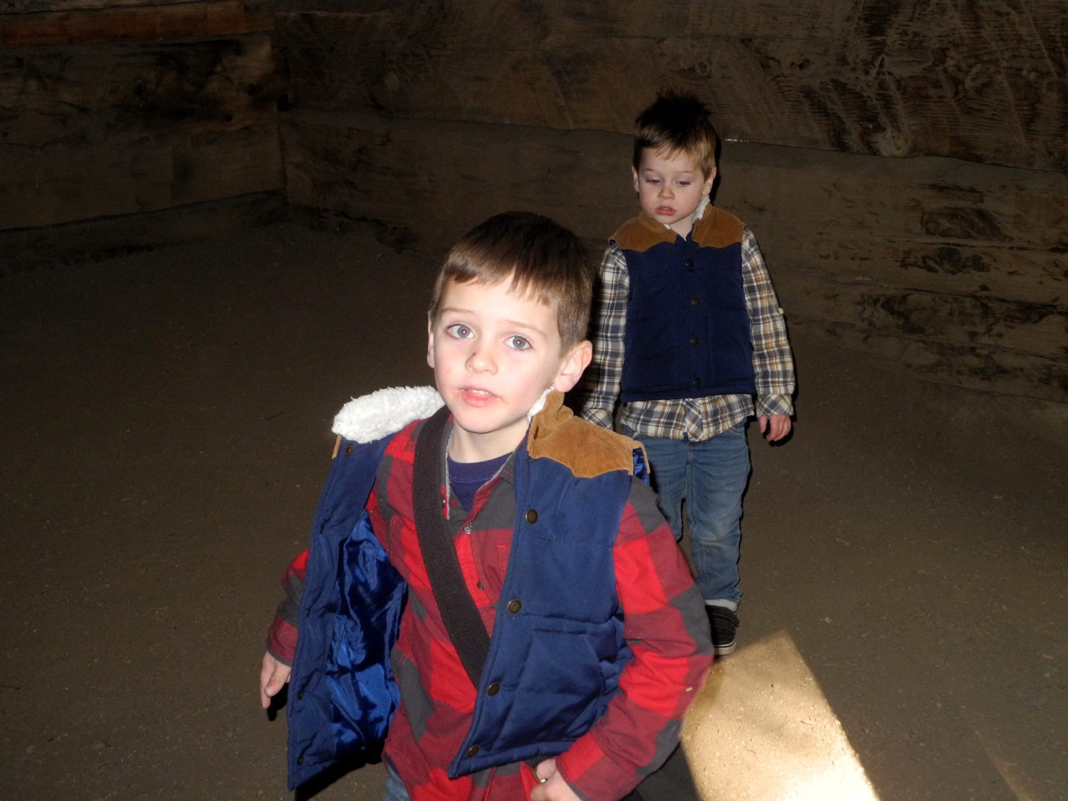 |
| Jack's eyes are covered in anticipation of a surprise | The surprise was the Gamlin Cabin | Inside the cabin |
 |
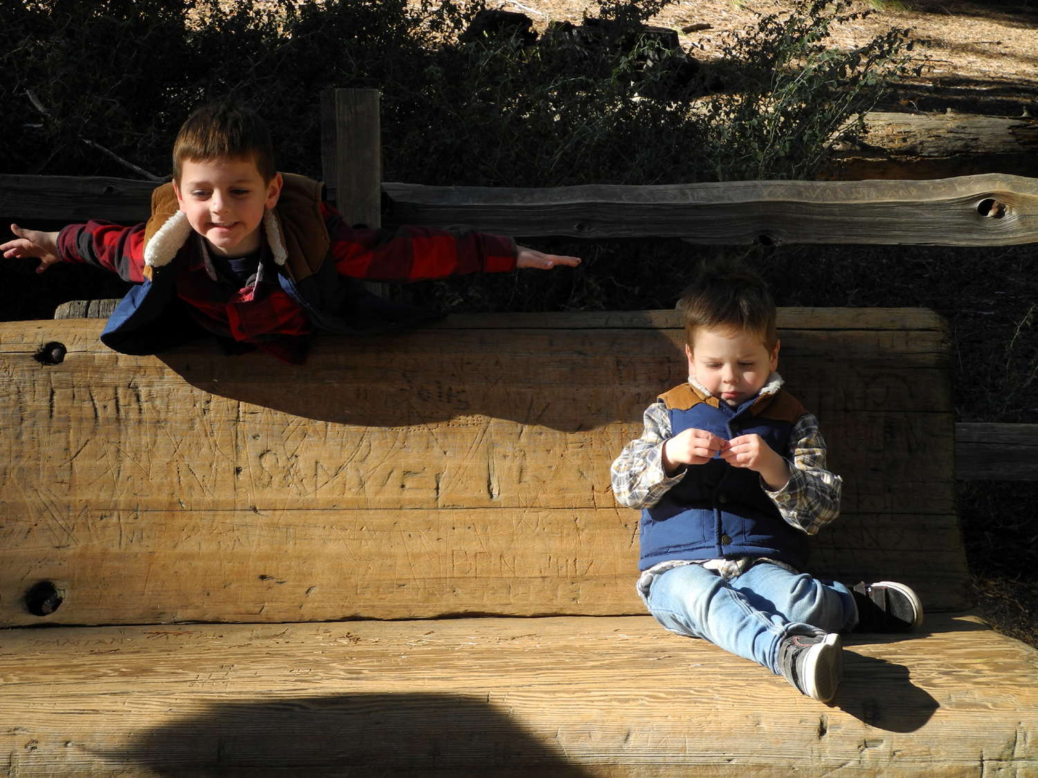 |
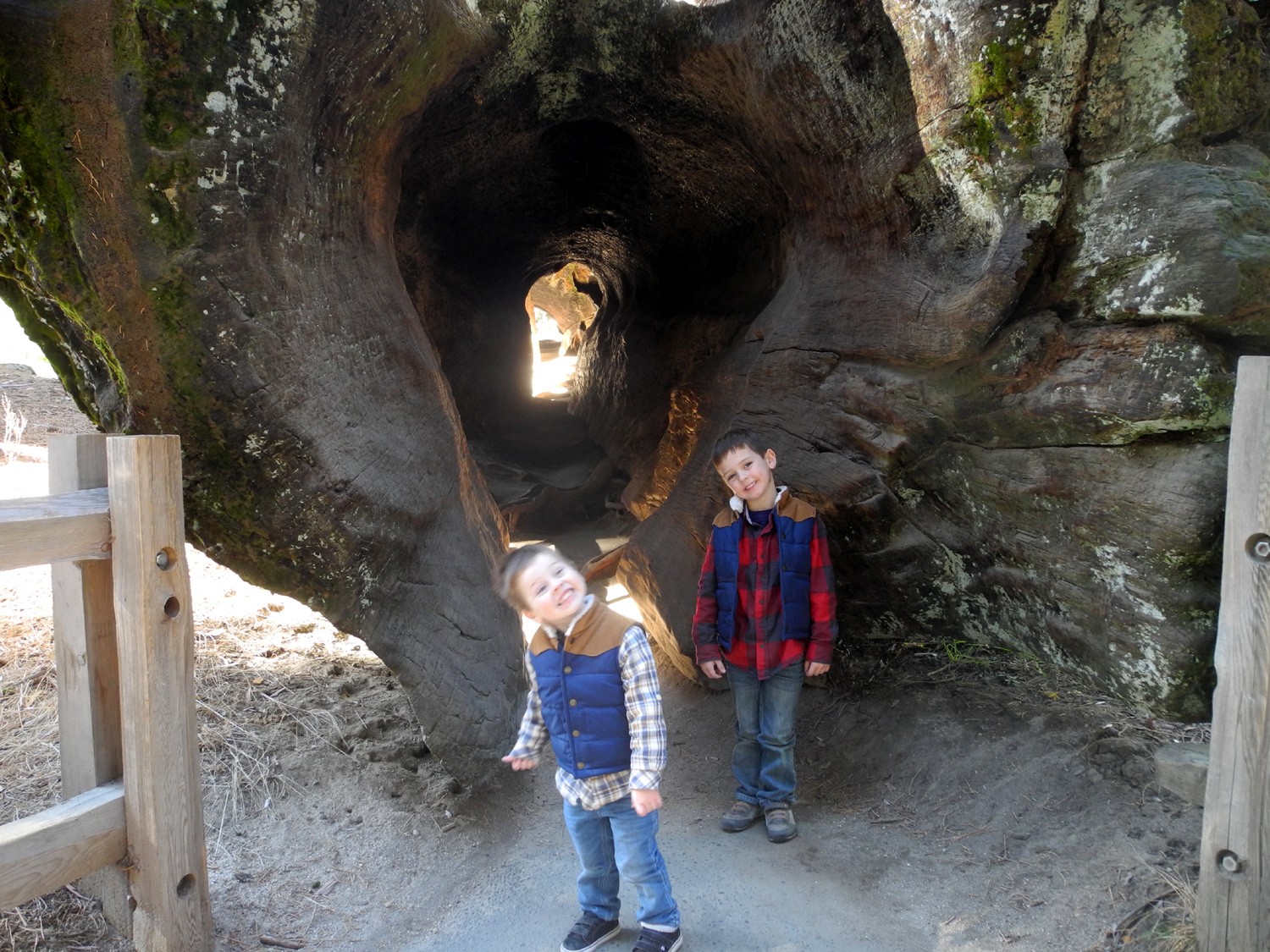 |
| It also served to house the park's first ranger | Fun on a resting bench | At the walk-through log |
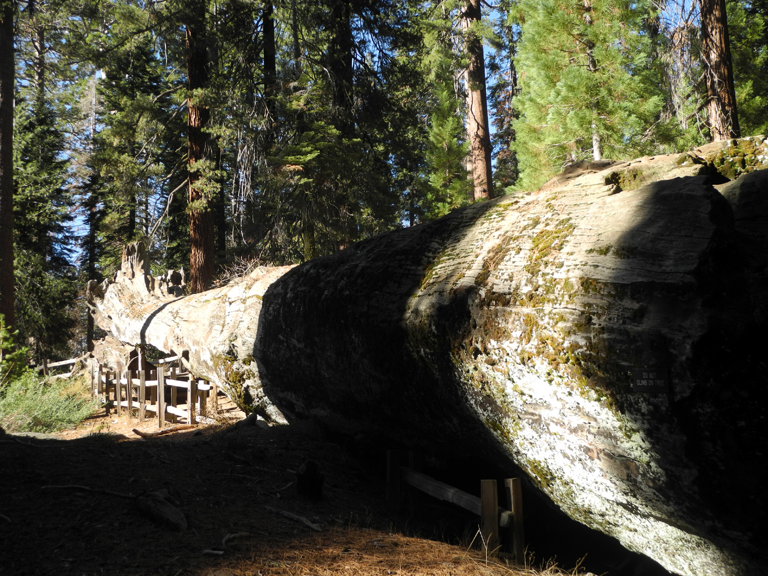 |
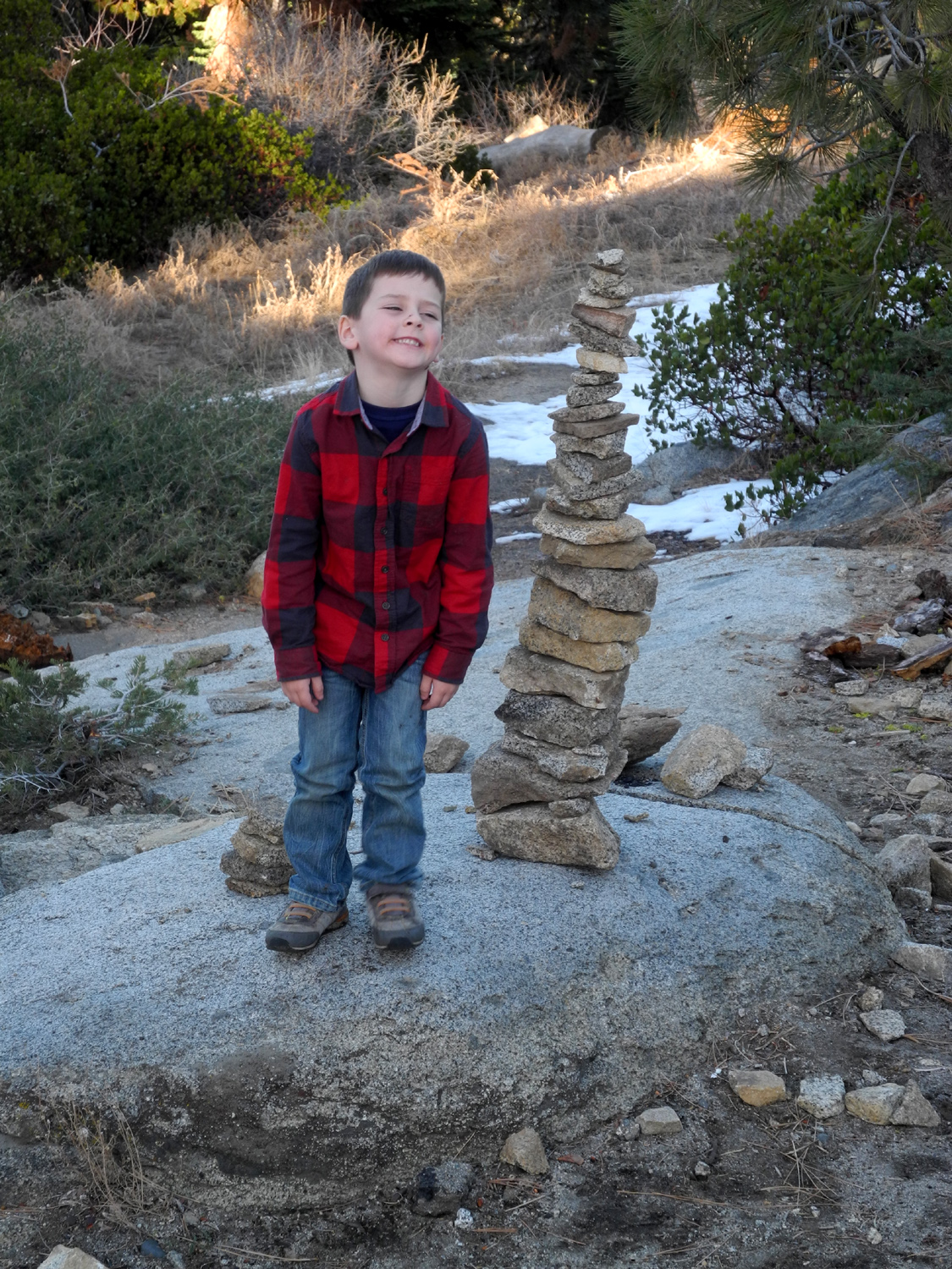 |
|
| An outside view of the log | Colton and the last of the rock piles | The snow was just right for jumping |
|
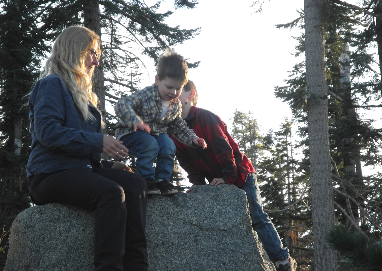 |
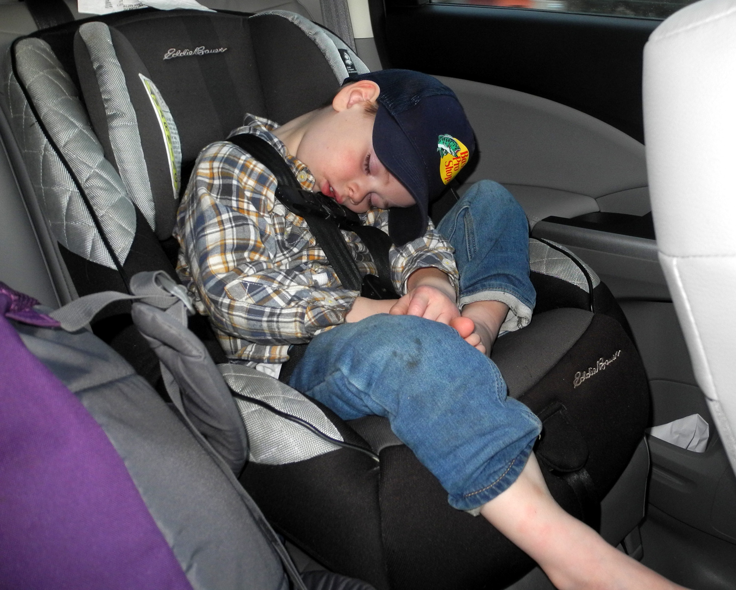 |
| Mt. Goddard is the high point in this view from the Kings Canyon Overlook | Teri and the boys at the overlook | End of the trail |
| New Year's at Neely's & Wawona | ||
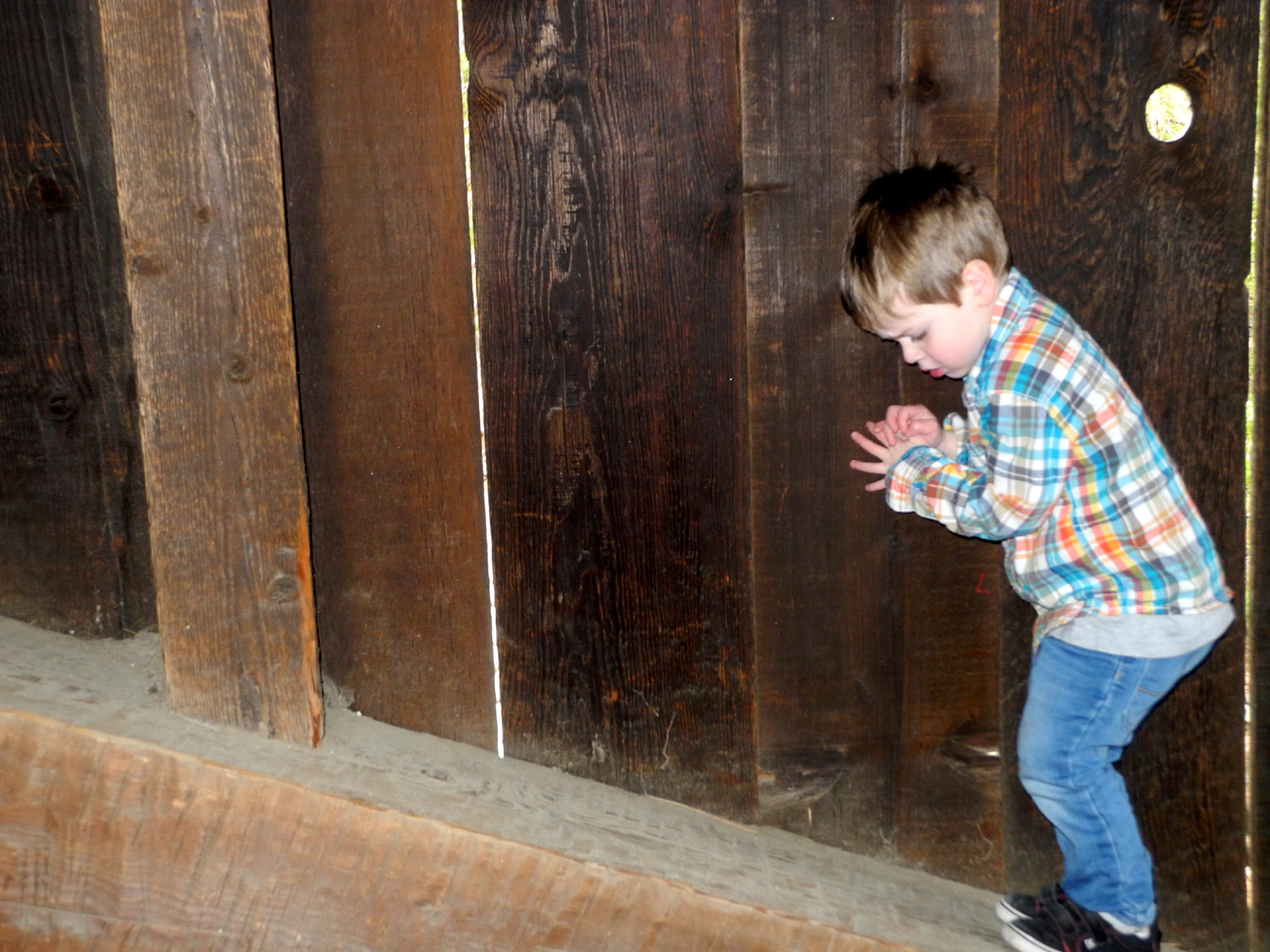 |
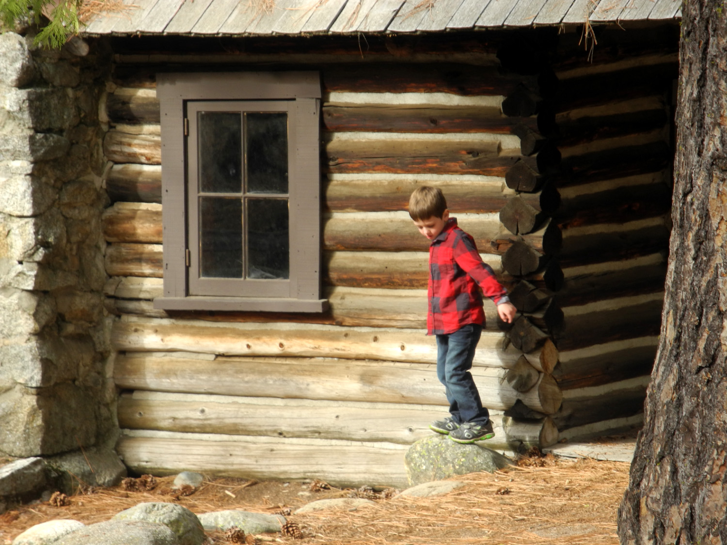 |
 |
| Climbing the bracing inside the Covered Bridge | Colton by one of the pioneer cabins | Taking a peek inside |
 |
|
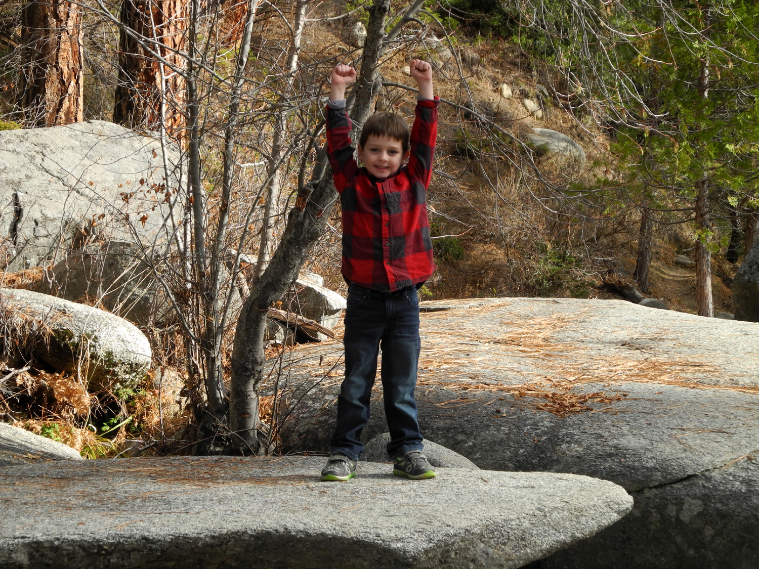 |
| Logs, stumps and rocks MUST be climbed | Both boys made it safely to the high point | Colton by the river |
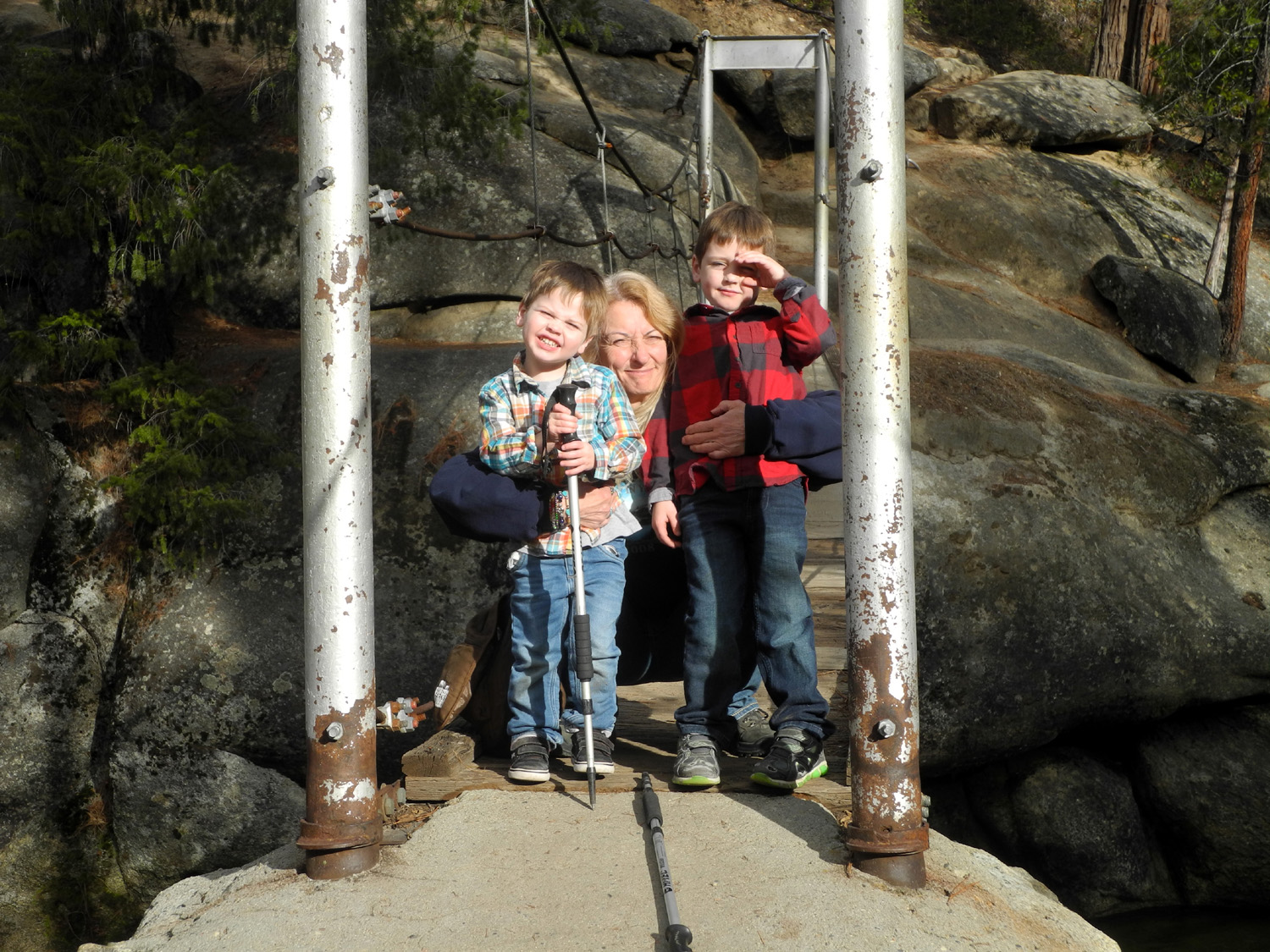 |
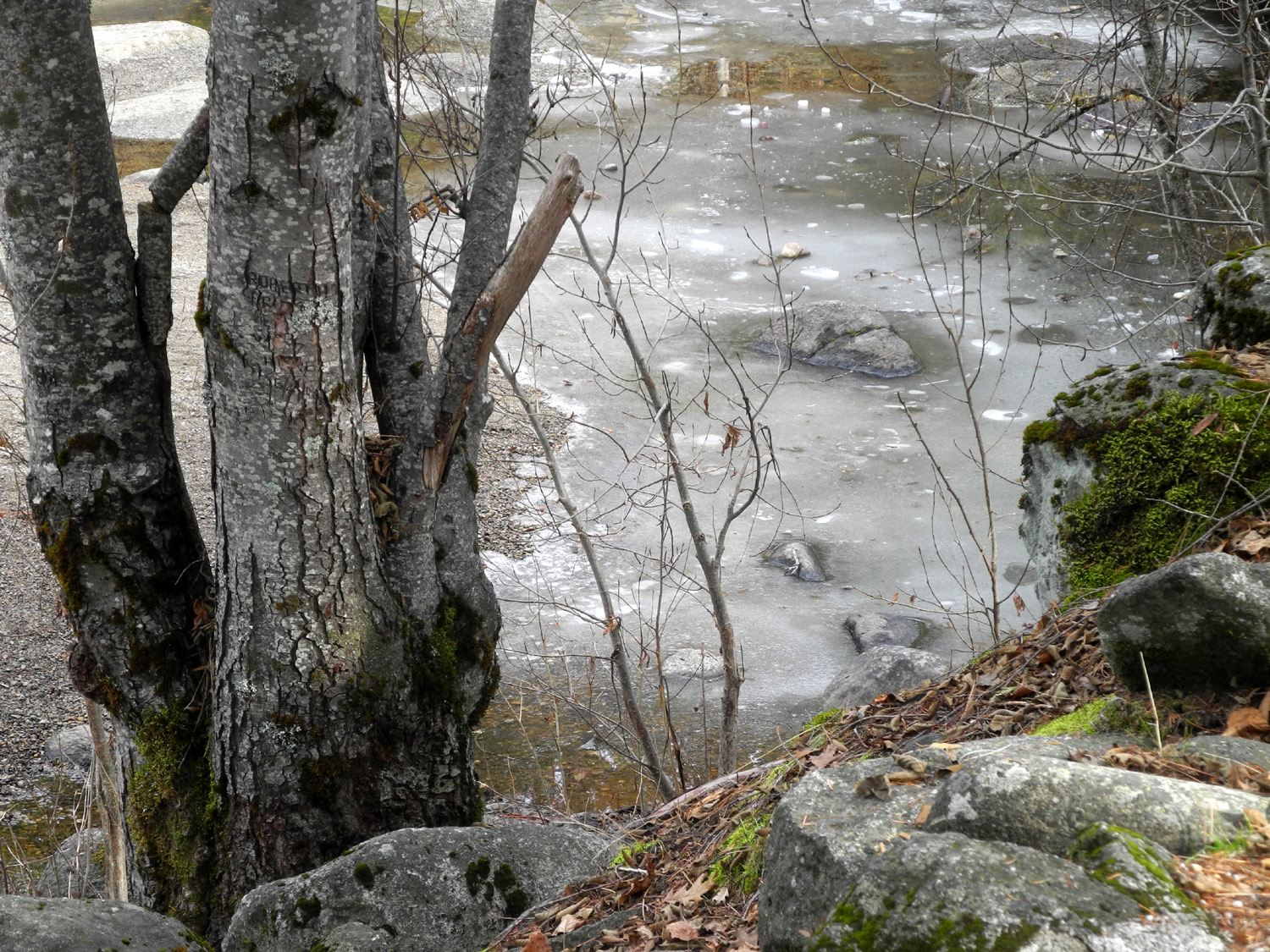 |
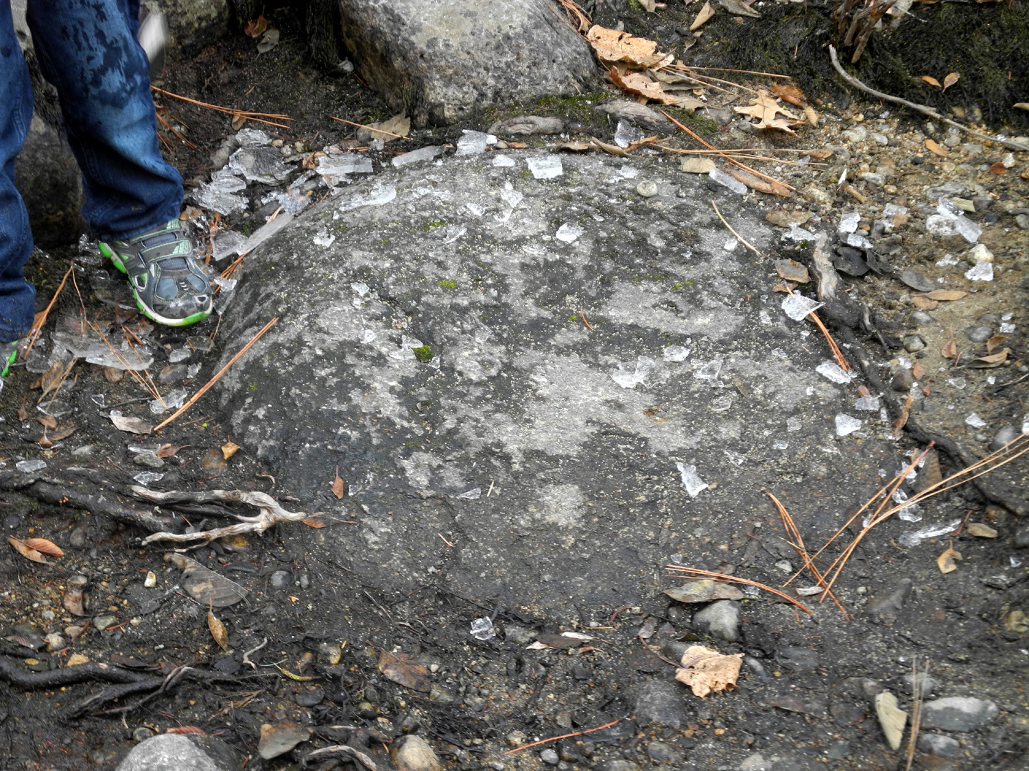 |
| On the swinging bridge | We spotted a quiet section of the river where ice had formed... | So sections of it had to be smashed on the rocks |
 |
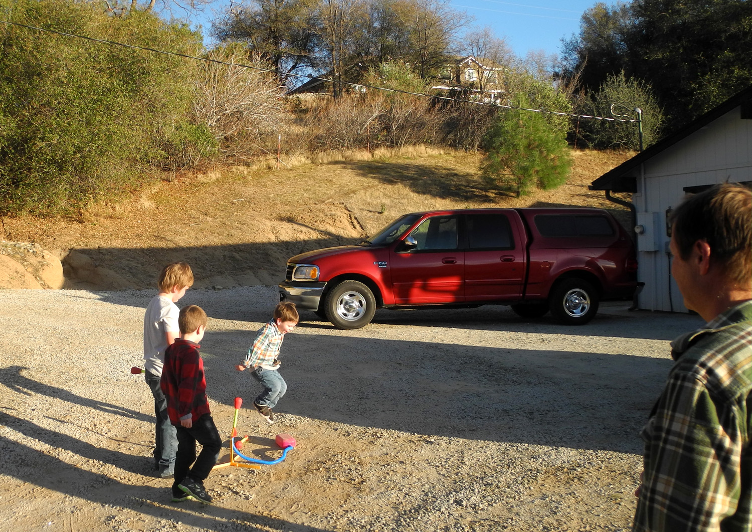 |
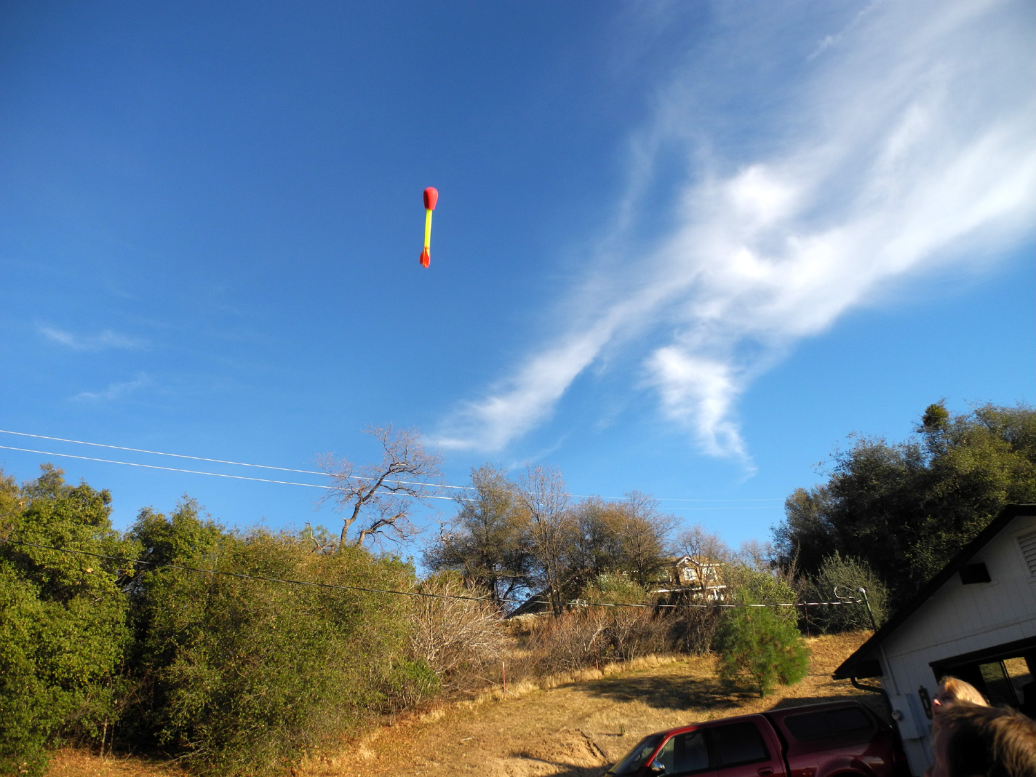 |
| Riding the Log Animal | Jack gives a mighty jump on the launch bad | And we have liftoff! |
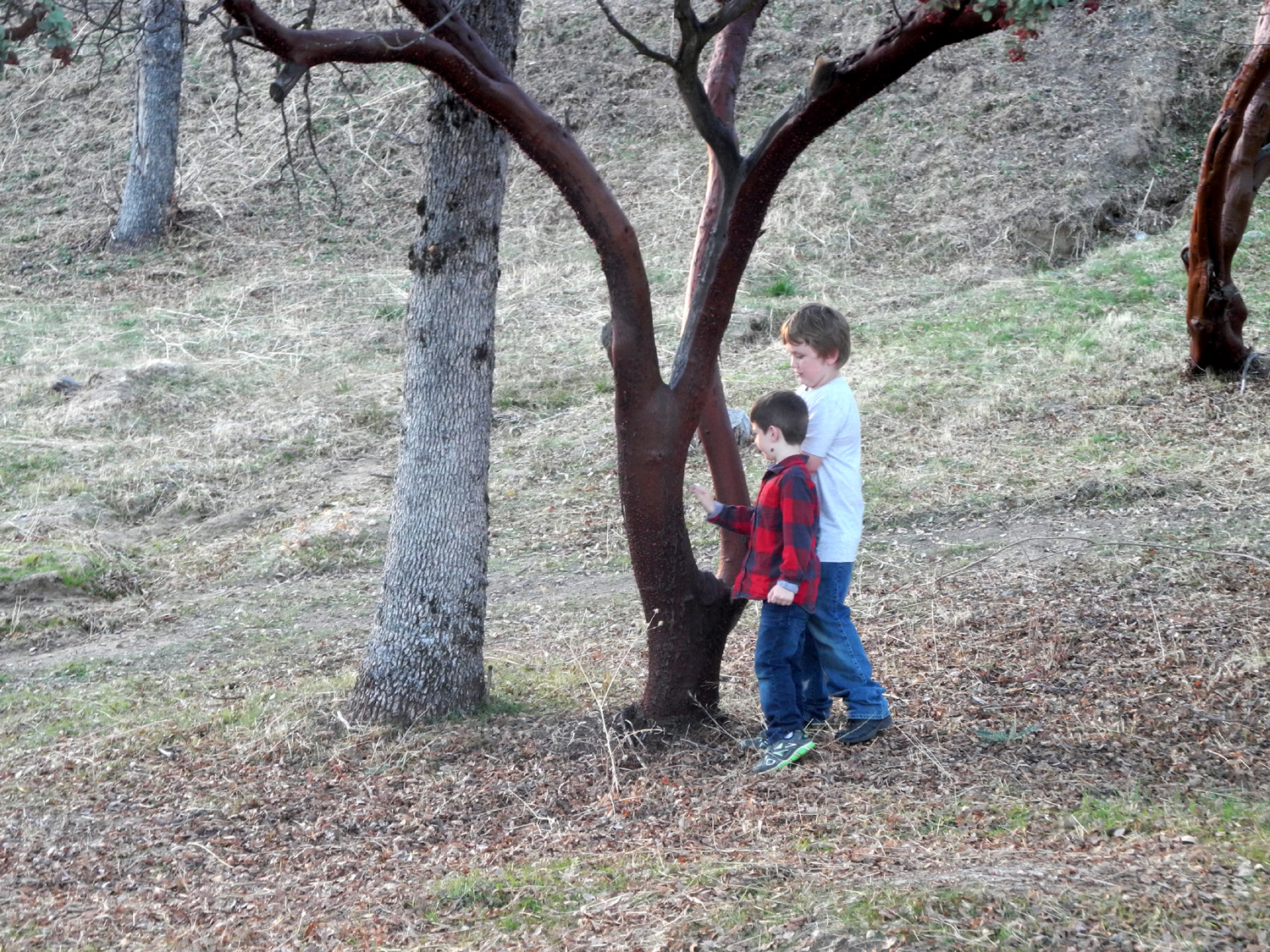 |
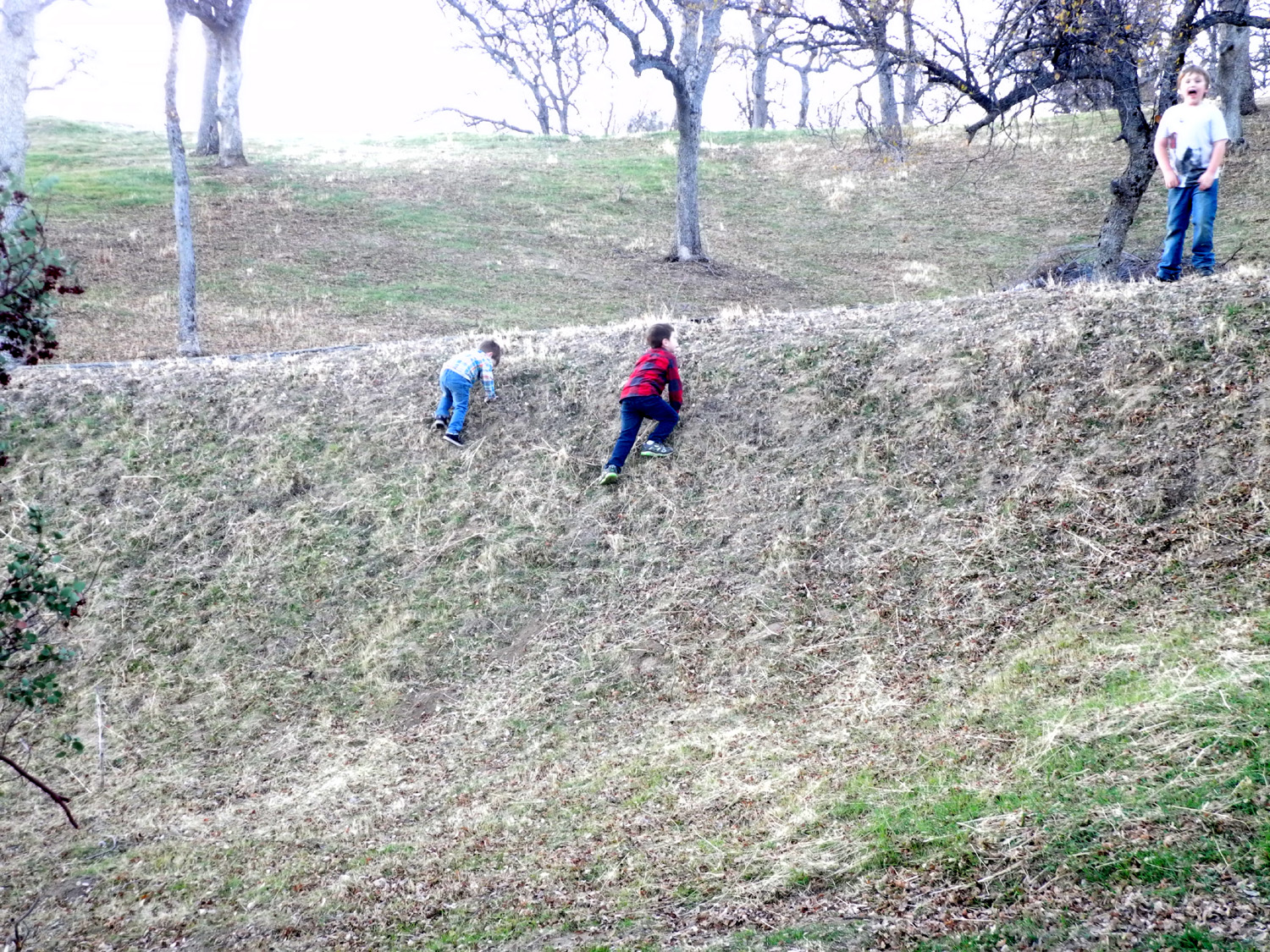 |
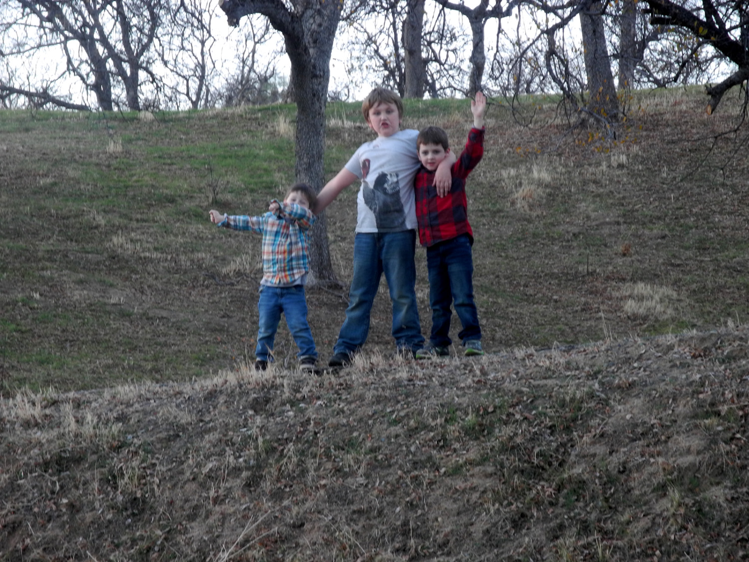 |
| Studying foothill vegetation | This steep bank gave he boys a challenge... | ...but all three were triumphant! |
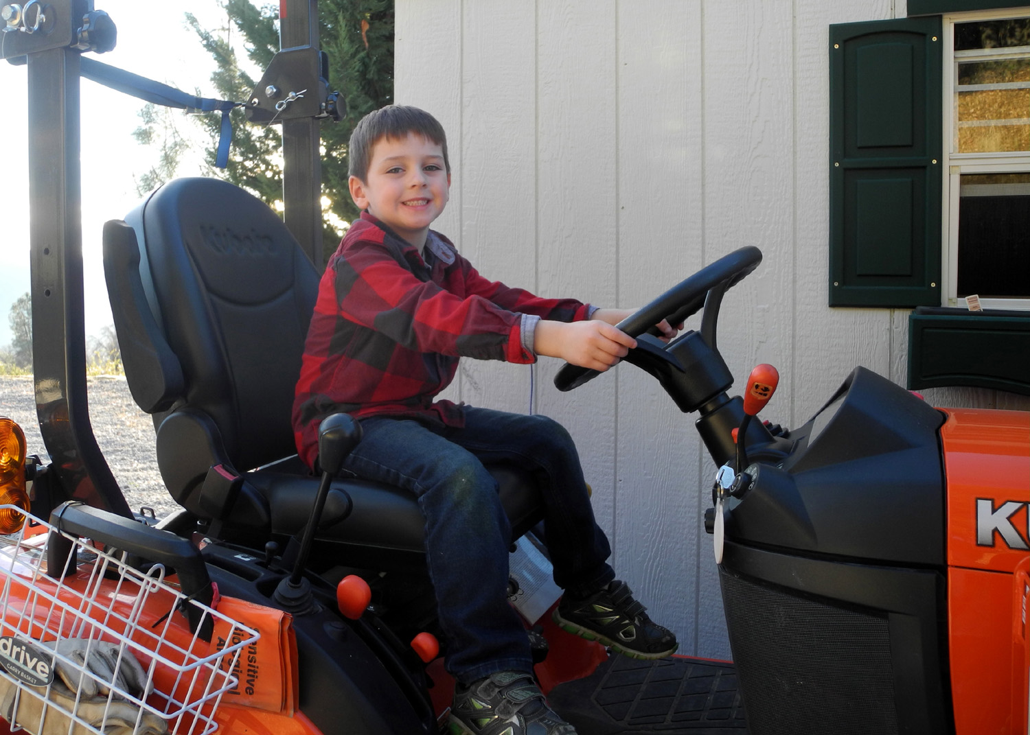 |
|
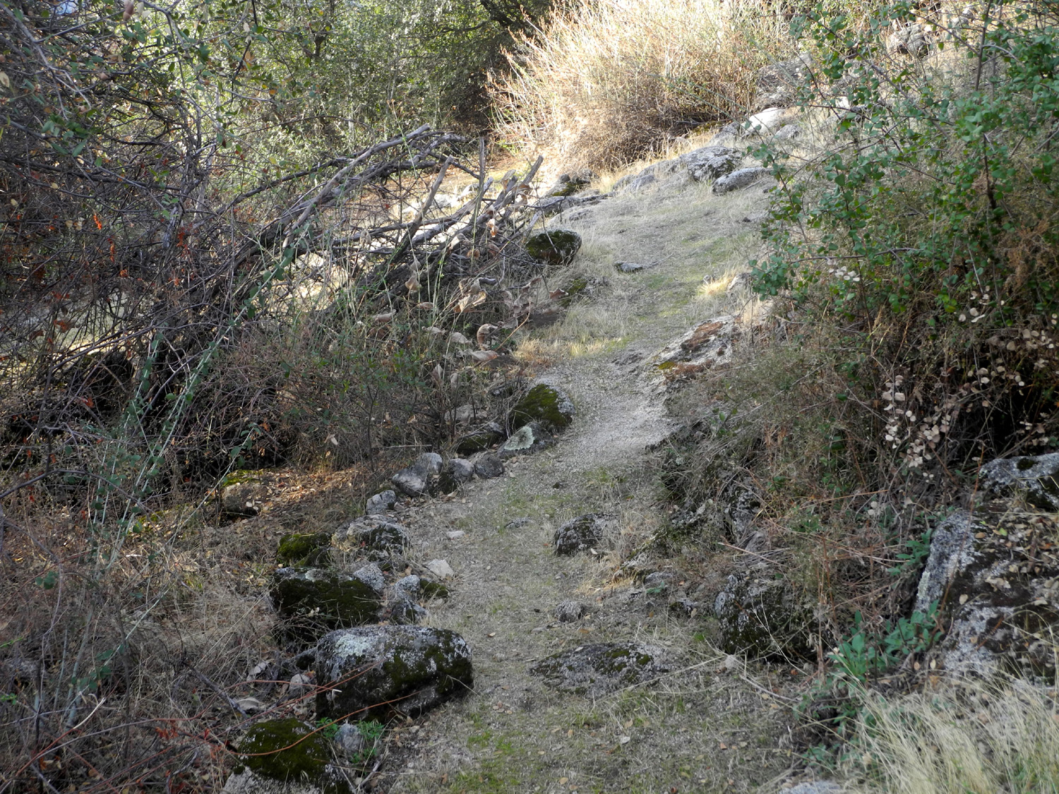 |
| Rod's newest toy | Sunset over the Fresno River Valley | A section of the Neely Trail |
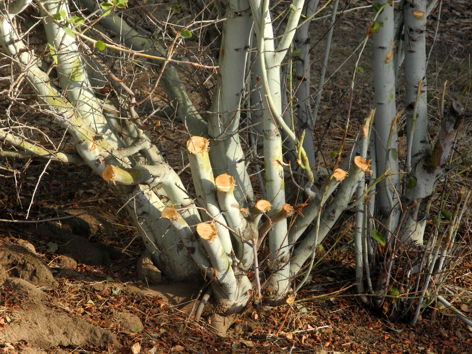 |
||
| A lot of brush cutting was required to get the trail back in good shape | ||
| Related Links | ||
| General Grant Tree | Big Stump Trail | Mark Twain Stump |
| Felling the Mark Twain | Kings Canyon National Park | Sequoia Tree History |
| Panoramic View of the Rock Piles | Knapp's Cabin | Zumwalt Meadow |
| Cedar Grove | Muir Rock | Don Cecil Trail |
| Panoramic Point Trail | Buena Vista Trailhead | Cat Haven |
| Bush Whacking Video | San Joaquin River Trail | Finegold Picnic Area |
| San Joaquin Gorge Slide Show | San Joaquin River Gorge Special Recreation Management Area | All my reports on hiking and camping at San Joaquin Gorge (Squaw Leap) |
| Yosemite National Park | Yosemite Waterfalls | Washburn Point |
| Glacier Point | More About Glacier Point | Chilkoot Campground |
| Colton Rock Climbing | Stomp Rocket Video | History of Wawona |
| Wawona | Wawona Swinging Bridge | Oakhurst |
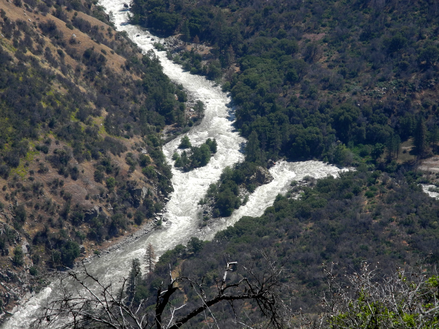
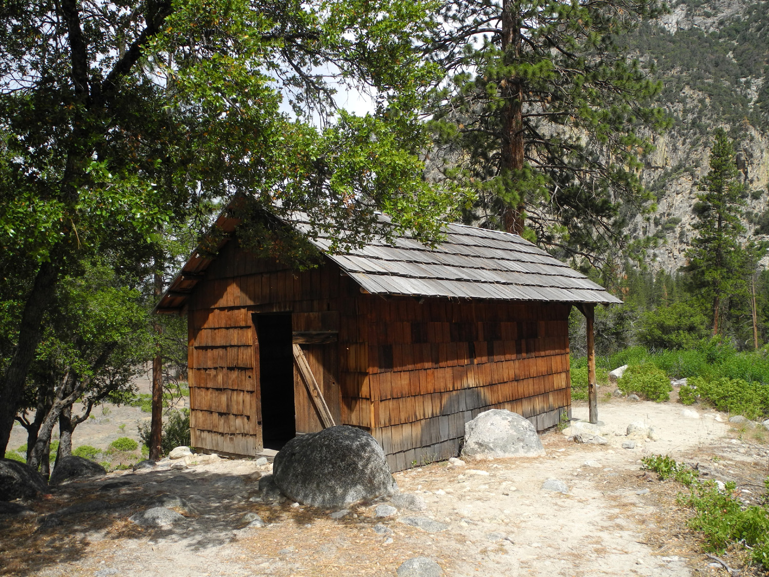
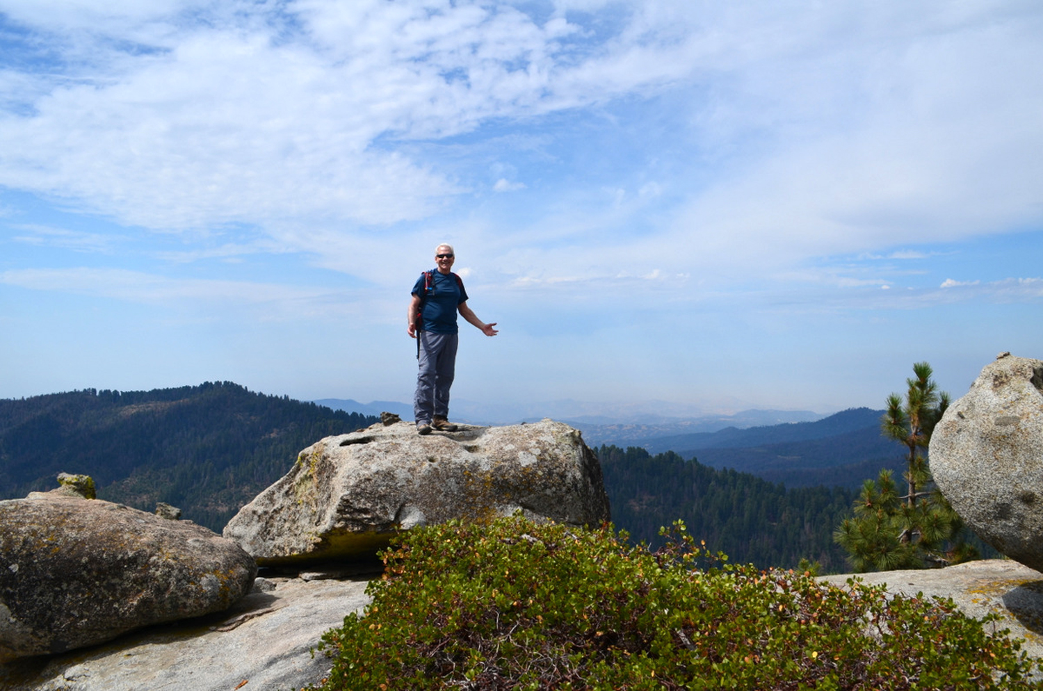
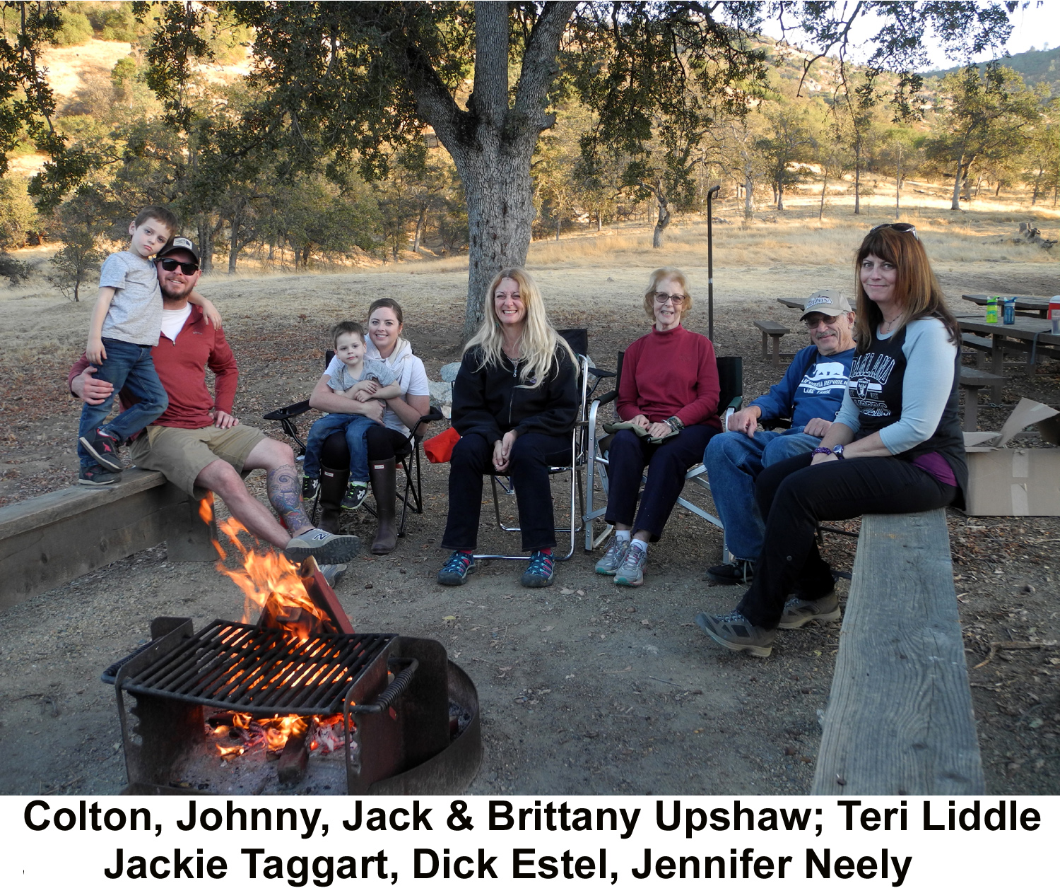
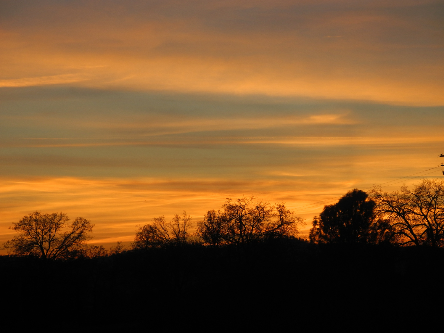
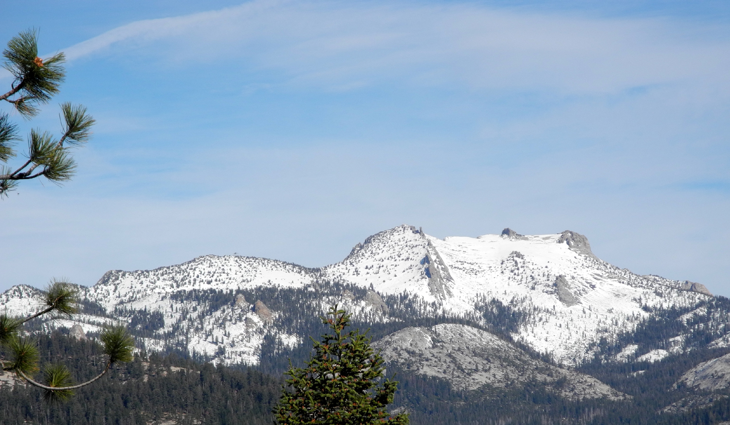
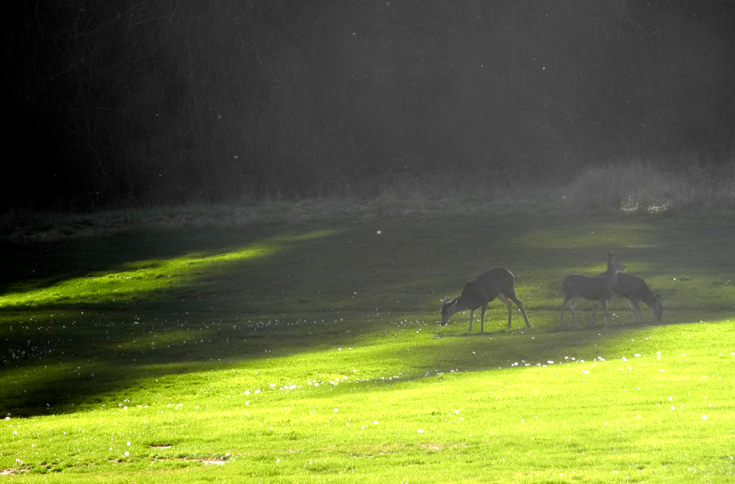
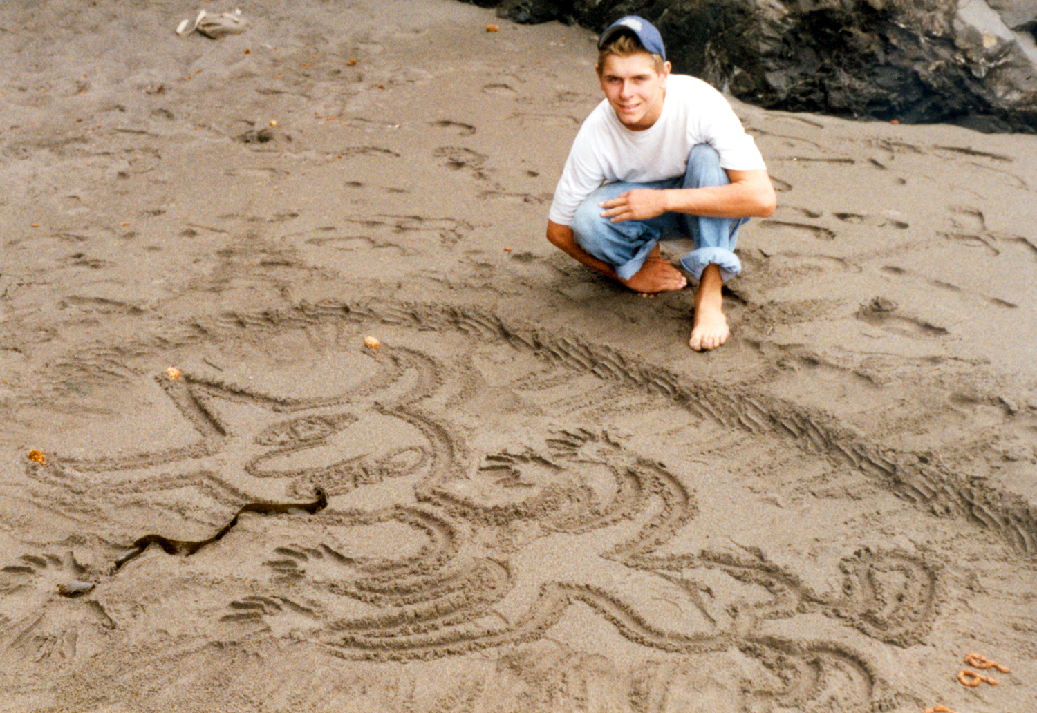
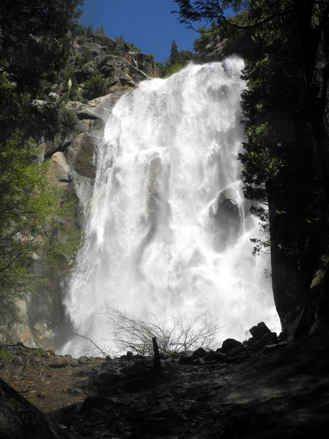
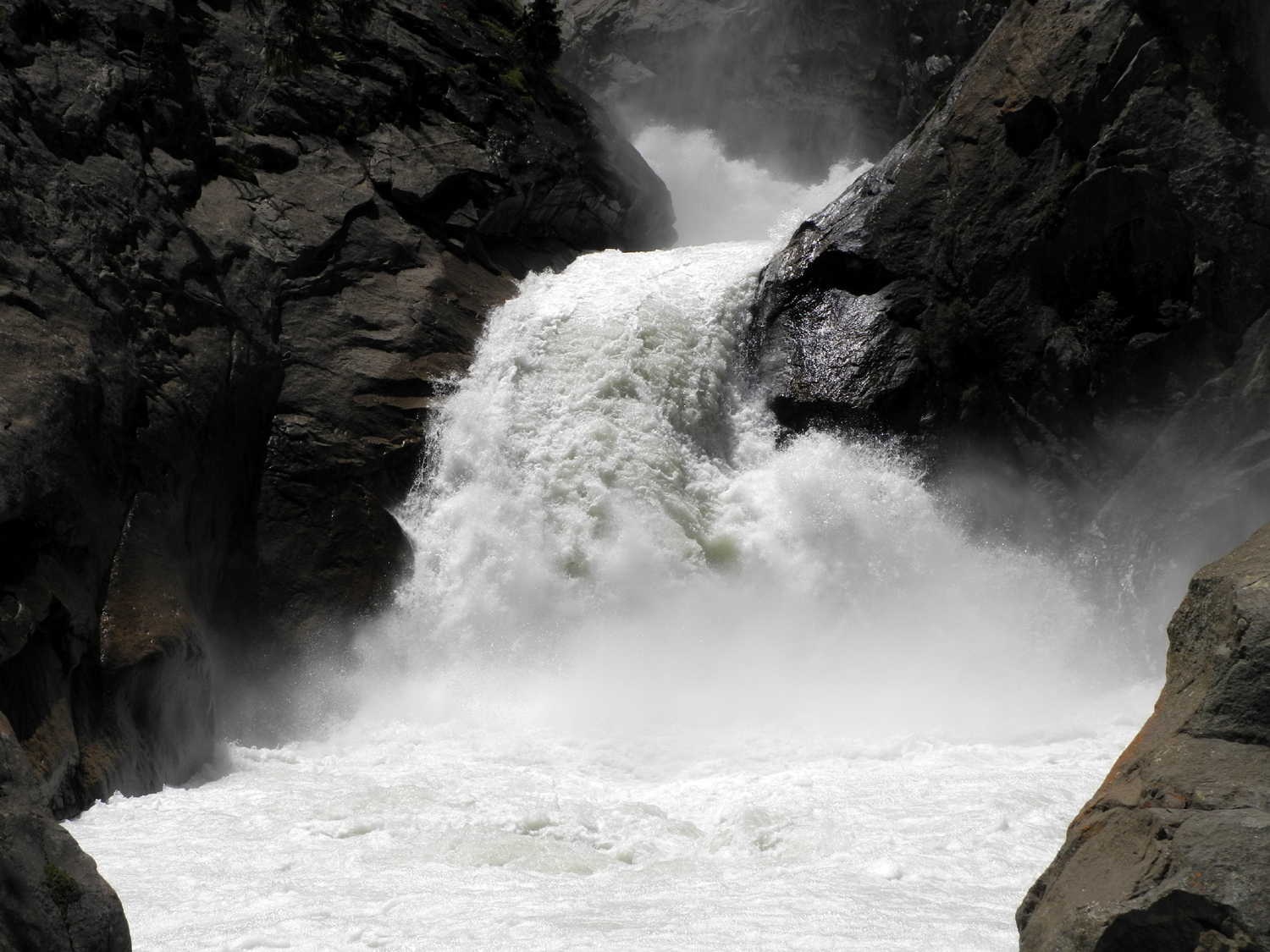