
Dick's Adventures of 2017 - Part 5 |
||
|
|
||
| 2017 Part 1 2017 Part 2 2017 Part 3 2017 Part 4 2017 Part 6 | ||
| San
Joaquin River Trail West
Eaton Trail
Black Rock Reservoir
Nelder with Colton & Jack
Rancheria Falls Courtright Camp Kaiser Pass Hike Upshaw Brothers at Bear Creek |
||
|
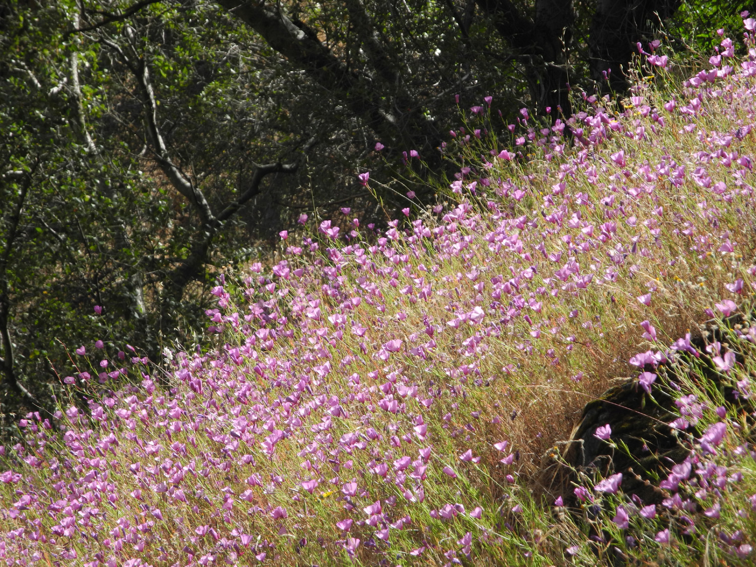
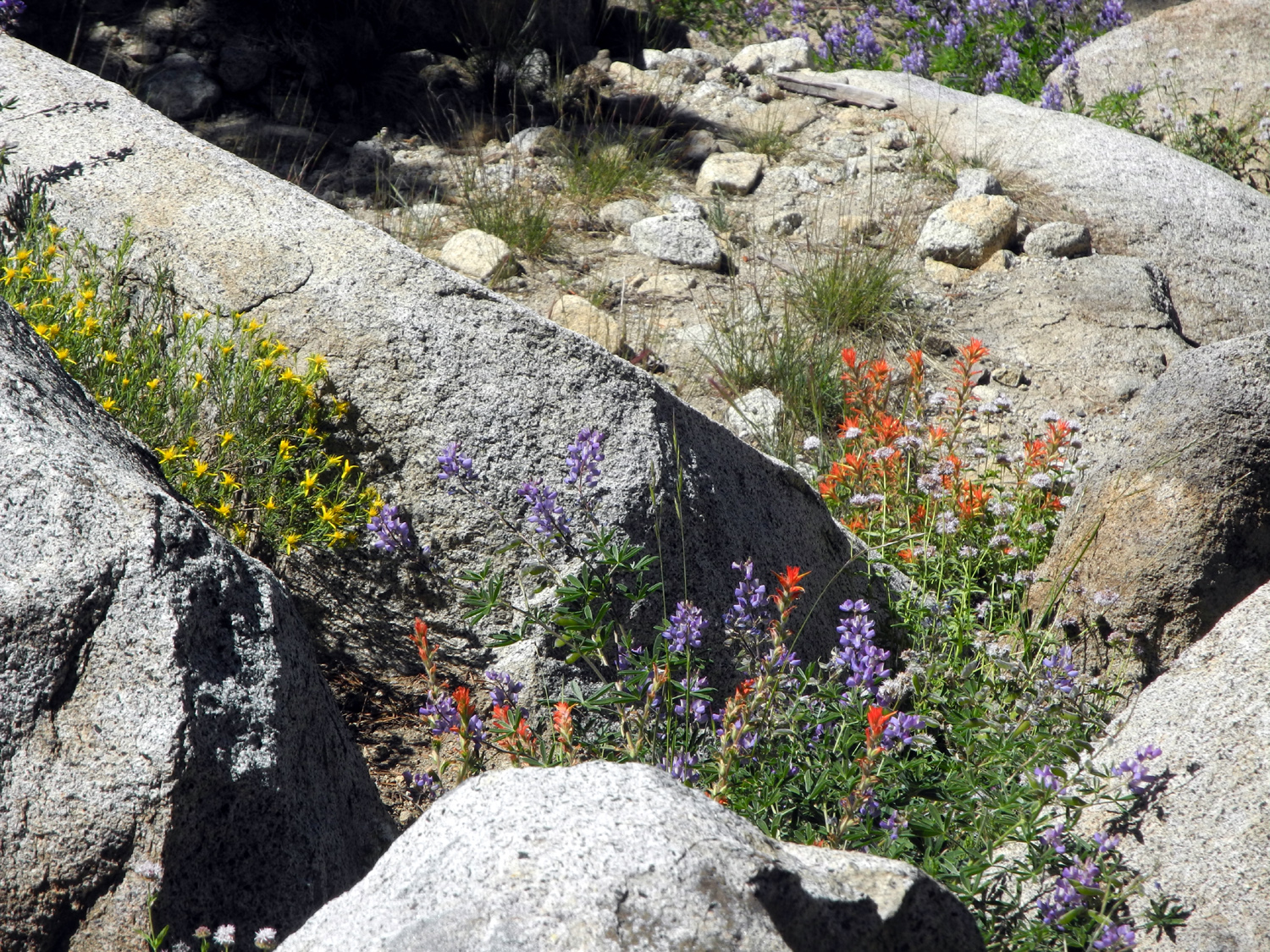
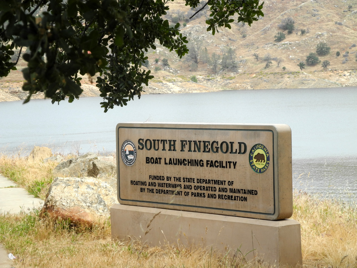
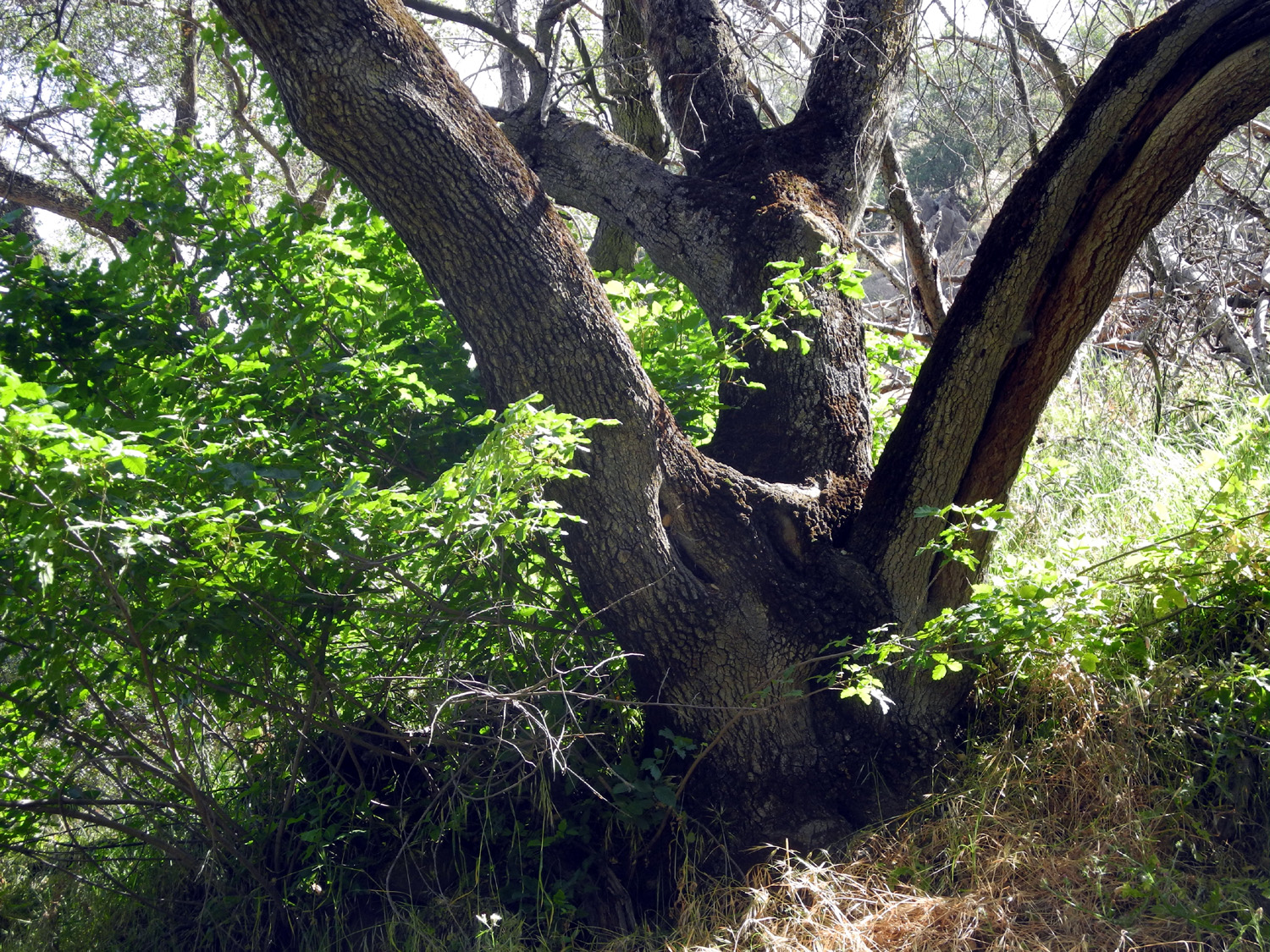
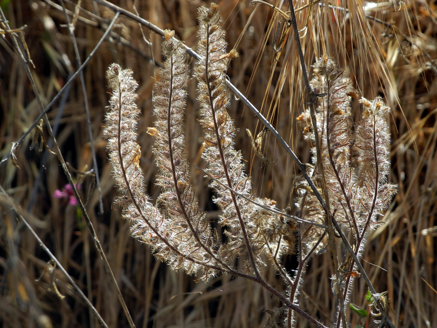
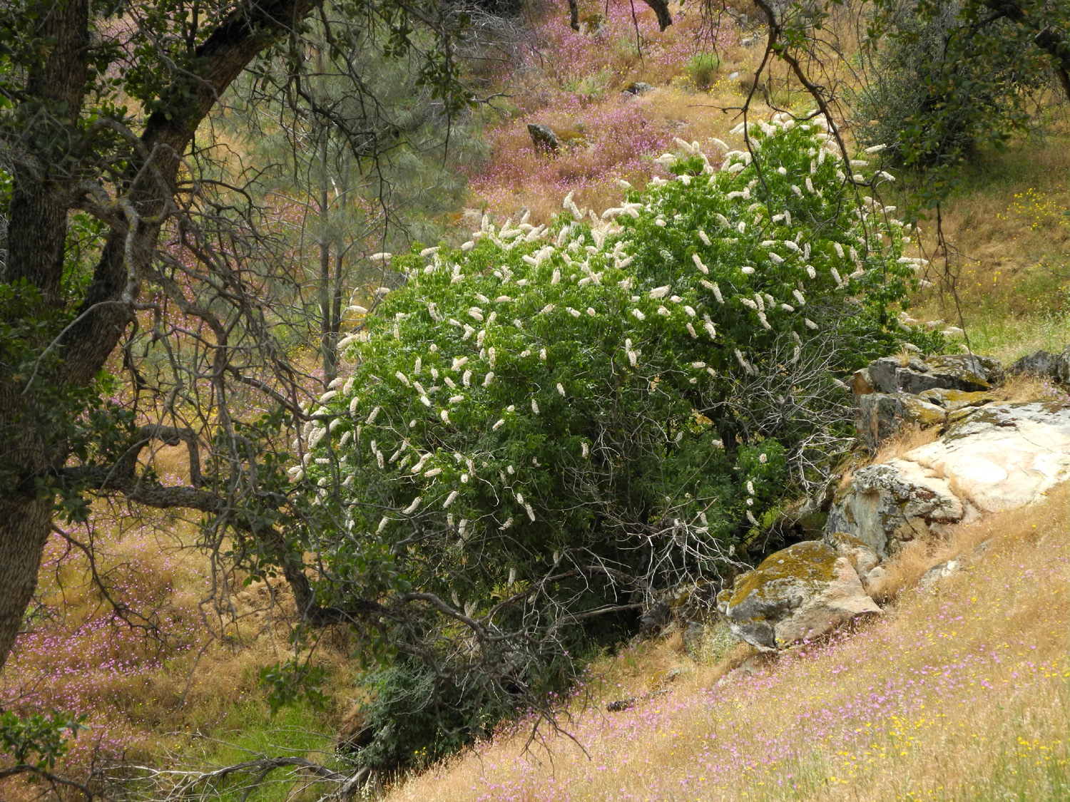
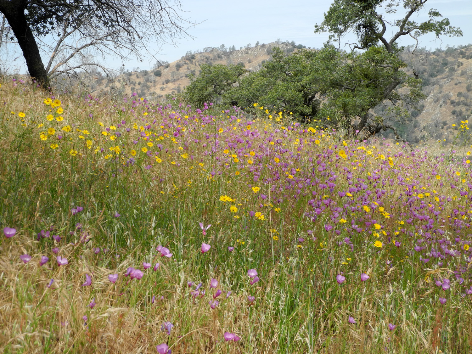
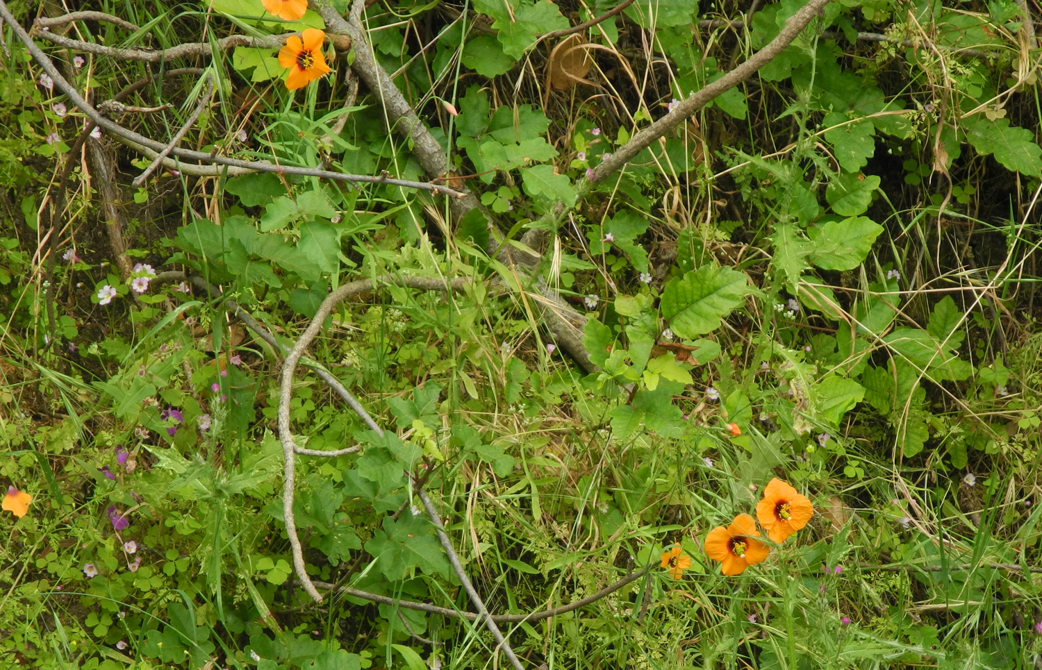
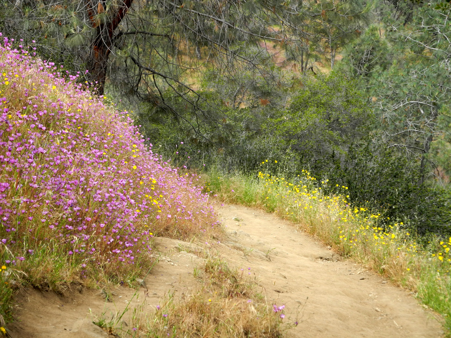
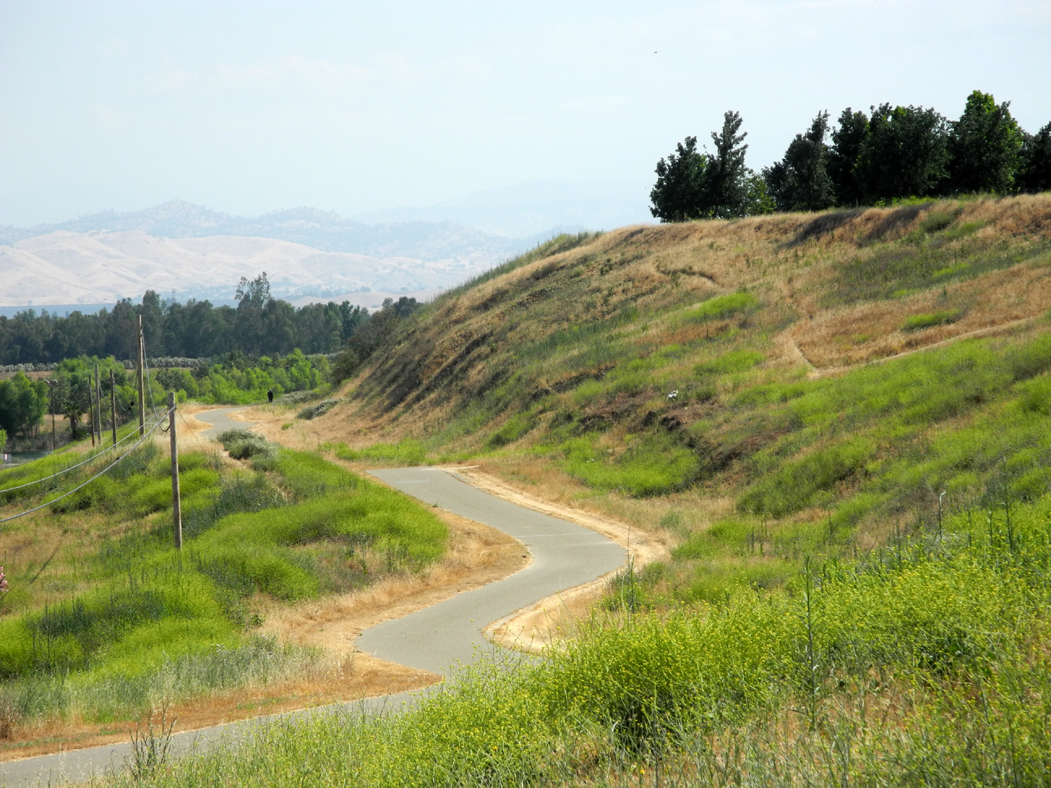
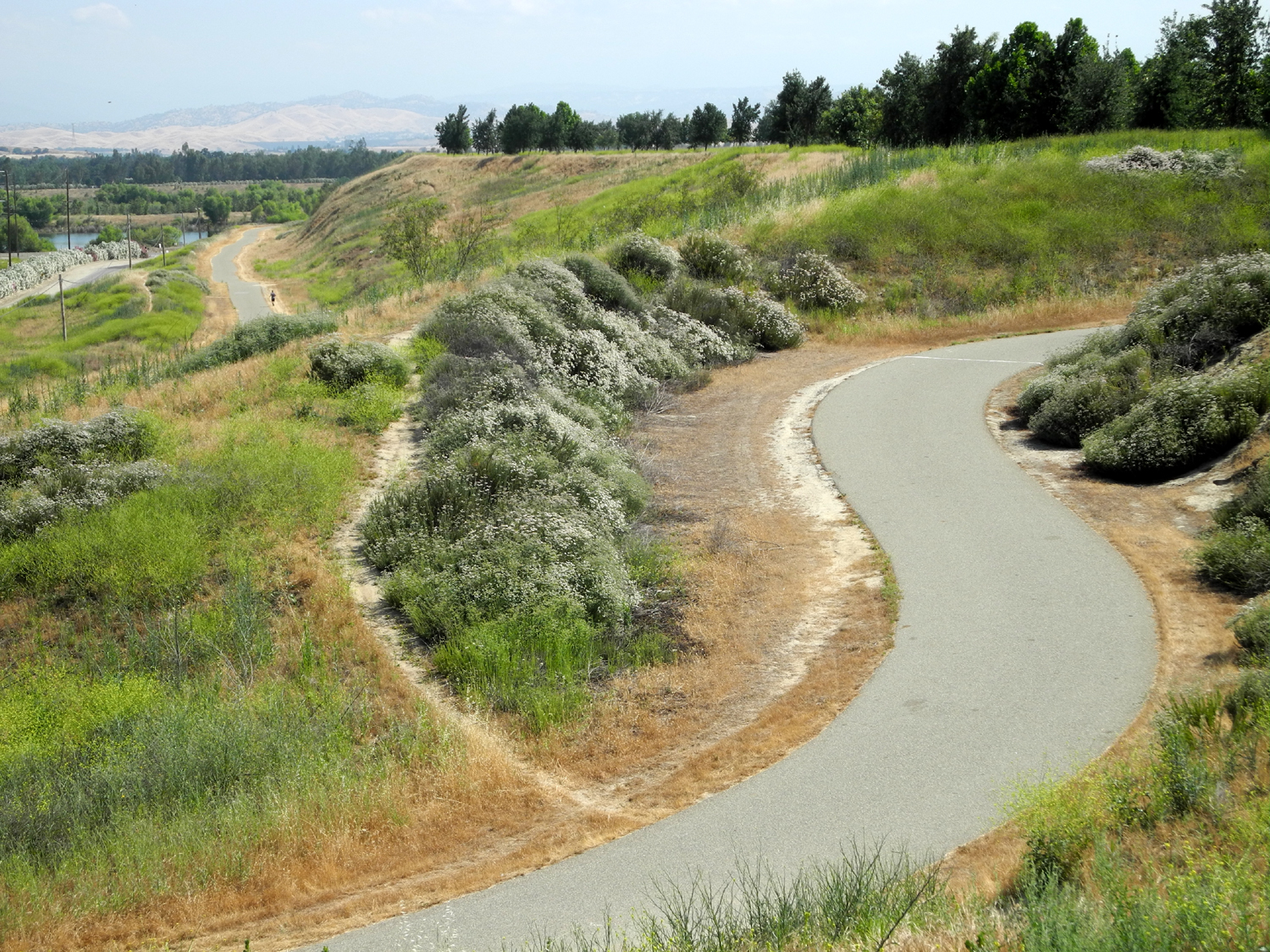
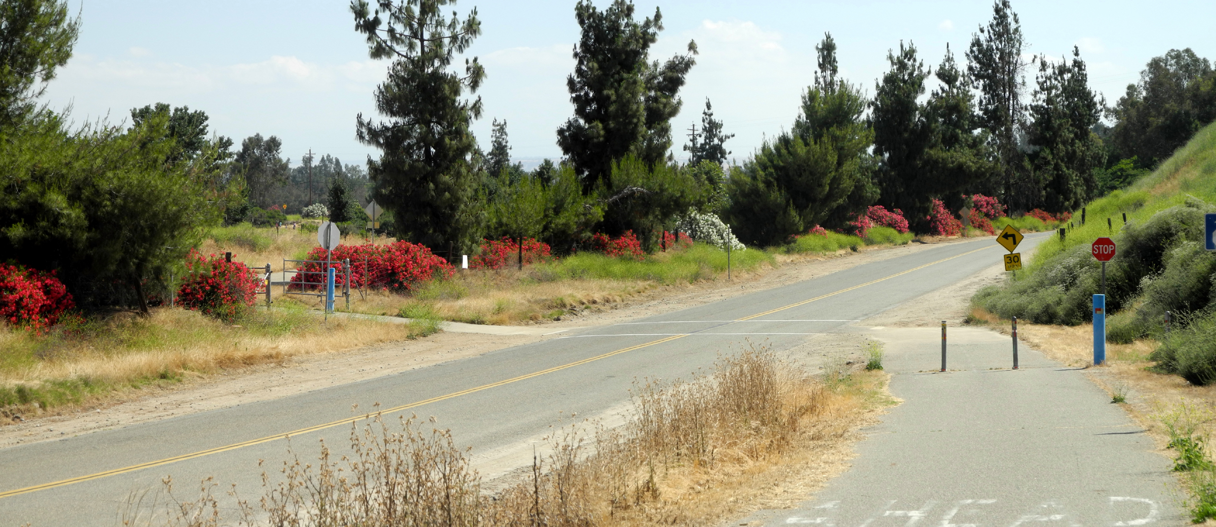
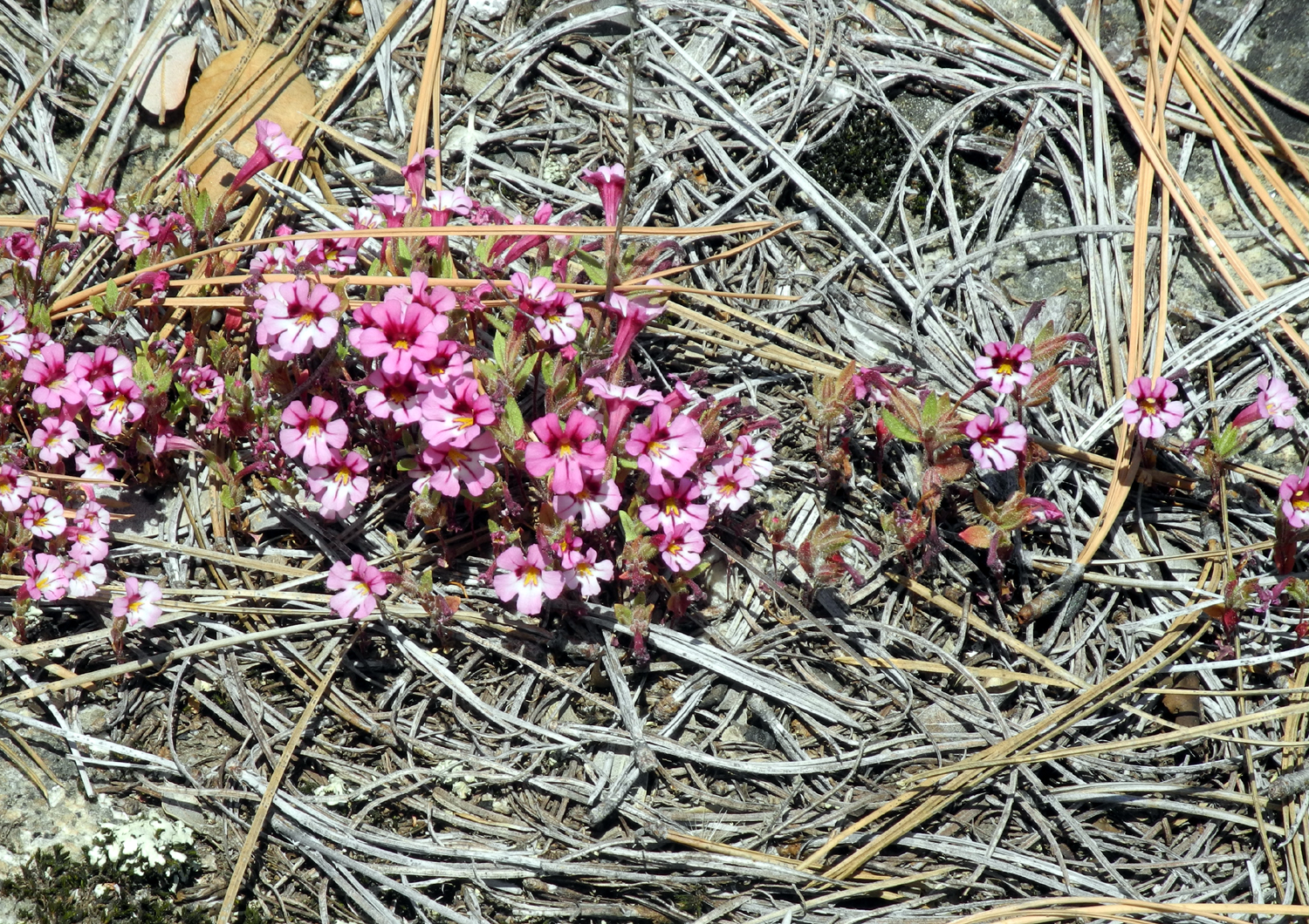
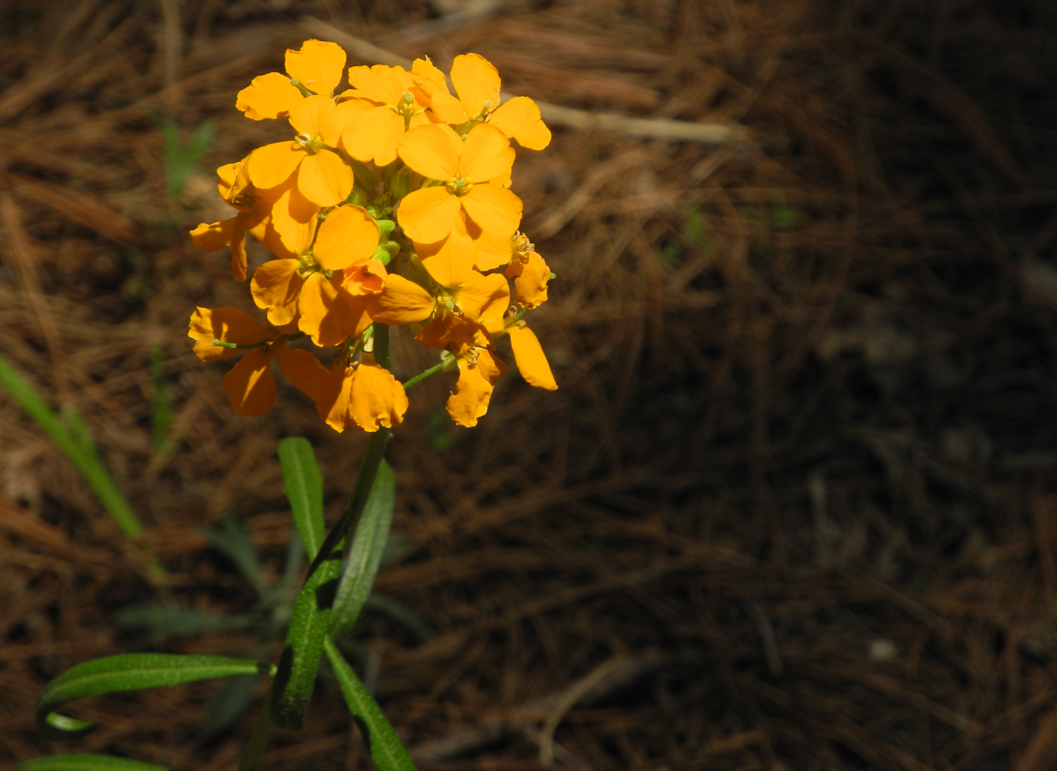
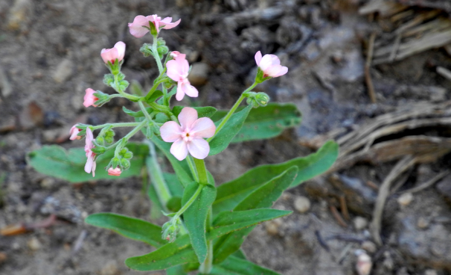
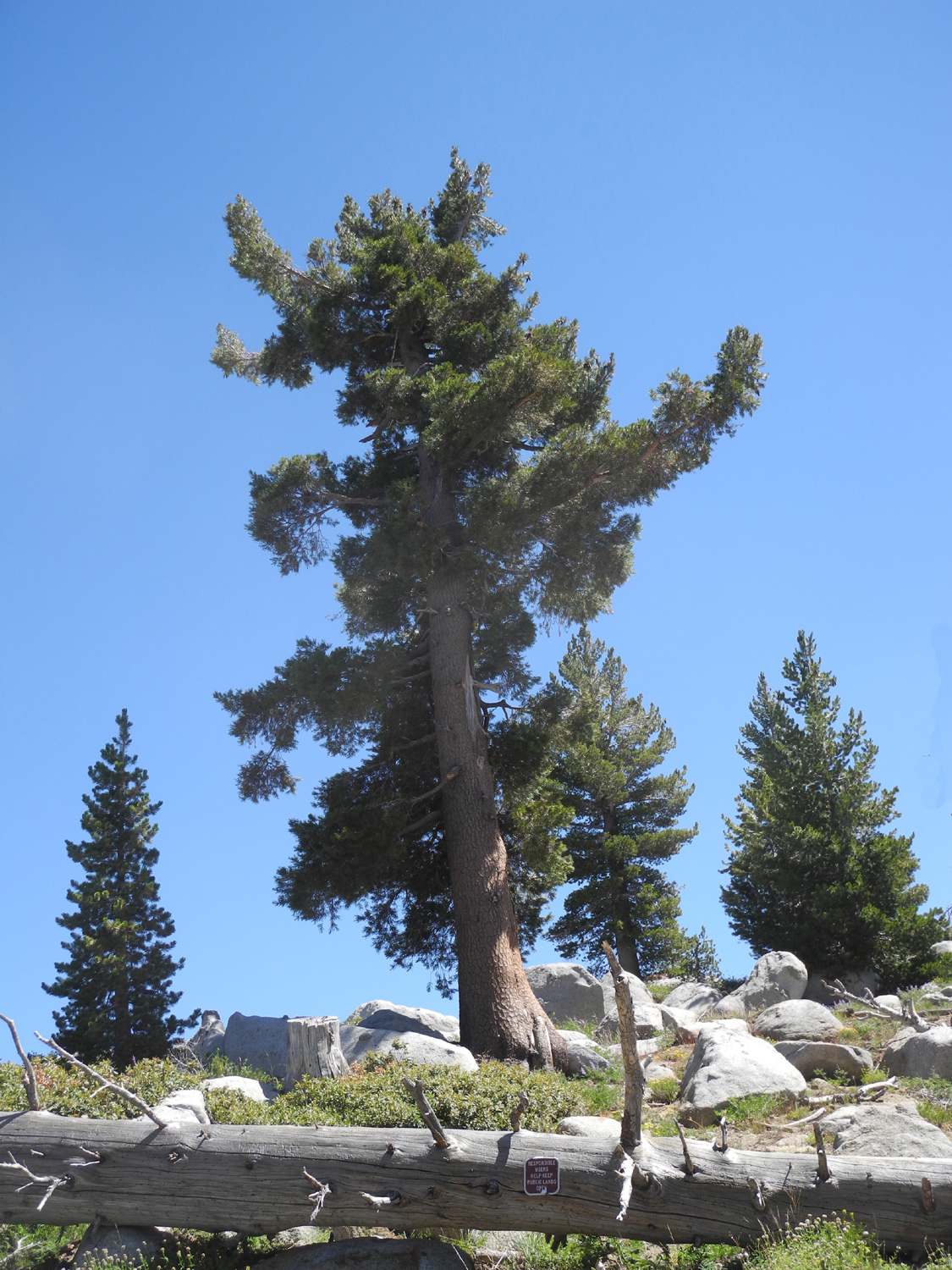
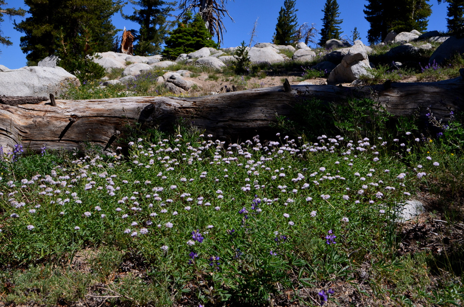
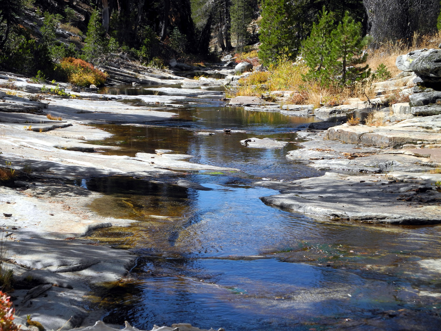
San Joaquin River Trail West When I hiked on the east end of the San Joaquin River Trail at the San Joaquin Gorge on May 9, the warm weather convinced me it would be my last foothill hike of the season. But the weather this year is predictably unpredictable, and following a short warming spell, it cooled down again, to the point where I felt it would be comfortable to hike the other end of the trail from the Finegold Picnic Area on Millerton Lake, which I did on May 16. I've written about this trail quite a few times, so I'll keep this short. Unlike previous hikes in this location, I had no plans to hike farther than ever before. Instead I hoped to do some off-trail exploration, following various cow paths through the drainage east of the upper part of the first mile. The tall, dry grass, nearly obscuring the faint animal trails and offering a selection of stickers to be picked out of my boot laces, changed my mind for me. Instead I went up about two thirds of the way to the saddle, then headed back down. Near the parking area the road ends in a paved circle where cars can turn around, and off this section there is a well-marked path that leads down to the lake. I went down this trail, which starts with a very steep 30-foot section, then becomes mostly level. I believe it is used mainly for lake access by fishermen. It continues on past a little cove and up a ridge between the cove and the main lake, but I didn't go past the cove. On this path, which I had never walked before, I saw a couple of flowers that did not appear on the main trail, but most common was a low bush covered with tiny yellow flowers. At the one place where a creek crosses the main trail, I saw an orange flower that I don't recall seeing anywhere else before. The most frequent flowers on the San Joaquin Trail were the pink farewell-to-spring and yellow madea, but there were also at least 20 other species on the two trails, many of them appearing only in one or two places in small numbers. One of the more unusual flowers, appearing in large numbers in one spot along the trail, was elegant clarkia. I saw these for the first time last year near the bridge at the San Joaquin Gorge. It was 69 degrees when I started out, and about 70 when I finished, so it made for a fairly comfortable walk. Apparently a lot of other people had the same idea, since I saw at least 40 people on the trail, and there were 16 cars at the parking area when I returned. With the two trails I added 2.17 miles to my total for the month. The drive to the trailhead, especially along Sky Harbor Road, offered a number of views where the farewell-to-spring blanketed the roadside, and there were some nice patches of pink high up on the hills above Sky Harbor. Flower species for the record: Pale blue lupine, tall blue ground lupine, elegant clarkia, fiesta flowers, popcorn flowers, pink owl clover, filaree, fiddleneck, farewell-to-spring, madia, clover, thistles, tall plant with tiny white flowers, buckeye, elderberry, orange flowers in creek, Chinese houses, white spike flower, harvest brodiaea, datura, Athurial's spear, the bush with little yellow flowers, white fuzzy round head flower, and a tall plant with a small yellow flower, similar to the head of a thistle.
|
||
|
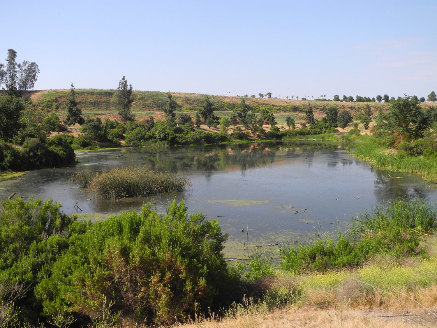
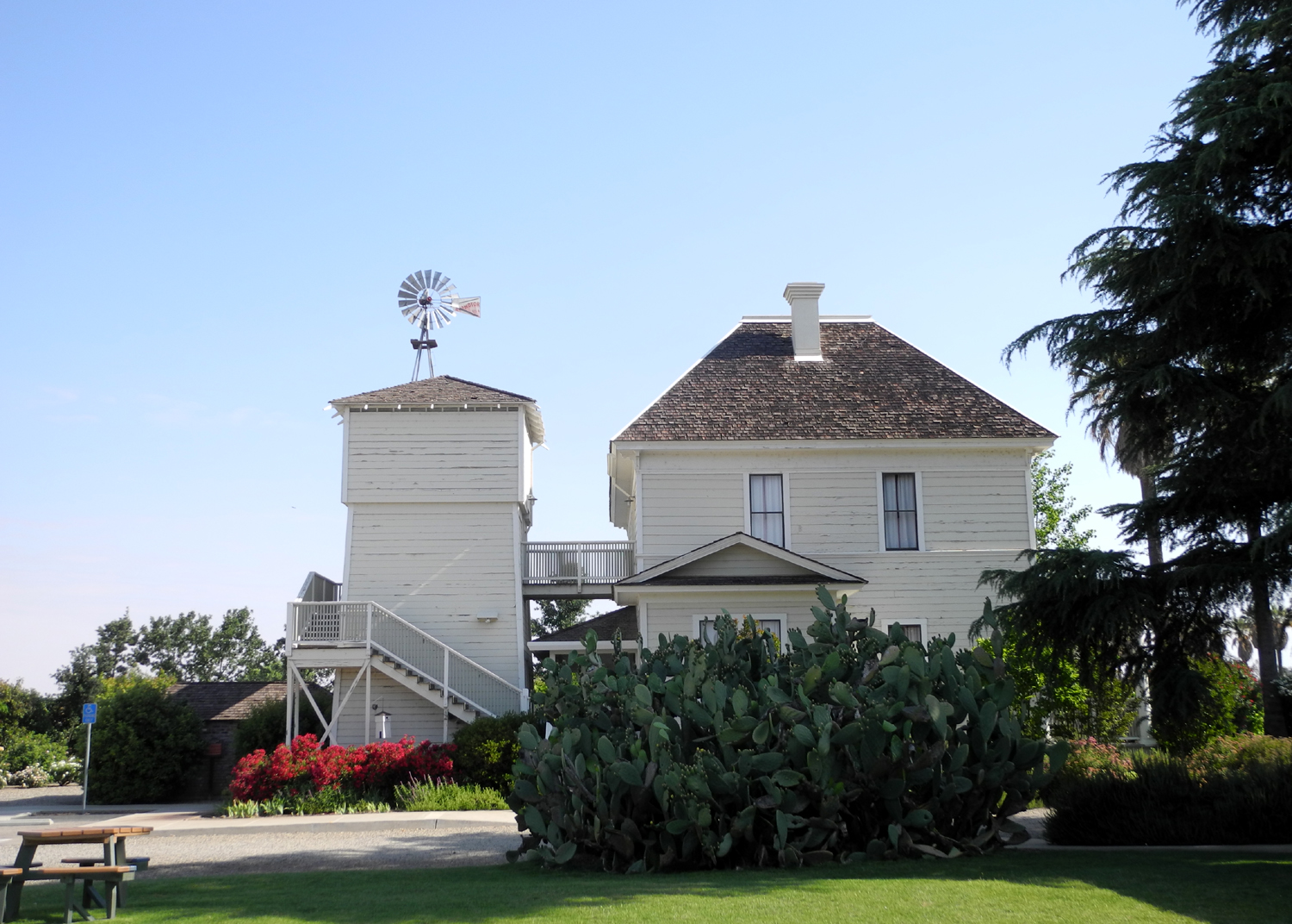
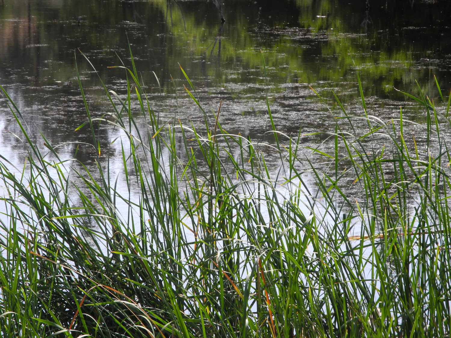
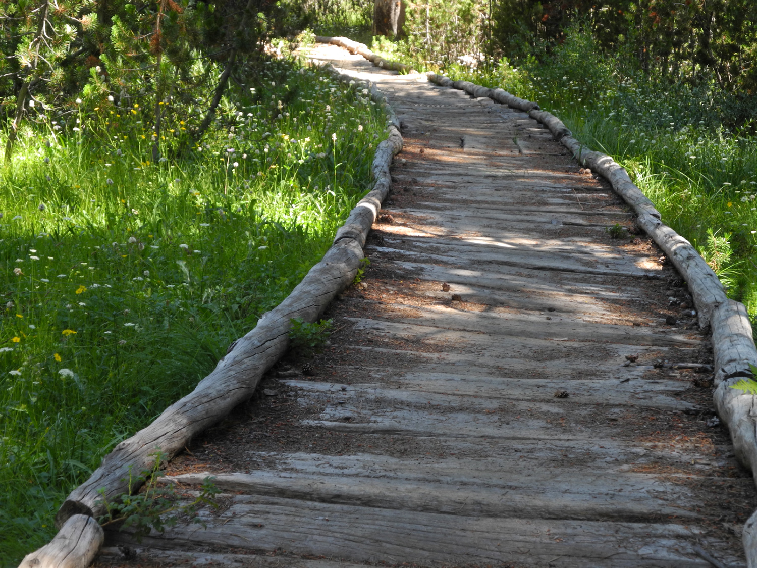
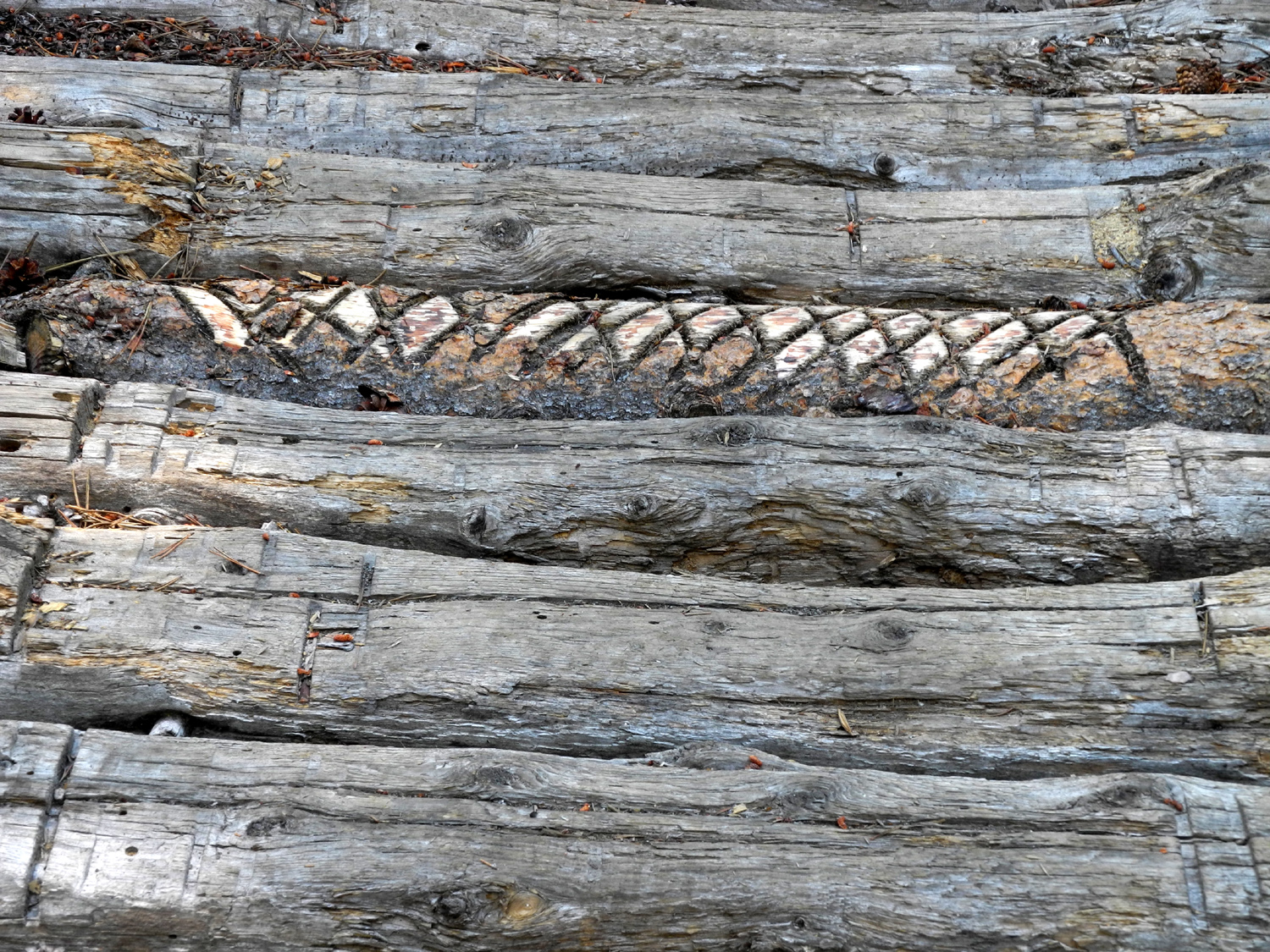
Eaton Trail This is another of those hikes I've done a number of times, and you can read a more detailed description of the trail here. There's also more about it here and here. Actually it's a stretch to call this a hike; it's more like my routine morning walks on the Clovis Trails. However, those are all on flat ground, and this has a little up and down. The parts of the Clovis Trails that I walk on are mostly away from major streets and commercial areas, but the surroundings are definitely urban. The Eaton Trail lies partly on the bluffs above the San Joaquin River, and partly down in the river bottom, and is essentially rural. Although you never see the river where I walk, there are cattail ponds with ducks, egrets, herons, turtles and other riparian wildlife. Hawks, buzzards and ravens are often seen overhead. On my other walks I have always parked where the western end of Old Friant Road leaves Friant Road, and walked east to the Hallowell Center for River Studies. This time, driving west on Friant Road, I turned into the east end of Old Friant, drove to the River Center, and parked in the lot there. This complex includes an old farmhouse, dating from the early 1900s, which serves as a visitor center and museum, and which can be rented for small events. There are restrooms, offices, a gift shop, and two old barns. Best of all, there is a large pond just south of the complex, with a trail all the way around it. At the southwest corner of the pond, you can cut across to the main Eaton Trail, and walk west toward Woodward Park, which is what I did. As soon as I took a good look at the pond I spotted a western pond turtle perched on a log, and when I returned I saw at least three or four more. I also saw a rabbit who quickly ducked back into the bushes. Where the trail leaves the pond it crosses Old Friant and immediately starts up hill. The first part is moderately steep, then it becomes a gentle rise with level sections. Along here you are between Old Friant and the bluffs. Soon the trail makes a final moderately steep climb up to the level valley floor above the bluffs, and goes on the Woodward Park, a distance of several miles. There are flowers of various kinds along the trail, including a row of oleander bushes in brilliant bloom along Old Friant. At this final up hill section I usually take a little dirt path that goes up above and parallels the trail to where it reaches the top. Although this path is usually easy going, and only a little bit steeper than the trail at the start, it was a challenge this time, since the upper section is pretty much overgrown with large flowering plants. l continued to my usual starting place, where the trail crosses Old Friant on a bridge, then started back. Along the way you can see a series of ponds that are the result of gravel mining. As I came down the last hill, I spotted a cottontail rabbit at the side of the trail. I quickly snapped a picture, then took a couple of steps closer. He didn't move, so I took another photo. I repeated this twice more, then continued on down the trail. I expected him to run as I passed, but he just turned so he could keep an eye on me, giving me another good angle for a final photo. When I got back to the car, my total walk was just under two and a half miles. I finished before 11 a.m., so the temperature was quite comfortable, but I realized the days of having to get on the trail by 7 a.m. to avoid the summer heat will be here very soon.
|
||
|
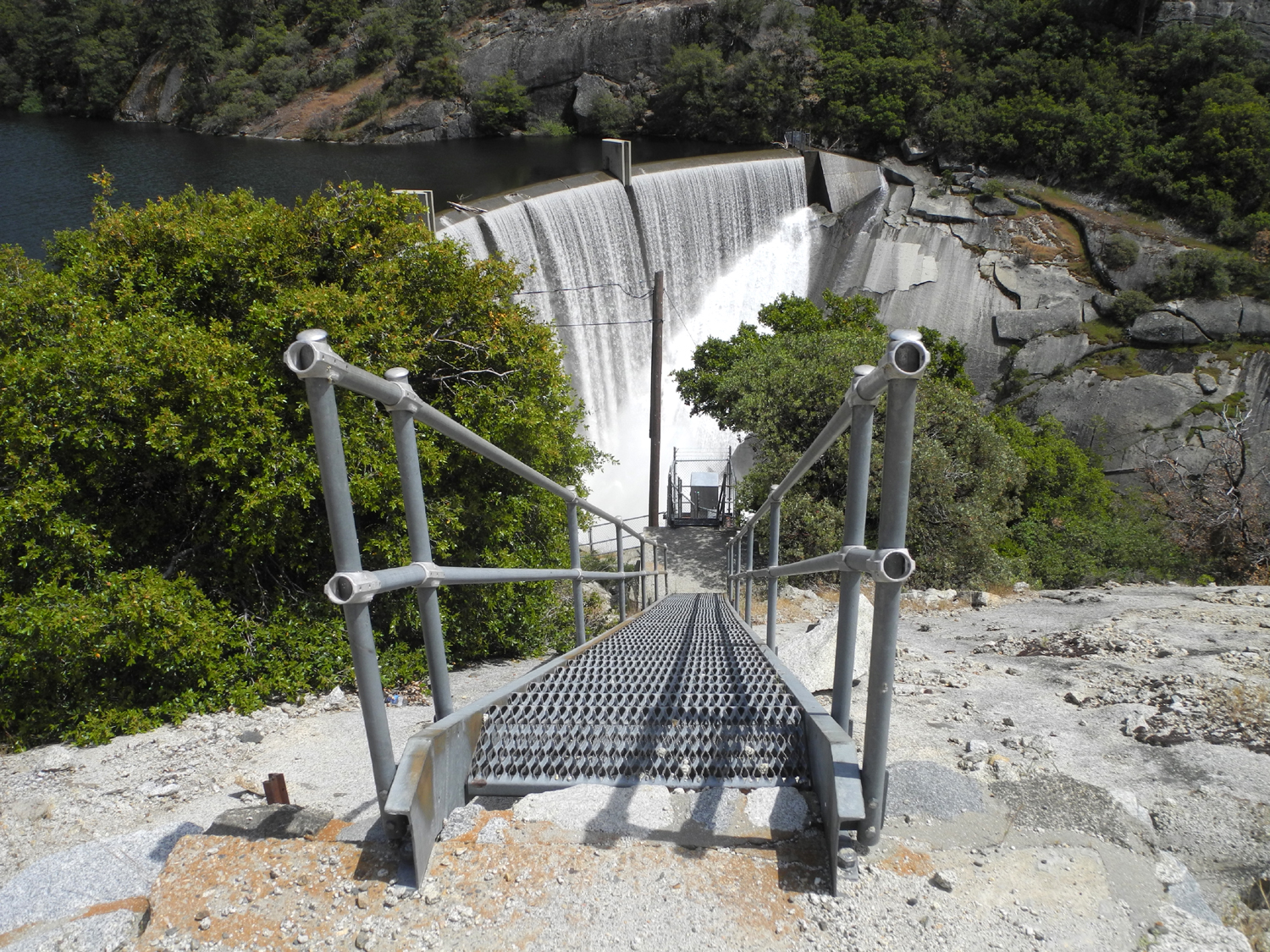
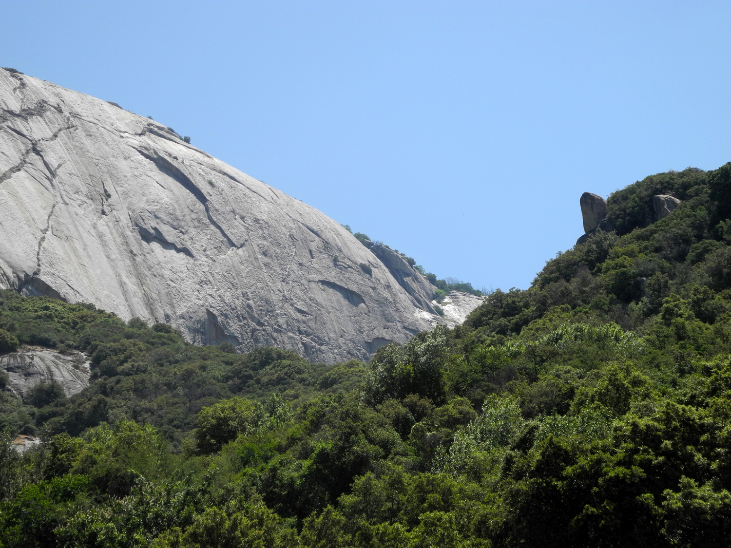
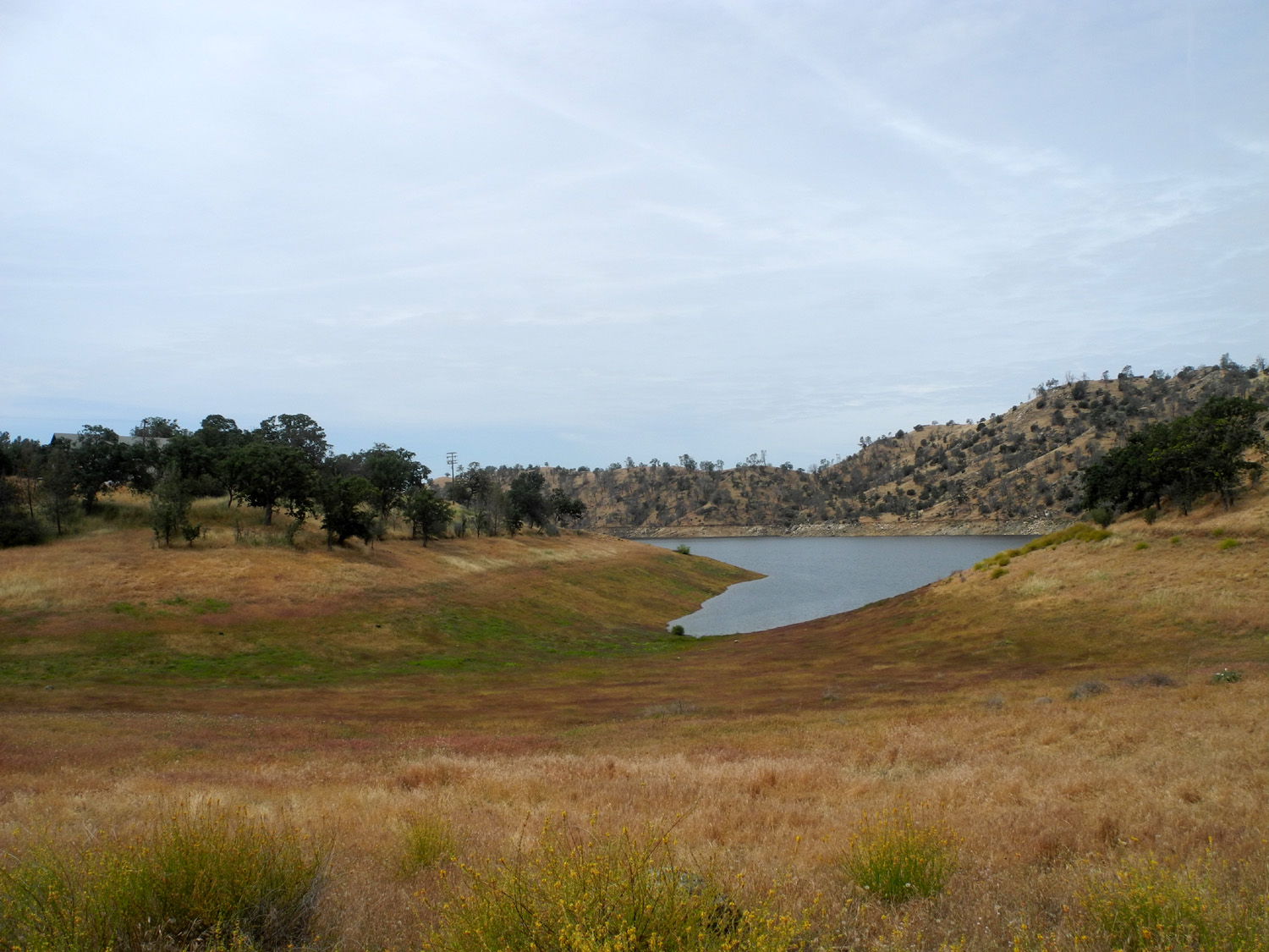
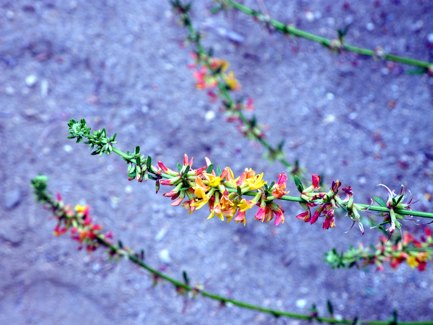
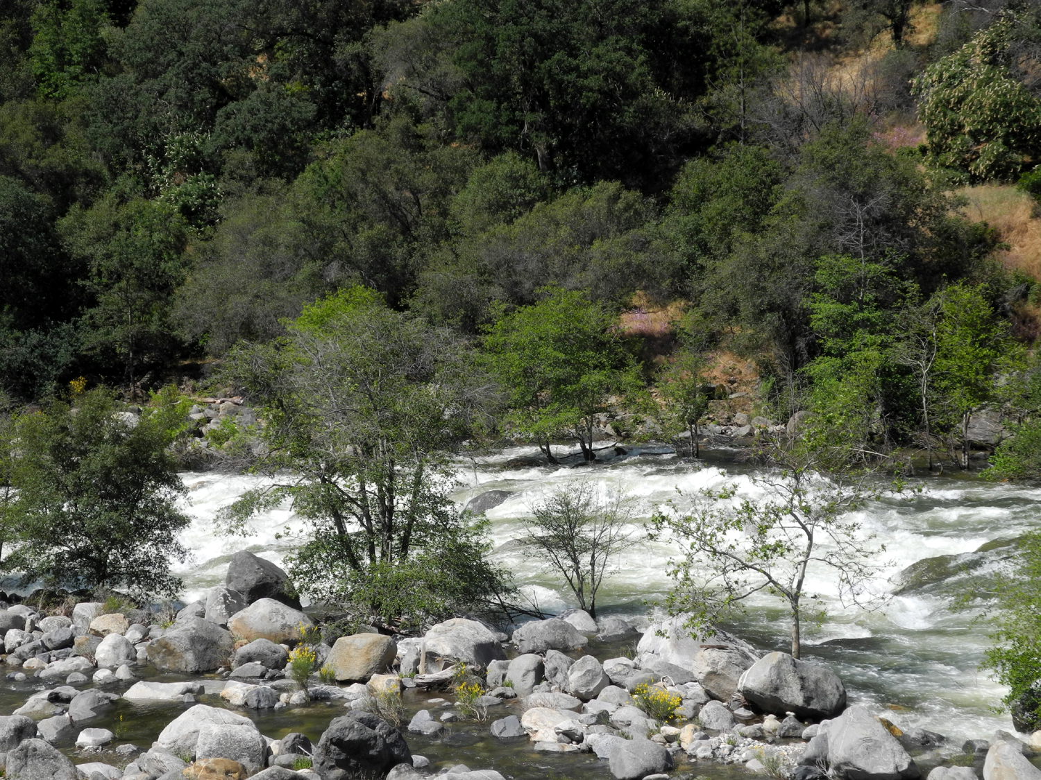
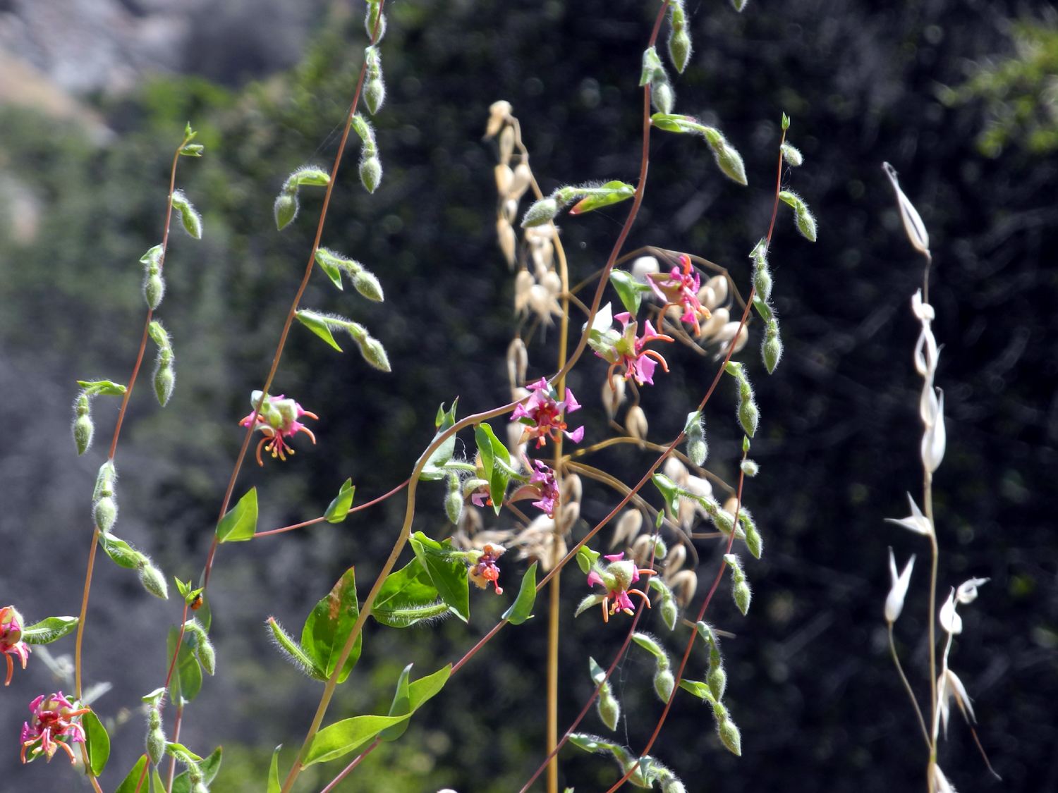
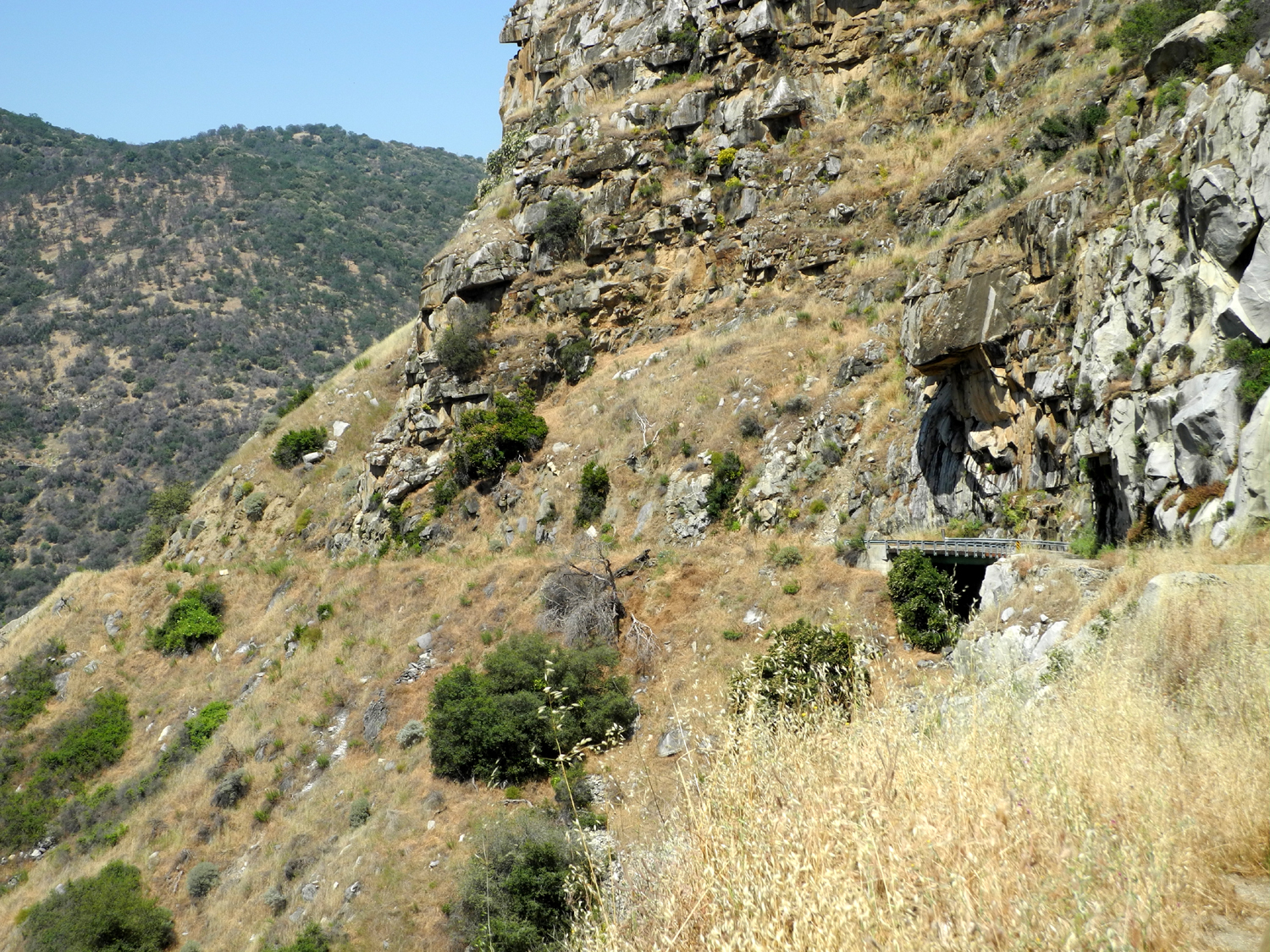
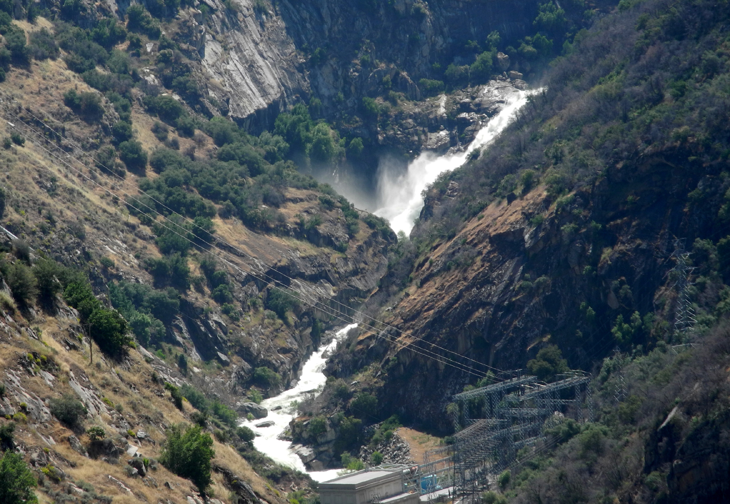
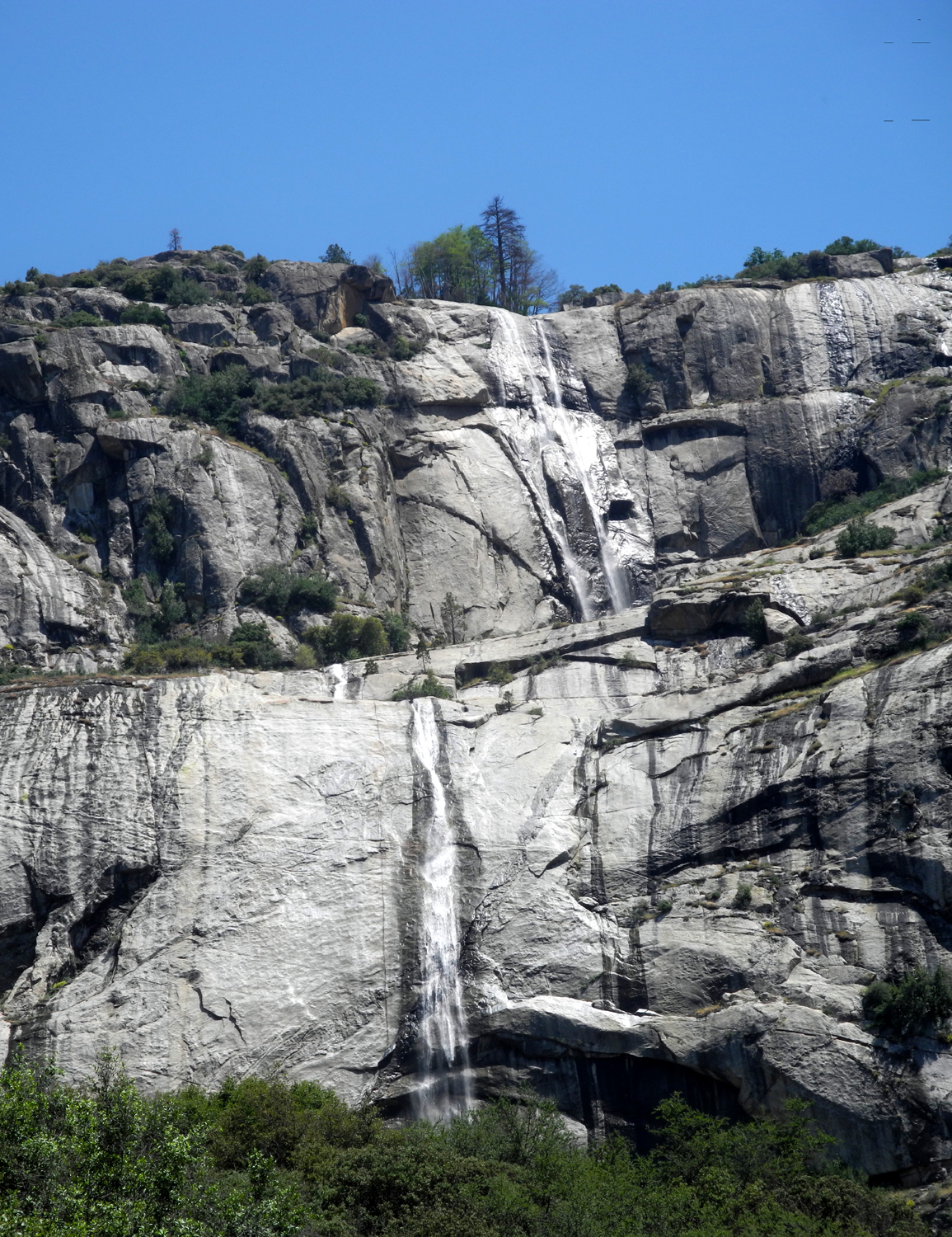
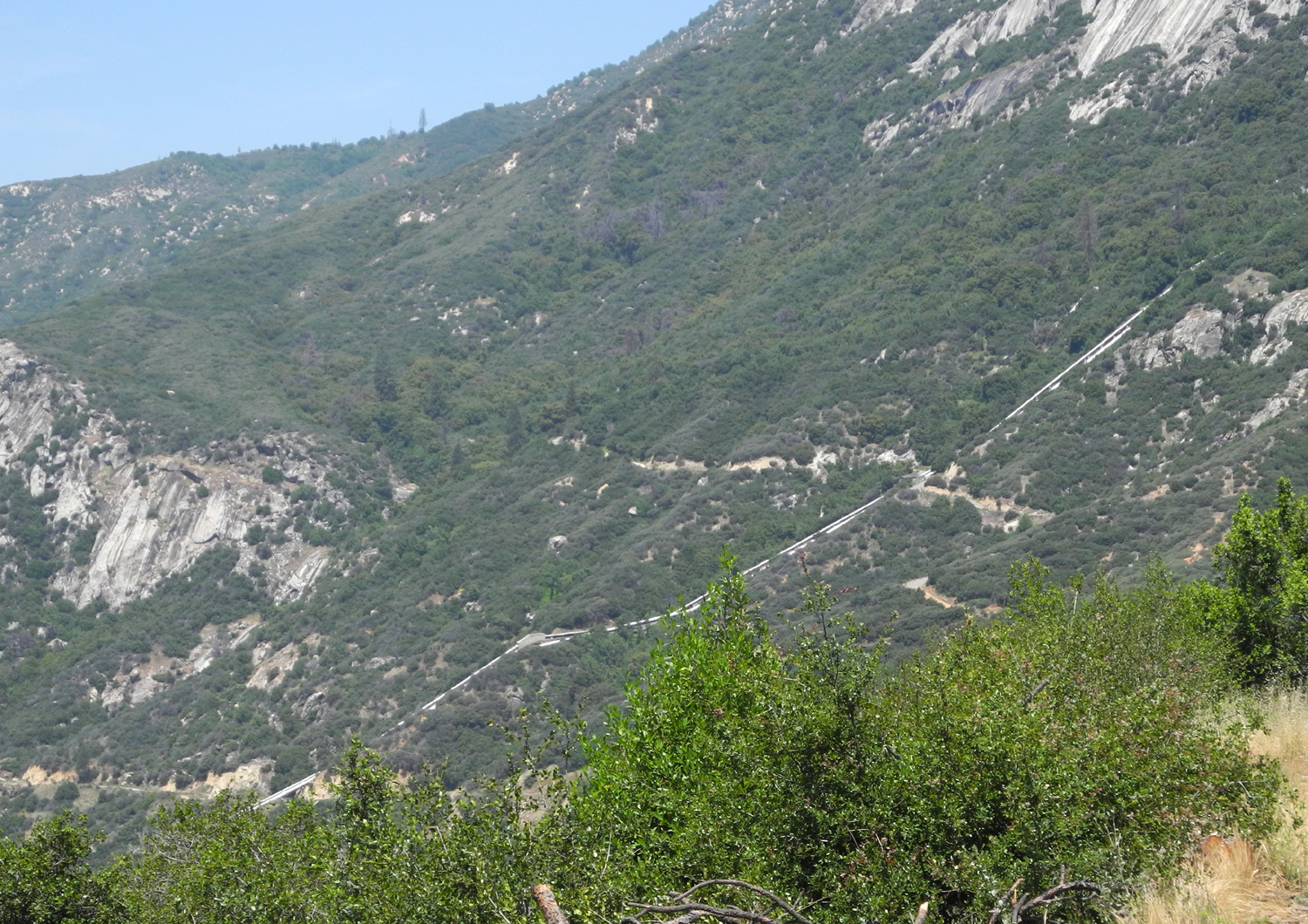
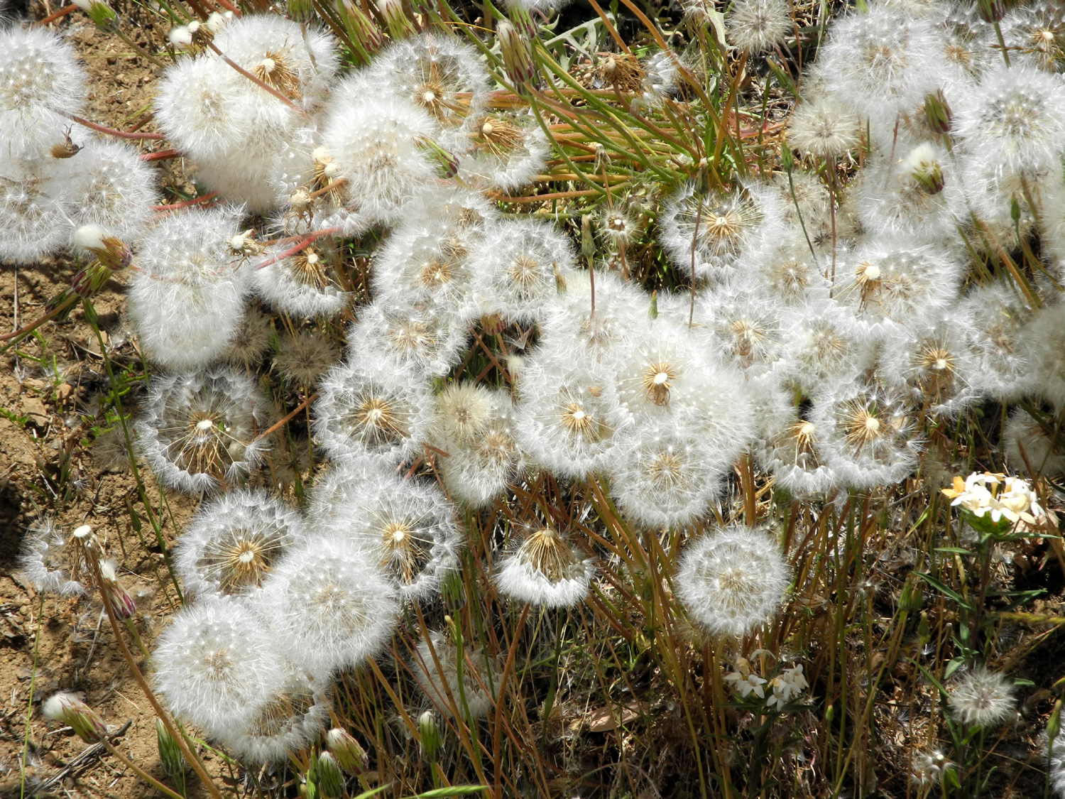
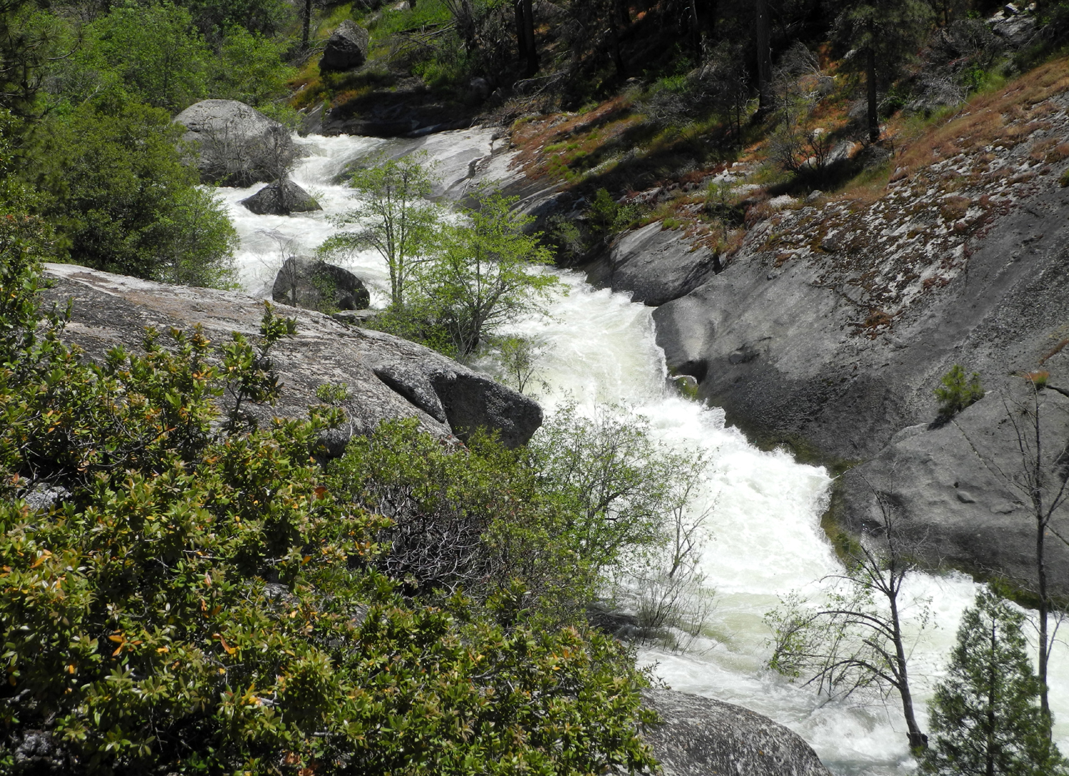
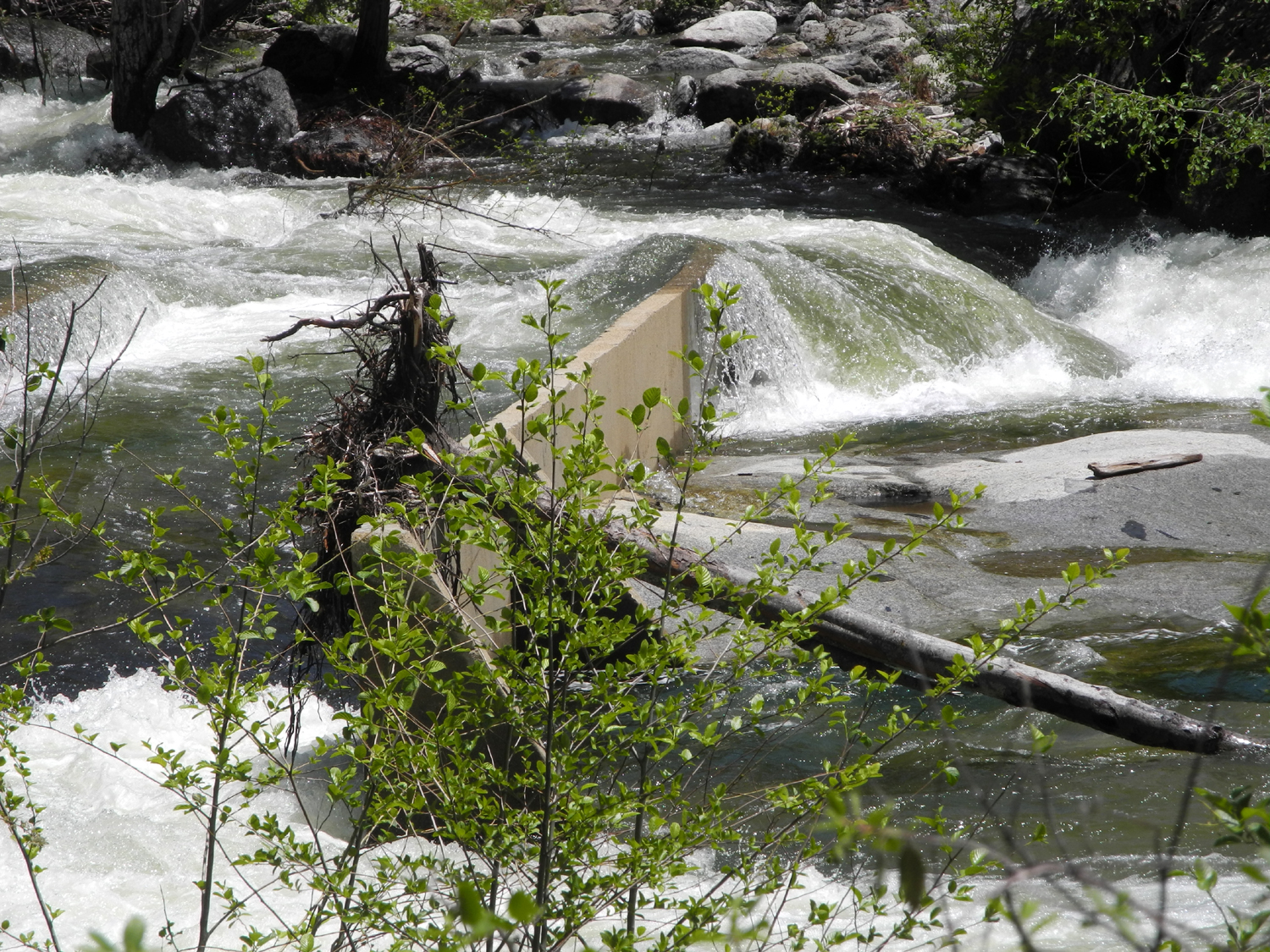
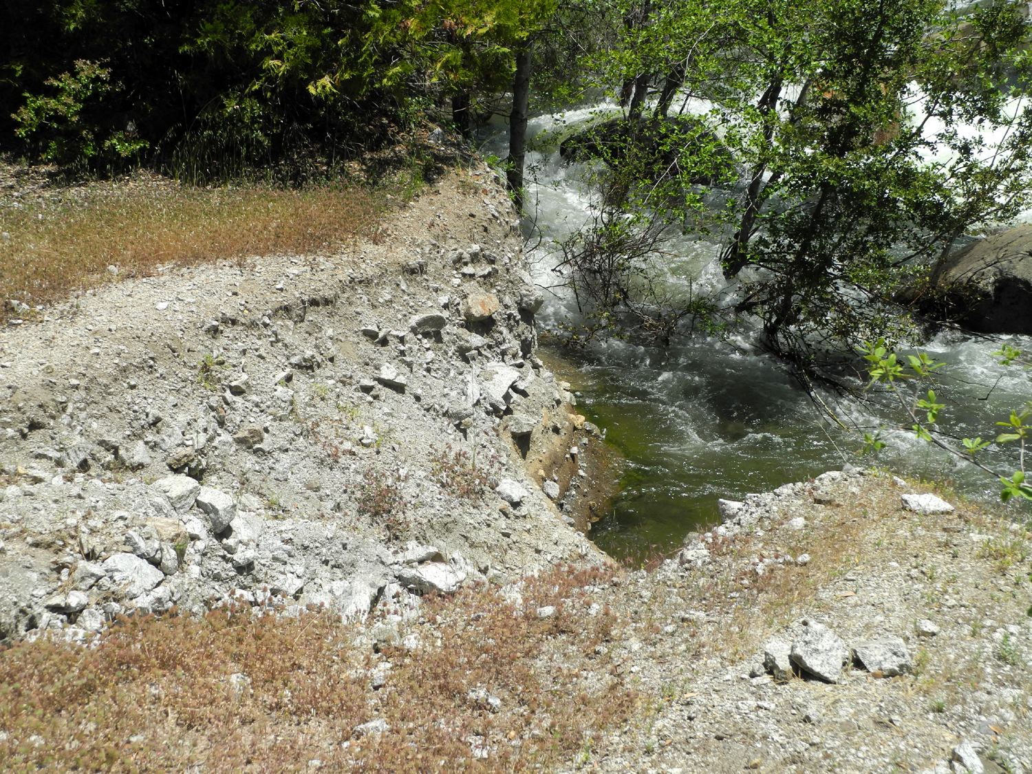
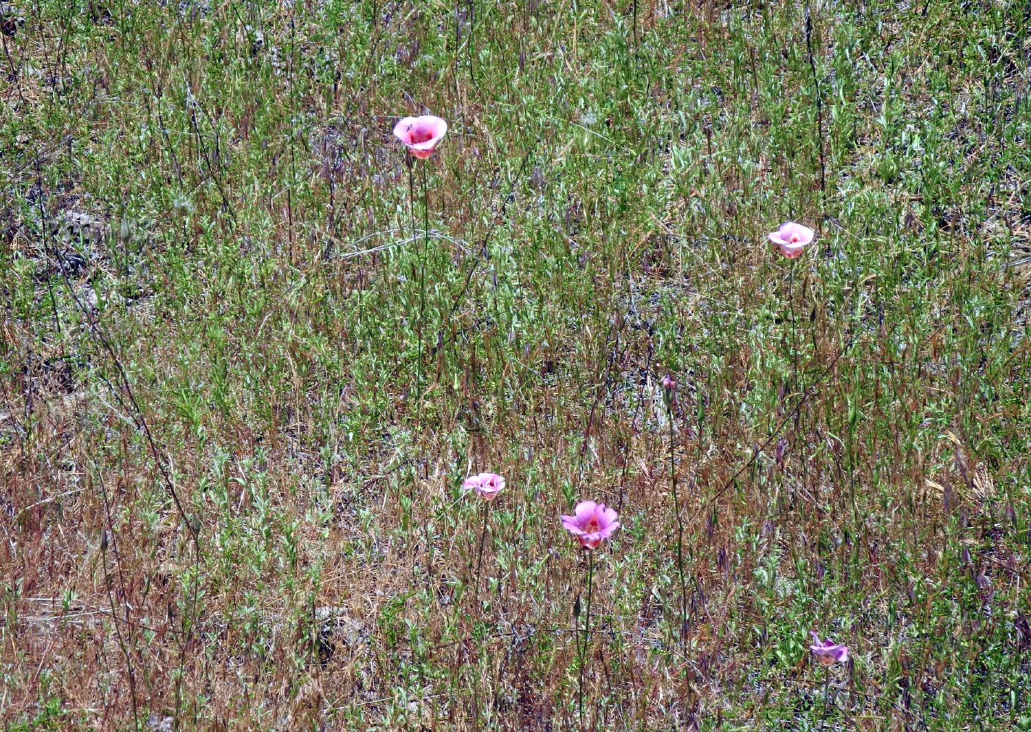
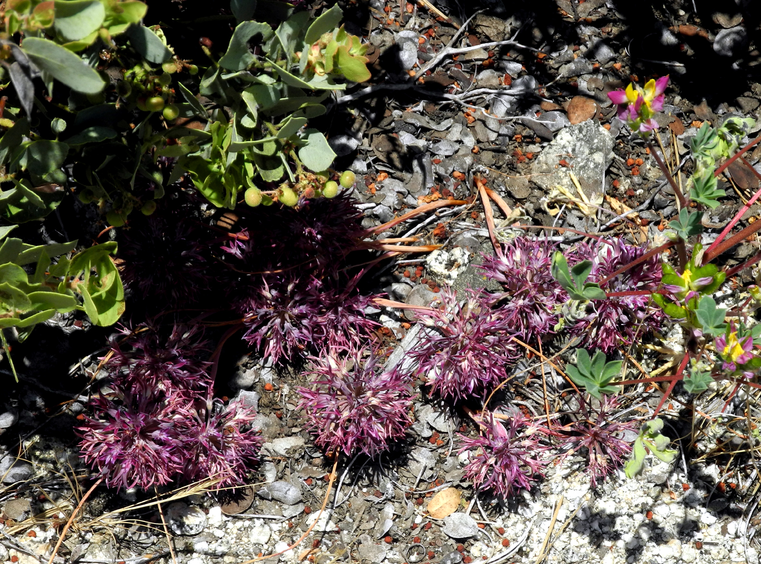
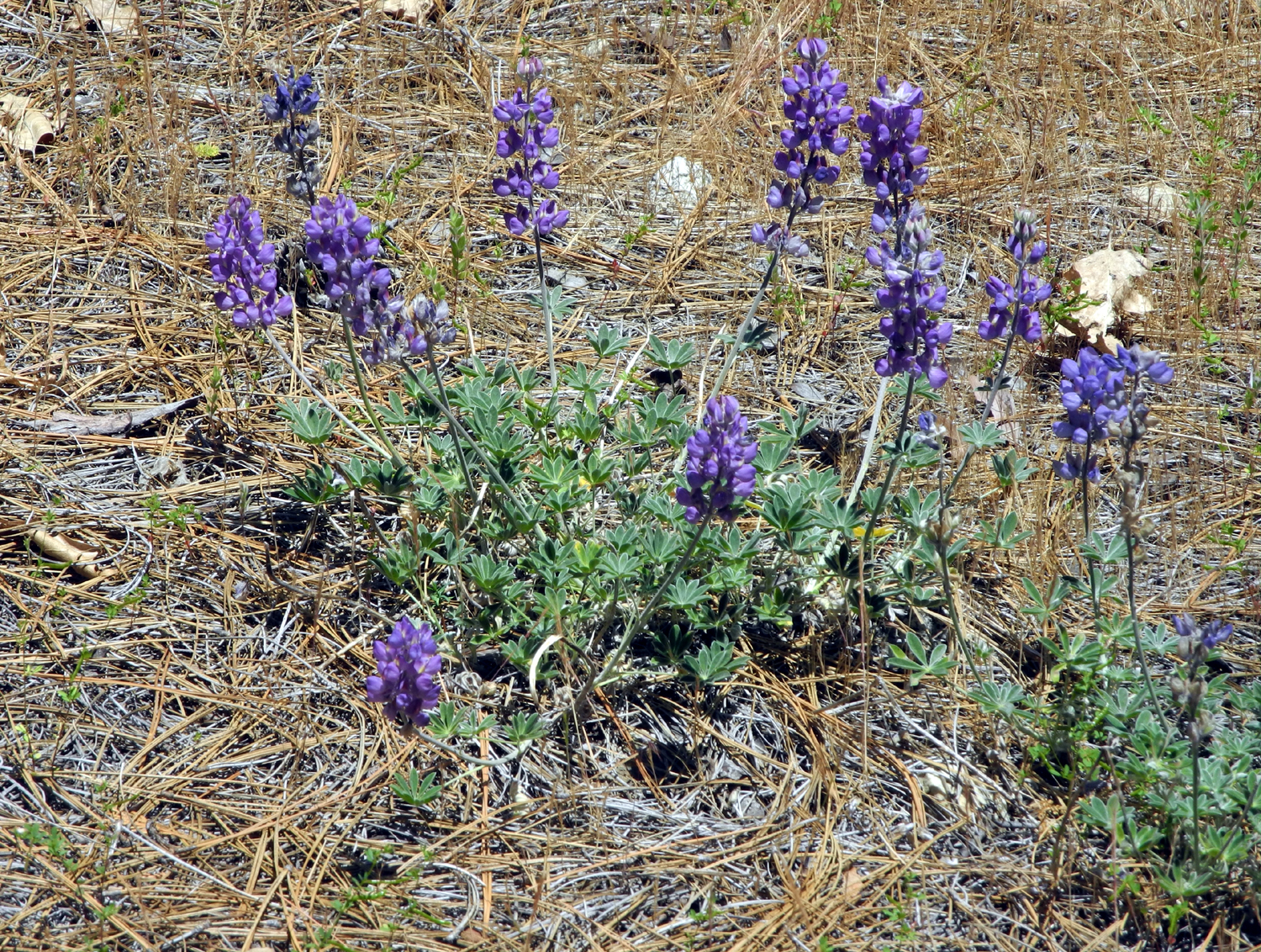
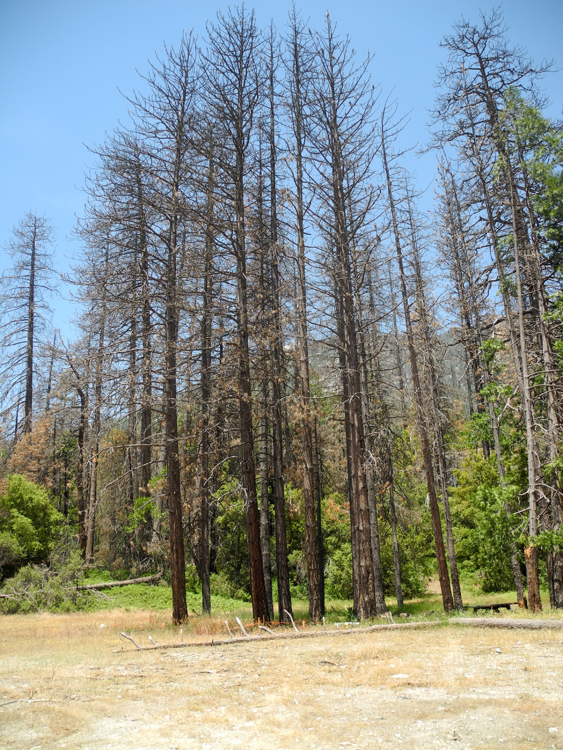
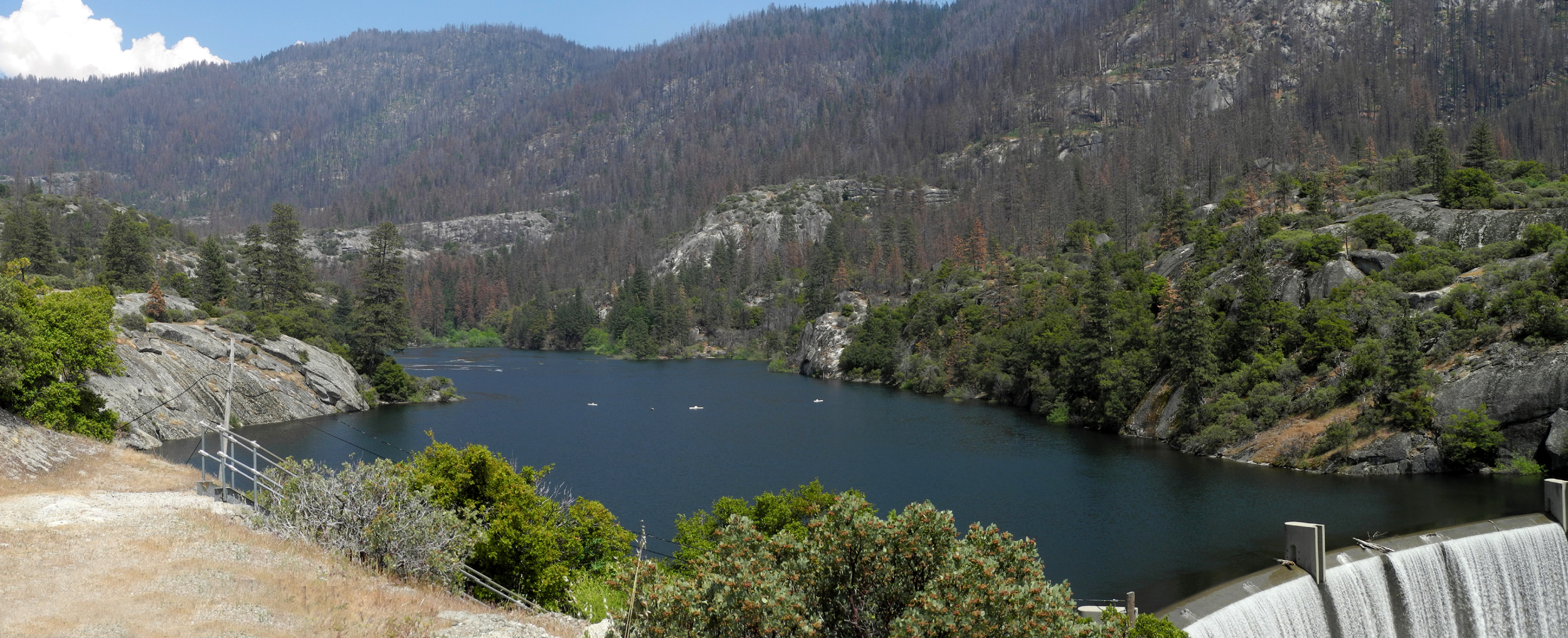
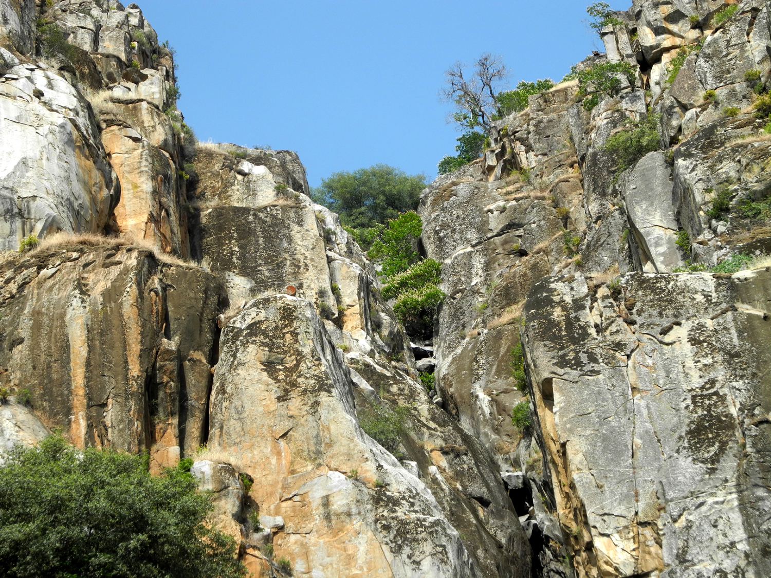
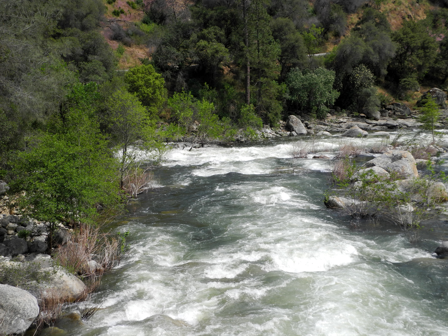
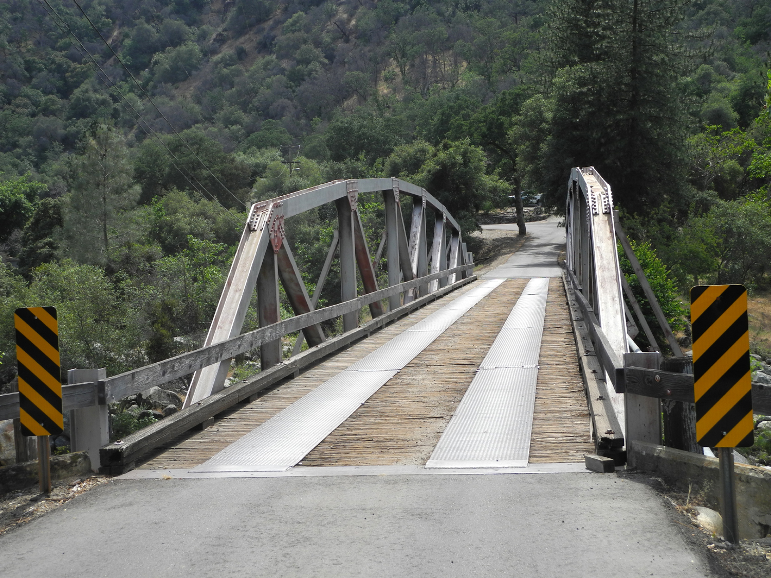
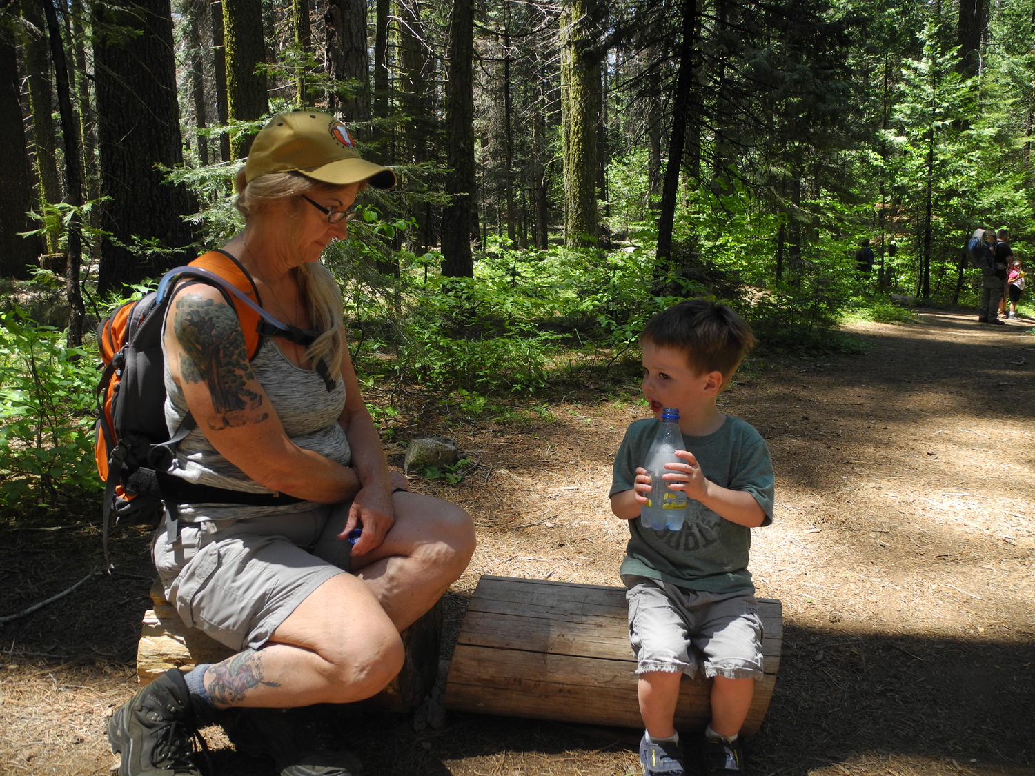
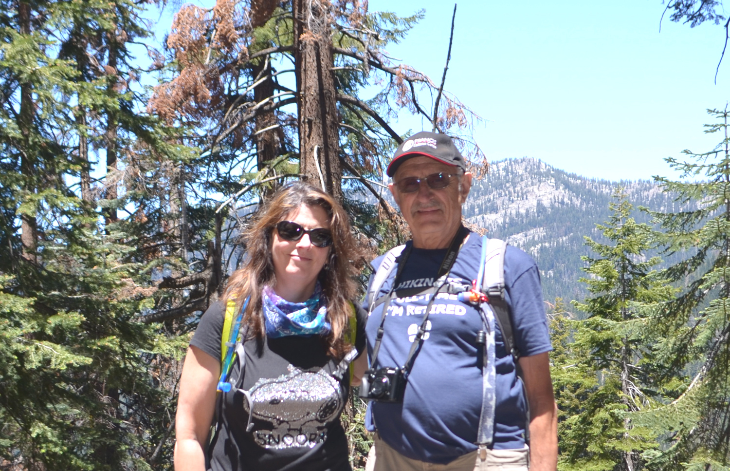
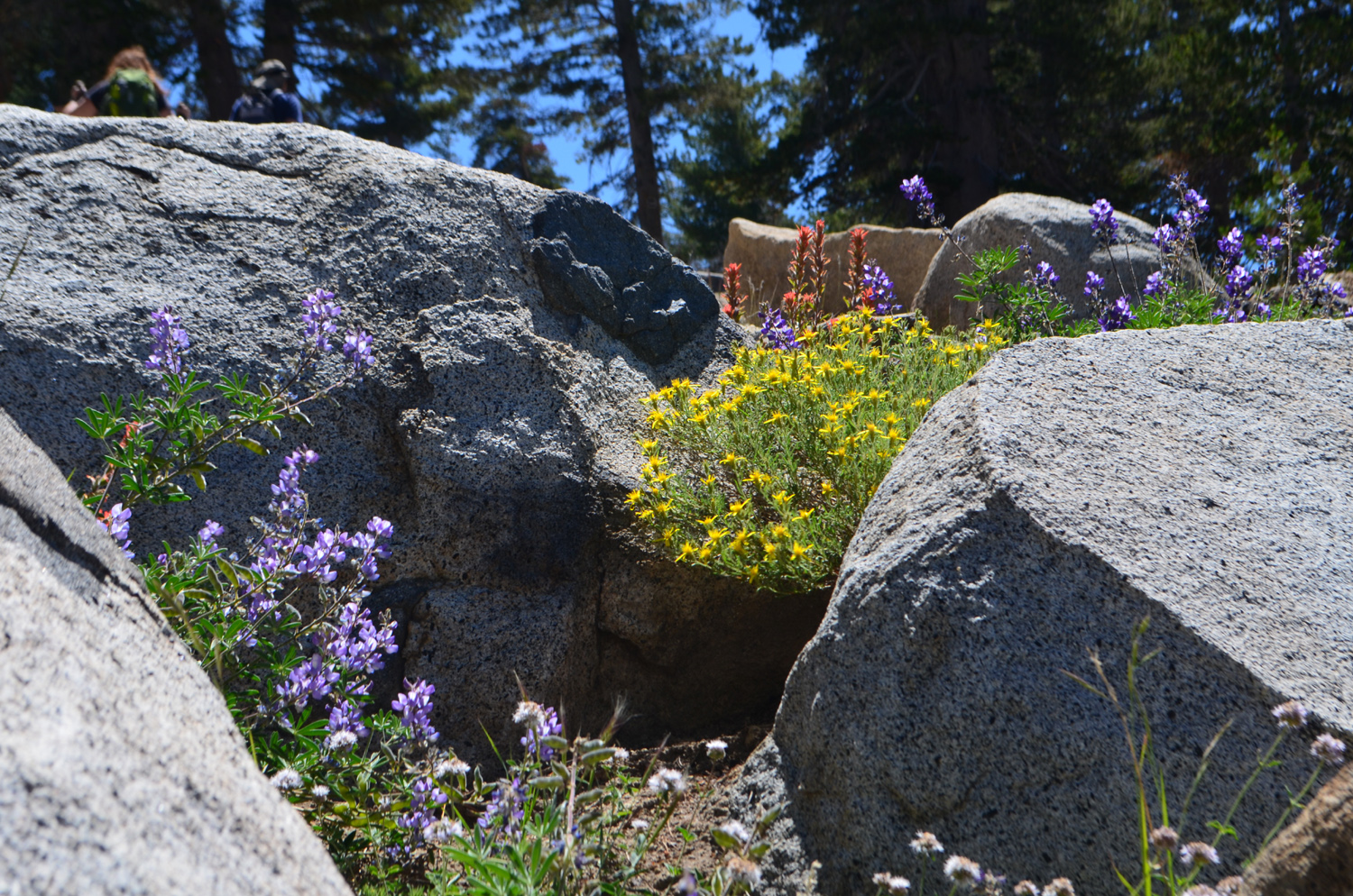
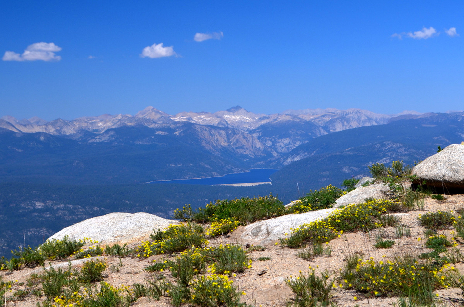
Black Rock Reservoir My final May adventure was Part 1 one of a two-part exploratory journey. My daughter Teri and I are planning a long camping trip in late June, so we decided we should do a short camping trip in early June. With heavy snow in the higher mountains, high runoff in the streams, and the possibility of muddy dirt roads, we decided that day trips to check out a couple of places were in order. So it was that I left home about 8:15 on May 30 for Black Rock Reservoir, on the North Fork of the Kings River. To get there you go east on Belmont, which turns into Trimmer Springs Road and runs along Pine Flat Lake. The road crosses the main Kings River twice above the lake, and at the second bridge, follows the North Fork through the PG&E town of Balch Camp. The road then climbs high up the north side of the canyon for eleven very narrow and winding miles to Black Rock, a small PG&E facility that sends water through a penstock to a power house near Balch Camp. The road is not for sissies, and has even been known to make brave men and women hold their breath. It's paved but has many rough spots, and in a few places you can look out your window and almost straight down into the canyon hundreds of feet below. It crosses a couple of bridges which look like they are just hanging off the cliff. On the other hand it is incredibly scenic, with many flowers along the way, rocky cliffs on the up hill side and long vistas down into the canyon. There are also two excellent waterfalls, although one is hard to see. It's on the river, and almost hidden in a narrow gorge. When the river is low it's not really visible, but during peak snow melt, it is a crashing cascade that hits the rocks below and throws foam and white water twenty or thirty feet up into the air. It is visible from the road, but getting a really good look requires going about twenty feet into the dry grass and stickers. I do this only when the water is at its best, which it was this time. A little higher up, the road passes below Patterson Bluff, a rounded, almost vertical granite cliff that runs for hundreds of feet above the road. Patterson Falls drops down the cliff several hundred feet, with an upper and lower section. The water volume is not great, but it's still a nice sight. Since the creek continues on down the cliff past the road to the river, the road in this section is well back up the drainage, out of sight of the main river canyon. The road rises from 1,200 feet at Balch Camp to 4,200 feet at the lake, where there is a small campground. The main road continues on to McKinley Grove Road, but the pavement ends, and the last mile to the camp is dirt, not too rough but typical of Sierra roads. A short distance before the camp a side road goes down a few hundred feet to a large flat spot, formed by rock and soil dumped there from construction of the tunnels that carry water between reservoirs and power houses. We used to camp at this spot, in the middle of a nice grove of ponderosa pines shading a picnic table and fire ring. I drove down there only to find that all the trees are dead, and that two had fallen. I started to park next to that spot, then thought better of if and moved my car to a place that seemed to be fairly safe from dead trees. The road continues on down to the river, but has become a four-wheel drive route. It's only a short distance, and I've walked down it a number of times, and I did so this time. At one point along the way I saw what appeared to be a purple Mariposa lily, something I have not seen in decades. I had to walk through a patch of bear clover, but there was a sort of path, and it was fairly easy going. I was delighted to see at least a dozen purple lilies and quite a few white ones. With the yellow Mariposa lilies at the San Joaquin Gorge earlier in May, I completed the Mariposa lily trifecta for the first time in at least twenty or thirty years. I also found pink and yellow harlequin lupines and several of those famous "unidentified" flowers. And continuing up onto a large granite slab just above the flowers, I had a great view of the river, in all its roaring white water glory. I had hoped to make my way across to a lower part of the road without backtracking, but the thick brush demanded otherwise, so I retraced my steps, and followed the road down to the river. There is an old bridge at this place, which I have driven across in the long distant past, but the approach has been washed out for years, so it's just another place to help shape the river. After enjoying the power of the water here, I returned to the car and drove on to the campground. There is a paved loop to the left with several campsites, so I drove in there to eat lunch. Even at 4,000 feet it was quite warm, and I was disappointed to see that all the tables were in the sun. In fact, along the road coming in I had seen several large piles of logs, and it's clear that many trees in the campground had died and been cut down. My grandson Johnny told me later that when he was there the last time, the trees were scattered all over, so at least they are out of the way. I did find the end of one table in the shade and enjoyed my lunch, then drove across the main camp road to a parking place above the dam. A walk of about 50 feet brings you to a place where you can look down on the dam, and there is a steep metal stairway leading down closer to the dam. The terrain below the stairs is a steep drop into the canyon, and It's fenced off. Don't tell PG&E or the Forest Service, but years ago we were able to make our way down to the dam and walk across it, during summer when the water was low. The fence has been reinforced to make this more difficult now, but I have lost the desire for such adventures. The dam forms a graceful arc, and when the inflow is large enough, it becomes a man-made waterfall, with water rushing over the top and also out through a spillway part way down. The capacity of the lake is very small, just under 1,300 acre feet (compare this to the million acre-foot size of Pine Flat downstream), but it's a favorite spot for fishermen, and a place of cool, quiet beauty during hot summer days. The upper part of the canyon, just below the dam, has dark granite cliffs on the south side. The road goes in along the lake another half mile where there are more camp sites and easy access to the lake, but I did not go that far. Although the road is challenging, there were plenty of places to pull off and take photos and just enjoy the scenery, and I stopped a dozen times or so on the way up, but only about three times going back down. One of these was at Balch Camp, where Dinkey Creek flows into the river from the north. Like all streams that rise in the Sierra, it was like a big river. Even the two large creeks that run into Pine Flat along Trimmer Springs Road were running good, especially Big Creek. The trip is 72 miles one way, and all but the first 15 miles in the valley are slow. On the road from Balch Camp to Black Rock, there is almost no place where it is safe to go over 25 or 30 MPH, and many stretches where I kept it to 15 MPH or less. Fortunately, there was not much traffic. In fact, there was only a fraction more than zero - while I was stopped at Patterson Falls a PG&E truck went down the hill, the only vehicle I saw between Balch and Black Rock. As usual, I kept a list of flowers seen along the road and during my stops: Poppies, Athurial's spear, harvest brodiaea, climbing brodiaea, elegant clarkia, poppies, grand collomia, farewell-to-spring, blue lupines, harlequin lupines, common madia, buckeye, elderberry, chaparral, goldfields, wild berry blossoms, blazing star, unidentified yellow bush-like plant with many blossoms, white and purple Mariposa lilies, bear clover, western wall flowers, Chinese houses, a small, unidentified ground-hugging round cluster of purple flowers, and unidentified pink flowers growing in the crack of a big granite slab. The second part of our exploration took place June 3, when Teri and I, along with Colton and Jack, went to Nelder Grove, to scout possible camping spots. That report is "coming soon."
|
||
|
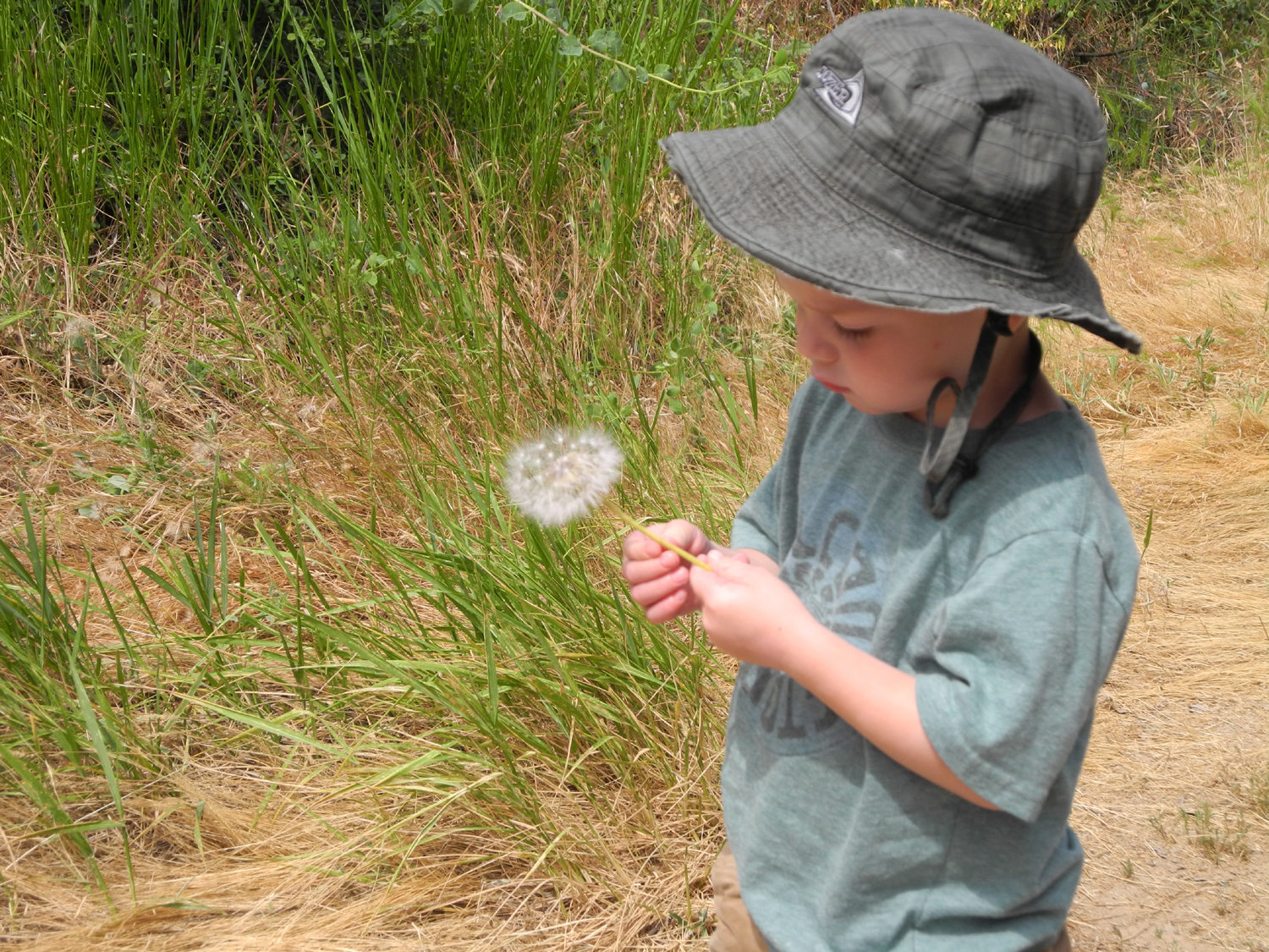
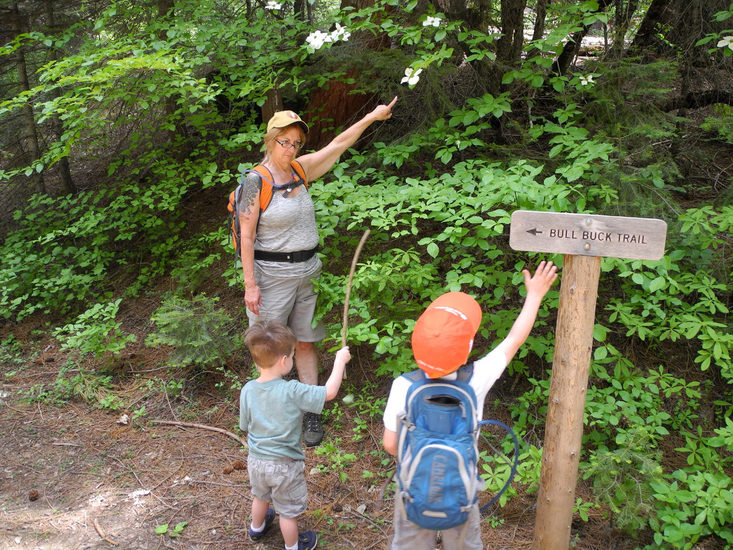
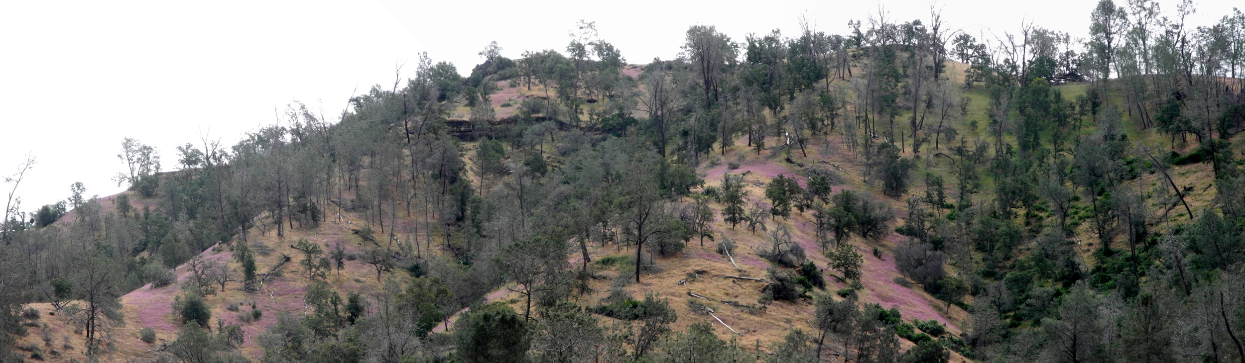
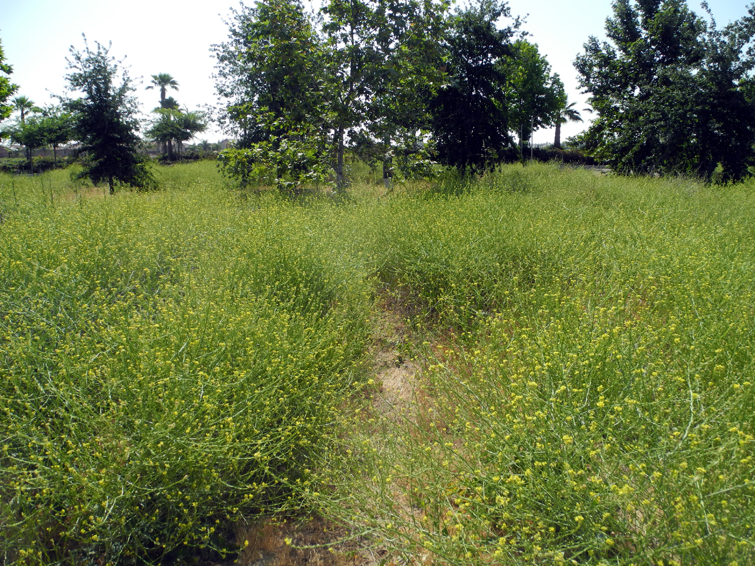
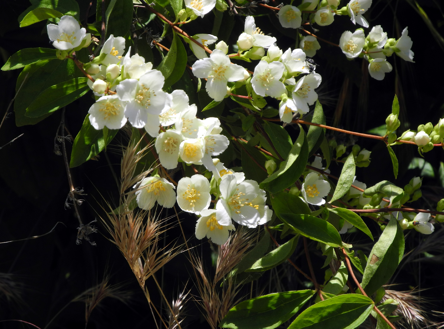
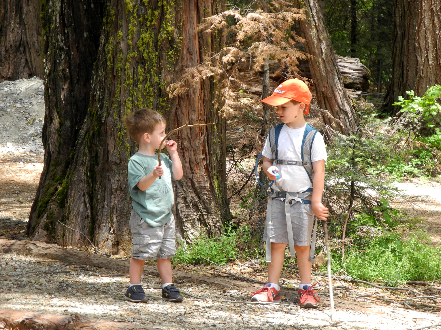
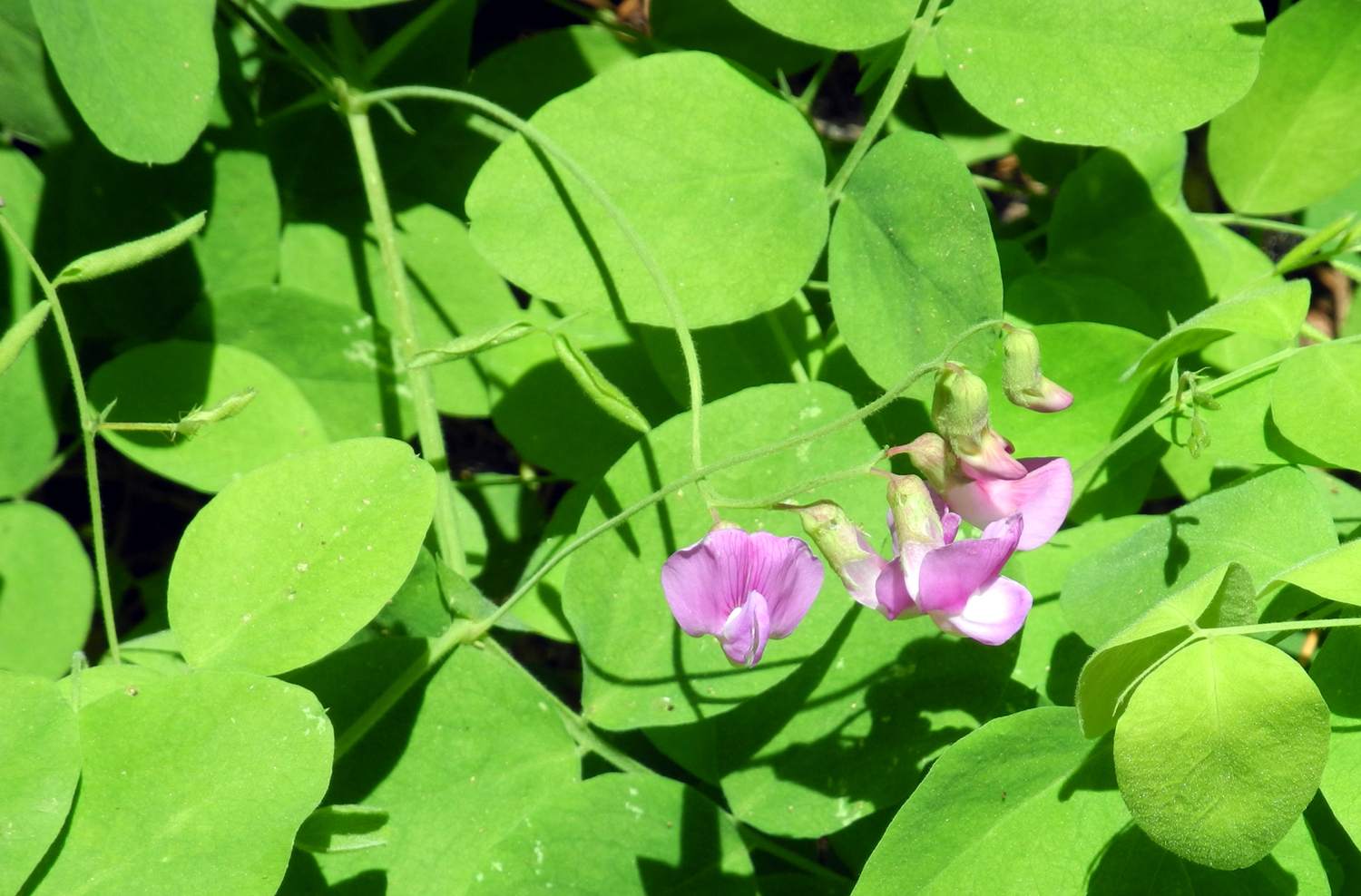
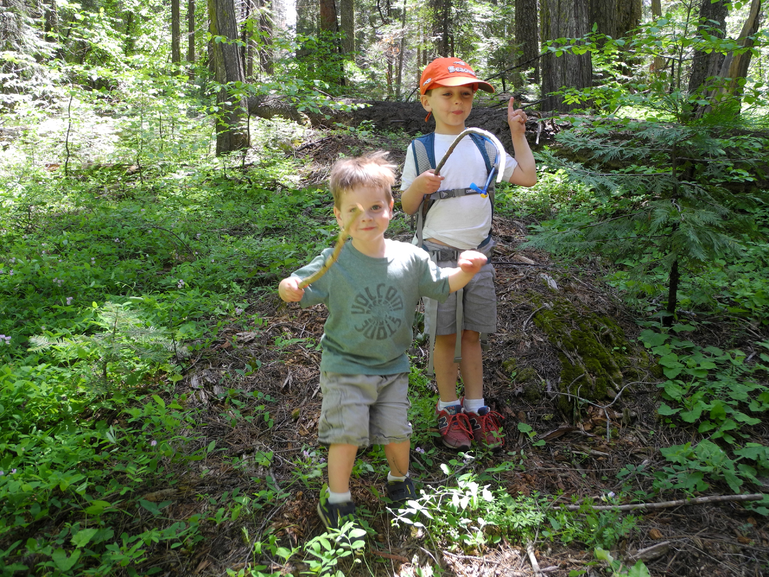
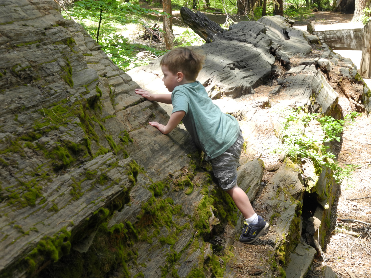
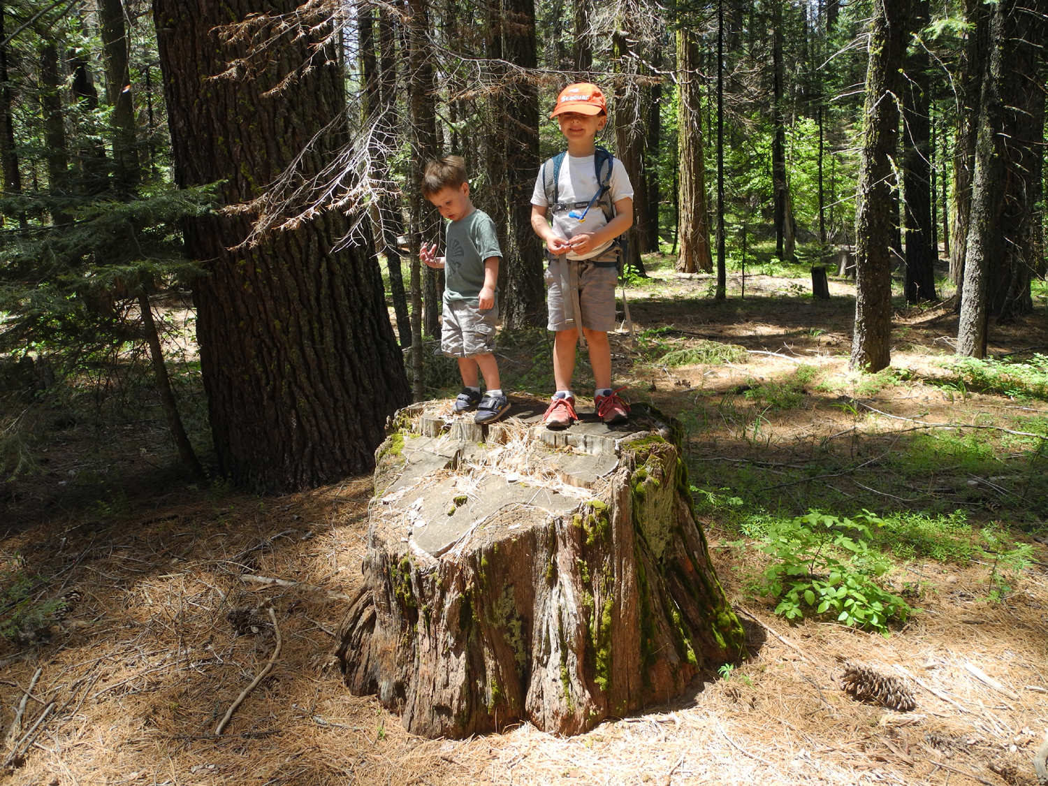
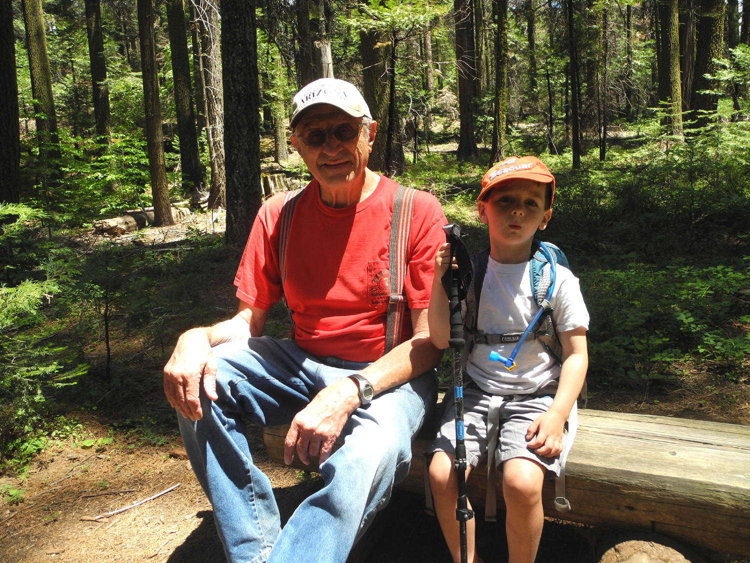
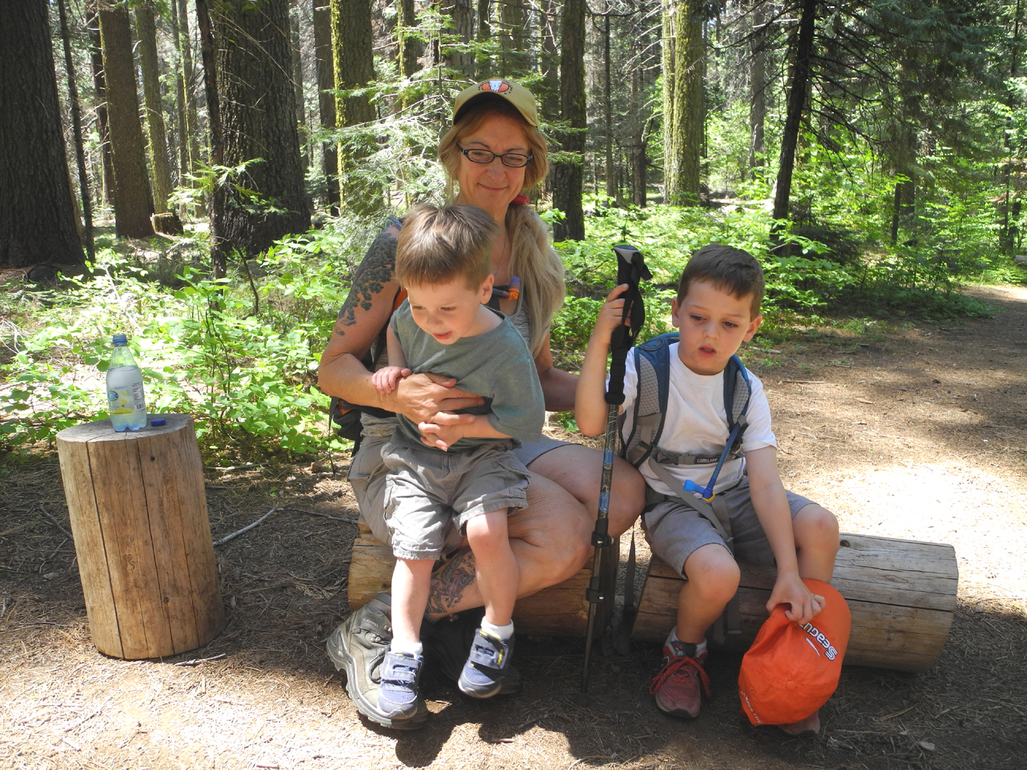
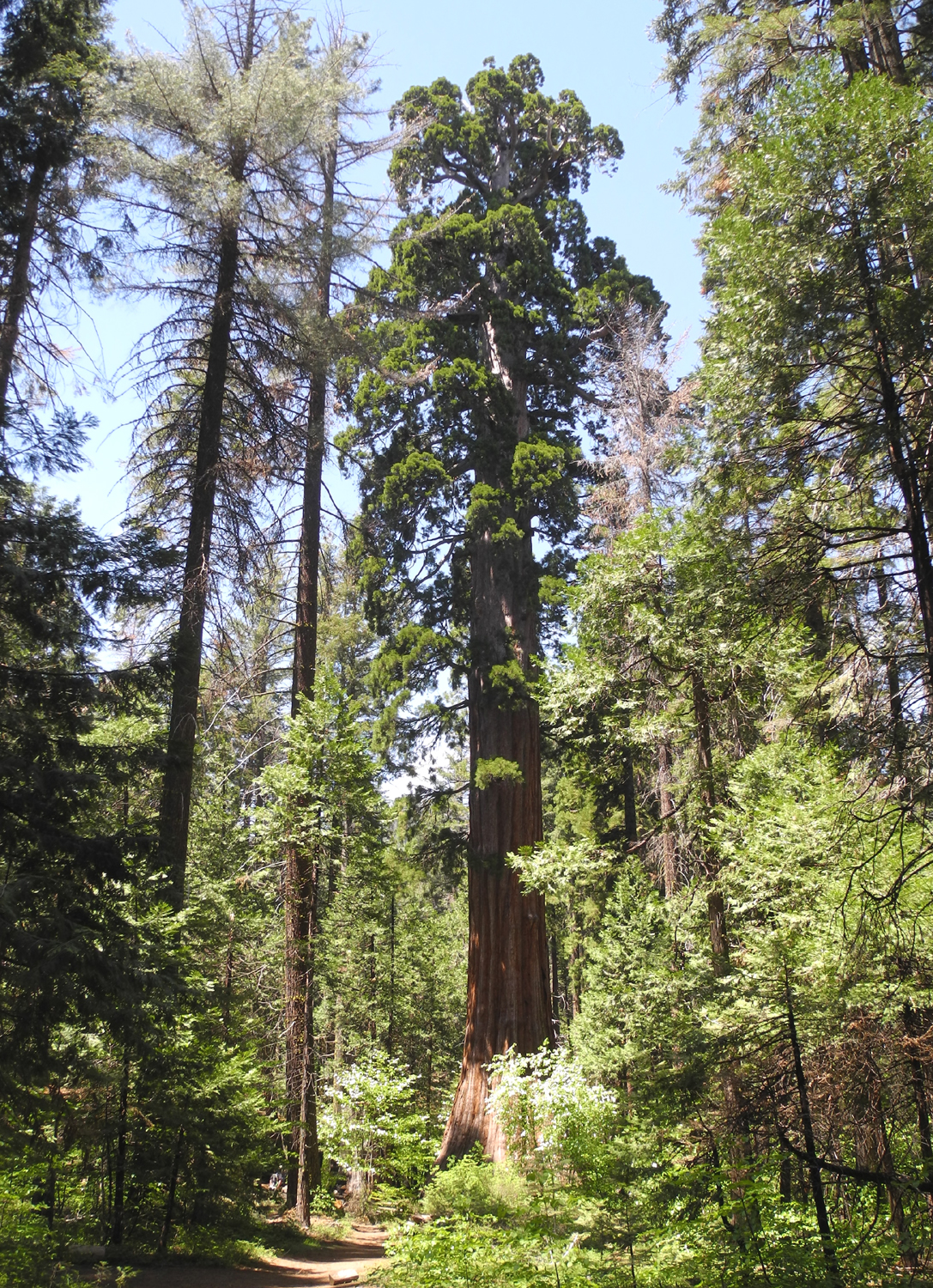
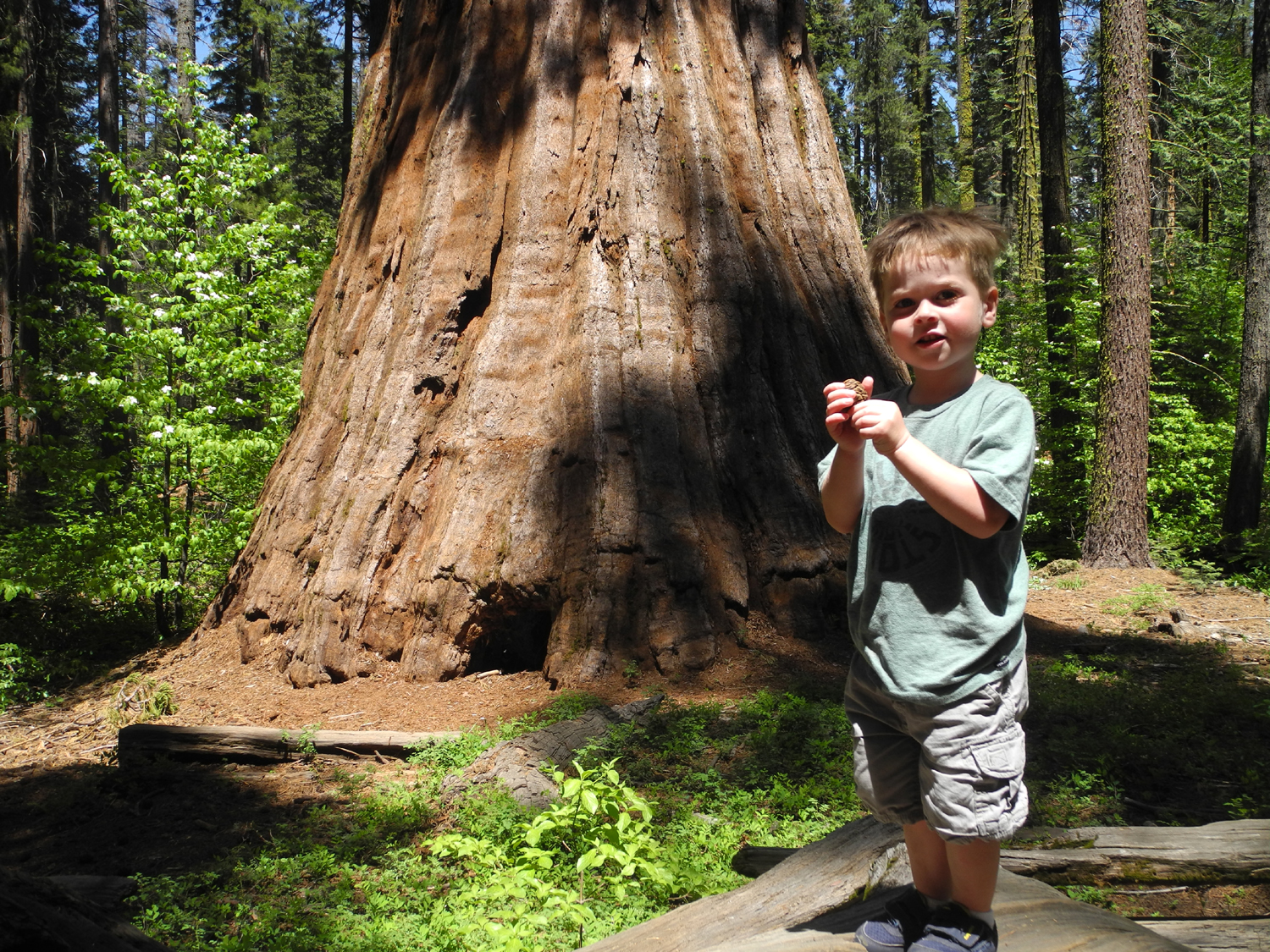
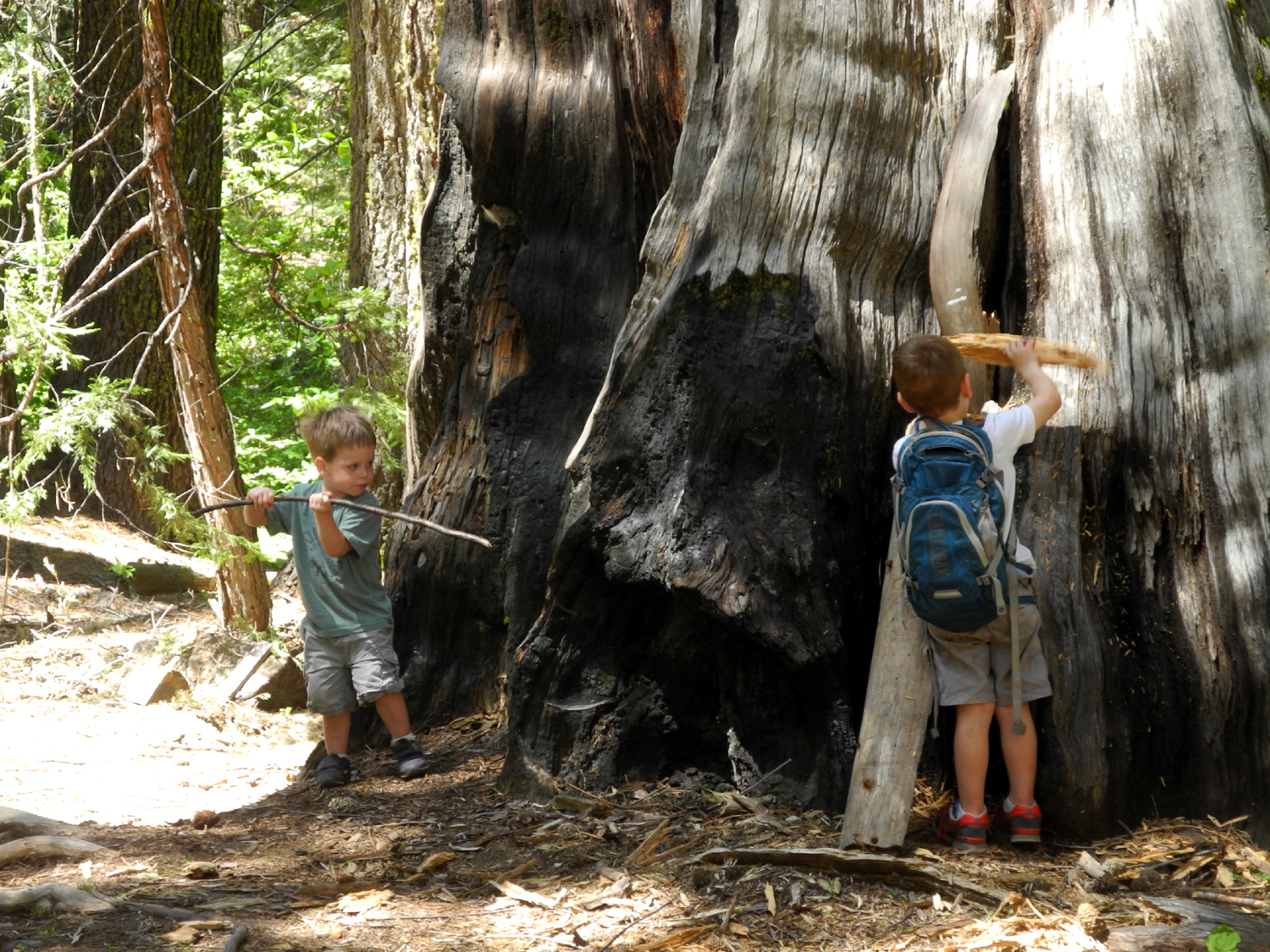
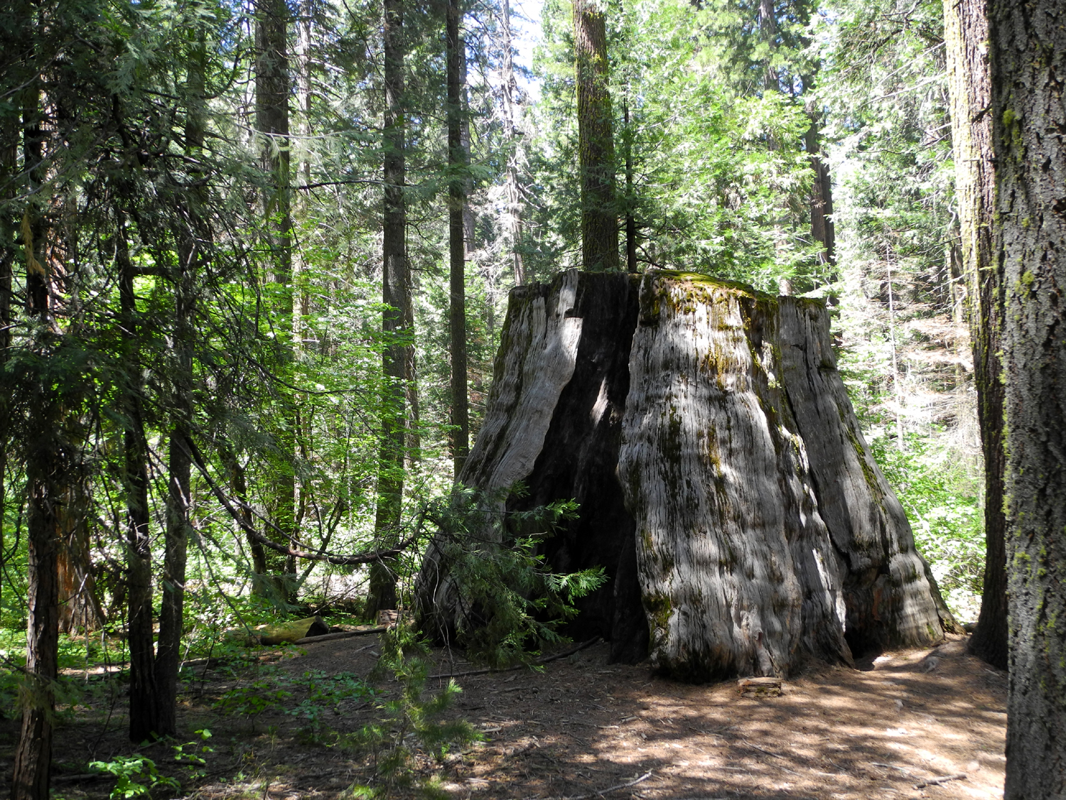
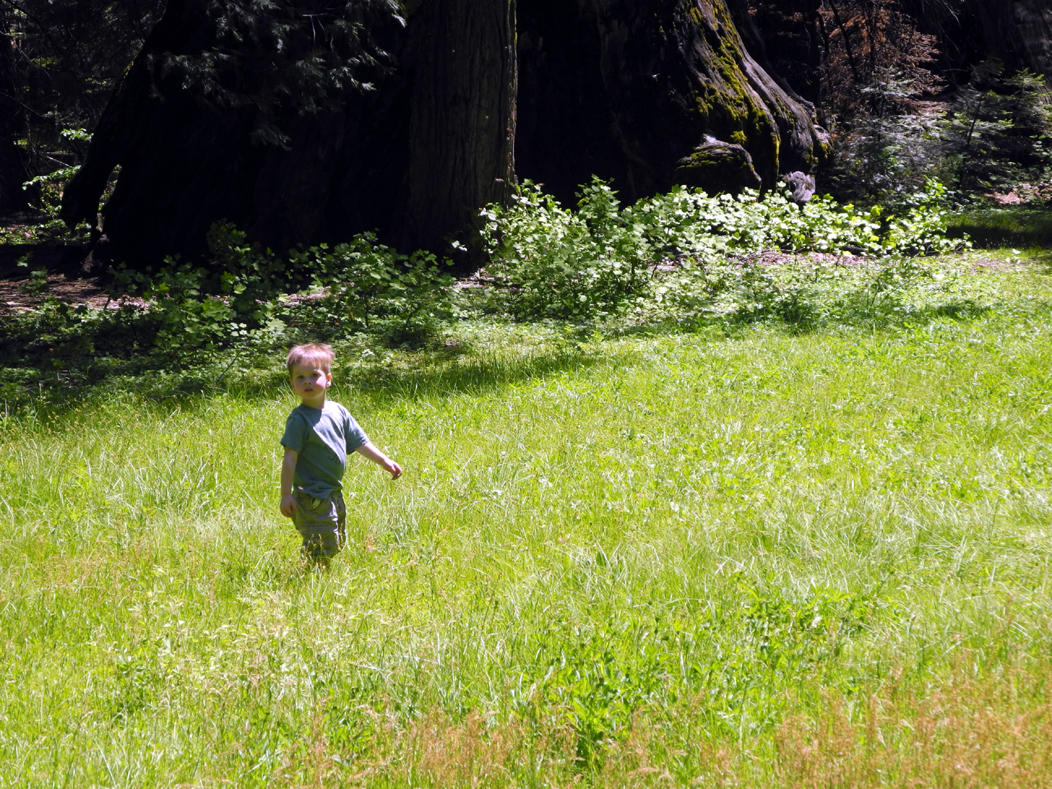
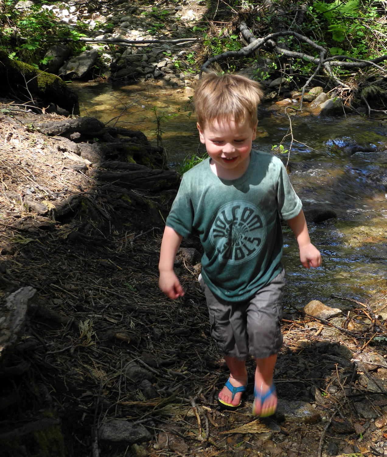
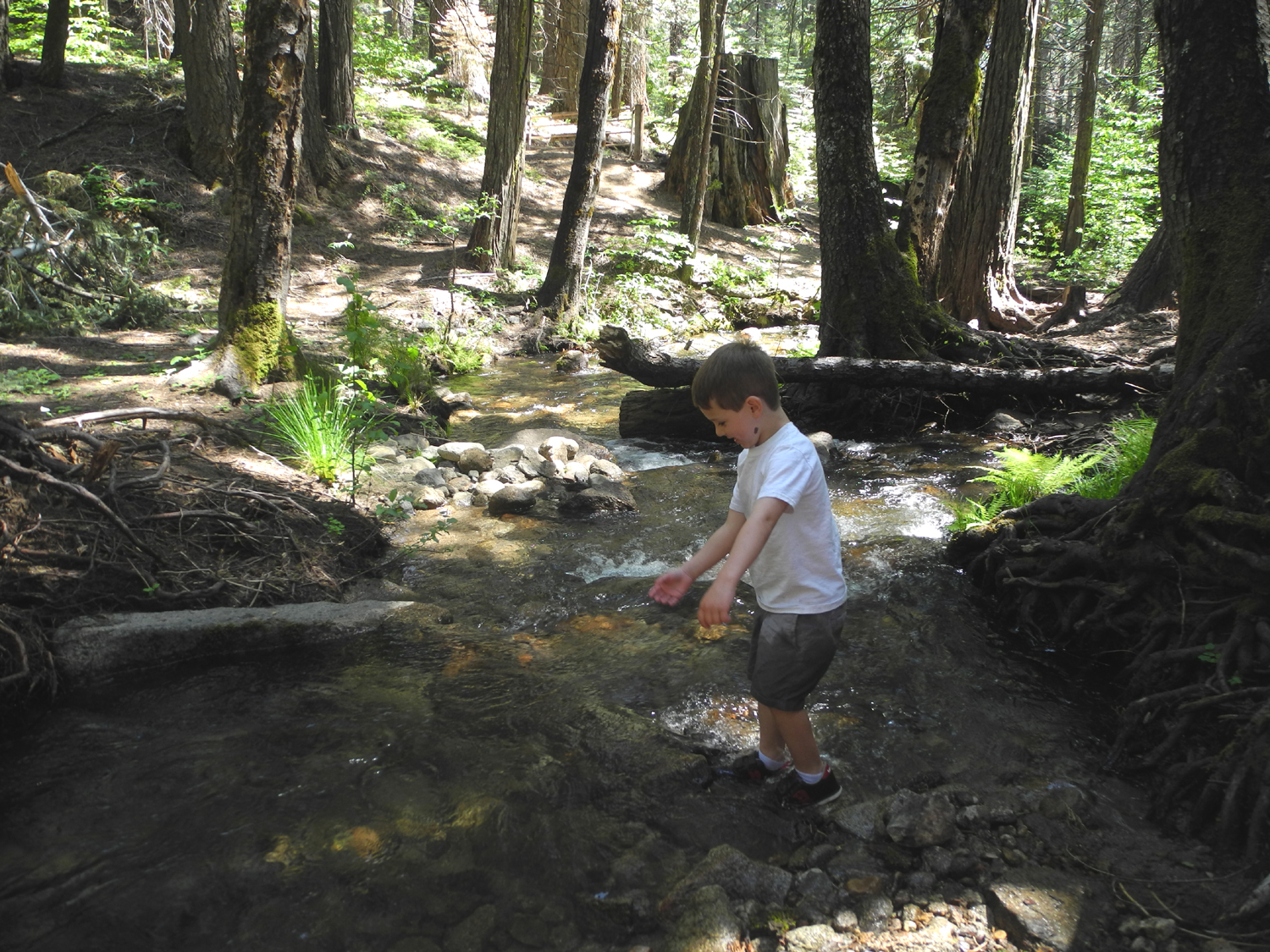
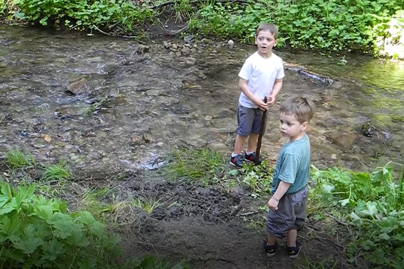
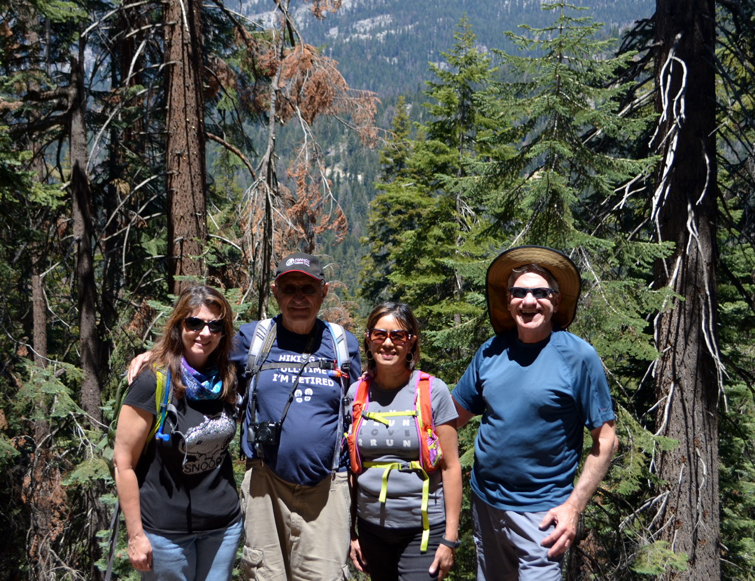
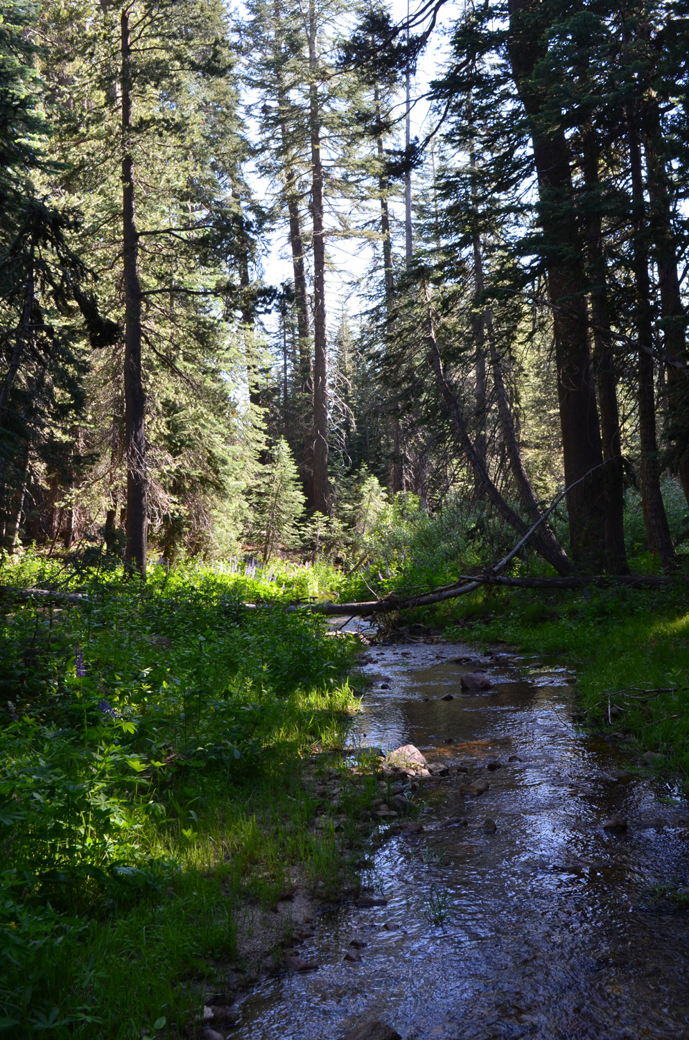
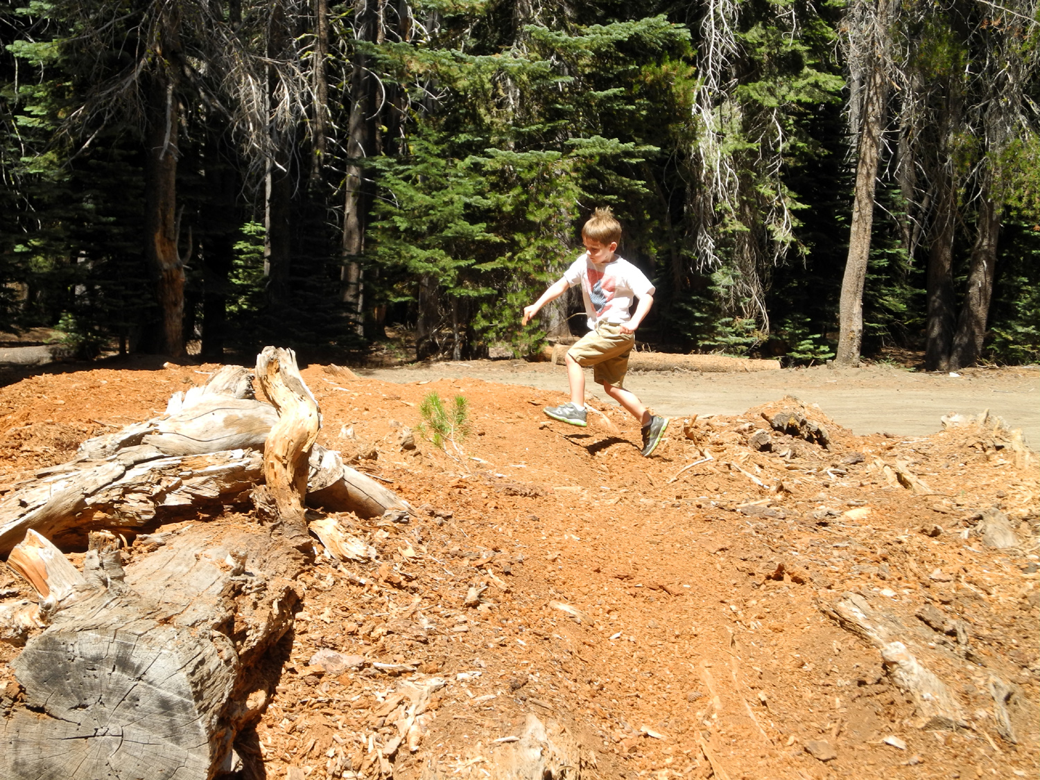
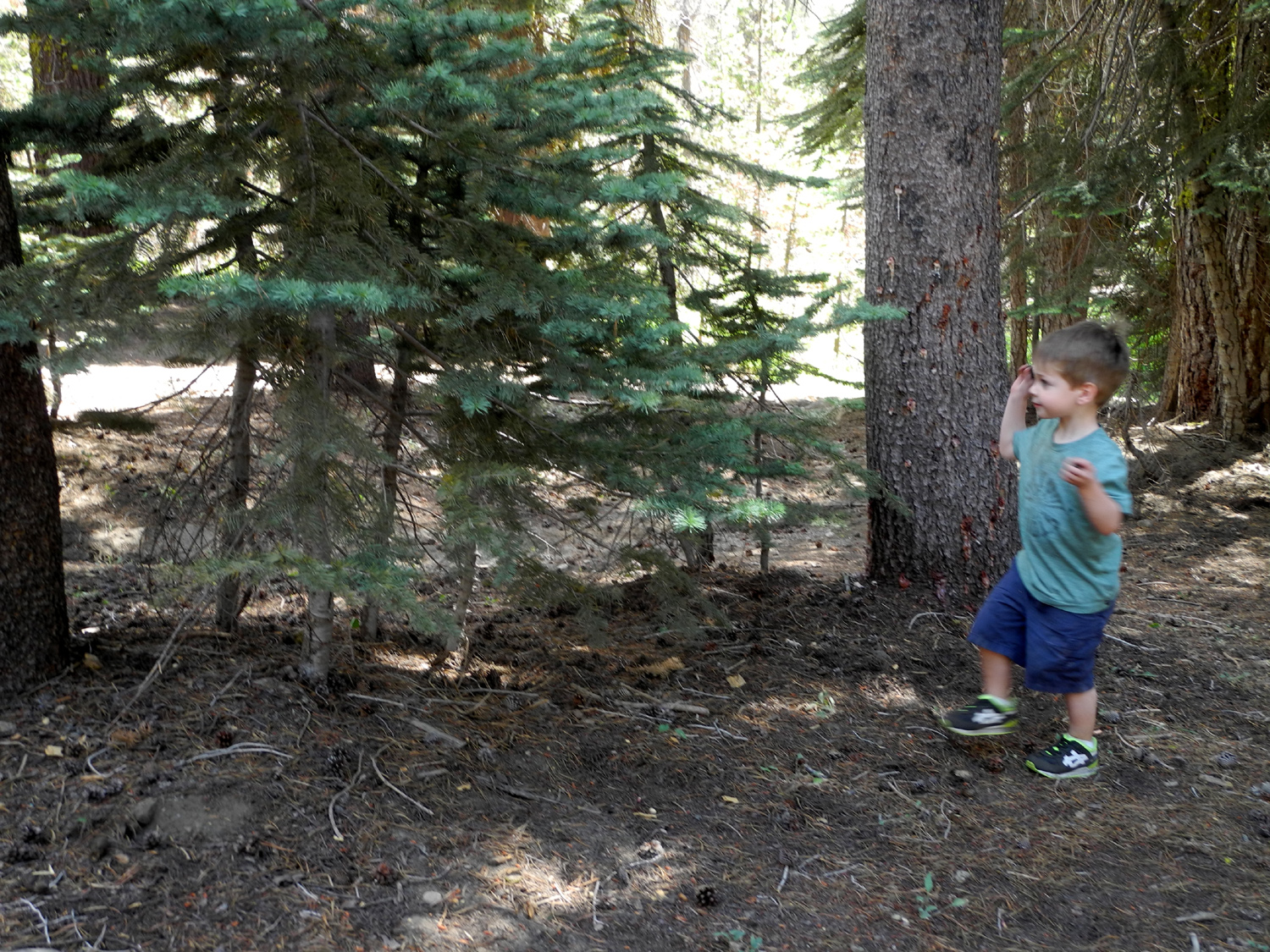
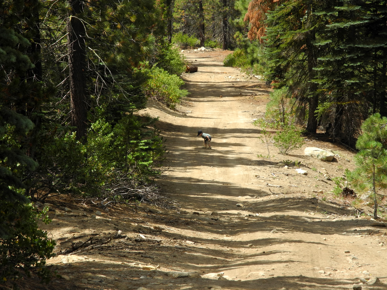
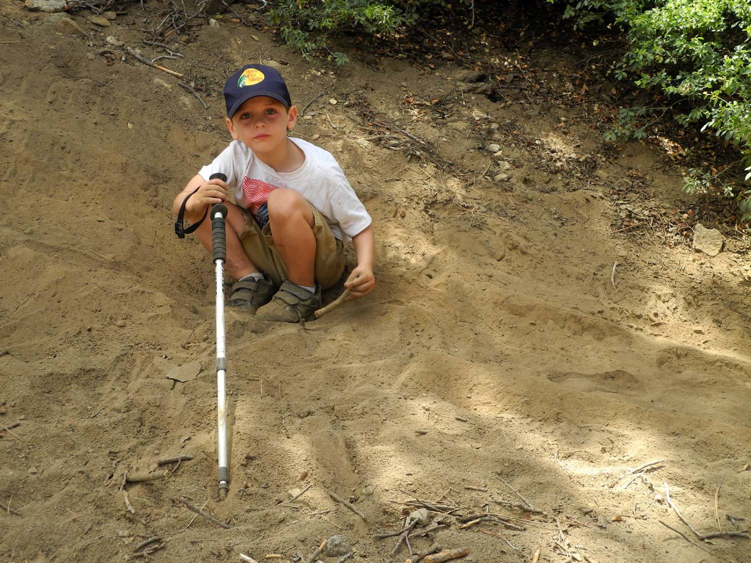
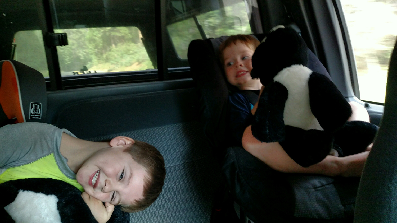
The Upshaw Brothers at Nelder Grove Any activity with my great grandsons, Colton and Jack, is always a lively event. I call them the Notorious Upshaw Brothers. It's a term of endearment of course. They had spent the night at daughter Teri's, and when I arrived there on the morning of June 3, they greeted me with the usual request: "Chase us!" I've developed a variation of the game I played with their uncle Mikie, which consists of me saying, in my best Bobby "Boris" Pickett voice "Monster mash" while chasing them through the house. It's a slow chase now in my old age, but they don't seem to mind, and of course it involves much laughing and yelling on their part. Son-in-law Tim said something to me, and I had to ask him to repeat it three times due to the noise. Finally it came through clear: "This is why I didn't get to sleep past seven this morning." Of course, they will calm down when the situation calls for it, and they were well-behaved as we set off for Nelder Grove on Part 2 of our pre-camp exploration (Part 1 was my solo trip to Black Rock). In fact, it was not long before they both fell asleep, guaranteeing that they would be rested and ready when we reached our destination. If there's any place I've been to more than the San Joaquin Gorge it's Nelder Grove, and I've written about it a number of times. The more or less complete list is found here. This report has a brief description of the route and the area, and this page recounts my discovery of this majestic area. It was Jack's first visit to Nelder Grove, but I had been there with Colton and his dad Johnny in 2014. Both boys are enthusiastic about hiking and camping, although hiking may be defined a bit differently from what we usually think in connection with that word. Before arriving at the campground, we made a couple of stops. The first was to check out some wildflowers along the road. Colton was still asleep, but Jack got out and took advantage of the stop to blow some dandelion seeds around. Next we went past the camp road to where California Creek runs across. This stream runs through the camp, and drops down to the road in a small but delightful waterfall. As expected, it was running higher than usual, but was not a dangerous torrent by any means. The water runs across a concrete apron in the road (in lieu of a bridge or culvert), and Teri and the boys both waded across and back several times. The boys were hesitant at first, but when they tried it they enthusiastically crossed over and back several times. When we arrived at the campground, the first order of business was a snack for the boys. We then set off on the short walk to the Bull Buck Tree, choosing the quarter mile segment of the loop trail rather than the half mile end. When I hiked there with Johnny and Colton, he was not quite two years old, and hiking for him involved walking a short distance, then stopping to poke at the ground or a tree with the stick he was carrying. Johnny would call for him to "come on," then would walk back, pick him up and carry him for a while. Jack is two years and eight months, and the difference is notable. Like his brother, he sits down in the trail and pokes things with his stick, but then he realizes we are 100 feet ahead of him, and runs to catch up. Colton, on the other hand, now runs ahead a ways, then comes back to join us. Of course, he still has his stick. The Bull Buck is an exceptionally nice, very large sequoia, with two large stumps nearby from slightly smaller giants that were cut down in the 1890s. I don't think the boys were particularly impressed with the tree, but what they did like was the fallen log from one of the stumps, which lies in several large sections where it fell. Both boys enjoyed climbing up on this log, as well as other logs and stumps. They climbed on the bench at the Bull Buck viewing area and jumped off it several times. They also liked the sugar pine cones that we ran across, each carrying around a 15-inch cone for a while. Later Jack discovered sequoia cones, which are about two inches in length, and had a great time throwing them against trees, stumps, and sometimes we feared, at us. I have photos of my daughters, grandsons, and Colton in front of the Bull Buck, so I was finally able to add Jack to the gallery, although he was not very cooperative about posing in the same way his predecessors had. It's sort of an action photo. While Jack was throwing cones, Colton was building a ladder. This involved leaning a small log against one of the big stumps, placing another piece of wood on top of it, and stabilizing the top part of it by hammering pegs (small sticks) around the base. His hammer was a piece of rotting wood which grew smaller with each blow. In a demonstration of single-mindedness, he began a similar project when we got back to the campground. We returned to the campground on the same trail, rather than continuing the longer loop. Beside the road into our campsite there is a small meadow, and I walked out into it to look at some flowers. When I got to our table I looked back to see that Jack had followed me into the meadow, and was still there. He stayed there for about ten minutes, doing whatever boys that age do, nothing that we could identify. After we enjoyed our picnic lunch, it was time for a visit to the creek, about 100 yards from our table. Both boys love to play in the water, but when they felt how cold it was, there was a question whether they would wade in at all. However, tentative dipping of the toes eventually resulted in slipping in a bit deeper, and soon Jack and Colton were both wet up to the chest, and were running back and forth through the water and on the bank. Colton had tennis shoes on, so he was a little more sure-footed than Jack in flip-flops. We went downstream on the other side of the road where the creek bottom was slightly less rocky, and where there turned out to be a wonderful muddy spot which Colton happily dug into with his ever-present stick. Of course, Teri had dry clothing and other shoes for the boys, and when we returned to the camp, they got changed, had another snack, and we packed up and headed for home. We took a side trip farther up Forest Road 10 to a meadow where Teri's sister Jennifer and her husband's family have camped for years. The area was full of people riding quad vehicles. After discussing my findings about Black Rock and what we saw today in regard to road conditions and the number of people in the campground, we decided our weekend campout would be at California Flat, on the first part of the dirt road that leads in from the paved Sky Ranch road. We've camped there several times, most recently last November, and there is room for both motor homes and tents for other family members who will be joining us. That story is also "coming soon." This wouldn't be a Dick Estel travel report without mention of wildflowers, and we saw plenty. Most impressive were the massive displays of bright orange western wall flowers near the Bull Buck and on some road banks. We also saw lots of dogwood, buckeye, lupines, fremontia, violets, and assorted unidentified blossoms (we now think this one is a Sierra pea).
|
||
|
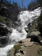
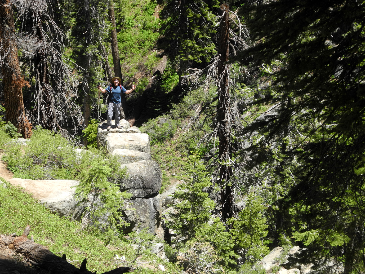
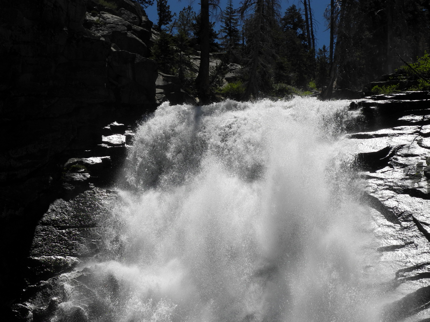
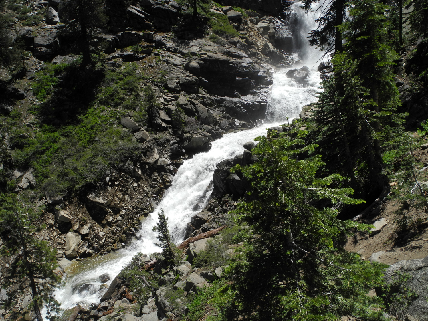
This was kind of an ad hoc hike, organized after the Ramblers were frustrated in our attempt to re-visit this magnificent waterfall on June 14. The dirt road to the trailhead was closed, meaning a two-mile hike would turn into four miles, more than some of our members are able to do. However, Wes and I were determined to see what this year's huge snow melt was doing to this falls that we had seen for the first time in June 2016. We recruited a group of people willing to hike the four miles if necessary, hoping that the road would be open by June 29. In addition to Wes and Dick, the hikers were my daughter Jennifer, and our former work colleague, Elsa Sweeney, who has been trying to find a workable date to join a Ramblers hike. Coming from Oakhurst, Jennifer drove through North Fork and met us at the Park and Ride at the bottom of the 4-lane section of Highway 168. The rest of us gathered at my house and got on the road around 8:30. When we arrived at the trailhead turnoff, we were happy to see that the road was open. We were all mentally and physically prepared to hike four miles, but hiking only two gave us more time to enjoy the scenery along the way. This included various flowers, evergreens dominated by red firs, and some bushes we thought were probably currents - in flower but with no fruit to help confirm this identification. Our expectations were that the falls would be even more spectacular than last year, and we were not disappointed. On our early June trip, after an alternate hike to Indian Pools, we had driven up Kaiser Pass Road to where there is a view of the falls, and Wes and I could tell that there was slightly less water this time, but still plenty to satisfy us and the several dozen other hikers we saw on the trail. Once we reached the point where there is a good close view of the falls, we could feel the mist that was being thrown up by the crashing water. We did not experience this last year. We spent some time at the falls, taking pictures and just watching the endless flow of water. Of course, we got the traditional Wes on the Rock picture. Once we had completed our hike back out, we drove down to Prather and enjoyed lunch at Velasco's Mexican Restaurant, one of our regular post-hiking stops. --Dick Estel, July 2017 |
||
| Courtright Reservoir | ||
 |
 |
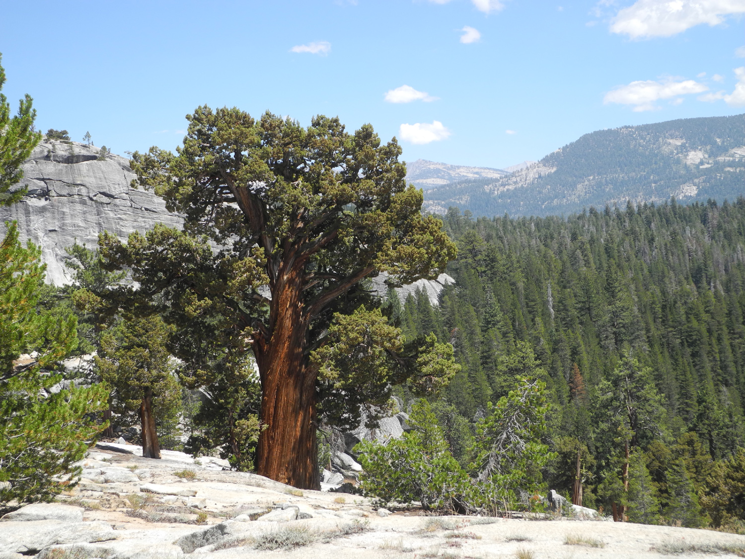 |
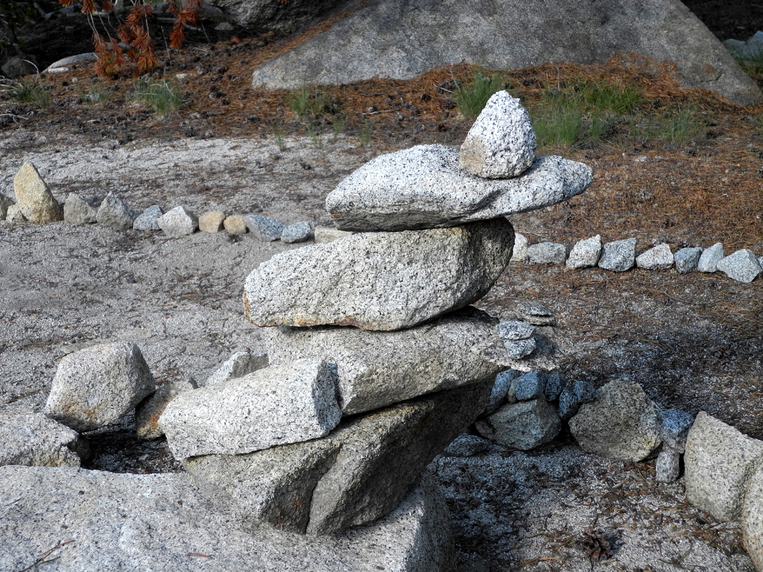
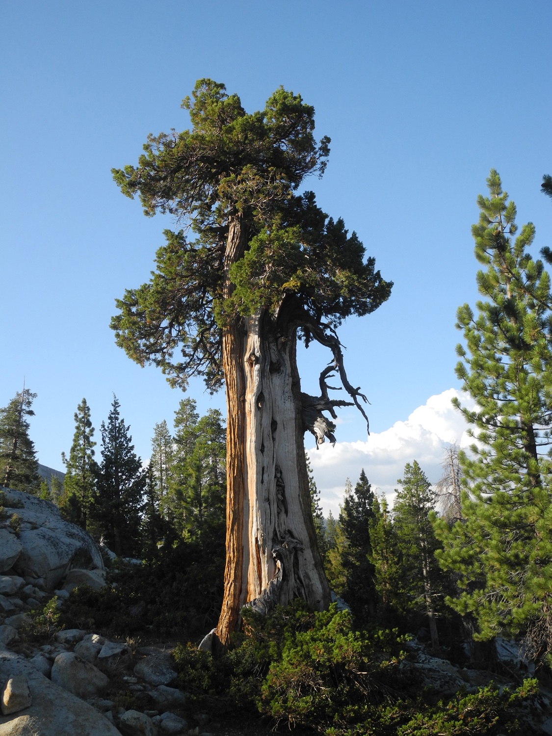
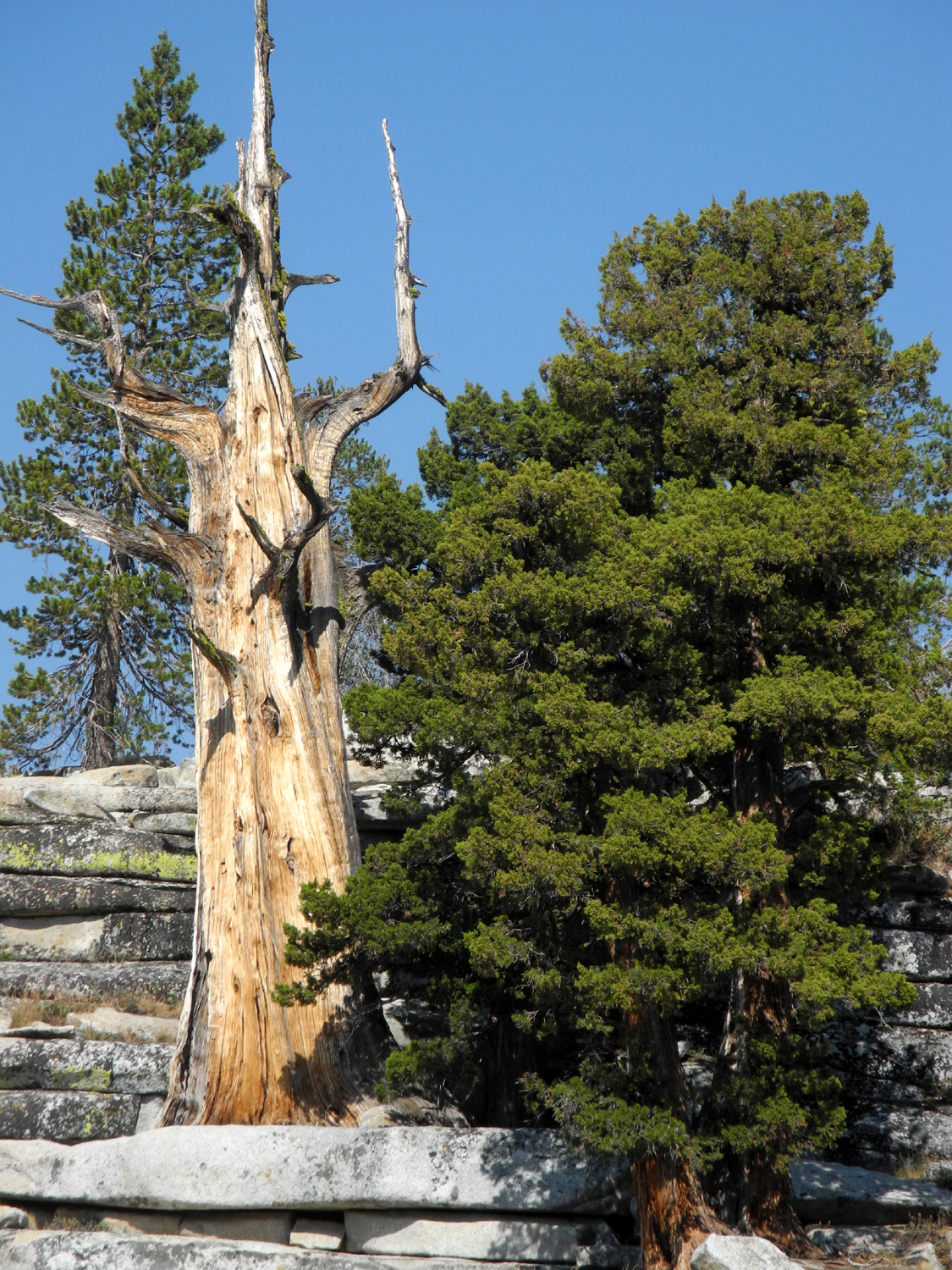
| Domes, a lake and juniper trees - looks like a perfect camping spot! | ||
|
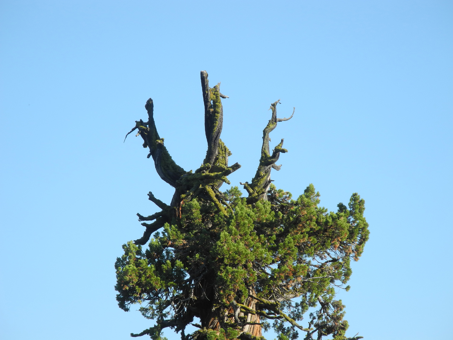
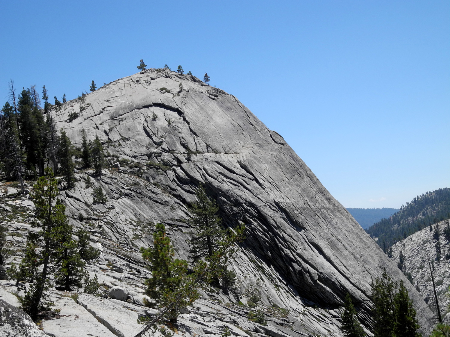
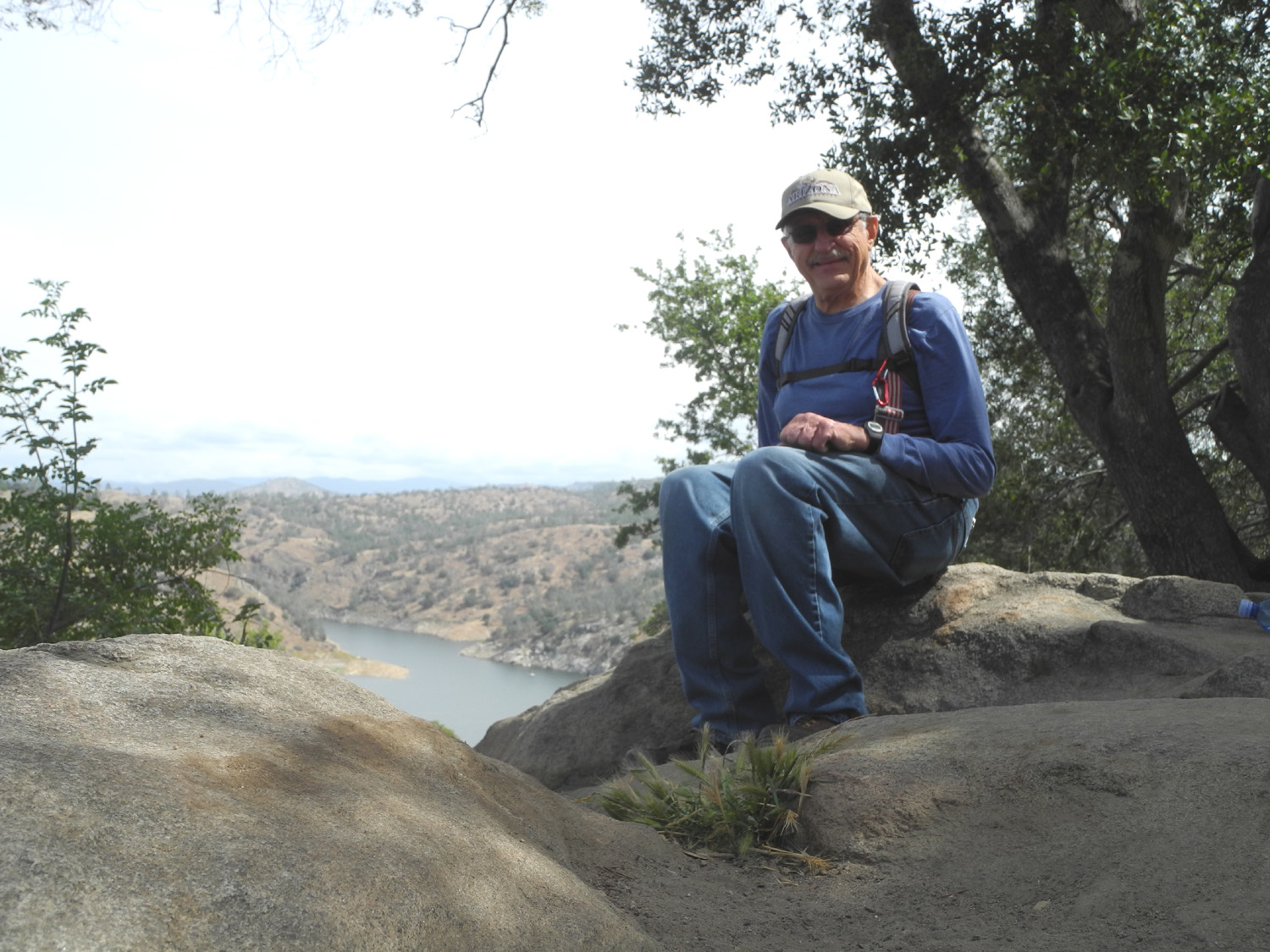
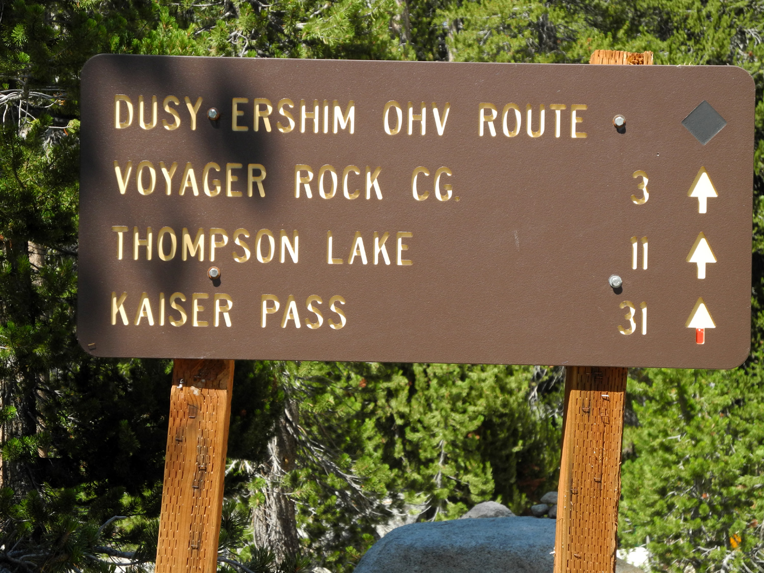
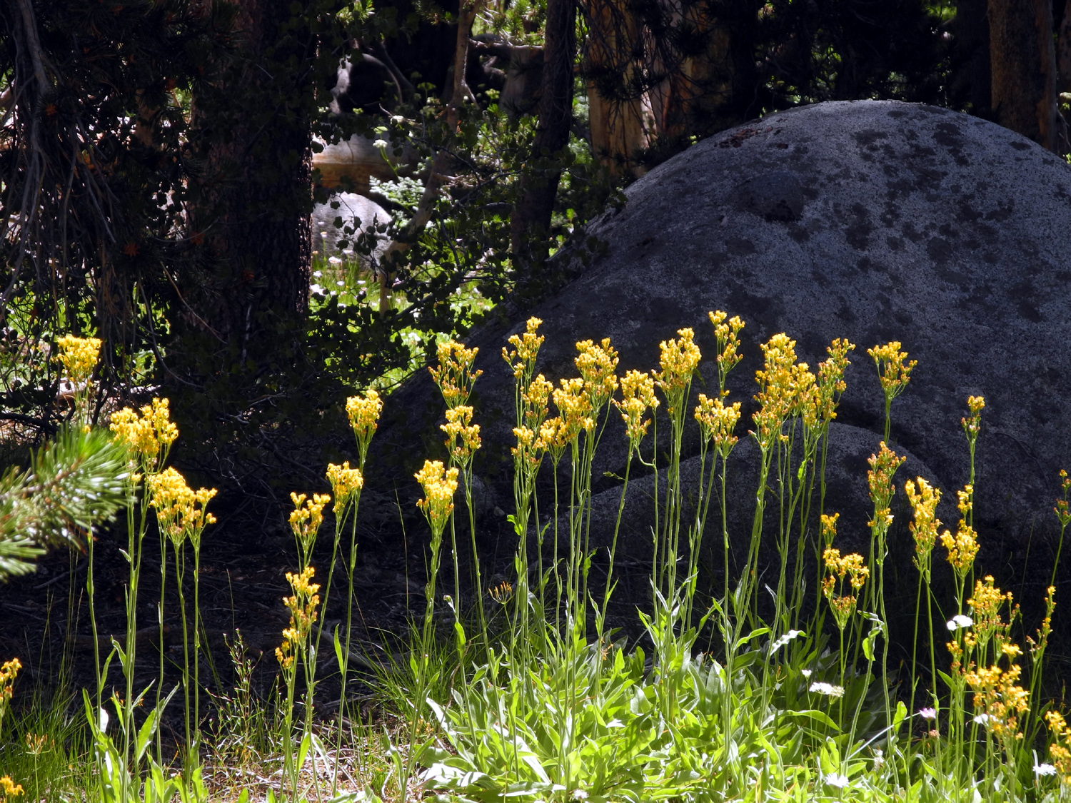
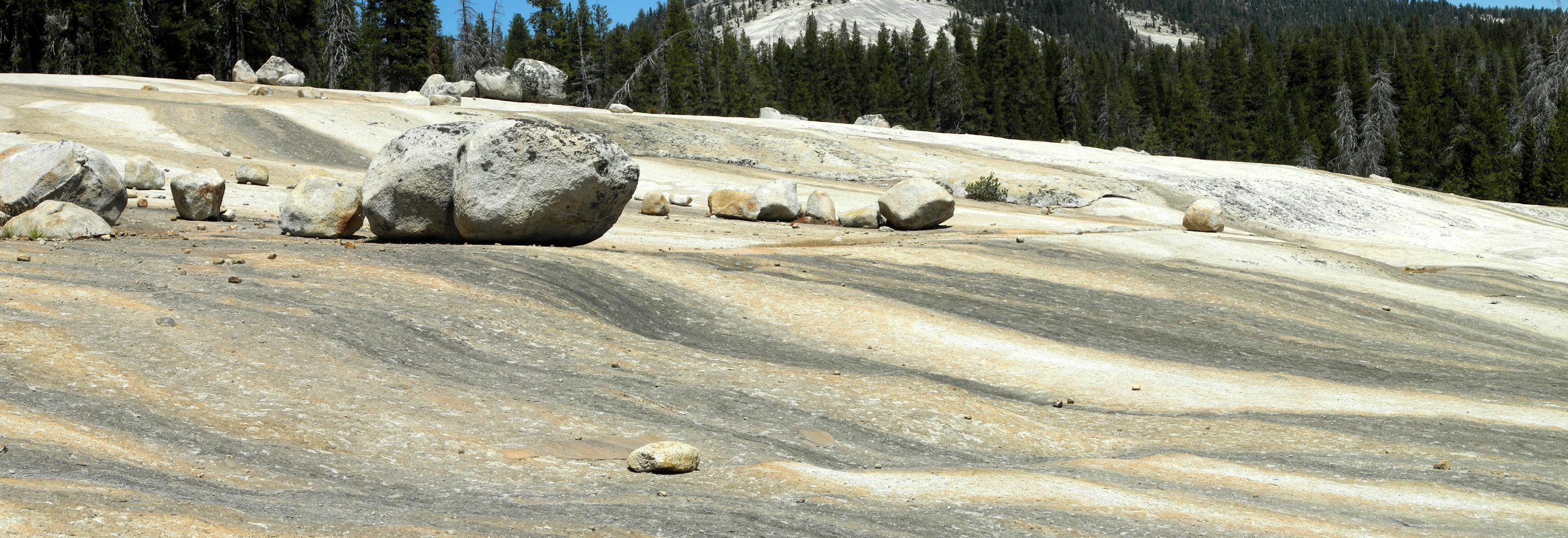
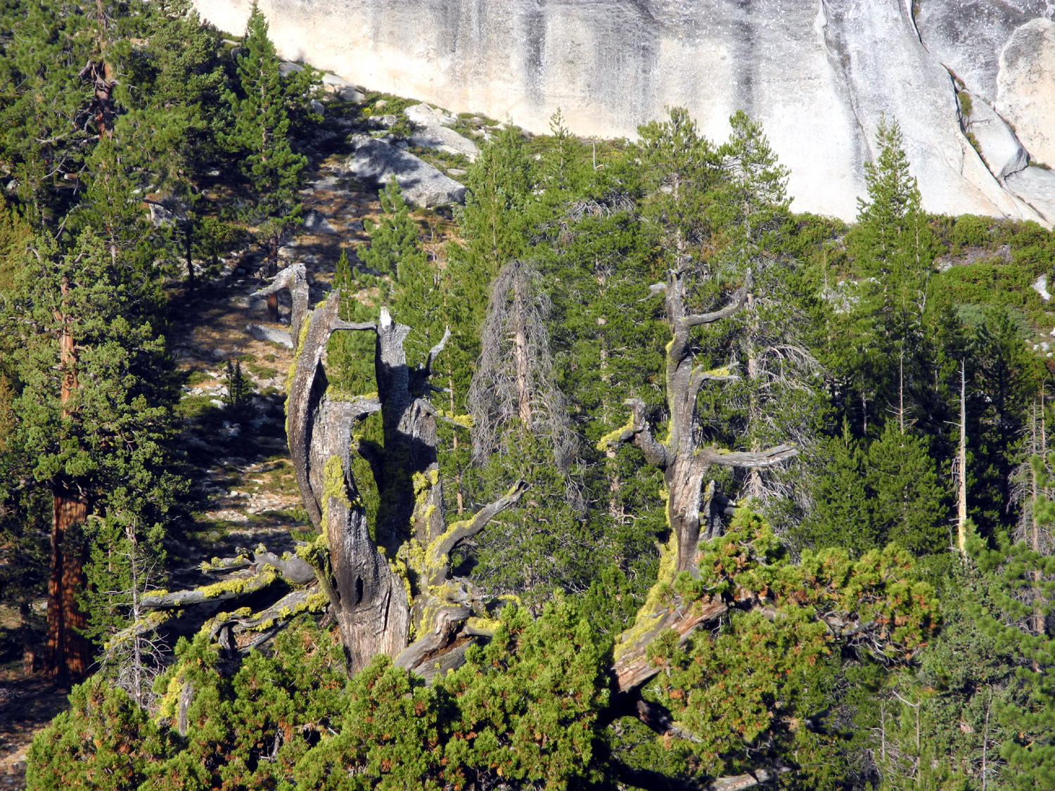
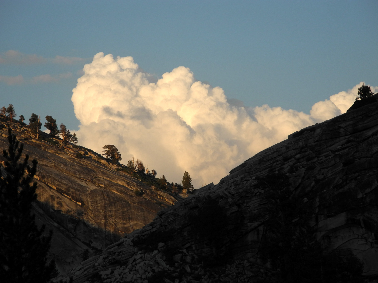
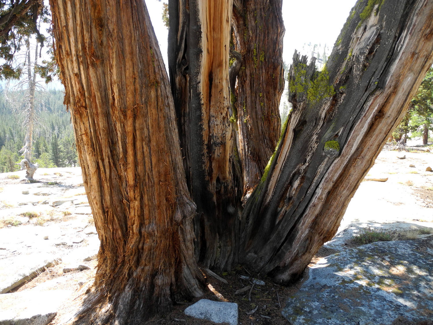
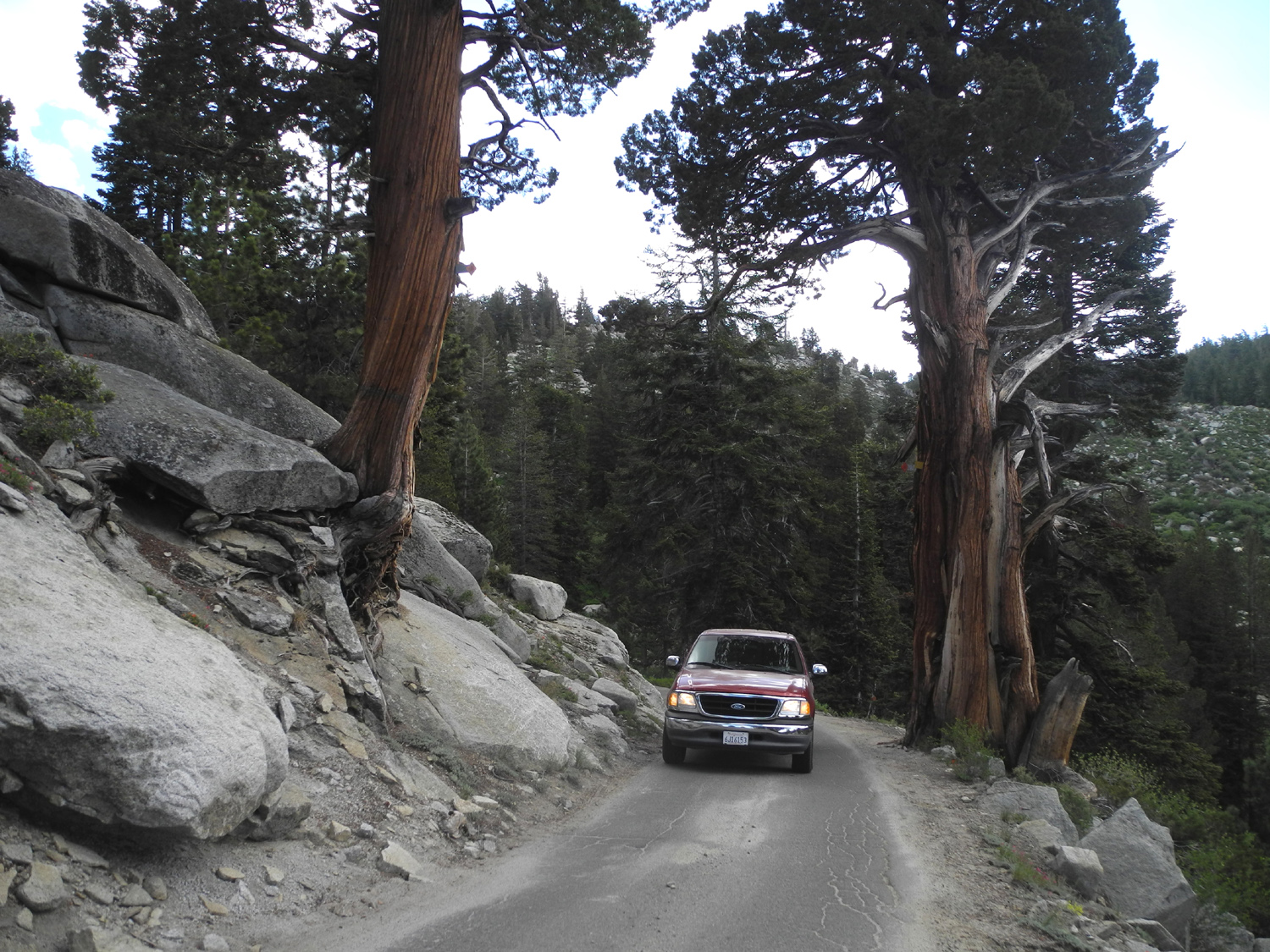
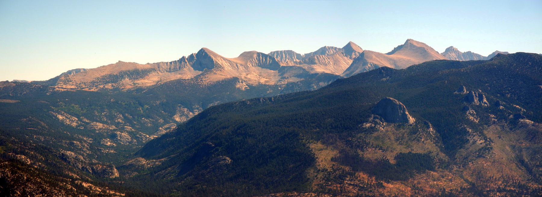
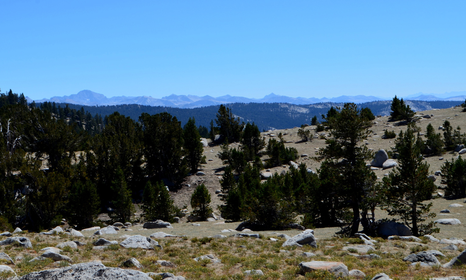
I camped at Courtright Reservoir three times in 2016, all late in the season. This year I swore I would get up here earlier in the summer. I had hoped to go in July but it didn't happen, so near the end of that month I scheduled three 3-day blocks of time for camping in August, hoping that at least one would work out. The first one DID work out, for August 7, 8 and 9. My campsite of choice is a big open area, with a mostly level granite base, about a quarter mile before the Maxson Trailhead and a half mile past the dam. This is the starting point for the Dusy-Ershim off-highway vehicle (OHV) trail, as well as many miles of hiking trails that take you into thousands of acres of Sierra backcountry. I left home at 8 a.m. and got to Courtright about 10:15, only to find "my" campsite occupied. There were two or three guys with a pickup, and all kinds of equipment scattered around on the rock. I could not tell if they were packing up or setting up, so I went to a spot across the road where my daughter Teri and I camped last year, and got ready to hike. There was also a large group of people on the other side of the flat, obviously getting ready for some serious backpacking. There were no other vehicles, so I suspect that they were dropped off by someone who will pick them up when they return, or maybe when they come out at a different trailhead. I followed the same trail I walked on when I made my first visit here in about 1969, as well as at least a half dozen other times. The hiking trail is also the Dusy trail for the first mile or so, then it forks off to the right. It goes through a swampy forest area where the trail is on a boardwalk, and where mosquitoes lie in wait. Eventually this trail passes by the base of the Big Granite Slope, which I've written enough about in previous reports, then crosses a large meadow. I went just past the meadow, found a place to sit in the shade, applied mosquito repellant, and had my snack. As I usually do, I then walked up and across the granite slope, which took me out via the OHV trail. When I got back, there was no one in my preferred spot, so I moved across the road. Following my usual pattern, I had lunch, got my air mattress blown up, did some short walks near the camp, read, watched the full moon rise over the mountains, and got to bed around 9 p.m. The first day's hike left me feeling worn out and I started to wonder if I was too old for this stuff, which was quite worrisome, since I planned to hike the next day, and had scheduled a challenging hike above Kaiser Pass at 9,000 feet two days after my return. Just before my trip there were several days of thunderstorms in the Sierras, with a little rain in the San Joaquin Valley. My older grandson's family and some friends went camping over the weekend at Ward Lake beyond Kaiser Pass, and endured a four hour storm. However, by Sunday evening the forecast was for only a slight chance of thundershowers, mostly in the highest elevations. Of course, Courtright, at 8,000, is high enough to qualify for a chance of showers, but there were just lots of big fluffy clouds over the LeConte Divide and other mountains to the east. There was wind most of the day, great for when I was hiking, but requiring a long sleeve shirt when I sat around camp after hiking. The wind continued all night and the low was 40 degrees, making for some very chilly bathroom visits. However, the sun came up between Double Dome and Hopeless Dome and warmed things up quickly, especially with all the light colored granite to reflect heat. I had decided if I was going to be serious about truck camping, I needed some additional equipment, so a few days before the trip I bought a camp stove, and for the first time enjoyed hot tea and toast along with my cereal. Several months ago I replaced the bed cover on my truck with a camper shell, which made for a much more comfortable sleeping area. The hike planned for the second day was shorter but more difficult, and I don't like to walk right after eating so I washed dishes, moved my ice chests from the front of the truck to the back, and did a few other chores. I got ready for hiking and set off to climb the ridge across the road. This is a fairly steep, rocky slope, with huge boulders, small rocks, layered cliffs ranging from two to twenty feet high, and scattered junipers, lodgepole pines and Jeffrey pines. I've done the hike twice before, but there is no actual trail, so some of the fun is scoping out a route up the hill. My goal is to avoid stepping up or down more than about a foot. Although a few exceptions were necessary, for the most part I was able to zig zag my way up, around the cliffs and boulders, meeting my goal. Needless to say, I use my hiking poles and am very careful, and I felt comfortable all the way. I had to use my hands twice, and go down on a knee twice, but for the most part my "step easy" plan worked fine. On my list of favorite trees, junipers rank right up there with Sequoia redwoods, and the harsh conditions here at 8,000 feet produce some dramatic specimens. Most of the older trees have a dead top and a dead branch or two. Many appear to have multiple trunks, nearly always because several trees sprouted near each other and then grew together. On my first visit here in 1969 I photographed several striking trees, and took pictures of them again last year. The intervening 45+ years have brought very little change to the trees. Wish I could say the same for myself! Climbing this ridge last year, I discovered what is probably my favorite juniper, one I call The Sentinel. That fact that it is completely dead does not detract in the least from its beauty and character. It stands in front of a 15-foot high rock cliff, with a live companion next to it. You can get up on the cliff and be very close to the tree half way to it's top. The trunk has lost all its bark and has taken on multiple streaks of color and the upper branches support a layer of moss. We should all look so amazing when we're dead. After spending some time here contemplating my ancient friend, I photographed my way on up to the top of the ridge, enjoying the challenge of route-finding almost as much as the beautiful surroundings. As I made this 300-foot ascent, I had a constantly changing view of Mt. Goddard, the LeConte Divide and the nearby domes. My reward for reaching the top was a view of the lake, west of the ridge. Now it was time to get back down. I'd done that twice before too, so I planned to generally follow the same route as before. The road from the dam winds around the south end of the ridge, and the section of the ridge toward the road to the south is a fairly smooth granite slope, with few rocks, cliffs or other obstacles. I just had to get down past the cliffs right below me. Going down requires even greater care than going up, but I studied potential routes, both the immediate dozen feet or so as well as where I would end up in the next hundred. I made it down to the open section of the rock and from here it was a fairly easy walk down to the southern-most part of the road. A little farther down the road is a geological exhibit, eleven acres where you can observe nearly each stage of the development of the Sierra Nevada through geologic evidence. Although the different features are described on a sign at the parking area, there are no brochures and the different sections are marked only with rock cairns, not signs. Nevertheless, I was more interested in continuing on south to where you can get out by the edge of the gorge of Helm Creek below the dam. Above this area are two domes which look like they could easily be climbed, and in fact I hiked to the top of both of them with my daughter Teri and her friend Sandy last year. This year I was content to observe them from below, and then followed the edge of the gorge to where I could make my way back to the road through a forest of evergreens, a welcome break from the open rocky terrain found on most of my hike. The remainder of this hike was on the road, which is a narrow, paved route with no center line, and very little traffic, even during the peak of summer. It crosses the slope I climbed, so above and below me were more junipers and rocks. There is also an ever-changing view of the high peaks to the east, which are hidden behind the nearby domes when I'm back at my camp. Unlike the previous day, I finished this hike feeling very good. Perhaps it was the joy of celebrating my 78th birthday in the mountains. This day I enjoyed my first "cooked" lunch, which was really just re-heated hot wings brought home from BJ's Grill. I thought about different ways to re-heat food, a task normally performed in the microwave. I brought along my steamer, but ended up just putting some butter in a frying pan and warming them up that way. Cooking suggestions are welcome. I cleaned up the lunch dishes, did a couple of short walks around camp, and did a lot of reading, before setting out on my evening walk. The day before I had gone a short distance down from camp to the southeast, which opens up into creek drainage below. I had noticed a couple of unique junipers but didn't get close to them, so my plan was to hike the "juniper trail." This is actually more a concept than a trail, and involves walking to the nearest photogenic juniper tree (nearly all of them qualify), walking around it, taking photos from various angles, then moving on to the next tree. Not far from my camp I ran across not one but four trees that qualified. They were not rugged nor misshapen, but instead were four straight, tall, equal-size junipers in a row, which I named the Big Four. Route-finding my way on down through the rocks, I saw several more "traditional" junipers, with broken and dead tops, and finally came to what may be the top juniper - an ancient, extra-rugged specimen with at least three big dead branches reaching up at the top, and a huge scar most of the way up the trunk on one side. I called this the Bull Juniper, inspired by the magnificent Bull Buck sequoia in Nelder Grove, but it could more accurately be described as the Grizzly Giant of junipers. On Monday night I had walked a short distance out the road to where I had a good view of the LeConte Divide, and sat there enjoying the evening. While I was there a group of backpackers went off the road about 300 yards from me, headed down into the basin below. As I walked back, I could see their tents, and on Tuesday night I noticed that they were still there. There are two other "named" trees (I named them), that are on the Juniper Trail, but not on the route I followed Tuesday night: The Shelf Tree: This is certainly not the only juniper that sits on a rock shelf, but it's probably the most dramatic. One of those that I photographed in 1969, it is somewhat isolated from any other significant trees. The challenging conditions it has survived have left the top a tangle of gnarled branches, with one long one pointing off to the north. The Pentagram: Another of my old friends from 1969, this one has five trunks, two of which appear completely dead. It's less than 50 feet from the road, and immediately catches the eye. If you have only half as much interest in junipers as I do, you might enjoy my Juniper Photo Album and my Juniper Slide Show. There were a lot of people in the area, though no one was camping within eyesight. When I came back from my juniper walk, I noticed a group camping down below my rock, a few hundred yards away and well down in the basin from me. During my time there several groups walked by on the road in both directions with full backpacks. The group I saw down in the basin Monday night came up through the edge of my campsite the last morning, and when I talked with them, they said only that they were going "someplace else." On the actual trail Monday I met or was passed by several groups of four to a dozen, all equipped for overnight hiking. One group I talked with briefly was from the bay area, and were going in for a week. They and another group were headed for Blackcap Basin, a hike of approximately 40 miles one way. There were about 30 vehicles parked at the Maxson Trailhead lot. In the evening I usually put my chair where I have a view of the domes directly east and fairly close to me. By turning my head I can see another four or five domes, as well as the ridge above the North Fork of the Kings River. I alternate between reading and gazing at the scenery, and since I'm usually reading on my iPad Kindle app, the loss of daylight is not a problem. On the final evening I glanced up and saw a red light flash several times on top of Hopeless Dome, the closest one to me and one that I consider too dangerous to try to ascend. At first I thought it must be a plane visible beyond the dome that was just in the right spot to look like it was ON the dome. However, the light appeared several times, and seemed to be moving around, and it was pretty clear that someone was up there. Later I saw a white light for a short time, and never did figure out why anyone would be using a red light. I did not plan any serous hiking for the last day, but with nothing on the schedule and no deadline, I had breakfast and packed up slowly. I took a final short walk to say goodbye to a couple of my favorite junipers, and started home around 10:30. In addition to the scenery and the people, I had seen a dozen or more chipmunks, about 30 lizards, and three large horse trailers from the nearby Clyde Pack Station, two going out and one coming back in. I enjoyed pleasant weather, around 70 in the daytime. The clouds did not threaten and made for some nice photos. I covered a little new ground and a lot of old, and greatly enjoyed my stay at one of my favorite mountain spots.
|
||
|
Kaiser Pass Hike |
||
|
|
|
| A nice variety of flowers | Wes, Jennifer and Dick on the 10,000 foot ridge | Mt. Goddard from the ridge |
|
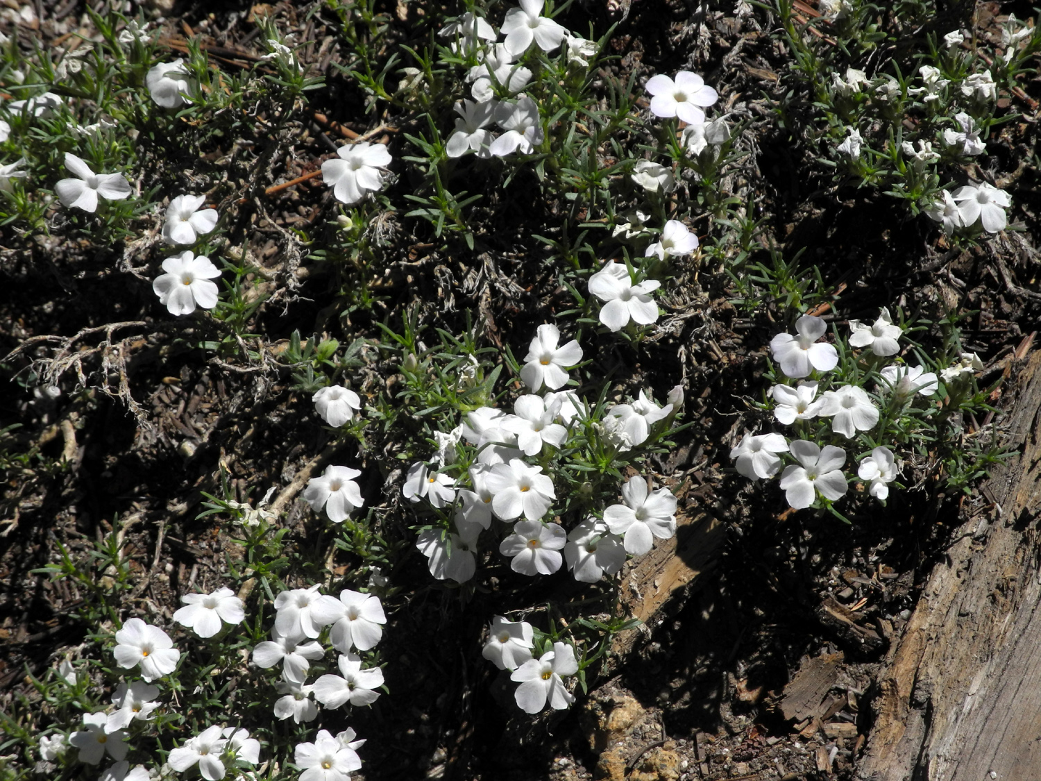
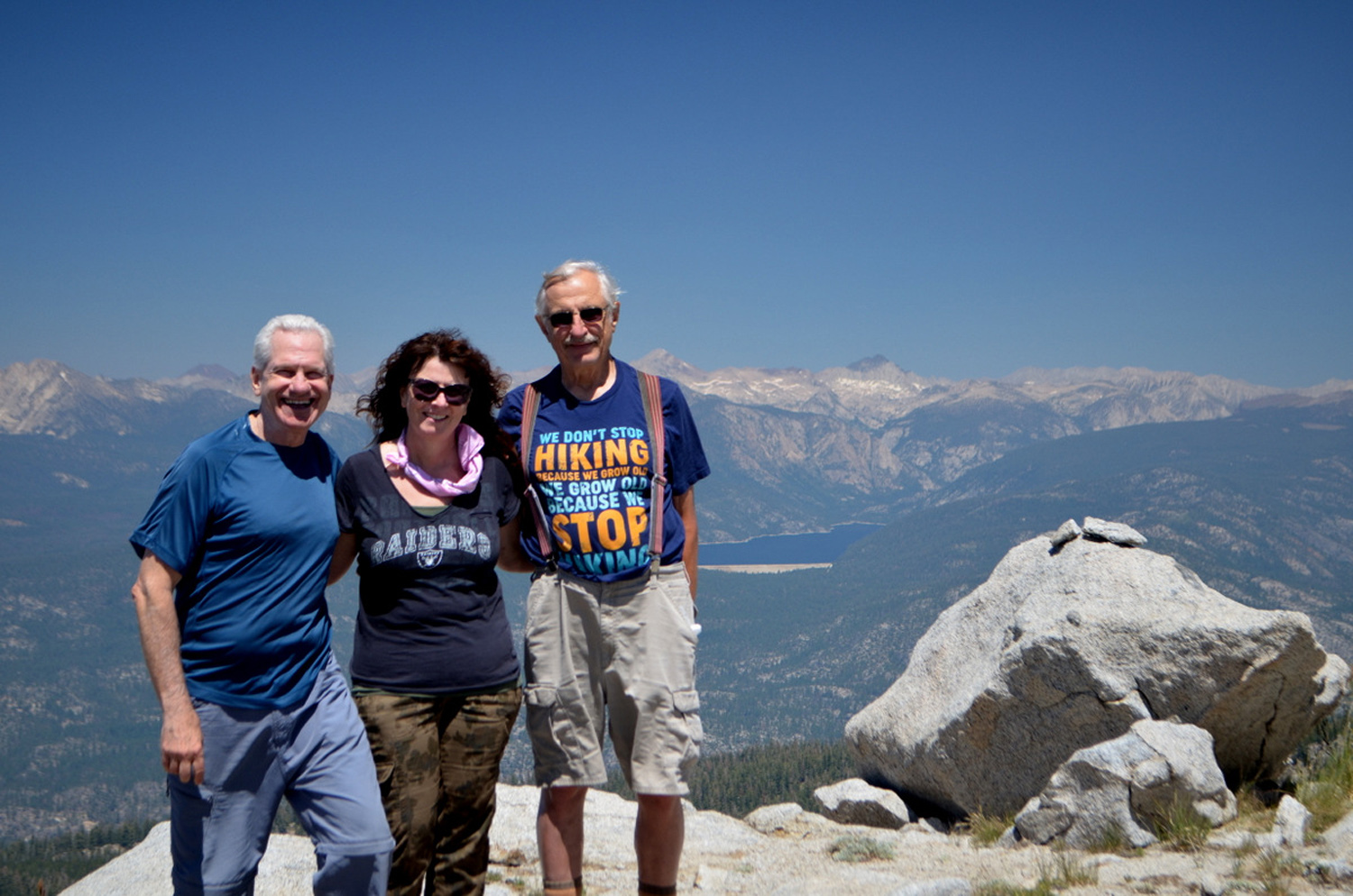
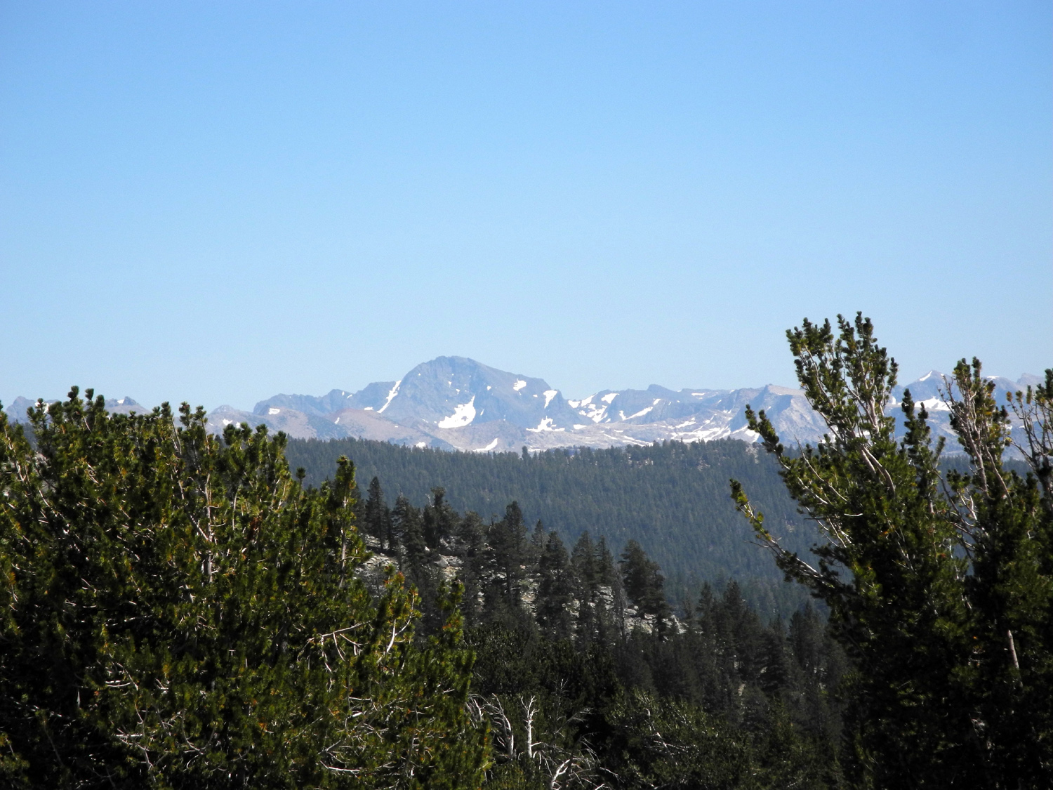
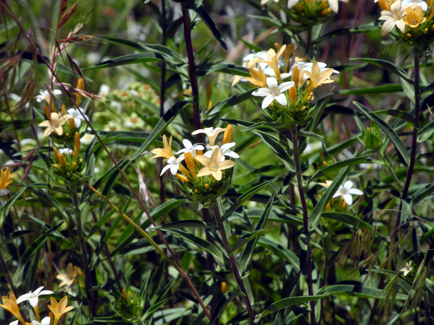
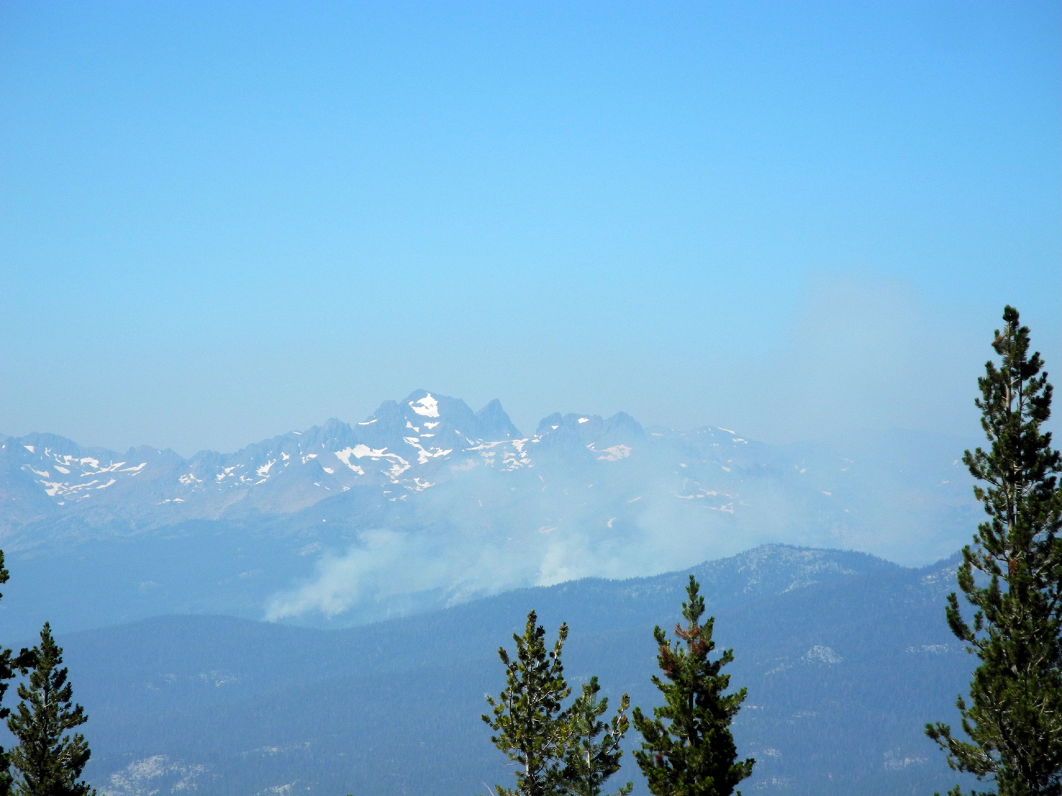
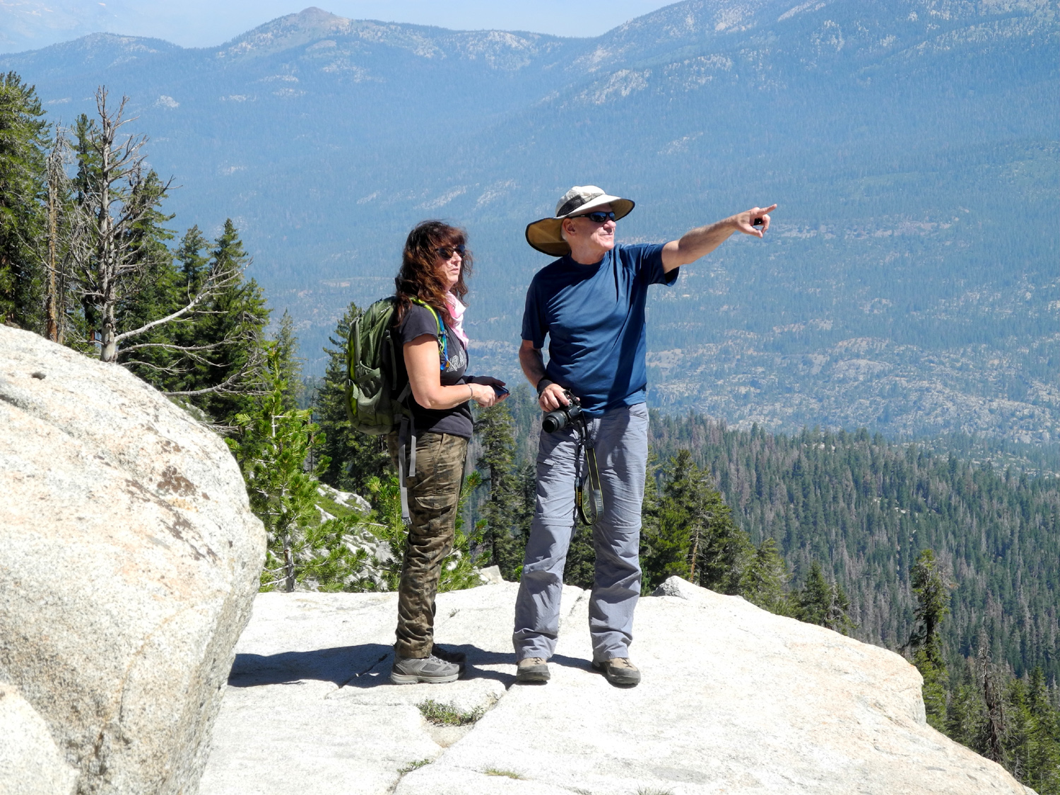
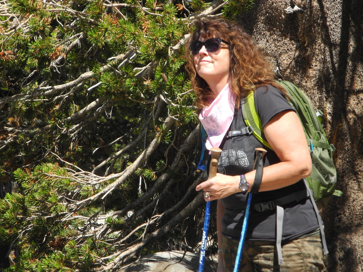
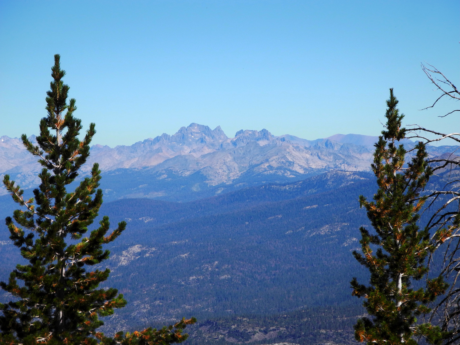
I did pretty much this same hike last year, with my daughter Teri and fellow Rambler Wes. Our final destination had such a spectacular view that we decided to do it again this year, with my younger daughter Jennifer joining us. Life gets in the way sometimes, and Teri had a work assignment out of town, but Jennifer, Wes and I made the 75 mile drive to the trailhead in my pickup on the morning of August 11. Having re-read the report from our previous hike, it occurred to me that there is not much new to say, and that I could just copy and paste last year's text. But that would be wrong, so I will suggest you read it for the details, and I'll just hit the highlights for this year's hike. The route to the turnoff for the trailhead is a good two-lane mountain highway, ending with about a mile of narrow, paved road just before you arrive at 9,000 foot Kaiser Pass. In this section there are many spots where you don't want to meet another car . If you continue on the paved road, it takes you to Lake Edison, Florence Lake, Mono Hot Springs, and the jumping off point for many back country hikes. The road only gets worse as you go on. At Kaiser Pass we made a right turn on to a very rough dirt road that goes one mile up to the White Bark Vista Point. This road was much better decades ago - I even drove a motor home on it in the early 1970s. Thanks to years of rain and snow and no maintenance it's now just a step above a jeep road, with rocks, deep ruts, and sharp curves. I have no trouble driving my full-size pick-up on it, but I would not recommend anyone take a passenger car up it. However you get there, the reward at the end of the mile is a fantastic view of high Sierra peaks, including the Silver Divide to the east and the Ritter Range and the Minarets to the north. Well, usually that's your reward. On this day a fire was burning in the drainage of the Middle Fork of the San Joaquin River, and the Minarets were nowhere to be seen. The other mountains were hazy but still offering their usual dramatic beauty. In the huge basin below the vista are the South Fork of the San Joaquin and Edison Lake. The road continues beyond this point, but becomes the Dusy-Ershim Off-Highway Vehicle trail, considered one of the most difficult in the USA. It's a 33-mile run south to Courtright Reservoir and is normally a two to three-day trip. Of course, we would not go that far, but in some spots I know we walked faster than a vehicle could have gone. The details of this hike are well covered in last year's report. So I'll just say that the scenery was just as great as last year, and Jennifer was duly impressed. We enjoyed quite a few flowers, most notably several varieties of lupines. The most common of these were a very low-growing plant, grayish green in color, that covered large sections of the open sandy areas beside the trail. They had small flowers of an intense blue color. We reached the top of the 10,000 foot ridge that was our goal, enjoyed a 360 degree view, had snack, took some photos, and started back down the trail. When we got back to the truck we drove down to the bottom of the narrow paved road, set up our table and chairs near a small stream, and enjoyed a well-deserved lunch.
|
||
|
Upshaw Brothers at Bear Creek This outing was intended to include some hiking and swimming, but with the Notorious Upshaw Brothers, hiking is more like dawdling, or something even slower. We originally planned a 3-day camping trip with my daughter Teri and great grandsons Jack and Colton, but Teri's work schedule changed, so we decided on a day trip for Saturday, August 19. We wanted a place with hiking and water, and I immediately thought of Bear Creek. In my family's vocabulary, "Bear Creek" refers to a specific spot along a creek by that name, a few miles off the McKinley Grove Road east of Dinkey Creek. We did our first camping here in the early 1970s, and I went there last October. We've also gone there for swimming while camped elsewhere. This would be the first visit there for the little guys. The location is reached after a drive of about five miles on a road that was once paved but is now a rough mountain road, with the deteriorated pavement making it worse. The final mile is on a narrow forest road that requires slow, careful navigating. Although people do take passenger cars to this spot, we took my truck for the driving convenience as well as the room, since we would be bringing a table, chairs and everything else needed for a comfortable picnic lunch. The camping area is a large clearing with a number of campfire rings, so there is room for several groups to camp. There were three parties there when we arrived. The spot we chose would not have been ideal for overnight camping, but was fine for day use. Once we got parked in our chosen spot, we decided to hike first and play in the water later. The road into the area becomes a 4-wheel drive road where it crosses the creek, which was running high enough that we had to step in shallow spots to get across. There is a short, steep section getting out of the creek channel, then it's an easy walk on a typical forest dirt road. Last year I hiked about a mile on this road, but I had no illusions that we would go that far with Jack and Colton. For the boys, hiking is an opportunity to poke sticks at trees, play in the dirt and dust of the trail, and for Colton, the chance to attempt to remove a large growth of fungus from an old log with his hiking pole. When the kids stopped Teri and I kept walking, and got at least 100 yards ahead of Jack, who finally got up and started after us. Within 30 feet he discovered another place that needed digging, and that was as far as he went for the day. Meanwhile, we had come to a spot where there was a log across the road. Vehicles had gone around it on a slight slope, creating a place where the dirt was looser and deeper than usual. This was Colton's favorite spot, and he soon was sitting in a round basin of dirt that he had dug up around himself. Teri and I enjoyed the trees and rocks, and just being out in nature with the kids, and accepted the fact that real hiking would have to wait for another day. When we started back, Colton was reluctant to leave the great dirt pile he had discovered. Needless to say, there were a couple of dirty faces and four very dirty hands, so when we got back to camp it was clearly time to go to the creek. The creek at this location runs on a fairly straight course for several hundred yards through a wide, gently-sloping rock channel, then flows into a pool that is big enough for a kid to swim in and for an adult to get in three or four strokes. The long shallow run allows the water to warm up a little, and it is not nearly as cold as many mountain streams. Teri demonstrated how you can slide down the rock slope into the pool, although the boys were not enthused about this. They got in a shallow area at first, but soon they were both wet to the neck, and the dust of the road was washed downstream. Even I went into the fairly cold water, although the section I could actually swim in was about one body length. We played in the pool for a while, then walked upstream to look around before returning to the campsite and setting up our table and chairs for lunch. When not eating, the boys had fun running around the area, climbing on top of an old pile of nearly rotted logs, and just being boys. Once we got started home, they both fell asleep, and after we unloaded the truck and said our goodbyes, I sat down in my recliner and did the same.
|
||
|
Photos (Click to enlarge; pictures open in new window) |
||
|
Related Links
San
Joaquin River Trail West
Eaton Trail
Black
Rock
Nelder Grove Rancheria Falls Courtright Camp Kaiser Pass Hike Bear Creek |
||
|
San Joaquin River Trail West |
||
 |
|
 |
| You can also launch hikes and bike rides | Farewell-to-spring paints the hillside pink | A spring bouquet |
 |
 |
|
| This venerable live oak stands above the little creek that crosses the trail a short way up | Flowers gone to seed, probably phecelia | This intricate flower is called elegant clarkia |
 |
 |
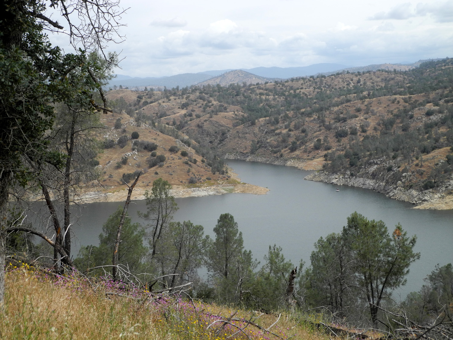 |
| This is my official "Resting Rock" | Buckeye in bloom below the trail | Millerton Lake looks to be a little fuller than it was a month earlier |
 |
 |
 |
| Yellow madia, pink farewell-to-spring | This bright orange flower grew along the creek; it's one I don't remember ever seeing before | A flower-lined section of the trail |
 |
 |
 |
| Under the blue oaks some green grass remains | An unofficial trail leads down from the parking area to this small cover | These flowers grow on a low bush that was plentiful along the lower trail |
 |
||
| Pink patches of farewell-to-spring can be seen on the ridge above the trailhead | ||
| Eaton Trail | ||
|
|
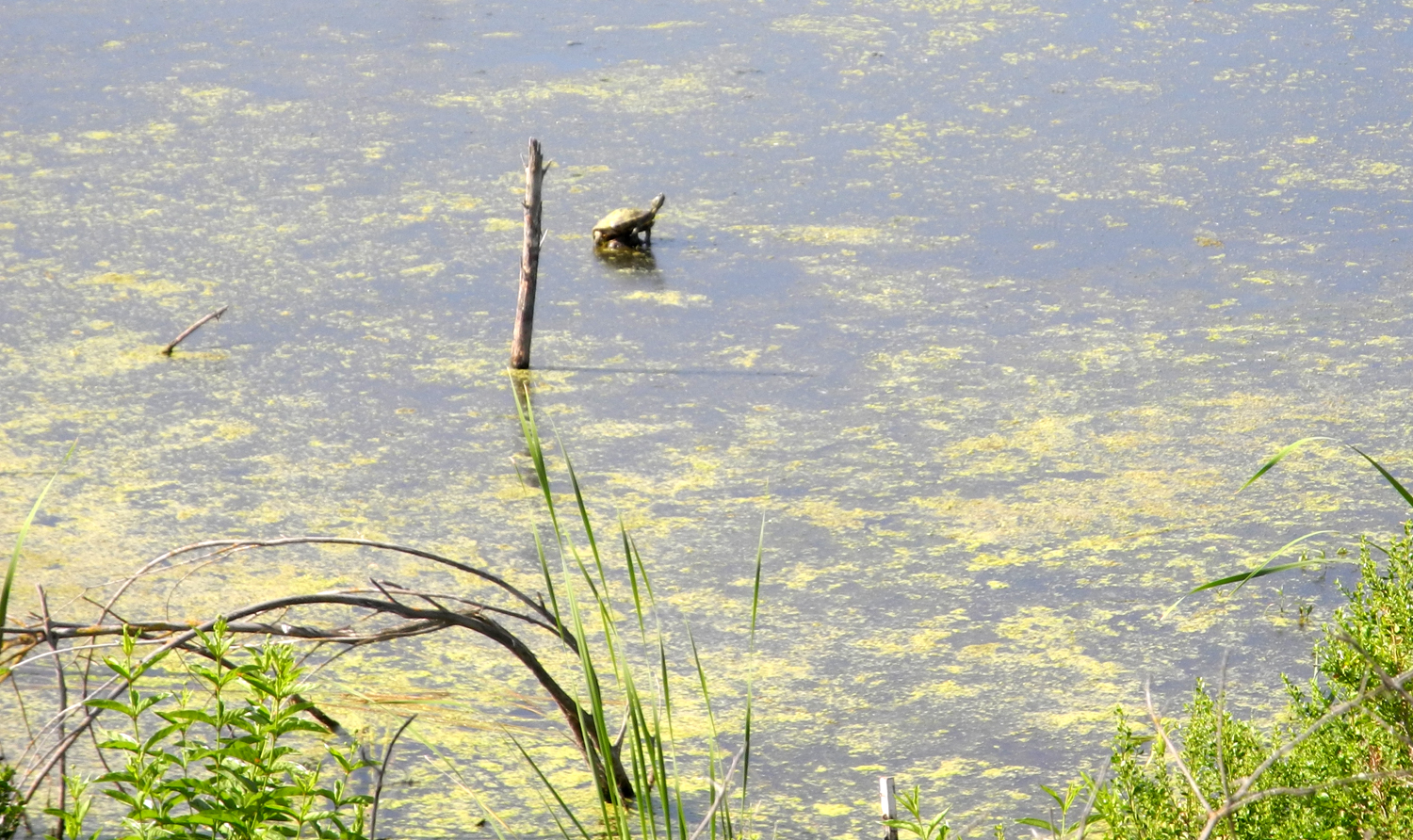 |
| Old farm house at the Center for River Studies | The pond next to the visitor center | A western pond turtle on the alert |
 |
 |
 |
| At the edge of the pond | Oleanders between trail and road | A tranquil scene along the trail |
 |
 |
 |
| Where the trail winds up the hill |
The dirt path usually provides an enjoyable alternative to the paved trail |
However, this year the trail disappears |
 |
 |
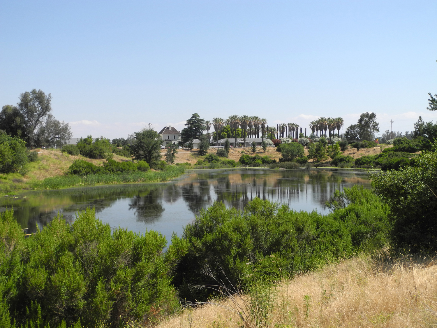 |
| The series of ponds along the trail are a legacy from years of gravel mining | Cottontails are a common sight by the trail | Looking across the pond at the visitor center |
 |
||
| Where the trail crosses Old Friant Road | ||
| Black Rock Reservoir Trip | ||
 |
 |
 |
| Big Creek, by Trimmer Springs Road | North Fork of the Kings below Balch Camp | Rocky hills above Balch Camp |
 |
 |
 |
| Elegant Clarkia | Buckeye with elderberry in the background | Spotted variation of farewell-to-spring |
 |
 |
 |
| A section of the road and a bridge | Looking down on Balch Camp and the North Fork of the Kings River | Waterfall, hidden down in the river canyon |
 |
|
 |
| Patterson Falls | East section of Patterson Bluff | Black Rock Road and penstock carrying water from the reservoir to Balch power house |
 |
 |
 |
| Unknown flowers along the road | Grand collomia | How many of these seeds will germinate next year? |
 |
 |
 |
| Downstream from the dam, the river is all white water |
I've driven and walked across this bridge in an earlier era |
The approach to the bridge is long gone |
 |
 |
 |
| Part of a field of purple Mariposa lilies | Seeing this was worth the drive | This small but beautiful flower needs a name |
 |
 |
 |
| One of the more unusual flowers in the area | These lupines have a slight purple tint | Dead ponderosa pines that used to shade a nice campsite |
 |
 |
|
| Here's what happened to a lot of the trees in the campground | Typical rock formations along the canyon | A steep stairway down toward the dam |
 |
||
| Black Rock Reservoir | ||
 |
||
| A delightful man-made waterfall | ||
 |
 |
 |
| This dramatic rock canyon rises above the road near Balch Camp | Where Dinkey Creek runs into the North Fork of the Kings River | Bridge over Dinkey Creek |
| Nelder Grove | ||
|
 |
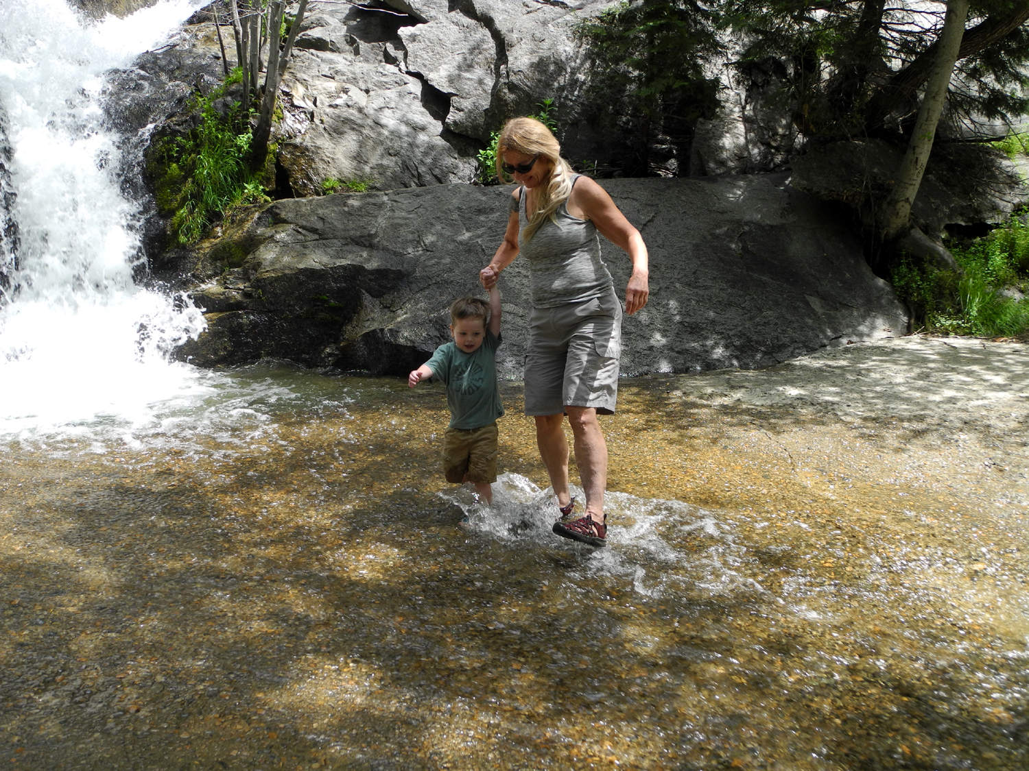 |
| Jack disperses dandelion seeds with gentle puffs | Where California Creek drops down to Road 6S90 | Jack and Teri brave the rushing stream |
 |
|
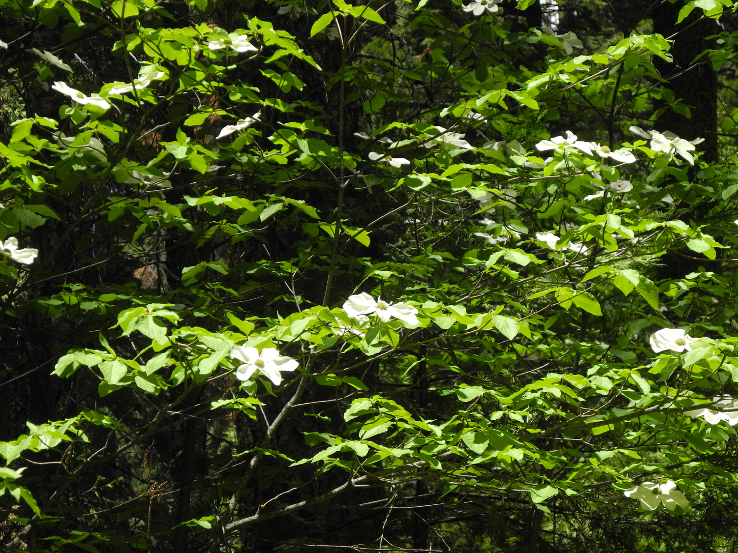 |
| Jack and Colton in camp | Grandma Teri points out dogwood blossoms | There were dogwoods all around is |
 |
 |
 |
| Sierra pea | Western wall flower near the Bull Buck | Posing beside the trail |
 |
 |
 |
| Jack climbs a (horizontal) giant sequoia | Boys on a stump | Who doesn't love a giant pine cone? |
 |
 |
 |
| We enjoyed a nice rest at the Bull Buck viewing area | ||
 |
 |
 |
| The obligatory Bull Buck photo |
Like grandma, aunt, dad, uncle, and brother before him, Jack poses at the Bull Buck |
No shortage of sequoia cones |
 |
 |
 |
| Colton is building a ladder; Jack is just being a boy with a stick | One of several large stumps around the Bull Buck | Jack spent a quiet ten minutes in the meadow |
 |
 |
 |
| Colton continued his work back at camp | Although his clothes are wet to the chest, Jack didn't really get in that deep | Wading ankle deep, but wet to the waist |
 |
 |
|
| Next to a marvelous mud puddle by the creek |
To our great disappointment, they would not let us pet them |
|
| Rancheria Falls (photos by Wes and Dick) | ||
 |
 |
 |
| Trailhead sign | Red fir tree along trail | Some of the flowers we saw |
 |
 |
 |
| Rancheria Falls | Top of falls | Cascade below falls |
 |
 |
 |
| Jennifer, Dick, Elsa, Wes | Jennifer and Dick | Elsa |
|
 |
|
| Wes on the rock | Heading down the trail | |
| Courtright Camp | ||
 |
 |
 |
| Oh, the places you'll go! | Fireweed near the Dusy trail | California goldenrod |
 |
 |
 |
| Flowers and greenery line the boardwalk | Rotted logs have been replaced with deeply grooved lodgepole trunks | The meadow where the trail starts up hill |
 |
||
| The Big Granite Slope, with boulders left behind by a glacier | ||
 |
|
 |
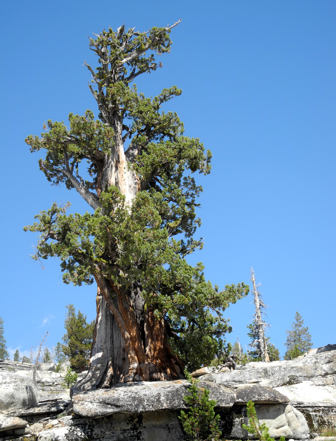
| One way to pass the time in camp | Double dome from the road | The Sentinel Juniper |
 |
|
|
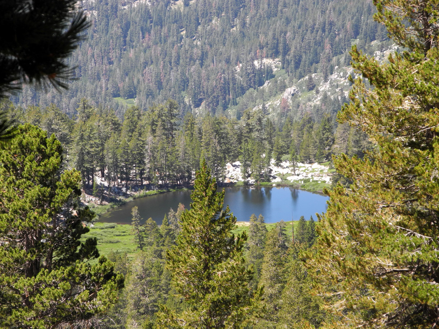
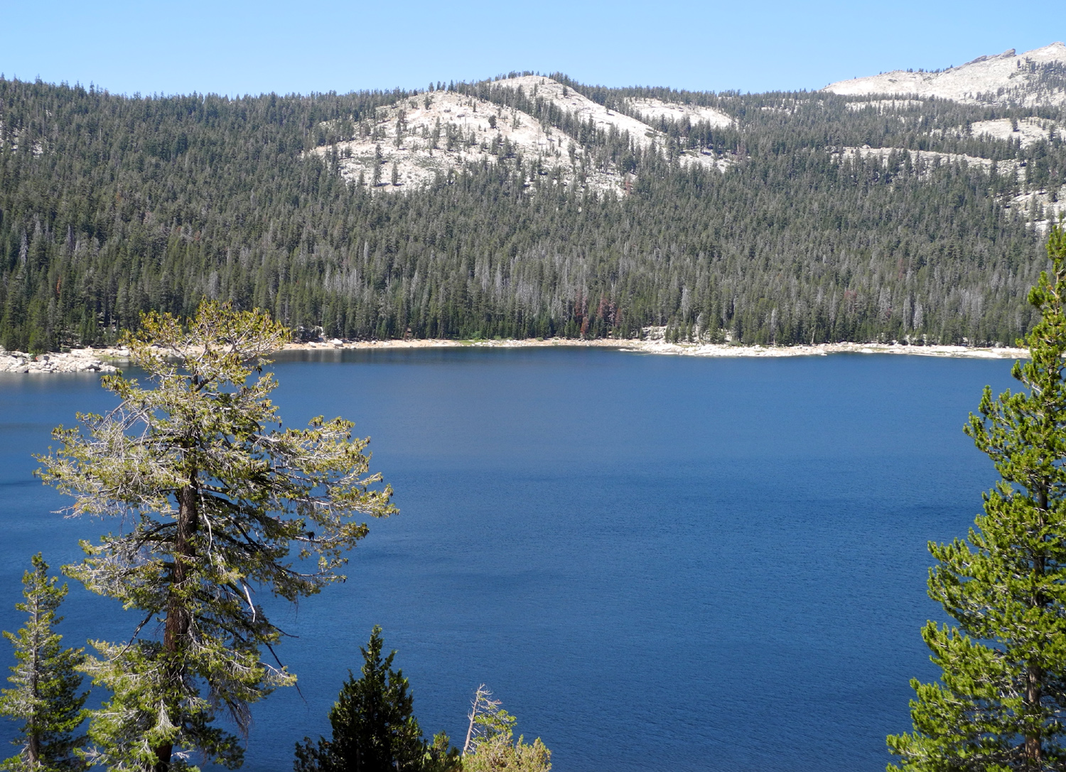
| A close-up of the trunk | Courtright Reservoir from the ridge between the lake and the road to the trailhead | This dome slopes down steeply into Helms Creek canyon |
 |
||
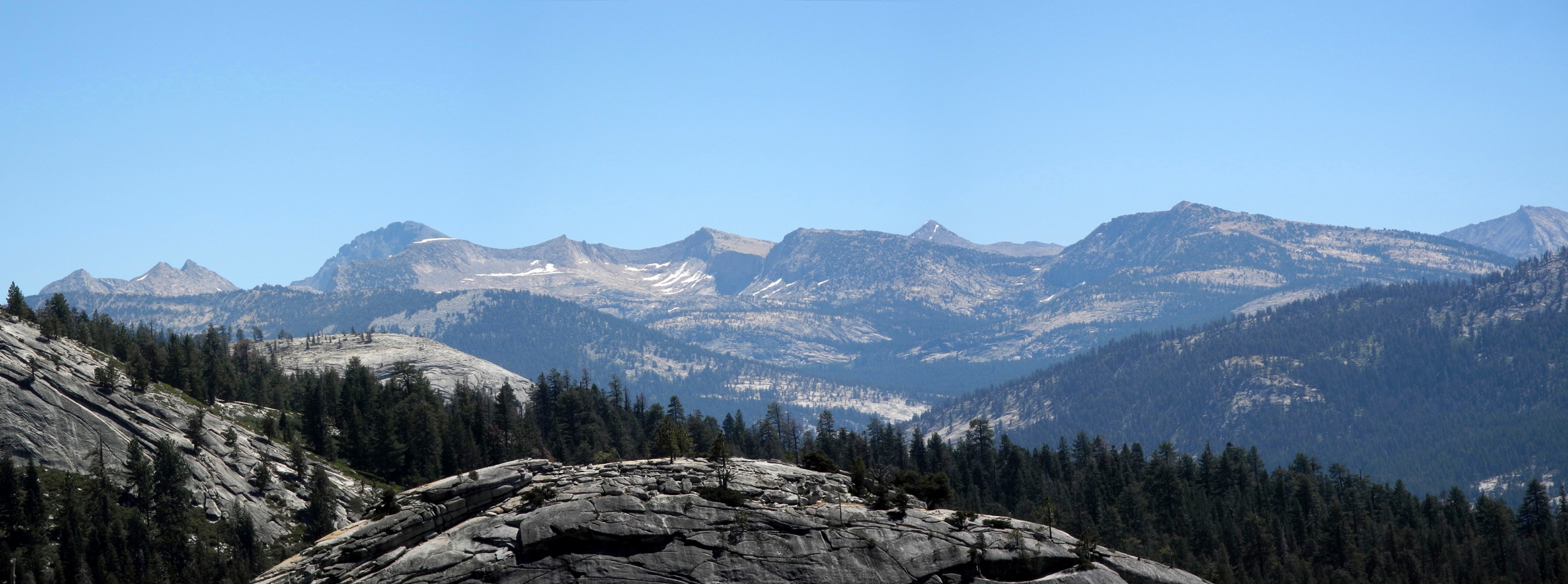
| Parts of the Goddard and LeConte Divide; Goddard is the large dark mountain toward the left | ||
 |
||
| Layered cliffs on the rocky ridge between the road and lake | ||
 |
 |
 |
| This tan boulder came from somewhere else and stands out among the more common light granite | Quartz boulder, about three feet long | This strip of white is a dike, where molten rock flowed into a crack in the older granite |
 |
 |
|
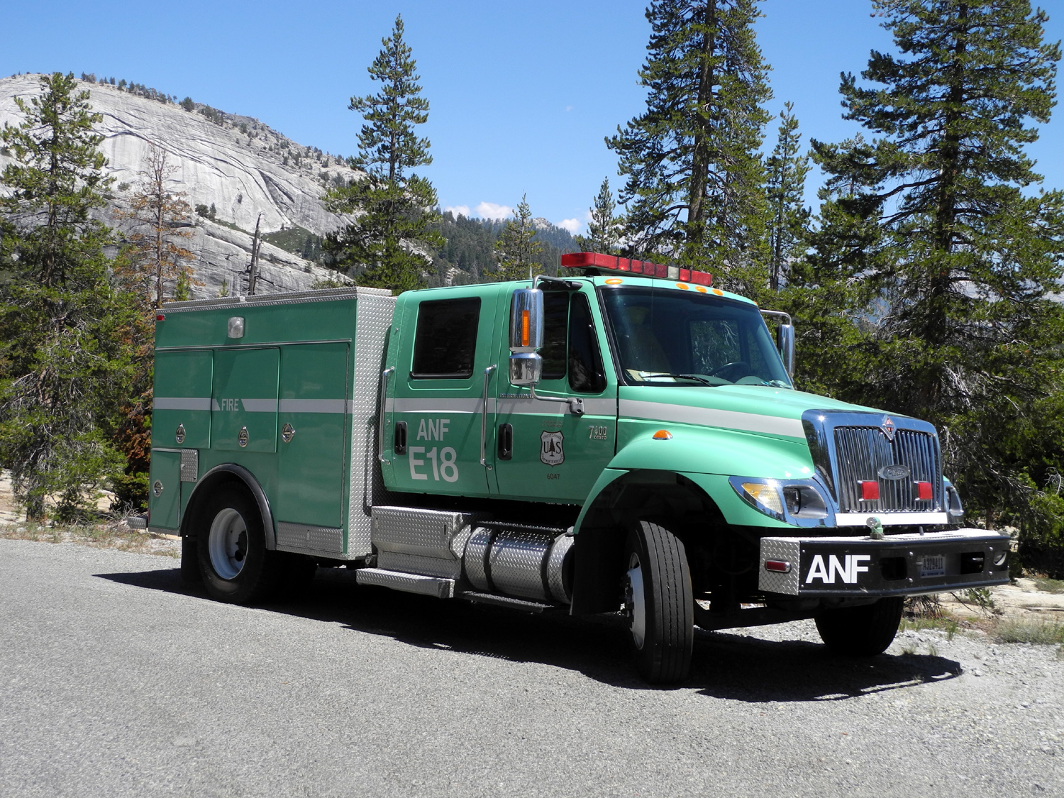
| A visitor from the Angeles National Forest | Landscaping next to my camp | A big juniper not far from camp |
 |
 |
 |
| A bunch of junipers growing together | The Big Four - similar in size, tall and straight, but junipers nevertheless | This tree hit the ceiling and grew sideways |
 |
 |
 |
| Photographed from a quarter mile away, this appears to be a very large junper | So does this one, seen from about three hundred yards | The Bull Juniper |
 |
|
 |
| Looking down on the top of the Bull Juniper | The top as seen from down on the same level as the tree | Unthreatening clouds |
 |
 |
 |
| The Pentagram Tree | Close up of the base | The Shelf Juniper |
| Kaiser Pass Hike (Photos by Wes, Jennifer and Dick) | ||
 |
 |
 |
| Jennifer getting ready to hike | Dick contemplating the view at White Bark Vista | Mt. Ritter and smoke from a fire that's hiding the Minarets from view |
 |
 |
 |
| Jennifer and Wes on the edge | Wes on the trail | Jennifer on the trail |
 |
|
 |
| A magnificent western white pine | This pond is visible from the trail a short distance in | A fantastic floral display |
|
 |
 |
| Another of the famous "unknown" flowers | This lupine species forms a ground cover | There were some nice tall lupines too |
 |
 |
 |
| Nature's landscape design | Edison Lake, and some high Sierra peaks | The creek where we ate lunch |
| Bear Creek | ||
 |
 |
 |
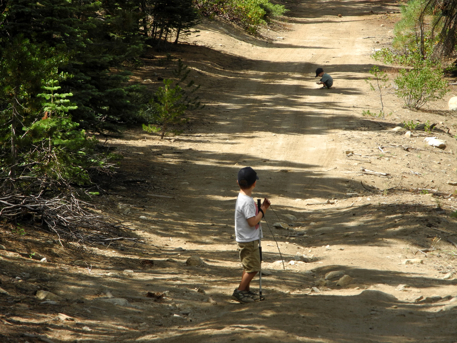
| Forecast of 20% chance of rain brought only scenic fluffy clouds | Colton on the rotten log pile | Jack's throwing pine cones at big brother |
 |
|
 |
| Jack, as far as he went | Colton and Jack "hiking" | Colton and his big dust bowl |
 |
||
| Heading back home | ||
| Related Links | ||
| San Joaquin River Trail | Finegold Picnic Area | Millerton Lake |
| Hallowell Center for River Studies | San Joaquin River Parkway | Lewis S. Eaton Trail |
| Black Rock Dam Video | Black Rock Reservoir | Black Rock Road |
| North Fork River Video | North Fork Falls Video | Balch Camp |
| Nelder Grove | Dick's Nelder Grove Page | California Creek Falls Video |
| Bench Jumping Video | Nelder Grove Campground | Bull Buck Tree |
| Rancheria Falls Video | Ramblers Rancheria Falls 2016 | Rancheria Falls July 2016 |
| Rancheria Falls | Velasco's Mexican Restaurant | Blackcap Basin Hikes |
| Blackcap Basin Photos | Courtright Reservoir | Maxson Trailhead |
| Dusy-Ershim OHV Trail | Kaiser Pass | Lake Edison |
| White Bark Vista | Silver Divide | Minarets |
| Last Year's View from 10,000 Feet | Minarets Without Smoke | 2015 Kaiser Pass Hikes |
| Dinkey Creek | Bear Creek Camp 2016 | Bear Creek Topo Map |
| Upshaw Family Page | First Camp at Bear Creek | |
